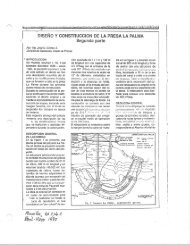
Proyecto de Irrigacion El Hato, Descripcion y Construccion, 1991
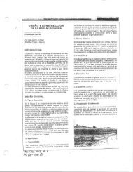
El proyecto de irrigacion El Hato se construyo durante 1991 y 1992, en el municipio de Carmen de Carupa a 15 km al occidente del municipio de Ubate, Cundinamarca y a 85 km de Bogota. ECon el proyecto se creo un embalse con 9.7 Mm3 y cubrio un area de 93 ha mediante la construccion de una presa de gravas sucias y nucleo central de 32 m de altura, la cual intercepto el rio Hato. Las aguas del embalse se utilizan en el Distrito de Riego del Rio Ubateel cual beneficiara 3200 hs de tierra. The Hato project is for irrigation and comprises a diversion tunnel 161.5m (530ft) long, and a zoned dam type of hydraulic structure made of a dirty gravel fill with a central core of a silty clay of medium to high plasticity. The dam height is 32m (105ft) and its length is to be 50m (165ft), for a total fill volume of 39,800m3 (427,850ft3). The geology of the dam and tunnel site is sedimentary rock with a pattern of discontinuities that required a grout curtain and filters along the abutments to control internal erosion of the core material. The dam site is very narrow, therefore, special construction considerations were adopted. A summarized description of the dam, and tunnel design, including portals from the slope stability point of view, and construction procedures are presented; the description of the geology and problems found together with remedial measures are also presented.
El proyecto de irrigacion El Hato se construyo durante 1991 y 1992, en el municipio de Carmen de Carupa a 15 km al occidente del municipio de Ubate, Cundinamarca y a 85 km de Bogota. ECon el proyecto se creo un embalse con 9.7 Mm3 y cubrio un area de 93 ha mediante la construccion de una presa de gravas sucias y nucleo central de 32 m de altura, la cual intercepto el rio Hato. Las aguas del embalse se utilizan en el Distrito de Riego del Rio Ubateel cual beneficiara 3200 hs de tierra.
The Hato project is for irrigation and comprises a diversion tunnel 161.5m (530ft) long, and a zoned dam type of hydraulic structure made of a dirty gravel fill with a central core of a silty clay of medium to high plasticity. The dam height is 32m (105ft) and its length is to be 50m (165ft), for a total fill volume of 39,800m3 (427,850ft3).
The geology of the dam and tunnel site is sedimentary rock with a pattern of discontinuities that required a grout curtain and filters along the abutments to control internal erosion of the core material. The dam site is very narrow, therefore, special construction considerations were adopted.
A summarized description of the dam, and tunnel design, including portals from the slope stability point of view, and construction procedures are presented; the description of the geology and problems found together with remedial measures are also presented.

Create successful ePaper yourself
Turn your PDF publications into a flip-book with our unique Google optimized e-Paper software.