- Page 1:
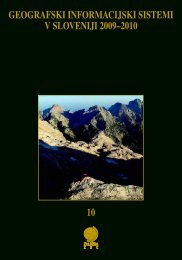
GEOGRAFSKI INFORMACIJSKI SISTEMIV S
- Page 6 and 7:
GEOGRAFSKI INFORMACIJSKISISTEMI V S
- Page 8 and 9:
VSEBINAUvodnik ....................
- Page 10 and 11:
GIS v Sloveniji 2005-2006, 9-11, Lj
- Page 12:
Uvodnikaplikacije geografskih infor
- Page 15 and 16:
Klemen Zak{ek1 UvodV svojih za~etki
- Page 17 and 18:
Klemen Zak{ekprimeru lahko gledamo
- Page 19 and 20:
Klemen Zak{ekSlika 4: Meritve senzo
- Page 21 and 22:
Klemen Zak{ekSlika 6: ^as izpostavl
- Page 24 and 25:
IZDELAVA ORTOPODOB IZ SATELITSKIH P
- Page 26 and 27:
Izdelava ortopodob iz satelitskih p
- Page 28 and 29:
Izdelava ortopodob iz satelitskih p
- Page 30 and 31:
Izdelava ortopodob iz satelitskih p
- Page 32 and 33:
Izdelava ortopodob iz satelitskih p
- Page 34 and 35:
INTEGRIRANJE PODATKOV RELIEFA SLOVE
- Page 36 and 37:
Integriranje podatkov reliefa Slove
- Page 38 and 39:
Integriranje podatkov reliefa Slove
- Page 40 and 41:
Integriranje podatkov reliefa Slove
- Page 42:
Integriranje podatkov reliefa Slove
- Page 45 and 46:
Mauro Hrvatin, Drago Perko1 UvodS p
- Page 47 and 48:
Mauro Hrvatin, Drago Perko4 Uporaba
- Page 49 and 50:
Mauro Hrvatin, Drago Perko1Ra~nahip
- Page 51 and 52:
Mauro Hrvatin, Drago Perkoli, kolik
- Page 54 and 55:
GEOINFORMACIJSKA ORODJA IN OBDELAVA
- Page 56 and 57:
Geoinformacijska orodja in obdelava
- Page 58 and 59:
Geoinformacijska orodja in obdelava
- Page 60 and 61:
Geoinformacijska orodja in obdelava
- Page 62 and 63:
PROSTORSKA PORAZDELITEV TRAJANJASON
- Page 64 and 65:
Prostorska porazdelitev trajanja so
- Page 66 and 67:
Prostorska porazdelitev trajanja so
- Page 68 and 69:
Prostorska porazdelitev trajanja so
- Page 70 and 71:
Prostorska porazdelitev trajanja so
- Page 72:
Prostorska porazdelitev trajanja so
- Page 75 and 76:
Marko Komac1 UvodPlazovi in ostali
- Page 77 and 78:
Marko Komac3.3 Podatki o ~lovekovem
- Page 79 and 80:
Marko Komaccelo od povr{ine razreda
- Page 81 and 82:
Marko Komac5.4 Izpostavljenost cest
- Page 83 and 84:
Marko KomacGalloway, J. 2001: Geolo
- Page 85 and 86:
Mateja Breg, Jerneja Fridl, Ale{ Sm
- Page 87 and 88:
Mateja Breg, Jerneja Fridl, Ale{ Sm
- Page 89 and 90:
Mateja Breg, Jerneja Fridl, Ale{ Sm
- Page 91 and 92:
Mateja Breg, Jerneja Fridl, Ale{ Sm
- Page 93 and 94:
Mateja Breg, Jerneja Fridl, Ale{ Sm
- Page 96 and 97:
GEOINFORMACIJSKA PODPORA VODNI BILA
- Page 98 and 99:
Geoinformacijska podpora vodni bila
- Page 100 and 101:
Geoinformacijska podpora vodni bila
- Page 102 and 103:
Geoinformacijska podpora vodni bila
- Page 104 and 105:
ANALIZA ODVISNOSTI INDEKSA BAZNEGA
- Page 106 and 107:
Analiza odvisnosti indeksa baznega
- Page 108 and 109:
Preglednica 3: Povpre~ne vrednosti
- Page 110 and 111:
Analiza odvisnosti indeksa baznega
- Page 112 and 113:
Analiza odvisnosti indeksa baznega
- Page 114 and 115:
SPREMINJANJE STRUGE REKE SAVENA LJU
- Page 116 and 117:
Spreminjanje struge reke Save na Lj
- Page 118 and 119:
Spreminjanje struge reke Save na Lj
- Page 120 and 121:
Spreminjanje struge reke Save na Lj
- Page 122 and 123:
Spreminjanje struge reke Save na Lj
- Page 124 and 125:
GIS v Sloveniji 2005-2006, 123-131,
- Page 126 and 127:
Analiza hidravli~nih lastnosti vodo
- Page 128 and 129:
Analiza hidravli~nih lastnosti vodo
- Page 130 and 131:
Analiza hidravli~nih lastnosti vodo
- Page 132 and 133:
Analiza hidravli~nih lastnosti vodo
- Page 134 and 135:
GIS v Sloveniji 2005-2006, 133-139,
- Page 136 and 137:
Analiza vodomernih postaj ARSO z vi
- Page 138 and 139:
Analiza vodomernih postaj ARSO z vi
- Page 140 and 141:
Analiza vodomernih postaj ARSO z vi
- Page 142 and 143:
GIS v Sloveniji 2005-2006, 141-150,
- Page 144 and 145:
Batimetri~ni model slovenskega morj
- Page 146 and 147:
Batimetri~ni model slovenskega morj
- Page 148 and 149:
Batimetri~ni model slovenskega morj
- Page 150 and 151:
Batimetri~ni model slovenskega morj
- Page 152 and 153:
GIS v Sloveniji 2005-2006, 151-158,
- Page 154 and 155:
Vloga navti~nega vodnika slovenskeg
- Page 156 and 157:
Vloga navti~nega vodnika slovenskeg
- Page 158 and 159:
Vloga navti~nega vodnika slovenskeg
- Page 160 and 161:
KARTIRANJE NORMATIVNEGA ZNANJA:SPOZ
- Page 162 and 163:
Kartiranje normativnega znanja: spo
- Page 164 and 165:
Kartiranje normativnega znanja: spo
- Page 166 and 167:
Kartiranje normativnega znanja: spo
- Page 168 and 169:
Kartiranje normativnega znanja: spo
- Page 170 and 171:
ANALIZA RANLJIVOSTI PROSTORA KOT IZ
- Page 172 and 173:
Analiza ranljivosti prostora kot iz
- Page 174 and 175:
Analiza ranljivosti prostora kot iz
- Page 176 and 177:
Analiza ranljivosti prostora kot iz
- Page 178 and 179:
GEOGRAFSKI INFORMACIJSKI SISTEM KOT
- Page 180 and 181:
Geografski informacijski sistem kot
- Page 182 and 183:
Geografski informacijski sistem kot
- Page 184 and 185:
Geografski informacijski sistem kot
- Page 186 and 187:
Geografski informacijski sistem kot
- Page 188 and 189:
Geografski informacijski sistem kot
- Page 190 and 191:
UPORABA GEOGRAFSKIH INFORMACIJSKIH
- Page 192 and 193:
Uporaba geografskih informacijskih
- Page 194 and 195:
Uporaba geografskih informacijskih
- Page 196 and 197:
Uporaba geografskih informacijskih
- Page 198 and 199:
Uporaba geografskih informacijskih
- Page 200 and 201:
ANALIZA GOSPODARSKEGA ZALEDJAV ARHE
- Page 202 and 203:
Analiza gospodarskega zaledja v arh
- Page 204 and 205:
Analiza gospodarskega zaledja v arh
- Page 206 and 207:
Analiza gospodarskega zaledja v arh
- Page 208 and 209:
Analiza gospodarskega zaledja v arh
- Page 210 and 211:
Analiza gospodarskega zaledja v arh
- Page 212 and 213:
ISKANJE RIMSKE CESTNE MRE@E V SEVER
- Page 214 and 215:
Iskanje rimske cestne mre`e v sever
- Page 216 and 217:
Iskanje rimske cestne mre`e v sever
- Page 218 and 219:
Iskanje rimske cestne mre`e v sever
- Page 220 and 221:
Iskanje rimske cestne mre`e v sever
- Page 222 and 223:
Iskanje rimske cestne mre`e v sever
- Page 224 and 225:
GIS v Sloveniji 2005-2006, 223-231,
- Page 226 and 227:
Uporaba daljinskega zaznavanja za o
- Page 228 and 229: Uporaba daljinskega zaznavanja za o
- Page 230 and 231: Uporaba daljinskega zaznavanja za o
- Page 232 and 233: Uporaba daljinskega zaznavanja za o
- Page 234 and 235: GIS v Sloveniji 2005-2006, 233-241,
- Page 236 and 237: Uporaba GIS v dialektologiji2 Metod
- Page 238 and 239: Uporaba GIS v dialektologijiSlika 2
- Page 240 and 241: Uporaba GIS v dialektologijiDa bi l
- Page 242 and 243: Uporaba GIS v dialektologiji4 Viri
- Page 244 and 245: GIS NA PODRO^JU VARSTVA RASTLINPRED
- Page 246 and 247: GIS na podro~ju varstva rastlin pre
- Page 248 and 249: GIS na podro~ju varstva rastlin pre
- Page 250 and 251: GIS na podro~ju varstva rastlin pre
- Page 252 and 253: GIS na podro~ju varstva rastlin pre
- Page 254 and 255: UPORABA GIS-A PRI RAZMEJEVANJU [KOD
- Page 256 and 257: Uporaba GIS-a pri razmejevanju {kod
- Page 258 and 259: Uporaba GIS-a pri razmejevanju {kod
- Page 260 and 261: Uporaba GIS-a pri razmejevanju {kod
- Page 262 and 263: GIS v Sloveniji 2005-2006, 261-269,
- Page 264 and 265: Izbira mre`e za prostorsko analizo
- Page 266 and 267: Izbira mre`e za prostorsko analizo
- Page 268 and 269: Izbira mre`e za prostorsko analizo
- Page 270 and 271: Izbira mre`e za prostorsko analizo
- Page 272 and 273: VE^STOPENJSKI MODEL DOLO^ANJA UNIFO
- Page 274 and 275: Ve~stopenjski model dolo~anja unifo
- Page 276 and 277: jVe~stopenjski model dolo~anja unif
- Page 280 and 281: MO@NOSTI ANALIZE IN PRIKAZOVANJA ST
- Page 282 and 283: Mo`nosti analize in prikazovanja st
- Page 284 and 285: Mo`nosti analize in prikazovanja st
- Page 286 and 287: Mo`nosti analize in prikazovanja st
- Page 288 and 289: UPORABA GIS-A PRI CONACIJI OBMO^IJ
- Page 290 and 291: Uporaba GIS-a pri conaciji obmo~ij
- Page 292 and 293: Uporaba GIS-a pri conaciji obmo~ij
- Page 294 and 295: INTEGRIRANA UPORABA GLOBALNEGA SIST
- Page 296 and 297: Integrirana uporaba globalnega sist
- Page 298 and 299: Integrirana uporaba globalnega sist
- Page 300 and 301: SPLETNE STORITVE AGENCIJE REPUBLIKE
- Page 302 and 303: Spletne storitve Agencije Republike
- Page 304 and 305: Spletne storitve Agencije Republike
- Page 306 and 307: Spletne storitve Agencije Republike
- Page 308 and 309: Spletne storitve Agencije Republike
- Page 310 and 311: GIS v Sloveniji 2005-2006, 309-318,
- Page 312 and 313: Spletna storitev za upravljanje in
- Page 314 and 315: Spletna storitev za upravljanje in
- Page 316 and 317: Spletna storitev za upravljanje in
- Page 318 and 319: Spletna storitev za upravljanje in
- Page 320 and 321: INFRASTRUKTURA ZA PROSTORSKE INFORM
- Page 322 and 323: Infrastruktura za prostorske inform
- Page 324 and 325: Infrastruktura za prostorske inform
- Page 326 and 327: Infrastruktura za prostorske inform
- Page 328:
327


