- Page 1:
T.C.KÜLTÜR VE TURİZM BAKANLIĞIK
- Page 7 and 8:
ARCHAEOLOGICAL SURVEY IN NORTHERN T
- Page 12 and 13:
processed yet, and therefore a defi
- Page 14 and 15:
Map.: 1Fig.: 18
- Page 16 and 17:
Fig.: 4Fig.: 510
- Page 18 and 19:
Fig.: 8Fig.: 8Fig.: 912
- Page 20 and 21:
The objects found by Hogarth and wh
- Page 22 and 23:
Gable-formed (Fig. 14) as well as a
- Page 24 and 25:
DatingAmber is a material which was
- Page 26 and 27:
Fig. 1: Amber piece (Photo: U. Muss
- Page 28 and 29:
Fig. 5: Amber fi gurine in the İst
- Page 30 and 31:
Fig. 10: Conical and fl at biconica
- Page 32 and 33:
Fig. 14: Gable-formed divider in am
- Page 34 and 35:
ikinci adımında, burada belgelene
- Page 36 and 37:
Kent bölgesinde özellikle güney
- Page 38 and 39:
canlandırması ile arkeoloji ve mi
- Page 40 and 41:
paralel giden topografi k ilişkiye
- Page 42 and 43:
ölümlerindeki yoğun balçık tab
- Page 44 and 45:
sözü edilen rıhtıma doğru dik
- Page 46 and 47:
Resim 1: Pergamon çevresinin plan
- Page 48 and 49:
Resim 4: Elaia, arkeolojik harita (
- Page 50 and 51:
Resim 8: Elaia, kent surundan ayrı
- Page 52 and 53:
Resim 12: Elaia liman bölgesinin j
- Page 54 and 55:
dokusu modellerinin belirlenmesini
- Page 56 and 57:
I. Urla MerkezADI PAFTA/KOD TÜRÜ
- Page 58 and 59:
II. Kuşçular merkez, GüneyADI PA
- Page 60 and 61:
IV. İçmeler-Malkaca OvasıADI PAF
- Page 62 and 63:
Zeytinler, L17-d1 Fırın? Birkaç
- Page 64 and 65:
Klazomenai’nin batı sınırında
- Page 66 and 67:
alan olduğu düşünülebilir. Sö
- Page 68 and 69:
2006 yılı çalışmalarının iki
- Page 70 and 71:
Harita 1: Urla bölgesi SRTM harita
- Page 72 and 73:
Çizim 4: Yarentepe yüzey malzemes
- Page 74 and 75:
Resim 1: Sivricetepe üzerinde yer
- Page 76 and 77:
Resim 5: Cinderesi’nde bulunan po
- Page 78 and 79:
Önemli ölçüde tahrip edilmiş o
- Page 80 and 81:
sisteminin kalıntıları etrafta d
- Page 82 and 83:
Sarıdanişment mezarlığı dahili
- Page 84 and 85:
Taşlı Müsellim merasında Sazlar
- Page 86 and 87:
taraftaki arka yan taş da, dromosl
- Page 88 and 89:
Pınarhisar İlçesi merkezi gerisi
- Page 90 and 91:
Resim: 184
- Page 92 and 93:
artış göstermektedir 2 . Amik Ov
- Page 94 and 95:
duvarları ile yerleşim kademe hâ
- Page 96 and 97:
orman dokusu ile kaplı oluşu, mad
- Page 98 and 99:
üzerinde 13 cm. derinlikte basamak
- Page 100 and 101:
AS 287 FMezar anıtlarının bulund
- Page 102 and 103:
Resim 1: Hatay, Amanos Dağları ve
- Page 104 and 105:
Resim 3b: Amanos Dağları, Kisecik
- Page 106 and 107:
Resim 5: Kisecik cevherleri ve Alal
- Page 108 and 109:
Resim 10: AS 287, B-E, Ceylanlı ka
- Page 110 and 111:
These are among the research questi
- Page 112 and 113:
2) The Early Historic Era (6th-4th
- Page 114 and 115:
scale, and they will require a reco
- Page 116 and 117: settlements and on local lore, desi
- Page 118 and 119: Fig. 2: Map showing results of regi
- Page 120 and 121: Fig. 7: Citadel near Seki,view look
- Page 122 and 123: Fig. 10: Aqueduct bridge north of A
- Page 124 and 125: While following the itinerary throu
- Page 126 and 127: Along the two itineraries a cavea f
- Page 128 and 129: The fl oor measures 5x7 meters and
- Page 130 and 131: 124Table: A
- Page 132 and 133: 126Table: C
- Page 134 and 135: 128Fig. 2: Photo composition of the
- Page 136 and 137: 1998 yılından itibaren Erzincan,
- Page 138 and 139: Şirinlikale’de bulunan iki kaya
- Page 140 and 141: duvarları yaklaşık olarak büyü
- Page 142 and 143: Aras YerleşmesiErzurum İli, Horas
- Page 144 and 145: 2006 Yılında Iğdır Bölgesinde
- Page 146 and 147: ulaşılabilen kalenin, doğusundak
- Page 148 and 149: 142Harita 1: 2006 yılı Erzurum-Er
- Page 150 and 151: Resim 3: Şirinlikale, ErzincanResi
- Page 152 and 153: Resim 7: Puruttepe Kalesi, ErzurumR
- Page 154 and 155: Resim 13: Kaptir Kalesi, ErzurumRes
- Page 156 and 157: Neben der zeichnerischen Dokumentat
- Page 158 and 159: Neben der Arbeit in Selinus selbst
- Page 160 and 161: Abb. 1: Die Hauptfassade des Şeker
- Page 162 and 163: Abb. 5: Blick auf die Rückwand des
- Page 164 and 165: Abb. 9: Architekturfragmentedes Şe
- Page 168 and 169: uildings with an embrasured loophol
- Page 170 and 171: The geologists and geophysicists we
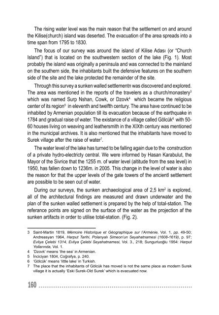
- Page 172 and 173: Fig. 1: Kilise Adası (or “Church
- Page 174 and 175: Fig. 6: The table amphora in thegat
- Page 176 and 177: Fig. 11: The building with 26 m. of
- Page 178 and 179: Fieldwork concentrated on the city
- Page 180 and 181: Site No. 58; İskenderun (Çankaya;
- Page 182 and 183: were only partly surveyed. Dussaud
- Page 184 and 185: Site No. 66.UTM East 239020 UTM Nor
- Page 186 and 187: Site No. 78.UTM East 238250 UTM Nor
- Page 188 and 189: form of a narrow aqueduct. Nearby a
- Page 190 and 191: Heberdey, R. and A. Wilhelm, 1896.
- Page 192 and 193: 186Map. 2: Ancient Myriandros - Sit
- Page 194 and 195: Fig. 3: Site 58 (Çankaya) - Ancien
- Page 196 and 197: zorluklarla karşılaşılmaktadır
- Page 198 and 199: Anadolu’daki bir çok diğer yerl
- Page 200 and 201: alan ve kuşatma kemeri günümüze
- Page 202 and 203: Erken Bizans Dönemine ait kırmız
- Page 204 and 205: Resim 1: Divriği Kalesi (HGK Arşi
- Page 206 and 207: Resim 4: Kale Camii’nin kuzeyi, k
- Page 208 and 209: Resim 7: Batı kapı, doğudan gene
- Page 210 and 211: Resim 10: Dış sur, seramik bulunt
- Page 212 and 213: Die Arbeiten berührten erstmals de
- Page 214 and 215: Die in verschiedenen Bereichen der
- Page 216 and 217:
Die zweite Fläche wurde nordwestli
- Page 218 and 219:
5) A/06-S/NWG-6Randfragment einer S
- Page 220 and 221:
Abb. 2: Aussenschale der Befestigun
- Page 222 and 223:
Abb. 6: Keramikfunde216
- Page 224 and 225:
olan ve buradan Hierapolis Arkeoloj
- Page 226 and 227:
Okulun bahçesinde giriş kapısın
- Page 228 and 229:
müze bahçesinde düzgün bir şek
- Page 230 and 231:
ölgede yapılmış bir örnektir.
- Page 232 and 233:
Resim 1: 30 Ağustos İlköğretim
- Page 234 and 235:
Resim 6: Çiv. 024 numaralı postam
- Page 236 and 237:
Resim 10: Çiv. 017 numaralı korni
- Page 238 and 239:
Resim 14: Çiv. 037 numaralı sütu
- Page 240 and 241:
In this period, communication of an
- Page 242 and 243:
HALAF FIGURINES FROM SOUTHEASTERN A
- Page 244 and 245:
clay anthropomorphic fi gurines hav
- Page 246 and 247:
the front. An upper torso fragment
- Page 248 and 249:
242REFERENCESBERNBECK, REINHARD, PO
- Page 250 and 251:
Drawing 3: Examples of fi gurines f
- Page 252 and 253:
Fig. 1: Figurine head fragments fro
- Page 254 and 255:
görülmektedir 3 . İlki, iç sosy
- Page 256 and 257:
Yine İbni Bibi ve araştırmacıla
- Page 258 and 259:
mevkilerin savaş için uygun yerle
- Page 260 and 261:
Resim 1: Köse Süleyman Ziyaretgâ
- Page 262 and 263:
Resim 5: Çevirmehanı Köyü Yayla
- Page 264 and 265:
The rhyton was fi lled with the app
- Page 266 and 267:
Fig. 1: A Late Hellenistic terracot
- Page 268 and 269:
Fig. 5: Right profi le view (photo:
- Page 270 and 271:
gerçekleştirilmiştir. 2006 yıl
- Page 272 and 273:
taşıyan Aşağı Pınar’ın bö
- Page 274 and 275:
dahi rastlamadık. Bunların nerede
- Page 276 and 277:
Trakya’daki arkeolojik buluntu ye
- Page 278 and 279:
272Çizim 1: Çalışma sahası ve
- Page 280 and 281:
Resim 3: Bedre Mağarası’nın bu
- Page 282 and 283:
Resim 7: Taşlı tepe grubu, Yoğun
- Page 284 and 285:
3. Yine 1998 araştırmalarında te
- Page 286 and 287:
Özellikle Yapraklı İlçesi’nde
- Page 288 and 289:
3. Araplar Yaylası, Sarıkaya Mevk
- Page 290 and 291:
III. Osmancık İlçesi ve Çevresi
- Page 292 and 293:
14. Ferhatlı Höyük (Resim 10)200
- Page 294 and 295:
Plan 2: 2006 yılı araştırmasın
- Page 296 and 297:
290Resim 3: Ecerintepe’de M.Ö. I
- Page 298 and 299:
Resim 6: Tencerekaya çevresindeki
- Page 300 and 301:
Resim 9: Osmankale seramiğiResim 1
- Page 302 and 303:
2006 çalışması: 17 Temmuz-26 A
- Page 304 and 305:
• Çinilerin imal edildiği yerle
- Page 306 and 307:
Resim 3: Avrupa imalatı çinilerde
- Page 308 and 309:
Resim 7: Yüzyıllara göreResim 8:
- Page 310 and 311:
Resim 11: Kökenine göre304
- Page 312 and 313:
understanding of lake bathymetry (u
- Page 314 and 315:
Reassessment of Previously Document
- Page 316 and 317:
As fi elds were surveyed, 27 points
- Page 318 and 319:
Ceramic and lithic surface remains
- Page 320 and 321:
of local settlement history are cor
- Page 322 and 323:
members (K. C. Cooney, N. P. Özgü
- Page 324 and 325:
2006b. Mysterious Shepherds and Hid
- Page 326 and 327:
Map 2: Map showing the 2006 survey
- Page 328 and 329:
Fig. 3: Drawings of the chamber-tom
- Page 330 and 331:
Fig. 7: Team members extract a sedi
- Page 332 and 333:
Fig. 9: View of the GPS-depth sound
- Page 334 and 335:
miktarda safra taşı yer almakta o
- Page 336 and 337:
önümüzdeki yılda sürdürülece
- Page 338 and 339:
alanının yaklaşık 100 m. doğus
- Page 340 and 341:
9-Bozcaada, Bizans Kiremit Batığ
- Page 342 and 343:
Harita 1: 2006 yılı araştırmas
- Page 344 and 345:
Resim 5: Doğanbey, Kartaca batığ
- Page 346 and 347:
Resim 9: Küçükmaden Adası, Biza
- Page 348 and 349:
Resim 13: Bozcaada, tabak batığı
- Page 350 and 351:
commanding position overlooking the
- Page 352 and 353:
the king of Bithynia, Prusias II, i
- Page 354 and 355:
y votive niches carved in the natur
- Page 356 and 357:
Map. 1: Temnos and the Hermus-Gediz
- Page 358 and 359:
Fig. 1: Hermus-Gediz river-View fro
- Page 360 and 361:
Fig. 5: Decorated mortar (W slopes
- Page 362 and 363:
Fig. 9: Agora-Polygonalterrace wall
- Page 364 and 365:
ise tek örnektir. Yüzeyde yoğun
- Page 366 and 367:
Kultak Köyü, Sofu Tepe ve Karaba
- Page 368 and 369:
açıldığı, başka bir ifadeyle
- Page 370 and 371:
Çamlıca Köyü’nün arkasındak
- Page 372 and 373:
Nekropol alanında ele geçirilen y
- Page 374 and 375:
Resim 3: Akpınar mevkii, işlikRes
- Page 376 and 377:
Resim 7: Alacain Tepe, duvar kalın
- Page 378 and 379:
Resim 11: Asarlık Tepe, duvar kal
- Page 380 and 381:
Resim 15: Asarlık Tepe, işlik374
- Page 382 and 383:
Çatalhöyük çanak çömleği bul
- Page 384 and 385:
2-Orta Gelenek (M.Ö. yak. 6700/660
- Page 386 and 387:
“Orta Geleneği” “Erken Gelen
- Page 388 and 389:
aşlarına verilen tarihleriyle 12
- Page 390 and 391:
Kuzeybatı Anadolu’da kazısı ya
- Page 392 and 393:
Bordaz, J., 1973-“Current Researc
- Page 394 and 395:
Özdoğan, M., 1999-“Northwestern
- Page 396 and 397:
Çizim 3: Çatalhöyük, VII.-IV. t
- Page 398 and 399:
Resim 1: Çatalhöyük, XII.-VIII.
- Page 400 and 401:
tepe düzlüğü üzerinde uzanmakt
- Page 402 and 403:
kentin bu kısmının roma ve geç
- Page 404 and 405:
ölçümü ile haritalama çalışm
- Page 406 and 407:
‚antakya kalesi’ trifft, in des
- Page 408 and 409:
PolygonalmauernNeben die kaiserzeit
- Page 410 and 411:
gemeinhin angenommen wurde 27 . Den
- Page 412 and 413:
Am hang wurde der obere aquädukt i
- Page 414 and 415:
ait seramik parçaları ile çok sa
- Page 416 and 417:
Resim: 1410
- Page 418 and 419:
güzergâhtaki tarihî yol dokusunu
- Page 420 and 421:
Zülküf Kara Evi: Yapı üzerinde
- Page 422 and 423:
katı 9.40x12.70 m. ölçülerinde
- Page 424 and 425:
Cevdet Koşmaz Evi: Yapı kitabesin
- Page 426 and 427:
Resim 1: İspir-Karakale Köyü, R
- Page 428 and 429:
Resim 4: İspir-Sırakonaklar Köy
- Page 430 and 431:
Resim 7: İspir-Sırakonaklar Köy
- Page 432 and 433:
Resim 10: İspir-Sırakonaklar Köy
- Page 434 and 435:
Resim 14: İspir-Sırakonaklar Köy
- Page 436 and 437:
Figürin parçalarının yüzlerind
- Page 438 and 439:
arkaya doğru uzatılırken arkada
- Page 440 and 441:
Resim: 1 Resim: 2Resim: 3434
- Page 442 and 443:
436Resim: 8
- Page 444 and 445:
Resim: 11Resim: 12438
- Page 446 and 447:
II. ARAŞTIRMA ALANIHasankeyf İlç
- Page 448 and 449:
(laminar) bir teknolojinin üstünl
- Page 450 and 451:
Deresi ile doğuda Kilise Dere aras
- Page 452 and 453:
Çekirdekler çok tipik olmayıp te
- Page 454 and 455:
448Harita: 1
- Page 456 and 457:
Çizim 1: Mahara Sırtı 1 No.lu al
- Page 458 and 459:
Çizim 7: Girmav Tepe yontmataş bu
- Page 460 and 461:
454YENİ TESPİT EDİLEN ALANLARDA
- Page 462 and 463:
KARTANKALEBeypazarı İlçesi, Tahi
- Page 464 and 465:
TAŞ ESER ENVANTER ÇALIŞMALARI1-
- Page 466 and 467:
Erken Bizans Dönemini yansıtan bu
- Page 468 and 469:
Harita: 3Çizim: 1462
- Page 470 and 471:
Çizim: 4aÇizim: 4b464
- Page 472 and 473:
Çizim: 6Resim: 1466
- Page 474 and 475:
Resim: 5Resim: 6468
- Page 476 and 477:
1.HAKKÂRİ1.1.HAKKÂRİ MERKEZ1.1.
- Page 478 and 479:
4721.2.YÜKSEKOVA1.2.1.YEDİVEREN K
- Page 480 and 481:
Bunun güneyindeki ikinci mekân he
- Page 482 and 483:
2.2.2.HABERLİ KÖYÜ, MOR KAVMİ K
- Page 484 and 485:
eğimli köprüler grubuna dâhil y
- Page 486 and 487:
2.4.3.DAMLARCA KÖYÜ TÜRBESİ (KU
- Page 488 and 489:
Çizim 1: Yediveren Köyü, Halana
- Page 490 and 491:
Çizim 4: Birlik Köyü, Şerif Cam
- Page 492 and 493:
Resim 3: Geçimli, Mar Sava Kilises
- Page 494 and 495:
Resim 7: Birlik Köyü, Şerif Cami
- Page 496:
DEAR COLLEAGUESThe reports which yo


