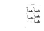
Untitled - Harita ve Kadastro Mühendisleri Odası
Untitled - Harita ve Kadastro Mühendisleri Odası
Untitled - Harita ve Kadastro Mühendisleri Odası

Create successful ePaper yourself
Turn your PDF publications into a flip-book with our unique Google optimized e-Paper software.
Dear Guests and Turkish Participants;We ha<strong>ve</strong> come to the end of the InternationalGIS/GPS Symposium which has been continuingfor four days. in this symposium 31 papersha<strong>ve</strong> been presented. These papers ha<strong>ve</strong> beenlistened to by a high number of participants.Also the exhibition has been a focus to the participants.AIso the exhibition has been a focus tothe participants interest. Finally thisInternational Symposium has reached its aim.On behalf of the Organising Committee, Iwould like to thank the foreign guests who totake part in the Symposium and the Turkishparticipants. And also I would like to thank thecompanies that supported us and took part inthe exhibition.I would like to gi<strong>ve</strong> my regards to ali of theparticipants here with the hope of meetingagain in an other organisation like this.istanbul '97International GIS/GPS SymposiumSeptember 15 - 18, 1997This symposium was organized by the Chamber of Sur<strong>ve</strong>ying Engineers of Turkey (CSE) with thecooperation of FIG Commission 3 and 8.Muhittin ipek was the chairman of the organizing committeeand Tor Valstad of Commission 3, represented FIG.The Faculty of Architecture at the istanbul TechnicalCIni<strong>ve</strong>rsity in Taksim, istanbul vvas the place of <strong>ve</strong>nue. Around250 people were registered at the symposium.The technical programme consisted of 3 sessions on GIS, 2on GPS and a combined session with a total of 56 papers.There were a number of speakers that didn't show up, but theremaining papers vvas interesting and of a professional standard.The topics were quite varied, co<strong>ve</strong>ring fields like GIS andUrban Pollution in Italy, Geoid determinations in Egypt, anextensi<strong>ve</strong> City information Project in Bursa-Turkey, the usingof DGPS to pre<strong>ve</strong>nt ship collissions in the Bosporus and toestablish database for a ski racetrack in Austria, to mentionsome.in connection with the symposium a technical exhibitiontook place. The exhibition co<strong>ve</strong>red a number of sur<strong>ve</strong>yinginstruments and GPS-recei<strong>ve</strong>rs as well as services within aer-. , , , , . . , _,„ ri(j iemsıicısı lor vaistadıal photography, mappıng, sur<strong>ve</strong>ying and GIS.The social programme included a boat trip on the Bosphorus with a short visit to the asian side.İstanbul is now a megacity with a population of 15 million and with a number of world famousmonuments and historical locations which I hope some of the participants took time to enjoy.Tor ValstadSecretary FIG Commission 36