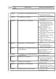
pdf (15 MB) - cIMeC
pdf (15 MB) - cIMeC
pdf (15 MB) - cIMeC

Create successful ePaper yourself
Turn your PDF publications into a flip-book with our unique Google optimized e-Paper software.
Cronica cercetărilor arheologice din România – campania 2006<br />
this site revealed the Neo-Aeneolithic settlement and a Dacian<br />
grave (Plate II/1, 2).<br />
The Neo-Aeneolithic settlement<br />
In a first stage the settlement was inhabited by the Culture<br />
of linear pottery with musical notes community (Pit no. 5) and<br />
later by the Boian - Giuleşti and Precucuteni I communities (in<br />
the filling of the archaeological complexes the discoveries are<br />
mixed).<br />
The communities representing the Culture of linear pottery<br />
with musical notes had an important role for the setting up of<br />
the Early Aeneolithical cultures, Boian, Turdaş, Iclod,<br />
Precucuteni. Boian Culture is well known in south - eastern<br />
Transylvania and it is overlapping the inhabitance area of the<br />
Culture of Linear Pottery. Materials belonging to this culture<br />
have been discovered in 16 settlements from Transylvania.<br />
Precucuteni Culture has been put into gear in a system of<br />
direct or indirect relations with some of the contemporary<br />
cultures, former or even hinder, from the geographical area in<br />
which it developed and evolved.<br />
Neo-Aeneolithical complexes from Olteni “Cariera de<br />
Nisip”, Site B will be researched in future campaigns.<br />
The Dacian Cemetery<br />
Grave no. 2, about 10 m southwest of G.1, found 0.40m<br />
deep.<br />
Shape: one could not make out the contour of the pit for<br />
sure, because it was at the surface and was dug in an<br />
Aeneolithic complex; however, based on the colour of the infill<br />
(brown), it was probably round.<br />
Infill: brown sediment.<br />
Rite: in-urn cremation, as the vessel was almost filled with<br />
strongly burned bones of various sizes; the upper part of the<br />
urn broken and collapsed inside or on the side.<br />
Grave no. 3: double cremation tomb, in urn and in pit.<br />
Shape: rectangular pit, close to the north-south axis, with<br />
wooden planks, now carbonized, marking the eastern and<br />
northern sides, as well as the bottom, meaning there must<br />
have been a wooden structure on the sides and the bottom.<br />
Infill: Yellow sediment, different from the one around the pit.<br />
Rite: cremation<br />
Grave 3a: in-urn cremation, as the vessel is almost filled<br />
with cremation bones; it is placed in the northern-central part of<br />
the pit.<br />
Grave 3b: in-pit cremation, with the bones deposited in the<br />
southern part of the pit, next to deposit 1.<br />
Deposit 1: truncated vessel with a porringer-lid, placed<br />
faced down on it, both of them found in the southern end of the<br />
pit, close to the G.3b<br />
Deposit 2: porringer fragment, found north-east of G.3b.<br />
Deposit 3: biconical vessel found at the north-western end<br />
of the pit, close to G.3a, placed faced down.<br />
Deposit 4: a vessel’s stem found in the pit’s filling at the<br />
depth of 0.55 m<br />
Deposit 5: grinder fragments probably from a primitive<br />
grinder, trapezoidal in shape, with the upper part slightly<br />
rounded, probably wear out as a result of use.<br />
Offering pit The porringer-lid of Grave 2 <br />
One found only a fragmentary porringer (about two thirds of the<br />
vessel), deposited face down about 4m southeast of Grave 2.<br />
Preliminary considerations.<br />
Grave 1 and Grave 3 might have belonged to some<br />
families high in wealth and status, given the resources<br />
necessary for erecting the pyre and the special manner in<br />
which the tombs was fitted out.<br />
Why are we talking about a Dacian community Because<br />
the many ceramic recipients, found in all types of complexes<br />
and originating from at least 60 items all in all, are<br />
characteristic of the Geto-Dacian pottery of the 5 th -3 rd centuries<br />
B.C.<br />
Unfortunately, from the other intra-Carpathian valleys<br />
(Haţeg, Hunedoara, Sibiu, Bârsa, Sf. Gheorghe, Ciucaş), we<br />
have very few archaeological discoveries dating back to the 4 th<br />
- 3 rd centuries B.C. We believe that is due to the stage of the<br />
research and the lack of a consistent and persistent program of<br />
researching these areas, because it is difficult to believe that<br />
regions so hospitable and full of rich resources could have<br />
been uninhabited for almost two centuries.<br />
It is obvious that these vessels, that are of modest value<br />
but so useful in food preparation, were obtained from the local<br />
Dacian communities and not brought from the other side of the<br />
mountains; there is no reason to assume the existence of<br />
intense trade activities over the Carpathians (the extreme rarity<br />
of Greek imports in Transylvania is serious evidence to that<br />
end), not to mention the difficulties associated with transporting<br />
such fragile and low-grade vessels over the mountains.<br />
In conclusion, the special importance of the discoveries<br />
from Olteni is that the varied complexes and specific inventory<br />
stand proof of the existence of a Dacian community in<br />
Transylvania in the 4 th and 3 rd centuries B.C. This is just one<br />
example – albeit a representative one – on how the Dacian<br />
and the Celtic communities could live together, in their<br />
respective patches.<br />
131. Oltina, com. Oltina, jud. Constanţa<br />
Punct: Capul Dealului<br />
Cod sit: 62495.01<br />
Autorizaţia de cercetare arheologică sistematică nr.<br />
142/2006<br />
Colectiv: Gabriel Custurea – responsabil, Cristina<br />
Talmaţchi, Aurel Mototolea (MINAC), Costel Chiriac (IA<br />
Iaşi)<br />
În toamna anului 2006 s-a desfăşurat cea de a patra<br />
campanie arheologică în aşezarea fortificată de perioadă<br />
medieval timpurie de la Oltina – Capul Dealului. Situat între<br />
localităţile Oltina şi Satu Nou (SV Dobrogei), pe un<br />
promontoriu din apropierea Dunării, flancat la N de apele<br />
fluviului, iar la S de cele ale lacului Oltina, situl a fost<br />
semnalată încă din anul 1935 de către P. Polonic 1 .<br />
Numeroasele descoperiri fortuite din acest punct, ca şi din<br />
teritoriul apropiat, au determinat acordarea unei atenţii sporite<br />
din partea cercetătorilor, în vederea achiziţionării materialelor<br />
respective 2 , dar mai ales iniţierea săpăturilor sistematice,<br />
începând cu anul 2001. În urma documentării pe teren –<br />
desfăşurată în timpul campaniilor arheologice din anii 2001-<br />
2003 – s-a stabilit că aşezarea medieval timpurie de la Capul<br />
Dealului a fost apărată de un val de pământ lung de cca. 410<br />
m însoţit, către V, de un şanţ adânc de aproape 3 m şi s-a<br />
apreciat că aceasta a avut, în sec. X–XI, un aport deosebit în<br />
evoluţia societăţii din arealul apropiat 3 .<br />
250