habitat rupestre.pdf - Società Friulana di Archeologia
habitat rupestre.pdf - Società Friulana di Archeologia
habitat rupestre.pdf - Società Friulana di Archeologia
Create successful ePaper yourself
Turn your PDF publications into a flip-book with our unique Google optimized e-Paper software.
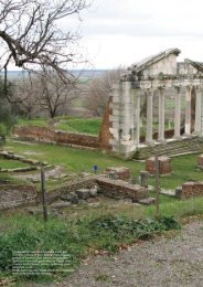
R. Caprarathe Apennines, and the River Po. Weather or political con<strong>di</strong>tionsbrought to alternative routes: the Alps could be crossedon the Mount Cenis or on the Great St. Bernard; and many<strong>di</strong>fferent options were possible to cross the Apennines.The Via Francigena between the Po Valley and Tuscany had<strong>di</strong>fferent routes, crossing <strong>di</strong>fferent passes in the Trebbia Valley(via degli Abati), in the Taro Valley or in minor valleys. Adeviation from the Taro Valley to Lunigiana and Garfagnanaallowed reaching Lucca, avoi<strong>di</strong>ng the Aurelia on the coast,which could be unsafe during crisis and wars. This deviationpassed on secondary roads which were controlled by a systemof castles and monasteries. Recent stu<strong>di</strong>es have evidenced thevia Francesca della Sambuca, a variation which followed theriver Reno to Porretta Terme, and then reached Pistoia throughthe ancient castle of Sambuca Pistoiese. Another variation onthe Apennines was the via Bolognese, between Bologna andTuscany.An alpine detour crossed the Alps through the Mount CenisPass and reached the Abbey of Novalesa; it reached Turinpassing through the Sacra of San Michele and the Abbey ofSant’Anonio in Ranverso. The tra<strong>di</strong>tional route could be intercepte<strong>di</strong>n Vercelli, or the deviation brought along the River Pothrough the Itinerarium Bur<strong>di</strong>galense to Pavia. At South, afterthe death of Saint Francis, many pilgrims detoured from thevia Francigena to visit Assisi. So, many detours were possiblealong the peninsula. These so called byways were more or lesslinked to the Via Francigena, and they were part of the systemknown as Vie Romee or Francesche.In the Nineties of the 19 th century the denomination Via SacraLangobardorum was set for tourist reasons. It in<strong>di</strong>cated thepilgrim’s route between Mont Saint Michel (France) and theSanctuary of Saint Michel the Archangel in Puglia. This ispart of the Via Francigena, but the <strong>di</strong>fferent denomination createdconfusion, so many people think that there are two <strong>di</strong>fferentpilgrim’s routes. There is no historical documentationabout the Via Sacra Langobardorum, though this denominationis now very common.Commercial roads and civilizationsCommercial roads made civilizations meet and influence eachother. The most important road was the “Silk Road”, which extendedfor approximately 8000 km. It was constituted by land,sea and river courses which hgranted commerce between theChinese Empire ant the Western civilization. Caravan roadscrossed central Asia and Middle East, and they connectedChang’an (the actual Xi’an), in China, to Minor Asia and theMe<strong>di</strong>terranean Sea. The name of the road was used for the firsttime in 1877 by the German geographer Fer<strong>di</strong>nand von Richthofen(1833-1905) in his work Tagebucher aus China. VonRichthofen referred to the Seidenstraße, the «Silk Road», inthe introduction.The final destionation of silk (and of other precious goods)was Rome; other equally precious goods were travelling itthe opposite <strong>di</strong>rection. The fundamental concepts of Maths,Geometry and Astronomy were travelling with the goods, andReligions were doing the same: Manichaesim and Nestorianismwere going eastbound, while Buddhism was moving formIn<strong>di</strong>a to Central Asia, China and Tibet, trying to find a wayto avoid the Himalaya mountains. These commercial and culturalexchanges determined the development of ancient civilizationsas in Egypt, China, In<strong>di</strong>a and Rome, but they were alsoimportant for the birth of the modern world.Some sources assert that Caesar brought some enemy flagsform Anatolia: the unknown tissue of those flags was silk.The only known thing about that tissue at that time was thatit came from some undefined land of Seres. Plinius thought itwas woven from a very thin wire, which was made from thehair of unknown leaves, that he called the forest wool. TheRoman Senate tried to forbid the use of silk, which was considereda decadent and immoral tissue. The real reason of thisprohibition was probably the big amount of gold that was leavingRome to buy this tissue.Constantinople had a privileged geographic position: at thetimes of Justinian, it controlled all the commercial traffic inthe Me<strong>di</strong>terranean area. Byzantines were not interested incommerce with European countries, which were poor due tothe Barbaric invasions; they preferred contacts with ExtremeEastern countries, such as China, were silk was made. Chinesepeople imported Byzantine crockery and Syrian tissuesand exported silk.Persia was a great hindrance for the commerce with ExtremeEast. It was an enemy territory for the Empire, though it wasnecessary to cross it to reach China. This meant that duringthe wars with the Sassanian Persians, commerce with Chinaand In<strong>di</strong>a was not possible. Giustiniano looked for a passageto China through Crimea, and this brought the Byzantines todevelop <strong>di</strong>plomatic relations with the Turks, who were alsofighting with the Sassanians. Justinian also tried to reach Chi-Fig. 5 Panoramic view of San Marco ravine, Massafra (TA).35volumeRicerca_OK_2012-11-15.indd 35 16/11/2012 15:00:54


