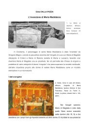
habitat rupestre.pdf - Società Friulana di Archeologia
habitat rupestre.pdf - Società Friulana di Archeologia
habitat rupestre.pdf - Società Friulana di Archeologia

You also want an ePaper? Increase the reach of your titles
YUMPU automatically turns print PDFs into web optimized ePapers that Google loves.
INTEGRATED SURVEYING SYSTEMS FOR BURIED ARCHITECTURECRHIMA-CINP projectFig. 2 An example of device used to solve the problem of illumination duringa survey of an underground site.Fig. 3 Use of fl at or spherical targets to ensure a good reliability of thesurvey.Fig. 4 An example of device used to solve the problem of surveyng in smalland narrow spaces.edges makes it impossible, in fact, to use architectural formsas a support in the measuring phase, forcing the surveyor tobuild an auxiliary system of reference planes on which to registerthe position the natural points, subjectively gathered asnoteworthy.These limits also effect the way in which a survey that uses<strong>di</strong>gital technologies is conducted; but the length of time neede<strong>di</strong>s however reduced, both in the measuring phase and thepost-production phase, for the realization of bi-<strong>di</strong>mensionaland/or tri-<strong>di</strong>mentional products. The particular morphologicalmake up of rupestrian spaces forces the surveyor to make preliminarychoices that are necessary for a correct structuring ofthe operations to be carried out.The first choice must regard which tools to use. The best suited,in these cases, are systems like Lidar (Light Detection andRanging), which use the emission of a light signal to measurethe spaces; in the case of or<strong>di</strong>nary 3D laser scanners for surveysin architecture and archaeology, the signal which is emitted isvisible or similar to infra-red light. The so-called TOF (Time ofFlight) or Phase Shift 1 equipments are also part of this categoryof surveying systems; surveying experience has shown howthese systems, substantially comparable to “motorized” totalstations, which produce high density point clouds (and not lowdensitylike topographic systems), represent the most suitabletools for surveying excavated spaces. When, however, metricreliability is the main goal of the survey, it is best to don’t usedevices based exclusively on the acquisition of <strong>di</strong>gital images(<strong>di</strong>gital photo-modelling); the surfaces-curvature and their virtuallyhomogenous material property make it <strong>di</strong>fficult, in fact,although possible for the proposed software, to recognize commonpoints in the various photos taken on the site.However, if the solely representative aspect were predominantcompared to the metric one (for example, in the case in whichpurely popular materials are produced), these systems, alongwith being time saving, may turn out to have a great visualimpact.The photographic documentation, extremely important for thecreation of the chromatic-materialistic aspect of the surfaces,should used following, as an alternative, two methods togetherwith the 3D laser scanner mapping system:- <strong>di</strong>gital photographic reportage using a refl ex camera (with afixed Fish-eye lens and a panoramic head) placed on the samesupport used for each laser scanning station;- <strong>di</strong>gital photographic reportage using a refl ex (with a fixedwide-angle lens and tripod) <strong>di</strong>fferent from those of the lasersurveys.In the first case, which is oriented towards the production ofmostly tri-<strong>di</strong>mensional products, the realization of equirectangular(360°) photographs, using point cloud software, makesthe perfect overlapping of chromatic and metric data (likein integrated cameras with scanner models, but with a muchhigher resolution) possible.In the second case, oriented more towards the realization oftra<strong>di</strong>tional bi-<strong>di</strong>mensional drawings, the photographic <strong>di</strong>splaymakes it possible for the operator to elaborate tra<strong>di</strong>tional highresolution photomaps.In the case of photographs taken in hypogeum spaces onemust usually take into account the problem of representingthe colours of the buried surfaces correctly, given the littleor total lack of light in the rooms. In order to create a homog-volumeRicerca_OK_2012-11-15.indd 176 16/11/2012 15:03:04