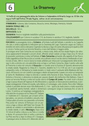
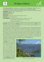
9ANTICHE MULATTIEREL’itinerario da Breglia a Rezzonico segue in parteil più antico tracciato della via <strong>di</strong> transito ai valichialpini: l’antica Strada Regina. Il percorso, cheattraversa boschi <strong>di</strong> castagni e antichi nuclei rurali,offre dei bellissimi scorci del Lario.Percorso: prima <strong>di</strong> iniziare la passeggiata, vicinoalla fermata dell’autobus <strong>di</strong> Breglia si può ammirareuna tomba tardo romana databile al VIsec.d.C., in quell’epoca era <strong>con</strong>suetu<strong>di</strong>ne posizionarei sepolcri lungo le strade in modo da mantenerevivo il ricordo del defunto. Infatti, da Bregliapassava il più antico tracciato della Via Regina,che si snodava sulla sponda occidentale del lago ecollegava Como ai passi alpini. A testimonianzadella remota origine <strong>di</strong> quest’arteria restano selciatie opere d’ingegneria come ponti e muri <strong>di</strong> sostegno,nonché chiese e cappelle che accompagnavanoil passo dei pellegrini me<strong>di</strong>eovali.Si attraversa la carrozzabile e si imbocca la stradaa sinistra che sale ai Monti <strong>di</strong> Breglia, la si segueper circa 50 metri per poi imboccare la prima stra<strong>di</strong>naa destra che porta in fondo al paese. Ci troviamosulla Via dei Monti Lariani, percorso <strong>di</strong> trekking<strong>di</strong> 125 km, che da Cernobbio porta in altolago a Sorico, seguendo mulattiere e sentieri, checollegavano i monti “münt”, piccoli agglomeratirurali <strong>di</strong>sseminati lungo le montagne della spondaoccidentale del lago.Lasciato il paese, per un comodo sentiero ci siaddentra in un bel bosco <strong>di</strong> castagni, la mulattierascende nella Val Greno, si attraversa la valle su unponticello per poi raggiungere Carcente. Qui èstato creato un piccolo museo etnografico “IlMuseo della Casa Rurale” dal gruppo degli Amici<strong>di</strong> Carcente. Allestito in una delle caratteristichecase in pietra, raccoglie strumenti <strong>di</strong> lavoro e arre<strong>di</strong>domestici legati alla storia locale. E visitabilesabato e domenica su prenotazione tel. +39 034450081.Lasciata la Via dei Monti Lariani, che dal centrodel paese sale ai Monti <strong>di</strong> Carcente, si prosegue<strong>di</strong>ritto passando sotto il “Portec <strong>di</strong> Moc” e, <strong>con</strong> ilpaese alle spalle, un tratto rilassante quasi tutto inpiano <strong>con</strong>duce alla frazione <strong>di</strong> Treccione (alt. 647metri). All’inizio dell’agglomerato si prende lagra<strong>di</strong>nata in <strong>di</strong>scesa a destra e subito in fondo adessa, all’altezza del negozio <strong>di</strong> alimentari si volta- punto <strong>di</strong> partenza per la passeggiata: Breglia- Collegamenti: da <strong>Menaggio</strong> per Breglia inautobus linea C13, ritorno da Rezzonico inautobus linea C10- itinerario: Breglia - Carcente - Treccione -Lucena - Marena - Roncate - Rezzonicoritorno da Rezzonico in autobus linea C10- durata totale della passeggiata ore 3.00- <strong>di</strong>slivello: 50 m circa; - 550 m in <strong>di</strong>scesa- segnaletica: fino a Carcente cartelli rossobianco-rosso<strong>con</strong> n° 3 in campo bianco, daCarcente a Rezzonico: cartelli in<strong>di</strong>catoribianchi <strong>con</strong> freccia nera<strong>di</strong> nuovo a destra. Si scende lungo la mulattierasbucando poi sulla carrozzabile che si segue in<strong>di</strong>scesa per Noledo, oltrepassando il bivio per imonti <strong>di</strong> Gallio. Dopo il successivo tornante siimbocca la vecchia mulattiera sulla sinistra.All’altezza delle prime case <strong>di</strong> Noledo voltando asinistra, si interseca la carrozzabile, <strong>con</strong>tinuandoperò sull’antica mulattiera, al bivio, all’altezza <strong>di</strong>una fontana, voltare a sinistra. Costeggiando lavalle si giunge a Lucena; in fondo alla gra<strong>di</strong>natadeviare sinistra, si passa il ponticello sopra la Valledei Molini. Al bivio prendere a destra e subito dopo<strong>di</strong> nuovo a destra, seguendo le in<strong>di</strong>cazioni perMarena dove, in fondo alla gra<strong>di</strong>nata si gira a sinistra.Dalla piazzetta imboccare la stra<strong>di</strong>na sul latosinistro del lavatoio, sbucati sulla carrozzabile siattraversa <strong>con</strong> cautela e si riprende l’antico percorsoper giungere alla località Roncate dove, in corrispondenza<strong>di</strong> un piccolo parcheggio, si <strong>di</strong>scendela scalinata a destra. Si segue la valletta per sbucare<strong>di</strong> nuovo sulla carrozzabile, la si percorre in<strong>di</strong>scesa per 50 metri per poi riprendere l’antico percorsosulla sinistra. In fondo alla <strong>di</strong>scesa, <strong>con</strong> ilcastello <strong>di</strong> Rezzonico già in vista, si raggiungel’Antica Strada Regina; seguirla a destra per giungerealla statale dove c’è la fermata dell’autobus.Si può anche scegliere <strong>di</strong> ritonare a <strong>Menaggio</strong> a<strong>pie<strong>di</strong></strong> seguendo l’Antica Strada Regina – ca. 3 ore– ve<strong>di</strong> percorso 8.Si <strong>con</strong>siglia <strong>di</strong> visitare il caratteristico borgo <strong>di</strong>Rezzonico <strong>con</strong> la pittoresca piazzetta a lago, ipoderosi portici ed il castello <strong>di</strong> origine trecentesca<strong>con</strong> alte mura merlate, probabilmente costruitodalla famiglia Della Torre.
ANCIENT TRACKS 9This itinerary from Breglia to Rezzonico followsa small part of the antique Roman transit road tothe alpine passes: the Strada Regina. The trailleads through chestnut woods and passes smallrural settlements with nice views of the lake.- Starting point of the walk: Breglia 749 m- Breglia can be reached by bus line C13 from<strong>Menaggio</strong>, Rezzonico is <strong>con</strong>nected with busline C10- Itinerary: Breglia – Carcente – Treccione –Noledo – Lucena – Marena - Roncate -Rezzonico- total walking time: 3.00 hrs.- ascent: 50 m descent: - 550 m- trail signs: from Breglia to Carcente redwhite-red,from Carcente to Rezzonico whiteblackNear the bus stop at Breglia, in front of the cemetery,you can see a Roman tomb dating back to theVI c. It was custom in the roman age to placetombs along the main roads to keep the memoryof the deceased alive. In fact the old Roman road,“L’antica Strada Regina”, one of the main <strong>con</strong>nectingroads with the alpine passes, used to passby Breglia. It lost its importance when the shorterpassage over Sasso Rancio, between <strong>Menaggio</strong>and Acquaseria, was opened.Opposite the bus stop pick up the road lea<strong>di</strong>ng toMonti <strong>di</strong> Breglia and after just 30 m pick up thefirst street to the right which leads to the end ofthe village. You are now on the Via dei MontiLariani, a hiking trail of 125 km which starts atCernobbio and leads to the northern end of thelake <strong>con</strong>necting the small rural settlements scatteredalong the slopes on the west side of the lake.The track leads into the chestnut woods down intothe Val Greno where you cross over a bridge andyou then reach the hamlet CarcenteAt Carcente there is a small museum housed in atypical stone buil<strong>di</strong>ng of the village; it <strong>con</strong>tainstools and household furnishing featuring aspectsof rural daily life. It is open on Saturday andSunday by request tel. +39 0344 50081.You leave the Via dei Monti Lariani that leadsfrom the centre of Carcente to Monti <strong>di</strong> Carcente,<strong>con</strong>tinue straight and pass underneath the Portec<strong>di</strong> Moc. Having left the village behind you, arelaxing almost even track will lead you to thehamlet Treccione (alt. 647 m). At the beginningof the hamlet take the steps downhill to right andat the end, close to a small alimentary shop, takeanother right. Follow the track downhill until itcomes out to the road which you follow down hillin the <strong>di</strong>rection of the hamlet Noledo, ignore thedeviation to Gallio. After the next bend in theroad pick up the old track on the left.At the first houses of Noledo turn left. Cross theroad and <strong>con</strong>tinue on the old track. At an intersectionnear a fountain go left. Following the valleyyou reach Lucena. At the end of the steps take aleft. You pass the small bridge over the Valle deiMolini. At the fork take right and then imme<strong>di</strong>atelyright again.following the in<strong>di</strong>cation to Marena.At Marena, at the end of the steps, turn left. Onthe small piazza pick up the street on the left ofthe washing place. It leads to the road which youcross with caution to pick up the old track again.You reach the hamlet Roncate where at the littleparking lot you follow the steps lea<strong>di</strong>ng downhillto the right. You walk along the valley, and end upon the road; after just 50m pick up the track again.At the end of the descent with a view on the castleof Rezzonico, you reach the Antica StradaRegina. Follow it to the right and on the mainroad there is the bus stop.It is also possible to walk back to <strong>Menaggio</strong> followingthe Antica Strada Regina – time required3 hours – see walk 8We highly recommend to visit the picturesquecentre of Rezzonico with its little piazza on thelake. The castle is of the 13 th century.