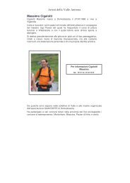
Valle Antrona - cai sezione villadossola
Valle Antrona - cai sezione villadossola
Valle Antrona - cai sezione villadossola

You also want an ePaper? Increase the reach of your titles
YUMPU automatically turns print PDFs into web optimized ePapers that Google loves.
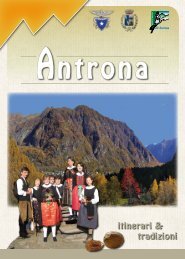
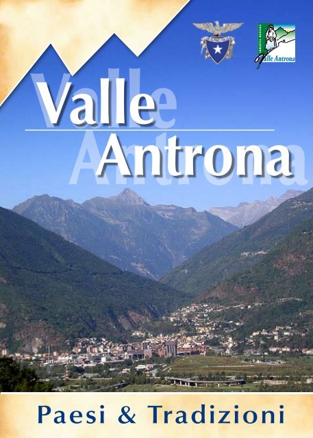
<strong>Valle</strong><br />
<strong>Antrona</strong><br />
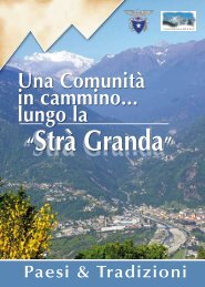
Paesi & Tradizioni
La Comunità Montana <strong>Valle</strong> <strong>Antrona</strong><br />
La <strong>Valle</strong> <strong>Antrona</strong> si estende dalla cittadina di Villadossola al<br />
paese di <strong>Antrona</strong>piana serpeggiando ripida fra le valli Anzasca<br />
e Bognanco. Il ghiacciaio prima e l’acqua poi, hanno<br />
medellato l’affascinante paesaggio della valle: da qui la gola<br />
profonda in cui scorrono le acque tumultuose dell’Ovesca,<br />
ma anche i dolci e verdi fianchi costellati di abitati. Morene,<br />
massi erratici, striature sulle nude rocce montonate sono altre<br />
tracce del lavoro di antichi ghiacciai oggi quasi completamente<br />
estinti. Non mancano i laghi sia naturali (di circo,<br />
delimitati da depositi morenici) che artificiali (bacini per lo<br />
sfruttamento dell’energia idroelletrica) ad impreziosire la rustica<br />
bellezza del luogo. Per quanto concerne l’aspetto geologico,<br />
le rocce sono principalmente rappresentate da gneiss<br />
ed ofioliti, quest’ultime più note come “rocce verdi di antrona”,<br />
gli gneiss possono presentarsi in bancate compatte con<br />
ripide pareti, creste irregolari e cime piramidali (ortogneiss:<br />
catena montusa fra la <strong>Valle</strong> Anzasca e il Pizzo Andolla) oppure<br />
essere molto più fragili e scistosi (paragneiss: bassa <strong>Valle</strong><br />
<strong>Antrona</strong>). Notevole è l’interesse minerario della valle e forse<br />
ancor più lo è stato nel passato per lo sfruttamento industriale<br />
di giacimenti di ferro al passo di Ogaggia, d’oro a Locasca/<br />
Mottone, di pegmatite all’alpe “i Mondei” di Montescheno e<br />
ancora rame, argento, mica e pietra oliare (la laugera). La valle<br />
<strong>Antrona</strong> rientra nel settore alpino occidentale (Alpi Pennine)<br />
e risente di un clima di tipo continentale. A partire dal<br />
piano basale si estendono a varie quote coltivi e prati artificiali<br />
cosidetti perché creati dall’uomo per l’alimentazione del
estiame; fino ad arrivare alla prateria alpina, vero e proprio giardino naturale<br />
che nella breve fioritura estiva sfoggia i colori più belli. Anche il bosco<br />
misto di latifoglie inizia dal fondovalle: le essenze prevalenti sono il castagno<br />
e le querce che superati i 900 metri di quota lasciono il posto a faggete<br />
e peccete (boschi di abete rosso) prima e alle pinete poi. Ma simbolo delle<br />
alpi è il larice che riesce a raggiungere le più elevate altitudini: stupendi<br />
sono gli esemplari dell’alpe Lombraoro. Rododendro e mirtillo accompagnano<br />
questa conifera, formando fitti tappeti là dove un tempo venivano<br />
estirpati dagli alpigiani per creare nuove zone di pascolo. Oggi la protezione<br />
della flora dipende molto dal nostro rispetto e fotografare un fiore anziché<br />
raccoglierlo potrebbe essere più importante. La fauna che popola la<br />
valle non differisce molto da quella del resto dell’Ossola. Numerose sono le<br />
specie presenti ma siccome spesso è difficile l’avvistamento diretto, interessante<br />
è saperne riconoscere le “tracce”, ovvero i segni della loro presenza<br />
come orme, resti dei pasti, tane e rifugi, ci si renderà così conto strada<br />
facendo di non essere soli nella natura. Fra le più rappresentative è bene<br />
ricordare i quatto ungulati caratteristici dell’arco alpino: capriolo, cervo, camoscio<br />
e stambecco; la simpatica e chiassosa marmotta; non mancano la<br />
volpe, il tasso, il riccio e lo scoiattolo. Dal manto candido in inverno e più o<br />
meno bruno in estate sono l’ermellino e la lepre<br />
variabile. L’avifauna è ben rappresentata dalla<br />
superba figura dell’aquila reale, nonché dalla<br />
poiana, dalla pernice bianca e dal gallo forcelle;<br />
numerosi sono i passeriformi ed immancabile<br />
il gracchio alpino. Anfibi, fra cui la rana temperarla,<br />
rettili (lucertole, ramarri, colubridi e viperidi),<br />
alcuni pesci d’acqua dolce e variopinti insetti<br />
completano il quadro faunistico. II Passo di Saas,<br />
ad oltre 2800 m di quota, mette in comunicazione<br />
Villa-dossola con la <strong>Valle</strong> di Saas che si immette nel <strong>Valle</strong>se all’altezza di Visp<br />
e fu sicuramente percorsa nel Medioevo da una mulattiera commerciale di<br />
cui restano ancora oggi evidenti manufatti. Lungo di essa transitavano le<br />
carovane di muli e di asini dei mercanti lombardi diretti alle ricche piazze<br />
della Svizzera. Fatto importante a Villadossola fu nel secolo XVI quando la<br />
fiera annuale del bestiame venne trasferita da Macugnaga a Villa presso la<br />
Piazza IV Novembre, punto di partenza della “Strada Antronesca”. Dal 1995,<br />
ogni anno, alla fine di settembre, si ripercorre il tratto che da Villadossola<br />
sale ad <strong>Antrona</strong>piana coinvolgendo tutto il territorio della <strong>Valle</strong> <strong>Antrona</strong> ed<br />
in particolare, con la presenza degli antichi costumi rendono questa manifestazione<br />
una riscoperta degli antichi valori di questo territorio.<br />
The <strong>Antrona</strong> valley stretches from the small town of Villadossola to the vil-<br />
lage of <strong>Antrona</strong>piana winding up between the Anzasca and the Bognanco<br />
valleys. Glaciers formerly and surface waters later have shaped the valley’s fasci-<br />
nating scenary: hence originates the deep gorge where the turbulent waters of<br />
the Ovesca stream flow, as well as the gentle green slopes spangled with villages.<br />
Moraines, erratic boulders, streaks on the bare humpbacked rocks are the traces<br />
of the work of ancient glaciers nowadays nearly completely disappeared. To em-<br />
bellish the rough beauty of the place there are many lakes, both natural (cirque<br />
lakes, limited by morainic deposits) and artificial (reservoirs for the hydroelectric<br />
energy generation). As far as the geologie pattern is concearned, rocks are mainly<br />
represented by gneiss and ophiolithes, the latters being better known as “Antro-<br />
na’s green rocks”, gneiss can be found in compact banks with steep walls, irre-<br />
gular ridges and pyramid-shaped peaks (orthogneiss: mountain range between<br />
the Anzasca valley and the Andolla peak) or else they are much more fragile and<br />
schistose (paragneiss: low Anlrona valley). The valley is of noticeable interest for<br />
mining, which probably was more important in the past, thanks to the industrial<br />
exploitation of the iron ore deposits at the Ogaggia mountain pass, of gold at Lo-
casca/Mottone, of pegmatite at the Alpe “i Mondei” ( Alpe means pastures with a<br />
small group of mountain houses) of Montescheno and also copper, silver, mica<br />
and “ollare” stone ( the so called “laugera”). Several aspects present in the moun-<br />
tains, like climate (temperature, snow covering, thermal stress, wind), topography<br />
(exposure lo the sun and slope of versants), edaphic factors (granulometry, pH,<br />
water, mineral salts, composition of humus, geologic nature of soil) and biotic<br />
factors (human intervention), inleract one with another and bring about the en-<br />
vironmental characteristics which the Alpine flora has to adapt to, by developing<br />
its peculiar morphologic and functional characteristics. The <strong>Antrona</strong> valley belon-<br />
gs lo the western Alpine section (Alpi Pennine) and is influenced by a continen-<br />
tal-like climate. Starling from the bottom plain up, at various height levels, crops<br />
and artificial (created by man for the cattle breeding) meadowlands stretch up<br />
to the Alpine grassland, a real natural garden which during the short summer<br />
bloom shows its most beautiful colours. The mixed broad leaf woodland also<br />
starts from the bottom of the valley: the prevailing species are chestnut and oak<br />
which at heights over 900 metres give way first to beechwoods and red fir woods<br />
and then to pine woods. But the true symbol of the Alps is larch, which can reach<br />
the highest altitudes: the specimens at the Alpe Lombraoro are wonderful. Rho-<br />
dodendron and bilberry grow up well amidst this conifer, forming thick carpets<br />
where they were once uprooted by the mountain dwellers to create new areas<br />
of pasture. Nowadays the flora protection depends much on our respect, and it<br />
may be better to take a picture of a flower instead of picking it up.<br />
The Fauna populating the valley does not differ greatly from that in the<br />
rest of the Ossola district. Numbers of different species are present, but<br />
since direct sighting is often difficult, it’s interesting to be able to re-<br />
cognize their “traces”. that is the signs of their presence such as marks,<br />
food left-overs. lairs and hideouis. Therefore we will realize<br />
we are not alone in our way in the wildemcss. It is not<br />
advisable to make a long list of all the species existing in<br />
the valley, though at least the following specie should be recalled: the four ungu-<br />
lates characteristic of the Alpine are: roc deer. deer, chamois and ibex: charming<br />
and noisy marmot, fox, badger, hedgehog and squirrel are also present; ermine<br />
and hare show their snow-white fur in winter and a more or less brown one in<br />
summer. The Avifauna is well represented by the haugty figure of the royal eagle,<br />
as well as by buzzard, white rock ptarmigan and grouse; several are the species of<br />
passerines and ubiquitous is the alpine chough. Amphibians like the “temporaria”<br />
frog, reptiles (lizards, green lizards. coluberids and viperids), some species of fresh<br />
water fish and multicoloured insects complete the faunistic picture.<br />
Das <strong>Antrona</strong>tal geht von Villadossola hinauf bis <strong>Antrona</strong>piana, zwischen<br />
die Anzasca- und Bognancotal steil schlangelnd. Vor alter Zeit der Gletscher<br />
und nachher das Wasser modellierten die wunderschòne Landschaft dieses Tals:<br />
daraus die tiefe Schlucht wo die stiirmische GewäBer der Ovesca flieBen, aber<br />
eigentlich auch die sanften und grünen Bergabhange von Weilern ubersàt.<br />
Moranen, erratische Blöcke, Streifungen durch die nackten Bergfelsen sind andere<br />
Spuren der Wirkung alter Gletscher (heute fast vollig verschwunden). Zahlreiche<br />
Seen, sowohl naturellen (von Moränenbildungen umgeben) als auch Stauseen<br />
(um hydroelektrische Energie zu erzeugen), machen die ländliche Schonheit<br />
dieses Ortes kostbar. In geologischer Hinsicht sind die Felsen hauptsächlich aus<br />
Gneis und Ophiolith (“griiner Stein von <strong>Antrona</strong>” genannt) zusammengesetzt; der<br />
Gneis erscheint oft als dichte Formationen, mit steilen Wanden, unregelmàBigen<br />
Bergriicken und piramidenfòrmigen Gipfeln (Orthogneis: Bergkette zwischen<br />
Anzascatal und Portjengrat), oder als zerbrechliche und schieferige Formationen<br />
(Paragneis: Unterantronatal). Die Bergbaubedeutung von diesem Tal ist<br />
noch heute, ansehnlich, und war so besonders in der Vergangenheit, was die<br />
Industrieausbeutung der Eisenlager auf dem Ogaggiapass, der Goldlager in<br />
Locasca/Mottone, der Pegmatitlager auf der Senne “i Mondei” von Montescheno,<br />
sowie von an verschiedenen stellen gelegenen Kupfer-, Silber-, Giltstein- (hier
“laugera” genannt) und Glimmervorkommen. Auf die Berge, verschiedene<br />
zusammenwirkende Faktoren wie Klima (Temperatur, Schneedeckung,<br />
Härte des Klimas, Wind), Topographie (Lage und Neigung der Bergseiten),<br />
physikochemische Bodenbeschaffenheit (Granulometrie, pH, Wasser, Mineralsalze,<br />
Humuszusammensetzung, geologische Art des Bodens) und biotische Faktoren<br />
(der Eingriff des Menschen) bestìmmen die Umgebungscharakteristika, denen die<br />
Pflanzen durch eigene morphologische und funktionelle Charakteristik sich fiigen<br />
müssen, indem sic besondere morphologische und funktionelle Eigenschaften<br />
entwickeln. Das <strong>Antrona</strong>tal gehort zu der westlichen Alpenzone (Penninischen<br />
Alpen)und verspürt ein Kontinentalklima. Vom Talgrund ab, auf verschiedenen<br />
Hohen, geht man durch Kulturen, Kunstwiesen (vom Menschen bebaut, um<br />
das Vieh zu füttern) und die Hochalm, einen echten urwüchsigen Garten, wo<br />
die kurze Sommerblütezeit die schonsten und buntesten Blumen aufbrechen<br />
lafit, hindurch. Auch der Laubwald fangt auf dem Talgrund an; Kastanien und<br />
Eichen reichen bis 900 m, dann beginnen die Buchen-und Rottannenwalder,<br />
weiter oben die Kiefernwalder. Das Symbol unserer Alpen ist jedoch die Lärche,<br />
die grafite Hòhe erreicht (man fmdet erstaunliche Exemplare derselben auf der<br />
Lombraoroalp). Zusammen mit der Lärche sind wohl Alpenrosen und Heidelbeere<br />
aufzufinden. Wo sie früher von den Bergbauern ausgerottet wurden, um neue<br />
Weidezonen zu erhalten, bilden sie jetzt einen dichten<br />
Pflanzenteppich. Der Naturschutz ist nun von unserer<br />
Rücksicht sehr abhangig, man solite darum lieber<br />
eine Blume fotografieren als pfliicken. Die Tiere, die in<br />
dem Tal leben, unterscheiden sich nicht von denen<br />
im weiteren Ossolatal. Man fmdet zahlreichen Arten<br />
(aber sie sind schwer zu beobachten). Die Erkennung<br />
ihrer Spuren, und ihrer Anwesenheitzeichen (Fahrte,<br />
Futterreste, Baue) kann sehr interessant sein. So kann<br />
man sich unterwegs klarmachen, dafi wir nicht allein<br />
in der Natur sind. Es ist hier unmöglich sowie unangebracht, eine lange Liste<br />
aller Tierarten des Tales anzufertigen. Aber die bedeutendsten sind zweifellos die<br />
vier charakteristische Huftiere der Alpen: das Reh, der Hirsch, die Gemse und der<br />
Steinbock. Da fallen das sympatische, larmende Murmeltier, der Fuchs, der Dachs,<br />
der Igei und das Eichhornchen wohl nicht aus. Mit einem im Winter schneeweifien<br />
und im Sommer mehr oder weniger braunen Fell gedeckt, sind das Hermelin<br />
und der verànderliche Hase aufzuspiiren. Die Ortsvogelfauna umfafit viele<br />
Arten, allererst den stolzen Adler, danach den Bussard, das Scheehuhn und den<br />
Birkhuhn, viele Sperlingsorten und die unausbleibliche Bergdohle. Amphibien<br />
wie der Bergfrosch, Reptilien wie die Eidechse, der Alpensalamander, die grosse<br />
Eidechse, viele Natter- und Vipersorten, einige SüBwasserfische und vielfarbige<br />
Insekten ver voli standigen die Tiertafel.
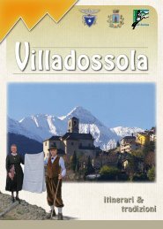
Villadossola<br />
Gli studiosi della protostoria ossolana affermano che l’Ossola nel pri-mo<br />
millennio dell’era volgare era abitata dai Liguri. Anche i Leponzi hanno<br />
popolato i pagi della valle <strong>Antrona</strong> e quindi anche Villadossola. I Romani<br />
esercitarono il loro potere nella regione ossolana, come testi-monia la<br />
necropoli romana di Ornavasso, del 14a.c. Augusto impose l’ordine romano<br />
ai popoli alpini, con la costituzione dei municipi, l’Ossola superiore appartenne<br />
a quello di Oscella. Le sorti dell’Ossola rimasero per parecchi secoli<br />
legate a quelle di Roma fino alle invasioni barbariche. Goti, Ostrogoti,<br />
Borgognoni, invasero l’Ossola. I Bizantini, a cui seguirono i Longobardi, cacciarono<br />
i Goti dall’Italia. Nell’Ossola,alcune famiglie dei conti di Castello e di<br />
Biandrate domi-navano nell’anno 1000. Il nome di Villa compare la pri-ma<br />
volta in un documento del 918, ed è il nostro paese un possedi-mento del<br />
monastero di S.Pietro in Ciel d’oro in Pavia. Nel 1233 Villa e la valle <strong>Antrona</strong><br />
divennero dominio del vescovo di Novara. Nell’estate del 1307 nasce in Ossola<br />
un movimento di netta ribellione al vescovo, avente come caposaldo<br />
di difesa Domodossola. Gli uomini di Villa erano con il Petrazzano.un nobile<br />
di Pallanzeno che aveva citta-dinanza domese. Villa,che parteggiava per il<br />
Petrazzano, fu distrutta e vennero brucia-te 150 case. I bambini, le donne e<br />
il prezioso bestiame vennero salvati perché furono fatti salire nelle frazioni<br />
più alte. I primi statuti di Villadossola ven-nero redatti nel 1345. Nel 1364,<br />
dopo la fame, la peste, Villa conobbe l’invasione delle cavallette che lasciarono<br />
le montagne prive di verde. Nel 1606 Villa conobbe nuovi statuti e in<br />
seguito la riconferma dei privilegi ossolani. Nel 1718 ci fu un censimento.<br />
Con il trattato di Worms (I743) l’Ossola entrò nei domini di casa Savoia ed<br />
ebbe leggi uniformi allo stato sabaudo. Con l’avvento di Napoleone Bonaparte<br />
il 31 maggio 1600 l’Ossola fu oc-cupata dai francesi e fu annessa alla<br />
Repubblica Cisalpina. Tu aperta una nuova strada militare del Sempione<br />
completata nel 1805. Successivamente l’Ossola fece parte del dipartimento<br />
d’Agogna fino all’abdicazione di Napoleone Bonaparte, allorché l’Ossola<br />
si ricongiun-se agli stati Sardi (il maggio 1814) sotto Vittorio Amanuele I.<br />
I privilegi ossolani furono riconfermati nel 1815 ma nel 1836 venne abolita<br />
la provincia dell’Ossola che fu aggregata a quella di Pallanza. Dal 1848 con la<br />
proclamazione dello Statuto, la storia dell’Ossola è la stessa di quella del Risorgimento<br />
e dell’Unità. Si registrano in seguito lo sviluppo industriale,la costruzione<br />
della nuova strada antronesca, l’arrivo della ferrovia. Nei tempi moderni<br />
Villadossola cresceva demograficamente. Essa partecipò alla I guerra<br />
mondiale (I9I5-I9I8),alla II guerra mondiale (I940-1945). Conobbe la lotta partigiana,<br />
l’insurrezione dell’ 8 novembre 1943 (per cui nel 2007 è stata conferita<br />
al Comune di Villadossola la “Medaglia d’Argento al Merito Civile”) fino alla<br />
creazione della Repubblica dell’Ossola (10 Settembre-I4 ottobre 44) in cui ci<br />
10 11
fu il tentativo di organizzare democraticamente l’Ossola. Con la liberazione<br />
del 25 aprile 1945 fini l’incubo della guerra e ini-ziò il periodo della ricostruzione.<br />
All’inizio del 1980 si ha inizio la crisi industriale che ha portato alla chiusura<br />
di buona parte delle fabbriche sul territorio. Nel 1992 il territorio di Villadossola<br />
e della <strong>Valle</strong> <strong>Antrona</strong> entrano a far parte della nuova provincia del<br />
VCO. Nel 1997 viene inaugurato il complesso del Centro Culturale “La Fabbrica”<br />
di Villadossola, completo di Teatro (650 posti), sala mostre e sale riunioni. Il<br />
Centro culturale è stato costruito sui resti delle Ferriere P.M. Ceretti utilizzando<br />
fondi europei destinati ad aree deindustrializzate. Dal 2007 la struttura è<br />
stata riconosciuta polo culturale del Verbano Cusio Ossola.<br />
All’interno del territorio si possono vedere:<br />
Chiesa romanica di San Bartolomeo, Chiesa dell’Assunta al Piaggio, Chiesa<br />
della Noga, Chiesa di Tappia, Chiesa di San Maurizio al Sasso, Cappella di<br />
San Rocco, Ponte ad arco in sasso, Villaggio “SISMA”, Località Colletta, Località<br />
Varchignoli, Museo della Resistenza.<br />
NB: per gli itinerari e i luoghi culturali si possono avere informazioni nel “Centro<br />
di consultazione del territorio” a Villadossola (tel. 0324 501411)<br />
Scholars of local proto-history have determined that Ossola was inhabited<br />
by the Ligurians in the first millennium of the volgar era and then later by<br />
the Leponzi, who settled in primitive “pagi” in the <strong>Antrona</strong> <strong>Valle</strong>y and what is to-<br />
day the town of Villadossola. The Romans then exercised their power in the re-<br />
gion, as testified by the necropolis at Ornavasso, dated 14 BC, and the Emperor<br />
Augustus imposed Roman order on the alpine population with the constitution<br />
of the municipalities, upper Ossola belonging to Oscella. For a number of centu-<br />
ries Ossola shared in the vicissitudes of Rome until the Fall of the Empire and the<br />
successive Barbaric invasions. The Goths, Ostrogoths and Burgundians all pene-<br />
trated the area until the Byzantines, followed by the Longobards, ran the Goths<br />
out of the country. Records show that in the year 1000 the families of the Counts<br />
of Castello and Biandrate held dominion over Ossola, while the name of Villa ap-<br />
peared for the first time in a document of 918, as a possession of the Monastery<br />
of San Pietro in Ciel d’Oro in Pavia. In 1233 Villa and the <strong>Antrona</strong> <strong>Valle</strong>y come un-<br />
der the dominion of the Bishop of Novara, but in the summer of 1307 a group<br />
of Ossolans challenged the Bishop’s rule in support of Domodossola’s defense<br />
stronghold. Villa sided with Petrazzano, a nobleman of Pallanzeno who held Do-<br />
mese citizenship, and as a consequence, the town was destroyed with 150 hou-<br />
ses burnt down. Fortunately, the local women, children and precious livestock<br />
found safety in the highest of the town’s hamlets. The first statutes of Villadosso-<br />
la appeared in 1345. A time of hardship and adversity then struck the area with a<br />
period of famine, followed by the plague in 1364, and soon after an invasion of<br />
locusts, which left the nearby mountainsides bare. In 1606 new statutes were<br />
written, followed by the reconfirmation of Ossola’s privileges. The first official cen-<br />
sus was taken in 1718. With the Treaty of Worms (I743), Ossola came under the<br />
rule of the House of Savoy and its laws were thus aligned with the those of the<br />
monarchy. With the advent of Napoleon Bonaparte the French occupation of<br />
Ossola began, and on 31 May 1800 it became part of the Cisalpine Republic. Os-<br />
sola was assigned to the department of Agogna until the abdication of Napo-<br />
leon and construction of the military road over the Simplon Pass was eventually<br />
completed in 1805. The province was subsequently reunited with the Kingdom<br />
of Sardinia (May 1814) under Vittorio Emanuele I. Ossola’s privileges were recon-<br />
firmed once again in 1815, but in 1836 the province was abolished and the area<br />
incorporated into the province of Pallanza. With the proclamation of the Statu-<br />
tes of 1848, local history ran parallel to that of the Italian Risorgimento and the<br />
eventual Unification of Italy. A period of industrial development then followed,<br />
including the construction of the new road into the <strong>Antrona</strong> <strong>Valle</strong>y along with<br />
the arrival of the railroad, which brought significant demographic growth to the<br />
area. Many local lives were sacrificed in the first (I9I5-I9I8) and second (I940-1945)<br />
world wars; the townspeople were also fervent participants in the Partisan move-<br />
1 1
ment and the insurrection of 8 November 1943 (for which the Commune of Villa-<br />
dossola was awarded the “Silver Medal of Military Valor “ in 2007) that led to the<br />
creation of the Republic of Ossola (10 September - I4 October 1944), set up to<br />
organize the democratic and civil life of the territory. With the liberation of Italy on<br />
25 April 1945 the nightmare of war was finally over and a period of reconstruc-<br />
tion began. Early 1980 saw the beginnings of an industrial crisis which resulted<br />
in the closing of many of the area’s factories and manufacturing plants. In 1992<br />
Villadossola and the <strong>Antrona</strong> <strong>Valle</strong>y were included in the newly formed Verbano<br />
Cusio Ossola Province. In 1997 the “Fabbrica” Cultural Centre of Villadossola, with<br />
its 650-seat theatre, exhibition areas and meeting halls, was inaugurated and in<br />
2007 was recognized as an official cultural centre of the VCO Province. It was<br />
built on the site of the ex-P.M.Ceretti Ironworks thanks to European Community<br />
funding designated for de-industrialized areas.<br />
Interesting sites in the vicinity include :<br />
The Romanesque church of San Bartolomeo, the Church of the Assunta at Piag-<br />
gio, the Church of the Noga, the churches at Tappia and San Maurizio al Sas-<br />
so, the Chapel of San Rocco, numerous stone bridges and arches, The “SISMA”<br />
worker’s village, the Colletta and Varchignoli districts, and the Museum of the<br />
Resistance. For itineraries, cultural sights of interest and more information contact<br />
the “Centro di Consultazione del Territorio” at Villadossola (tel. 0324 501411)<br />
Die Forscher der Protogeschichte des Ossolas bekräftigen, dass das Osso-<br />
la im ersten Jahrtausend des vulgären Zeitalters von Ligurern bewohnt<br />
war. Auch die Leponzier haben das Tal <strong>Antrona</strong> bevölkert und somit auch Villa-<br />
dossola. Die Römer übten in der Region Ossola ihre Macht aus, wie die römische<br />
Nekropolis, 1400 vor Christus., in Ornavasso, bezeugt. Augusto legte der Bevölke-<br />
rung in den Alpen, mit der Errichtung von Rathäusern, die römische Ordnung<br />
auf. Das Obere Ossola gehörte zu Oscella. Das Schicksal des Ossola blieb für viele<br />
Jahrhunderte mit Rom verbunden bis zum Einfall der Barbaren. Goten, Ostgoten<br />
und die Borgogner fielen in das Ossola ein. Die Byzantiner,<br />
von den Langobarden gefolgt, verjagten die Goten aus<br />
Italien. Im Ossola dominierten im Jahre 1000 einige Fa-<br />
milien der Grafen von Castello und Biandrate. Der Name<br />
Villa taucht zum ersten Mal in einem Dokument aus dem Jahre 918 auf.<br />
Es handelte sich um das Besitztum des Klosters von San Pietro in Ciel d’Oro in<br />
Pavia. Im Jahre 1233 kamen Villa und das Tal <strong>Antrona</strong> unter die Herrschaft des<br />
Bischofs von Novara. Im Sommer des Jahres 1307 entstand im Ossola eine en-<br />
tschiedene Bewegung der Rebellion gegen den Bischof, Berechtigter Eckpfeil<br />
der Verteidigung von Domodossola. Die Männer von Villa waren für Petrazza-<br />
no, ein Adliger aus Pallanzeno der die Bürgerschaft Domodossolas hatte. Villa,<br />
das Partei für Petrazzano ergriff wurde zerstört und 150 Häuser verbrannt. Kin-<br />
der, Frauen und das wertvolle Vieh wurden in den obersten Fraktionen in Siche-<br />
rheit gebracht. Die ersten Verfassungen von Villadossola wurden im Jahre 1345<br />
verfasst. Im Jahre 1364, nach der Hungersnot und der Pest, wurde Villa von ei-<br />
ner Heuschreckenplage überfallen und hinterließ die Berge ohne Grünflächen.<br />
Im Jahre 1606 wurden in Villa andere Verfassungen eingeführt, gefolgt von der<br />
Bekräftigung der Vorrechte der Einwohner des Ossolas. Im Jahre 1718 wurde<br />
eine Volkszählung durchgeführt. Mit dem Abkommen von Worms (1743) kam<br />
das Ossola unter Besitz des Hauses Savoia und bekam somit gleichmäßige Ge-<br />
setze auf dem Stand der Savoia. Mit der Besteigung von Napoleon Bonaparte am<br />
31. Mai 1600 wurde Ossola von den Franzosen besetzt und an die Republik Ci-<br />
salpina angeschlossen. Im Jahre 1805 wurde eine neue Militärstrasse im Simplon<br />
fertig gestellt. Folglich wurde das Ossola unter dem Fachbereich von Agogna<br />
zugesprochen bis zur Abdankung von Napoleon Bonaparte, als das Ossola sich<br />
wieder mit den Ländern Sardiniens (Mai 1814), unter Vittorio Emanuele der<br />
I, vereint. Die Vorrechte der Einwohner des Ossola wurden im Jahre<br />
1815 wieder bekräftigt, aber im Jahre 1836 wurde die Verwaltungsre-<br />
gion Ossola abgeschaffen und in die von Pallanza eingegliedert.<br />
1 1
Vom Jahr 1848 an, mit der Bekanntgabe der Verfassung, hat Ossola die gleiche<br />
Geschichte des Wiederauflebens und der Einheit des Landes erlebt. Man verzei-<br />
chnet die industrielle Entwicklung, den Bau der neuen Strasse <strong>Antrona</strong>s und die<br />
Einführung der Eisenbahnlinie. In den modernen Zeiten trug sich eine Bevölke-<br />
rungsexplosion in Villadossola zu. Es nahm am ersten Weltkrieg (1915-1918) und<br />
am zweiten Weltkrieg (1940-1945) teil. Es fanden die Kämpfe der Partisanen statt,<br />
der Aufstand vom 8. November 1943 (aufgrund dessen wurde im Jahre 2007<br />
an die Gemeinde von Villadossola eine „Silberne Medaille für Zivilcourage“ ver-<br />
liehen) bis hin zur Gründung der Republik Ossolas (10. September – 14. Okto-<br />
ber 1944) um das Ossola auf demokratische Weise zu regieren. Mit der Befreiung<br />
vom 25. April 1945 war der Alptraum des Krieges vorbei und es begann die Zeit<br />
des Wiederaufbaus. Am Anfang des Jahres 1980 hatte die Industriekrise ihren An-<br />
fang, die zur Schließung eines großen Teils der Fabriken auf dem Gebiet beitrug.<br />
Im Jahre 1992 wurde das Gebiet von Villadossola und das Tal <strong>Antrona</strong> Teil des<br />
neuen Landkreises VCO. Im Jahre 1997 wurde das Komplex des Kulturzentrums<br />
„La Fabbrica“ in Villadossola eingeweiht, mit einem ausgestatteten Theater (650<br />
Plätze), Ausstellungssälen und Besprechungsräumen. Das Kulturzentrum wurde<br />
auf den Resten der Eisenhütte von P. M. Ceretti, mit europäischen Fonds für nicht<br />
industrialisierte Gelände, aufgebaut. Seit 2007 ist diese Struktur ein bekanntes Pol<br />
für Kultur im Verbano Cusio Ossola geworden.<br />
Im Inneren des Gebiets kann man folgendes besichtigen:<br />
Die romanische Kirche von San Bartolomeo, die Kirche von Assunta des Piaggio,<br />
die Kirche von Noga, die Kirche von Tappia, die Kirche von San Mauri-<br />
zio al Sasso, die Kapelle San Rocco, Steinbrücke und Bogen, die<br />
Siedlung „SISMA“, die Ortschaften Colletta und Var-<br />
chignoli und das Museum der Widerstandsbewe-<br />
gung. Für Reiserouten und kulturelle Plätze kann<br />
man sich im „Beratungszentrum des Gebiets“ in Vil-<br />
ladossola informieren (Tel. 0324 501411<br />
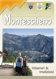
Montescheno<br />
II primo paese che si incontra percorrendo la <strong>Valle</strong> <strong>Antrona</strong> è Montescheno,<br />
posto in posizione soleggiata, nell’ampio triangolo formato dall’Ovesca<br />
e dalla Brevettola. Il paese non è formato da un solo nucleo di abitazioni,<br />
ma dalle frazioni di Cresti, Groppo, Ovesco, Cadmater, Cadpera, Sasso, Progne<br />
sotto e sopra, Selve, <strong>Valle</strong>miola, Barboniga, <strong>Valle</strong>ggia, Zonca e parte di<br />
Galliano. Il suo nome deriva dal latino “schena” e dal genitivo “montis”, da cui<br />
“schiena montuosa”. In un periodo non ben definito una colonia di pastori,<br />
lasciata la vita nomade, si stabilì in forma associativa nell’attuale territorio<br />
di Montescheno. Nel 1519 il paese ottenne i suoi statuti. La vita di Montescheno,<br />
al pari di quella di tutti gli altri comuni della valle, consisteva nell’agricoltura<br />
e nella pastorizia. Naturale predisposizione di Montescheno,<br />
grazie alla sua esposizione al sole, è sempre stata l’agricoltura e di questo<br />
sono testimonianza Torchi, Forni e Mulini ancora presenti nelle frazioni. La<br />
1 1
coltivazione più diffusa era quella della vite, dalla quale si otteneva un vino<br />
discreto quale merce di scambio attraverso la “Strada Antronesca”. Le altre<br />
coltivazioni furono quelle della segale, delle patate e della canapa, quest’ultima<br />
lavorata nello iutificio di Villadossola. Ma Montescheno è stato influenzato<br />
anche dalla presenza di esperti minatori e conoscitori dell’estrazione<br />
del minerale di ferro della vicina “Ogaggia”. Dall’inizio dell’ottocento il minerale<br />
estratto, dopo la cernita e l’arrostimento, veniva trasportato agli opifici<br />
di Villadossola fatti costruire da Pietro Maria Ceretti.<br />
All’interno del territorio si possono vedere:<br />
Case di interesse architettonico, Cappelle, Oratori, La Parrocchiale del 1644,<br />
Il campanile del 1783, fontane in sasso, forni, torchi, mulini, lavatoi, ponti ad<br />
arco in sasso, cava di micca, cava di laugera (pietra ollare), incisioni rupestri,<br />
luogo di ritrovamento tomba di epoca romana, centrali idroelettriche.<br />
N.B.- Per gli itinerari e i luoghi culturali si possono avere informazioni nel<br />
“Centro di consultazione del territorio” a Cresti (tel. 0324 576002)<br />
On thè way along thè <strong>Antrona</strong> valley Ihe first village to be mei is Monle-<br />
scheno, lying in sunny posilion in Ihe wide Iriangle formed by thè Ovesca<br />
and thè Brevettala streams. The village does not consisl of a single core of hou-<br />
ses bui of Ihe hamlels of Cresti, Groppo, Ovesco, Cadmater, Cadpera, Sasso, Pro-<br />
gne lower and higher, Selve, <strong>Valle</strong>miola, Barboniga, <strong>Valle</strong>ggia, Zonca and a pari of<br />
Galliano. Its name comes from Ihe Lalin “Schena” (back, ridge) and from Ihe Lalin<br />
genitive “montis”, hence “mountain ridge”. In ancient times noi well determined,<br />
a colony of shepherds, once abandoned thè nomadic life, setlled down forming<br />
a community in thè present area of Monlescheno. In 1519 Ihe village oblained<br />
ils slatules. Life in Montescheno, as well as in ali thè other communes of thè val-<br />
ley, was based on agriculture and stock rearing, thè most widespread cultivation<br />
was vineyard, that produced a fairly good wine though poor in alcohol. The sta-<br />
tutes of 1519 controlied its production. Other cultivations were rye, potato and<br />
hemp. The hemp was processed in thè jute factory of Villadossola. During thè<br />
past centuries great importance for thè economie life was given to thè iron mi-<br />
nes, which thè Montescheno area was rich of. The statutes of 1519 controlied<br />
their exploitation.<br />
Places of interest: for itineraries, cultural sights of interest and more information<br />
contact the “Centro di Consultazione del Territorio” at Cresti. Tel. 0324576002<br />
Das erste Dorf, das man antrifft wenn man durch das Tal <strong>Antrona</strong> dur-<br />
chfährt, ist Montescheno. Es liegt in einer sonnigen Position im weiten<br />
Dreieck, das vom Ovesca und dem Brevettola geformt ist. Das Dorf ist nicht nur<br />
von einem bewohnten Ortskern geformt, sondern auch von den Fraktionen Cre-<br />
sti, Groppo, Ovesco, Cadmater, Cadpera, Sasso, Progne sotto und sopra, Selve,<br />
<strong>Valle</strong>miola, Barboniga, <strong>Valle</strong>ggia, Zonca und einem Teil von Galliano. Sein Name<br />
stammt aus dem lateinischen „Schena“ und vom Genitiv „Montis“, also „Schiena<br />
Montuosa“. In einem nicht genau definierbaren Zeitalter, stabilisierte sich eine<br />
Kolonie von Hirten die das Nomadenleben aufgaben, in einer zusammenge-<br />
schlossenen Form im aktuellen Gebiet von Montescheno. Im Jahre 1519 gewann<br />
das Dorf seine Verfassungen. Das Leben in Montescheno, dass das selbe wie in<br />
den anderen Gemeinden des Tals ist, bestand aus der Landwirtschaft und der<br />
Viehzucht. Die natürliche Veranlagung von Montescheno, dank seiner Sonnen-<br />
belichtung, ist immer schon die Landwirtschaft gewesen, was die Druckpres-<br />
sen, Öfen und Mühlen bezeugen die in den Fraktionen noch vorhanden sind.<br />
Die verbreitete Bewirtschaftung war die Weinrebe aus der man einen dezenten<br />
Wein erhielt, die als Austauschware über die Strasse „Antronesca“ ging. Die an-<br />
deren Bewirtschaftungen waren Roggen, Kartoffeln und Hanf das im Hilfswerk<br />
von Villadossola bearbeitet wurde. Aber Montescheno war auch von Minenar-<br />
beit-Experten und Kenner der Gewinnung des Eisenerzes der nahen „Ogaggia“<br />
beeinflusst. Am Anfang des 18. Jahrhunderts wurde das gewonnene Eisenerz,<br />
nach der Sortierung und Röstung, in die Werkstätten von Villadossola transpor-<br />
1 1
tiert, die von Pietro Maria Ceretti erbaut wurden. Im Inneren des Gebiets kann<br />
man folgendes besichtigen: Häuser von architektonischen Interesse, Kappellen,<br />
Oratorien, die Pfarrkirche von 1644, der Glockenturm von 1783, Steinbrunnen,<br />
Öfen, Druckpressen, Mühlen, Waschplätze, Brücken mit Steinbögen, die Gruben<br />
Micca und Laugera (Stein „Ollare“), Felseinschnitte, eine Entdeckungsstätte von<br />
Särgen aus dem römischen Zeitalter und Hydroelektrische Kraftwerke.<br />
Für Reiserouten und kulturelle Plätze kann man sich im „Beratungszentrum im<br />
Gebiet“ in Cresti informieren (Tel. 0324 576002)<br />
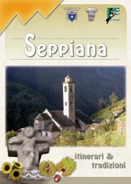
Seppiana<br />
Seppiana, anticamente chiamata “Silva plana”, sta a indicare selva o bosco<br />
pianeggiante, anche se l’unica parte pianeggiante del suo territorio<br />
è rappresentata dai terrazzamenti ricavati dai suoi abitanti sui fianchi<br />
della montagna. Nel periodo dello sfruttamento delle miniere di ferro<br />
vi abitavano i maestri più benestanti che operavano al di fuori del pro-<br />
prio territorio comunale. I suoi alpeggi, ancora ben conservati, sorgono<br />
quasi tutti sul versante a nord, oltre il torrente Ovesca. In ricordo delle<br />
lotte sostenute nei tempi passati dal piccolo paese contro Villadossola,<br />
per il possesso dell’Alpe di San Giacomo, si svolge ogni anno la processione<br />
conosciuta come “l’Autani di Seppiana”. Intorno al 1200 acquisì il<br />
diritto di erigerei a Parrocchia autonoma, divenendo poi la matrice di<br />
tutte le altre chiese della <strong>Valle</strong> <strong>Antrona</strong>. La pergamena inviata da Papa<br />
Innocenze II nel 1133 a Litifredo (Vescovo di Novara) elencava le tre Pievi<br />
dell’Ossola (Domodossola, Pievevergonte e Mergozzo), e stabiliva che<br />
la Pieve di Oxilia (Domodossola) si estendeva a tutta l’Ossola superiore<br />
a partire dalla sponda sinistra dell’Ovesca. II torrente Ovesca divideva<br />
le due Pievi di Oxilia e di Vergente, anche se alcune frazioni di Villa che<br />
sorgevano in sponda destra erano di competenza della Pieve di Vergente<br />
. Fu così che questa zona, dopo la separazione da Oxilia, venne compresa<br />
nella nuova Parrocchia della <strong>Valle</strong> <strong>Antrona</strong>. A Seppiana, situata in<br />
posizione centrale rispetto alle altre comunità del territorio, venne eretta<br />
una chiesa capace di accogliere tutti i fedeli della valle. La prima costruzione<br />
della chiesa pare risalga all’XI secolo. Questa ipotesi è avvalorata<br />
dal fatto che dalla struttura architettonica dei suoi muri perimetrali<br />
emergono i resti delle archeggiature romaniche. In origine la chiesa era<br />
costituita da una solida navata a pianta rettangolare che terminava con<br />
un’abside semicircolare. La sua posizione strategica lungo la Strada Antronesca<br />
permetteva di accedervi agevolmente a tutte le comunità delle<br />
frazioni di Montescheno, Seppiana, Viganella, Schieranco e <strong>Antrona</strong>.<br />
All’interno del territorio si possono vedere:<br />
Case di interesse architettonico, Cappelle, Oratori, La Parrocchiale, il Crocefisso<br />
del XII secolo scolpito nel marmo di Creola, lavatoi, fontane in sasso.<br />
N.B.-Per gli itinerari e i luoghi culturali si possono avere informazioni nel<br />
“Centro di consultazione del territorio” a Seppiana (tel. 0324 56260).<br />
0 1
Seppiana’s name, formerly called “Silva Plana” (fiat forest) indicates a flat<br />
forest or wood, even if the only flat part of it is represented by the terra-<br />
cings obtained by its inhabilants on the mountain sides. During the exploita-<br />
tion of the iron mines in this village lived the most wealthy master workers who<br />
operated out of their municipality. Seppiana’s pastures, still well kept, are nearly<br />
all situated on the north side, beyond the Ovesca Stream. A procession known<br />
as “l’Autani di Seppiana” is performed every year in memory of the past times<br />
struggles of this small village against Villadossola for the possession of the Alpe<br />
S. Giacomo. About in 1200 Seppiana acquired the right to raise to the status of<br />
autonomous parish, later on becoming the matrix of all the other churches of<br />
the <strong>Antrona</strong> valley. The parchment paper sent from Pope Innocenze II to Litifre-<br />
do (bishop of Novara) in 1133, was listing the three Parishes of the Ossola (Do-<br />
modossola, Pieve Vergente, Mergozzo) and eslablished that the parish of Oxilia<br />
(Domodossola) was extended to all the higher Ossola starting from the left bank<br />
of the Ovesca stream. The Ovesca divided the two parishes of Oxilia and Vergon-<br />
te, though some neighbourhoods of Villadossola, situated on the right bank, fell<br />
within the competence of the Vergonte parish. This is why afler the separation<br />
from Oxilia this area was included in the new parish of the <strong>Antrona</strong> valley. At<br />
Seppiana, centrally located with respect to the other communities of the area, a<br />
large church was erected to welcome all the faithful of the valley. Apparently the<br />
church was first built in the C11. This assumption is strengthened by the eviden-<br />
ce that the remains of the Romanesque arcade are rising from the architectural<br />
structure of the external walls. Originally the church was formed by a solid nave<br />
with a rectangular plan that ended with a semicircular apse. Its strategic posi-<br />
tion along the <strong>Antrona</strong> route allowed an easy access to all the communities of<br />
the hamlels of Montescheno, Seppiana, Viganella, Schieranco and <strong>Antrona</strong>.<br />
Places of interest<br />
For itineraries, cultural sights of interest and more information contact the “Cen-<br />
tro di Osservazione del Territorio” at Seppiana. Tel. 032456260<br />
Seppiana das auf antike Weise “Silva plana” genannt wird, dass soviel wie<br />
Forst oder flacher Wald bedeutet, auch wenn der einzige ebene Teil des<br />
Gebietes von Terrassierungen repräsentiert ist, die von seinen Einwohnern an<br />
den Seiten des Berges angelegt wurden. Im Zeitalter der Ausbeutung des Eisen-<br />
bergwerks wohnten hier die reichsten Führer, die außerhalb vom eigenen Ge-<br />
biet der Gemeinde tätig waren. Seine Almweiden, die noch gut konserviert sind,<br />
erheben sich fast alle auf dem Hang in Richtung Nord über den Bach Ovesca<br />
hinaus. In Erinnerung an die Kämpfe der vergangen Zeit, die von dem kleinen<br />
Dorf gegen Villadossola um das Besitztum der Almweide San Giacomo ausge-<br />
führt wurden, findet hier jedes Jahr die Prozession statt die als „Die Autani von<br />
Seppiana“ bekannt ist. Um das Jahr 1200 kauften sie sich das Recht ab um die<br />
unabhängige Pfarrkirche zu errichten, die später die Mutter aller anderen Kirchen<br />
des Tals <strong>Antrona</strong> wurde. Das Pergament, das im Jahre 1133 vom Papst Innocen-<br />
zo II an Litifredo (Bischof von Novara) gesandt wurde, listete die drei Pfarreien<br />
des Ossola (Domodossola, Pievevergonte und Mergozzo) auf, und stabilisierte<br />
die Pfarrei Oxilia (Domodossola) die sich auf dem ganzen oberen Ossola, ange-<br />
fangen vom linken Ufer der Ovesca, ausdehnte. Der Bach Ovesca teilte die zwei<br />
Pfarreien Oxilia und Vergente, auch wenn einige Fraktionen von Villa, die auf dem<br />
rechten Ufer stehen, unter der Kompetenz der Pfarrei Vergente lagen. So war es<br />
das dieses Gebiet nach der Teilung von Oxilia zur neuen Pfarrkirche des Tals An-<br />
trona zugeteilt wurde. In Seppiana, in zentraler Position gelegen im Ge-<br />
gensatz zu den anderen Gemeinden des Gebiets, wurde eine Kir-<br />
che erbaut die fähig war alle Gläubigen des Tals aufzunehmen.<br />
Die erste Konstruktion der Kirche scheint auf das 11. Jahrhun-<br />
dert zurückzugehen. Diese Hypothese wurde durch die Tatsa-<br />
che bekräftigt, das von der architektonischen Struktur seiner<br />
Außenmauern Reste romanischer Kreisbögen zum Vorschein<br />
kamen. Ursprünglich bestand die Kirche aus einem soliden<br />
Kirchenschiff mit rechteckigem Grundriss, das mit einem hal-<br />
bkreisförmigen Apsis endete. Ihre strategische Position, en-
tlang der Strasse von <strong>Antrona</strong>, ermöglichte es das die Gemeinden der Fraktionen<br />
Montescheno, Seppiana, Viganella, Schieranco und <strong>Antrona</strong> die Kirche leicht er-<br />
reichen konnten.<br />
Im Inneren Teil des Gebiets kann man folgendes besichtigen:<br />
Häuser von architektonischen Interesse, Kappellen, Oratorien, die Pfarrkirche, das<br />
Kruzifix aus dem 12. Jahrhundert das in das Marmor von Creola eingemeißelt<br />
wurde, Waschplätze und Steinbrunnen.<br />
N.B. - Für Reiserouten und kulturelle Plätze kann man sich beim “Beratungszen-<br />
trum des Gebiets“ in Seppiana informieren (Tel. 0324 56260)<br />
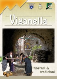
Viganella<br />
Viganella è il comune centrale della valle <strong>Antrona</strong> e per secoli fu il centro<br />
della lavorazione del minerale ferroso estratto dalle miniere d’Ogaggia. La<br />
cosa che maggiormente colpisce l’occhio del visitatore che giunge a Viganella,<br />
è la bellezza del suo centro storico, aggrappato ad un dosso roccioso<br />
compreso tra due piccoli corsi d’acqua, non ancora contaminato da<br />
interventi edilizi in odore di modernità. Uno dei rii sopraccitati forma una<br />
cascata, con quattro salti d’acqua che in alcuni periodi dell’anno offre uno<br />
spettacolo degno di nota. Fino all’inizio dell’Ottocento, questo territorio era<br />
denominato semplicemente “Comune di Mezza <strong>Valle</strong>”, e solo recentemente<br />
ha assunto la denominazione di Viganella che per alcuni è toponimo<br />
che sta ad indicare il pascolo del vicinale, per altri, proviene dall’antico appellativo<br />
“Ulcanella” frutto della presenza dei numerosi forni fusori per la<br />
lavorazione del ferro, simili a piccoli vulcani, attivi sul territorio. L’architettura<br />
rurale è, infatti, tipica di una comunità di minatori carbonai e fabbri, e<br />
le origini della storia del ferro in Piemonte non possono prescindere dalla<br />
storia di questa comunità, come precisato nel più antico documento che<br />
si riferisce a questa attività, che risale al 21 luglio 1217 conservato nell’archivio<br />
storico di Torino. Significativa anche la definizione “Squadra del For-<br />
no Ossola Superiore” presente sulle mappe Teresiane del 1722, riferita alle<br />
frazioni Prato, Porta, Terzo Fuori, Ruginenta ed Isella che stabiliva con inequivocabile<br />
precisione una delle più antiche sedi di lavorazione del ferro<br />
nell’Ossola in epoca antica. Un altro documento, che risale al 1291, certifica<br />
che i valichi alpini erano sicuramente più frequentati e percorribili rispetto<br />
ai giorni nostri, ed erano percorsi non solo da pastori e da greggi, ma anche<br />
da minatori e mercanti. La <strong>Valle</strong> <strong>Antrona</strong> divenne così un importante centro<br />
minerario e lo rimase fino al secondo dopoguerra grazie all’attività del<br />
fabbro ferraio Pietro Maria Ceretti che continuò l’antica attività estrattiva ed<br />
utilizzava il minerale nelle fabbriche di sua proprietà costruite a Villadossola.<br />
Nel 1921 una piena del torrente Ovesca disseppelliva nei pressi dell’antico<br />
abitato d’Isella, un altoforno ed un maglio e nel 1967 i resti di uno
splendido crogiuolo rinvenuto a Porta furono portati<br />
a Villadossola davanti alla nuova Chiesa divenendo<br />
“monumento al lavoro”. La chiesa parrocchiale<br />
dedicata a Maria Nascente del 1614, è senza dubbio<br />
l’edificio storico di maggior pregio al cui interno<br />
sono presenti sculture e pitture di straordinario<br />
interesse tra le quali spiccano le opere di Giulio<br />
e Paolo Guaglio di Giuseppe Mattia Borgnis e Giacomo<br />
del Zoppo. Di notevole rilevanza anche l’edificio storico<br />
denominato “Casa Vanni” con il pregevole colonnato seicentesco, l’antica<br />
torretta medievale, la “casa forte” del XVI secolo, cappelle ed oratori sparsi<br />
qua e là lungo tutto il territorio ed ancora fontane in sasso, ponti romanici<br />
in pietra, forni, macine frantoio per la spremitura delle noci, incisioni rupestri<br />
e le famose cisterne della Colma. Degna di nota anche l’archeologia,<br />
che riporta le origini di Viganella in epoca lontanissima grazie alla presenza<br />
sul territorio di nicchie e grotte a falsa cupola risalenti al megalitico, simili a<br />
quelle rinvenute a Varchignoli ed una necropoli romana nella frazione Rivera<br />
dove furono rinvenute olpe e coppe in terracotta e monete bronzee risalenti<br />
al 156 DC. Tra le tradizioni più belle “La Candelora” che si celebra ogni<br />
anno il 2 febbraio con la riproposizione della “Pescia”, l’Autani dell’alpe Cavallo<br />
la prima domenica d’agosto e la patronale di S.Maria l’8 settembre. Da<br />
rimarcare la presenza di un gruppo folk che veste l’antico costume locale<br />
ed una corale “i Cantori di Viganella” che ancora cantano il gregoriano classico.<br />
Le frazioni alte Bordo e Cheggio, immerse nel verde del bosco, sono<br />
divenute luogo di meditazione per un gruppo mitteleuropeo appartenente<br />
alla religione buddista.<br />
N.B. per informazioni sugli itinerari e i luoghi culturale è attivo il “centro di consultazione<br />
del territorio” a Viganella. Tel. 032456002<br />
Viganella is the principle municipality of the <strong>Antrona</strong> <strong>Valle</strong>y and for cen-<br />
turies was a centre for the working of ferrous minerals extracted from the<br />
mines at Ogaggia. What especially strikes the visitor is the beauty of the town’s<br />
historical centre, not yet contaminated by modern construction in the name of<br />
progress, clinging to a rocky outcrop between two mountain streams. One of<br />
these watercourses forms a 4-tiered waterfall which at certain times of the year<br />
can be quite spectacular. Up until the beginning of the 19th century Viganella<br />
was simply known as the “Comune di Mezza <strong>Valle</strong>”, and it is only in more recent<br />
times that it has assumed its present name, which for some is the place name of<br />
nearby pastures, while for others comes from the ancient name “Ulcanella” which<br />
refers to the presence of numerous smelting furnaces once active in the area. The<br />
rural architecture is, in fact, typical of communities of coal miners and blacksmi-<br />
ths, and the origins of iron-working in Piedmont cannot ignore the history of this<br />
community and its local activity, as first described in a document dating back to<br />
21 July 1217, now preserved in historical archives at Turin. Also significant is the<br />
“Squadra del Forno Ossola Superiore” identified on the Teresiane map of 1722,<br />
which included the hamlets of Prato, Porta, Terzo Fuori, Ruginenta and Isella and<br />
clearly established the location of one of the oldest iron-working sites in Ossola.<br />
Another document, from 1291, certifies that the nearby alpine passes were more<br />
frequently and easily travelled than they are today, and were used extensively,<br />
not only by shepherds herding their flocks, but also by miners and traders. The<br />
<strong>Antrona</strong> <strong>Valle</strong>y was thus an important mining area and remained so up to the<br />
end of the post-second world war period, thanks to the activities of the blacksmi-<br />
th Pietro Maria Ceretti, who continued to pursue this local tradition of extracting<br />
iron and then utilizing it in his steelworks at Villadossola. In 1921, flooding of the<br />
Ovesca torrent unearthed an old blast furnace and a drop hammer near the an-<br />
cient hamlet of Isella and in 1967 fragments of a splendid crucible, found at Por-<br />
ta, were brought to Villadossola, incorporated into a bronze statue and placed in
front of the new Church as a “monument to labour”. The Parish church, dedica-<br />
ted to Maria Nascente and built in 1614, is, without a doubt, the town’s most im-<br />
portant historical building and contains valuable sculptures and paintings with<br />
works of particular interest by Giulio and Paolo Guaglio, Giuseppe Mattia Borgnis<br />
and Giacomo del Zoppo. Also worth noting: “Casa Vanni” with its lovely 17th-<br />
century colonnade; the town’s medieval tower; the 16th-century “casa forte”, a<br />
small defense stronghold; numerous chapels and oratories scattered here and<br />
there throughout the area; stone fountains, Roman bridges, kilns, millstones used<br />
to press walnuts, Rupestrian carvings and the famous 18th-century cisterns at<br />
Colma. Archeological remains, such as the megalithic niches and domed caves<br />
identified at Varchignoli, and the Roman necropolis discovered near the hamlet<br />
of Rivera, where terracotta amphoras and cups and bronze coins dated 156m AC<br />
were also found, all testify to the ancient origins of Viganella. Old customs and tra-<br />
ditions are still popular and the most characteristic of these is the “Candelora”, ce-<br />
lebrated every year on 2 February with the procession of the “Pescia”, a large tree<br />
branch hung with objects for the auction which follows; the “Autani” procession<br />
that winds through the alpine pastures at Cavallo on the first Sunday in August,<br />
and the Feast Day of the town’s patron saint, Santa Maria, on September 8th. A lo-<br />
cal folk group participates in various events wearing the traditio-<br />
nal costumes of the valley and a choral group, “I Cantori di<br />
Viganella”, performs classic Gregorian chants, while a<br />
group of Buddhist followers from northern Europe<br />
have established meditation centres in the ham-<br />
lets of Bordo and and Cheggio, immersed in the<br />
luxuriant green woodlands above town. For iti-<br />
neraries, cultural sights of interest and more in-<br />
formation contact the “Centro di Consultazione<br />
del Territorio” at Viganella. Tel. 032456002<br />
Viganella ist die zentrale Gemeinde des Tals <strong>Antrona</strong> und es war über<br />
Jahrhunderte das Bearbeitungszentrum für Eisenerz, das wiederum aus<br />
dem Bergwerk Ogaggia gewonnen wurde. Das, was den Besuchern die nach<br />
Viganella kommen am meisten auffällt, ist die Schönheit seines Altzentrums, fe-<br />
stgehalten an einer felsigen Erhebung zwischen zwei kleinen Wasserläufen, die<br />
noch nicht von Baumassnahmen im Rufe der Modernität verseucht wurden. Ei-<br />
nes der Bäche formt einen Wasserfall mit vier Wassersprüngen, der, in einigen Zei-<br />
träumen im Jahr, ein wahrliches Spektakel bietet. Bis Anfang des 18. Jahrhunderts,<br />
wurde das Gebiet auf einfache Weise „Gemeinde des Halbtals“ genannt und wur-<br />
de nur kürzlich auf den Namen Viganella getauft. Dieser Ortsname steht für man-<br />
che für Weide und Nähe, für andere stammt der Name aus der antiken Benennung<br />
„Ulcanella“, die von den zahlreichen Schmelzöfen für die Eisenbearbeitung her-<br />
rührt, vergleichbar mit kleinen Vulkanen die auf dem Gebiet aktiv sind. Tatsächlich<br />
ist die Landarchitektur typisch für eine Gemeinschaft aus Minenarbeitern, Köhlern<br />
und Schmieden. Vom Ursprung der Geschichte des Eisens im Piemont ist in die-<br />
ser Gemeinschaft nicht wegzusehen, wie im antiken Dokument, das über diese<br />
Tätigkeit spricht, präzisiert wird. Das Dokument geht auf den 21. Juli 1217 zurück<br />
und ist im Archiv der Geschichte in Turin konserviert. Von Bedeutung ist auch die<br />
Definition „Ofentruppe des Oberen Ossola“ das man auf den Teresianer Landkar-<br />
ten vom Jahre 1722 lesen kann. Diese bezieht sich auf die Fraktionen Prato, Porta,<br />
Terzo Fuori, Ruginenta und Isella, die im antiken Zeitalter, mit eindeutiger Präzision,<br />
eines der ältesten Eisenbearbeitungssitze im Ossola bestimmte. Ein anderes Do-<br />
kument, das auf das Jahr 1291 zurückgeht, bestätigt, das die Alpenpässe sicherlich<br />
mehr besucht und befahren wurden im Gegensatz zu heute. Es waren Strecken<br />
die nicht nur von Hirten und Grobians beschreitet wurden, aber auch von Mine-<br />
narbeitern und Händlern. Das Tal <strong>Antrona</strong> wurde so ein wichtiges Bergwerkszen-<br />
trum und blieb es bis Ende des zweiten Weltkriegs dank der Geschäftigkeit des<br />
Eisenschmiedes Pietro Maria Ceretti der diese antike Gewinnungstätigkeit wei-<br />
terführte und dieses Mineral in seinen von ihm gebauten Fabriken in Villadosso-
la benutzte. Im Jahre 1921 grub eine Überschwemmung des Baches Ovesca, in<br />
der Nähe der antiken Ortschaft Isella einen Hochofen und einen Hammer aus. Im<br />
Jahre 1967 wurden die Reste eines prächtigen Schmelztiegels nach Villadossola<br />
vor die neue Kirche gebracht und als „Monument der Arbeit“ ernannt. Die Pfar-<br />
rkirche, aus dem Jahre 1614, ist der Maria Nascente gewidmet und ohne Zweifel<br />
ein historisches Gebäude mit großem Wert aufgrund seiner außergewöhnlichen<br />
Skulpturen und Gemälde die im inneren Teil zu finden sind. Beispiele sind die We-<br />
rke von Giulio und Paolo Guaglio, Giuseppe Matti Borgnis und Giacomo del Zop-<br />
po. Von bemerkenswerter Bedeutung ist auch das historische Gebäude, genannt<br />
„Casa Vanni“, mit seinen wertvollen mittelalterlichen Türmchen, die Steinbrunnen,<br />
die romanischen Steinbrücken, Öfen, Ölmühlen für die Pressung von Nüssen, Fel-<br />
seneinschnitte und die bekannten Zisternen der Colma. Auch zu erwähnen ist<br />
die Archäologie, die in ein weit zurückliegendes Zeitalter an den Ursprung von<br />
Viganella führt, dank des Vorhandenseins von Nischen und Grotten mit falschen<br />
Kuppeln die auf das Megaliticum zurückgehen, vergleichbar mit denen die nach<br />
Varchignoli kamen, und eine römische Nekropolis in der Fraktion Rivera wo man<br />
Schalen und Kelche aus Terrakotta und Geldstücke aus Bronze fand, die auf das<br />
Jahr 156 nach Christus zurückgehen. Die schönsten Traditionen sind die Feierli-<br />
chkeiten „La Candelora“ die man jedes Jahr am 2. Februar feiert und die Wiederau-<br />
flebung der „Pescia“. Das Fest der Autani des Alpe Cavallo feiert man hier am ersten<br />
Sonntag im August und das Patronsfest von Santa Maria am 8. September. Her-<br />
vorzuheben ist auch die Volksgruppe mit ihren antiken, traditionellen Kostümen<br />
und der Chor „Die Cantori von Viganella“ die noch gregorianische Klassikmusik sin-<br />
gen. Die oberen Fraktionen Bordo und Cheggio, die sich inmitten der Wälder be-<br />
finden, sind Orte der Meditation für eine mitteleuropäische Gruppe geworden die<br />
zur Buddhistischen Religion gehören.<br />
Für Informationen zu Reiserouten und Kulturorten ist das „Beobachtungszentrum<br />
des Gebietes“ in Viganella zu kontaktieren. Tel. 0324 56002<br />
<strong>Antrona</strong><br />
<strong>Antrona</strong>piana sorge in una verde conca ove confluiscono i torrenti Loranco<br />
e Troncone per dare origine all’Ovesca. Seppure poco conosciuto, questo<br />
paese, ricco di storia, vanta tradìzioni antiche. Abitato originariamente da<br />
pastori provenienti dalla confinante valle Bognanco. si sviluppò ben presto,<br />
mantenendo un certo distacco dalla parte rimanente della valle e da Villadossola.<br />
Quando negli altri paesi della valle fervevano i lavori di estrazione e<br />
di fusione del ferro, l’economia di <strong>Antrona</strong> si basava esclusivamente sullo sviluppo<br />
dell’attività silvopastorale; fino a pochi decenni or sono l’unica forma<br />
di sostentamento per la gente del luogo. I vincoli di parentela stretti con gli<br />
abitami della limitrofa valle di Saas nel <strong>Valle</strong>se svizzero, contribuirono a rafforzare<br />
il paese, ma anche ad accrescerne il distacco con la rimanente parte<br />
della valle. Non erano infrequenti i matrimoni fra ragazze della valle di Saas-<br />
0 1
Almagell e giovani di <strong>Antrona</strong>piana e per questo motivo che gli altri paesi<br />
della <strong>Valle</strong> <strong>Antrona</strong> usavano chiamare le donne di <strong>Antrona</strong>piana col soprannome<br />
di “Sosse”. La valle di Saas intatti si chiamava Sosa, Sossa o Sausa. Dalla<br />
prima metà del nostro secolo, fino ai nostri giorni. <strong>Antrona</strong> è stala oggetto di<br />
una profonda e vistosa metamorfosi. In luogo delle vecchie baite, prodotto<br />
di un”architettura povera, sono state costruite case di moderna concezione,<br />
ma pur sempre nel rispetto dell’ambiente di montagna. La realizzazione di<br />
grossi bacini idrici nella parte sommitale della valle, alimentanti alcune centrali<br />
idroelettriche, ha consentito a buona parte degli abitanti di intraprendere<br />
una occupazione alternativa a quella della pastorizia e molto più redditizia.<br />
Non ultimo, l’attività alpinistica sviluppatasi grazie alla buona volontà<br />
di alcuni componenti la <strong>sezione</strong> C.A.I. di Villadossola e della gente locale,<br />
ha contribuito in grande misura a fare uscire questa zona poco conosciuta,<br />
dal suo volontario isolamento, Oggigiorno <strong>Antrona</strong> si presenta in una veste<br />
completamente nuova, altrezzata per gli sport invernali con le sue piste di<br />
pattinaggio e per lo sci di fondo e con l’impianto di risalita dell’alpe Cheggio,<br />
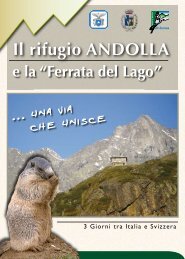
e per quelli estivi con il suo capiente Rifugio Andolla, fiore all’occhiello<br />
della <strong>sezione</strong> C.A.l. di Villadossola, e una rete di bivacchi dislocati nei punti<br />
strategici della valle, che costituiscono un valido appoggio per tutti coloro<br />
che si sentono attratti dalla montagna. Di particolare interesse l’enorme frana<br />
staccatasi dal monte Pozzolo nel 1642 e le località di Schieranco, Cama e<br />
il vallone di Trivera con lo stabilimento di Locasca furono i principali luoghi<br />
della lavorazione dell’oro che durò fino al 1950.<br />
All’interno del territorio si possono vedere:<br />
Case di interesse architettonico, Cappelle, Oratori, La Parrocchiale del 1650,<br />
lavatoi, fontane in sasso, centrali idroelettriche con relativi bacini, incisioni<br />
rupestri, rocce verdi di <strong>Antrona</strong>.<br />
N.B.-Per gli itinerari e i luoghi culturali si possono avere informazioni nel “Centro<br />
di consultazione del territorio” ad <strong>Antrona</strong> (tel. 0324 51805).<br />
<strong>Antrona</strong>piana lies in a green basin where the Loranco and the Tronco-<br />
ne streams flow together and originate the Ovesca stream. This not well<br />
known village is rich of history and boasts ancient traditions. Originally inha-<br />
bited by shepherds coming from the near Bognanco valley, the village soon<br />
spread out, keeping some independence from thè rest of thè valley and from<br />
Villadossola. When in the other villages the iron ore extraction and fusion pro-<br />
cesses were at the height, the economy of <strong>Antrona</strong>piana was only based on the<br />
development of sylviculture and stock rearing; these were the only sustenance<br />
forms of the dwellers until a few decades ago. The bonds of relationship with<br />
the dwellers of the neighbouring Saas valley in the Swiss Valais contributed to<br />
strengthen the village, but also to increase its isolation from the rest of the val-<br />
ley. Marriages between girls from the Saas-Almagell valley and young men from<br />
<strong>Antrona</strong>piana were not unfrequent. Por this reason in the other villages of the<br />
<strong>Antrona</strong> valley the women from <strong>Antrona</strong>piana were usually given the nickname<br />
“Sosse”. The Saas valley was in fact named Sosa, Sossa or Sausa. From the Ist half<br />
of our century up to these days, <strong>Antrona</strong>piana has become the object of a deep<br />
and considerable metamorphosis. In the place of the old alpine huts, product<br />
of a poor architecture, new houses of modern design were built, taking into ac-<br />
count the impact on the mountain environment. The construction of some lar-<br />
ge water basins in the upper part of the valley, to feed the hydroelectric power<br />
plants, has provided most of the inhabitants with a much more profitable occu-<br />
pation, alternative to stock rearing. Last but not least, the mountain climbing, an<br />
activity developed thanks to some members of the C.A.I. branch of Villadossola<br />
and thanks to some locals of good will, has helped in great measure this area<br />
not well known to come out of its voluntary isolation. Nowadays <strong>Antrona</strong>piana<br />
shows its wholly renewed appearance. It’ s a resort equipped for winter sports<br />
with an ice skating rink, cross-country ski runs and a ski lift to the Alpe Cheggio.<br />
Summer mountain climbing is supported by the Andolla refuge with great ac-
comodation capacity, cause of pride for the C.A.I. branch of Villadossola, and a<br />
network of bivouacs positioned in the strategie points of the valley. They can<br />
provide a useful occasional shelter and stopping piace for all those who feel<br />
attracted by the mountains. To know the history of <strong>Antrona</strong>piana, Nowadays<br />
<strong>Antrona</strong>piana shows its wholly renewed appearance. It’ s a resort equipped for<br />
winter sports with an ice skating rink, cross-country ski runs and a ski lift to the<br />
Alpe Cheggio.<br />
PLACES OF INTEREST<br />
For itineraries, cultural sights of interest and more information contact the “Cen-<br />
tro di Consultazione del Territorio” at <strong>Antrona</strong>. Tel. 032451805<br />
<strong>Antrona</strong>piana erhebt sich in einem grünen Becken indem die Bäche<br />
Loranco und Troncone zusammenfließen, um so einen Ursprung „Ovesca“<br />
darzustellen. Auch wenn es wenig bekannt ist, ist dieses Land reich an Geschichte<br />
das antike Traditionen aufweist. Ursprünglich war es von Hirten bewohnt die aus<br />
dem angrenzenden Tal Bognanco stammten. So entwickelte es sich schnell,<br />
wenn es auch einen ziemlichen Abstand zum Rest des Tals und zu Villadossola<br />
hat. Als in den anderen Dörfern die Gewinnungs- und Verschmelzungsarbeiten<br />
des Eisens auf Hochtouren liefen, basierte die Wirtschaft in <strong>Antrona</strong> dagegen<br />
ausschließlich auf der Entwicklung der Forstwirtschaft. Es ist nur wenige<br />
Jahrzehnte her, als dies die einzige Form des Lebensunterhalts der Einwohner<br />
war. Die enge Verbindung mit den Einwohnern des angrenzenden Tals von Saas<br />
im Schweizerischen Vallis, trug dazu bei das Dorf zu verstärken, um den Abstand<br />
mit dem restlichen Teil des Tals zu erhöhen. Nicht selten waren die Hochzeiten<br />
zwischen den jungen Frauen des Tals Saas-Almagell und der jungen Männer von<br />
<strong>Antrona</strong>piana - deswegen riefen die anderen Dörfer die Frauen von <strong>Antrona</strong>piana<br />
mit dem Spitznamen „Sosse“ Das intakte Tal Saas hieß Sosa, Sossa oder Sausa - von<br />
der ersten Hälfte unseres Jahrhunderts an bis heute. <strong>Antrona</strong> war Gegenstand<br />
einer tiefen und auffallenden Verwandlung. Bei den alten Berghütten, die mit<br />
einer „armen Architektur“ erbaut wurden sind an deren Stelle Häuser mit einer<br />
modernen Konzeption entstanden - aber dennoch mit Respekt der Umwelt<br />
des Berges. Die Realisierung großer Wasserbecken, am höchsten Punkt des<br />
Tals, die einige Hydroelektrische Kraftwerke versorgen, hatte für einen großen<br />
Teil der Einwohner ermöglicht eine alternative Beschäftigung zu ergreifen, auch<br />
weil sie im Vergleich zur Viehzucht mehr eintrug. Nicht zuletzt hat sich auch der<br />
alpinistische Betrieb entwickelt, dank einiger Mitglieder der Ortsgruppe C.A.I. von<br />
Villadossola und der Einwohner, die im großen Masse dazu beigetragen haben,<br />
dieses wenig bekannte Gebiet aus seiner Isolation herauszuholen. Heutzutage<br />
präsentiert sich <strong>Antrona</strong> mit einer komplett neuen Aufmachung, ausgestattet für<br />
den Wintersport mit seinen Eislauf- und Langlaufpisten und mit einem Skilift des<br />
Alpe Cheggio und auch für den Sommersport mit seiner geräumigen Berghütte<br />
Andolla, das Aushängeschild der Ortsgruppe C.A.I. von Villadossola, und ein Netz<br />
aus aufgestellten Behelfsunterkünften in den strategischen Punkten des Tals,<br />
die eine wertvolle Unterstützung bilden für alle die sich vom Berg angezogen<br />
fühlen. Vom besonderen Interesse ist die enorme Lawine die im Jahre 1642 vom<br />
Berg Pozzolo abgerutscht ist, und die Lokalitäten Schieranco, Cama und das tiefe<br />
Tal von Trivera mit der Niederlassung von Locasca, waren diese einst, bis 1950,<br />
Hauptorte der Bearbeitung von Gold.<br />
Im Inneren Teil des Gebiets kann man folgendes besichtigen:<br />
Architektonische Häuser, Kappellen, Oratorien, die<br />
Pfarrkirche von 1650, Waschplätze, Steinbrunnen,<br />
Hydroelektrische Kraftwerke mit den<br />
dazugehörigen Becken, Fels-Eingravierungen<br />
und die grünen Felsen von <strong>Antrona</strong>.<br />
Für Reiserouten und kulturelle<br />
Plätze kann man sich beim<br />
„Beratungszentrum im Gebiet“ in<br />
<strong>Antrona</strong> informieren (Tel. 0324<br />
51805).
Provincia del<br />
Verbano<br />
Cusio Ossola<br />
Zona interessata dalla<br />
Comunità Montana<br />
<strong>Valle</strong> <strong>Antrona</strong><br />
Come raggiungerci<br />
In treno - Stazione Internazionale di Domodossola,<br />
linea Milano-Domodossola<br />
In bus - Dalla stazione di Domodossola tratta n° 19<br />
Domodossola Villadossola <strong>Antrona</strong><br />
In auto - Autostrada A8 - Milano Malpensa<br />
- Autostrada dei Laghi A26 - Milano, Genova, Torino<br />
- SS 33 del Sempione<br />
Organizzazione Manifestazioni sul Territorio<br />
Proloco <strong>Valle</strong> <strong>Antrona</strong> - tel. 0324 51856 prolocovalleantrona@tiscali.it<br />
Centro culturale “La Fabbrica”- tel. 0324 575611 lafabbrica@comune.<strong>villadossola</strong>.vb.it<br />
Club Alpino Italiano sez.di Villadossola<br />
tel. 0324 575245 - 338 3521952 - fax 0324 53188 www.<strong>cai</strong><strong>villadossola</strong>.it/catasto<br />
Comunità Montana <strong>Valle</strong> <strong>Antrona</strong><br />
Via Municipio, 11 - 28846 Viganella (VB) - tel. 0324 56341 - fax 0324 56362<br />
www.cmvalleantrona.it E-mail: cmva@libero.it