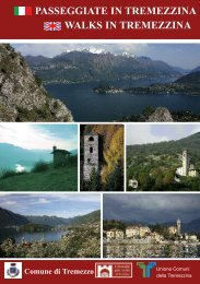

Create successful ePaper yourself
Turn your PDF publications into a flip-book with our unique Google optimized e-Paper software.
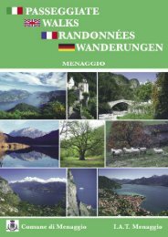
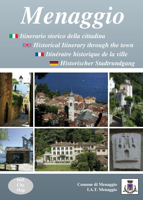
<strong>Menaggio</strong><br />
Itinerario storico della citta<strong>di</strong>na<br />
Historical Itinerary through the town<br />
Itinéraire historique de la ville<br />
Historischer Stadtrundgang<br />
Incl.<br />
City<br />
Map<br />
<strong>Comune</strong> <strong>di</strong> <strong>Menaggio</strong><br />
I.A.T. <strong>Menaggio</strong>
per COMO<br />
Parcheggio a pagamento<br />
Pay parking<br />
Parking payant<br />
Parkplatz gegen Bezahlung<br />
Parcheggio libero<br />
Free parking<br />
Parking livre<br />
Frei Parken<br />
Bellagio<br />
Varenna<br />
Via POLETTI<br />
Como<br />
Itinerario storico <strong>di</strong> <strong>Menaggio</strong><br />
Da <strong>Menaggio</strong> a Nobiallo<br />
Da <strong>Menaggio</strong> a Loveno<br />
Da <strong>Menaggio</strong> a Croce<br />
V<br />
Piazza<br />
TRAGHETTO<br />
Via PIG<br />
Via al CIMITERO<br />
17<br />
Via<br />
ATO<br />
Via<br />
WYATT<br />
CAS<br />
Via<br />
A RTELLI<br />
CASARTELLI<br />
(già Via CASATE)<br />
ia IV NOVEMBRE<br />
Colico<br />
PORLEZZA<br />
LUGANO (CH)<br />
Via STRETTA<br />
Via dell’ ERA<br />
V.le<br />
RIMEMBRANZE<br />
Frazione CROCE<br />
Via<br />
S. GIUSTO<br />
ia<br />
V<br />
Via COMO<br />
Via CERRO<br />
Via<br />
SONENGA<br />
CADORNA<br />
Via MAZZ<br />
INI<br />
LTRASIO<br />
Via STRETTA<br />
O<br />
Via Don ENRICO M<br />
CADORNA<br />
Via S. GIUSTO<br />
V. delle<br />
ROSE<br />
A<br />
Piazza<br />
GARIBALDI<br />
V. PESCE<br />
L.go<br />
CAVOUR<br />
2 S. STEFANO<br />
V. CARONTI<br />
Via CALVI<br />
Piazza<br />
GROSSI<br />
Via<br />
V. al<br />
LAGO<br />
V. PORTA<br />
Via<br />
per COMO<br />
Via MONTE GRAPPA<br />
Via<br />
1 S. MARTA<br />
Via<br />
Via MYLIUS<br />
C<br />
D<br />
Lgo<br />
FOS<br />
Via<br />
Via<br />
BENEDETTO<br />
V<br />
REZIA<br />
ia<br />
CASTELLI<br />
CAMOZ
L<br />
CADORNA<br />
.<br />
SSATO4 S. CARLO<br />
FABBRI<br />
INO<br />
3<br />
LUSARDI<br />
ZI<br />
DA<br />
Via<br />
Via<br />
8<br />
per LUGANO<br />
CAS<br />
E LL O<br />
T<br />
V. STRECIOUM<br />
C<br />
STOPPANI<br />
Via<br />
LEONI<br />
PER<br />
Via MARCONI<br />
CASTELLI<br />
O VENO<br />
Via<br />
Burgatto<br />
per COLICO<br />
ST. MORITZ (CH)<br />
Frazione LOVENO<br />
L<br />
IO<br />
G<br />
CHE<br />
ia<br />
V<br />
B<br />
Piazza<br />
VITTORIO<br />
EMANUELE<br />
Monumento alla Tessititrice<br />
Monument to the Silkweavers<br />
NAZARIO<br />
Via<br />
Via ROMA<br />
Via ROMA<br />
Via ROMA<br />
SAURO<br />
Via<br />
Piazza 11<br />
MILYUS<br />
IO SAURO<br />
ia NAZAR<br />
Piamuro<br />
Parco Val Sanagra<br />
Percorso della salute<br />
Percorso orienteering<br />
V<br />
DEI CIPRESSI<br />
L.go<br />
VITTORIO<br />
VENETO<br />
Via XXIV<br />
DIAZ<br />
MAGGIO<br />
Via<br />
12 SS. LORENZO<br />
e AGNESE<br />
P ER<br />
Via GAROVAGLIO<br />
O<br />
Via DON PIETR<br />
Via<br />
Via M. D’AZEGLIO<br />
Via<br />
CATU<br />
LA GRONA<br />
VIGONI<br />
PER<br />
VILLA<br />
VIGONI<br />
13<br />
LLA MYLIU S<br />
Via VIGONI<br />
Via VOLTA<br />
Via<br />
CARIBONI<br />
PLESIO<br />
per PLESIO<br />
BREGLIA<br />
Via FILZI<br />
Via<br />
10 SANTUARIO<br />
MADONNA<br />
DELLA PACE<br />
GHIDOLDA<br />
9 SS. BARTOLOMEO<br />
e NICOLAO<br />
per Frazione NOBIALLO<br />
per COLICO<br />
ST. MORITZ (CH)
Benvenuti a <strong>Menaggio</strong><br />
<strong>Menaggio</strong> è costituito da un centro e tre frazioni, Nobiallo, Loveno e Croce e conta ca.<br />
3.200 abitanti. Ha delle origini antiche e nel centro, come nelle frazioni non mancano ere<strong>di</strong>tà<br />
artistiche importanti. All’interno <strong>di</strong> questo opuscolo sono illustrati quattro itinerari per<br />
esplorare la nostra citta<strong>di</strong>na: uno per il borgo <strong>di</strong> <strong>Menaggio</strong>, dove troverete i resti della mura<br />
perimetrali che contornavano il castello me<strong>di</strong>evale, uno per la frazione Nobiallo con il suo<br />
campanile pendente del XIII secolo, uno per la soleggiata Loveno con le sue prestigiose<br />
ville, e per finire uno per la frazione <strong>di</strong> Croce con la sua caratteristica piazzetta. Ma prima<br />
<strong>di</strong> iniziare la passeggiata un pò <strong>di</strong> storia!<br />
Welcome to <strong>Menaggio</strong><br />
<strong>Menaggio</strong> consists of a centre and three hamlets – Loveno, Nobiallo and Croce – and<br />
has a total of 3200 inhabitants. The town is of ancient origins and its centre as well as<br />
in its hamlets there are many interesting monuments which recall <strong>Menaggio</strong>’s importance<br />
throughout the ages.<br />
Here four itineraries to explore our town, one through the centre with the climb<br />
through narrow alleys up to Castello area with remains of the impressive walls that<br />
surrounded its me<strong>di</strong>eval castle, one to Nobiallo with its characteristic leaning bell<br />
tower, one to the sunny Loveno with its splen<strong>di</strong>d villas and one to the hamlet Croce<br />
with its typical little square. But before starting your walk first some history…<br />
Bienvenue à <strong>Menaggio</strong><br />
<strong>Menaggio</strong> est situé au cœur du Lac de Côme, juste au début de la vallée qui la relie au lac<br />
de Lugano. La ville, avec les trois hameaux de Croce, Loveno, et Nobiallo. sont d’origine<br />
très anciennes et abritent un patrimoine artistique important. Quatre itinéraires vous sont<br />
proposés pour explorer notre ville : un par le bourg de <strong>Menaggio</strong> avec ses petites ruelles qui<br />
montent à Castello, un par Nobiallo avec son insolite clocher penché du XIIIème siècle, un<br />
par l’ensoleillé Loveno avec ses villas luxueuses et un par Croce avec sa place typique. Mais<br />
avant de commencer votre promenade un peu d’histoire…<br />
Willkommen in <strong>Menaggio</strong><br />
<strong>Menaggio</strong> besteht aus einem Zentrum und drei Siedlungen Loveno, Nobiallo und<br />
Croce und zählt ingesammt ca. 3200 Einwohner. Der Ort ist von antikem Ursprung<br />
und birgt in seinem Zentrum sowie in den Siedlungen zahlreiche Zeugnisse verschiedener<br />
Epochen.<br />
Hier vier Routebeschreibungen um den Ort kennen zulernen: eine Stadtrundgang<br />
durch <strong>Menaggio</strong> mit seinen kleinen Gassen <strong>di</strong>e zum Castello hinauf führen, eine<br />
Wanderung zu der Siedlung Nobiallo mit seinem schiefen Kirchturm aus dem 13. Jh.,<br />
eine Wanderung nach Loveno mit seinen prächtigen Villen und eine nach Croce mit<br />
seinem typischen alten Dorfplatz. Aber bevor man anfängt ein Wenig Geschichte…
Note storiche <strong>di</strong> <strong>Menaggio</strong><br />
Ritrovamenti archeologici in<strong>di</strong>cano, che la zona <strong>di</strong> <strong>Menaggio</strong> fu già abitata in epoca<br />
preistorica. Verso la fine del IV sec. a.C. si inse<strong>di</strong>ano le tribù galliche, che furono sottomesse<br />
dai Romani a partire dal 196 a.C. e me<strong>di</strong>ante la costruzione della storica Via<br />
Regina cominciò la romanizzazione del territorio.<br />
Durante il Me<strong>di</strong>oevo la località fu dotata <strong>di</strong> un castello. <strong>Menaggio</strong>, grazie alla sua privilegiata<br />
posizione sulla Via Regina, proprio nel punto in cui si intersecava con il tracciato<br />
che, percorrendo la Val <strong>Menaggio</strong> raggiungeva Bellinzona e quin<strong>di</strong> la valle del<br />
Ticino, era <strong>di</strong> grande importanza strategica. La Via Regina era una delle più importanti<br />
vie <strong>di</strong> transito, poiché permetteva un rapido collegamento tra la Pianura Padana e<br />
l’Oltrealpe.<br />
Nel 1523 i Grigioni, avendo già conquistato la Valtellina misero a fuoco <strong>Menaggio</strong> e<br />
il castello fu <strong>di</strong>strutto. Nel 1525 inizia la dominazione spagnola con un notevole peggioramento<br />
delle con<strong>di</strong>zioni <strong>di</strong> vita, che durerà fino al 1714.<br />
Sotto il dominio austriaco e la Duchessa Maria Teresa la vita migliorò. Nel 1805, dopo<br />
la creazione del Regno Italico, <strong>Menaggio</strong> <strong>di</strong>venne sede <strong>di</strong> Viceprefettura e, nel 1859,<br />
centro del movimento insurrezionale comasco contro gli Austriaci.<br />
Con l’avvento dello stato unitario la vocazione turistica <strong>di</strong> <strong>Menaggio</strong> si afferma in<br />
modo netto, sia con la costruzione dei due gran<strong>di</strong> alberghi - Victoria e <strong>Menaggio</strong> -, sia<br />
con l’e<strong>di</strong>ficazione <strong>di</strong> ville soprattutto a Loveno. Tra queste, Villa Mylius-Vigoni e<br />
Villa Garovaglio- Ricci, ora <strong>di</strong> proprietà della Repubblica Federale <strong>di</strong> Germania, se<strong>di</strong><br />
<strong>di</strong> un centro culturale italo-tedesco.<br />
Importante per lo sviluppo del turismo fu la costruzione della ferrovia <strong>Menaggio</strong>-<br />
Porlezza, in funzione fino al 1939 e la fondazione del <strong>Menaggio</strong> Golf Club nel 1907.<br />
Durante la Prima Guerra Mon<strong>di</strong>ale, sui monti circostanti la Crocetta e il Galbiga, fu<br />
costruito dall’Esercito Italiano un sistema <strong>di</strong>fensivo che fece parte dalla linea Cadorna,<br />
che costituisce oggi un’interessante testimonianza storica.<br />
Nel 1945 la citta<strong>di</strong>na fu testimone del tentativo <strong>di</strong> fuga verso la Svizzera <strong>di</strong> Mussolini,<br />
prima <strong>di</strong> finire prigioniero dei partigiani a Dongo.
Historical notes of <strong>Menaggio</strong><br />
<strong>Menaggio</strong> is situated on the western shore of Lake Como at the mouth of the river<br />
Sanagra. The <strong>di</strong>scovery of a few archaeological relics enables us to affirm that since<br />
early historical times people lived here. In 196 B.C., the Romans conquered the area.<br />
With the buil<strong>di</strong>ng of the road called “Via Regina” the romanisation of the area started.<br />
In the Middle Ages a castle was built in the upper part of the town and <strong>Menaggio</strong> was<br />
surrounded by walls. Because of its privileged position on the Via Regina, <strong>Menaggio</strong><br />
was strategically of great importance. Already then the Via Regina was an important<br />
commercial and travel route which connected the Lombardy plain with the area north<br />
of the alps. In the 15th century a continual succession of war time events took place.<br />
The Graubundener, who had already conquered the Valtellina, kept <strong>Menaggio</strong> under<br />
pressure and in 1523 they succeeded defeating it and destroying its castle.<br />
In 1525, the domain of Spain began and <strong>Menaggio</strong> crossed two centuries of poverty.<br />
This situation lasted till 1714 when the first Austrian domination started and quality of<br />
life rapidly improved.<br />
In 1805, after the creation of the Kingdom of Italy, <strong>Menaggio</strong> became the seat of the<br />
substituting Prefect and in 1859 centre in the Como region, of the insurrection movement<br />
“Risorgimento” against the Austrians.<br />
Towards the end of the century, the tourist vocation of <strong>Menaggio</strong> began to develop,<br />
with the construction of the big hotels and villas especially at Loveno. Among these<br />
Villa Garovaglio-Ricci and Villa Mylius Vigoni, now owned by the German Federal<br />
Republic and seat of the German-Italian cultural centre “Villa Vigoni”.<br />
At the beginning of the 19th centrury <strong>Menaggio</strong> was already a well known resort.<br />
Important for this development was the construction of the railway <strong>Menaggio</strong> -<br />
Porlezza, that was used till 1939, and of the foundation of the <strong>Menaggio</strong> - Cadenabbia<br />
Golf Club in 1907.<br />
In the first world war the Italian army built impressive defence lines in the surroun<strong>di</strong>ng<br />
mountains such as the Crocetta and Monte Crocione which in part are still intact.<br />
In 1945 the town was witness of Mussolini’s escape attempt, he was stopped in Dongo<br />
by the Partisans.
Notes historique de <strong>Menaggio</strong><br />
<strong>Menaggio</strong> a des origines très anciennes. Il était déjà un centre important à<br />
l’époque de la conquête romaine, en 196 av. J.C. qui fut achevée par Clau<strong>di</strong>o<br />
Marcello. Avec la construction de la route antique nommée Via Regina, commençait<br />
la romanisation de la région.<br />
En 934 le pays fut muni de fortifications et d’un château. Déjà depuis beaucoup<br />
d’années <strong>Menaggio</strong>, dû à sa situation géographique privilégiée était d’importance<br />
stratégique. En effet se trouve à l’endroit où se croisait la “Via Regina” avec le<br />
chemin qui, parcourant la Val <strong>Menaggio</strong>, rejoignait Bellinzona. L’antique Via<br />
Regina était déjà une route importante de communication et de commerce. En<br />
effet, elle était la route de liaison sur entre Côme et les cols alpins.<br />
En 1523, les habitants des Grigioni (originaires du nord de la région) détruisirent<br />
le bourg fortifié.<br />
En 1525 commença la domination espagnole et <strong>Menaggio</strong> connut une période de<br />
grande pauvreté. Cette situation dura jusqu’en 1714. Pendant la domination autrichienne<br />
la qualité de la vie s’améliora rapidement. En 1859 <strong>Menaggio</strong> devint<br />
centre de l’organisation de l’insurrection “Risorgimento” contre les Autrichiens.<br />
A la fin du XVIIIe <strong>Menaggio</strong> s’ouvrit au tourisme international: dès lors la<br />
construction de grands hôtels comme Grand Hotel Victoria et de luxueuses villas,<br />
eut lieu comme Villa Mylius Vigoni et Villa Garovaglio Ricci. Au début de 1900<br />
il fut un centre du tourisme connu. La construction du chemin de fer entre<br />
<strong>Menaggio</strong> et Porlezza, qui était actif jusqu’en 1939 et la construction du Golf<br />
Club contribuèrent à ce développement.<br />
Pendant la Grande Guerre l’armée italienne construisit la ligne défensive<br />
“Cadorna” également sur le Mont Crocione et le Mont Crocetta au-dessus de<br />
<strong>Menaggio</strong> qui est encore en partie conservé.<br />
En 1945 fut témoin de la tentative de Mussolini de fuite en Suisse, il fut arrêté à<br />
Dongo par les partisans.
Ein wenig Geschichte von <strong>Menaggio</strong><br />
<strong>Menaggio</strong> war schon in frühgeschichtlicher Zeit besiedelt, wie archäologische Funde aus<br />
der Umgebung beweisen. Der Ort fiel 196 v. Chr unter römische Herrschaft. Mit dem Bau<br />
der historischen Strasse “Via Regina”, begann <strong>di</strong>e Romanisierung des Gebietes. Im<br />
Mittelalter wurde in <strong>Menaggio</strong> eine Burg errichtet. Seit jeher hatte <strong>Menaggio</strong> durch seine<br />
Lage an der Via Regina große strategische Bedeutung; schon in der Antike war <strong>di</strong>e Via<br />
Regina ein wichtiger Reise- und Handelsweg, da sie eine schnelle Verbindung zwischen der<br />
Poebene und dem Nördlichen Alpenraum ermöglichte. Im 16. Jh. war <strong>Menaggio</strong> mehrmals<br />
Schauplatz von Kampfhandlungen, da es dem Druck der Graubundener, <strong>di</strong>e bereits Valtelin<br />
unterworfen hatten, nicht weichen wollte. Schließlich gelang es doch in 1523 <strong>di</strong>e Burg einzunehmen<br />
und vollstän<strong>di</strong>g zu zerstören.<br />
In 1525 fing das Spanische Herrschaf tan, und <strong>di</strong>e Lebenskon<strong>di</strong>tionen waren sehr schlecht.<br />
Diese Situation dauerte bis 1714. Unter <strong>di</strong>e erste Österreichische Herrschaft verbesserte <strong>di</strong>e<br />
Qualität des Lebens sich schnell. Im Jahre 1805, nach der Entstehen des Königreichs Italien,<br />
wurde <strong>Menaggio</strong> Sitz der stellvertretenden Präfektur und 1859 Zentrum der aufstän<strong>di</strong>schen<br />
Bewegung (Risorgimento) gegen <strong>di</strong>e Osterreicher.<br />
Am Ende des Jahrhunderts begann mit der Errichtung der großen Hotels und Bau der Villen,<br />
vor allem in Loveno, <strong>di</strong>e Entwicklung des Tourismus. Zu <strong>di</strong>esen Villen gehören u. a. <strong>di</strong>e<br />
Villa Mylius-Vigoni und <strong>di</strong>e Villa Garovaglio -Ricci, mittlerweile Eigentum der<br />
Bundesrepublik Deutschland und jetzt Sitz einer kulturellen Organisation. Um <strong>di</strong>e<br />
Jahrhundertwende war <strong>Menaggio</strong> bereits ein weithin bekannter Fremdenverkehrsort.<br />
Wichtig für <strong>di</strong>ese Entwicklung war im Jahr 1884 der Bau der Eisenbahn <strong>Menaggio</strong> -<br />
Porlezza, <strong>di</strong>e bis 1939 in Betrieb war und <strong>di</strong>e Gründung des <strong>Menaggio</strong> Cadenabbia Golf<br />
Club im Jahr 1907.<br />
Im ersten Weltkrieg errichtete <strong>di</strong>e Italienische Armee auf den umliegenden Bergen Crocetta<br />
und Galbiga beeindruckende Vertätigungsanlagen, <strong>di</strong>e zum Teil noch erhalten sind.<br />
1945 wurde der Ort zeuge des Fluchtversuchs von Benito Mussolini, der von dort <strong>di</strong>e<br />
Schweizer Grenze erreichen wollte; er wurde jedoch von Partisanenkampfern in Dongo<br />
gefangen genommen.
Itinerario storico <strong>di</strong> <strong>Menaggio</strong><br />
Durata 1 ora – <strong>di</strong>slivello 50 m<br />
Inizio: Piazza Garibal<strong>di</strong> – punto A sulla cartina<br />
Il nostro itinerario ha inizio in Piazza Garibal<strong>di</strong>. Percorrendo la Via Calvi si vede sul lato<br />
destro la chiesa <strong>di</strong> Santa Marta (1). Sulla facciata si può notare la lapide funeraria romana<br />
<strong>di</strong> Minicio Exorato del I sec. d.C., notabile dell’impero. Sopra si trova l’effigie del castello<br />
<strong>di</strong> <strong>Menaggio</strong>, che è <strong>di</strong>venuto lo stemma comunale.<br />
Nella stessa chiesa, pregevoli tele, tra cui una Natività ed una Flagellazione del 1700. In<br />
fondo alla Via Calvi si vede la parrocchiale <strong>di</strong> Santo Stefano (2), <strong>di</strong> origini antichissime, ma<br />
le sue strutture originarie sono oggi nascoste da restauri e rifacimenti; perfino l’orientamento<br />
è rivolto in senso contrario a quello primitivo.<br />
L’interno, a tre navate, fu affrescato nel 1899 dal Tagliaferri, un artista originario <strong>di</strong> Pagnona;<br />
notevole, nel catino dell’abside, il martirio <strong>di</strong> Santo Stefano. Nel presbiterio ci sono due quadri<br />
del pittore Castelli da <strong>Menaggio</strong>, rappresentanti due miracoli eucaristici: l’ostia sanguinante<br />
sotto il pugnale dei protestanti e un comunicando sacrilego che stramazza davanti a S.<br />
Carlo Borromeo.<br />
Sopra l’altare della Madonna, nella testata della navata sinistra, si trova una copia del <strong>di</strong>pinto<br />
<strong>di</strong> Bernar<strong>di</strong>no Luini riproducente Maria con Gesù ed un angelo, il cui originale venne<br />
ceduto ai francesi in cambio della promessa <strong>di</strong> trasferimento della Pretura da Tremezzo a<br />
<strong>Menaggio</strong>.<br />
L’altare è circondato da settecenteschi medaglioni in rame a olio, con scene della vita della<br />
Madonna. Nella navata <strong>di</strong> destra una tela <strong>di</strong> notevoli <strong>di</strong>mensioni ma <strong>di</strong> autore ignoto, raffigura<br />
S. Giorgio mentre l’altare del Sacro Cuore è ornato da stucchi settecenteschi <strong>di</strong> maestri<br />
intelvesi. Sempre nelle navate minori sono collocate due gran<strong>di</strong> tele <strong>di</strong> Scuola<br />
Fiamminga (sulla sinistra la nascita della Madonna e sulla destra la Pietà).<br />
Uscendo dalla chiesa si gira a destra imboccando la Via Caronti, poi in fondo si gira <strong>di</strong><br />
nuovo a destra in Via Leoni per poi, dopo 30 m, imboccare a sinistra la Via Castellino da<br />
Castello.<br />
Sulla salita a Castello che domina la citta<strong>di</strong>na si ha modo <strong>di</strong> osservare pregevoli portali.<br />
All’angolo con Via Strecioum c’è la casa natale <strong>di</strong> P. Gabriele Malacrida (3), gesuita<br />
menaggino, martirizzato a Lisbona nel 1761 sotto il regime <strong>di</strong>spotico <strong>di</strong> Pombal. Il castello<br />
offre una pallida idea <strong>di</strong> quello che doveva essere in epoca me<strong>di</strong>oevale.<br />
Esso fu infatti <strong>di</strong>strutto dai signori della Leghe Grigie nel 1523 e venne completamente<br />
smantellato.<br />
Conserva tuttavia, imponenti mura perimetrali che si possono ammirare in più punti. Sulla<br />
facciata della casa al numero 56, si trovano due notevoli reperti me<strong>di</strong>oevali, rappresentanti<br />
un felino alato ed una coppia del sec. XI. Le sculture provengono dalla chiesa <strong>di</strong> San<br />
Giacomo che sorgeva nelle vicinanze.
Itinerario storico <strong>di</strong> <strong>Menaggio</strong><br />
Troviamo sulla sinistra la chiesa San Carlo (4), che fu fatta erigere da Cinzio Calvi sui<br />
ruderi dell’antico castello, affinchè servisse da sepolcro per lui e la moglie Caterina<br />
Camozzi.<br />
Nella cappella <strong>di</strong> sinistra una tela con i SS. Fermo, Apollonia e Agata; a destra, l’Addolorata<br />
con Cristo Morto. Caratteristico il campanile a vela in stile spagnolesco visibile però dal<br />
centro paese.<br />
Arrivati in fondo alla Via Castellino da Castello si prosegue a sinistra e si segue Via N.<br />
Sauro. Appena dopo 20 m, prima <strong>di</strong> un piccolo parcheggio, si prende una stra<strong>di</strong>na selciata<br />
a sinistra passando proprio vicino ai muraglioni.<br />
Oltrepassato un altro piccolo parcheggio si imbocca Via Fabbri dove si trovano alcuni<br />
reperti scultorei che risalgono al XII secolo. Proprio all’inizio della via, collocata sulle spallette<br />
<strong>di</strong> un cancello, si trova una testa del toro <strong>di</strong> San Luca (5), databile intorno al 1100.<br />
Nella medesima strada si trova una fontana detta “del Salvatore” (6) che ha, nell’arco<br />
sovrastante, un busto in rilievo quasi illeggibile; la sua datazione può essere contemporanea<br />
al toro <strong>di</strong> S. Luca.<br />
In fondo alla Via Fabbri si gira a destra seguendo la Via Castellino da Castello per alcuni<br />
metri per poi imboccare la Via Strecioum a sinistra. In fondo alla via proseguendo per alcuni<br />
metri si arriva a uno dei ponti sul torrente Sanagra, tra i più caratteristici e pittoreschi. Al<br />
centro, in una nicchia, si ammira il bassorilievo <strong>di</strong> Vannuccini (7) (1965); a destra, la cappella<br />
de<strong>di</strong>cata alla Madonna <strong>di</strong> Caravaggio.<br />
Si torna sui propri passi e si gira a sinistra seguendo la Via per Loveno per poi girare ancora<br />
a sinistra in Via Leoni che si segue fino in fondo. Si attraversa Via Lusar<strong>di</strong> e passando<br />
davanti alla chiesetta <strong>di</strong> San Rocco, costruita nel 1772, si imbocca la Via Roma, passando<br />
davanti al Lido <strong>di</strong> <strong>Menaggio</strong> costruito nel 1934.<br />
Si arriva poi sul Lungolago Benedetto Castelli dove si trova il monumento de<strong>di</strong>cato alla<br />
tessitrice (8) <strong>di</strong> Francesco Somaini, donato dalla famiglia Mantero che, sulle sponde del<br />
fiume Sanagra, aveva una delle sue più antiche e prestigiose seterie.<br />
Nel marmo, in alto si intravede in negativo la sagoma <strong>di</strong> una tessitrice, mentre sotto è un<br />
susseguirsi <strong>di</strong> drappeggi cascanti al suolo. Proseguendo sul Lungolago, passando davanti al<br />
Grand Hotel Victoria, si arriva <strong>di</strong> nuovo in Piazza Garibal<strong>di</strong>.
Historic itinerary through <strong>Menaggio</strong><br />
Duration 1 hour – ascent 50 m<br />
Starting point: Piazza Garibal<strong>di</strong> – point A on the map<br />
The itinerary starts in Piazza Garibal<strong>di</strong> (point A). You pick up Via Calvi and half way up<br />
the street on the right you find the church S. Marta (1). On the facade you can see the<br />
Roman memorial plaque of Minicio Exorato, a notable of the empire; above it the townarms.<br />
Inside the church there are some interesting paintings of the 17th century.<br />
At the end of Via Calvi is the parish church of S. Stefano (2) of very ancient origins whose<br />
original Roman structures have however been lost; in fact the orientation itself is in the<br />
opposite <strong>di</strong>rection of its primitive setting.<br />
The church has three naves which, in 1899, were covered with frescoes by a local artist<br />
named Tagliaferri. Quite noteworthy is the one of the martyr Santo Stefano located in the<br />
vault of the apse. In the presbytery, two works by the painter Castelli from <strong>Menaggio</strong>. Above<br />
the altar of the Madonna, at the front of the left nave, you find a copy of a painting by<br />
Bernar<strong>di</strong>no Luino depicting Maria with Jesus and an angel. The original painting was given<br />
to France when this part of Italy was under French domination, with the promise that the<br />
<strong>di</strong>strict court would be brought from Tremezzo to <strong>Menaggio</strong>; the original work is now at the<br />
Louvre. The altar is surrounded by copper medallions representing scenes from the<br />
Madonna’s life. In the middle of the right nave there is a large painting of San Giorgio but<br />
the artist is unknown.<br />
The altar of “Il Sacro Cuore” is embellished with stuccoes of the 17th century by the<br />
“maestri intelvesi” (famous sculptors and craftsmen of the Val d’Intelvi who passed their<br />
experience from father to son and worked all over Europe). When you come out of the<br />
church you turn right into Via Caronti, then at the end of the street turn right into Via Leoni.<br />
After 30 m turn left into Via Castellino da Castello.<br />
This street leads to the upper part of town where the castle once stood. On the way you pass<br />
some beautiful portals. On the corner with Via Strecioum stands the native house of P.<br />
Gabriele Malacrida (3), a Jesuit who was martired in Lisbon in 1761 under the despotic<br />
regime of Pombal.<br />
The “Castello” of today gives only a faint idea of how it was in the middle ages. It was in<br />
fact completely destroyed in 1523 by the Signori delle Leghe Grigie (from the north). Left<br />
intact are parts of its enormous perimeter walls which you can admire at various points. The<br />
houses in the upper part of Via Castellino da Castello follow the original contours of the<br />
castle. On the facade of house number 56 there are two me<strong>di</strong>eval sculptures from the XI century,<br />
a winged feline and a bust.<br />
Above the ruins of the ancient castle you find the church S. Carlo (4) which was built in<br />
1614 on order of Cinzio Calvi so that he and his wife could have their tombs in it. The<br />
church has a characteristic Spanish style bell tower a reminder of the period of Spanish do-
Historic itinerary through <strong>Menaggio</strong><br />
mination in the 15-16th century. The bell tower can be seen from the centre of town.<br />
When you reach the end of the street you continue to the left and follow Via N. Sauro. After<br />
only 20 m you pick up the cobble stone street, just before a small parking lot, that runs right<br />
below the walls of the castle. Just past another small car park, you pick up Via Fabbri. At<br />
the beginning of the alley, on the left, on the top of a gate, there is a sculpture of the 12th<br />
century representing the head of the bull of San Luca (5). Then a bit further down on the<br />
left there is a fountain called “Del Salvatore” (6). Above it there is a bust in relief of the<br />
12th century which has unfortunately been damaged by time.<br />
At the end of Via Fabbri you end up again in Via Castellino da Castello which you follow<br />
down to the right for ca. 10 m and then you pick up Via Strecioum to the left. At the end<br />
of the street continue a few meters and you come to one of the most picturesque bridges over<br />
the river Sanagra .<br />
In the middle of the bridge you can admire a relief by Vannuccini (7) (1965), and on the<br />
right the chapel de<strong>di</strong>cated to the Madonna <strong>di</strong> Caravaggio. Turn back and then left into Via<br />
Loveno and left again into Via Leoni which you follow to the end.<br />
Cross Via Lusar<strong>di</strong>, passing in front of the little church San Rocco , built in 1772, and pick<br />
up Via Roma which leads along the entrance of the Lido of <strong>Menaggio</strong> built in 1934 with<br />
its big beach and swimming pool. The walk continues along Lungolago Benedetto<br />
Castelli.<br />
Here you find the monument by Francesco Somaini (8), de<strong>di</strong>cated to the women silk<br />
weavers, donated to the town of <strong>Menaggio</strong> by the Mantero family, owners of several silk<br />
mills, among the one on the river Sanagra. It is made of Carrara Marble and represents a<br />
hymn to the weaving culture of Como, in which work, art and management ability are melted<br />
and mixed, following the centuries old tra<strong>di</strong>tion which has made Como one of the silk<br />
capitals of the world.<br />
You continue your way on the lovely lake side promenade where you can enjoy the beauty<br />
of the landscape which has made the fortune of the area. You pass the Grand Hotel Victoria<br />
built in 1885 and then you’ll find yourself back in Piazza Garibal<strong>di</strong>.
Itineraire historique de <strong>Menaggio</strong><br />
Durée 1h00 – dénivelée 50 m<br />
Début: Piazza Garibal<strong>di</strong> - point A sur le plan<br />
On commence l’itinéraire à Piazza Garibal<strong>di</strong>. En parcourant la Via Calvi on rencontre,<br />
du côté droit, l’église de Santa Marta (1). Sur la façade de l’église on peut voir la pierre<br />
sépulcrale romaine de Minicio Exorato, notable de l’empire, un témoignage important de<br />
l’époque romaine, et, au-dessus, les armoiries communales. Dans cette église, on trouve<br />
des toiles précieuses, entre autres une Nativité et une Flagellation datant de 1700.<br />
Au bout de la Via Calvi se trouve l’église paroissiale de Santo Stefano (2), d’origine très<br />
ancienne; mais ses structures d’origine sont maintenant cachées suite aux <strong>di</strong>verses restaurations<br />
et réfections et, de plus, son orientation est maintenant dans le sens contraire de<br />
celui d’origine. L’intérieur se compose de trois nefs dont les fresques ont été exécutées en<br />
1899 par Tagliaferri, un artiste local; à remarquer le martyre de Saint Stéphane, dans la<br />
conque absidale. Sous l’autel de la Madone, à la pointe de la nef gauche, on trouve la copie<br />
d’une peinture de Bernar<strong>di</strong>no Luini représentant Marie avec Jésus et un Ange, dont l’orginal<br />
est actuellement au Louvre. L’autel est entouré de médaillons en cuivre, datant du<br />
XVIIème siècle, et peints à l’huile représentant des scènes de la vie de la Vierge. Dans la<br />
nef de droite, on peut voir un tableau de <strong>di</strong>mensions importantes, mais d’auteur inconnu,<br />
représentant Saint Georges. L’autel du Sacré-Coeur est orné de décorations en plâtre,<br />
datant également du XVIIème siècle, œuvre des maîtres du Val d’Intelvi. Toujours dans la<br />
nef mineure, on trouve deux grandes toiles de l’école flamande (la Naissance de Marie et<br />
la Pietà).<br />
En sortant de l’église, on prend à droite dans la Via Caronti, au bout de laquelle on tourne<br />
à droite dans la Via Leoni, pour prendre, environ 30 m. plus loin, à gauche la Via<br />
Castellino da Castello.<br />
Dans la montée à “Castello”, qui domine la petite cité, on peut observer des portails de<br />
valeur ainsi que à l’intersection avec Via Strecioum, la maison natale de P. Gabriele<br />
Malacrida (3), jésuite de <strong>Menaggio</strong>, martyrisé à Lisbonne en 1761 sous le régime despotique<br />
de Pombal.<br />
Le château ne présente qu’une pâle idée de ce qu’il a dû être à l’époque mé<strong>di</strong>évale. Il a, en<br />
effet, été détruit par le seigneur de la Ligue Grise en l’an 1523 et a été complètement<br />
démoli. Il a, par contre, gardé ses remparts imposants que l’on peut admirer à plus d’un<br />
endroit.<br />
Toujours dans la Via Castellino da Castello, on trouve sur la façade de la maison, portant<br />
le no. 56, deux sculptures mé<strong>di</strong>évales, datant du XIième siècle, et représentant un félin ailé<br />
et un couple. Ces sculptures proviennent de l’église San Giacomo qui se trouvait dans les<br />
environs. Nous trouvons l’église “San Carlo” (4) qui fut érigée par Cinzio Calvi sur les<br />
ruines de l’ancien château, afin qu’elle lui serve de sépulture ainsi qu’à son épouse Caterina
Itineraire historique de <strong>Menaggio</strong><br />
Camozzi. Le clocher à arcades, très caractéristique du style de l’école espagnole, n’est pas<br />
visible de la Via Castellino da Castello mais du centr ville.<br />
Arrivé au fond de la route descendante, on poursuit à gauche en suivant la Via N. Sauro<br />
pour prendre environ 20 m. plus loin à gauche, juste avant un petit parking, une petite rue<br />
en passant tout près des remparts. Passé un deuxième petit parking, on prend la Via<br />
Fabbri.<br />
Dans la Via Fabbri on trouve quelques sculptures datant du XIIeme siècle. Au début<br />
de la rue, posée sur les piliers d’un portail, on peut voir une tête du taureau de Saint<br />
Luca (5), datant d’environ 1100. Sur la même rue, on trouve, la petite fontaine, <strong>di</strong>te<br />
“del Salvatore” (6) qui a, dans l’arcade supérieure, un buste en relief, très peu visible;<br />
son époque peut être contemporaine au taureau de Saint Luc.<br />
Au bout de la Via Fabbri, on se trouve encore dans la Via Castellino da Castello où on<br />
tourne à droite, pour prendre, environ 20 m. plus loin, à gauche la Via Strecioum. Au bas<br />
de cette rue, en continuant sur quelques mètres, on trouve, sur la rivière Sanagra, un vieux<br />
pont très caractéristique et pittoresque. Au centre de celui-ci, dans une niche, on peut admirer<br />
un bas-relief de Vannuccini (7). A droite, se trouve une petite chapelle dé<strong>di</strong>ée à La<br />
Vierge de Caravaggio.<br />
De là, on retourne sur ses pas et on prend à gauche dans la Via per Loveno au bas de<br />
laquelle on tourne à nouveau à gauche dans la Via Leoni que l’on suit jusqu’au bout. Là on<br />
traverse la Via Lusar<strong>di</strong> et après être passé devant la chapelle de San Rocco construite en<br />
1772, on prend la Via Roma pour passer devant le Lido de <strong>Menaggio</strong> costruit en 1934, avec<br />
sa plage et sa piscine.<br />
On arrive ensuite sur le quai Lungolago Benedetto Castelli. Ici se trouve un monument<br />
dé<strong>di</strong>é aux tisserandes (8), de Francesco Somaini, offert par la famille Mantero qui possède<br />
plusieurs tissanderies, dont une à <strong>Menaggio</strong>. Le monument, en marbre de Carrare, est un<br />
hymne à la culture textile cômasque, dans laquelle se fondent et se figent le travail, l’art et<br />
la capacité à <strong>di</strong>riger, dans le sillage d’une tra<strong>di</strong>tion qui a fait de Côme une des capitales mon<strong>di</strong>ales<br />
de la soie.<br />
En suivant le quai, où on peut jouir des beautés du paysage ont fait la renommée de la localité,<br />
on arrive à nouveau sur la Piazza Garibal<strong>di</strong>.
Historische Stadtrundgang durch <strong>Menaggio</strong><br />
Wanderzeit (hin und zurück) 1.00 – Steigung 50 m<br />
Anfangspunkt: Piazza Garibal<strong>di</strong> – Punkt A auf dem Plan<br />
Wir beginnen auf der Piazza Garibal<strong>di</strong>. (Punkt A) Wir gehen <strong>di</strong>e Via Calvi hinauf, in der sich<br />
rechterhand <strong>di</strong>e Kirche Santa Marta (1) befindet. An deren Vorderseite entdecken wir den<br />
Grabstein aus dem 1. Jh. n. Chr, von Minicio Exorato, eines Adligen des römischen Reiches.<br />
Darüber ist ein Stein der Burg <strong>Menaggio</strong>s aus dem 15. Jh. angebracht. Das Steinbild ist heute<br />
das Wappen der Stadt <strong>Menaggio</strong>. In der Kirche können wir uns der Betrachtung einiger wertvoller<br />
Gemälde widmen, darunter einer Darstellung der Geburt Christi und einer flagellazione<br />
(Geisselung) aus den Jahren um 1700. Am Ende der Via Calvi erreichen wir <strong>di</strong>e Pfarrkirche<br />
Santo Stefano (2), <strong>di</strong>e sehr alten Ursprungs ist. Ihre ehemalige Struktur ist jedoch aufgrund von<br />
Restaurationen und Umbauten heute nicht mehr erkennbar, sogar <strong>di</strong>e Ausrichtung der Kirche<br />
ist im Laufe der Jahrhunderte umgekehrt worden. Das Innere, geteilt in drei Schiffe, wurde 1899<br />
von Tagliaferri, einem Künstler aus der Schule Pagnona, mit Fresken versehen. Besonders<br />
bemerkenswert ist das im Apsisgewölbe dargestellte Martyrium des Santo Stefano. Im<br />
Presbyterium befinden sich zwei Ölbilder des aus <strong>Menaggio</strong> stammenden Malers Castelli, <strong>di</strong>e<br />
zwei Abendmahlwunder darstellen: <strong>di</strong>e blutende Hostie unter dem Dolch der Protestanten und<br />
einen frevelhaften Kommunikanten, der vor San Carlo Borromeo zu Boden sinkt. Über dem<br />
Altar der Madonna, am Kopende des linken Seitenschiffes, befindet sich <strong>di</strong>e Kopie eines<br />
Gemäldes von Berna<strong>di</strong>no Luini, das Maria mit Jesus und einem Engel darstellt; das Original<br />
wurde – als Preis für <strong>di</strong>e Zusage, dass das Amtgericht von Tremezzo nach <strong>Menaggio</strong> verlegt<br />
wird - an <strong>di</strong>e Franzosen abgetreten. Der Altar ist von kupfernen Medallions umgeben, <strong>di</strong>e<br />
Szenen aus dem Leben der Madonna zeigen. In der Mitte des rechten Seitenschiffes sehen wir<br />
ein Ölgemälde beträchtlichen Ausmaßes eines unbekannten Malers, das San Giorgio darstellt.<br />
Der Altar des Heiligen Herzens ist im 17. Jhdt. von maestri intelvesi (einer aus dem Val d’Intelvi<br />
stammenden Bildhauer- und Kunsthandwerkschule, <strong>di</strong>e und in ganz Europa arbeiteten) mit<br />
Stuck versehen worden. Wir verlassen <strong>di</strong>e Kirche und biegen nach rechts in <strong>di</strong>e Via Caronti<br />
ein, folgen ihr bis zum Ende, wenden uns wieder nach rechts in Via Leoni und biegen nach 30<br />
Metern links in <strong>di</strong>e Via Castellino da Castello ab. Beim Aufstieg zum Castello, das das<br />
Städtchen beherrscht, hat man Gelegenheit, einige imposante Portale zu bewundern – insbesondere<br />
am Geburtshaus, von P. Gabriele Malacrida (3), an der Ecke zur Via Strecioum. Er war<br />
ein menagginer Jesuiten, der im Südamerika missionierte und 1761 in Lissabon unter dem<br />
Regime des Despoten Pombal zu Tode gefoltert wurde. An der Hauswand gibt es eine<br />
Gedenktafel. Das heutige Castello vermittelt nur eine blasse Vorstellung davon, welche<br />
Ausmaße es im Mittelalter gehabt haben muss. Tatsächlich wurde <strong>di</strong>e Burg von den<br />
Graubündern in 1523 erobert und völlig geschleift. Doch sind ein Teil der mächtigen Mauern<br />
erhalten geblieben, <strong>di</strong>e man noch hier und da bewundern kann. Zudem zeichnet <strong>di</strong>e Häuserfront<br />
der oberen Via Castellino da Castello <strong>di</strong>e ursprünglichen Konturen der Burg nach. Auf der
Historische Stadtrundgang durch <strong>Menaggio</strong><br />
Fassade des Hauses mit der Nummer 56 entdecken wir eine bemerkenswerte mittelalterliche<br />
Doppelskulptur, nämlich eine geflügelte Katze und ein Paar aus dem 11. Jhdt. Die Kirche San<br />
Carlo (4) wurde von Cinzio Calvi auf den Ruinen des alten Castellos in 1614 errichtet, um ihn<br />
und seiner Frau Caterina Camozzi als Grabstätte zu <strong>di</strong>enen. Bemerkungswert ist der<br />
Glockenturm “a vela” im spanischen Stil, der aller<strong>di</strong>ngs von der Via Castellino da Castello aus<br />
nicht zu sehen ist, sondern von der Via Lusar<strong>di</strong> aus.<br />
Am Ende der Via Castellino da Castello angekommen, wendet man sich nach links und folgt<br />
der Via N. Sauro nur ca. 20 m. Man biegt dann nach links gleich vor einem kleinen Parkplatz<br />
und kommt <strong>di</strong>rekt an den gewaltigen Mauern des alten Castellos vorbei. Man passiert einen<br />
zweiten kleinen Parkplatz und erreicht den Anfang von Via Fabbri. In der Via Fabbri befinden<br />
sich einige Skulpturen, <strong>di</strong>e auf das 12 Jhdt. zurückgehen. Gleich zu beginn sieht man linkerhand<br />
ein Gittertor, an dessen rechten Pfosten sich der Kopf des Stiers des heiligen San Luca (5)<br />
befindet. In derselben Straße stoßen wir auf einen Springbrunnen, genannt “del Salvatore” (6)<br />
, in dessen oberen Bogen eine leider Stark verwitterte Büste in Reliefform zu sehen ist. Am Ende<br />
der Via Fabbri gehen wir <strong>di</strong>e Via Castellino da Castello einige Meter zurück (nach rechts) und<br />
biegen nach links in <strong>di</strong>e Via Strecioum ein. Ihr immer geradeaus folgend erreichen wir eine der<br />
schönsten und charakteristischen Brücken , <strong>di</strong>e über den Fluss Sanagra führen. In der Mitte, in<br />
einer Nische, ist ein Basrelief von Vannuccini (7) (1965) zu bewundern, rechts, eine Kapelle,<br />
<strong>di</strong>e der Madonna <strong>di</strong> Caravaggio gewidmet ist. Man gehe den weg einige Schritte zurück und<br />
wende sich nach links in <strong>di</strong>e Via Loveno, um dann nochmals links in <strong>di</strong>e Via Leoni einzubiegen,<br />
der man bis zum Ende folgt. Man überquert <strong>di</strong>e Via Lusar<strong>di</strong>, kommt an dem Kirchlein<br />
San Rocco - erbaut 1772 - vorbei und biegt in <strong>di</strong>e Via Roma ein am Lido <strong>Menaggio</strong> vom 1934<br />
mit seinem Strand und Schwimmbad, vorbei. Man geht jetzt der Uferstraße Lungolago<br />
Benedetto Castelli entlang. Dort befindet sich ein den Seidenweberinnen gewidmetes<br />
Monument (8) von Francesco Somaini, gestiftet von der Familie Mantero <strong>di</strong>e Eigentümerin<br />
mehrerer Seidenspinnereien ist. Diese über zehn Meter hohe Skulptur aus Carrara-marmor und<br />
Bronz interpretiert den Fleiß und <strong>di</strong>e Mühen der Arbeiterinnen, <strong>di</strong>e in der tra<strong>di</strong>tionellen<br />
Seidenherstellung am Comer See beschäftigt waren. Weiter der Uferstraße folgend kommt man<br />
an dem 1885 erbauten Grand Hotel Victoria vorbei und erreicht schließlich wieder Piazza<br />
Garibal<strong>di</strong>.
Da <strong>Menaggio</strong> a Nobiallo<br />
Durata ore 1.15 (andata e ritorno) – <strong>di</strong>slivello 15 m<br />
Inizio: chiesa <strong>di</strong> San Rocco – punto B sulla cartina<br />
Dalla chiesetta <strong>di</strong> San Rocco (punto B) del 1772 si prosegue <strong>di</strong>ritto lungo Via A. Diaz. Si<br />
fiancheggia la galleria seguendo il percorso pedonale, dove si trova una palestra <strong>di</strong> roccia,<br />
attrezzata dal CAI locale, su una parete che strapiomba verso il lago. In fondo al percorso si<br />
attraversa con attenzione la statale e all’altezza della caserma dei carabinieri si imbocca<br />
l’Antica Strada Regina che attraversa l’abitato <strong>di</strong> Nobiallo.<br />
Nobiallo era un pittoresco borgo <strong>di</strong> pescatori, le cui stra<strong>di</strong>ne e scalinate degradano verso il<br />
lago. È raggruppato intorno alla parrocchiale dei SS. Bartolomeo e Nicola (9) che presenta<br />
un insolito campanile romanico pendente del XIII secolo. Nella piazzetta si scorge sulla<br />
facciata <strong>di</strong> una delle case un’Annunciazione, interessante esempio <strong>di</strong> arte popolare.<br />
Proseguendo sulla strada Regina, si raggiunge il Santuario della Regina della Pace (10),<br />
costruito nel 1658. Dal Santuario si gode una splen<strong>di</strong>da vista sul Lario. L’Antica Strada<br />
Regina era una delle più importanti vie <strong>di</strong> transito, poiché permetteva un rapido collegamento<br />
tra la Pianura Padana e l’Oltrealpe. Anticamente il percorso saliva a Breglia e scendeva<br />
attraverso i monti <strong>di</strong> Carcente a Rezzonico, prima che il tracciato attraverso Nobiallo<br />
venisse aperto. Dal Santuario ci si inerpica sul Sasso Rancio per arrivare a S. Siro.<br />
L’itinerario viene descritto nel pieghevole “Passeggiate <strong>Menaggio</strong>”.<br />
Dal Santuario si ritorna fino alla piazzetta <strong>di</strong><br />
Nobiallo. Sulla destra si intravede la mulattiera<br />
della Ghidolda. Si tratta <strong>di</strong> un’antica<br />
via <strong>di</strong> collegamento tra Nobiallo e Loveno<br />
anche chiamata “La Via degli Sposi” perché<br />
era tra<strong>di</strong>zione che le giovani coppie la percorressero<br />
in occasione delle nozze. Ora il<br />
sentiero è in fase <strong>di</strong> recupero. Scen<strong>di</strong>amo<br />
invece a sinistra sulla scalinata <strong>di</strong> Via alla<br />
Piazza che conduce al lago. Prendere la<br />
destra e superare il molo, una volta perno<br />
della vita economica della località, e il<br />
nuovo porto turistico.<br />
Si ritorna sui propri passi per ritrovarsi a<br />
<strong>Menaggio</strong>.<br />
Chi volesse proseguire per la frazione <strong>di</strong><br />
Loveno, appena passato il ponte sopra il<br />
fiume Sanagra, svolti a destra in Via per<br />
Loveno punto C sulla cartina.
From <strong>Menaggio</strong> to Nobiallo<br />
Walking time (there and back) 1.15 - Ascent 15 m<br />
Starting point: church S. Rocco point B on the map<br />
At the little church San Rocco of 1772, continue along Via A. Diaz and at the entrance of a<br />
tunnel pick up the walkway on the right. Here you will find the rock climbing face put up by<br />
the local Alpine Club. Back on the main road cross it and continue on the sidewalk. Then follow<br />
the sign for the carabinieri station to the left and continue on the Via Regina that crosses<br />
through the hamlet. You are now at Nobiallo, once a fishermen village, with small alley ways<br />
lea<strong>di</strong>ng down to the lake. It is clustered around its parish church of SS Bartolomeo and<br />
Nicolao (9) with its leaning Romanesque bell tower of the 13th century. In the small square,<br />
on the façade of a house, you can see a fresco representing the Annunciation, an example of<br />
popular art. Continue on the Via Regina to the ”Santuario della Madonna della Pace” (10)<br />
built in 1658.<br />
The Antica Strada Regina, built by the Romans, was an important road connection to the<br />
alpine passes in order to reach the countries north of the Alps. From the Sanctuary it winds up<br />
over Sasso Rancio and leads to Rezzonico. It was in use till the end of the 18th century when<br />
the current lake road (also called Regina) was built. The itinerary is described in “Walks –<br />
<strong>Menaggio</strong>”.<br />
From the Sanctuary you turn and retrace your foot steps as far as the small square of Nobiallo.<br />
On the right you will see the street called<br />
Mulattiera della Ghidolda. It is an old connection<br />
track between Nobiallo and Loveno.<br />
Historically it was also called the Via degli<br />
Sposi – the track of the newlyweds - because<br />
it was tra<strong>di</strong>tion that the young couples covered<br />
it after the wed<strong>di</strong>ng ceremony. At the<br />
moment the path is being restored. Just<br />
before the square you go down the steps of<br />
Via alla Piazza which lead to the lake. You<br />
follow the lake side road to the right that<br />
leads past the old harbour, once the centre of<br />
the local economy, and past the new tourist<br />
dock. You then follow the same route you<br />
came back to <strong>Menaggio</strong>.<br />
The ones who wish to continue to the hamlet<br />
Loveno, just past the bridge over the river<br />
Sanagra, turn right into Via per Loveno point<br />
C on the map.
De <strong>Menaggio</strong> à Nobiallo<br />
Durée (aller et retour) 1h15 – dénivelée 15 m<br />
Début: l église de San Rocco - point B sur la carte<br />
Depuis la petite église de S. Rocco (point B) , construite en 1772, on poursuit tout droit longue<br />
Via A. Diaz. Arrivés à l’entrée du tunnel, prendre à droite la route pédestre, qui passe sous la<br />
paroi du rocher d’entraînement pour escalade, pour arriver à nouveau sur la route nationale.<br />
On la traverse pour suivre le trottoir pendant 150 m, et après on monte à gauche vers la caserne<br />
des «Carabinieri». Ici on empreinte l’“Antica Strada Regina”, l’ancienne route romaine qui<br />
sillonne le hameau. On se trouve dans le hameau de Nobiallo, d’abord pittoresque bourg de<br />
pêcheurs avec des petites ruelles qui descendent vers le lac. Les maisons se groupent tout<br />
autour l’église S. Bartolomeo et S. Nicolao (9) qui présente un insolite clocher penché du<br />
XIIIième siècle. Sur la petite place on peut noter sur la façade d’une des maisons, une fresque<br />
d’une annonciation, un exemple intéressant d’art populaire. En continuant sur l’Antique<br />
Regina, on arrive au sanctuaire de la “Madonna della Pace” (10), structure baroque du<br />
XVIIième siècle.<br />
“L’antica Strada Regina”, construite par les romains, était la route de liaison sur la côte occidentale<br />
du lac entre Côme et les cols alpins. Elle était certainement utilisée jusqu’à la fin du<br />
XIXième siècle à l’époque où fut construite la nouvelle route nationale. Au Sanctuaire commence<br />
l’escalier qui mène sur la pente du Sasso Rancio pour ensuite arriver à San Siro. On<br />
trouve la description de cette promenade dans la brochure <strong>Menaggio</strong> Randonnées.<br />
Du sanctuaire on retourne sur ses pas jusqu’à la petite place de Nobiallo. Sur la droite on voit<br />
une rue qui s’appelle “Mulattiera de la Ghidolda“. C’est une vieille rue de liaison entre<br />
Nobiallo et Loveno aussi appelée la rue des conjoints parce que second la tra<strong>di</strong>tion les jeunes<br />
couples la parcouraient dans l’occasion de leur mariage. Pour l’instant le passage n’est pas<br />
sécurisé. De la place on descend les escaliers à gauche (Via alla Piazza) qui conduit au<br />
lac. On prend à droite et on<br />
passe la petite mole, qui fut<br />
le centre de la vie économique<br />
du pays, et le nouveau<br />
port touristique.<br />
On fait retour sur ses pas à<br />
<strong>Menaggio</strong>.<br />
Qui veut poursuivre vers<br />
l’hameau de Loveno, juste<br />
après le pont sur la fleuve<br />
Sanagra, prendre à droite la<br />
Via per Loveno- point C<br />
sur le plan.
Von <strong>Menaggio</strong> nach Nobiallo<br />
Wanderzeit (hin und zurück) 1.15 – Steigung 15 m<br />
Anfangspunkt: Kirche San Rocco – Punkt B auf dem Plan<br />
Ab dem Kirchlein San Rocco aus dem Jahre 1772 geht man weiter in <strong>di</strong>e Via Diaz.<br />
Direkt vor dem Tunnel biegt man rechts in Richtung See ab und kommt an einer vertikal<br />
zum See abfallenden Felswand vorbei, an der der Alpenverein von <strong>Menaggio</strong><br />
einen Klettergarten mit mehreren Routen eingerichtet hat.<br />
Man trifft automatisch wieder auf <strong>di</strong>e Hauptstraße, <strong>di</strong>e man überquert um so dem<br />
Bürgersteig zu folgen. Nach ca. 150 m, beim Schild “Stazione <strong>di</strong>e Carabinieri” geht es<br />
links hinauf. Man befindet sich jetzt in der Ortschaft Nobiallo, früher ein Fischerdorf,<br />
dessen Gässchen und Steinstufen zum See hinabführen.<br />
Man folgt der “Antica Strada Regina”, <strong>di</strong>e an der Kirche “S. Bartolomeo und S.<br />
Nicola” (9) mit ihrem schiefen Glockenturm aus dem 13 Jh., vorbeiführt. Man durchquert<br />
Nobiallo und erreicht <strong>di</strong>e Wallfahrtskirche der Madonna della Pace (10),<br />
deren Grundstein 1656 gelegt wurde.<br />
Von hier aus schlängelt sich <strong>di</strong>e alte römische Straße zum Sasso Rancio hinauf und<br />
führt dann weiter nach San Siro. Sie war eine wichtige Verbindungsstraße, <strong>di</strong>e Como<br />
mit den Alpenpässen verband. Die Wanderbeschreibung findet man in der Broschüre<br />
“Wanderungen <strong>Menaggio</strong>”.<br />
Nun geht man denselben Weg bis zum malerischen Platz von Nobiallo zurück. Rechts<br />
sieht man <strong>di</strong>e Strasse La “Mulattiera della Ghidolda”, <strong>di</strong>e Nobiallo mit Loveno verbindet;<br />
Sie hieß auch La Via degli Sposi – der Weg der Ehegatten – weil es Tra<strong>di</strong>tion war,<br />
ihn anlässlich der Hochzeit zu begehen. Dieser Weg wird im Mmoment restauriert.<br />
Man läuft nun <strong>di</strong>e Treppen der Via alla Piazza, <strong>di</strong>e zur Uferstrasse führen, hinunter.<br />
Es geht rechts am alten Hafen, der früher eine zentrale Funktion für den Ort hatte, und<br />
am neuen touristischen<br />
Hafen, vorbei. Ab hier<br />
kehrt man auf demselben<br />
Weg nach <strong>Menaggio</strong><br />
zurück.<br />
Diejenigen, <strong>di</strong>e nach<br />
Loveno weiterwandern<br />
möchten, nehmen, gleich<br />
nach der Brücke über den<br />
Sanagra Fluss, rechts <strong>di</strong>e<br />
Via per Loveno Punkt C.
Da <strong>Menaggio</strong> a Loveno<br />
Durata ore 1.15 (andata e ritorno) – <strong>di</strong>slivello 100 m<br />
Inizio: via per Loveno – punto C sulla cartina<br />
Si imbocca via per Loveno (punto C) e, dopo pochi passi, si segue via Leoni sulla sinistra,<br />
per una decina <strong>di</strong> metri; immettersi nuovamente sulla Via per Loveno che incontrerete sulla<br />
destra. Si supera un antico ponte sul torrente Sanagra, dove si trova una cappella de<strong>di</strong>cata a<br />
San Giovanni Nepomuceno, patrono dei ponti, opera <strong>di</strong> Enrico Vannuccini (1965). Si sbuca<br />
in Via N. Sauro e la si segue a destra. Si risale la scalinata che fiancheggia l’Albergo<br />
Loveno. Arrivati <strong>di</strong> nuovo sullo stradone si prosegue per 30 m tenendo la sinistra; al tornante<br />
si imbocca a sinistra il proseguimento della Via N. Sauro. Siamo a Loveno, piccolo borgo<br />
dal fascino particolare, da sempre prescelta come residenza estiva <strong>di</strong> nobili famiglie che la<br />
ornarono <strong>di</strong> bellissime ville. E il caso <strong>di</strong> Villa Bel Faggio (11) in Piazza Wachs Mylius,<br />
che ospitò illustri personaggi, quali Stikker, Adenauer, Spaak, Norstads.<br />
Poco avanti in Largo Vittorio Veneto, si trova l’ingresso <strong>di</strong> Villa Bolza. Le ville erano<br />
anche importanti centri culturali: infatti, al <strong>di</strong> là delle personalità ospitate, custo<strong>di</strong>vano spesso<br />
preziose collezioni d’arte. Si prosegue a sinistra lungo Via Garovaglio e poco avanti si<br />
intravede sulla destra il bellissimo giar<strong>di</strong>no della Villa Garovaglio Ricci.<br />
In fondo alla via c’è la Parrocchiale dei SS. Lorenzo e Agnese (12) , rie<strong>di</strong>ficata tra il 1725<br />
ed il 1738, un notevole esempio <strong>di</strong> arte barocca. Nel suo interno, oltre agli affreschi <strong>di</strong> Luigi<br />
Tagliaferro, si conserva una pregevole tela della “Madonna dei Sette Dolori” ed una statua<br />
lignea <strong>di</strong> Lorenzo Matieli del 1737. Dal sagrato della chiesa si prosegue a destra (a sinistra<br />
si sale a Piamuro, alle porte del Parco Val Sanagra) in via Guido Vigoni e si passa davanti<br />
all’ingresso <strong>di</strong> Villa Mylius Vigoni (13) la <strong>di</strong>mora lovenese più prestigiosa lasciata in ere<strong>di</strong>tà<br />
da Ignazio Vigoni alla Repubblica Federale <strong>di</strong> Germania, ora sede <strong>di</strong> un centro <strong>di</strong> promozione<br />
della cultura. Un vasto parco all’inglese, circonda la villa. La villa e il suo parco<br />
sono visitabili con guida il<br />
giovedì pomeriggio su prenotazione<br />
tel. 0344 361232.<br />
Dirimpetto Villa Garovaglio<br />
Ricci (14), sede <strong>di</strong><br />
uffici del centro Italo<br />
Tedesco. Si entra nella<br />
Loveno antica per arrivare<br />
in Piazza Giuseppe Vigoni,<br />
dove si trova una bella fontana.<br />
Si prosegue in Via<br />
Cariboni e dopo una decina<br />
<strong>di</strong> metri s’imbocca a destra
Da <strong>Menaggio</strong> a Loveno<br />
Via Alessandro Volta, de<strong>di</strong>cata al fisico la cui famiglia è originario <strong>di</strong> Loveno. Notare la<br />
Madonna del XV e la placca commemorativa <strong>di</strong> A. Volta (15) sulla facciata della casa al<br />
numero civico 6. Si sbuca al lato dell’ingresso <strong>di</strong> Villa Govone. Sulla facciata una lapide<br />
ricorda Massimo d’Azeglio (1798 - 1866) uomo <strong>di</strong> stato, scrittore, pittore il quale soggiornò<br />
sovente nella vicina Villa<br />
Calabi d’Azeglio. Si prende<br />
la destra e si scende lungo<br />
Via per Plesio che attraversa<br />
la Via Don P. Lombar<strong>di</strong>ni<br />
per sbucare sulla provinciale<br />
che collega <strong>Menaggio</strong> a<br />
Plesio. Da qui si percorre a<br />
ritroso il tragitto <strong>di</strong> andata<br />
scendendo verso il centro <strong>di</strong><br />
<strong>Menaggio</strong>. Chi volesse proseguire<br />
per la frazione <strong>di</strong><br />
Croce percorra fino in fondo<br />
Via N. Sauro per arrivare in<br />
Largo Fossato punto D.
From <strong>Menaggio</strong> to Loveno<br />
Walking time (there and back) 1.30 - Ascent 100 m<br />
Starting point: Via per Loveno – point C on the map<br />
You pick up Via per Loveno (point C) that comes out into Via Leoni. Follow it about 20 m<br />
to the left in order to pick up the continuation of Via per Loveno to the right. You cross an<br />
antique bridge where you see a small shrine de<strong>di</strong>cated to San Giovanni Nepomuceno, patron<br />
saint of the bridges, work of Enrico Vannuccini (1965). Via Loveno ends into Via N. Sauro<br />
that you follow to the right. Go up the steps on the side of the Hotel Loveno in order to cut<br />
off a bend. Back on the road follow it (to the left) another 30 m and at the next bend, pick up<br />
the continuation of Via N. Sauro to the left.<br />
You are now in the hamlet Loveno with its splen<strong>di</strong>d villas. Many important families, since<br />
the 18th century, chose the hamlet Loveno as a favourite summer resort, attracted by the<br />
beautiful landscape and wonderful climate. To begin with, on the left in Piazza Wachs<br />
Mylius, there is Villa Bel Faggio (11), that hosted illustrious visitors such as Stikker,<br />
Adenauer, Spaak. Slightly further in Largo Vittorio Veneto there is the entrance of Villa<br />
Bolza. The villas of Loveno were important cultural centres, in fact, apart from the illustrious<br />
visitors, most of them also had precious art collections.<br />
You continue left along Via Garovaglio and on the right you can catch a glimpse of the beautiful<br />
garden of villa Garovaglio-Ricci. You arrive at the parish church SS. Lorenzo and<br />
Agnese (12), rebuilt between 1725 and 1738, which is a noteworthy example of baroque art.<br />
From here turn right into Via Guido Vigoni that leads into the antique part of Loveno. You<br />
pass the entrance Villa Mylius Vigoni (13), left by Ignazio Vigoni to the German Federal<br />
Republic, and now seat of an important Italian-German cultural centre. It is the most prestigious<br />
villa of Loveno with a rich collection of paintings and sculptures prints and pieces of<br />
furniture which used to belong the founder of the villa. It is surrounded by a marvellous<br />
English style park of 80 hectares. The villa can be visited by reservation on Thursday afternoons<br />
(tel. 0344 361232). In front is the not less impressive Villa Garovaglio Ricci (14), seat<br />
of the offices of the Italian – German centre. Continuing along Via Guido Vigoni you reach<br />
Piazza Giuseppe Vigoni where there is a lovely fountain. Continue along Via Cariboni and<br />
after a short stretch turn right into Via Alessandro Volta, named after the famous scientist,<br />
who invented the battery, whose family originated from Loveno. Note the fresco of the<br />
Madonna of the XV and the memorial plaque (15) de<strong>di</strong>cated to Alessandro Volta on the<br />
façade of the house n°6 . You reach the entrance of Villa Govone now seat of the local health<br />
offices.You now turn right and descend along the cobble stone street (Via per Plesio) that<br />
crosses Via Don P. Lombar<strong>di</strong>ni and then ends on the road that connects <strong>Menaggio</strong> with Plesio<br />
(Via N. Sauro). From here return on your footsteps in order to reach the centre of <strong>Menaggio</strong>.<br />
Those who wish to continue to the hamlet Croce walk to the end of Via N. Sauro to Largo<br />
Fossato (point D)
De <strong>Menaggio</strong> à Loveno<br />
Durée (aller et retour) 1h15 – dénivelée 100 m<br />
Début: Via per Loveno - point C sur le plan<br />
On emprunte Via per Loveno (point C) et après quelques pas, on suit la Via Leoni sur la<br />
gauche sur une <strong>di</strong>zaines de mètres. On reprend Via per Loveno sur la droite et on traverse<br />
un vieux pont très caractéristique sur le fleuve Sanagra. Au centre de celui-ci, dans une<br />
niche, on peut admirer un bas-relief de Vannuccini 1965 dé<strong>di</strong>é à San Giovanni<br />
Nepomuceno, patron des ponts. A la fin de la via per Loveno on débouche en sur la Via N.<br />
Sauro et on la suit à droite. On emprunte l’escalier qui monte sur la gauche de l’Hôtel<br />
Loveno. De nouveau sur la route, on continue à gauche sur 30 mètres et, au tournant, on<br />
prend la continuation de la Via N. Sauro à gauche. On se trouve dans l’hameau de Loveno,<br />
exposé au mi<strong>di</strong>, lieu de grand charme. Déjà pendant la première partie du 18ème siècle les<br />
artistes et les grands personnages aimaient y séjourner, enchantés par la beauté du paysage<br />
et du climat doux: dès lors on a eu la construction de luxueuses villas. Comme Villa Bel<br />
Faggio (11) en Piazza Wachs Mylius. Un peu plus avant dans Largo Vittorio Veneto, on<br />
trouve l’entrée de la Villa Bolza. Les villas étaient des centres culturels, lieu de rencontre<br />
des grands personnages mais elles gardaient aussi des œuvres d’art important. On poursuit<br />
la Via Garovaglio et sur la droite on peut entrevoir les jar<strong>di</strong>ns de la Villa Garovaglio Ricci.<br />
Au fond de la rue il y a l’église paroissiale des S.S. Lorenzo et Agnese (12), reconstruite<br />
entre 1725 et 1738, un bel exemple d’art baroque. D’ici on emprunte à droite la Via Guido<br />
Vigoni en passant l’entrée de la Villa Mylius Vigoni (13), la villa plus majestueuses de<br />
Loveno. Elle est laissée en héritage par Ignazio Vigoni, en 1983, à la République Fédérale<br />
Allemande et actuellement siège d’un important centre culturel italo-allemand. A l’intérieur<br />
sont conservés des meubles, des tableaux, des sculptures, des livres importants appartenus<br />
au fondateur de la villa Enrico Mylius. A l’extérieur un splen<strong>di</strong>de parc de 80 hectares. La<br />
villa et le jar<strong>di</strong>n peuvent être visités sur réservation les jeu<strong>di</strong>s après mi<strong>di</strong>s (tel. 0344 361232).<br />
En face on trouve Villa Garovaglio Ricci (14), siège des offices du centre culturel.<br />
Maintenant on entre dans la partie antique de Loveno pour arriver à Piazza Giuseppe<br />
Vigoni. On poursuit en Via Cariboni et après une <strong>di</strong>zaines de mètres un emprunte sur la<br />
droite Via Alessandro Volta, dé<strong>di</strong>é au physicien lequel famille est originelle de Loveno.<br />
Noter La Madonna du XV siècle et la plaque dé<strong>di</strong>é au A. Volta (15) sur la façade de la<br />
maison au numéro 6. On débouche à coté de la Villa Govone. On prend à droite et on descend<br />
la longue Via per Plesio qui traverse la Via Don P. Lombar<strong>di</strong>ni à la fin on débouche<br />
sur la route provincial qui lie <strong>Menaggio</strong> avec Plesio. D’ici on revient sur ses pas pour rejoindre<br />
le centre de <strong>Menaggio</strong>.<br />
Ceux qui veulent poursuivre vers Croce parcourent la via N. Sauro jusqu’au bout pour arriver<br />
en Largo Fossato - point D sur le plan.
Von <strong>Menaggio</strong> nach Loveno<br />
Wanderzeit (hin und zurück) 1.30 – Steigung 100 m<br />
Anfangspunkt: Via per Loveno – Punkt C auf dem Stadtplan<br />
Man nimmt <strong>di</strong>e Via per Loveno (Punkt C), <strong>di</strong>e in Via Leoni mündet. Ab hier folgt<br />
man ihr ca. 20 m nach links und biegt dann rechts in <strong>di</strong>e Via per Loveno ab. Man<br />
überquert eine charakteristische Brücke über den Fluss Sanagra. In der Mitte der<br />
Brücke, in einer Nische, ist ein Basrelief von Vannuccini (1965), San Giovanni<br />
Nepomuceno, dem Patron der Brücken, gewidmet. Am Ende der Via per Loveno<br />
kommt man auf <strong>di</strong>e nach Loveno führende Straße, rechts abbiegen. Hinter dem Hotel<br />
Loveno führt eine Treppe aufwärts, <strong>di</strong>e wiederum in <strong>di</strong>e Straße mündet, der man noch<br />
etwa 30 m nach links folgt. An der nächsten Kurve geht es links in Via N. Sauro weiter.<br />
Man befindet sich jetzt in Loveno, wo seit jeher wohlhabende Familien ihre<br />
Sommerresidenzen errichteten. Links, an der Piazza Wachs Mylius steht <strong>di</strong>e Villa Bel<br />
Faggio (11), in der berühmte Persönlichkeiten zu Gast waren, darunter Konrad<br />
Adenauer. Wenige Schritte weiter in Largo Vittorio Veneto steht <strong>di</strong>e Villa Bolza.<br />
Die Villen waren wichtige Kulturzentren: außer den Künstler und wichtigen<br />
Persönlichkeiten <strong>di</strong>e sich dort trafen, bargen sie auch wichtige Kunstschätze. Es geht<br />
links an der Via Garovaglio, wo man rechts einen Blick auf den Garten der Villa<br />
Garovaglio Ricci werfen kann, vorbei. Man erreicht <strong>di</strong>e Kirche SS. Lorenzo und<br />
Agnese (12) <strong>di</strong>e in den Jahren 1725 bis 1738 entstanden ist und eine interessante<br />
Barockfassade hat. Ab hier geht es rechts in <strong>di</strong>e Via Guido Vigoni (links steigt man<br />
in wenigen Minuten zur Piamuro hinauf, den Anfang des Parco Val Sanagras). Hier ist<br />
der Eingang der Villa Mylius Vigoni (13), mittlerweile Eigentum der Bundesrepublik<br />
Deutschland und jetzt Sitz einer kulturellen Organisation. Ein schöner Park von 8<br />
Hektar umgibt <strong>di</strong>e Villa. Der romantische Park und <strong>di</strong>e Villa sind an Donnerstag ab<br />
14.00 Uhr (mit Führung nach Absprache) zu besuchen Tel. 0344 361232. Gegenüber<br />
liegt <strong>di</strong>e ebenfalls eindrucksvolle Villa Garovaglio Ricci (14), auch Teil des kulturellen<br />
Zentrums der Villa Vigoni. Man durchquert den historischen Teil Lovenos und<br />
erreicht Piazza Giuseppe Mylius, wo es einen schönen Brunnen gibt. Es geht weiter<br />
in <strong>di</strong>e Via Cariboni und nach einigen Metern biegt man rechts in <strong>di</strong>e Via Alessandro<br />
Volta, so genannt nach dem Physiker, dessen Familie aus Loveno stammt. Betrachten<br />
Sie an der Fassade der Hausnummer 6 <strong>di</strong>e Madonna aus dem XV mit einer<br />
Gedenktafel (15) an den Physiker. Die Straße endet rechts vom Eingange der Villa<br />
Govone, <strong>di</strong>e jetzt Gemeindeeigentum ist. Man geht rechts und läuft <strong>di</strong>e Via per Plesio<br />
hinab, überquert <strong>di</strong>e Via Don Lombar<strong>di</strong>ni, <strong>di</strong>e in <strong>di</strong>e mündet. Ab hier kehrt man auf<br />
dem bekannten Weg nach <strong>Menaggio</strong> zurück.<br />
Diejenigen, <strong>di</strong>e nach Croce weiter wandern möchten, folgen der Via Nazario Sauro bis<br />
zu deren Ende, bis Largo Fossato – Punkt D.
Da <strong>Menaggio</strong> a Croce<br />
Durata ore 1.30 (andata e ritorno) – <strong>di</strong>slivello 200 m<br />
Inizio: Largo Fossato – punto D sulla cartina<br />
Dal Largo Fossato (punto D), <strong>di</strong> fronte al Bar del Portech, si attraversa la statale<br />
<strong>Menaggio</strong> – Lugano (preferibilmente utilizzando il sotto passaggio). Imboccare Via<br />
Monte Grappa e percorrerla fino in fondo. Arrivati alla statale, la si attraversa e si<br />
prosegue seguendo la scorciatoia. Giunti <strong>di</strong> nuovo sulla statale la si segue in salita<br />
lasciandosi alle spalle la strada d’ingresso all’ospedale; appena dopo la fermata dell’autobus<br />
si sale una scalinata che, aggirando sulla destra l’area ospedaliera, si immette<br />
ben presto nuovamente sulla statale. La si attraversa inoltrandosi in Via don<br />
Moltrasio e quin<strong>di</strong>, sulla sinistra in Via Stretta, per raggiungere il centro storico <strong>di</strong><br />
Croce. Croce ha la struttura tipica dei paesi agricoli: al centro dell’antico nucleo una<br />
caratteristica piazza, con selciato a livello rialzato del “600, dove si concludevano i riti<br />
della fienagione, della battitura e della raccolta. Dalla Piazza (16) s’imbocca Via<br />
Maggiore che esce sulla statale. L’abitato, dell’altra parte della strada statale salvo la<br />
chiesa e pochi abitazioni, fu e<strong>di</strong>ficato nel ‘900. Nella parrocchiale dei SS. Pietro e<br />
Paolo reliquiari e quadri <strong>di</strong> rilievo.<br />
Attraverso Via Wyatt poi Via Pigato, si può raggiungere il belvedere la Crocetta, dove<br />
nei pressi della chiesetta <strong>di</strong> S. Maurizio, ci si imbatte nelle trincee che facevano parte<br />
della Linea Cadorna, l’importante linea <strong>di</strong> <strong>di</strong>fesa costruita durante la Prima Guerra<br />
Mon<strong>di</strong>ale. Lungo Via Wyatt si può anche raggiungere l’invi<strong>di</strong>abile <strong>Menaggio</strong><br />
Cadenabbia Golf Club, impianto a 18 buche, fondato nel 1907 dall’inglese Alfredo<br />
Wyatt.<br />
Per il ritorno a <strong>Menaggio</strong> 30 metri dopo l’Albergo Adler, si prende Via V. Casartelli<br />
che scende nell’ area ospedaliera; si continua la <strong>di</strong>scesa fino a sbucare sulla statale. Da<br />
qui si percorre a ritroso il tragitto <strong>di</strong> andata fino a giungere all’incrocio tra Via Monte<br />
Grappa e Via M. Poletti. Girando a destra in Via Poletti ci si addentra nel quartiere<br />
<strong>di</strong> Sonenga, tranquilla zona residenziale. In fondo alla via si scende una breve scalinata<br />
sulla sinistra e prendendo la sinistra si sbuca su uno sterrato che conduce davanti<br />
all’Ostello della Gioventù. Continuando a scendere si arriva in Via IV Novembre<br />
davanti all’ex stazione ferroviaria (17) della antica linea <strong>Menaggio</strong> - Porlezza in funzione<br />
fino al 1939. Si passa davanti al Grand Hotel <strong>Menaggio</strong>, dall’ampia struttura<br />
risalente alla fine ‘800 per giungere al porticciolo.Si prosegue in Via Mazzini dove<br />
sotto il portico d’un’antica casa si incontra spesso un pescatore che filetta i pesci oppure<br />
prepara le reti per la pesca. Sulla facciata della casa un affresco del pittore locale<br />
Bruno Azimonti. Si prende a sinistra Via delle Rose entrando nella zona chiamata “la<br />
fortezza” per poi subito a destra passare sotto le arcate <strong>di</strong> Via Pesce che esce sulla<br />
Piazza Garibal<strong>di</strong>.
From <strong>Menaggio</strong> to Croce<br />
Walking time there and back: 1.30 – ascent 200 m<br />
Starting point: Largo Fossato – point D on the map<br />
From Largo Fossato (point D), in front of Bar del Portech you cross the main road<br />
between <strong>Menaggio</strong> and Lugano (there is an underpass). Pick up Via Monte Grappa<br />
that ends again on the main road. Cross it and pick up the shortcut ahead of you.<br />
Back on the main road follow it uphill (walk on the left) and pass the entrance road<br />
to the hospital. Just past the bus stop go up the long flight of steps that runs around<br />
the right side of the hospital buil<strong>di</strong>ngs. It ends on the main road which you cross in<br />
order to pick up Via Don Moltrasio. You then turn left into Via Stretta which leads<br />
to the centre of the hamlet Croce that is typical of a rural village with small alleyways<br />
and a small cobble stone square (16) of the 16 th century. On it’s slightly<br />
raised surface the rituals of the haymaking, of the harvest and the threshing took<br />
place. From the square pick up Via Maggiore that leads back to the main road. The<br />
part of the village on the opposite side of the main road was all constructed, apart<br />
from the parish church of S. Pietro and S. Paolo, in the 19th 20th century.<br />
Along Via Wyatt and Via Pigato you can reach in 30 min. the superb belvedere<br />
“la Crocetta” where the little chapel de<strong>di</strong>cated to San Maurizio stands. In this<br />
area there are remains of trenches which were part of the great defence line<br />
called linea Cadorna of the First World War. Along Via Wyatt you can also reach<br />
the famous 18 hole <strong>Menaggio</strong> Cadenabbia Golf Club, founded in 1907 by Alfredo<br />
Wyatt, the oldest in Lombardy.<br />
In order to return to <strong>Menaggio</strong>, just past the Hotel Adler, you pick up Via V.<br />
Casartelli that leads through the hospital area and ends on the main road from<br />
where you retrace your footsteps back into Via Monte Grappa. After 200 m pick<br />
up Via M. Poletti to the right which crosses the neighbourhood Sonenga. At the<br />
end of the street go down the flight of steps and turn left and pass in front of the<br />
youth hostel. You end in Via IV Novembre right in front of the ex railway station<br />
(17) of the train line <strong>Menaggio</strong> – Porlezza closed in 1939. You pass the<br />
Grand Hotel <strong>Menaggio</strong>, and the small harbour of <strong>Menaggio</strong> and then enter Via<br />
Mazzini. Under an ancient house with a typical portico, you often see a fisherman<br />
cleaning fish or preparing the nets for the next night. On the façade of the<br />
house there is a fresco by a famous local painter called Bruno Azimonti. From<br />
here turn left in Via delle Rose and almost imme<strong>di</strong>ately right in Via Pesce that<br />
ends in Piazza Garibal<strong>di</strong>.
De <strong>Menaggio</strong> à Croce<br />
Durée (aller et retour 1h30) – dénivelé 200 m<br />
Point de départ: Largo Fossato – point D sur le plan<br />
De Largo Fossato (point D), en face au bar del Portech, on traverse la route nationale<br />
<strong>Menaggio</strong> – Lugano ( passage souterrain). Emprunter la Via Monte Grappa et la suivre<br />
jusqu’au bout. Traverser la route nationale et emprunter la raccourci qui amène de<br />
nouveau sur la route national. On la suit en montant sur 300 mètres. On dépasse l’entrée<br />
de l’hôpital et juste après l’arrêt du bus on prend la petite rue qui entoure l’hôpital<br />
sur la droite. On débouche de nouveau sur la route national que l’ on traverse pour<br />
emprunter la Via don Moltrasio. Ensuite on prend la Via Stretta sur la gauche pour<br />
rejoindre le centre historique. Croce est le bourg le plus haut de la Commune de<br />
<strong>Menaggio</strong> et présente la structure typique des villages paysans. Au coeur de l’ancien<br />
noyau, une place typique (16) de son passé agricole, où se terminaient les travaux de<br />
la fenaison, du battage et de la récolte. De la place on emprunte Via Maggiore qui<br />
débouche sur la route nationale; l’habitée de l’autre coté de la route nationale sauf<br />
l’église paroissiale de SS Pietro et Paolo et quelques maisons fut e<strong>di</strong>fié pendant le<br />
19ième siècle.<br />
Suivant la Via Wyatt et puis Via Pigato, on peut rejoindre à pieds le Belvédère La<br />
Crocetta, un balcon panoramique sur le lac. Dans les alentours on peut voir les tranchées<br />
de la guerre 1915 / 1918 faisant partie de la ligne défensive “Cadorna” réalisée<br />
en 1915 long la frontière Italie – Suisse.<br />
Sur la longue via Wyatt on trouve aussi le <strong>Menaggio</strong>-Cadenabbia Golf Club, un des<br />
plus anciens Golf Club de l’Europe, fondé en 1907.<br />
Pour le retour sur <strong>Menaggio</strong> 30 mètres après l’hôtel Adler, on prend Via V. Castelli<br />
qui descend à l’aire d’ hôpital et débouche enfin sur la route national. D’ici on<br />
retourne sur ses pas jusqu’au croisement entre la Via Monte Grappa et la Via M.<br />
Poletti. On prend à droite et on suit Via Poletti qui rentre dans la zone résidentiel de<br />
Sonenga. Au fond de la Via Poletti à gauche on descend un escalier qui débouche<br />
sur un chemin que l’on suit à gauche pour passer l’auberge de Jeunesse. La ruelle<br />
descende sur la Via IV Novembre devant l’ex gare ferroviaire (17) de la ligne<br />
antique <strong>Menaggio</strong> – Porlezza (sur le Lac de Lugano) qui fut fermé en 1939. On passe<br />
devant le Grand Hôtel <strong>Menaggio</strong> pour enfin arriver au petit port. On poursuit la Via<br />
Mazzini et sous le portique d’une ancienne maison, il n’est pas rare de trouver des<br />
châssis pour le séchage des Missultini poissons typiques du lac.<br />
Noter la fresque sur la façade de la maison. On prend à gauche Via delle Rose et<br />
après tout de suit à droit en passant les arcades de Via Pesce qui débouche sur la<br />
Piazza Garibal<strong>di</strong>.
Von <strong>Menaggio</strong> nach Croce<br />
Wanderzeit (hin und zurück) 1.30 – Steigung 200 m<br />
Anfangspunkt: Largo Fossato – Punkt D auf dem Stadtplan<br />
Ab Largo Fossato (Punkt D), vor der Bar del Portech, überquert man <strong>di</strong>e nach Lugano<br />
führende Hauptstraße (es gibt eine Unterführung) und folgt der Via Monte Grappa.<br />
Diese endet wieder in <strong>di</strong>e Hauptstrasse, <strong>di</strong>e man wiederum überquert, um so der<br />
Abkürzung zu folgen. Ein Stück muss man jedoch auf der Hauptstrasse zurücklegen.<br />
Man passiert <strong>di</strong>e Zugangstraße zum Krankenhaus und steigt, gleich an der<br />
Bushaltestelle vorbei, <strong>di</strong>e Stufen, <strong>di</strong>e rechts am Krankenhauskomplex vorbeiführen,<br />
hinauf. Man überquert wiederum <strong>di</strong>e Hauptstraße und nimmt <strong>di</strong>e Via Don Moltrasio.<br />
Dann geht es links in <strong>di</strong>e Via Stretta zum alten Ortskern von Croce, einem ursprünglichen<br />
Bauerndorf. In der Mitte des Dorfplatzes aus dem 17. Jh.(16) wurden im<br />
Herbst <strong>di</strong>e Erntefeste gefeiert. Über <strong>di</strong>e Via Maggiore erreicht man wieder <strong>di</strong>e<br />
Hauptstrasse. Der Ortsteil auf der andere Seite ist, außer der Pfarrkirche, den beiden<br />
Heiligen Petrus und Paulus geweiht, im 19. und 20. Jh. gebaut worden.<br />
Über <strong>di</strong>e Via Wyatt und Via Pigato kann man in ca. 30 Minuten das schöne Belvedere<br />
La Crocetta erreichen. Der Monte Crocetta gehörte zu der Vertei<strong>di</strong>gungslinie<br />
Cadorna, <strong>di</strong>e während des Ersten Weltkrieges hier entstanden ist. Man findet noch<br />
Reste der Schützengraben und Bunker. Routebeschreibung in der Broschüre<br />
“Wanderungen <strong>Menaggio</strong>”.<br />
Über Via Wyatt kann man den <strong>Menaggio</strong> Cadenabbia Golf Club erreichen. Er ist 1907<br />
von dem Engländer Alfredo Wyatt gegründet worden. Er ist einer der ältesten<br />
Golofplatze Europas.<br />
Für den Rückweg nach <strong>Menaggio</strong> nimmt man gleich hinter dem Hotel Adler <strong>di</strong>e Via<br />
V. Casartelli, <strong>di</strong>e links des Krankenhauskomplexes hinabführt und wieder in <strong>di</strong>e<br />
Hauptstrasse mündet. Ab hier kehrt man auf dem gleichen Weg zurück bis man wieder<br />
in der Via Monte Grappa ist. Nach 200 m biegt man rechts in <strong>di</strong>e Via Poletti, <strong>di</strong>e<br />
das Viertel Sonenga durchquert. Am Ende der Strasse geht man <strong>di</strong>e Treppe hinunter<br />
und läuft links an der Jugendherberge vorbei. Man trifft auf <strong>di</strong>e Via IV Novembre<br />
gegenüber dem früheren Bahnhof (17) der Bahnlinie Porlezza – <strong>Menaggio</strong>, <strong>di</strong>e bis<br />
1939 in Betrieb war. Man kommt am Grand Hotel <strong>Menaggio</strong> und am kleinen Hafen<br />
vorbei.<br />
Man nimmt hier <strong>di</strong>e Via Mazzini, wo man links unter dem romantischen Bogengang<br />
eines alten Hauses oft einen Fischer, der seinen frischen Fang filetiert, sieht. An der<br />
Fassade des Hauses gibt es ein Fresko vom lokalen Maler Bruno Azimonti. Man biegt<br />
links in <strong>di</strong>e Via delle Rose und geht dann rechts unter <strong>di</strong>e Arkaden von Via Pesce zur<br />
Piazza Garibal<strong>di</strong>.
Appena sopra l’abitato <strong>di</strong> <strong>Menaggio</strong> si<br />
trova lo splen<strong>di</strong>do Parco Val Sanagra, un<br />
territorio ricco <strong>di</strong> flora, fauna e antichi<br />
inse<strong>di</strong>amenti rurali, dove sono tracciati<br />
numerosi percorsi.<br />
Uno ha inizio alla località Piamuro e segue<br />
il corso del fiume Sanagra guidando tra<br />
antichi mulini e fornaci che hanno sfruttato<br />
l’energia idraulica del Sanagra, fino al vecchio<br />
nucleo rurale <strong>di</strong> Monti <strong>di</strong> Madri.<br />
Un altro percorso attraversa la località <strong>di</strong><br />
Codogna, sede <strong>di</strong> <strong>di</strong>more signorili, e conduce<br />
al “Rogolone”, grande quercia secolare.<br />
Entrambi gli itinerari sono descritti nella<br />
pubblicazione “Passeggiate <strong>Menaggio</strong>” e<br />
sulla cartina del Parco. Presso La Villa<br />
Camozzi a Codogna si trova il Museo<br />
Etnografico Naturalistico della Val<br />
Sanagra con sale de<strong>di</strong>cate alla flora, alla<br />
fauna e fossili del Parco; parte del museo è<br />
de<strong>di</strong>cato alla vecchia ferrovia <strong>Menaggio</strong> -<br />
Porlezza.<br />
Il Parco è aperto l’ultima domenica del<br />
mese e, da maggio a settembre, anche la<br />
seconda domenica.<br />
Per informazioni:<br />
www.museovalsanagra.it<br />
oppure tel. 0344 32115.<br />
Il Parco Val Sanagra<br />
Just above the developed area of <strong>Menaggio</strong><br />
there is the splen<strong>di</strong>d Parco Val Sanagra, a<br />
large territory rich with flora, fauna and antique<br />
rural settlements, where numerous walking<br />
routes are located with signage.<br />
One of them starts at the location Piamuro<br />
and follows the course of the river Sanagra,<br />
among ancient mills and furnaces that used<br />
the Sanagra’s hydraulic energy, and leads to<br />
the ancient rural settlement of Monti <strong>di</strong><br />
Madri.<br />
Another route, again starting at Piamuro,<br />
leads through Codogna, with some ancient<br />
elegant villas once owned by the local landowners,<br />
to “Il Rogolone”, an enormous<br />
oak tree.<br />
Both itineraries are described in the booklet<br />
“Walks - <strong>Menaggio</strong>”. In the Villa Camozzi at<br />
Codogna you can visit the Museum “Museo<br />
Etnografico Naturalistico della Val<br />
Sanagra” with rooms de<strong>di</strong>cated to the local<br />
flora, fauna and fossils of the park.<br />
One room is de<strong>di</strong>cated to the old railway<br />
line. that used to run in between <strong>Menaggio</strong><br />
and Porlezza.<br />
Information: www.museovalsanagra.it or tel.<br />
0344 32115<br />
The Val Sanagra Park
Le Parc Val Sanagra<br />
Juste au-dessus de l’habitat de <strong>Menaggio</strong><br />
se trouve le splen<strong>di</strong>de parc naturel Parco<br />
Val Sanagra, un grand territoire riche de<br />
flore, faune et vieux bourgs ruraux, où<br />
sont tracé numéraux itinéraires.<br />
Un commence à Piamuro, au dessus de<br />
l’hameau Loveno, et suit la fleuve<br />
Sanagra, passant anciens moulins et fors<br />
qui ont utilisé l’énergie hydraulique du<br />
Sanagra, pour arriver à Monti <strong>di</strong> Madri.<br />
Un autre parcours passe par Codogna, village<br />
avec des anciennes villas, et amène<br />
au monument naturel “ll Rogolone”, un<br />
gros chêne.<br />
On trouve la description de cette 2 parcours<br />
dans le brochure “Randonnées<br />
<strong>Menaggio</strong>”.<br />
Auprès de la Villa Camozzi à Codogna, se<br />
trouve le Musée Museo Etnografico<br />
Naturalistico della Val Sanagra avec des<br />
salles dé<strong>di</strong>ées à la flore, faune et fossiles du<br />
territoire.<br />
Une salle est dé<strong>di</strong>ée au ex chemin de fer<br />
entre <strong>Menaggio</strong> et Porlezza.<br />
Information: www.museovalsanagra.it ou<br />
tel. 0344 32115<br />
Gleich oberhalb von <strong>Menaggio</strong> liegt der<br />
wunderbare Val Sanagra Park, ein<br />
Gebiet reich an Flora, Fauna und alten,<br />
ländlichen Dörfer, wo mehrere schöne<br />
Wanderungen markiert sind.<br />
Eine davon fängt in Piamuro, oberhalb<br />
der Siedlung Loveno, an und führt am<br />
Sanagra Fluss mit seinen alten Mühlen<br />
und Steinofen- bäckereien, <strong>di</strong>e <strong>di</strong>e<br />
Wasserenergie der Sanagra genutzt haben,<br />
entlang zur alten Siedlung von Monti <strong>di</strong><br />
Madri.<br />
Eine andere Route führt, auch wieder ab<br />
Piamuro, durch den Ort Codogna mit seinen<br />
antiken und eleganten Landhäusern,<br />
zu “Il Rogolone” einer riesigen Eiche.<br />
Beide Routen sind im Heftchen<br />
“Wanderungen - <strong>Menaggio</strong>” beschrieben.<br />
In der Villa Camozzi in Codogna, gibt es<br />
das Museum “Museo Etnografico<br />
Naturalistico della Val Sanagra” mit<br />
Ausstellungsräumen zu den Themen<br />
Flora, Fauna und Fossilien des Gebietes.<br />
Ein Raum ist der alten Eisenbahnlinie<br />
zwischen <strong>Menaggio</strong> und Porlezza gewidmet.<br />
Auskunft: www.museovalsanagra.it<br />
oder tel. 0344 32115<br />
Der Val Sanagra Park