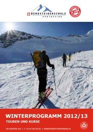
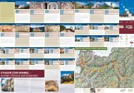
Bikekarte Engadin - Pontresina
Bikekarte Engadin - Pontresina
Bikekarte Engadin - Pontresina

You also want an ePaper? Increase the reach of your titles
YUMPU automatically turns print PDFs into web optimized ePapers that Google loves.
Diese Berge. Diese Seen. Dieses Licht!<br />
Zernez<br />
2000<br />
1800<br />
1600<br />
Pont<br />
La Pun<br />
S-chanf<br />
Tourenvorschläge<br />
Tour suggestions Descrizione degli itinerari<br />
Ch<br />
La Pun<br />
Bever<br />
Samed<br />
Pontr<br />
Allgemeine Kontaktinformationen<br />
Contact addresses for general information<br />
Informazioni generali di contatto<br />
Mountainbike Karte<br />
Mountain biking map · Cartina mountain bike<br />
Sommer / Summer / Estate 2012<br />
Nr. 444<br />
1400<br />
1200<br />
Sie befinden sich in <strong>Engadin</strong> St. Moritz in hochalpinem Gelände. Die nachfolgenden Tourenbeschriebe und Profile richten sich an geübte Mountainbiker.<br />
Fahren Sie vorsichtig und passen Sie die Geschwindigkeit dem Trail, der Sichtweite und Ihren Fähigkeiten an.<br />
0Here in <strong>Engadin</strong> 5 St. Moritz, 10you are in high-mountain 15 20terrain. The 25 following tour 30specifications 35and profiles 40are aimed at 45 experienced 50 mountain km bikers.<br />
Ride carefully, and adapt your speed to the trail, the visibility and your abilities.<br />
<strong>Engadin</strong> St. Moritz è una valle alto-alpina: le seguenti descrizioni e profili degli itinerari si orientano a mountain biker allenati.<br />
Guida con attenzione e adatta la velocità al trail, la visibilità del sentiero e le tue capacità.<br />
Bernina Express Samedan – <strong>Pontresina</strong> – Bernina – Alp Grüm – Cavaglia – Poschiavo – Bernina – Lago Bianco – <strong>Pontresina</strong> –Samedan<br />
Infos über das Mountainbike-Gebiet: www.engadin.stmoritz.ch/bike<br />
Allgemeine Infos: <strong>Engadin</strong> St. Moritz, T +41 81 830 00 01, allegra@estm.ch<br />
Information about the mountain biking region: www.engadin.stmoritz.ch/bike_en<br />
General information: <strong>Engadin</strong> St. Moritz, T +41 81 830 00 01, allegra@estm.ch<br />
Informazioni sulla regione mountain bike nel sito: www.engadin.stmoritz.ch/bike_it<br />
Informazioni generali: <strong>Engadin</strong> St. Moritz, T +41 81 830 00 01, allegra@estm.ch<br />
Tourist Information:<br />
Maloja T +41 81 824 31 88 maloja@estm.ch<br />
Sils T +41 81 838 50 50 sils@estm.ch<br />
Silvaplana T +41 81 838 60 00 silvaplana@estm.ch<br />
St. Moritz T +41 81 837 33 33 stmoritz@estm.ch<br />
Celerina T +41 81 830 00 11 celerina@estm.ch<br />
<strong>Pontresina</strong> T +41 81 838 83 00 pontresina@estm.ch<br />
Samedan T +41 81 851 00 60 samedan@estm.ch<br />
Bever T +41 81 852 49 45 bever@estm.ch<br />
La Punt T +41 81 854 24 77 lapunt@estm.ch<br />
Madulain T +41 81 854 11 71 madulain@estm.ch<br />
Zuoz T +41 81 854 15 10 zuoz@estm.ch<br />
S-chanf T +41 81 854 22 55 s-chanf@estm.ch<br />
Zernez T +41 81 856 13 00 zernez@estm.ch<br />
Bever<br />
Samedan<br />
Celerina<br />
Nr. 673<br />
S-chanf<br />
Zuoz<br />
Madulain<br />
La Punt<br />
Chamues-ch<br />
Nr. 1<br />
St. Moritz<br />
<strong>Pontresina</strong><br />
2400<br />
2200<br />
2000<br />
2000<br />
1800<br />
1600 1800<br />
1400<br />
1600<br />
1200<br />
1400<br />
1000<br />
1200 800<br />
Distanz Distance Lunghezza 67.3 km Kondition Fitness Condizione mittel intermediate medio<br />
Fahrzeit Time Durata 6-7 h Fahrtechnik Level Difficoltá mittel intermediate medio<br />
Min. Höhe Min. altitude Altezza min. 1014 m Max. Höhe Max. altitude Altezza mass. 2253 m 1830 m / 133 m 1963 m<br />
<strong>Pontresina</strong><br />
Samedan<br />
Asphalt Asphalt Asfalto Schotter Gravel Ghiaia Trail Shuttle/Bergbahnen Mountain railways Impianto di risalita<br />
La Punt<br />
Bernina<br />
Alp Grüm<br />
S-chanf<br />
Poschiavo<br />
Chaschauna<br />
0 5<br />
10 15 20 25 30 35 40 45<br />
50 km<br />
5 10 15 20 25 30 35 40 45 50 55 60 65 70 km<br />
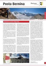
Das hochalpine Ambiente am Lago Bianco ist atemberaubend. Von <strong>Pontresina</strong>, Ausgangspunkt der Tour, fährt man mit der Rhätischen Bahn bis zum Ospizio<br />
Bernina. Der Trail nach Poschiavo verspricht Hochgenuss pur. Zurück auf den Bernina geht’s mit der Bahn. Bis nach <strong>Pontresina</strong> fährt man zuerst durch eine<br />
Moränenlandschaft und dann auf traumhaft flüssigen Trails durch Lärchenwälder.<br />
La Punt<br />
Bernina<br />
Bever<br />
Samedan<br />
Lago Bianco<br />
Montebello<br />
<strong>Pontresina</strong><br />
<strong>Pontresina</strong><br />
Samedan<br />
Nr. 673<br />
Suvretta Loop Tour, Val Suvretta<br />
Willkommen im Mountainbike-Paradies<br />
Welcome in mountain bike paradise<br />
Benvenuti nel paradiso della mountain bike<br />
400 Kilometer reinstes Fahrvergnügen: Die ausgeschilderten <strong>Engadin</strong>er Mountainbike-<br />
Routen machen mobil. Zwischen den höchsten Gipfeln der Ostalpen macht ein wahres<br />
Mountainbike-Paradies den Weg frei für Erlebnisse der besonderen Art. Für jeden Geschmack<br />
und jedes Können. Zwischen einem und mehreren Tagen. Eine überraschende Palette an<br />
Pauschalangeboten erleichtert jenen Mountainbikern und Elektro-Bikern das Leben, die<br />
gerne unkompliziert geniessen. Und wer den schönsten Aufstieg, den attraktivsten Trail<br />
oder das spektakulärste Panorama sucht, profitiert von den Insider-Tipps der Experten: Gut,<br />
gibt es im Oberengadin auf jedem Niveau organisierte Touren. Für den passenden Rahmen<br />
sorgen spezialisierte Mountainbike-Hotels mit Extraservice. Zusätzlich bringen die Bergbahnen<br />
Mountainbiker in sportliche Höhen – und eröffnen Ambitionierten neue Dimensionen.<br />
400 kilometres of mountainbiking bliss: the well-signed <strong>Engadin</strong> mountain bike routes show<br />
you the way. Amidst the highest peaks of the eastern Alps, a veritable biking paradise unfurls,<br />
opening up the way for adventures of a very special kind. Adventures for every taste and<br />
ability level, and lasting between one or several days. A surprisingly varied range of package<br />
arrangements makes life easy for all those mountain and electric bikers who prefer to spend<br />
their time enjoying the ride rather than organising it. Anyone seeking the most spectacular<br />
ascent, the most stunning panorama or the most beautiful trail can profit from the insider<br />
knowledge of the local experts and fortunately in the Upper <strong>Engadin</strong> there are plenty of them,<br />
offering professionally organised tours for all abilities. What’s more, special mountain bike<br />
hotels provide a fitting framework by offering extra infrastructure and services. The mountain<br />
transport facilities take bikers to sporting heights – and open up new dimensions for the<br />
really ambitious.<br />
400 km di divertimento puro: i sentieri mountain bike in <strong>Engadin</strong>, ben segnalati, convincono.<br />
Fra le cime più alte delle Alpi orientali si schiude un vero paradiso della mountain bike,<br />
per vivere esperienze speciali, per tutti i gusti e livelli di capacità. La scelta spazia da una<br />
a più giornate, con offerte convincenti che danno la giusta risposta ad ogni mountain biker<br />
o elektro biker per divertirsi e stare bene. Chi va cercando la salita più bella, il panorama<br />
più favoloso o il trail più eccitante approfitterà dei consigli degli esperti: in Alta <strong>Engadin</strong> si<br />
propongono escursioni organizzate con accompagnamento, a tutti i livelli. Gli specialisti sono<br />
a disposizione: nei mountain bike hotels si offre servizio extra. Con gli impianti di risalita<br />
anche i biker più ambiziosi raggiungono traguardi grandi e dimensioni nuove.<br />
Herausgeber: <strong>Engadin</strong> St. Moritz<br />
Layout: spotwerbung.ch<br />
Fotos: www.altarezia.eu, Bike Tec Huttwil, Alex Buschor, Ralf Glaser,<br />
Markus Greber, Stefan Hunziker, Christof Sonderegger<br />
<strong>Engadin</strong> St.Moritz<br />
CH–7500 St.Moritz<br />
T +41 81 830 00 01<br />
allegra@estm.ch<br />
www.engadin.stmoritz.ch<br />
Legende<br />
Legend Leggenda<br />
Maloja<br />
Silvaplana<br />
Sils<br />
Bergbahn mit Mountainbike-Transport Mountain railway<br />
with mountain bike transport Impianto di risalita con<br />
trasporto in mountain bike<br />
Bahnhof Train station Stazione ferrovia<br />
Rhätische Bahn Rhaetian Railway Ferrovia retica<br />
Bikeshop<br />
Tourist Information <strong>Engadin</strong> St. Moritz<br />
Kein Mobilfunknetz No mobile phone coverage<br />
Assenza di rete mobile<br />
Champfèr<br />
Surlej<br />
Touren<br />
Tours Giri<br />
St. Moritz Bad<br />
Siehe Rückseite<br />
Empfohlene Bikewege:<br />
Bernina Express Nr. 673<br />
Rundtour Samedan–Zernez–Samedan<br />
sonstiges Wegenetz<br />
Other bike trails Altri percorsi ciclabili<br />
Nr. 673<br />
Kartenbasis Swisstopo 1:200 000<br />
Bernina<br />
Nr. 673<br />
Poschiavo<br />
Reproduziert mit Bewilligung von swisstopo (BA110095)<br />
Bernina Express<br />
2400<br />
2200<br />
2000<br />
1800<br />
1600<br />
2000 1400<br />
1800 1200<br />
1000<br />
1600<br />
800<br />
1400<br />
1200<br />
1000<br />
800<br />
The high-alpine ambience by the Lago Bianco is simply breathtaking. From <strong>Pontresina</strong>, the departure point of the tour, you take the Rhaetian Railway to the Ospizio<br />
Bernina. The trail down to Poschiavo promises to be pure delight. Then it’s a short train ride back up the Bernina. The track to <strong>Pontresina</strong> passes through a moraine<br />
landscape and then along wonderfully flowing trails through larch forests.<br />
L’ambiente alpino d’alta quota al Lago Bianco toglie semplicemente il respiro. Da <strong>Pontresina</strong>, punto di partenza della gita, si raggiunge l’Ospizio Bernina con<br />
la Ferrovia Retica. Il trail che scende verso Poschiavo promette puro piacere assoluto. Sempre in treno, si ritorna al Bernina. Prima di giungere a <strong>Pontresina</strong> si<br />
attraversa dapprima una zona di costituzione morenica, e poi ci si immette in una serie di trails fluidi, fra boschi di larici.<br />
Samedan<br />
Samedan<br />
S-chanf<br />
Bernina<br />
Brail<br />
Alp Grüm<br />
Zernez Poschiavo<br />
Bever<br />
Samedan<br />
0 5 10 15 20 25 30 35 40 45 50 55 60 65 70 km<br />
0 5 10 15 20 25 30 35 40 45 50 55 60 km<br />
Samedan-Zernez-Samedan Samedan – S-chanf – Brail – Zernez – Zuoz – Madulain – La Punt – Bever – Samedan<br />
Distanz Distance Lunghezza 60.3 km Kondition Fitness Condizione mittel intermediate medio<br />
Fahrzeit Time Durata 5-6 h Fahrtechnik Level Difficoltá leicht easy facile<br />
Min. Höhe Min. altitude Altezza min. 1447 m Max. Höhe Max. altitude Altezza mass. 1761 m 956 m 956 m<br />
Asphalt Asphalt Asfalto Schotter Gravel Ghiaia Trail<br />
Zuoz<br />
Madulain<br />
Bernina<br />
La Punt<br />
Lago Bianco<br />
Padella-Corviglia-Panoramatour<br />
Montebello<br />
<strong>Pontresina</strong><br />
Samedan<br />
Mountain- und Elektro-Bike-Angebote<br />
Mountain & electro bike arrangements<br />
Offerte mountain bike e bike elettrica<br />
Mountainbike Special: 2–7 Hotelübernachtungen mit Frühstück, Personentransport mit<br />
den Bergbahnen und in einigen Hotels öffentlicher Verkehr im Oberengadin, Mountainbike-<br />
Transport auf den Bergbahnen Signal, Chantarella/Corviglia und Marguns. Ab CHF 176.– p.P.<br />
im Doppelzimmer im 3*-Hotel. Information & Buchung: www.engadin.stmoritz.ch/mtb<br />
Elektro-Bike Special: 2-7 Hotelübernachtungen mit Frühstück, Elektro-Bike-Vermietung inkl.<br />
Helm-Miete und Transport des Elektro-Bikes ins Hotel, Personentransport mit den Bergbahnen<br />
und in einigen Hotels öffentlicher Verkehr im Oberengadin, Elektro-Bike-Transport auf den<br />
Bergbahnen Signal, Chantarella/Corviglia und Marguns. Ab CHF 251.– p.P. im Doppelzimmer im<br />
3*-Hotel. Information & Buchung: www.engadin.stmoritz.ch/elektro_bike<br />
Mountainbike Special: 2-7 nights hotel accommodation with a breakfast, mountain rides and,<br />
at selected hotels, use of the Upper <strong>Engadin</strong> public transport free, mountain bike transport on<br />
the Signal, Chantarella/Corviglia and Marguns mountain cableways. From CHF 176.– p.p.<br />
in a double room in a 3*-hotel.<br />
Information & booking: www.engadin.stmoritz.ch/mtb_en<br />
Electro-Bike Special: 2-7 nights hotel accommodation with a breakfast, electric bike rental,<br />
including helmet and delivery to the hotel, mountain rides and, at selected hotels, use of the<br />
Upper <strong>Engadin</strong> public transport free, electric bike transport on the Signal, Chantarella/Corviglia<br />
and Marguns mountain cableways. From CHF 251.– p.p. in a double room in a 3*-hotel.<br />
Information & booking: www.engadin.stmoritz.ch/elektro_bike_en<br />
Speciale Mountainbike: 2–7 notti in albergo, con colazione, impianti di risalita compresi e,<br />
in alcuni alberghi, anche i trasporti pubblici in Alta <strong>Engadin</strong>, trasporto mountain bike sugli<br />
impianti di Signal, Chantarella/Corviglia e Marguns. Da CHF 176.– p.p. in camera doppia in<br />
albergo a 3*. Informazioni & prenotazione: www.engadin.stmoritz.ch/mtb_it<br />
Speciale Electro-bike: 2–7 notti in albergo, con colazione, noleggio della bike elettrica<br />
compreso noleggio del casco e consegna della bike in albergo, impianti di risalita compresi<br />
e, in alcuni alberghi, anche i trasporti pubblici in Alta <strong>Engadin</strong>, trasporto della bike elettrica<br />
sugli impianti di Signal, Chantarella/Corviglia e Marguns. Da CHF 251.– p.p. in camera doppia<br />
in albergo a 3*. Informazioni & prenotazione: www.engadin.stmoritz.ch/elektro_bike_it<br />
Weiterführendes Kartenmaterial<br />
Detailed maps Cartine utili per i percorsi<br />
Für detailliertere Navigation auf den <strong>Engadin</strong>er Bikewegen empfehlen wir:<br />
• Hallwag Outdoor Map Nr. 11 «<strong>Engadin</strong> St. Moritz», Singletrail Map Nr. 24 «Oberengadin»,<br />
Singletrail Map Nr. 38 «Poschiavo/Tirano», www.singletrailmap.ch; CHF 25.–.<br />
Die Singletrail Map Nr. 24 «Oberengadin» kann an den Tourist Informationen zu einem<br />
Preis von CHF 25.– bezogen werden.<br />
For more detailed navigation information about the <strong>Engadin</strong> mountain bike trails,<br />
we recommend the following:<br />
• Hallwag Outdoor Map No. 11 «<strong>Engadin</strong> St. Moritz», Singletrail Map No. 24 «Oberengadin»,<br />
Singletrail Map No. 38 «Poschiavo/Tirano», www.singletrailmap.ch; CHF 25.–.<br />
The Singletrail Map No. 24 «Oberengadin» can be purchased at the Tourist Information<br />
Offices at a price of CHF 25.–.<br />
Per una navigazione dettagliata sui sentieri bike dell’<strong>Engadin</strong> si consigliano inoltre:<br />
• Hallwag Outdoor Map No. 11 «<strong>Engadin</strong> St. Moritz», Singletrail Map No. 24 «Oberengadin»,<br />
Singletrail Map No. 38 «Poschiavo/Tirano», www.singletrailmap.ch; CHF 25.–.<br />
La Singletrail Map No. 24 «Oberengadin» può essere acquistata al prezzo di CHF 25.–<br />
presso gli uffici del turismo.<br />
Bernina Express Tour, Lago Bianco<br />
Padella-Corviglia-Panoramatour;<br />
vor der Chamanna Saluver<br />
Mountainbike-Schulen<br />
Mountain bike schools Scuole di mountain bike<br />
Täglich geführte Touren in allen Schwierigkeitsgraden und Fahrtechniktrainings:<br />
Daily tours and training in biking technique:<br />
Escursioni giornaliere con accompagnamento e training di tecnica:<br />
<strong>Engadin</strong> Bike Tours, <strong>Pontresina</strong>:<br />
T +41 81 842 68 44, www.engadinbiketours.ch<br />
Mountainbike-Hotels<br />
Mountain bike hotels Alberghi mountain bike<br />
Folgende Hotels sind auf die Bedürfnisse der Mountainbiker eingestellt:<br />
www.engadin.stmoritz.ch/mtb_hotels<br />
The following hotels are geared towards catering for the special needs of mountain bikers:<br />
www.engadin.stmoritz.ch/mtb_hotels_en<br />
I seguenti alberghi sono strutturati per i bisogni dei biker:<br />
www.engadin.stmoritz.ch/mtb_hotels_it<br />
Mountainbike-Shops<br />
Mountain bike shops Negozi specializzati mountain bike<br />
• Sils<br />
La Fainera Sport: T +41 81 826 55 02, www.lafainera.ch<br />
• Silvaplana<br />
Cross Country Sport: T +41 81 828 84 83, www.crosscountrysport.ch<br />
Skiservice Corvatsch: T +41 81 828 84 86, www.skiservice-corvatsch.ch<br />
• Surlej<br />
Skiservice Corvatsch: T +41 81 838 77 77, www.skiservice-corvatsch.ch<br />
• St. Moritz<br />
Boom Sport: T +41 81 832 22 22, www.boom-sport.ch<br />
<strong>Engadin</strong> Bikes: T +41 81 828 98 88, www.engadinbikes.com<br />
InnSport: T +41 81 833 32 60, www.innsport.ch<br />
Viva Sportiva: T +41 81 832 19 19, www.viva-sportiva.com<br />
Workshop: T +41 81 842 65 02, www.workshop-sports.com<br />
• Celerina<br />
Alpine Bike: T +41 81 833 05 05, www.alpine-bike.ch<br />
Skiservice Corvatsch: T +41 81 833 77 40, www.skiservice-corvatsch.ch<br />
• Samedan<br />
Bolliger Bikeshop: T +41 81 842 77 88, www.bolliger-bikeshop.ch<br />
• <strong>Pontresina</strong><br />
Fähndrich Sport: T +41 81 842 71 55, www.faehndrich-sport.ch<br />
Flying Cycles: T +41 81 842 68 44, www.pontresina-sports.ch<br />
• La Punt<br />
Velo Kesch: T +41 81 854 10 19, www.velokesch.ch<br />
• Zuoz<br />
Willy Sport: T +41 81 854 12 89, www.willy-sport.ch<br />
Mountainbike Ehrenkodex<br />
The Rules of the Mountain Bike Trail Le regole della mountain bike<br />
(gilt auch für Elektro-Bike also applies to electric bikes vale anche per electro-bike)<br />
1. Sei rücksichtsvoll beim Kreuzen und Überholen von Wanderern. Wanderer haben Vortritt.<br />
Show consideration when overtaking or crossing in front of hikers. Hikers always have the<br />
right of way. Abbi riguardo verso gli escursionisti quando li incroci o li superi. Gli escursionisti<br />
hanno di principio la precedenza.<br />
2. Schliesse Gatter und Weidezäune nach der Durchfahrt. Close any gates and fences that<br />
you have opened. Dopo il tuo passaggio, richiudi i cancelli e i recinti dei pascoli.<br />
3. Fahr nur auf signalisierten Wegen und Pfaden. Querfeldeinfahren schadet Tieren,<br />
Pflanzen und unserem Mountainbiker-Image. Only ride on signposted trails and paths.<br />
Cross-country riding harms animals, plants and damages our reputation as mountain<br />
bikers. Segui unicamente i sentieri e i percorsi segnalati. Se tagli, nuoci ad animali e<br />
piante, oltre che all’immagine di chi va in mountain bike.<br />
4. Bremse nicht mit blockierten Rädern. Dies schadet dem Trail und deinem Material.<br />
Do not lock your wheels when braking. This damages the trail and your bike. Non frenare<br />
bloccando le ruote. Questo comportamento danneggia il sentiero e il tuo materiale.<br />
5. Hinterlasse keinen Abfall. Do not litter. Non abbandonare rifiuti.<br />
6. Rüste Dich gut aus. Helm, Handschuhe, Glocke, Regen- und Wärmeschutz gehören zur<br />
Grundausrüstung. Ensure that you are well equipped. Basic equipment includes a helmet,<br />
gloves, bell and protection against the rain and extreme temperatures. Sii sempre ben<br />
equipaggiato. Oltre a casco, guanti e campanello, fanno parte dell’equipaggiamento di<br />
base anche una protezione dalla pioggia e dal freddo.<br />
7. Trage Verantwortung. Informiere Dich über Wetter und Anforderungen der Routen. Das<br />
Befahren der Routen erfolgt auf eigene Verantwortung. Act responsibly. Check the weather<br />
forecast and the demands of your chosen route beforehand. Riding on these routes is<br />
strictly at your own risk. Sii responsabile. Informati sulle previsioni del tempo e sulla difficoltà<br />
dell’itinerario scelto. I diversi itinerari vengono percorsi sotto la propria responsabilità.<br />
8. Plane Deine Tour. Plan your trip. Pianifica il tuo itinerario.<br />
9. Notiere Dir die Nummern von Polizei 117, Notruf 144, REGA 1414. Im Val Suvretta, von Suvretta<br />
Passhöhe bis Gasthaus Spinas, gibt es kein Mobilfunknetz. Note the numbers: Police 117,<br />
Emergency Services 144, Air Rescue Service 1414. In the Val Suvretta, from the summit of the<br />
Suvretta Pass as far as the Spinas Guesthouse, there is no mobile phone coverage. Annotati i<br />
numeri della polizia 117, dell’ambulanza 144 e della Rega 1414. In Val Suvretta, dal passo Suvretta<br />
al rifugio Spinas, nessun segnale di connessione del telefono mobile.<br />
Quelle: www.engadin.stmoritz.ch/mtb_ehrenkodex<br />
Samedan–Zernez-Samedan<br />
2000<br />
1800<br />
1600<br />
1400<br />
1200<br />
1000<br />
800<br />
2800<br />
2600<br />
2400<br />
2200<br />
2000<br />
Tourenvorschläge 1800<br />
und GPS Daten<br />
More tours and GPS tracks Ulteriori itinerari e dati GPS<br />
1600<br />
0 5 10 15 20 25<br />
30<br />
Weitere Touren und Informationen erhalten Sie unter:<br />
www.engadin.stmoritz.ch/mtb_gps<br />
Find more tours and GPS tracks under:<br />
www.engadin.stmoritz.ch/mtb_gps_en<br />
Ulteriori itinerari e dati GPS Le trova sul sito:<br />
www.engadin.stmoritz.ch/mtb_gps_it<br />
2600<br />
Samedan<br />
0 5 10 15 20 25 30 35 40 45 50 55 60 km<br />
Diese Rundtour kann man in beide Richtungen fahren. Am besten man entscheidet aufgrund der Tageszeit und Temperatur, ob man zuerst die Sonnenseite oder die<br />
Schattenseite fährt. Die Schotterstrasse führt über weite Flächen, hat aber auch ein paar nicht zu unterschätzende Anstiege und flüssige Abfahrten. Diese abwechslungsreiche<br />
Tour zeigt die <strong>Engadin</strong>er Natur von seiner kontrastreichen, inspirierenden Seite. Die Tour eignet sich auch für die Fahrt mit dem Elektro-Bike.<br />
This circular tour can be tackled in either direction. You are best advised to base your decision on the time of day and the temperature, and thus on whether you want to<br />
first cycle in the sun or the shade. The gravel path leads across wide open expanses, but also has a couple of steep ascents that are not to be underestimated and some<br />
free-flowing descents. This varied tour shows the spectacular <strong>Engadin</strong> scenery from its contrast-rich, inspiring side. This tour is also suitable for an electric bike.<br />
Celerina<br />
Marguns<br />
Lej Alv<br />
ns<br />
S-chanf<br />
Alpina-Hütte<br />
S. Murezzan<br />
orviglia<br />
Brail<br />
Pass Suvretta<br />
Zernez<br />
Questa gita circolare può essere percorsa in entrambe le direzioni. La cosa migliore è decidere, in base al tempo e la temperatura, se percorrere prima il versante soleggiato<br />
o quello all’ombra. Il sentiero sterrato conduce attraverso pianure vaste, ma presenta anche un paio di salite da non sottovalutare, e di discese fluide. Questa gita ricca di<br />
contrasti mostra la natura dell’<strong>Engadin</strong> dal suo lato più ispiratore. La gita è adatta anche ad essere percorsa in sella a una mountain bike elettrica.<br />
orviglia<br />
Spinas<br />
Alpina<br />
Hütte<br />
Zuoz<br />
Celerina<br />
Madulain<br />
La Punt<br />
Bever<br />
Samedan<br />
Elektro-Biker am Lej da Champfèr<br />
Events<br />
Events Eventi<br />
11. Nationalpark Bike-Marathon: Samstag, 25. August 2012. Strecken: 47/71/104/138 km.<br />
Grösster Bike-Marathon in Graubünden rund um den Nationalpark. Diverse Startpunkte<br />
möglich. www.bike-marathon.com<br />
Padella Trophy: Samstag, 21. Juli 2012. Strecke: St. Moritz Bad–Samedan-Alp Muntatsch<br />
–Marguns-St. Moritz Bad; 28.9 km, +/- 1182 m. Einzelwettkampf Mountainbike im Rahmen<br />
des Alpinathlons. www.alpinathlon.ch<br />
Bike Abendrennen: Mountainbiker aller Altersklassen treffen sich zum Abendrennen in<br />
Samedan. www.samedan.ch/abendrennen<br />
11. Nationalpark Bike-Marathon: Saturday, 25 August 2012. Route legs: 47/71/104/138 km.<br />
Biggest mountain bike marathon in Graubünden, around the National Park. Various<br />
starting points possible. www.bike-marathon.com<br />
Padella Trophy: Saturday, 21 July 2012. Route legs: St. Moritz Bad–Samedan-Alp Muntatsch–Marguns-St.<br />
Moritz Bad; 28.9 km, +/- 1182m. Individual competition mountain bike<br />
as part of the Alpinathlon. www.alpinathlon.ch<br />
Evening bike races: Mountain bikers of all ages are welcome at these evening races in<br />
Samedan. www.samedan.ch/abendrennen<br />
11. Nationalpark Bike-Marathon: Sabato, 25 agosto 2012. Percorsi: 47/71/104/138 km. La<br />
più grande marathon bike nei Grigioni, che attraversa il Parco Nazionale. Possibili partenze<br />
in diverse località. www.bike-marathon.com<br />
Padella Trophy: Sabato, 21 luglio 2012. Percorsi: St. Moritz Bad–Samedan-Alp Muntatsch–<br />
Marguns-St. Moritz Bad; 28.9 km, +/- 1182 m. Competizione individuale di mountain bike<br />
nell’ambito dell’ Alpinathlon. www.alpinathlon.ch<br />
Gare serali di mountain bike: Mountain biker di ogni età si incontrano a Samedan, per<br />
le gare serali. www.samedan.ch/abendrennen
Nr. 671<br />
1800<br />
1600<br />
1400<br />
1200<br />
Sa<br />
S-<br />
Br<br />
Tourenvorschläge<br />
Tour suggestions Descrizione degli itinerari<br />
Zern<br />
Zu<br />
M<br />
La<br />
Be<br />
Sa<br />
Gasthaus Spinas<br />
1000<br />
800<br />
Sie befinden sich in <strong>Engadin</strong> St. Moritz in hochalpinem Gelände. Die nachfolgenden Tourenbeschriebe und Profile richten sich an geübte Mountainbiker.<br />
Fahren Sie vorsichtig und passen Sie die Geschwindigkeit dem Trail, der Sichtweite und Ihren Fähigkeiten an.<br />
0 5 10 15 20 25 30 35 40 45 50 55 60 km<br />
Here in <strong>Engadin</strong> St. Moritz, you are in high-mountain terrain. The following tour specifications and profiles are aimed at experienced mountain bikers.<br />
Ride carefully, and adapt your speed to the trail, the visibility and your abilities.<br />
<strong>Engadin</strong> St. Moritz è una valle alto-alpina: le seguenti descrizioni e profili degli itinerari si orientano a mountain biker allenati.<br />
Guida con attenzione e adatta la velocità al trail, la visibilità del sentiero e le tue capacità.<br />
Samedan<br />
Alp Muntatsch<br />
Nr. 671<br />
Bever<br />
2000<br />
1800<br />
1600<br />
1400<br />
1200<br />
1000<br />
2800<br />
800<br />
2600<br />
2400<br />
Suvretta Loop Celerina – Alp Laret – Marguns – Lej Alv – Alpina Hütte – Suvrettapass – Spinas – Bever – Samedan – Celerina<br />
Distanz Distance Lunghezza 34.5 km Kondition Fitness Condizione schwer difficult difficile<br />
Fahrzeit Time Durata 4.5 h Fahrtechnik Level Difficoltá mittel intermediate medio<br />
Samedan<br />
S-chanf<br />
Brail<br />
Zernez<br />
Bever<br />
Samedan<br />
Min. Höhe Min. altitude Altezza min. 1708 m Max. Höhe Max. altitude Altezza mass. 2683 m 1286 m 1286 m<br />
Asphalt Asphalt Asfalto Schotter Gravel Ghiaia Trail<br />
Marguns<br />
Lej Alv<br />
Alpina-Hütte<br />
S. Murezzan<br />
0 5 10 15 20 25 30 35 40 45 50 55 60 km<br />
Pass Suvretta<br />
Zuoz<br />
Madulain<br />
La Punt<br />
Nr. 671<br />
Trail im Val Suvretta, vor Val Bever<br />
Bernina Express Tour, Lago Bianco<br />
Bergbahnen inklusive<br />
Mountain railways inclusive Impianti di risalita compresi<br />
Mit der zweiten Übernachtung sind in über 90 Hotels die 13 Anlagen der Bergbahnen und<br />
zum Teil der öffentliche Verkehr im Oberengadin inklusive:<br />
www.engadin.stmoritz.ch/inclusive<br />
Stay for at least two nights at any one of more than 90 participating hotels and your travel<br />
on all 13 mountain railways & cableways (and in some cases your public transport) in the<br />
Upper <strong>Engadin</strong> is included: www.engadin.stmoritz.ch/inclusive_en<br />
Con il secondo pernottamento, in oltre 90 hotel sono compresi i 13 impianti di risalita e in<br />
parte anche i mezzi di trasporto pubblici dell‘Alta <strong>Engadin</strong>:<br />
www.engadin.stmoritz.ch/inclusive_it<br />
Nr. 671<br />
Nr. 672<br />
Alpinahütte<br />
Restaurant Marguns<br />
Nr. 672<br />
Marguns<br />
Mathis Food Affairs<br />
Corviglia<br />
Nr. 672<br />
Nr. 671<br />
Celerina<br />
Nr. 672<br />
Suvretta Loop<br />
2200<br />
2000<br />
1800<br />
1600<br />
2800<br />
2600<br />
2600<br />
2400<br />
2200<br />
2400<br />
2000<br />
1800 2200<br />
1600<br />
2000<br />
Celerina<br />
0 5 10 15 20 25<br />
30<br />
Ein Traumblick begleitet die ersten Meter längs der Piz Nair-Flanke. Dann bleibt keine Zeit mehr zum Umsehen: Die Abfahrt ins Val Bever ist technisch anspruchsvoll und<br />
endet nach 960 Höhenmetern in der wilden Natur des Tals. Highlights: Abfahrt auf den Single Trails vom Suvrettapass – Val Bever, Terrasse Gasthaus Spinas.<br />
Celerina<br />
Marguns Marguns<br />
Lej Alv<br />
Alp Laret<br />
Alpina-Hütte<br />
S. Murezzan<br />
Chantarella<br />
Your first metres along the side of the Piz Nair present views to die for, but after that you won’t have any time to look around. This is because the descent into the<br />
Val Bever is a technically challenging ride covering 960 height metres down into the raw nature of the valley. Highlights: Descent on single trails from Suvrettapass –<br />
Val Bever / terrace Spinas Guesthouse.<br />
0 5 10 15 20 25<br />
30<br />
Pass Suvretta<br />
Un panorama da sogno accompagna i primi metri lungo il versante del Piz Nair. In seguito, non resta altro tempo per la contemplazione: la discesa in Val Bever è tecnicamente<br />
impegnativa e termina, dopo 960 metri di dislivello, nella selvaggia bellezza della natura a valle. Highlights: discesa lungo i single trails del passo Suvretta –<br />
Val Bever / terrazza del rifugio a Spinas.<br />
Spinas<br />
Corviglia Flowtrails Celerina – Gondelbahn Marguns – Chantarella – Standseilbahn Corviglia – Alp Nova – Chantarella –<br />
Celerina<br />
Corviglia<br />
Alp Nova<br />
Chantarella<br />
Corviglia<br />
Spinas<br />
Alpina<br />
Hütte<br />
Chantarella<br />
Celerina<br />
Celerina<br />
Standseilbahn Corviglia – Alpina Hütte - Alp Giop – Chantarella<br />
Mountainbike-Tageskarte Mountain Bike Day Pass Tessera giornaliera mountain bike:<br />
CHF 12.-<br />
Rhätische Bahn Rhaetian Railway Ferrovia retica<br />
Mountainbike-Tageskarte Mountain Bike Day Pass Tessera giornaliera mountain bike:<br />
CHF 18.-<br />
Fahrplanauskunft Timetable information Informazioni sugli orari:<br />
www.rhb.ch<br />
Bergbahnen Mit Mountainbike-Transport<br />
Mountain railways with mountain bike transport<br />
Impianti di risalita con trasporto in mountain bike<br />
Signal Luftseilbahn Cable car Funivia<br />
St. Moritz Bad – Signal 09.06. – 21.10.12<br />
erste Bergfahrt first ascent prima salita: 8.30 / letzte Bergfahrt last ascent ultima salita: 17.00<br />
erste Talfahrt first descent prima discesa: 8.45 / letzte Talfahrt last descent ultima discesa: 17.15<br />
alle 30 Minuten every 30 Minutes ogni 30 minuti<br />
Nr. 671<br />
Restaurant Trutz<br />
el paradiso<br />
Nr. 672<br />
Restaurant Chasellas<br />
Hotel Restaurant<br />
Salastrains<br />
Signal<br />
Chantarella<br />
St. Moritz<br />
St. Moritz Bad<br />
Nr. 672<br />
<strong>Pontresina</strong><br />
1800<br />
2600<br />
2800<br />
2600<br />
2400<br />
2400 2600<br />
2400<br />
2200<br />
2200<br />
2200<br />
2000<br />
2000<br />
2000 1800<br />
1600 1600<br />
1400<br />
1800<br />
Distanz Distance Lunghezza 17.5 km Kondition Fitness Condizione mittel intermediate medio<br />
Fahrzeit Time Durata 2 h Fahrtechnik Level Difficoltá mittel intermediate medio<br />
0<br />
5<br />
10<br />
Min. Höhe Min. altitude Altezza min. 1755 m<br />
15 km<br />
Max. Höhe Max. altitude Altezza mass. 2553 m 1470 m / 102 m 1226 m<br />
Schotter Gravel Ghiaia Trail Shuttle/Bergbahnen Mountain railways Impianto di risalita<br />
Celerina<br />
Celerina<br />
Samedan<br />
Marguns<br />
Alp Muntatsch<br />
Marguns<br />
Lej Alv<br />
Alp Laret<br />
Alpina-Hütte<br />
Marguns<br />
Chantarella S. Murezzan<br />
Corviglia Corviglia<br />
Pass Suvretta<br />
Alp Suvretta<br />
Alp Nova<br />
Corviglia<br />
Alpina<br />
Hütte<br />
St. Spinas Moritz Bad<br />
Alp da Staz<br />
Chantarella<br />
Celerina<br />
0 5 10 15 20 25<br />
30<br />
0 5 10 15 20 25 30 35 40 km<br />
5<br />
10<br />
15 km<br />
Chantarella<br />
Silvaplana<br />
Celerina<br />
Corviglia Flowtrails, St. Moritz<br />
Chantarella Standseilbahn Funicular railway Funicolare<br />
St. Moritz Dorf – Chantarella 23.06. – 14.10.12<br />
erste Bergfahrt first ascent prima salita: 8.20 / letzte Bergfahrt last ascent ultima salita: 17.00<br />
erste Talfahrt first descent prima discesa: 8.40 / letzte Talfahrt last descent ultima discesa: 17.20<br />
alle 20 Minuten every 20 Minutes ogni 20 minuti<br />
Corviglia Standseilbahn Funicular railway Funicolare<br />
Chantarella – Corviglia 23.06. – 14.10.12<br />
erste Bergfahrt first ascent prima salita: 8.30 / letzte Bergfahrt last ascent ultima salita: 16.50<br />
erste Talfahrt first descent prima discesa: 8.50 / letzte Talfahrt last descent ultima discesa: 17.10<br />
alle 20 Minuten every 20 Minutes ogni 20 minuti<br />
Marguns Gondelbahn Cable railway Cabinovia<br />
Celerina – Marguns 23.06. – 14.10.12<br />
erste Bergfahrt first ascent prima salita: 8.00 / letzte Bergfahrt last ascent ultima salita: 16.20<br />
erste Talfahrt first descent prima discesa: 8.00 / letzte Talfahrt last descent ultima discesa: 17.00<br />
Legende<br />
Legend Leggenda<br />
Luftseilbahn Cable car Funivia<br />
Gondelbahn Cable railway Cabinovia<br />
Standseilbahn Funicular railway Funicolare<br />
Silvaplana<br />
Bergbahn mit Mountainbike-Transport Mountain railway<br />
with mountain bike transport Impianto di risalita con trasporto<br />
in mountain bike<br />
Nr. 672<br />
Champfèr<br />
Nr. 672<br />
Surlej<br />
Tourist Information <strong>Engadin</strong> St. Moritz<br />
Bergrestaurant Mountain restaurant Ristorante di montagna<br />
Bikeshop<br />
Bahnhof Train station Stazione ferrovia<br />
Kein Mobilfunknetz No mobile phone coverage<br />
Assenza di rete mobile<br />
Touren<br />
Tours Giri<br />
Empfohlene Bikewege:<br />
Suvretta Loop Nr. 671<br />
Corviglia Flowtrails<br />
Kartenbasis Swisstopo 1:50 000<br />
Padella-Corviglia-Panoramatour Nr. 672<br />
sonstiges Wegenetz<br />
Other bike trails Altri percorsi ciclabili<br />
Berggastronomie<br />
Mountain gastronomy Gastronomia in montagna<br />
el paradiso: T +41 81 833 40 02, www.el-paradiso.ch<br />
Restaurant Trutz: T +41 81 833 70 30, www.trutz.ch<br />
Alpinahütte: T +41 81 833 40 80, www.skiclub-alpina.ch<br />
Mathis Food Affairs: T +41 81 833 63 55, www.mathisfood.ch<br />
Restaurant Marguns: T +41 81 839 80 20, www.marguns.ch<br />
Hotel Restaurant Salastrains: T +41 81 830 07 07, www.salastrains.ch<br />
Gasthaus Spinas: T +41 81 851 19 20, www.spinas-bever.ch<br />
Alp Muntatsch: T +41 81 851 00 60<br />
Restaurant Chasellas: T +41 81 833 38 54, www.chasellas.ch<br />
Öffnungszeiten Opening hours Orari di apertura:<br />
www.engadin.stmoritz.ch/berggastronomie<br />
Reproduziert mit Bewilligung von swisstopo (BA110095)<br />
Corviglia Flowtrails<br />
2600<br />
2600<br />
2400<br />
2400<br />
2200<br />
2000<br />
2200 1800<br />
1600<br />
1400<br />
2000<br />
1800<br />
2600<br />
2400<br />
Padella-Corivglia-Panoramatour<br />
2200<br />
2000<br />
1800<br />
1600<br />
1400<br />
Die Strecke von Marguns nach Chantarella und der Run über die Alp Nova bieten Trails vom Feinsten. Und dies bei einer wunderschönen Aussicht auf das Bernina-Massiv.<br />
Und wäre das saftige Gras nicht, könnte man bei der karstigen Kraterlandschaft unterhalb des Sass Runzöl meinen, man sei auf dem Mond unterwegs. Der Flowtrail von<br />
der Alpina Hütte, via Alp Giop, hinunter nach Chantarella bildet den krönenden Schlusspunkt dieser ausserordentlichen Trail Tour.<br />
The route from Marguns to Chantarella and the run over the Alp Nova offer incomparable trails, as well as a gorgeous panorama of the Bernina massif. On the stretch<br />
below the Sass Runzöl, with its karstic landscape, if it wasn’t for the lush grass you might think you were on the moon. The flow trail from the Alpina Hütte (mountain<br />
hut) to Alp Giop and back down to Chantarella provides a spectacular finish to this exceptional trail tour.<br />
Celerina<br />
Celerina Samedan<br />
Alp Laret<br />
Marguns Alp Muntatsch<br />
Chantarella<br />
Corviglia<br />
Corviglia<br />
Alp Nova<br />
Chantarella<br />
Corviglia<br />
Silvaplana<br />
Alpina<br />
Hütte<br />
St. Moritz Bad<br />
Alp da Staz<br />
0 5 10 15 20 25 30 35 40 km<br />
Distanz Distance Lunghezza 40.5 km Kondition Fitness Condizione schwer difficult difficile<br />
Fahrzeit Time Durata 4–5 h Fahrtechnik Level Difficoltá mittel intermediate medio<br />
0<br />
5<br />
10<br />
15 km<br />
Min. Höhe Min. altitude Altezza min. 1707 m Max. Höhe Max. altitude Altezza mass. 2764 m 1705 m 1705 m<br />
Celerina<br />
Samedan<br />
Alp Muntatsch<br />
Marguns<br />
Il sentiero da Marguns per Chantarella e la discesa dall’Alp Nova propongono trails d’alta classe, con un panorama magnifico sul massiccio del Bernina. E se non ci fosse<br />
quell’erbetta tenera, si potrebbe pensare di essere sulla luna quando si attraversano i crateri rocciosi ai piedi del Sass Runzöl. Il flow trail dell’Alpina Hütte, passando dall’Alp<br />
Giop e scendendo verso Chantarella, rappresenta la conclusione maestosa di questo eccezionale trail tour.<br />
Marguns<br />
Corviglia<br />
0 5 10 15 20 25 30 35 40 km<br />
Alp Suvretta<br />
Padella-Corviglia-Panoramatour Celerina – Samedan – Alp Muntatsch – Marguns – Corviglia – Bergstation Signalbahn<br />
Alp Suvretta – Silvaplana – St.Moritz Bad – Alp Staz – Celerina<br />
Asphalt Asphalt Asfalto Schotter Gravel Ghiaia Trail<br />
Alp Suvretta<br />
Silvaplana<br />
St. Moritz Bad<br />
Alp da Staz<br />
Die Tour führt von Celerina nach Samedan. Hier schraubt sich ein Forstweg steil zur Alp Muntatsch hinauf und wird am Abzweiger zu den Trais Fluors von einer<br />
Schiebestrecke abgelöst. Es folgt ein flowiger Trail Richtung Corviglia bis zum Lej Alv und weiter zur Bergstation Signal. Ein breiter Panoramaweg führt zur Alp Suvretta<br />
und mündet danach in den Panorama-Singletrail nach Silvaplana. Ab Surlej geht es auf der gegenüberliegenden Talseite Richtung St.Moritz Bad und über Alp da<br />
Staz zurück nach Celerina. Die Tour eignet sich auch als Teilstrecke über den Einstieg mit einer der Bergbahnen Marguns, Chantarella oder Signal.<br />
The trails goes from Celerina to Samedan. Here a steep forest track winds its way up to the Alp Muntatsch where it branches off to the Trais Fluors, a section where you need<br />
to dismount and push your bike. Next up is a flowing section of trail direction Corviglia to the Lej Alv and on to the Signal mountain station. A wide panoramic trail leads you<br />
to the Alp Suvretta before merging with the panoramic single trail to Silvaplana. From Surlej the trail runs on the opposite side of the valley, direction St. Moritz Bad, via Alp<br />
da Staz back to Celerina. You can also do the tour as a shorter leg by accessing the trail using one of the cable cars or mountain railways at Marguns, Chantarella or Signal.<br />
Il tour conduce da Celerina a Samedan. Qui un sentiero nel bosco sale fino all’Alp Muntatsch e alla diramazione verso Trais Fluors segue una tratta in cui bisogna spingere<br />
la mountain bike a mano. Segue un flow trail in direzione di Corviglia fino al Lej Alv e fino alla stazione a monte Signal. Un ampio sentiero panoramico conduce all’Alp<br />
Suvretta e sfocia quindi nel single trail panoramico fino a Silvaplana. Da Surlej si prosegue sul lato opposto della valle in direzione di St. Moritz Bad e attraverso l’Alp da<br />
Staz di ritorno fino a Celerina. Il tour si adatta a essere percorso anche come tratta parziale tramite l’accesso con uno degli impianti di risalita Marguns, Chantarella o Signal.<br />
Chantarella<br />
Celerina<br />
Celerina<br />
Padella-Corviglia-Panoramatour, Samedan<br />
Nr. 672<br />
Chantarella, St. Moritz<br />
Mountainbike<br />
Tages- und Wochenkarten Corviglia<br />
Daily and weekly mountain bike tickets region Corviglia<br />
Tessera mountain bike giornaliera e settimanale della regione Corviglia<br />
CHF CHF<br />
1 Tag Erwachsene adults adulti (18+).................. 12.– 51.–<br />
day giorno Jugendliche youths giovanni (13-17)............ 12.– 38.–<br />
Kinder children bambini (6-12).................. 12.– 25.–<br />
2 Tage Erwachsene adults adulti (18+).................. 23.– 99.–<br />
days giorni Jugendliche youths giovanni (13-17)............ 23.– 73.–<br />
Kinder children bambini (6-12).................. 23.– 48.–<br />
3 Tage Erwachsene adults adulti (18+).................. 34.– 144.–<br />
days giorni Jugendliche youths giovanni (13-17)............ 34.– 107.–<br />
Kinder children bambini (6-12).................. 34.– 71.–<br />
4 Tage Erwachsene adults adulti (18+)................. 44.– 186.–<br />
days giorni Jugendliche youths giovanni (13-17)........... 44.– 139.–<br />
Kinder children bambini (6-12)................. 44.– 91.–<br />
5 Tage Erwachsene adults adulti (18+).................. 53.– 225.–<br />
days giorni Jugendliche youths giovanni (13-17)............ 53.– 167.–<br />
Kinder children bambini (6-12).................. 53.– 110.–<br />
6 Tage Erwachsene adults adulti (18+).................. 61.– 260.–<br />
days giorni Jugendliche youths giovanni (13-17)............ 61.– 194.–<br />
Kinder children bambini (6-12).................. 61.– 127.–<br />
7 Tage Erwachsene adults adulti (18+).................. 69.– 293.–<br />
days giorni Jugendliche youths giovanni (13-17)............ 69.– 218.–<br />
Kinder children bambini (6-12).................. 69.– 144.–