

habitat rupestre.pdf - Archeomedia
habitat rupestre.pdf - Archeomedia
habitat rupestre.pdf - Archeomedia

You also want an ePaper? Increase the reach of your titles
YUMPU automatically turns print PDFs into web optimized ePapers that Google loves.
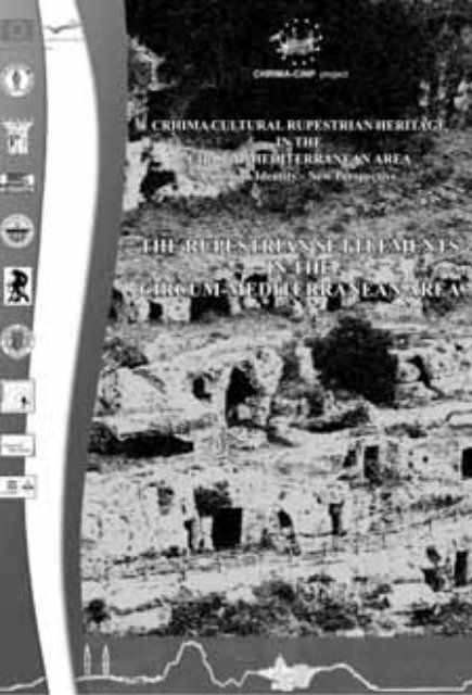
CRHIMA CULTURAL RUPESTRIAN HERITAGE<br />
IN THE<br />
CIRCUM-MEDITERRANEAN AREA<br />
Common Identity - New Perspective<br />
THE RUPESTRIAN SETTLEMENTS<br />
IN THE<br />
CIRCUM-MEDITERRANEAN AREA<br />
Culture Programme 2007-2013, Budget 2010, Strand 1.1 Multi-annual<br />
cooperation projects, Strand 1.2.1 Cooperation measures<br />
CRHIMA-CINP October 2010 - Settember 2012<br />
volumeRicerca_OK_2012-11-15.indd 1 16/11/2012 15:00:32
CRHIMA-CINP project<br />
Thanks to all the Istitutions and the scholars for the availability and the cultural contribution.<br />
Thanks to all architecture students who participated to this project.<br />
• MASSAFRA, PALAGIANELLO. October 2010<br />
Regione Puglia Provincia di Taranto Comune di Massafra Comune di Palagianello Università di Bari<br />
Dip. Ionico in Sist. giuridici<br />
del Mediterraneo<br />
• MASSAFRA. April - May 2011<br />
Regione Puglia<br />
Ass. alla Qualità del Territorio<br />
Ass. regionale al Mediterraneo<br />
Università di Bari<br />
Dip. Ionico in Sist. giuridici<br />
del Mediterraneo<br />
Presidente<br />
della Camera dei Deputati<br />
Istituto Internazionale<br />
di Studi Liguri<br />
sez. Finalese<br />
• ISTANBUL, ORTAHISAR. September 2011<br />
• FLORENCE. June 2012<br />
Presidente<br />
della Fond. Zetema di Matera<br />
Museo Archeologico<br />
del Finale<br />
Comune di Massafra Comune di Mottola Comune di Laterza Comune di Grottaglie Comune di Statte Comune di Palagianello Comune di Gravina<br />
in Puglia<br />
I. T. Agrario Statale<br />
“C. Mondelli”<br />
di Massafra<br />
Liceo Scientifi co<br />
“De Ruggieri”<br />
di Massafra<br />
Ass. Terra di Puglia Coop. Nuova Hellas Pro Loco di Massafra Pro Loco di Laterza Centro Educazione<br />
Ambientale<br />
Ortahisar Belediyesi İlke Eğıtım ve Sağlik<br />
Vakfi<br />
Kapadokya MYO<br />
Presidenza della<br />
Repubblica Italiana<br />
Senato<br />
della Repubblica<br />
Mustafapaşa<br />
Belediyesi<br />
Camera dei Deputati Ministero per i Beni e<br />
le Attività Culturali<br />
Uçhisar Belediyesi Uçhisar Belediyesi<br />
I. T. Agrario Statale<br />
“C. Mondelli”<br />
di Massafra<br />
I. P. S. “M. Perrone”<br />
di Castellaneta<br />
Gruppo Speleo<br />
di Statte<br />
Diocesi di<br />
Castellaneta<br />
Liceo Scientifi co<br />
“A. Einstein”<br />
di Mottola<br />
Museo del Territorio<br />
di Palagianello<br />
Consulta<br />
delle Associazioni<br />
di Massafra<br />
Ass. la Durlindana Ass. Noi e la Vecchia<br />
Tradizione<br />
Regione Toscana Provincia di Firenze Comune di Firenze Comune di Sorano<br />
Scientifi c Committee<br />
M. ALPER - Kadir Has Üniversitesi, Virtu Art Faculti. Istanbul<br />
M. ASSIMAKOPOULOU - National and Kapodistrian University of Athens<br />
R. CAPRARA - Archeogruppo “E. Jacovelli” Massafra. Taranto<br />
C. CRESCENZI - Università degli Studi di Firenze, Dip.to Architettura - DSP<br />
E. CRESCENZI - Ecole Nationale Supérieure d’Architecture de Paris La Villette<br />
A. DE PASCALE - Museo Archeologico del Finale-IISL e Centro Studi Sotteranei di Genova<br />
J. LLOPIS VERDÙ - Universitat Politècnica de Valéncia, Expresión Gráfi ca Arquitectónica<br />
U. TRAMONTI - Università degli Studi di Firenze, Dip.to Architettura - DSP<br />
PIS13 Habitat Rupestre<br />
Puglia Museo del Territorio<br />
di Palagianello<br />
Museo del Territorio<br />
di Palagianello<br />
Ristorante<br />
Sant’Oronzo<br />
volumeRicerca_OK_2012-11-15.indd 2 16/11/2012 15:00:32
The editors would like to thank all those who contributed with their work to the international congress and given their authorisation<br />
for publication. The editors and the organizers cannot be held responsible for either the contents or opinions expressed in these<br />
works. In addition, the authors hereby declare that the contents of this communication are original ones, or when appropriate,<br />
they have the corresponding authorisation to include, use or adapt long quotations or tables and illustrations from other works.<br />
© Copyright 2012<br />
DAdsp - UniFi<br />
via San Niccolò 95 - 50019 Firenze<br />
ISBN<br />
978-88-96080-09-2<br />
Editors<br />
Carmela Crescenzi<br />
Roberto Caprara<br />
Graphic Editing<br />
Carlotta Tozzini<br />
Printed by<br />
Tipografi a il David, Firenze<br />
Settembre 2012<br />
This work has been fi nanced with the Funds of the Culture Programme 2007-2013<br />
Budget 2010 Strand 1.2.1 - Cooperation Projects<br />
Cultural Rupestrian Heritage in the Circum-Mediterranean Area:<br />
Common Idendentity New Perspective (CRHIMA- cinp)<br />
“This project has been funded with support from the European Commission. This publication refl ects the views only of the Author, and the<br />
Commission cannot be held responsible for any use which may be made of the information contained therein”<br />
volumeRicerca_OK_2012-11-15.indd 3 16/11/2012 15:00:34<br />
3
CRHIMA-CINP project<br />
volumeRicerca_OK_2012-11-15.indd 4 16/11/2012 15:00:34
CONTENTS:<br />
Introduction:<br />
Rupestrian culture<br />
R. Caprara (translation: A. Caprara) . . . . . . . . . . . . . . . . . . . . . . . . . . . . . . . . . . . . . . . . . . . . . . . . . . . . . . . . . . . . . . . . . . . . . 13<br />
The infl uence of geological and geomorphologic factors in the realization of artifi cial caves<br />
S. Del Prete, M. Parise (translation: A. Caprara) . . . . . . . . . . . . . . . . . . . . . . . . . . . . . . . . . . . . . . . . . . . . . . . . . . . . . . . . . . . 19<br />
Migrations and invasions<br />
R. Caprara (translation: A. Caprara) . . . . . . . . . . . . . . . . . . . . . . . . . . . . . . . . . . . . . . . . . . . . . . . . . . . . . . . . . . . . . . . . . . . . . 31<br />
Classifi cation of rupestrian settlements<br />
R. Caprara (translation: A. Caprara) . . . . . . . . . . . . . . . . . . . . . . . . . . . . . . . . . . . . . . . . . . . . . . . . . . . . . . . . . . . . . . . . . . . . . 39<br />
Rupestrian mosques<br />
F. dell’Aquila (translation: A. Caprara) . . . . . . . . . . . . . . . . . . . . . . . . . . . . . . . . . . . . . . . . . . . . . . . . . . . . . . . . . . . . . . . . . . . 53<br />
The art in rupestrian culture<br />
R. Caprara (translation: A. Caprara) . . . . . . . . . . . . . . . . . . . . . . . . . . . . . . . . . . . . . . . . . . . . . . . . . . . . . . . . . . . . . . . . . . . . . 57<br />
Pictorial decoration of rupestrian churches during the byzantine empire: Cappadocia and Southern Italy<br />
D. Caragnano (translation: A. Caprara) . . . . . . . . . . . . . . . . . . . . . . . . . . . . . . . . . . . . . . . . . . . . . . . . . . . . . . . . . . . . . . . . . . 65<br />
The nature of colour<br />
A. García Codoñer, J. Llopis Verdú, J. Serra Lluch, A. Torres Barchino . . . . . . . . . . . . . . . . . . . . . . . . . . . . . . . . . . . . . . . . 77<br />
Census of rocky sites in the Mediterranean Area<br />
R. Bixio, A. De Pascale, M. Mainetti . . . . . . . . . . . . . . . . . . . . . . . . . . . . . . . . . . . . . . . . . . . . . . . . . . . . . . . . . . . . . . . . . . . . 89<br />
Ελλάδα - Greece:<br />
Underground or cave structures in Greece<br />
M. N. Assimakopoulos; A. Tsolaki; E. I. Petraki; S. Bekakos; D. Asimakopoulos . . . . . . . . . . . . . . . . . . . . . . . . . . . . . . . . . 95<br />
España - Spain:<br />
Excavated shrines in the Iberian Peninsula<br />
J. Llopis Verdú, A. Torres Barchino, J. Serra Lluch, A. García Codoñer, J. L. Higón Calvet . . . . . . . . . . . . . . . . . . . . . . . . 107<br />
Excavated dwellings in Spain. Features and distribution<br />
J. Higón Calvet, J. Albert Ballester, M. Gimenez Ribera, F. Hidalgo Delgado, P. Cabezos Bernal, H. Barros Costa . . . . . . 115<br />
Colour in sunken-feature architecture in the Spanish Levante: between immediacy and necessity<br />
A. Torres Barchino, J. Serra Lluch, A. García Codoñer, J. Llopis Verdú, I. de la Torre Fornés . . . . . . . . . . . . . . . . . . . . . . . 123<br />
France - France:<br />
Rediscovery and enhancement of the inhabited but fragile cave-dwelling heritage in the Val de Loire: Turquant<br />
M. C. Ménard . . . . . . . . . . . . . . . . . . . . . . . . . . . . . . . . . . . . . . . . . . . . . . . . . . . . . . . . . . . . . . . . . . . . . . . . . . . . . . . . . . . . . . . 133<br />
Rediscovery and enhancement of the inhabited but fragile cave-dwelling heritage in the Val de Loire: cave-dwelling itineraries<br />
in the Bas-Vendömois<br />
E. Crescenzi . . . . . . . . . . . . . . . . . . . . . . . . . . . . . . . . . . . . . . . . . . . . . . . . . . . . . . . . . . . . . . . . . . . . . . . . . . . . . . . . . . . . . . . . 141<br />
Italia - Italy:<br />
Rupestrian culture in Italy<br />
C. Crescenzi (translation: A. Caprara) . . . . . . . . . . . . . . . . . . . . . . . . . . . . . . . . . . . . . . . . . . . . . . . . . . . . . . . . . . . . . . . . . . . 151<br />
volumeRicerca_OK_2012-11-15.indd 5 16/11/2012 15:00:34<br />
5
CRHIMA-CINP project<br />
Some sites in the Tarentine area<br />
C. Crescenzi (translation: A. Caprara) . . . . . . . . . . . . . . . . . . . . . . . . . . . . . . . . . . . . . . . . . . . . . . . . . . . . . . . . . . . . . . . . . . . 153<br />
Rupestrian churches of Palagianello<br />
S. Bertacchi . . . . . . . . . . . . . . . . . . . . . . . . . . . . . . . . . . . . . . . . . . . . . . . . . . . . . . . . . . . . . . . . . . . . . . . . . . . . . . . . . . . . . . . . 167<br />
Integrated surveying systems for buried architecture<br />
M. Pasquini . . . . . . . . . . . . . . . . . . . . . . . . . . . . . . . . . . . . . . . . . . . . . . . . . . . . . . . . . . . . . . . . . . . . . . . . . . . . . . . . . . . . . . . . 175<br />
F lora in the ravine area<br />
M. Masi (translation: A. Caprara) . . . . . . . . . . . . . . . . . . . . . . . . . . . . . . . . . . . . . . . . . . . . . . . . . . . . . . . . . . . . . . . . . . . . . . . 183<br />
Türkiye - Turkey:<br />
Rupestrian cultures of Turkey: refl ections on the analysis and classifi cation of a fragile heritage<br />
A. De Pascale, R. Bixio, V. Caloi . . . . . . . . . . . . . . . . . . . . . . . . . . . . . . . . . . . . . . . . . . . . . . . . . . . . . . . . . . . . . . . . . . . . . . . 191<br />
Typology of rupestrian churches in Cappadocia<br />
C. Crescenzi (translation: A. Caprara, A. Formica, E. Lo Presti) . . . . . . . . . . . . . . . . . . . . . . . . . . . . . . . . . . . . . . . . . . . . . . 207<br />
Cave facades of Cappadocian Churches: morphological analysis and excavation techniques<br />
F. dell’Aquila, B. Polimeni . . . . . . . . . . . . . . . . . . . . . . . . . . . . . . . . . . . . . . . . . . . . . . . . . . . . . . . . . . . . . . . . . . . . . . . . . . . . 223<br />
Rock carved spaces of Ortahisar<br />
E. Füsun Alioglu, Y. Kösebay Erkan, M. Alper, B. Alper . . . . . . . . . . . . . . . . . . . . . . . . . . . . . . . . . . . . . . . . . . . . . . . . . . . . . 233<br />
Rupestrian mosques of Ortahisar<br />
E. Füsun Alioglu, Y. Kösebay Erkan, M. Alper, B. Alper . . . . . . . . . . . . . . . . . . . . . . . . . . . . . . . . . . . . . . . . . . . . . . . . . . . . . 245<br />
Notes on some rupestrian churches of Ortahisar<br />
C. Crescenzi (translation: A. Caprara) . . . . . . . . . . . . . . . . . . . . . . . . . . . . . . . . . . . . . . . . . . . . . . . . . . . . . . . . . . . . . . . . . . . 257<br />
Conferences, seminars and workshops<br />
Programs . . . . . . . . . . . . . . . . . . . . . . . . . . . . . . . . . . . . . . . . . . . . . . . . . . . . . . . . . . . . . . . . . . . . . . . . . . . . . . . . . . . . . . . . . . 273<br />
Bibliography . . . . . . . . . . . . . . . . . . . . . . . . . . . . . . . . . . . . . . . . . . . . . . . . . . . . . . . . . . . . . . . . . . . . . . . . . . . . . . . . . . . . . . . 280<br />
volumeRicerca_OK_2012-11-15.indd 6 16/11/2012 15:00:35
CULTURAL RUPESTRIAN HERITAGE IN THE CIRCUM-MEDITERRANEAN AREA.<br />
COMMON IDENTITY, NEW PERSPECTIVE. CRHIMA-cinp<br />
DATA, OBJECTIVES AND RESULTS OF THE PROJECT<br />
C. Crescenzi<br />
DAdsp, Facoltà di Architettura, Università degli Studi di Firenze, Italia<br />
Culture Programme<br />
The project activity of Crhima-cinp has been fi nanced with funds from the Culture Programme 2007-2013, Budget 2010, Strand<br />
1.1 Multi-annual cooperation projects, Strand 1.2.1 Cooperation measures. The purpose of the Culture 2007-2013 is to propose<br />
the revaluation of the cultural area shared by Europeans through the cooperation between creators, operators and cultural<br />
institutions of the countries participating in the Programme. More specifi cally, it promotes transnational mobility of cultural<br />
operators, encourages the diffusion of transnational work, artistic and cultural products, and promotes an intercultural dialogue.<br />
All these factors tend to: a cultural and social reinforcement of Europe, not only economic and political; a support for the exchange<br />
of knowledge and experiences, encouragement of the cooperation between different regions and operators.<br />
Specifi cally, the Action of Cooperation 1.2.1 is devoted to the development of multi-sectored cultural cooperation, creativity and<br />
innovation and possibility of long-term cooperation.<br />
Additional data<br />
- Evaluation of the executive agency of the cultural program at the European Commission. The project “Rupestrian cultural<br />
heritage in the circum-mediterranean area. Common identity, new perspectives” has been ranked at the fi rst place amongst the<br />
108 candidate projects, with a rating of 95/100.<br />
- The total investment amounts to € 394,000.00; the Financing is equal to € 194,742.67 with a ratio of 49.80% co-fi nancing.<br />
- The program of the project was completed in 24 months; the activities began 01/10/2010 and ended on 29/09/2012.<br />
The partnership of project<br />
Project Coordinator (coordinator):<br />
(IT) Università Di Firenze, Dipartimento di Architettura - Disegno, Storia, Progetto.<br />
Project manager Prof. Carmela Crescenzi<br />
Project partners (co-organiser):<br />
(EL) National and Kapodistrian University of Athens, Department of Energy Physics National.<br />
Project manager: Prof. Assimakopoulou Margarita<br />
(ES) Universidad Politecnica de Valencia - Departamento de Expresión Gráfi ca Arquitectónica<br />
Project manager: Prof George Llopis<br />
(FR) Ecole Superieure Nationale de Paris La Villette, Department of Sciences Humaines and Department of Science and Tech-<br />
niques for Architecture. Project manager: Prof Edith Crescenzi<br />
(IT) Archeogruppo “E. Jacovelli” Onlus. Project manager: Avv. Giulio Mastrangelo<br />
(TR) Kadir Has University Of Istanbul, Virtu Art Faculty. Project manager: Prof. Mehemet Alper<br />
Added partners:<br />
(IT) Centro Studi Sotterranei di Genova; Museo del Territorio di Palagianello e Centro Unesco di Firenze Onlus<br />
The rupestrian culture - General information<br />
The troglodyte architecture, rupestrian or underground, is a heritage cross and contemporary culture subdiva, implemented over<br />
time with variations and is connected to all cultures. Living in caves is still present in many parts of the world, at all latitudes,<br />
with different climates and different types of soils. Climatic factors, integration or mimesis of the landscape architecture,<br />
economics based on the use of local materials, the variety and richness of the living space, tricks of light, are all factors which<br />
characterize rupestrian architecture and are to be considered. The study of ancient <strong>habitat</strong>ions, carried out almost exclusively by<br />
historians and archaeologists, has increased in the last decades the interest for its technical and design features.<br />
The energy crisis of the last decades, has led technologists and scholars of the built environment, to inform about the passive<br />
methods of air conditioning and bioclimatic solutions adopted in the ancient “houses of man”. In addition, the attention of multidisciplinary<br />
operators for the environment, collapsing in many areas, has focused attention on rupestrian sites.<br />
The cultural synergies have brought to attention the “rupestrian culture”, a parallel culture and not different from that suffered<br />
it contemporary.<br />
The project<br />
The project takes shape in 2007 through the identifi cation of the areas of study, the weaknesses and motivations while focusing<br />
on specifi c activities for its implementation.<br />
Areas of study. The project Crhima-cinp turns its attention to the rupestrian phenomenon in the Mediterranean and chooses as<br />
a place of work and study some regions and municipalities of the partner countries: the island of Santorini in Greece, Andalusia<br />
and the Ebro Valley in Spain, the Loire Valley in France, Italy and Puglia in Cappadocia in Turkey.<br />
volumeRicerca_OK_2012-11-15.indd 7 16/11/2012 15:00:35<br />
7
CRHIMA-CINP project<br />
Critical issues and motivations<br />
1) It is important to remediate for the lack of a census of the rupestrian architectural and cultural heritage in the Mediterranean<br />
area in order to prevent further loss of history knowledge caused by the destructive effects of human activity and by natural deterioration,<br />
as it has already happened for many of these neglected areas, real “eco-museums” in the open, during the past years.<br />
2) A particular interest for the rediscovery of the rupestrian villages, which have been inhabited until the last century, has grown<br />
stronger in many countries of Europe and the Mediterranean in an effort to recover the material and non-material values and<br />
memories of the past which are threatened with extinction due to economic-speculative interests.<br />
3) We need to promote an intensive exchange of information of greater scientifi c rigor between the various countries of the<br />
Mediterranean in order to remediate for the scarcity of specifi c studies and publications on the rupestrian sites that leads to the<br />
dissemination of false information.<br />
4) There is a wide fl ow of information on Christian rupestrian architecture in the Mediterranean area, but little information about<br />
the Islamic architecture: presence of mosques carved into the rock in Turkey, Africa, Sicily<br />
Project targets<br />
1) Promote the conservation and development of these sites and settlements through the defi nition of new guidelines for future<br />
action; preservation and enhancement of the common practice of rupestrian architecture in the different regions of the Mediterranean,<br />
intercultural and interdisciplinary exchange of information between all the partners, propositions for new uses or<br />
protection of the uses that have already been established.<br />
2) Stimulate the interest of the scientifi c community and local government for this particular heritage with the promotion and use<br />
of new methods of investigation and communication that can help to defi ne new sustainable development processes.<br />
3) Reinforce the European cultural identity and promote the dialogue amongst the different populations and religions present in<br />
these areas: the rupestrian settlements have been an important element of Christian culture in the Byzantine era, which in some<br />
countries has been adapted to successive Islamic infl uences, leaving important traces and evidences of a cultural continuity.<br />
The project involves fi ve different countries of Christian Catholic - Orthodox and Islamic culture. It promotes a dialogue between<br />
Turkey and Greece, which have seen their populations share the rupestrian settlements of Cappadocia until the early twentieth<br />
century, when the Orthodox community moved away from this region after the rise of the Turkish state; Orthodoxies had inhabited<br />
the Cappadocian land for centuries, leaving important cultural infl uences that the project aims to recover, as a sign of a<br />
common culture that can promote the dialogue between different religions.<br />
Performed and planned activities<br />
Special activities<br />
• September-October 2010 - Workshop on the survey fi eld<br />
Italy, Massafra: Responsible Organizer Archeogruppo Onlus organization; DAdsp - UniFI<br />
Turkey, Ortahisar: Responsible Organizer DAdsp - UniFI; Kadir Has Universitesi<br />
• October 2010 -Italy, Puglia - Workshop<br />
Responsible Organizer: Archeogruppo Onlus organization; DAdsp - UniFI.<br />
- Presentation of the project to scholars, cultural operators and authorities not directly involved in the activities.<br />
- Exposition of the fi rst graphic reliefs of the rupestrian environments.<br />
- Acts of the “Study Days on Jonica Land. Rupestrian <strong>habitat</strong> in the Mediterranean. From archeology to new practices for its<br />
recovery and protection.” Massafra 29- 31 October 2010. Antonio Dellisanti publisher, May 2012.<br />
Ordinary activities<br />
• April 2011 - Italy, Puglia - Opening Workshop<br />
Responsible Organizer: Archeogruppo “E. Jacovelli” with DAdsp - UniFI and the Museum of the Territory of Palagianello.<br />
Palagianello. Flag-raising ceremony to start work. Massafra. Survey in Madonna della Scala ravine. “Day of rupestrian”. Tour of Palagianello ravine.<br />
volumeRicerca_OK_2012-11-15.indd 8 16/11/2012 15:00:35
The Transnational Workshop has been based on the exchange of information about the progress of ongoing research on rupestrian<br />
sites in the various involved countries. It was preceded by similar activities in October 2010 for the promotion of the project<br />
in the first months of work.<br />
All the participating institutions and local cultural associations, together with project partners and experts coming from Italy and<br />
from abroad, have attended these activities. Additionally, through these meetings, new partners had the possibility to join our<br />
project, such as the Museum of the Territory of Palagianello, the Centre for Underground Studies of Genoa and the UNESCO<br />
Centre of Florence. Finally, both activities involved an exhibition with the early surveys of rupestrian sites, organized by the<br />
University of Florence.<br />
• April 2011 - Italy, Puglia - Educational Tours<br />
Responsible Organizer: Archeogruppo with DAdsp - UniFI.<br />
The tour has concerned the rupestrian sites of Grottaglie, Statte, Ginosa, Castellaneta and Matera, a World Heritage Site; it has<br />
involved organizations, local associations, and schools, as well as international experts and workshop participants.<br />
In addition, during the day dedicated to Rupestrian Culture, the citizens of the various municipalities in the Tarentine area had<br />
the chance to participate to guided tours of both known rupestrian churches and hidden sites, part of private and inhabited units.<br />
• November 2010-2011 - Census activities and georeferencing of the rupestrian settlements and sites in:<br />
Italy: Puglia; extraordinary activities in Tuscany and Sicily - Archeogruppo with UniFI, UniME;<br />
Turkey: Cappadocia - Khas, Archeogruppo with Centro Studi Sotterranei (GE) and UniFI;<br />
Greece: Santorini - NKUA, UniFI;<br />
France: Loire Valley, ENSAPLV with UniFI;<br />
Spain: Andalucia - UPV: EGA, IRP, ICGF.<br />
The census is published on the site: www.rupestrianmed.eu.<br />
The census has elaborated bibliographic information, and it has collected data with the territorial reconnaissance defining the<br />
thematic maps, and it has pursued the analysis and cataloguing of the architectural, structural and artistic features of houses,<br />
churches, tombs, etc. in the studied rupestrian settlements.<br />
• November 2010-February 2012 - Studies of urban geography of some settlements in France, Italy, Turkey, Spain<br />
Project Manager: ENSAPLV and UniFI together with Archeogruppo for Massafra, Khas for Ortahisar, Association Carrefour<br />
Anjou Touraine Poitou for Saumur, Municipality of Fira - Oia for Santorini.<br />
The analysis of structural, technological, economic and landscape components, was intended to enhance the whole system of<br />
environmental, anthropological, anthropic elements, and evidence of the elements of contrast and confl ict, considering the possibility<br />
of developing new strategies for the architectural and landscape planning according with the principles of the European<br />
Landscape Convention.<br />
The graphic works were included in exhibitions in progress and summarized in the fi nal presentation in Florence, June 2012; the<br />
relations of partners were published in various publications.<br />
• September 2011 - Turkey - Informative and training seminars<br />
Responsible Organizer: Khas with the participation of all partners.<br />
The seminars consisted in a week of information exchange between researchers and students from the involved countries on the<br />
following topics:<br />
- new survey technologies for rupestrian sites: 3D scanners and photogrammetry;<br />
- new tools for the representation of architecture;<br />
- direct and indirect techniques for environmental and physical survey;<br />
- survey and conservation techniques for pigments in mural cave paintings;<br />
- analysis techniques for urban and landscaping structural geography;<br />
Ginosa. Survey workshop in the Rivolta ravine. Hot-air balloon ride on the Goreme valleys.<br />
Uchisar. House of the Honorary Consul of Cappadocia<br />
Veli Toren.<br />
volumeRicerca_OK_2012-11-15.indd 9 16/11/2012 15:00:36<br />
9
CRHIMA-CINP project<br />
Architectural and environmental surveys:<br />
• May 2011 - Italy - The architectural and landscape survey in Puglia involved the town of Massafra, Palagianello, Mottola and<br />
Ginosa (UniFI-DAdsp, Archeogruppo, UPV-EGA MTP, private companies and cultural associations).<br />
Surveying in the fi eld has persisted, in different steps, during the two years of the project. In addition, the survey activities have<br />
been extended in the municipality of Sorano in Tuscany, and in the municipalities of Casabona and Zungri in Calabria (UniFI-<br />
DAdsp). SPAIN, Valencia, city of Paterna (UPV-EGA)<br />
• June-October 2011 - Environmental and landscape survey, Santorini, Greece (UniFI-DAdsp, NKUA, community of Fira - Oia).<br />
• September 2011 - Environmental and landscape survey, Cappadocia, Turkey (KHAS with UniFI),<br />
Further research phases have been added to the programmed survey activities and have been carried out with the collaboration<br />
of the Superintendence of Nevşehir and the municipality of Ortahisar<br />
• June 2012 - Italy, Florence - Final Workshop<br />
Responsible Organizer: UniFI<br />
The project’s results have been presented during the Workshop activities; the information and techniques used during the project<br />
have been conveyed, the foundation for the establishment of a European network of experts in rupestrian settlements has been<br />
laid, in order to contribute to the economic and tourist development of the Mediterranean countries.<br />
Results<br />
The Specifi c activities of the partners are published in:<br />
- the present book The rupestrian settlements in the circum-Mediterranean area, published by DAdsp, typ. Il David, Florence,<br />
September 2012. isbn: 978-88-96080-09-2;<br />
- the texts discuss: historical and cultural features; studies of some settlements with unpublished drawings of the architectural<br />
emergencies; thematic studies on the rupestrian culture;<br />
- the CD documentary “Journey through the rupestrian cultures”. The CD contains a video presenting the three territories of the<br />
Workshop: Puglia, Santorini and Cappadocia; 3D virtual video of the rupestrian environments with architectural and landscape<br />
values in Cappadocia and Puglia. It collects photographic material representing the qualities of the territories: rupestrian settlements,<br />
humanized villages, architectural emergencies; moments of socialization and activities of Crhima-CINP;<br />
- the CD “Music for bagpipes in the Mediterranean Area”, with sounds and music of the Mediterranean area;<br />
- in the web site www.rupestrianmed.eu. The site is an important data source that promotes the activities of the Crhima-CINP<br />
project, collects drawings and papers developed during its activities, as also the data from the censuses that have been carried<br />
out or are still in progress.<br />
The results of the project activities, including the works on the rupestrian heritage by the participating students, are published in:<br />
- Days of Study on the Jonica Earth. Rupestrian <strong>habitat</strong> in the Mediterranean. From archeology to new practices for its protection<br />
and recovery. Massafra 29-31 October 2010. Antonio Dellisanti publisher, May 2012. isbn: 978-88-89220-92-4<br />
- Days of Study on the Jonica Earth. Rupestrian <strong>habitat</strong> in the Mediterranean. From archeology to new practices for its protection<br />
and recovery. Massafra April - May 2011 published by DAdsp, typ. Il David, Florence, June 2012. isbn: 978-88-96080-06-1.<br />
- Crhima Cultural Rupestrian Heritage in the Circum-Mediterranean Area, Conference Firenze 21-23 Giugno 2012, Abstracts.<br />
published by DAdsp, typ. Il David, Firenze June 2012. isbn: 978-88-96080-07-8.<br />
- Exbition: Massafra 2010, Massafra 2011, Ortahisar 2011, Mustafapasha 2011.<br />
- Final exibition: Firenze 2012, Sorano 2012.<br />
- Rupestrian Landscapes and Settlements Chrima Cinp Project Workshops and Survey Results. published by DAdsp, typ. Il David,<br />
Florence September 2012. isbn: 978-88-96080-08-5.<br />
The volume contains descriptive graphic papers of the Crhima-CINP project; general information about the rupestrian sites of<br />
the partner countries; general information about the rupestrian territories and emergencies.<br />
“Ürgüp. population: 18.600”.<br />
Excursion in Sobesos archaelogical site.<br />
Mustafapaşa. Exhibition of the rupestrian settlements<br />
of partner countries<br />
volumeRicerca_OK_2012-11-15.indd 10 16/11/2012 15:00:38
CRHIMA-CINP Project staff:<br />
ITALY:<br />
Coodinator project: Università degli Studi di Firenze - Dipartimento di Architettura. Disegno, Storia, Progetto<br />
Project manager, scientifi c responsible: Carmela Crescenzi<br />
Research staff: Stefano Bertocci, Marco Bini, Andrea Caprara, Carmela Crescenzi, Sergio Di Tondo, Maria Grazia Eccheli,<br />
Marcello Scalzo, Ulisse Tramonti, Giorgio Verdiani,<br />
Administrative staff: Gioi Gonnella, Cabiria Fossati, Laura Cammilli, Grazia Poli<br />
Assistant personal staff: Vincenzo Russo; Angelamaria Quartulli<br />
Coordinator project: Acheogruppo “E Jacovelli”:<br />
Scientifi c responsible: Roberto Caprara<br />
Research staff: Antonio Caprara, Roberto Caprara, Domenico Caragnano, Francesco Dell’Aquila, Salvatore Fazio, Giulio Antonio<br />
Mastrangelo, Beniamino Polimeni, Umberto Ricci<br />
FRANCE<br />
Co-organizer project: Ecole Superieure Nationale de Paris La Villette - Department of Sciences Humaines, Department of Science<br />
and Techniques for Architecture<br />
Scientifi c responsible: Edith Crescenzi<br />
Research staff: Edith Crescenzi, Mireille Menard<br />
Administrative staff: Liliane Gaubert<br />
TURKEY<br />
Co-organizer project: Kadir Has University Of Istanbul - Virtu Art Faculty<br />
Scientifi c responsible: MehemetAlper<br />
Research staff: Fusun Emine Alioglu, BerrinAlper, MehemetAlper, Yuksel Dincer, Yonca K.Erkan, Gulsum Tanyeli<br />
GREECE<br />
Co-organizer project: National and Kapodistrian University of Athens - Department of Energy Physics National<br />
Scientifi c responsible: Margarita Asimakopoulou<br />
Research staff: Dimosthenis Asimakopoulos, Margarita Asimakopoulou, Sotiris Bekakos, Eleni Ioanna Petraki, Anastasia Tsolaki<br />
SPAIN<br />
Co-organizer project: Universidad Politecnica de Valencia - Departamento de Expresión Gráfi ca Arquitectónica<br />
Scientifi c responsible: Jorge Llopis Verdú;<br />
Research staff: Julio Albert Ballester, Hugo Barros da Rocha, José Luis Cabanes Ginés, Pedro Cabezos Bernal, Irene De la<br />
Torre Fornés, José Luis Denia Rios, Ángela García Codoñer, Manuel Giménez Ribera, José Herráez Boquera, Francisco Hidalgo<br />
Delgado, José Luis Higón Calvet, Susana Iñarra Abad, Pablo Navarro Esteve, Marina Sender Contell, Juan Serra Lluch, Ana<br />
Torres Barchino, Consuelo Vidal García, Santiago Yudici Oliver<br />
Administrative staff: Jorge LlopisVerdú, Mónica Espí Pastor, Ignasi Gironés Sarrió<br />
ADDED PARTNERS<br />
Museo del Territorio di Palagianello: Domenico Caragnano<br />
Centro Studi Sotterranei: Roberto Bixio, Andrea De Pascale<br />
Centro UNESCO Firenze: Francesco Gramellini, Novella Mori<br />
Underground city of Kaymaklı. Lunch in the carpet<br />
shop of the Arısoy brothers.<br />
Conference in Florence. Great Hall of the Rectorate<br />
of UniFI.<br />
Florence. Exhibition of the rupestrian settlements<br />
at SESV - UniFI.<br />
volumeRicerca_OK_2012-11-15.indd 11 16/11/2012 15:00:39<br />
11
CRHIMA-CINP project<br />
volumeRicerca_OK_2012-11-15.indd 12 16/11/2012 15:00:41
Since prehistory, man took shelter in natural caves, competing<br />
for them against animals, or at least underneath rocky spurs,<br />
to protect themselves against the severity of the weather. The<br />
Palaeolithic man left important documentation of his parietal<br />
art in Spain and France.<br />
During the Neolithic era, when he knew how to build huts,<br />
he wished more solid shelters for his gods, as in Al Hafl ieni<br />
(Malta) or for his defuncts, as the Domus de Janas (Sardegna).<br />
So he excavated them in the rock with a stone pickaxe.<br />
Since the Bronze Age, he excavated artifi cial caves in rocky<br />
fronts or underground by means of a metal pickaxe. Great<br />
civilizations used this technique in more recent times: the<br />
Etruscans in Chiusi (painted tombs); the Romans (the hypogeal<br />
villas of Bulla Regia, with magnifi cent mosaic fl oors);<br />
the Buddhist civilization in India (the incredible temples of<br />
Ajanta); the Christians in Cappadocia (hundreds of churches<br />
with frescoes); the Byzantines, Lombards, Normans, Suebi in<br />
many villages and churches in Italy; local Tunisian tribes (as<br />
the hypogeal village of Matmata); Turkish people (the incredible<br />
multilevel underground cities).<br />
Somebody has written (and still writes) about the rupestrian<br />
civilization. There is no rupestrian civilization: it is more a<br />
dwelling culture which has been shared by different civilizations,<br />
although they could also build incredible structures. It<br />
is only one among the different dwelling cultures, as other<br />
civilizations had the tepee (in North America) or the yurta (in<br />
Asia).<br />
Where geology allowed for excavation, rupestrian and hypogeal<br />
sites were realized. Different rocks, as Calcarenite (Puglia),<br />
Sandstone (Calabria), Tuff (in Tuscia and Cappadocia),<br />
Trachyte (in Sardegna) offered different results in time and in<br />
relation with the different historical conditions of the places.<br />
So we have monuments in Cappadocia because Turkey was<br />
the core of the powerful and rich Byzantine Empire for a thousand<br />
years, while southern Italy was only a far province. It was<br />
a poor land because of the continuous wars for their domination;<br />
different political organization succeeded to each other:<br />
Fig. 1 Headland above Kritiko Pelagos, Santorini.<br />
RUPESTRIAN CULTURE<br />
R. Caprara<br />
Archeogruppo “E. Jacovelli” Massafra, Taranto, Italia<br />
the Byzantine Empire, the Lombard Duchy, the Byzantine<br />
Empire again, the Norman state, the Suebi state, the Angevin<br />
state, and the Aragonese state, not to mention the frequent incursion<br />
of Arab pirates. This is why rupestrian architecture<br />
is diffused in this area, but it never reached the monumental<br />
levels as in Cappadocia.<br />
Rupestrian architecture was considered the creation of patient<br />
stonemason monks until recent times. Today we know that,<br />
even if the presence of monks is certain, specialized stonemasons<br />
(as skilled as the masons of the great sub divo Cathedrals)<br />
were the creators of great rupestrian architectures.<br />
As the price of their work was related to their ability, their<br />
corporations developed in the most economically advanced<br />
territories.<br />
Once, all of the rupestrian villages were considered as a choice<br />
to hide from invasions. Today we know that this is not true,<br />
since all of the villages were founded nearby important roads.<br />
For example, in Puglia they are close to the via Appia, the Via<br />
Appia Traiana, and the so called Itinerario di Guidone, the<br />
road that substituted the Via Appia after the plain of Taranto<br />
turned into a swap in the Early Middle Ages.<br />
We know that, due to its geographical position, Cappadocia<br />
was an important commercial crossroads for centuries, and<br />
this determined the richness of the rupestrian villages.<br />
This also means that these villages could be easily invaded,<br />
as in Puglia. So, the inhabitants of this area created a new<br />
hypogeal settlement, subterranean shelters (as the towns of<br />
Kaymaklı and Derinkuyu) which allowed the community to<br />
survive for many months without the need of risky external<br />
missions. The construction of such subterranean town is articulated<br />
on many levels; for instance, the town of Kaymaklı<br />
has nine levels. They were equipped with ventilation holes,<br />
stables, water wells, and all the necessities of thousands people.<br />
During the Byzantine Christian era, some rooms of these<br />
underground towns were turned into temples, and their walls<br />
were painted with frescoes. We think that these towns were<br />
realized after the battle of Manzikiert in 1071. In this battle,<br />
volumeRicerca_OK_2012-11-15.indd 13 16/11/2012 15:00:41<br />
13
CRHIMA-CINP project<br />
the Seldjuks defeated the Byzantine Army and they began to<br />
invade the Anatolia. 1071 was the horribilis annus of the Byzantine<br />
Empire: in this year the Normans conquered Bari and<br />
the provinces in Southern Italy.<br />
Few centuries before, the rupestrian villages in Puglia were<br />
already equipped with fortifi ed houses against the invasions<br />
of Goths, Arabs, and Lombards. These houses had narrow and<br />
low corridors, so that invaders would have to walk bended:<br />
this would have offered more defensive opportunities to the<br />
inhabitants of the villages.<br />
This is an exceptional solution, which was suggested by serious<br />
danger. In Cappadocia, for instance, Churches and Monasteries<br />
had very monumental facades, so that they could easily<br />
been in sight.<br />
Many souterraines amenagès were found in France. These<br />
are subterranean rooms equipped for long permanence. Their<br />
chronology is uncertain, as some of them could have been<br />
realized at the time of the Barbarian invasions, some others<br />
during the religious wars in the 16th century. The outstanding<br />
rupestrian settlements along the Valley of river Loire are still<br />
under examination, and this is opening new perspectives for<br />
the research. Other French regions wait for deep study: in the<br />
small village of Fontvieille (Provence) there is a rupestrian<br />
Baroque church in the Orangery of a modern hotel.<br />
The current studies in Spain are focused on the Andalusian<br />
cuevas. The artifi cial caves at North, along the valley of the<br />
river Ebro, between La Rioja and Cantabria, are considered<br />
eremitorios <strong>rupestre</strong>s, because of the persistence of the panmonastic<br />
hypothesis until 1989. The confrontation with similar<br />
rupestrian sites (in Lazio, for instance) shows that these<br />
are civil settlements instead. The ‘Cuevas de los Portugueses’<br />
in Tartalés de Cilla, in the Province of Burgos, are a small<br />
rupestrian village, with a dozen houses on double rows on the<br />
stream banks: the fact that they have been recently used by<br />
Portuguese immigrants is irrelevant.<br />
Some small churches may have been realized by monks or<br />
hermits (even though they could have been private chapels),<br />
but this is not the case of San Pelayo, of the church of Saints<br />
Justo e Pastor (with two naves and two apses), in the region<br />
of the river Pisuerga, of the church San Pedro in Argés, of the<br />
superior funerary church of Las Gobas in territory of Laño,<br />
with its rich inscriptions and graffi ti.<br />
Recently, Italian Archaeologists are researching in Libya, and<br />
particularly in the region of Gebel Nefusa, for a better under-<br />
Fig. 2 Oia, Santorini.<br />
RUPESTRIAN CULTURE<br />
standing of the circum Mediterranean rupestrian settlements.<br />
Some interesting villages, churches, mosques and productive<br />
plants, such as oil mills, are being examined.<br />
Rupestrian civilization in Southern Italy<br />
The historians took interest to rupestrian sites between the<br />
end of the sixties and the early seventies of the 20th century.<br />
Their main effort was avoiding the purely aesthetic conception<br />
of painted church of the Art historians.<br />
The documents on rupestrian villages are very rare: so the<br />
epigones developed an enchanted and epic idea about the “rupestrian<br />
life”.<br />
Then the easy and paradoxical slogan of the “rupestrian civilization”<br />
was coined. It was both an ingenuous and a provocative<br />
slogan, which was invented by Gianni Jacovelli (with<br />
strictly anthropologic purposes) and diffused through the successful<br />
book by Fonseca in 1970.<br />
This absurd conception is still used by tourist operators, local<br />
historians, regional offi cials and Archaeological Offi ces,<br />
though this is hardly acceptable.<br />
But serious experts that still write about “Basilian crypts and<br />
monks” should wonder about the characterising elements of<br />
such a presumed “civilization”. Those who misuse the term<br />
“civilization” should know that it indicates specifi c, cultural,<br />
political and social aspects of one ore more populations.<br />
Which are the specifi c elements of the “medieval rupestrian<br />
civilization in Southern Italy?”<br />
Language? The inhabitants of villages spoke vulgar forms of<br />
Greek and Latin, as in cities like Bari or Otranto.<br />
Religion? As in Rome and in Byzantium, the inhabitants of the<br />
villages were Christians before and after the schism. What we<br />
call “the Eastern schism” was really a “Western schism”, since<br />
the Church of Rome left the Calcedonian Church in 1054.<br />
Art? Where economic resources allowed for good painters,<br />
these worked in rupestrian churches, as well as in the cities.<br />
Where the economical (and maybe cultural) resources were<br />
lower, minor painters were hired, as in the suburban villages,<br />
since the great artists generally worked for wealthier patrons<br />
in the city.<br />
Town planning? Where it was studied (as we did and still do),<br />
the results showed identical uses of spaces and roads as in<br />
mountain villages, where the connections among the different<br />
levels of horizontal viability is granted by stairs, to overcome<br />
the orographic diffi culties.<br />
volumeRicerca_OK_2012-11-15.indd 14 16/11/2012 15:00:41
R. Caprara<br />
Economy? It was principally a rural economy, with poor commercial<br />
activity (especially as it regards the Early Middle Age)<br />
and craft. Once again, as everywhere. Sometimes the inhabitants<br />
of rupestrian villages developed activities that also open<br />
minded experts could not expect. This is the case of the steelworks<br />
that Caprara and Dell’Aquila have discovered through<br />
the fi nding of slag in the village of Madonna della Scala (Massafra).<br />
Political organization? The small rupestrian villages of the<br />
Greek and Roman eras were structured as the other villages<br />
of those civilizations.<br />
The rupestrian villages under Byzantium were choria or castra<br />
(if they were fortifi ed) and they paid taxes to the central<br />
government, as the cities did. For instance, this is documented<br />
for the rupestrian village of Old Palagiano (today called Palagianello).<br />
Social organization? It was exactly the same “rural civilization”<br />
of the suburban villages.<br />
So, this presumed “rupestrian civilization” is only characterized<br />
by the choice of living in caves instead of building<br />
houses. This is very little to characterize a “civilization”. It is<br />
like a “skyscraper civilization”, or a “terraces civilization” in<br />
opposition to a “roof tile civilization”, which should be also<br />
divided in a “pantile civilization” and an “interlocking tile<br />
civilization”.<br />
More, the medieval stage of “living in caves” is not the only<br />
one. Apart from Prehistory, rupestrian villages were common<br />
in the great ancient civilizations in the Mediterranean area, as<br />
well as in the Near and in the Far East, in America, and wherever<br />
geology allowed that kind of settlement.<br />
We respect the deep and meaningful sense of that word, which<br />
does not deserve such a degradation and misuse (like “wine<br />
civilization” and “car civilization”, which are as well questionable<br />
as the “rupestrian civilization”, since their meanings<br />
are so limited to become meaningless).<br />
We have never surrendered to the easy fashion of the archaeological<br />
meaning of “rupestrian civilization”; we have always<br />
preferred the idea of rupestrian churches and settlements, as<br />
the serious archaeologists have always done.<br />
The choice of living in ravines never constituted an autonomous<br />
civilization, but it was only one possibility of living<br />
throughout the ages in many different civilizations all over<br />
the world.<br />
The concept of “rupestrian civilization” can be accepted in<br />
Fig. 3 Gravina Rivolta, Est side. Ginosa (TA).<br />
village fairs, but not in real experts, which have to abandon it<br />
to avoid the risk of future generations’ scorn.<br />
In the early seventies of the past century (that is forty years<br />
ago, a very long period during which other studies have been<br />
accomplished) the most “cultured” exeprts had only read the<br />
books on rupestrian churches in Cappadocia by De Jerphanion<br />
and the ones on our rupestrian churches by Diehl and Bertaux.<br />
We knew nothing about similar settlements in France, Spain,<br />
Northern Africa, Armenia and Balkans. Today we know all<br />
those settlements: this makes speaking of “rupestrian civilization”<br />
ridiculous.<br />
If Franco dell’Aquila discovers (and publishes) Christian<br />
churches, mosques and a synagogue in a small Libyan area,<br />
are those episodes of “rupestrian civilization” or “rupestrian<br />
episodes” of Byzantine, Arab and Hebraic civilizations in that<br />
area?<br />
If I fi nd an abandoned mosque beside twelve unedited churches,<br />
are those documents of Cappadocian “rupestrian civilization”<br />
or “rupestrian documents” of the Byzantine and Islamic<br />
civilizations, which followed each other and lived together in<br />
Cappadocia?<br />
When Aldo Messina publishes a rupestrian mosque in Sicily,<br />
is that an episode of Sicilian “rupestrian civilization” or a rupestrian<br />
episode of Islamic civilization, which dominated Sicily<br />
for centuries?<br />
Our colleagues from Genoa report the results of their Armenian<br />
mission, which implement the previously collected data<br />
on subterranean places of worship in the area of Ahlat. The result<br />
is a wider and more diversifi ed picture than before. Those<br />
works are not limited to Christian structures, but to those of<br />
different religions too.<br />
Evidently, the use of the subsoil was inspired by geographic,<br />
climatic and morphological characteristics of the territories<br />
and by the lithology of the places, which induced populations<br />
and Civilizations to get their buildings in the rock, leaving<br />
their religious faith aside. The most evident proof is the presence<br />
of a Buddhist temple in the cliff of Eski Kale, in the district<br />
of Harabeşehir. It has been attributed to the Mongol domination,<br />
and it was recognized by prof. Nakış Karamağaralı.<br />
This is the most western Buddhist temple known.<br />
The presence of a mescit (a very small mosque) in the area of<br />
Sultan Seyyid is very meaningful. It is constituted by a set<br />
of ancient underground rooms, which are partly ruined. The<br />
site is halfway between the Buddhist temple and the Christian<br />
volumeRicerca_OK_2012-11-15.indd 15 16/11/2012 15:00:42<br />
15
CRHIMA-CINP project<br />
monastery of Madavans. In a very small area there are three<br />
rupestrian episodes from three different great Civilizations.<br />
The concepts of rupestrian sites, rupestrian villages, rupestrian<br />
churches are proper: the task is to discover their chronology<br />
under the serious historical and archaeological confrontations.<br />
In Puglia, they belong to the Classical Antiquity, the<br />
CULTURA RUPESTRE<br />
Sin dagli albori della Preistoria l’uomo ha eletto come suo rifugio<br />
cavità naturali, come la grotta, contendendola agli animali, o almeno<br />
il riparo sotto roccia, che lo difendevano dall’inclemenza del clima e<br />
dagli agenti atmosferici. Nelle grotte di Spagna e di Francia l’uomo<br />
del Paleolitico ha lasciato altissimi documenti d’arte parietale.<br />
Nel Neolitico, quando già aveva imparato a costruire capanne, di<br />
cui però conosceva la deperibilità, volle ripari eterni per le divinità,<br />
come ad Al Hafl ieni a Malta o per i defunti, come nelle Domus de<br />
Janas in Sardegna, scavandoli ingegnosamente con il piccone litico.<br />
Dall’Età del Bronzo in poi, aiutato dal piccone metallico, scavò per<br />
i vivi e per i morti cavità artifi ciali rupestri su fronti di roccia ed<br />
ipogee sotto il livello del suolo. Lo fecero grandi civiltà, come quella<br />
etrusca con le tombe dipinte di Chiusi o quella romana, con le ville<br />
ipogee di Bulla Regia, spesso pavimentate con splendidi mosaici.<br />
Lo fece in India la civiltà buddista, con gli spettacolari templi di<br />
Ajanta, lo fece in Cappadocia la civiltà cristiana, con centinaia di<br />
chiese affrescate, lo fecero in Italia bizantini, lomgobardi, normanni,<br />
svevi, con decine di villaggi rupestri e chiese, lo fecero le tribù locali<br />
in Tunisia, con villaggi ipogei come quello di Matmata, gli abitanti<br />
della Turchia con le incredibili città sotterranee, scavate su numerosi<br />
livelli nel cuore della terra.<br />
Il <strong>rupestre</strong> non è una civiltà, come pure qualcuno ha scritto e continua<br />
a scrivere, ma una cultura dell’abitare che attraversa molte civiltà<br />
che pure conobbero il costruito, di cui hanno lasciato ammirevoli<br />
esempi. Una cultura dell’abitare fra tante, come altre civiltà ebbero<br />
quella del tapee, la tenda degli Indiani d’America, o la yurta, la tenda<br />
dei nomadi dell’Asia.<br />
Si sono scavati siti rupestri o ipogei dove la geologia lo consentiva<br />
e le rocce erano trattabili e cedevano agevolmente al piccone, nelle<br />
calcareniti di Puglia, nelle arenarie di Calabria, nei tufi vulcanici<br />
della Tuscia e della Cappadocia, nelle trachiti di Sardegna, con risultati<br />
diversi non solo nel tempo, ma anche in relazioni alle condizioni<br />
storiche dei territori. Così abbiamo esempi monumentali in Cappadocia<br />
perché la Turchia fu per un millennio, fra Tarda Antichità e<br />
Medioevo il cuore del potente e ricco impero bizantino, mentre l’Italia<br />
del sud ne fu solo una lontana provincia, impoverita da continue<br />
guerre che la fecero più volte passare di mano da un organismo<br />
politico ad un altro, Impero bizantino, ducato longobardo, di nuovo<br />
impero bizantino, stato normanno, poi svevo, angioino, aragonese,<br />
per non parlare delle continue incursioni di pirati arabi, per cui, se<br />
l’architettura <strong>rupestre</strong> vi è amplissimamente rappresentata, non raggiunse<br />
mai i monumentali livelli dell’architettura cappadocese.<br />
Fra l’altro, se fi no a ieri si credeva che l’architettura <strong>rupestre</strong> fosse<br />
tutta opera paziente di monaci scavatori, oggi noi sappiamo che anche<br />
dove la presenza monastica è storicamente accertata e non solo<br />
ipotizzata, le grandi architetture furono opera di artefi ci specializzati,<br />
in nulla inferiori ai costruttori delle grandi cattedrali sub divo, artefi<br />
ci raffi nati il cui intervento era costoso in relazione al loro livello<br />
di capacità, per cui le loro corporazioni si svilupparono particolarmente<br />
nei territori economicamente più avanzati.<br />
Un tempo si riteneva che tutti i villaggi rupestri fossero sorti per<br />
nascondersi agli occhi di eventuali invasori. Oggi sappiamo che non<br />
è così, perché i villaggi sorgono dovunque presso le vie di grande comunicazione.<br />
In Puglia, ad esempio, sorgono in prossimità della via<br />
RUPESTRIAN CULTURE<br />
Late Antiquity, the Earl Middle Age, the Byzantine Middle<br />
Age, the Norman, Suebi, Angevin and Aragonese eras, and,<br />
sometimes to Post Middle Age. Living in ravines is a long<br />
term phenomenon, which crossed all of the Civilization which<br />
followed each other along two millennia, apart from Prehistory<br />
and Protohistory.<br />
Appia, dell’Appia Traiana, del cosiddetto Itinerario di Guidone, che,<br />
dall’Alto Medioevo in poi sostituì l’Appia impaludata nella pianura<br />
tarantina con un tracciato pedecollinare.<br />
Sappiamo, per esempio, che la posizione geografi ca ha fatto per secoli<br />
della Cappadocia un crocevia di carovaniere e di vie commerciali,<br />
che determinarono una certa opulenza nei villaggi rupestri.<br />
Certo, la presenza di agevoli strade fecero sì che fosse particolarmente<br />
aperta, come la Puglia, a ripetute invasioni e queste determinarono<br />
particolari forme di insediamento ipogeo. Gli abitanti della<br />
regione scavarono rifugi sotterranei (esempi ancora visitabili sono le<br />
città di Kaymaklı e Derinkuyu) che permettevano a intere comunità<br />
di rifugiarsi nel sottosuolo, e di sopravvivervi per molti mesi, senza<br />
necessità di arrischiare sortite esterne. La costruzione di queste città<br />
sotterranee si articolava su più livelli (la città di Kaymaklı ha nove livelli)<br />
ed erano equipaggiate con fori di aerazione, stalle, forni, pozzi<br />
d’acqua e tutto quanto fosse necessario ad ospitare una popolazione<br />
che poteva arrivare fi no a migliaia abitanti. Quando queste città sotterranee<br />
sono state frequentate durante il cristianesimo bizantino,<br />
alcune camere sono state adattate come templi decorati con affreschi<br />
sulle pareti. Noi pensiamo che queste città siano state scavate prevalentemente<br />
dopo il 1071, cioé dopo la battaglia di Manzikiert nella<br />
quale i Selgiuchidi, antenati dei moderni Turchi, sconfi ssero l’esercito<br />
bizantino ed incominciarono ad invadere l’Anatolia. Il 1071 fu<br />
un horribilis annus per l’Impero di Bisanzio, che infatti perse anche<br />
le sue province in Italia meridionale con la conquista di Bari da<br />
parte dei Normanni. Ma forse già da qualche secolo, in seguito alle<br />
invasioni di Goti, Arabi, Longobardi, nei villaggi rupestri pugliesi<br />
- tutti posti, come già detto, lungo la via Appia, l’Appia Traiana e<br />
l’Itinerario di Guidone ed esposti, quindi, alle violenze di eserciti e<br />
bande armate - si scavarono case fortifi cate, con i vani collegati fra<br />
loro da passaggi stretti e bassi, che avrebbero costretto l’invasore a<br />
camminare piegato, avendo, per conseguenza, ridotte possibilità di<br />
offesa, per entrarvi o passare da un vano all’altro e quindi avrebbero<br />
dato agli abitanti maggiori possibilità di difesa.<br />
Ma queste soluzioni furono eccezionali e vi si ricorse solo in situazioni<br />
di grave pericolo. È stato, infatti osservato che la monumentalità<br />
di tante facciate di chiese e monasteri in Cappadocia era fatta<br />
perché quei luoghi fossero ben visibili anche da lontano, il contrario,<br />
dunque, di una esigenza di dissimulazione o di nascondimento.<br />
In Francia sono segnalati da tempo numerosi souterraines amenagès,<br />
sotterranei attrezzati per vivervi a lungo, la cui cronologia è incerta,<br />
potendo alcuni di essi essere stati scavati all’epoca delle invasioni<br />
germaniche, altri durante le guerre di religione del XVI secolo, ma<br />
ora si stanno studiando le imponenti presenze rupestri lungo la valle<br />
della Loira e aprendo nuovi orizzonti di ricerca. Altre regioni della<br />
Francia attendono studi altrettanto accurati, come quella di Provenza,<br />
dove, nel piccolo centro di Fontvieille abbiamo visto una chiesa<br />
<strong>rupestre</strong> barocca aprirsi nella limonaia di un moderno albergo.<br />
In Spagna, ove ora si sta rivolgendo attenzione alle cuevas andaluse,<br />
già da tempo sono note le cavità rupestri artifi ciali del nord, soprattutto<br />
quelle della valle dell’Ebro, fra La Rioja e la Cantabria, tutte<br />
considerate - per una lunga sopravvivenza della tesi pan-monastica<br />
già allora abbandonata in Italia – almeno fi no al 1989, eremitorios<br />
<strong>rupestre</strong>s, laddove i confronti che è possibile stabilire con siti rupestri,<br />
ad esempio del Lazio, consentono di dinostrare che si tratta di<br />
volumeRicerca_OK_2012-11-15.indd 16 16/11/2012 15:00:43
R. Caprara<br />
insediamenti civili. Ad esempio, le ‘Cuevas de los Portugueses’ di<br />
Tartalés de Cilla, nell’Alto Ebro Burgalés, sono un autentico piccolo<br />
villaggio <strong>rupestre</strong>, con una dozzina di abitazioni disposte in doppia<br />
fi la sulle rive di un ruscello, ed è irrilevante che siano state riusate in<br />
tempi recenti da immigrati portoghesi.<br />
Oltretutto, se alcune piccole chiese potrebbero anche essere state<br />
monastiche o eremitiche (ma potrebbero anche essere state cappelle<br />
private), questo non è il caso del San Pelayo o di quella a due navate e<br />
due absidi dei Santi Justo e Pastor, nell’Alto Pisuerga o del San Pedro<br />
di Argés, o la chiesa funeraria superiore de Las Gobas in territorio<br />
del comune di Laño, ricca di iscrizioni e graffi ti.<br />
Ultimamente, per avere una idea più completa degli insediamenti<br />
rupestri circum-mediterranei, si è intrapresa, ad opera di archeologi<br />
italiani, una serie di ricerche in Libia, in particolare nel Gebel<br />
Nefusa, e sono allo studio interessanti villaggi, chiese, moschee ed<br />
impianti produttivi, come frantoi oleari.<br />
Civiltà Rupestre nel Mezzogiorno d’Italia?<br />
Tra la fi ne degli anni sessanta e i primi settanta del secolo XX fi -<br />
nalmente furono gli storici a rivolgere il loro interesse allo studio<br />
degli insediamenti rupestri, a incominciare dal prof. Fonseca, con un<br />
immane e meritorio sforzo di sottrarli al monopolio della visione puramente<br />
estetica e limitata alle chiese dipinte degli storici dell’arte.<br />
Ma gli storici, si sa, lavorano essenzialmente sui documenti, e i documenti<br />
riguardanti i villaggi rupestri sono estremamente rari, quando<br />
non addirittura inesistenti, e, soprattutto negli epigoni, maturò una<br />
visione incantata ed epica del fenomeno del “vivere in rupe”.<br />
Venne quindi la stagione della “Civiltà Rupestre”, comodo anche<br />
se paradossale slogan fra ingenuo e provocatorio inventato, dando<br />
ad esso il legittimo senso strettamente antropologico, da Gianni<br />
Jacovelli (che in seguito dedicherà la sua attività alla storia della<br />
medicina) e divulgato dal fortunato volume di Fonseca del 1970, e<br />
assurdamente ancora oggi usato non solo (come sarebbe, sia pure a<br />
fatica, comprensibile) da operatori turistici o appartati studiosi locali<br />
o funzionari regionali o di Soprintendenze, che parlano ancora anche<br />
di “cripte basiliane” di “monaci basiliani”, ma anche da studiosi seri<br />
che avrebbero l’obbligo di chiedersi quali sono gli elementi caratterizzanti<br />
questa presunta “civiltà”.<br />
Civiltà, ricordiamolo a chi fa cattivo uso del termine, è l’insieme<br />
degli aspetti specifi ci, culturali e di organizzazione politica e sociale,<br />
di una o più popolazioni.<br />
Quali sarebbero gli elementi specifi ci della “civiltà <strong>rupestre</strong> medioevale<br />
nel Mezzogiorno d’Italia”?<br />
La lingua? Come nelle città, Bari o Otranto, ad esempio, gli abitanti<br />
dei villaggi parlavano greco o latino, naturalmente nelle forme che<br />
evolvevano verso i volgari.<br />
La religione? Come a Roma o a Bisanzio gli abitanti dei villaggi erano<br />
cristiani prima e dopo lo scisma che noi chiamiamo d’Oriente ma<br />
in realtà fu dell’Occidente, perché fu la Chiesa di Roma a staccarsi<br />
nel 1054 da quella che fi no allora era stata l’unica Chiesa.<br />
L’arte? Dove vi furono le risorse economiche per pagare pittori di<br />
buona levatura questi, come erano ingaggiati nelle città, così erano<br />
chiamati a dipingere le pareti delle chiese rupestri. Dove le risorse<br />
economiche (e forse anche culturali) erano minori ci si accontentava<br />
di artisti più a buon mercato, come normalmente accadeva anche nei<br />
villaggi subdiali, rispetto ai grandi Maestri che lavoravano per la più<br />
facoltosa committenza delle città.<br />
L’urbanistica? Dove è stata studiata (e noi l’abbiamo fatto e continuiamo<br />
a studiarla) si è visto che è identica, per l’uso degli spazi e la<br />
viabilità, a quella dei paesi di montagna, dove il raccordo fra i vari<br />
livelli della viabilità orizzontale è ottenuto per mezzo di scale, per<br />
superare i condizionamenti dell’orografi a.<br />
L’economia? Era prevalentemente agricola e pastorale, con modesta<br />
attività commerciale (soprattutto nell’Alto medioevo) e artigianale,<br />
come ovunque, e talvolta vi si sviluppavano attività diffi cili da prevedersi<br />
anche dagli studiosi più aperti, come quella siderurgica scoperta<br />
da Caprara e dell’Aquila - grazie al rinvenimento di scorie di<br />
fusione - nel villaggio di Madonna della Scala a Massafra.<br />
L’organizzazione politica? I minuscoli villaggi rupestri di età greco-romana<br />
erano inseriti nelle strutture di quelle civiltà; quelli che<br />
appartennero a Bisanzio erano choria o – quelli fortifi cati – castra<br />
e pagavano le tasse al governo centrale esattamente come le città.<br />
Questo è documentato per il villaggio <strong>rupestre</strong> di Palagiano Vecchio<br />
(oggi Palagianello).<br />
L’organizzazione sociale? Per quel che sappiamo era quella che caratterizzava<br />
la “civiltà contadina” (termine abusatissimo) anche nei<br />
villaggi subdiali.<br />
E allora? Questa presunta “civiltà” si ridurrebbe soltanto alla scelta<br />
di abitare in grotte anziché in case costruite. Un po’ poco per connotare<br />
una “civiltà”. Come se qualcuno parlasse di una “civiltà dei<br />
grattacieli” o di una “civiltà delle terrazze” rispetto a quella delle<br />
case con tetto di tegole, da suddividere magari in “civiltà dei coppi”<br />
e “civiltà delle tegole di Marsiglia”.<br />
Fra l’altro, la fase medioevale del “vivere in grotta” non è l’unica,<br />
perché, a prescindere dalla Preistoria, villaggi rupestri vi furono<br />
presso tutte le grandi Civiltà antiche, intorno al Mediterraneo, nel<br />
Vicino ed Estremo Oriente, in America, ovunque la geologia offriva<br />
condizioni favorevoli a quel tipo di insediamento.<br />
Noi, per quel che ci riguarda, per rispetto al profondo e ricco signifi<br />
cato del termine, che non merita di essere svilito (sentiamo parlare<br />
oggi – tanto il termine ha perso signifi cato e valore, ed è stato svilito<br />
e usurato – addirittura di “civiltà del vino” o di “civiltà dell’automobile”,<br />
che hanno lo stesso discutibile valore di “civiltà <strong>rupestre</strong>” per<br />
la ristrettezza di signifi cato che porta infi ne all’insignifi canza) non<br />
abbiamo mai ceduto alla comoda moda e non abbiamo mai parlato<br />
di “civiltà <strong>rupestre</strong>” in senso archeologico, ma sempre e soltanto di<br />
insediamenti e di chiese rupestri, e così hanno fatto numerosi archeologi<br />
di indiscussa serietà.<br />
Insomma, la scelta di vivere in abitazionin scavate in rupe non fu<br />
mai una “civiltà” autonoma, ma soltanto uno dei modi di abitare che<br />
si trova, in tutte le epoche e presso moltissime Civiltà in tanta parte<br />
del mondo.<br />
Lasciamo dunque che di “civiltà <strong>rupestre</strong>” si continui a parlare nelle<br />
sagre paesane, ma gli studiosi seri evitino di parlarne ancora, almeno<br />
per sottrarsi al ridicolo presso le generazioni future.<br />
Olire tutto, quando agli inizi degli anni settanta del secolo scorso<br />
(quarant’anni fa: un tempo lunghissimo per l’evoluzione che gli studi<br />
seri hanno avuto nel frattempo) i più “acculturati” avevamo letto al<br />
massimo i volumi del De Jerphanion sulle chiese rupestri di Cappadocia,<br />
dopo il Diehl ed il Bertaux su quelle nostrane, e non sapevamo<br />
nulla sugli insediamenti di Francia, Spagna, Africa settentrionale,<br />
Armenia, Penisola balcanica. Oggi abbiamo queste conoscenze, che<br />
rendono ridicolo parlare di “civiltà <strong>rupestre</strong>”.<br />
Quando Franco dell’Aquila trova (e pubblica) in un’area neanche<br />
molto grande della Libia, chiese cristiane, moschee e perfi no una<br />
sinagoga, son tutti episodi di una “Civiltà Rupestre” libica, o non<br />
sono episodi rupestri delle grandi Civiltà bizantina, araba ed ebraica<br />
che vi si sono insediate?<br />
E quando io trovo a Čat, in Cappadocia, accanto a dodici chiese cristiane<br />
inedite, una moschea anch’essa abbandonata, sono forse documenti<br />
della “Civiltà Rupestre” cappadocese, o documenti rupestri<br />
delle Civiltà bizantina e islamica che si sono succedute e hanno convissuto<br />
in Cappadocia?<br />
E quando Aldo Messina pubblica una moschea <strong>rupestre</strong> in Sicilia, è<br />
questo un episodio della “Civiltà <strong>rupestre</strong>” siciliana, o un episodio<br />
<strong>rupestre</strong> della Civiltà islamica che dominò la Sicilia per secoli?<br />
E quando riceviamo notizia da colleghi genovesi dei risultati della<br />
loro ultima missione in Armenia, veniamo a scoprire che, mettendo<br />
insieme i dati raccolti nella precedente missione con quella attuale,<br />
in relazione alle opere sotterranee di culto presenti nell’area di<br />
Ahlat emerge un quadro ancora più ricco e diversifi cato. Infatti tali<br />
opere non sono limitate alle strutture di tipo cristiano, ma esistono<br />
edifi ci rupestri dedicati anche ad altre religioni. Evidentemente l’utilizzo<br />
del sottosuolo non era legato a una particolare cultura, ma è<br />
volumeRicerca_OK_2012-11-15.indd 17 16/11/2012 15:00:43<br />
17
CRHIMA-CINP project<br />
stato piuttosto ispirato dalle caratteristiche geografi che, climatiche<br />
e morfologiche del territorio, oltre che dalla litologia dei luoghi, che<br />
hanno indotto le diverse popolazioni e Civiltà qui stanziate nelle varie<br />
epoche a ricavare i loro edifi ci nella roccia, oltre che a costruirli<br />
in superfi cie, a prescindere dalla loro fede religiosa. La testimonianza<br />
più eclatante è fornita dalla presenza, nella falesia di Eski<br />
Kale, nel quartiere di Harabeşehir, di un tempio buddista attribuito<br />
all’epoca della dominazione mongola, riconosciuto dalla prof. Nakış<br />
Karamağaralı. Si tratta del sito buddista più occidentale sino ad ora<br />
scoperto. Non meno signifi cativa è la presenza, nella zona di Sultan<br />
Seyyid, di un mescit (moschea di piccole dimensioni, dunque di culto<br />
islamico) tutt’oggi meta di pellegrinaggi. É costituito da una serie di<br />
camere sotterranee apparentemente scavate in tempi antichi, in parte<br />
occluse da crolli. Il sito è all’incirca a metà strada (un chilometro e<br />
mezzo) tra il tempio buddista e il monastero cristiano di Madavans.<br />
Fig. 4 Panoramic view of Sorano (Tuscany).<br />
RUPESTRIAN CULTURE<br />
Quindi, episodi rupestri appartenenti a tre diverse (e grandissime)<br />
Civiltà in un’area di pochi chilometri quadrati. In parole povere, il<br />
“<strong>rupestre</strong>” è solo uno dei tanti modi dell’abitare che l’uomo ha scelto,<br />
dove le condizioni geologiche lo consentivano, in moltissime parti<br />
della Terra, indipendentemente dalla Civiltà cui appartenevano. È<br />
aberrante ritenere che possa essere una civiltà a sé stante.<br />
Parliamo, dunque, di Siti rupestri, di Villaggi rupestri, di Chiese rupestri<br />
e cerchiamo di stabilirne, sulla base di dati e confronti storici<br />
ed archeologici seri, e non di fumosi discorsi, la cronologia, perché,<br />
almeno in Puglia, essi appartengono ad epoca classica, alla tarda Antichità,<br />
all’Alto Medioevo, al Medioevo bizantino, alle età normanna,<br />
sveva, angioina, aragonese e, talora, anche al post-medioevo. L’abitare<br />
in rupe è fenomeno di lunga durata nella storia ed ha attraversato<br />
tutte le Civiltà che si sono succedute in almeno due millenni, a voler<br />
prescindere dalle decine di millenni della preistoria e protostoria.<br />
volumeRicerca_OK_2012-11-15.indd 18 16/11/2012 15:00:44
THE INFLUENCE OF GEOLOGICAL AND GEOMORPHOLOGIC FACTORS IN THE REALIZATION<br />
OF ARTIFICIAL CAVES<br />
S. Del Prete1 , M. Parise2 1. Federazione Speleologica Campana, Gruppo Speleologico Natura Esplora, Italia<br />
2. Istituto di Ricerca per la Protezione Idrogeologica, CNR Bari, Italia<br />
The habit of man to excavate artifi cial cavities began a very<br />
long time ago. Man’s efforts were initially moved by the need<br />
to have a safe place to live, to control the surrounding territory,<br />
to collect and transport water, to exploit the natural resources.<br />
For all these purposes, he had to face a number of<br />
geological and morphological constraints that, depending on<br />
site characteristics, guided, favoured or complicated the excavation.<br />
Therefore, all the phases in the “life” of an artifi cial<br />
cavity, from the original idea, to the planning and realization,<br />
up to its later evolution and possible conservation, depend in<br />
some ways on geology and morphology.<br />
Lithology of hosting rock is the fi rst aspect to consider: the<br />
rock mass must allow hand excavation but, at the same time,<br />
it should present physical-mechanical characteristics such to<br />
support the newly-formed cavity. The geological and structural<br />
setting, including the main fault lines and the discontinuity<br />
systems in the rock mass, have to be particularly taken into account.<br />
Choice of the site where to locate an artifi cial cavity is<br />
also dictated by morphology, the morphological factors being,<br />
in turn, strictly related to territory management and control.<br />
When safety reasons were considered to be the main priority,<br />
for instance, those sites that apparently were extremely diffi<br />
cult to excavate and to settle in were chosen. Morphology<br />
is also strictly related to slope instability. Several rock settlements<br />
situated at the borders of deep valleys and ravines are<br />
directly involved in mass movements, due to natural evolution<br />
of the slopes and to open cracks produced by the tensional<br />
release in the unsupported rock mass. Inside the artifi cial cavities,<br />
in turn, problems of instability may be observed. Locally,<br />
these may become so signifi cant to compromise the overall<br />
stability of the structure. Slope instability processes deserve a<br />
greater attention from cavers and scientists, since their effects<br />
might be extremely dangerous for people visiting and working<br />
in artifi cial cavities, and for the cultural heritage therein<br />
contained as well.<br />
Availability of water resources is a further factor that controlled<br />
during historical times the choice of sites for settlements<br />
and towns. As a consequence, the hydrogeology plays<br />
a crucial role for artifi cial cavities, and particularly for those<br />
works intended to collect and transport water to settlers and<br />
inhabitants. Aqueducts, tunnels, fountains are, for the reasons<br />
above, very important to study in the context of the geological<br />
and hydrogeological setting, considering at the same time the<br />
social and historical aspects of the community that designed<br />
and realized them.<br />
The present contribution is a fi rst attempt in categorizing the<br />
aforementioned factors that play a role in the realization of artifi<br />
cial cavities. The topic is very wide, covering several interrelated<br />
disciplines and fi eld of research, and should deserve to<br />
be treated with much greater detail and thoroughness. Nevertheless,<br />
our hope is to stimulate with this article the cavers<br />
and the interested scientists in carrying out studies about the<br />
crucial role that geology and morphology have in the development<br />
of artifi cial cavities.<br />
Fig. 1 Panoramic picture of the arched structure across Ponti della Valle valley; the broken line marks the hypogean track of the Caroline aqueduct along the<br />
fl ank of Longano hill, Caserta, Italy (photo: S. Del Prete).<br />
volumeRicerca_OK_2012-11-15.indd 19 16/11/2012 15:00:44<br />
19
CRHIMA-CINP project<br />
Fig. 2 Entrance of the Seiano Cave between Naples and Pozzuoli. The<br />
breadth of the section is less than 2 meters (photo: N. Damiano).<br />
Fig. 3 Bauxite mine, Cusano Mutri –Matese Mountains. The surfacing<br />
stratigraphy reveals the mineral level in correspondence of the entrance to<br />
the mine. (photo: F. Allocca, archives S. Del Prete).<br />
Fig. 4 Cinnabar mines in the Siele valley, Tuscany. Note the lithologic<br />
transition between lithoid rocks (marly limestone with good self supporting<br />
characteristics) and highly loading clay schist that needs walls coating<br />
(photo: S. Del Prete).<br />
THE INFLUENCE OF GEOLOGICAL AND GEOMORPHOLOGIC ASPECT IN THE REALIZATION OF ARTIFICIAL CAVES<br />
Table 1 – Summary table of geological factors that affect the realization, the exploration and the preservation of an artifi cial cave.<br />
Geological factors<br />
Lithotechnique<br />
Hydrogeology<br />
Morphology<br />
Endogenic factors<br />
Lithology<br />
Geotechnique<br />
Introduction<br />
The culture of subtractive building developed in the centuries,<br />
and it was spread all over the world, entwining different<br />
people and culture.<br />
The realization of underground structures through hand excavation<br />
brought to several typologies of works for different<br />
destinations.<br />
There are many reasons that brought different cultures to develop<br />
subtractive techniques and technologies: war (offence<br />
and defence), religious, economical and social reasons. In any<br />
case, the development of real underground cities was strongly<br />
infl uenced by geographical, climate and geological aspects.<br />
The geological and morphological assessments played the<br />
most important role in the development of underground works.<br />
As it regards geological assessment, many factors contribute<br />
to the realization of artifi cial caves and underground settlements<br />
(Tab. 1). They can be more or less important depending<br />
on the use of the artifi cial cave and on the intended benefi ts.<br />
Generally, the presence of tuff outcrops granted for underground<br />
quarries, from where building stones were extracted<br />
for troglodyte and religious settlements; the location and the<br />
development of mines for the extraction of metal bearing rocks<br />
is conditioned by the deposit and the strength of the mineral<br />
vein, as well as by the available industrial technologies (for<br />
example, the extraction of Bauxite).<br />
During the realization of aqueducts (Ashby, 1935; Bodon et<br />
al., 1994) or military corridors (VV. AA., 2005; Gherlizza &<br />
Radacich, 2005), the diffi culties of excavating harder rocks<br />
(limestone, for example) were less important than the goal<br />
(bringing water to a town, or realizing strategic post). In these<br />
cases, morphological factors, which are bound to the landscape,<br />
affected the courses and the development of the works;<br />
for open air aqueducts, variations could be signifi cant (Fig. 1).<br />
The excavation diffi culties due to lithologic characteristics<br />
were generally balanced out by the realization of cavities with<br />
reduced section, though with an important spatial development.<br />
Roads needed to overcome the morphological obstacle, and<br />
this led to the realization of tunnels. Ancient Etruscan and<br />
Romans were the masters of building narrow tunnels, where a<br />
single fi le of wagons and horses could pass (Fig. 2).<br />
Big underground cavities (especially cisterns and tuff mines)<br />
changed frequently destination, turning into manufactories,<br />
bomb shelters, underground deposits, cemeteries, etc.<br />
Rocky nature (sedimentary, igneous, metamorphic rocks and relative mineralogical characteristics).<br />
Geological structure (faults and intersections of faults or of cross cutting folds, bedding, cleavage,<br />
folds and mineralization).<br />
Physical and mechanical properties of materials (angle of friction, compressive and shear<br />
strength, porosity, permeability, specifi c weight, alteration, mineralogical composition, geologic<br />
history, geomechanical assessment, etc.), swelling grounds or rock, undermining of big<br />
rock wedges, decompression, and deformation.<br />
Groundwater, superfi cial hydrographical setting (lakes and endorheic basins), springs, acid<br />
waters.<br />
Weathering (physical degradation and chemical alteration) and relative morphologies (slope,<br />
earth pyramids, pinnacles, butte, mesa, plateau, etc.)<br />
Presence of endogenous fl uids or explosive and toxic gas pockets, high temperature, bradyseism.<br />
volumeRicerca_OK_2012-11-15.indd 20 16/11/2012 15:00:45
S. Del Prete, M. Parise<br />
Geo-lithological and lithotecnical aspects<br />
Mechanic characteristics of rocks and excavation section play<br />
a primary role for self-bearing vaults, as they determined their<br />
compression strength and fracturing grade, two important parameters<br />
for the coeffi cient of safety on tensions in vaults. All<br />
of these factors directly affect the use of an underground cavity<br />
in time.<br />
Tuff rocks are associated to the Quaternary volcanic activity<br />
in the Tyrrhenian coast (Tuscany, Latium, Campania). They<br />
were important for the development of human settlements in<br />
antiquity. These territories had volcanic deposits constituted<br />
by a limited lava layer, and extended tephra (pozzolana) and<br />
pyroclastic rock (tuffs and piperno). Those are classifi ed as<br />
weak rocks, but they are suitable building materials with good<br />
physical and mechanical properties, easily workable and good<br />
heat insulators (VV. AA., 1967). More, the elevated quantity<br />
of easily reachable material made them the most common<br />
building materials in the Greek and Roman periods (Zevi,<br />
1994; Albertini et al., 1997; Piciocchi & Piciocchi, 2005), as<br />
the monuments testify.<br />
On the other hand, sedimentary rocks were used to be excavated.<br />
Variously cemented and porous Pliocene - Pleistocene<br />
Calcarenite with fragments of Bryozoans, Echinids, Crustacea<br />
and Mollusks have primary role in subtractive architecture.<br />
Those rocks are improperly known as calcareous tuffs; as the<br />
above described volcano tuffs, they have suitable physical and<br />
mechanical characteristics, and they are easy to be excavated<br />
and suffi ciently porous (Cotecchia et al., 1985; Cherubini et<br />
al., 1993a, 1993b).<br />
Other lithotypes are easy to be excavated, and can self-sustain<br />
vaults. The presence of volcano tuffs, sandstones or calcarenite,<br />
in combination with the morphological assessment and<br />
sub vertical walls granting for a strategic position of the settlements,<br />
constituted the fi rst element for the choice of locations.<br />
Mines are slightly different: the fundamental geological element<br />
here is the stratigraphic and structural setting, which determined<br />
the presence of a mineral vein in a direction (Fig. 3).<br />
Underground mines generally followed the main strike. This<br />
is evident especially in prehistoric caves, where technological<br />
limits brought to narrow galleries in compact rocks. The fl int<br />
mines of Defensola (5.500-2.500 b.C.) in Gargano (Galiberti,<br />
2005; Tarantini, 2007) are characterized by sub horizontal<br />
excavations of two or three calcareous layers in galleries 60<br />
centimetres high, enough to extract fl int stones. The copper<br />
mine in Monte Loreto (3.500-3.100 a.C.) has a copper vein in a<br />
0,4 to 1 m wide fracture (Bixio et al., 1999).<br />
Static problems in walls and vaults rise when a work is excavated<br />
through materials with different mechanical characteristic<br />
(Bieniawski, 1979). In this situation, a solution could be<br />
represented by different kind of coverings (Fig. 4). This could<br />
happen also in the same lithology, due to the presence of water<br />
veins, draining fractures, or frequent discontinuities (Fig. 5).<br />
Hydrogeological and hydraulic factors<br />
Water availability is another fundamental factor for human<br />
settlements, as it granted solutions for sanitary needs. For this<br />
reason, very long channels were realized, which branched in<br />
underground tunnels and cisterns as they reached the settlement.<br />
Ancient aqueducts were exclusively open air; the choice<br />
of the springs to tap, and the path of the aqueduct as well, were<br />
Fig. 5 The supporting structure for the vault in a bauxite mine (Cusano<br />
Mutri, Monti del Matese - Campania) is realized in correspondence with a<br />
karstic fracture (photo: N. Russo). The drip of the drainage through the same<br />
fracture is evident.<br />
Fig. 6 Floods during the works for a railway tunnel, Nocera - Salerno (from<br />
Celico et al., 1977).<br />
Fig. 7 The induced subsidence of the aquifer allows exploiting the mineralized<br />
mass and the consequent realization of deeper mine tunnels (from Forti,<br />
2006, modifi ed by Lang, 1995). At the end of the extraction works, the aquifer<br />
will return at its normal piezometric level, and the tunnels will be fl ooded.<br />
volumeRicerca_OK_2012-11-15.indd 21 16/11/2012 15:00:45<br />
21
CRHIMA-CINP project<br />
Fig. 8 A panoramic view of the Lake Nemi near Rome (photo: C. Germani).<br />
Fig. 9 Meskendir Valley (Cappadocia – Central Turkey). The millenarian<br />
erosion in an artifi cial drainage tunnel has caused the remodelling of the<br />
cross section: the original section is suspended on the vault of the cavity<br />
(photo: G. Bologna - Centro Studi Sotterranei ). In this case, the remodelling<br />
is caused also by the exfoliation.<br />
THE INFLUENCE OF GEOLOGICAL AND GEOMORPHOLOGIC ASPECT IN THE REALIZATION OF ARTIFICIAL CAVES<br />
conditioned by the difference in elevation between the source<br />
and the fi nal destination (Castellani, 1999). This granted the<br />
right water load for public and private fountains.<br />
During the Spanish vice – Realm, at the end of the 17th century,<br />
human settlements in the high Neapolitan districts had<br />
waters from wells, also because ancient aqueducts had not the<br />
necessary water loads (Fiengo, 1990). The subterranean hydrogeological<br />
assessment plays a primary role for the realization,<br />
the stability and the preservation of an underground work<br />
(Delle Rose et al., 2006). The underground water circulation<br />
is an important conditioning aspect during the realization and<br />
the fruition of the work. It is function of primary and secondary<br />
permeability of each rock formation. In case of lithoid<br />
rocks, the presence of draining or plugging fractures can create<br />
serious risks of fl ooding and impossible fruition (Fig. 6).<br />
In other situations, deepening the mines can bring to intercept<br />
the water table, with the evident necessity of lowering it<br />
through pumping out waters; if this solution is not economically<br />
convenient, works will be abandoned. If the richness of<br />
the deposit brings to lower the piezometric surface, the underground<br />
works will be totally submerged at the end of the extraction<br />
(Fig. 7). The control of lake levels and the reclaiming<br />
of marshy areas are very important hydraulic works. The possibility<br />
of restoring unhealthy and marshy lands has always<br />
been a determining aspect for the realization of emissaries, as<br />
in the Lakes of Nemi (Castellani & Caloi, 2000; Castellani et<br />
al., 2003), Albano (Castellani & Dragoni, 1989), and Fucino<br />
(Burri, 1987; 2005).<br />
There are many geological and structural factors that affect<br />
the distribution of springs and their discharge, depending on<br />
the subterranean catchment. Their quality is important for the<br />
captation and the transport of waters through aqueducts.<br />
If walls and the bottom of these works are not properly covered,<br />
after years of abandonment they can be remodelled by<br />
the erosion of water. Water searches for a natural base profi le<br />
by means of re-incisions at the bottom (Bertucci et al., 1995;<br />
Cappa, 1999), while the original sections are abandoned at the<br />
top (Fig. 9). These are very particular speleogenetic features,<br />
where the formation of a natural cavity in rocks (not necessarily<br />
karst rocks, as tuffs or cineritic rocks) is due to mechanical<br />
erosion, which is induced by the pre-existence of an artifi cial<br />
abandoned cavity.<br />
Fig. 10 The rupestrian village of Zelve (Cappadocia, Central Turkey) was abandoned only in 1950 because of the risk of collapses (photo: R. Bixio - Centro<br />
Studi Sotterranei). The images show the same view: a great isolated pinnacle in 1985 is subject to erosion. In 1990 the pinnacle is already collapsed.<br />
volumeRicerca_OK_2012-11-15.indd 22 16/11/2012 15:00:46
S. Del Prete, M. Parise<br />
Morphological factors<br />
The erosion and degradation processes that model the landscape<br />
have a primary role in the defi nition of rupestrian structures<br />
and subterranean works and in their preservation in<br />
time. Earth pyramids, butte, mesa, plateau are morphologies<br />
produced by the action of weathering (physical disintegration<br />
and chemical alteration), of gravity (landslides) and of water<br />
erosion; for this same reason, they are destined to decay.<br />
The same process that generated particularly suitable morphologies<br />
(Succhiarelli, 2002) can ruin the rupestrian settlements,<br />
and sometimes very quickly, as in the case of landslides<br />
(Fig. 10); they also can generate accumulations that are more<br />
suitable than the original morphology to the development of<br />
rupestrian architecture.<br />
A tuff cliff can collapse, and this can bring underground<br />
rooms to open air (Fig. 11), but a further evolution of the process<br />
can bring to a total loss of the hypogeal heritage.<br />
Some collapses due to landslides produce big tuff blocks<br />
(thousands of cubic metres) that can bring to the realization of<br />
another particular rupestrian settlement (Fig. 12). Green tuff<br />
blocks in the island of Ischia island detached from the tuff<br />
ridge of Mount Epomeo: they were excavated to realize different<br />
rupestrian structures, including multilevel <strong>habitat</strong>ions<br />
(D’Arbitrio & Ziviello, 1991; Cappa & Cappa, 1991; Mele &<br />
Del Prete, 1998). The stone blocks were used in their original<br />
morphology without plaster, leaving the rude tuff surface<br />
covered with lichens and altered by the erosion of rain and<br />
wind (Del Prete & Mele, 2005); this helped the adaptation of<br />
the structures to the environmental setting of the territory in<br />
search of a defensive mimesis.<br />
Some areas are characterized by frequent thermal variations<br />
of freeze/thaw cycles: in these areas there is frequent physical<br />
disintegration due to constant heating and freezing, whose effects<br />
are gradually evident in time. The level of porosity and<br />
the kind of fi ssuring characterize the attitude of rocks to suffer<br />
these processes, leading to the crumbling of the rock in<br />
small blocks or fl akes (exfoliation). The effect of exfoliation in<br />
the Valley of Meskendir (Cappadocia) on the walls of draining<br />
tunnels (Fig. 9) contributed to the remodelling of the original<br />
sections during thousands years (Bertucci et al., 1995; Castellani,<br />
2002).<br />
Endogenous factors<br />
Volcano eruptions deposit tuff pyroclastic material: this is one<br />
of the main infl uences of endogenous strengths, as it is the<br />
generating event of one of the most suitable rock layer of hypogeal<br />
works.<br />
Another interesting and risky endogenous aspect, which is associated<br />
to mines and especially to carbon mines, is the presence<br />
of gas (also known as grisou), which is diffi cult to localize<br />
and has caused so many deaths in different times.<br />
Similar problems can rise during the excavation of tunnels in<br />
clay formations, if they are rich of organic substances; sometimes<br />
hypogea in volcanic areas can intercept the uprising of<br />
endogenous gas: a very famous example is the Grotto of the<br />
Dog in Agnano (Baldi, 2001; Varriale, 2005; Fig. 13).<br />
Another interesting aspect of endogenous factors is the infl uence<br />
of fossil fumaroles (degassing pipes) on the lithotechnique<br />
characteristics of tuff formations, since degassing can<br />
occur when the pyroclastic falls cool down. This may bring to<br />
Fig. 11 The tuff cliff has collapesed, and the subterranean rooms have been<br />
revealed (Tatlarin, Cappadocia – Central Turkey) (photo: G. Bologna –<br />
Centro Studi Sotterranei).<br />
Fig. 12 Rupestrian tomb in a collapsed rock (Soganli, Cappadocia - Central<br />
Turkey) (photo: R. Bixio – Centro Studi Sotterranei)<br />
volumeRicerca_OK_2012-11-15.indd 23 16/11/2012 15:00:47<br />
23
CRHIMA-CINP project<br />
Fig. 13 Gas wreaths in the Dog’s Cave on the bank of the Lake of Agnano, in<br />
the Phlegraean volcanic area, Campania, Italy (photo: R. Varriale).<br />
Fig. 14 Some collapses in a trachyte mine (left photo: S. Del Prete) and in a<br />
tuff mine (right photos: B. Bocchino). The dimension of the rocks depends on<br />
their technical characteristics and their level of fracturing.<br />
Fig. 15 Ani, Eastern Turkey. Thinning of pillars in an obsidian mine (photo:<br />
R. Bixio - Centro Studi Sotterranei). The typical splintering along the pillars<br />
is due to the vertical loads.<br />
THE INFLUENCE OF GEOLOGICAL AND GEOMORPHOLOGIC ASPECT IN THE REALIZATION OF ARTIFICIAL CAVES<br />
the removal of the fi ne matrix, leaving rough incoherent elements.<br />
These fumaroles are subvertical and irregularly shaped<br />
(Di Girolamo, 1968, Del Prete & Bocchino, 1999). Their granulometry<br />
is similar to melted gravelly deposits, which has<br />
very different load characteristics from the tuff layers.<br />
Bradyseism is also associated to internal dynamics of the<br />
Earth, and it affects the use of an artifi cial hypogeum in time.<br />
The artifi cial cavities on the coasts of a volcanic area may be<br />
under sea level because of negative movements of the Earth’s<br />
crust. So they may be confused with natural cavities, which<br />
were generated by the sea erosion.<br />
In the Phlegraean volcanic area, many ancient Greek and Roman<br />
villages are now under the sea level. The same happened<br />
to some tunnels from the Greek era near Castel dell’Ovo in<br />
Naples (Cilek et al., 1992) and to the cave called Spuntatore or<br />
Varule, in Ischia island (Buchner, 1943, Monti, 1980), which<br />
in 2000 years has sunk some meters under the sea level.<br />
Stability of subterranean works<br />
Artifi cial cavities are often abandoned, but the necessary precautions<br />
about their preservation are not taken (Fig. 17). This is<br />
why cavities suffer with precarious stability, creating risks for<br />
the above territory. The closure of the original entrances has<br />
aggravated the conditions, as well as the loss of memory and<br />
information about the spatial distributions of the hypogea has<br />
increased the risks.<br />
The more frequent failures in cavities are detachments of blocks<br />
(up to dozens square meters) from the vaults and/or from the<br />
pillars (Fig. 14). These partial collapses are frequently sudden<br />
and without premonition, and may occur even hundreds years<br />
after the excavation.<br />
The instability of slopes where cavities are present, due to the<br />
thinning of pillars (Fig. 15) is particularly risky when they endanger<br />
archaeological sites, as the gravine in Puglia and Basilicata.<br />
In many cases, the external walls of cavities partially<br />
collapsed (Bertucci et al., 1995; Bixio et al., 2002; Pecorella<br />
et al., 2004; Parise, 2007; Fig. 16), and the stability of many<br />
cavities is seriously compromised by open cracks in pillars and<br />
vaults (Fig. 19).<br />
Excepting the above mentioned situations, the general effect of<br />
collapses is localized to the underground cavity and its nearby<br />
areas, with moderate damage to people and things; even so, the<br />
alteration of the static conditions can be extremely dangerous<br />
and can cause a general collapse, with severe consequences on<br />
the structures at the ground surface. This kind of situations<br />
occurs in areas where the intense subterranean excavation has<br />
caused slow subsidence or sinkholes (anthropogenic sinkhole;<br />
Fig. 18). This phenomenon occurs in the extractive areas of<br />
Gallipoli (Fiorito & Onorato, 2004) and Cutrofi ano (Cherubini<br />
& Sgobba, 1997; Bruno & Cherubini, 2005) in Salento.<br />
In Cutrofi ano, the intensive extraction of local calcarenite and<br />
of overhanging clay has caused serious instability in the last<br />
decades (Parise et al., 2007). Analoguous situations occur in<br />
the urban area of Naples and in the surrounding plain (VV.<br />
AA, 1967; Evangelista, 1991; Vallario, 1992; Evangelista et al.,<br />
1980; 2005; Hall et al., 2004).<br />
The discontinuities of a hypogeum can be of different nature:<br />
they can be pre-existing and strictly connected to the genesis<br />
of the rock formation (such as syngenetic fractures in a tuff<br />
formation, which can be caused by rapid cooling of melted deposits);<br />
others can be successive, due to the tensional redistri-<br />
volumeRicerca_OK_2012-11-15.indd 24 16/11/2012 15:00:47
S. Del Prete, M. Parise<br />
bution after the excavation, to tectonic vicissitude that involved<br />
the formation and to tensional releases in correspondence of<br />
sub-vertical cliffs. (Fig. 19).<br />
The discontinuities in a rock mass work as sites of stress concentration<br />
and activate a progressive long term reduction of the<br />
material resistance (Hall et al., 2004).<br />
The knowledge of the effective stability conditions of a cavity<br />
(for instance, the study of the fi ssured vaults) and of possible<br />
causes of collapse is necessary for a correct evaluation of the<br />
risks in subterranean failures (Hall et al., 2004). The study on<br />
stability conditions is indispensable to set the priorities to plan<br />
consolidating works, while the study of the possible causes of<br />
collapse help to choose the most suitable techniques for the<br />
monitoring of the failures.<br />
Conclusions<br />
The infl uences of geological and geomorphological features<br />
on the realization of subterranean works are a complex and<br />
wide topic. Generally, the roles of the various factors can be<br />
examined singularly, but they overlap and act together in combinations<br />
that depend also on environmental factors (geography<br />
and climate) and on time.<br />
For instance, mechanical erosion of running waters and thermal<br />
fractures contribute to the remodelling of the section in a<br />
draining gallery. Techniques of subterranean excavation are<br />
conditioned by geomechanical and/or hydrogeological aspects,<br />
which affect times and future usability of the works.<br />
Underground water infl uences the realization and the use of<br />
a subterranean structure. A settlement or a warehouse can be<br />
used only if they were realized in well draining rocks, which<br />
grant for suitable humidity levels. An economical interest<br />
can suggest the drainage of a great quantity of water in mine<br />
works or in the construction of an important road.<br />
The overlapping endogenous (resurfacing of fl uids at high<br />
temperatures) and structural (such as draining or fi lled tectonic<br />
structures) factors can complicate the realization of underground<br />
works, with repercussions on times of realization<br />
and costs.<br />
It is generally evident that the study of geological aspects supplies<br />
for important indications about the socio-economic aspects<br />
that brought populations and cultures to realize and use<br />
subterranean structures.<br />
Acknowledgment<br />
The authors wish to thank Roberto Bixio for his critical review,<br />
the ideas and the constructive confrontation during the<br />
writing up of this text, and for the wide variety of provided<br />
images. They also wish to thank Prof. Maifredi from the University<br />
of Genova and all of the authors of the pictures, for<br />
sharing their repertoire.<br />
* Excerpt from Opera Ipogea, n° 2/2007, journal of the Commissione<br />
Nazionale Cavità Artifi ciali della Società Speleologica<br />
Italiana - Bologna<br />
Fig. 16 Madonna della Scala (Massafra, Taranto): the rock failures on the<br />
right cliff of the ravine has damaged the caves (photo: M. Parise).<br />
Fig. 17 Internal view of a trachyte mine (Del Prete, 2004) at the foot of<br />
Camaldoli hill (Napoli): huge rocks detached from the vault and from the<br />
pillars (photo: S. Del Prete). The pillars are evidently compressed by the<br />
static solicitations of the loads.<br />
Fig. 18 Examples of underground cavities which have generated sinkhole<br />
phenomena (Cutrofi ano, top, and Lusciano, bottom) causing, sometimes, serious<br />
damage to the overlying rural and urban settings (Cutrofi ano photos:<br />
M. Parise; Lusciano photos: B. Bocchino, S. Del Prete).<br />
volumeRicerca_OK_2012-11-15.indd 25 16/11/2012 15:00:48<br />
25
CRHIMA-CINP project<br />
L’INFLUENZA DEI FATTORI GEOLOGICI E GEOMORFO-<br />
LOGICI SULLA REALIZZAZIONE DI CAVITÀ ARTIFICIALI<br />
Riassunto<br />
La realizzazione e la distribuzione di ipogei artifi ciali in una regione<br />
può avere origini antiche e strettamente correlate alla natura geologica<br />
dei terreni affi oranti e al contesto geomorfologico.<br />
Diversi sono i fattori geologici (litologici, litotecnici, idrogeologici,<br />
morfologici, endogeni) che possono infl uenzare la realizzazione di<br />
una cavità artifi ciale o più in generale, di un insediamento sotterraneo.<br />
Questi fattori singolarmente o in concomitanza fra loro possono<br />
assumere maggiore o minore importanza in funzione dell’uso previsto<br />
per la cavità artifi ciale e del benefi cio che se ne intende trarre.<br />
Introduzione<br />
La cultura del costruire “in negativo” ha avuto un ampio sviluppo<br />
nei millenni ed un’ampia diffusione geografi ca accomunando culture<br />
e popoli anche molto differenti fra loro.<br />
La realizzazione di strutture sotterranee attraverso l’escavazione<br />
manuale del substrato roccioso ha portato alla realizzazione di opere<br />
sotterranee di varia tipologia e destinazione d’uso.<br />
Le principali motivazioni che hanno indotto culture, anche molto<br />
differenti fra loro, a sviluppare tecniche e tecnologie per costruire<br />
in negativo, sono molteplici: da quelle di natura bellica, sia di offesa<br />
che di difesa, a quelle religiose, economiche, sociali, etc. In tutti questi<br />
casi, però, l’effettivo sviluppo di vere e proprie “città sotterranee”<br />
è stato fortemente condizionato e controllato da fattori geografi ci,<br />
climatici e geologici. Fra questi, l’assetto geologico e morfologico<br />
hanno sovente svolto un ruolo determinante, se non condizionante,<br />
nello sviluppo delle opere in sotterraneo.<br />
Nell’ambito dell’assetto geologico, a sua volta, diversi sono i fattori<br />
che possono infl uenzare la realizzazione di una Cavità Artifi ciale o<br />
più in generale, di un insediamento sotterraneo (Tab. 1). Essi possono<br />
assumere maggiore o minore importanza in funzione dell’uso previsto<br />
per la cavità artifi ciale e del benefi cio che da questa si intende trarre.<br />
In generale, si può affermare che laddove esistono estesi affi oramenti<br />
tufacei prevalgono cave sotterranee per l’estrazione di pietre da<br />
costruzione, insediamenti trogloditi o opere di culto; l’ubicazione e<br />
lo sviluppo di miniere per l’estrazione di rocce metallifere è altresì<br />
condizionato dalla giacitura e dalla potenza della vena mineralizzata<br />
nel sottosuolo, oltre che dalle tecnologie industriali disponibili (es.<br />
estrazione di Alluminio da Bauxite).<br />
Nel caso, invece, della realizzazione di acquedotti (Ashby, 1935; Bodon<br />
et al., 1994) o di camminamenti militari (AA.VV., 2005; Gherlizza<br />
& Radacich, 2005), le eventuali diffi coltà associate allo scavo<br />
in rocce sicuramente meno “tenere” (es. calcari) assume un ruolo<br />
secondario rispetto all’obiettivo prefi ssato (ovvero portare l’acqua al<br />
centro abitato o posizionare e realizzare postazioni di controllo in<br />
posizione strategica). In questi casi sono per lo i più fattori morfologici<br />
legati alle forme del paesaggio a condizionare percorsi e sviluppi<br />
delle opere da realizzare, nel caso degli acquedotti a pelo libero<br />
spesso dell’ordine di vari chilometri (Fig. 1). È da evidenziare, tuttavia,<br />
che le diffi coltà di scavo associate alle caratteristiche litotecniche<br />
delle rocce attraversate sono almeno in parte compensate dalla<br />
realizzazione, in genere, di cavità dalla sezione trasversale ridotta<br />
sebbene di notevole sviluppo spaziale.<br />
Analogamente nel caso delle vie di transito, è la necessità di “superare”<br />
l’ostacolo morfologico per abbreviare i tempi di percorrenza tra<br />
due luoghi ad essere il fattore portante per la realizzazione di gallerie<br />
stradali o cunicoli di transito. Opere queste che, nell’antichità, hanno<br />
avuto negli etruschi e nei romani i loro più illustri artefi ci e che, al<br />
pari degli acquedotti, sono caratterizzate da sezioni trasversali non più<br />
ampie di un paio di metri, ma molto più alte, e comunque al massimo<br />
appena suffi cienti al transito di una fi la di carri e cavalli (Fig. 2).<br />
Anche per i motivi brevemente su esposti, si osserva come di frequente<br />
siano i grandi vuoti sotterranei, in particolare cisterne e grandi<br />
cave di tufo generalmente costituite da ambienti piuttosto ampi,<br />
THE INFLUENCE OF GEOLOGICAL AND GEOMORPHOLOGIC ASPECT IN THE REALIZATION OF ARTIFICIAL CAVES<br />
quelle che nel tempo meglio si sono prestate a variazioni di uso divenendo<br />
ad esempio, al termine della attività estrattiva nel caso delle<br />
cave, sede di opifi ci, rifugi da bombardamenti, depositi sotterranei,<br />
cimiteri, etc.<br />
Fattori geolitologici e litotecnici<br />
Un ruolo di primo piano lo assumono le caratteristiche meccaniche<br />
dell’ammasso roccioso in termini di capacità di autosostegno delle<br />
volte (a sua volta funzione anche della sezione di scavo), di resistenza<br />
a compressione e di grado di fratturazione che nel complesso<br />
infl uenzano il coeffi ciente di sicurezza sulle tensioni in volta. Tutti<br />
questi fattori riguardano direttamente l’agibilità o fruibilità di una<br />
cavità sotterranea nel tempo.<br />
In questo contesto le rocce tufacee associate al vulcanismo quaternario<br />
della fascia tirrenica tosco-laziale-campana hanno avuto una<br />
primaria importanza nella distribuzione e nello sviluppo spaziale<br />
degli insediamenti antropici nell’antichità. Questi territori, infatti,<br />
sono occupati da depositi vulcanici costituiti da limitati spandimenti<br />
lavici ma, soprattutto, da estese coltri di formazioni piroclastiche sia<br />
sciolte (pozzolane) che litoidi (tufi e piperni). Essi, pur essendo depositi<br />
geomeccanicamente classifi cabili come rocce tenere (weak rock),<br />
sono buoni materiali da costruzione dotati di buone proprietà fi sicomeccaniche,<br />
facilmente lavorabili, e ottimi isolanti termici (AA.VV.,<br />
1967). Inoltre, in considerazione delle elevate volumetrie di materiale<br />
disponibile a profondità facilmente raggiungibili, essi sono risultati<br />
i più diffusi e comuni materiali da costruzione sin dall’epoca<br />
greco-romana (Zevi, 1994; Albertini et al., 1997; Piciocchi & Piciocchi,<br />
2005), come testimoniano i numerosi monumenti esistenti.<br />
Viceversa, tra le rocce sedimentarie nelle quali sono state realizzate<br />
numerose e importanti opere in sotterraneo di vario genere, un ruolo<br />
di primo piano lo rivestono le calcareniti Plio-Pleistoceniche: calcareniti<br />
in genere fi ni, organogene, con frammenti di Briozoi, Echinoidi,<br />
Crostacei e Molluschi, variamente cementate e porose. Note<br />
impropriamente come tufi calcarei, anch’esse hanno rappresentato,<br />
come i tufi vulcanici prima descritti, materiali di eccellenza per l’edilizia<br />
poiché facilmente lavorabili, dotati di buone caratteristiche<br />
fi sico-meccaniche, tuttavia facilmente scavabili e suffi cientemente<br />
porosi (Cotecchia et al., 1985; Cherubini et al., 1993a, 1993b).<br />
Alcuni litotipi presentano allo stesso tempo facilità di scavo e capacità<br />
di autosostegno delle volte, e meglio di altri si prestano quindi<br />
allo scavo di cavità sotterranee. La presenza di materiali come tufi<br />
vulcanici, arenarie o calcareniti, combinata all’assetto morfologico,<br />
con pareti sub-verticali che garantivano un adeguato posizionamento<br />
strategico degli insediamenti, con fi nalità di controllo del territorio<br />
e di difesa degli insediamenti stessi, hanno costituito i primi<br />
elementi per la scelta dei luoghi in cui realizzare opere sotterranee.<br />
Le miniere si discostano in parte da quanto precedentemente affermato.<br />
In questo caso, l’elemento geologico fondamentale è l’assetto<br />
stratigrafi co-strutturale, che determina la presenza in una determinata<br />
direzione del fi lone minerario, della vena o del livello litologico<br />
da sfruttare (Fig. 3).<br />
La miniera sotterranea seguirà nel suo andamento tale direzione<br />
principale. Questo principio appare esasperato soprattutto nel caso<br />
delle miniere preistoriche dove, anche per i limiti tecnologici, le miniere<br />
scavate in rocce compatte sono caratterizzate da gallerie molto<br />
strette. Le miniere di selce della Defensola (5.500-2.500 a.C.) nel<br />
Gargano (Galiberti, 2005; Tarantini, 2007) sono caratterizzate da<br />
escavazioni sub orizzontali di 2 o 3 strati calcarei per un altezza delle<br />
gallerie non superiore ai 60 cm e suffi cienti a procedere all’escavazione<br />
per l’estrazione dei noduli di selce. Analogamente la miniera di<br />
rame di Monte Loreto (3.500-3.100 a.C.) è caratterizzata dalla coltivazione<br />
di un fi lone di rame all’interno di una frattura beante ampia<br />
tra 0,4 e 1 m (Bixio et al., 1999).<br />
Dal punto di vista della stabilità, laddove l’opera, nel suo sviluppo,<br />
incontra materiali diversi, con differenti caratteristiche meccaniche, si<br />
pongono problematiche connesse al sostegno delle pareti e delle volte<br />
(Bieniawski, 1979), e può accadere che sorga la necessità di rivesti-<br />
volumeRicerca_OK_2012-11-15.indd 26 16/11/2012 15:00:49
S. Del Prete, M. Parise<br />
menti di tipo diverso (Fig. 4). Ciò avviene anche nell’ambito di un’unica<br />
litologia, a causa della presenza di venute d’acqua, tramite fratture<br />
drenanti, o di zone a maggiore frequenza di discontinuità (Fig. 5).<br />
Fattori idrogeologici e idraulici<br />
Altro fattore fondamentale, almeno per quanto riguarda insediamenti<br />
o nuclei abitativi, è poi rappresentato dalla disponibilità di acqua.<br />
Questo è un aspetto di primaria importanza anche dal punto di vista<br />
igienico sanitario, che ha portato alla realizzazione di importanti opere<br />
di canalizzazione con sviluppi chilometrici. Tali opere, una volta<br />
giunte nei pressi dell’abitato, convogliavano le loro acque in una rete<br />
capillare di cunicoli sotterranei e cisterne a luoghi approvvigionate<br />
anche dalla presenza di locali sorgenti. Poiché nell’antichità gli acquedotti<br />
erano esclusivamente a pelo libero, la scelta delle sorgenti<br />
da captare, e conseguentemente del percorso dell’opera di canalizzazione,<br />
era fortemente condizionata dal dislivello relativo esistente tra<br />
l’emergenza del fronte sorgivo e quella del recapito fi nale (Castellani,<br />
1999). Ciò affi nché si potesse garantire il giusto carico idraulico per<br />
l’alimentazione delle fontane pubbliche e eventualmente private.<br />
È noto, a tal proposito, come almeno fi no alla fi ne del XVII secolo,<br />
durante il vicereame spagnolo la realizzazione di insediamenti abitativi<br />
nei quartieri alti napoletani potesse usufruire soltanto dell’acqua<br />
dei pozzi perché, tra le numerose altre motivazioni, gli antichi<br />
acquedotti esistenti non potevano garantire un carico idraulico suffi -<br />
ciente all’alimentazione di queste zone (Fiengo, 1990).<br />
L’assetto idrogeologico sotterraneo svolge un ruolo di primissimo<br />
piano sia in fase realizzativa che per la stabilità e la conservazione<br />
nel tempo di un’opera in sotterraneo (Delle Rose et al., 2006).<br />
La circolazione delle acque sotterranee rappresenta un importante<br />
fattore di condizionamento sia in fase realizzativa sia, in secondo<br />
momento, dal punto di vista della funzionalità e fruibilità dell’opera.<br />
Essa è funzione della permeabilità sia primaria che, più spesso, secondaria<br />
di ciascuna formazione rocciosa. Infatti, proprio nel caso di<br />
rocce litoidi la presenza di fratture drenanti o tamponanti intercettate<br />
lungo la direzione di scavo può creare seri problemi di allagamento<br />
o, in casi estremi, di inagibilità dell’opera (Fig. 6).<br />
In altri casi l’approfondimento del piano di coltivazione delle miniere<br />
può arrivare ad intercettare la falda di base con l’evidente necessità<br />
di provvedere all’eventuale suo abbassamento mediante pompaggio,<br />
qualora risulti economicamente conveniente, o di abbandonare i lavori<br />
e quindi i potenziali ulteriori sviluppi dell’opera in sotterraneo.<br />
Se la potenzialità del giacimento è tale da far propendere per l’abbassamento<br />
della piezometrica, ne deriva che alla fi ne dei lavori di coltivazione<br />
le opere in sotterraneo eventualmente realizzate saranno<br />
completamente sommerse (Fig. 7).<br />
Tra le opere di tipo idraulico, la cui genesi è strettamente correlata a<br />
condizionamenti di tipo sia morfologico che idrogeologico, un ruolo<br />
di primo piano è rivestito dalle opere di regimazione del livello di<br />
laghi e di bonifi ca di aree paludose.<br />
La possibilità per l’uomo di recuperare più o meno grandi estensioni<br />
di territori talora malsani e paludosi per l’assenza o l’insuffi cienza di<br />
un adeguato drenaggio delle acque di accumulo per via superfi ciale<br />
o sotterranea, fi n dall’antichità ha rappresentato un elemento determinante<br />
per la progettazione e la realizzazione di emissari (Fig. 8)<br />
come quello del lago di Nemi (Castellani & Caloi, 2000; Castellani<br />
et al., 2003) di Albano (Castellani & Dragoni, 1989) o della conca del<br />
Fucino (Burri, 1987; 2005).<br />
L’insieme dei fattori geologico-strutturali che determinano la distribuzione<br />
delle emergenze sorgive nonché la loro portata, dipendente<br />
dal bacino di alimentazione sotterraneo, e la loro qualità sono alla<br />
base di qualsiasi ipotesi di captazione e trasporto delle acque per<br />
mezzo di un acquedotto.<br />
Se non provviste di un adeguato rivestimento delle pareti e del fondo,<br />
queste opere, a seguito dell’ abbandono nell’arco dei millenni<br />
possono subire evidenti fenomeni di rimodellamento ed ampliamento<br />
soprattutto ad opera dell’azione erosiva delle acque “incanalate”.<br />
Questi fenomeni sono da ricondurre alla ricerca, da parte<br />
dell’acqua, di un naturale “profi lo di base”, mediante l’innesco di<br />
vere e proprie reincisioni del fondo (Bertucci et al., 1995; Cappa,<br />
1999) delle canalizzazioni le cui sezioni originali restano abbandonate<br />
sul soffi tto (Fig. 9). Si tratta di situazioni speleogenetiche davvero<br />
particolari in cui si può osservare la formazione di una cavità<br />
“naturale” in rocce anche non carsifi cabili (ad es. tufi o cineriti)<br />
la cui genesi, prevalentemente per erosione meccanica, è indotta<br />
dalla preesistenza di una cavità artifi ciale (nello specifi co un’opera<br />
idraulica) abbandonata.<br />
Fattori morfologici<br />
I processi di erosione e di degradazione alla base del modellamento<br />
del paesaggio possono esercitare un ruolo primario non solo sulle<br />
possibili tipologie di strutture rupestri e sotterranee realizzabili ma<br />
anche sulla loro possibilità di preservarsi nel tempo. Piramidi di terra,<br />
butte, mesa, plateau e versanti in genere, in quanto morfologie<br />
prodotte dall’azione della degradazione meteorica (disgregazione<br />
fi sica e alterazione chimica), della gravità (es. frane) e dall’erosione<br />
associata, ad esempio, al defl usso delle acque, sono esse stesse destinate<br />
nel tempo ad essere obliterate.<br />
Gli stessi processi, pertanto, che hanno generato morfologie particolarmente<br />
adatte alla realizzazione di insediamenti sotterranei s.l.<br />
(Succhiarelli, 2002), nel tempo possono comportare anche la perdita,<br />
talora in tempi rapidissimi come nel caso delle frane (Fig. 10), del patrimonio<br />
ipogeo in esse realizzato ovvero possono invece dare origine<br />
a delle forme di accumulo che meglio della morfologia originaria<br />
si predispongono allo sviluppo di tipologie di architettura <strong>rupestre</strong>.<br />
L’arretramento per fenomeni di crollo di una falesia tufacea, ad<br />
esempio, può inizialmente portare a giorno i vani sotterranei in essa<br />
realizzati (Fig. 11), ma l’ulteriore evoluzione del processo può giungere<br />
fi no alla totale perdita del patrimonio ipogeo.<br />
Tuttavia, fenomeni franosi da crollo che producono massi tufacei<br />
anche di ragguardevoli dimensioni (fi no ad alcune migliaia di metri<br />
cubi) possono dare spunto alla realizzazione di un altro particolare<br />
tipo di insediamento <strong>rupestre</strong>, piuttosto singolare. Nell’isola d’Ischia<br />
i ciclopici massi di Tufo Verde crollati dalle creste tufacee del<br />
Monte Epomeo sono stati scavati al loro interno per realizzare vari<br />
tipi di strutture rupestri tra cui abitazioni distribuite anche su più<br />
piani (D’Arbitrio & Ziviello, 1991; Cappa & Cappa, 1991; Mele &<br />
Del Prete, 1998). I massi sono stati generalmente utilizzati nella loro<br />
morfologia originaria e senza l’uso dell’intonaco, lasciando a giorno<br />
la ruvida superfi cie tufacea, spesso coperta da licheni ed alterata<br />
dall’azione erosiva di pioggia e vento (Del Prete & Mele, 2005); ciò<br />
per favorire l’adattamento delle strutture abitative e rurali all’assetto<br />
ambientale del territorio e con lo scopo di realizzare un necessario<br />
mimetismo difensivo (Fig. 12).<br />
In aree caratterizzate da frequenti escursioni termiche giornaliere,<br />
con l’alternanza di più cicli gelo-disgelo, possono verifi carsi fenomeni<br />
di disgregazione fi sica per gelivazione o termoclastismo i cui<br />
effetti si risentono in modo più graduale nel tempo. Il grado di porosità<br />
e il tipo di fessurazione caratterizzano l’attitudine di una roccia<br />
a risentire di tale processo che può condurre alla frantumazione<br />
dell’ammasso roccioso in blocchetti o in scaglie e sfoglie (esfoliazione).<br />
Nella Valle di Meskendir in Cappadocia l’effetto della esfoliazione<br />
sulle pareti dei cunicoli di drenaggio (Fig. 9) ha notevolmente<br />
contribuito in tempi millenari al “rimodellamento” delle originarie<br />
sezioni di scavo (Bertucci et al., 1995; Castellani, 2002).<br />
Fattori endogeni<br />
La deposizione di materiali piroclastico tufacei ad opera delle eruzioni<br />
vulcaniche è una delle principali manifestazioni dell’infl uenza<br />
delle forze endogene, in quanto evento generatore di un substrato<br />
roccioso tra i più idonei allo scavo di opere ipogee, sulla realizzazione<br />
di strutture sotterranee.<br />
Soprattutto in ambito minerario e con particolare riferimento alle<br />
miniere di carbone, un altro fattore endogeno di notevole interesse e<br />
pericolosità è associato alla presenza di sacche gassose (più comu-<br />
volumeRicerca_OK_2012-11-15.indd 27 16/11/2012 15:00:49<br />
27
CRHIMA-CINP project<br />
nemente note come grisou) la cui imprevedibile localizzazione tanti<br />
lutti ha provocato tra i minatori in varie epoche storiche.<br />
Simili problematiche, tuttavia, sono riscontrabili anche durante le<br />
fasi di scavo di gallerie che attraversano particolari formazioni argillose<br />
ricche di sostanza organica o nel caso di ipogei realizzati in<br />
aree vulcaniche che possono intercettare zone di risalita di gas endogeni.<br />
Fra questi ultimi, un esempio di rinomanza mondiale noto fi n<br />
dall’antichità è rappresentato dalla Grotta del Cane di Agnano nei<br />
Campi Flegrei (Baldi, 2001; Varriale, 2005; Fig. 13).<br />
Un altro aspetto interessante nell’ambito dei fattori endogeni è l’infl<br />
uenza della presenza di “fumarole fossili” (pipe da degassazione)<br />
sulle caratteristiche litotecniche degli ammassi tufacei. Infatti, al momento<br />
della deposizione e del successivo raffreddamento della coltre<br />
piroclastica, la quale in seguito per processi di zeolitizzazione o pipernizzazione<br />
darà origine al tufo o al piperno, possono instaurarsi fenomeni<br />
di degassazione s.l. in aree più o meno localizzate. Tale fenomeno<br />
può comportare l’asportazione della matrice fi ne del deposito che<br />
localmente si presenterà costituito da elementi lavici, scoriacei, pomicei<br />
e litici grossolani (da centimetrici a decimetrici), incoerenti ed in<br />
matrice scarsa o nulla. Noti anche come “carie del tufo” questi camini<br />
fumarolici hanno un andamento subverticale e forma irregolare (Di<br />
Girolamo, 1968, Del Prete & Bocchino, 1999). Granulometricamente<br />
sono riconducibili ad un deposito ghiaioso sciolto le cui caratteristiche<br />
di autosostegno sono ben lontane da quelle tipiche dell’ammasso tufaceo<br />
compatto nel quale si possono rinvenire.<br />
Anche i fenomeni bradisismici in quanto associati alle dinamiche<br />
interne della Terra, possono in casi particolari svolgere un ruolo importante<br />
per la fruibilità nel tempo di un ipogeo artifi ciale. Infatti,<br />
con riferimento a cavità realizzate lungo la fascia costiera di un’area<br />
vulcanica attiva, non mancano casi in cui queste oggi vengono a trovarsi<br />
sotto il livello del mare per effetto dei moti negativi del suolo.<br />
Qualora non vi siano più conservate chiare evidenze della loro origine<br />
antropica, spesso possono essere confuse con cavità di origine<br />
naturale generate dall’azione di abrasione marina.<br />
Nell’area vulcanica fl egrea, in Campania, numerose sono le testimonianze<br />
di interi villaggi risalenti ad epoca greco-romana oggi situati<br />
sotto il livello del mare. Analoga sorte è toccata anche ad alcuni<br />
tunnel di epoca greca ritrovati nelle vicinanze di Castel dell’Ovo a<br />
Napoli (Cilek et al., 1992) ed alla Grotta Spuntatore o di Varule, di<br />
epoca romana, nell’isola d’Ischia (Buchner, 1943, Monti, 1980) che<br />
nell’arco di circa 2000 anni sono sprofondate di alcuni metri sotto il<br />
livello del mare.<br />
Stabilità delle opere in sotterraneo<br />
Spesso la maggior parte delle cavità artifi ciali versa in uno stato di<br />
abbandono, senza che siano state prese le opportune precauzioni per<br />
garantirne la conservazione nel tempo (Fig. 17). Per questo motivo<br />
le condizioni di stabilità delle cavità appaiono in genere precarie e<br />
possono rappresentare un notevole elemento di rischio, che talora si<br />
estende anche al territorio sovrastante. La chiusura degli originari<br />
ingressi e, nel tempo, la perdita di memoria degli stessi, aggrava<br />
ulteriormente la situazione, producendo un rischio ancora maggiore<br />
a causa della perdita di informazioni sulla distribuzione spaziale<br />
degli ambienti ipogei. I dissesti più frequentemente osservati in cavità<br />
consistono nel distacco, dalle volte e/o dai pilastri, di blocchi<br />
di dimensioni variabili da qualche metro ad alcune decine di metri<br />
cubi (Fig. 14). Questi crolli parziali avvengono di frequente in modo<br />
improvviso e senza alcun segno premonitore, anche a distanza di<br />
centinaia di anni dalla fi ne delle operazioni di scavo.<br />
Fenomeni di instabilità dei versanti, al cui interno di sviluppano insediamenti<br />
e cavità sotterranee, e assottigliamento dei pilastri di sostegno<br />
all’interno delle cavità (Fig. 15), risultano di particolare gravità<br />
allorquando minacciano direttamente siti di importanza storico-archeologica,<br />
come ad esempio le gravine (profonde incisioni, a pareti<br />
verticali, in rocce calcarenitiche) del territorio apulo-lucano, interessate<br />
dallo sviluppo della cosiddetta “civiltà <strong>rupestre</strong>” (Fonseca, 1970).<br />
Numerosi sono i casi in cui le cavità sono state parzialmente distrut-<br />
THE INFLUENCE OF GEOLOGICAL AND GEOMORPHOLOGIC ASPECT IN THE REALIZATION OF ARTIFICIAL CAVES<br />
te da crolli e ribaltamenti delle porzioni più esterne delle pareti rocciose<br />
(Bertucci et al., 1995; Bixio et al., 2002; Pecorella et al., 2004;<br />
Parise, 2007; Fig. 16), e frequenti sono i casi di cavità la cui stabilità<br />
è seriamente compromessa per la presenza di fratture beanti, sia sulla<br />
volta che intorno ai pilastri (Fig. 19).<br />
Ad eccezione di particolari situazioni come quelle su citate, generalmente<br />
l’effetto di crolli risulta localizzato nell’ambito della cavità<br />
sotterranea e nei suoi immediati dintorni, con contenuti danni a<br />
cose o persone, vista la scarsa frequentazione di molte cavità; ciò<br />
nonostante, l’alterazione delle condizioni statiche che ne deriva può<br />
essere estremamente pericolosa e può innescare, per fenomeni di<br />
migrazione verso l’alto, un collasso generale con effetti che si ripercuotono<br />
in superfi cie alle eventuali strutture del soprassuolo. Situazioni<br />
di questo tipo si riscontrano ad esempio in aree interessate da<br />
diffusa attività estrattiva in sotterraneo, che hanno determinato in<br />
superfi cie lo sviluppo di fenomeni di lenta subsidenza o l’apertura<br />
di voragini (anthropogenic sinkhole; Fig. 18). Tra i territori maggiormente<br />
interessati, si ricordano le aree estrattive di Gallipoli (Fiorito<br />
& Onorato, 2004) e di Cutrofi ano (Cherubini & Sgobba, 1997; Bruno<br />
& Cherubini, 2005), entrambe nel Salento. In particolare a Cutrofi ano,<br />
le intense attività estrattive, sia in sotterraneo con l’estrazione<br />
della locale calcarenite, che in superfi cie con l’apertura di cave nelle<br />
sovrastanti argille, ha prodotto negli ultimi decenni numerose situazioni<br />
di instabilità, con effetti sulle attività antropiche (Parise et al.,<br />
2007). Analoghe situazioni, di frequente all’ordine delle cronache, si<br />
verifi cano nel napoletano e in tutta la piana campana, in pieno ambito<br />
urbano (AA.VV., 1967; Evangelista, 1991; Vallario, 1992; Evangelista<br />
et al., 1980; 2005; Hall et al., 2004).<br />
Le discontinuità che si possono rilevare in un ipogeo possono avere<br />
natura diversa: alcune di esse sono preesistenti allo scavo e strettamente<br />
legate alla genesi dell’ammasso roccioso (ad esempio, fratture<br />
singenetiche in un ammasso tufaceo per effetto del rapido raffreddamento<br />
durante la deposizione dei depositi sciolti); altre invece si<br />
sono formate nel tempo a seguito della ridistribuzione dello stato<br />
tensionale dovuta alle operazioni di scavo, ovvero alle eventuali vicissitudini<br />
tettoniche in cui è stato coinvolto l’ammasso o a rilasci<br />
tensionali in corrispondenza di versanti sub verticali (Fig. 19).<br />
Le discontinuità esistenti nell’ammasso roccioso svolgono il ruolo<br />
di concentratori di sforzi di trazione e sono in grado di attivare nel<br />
tempo una progressiva riduzione della resistenza a lungo termine del<br />
materiale (Hall et al., 2004).<br />
Per una corretta valutazione del rischio associato ai fenomeni di dissesto<br />
nel sottosuolo è necessaria la conoscenza delle effettive condizioni<br />
di stabilità delle cavità (ad esempio, attraverso uno studio<br />
del quadro fessurativo delle volte) e delle possibili cause che sono<br />
all’origine dei meccanismi di crollo (Hall et al., 2004). Le prime sono<br />
indispensabili per stabilire una scala di priorità degli interventi e per<br />
la progettazione delle opere di consolidamento, mentre le seconde<br />
sono estremamente utili per scegliere le più idonee tecniche di monitoraggio<br />
al fi ne di controllare l’evoluzione nel tempo dei fenomeni<br />
di dissesto.<br />
Conclusioni<br />
La disamina appena esposta sull’infl uenza che rivestono i fattori geologici<br />
e geomorfologici sulla realizzazione delle opere in sotterraneo,<br />
è esemplifi cativa della complessità e della vastità dell’argomento.<br />
In generale, è possibile constatare come spesso i ruoli esercitati<br />
dai vari fattori esaminati singolarmente, a seconda dei contesti si<br />
sovrappongano ed agiscano congiuntamente. Il risultato di tale combinazione,<br />
inoltre, può dipendere sia da fattori ambientali (geografi ci<br />
e climatici) che dalla natura delle rocce nonché dal fattore tempo.<br />
Così, ad esempio, alla reincisione del fondo ed al rimodellamento<br />
della sezione di un cunicolo di drenaggio contribuiscono tanto l’azione<br />
di erosione meccanica delle acque di scorrimento quanto, in<br />
condizioni climatiche idonee, i processi termoclastici. Analogamente,<br />
alla individuazione di una litologia o di una vena mineralizzata<br />
di interesse economico o più in generale idonea alla realizzazione di<br />
volumeRicerca_OK_2012-11-15.indd 28 16/11/2012 15:00:49
S. Del Prete, M. Parise<br />
un’opera in sotterraneo s.l., si sovrappongono anche aspetti di carattere<br />
geomeccanico e/o idrogeologico che possono condizionare<br />
le tecniche di scavo, i tempi e i costi di realizzazione, il grado di<br />
preservazione dell’opera nel tempo e quindi la sua fruibilità futura.<br />
L’acqua sotterranea, a sua volta, ha una marcata infl uenza sulla realizzazione<br />
e sull’utilizzo di una struttura sotterranea. Un insediamento<br />
abitativo o un magazzino sotterraneo possono assolvere alla<br />
loro funzione solo se realizzati in rocce dalle buone caratteristiche<br />
drenanti che garantiscono livelli di umidità accettabili. Nel caso delle<br />
opere minerarie o di importanti vie di transito, tuttavia, l’interesse<br />
socioeconomico può essere tale da imporre anche drenaggi di quantità<br />
d’acqua importanti. L’eventuale sovrapposizione, poi, di fattori<br />
endogeni (risalite di fl uidi e alte temperature) e strutturali (ad esempio,<br />
strutture tettoniche drenanti o tamponanti) può ulteriormente<br />
complicare la realizzazione dell’opera sotterranea con conseguenti<br />
ripercussioni sui tempi di realizzazione e sui costi.<br />
In generale, quindi, appare evidente come, nello studio delle strutture<br />
sotterranee, anche l’approfondimento degli aspetti geologici s.l.<br />
può fornire importanti indicazioni in merito agli aspetti socioeconomici<br />
e alle motivazioni che hanno indotto popoli e culture alla<br />
realizzazione e all’utilizzo degli spazi sotterranei ed ai benefi ci che<br />
ne hanno tratto.<br />
Ringraziamenti<br />
Gli autori desiderano esprimere un sincero ringraziamento a Roberto<br />
Bixio per la lettura critica del manoscritto, per i numerosi spunti<br />
di rifl essione e il costruttivo confronto avuto durante le fasi di stesura<br />
nonché per la notevole carrellata di immagini che è stato in grado<br />
di sottoporci e mettere a disposizione. Un sincero ringraziamento<br />
rivolgono anche al Prof. Maifredi dell’Università di Genova ed a tutti<br />
gli Autori delle foto per aver messo a disposizione il loro prezioso<br />
repertorio di immagini.<br />
* Articolo estratto e modifi cato da Opera Ipogea, n° 2/2007, rivista<br />
della Commissione Nazionale Cavità Artifi ciali della Società Speleologica<br />
Italiana - Bologna<br />
Bibliografy:<br />
- VV. AA, 1967.<br />
- VV. AA, 2005.<br />
- ALBERTINI V., BALDI A., ESPOSITO C., 1997.<br />
- BALDI A., 2001.<br />
- BIENIAWSKI Z.T., 1979.<br />
- BERTUCCI G., BIXIO R., TRAVERSO M. (a cura di), 1995.<br />
- BIXIO R., SAJ S., TRAVERSO M., 1999.<br />
- BIXIO R., CASTELLANI V, SUCCHIARELLI C. (a cura di), 2002.<br />
- BODON G., RIERA I., ZANOVELLO P., 1994.<br />
- BRUNO G., CHERUBINI C., 2005.<br />
- BUCHNER P., 1943.<br />
- BURRI E., 1987.<br />
- BURRI E., 2005.<br />
Fig. 19 Zelve. The wide de-tensioning fracture on the tuff cliff has revealed the underground rooms (photo: R. Bixio, Centro Studi Sotterranei). The evolution<br />
of the fracture will cause the collapse of this side of the cliff.<br />
volumeRicerca_OK_2012-11-15.indd 29 16/11/2012 15:00:50<br />
29
CRHIMA-CINP project<br />
- CAPPA G., 1999.<br />
- CAPPA E, CAPPA G., 1991.<br />
- CASTELLANI V., 1999.<br />
- CASTELLANI V., 2002.<br />
- CASTELLANI V., CALOI V., 2000.<br />
- CASTELLANI V., DRAGONI W., 1989.<br />
- CASTELLANI V., CALOI V., DOBOSZ T., GALEAZZI C., GALEAZZI S.,<br />
GERMANI C., 2003.<br />
- CELICO P., CIVITA M., MACCHI A., NICOTERA P., 1977.<br />
- CHERUBINI C., CUCCHIARARO L., GIASI C., RAMUNNI F.P., 1993.<br />
- CHERUBINI C., GERMINARIO S., PAGLIARULO R., RAMUNNI F.P., 1993.<br />
- CHERUBINI C., SGOBBA D., 1997.<br />
- CILEK V., SUTTA V., WÀGNER J., 1991.<br />
- COTECCHIA V., CALÒ G., SPILOTRO G., 1985.<br />
- D’ARBITRIO N., ZIVIELLO L., 1991.<br />
- DELLE ROSE M., GIURI F., GUASTELLA P., PARISE M. & SAMMARCO M.,<br />
2006.<br />
- DEL PRETE S., 2004.<br />
- DEL PRETE S., 2005.<br />
- DEL PRETE S., BOCCHINO B., 1999.<br />
- DEL PRETE S., MELE R., 2005.<br />
- DEL PRETE S., MELE R., ALLOCCA F., BOCCHINO B., 2002.<br />
- DI GIROLAMO P., 1968.<br />
- EVANGELISTA A., 1991.<br />
- EVANGELISTA A., LAPEGNA U., PELLEGRINO A., 1980.<br />
- EVANGELISTA E., FLORA A., DE SANCTIS F., LIRER S., 2005.<br />
- FIENGO G., 1990.<br />
- FIORITO F., ONORATO R., 2004.<br />
- FONSECA C.D., 1970.<br />
- FORTI P., 2006.<br />
- GALIBERTI A. (a cura di), 2005.<br />
- GHERLIZZA F., RADACICH M., 2005.<br />
- HALL S., DE SANCTIS F., VIGGIANI G., EVANGELISTA A., 2004.<br />
- LANG J.R., 1995.<br />
- MELE R., DEL PRETE S., 1998.<br />
- MONTI P., 1980.<br />
- PARISE M., 2007.<br />
- PARISE M., 2007, in stampa.<br />
- PARISE M., DONNO G., DE PASCALIS A., DE PASCALIS F., INGUSCIO S.,<br />
2007.<br />
- PECORELLA G., FEDERICO A., PARISE M., BUZZACCHINO A., LOLLINO<br />
P., 2004.<br />
- PICIOCCHI A., PICIOCCHI C., 2005.<br />
- SUCCHIARELLI C., 2002.<br />
- TARANTINI M., 2007.<br />
- VALLARIO A., 1992.<br />
- VARRIALE R., 2005.<br />
- ZEVI F. (a cura di), 1994.<br />
The complete bibliografy is on page 280.<br />
volumeRicerca_OK_2012-11-15.indd 30 16/11/2012 15:00:50
Immigration and migration are different concepts: Umberto<br />
Eco has recently made a fi ne distinction. Immigration occurs<br />
when some individuals (also many individuals, but still an irrelevant<br />
number of the original population) move from one<br />
country to another. This is the case of Italian and Irish people<br />
in America, or the Turks in Germany. Immigration can<br />
be politically controlled, limited, encouraged, programmed or<br />
accepted. Migrations are different. They can be both violent<br />
and pacifi c migrations, but they cannot be controlled. Migration<br />
is when an entire population moves slowly from one place<br />
to another; the most relevant element is the cultural change<br />
of the new territories. Many migrations occurred on the East-<br />
West axis, and Caucasian people changed culture and biological<br />
heritage of natives. Barbarians migrated to the Roman<br />
Empire, creating new Reigns and new cultures, the so called<br />
Roman-Barbarian and Roman-German cultures.<br />
The European migration to the American continent hit the<br />
East Coast, the Caribbean, Mexico and Southern America.<br />
This may be considered a politically programmed immigration,<br />
but European people did not undertake the native culture<br />
and costumes, but they created a new civilization to which the<br />
survived natives had to bend.<br />
Some migrations were interrupted, as the migration of Arab<br />
people on the Iberian peninsula, where they were stopped.<br />
Some partial migrations were programmed, as the Europeans<br />
moving to post colonial countries, changing the autochthonous<br />
culture.<br />
At the moment, there is no phenomenology of different migration,<br />
but migrations are surely different from immigrations.<br />
Immigrants are accepted with a political act, and they accept<br />
the costumes of their new country. No border police can arrest<br />
migrants that will radically change the culture of their new<br />
country.<br />
These migration fl ows and invasions had effects on populations<br />
and Countries, and they are important to understand the<br />
rupestrian population in the Circum-Mediterranean area.<br />
The western historiography reports German migrations as<br />
MIGRATIONS AND INVASIONS<br />
R. Caprara<br />
Archeogruppo “E. Jacovelli” Massafra, Taranto, Italia<br />
Fig. 1 Madonna della Scala ravine. Ovest side, front of the Sanctuary. Massafra (TA).<br />
Barbarian Invasions. These were a characteristic of the Early<br />
Middle Age, since the last century of the Roman Empire. In<br />
401, Alaric I conducted the Visigoths. Attila, the Scourge of<br />
God, leaded the Huns, a Turkish-Mongolian population probably<br />
from Siberia; he invaded Gaul from Illyria, and he was<br />
defeated by the Roman General Aetius in 451 and second defi<br />
nitive time by Pope Leo I on the river Mincio in 452. The<br />
death of Attila in 453 brought the Huns to settle in the actual<br />
Bulgaria, Macedonia and on the river Volga. The Roman Empire<br />
ended during the summer of 476: the Barbarian Odoacer,<br />
King of the Heruli, was the leader of heterogeneous groups of<br />
people which already lived within the Empire boundaries. He<br />
deposed the young Emperor Romulus Augustulus, and governed<br />
Italy from 476 to 493. Odoacer conquered Sicily from<br />
the Visigoths, invaded Dalmatia and Northern Illyria. Theodoric<br />
the Great leaded the Ostrogoths to conquer the actual<br />
Serbia, as approved by the Eastern Emperor Zeno. After, he<br />
invaded Italy from East (488), passing through the Po Valley,<br />
and defeated the troops of Odoacer on the river Isonzo and<br />
in Verona. Odoacer, after the defeat and the treason by his<br />
Generals, took refuge in Ravenna, where he tried to create a<br />
new army. He was defeated again on the river Adda in August<br />
490, and he barricaded himself in Ravenna. After two years,<br />
he had to surrender for starvation. He was killed by treachery<br />
and all his followers were massacred, so Theodoric had the<br />
fi nal possession of Italy.<br />
There were also pacifi c migrations, as the settlement of Albanians<br />
in the Reign of Naples. Considering the poor situation<br />
of the Balkan country, which was invaded by the Turks, the<br />
Aragonese kings granted some privileges to the immigrants,<br />
as halved taxation for a long period, probably fi fty years. The<br />
Albanian immigration caused a demographic expansion in<br />
Southern Italy, especially in Puglia and Calabria, with a peak<br />
at the end of the 15 th century. In this period, the economy of<br />
Southern Italy and other European countries was developing.<br />
This society needed labourers to support the economic recovery.<br />
This is the reason that brought the Neapolitan Kings to<br />
volumeRicerca_OK_2012-11-15.indd 31 16/11/2012 15:00:51<br />
31
CRHIMA-CINP project<br />
grant this population from the other side of the Adriatic Sea<br />
suitable conditions. In some areas, where their settlements<br />
were more stable, they preserved their language and their traditions.<br />
Tragic consequences of immigration characterized the western<br />
history. Populations moved from a region to another not<br />
only because of wars and destruction.<br />
Herodotus, the great Greek historian born in 484 b.C. and<br />
dead in 425 b.C., told about many migrations in his Stories,<br />
and they were caused by wars or natural calamities.<br />
In the fi rst book, he wrote about the Cimmerians (an Indo-European<br />
population form the Asian steppes), who were chased<br />
away from the nomad Shiites (a population living the actual<br />
Southern Siberia), and that reached in Minor Asia, occupying<br />
Sardis (a town in Minor Asia).<br />
Indo-European migrating population crossed the Fertile Crescent<br />
from 2000 to 600 b.C. The fi rst Indo-European migration<br />
in 2000 b.C. was performed by Persians, Achaeans (the<br />
future Greeks), Celts, Slavs, and Hittites. The latter population<br />
reached Anatolia from the Central Asian steppes: they<br />
defeated the original populations of the area and became the<br />
dominant warriors. Their contribution to history was the Art<br />
of iron and riding. In 1200 b.C., a second Indo-European migration<br />
occurred: the Dorians, the Peleshets and other populations<br />
entered into Mediterranean Asia and defeated the Hittites;<br />
Hittites goldsmiths emigrated and divulgated the secrets<br />
of iron, determining the beginning of the Iron Age.<br />
One of the most famous migrations, also cited in the Bible,<br />
concerns the Hebrews. It lasted six hundreds years, from 1800<br />
to 1200 b.C. In 1800 b.C., the patriarch Abraham left Ur, in<br />
Mesopotamia, with his offspring, and reached Palestine. Then<br />
he moved to Egypt, where the Hebrews were prisoners for 600<br />
years. In 1200 Moses, a successor of Abraham, rebelled and<br />
escaped through the Red Sea with his people, reaching their<br />
promised land, Palestine.<br />
The Lombards brought a model of church in Southern Italy; a<br />
prototype of this model is Sant’Ilario a Porta Aurea in Benevento:<br />
a church with apse, and a nave constituted by two<br />
square modules. This is a frequent model of Early Medieval<br />
(and later) rupestrian churches of Puglia, as the church in the<br />
Masseria Tamburello, Mottola.<br />
The Arab migration is very important, as it brought to the<br />
birth of the Mozarabic culture. It included aspects of the Vandalic<br />
culture, and it was the main cause for the recovery of<br />
Fig. 2 San Marco Church , Rivolta ravine, Ginosa (TA).<br />
MIGRATIONS AND INVASIONS<br />
Greek philosophy and science in Europe. The Arabs brought<br />
the horseshoe arc in Europe: it is in many rupestrian monuments<br />
of Puglia, as in the plan of apses, and in real arcades.<br />
The infl uence of this arc is evident in Cappadocia, as in the<br />
Church of Saint Joan the Baptizer (Çavusin), where the apse<br />
is horseshoe shaped, or in other rupestrian churches, as Kadir<br />
Kilisesi in Avicilar or Kale Kilisesi in Selime.<br />
The Arab invasions helped the diffusion of Islam in the 8 th<br />
century. The new religion spread in Northern Africa and was<br />
adapted to the costumes of the local populations. Where people<br />
used to dig rocks for a house, the migrants did the same.<br />
In Libya, Tunisia and Algeria there is a great rupestrian heritage,<br />
especially in the hinterland, where the Berber People live.<br />
The sect of Ibadi left many known hypogeal Mosques, as they<br />
were living in that area since the 8th century. The well known<br />
site of M’Zab, in Algeria, was the spiritual centre of Ibadism<br />
in North Africa since the 11th century. These Mosques are<br />
bare, as they fully represented the Ibadi approach to religion:<br />
the house of God did not need ornaments.<br />
An example of Algerian Mosque is in the oasis of Uadi<br />
Zouil, where, in the wonderful cave Aren nu Fighar, it was<br />
considered possible to contact super-terrestrial entities. The<br />
cave-Mosque of Daya is worshipped by women. The Chaaba<br />
Mosque is from the 9th century.<br />
Other Ibadi Mosques were realized in the rocks of Gebel<br />
Nefusa, Libya, and in Tunisia, on the Dahar Plateau and on<br />
the Island of Djerba. Many of these rupestrian Mosques have<br />
an external enclosure with mihrab that was used as open air<br />
Mosque. The research on Mosques in Gebel Nefusa is particularly<br />
interesting, as there are inscriptions from the Quran and<br />
indications of the builders. These are rare elements that document<br />
the history of these populations, so they allow the study<br />
of vernacular Berber architecture.<br />
The main Libyan Mosques are Jama Hwariuon (Forsatta), Sidi<br />
Bu Ragun (Kabao), Thnumayat, Tekut, Uazzen, and Abu Zaccaria.<br />
In Tunisia there are the rupestrian Mosques of Fig and<br />
Palm in Douiret, Ksar in Mourabtine, Iamaa Louta and Jama<br />
al Baldawi in the island of Djerba. In Libya and Tunisia there<br />
are also rupestrian Mosques that were not built by the Ibadi,<br />
and that follow the ancient architecture of Kairouan and Cairo.<br />
The Sicilian Mosques are connected to the Berber culture, as<br />
they were realized during the Arab domination. The architectural<br />
forms of Rometta seem a rupestrian adaptation of the<br />
ancient Mosque of Kairouan, with the typical T plan of the<br />
volumeRicerca_OK_2012-11-15.indd 32 16/11/2012 15:00:51
R. Caprara<br />
central gallery and the qibla wall, while the Mosque Sperlinga<br />
reminds the Ibadi Berber Mosques.<br />
Islam spread in Turkey with the Seljuk invasion in 1081. The<br />
rupestrian Mosques of Çavusin, Zelve, Urgup in Cappadocia<br />
are characterized by the small Seljuk minarets.<br />
There is a rupestrian Mosque in the Armenian region of the<br />
Van Lake.<br />
The Arab culture is iconoclast, and this had infl uences on the<br />
Byzantine Empire (the iconoclasm from 730 to 843). This is<br />
shown in the aniconic decoration of many rupestrian churches<br />
in Cappadocia and Puglia.<br />
Roads of pilgrims<br />
The pilgrimage is a defi ned path, a period which is subtracted<br />
to ordinary life in order to create a connection with the sacred<br />
experience. The word “pilgrim” comes from the Latin term<br />
peregrinus, which is constituted by per + ager (through the<br />
fi elds); it marked somebody who did not live in the town, a<br />
stranger with reduced civilized conditions. Later, the meaning<br />
of the word included the choice of becoming stranger. The<br />
pilgrim undertook the interior and material diffi culties in order<br />
to gain spiritual advantages. He offered (and still offers)<br />
risks and sacrifi ces to a far sacred experience, to gain metaphysical<br />
salvation and forgiveness through the adventures on<br />
the way.<br />
All of the great historic religions give indications, forms, destinations<br />
and fi nalizations for the pilgrimage. The Christian<br />
world had two different form of pilgrimage, which were later<br />
joined in one single form: the devotional pilgrimage and the<br />
penitential pilgrimage. The devotional pilgrimage exists since<br />
the Early Christian Age, as it was part of the conversion process<br />
to Christianity. The pilgrim had to leave for Jerusalem to<br />
get rid of the anxieties and the tensions of the world; he had to<br />
live there as an exiled stranger (as the etymology of the word<br />
tells), maybe for the rest of his life. Saint Helen, mother of<br />
Constantine the Great, is a typical example of the IV century<br />
devotional pilgrimage. The penitential (or expiatory) pilgrimage<br />
has later origin: it is bound to insular Anglo-Saxon and<br />
Irish traditions of the Early Middle Age. The missionaries<br />
brought it in the European continent in the 6 th and 7 th century.<br />
Originally, it was a harsh sentence for a great guilt of ecclesiasts<br />
(such as murder or incest), as they were not under the lay<br />
jurisdiction. They were condemned to a continuous wandering<br />
in unknown and dangerous lands; they lived in poverty<br />
Fig. 3 Panoramic view of ‘Rione Casale’, Ginosa (TA).<br />
and were reduced to begging, with no chance to settle somewhere:<br />
they had live as Cain after Abele’s murder (Genesis, 4,<br />
12-14). The signs of their sins had to be evident: they were half<br />
naked, with chains at their wrists and their ankles. In many<br />
Early Medieval hagiographic texts, the chains were suddenly<br />
broken, as a miracle: this signed the God’s decision of the end<br />
of the punishment.<br />
The early information about penitential pilgrimages to specifi<br />
c destinations is from the 8 th century. Pilgrims wore also<br />
not infamous signs, such as the pilgrim’s staff, the cloak, the<br />
leather knapsack for money and food; he also wore on the<br />
headdress or on the mantle the signs of the sanctuary where<br />
he was going of from where he was coming back. Rome was<br />
the goal of both penitential and devotional pilgrimages, due to<br />
the presence of the tombs and the holy relics of the Apostles<br />
Peter and Paul. During the middle Ages, the two forms of pilgrimage<br />
mingled and overlapped: every pilgrim was trying to<br />
expiate something.<br />
During the 9 th century, the powerful Cluny Abbey promoted<br />
pilgrimages to Santiago de Compostela, where James the<br />
Apostle was buried. The stream of pilgrims could also support<br />
the Reconquista of Spain, which was under the Muslims<br />
at that time. Jerusalem was under the Muslims since the 7 th<br />
century, in a debated territory between the Fatimid Caliphate<br />
of Cairo and the Abbasid Caliphate of Baghdad. The Christian<br />
pilgrims could visit the town and the churches only paying for<br />
the pass.<br />
Due to the general unsafeness and some diffi dence by the<br />
Church, pilgrimages were rare until the 9 th century: they were<br />
controlled by the Dioceses, which were territorial structures,<br />
and Order of Monks did not appreciated them, as they preferred<br />
the stabilitas loci, a precept which prevented monks<br />
from changing Monastery. They also stated that “Jerusalem”<br />
was to be found in the heart of every Christian, and not<br />
through a journey. After, the Church acknowledged the pilgrimage<br />
as a fundamental experience of a religious life, so it<br />
provided for an apposite vow and for relative spiritual indulgencies.<br />
After the 11 th century, pilgrimages were the engine<br />
for a new mobility, and they supported the rise of commerce.<br />
Pilgrimage routes were supplied with hospitalia (hospices)<br />
where pilgrims could rest or be cured.<br />
The Hajj is one of the fi ve pillars of Islam: it is the obligatory<br />
ritual pilgrimage to Mecca, to be carried out at least once in<br />
a lifetime by every able-bodied Muslim who can afford to do<br />
volumeRicerca_OK_2012-11-15.indd 33 16/11/2012 15:00:52<br />
33
CRHIMA-CINP project<br />
so. The Hajj occurs in Dhū l-Ḥijja, the last lunar month of<br />
the Islamic year. The Humra is a “minor” non-obligatory pilgrimage<br />
during the other months, which shorter than the Hajj<br />
and which has different and simpler liturgical steps. Whoever<br />
performs the Hajj is esteemed: he has the right to wear a particular<br />
headdress, which states the accomplishment of the obligatory<br />
performance, and he is bestowed with the honorifi c<br />
title Hājjī. Islam does not consider devotional pilgrimages to<br />
tombs, though they are very popular. This happens particularly<br />
in North Africa, with the visit to the tombs of Marabouts<br />
(Muslim religious leaders), and in Egypt, where many mawlid<br />
(literally birthdays) are celebrated.<br />
The Via Francigena was originally called Via Francesca or<br />
Romea. It is part of a road system, the so called vie Romee,<br />
which leaded to the three main Christian goals in the Middle<br />
Age: Santiago de Compostela, Rome and Jerusalem. The<br />
early documents about this route are from the 13 th century,<br />
and they refer to a road through the territory of Troia (Foggia).<br />
The pilgrim route followed by the Bishop Sigeric the Serious<br />
from Canterbury to Rome (10 th century) testifi es the European<br />
web of roads, but it does not clarify the multiple possible alternatives<br />
depending on seasons, political conditions, religious<br />
credos.<br />
In the Middle Age, one of the three peregrinationes maiores<br />
was the pilgrimage to Rome and the visit to the tomb of Peter<br />
the Apostle. This is why Italy was continuously crossed<br />
by pilgrims from all over Europe. Many pilgrims stopped<br />
in Rome, but others went southbound to Brindisi, to board a<br />
ship to the Holy Land. The Sanctuary of Saint Michael the<br />
Archangel on the Gargano was an important leg on the road to<br />
Brindisi. Mainly, pilgrims followed Roman Consular roads. In<br />
the post-Carolingian age, pilgrims from the Frank land started<br />
crossing the Alps to reach the Italian territory. The old route<br />
passed through the Mont Cenis, which gave the road the name<br />
Francigena, which means “from the land of Franks”. The road<br />
was part of the road web crossing Europe and linking the main<br />
spiritual places at that time. The presence of these routes has<br />
granted for an exceptional passage of signs, emblems, cultures<br />
and languages of the Western Christian World. This continuous<br />
passage let the different European cultures communicate,<br />
creating the cultural, artistic, economical and politic foundations<br />
of the Modern Europe. Goethe has sentenced that the<br />
conscience of Europe was born on the pilgrim’s routes.<br />
In 990, the Bishop Sigeric has compiled the most ancient jour-<br />
Fig. 4 Oìa, overlooking on the caldera, Santorini.<br />
MIGRATIONS AND INVASIONS<br />
ney report about his return from Rome (where he had received<br />
the Pallium from the Pope). The English Bishop described<br />
the 79 legs of his journey back to Canterbury. Since his annotations<br />
about the route and the stops (Mansio) were really<br />
precise, he allowed us to identify the original route between<br />
Canterbury and Rome.<br />
In the 12th century, the Icelandic Abbot Nikulás from<br />
Munkaþverá wrote evidence about the route. The name of<br />
this author is uncertain: Nikulás Bergsson or Bergþórsson. He<br />
was a Benedictine Monk, and he returned home from the Holy<br />
Land in 1154; in 1555 he was Abbot of the Munkaþverá Monastery<br />
(15 km south of Akureyri), which had been founded that<br />
year by the Bishop Björn Gilsson from the Dicoeses of Hólar.<br />
The report of his pilgrimage from Iceland to the Holy Land is<br />
contained in the Leiðarvísir (Itinerarium). The journey was accomplished<br />
between 1152 and 1153, while the itinerarium was<br />
written beween 1154 and 1160, when the Abbot died. The journey<br />
started in Iceland, crossing the sea to Norway and to the<br />
Danish coasts. The route crossed Germany (and not France,<br />
as Sigeric did), Switzerland and Italy. The Tuscan Route was<br />
not so different from Sigeric’s route till Rome, but the Abbot<br />
proceeded on the Appia Traiana toward Brindisi, passing<br />
through Albano, Terracina, Fondi, Gaeta, Capua, Benevento,<br />
Siponto, Barletta, Trani, Bisceglie, Molfetta, Giovinazzo, Bari<br />
and Monopoli. After Italy, a new sea route started, with many<br />
stops on the Balkan and Greek coasts and islands, towards<br />
Turkey and then to the Jerusalem. The descriptions of roads,<br />
places churces and monnuments were detailed. For instance,<br />
in Utrecht, “men took the pilgrim’s staff, the sack and the<br />
benediction for their pilgrimage to Rome”. Other towns were<br />
mentioned, such as Mainz, Strasbuourg, Basel, Solothurn. In<br />
Vevey (on the Leman Lake) he met Franks, Flemish people,<br />
English people, Germans and Scandinavians who were going<br />
to Rome.<br />
The route between Canterbury and Rome was 1600 km long.<br />
It crossed the Channel between Dover and Calais, and then<br />
it reached the Alps through Reims, Besançon and Lausanne.<br />
The Alps were crossed through the Great St. Bernard Pass; it<br />
passed through Ivrea, Vercelli, Pavia, and it crossed the Apennines<br />
in the Duchy of Montebello to lead to Pontremoli. Then<br />
it headed to Rome crossing Siena and Viterbo.<br />
Sigeric took 79 days to walk these 1.600 km, for an average<br />
daily 20 km walk.<br />
The natural obstacles for pilgrims were the Channel, the Alps,<br />
volumeRicerca_OK_2012-11-15.indd 34 16/11/2012 15:00:53
R. Caprara<br />
the Apennines, and the River Po. Weather or political conditions<br />
brought to alternative routes: the Alps could be crossed<br />
on the Mount Cenis or on the Great St. Bernard; and many<br />
different options were possible to cross the Apennines.<br />
The Via Francigena between the Po Valley and Tuscany had<br />
different routes, crossing different passes in the Trebbia Valley<br />
(via degli Abati), in the Taro Valley or in minor valleys. A<br />
deviation from the Taro Valley to Lunigiana and Garfagnana<br />
allowed reaching Lucca, avoiding the Aurelia on the coast,<br />
which could be unsafe during crisis and wars. This deviation<br />
passed on secondary roads which were controlled by a system<br />
of castles and monasteries. Recent studies have evidenced the<br />
via Francesca della Sambuca, a variation which followed the<br />
river Reno to Porretta Terme, and then reached Pistoia through<br />
the ancient castle of Sambuca Pistoiese. Another variation on<br />
the Apennines was the via Bolognese, between Bologna and<br />
Tuscany.<br />
An alpine detour crossed the Alps through the Mount Cenis<br />
Pass and reached the Abbey of Novalesa; it reached Turin<br />
passing through the Sacra of San Michele and the Abbey of<br />
Sant’Anonio in Ranverso. The traditional route could be intercepted<br />
in Vercelli, or the deviation brought along the River Po<br />
through the Itinerarium Burdigalense to Pavia. At South, after<br />
the death of Saint Francis, many pilgrims detoured from the<br />
via Francigena to visit Assisi. So, many detours were possible<br />
along the peninsula. These so called byways were more or less<br />
linked to the Via Francigena, and they were part of the system<br />
known as Vie Romee or Francesche.<br />
In the Nineties of the 19 th century the denomination Via Sacra<br />
Langobardorum was set for tourist reasons. It indicated the<br />
pilgrim’s route between Mont Saint Michel (France) and the<br />
Sanctuary of Saint Michel the Archangel in Puglia. This is<br />
part of the Via Francigena, but the different denomination created<br />
confusion, so many people think that there are two different<br />
pilgrim’s routes. There is no historical documentation<br />
about the Via Sacra Langobardorum, though this denomination<br />
is now very common.<br />
Commercial roads and civilizations<br />
Commercial roads made civilizations meet and infl uence each<br />
other. The most important road was the “Silk Road”, which extended<br />
for approximately 8000 km. It was constituted by land,<br />
sea and river courses which hgranted commerce between the<br />
Chinese Empire ant the Western civilization. Caravan roads<br />
Fig. 5 Panoramic view of San Marco ravine, Massafra (TA).<br />
crossed central Asia and Middle East, and they connected<br />
Chang’an (the actual Xi’an), in China, to Minor Asia and the<br />
Mediterranean Sea. The name of the road was used for the fi rst<br />
time in 1877 by the German geographer Ferdinand von Richthofen<br />
(1833-1905) in his work Tagebucher aus China. Von<br />
Richthofen referred to the Seidenstraße, the «Silk Road», in<br />
the introduction.<br />
The fi nal destionation of silk (and of other precious goods)<br />
was Rome; other equally precious goods were travelling it<br />
the opposite direction. The fundamental concepts of Maths,<br />
Geometry and Astronomy were travelling with the goods, and<br />
Religions were doing the same: Manichaesim and Nestorianism<br />
were going eastbound, while Buddhism was moving form<br />
India to Central Asia, China and Tibet, trying to fi nd a way<br />
to avoid the Himalaya mountains. These commercial and cultural<br />
exchanges determined the development of ancient civilizations<br />
as in Egypt, China, India and Rome, but they were also<br />
important for the birth of the modern world.<br />
Some sources assert that Caesar brought some enemy fl ags<br />
form Anatolia: the unknown tissue of those fl ags was silk.<br />
The only known thing about that tissue at that time was that<br />
it came from some undefi ned land of Seres. Plinius thought it<br />
was woven from a very thin wire, which was made from the<br />
hair of unknown leaves, that he called the forest wool. The<br />
Roman Senate tried to forbid the use of silk, which was considered<br />
a decadent and immoral tissue. The real reason of this<br />
prohibition was probably the big amount of gold that was leaving<br />
Rome to buy this tissue.<br />
Constantinople had a privileged geographic position: at the<br />
times of Justinian, it controlled all the commercial traffi c in<br />
the Mediterranean area. Byzantines were not interested in<br />
commerce with European countries, which were poor due to<br />
the Barbaric invasions; they preferred contacts with Extreme<br />
Eastern countries, such as China, were silk was made. Chinese<br />
people imported Byzantine crockery and Syrian tissues<br />
and exported silk.<br />
Persia was a great hindrance for the commerce with Extreme<br />
East. It was an enemy territory for the Empire, though it was<br />
necessary to cross it to reach China. This meant that during<br />
the wars with the Sassanian Persians, commerce with China<br />
and India was not possible. Giustiniano looked for a passage<br />
to China through Crimea, and this brought the Byzantines to<br />
develop diplomatic relations with the Turks, who were also<br />
fi ghting with the Sassanians. Justinian also tried to reach Chi-<br />
volumeRicerca_OK_2012-11-15.indd 35 16/11/2012 15:00:54<br />
35
CRHIMA-CINP project<br />
na crossing the Red Sea and the Indian Ocean. This brought<br />
to commercial relations with the Ethiopians in the Reign of<br />
Aksum. Anyway, both the alternative ways were inconvenient:<br />
the Indian Ocean was controlled by the Sassanians, and the<br />
Asiatic way was very risky.<br />
The problem was solved by two monks from China, or from<br />
some near region, who reached Constantinople in 552: they<br />
told the Emperor the secret of silk production. The Emperor<br />
entrusted them to provide some eggs of silkworms, and to<br />
bring them in Constantinople, to allow the Byzantines to produce<br />
silk. Many years passed before the self produced silk was<br />
enough to satisfy the internal demand, so the Byzantines kept<br />
importing silk from China through Persia for a long period.<br />
After, the production of silk was one of the most important<br />
sectors for Byzantine Industry.<br />
In the Commune Age, Italian merchants were controlling<br />
commerce by use of their codes: spices were a very important<br />
part of traffi cs. Spice sellers inherited precise professional<br />
rules from monks. They had their organizations that selected<br />
species from the East and established both the norms for quality<br />
and prices. Those norms were collected in the fi rst known<br />
pharmacopoeia, the Ricettario Fiorentino by the Medical<br />
Council of Florence in 1496. Every spice seller was obliged<br />
to prepare herb medicines following the prescriptions: heavy<br />
sanctions were adopted against violators of norms. The Ricettario<br />
indicated the quality of spices for medicines, and this infl<br />
uenced the commerce. Spices reached Florence through the<br />
docks of Pisa and Livorno, and they were commercialized all<br />
over Italy. Venice also had a primary political role due to the<br />
control of routes for Asian goods in the Aegean Sea.<br />
The “Tin Road” is more ancient and mysterious. The Cas-<br />
MIGRAZIONI DI POPOLI E INVASIONI<br />
Riteniamo che si debba distinguere il concetto di “immigrazione” da<br />
quello di “migrazione”. Umberto Eco ha recentemente operato un distinguo<br />
preciso. Si ha “immigrazione” quando alcuni individui (anche<br />
molti, ma in misura statisticamente irrilevante rispetto al ceppo di origine)<br />
si trasferiscono da un paese all’altro (come gli italiani o gli irlandesi<br />
in America, o i turchi oggi in Germania). I fenomeni di immigrazione<br />
possono essere controllati politicamente, limitati, incoraggiati,<br />
programmati o accettati. Non accade così con le migrazioni. Violente<br />
o pacifi che che siano, sono come i fenomeni naturali: avvengono e<br />
nessuno le può controllare. Si ha “migrazione” quando un intero popolo,<br />
a poco a poco, si sposta da un territorio all’altro (e non è rilevante<br />
quanti rimangano nel territorio originali, ma in che misura i migranti<br />
cambino radicalmente la cultura del territorio in cui hanno migrato).<br />
Ci sono state grandi migrazioni da est a ovest, nel corso delle quali<br />
i popoli del Caucaso hanno mutato cultura ed eredità biologica dei<br />
nativi. Ci sono state le migrazioni di popoli cosiddetti “barbarici” che<br />
hanno invaso l’impero romano e hanno creato nuovi regni e nuove culture<br />
dette appunto “romano-barbariche” o “romano-germaniche”. C’è<br />
stata la migrazione europea verso il continente americano, da un lato<br />
dalle coste dell’Est via via sino alla California, dall’altro dalle isole caraibiche<br />
e dal Messico sino all’estremo del Cono Sud. Anche se è stata<br />
in parte politicamente programmata, si parla di migrazione perché non<br />
è che i bianchi provenienti dall’Europa abbiano assunto i costumi e la<br />
cultura dei nativi, ma hanno fondato una nuova civiltà a cui persino i<br />
nativi (quelli sopravvissuti) si sono adattati. Ci sono state migrazioni<br />
interrotte, come quella dei popoli di origine araba sino alla penisola<br />
MIGRATIONS AND INVASIONS<br />
siterides were the mythical islands of tin, (cassiteros = tin);<br />
many classical authors localized them outside the Pillars of<br />
Hercules, in the Atlantic Ocean.<br />
Other authors referred to Britain, others to different islands on<br />
the Tin Route from Britain. So the existence of these Islands<br />
is uncertain.<br />
Commercial routes through the Sahara Desert were the only<br />
roads between Mediterranean countries and Western Africa<br />
from the 8th to the end of the 16th century.<br />
Commerce was carried out by camel caravans: those animals<br />
were fed for months in Maghreb or Sahel, and then they were<br />
used to form a caravan. Ibn Battuta was a Maroquine traveler<br />
who lived with the Tuaregs and followed a caravan. Caravans<br />
could be formed from 1000 to 12000 camels. There were contacts<br />
between populations on the opposite sides of the desert<br />
also during Prehistory.<br />
Commercial routes along the Nile connected Lower Egypt<br />
to Nubia, and they were run 3000 years before Christ, that<br />
is at the beginning of civilization, while the journey across<br />
the desert was impossible until the domestication of camel.<br />
Mediterranean economies needed gold to forge coins, but they<br />
could give salt, while Western African countries had a lot of<br />
gold and they needed salt. This commerce helped the spreading<br />
of Islamic culture. The Portuguese reached the western<br />
coast of Africa, and they started new commercial routes between<br />
Europe and western Africa. Within the fi rst half of the<br />
16 th century, sea commerce became very important for western<br />
African countries.<br />
North Africa suffered a political and economical decline,<br />
while the routes across the Sahara desert were long and risky,<br />
so they were progressively abandoned.<br />
iberica dove furonoi fermati. Ci sono state forme di migrazione programmata<br />
e parziale, ma non per questo meno infl uente, come quella<br />
degli europei da est verso sud (da cui la nascita delle nazioni dette<br />
“post-coloniali”), dove i migranti hanno pur tuttavia cambiato la cultura<br />
delle popolazioni autoctone. Ci pare che non si sia fatta sinora una<br />
fenomenologia dei diversi tipi di migrazione, ma certo le migrazioni<br />
sono diverse dalle immigrazioni. Si ha solo “immigrazione” quando<br />
gli immigrati (ammessi secondo decisioni politiche) accettano in<br />
gran parte i costumi del paese in cui immigrano, e si ha “migrazione”<br />
quando i migranti (che nessuno può arrestare ai confi ni) trasformano<br />
radicalmente la cultura del territorio in cui migrano. Di questi fl ussi<br />
migratori ed invasioni si è tenuto conto per la storia delle vicende di<br />
popoli e Stati, ora bisognerò tenerne conto per portare defi nitivamente<br />
nella luce della Storia le vicende del popolamento <strong>rupestre</strong> nelle regioni<br />
circum-mediterranee.<br />
Le ondate di migrazioni dei popoli germanici, note nella storiografi a<br />
occidentale come invasioni barbariche, sono una caratteristica dell’alto<br />
medioevo, a partire dall’ultimo secolo dell’Impero Romano. Nel<br />
401 scesero i Visigoti il cui condottiero era Alarico. Attila, il fl agello<br />
di Dio, invase l’Italia a capo degli Unni, un popolo di stirpe turcomongola,<br />
probabilmente originario della Siberia, partendo dall’Illiria<br />
per poi penetrare nelle Gallia ed essere infi ne fermato nel 451 dal generale<br />
romano Ezio prima ai campi catalaunici e defi nitivamente nel<br />
452, sul Mincio, dal Papa Leone I°. Con la morte di Attila, avvenuta<br />
nel 453, gli Unni si ritirarono fi no ad insediarsi nell’odierna Bulgaria,<br />
Macedonia ed alto Volga. L’estate del 476 vide la fi ne dell’impero romano:<br />
il barbaro Odoacre, Re degli Eruli, capo di gruppi eterogenei<br />
volumeRicerca_OK_2012-11-15.indd 36 16/11/2012 15:00:55
R. Caprara<br />
già da tempo infi ltratisi entro i confi ni dell’Impero romano, depose<br />
il fanciullo imperatore Romolo Augustolo e si mise a capo dell’amministrazione<br />
romana in Italia governando dal 476 al 493. Odoacre fece<br />
sua la Sicilia, ottenendola dai Visigoti e, penetrato in Dalmazia ed alta<br />
Illiria, le conquistò. Un altro gruppo, gli Ostrogoti, guidati da Teodorico,<br />
con una marcia approvata dall’imperatore di Oriente, Zenone, si<br />
mosse dalla odierna Serbia, in una nuova ondata d’invasione, penetrò<br />
in Italia da est nel 488 , attraversò la pianura padana e sconfi sse le<br />
truppe di Odoacre prima sull’Isonzo, poi a Verona. Odoacre, sconfi tto<br />
in battaglie aperte, tradito dai suoi generali, respinto dai Romani, si<br />
rifugiò a Ravenna, tentando di ricostruire un esercito e di approntare<br />
una difesa. Dopo una nuova sconfi tta sull’Adda nell’agosto del 490 si<br />
asserragliò in Ravenna, dove, dopo due anni e mezzo di resistenza,<br />
dovette cedere per fame. Fu ucciso a tradimento; ed una strage di tutti<br />
i suoi fedelissimi assicurò a Teodorico il defi nitivo possesso dell’Italia.<br />
Altre migrazioni furono invece pacifi che. Come si sa per favorire<br />
l’insediamento degli albanesi nel Regno di Napoli, in considerazione<br />
della povertà del paese balcanico invaso dai Turchi, i re aragonesi<br />
concessero agli immigrati alcuni privilegi, come il dimezzamento<br />
dei tributi, per un periodo di tempo abbastanza lungo, probabilmente<br />
cinquant’anni. Con le immigrazioni albanesi si assiste nel Meridione<br />
in genere, in Calabria e in Puglia in particolare, ad una fase di espansione<br />
demografi ca, accentuata alla fi ne del 1400, ma che continua<br />
per tutta la prima metà del 1500. E’ il periodo in cui l’economia del<br />
Mezzogiorno e degli stati europei è in forte ripresa. In questa società<br />
in grande crescita economica, ma priva di braccia di lavoro suffi cienti<br />
a sostenerla, si colloca la concessione da parte dei sovrani napoletani<br />
condizioni favorevoli a queste popolazioni venute dall’altra sponda<br />
dell’Adriatico che si erano ormai stabilizzate nel Regno. E dove gli<br />
insediamenti risultarono più stabili conservarono la lingua e le tradizioni<br />
originarie.<br />
Ma eventi tragici conseguenti alle migrazioni non sono solamente del<br />
nostro tempo. La storia dell’occidente è caratterizzata da fl ussi migratori<br />
di intere popolazioni, che si muovevano da una regione ad un’<br />
altra, anche molto lontana, non solo a causa delle guerre e delle distruzioni<br />
conseguenti.<br />
Erodoto, il grande storico greco nato intorno al 484 a.C. e morto intorno<br />
al 425 a.C., nelle Storie narra di diverse migrazioni di popoli<br />
sia per motivi derivanti dalla guerra sia per gravi calamità naturali.<br />
Qualche esempio. Nel libro I, 15 egli così scrive: “i Cimmeri [popolazione<br />
indoeuropea delle steppe asiatiche] cacciati dalle loro sedi dai<br />
nomadi Sciti [popolazione che abitava il territorio nell’attuale Siberia<br />
meridionale], giunsero nell’Asia Minore e occuparono tutta Sardi [città<br />
dell’Asia Minore], eccetto l’acropoli”.<br />
L’area che dal 2000 al 600 a.C. ha subito il passaggio dei popoli indoeuropei<br />
migranti è quella centrale della mezzaluna fertile. Questo<br />
periodo è stato teatro delle due migrazioni indoeuropee. La prima, nel<br />
2000 a.C., ha visto la discesa di popoli come Persiani, Achei (i futuri<br />
Greci), Celti, Slavi e Ittiti. Proprio quest’ultimi, dalle steppe dell’Asia<br />
centrale, discesero in Anatolia sconfi ggendole popolazioni preesistenti<br />
nel luogo e ponendosi come popolo guerriero dominante. Diedero un<br />
importante contributo alla storia con larte del ferro e quella di cavalcare.<br />
Nel 1200 a.C. ebbe luogo una seconda migrazione indoeuropea<br />
con la quale i popoli indoeuropei dei Dori, dei Peleshet e altri siinsediarono<br />
nell’attuale Asia mediterranea eliminando gli Ittiti dalla storia<br />
e causando così l’emigrazione dei fabbri ittiti che divulgarono i segreti<br />
del ferro, dando inizio appunto all’Età del ferro. Una fra le più famose<br />
migrazioni citate anche dalla Bibbia è quella del popolo ebraico,<br />
durata per ben seicento anni, dal 1800 a.C. al 1200 a.C. Nel 1800 a.C.<br />
il patriarca Abramo partì da Ur, in Mesopotamia, con la sua stirpe e<br />
giunse in Palestina, proseguendo per l’Egitto, dove gli Ebrei rimasero<br />
prigionieri per 600 anni. Nel 1200 a.C. Mosé, successore di Abramo,<br />
si rivoltò e fuggì con il suo popolo attraverso il Mar Rosso tornando in<br />
Palestina, la terra promessa.<br />
I Longobardi in Italia meridionale, ad esempio, diffusero, col prototipo<br />
del Sant’Ilario a Porta Aurea di Benevento, un modello di chiesa<br />
absidata con aula costituita da due moduli quadrati, modello che troviamo<br />
ripetuto in numerose chiese rupestri pugliesi altomedioevali o<br />
anche posteriori, come, ad esempio nella chiesa presso masseria Tamburello<br />
a Mottola.<br />
La migrazione degli Arabi comunque è quella di maggiore importanza,<br />
perché portò in Spagna alla nascita della cultura mozarabica, che<br />
si innestò sui resti di quella vandala, ed in Europa alla riscoperta della<br />
fi losofi a e della scienza greca, e vi diffuse l’uso dell’arco oltrepassato,<br />
che troviamo, ad esempio, in numerosi monumenti rupestri pugliesi,<br />
sia in pianta, nelle absidi, come in alzato. In Cappadocia, poi, ne<br />
vediamo gli infl ussi nella chiesa di San Giovanni Battista a Çavusin,<br />
dove la forma dell’abside è a semicerchio oltrepassato e trova confronti<br />
in altre chiese rupestri della Cappadocia come Durmus Kadir<br />
Kilisesi di Avicilar o Kale Kilisesi di Selime.<br />
La diffusione dell’Islam è legata, alle invasioni “arabe” completate<br />
nell’VIII secolo d.C.. La nuova religione si impone velocemente in<br />
Africa settentrionale e si adatta agli usi e costumi delle popolazioni<br />
già presenti. Così ove c’era l’uso di vivere in abitazioni scavate nella<br />
roccia anche i nuovi venuti si adattano a questa abitudine. In Libia,<br />
Tunisia ed Algeria, ove è maggiore il numero delle presenze rupestri<br />
specie nelle aree interne predominate dalle popolazioni berbere, sono<br />
note moschee ipogee delle quali molte legate alla setta degli ibaditi<br />
presente sin dall’VIII secolo. Nell’Algeria è noto il sito del M’Zab,<br />
divenuto centro spirituale dell’ibadismo del Nord Africa sin dall’XI<br />
secolo d.C., con le sue moschee rupestri e semirupestri. Le moschee<br />
rispecchiano pienamente il senso dato dagli ibaditi alla religione: la<br />
casa di Dio non ha bisogno di ornamenti.<br />
Esempi delle moschee algerine sono: nell’oasi dell’uadi Zouil, dove<br />
esiste l’Aren nu Fighar, una splendida grotta, in cui si vuole sia possibile<br />
entrare in contatto con il mondo ultraterreno. La grotta moschea<br />
di Daya, luogo primigenio della comunità, è molto venerata dalle donne.<br />
Al XII secolo risale la moschea Chaaba.<br />
Sempre legate agli ibaditi si conoscono moschee scavate nella roccia<br />
nella regione del Gebel Nefusa in Libia e in Tunisia sia nell’altopiano<br />
del Dahar sia nell’isola di Djerba. Molte di queste moschee rupestri<br />
hanno all’esterno un recinto con mihrab utilizzato quale moschea<br />
all’aperto, caratteristica che si riscontra anche nel M’Zab, nell’isola di<br />
Djerba e nel Gebel Nefusa.<br />
Le ricerche sulle moschee diventano di estremo interesse per l’areale<br />
del Gebel Nefusa libico in quanto in esse si ritrovano iscrizioni riportanti<br />
versetti del Corano ma anche indicazioni di coloro che realizzarono<br />
o ricostruirono la stessa moschea. Queste indicazioni sono in<br />
molti casi gli unici elementi documentari della storia di queste popolazioni<br />
permettendo così di poter iniziare ad inquadrare anche le forme<br />
architettoniche vernacolari berbere.<br />
Le principali moschee libiche sono Jama Hwariuon, presso Forsatta,<br />
Sidi Bu Ragun, presso Kabao, Thnumayat, Tekut, Uazzen, Abu Zaccaria<br />
ove è anche la sua tomba.<br />
In Tunisia vi sono le moschee rupestri del Fico e della Palma a Douiret<br />
e quella del Ksar di Mourabtine. Nell’isola di Djerba, le moschee di<br />
Iamaa Louta, Jama al Baldawi, presso Ajim.<br />
In Libia e Tunisia sono presenti anche moschee non ibadite seguenti<br />
le linee architettoniche defi nite dalle antiche costruzioni di Kairouan<br />
e del Cairo.<br />
Legate alla cultura berbera sono le moschee siciliane, scoperte solo da<br />
pochi anni, realizzate nel periodo della dominazione “araba”. Le forme<br />
architettoniche di Rometta riportano ad un adattamento <strong>rupestre</strong><br />
dell’antica moschea di Kairouan con la classica pianta a T formata tra<br />
la galleria centrale e la parete della qibla, mentre la moschea di Sperlinga<br />
richiama le moschee berbere ibadite.<br />
Infi ne uno sguardo alla Turchia, dove l’Islam si è diffuso con l’invasione<br />
selgiuchida nel 1081. Nella Cappadocia sono note le moschee<br />
rupestri di Çavusin, di Zelve, di Urgup, sempre segnalate dai piccoli<br />
caratteristici minareti selgiuchidi.<br />
Nella regione armena del lago di Van viene segnalata la presenza di<br />
una moschea <strong>rupestre</strong>. Non va dimenticato, poi, che la cultura araba è<br />
volumeRicerca_OK_2012-11-15.indd 37 16/11/2012 15:00:56<br />
37
CRHIMA-CINP project<br />
iconoclasta, ed il contatto con essa portò l’iconoclasmo nell’Impero bizantino<br />
dal 730 all’843, come vediamo nella decorazione aniconica di<br />
molte chiese rupestri cappadocesi e di alcune chiese rupestri pugliesi,<br />
come quelle di Santa Margherita (prima fase) e San Nicola a Mottola<br />
(dipinto in una nicchia esterna).<br />
Le Vie dei Pellegrini<br />
La defi nizione di pellegrinaggio indica un andare fi nalizzato, un tempo<br />
che l’individuo stralcia dalla continuità del tessuto ordinario della<br />
propria vita per connettersi al sacro. Il termine proviene dal latino peregrinus,<br />
da per + ager (i campi), dove indicava colui che non abita in<br />
città, quindi lo straniero, ovvero qualcuno costretto a condizioni di<br />
civilizzazione ridotte. Il suo uso posteriore invece - il nostro - implica<br />
una scelta. Chi parte in pellegrinaggio non si trova ad essere, ma si<br />
fa straniero e di questa condizione si assume le fatiche e i rischi, sia<br />
interiori che materiali, in vista di vantaggi spirituali, come incontrare<br />
il sacro in un luogo lontano, offrire i rischi e i sacrifi ci materialmente<br />
patiti in cambio di una salvezza o di un perdono metafi sici, grazie alle<br />
avventure e occasioni che, strada facendo, non possono mancare.<br />
In tutte le grandi religioni storiche esistono indicazioni, forme, destinazioni<br />
e fi nalizzazioni, del pellegrinaggio. Nel mondo cristiano<br />
sono esistite due forme di pellegrinaggio, in seguito collegate e fuse<br />
tra loro: il pellegrinaggio devozionale e il pellegrinaggio penitenziale.<br />
Il primo esiste fi n dall’epoca paleocristiana e faceva parte del processo<br />
di conversione: per liberarsi dalle ansie e dalle tensioni del mondo si<br />
partiva verso Gerusalemme, dove si viveva da “stranieri”, da “esuli”<br />
(secondo l’etimologia del termine “pellegrino”), magari fi no al resto<br />
della propria vita. Un famoso esempio di pellegrinaggio devozionale<br />
fu quello fatto da sant’Elena, madre di Costantino I, nel IV secolo. Il<br />
pellegrinaggio penitenziale, o espiatorio, invece ha origini più tarde,<br />
legate a tradizioni di origini insulari (anglosassoni e soprattutto irlandesi),<br />
dove si diffuse nell’alto medioevo per venire poi esportato nel<br />
continente europeo dai missionari nel VI e VII secolo. Esso era originariamente<br />
una forma di dura condanna verso una colpa molto grave<br />
(dall’omicidio all’incesto), nella quale incorrevano soprattutto gli<br />
ecclesiastici, non essendo essi sottomessi al diritto dei laici. Il reo era<br />
condannato a vagabondare in continuazione, per terre sconosciute e<br />
pericolose, vivendo nella povertà grazie solo alle elemosine, impossibilitato<br />
a stabilizzarsi altrove, lavorare e rifarsi una vita, in tutto simile<br />
alla vita fatta da Caino dopo l’omicidio di Abele (Genesi, 4, 12-14).<br />
Essi dovevano portare ben visibili i segni del loro peccato: giravano<br />
infatti seminudi, scalzi e con ferri che ne cingevano i polsi e le gambe:<br />
non a caso in vari testi agiografi ci altomedievali ci sono passi in cui le<br />
catene si spezzano improvvisamente quale miracolo che segnalava la<br />
fi ne decisa da Dio della pena.<br />
Le prime notizie di pellegrinaggi penitenziali diretti a una specifi ca<br />
meta risalgono al VIII secolo. I pellegrini avevano anche alcuni segni<br />
non infamanti che li contraddistinguevano: il bastone (detto bordone),<br />
la schiavina, soprabito lungo e ruvido, la bisaccia in pelle per il denaro<br />
e il cibo, e i segni del santuario verso il quale si era diretti o dal quale<br />
si tornava, ben in vista sul copricapo o sul mantello.<br />
Con l’uso di andare a Roma dei pellegrini penitenziali, essi si sovrapposero<br />
ai pellegrini devozionali, che ivi visitavano le tombe e le reliquie<br />
degli apostoli Pietro e Paolo. Durante il medioevo le due forme di<br />
pellegrinaggio si sovrapposero fi no a confondersi e uniformarsi: ogni<br />
pellegrino cercava l’espiazione di qualcosa.<br />
Ai pellegrinaggi verso Roma e la Terrasanta nel corso del XI secolo la<br />
potente abbazia di Cluny si fece promotrice di un’altra destinazione, la<br />
città di Santiago di Compostela in Galizia, dove esiste la tomba dell’apostolo<br />
Giacomo. Santiago aveva il vantaggio di unire il fl usso dei<br />
pellegrini al processo di Reconquista della Spagna allora musulmana.<br />
Per quanto riguarda Gerusalemme essa era fi n dal VII secolo in mano<br />
dei musulmani, in un’area contesa tra i califfati del Cairo (fatimide,<br />
sciita) e di Baghdad (abbaside, sunnita). I pellegrini cristiani potevano<br />
visitare la città e le chiese al prezzo di pagare per i salvacondotti. Fino<br />
al XI secolo i pellegrinaggi furono un fenomeno piuttosto limitato, per<br />
MIGRATIONS AND INVASIONS<br />
l’insicurezza generale e anche per una certa diffi denza da parte della<br />
stessa Chiesa: essi andavano oltre il controllo delle diocesi, che era<br />
saldamente territoriale, e non era gradito dagli ordini monastici, che<br />
seguivano il precetto della stabilitas loci, che impediva a un monaco di<br />
cambiare monastero. Essi inoltre sostenevano in genere che la propria<br />
“Gerusalemme” andasse trovata nel cuore di ogni cristiano, piuttosto<br />
che nel viaggio. In seguito la Chiesa riconobbe nel pellegrinaggio<br />
un’esperienza fondamentale della vita religiosa e lo disciplinò, corredandolo<br />
di un apposito voto e delle relative indulgenze spirituali. I<br />
pellegrinaggi diventarono così, dopo l’anno Mille uno dei motori della<br />
ritrovata mobilità delle persone e affi ancarono il rinascere dei commerci.<br />
Le vie dei pellegrinaggi si attrezzarono con hospitalia (ospizi)<br />
dove rifocillarsi e curarsi, se infermi.<br />
Nei cinque pilastri dell’Islam è compreso il Hajj, il pellegrinaggio rituale,<br />
obbligatorio almeno una volta nella vita a La Mecca per chi ne<br />
abbia le possibilità fi siche ed economihe. Il ḥajj va obbligatoriamente<br />
compiuto nel mese lunare di Dhu l-Hijja, ultimo mese dell’anno islamico.<br />
In tutti gli altri mesi il rito è chiamato Umra, pellegrinaggio<br />
“minore” non obbligatorio che si differenzia dal ḥajj per la sua minor<br />
durata e per i suoi diversi e più semplici passaggi liturgici. Chiunque<br />
abbia adempiuto all’obbligo del ḥajj acquista una particolare buona<br />
nomea agli occhi dei correligionari. Ha diritto talora a indossare un<br />
copricapo particolare che ricordi l’assolvimento dell’obbligo ed è insignito<br />
del titolo onorifi co di Ḥājjī. Per quanto non contemplati dall’Islam,<br />
sono pur tuttavia estremamente popolari i pellegrinaggi devozionali<br />
alle tombe di mistici e di persone ritenute di elevata spiritualità.<br />
Ciò avviene specialmente in Nordafrica (dove tali personaggi sono<br />
chiamati marabutti – dall’arabo murābiṭ: che vive cioè in un ribat) e<br />
in Egitto, dove si celebra un elevato numero di mawlid, ovvero giorno<br />
natale, ma questo può avvenire in tutto il mondo islamico, vicino, medio<br />
ed estremo-orientale.<br />
La Via Francigena, anticamente chiamata Via Francesca o Romea è<br />
parte di un fascio di vie, dette anche vie Romee, che conduceva alle<br />
tre principali mete religiose cristiane dell’epoca medievale: Santiago<br />
de Compostela, Roma e Gerusalemme. I primi documenti d’archivio<br />
che citano l’esistenza della Via Francigena risalgono al XIII sec. e si<br />
riferiscono a un tratto di strada nel territorio di Troia in provincia di<br />
Foggia. Il percorso di un pellegrinaggio che il vescovo Sigerico, nel<br />
X secolo, fece da Canterbury per giungere a Roma rappresenta una<br />
delle testimonianze più signifi cative di questa rete di vie di comunicazione<br />
europea in epoca medioevale, ma non esaurisce le molteplici<br />
alternative che giunsero a defi nire una fi tta ragnatela di collegamenti<br />
che il pellegrino percorreva a seconda della stagione, della situazione<br />
politica dei territori attraversati, delle credenze religiose legate alle<br />
reliquie dei santi.<br />
Il pellegrinaggio a Roma, in visita alla tomba dell’apostolo Pietro era<br />
nel medioevo una delle tre peregrinationes maiores insieme alla Terra<br />
Santa e a Santiago di Compostela. Per questo l’Italia era percorsa continuamente<br />
da pellegrini di ogni parte d’Europa. Molti si fermavano a<br />
Roma, gli altri scendevano lungo la penisola fi no al porto di Brindisi<br />
e da lì si imbarcavano per la Terra Santa. Una tappa importante prima<br />
di giungere a Brindisi era il Santuario di San Michele Arcangelo a<br />
Monte Sant’Angelo, sul Gargano. Nella maggior parte dei casi i pellegrini<br />
seguivano le Strade consolari romane. I pellegrini provenienti<br />
soprattutto dalla terra dei Franchi in età post-carolingia cominciarono<br />
a valicare le Alpi ed entrare in Italia. Con l’itinerario primitivo si entrava<br />
in territorio italico attraverso il Colle del Moncenisio (talvolta<br />
transitando anche dal Colle del Monginevro), dando così alla strada<br />
il nome di Francigena, cioè proveniente dalla Terra dei Franchi. La<br />
via prese quindi a far parte di quella vasta rete di strade e percorsi che<br />
segnava l’Europa di pellegrinaggio e che univa tutti i maggiori luoghi<br />
di spiritualità del tempo. La presenza di questi percorsi, con la grande<br />
quantità di persone provenienti da culture anche molto diverse tra<br />
loro, ha permesso un eccezionale passaggio di segni, emblemi, culture<br />
e linguaggi dell’Occidente Cristiano. Un passaggio continuo che ha<br />
permesso alle diverse culture europee di comunicare e di venire in<br />
volumeRicerca_OK_2012-11-15.indd 38 16/11/2012 15:00:56
R. Caprara<br />
contatto, forgiando la base culturale, artistica, economica e politica<br />
dell’Europa moderna; è nota la frase del poeta Goethe secondo cui la<br />
coscienza d’Europa è nata sulle vie di pellegrinaggio.<br />
La relazione di viaggio più antica risale al 990 ed è compiuta da Sigerico,<br />
arcivescovo di Canterbury di ritorno da Roma dove ha ricevuto il<br />
Pallio dalle mani del Papa. L’arcivescovo inglese descrive le 79 tappe<br />
del suo itinerario verso Canterbury, annotandole in un diario. La descrizione<br />
del percorso è assai precisa, unicamente per ciò che riguarda<br />
i punti di sosta (Mansio). Le informazioni contenute nella cronaca di<br />
Sigerico sono molto utili per stabilire quale fosse il tracciato originario<br />
della Francigena tra Canterbury e Roma.<br />
Un’altra testimonianza di pellegrinaggio sulla Via Francigena è quella<br />
risalente al XII secolo dell’abate islandese Nikulás da Munka.verá[2]<br />
[3]. Di questo autore si sa ben poco ed anche il nome è incerto: Nikulás<br />
Bergsson o Berg.órsson. Era un monaco benedettino, nel 1154 ritornò<br />
in Islanda da un pellegrinaggio in Terra Santa e nel 1155 fu consacrato<br />
abate del monastero di Munka.verá (circa 15 km a sud di Akureyri),<br />
fondato in quell’anno dal vescovo Björn Gilsson della Diocesi di Hólar.<br />
Qui egli rimase fi no alla morte, avvenuta intorno agli anni 1159-60.<br />
Il resoconto del suo pellegrinaggio dall’Islanda in Terra Santa è contenuto<br />
nel Lei.arvísir (Itinerarium). Il viaggio si colloca cronologicamente<br />
tra il 1152 ed il 1153, mentre la scrittura dell’itinerarium avvenne<br />
fra il 1154, anno del rientro in Islanda, ed il 1160, anno indicato<br />
dalle fonti come quello della sua morte. Il viaggio inizia dall’Islanda,<br />
attraversa un tratto di mare verso la Norvegia fi no alle coste della<br />
Danimarca; passa quindi in Germania occidentale (contrariamente a<br />
Sigerico che attraversa la Francia) e, risalendo il corso superiore del<br />
Reno, passa per la Svizzera e l’Italia. La parte italiana non differisce<br />
sensibilmente da quella di Sigerico nella parte toscana verso Roma, ma<br />
poi prosegue sull’Appia Traiana per l’imbarco dai porti pugliesi, passando<br />
per Albano, Terracina, Fondi, Gaeta, Capua, Benevento, Siponto,<br />
Barletta, Trani, Bisceglie, Molfetta, Giovinazzo, Bari, Monopoli;<br />
Brindisi. Dopo l’Italia, infatti, inizia un nuovo percorso marittimo che,<br />
toccando in più punti coste ed isole della penisola balcanica e della<br />
Grecia, conduce fi no all’Asia minore in Turchia e poi a Gerusalemme.<br />
Vengono fornite dettagliate descrizioni di strade, luoghi, chiese e monumenti<br />
di interesse religioso - e non solo - attraversate dai viaggiatori<br />
e pellegrini scandinavi che si recavano in Terra Santa. Si legge che ad<br />
Utrecht “gli uomini prendono il bordone e la bisaccia e la benedizione<br />
per il pellegrinaggio a Roma”. Sono menzionate, tra le altre, le città di<br />
Magonza, Strasburgo, Basilea, Solothurn e a Vevey (sul lago Lemano)<br />
incontra franchi, fi amminghi, inglesi, tedeschi e scandinavi diretti a<br />
Roma. La Francigena non era propriamente una via ma piuttosto un<br />
fascio di vie, un sistema viario con molte alternative.<br />
Il tratto della Francigena da Canterbury a Roma si sviluppa su di un<br />
percorso di 1.600 chilometri che parte da Canterbury, e arriva a Dover<br />
per attraversare la Manica; da Calais, passando per Reims, Besançon<br />
e Losanna si arriva alle Alpi che vengono passate al colle del Gran San<br />
Bernardo. Dalla Valle d’Aosta si scende a Ivrea, quindi Vercelli, Pavia<br />
e si attraversano gli Appennini tra le province di Piacenza e Parma<br />
passando per Ducato di Montebello, Segalara, Fornovo di Taro e poi<br />
Berceto. Da Pontremoli si prosegue per Lucca, Porcari, Altopascio,<br />
Galleno, Ponte a Cappiano, Fucecchio, San Gimignano o Poggibonsi,<br />
Siena, Viterbo per terminare a Roma.<br />
Sigerico impiegò 79 giorni a percorrere, per lo più a piedi, tutti i 1.600<br />
chilometri del tragitto. La percorrenza media di viaggio fu quindi di<br />
20 km circa al giorno.<br />
Gli ostacoli naturali che i pellegrini ed i viandanti dovevano superare<br />
erano il canale della Manica, le Alpi e gli Appennini oltre che il fi ume<br />
Po. Così come per valicare le Alpi le alternative erano almeno due<br />
(il valico del Moncenisio ed il passo del Gran San Bernardo), anche<br />
nell’attraversare gli Appennini, i pellegrini si trovavano di fronte a<br />
diverse possibilità.<br />
Nel tratto di Via Francigena che portava dalla Pianura padana alla<br />
Toscana, si registravano diverse varianti di percorso che sfruttavano<br />
i vari valichi risalendo la val Trebbia e passando per Bobbio (via de-<br />
gli Abati), oppure la val di Taro o ancora altre valli minori. Dalla val<br />
di Taro una deviazione per la Lunigiana e la Garfagnana permetteva<br />
di raggiungere direttamente Lucca evitando il passaggio costiero<br />
sulla via Aurelia, variante considerata più sicura nei momenti di crisi<br />
o guerre, poiché si snodava lungo strade secondarie meno esposte e<br />
sorvegliate da una fi tta rete di castelli e monasteri. Studi recenti hanno<br />
messo in evidenza la via Francesca della Sambuca, variante che seguiva<br />
il corso del Reno fi no a Porretta Terme e andava a Pistoia passando<br />
dall’antico castello di Sambuca Pistoiese e dal Passo della Collina.<br />
Un’altra variante appenninica a volte utilizzata era, almeno per alcuni<br />
tratti, la via Bolognese (fra Bologna e la Toscana).<br />
Una variante alpina della via Francigena attraversa le Alpi al valico<br />
del Moncenisio, e passa per l’abbazia di Novalesa, proseguendo per<br />
la Sacra di San Michele (monumento simbolo del Piemonte) ed infi ne<br />
per l’abbazia di Sant’Antonio di Ranverso per poi raggiungere Torino<br />
e ricollegarsi con il tragitto principale all’altezza di Vercelli, oppure<br />
costeggiare il Po lungo l’antico Itinerarium Burdigalense fi no a Pavia.<br />
Più a sud, dopo la morte di San Francesco e la sua elevazione agli<br />
altari, molti pellegrini deviavano dall’antico percorso per visitare Assisi.<br />
In sintesi si sono rinvenute una serie notevole di varianti alternative<br />
lungo la penisola, che più o meno collegate (attraverso i così detti<br />
“diverticoli”) alla Via Francigena, collegavano il nord e sud Europa<br />
prendendo anch’esse anticamente il nome di Vie romee o Francesche.<br />
Negli anni Novanta del secolo XIX è nata, per ragioni turistiche più<br />
che storiche, la denominazione Via Sacra Langobardorum (via Sacra<br />
dei Longobardi) per indicare il percorso di pellegrinaggio che partiva<br />
da Mont Saint-Michel in Francia e giungeva al Santuario pugliese di<br />
San Michele Arcangelo di Monte Sant’Angelo, percorso che è lo stesso<br />
della Via Francesca. Un’errata campagna di informazione turisticoculturale<br />
ha comportato che nell’immaginario collettivo si creasse l’idea<br />
che questa sia una via di pellegrinaggio staccata dalla Via Francesca<br />
mentre in verità ne è una parte. Non esiste alcuna documentazione<br />
storica che cita il nome di Via Sacra Langobardorum, dizione divenuta<br />
tuttavia ormai comune per indicare l’itinerario geoculturale compreso<br />
tra Mont Saint-Michel e San Michele del Gargano.<br />
Le Vie della Seta<br />
Le civiltà si sono incontrate e reciprocamente infl uenzate grazie alle<br />
vie e ai commerci.<br />
La principale fra queste vie è stata la via della Seta, costituita da un<br />
fascio di strade che si sviluppava per circa 8.000 km, fatto di itinerari<br />
terrestri, marittimi e fl uviali lungo i quali nell’antichità si erano snodati<br />
i commerci tra gli imperi cinesi e l’Occidente. Le vie carovaniere attraversavano<br />
l’Asia centrale e il Medio Oriente, collegando Chang’an<br />
(oggi Xi’an), in Cina, all’Asia Minore e al Mediterraneo attraverso il<br />
Medio e il Vicino Oriente. Il nome apparve per la prima volta nel<br />
1877, quando il geografo tedesco Ferdinand von Richthofen (1833-<br />
1905) pubblicò l’opera Tagebucher aus China. Nell’Introduzione von<br />
Richthofen nomina la Seidenstraße, la «Via della seta».<br />
La destinazione fi nale della seta che su di essa viaggiava (insieme a<br />
tante altre merci preziose) era Roma, dove per altro non si sapeva con<br />
precisione quale ne fosse l’origine e da dove provenisse. Altre merci<br />
altrettanto preziose viaggiavano in senso inverso, e insieme alle merci<br />
viaggiavano grandi idee (concetti fondamentali di Matematica, Geometria,<br />
Astronomia) e religioni, Manicheismo, e Nestorianesimo<br />
verso Oriente e. il Buddhismo, dall’India all’Asia Centrale alla Cina<br />
al Tibet, per trovare itinerari che permettessero di evitare le invalicabili<br />
montagne dell’Himalaya. Questi scambi commerciali e culturali<br />
furono determinanti per lo sviluppo e il fi orire delle antiche civiltà<br />
dell’Egitto, della Cina, dell’India e di Roma, ma furono di grande importanza<br />
anche nel gettare le basi del mondo moderno.<br />
Secondo alcune fonti sarebbe addirittura stato Cesare, di ritorno<br />
dall’Anatolia, a portare a Roma alcune bandiere, catturate al nemico,<br />
di uno sfavillante tessuto sconosciuto che suscitò uno straordinario<br />
interesse: era appunto la seta. Si sapeva che quel tessuto veniva da una<br />
non ben precisata terra dei Seri ma non quale ne fosse l’origine. Se-<br />
volumeRicerca_OK_2012-11-15.indd 39 16/11/2012 15:00:56<br />
39
CRHIMA-CINP project<br />
condo Plinio essa sarebbe stata tessuta con un sottilissimo fi lo tratto<br />
da una peluria delle foglie di ignoti alberi, da lui defi nita “lana delle<br />
foreste”. Il senato romano emanò invano diversi editti per proibire di<br />
indossare la seta. Il tessuto sarebbe infatti stato decadente e immorale.<br />
Ma il vero motivo di questi editti era il drenaggio di oro cui Roma era<br />
costretta, con grave nocumento per quello che oggi si chiamerebbe<br />
“debito estero”.<br />
Ai tempi di Giustiniano Costantinopoli, grazie alla sua posizione geografi<br />
ca privilegiata, dominava i traffi ci commerciali nel Mediterraneo.<br />
I Bizantini non erano granché interessati a commerciare con nazioni<br />
europee, ormai impoverite dalle invasioni barbariche; preferirono<br />
piuttosto stringere contatti commerciali con le nazioni dell’Estremo<br />
Oriente, tra cui la Cina, dove veniva prodotta la seta. I Cinesi importavano<br />
dai Bizantini vasellame e stoffe prodotte in Siria ed esportavano<br />
la seta.<br />
Un grosso ostacolo ai traffi ci con l’Estremo Oriente era però rappresentato<br />
dalla Persia, nemico giurato dell’Impero, sul cui territorio era<br />
necessario passare per giungere in Cina. Una conseguenza di ciò è<br />
che durante i frequenti confl itti con i persiani Sasanidi i traffi ci con<br />
Cina e India non erano possibili. Giustiniano cercò di ovviare a questo<br />
problema tentando di aprirsi un passaggio per la Cina attraverso la<br />
Crimea, e in questa occasione i Bizantini avviarono delle relazioni<br />
diplomatiche con i Turchi, anch’essi venuti in confl itto commerciale<br />
con i Sasanidi. Un altro modo con cui Giustiniano cercò di commerciare<br />
con la Cina senza passare per la Persia fu giungere via mare<br />
passando per il Mar Rosso e per l’Oceano Indiano. In quest’occasione<br />
strinse rapporti commerciali con gli Etiopi del Regno di Aksum. Tuttavia<br />
entrambe le vie alternative presentavano inconvenienti: l’Oceano<br />
Indiano era dominato dai mercanti sasanidi mentre la via asiatica era<br />
impervia e piena di pericoli.<br />
Il problema fu risolto da due monaci provenienti dalla Cina o da qualche<br />
regione circostante che si recarono a Costantinopoli nel 552 e<br />
svelarono all’Imperatore il segreto della produzione della seta. Essi<br />
vennero allora incaricati dall’Augusto di procurarsi in Cina uova di<br />
bachi da seta, portarle a Costantinopoli e permettere ai Bizantini di<br />
autoprodursi la seta. Tuttavia passarono parecchi anni prima che la<br />
seta autoprodotta divenisse suffi ciente per la domanda interna, cosicché<br />
l’importazione di seta dalla Cina attraverso la Persia continuò<br />
per qualche tempo. Comunque la fi oritura della produzione della seta<br />
nell’Impero che ne seguì, fece sì che tale produzione divenne uno dei<br />
settori più importanti dell’industria bizantina. Su quelle strade viaggiavano<br />
anche le preziose spezie.<br />
In età comunale i mercanti italiani controllavano la compravendita<br />
delle merci attraverso codici e i da loro stessi elaborati; le spezie costituivano<br />
senza dubbio una parte rilevante di questi traffi ci.<br />
Gli speziali, che avevano ereditato dalle spezierie monastiche precise<br />
regole professionali, si erano uniti in organizzazioni che selezionavano<br />
le innumerevoli spezie provenienti dall’Oriente e stabilivano sia le<br />
norme atte a garantirne la qualità, sia le tariffe di vendita. Tali norme<br />
Fig. 6 Panoramic view of Saumur, France.<br />
MIGRATIONS AND INVASIONS<br />
confl uirono nella prima farmacopea che la storia ricordi il Ricettario<br />
Fiorentino compilato dal Collegio Medico della città di Firenze nel<br />
1496. Ogni speziale aveva l’obbligo di preparare i medicamenti a base<br />
di erbe con gli ingredienti, le quantità e i metodi di conservazione indicate<br />
nel Ricettario e in caso contrario era sottoposto a pesantissime<br />
sanzioni. Il Ricettario, indicando la qualità delle spezie da utilizzare<br />
nei medicamenti ne infl uenzò l’importazione ed il commercio. Le spezie<br />
che giungevano a Firenze attraverso i porti di Pisa e di Livorno<br />
venivano poi distribuite in tutta Italia. Venezia, grazie al commercio<br />
delle merci asiatiche che giungevano in Italia dopo aver sostato nelle<br />
maggiori isole del Mediterraneo, acquisì un ruolo politico di primo<br />
piano e raggiunse l’egemonia sul mare Egeo.<br />
Più nisteriosa ed antica è la Via dello Stagno, che partiva dalle Cassiteridi,<br />
le mitiche isole dello stagno (cassiteros = stagno) ricordate da<br />
molti autori classici e localizzate abitualmente al di là delle Colonne<br />
d’Ercole, in pieno Atlantico. Alcuni le tramandano come isole dal quale<br />
proveniva lo stagno (coinciderebbero con la Britannia), altri come le<br />
isole attraverso le quali veniva trasportato via mare lo stagno estratto<br />
dalla Britannia. Con quest’ultimo signifi cato le Cassiteridi non sarebbero<br />
altro che dei ponti, delle tappe obbligate lungo il trasporto via<br />
mare di stagno e argento nordico, ma di queste isole non si conosce in<br />
realtà esistenza..<br />
Le vie commerciali del Sahara furono gli unici itinerari di comunicazione<br />
via terra tra i paesi Mediterranei e l’Africa occidentale dall’VIII<br />
secolo fi no alla fi ne del XVI. Il commercio era condotto essenzialmente<br />
da lunghe carovane di cammelli o dromedari arabi che venivano<br />
messi ad ingrassare per mesi nelle regioni del Maghreb o del Sahel<br />
prima di essere posti a formare una carovana. Secondo Ibn Battuta, il<br />
viaggiatore marocchino che durante le sue peregrinazioni visse con i<br />
Tuareg e seguì una delle carovane, la dimensione di ognuna di queste<br />
era da mille fi no anche a 12.000 cammelli. I contatti tra le popolazioni<br />
che abitavano alle opposte estremità del deserto si verifi carono sin<br />
dalla preistoria.<br />
Le vie commerciali lungo la valle del Nilo, che mettevano in comunicazione<br />
il Basso Egitto con la Nubia, furono frequentate sin dal III<br />
millennio a.C., in corrispondenza alla comparsa della civiltà, ma il<br />
viaggio attraverso le sabbie del Sahara fi no all’addomesticazione del<br />
cammello rimase impraticabile.<br />
Le economie mediterranee avevano bisogno di oro per battere moneta,<br />
ma potevano fornire sale, mentre i paesi dell’Africa occidentale avevano<br />
abbondanza di oro e bisogno di sale. Ma lungo quelle carovaniere<br />
si diffuse l’Islam con la sua cultura. Poi i viaggi dei portoghesi attorno<br />
alla costa occidentale dell’Africa aprirono nuove rotte commerciali fra<br />
Europa ed Africa occidentale. Entro la prima metà del XVI secolo, per<br />
la presenza delle basi europee sulla costa ed il commercio con questi<br />
ricchi commercianti, il commercio via mare divenne di prima importanza<br />
per l’Africa occidentale. Il Nordafrica aveva subito un declino<br />
sia politico che economico mentre le rotte trans-sahariane rimanevano<br />
lunghe e rischiose e lentamente furono abbandonate.<br />
volumeRicerca_OK_2012-11-15.indd 40 16/11/2012 15:00:56
CLASSIFICATION OF RUPESTRIAN SETTLEMENTS<br />
1. Natural caves<br />
Prehistoric caves are the most ancient art places. The early<br />
traces of communication and expression can be found in the<br />
slow and continuous environmental modifi cation process during<br />
the Palaeolithic era (650000 to 170000 b.C.) by the early<br />
small human communities living in cavern, caves, and rupestrian<br />
shelters.<br />
Living in a cave and spending there the harsh winters of glacial<br />
periods was not only a way to take shelter from a risky<br />
environment. It also meant the modifi cation of the cave for<br />
the primary needs of human life. These dark, shapeless and<br />
protective ambiences were painted, carved, made more accommodating.<br />
They lost their natural connotation; human<br />
intervention made them artifi cial, so they represent a sort of<br />
pre-architecture. Palaeolithic Caves are special places, as they<br />
are places which bear the early signs of the presence of man;<br />
they testify the most ancient artistic and cultural expressions.<br />
They are the archetype of architecture, the beginning, the origin.<br />
Their historic, scientifi c and artistic value is very high.<br />
They are mostly in Europe, especially in France and in Cantabria.<br />
The most famous Spanish caves are in El Castillo and<br />
Altamira; the most famous French caves are in Lascaux.<br />
There are many prehistoric caves in Italy too, with different<br />
characteristics and ages, all along the peninsula. Examples<br />
can be found in the Karst alps (Trieste) and in the Balzi Rossi<br />
(Liguria) in Northern Italy, on the Mount Circeo (Lazio) and<br />
the Tyrrhenian coast in Central Italy. Many caves can be found<br />
in Southern Italy: near the Fucine Lake (Avezzano, Abruzzo)<br />
and Salerno (Campania), close to Matera (Basilicata) and in<br />
Gargano and Murgia (Puglia). There are prehistoric caves also<br />
in the islands: near Palermo, Siracusa (Sicily), in the Aegadian<br />
Islands and in Sardinia, where two caves have been investigated<br />
in the territory of Mara. This investigation has proved<br />
that some of the Sardinian caves were sanctuaries, other were<br />
places of living. The two caves are close to the Sanctuary of<br />
N.S. di Bonu Ighinu: in the same territory there’s the cave<br />
called Sa ucca ‘e su tintirriolu (the bat’s mouth). The Bonu<br />
Fig. 1 Troglodyte village, Rivolta ravine, Ginosa (TA).<br />
R. Caprara<br />
Archeogruppo “E. Jacovelli” Massafra, Taranto, Italia<br />
Ighinu culture developed between the 4000 and the 3500 b. C.:<br />
its name is linked to the fi ndings of several ceramic artefacts<br />
with great artistic value, bone tools and idols in 1969. During<br />
these earl excavations, some human bones were found in the<br />
anterior part of the cave, which is more than 2 kilometres long.<br />
Following studies have shown that the cave was a sanctuary<br />
and a necropolis. The Filiestru cave is 350 meters downhill:<br />
it was investigated in 1979, and older stratifi cations (4750 to<br />
4500 b. C.) were found. The archaeological fi nds were everyday<br />
objects, tools, debris: this showed that the cave was a<br />
living place.<br />
During the Classical Antiquity, many of caves were sanctuaries<br />
of healing gods, and they have been Christianized in the<br />
Late Antiquity. So they have been generally dedicated to Michael<br />
the Archangel, especially in Puglia and Campania. The<br />
Apparition Cave on the Gargano is an example: the Lombards<br />
turned it into a national sanctuary and it became one of the<br />
four pilgrimage destinations for Christians in the Middle Age.<br />
2. Rock shelters<br />
Rock shelters are natural cave-like wide but not deep openings.<br />
They are caused by the exfoliation or the erosion of the<br />
rock on a cliff. Humans left behind debris, tools, and other<br />
artefacts in the shelters, as in the Manisi shelter (in the Ravine<br />
of Palagianello, Taranto), where a stone industry of the Middle<br />
Palaeolithic Age was found. There are tracks of Palaeolithic<br />
life in many of the shelters which have been investigated<br />
in Italy. Valtorta is the most known Mesolithic cult place in<br />
Spain: many wall paintings and graffi ti with humans and animals<br />
were found in its 120 rock shelters. These are at a height<br />
between 800 and 1000 meters, and they are mostly diffused in<br />
the east, from the Pyrenees to Andalusia. Rock shelters were<br />
often adapted to permanent living places through the building<br />
of dry stone walls to divide the space. In the last centuries,<br />
rock shelters have been used for livestock, so their name may<br />
refer to this activity: for example, they are called “caprili”<br />
(goat shelters).<br />
volumeRicerca_OK_2012-11-15.indd 41 16/11/2012 15:00:57<br />
41
CRHIMA-CINP project<br />
The Grotta Parco della Vigna and the Grotta della Breccia in<br />
Martina Franca (Taranto) are rock shelters that have been recently<br />
explored in Puglia. These are wide shelters on the east<br />
cliff of the Orimini inferiore ravine, which runs 3.3 kilometres<br />
in the southern sloping hills of Martina Franca, towards the<br />
Ionian Sea. The two caves are divided by a prominent rocky<br />
ridge. The presence of bone breccias along the walls and of a<br />
rich paleo-soil confi rms the use of both caves in the Neanderthal<br />
Era in primary occurrence.<br />
Outside the caves, the cliff slopes down to the bottom of the<br />
ravine: a secondary occurrence prehistoric deposit, protected<br />
by vegetation, has been found in this area.<br />
Thousands Mousterian stone and osteologic artefacts accumulated<br />
and emerged in alluviums. The examination of the raw<br />
material of stone tools has been carried out on the 2119 archaeological<br />
fi nds, which the Soprintendenza Archeologica di<br />
Puglia consigned to the Museum of Egnazia. The 80% of the<br />
artefacts is made of sedimentary and volcanic rocks, which<br />
are known to be strong and compact: dark grey ftanyte, jasper,<br />
quartzite, quartz arenite, schist, basalt and radiolarite. These<br />
stones are common in Calabria and Basilicata. The calcareous<br />
raw material comes from Puglia, as the archaeological fi nds<br />
in the Palaeolithic atelier of Donna Lucrezia, between Ceglie<br />
Messapica and Villa Castelli. The rest of the artefacts are<br />
made of fl int from Gargano. The exploration of shelters in the<br />
ravines of Puglia (as the above mentioned Manisi shelter) has<br />
established that the man was living in the region more than<br />
70000 years ago.<br />
3. Rupestrian<br />
The word “rupestrian” is an adjective that is related to houses<br />
or structures that have been excavated in a cliff. Rupestrian<br />
settlements can be found in the circum-Mediterranean area, in<br />
Asia Minor, in Africa, in Spain, in France, in the Balkans, in<br />
Greece, in Southern Italy and in its islands.<br />
Italy has a wide land surrounded by three seas (the Tyrrhenian<br />
sea, the Ionian sea and the Adriatic sea), with the offshoots of<br />
the Apennine that create limited elevations.<br />
The experts (and not people in general) know that many rupestrian<br />
settlements are in this territory. They are more or less<br />
directly (but not exclusively) connected to the Byzantine heritage,<br />
with specifi c regional variations.<br />
On the western Tyrrhenian coast, the presence of natural caves<br />
is relevant: human intervention was limited to the arrange-<br />
Fig. 2 Natural cave. (photo: guidastcs)<br />
CLASSIFICATION OF RUPESTRIAN SETTLEMENTS<br />
ment of the entrances; if the caves were places of worship, the<br />
interventions were limited to the insertion of shrines, altars or<br />
similar liturgical equipment and, later, statues.<br />
Frescos have been painted on the walls of caves in different<br />
epochs, sometimes they were overlapped. They are often<br />
small fragments that risk a total deletion, which is a severe<br />
damage for the future knowledge on medieval painting, since<br />
rupestrian painting is fundamental part of it.<br />
The northern area of Puglia (on the eastern Adriatic cost)<br />
includes the Daunian Apennine, Gargano, and the Sacred<br />
Mountain (with the cave of the Archangel’s Appartition and<br />
many different natural caves). Central and southern Puglia<br />
was included in the Otranto Land until the 17th century. The<br />
rupestrian settlements were concentrated in ravines created by<br />
rivers (now totally dried) or in less deep cracks in the ground,<br />
perpendicular to the ravines, the so called lame.<br />
This area is a sort of macro zone, which is associated because<br />
of their calcarenite bed. This is a compact and soft material:<br />
this characteristic allowed the excavation of many caves. Often<br />
they were linked, and some of them (though not the majority)<br />
were places of worship, with liturgical structures and frescos.<br />
These settlements were populated until the 15th /17th century,<br />
when they have been mostly abandoned and forgotten.<br />
They were discovered again in the early decades of the last<br />
century. At fi rst, they have been identifi ed with hermitages,<br />
then they have been classifi ed as cenobitic structures of Greek<br />
monks, similar to the contemporaneously discovered settlements<br />
in Cappadocia, under a panmonastic vision of the phenomenon.<br />
In any case, historians of art have concentrated their<br />
efforts on wall paintings. After archaeologists and architects<br />
have conducted deeper studies on the insuffi cient existing<br />
documentation on the settlements and their historic and environmental<br />
contexts. The concept of the rupestrian <strong>habitat</strong> has<br />
been widened through the formulation of many questions on<br />
the choice of “living in caves”. This has helped a better comprehension<br />
of the rupestrian phenomenon, which has brought<br />
to new and innovative studies on related aspects, such as viability,<br />
techniques of excavation, architectural typologies and<br />
relationship with built architecture.<br />
4. Hypogeal<br />
The word “hypogeal” is an adjective that is referred to houses<br />
or complexes excavated underground. Often it is used as a synonym<br />
of “rupestrian”, but there is a slight distinction needed.<br />
Fig. 3 Rock shelters. The house in the rock. (photo: Oberti)<br />
volumeRicerca_OK_2012-11-15.indd 42 16/11/2012 15:00:58
R. Caprara<br />
Many neo Aeneolithic tombs in Sardinia, chamber tombs form<br />
the Classical Age and the Christian Catacombs are hypogeal.<br />
The underground cities of Cappadocia, the settlements in Matmata<br />
are hypogeal. The vicinity of Massafra, where artifi cial<br />
caves were excavated around an open well, is hypogeal. This<br />
is a model brought by the Northern African refugees, which<br />
were escaping from the Vandals (5th century) and settled in<br />
the plain between the two ravines (Madonna della Scala and<br />
San Marco). The name Massa Afra was given to the resulting<br />
village. Recently, very interesting hypogeal structures<br />
have been discovered in Emilia, in Romagna and in Marche.<br />
Their ichnography is various and complex: their destination<br />
is uncertain. Many hypogeal cavities are known in Tuscany,<br />
in important cities as Siena and Chiusi, under many cities in<br />
Lazio and in Puglia.<br />
5. Underground cities<br />
Kaymakli and Derinkuyu, in the Neveshir area, Cappadocia<br />
(Turkey) are the most famous underground cities. They are<br />
incredible examples of troglodyte villages, with dead end underground<br />
labirynths to mislead invaders.<br />
Kaymakli looks like a common village, but a huge underground<br />
city (Yeralti Sehri) was excavated in the tuff between<br />
the 6th and the 10th century. It is articulated on eight levels,<br />
and it is 45 meters deep. The roads of the city are tunnels that<br />
lead to granaries, cells, living places, chapels, tombs, stables.<br />
The buildings are gathered around a ventilation chimney: a<br />
sort of human eight levels hive that was excavated more than<br />
one thousands years ago.<br />
The underground city of Derinkuyu (deep well) is more fascinating:<br />
it is constituted by twelve underground levels. The inhabitants<br />
could communicate by means of pipes, which were<br />
also used for light and air. The common interpretation of these<br />
singular settlements is that they were shelters in case of wars,<br />
places where people gathered to protect themselves from enemies.<br />
During the 6th century, when Cappadocia was at risk of invasion<br />
by Persians and Arabs, the Byzantine Christians took<br />
shelter in the secret tunnels leading to these underground cities.<br />
Derinkuyu could reach 10000 inahbitants, Kaymakli at<br />
least 3000.<br />
Some researchers do not agree with this interpretation, as they<br />
assert that if Christians could excavate the rock, also the invaders<br />
could. The conquest of the town would have been diffi -<br />
Fig. 4 Kaymaklı underground city, Turkey. External view, stone door and stairs view. (photo: L. Covarino)<br />
cult still, since the soldiers would have walked narrow tunnels<br />
in single fi les, but the inhabitants could be forced to surrender<br />
by obstructing the ventilation system. Their interpretation has<br />
an economical reason: these underground cities had a constant<br />
temperature that granted warm winters and cool summers.<br />
More, such complex and elaborated excavations cannot be justifi<br />
ed for temporary reasons due to exceptional circumstances,<br />
but for more stable and long lasting settings.<br />
Smaller and less fascinating underground cities can be found<br />
all over the world, as in Montréal. Under a contemporary city<br />
made of glass and steel, there is a system of 32 kilometres<br />
of tunnels (the so called Réso) which connects museums,<br />
metro stations, bus terminal, hotels, shops (more than 2000)<br />
and about forty cinemas. People of Québec call it the ville intérieure,<br />
and Montreal as the nickname of Two levels town.<br />
The underground system is a modern architectural exercise<br />
in style: it was started in the sixties, and 500000 use it daily.<br />
In England, since the antiquity, Dover was the guardian<br />
against foreign invasions. There is a system of tunnels which<br />
can be compared to the underground system of London. The<br />
difference is that in Dover there is no railway, but the ghosts<br />
of history, from the Napoleonic Era to the Second World War.<br />
Part of this incredible military system of fortifi cations (the so<br />
called Dover Western Heights) was built in 1779, when France<br />
and Spain threatened Great Britain. In the centuries, the system<br />
expanded until 1940, when Dover was the bulwark in the<br />
Battle of Britain.<br />
In more remote times, France had wide underground rooms<br />
that could keep a hundred people. The chronology of these<br />
rooms is uncertain: some researchers consider a Late Ancient<br />
/ Early Medieval origin, the period of Barbarian Invasions and<br />
migrations of people; others refer to a post Medieval period of<br />
Religious Wars.<br />
Underground settlements in Italian towns have been ignored<br />
for centuries: this brought to the creation of urban legends in<br />
contrast with the recent result of archaeological researches (as<br />
in Osimo or Sant’Arcangelo di Romagna).<br />
The most ancient part of Massafra is the singular hypogeal village<br />
with hundreds dugouts (as in Matmata, Tunisia). A very<br />
recent research is focusing on the Hyppodamus scheme of the<br />
most ancient dogouts, which suggests a rational subdivision of<br />
an uncoltivated Massa. These dugouts were excavated from<br />
the 5th to the 18th century, and people lived there until the<br />
19th century, when they were turned into deposits or stables.<br />
volumeRicerca_OK_2012-11-15.indd 43 16/11/2012 15:00:59<br />
43
CRHIMA-CINP project<br />
6. Habitations<br />
The <strong>habitat</strong>ions in rupestrian villages are generally very simple.<br />
The complex <strong>habitat</strong>ion in the village of Casalrotto (Mottola)<br />
is an outstanding exception. It is on the eastern cliff of<br />
a small lama, where the whole village was realized. It is few<br />
meters NW of the Saint Angel’s Church: it is constituted by<br />
two juxtaposed parts. The most ancient one dates back to Prehistory,<br />
since it is a rough re-elaboration of a natural cave.<br />
Niches and arcosolia were probably realized during the Late<br />
Antiquity.<br />
The most recent part is extended northbound: the access is<br />
through an internal door. This part may date back to the Medieval<br />
Age, to the 11th or 12th century, when the village was<br />
reorganized after it had been abandoned in the 6th century,<br />
during the Goth War.<br />
It is constituted by a wide central square room leading to three<br />
deep niches in a fan shaped distribution. It is lower than the<br />
most ancient part, according to the observations on the chronology<br />
of rupestrian dwellings in Massafra.<br />
As in any <strong>habitat</strong>ion of Casalrotto, a wide open space is on<br />
front of the house: nowadays it is abandoned, but it was originally<br />
a fruit garden. The overall area of the <strong>habitat</strong>ion is 270<br />
square meters. This testifi es that families in Casalrotto used<br />
to extend their <strong>habitat</strong>ions according to their needs. This is<br />
very different from Massafra (Madonna della Scala) the units<br />
were single or double, and families lived in separated artifi cial<br />
caves. Only the home (focolare) was the real <strong>habitat</strong>ion.<br />
The other caves where sheepfolds, warehouses, and workshops.<br />
The model of Casalrotto was imitated only in some<br />
<strong>habitat</strong>ions from the 14th century, the late period of the village<br />
in Massafra. Some examples of complex caves are in the villages<br />
of Petruscio (Mottola) and of Vitisciulo (Matera).<br />
Single or double units’ <strong>habitat</strong>ions have always a circular annex<br />
with a dome, with a hole in the middle of the dome: this<br />
was the kitchen. Almost every rupestrian village were abandoned<br />
during the 14th century, probably because of the Black<br />
Death pandemic described by Boccaccio in the Decameron. It<br />
must have been very virulent: there is no written documentation<br />
of this event, but archaeologists consider the abandon of<br />
rupestrian villages as a proof of it.<br />
All the rupestrian villages were along the Appian Way, the<br />
Trajan Way, so they were exposed to robberies of armies and<br />
armed bands, to the invasions of Goth, Arabs and Lombards.<br />
So the inhabitants of these villages excavated some fortifi ed<br />
Fig. 5 Interior views of rupestrian houses.<br />
CLASSIFICATION OF RUPESTRIAN SETTLEMENTS<br />
houses, with linked rooms and narrow tunnels, to force invaders<br />
to kneel to enter the protected space.<br />
The lack of superfi cial water and springs determined the exigency<br />
of realizing cisterns to collect the rain. Cisterns can be<br />
found in every village, where the canalization systems can be<br />
very complex.<br />
7. Industry<br />
Experts had not much information until few years ago. They<br />
used to describe the industry of rupestrian villages as “rural”,<br />
which is a very generic term. It only states that primary industries<br />
for livelihood were present.<br />
New archaeological researches have discovered a wider range<br />
of industry, which includes agricultural industries (as fl our,<br />
wine and oil production; rupestrian oil mills have been discovered<br />
in Puglia as well as in Libya). The presence of steelworks<br />
was unimaginable, but the fi ndings of slag have testifi<br />
ed the presence of such an industry.<br />
Some artifi cial caves of Sicily were organized for leather tanning.<br />
A ruined rupestrian <strong>habitat</strong>ion in Tuscany (Sorano -<br />
Grosseto) has revealed tools and waste of a shoemaker.<br />
This brought to smarter researches that could identify crafts in<br />
rupestrian settlements.<br />
Many rooms with modern looms (15th century) have been<br />
identifi ed: weaving was exercised for familiar exigencies as<br />
well as for commerce.<br />
8. Religious buildings<br />
Necropolis<br />
The known rupestrian necropolises are generally very small,<br />
because they belong to small villages. Many of them were<br />
violated in the antiquity, and they are almost ruined. The necropolis<br />
of Casalrotto (Mottola) is one of the most important<br />
necropolises: an archaeological investigation has suggested<br />
a dating between the 12th and the 14th century, the period<br />
during which the village was most lively. Another unprofaned<br />
necropolis is in Palagianello: it will be hopefully investigated<br />
soon.<br />
A small necropolis already visited by grave robbers is upon<br />
the rupestrian church of Madonna degli Angeli (Mottola); the<br />
church had a funerary parecclesion with arcosolia. Arcosolia<br />
and pavement tombs are common in Apulian and Cappadocian<br />
rupestrian churches.<br />
In general, the necropolises of Cappadocia have been recently<br />
volumeRicerca_OK_2012-11-15.indd 44 16/11/2012 15:01:01
R. Caprara<br />
investigated, but the results of those investigations may be still<br />
unpublished.<br />
Hermitages<br />
The nineteenth century pan monastic hypothesis claimed that<br />
rupestrian sites in Southern Italy had been realized by monks<br />
escaping from the iconoclast violence.<br />
The archaeological researches in the last three decades have<br />
confuted this: more ancient presences have testifi ed the contribution<br />
of hermitage to the development of rupestrian sites.<br />
The hermit and anchorite episodes in Puglia are now under<br />
survey and study: they are identifi ed through archaeological<br />
proofs on material and epigraphic culture, or on toponymy.<br />
Some episodes are reported as it follows:<br />
- the Crypt of the bearded Saint and the Hermit’s cave in<br />
Massafra;<br />
- the Hermit’s cave in Casalrotto - Mottola (the guardian of the<br />
Saint Angel’s Church);<br />
- the Hermit’s cave in the village of Petrusico – Mottola<br />
- other episodes in other Apulian places.<br />
The study of these presences allows further steps towards the<br />
knowledge of Apulian rupestrian settlements.<br />
It is possible to distinguish anchorite cells (which were generally<br />
isolated and far from the villages) from the hermit cells<br />
(which were close to the rupestrian churches guarded by the<br />
same hermits).<br />
The Hermit’s cave in Massafra is an anchorite cell. It was isolated<br />
in the medieval woods that occupied the area. It is a wide<br />
and regular rectangular hypogeum (m 7,25 x 5,85 x 2,60, with<br />
a plain ceiling and a facing south entrance). A circular hole<br />
(30 cm) is in the middle of the ceiling, and it was probably the<br />
“smoke hole”. A fragment of a square pillar is still visible on<br />
the ceiling.<br />
This cave can be identifi ed as an ascetic cave because of the<br />
presence of 23 graffi to crosses. It has been probably used by<br />
different generations of anchorites: the inscription +Abbas<br />
Leon in gothic font (14th century) can be interpreted as a dedication<br />
to a previous anchorite from a successor.<br />
The Crypt of the bearded Saint is a hermit cell: the name of<br />
the cave is given by the fi gure on the fresco in the crypt. It is in<br />
the ravine of Santa Caterina, close to the church with the same<br />
name. The hermit cell is on the left of the corridor that leads to<br />
the church, and it was originally a chamber tomb.<br />
The church is m. 4,90 x 2,70, with a rectangular hall (m 1,50<br />
x 0,90) (pic. 4). A funerary bed is on the right of the entrance,<br />
which may have been reused as the hermit’s bed. Traces of<br />
another funerary bed are on the wall that faces the entrance.<br />
The hermit was probably one of the artists who decorated the<br />
church of Saint Catherine; he also painted a saint with a well<br />
evident grey beard (probably Sant’Elia the Young, an hermit<br />
born in Enna in 823 and died in Thessalonica in 903) in his<br />
cell.<br />
The Guardian Hermit’s cell of the Saint Angel’s church in<br />
Casalrotto (Mottola) is visible on the north side of the wide<br />
pronaos. It is a small rectangular room (4 square meters), with<br />
a bed on the western side. A small window, left of the ruined<br />
entrance, was used as a “smoke hole”. This is the only hermit<br />
cell that has been investigated by the archaeologists. The fi ndings<br />
include a small jar and a bowl from the 14th century, the<br />
suffi cient furniture for the modest needs of a hermit.<br />
Probably, the cell in the pronaos of the Saint Nicholas’ Church<br />
in Casalrotto was also a recovery for the hermit/guardian.<br />
The small settlements beside ancient churches (as Saint Candida’s<br />
Church in Bari) are ascetic caves. This small hermitage<br />
has 3 beds in arcosolia, which probably means that three hermits<br />
were living there.<br />
The form and the characteristics of the settlement are similar<br />
to the other rupestrian settlements, but the presence of the<br />
church allows the interpretation of this site as a rupestrian<br />
monastery.<br />
The same considerations can be drawn for the settlement beside<br />
the rupestrian church in Via Martini (Bari).<br />
The small quadrangular hypogeum in an ancient abandoned<br />
quarry in Morsara (Santeramo) is an anchorite cell for sure. It<br />
has been expanded with later works, and it has been reused for<br />
rural works until recent times.<br />
The room is adorned with arched niches where jars or daily<br />
objects were placed, a common use in medieval rupestrian<br />
<strong>habitat</strong>ions. The hypogeum has a very interesting and rare particularity:<br />
under a niche (which probably contained and icon)<br />
there is the very accurate graffi to monogram ΣΤΑΥΡΟΣ ΦΩΣ<br />
(The Cross is light), which somebody interprets as ΧΡΙΣΤΟΣ<br />
ΦΩΣ (Christ is the light). This last interpretation is in line with<br />
the statement of Jesus: “I am the light of the world. Whoever<br />
follows me will never walk in darkness, but will have the light<br />
of life” (John, 8:12).<br />
These evangelic words were often used in frescos depicting<br />
Christ Pantocrator or Christ the Judge in rupestrian churches.<br />
Fig. 6 Rupestrian house in Casalrotto, Mottola (TA). Plan and entrance view from laser scanning. (credits: P. Navarro Esteve ETSAV, J. Herràez Boquera<br />
ETSICCP, H. Barros e Costa FTSA, J. L. Denia ETSICCP; DEGA - Universidad Politecnica De Valencia)<br />
volumeRicerca_OK_2012-11-15.indd 45 16/11/2012 15:01:03<br />
45
CRHIMA-CINP project<br />
The monogram of the Greek letter Φ with a horizontal line<br />
forming a cross is very common in rupestrian settlements. It<br />
can be found in churches, as the monumental monogram on<br />
the ceiling of a rupestrian church near Göreme (Cappadocia),<br />
or in <strong>habitat</strong>ions, as in the ruined settlements near the rupestrian<br />
church of Saint John, in the area of Statte (Taranto).<br />
Sometimes, the monogram is simplifi ed with the letter Φ without<br />
the horizontal line forming the cross. This may suggest<br />
that the symbol is used in an apotropaic form, as a protection<br />
against evil. The pentalpha, the fi ve pointed star, is another<br />
apotropaic symbol: it was carved on King Solomon’s<br />
ring, so the believers carved it on the walls of many rupestrian<br />
churches.<br />
While its apotropaic meaning is clear, the religious meaning of<br />
the pentalpha is mysterious, though there must be one, since it<br />
was used in many churches or sanctuaries for pilgrimage, as in<br />
the rupestrian church of Saint Lucy in Palagianello.<br />
The Monogram “Christ is light” was essentially a statement of<br />
faith: “I think that Christ is the light of the world”; this is the<br />
meaning of the monogram in cell of Santeramo, which was<br />
carved by an anchorite.<br />
Another hermitage in Santeramo has been recently under investigation:<br />
a very rare Jerusalem Cross is carved on its walls,<br />
a symbol with a very deep meaning that could only be known<br />
by a high cultured monk.<br />
Drawing the conclusion of this paragraph, it is proper to remind<br />
the Hermit’s cave in the ravine Petruscio, Mottola. Probably,<br />
hermits reused a cave after the village was abandoned in<br />
the 14th century; they may have been settled there for a long<br />
period, since the toponym remained up until today. This cave<br />
is also known as De Rosa’s cave, after the name of an outlaw<br />
who used it as a shelter.<br />
The hypothesis of a reuse by hermits may be confuted, because<br />
the cave is relatively isolated from the village, so it might have<br />
been realized directly for ascetic purposes. This cave requires<br />
deep refl ections, because it has the characteristics of a fortifi ed<br />
residence: there is no entrance, but only a window (cm 120 x<br />
70) with carved crosses on its jambs.<br />
A bigger cross is inside the cave, on the back wall, where three<br />
semicircular niches are placed. The room is very regular and<br />
refi ned: it is 5.30 m long, 2.15 m wide and 2.20 m high. It as a<br />
small separated toilette (which is very uncommon), with a gutter<br />
to channel off the liquid sewage directly to the ravine. This<br />
precaution might have been suggested by decency but also<br />
by the necessity of resisting to a long siege. Rupestrian sites<br />
are not apart from the Apulian history: Mottola was sacked<br />
many times between 1102 and 1356, when it was completely<br />
destroyed.<br />
Rupestrian villages were not exempted from destructions<br />
and massacres: this is the reason for the existence of forti-<br />
CLASSIFICATION OF RUPESTRIAN SETTLEMENTS<br />
fi ed caves. This happened also to the famous “Pharmacy of<br />
the Magician” in the village Madonna della Scala (Massafra),<br />
when the fusion of four different rupestrian <strong>habitat</strong>ions transformed<br />
it into a small monastery.<br />
Monasteries<br />
Cappadocia is the land of big rupestrian monasteries: many<br />
monumental settlements for men and women are annexed to<br />
richly decorated churches. The intensity of the Oriental monastic<br />
life brought to highly populated monasteries: a modern<br />
example is the monastery on the Mount Athos.<br />
There is no information about recent studies in Egypt, where<br />
Christian monks were active since the 4th century.<br />
Monasticism in Europe was prevalently Benedictine, so rupestrian<br />
monasteries are rare or not recognized. The few existing<br />
are not as monumental as the ones in Cappadocia.<br />
Some modest rupestrian monasteries are in Puglia, Matera,<br />
Mottola, Massafra, and their study is just begun.<br />
Churches<br />
Churches are the most studied rupestrian monuments; in Puglia,<br />
they have been studied since the last decades of the 19th<br />
century, in Cappadocia, since the Thirties of the 20th century.<br />
Studies were brought by Art Historians, so they were mainly<br />
focused on painted art; architecture was scarcely investigated,<br />
and aniconic churches were ignored.<br />
Today, archaeologists and architects have conducted researches<br />
that brought many results.<br />
Chronology: the previous concept of dating a church through<br />
its most ancient painting has been surpassed; many churches<br />
in Puglia and in Cappadocia are from the Late Antiquity or<br />
Early Middle Age.<br />
Some examples: a church in the village of Madonna della Scala<br />
(Massafra, 6th century); the churches of Saint Mark and<br />
Saint Marina (Massafra, 7th/8th century); some churches in<br />
Grottaglie and Matera (10th century).<br />
Typology: many rupestrian churches are very simple, with<br />
a single nave and an apse, or with two naves and two apses<br />
(Madonna delle sette lampade, Mottola); there are some examples<br />
of inscribed Greek cross planimetries (the Saviour in<br />
Gurdigliano – Lecce, and Saint Gregory, Mottola).<br />
It is diffi cult to understand the original structure of many<br />
churches because of the successive interventions that have<br />
modifi ed them.<br />
The most devastating interventions occurred when the churches<br />
were improperly reused after their abandon.<br />
Many churches have an iconostasis, even if they were not under<br />
the Oriental rite: this is the case of Saint Simine in Pantaleo<br />
(Massafra), Saint Catherine (Taranto) and Saint Procopio<br />
(Monopoli).<br />
volumeRicerca_OK_2012-11-15.indd 46 16/11/2012 15:01:04
R. Caprara<br />
CLASSIFICATION OF RUPESTRIAN SETTLEMENTS<br />
1. Cavità naturali<br />
Le grotte della preistoria si possono considerare come i più antichi<br />
luoghi d’arte. Le prime tracce comunitativo-espressive vanno rintracciate<br />
in un lento e continuo processo di modifi cazione ambientale<br />
che avviene nel Paleolitico tra il 650.000 e il 170.000 per opera<br />
delle prime piccole comunità umane, insediate in caverne, grotte e<br />
rifugi rupestri.<br />
Abitare in una grotta, e trascorrerci gli inverni rigidissimi dei periodi<br />
glaciali, non vuol dire solo proteggersi da una natura piena di insidie,<br />
pericolosa ed ostile. Vuol dire anche fare delle modifi che, adattare<br />
l’involucro naturale della grotta alle esigenze primarie dell’esistenza<br />
umana. Questi interni bui, ma molto protettivi, informi, sono stati<br />
scheggiati, dipinti, incisi, riempiti di cose portate da fuori, ”addomesticati”<br />
in un certo qual modo dalla presenza umana. Le grotte abitate<br />
dagli uomini hanno perso la loro naturalità, sono state artifi cializzate<br />
dagli interventi umani, rappresentano una “pre-architettura”’.<br />
Le grotte paleolitiche sono luoghi speciali, perchè sono luoghi segnati<br />
dalle prime presenze dell’uomo, testimoniano le prime manifestazioni<br />
d’arte e di cultura che sono arrivate fi no a noi. Sono l’archetipo<br />
dell’architettura, cioè l’inizio, l’origine. Hanno un grandissimo<br />
valore storico e scientifi co e spesso anche artistico. Le più numerose<br />
si trovano in Europa, soprattutto nella regione franco-cantabrica. In<br />
Spagna sono famosissime le grotte di El Castillo e di Altamira, in<br />
Francia, quelle di Lascaux. Anche in Italia esistono numerose grotte<br />
preistoriche, con caratteristiche diverse e appartenenti a diversi periodi,<br />
collocate in tutta la penisola. Nel nord le troviamo nelle Alpi<br />
carsiche dell’area di Trieste; in Liguria nei Balzi Rossi (tra fi ne Paleolitico<br />
e Mesolitico). Nel centro, nel Lazio attorno al Monte Circeo<br />
e sulla costa tirrenica in provincia di Latina. Nel sud, in Abruzzo<br />
nel Fucino, vicino ad Avezzano, in Campania, vicino a Salerno, in<br />
Basilicata nella zona di Matera, in Puglia nel Gargano e nella Murgia.<br />
Nelle isole, in Sicilia presso Palermo, Siracusa e nelle Egadi, in<br />
Sardegna, dove lo scavo di due grotte presso Mara ha consentito di<br />
verifi care che alcune grotte erano usate esclusivamente come santuario,<br />
altre come abitazione. Le due grotte si aprono presso il santuario<br />
di N.S. di Bonu Ighinu, dove, 1 km. ad est della chiesa, sul<br />
monte, si apre la grotta detta “Sa ucca ‘e su tintirriolu” (La bocca<br />
del pipistrello).<br />
La Cultura di “Bonu Ighinu” collocabile tra il 4000 e il 3500 a.C.,<br />
deve il suo nome al ritrovamento di innumerevoli reperti ceramici<br />
di grande pregio artistico, utensili di osso e idoli, durante le prime<br />
ricerche nel 1969. Durante questi primi scavi, nella parte anteriore<br />
della grotta (che è lunga più di 2 km.) si trovarono anche ossa umane.<br />
Dagli studi successivi, si capì che la grotta veniva usata solo come<br />
santuario e necropoli. Più a valle, 350 m. più in basso, si apre la grotta<br />
“Filiestru”, che fu scavata nel 1979, si trovarono degli strati ancora<br />
più antichi, databili dal 4750 al 4500 a.C., i reperti sono oggetti di<br />
uso quotidiano, utensili, e avanzi di cibo, da cui si può dedurre che<br />
questa grotta fosse usata come abitazione e per molte generazioni.<br />
In età classica molte di queste grotte furono sede di culto per divinità<br />
salutari e, cristianizzate nella Tarda antichità, furono dedicate<br />
generalmente all’Arcangelo Michele, soprattutto in Campania ed<br />
in Puglia, sull’esempio della Grotta dell’Apparizione sul Gargano,<br />
divenuta santuario nazionale per i Longobardi della Langobardia<br />
Minore ed uno dei terminali dei quattro grandi pellegrinaggi cui il<br />
fedele cristiano medioevale era tenuto.<br />
2. Ripari sottoroccia<br />
I ripari sotto roccia sono cavità naturali dall’ampia apertura ma<br />
di modesta profondità, dovuti a sfaldamento della roccia di coste<br />
montuose a cause di frane o dell’erosione eolica. I ripari conservano<br />
ovunque antichissime tracce di antropizzazione, come il riparo<br />
Manisi, nella Gravina di Palagianello (Taranto) dove si è rinvenuta<br />
industria litica del Paleolitico Medio, costante che, con stratifi cazio-<br />
ni imponenti fi no all’età del Bronzo o del Ferro, o addirittura del<br />
Medioevo, si ritrova nelle centinaia di ripari fi n ora esplorati in Italia,<br />
dalle Alpi, agli Appennini, alle Isole. Il riparo sotto roccia di Valtorta<br />
(Spagna) è forse il più noto fra i tanti luoghi di culto del Mesolitico<br />
in Spagna, dove nei ripari sotto roccia venivano dipinte scene con<br />
uomini e con uomini e animali e sono presenti importanti graffi ti e<br />
incisioni. Questi ripari sono circa 120 e sono collocati tra gli 800 e i<br />
1000 metri di quota e concentrati soprattutto nel Levante, dai Pirenei<br />
all’Andalusia.<br />
Sovente i ripari sotto roccia sono stati adattati ad abitazione stabile,<br />
fi no al Medioevo ed al post-medioevo, mediante la suddivisione<br />
dello spazio secondo esigenze funzionali, con l’erezione di muri a<br />
secco. Siccome negli ultimi secoli questi ripari sono stati adibiti a<br />
ricovero di bestiame, spesso vengono denominati da quest’uso: in<br />
Toscana, infatti, sono detti ‘caprili’.<br />
In Puglia fra gli ultimi ripari sotto roccia esplorati è la Grotta Parco<br />
della Vigna e della Breccia a Martina Franca (Ta). Si tratta di<br />
due ampi ripari che si aprono in alto sul ripido spalto orientale della<br />
gravina detta “Orimini inferiore” che incide per 3,3 chilometri il terrazzo<br />
collinare martinese degradante verso l’arco jonico. Le cavità<br />
sono prossime l’una all’altra ma separate da un prominente costone<br />
roccioso. La presenza in entrambe di una breccia ossifera (che affi<br />
ora lungo i bordi delle pareti) e di un potente paleosuolo interno<br />
confermerebbero l’esistenza, in giacituta primaria, degli orizzonti<br />
preistorici di epoca neandertaliana. La parte antistante le cavità<br />
scende invece ripidamente verso il fondo della gravina ed è larga<br />
70 metri e profonda 63. Su questa superfi cie, coperta da una coltre<br />
di terreno vegetale, si è conservato un’altro deposito preistorico, ma<br />
in giacitura secondaria. Là dove più forte è stata comunque l’azione<br />
erosiva delle acque alluvionali, i manufatti litici musteriani e quelli<br />
osteologici sono emersi in parte e si sono ammassati in piccole sacche<br />
rocciose del declivio, dove poi sono stati individuati a migliaia.<br />
Dall’esame della materia prima utilizzata per la fabbricazione degli<br />
strumenti litici, (effettuata su un campione di 2.119 reperti consegnati<br />
alla Soprintendenza Archeologica di Puglia c/o Museo di Egnazia),<br />
si è stabilito che l’80% è costituita da rocce sedimentarie ed eruttive<br />
che si distinguono per la loro grande compattezza e tenacia: ftanite<br />
grigio scura, diaspri vari, quarzite, quarzo-areniti, scisto, basalto<br />
olivinico, basalto e radiolarite. Queste abbondano infatti nell’area<br />
Calabro-Lucana. Proveniente dalla Puglia sembra invece la materia<br />
prima calcarea, dove si distingue quella prelevata dall’atelier paleolitico<br />
di Donna Lucrezia, affi orante tra Ceglie Messapica e Villa Castelli.<br />
Il restante 20% è in selce, quasi tutta di provenienza garganica.<br />
Nelle gravine pugliesi l’esplorazione di alcuni ripari, come quello già<br />
citato Manisi nella Gravina di Palagianello, ha consentito di stabilire<br />
che l’uomo vi si era stabilito già più di 70.000 anni fa.<br />
3. Rupestre<br />
Rupestre è aggettivo che usiamo riferito ad abitazioni o complessi<br />
scavati sui fi anchi di un monte. Gli insediamenti rupestri sono presenti<br />
in tutta l’area circum-mediterranea, in Asia minore, in Africa,<br />
in Spagna, in Francia, nella penisola balcanica, in Grecia, nell’Italia<br />
meridionale continentale e insulare, dove ci troviamo di fronte un<br />
territorio vasto, bagnato da tre mari – il Tirreno, lo Jonio, l’Adriatico<br />
– occupato nella zona centrale continentale da rilievi di limitata elevazione,<br />
propaggini degli Appennini. Come è noto agli specialisti,<br />
assai meno al grande pubblico, tutta questa ampia porzione di territorio<br />
è interessata dal fenomeno del popolamento <strong>rupestre</strong>, connesso<br />
più o meno direttamente, ma non esclusivamente, all’eredità bizantina<br />
con specifi che caratteristiche e varianti regionali. In particolare,<br />
sul versante occidentale tirrenico, è rilevante la presenza di grotte o<br />
comunque di cavità naturali nelle quali l’intervento umano, sempre<br />
assai modesto a causa della natura delle rocce, è limitato per lo più<br />
alla sistemazione degli accessi e, quando le grotte sono state usate<br />
come luoghi di culto, all’inserimento di edicole, altari o simili attrezzature<br />
liturgiche, e solo in età moderna di statue.<br />
volumeRicerca_OK_2012-11-15.indd 47 16/11/2012 15:01:04<br />
47
CRHIMA-CINP project<br />
È tuttora rilevante poi la presenza di affreschi stesi sulle pareti in<br />
varie epoche, spesso a strati sovrapposti ma per lo più ridotti a lacerti<br />
con grave rischio di totale cancellazione, a grave detrimento delle future<br />
conoscenze e del relativo dibattito sulla pittura medievale, nella<br />
quale la produzione <strong>rupestre</strong> gioca un ruolo fondamentale.<br />
Alla stessa area si può collegare, sul versante orientale adriatico, la<br />
zona nord della Puglia comprendente il sub Appennino dauno e il<br />
Gargano, la Montagna Sacra che ospita la grotta della ‘Apparizione’<br />
sell’Arcangelo Michele, oltre a una quantità di altri anfratti naturali<br />
non di rado assimilati a quella, come la grotta di Cagnano Varano,<br />
i cosiddetti eremi di Pulsano a poca distanza da Monte Sant’Angelo<br />
e via dicendo. Ben diversa e altrimenti rilevante la situazione della<br />
Puglia centro meridionale, il Sud barese, il Salento e la Terra Jonica<br />
strettamente collegata a parte della Basilicata, entrambe comprese<br />
sino al XVII secolo nel grande contenitore della Terra d’Otranto.<br />
Qui il popolamento <strong>rupestre</strong> è concentrato in profondi valloni scavati<br />
da corsi d’acqua ormai quasi scomparsi, le gravine, o sulle pareti di<br />
meno profonde spaccature del terreno, spesso ubicate presso la costa<br />
e con andamento perpendicolare rispetto ad essa, dette lame. Ciò<br />
che accomuna in una sorta di macro territorio queste diverse zone,<br />
è il banco di roccia calcarenitica sul quale insistono: un materiale<br />
compatto ma relativamente tenero che ha permesso nel tempo lo scavo<br />
di numerosissime cavità spesso tra loro collegate, alcune delle<br />
quali, ma non la maggioranza, attrezzate come luoghi di culto, dotate<br />
di strutture liturgiche e decorate di affreschi in condizioni di varia<br />
leggibilità. Popolate e frequentate a vario livello sino al XV-XVII<br />
secolo, sono state in seguito, con pochissime eccezioni, abbandonate<br />
e dimenticate. Riscoperte nei primi decenni del secolo scorso, sono<br />
state inizialmente ritenute romitori, quindi classifi cate come complessi<br />
cenobitici abitati da monaci greci, accostabili a quelli scoperti<br />
contemporaneamente nella Cappadocia, secondo una concezione<br />
pan monastica del fenomeno. In ogni caso, il massimo dell’interesse<br />
da parte degli storici dell’arte si è concentrato prevalentemente sulle<br />
decorazioni parietali. In seguito, grazie ad un approfondimento<br />
degli studi da parte di archeologi ed architetti sulla pur scarsissima<br />
documentazione relativa ad alcuni insediamenti e sui contesti storico<br />
ambientali che andavano emergendo, si è allargata l’ottica ad<br />
abbracciare l’intero <strong>habitat</strong> <strong>rupestre</strong>, ponendo una nuova messe di<br />
quesiti sulle ragioni di una scelta per alcuni versi incomprensibile<br />
quale il vivere in grotta 13. Tutto ciò ha comportato un innegabile<br />
passo avanti nella comprensione del fenomeno <strong>rupestre</strong> e aperta la<br />
strada ad una serie di studi decisamente innovativi su aspetti ad esso<br />
correlati, quali la viabilità, i modi e i tempi dello scavo, la tipologia<br />
delle strutture architettoniche in negativo e i loro rapporti con le architetture<br />
costruite.<br />
4. Ipogeo<br />
Ipogeo è aggettivo che usiamo riferendoci ad abitazioni o complessi<br />
scavati sotto il livello del suolo. Spesso la voce è usata come sinonimo<br />
di ‘<strong>rupestre</strong>’, ma esigenze di chiarezza inpongono la distinzione.<br />
Ipogei sono molte tombe neo-eneolitiche in Sardegna, ipogei sono<br />
spesso le tombe a camera di età classica, ipogei sono le catacombe<br />
cristiane, ipogei sono le città sotterranee della Cappadocia, ipogei<br />
sono le abitazioni di Matmata, ipogei sono le ‘vicinanze’ di Massafra,<br />
cavità artifi ciali scavate intorno ad un pozzo aperto in terreno<br />
pianeggiante, secondo modelli importati dall’Africa settentrionale<br />
da profughi Afri immigrati all’epoca dell’invasione vandala nel V<br />
secolo, che dettero vita all’antropizzazione dell’area pianeggiante fra<br />
le due gravine di Madonna della Scala e di San Marco e dettero il<br />
nome, Massa Afra, al centro demico che successivamente si sviluppò.<br />
Recentemente sono stati scoperti interessantissimi ipogei in Emilia,<br />
Romagna e Marche, dall’icnografi a varia, ricca e complessa, la cui<br />
destinazione d’uso rimane a tutt’oggi ignota. Cavità ipogee numerose<br />
e di varia dimensione sono conosciute in centri anche importanti<br />
della Toscana, come Siena e Chiusi, sotto numerose cittadine del Lazio<br />
ed in alcuni centri della Puglia.<br />
CLASSIFICATION OF RUPESTRIAN SETTLEMENTS<br />
5. Città sotterranee<br />
Quando si pensa a ‘città sotteranee’, il pensiero corre a quelle più<br />
note al mondo, a quelle cappadocesi di Kaymakli e Derinkuyu, nel<br />
territorio di Nevsehir, tra i più begli esempi di villaggi trogloditi<br />
sparsi in tutta la regione, veri e propri labirinti sotterranei scavati<br />
forse per ragioni di sicurezza, con tunnel che fi niscono nel nulla per<br />
ingannare eventuali invasori.<br />
Il villaggio di Kaymakli, in apparenza simile a molti altri, nasconde<br />
nel sottosuolo una gigantesca città sotterranea (Yeralti Sehri) scavata,<br />
tra il VI e il X sec., nel tenero tufo e articolata su otto livelli<br />
fi no a una profondità di 45 metri. Questa città, le cui strade sono dei<br />
veri e propri cunicoli, avevano depositi per il grano, celle, stanze<br />
d’abitazione, cappelle, loculi per sepolture, stalle per animali, che si<br />
affacciano su un labirinto di scale e stretti corridoi in pendenza. Le<br />
costruzioni sono raggruppate intorno a un camino di aerazione. Una<br />
specie di grande alveare umano scavato nelle viscere della terra fi no<br />
a otto livelli di profondità più di mille anni fa.<br />
La città sotterranea di Derinkuyu (pozzo profondo) è ancor più affascinante:<br />
è costituita da dodici piani (di cui otto accessibili), scavata<br />
nelle viscere della terra. Gli abitanti potevano comunicare attraverso<br />
tubi che servivano anche da condutture per la luce e l’aria.<br />
L’interpretazione comune che si dà a questi singolari insediamenti<br />
è che in caso di guerre queste città potessero costituire delle forme<br />
eccezionali di rifugio, cioè dei luoghi dove rinchiudersi a protezione<br />
dai nemici.<br />
Nel VI secolo, quando la notizia dell’imminenza di un’invasione<br />
persiana o araba raggiungeva la Cappadocia, i cristiani bizantini si<br />
rifugiavano nelle gallerie segrete che conducevano alle città sotterranee<br />
della zona. Derinkuyu era in grado di accogliere circa 10.000<br />
persone, Kaymakli almeno 3000.<br />
Tuttavia questa sola spiegazione non convince molti, perché, se era<br />
facile scavare per chi si voleva nascondere era altrettanto facile scavare<br />
per degli assalitori. Certo conquistare la città sarebbe stato comunque<br />
diffi cile visto che negli stretti cunicoli i soldati avrebbero<br />
potuto muoversi in fi la indiana e con diffi coltà, ma gli abitanti sarebbero<br />
stati costretti alla resa anche solo ostruendo le prese d’aria. C’è<br />
oggi chi crede ad un’altra spiegazione di convincente motivazione<br />
economica: in queste abitazioni a temperatura costante c’era caldo<br />
d’inverno e fresco d’estate. Ed escavazioni così complesse ed elaborate<br />
non si giustifi cano come dimora provvisoria in circostanze<br />
eccezionali ma pur tutta via transitorie, bensì come sede stabile e<br />
di lunga durata. Tuttavia città sotterranee, di concezione ed estensione<br />
diversa e forse di minor fascino, sono note in tutto il mondo<br />
non solo antico ma anche recente e addirittura contemporaneo, come<br />
nella vitalissima Montréal sotto la cui pelle di vetro e acciaio palpita<br />
un’anima sotterranea che non è la rete della metropolitana, ma un<br />
sistema di tunnel esteso per 32 km chiamato Réso che collega musei,<br />
stazioni, terminal degli autobus, ma anche alberghi, negozi (oltre<br />
2000) e cinema (una quarantina).<br />
Questa ville intérieure, come dicono gli abitanti del Québec, spiega<br />
perché Montréal abbia il nickname di Città su due livelli. La rete sotterranea<br />
non è soltanto un meraviglioso esercizio di stile e architettura<br />
iniziato non così in là nel tempo (negli anni ‘60, appena mezzo<br />
secolo fa), ma è soprattutto un sistema linfatico nel quale si calcola<br />
che “scorrano” ogni giorno 500.000 persone.<br />
Perfetta sentinella per le incursioni sull’isola fi n dall’antichità, Dover,<br />
in Inghilterra, è dotata di un sorprendente sistema di gallerie<br />
ipogee che non ha nulla da invidiare, almeno nell’ingegnosità del<br />
progetto, alla rete sotterranea della grande Londra. La differenza è<br />
che qui a Dover non passa la metropolitana, ma i fantasmi e i ricordi<br />
della storia, dall’età napoleonica alla seconda guerra mondiale. Una<br />
parte di questo prodigioso sistema di fortifi cazioni militari, chiamato<br />
Dover Western Heights, risale al 1779, anno in cui Francia e Spagna<br />
minacciarono di invadere la Gran Bretagna.<br />
Gli ampliamenti sono continuati nei secoli, almeno fi no al 1940,<br />
quando Dover fu un baluardo nella Battaglia d’Inghilterra.<br />
volumeRicerca_OK_2012-11-15.indd 48 16/11/2012 15:01:04
R. Caprara<br />
Ma per tornare a tempi più remoti, vanno ricordati gli ampi ‘sotterranei<br />
attrezzati’ noti per la Francia ed ampi abbastanza per ospitare<br />
anche più di un centinaio di persone, dei quali è però incerta la cronologia,<br />
oscillando l’opinione degli studiosi tra una datazione tardoantica/alto-medievale,<br />
riferibile quindi all’epoca delle invasioni babrbariche<br />
o migrazioni di popoli, ed una post-medievale, riferibile al<br />
periodo delle guerre di religione.<br />
In Italia sono di recente stati oggetto di attenzione gli insediamenti<br />
sotterranei di molti centri urbani, ignorati per secoli, tanto che<br />
sono oggetto di leggende metropolitane che confl iggono spesso coi<br />
risultati della ricerca archeologica ancora in corso, come Osimo o<br />
Sant’Arcangelo di Romagna, ed è appena agli inizi lo studio della<br />
singolare città ipogeica costituita da centinaia di abitazioni a pozzo<br />
- come quelle notissime di Matmata in Tunisia - che è l’abitato<br />
più antico di Massafra (Taranto), dove le abitazioni, scavate in un<br />
primo tempo secondo uno schema ippodameo che lascia supporre<br />
una razionale suddivisione per lotti di una Massa incolta, si sono<br />
continuate a scavare a partire dal V sino a tutto il XVIII secolo e ad<br />
abitare ancora fi no al XIX, dopo di che furono destinate a deposito<br />
o ricovero per animali.<br />
6. Abitazioni<br />
Le abitazioni nei villaggi rupestri sono in genere eatremamente semplici.<br />
É in un certo qual modo eccezionale una complessa abitazione<br />
<strong>rupestre</strong> nel villaggio di Casalrotto di Mottola.<br />
Ubicata nel fi anco orientale della piccola lama in cui è scavato il<br />
villaggio, a pochi mettri a nord-ovest della chiesa di Sant’Angelo,<br />
appare costituita da due parti giustapposte, di cui la più antica sembra<br />
essere stata abitata dall’uomo già in età preistorica, perché è un<br />
rozzo rimaneggiamento di una cavità naturale con ingresso ad ovest.<br />
In epoca storica, probabilmente nella Tarda Antichità, vi furono<br />
interventi di normalizzazione che aprirono nelle pareti nicchie ed<br />
arcosoli.<br />
La parte più recente, che si estende verso nord, e a cui si accede per<br />
una porta interna, sembra essere di piena età medioevale, di XI-XII<br />
secolo, quando il villaggio, probabilmente abbandonato dagli abitanti<br />
durante o dopo la Guerra Gotica nel VI secolo, tornò a vivere,<br />
una volta divenuto possesso dell’Abbazia benedettina di Cava dei<br />
Tirreni.<br />
Questa parte, costituita da un ampio vano quadrato centrale dal quale<br />
si aprono a ventaglio tre profonde nicchie a mord e norde.est, ha<br />
altezza minore rispetto alla parte più antica, in linea con quanto è<br />
stato osservato studiando la cronologia delle abitazioni rupestri di<br />
Massafra.<br />
Davanti alla casa, ad ovest è un ampio spazio, come in genere davanti<br />
a tutte le abitazioni di Casalrotto, oggi incolto e in abbandono, ma<br />
in origine coltivato come orto.<br />
La superfi cie complessiva della vasta abitazione è di circa 270 mq.<br />
Questo dimostra che a Casalrotto ogni famiglia ampliava, secondo le<br />
necessità, la propria abitazione, a differenza di quanto osservato nel<br />
villaggio di Madonna della Scala a Massafra, dove generalmente gli<br />
organismi sono mono- o bi-cellulari, e ciascuna famiglia occupava<br />
diverse cavità artifi ciali separate fra loro, delle quali solo una, dotata<br />
di focolare, serviva da abitazione, mentre le altre servivano come<br />
deposito, ricovero di piccoli animali, attività artigianali. Solo in alcune<br />
abitazioni di XIV secolo, relative quindi all’ultima fase di vita<br />
del villaggio massafrese, il modello di Casalrotto viene imitato in<br />
pochissime abitazioni, anche se nel villaggio di Petruscio (Mottola)<br />
sono abbastanza numerose le abitazioni con diversi vani comunicanti<br />
e nel villaggio di Vitisciulo (Matera) le abitazioni mono. O bicellulari<br />
hanno sempre un annesso perfettamente circolare cupolato,<br />
con foro di sfogo per il fumno al centro della cupola, usato come<br />
cucina.<br />
Quasi tutti i villaggi rupestri vengono abbandonati alla metà del XIV<br />
secolo, probabilmente perché spopolati dalla peste nera di cui parla<br />
il Boccaccio nel Decamerone, che dovette imperversare con pèarti-<br />
colare virulenza in questa parte d’Italia e per cui mancano testimonianze<br />
scritte, anche se agli archeologi pare più che suffi ciente la<br />
testimonianza resa dallo spopolamento dei villaggi rupestri.<br />
Ma forse già da qualche secolo, in seguito alle invasioni di Goti, Arabi,<br />
Longobardi, nei villaggi rupestri pugliesi – tutti posti, come già<br />
detto, lungo la via Appia, l’Appia Traiana e l’Itinerario di Guidone ed<br />
esposti, quindi, alle violenze di eserciti e bande armate - si scavarono<br />
case fortifi cate, con i vani collegati fra loro da passaggi stretti e bassi,<br />
che avrebbero costretto l’invasore a camminare piegato, avendo,<br />
per conseguenza, ridotte possibilità di offesa, per entrarvi o passare<br />
da un vano all’altro e quindi avrebbero dato agli abitanti maggiori<br />
possibilità di difesa.<br />
La carenza di acque superfi ciali e di sorgenti hanno determinato l’esigenza<br />
di escavazione di cisterne per la raccolta dell’acqua piovana,<br />
presenti in tutti i villaggi, ove spesso si notano complessi sistemi di<br />
captazione e adduzione dell’acqua nelle cisterne.<br />
7. Attività<br />
Fino a non molti anni fa gli studiosi, privi din informazioni per carenza<br />
di ricerche, usavano, per indicare le attività che si svolgevano<br />
nei villaggi rupestri, la vuota formula ‘agricolo-pastorale’, nella certezza<br />
che almeno le attività primarie per il sostentamento vi dovevano<br />
aver luogo.<br />
Ora che le ricerche archeologiche serie sono state avviate, si à scoperto<br />
che la gamma di attività era molto più vasta, e non solo quelle<br />
attinenti all’agricoltura, come la produzione di vino e di olio (frantoi<br />
rupestri sono stati scoperti in Puglia ed in Libia) e mulini, ma anche<br />
attività assolutamente imprevedibili, come la produzione siderurgica,<br />
attestata nel villaggio di Madonna della Scala a Massafra, dove<br />
sono state rinvenute scorie di fusione.<br />
In Sicilia sono state identifi cate cavità artifi ciali con complessi impianti<br />
per la concia delle pelli e in Toscana, a Sorano (Grosseto) in<br />
un’abitazione <strong>rupestre</strong> franata, si sono recuoperati attrezzi e scarti di<br />
lavorazione di un calzolaio. Questo ha condotto ad un’affi namento<br />
dei metodi di ricerca, per cercare di identifi care, nelle cavità rupestri<br />
non usate come abitazione, di tracce di attività artigianali. Sono stati<br />
identifi cati già numerosi locali in cui si svolgeva attività di tessitura<br />
con telai di tipo ‘moderno’, entrati in uso almeno dal XV secolo,<br />
dove la tessitura era praticata non solo per le esigenze familiari ma<br />
per fi nalità di commercio.<br />
8. Edifi ci di culto<br />
Necropoli<br />
Le necropoli rupestri note sono generalmente piccole perché afferenti<br />
a minuscoli centri demici e poco conosciute. Molte di esse appaiono<br />
violate ab antiquo e semi-distrutte. Una delle più importanti,<br />
quella di Casalrotto di Mottola è stata scavata con un importante<br />
intervento archeologico ed è stata datata ai secoli XII-XIV, il periodo<br />
di maggiore vitalità del villaggio. Un’altra piccola necropoli<br />
inviolata è davanti alla chiesa di *** di Palagianello e si spera che<br />
possa essere presto scavata, per trarne preziosi dati archeologici.<br />
Una piccola necropoli scavata da clandestini è nel sopraterra della<br />
chiesa <strong>rupestre</strong> della Madonna degli Angeli a Mottola, che aveva,<br />
all’esterno dell’abside, un parecclesion funerario con tre tombe ad<br />
arcosolio. Tombe ad arcosolio e terragne sono in numerose chiese rupestri<br />
pugliesi e cappadocesi, e non solo in quelle funerarie, ubicate<br />
anche all’esterno degli edifi ci sacri.<br />
Le numerose necropoli di Cappadocia sono state generalmente scavate<br />
in anni piuttosto recenti, ma si ignorano i risultati degli scavi<br />
che non sono stati pubblicati.<br />
Eremitaggi<br />
Archiviata defi nitivamente, grazie alla ricerca archeologica degli<br />
ultimi trent’anni, la tenace tesi ottocentesca che voleva tutti i siti<br />
rupestri dell’Italia meridionale scavati da torme di monaci orientali<br />
in fuga dalle violenze degli iconoclasti, nell’incapacità della cultura<br />
volumeRicerca_OK_2012-11-15.indd 49 16/11/2012 15:01:05<br />
49
CRHIMA-CINP project<br />
dell’epoca di riconoscere presenze ben più antiche e di fi ssarne la<br />
cronologia, c’è il rischio che vengano trascurati o non riconosciuti<br />
gli apporti che a quei siti sono venuti da parte dell’eremitismo, che<br />
pure vi sono stati e non sempre lontani dai grandi villaggi rupestri.<br />
Si è avviata, dunque, una ricognizione per il censimento e lo studio<br />
degli episodi eremitici ed anacoretici pugliesi in rupe, identifi cati<br />
sulla base di prove archeologiche di cultura materiale o epigrafi che<br />
o anche della toponomastica. Qui di seguito ripoprteremo alcuni di<br />
questi episodi, come la Cripta del Santo barbato e la Grotta dell’Eremita<br />
a Massafra, la Grotta dell’eremita custode della chiesa di<br />
Sant’Angelo a Casalrotto di Mottola, la Grotta dell’Eremita nel villaggio<br />
di Petrusico a Mottola, nonché di alcuni episodi in altri centri<br />
pugliesi. Lo studio di queste presenze ci consente di fare ulteriori<br />
passi per la conoscenza del variegato mondo degli insediamenti rupestri<br />
pugliesi.<br />
Riteniamo che sia possibile intanto distinguere fra celle anacoretiche,<br />
isolate e distanti dai luoghi abitati, come la Grotta dell’Eremita<br />
a Massafra, da celle eremitiche, solitamente prossime o contigue a<br />
chiese rupestri, delle quali l’eremita era custode.<br />
Cella anacoretica, sperduta fra i boschi che nel Medioevo occupavano<br />
la zona, è la Grotta dell’Eremita massafrese, un vasto e regolare<br />
ipogeo rettangolare di m 7,25x5,85, alto m 2,60 circa, con soffi tto<br />
piano ed ingresso a sud. Al centro del soffi tto c’è un foro circolare<br />
del diametro di cm 30, probabile sfogatoio dei fumi, e, sempre sul<br />
soffi tto, residua un troncone di pilastro a sezione quadrata. La cavità<br />
va identifi cata come asceterio grazie alla presenza sulle sue pareti<br />
di 23 croci graffi te, incise ed excise. Non è improbabile che sia stato<br />
occupato da diverse generazioni di anacoreti, se interpretiamo come<br />
memoria di uno di essi ad opera di un suo successore l’iscrizione<br />
+Abbas Leon in lettere gotiche di XIV secolo su una delle sue pareti.<br />
Cella eremitica è invece quella cosiddetta del Santo barbato da un<br />
affresco che vi si conserva.<br />
Questa sorge in un’ansa della Gravina di Santa Caterina, a breve<br />
distanza dalla chiesa omonima. La cella eremitica, posta sulla sinistra<br />
del sentiero gradonato che porta alla chiesa, era probabilmente<br />
in origine una tomba a camera. La grotta ha le dimensioni di m.<br />
4,90x2,70 e presenta un ingresso rettangolare di m 1,50x0,90 (fi g. 4).<br />
A destra dell’ingresso presenta un probabile letto funebre poi usato<br />
come dormitoio dall’eremita ed infi ne trasformato in mangiatoia.<br />
Tracce di un altro letto funebre andato distrutto sono visibili sulla<br />
parete di fronte all’ingresso. L’eremita che vi abitò fu probabilmente<br />
uno dei pittori che decorarono la chiesa di Santa Carerina, visto che<br />
dipinse, nella sua cella, un santo dalla vistosa barba grigia, che è stato<br />
identifi cato per sant’Elia il giovane, eremita nato a Enna nell’823<br />
e morto a Salonicco nel 903.<br />
Cella eremitica di custode della chiesa di Sant’Angelo a Casalrotto a<br />
Mottola è quella che si vede sul lato nord dell’ampio pronao.<br />
È un piccolo vano rettangolare di circa 4 mq, con un giacitoio sul<br />
lato ovest, dove, accanto all’ingresso oggi semidistrutto, si apriva<br />
una fi nestrella forse sfogatoio dei fumi. È questa l’unica cella eremitica<br />
regolarmente scavata archeologicamente, che ha restituito la<br />
poverissima suppellettile usata dall’abitatore: una piccola olla ed una<br />
scodella, di sec. XIV, arredo suffi ciente alle modeste esigenze di un<br />
eremita. Probabilmente la stessa funzione di ricovero per l’eremitacustode<br />
aveva la cella, ampiamente perà rimaneggiata, che si vede<br />
aperta nel pronao della chiesa di San Nicola a Casalrotto, sempre in<br />
territorio di Mottola.<br />
Romitori o asceteri sono da considerare piccoli complessi contigui a<br />
chiese generalmente piuttosto antiche, come quella di Santa Candida<br />
a Bari. In questo minuscolo romitorio la presenza di 3 arcosoli-alcove<br />
indica il numero di persone che potevano stabilmente abitarvi.<br />
La forma e le caratteristiche dell’area abitativa sono simili alle abitazioni<br />
note negli insediamenti rupestri. Solo l’immediata vicinanza<br />
alla chiesa può far pensare ad un monastero <strong>rupestre</strong>.<br />
Analoghe considerazioni vanno fatte per il complesso contiguo alla<br />
chiesa <strong>rupestre</strong> di via Martinez a Bari.<br />
CLASSIFICATION OF RUPESTRIAN SETTLEMENTS<br />
Cella anacoretica è invece con certezza un piccolo ipogeo quadrangolare,<br />
ampliato in un secondo tempo con un’alcova a pianta rettangolare<br />
aperto in una antica cava abbandonata in contrada Morsara<br />
a Santeramo e riusato per le esigenze di lavori agricoli fi no a tempi<br />
recenti. L’ambiente dovette essere usato originariamente per abitazione,<br />
arredata da nicchie arcuate a tutto sesto per l’esigenza di riporvi<br />
vasi ed oggetti di uso quotidiano, come è frequentissimo nelle<br />
abitazioni rupestri medievali.<br />
Ma l’ipogeo ha una particolarità assai interessante e certamente rara,<br />
mai riscontrata nelle abitazioni. Sotto una nicchia, che forse accoglieva<br />
una piccola icona, c’è un bello e accurato graffi to rappresentante,<br />
in monogramma, l’espressione ΣΤΑΥΡΟΣ ΦΩΣ (“La Croce<br />
è luce”) che alcuni interpretano ΧΡΙΣΤΟΣ ΦΩΣ (“Cristo è luce”),<br />
secondo quanto Gesù stesso affermò: “Io sono la luce del mondo; chi<br />
segue me non camminerà nelle tenebre ma avrà la luce della vita”<br />
(Gv., 8, 12).<br />
L’espressione evangelica appare, sia in greco che in latino, numerose<br />
volte negli affreschi che rappresentano il Cristo pantocrator o<br />
il Cristo giudice nelle Déisis di chiese rupestri pugliesi e materane<br />
Tuttavia, si è già avuto occasione di osservare che la forma monogrammatica,<br />
rappresentata dalla lettera greca Φ tagliata da una linea<br />
orizzontale che, con l’asta verticale della lettera forma una croce,<br />
si trova in numerosi ambienti non solo ecclesiali, come, in maniera<br />
monumentale, nel soffi tto di una chiesa <strong>rupestre</strong> in Cappadocia,<br />
nei pressi di Göreme, dove il cerchio della Φ appare come un semicerchio,<br />
ma anche in ambienti abitativi, come quelli – ora distrutti<br />
– contigui alla scomparsa chiesa <strong>rupestre</strong> di San Giovanni, già in<br />
territorio di Taranto ed ora in quello del giovane Comune di Statte.<br />
Talvolta, il monogramma è semplifi cato e ridotto alla sola lettera Φ<br />
non ricrociata, cosa che insinua il sospetto che fosse sentito da qualcuno<br />
come un semplice segno apotropaico, usato a protezione dai<br />
mali, alla stregua del pentalpha, la stella a cinque punte che si riteneva<br />
incisa sull’anello di Salomone, che incontriamo inciso da fedeli<br />
sulle pareti di molte chiese rupestri e abbiamo visto più volte graffi to<br />
sulle stalattiti della Grotta Sant’Angelo a Santeramo (Bari), fra una<br />
fi tta selva di croci e di iscrizioni richiedenti, in greco e in latino, al<br />
Signore di ricordarsi del suo povero servo che scriveva, spesso senza<br />
neanche graffi re il proprio nome, in quanto sapeva che questo era già<br />
noto al Signore.<br />
Ma, mentre è diffi cile cogliere il signifi cato religioso, oltre quello<br />
magico-apotropaico, del pentalpha (che pure dovette averlo, vista la<br />
sua presenza frequente in ambienti ecclesiali e, soprattutto, in santuari<br />
di pellegrinaggio, come la chiesa <strong>rupestre</strong> di Santa Lucia a Palagianello)<br />
si ha il fermo convincimento che il monogramma “Cristo<br />
è luce” fosse essenzialmente una professione di fede: “Io credo che<br />
Cristo è la luce del mondo”, e come tale lo si interpreta anche nel<br />
caso dell’ipogeo di Santeramo, dove dandogli quel signifi cato dovette<br />
graffi rlo il suo abitatore, certamente un anacoreta.<br />
Altro romitorio, il cui studio è appena iniziato, è sempre in una grotta<br />
a Santeramo, su una parete della quale è incisa una rarissima Croce<br />
cosmica, un simbolo dai signifi cati profondi che solo un religioso<br />
di buona cultura poteva possedere.<br />
A conclusione di questa breve rassegna, a documento del lacoro<br />
avviato, ci pare opportuno ricordare la ‘Grotta dell’Eremita’ nella<br />
Gravina di Petruscio a Mottola. È probabile, infatti, che quella degli<br />
eremiti sia stata una rioccupazione della grotta dopo l’abbandono del<br />
villaggio, avvenuto l’ultima volta nel XIV secolo, e che si tratti di<br />
fenomeno di lunga durata, se il toponimo è rimasto nella memoria<br />
della popolazione, a malgrado del fatto che la grotta sia nota anche<br />
come Grotta De Rosa, dal nome di un brigante che vi si rifugiò in<br />
età post-unitaria.<br />
Comunque, il fatto che la grotta sia relativamente appartata dal villaggio<br />
rende discutibile questa ipotesi ed è probabile che essa sia<br />
nata già come asceterio. Questa grotta merita approfondite rifl essioni,<br />
perché ha tutte le caratteristiche di una residenza fortifi cata, in<br />
quanto non ha ingresso e vi si accede con diffi coltà attraverso una<br />
volumeRicerca_OK_2012-11-15.indd 50 16/11/2012 15:01:05
R. Caprara<br />
fi nestra, alta 120 cm e larga 70, sugli stipiti della quale sono incise<br />
numerose croci. Una croce più grande è nell’interno, sulla parete di<br />
fondo, nella quale si aprono tre nicchie a prospetto semicircolare..<br />
Il locale è regolarissimo e perfettamente rifi nito, ha una lunghezza<br />
non consueta di m 5,30, una larghezza di m 2,15 ed una altezza di m<br />
2,20, ed è eccezionalmente dotata di un piccolo vano separato per i<br />
servizi igienici, con canaletta di defl usso che portava i liquami direttamente<br />
nella gravina, precauzione che gli eremiti avevano presa sia<br />
a salvaguardia del pudore, sia nell’ipotesi di dover sostenere un lungo<br />
assedio. I siti rupestri, infatti, non sono fuori dalla storia generale<br />
della regione, e Mottola fu saccheggiata numerose volte dal 1102 al<br />
1356, quando fu completamente distrutta.<br />
Da distruzioni e massacri non furono esenti certo i villaggi rupestri,<br />
tanto che qualcuno pensò a fortifi care la sua grotta. Questo accadde<br />
anche, ad esempio, nella cosiddetta ‘Farmacia del Mago Greguro’,<br />
nel villaggio di Madonna della Scala a Massafra, probabilmente nella<br />
fase in cui, mediante la giustapposizione e fusione di quattro abitazioni<br />
rupestri, era stata trasformata in piccolo monastero.<br />
Uno studio delle celle eremitiche ed anacoretiche è già in corso da<br />
tempo nella Spagna.<br />
Monasteri<br />
La terra dei grandi monasteri rupestri è certamente la Cappadocia,<br />
dove sono numerosissimi gli impianti monumentali, sia maschili che<br />
femminili, annessi generalmente a chiese riccamente decorate. L’intensità<br />
della vita monastica orientale faceva sì che in ogni monastero<br />
vivessero decine e, talvolta, centinaia di monaci, come ancora oggi<br />
nei monasteri subdiali del Momnte Athos.<br />
Non ci consta che ricerche recenti siano state condotte in Egitto,<br />
dove il monachesimo cristiano ebbe origini nel IV secolo. In Europa,<br />
dove il Monachesimo fu prevalentemente benedettino e quindi sviluppatosi<br />
in grandi monasteri subdiali, sono rari, o almeno ancora<br />
non adeguatamente riconosciuti, i monasteri rupestri, che – collegtati<br />
comunque al Minachesimno orientale – non ebbero la monumentalità<br />
di quelli cappadocesi.<br />
Alcuni modesti impianti monastici in rupe sono stati scoperti in Puglia,<br />
a Matera, Ginosa, Mottola, Massafra, ed il loro studio è appena<br />
iniziato.<br />
Chiese<br />
Le chiese sono i monumenti rupestri studiati da più lungo tempo, per<br />
la Puglia dagli ultimi anni dell’Ottocento e per la Cappadocia dagli<br />
anni Trenta del XX secolo. Malgrado questo, poiché gli studi erano<br />
condotti da storici dell’arte, l’interesse si è rivolto prevalentemente,<br />
quando non esclusivamente, alla decorazione pittorica, sicché poco<br />
si conosceva dell’architettura e dell’esistenza stessa di chiese aniconiche.<br />
Oggi, grazie alle ricerche condotte da archeologi ed architetti,<br />
abbiamo una quantità di informazioni che riassumiamo in breve.<br />
La cronologia: Smentendo la prevalente dottrina che voleva le chiese<br />
datate al più antico dipinto che vi si conservava, si è scoperto che<br />
numerose chiese sono, per le loro strutture, da datare ad età tardoantica<br />
ed altomedioevale, come chiese cappadocesi ed, in Puglia,<br />
una chiesa triconca a Madonna della Scala di Massafra, diVI secolo,<br />
e, sempre a Massafra, le chiese di San Marco e Santa Marina, di VII-<br />
VIII secolo, o quella presso Masseria Scarano a Mottola, di analoga<br />
datazione. Al X secolo sono da datare alcune chiese di Grottaglie e<br />
di Matera, che ne conserva anche di più antiche.<br />
La tipologia: Gran parte delle chiese rupestri sono semplicissime, a<br />
navata unica absidata, antre a due navate e due absidi, come quella<br />
di Madonna delle Sette Lampade a Mottola. Rare sono quelle a croce<br />
libera, mentre non ignoto è quello a croce greca inscritta, come il<br />
Salvatore di Giurdignano (Lecce) e di San Gregorio a Mottola.<br />
Di numerose chiese, soprattutto in Puglia, è diffi cile ricostruire<br />
la struttura originaria, a causa di una lunga serie di interventi che<br />
l’hanno deformata. Devastanti quelli intervenuti in fasi di uso improprio<br />
delle chiese quando queste furono abbandonate.<br />
Numerose chiese, anche non urate per il rito orientale, presentano<br />
un templon iconostatico, come quella di San Simine a Pantaleo a<br />
Massafra, quella di Santa Caterina a Taranto, quella di Sam Procopio<br />
a Monopoli.<br />
Fig. 7 Apiary, Ortahisar. (photo: G. Verdiani) Fig. 8 Tintoria, Ortahisar. (photo: C. Giustiniani)<br />
volumeRicerca_OK_2012-11-15.indd 51 16/11/2012 15:01:05<br />
51
CRHIMA-CINP project<br />
Fig. 9 Panoramic view of Ortahisar (photo: G. Verdiani).<br />
volumeRicerca_OK_2012-11-15.indd 52 16/11/2012 15:01:07
The research on rupestrian mosques in the Mediterranean<br />
area is sort of like Cinderella. Very few researchers have studied<br />
this particular subject: Islamic architecture and rupestrian<br />
architecture are both two brand new fi elds of investigation,<br />
which have been developed only in the last decades.<br />
The spread of Islam is bound to Arab invasions in the Middle<br />
East (the actual states of Jordan, Syria, Lebanon, Israel, Iraq<br />
and Iran) and North Africa (Egypt, Libya, Tunisia, Algeria<br />
and Morocco), which were completed in the 8th century a.C..<br />
The new religion is rapidly established, and it is adapted to<br />
existing uses and costumes of the populations. So, the use of<br />
rupestrian architecture is maintained, according to the climate<br />
conditions.<br />
Rupestrian settlements are more diffused in Libya, Tunisia<br />
and Algeria, especially where Berber populations lived.<br />
There, many hypogeal mosques are bound to the Ibadism, a<br />
form of Islam present since the 8th century. This sect was diffused<br />
among Berber tribes, which were prone to appreciate<br />
merits in opposition with the nepotism of Kairouan and Cairo.<br />
M’Zab in Algeria is the spiritual site of the Ibadism in North<br />
Africa since the 11th century. Its mosques are rupestrian or<br />
semi-rupestrian, which means with a built vault for a better<br />
Fig. 1 Algeria, M’Zab.<br />
RUPESTRIAN MOSQUES<br />
F. dell’Aquila<br />
Archeogruppo “E. Jacovelli” Massafra, Taranto, Italia<br />
ventilation. They are similar to the houses, but bigger and with<br />
a minaret. The bare interiors are divided by arches parallel to<br />
the wall of the qibla, which contains the mihrab. A winding<br />
stair leads from the external level to the internal level inside<br />
the mosque. Mosques refl ect the religious sense of the Ibadism:<br />
the house of God does not need decoration.<br />
There are few examples of Algerian rupestrian mosques. Aren<br />
nu Fighar is a cave in the palm tree oasis in the Zouil wadi;<br />
it is prohibited to strangers, where the tradition tells that it<br />
is possible to get connected with the imaginary world. The<br />
Daya mosque is much venerated among women. The Chaaba<br />
mosque is from the 12th century.<br />
The rupestrian mosques in the region of Gebel Nefusa (Libya),<br />
on the plateau of Dahar and in Djerba (Tunisia) are also bound<br />
to Ibadism. Many of these mosques have an external enclosure<br />
with a mihrab , to be used as a mosque in summertime. This<br />
characteristic is common in M’Zab, in Djerba and in Gebel<br />
Nefusa.<br />
The mosques in the area of Gebel Nefusa are very interesting<br />
for the presence of inscriptions form the Koran and indications<br />
of the makers. These often represent the only historic documentations<br />
of these populations, and they constitute a staring<br />
volumeRicerca_OK_2012-11-15.indd 53 16/11/2012 15:01:08<br />
53
CRHIMA-CINP project<br />
Fig. 3 Libia, Kerba Forsatta, rupestrian mosque of Tatauzin<br />
Fig. 9 Turchia, Kaya Comi Urgup, plan.<br />
Fig. 11 Sperlinga, Sicily; plan.<br />
Fig. 10 Rometta, Sicily.<br />
RUPESTRIAN MOSQUES<br />
point for the understanding of Berber vernacular architecture.<br />
The main Libyan mosques are Jama Hwariuon, near Forsatta,<br />
Sidi Bu Ragun, near Kabao, Thnumayat (from the 11th century),<br />
Tekut, Uazzen, Abu Zaccaria.<br />
In Tunisia, some famous rupestrian mosques are the the<br />
Fig mosque and the Palm mosque in Douiret, and the Ksar<br />
mosque in Mourabtine.<br />
In Djerba there are the mosques of Iamaa Louta and Jama al<br />
Baldawi, near Ajim.<br />
There are also non Ibadi mosques: in Libya and Tunisia the<br />
architectural lines are similar to the ancient buildings of Kairouan,<br />
and the mosque of Ibn Tulun (Cairo) is characterized by<br />
naves parallel to the qibla and an external enclosure.<br />
The Sicilian mosques are bound to the Berber culture. Aldo<br />
Messina has discovered only few years ago: they were probably<br />
realized during the Arab domination. The architectural<br />
forms of Rometta look like a readaptation of the ancient<br />
mosque of Kairouan, with the common T shaped planimetry<br />
of the central gallery orthogonal to the qibla. The mosque of<br />
Sperlinga reminds the Ibadi Berber mosques, with a wall parallel<br />
to the qibla and limited spaces.<br />
Further researches and a deeper knowledge of the Islamic<br />
architecture will allow the recognition of Sicilian mosques<br />
which have been transformed in churches. The Seljuk invasion<br />
brought Islam in Turkey in 1081. In Cappadocia there are<br />
the rupestrian mosques of Cavusin, Zelve, Urgup, with the<br />
characteristic small Seljuk minarets. Some of these mosques<br />
are still in use.<br />
Roberto Bixio reports the presence of a rupestrian mosque in<br />
the Armen area of the Lake Van.<br />
In short, the place for praying, where the spirit lives, fi nds<br />
the religious community of interests in the rupestrian <strong>habitat</strong>,<br />
and it associates mankind apart from the diversity among<br />
populations.<br />
volumeRicerca_OK_2012-11-15.indd 54 16/11/2012 15:01:08
F. dell’Aquila<br />
Fig. 6 Libia, Tatatuzin.<br />
Fig. 5 Libia, Tnumait, Moschea <strong>rupestre</strong>, plan and section.<br />
Fig. 8 Tunisia, Douiret, Moschea del fi co<br />
Fig. 4 Libia, Kabao<br />
volumeRicerca_OK_2012-11-15.indd 55 16/11/2012 15:01:10<br />
55
CRHIMA-CINP project<br />
MOSCHEE RUPESTRI<br />
Fa da cenerentola la ricerca sulle moschee rupestri presenti nel bacino<br />
del Mediterraneo, certamente a causa dell’esiguo numero di ricercatori<br />
che si siano interessati a questa particolare nicchia, legata<br />
alla mancata diffusione della conoscenza dell’architettura islamica e<br />
all’interesse dedicato alle opere ipogee in genere, settore sviluppatosi<br />
solo da un paio di decenni.<br />
La diffusione dell’Islam è legato, come tutti sanno, alle invasioni<br />
“arabe” partite prima nelle regioni del Medio Oriente (attuali stati di<br />
Giordania, Siria, Libano, Israele, Iraq ed Iran) e quindi verso le aree<br />
del Nord Africa (Egitto, Libia, Tunisia, Algeria e Marocco) completato<br />
nell’VIII secolo d.C.. La nuova religione si impone velocemente<br />
in queste nazioni e si adatta agli usi e costumi delle popolazioni già<br />
presenti. Così ove c’era l’uso di vivere in abitazioni scavate nella<br />
roccia anche i nuovi venuti si adattano a perseguire questa abitudine<br />
confacente, fra l’altro, alle condizioni climatiche presenti.<br />
In Libia, Tunisia ed Algeria, ove è maggiore il numero delle presenze<br />
rupestri specie nelle aree interne predominate dalle popolazioni<br />
berbere, sono note moschee ipogee delle quali molte legate alla setta<br />
degli ibaditi presente sin dall’VIII secolo. Questa setta si diffuse tra<br />
le tribù berbere in quanto più confacenti alla loro mentalità portata<br />
a premiare e stimare solo coloro che meritano contro il nepotismo di<br />
Kairouan prima e del Cairo poi.<br />
Nell’Algeria è noto il sito del M’Zab, divenuto centro spirituale<br />
dell’ibadismo del Nord Africa sin dall’XI secolo d.C., con le sue moschee<br />
rupestri e simirupestri, ossia scavate nella roccia ma con volta<br />
costruita per migliorarne la ventilazione. Sono simili alle abitazioni<br />
con la sola differenza delle dimensione e per la presenza del minareto<br />
che ne segna la presenza. Gli interni spogli, essenziali, senza arredi<br />
con divisione dello spazi da archi posti parallelamente alla parete<br />
della qibla ospitante al centro il mihrab. Una scala tortuosa porta dal<br />
piano esterno all’interno della moschea. Le moschee rispecchiano<br />
pienamente il senso dato dagli ibaditi alla religione: la casa di Dio<br />
non ha bisogno di ornamenti.<br />
Esempi delle moschee algerine sono: nell’oasi ricca di palme posta<br />
nell’uadi Zouil esiste l’Aren nu Fighar, una splendida grotta, proibita<br />
agli stranieri, in cui si vuole sia possibile entrare in contatto con il<br />
mondo dell’immaginario. La grotta moschea di Daya, luogo madre<br />
primigenia della comunità, è il luogo molto venerata dalle donne. Al<br />
XII secolo risale la moschea Chaaba.<br />
Sempre legate agli ibaditi si conoscono moschee scavate nella roccia<br />
nella regione del Gebel Nefusa in Libia e in Tunisia sia nell’altopiano<br />
del Dahar sia nell’isola di Djerba. Molte di queste moschee rupestri<br />
hanno all’esterno un recinto con mihrab utilizzato quale moschea<br />
RUPESTRIAN MOSQUES<br />
all’aperto specie in estate, caratteristica che si riscontra anche nel<br />
M’Zab, nell’isola di Djerba e nel Gebel Nefusa.<br />
Le ricerche sulle moschee diventano di estremo interesse per l’areale<br />
del Gebel Nefusa libico in quanto in esse si ritrovano iscrizioni<br />
riportanti versetti del Corano ma anche indicazioni di coloro che<br />
realizzarono o ricostruirono la stessa moschea. Queste labili indicazioni<br />
sono in molti casi gli unici elementi documentari della storia di<br />
queste popolazioni permettendo così di poter iniziare ad inquadrare<br />
anche le forme architettoniche vernacolari berbere.<br />
Le principali moschee libiche sono Jama Hwariuon, presso Forsatta,<br />
Sidi Bu Ragun, presso Kabao, Thnumayat realizzata nell’XI secolo,<br />
Tekut, Uazzen, Abu Zaccaria ove è anche la sua tomba.<br />
In Tunisia sono note le moschee rupestri di la moschea del Fico a<br />
Douiret e la moschea della Palma nello stesso luogo, la moschea del<br />
Ksar di Mourabtine.<br />
Nell’isola di Djerba sono note le moschee di Iamaa Louta, Jama al<br />
Baldawi, presso Ajim.<br />
In Libia e Tunisia sono presenti anche moschee non ibadite seguenti<br />
le linee architettoniche defi nite dalle antiche costruzioni di Kairouan<br />
e la moschea di Ibn Tulun del Cairo caratterizzata dalle navate parallele<br />
alla qibla e da un recinto esterno.<br />
Legate alla cultura berbera sono le moschee siciliane, scoperte solo<br />
da pochi anni da Aldo Messina, realizzate nel periodo della dominazione<br />
“araba”. Le forme architettoniche di Rometta riporta ad un<br />
adattamento <strong>rupestre</strong> dell’antica moschea di Kairouan con la classica<br />
pianta a T formata tra la gelleria centrale e la parete della qibla, l’andamento<br />
delle arcate sono ortogonali alla qibla. Invece la moschea<br />
di Sperlinga riporta alla memoria le moschee berbere ibadite con<br />
andamento parallelo alla parete della qibla con spazi limitati.<br />
Certamente ulteriori ricerche, unita ad una maggiore conoscenza<br />
dell’architettura islamica, permetterà di riconoscere altre moschee,<br />
casomai trasformate in chiese, nel territorio della Sicilia ove l’arabizzazione<br />
sia come dominazione sia come presenza è durata circa<br />
tre secoli.<br />
Infi ne uno sguardo alla Turchia, dove l’Islam è iniziato con l’invasione<br />
selgiuchida nel 1081.<br />
Nella regione Cappadocese sono note le moschee rupestri di Cavusin,<br />
di Zelve, di Urgup, sempre segnalati dai piccoli caratteristici<br />
minareti selgiuchidi, alcune ancora utilizzate per la preghiera.<br />
Nella regione armena del lago di Van viene segnalata da Roberto<br />
Bixio la presenza di una moschea <strong>rupestre</strong>.<br />
In conclusione, il luogo della preghiera, ove abita lo spirito, trova<br />
nell’ambiente <strong>rupestre</strong> la comunione d’intenti delle religioni e accomuna<br />
gli uomini a prescindere dalle diversità dei popoli.<br />
Bibliography:<br />
- ROCHE M., Le M’Zab. Architecture ibadite en Algérie, ed. B. Arthaud 1970.<br />
- MESSINA A., Una moschea <strong>rupestre</strong> a Rometta (Messina), Atti della Prima Conferenza Italiana di Archeologia Medievale (Cassino 1995),<br />
Quaderni di Archeologia Medievale, Supplemento 1, Scavi medievali in Italia (1994-1995), a cura di Stella Patitucci Uggeri, Roma, 1998,<br />
pp. 175-178.<br />
- MESSINA A., La moschea <strong>rupestre</strong> del Balzo della Rossa a Sperlinga (Sicilia), II Congresso Nazionale di Archeologia Medievale (Brescia<br />
2000), a cura di Gian Pietro Brogiolo, Edizioni all’Insegna del Giglio, Firenze, 2000, pp. 372-373.<br />
- ALLAN J. W., Some Mosques of the Jebel Nafusa, Libya Antiqua IX-X, Tripoli, Department of Antiquities, 1972, p. 147-169 et pl. LI-LXXII.<br />
- BERREBI J., Les Mosquées de Djerba, Tunis, Point Dix Sept - Simpact éds., 1995, 135 p.<br />
- DELL’AQUILA F., FIORENTINO G., BENCINI C., La moschea <strong>rupestre</strong> di Tnumaiat (Gebel Garbi, Tripolitania, Libia), in Atti VII Conv. Naz.<br />
Urbino 2010 in Opera Ipogea n. 1-2 2011<br />
- DELL’AQUILA F., Insediamenti rupestri nel Gebel Nefusa occidentale (Libia), in Opera Ipogea, n. 2 2009.<br />
- DELL’AQUILA F., FIORENTINO G., BENCINI C., Abitazioni rupestri a Nalut (Libia). Seconda missione, febbraio 2007, in Grotte e dintorni, 6, n.<br />
13 giugno, 2007, pp. 21-56.<br />
volumeRicerca_OK_2012-11-15.indd 56 16/11/2012 15:01:11
1. Sculpture<br />
Sculpture is very rare in rupestrian sites, as every cave is<br />
more ore less a sculpture work. Therefore, there are sculptures<br />
(mostly graffi ti and engravings) in rupestrian churches of<br />
Cappadocia, Armenia and Puglia: they are mostly representations<br />
of symbolic animals, such as the peacock or the dove,<br />
and different kind of more or less elaborated crosses. Crosses<br />
are carved on the façade of churches or inside, in symbolic<br />
domes, inscribed in three concentric circles, which symbolize<br />
the Trinity. The monogram Phòs Stauròs in Greek fonts<br />
is carved in the ceiling of many churches, especially in Cappadocia:<br />
it means “the Cross is the Light” or “Christ is the<br />
Light”. Bassorilievi with sculptured icons are very rare: an<br />
example is in the rupestrian church of Filigheddu 1, in Sassari<br />
(Sardinia), where three faces (the Trinity) were carved in<br />
the arch before the apse during the Early Medieval period. In<br />
the parecclesion of Santa Maria di Costantinopoli in Castellaneta<br />
(Taranto) there are the rest of an altorilievo of a hooded<br />
face. Byzantine capitals are in the same church, with acanthus.<br />
Sculptured capitals are very common in the churches of Puglia,<br />
even if in more simple forms.<br />
There are also more raw Early Medieval fi gures, as the saddled<br />
horse on the pluteus of the presbitery in the church of<br />
San Michele (Castellaneta), which cane be interpreted as the<br />
representation of the verses Bonum certamen certavi, cursum<br />
consummavi, fi dem servavi, “I fought a good battle, I ended<br />
my race, I kept the faith”.<br />
2. Painting<br />
Medieval painting is much more frequent than sculpture. Rupestrian<br />
churches offer a wide collection of paintings, realized<br />
between the 9th and the 15th centuries, and with more<br />
frequency between 12th and 14th centuries.<br />
Some icons on tables were imported from Constantinople or<br />
Crete: rupestrian churches still present the bare original locations<br />
of these tables, and some of these icons have been transferred<br />
to new churches when rupestrian churches were aban-<br />
Fig. 1 Valley near Göreme. Cappadocia, Turkey.<br />
THE ART IN RUPESTRIAN CULTURE<br />
R. Caprara<br />
Archeogruppo “E. Jacovelli” Massafra, Taranto, Italia<br />
doned. The frequent subject of these icons is Maria, the Odegitria,<br />
the Glicofi lusa and the Galattotrofusa; a prototype of<br />
these icons is in the Episcopy of Andria, which has been replicated<br />
many times by local painters. There are also Christological<br />
icons, as the Pantocrator, and scenes from the Passion,<br />
or pictures of Saints on thrones, as Saint Joan the Merciful and<br />
Saint Joan the Evangelist and Saint Knight as Saint George.<br />
Wall Paintings represent the greatest expression of rupestrian<br />
painting: there is no doubt about their provenience, as they<br />
were realized where they are now. The only subject for frequent<br />
debates among the researchers is infl uence and derivation,<br />
starting from personal style analysis. Researchers try to<br />
delineate the fi gure of artists, which are generally unknown.<br />
Only few painters are known, as Eustazio and Teofi latto, who<br />
realized two fi gures of Christ in Carpignano Salentino, in 959<br />
and in 1020, and Giovanni, who defi ned himself as a “poor<br />
painter” in a hypogeal church in Taranto. Painters generally<br />
never signed or dated their works: the two above mentioned<br />
paintings and a painting from 1321 in Déisis on the apse of<br />
Santa Marina in Massafra (Taranto).<br />
Paintings in southern Italian rupestrian churches mostly represent<br />
icons, single fi gure of Saints, and were committed for<br />
devotion. The single devote asked for the representation of his<br />
favourite Saint, no matter if there was another painting of the<br />
same Saint in the same church: in the church of Santa Marina<br />
in Massafra (Taranto) the Saint Patron of the church was<br />
painted three times between the 12th and the 13th centuries,<br />
twice with an exegetic Greek inscription, and once with the<br />
Latin name, Margarita.<br />
Cycles of Ancient and New Testament (which were painted<br />
in great monastic churches of Cappadocia) are not present,<br />
due to the kind of committeemen and the lack of a decorative<br />
program. Isolated episodes were painted, as the Original Sin<br />
(in Matera and in Castellaneta), the rare Sacrifi ce of Isaac (in<br />
Massafra), the Last Supper (very rare, in Massafra), the Crucifi<br />
xion (which was very common in the Late period) and the<br />
Deposition from the Cross (very rare, in Massafra). In Salen-<br />
volumeRicerca_OK_2012-11-15.indd 57 16/11/2012 15:01:12<br />
57
CRHIMA-CINP project<br />
to, a late ingenuous but expressive unicum is the Virgin on a<br />
background of stars, with visions from the Apocalypse.<br />
Paintings were the refl ection of popular devotion: this is why<br />
the images of the Virgin were very common (more as Odegitria¸<br />
Galattotrofusa and Glicofusa, but there are also rare<br />
images of the Virgin conducting by hand the Holy Child with<br />
a basket full of eggs, as in the church of Candelora, Massafra).<br />
Chirst was represented in many apses as the Judge of the Final<br />
Judgement, in the Déisis, with the Virgin and Saint Joan the<br />
Baptist. Often, the fi gure of the Baptist was substituted with<br />
the patron Saint of the committer. The most painted Saint is<br />
the Saint Bishop Nicholas of Mira, who was worshipped in<br />
Puglia before the relics arrived in the Region. There are also<br />
very rare representations of his life: in Mottola, there is the<br />
painting of the episode in which the Saint redeems three girls<br />
whom their poor father wanted to prostitute. There are also<br />
Auxiliary and Knight Saints, as George, Eustachio, Theodore,<br />
and military Saints, other Virgins (as Parasceve/Venerdì, Lucy<br />
and Catherine of Alexandria), the Fathers from Cappadocia<br />
(especially Basilio, sometime fl anked by Benedetto, the patriarch<br />
of western Monks) the great Anchorites and Hermits (as<br />
Onofrio, Paolo and Antonio Abate) the Apostles (especially<br />
Paul, after the 9th century when the Normans and the Schism<br />
made necessary to declare the support to the Church of Rome,<br />
in fear of future repressions).<br />
The image of Michael the Archangel is very common, whose<br />
cult and iconography derives from the Apocalypse. He is often<br />
represented with wings, armour, sword or lancet, defeating<br />
the Demon/Drake. Sometimes he holds a scale to weigh<br />
souls (psychostasis), as in the Islamic tradition and with no<br />
link with the Christian tradition. The book of the Apocalypse<br />
was the source for later books, which were dedicated to the<br />
fi gure of the Archangel: these books defi ned him as a majestic<br />
being with the power of examinating souls before the Final<br />
Judgement. The Byzantine iconography is more common in<br />
rupestrian churches, so the Archangel is more represented as<br />
a Court dignitary (with the loron) with the title of Archistratigos<br />
(a Commander in chief) than the western fi gures of a warrior<br />
fi ghting against the Demon, or while weighing souls. The<br />
image of Gabriel the Archangel is rarer, though he is present<br />
in some Annunciation.<br />
The studies on rupestrian iconography are still very few. Critical<br />
contributions on rupestrian paintings have been focused<br />
on the analysis of formal factors, in order to set the chronol-<br />
Fig. 2 Yungang caves, near Datong, China.<br />
THE ART IN RUPESTRIAN CULTURE<br />
ogy and to identify the artists within the wider Byzantine wall<br />
painting. Rupestrian painting is a small aspect of the whole<br />
Byzantine wall painting, as it is a private commission for private<br />
use. The risk is to skip from an old wrong pan-monastic<br />
idea to an equally wrong pan-funerary conception. In the last<br />
three decades, the rising archaeological research is going<br />
much further than the old historical and artistic vision.<br />
3. Graffi ti<br />
The study of graffi ti in churches or in natural caves (which<br />
were sanctuaries of healing gods and were later turned into<br />
Christianized churches, often with the dedication to Saint Michael)<br />
is fundamental to understand life in rupestrian villages.<br />
Devotional inscriptions and symbolic images were often engraved<br />
in rupestrian sites and churches.<br />
Many symbols are painted or engraved in the rupestrian sites,<br />
especially in the churches. Here is a list of the main ones, excluding<br />
the omnipresent Cross.<br />
4. Symbols, between religion and magic<br />
The symbol is an element of communication, the signifi er of<br />
an ideal meaning. Symbols are different from signals, as these<br />
last have a simple information and not evoking value. More,<br />
symbols have a strong intersubjective character, as they are<br />
shared among a social group or a cultural, political or religious<br />
community. René Alleau affi rms that a society without<br />
symbols is an infrahuman society, as the symbolic function<br />
creates a relation among sensible and supersensible. But the<br />
interpretation of symbols and their use is a debated topic. This<br />
is because man often tries to fi nd meanings to a symbol, even<br />
if it has no meaning. It can evoke, focalize, gather and concentrate<br />
many senses that can not be reduced to a single meaning.<br />
Multiple symbolic evocations that are not reciprocally excluding<br />
each other can be found within the same symbol. These<br />
evocations are according indeed: they express the application<br />
of the same principle to different orders, so they complete and<br />
strengthen each other, getting integrated in a total synthesis.<br />
This makes symbolism a less limited language than common<br />
language: a more suitable language for the expression and the<br />
communication of some truth, an initiation language par excellence,<br />
and indispensable tool for every traditional teaching.<br />
During the Neo-Platonist and the Christian eras, symbol had a<br />
relevant importance in the mystic theology. In the doctrine of<br />
Emanation by Plotinus, every step is the symbolic representa-<br />
volumeRicerca_OK_2012-11-15.indd 58 16/11/2012 15:01:13
R. Caprara<br />
tion of the superior step. Symbols are present in other religions<br />
too: they are different from allegories, which are expressed<br />
through the language. Symbol contains its meaning, so it has<br />
a hidden metaphysical value, which is expressed through an<br />
inner relation between the sensible representation and its ideal<br />
value. Christianity used symbol or allegory depending on the<br />
period of its development. Allegory prevailed when the early<br />
Christianity urgently needed to realize the promised world of<br />
Christ’s announcement, or during the Renaissance and the Baroque,<br />
when there was a deep fracture between human and divinity.<br />
When the Neo Platonist culture had a strong infl uence<br />
on Christianity through the separate relation between man and<br />
God in history and reality, symbol was more suitable as a signifi<br />
er of divine values and ideal elements. This is the symbolic<br />
vision of God, as it is described by the Alexandrian School of<br />
Philo, Clement and Origen, and, later, by Augustine of Hippo.<br />
The Cosmic Cross<br />
The Cosmic Cross is inserted in a circle, and it symbolizes<br />
the universe, indicating the universal value of Redemption. A<br />
Cosmic Cross was engraved in a cave of Santeramo.<br />
Pentalpha or Solomon’s star<br />
In ancient Egypt, this was the esoteric symbol of Horus, son of<br />
Isis and Osiris, the Sun. He represented the alchemic primary<br />
material, inexhaustible source of life, sacred fi re, and universal<br />
germ of all of the beings. Pentalpha is a Pythagorean symbol<br />
after the solution of the Golden Ratio: it means fi ve alphas,<br />
that is the fi ve principles. Pythagoras added the principle of<br />
Spirit to the four principles by Empedocles (Air, Water, Earth<br />
and Fire). In white magic it represents the human microcosm:<br />
the fi ve extremities of the body (see the so called Agrippa fi gure),<br />
and its fi ve secret strength spots, that white magic can<br />
wake. Pentalpha is considered an active and benign symbol<br />
with a single upper point (White Magic); if it is reversed, with<br />
two upper points, it becomes a passive and malefi c symbol<br />
(Black Magic). The fi ve pointed star is a very powerful magic<br />
symbol, thanks to the characteristics of numbers. It has the<br />
power of number 5,which is a positive power when it is composed<br />
by 1 and 4, and it is a negative power if composed by<br />
2 and 3, as in the upside down Pentalpha. Christian Greeks<br />
used it as a propitiatory sign at the beginning of books and<br />
letters. In ancient England it was used in places of worship, as<br />
in a window of the Westminster Abbey: this is why occultists<br />
believe that the ancient English monks knew about occult science.<br />
I think that those monks, as many Christians, believed<br />
it as the most propitiatory sign after the Cross, as it was engraved<br />
on King Solomon’s ring. This is a very common sign<br />
in rupestrian churches.<br />
Solomon’s knot<br />
Solomon’s knot is a very ancient symbol. The legend maintains<br />
that Salomon was a young romantic man, but he was also<br />
very cruel with people. Once, while walking in a wood, he<br />
heard some noises, so he wanted to investigate. He had very<br />
long hairs under a hat, but the wind stole his hat, and knotted<br />
his hairs. He lost senses and, while sleeping, a voice invited<br />
him to be kinder. When he got awake, he hugged every person<br />
he met, so his hairs were loosened.<br />
This symbol has a very deep spiritual meaning: it is the graphical<br />
paradigm of the knot between transcendent and immanent<br />
worlds, or the hard research for salvation and absolute. During<br />
the Early Middle Ages, the Salomon’s is on Lombard jewels,<br />
on architectural sculptures in churches, and on rocks. After,<br />
the Knights Templar adopted this symbol, and they used it in<br />
their places of worship. It represents a labyrinth (the hard path<br />
of the initiate to fi nal illumination) and a cross (the tool to<br />
reach illumination).<br />
It was used only used by cultured people, and it was engraved<br />
in many rupestrian churches in the territory of Matera, in the<br />
rupestrian church of San Posidonio (Massafra), ant it was<br />
painted on the omophor of a Saint Bishop in Salento.<br />
Man inscribed in a square<br />
The meaning of the Square is the expression of the Earth element<br />
(the Creation) as a Divine appearance. The Circle expresses<br />
the Celestial element, the Divine unity, Eternity and<br />
Infi nity. The Square and the Cube represent Earth perfection,<br />
as the Circle and the Sphere represent Celestial perfection.<br />
The symbologies of the Square and of the number Four are<br />
entwined. The number Four represent Divine perfection, the<br />
stabilized world, the totally developed appearance: the Tetragrammaton<br />
of the name of God for the Hebrews, the Pythagorean<br />
Tetraktys. The rhythms of the ages of the world, of human<br />
life and of Lunar months are based on the number Four.<br />
In the Christian tradition, the Square is divided in for areas, as<br />
a representation of the Cosmos and the four elements.<br />
During the Middle Ages, the Vitruvian Man, with arms<br />
Fig. 3 Funerary inscriptions in tomb, near Massafra. - Sculptured cross, Allach - Greek mythological stone carvings at Bhaje caves near Lonavala.<br />
volumeRicerca_OK_2012-11-15.indd 59 16/11/2012 15:01:13<br />
59
CRHIMA-CINP project<br />
straight out and the feet together, is linked to the representation<br />
of Christ and to the calculation for the building of a<br />
Romanic church. The square Romanic church, and especially<br />
the Cistercian churches, recalled the measures of Man as a<br />
microcosm that is the square man. He was represented as a<br />
45 degrees rotated square, crossed by two diagonals: this is<br />
found in rupestrian churches of Puglia and Libya. In many<br />
popular traditions, the Square has the function and the meaning<br />
of the Magic Square: important evidences can be found in<br />
the Islamic tradition, where it is linked to the names of God.<br />
In its most simple form, it is divided into nine cells containing<br />
the fi rst nine numbers: the total sum on every row, column<br />
and diagonal is 15. In the western world, the 25 cells Magic<br />
Square was very common: it contained the Late Latin palindrome<br />
sentence sator arepo tenet opera rotas (“the ploughing<br />
peasant superintends work”).<br />
The Eagle fi ghting the Snake<br />
The fi ght between Eagle and Snake is a very ancient myth, a<br />
common topic in the Euroasian mythology: it represents the<br />
rising year and the dying year, the struggle between Light and<br />
Dark, the Sun and the Underworld principles.<br />
The Eagle is a solar bird, and it represents sun, fi re, height<br />
and depth. The Eagle has the power to rejuvenate: it burns its<br />
wings with the sun, and then it dives in the water, to gather<br />
youth again.<br />
On the other hand, the Snake (or Drake) is the prototype, the<br />
spirit of original water, one of the most important archetypes<br />
of Soul. It is the incarnation of lunar and night values, which<br />
does not mean “negative” values. In fact it also represents<br />
life and libido: Chaldeans had the same word for “life” and<br />
“snake”. Eagle and Snake are the symbols of the eighth Astrological<br />
sign, Scorpio. This is the sign of the cycle life – death –<br />
rebirth: thus, Eagle and Snake are entwined in the alternation<br />
of sun and moon.<br />
In the Toltec (8th to 12th century) and the following Aztec iconographies,<br />
the Eagle clutches with its talons the Snake (Quetzalcoatl,<br />
representing the planet Venus): the Snake’s blood will<br />
be used to create the new man. The struggle between Eagle<br />
and Snake is a “sacrifi ce”: the Snake dies to come to life again<br />
L’ARTE NELLA CULTURA RUPESTRE<br />
1. Scultura<br />
Poco rappresentata è la scultura nelle chiese e nei siti rupestri mediterranei,<br />
anche perché ogni cavità artifi ciale è essa stessa un’opera di<br />
scultura, di maggiore o di minore impegno, ma comunque un’opera<br />
di scultura in negativo.<br />
Tuttavia non mancano manifestazioni scultoree in chiese rupestri di<br />
Cappadocia, di Armenia o di Puglia, anche se ridotte alla rappresentazione<br />
di animali simbolici, come pavoni o colombe (più spesso raffi<br />
gurati in graffi ti o incisioni) o di croci di varie forme e dimensione,<br />
sovente particolarmente elaborate, come in Armenia, sulla facciata<br />
di chiese o all’interno di esse, dove sono excise soprattutto (particolarmente<br />
in Puglia) in cupole simboliche, al centro di cerchi concentrici<br />
costituiti generalmente da tre ghiere alludenti alla Trinità.<br />
Nel soffi tto di numerose chiese, specialmente cappadocesi, è ripro-<br />
THE ART IN RUPESTRIAN CULTURE<br />
and to attack the Eagle, the eternal struggle between Life and<br />
Death.<br />
This struggle may also signify the antithesis between Patriarchy<br />
and Matriarchy: the Eagle has solar/male attributes; the<br />
Snake has lunar/female attributes (Jung considered the Eagle<br />
as a paternal symbol, and the Snake is the Lord of Women and<br />
of Fertility in many traditions).<br />
In the Christian world, this is the symbol of the struggle between<br />
Good and Evil: a graffi to of this symbol was engraved<br />
in the rupestrian church of Santa Lucia in Mottola (Taranto).<br />
The Peacock<br />
The Peacock is the symbol of resurrection and eternal life.<br />
This is due because it renews its feathers in spring. In ancient<br />
Rome, it is linked to the myth of Juno. In a pagan legend, the<br />
Peacock fl esh does not decompose. Some engraved Peacocks<br />
have been found in a cave of the ruined rupestrian village of<br />
San Giovanni (Taranto) and in some rupestrian churches in<br />
Cappadocia.<br />
Anyway, symbolic graffi ti and engravings are less diffused<br />
than chronicle images. There are horses and horsemen, which<br />
were carved especially in paintings of the Odegitria: they were<br />
propitiatory signs for a journey, or ex voto. There are also<br />
many images of ships, probably ex voto for avoided wrecks,<br />
or exactly riproduced prison hulks, as a thanksgiving for freedom<br />
from slavery.<br />
Graffi ti with faces in the Early Medieval church of San Marco<br />
(Massafra) are similar to faces on Lombard rings or on the so<br />
called Triumph of Agilulf, and so they have been dated from<br />
7th to 8th century.<br />
There are thousands inscriptions, but there is not a single corpus<br />
that contains them. Some historian of art has formulated<br />
a recent wrong theory (accepted by some archaeologist but<br />
rejected by epigraphists) that considers all the inscriptions as<br />
funerary inscriptions. Funerary inscriptions are greatly different<br />
from others inscriptions: the Greek formula for funerary<br />
inscriptions is entàde kìte ‘here lies”, the Latin formula is<br />
hic requiescit ‘here rests’, while the other inscriptions can be<br />
as “Lord, remember your servant, his wife and his house”, or<br />
“Lord, help your servant”.<br />
dotto a rilievo il monogramma Phòs Stauròs in lettere greche, col<br />
signifi cato di ‘La Croce è luce’ o ‘Cristo è luce’.<br />
Seppure rarissime, si conoscono anche sculture iconiche in bassorilievo,<br />
come nella chiesa <strong>rupestre</strong> di Filigheddu 1 a Sassari, in<br />
Sardegna, dove, sull’arco che precede l’abside, sono ingenuamente<br />
rappresentati tre volti, interpretati come immagini della Trinità e<br />
datati all’Alto Medioevo, o come in quella di Santa Maria di Costantinopoli<br />
di Castellaneta (Taranto) dove, nel parecclesion, si vedono<br />
i resti molto deperiti di un altorilievo rappresentante il volto di un<br />
personaggio incappucciato. Nella stessa chiesa di Castellaneta sono<br />
rozzamente riprodotti capitelli di tipo bizantino a foglie di acanto<br />
spinoso, come in altre chiese rupestri pugliesi, dove però sono più<br />
comuni i semplici capitelli a dado o a libro, soprattutto nelle chiese<br />
meno antiche, che sono però pur essi opera scultorea.<br />
Come rozze sculture in bassissimo stiacciato di tradizione altomedievale<br />
sono da interpretare alcune fi gure delineate da un notevole<br />
volumeRicerca_OK_2012-11-15.indd 60 16/11/2012 15:01:15
R. Caprara<br />
solco, come il cavallo sellato che si vede su un pluteo del presbiterio<br />
della chiesa di San Michele a Castellaneta che si può interpretare<br />
come rappresentazione di quanto espresso dai versetti Bonum certamen<br />
certavi, cursum consummavi, fi dem servavi, ‘Ho combattuto<br />
una buona battaglia, ho portato a termine la corsa, ho conservato la<br />
fede’<br />
2. Pittura<br />
Incomparabilmente più ricche delle testimonianze scultoree sono,<br />
come d’altra parte in tutto il Medioevo, quelle pittoriche, e non solo<br />
di pittura parietale, di cui le chiese rupestri rappresentano la più importante<br />
galleria di pittura medioevale nell’Italia meridionale, con<br />
migliaia di affreschi e tempere realizzati fra IX secolo (Chiesa del<br />
Peccato Originale a Matera) e XV secolo, e con maggiore frequenza<br />
nei secoli XII-XIV.<br />
Nelle chiese rupestri però erano presenti anche dipinti su tavola,<br />
icone di importazione da Costantinopoli dapprima e da Creta nel<br />
post-medioevo, come è dimostrato dai nudi alloggiamenti rimasti<br />
sulle pareti delle chiese e dal fatto che molte icone si trovano oggi<br />
in chiese subdiali, nelle quali furono traslate dopo l’abbandono delle<br />
chiese rupestri.<br />
Sono generalmente icone mariane, rappresentanti l’Odegitria, aventi<br />
come prototipo l’icona di altissima qualità conservata nell’episcopio<br />
di Andria, di XIII secolo, e riprodotta innumerevoli volte da pittori<br />
locali, o la Glicofi lusa, o la Galattotrofusa. Non mancano, però,<br />
icone cristologiche, rappresentanti per lo più il Cristo Pantocrator o<br />
scene della Passione, e, soprattutto in epoca tarda, con fi gure di Santi<br />
in trono, come Giovanni Elemosiniere o Giovanni Teologo, o di santi<br />
cavalieri come Giorgio.<br />
Però è soprattutto quella parietale la massima espressione della pittura<br />
in ambito <strong>rupestre</strong>, per la quale non possono sorgere divergenze<br />
di vedute sull’origine del dipinto: il dipinto è stato eseguito lì dove<br />
si trova, ed al massimo gli storici dell’arte, sulla base di criteri stilistici<br />
il più delle volte opinabili (di qui le frequentissime polemiche<br />
fra gli Autori) possono discettare su sfere d’infl uenza e derivazioni,<br />
nel tentativo di delineare con relativa approssimazione le fi gure dei<br />
singoli frescanti, generalmente anonimi; infatti conosciamo i nomi<br />
di pochissimi pittori, un Eustazio e un Teofi latto che hanno dipinto<br />
due Cristi docenti a Carpignano Salentino nel 959 e nel 1020, e di<br />
un Giovanni che si defi nisce ‘povero pittore’ in una chiesa ipogeica<br />
di Taranto. I pittori generalmente non fi rmavano né datavano le loro<br />
opere; singolari sono le date apposte sui due dipinti già citati e quella<br />
tarda del 1321 in una Déisis nell’abside della chiesa di Santa Marina<br />
a Massafra (Taranto).<br />
Le pitture presenti nelle chiese rupestri dell’Italia meridonale sono,<br />
per lo più, iconiche, rappresentano, cioè, singole fi gure di Santi, e<br />
sono dovute a committenza devozionale. Il singolo devoto faceva<br />
rappresentare il santo al quale era legato per i motivi più vari senza<br />
curarsi che esso fosse già raffi gurati nella chiesa stessa: ad esempio,<br />
nella chiesa di Santa Marina a Massafra la Santa eponima è dipinta<br />
tre volte, fra XII e XIII secolo, due volte con iscrizione esegetica in<br />
greco, una volta col nome di Margarita come la chiamavano i latini.<br />
Proprio il tipo di committenza e la mancanza di un programma decorativo<br />
già preordinato in progetto, fanno sì che, a differenza, ad<br />
esempio, delle grandi chiese monastiche di Cappadocia, manchino<br />
cicli sia dell’Antico che del Nuovo Testamento, dei quali si incontrano<br />
solo episodi isolati, come il Peccato Originale (a Matera e Castellaneta),<br />
o il raro Sacrifi cio d’Isacco (a Massafra) o l’Ultima Cena<br />
(rarissima, a Massafra), o la Crocefi ssione (piuttosto comune e di datazione<br />
tarda), o la Deposizione dalla Croce (rarissima, a Massafra).<br />
Nel Salento, di mano tarda, ma ingenua ed espressiva, è voisibile un<br />
unicum: la Vergine su uno sfondo di stelle della visione dell’Apocalisse.<br />
Essendo i dipinti, dunque, rifl esso della devozione popolare, si<br />
spiega la presenza in quasi tutte le chiese di immagini della Vergine<br />
Odegitria, o della Galattotrofusa, o della Glicofi lusa, o di rarissime<br />
immagini, come quella che nella Chiesa della Candelora di Massafra<br />
vede la Vergine condurre per mano un Bambino Gesù Nutritore che<br />
regge un cestello colmo di uova. Il Cristo è rappresentato in molte<br />
absidi come Giudice nel Giudizio Finale, nella Déisis, affi ancato dalla<br />
Vergine e dal Battista.<br />
Ma il devozionismo imperante fa si che in molti casi la fi gura del<br />
Battista sia sostituita da quella del santo patrono del committente.<br />
Fra i Santi, quello di gran lunga più rappresentato è il santo vescovo<br />
Nicola di Mira, il cui culto è ampiamente diffuso ban prima della traslazione<br />
in Puglia delle sue reliquie. Seppur rare, non mancano rappresentazioni<br />
di episodi della sua vita, come, a Mottola, l’episodio<br />
del riscatto di tre fanciulle che il padre, in estrema povertà, voleva<br />
avviare alla prostituzione. Poi vengono i grandi Santi Ausiliatori e i<br />
santi Cavalieri, come Giorgio, Eustachio, Teodoro, o altri santi militari,<br />
le vergini, come Parasceve/Venerdì, Lucia e Caterina d’Alessandria,<br />
i grandi Padri cappadocesi, soprattutto Basilio, accamnto al<br />
quyale è talvolta rappresentato Benedetto, patriarca del Monachesimo<br />
occidentale, i grandi Anacoreti ed Eremiti, come Onofrio, Paolo,<br />
Antonio Abate, gli Apostoli, fra i quali acquista prevalenza Pietro<br />
dopo l’XI secolo, quando, con l’arrivo dei normanni e lo scisma che<br />
portò la Chiesa d’Occidente a staccarsi dalla comunione con quella<br />
d’Oriente, incominciò a sentirsi l’esigenza di dichiararsi apertamente<br />
sostenitori della Chiesa di Roma, abche per tinore di repressioni<br />
che non mancarono.<br />
Frequentissima è l’immagine dell’Arcangelo Michele, che, sia per<br />
il culto che per l’iconografi a, dipende dai passi dell’Apocalisse. È<br />
comunemente rappresentato alato in armatura con la spada o lancia<br />
con cui sconfi gge il demonio, nelle sembianze di drago. A volte ha<br />
in mano una bilancia con cui pesa le anime (psicostasia), particolare<br />
che deriva dalla tradizione islamica ma che non ha nessun fondamento<br />
nelle scritture o nella tradizione cristiana.<br />
Sulla base del libro dell’Apocalisse ne vennero scritti altri dedicati<br />
all’Arcangelo che fi nirono per defi nirlo come essere maestoso con il<br />
potere di vagliare le anime prima del Giudizio. L’iconografi a bizantina,<br />
ampiamente maggioritaria nelle chiese rupestri, predilige rappresentarlo<br />
in abiti da dignitario di corte (con il loron) e con il titolo di<br />
Archistratigos (Comandante generale) rispetto a quella del guerriero<br />
che combatte il demonio o che pesa le anime, più adottata invece in<br />
Occidente. Più rara è la rappresentazione dell’Arcangelo Gabriele, in<br />
dipinti non molto frequenti, ma pur presenti in varie chiese rupestri,<br />
raffi guranti l’Annunciazione.<br />
Va osservato però che particolarmente carenti rimangono gli studi<br />
dedicati alle iconografi e specifi che dell’ambito <strong>rupestre</strong>. I vari contributi<br />
critici dedicati alla decorazione pittorica delle chiese sotterranee,<br />
infatti, si sono concentrati prevalentemente sull’analisi dei<br />
caratteri formali, funzionale alla precisazione delle cronologie e<br />
all’eventuale identifi cazione degli esecutori, all’interno del più vasto<br />
quadro della pittura murale bizantina. In questo vasto contesto<br />
il fenomeno della pittura <strong>rupestre</strong> occupa inevitabilmente una posizione<br />
defi lata, con riferimento ad una committenza e ad un uso di<br />
livello privato, col rischio di passare dalla antica errata concezione<br />
pan monastica ad una nuova, pan funeraria, non meno errata ed ingiustifi<br />
cata, se vista alla luce dell’impetuosa crescita della ricerca<br />
archeologica negli ultimi tre decenni, rispetto alla quale fortemente<br />
limitata risulta la visione storico-artistica.<br />
3. Graffi ti<br />
Di importanza fondamentale per la ricostruzione della storia delle<br />
comunità vissute nei villaggi rupestri è lo studio dei graffi ti presenti<br />
sulle pareti delle chiese o di grotte naturali già sede di culti per<br />
divinità salutari e cristianizzate con dedicazione soprattutto a San<br />
Michele, sull’esempio della grotta garganica divenuto Santuario nazionale<br />
per i Longobardi meridionali. Nei siti rupestri, e particolarmente<br />
nelle chiese, troviamo soprattutto incise e graffi te, iscrizioni<br />
devozionali e immagini anche simboliche, di cui indichiamo qui le<br />
principali, prescindendo, ovviamente, dalla Croce onnipresente in<br />
tutte le sue forme.<br />
volumeRicerca_OK_2012-11-15.indd 61 16/11/2012 15:01:15<br />
61
CRHIMA-CINP project<br />
4. Simboli, fra religione e magia<br />
Il simbolo è un elemento della comunicazione, che esprime contenuti<br />
di signifi cato ideale dei quali esso diventa il signifi cante. I simboli<br />
sono differenti dai segnali, poiché questi hanno un puro valore informativo<br />
e non evocativo. I simboli, inoltre, possiedono un forte carattere<br />
intersoggettivo, in quanto sono condivisi da un gruppo sociale o<br />
da una comunità culturale, politica, religiosa.<br />
Se, come sostiene René Alleau, una società senza simboli non può<br />
evitare di cadere al livello delle società infraumane, poiché la funzione<br />
simbolica è un modo di stabilire una relazione tra il sensibile e<br />
il sovrasensibile, sulla interpretazione dei simboli e sul loro impiego<br />
da sempre gli uomini sono discordi. Tale atteggiamento è dovuto al<br />
fatto che spesso l’uomo tenta di trovare un signifi cato ad un simbolo<br />
anche se questo non ne ha; può evocare e focalizzare, riunire e concentrare,<br />
in modo analogicamente polivalente, una molteplicità di<br />
sensi che non si riducono a un unico signifi cato e neppure ad alcuni<br />
signifi cati soltanto. All’interno del medesimo simbolo vi sono evocazioni<br />
simboliche molteplici che non si escludono reciprocamente,<br />
ma sono anzi concordanti tra loro, perché in realtà esprimono le applicazioni<br />
di uno stesso principio a ordini diversi , ed in tal modo si<br />
completano e si corroborano, integrandosi nell’armonia della sintesi<br />
totale. Questo che rende il simbolismo un linguaggio meno limitato<br />
del linguaggio comune ed adatto per l’espressione e la comunicazione<br />
di certe verità, facendone il linguaggio iniziatico per eccellenza<br />
ed il veicolo indispensabile di ogni insegnamento tradizionale.<br />
Nel neoplatonismo e nel Cristianesimo il simbolo ha avuto un’importante<br />
rilevanza nell’ambito di una teologia mistica. Nell’emanatismo<br />
di Plotino ogni passaggio è una rappresentazione simbolica del grado<br />
che lo sovrasta. Ma anche presso altre religioni, sia pure in numero<br />
minore, sono presenti simboli, che sono diversi dalle allegorie che<br />
si esprimono preferibilmente tramite il linguaggio mentre il simbolo<br />
contiene di per sé quello che vuole signifi care. Il simbolo quindi con<br />
un signifi cato immediato contenuto al suo interno si può dire abbia<br />
una valenza metafi sica nascosta espressa da un intimo rapporto tra la<br />
raffi gurazione sensibile espressa nel simbolo e la sua valenza ideale.<br />
Il Cristianesimo ha variamente utilizzato il simbolo o l’allegoria a<br />
seconda dei periodi che ha attraversato nel suo sviluppo. Quando<br />
il primo cristianesimo sentiva l’impellente necessità di realizzare il<br />
mondo promesso dall’annunzio di Cristo o quando come nel Rinascimento<br />
o nell’età barocca appariva una profonda frattura tra l’umano<br />
e il divino, era la funzione dell’allegoria a prevalere. Quando<br />
invece il Cristianesimo risentiva dell’infl usso neoplatonico ispirato<br />
ad una divaricazione del rapporto tra l’uomo e Dio nella storia e nella<br />
realtà terrena, allora era il simbolo a prevalere come più adatto a signifi<br />
care i valori e gli elementi ideali della divinità. Così è la visione<br />
simbolica di Dio descritta dalla scuola di Alessandria con Filone,<br />
Clemente e Origene e dallo stesso Sant’Agostino.<br />
La Croce Cosmica<br />
La Croce Cosmica è una Croce inserita in un cerchio che simboleggia<br />
l’universo ed indica il valore universale della Redenzione. Una<br />
Croce Cosmica è incisa in una grotta di Santeramo ancora inedita.<br />
Il Pentalpha o Stella di Salomone<br />
Antico simbolo esoterico che per gli Egizi raffi gurava Horus, fi glio<br />
di Iside e di Osiride, il Sole. Rappresentava la materia prima alchemica,<br />
sorgente inesauribile di vita, fuoco sacro, germe universale di<br />
tutti gli esseri. Il Pentalpha è un simbolo ideato da Pitagora, dopo<br />
che ebbe risolto il problema del segmento aureo, la parte del raggio<br />
di in cerchio corrispondente all’alto del decagono in esso inscritto.<br />
Il termine signifi ca “cinque alfa”, ossia cinque principi. Ai quattro<br />
già esposti da Empedocle (Aria, Acqua, Terra e Fuoco), Pitagora ne<br />
aggiunse un quinto ovvero lo Spirito. Nella magia bianca rappresenta<br />
il microcosmo umano: le cinque estremità del corpo (si v. la<br />
fi gura detta Agrippa), ed i suoi cinque segreti centri di forza, che<br />
proprio la magia bianca avrebbe il potere di risvegliare. Il Pental-<br />
THE ART IN RUPESTRIAN CULTURE<br />
fa con una punta rivolta verso l’alto è considerato simbolo attivo e<br />
benefi co (Magia Bianca) mentre, rovesciato, con due punte in alto,<br />
è considerato passivo e malefi co (Magia Nera). La stella a cinque<br />
punte è un segno potentissimo in magia, trae la sua forza dalla virtù<br />
dei numeri. In questosimbolo c’è il potere del numero 5 e, anche, la<br />
sua ambivalenza. Questo numero, ottenuto dall’1 più il 4, è positivo,<br />
mentre è nefasto quando è composto dal numero 2 che si contrappone<br />
al numero 3, come avviene nel pentalfa capovolto, segno del male.<br />
Anticamente la stella a cinque punte veniva usata dai cristiani greci<br />
quale segno propiziatorio all’inizio di un libro o di una lettera. Anche<br />
nell’antica Inghilterra la stella a cinque punte si trova nei luoghi<br />
di culto, addirittura il Pentalpha è su una fi nestra dell’Abbazia di<br />
Westminster; ciò dimostra, per gli occultisti, che anche gli antichi<br />
monaci di Londra erano conoscitori di scienze occulte. A noi pare,<br />
invece, che quei monaci, come molti cristiani, ritenessero quel segno,<br />
che la leggenda vuole fosse inciso sul castone dell’anello di Salomone,<br />
come il più potente segno apotropaico dopo la Croce. Questo<br />
segno si trova inciso infi nite volte in chiese rupestri.<br />
Il Nodo di Salomone<br />
Il nodo di Salomone, è un simbolo molto antico. Secondo la leggenda<br />
Salomone era un giovane romantico ma crudele con le persone. Un<br />
giorno, passeggiando in un bosco, sentì degli strani rumori; iniziò<br />
a camminare per comprendere cosa fossero. Egli aveva lunghissimi<br />
capelli che proteggeva con un cappello, ma un fortissimo vento gli<br />
portò via il cappello e gli annodò i capelli. Per lo spavento svenne e<br />
nel sonno sentì una voce che lo invitava ad essere più buono. Quando<br />
si svegliò abbracciò tutte le persone e così per incanto il nodo dei<br />
suoi capelli si sciolse.<br />
Questo simbolo possiede un profondo signifi cato spirituale; infatti<br />
esso può considerarsi il paradigma grafi co dell’intreccio tra il mondo<br />
trascendente e quello immanente o dell’ardua ricerca della salvezza<br />
e dell’assoluto. Il nodo di Salomone è presente, in epoca alto-medievale,<br />
sui monili longobardi, sulle sculture architettoniche delle<br />
chiese ed inciso sulle rocce.<br />
Il simbolo fu in seguito adottato dai Templari, e si incontra negli<br />
edifi ci di culto a loro appartenuti. Si tratta di un incrocio tra il labirinto,<br />
che indica l’intricato cammino che l’iniziato deve seguire per<br />
giungere all’illuminazione fi nale, e la croce, che indica i mezzi per<br />
giungervi. Fu comunque usato solo da strati colti della popolazione,<br />
e lo si trova inciso più volte in chiese rupestri materane, in quella<br />
di San Posidonio a Massafra e dipinto sull’omophorion di un Santo<br />
vescovo nel Salento.<br />
L’Uomo in Quadrato<br />
Il signifi cato del Quadrato è nell’esprimere l’elemento terrestre, inteso<br />
come Creato, come manifestazione del divino. Il Cerchio esprime<br />
l’elemento celeste, l’unità divina, l’eternità e l’infi nito. Il Quadrato<br />
e il Cubo rappresentano la perfezione terrestre, come il Cerchio e la<br />
Sfera rappresentano quella celeste. Le simbologie del Quadrato e del<br />
numero Quattro sono associate. Il Quattro rappresenta la perfezione<br />
divina, il mondo stabilizzato, la manifestazione completamente<br />
sviluppata: il Tetragramma del Nome di Dio per gli Ebrei, la Tetraktys<br />
dei Pitagorici. Il ritmo delle età del mondo, della vita umana<br />
e dei mesi lunari si basa sul Quattro. Anche nella tradizione cristiana<br />
rimane il signifi cato del Quadrato suddiviso in Quattro zone come<br />
raffi gurazione del Cosmo e dei Quattro elementi.<br />
Nel Medioevo l’Uomo Quadrato, con le braccia tese e i piedi uniti,<br />
si lega alle rappresentazioni di Cristo e ai calcoli per la costruzione<br />
delle chiese del periodo romanico. La chiesa romanica a pianta<br />
quadrata, specialmente la chiesa cistercense, si richiama alle misure<br />
dell’Uomo inteso come Microcosmo ovvero l’uomo quadrato, che<br />
è rappresentato simbolicamente come un rombo (che è un quadrato<br />
ruotato di 45 gradi) attraversato da due diagonali) che si trova in<br />
chiese rupestri di Puglia e di Libia. Il Quadrato ha assunto in diverse<br />
tradizioni popolari la funzione e il signifi cato del Quadrato Magi-<br />
volumeRicerca_OK_2012-11-15.indd 62 16/11/2012 15:01:16
R. Caprara<br />
co (documenti importanti si trovano nella tradizione islamica dove<br />
viene collegato ai Nomi di Dio). Nella sua forma più semplice esso<br />
è composto di nove caselle, dove sono inseriti i primi nove numeri,<br />
il totale di ogni lato, di ogni incrocio e di ogni diagonale è 15. Molto<br />
diffuso in Occidente fu il Quadrato Magico di 5 caselle dove veniva<br />
inscritta la frase in tardo latino sator arepo tenet opera rotas, ‘il contadino<br />
all’aratro dirige i lavori’, leggibile sia da sinistra a destra che<br />
viceversa, dall’alto al basso e dal basso all’alto.<br />
L’Aquila in lotta col Serpente<br />
Mito antichissimo è la lotta fra Aquila e Serpente (tema dominante<br />
della mitologia eurasiatica), ovvero l’anno che nasce e l’anno che<br />
muore, la lotta fra luce e tenebra, fra il principio solare e quello sotterraneo.<br />
E’, l’Aquila, uccello solare, rappresentante del fuoco e del<br />
sole, dell’altezza e delle profondità dell’aria e della luce. L’aquila ha<br />
anche il potere di ringiovanire: si dice che bruci le proprie ali al sole<br />
e che poi si tuffi in un’acqua pura ritrovando così una nuova giovinezza.<br />
Al contrario, il Serpente, o drago, è il prototipo, lo spirito<br />
dell’acqua originaria, rappresentando così uno fra i più importanti<br />
archetipi dell’Anima; se l’aquila è l’incarnazione dei valori solari, il<br />
serpente lo è per quelli lunari e comunque notturni, il che non vuol<br />
dire “negativi”. D’altronde il serpente lo si ritrova alle sorgenti della<br />
vita con assimilazioni all’anima e alla libido; sappiamo che i Caldei<br />
avevano un unico vocabolo per ‘vita’ e ‘serpente’.<br />
Aquila e Serpente si fondono poi come simboli nell’ottavo Segno<br />
zodiacale, lo Scorpione, segno di vita-morte-rinascita, il che ci fa<br />
vedere come l’aquila altri non sia che l’attributo solare, di potenza<br />
celeste, dello stesso serpente, così come questo diventa attributo<br />
notturno, quindi di rigenerazione/immortalità. Si vede questo ben<br />
espresso nell’iconografi a tolteca (cioè di quella popolazione precolombiana,<br />
appunto i Toltechi, presente nella civiltà messicana dall’VIII<br />
al XII secolo), ripresa poi nel XIV secolo dagli Aztechi, dove<br />
si vede l’uccello predatore affondare i propri artigli nel corpo del<br />
serpente (Quetzalcoatl, che rappresenta il pianeta Venere) per estrarre<br />
il sangue destinato poi a formare l’uomo nuovo. Vediamo quindi<br />
come il serpente rivolga contro se stesso quello che è appunto il suo<br />
attributo solare, così da fecondare la terra degli uomini. La lotta fra<br />
l’aquila e il serpente, allora, apparirebbe come un “sacrifi cio” del<br />
serpente, che si fa attaccare dall’aquila per morire ma che poi rinasce<br />
attaccando a sua volta l’aquila, come a dire l’eterno ritorno della vita<br />
e della morte, la morte seguita da una rinascita.<br />
Per inciso, la lotta fra l’aquila e il serpente potrebbe agevolmente<br />
inserirsi nella contrapposizione patriarcato/matriarcato, avendo l’aquila<br />
attributi solari/maschili e il serpente attributi notturni/femminili<br />
(Jung vede nell’aquila un simbolo paterno, ed essa è simbolo<br />
prioritario del padre, così come la maggior parte delle tradizioni<br />
fanno del serpente il “signore delle donne”, signore della fertilità,<br />
quindi elemento caratteristico della società matriarcale; quindi questa<br />
lotta può anche essere vista come un’allegoria del passaggio dal<br />
matriarcato al patriarcato, ovvero da una coscienza “femminile” ad<br />
una “maschile” della società). Nel mondo cristiano rappresenta la<br />
lotta fra il bene ed il male, ed un graffi to con questo soggetto è nella<br />
chiesa <strong>rupestre</strong> di Santa Lucia a Mottola (Taranto).<br />
Il Pavone<br />
Il pavone è simbolo della resurrezione e della vita eterna. L’immagine<br />
è legata al fatto che le piume di questo animale cadono in autunno<br />
e rinascono in primavera. Nell’antica Roma il pavone è legato al<br />
mito di Giunone. Secondo una leggenda pagana, la carne del pavone<br />
non si decompone e per questo il Cristianesimo ne fece un simbolo<br />
dell’immortalità dell’anima. Pavoni erano incisi in una grotta del distrutto<br />
villaggio <strong>rupestre</strong> di San Giovanni a Taranto e sono scolpiti in<br />
chiese rupestri di Cappadocia. Tuttavia le incisioni e i graffi ti simbolici<br />
sono fortemente minoritari rispetto a quelli cronachistici, come<br />
i numerosissimi cavalli montati da cavalieri, graffi ti soprattutto su<br />
dipinti dell’Odegitria, che sono da vedere o come propiziatori per un<br />
viaggio da intraprendere o come ex-voto per un viaggio felicemente<br />
condotto a termine, o come le numerose navi, da vedere come exvoto<br />
per scampato naufragio o, quando si tratti di galere fedelmente<br />
riprodotte fi n nel numero dei remi, come ringraziamento per la liberazione<br />
dalla schiavitù su quelle navi, come generalmente avveniva<br />
per i prigionieri cristiani costretti a remare sulle galere islamiche.<br />
Graffi ti rappresentanti volti confrontati con quelli incisi su anelli sigillari<br />
longobardi o sulla cosiddetta Lamina di Agilulfo nel Museo<br />
del Bargello di Firenze e datati in conseguenza al VII-VIII secolo si<br />
vedono nella chiesa <strong>rupestre</strong> altomedievale di San Marco a Massafra,<br />
dove in una grotta naturale detta il Grottone di Sant’Oronzo è<br />
incisa una fi gura incappucciata, forse – ma non necessariamente – di<br />
un monaco, con accanto l’iscrizione in latino ‘Ricordati, o Signore,<br />
del servo tuo Grisio’.<br />
Le iscrizioni sono migliaia, ancora oggetto di pubblicazioni importanti<br />
ma parziali e non riunite in un unico corpus. Una recente erronea<br />
teoria avanzata da storici dell’arte e malaccortamente accettata<br />
da qualche archeologo, ma respinta dagli epigrafi sti, vuol vedervi<br />
tutte iscrizioni funerarie, cosa decisamente contraddetta dalla differenza<br />
abissale tra le formule usate per le relativamente poche iscrizioni<br />
certamente funerarie (se in greco, entàde kìte ‘qui giace’, se in<br />
latino hic requiescit ‘qui riposa’), e le moltissime iscrizioni del tipo<br />
‘Ricordati, Signore, del servo tuo (e qui il nome) e di sua moglie, e di<br />
tutta la sua casa’, o semplicemente ‘Soccorri, o Signore, il servo tuo’<br />
senza neanche il nome, perché il Cristiano sa che il suo nome è noto<br />
al Signore, come si legge in Isaia 43, 1, dove il Signore dice: ‘Ti ho<br />
riscattato, ti ho chiamato per nome’ e come è poeticamente espresso<br />
in una iscrizione incisa su una tomba anonima nella catacomba di<br />
Santa Mustiola a Chiusi, dove era giunto un pellegrino che era morto<br />
prima di poter rivelare a chicchessia il suo nome. I fedeli ne composero<br />
pietosamente il cadavere nella catacomba e scrissero: ‘Qui giace<br />
un pellegrino ciconiate il cui nome Dio conosce’.<br />
volumeRicerca_OK_2012-11-15.indd 63 16/11/2012 15:01:16<br />
63
CRHIMA-CINP project<br />
volumeRicerca_OK_2012-11-15.indd 64 16/11/2012 15:01:16
PICTORIAL DECORATION OF RUPESTRIAN CHURCHES DURING THE BYZANTINE EMPIRE:<br />
CAPPADOCIA AND SOUTHERN ITALY<br />
D. Caragnano<br />
The Jesuit Guillaume de Jerphanion was an expert of Turkish<br />
art and culture, especially as it regarded Cappadocia: his<br />
three volumes Une nouvelle province de l’art byzantine. Les<br />
églises <strong>rupestre</strong>s de Cappadoce and his articles, published in<br />
Paris between 1925 and 1942 1 , contributed to the popularization<br />
of this subject.<br />
In 1936, in Rome, during the 5th International Meeting of<br />
Byzantine Studies, he exposed the confrontation between the<br />
Byzantine art of Calabria and Apulia and the Byzantine art of<br />
Cappadocia 2 .<br />
De Jerphanion compared the architectural model of the church<br />
in Stilo (Calabria) and the “chapelles à colonnes” in Göreme,<br />
suggesting the 11th century as a dating. As it regarded pictorial<br />
art, he compared the wings of Gabriel the Archangel in a<br />
scene of the Annunciation (church of Saint Blaise, San Vito dei<br />
Normanni) with the similar scene in the Elmali Kilise (Church<br />
of the Apple Tree) in Göreme and with the scene from the Pentecost<br />
in the Toquale Kilissé in Taghar. The Nativity from the<br />
same church in San Vito dei Normanni was compared with the<br />
similar scenes in the Cappadocian churches from the second<br />
period (11th – 12th century) that had been directly infl uenced<br />
by Byzantium 3 .<br />
Museo del Territorio di Palagianello, Taranto, Italia<br />
Fig. 1 Carpignano Salentino (Le), St. Marine and St.Christine, Christ between the Virgin and Gabriel the Archangel.<br />
The works by de Jerphanion have been fundamental for the<br />
experts of Oriental art, and particularly for the experts of Byzantine<br />
art and archaeology. He infl uenced the writing up of<br />
Gli affreschi delle chiese eremitiche pugliesi, by Alba Medea<br />
(1939), where the paintings in the Apulian rupestrian churches<br />
are compared with those in Basilicata, Calabria, Campania<br />
and the contemporaneous frescos of Cappadocia and Russia 4 .<br />
De Jerphanion reviewed the book by Alba Medea, and he<br />
pointed out the artistic differences between the paintings in<br />
Cappadocia and those in Southern Italy 5 .<br />
Many Cappadocian rupestrian churches have monumental facades<br />
and interiors: they are perfect copies of built churches,<br />
and pictorial decorations on ceilings, walls, apses and columns<br />
are very impressive. The Italian rupestrian churches are<br />
smaller, and they have preserved few decorative panels; there<br />
are very few exceptions, as the church of St. Nicholas (Mottola).<br />
Some rupestrian churches in Southern Italy preserve examples<br />
of Byzantine monumental paintings that can be compared<br />
to paintings in other Byzantine provinces, and in particular to<br />
those painted in Cappadocia.<br />
The Oratory of St. Lucy in Syracuse (Sicily) preserves the<br />
volumeRicerca_OK_2012-11-15.indd 65 16/11/2012 15:01:16<br />
65
CRHIMA-CINP project<br />
Fig. 2 Syracuse, St. Lucy’s Oratory, Forty martyrs of Sebaste.<br />
Fig. 3 Sahinefendi, Chruch of the Forty, Forty martyrs of Sebaste.<br />
Fig. 4 Göreme, Tokali Kilise 2, St Leadis and St.Claude.<br />
PICTORIAL DECORATION OF RUPESTRIAN CHURCHES DURING THE BYZANTINE EMPIRE<br />
iconography of the Forty Martyrs of Sebaste, an example of<br />
Byzantine monumental painting before the Islamic conquest<br />
of the island, which started in 828 and brought to the capitulation<br />
of the city in 878 6 .<br />
A Cross with gems adorns the vault of the Oratory; a half<br />
length portrait of Christ is in the middle of the cross, and four<br />
circles are on the extremities of the cross. Only three fi gures<br />
are preserved: a Praying Virgin, two Archangels; the fi gure<br />
in the forth circle is lost. The Forty Martyrs of Sebaste are<br />
painted in the four resulting quadrants of the vault: they are<br />
praying, half immersed in the lake’s frozen water, and, while<br />
they are waiting to die, crosses with gems fall from the sky, as<br />
a reward for their martyrdom 7 . This is the same iconography<br />
of the Church of the Forty Martyrs in Sahinefendi (Cappadocia),<br />
which was painted between 1216 and 1217 8 . Here it is represented<br />
also the episode of the soldier that escapes the martyrdom<br />
to take shelter in a warm bath, while his jailor takes his<br />
places, with great disappointment of the devil 9 .<br />
The devotion for the Forty Martyrs of Sebaste is documented<br />
in Cappadocia since the end of the 4 th century; the fathers of<br />
the Church in Cappadocia (Basil of Caesarea and Gregory of<br />
Nyssa) dedicated some homilies to those facts.<br />
The Forty Martyrs of Sebaste are honoured in Cappadocia<br />
both singularly (as in the intrados in the Tokali Kilise (new<br />
church) in Göreme, where the martyrs Leadis and Claudio are<br />
painted) and in groups (as in the church of Nikephoros Phoca,<br />
the so called Great Dovecot in Çavuşin, where they escort two<br />
famous generals: John Tzimiskes and Melias).<br />
In Apulia, nearby the Masseria Carbonelli, there was a rupestrian<br />
church that was dedicated to the Forty Saints, or the<br />
Forty Martyrs of Sebaste. The church (nowadays ruined) is<br />
cited in the Cadastre of 1794, concerning the properties of the<br />
Commenda di San Giovanni di Monopoli del Sacro Militar<br />
Ordine Gerolosomitano, Monopoli 1794, tab. 18 n. 20, and tab.<br />
19 10 .<br />
There are many devotional testimonies of Cappadocian Saints<br />
in Apulia; some of these saints are patron saints of cities or villages,<br />
as St. Tryphon, or they have given their name to places,<br />
as Saint Mama, a toponym in the area of Castellaneta.<br />
Two stolen clipei contained the pictures of two Cappadocian<br />
brothers Elasippus (EΛΑCΙΠOC) and Melesippus<br />
(ΜΕΛΕCΙΠΟC). The stolen clipei (dated 13 th century) were<br />
in the rupestrian church, called the “crypt-well” Carucci in<br />
the area of Massafra; the two brothers were martyred with<br />
Speusippus and Neonilla, which probably were depicted in<br />
two other clipei that are not even reminded 11 .<br />
One of the most popular hagiographic representations of Cappadocia<br />
is the Vision of Saint Eustace 12 ; the researchers debate<br />
on the place of origin, which could be Georgia 13 or Cappadocia<br />
14 .<br />
In Cappadocia, the Vision of Saint Eustace is only preserved in<br />
about twenty churches 15 , including the church n° 11 of Göreme<br />
(10 th century), which probably was dedicated to him: the graffi<br />
ti, the inscriptions and some paintings of the Saint and his<br />
sons Agapius and Theopistus 16 .<br />
The Vision in the Tavşanli Kilise (913-920 or 925) in Urgup is<br />
almost totally ruined. It was painted right of the apse, and the<br />
eastern wall of the nave, a reserved zone for the image of the<br />
titular Saint. Eustace was painted also on the southern wall,<br />
beside his wife Theopista and the two sons.<br />
volumeRicerca_OK_2012-11-15.indd 66 16/11/2012 15:01:17
D. Caragnano<br />
In Cappadocia, the image of the Saint with a spear (while in<br />
the Georgian tradition Eustace had a bow) became popular in<br />
the 10 th century: he was painted while riding toward the deer,<br />
while the animal’s head was turned to the chaser, and had a<br />
cross between the horns.<br />
The most ancient representations of the Vision show Sassanid<br />
infl uences: the painting in the church n° 3 of the Güzelöz /<br />
Mavrucan necropolis portrays Saint Eustace with a Persian<br />
headdress, riding a powerful horse in the pose of fl ying gallop,<br />
while the big red deer is on a rock on the right.<br />
Saint Eustace in Sassanid clothes was painted also in a church<br />
of the funerary site of Kurt Dere (near Karacaören): the scene<br />
is different from the scene in Güzelöz / Mavrucan because<br />
the Saint was represented frontally, and the deer was smaller.<br />
More, a stylized vegetable frame brought out the Saint.<br />
In the church of Hagios Stephanos (Cemil) the same iconography<br />
was enriched with the presence of three hunting dogs<br />
around Saint Eustace on horseback, and the big deer was represented<br />
standing facing the chasers.<br />
A good example of the Vision from the 10 th century was painted<br />
on the wall of the northern nave in the church of St. John in<br />
Güllü Dere: here the scene is inverted toward the apse.<br />
Another example of inverted scene is in the Sakli Kilise<br />
(Göreme n° 2).<br />
The Vision was often painted in the narthex, the part of the<br />
church were burials occurred: some examples are the church<br />
n°11 in Göreme (10 th century), the Great Dovecot in Çavuşin<br />
(963 -969) and the church of “John the Priest”, in the Ihlara<br />
valley (fi rst half of the 10 th century). In this monument, there<br />
is a votive panel representing Eustace hunting; some words<br />
testify the importance of the image for the donor: there are the<br />
words of Christ “Oh Placidus, why do you prosecute me? I am<br />
the light of the world and the Resurrection”, and the prayer of<br />
the donor “For the remission of sins of you servant, Theodosius”.<br />
The Vision, as the symbol of eternal salvation for the Christians,<br />
is among the clients’ portraits in the Karab·s Kilise<br />
(Soğangli), among vine-shoots and great crosses 17 .<br />
In the 10 th century, the Protospatharios John Skepidis is the<br />
client of a Vision of Saint Eustace, which is now destroyed.<br />
It was painted between two saints in the southern wall of the<br />
Geykli Kilise, Soğanli.<br />
The Saint Eustace’s church in Erdemli and the Saint George’s<br />
church in Ortaköi testify the duration of the devotion for Saint<br />
Eustace and his iconography in the 13 th century.<br />
There are some interesting variations of the Vision. In the<br />
Geykli Kilise (Soğanli), the deer was substituted by a cross;<br />
in the church of Saint George (Nakipari, 12 th century), the<br />
painter reduced the scene to the simple vision, painting Christ<br />
Emmanuel over an ancient basso-relievo of a deer’s head,<br />
transforming a narrative image into a symbol.<br />
There is a version of the Vision (8 th century) in an iconoclast<br />
church in Yaprakhisar, near Hassan Daği, where the Roman<br />
general is represented as a ferocious lion hunting a deer with a<br />
cross between its horns 18 .<br />
The veneration of Saint Eustace in Cappadocia is expressed<br />
through many portraits of the Saint (whole or half fi gures) and<br />
his family, outside any narrative context.<br />
The episode of the martyrdom of Saint Eustace is documented<br />
only in the New Church of Tokali (Göreme), probably founded<br />
Fig. 5 Cemil, Hagios Stephanos, Vision of St. Eustace.<br />
Fig. 6 Yaprakhisar (Hassan Daği). Iconoclast church, Vision of St. Eustace.<br />
Fig. 7 Matera, St. Eustace’s Church. Vision of St. Eustace.<br />
Fig. 8 Palagianello (Ta), Saint Hermits’ Church, Vision of St. Eustace.<br />
volumeRicerca_OK_2012-11-15.indd 67 16/11/2012 15:01:19<br />
67
CRHIMA-CINP project<br />
Fig. 9 Statte (Ta), St. Onophrius’ Church in Todisco, Vision of St. Eustace.<br />
Fig. 10 Squinzano (Le), St Mary’s Church in Cerrate, Vision of St. Eustace.<br />
Fig. 11 Carpignano Salentino (Le), St. Marine and St.Christine, St. Christine<br />
between the Virgin with the Child and St. Nicholas.<br />
Fig. 12 Istanbul, Hagia Sophia, Christ on a Lyre Backed Throne with the<br />
Emperor Leo VI (886 - 911).<br />
PICTORIAL DECORATION OF RUPESTRIAN CHURCHES DURING THE BYZANTINE EMPIRE<br />
by Nikephoros Phokas (about 950). The scene is painted on the<br />
plutei delimiting the eastern corridor: Eustace, his wife and<br />
their sons are praying inside the bronze ox on the pyre, where<br />
they had been locked by Hadrian the Emperor.<br />
An ancient testimony of the Vision of Saint Eustace in southern<br />
Italy is in Calabria, in the Hospital Church, Scalea (10 th<br />
century) 19 .<br />
The iconography of the Vision of Saint Eustace in Basilicata<br />
and Apulia derived from Cappadocia, since the Saint has a<br />
spear and not a bow.<br />
In, In Matera (Basilicata) the cult of Saint Eustace is particularly<br />
felt: he is the patron of the city. The popular devotion<br />
claims that the Saint saved Matera twice: in 984, during the<br />
Saracen siege, and in 1656, during the pestilence.<br />
Two version of the Vision of Saint Eustace from the 17 th century<br />
20 are preserved in the rupestrian churches of the Virgin<br />
of the Hodegetria and in Saint Eustace. The Saint is riding a<br />
brown horse fl anked by two hunting dogs; a wonderful deer is<br />
on the left, a half fi gure of the benedictory Christ is between<br />
its horns.<br />
The Apulian iconography of the Vision of Saint Eustace is<br />
in two rupestrian churches of the Tarentine area: the Saints<br />
Hermits’ church (Palagianello) and Saint Onofrio in Todisco<br />
(Statte) 21 .<br />
The collocation of the painting in the church of the Saints Hermits<br />
is privileged, as it is on the left wall of the apse, which<br />
contains also a cross with gems in the central niche, and the<br />
painting of Michael the Archangel on the right wall.<br />
The frescoes representing Saint Eustace and the Archangel<br />
were realized on the same layer of plaster, and probably they<br />
were painted by the same artist between the end of the 13 th and<br />
the beginning of the 14 th century 22 .<br />
Saint Eustace is on horseback, holding the rains with his left<br />
hand, and he has a spear in his right hand, ready to hit the<br />
deer. The half fi gure of the benedictory Christ and the Greek<br />
inscription “Placidus, why do you prosecute me” are between<br />
the deer’s horns 23 .<br />
The Vision of Saint Eustace in the church of Saint Onofrio<br />
in Todisco is in the northern wall of the sanctuary, where the<br />
Saint is riding a galloping white horse on the right, and he<br />
is wearing a fl uttering mantle knotted on his chest, an ochre<br />
cuirass, and a white surcoat; he is holding a spear with his<br />
right hand, while the left hand is up, a probable movement of<br />
wonder for the revelation of Christ as a deer.<br />
A steep mountain is on the background, and, on the top of<br />
the mountains, the legs of the escaping deer can be noticed.<br />
A white animal (probably a hunting dog) is crouched down<br />
ready to jump on the deer. The inferior part of the horse has<br />
been deleted by the presence of lichens and moulds. The dating<br />
of the painting is between the end of the 13 th century and<br />
the beginning of the 14 th century 24 .<br />
The church of St. Mary in Cerrate (Squinzano) preserves a<br />
panel from the 16 th century: the subjects of the panel are St.<br />
George (who sets the princess free from the Dragon) and the<br />
Vision of St. Eustace. This panel testifi es the two Cappadocian<br />
saints’ devotional continuity in Apulia 25 .<br />
Two Apulian rupestrian churches preserve the frescos that<br />
more corresponded to the Byzantine culture between the end<br />
of the 9 th and the end of the 11 th century. These churches are<br />
in Carpignano Salentino (St. Marine and St. Christine) and in<br />
volumeRicerca_OK_2012-11-15.indd 68 16/11/2012 15:01:21
D. Caragnano<br />
Grottaglie (the Crypt of Riggio, also known as Crypt of the<br />
Saviour) 26 .<br />
All of the paintings have dedicatory inscriptions in Greek.<br />
The Apulian artistic renewal from the local Latin and Beneventan<br />
tradition to a Byzantine horizon was due to the presence<br />
of Byzantine functionaries. The higher echelons (from<br />
katepanos to commanders) moved to Apulia from every region<br />
of the Empire soon after the conquest. It is possible to<br />
suggest that they were the clients of churches for the Greek<br />
cult, so they allowed the immigration of “Greek” painters in<br />
the region 27 .<br />
A Byzantine functionary, a spatharius in Carpignano Salentino,<br />
is reminded in the church of St. Marine and St. Christine;<br />
in a long dodecasyllabic inscription on two columns, he commended<br />
his son Stratigoulès to the Virgin, to St. Nichoals and<br />
to St. Christina.<br />
The tomb of Stratigoulès is an arcosolium, with St. Christine<br />
in the niche between the two columnes where tere is the inscription.<br />
The intrados contains A Virgin with the Child and<br />
St. Nicholas. The inscription is dated between the fi rst and the<br />
second half of the 11 th century 28 .<br />
The church has many paintings with inscriptions reporting<br />
clients and executors. The Christ between the Virgin and Gabriel<br />
the Archangel in the right small apse was realized in 959<br />
by Theophilactus under request by the presbyter Leo and his<br />
wife Chrisolea 29 .<br />
The collocation of Christ in the apse suggests that Theophilactus<br />
knew the contemporary Byzantine tendency after the<br />
iconoclast period, when Christ was represented in the iconographical<br />
program of the church in the apse’s vault or in the<br />
dome 30 .<br />
Christ is sitting on a Lyre Backed Throne adorned with gems;<br />
He blesses with his right hand, while the left hand holds a<br />
book with a bejewelled cover. This iconography is common<br />
in the rupestrian churches of Cappadocia, as in the Haçli<br />
Kilise (Kizul Çukur – Christ in throne surrounded with the<br />
four symbols of the Evangelists) or in the monastery of Eschi<br />
Gümüs (Déesis).<br />
In Carpignano Salentino, the scene was completed with Gabriel<br />
the Archangel on the right, and the Virgin spinning with<br />
a spindle.<br />
This iconography can be compared with the mosaic on the<br />
main lunette in Saint Sophie (Constantinople), where Christ<br />
is sitting on a Lyre Backed Throne with the Emperor Leo VI<br />
the Wise (886 – 911) 31 ; two medallions on the sides contain the<br />
Virgin and Gabriel the Archangel, simplifying the Annunciation.<br />
The second apse of the church in Carpignano Salentino contains<br />
a blessing Christ on the Lyre Backed Throne holding<br />
the book with his left hand, and a votive inscription in Greek,<br />
dated 1020, which reminds the donor April, his wife and sons,<br />
and the painter Eustathius.<br />
The right wall contains a Virgin with the Child; the left wall<br />
contains the fresco with Gabriel the Archangel, dressed as a<br />
Byzantine Emperor with loros and divitession. This iconography<br />
penetrated the rupestrian environment of the Ionian and<br />
Adriatic areas during the second Hellenization of southern Italy,<br />
between the end of the 10 th and the end of the 11 th century.<br />
The iconography of Michael the Archangel in the Campania<br />
area is more bound to the Lombard culture in the Duchy of<br />
Fig. 13 Kizul Çukur, Haçl i Kilise a, Christ in throne among the symbols of<br />
the Evangelists.<br />
Fig. 14 Eschi Gümüs, Church of the Monastery, Déesis.<br />
volumeRicerca_OK_2012-11-15.indd 69 16/11/2012 15:01:25<br />
69
CRHIMA-CINP project<br />
Fig. 15 Carpignano Salentino (Le), St. Marine and St.Christine, Saint Christine,<br />
Saint Nicholas and Saint Theodore.<br />
Fig. 16 Supersano (Le), Rupestrian church in Celimana, Saint Michael Syncellus<br />
and Andrew the Apostle.<br />
PICTORIAL DECORATION OF RUPESTRIAN CHURCHES DURING THE BYZANTINE EMPIRE<br />
Benevento and in the Principate of Salerno. Campania had a<br />
strict contact with Rome, where the Byzantine elements were<br />
less determining: the painted Michael the Archangel in the<br />
rupestrian church of Saint Blaise (Castellamare di Stabia) does<br />
not wear the loros and the divetession 32 .<br />
There are many interesting decorations in the crypt of the<br />
church in Carpignano Salentino: for example, the one representing<br />
Saint Christine, Saint Nicholas and Saint Theodore,<br />
which could be Saint Theodore the Studite, died in 826, about<br />
of the famous Stoudios monastery in Costantinople, antagonist<br />
of the Iconoclasm- His monastic rules were adopted in<br />
some Byzantine monasteries of southern Italy and Sicily: in<br />
the decoration, he has long beard and brown mantle, two peculiarities<br />
of the eastern monastic iconography.<br />
In Apulia, the Norman-Swabian and Angevin dominations<br />
were not able to sever all the connections with the Greek communities<br />
and the relative churches, especially the Church of<br />
Constantinople, as the many pictorial examples testify. A particular<br />
episode is the rare iconography of Saint Michael Syncellus<br />
and Andrew the Apostle – patron saint of Constantinople<br />
– in the church of Celimanna (Supersano); this painting<br />
was realized between the end of the 12 th century and the fi rst<br />
half of the 13 th century.<br />
Saint Michael Syncellus (about 761– 846) is represented as a<br />
Saint Monk, according to his iconography. He wears a mantle<br />
on a tunic; he wears a scapular (anabolos), but not the kaukoullion<br />
(the monastic hood associated to the anabolos), he<br />
has a small cross in the right hand and he leans on a tau cane 33 .<br />
Other coincidences with the rupestrian painting in Cappadocia<br />
are the fragments in an anonym crypt in the Riggio ravine<br />
(Grottaglie): the early layer of plaster in the apses is particularly<br />
comparable to 10 th century paintings. The central apse<br />
contains the fragments of a head and part of the hands of a<br />
Praying Virgin in an expansis manibus pose, which was used<br />
in the Imperial Court of Constantinople after the Iconoclasm.<br />
It was impressed on a coin of Constantinople under Leo VI,<br />
before 908. The Theotokos will be impressed on coins again<br />
with regularity only in the 11th century; the presence of this<br />
composition on seals was regular after the restoration of the<br />
cult of images in 843 34 .<br />
The Praying Virgin in Grottaglie is fl anked by two Saints;<br />
Saint Andrew, on the left, is similar to Saint in the same Cappadocian<br />
iconographies, as in the apse of the parecclesion in<br />
the Eski Baca Kilisesi (Church of the Old Chimney), in the<br />
Ihlara valley.<br />
The Praying Virgin among four Saints in Grottaglie was covered<br />
probably in the 11 th century. The second layer of plaster<br />
was painted with a Virgin with the Archangels, which is also<br />
very fragmented.<br />
A Déesis was frescoed on the fi rst layer of plaster in the left<br />
apse; it may be the most ancient Déesis of southern Italy. The<br />
head of the Virgin is still visible: her hairs are covered by a<br />
maphorion with geometric folds, and her eyes are wide open.<br />
Seven Saints Bishops holding books, as in the rupestrian<br />
churches of Cappadocia (for example, in the apse of the church<br />
n° 3 in Güllü Dere, painted in the 10 th century).<br />
In the second half of the 10 th century, the inferior parts of the<br />
apse were decorated, and in the 9 th century the Virgin was<br />
framed, as in the Direkli Kilise (Belisisirma), in the Eski<br />
Gümüş Monastery or in the A Church in Tatlarin.<br />
volumeRicerca_OK_2012-11-15.indd 70 16/11/2012 15:01:26
D. Caragnano<br />
Another interesting scene in the Anonym Crypt is the Ascension<br />
of Elijah: he is leaving his mantle to Elisha. This image<br />
is the prefi guration of the Apostles’ mission, an iconography<br />
known in Cappadocia since the 5 th century, when it was used<br />
in a capital from Pùsatli that is preserved in the Archaeological<br />
Museum of Kayseri 35 .<br />
The Ascension of Elijah in some Cappadocian churches is<br />
bound to the funerary decoration, as in the Karabulut Kilisesi<br />
(Aucillar/Göreme) and in Saint John’s church (Güllü Dere).<br />
In the church of Riggio, a couple of Saints is on the right of<br />
the Ascension of Elijah. They wear Byzantine court dress: the<br />
right fi gure is Potito, a young martyr particularly venerated in<br />
Basilicata and Campania.<br />
The devotion for a Saint that was not in the Byzantine calendar<br />
indicates that the Italo-Greeks venerated some Italian Saints,<br />
as Vito, Oronzo and Potito 36 .<br />
Notes:<br />
1 V. POGGI, 1998, volume 110, n. 110-112, pp. 795-838, part.<br />
826-838.<br />
2 G. DE JERPHANION, Atti del V Convegno internazionale di<br />
Studi Bizantini, Roma 1940, pp. 566-599.<br />
3 C. D. FONSECA, a cura di C. D. Fonseca, Galatina 1981, pp.<br />
13-21, part. pp. 14 e 15.<br />
4 A. MEDEA, Roma 1939, part. p. 8.<br />
5 G. DE JERPHANION, in Archivio Storico per la Calabria e la<br />
Lucania, 9, 1939, pp. 399-411.<br />
6 G. PEERS, in Medieval Art and History, ed. Colum Horihane,<br />
Princeton 2010, pp. 84-106.<br />
7 T. VELMANS, a cura di C. D. Fonseca, Galatina 1986, pp.<br />
341-354 e Tavv. XCIV-CIII.<br />
8 M. RESTLE, 1967, II, pl. 421-423<br />
9 C. JOLIVET-LÉVY, Milano 2001, p. 338.<br />
10 L. CAMPANELLI, in Monopoli e il suo passato, n. 5, Monopoli<br />
1991, p. 178.<br />
11 R. CAPRARA - C. CRESCENZI - M. SCALZO, in Il territorio<br />
nord del comune di Massafra, 1983, pp. 81-86.<br />
12 During the Traian Empire, while hunting, a Roman General<br />
named Placidus saw an incredibly beautiful and big deer<br />
on a high rock. Placidus shot an arrow, which returned to<br />
him; he stared at the deer, which had a luminous cross<br />
between the horns, and the fi gure of Christ upon it said<br />
“Placidus, why dost thou persecute me? I am Jesu Christ,<br />
whom thou honourest ignorantly. Thy alms be ascended up<br />
tofore me, and therefore I come hither so that by this hart<br />
that thou huntest I may hunt thee” Cfr. BIBLIOTECA SANC-<br />
TORUM, Istituto Giovanni XXIII nella Pontifi cia Università<br />
Lateranense, Roma 1961 e sgg., coll.281-292.<br />
13 T. VELMANS, 1985, pp. 19-49;<br />
14 N. THIERRY, in Monuments et Mémoires, Fondation E. Piot,<br />
72 (1991), pp. 33 -100; C. JOLIVET- LÉVY, in Monuments et<br />
Mémoires, Fondation E. Piot, 72 (1991), pp. 101-106.<br />
15 N. THIERRY, in Monuments et Mémoires, Fondation E. Piot,<br />
72 (1991), pp. 33 -100; C. JOLIVET- LÉVY, in Monuments et<br />
Mémoires, Fondation E. Piot, 72 (1991), pp. 101-106.<br />
16 C. JOLIVET-LÉVY, Milano 2001, p. 334.<br />
17 T. VELMANS, Milano 2009, p. 50<br />
18 N. THIERRY, in Mélanges de l’Ecole Française de Rome.<br />
Moyen-Âge, Temps modernes T. 110, n. 2. 1998. pp. 867-<br />
897, part. p. 893. A reproduction is in: N. THIERRY, a cura di<br />
Fig. 17 Grottaglie (Ta), Crypt of the Saviour, Praying Virgin.<br />
Fig. 18 Parigi, bibliothèque Nationale, Cabinet des mèdailles - Mint of Constantinople,<br />
Coin of Leo VI.<br />
Fig. 19 Archaeological Museum of Kayseri, from Pùsatli, Decorated capital<br />
with the Ascension of Elijah the Prophet.<br />
volumeRicerca_OK_2012-11-15.indd 71 16/11/2012 15:01:28<br />
71
CRHIMA-CINP project<br />
Fig. 20 Güllü Dere, St. John’s Church, Ascension of Elijah the Prophet.<br />
Fig. 21 Grottaglie (Ta), Crypt of the Saviour, St. Potito.<br />
PICTORIAL DECORATION OF RUPESTRIAN CHURCHES DURING THE BYZANTINE EMPIRE<br />
C.D. FONSECA, Galatina 1981, pp. 39-73, in part. fi g. n. 6 a<br />
p. 57.<br />
19 V. PACE, in La pittura in Italia. L’Altomedioevo, Milano<br />
1994, p. 286.<br />
20 LA SCALETTA, Le chiese rupestri di Matera, Roma 1966,<br />
the fi le for the Virgin of the Hodegetria is at pp.292 -293,<br />
the church of St. Eustace is at pp. 261 -263. An update is on<br />
LA SCALETTA, Chiese e asceteri rupestri di Matera, Roma<br />
1995, the Virgin of the Hodegetria is at p. 151 and St. Eustace<br />
is at pp.120-121.<br />
21 D. CARAGNANO, in Archeogruppo 6, Bollettino dell’Archeogruppo<br />
“E. Jacovelli” onlus di Massafra, Massafra 2011.<br />
22 V. PACE, La pittura delle origini in Puglia (secc. IX-XIV),<br />
in AA.VV., La Puglia fra Bisanzio e l’Occidente, Milano<br />
1980, pp. 317-400, in part. p. 334; Michael the Archangel is<br />
compared the one frescoed on the internal facade, right to<br />
the entrance, in the church of Sant’Anna, Brindisi, dated<br />
between the end of the 13th and the fi rst half of the 14th<br />
century: see. D. CARAGNANO, Palagianello. L’Arcangelo<br />
Michele nella chiesa <strong>rupestre</strong> dei Santi Eremiti, in San<br />
Michele Arcangelo. Il Patrono della Polizia di Stato nel<br />
<strong>rupestre</strong> jonico, Taranto 2009, pp. 45-48, in part. p. 47.<br />
23 R. CAPRARA, Firenze, 1980, p.56.<br />
24 R. CAPRARA, Firenze 1981, pp. 190-191. A color photos in:<br />
R. CAPRARA, Taranto 1990, fi g. 57 a p.89.<br />
25 V. PACE, a cura di L. Derosa e C. Gelao, Foggia 2011, pp.<br />
173-183.<br />
26 M. FALLA CASTELFRANCHI, Milano 1991.<br />
27 M. FALLA CASTELFRANCHI, Milano 1991, pp. 58-59.<br />
28 A. JACOB, a cura dell’Istituto di Studi Bizantini e Neoellenici<br />
dell’Universita “La Sapienza” di Roma, N.S. 20-21<br />
(XXX-XXXI) Roma 1983-1984, pp. 103-123.<br />
29 A. JACOB, in Rendiconti della Classe di Scienze morali,<br />
storiche e fi lologiche dell’Accademia nazionale dei Lincei,<br />
Serie VIII, 37, 1982 pp. 41-51.<br />
30 M. FALLA CASTELFRANCHI, Milano 1991, pp. 45-48.<br />
31 M. FALLA CASTELFRANCHI, a cura di G. BERTELLI, Milano<br />
2004, pp. 204-221, part. p. 210.<br />
32 P. BELLI D’ELIA, a cura di P. BOUET, G. OTRANTO, A.<br />
VAUCHEZ, C. VINCENT, Bari 211, pp. 213-235, in part. p. 223<br />
con fi g. n. 7.<br />
33 M. FALLA CASTELFRANCHI, a cura di P. ARTHUR e V. MELIS-<br />
SANO, Galatina 2004, pp. 67-80.<br />
34 C. MORRISSON, a cura di A. DONATI e G. GENTILI, Milano<br />
2001, p. 227.<br />
35 N. THIERRY, a cura di C. D. FONSECA, pp. 29-73, part. p. 45 e<br />
Tav V/a.<br />
36 L. SAFRAN, in Arte medievale, anno VII-(2008),2, pp. 69-<br />
94, part. p. 83.<br />
volumeRicerca_OK_2012-11-15.indd 72 16/11/2012 15:01:29
D. Caragnano<br />
LA DECORAZIONE PITTORICA NELLE CHIESE RUPE-<br />
STRI DELL’IMPERO BIZANTINO: LA CAPPADOCIA E<br />
L’ITALIA MERIDIONALE<br />
Il gesuita Guillaume de Jerphanion grande conoscitore della cultura<br />
e dell’arte turca, in particolare di quella della Cappadocia, della<br />
quale è stato il più importante divulgatore grazie ai suoi articoli e<br />
alla sua opera Une nouvelle province de l’art byzantine. Les églises<br />
<strong>rupestre</strong>s de Cappadoce in tre volumi pubblicati a Parigi tra il 1925<br />
e il 1942 1 .<br />
Il primo confronto tra l’arte bizantina presente in Calabria e in Puglia<br />
con quella nelle chiese rupestri della Cappadocia viene esposto<br />
da Guillaume de Jerphanion nel 1936 a Roma al Quinto Congresso<br />
internazionale di studi bizantini 2 .<br />
Il modello architettonico della chiesa di Stilo in Calabria de Jerphanion<br />
lo raffronta con la “chapelles à colonnes” di Göreme , datandola<br />
all’XI secolo, mentre per quanto riguarda la pittura, le ali dell’arcangelo<br />
Gabriele nella scena della Annunciazione nella chiesa <strong>rupestre</strong><br />
di San Biagio a San Vito dei Normanni viene confrontata con<br />
la medesima scena a Elmali Kilise (chiesa del melo) a Göreme e con<br />
la Pentecoste di Toquale Kilissé a Taghar, come anche la Natività,<br />
sempre nella chiesa di San Biagio a San Vito dei Normanni, la<br />
confronta con scene analoghe presenti nelle chiese cappadocesi del<br />
secondo periodo (XI - XII secolo) che avevano subito l’infl uenza diretta<br />
di Bisanzio 3 .<br />
Gli scritti di de Jerphanion sono stati fondamentali per gli studiosi di<br />
arte orientale ed in particolare di arte ed archeologia bizantina come<br />
per la stesura di Gli affreschi delle chiese eremitiche pugliesi di Alba<br />
Medea, del 1939, dove i dipinti all’interno delle chiese rupestri pugliesi<br />
vengono messi in relazione con quelli della Basilicata, Calabria<br />
e Campania, allargando agli “affreschi di Cappadocia e quelli<br />
russi della medesima epoca” 4 .<br />
Nella recensione al libro di Alba Medea, de Jerphanion evidenzia<br />
le differenze tra le manifestazioni artistiche delle chiese dell’area<br />
cappadocese con quelle dell’Italia meridionale 5 .<br />
Gran parte delle chiese rupestri della Cappadocia hanno un aspetto<br />
monumentale sia per l’escavazione delle facciate, sia per gli interni;<br />
sono delle vere e proprie copie di quelle edifi cate, lo stesso vale per<br />
le decorazioni pittoriche, che coprono gran parte dei soffi tti, delle<br />
pareti, delle absidi e delle colonne. Le chiese rupestri italiane, invece,<br />
hanno dimensioni ridotte di escavazioni e conservano pochi<br />
pannelli decorativi, tranne in alcuni come per San Nicola a Mottola.<br />
In alcune chiese rupestri dell’Italia meridionale si conservano dei<br />
buoni esempi di pittura monumentale bizantina confrontabile con<br />
quella di altre province bizantine e in particolare con quella della<br />
Cappadocia.<br />
In Sicilia, nell’oratorio di Santa Lucia a Siracusa è ancora visibile<br />
l’iconografi a dei Quaranta martiri di Sebaste, un esempio di pittura<br />
monumentale bizantina prima della conquista islamica dell’isola che<br />
inizia nel 828 e per Siracusa con la sua capitolazione nel 878 6 .<br />
Sulla volta, dell’oratorio di Santa Lucia si dispone una Croce gemmata,<br />
con al centro un tondo col Cristo a mezzo busto e alle estremità<br />
quattro altri tondi, uno con la Vergine orante e due con arcangeli,<br />
ed uno completamente perduto. Divisi nei quattro quadranti della<br />
croce i Quaranta martiri di Sebaste sono in posa orante e immersi<br />
per metà nell’acqua ghiacciata del lago, attendono la morte, mentre<br />
delle corone gemmate scendono dal cielo come ricompensa del loro<br />
martirio 7 , proprio come l’iconografi a dei Quaranta Martiri di Sebaste<br />
nella chiesa dei Quaranta Martiri a Sahinefendi in Cappadocia, databile<br />
tra il 1216 e il 1217 8 , dove c’è l’episodio del soldato che fugge al<br />
martirio per rifugiarsi in un bagno caldo, mentre un carceriere prende<br />
il suo posto, con grande stizza del demonio che osserva la scena 9 .<br />
In Cappadocia la devozione ai Quaranta Martiri di Sebaste è attestata<br />
fi n dalla fi ne del IV secolo e i Padri della chiesa di Cappadocia,<br />
Basilio di Cesarea e Gregorio di Nissa hanno dedicato loro alcune<br />
omelie.<br />
I Quaranta martiri di Sebaste vengono onorati in Cappadocia sia<br />
singolarmente come nell’intradosso dell’arco della Tokali Kilise 2<br />
(Nuova Chiesa) a Göreme, dove compaiono i martiri Leadis e Claudio,<br />
o a gruppi come nella chiesa di Niceforo Foca detta della Grande<br />
Piccionaia a Çavuşin dove con la spada alzata, pare che scortino due<br />
illustri generali, che li precedono Giovanni Zimisce e Melias.<br />
In Puglia, nei pressi della Masseria Carbonelli, un tempo nel territorio<br />
di Monopoli ed oggi in quello del comune di Fasano, era presente<br />
una chiesa <strong>rupestre</strong> dedicata ai santi Quaranta, ossia i Quaranta<br />
martiri di Sebaste, oggi distrutta, che viene citata nel Cabreo del<br />
1794, dei beni della Commenda di San Giovanni di Monopoli del<br />
Sacro Militar Ordine Gerolosomitano, Monopoli 1794, tav. 18 n. 20,<br />
e tav. 19 10 .<br />
La Puglia è una regione dove numerose sono le testimonianze devozionali<br />
di santi cappadocesi tanto da essere patroni di città e di<br />
paesi, come il caso di san Trifone patrono di Adelfi a, o essere nomi<br />
di località come per San Mama, toponimo presente nel territorio di<br />
Castellaneta.<br />
Nella chiesa <strong>rupestre</strong> detta “cripta-pozzo” Carucci in territorio di<br />
Massafra erano presenti in due clipei, purtroppo rubati, i fratelli capadocesi<br />
Elasippo (EΛΑCΙΠOC) e Melesippo (ΜΕΛΕCΙΠΟC) martiri<br />
insieme con Speusippo e Neonilla, probabilmente rappresentati<br />
in altri due clipei ormai evanidi, che vengono datati al XIII secolo 11 .<br />
Una delle rappresentazioni agiografi che più popolare in Cappadocia<br />
è la Visione di sant’Eustachio 12 , che divide i ricercatore come luogo<br />
di origine tra la Georgia 13 e la Cappadocia 14 .<br />
In Cappadocia la Visione di sant’Eustachio è ormai conservata in<br />
solo una ventina di chiese 15 , tra cui la chiesa n. 11 di Göreme (X<br />
secolo), che doveva essere a lui dedicata, come si deduce dai graffi ti<br />
e dalle iscrizioni in suo onore e da una serie di dipinti del Santo, dei<br />
suoi fi gli Agapio e Teopisto e della Visione di sant’Eustachio (oggi<br />
scomparsa) 16 .<br />
Nella Tavşanli Kilise (913-920 o 925) a Urgup la scena della Visione<br />
(quasi interamente distrutta) era stata dipinta a destra dell’abside,<br />
sulla parete orientale della navata, una zona riservata spesso all’immagine<br />
del titolare; sul muro meridionale attiguo, Eustachio era rappresentato<br />
di nuovo, accanto a sua moglie Teopista e ai loro due fi gli.<br />
Nel X secolo, in Cappadocia, si afferma l’immagine del Santo armato<br />
di lancia (a differenza della tradizione georgiana dove Eustachio<br />
caccia con l’arco), cavalca in direzione del cervo, con la testa dell’animale<br />
rivolta verso l’inseguitore e una croce fra le corna.<br />
Nelle rappresentazioni più antiche della visione di sant’Eustachio, si<br />
nota una infl uenza della cultura sassanide, come è possibile dedurre<br />
dal dipinto distrutto nella chiesa n° 3 della necropoli Güzelöz/Mavrucan,<br />
dove sant’Eustachio portava sul capo un copricapo di tipo<br />
persiano, cavalcava un possente cavallo nella posa del galoppo volante,<br />
mentre a destra, diritto su una roccia, era presente il grande<br />
cervo rosso.<br />
Sant’Eustachio, vestito con abiti sassanidi lo ritroviamo, anche, in<br />
una chiesa del sito funerario di Kurt Dere (vicino a Karacaören) e la<br />
scena si differenzia da quella di Güzelöz/Mavrucan per la frontalità<br />
del Santo, la dimensione ridotta del cervo e, soprattutto, la cornice<br />
vegetale stilizzata che mette in risalto il Santo.<br />
Nella chiesa di Hagios Stephanos a Cemil l’iconografi a si arricchisce<br />
di tre cani da caccia intorno a sant’Eustachio a cavallo e del cervo di<br />
grandi dimensioni, fermo e rivolto verso gli inseguitori.<br />
Un buon esempio della visione di sant’Eustachio, del X secolo, è<br />
dipinta sulla parete della navata settentrionale di San Giovanni di<br />
Güllü Dere, dove si nota l’inversione del senso della scena verso<br />
l’abside. Un altro esempio del movimento invertito è presente nella<br />
Sakli Kilise (Göreme n° 2a).<br />
La zona del nartece, che nelle chiese fungeva spesso come luogo per<br />
sepolture, sovente ospita la scena della visione di Eustachio, come<br />
nella chiesa n. 11 di Göreme (X secolo), nella chiesa della Grande<br />
Piccionaia di Çavuşin (963 -969) e in quella “del sacerdote Giovanni”,<br />
nella valle di Ihlara (prima metà del X secolo). In questo ultimo<br />
volumeRicerca_OK_2012-11-15.indd 73 16/11/2012 15:01:30<br />
73
CRHIMA-CINP project<br />
monumento, la caccia di Eustachio non si inserisce nell’insieme del<br />
programma, ma costituisce un pannello votivo, i testi che accompagnano<br />
l’immagine ne confermano il valore per il donatore; alle<br />
parole del Cristo - “O, Placido, perché mi perseguiti? Io sono la luce<br />
del mondo e la resurrezione” - si aggiunge la preghiera del fedele<br />
che ha offerto la pittura: “Per la remissione dei peccati del servo tuo,<br />
Teodosio”.<br />
Nella Karab·s Kilise a Soğangli, la Visione di sant’Eustachio, come<br />
simbolo della salvezza eterna dei cristiani compare tra i ritratti dei<br />
committenti, circondati da tralci di vite e grandi croci 17 .<br />
Nel XI secolo, il protospatario Giovanni Skepidis è il committente di<br />
una Visione di sant’Eustachio (oggi distrutta), dipinta fra due santi<br />
nel registro della parete meridionale nella Geykli Kilise, a Soğanli.<br />
Le chiese di Sant’Eustachio a Erdemli e di San Giorgio Ortaköi,<br />
sono la testimonianza della continuità nel tempo della devozione a<br />
Sant’Eustachio e alla iconografi a della Visione, anche nel XIII secolo.<br />
Interessanti sono alcune variante della Visione di sant’Eustachio,<br />
come nella Geykli Kilise a Soğanli, dove al posto del cervo è presente<br />
una croce, mentre nel San Giorgio di Nakipari (XII secolo) il<br />
pittore ha ridotto la scena alla sola visione utilizzando il bassorilievo<br />
di una antica testa di cervo e dipingendo al di sopra il Cristo Emanuele;<br />
trasformando, probabilmente inconsciamente, una immagine<br />
narrativa in simbolo.<br />
In una chiesa iconoclasta di Yaprakhisar, presso Hassan Daği, esiste<br />
una Visione di sant’Eustachio della metà del VIII secolo, dove il<br />
generale romano viene rappresentato come un feroce leone intento a<br />
cacciare un cervo con una croce in mezzo alle corna 18 .<br />
La venerazione per Sant’Eustachio in Cappadocia si esprime anche<br />
attraverso i numerosi ritratti del santo (in piedi o a mezzobusto) e<br />
della sua famiglia, al di fuori di ogni contesto narrativo.<br />
L’episodio del martirio di sant’Eustachio è documentato solo nella<br />
Nuova Chiesa di Tokali a Göreme, probabilmente una fondazione di<br />
Foca (verso il 950). La scena è dipinta su uno dei plutei che delimitano<br />
il corridoio orientale verso la navata: Eustachio e sua moglie,<br />
con i due fi gli davanti, in preghiera, sono nel bue di bronzo arroventato<br />
dal fuoco in cui erano stati rinchiusi per ordine dall’imperatore<br />
Adriano.<br />
Una antica testimonianza della Visione di sant’Eustachio nell’Italia<br />
meridionale è presente in Calabria nella chiesa dell’Ospedale a Scalea<br />
databile al X secolo 19 .<br />
In Basilicata e in Puglia la Visione di sant’Eustachio dal punto di vista<br />
iconografi co è di derivazione cappadocese, perché il Santo nella<br />
battuta di caccia al cervo usa la lancia e non l’arco.<br />
In Basilicata, la città di Matera ha un culto particolare per sant’Eustachio,<br />
il quale è anche patrono della città.<br />
Secondo la devozione popolare, Matera fu salvata dal santo due volte.<br />
Nel 984 dall’assedio dei saraceni e nel 1656 dalla pestilenza.<br />
Nelle chiese rupestri materane della Madonna dell’Idris e di sant’Eustachio<br />
in zona Venusio si conservano due Visioni di sant’Eustachio<br />
del XVII secolo 20 . In quella di Sant’Eustachio, il Santo cavalca un<br />
cavallo di colore marrone scuro con ai lati due cani da caccia; alla sinistra<br />
domina un bellissimo cervo, dalle cui corna spicca l’immagine<br />
a mezzo busto di Cristo nell’atto di benedire.<br />
In Puglia l’iconografi a della Visione di sant’Eustachio è presente in<br />
due chiese rupestri della provincia di Taranto: Santi Eremiti a Palagianello<br />
e Sant’Onofrio a Todisco a Statte 21 .<br />
La collocazione pittorica all’interno dei Santi Eremiti a Palagianello<br />
è privilegiata, in quanto decora la parte sinistra della parete absidale,<br />
che al centro, in una nicchia, ha una croce gammata e alla destra un<br />
arcangelo Michele.<br />
Gli affreschi di Sant’Eustachio e dell’Arcangelo Michele sono stati<br />
realizzati sulla stessa base d’intonaco e quasi certamente eseguiti<br />
dallo stesso pittore tra la fi ne del XIII e gli inizi del XIV secolo 22 .<br />
Sant’Eustachio, a cavallo, stringe con la mano sinistra le redini e con<br />
la mano destra impugna una lancia pronto a colpire il cervo posto in<br />
PICTORIAL DECORATION OF RUPESTRIAN CHURCHES DURING THE BYZANTINE EMPIRE<br />
alto, fra le cui corna è visibile il busto di Cristo benedicente e l’iscrizione<br />
in greco: Placido perché mi insegui? 23<br />
Nella chiesa di sant’Onofrio a Todisco a Statte la Visione di sant’Eustachio<br />
è dipinta sulla parete nord del bema, dove il Santo in sella a<br />
un cavallo bianco a galoppo gradiente a destra, indossa uno svolazzante<br />
mantello rosso annodato al petto su una corazza ocra e una<br />
sopraveste bianca; con la mano destra regge una lancia puntata in<br />
alto, mentre la sinistra è sollevata verso la testa, probabilmente come<br />
gesto di stupore per Cristo rivelato nelle sembianze di un cervo.<br />
Sullo sfondo è rappresentato uno scosceso monte sulla cui cima si<br />
intravedono le zampe posteriori del cervo ormai scomparso. I resti<br />
di un animale bianco acquattato fra l’erba pronto a lanciarsi verso il<br />
cervo fanno supporre che si tratti di un cane. Diffi cile è la lettura<br />
nella parte inferiore del cavallo, scomparsa a causa di licheni e muffe.<br />
Il dipinto è databile tra la fi ne del XIII e gli inizi del XIV secolo. 24<br />
Nella Puglia del XVI secolo la chiesa di Santa Maria a Cerrate in territorio<br />
di Squinzano si abbellisce di un pannello dove sono presenti<br />
San Giorgio che libera la principessa dal malefi co drago e la Visione<br />
di sant’Eustecchio , un segno di continuità devozionale dei due Santi<br />
di Cappadocia in Puglia 25 .<br />
Gli affreschi più aggiornati alla cultura bizantina tra la fi ne del IX e<br />
la fi ne del XI secolo presenti nell’Italia meridionale, sono conservati<br />
in due chiese rupestri pugliesi: Sante Marina e Cristina a Carpignano<br />
Salentino e Cripta del Riggio o del Salvatore a Grottaglie 26 .<br />
I dipinti sono tutti accompagnati da iscrizioni dedicatorie in greco.<br />
Il rinnovamento artistico della Puglia, dalla tradizione locale latina e<br />
beneventana, verso un orizzonte bizantino si deve, fi n dal momento<br />
della conquista, di funzionari bizantini, a partire soprattutto dalle<br />
più alte cariche, qui trasferiti da ogni regione dell’impero. E’ lecito<br />
infatti supporre che a essi, committenti di edifi ci di culti dedicati a<br />
santi greci, come trasmettono le fonti, si debba il trapiantarsi nella<br />
regione di pittori “greci” venuto al loro seguito, e di provenienza<br />
diversa come gli stessi alti funzionari dagli strateghi ai catepani 27 .<br />
Un funzionario bizantino, uno spatario di Carpignano Salentino, è<br />
ricordato nella chiesa delle Sante Marina e Cristina, su una lunga<br />
iscrizione greca in dodecasillabi su due colonne, dove affi da il giovane<br />
fi glio di nome Stratigoulès alla Vergine, a san Nicola a santa<br />
Cristina.<br />
La tomba di Stratigoulès è del tipo ad arcosolio con al centro della<br />
niccha santa Cristina tra la due colonne della lunga iscrizione, mentre<br />
nel sottarco sono presenti la Vergine con Bambino e san Nicola.<br />
L’iscrizione è stata datata fra la prima e la seconda metà dell’XI secolo<br />
28 .<br />
La chiesa delle Sante Marina e Cristina ha numerosi dipinti con<br />
iscrizioni in cui compaiono sia i committenti, sia i pittori, come per<br />
il Cristo tra la Vergine e l’arcangelo Gabriele, conservato nella absidiola<br />
destra, realizzato nel 959 dal pittore Teofi latto per conto del<br />
presbitero Leone e di sua moglie Crisolea 29 .<br />
La collocazione di Cristo all’interno di un’abside è l’indizio che Teofi<br />
latto conosce le nuove tendenze artistiche bizantine dopo la fi ne<br />
del periodo iconoclasta, quando Cristo viene rappresentato nei programmi<br />
iconografi ci delle chiese nel catino absidale o nella cupola 30 .<br />
Cristo è seduto su un trono del tipo a lira ornato di gemme con la<br />
mano destra benedice mentre con la sinistra mostra un libro dalla<br />
coperta decorata con pietre preziose, iconografi a ben presente all’interno<br />
delle chiese rupestri in Cappadocia come nel Cristo in trono<br />
circondato dai quattro simboli degli evangelisti nella Haçli Kilise<br />
a Kizul Çukur o nella Déesis nella chiesa del monastero a Eschi<br />
Gümüs<br />
Alla destra del Cristo di Carpignano Salentino sopraggiunge l’arcangelo<br />
Gabriele, mentre a sinistra la Vergine è intenta a fi lare col fuso.<br />
Un nobile confronto iconografi co è con il mosaico che decora la<br />
lunetta principale di Santa Sofi a a Costantinopoli dove Cristo seduto<br />
su un trono a lira è rappresentato con l’imperatore Leone VI il Saggio<br />
(886 - 911) 31 , ai lati in due medaglioni sono presenti la Vergine e<br />
l’arcangelo Gabriele nella semplifi cazione dell’Annunciazione.<br />
volumeRicerca_OK_2012-11-15.indd 74 16/11/2012 15:01:31
D. Caragnano<br />
Nella seconda abside della chiesa delle Sante Marina e Cristina a<br />
Carpignano Salentino è decorata da Cristo seduto su trono a lira, che<br />
con la mano sinistra mostra il libro e con la sinistra benedice, e una<br />
iscrizione votiva in greco, datata al 1020, ricorda il donatore, Aprile,<br />
la moglie e i fi gli, e il pittore Eustazio.<br />
Cristo è affi ancato sulla parete a destra dalla Vergine con Bambino<br />
e a sinistra dall’arcangelo Michele, abbigliato come un imperatore<br />
bizantino con loros e divitession, iconografi a penetrata in ambito<br />
<strong>rupestre</strong> in concomitanza della seconda ellenizzazione dell’Italia<br />
meridionale, in particolare nell’area jonica e adriatica, tra la fi ne del<br />
X e il primo XI secolo.<br />
Diverso è il caso delle iconografi e dell’arcangelo Michele in area<br />
campana, più fortemente connotata dalla cultura longobarda tra ducato<br />
di Benevento e principato di Salerno e in stretto rapporto con<br />
Roma, dove gli elementi di derivazione bizantina esistono, ma in<br />
misura meno determinante, come si nota per l’arcangelo Michele<br />
nella chiesa <strong>rupestre</strong> di San Biagio di Castellammare di Stabia, dove<br />
l’arcangelo pur presentando l’impostazione bizantina non indossa il<br />
loros e il divetession 32 .<br />
Tra le decorazioni di un certo interesse presenti nella cripta delle<br />
Sante Marina e Cristina è quella con santa Cristina, san Nicola e san<br />
Teodoro, quest’ultimo potrebbe essere identifi cato con san Teodoro<br />
monaco (+ 826) egumeno del celebre monastero di San Giovanni di<br />
Stoudios a Costantinopoli, avversario dell’iconoclastia, le cui “regole<br />
monastiche”. Furono adottate in alcuni monasteri bizantini dell’Italia<br />
meridionale e della Sicilia: esso infatti ha la barba lunga e il mantello<br />
bruno, peculiari dell’iconografi a monastica orientale.<br />
Il dominio normanno-svevo e angioino della Puglia non riescono a<br />
troncare i legami tra le comunità greche e le Chiese di appartenenza,<br />
in particolare con quella di Costantinopoli, come dimostrano i<br />
numerosi esempi pittorici, in particolare la rara iconografi a di San<br />
Michele il Sincello con l’apostolo Andrea - protettore di Costantinopoli<br />
nella chiesa di Celimanna a Supersano, dipinto databile tra la<br />
fi ne del XII e la prima metà del XIII secolo.<br />
San Michele il Sincello (761 circa - 846) è raffi gurato come un santo<br />
monaco, come vuole la sua iconografi a. Indossa un mantello su una<br />
tunica, sotto il quale si intravede lo scapolare (anabolos), ma non il<br />
kaukoullion, ovvero, il cappuccio monastico che di solito è collegato<br />
all’anabolos, regge con la mano destra una piccola croce e con la<br />
sinistra si appoggia ad un bastone a tau 33 .<br />
Altri punti di coincidenza con pittura <strong>rupestre</strong> con la Cappadocia<br />
sono presenti nei frammenti della cripta anonima o del Salvatore<br />
nella gravina di Riggio a Grottaglie, in particolare il primo strato<br />
delle due absidi è confrontabile con pitture del X secolo. Nell’abside<br />
centrale, compare la testa e parte delle mani alzate di una Vergine<br />
orante del tipo expansis manibus, che dopo il periodo dell’iconoclastia<br />
viene utilizzata dalla corte imperiale di Costantinopoli,in particolare<br />
per la prima volta viene coniata su un nomisma di Leone VI,<br />
prima del 908, della zecca di Costantinopoli e bisognerà attendere<br />
l’XI secolo per vedere incisa di nuovo la Theotokos, questa volta con<br />
regolarità, sulle monete, mentre sui sigilli la sua presenza era stata<br />
continua fi n dalla restaurazione del culto delle immagini nell’anno<br />
843 34 .<br />
La Vergine Orante di Grottaglie ha due Santi per lato; quello di sinistra,<br />
sant’Andrea, com’è indicato dal nome , in lettere greche, mostra<br />
affi nità con tante iconografi e della Vergine orante nelle chiese rupestri<br />
della Cappadocia, come quella nell’abside del parecclesion di<br />
Eski Baca Kilisesi ( chiesa del vecchio camino) nella valle di Ihlara.<br />
La Vergine orante fra quattro santi di Grottaglie, probabilmente nel<br />
corso del XI secolo, è stata coperta da un secondo strato, di cui resta,<br />
assai frammentaria, la Vergine fra gli Arcangeli.<br />
Nell’abside di sinistra si intravede, del primo strato, una Déesis, che<br />
sembra la più antica in Italia meridionale; è ancora ben leggibile la<br />
testa della Vergine, a sinistra, la cui capigliatura è coperta da un<br />
maphorion dalle pieghe geometrizzate, e con enormi occhi spalancati.<br />
Una serie di sette Santi Vescovi sono rappresentati frontalmente<br />
e con il libro in mano, proprio come quelli delle chiese rupestri di<br />
Cappadocia, che fi n dall’inizio del X secolo decorano l’abside della<br />
chiesa n. 3 di Güllü Dere insieme agli apostoli, mentre nella Chiesa<br />
di San Giovanni (913 - 920) i Santi Vescovi occupano tutto l’abside.<br />
A partire dalla metà del X secolo iniziano regolarmente a decorare<br />
nel registro inferiore delle absidi e a partire dall’IX secolo incorniciano<br />
la Vergine orante come a Direkli Kilise a Belisisirma, nel<br />
monastero di Eski Gümüş o nella chiesa A di Tatlarin.<br />
Un’altra interessante scena presente nella Cripta Anonima del Riggio<br />
a Grottaglie è la scena dell’Ascensione di Elia, colto nell’atto di<br />
affi dare il suo mantello ad Eliseo, immagine che, presso i padri della<br />
Chiesa, è la prefi gurazione della missione degli apostoli, iconografi a<br />
nota in Cappadocia fi n dal V secolo come si evince dalla decorazione<br />
di un capitello proveniente da Pùsatli e conservato al Museo Archeologico<br />
di Cesarea 35 .<br />
In alcune chiese della Cappadocia, l’Ascensione d’Elia è legata ad<br />
una decorazione funeraria come a Karabulut Kilisesi (Aucillar/<br />
Göreme) e nel San Giovanni di Güllü Dere.<br />
Nella chiesa del Riggio, a destra dell’Ascensione d’Elia è presente<br />
una coppia di Santi che indossano gli abiti di corte bizantini, in<br />
particolare quello a destra la scritta in greco, lo indica come Potito,<br />
giovane martire la cui devozione è attestata in particolare tra la Basilicata<br />
e la Campania.<br />
In questo scenario emerge la devozione rivolta a un santo non annoverato<br />
nel calendario bizantino. Ciò sta a indicare che il santorale<br />
degli italo-greci differiva da quello ortodosso per la presenza di santi<br />
italiani come Vito, Oronzo o Potito 36 .<br />
Note:<br />
1 V. Poggi, 1998, volume 110, numero 110-112, pp. 795-838, part.<br />
826-838.<br />
2 G. De Jerphanion, Atti del V Convegno internazionale di Studi<br />
Bizantini, Roma 1940, pp. 566-599.<br />
3 C. D. Fonseca, a cura di C. D. Fonseca, Galatina 1981, pp. 13-21,<br />
part. pp. 14 e 15.<br />
4 A. Medea, Roma 1939, part. p. 8.<br />
5 G. De Jerphanion, in Archivio Storico per la Calabria e la Lucania,<br />
9, 1939, pp. 399-411.<br />
6 G. Peers, in Medieval Art and History, ed. Colum Horihane,<br />
Princeton 2010, pp. 84-106.<br />
7 T. Velmans, a cura di C. D. Fonseca, 1986, pp. 341-354 e Tavv.<br />
XCIV-CIII.<br />
8 M. Restle, 1967, II, pl. 421-423<br />
9 C. Jolivet-Lévy, Milano 2001, p. 338.<br />
10 L. Campanelli, in Monopoli e il suo passato, n. 5, 1991, p. 178.<br />
11 R. Caprara - C. Crescenzi - M. Scalzo, in Il territorio nord del<br />
comune di Massafra, 1983, pp. 81-86.<br />
12 Un generale romano di nome Placido, durante l’impero di Traiano,<br />
un giorno mentre era a caccia vide un cervo di straordinaria<br />
bellezza e grandezza, che si era fermato sopra una alta rupe.<br />
Placido dopo aver scagliato una freccia la vide tornare indietro<br />
e spaventato guardò il cervo, che aveva tra le corna una croce<br />
luminosa e, sopra la fi gura di Cristo, che disse: “Placido, perché<br />
mi perseguiti? Io sono Gesù Cristo che tu onori senza sapere. Ho<br />
visto i tuoi benefi ci verso i bisognosi e per questo sono venuto<br />
a manifestarmi a te attraverso questo cervo, per salvarti e prenderti<br />
nella rete della misericordia”. Cfr. Biblioteca Sanctorum,<br />
Istituto Giovanni XXIII nella Pontifi cia Università Lateranense,<br />
Roma 1961 e sgg., coll. 281-292.<br />
13 T. Velmans, 1985, pp. 19-49;<br />
14 N. Thierry, in Monuments et Mémoires, Fondation E. Piot, 72<br />
1991, pp. 101-106.<br />
15 N. Thierry, in Monuments et Mémoires, Fondation E. Piot, 72<br />
(1991), pp. 33-100; C. Jolivet- Lévy, in Monuments et Mémoires,<br />
Fondation E. Piot, 72 (1991), pp. 101-106.<br />
16 C. Jolivet-Lévy, Milano 2001, p. 334.<br />
volumeRicerca_OK_2012-11-15.indd 75 16/11/2012 15:01:31<br />
75
CRHIMA-CINP project<br />
17 T. Velmans, Milano 2009, p. 50<br />
18 N. Thierry, in Mélanges de l’Ecole Française de Rome. Moyen-<br />
Âge, Temps modernes T. 110, N°2. 1998. pp. 867-897, part. p.<br />
893. Una riproduzione grafi ca è stata pubblicata in: N. Thierry,<br />
a cura di C.D. Fonseca, Galatina 1981, pp. 39-73, part. fi g. n. 6 a<br />
p. 57.<br />
19 V. Pace, in La pittura in Italia. L’Altomedioevo, 1994, p. 286.<br />
20 La Scaletta, Roma 1966, per quanto riguarda la chiesa della<br />
Madonna dell’Idris la scheda è alle pp. 292-293, mentre per la<br />
chiesa di Sant’Eustachio è alle pp. 261-263. Un aggiornamento è<br />
pubblicato da La Scaletta, 1995, in particolare la chiesa <strong>rupestre</strong><br />
della Madonna dell’Idris, a p. 151 e quella di Sant’Eustachio alle<br />
pp. 120-121.<br />
21 D. Caragnano, in Archeogruppo 6, Bollettino dell’Archeogruppo<br />
“E. Jacovelli” onlus di Massafra, Massafra 2011.<br />
22 V. Pace, 1980, pp. 317-400, in part. p. 334; mentre per l’arcangelo<br />
Michele si propone un confronto con l’arcangelo Michele affrescato<br />
nella controfacciata a destra dell’ingresso della chiesa di<br />
Sant’Anna a Brindisi, datato tra la fi ne del XIII e la prima metà<br />
del XIV secolo: vedi. D. Caragnano, Palagianello. L’Arcangelo<br />
Michele nella chiesa <strong>rupestre</strong> dei Santi Eremiti, in San Michele<br />
Arcangelo. Il Patrono della Polizia di Stato nel <strong>rupestre</strong> jonico,<br />
Taranto 2009, pp. 45-48, in part. p. 47.<br />
PICTORIAL DECORATION OF RUPESTRIAN CHURCHES DURING THE BYZANTINE EMPIRE<br />
23 R. Caprara, 1980, p. 56.<br />
24 R. Caprara, Firenze 1981, pp. 190-191. Una foto a colori è pubblicata<br />
in: R. Caprara, Taranto 1990, fi g. 57 a p. 89.<br />
25 V. Pace, a cura di L. Derosa e C. Gelao, 2011, pp. 173-183.<br />
26 M. Falla Castelfranchi, Milano 1991.<br />
27 M. Falla Castelfranchi, 1991, pp. 58-59.<br />
28 A. Jacob, a cura dell’Istituto di Studi Bizantini e Neoellenici<br />
dell’Universita “La Sapienza” di Roma, N.S. 20-21 (XXX-<br />
XXXI) Roma 1983-1984, pp. 103-123.<br />
29 A. Jacob, in Rendiconti della Classe di Scienze morali, storiche<br />
e fi lologiche dell’Accademia nazionale dei Lincei, Serie VIII, 37,<br />
1982 pp. 41-51.<br />
30 M. Falla Castelfranchi, Milano 1991, pp. 45-48.<br />
31 M. Falla Castelfranchi, a cura di G. Bertelli, Milano 2004, pp.<br />
204-221, in part. p. 210.<br />
32 P. Belli D’Elia, a cura di P. Bouet, G. Otranto, A. Vauchez, C.<br />
Vincent, Bari 211, pp. 213-235, in part. p. 223 con fi g. n.7.<br />
33 M. Falla Castelfranchi, a cura di P. Arthur e V. Melissano, 2004,<br />
pp. 67-80.<br />
34 C. Morrisson, a cura di A. Donati e G. Gentili, 2001, p. 227.<br />
35 N. Thierry, a cura di C. D. Fonseca, pp. 29-73, part. p. 45 e Tav V/a.<br />
36 L. Safran, in Arte medievale, anno VII (2008), 2, pp. 69-94, in<br />
part. p. 83.<br />
volumeRicerca_OK_2012-11-15.indd 76 16/11/2012 15:01:31
THE NATURE OF COLOUR<br />
A. García Codoñer, J. Llopis Verdú, J. Serra Lluch, A. Torres Barchino<br />
Department of Graphic Expression in Architecture. Polytechnic University of Valencia, Spain<br />
Introduction<br />
The world in which we live provides us with an infi nite number<br />
of natural materials, whose characteristics offer elements<br />
which are distinguished by their different surface textures and<br />
colours.<br />
Without looking beyond the Earth’s surface, its terrain offers<br />
us a visual landscape dominated by light, the great range of<br />
colour and nature’s own elements: its vegetation, its plains,<br />
its mountains and its rivers… The natural terrain provided by<br />
nature itself has, throughout time, been an essential element<br />
which has allowed man to create and embellish his own <strong>habitat</strong>.<br />
The diversity of colour of earth used by man according<br />
to place, custom and culture has through their use facilitated<br />
the creation of a chromatically-driven symbolism making up<br />
a diverse and rich language. This language is written on the<br />
surfaces of man’s walls or even on his own body, expressing<br />
and representing the variety of artistic creation in a world of<br />
diversity.<br />
Amongst the elements found within the Earth’s crust, silicon,<br />
aluminium, calcium, sodium, potassium, magnesium and iron<br />
are the most abundant in natural earth, all of which condition<br />
which minerals are found most frequently. The group referred<br />
to as silicates, quartz, feldspar, micas and clays are the most<br />
common and are found more or less frequently in accordance<br />
with geographical location.<br />
The colour of natural earth is thus dependant on the elements<br />
of which it is comprised, its chemical characteristics and its<br />
Fig. 1 Aerial view: natural landscape of the Mediterranean.<br />
origins. Geological materials such as minerals or rocks and<br />
the process of extraction used allow us to classify them by<br />
origin, mix, what transformation they have undergone and variety,<br />
etc.<br />
The chromatic differences which exist may to a certain extent<br />
be described as the earthen rainbow. The consequence of<br />
this rainbow of earth which is rich in variety of colour and<br />
mix, is the production of what are referred to as pigments,<br />
substances of terrestrial geology itself a complicated structure<br />
of rock formations and deformities which stretches from the<br />
Earth’s surface to its crust. This natural phenomenon acquires<br />
an expressiveness which is diffi cult for man to improve upon<br />
and to a certain extent diffi cult for him to understand. Man,<br />
however, has made use of these natural resources to elaborate<br />
and to build, in his own milieu, those elements which provide<br />
him with shelter and a roof over his head.<br />
These elements are, essentially, extracted from the terrain itself,<br />
and are from culture to culture testimony to a natural<br />
world full of diverse materials and, of course, colour which is<br />
visible both in rural and urban landscapes. This essence of and<br />
testimony to culture itself can be observed throughout history.<br />
In this way, culture is created by a specifi c environment and is,<br />
in turn, developed in this environment. It seeks both a response<br />
to, and, a strategy to make the best use of the resources that are<br />
available. It is the legacy of our ancestors, a legacy which is<br />
intrinsically linked to the environment they inhabited.<br />
We know that colour exists from the Earth’s interior right up<br />
volumeRicerca_OK_2012-11-15.indd 77 16/11/2012 15:01:31<br />
77
CRHIMA-CINP project<br />
Fig. 2 Natural lands of Cappadocia.<br />
Fig. 3-4 Land sediments oxides and calcite. Mediterranean Area.<br />
Fig. 5 Quesa. Comunidad Valenciana. El Cerro Negro. Erosión rgrooves<br />
and gullies in Triassic clay.<br />
THE NATURE OF COLOUR<br />
to the layers of soil at the surface. Thanks to this phenomenon<br />
we can appreciate the varieties which distinguish one<br />
area from another and in conjunction with the contribution of<br />
climate, orientation and the variety of light; the diversity of<br />
our ever-changing landscape is created.<br />
Light and colour constitute the starting point of experience<br />
when attempting to understand the landscape, and they illustrate<br />
the different human experiences in each natural environment.<br />
We construct our civilisations on different physical<br />
foundations and through the spectrum of different life<br />
experiences.<br />
Each <strong>habitat</strong> is characterised through our experiences by a<br />
great diversity of images, from the light-fi lled Mediterranean<br />
experience to the gloomier and colder image of the natural<br />
surroundings of Central Europe. It is not only that the available<br />
natural resources are not the same but also that the image<br />
of the world is radically different. Human experience greatly<br />
differs between those who live in the North and those who<br />
live in the south, between those who live on the coast and<br />
those who live in the mountains. It is through these different<br />
perspectives that we build our cultures. Each group of people<br />
presents their own view of the world and of life based on these<br />
different life experiences.<br />
The need to develop materials for the construction of living<br />
spaces, for example, brings forth the essential importance<br />
of man in all this. Elements from the earth, from vegetation<br />
and from the whole of nature have been incorporated into the<br />
world of man and are still evident in the urban backdrop of our<br />
civilisation.<br />
The nature of colour<br />
It is not easy to describe all the colours of nature, man’s vision<br />
is limited, but the experience of obtaining resources from<br />
them and later studies which have been carried out on them<br />
have produced an extensive palette of colour. This palette of<br />
colour, rescued from nature, is created around the origins of<br />
each colour, its geographical source, its history, its chemical<br />
composition, how it was made and the period of its use.<br />
Thus, nature, through the elements which it provides, garners<br />
man with a great diversity of elements and colour to use, since<br />
ancient times, for the development of his architecture or to<br />
give signifi cance to his culture.<br />
Colouring materials are, essentially, found in the natural<br />
world and used for the painting, embellishment and protection<br />
of building materials. They are what we refer to as pigments.<br />
Whether animal, vegetable or mineral, pigments have<br />
been studied by the scientifi c world and across different fi elds<br />
of research such as archaeology, architecture, geology, and<br />
chemistry and, of course, art. Pigments from era to era, with<br />
different applications and treatments have been shown to have<br />
played an important role in every known culture and in every<br />
part of the world.<br />
We will therefore briefl y identify the natural colours and their<br />
historical origins in order to establish this palette of colour<br />
and material which will serve as a reference for any chromatic<br />
recuperation process on the buildings of our ancestors, and<br />
also as an aid to the carrying out of a scientifi c-technical study<br />
which will defi ne the characteristics of these elements. Our<br />
studies on the recuperation of colour in the historical architecture<br />
of the Mediterranean region have shown that an ex-<br />
volumeRicerca_OK_2012-11-15.indd 78 16/11/2012 15:01:32
A. García Codoñer, J. Llopis Verdú, J. Serra Lluch, A. Torres Barchino<br />
tremely wide variety of materials were used whose chromatic<br />
qualities are a consequence of the colours found in the surrounding<br />
territory.<br />
In the same way, the constructions on the Mediterranean coast<br />
share similarities with other cities which lie on the Mediterranean.<br />
The characteristics of the terrain, light and atmospheric<br />
conditions make the area naturally rich in certain minerals<br />
and its vegetation provides some of the species which, in<br />
particular, help to create other ranges of colour. These colours<br />
vary according to the backdrop and surfaces onto which<br />
they are applied and to the painting techniques used in the<br />
constructions.<br />
The colour by which our cities are identifi ed, the chromatic<br />
characteristics of the environment, geography and light, characterise<br />
our personal development and are deeply rooted in<br />
our culture helping to form different aesthetic values in each<br />
culture.<br />
We are closely infl uenced by the territory where we live out<br />
our lives which is turn characterised by its own particular geological<br />
range of colours the perception of which is conditioned<br />
by the light particular to each environment. In this way our<br />
chromatic experience is governed by our own natural surroundings<br />
and the possibilities offered by the materials which<br />
make up those surroundings.<br />
It is possible to establish an outline based on the range of categories<br />
of natural materials which defi ne the colourings left<br />
to us by our ancestors from different cultures. Firstly we can<br />
start by defi ning pigment as any colouring material used for<br />
painting. The colours may be animal, vegetable, mineral or<br />
synthetic. Even in the ancient world artifi cial pigments were<br />
used.<br />
The list of pigment types would be as follows:<br />
Organic pigments, which are subdivided into two categories:<br />
vegetable origin or animal origin. These are relatively unstable.<br />
They are transparent and unmistakeable. The use of<br />
plants for dyeing cloth created colourings which have been<br />
used throughout the ages and in cultures across the globe.<br />
Vegetable colourings, while relatively sensitive to light, were<br />
the easiest to obtain, from fl owers, seeds, bark from trees like<br />
the chestnut and roots of plants like saffron brasilwood, Dyer’s<br />
weed, bistre, madder and fumitory.<br />
Of animal provenance are, for example, those from lac insects<br />
(cochineal and kermes) sepia and black from burnt bones.<br />
Inorganic pigments of mineral origin:<br />
Natural earth: ochre, natural umber, available in nature.<br />
Charred natural earth: burnt umber, burnt sienna.<br />
Artifi cially prepared mineral colours, through a manufacturing<br />
process, dry fi ltering or water wash: Cadmium yellow,<br />
zinc oxide, etc.<br />
Mineral pigments, thus, originate from coloured earth. Iron is<br />
responsible for the colour in most of them: Ochers, yellows,<br />
reds and semi-precious stone. Those originating from heavy<br />
metals are more diffi cult to obtain like cinnabar, orpiment, realgar,<br />
azurite, malachite and lapis lazuli.<br />
The use of earth dates back to the lower Palaeolithic age where<br />
red earth and black from manganese oxide or charcoal were<br />
used. The use of yellow ochre, for example, dates from the<br />
mid Palaeolithic and was produced by suspending ochre sand<br />
in water, the quartz collects at the bottom while clay and coloured<br />
oxide stays in suspension.<br />
Fig. 6 Oxides and sandstones of the Lower Triassic cuarcilicas.<br />
Fig. 7 Cinnabar.<br />
Fig. 8 Azurite and Malachite.<br />
Fig. 9 Pigments: Saffron, and three inorganic pigments from Venice Italy.<br />
volumeRicerca_OK_2012-11-15.indd 79 16/11/2012 15:01:34<br />
79
CRHIMA-CINP project<br />
Fig. 10 Pigments origin Turkey.<br />
Fig. 11 The Book of Art. Cennino Cennini. Written in the late fourteenth<br />
century Veneto. Mineral grinding in a mortar to prepare bronze colors.<br />
Fig. 12 Mediterranean landscape view of vegetation abundance.<br />
THE NATURE OF COLOUR<br />
Looking at the history of colours there are various points<br />
which are worth briefl y noting.<br />
As early as 3000 BC the Chinese used cinnabar and vermilion<br />
and these are also mentioned in the alchemy treatises of VIII<br />
and IX Century Europe. Trade in minerals brought, for example,<br />
the ultramarine to Europe during the Byzantine Empire<br />
from far-off Afghanistan.<br />
Amongst the historical artifi cial pigments is Egyptian blue<br />
(calcium copper silicate) which was being produced in 2000<br />
BC. Red oxides, lead yellows and the different carbonates<br />
were all well known in classical Greece and Rome. Painted<br />
murals adorned the temples at Pompeii and Herculeum and<br />
XVII Century studies led to the rebirth of these extraordinary<br />
discoveries. The Green clays, cinnabar red, Alexandria blue<br />
and vermilion used in the past were now used to create famous<br />
paintings of various different scenes. The Green lands<br />
are rocks rich in clays (glauconites, celadonite and chlorite)<br />
extracted from the sea or from deposits in Cyprus or Verona.<br />
At the beginning of the XVIII Century the application of synthetic<br />
pigments began: In 1704 Prussian blue, at the end of<br />
the XIII copper arsenate or Scheele’s Green and in the same<br />
century new chemical elements like zinc, cobalt and chrome<br />
were discovered.<br />
The nineteenth Century saw the development of more permanent<br />
colourings like cadmium yellow, artifi cial ultramarine<br />
and Viridian Green. In 1856 William Perking introduced the<br />
fi rst synthetic violet colouring. In 1870 lithopone was developed.<br />
The Twentieth Century saw the introduction of cadmium<br />
red and its derivatives which were used as a vermilion<br />
substitute. In 1920 titanium oxide, copper phthalocyanine,<br />
molybdenum orange and manganese blue appeared.<br />
One of the most important characteristics of pigments is their<br />
stability. Certain pigments like the organic pigments azurite,<br />
white lead and lead tetroxide (red lead) or the non-organic<br />
Prussian blue are not stable in outdoor weather conditions or<br />
when exposed to certain bases and therefore cannot be used<br />
in al fresco painting techniques where calcium hydroxide or<br />
slack lime is used as an important base. Pigments may suffer<br />
alterations caused by light, humidity, temperature (fi res) and<br />
contaminants. It is important to be aware of their sensitivity to<br />
cleaning products.<br />
Returning to history, since ancient times many people have<br />
named colours according to their origins leaving an important<br />
legacy for current studies on the chromatic recuperation of our<br />
cities and for future restoration where intervention techniques<br />
qre required. Here we fi nd the contribution of architects, philosophers<br />
and naturalists from ancient times like Pliny the Elder<br />
with his Natural history, Vitruvius in De Arcitettura or<br />
Theophrastus of Lesbos with Sistema Naturae and from the<br />
Middle ages the excellent work of Cennino Cennini El Libro<br />
del Arte written in the XV Century. In later Centuries we have<br />
the work of Andrea Pozzo, Leonardo Da Vinci, Palomino,<br />
Lomazzo and Pacheco in the XVI, XVII and XVIII Centuries.<br />
These amount to the best historical treatises on the subject<br />
contributing their experiences in the world of knowledge, the<br />
sensitivity of direct observation of nature, technique, science<br />
and essentially art.<br />
These works on the nature of colour and treatises on different<br />
natural species, materials and construction and pictorial techniques<br />
have contributed privileged information which helps<br />
volumeRicerca_OK_2012-11-15.indd 80 16/11/2012 15:01:36
A. García Codoñer, J. Llopis Verdú, J. Serra Lluch, A. Torres Barchino<br />
the researcher to establish working guidelines and to determine<br />
which techniques and possible treatments of masonry in<br />
historical architecture are most suitable.<br />
In the Mediterranean region and specifi cally in our own geographical<br />
area, the East coast of Spain, we can fi nd remnants<br />
of some of the most ancient constructions. These shelters<br />
once inhabited by man have suffered years of plundering and<br />
destruction but it is still possible for us to know the natural<br />
materials used for their construction and how their colour is<br />
dictated by their territory from North to South across the geography<br />
of the landscape.<br />
These extraordinary rocky constructions in the Valencian region<br />
were formed from sandstone, clay, limestone and gypsum.<br />
Some of these dwellings that still exist are of a natural<br />
colour.<br />
The earth and oxides which were extracted from the surrounding<br />
territory linked the appearance of the settlements to the<br />
land which sustained them.<br />
Despite the fact that there are no inhabited caves now in<br />
the Valencia region, there still exist some ancient dwellings<br />
which to a certain extent contribute to the thesis about their<br />
own natural characteristics and those of the areas where they<br />
are found. We discovered certain types of natural material in<br />
these caves which sheltered the people of the surrounding areas<br />
in ancient times.<br />
We will name some of them as a reference and as a source of<br />
information about the location of their excavation and their<br />
chromatic characteristics which are a product of both the natural<br />
colour of the territory and the hand of man.<br />
Inland in the Valencia Community, next to the region of La<br />
Mancha, is the Horadada Cave, its name comes from the type<br />
of rock. It is in reality a natural rocky shelter in the district<br />
of Ayora, which is on the edge of the Valencia Community,<br />
whose whitish colouring is a product of limestone found in<br />
the area. It is green with vegetation and is a veritable paradise.<br />
Also in the same area of the valley of Ayora is the San Pascual<br />
cave, dug into the mountain it has a red colour in keeping<br />
with the clays that are usually present in the soils of a humid<br />
climate.<br />
The Ayora-Cofrentes valley, for example, is hewn out over a<br />
substratum layer of sedimentary material, which is characterised<br />
by its mottled tones which correspond with alternating<br />
layers of clays, loams, sandstone, silt, limestone, dolomites<br />
and gypsum.<br />
No cave paintings have been found in the interior, nevertheless<br />
they offer great scientifi c value in the study of the natural<br />
earth of the Eastern Iberian Peninsula and date back to the late<br />
Triassic period.<br />
In the district of Millares there is another cave which is known<br />
as De les Dones. It is one of the most important in the Valencia<br />
Community both for its beauty and its geological and archaeological<br />
interest. The reddish colour of its argillaceous limestone<br />
gives it a characteristic aspect which is of great value.<br />
In the district of Quesa is the Cerro Negro which takes its<br />
name from a mass of rock of sub volcanic origin situated between<br />
sedimentary clays and gypsums. Nearby is the cave of<br />
Yeso. The main entrance is protected by a small wall with a<br />
door and a window which gives the place the aspect of a hermit’s<br />
dwelling. (1969) J. Donat.<br />
In the limestone mountains of the Alto Palancia range is the<br />
Fig. 13 Treaty of Pliny. Natural History.<br />
Fig. 14 Illustration of Natural History. Naturalist A. Cavanilles. Cave of<br />
them Dones. Millares. Valencian Community.<br />
volumeRicerca_OK_2012-11-15.indd 81 16/11/2012 15:01:37<br />
81
CRHIMA-CINP project<br />
Fig. 15 Interior of the cave in Bocairente. Alicante.<br />
Fig. 16-17-18 Process physical-chemical laboratory of the UPV.<br />
THE NATURE OF COLOUR<br />
Cuevasanta cave as described by Cavanilles in his Natural<br />
History. The colour of the cave, which comes from its natural<br />
material made up of black marble with white streaks which are<br />
a product of its geology, it was used as a refuge and a shelter<br />
and still to this day receives pilgrims.<br />
The caves found in the south of the Valencia Community, such<br />
as those located in Crevillente and Bocairente, are dug into<br />
rocks whose natural formation displays whitish tones which<br />
are a product of its limestone. The caves at Crevillente are<br />
made up of strongly cemented conglomerates, marl and arenaceous<br />
limestone.<br />
The terrain displays repeated alternations of clays, red silt and<br />
conglomerates which serve as a roof for some of the caves.<br />
Using the data collected by Vicente Gozálvez, we can conclude<br />
that construction of these trogladite dwellings began<br />
in approximately the third decade of the XVIII Century<br />
which coincided with a marked increase in the population of<br />
Crevillente. 1<br />
The 50 primitive caves at Bocairente, also dug out of the<br />
rocky terrain, have open entrances which let in the light and<br />
allow views of the landscape of the Sierra de Mariola. There<br />
have been many theories about these caves over the years (ancient<br />
burial chambers, granaries, Visigoth monasteries) in the<br />
abscence of archeaological material, inscriptions or other information<br />
they are diffi cult to date. 2<br />
The remains of colouration in the caves of the Valencia Community<br />
is still open to research and there is a possibility that<br />
we can carry out an in depth study to fi nd the true characteristics<br />
of these natural formations. Hopefully, in the near future<br />
it will give us the opportunity to get a closer knowledge of<br />
the traces left by our ancestors before they are permanently<br />
destroyed by man.<br />
The study of colour implies a methodology linked to the recuperation<br />
of our architectural and cultural heritage. In this way<br />
we make reference to the three signifi cant phases involved in<br />
the work of the Universidad Politécnica de Valencia research<br />
group of the Institute for the Recuperation of Heritage. It is<br />
fi rstly historical research into the architecture which makes up<br />
the landscape of our cities. Secondly, it is a scientifi c, technical<br />
study which is included in this presentation. This involves<br />
a physical study of measurement by visual examination using<br />
technological instruments with the basis of scientifi cally determining<br />
the colour of masonry.<br />
There is also a laboratory study, where materials and their<br />
original colour are analysed by way of the analysis of the<br />
chemical elements which make up the subject samples studied.<br />
Finally an exclusive colour chart is created which records<br />
the complete range of original colours found in any studied<br />
location or architecture.<br />
A new continuity exists but it is not attached to the city-terrain<br />
logic which underlies the origin of our historical cities. This<br />
logic can be applied to any location and any period, it is universal<br />
and aseptic but it cannot guarantee the preservation of<br />
the original cultural values of these historic cities.<br />
If we combine an intelligent application of these new intervention<br />
techniques with an in depth understanding of the<br />
chromatic logic and the materials which are integral to our<br />
historical cities and their relation with history and the terrain<br />
that surrounds them, the recuperation and ultimately survival<br />
the same is made possible. 3<br />
volumeRicerca_OK_2012-11-15.indd 82 16/11/2012 15:01:38
A. García Codoñer, J. Llopis Verdú, J. Serra Lluch, A. Torres Barchino<br />
Chromatic recuperation studies. Investigation and technology<br />
Knowing the pigment used, now easily identifi ed using modern<br />
analysis techniques, we can, in some cases, establish a<br />
certain degree of chronology and authentication and determine<br />
possible treatments and the products which might affect<br />
them. With the use of a microscope the morphology and the<br />
characteristic visual properties of each pigment are studied.<br />
Enlargement apparatus, like the optical or electronic microscope<br />
are used in conjunction with an X Ray detector to identify<br />
constituent chemical elements.<br />
Pigments, in general, are in solid form like granules, and must<br />
be mixed with a binder before application. The opacity of a<br />
colour depends on its capacity to absorb light, to its refraction<br />
index and to the size of its particles. In this sense, it has a<br />
considerable infl uence on the binder. Pigments in water have a<br />
greater refraction index than those mixed with oils which have<br />
a low refraction index.<br />
Physio-chemical analyses are one of the basic pillars of the<br />
methodology employed in the recuperation of historical colour.<br />
Along with historiography and the construction characteristics<br />
of the period, they contribute the necessary information<br />
about essential chromatic aspects.<br />
Extraction of samples<br />
After carrying out optical tests, in situ, in order to determine<br />
the chromatic characteristics of the coloured renderings which<br />
characterise historical architecture, the study is complimented<br />
by way of an analysis of pigmented micro-samples in the Electronic<br />
Microscopy.<br />
This phase allows the completion of the scientifi c study the<br />
specifi c composition of the paint coating in the most hidden<br />
parts is known and in the same way it is possible to determine<br />
the material of the painted surface.<br />
The extraction of pigmented samples, using manual instruments,<br />
(a small drill with diamond thread or a smooth thread<br />
which is designed to avoid excessive damage to the façade)<br />
is carried out in the most protected areas with the necessary<br />
depth so as to include all the layers of elements.<br />
In samples extracted using this method it is common to fi nd<br />
different superimposed layers of colour, which are correspondent<br />
to successive interventions carried out on different<br />
buildings, this allows us a relatively approximate knowledge<br />
of the construction history of the building given the stratigraphic<br />
character of historical superposition. The different<br />
work or alterations carried out over time and the materials<br />
used in the original are studied. Some samples have several<br />
thicknesses, even, in some cases up to four layers of paint of<br />
varied tones and intensities and different types of colouration<br />
or types of paint.<br />
The process of analysis and cataloguing of the samples brings<br />
us to the last phase of the study, where the extracted pigment<br />
samples are prepared for an optical-photographic analysis by<br />
way of a binocular loupe and for physio-chemical analysis<br />
with an electron microscope, the following instruments are<br />
used:<br />
- Optical Microscopy (OM) with Stereoscopic Microscope<br />
This instrument, by way of a system of lenses, allows us to observe<br />
and distinguish the magnifi ed morphology of the sample<br />
and its layers of paint. Usually a photographic camera is used<br />
which is adapted to the job, in this way we can achieve photographs<br />
at various magnifi cations. The results are, naturally,<br />
photographic and are particularly useful for defi ning and then<br />
analysing the layers put under the Electronic Microscope.<br />
In preparation the samples are added to a transparent resin,<br />
which when hardened is cut and polished, thus achieving a<br />
base for later analysis using a Scanning electron microscope.<br />
Scanning Electron Microscopy is used in combination with the<br />
microanalysis by energy dispersive X Ray (MEB/EDX),from<br />
which the inorganic composition of the different strata found<br />
in the resin is obtained.<br />
This allows for the identifi cation of the chemical elements of<br />
the compounds present in each stratum, and also the distribution<br />
of these elements in the analysis area.<br />
Using this system the morphology, the chemical elements, of<br />
the extracted sample is analysed. It allows us to see the sample<br />
greatly magnifi ed, observing it on special screens used with<br />
this type of technology. A central computer is used to record<br />
the analyses where the results appear in graph form.<br />
- X Ray Diffractometer<br />
(Cu tube and K radiation) This gives us the mineralogical composition<br />
data of the analysed material, which might be mortared<br />
gypsum or other components. X Ray Diffraction (DX),<br />
allows for the identifi cation of the mineral substances present<br />
in the sample (mineralogical-petrographic composition), including<br />
an overall analysis of the sample under analysis.<br />
- Histochemical or Histological tests. Staining Tests.<br />
These tests allow for the identifi cation, through changes in<br />
colour, of the type of binder present in the sample. The test<br />
involves the selective absorbing of some coloured organic<br />
compounds with determinate families of organic compounds<br />
found in the samples.<br />
A union is established between the organic colorant and the<br />
substrate. The combination of these analysis techniques enables<br />
us to obtain complete knowledge of the composite characteristics<br />
of the mortars and of the pigments used in the chromatic<br />
treatment corresponding to each specifi c historical era,<br />
and also their relation to each building type which make up the<br />
built heritage of an historic city.<br />
The great majority of colours obtained are defi ned by Iron oxides<br />
with a water soluble lime base.<br />
The majority of pigments found are of common use, but with<br />
high lime content in the mix. In the natural earth, ochres, almagras,<br />
cadmiums, silica and other strata, pigmentations of<br />
green and blue earth are observed as being in small quantities<br />
of iron, manganese and aluminium oxide. Also the majority of<br />
colours used for façades, as we have indicated, originate from<br />
the same mineral.<br />
In some dwellings coloured bricks are easily observable with<br />
a thin layer of rust colour and in some buildings it can be observed<br />
that the blue used in the historical period of their construction<br />
is again mixed with lime producing the typical “azulete”<br />
or whitewash blue colour used to whitewash the façades.<br />
The research shows that the colours used are mainly based on<br />
minerals which are common in Mediterranean cities.<br />
The analyses indicate that the ochres in all their range of intensities<br />
are the most commonly used, from yellow ochres to<br />
the range of rust reds although these generally appear in less<br />
variety.<br />
The mixture of substances like lime, in the plastering process<br />
volumeRicerca_OK_2012-11-15.indd 83 16/11/2012 15:01:40<br />
83
CRHIMA-CINP project<br />
is common, to the point that it is completely incorporated into<br />
the wall.<br />
The study of the extracted samples using different materials<br />
and techniques has been the basis of the development of the colour<br />
chart, presenting with utmost rigor the chromatic approach<br />
used in both the individual subject buildings and their surrounding<br />
environment. The reliability of the Physio-chemical study<br />
has allowed us to understand the existing chromatic range.<br />
The extracted samples and the chromatic results they provided,<br />
in different parts of the façade have allowed us to understand<br />
the aesthetic ideas of the period.<br />
Colour, with respect to construction of buildings and the techniques<br />
used, is intrinsically linked to the moment of construction<br />
and application irrespective of the chromatic changes that<br />
may have taken place.<br />
In conclusion, natural pigments of a mineral origin are the<br />
pigments which are of most use in the process of developing<br />
colouration for the masonry of façades which are to be subsequently<br />
restored.<br />
LA NATURALEZA DEL COLOR<br />
Introducción<br />
El mundo que habitamos, nos proporciona infi nidad de materiales<br />
naturales, cuyas características ofrecen elementos que se distinguen<br />
por sus diferentes superfi cies y colores.<br />
Sin buscar más allá de la superfi cie terrestre, su paisaje nos ofrece<br />
un escenario visual dominado por la luz y así, el gran abanico de<br />
color como los elementos propios de la naturaleza: la vegetación, las<br />
llanuras, los montes o los ríos... Las tierras naturales que nos ofrece<br />
la propia naturaleza, han sido a lo largo del tiempo útiles elementos<br />
que han servido al hombre para realizar y embellecer su propio<br />
hábitat. Las diversas tierras coloreadas, empleadas según lugares,<br />
costumbres y cultura, han facilitado en su uso, para crear simbologías<br />
cuyos motivos cromáticos han creado un lenguaje diverso y rico<br />
tanto en superfi cies murarias como en los propios cuerpos humanos.<br />
Expresar y representar las variadas creaciones artísticas de un mundo<br />
diverso. Entre los elementos que hallamos en la corteza terrestre,<br />
el silicio, el aluminio, el calcio, el sodio, el potasio o el magnesio,<br />
el hierro es el que ofrece mayor abundancia en las tierras naturales<br />
y todos ellos, condicionan los minerales que podemos encontrar con<br />
mayor frecuencia. El grupo denominado de los silicatos, cuarzo, feldespato,<br />
micas o arcillas, son los mas abundantes y los encontraremos<br />
según el lugar geográfi co.<br />
El color de las tierras naturales se produce, así pues, por los elementos<br />
que lo integran, sus características químicas y su procedencia.<br />
Los materiales geológicos, como los minerales o las rocas y el proceso<br />
de extracción, permite diferenciarlos y clasifi carlos según su<br />
origen, mezclas, transformación, variedad, etc.<br />
Las diferencias cromáticas existentes por los elementos que abundan<br />
en la tierra, podríamos, sensiblemente, describirlas como el arco iris<br />
terrestre. La consecuencia de este arco iris rico en tierras de abundantes<br />
cromatismos y mezclas, se obtienen los llamados pigmentos,<br />
sustancia en la geología terrestre, una arquitectura complicada<br />
que se extiende desde la superfi cie hasta la corteza, estructuras y<br />
deformaciones rocosas. En cualquier caso, este fenómeno natural<br />
adquiere una plasticidad difícilmente superado por el hombre y en<br />
cierta medida de difícil comprensión, pero que el hombre aprovecha<br />
los recursos naturales para elaborar así como construir en su propio<br />
territorio los elementos que le darán cobijo. Estos elementos son<br />
THE NATURE OF COLOUR<br />
Notes:<br />
1 Gozálvez Pérez, V. 1st Congress on the history of the Valencia<br />
Region. pp. 191-197<br />
2 After various archaeological surveys carried out by the MAO-<br />
VA (Museu Arqueològic d’Ontinyent - la Vall d’Albaida), not<br />
yet completed, it can be concluded that they were granary-warehouses,<br />
constructed during the andalusí (hispano-arab) period,<br />
which were used by certain farming communities in the área<br />
who were probably of Berber origin. It seem they were modelled<br />
on North African granaries (the tazaghin in the upper Atlas, for<br />
example). In theory, their use would have born some similarity<br />
to the Berber or Agradir collective warehouses, at least in the<br />
case of the majority of the Covetes dels Moros. They date to<br />
a precise historic moment which although it has not yet been<br />
determined exactly was probably around the X-XI Century.<br />
3 Torres Barchino, A.; García Codoñer, A.; Llopis Verdú, J.;<br />
Villaplana Guillén, R. “Il colore della cittá del mediterráneo-<br />
Técnicas y análisis cromático de la arquitectura histórica de<br />
Valencia”.2002<br />
esencialmente extraídos de su propio lugar, que según culturas darán<br />
testimonio de esa naturaleza plena de materiales diversos y como no,<br />
del color que evidencia los paisajes rurales y urbanos, la esencia de<br />
su propia cultura y testimonio de ella se contemplan desde la antigüedad.<br />
Así, la cultura nace de un entorno concreto, se desarrolla en<br />
dicho entorno, buscando tanto una respuesta como una estrategia de<br />
aprovechamiento de los recursos disponibles. Es el legado de nuestros<br />
ancestros. Y es un legado íntimamente ligada al territorio que<br />
habitaban. Sabemos que el color está desde el interior de la tierra<br />
hasta la capa más superfi cial, y que gracias a este fenómeno natural,<br />
contemplamos las variaciones que difi eren unas zonas de otras.<br />
La climatología existente, las orientaciones y las variaciones de la<br />
luz, completan las diferencias entre un paisaje y otro. Luz y color<br />
se constituyen como punto de partida de la experiencia con la que<br />
comprender el territorio, y marcan las diferencias de una experiencia<br />
humana diferente en cada entorno natural.<br />
Construimos nuestras culturas sobre diferentes soportes físicos, a<br />
partir de diferentes experiencias vitales. Cada lugar se caracteriza<br />
en nuestra experiencia a través de imágenes muy diversas, desde<br />
la luminosa experiencia del Mediterráneo, hasta la brumosa y fría<br />
imagen de la naturaleza centroeuropea. No es tan solo que los recursos<br />
naturales disponibles sean diferentes -que también-, es que la<br />
propia imagen que nos llega del mundo es radicalmente diversa. La<br />
propia experiencia humana presenta características completamente<br />
diferentes para aquellos pueblos que viven al Norte o al Sur, en costa<br />
o en montaña, y es a partir de esa diferente imagen que construimos<br />
nuestras culturas; es a partir de esa diferente experiencia vital que<br />
cada pueblo, que cada conjunto de hombres propone su propia visión<br />
del mundo y de la vida.<br />
La necesidad de elaborar materiales para la construcción de viviendas<br />
por ejemplo, adquiere la importancia esencial del hombre. De<br />
la tierra, de la vegetación, de toda la naturaleza se incorporan los<br />
elementos que seguirán fi eles en el desarrollo de la escena urbana de<br />
la civilización.<br />
La naturaleza del color<br />
No es fácil describir todos los colores de la naturaleza, la visión del<br />
hombre es limitada, pero la experiencia de conseguir sus recursos y<br />
los estudios que posteriormente se han realizado, dan como consecuencia<br />
una extensa paleta de color. Dicha paleta de color, rescata-<br />
volumeRicerca_OK_2012-11-15.indd 84 16/11/2012 15:01:40
A. García Codoñer, J. Llopis Verdú, J. Serra Lluch, A. Torres Barchino<br />
da de la naturaleza, se basa en el origen del mismo, su procedencia<br />
geográfi ca, su noticia histórica, composición química, fabricación y<br />
época de uso. Así pues los elementos que nos da la naturaleza constituyen<br />
esa diversidad que al hombre le permite utilizar, desde la<br />
antigüedad, para elaborar determinadas arquitecturas o utilizarlos<br />
para conseguir los signifi cados de su propia cultura.<br />
Las materias colorantes, son esencialmente, encontrados en el mundo<br />
natural empleados para pintar, embellecer y proteger algunos<br />
materiales de construcción, son los llamados pigmentos. De naturaleza<br />
animal, vegetal, mineral, o sintética, los pigmentos han sido<br />
estudiados por la comunidad científi ca en muchas investigaciones<br />
de campos como el de la arqueología, la arquitectura, la geología, la<br />
química, y naturalmente en el arte, demostrando que los pigmentos,<br />
según la época, aplicación y tratamiento, han sido los más utilizados<br />
en todas las culturas y lugares del mundo. Hacemos pues, un breve<br />
comentario sobre cuales son los colores naturales y su procedencia<br />
histórica para establecer una paleta de color y materiales que nos<br />
sirva como referencia en los procesos de recuperación cromática en<br />
las construcciones de nuestros antepasados y un estudio científi cotécnico<br />
el cual será el que dictamine las características de estos<br />
elementos.<br />
La experiencia de nuestros estudios sobre la recuperación del color<br />
en las arquitecturas históricas en la zona mediterránea, ha demostrado<br />
como consecuencia, que hay una extensa variedad de materiales<br />
cuyos cromatismos son ciertamente consecuentes con las de propio<br />
color del territorio.<br />
Así mismo, las construcciones de la costa mediterránea, presentan<br />
similitudes con el resto de ciudades bañadas por el Mediterráneo.<br />
Las características propias del territorio, luz y condiciones atmosféricas<br />
hacen que su naturaleza sea rica en ciertos minerales y que en<br />
su vegetación fl orezcan algunas de las especies que, particularmente,<br />
ayudaran a crear otras gamas de colores según los escenarios donde<br />
se apliquen, superfi cies o técnicas pictóricas en las construcciones.<br />
El color que identifi ca las ciudades, sus características cromáticas<br />
del entorno, su geografía y luz, nos caracterizan a lo largo de nuestra<br />
formación personal, entroncándose con nuestra cultura y colaborando<br />
en la existencia de valores estéticos diferentes en las diversas<br />
culturas. Estamos íntimamente infl uidos por el territorio en el que<br />
se desenvuelve nuestra vida, y que se encuentra caracterizado por<br />
unos colores geológicos propios, cuya percepción está condicionada<br />
por unos valores singulares de luz ambiental. Así, vivimos una experiencia<br />
cromática matizada por las características de nuestro propio<br />
entorno natural, y por las posibilidades cromáticas que nos ofrecen<br />
los materiales que lo constituyen.<br />
Podemos establecer un esquema basado en los rangos de las categorías<br />
de las materias de la naturaleza y que dan como consecuencia<br />
las coloraciones que nos han dejado nuestros antepasados en las<br />
diversas culturas. En primer lugar podríamos empezar a describir<br />
el pigmento como: cualquiera de las materias colorantes que se emplean<br />
para pintar. Los colores pueden ser de naturaleza animal, vegetal,<br />
mineral, o sintética. Ya en la antigüedad se utilizaban pigmentos<br />
artifi ciales.<br />
Establecer la serie de tipos de pigmentos sería la siguiente:<br />
Pigmentos orgánicos que se subdivide en dos categorías: origen vegetal<br />
y animal. Estos son poco estables. Transparentes e inconfundibles.<br />
El uso de plantas para teñir telas dio origen a los colorantes,<br />
utilizados en todas las épocas y culturas del mundo Los vegetales,<br />
bastante sensibles a la luz, eran los más fáciles de obtener, de las fl ores,<br />
semillas, corteza de madera como el castaño, y raíces de plantas<br />
como por ejemplo: azafrán, madera o palo de Brasil, gualda, bistre,<br />
granza o palomilla. De procedencia animal son, por ejemplo, los de<br />
insectos de la laca (cochinilla y kermes), sepia, y negro de huesos<br />
quemados.<br />
Pigmentos inorgánicos de origen mineral:<br />
Tierras Naturales: ocre, sombra natural, disponible de la naturaleza y<br />
Tierras naturales calcinadas: sombra tostada, Siena tostadas.<br />
Colores minerales de preparación Artifi cial- proceso de fabricación.<br />
Vía seca o húmeda: amarillo de cadmio, óxido de zinc, etc.<br />
Así, los pigmentos minerales tienen su origen en las tierras coloreadas,<br />
el hierro es responsable del color de la mayoría de ellos: ocres,<br />
amarillos, rojos, minerales y piedras semipreciosas, y son más difíciles<br />
de conseguir los procedentes de metales pesados como el cinabrio,<br />
oropimento, rejalgar, azurita, malaquita, lapislázuli.<br />
El uso de las tierras, se remontan al paleolítico inferior, tierras rojas,<br />
negros de oxido de manganeso o carbón vegetal. O el uso del ocre<br />
amarillo, por ejemplo, paleolítico medio, producida por arena ocre<br />
puesta en suspensión en agua, se separa el cuarzo que se precipita<br />
al fondo mientras que la arcilla y el oxido coloreado se mantiene en<br />
suspensión.<br />
Revisando la historia de los colores, encontramos algunas descripciones<br />
que a modo de “pincelada” interesa recordar. Desde el 3000<br />
a. C. en China se usaba cinabrio o bermellón, y se mencionan en los<br />
tratados de alquimia de los siglos XIII y IX en Europa. El comercio<br />
de minerales introdujo, por ejemplo, el ultramar en Europa durante<br />
el imperio bizantino, desde la zona de Afganistán.<br />
Entre los artifi ciales se encuentran el azul egipcio (silicato de calcio<br />
y cobre), ya que se producía en el 2000 a. C., los óxidos rojos<br />
y amarillos de plomo, y los carbonatados eran conocidos en época<br />
clásica. Pinturas murales adornaban los templos de Pompeya y de<br />
Herculano, y estudios en el siglo XVIII hicieron renacer estos descubrimientos<br />
extraordinarios. Los barros verdes, el rojo de cinabrio,<br />
azul de Alejandría o el bermellón anteriormente utilizados, creaban<br />
célebres pinturas con diversas escenas. Las tierras verdes son rocas<br />
ricas en arcillas (glauconitas, celadonita o clorita) extraídas del mar<br />
o de yacimientos en Chipre, Verona. A principios del XVIII se inicia<br />
la aplicación de pigmentos sintéticos: en 1704 el azul de Prusia, a<br />
fi nales del XVIII el arseniato de cobre, ver- de Scheele, y en este<br />
mismo siglo se descubren nuevos elementos químicos como el cinc,<br />
el cobalto y el cromo.<br />
En el siglo XIX surgen el amarillo de cadmio, el ultramar artifi cial,<br />
y el verde Viridiana, muy permanentes. En 1856 William PerKing<br />
ofrece el primer colorante sintético violeta. En 1870 el litopón. Y, en<br />
el siglo XX, el rojo de cadmio, empleado en sustitución del bermellón,<br />
y sus variedades. En 1920 aparecen los óxidos de titanio, ftalocianinos<br />
de cobre, anaranjado de molibdeno y azul de manganeso.<br />
Una de las características más importantes de los pigmentos en su<br />
estabilidad. Ciertos pigmentos-como los pigmentos orgánicos, la<br />
azurita, el blanco de plomo y el minio, o el azul de Prusia-no son<br />
estables a la intemperie o a las bases, y por lo tanto no se pueden<br />
emplear en la técnica de la pintura al fresco, donde la cal (hidróxido<br />
de calcio o cal apagada) es una base fuerte. Los pigmentos sufren alteraciones<br />
a causa de la luz, la humedad, la temperatura (incendios),<br />
y de productos contaminantes. Se debe conocer su sensibilidad a los<br />
productos empleados en las limpiezas.<br />
Y continuando con la historia y desde la antigüedad, han sido muchos<br />
personajes que nombran los colores según su procedencia,<br />
dejando un legado importante para los estudios actuales sobre la<br />
recuperación cromática de nuestras ciudades y futuras restauraciones<br />
con técnicas de intervención. Así, algunos autores arquitectos,<br />
fi lósofos o naturalistas desde la antigüedad como Caio Plinio (el viejo)<br />
en su Historia natural, Vitruvio Pollione en De Architettura o<br />
Teofrasto di Lesbo con Sistema naturae, pasando por el Medio evo<br />
con el excelente y metódico trabajo de Cennino Cennini El Libro del<br />
Arte, escrito en el s.XV y más tarde en los siglos XVI, XVII y XVIII<br />
con la obra de Andrea Pozzo, Leonardo Da Vinci; Palomino, Lomazzo<br />
o Pacheco, constituyen los mejores tratados históricos aportando<br />
experiencias en el mundo del conocimiento, la sensibilidad al<br />
descubierto de la observación directa con la naturaleza, la técnica,<br />
la ciencia y esencialmente en el arte. Gracias a estos escritos sobre<br />
la naturaleza del color y tratados sobre las diferentes especies naturales,<br />
materiales y técnicas constructivas y pictóricas, han aportado<br />
actualmente en los estudios científi cos una información privilegiada<br />
volumeRicerca_OK_2012-11-15.indd 85 16/11/2012 15:01:41<br />
85
CRHIMA-CINP project<br />
que ayuda al investigador a establecer pautas de trabajo y determinar<br />
las técnicas más apropiadas así como los posibles tratamientos para<br />
los soportes murarios en las arquitecturas históricas.<br />
En el área mediterránea y concretamente en nuestra geografía del<br />
Levante español, encontramos vestigios de las construcciones más<br />
antiguas. A pesar de expolios realizados durante años y destrucción<br />
de estos albergues habitados por el hombre, conocemos el material<br />
natural en el que estaban construidos, así como el color de los mismos<br />
según su territorio, geografía de Norte a Sur de este paisaje.<br />
Las extraordinarias formaciones rocosas de los parajes valencianos,<br />
han estado formados siempre de piedras areniscas y arcillosas, silice,<br />
calizas y yeso. Algunas de estas formaciones, todavía existentes,<br />
presentan su propia coloración natural. Las tierras y óxidos que se<br />
extraían del territorio circundante ligaban la imagen de las poblaciones<br />
al territorio que la sustentaba.<br />
A pesar que, ya no hay cuevas habitadas en nuestro territorio valenciano,<br />
existen todavía algunas que en cierta forma contribuyen a la<br />
tesis sobre las características naturales propias y del lugar donde se<br />
ubican. Descubrimos ciertos tipos de materia natural que en estas cavidades<br />
cobijaron a los pobladores de estos lugares en la antiguedad.<br />
Nombraremos algunas de ellas como referencia e información del<br />
lugar donde se encuentran excavadas y las características cromáticas<br />
gracias tanto al color del territorio como a la intervención o la mano<br />
del hombre.<br />
En el interior de la comunidad valenciana, lindando con la zona<br />
manchega, está La Cueva Horadada, recibe su nombre de la tipologia<br />
de la roca, en realidad es un abrigo rocoso natural en el término<br />
de Ayora (límite de Valencia), cuya coloración blanquecina se debe<br />
gracias a la piedra caliza encontrada. Su vegetación afl ora y es un<br />
paraíso singular.<br />
En esta zona del valle de Ayora, se encuentra también la cueva de<br />
San Pascual, excavado en la montaña y de un color rojo propia de la<br />
arcilla presencia de suelos y clima húmedos.<br />
El Valle de Ayora-Cofrentes, por ejemplo, está excavado sobre un<br />
sustrato de materiales de origen sedimentario, que se caracterizan<br />
por sus tonos abigarrados, correspondientes a una alternancia de<br />
capas de arcillas, margas, areniscas, limolitas, calizas, dolomías y<br />
yesos. No se han encontrado pinturas en su interior, sin embargo,<br />
constituyen un gran valor científi co en el estudio de las tierras naturales<br />
de la zona levantina de la Península Ibérica pues pertenecen al<br />
periodo triásico superior.<br />
Otra cueva denominada De les Dones, en el término de Millares.<br />
Una de las cavernas más importantes de la Comunidad Valenciana<br />
por su belleza e interés geológico y arqueológico. Su color rojizo<br />
de su piedra caliza arcillosa le da un aspecto característico de gran<br />
valor. En el término de Quesa, se encuentra el Cerro Negro cuya<br />
denominación es debido a una masa de roca de origen subvolcánico<br />
enclavada entre arcillas y yesos sedimentarios. Cerca se encuentra la<br />
cueva del Yeso. La entrada principal se encuentra protegida por un<br />
pequeño muro que deja una puerta y una ventana, lo que confi ere al<br />
vestíbulo un aspecto de morada de ermitaños. (1969) J. Donat.<br />
En los montes calizos, en el Alto Palancia, se encuentra la cueva de la<br />
Cuevasanta. Según la describe Cavanilles en su Historia Natural. El<br />
color de la cueva, producto del material natural formada de mármol<br />
negro y vetas blancas originadas por su condición geológica, sirvió<br />
de refugio y abrigo y donde actualmente recoge a peregrinos.<br />
Las cuevas que existentes al Sur de la Comunidad Valenciana como<br />
las de Crevillente y Bocairente, están excavadas en las rocas cuya<br />
formación natural se observan tonos blanquecinos propios de sus calizas.<br />
Las primeras, Crevillente, están compuestas por conglomerados<br />
fuertemente cementados, margas y calizas arenáceas.<br />
El terreno deja aparecer repetidas alternancias de arcillas o limos rojos<br />
y conglomerados de una cierta compacidad que se utilizan como<br />
techo de algunas cuevas.<br />
Tomando como datos los aportados por Vicente Gozálvez, podemos<br />
decir que el comienzo de la construcción de las viviendas trogloditas<br />
THE NATURE OF COLOUR<br />
fue aproximadamente en la tercera década del siglo XVIII, coincidiendo<br />
con la fecha del despegue del crecimiento de la población de<br />
Crevillente. 1<br />
Las cuevas primitivas de Bocairente, excavadas así mismo en territorio<br />
rocoso, se forman 50 cuevas en cuyos orifi cios abiertos dejan<br />
penetrar la luz y observar desde su interior el paisaje de la Sierra de<br />
Mariola. Las interpretaciones de estas cavidades han sido muy diversas,<br />
a través del tiempo, (cámaras sepulcrales de épocas antiguas,<br />
graneros, cenobios visigóticos…) y difíciles de datar, por falta de<br />
materiales arqueológicos, inscripciones u otros datos. 2<br />
La investigación, de los restos de coloración en las cuevas de la comunidad<br />
valenciana, posiblemente esté abierta y podamos estudiar<br />
en profundidad las verdaderas características de estas formaciones<br />
naturales. Así mismo, ójala en un futuro no muy lejano, sea motivo<br />
para acercarse todavía más a encontrar las huellas de nuestros antepasados<br />
sin que el hombre las destruya defi nitivamente.<br />
Los estudios de color, conllevan una metodología vinculada a la recuperación<br />
de nuestro patrimonio arquitectónico y cultural patrimonial.<br />
Hacemos referencia a tres grandes fases del trabajo del grupo de<br />
investigación de la Universidad Politécnica de Valencia del Instituto<br />
de Recuperación del Patrimonio.<br />
En primer lugar una investigación histórica de las arquitecturas que<br />
constituyen el paisaje de nuestras ciudades. En segundo lugar, un estudio<br />
científi co técnico que en esta presentación incluimos: estudio<br />
físico de reconocimiento visual de medición con instrumentación<br />
tecnológica basado en conocer científi camente el color de los soportes.<br />
Y un estudio de laboratorio, donde se analizan los materiales y<br />
su coloración más original mediante el análisis de los elementos químicos<br />
de las muestras a estudiar. Finalmente se procede a elaborar<br />
una carta de color exclusiva, donde se recogen la totalidad de colores<br />
originales rescatados en cualquier lugar o arquitectura estudiada.<br />
Existe una nueva continuidad, eso sí, pero desgajada esta vez de la<br />
lógica ciudad-territorio que subyace en el origen de nuestras ciudades<br />
históricas. Una lógica trasplantable a cualquier lugar y cualquier<br />
momento. Universal y aséptica. Pero se trata de una lógica que se<br />
muestra incapaz de garantizar la preservación de los valores culturales<br />
originales de las ciudades históricas.<br />
A partir de la aplicación inteligente de estas nuevas técnicas de intervención<br />
y de la comprensión profunda de la lógica cromática y material<br />
de nuestras ciudades históricas y de su relación con la historia<br />
y el territorio que las rodea, es posible su recuperación y, en último<br />
término, su supervivencia. 3<br />
Los estudios de recuperación cromática. Investigación y<br />
tecnología<br />
Conociendo el pigmento empleado, de fácil identifi cación hoy en día<br />
por técnicas de análisis, podemos establecer, en algunos casos, cierta<br />
cronología o autentifi cación, y determinar los posibles tratamientos,<br />
y los productos que les pueden afectar. Por medio de microscopia<br />
se estudia la morfología y las propiedades ópticas características<br />
de cada pigmento, empleando para ello aparatos de aumento, como<br />
el microscopio óptico, o bien el electrónico, asociado a un detector<br />
de Rayos X, para la identifi cación de los elementos químicos<br />
constituyentes.<br />
Los pigmentos se presentan, en general, en forma sólida como gránulos,<br />
y se han de mezclar con un vehículo o aglutinante para su aplicación.<br />
La opacidad de un color se debe a su capacidad de absorción<br />
de la luz, a su índice de refracción, y al tamaño de sus partículas. En<br />
este sentido, tiene gran infl uencia en la aglutinante. Los pigmentos<br />
en agua tienen mayor índice de refracción que los mezclados con<br />
aceites (óleos) por su bajo índice de refracción.<br />
Los análisis fi sicoquímicos constituyen uno de los pilares básicos de<br />
la metodología desarrollada para la recuperación del color histórico.<br />
Aporta, junto a la historiografía, y características constructivas<br />
de la época, la necesaria información sobre los aspectos cromáticos<br />
necesarios.<br />
volumeRicerca_OK_2012-11-15.indd 86 16/11/2012 15:01:41
A. García Codoñer, J. Llopis Verdú, J. Serra Lluch, A. Torres Barchino<br />
Extracción de muestras<br />
Tras la realización de ensayos ópticos, in situ, para determinar las<br />
características cromáticas de los revocos coloreados que caracterizan<br />
las arquitecturas históricas, se procede a complementar el estudio<br />
mediante análisis de micromuestras pigmentadas en laboratorio<br />
de Microscopía Electrónica.<br />
Esta fase permite completar el estudio científi co conociendo la composición<br />
concreta la composición de la pintura de revestimiento en<br />
las partes más ocultas llegando a determinar así mismo la composición<br />
del material de soporte.<br />
La extracción de catas pigmentadas, realizado mediante instrumentación<br />
manual, (pequeño taladro de rosca de diamante o rosca lisa<br />
diseñado para no provocar excesivos desperfectos en fachada) son<br />
recogidas en las zonas más resguardadas con la profundidad necesaria<br />
hasta alcanzar la totalidad de estratos.<br />
En las muestras extraídas con dicho procedimiento, es frecuente encontrarse<br />
diversas capas de color superpuestas, correspondientes a<br />
intervenciones sucesivas efectuadas en algunas edifi caciones, lo que<br />
nos permite un conocimiento bastante aproximado a la historia constructiva<br />
del mismo, dado el carácter estratigráfi co de superposición<br />
histórica. Las diversas actuaciones efectuadas a lo largo del tiempo<br />
o los materiales originales utilizados desde la realización del edifi -<br />
cio. Algunas catas son de varios grosores, hasta llegar, en algunos<br />
casos hasta más de cuatro capas de pintura de varias tonalidades y<br />
de varias intensidades, así como de distinto tipo de coloración o tipo<br />
de pintura.<br />
El proceso de análisis y catalogación de las muestras nos lleva a una<br />
última fase de estudio, cuyo proceso de extracción de las catas pigmentadas<br />
son preparadas para un análisis óptico-fotográfi co con una<br />
lupa binocular y para el análisis físico-químico en microscopía electrónica,<br />
utilizando para ello la siguiente instrumentación:<br />
- Microscopia Optica(MO) con Microscopio Estereoscópico<br />
Este instrumento que permite mediante un sistema de lentes, observar<br />
y distinguir la morfología magnifi cada de la muestra y sus capas<br />
de pintura. Empleándose generalmente una cámara fotográfi ca<br />
adaptada al mismo, mediante la cual podemos realizar fotografías<br />
en varios aumentos. Los resultados, son evidentemente fotográfi cos,<br />
y sirven especialmente para señalar y posteriormente analizar las<br />
capas que serán llevadas al Microscopio Electrónico.<br />
Las muestras son preparadas por medio de la inclusión de la misma<br />
en resina transparente, que una vez endurecida son cortadas y pulidas,<br />
obteniéndose la base para su posterior análisis con el Microscopio<br />
electrónico de barrido - Microscopía Electrónica de Barrido<br />
combinada con el microanálisis por dispersión de energías de Rayos<br />
X (MEB/EDX), a partir de la cual se obtiene la composición inorgánica<br />
puntual de los distintos estratos de la muestra incluidas en<br />
resina. Nos permite la identifi cación de los elementos químicos de<br />
los compuestos presentes en cada estrato, así como la distribución de<br />
estos elementos en la zona de análisis.<br />
Por medio de este sistema se analiza la morfología de la muestra<br />
extraída, sus elementos químicos. Permite ver la muestra a grandes<br />
aumentos, observándose en pantallas especiales en este tipo de<br />
instrumentación tecnológica. Así mismo se utiliza para registrar los<br />
análisis en un ordenador central donde aparecen los resultados defi -<br />
nidos con gráfi cos.<br />
- Difractometría de Rayos X<br />
(tubo de Cu y Radiación K) el cual nos da los datos de la composición<br />
mineralógica del material analizado, como puede ser el yeso en<br />
mortero u otros componentes. - Difracción de Rayos X (DX), nos<br />
permite la identifi cación de las sustancias minerales presentes en<br />
la muestra (composición mineralógica-petrográfi ca), abarcando un<br />
análisis global de la muestra a analizar.<br />
- Ensayos Histoquímicos o Histológicos. Ensayos de Tinción. Nos<br />
permiten identifi car, a través de cambios de coloración, el tipo de<br />
aglutinante presente en la muestra. Se basan en la absorción selectiva<br />
de algunos compuestos orgánicos coloreados con determinadas<br />
familias de compuestos orgánicos presentes en la muestra. La unión<br />
se establece entre el colorante orgánico y el sustrato.<br />
El conjunto de estas técnicas de análisis permite un conocimiento<br />
completo de las características compositivas de los morteros de acabado<br />
y de los pigmentos utilizados en el tratamiento cromático correspondientes<br />
a cada etapa histórica concreta, así como su relación<br />
con cada tipología edilicia que componen el patrimonio edifi cado de<br />
la ciudad histórica.<br />
Se han obtenido en su gran mayoría colores cuya composición viene<br />
defi nida por los óxidos de hierro con base de cal soluble al agua.<br />
Se trata de pigmentos en su gran mayoría de uso corriente, pero<br />
con alto contenido en cal en la mezcla de éste. Las tierras naturales,<br />
ocres, almagras, cadmios y sílice, así como algún otro estrato donde<br />
se observan las pigmentaciones de tierras verdes y azules en cantidades<br />
pequeñas de hierro, manganeso y óxido de aluminio. También<br />
los colores utilizados para las fachadas son mayoritariamente, como<br />
hemos indicado, los de procedencia del propio mineral.<br />
En algunas viviendas son fácilmente observable el ladrillo coloreado<br />
con una suave capa de color oxido sobre éste y en algunas edifi caciones<br />
se distingue que el azul utilizado en la época histórica de construcción<br />
del edifi cio está mezclado con la propia cal, descubriéndose<br />
el típico “azulete” que se usaba para blanquear las fachadas.<br />
Se desprende de la investigación que los colores utilizados son<br />
procedentes en su mayoría de minerales comunes en las ciudades<br />
mediterráneas.<br />
Los Análisis nos indican que los ocres en su abanico de intensidades<br />
son los más utilizados, desde los ocres amarillos, hasta la gama de<br />
los rojos óxidos, aunque generalmente estos en menos variedad. La<br />
mezcla de sustancias como la cal, en el proceso de enlucido es muy<br />
frecuente, hasta integrarse plenamente en el muro. El estudio de las<br />
muestras extraídas por medio de los distintos materiales y técnicas<br />
empleadas para dicho proceso ha constituido la base de la elaboración<br />
de la carta de color, ofreciendo con máximo rigor las propuestas<br />
cromáticas en los edifi cios estudiados individualmente como del entorno<br />
donde se ubica.<br />
La fi abilidad del estudio fi sico-químico nos hace comprender que la<br />
gama cromática existente.<br />
Las muestras extraídas y sus resultados cromáticos, en las distintas<br />
partes de la fachada, nos hace comprender las intenciones estéticas<br />
de la época. El color, respecto al edifi cio construido y la técnica<br />
empleada, corresponde evidentemente al momento de realización<br />
del mismo, a pesar de los cambios cromáticos que se han podido<br />
efectuar.<br />
Como conclusión, los pigmentos naturales de origen mineral, son los<br />
pigmentos más útiles en el proceso de elaboración de coloración en el<br />
soporte de las fachadas para su posterior restauración.<br />
Notas:<br />
1 Gozálvez Pérez, V. 1º Congreso de historia del País Valenciano. pp.<br />
191-197<br />
2 Después de diversas prospecciones arqueológicas llevadas a<br />
cabo por el MAOVA (Museu Arqueològic d’Ontinyent - la Vall<br />
d’Albaida), -todavía no completadas-, se puede asegurar que se trataba<br />
de graneros-almacenes de seguridad, realizados en época andalusí<br />
(hispano-árabe), que servirían a determinadas comunidades<br />
campesinas de las proximidades, muy probablemente de ascendencia<br />
bereber. Al parecer, se trata de un modelo de granero trasladado<br />
del norte de Africa (los tazaghin del alto Atlas, por ejemplo). Hipotéticamente,<br />
su funcionamiento debería ser remotamente parecido<br />
al de un almacén colectivo bereber o agadir, al menos para el grupo<br />
mayor de las Covetes dels Moros. Corresponderían a un momento<br />
muy preciso -todavía por determinar con exactitud, probablemente<br />
entre los siglos X-XI.<br />
3 Torres Barchino, A. - García Codoñer, A. - Llopis Verdú, J. - Villaplana<br />
Guillén, R. “Il colore della cittá del mediterráneo – Técnicas<br />
y análisis cromático de la arquitectura histórica de Valencia”.2002<br />
volumeRicerca_OK_2012-11-15.indd 87 16/11/2012 15:01:41<br />
87
CRHIMA-CINP project<br />
THE NATURE OF COLOUR<br />
Bibliography:<br />
- TORRES BARCHINO A., GARCÍA CODOÑER A., LLOPIS VERDÚ J., VILLAPLANA GUILLÉN R., Il colore della cittá del mediterráneo - Técnicas y<br />
análisis cromático de la arquitectura histórica de Valencia. 1 er Salone mediterráneo del restauro della conservazione dei beni culturali e<br />
ambientali. Catania (Italia). 2002<br />
- GARCÍA CODOÑER A., TORRES BARCHINO B., LLOPIS VERDÚ J., VILLAPLANA GUILLÉN R., Recuperación de tratamientos superfi ciales sobre fábricas<br />
históricas del levante valenciano. 3 rd Internacional Conference on science and technology for the saveguard of cultural heritage in the<br />
mediterranean basin. Alcalá de Henares (España). 2001.<br />
- GARCIA CODOÑER A., TORRES BARCHINO A., LLOPIS VERDU J., VILLAPLANA GUILLÉN R., Formal restoration process of the historic city. 10 th<br />
Congress of the International Colour Association (AIC). 2004 Granada (Spain)<br />
- GARCÍA A., La recuperación del espacio cromático urbano: barrio del Carmen de Valencia. XI Congreso de Conservación y Restauración<br />
de Bienes Culturales: Castellón, 1996<br />
- LLOPIS VERDÚ J., TORRES BARCHINO A., VILLAPLANA GUILLÉN R., SAIZ MAULEÓN B., GARCÍA CODOÑER A., El impacto cromático en el paisaje<br />
urbano y el color como factor emocional Miradas al patrimonio, coord. por Olaia Fontal Merillas, Roser Calaf Masachs, 2006<br />
- GARCÍA CODOÑER A., TORRES BARCHINO A., LLOPIS VERDÚ J., VILLAPLANA GUILLÉN R., SÁIZ MAULEÓN B., Recuperación del patrimonio arquitectónico<br />
entre el binomio de la investigación y creación. EGA: revista de expresión gráfi ca arquitectónica, n. 10, 2005, pp. 136-139.<br />
- GARCÍA CODOÑER A., Estudio cromático para la restauración del real santuario Vírgen de la Salud, EGA: revista de expresión gráfi ca arquitectónica,<br />
n. 1, 1993, págs. 85-94<br />
- TORRES BARCHINO A., VILLAPLANA GUILLÉN R., VICENTE MASIA L., LLOPIS VERDÚ J., GARCÍA CODOÑER A., Color antiguo color moderno: Refl<br />
exión en torno a un problema crítico de la imagen urbana. EGA: revista de expresión gráfi ca arquitectónica, n. 4, 1996, págs. 9-13<br />
- JOSÉ CAVANILLES A., Observaciones sobre la historia natural, geografía, agricultura, población y frutos del Reyno de Valencia, ed. Albatros,<br />
Valencia 1985, 8° ed.<br />
- BEVILACQUA N., BORGIOLI L., ADROVER I., SAONARA G., Pigmenti nell’arte dalla preistoria alla rivoluzione industriale, Il prato 2010<br />
volumeRicerca_OK_2012-11-15.indd 88 16/11/2012 15:01:41
CENSUS OF ROCKY SITES IN THE MEDITERRANEAN AREA<br />
R. Bixio 1 , A. De Pascale 1-2 , M. Mainetti 3<br />
1. Centro Studi Sotterranei, Genova, Italia<br />
2. Museo Archeologico del Finale, Istituto Internazionale di Studi Liguri sez. Finalese, Finale Ligure, Italia<br />
3. Commissione Nazionale Cavità Artifi ciali - SSI, Italia<br />
The caves of anthropic origin, otherwise called “artifi cial<br />
cavities”, are found all over the world, but a comprehensive<br />
systematic inventory is not yet available. A fi rst census of the<br />
geographic distribution in the Mediterranean area of structures<br />
dug by man has been obtained, in the year 2000, by the<br />
National Commission of Artifi cial Cavities of the Italian Speleological<br />
Society through a project co-ordinated by Mario<br />
Mainetti; the census is limited to a few typologies related to<br />
a possible use as dwelling in a broad sense, defi ned ROCKY<br />
or TROGLODYTIC. The census is still unpublished but is<br />
registered at the National Commission of Artifi cial Cavities,<br />
and a synthesis has been included among the didactic supports<br />
promoted by the Commission (Bixio R., Galeazzi C. 2007). It<br />
intends to improve the knowledge of the territories of interest,<br />
with the aim of fostering the safeguard and the development of<br />
underground architectures. In fact, these activities are of paramount<br />
interest for the Commission, which is a branch of the<br />
Italian Speleological Society made up by researchers specialized<br />
in the survey and documentation of the underground artifi<br />
cial structures with a historic and architectonic relevance,<br />
therefore including also rocky structures. The project foresees<br />
to extend its interest to all the anthropic underground typologies,<br />
and not only to those defi ned “rocky” in the strict sense.<br />
The documentation will allow to fully appreciate the role that<br />
underground architecture has had in ancient and recent history,<br />
as well as in the cultural development of peoples.<br />
Intents<br />
As stated by the creator and curator of the census and of the<br />
map of troglodyte architecture in Mediterranean countries,<br />
“the aim of our work is to establish with the maximum possible<br />
care and precision the extent of a phenomenon diffused<br />
in many countries in the world and in all the countries of the<br />
Tab. 1 Summary of rocky sites reported by country.<br />
Mediterranean area. In fact, life in a cave has interested in the<br />
past, and still does at present, entire regions in the south of<br />
Italy and in Tunisia, Libya, Turkey, France and Spain. Thanks<br />
to the studies of the 60s and to the renewed interest for ecocompatible<br />
architectures, nowadays “dug architecture” is at<br />
the centre of the attention of many specialists and, occasionally,<br />
of the general public. Several are the cases of architectures<br />
at present acknowledged as cultural heritage: the churches in<br />
Matera and Cappadocia, Petra, the dwellings of Matmatah and<br />
Guadix are by now part of our knowledge. Nevertheless, a texture<br />
of minor centres, places of worship, defensive systems<br />
remains hidden and runs the risk of being destroyed for ever.<br />
The idea of compiling a list, that can be shown on a map describing<br />
the actual distribution of underground architectures,<br />
derives from the intent of providing with a data base all those<br />
people interested in artifi cial cavities, at all levels and for the<br />
most diverse reasons. Above all, this census intends to promote<br />
the protection all over the territory of monuments that<br />
cannot be reduced to the level of curiosities or architectonic<br />
oddities. This is specially important for what concerns dwellings,<br />
commonly considered a sort of unhealthy degeneration<br />
of the notion of housing, while we should acknowledge the<br />
role that troglodytism has had in our history, also in order<br />
to understand if, and how, it could still be part of our future<br />
(Mainetti, 2008).<br />
Criteria<br />
The census has been performed collecting data from the international<br />
literature, as well as adding unpublished data, derived<br />
from research projects on the territory directly developed by<br />
the National Commission of Artifi cial Cavities or obtained<br />
with autonomous investigations by associated reams, or collected<br />
through the co-ordinate activity of other organizations.<br />
nation n° nation n° nation n° nation n°<br />
ALBANIA 5 FYROM MACEDONIA 7 MALTA 3 SERBIA MONTENEGRO 18<br />
ALGERIA 15<br />
ARMENIA<br />
only western<br />
GEORGIA<br />
only eastern<br />
1 JORDAN 9<br />
4 MOROCCO 19 SYRIA 13<br />
MOLDOVA<br />
only sothern<br />
3 SPAIN 326<br />
BOSNIA HERZEGOVINA 2 GREECE 157 PALESTINE 31 SWITZERLAND 13<br />
BULGARIA 9 ISRAEL 9 PORTUGAL 6 TUNISIA 161<br />
CYPRUS 5 ITALY 678<br />
EGYPT<br />
only northern<br />
FRANCE<br />
only southern and Corsica<br />
UNITED KINGDOM<br />
only Gibraltar<br />
4 LEBANON 18 ROMANIA 10<br />
1 TURKEY 186<br />
UKRAINA<br />
only Crimea<br />
156 LYBIA 63 SAN MARINO 1 TOTAL 1.943<br />
volumeRicerca_OK_2012-11-15.indd 89 16/11/2012 15:01:42<br />
10<br />
89
CRHIMA-CINP project<br />
Up to now, this work allowed to collect a noticeable documentation<br />
on 1943 rocky sites in 31 countries in the Mediterranean<br />
area (see Table 1).<br />
In this fi rst phase of the census project, the differences in the<br />
site number reported for each country does not depend on the<br />
real quantity of the rocky structures existing in each country,<br />
but, rather, it is conditioned by the availability and the kind of<br />
the collected data. Clearly, this fact implies that the areas that<br />
have been well investigated, or for which there has been an<br />
easy access to documentary sources, appear over-represented<br />
with respect to regions which possess as many, if not more,<br />
rocky sites of interest. For example, Armenia and Georgia,<br />
lands extremely rich in artifi cial cavities, are poorly represented,<br />
since they have not been the object of serious research<br />
projects. Therefore, the lack of studies for certain areas and,<br />
CENSUS OF ROCKY SITES IN THE MEDITERRANEAN AREA<br />
conversely, the intense activity in other territories, misrepresent<br />
the data ensemble in the current status of the census.<br />
Besides, it is important to stress which has been the choice in<br />
the defi nition of “rocky site”, a factor that substantially affects<br />
data recording and the number of sites reported in the census.<br />
Every site identifi es a rocky settlement, considered as a whole<br />
with all the cavities related to it. For example, the Sassi of<br />
Matera have been reported as one site, even if they consist of<br />
thousands of dwellings dug in the tuff, subdivided in various<br />
groups and units. Of course a site may also correspond to a<br />
single rocky structure when it is isolated in the territory.<br />
The cards<br />
The census project has required the preparation of special<br />
cards, consisting of various entries, to be compiled for each site.<br />
Fig. 1 Map of rupestrian sites of the Mediterranean (Società Speleologica Italiana - Commissione Nazionale Cavità Artifi ciali). Realization: M. Mainetti,<br />
2000/Updating: M. Mainetti 2007/Optimization: R. Bixio, 2012.<br />
volumeRicerca_OK_2012-11-15.indd 90 16/11/2012 15:01:42
R. Bixio, A. De Pascale, M. Mainetti<br />
Therefore, for every reported site one has at disposal a set of<br />
information, among which the location, the typology of the artifi<br />
cial cavities belonging to the site, the relevant bibliography.<br />
Beside the basic information useful for the classifi cation of the<br />
reported structures, the cards also offer the possibility of putting<br />
in observations on the original function of the recorded<br />
handiwork, on a possible subsequent reuse for different purposes<br />
and on its possible use as a dwelling in the XX century.<br />
Each card, and therefore each site or structure, is identifi ed by<br />
an alpha-numeric code, from which it is possible to deduce its<br />
location and typology.<br />
The data collected until today in the cards allowed to make 3<br />
overall maps and 23 detailed ones, which are an integral part<br />
of the census of the troglodytic architecture in Mediterranean<br />
countries.<br />
Typologies<br />
In the present state, we are not taking into account all the typologies<br />
of artifi cial cavities identifi ed and defi ned by the National<br />
Commission of Artifi cial Cavities of the SSI (Cappa,<br />
2000; Di Labio ed. 2004). These typologies are internationally<br />
recognized (UIS - Union Internationale de Speleologie) and<br />
have been used when creating the National Cadastre of Artifi<br />
cial Cavities (Guglia, 2004), subdivided in seven chapters: A<br />
- hydraulic works; B - civil settlements; C - cult structures; D<br />
- war structures; E - mining works, F - transit routes; G - other<br />
works. Currently the census has considered only the following<br />
works excavated in the rock:<br />
- rocky (or troglodytic) and semi-rocky dwellings<br />
- places of worship (sanctuaries of various type, including reused<br />
natural caves)<br />
volumeRicerca_OK_2012-11-15.indd 91 16/11/2012 15:01:43<br />
91
CRHIMA-CINP project<br />
- temporary shelters and underground defensive systems<br />
- hypogea with utilitarian functions (barns, baths, animal<br />
shelters, etc.)<br />
We have excluded underground structures such as burials, hydraulic<br />
works, mining works, transit routes, as well as underground<br />
masonry works and the structures that have been buried<br />
by urban growth. This fact gives an idea of the huge work<br />
still to be performed in order to have a complete cognitive picture<br />
of rocky architecture and of artifi cial cavities in Europe<br />
and in the Mediterranean basin. The census project just initiated<br />
forms the fi rst step in that direction, and the CRHIMA-<br />
CENSIMENTO DEI SITI RUPESTRI NELL’AREA DEL<br />
MEDITERRANEO<br />
Le cavità di origine antropica, altrimenti denominate “cavità artifi -<br />
ciali”, sono diffuse in tutto il mondo, ma ancora non esiste un repertorio<br />
sistematico globale. Limitatamente ad alcune tipologie funzionali<br />
a scopi abitativi in senso lato, defi nite RUPESTRI o TROGLO-<br />
DITICHE, la Commissione Nazionale Cavità Artifi ciali della Società<br />
Speleologica Italiana, attraverso un progetto coordinato da Mario<br />
Mainetti ha prodotto, dagli anni 2000, un primo censimento sulla<br />
distribuzione geografi ca nell’area del Mediterraneo delle strutture<br />
scavate dall’uomo. Il censimento, ancora inedito ma depositato presso<br />
la Commissione Nazionale Cavità Artifi ciali e di cui una sintesi<br />
è stata inserita nei supporti didattici promossi dalla Commissione<br />
stessa (Bixio R., Galeazzi C. 2007), è fi nalizzato alla conoscenza dei<br />
territori interessati, con lo scopo di favorire la tutela e la valorizzazione<br />
delle architetture ipogee. Questi ultimi, infatti, sono aspetti di<br />
primario interesse per la Commissione Nazionale Cavità Artifi ciali<br />
che è un organismo della Società Speleologica Italiana composto da<br />
ricercatori specializzati nella esplorazione, rilievo e documentazione<br />
delle strutture sotterranee artifi ciali che abbiano valenza storica e<br />
architettonica, comprese dunque anche le opere rupestri.<br />
Il progetto prevede di estendersi a tutte le tipologie sotterranee antropiche,<br />
non limitandosi soltanto a quelle defi nite “rupestri” in senso<br />
stretto.La loro documentazione permetterà di riconoscere appieno<br />
il ruolo che l’architettura ipogea ha avuto nella storia antica e recente<br />
e nello sviluppo culturale dei popoli.<br />
Obiettivi<br />
Come illustrato dallo stesso ideatore e curatore del censimento e<br />
della carta sull’architettura trogloditica nei paesi mediterranei, “lo<br />
scopo del lavoro è di defi nire il più possibile, e nel modo più preciso,<br />
l’entità di un fenomeno che interessa diverse nazioni nel mondo e<br />
tutti i paesi dell’area. L’abitare in grotta ha, infatti, caratterizzato, e a<br />
volte defi nisce tuttora, intere regioni nel sud dell’Italia ed in Tunisia,<br />
Libia, Turchia, Francia e Spagna. Grazie ai testi di chi dagli anni<br />
’60 ha iniziato a studiarla ed al rinnovato interesse per le architetture<br />
ecocompatibili, oggi l’architettura scavata è al centro dell’attenzione<br />
di molti specialisti e, sporadicamente, del grande pubblico.<br />
Numerosi sono gli esempi di architetture riconosciute ormai come<br />
patrimonio culturale: le chiese di Matera e della Cappadocia, Petra,<br />
le abitazioni di Matmatah o Guadix fanno ormai parte del nostro<br />
sapere. Tuttavia un tessuto di centri minori, luoghi di culto, sistemi<br />
di difesa, rimane nascosto e corre il rischio di essere per sempre<br />
perduto. L’idea di compilare un elenco, rappresentabile in una carta<br />
in cui sia evidente la reale distribuzione delle architettura ipogee,<br />
nasce dalla volontà di fornire una base di dati per chi si occupa, a<br />
tutti i livelli e con l’approccio diverso di ogni disciplina, di cavità artifi<br />
ciali. Ma soprattutto questo censimento vuole essere lo strumento<br />
CENSUS OF ROCKY SITES IN THE MEDITERRANEAN AREA<br />
CINP project provides an important occasion for confrontation,<br />
motivation and progress toward our ambitious goal.<br />
For example, the census made by M. Mainetti reports for<br />
Italy (see Table 1) 678 rocky sites: in reality, the number of<br />
all Italian sites where artifi cial cavities are found (therefore,<br />
also those not “rocky” in the strict sense) and that have been<br />
reported in the National Cadastre of Artifi cial Cavities quoted<br />
above, is larger than 4000 (the Cadastre can be consulted online<br />
at the address: http://catastoartifi ciali.speleo.it).<br />
Translation by Vittoria Caloi<br />
per una tutela che sia diffusa nel territorio e non riduca i monumenti<br />
al livello di curiosità o bizzarrie architettoniche né le case a quello di<br />
degenerazioni insalubri dell’abitare, riconoscendo al trogloditismo il<br />
ruolo che ha avuto nella nostra storia per capire se, e come, possa far<br />
parte anche del nostro futuro” (Mainetti M., 2008).<br />
Criteri<br />
Il censimento è stato realizzato sia raccogliendo dati presenti nella<br />
bibliografi a internazionale, sia inserendo informazioni inedite provenienti<br />
da segnalazioni fornite a seguito di progetti di ricerca sul territorio<br />
svolti direttamente dalla Commissione Nazionale Cavità Artifi<br />
ciali o attraverso indagini autonome promosse da équipe affi liate,<br />
o raccolte tramite attività coordinate da altri soggetti. Tale lavoro, ad<br />
oggi, ha permesso di raccogliere una rilevante documentazione su<br />
1.943 siti rupestri distribuiti in 31 paesi dell’area mediterranea (Tab. 1).<br />
In questa prima fase del progetto di censimento, le differenze sul numero<br />
dei siti segnalati per ciascuna nazione dipende non tanto dalla<br />
effettiva consistenza delle opere rupestri realmente esistenti in ogni<br />
paese, ma è infl uenzato dalla disponibilità e dal tipo di dati reperiti.<br />
Tale fatto implica, ovviamente, che alcune aree dove le indagini sono<br />
state maggiormente sviluppate, o per le quali è stato possibile un<br />
migliore accesso alle fonti documentarie, risultino sovra-rappresentate<br />
rispetto ad altre regioni che, certamente, contengono altrettante<br />
testimonianze di civiltà <strong>rupestre</strong> se non addirittura in numero più<br />
elevato. Signifi cativo è il caso di Armenia e Georgia, terre ricchissime<br />
di cavità artifi ciali che, non essendo state ancora oggetto di<br />
programmi di ricerca specifi ci, sono al momento scarsamente rappresentate.<br />
La mancanza di studi per alcune aree e, di contro, l’intensa<br />
attività svolta in altri territori, pertanto, distorce fortemente<br />
l’insieme dei dati allo stato attuale del censimento. Importante sottolineare,<br />
inoltre, quale sia stata la scelta generale adottata nella defi<br />
nizione di “sito <strong>rupestre</strong>”, fattore che infl uisce notevolmente nella<br />
registrazione dei dati e sulle quantità riportate nel censimento. Ogni<br />
sito individua un insediamento <strong>rupestre</strong>, considerato nell’insieme di<br />
tutte le cavità ad esso inerenti. Ad esempio, i Sassi di Matera sono<br />
stati censiti come un solo sito nonostante siano composti da migliaia<br />
di abitazioni scavate nel tufo suddivise in diverse unità e complessi.<br />
Naturalmente, un sito può corrispondere anche a una singola struttura<br />
<strong>rupestre</strong> quando questa è isolata nel territorio.<br />
Le schede<br />
Il progetto di censimento ha visto la elaborazione di apposite schede,<br />
composte da differenti voci, da compilare per ciascun sito individuato.<br />
Per ogni località inserita è pertanto disponibile una serie di<br />
informazioni tra cui localizzazione, tipologia delle cavità artifi ciali<br />
presenti nel sito, bibliografi a di riferimento.<br />
Oltre alle indicazioni di base utili all’inquadramento delle strutture<br />
censite, le schede presentano pure la possibilità di inserire osservazioni<br />
sulla funzione originaria dell’opera registrata, sul suo even-<br />
volumeRicerca_OK_2012-11-15.indd 92 16/11/2012 15:01:43
R. Bixio, A. De Pascale, M. Mainetti<br />
tuale riuso successivo per scopi diversi e sul suo eventuale utilizzo<br />
abitativo nel corso del XX secolo.<br />
Ciascuna scheda, e quindi ciascun sito o struttura, è identifi cata da<br />
un codice alfanumerico dal quale è immediatamente desumibile la<br />
sua localizzazione e la tipologia. I dati fi nora raccolti nelle schede<br />
hanno permesso la realizzazione di 3 carte generali e di 23 carte di<br />
dettaglio che sono parte integrante del censimento sull’architettura<br />
trogloditica nei paesi mediterranei.<br />
Le tipologie<br />
Le strutture prese in considerazione, allo stato attuale, non comprendono<br />
tutte le tipologie delle cavità artifi ciali individuate e defi nite<br />
dalla Commissione Nazionale Cavità Artifi ciali della Società Speleologica<br />
Italiana (Cappa, 2000; Di Labio a cura di, 2004), e condivise<br />
in ambito internazionale (UIS - Union Internationale de Speleologie)<br />
nella formalizzazione del Catasto Nazionale delle Cavità Artifi ciali<br />
(Guglia, 2004), strutturato in sette capitoli: A - opere idrauliche; B<br />
- opere insediative civili; C - opere di culto; D - opere belliche; E -<br />
opere minerarie; F - vie di transito; G - altre opere.<br />
Attualmente il censimento ha incluso esclusivamente le seguenti<br />
opere scavate nella roccia:<br />
- abitazioni rupestri (o trogloditiche) e semi rupestri<br />
- luoghi di culto (santuari di vario tipo, compreso cavità naturali antropizzate)<br />
- rifugi temporanei e sistemi difensivi sotterranei<br />
- ipogei con funzioni utilitarie (granai, terme, ricoveri per animali,<br />
ecc.)<br />
Sono pertanto escluse le opere ipogee sepolcrali, idrauliche, estrattive,<br />
di transito, nonché le opere in muratura costruite nel sottosuolo<br />
e quelle di ricoprimento, cioè rimaste sepolte a seguito della crescita<br />
urbana. Questo fornisce un’idea dell’immenso lavoro ancora da svolgere<br />
al fi ne di avere un quadro conoscitivo completo sull’architettura<br />
<strong>rupestre</strong> e le cavità artifi ciali dell’Europa e del bacino mediterraneo.<br />
Il progetto di censimento avviato costituisce un primo passo in tale<br />
direzione, che oggi - attraverso il progetto CHRIMA-CINP e le sue<br />
azioni - trova una nuova importante occasione di confronto, stimolo<br />
e avanzamento al fi ne di raggiungere l’ambizioso traguardo.<br />
Per l’Italia, ad esempio, il censimento ad opera di M. Mainetti, come<br />
evidenziato nella tabella 1, riporta il numero di 678 siti rupestri: in<br />
realtà il numero di tutte le località italiane in cui sono ubicate cavità<br />
artifi ciali, dunque anche quelle non strettamente “rupestri”, sino ad<br />
oggi censite nel sopra citato Catasto Nazionale delle Cavità Artifi -<br />
ciali (consultabile on-line all’indirizzo http://catastoartifi ciali.speleo.<br />
it), supera già le quattromila unità.<br />
Bibliography:<br />
- BESANA E., MAINETTI M., Trogloditismo nel Mediterraneo. Il villaggio berbero di Douiret, tesi di laurea, Politecnico di Milano, 1999<br />
- BIXIO R., GALEAZZI C. (a cura di), 2007, Le cavità artifi ciali 1: categorie e tipologie, presentazione in powerpoint prodotta da Società Speleologica<br />
Italiana, nell’ambito del progetto “Risorse Didattiche per la Speleologia e il Carsismo”, in collaborazione con UIS, Union Internazionale<br />
de Spéléologie (disponibile on-line all’indirizzo: http://document.speleo.it).<br />
- CAPPA G., 2000, Il Catasto delle Cavità Artifi ciali, Opera Ipogea, 1/2000, pp. 51-61.<br />
- DI LABIO E., 2004, L’albero delle tipologie, Opera Ipogea, 2/3-2004, Genova, pp. 11-13.<br />
- GUGLIA P., 2004, Il Catasto Nazionale delle Cavità Artifi ciali, Opera Ipogea, 2/3-2004, pp. 5-8.<br />
- MAINETTI M., 2008, Carta del trogloditismo nei paesi mediterranei, report depositato presso la Commissione Nazionale Cavità Artifi ciali-<br />
Società Speleologica Italiana.<br />
volumeRicerca_OK_2012-11-15.indd 93 16/11/2012 15:01:44<br />
93
CRHIMA-CINP project<br />
Oìa. Panoramic view from the castle.<br />
CENSUS OF ROCKY SITES IN THE MEDITERRANEAN AREA<br />
volumeRicerca_OK_2012-11-15.indd 94 16/11/2012 15:01:44
UNDERGROUND OR CAVE STRUCTURES IN GREECE<br />
M. N. Assimakopoulos; A. Tsolaki; E. I. Petraki; S. Bekakos; D. Asimakopoulos<br />
Department of Environmental Physics, National and Kapodistrian University of Athens, Greece<br />
The Underground dwellings are most popular in regions<br />
where there are many natural caves such as Spain, Italy and<br />
Greece. The oldest and most simple form of residence in the<br />
Aegean is what we call cave house, meaning the traditional<br />
building which is found inside the rocks (like carved grotas)<br />
with a domelike roof, a narrow facade and a narrow but long<br />
space inside.<br />
According to their form underground dwellings acquire different<br />
names as well as aspects.. Underground or cave structures<br />
in Greece have been used mainly for refuge, religion or<br />
dwelling uses but also for storage, water reservoirs and industrial<br />
activities such as oil presses and wineries, up until this<br />
era where now they are mostly used as homes or hotel rooms.<br />
Their use and occupation in some areas has been almost continuous<br />
from prehistory until today and most of them enabled<br />
people to hide from enemies for a long time. The combination<br />
of the ground temperature alongside with the architecture of<br />
the dwellings provides a ‘comforting’ environment. Nonetheless,<br />
due to the morphology as well as the constructing materials<br />
used for these underground dwellings, the presence of<br />
Particulate Matter is ensured.<br />
Fig. 1 Santorini island<br />
1. The history of the Greek and Turkish Relationship<br />
The Greeks after the conquest of Constantinople were enslaved,<br />
poor and submissive to the Turks, who had a sacerdotalism<br />
state based on the Muslim holy law, entirely foreign to<br />
the Greek tradition, Orthodoxy and the Greek way of life. This<br />
difference helped the Greeks to keep their Christian religion<br />
and not to get fully assimilated by the Turkish element. Besides<br />
the mentality was different, because greek people love<br />
their roots and all the people. 1<br />
In this way they retained the Christian religion and helped in<br />
the rescue of ancient Greek and Byzantine culture through the<br />
dialects, customs and traditions.<br />
Architectural features, that Ottomans took from the Greeks is<br />
the dome, the use of screens (windows) to close the gaps, according<br />
to the Byzantine model, using stones and then using<br />
a mixture of plaster and also the use of decorative elements<br />
from the Hellenistic and Byzantine art.<br />
The Greeks borrowed some names of the Turkish language,<br />
which reveal parts of the traditional home of Asia Minor (ondas,<br />
hayatl), which are found also in the architecture of the<br />
traditional houses of Macedonia and Thrace. 2<br />
volumeRicerca_OK_2012-11-15.indd 95 16/11/2012 15:01:45<br />
95
CRHIMA-CINP project<br />
Fig. 2 Excavation site in Santorini<br />
Fig. 3 Typical view of Santorini Island<br />
Fig. 4 Cave houses used for animals and for storage<br />
UNDERGROUND OR CAVE STRUCTURES IN GREECE<br />
2. Cave Houses at Santorini<br />
The human presence on the island of Santorini seems to be<br />
existent since the half of 3000 BC. In the well known Bronze<br />
age, the paintings on the houses testifi ed the existence of life<br />
as well as the prosperity on the island of Santorini in Greece.<br />
Moreover, the Minoan City of Akrotiri, was inhabited, as the<br />
excavation has confi rmed, until the 1500 BC, when the eruption<br />
of the volcano buried the island entirely, with very thick<br />
layers of lava. All traces of human activity vanished from the<br />
island until the end of the 13th century B.C.<br />
Referring to the evolution of the human <strong>habitat</strong>ion and worship<br />
in the Aegean, from the Prehistoric era until today, the<br />
cave techniques were applied mainly for housing or storage<br />
but also for churches and cemeteries. One of the main reasons<br />
for the use of these caves was the protection from the sometimes<br />
extreme climatic conditions that prevailed mostly during<br />
the summer time (very high temperatures), and in some<br />
cases from the strong winds that increased due to the lack of<br />
protection from the steep cliffs. The specifi c urban fabric form<br />
of the Calderas villages of Santorini with the high density, the<br />
narrow streets and the small buildings is due to the shortage<br />
of safe land, the need of protection from the sun and the wind,<br />
the security reasons and the family growth, the construction<br />
economy and the highly communal spirit of the old societies. 3<br />
At Santorini the cave villages were created along the caldera,<br />
where the land was easy to work and to shape. According to<br />
the sayings of the local villagers the fear of pirates led the locals<br />
to relocate their villages to the side of the island where the<br />
sudden cliffs could provide them with shelter from the pirates.<br />
It was harder to reach from the sea due to the height and the<br />
steepness.<br />
Santorini is a small, circular group of volcanic islands located<br />
in the Aegean Sea, about 200 km south-east from the mainland<br />
of Greece . It is also known by the name of the largest<br />
island in the archipelago, Thira or Thera. The island was the<br />
site of one of the largest volcanic eruptions of the last several<br />
thousand years when it erupted cataclysmically about 3,500<br />
years ago. Before the eruption Santorini was known as Stroggili<br />
but after the eruption many parts of the island sank to the<br />
bottom of the sea and so it is split into small islands at the present<br />
face. Due to its morphology parts of the island look like a<br />
sudden cliff and provide a good architectural structure for the<br />
underground dwellings. The specifi c type of dwellings were<br />
selected in order to monitor the direct effect of the local architecture<br />
and it’s almost “positive” environmental conditions.<br />
Most of the ground on the island of Santorini is covered by<br />
soft and fl exible volcanic land. It is a constructing material<br />
that was used by almost all the local villagers for the construction<br />
of their homes since poverty was at its peak in those days..<br />
Their homes were shaped as open vaulted caves and that gave<br />
them protection both from the pirate raids as well as from the<br />
wind. Topography and construction economy led to vaulted<br />
caves of various sizes and uses. 4<br />
The constructions of Santorini are separate in three different<br />
types:<br />
- The well known cave houses that are distinct due to the way<br />
they are carved in front of the vertical layer of the “Aspa”<br />
- The typical built construction which is regarded as the neoclassical<br />
evolution and was mainly perceived by richer people<br />
as the constructing materials where of high value.<br />
volumeRicerca_OK_2012-11-15.indd 96 16/11/2012 15:01:47
M. N. Assimakopoulos; A. Tsolaki; E. I. Petraki; S. Bekakos; D. Asimakopoulos<br />
- The third and fi nal are the semi-built constructions. In this<br />
sense the houses are partly built (in most cases it is the access<br />
side otherwise known as entry point) whereas the rest of the<br />
construction is based on a natural cave.<br />
Some of the cave houses were also used as stables for mules<br />
and other animals<br />
The architecture of the cave houses is divided into two main<br />
parts. The front and the back. On the front the kitchen and the<br />
living room are usually accommodated while in the back one<br />
can fi nd almost always the bedroom. It has to be noted that<br />
usually in the architecture of these dwellings the back of the<br />
dwelling has usually the lower ceiling, so it provides easier<br />
space for a bedroom rather than any other room. The separation<br />
of these two parts is made through a wall, that provides<br />
enough openings throughout so that air and light can enter to<br />
the back part of the dwelling. In most cases the dwellings provide<br />
only one main opening for both light and air and that is<br />
through the main entrance at the front of the dwelling. 5<br />
Often we can fi nd a skylight at the top of the roof that helps<br />
air and light circulation for the back part of the house. These<br />
openings are very important, especially during the warm<br />
days, because due to their height the warm air concentrated at<br />
the top leaves easily from the skylight.<br />
Cave houses ventilation is problematic cause of their form,<br />
although they are usually cool and the temperature of their<br />
walls is stabilized at about 18 Celsius degrees. Bad ventilation<br />
creates a problem of dampness and that is why it is unhealthy<br />
to live in some of these houses for a long time<br />
The reason of the semi-cylindrical roof is because this form<br />
helps the light and the air to arrive in the back space of the<br />
house.<br />
As mentioned, these old types of building constructions are<br />
very cool in the hot summers of Santorini but usually suffer<br />
the incomplete but non-existent ventilation combined with the<br />
high humidity. 7<br />
3. Indoor Air Quality<br />
The ‘birth’ of the interest in Indoor air pollution is stated to be<br />
somewhere around the 1900’s. The main reason for which IAQ<br />
measurements where conducted are:<br />
- To determine the dust balance in houses with or without air<br />
cleaning system<br />
- As a background form investigation of the health status of<br />
chronic patients<br />
- As a basis for establishing safe distance of residences from<br />
pollution sources.<br />
‘1965’ is marked as the date that for the fi rst time indoor air<br />
pollution might have been responsible for some of the health<br />
effects that were attributed to outdoor air pollution for so long.<br />
In order to understand the concept of IAQ one needs to take<br />
into serious consideration the following factors:<br />
- The source of the indoor pollutants<br />
- Emission characteristics of the source<br />
- Air exchange between the building and the outside<br />
- Air movement within the building<br />
- Interaction of the pollutant with surface within the building<br />
(i.e. sink effects)<br />
- Chemical or physical interactions affecting the pollutant<br />
concentration.<br />
Most of the suburbs and their house developments are lo-<br />
Fig. 5 Cave house imprint 6<br />
Fig. 6-7 The inside of a cave house<br />
volumeRicerca_OK_2012-11-15.indd 97 16/11/2012 15:01:48<br />
97
CRHIMA-CINP project<br />
Fig. 8-9-10 Skylights, air ducts Fig. 11-12 Inside the back part of a cave house<br />
UNDERGROUND OR CAVE STRUCTURES IN GREECE<br />
volumeRicerca_OK_2012-11-15.indd 98 16/11/2012 15:01:50
M. N. Assimakopoulos; A. Tsolaki; E. I. Petraki; S. Bekakos; D. Asimakopoulos<br />
cated in previously known agricultural areas as well as waste<br />
disposal sites. Every building ‘produces’ problems that are<br />
uniquely attributed to its location as well as the climatic conditions<br />
that exists in the area. Climatic conditions such as hot<br />
or humid, wet or dry, warm or cold, play a very important role<br />
in the architectural characteristics when designing a house, or<br />
renovating an already existing building. The age of a building<br />
may play a very signifi cant role as the deterioration of some<br />
constructing materials may be revealed ending in higher levels<br />
of pollution factors. Moreover the originally designed air<br />
fl ows in the pre existing buildings may not be able to cover<br />
the need of the new occupants, since the number of people<br />
in a specifi c zone may have increased and exceed the already<br />
designed air fl ows.<br />
Infi ltration as well as building envelope integrity is very crucial.<br />
For example moisture can be drawn into a building’s wall<br />
cavities through leakage or negative pressurization which will<br />
lead in surface mold growths and bio aerosol releases, which<br />
are both important IAQ pollutants. 8<br />
Cave dwellers were perhaps the fi rst when concerned about<br />
the quality of indoor air, especially when they used to build<br />
up fi res in their caves to either cook or produce warmth. One<br />
of the most toxic chemicals they were directly exposed to is<br />
formaldehyde. Formaldehyde occurred by cooking or by heating<br />
over open fl ames. One of the solutions they could have<br />
come up with was by building the fi re at the entrance of the<br />
cave. Nowadays we are confronted with problems of indoor<br />
air quality that resemble a lot those of the cave dwellers. For<br />
the conservation of energy they now build well-sealed homes<br />
and install insulation as well as other materials, which results<br />
in the reduction of air movement in the building and simultaneously<br />
increases the source of IAQ pollutants. 9<br />
3.1. Recent measurements<br />
The main objective of this work was to perform an indoor<br />
environmental study of dwellings with specifi c architectural<br />
characteristics.<br />
The methodology followed to achieve the above objective involved<br />
two phases. Initially, a detailed climatic audit and monitoring,<br />
of the area and some specifi c cave houses, was carried<br />
out. During the second phase, and in order to assess the indoor<br />
environmental conditions of the underground dwellings, the<br />
architectural and bioclimatic characteristics alongside with<br />
the indoor air quality of the dwellings were monitored. The<br />
monitoring campaign included measurements performed in<br />
underground dwellings which were situated at Oia, Foinikia<br />
and Imerovigli village in the Santorini island and in the areas<br />
of Ortahisar as well as Kaymakli at the region of Cappadokia<br />
in Turkey. The dwellings selection took into consideration the<br />
historic use of these dwellings and their use today in respect<br />
with the population density of the study area. At least one of<br />
the dwellings was situated in the city centre (densely built<br />
area).<br />
Data collection for the case of Santorini took place during one<br />
of the hottest months of the year, as the scope of this study was<br />
to identify the natural cooling potential of such spaces under<br />
hot arid conditions. On the other hand the measurements in<br />
Cappadocia were performed in September where the conditions<br />
that mainly prevailed, where hot and dry during the day<br />
and wet and cold during the night.<br />
During the fi rst phase of the campaign the spatial and temporal<br />
variation of the surface and air temperature were recorded<br />
together with measurements of, humidity and pollution levels.<br />
Surface temperature measurements were performed using an<br />
infrared camera, combined with infrared thermography in order<br />
to investigate the temperature distribution and the surface<br />
temperature of the materials used for the cave construction,<br />
depicting also the differences in their thermal performance.<br />
The inspection covers all accessible internal areas of the underground<br />
dwelling.<br />
The second phase of the campaign included meteorological<br />
and indoor air quality measurements in the selected dwellings<br />
such as temperature, relative humidity, and pollution levels in<br />
order to specify the presence, the type and the distribution of<br />
air pollutants. More specifi cally the basic pollutants detected<br />
in an indoor environment such as particulate matter of various<br />
aerodynamic diameters (PM10-0.1) or CO2 were monitored.<br />
The type and location of specifi c indoor sources of pollution<br />
and other peculiarities were considered to avoid biasing or infl<br />
uencing the measurements.<br />
Finally samples of the construction materials as well as natural<br />
stones were collected in order to assess their refl ectance in<br />
the visual and infrared spectra. This aimed at estimating the<br />
impact of the specifi c materials in the air temperature and in<br />
particular the thermal comfort of the area under investigation.<br />
The buildings in Santorini that were inspected where three<br />
in number. The fi rst one was at the village of Imerovigli and<br />
it was a cave room in a hotel called Heliotopos. This space is<br />
used as a conference room and also for the breakfast and the<br />
afternoon drinks by the residents of the hotel. The measurements<br />
took place inside the cave dwelling.<br />
The second one was a traditional house in Oia village and was<br />
occupied by a single resident. The inner part of the dwelling<br />
hadn’t been restored for quite some time and the needs for restoration<br />
are evident as seen from the results following.<br />
The third and last part was a hotel in the traditional village<br />
of Foinikes. The cave room was occupied by the owner of the<br />
hotel and the restorations in the materials used on the walls of<br />
the dwellings had been very recent. In this part of the study<br />
outside measurements so as to compare the climatic measurements<br />
that took place indoor and outdoor we also collected.<br />
In Cappadocia Turkey the measurements took place in two<br />
areas. The fi rst area was that of Ortahisar in an underground<br />
dwelling hotel in a hotel room that was not occupied during<br />
the measurements. Secondly in Kaymakli at an archaeological<br />
site and more specifi cally at an ancient underground city. The<br />
ancient city was divided into twelve rooms for our measuring<br />
campaign, where in each room the number of people was from<br />
3 and raised up to 20.<br />
The constructing materials of both Ortahisar and Kaymakli<br />
where natural stone and served no artifi cial insulation on the<br />
walls.<br />
Meteorological and Air Quality Measurements<br />
The equipment used for the measurements where portable,<br />
automatic and are under the jurisdiction of the Laboratory of<br />
Indoor Environmental Quality Measurements of the National<br />
Kapodistrian University of Athens. All equipment was connected<br />
to data loggers (either internal or external) and treated<br />
by specially designed software so that a high quality data set<br />
volumeRicerca_OK_2012-11-15.indd 99 16/11/2012 15:01:52<br />
99
CRHIMA-CINP project<br />
was formed. Some of the data collected may need further<br />
processing in order to extract useful information regarding<br />
the distribution of certain pollutants and indoor atmospheric<br />
chemistry kinetics. More specifi cally for the collection of PMs<br />
the instrument used was Osiris by Turkney, for the temperature<br />
and humidity the collectors are Tiny Tag and fi nally in<br />
the case of the CO2 the instrument used is IAQ-calc Model<br />
8732 by TSI.<br />
Indicative results of the measurement campaign in Santorini<br />
and Cappadocia are presented in this section.<br />
Table 1 shows the average temperature and relative humidity<br />
obtained from the measuring campaign.<br />
Figure 13 presents the measurements obtained in all 3 locations<br />
in the Santorini Island Greece as well as measurement<br />
from Ortahisar Turkey and Kaymakli Turkey.<br />
It is quite obvious that even though the temperature is close to<br />
the “comfort” levels during the summer season, it is not the<br />
case for the relative humidity. In all buildings measured in<br />
Santorini the levels of relative humidity could be accounted as<br />
“extreme” placing the term of “thermal comfort” out of reach<br />
for the residents and guests of these dwellings. Nonetheless,<br />
before attributing any behavioural or constructional patterns<br />
to those levels, it has to be taken into serious consideration<br />
the fact that the sea is a major contributor at this. So, no matter<br />
what materials are used, or dehumidifi ers, or numbers of<br />
ventilation shafts, the problem of humidity will always be present<br />
due to its topography. The most that any resident can do<br />
is to maintain humidity levels as low as possible by means of<br />
new and highly improved constructing materials as well as adequate<br />
ventilation. In the case of Turkey again the presence of<br />
very high humidity levels is obvious. Eventhough there is no<br />
sea to attribute the fact of the high humidity levels, it is more<br />
clear that the existence of natural stone as a concrete material<br />
can contribute to the prevailing humidity in the rooms.<br />
In all of the underground dwellings that were measured the<br />
concrete materials that dominated were the natural stones of<br />
the areas. The thermometers and the humidity collectors were<br />
usually placed in the back rooms of the dwellings as in most<br />
cases that is the bedroom. In the case of Santorinitwo out of<br />
the three buildings had air ducts for the rejuvenation of air<br />
Table 1 Average values of the measuring campaign.<br />
UNDERGROUND OR CAVE STRUCTURES IN GREECE<br />
and the provision of day light. The air ducts are usually placed<br />
on the front part of the dwelling. In the case of Turkey there<br />
were no air ducts just a small window opening. Moreover in<br />
the case of Turkey the rooms had a lot of dust, due to the fact<br />
that the stone was not covered with any other material so as to<br />
prevent the loss of powder dust.<br />
Moreover, the measuring campaign in Santorini and Cappadocia<br />
included measurements of Particulate Matter and CO2<br />
so as to observe the level of pollution in the indoor environment<br />
of the dwellings.<br />
Figure 14 clearly indicates that the PM10 concentrations are in<br />
most cases not exceeding the the legislative daily limit values<br />
(PM10 - 50μg/m3) set by U.S EPA. The only building presenting<br />
higher PM10 concentrations was the conference room of<br />
a hotel and in particular the breakfast room which served as<br />
a cafe as well during the day. PM2.5 concentrations are much<br />
lower than the PM2.5 limit set by US EPA.<br />
In fi gure 14b the PM10 concentrations exceeded the limit value<br />
of 50 μg/m3 . It has to be noted though in this case, that the<br />
house did not have a ventilation (skylight, or air duct) as well<br />
as the fact that the kitchen, living room and bedroom where<br />
all one common area, meaning that the process of cooking<br />
could increase dramatically the numbers, as well as the smoking<br />
habit of the particular resident.<br />
In the case were the PMs concentrations in all three chosen<br />
dwellings was exceeding the limit values indicated activities<br />
such as smoking, cooking, cleaning.<br />
In this case the owner worked during the day and was absent<br />
most of the time whereas during the night the owner was present<br />
and sometimes accompanied by other people as well. The<br />
main activities taking place where smoking and cooking. Taking<br />
into consideration these two activities alongside the fact<br />
that there was inadequate ventilation one can easily understand<br />
the very high levels of Particulate Matter.<br />
Finally fi gure 14c presents the measurements in the Foinikies<br />
traditional village Heliophos hotel where the owner of the hotel<br />
and resident of the particular dwelling had fully restored all<br />
rooms with material that prevented humidity and dampness as<br />
much as possible.<br />
The measurements in this case took place during the night<br />
Date Place Average Temperature Average Humidity<br />
18/06/2011<br />
19/06/2011<br />
20/06/2011<br />
20/06/2011<br />
21/06/2011<br />
21/06/2011<br />
22/09/2011<br />
23/09/2011<br />
Heliotopos Hotel (Imerovigli Santorini)<br />
(day measurements)<br />
Traditional House in Oia Santorini<br />
(continuous 24 hours measurement)<br />
Heliophos Hotel in Traditional Village Foinikies<br />
Internal Measurements (night measurement)<br />
Heliophos Hotel in Traditional Village Foinikies<br />
External Measurements (day measurement)<br />
Ortahisar hotel (Cappadokia)<br />
24 hours internal measurement<br />
22.51 °C 94.0 %RH<br />
23.95 °C 88.5 %RH<br />
24.4 °C 79.4 %RH<br />
34.74 °C 45.6 %RH<br />
20,22 °C 69,8 %RH<br />
volumeRicerca_OK_2012-11-15.indd 100 16/11/2012 15:01:53
M. N. Assimakopoulos; A. Tsolaki; E. I. Petraki; S. Bekakos; D. Asimakopoulos<br />
Fig. 13 Temperature and relative humidity in Santorini Greece and in<br />
Ortahisar and Kaymakli Turkey<br />
volumeRicerca_OK_2012-11-15.indd 101 16/11/2012 15:01:53<br />
101
CRHIMA-CINP project<br />
a.<br />
b.<br />
Fig. 14a-b-c Box Plot of buildings in Santorini, the dashed line indicates the<br />
EU PM10 limit.<br />
c.<br />
UNDERGROUND OR CAVE STRUCTURES IN GREECE<br />
where the owner and resident was indoor and smoked occasionally.<br />
The kitchen was in a separate room linked with an<br />
outside door, so any effect from cooking could be eliminated.<br />
Another pollutant measured was CO2 which is actually an indicator<br />
of the number of people in a room as well as ventilation<br />
adequacy. Table 2 presents the CO2 concentrations as measured<br />
during the visit of Kaymakli in Cappadocia. The place of<br />
visit was an underground ancient city that reached the depth of<br />
25 metres under the surface and as one can imagine the sense<br />
of both air and light deprivation was quite obvious. The site<br />
was divided into 12 rooms that interconnected through corridors<br />
and there were no doors or windows so as to block the<br />
air movement or retain the pollution levels into one specifi c<br />
room. There was artifi cial lighting and the number of people<br />
fl uctuated between 3 and 20 in every room. It is obvious from<br />
the table that CO2 levels were higher as the room number increases<br />
due to the fact that this was the case that the depth of<br />
the underground city increased (in room 12 the depth reached<br />
25 meters) and the number of people increased as well. Moreover<br />
taking into consideration both the fact of the high depth<br />
as well as the increased number of people air circulation and<br />
rejuvenation were completely eliminated.<br />
Thermography and Refl ectance Measurements<br />
In an environment such as the Santorini Island and Cappadocia<br />
solar energy is absorbed by concrete and paved surfaces,<br />
causing the surface temperature of urban structures to become<br />
several degrees higher than ambient air temperatures. As surfaces<br />
become warmer, overall ambient temperature increases.<br />
This phenomenon, called “urban heat island”, has the effect of<br />
increasing the demand of energy, accelerating the formation<br />
of harmful smog and causing human thermal discomfort and<br />
health problems by intensifying heat waves over cities (Oke<br />
et al., 1991, Santamouris, 2001, Cartalis et al., 2001, Burkhart<br />
et al., 2001, Synnefa et al, 2007). The Solar Refl ective Index<br />
(SRI) is the ability of a material to reject solar energy, so the<br />
ability of a material to contribute to the heat island effect decreases<br />
when the solar refl ex index of the material increases.<br />
In more simple terms when the shade of a material is darker,<br />
the SRI of this material is reduced, but in order to be more<br />
Table 2<br />
KAYMAKLI (CAPPADOCIA) ARCHAEOLOGIC SITE<br />
Room * Temperature (°C) Humidity (% H) CO2 (ppm)<br />
Room 1 28.1 41.6 1190<br />
Room 2 27.7 40.7 1150<br />
Room 3 27.5 39 1117<br />
Room 4 26.7 35.9 1184<br />
Room 5 25.8 45.4 1580<br />
Room 6 24.6 50.3 2400<br />
Room 7 24.3 54.6 3100<br />
Room 8 24.1 54.1 2955<br />
Room 9 24.2 62 2630<br />
Room 10 24.7 50 2800<br />
Room 11 23 51.7 2300<br />
Room 12 22 57 3600<br />
volumeRicerca_OK_2012-11-15.indd 102 16/11/2012 15:01:55
M. N. Assimakopoulos; A. Tsolaki; E. I. Petraki; S. Bekakos; D. Asimakopoulos<br />
accurate one has to test the material so as to be sure of the concluding<br />
results received. In most cases natural stone is used<br />
as a building or landscaping material and in the case where it<br />
has a high SRI it contributes in reducing the heat island effect.<br />
Stones and other products that exhibit a high SRI index are<br />
encountered as advantageous materials in regions that have<br />
short periods of cold weather like in the Mediterranean. For<br />
example in the energy savings factor, when a roof has a high<br />
SRI index, it can offer energy savings up to 10-30% for an<br />
average daily summer load. The major benefi t of the natural<br />
stone is that usually it maintains the same colour throughout<br />
the whole of the structure, thus meaning that the refl ectance<br />
index remains the same and no extra cost is needed for either<br />
maintaining, or adding refl ective paints. The SRI is directly<br />
affected by three factors: the material composition, the surface<br />
texture and fi nally the orientation of the material.<br />
Nonetheless it has to be taken under serious consideration that<br />
variables such as materials aging, weathering and discoloration<br />
can affect the long term SRI index. 10<br />
It is obvious that materials with lighter surfaces have high refl<br />
ectance, and thus smaller surface temperatures. The small<br />
temperature range measured is mainly due to the lack of direct<br />
solar daylight as well as the direct contact with the soil that<br />
helps them keep a stable temperature. Specifi cally, the lowest<br />
daily temperature values that were displayed for the white<br />
plastered walls, in the deep part of the Cave, are due to the<br />
fact that the sunlight doesn’t arrive directly inside. Whereas<br />
the highest daily values of surface temperatures, appear at the<br />
entrance (front-facade) as well as on the “wells- surface” used<br />
for the natural ventilation and lighting. High surface temperatures<br />
also appear on surfaces where we have artifi cial lighting.<br />
In the framework of this study samples such as plaster, volcanic<br />
stone, volcanic beach sand and stone from the Santorini island<br />
were collected (fi gure 16) and brought back to the laboratory<br />
for testing. The optical properties of the samples were measured.<br />
More specifi cally the spectral refl ectance of the samples<br />
was measured using UV/VIS/NIR spectrophotometer (Varian<br />
Carry 5000) fi tted with a 150mm diameter, integrating sphere<br />
(Labsphere DRA 2500) that collects both specular and diffuse<br />
radiation. The reference standard refl ectance material used for<br />
the measurement was a PTFE plate (Labsphere). Figure 17 depicts<br />
the spectrophotometric measurements of the samples. In<br />
the visible range the refl ectance curves present practically the<br />
colour of each sample. This means that the lighter the colour<br />
of a sample is, the more it refl ects in the visible range. More<br />
specifi cally, plaster which is white has a very high refl ectance<br />
while volcanic sand, which is darker, is strongly absorptive.<br />
However, in the NIR range it can be easily seen that the samples<br />
with the darker colour present high refl ectance. The high<br />
quality database was related to the energy consumption of the<br />
dwellings and some other special characteristics (construction<br />
materials, age, indoor materials, usage etc.), so that useful<br />
conclusions were drawn. Energy is directly related to the<br />
architectural structure of the dwellings since the bioclimatic<br />
structure may lead to less energy consumption in comparison<br />
with the conventional architecture. The location of a building,<br />
as well as the structural-building materials used is directly related<br />
to the energy used by the residents. In the case where an<br />
“eco friendly design” took place, the need of air conditioning<br />
during the warmest periods can be signifi cantly deducted.<br />
Fig. 15 Infrared camera readings<br />
Fig. 16; Sample 1: volcanic beach sand; Sample 2: volcanic stone; Sample 3:<br />
plaster; Sample 4: natural stone.<br />
volumeRicerca_OK_2012-11-15.indd 103 16/11/2012 15:01:56<br />
103
CRHIMA-CINP project<br />
Results and Conclusions<br />
What is cherished nowadays as “grand” architecture, is in fact<br />
the constant struggle for survival in the previous century.<br />
The need to thrive through the sometimes cruel climatic conditions,<br />
the lessen means of constructing materials, the lack<br />
of advanced mechanisms, all lead to the magnifi cent and impeccable<br />
architecture of the underground dwellings. Both the<br />
comfort and need in that given time, merged and the perfect<br />
example of vernacular environmental sustainability was created<br />
by the local people.<br />
An environmentally conscious study-approach of the cave<br />
houses was interesting due to the low-tech techniques that are<br />
usually used. These techniques are energy saving systems.<br />
Sustainable historic cave house examples may have more than<br />
one lessons to teach us in the fi eld of energy saving and sustainable<br />
planning.<br />
Although underground spaces do indeed have a high potential<br />
as energy conserving living spaces, because of their natural<br />
heating and cooling, due to the earth mass, this potential is not<br />
universal and depends on a number of different parameters<br />
such as:<br />
• Local climatic conditions that affect the indoor underground<br />
conditions<br />
• Ambient extremes that affect underground temperatures,<br />
even if this effect becomes marginal with increasing depth.<br />
• Relative humidity is a detrimental factor in achieving comfort<br />
conditions in indoor underground spaces (most of the<br />
times the humidity levels are very high). In the case of ambient<br />
air with high relative humidity levels, indoor-underground<br />
conditions may prove to be uncomfortable.<br />
• Ventilation. As it seems to be negligible under natural conditions,<br />
it is obvious that mechanical ventilation is necessary,<br />
unless natural ventilation is possible through the introduction<br />
of openings in varying distances and heights.<br />
• Lighting is a problem inherent to the underground spaces,<br />
especially for the inner space of the cave.<br />
UNDERGROUND OR CAVE STRUCTURES IN GREECE<br />
Notes:<br />
1 J. Passas I.,Encyclopedian Vocabulary « Ilios» Athens,<br />
1976 pp 495-510<br />
2 Encyclopedian Vocabulary «Elevtheroudakis» Volume 6<br />
pp 829<br />
3-4-6 http:/www.unige.ch/cuepe/html/plea2006/<strong>pdf</strong>/783_Sta<br />
sinopoulos.<strong>pdf</strong><br />
5 http://www.greek-islands.us/santorini/cave-houses/<br />
7 Underground dwellings and their microclimate under arid<br />
conditions, Isaac Meier ,paper<br />
8 W. A. Spaul, ‘Building-related factors to consider in indoor<br />
air quality evaluations’ J. Allergy Clin Immunol, August<br />
1994.<br />
9 J. Namiesnik, T. Gorecki, B. Kozdron-Zabiegala, J. Lukasiak;<br />
Indoor Air Quality (IAQ), Pollutants, Their Sources<br />
and Concentration Levels; Building and Environment;<br />
Vol.27, No.3, pp.339-356.1992.<br />
10 University of Tennessee Center for Clean Products; Case<br />
study: Natural Stone Solar Refl ectance Index and the Urban<br />
Heat Island Effect; Natural Stone Council; 2009<br />
volumeRicerca_OK_2012-11-15.indd 104 16/11/2012 15:02:00<br />
Fig. 17
M. N. Assimakopoulos; A. Tsolaki; E. I. Petraki; S. Bekakos; D. Asimakopoulos<br />
Bibliography:<br />
- OLIVER P. (1997). Encyclopaedia of Vernacular Architecture of the World. 3 Vols. Cambridge University Press, Cambridge.<br />
- PALLADIO A. (1570). I Quatro Libri dell’Architettura. Venezia.<br />
- AA. VV. (1978). Earth Sheltered Housing Design. Guidelines, Examples and References. The Underground Space Center,<br />
University of Minnesota, Van Nostrand Reinhold, N.Y. etc.<br />
- WELLS M. (1981). Subterranean innovations, Gentle Architecture. McGraw-Hill, N.Y.; pp.107-158.<br />
- GIVONI B., KATZ L. (1985). Earth temperatures and underground buildings. Energy & Buildings 8, 15-25.<br />
- PEARLMUTTER D., ERELL E., ETZION Y. (1993). Monitoring the thermal performance of an insulated earth-sheltered structure: a<br />
hot-arid zone case study. Architectural Science Review 36, 3-12.<br />
- BOUCHET B., FONTOYNONT M. (1994). Daylighting of underground spaces: design rules. In: Etzion E., Erell E., Meir I.A., Pearlmutter<br />
D. (eds.), Architecture of the Extremes. Proceedings of the 11th PLEA International Conference, Desert Architecture<br />
Unit, J. Blaustein Institute for Desert Research, Ben-Gurion University of the Negev, Sede Boqer Campus, pp.359-366.<br />
- SALA M., CECCHERINI NELLI L. (1994). Natural lighting systems and neural networks for a bioclimatic architecture in underground<br />
spaces. In: Etzion E., Erell E., Meir I.A., Pearlmutter D. (eds.) Ibid., pp.367-373.<br />
- CARMODY J., STERLING R. (1993). Underground Space Design. A Guide to Subsurface Utilization and Design for People in<br />
Underground Spaces. Van Nostrand Reinhold, New York<br />
- ABBOTT D., POLLIT K. (1981). Hill Housing. A Guide to Design and Construction. Witney Library of Design, Watson-Guptill<br />
- ANTOURAKIS G. V., Issues of Archaeology and Art, Vol. II: Cretan studies, Athens 1998<br />
- KELAIDIS P. S., Encyclopedia of Sfakia, Athens, 2007<br />
- KELAIDIS P. S., Rizitika to Sfakia, Vol. A, Athens 1983, Volume II, Athens 1984<br />
- XANTHOUDIDIS S. A., Concise History of Crete, 1909 (Reprinted), Athens, 1994<br />
- THANOS N. STASINOPOULOS, The Sustainability. The Four Elements of Santorini Architecture Lessons in Vernacular Sustainability,<br />
School of Architecture, NTU Athens, September 2006<br />
- PAPADOPETRAKIS, C. History of Sfakia, Athens, 1888 (Reissue 1971).<br />
- SPANAKIS, S. C. KRITI, Tourism, History, Archaeology, Heraklion, 1964.<br />
- SPANAKIS, S. C. Cities and villages of Crete, Heraklion, 1991.<br />
- PSILAKIS, B. History of the Crete (Dubbed), Athens, 1970 (?).<br />
- PSILAKIS, N. Byzantine churches and monasteries of Crete, Heraklion, 1999.<br />
- PSILAKIS, N. Monasteries and hermitages of Crete, Heraklion, 1994.<br />
- BUONDELMONTI, C. A tour of Crete in 1415, Martha Aposkiti translation, Heraklion, 1983.<br />
- DAPPER, O. Description des isles de L’Archipel ..., Amsterdam, 1703.<br />
- TOURNEFORT, DE J.P. Relation d ‘un voyage du Levant, Paris, 1718.<br />
- M. SANTAMOURIS, Energy and Climate in the Urban Built Environment, James and James Science Publishers, London (2001).<br />
- T.R. OKE, D.G. JOHNSON, D.G. STEYN AND L.D. WATSON, Simulation of surface urban heat island under ‘ideal’ conditions at<br />
night - Part 2: diagnosis and causation. Bound. Layer Meteor., 56 (1991), pp. 339–358<br />
- C. CARTALIS, A. SYNODINOU, M. PROEDROU, A. TSANGRASOULIS AND M. SANTAMOURIS, Modifi cations in energy demand in urban<br />
areas as a result of climate changes: an assessment for the Southeast Mediterranean region. Energy Conversion and Management,<br />
42 14 (2001), pp. 1647–1656<br />
- G. BURKHART, T. DETRIE AND D. SWILER, When black is white. Paint and Coatings Industry Magazine, (2001).<br />
- A. Synnefa, M. Santamouris, K. Apostolakis, On the development, optical properties and thermal performance of cool colored<br />
coatings for the urban environment. Original Research Article Solar Energy, Volume 81, Issue 4, April 2007, Pages 488-497<br />
- Machi Synodinou, Santorini Guidebook 2011.<br />
Web sites:<br />
- http://en.wikipedia.org/wiki/Refl ectivity<br />
- http://en.wikipedia.org/wiki/Indoor_air_quality<br />
- http://www.who.int/indoorair/en/<br />
- http://en.wikipedia.org/wiki/Santorini<br />
- http://en.wikipedia.org/wiki/Minoan_eruption<br />
- http://www.santoriniinfo.gr/santorinigeneralinfo/trandisionalhouses/yposkafa/index.html<br />
- http://www.google.com/search?q=santorini+cave+houses&hl=it&prmd=imvns&source=lnms&tbm=isch&ei=CfPVTu6COY<br />
7NswaF7P2nDg&sa=X&oi=mode_link&ct=mode&cd=2&ved=0CBUQ_AUoAQ&biw=1152&bih=666<br />
- http://www.thedailygreen.com/green-homes/latest/cave-homes-461109#ixzz0tpn4ItE4<br />
volumeRicerca_OK_2012-11-15.indd 105 16/11/2012 15:02:01<br />
105
CRHIMA-CINP project<br />
Burjassot Silos, Valencia. (Survey: J Herraez, P. Navarro, M. Navarro)<br />
volumeRicerca_OK_2012-11-15.indd 106 16/11/2012 15:02:01
EXCAVATED SHRINES IN THE IBERIAN PENINSULA<br />
J. Llopis Verdú, A. Torres Barchino, J. Serra Lluch, A. García Codoñer, J. L. Higón Calvet<br />
Department of Graphic Expression in Architecture. Polytechnic University of Valencia, Spain<br />
Introduction<br />
In Spain, between the 6th and 11th Centuries, in a socio-political<br />
setting characterised by the instability of the borderlands<br />
caught between two confl icting cultures, the Muslims in the<br />
fertile South, and the Christians in the rocky North, religion<br />
took refuge in the rocky enclaves. Pre-Romanesque Spain witnessed<br />
a phenomenon that will never be repeated, that of a<br />
sudden upsurge in the number of hermits and anchorites who<br />
retired to the rocks to carry out their religious endeavours to<br />
their hearts content, isolated, humble and ascetic, erecting<br />
small shrines in the caves, shrines which would later form<br />
the very foundations of monasteries or churches which would<br />
generally be able to stand the test of time.<br />
They are buildings on the very fringes of architecture. Excavated<br />
constructions, resulting from the extraction of materials<br />
as opposed to the depositing of them. To start with they<br />
used natural shelters, but later they proceeded to “construct”<br />
veritable churches, either to honour the presence of a Saint at a<br />
pre-existing site, or to make up, through sheer hard work, for<br />
the lack of materials to build a new temple.<br />
They are sites replete with symbolism which cover the whole<br />
spectrum of religious architecture: from the grotto shrine to<br />
cave monasteries, via chapels and churches. Sites destined to<br />
play host to the religious needs of an isolated anchorite, or to<br />
provide mass to a monastic commune formed by a religious<br />
community.<br />
The sites are therefore very different, both to their characteristics<br />
and to their size. Sites which in any case have managed<br />
Fig. 1 Tiermes archaeological site (Montejo de Tiermes, Soria)<br />
to survive to the current day, but usually in a state of abandonment.<br />
Converted into stables, houses or storage barns, their<br />
former use now diffi cult to discern. And only a few isolated<br />
examples continue to be used for their original purpose.<br />
1. A brief historical overview<br />
The Iberian Peninsula is a region brimming with churches,<br />
grotto shrines, monasteries and other religious sites that have<br />
been either totally or partially excavated. The climate and the<br />
geology have been kind, facilitating these natural shelters almost<br />
across the whole of the region and culture, or rather, successive<br />
cultures through the region’s history, have done the<br />
rest. In fact, it could even be said that there was a strong degree<br />
of continuity in the use and reuse of these types of sites<br />
by the different cultures and civilisations that have settled in,<br />
or have emerged from the Iberian Peninsula.<br />
From the Altamira caves to the churches built during the Spanish<br />
Baroque on top of former grotto shrines or tributes to the<br />
Virgin Mary, there have been cave constructions present everywhere<br />
from all different times. The most striking example<br />
would have to be the excavated city of Tiermes in Soria, with<br />
remains that date from Neolithic through to Medieval times.<br />
This period coincided with the unending occupation over of<br />
period of more than 35 centuries by the Iberian, Roman and<br />
Visigoth cultures, and was a way of life that only began to<br />
disappear once we got to the Modern Age.<br />
Now although the construction of excavated dwellings can<br />
still be seen to this day, and there are still large groups of ex-<br />
volumeRicerca_OK_2012-11-15.indd 107 16/11/2012 15:02:02<br />
107
CRHIMA-CINP project<br />
Fig. 2 Monastery of San Juan de la Peña<br />
Fig. 3 Ermita de San Miguel in Presillas (Burgos)<br />
Fig. 4-5 The Church of Bobastro in Malaga: current status and reconstruction<br />
of the monastic complex by Puertas Tricas (2006)<br />
EXCAVATED SHRINES IN THE IBERIAN PENINSULA<br />
cavated settlements in Andalusia and the Spanish Levante (the<br />
area comprising Valencia and Murcia), excavated religious architecture<br />
reached its climax in the Iberian Peninsula between<br />
the 6 th and 11 th Centuries. It is the refl ection of a social turmoil,<br />
with the continual warring and intellectual friction between<br />
the Muslim and Christian cultures, which led to a religiousness<br />
that characterised that whole period and which resulted<br />
in two types of religious architecture that are particular to the<br />
Peninsula: the borderland shrines in the Christian areas to the<br />
North and the Mozarabic cave churches in the Muslim occupied<br />
South.<br />
They are churches that are diffi cult to date with any precision.<br />
Nothing is known about their origins, as scarcely any<br />
information about them has survived through to the present<br />
times. Hypotheses about their origins range from the Visigoth<br />
era prior to the Muslim invasion of the Peninsula in 711 while<br />
another is that they date from the late medieval period and are<br />
linked to Christians recapturing and repopulating the territories<br />
recovered from the Muslim occupation.<br />
Hermits, anchorites and monks<br />
It is undoubtedly true that in Spain the Early Middle Ages,<br />
religiousness would have a strong infl uence. It searched for<br />
salvation through the abandonment of all material possessions,<br />
advocating solitary or communal isolation, and these<br />
are the origins of a number of shrines and holy grottos. A large<br />
number of these sites might well indeed have their origins in<br />
the Visigoth era, but it would be during this new culturally<br />
confrontational period when the tendency to expand Christian<br />
religiousness throughout the newly recaptured territories underwent<br />
considerable growth. They searched the outer limits<br />
of the known world to isolate and purify themselves; isolate<br />
themselves from a mundane world that they rejected, and in<br />
turn, preaching the Word to spread Christianity back into the<br />
territories where it had died away some three or four centuries<br />
earlier.<br />
So isolated anchorites inhabited naturally formed grottos or<br />
primitive excavations made prior to the Muslim conquest. Or<br />
primitive communities set up in the rough and rugged border<br />
areas, excavating primitive churches and bare cells in the<br />
shelters and rocky outcrops, and digging their tombs amongst<br />
the rocky necropolis. Looking for some kind of sanctifi cation<br />
through self sacrifi ce but as the lands were captured and society<br />
grew, these began to gradually disappear.<br />
Only a number of these sites would survive, re-used to serve<br />
other purposes or turned into simple temples or parish churches<br />
for the new arrivals. And some of them, sanctifi ed by the<br />
presence of a Saint, formed the foundations of future churches<br />
and monasteries. San Baudelio de Berlanga, a masterpiece<br />
amongst Spanish Pre-Romanesque pieces is an obvious and<br />
wonderful example. Beneath the shrine to San Baudelio, a masterpiece<br />
in 11 th Century Mozarabic architecture, is a naturally<br />
formed cave which can be accessed through the south corner<br />
of the chapel and which must have been used at some time as<br />
a dwelling by one of the hermits. Then there is the San Juan<br />
de la Peña Monastery, a Romanesque Monastery dating from<br />
1026. Although it is not really an example in the true sense of<br />
excavated architecture, the San Juan de la Peña monastery is<br />
a perfect example of an architectural structure erected above<br />
shrine caves along the Camino de Santiago or the Way of Saint<br />
volumeRicerca_OK_2012-11-15.indd 108 16/11/2012 15:02:02
J. Llopis Verdú, A. Torres Barchino, J. Serra Lluch, A. García Codoñer, J. L. Higón Calvet<br />
James. According to tradition, it was built above a small cave<br />
in which they discovered a small shrine dedicated to San Juan<br />
Bautista (Saint John the Baptist) and in the interior, they found<br />
the lifeless body of a hermit called Juan de Atarés. The church<br />
was thus erected on top of a former “sacred” grotto, something<br />
that would be repeated throughout history across the whole of<br />
the Peninsula. The grotto forming the foundation of the overlying<br />
constructed architecture.<br />
A religiousness, in short, appropriate for the particular time<br />
and place, that would lead to a form of excavated architecture,<br />
which most likely sometimes made use of former Visigoth excavations,<br />
on which to build churches, shrines and hermitages<br />
that refl ect, as few buildings from that time were able to do,<br />
the harshness of a world in perpetual confrontation and the<br />
search for a new form of religiousness.<br />
Repopulating the borderlands<br />
The expansion of this new religiousness and the search for isolation<br />
from the world by the hermits and anchorites during the<br />
Early Middle Ages was the expression of a new social reality:<br />
that of the migration from the north as the Christian kingdoms<br />
continued to expand southwards at the cost of the Muslim<br />
kingdoms and favoured, or directly led to, the reoccupying of<br />
abandoned lands by the new settlers.<br />
These new territories were inhabited by very poor families,<br />
who experienced some very harsh living conditions. They settled<br />
in and around abandoned religious buildings or on rugged<br />
land that could be easily defended. Furthermore, the possibility<br />
of directly excavating into the rocky shelters meant<br />
that building work could take place without the need for any<br />
building materials. In incredibly harsh conditions and with an<br />
almost complete lack of materials, the return to troglodytism<br />
or cave dwelling was more than just a convenient solution, it<br />
was the only solution.<br />
But also occurring at this time was a converging migratory<br />
movement coming in the other direction, namely the Mozarab<br />
settlers who had been subject to religious persecution and had<br />
left their original homes, moved north and settled in the areas<br />
immediately between the two opposing kingdoms. They migrated<br />
and brought with them their own priests and erected<br />
their own temples and communities based on their own particular<br />
cultural, and architectural infl uences. From this common<br />
Visigoth and Muslim heritage came the generalised use<br />
of horseshoe arches (also known as Moorish or Keyhole), not<br />
only in their constructed architecture but also in their excavated<br />
architecture. This would give a certain formal unity to<br />
all the cave and semi-cave structures in the Peninsula.<br />
In both cases, the populations that settled there erected both<br />
dwellings and buildings that fulfi lled some religious purpose.<br />
At a time when religion was almost the only consolation and<br />
could be found in all aspects of existence and of daily life, the<br />
new populations erected their churches and dug their cemeteries.<br />
Given the lack of historical documentation to help us to<br />
learn about and better understand their way of life, this modest<br />
excavated architecture is almost the only testament left behind<br />
from those times. A way of life which, as the Conquest progressed,<br />
would disappear, due to the progressive redistribution<br />
of lands between the Nobility and the Church, and the<br />
gradual move southwards of the border separating Christian<br />
and Muslim worlds.<br />
Fig. 6-7 Eremitorio de Cueva Andrés: current status and reconstruction<br />
according to Padilla Lapuente (2003)<br />
Fig. 8-9 Rupestrian Church of San Juan in Socueva (Arredondo, Cantabria)<br />
volumeRicerca_OK_2012-11-15.indd 109 16/11/2012 15:02:03<br />
109
CRHIMA-CINP project<br />
Fig. 10-11 Complex formed by the Iglesia <strong>rupestre</strong> de San Pedro in Tartales<br />
de Cilla and the Cuevas de los Portugueses<br />
Fig. 12-13 Monastic complex of the Virgen de la Cabeza (Malaga), according<br />
Puertas Tricas (2006)<br />
EXCAVATED SHRINES IN THE IBERIAN PENINSULA<br />
The Mozarab population<br />
Another aspect that has a major bearing on the problem of<br />
erecting cave shrines and churches in the Peninsula was the<br />
existence of a Christian community living amongst the isolated<br />
Muslim Kingdoms, the Mozarabs, whose religion was<br />
tolerated but only under strict controls when it came to building<br />
new churches. Generally speaking, Mozarab religiousness<br />
was carried out using the former Visigoth temples that had<br />
survived in the regions governed by the Muslims, but at the<br />
same time, and once again generally speaking in rural areas<br />
and with scarce resources, they developed their own modest<br />
and discreet architecture.<br />
This lack of newly built churches would result in a greater level<br />
of modesty, reverting back to the use of caves. Far beyond any<br />
symbolic character that has always associated grottos with an<br />
introspective religiousness, Mozarabe excavated structures in<br />
Muslim Andalusia allowed them to carry out their religious<br />
practices discreetly in a relatively adverse setting, and this<br />
scarcity of materials would not impede a semi-cave structure,<br />
the Bobastro Church, from being the most emblematic Mozarab<br />
structure of all those built in the province.<br />
2. Two religious practices and an asymmetric territorial<br />
distribution<br />
The socio-cultural reality forms the basis of the two areas of<br />
distribution of this type of religious structure across the Peninsula.<br />
The hermitages and churches built in caves in Spain do<br />
not have a uniform distribution, and in fact only partially coincide<br />
with the excavated settlements. They are concentrated in<br />
two main groups: one to the North, particularly dense in and<br />
around the former Asturian-Leon Kingdom, and the other in<br />
the South, with the largest number of preserved cave churches<br />
being found in the province of Malaga.<br />
The fi rst of these groups has its origins in the borderland religiousness<br />
mentioned earlier, whereas the second are directly<br />
linked to the existence of a Christian community in the very<br />
heart of Al-Andalus: the Moriscos. There are various types of<br />
this religiousness that are together linked, to a greater or lesser<br />
degree, to the religious cave dwellings that are still conserved.<br />
Firstly, there were the members of religious orders who travelled<br />
to the very fringes of Christian territories to carry out<br />
an ascetic life of meditation. In their search for purifi cation,<br />
they rejected the world and retired to naturally formed grottos<br />
or small hollows excavated, either partially or totally, in<br />
the rock. In fact, the very fi rst consecrated sites in the Christian<br />
kingdoms were either partially or totally excavated, and a<br />
great example of this is the Covadonga Sanctuary a mythical<br />
place and birth of the Christian resistance to the Muslim invasions.<br />
The presence of a hermit Saint “sanctifi ed” the site and<br />
it was continued to be used well after the death of the founding<br />
monastic saint. In this way, they ended up founding a shrine<br />
whose use could be linked to the cemetery that was also for<br />
the most part, excavated.<br />
There are many examples of this kind of site, namely ones that<br />
are directly or indirectly linked to the presence of a Saint or to<br />
a hermit, although on occasions the later conversion to a parish<br />
church makes it diffi cult to identify them. A good example<br />
of this would be the Ermita de San Urbez in Nerín, the Eremitorios<br />
de las Gobas de Laño in Burgos and the Eremitorio de<br />
Cueva Andrés in Quintanar de la Sierra. These are all char-<br />
volumeRicerca_OK_2012-11-15.indd 110 16/11/2012 15:02:04
J. Llopis Verdú, A. Torres Barchino, J. Serra Lluch, A. García Codoñer, J. L. Higón Calvet<br />
acterised by the crudeness of the construction, which sometimes<br />
combine both constructed and excavated architecture,<br />
creating semi cave structures that have only partially survived<br />
through to the present day.<br />
Other types of sites are the direct result of the settling of a new<br />
population group. The settlers arriving in unoccupied lands<br />
were often accompanied by monks who provided them with<br />
religious services or who travelled to bring Christianity to the<br />
new territories. New parishes sprang up in these new territories,<br />
either by reusing former Visigoth shrines or by excavating<br />
given the lack of available materials. Included within this<br />
type are the Mozarab shrines in the Southern Spain, erected,<br />
as we can clearly see, to discreetly cover the needs of religious<br />
services of Christians residing in Islamic territories.<br />
This kind of excavated spaces are on a very different scale<br />
and degree of complexity, given that they range from simple<br />
shrines comprising a very small space, and if it fi t, a small<br />
altarpiece, to more complex churchlike structures with more<br />
than a single nave, an altarpiece to each nave with designated<br />
areas for the choir and the font. Wonderful examples of the<br />
former are the Cuevas de los Moros de Corro (Alava), San<br />
Juan in Socueva (Cantabria), San Pelayo in Villacibio (Palencia),<br />
Santa Eulalia in Campo de Ebro (Cantabria), la Ermita de<br />
la Virgen de la Peña in Faido (Alava), or the Iglesia <strong>rupestre</strong><br />
de Alozaina (Málaga).<br />
And last but not least there were the monasteries, given that<br />
very often, due to the presence of a hermit considered to be<br />
saintly at the consecrated site, they would end up building a<br />
monastery around the cave. These are the humble origins of<br />
major monasteries such as San Juan de la Peña (Huesca) or<br />
San Millán de la Cogolla de Suso (La Rioja), as well as smaller<br />
cave monasteries such as the Monasterio <strong>rupestre</strong> de las Cercas<br />
(Burgos), la Virgen de la Cabeza (Málaga), or the complex<br />
comprising the Iglesia <strong>rupestre</strong> de San Pedro in Tartales de<br />
Cilla (Burgos), which together with the complex known as<br />
the Cuevas de los Portugueses located at the foot of the same<br />
could in fact constitute a monastic community to which the<br />
church provided services.<br />
None of these sub-groups have any singular characteristics,<br />
Fig. 14 Rupestrian Church of Santa Maria de Valverde (Zamora)<br />
but signifi cant groups in areas where, given the sociological<br />
characteristics of the inhabitants or because of the favourable<br />
geological conditions, one can fi nd a signifi cant number of<br />
groups of this type of site. It would therefore seem logical that<br />
the majority of the religious caves found in the Peninsula are<br />
located in the top third, as that is where the early Christian<br />
kings began to recapture the land, and whose approach will go<br />
hand in hand with the availability of land for new settlements,<br />
and with the consequent need for evangelization of the borderland<br />
areas as they were recaptured. The whole of this area<br />
was later joined together by the Camino de Santiago or Way of<br />
Saint James, which, from the latter part if the 8th Century with<br />
the “discovery” of the Apostles tomb, throughout the whole of<br />
the Middle Ages brought about an intense fl ow of pilgrims,<br />
and consequently, the need for religious spaces for their services,<br />
while at the same time a kind of mysticism grew up<br />
around the Way which favoured the setting up of shrines and<br />
the appearance of a mystic to sanctify their presence.<br />
But a feature of the Northern Peninsula was the existence of a<br />
major concentration of caves along the central part of the Way,<br />
in the Alto Ebro and Montaña Palentina areas, in the current<br />
provinces of Palencia, Burgos and Cantabria. Here, between<br />
the 6th and 11th Centuries, there emerged a major concentration<br />
of the three kinds of cave-like shrines described earlier,<br />
and in fact it is here that one can fi nd the major part of those<br />
that have survived up to the present day.<br />
The second of these groups, is that of the Southern Peninsula,<br />
which simply differs from the former in its size, although they<br />
share many of the same characteristics. In areas colonised by<br />
the Muslims in Al_Andalus, despite having the largest concentration<br />
of cave dwellings in the Iberian Peninsula, the<br />
cave-like churches and shrines are all concentrated within a<br />
relatively small area, within the province of Malaga. It would<br />
appear that there was also a second concentration in Cordova,<br />
but the lack of archaeological remains stops us from being<br />
able to assess its size and its characteristics. In this area too,<br />
the wide variety of types attests to a way of life which characterised<br />
religiousness in the Peninsula over an extended period<br />
of time.<br />
volumeRicerca_OK_2012-11-15.indd 111 16/11/2012 15:02:05<br />
111
CRHIMA-CINP project<br />
LAS ERMITAS EXCAVADAS EN LA PENÍNSULA IBÉRICA<br />
Introducción<br />
En España, entre los siglos VI y XI, en un entorno sociopolítico caracterizado<br />
por la inestabilidad de los límites fronterizos trazados<br />
entre dos culturas antagónicas, la musulmana en el fértil sur y la<br />
cristiana en el montañoso norte, la religiosidad se refugió en los abrigos<br />
rocosos. El prerrománico español asistió a un fenómeno que no<br />
volverá a repetirse, el de una explosión de ermitas y anacoretas que<br />
acudieron a las rocas a desarrollar una religiosidad al límite, aislada,<br />
humilde y ascética, erigiendo pequeñas ermitas en las cuevas, ermitas<br />
que con posterioridad llegarían a constituir el germen de edifi cios<br />
monásticos o iglesias con una cierta voluntad de perdurar.<br />
Son construcciones al límite de la Arquitectura. Construcciones excavadas,<br />
resultado de la extracción de material en vez de la agregación<br />
del mismo. Inicialmente utilizando abrigos naturales, con posterioridad<br />
se procederá a “construir” verdaderas iglesias, bien para<br />
honrar la presencia de un santo en un espacio preexistente, bien para<br />
suplir con el esfuerzo propio la carencia de medios materiales para<br />
erigir un templo de nueva planta.<br />
Son espacios plenos de simbolismo que recorren casi la totalidad del<br />
espectro de la arquitectura religiosa: desde la gruta eremítica hasta<br />
el monasterio <strong>rupestre</strong> pasando por la ermita y la iglesia. Espacios<br />
destinados a albergar la religiosidad individual de un anacoreta aislado,<br />
o a dar servicio a una comunidad cenobítica formada por una<br />
comunidad religiosa.<br />
Son por lo tanto espacios muy diferentes, tanto tipológica como espacialmente.<br />
Espacios, en todo caso, que han llegado hasta nosotros<br />
en un estado usualmente de abandono. Reconvertidos a establos, viviendas<br />
o almacenes, su confi guración espacial es hoy difícilmente<br />
reconocible. Y tan solo en ejemplos aislados mantienen la función<br />
para la que fueron creados.<br />
1. Breve semblanza histórica<br />
La Península Ibérica es un territorio lleno de iglesias, grutas eremíticas,<br />
complejos monásticos y otros espacios religiosos excavados<br />
total o parcialmente. La climatología y la geología han sido generosas<br />
para facilitar este tipo de abrigos en casi cualquier parte de su<br />
territorio y la cultura, o culturas que se han sucedido a lo largo de<br />
la historia, han hecho el resto. De hecho cabría hablar de una fuerte<br />
continuidad en el uso y reaprovechamiento de este tipo de espacios<br />
por parte de las diferentes culturas y civilizaciones que se han asentado<br />
o desarrollado en el territorio ibérico.<br />
Desde Altamira hasta los templos erigidos en el barroco español<br />
sobre antiguas grutas eremíticas o de advocación mariana, encontramos<br />
edifi caciones <strong>rupestre</strong>s en casi cualquier tiempo y lugar. El<br />
símbolo más claro podría ser la ciudad excavada de Tiermes en Soria,<br />
con restos que tienen su origen en el Neolítico y se dilatan hasta<br />
el Medievo. En este periodo se producirá una ininterrumpida ocupación<br />
de más de 35 siglos por parte de las culturas ibérica, romana o<br />
visigoda, lo que constituye un ejemplo de una forma de vida que sólo<br />
desaparecerá con la Modernidad.<br />
Sin embargo, si bien la construcción de viviendas excavadas se mantendrá<br />
hasta nuestros días, y aún hoy existen signifi cativos núcleos<br />
habitacionales excavados en Andalucía y el Levante español, la arquitectura<br />
religiosa excavada tendrá su momento de máxima presencia<br />
en la Península entre los siglos VI y XI. Será el refl ejo de una<br />
sociedad convulsa, sometida a una continua fricción bélica e intelectual<br />
entre dos culturas, la musulmana y la cristiana, que generará<br />
una religiosidad que caracterizará toda una época y que generará dos<br />
formas de arquitectura religiosa específi camente peninsulares: los<br />
eremitorios de frontera en la zona cristiana del Norte y las iglesias<br />
<strong>rupestre</strong>s mozárabes en el Sur musulmán.<br />
Son templos de difícil datación. De casi todos ellos se desconoce el<br />
origen, ya que apenas información alguna ha llegado hasta nosotros.<br />
Y las hipótesis sobre su origen oscilan entre el visigótico previo a<br />
EXCAVATED SHRINES IN THE IBERIAN PENINSULA<br />
la invasión musulmana de la Península del año 711 y un hipotético<br />
origen tardomedieval ligado a los procesos de reconquista y repoblación<br />
cristiana de los territorios tras ser recuperados de la ocupación<br />
musulmana.<br />
Eremitas, anacoretas y monjes<br />
Lo cierto es que en la Alta Edad Media, en España tendrá un fuerte<br />
impacto la religiosidad que buscaba la salvación en el abandono de<br />
todo bien material y en el aislamiento, individual o en comunidad,<br />
que está en el origen de numerosos eremitorios y grutas consagradas.<br />
Gran parte de estos espacios pudieron tener su origen en tiempos<br />
visigodos, pero será en esta nueva dinámica de confrontación<br />
cultural cuando la tendencia a expandir la religiosidad cristiana en<br />
los nuevos territorios reconquistados tenga un auge considerable. Se<br />
buscan los límites del mundo conocido para aislarse y purifi carse;<br />
alejarse de una sociedad mundana que se rechaza y, de paso, desarrollar<br />
una actividad evangelizadora que busca expandir los límites<br />
del cristianismo en tierras de los que había desaparecido tres o cuatro<br />
siglos antes.<br />
Así, anacoretas aislados habitarán grutas naturales o primitivas excavaciones<br />
abandonadas previas a la conquista musulmana. O bien<br />
primitivas comunidades se establecerán en territorios de frontera,<br />
rudos y agrestes, excavando primitivas iglesias y desnudas celdas en<br />
los abrigos y afl oramientos rocosos, y cavando sus tumbas en necrópolis<br />
pétreas. Búsqueda de una santifi cación por medio del sacrifi cio<br />
que conforme las tierras sean conquistadas y socializadas tenderán a<br />
desaparecer progresivamente.<br />
Tan solo algunos espacios sobrevivirán, reaprovechados para otros<br />
fi nes o reconvertidos en sencillos templos o parroquias para los nuevos<br />
pobladores. Y algunos, santifi cados por la presencia de un santo,<br />
serán el germen de templos edifi cados o asentamientos monacales.<br />
San Baudelio de Berlanga, obra maestra del prerrománico español<br />
es un ejemplo claro y destacado. Bajo la ermita de San Baudelio,<br />
obra maestra de la arquitectura mozárabe del siglo XI, se encuentra<br />
una cueva natural a la que se entra por la esquina sur del interior<br />
de la ermita, y que debió de servir en su día como habitáculo de<br />
algún eremita. O también el Monasterio de San Juan de la Peña, monasterio<br />
románico del año 1026. Aunque no se trata propiamente de<br />
arquitectura excavada, el Monasterio de San Juan de la Peña es un<br />
perfecto ejemplo de arquitecturas erigidas sobre cuevas eremíticas a<br />
lo largo del Camino de Santiago. Según la tradición se erigió sobre<br />
una pequeña cueva en la que se descubrió una ermita dedicada a San<br />
Juan Bautista y, en el interior, halló el cadáver de un ermitaño llamado<br />
Juan de Atarés. El templo se erige así sobre una antigua gruta<br />
“sacralizada”, en un proceso que se repetirá a lo largo y ancho de la<br />
península. La gruta como origen de la arquitectura construida.<br />
Una religiosidad, en suma, propia de un tiempo y un lugar, que generará<br />
un tipo de arquitectura excavada que, probablemente reaprovechando<br />
en ocasiones espacios de origen visigodo, construirá templos,<br />
ermitas y eremitorios que refl ejan, como pocas construcciones<br />
de su tiempo, la dureza de un mundo en continuo enfrentamiento y<br />
la búsqueda de una nueva religiosidad.<br />
Repoblando las tierras de frontera<br />
La expansión de la nueva religiosidad y la búsqueda del alejamiento<br />
del mundo por parte de los eremitas y anacoretas de la Alta Edad<br />
Media era la expresión de una nueva realidad social: la del desplazamiento<br />
poblacional del norte al sur conforme los reinos cristianos<br />
van expandiéndose a costa de los reinos musulmanes y favorecían, o<br />
directamente provocaban, la reocupación de las tierras abandonadas<br />
por parte de poblaciones de colonos.<br />
Los nuevos territorios se ocupaban por familias muy pobres, en unas<br />
condiciones de vida extremadamente duras. Se asentaban en torno<br />
a edifi cios religiosos abandonados o en terrenos agrestes donde la<br />
defensa era sencilla. Y además, el recurso a la excavación directa en<br />
los abrigos rocosos permitía construir a partir de una casi absoluta<br />
volumeRicerca_OK_2012-11-15.indd 112 16/11/2012 15:02:05
J. Llopis Verdú, A. Torres Barchino, J. Serra Lluch, A. García Codoñer, J. L. Higón Calvet<br />
carencia de material. En condiciones de extrema dureza y carencia<br />
material casi absoluta, la vuelta al trogloditismo era, más que una<br />
solución de conveniencia, casi la única solución.<br />
Pero también se producía un movimiento migratorio contrario y confl<br />
uyente, el de poblaciones mozárabes que bajo la presión religiosa<br />
sufrida en sus poblaciones de origen se trasladaban al norte y se<br />
asentaban en los límites entre ambos reinos. Se desplazaban con sus<br />
propios sacerdotes y erigían sus templos y comunidades a partir de<br />
sus propias formas culturales y arquitectónicas. De la herencia común<br />
visigoda y musulmana se derivará el empleo de arcos de herradura<br />
de una forma generalizada, no tan solo en la arquitectura edifi -<br />
cada, sino también en la excavada. Todo esto dará unidad formal al<br />
conjunto de intervenciones <strong>rupestre</strong> o semi<strong>rupestre</strong>s de la península.<br />
En ambos casos las sociedades que se asentaban erigían tanto espacios<br />
residenciales como espacios de carácter religioso. En una época<br />
en la que la religión era casi el único consuelo y se encontraba<br />
presente en todos los aspectos de la existencia y la vida diaria, las<br />
nuevas poblaciones erigieron sus templos y excavaron sus necrópolis.<br />
Carentes de documentación histórica que nos permita conocer<br />
y entender su modo de vida, es esta modesta arquitectura excavada<br />
casi el único testimonio que nos han dejado. Una forma de vida que,<br />
conforme avance la Conquista desaparecerá, tanto por el progresivo<br />
reparto de las tierras entre Nobleza e Iglesia, como por el desplazamiento<br />
de la línea de frontera progresivamente hacia el sur.<br />
La población mozárabe<br />
Otro aspecto que incidirá fuertemente en la problemática de la erección<br />
de ermitas y templos <strong>rupestre</strong>s en la Península será la existencia<br />
de una población cristiana en los reinos de taifas musulmanes, los<br />
mozárabes, cuya religión fue tolerada pero bajo estrictos controles<br />
en lo relativo a la construcción de nuevas iglesias. Por lo general<br />
la religiosidad mozárabe se ejercerá en los viejos templos visigodos<br />
que perduraron en los territorios de dominio musulmán, pero en paralelo,<br />
y generalmente en el medio rural y con escasos medios, se<br />
desarrollará una arquitectura propia, modesta y discreta.<br />
Parte de esta escasa construcción de iglesias de nueva planta llevará<br />
esta modestia al límite y adquirirá un carácter <strong>rupestre</strong>. Más allá del<br />
carácter simbólico que siempre ha ligado a la gruta con la religiosidad<br />
introspectiva, las arquitecturas mozárabes excavadas en la Andalucía<br />
musulmana permitían desarrollar una religiosidad discreta<br />
en un medio relativamente adverso, si bien esa escasez de medios<br />
no impedirá que sea precisamente una edifi cación semi<strong>rupestre</strong>, la<br />
iglesia de Bobastro, el edifi cio más característicamente mozárabe de<br />
todos los erigidos en la provincia.<br />
2. Dos religiosidades y una asimétrica distribución territorial<br />
Esta realidad sociocultural está en la base de la distribución dual de<br />
este tipo de espacios religiosos en el conjunto de la Península. Los<br />
eremitorios e iglesias <strong>rupestre</strong>s de España no tienen una distribución<br />
uniforme, y de hecho tan solo coinciden parcialmente con los asentamientos<br />
habitacionales excavados. Se concentran en dos núcleos<br />
principales: uno al Norte, con especial densidad en el entorno del<br />
antiguo Reino Astur-Leonés y otro al Sur, con una mayoría de iglesias<br />
<strong>rupestre</strong>s conservadas en el entorno de la provincia de Málaga.<br />
El primero de estos núcleos tiene su origen en la anteriormente mencionada<br />
religiosidad de frontera, mientras que los segundos van directamente<br />
ligados a la existencia de una comunidad cristiana en<br />
el seno de Al-Andalus: los moriscos. Son varios los tipos de esta<br />
religiosidad que se encuentran ligados, en mayor o menor medida a<br />
los hábitats <strong>rupestre</strong>s religiosos conservados.<br />
En primer lugar, cabe mencionar a los religiosos que se desplazaban<br />
al límite de los territorios cristianos para llevar una vida ascética<br />
y de meditación. En su búsqueda de la purifi cación renunciaban al<br />
mundo y se retiraban a grutas naturales o a pequeñas excavaciones<br />
realizadas en la roca, bien en su totalidad bien parcialmente. De hecho,<br />
los primeros espacios santifi cados de los reinos cristianos están<br />
total o parcialmente excavados, y un ejemplo de los mismos sería el<br />
del Santuario de Covadonga como mito fundacional de la resistencia<br />
cristiana a la invasión musulmana. La presencia de un santo eremita<br />
“santifi caba” el espacio y este espacio sacralizado perpetuaba su uso<br />
más allá de la muerte de este santo fundador monacal. De esta manera<br />
se acababa fundando una ermita cuyo uso podía ir ligado a una<br />
necrópolis generalmente también excavada.<br />
Son muchos los ejemplos de este tipo de espacios directa o indirectamente<br />
ligados a la presencia de un santo o eremita, si bien en<br />
ocasiones su ulterior transformación en templo parroquial complican<br />
su identifi cación. Un ejemplo de los mismos serían la Ermita de San<br />
Urbez en Nerín, los Eremitorios de las Gobas de Laño en Burgos, el<br />
Eremitorio de Cueva Andrés en Quintanar de la Sierra. Todos ellos<br />
se caracterizan por su tosquedad constructiva, y en ocasiones combinan<br />
arquitectura excavada y construida, conformando estructuras<br />
semi<strong>rupestre</strong>s que han llegado hasta nosotros solo parcialmente.<br />
Otro tipo de espacios son los directamente ligados al asentamiento<br />
de un nuevo grupo poblacional. Los colonos de las tierras desocupadas<br />
iban frecuentemente acompañados de religiosos que les daban<br />
servicio o que se desplazaban para cristianizar los nuevos territorios.<br />
Nuevas parroquias surgían en estos nuevos territorios, y bien reaprovechaban<br />
antiguas ermitas visigodas, bien se excavaban ad hoc dada<br />
la escasez de medios. A esta misma tipología habría que adscribir las<br />
ermitas mozárabes del Sur de España, erigidas, tal como vimos, para<br />
cubrir de forma discreta las necesidades de culto de los cristianos<br />
residentes en tierras islámicas.<br />
Este tipo de espacios excavados son de muy distinta escala y grado<br />
de complejidad, ya que van desde sencillas ermitas formadas por un<br />
espacio de muy reducidas dimensiones y si cabe una pequeña cabecera,<br />
hasta complejos eclesiásticos con más de una nave, cabeceras<br />
en cada nave y espacios separados para el coro y la pila bautismal.<br />
Del primer grupo son ejemplos paradigmáticos las Cuevas de los<br />
Moros de Corro (Alava), San Juan en Socueva (Cantabria), San<br />
Pelayo en Villacibio (Palencia), Santa Eulalia en Campo de Ebro<br />
(Cantabria), la Ermita de la Virgen de la Peña en Faido (Alava), o la<br />
Iglesia <strong>rupestre</strong> de Alozaina (Málaga).<br />
Finalmente los monasterios, ya que frecuentemente los espacios sacralizados<br />
por la presencia de un eremita considerado santo acababan<br />
provocando la erección de un monasterio en torno a su cueva.<br />
Este es el origen de grandes monasterios como San Juan de la Peña<br />
(Huesca) o San Millán de la Cogolla de Suso (La Rioja), pero también<br />
podría serlo de pequeños monasterios <strong>rupestre</strong>s como el Monasterio<br />
<strong>rupestre</strong> de las Cercas (Burgos), la Virgen de la Cabeza<br />
(Málaga), o el conjunto formado por la Iglesia <strong>rupestre</strong> de San Pedro<br />
en Tartales de Cilla (Burgos), que junto al complejo de las Cuevas<br />
de los Portugueses situadas al pie de la misma pudo constituir una<br />
comunidad cenobítica a la que la iglesia daría servicio.<br />
En ninguno de estos subgrupos hay una tipología única, pero sí agrupaciones<br />
signifi cativas en entornos que por las características sociológicas<br />
de las poblaciones que las ocupaban o por las favorables condiciones<br />
geológicas, presentan signifi cativas concentraciones de este<br />
tipo de espacios. Así, será lógico que la mayor parte de los espacios<br />
religiosos <strong>rupestre</strong>s de la Península se concentren en su tercio Norte,<br />
ya que será aquí donde los primitivos reinos cristianos inicien el proceso<br />
de Reconquista, a cuya dinámica irán ligadas tanto la disponibilidad<br />
de tierras para nuevos asentamientos, como las necesidades de<br />
evangelización de los territorios fronterizos conforme vayan siendo<br />
conquistados. Todo este conjunto quedará posteriormente vertebrado<br />
por el Camino de Santiago, que desde el fi nales del siglo VIII en<br />
que se produce el “descubrimiento” de la tumba del Apóstol, generará<br />
durante toda la Edad Media un intenso fl ujo de peregrinos y,<br />
consecuentemente, la necesidad de espacios religiosos que les diesen<br />
servicio, al tiempo que se desarrollaba una mística del camino que<br />
favoreció el sentimiento de eremitas y la aparición de una mística<br />
que santifi caba su presencia.<br />
Pero en todo este espacio del Norte peninsular habría que destacar<br />
volumeRicerca_OK_2012-11-15.indd 113 16/11/2012 15:02:05<br />
113
CRHIMA-CINP project<br />
la existencia de una fuerte concentración de espacios <strong>rupestre</strong>s en la<br />
parte central del camino, en el Alto Ebro y Montaña Palentina, en las<br />
actuales provincias de Palencia, Burgos y Cantabria. En este espacio<br />
se desarrollará entre el siglo VI y el XI una intensa concentración<br />
de los tres tipos de espacios <strong>rupestre</strong>s anteriormente descritos, y de<br />
hecho es aquí donde se encuentran la mayor parte de lo que se han<br />
preservado hasta nuestros días.<br />
El segundo de estos núcleos diferenciados, el del Sur peninsular, difi<br />
ere sensiblemente del primero en sus dimensiones, si bien mantiene<br />
clara afi nidad tipológica. En los espacios islamizados de Al_Anda-<br />
EXCAVATED SHRINES IN THE IBERIAN PENINSULA<br />
lus, pese a presentar la mayor concentración de viviendas <strong>rupestre</strong>s<br />
de la Península Ibérica, las iglesias y ermitas <strong>rupestre</strong>s se concentraran<br />
en un espacio relativamente pequeño, en el entorno de la provincia<br />
de Málaga.<br />
Parece ser que hubo también un segundo foco en Córdoba, pero la<br />
escasez de restos arqueológicos impide evaluar su importancia y sus<br />
características. También aquí, la amplia variedad tipológica, refl eja<br />
la existencia de una forma de vida que durante un dilatado período<br />
de tiempo caracterizará la religiosidad peninsular.<br />
Bibliography:<br />
- ALCALDE CRESPO, G. (2007). Iglesias Rupestres. Olleros de Pisuerga y otras de su entorno. Ed. Edilesa.<br />
- BERZOSA GUERRERO, J. (2005). Iglesias <strong>rupestre</strong>s. Cuevas artifi ciales. Necrópolis <strong>rupestre</strong>s y otros horaradados <strong>rupestre</strong>s de Vallderrible<br />
(Cantabria). Burgos.<br />
- CARRIÓN IRÚN, M.; GARCÍA GUINEA, M.A. (1968). Las iglesias <strong>rupestre</strong>s de Repoblación de la región cantábrica. Congreso Luso-Español de<br />
Estudios Medievais. Porto.<br />
- DÍAZ Y DÍAZ, M. C. (1964). El eremitismo en la España visigótica, Revista Portuguesa de Historia, 6, 1964.<br />
- FUIXENCH, J.M. (2000). Santuarios Rupestres de España. Rincones de Leyenda. Ed. Prames.<br />
- GONZÁLEZ SEVILLA, L. A. (2002). Santa María de Valverde (Valderredible, Cantabria ). Una propuesta de evolución arquitectónica. Trabajos<br />
de Arqueología, V. Santander, pp.103 – 108.<br />
- LAMALFA DÍAZ, C. (1991). Iglesias y habitáculos <strong>rupestre</strong>s de la cabecera del Ebro, Actas del Ier Curso de Cultura Medieval, Aguilar de<br />
Campoo, pp.253-273 (pp.256-257).<br />
- LATXAGA SAN SEBASTIÁN, J. M. (1996). Iglesias <strong>rupestre</strong>s visigóticas en Álava. Bilbao.<br />
- MARTÍNEZ TEJEDA, A.M. (2006). La realidad material de los monasterios y cenobios <strong>rupestre</strong>s (sigloV-X). Monjes y Monasterios en la Alta<br />
Edad Media. Aguilar de Campoo.<br />
- MONREAL JIMENO, L.A. (1989). Eremitorios <strong>rupestre</strong>s altomedievales del Valle del Ebro, Universidad de Deusto. Bilbao.<br />
- PUERTAS TRICAS, R. (2006). Iglesias <strong>rupestre</strong>s de Málaga Ed. Centro de Ediciones de la Diputación Provincial de Málaga<br />
- RUBIO MARCOS, E. (1986). Monjes y Eremitas. Santuarios de roca del sureste de Burgos.- Excma. Diputación Provincial de Burgos. Temas<br />
burgaleses 1. Burgos.<br />
- VV.AA. (2010). El Monacato espontáneo: eremitas y eremitorios en el mundo medieval. Fundación Santa María la Real<br />
volumeRicerca_OK_2012-11-15.indd 114 16/11/2012 15:02:05
EXCAVATED DWELLINGS IN SPAIN. FEATURES AND DISTRIBUTION<br />
J. Higón Calvet, J. Albert Ballester, M. Gimenez Ribera, F. Hidalgo Delgado, P. Cabezos Bernal, H. Barros Costa<br />
Department of Graphic Expression in Architecture. Polytechnic University of Valencia, Spain<br />
The phenomenon of excavated dwellings (also known as pit<br />
houses or cave dwellings) is linked to a practice that is quite<br />
prevalent in the Mediterranean basin. In Spain, for example,<br />
despite the fact that this type of dwelling fi rst appeared in<br />
the Iberian Peninsula during the Arabic occupation in the 7 th<br />
Century, it is still a relatively recent phenomenon, linked to<br />
population shifts triggered by the industrial revolution of the<br />
19 th Century.<br />
The majority of the settlements of excavated dwellings are located<br />
in three geographical areas: Eastern Andalusia, Aragon<br />
and the Spanish Levante (the regions of Valencia and Castile -<br />
La Mancha); although there are groups of excavated dwellings<br />
outside these areas, they are not normally very representative<br />
nor on a large scale.<br />
The present study will provide a summary description of each<br />
of the geographical areas mentioned above, describing the<br />
most representative sites as well as their main features and<br />
structural attributes.<br />
Eastern Andalusia<br />
The excavated dwellings in Eastern Andalusia are one of<br />
the densest and numerically the largest groups to be found<br />
in Spain. Although some of the settlements can be found in<br />
Cadiz, Cordova and Malaga, 90% of them are located in the<br />
Fig. 1 Geographical areas under study<br />
provinces of Almeria and Granada. In the case of Almeria,<br />
the settlements are located along the Andarax and Almanzora<br />
river valleys. In the province of Granada, the settlements are<br />
more scattered, principally located in the areas known as the<br />
Baza-Huéscar altiplano (or high plateau) and the Hoya de<br />
Guadix (a natural plain to the north of the province).<br />
The geological conditions of both areas are determined by<br />
the surrounding relief of the land. In the case of Almeria, the<br />
settlements are typical of the foothills of the Subbaetic system,<br />
comprising sedimentary rocks, predominantly cohesive<br />
breccias and limestone. In the case of the Baza altiplano and<br />
the Hoya de Guadix, the geology is typical of sedimentary<br />
deposits from the Baetic and Subbaetic Mountains with the<br />
presence of sedimentary limestone, sandstone and breccias,<br />
which continues through the whole geological region. With<br />
regard to the climate, it is predominantly arid, which favours<br />
the low humidity conditions required for digging through rock<br />
made from lightly cohesive materials. Although in the case of<br />
Almeria, there are notable Mediterranean infl uences, in the<br />
case of Granada, the climatic conditions have continental infl<br />
uences, the result of occlusion caused by the mountains.<br />
As is the case with the settlements in the rest of Spain, there<br />
is no way to trace back to their actual origins, although it is<br />
commonly accepted that their origins are Arabic. Levels of<br />
volumeRicerca_OK_2012-11-15.indd 115 16/11/2012 15:02:06<br />
115
CRHIMA-CINP project<br />
Fig. 2 Hillside settlement (cave dwellings); cuevas de Almanzora (Almeria)<br />
Fig. 3 Flatland settlement (pit houses), Baza (Granada)<br />
Fig. 4 Flatland settlement (excavated dwelling); Salillas (Saragossa)<br />
EXCAVATED DWELLINGS IN SPAIN. FEATURES AND DISTRIBUTION<br />
occupancy of the settlements at the start of the 19 th Century<br />
increased towards the middle and latter part of the century<br />
due to the development of the mining industry. During the<br />
early 20 th Century, some of the settlements were abandoned,<br />
although towards the middle of the century, the populations<br />
returned due to a need of labourers for the harvesting of sugar<br />
beet and sugar cane.<br />
In the case of the group in Almeria, the settlements were predominantly<br />
built into the hillsides (cave dwellings), given their<br />
proximity to gullies and river basins. The best examples of<br />
these are the Almanzora, Benahadux, Gador, Huercal de Almería,<br />
Terque, Tijola, Vera and Viator caves.<br />
The group in Baza-Huescar Guadix are more often than not<br />
mixed, with settlements built predominantly on fl atlands (pit<br />
houses). The best examples, in addition to those already mentioned<br />
in Guadix, Huescar and Baza are those found in Fonelas,<br />
Fiñana, Gorafe, Purullena, Benamaurel, Freila, Cullar-<br />
Baza, Cortes y Graena, El Marchal and Monachil.<br />
For most settlements, the excavated dwellings share a common<br />
spatial characteristic: they were created using only excavation.<br />
Later on, there appeared mixed types where the<br />
exterior part of the excavated dwellings adjoined buildings<br />
constructed using traditional methods which gave rise to their<br />
very singular appearance.<br />
Although some of the settlements have now been abandoned,<br />
those which have consistently continued to be inhabited are in<br />
a good state of repair. In the case of Baza and Guadix, the Andalusia<br />
Regional Government has been promoting a comprehensive<br />
renovation programme, both for the excavated dwellings<br />
and the immediate surrounding areas, aimed mainly at<br />
improving the living conditions, implementing damp proofi ng<br />
and improving structural soundness.<br />
Aragón<br />
The excavated dwellings and hollows in Aragon are located<br />
along the Ebro river valley and its tributaries. The geographical<br />
distribution is in turn determined by local climatic and<br />
geological conditions.<br />
The climate in Aragon is arid, sub-humid, with a low rainfall<br />
index; but contrary to the other two areas of Spain, it is<br />
strongly infl uenced by the continental climate, with lower average<br />
temperatures during the winter months. The geological<br />
substrata comprises lacustrine sedimentary deposits, with the<br />
presence of dolomite, loam, clay and calcerinite. This type of<br />
rock has a level of resistance that makes it suitable for excavation<br />
work.<br />
Cave-dwelling settlements tend to be built into the side of a<br />
hill, taking advantage of the fl uvial terraces, as is the case of<br />
Botorrita or Juslibol, although it is quite common to fi nd fl atland<br />
settlements, as in the case of Épila or Salillas.<br />
The origins of excavated dwellings in Aragon, as for those in<br />
the rest of Spain, date back to the Arab occupation, although<br />
the majority of the settlements date back to the middle of<br />
the 19 th Century. Contrary to the other geographical areas of<br />
Spain, Aragon has not undergone any major migratory shifts,<br />
such as those in Andalusia or Levante, and this results in all of<br />
the settlements of excavated dwellings being relatively small.<br />
Generally speaking, they are not in a great state of repair,<br />
given that in Aragon, Aragon Regional Authorities have expressed<br />
no interest in conserving them.<br />
volumeRicerca_OK_2012-11-15.indd 116 16/11/2012 15:02:07
J. Higón Calvet, J. Albert Ballester, M. Gimenez Ribera, F. Hidalgo Delgado, P. Cabezos Bernal, H. Barros Costa<br />
Similarly to the rest of Spain, the groups of houses form barrios<br />
or neighbourhoods. In the case of hillside settlements, the<br />
barrios are normally found on the outskirts of the towns and<br />
villages and normally close to a river. In the case of fl atland<br />
settlements, there location has no ties to rivers, although they<br />
are normally built on transitional land, namely between the<br />
town development and the farming land.<br />
Some of the excavated structures in this geographical region<br />
are used for the production of wine. The wine cellars, also<br />
known as ‘cuevas vinarias’ or wine caves enjoy an almost constant<br />
temperature throughout the year, and are specially suited<br />
for the wine making process; both for crushing the grapes to<br />
get the grape juice and the subsequent fermentation process.<br />
Their spatial structure depends on what they are used for and<br />
generally speaking there are two clearly defi ned and separate<br />
spaces. They usually have an initial open-plan area used to<br />
crush the grapes to get the wine juice, with suitable access to<br />
the able to unload the grapes. The area used for fermenting<br />
the wine is usually smaller and is connected to the fi rst via a<br />
corridor. The second area usually has chimneys that facilitate<br />
ventilation and thus avoid the build up of harmful fumes. The<br />
wine caves are usually found on the edges of villages, forming<br />
‘barrios’ used for the sole purpose of producing wine. In<br />
certain cases, and through municipal initiatives, these winery<br />
“barrios” have undergone comprehensive renovation work,<br />
and are valued for their cultural and ethnographical signifi -<br />
cance with regard to wine making.<br />
Examples of this type are the settlements in Ainzón, Almonacid<br />
de la Sierra, and Tabuenca in Saragossa; Valtierra<br />
and Lodosa in Navarre, and Quel in la Rioja, which all share<br />
common characteristics.<br />
A third type of excavated hollow can be found in the areas<br />
around the villages of Muel, Salillas and Épila. These are<br />
much smaller excavated hollows and are used by shepherds.<br />
They were used as shelters during periods when shepherding<br />
duties meant that the shepherds had to spend the night close<br />
to their fl ock. They comprise a small hollow dug into the soil,<br />
which can be accessed via a ramp. Their entranceways are<br />
normally covered with earth and vegetation. These shelters<br />
were built in groups of four or fi ve around a central paridera<br />
or lambing shed, where the animals would be locked up at<br />
night. The majority of the shelters and lambing sheds found in<br />
the area are no longer in use, although they are easily distinguished<br />
amidst the landscape.<br />
Valencia and Castile-La-Mancha<br />
The group of settlements of excavated dwellings in the Spanish<br />
Levante and Castile-La-Mancha areas are relatively homogenous<br />
in both their characteristics and how they evolved,<br />
both historically and socially.<br />
The climate of the area, like the other two areas in Spain, is<br />
arid, sub-humid, although less affected by the continental climate<br />
than is the case of Aragon, and with rainfall somewhat<br />
higher than in Andalusia. There is a particular geology which<br />
determines the type of settlements built there. The sedimentary<br />
rocks found on the fringes of the land as it slopes towards<br />
the coastline usually have a layer of limestone up to a depth of<br />
between 60 cm and 2 m. These superfi cial layers, which are<br />
very resistant, means that excavating can take place beneath<br />
them, their resistant shell acting as a roof for the excavated<br />
Fig. 5 Hillside settlement; Valtierra (Navarre)<br />
Fig. 6-7 Wine caves in Ainzón<br />
volumeRicerca_OK_2012-11-15.indd 117 16/11/2012 15:02:07<br />
117
CRHIMA-CINP project<br />
Fig. 8-9-10 Barrio de Cuevas in Paterna: fl oor plan, detail and aerial photography.<br />
EXCAVATED DWELLINGS IN SPAIN. FEATURES AND DISTRIBUTION<br />
dwelling. This is why the majority of the settlements are built<br />
on fl atlands, although there are also hillside settlements, just<br />
fewer of them.<br />
In the case of excavated barrios on the outskirts of Valencia,<br />
there is no documentary evidence as to their origins, although<br />
they most likely result from renovation of areas originally<br />
excavated by the Arabs to store and preserve their harvested<br />
crops. With the expulsion of the Moriscos (Moors who had<br />
converted to Christianity and remained in Spain following<br />
the Reconquista) in 1609, which resulted in the loss of one<br />
third of the population of the Kingdom of Valencia, the new<br />
colonists arriving from Aragon and Castile found that many of<br />
those who had been expelled had destroyed their homes prior<br />
to abandoning them. The underground spaces used for storing<br />
food were able to be enlarged becoming temporary accommodation,<br />
which over time became traditional housing.<br />
At the end of the 19 th Century, the major wave of migration<br />
brought about by the need for agricultural and industrial labour<br />
in and around Valencia and Alicante generated a need for<br />
more housing which in turn resulted in a major expansion of<br />
the settlements. Initially, the excavated dwelling neighbourhoods<br />
were inhabited by people with limited resources, and<br />
these were soon joined by those who had recently arrived and<br />
were looking for work. The height of the pit-house neighbourhoods<br />
came about during the fi rst third of the 20 th Century,<br />
after which time there was a progressive deterioration, with<br />
the marginalisation of its people and the abandoning of many<br />
of the settlements.<br />
Currently, almost all the settlements have either been closed<br />
or demolished. Some municipalities have been sensitive to the<br />
issue of the excavated barrios and have put forward special<br />
conservation and promotional programmes. Examples of this<br />
can be found in the municipalities of Paterna and Betera in<br />
Valencia, Chinchilla in Albacete and Crevillente in Alicante.<br />
We can also fi nd other examples of excavated fl atland barrios<br />
in the municipalities of Rojales and Petrer in Alicante,<br />
Villacañas, Moral de Calatrava and Madridejos in Toledo,<br />
although in these examples, no attempt has been made by<br />
volumeRicerca_OK_2012-11-15.indd 118 16/11/2012 15:02:08
J. Higón Calvet, J. Albert Ballester, M. Gimenez Ribera, F. Hidalgo Delgado, P. Cabezos Bernal, H. Barros Costa<br />
the public authorities to implement any kind of conservation<br />
measures.<br />
The other characteristic type, which is found almost exclusively<br />
in the Region of Valencia are the excavated cavities defi<br />
ned as vertical settlements. Geographically speaking, these<br />
are limited solely to the foothills of the Sierra de Mariola; a<br />
mountainous areas between Valencia and Alicante.<br />
The geology of the area, with an abundance of calcarenite<br />
and dolomite, very much favours excavation work as these<br />
materials are homogenous, of average cohesiveness and are<br />
not too hard. These types of structures were excavated by the<br />
Moriscos who fi rst populated this area, and although there is<br />
no way to confi rm their exact function, these were probably<br />
defensive structures, given their inaccessibility and their close<br />
proximity to rivers, which would allow them to survive during<br />
periods of drought. These excavated cavities comprise a<br />
system of interconnected galleries, with small rectangular<br />
openings.<br />
The best examples of this type of dwelling can be found at<br />
Covetes dels Moros, in Bocairente, Covetes de les Finestres in<br />
Alfáfara and Cova del Turco in Chella, although similar settlements,<br />
although much smaller, can be found near Ontinyent;<br />
such as the Cova de Pou Clar.<br />
Conclusions<br />
Excavated dwellings are a phenomenon of Spain, although<br />
they are not widespread; it is a practice that was most likely<br />
inherited from the Moors, and subsequently spread throughout<br />
the whole of the Mediterranean coastline. The highly favourable<br />
climatic and geological conditions gave rise to the<br />
emergence of settlements of excavated dwellings in three relatively<br />
separate groups, each one with similar characteristics.<br />
These groups are: Eastern Andalusia, Aragon and the Valencia<br />
Region-Castile-la-Mancha.<br />
Although originally used for farming purposes, the need to<br />
house a population that was prone to migration resulted in an<br />
increasing number of them being used as accommodation. It<br />
reached its peak during the fi rst third of the 20 th Century. Afterwards,<br />
the marginalisation of the residents of the barrios of<br />
excavated dwellings, and improvements to the fi nancial situation<br />
of the country resulted in many of the settlements being<br />
abandoned, which speeded up their decline. In the early 21 st<br />
Century, only a small number of medium sized settlements<br />
had managed to survive, and these had been constantly inhabited<br />
and are subsequently in a good state of repair.<br />
The survival of the barrios of pit-houses is dependent on a<br />
change in sensitivities, focusing on their cultural and ethnographic<br />
importance. The rise in interest by public authorities<br />
has led to the drafting of town-planning programmes which<br />
tend to protect these areas as a place to live.<br />
It is also worth noting that another argument for the conservation<br />
of excavated dwellings is based on their exceptional<br />
bioclimatic conditions, which provide very comfortable living<br />
environment that requires very little energy.<br />
Looking towards the future, the longevity of this type of dwelling<br />
is guaranteed thanks to the support of Public Authorities<br />
and their conservation efforts, and through the promotional<br />
activities of the tourism sector, endorsing them as a healthy<br />
lifestyle and committed to supporting their local environment<br />
and their social and cultural heritage.<br />
Fig. 11-12 Covetes de Les Finestres; Alfáfara: Detail and cross-section<br />
volumeRicerca_OK_2012-11-15.indd 119 16/11/2012 15:02:09<br />
119
CRHIMA-CINP project<br />
LA VIVENDA EXCAVADA EN ESPAÑA. CARACTERÍSTI-<br />
CAS TIPOLÓGICAS Y DISTRIBUCIÓN GEOGRÁFICA<br />
La viviendas excavadas en España son un fenómeno adscrito a una<br />
tradición con una importante presencia en la cuenca mediterránea.<br />
En el caso de España, y pese a que el modo de habitar ha estado latente<br />
en la península desde la ocupación árabe del S.VII, se trata de<br />
un fenómeno relativamente reciente, vinculado a los movimientos<br />
de población desencadenados por la revolución industrial del S.XIX.<br />
La mayoría de los asentamientos de viviendas excavadas pueden incluirse<br />
en tres ámbitos geográfi cos: Andalucía Oriental, Aragón y<br />
El Levante español; aunque se puede encontrar algún conjunto de<br />
viviendas excavadas fuera de los ámbitos defi nidos, suele tratarse de<br />
casos poco representativos o de escasas dimensiones.<br />
En el presente estudio se propone una somera descripción de cada<br />
uno de los mencionados ámbitos geográfi cos, haciendo mención de<br />
los emplazamientos más representativos y de sus características tipológicas<br />
y morfológicas.<br />
Andalucía Oriental<br />
El núcleo de asentamientos de viviendas excavadas de Andalucía<br />
Oriental supone el conjunto más denso y numeroso de toda España.<br />
Aunque en las provincias de Cádiz, Córdoba y Málaga se pueden<br />
encontrar algunos asentamientos, el 90% de los mismos se localizan<br />
en las provincias de Almería y Granada. En el caso de Almería, los<br />
asentamientos se distribuyen en los valles fl uviales de los ríos Andarax<br />
y Almanzora. En la provincia de Granada, los asentamientos de<br />
encuentran más diseminados, encontrándose fundamentalmente en<br />
la Altiplanicie de Baza-Huéscar y en la Hoya de Guadix<br />
Las condiciones geológicas de ambos núcleos están condicionadas<br />
por la orografía circundante. En el caso de Almería las condiciones<br />
de los asentamientos son las propias de las estribaciones del sistema<br />
subbético, con presencia rocas sedimentarias, predominando las<br />
brechas cohesivas, y las calizas. En el caso de la altiplanicie de Baza<br />
y de la Hoya de Guadix, las condiciones geológicas son las propias<br />
de los depósitos sedimentarios de los sistemas bético y subbético<br />
con presencia también de calizas sedimentarias, areniscas y brechas,<br />
presentándose una continuidad en toda el área geológica. Respecto<br />
del clima, está caracterizado por su aridez, que favorece las condiciones<br />
de baja humedad necesarias para las excavaciones en rocas<br />
de materiales poco cohesivos. Si bien en el caso de Almería, se hace<br />
notar la infl uencia del Mediterráneo, en el caso de Granada las condiciones<br />
climáticas son más continentales, debido a la oclusión que<br />
producen los macizos montañosos.<br />
El origen de los poblamientos, al igual que sucede en el resto de España,<br />
no está descrito, aunque su origen árabe parece comúnmente<br />
aceptado. La ocupación de los asentamientos existentes ya a principios<br />
de S.XIX se vio incrementada a mediados y fi nales del siglo<br />
debido al desarrollo de la industria de la minería extractiva. Durante<br />
principios del S.XX algunos de los asentamientos se abandonan,<br />
aunque a mediados del siglo se produce una recuperación por las<br />
necesidades de mano de obra de los cultivos de remolacha y de caña<br />
de azúcar.<br />
En el caso del núcleo de Almería predomina la tipología de asentamiento<br />
en ladera, dada su vinculación a barrancos y a cauces fl uviales.<br />
Los ejemplos más representativos de este núcleo son las Cuevas<br />
de Almanzora, Benahadux, Gador, Huercal de Almería, Terque, Tijola,<br />
Vera y Viator.<br />
El núcleo de Baza-Huescar Guadix presenta con mayor frecuencia<br />
una tipología mixta, con predominancia de los asentamientos en plano<br />
horizontal. Los ejemplos más representativos, además de los ya<br />
mencionados de Guadix, Huescar y Baza son los de Fonelas, Fiñana,<br />
Gorafe, Purullena, Benamaurel, Freila, Cullar-Baza, Cortes y Graena,<br />
El Marchal y Monachil.<br />
En la mayoría de los asentamientos, las viviendas excavadas cuentan<br />
con una característica espacial que las unifi ca: en un primer mo-<br />
EXCAVATED DWELLINGS IN SPAIN. FEATURES AND DISTRIBUTION<br />
mento los espacios que componían las viviendas excavadas eran<br />
exclusivamente los generados por excavación. Con posterioridad se<br />
ha producido una tipología mixta donde a la parte exterior de la vivienda<br />
excavada se le han adosado cuerpos construidos por métodos<br />
tradicionales que le confi eren una apariencia particular.<br />
Aunque algunos de los asentamientos han sido abandonados, aquellos<br />
que han sido habitados permanentemente y sin interrupciones<br />
presentan un grado de conservación aceptable. La Junta de Andalucía<br />
ha promovido, en el caso de Baza y Guadix, planes de rehabilitación<br />
integral, tanto de las viviendas excavadas como de su entorno,<br />
dirigidos fundamentalmente a mejorar las condiciones de habitabilidad,<br />
control de las humedades y resistencia tectónica del conjunto.<br />
Aragón<br />
Los emplazamientos de viviendas y espacios excavados en Aragón,<br />
se encuentran distribuidos en el valle fl uvial de río Ebro y sus afl uentes.<br />
Dicha distribución geográfi ca está a su vez condicionada por los<br />
factores climáticos y geológicos del entorno.<br />
El clima de Aragón es árido subhúmedo, con un bajo índice de precipitaciones;<br />
pero a diferencia de otros emplazamientos en España,<br />
presenta un alto grado de continentalidad, con temperaturas medias<br />
más bajas durante el invierno. El sustrato geológico está formado<br />
por depósitos sedimentarios de origen lacustre, con presencia de dolomías,<br />
margas, arcillas y calcarenitas. Dichas rocas presentan unas<br />
condiciones de resistencia que permiten la excavación.<br />
La tipología de asentamiento <strong>rupestre</strong> suele ser en ladera, aprovechando<br />
las terrazas fl uviales, como en el caso de Botorrita o Juslibol,<br />
aunque también es frecuente encontrar asentamientos en plano horizontal,<br />
como en el caso de Épila o Salillas.<br />
El origen de los asentamientos de viviendas excavadas de la zona<br />
de Aragón puede encontrarse, al igual que en el resto de España en<br />
la ocupación árabe, aunque en desarrollo actual de la mayoría de<br />
los asentamientos de viviendas data de mediados del S.XIX. A diferencia<br />
de otras áreas geográfi cas de España, Aragón no ha sufrido<br />
una presión migratoria tan intensa como en el caso de Andalucía o<br />
el Levante, de modo que casi todos los asentamientos de viviendas<br />
excavadas son de reducidas dimensiones. En general su estado de<br />
conservación es defi ciente, dado que en el caso de Aragón no ha habido<br />
un interés en la conservación por parte de las Administraciones<br />
públicas.<br />
Al igual que en el resto de España, los conjuntos de viviendas se<br />
agrupan en Barrios. En el caso de los asentamientos en laderas, los<br />
barrios se encuentran situados normalmente en las afueras de las<br />
poblaciones y vinculados a una corriente fl uvial. En el caso de los<br />
asentamientos en plano horizontal, no se encuentran vinculadas a<br />
las corrientes fl uviales, sino que suelen aprovechar los terrenos de<br />
transición entre los núcleos urbanos y los terrenos cultivables.<br />
Algunas de las estructuras excavadas en esta área geográfi ca tienen<br />
un uso vinculado a la producción de vino. Las bodegas, también llamadas<br />
‘cuevas vinarias’ presentan unas condiciones de temperatura<br />
prácticamente constante a lo largo del año, que son especialmente<br />
adecuadas a los procesos de obtención del vino; tanto en el momento<br />
de la obtención del mosto como durante su posterior maduración. Su<br />
estructura espacial está condicionada por la función a la que sirven<br />
y generalmente cuentan con dos espacios claramente diferenciados.<br />
Por lo general, se suele disponer un primer espacio amplio donde se<br />
procede al prensado de la uva para la obtención de mosto, con un<br />
acceso que permite la descarga de la uva. El espacio dedicado a la<br />
fermentación suele ser más pequeño y se encuentra conectado con el<br />
primero mediante un pasillo. Este segundo espacio suele contar con<br />
chimeneas que permiten su ventilación, con el fi n de evitar la acumulación<br />
de vapores nocivos. La cuevas vinarias se suelen encontrar<br />
en el límite de las poblaciones, reunidas en ‘barrios’ dedicados a tal<br />
fi n. En algunos casos, y por iniciativa municipal, se está procediendo<br />
a la rehabilitación integral de los barrios de bodegas, reivindicando<br />
su valor cultural y etnográfi co vinculado a la producción de vino.<br />
volumeRicerca_OK_2012-11-15.indd 120 16/11/2012 15:02:09
J. Higón Calvet, J. Albert Ballester, M. Gimenez Ribera, F. Hidalgo Delgado, P. Cabezos Bernal, H. Barros Costa<br />
Como ejemplos de la presente tipología se puede citar los asentamientos<br />
de Ainzón, Almonacid de la Sierra, y Tabuenca en Zaragoza;<br />
Valtierra y Lodosa en Navarra, y Quel en la Rioja, con unas<br />
características similares en todos los emplazamientos.<br />
Una tercera tipología de espacios excavados puede ser encontrada<br />
en el área circundante de las localidades de Muel, Salillas y Épila.<br />
Se trata de espacios excavados de reducidas dimensiones y vinculados<br />
a las labores de pastoreo. Su función era la de servir de refugio<br />
durante las épocas en las que la atención al ganado obligaba a los<br />
pastores a pernoctar junto al ganado. Se componen de un pequeño<br />
espacio excavado en la tierra, al que se accede mediante una rampa<br />
para salvar el desnivel. El acceso queda cubierto mediante elementos<br />
vegetales y tierra. Estos abrigos se disponen en grupos de cuatro o<br />
cinco dispuestos en torno a una paridera, en la que se encerraban los<br />
animales durante la noche. La mayoría de los abrigos y parideras que<br />
componen el conjunto se encuentran en desuso, aunque su presencia<br />
en el paisaje sigue siendo patente.<br />
Comunidad Valenciana y Castilla-La Mancha<br />
El núcleo de asentamientos de viviendas excavadas formado por el<br />
Levante español y Castilla - La Mancha confi guran un conjunto relativamente<br />
homogéneo tanto en su tipología como en su evolución<br />
histórica y social.<br />
La caracterización climática del área, al igual que en el resto de los<br />
núcleos de España es Árido-Subhúmedo, con un menor grado de<br />
continentalidad que en el caso de Aragón, y con registros pluviométricos<br />
algo más elevados que en el caso de Andalucía. Las condiciones<br />
geológicas presentan una particularidad que condiciona la<br />
tipología de los asentamientos. las rocas sedimentarias de la orla del<br />
glacis costero suelen presentar costras calizas de espesor variable<br />
comprendido entre los 60 cm y los 2 m. Dichas costras superfi ciales,<br />
de gran resistencia, permiten la excavación bajo ellas, sirviendo de<br />
elemento resistente y como techo del espacio excavado. Por este motivo,<br />
gran parte de los asentamientos presentan la tipología de plano<br />
horizontal, aunque también se presentan en menor medida otras tipologías,<br />
como el asentamiento en ladera.<br />
En el caso de los barrios de viviendas excavadas de los alrededores<br />
de Valencia, su origen no está documentado, aunque probablemente<br />
procedan de la transformación de espacios excavados por los árabes<br />
para el almacenamiento y la conservación de cosechas. Tras la expulsión<br />
de los moriscos en 1609, que supuso la pérdida de un tercio<br />
de la población en el Reino de Valencia, los nuevos colonos llegados<br />
de Aragón y Castilla se encontraron con que muchos de los expulsados<br />
habían destruido sus viviendas tras abandonarlas. Los espacios<br />
subterráneos destinados al almacenamiento de alimento pudieron<br />
ser ampliados, para convertirse en un alojamiento temporal que con<br />
el tiempo devino en una tradición.<br />
A fi nales del SXIX, la fuerte corriente migratoria ocasionada por las<br />
necesidades de mano de obra en la producción agraria e industrial<br />
en los alrededores de Valencia y Alicante produjo un incremento en<br />
las necesidades de vivienda que supuso una gran expansión de los<br />
asentamientos. En un primer momento el tejido social de los barrios<br />
de viviendas excavadas estaba formado por personas con pocos recursos,<br />
a los que se fueron sumando los recién llegados en busca de<br />
trabajo. El apogeo de los barrios excavados se produce durante el<br />
primer tercio del S.XX, produciéndose a partir de ese momento un<br />
progresivo deterioro, tendente a la marginalización de su población<br />
y al abandono de muchos asentamientos.<br />
En la actualidad casi todos los asentamientos han sido clausurados<br />
y demolidos. Algunos ayuntamientos han mostrado su sensibilidad<br />
hacia el fenómeno de los barrios excavados y han propuesto planes<br />
especiales de conservación y puesta en valor. Como ejemplo de esta<br />
actitud podemos encontrar los municipios de Paterna y Bétera en<br />
Valencia, Chinchilla en Albacete y Crevillente en Alicante. También<br />
podemos encontrar otros ejemplos de Barios excavados con la tipología<br />
de asentamiento en plano horizontal en los municipios de Rojales<br />
y Petrer en Alicante, Villacañas, Moral de Calatrava y Madridejos en<br />
Toledo, aunque en estos caso no ha habido iniciativas de conservación<br />
por parte de las Administraciones Públicas.<br />
La Otra tipología característica, y casi exclusiva de la Comunidad<br />
Valenciana son las cavidades excavadas defi niendo asentamientos<br />
en Plano Vertical. Su localización geográfi ca se restringe al área de<br />
las estribaciones de la Sierra de Mariola; zona montañosa entre las<br />
provincias de Valencia y Alicante.<br />
Las condiciones geológicas de dicha área, con abundancia de calcarenitas<br />
y dolomías son especialmente favorables a la excavación,<br />
por tratarse de rocas homogéneas, medianamente cohesivas y no<br />
demasiado duras. Este tipo de estructuras fueron excavadas por los<br />
pobladores moriscos del área, y aunque su función no está defi nida,<br />
probablemente se trataba de estructuras defensivas, dado su difícil<br />
acceso y la proximidad a cursos fl uviales, lo que permitía a sus pobladores<br />
resistir periodos de asedio. Estas cavidades excavadas se<br />
componen de sistemas de galerías conectadas, presentando hacia el<br />
exterior huecos rectangulares de pequeñas dimensiones.<br />
Los ejemplos más representativos de esta tipología son las Covetes<br />
dels Moros, en Bocairente, las Covetes de les Finestres en Alfáfara<br />
y la Cova del Turco en Chella, aunque se pueden encontrar asentamientos<br />
similares, de mucha menor entidad en las proximidades de<br />
Ontinyent; como la llamada Cova de Pou Clar.<br />
Conclusiones<br />
El fenómeno de las viviendas excavadas se encuentra representado<br />
España, aunque no con demasiada amplitud; inscribiéndose en una<br />
tradición, probablemente importada por los árabes, y extendida por<br />
todas las orillas del Mediterráneo. Las condiciones climáticas y geológicas<br />
especialmente favorables propiciaron la aparición de asentamientos<br />
de viviendas excavadas en tres núcleos relativamente autónomos,<br />
y cada uno de ellos con características homogéneas. Dichos<br />
núcleos son: Andalucía Oriental, Aragón y Comunidad Valenciana<br />
- Castilla la Mancha.<br />
Aunque en su origen los espacios excavados estaban vinculados a<br />
la producción agraria, las necesidades de albergar a la población sometida<br />
a movimientos migratorios produjo un auge en su uso como<br />
vivienda, produciéndose la máxima expansión del fenómeno durante<br />
el primer tercio del S.XX. Posteriormente, la marginalización de<br />
las poblaciones de los barrios de viviendas excavadas, y la mejora<br />
de las condiciones económicas del país hizo que muchos de los<br />
asentamientos fueran abandonados, lo que aceleró su deterioro. A<br />
principios del S.XXI solamente subsisten algunos asentamientos de<br />
tamaño mediano que han sido ocupados de modo permanente y que<br />
presentan un buen grado de conservación.<br />
La supervivencia de los Barrios de viviendas excavadas se fundamenta<br />
en una nueva sensibilidad, que implica la interpretación de<br />
las mismas desde un punto de vista cultural y etnográfi co. Su puesta<br />
en valor por parte de las Administraciones Públicas ha supuesto la<br />
elaboración de planes urbanísticos tendentes a su protección como<br />
entorno y como un modo de habitar.<br />
Cabe destacar también que otro de los motivos de la reivindicación<br />
de la vivienda excavada se apoya en sus excepcionales condiciones<br />
bioclimáticas, que proporciona condiciones de confort con un aporte<br />
mínimo de energía.<br />
De cara al futuro, la continuidad de este modo de habitar queda garantizada<br />
por el apoyo mostrado por las Administraciones Públicas<br />
en su conservación, y por el uso que se está haciendo de las mismas<br />
desde el sector turístico como un modo de habitar saludable y comprometido<br />
con su entorno geográfi co, social y cultural.<br />
volumeRicerca_OK_2012-11-15.indd 121 16/11/2012 15:02:09<br />
121
CRHIMA-CINP project<br />
EXCAVATED DWELLINGS IN SPAIN. FEATURES AND DISTRIBUTION<br />
Bibliography:<br />
- ARANDA NAVARRO, F.; Materia Prima. Arquitectura subterránea excavada en Levante. Ediciones Generales de la Construcción, Valencia.<br />
2003 ISBN 84-933044-0-9.<br />
- FLORES PAZOS, C; ALCÁZAR ABAILI, ET ALT.; Los Silos de Villacañas. Madrid. Servicio de Publicaciones. Secretaría General Técnica Ministerio<br />
de Obras Públicas y Urbanismo. Madrid 1984. ISBN 84-7433-335-0.<br />
- JOVÉ SANDOVAL, FELIX; La vivienda excavada en tierra. El Barrio del Castillo en Aguilar de Campos: Patrimonio y técnicas constructivas,<br />
Valladolid, 2006, Universidad de Valladolid, 279p, ISBN 84-8448-394-0.<br />
- LASAOSA CASTELLANOS, M; RON CÁCERES, A; ET ALT. Arquitectura Subterránea: cuevas de Andalucía, conjuntos habitados. Junta de Andalucía.<br />
Dirección General de Arquitectura y Vivienda. Sevilla. ISBN: 84-87001-02-5.<br />
- RIVAS, FELIX A; Las “cabañas” (cuevas excavadas de habitación temporal). Consulta en Octubre de 2011. http://www.aragon.es/edycul/<br />
patrimo/etno/epila/indice.htm<br />
- SERRA FLORENSA, R; COCH ROURA, H; Arquitectura Subterránea y Energía Natural.. Edicions de la Universitat Politécnica de Catalunya.<br />
Barcelona 1995. ISBN 978-84-8301-497-4.<br />
- UTDJIAN, EDOUARD; Architecture et urbanisme souterrains. Editeur Robert Laffont. Paris 1966. N.ref 0-31/1555B.<br />
volumeRicerca_OK_2012-11-15.indd 122 16/11/2012 15:02:09
COLOUR IN SUNKEN-FEATURE ARCHITECTURE IN THE SPANISH LEVANTE:<br />
BETWEEN IMMEDIACY AND NECESSITY<br />
A. Torres Barchino, J. Serra Lluch, A. García Codoñer, J. Llopis Verdú, I. de la Torre Fornés<br />
Department of Graphic Expression in Architecture. Polytechnic University of Valencia, Spain<br />
Introduction<br />
To describe colour in sunken-feature architecture in the<br />
Spanish Levante (the area comprising Valencia and Murcia)<br />
requires speaking about the colour of the region itself, of its<br />
wide spectrum of tones of brown, yellows and reds, blended<br />
with a powerful sunlight that always manages to penetrate the<br />
interior, even if only briefl y and sopttly.<br />
To describe colour in sunken-feature architecture in the<br />
Spanish Levante also requires talking about the time-honoured<br />
building tradition of covering surfaces with calcimine,<br />
better known as whitewash. Its white colour makes<br />
the light reverberate and swell, to such an extent that interiors<br />
appear both larger and more accommodating. Together<br />
with this neutral white, one usually fi nds other contrasting<br />
colours which help to accentuate certain architectural features.<br />
The colour in question, sometimes blue, is used to<br />
outline the doorways and window entrances on the outside,<br />
although for the most part, this composition does not cor-<br />
Fig. 1 Covetes dels moros caves, Bocairent, Valencia, Spain.<br />
respond to any aesthetic design, but is rather the result of<br />
immediate building needs. With few exceptions, there appear<br />
to be no rules, alignments or symmetries.<br />
Questions of hygiene, the stability of the walls, the sense of<br />
belonging to the dwelling and perhaps certain symbolic and<br />
superstitious features, ensure the longevity of these common<br />
colour traditions shared by so many cultures that border<br />
on the Mediterranean. Colours which, in any case, respond<br />
either to the immediacy of the terrain itself or to the pure<br />
necessity of inhabitants with scarce resources to build more<br />
important architectures.<br />
As prestigious archaeologist Pérez de Barradas (1943) assures<br />
with regard to his study on sunken-feature architecture<br />
of the Central Iberian Peninsula: “Neither the artifi cial<br />
caves, nor cave architecture in general, are characteristic<br />
elements of a culture or of an age. They are more a biological<br />
phenomenon to adapt to the conditions of the physical<br />
environment”. 1<br />
volumeRicerca_OK_2012-11-15.indd 123 16/11/2012 15:02:10<br />
123
CRHIMA-CINP project<br />
Fig. 2 Covetes dels moros caves, Bocairent, Valencia, Spain.<br />
Fig. 3-4 Sunken-feature architecture in Villacañas, Toledo, Spain.<br />
COLOUR IN SUNKEN-FEATURE ARCHITECTURE IN THE SPANISH LEVANTE: BETWEEN IMMEDIACY AND NECESSITY<br />
Colour and land<br />
The geography of a terrain, its colour and its light, ends up<br />
having an infl uence on the way that we live. The colour of<br />
the land ends up characterising the people that settle there<br />
in a process that is not just individual but also collective in<br />
nature: colour infl uences the different aesthetic principles of<br />
the different cultures resulting in it being an unquestionably<br />
valuable anthropological factor.<br />
In ancient cities, the colour of the terrain was transferred<br />
through to the architecture, either through the direct use of<br />
local materials, or through the corresponding technical processes<br />
that allow them to be used to add colour pigment to the<br />
plaster used to cover the buildings. It is no coincidence that<br />
the names of many traditional shades of colour are linked to a<br />
specifi c geographical location: Naples yellow, Sienna, Verona<br />
green, etc.<br />
Towards the end of the 18th Century, the botanist, Cavanilles,<br />
described the colours of the countryside in Bocairent, the location<br />
of the renowned covetes dels moros caves. 2 His text is<br />
interesting because it attests to the fact that the cultural customs<br />
of this village are closely linked to the natural resources<br />
in the immediate physical vicinity:<br />
“The soil in the valley, (…) is generally chalky, a murky<br />
white, and so hard to a depth of a foot, that it appears to be<br />
stone: in parts it is a sandy red. Providence placed one next<br />
to the other so that they could compliment each other, skilfully<br />
mixing them together as the labourers of the time used<br />
to do. (…) The [rocks] of the neighbouring hill are very soft<br />
and granulated, which with just a couple of strikes turn into<br />
a dense dust which is excellent for mixing with lime to make<br />
mortar. (…) The remaining hills towards the north, although<br />
all limestone, vary in colour and hardness: there are red rocks<br />
that can be nicely polished; and marbles fi nely speckled with<br />
grey and reds, with other that are yellowing with very fi n coloured<br />
speckles.” 3<br />
The interior colours found at the covetes dels moros stems<br />
from the bare rock, characterised, geologically, by the presence<br />
of biomicrites with black intraclasts and calcerinites, in<br />
other words limestone rocks with fossilised remains that are<br />
easy to excavate. Despite the diffi culties associated with dating<br />
it, archaeological evidence would seem to suggest that<br />
these caves were made during the Andalusí (Spanish-Arabic,<br />
10th-11th Century) period, and were possibly used as grain<br />
barns or storage areas, in keeping with the model taken from<br />
the north of Africa (the tazaghin from the Upper Atlas for<br />
example). 4 The fact that these were never inhabited would explain<br />
why there was no fi nishing to the wall surfaces.<br />
Nevertheless, during Cavanilles’ time, there already existed<br />
a tradition dating back half century, of sunken-feature architecture<br />
used as dwellings. Specialists are unanimous when<br />
dating the occupancy of the caves in modern villages to the<br />
middle of the 18th Century, given the absence of any references<br />
to troglodyte dwellings contained in any texts prior to<br />
the 17th Century (such as the Records of Felipe II at the end<br />
of the 16th Century), whereas there are a number of articles<br />
about them in the records and registers of the 18th Century<br />
and onwards: Tomás López, the Marquis of Ensenada; Larruga;<br />
and later in the Dictionaries by Madoz and Miñano.<br />
“These underground dwelling have proliferated on a par with<br />
the growth in the population since the 17th Century, mani-<br />
volumeRicerca_OK_2012-11-15.indd 124 16/11/2012 15:02:10
A. Torres Barchino, J. Serra Lluch, A. García Codoñer, J. Llopis Verdú, I. de la Torre Fornés<br />
festing itself as a cheap solution for he humblest amongst us:<br />
the cueveros [the cave dwellers]; but they were never meant<br />
to be an alternative to above-ground architecture, but rather a<br />
remedy given the scarce resources of many of its inhabitants.<br />
The cave dwelling should not therefore be seen as an adaption<br />
to the environment per se, but rather a potential solution to an<br />
economic predicament, and used during moments of demographic<br />
growth, as occurred during the 20s and 30s, all the<br />
way trough to the post-war era with the subsequent emigration<br />
to France and Germany which defi nitively left the caves<br />
uninhabited”. 5<br />
The caves in the Barrio de la Torre in Paterna are an example<br />
of these excavated dwellings that appeared in response to a<br />
social situation of scarcity, in which case we do indeed fi nd<br />
that the surfaces of the walls are covered in whitewash. A<br />
cheap and functional colour solution for sunken-feature architectures<br />
used as dwellings.<br />
The white of the lime<br />
Nowadays, the majority of sunken-feature architecture in<br />
the Spanish Levante used as dwellings, with the exception<br />
of the natural shelters that were occupied during prehistoric<br />
times, is coloured in white with whitewash, a building technique<br />
that originates far back in the history of architecture. In<br />
fact, the Spanish language still uses two terms with different<br />
etymologies to describe construction processes related to the<br />
covering of surfaces in whitewash. The fi rst, enjalbelgar is a<br />
Latin word (exalbicāre) synonymous with whitewash (encalar)<br />
which means to whiten the walls with lime, whereas the<br />
second, jaharrar comes from the Arabic-Spanish (ǧayyár)<br />
and describes the covering of a façade in a mortar of lime.<br />
The tradition of using lime comes from both sides of the<br />
country’s cultural heritage.<br />
Lime is a building material that can easily be obtained from<br />
heating naturally occurring limestone. Lime obtained in this<br />
way is called quicklime and is highly corrosive, to such an extent<br />
that is has to be mixed with water to obtain slaked lime in<br />
a process that generates a great deal of heat. The technology<br />
required to obtain lime is cheap and it is believed that it was<br />
fi rst developed by the Romans in about 300 B.C. Once again,<br />
culture, terrain, materials and colours, describe a relationship<br />
as close as elemental.<br />
The lime used for binding in the production of plaster is very<br />
resistant and at the same time allows the surface of the wall to<br />
breathe. Slaked lime reacts with the carbon dioxide in the air<br />
to revert to a limestone in a process that can take up to three<br />
years depending on the climate.<br />
Vitrubio himself warned of the advantages of a good plastering<br />
to ensure the longevity of the rendering. Firstly he would<br />
make a scratch coat, making sure to that the surface remained<br />
rough and uneven; over this trullisatio or scratch coat he<br />
would add three parts of sand and another three parts of lime<br />
stucco mortar with a fi ne marble powder, which would allow<br />
the colour of the paint to have more lustre and last longer. In<br />
the dwellings with earthen fl oors, from the fl oor to a height of<br />
three feet, instead of smoothing it, he would create a scratch<br />
coat or trullisatio using a mixture of mortar and chips of oven-fi<br />
red brick. 6 Spanish writers from the 18th Century also<br />
recommended jaharrar or plastering to strengthen the walls,<br />
to which we should add an incipient aesthetic infl uence, as<br />
Fig. 5-6-7 Sunken-feature architecture in Villacañas, Toledo, Spain.<br />
volumeRicerca_OK_2012-11-15.indd 125 16/11/2012 15:02:11<br />
125
CRHIMA-CINP project<br />
COLOUR IN SUNKEN-FEATURE ARCHITECTURE IN THE SPANISH LEVANTE: BETWEEN IMMEDIACY AND NECESSITY<br />
Fig. 8 María Figols and Sergio Díaz de Garay, in the front door of their<br />
dwelling in Bardallur, Zaragoza, Spain. (photo: Pedro Etura)<br />
Fig. 9 Juslibol dwellings, Saragossa, Spain.<br />
the lime not only made “the bulges and holes less visible but<br />
it also strengthened the structure”. We are also informed<br />
that our builders used to fi nish off with either black or white<br />
plaster or even a “last handful of lime, if there was a lack<br />
of plaster or as damp-proofi ng, in which case mixing it with<br />
powdered rock, which would usually be found in quarries or<br />
in lime only if it had been immersed in water for a long time,<br />
for at least two to three months”. 7 Alberti used to recommend<br />
applying a minimum of three layers of whitewash to ensure<br />
the longevity of the rendering. 8<br />
It is very doubtful whether the caves under study used lime<br />
for aesthetic reasons although it can not be denied that the<br />
interiors appeared much brighter and more spacious like this.<br />
We suppose that it had more to do with the lime acting as<br />
a fungicide or an insecticide, as these were somewhat unhealthy<br />
dwellings, with high levels of humidity and poor ventilation.<br />
The earthen wall, if not treated with lime, is subject<br />
to a constant deterioration. Each time something hit or struck<br />
the wall, soil would be dislodged, and this could results in<br />
earth falling on top of possessions or even on the unfortunate<br />
individuals. In other words, there could well be a functional<br />
imperative for the use of lime.<br />
The high alkaline content of lime gives it certain anti-bacterial<br />
qualities, which is why it was used as a hygiene measure<br />
in dwellings. As an example, it stands out the use of liming<br />
happened in Valencia in 1885 when the city was struck down<br />
by the worst cholera epidemic it had ever encountered up to<br />
that point. The City Hall advised citizens to whitewash their<br />
homes as a form of disinfection, providing the people from<br />
more humble quarters with the suitable materials to do so.<br />
Years afterwards, and once the epidemic had long disap-<br />
volumeRicerca_OK_2012-11-15.indd 126 16/11/2012 15:02:12
A. Torres Barchino, J. Serra Lluch, A. García Codoñer, J. Llopis Verdú, I. de la Torre Fornés<br />
peared, the houses were repainted with different shades of<br />
ochre to wipe the traumatic event from their minds. Almost<br />
certainty, the aim of white-washing the surfaces of caves was<br />
not only to whiten them but also to disinfect.<br />
The blue together with the white<br />
It was quite usual to contrast the white of the lime by implementing<br />
small details in blue. Throughout the Mediterranean<br />
this colour has been used since ancient times to paint<br />
the doors and windows as well as the interior facing side of<br />
hollows (windowsills, window jambs and lintels). The use<br />
of white for these surfaces was not suffi cient as they were<br />
very exposed to dirt, both from people passing through them<br />
and dust and dirt from the outside, the placing of ornamental<br />
plants, etc. Added to this was the desire to clearly identify the<br />
dwelling and the entranceway through the use of colour, an<br />
anthropological characteristic that dates back to the origins<br />
of our civilisation.<br />
In the Spanish Levante, similar to many other areas bathed by<br />
the Mediterranean, whitewashing walls was a task given to<br />
the women, who it should be said carried out the majority of<br />
the domestic chores. It is no surprise therefore that they added<br />
a blue pigment to the whitewash, similar to another very common<br />
household practice: adding powdered woad to whiten the<br />
clothes and to stop them staining yellow.<br />
In Europe, the woad pigment is extracted from the glastum<br />
(Isatis tinctoria, a plant from the Brassicaceae family). It<br />
is known for example that Charlemagne (764-814) ordered<br />
that glastum be grown throughout his kingdom. In the Middle<br />
Ages, some cities in the area now known as the Free<br />
State of Thuringia in Germany were famous for growing<br />
glastum. In the 16th Century, with the opening up of trade<br />
links with the Far East, glastum began to be substituted by<br />
the indigo plant (Indigofera tinctoria, from the Fabaceae<br />
family) a better quality dye and much cheaper, which began<br />
to overrun the market despite protectionist policies employed<br />
by certain countries. 9 In 1577 they prohibited the use<br />
of indigo in Germany, which was later extended to France,<br />
and later still it was even called “the Devil’s dye”, by the<br />
German Emperor in 1654, punishable by death for cloth dyers<br />
who continued to use it. 10<br />
The habit of painting the hollows in homes in shades of blue<br />
also corresponds to the popular belief that it wards off insects.<br />
Nevertheless, the scientifi c evidence puts this theory<br />
into question, as it is already known that insects are particularly<br />
sensitive to short light waves visible to the human eye,<br />
through to ultaviolet lights that can not be seen by us. 11 This<br />
means that the visual organs of insects allow them to see<br />
shades of blue and violet much more clearly. 12 This would lead<br />
us to believe that the tradition of painting things blue to ward<br />
off insects has nothing to do with the optical characteristics<br />
of the colour but rather with the chemical composition of the<br />
pigments. It could be because the colour blue used to paint<br />
window jambs and lintels, especially in the past Century,<br />
used copper sulphate, a chemical composition used as a pesticide,<br />
as well as a wood preserver (fungicide) and a colorant<br />
for ceramics. Whatever the case, it would have to be an easily<br />
accessible pigment, given how popular it was amongst the inhabitants<br />
of cheap and simple accommodation, such as caves.<br />
The custom gained momentum and became an aesthetical<br />
model, standing the test of time even when the original reasons<br />
for using the colour had long disappeared, and thus in<br />
many of the wooden fi tting in modern Mediterranean architecture,<br />
shades of blue still survive. 13 But neither should one<br />
lose sight of the undeniable, almost existential link between<br />
inhabitants and their surrounding countryside: this “Mediterranean<br />
blue” sea and sky, which renowned authors such as<br />
Blas de Otero (1916-1979), have drawn their attention to in<br />
their writing. 14 In the case of the Basque author, as he contemplates<br />
the Spanish landscape with the hope to heal the wounds<br />
of the Civil War, by the way, a period in which the caves were<br />
once again inhabited by people with few means:<br />
“The sea<br />
surrounding Spain,<br />
the green<br />
Cantabrian,<br />
The blue Mediterranean,<br />
The Mar Gitana in Cadiz,<br />
with waves lapping<br />
against the misfortune,<br />
(…)” 15<br />
Conclusions<br />
The colour of the landscape plays a role in infl uencing the<br />
colours employed by any culture having settled there. If this<br />
is true to say for the constructed architecture as a whole, then<br />
the same is true for that which is excavated out of the rock.<br />
The debate as to the links between the excavated space and<br />
the colour of the earth would appear to be tautological, but<br />
it is not. On the excavated bare rock, a number of small artifi<br />
cial operations are made to alter the colour, amongst those<br />
whitewashing and detailing using colour. These actions are<br />
carried out for reasons of hygiene, stability or quite simply<br />
for their pleasing aesthetic. In short, they end up confi guring<br />
the cultural identity of certain excavated spaces characterised<br />
by their poverty, both in the material resources used and in<br />
their bland aesthetic. Since ancient times, spaces inhabited by<br />
human beings have always been subject to markings and customising.<br />
The need to mark one’s <strong>habitat</strong> is so strong in us, as<br />
it is in the animal kingdom, whereby the territory of the herd<br />
has to be marked. Colour is the cheapest, most attainable and<br />
most subjective material with which to highlight the distinctive<br />
characteristics of “my house, my surrounding, my world”<br />
etc. The distinctive colours of fl ags, anthropologically speaking,<br />
fi nds through colour an irreplaceable ally with which to<br />
mark ones own space, especially if we also add on top of that<br />
the subjective and emotional values which make the choice<br />
of colour a truly emotional phenomenon. The colour that we<br />
fi nd in sunken-feature architecture in the Spanish Levante, in<br />
short, responds to the essential immediateness, which makes<br />
it no less of a paradoxical meeting point with the architectures<br />
of the modern era that scorn our past.<br />
Notes:<br />
1 Pérez de Barradas, J. (1943) “Las cuevas artifi ciales del<br />
Valle del Tajuña (provincia de Madrid)”, Boletín del Seminario<br />
de Arte y Arqueología.<br />
2 Lacarra, Julio; Sánchez, Ximo y Jarque, Francesc (1995).<br />
Las observaciones de Cavanilles doscientos años después.<br />
Valencia: Bancaixa. p 165-167<br />
volumeRicerca_OK_2012-11-15.indd 127 16/11/2012 15:02:13<br />
127
CRHIMA-CINP project<br />
COLOUR IN SUNKEN-FEATURE ARCHITECTURE IN THE SPANISH LEVANTE: BETWEEN IMMEDIACY AND NECESSITY<br />
3 “La tierra del valle, (…) por lo común es gredosa, de un<br />
blanco obscuro, y tan dura á un pie de profundidad, que<br />
parece piedra: en partes es arenisca roxa. La Providencia<br />
puso una cerca de la otra para que pudiesen mejorarse,<br />
mezclándose como se practica con inteligencia por aquellos<br />
labradores. (…) Las [peñas] de otro monte contiguo<br />
son muy blandas y granugientas, que á pocos golpes se<br />
reducen a polvo grueso excelente para mezclarlo con cal<br />
y hacer mortero. (…) Los montes restantes hacia el norte,<br />
aunque todos calizos, varían en color y dureza: hay peñas<br />
roxas que reciben muy bien el pulimento; y mármoles fi namente<br />
puntuados de gris y roxo, con otros amarillentos con<br />
puntos colorados muy fi nos.”<br />
4 Aranda Navarro, Fernando. (2003).Materia prima: arquitectura<br />
subterránea excavada en Levante. Valencia: Ediciones<br />
Generales de la Construcción.<br />
5 Marín de Pablos, Jorge; Escolà Martínez, Marta; Agustí<br />
García, Ernesto et alt. (2005). “La ocupación contemporánea:<br />
La guerra civil española y el hábitat en cuevas”.<br />
En Marín de Pablos, Jorge; Agustí García, Ernesto; Escolà<br />
Martínez, Marta; et alt. El cerro de la Gavia: El Madrid<br />
que encontraron los romanos. Madrid: Comunidad de<br />
Madrid, Museo Arqueológico Regional, Ayuntamiento de<br />
Madrid y Museo de S. Isidro. p 233-255 “Estas viviendas<br />
subterráneas proliferaron a la par que los aumentos de población<br />
desde el siglo XVII, constituyendo una solución<br />
barata para los más pobres: los “cueveros”; pero nunca<br />
signifi caron una alternativa a la arquitectura elevada sobre<br />
el suelo, sino que fueron un remedio ante la escasez de<br />
recursos de muchos de sus habitantes. No hay que tomar,<br />
por tanto, la cueva-vivienda como una adaptación al medio<br />
per se, sino como una solución coyuntural al alcance de<br />
la mano, utilizada en los momentos de auge demográfi co<br />
por la gente con menos recursos, tal como ocurrió en los<br />
años 20 y 30, hasta la posguerra y la emigración a Francia<br />
y Alemania, que dejó defi nitivamente vacías las cuevas”.<br />
EL COLOR DE LA ARQUITECTURA EXCAVADA DEL LE-<br />
VANTE ESPAÑOL: ENTRE LA INMEDIATEZ Y LA PURA<br />
NECESIDAD<br />
Introducción<br />
Describir el color de la arquitectura excavada del levante español<br />
supone hablar del color del territorio mismo, de sus variadas gamas<br />
de tonalidades marrones, amarillentas y rojizas, matizadas por una<br />
potente luz solar en el exterior y que siempre penetra de manera<br />
escasa y puntual en el interior. Describir el color en la arquitectura<br />
excavada del levante español supone hablar también de aquella<br />
costumbre constructiva, tan antigua como necesaria, de cubrir las<br />
superfi cies con cal. El color blanco de la cal hace reverberar la luz<br />
y la multiplica, de modo que los espacios interiores parecen más<br />
amplios y confortables. Junto con el blanco neutro, es habitual encontrar<br />
otros colores que contrasten y que ayuden a dibujar ciertos<br />
detalles de la arquitectura. Este color, a menudo azul, describe la<br />
composición de los huecos de puertas y ventanas desde el exterior,<br />
aunque la mayor parte de las veces esta composición no responde<br />
a una organización estética, sino que es el resultado de la más pura<br />
inmediatez constructiva. Salvo excepciones, no se encuentran pautas,<br />
ejes, simetrías, etc.<br />
6 Vitrubio. VII, c. III y IV En J. Ortiz y Sanz, Los diez libros<br />
de Arquitectura de Vitrubio, Madrid, 1787.<br />
7 Fray Lorenzo de S. Nicolás (1736). Arte y uso de la Architectura.<br />
Madrid, I, pp. 148-149. En León Tello, Francisco<br />
José. 1994. Estética y teoría de la arquitectura en los tratados<br />
españoles del siglo XVIII. Madrid: CSIC. p. 671, 737-<br />
740 “postrer mano de cal, por faltar yeso o por impedirlo la<br />
humedad, en tal caso mezclarla has con piedra molida, que<br />
suele haber en las canteras o con cal sola habiéndola tenido<br />
en agua mucho tiempo, por lo menos dos o tres meses”<br />
8 L. B. Alberti, “De re aedifi catoria” [1996 (1485)], Florencia,<br />
(1485), Milán, 1996, lib. VI, c. IX. En Ibid León Tello.<br />
9 Delamara, François y Guineau, Bernard (2000). Los materiales<br />
del color. Barcelona: Ediciones B. pp. 92-100<br />
10 Heller, Eva [2006(2004)]. Psicología del Color: Cómo actúan<br />
los colores sobre los sentimientos y la razón. Madrid:<br />
Gustavo Gili pp. 36-41<br />
11 Vorobyev, Misha; Marshall, Justin; Osorio, Daniel, et alt.<br />
(1999). “Colourful Objects Through Animal Eyes”, Color<br />
Research and Application. Johnson Whiley.<br />
12 Torralba Burrial, Antonio; Pérez Ortega, Sergio (1997) “La<br />
visión de los insectos desde un punto de vista óptico”. Boletin<br />
de la Sociedad Entomológica Aragonesa (SEA), 18, 27-34<br />
13 Lenclos, Jean Philippe (2005). Doors of the World.<br />
W.W.Norton & cy, New York, London.<br />
14 de Otero, Blas (1964) “El mar alrededor de España”, Que<br />
trata de España, Madrid: Visor de Poesía.<br />
15 “El mar<br />
alrededor de España,<br />
verde<br />
Cantábrico,<br />
azul Mediterráneo,<br />
mar gitana de Cádiz,<br />
olas lindando<br />
con la desdicha,<br />
(…)”<br />
La necesidad de higiene, la estabilidad de los muros, el sentido<br />
de vinculación con el propio hogar y quizá ciertos aspectos simbólicos<br />
o supersticiosos, aseguran la pervivencia de estas tradiciones<br />
cromáticas comunes a tantas culturas imbricadas en torno<br />
al mediterráneo. Colores que, en todo caso, responden o bien a<br />
la inmediatez del propio territorio o bien a la pura necesidad de<br />
unos moradores con escasos recursos para habitar arquitecturas<br />
de mayor envergadura.<br />
Como asegura el prestigioso arqueólogo Pérez de Barradas (1943)<br />
a propósito del estudio de la arquitectura excavada del centro de la<br />
Península Ibérica: “Ni las cuevas artifi ciales, ni en general la arquitectura<br />
<strong>rupestre</strong>, son elementos característicos de una cultura, ni de<br />
una época. Son más bien un fenómeno biológico de adaptación a las<br />
condiciones del medio ambiente físico”. 1<br />
Color y territorio<br />
La geografía de un territorio, su color y su luz, termina por infl uir<br />
en nuestra particular manera de estar en el mundo. El color del territorio<br />
fi nalmente caracteriza a las poblaciones en él asentadas en<br />
un proceso que no es sólo individual sino colectivo: el color colabora<br />
a la existencia de principios estéticos diferentes en las diversas<br />
culturas y supone un valor antropológico de indudable interés.<br />
volumeRicerca_OK_2012-11-15.indd 128 16/11/2012 15:02:13
A. Torres Barchino, J. Serra Lluch, A. García Codoñer, J. Llopis Verdú, I. de la Torre Fornés<br />
En las ciudades antiguas este color del territorio se trasladaba a la<br />
arquitectura, bien mediante el uso directo de materiales del lugar,<br />
bien mediante las correspondientes transformaciones técnicas que<br />
permitían utilizarlo para pigmentar los morteros de revestimiento<br />
de las edifi caciones. No en vano, la denominación de muchos pigmentos<br />
tradicionales los vincula con una geografía concreta: Amarillo<br />
de Nápoles, Tierra de Siena, Verde de Verona, etc.<br />
El Botánico Cavanilles describe a fi nales del s. XVIII los colores<br />
del paisaje de Bocairent, localidad donde se ubican las conocidas<br />
como covetes dels moros 2 . Su texto es interesante porque pone en<br />
evidencia que las costumbres culturales de éste pueblo están íntimamente<br />
vinculadas a los recursos naturales de su espacio físico<br />
inmediato: “La tierra del valle, (…) por lo común es gredosa, de<br />
un blanco obscuro, y tan dura á un pie de profundidad, que parece<br />
piedra: en partes es arenisca roxa. La Providencia puso una cerca de<br />
la otra para que pudiesen mejorarse, mezclándose como se practica<br />
con inteligencia por aquellos labradores. (…) Las [peñas] de otro<br />
monte contiguo son muy blandas y granugientas, que á pocos golpes<br />
se reducen a polvo grueso excelente para mezclarlo con cal y hacer<br />
mortero. (…) Los montes restantes hacia el norte, aunque todos calizos,<br />
varían en color y dureza: hay peñas roxas que reciben muy bien<br />
el pulimento; y mármoles fi namente puntuados de gris y roxo, con<br />
otros amarillentos con puntos colorados muy fi nos.”<br />
El color interior de las covetes dels moros es el de la roca desnuda,<br />
caracterizada geológicamente por la presencia de biomicritas con<br />
intraclastos negros y calcarenitas, es decir piedras calizas con restos<br />
fósiles, fáciles de excavar. A pesar de las difi cultades para su<br />
datación, las evidencias arqueológicas parecen demostrar que estas<br />
cuevas fueron realizadas en época andalusí (hispano-árabe, s. X-XI),<br />
y posiblemente servían como graneros o almacenes, siguiendo un<br />
modelo trasladado del norte de África (los tazaghin del alto Atlas,<br />
por ejemplo). 3 El hecho de no haber estado habitadas permite explicar<br />
que no se trataran superfi cialmente con ningún acabado.<br />
En época de Cavanilles, sin embargo, ya existía una tradición de<br />
medio siglo de arquitecturas subterráneas habitadas. Hay unanimidad<br />
entre los especialistas en ubicar el inicio de la ocupación de<br />
cuevas en pueblos modernos a mediados del s. XVIII, lo que se demuestra<br />
por la ausencia de menciones al hábitat troglodítico en textos<br />
anteriores al s. XVII (como las Relaciones de Felipe II de fi nes<br />
del XVI), mientras que sí que hay una profusión de noticias sobre<br />
ellas en las relaciones y catastros del s. XVIII: Tomás López, Marqués<br />
de la Ensenada, Larruga, y posteriormente los Diccionarios de<br />
Madoz y Miñano.<br />
“Estas viviendas subterráneas proliferaron a la par que los aumentos<br />
de población desde el siglo XVII, constituyendo una solución<br />
barata para los más pobres: los “cueveros”; pero nunca signifi caron<br />
una alternativa a la arquitectura elevada sobre el suelo, sino que<br />
fueron un remedio ante la escasez de recursos de muchos de sus habitantes.<br />
No hay que tomar, por tanto, la cueva-vivienda como una<br />
adaptación al medio per se, sino como una solución coyuntural al<br />
alcance de la mano, utilizada en los momentos de auge demográfi co<br />
por la gente con menos recursos, tal como ocurrió en los años 20 y<br />
30, hasta la posguerra y la emigración a Francia y Alemania, que<br />
dejó defi nitivamente vacías las cuevas”. 4<br />
Las cuevas del Barrio de la Torre en Paterna son un ejemplo de<br />
estas viviendas excavadas que dan respuesta a un momento social<br />
de escasez y en el que sí que encontramos las superfi cies del terreno<br />
recubiertas con cal. Una solución cromática económica y funcional<br />
para aquellas arquitecturas destinadas a la habitación humana.<br />
El blanco de la cal<br />
El estado actual de la mayor parte de la arquitectura excavada del<br />
levante español que ha sido habitada, a excepción de los abrigos naturales<br />
ocupados en periodos prehistóricos, se encuentra coloreada<br />
de blanco con cal, una técnica constructiva que se remonta a tiempos<br />
lejanos en la historia de la arquitectura. De hecho, el castellano<br />
mantiene dos términos de origen etimológico diverso para designar<br />
procesos constructivos relacionados con la cubrición de las superfi<br />
cies con cal. Así, enjalbelgar es una palabra latina (exalbicāre)<br />
sinónimo de encalar y supone blanquear las paredes con cal, mientras<br />
que jaharrar proviene del árabe hispánico (ǧayyár) y denota la<br />
cubrición de un paramento con mortero de cal. La tradición de la cal<br />
nos viene de ambas corrientes culturales.<br />
La cal es un material de construcción que se obtiene de manera<br />
sencilla al cocer la piedra caliza presente en la naturaleza. La cal<br />
así obtenida se denomina cal viva y resulta altamente corrosiva, de<br />
modo que requiere ser hidratada para obtener cal apagada en un<br />
proceso que libera gran cantidad de calor. La tecnología necesaria<br />
para obtener cal es económica y se cree que fue desarrollada por<br />
los romanos alrededor del 300 A.C. De nuevo, cultura, territorio,<br />
materiales y colores, nos hablan de una vinculación tan estrecha<br />
como elemental.<br />
La cal empleada como aglomerante en la fabricación de enlucidos<br />
tiene la propiedad de ser muy resistentes y a su vez permitir la transpiración<br />
de la humedad del soporte. La cal apagada reacciona con<br />
el dióxido de carbono del aire para retornar a piedra caliza en un<br />
proceso de endurecimiento que puede tardar hasta tres años dependiendo<br />
de las condiciones climáticas.<br />
El propio Vitrubio advertía de las ventajas de un buen revoco para<br />
asegurar la duración del enlucido. Primero se efectuaba el entesado,<br />
procurando que la superfi cie quedase áspera y rasposa; sobre<br />
esta trullisatio se añadían tres capas de arenado y otras tres de<br />
estuco de mortero de cal y grano de mármol bien batido, que permitía<br />
que el color de la pintura tuviera lustre y persistencia. En las<br />
viviendas con piso de tierra, desde el pavimento hasta una altura<br />
de tres pies, en vez de arenado se hacia un rodapié o trullisatio<br />
con mezcla de mortero y grano de ladrillo cocido. 5 Los tratadistas<br />
españoles del s. XVIII también recomiendan jaharrar para reforzar<br />
los muros, a lo que debe sumarse una incipiente intencionalidad estética,<br />
pues la cal no sólo deja “vistosos por igual los tesos y hoyos<br />
sino también fortifi ca la fábrica”. Nos informan también de que<br />
nuestros maestros solían rematar con yeso negro o blanco o bien<br />
con una “postrer mano de cal, por faltar yeso o por impedirlo la<br />
humedad, en tal caso mezclarla has con piedra molida, que suele<br />
haber en las canteras o con cal sola habiéndola tenido en agua<br />
mucho tiempo, por lo menos dos o tres meses”. 6 Alberti ya recomendaba<br />
aplicar un mínimo de tres capas de cal para favorecer la<br />
persistencia del enlucido 7 .<br />
Es poco probable que las cuevas estudiadas dispusieran la cal por<br />
motivos estéticos, aunque es indudable que los espacios interiores<br />
resultaban mucho más luminosos y amplios de este modo. Suponemos<br />
que tuvo más que ver con aspectos fungicidas e insecticidas,<br />
ya que se trata de alojamientos algo insalubres, con un<br />
elevado contenido de humedad y escasa ventilación. La pared de<br />
tierra, sin el enlucido de cal, está sometida a un deterioro constante<br />
por efecto de cada fricción o choque con las paredes, que<br />
fuerza un desprendimiento, y que genera desprendimientos terrosos,<br />
sobre los objetos o las personas que accidentalmente tropiezan<br />
con ellas. O sea, que puede prevalecer también un imperativo<br />
funcional en el uso de la cal.<br />
La elevada alcalinidad de la cal le confi ere propiedades bactericidas,<br />
motivo por el cual ha sido empleada como medida de higiene<br />
en lugares de habitación. Un ejemplo destacado de esta práctica del<br />
encalado se produce en Valencia en el año 1.885, cuando la ciudad<br />
sufre una de las más terribles epidemias de cólera de cuantas se<br />
habían ido sucediendo en el pasado. El ayuntamiento dispone que<br />
los vecinos encalen sus viviendas como medida de desinfección,<br />
proveyendo a las gentes humildes de los materiales necesarios para<br />
llevar a cabo las citadas disposiciones. En años posteriores, y una<br />
vez superada esta situación dramática, las casas se pintarán con<br />
gamas ocres para borrar de la memoria colectiva el recuerdo de<br />
tan dramático suceso. Casi con toda seguridad, la fi nalidad de la<br />
volumeRicerca_OK_2012-11-15.indd 129 16/11/2012 15:02:13<br />
129
CRHIMA-CINP project<br />
COLOUR IN SUNKEN-FEATURE ARCHITECTURE IN THE SPANISH LEVANTE: BETWEEN IMMEDIACY AND NECESSITY<br />
pintura de cal con la que se encalaban las superfi cies de las cuevas<br />
no era sólo la de blanquear sino la de desinfectar.<br />
El azul junto al blanco<br />
Era habitual que el blanco de la cal se contrastara con el empleo de<br />
algunos detalles en color azul. En todo el Mediterráneo se ha usado<br />
este color desde bien antiguo para pintar las puertas y ventanas, así<br />
como también las caras interiores de los huecos (alféizares, jambas<br />
y dinteles). El color blanco en estas superfi cies resulta inadecuado<br />
porque están muy expuestas a la suciedad tanto por el tránsito de<br />
personas como por la entrada de polvo del exterior, la disposición<br />
de plantas ornamentales, etc. A este aspecto debe sumarse el deseo<br />
de identifi car cromáticamente la propia morada y su umbral de<br />
acceso, un aspecto antropológico que se remonta a los orígenes de<br />
nuestra civilización.<br />
En la zona de Levante, como en tantas otras bañadas por el Mediterráneo,<br />
el encalado de las paredes era una tarea asignada a las<br />
mujeres, quienes por otro lado se encargaban de la mayor parte de<br />
las labores de mantenimiento del hogar. Y no es de extrañar que<br />
añadieran el pigmento azul a la cal como transferencia de otra costumbre<br />
muy habitual en el hogar: añadir polvos de añil para blanquear<br />
la ropa y evitar que amarillease.<br />
En Europa, el pigmento añil se extraía del glasto (Isatis tinctoria,<br />
una planta de la familia de las Brassicaceae). Se sabe que Carlomagno<br />
(764-814) ordenó el cultivo del glasto en todo su reino. En la<br />
edad media había ciudades famosas por este cultivo en la zona de la<br />
Turingia alemana. A partir del s. XVI, con la apertura de las rutas<br />
comerciales con el lejano Oriente, el glasto empieza a ser sustituido<br />
por el índigo (Indigofera tinctoria, una planta de la familia de<br />
las Fabaceae) un tinte de mejor calidad y más barato, que termina<br />
imponiéndose en el mercado a pesar de las políticas proteccionistas<br />
de algunos países. 8 En 1577 se prohibió el índigo en Alemania, y<br />
posteriormente en Francia, llegando a ser declarado como el “tinte<br />
del diablo”, por el emperador alemán en 1654, castigándose incluso<br />
con la pena capital a los tintoreros que lo emplearan. 9<br />
La costumbre de pintar los huecos de la vivienda con colores azules<br />
responde también a la creencia popular de que ahuyenta a los<br />
insectos. Sin embargo, las evidencias científi cas ponen en entre dicho<br />
esta afi rmación, ya que se sabe que los insectos tienen especial<br />
sensibilidad a las cortas longitudes de onda del espectro visible,<br />
ampliadas incluso hasta el rango de los ultravioletas, no percibidas<br />
por el ojo humano. 10 Es decir, los órganos visuales de los insectos<br />
les permiten ver con más nitidez los tonos azules y violetas. 11 Esto<br />
nos lleva a pensar que la tradición de pintar de azul para ahuyentar<br />
los insectos responda no tanto a sus características ópticas sino a<br />
la composición química de sus pigmentos. Pudiera ser que el color<br />
azulado propio de jambas y dinteles, sobre todo durante el pasado<br />
siglo, responda al uso del sulfato de cobre, un compuesto químico<br />
empleado como pesticida, y también como preservador de la madera<br />
(fungicida) y colorante cerámico. En todo caso, debía tratarse de<br />
un pigmento fácilmente accesible, dada la popularidad de este recurso<br />
en arquitecturas de bajo poder adquisitivo y sencillez formal,<br />
como es el caso de las cuevas.<br />
Por supuesto que la costumbre termina por consolidar un modelo<br />
estético que pervive aún cuando las circunstancias originales de<br />
tales coloraciones han desaparecido, y así ocurre con muchas de<br />
las carpinterías de madera en la arquitectura popular mediterránea,<br />
en las que perviven colores azulados. 12 Y es que tampoco<br />
debe perderse de vista la ineludible vinculación casi existencial<br />
de los habitantes con su paisaje: ese mar y ese cielo color “azul<br />
mediterráneo”, que autores destacados como Blas de Otero (1916-<br />
1979) han proclamado en sus escritos. 13 En el caso del autor vasco<br />
mediante una contemplación poética de la geografía española con<br />
la que se desea poner fi n a las heridas de la Guerra Civil, por<br />
cierto, un periodo en el que las cuevas vuelven a ser ocupadas por<br />
gentes sin recursos<br />
“El mar<br />
alrededor de España,<br />
verde<br />
Cantábrico,<br />
azul Mediterráneo,<br />
mar gitana de Cádiz,<br />
olas lindando<br />
con la desdicha,<br />
(…)”<br />
Conclusiones<br />
El color del paisaje confi gura una respuesta cromática particular de<br />
la cultura asentada en dicho territorio. Si esto es cierto para el conjunto<br />
del patrimonio arquitectónico construido, aún lo es más para<br />
aquel que se excava en la roca. El discurso sobre la vinculación<br />
entre espacio excavado y color del territorio podría parecer tautológico<br />
pero no es así.<br />
A la roca excavada desnuda se suman a menudo otras operaciones<br />
artifi ciales que alteran su color, entre ellas el encalado y el dibujo<br />
de detalles pintados. Estas intervenciones se hacen por motivos de<br />
higiene, estabilidad o simplemente por su interés estético. Terminan<br />
por confi gurar, en defi nitiva, la identidad cultural de unos espacios<br />
excavados caracterizados por su pobreza, tanto en medios materiales<br />
como en sobriedad estética. Los espacios habitables del ser<br />
humano desde los ancestros, han sido objeto de señalización y personalización.<br />
La necesidad de territorializar el hábitat de cada uno<br />
es tan fuerte en nosotros como lo es en el mundo animal, en el que se<br />
requiere marcar el territorio de la manada. El color es el medio más<br />
económico asequible y subjetivo para que se convierta en el distintivo<br />
de mi casa, mi entorno, mi mundo etc. Los colores distintivos de<br />
las banderas, antropológicamente hablando, la necesidad de territorialización,<br />
encuentra en el color un aliado insustituible para marcar<br />
el propio espacio, máxime si le añadimos los valores subjetivos y<br />
emocionales que hacen del color una elección absolutamente emocional.<br />
El color que encontramos en la arquitectura excavada del<br />
levante español fi nalmente, responde a una inmediatez esencialista,<br />
lo cual no deja de ser un paradójico punto de encuentro con aquellas<br />
arquitecturas de la modernidad que desdeñaron nuestro pasado.<br />
Notas:<br />
1 Pérez de Barradas, J. (1943) “Las cuevas artifi ciales del Valle<br />
del Tajuña (provincia de Madrid)”, Boletín del Seminario de<br />
Arte y Arqueología.<br />
2 Lacarra, Julio; Sánchez, Ximo y Jarque, Francesc (1995). Las<br />
observaciones de Cavanilles doscientos años después. Valencia:<br />
Bancaixa. p 165-167<br />
3 Aranda Navarro, Fernando. (2003).Materia prima: arquitectura<br />
subterránea excavada en Levante. Valencia: Ediciones Generales<br />
de la Construcción.<br />
4 Marín de Pablos, Jorge; Escolà Martínez, Marta; Agustí García,<br />
Ernesto et alt. (2005). “La ocupación contemporánea: La guerra<br />
civil española y el hábitat en cuevas”. En Marín de Pablos,<br />
Jorge; Agustí García, Ernesto; Escolà Martínez, Marta; et alt.<br />
El cerro de la Gavia: El Madrid que encontraron los romanos.<br />
Madrid: Comunidad de Madrid, Museo Arqueológico Regional,<br />
Ayuntamiento de Madrid y Museo de S. Isidro. p 233-255<br />
5 Vitrubio. VII, c. III y IV En J. Ortiz y Sanz, Los diez libros de<br />
Arquitectura de Vitrubio, Madrid, 1787.<br />
6 Fray Lorenzo de S. Nicolás (1736). Arte y uso de la Architectura.<br />
Madrid, I, pp. 148-149. En León Tello, Francisco José. 1994.<br />
Estética y teoría de la arquitectura en los tratados españoles del<br />
siglo XVIII. Madrid: CSIC. p. 671, 737-740<br />
7 L. B. Alberti, “De re aedifi catoria” 1996 (1485), Florencia,<br />
(1485), Milán, 1996, lib. VI, c. IX. En Ibid León Tello.<br />
8 Delamara, François y Guineau, Bernard (2000). Los materiales<br />
del color. Barcelona: Ediciones B. pp. 92-100<br />
volumeRicerca_OK_2012-11-15.indd 130 16/11/2012 15:02:14
9 Heller, Eva; 2006(2004). Psicología del Color: Cómo actúan los<br />
colores sobre los sentimientos y la razón. Madrid: Gustavo Gili<br />
pp. 36-41<br />
10 Vorobyev, Misha; Marshall, Justin; Osorio, Daniel, et alt. (1999).<br />
“Colourful Objects Through Animal Eyes”, Color Research and<br />
Application. Johnson Whiley.<br />
11 Torralba Burrial, Antonio; Pérez Ortega, Sergio (1997) “La vi-<br />
sión de los insectos desde un punto de vista óptico”. Boletin de<br />
la Sociedad Entomológica Aragonesa (SEA), 18, 27-34<br />
12 Lenclos, Jean Philippe (2005). Doors of the World. W.W.Norton<br />
& cy, New York, London.<br />
13 de Otero, Blas (1964) “El mar alrededor de España”, Que trata<br />
de España, Madrid: Visor de Poesía.<br />
volumeRicerca_OK_2012-11-15.indd 131 16/11/2012 15:02:14<br />
131
CRHIMA-CINP project<br />
Saumur, Maine-et-loire. France.<br />
volumeRicerca_OK_2012-11-15.indd 132 16/11/2012 15:02:14
REDISCOVERY AND ENHANCEMENT OF THE INHABITED BUT FRAGILE CAVE-DWELLING<br />
HERITAGE IN THE VAL DE LOIRE: TURQUANT<br />
M. C. Ménard<br />
1. General characteristics<br />
Troglodytism (hollowed out or underground architecture) has,<br />
since the beginning of humanity, developed in all parts of the<br />
world where geological and topographical conditions have<br />
made it possible. This highly specifi c occupation of space has,<br />
over the centuries, resulted in a highly varied, innovative and<br />
unique cultural heritage in various civilisations: places of worship,<br />
temples, mosques, churches, housing and workplaces.<br />
However, this heritage continues to remain largely unknown,<br />
including in the countries where they are to be found. It deserves<br />
to be rediscovered, studied, preserved and enhanced.<br />
The present research intends to show how it represents a heritage<br />
shared all around the Mediterranean Rim.<br />
While not being one of the main troglodytic countries, France<br />
nevertheless has a large number of regions where this phenomenon<br />
has developed since prehistory and there are currently<br />
around 5,000 troglodytic dwellings in France. This study particularly<br />
concentrates on the Val de Loire region where this<br />
lifestyle remains active and is even undergoing a certain resurgence.<br />
More specifi cally, we shall study the town of Turquant<br />
in the Maine et Loire which, since 1995, has engaged in<br />
a policy of saving and rehabilitating its troglodytic heritage by<br />
encouraging an economic recovery through the involvement<br />
of arts and crafts. The hope is that this operation can become<br />
a pilot model on an international level to safeguard this poorly<br />
understood and fragile heritage.<br />
We begin by explaining the geological and topographical conditions<br />
permitting the development of this <strong>habitat</strong> and the various<br />
types of troglodytism to be found in this region.<br />
The lifestyles corresponding to troglodytism have often been<br />
abandoned and even forgotten, but in certain parts of the<br />
Fig. 1 France troglodytisme.<br />
Ecole Nationale Supérieure d’Architecture de Paris La Villette, France<br />
world, they remain living and have adapted to new economic<br />
conditions. They can even represent an asset in the economic<br />
recovery of these regions.<br />
2. Geological and topographic specifi cities of the Val de<br />
Loire: the saumur hillsides<br />
Most troglodyte sites in France are to be found in the sedimentary<br />
rock formed in the seas and lakes of the secondary era,<br />
during the Upper Cretaceous and, more specifi cally, the Turonian<br />
stage for the Val de Loire. The river Loire and its tributaries<br />
subsequently cut through the rock to form valleys with<br />
banks forming the hillsides whose amplitude corresponded<br />
to the thickness of the sedimentary layers. It is essentially in<br />
these hills that the various troglodytic sites developed.<br />
The Turonian is a layering of differentiated strata over a depth<br />
of around a hundred metres: -<br />
The soft chalk with some fl ints at the base of the hill on the left<br />
bank of the river Loire:<br />
- The white sandy chalk above is a less soft micaceous chalk, a<br />
light and resistant rock that was used as the construction material<br />
throughout the Val de Loire and contributed to its architectural<br />
identity. Following centuries of use, there is now only<br />
one operational quarry in Maine et Loire which essentially<br />
produces stone for the restoration of historical monuments in<br />
Sucy en Bourg.<br />
- Yellow sandy chalk, a less chalky rock forming the upper<br />
layer.<br />
It is in these strata, especially in the sandy chalk, forming the<br />
Saumur range of hills that the extraction quarries developed<br />
between the 10th and 12th centuries:<br />
- On the hillside The extracted rock contributed to the con-<br />
Fig. 2 Cave tourism map in Anjou.<br />
volumeRicerca_OK_2012-11-15.indd 133 16/11/2012 15:02:15<br />
133
CRHIMA-CINP project<br />
Fig. 3 Troglodytism in the Loire Valley, L. Triolet, 2001<br />
Fig. 4 General geological structure of the Loire, P. Fenelon, 1978<br />
Fig. 5 Plan map prevention of natural risks<br />
Fig. 6 The perimeter of the site World Heritage of Unesco, Regional Natural<br />
Park Loire-Anjou-Touraine<br />
TURQUANT<br />
struction of the Loire valley chateaux (having been left for<br />
several years in the river Loire to wash out their saltpetre) as<br />
well as all the housing in the region. These quarries, on completion<br />
of extraction (15th century) left cavities that were fi rst<br />
lived in by the quarrymen, the “perreyeux”, and were often<br />
the reason for the development of horizontal troglodytism in<br />
the hillsides.<br />
- Vertical troglodytism developed on the plateau: on a site<br />
without any particular relief, a hole is excavated forming a<br />
quad (“carrie”) with an access ramp. Walls are then cut out to<br />
create a <strong>habitat</strong> and outhouses, such as those to be found in the<br />
town of Rochemenier.<br />
3. Risks linked to geology: instability of the terrain<br />
In Maine and Loire, there are a large number of underground<br />
cavities (all anthropic). An inventory of these cavities was carried<br />
out in 1996 and updated in 2010 by BRGM to establish<br />
a risk map. This study revealed that 47 towns in the Saumur<br />
region had 13,836 cavities and 14,000 access points (non-exhaustive<br />
inventory).These cavities had either been dug out in<br />
order to use the extracted material (mine, quarry) or to use<br />
the created space (<strong>habitat</strong>, cellar, basement, etc.). The majority<br />
(11,120) are in sandy chalk and 2,300 in shelly sand. The<br />
presence of such a large number of cavities raises the general<br />
problem of the stability of the terrain given that sandy chalk<br />
that is particularly liable to deterioration.<br />
The Saumur plateau (south bank of the river Loire) is a<br />
specifi c case<br />
This hill is a sandy chalk escarpment, a vertical cliff facies<br />
with a 30 metre amplitude. The destabilisation of the voids is<br />
complicated here by the natural deterioration of a hillside with<br />
no slope (“poussée au vide”) and its crumbling. There can also<br />
be a combination of the two phenomenon: collapse of the cavities<br />
and crumbling of the hillside. This is what happened in<br />
Saumur in 2001 with the collapse of the hillside under the chateau<br />
ramparts leading to considerable material damage.<br />
The troglodytic <strong>habitat</strong> that developed in this region is subject<br />
to the risks of this geology which can make it dangerous.<br />
There are two types of degradation processes that come from<br />
either inside or outside the cavities.<br />
Inside: improper sizing of the works during its creation, subsequent<br />
destabilising works, lack of supervision and maintenance,<br />
considerable temperature variations via accesses not<br />
closed off and causing freezing/unfreezing of the rock resulting<br />
in cracks.<br />
Outside: the permeability of the limestone can permit infi ltration<br />
of rainwater or water from ditches which then tunnels<br />
through to create underground networks. Surface plants can<br />
have roots that penetrate the rock, making it more fragile.<br />
These factors, alongside overstressing, the weight and vibrations<br />
of surface level circulation, etc. can cause rockfalls, collapse,<br />
subsidence or the slipping of the hillside.<br />
TURQUANT: an arts and crafts village<br />
Within this context, we have studied the village of Turquant<br />
where the community has chosen to enhance its troglodytic<br />
heritage.<br />
Located to the eastern extremity of the Saumur hillside, Turquant,<br />
a village of 550 inhabitants, has 480 listed cavities that,<br />
volumeRicerca_OK_2012-11-15.indd 134 16/11/2012 15:02:16
E. Crescenzi, M. C. Ménard<br />
since the 12th century, have been used for a range of different<br />
activities. These include quarries, cellars, <strong>habitat</strong>, etc. However,<br />
most of these cavities have been abandoned since the end<br />
of the 19th century. By claiming the designation of inhabited<br />
hillside, Turquant wants to appropriate and enhance this heritage.<br />
To this end, it expects to receive symbolic national and<br />
international recognition as a model for the rehabilitation of<br />
cave-dwellings. In other words, the village wishes to see itself<br />
as a pilot operation.<br />
1. The general context<br />
At the end of the 20th century, the municipal team launched<br />
the idea of creating a troglodytic arts and crafts village. The<br />
intention was that the village should base itself on this important<br />
and specifi c heritage - largely abandoned and in very<br />
bad condition - to reinforce its identity through the means of<br />
protection and enhancement. Located in the heart of the Loire<br />
Anjou Touraine regional park, this village, within the tourist<br />
context and considerable attractiveness of the Loire chateaux<br />
- an importance recently reinforced by the listing of the Loire<br />
valley as a UNESCO World Heritage site - expects that this<br />
project will contribute to an economic recovery and a greater<br />
visibility. The intention is that this measure should contribute<br />
to making this modest troglodytic heritage better known by<br />
associating it with the tourism generated by the chateaux.<br />
2. The troglodytic arts and crafts village: preliminary<br />
studies and works<br />
This operation (innovative due to the troglodytic aspect) mobilised<br />
the efforts of a number of parties: architectural students<br />
from Nantes who were asked in 1999 to sketch out and<br />
test the validity of such an operation by carrying out a fi eld<br />
study, and a consultancy fi rm - Ambroise - that carried out a<br />
feasibility study in 2003. The municipal team studied arts and<br />
crafts villages in France to assess the feasibility and fi nancing<br />
of such an operation.<br />
The mayor, also the Maine et Loire General Counsel, worked<br />
with his municipal team to prepare a dossier requesting the aid<br />
and subsidies needed for the operation. This was then submitted<br />
to local, departmental, regional and European institutional<br />
bodies. The subsidies obtained represented between €2.6 and<br />
€3 million for the entire project.<br />
This budget allowed the municipality to buy a number of the<br />
hillside cave-dwellings that risked irreparable damage as well<br />
as those that were potentially best subject to enhancement due<br />
their highly visible locations. These were grouped together in<br />
2005 and 2006 to carry out studies and the necessary works:<br />
burial of the electricity network, ensuring the safety of the<br />
hillside, layout of the Rue du Château Gaillard alongside the<br />
troglodytic hillside and its lighting in 2008, fi tting out of the<br />
cellars for professional use from 2008 to 2009, as well as the<br />
fi tting out of the troglodytic arts and crafts spaces within the<br />
village in 2009.<br />
3. Inside the troglodytic arts and crafts village<br />
The fi rst workshops opened in 2009 with craftsmen and women<br />
having submitted their projects to a national call for bids<br />
for arts and crafts related to stone, metal, earth, glass, mosaics<br />
and fi re. The chosen craftsmen and women lease their space<br />
from the municipality and each is responsible for organising<br />
Fig. 7 Turquant hillside général vue from the valley.<br />
Fig. 8 Turquant hillside: art and craft troglodytisme village from the outdoor<br />
escalator.<br />
Fig. 9 Turquant hillside le bistrotroglo from the level of street Chateau<br />
gaillard.<br />
Fig. 10 Inside of the art craft workshop: the glass blower.<br />
volumeRicerca_OK_2012-11-15.indd 135 16/11/2012 15:02:17<br />
135
CRHIMA-CINP project<br />
Fig. 11 Façade of the ornamental decorator and gilder workshop.<br />
Fig. 12 Outdoor staircase of the hillside.<br />
Fig. 13 Façade of the art craft workshop.<br />
TURQUANT<br />
their workshops and retail areas. The following have now<br />
moved into their troglodytic spaces:<br />
- a glass blower<br />
- a stone sculptor,<br />
- an ornamental decorator and gilder<br />
- a painter-decorator,<br />
- a porcelain painter,<br />
- a potter, the latest to arrive, who will open his workshop in<br />
spring 2012.<br />
The following should be noted in addition to these creative<br />
forces in the heart of the troglodyte village:<br />
- the arts and crafts centre: 200 m² over a height of 12 m, comprising<br />
a shop, a temporary exhibition gallery and activities<br />
commercialising the creative works of local artists not installed<br />
in the village.<br />
- Le Bistrotroglo offers snacks and meals to those visiting the<br />
craftsmen and women in the heart of the village and on the<br />
hillside. As it is open throughout the year, it contributes to<br />
creating activity and developing the village’s reputation.<br />
- The “Amandiers” wine cellar opened its doors on the local<br />
hillside in summer 2011 and hopes to profi t from the synergy<br />
created by the nearby arts and crafts village lying just<br />
down the road. It proposes local wines to visitors: Cabernet<br />
Franc, Champigny, etc. in a renovated troglodyte space. This<br />
wine producer running the cellar took over from the previous<br />
owner, also a wine producer, who had retired. He transferred<br />
his cellar, which had previously been located in the village,<br />
to this new location. In this way, he hoped to stand out from<br />
the 12 other wine producers working the 160 ha of vineyards<br />
around the village. They all have troglodytic cellars and have<br />
often been making wine for several generations. Nevertheless,<br />
they are not on the hillside and therefore less visible. However,<br />
they all have a good reputation and often a well-established<br />
clientele - an aspect that can only contribute to the village’s<br />
standing.<br />
- L’Hélianthe, a troglodyte restaurant, lies in the centre of the<br />
village and is an important part of this operation. In a sense,<br />
it is its fi rst realisation. The restaurant opened in 2006 and<br />
was the fi rst element in this project aiming to rehabilitate Turquant’s<br />
troglodyte heritage. It was an old, abandoned farm<br />
dating back to the early 20th century. Bought by the municipality,<br />
it has been restored and transformed into a restaurant<br />
by an architect. The fi replace, or rather the fi replaces recessed<br />
into one another (15th and 18th centuries) have been conserved<br />
along with the kitchen range. The former courtyard has<br />
been transformed into an enclosed entrance hall. The existing<br />
façade separates the hall from the dining room that has been<br />
enlarged by the construction of a mezzanine level, made possible<br />
thanks to the considerable 6 to 7 m height of the space.<br />
The walls and ceiling have kept the freestone construction,<br />
giving the restaurant a certain charm and a particularly aesthetic<br />
overall character. The municipality, owner of the premises,<br />
rents the restaurant to a manager who runs the business.<br />
It has continued to be successful since it opened in 2006 and<br />
acquired a regional, national and even international reputation<br />
thanks to the Internet and the quality of the cooking which<br />
is based on local products (wines and vegetables). The fi rst<br />
owner recently handed over the restaurant to his head cook<br />
(1st November 2011) who hopes to be able to pursue what, until<br />
now, has been a great success.<br />
volumeRicerca_OK_2012-11-15.indd 136 16/11/2012 15:02:21
E. Crescenzi, M. C. Ménard<br />
4. The associated craftsmen and women<br />
A group of craftsmen and women has recently joined the<br />
workshops in the village. Their decision to set up their businesses<br />
in the village was largely due to their activities which<br />
were not compatible with the humidity which, despite ventilation<br />
systems, is inevitable in troglodyte premises. These, for<br />
example, include the leather goods designer whose raw materials<br />
suffered from humidity. However, she was very happy<br />
to have left Paris where she worked for Hermès to move to<br />
Turquant and profi t from the attractiveness created by this operation<br />
and the pleasures of village life. Apart from the leather<br />
goods designer, the following have also moved to the village:<br />
- a dressmaker<br />
- the Métamorphose collective (craftsmen decorators)<br />
- a metalworker<br />
- Les Plasticiens d’Oz<br />
- a visual artist<br />
- a photographer sculptor<br />
- a jeweller<br />
- the “Le Gite” workshop<br />
- the “Troglo des Pommes Tapées”, installed since the 1980<br />
has associated itself with this project and, as a result, profi ts<br />
from its technical support, the increased safety of the hillside,<br />
and the local development of tourism. When taken together,<br />
all these craftsmen and women and all these services represent<br />
the core of this dynamic which, over the months and years,<br />
will continue to develop and validate the objectives sought<br />
from this operation.<br />
Success or failure? Only time will tell. However it would be<br />
worthwhile monitoring the project’s development over the<br />
coming years.<br />
5. The outdoor staircase<br />
The recently installed (summer 2011) metal staircase linking<br />
the base of the hillside to its summit is the highlight of<br />
the operation. It replaces a small track used by inhabitants to<br />
climb the hillside. However, it represented a long detour and<br />
had become impracticable and dangerous. The decision was<br />
taken to create a staircase rather than carry out the necessary<br />
repair works to the path. This monumental staircase provides<br />
the fi nishing point to the landscape, giving it a spectacular<br />
and eye-catching appearance both by day and by night - an<br />
approach quite different from that of the former country lane.<br />
It acts as a beacon in the landscape that is diffi cult to miss and,<br />
as such, increases the visibility of the arts and crafts village.<br />
Conclusion<br />
The fi rst workshops opened in 2009. It will be necessary to<br />
follow the economic development of this operation over the<br />
years to come in terms of the craftsmen and women having<br />
launched themselves into this adventure, the commune which<br />
hopes to receive confi rmation of the renown and recognition<br />
of all its efforts, and the Region which gave its support to this<br />
initiative and is waiting to see what impact it will have on recognition<br />
of troglodytism as a heritage to be preserved and its<br />
potential attractiveness.<br />
Finally, monitoring the hillside soils will be an imperative<br />
over the coming years. The European authorities are keeping<br />
a close eye on this experiment whose example could be used<br />
as a model in similar circumstances.<br />
Fig. 14 Wine cellar les amandiers.<br />
Fig. 15 Troglodyte restaurant l’Hélianthe: the mezzanine.<br />
Fig. 16 L’Hélianthe: the fi replaces.<br />
Fig. 17 L’Hélianthe: the dining room.<br />
volumeRicerca_OK_2012-11-15.indd 137 16/11/2012 15:02:24<br />
137
CRHIMA-CINP project<br />
REDECOUVERTE ET VALORISATION DE L’HERITAGE<br />
RUPESTRE HABITE MAIS FRAGILE DANS LE VAL DE<br />
LOIRE: TURQUANT<br />
1. Les caractères généraux<br />
Le troglodytisme (architecture en creux ou enterrée) s’est développé<br />
dans toutes les parties du monde qui réunissaient les conditions géologiques<br />
et topographiques qui le permettaient, ceci depuis l’aube de<br />
l’humanité. Ce mode d’occupation de l’espace si spécifi que a créé au fi l<br />
des siècles un patrimoine culturel en creux unique, très varié et original,<br />
suivant les civilisations: lieux de culte, temples, mosquées, églises<br />
ou <strong>habitat</strong>s, lieux d’exploitation, , mais ce patrimoine est aujourd’hui<br />
très mal connu y compris dans les pays mêmes qui les détiennent et<br />
il doit être redécouvert, étudié, préservé et mis en valeur, montrer en<br />
quoi il constitue dans le cadre de cette recherche, un patrimoine commun<br />
au bassin méditerranéen.<br />
La France sans être un des grands pays du troglodytisme, possède de<br />
nombreuses régions où ce phénomène s’est développé depuis la préhistoire,<br />
et aujourd’hui il y aurait environ 5000 troglodytes français.<br />
Nous nous intéresserons pour cette étude à la région du Val de Loire<br />
où ce mode de vie reste vivant et connait même un certain renouveau.<br />
Plus spécifi quement nous étudierons la commune de Turquant dans<br />
le Maine et Loire qui s’est lancée depuis 1995 dans une politique de<br />
sauvegarde et de réhabilitation de son patrimoine troglodytique pour y<br />
associer une relance économique par l’artisanat d’art en espérant faire<br />
de cette opération un modèle pilote sur le plan international de sauvegarde<br />
de ce patrimoine si mal connu et fragile.<br />
Nous exposerons tout d’abord les conditions géologiques et topographiques<br />
qui ont permis le développement de cet <strong>habitat</strong> et des différentes<br />
formes de troglodytisme que l’on peut distinguer dans cette<br />
région.<br />
Les modes vie correspondant au troglodytisme ont souvent été abandonnés,<br />
souvent oubliés, mais dans certaines parties du monde ils<br />
restent vivants, et s’ils s’adaptent aux nouvelles conditions économiques,<br />
ils peuvent même constituer un atout de relance économique<br />
pour ces régions.<br />
2. Spécifi cités géologiques et topographiques du val de Loire: Le<br />
coteau saumurois<br />
L’essentiel des sites troglodytes de France se sont développés dans les<br />
roches sédimentaires qui se sont formées dans les mers et les lacs de<br />
l’ère secondaire, durant le crétacé supérieur et plus précisément dans<br />
l’étage du Turonien pour le val de Loire.<br />
La Loire et ses affl uents ont ensuite taillé dans ces roches des vallées<br />
aux berges qui forment des coteaux dont l’amplitude correspond à<br />
l’épaisseur des couches sédimentaires. C’est principalement dans ces<br />
coteaux que se sont développé les différents sites troglodytiques.<br />
Le Turonien est un empilement de strates différenciées sur une centaine<br />
de mètre d’épaisseur:<br />
- La craie tendre avec quelques silex à la base du coteau rive gauche<br />
de la Loire.<br />
- Le tuffeau blanc au-dessus est une craie moins tendre micacée, roche<br />
résistante et légère qui a été le matériau de construction de tout le val<br />
de Loire et contribue à son identité architecturale. Apres des siècles<br />
d’exploitation il ne subsiste plus qu’une carrière aujourd’hui en activité<br />
en M&L principalement réservée à la restauration des monuments<br />
historiques à Sucy en Bourg.<br />
- Le tuffeau jaune, roche encore moins crayeuse constitue l’étage supérieur.<br />
C’est dans ces strates, particulièrement dans le tuffeau que des carrières<br />
d’extraction s’étaient installées entre le X et le XII° siècle dans<br />
le coteau du saumurois<br />
- à fl anc de coteau Les roches extraites contribueront à la construction<br />
des châteaux de la Loire (après avoir séjournées plusieurs années dans<br />
la Loire pour les lessiver de leur salpêtre) mais aussi de l’ensemble de<br />
l’<strong>habitat</strong> de la région. Ces carrières, après l’abandon de l’extraction<br />
TURQUANT<br />
(XV° siècle) laissent des cavités qui seront habitées d’abord par les<br />
«perreyeux» ou carriers et sont le plus souvent à l’origine du développement<br />
du troglodytisme horizontal de coteaux.<br />
- sur le plateau se développe le troglodytisme vertical: sur un terrain<br />
sans grand relief une excavation est creusée formant une cour «carrie»<br />
avec une rampe d’accès et dont les parois sont ensuite creusées pour<br />
l’<strong>habitat</strong> et ses dépendances: commune de Rochemenier par exemple.<br />
3. Les aléas liés à la géologie: l’instabilité du sol<br />
En Maine et Loire le nombre de cavités souterraines est très important<br />
(pas de cavité naturelle, elles sont toutes anthropiques), l’inventaire de<br />
ces cavités de 1996, a été actualisé en 2010 par le BRGM pour établir<br />
une carte des risques.<br />
Il ressort de cette étude que 47 communes de la région saumuroise<br />
possèdent 13836 cavités, et 14000 accès (inventaire non exhaustif).<br />
Ces cavités ont été creusées soit à but d’utilisation du matériau extrait<br />
(mine, carrière) soit d’utilisation du vide crée (<strong>habitat</strong>, cave, souterrain...)<br />
La majorité (11120) dans le tuffeau et 2300 dans le falun. La<br />
présence d’un si grand nombre de cavités pose le problème général de<br />
la stabilité du sol, car le tuffeau est une roche très altérable.<br />
Le plateau saumurois (rive sud de la Loire) est un cas spécifi que<br />
Ce coteau est un talus de tuffeau, facies de falaise verticale d’une amplitude<br />
d’une trentaine de mètre, car la déstabilisation des vides est<br />
compliquée ici par la dégradation naturelle d’un coteau dépourvu de<br />
pente (poussée au vide) éboulement de coteau.<br />
Il peut y avoir conjugaison des deux phénomènes, effondrement de<br />
cavités et d’éboulement de coteau, c’est ce qui s’est produit à Saumur<br />
en 2001 effondrement du coteau sous les remparts du château entrainant<br />
d’importants dégâts matériels. L’<strong>habitat</strong> troglodytique qui se<br />
développe dans cette région est soumis aux aléas de cette géologie qui<br />
peuvent le rendre dangereux. Les processus de dégradation sont de<br />
deux sortes internes et externes aux cavités.<br />
Internes: mauvais dimensionnement de l’exploitation lors de sa création,<br />
travaux ultérieurs déstabilisants, absence de surveillance et<br />
d’entretien, variation importante de la température par des accès non<br />
fermés permettant gel/dégel de la roche entrainant des fi ssurations.<br />
Externes: la perméabilité du calcaire permet l’infi ltration de l’eau de<br />
pluie ou des fossés, qui creuse des réseaux souterrains, la végétation<br />
de surface dont les racines pénètrent la roche la fragilisant, les surcontraintes,<br />
poids et vibrations de la circulation de surface tout cela<br />
pouvant provoquer, chutes de pierres, effondrement, affaissement,<br />
recul du coteau.<br />
TURQUANT: village d’artisanat d’art<br />
Dans ce contexte nous nous attacherons à l’étude de la commune de<br />
Turquant qui a fait le choix d’une valorisation par la collectivité de son<br />
patrimoine troglodytique.<br />
Situé à l’extrémité Est du coteau saumurois, Turquant, village de 550<br />
habitants compte 480 cavités recensées ayant donné lieu depuis le XII<br />
siècle à différentes activités au fi l des siècles, carrière, caves, <strong>habitat</strong>...mais<br />
qui étaient, pour la plupart, laissées à l’abandon depuis la<br />
fi n du XIX siècle. En revendiquant l’appellation de coteau habité Turquant<br />
veut se réapproprier ce patrimoine en le valorisant et en attend<br />
une reconnaissance symbolique à l’échelle nationale et internationale<br />
comme modèle de réhabilitation du troglodytisme, une opération pilote<br />
en quelque sorte.<br />
1. Le contexte général<br />
A la fi n du XX siècle l’équipe municipale lance l’idée de la création<br />
d’un village d’artisanat d’art en troglodyte volonté affi rmée de s’appuyer<br />
sur ce patrimoine important et spécifi que mais en grande partie<br />
abandonné et en très mauvais état pour renforcer son identité en le<br />
protégeant et le valorisant. Située au cœur du parc régional Loire Anjou<br />
Touraine, cette commune dans le contexte touristique de la forte<br />
attractivité des Châteaux de la Loire renforcée par le récent classe-<br />
volumeRicerca_OK_2012-11-15.indd 138 16/11/2012 15:02:29
E. Crescenzi, M. C. Ménard<br />
ment de la vallée de la Loire au patrimoine mondial de l’humanité de<br />
l’UNESCO.<br />
Elle attend de ce projet une relance économique, une meilleure visibilité<br />
pour elle-même et contribuer à faire connaitre ce patrimoine troglodytique<br />
modeste en l’associant au tourisme des Châteaux.<br />
2. L’opération village d’artisanat d’art en troglodyte études et réalisations<br />
préalables<br />
Cette opération (originale par le troglodytisme), a mobilisé différentes<br />
énergies: celle des étudiants en architecture de l’école de Nantes sollicités<br />
en 1999 pour esquisser et tester la validité d’une telle opération<br />
qui effectuent l’étude de terrain, un cabinet conseil Ambroise réalise<br />
l’étude de faisabilité en 2003. L’équipe municipale étudie les villages<br />
d’art de France pour élaborer sa faisabilité et son fi nancement. Le<br />
maire, également conseiller général du Maine et Loire a su avec son<br />
équipe municipale monter un dossier de demande d’aides et de subventions<br />
nécessaires à sa réalisation aux différents niveaux institutionnels:<br />
communal, départemental, régional et européen. Les subventions<br />
obtenues totalisent entre 2.6 et 3 millions d’euros pour l’ensemble du<br />
projet. Ce budget a permis à la municipalité de se porter acquéreur<br />
d’une partie des troglodytes du coteau qui menaçaient ruine, les plus<br />
propices à une valorisation par leur situation, très visibles et regroupées<br />
en 2005 et 2006, de faire les études et réaliser les travaux nécessaires:<br />
enfouissement du réseau électrique, sécurisation du coteau,<br />
aménagement de la rue du Château Gaillard longeant le coteau troglodytique<br />
et sa mise en lumière en 2008, enfi n aménagement des caves<br />
destinées aux professionnel de 2008 à 2009, ainsi que l’aménagement<br />
de l’espace des métiers d’art en troglodyte au sein du village en 2009.<br />
3. Le village d’artisanat d’art troglodytique proprement dit<br />
Les premiers ateliers ouvrent en 2009 avec des artisans ayant répondu<br />
à un appel d’offre national pour les arts de la pierre, du métal, de la<br />
terre, du verre, de la mosaïque, et du feu. Les artisans retenus sont<br />
locataires de la municipalité, chacun d’eux organise son atelier et son<br />
espace de commercialisation. Aujourd’hui sont installés:<br />
- un souffl eur de verre<br />
- un sculpteur sur pierre,<br />
- un ornemaniste ou doreur à la feuille<br />
- un peintre décorateur,<br />
- une peintre sur porcelaine,<br />
- une potière, dernière arrivée, qui ouvrira au printemps son atelier.<br />
Il faut ajouter, compléments à ces forces créatrices au cœur du village<br />
troglodyte avec la même façade:<br />
- l’espace des métiers d’art: 200m2 sur 12 m de haut qui comprend<br />
une boutique et une galerie d’exposition temporaire et d’animation qui<br />
commercialise les créations d’artistes locaux mais non installés dans<br />
le village.<br />
- Le Bistrotroglo offre repos rafraichissement et restauration aux visiteurs<br />
des artisans au cœur du village sur le coteau il contribue à son<br />
animation et le fait connaitre car ouvert toute l’année.<br />
Sont également installés à proximité sur le coteau:<br />
- Une cave à vin «Les amandiers» s’est installée sur le coteau à proximité<br />
depuis l’été 2011 et compte bien profi ter de la synergie créée par<br />
le village d’artisanat d’art tout proche et sur le chemin. Elle propose<br />
aux visiteurs les vins locaux: Cabernet franc, Champigny...dans un espace<br />
troglodyte rénové. Ce viticulteur a profi té du départ en retraite du<br />
précèdent propriétaire, viticulteur également, et a déménagé sa cave<br />
qui se trouvait à l’intérieur du village, espérant ainsi se démarquer des<br />
12 autres viticulteurs qui exploitent les 160 ha de vigne que compte<br />
le village. Tous ont leurs caves en troglodytes et ce depuis souvent<br />
plusieurs générations mais elles ne sont pas sur le coteau donc moins<br />
visibles...malgré tout ils ont leur réputation et souvent une clientèle<br />
déjà bien établie qui ne peut que s’accroitre par la notoriété du village.<br />
- Un restaurant troglodyte: l’Hélianthe dans le centre du village fait<br />
partie de cette opération et en est en quelque sorte la première concrétisation.<br />
Ce restaurant s’est ouvert en 2006 et a constitué le premier<br />
élément de ce projet de réhabilitation du patrimoine troglodyte de Turquant.<br />
C’était une ancienne ferme à l’abandon depuis le début du XX<br />
siècle, rachetée par la municipalité elle est restaurée et transformée<br />
en restaurant, projet réalisé par un architecte. La cheminée ou plutôt<br />
les cheminées encastrées l’une dans l’autre (XV et XVIII siècle) sont<br />
conservées avec le potager. L’ancienne cour a été transformée en hall<br />
d’entrée fermé, et l’ancienne façade sépare celui-ci de la salle à manger<br />
qu’une mezzanine permet d’agrandir grâce à la grande hauteur de la<br />
cavité 6 à7m. Les murs et le plafond conservent le tuffeau brut ce qui<br />
donne cachet et caractère très esthétique à l’ensemble. La municipalité<br />
propriétaire des murs loue le local à un gérant propriétaire du fond de<br />
commerce. Depuis son ouverture en 2006 il fonctionne très bien et a<br />
acquis une réputation régionale et même nationale voire internationale<br />
grâce à internet et la qualité de la cuisine basée sur les produits<br />
locaux (vins et légumes). Le premier gérant vient de passer la main<br />
au chef cuisinier qui le reprend à son compte (Ier Nov. 2011) et espère<br />
bien poursuivre ce qui est pour lui jusqu’à présent une réussite.<br />
4. Les artisans associés<br />
Un groupe d’artisans est venu s’ajouter à ceux des ateliers, ils ont choisi<br />
de s’installer dans le village, en particulier lorsque leur activité n’est<br />
pas compatible avec l’humidité qui, malgré la ventilation, reste inhérente<br />
au troglodyte comme par exemple la maroquinière, sa matière<br />
première le cuir ne supporterait pas cette humidité. Elle est très heureuse<br />
cependant d’avoir quitté la région parisienne où elle travaillait<br />
pour Hermès pour venir s’installer à Turquant et de bénéfi cier ainsi<br />
de l’attractivité créée par cette opération et la vie de village. Outre la<br />
maroquinière sont également installés:<br />
- une couturière<br />
- un collectif métamorphose (artisans décorateurs)<br />
- un métallier<br />
- les plasticiens d’Oz<br />
- une plasticienne<br />
- un photographe sculpteur<br />
- une bijoutière<br />
- l’atelier «le gite»<br />
- le «troglo des pommes tapées» installé depuis les années 1980 s’est<br />
associé à ce projet bénéfi ciant ainsi des apports techniques, sécurisation<br />
du coteau, et relance touristique de son site. L’ensemble de ces<br />
artisans et de ces services constituent le noyau de cette dynamique<br />
qui devrait se renforcer au fi l des mois et des années pour valider les<br />
objectifs attendus de cette opération.<br />
5. L’escalier extérieur<br />
Installation récente (été 2011) d’un escalier métallique, point d’orgue<br />
de l’opération, il relie le pied du coteau à son sommet. Il remplace un<br />
petit chemin qui permettait de gravir le coteau à cet endroit et évitait<br />
ainsi un long détour pour les habitants, mais devenu impraticable et<br />
dangereux et plutôt que de le rétablir il lui a été préféré un escalier!!!<br />
Monumental cet escalier fi nit le paysage, et lui donne un caractère<br />
spectaculaire qui attire le regard de jour comme de nuit, bien loin du<br />
petit chemin rural initial. Il apparait comme un signal dans le paysage<br />
qu’il serait diffi cile de rater et accroit ainsi la visibilité du village<br />
d’artisanat d’art!<br />
Conclusion<br />
Depuis 2009 les premiers ateliers sont ouverts. Il faudra suivre l’évolution<br />
de cette opération durant les années qui viennent tant sur le plan<br />
économique pour les artisans qui se sont lancés dans l’aventure, pour la<br />
commune qui attend confi rmation des espoirs de notoriété et de reconnaissance<br />
de tous ses efforts, pour la région également qui a soutenu cette<br />
initiative et attend de voir quel impact qu’elle aura sur la reconnaissance<br />
du troglodytisme comme patrimoine à préserver et de l’attractivité de<br />
celui-ci. Enfi n le suivi du maintien des sols du coteau sera un impératif<br />
au long des années. L’Europe quant à elle attend de cette expérience une<br />
exemplarité qui pourra servir de modèle dans des situations similaires.<br />
volumeRicerca_OK_2012-11-15.indd 139 16/11/2012 15:02:30<br />
139
CRHIMA-CINP project<br />
TURQUANT<br />
Bibliography:<br />
- CHARNEAU N. and TREBBI J. C., Maison creusées, maison enterrées, Editions Aalternatives 1981, Collection An Architecturale.<br />
- VINCO C., DEA thesis, Risques et inégalités, Paris 8 Vincennes-Saint-Denis, geography department: Le troglodytisme, un territoire en<br />
pleine mutation et aux enjeux multiples. Etude de cas la commune de Turquant 2005.<br />
Web Sites:<br />
- http://www.turquant.fr/documents/upload/do<br />
- http://www.boutiqumétiersdart.fr<br />
- http:/www./letroglodespommestapées.fr<br />
- http://www.restauranthélianthe.fr<br />
- http//www.cavités37.fr<br />
Photographs: Mireille Ménard Coetmellec<br />
volumeRicerca_OK_2012-11-15.indd 140 16/11/2012 15:02:30
REDISCOVERY AND ENHANCEMENT OF THE INHABITED BUT FRAGILE CAVE-DWELLING<br />
HERITAGE IN THE VAL DE LOIRE: CAVE-DWELLING ITINERARIES IN THE BAS-VENDÖMOIS<br />
E. Crescenzi<br />
Cave-dwelling itineraries in the Bas-Vendömois, an unusual<br />
image of France<br />
Since the beginning of time, mankind has always sought to<br />
use the resources offered by its natural environment to ensure<br />
its survival, being shelter, defence from external attack<br />
and a framework for a social life. The centre-west region of<br />
France, more known for its “châteaux”, is nevertheless characterised<br />
by the establishment of troglodytic cave-dwellings<br />
strongly linked to the geology and orography of this region.<br />
The following map clearly shows two distinct regions with a<br />
very dense concentration of troglodytic dwellings. The fi rst<br />
of these is located to north of the river Loire, a region to<br />
the west of Vendôme, essentially along the river Loir on the<br />
confl uent of the rivers Maine and Loire. The second region<br />
is along the Loire valley between Blois and Angers and includes<br />
all the valleys adjacent to its tributaries.<br />
The Loir et Cher is one of the six departments forming the<br />
Centre Region. Its landscape identity is expressed by the diversity<br />
of its countryside: to the south lies the Sologne with<br />
its large number of ponds and forests in a fairly fl at landscape<br />
and, to the north, the Perche and the Loir valley (Vendôme)<br />
where a large number of cavities have been excavated in the<br />
hillsides and cliffs along its small valleys.<br />
Downstream from Vendôme, in the region known as the<br />
“Bas-Vendômois”, the river Loir, as it gently fl ows surrounded<br />
by occasionally very steep hillsides between<br />
Vendôme and Couture sur Loir, presents a considerable po-<br />
Fig. 1 Situation of the cave-dwelling in the Val de Loire.<br />
Ecole Nationale Supérieure d’Architecture de Paris La Villette, France<br />
tential for sizeable underground cavities. Due to its large<br />
number of meanders, the landscape is one of villages set<br />
back on spurs, such as those to be found in Lavardin, or<br />
directly overhanging the river and built up over terraces as<br />
in Trôo. The troglodytic dwellings occupied and continue<br />
to occupy a large part of the rural space. Although occasionally<br />
isolated, they are generally grouped into villages,<br />
all of which presenting structuring social amenities, such<br />
as the church, the well and the oven. Examples of these can<br />
be found in the hillsides of Trôo, Roches l’Evêque, and St<br />
André in Villiers sur Loir. The reasons for the establishment<br />
of these troglodytic sites are explained by the geological<br />
history of the area. The Val de Loir forms part of those<br />
regions that were covered by the “mer de Craie” sea around<br />
100 million years ago and, much later by the shallow (-300<br />
m) but hot “mer des faluns” which left sedimentary rock,<br />
being the shelly sand and sandy chalk that can be picked out<br />
in the orographic network.<br />
There are three types of sandy chalk: chalky marl, white<br />
sandy chalk in the form of regular and homogenous banks<br />
(used as a construction material), and yellow sandy chalk<br />
in the form of irregular strata with layers of fl int. The latter<br />
is more porous than the white chalk and can be found in<br />
large edifi ces such as the Tours cathedral. Its porosity is the<br />
result of the “washing” action of surface waters penetrating<br />
the soil by infi ltration. This phenomenon is particularly<br />
visible in Trôo, in the petrifying cave we shall subsequently<br />
volumeRicerca_OK_2012-11-15.indd 141 16/11/2012 15:02:30<br />
141
CRHIMA-CINP project<br />
Fig. 2 Les Roches l’Evêque, deserted cave.<br />
Fig. 3 Les Roches l’Evêque, abandoned cavity dug out at the base of the hillside.<br />
Fig. 4 Asnières, cave-dwelling on several levels.<br />
Fig. 5 Visualisation of the various strata of materials, J. Rewerski.<br />
CAVE-DWELLING ITINERARIES IN THE BAS-VENDÖMOIS<br />
discuss. The sandy chalk is to be found fl ush with the bedrock<br />
in the Bas-Vendômois.<br />
The following fi gures provide a visualisation of the various<br />
strata of materials that have stacked up over several million<br />
years following the fl ooding of the Amorican Massif by the<br />
sea. Within the framework of the European project on cave<br />
dwellings in the Mediterranean area, the fi rst survey made<br />
mention of several of these underground cavities. While a<br />
large number have been abandoned, others have seen a renewal<br />
of activities encouraged by local, departmental and<br />
private initiatives.<br />
These ancestral activities reveal a desire to maintain the<br />
memory, preserve and conserve these settings. In the Loir et<br />
Cher region, most of these cavities have anthropic origins.<br />
The BRGM (geological and mining research institute) has,<br />
within the scope of a policy aiming to reduce natural risks,<br />
been given the task of listing all these cavities. This reliable<br />
information will make it possible to imagine a continuity of<br />
life and a range of activities in these settings rich in memory<br />
and tradition.<br />
It should also be noted that all these cavities are dug out<br />
at the base of the hillside and along waterways. These locations<br />
correspond to areas where there are sandy chalk<br />
outcrops. The data base produced by BRGM makes a distinction<br />
between anthropic cavities, being those created by<br />
mankind, and natural cavities, the latter being almost inexistent<br />
in the region. 1<br />
Anthropic cavities<br />
The use of cavities as shelter goes back to the Neolithic era<br />
when humanity began to adopt a sedentary lifestyle. It organised<br />
its <strong>habitat</strong> in natural sites favourable to its survival:<br />
utilisation of the land and the underground space, possibility<br />
of protection.<br />
The profi table use of the underground environment, as in<br />
the Clotériaux, offers new spaces. Although mankind was<br />
essentially agricultural, it made use of the lower levels to<br />
create new spaces, occasionally over several levels as in Asnières,<br />
Clotériaux and the St André hillside. 2<br />
A large number of constructions were dug out from the rock<br />
in the 11th century, both for housing and chapels. Worked<br />
stone monuments only gradually appeared during this century.<br />
Consequently, the origins of a large number of troglodytic<br />
villages were based on the industrial or craft use of the<br />
mineral wealth offered by the subsurface.<br />
Quarries and the quarry worker trade<br />
Extraction from underground quarries goes back to the time<br />
of the Romans and continued almost up to the First World<br />
War. As a result, a large number of troglodytic villages resulted<br />
from man’s use of stone.<br />
The quarry worker, still called the “perreyeux”, is the person<br />
who worked in a quarry when not too busy in the fi elds.<br />
An underground quarry has a certain number of sub-trades,<br />
each of which requiring specialised tools. In rural France,<br />
where construction materials such as wood and stone were<br />
rare and expensive, they were almost entirely used for the<br />
construction of aristocratic mansions and the use of these<br />
materials was a source of economic development for these<br />
regions. Limestone was used as a building material, gyp-<br />
volumeRicerca_OK_2012-11-15.indd 142 16/11/2012 15:02:31
E. Crescenzi, M. C. Ménard<br />
sum to make plaster, chalk for lime and to improve the soil,<br />
clay to make tiles and bricks. As peasants were not allowed<br />
to cut wood or extract stone, an “underground” lifestyle<br />
represented a cheap way of living. There was no need for<br />
a roof, the living space was contained within the rocky<br />
mass and the setting itself insulated. The quarryman, often<br />
a peasant for certain periods of the year lived in osmosis<br />
with his family. However, over the centuries, these dwellings<br />
were gradually abandoned as they were a synonym of<br />
poverty. In addition, the diffi culty of providing heating,<br />
aeration and ventilation, alongside the poor amount of light,<br />
became factors that no longer met the comfort requirements<br />
sought by the population.<br />
It was only as from the 1970s that a renewed enthusiasm and<br />
even infatuation developed for this type of housing and its<br />
use as a main residence or holiday home. However, the rehabilitation<br />
of these excavated spaces raised problems linked<br />
to their improvement which called for an understanding of<br />
the rock as well as resolving diffi culties concerning lighting,<br />
aeration, ventilation, heating and connection to utility<br />
networks (water, electricity, telecommunications, etc.). This<br />
resulted in the new paired layouts incorporating spaces and<br />
openings enlarged to let in daylight. The large stone extraction<br />
quarries were used as from the 19th century to grow<br />
mushrooms, as in Villavard near Villiers sur Loir and Tablinières<br />
(Thoré la Rochette).<br />
If there were vineyards nearby, these quarries were perfect<br />
for use as wine cellars, such as those to be found in Gaudetterie<br />
aux Roches l’Evêque. These large quarries in fact correspond<br />
to cavities located in urbanised sites or on the outskirts<br />
of large towns. However, some of these cavities were<br />
simply kept as outhouses. It should be noted that the large<br />
majority of troglodytic villages resulting from quarry workings<br />
are located nearby large work sites or near the routes<br />
taken by the materials.<br />
Trôo, located on the banks of the river Loir on a yellow sandy<br />
chalk and fl int hillside and with a 60 m height difference<br />
over three levels, is considered to be an archetypal troglodytic<br />
town. Remaining within the realms of anthropic cavities,<br />
it is worth mentioning the underground refuges, such<br />
as those of the Montoire and Lavardin châteaux, and the underground<br />
“passive defence” sites created from a network<br />
of galleries interconnecting the “caves”, such as those of the<br />
“Caforts de Trôo”. There are also the cavities that acted as<br />
places of worship, the most well-known of which being the<br />
St Gervais chapel in Roches l’Evêque. Similarly there are the<br />
troglodytic crypts to be found in the Rochambeau château as<br />
well as the caves in the Lavardin château and the Hypogée<br />
des Roches which were used to worship the Earth-Mother<br />
goddess.<br />
This worship involved taking a circular route around a central<br />
pillar into which a large number of niches had been carved to<br />
receive offerings. Between Montoire and Lavardin, the Reclusages<br />
troglodytic complex, a former hermitage, included<br />
a chapel with its altar, as well as accommodation: the two<br />
level Grotte des Vierges.<br />
The karstic caves. These were created by the dissolution of<br />
sodium carbonate and sulphates in water running across the<br />
rock. The result is a landscape of potholes and caverns with<br />
a large number of stalactites and stalagmites.<br />
Fig. 6 Trôo, Stairways and cave-dwelling.<br />
Fig. 7 Trôo, St Gabriel’s stairway.<br />
Fig. 8 Troglodytics crypts and funerals tombs in the castle of Lavardin.<br />
Fig. 9 Trôo, Petrifying cave. 3<br />
volumeRicerca_OK_2012-11-15.indd 143 16/11/2012 15:02:32<br />
143
CRHIMA-CINP project<br />
Fig. 10 Trôo, Jacob’s well or the «talking well»<br />
Fig. 11 Trôo, Yuccas cave-dweling<br />
Fig. 12 Trôo, one entry from the network of underground galleries: «the<br />
Caforts».<br />
CAVE-DWELLING ITINERARIES IN THE BAS-VENDÖMOIS<br />
Enhancement of the cave dwellings in the Bas Vendômois<br />
hillsides<br />
Given the extent of the troglodytic phenomenon in the Bas<br />
Vendômois region and, above all, the perpetuation of the<br />
associated activities, we propose theming the various cavedwelling<br />
itineraries.<br />
By basing ourselves on their diversity, we propose a representative<br />
underground and semi-underground cave-dwelling<br />
itinerary covering Trôo, Les Roches l’Evêque and Lavardin.<br />
In this sense, Trôo is the capital of troglodytism. On<br />
its southern hillside, overlooking the river Loir from a height<br />
of over 60 m, Trôo presents a remarkable collection of cave<br />
dwellings over three different levels that are perfectly adapted<br />
to its geomorphology.<br />
Located on the intersection of several communications axes<br />
running east-west between Blois and Le Mans and northsouth<br />
between Chartres and Tours, the Trôo site has existed<br />
since the Gallo-Roman era. Favoured by its clement climate,<br />
resulting from its orientation and the presence of several water<br />
sources, the town continued to develop throughout the<br />
Middle Ages.<br />
Most of the caves were dug out during the 11th and 12th<br />
centuries and the organisation of this <strong>habitat</strong> illustrates the<br />
social structure that existed as a certain number of shared installations,<br />
such as the wells, the baker’s oven and the chapel<br />
can still be seen.<br />
“Le puits qui parle” (the talking well) otherwise known as<br />
Jacob’s well, dug out of the rock over a depth of 45 m: its<br />
remarkable echo fuelled imagination and was the source<br />
of many legends in the region. Located in the upper part of<br />
Trôo, it served those living there right up to 1972.<br />
Although there are no more weaving workshops in Trôo,<br />
serge weaving had been a local activity in the past. The Amis<br />
de Trôo, an association created to save and enhance this heritage,<br />
is now using this former workshop to show exhibitions<br />
concerning various aspects of the valley’s history and anthropisation,<br />
as well as exhibitions on its fauna and fl ora.<br />
No village can exist without water, or without a baker. The<br />
“fournil du boulanger”, which drew its water next to the St<br />
Gabriel spring, has been rebuilt by the Amis de Trôo.<br />
The existence of large quarries, also known as caforts, goes<br />
back to the Gallo-Roman era. Its galleries, stacked over several<br />
levels descend to over 300 m below the rock.<br />
The spaces freed by the quarrymen served as underground<br />
refuges during invasions or wars between feudal lords.<br />
This network has a particularly large number of galleries,<br />
all given names evoking the activities that took place, such<br />
as the “Petit Dansoué” (small ballroom), the “Grand Dansoué”<br />
(large ballroom), the “Jeu de Boules” (bowling alley),<br />
the “Bourse” (trading market”, the “Grenier au Sel” (salt<br />
storehouse) and the “Quartier du Roi” (the king’s quarters).<br />
These have now become settings for gatherings and events<br />
concerning local traditions.<br />
The grape pressing caves bear witness to the wine production<br />
activity which is particularly important in this locality,<br />
The white wine from Trôo had a proud reputation as early as<br />
the reign of King Henri IV. However, most of the vines were<br />
decimated by phylloxera in 1881.<br />
The “cave du vigneron” (winegrower’s cellar) that had belonged<br />
to a family of winegrowers up to 1996 is now an ex-<br />
volumeRicerca_OK_2012-11-15.indd 144 16/11/2012 15:02:34
E. Crescenzi, M. C. Ménard<br />
hibition centre. The rehabilitation of certain of these caves<br />
into troglodytic B&B and restaurants also contributes to an<br />
understanding and the preservation of this heritage.<br />
The enhancement and conservation of these cavities as main<br />
residences or holiday homes, exhibition-workshop spaces,<br />
events area and tourist attractions requires that a certain<br />
level of comfort and safety be provided. These measures are<br />
encouraged and even subsidised by local authorities, DRAC<br />
(regional cultural affairs directorate) and, to a certain extent,<br />
BRGM, as well as by the very active local associations.<br />
Wine production is a very ancient practice on the Loir hillsides<br />
as the vines profi t from the gentle climate. In addition,<br />
the cavities are able to offer an ideal and virtually constant<br />
temperature favourable for the maturation and conservation<br />
of the wine. Many of these caves have been transformed into<br />
large wine cellars.<br />
Thoré la Rochette is known as a centre of wine producing<br />
activities and wine-based troglodytic visits. 4<br />
The conversion of large quarries<br />
As we have seen, certain caves and cavities have been rehabilitated<br />
while others have been put to new uses. This, for<br />
example, is the case of the large Villavard and Tablinières<br />
quarries that have been converted into mushroom farms.<br />
Mushroom cultivation, discovered by Olivier de Serres,<br />
dates back to the early 18th century. These immense galleries<br />
where the hygrometry and temperature can be maintained<br />
at an almost constant level provide perfect settings for<br />
this type of farming.<br />
Other cave-dwelling itineraries can be taken to visit caves<br />
that had been used as gathering places for those practicing<br />
pagan and Christian beliefs. They are often located in places<br />
that are diffi cult and dangerous to reach. They include the St<br />
Gervais complex in Roches l’ Evêque, the St Gabriel chapel<br />
in Trôo which was destroyed by the collapse of the cliff and<br />
the “cave des Vierges” (the cave of virgins) above the Reclusages<br />
hermitage near Lavardin. These fairly mysterious settings<br />
bear witness to the strong popular beliefs that existed<br />
in those times. The very damaged frescos of the St Gervais<br />
chapel reveal that these cavities were located along one of the<br />
St Jacques de Compostelle pilgrimage routes.<br />
Remaining within the framework of conserving and enhancing<br />
this troglodytic heritage, we are able to propose a<br />
cave-dwelling itinerary based on the history and cultural<br />
identity of the Bas-Vendômois, beginning with the history of<br />
the Montoire, Lavardin 5 and Vendôme fortress castles built<br />
in the 11th and 12th centuries, their defence systems and,<br />
above all, their underground refuges. These are to be found<br />
throughout and allowed the lords and their populations to<br />
take shelter in the case of invasions or wars between neighbouring<br />
counties.<br />
In a more pacifi c manner – but we are already in the 15th<br />
and 16th centuries – the Possonnière manor in Couture sur<br />
Loir, birthplace of the poet Ronsard, still retains part of its<br />
troglodytic dovecote.<br />
To conclude, the Centre de la France region has a large number<br />
of anthropic type troglodytic settings. This historic heritage<br />
and the resulting local collective imagination are used by<br />
associations and tourist offi ces to promote the region. More<br />
specifi cally, insofar as the Bas-Vendômois is concerned, we<br />
Fig. 13 Trôo, Grape pressing cave.<br />
Fig. 14 Trôo, private cave-dwelling.<br />
Fig. 15 Trôo, private cave-dwelling.<br />
volumeRicerca_OK_2012-11-15.indd 145 16/11/2012 15:02:35<br />
145
CRHIMA-CINP project<br />
have sought to show how, through continuing associated activities,<br />
this troglodytic environment contributes to reinforcing<br />
the regional collective imagination and identity.<br />
Notes:<br />
1 Claude Leymarios, medievalist archaeologist, has listed<br />
all the caves in Loir et Cher for the Comité départemental<br />
du Patrimoine et de l’Archéologie, 1995. Cf. H. Delétang,<br />
Claude Leymrios; “Archéologie, aérienne, patrimoine du<br />
Loir et Cher”, 2005.<br />
2 The site of the petrifying or rather crystallising cave in<br />
Trôo was bought in 2004 by the Trôo local authorities.<br />
It is a very interesting geological phenomenon as it has<br />
inexhaustible water resources that fl ow from the centre<br />
of the butte. As a result, the water entering the cave has a<br />
considerable calcareous content.<br />
3 The troglodytic village on the St André hillside contains<br />
a number of primitive caves corresponding to former underground<br />
quarries. In the street bearing the same name<br />
on the hillside, there had been an ancient chapel carved<br />
out from the rock over which lay a niche holding the statue<br />
REDECOUVERTE ET VALORISATION DE L’HERITA-<br />
GE RUPESTRE HABITE MAIS FRAGILE DANS LE VAL<br />
DE LOIRE: ITINERARIES RUPESTRES IN THE BAS-<br />
VENDÖMOIS<br />
Itineraires <strong>rupestre</strong>s dans le Bas-Vendömois, une image<br />
insolite de la France<br />
Depuis l’origine des temps l’homme a toujours cherché à utiliser<br />
les ressources que son environnement naturel lui procurait pour sa<br />
survie, c’est à dire s’abriter, se défendre des agressions extérieures,<br />
mais aussi donner un cadre à sa vie sociale.<br />
La région centre-ouest de la France, connue pour « ses châteaux<br />
», est cependant caractérisée par des implantations <strong>rupestre</strong>s-troglodytiques<br />
fortement liées à la géologie et à l’orographie<br />
de ce territoire. La carte ci-dessous nous indique clairement<br />
deux régions distinctes et très denses en <strong>habitat</strong>s troglodytiques.<br />
D’une part, au nord de la Loire, une région à l’ouest de Vendôme,<br />
essentiellement le long du Loir, confl uent du Maine et de la Loire,<br />
d’autre part la vallée de la Loire entre Blois et Angers ainsi que<br />
toutes les vallées adjacentes de ses affl uents.<br />
Le Loir et Cher est l’un des 6 départements de la région Centre ;<br />
son identité paysagère s’exprime par la diversité de ses terroirs: le<br />
sud, territoire de la Sologne, dont les nombreux étangs et forêts<br />
font partie de son paysage assez plat; dans le nord, le Perche et la<br />
vallée du Loir (Vendôme) où coteaux et falaises dans ses vallons<br />
sont creusés de cavités.<br />
En aval de Vendôme, dans la région dite du « Bas-Vendômois », le<br />
Loir qui y lézarde le long des coteaux parfois abrupts, entre Vendôme<br />
et Couture sur Loir, présente un large potentiel de grandes<br />
cavités souterraines. Du fait de ses nombreux méandres le paysage<br />
est celui de villages repoussés sur un éperon comme à Lavardin ou<br />
surplombant directement la rivière étagé sur plusieurs terrasses<br />
comme à Trôo. Ces <strong>habitat</strong>s troglodytiques ont occupés et occupent<br />
encore une grande partie de l’espace rural; ils sont parfois isolés,<br />
mais la plupart du temps regroupés en village et présentent tout<br />
un équipement structurel social : l’église, le puits et le four. Les<br />
coteaux de Trôo, des Roches l’Evêque, de St André à Villiers sur<br />
Loir en sont des exemples.<br />
CAVE-DWELLING ITINERARIES IN THE BAS-VENDÖMOIS<br />
of St André. The cult of St Gervais, occasionally associated<br />
with that of St Protais, was widespread in the region.<br />
According to legend, St Martin took the relics of St Gervais<br />
and St Protais to Tours.<br />
4 The Coteaux du Vendômois. The Appellation d’Origine<br />
Contrôlée (designation of origin) of the Coteaux du<br />
Vendômois wines covers a fertile clayey and fl inty area<br />
of 152 ha between Vendôme et Montoire. The designation<br />
was obtained in July 1968 for the “Pineau d’Aunis”.<br />
This was followed by a creation of a wine observatory<br />
and then a Wine Route whose central point is Thoré la<br />
Rochette.<br />
5 The occupation of Lavardin since Neolithic times is<br />
proven by the vestiges of sharpened fl ints, polished axes<br />
and a number of other tools. Gallo-Roman vestiges have<br />
also been found. Its keep, dating back to the 10th and 11th<br />
centuries and built to resist Viking attacks, dominates the<br />
valley and represented the main stronghold of the counts<br />
of Vendôme. The archaeologist, Alexandre de Salies, was<br />
one of the fi rst to study the role of this fortress castle in the<br />
history of the Vendôme region.<br />
Les raisons de l’implantation de ces sites troglodytiques s’expliquent<br />
par l’histoire géologique du territoire. En effet, le Val de<br />
Loir fait partie des régions qui ont été recouvertes par les mers il<br />
y a environ 100 millions d’années, la «mer de Craie»; puis beaucoup<br />
plus tard, par la «mer des faluns» peu profonde (-300m) mais<br />
chaude, elle y a laissé des roches sédimentaires: le falun et le tuffeau<br />
repérable à partir du réseau orographique.<br />
On trouve trois types de tuffeau: la craie marneuse, le tuffeau blanc<br />
sous forme de bancs réguliers et homogènes; elle sera la pierre<br />
d’œuvre, le tuffeau jaune, sous forme de strates irrégulières avec<br />
des couches de silex, il est plus poreux que le blanc, on le trouve<br />
dans les grands édifi ces comme la cathédrale de Tours sa porosité<br />
provient de l’action «lessivante» des eaux de surface qui pénètrent<br />
le sol par infi ltration. Ce phénomène est très sensible à Trôo, dans<br />
la grotte pétrifi ante dont nous parlerons plus loin.<br />
Le tuffeau se trouve à l’affl eurement de la roche mère dans le Bas-<br />
Vendômois. La fi gure ci-dessous permet de visualiser les diverses<br />
strates de matériaux qui se sont empilés depuis plusieurs millions<br />
d’années à la suite de l’envahissement par la mer du Bassin Armoricain.<br />
Dans le cadre du projet européen sur l’<strong>habitat</strong> <strong>rupestre</strong><br />
dans l’aire méditerranéenne le premier recensement fait état de<br />
quelques-unes de ces cavités souterraines dont un grand nombre<br />
sont abandonnées, mais pour d’autres un regain d’activités in situ<br />
a été encouragé par des initiatives communales, départementales,<br />
ou privées; ces mêmes activités ancestrales témoignent du désir de<br />
mémoire, de préservation, et de conservation de ces lieux.<br />
Dans la région du Loir et Cher la plupart de ces cavités ont une<br />
origine anthropique; le BRGM (bureau de la recherche géologique<br />
et minière) a dans le cadre d’une politique visant à la prévention<br />
des risques naturels été chargé de recenser toutes ces cavités ;<br />
ces informations fi ables permettent d’envisager une continuité de<br />
vie et d’activités diverses dans ces lieux chargés de mémoire et<br />
de tradition.<br />
A remarquer encore que toutes ces cavités sont creusées en pied<br />
de coteau, le long des cours d’eau; elles correspondent aux zones<br />
d’affl eurement du tuffeau.<br />
La data base produite par le BRGM distingue les cavités d’origine<br />
anthropique qui sont celles façonnées par l’homme, des cavités<br />
volumeRicerca_OK_2012-11-15.indd 146 16/11/2012 15:02:37
E. Crescenzi, M. C. Ménard<br />
d’origine naturelle; ces dernières étant La data base produite par le<br />
BRGM distingue les cavités d’origine anthropique qui sont celles<br />
façonnées par l’homme, des cavités d’origine naturelle; ces dernières<br />
étant pratiquement inexistantes dans la région. 1<br />
Cavités d’origine anthropique<br />
L’utilisation des cavités comme abri remonte au néolithique lorsque<br />
l’homme commence à se sédentariser: il aménage son <strong>habitat</strong> dans<br />
des sites naturels favorables à sa survie: exploitation du sol et du<br />
sous-sol, possibilité de se protéger. L’exploitation du sous-sol dont<br />
il tirera profi t comme aux Clotériaux lui offre de nouveaux espaces<br />
L’homme est avant tout agriculteur mais il exploite le sous-sol qui<br />
lui offre de nouveaux espaces, parfois sur plusieurs étages comme<br />
à Asnières, aux Clotériaux. ou sur le coteau de St André. 2<br />
Au XIe s les aménagements sous roche sont considérables aussi<br />
bien pour l’<strong>habitat</strong> proprement dit que pour les chapelles. Les monuments<br />
de pierre maçonnée n’apparaîtront que lentement au cours<br />
du XIe s. Et de fait, beaucoup de villages troglodytiques sont nés<br />
de l’exploitation industrielle ou artisanale de la richesse minérale<br />
offerte par le sous-sol.<br />
Les carrières et le métier de carrier<br />
L’extraction dans ces carrières souterraines remonte au temps<br />
des Romains, et a pratiquement duré jusqu’à la première guerre<br />
mondiale. De fait, beaucoup de villages troglodytiques sont nés de<br />
l’exploitation de la pierre par l’homme. Le carrier, encore appelé le<br />
perreyeux, est l’homme qui travaille dans une carrière lorsque les<br />
travaux des champs ne le retenaient pas.<br />
Dans une carrière souterraine on distingue un certain nombre de<br />
sous-métiers qui requièrent pour chacun des outils spécialisés.<br />
Dans la France rurale les matériaux de construction comme le bois<br />
et la pierre sont rares et chers, ils sont réservés pour les grandes<br />
demeures seigneuriales; leur exploitation est une source de développement<br />
économique pour ces régions.<br />
Le calcaire était utilisé comme pierre à bâtir, le gypse pour la fabrication<br />
du plâtre, la craie pour la chaux et l’amendement des sols,<br />
l’argile pour la fabrication des tuiles et des briques.<br />
La coupe des bois ou l’extraction de la pierre n’étant pas autorisé<br />
pour le paysan, alors le mode vie «enterré» paraît être une façon de<br />
se loger à peu de frais, pas besoin de toiture, l’aménagement de la<br />
cave se fait dans la masse, et le lieu est isotherme.<br />
Le carrier bien souvent paysan à certaines périodes de l’année<br />
y vivait en osmose avec sa famille…; Cependant, au fil des<br />
temps ces <strong>habitat</strong>ions vont peu à peu être délaissées, car synonyme<br />
d’<strong>habitat</strong> pauvre. De plus, la difficulté de chauffage, d’aération<br />
ou de ventilation, le peu d’éclairage sont des facteurs qui<br />
ne répondaient plus à certains besoins de confort auxquels la<br />
population aspirait.<br />
Ce n’est qu’à partir des années 70 qu’on assiste à un regain d’enthousiasme<br />
pour ne pas dire un engouement pour ce genre d’<strong>habitat</strong><br />
comme résidence secondaire ou principale: la réhabilitation de ces<br />
espaces creusés pose les problèmes liés au confortement de ceuxci,<br />
maîtrise de la roche, mais également à ceux de l’éclairage, de<br />
l’aération ou ventilation, de chauffage, et du raccordement aux<br />
réseaux d’autonomie (eau, électricité, télécommunications); dans<br />
ces nouveaux aménagements on voit alors apparaître des façades<br />
appareillées, des espaces et des ouvertures qui s’agrandissent pour<br />
laisser entrer la lumière.<br />
Quant aux grandes carrières d’extraction de la pierre, elles seront<br />
utilisées dès le XIXe pour la culture du champignon, comme à<br />
Villavard près de Villiers sur Loir ou aux Tablinières (Thoré la<br />
Rochette); quand il y avait un vignoble alentour, ce seront des<br />
lieux de prédilection comme caves à vin: la Gaudetterie aux<br />
Roches l’Evêque, Elles correspondent, ipso facto, aux cavités<br />
situées en site urbanisé ou en périphérie des grandes agglomérations.<br />
Cependant certaines de ces cavités ne sont restées que des<br />
dépendances; à noter encore que la grande majorité des villages<br />
troglo issus de l’exploitation des carrières sont situés<br />
dans les environs des grands chantiers, ou près des<br />
voies de communication, empruntés par les matériaux.<br />
Trôo située au bord du Loir sur un coteau de tuffeau jaune mêlé de<br />
silex, 60 m de dénivelé sur trois niveaux, est considérée comme<br />
la cité troglodytique par excellence. Toujours dans le registre des<br />
cavités d’origine anthropique citons encore les souterrains-refuges,<br />
comme ceux des châteaux de Montoire et de Lavardin, ou alors<br />
comme lieux de «défense passive», souterrains constitués d’un réseau<br />
de galeries reliant des «caves» entre elles comme les «caforts<br />
de Trôo».<br />
Les cavités servant aux Cultes, dont la plus célèbre serait la chapelle<br />
St Gervais aux Roches l’Evêque, mais il y a également des<br />
cryptes troglodytiques au château de Rochambeau, au château de<br />
Lavardin, des caves ayant servi au culte de la déesse Terre-Mère<br />
à l’Hypogée des Roches avec des pratiques de circum-déambulation<br />
autour d’un pilier dans lequel ont été creusées de nombreuses<br />
niches pour recevoir des offrandes. Entre Montoire et Lavardin<br />
l’ensemble troglodytique des Reclusages, ancien ermitage, comportait<br />
une chapelle avec son autel, et un <strong>habitat</strong>: la grotte des<br />
Vierges sur deux étages.<br />
Les caves karstiques. Elles ont pour origine la dissolution des carbonates<br />
de sodium ou des sulfates par les eaux qui ruissellent à<br />
travers la roche ; cela donne des paysages d’avens ou des grottes<br />
avec des stalactites et des stalagmites.<br />
Mise en valeur des troglodytes de Coteaux du Bas Vendômois<br />
Devant l’importance du phénomène troglodytique dans la région<br />
du Bas Vendômois et surtout de la pérennisation des activités qui<br />
s’y sont trouvées associées, nous proposons de thématiser différents<br />
itinéraires <strong>rupestre</strong>s. En nous appuyant sur leur diversité<br />
nous proposons un itinéraire représentatif de l’<strong>habitat</strong> <strong>rupestre</strong>,<br />
enterré et semi enterré, passant par Trôo, Les Roches l’Evêque et<br />
Lavardin. En ce sens Trôo est la capitale du troglodytisme; sur son<br />
coteau sud surplombant à plus de 60m le Loir Trôo présente un<br />
ensemble remarquable d’<strong>habitat</strong> <strong>rupestre</strong> sur trois niveaux différents<br />
parfaitement adapté à la géomorphologie. Situé au carrefour<br />
de plusieurs axes de communications, est-ouest, Blois-Le Mans,<br />
et nord-sud, Chartres-Tours, le site de Trôo remonte à l’époque<br />
gallo-romaine. Favorisé par la clémence de son climat due à son<br />
exposition et par la présence de plusieurs sources d’eau le bourg<br />
se développa tout au cours du moyen âge; la plupart des caves ont<br />
été creusées au XIe et au XIIe siècles.<br />
L’organisation de cet <strong>habitat</strong> illustre la structure sociale qui y<br />
régnait puisque un certain nombre d’installations communes,<br />
comme les puits, le fournil du boulanger, la chapelle y sont encore<br />
visibles.<br />
«Le puits qui parle», ou «puits de Jacob», creusé dans la roche avec<br />
45m de profondeur ; son écho remarquable a alimenté l’imaginaire<br />
et été à l’origine de nombreuses légendes dans la région; situé dans<br />
la partie haute du bourg, il a servi les habitants de la partie haute de<br />
Trôo jusqu’en 1972. Il n’y a plus d’atelier de tisserands à Trôo, mais<br />
c’était une activité locale, tissage du serge. Dans cet ancien atelier<br />
les Amis de Trôo, association de sauvegarde et de mise en valeur<br />
de cet héritage, s’y sont installés pour y proposer des expositions<br />
sur divers aspects de l’histoire et de l’anthropisation de la vallée,<br />
mais également sur la faune et la fl ore. Pas de village sans eau,<br />
ni de village sans un boulanger. Le «fournil du boulanger» qui<br />
puisait l’eau à côté de la source St Gabriel, a été réaménagé par<br />
les Amis de Trôo.<br />
L’existence des grandes carrières, ainsi nommées les caforts, (caveforte)<br />
remonte à l’époque gallo-romaine; ces galeries qui s’étagent<br />
sur plusieurs niveaux s’enfoncent sur plus de 300m sous la roche.<br />
Les espaces libérés par les carriers ont servi de souterrains-<br />
volumeRicerca_OK_2012-11-15.indd 147 16/11/2012 15:02:37<br />
147
CRHIMA-CINP project<br />
refuges lors des invasions ou des guerres entre seigneuries; ce<br />
réseau particulièrement dense de galeries a été remis au goût du<br />
jour: le «petit Dansoué», le «grand Dansoué», le «jeu de boules»,<br />
la «Bourse», le «Grenier au sel», le «quartier du Roi», autant de<br />
noms évocateurs des activités qui s’y tenaient et qui sont devenus<br />
des lieux de rassemblements et manifestations sur les traditions<br />
du pays.<br />
Les «caves à pressoir» témoignent de l’activité viticole très présente<br />
sur ce terroir. La production du vin blanc de Trôo était renommée,<br />
déjà à l’époque du Roi Henri IV, elle s’est trouvée en grande partie<br />
décimée par le phylloxéra en 1881; la «cave du vigneron» qui a<br />
appartenu à une famille de vignerons jusqu’en 1996 est devenue<br />
une cave d’exposition.<br />
La réhabilitation des certaines de ces caves en, gîtes et restaurants<br />
troglodytiques participe également à connaissance et à la<br />
sauvegarde de ce patrimoine. La mise en valeur et la conservation<br />
de ces cavités comme résidence principale ou secondaire,<br />
comme atelier-exposition, lieu d’animation, ou touristique suppose<br />
certains aménagements de confort et de sécurité qui sont encouragés,<br />
voire aidés par les collectivités locales, la DRAC, et le<br />
BRGM dans une certaine mesure, et aussi par les associations qui<br />
sont toutes très actives. La culture de la vigne est très ancienne<br />
sur les coteaux du Loir, les vignobles bénéfi ciant de la douceur<br />
du climat. Par ailleurs, ces cavités pouvant offrir une température<br />
idéale et quasi constante favorable à la maturation et à, la<br />
conservation du vin, beaucoup d’entre elles ont été transformées<br />
en grandes caves viticoles. Thoré la Rochette est reconnu comme<br />
centre de ces activités viticoles et itinéraires troglodytiques proposés<br />
autour du vin. 4<br />
La reconversion des grandes carrières<br />
Comme nous le voyons certaines caves ou cavités sont réhabilitées,<br />
d’autres changent de destination. C’est le cas par exemple des<br />
grandes carrières de Villavard ou des Tablinières qui ont été reconverties<br />
en champignonnières.<br />
La culture du champignon, découverte par Olivier de Serres<br />
date du début du XVIIIes; ces immenses galeries où le taux<br />
d’hygrométrie et la température peuvent être maintenus à peu<br />
près constants sont des endroits de prédilection pour ce genre<br />
de cultures. D’autres itinéraires <strong>rupestre</strong>s peuvent être proposés<br />
en passant par les grottes qui ont été des lieux de rassemblement<br />
dédiés aux croyances païennes et chrétiennes. Elles sont<br />
situées bien souvent dans des endroits d’accès diffi cile et dangereux.<br />
Nous pouvons citer le complexe de St Gervais aux Roches<br />
l’ Evêque, la chapelle St Gabriel à Trôo, disparue par suite de<br />
l’effondrement de la falaise, ou encore la «cave des Vierges» audessus<br />
de l’ermitage des Reclusages près de Lavardin. Ces lieux<br />
assez mystérieux témoignent des croyances populaires très fortes<br />
en ces temps là. Les fresques fortement dégradées de la chapelle<br />
St Gervais nous révèlent par contre que ces cavités se trouvaient<br />
sur une des routes de St Jacques de Compostelle. Toujours dans<br />
le cadre de la conservation et de la mise en valeur de cet héritage<br />
troglodytique nous pouvons proposer un itinéraire <strong>rupestre</strong> autour<br />
de l’Histoire et de l’identité culturelle du Bas-Vendômois en<br />
commençant par l’histoire des châteaux-forteresses de Montoire,<br />
de Lavardin 5 et de Vendôme construits aux XIe et XIIes, leurs<br />
systèmes défensifs, et surtout les souterrains-refuges partout présents<br />
pour permettre aux seigneurs et à leurs populations de s’y<br />
réfugier en cas d’invasions et de guerres entre comtés voisins.<br />
De façon plus pacifi que, mais nous sommes déjà au XVe-XVIs, le<br />
manoir de La Possonnière à Couture sur Loir, où naquit le poète<br />
Ronsard, possède encore une partie de son pigeonnier troglodytique.<br />
Pour conclure, la région Centre de la France présente de nombreuses<br />
implantations de type troglodytique à caractère anthropique.<br />
CAVE-DWELLING ITINERARIES IN THE BAS-VENDÖMOIS<br />
Ce patrimoine historique et cet imaginaire local sont exploités par<br />
les associations et offi ces de tourisme pour la promotion de la région<br />
Plus précisément en ce qui concerne le Bas-Vendômois, nous<br />
avons cherché à montrer comment, par la continuité des activités<br />
qui s’y trouvent associées cela contribue à renforcer par cet imaginaire<br />
l’identité du Bas Vendômois.<br />
Notes:<br />
1 Claude Leymarios , archéologue médiéviste , a recensé toutes<br />
les caves en Loir et Cher pour le Comité départemental du Patrimoine<br />
et de l’Archéologie, 1995. Cf Henri Delétang, Claude<br />
Leymrios; « Archéologie, aérienne, patrimoine du Loir et<br />
Cher », 2005.<br />
2 Le site de la grotte pétrifi ante ou plutôt cristallisante de Trôo<br />
a été racheté en 2004 par la commune de Trôo. C’est un phénomène<br />
géologique très intéressant car elle possède des ressources<br />
inépuisables en eau qui s’écoule du centre de la Butte<br />
Ainsi l’eau y arrive chargée de calcaire… .<br />
3 Dans le village troglodytique du coteau de St André on trouve<br />
la présence de grottes primitives qui correspondent à d’anciennes<br />
carrières souterraines; et de fait dans la rue de coteau<br />
ainsi dénommée il y avait une chapelle antique taillée dans le<br />
roc, surmontée d’une niche qui devait accueillir la statue de St<br />
André.<br />
Le culte de St Gervais, associé parfois à celui de St Protais, était<br />
très répandu dans la région où, d’après la légende, St Martin<br />
apporta à Tours les reliques de St Gervais et de St Protais.<br />
4 Les coteaux du Vendômois. L’Appellation d’Origine Contrôlée<br />
des coteaux du Vendômois s’étend sur 152ha entre Vendôme et<br />
Montoire, terroir fertile d’argile à silex. Cette appellation sera<br />
obtenue en Juillet 1968 pour le « Pineau d’Aunis », puis création<br />
d’un Observatoire des vins suivie de la mise en place de la Route<br />
des vins dont Thoré la Rochette est la capitale.<br />
5 L’occupation de Lavardin depuis le néolithique est attestée par<br />
des vestiges de silex taillés, de haches polies, ainsi que de nombreux<br />
autres outils. On trouve également des vestiges gallo-romains.<br />
Son donjon élevé au Xe-XIes pour résister aux attaques<br />
des Vikings domine la vallée ; il représentait la principale place<br />
forte des comtes de Vendôme. L’archéologue Alexandre de<br />
Salies a été un des premiers à étudier le rôle de ce château forteresse<br />
dans l’histoire dans l’histoire du Vendômois.<br />
Bibliography:<br />
- BERTHOLON P., HUET O., Habitat creusé; le patrimoine<br />
troglodytique et sa restauration; Ed. Eyrolles, Paris, 2005<br />
- CDI D’ORLÉANS, Le monde des Troglos. Guide Découverte Anjou,<br />
Touraine, Vendômois, Ed Gaellic, 1997.<br />
- MESANGE H., Troglos et perreyeux en vallée du Loir, Ed. du<br />
Cherche Lune,Vendôme, 1995.<br />
- MOTHEREAU A., L’ hypogée des Roches, in B.S.A.V, 1976.<br />
- REWERSKI J., L’art des troglodytes, Ed Arthaud, Paris, 1999.<br />
- SALETTA P., Voyage dans la France troglodytioque, SIDES,<br />
Antony, 1991.<br />
- SCHWEITZ D., Sur l’émergence d’une identité patrimoniale en<br />
Vendômois; les études sur le château de Lavardin, in B.S.A.V,<br />
1976.<br />
- SCHWEITZ D., Sur l’organisation de l’espace au château de Lavardin:<br />
galeries et escaliers souterrains des XIVe et XVes, in B.S.A.V, 2005.<br />
- SCHWEITZ D., L’identité du Vendomois de la fi n du XVIIe au XXes,<br />
Ed .du Cherche Lune, Vendôme,<br />
- Serdjenian E., Petit guide de Trôo,Imp. J.F Proux, Montoire sur<br />
le Loir.<br />
- TRIOLLET J. & L., Souterrains et croyances: mythologie, folklore,<br />
culte, ,sorcellerie, rites initiatiques, Ed. Ouest-France, 1995;<br />
- TRIOLLET J. & L., Les souterrains-Le monde des souterrains-<br />
volumeRicerca_OK_2012-11-15.indd 148 16/11/2012 15:02:37
efuges en France, Errance, Paris, 1995.<br />
- TRIOLLET L., Troglodytes du Val de Loire, Ed .Alan Sutton,, St<br />
Cyr sur Loire, 2001.<br />
- TRIOLLET J. & L., Souterrains de Tourraine, Blésois et Vendômois,<br />
Ed. Alan Suton, St Cyr sur Loire, 2002.<br />
- Trocme S., La chapelle St Gervais aux Roches, in B.S.A.V 1938<br />
- YVARD J. C., Géographie des paysages vendômois vers l’an 1100,<br />
in Actes du Colloque Geoffroy à Vendôme, 1995.<br />
Web Sites:<br />
- http://www.lavardin.net<br />
- http://www.troovillage.com/histoire<br />
- http://www.lestroglosduloir.com<br />
- http://www.troglosites.asso.fr<br />
- http://brgm/bdcavités.fr<br />
Photographs: Edith Crescenzi<br />
volumeRicerca_OK_2012-11-15.indd 149 16/11/2012 15:02:38<br />
149
CRHIMA-CINP project<br />
House Madonna della Scala, in front of the Sanctuary. (photo: N. Tanganelli)<br />
volumeRicerca_OK_2012-11-15.indd 150 16/11/2012 15:02:38
RUPESTRIAN CULTURE IN ITALY<br />
C. Crescenzi<br />
Dipartimento di Architettura, Disegno, Storia, Progetto; Facoltà di Architettura; Università degli Studi di Firenze, Italia<br />
In Italy, the use of caves by humans dates back to the early<br />
days of their existence.<br />
Primitive man took shelter in caves in order to protect himself<br />
from the elements and the natural hazards. For thousands<br />
years, the cave served not only as a place to live and carry out<br />
various agricultural activities, but also as a burial ground for<br />
honoring the dead. During the second half of the fi rst millennium,<br />
the cave became of essential support for the experience<br />
of religious asceticism and prayer. Ancient rupestrian<br />
settlements testify intense religious, social and working life<br />
throughout Southern Italy (Sicily, Calabria, Puglia and Campania).<br />
Below is a list of regions in which the project activities have<br />
been implemented: census bibliographic or direct metric survey<br />
of some structures.<br />
Tuscany: There are many rupestrian complexes dating back<br />
to the Etruscan period or the Middle Ages such as the complex<br />
of Vitozza.<br />
The rupestrian architecture was mostly developed in Southern<br />
Tuscany where tuff stone can be found. Tuff is a volcanic<br />
soft stone that can be easily shaped by humans in urban complexes,<br />
but its soft texture is determining also for its fragility.<br />
Nevertheless the precarious state of this balance, it still contributes<br />
to the charm of this region.<br />
Marche: The Marche region is dotted with towns and hermit<br />
abbeys carved into the rock. Such examples are the<br />
Saint’Eustachio abbey and the town of Camerano. In Camerano<br />
there are numerous tunnels and rooms carved into the<br />
sandstone, sometimes communicating between them as they<br />
extend underneath the old town following a labyrinthine pattern.<br />
The exact use of these rupestrian complexes is not yet<br />
clear as their architecture, enhanced with bass-reliefs and<br />
singular decorative designs, doesn’t seem compatible with<br />
their use as simple quarries or storage rooms. Today, the most<br />
plausible interpretation is that of housing, ritual and defensive<br />
use; in fact, during the second world war, they were used as a<br />
refuge against the bombardments.<br />
Puglia: In Puglia there are many important traces of rupestrian<br />
civilization and building culture dating back to the Prehistoric<br />
Age. The inhabitants were using the natural cavities<br />
of the rocks, mainly formed along the cliffs of the ravines, for<br />
residential and worship purposes.<br />
These ravines represent not only important and varied ecosystems,<br />
but also the cradle of a civilization that knew how to<br />
carve homes, work and worship places in these rocky areas.<br />
Puglia is an ancient and enchanting land of the Mediterranean<br />
offering a magical landscape, especially in the provinces of<br />
Bari and Taranto, dotted with picturesque settlements and<br />
churches built in deep canyons on the hills of Murgia which<br />
slope gently down to the Ionian Sea.<br />
Sardinia: The rupestrian settlements of Sardinia date back<br />
from the Prehistoric Age to the Early Christian Age and most<br />
caves are carved out from rocky cliffs of limestone or tuff.<br />
The necropolises of ‘domus de Janas’ (fairy houses) consist<br />
in authentic ‘cities of the dead’, like that of Anghelu Ruju in<br />
Alghero.<br />
Often some of these monumental domus have been used as<br />
Christian churches (Santu Liseu in Mores, Sant’Andrea Prius<br />
in Bonorva) while in the late and post-medieval era, millstones<br />
were excavated in the rock for the production of wine,<br />
especially in Sassari.<br />
Calabria: In Calabria, during the Medieval Age, life in the<br />
caverns was widespread throughout the territory. There are<br />
several traces of monastic life, inspired by the ascetic ideals of<br />
the Eastern religiosity.<br />
Recent researches have identifi ed rupestrian dwellings scattered<br />
across the territory of the Marquis. Interesting archaeological<br />
settlements have also been located in the areas of Casabona,<br />
Cotronei, Caccuri and Verzino. These settlements were<br />
ancient small villages and in the more recent past were used by<br />
shepherds during the transhumance and as temporary shelter.<br />
Basilicata: The landscape of Basilicata testifi es the strong<br />
bond between man and nature and characterizes the cultural<br />
identity of this region. Limestone, volcanic and sedimentary,<br />
alluvial or marine, host rupestrian or hypogeal settlements.<br />
The rupestrian heritage is the historical and artistic identity of<br />
Basilicata. Homes, churches, monasteries and production facilities<br />
in caves are present in most of the municipalities in the<br />
region. About ninety of 131 municipalities preserve important<br />
examples of rupestrian culture.<br />
After a long period of abandonment and degrade, the local<br />
rupestrian heritage is accepted as the cultural singularity of<br />
the landscape of this region.<br />
The most important and well known settlements are in Matera.<br />
The “Sassi” settlements carved in caves, and the limestone<br />
plateau of Murgia on which the city stands , were declared by<br />
UNESCO as areas of cultural heritage. The rupestrian sites of<br />
Matera are to be found within the area of the Regional Park<br />
(Park of the Murgia Matera), created to protect, promote and<br />
enhance one of the most ancient settlements in Europe.<br />
Lazio: The rupestrian necropolises in Lazio are the most important<br />
artistic expression of inner Etruria. The presence of<br />
monumental tombs is generally considered as a sign of wealth,<br />
since the creation of the external façade, carved in tuff to a<br />
height of several meters, must have been quite expensive. In<br />
the early centuries of Christianity the rock hosted the catacombs,<br />
underground burial areas. Recent studies on the Lazio<br />
region carried out mostly by the University of Viterbo, has<br />
made the rupestrian culture to re-emerge after being forgotten<br />
over time.<br />
volumeRicerca_OK_2012-11-15.indd 151 16/11/2012 15:02:39<br />
151
CRHIMA-CINP project<br />
CULTURA RUPESTRE IN ITALIA<br />
In Italia l’utilizzo della grotta da parte dell’uomo risale ai primordi<br />
della sua comparsa: da semplice riparo ad abitazione, a luogo ove<br />
seppelliva ed onorava i morti, dove svolgeva le attività funzionali<br />
all’agricoltura. Nel corso della seconda metà del primo millennio, la<br />
grotta divenne l’indispensabile supporto per una esperienza di vita<br />
religiosa ascetica e di preghiera. In tutto il meridione d’Italia si rinvengono<br />
insediamenti rupestri, testimonianza di luoghi di intensa<br />
vita religiosa, sociale e lavorativa.<br />
Di seguito si elencano le regioni su cui è stata svolta una delle attività<br />
di progetto: censimento bibliografi co o diretto, rilievo metrico<br />
di alcune strutture.<br />
Toscana: Sono presenti molti complessi rupestri del periodo Etrusco<br />
ma anche di epoca medioevale come quello di Vitozza. Lo sviluppo<br />
di architetture rupestri è presente soprattutto nella parte meridionale<br />
della regione, dove si ha il tufo. Il tufo è una pietra friabile vulcanica<br />
ottima per essere modellata dall’uomo in complessi urbani ma,<br />
la stessa proprietà, ne determina anche la fragilità. La precarietà<br />
di questo equilibrio contribuisce e accresce il fascino struggente di<br />
questa regione.<br />
Marche: Il territorio marchigiano è costellato di città e abbazie<br />
eremitiche scavate nella roccia, come di S. Eustachio, o città, come<br />
Camerano. In questa città, numerose sono le unità scavate nell’arenaria,<br />
a volte comunicanti, che percorrono il sottosuolo del centro<br />
storico con andamento labirintico. Non è ancora defi nito l’uso di<br />
questi complessi rupestri: molti ambienti presentano un’architettura<br />
ricercata arricchita da bassorilievi e particolari decorativi che poco<br />
si addicono a cave arenarie o a semplici locali di deposito. L’interpretazione<br />
oggi più plausibile è quella di un uso abitativo, rituale, e<br />
difensivo; nel 1944, l’intero sistema ipogeo venne adibito a rifugio<br />
per la popolazione contro i bombardamenti.<br />
Puglia: Nel territorio pugliese si possono trovare imponenti tracce<br />
della cultura <strong>rupestre</strong>, patrimonio insediativo e costruttivo, risalenti<br />
a epoche preistoriche. Gli abitanti sfruttarono, a scopo abitativo e<br />
cultuale, le naturali cavità della roccia calcarenitica, formatesi soprattutto<br />
lungo i margini di lame e gravine abbondanti in questo territorio<br />
carsico.<br />
Lame e gravine costituiscono, oltre che importanti ecosistemi, la<br />
culla di una cultura che seppe fare degli anfratti rocciosi case, ambienti<br />
di lavoro e di culto. E’ un’antica e incantevole terra adagiata<br />
tra il mediterraneo e il cielo che offre un magico squarcio <strong>rupestre</strong>,<br />
soprattutto nelle province di Bari e Taranto, disseminato di suggestivi<br />
insediamenti e chiese rupestri presenti in profondi canyons, le<br />
gravine, che partono dalle colline della Murgia e degradano dolcemente<br />
nel Mar Jonio.<br />
RUPESTRIAN CULTURE IN ITALY<br />
Sardegna: Il territorio sardo è cosparso d’insediamenti rupestri che<br />
vanno dall’epoca preistorica a quella paleocristiana. Le grotte sono<br />
scavate per la maggior parte a ridosso di costoni rocciosi di calcarenite<br />
o di tufo trachitico. Le necropoli di ‘domus de janas’ (case delle<br />
fate) spesso costituiscono autentice ‘città dei morti’, come quella di<br />
Anghelu Ruju ad Alghero. Spesso alcune di queste domus, di aspetto<br />
monumentale, sono state riusate come chiese cristiane (Santu Liseu<br />
a Mores, Sant’Andrea Prius a Bonorva). Nel tardo e post-medioevo<br />
nella roccia furono scavati palmenti per la produzione del vino, soprattutto<br />
nel Sassarese.<br />
Calabria: In Calabria, nel periodo medioevale, la vita in grotta era<br />
diffusa su tutto il territorio. Molte sono le testimonianze di forme di<br />
vita monastica ispirate a ideali ascetici della religiosità orientale. Recenti<br />
ricerche hanno individuato insediamenti rupestri disseminati<br />
su tutto il territorio del Marchesato.<br />
Insediamenti di notevole interesse si trovano a Casabona, Cotronei,<br />
Caccuri e Verzino. Tali insediamenti hanno costituito in passato piccoli<br />
villaggi abitati dall’uomo; in un passato più recente le grotte<br />
sono state utilizzate dai pastori nel periodo di transumanza come<br />
ricovero temporaneo.<br />
Basilicata: Paesaggi culturali, che raccontano l’indissolubile legame<br />
tra uomo e natura, caratterizzano le specifi cità culturali di questa<br />
regione. Rocce calcaree, vulcaniche e sedimentarie alluvionali o<br />
marittime ospitano insediamenti rupestri e ipogeici. Il patrimonio<br />
<strong>rupestre</strong> è l’identità storica, artistica paesaggistica della Basilicata.<br />
Abitazioni, chiese, monasteri e strutture produttive in grotta sono<br />
presenti in gran parte dei comuni della regione. Circa novanta comuni<br />
su 131 conservano importanti testimonianze della cultura <strong>rupestre</strong>.<br />
Dopo un lungo periodo di abbandono e degrado, il patrimonio<br />
<strong>rupestre</strong> locale è accettato quale cultura e singolarità del paesaggio<br />
e del territorio. Gli insediamenti più importanti e conosciuti sono a<br />
Matera. I “Sassi”, quartieri scavati in grotta, e la Murgia, l’altopiano<br />
calcareo su cui sorge la città, sono stati dichiarati dall’UNESCO Patrimonio<br />
dell’Umanità. I siti rupestri di Matera sono all’interno di un<br />
Parco Regionale (Parco della Murgia Materana), costituito per tutelare,<br />
promuovere e valorizzare uno dei più importanti insediamenti<br />
rupestri europei.<br />
Lazio: Le necropoli rupestri del Lazio rappresentano l’espressione<br />
artistica più rilevante dell’Etruria interna. La presenza di tombe con<br />
facciata monumentale costituisce in generale il segno di una certa<br />
ricchezza, poichè la creazione del prospetto esterno, scolpito in<br />
tufo per un’altezza di vari metri, doveva essere piuttosto dispendiosa.<br />
Nei primi secoli della cristianità la roccia ospitò le catacombe,<br />
aree cimiteriali ipogee. Nel territorio laziale recenti studi, ad opera<br />
soprattutto dell’Università di Viterbo, riscoprono il vivere in grotta<br />
dimenticato nel tempo.<br />
volumeRicerca_OK_2012-11-15.indd 152 16/11/2012 15:02:40
SOME SITES IN THE TARENTINE AREA<br />
C. Crescenzi<br />
Dipartimento di Architettura, Disegno, Storia, Progetto; Facoltà di Architettura; Università degli Studi di Firenze, Italia<br />
The popular work makes a note of the scientifi c acquirements<br />
in the last decades, and of the contribution given by the archaeological<br />
studies during the workshop of project.<br />
Briefl y, the pan-monastic thesis of the early studies suggested<br />
that the rupestrian villages and churches were made by monks.<br />
They were considered refugees from the eastern regions of the<br />
Byzantine Empire, escaped from the iconoclast persecution.<br />
Churches were all considered “hermitic”, “Basilian”, or, more,<br />
“hermitic Basilian”.<br />
The new studies show that the villages were lay communities<br />
of peasants, shepherds and artisans. In some villages, as in<br />
Madonna della Scala, there were metal manufactures, which<br />
is testifi ed by the presence of slag. Many of these villages date<br />
back before the Iconoclasm (which occurred in the IIX and IX<br />
centuries). The village of Madonna della Scala was already<br />
populated in the V and VI century, as the treasure of Byzantine<br />
and Vandal coins found in this village documents. Many<br />
churches have been considered some centuries older than before,<br />
and others are waiting for a further investigation that<br />
could propose a more certain dating.<br />
A rupestrian church has always been dated after its most ancient<br />
fresco, so the unpainted church were not dated or even<br />
not recognized. Now we know that many centuries could pass<br />
since the church was excavated before it was decorated. This<br />
is the case of San Posidonio (the crypt pozzo Carucci in Massafra):<br />
it was realized before the VI century and it was decorated<br />
after the XIII century.<br />
The Byzantine infl uence has been reconsidered; it was important<br />
in the artistic life, but not as important for other aspects,<br />
Fig. 1 San Marco ravine, Ovest side. Massafra. (photo: C. Crescenzi)<br />
including religious rites. The most of the rupestrian church in<br />
the western Tarentine area held Latin rites (even on block altars)<br />
and the priest was always facing the believers (even if the<br />
church had an iconostasis, as im San Simine, Massafra, and in<br />
San Cesario, Mottola). The orthodox rite was rare, and often<br />
it was limited to a single church, followed by Greek speaking<br />
populations since the X century.<br />
This introduction explains the basic elements for the study of<br />
the published churches and lay structures during the workshop<br />
of the Crhima-cinp project. These rupestrian monuments are<br />
in the western Tarentine area, which is the area where the rupestrian<br />
phenomenon is more diffused after Matera.<br />
1. Massafra<br />
The ancient city centre of Massafra is fl anked with two ravines:<br />
San Marco at east and the previously called Calitro,<br />
which is called Madonna della Scala since the XVII century,<br />
after the Sanctuary having the same name.<br />
Both the ravines contain rupestrian villages: the most ancient<br />
one is in Madonna della Scala. The archaeological research<br />
has certifi ed that it was occasionally populated in the Copper<br />
and in the Bronze ages, and defi nitively populated from the<br />
V to the XIV century, when the village was abandoned. In<br />
the seventies, a treasure with Vandal and Byzantine coins was<br />
found in a late ancient oil mill.<br />
The ravine contains the rupestrian churches of Buona Nuova<br />
and Inferiore, under the Sanctuary. Another early medieval<br />
church has been recently discovered, with traces of slag that<br />
testify the presence of an ancient metal manufacture.<br />
volumeRicerca_OK_2012-11-15.indd 153 16/11/2012 15:02:40<br />
153
CRHIMA-CINP project<br />
Fig. 2 Evolution of urban tissue. Massafra. (credits: )<br />
Fig. 3 San Posidonio Church called “Pozzo Carucci”. Territorio nord di<br />
Massafra. (Survey: C. Crescenzi, M. Scalzo. 1982)<br />
Fig. 4 Mater Domini Church. Trovanza, Massafra. (survey: C. Crescenzi,<br />
M.Scalzo, 1982)<br />
SOME SITES IN THE TARENTINE AREA<br />
The origin of the village in the ravine of San Marco is uncertain<br />
(some Roman Imperial coins from the IV century have<br />
been found) but it was surely populated until the XVII century,<br />
when severe fl oods forced the inhabitants to abandon<br />
the village. The ravine contains important churches, as San<br />
Marco and Santa Marina, on the eastern cliff, and the richly<br />
frescoed Candelora on the western cliff. Other small ravines<br />
were populated during the late medieval age, and some are<br />
still populated now, as Via Muro and Via La Terra.<br />
Some important rupestrian churches have been included in<br />
the urban fabric: the hypogeal church of Sant’Antonio Abate<br />
(which probably is part of a group of rupestrian caves of the<br />
V century, when Northern African refugees reached Massafra<br />
escaping from the Vandals) and the church of San Leonardo.<br />
Out of the city, there are small settlements, as in Trovanza<br />
and in the ravine of San Lorenzo. More, there are isolated<br />
churches, as San Simine in Pantaleo, San Posidonio and Santa<br />
Caterina, in the ravine having the same name, which is also<br />
included in the urban fabric.<br />
2. Rupestrian church in the sightseeing tour<br />
Urban churches<br />
Sant’Antonio Abate. It is in the Old Town of Massafra, under<br />
the abandoned XIX century Hospital “M. Pagliari”. The entrance<br />
is on via Messapia, n. 7.<br />
Once, the church was on a small ravine, that later fi lled and<br />
that nowadays corresponds to via Messapia. Today the complex<br />
looks irregular, and it is constituted by the junction of<br />
two different rupestrian churches, that were once independent<br />
from one another. The hypothesis that one was offi ciated with<br />
the Greek rite and the other with the Latin rite has no evidence<br />
today. The presence of block altar in the southern church and<br />
of a wall altar in the northern one does not prove the presence<br />
of different rites. The walls contain house many frescoes.<br />
Northern church. Three arched niches contains: Urban V, sitting<br />
and holding a tablet with the Saints Peter and Paul with<br />
his left hand; Saint James with the pilgrim’s cane and the pilgrim’s<br />
bag; between the second and the third niches there is a<br />
painting of Saint Anthony the Great, with the tau staff and a<br />
scroll with the inscription Abstinencia et paciencia vicit daemones<br />
(Abstinence and patience win against the demons). An<br />
Annunciation was painted beside the old entrance. Another<br />
painting of Saint Anthony the Great is on the XVIII century<br />
altar.<br />
Fig. 5 Sant’Antonio Abate Church. Interior. (photo: iccd.beniculturali.it)<br />
volumeRicerca_OK_2012-11-15.indd 154 16/11/2012 15:02:41
C. Crescenzi<br />
Southern church. The left arcosolium in the central apse contains<br />
the Crucifi xion of the agonizing Christ, two little angels<br />
are collecting the blood from the nailed hands; beside the<br />
cross, there are the Virgin and Joan the Baptist. Saint Stephen<br />
and Saint Vitus are in the left part of the intrados. The apse’s<br />
dome contains the Déesis.<br />
The archivolt of the niche contains the paintings of Saint Peter<br />
of Verona and Saint Anthony the Great. The right arcosolium<br />
contains the Annunciation. All of these paintings are popular<br />
paintings from the XIV century. The pillar between the<br />
main apse and a probable right apse contains the painting of<br />
Saint James, while the external bay of the arcosolium houses<br />
a painting of Saint Nicholas and the Virgin with the Child.<br />
There is also a diptych with Saint Leonard and Saint Helen.<br />
The wall between the two niches contains a painting of Saint<br />
Eligius, while another Annunciation is housed in a niche. The<br />
counter-façade of the church, beside the entrance, contains the<br />
paintings of Saint Catherine and Saint Nicholas, good examples<br />
from the XIII century.<br />
San Leonardo. The Hypogeal Church of St. Leonard is at the<br />
intersection of Via Giordano Bruno and via Frappietri.<br />
The area is protected with a wall and a gate. The church is<br />
very simple: a square aisle, with semicircular apse and a block<br />
altar; there is a northern pastoforium, , while the southern pastoforium<br />
was never completed.<br />
The paintings of the church are valuable: St. Andrew and St.<br />
Peter are painted on the eastern wall of the nave. St. Anthony<br />
the Great holding a scroll (with the inscription Aemulantes<br />
praecepta patrum - “Emulating the precepts of the fathers”)<br />
and St. Paul the Hermit is painted on the intrados of the northern<br />
arch. St. Stephen is painted on the northern presbyteral;<br />
St. Nicholas is on the pillar between the two entrance arches;<br />
St. Damien and St. Cosmas are represented in the intrados of<br />
the presbyterial arch.<br />
An Annunciation is contained in the southern presbyterial<br />
plutei (Gabriel the Archangel is on the northern wing, the Virgin<br />
in the southern one). Traces of a fresco respresenting St.<br />
Vitus are on a pillar of the eastern wall of the nave. A very<br />
elegant Déesis is on the apse’s dome. The ruin of the ceiling<br />
has made the western aisle an open air space: the paintings on<br />
this wall are badly preserved, and the rests suggest that the<br />
theme was a Mary Breastfeeding the Baby, St. Marine and St.<br />
Leonard.<br />
Fig. 6 Sant’Antonio Abate Church. Interior.<br />
Fig. 7 San Leonardo church. Plan and sections. (survey: C. Crescenzi and<br />
M. Scalzo. 1982)<br />
Fig. 8 San Leonardo church.<br />
Fig. 9 San Leonardo church. Interior view. (creditd: C. Giustiniani)<br />
volumeRicerca_OK_2012-11-15.indd 155 16/11/2012 15:02:43<br />
155
CRHIMA-CINP project<br />
Fig. 10 Candelora church. Axonometric view. (prof. C. Crescenzi. students<br />
credits: A. Pistocchi, G. Sbragi, C. Trinci, M. Vasai)<br />
Fig. 11 Candelora church. Plan and sections. (prof. C. Crescenzi. students<br />
credits: A. Pistocchi, G. Sbra- gi, C. Trinci, M. Vasai)<br />
SOME SITES IN THE TARENTINE AREA<br />
3. The San Marco ravine<br />
The village of the San Marco ravine<br />
The village is on the eastern cliff of the ravine, facing the Medieval<br />
Castle; South-East of the Garibaldi Bridge, a fl ight of<br />
steps gives access to the Archaeological Trail in the ravine.<br />
The village was partially destroyed in the 60’s of the XIX century<br />
by the works for the Garibaldi Bridge. It is constituted by<br />
many caves, with different dimensions and different ages. The<br />
most ancient ones are smaller, and their entrances are lower<br />
and narrower. The village was populated until the beginning<br />
of the XVII century.<br />
The Archaeological Trail was realized in 1957, and it allows<br />
the visit of the ravine, leading to the Church of Saint Marina.<br />
The churches<br />
Candlemas. The church is on the western cliff of the ravine: it<br />
is reachable through a private courtyard in via Dalmazia n.12,<br />
walking down very uncomfortable stairs.<br />
The eastern front of the church is missing: it included both<br />
the entrance and the apse. The entrance was probably in the<br />
central nave, or in the north nave, where there is the famous<br />
painting of the Presentation of Jesus at the Temple.<br />
The church was articulated in three naves with two bays, and<br />
it is oriented on the East-West axis. The ceiling is accurately<br />
decorated in shape of a roof with two or four slopes. The NW<br />
bay has a hemispheric dome. North of the church, there is a<br />
well preserved funerary parecclesion.<br />
The paintings on all of the walls are of good quality. From the<br />
right, the fi rst niche contains: a painting of the Presentation of<br />
Jesus at the Temple, with the Virgin, the Child, the old Simeon<br />
and some exegetic Latin inscriptions; a very rare fi gure<br />
of the Virgin holding hands of the Child. Counter clockwise,<br />
on the western wall, there are the paintings of Saint Stephen<br />
and Saint Nicholas of Trani, with late Latin inscriptions from<br />
the XIII century; Saint Nicholas; Virgin with the Child; Saint<br />
Matthew; another Saint Nicholas (late XIV century); Saint<br />
Joan the Baptist; Saint Peter; Saint Mark; Virgin and Child on<br />
the Throne. Saint Anthony the Great (XIV century) is painted<br />
on the surface of the semi-pillar.<br />
Saint Mark. The church is on the eastern cliff of the ravine.<br />
A gate at the junction between via Mazzini and via Fratelli<br />
Bandiera gives access a fl ight of steps leading to the church.<br />
A wide monumental portal, which is an exception in the Tar-<br />
Fig. 12 Candelora church. 3D reconstructions, interior view. (prof. C. Crescenzi.<br />
students credits: A. Pistocchi, G. Sbragi, C. Trinci, M. Vasai)<br />
volumeRicerca_OK_2012-11-15.indd 156 16/11/2012 15:02:45
C. Crescenzi<br />
entine architecture, gives access to the church. It is constituted<br />
by a funerary narthex and three aisles. These are divided in<br />
the common Early Medieval form with strong quadrangular<br />
pillars, which have been probably reworked in shape of bunch<br />
of semi-columns in the XII century. At that time, the church<br />
was extended and furnished with a southern pastoforium, protected<br />
by a high pluteum.<br />
The apse is from the Late Medieval age. When the pillars were<br />
reworked, the surfaces of the old prismatic ones that had inscriptions<br />
or graffi ti were preserved: this allows the dating of<br />
the church back to the VII-VIII centuries.<br />
The western wall of the right aisle contains a rare monolithic<br />
seat. It was decorated with frescoes, of which only two are<br />
preserved: the fi rst niche of the right aisle contains the painting<br />
of the Saints Cosmas and Damian; right of the narthex, on<br />
a violated tomb, there is the headless painting of Saint Mark,<br />
with a Latin inscription of a worshipper: Mem(en)to / D(omi)<br />
ne famu/lu(m) tuu(m) / Marcu(m) et/ uxore(m) ei(us) / [So]fi e.<br />
(“Remember, Lord, your servant Mark and his wife Sophia”).<br />
The only ancient document testifying the existence of the<br />
church is a parchment from 1126, in the Archiepiscopal Archives<br />
in Taranto, about some lands given to the Monastery of<br />
Saint Peter in Taranto, which border with the area of the Saint<br />
Mark’s Church.<br />
Saint Marina. It is on the eastern cliff of the ravine, facing the<br />
medieval castle. It is at the end of the Archaeological Trail.<br />
The structure is in the middle of the village, which was lively<br />
populated until the fi rst decade of the XVII century, when<br />
some fl oods (particularly in November 1603 and January<br />
1608) forced the inhabitants to abandon it.<br />
The church was reworked: it has a presbytery with three apses.<br />
The central “Greek” altar (a block altar) is dedicated to Saint<br />
Marina, as it is possible to read in the Latin inscription in the<br />
apse: Septimo die intrante mense december edifi catum est altare<br />
hoc in honore beatae Marinae (“This altar was realized<br />
on December, the 7 th , in honour of the Blessed Marina”). The<br />
dating of the graffi to is uncertain; probably it is Early Medieval,<br />
written in an incorrect Latin. The palaeography of the<br />
inscription suggests that it was realized in the VIII century.<br />
A Déesis is contained in the apse’s dome: despite the aggression<br />
of micro organisms, it reveals the skilled hand of the<br />
painter. The Greek date from the Creation of the world is reported:<br />
6929, which corresponds to 132 in the Christian era.<br />
Fig. 13 Santa Marina church. Plan and section. (prof. C. Crescenzi. students<br />
credits: A. Pistocchi, G. Sbragi, C. Trinci, M. Vasai)<br />
Fig. 14 Tombs Santa Marina church.<br />
Fig. 15 San Marco church. Plan and sections. (prof. C. Crescenzi. students credits: M. Balsimelli, L. Cantini, P. Casagni, S. Dati, A. Malara, N. Tatangeli)<br />
volumeRicerca_OK_2012-11-15.indd 157 16/11/2012 15:02:47<br />
157
CRHIMA-CINP project<br />
Fig. 16 General plan Madonna della Scala ravine. 1 Madonna della Greca,<br />
2 Grotta del ciclope, 3 Buona Nuova, 4 Unit 3, 5 Unit 79, 6 Mago Greguro.<br />
Fig. 17 Madonna delle Greca Church. Section and plan. (survey: C.<br />
Crescenzi, M. Scalzo, 1982)<br />
Fig. 16 The Cyclops cave. (traccemontemesola.blogspot.com)<br />
Fig. 16 Buona Nuona Church. Cutaway axonometric. (survey: C. Crescenzi,<br />
M. Scalzo, 1982)<br />
SOME SITES IN THE TARENTINE AREA<br />
This is the only painting reporting a date in the Tarentine area.<br />
The left apse preserves traces of later paintings (XVI century):<br />
Saint Leonard of Limoges and a female fi gure of a<br />
Saint. On the side wall there is the picture of a Pantocrator<br />
on throne. Other fi gures were n the archivolts of the pillars: a<br />
Saint Bishop, Saint Paul, Saint Peter, and Saint Sabinus, which<br />
were painted not later than in the XIII century. The wall of<br />
the left aisle preserves two frescoes: Saint Margaret and Saint<br />
Marina. These two fi gures represent the same saint, which<br />
was adored with a Latin name and a Greek name.<br />
The church has been recently dated back to the second half<br />
of the XI century, but it is probably more ancient, due to the<br />
presence of the rare triforium separating the nave from the<br />
presbytery. The pronaos preserves traces of tombs à logette,<br />
an Early Medieval tradition.<br />
4. Madonna della Scala Ravine<br />
The churches<br />
Madonna della Greca. The church is in via del Santuario, before<br />
the square leading to the fl ight of stairs for the Sanctuary<br />
of Madonna della Scala. Originally, the church was called<br />
“Madonna della Grazia”. The present name is given by the<br />
incorrect interpretation of the XVI century inscription SCA<br />
M(ARIA) MAT(ER) GR(ATIA)E 15[..].<br />
The church was destroyed in the XVIII and the XIX centuries,<br />
during the works for the wide road leading to the fl ight of steps<br />
of the Sanctuary: the nave and the eventual narthex were destroyed;<br />
only the trapezoidal presbytery is left.<br />
The paintings on the back wall are dated back to the fi rst three<br />
decades of the XVI century, and they represent the Virgin<br />
with the Child, Saint Sebastian and Saint Roch.<br />
La Buona Nuova. The church of Buona Nuova faced the<br />
pronaos of the Sanctuary of Madonna della Scala, at the end<br />
of the fl ight of stairs realized in 1821. The ancient church has<br />
three aisles, and it was reduced to its half during the works for<br />
the extension of the pronaos of the Sanctuary (XVII and XVI-<br />
II centuries). Many frescoes of the rich iconographic heritage<br />
are preserved. The stone altar facing the entrance is frescoed<br />
with the Virgin of Buona Nuova, a Hodegitria on throne from<br />
Fig. 17 Unit 3, Madonna della Scala. Plan. (prof. C. Crescenzi. students<br />
credits: A. Bagni, V. Fortini, M. Lo Sasso, D. Maccioni, A. Massafra, F.<br />
Moretti, G. Pagliacci)<br />
volumeRicerca_OK_2012-11-15.indd 158 16/11/2012 15:02:49
C. Crescenzi<br />
the late XIII century. The left wall, which once was the head<br />
of the right aisle, contains the painting of Christ on the throne,<br />
painted by a popular hand.<br />
On the southern wall of the left side (the original presbytery)<br />
there are the paintings of: a Saint Bishop with mitre and pastoral<br />
staff (probably Saint Catald); a triptych with Saint Catherine,<br />
Saint Vitus and Saint Lucy in elegant clothes (from the<br />
Angevin era). The east wall contains a big Déesis painted by a<br />
popular painter (XIV century).<br />
The right wall houses a panel with Saint Matthew and Saint<br />
George riding a horse: painted in the XIII century, this good<br />
quality painting has been ruined by the opening of a small<br />
window.<br />
A reliquary urn from the VI century was walled up in a niche:<br />
it was probably product in Syria, and it is now preserved in the<br />
Sacristy of the Sanctuary.<br />
The “inferior crypt” of the Madonna della Scala. A short<br />
fl ight of stairs conducts from the pronaos of the Sanctuary to<br />
a crypt beneath the church square. The entrance is now walled<br />
up; once it leaded to a quadrangular nave with a typical fan<br />
shaped plan, for a better diffusion of light, with a surface of<br />
about 11 square metres.<br />
A partition with two lowered arches divided the nave from<br />
the presbytery; the presbytery is oriented toward east, with a<br />
regular plan: it has been partially destroyed by some excavation,<br />
and the altar is totally missing. There are no traces of<br />
frescoes. Two arches on both sides of the nave give access<br />
to two irregular rooms with the function of side aisles. The<br />
left aisle is narrower, while the right aisle has two embrasured<br />
windows, and leads to a small room with an apse.<br />
The fl oor of the nave has two foveae: the left one has an opening<br />
with a 70 diameter, while the right one has an opening<br />
with a 55 cm diameter: they were probably realized for a profane<br />
use of the crypt.<br />
In the small room on the right of the entrance there is a badly<br />
preserved inscription in Lombard fonts: its fi nal part is interpreted<br />
as the name D[AITI]PERTI. The crypt has many graffi<br />
ti on the walls and of the pillars, though their dating is very<br />
diffi cult.<br />
Fig. 17 Unit 3, Madonna della Scala. Sections. (prof. C. Crescenzi. students<br />
credits: A. Bagni, V. Fortini, M. Lo Sasso, D. Maccioni, A. Massafra, F.<br />
Moretti, G. Pagliacci)<br />
Fig. 18-19 Unit 79, Madonna della Scala. Plan and sections; 3D reconstruction<br />
interior view. (prof. C. Crescenzi. students credits: A. Bagni, V. Fortini,<br />
M. Lo Sasso, D. Maccioni, A. Massafra, F. Moretti, G. Pagliacci)<br />
volumeRicerca_OK_2012-11-15.indd 159 16/11/2012 15:02:51<br />
159
CRHIMA-CINP project<br />
Fig. 20 Mago Greguro. General plan.<br />
Fig. 21 Mago Greguro, Madonna della Scala ravine. External view. (photo:<br />
C. Crescenzi)<br />
Fig. 22 Mago Greguro, Part 1. Plan and sections. (prof. C. Crescenzi. students<br />
credits: A. Bartolini, A. Fratini, A. Ginetti, O. Rrapi, M. Zarrimi)<br />
SOME SITES IN THE TARENTINE AREA<br />
The village of Madonna della Scala<br />
The ravine was once called Calitro; its actual name is Madonna<br />
della Scala, at the back of the Sanctuary with the same<br />
name. The village is reachable through a gate on the right side<br />
of the church square. The entrance is marked with two granite<br />
columns, followed by corridor leading to the troglodyte village.<br />
The rupestrian village is one of the most important villages<br />
in Puglia. It was populated since the Late Antiquity: a<br />
treasure of Vandal and Byzantine coins from the V and VI<br />
centuries was found during the excavations in 1972-74. It was<br />
abandoned, as many other villages, at the end of the XIII century<br />
or at the beginning of the XIV century. The rupestrian<br />
village is developed on both sides of the ravine; being extended<br />
for 500 meters, it includes 200 recognizable caves.<br />
The ceilings of the caves are always plain, and the fl oors are<br />
bare rock. The fi replaces are near the entrances, which are the<br />
only sources for light and air. Many niches in the rock were<br />
used for fl our querns or for food and water pots. Food was<br />
often preserved also in small wells. Walls and ceilings have<br />
holes for beds, to lodge wooden tables for the drying of food,<br />
to hang lanterns or to hang cradles. Many houses have rain<br />
water cisterns, often right outside the cave and in common<br />
among more caves. Sheepfolds, cattleshed, hen houses and<br />
beehives are always outside. The inner mangers are always<br />
bound to a reuse of the cave in more recent times.<br />
The holes in the rock jambs testify the presence of a locking<br />
system, commonly simple wooden tables locked inside with<br />
beams, the so called varroni.<br />
There are many suggestive places, as the Cyclops Cave or the<br />
Pharmacy.<br />
The Cyclops cave. It is a wide cavern on the eastern cliff of<br />
the ravine: it has a circular plan, with a wide natural arch<br />
facing West on its entrance. It is 25 metres wide, 14 metres<br />
long and 10 metres high. The fl oor is irregular, it can reach<br />
a difference of 3 metres in level; the ceiling and the walls<br />
are ruined, with more or less deep cracks. The northern wall<br />
houses an oven tomb from the Bronze Age. On its left, a big<br />
tuff block 3 meters high contains a prehistoric oven.<br />
During the investigations in 1972, the most ancient traces of<br />
man’s activity in the area were found in this wide cavity: two<br />
siliceous blades, a green serpentine axe and some red bands<br />
fi guline fragments from the Neolithic age.<br />
The “Pharmacy of Gregory the Magician”. It is on the eastern<br />
cliff of the ravine. Not easily accessible, it is located on the<br />
right of the Cyclops cave o, at a height of about 10 meters<br />
above the bottom of the ravine. The prospect of the Pharmacy<br />
consists in 11 openings, as entrances and windows. It is considered<br />
a single unit, but a careful reading of the plan reveals<br />
that the complex consists of the original juxtaposition of different<br />
units, total of eight adjoining rooms.<br />
The fi rst room has walls adapted as a dovecot, with niches to<br />
house the birds. It has encouraged the popular fantasy, which<br />
has created the myth of Gregory the Magician, who stored<br />
pots with medical herbs in these niches.<br />
The interior is complex with several units connected by passageways<br />
and corridors dug into later periods.<br />
The room identifi ed as “the pharmacy” is divided into two<br />
zones, which are lighted up by the door (the right zone) and<br />
volumeRicerca_OK_2012-11-15.indd 160 16/11/2012 15:02:52
C. Crescenzi<br />
a window (the left zone). The right and the bottom zone have<br />
more niches in their walls. A chimney is between the entrance<br />
and the window, to allow the smoke and the steam out of the<br />
cavern. A second room is lighted up by a central door and<br />
two external windows. A fovea in the fl oor was used to store<br />
cereals. The third room is divided into many units by walls.<br />
Another fovea in the fl oor is now used as an entrance.<br />
Recently, a fl ood has ruined one of its rooms , so the entrance<br />
is granted by two iron staircases, which link the two rooms.<br />
Between legend and history<br />
Massafra has always been considered as a land full of wizards.<br />
This is also testifi ed by a medieval legend, which originated<br />
around the year one thousand and was orally transmitted for<br />
eight centuries. In the XX century it was reported by local<br />
historian Vincenzo Gallo (pp. 84-86 in the book La Tebaide<br />
d’Italia), that there was a Greek physician and herbalist,<br />
named Mago Greguro who practised his art with the help of<br />
his daughter Magarella. The two walked across the ravines<br />
and picked offi cinal herbs to make medications. The local inhabitants<br />
thought she was a witch and threatened to send her<br />
to the stake. The hegumen Anselmo intervened and saved her.<br />
He tells that the Hegumen’s House was in the San Marco ravine,<br />
and that the Mago Greguro was living in the Madonna<br />
della Scala ravine, in the Pharmacy, as there are hundreds of<br />
small niches in which the Wizard would keep his offi cinal<br />
herbs.<br />
As a matter of fact, the cave was a medieval dovecote, one of<br />
the many which is possible to fi nd - maybe smaller and less<br />
impressive - in all rupestrian villages. It is worth noting that<br />
all populations refer to these caves as “Pharmacy”, and this<br />
proves that Mago Greguro legend is very old. The common<br />
toponymy testifi es that the legend is very old.<br />
The probable historical source of the legend (each legend must<br />
have its historical basis) might be an ethnic confl ict between<br />
the local population and the Byzantine immigrants (considered<br />
as dodgy, suspect people). They came from East and had<br />
a Byzantine culture. Their immigration was encouraged by<br />
the emperor Niceforo Foca, who decided to rebuild Taranto,<br />
which had been totally destroyed by the Arabs twenty years<br />
earlier. This can be deduced from a tribunal document from<br />
970 A.D., where the defendants were two monks from Taranto<br />
and had to be judged by a judge from Taranto, the gastald, who<br />
was however staying at the Castle in Massafra. Since Taranto,<br />
which was also the formal seat of the judgeship, had been<br />
destroyed, Massafra became the provisional seat of Taranto’s<br />
gastald.<br />
Fig. 24 Mago Greguro, Part 2. Interior view. (prof. C. Crescenzi. students<br />
credits: A. Bartolini, A. Fratini, A. Ginetti, O. Rrapi, M. Zarrimi)<br />
Fig. 24 Mago Greguro, Part 3. Plan and sections. (prof. C. Crescenzi. students<br />
credits: A. Bartolini, A. Fratini, A. Ginetti, O. Rrapi, M. Zarrimi)<br />
volumeRicerca_OK_2012-11-15.indd 161 16/11/2012 15:02:53<br />
161
CRHIMA-CINP project<br />
ALCUNI SITI DEL TARENTINO<br />
Il testo a carattere divulgativo annota le acquisizioni scientifi che<br />
degli ultimi decenni, e dell’apporto degli studi archeologici degl’insediamenti<br />
soggetti dei seminari svolti nell’ambito dei workshop<br />
proposti dal progetto.<br />
La tesi panmonastica, proposta dai primi studiosi, riteneva (a grandi<br />
linee) che tutti i villaggi rupestri e, per conseguenza, tutte le chiese<br />
rupestri fossero opera di monaci. Si riteneva che essi fossero profughi<br />
dalle regioni orientali dell’Impero bizantino a causa della persecuzione<br />
iconoclasta. Le chiese, pertanto, erano tutte “eremitiche”,<br />
“basiliane” e addirittura “eremitiche basiliane”.<br />
I nuovi studi dimostrano che i villaggi erano comunità laiche di<br />
agricoltori, pastori e artigiani. In alcuni di essi, come in quello di<br />
Madonna della Scala, si svolgevano attività quali la siderurgia, come<br />
attesta il rinvenimento di scorie di fusione. Inoltre si sa che molti fra<br />
quei villaggi sono più antichi dell’Iconoclasmo dei secoli VIII e IX.<br />
Il villaggio di Madonna della Scala, ad esempio, era già abitato nei<br />
secoli V-VI, come attesta un tesoretto di monete vandale e bizantine<br />
che vi è stato rinvenuto. Pertanto molte chiese sono state retrodatate<br />
anche di molti secoli e altre attendono gli studi che debbano propongano<br />
una più certa datazione.<br />
Inizialmente la chiesa <strong>rupestre</strong> veniva datata con l’affresco più antico<br />
che vi si conservava, e quelle prive di dipinti non venivano riconosciute<br />
e non datate. Ora si sa che spesso intercorsero molti secoli<br />
tra l’escavazione della chiesa e la sua decorazione pittorica. Rappresentativo<br />
è il caso di San Posidonio (un tempo detta cripta pozzo<br />
Carucci, Massafra), scavata, nella sua prima fase, non più tardi del<br />
VI secolo e ornato di pitture non prima del XIII. Anche la portata<br />
dell’infl usso bizantino è stata ridimensionata; certamente notevole<br />
nelle manifestazioni artistiche, essa fu molto più debole nelle altre<br />
manifestazioni della vita, a incominciare dai riti religiosi.<br />
La maggior parte delle chiese rupestri del Tarentino occidentale (diverso<br />
il discorso per il Salento) sono state sempre offi ciate secondo<br />
il rito latino, anche quando conservano altari a blocco, e il sacerdote<br />
offi ciava rivolgendosi ai fedeli, e anche quando conservano iconostasi<br />
(o templa), come San Simine a Pantaleo a Massafra e San Cesario<br />
a Mottola.<br />
Il rito ortodosso - dove fu praticato - fu sempre minoritario e spesso<br />
limitato a una sola chiesa, al servizio di piccoli nuclei ellenofoni immigrati<br />
a partire dal X secolo.<br />
Si è concentrato nella breve premessa quello che è dietro lo studio<br />
delle chiese che si pubblicano, in particolare alcune chiese o strutture<br />
laiche dei centri di Massafra, Mottola e Palagianello, oggetto di<br />
studio nel periodo di attività seminariale del progetto Crhima-cinp. I<br />
monumenti rupestri considerati appartengono all’area del Tarentino<br />
Occidentale, che è in assoluto il territorio più ricco di chiese rupestri,<br />
dopo Matera.<br />
1. Massafra<br />
Il centro antico di Massafra è fi ancheggiato da due gravine: ad est<br />
quella di San Marco e ad ovest quella già denominata di Calitro,<br />
e, almeno dal Sei-Settecento, detta della Madonna della Scala, per<br />
l’importanza assunta dall’omonimo Santuario.<br />
In entrambe le gravine troviamo due importanti villaggi rupestri, il<br />
più antico dei quali pare essere quello di Madonna della Scala. La<br />
ricerca archeologica ha accertato la sua frequentazione almeno dal<br />
Neo-Eneolitico e dal Bronzo e poi, ininterrottamente, dal V al XIII-<br />
XIV secolo, quando il villaggio fu abbandonato. In una delle grotte<br />
di abitazione fu rinvenuto, negli anni Settanta, un tesoretto di monete<br />
vandale e bizantine di V-VI secolo e vi fu scoperto un frantoio<br />
tardo-antico. Vi si trovano le importanti chiese rupestri della Buona<br />
Nuova, ricca di affreschi, e quella Inferiore, sotto il Santuario della<br />
Madonna della Scala. Una terza chiesa, alto-medioevale, a cella tricora,<br />
è stata scoperta durante le ricerche degli ultimi anni, insieme<br />
con le tracce (scorie di fusione) di un’antica attività siderurgica.<br />
SOME SITES IN THE TARENTINE AREA<br />
Non è certa la fase di origine della gravina di San Marco, (vi sono<br />
state rinvenute molte monete imperiali romane di IV secolo) ma ebbe<br />
sviluppo sino al secolo XVII. Essa venne abbandonata in seguito a<br />
due alluvioni devastanti nel primo decennio del secolo, documentate<br />
nell’Archivio della Collegiata di San Lorenzo. Vi si trovano chiese<br />
importanti, come quelle di San Marco e Santa Marina, sulla pendice<br />
est, e della Candelora, ricca di notevoli affreschi, su quella ovest.<br />
Altre piccole lame o gravine furono antropizzate in età basso-medievale<br />
e sono ancora oggi abitate, come Via Muro e Via La Terra.<br />
Tuttavia sono da considerare chiese rupestri importanti oggi inglobate<br />
nel centro urbano: la chiesa ipogea di Sant’Antonio Abate, parte<br />
di un nucleo abitativo ipogeo che ebbe forse origine nel V secolo<br />
con l’immigrazione dei profughi dell’Africa settentrionale invasa dai<br />
Vandali, e la chiesa di San Leonardo.<br />
Nel territorio extra-urbano vi sono altri piccoli nuclei insediativi<br />
come quello a Trovanza e nella gravina di San Lorenzo; inoltre si<br />
hanno chiese isolate, come quella di San Simine a Pantaleo, quella<br />
oggi detta di San Posidonio e quella di Santa Caterina, nella gravina<br />
omonima, oggi anch’essa inglobata nel tessuto urbano.<br />
2. Le chiese rupestri del circuito di visita<br />
Chiese inurbate<br />
Sant’Antonio Abate. Situata nel centro storico, è ubicata sotto l’Ospedale<br />
ottocentesco “M. Pagliari”, oggi abbandonato. L’ingresso è<br />
in via Messapia, n. 7. La chiesa un tempo si apriva sul fi anco di una<br />
piccola gravina, che, colmata nel tempo, ora corrisponde a via Messapia.<br />
Il complesso, che appare oggi alquanto irregolare, è costituito<br />
dalla fusione di due chiese rupestri contigue; in origine esse erano<br />
indipendenti l’una dall’altra. L’ipotesi che fossero una offi ciata in rito<br />
greco, l’altra in rito latino non trova oggi adeguate prove a sostegno.<br />
L’altare a blocco isolato nella chiesa meridionale e quello addossato<br />
alla parete in quella settentrionale, non provano necessariamente la<br />
diversità dei riti. Numerosi affreschi decorano le pareti.<br />
Chiesa settentrionale. Tre nicchie, con arco e fondo piano, ospitano:<br />
il Beato Urbano V, seduto su un seggio regge con la mano sinistra<br />
una tavoletta quadrata con l’immagine dei Santi Pietro e Paolo; San<br />
Giacomo con bordone e borsa da pellegrino; Tra la seconda e la terza<br />
nicchia vi è un Sant’Antonio Abate con il bastone a tau e un cartiglio<br />
srotolato che reca l’iscrizione Abstinencia et paciencia vicit daemones<br />
(Con l’astinenza e la pazienza vinse i demoni). Di lato all’antico<br />
ingresso v’è una Annunciazione. Su un altare del XVIII secolo v’è un<br />
coevo Sant’Antonio Abate.<br />
Chiesa meridionale. Nell’arcosolio di sinistra dell’abside centrale v’è<br />
una Crocifi ssione con Cristo agonizzante, due piccoli angeli raccolgono<br />
il sangue che stilla dalle mani inchiodate, ai lati della croce vi<br />
sono la Vergine e San Giovanni Evangelista. nell’intradosso dell’arco,<br />
a sinistra, vi sono Santo Stefano e San Vito. Nella calotta absidale<br />
v’è la Déesis. Sull’archivolto della nicchia appaiono un San Pietro<br />
Martire e un Sant’Antonio Abate. Nell’arcosolio di destra v’è una<br />
Annunciazione. Tutti questi dipinti sono di espressiva mano popolaresca<br />
del XIV secolo. Sul pilastro fra abside principale e probabile<br />
abside di destra c’è un San Giacomo, mentre nella campata esterna<br />
dell’arcosolio un San Nicola ed una Madonna con il Bambino. Segue<br />
un dittico con San Leonardo e Sant’Elena. Sulla parete che divide le<br />
due nicchie v’è un Sant’Eligio, mentre sull’altra nicchia è presente<br />
un’altra Annunciazione. Sulla controfacciata della chiesa sud, ai due<br />
lati dell’ingresso, sono dipinti una Santa Caterina e un San Nicola di<br />
buona mano di XIII secolo.<br />
San Leonardo. La chiesa ipogea di San Leonardo è ubicata fra Via<br />
Giordano Bruno angolo via Frappietri. L’area nella quale è scavata<br />
la chiesa è protetta da un muro di cinta, un cancello ne dà l’accesso.<br />
La chiesa ipogea di San Leonardo è di grande semplicità architettonica:<br />
aula quadrata, abside semicircolare con altare a blocco ed un<br />
pastoforio a nord. Un secondo pastoforio, a sud, fu iniziato ma mai<br />
terminato. Di buona qualità i dipinti che la decorano.<br />
volumeRicerca_OK_2012-11-15.indd 162 16/11/2012 15:02:54
C. Crescenzi<br />
Parete est dell’aula: Sant’Andrea; San Pietro. Intradosso dell’arco<br />
nord: Sant’Antonio Abate che regge un cartiglio con l’iscrizione<br />
“Aemulantes praecepta patrum” (Emulando i precetti dei Padri); san<br />
Paolo eremita. Sul pluteo presbiteriale nord: santo Stefano diacono.<br />
Sul pilastro tra i due archi d’accesso al presbiterio: san Nicola. Intradosso<br />
dell’arco maggiore del presbiterio: san Damiano; san Cosma.<br />
Plutei presbiteriali sud: Annunciazione, con nell’ala nord l’Arcangelo<br />
Gabriele e nell’ala sud la Vergine Annunziata. Muro est dell’aula,<br />
pilastro sud tracce di un probabile san Vito. Nella calotta absidale<br />
v’è la Déesis, di raffi nata eleganza. Sulla parete occidentale, a cielo<br />
aperto dopo remoti crolli, v’è un dipinto in cattivo stato di conservazione,<br />
nei cui lacerti è possibile ipotizzare una Madonna che allatta<br />
il Bambino affi ancata da santa Marina e da san Leonardo.<br />
3. La Gravina di San Marco<br />
Il villaggio di Gravina San Marco<br />
Il villaggio, situato nel fi anco orientale della Gravina San Marco, di<br />
fronte al Castello Medioevale si raggiunge scendendo dalla gradinata<br />
posta a S-E del ponte Garibaldi che dà accesso alla Passeggiata<br />
Archeologica dal Lungovalle Niccolò Andria. Il villaggio, distrutto<br />
in parte negli anni Sessanta dell’Ottocento per la costruzione del<br />
ponte Garibaldi, è costituito da numerose grotte, diverse per dimensione<br />
e per epoca. Le grotte più antiche hanno ingressi importanti e<br />
sono di grandi dimensioni; quelle più tarde sono di dimensioni minori<br />
ed hanno ingressi architravati più bassi e stretti. Fu abitato fi no<br />
agli inizi del Seicento.<br />
Una “passeggiata archeologica” realizzata nel 1957 consente un’agevole<br />
visita, che culmina con quella alla chiesa di Santa Marina.<br />
Le Chiese<br />
La Candelora. La chiesa è situata sul fi anco occidentale della Gravina<br />
di San Marco; si raggiunge attraversando il cortile privato del<br />
Condominio di via Dalmazia n.12 e scendendo una scalinata disagevole.<br />
La chiesa è priva del fronte est, che comprendeva l’ingresso e<br />
l’abside. L’accesso al tempio ha due ipotesi: l’ingresso dalla navata<br />
centrale, oppure dalla navata nord, ove è il celebre dipinto della Presentazione<br />
al Tempio.<br />
L’impianto si articolava in tre navate con due campate disposte in<br />
direzione Ovest-Est. Le coperture, diversamente dal solito, sono accuratamente<br />
lavorate in forma di tetto a due o quattro spioventi e,<br />
nella campata a NO, di cupola emisferica. Un parecclesion funerario<br />
ben conservato, è poco più a nord. Dipinti di notevole qualità decorano<br />
tutte le pareti. Nella prima nicchia, partendo da destra, v’è: una<br />
Presentazione al Tempio con le sole fi gure della Vergine, del Bambino<br />
e del vecchio Simeone, con iscrizioni esegetiche in latino; una<br />
rarissima raffi gurazione della Madonna che ha per mano il Bambino.<br />
Girando in senso antiorario, sulla parete occidentale, un Santo Stefano<br />
con San Nicola Pellegrino ed iscrizioni in latino di tardo XIII<br />
secolo; San Nicola; Madonna col Bambino; San Matteo; un altro San<br />
Nicola, di tardo XIV secolo; San Giovanni evangelista; San Pietro;<br />
San Marco, Madonna col bambino seduta in trono. Sulla faccia anteriore<br />
del semipilastro v’è un Sant’Antonio Abate di XIV secolo.<br />
San Marco. La chiesa è ubicata nella Gravina omonima, sulla fi ancata<br />
est. Vi si accede da un cancello, posto all’incrocio delle vie Mazzini<br />
e Fratelli Bandiera; una lunga gradinata dei primi del Novecento<br />
porta alla chiesa. Un ampio portale monumentale, eccezionale per le<br />
architetture del Tarentino, introduce alla chiesa. Essa è costituita da<br />
un nartece funerario e da un’aula a tre navate. Queste, divise nella<br />
redazione altomedievale, da robusti pilastri quadrilateri, furono rilavorati<br />
a fascio di semicolonne probabilmente nel XIII secolo, quando<br />
la chiesa fu ampliata in lunghezza e dotata di una specie di pastoforio<br />
sud, protetto da un alto pluteo. L’abside semicircolare che vediamo<br />
è di età bassomedievale. Nella rilavorazione dei pilastri, furono lasciate<br />
intatte le superfi ci di quelli prismatici antichi ove si leggevano<br />
iscrizioni o graffi ti ritenuti ancora importanti all’epoca dei lavori di<br />
ampliamento, che consentono di datare la chiesa al VII-VIII secolo.<br />
Nella testata ovest della navata destra è scavato un raro seggio monolitico.<br />
Degli affreschi che probabilmente ornavano questa chiesa<br />
ne rimangono due: nella prima nicchia della navata laterale destra<br />
troviamo i Santi Cosma e Damiano; destra del nartece, su una tomba<br />
violata, un San Marco mutilo della testa, con iscrizione in latino di<br />
un devoto: Mem(en)to / D(omi)ne famu/lu(m) tuu(m) / Marcu(m) et /<br />
uxore(m) ei(us) / [So]fi e. (“Ricordati, Signore, del tuo servoMarco e<br />
di sua moglie Sofi a”).<br />
Il solo documento antico che attesti l’esistenza di una chiesa di San<br />
Marco a Massafra è una pergamena del 1126, nell’Archivio Arcivescovile<br />
di Taranto, in cui si parla di terre donate al Monastero di San<br />
Pietro in Taranto, confi nanti a nord con i casali della chiesa di San<br />
Marco.<br />
Santa Marina. É posta sul fi anco orientale della Gravina San Marco,<br />
di fronte al Castello Medioevale. Si accede dal Lungovalle Niccolò<br />
Andria ove, a 20 metri dal ponte, si scende per la lunga gradinata<br />
della Passeggiata Archeologica alla fi ne della quale c’è la chiesa.<br />
La struttura sorge al centro di un villaggio che ebbe vita intensa sino<br />
al primo decennio del XVII secolo, quando una serie di alluvioni<br />
(particolarmente devastanti quelle del novembre 1603 e del gennaio<br />
1608) costrinse gli abitanti all’abbandono.<br />
Rielaborata con accurate lavorazioni da una cavità la chiesa presenta<br />
il presbiterio triabsidato. L’altare centrale, a blocco (“alla greca”), è<br />
dedicato a Santa Marina, come si legge nell’iscrizione latina graffi -<br />
ta nell’abside: Septimo die intrante mense december edifi catum est<br />
altare hoc in honore beatae Marinae (Il sette di dicembre fu edifi -<br />
cato quest’altare in onore della beata Marina). Il graffi to è incerto e<br />
di aspetto altomedioevale, il latino pieno di pecche. La paleografi a<br />
dell’iscrizione impone, comunque, una datazione all’VIII secolo.<br />
Nella calotta absidale centrale v’è la Déesis che, malgrado le aggressioni<br />
di microrganismi, si rivela opera di un eccellente pittore. Reca<br />
la data, in greco, dell’anno dalla creazione del mondo 6929, corrispondente<br />
al 1321 dell’Era cristiana. È l’unico dipinto datato nelle<br />
chiese rupestri della Provincia di Taranto.<br />
Tracce consistenti di dipinti tardi (pieno XVI secolo) si scorgono<br />
nella conca absidale di sinistra: un San Leonardo di Limoges ed una<br />
Santa Anonima. Sulla parete laterale contigua v’è un Cristo Pantocrator<br />
in trono. Altre fi gure erano sugli archivolti dei pilastri: si vedono<br />
ancora l’immagine di un santo Vescovo e quelle di San Paolo,<br />
forse San Pietro, San Sabino, non più tarde del XIII secolo. Sulla<br />
parete della navata a sinistra dell’ingresso si leggono due affreschi:<br />
una Santa Margherita ed una santa Marina. Esse sono la stessa Santa,<br />
venerata con nome diverso dai Latini e dai Greci.<br />
La chiesa, datata recentemente alla seconda metà dell’XI secolo, è<br />
probabilmente più antica, per la presenza del raro triforio come elemento<br />
di separazione tra aula e presbiterio.<br />
Sul pronao rimangono tracce di tombe à logette di tradizione e forse<br />
di datazione altomedioevale.<br />
4. Gravina Madonna della Scala<br />
Le chiese<br />
Madonna della Greca. La chiesa è in via del Santuario, prima del<br />
Piazzale dove inizia la gradinata che porta al Santuario della Madonna<br />
della Scala. In origine la chiesa era chiamata “Madonna<br />
della Grazia”. La denominazione corrente è data dell’erronea interpretazione<br />
della mutila iscrizione cinquecentesca SCA M(ARIA)<br />
MAT(ER) GR(ATIA)E 15[..].<br />
Della chiesa residua il presbiterio trapezoidale. Fra i secoli XVIII e<br />
XIX, l’apertura dell’ampia strada che porta alla monumentale gradinata<br />
ed al Santuario della Madonna della Scala ha determinato la<br />
distruzione dell’aula e dell’ eventuale il nartece. Le tempere, che decorano<br />
la parete di fondo e databili al primo trentennio del XVI sec.,<br />
raffi gurano la Vergine seduta con in braccio il Bambino, alla sua<br />
destra San Sebastiano e alla sua sinistra San Rocco.<br />
volumeRicerca_OK_2012-11-15.indd 163 16/11/2012 15:02:55<br />
163
CRHIMA-CINP project<br />
La Buona Nuova. La chiesa della Buona Nuova si apriva sul pronao<br />
del Santuario della Madonna della Scala, ai piedi della gradinata monumentale<br />
che, dal 1821, collega il Santuario col piano stradale che<br />
fi ancheggia il margine est della Gravina. La chiesa, a tre navate, e<br />
di datazione molto antica, è stata tagliata longitudinalmente a metà<br />
dagli ampliamenti del pronao del Santuario riferibili ai secoli XVII<br />
e XVIII. Si conservano ancora numerosi affreschi del ricco patrimonio<br />
iconografi co originario. Sull’altare in pietra, di fronte all’attuale<br />
ingresso, è affrescato la Madonna della Buona Nuova, del tipo<br />
Odegitria in trono, datata tardo XIII sec. Sulla parete a sinistra (un<br />
tempo testata della navata destra) v’è un Cristo Docente in trono, di<br />
mano vernacolare. Sulla parete sud del lato sinistro (l’originario presbiterio),<br />
vi è: un santo vescovo con mitria e pastorale, identifi cabile<br />
forse con San Cataldo; il trittico rappresentante Santa Caterina, San<br />
Vito e Santa Lucia in abiti signorili dell’età angioina. Sulla parete Est<br />
adiacente v’è una grande Déesis di mano popolaresca di XIV secolo.<br />
Sulla parete a destra dell’ingresso v’è il pannello con San Matteo e<br />
san Giorgio a cavallo, di notevole qualità pittorica, della fi ne del XIII<br />
secolo, purtroppo deturpato dall’apertura di un fi nestrino.<br />
Murata in una nicchia di questa chiesa fu rinvenuta un’urnetta-reliquiario<br />
datata al VI secolo, di produzione probabilmente siriaca, ora<br />
conservata nella sacrestia del Santuario.<br />
La “cripta inferiore” di Madonna della Scala. Dal pronao del santuario,<br />
una breve gradinata a sinistra e una pista con scalini che giunge<br />
sino al fondo della gravina, conduce alla “cripta”, posta al di sotto<br />
del piazzale stesso. L’ingresso, oggi murato, immetteva in un’aula<br />
quadrangolare che, per la nota ricerca di diffusione della luce, ha una<br />
pianta a ventaglio, con una superfi cie di circa 11mq.<br />
L’aula era divisa dal presbiterio mediante un setto composto da due<br />
arcate, a sesto fortemente ribassato. Il presbiterio, orientato ad est,<br />
con pianta rettangolare, presenta il piano parzialmente sconvolto da<br />
scavi e ne è stato distrutto l’altare. Non vi sono tracce di affreschi.<br />
Ai due lati dell’aula sono ricavate due arcate per lato che aperte su<br />
altrettanti ambienti in funzione di navate laterali, di forma irregolare.<br />
La navata di sinistra è stretta, quella di destra è illuminata da due<br />
fi nestre strombate e apre su un piccolissimo vano con abside.<br />
Sul pavimento dell’aula vi sono due fovee: quello di sinistra con bocca<br />
di 70 cm e quella posto davanti al passaggio del presbiterio con<br />
bocca di 55 cm, probabilmente scavate in una fase di uso profano del<br />
luogo. Nel piccolo vano a destra dell’ingresso vi è, in pessimo stato<br />
di conservazione un’iscrizione in caratteri “longobardi”, la cui parte<br />
fi nale è interpretabile nel nome di D[AITI]PERTI. L’invaso presenta<br />
sulle pareti e sui pilastri un numero notevole di graffi ti di diffi cilissima<br />
datazione.<br />
Il villaggio di Madonna della Scala<br />
La Gravina già detta di Calitro, oggi di Madonna della Scala, si trova<br />
alle spalle del Santuario omonimo. Per raggiungere il villaggio<br />
occorre passare dal cancello posto a dx del sagrato. L’ingresso, connotato<br />
da due colonne in granito, immette in un corridoio che porta<br />
al retrostante villaggio trogloditico.<br />
Il villaggio <strong>rupestre</strong> di Madonna della Scala è uno dei più importanti<br />
e suggestivi dell’intera Puglia. Abitato sin dalla Tarda Antichità (un<br />
tesoretto di monete vandale e bizantine di V-VI secolo fu rinvenuto<br />
in una delle sue grotte durante gli scavi eseguiti nel 1972-74) ebbe<br />
vita ininterrotta sino alla fi ne del XIII o inizi del XIV secolo, quando,<br />
come molti villaggi rupestri, fu abbandonato.<br />
Il villaggio <strong>rupestre</strong> si estende su entrambi gli spalti della gravina;<br />
esso si sviluppa per circa 500 m. e comprende oltre 200 nuclei ancora<br />
riconoscibili.<br />
Il soffi tto è sempre piano e il pavimento rappresentato sempre dal<br />
banco di roccia nuda; il fuoco è quasi sempre posto nelle immediate<br />
vicinanze della porta d’ingresso, che spesso costituisce l’unica fonte<br />
di luce e di aerazione della casa-grotta. Numerose sono le nicchie<br />
scavate nella roccia, utilizzate per l’alloggiamento di macine a mano<br />
SOME SITES IN THE TARENTINE AREA<br />
per ottenere dal grano la farina o per riporvi recipienti per la conservazione<br />
di alimenti o acqua, e molto frequenti sono anche i pozzatti,<br />
per la conservazione delle derrate alimentari. Le pareti e i soffi tti<br />
presentano inoltre sempre fori e caviglie utilizzati per le lettiere, per<br />
incastrarvi piani di legno utili per la stagionatura degli alimenti, per<br />
sospendervi le lanterne e la culla per il neonato. Molte abitaioni dispongono<br />
della cisterna per la raccolta delle acque piovane, spesso<br />
localizzata immediatamente all’esterno della grotta e di frequente<br />
in comune fra più abitazioni. Le stalle, i pollai e gli alveari erano<br />
sempre realizzati all’esterno; le mangiatoie che si trovano all’interno<br />
sono sicuramente riferibili ad un riuso in tempi più recenti delle<br />
stesse. I fori praticati negli stipiti di roccia dimostrano la presenza<br />
di un sisistema di chiusura degli insediamenti, in genere costituito<br />
da semplici tavolati di legno assicurati dall’interno con travi dette<br />
comunemente “varroni”.<br />
In esso vi sono luoghi di grande suggestione, come la Grotta del<br />
“Ciclope” e “Farmacia del Mago Greguro”.<br />
La Grotta del Ciclope. È un ampio antro che si apre nello spalto<br />
orientale della gravina; ha pianta grosso modo semicircolare con<br />
ampio arco naturale d’ingresso rivolto a ovest. La grotta misura in<br />
lunghezza circa 25m, 14m in profondità massima e 10 m in altezza.<br />
Il piano di calpestio è irregolare, raggiunge in alcuni punti 3 m di<br />
altezza, mentre la parte centrale degrada fi no a raggiungere lo stesso<br />
livello dell’esterno. La volta e le pareti si presentano fortemente corrose,<br />
con crepe e fenditure più o meno profonde. Nella parete Nord<br />
vi è una tomba a forno dell’Età del Bronzo.<br />
Alla sua sinistra un grosso blocco tufaceo raggiunge l’altezza di circa<br />
3 m; in esso si trova la “fornace”, anch’essa di età preistorica.<br />
In questa ampia cavità, durante le ricerche condotte nel 1972, si rinvennero<br />
le tracce più antiche della presenza umana in questi luoghi.<br />
Furono recuperate due lame silicee, un’ascia in serpentino verde e<br />
alcuni frammenti di ceramica fi gulina dipinta a bande rosse datati<br />
al Neolitico medio.<br />
La “Farmacia del Mago Greguro”. La “farmacia” è situata sul fi anco<br />
orientale della gravina, alla destra della grotta del Ciclope, a circa<br />
10 metri al di sopra del fondo della gravina. La salita è diffi coltosa.<br />
Il prospetto in gravina della “farmacia” presenta 11 aperture, con<br />
funzioni d’ingresso e di fi nestre. é considerata una sola unità, ma<br />
l’attenta lettura della planimetria rivela che il complesso è costituito<br />
dalla giustapposizione di diverse unità originarie che, da nord a sud,<br />
se ne contano ben otto.<br />
La complessità dell’interno è dovuto all’accorpamento delle unità<br />
comunicanti tramite varchi e corridoi scavati in tempi successivi.<br />
Il primo ambiente, con le pareti adattate a piccionaia e alloganti le<br />
nicchie per accogliere gli uccelli, ha suscitato la fantasia popolare<br />
che vi ha visto le nicchie ove deponeva i vasi e le erbe un mitico<br />
“mago Greguro” esperto in erboristeria. L’interno della grotta si<br />
presenta complesso in quanto è il risultato dell’accorpamento di più<br />
unità collegate fra loro tramite corridoi scavati in epoche successive.<br />
L’unità, soprannominata la Farmacia, è suddivisa in due aree rispettivamente<br />
illuminate a destra dall’ingresso e a sinistra dalla fi nistra.<br />
L’ambiente di destra e quelli sul fondo sono interessati da più fi le di<br />
nicchie. Tra l’ingresso e la fi nestra vi è un camino per far fuoriuscire<br />
funi e vapori che termina all’esterno con un piccolo foro. La seconda<br />
unità è composta da un solo ambiente illuminato da una porta centrale<br />
e da sue fi nestre poste agli estremi. Nel pavimento è presente una<br />
grande fovea per la raccolta dei cereali. Il terzo ambiente è suddiviso<br />
in più unità, divise tra loro da setti murari. Il pavimento presenta una<br />
fovea, oggi utilizzata come ingresso alla grotta. In seguito ad una<br />
delle ultime alluvioni una delle pareti del terzo ambiente è crollata<br />
con parte della facciata della gravina. Per accedere alla grotta è necessario<br />
servirsi di due scale in ferro, una appoggiate esternamente<br />
e una interna che mette in comunicazione questo ambiente con la<br />
grotta sottostante.<br />
volumeRicerca_OK_2012-11-15.indd 164 16/11/2012 15:02:55
C. Crescenzi<br />
Tra leggenda e storia<br />
Massafra è da sempre considerata terra di maghi. Una leggenda medievale,<br />
sorta intorno all’anno Mille, tramandata oralmente per circa<br />
otto secoli e trascritta dallo storico locale Vincenzo Gallo (pp. 84-<br />
86 del volume La Tebaide d’Italia), racconta di un Mago Greguro.<br />
Questo era un medico ed erborista di etnia greca, che esercitava la<br />
sua arte con l’aiuto della fi glia. Magarella, che raccoglieva le erbe<br />
offi cinali necessarie alla preparazione dei medicinali per le gravine,<br />
fu considerata dagli abitanti del luogo una strega e minacciarono di<br />
mandarla al rogo. L’intervento dell’igumeno Anselmo la salvò.<br />
Il Gallo identifi ca l’abitazione dell’Igumeno nella Gravina di San<br />
Marco e quella del Mago negli ambienti ora chiamati “grotta del<br />
mago Greguro o Farmacia” nella gravina Madonna della Scala.<br />
Il complesso era considerata “Farmacia” per la presenza di alcune<br />
centinaia di piccoli loculi nelle pareti, nei quali il Mago avrebbe conservato<br />
le erbe offi cinali. In realtà essi costituiscono una colombaia<br />
medievale.<br />
Se ne trovano molte, anche se più piccole e meno imponenti, in tutti<br />
i villaggi rupestri e tutte le popolazioni indicano le grotte con pareti<br />
- nicchie come “Farmacie”. La comune toponomastica conferma<br />
l’antichità della leggenda del Mago Greguro.<br />
L’interpretazione storica della leggenda (ciascuna di essa ha un suo<br />
fondamento) suggerisce uno scontro etnico tra la popolazione locale,<br />
di stirpe longobarda, e gli immigrati (dunque “diversi” e, comunque,<br />
sospetti). Questi provenivano dall’Oriente ed erano di cultura<br />
bizantina. La loro immigrazione fu favorita nel 968 dall’imperatore<br />
Niceforo Foca, per ripopolare Taranto rasa al suolo dagli Arabi quarant’anni<br />
prima.<br />
Questo si desume da un giudicato del 970, nel quale gli attori sono<br />
alcuni monaci tarantini. Essi sono giurisdizionalmente soggetti al<br />
giudice di Taranto, il Gastaldo, che all’epoca era residente nel Castello<br />
di Massafra. Poiché la sede giuridica del Giudicato è sempre<br />
rimasta Taranto, e vista l’inagibilità della città distrutta, Massafra<br />
deve essere stata la sede “provvisoria” del Gastaldo tarantino.<br />
Bibliography:<br />
- ABATANGELO P. L., o.f.m., Chiese cripte e affreschi italo-bizantini di Massafra, 2 voll., Taranto 1966.<br />
- CAPRARA A., Le iscrizioni nella cappella votiva della Madonna della Greca, “Archeogruppo” 3, 1995, pp. 89-90.<br />
- CAPRARA A., La cella eremitica detta “del Santo barbato” nella gravina di Santa Caterina a Massafra, “Archeogruppo” 5, 2002, pp. 115-120.<br />
- CAPRARA R., La chiesa <strong>rupestre</strong> di san Marco a Massafra, Firenze 1979.<br />
- CAPRARA R., La chiesa <strong>rupestre</strong> della Buona Nuova a Massafra, Firenze 1979.<br />
- CAPRARA R., Società ed economia nei villaggi rupestri. La vita quotidiana nelle gravine dell’arco jonico tarentino, Fasano di Puglia 2001.<br />
- CAPRARA R., La chiesa <strong>rupestre</strong> di Santa Croce a Massafra, Massafra 2006.<br />
- CAPRARA R., CRESCENZI C., SCALZO M., Il territorio Nord del Comune di Massafra, Firenze 1983.<br />
- CAPRARA R., DELL’AQUILA F., Il villaggio <strong>rupestre</strong> della gravina “Madonna della Scala” a Massafra (Taranto), Massafra 2008.<br />
- CAPRARA R., DELL’AQUILA F., L’iconostasi nelle chiese rupestri pugliesi, Taranto 2008.<br />
- CAPRARA R., SCALZO M., La chiesa <strong>rupestre</strong> di San Leonardo a Massafra, Massafra 1998.<br />
- Caragnano D., La chiesa <strong>rupestre</strong> di San Giorgio a Laterza, Laterza 2003.<br />
- DELL’AQUILA F., MESSINA A., Il templon nelle chiese rupestri dell’Italia meridionale, ”Byzantion” LIX (1989), Bruxelles.<br />
- DELL’AQUILA F., MESSINA A., Le chiese rupestri di Puglia e Basilicata, Bari 1998.<br />
- FALLA CASTELFRANCHI M., Pittura monumentale bizantina in Puglia, Milano 1991.<br />
- FONSECA C. D., Civiltà <strong>rupestre</strong> in Terra jonica, Roma - Milano 1970.<br />
- JACOVELLI E., Gli affreschi bizantini di Massafra, Massafra 1960.<br />
- MANZOLI C., Vita in grotta ed insediamenti rupestri a Laterza, Castellaneta, Ginosa, Massafra, Mottola, Palagianello, Palagiano, Mottola<br />
2000.<br />
- SCALZO M., Il rilievo di architetture per sottrazione. Un esempio: il complesso ipogeico di S. Antonio Abate a Massafra, “Archeogruppo”,<br />
3, 1995, pp.95-08, con piante.<br />
- SCALZO M., Sul rilievo di siti rupestri, Massafra 2002.<br />
volumeRicerca_OK_2012-11-15.indd 165 16/11/2012 15:02:55<br />
165
CRHIMA-CINP project<br />
volumeRicerca_OK_2012-11-15.indd 166 16/11/2012 15:02:56
RUPESTRIAN CHURCHES OF PALAGIANELLO<br />
S. Bertacchi<br />
Dipartimento di Architettura, Disegno, Storia, Progetto; Facoltà di Architettura; Università degli Studi di Firenze, Italia<br />
At present, only eight rupestrian churches still exist in the ancient<br />
settlement of the deep valley of Palagianello (Apulia): the<br />
churches dedicated to St. Girolamo, St. Andrea, St. Nicola, to<br />
the Holy Hermits and the so-called Nameless Church, are all<br />
located on the east slope of the ‘gravina’; the churches of Serrapizzuta,<br />
Jazzo Rivolta and Santa Lucia in the opposite slope<br />
of the valley (fi g. 1).<br />
The state of preservation of the whole settlement is rather low:<br />
heavy destructions were primarily caused by the passing of<br />
time; moreover because of the negligence of the site and the<br />
lack of maintenance. Frequently churches underwent modifi<br />
cations to adapt to new functions, often to become storage<br />
areas. In addition to that, the village was partially destroyed<br />
up to the Seventies because of the excavation of construction<br />
material in the neighboring pits.<br />
In the rupestrian settlement, churches are located in a marginal<br />
area, usually at the top of the village, in reference to a<br />
scale of values that regards sacred buildings as the most important.<br />
Churches can be organized on different levels, totally<br />
or partially hypogeum, and generally present limited dimension.<br />
It is rare to fi nd a main façade as in built architecture,<br />
and the access to the interior is through a simple entrance with<br />
inscriptions or cross-shaped reliefs. Sepulchers are situated in<br />
the external area, and often also excavated in the stone.<br />
In spite of the wide range of plan models, single or multiple<br />
aisle, with one or more apses, the composition presents recurring<br />
elements in the organization of plans and volumes. For<br />
instance, the apse always faces East; spaces are quadrangular<br />
or fan-shaped; a sharp separation exists between the nave and<br />
Fig. 1 The gravina of Palagianello (TA), Apulia, Italy.<br />
the raised sacred area reserved to ceremonies. The ceiling can<br />
be fl at or curved in the guise of a dome. Wall fresco paintings<br />
depicts the Blessed Virgin and the saints the church is dedicated<br />
to, in the form of Byzantine painting technique and with<br />
didactic intents.<br />
The ‘Nameless’ rupestrian Church<br />
The church is located on the east slope of the gravina of Palagianello,<br />
quite far from the other religious buildings of the rupestrian<br />
settlement. It is near to the pathway that from the top<br />
of the modern city takes to the northernmost area, where the<br />
ancient village was mostly developed (fi g. 2).<br />
Of considerable dimensions, the church is composed by a<br />
space divided into distinct areas, all developed along an eastwest<br />
axis (fi g. 3).<br />
The entrance, a wide opening now collapsed, is partially fi lled<br />
in with tuff square blocks. The fi rst room is the largest, with<br />
a fl at roof and various niches on the walls; three of them are<br />
located at about the same height. Even a superfi cial analysis<br />
of the walls reveals the overlapping of different interventions,<br />
carried out over the centuries to remodel the space, according<br />
to new functions of the site (probably an oil mill as evidenced<br />
by the circular tank deeply carved in the soil of the fi rst room;<br />
afterwardsa shelter for people and / or animals).<br />
A single pillar on the right, eroded by time, ideally divides<br />
the central space from another adjacent, smaller and narrow,<br />
facing the apse area. The apse has a square shape with niches<br />
survived to the changes of the structures made by people, except<br />
the altars that have got lost.<br />
volumeRicerca_OK_2012-11-15.indd 167 16/11/2012 15:02:56<br />
167
CRHIMA-CINP project<br />
Fig. 2 The ‘nameless’ church on the east slope of the valley.<br />
Fig. 3 Plan of the ‘nameless’ church.<br />
Fig. 4 The rupestrian church of Saint Andrea in the isolated tuff mass<br />
surviving to the extraction.<br />
RUPESTRIAN CHURCHES OF PALAGIANELLO<br />
The rupestrian Church of St. Andrea<br />
The church dedicated to St. Andrea is located in the eastern<br />
slope of the gravina, completely isolated in the only tuff mass<br />
surviving to massive extraction of construction material made<br />
until 1970, that have completely deleted the original complex<br />
(fi g. 4). The plan is made up of several connected rooms in<br />
axis with the entrance (fi g. 6). Nowadys the E-W orientation of<br />
the spaces is not immediately noticeable because of the change<br />
of access, opened in relatively recent years in the northern part<br />
of the church, and which now faces directly onto the bema.<br />
This change was necessary since the excavation of the rock<br />
made it impossible to enter through the ancient portal. In the<br />
original entrance area, consisting of a round-headed arched<br />
opening, there are two arcosolia used as burial places. The<br />
presence of numerous wall painting, now partly destroyed, is<br />
a further evidence of the exceptional importance of the church<br />
(fi g. 5).<br />
The rupestrian Church of Saint Lucia<br />
The church is located on the western slope of the gravina.<br />
The entrance to the interior space is ensured through an architraved<br />
door surmounted by lunette on the southern side of<br />
the fi rst room, lateral to the development of the church in the<br />
usual East-West axis. The spatial organization currently existing,<br />
probably the result of different operations of excavation as<br />
shown by the presence of spaces modeled according to various<br />
metric units, presents spaces distinct in size but all with<br />
a common planimetric shape (fi g. 7). According to the interpretation<br />
of historians and an hypothetical reconstruction of<br />
the primitive organization, the three rooms may be associated<br />
with the narthex, the main hall and the bema. The fi rst space,<br />
with fl at ceiling and provided with two arched niches which<br />
present different carved inscriptions, is divided from the hall<br />
by a transverse arch, set to two half-pillars, which are used as<br />
Fig. 5 Wall painting representing Saint Vito, 16th century, church of St. Andrea.<br />
volumeRicerca_OK_2012-11-15.indd 168 16/11/2012 15:02:56
S. Bertacchi<br />
a diaphragm between the adjacent rooms. The hall is smaller<br />
and has a stone seat sideways. Finally, the deep apse, a smaller<br />
space and probably raised in the past, is covered by a barrel<br />
vault and presents carved crosses in the niche of the bottom<br />
wall (fi g. 8). Absent any evidence of the altar, certainly not<br />
placed against the wall, and destroyed in the course of time.<br />
The rupestrian Church of St. Girolamo<br />
The church, dedicated to St. Girolamo, is located in the east<br />
side of the gravina, located lower compared to the other of the<br />
same slope (fi g. 9). It presents a plan with trapezoidal shape<br />
that opens like a fan, with a fl at roof. The original access, partly<br />
fi lled in with tuff blocks, is aligned with the apse (fi g. 11).<br />
According to the interpretations of scholars, the church would<br />
not have had a narthex, the entrance opening directly on the<br />
hall, while the space facing the entrance - the pronaos - would<br />
have been turned into a garden. The hypothesis is based on the<br />
presence of the remains of two arcosolia, partially visible on<br />
the outside facade. In the south side of the hall there are two<br />
painted niches: one of them in recent times has been destroyed<br />
for the opening of a further access to connect a contiguous<br />
space. On the northern side there is a paraecclesion consisting<br />
of two rooms, separated by round arches, which historians<br />
consider as a slightly later intervention compared with the<br />
excavation of the church. To the left of the entrance there is a<br />
deep tank, protected by a wall, formerly used for collecting<br />
and storing water (fi g. 12).<br />
Raised of a step and separated by a partition of three arches,<br />
the bema is constituted by a narrow space oriented North-<br />
South provided with several alcoves. The niche contains a<br />
fresco in the northern wall, only partially survived, portraying<br />
the Virgin with the Child, while in the opposite one there<br />
is just a trace of a preparatory sinopia. The east wall of the<br />
bema is divided into fi ve different areas: at the extremes there<br />
is a pair of altars placed in arcades; another couple of niches is<br />
decorated with tall tables made of stone; at the center there is<br />
a small apse, trapezoidal in shape, situated at an higher level<br />
than the adjacent space (fi g. 10). The three walls of the latter<br />
one are occupied by niches different in size; on the bottom<br />
wall there was a votive painting, now completely lost.<br />
The rupestrian Church of Jazzo Rivolta<br />
The church is located on the western slope of the gravina. The<br />
original access is now collapsed, causing the lack of the front<br />
view. The organization of the inner space is the result of at<br />
least three phases of excavation, which have determined the<br />
plan that we can see today. The narthex – of trapezoidal shape<br />
– and the hall with a quadrilateral apse, where a stone altar<br />
and a niche with three carved crosses are located, should be<br />
the result of the fi rst phase of excavation; then the western<br />
paraecclesion was completed and fi nally the two rooms placed<br />
of the southern one. The state of preservation of the church is<br />
of mediocre condition, mainly due to the erosive action of the<br />
wind.<br />
The rupestrian Church of St. Nicola<br />
The small rupestrian church dedicated to St. Nicola is situated<br />
on the eastern slope of the gravina.<br />
Completely hypogeal and accessible through some steps, it<br />
presents an irregular quadrilateral planimetric layout, next to<br />
Fig. 6 Plan of the rupestrian church of Saint Andrea.<br />
Fig. 7 Plan of the rupestrian church of Saint Lucia.<br />
Fig. 8 Detail of the niche of the bottom wall with three carved crosses,<br />
church of St. Lucia<br />
volumeRicerca_OK_2012-11-15.indd 169 16/11/2012 15:02:59<br />
169
CRHIMA-CINP project<br />
Fig. 9 The rupestrian church dedicated to Saint Girolamo on the east slope<br />
of the gravina.<br />
Fig. 10 One of the stone altars and tables in the arcades of the bema, church<br />
of Saint Girolamo.<br />
RUPESTRIAN CHURCHES OF PALAGIANELLO<br />
the trapezoidal shape. The original level of the fl oor has been<br />
changed, completely erasing the evidence of the tombs that<br />
may have existed. On the walls there are several alcoves, including<br />
the one on the eastern wall used like some sort of apse.<br />
In the latter, a prismatic stone altar still partially exists. Of<br />
exceptional historical and artistic value the pictorial cycle on<br />
the walls of the church: the Deesis that represents an half bust<br />
of Christ, the Virgin and St. Nicola in a niche of the bottom<br />
wall; the fresco on the left of the apse niche representing St.<br />
Pietro; St. Mattia in the niche of the southern wall; moreover<br />
a deteriorated representation of Christ on the throne near the<br />
access stairs.<br />
The rupestrian Church of Serrapizzuta<br />
The church, located in the west wall of the gravina, is in precarious<br />
state of preservation because of the serious crashes involving<br />
the eastern part of the hall. Of rectangular planimetry<br />
plan, the church presents arched alcoves in the southern and<br />
western walls.<br />
The rupestrian Church of the Holy Hermits<br />
The Church of the Holy Hermits is located on the eastern slope<br />
of the gravina.<br />
The external front presents several arched alcoves, some of<br />
them with function of tomb, the arcosolia. Also the access, a<br />
simple architraved opening, is inserted in a semicircular arch.<br />
The plan is trapezoidal in shape and the inside ceiling is fl at; a<br />
large arched niche opens in the north wall. On the inside of the<br />
raised bema, there is a prismatic altar detached from the wall.<br />
The remains of wall paintings, on the sides of the niche with<br />
a carved cross, represent Saint Eustachio and the Archangel<br />
Michele.<br />
Fig. 11 Main entrance to the church of Saint Girolamo. Fig. 12 Plan of the rupestrian church of Saint Girolamo.<br />
volumeRicerca_OK_2012-11-15.indd 170 16/11/2012 15:03:00
S. Bertacchi<br />
LE CHIESE RUPESTRI DI PALAGIANELLO<br />
Ammonta ad otto il numero di chiese attualmente esistenti nel villaggio<br />
<strong>rupestre</strong> di Palagianello, di cui solamente una di incerta titolazione.<br />
Percorrendo la gravina di Palagianello verso Sud incontriamo<br />
sulla parete Ovest le chiese di Serrapizzuta, Jazzo Rivolta e di Santa<br />
Lucia; sulla scarpata Est sono situate invece le chiese dedicate a San<br />
Girolamo, a Sant’Andrea, a San Nicola, ai Santi Eremiti e la Chiesa<br />
Anonima.<br />
Nel contesto <strong>rupestre</strong> la chiesa è situata in posizione periferica rispetto<br />
all’abitato, solitamente in un’area superiore alle semplici dimore,<br />
secondo una gerarchia di valori che rispetta la sacralità del luogo<br />
di culto, sovrastato solamente dal divino. Scavata nel fi anco del declivio<br />
o completamente ipogea, può essere disposta su più livelli e<br />
presentare dimensioni più o meno contenute. L’affaccio esterno non<br />
costituisce un vero e proprio prospetto principale, bensì risulta defi -<br />
nito da un semplice accesso, non sempre in asse con lo sviluppo della<br />
chiesa, sottolineato in alcuni casi da una porta con lunetta decorata<br />
con iscrizioni o bassorilievi. Talvolta nello spazio esterno adiacente<br />
all’ingresso è riscontrabile la presenza di aree cimiteriali estese o di<br />
arcosoli laterali per la sepoltura del committente.<br />
Lo schema compositivo non è facilmente sintetizzabile in modelli,<br />
data la ricca varietà di soluzioni offerte a livello planimetrico.<br />
Sono possibili sviluppi semplici, piante ad impostazione centrica,<br />
o la compresenza di più navate pluriabsidate scandite da pilastri risparmiati<br />
allo scavo, solitamente quadrangolari e collegati tramite<br />
l’utilizzo dell’arco a pieno centro.<br />
Tuttavia le soluzioni architettoniche presentano alcuni caratteri ricorrenti<br />
nell’organizzazione degli spazi liturgici, basati su volumi<br />
variamente articolati, di forma perlopiù quadrangolare o deformati<br />
in spazi trapezoidali aperti a ventaglio.<br />
Un elemento costante, ad esempio, è l’orientamento Est-Ovest<br />
dell’asse della chiesa, con la conca absidale sempre rivolta ad oriente,<br />
e la separazione netta tra aula, talvolta preceduta da un nartece,<br />
e area sacra del bema, situata ad un livello più elevato e che circoscrive<br />
il perimetro riservato alle celebrazioni. La copertura di questi<br />
spazi è piana nella maggior parte dei casi, con la presenza anche di<br />
pseudocupole simboliche con croci racchiuse in ghiere concentriche.<br />
L’elemento decorativo di rilievo è costituito dagli affreschi parietali,<br />
apparato devozionale spesso ampiamente posteriore allo scavo della<br />
chiesa, che raffi gurano soggetti tratti dalla tradizione pittorica agiografi<br />
ca di infl uenza bizantina e con evidenti intenti didascalici.<br />
La Chiesa Anonima<br />
La chiesa anonima è situata sulla pendice est della gravina di Palagianello,<br />
in posizione ritirata rispetto agli altri edifi ci cultuali<br />
dell’insediamento. Trovasi precisamente in prossimità dello stradello<br />
che dalla sommità del paese conduce sino alla zona più settentrionale,<br />
area di sviluppo del villaggio <strong>rupestre</strong> antico.<br />
Di dimensioni notevoli, risulta composta da uno spazio articolato<br />
in distinte aree, tutte sviluppate in direzione Est-Ovest. Si guadagna<br />
l’ingresso tramite una vasta apertura, attualmente semicrollata<br />
e parzialmente integrata da una muratura a blocchetti squadrati in<br />
tufo.<br />
La prima stanza risulta ampia, con soffi tto piano e provvista di diverse<br />
nicchie, tre delle quali poste nella zona sud, all’incirca alla medesima<br />
altezza. Anche un’analisi solo superfi ciale delle pareti rivela<br />
la variegata sovrapposizione di innumerevoli interventi, attuati nel<br />
corso dei secoli per rimodellare lo spazio, assecondando le nuove<br />
funzioni assunte dal luogo. Un unico pilastro, situato sulla destra e<br />
dalle forme erose dal tempo, divide idealmente la zona centrale da<br />
un’area allungata e dimensionalmente inferiore, che apre sulla conclusione<br />
absidale dello spazio.<br />
L’abside, in asse con l’entrata, ha forma quadrangolare con forature a<br />
nicchie sopravvissute al rimaneggiamento antropico delle strutture;<br />
perduto invece l’altare.<br />
Secondo ricerche morfometriche, risulta chiara la compresenza di<br />
più moduli mensori, riconducibili alle unità di misura locali, che<br />
possono pertanto coadiuvare, senza tuttavia fornire una certezza<br />
matematica, la collocazione cronologica degli interventi. Rintracciate<br />
nelle proporzioni degli elementi strutturali e nei vuoti scavati il<br />
piede romano, uguale all’incirca a 29,6 cm, il piede bizantino, pari<br />
a circa cm 31, e persino il più tardo palmo napoletano, in uso nella<br />
zona dal XV al XIX secolo.<br />
Denominata “anonima” in riferimento alla non certa attribuzione, la<br />
chiesa potrebbe per un periodo di tempo – si pensa almeno fi no al<br />
XVII secolo – essere stata dedicata a San Pietro, parrocchiale traslata<br />
in seguito all’erezione di una sede più prossima al castello.<br />
La presenza di evidenze rintracciate nei vani che scandiscono lo spazio,<br />
ha fatto ipotizzare agli studiosi una probabile funzione specifi ca<br />
degli ambienti adibiti a fonte battesimale. Proprio per la sua posizione<br />
relativamente isolata dagli altri edifi ci religiosi attualmente conosciuti,<br />
in un primo tempo non era stata annoverata tra le probabili<br />
chiese attive nel periodo medievale. L’incompletezza della struttura<br />
ed il suo stato di avanzato degrado, accompagnato da un evidente<br />
grado di manomissione dell’intero spazio interno, hanno determinato<br />
la scarsa considerazione del manufatto.<br />
La mancanza di cicli pittorici parietali, inoltre, e di arredi riconducibili<br />
alle funzioni ecclesiastiche hanno contribuito all’oblio ed alla<br />
scarsa considerazione di tale spazio, relegato ad attività minori. Vero<br />
è che le pesanti mutilazioni della struttura, interessata nei secoli da<br />
interventi di varia natura, hanno reso diffi cilmente interpretabili ed<br />
in parte cancellate le primitive vocazioni dello spazio. Ne è un esempio<br />
l’erezione di muri divisori per la partizione degli spazi o, al contrario,<br />
la pratica di fori ed aperture per mettere in comunicazioni più<br />
vani, o persino gli svariati interventi sul livello del piano di calpestio<br />
avvenuti anche in periodo più recente, di cui sono chiaramente riconoscibili<br />
gli effetti devastanti. Sicuramente una delle fasi di vita del<br />
manufatto ha visto la presenza di un frantoio, di cui rimane a chiara<br />
testimonianza la vasca circolare profondamente incisa nel suolo della<br />
prima sala, e che ha irrimediabilmente cambiato l’intero sviluppo<br />
di quell’area.<br />
Con tutta probabilità risale al medesimo periodo anche l’apertura del<br />
camino di areazione nella zona absidale mediante scavo di un’apertura<br />
suffi cientemente ampia nel soffi tto, per ottemperare alla funzione<br />
di canna per il tiraggio e lo smaltimento dei fumi derivanti<br />
dalla lavorazione dell’olio o da altre attività produttive. In seguito<br />
l’ambiente è stato adibito a ricovero di persone e/o animali, con ulteriori<br />
modifi che dello spazio abitativo, dei passaggi e delle strutture<br />
litiche delle pareti.<br />
La Chiesa <strong>rupestre</strong> di Sant’Andrea<br />
La chiesa dedicata a Sant’Andrea è situata nella parte orientale della<br />
gravina, completamente isolata nell’unica massa tufacea superstite<br />
alla massiccia estrazione di materiale da costruzione effettuata fi no<br />
agli anni Settanta del secolo passato. A causa di tale radicale distruzione,<br />
dell’area originaria in cui venne escavato questo eccezionale<br />
esempio di edifi cio cultuale non rimane alcunché, essendo stata determinata<br />
la totale cancellazione di tutte le evidenze architettoniche<br />
pertinenti al complesso adiacente alla chiesa.<br />
L’impianto religioso ha carattere monumentale ed è costituito da<br />
diversi vani collegati, posti in asse con l’ingresso. L’orientamento<br />
Est-Ovest su cui si sviluppano gli spazi non è oggi immediatamente<br />
apprezzabile a causa della variazione dell’accesso, aperto in anni<br />
relativamente recenti nella zona settentrionale della chiesa, e che attualmente<br />
si affaccia direttamente sull’area del bema.<br />
Questa modifi ca è stata resa necessaria, come accennato in precedenza,<br />
dal momento che l’escavazione di materiale roccioso rendeva<br />
di fatto impossibile l’ingresso attraverso il portale originario, rimasto<br />
isolato a diversi metri di altezza.<br />
L’area di accesso originale, costituita da un’apertura arcuata a tutto<br />
sesto di carattere monumentale, presenta due arcosoli laterali, utiliz-<br />
volumeRicerca_OK_2012-11-15.indd 171 16/11/2012 15:03:02<br />
171
CRHIMA-CINP project<br />
zati come sepolture. Dimensionalmente differenti ma entrambi basati<br />
sull’unità mensoria del piede romano, gli arcosoli sono scavati<br />
nella parete Nord e Sud del nartece.<br />
Di altre tombe di piccole dimensioni scavate in epoche successive<br />
sono visibili le tracce nel pavimento. Nell’intradosso della copertura,<br />
voltata a botte, è presente una pseudocupola simbolica rappresentata<br />
da un disco con ghiera.<br />
L’accesso all’aula è garantito da un’apertura ad arco, successivamente<br />
ristretta e probabilmente chiusa con una porta. Alle pareti laterali<br />
è presente un banco per le sedute risparmiato alla roccia. Ancora una<br />
volta è possibile riscontrare la presenza di sepolcri nel pavimento,<br />
in questo caso di dimensioni maggiori, e di una cupola simbolica<br />
rappresentata da una doppia ghiera con croce incisa al centro sul<br />
soffi tto.<br />
La divisione di questo ambiente dal bema biabsidato, avviene attraverso<br />
una muratura a blocchetti di tufo, di spessore assai sottile<br />
e di più recente edifi cazione, in cui una stretta apertura situata in<br />
posizione laterale permette il passaggio all’altro vano. Proprio in<br />
corrispondenza di quest’ultima appaiono i resti di una depressione,<br />
identifi cabile come porzione della testata di una tomba, cancellata<br />
dagli interventi di ribassamento del livello pavimentale che interessano<br />
l’intero vano. Le tracce nel soffi tto mostrano, ad una lettura più<br />
accurata, un’organizzazione attualmente assai complessa e maggiormente<br />
articolata della chiesa rispetto all’architettura esistente. Nonostante<br />
le pesanti modifi che infatti è ipotizzabile l’esistenza originaria<br />
dell’iconostasi, suffragata dalla presenza dei resti di tre pilastri scalpellati,<br />
che davano probabilmente origine a quattro aperture ed alla<br />
divisione dello spazio absidale.<br />
La compresenza di diverse unità di misura (piede romano e bizantino),<br />
utilizzate per il dimensionamento degli elementi architettonici,<br />
dimostra che anche in questo caso il susseguirsi degli interventi nei<br />
secoli. Naturalmente la datazione esatta delle architetture come delle<br />
opere decorative risulta diffi cile, sia per la grande quantità di modifi<br />
che effettuate per cause naturali (erosione eolica, agenti atmosferici)<br />
che dagli interventi antropici per il cambio di destinazione d’uso<br />
degli edifi ci (distruzione di elementi verticali, costruzione di muri<br />
divisori, escavazione di vani sepolcrali, scavo di nicchie o alloggi e<br />
nuove aperture nelle pareti, abbassamento del livello del pavimento).<br />
I dettagli e la composizione spaziale, le dimensioni ed i particolari<br />
decorativi suggeriscono il carattere prestigioso dell’edifi cio.<br />
La presenza di numerosi riquadri parietali affrescati, ad oggi in parte<br />
distrutti, costituiscono un’ulteriore testimonianza dell’eccezionale<br />
importanza della chiesa. Le pitture rappresentanti della Vergine con<br />
Bambino, i Santi Giorgio, Nicola, Vito e naturalmente il dedicatario<br />
Sant’Andrea, poste rispettivamente sulle pareti dell’aula e del nartece,<br />
sono databili in un periodo compreso fra il termine del XII secolo<br />
ed il tardo Cinquecento.<br />
La Chiesa <strong>rupestre</strong> di Santa Lucia<br />
La chiesa è ubicata sulla pendice occidentale della gravina. L’ingresso<br />
allo spazio interno è garantito tramite una porta architravata<br />
sormontata da lunetta posta nel lato meridionale del primo vano,<br />
lateralmente rispetto allo sviluppo della chiesa secondo il consueto<br />
orientamento Est-Ovest.<br />
L’organizzazione spaziale attualmente esistente, frutto probabilmente<br />
di interventi di scavo successivi, come testimonia la compresenza<br />
di spazi modellati secondo diversi moduli metrici, vede la presenza<br />
di ambienti distinti per dimensioni ma tendenti ad una comune forma<br />
planimetrica quadrangolare.<br />
Secondo l’interpretazione degli storici e l’ipotesi ricostruttiva della<br />
primigenia organizzazione, ai tre vani presenti potrebbero venir associate<br />
le funzioni rispettivamente di nartece, aula e bema. Il primo<br />
spazio, con soffi tto piano e fornito di due nicchie arcuate che presentano<br />
diverse iscrizioni graffi te ed incise, è diviso dall’aula tramite un<br />
arcone trasversale, impostato su due semipilastri, che funge da diaframma<br />
tra i vani contigui. L’aula, di dimensioni inferiori, ha lateral-<br />
RUPESTRIAN CHURCHES OF PALAGIANELLO<br />
mente una seduta in pietra che corre lungo le pareti laterali. Infi ne la<br />
profonda abside, spazio più piccolo e probabilmente sopraelevata in<br />
antico, è provvista di nicchia con croci incise nella parete fondale e<br />
voltata a botte. Assente qualsiasi evidenza relativa all’altare, sicuramente<br />
non addossato alla parete ed andato distrutto nel tempo.<br />
La Chiesa <strong>rupestre</strong> di San Girolamo<br />
La chiesa dedicata a San Girolamo è ubicata nella parete Est della<br />
gravina, in posizione inferiore rispetto alle altre della medesima<br />
pendice. Presenta un impianto con forma trapezoidale che si apre a<br />
ventaglio, con soffi tto piano. L’accesso originale, in parte tamponato<br />
con blocchi di tufo, si trova in asse con l’abside.<br />
Secondo le interpretazioni degli studiosi, la chiesa sarebbe stata<br />
mancante di nartece e l’ingresso aperto direttamente sull’aula, mentre<br />
lo spazio prospiciente all’ingresso avrebbe visto la trasformazione<br />
del pronao in area coltivata. L’ipotesi si basa sulla presenza<br />
all’esterno dei resti di due arcosoli parzialmente visibili in facciata.<br />
Al lato meridionale dell’aula sono presenti due nicchie affrescate,<br />
una delle quali è servita in tempi recenti per l’apertura di un ulteriore<br />
accesso e per il collegamento di uno spazio contiguo sempre ipogeo.<br />
Nel lato settentrionale esiste un paraecclesion composto da due spazi<br />
separati da arcate a tutto sesto, che gli storici giudicano come un<br />
intervento leggermente posteriore rispetto allo scavo della chiesa.<br />
A sinistra dell’ingresso è presente una profonda cisterna, protetta da<br />
un muretto, utilizzata in passato per la raccolta e la conservazione<br />
dell’acqua. Sopraelevato di un gradino e separato da un setto iconostatico<br />
a tre arcate, il bema è costituito da uno spazio allungato in<br />
direzione Nord-Sud provvisto di diverse nicchie. La nicchia a nord<br />
riporta un affresco, solo parzialmente sopravvissuto, raffi gurante la<br />
Vergine con il Bambino, mentre quella opposta solo una traccia della<br />
sinopia preparatoria al dipinto.<br />
La parete orientale del bema è scandita da cinque diversi spazi: agli<br />
estremi sono ubicati una coppia di altari inseriti in arcate con ghiera;<br />
un’altra coppia di nicchie è decorata con alte mense in pietra; al centro<br />
è presente un’abside a cameretta, di forma trapezoidale e praticabile,<br />
situata ad una quota più elevata rispetto allo spazio adiacente.<br />
Le tre pareti di quest’ultima sono occupate da nicchie di differenti<br />
dimensioni; sul fondo ancora rimane lieve traccia di un dipinto, ormai<br />
perduto.<br />
La Chiesa <strong>rupestre</strong> di Jazzo Rivolta<br />
La chiesa è situata sulla pendice occidentale della gravina. L’accesso<br />
originario risulta crollato, determinando la mancanza del prospetto.<br />
L’organizzazione dello spazio è frutto di almeno tre fasi di interventi,<br />
che hanno determinato l’impostazione planimetrica che ci si<br />
presenta oggi.<br />
Il nartece di forma trapezoidale e l’aula con abside quadrilatero,<br />
dove è ubicato un altare in pietra e una nicchia con tre croci incise,<br />
dovrebbero essere frutto della prima fase di escavazione; successivamente<br />
vennero completati il paraecclesion ovest ed in seguito i due<br />
ambienti di quello posto a meridione.<br />
Lo stato di conservazione del manufatto risulta di condizioni mediocri,<br />
a causa principalmente dell’azione erosiva del vento.<br />
La Chiesa <strong>rupestre</strong> di San Nicola<br />
La piccola chiesa <strong>rupestre</strong> dedicata a San Nicola è situata sulla pendice<br />
orientale della gravina. Completamente ipogea ed accessibile<br />
tramite una gradinata, presenta un impianto planimetrico quadrilatero<br />
irregolare prossimo al trapezio.<br />
Il livello originario del suolo è stato variato, cancellando totalmente<br />
le evidenze dei sepolcri eventualmente esistenti. Nelle pareti sono<br />
presenti varie nicchie, di cui quella posta a oriente assolve la funzione<br />
di area absidale. In quest’ultima è ancora parzialmente esistente<br />
un altare prismatico in pietra.<br />
Di eccezionale valore storico ed artistico il ciclo pittorico presente<br />
sulle pareti della chiesa: la Déesis in cui sono riconoscibili il mezzo<br />
volumeRicerca_OK_2012-11-15.indd 172 16/11/2012 15:03:03
S. Bertacchi<br />
busto del Cristo, la Vergine ed il San Nicola nella nicchia della parete<br />
di fondo; il San Pietro affrescato a sinistra della nicchia absidale; il<br />
San Mattia dipinto nella nicchia della parete sud; inoltre una rappresentazione<br />
molto degradata del Cristo in trono nei pressi della scala<br />
di accesso.<br />
La Chiesa <strong>rupestre</strong> di Serrapizzuta<br />
La chiesa, ubicata nella parete ovest della gravina, risulta in precario<br />
stato di conservazione a causa di gravissimi crolli che hanno<br />
coinvolto più di metà della parte orientale dell’aula. Di impianto<br />
planimetrico quadrangolare, sul quale si apre anche un arco a tutto<br />
sesto con ghiera, presenta nicchie arcuate nelle pareti meridionale e<br />
occidentale.<br />
La Chiesa <strong>rupestre</strong> dei Santi Eremiti<br />
Sulla pendice Est della gravina è ubicata la chiesa dei Santi Eremiti.<br />
Il prospetto esterno presenta diverse nicchie arcuate, alcune con funzione<br />
di arcosoli, e l’apertura che, seppur semplicemente architravata,<br />
risulta anch’essa inserita in un arco a tutto sesto.<br />
L’impianto interno ha forma trapezoidale e soffi tto piano, fornito di<br />
una grande nicchia ad arco ribassato nella sola parete nord. All’interno<br />
del bema, rialzato, è presente un altare prismatico distaccato dalla<br />
parete fondale. I resti degli affreschi parietali, ai lati della nicchia con<br />
croce incisa, rappresentano Sant’Eustachio e l’Arcangelo Michele.<br />
Fig. 13 Satellite image of the Gravina of Palagianello, Apulia.<br />
The research is part of the project Cultural Rupestrian Heritage in the Circum-mediterranean Area: Common Identity – New Perspective.<br />
The survey workshop on the churches of the city of Palagianello was an activity of the congress Habitat Rupestre (28th of April – 7th of<br />
May, 2011); tutors: Arch. Silvia Bertacchi, Arch. Matteo Pasquini; students: Elisa Bianchi, Silvia Bordo, Margherita Coleschi, Matej Deljak,<br />
Maria Golubchik, Samuela Hidri, Sara Jovanovic-Marusic, Masha Jovovic, Amitay Levy, Lucija Mijic, Ela Mitrovic, Claudia Morea.<br />
La presente ricerca fa parte del progetto Cultural Rupestrian Heritage in the Circum-mediterranean Area: Common Identity – New Perspective.<br />
Il workshop di rilievo delle chiese rupestri di Palagianello rientra tra le attività del congresso Habitat Rupestre (28 aprile – 7 maggio<br />
2011); tutors: Arch. Silvia Bertacchi, Arch. Matteo Pasquini; studenti: Elisa Bianchi, Silvia Bordo, Margherita Coleschi, Matej Deljak, Maria<br />
Golubchik, Samuela Hidri, Sara Jovanovic-Marusic, Masha Jovovic, Amitay Levy, Lucija Mijic, Ela Mitrovic, Claudia Morea.<br />
Bibliography:<br />
- C. D. FONSECA, Civiltà <strong>rupestre</strong> in terra jonica, Carlo Bestetti edizioni d’arte, Milano-Roma 1970<br />
- R. CAPRARA, L’insediamento <strong>rupestre</strong> di Palagianello, Vol. I Le chiese, Il David, Firenze 1980<br />
- M. NICOLETTI, L’architettura delle caverne, Laterza, Bari 1980<br />
- C. D. FONSECA, Civiltà delle grotte: Mezzogiorno <strong>rupestre</strong>, Edizioni del Sole, Napoli 1988<br />
- F. DELL’AQUILA, A. MESSINA, Le chiese rupestri di Puglia e Basilicata, Adda editore, Bari 1998<br />
- M. TOMMASELLI, Chiese rupestri di Matera e del suo territorio, Capone editore, Lecce 2002<br />
- M. SCALZO, Sul rilievo di architetture rupestri, Archeogruppo, Massafra 2002<br />
- M. SCALZO, Il fenomeno <strong>rupestre</strong> in Toscana dal III al XVIII secolo: alcune considerazioni preliminari in S. Bertocci/S. Parrinello (a cura<br />
di), Architettura eremitica. Sistemi progettuali e paesaggi culturali. Atti del convegno nazionale di studi, Monte Senario 19–20 giugno<br />
2010, Edifi r, Firenze 2010<br />
- S. BERTACCHI, M.PASQUINi, Rilievo e rappresentazione delle chiese rupestri di Palagianello in Puglia, in Stefano Bertocci, Sandro Parrinello<br />
(a cura di), Architettura eremitica: sistemi progettuali e paesaggi culturali, Atti del secondo convegno internazionale di studi, Vallombrosa,<br />
24-25 settembre 2011, Edifi r Edizioni Firenze, Pisa 2011, pp. 240-245<br />
- S. BERTACCHI, M. PASQUINI, Rupestrian churches in Palagianello, Apulia, Italy. Research through surveying and representation, in CRHI-<br />
MA–cinp project, International seminar in “Terra Ionica”, Rupestrian settlements in the Mediterranean region, From Archaeology to good<br />
practices for their restauration and protection, Massafra, aprile–maggio 2011, Firenze 2012, pp. 195-197<br />
volumeRicerca_OK_2012-11-15.indd 173 16/11/2012 15:03:03<br />
173
CRHIMA-CINP project<br />
volumeRicerca_OK_2012-11-15.indd 174 16/11/2012 15:03:03
INTEGRATED SURVEYING SYSTEMS FOR BURIED ARCHITECTURE<br />
M. Pasquini<br />
Dipartimento di Architettura, Disegno, Storia, Progetto; Facoltà di Architettura; Università degli Studi di Firenze, Italia<br />
The development of the methods and the expected results<br />
in the fi eld of survey<br />
The study and practice of architectural mapping now apply<br />
well-rooted methods, in continuous evolution, that use the<br />
most up-to-date technology for the digital acquisition of metric<br />
data and the consequent graphical projection for numerous<br />
different purposes.<br />
Computer technology has, in fact, revolutionized - from the<br />
1980s onwards - the surveying and representation procedures<br />
of constructed spaces, both in terms of measuring the spaces<br />
and that of the restitution of the fi nished product.<br />
The changes in procedures and methods have progressed<br />
hand-in-hand - cause and effect being strongly correlated -<br />
with the expectations and the requests of different consumers<br />
from different categories, who are also in a state of fl ux. The<br />
technical surveys that represent architecture in a traditional<br />
manner, according to the standards of the descriptive geometry<br />
by Monge, have become more and more insuffi cient in<br />
the overall view of three-dimensional representations, which<br />
permit direct interaction between the consumer and the fi nal<br />
product (the development of which was aided, most probably<br />
in a decisive manner, by the diffusion of video-games).<br />
The representation of architecture for scientifi c and popular<br />
purposes has opened new horizons, meeting the necessities<br />
Fig. 1 Examples of limited accessibility to rupestrian or underground sites.<br />
of a wider, more heterogeneous audience. In particular, with<br />
regards to the preservation and enhancement of Cultural Heritage<br />
the development of surveying and representation technologies<br />
have made it possible to create systems, more and<br />
more up-to-date, for the employment of both technical and<br />
descriptive information and data.<br />
The specifi c case of rupestrian or hypogeum architecture presents<br />
us with, compared to those built sub divo, further questions<br />
about accessibility; in many cases, in fact, for reasons of<br />
safety or organization, entire, absolutely invaluable structures<br />
remain neither accessible nor visitable. Even the attempt to<br />
survey these complexes can sometimes be dangerous. (Fig. 1)<br />
Producing documents that are comprehensible, usable and that<br />
can be shared easily, therefore, is, in this case, absolutely essential,<br />
not just for the transmission of knowledge and the historical<br />
memory of the heritage, but also for the correct management<br />
when it comes to preservation and enhancement.<br />
A correct measuring system<br />
The experience gained in past years has underlined how digital<br />
surveying technology is perfectly suited to this type of<br />
operation, especially in the study of structures cut in rock,<br />
where mapping parameters with classical instruments usually<br />
requires extremely long periods of time, with scarce results<br />
in terms of overall reliability; the lack of alignment and sharp<br />
volumeRicerca_OK_2012-11-15.indd 175 16/11/2012 15:03:04<br />
175
CRHIMA-CINP project<br />
Fig. 2 An example of device used to solve the problem of illumination during<br />
a survey of an underground site.<br />
Fig. 3 Use of fl at or spherical targets to ensure a good reliability of the<br />
survey.<br />
Fig. 4 An example of device used to solve the problem of surveyng in small<br />
and narrow spaces.<br />
INTEGRATED SURVEYING SYSTEMS FOR BURIED ARCHITECTURE<br />
edges makes it impossible, in fact, to use architectural forms<br />
as a support in the measuring phase, forcing the surveyor to<br />
build an auxiliary system of reference planes on which to register<br />
the position the natural points, subjectively gathered as<br />
noteworthy.<br />
These limits also effect the way in which a survey that uses<br />
digital technologies is conducted; but the length of time needed<br />
is however reduced, both in the measuring phase and the<br />
post-production phase, for the realization of bi-dimensional<br />
and/or tri-dimentional products. The particular morphological<br />
make up of rupestrian spaces forces the surveyor to make preliminary<br />
choices that are necessary for a correct structuring of<br />
the operations to be carried out.<br />
The fi rst choice must regard which tools to use. The best suited,<br />
in these cases, are systems like Lidar (Light Detection and<br />
Ranging), which use the emission of a light signal to measure<br />
the spaces; in the case of ordinary 3D laser scanners for surveys<br />
in architecture and archaeology, the signal which is emitted is<br />
visible or similar to infra-red light. The so-called TOF (Time of<br />
Flight) or Phase Shift 1 equipments are also part of this category<br />
of surveying systems; surveying experience has shown how<br />
these systems, substantially comparable to “motorized” total<br />
stations, which produce high density point clouds (and not lowdensity<br />
like topographic systems), represent the most suitable<br />
tools for surveying excavated spaces. When, however, metric<br />
reliability is the main goal of the survey, it is best to don’t use<br />
devices based exclusively on the acquisition of digital images<br />
(digital photo-modelling); the surfaces-curvature and their virtually<br />
homogenous material property make it diffi cult, in fact,<br />
although possible for the proposed software, to recognize common<br />
points in the various photos taken on the site.<br />
However, if the solely representative aspect were predominant<br />
compared to the metric one (for example, in the case in which<br />
purely popular materials are produced), these systems, along<br />
with being time saving, may turn out to have a great visual<br />
impact.<br />
The photographic documentation, extremely important for the<br />
creation of the chromatic-materialistic aspect of the surfaces,<br />
should used following, as an alternative, two methods together<br />
with the 3D laser scanner mapping system:<br />
- digital photographic reportage using a refl ex camera (with a<br />
fi xed Fish-eye lens and a panoramic head) placed on the same<br />
support used for each laser scanning station;<br />
- digital photographic reportage using a refl ex (with a fi xed<br />
wide-angle lens and tripod) different from those of the laser<br />
surveys.<br />
In the fi rst case, which is oriented towards the production of<br />
mostly tri-dimensional products, the realization of equirectangular<br />
(360°) photographs, using point cloud software, makes<br />
the perfect overlapping of chromatic and metric data (like<br />
in integrated cameras with scanner models, but with a much<br />
higher resolution) possible.<br />
In the second case, oriented more towards the realization of<br />
traditional bi-dimensional drawings, the photographic display<br />
makes it possible for the operator to elaborate traditional high<br />
resolution photomaps.<br />
In the case of photographs taken in hypogeum spaces one<br />
must usually take into account the problem of representing<br />
the colours of the buried surfaces correctly, given the little<br />
or total lack of light in the rooms. In order to create a homog-<br />
volumeRicerca_OK_2012-11-15.indd 176 16/11/2012 15:03:04
M. Pasquini<br />
enous light without, however, having to place numerous light<br />
sources in the room, which would “dirty” the point cloud, we<br />
can also use, for example, a light system that is connected directly<br />
to the camera. (Fig. 2)<br />
The fact that identifying geometrical points in rupestrian<br />
spaces is diffi cult effects not only the choice of tools, but also<br />
the working process that needs to be carried out during a 3D<br />
laser scanning surveying session.<br />
The fact that during the registration of squired data it is necessary<br />
to provide the software with precise and identifi able<br />
points of contact in the partial clouds taken from different scan<br />
positions makes it necessary for the operator to prepare, in the<br />
scanning phase, the exact position of each target. 2 (Fig. 3)<br />
It is inconceivable, in fact, in the case of rupestrian architecture,<br />
that partial point clouds can be overlapped by choosing<br />
the morphological points of contact on the point cloud at the<br />
end: this would, in effect, result in a loss of metric reliability.<br />
Time effi ciency during the surveying process cannot, in our<br />
opinion, be justifi ed when the quality of the fi nal product is<br />
compromised.<br />
Therefore underground architectural surveying, including<br />
digital ones, must be accompanied by a series of precise solutions,<br />
which in other cases can, sometimes, be ignored by<br />
opting for simpler and faster operations.<br />
A recent experiment conducted during the survey of a sort of<br />
underground burial ground 3 underlined the need, in certain<br />
conditions, to experiment methods that are normally not taken<br />
into consideration in this fi eld. In the aforementioned case,<br />
they went on, for example, to scan the area with an up-sidedown<br />
scanner in order to acquire the points while avoiding<br />
the problem of the characteristic circular ‘clouded zone’ above<br />
the scanner, so as to produce a correct ‘coverage’ of concave<br />
structures that are otherwise diffi cult to reach. (Fig. 4)<br />
Another problem we must take into consideration when conducting<br />
an automatic survey of buried structures is the absolute<br />
need for a topographic base on which to register a correct<br />
overlapping of the individual point clouds.<br />
In the case in which the areas to be surveyed are narrow and<br />
long or built in succession with a single point of access to the<br />
outside, the overlapping of the scans, even with the use of precisely<br />
prepared targets, may lead to globally unacceptable errors<br />
(this can happen, for example, when it is impossible to<br />
doesn’t align the targets).<br />
The possibility of bi-dimensional and tri-dimensional restitution<br />
The use of digital equipment, as well as making the measuring<br />
process faster and more reliable, allows the surveyor to put<br />
off choices, which are otherwise binding in the fi rst phase of<br />
the operation, until the time of restitution; an example is that<br />
of the sectional planes (for plans and vertical sections) with<br />
which space can be represented. (Fig. 5)<br />
This allows us to overcome the problems described in the<br />
course of a traditional survey in rupestrian sites, which do not<br />
end with the measuring phase, but also have an effect on the<br />
graphical restitution phase, the results of which are amplifi ed.<br />
The arbitrariness of the choice of points to be measured is<br />
therefore solved prior, with the additional advantage of being<br />
able to choose the level of detail of the individual scans based<br />
on the objectives and the aim of the work in its totality.<br />
Fig. 5 Use of a detailed 3d model to produce, during the post-production,<br />
plan and section drawings and prospectic cutaway.<br />
volumeRicerca_OK_2012-11-15.indd 177 16/11/2012 15:03:07<br />
177
CRHIMA-CINP project<br />
Fig. 6 AutoCAD technical drawings: the issue of represent depth of<br />
underground spaces.<br />
Fig. 7 From the point cloud to the mesh model through automatic process.<br />
INTEGRATED SURVEYING SYSTEMS FOR BURIED ARCHITECTURE<br />
Modern software for the organization of point clouds and those<br />
for automatic modelling allow us to reduce posterior density,<br />
at the discretion of the operator, if the fi les are too ‘heavy’ (in<br />
informatic terms). This allows us to carry out, in any case,<br />
greatly detailed scans to be modifi ed if needed, in the postproduction<br />
phase, in conformity with the output requested.<br />
Once the problem of the survey detail in relation to the scale<br />
of the fi nal representation has been assessed, the correct work<br />
method foresees a choice of methods on how to elaborate the<br />
data in relation to the work that needs to be produced (technical<br />
designs, thematic maps, rendering, animation etc). In the<br />
case of buried architecture the complexity of the spaces is<br />
hardly suited to being represented solely and exclusively in bidimensional<br />
representations created, employing point clouds,<br />
through the use of vector design applications like CAD 4 (Fig.<br />
6); on the other hand the usual absence, in these spaces, of<br />
particularly complex elements, from an architectural point of<br />
view, generally make it possible to create ‘light’ (in informatic<br />
terms) point clouds, suited for automatic meshing operations<br />
to be carried out with specifi c software. (Fig. 7)<br />
A similar possibility makes it easy to produce highly reliable<br />
- from a metric stand point - tri-dimensional models in a short<br />
period of time that can be used for numerous productions and<br />
applications.<br />
Should there be a need for technical products in which the<br />
metrical aspect is fundamental for making assessments, for<br />
instance on a structural or preservation level, this model<br />
would be extremely useful, given the detail (in this case we<br />
recommend to don’t lower density of point clouds in the postproduction<br />
phase).<br />
If, however, more attention need be given to the popular aspect,<br />
a simplyfi ed model would suffi ce, and could take advantage<br />
of the possibility of photographic mapping to make the<br />
potential user’s surfi ng of virtual space hyper-realistic (outstation<br />
or web). (Fig. 8-9-10)<br />
Conclusions<br />
We believe that this methodological process, the result of numerous<br />
experiments carried out on the subject, fully meets the<br />
requirements of reliability, usability and versatility which any<br />
modern documentation work calls for, in the general view of<br />
creating vast and storable data banks, useful not only today<br />
but, eventually, also in the future. 5<br />
Fig. 8 From the point cloud to the simplifi ed mesh model in different views in a 3D Interactive Model for a walk-through experience.<br />
volumeRicerca_OK_2012-11-15.indd 178 16/11/2012 15:03:08
M. Pasquini<br />
Notes:<br />
1 TOF technology, as the name states (Time of Flight), uses, to<br />
calculate the position of a point, the time between the emission<br />
of the signal by the scanner and the reception after the<br />
refraction on the found object.<br />
Phase Shift scanner, however, calculate the position of the<br />
point to be found, using the proportions between the distance<br />
of the scanner and the variation of the phases (wave<br />
length) between the outgoing signal and incoming signal.<br />
2 The targets are needed to identify the noteworthy points in<br />
space so as to make it possible to register the partial point<br />
clouds, the result of each individual scan. In the case of underground<br />
or rupestrian spaces it may be useful even spherical<br />
targets, that can be used from different positions rotating<br />
around them 360°.<br />
3 3D laser scanner surveys in the Roman catacombs of St.<br />
Paul in the city of Mdina in Malta, conducted by LS&D<br />
Laboratory (University of Florence) in collaboration with<br />
Heritage Malta and DigitArca company.<br />
4 Using the traditional wire design of specifi c sections identifi<br />
ed on the point cloud, by creating hortoimage with point<br />
cloud software or plug-in that interface the point clouds<br />
themselves on applications like CAD (see, for example,<br />
Leica Cloudworx for AutoCad).<br />
5 Let’s consider, for example, comparative models in time, or<br />
of the programming of interventions to be carried out for the<br />
management of a specifi c site.<br />
METODOLOGIE PER IL RILIEVO INTEGRATO DI ARCHI-<br />
TETTURE SCAVATE<br />
Lo sviluppo dei metodi e dei risultati attesi nel campo del rilievo<br />
La disciplina e la pratica del rilievo di architettura si avvalgono ormai<br />
in modo consolidato di metodologie, in continua evoluzione, che<br />
prevedono l’utilizzo delle più moderne tecnologie per l’acquisizione<br />
digitale del dato metrico e per la sua resa grafi ca in funzione di molteplici<br />
fi nalità.<br />
L’informatica ha infatti rivoluzionato, a partire dagli anni ‘80 del<br />
secolo scorso, i processi di rilevamento e di rappresentazione degli<br />
spazi costruiti, sia per quanto riguarda la fase di acquisizione delle<br />
misure sia per quella di restituzione del prodotto fi nito.<br />
La trasformazione dei processi e delle metodologie di lavoro è avvenuta<br />
di pari passo, in uno stretto rapporto causa-effetto, con le<br />
aspettative e le richieste delle diverse categorie di utenza, anch’esse<br />
in continuo mutamento; gli elaborati tecnici di rilievo che rappresentano<br />
l’architettura in modo tradizionale, secondo le regole delle<br />
geometria mongiana, sono divenuti a poco a poco insuffi cienti all’interno<br />
di un’ottica più ampia di rappresentazioni tridimensionali con<br />
possibilità di interazione diretta tra utente e risultato (allo sviluppo<br />
della quale ha contribuito, in maniera forse determinante, la diffusione<br />
dei videogames).<br />
La rappresentazione dell’architettura per scopi scientifi ci e divulgativi<br />
ha scoperto così nuovi orizzonti, andando incontro ad un’utenza<br />
sempre più vasta e composita.<br />
In particolare, nell’ambito della conservazione e valorizzazione di<br />
Beni Culturali e di siti catalogati come ‘Patrimonio’, lo sviluppo del-<br />
Fig. 9 3D Interactive Model for a walk-through experience.<br />
All the images presents in this article are referred to the survey and representation’ research of St.Paul’s catacombs in Malta. The work<br />
was made by University of Florence and Digitarca for the local authority Heritage Malta in 2011-2012.”<br />
le tecnologie di rilevamento e di rappresentazione ha reso possibile<br />
l’ideazione di sistemi, in continuo aggiornamento, per la fruizione<br />
di informazioni e contenuti di carattere tecnico come descrittivo.<br />
Lo specifi co caso delle architetture rupestri o ipogee pone, rispetto<br />
a quelle costruite sub divo, l’ulteriore questione dell’accessibilità; in<br />
molti casi infatti, per motivi di sicurezza o di gestione, interi complessi<br />
di assoluto pregio non risultano raggiungibili, nè visitabili. Anche<br />
lo stesso rilievo di tali ambienti può risultare diffi coltoso. (Fig. 1)<br />
La produzione di materiale documentario comprensibile, fruibile e<br />
quanto più condivisibile assume quindi, in tal caso, un’importanza<br />
essenziale, non solo per la trasmissione della conoscenza e della memoria<br />
storica del patrimonio, ma anche per una corretta gestione in<br />
funzione della sua conservazione e valorizzazione.<br />
Un corretto sistema di presa delle misure<br />
L’esperienza maturata negli ultimi anni ha dimostrato come le tecnologie<br />
di rilevamento digitale risultino perfettamente idonee in questo<br />
tipo di operazioni, specialmente nello studio di ambienti scavati<br />
nella roccia, laddove la presa di misure mediante metodi tradizionali<br />
richiede solitamente tempi molto dilatati, con scarsi risultati in relazione<br />
all’affi dabilità complessiva; la mancanza di allineamenti e<br />
spigoli vivi rende infatti impossibile l’utilizzo delle forme architettoniche<br />
quale supporto alla misurazione, costringendo il rilevatore<br />
a costruire un sistema ausiliario di piani di riferimento sui quali riportare<br />
la posizione dei punti naturali, assunti soggettivamente come<br />
notevoli.<br />
Tale limitazione infl uisce anche sulle modalità attraverso le quali<br />
condurre un rilievo integrato che si avvalga di tecnologie digitali, ma<br />
volumeRicerca_OK_2012-11-15.indd 179 16/11/2012 15:03:09<br />
179
CRHIMA-CINP project<br />
i tempi di lavoro risulteranno comunque ridotti, sia in fase di presa<br />
delle misure sia in fase di post-produzione per la realizzazione di elaborati<br />
bidimensionali e/o tridimensionali; la particolare conformazione<br />
morfologica degli spazi rupestri costringe infatti l’operatore<br />
del rilievo a scelte preliminari necessarie per una corretta strutturazione<br />
delle operazioni da svolgere.<br />
La prima di tali scelte è quella relativa al tipo di strumentazione da<br />
utilizzare. L’attrezzatura più idonea, in questi casi, è costituita dai sistemi<br />
di tipo Lidar (Light Detection And Ranging), che sfruttano l’emissione<br />
di un segnale luminoso per la misurazione degli spazi; nel<br />
caso degli ormai comuni laser scanner 3D per uso terrestre in ambito<br />
architettonico e archeologico, il segnale emesso è di tipo visibile o<br />
prossimo all’infrarosso. Fanno parte di questa categoria di sistemi<br />
le strumentazioni laser ‘a distanza’ che utilizzano le tecnologie di<br />
misurazione TOF (Time of Flight) o Phase Shift 1 ; la pratica di rilievo<br />
ha dimostrato come tali sistemi, di fatto assimilabili a stazioni totali<br />
‘motorizzate’, che producono nuvole di punti dense (e non rade come<br />
quelle topografi che), costituiscano lo strumento più corretto per il<br />
rilievo di spazi scavati.<br />
Sono da sconsigliare invece, nel caso in cui l’affi dabilità metrica sia<br />
l’obbiettivo principale del rilievo, sistemi di misurazione e modellazione<br />
tridimensionale degli spazi basati esclusivamente sull’acquisizione<br />
fotografi ca digitale (sistemi di fotomodellazione); l’andamento<br />
curvilineo delle superfi ci e la loro caratterizzazione materica<br />
pressochè omogenea rende infatti diffi cile, seppur possibile,<br />
il riconoscimento da parte dei software preposti a tali operazioni il<br />
riconoscimento di punti in comune tra i vari scatti realizzati in loco.<br />
Diversamente, se l’aspetto puramente rappresentativo fosse preponderante<br />
rispetto a quello metrico (nel caso, ad esempio, di produzione<br />
di materiale puramente divugativo), tali sistemi possono rivelarsi,<br />
oltre che speditivi, di suggestivo impatto visivo.<br />
La documentazione fotografi ca, importantissima per la resa dell’aspetto<br />
cromatico-materico delle superfi ci, dovrebbe essere sfruttata<br />
seguendo, in alternativa, due metodologie in abbinamento al rilievo<br />
laser scanner 3D:<br />
- campagna fotografi ca condotta con camera digitale refl ex (dotata<br />
di obbiettivo fi sso Fish-eye e testa panoramica) da posizionarsi sullo<br />
stesso supporto utilizzato per ciascuna stazione di scansione laser;<br />
- campagna fotografi ca condotta con camera digitale refl ex (dotata<br />
di obbiettivo fi sso grandangolare e cavalletto) in modo disgiunto dal<br />
rilievo laser;<br />
Nel primo caso, orientato alla produzione di risultati prevalentemente<br />
tridimensionali, la realizzazione di fotografi e equirettangolari (a<br />
360°) rende possibile, attraverso i software di gestione delle nuvole<br />
di punti, la perfetta sovrapposizione del dato cromatico a quello metrico<br />
(come accade, di fatto, anche con le fotocamere integrate di<br />
alcuni modelli di scanner, ma con una qualità dell’immagine decisamente<br />
superiore).<br />
Nel secondo caso, più orientato invece alla realizzazione di elaborati<br />
bidimensionali tradizionali, la campagna fotografi ca rende possibile<br />
l’elaborazione, da parte dell’operatore, dei tradizionali fotopiani ad<br />
alta defi nizione.<br />
In relazione alla questione della fotografi a in ambienti ipogei si pone,<br />
di norma, il problema della corretta restituzione dei colori delle superfi<br />
ci scavate, a causa delle scarse, o nulle, condizioni di illuminazione<br />
degli ambienti; al fi ne di creare un’illuminazione omogenea<br />
senza, allo stesso tempo, posizionare nello spazio numerosi punti<br />
luce che andrebbero a ‘sporcare’ la nuvola di punti del rilievo, può<br />
essere adottato, ad esempio, un sistema di illuminazione direttamente<br />
collegato alla camera di ripresa. (Fig. 2)<br />
La questione della diffi cile identifi cazione di punti geometricamente<br />
defi niti nello spazio <strong>rupestre</strong> infl uisce, oltre che sulla scelta della<br />
strumentazione, anche sul processo metodologico da seguire nel corso<br />
di una campagna di rilievo laser scanner 3D.<br />
La necessità, in fase di messa a registro dei dati acquisiti, di fornire<br />
al software punti defi niti e riconoscibili in comune tra le diverse<br />
INTEGRATED SURVEYING SYSTEMS FOR BURIED ARCHITECTURE<br />
scansioni effettuate sul campo, impone agli operatori di prevedere,<br />
in fase di acquisizione, il posizionamento di appositi target 2 (Fig. 3).<br />
Non è infatti pensabile, nel caso dell’architettura <strong>rupestre</strong>, di poter<br />
unire nuvole di punti parziali scegliendo a posteriori sulla nuvola di<br />
punti elementi di contatto morfologico, pena una effettiva perdita di<br />
affi dabilità metrica; un guadagno in termini di tempo dello svolgimento<br />
delle operazioni sul campo non può, a nostro parere, essere<br />
giustifi cato a discapito della perdita di qualità del risultato fi nale.<br />
Il rilievo, anche quello digitale, dell’architettura scavata necessita<br />
quindi di una serie di particolari accorgimenti che in altri casi possono,<br />
di volta in volta, essere ignorati, con il risultato di operazioni<br />
più semplici e speditive. Una recente esperienza condotta nel rilievo<br />
di siti ipogei di tipo cimiteriale 3 ha evidenziato l’esigenza, in determinate<br />
condizioni, di sperimentare modalità di rilievo generalmente<br />
non contemplate dalla teoria della disciplina; nel caso citato si è proceduto,<br />
ad esempio, a scansioni effettuate con la testa dello scanner<br />
rovesciata, in modo da acquisire i punti ovviando alla produzione<br />
della caratteristica ‘zona di occlusione’ circolare sulla verticale dello<br />
scanner, per la corretta ‘copertura’ di superfi ci concave diffi cilmente<br />
ragiungibili (Fig. 4). Un’ulteriore questione da tenere in considerazione<br />
nella conduzione di un rilievo automatizzato di ambienti scavati<br />
è quella riferita alla assoluta necessità di una base topografi ca<br />
sulla quale operare la corretta unione delle singole nuvole di punti.<br />
Nel caso in cui gli ambienti da rilevare presentassero spazi stretti<br />
e lunghi o locali posti in successione con un unico accesso verso<br />
l’esterno, l’unione delle scansioni, pur attraverso l’ausilio dei targets<br />
appositamente disposti, potrebbe risultare soggetta a errori globalmente<br />
non accettabili (questo può accadere a causa dell’impossibilità,<br />
ad esempio, di disporre targets non allineati tra loro).<br />
Possibilità di restituzione bidimensionale e tridimensionale<br />
L’utilizzo di strumentazioni digitali, oltre a rendere più speditivo e<br />
più affi dabile il processo di misurazione, permette all’operatore del<br />
rilievo di posticipare alla fase di restituzione scelte altrimenti vincolanti<br />
già dalle prime fasi di lavoro come, ad esempio, quella dei piani<br />
di sezione attraverso i quali rappresentare gli spazi, in pianta come<br />
in alzato. (Fig. 5)<br />
Questo permette il superamento delle problematiche descritte nello<br />
svolgimento di un rilievo tradizionale in siti rupestri, che non si<br />
esauriscono nella fase di presa delle misure, ma si ripercuotono, con<br />
risultati amplifi cati, anche nella fase di restituzione grafi ca. L’arbitrarietà<br />
della scelta dei punti da misurare viene quindi risolta a priori,<br />
con l’ulteriore vantaggio di poter scegliere il livello di dettaglio<br />
delle singole scansioni in base agli obbiettivi e alle fi nalità del lavoro<br />
nella sua globalità.<br />
I moderni software di gestione delle nuvole di punti e quelli di modellazione<br />
automatica a partire da esse, permettono un abbassamento<br />
della maglia dei punti a posteriori, da effettuare a discrezione<br />
dell’operatore per motivi di pesantezza dei fi le s. Questo comporta<br />
la possibilità di eseguire, in ogni caso, scansioni con alti livelli di<br />
dettaglio, da trasformare all’occorrenza, in fase di post-produzione,<br />
in conformità alle uscite richieste. Valutato il problema del dettaglio<br />
del rilievo in relazione alla scala di rappresentazione fi nale,<br />
la corretta procedura di lavoro prevede una scelta metodologica di<br />
elaborazione dei dati in riferimento agli elaborati da produrre (disegni<br />
tecnici, carte tematiche, rendering, animazioni, etc.); nel caso<br />
di architetture scavate la complessità degli spazi poco si presta ad<br />
essere rappresentata solo ed esclusivamente attraverso rappresentazioni<br />
bidimensionali realizzate, sfruttando la nuvola di punti, attraverso<br />
l’utilizzo di applicativi di disegno vettoriale di tipo CAD 4 (Fig.<br />
6); d’altro canto la consueta assenza, in tali ambienti, di elementi<br />
particolarmente complessi dal punto di vista architettonico, rende<br />
generalmente possibile la creazione di nuvole di punti ‘leggere’, idonee<br />
ad operazioni di meshatura automatiche da realizzarsi attraverso<br />
specifi ci software. (Fig. 7)<br />
Tale possibilità rende di agevole realizzazione la produzione in tem-<br />
volumeRicerca_OK_2012-11-15.indd 180 16/11/2012 15:03:09
M. Pasquini<br />
pi brevi di modelli tridimensionali altamente affi dabili dal punto di<br />
vista metrico e utilizzabili per molteplici uscite e applicazioni.<br />
Nel caso infatti fossero richiesti elaborati tecnici in cui l’aspetto metrico<br />
è fondamentale per valutazioni, ad esempio, di carattere strutturale<br />
o conservativo, il modello sarebbe utile per il suo dettaglio (in<br />
questo caso è da sconsigliare un abbassamento del campionamento<br />
della nuvola di punti in fase di post-produzione).<br />
Se invece fosse richiesta una maggiore attenzione all’aspetto divulgativo,<br />
un modello più ‘leggero’ sarebbe comunque suffi ciente, e<br />
potrebbe sfruttare le possibilità della mappatura fotografi ca per rendere<br />
iper-realistica un’eventuale navigazione dell’utente nello spazio<br />
virtuale (su postazione remota o sul web). (Fig. 8-9-10)<br />
Conclusioni<br />
Tale processo metodologico, risultato di numerose sperimentazioni<br />
condotte sul tema, crediamo possa rispondere in modo esauriente ai<br />
requisiti di affi dabilità, fruibilità e versatilità che un moderno lavoro<br />
di documentazione richiede, nell’ottica generale della creazione di<br />
banche dati ampie ed archiviabili, utili nel presente ma, eventualmente,<br />
anche nel futuro. 5<br />
Note:<br />
1 La tecnologia TOF, come indicato dal nome stesso (Tempo di<br />
Volo), sfrutta, per calcolare la posizione di un punto, il tempo intercorso<br />
tra l’emissione del segnale da parte dello scanner e la sua<br />
successiva ricezione dopo la rifrazione sull’oggetto rilevato. Gli<br />
scanner a Differenza di Fase (Phase Shift) invece, per calcolare la<br />
posizione del punto da rilevare, sfruttano la proporzionalità tra la<br />
sua distanza dallo scanner e la variazione di fase (di lunghezza<br />
d’onda) tra il segnale di andata e quello di ritorno.<br />
2 I targets servono a identifi care punti notevoli nello spazio al fi ne<br />
di rendere possibile la registrazione delle nuvole di punti parziali,<br />
risultato di ciascuna singola scansione.<br />
Nel caso di rilievo di ambienti sotterranei o rupestri può rivelarsi<br />
utile l’utilizzo di targets, oltre che piani, anche sferici, che possono<br />
essere sfruttati da diverse posizioni ruotando sui 360° rispetto<br />
al punto stesso.<br />
3 Rilievo tramite laser scanner 3D del complesso di catacombe romane<br />
di St. Paul nella città di Mdina a Malta, condotto dal Laboratorio<br />
LS&D dell’Università degli Studi di Firenze in collaborazione<br />
con Heritage Malta e la società DigitArca.<br />
4 Sfruttando il tradizionale ridisegno a fi l di ferro di specifi che sezioni<br />
individuate sulla nuvola di punti, attraverso il metodo della<br />
creazione di hortoimage dal software di gestione della nuvola o<br />
attraverso plug-in che interfacciano la nuvola di punti stessa su<br />
applicativi di tipo CAD (si veda a tal proposito Leica Cloudworx<br />
for AutoCad).<br />
5 Si pensi, ad esempio, a opere di confronto nel tempo o di programmazione<br />
degli interventi da prevedere per la gestione di uno<br />
specifi co sito.<br />
Tutte le immagini contenute in questo articolo si riferiscono alle operazioni di rilievo e rappresentazione delle catacombe di St. Paul a Malta.<br />
Il lavoro è stato condotto dall’Università degli studi di Firenze e Digitarca per l’ente governativo Heritage Malta durante il biennio 2011-2012.<br />
Fig. 10 3D Interactive Model with special points to discover, during the walk-through experience, informative contents and possibility to perform direct<br />
measurments on 3D simplifi ed model.<br />
volumeRicerca_OK_2012-11-15.indd 181 16/11/2012 15:03:09<br />
181
CRHIMA-CINP project<br />
INTEGRATED SURVEYING SYSTEMS FOR BURIED ARCHITECTURE<br />
Bibliography:<br />
- ABELA G.F., Della descrtittione di Malta, isola nel mare siciliano, Malta, 1647.<br />
- AGNELLO G., Le catacombe di Sicilia e di Malta, in Atti del XV congresso di storia dell’architettura: L’architettura a Malta dalla Preistoria<br />
all’Ottocento, Centro di studi per la storia dell’architettura, Roma, 1970.<br />
- BECKER E., Malta sotterranea, Heitz & Mundel, Strassburg, 1913.<br />
- BERTOCCI S., BINI M., Manuale di rilievo architettonico e urbano, CittàStudi Editore (Collezione Architettura), Firenze, 2012.<br />
- BINI M., La Dimensione dell’architettura, note sulla rilevazione, Alinea, Firenze, 1982.<br />
- BONANNO A., L’<strong>habitat</strong> maltese in epoca romana, Atti del IV congresso internazionale di studi sulla Sicilia antica, Bretschneider, Roma,<br />
1977.<br />
- BUHAGIAR M., Late roman and byzantine catacombs and related burial places in the maltese islands, Degree in master of philosophy,<br />
University of London, 1982.<br />
- CARUANA A.A., Ancient pagan tombs, cristian cemeteries, in Islands of Malta, Malta Government Printing Offi ce, 1898.<br />
- DOCCI M., Metodologie innovative integrate per il rilevamento dell’architettura e dell’ambiente, Gangemi Editore, Roma, 2005.<br />
- FERRUA A., Antichità cristiane, le catacombe di Malta, in Civiltà Cattolica (quad. 2381), 1949.<br />
- LUTTRELL A.T., Medieval Malta, The british school at Rome, London, 1975.<br />
- RUSSO M., BERALDIN J. A., GUIDI G., Acquisizione 3D e modellazione poligonale, McGraw-Hill, Milano, 2010.<br />
- SCALZO M., Sul rilievo di architetture rupestri, Archeogruppo, Massafra, 2002.<br />
volumeRicerca_OK_2012-11-15.indd 182 16/11/2012 15:03:10
Ravines in the Ionian Murge are very common. These are<br />
erosive formations in the Apulian carbonate basement, which<br />
were formed since a million years, when more rains occurred.<br />
The rock substratum of the Murgia is constituted of carbonate<br />
rocks, which were originated through the sedimentation<br />
of calcium carbonate in a sea environment. The most ancient<br />
rock is the “Limestone of Altamura”, constituted of microscopic<br />
and compact sediments from the Late Cretaceous:<br />
this is testifi ed by the presence of fossil Rudists, which lived<br />
in fl at and scarcely deep seabed and in tropical conditions.<br />
In the Cenozoic Era, the sea transgressions, the uplift of the<br />
carbonate basement and the climatic variations dried up the<br />
Mediterranean Sea and created geographic corridors, as the<br />
Balkans.<br />
From the Pliocene (about two millions years ago) to one million<br />
years ago, the Murgia partially sunk (subsidence), and a<br />
further sedimentation occurred. In this sea environment, few<br />
meters deep and in mild climatic conditions, the rests of organisms<br />
living on the seabed and the fragments of limestone<br />
from the erosion of emerging areas accumulated.<br />
The sedimentary pile is carbonate as the “limestone of Altamura”,<br />
but the sediments are coarse, and the diagenesis<br />
created a porous and friable rock, the so called “ravine limestone”.<br />
This rock allowed the formation of natural prehistor-<br />
Fig. 1 Panoramic view of Gravina di Riggio, Grottaglie (TA).<br />
FLORA IN THE RAVINE AREA<br />
M. Masi<br />
Puglia, Italia<br />
ic shelters, which were successively enlarged to create new<br />
spaces, niches and openings (windows, chimneys, cisterns<br />
conducts).<br />
Since the Quaternary (Pleistocene) the climate cooled down,<br />
with at least four cold periods and oscillations of the sea<br />
level. During the last glaciation, the sea regression restored<br />
the bridges of emerging lands which linked Apulia to the<br />
Balkans for thousands years.<br />
Since one million years, the sea regression has caused the<br />
emersion of the present Murgia, with its superfi cial layer of<br />
“ravine limestone”: constituted of a more recent, soft and<br />
friable rock, it rests on the deeper layers of “limestone of<br />
Altamura”.<br />
The rain waters eroded the different layers of limestone sediments<br />
along the steeper lines; the deep and wide erosions<br />
have determined the characteristic geomorphologic structure<br />
of the land. As time passed by, watercourses have eroded the<br />
superfi cial limestone and the deeper limestone of Altamura.<br />
The whole palaeogeographic and palaeoclimatic events gave<br />
origin to the geomorphologic structure of a ravine environment,<br />
which conditioned the actual phytogeographical structure;<br />
the vegetation of the typical Mediterranean shrubland<br />
and the Garrigue of the Murgian tableland was forged and<br />
broadened.<br />
volumeRicerca_OK_2012-11-15.indd 183 16/11/2012 15:03:10<br />
183
CRHIMA-CINP project<br />
Fig. 2 Pistacia terebinthus.<br />
Fig. 3 Coronilla emerus.<br />
Fig. 4 Linum tommasinii.<br />
Fig. 5 Cistus salvifolius.<br />
FLORA IN THE RAVINES OF MURGE<br />
The bottom of some ravines (especially the deeper ones, with<br />
ramifi cations) is like the underground fl oor of a building: it<br />
has a different temperature. A thermal inversion occurs,<br />
which affects the vegetation composition: the bottom of the<br />
ravines contains the hill and mountain species. Under the<br />
fl oristics point of view, ravines can be considered as upside<br />
down mountains.<br />
The Mediterranean Shrubland<br />
The Mediterranean shrubland characterizes the Murgian tableland:<br />
it is a structurally dense and intricated vegetation,<br />
with three meters tall sclerophyll bushes (mainly heliophilous<br />
and xerophilous species), which resist to soil aridity and<br />
long lasting droughts during the warm Ionian summers.<br />
The dominant species on the limestone soils of the lower<br />
Murgia are Mastic (Pistacia lentiscus), Phillyrea (Phillyrea<br />
la tifolia), Mediterranean Buckthorn (Rhamnus alaternus),<br />
Wild Olive (Olea europea var. sylvestris), Prickly Juniper<br />
(Juniperus oxycedrus), the rare Phoenician Juniper (Juniperus<br />
phoenicea) and Holm Oak in bushes (Quercus ilex).<br />
The Aleppo Pine (Pinus halepensis) is not a typical species<br />
of the shrubland, but since it is a very frugal conifer, it took<br />
root in the rock cliffs of the ravines, and it adapted to the<br />
climatic and geomorphologic conditions of the area.<br />
The higher part of the Murgia has cooler limestone soils:<br />
here the Wild Olive is replaced by the Terebinth (Pistacia<br />
terebinthus), the Scorpion Senna (Coronilla emerus), the<br />
Myrtle (Mirtus communis), the Strawberry Tree (Arbutus<br />
unedo), the Common Hawthorn (Crataegus monogyna), the<br />
Blackthorn (Prunus spinosa), tree essences as Oaks (Holm<br />
Oak, Downy Oak and Macedonian Oak), the Manna Ash<br />
(Fraxinus ornus), the Hornbeams (Carpinus horientalis and<br />
Ostrya carpinifolia), the Maples (Acer monspessulanum e<br />
Acer campestre) and other species that give the <strong>habitat</strong> the<br />
aspect of a Mediterranean Forest.<br />
The Holm Oak, in its shrubby and tree forms, constitutes<br />
evergreen woods. The Downy Oak (Quercus pubescens) is<br />
the main element of deciduous Mediterranean woods of the<br />
Higher Murgia. The internal area of the tableland the mitigating<br />
effects of the sea are reduced. Here, there is a rare species<br />
of late deciduous Oak, the Macedonian Oak (Quercus<br />
trojana), which is from the Balkans and the Aegean area. It<br />
spread in our land when a corridor of land linked the Murgia<br />
to the Balkans.<br />
The biocenosis of the Mediterranean shrubland is characterized<br />
by scarce herbaceous vegetation, because the evergreen<br />
trees and the shrubs keep the underwood in constant semidarkness.<br />
The climatic and geomorphologic characteristics<br />
of the land and the intense anthropic activity transformed<br />
the natural vegetation in an agricultural, sylvan and pastoral<br />
landscape. In remote times, when the man colonized the<br />
Mediterranean basin, the practices of cutting trees and burning<br />
the shrubs degraded the vegetation. The shrubland became<br />
sparse, leaving space to the emerging rocks.<br />
The Garrigue<br />
The rockiest cliffs are now occupied by the garrigue, vegetation<br />
that represents the degradation of the Mediterranean<br />
shrubland. It was caused by deforestation, fi res and intensive<br />
pasturage. In this biocenosis, the big bushes of the shrubland<br />
volumeRicerca_OK_2012-11-15.indd 184 16/11/2012 15:03:11
M. Masi<br />
are substituted by low microphyll bushes, with hard and narrow<br />
leaves, by winter yearly species, and by bulbs or tuberoses.<br />
These expedients allow the resistance to summer heat<br />
and droughts. Though it may look poor and degraded, this<br />
environment hides a heterogeneous and particularly valuable<br />
fl oristic heritage, because of the variety of species (many of<br />
them endemic species) typical in extreme conditions.<br />
The term garrigue derives from the Provençal word “garric”,<br />
which indicates the Palestine Oak (Quercus calliprinos);<br />
this is a predominant vegetation of this region. This<br />
species has small spiny leaves and reduced size: though it is<br />
present in our land, it is rare and localized; it is diffused in<br />
the Oriental side of the Mediterranean area (where from its<br />
common name).<br />
The garrigue can be really different depending on its location.<br />
One of the most frequent aspects of the garrigue in the ravine<br />
environment is the low shrub with Rockroses (Cistus monspeliensis,<br />
Cistus incanus, Cistus salvifolius) and Thorny<br />
Broom (Calicotome spinosa e Calicotome villosa), which<br />
are characteristically developed on burned soils. Aromatic<br />
plants like Rosemary (Rosmarinus offi cinalis), Thyme (Thymus<br />
capitatus), Breckland Thyme (Thymus serpillus) and<br />
the endemic Spiny Thyme (Thymus spinulosus) are very<br />
common in this biocenosis. There are also many species<br />
of Satureja, some of which are endemic in Southern Italy<br />
(Satureja montana, Satureja cuneifolia, Micromeria graeca,<br />
Micromeria microphilla), the endemic Ionian Rockrose (Helianthemum<br />
jonium), a very rare fl ax (Linum tommasinii), an<br />
Illyrian species known only in the Triestine Kras, in the Gargano,<br />
the Murgia and the Salento. Two interesting species<br />
are found in this cenosis: the Greek Sage (Salvia triloba) and<br />
the Jerusalem Sage (Phlomis fruticosa); as the Macedonian<br />
Oak, they are original from the Balkans. The highly pasturing<br />
environments host the Mediterranean Asphodel (Asphodelus<br />
microcarpus), the Yellow Asphodel (Asphodeline lutea),<br />
the Giant Fennel (Ferula communis) and the Sea Squill<br />
(Drimia maritima), which the livestock do not eat.<br />
When vegetation is drastically disturbed, the garrigue<br />
looks almost like a steppe, with winter and spring graminaceous<br />
species, such as Goatgrass (Aegilops geniculata<br />
e A. triuncialis), the Fairy Flax; the last includes different<br />
Stipa genres, such as the Stipa capensis, the rare Stipa<br />
fontanesii and Stipa austroitalica, and endemic species of<br />
Southern Italy that has been included in the EEC list of<br />
preserved species.<br />
A peculiarity is common to all the types of garrigue and<br />
shrubland: the presence of dozens species of orchids. These<br />
rare plants (some of which are dying species) are rapidly<br />
evolving, with an incredible regional variety leading to different<br />
endemism, as the Ophrys (Ophrys apulica, Ophrys<br />
tarentina, Ophrys parvimaculata, Ophrys oxyrrhynchos<br />
subsp. ingrassiae). The Ophrys genre is typically Mediterranean;<br />
its reproduction is almost exclusively based on<br />
highly specialized entomophily, through the attraction of<br />
a specifi c insect by means of olfactory, visible and tactile<br />
stimulations.<br />
This fascinating ecologic characteristic and the particular<br />
beauty of these modest plants are outstanding; the great variety<br />
caused by their fast evolution allows the presence of unknown<br />
species, some of which are new specifi c entities. This<br />
Fig. 6 Ophrys apulica.<br />
Fig. 7 Asyneuma limonifolium.<br />
Fig. 8 Adiantum capillus-veneris.<br />
volumeRicerca_OK_2012-11-15.indd 185 16/11/2012 15:03:13<br />
185
CRHIMA-CINP project<br />
is the cas of the Epipactys helleborine, a scarcely striking<br />
Orchis that has been recently reported in the ravine of Alezza<br />
(Crispiano): this is the only report in the Tarentine area.<br />
Vegetation in ravines<br />
The cliffs of the ravines are often vertical, with few or no<br />
vegetation at all. But they host rupicolous entities that have<br />
adapted to live on the rocks, planting their roots in small<br />
cracks in the rocks (chasmophyte) or on modest beds of<br />
drifts on the rocks.<br />
The natural terraces on the ravine cliffs host diversifi ed and<br />
layered vegetation, with the species that need a minimum<br />
soil on the terraces and the chasmophytes on the steep cliffs.<br />
Some examples are the Caper (Capparis spinosa) or the<br />
beautiful Apulian Bellfl ower (Campanula versicolor) which,<br />
in Italy, is present only in some areas of Puglia; it is typical<br />
of the Balkans, as the other plants listed above. Also the<br />
Southern Rampion (Asineuma limonifolium) is original from<br />
the Balkans and the Eastern Mediterranean: it needs little<br />
soil, and it is often found with the Wild Southern Clove (Dianthus<br />
sylvestris ssp. garganicus).<br />
The ravines are generally oriented on the North-South axis,<br />
so the cliffs face East and West. There are also winding<br />
bends of the ravine and the diramations some cliffs that can<br />
Fig. 9 Garrigue with ferula and asfodeli.<br />
FLORA IN THE RAVINES OF MURGE<br />
ben constantly in semi-darkness; in these cases there are<br />
sciafi lous species which require air and soil umidity, such as<br />
the Fern and the Rustyback (Ceterach offi cinarum), whose<br />
common name reminds its favourite <strong>habitat</strong>, and the rare<br />
Mediterranean Clubmoss (Selaginella denticulata).<br />
The bottom of the ravines is generally a tangle of shrubs and<br />
Blackberrys (Rubus ulmifolius), with some Fig tree (Ficus<br />
carica) and the Acanthus (Acanthus mollis e Acanthus spinosus),<br />
which inspired the decorations of Corinthian capitals.<br />
When the bottom of the ravine is narrow and deep, and especially<br />
if shadowed, it may contain mesophyll trees, due to<br />
the thermal inversion, such as the Mediterranean Hackberry<br />
(Celtis australis), the Elderberry (Sambucus nigra), Hornbeams,<br />
Oaks and Ashes.<br />
Vegetations of calcareous cliffs and caves<br />
The calcareous cliffs are an inhospitable <strong>habitat</strong>, due to the<br />
lack of soil and water. The fl at surface of rocks is occupied<br />
only by extremophile lichens (some dozens of different species<br />
that need a separated treatment), while the chasmophytes<br />
colonize the crackles and the narrow gorges. These<br />
are small plants with a strong root system; they often have a<br />
rosette or pad vegetal structure, or they have water reserves<br />
in their leaves (as the Starfl owers, different species belonging<br />
to the Sedum genre).<br />
volumeRicerca_OK_2012-11-15.indd 186 16/11/2012 15:03:15
M. Masi<br />
The vegetation of these rock cliffs is an example of colonizing<br />
species, which are pioneers for very long times, because<br />
the erosion of the rock allows for their survival.<br />
Sometimes the sciafi lous fl oristic species can grow in the<br />
caves. Their survival is determined by the “compensation<br />
point”: this corresponds to the photosynthesis and breathing<br />
adaptation to luminosity, which is different from species to<br />
species. The entrance walls of caves are often covered with<br />
LA FLORA NELL’AREA DELLE GRAVINE<br />
Se ci si inoltra nel territorio ionico delle Murge non si può non<br />
imbattersi in qualche gravina. Queste, vere incisioni erosive nel basamento<br />
carbonatico della Puglia, si sono formate a partire da circa<br />
un milione di anni fa quando le condizioni climatiche erano molto<br />
più generose di precipitazioni. Il substrato roccioso della Murgia è<br />
costituito da rocce carbonatiche originatesi per sedimentazione in<br />
ambiente marino di carbonato di calcio. Quelle più antiche, denominate<br />
“Calcare di Altamura”, costituite da sedimenti microscopici<br />
e compatti risalgono al Cretaceo Superiore come è dimostrato dalla<br />
presenza di fossili di Rudiste, che vivevano in fondali marini pianeggianti<br />
e poco profondi in condizioni di clima tropicale.<br />
In periodo cenozoico, trasgressioni marine, con sollevamento del<br />
blocco carbonatico, e variazioni climatiche hanno portato ad un<br />
prosciugamento del Mediterraneo e alla creazione di corridoi geografi<br />
ci, nella fattispecie con la penisola balcanica. A partire dal<br />
Pliocene Superiore (circa due milioni di anni fa) e fi no ad un milione<br />
di anni fa, la Murgia ha subìto una nuova fase di parziale<br />
sprofondamento in mare (subsidenza), durante la quale è iniziata<br />
una aggiuntiva sedimentazione. In questo ambiente marino, profondo<br />
poche decine di metri ed in condizioni di clima temperato, si<br />
sono accumulati i resti di organismi che vivevano in questi fondali<br />
insieme a frammenti di roccia calcarea originati dall’erosione di<br />
zone non sommerse.<br />
Questo ammasso sedimentario, anch’esso carbonatico come il Calcare<br />
di Altamura, è però costituito da sedimenti grossolani visibili<br />
ad occhio nudo e con il processo di cementazione (diagenesi) ha<br />
dato origine ad una roccia porosa e friabile denominata “Calcarenite<br />
di Gravina”. È questa che ha consentito nella preistoria il rifugio<br />
degli uomini in anfratti naturali, successivamente allargati e scavati<br />
per ricavare nuovi spazi, nicchie e aperture (fi nestre, camini,<br />
ingressi per acque meteoriche nelle cisterne).<br />
A partire dal Quaternario (Pleistocene) è iniziato un raffreddamento<br />
del clima, con alme no quattro fasi fredde e con periodiche oscillazioni<br />
del livello del mare. Durante l’ultima glaciazione, nella fase<br />
di regressione marina, si sono ripristinati i ponti di terre emerse<br />
che hanno collegato per migliaia di anni la Puglia alla penisola<br />
balcanica.<br />
Da circa un milione di anni e fi no ad oggi, una nuova fase di regressione<br />
marina ha portato all’emersione della attuale Murgia con lo<br />
strato superfi ciale di “Calcarenite di Gravina”, più recente, tenero<br />
e friabile, che poggia letteralmente sui sottostanti strati compatti<br />
del “Calcare di Altamura”. Le acque meteoriche hanno quindi<br />
scavato, per ruscellamento lungo le linee di maggiore pendenza,<br />
dei solchi nei vari strati dei sedimenti calcarei, erodendo in profondità<br />
e in larghezza fi no a determinare il caratteristico aspetto<br />
geomorfologico del nostro territorio. Con lo scorrere del tempo i<br />
corsi d’acqua hanno quindi inciso dapprima la Calcarenite per poi<br />
intaccare, nei punti più profondi, il Calcare di Altamura. L’insieme<br />
degli eventi paleogeografi ci e paleoclimatici unitamente al quadro<br />
geomorfologico generale originatosi per la comparsa delle gravine<br />
ha, quindi, condizionato l’attuale assetto fi togeografi co, plasmando<br />
Ivy (Hedera helix), Pellitory (Parietaria offi cinalis) or Minor<br />
Bellfl ower (Campanula erinus). Inside the caves, only the<br />
Fern and particularly the Southern Maidenhair Fern (Adiantum<br />
capillus-veneris) can survive.<br />
Only few mosses and some alga can survive in the most hidden<br />
parts of the caves. Lichens can hardly survive without<br />
light, so they can only be found in roughly dusty conditions.<br />
In such conditions, they concur to hide frescoes and incsions.<br />
e ampliando la struttura vegetazionale della tipica macchia mediterranea<br />
e della gariga caratteristicamente presenti sull’altopiano<br />
delle Murge.<br />
Inoltrarsi nel fondo di alcune gravine, in particolare in quelle più<br />
profonde, con presenza di ramifi cazioni o nei tratti non orientati<br />
verso sud, è come scendere in un piano sotterraneo di un edifi cio<br />
e notare la differenza di temperatura. Si può infatti verifi care una<br />
inversione termica, che a sua volta infl uisce sulla composizione<br />
vegetazionale, con presenza di specie più tipicamente collinari o<br />
montane a quote basse come nel fondo delle gravine, che per questo<br />
motivo sono state defi nite dal punto di vista fl oristico come delle<br />
montagne capovolte.<br />
La macchia mediterranea<br />
L’altopiano murgiano è caratterizzato dalla vegetazione tipica della<br />
macchia mediterranea, strutturalmente densa e intricata costituita<br />
da arbusti sclerofi lli alti circa tre metri, con prevalenza di specie<br />
eliofi le e xerofi le, ben adattate quindi a resistere alle condizioni<br />
di aridità del suolo e dei lunghi periodi di siccità delle calde estati<br />
ioniche.<br />
Le specie dominanti sui suoli calcarenitici della Murgia bassa<br />
sono in prevalenza grandi arbusti di Lentisco (Pistacia lentiscus),<br />
Fillirea (Phillyrea la tifolia), Alaterno (Rhamnus alaternus), Oleastro<br />
(Olea europea var. sylvestris), Ginepro rosso (Juniperus<br />
oxycedrus), il raro Ginepro fenicio (Juniperus phoenicea) e forme<br />
per lo più arbustive di Leccio (Quercus ilex). Oltre alle specie<br />
tipiche della macchia, questo settore della Murgia include anche<br />
il Pino d’Aleppo (Pinus halepensis), una conifera arborea molto<br />
frugale che si è ben adattata alle condizioni pedoclimatiche e geomorfologiche<br />
dell’area abbarbicandosi anche sugli spalti roc ciosi<br />
delle gravine.<br />
Nella parte più alta della Murgia, in presenza di suoli calcarei<br />
più freschi, tende a scomparire l’Oleastro e ad essere sempre più<br />
frequente il Terebinto (Pistacia terebinthus), la Coronilla (Coronilla<br />
emerus), il Mirto (Mirtus communis), il Corbezzolo (Arbutus<br />
unedo), il Biancospino (Crataegus monogyna), il Pruno selvatico<br />
(Prunus spinosa), e le essenze arboree come le querce (Leccio,<br />
Roverella e Fragno), l’Orniello (Fraxinus ornus), i Carpini (Carpinus<br />
horientalis e Ostrya carpinifolia), gli Aceri (Acer monspessulanum<br />
e Acer campestre) ed altre specie compagne che conferiscono<br />
all’<strong>habitat</strong> un aspetto da foresta mediterranea. Il Leccio,<br />
presente sia in forma arbustiva che arborea, va a costituire i boschi<br />
sempreverdi. La Roverella (Quercus pubescens) rappresenta<br />
l’elemento principale dei boschi mediterranei decidui presenti<br />
nella parte alta della Murgia. Nella parte ancora più interna<br />
dell’altopiano dove gli effetti mitigatrici del mare sono ridotti, si<br />
insedia una rara specie di quercia tardivamente decidua, il Fragno<br />
(Quercus trojana), una specie di origine balcano-egeica come si<br />
può dedurre già dal nome specifi co, diffusosi nel nostro territorio<br />
in epoche remote quando la Murgia era collegata tramite un lembo<br />
di terra con la penisola balcanica.<br />
Le biocenosi di macchia mediterranea, nei suoi diversi aspetti,<br />
sono caratterizzati da una vegetazione erbacea non particolarmen-<br />
volumeRicerca_OK_2012-11-15.indd 187 16/11/2012 15:03:16<br />
187
CRHIMA-CINP project<br />
te ricca, perché la copertura arborea e arbustiva sempreverde mantiene<br />
il sottobosco in perenne penombra.<br />
Le caratteristiche climatiche e geomorfologiche del territorio e gli<br />
intensi fenomeni antropici hanno nel tempo trasformato gli aspetti<br />
vegetazionali naturali in paesaggio agro - silvo - pastorale. Quando,<br />
in epoche remote, l’uomo ha colonizzato il bacino del Mediterraneo,<br />
la pratica del taglio degli alberi e dell’incendio della macchia<br />
ha portato la vegetazione a varie forme di degrado, anche per<br />
la notevole perdita di suolo. La macchia è diventata sempre più rada<br />
intercalata da schiarite con roccia affi orante.<br />
La gariga<br />
Oggi i pendii più sassosi e poveri di suolo sono occupati dalla<br />
gariga, una fi sionomia vegetazionale che rappresenta uno stato<br />
di degradazione della macchia mediterranea, per lo più causata<br />
da disboscamento, da ripetuti incendi o dall’intenso pascolo. In<br />
questa biocenosi i grossi cespugli della macchia sono sostituiti<br />
da bassi arbusti microfi lli, con foglie coriacee e strette, oppure<br />
da specie erbacee annuali a crescita invernale o con organi di sopravvivenza<br />
come bulbi o radici tuberose. Tutti questi espedienti<br />
per resistere alla calura e alla siccità estiva. L’attributo di povero<br />
e degradato conferito a questo ambiente nasconde in realtà un<br />
patrimonio fl oristico eterogeneo e di particolare pregio per la ricchezza<br />
di specie, diverse delle quali endemiche, come avviene<br />
sempre negli ambienti estremi.<br />
Il termine gariga deriva dal nome provenzale “garric” assegnato<br />
alla Quercia spinosa (Quercus calliprinos) che predomina nella<br />
formazione vegetale tipica di questa regione ed ha appunto un<br />
aspetto degradato della macchia mediterranea. Questa specie, dotata<br />
di piccole foglie spinose e dal portamento arboreo ridotto, è<br />
presente nel nostro territorio, ma rara e localizzata; è diffusa in tutto<br />
il versante orientale del Mediterraneo e da qui il nome di Quercia<br />
di Palestina con la quale viene anche designata. La gariga può<br />
quindi assumere localmente aspetti anche molto diversi.<br />
Uno dei più frequenti nell’area delle gravine è l’arbusteto nano<br />
con abbondanza di cisti (Cistus monspeliensis, Cistus incanus,<br />
Cistus salvifolius) e Sparzio (Calicotome spinosa e Calicotome<br />
villosa) che si sviluppano caratteristicamente su terreni periodicamente<br />
incendiati. In questa biocenosi rinveniamo spesso<br />
frutici dotati di intensa aromaticità come il Rosmarino (Rosmarinus<br />
officinalis), il Timo meridionale (Thymus capitatus) o altre<br />
specie di timo ascrivibili al gruppo del Timo serpillo oppure<br />
l’endemico Timo spinosetto (Thymus spinulosus). Sono ancora<br />
da ricordare diverse specie del gruppo delle Santoregge, alcune<br />
delle quali endemiche dell’Italia meridionale (Satureja montana,<br />
Satureja cuneifolia, Micromeria graeca, Micromeria microphilla),<br />
l’endemico Eliantemo ionico (Helianthemum jonium), il<br />
rarissimo Lino di Tommasini (Linum tommasinii), specie illirica<br />
nota solo per il Carso triestino, per il Gargano, la Murgia e fino<br />
al Salento. In queste cenosi sono poi da menzionare due specie di<br />
particolare interesse fitogeografico, la Salvia triloba (Salvia triloba)<br />
e il Salvione giallo (Phlomis fruticosa), in quanto di origine<br />
paleoegeica e quindi come il Fragno hanno l’areale di origine<br />
nella penisola balcanica.<br />
Negli ambienti intensamente pascolati si può invece osservare<br />
l’abbondante presenza di Asfodelo mediterraneo (Asphodelus<br />
microcarpus), Asfodelo giallo (Asphodeline lutea), eventualmente<br />
associati alla ferula (Ferula communis) oppure alla Scilla<br />
marina (Drimia maritima) perché queste specie non sono appetite<br />
dal bestiame.<br />
Quando le condizioni di disturbo della vegetazione si fanno<br />
ancora più drastiche la gariga assume l’aspetto di una prateria<br />
pseudosteppica (xerogramineto) con specie a sviluppo vegetativo<br />
invernale e primaverile di graminacee come la Cerere (Aegilops<br />
geniculata e A. triuncialis), il Lino delle fate, comprendente diverse<br />
specie del genere Stipa tra cui Stipa capensis, il raro Stipa<br />
FLORA IN THE RAVINES OF MURGE<br />
fontanesii e Stipa austroitalica, specie endemica del sud Italia,<br />
inserita dalla CEE nella lista delle specie di notevole interesse<br />
conservazionistico.<br />
I diversi ambienti di gariga così come gli spazi aperti nella macchia<br />
sono accomunati da una peculiarità: la presenza di alcune decine di<br />
specie di orchidee. Queste rare piante, alcune delle quali a rischio<br />
di estinzione, rappresentano un gruppo vegetale in rapida evoluzione,<br />
con una grande variabilità regionale che sfocia in numerosi<br />
endemismi. Da ricordare in particolare alcune Ofridi (Ophrys apulica,<br />
Ophrys tarentina, Ophrys parvimaculata, Ophrys oxyrrhynchos<br />
subsp. ingrassiae). Il genere Ophrys, tipicamente mediterraneo,<br />
ha una riproduzione quasi esclusivamente entomogama altamente<br />
specializzata, basata sull’attrazione di uno specifi co insetto<br />
per mezzo di stimoli olfattivi, visibili e tattili.<br />
Questa affascinante caratteristica ecologica e la particolare bellezza<br />
di queste modeste piante, unita alla grande variabilità dettata<br />
dalla rapida evoluzione cui sono sottoposte, sta portando in questi<br />
ultimi anni all’accertamento nel nostro territorio di specie non segnalate<br />
in precedenza o addirittura alla individuazione di nuove<br />
entità specifi che o infraspecifi che da parte, non solo di ricercatori<br />
professionisti, ma anche di appassionati e neofi ti. È il caso di Epipactys<br />
helleborine, orchidacea poco appariscente recentemente<br />
segnalata nella gravina di Alezza in territorio di Crispiano, unica<br />
segnalazione in provincia di Taranto.<br />
La vegetazione nelle gravine<br />
Gli spalti delle gravine, spesso costituiti da ripide pareti verticali<br />
apparentemente privi o poveri di vegetazione, offrono in realtà<br />
ospitalità ad una serie di interessanti entità rupicole adattatesi a<br />
vivere su affi oramenti rocciosi, confi ccando le radici in minuscoli<br />
anfratti o nelle spaccature della roccia (casmofi te) o su modesti<br />
strati di suolo detritico accumulatosi su piccole cenge rocciose<br />
(comofi te).<br />
Gli eventuali terrazzamenti naturali presenti sui versanti delle gravine,<br />
mostrano talvolta una vegetazione diversifi cata e disposta a<br />
strati, con le specie più esigenti che necessitano di un minimo di<br />
suolo, sulle superfi ci dei piani terrazzati e specie casmofi te sulle<br />
ripide pareti dove insinuano le radici nelle fenditure della roccia.<br />
Tra queste va annoverato ad esempio il ben noto Cappero (Capparis<br />
spinosa) o la bellissima Campanula pugliese (Campanula<br />
versicolor) che, a dispetto del nome volgare, non è endemica pugliese<br />
ma nel territorio italiano è presente solo in poche zone della<br />
Puglia; il suo areale principale è rappresentato dalla penisola<br />
balcanica come per le altre Pleoegeiche viste in precedenza. Allo<br />
stesso raggruppamento anfi adriatico appartiene anche il Raponzolo<br />
meridionale (Asineuma limonifolium) che però non vegeta<br />
nella nuda roccia ma richiede un minimo apporto di suolo ed è<br />
spesso compagna del Garofano selvatico meridionale (Dianthus<br />
sylvestris ssp. garganicus).<br />
Le gravine presentano quasi tutte un andamento prevalente nordsud<br />
e quindi con un versante esposto ad est ed uno ad ovest. Però<br />
nei tratti con tortuosi meandri e nelle eventuali diramazioni che<br />
affl uiscono nel solco erosivo principale si determina una diversa<br />
esposizione degli spalti con versanti perennemente in ombra lungo<br />
i quali è frequente riconoscere specie sciafi le che richiedono anche<br />
un certo grado di umidità dell’aria e del substrato come le felci, tra<br />
le quali la Spaccapietre (Ceterach offi cinarum), il cui nome comune<br />
dice tutto dell’<strong>habitat</strong> in cui vive e la rara Selaginella (Selaginella<br />
denticulata).<br />
Il fondo delle gravine presenta normalmente un intrigo di vari arbusti<br />
avviluppati da Rovi (Rubus ulmifolius) ai quali si associa anche<br />
il Fico (Ficus carica) e l’Acanto (Acanthus mollis e Acanthus<br />
spinosus) che ha ispirato le decorazioni dei capitelli corinzi.<br />
Qualora il fondo delle gravine si presenti angusto e profondo, soprattutto<br />
se in ombra, può ospitare anche specie arboree più mesofi<br />
le a causa dell’inversione termica che si può determinare ri-<br />
volumeRicerca_OK_2012-11-15.indd 188 16/11/2012 15:03:16
spetto ai versanti e ai pianori sovrastanti. Si può quindi scorgere la<br />
presenza del Bagolaro (Celtis australis), del Sambuco (Sambucus<br />
nigra), dei Carpini, dell’Orniello e delle Querce.<br />
La vegetazione delle rupi calcaree e delle grotte<br />
Le rupi calcaree rappresentano un <strong>habitat</strong> decisamente inospitale<br />
per la mancanza di suolo e assenza di acqua. La superfi cie liscia<br />
delle rocce è occupata soltanto da licheni epilitici crostosi (si tratta<br />
di alcune decine di specie differenti che da sole meriterebbero<br />
una trattazione separata), mentre le fenditure e i piccoli anfratti<br />
sono colonizzate dalle casmofi te che riescono a vivere insinuando<br />
il proprio apparato radicale nella roccia. Sono piante che in genere<br />
hanno dimensioni ridotte ma un robusto apparato radicale; spesso<br />
presentano strutture vegetative a rosetta o a cuscinetto, oppure<br />
sono succulente con riserve d’acqua nelle foglie come avviene nelle<br />
Borracine (varie specie appartenenti al genere Sedum).<br />
La vegetazione di queste pareti rocciose calcaree rappresenta un<br />
effi cace esempio di specie colonizzatrici (pioniere) che permango-<br />
no tali per tempi lunghissimi perché è proprio la continua erosione<br />
delle pareti che ne garantisce la sopravvivenza.<br />
Talvolta alcune specie fl oristiche meno eliofi le possono inoltrarsi<br />
anche all’interno delle grotte. La sopravvivenza è determinata dal<br />
“punto di compensazione” che corrisponde all’intensità luminosa<br />
alla quale la fotosintesi e la respirazione tendono ad eguagliarsi e<br />
che varia da specie a specie. Sulle pareti all’ingresso delle grotte<br />
è frequente la presenza di Edera (Hedera helix), Parietaria (Parietaria<br />
offi cinalis) o della Campanula minore (Campanula erinus).<br />
All’interno possono sopravvivere, tra le piante vascolari, solo le<br />
felci ed in particolare il Capelvenere (Adiantum capillus-veneris).<br />
Nelle parti più recondite delle grotte trovano condizioni di sopravvivenza<br />
solo pochi muschi ed alcune alghe. La fl orula lichenica si<br />
mostra meno adatta a restare in vita in defi cienza di luce e quindi<br />
diffi cilmente si possono riscontrare licheni all’interno delle grotte<br />
e quando vi sono appaiono come uno strato grossolanamente polveroso<br />
e non riconoscibili. In tali casi possono rendere diffi cilmente<br />
visibili eventuali affreschi ed incisioni rupestri.<br />
volumeRicerca_OK_2012-11-15.indd 189 16/11/2012 15:03:16<br />
189
Panoramic view of Zelve.<br />
volumeRicerca_OK_2012-11-15.indd 190 16/11/2012 15:03:17
RUPESTRIAN CULTURES OF TURKEY: refl ections on the analysis and classifi cation of a fragile heritage<br />
A. De Pascale 1-2 , R. Bixio 1 , V. Caloi 3<br />
1. Centro Studi Sotterranei - Genova (Italy)<br />
2. Museo Archeologico del Finale, Istituto Internazionale di Studi Liguri sez. Finalese - Finale Ligure Borgo, Savona (Italy)<br />
3. Centro Ricerche Sotterranee Egeria - Roma (Italy)<br />
Introduction<br />
In the Mediterranean basin, Turkey is certainly, also due to<br />
its large extension, the nation that maintains the highest and<br />
varied number of underground and rocky structures. In addition,<br />
its location has favoured, since ancient times, the role of<br />
bridge between East and West, and then that point of meet and<br />
exchange between peoples, cultures and religions, which have<br />
left some of the fi nest examples of the archaeological, artistic<br />
and historical-architectural heritage of the world. Among the<br />
assets that make up this vast heritage the testimony related<br />
to rupestrian culture, or more correctly to the rupestrian cultures,<br />
are not secondary. Just in this fragile heritage, made<br />
of tuff and rocks subject to weathering and to the action of<br />
earthquakes, it is possible to read testimonies and strategies<br />
of life of different populations, from the Hittites to Urartu,<br />
Phrygians and Lycians, from the Byzantines to the Armenians<br />
and to the Syriac Christian communities, from the Mongols<br />
to the Turkish ethnic groups, including the Seljuks and Ottomans,<br />
to name some of the cultures that lived and overlapped<br />
themselves in Anatoli<br />
Turkey has been inhabited by man since prehistoric times,<br />
who has exploited - where present - the natural caves such as<br />
shelter and place of settlement. Just to mention the best known<br />
cases we can remember the remains attributable to the Lower<br />
Paleolithic (450-130 thousand years ago) in Yarımburgaz Cave<br />
near Istanbul, the Karain Cave in Antalya and the Üçağızlı<br />
Cave, on the Mediterranean coast to the border with Syria, in<br />
the Hatay province, with artefacts dating from at least 41 thousand<br />
years ago, referring to the Upper Paleolithic (Kuhn, 2002).<br />
Even in later stages of prehistoric times have been known<br />
some fi ndings in the natural caves: for example, in Gülşehir<br />
(Cappadocia) the Civelek Cave, dated to the Chalcolithic<br />
(Managlia, Pagano, 1992; Gülyaz, 2010, p. 8).<br />
An area such as Anatolia, largely characterized by the presence<br />
of volcanic rocks suitable to be easily processed and<br />
characterized by hard climatic conditions in both summer and<br />
winter, has prompted the development of the construction of<br />
underground structures since ancient times, using the natural<br />
thermal inertia of the subsoil.<br />
Some of the underground structures excavated in the tuff of<br />
central Anatolia are generally attributed to the Hittites, but<br />
there is no archaeological evidence that clearly supports this<br />
hypothesis.<br />
We must therefore wait the Urartu civilization which fl ourished<br />
in southeastern Anatolia between the ninth and sixth<br />
centuries BC to fi nd the fi rst safe evidence of the creation of<br />
artifi cial cavities dug in the rock by man.<br />
Especially are well known and documented the hypogea made<br />
as underground tomb found in various sites in eastern Turkey,<br />
such as burial chambers in the fortress of Tuşpa (now Van), and<br />
in Palu and Yoncatepe, or some waterworks in the same region<br />
(Belli, 1997; Çevik, 2000; Belli, Konyar, 2003; Konyar, 2011).<br />
Also in funerary purpose monumental structures were also<br />
made in ancient Phrygia (Midas şehri - Eskişehir, Ayazini<br />
Afyonkarahisar and Kütahya in western Anatolia) from the<br />
eighth century BC and in Lycia (Kaunos - Dalyan, Myra,<br />
Termessos e Tlos - in Antalya, in south-western Anatolia), at<br />
least from the fi fth century BC (De Francovich, 1990). The<br />
most ancient quote clearly referable to underground structures<br />
used as house (probably in the region of Kars in northeast Turkey),<br />
dates from the fourth century BC (Senofonte, libro IV,<br />
cap. V, par. 25-28, pp. 206-207).<br />
Of course, while still aware that much research on the rupestrian<br />
heritage of Turkey will must be carry out before to<br />
achieve safe dating and to a proper understanding and analysis<br />
of the rupestrian phenomenon, we can be said with certainty<br />
that the moment of maximum fl owering occurred in different<br />
Anatolia regions during the Middle Ages.<br />
From hundreds of cavities in the subsoil of Ani - the ancient<br />
capital of Armenia - and in the surrounding valleys, today in<br />
Turkish territory in the district of Kars (Bixio et al., 2009), to<br />
those recently surveyed in the inland of Ahlat in the northwest<br />
shore of Lake Van (Bixio, De Pascale, 2011; De Pascale, Bixio,<br />
2011). From the numerous monastic complexes of Tur‘Abdin, a<br />
plateau located at the south-eastern borders of Turkey (Mardin<br />
district) considered the historical heart of Syriac Christianity<br />
(Johnson, 2007; Camplani, 2011; Chialà, 2011), to the thousands<br />
of churches, monasteries, shelters, villages and entire<br />
cities carved into rocky cliffs and underground in Cappadocia<br />
(Bixio R., Castellani V., Succhiarelli C., 2002; Jolivet-Lévy,<br />
2001; Rodley, 2010). Not to mention villages and churches in<br />
the provinces of Konya and Ankara (De Pascale, 2010), those<br />
of Ayazini Köyü (Afyonkarahisar) and in general the Frig<br />
Vadisi, where are also found the Phrygian tombs previously<br />
mentioned, or the structures of Hasankeyf (Batman) in southeastern<br />
Turkey.<br />
Just Cappadocia is the historical region that today still keeps<br />
one, if not more, impressive and extensive testimony of the<br />
Fig. 1a Schematic geologic structure of Cappadocia (drawing R. Bixio)<br />
volumeRicerca_OK_2012-11-15.indd 191 16/11/2012 15:03:17<br />
191
CRHIMA-CINP project<br />
rupestrian culture not only of Turkey, but of the whole Mediterranean<br />
basin. Our contribution will focus on this and we<br />
will suggest some refl ections on the analysis and classifi cation<br />
of the fragile heritage that characterizes it.<br />
Cappadocia<br />
Cappadocia is an historical region in Central Anatolia (Figs.<br />
1b-2), with a medium height between 1.000 and 1.500 m on sea<br />
level. The area is made-up mainly by rocks of volcanic origin,<br />
that covered an area of about 25.000 km2, produced by 19<br />
great volcanic apparatus, among which the Erciyes dağı, 3.916<br />
m, and the Hasan dağı, 3.268 m, and by hundreds of smaller<br />
monogenic volcanic centres (Fig. 1a). They originated a powerful<br />
deposit, few hundred meters thick, from which, in few<br />
circumscribed points, the limestone bedrock emerges.<br />
The most relevant feature of the district is given by the extended<br />
tufaceous deposits that, thanks to their softness, have<br />
been deeply modelled by meteorological agents (erosion,<br />
defl ation, corrosion, cryogenic action) in very characteristic<br />
shapes (canyons, cliffs, calanques, pinnacles and buttes, i.e.<br />
low hill with fl at top).<br />
Inside these rocks man has dug, during the centuries, rooms<br />
of several types, developing a ‘negative architecture’ (underground<br />
dwellings, working spaces, churches, burials, shelters,<br />
hydraulic tunnels), exploiting the lithological and morphological<br />
characteristics of the environment, pressed by climatic<br />
conditions or historical events.<br />
Fig. 1b The historical region of Cappadocia at the time of Strabo (60 B.C. - 20 A.D.) (drawing R. Bixio)<br />
RUPESTRIAN CULTURES OF TURKEY<br />
Since the 1990s’ years the Centro Studi Sotterranei (Centre<br />
for Underground Studies), located in Genoa (Italy), has been<br />
performing research’s campaigns in the region, riddled with<br />
underground and rocky structures of extreme interest, at that<br />
moment largely unknown to the public and only partially<br />
studied by scholars.<br />
The underground sites that have been identifi ed and explored<br />
in large part are 183. We divided them in six districts, named<br />
after their main towns (Figs. 3-14): Aksaray (59 sites), Kayseri<br />
(24 sites), Kırşehir (3 sites), Nevşheir (71 sites), Niğde (22<br />
sites), Yozgat (4 sites). Other 24 sites have been reported but<br />
not localized. The total is 207 sites.<br />
The aim of the researchers of Centro Studi Sotterranei was<br />
to locate, explore and document a substantial sample of these<br />
structures, in order to achieve an overview of their main characteristics.<br />
The main result of the investigations is a typological classifi -<br />
cation of the structures, together with an urbanistic analysis of<br />
some selected underground settlements, integrated by a large<br />
photographic and topographic documentation.<br />
We considered appropriate to distinguish two categories of artifi<br />
cial cavities: rocky structures and underground structures.<br />
The former ones are made up by rooms dug in the portion<br />
of rock close to the exterior and above ground level, and are<br />
found on the walls of canyons, buttes, pinnacles (rocky cones).<br />
The latter ones penetrate deeply into the rock, either directly<br />
under the ground level, or into a butte or a hillside.<br />
volumeRicerca_OK_2012-11-15.indd 192 16/11/2012 15:03:18
A. De Pascale, R. Bixio, V. Caloi<br />
Rocky structures<br />
Cone dwellings/villages<br />
Erosion has shaped the soft volcanic deposits in a large variety<br />
of shapes, among which very remarkable are the pinnacles,<br />
or rocky cones locally known as peri bacaları or ‘fairy<br />
chimneys’. Many of these have been dug to obtain hermitages,<br />
dwellings, stores. The various cone structures are connected<br />
through an external net of paths.<br />
Cliff dwellings/villages<br />
They consist mostly of dwellings dug into cliffs overhanging<br />
the valleys. They may be in line on only one level (linear<br />
village), or on more staggered levels (steps village), or on superimposed<br />
levels (wall village). In this case the rooms inside<br />
communicate each other through horizontal tunnels or vertical<br />
shafts. Rooms on the external surface of cliffs may have<br />
small windows.<br />
The roads generally develop outside the settlements and lead<br />
to the cultivated areas. In some case the collapse of large portions<br />
of the tuff allows to have a look at the interior of the settlements,<br />
as to form an architectural cross section.<br />
Rocky Castle-villages<br />
These settlements are similar to the wall villages, but with a<br />
special location. They are dug inside big rocky towers (Ortahisar,<br />
Uçhisar), on overlying levels up to the top. Possibly, they<br />
were initially defensive structures.<br />
Rocky Courtyard settlements<br />
They are a particular form of rocky structures that we might<br />
consider as an intermediate model between the rupestrian and<br />
the underground settlements. In the most common case, the<br />
settlements of this type are arranged around a space bound on<br />
three sides by rocky walls, forming a natural or partially dug<br />
enclosure inside a hill slope or cliff, open on the fourth side<br />
toward the valley (Bixio, 2002). They are often of religious<br />
characters (churches, monasteries) as - just to name a few - the<br />
case of Hallaç Manastır in Ortahisar, Aynalı Kilise in Göreme,<br />
the several courtyard complexes known as Açıksaray, near<br />
Gülşehir (Rodley, 2010, pp. 11-150) and those of Çanlı Kilise<br />
in the district of Aksaray, surveyed by Ousterhout (Ousterhout,<br />
2005, pp. 79-114, 141-155), even though he believes<br />
most of them are civil and not ecclesiastic settlements. Less<br />
common are the settlements excavated around a courtyard<br />
enclosed on all the four sides, like a large shaft, obtained digging<br />
in the open from the fl at top of a cliff, and going down<br />
vertically; a tunnel leads to the outside. We can recall Eski<br />
Gümüş near Niğde (Bixio, 2002, p. 203; Rodley, 2010, pp. 103-<br />
118), Dulkadirli Inlimurat (Karşıyaka), in Kırşehir district<br />
(Bixio, 2002, pp. 201-202) and several cases in Güllükkaya<br />
and Yaprakhisar, near Selime at the northern opening of the<br />
Peristrema/Ihlara valley (Kalas, 2005; 2006).<br />
Rocky monasteries<br />
Likely the most frequent structures in the region are the rocky<br />
Fig. 2 The six today provinces, more or less corresponding to Cappadocia, where rupestrian settlements are located (drawing R. Bixio)<br />
volumeRicerca_OK_2012-11-15.indd 193 16/11/2012 15:03:19<br />
193
CRHIMA-CINP project<br />
Fig. 3 Administrative boundaries of the six districts partly corresponding to<br />
the ancient Cappadocia (drawing R. Bixio)<br />
Fig. 4 Rocky sites: AKSARAY district (drawing R. Bixio)<br />
Fig. 5 Rocky sites: KIRŞEHİR district (drawing R. Bixio)<br />
RUPESTRIAN CULTURES OF TURKEY<br />
settlements of religious character, covering a long period, certainly<br />
from the fi fth to the thirteenth century, but it is not impossible<br />
that some of them might be earlier. Some complexes<br />
remained in use till the sixteenth century (Jolivet-Levy, 1991),<br />
or actually till the twentieth century, as in the case of Karşı<br />
Kilise near Gülşehir, abandoned only at the time of the exchange<br />
of population between Greek and Turkish (Jolivet, 2001, pp.<br />
163-181), occurred further to the Lousanne treaty of the 1923.<br />
They are found inside the pinnacles, in the walls of natural<br />
amphitheatres, or under the ground level (De Jerphanion,1925-1942;<br />
Thierry, 1971; 1981; Jolivet-Levy, 1991; 2001).<br />
Generally, these settlements consist of churches (see later) and<br />
of facilities related to cenobitic life (kitchen, refectory, library,<br />
monastic cells, pilgrim accommodations). Burials may be<br />
found in separated chambers or in graves dug under the pavement<br />
of underground rooms (‘tombs’, see later). Sometimes<br />
the monasteries are provided with interior areas protected by<br />
defensive devices (‘underground shelters’, see later), as many<br />
other underground settlements. The overall organization of<br />
rocky monasteries offers a large variety of forms: most of<br />
them are of rocky courtyard type.<br />
Rocky churches<br />
Churches and chapels may be found both in monasteries and<br />
isolated. They are often associated with cliff villages, underground<br />
shelters, underground towns. The typical architectonic<br />
elements of masonry churches are present in rocky churches,<br />
but of course as pure ornament and not as structural elements,<br />
excavated ‘in negative’. The spaces can be quite complex, with<br />
columns, naves, domes, narthex, iconostasis, and decorated<br />
with wall paintings and bas-reliefs. Let us remind that, anyway,<br />
one fi nds also masonry churches built on the ground<br />
(Derinkuyu, Viranşehir, and so on). From the sources it is<br />
known that built churches existed already in the fourth century.<br />
Likely, in the same period, also rocky churches should be<br />
present, so far not yet dated. Built churches are almost completely<br />
desappeared at the beginning of the twentieth century<br />
(C. Jolivet, personal communication).<br />
Rocky tombs<br />
In Cappadocia there are different types of tombs, of various<br />
ages: mounds, masonry tombs, rocky tombs. Rupestrian<br />
tombs, excavated in solid rock, are, in turn, of three types:<br />
chamber tombs, room-like excavated in the wall of cliffs or<br />
boulders; graves, or hole-tombs, excavated in the horizontal<br />
surface of rocky outcrops and on the top of cliffs; fl oor-graves,<br />
excavated under the trampling level inside rupestrian buildings,<br />
like churches, chapels, hermitages.<br />
Rocky pigeon-lofts (dovecotes)<br />
The number of pigeon-lofts dug into the valley’s slopes is lar<br />
ge indeed, testifying the past importance of pigeons in local<br />
economy. These structures, of small dimension, are mostly<br />
found in the canyons, close to the cultivated areas (Gülyaz,<br />
2000). They are positioned high up above ground level, and<br />
generally present great diffi culties of access, to protect doves<br />
from predators. The pigeon-lofts consist of a series of small<br />
windows, often painted with geometric, animals and plants-<br />
rarely human - stylized patterns of various colours over a<br />
white background. The ornaments on dovecotes, sometimes as<br />
volumeRicerca_OK_2012-11-15.indd 194 16/11/2012 15:03:19
A. De Pascale, R. Bixio, V. Caloi<br />
carpet motives, represent an interesting examples of Turkish-<br />
Ottoman popular paintings of the 18th - 20th century, made<br />
with colours derived from mineral (iron oxide) and vegetable<br />
resources.<br />
The inside of rocky pigeon-lofts is made of one or more rooms,<br />
that in the inside walls contain small niches where pigeons<br />
nest. Most of the Cappadocian dovecotes are to be found in the<br />
valley around Üçhisar and Ortahisar, in Güvercinlik Valley or<br />
Çat valley nearby Nevşehir, in Soğanlı valley in the boarders<br />
of Kayseri, in Üzengi Valley near Ürgüp, sometimes in close<br />
proximity to churches and monasteries (Giovannini, 1971;<br />
Tuna, Demirdurak, 2010, pp. 160-165).<br />
Rocky apiaries<br />
The word apiary indicates an array of beehives. Only very<br />
recently the existence of ancient rocky apiaries has been recognized<br />
in Cappadocian valleys (Bixio et al. 2002; Bixio et<br />
al. 2004), in the area between Ürgüp, Üçhisar, Göreme, Ortahisar<br />
and Çavuşin (district of Nevşehir), in the valley of İhlara<br />
(district of Aksaray) and in the valley of Soğanli (district of<br />
Kayseri). Today are known more than 50 rocky apiaries, catalogued<br />
by Gaby Roussel in 2006 and 2007 (Roussel, 2006;<br />
2008), each of them, despite having its own peculiarities, has<br />
general features (apiaries with room fully excavated into the<br />
rock), similar to the structures documented by Centro Studi<br />
Sotterranei in 2001 and 2003.<br />
The study of one of them (Fig. 21), still in use even if only<br />
partially, allowed to understand their functioning with some<br />
certainty. As the rocky pigeonlofts, they are generally, but<br />
not always, located high up on rocky walls. From the outside<br />
we can identify the presence of ordered groups of small holes<br />
(fl ight holes), often combined with arrays of vertical slits and<br />
a small front or side door.<br />
Underground settlements<br />
At variance with the rocky structures described in the previous<br />
paragraph, characteristic of the environment of erosion<br />
valleys, the underground structures are generally located<br />
in open zones of the upland plain, where hiding places are<br />
not easily found. These are structures dug directly under the<br />
fi eld’s level or, sometimes, into an elevation of the ground (a<br />
butte, a cliff or a hill slope), extending deeply into the rock,<br />
quite beyond the belt in proximity of the surface (fi rst belt).<br />
They may develop on one level only or on overlying levels;<br />
in the latter case, all the entrances are found on the fi rst level,<br />
the one close to the campaign level. The road network and<br />
all other facilities are located underground, so that the various<br />
rooms are connected by tunnels. A characteristic feature<br />
of underground settlements is given by special defensive devices,<br />
such as ‘millstone-doors’, which allowed to isolate and<br />
defend large sectors of the underground system. According to<br />
their extension and destination of use, various types of underground<br />
structure may be recognized: underground shelters<br />
and towns, monasteries and churches, and the special case of<br />
the underground hydric systems.<br />
Underground shelters<br />
The underground shelters situated in the wide plain extending<br />
south-west of Gülşehir (Göstesin, Filiktepe, Sivasa) have very<br />
similar characteristics (Castellani, 1995; 2002). They have<br />
Fig. 6 Rocky sites: NİĞDE district (drawing R. Bixio)<br />
Fig. 7 Rocky sites: YOZGAT district (drawing R. Bixio)<br />
Fig. 8 Rocky sites: KAYSERİ district. Numbers inside the circles correspond<br />
to listed underground settlements (drawing R. Bixio)<br />
volumeRicerca_OK_2012-11-15.indd 195 16/11/2012 15:03:20<br />
195
CRHIMA-CINP project<br />
Fig. 9 Rocky and underground sites: NEVŞEHİR district (drawing R. Bixio)<br />
been excavated inside low fl at hills (butte). At the foot of the<br />
modest cliffs (Figs. 15, 16, 18) there are the entrances to large<br />
rooms showing signs of use as storehouses and shelters for<br />
domestic animals, but also as churches.<br />
It is important to remind that in Cappadocia winters are extremely<br />
rigid and summers are very hot, even if dry, so the<br />
use of rooms dug into the tuff appears well justifi ed. But these<br />
hypogea show the interesting features: they are connected to<br />
narrow tunnels opening in the tuff, leading towards the inside<br />
of the butte, and with the entrance always defended by one or<br />
more millstone-doors. The investigations of the various underground<br />
systems have shown the presence of a few independent<br />
sub-systems (modules - Fig. 15), each composed by an ensemble<br />
of rooms, one of which used as last defence (redoubt), and<br />
equipped with escape way. Any module is interconnected by<br />
tunnels, dug with the oppositefront technique, connecting in<br />
a mean point X (joint point). Each module was defended by<br />
several millstone-doors (more than forty only in one system)<br />
which effi cacy is implemented by further devices: right angles<br />
in the tunnels, sudden decrease in their height, etc. To<br />
be mentioned the presence of wells that reach the water bed.<br />
The size of each hypogeal net, even if smaller than that of the<br />
RUPESTRIAN CULTURES OF TURKEY<br />
so-called underground towns, may exceed one kilometre. This<br />
type of structure was likely a temporary hiding place for a<br />
small group of persons and animals during raids or transits of<br />
armies. A possible interpretation of such a complex structure<br />
is that the different family groups lived in the more external<br />
rooms, stored food in the interior and retired inside the redoubt<br />
when peril appeared helping, in case, each others through<br />
the long connecting tunnels and the escape tunnels (Fig. 16).<br />
Underground towns<br />
By far the largest and most articulated among the underground<br />
settlements is the site of Derinkuyu.<br />
A complete investigation of this structure is not yet available,<br />
due to its size, depth, number of levels and inter-connections<br />
(Demir, 1990; Bixio, 1996; Bixio, Castellani, 2002a, Okuyucu,<br />
2007). A fi rst feature appears evident: the site is composed<br />
by many ‘satellite system’. The best known of these<br />
systems is the one open to the public, that develops in a sort of<br />
helicoids around a central shaft, intercepted various times on<br />
different levels. Schematically, we can recognize three main<br />
belts, superimposed, with intermediate levels, down to a depth<br />
of about 50 m. In the fi rst one, just below ground level, all the<br />
volumeRicerca_OK_2012-11-15.indd 196 16/11/2012 15:03:21
A. De Pascale, R. Bixio, V. Caloi<br />
entrances to the underground are located, generally hidden inside<br />
masonry buildings.<br />
From here one goes down to the second belt, through descending<br />
corridors, defended by millstone-door, where we found<br />
many rooms excavated in sequence, that may be considered as<br />
the ‘residential area’.<br />
From this area other tunnels start, steep and narrow, with a lot<br />
of sudden changes in direction just before operating rooms for<br />
millstone-doors that defend the rooms in the deepest belt: the<br />
zone for the last shelter (redoubt) in case of raids. Other adjoining<br />
systems appear built in a similar way, and connected each<br />
other through tunnels, now occluded or partially destroyed.<br />
Figure 19 shows, in short, the likely excavation phases of the<br />
underground city of Derinkuyu. Phase 1: excavation of independent<br />
vertical shafts. Phase 2: radial excavation of rooms<br />
and tunnels, on underlying levels. Phase 3: connection of different<br />
systems. An organization of this type allows to move<br />
easily from one point to the other, in case of conquest of a<br />
section by the enemy, as well as to counter-attack through alternative<br />
passages.<br />
Hydric systems<br />
The investigations in the territory of Cappadocia have revealed<br />
the presence of other ancient structures excavated under the<br />
ground that testify, as much as the underground settlements,<br />
the intelligence and the determination of the population in the<br />
exploitation of all the opportunities offered by the natural environment.<br />
Along the valleys a large number of entrances to tunnels<br />
have been observed, some of which are by now developed in<br />
wrecks (Fig. 20), but that mostly are still in use, whose origin<br />
is unknown to local people themselves.<br />
The morphology of the tunnels appear very similar to that of<br />
the well known ancient hydric tunnels, so common in the volcanic<br />
territory in Central Italy (Castellani, 1999).<br />
Surveys has been performed, in particular, in the valleys of<br />
Meskendir and Kılıçlar. The fi rst part of each valley consists<br />
of a deep canyon, dug by the running waters. However, advancing<br />
in the valley, the bottom does not show any sign of<br />
a stream bed. Terraces, mostly cultivated with fruit trees and<br />
vegetables, cover instead the bed almost entirely.<br />
The system to obtain this result is composed by three elements:<br />
main collector, draining cunicola and tapping cunicola.<br />
Sometimes the hydric systems are integrated with collecting<br />
basins, in surface or underground. The whole complex system<br />
gives an idea of the quality and the dimension of the impressive<br />
work performed by the population to rescue the valleys<br />
for agricultural purposes (Castellani, 2002c).<br />
Thanks to some very impressive evidences of deepening of<br />
the original section of the tunnels, from 180 cm of height up<br />
to 4 metres, we note that erosion must have been working for<br />
a very long time, suggesting quite an old age for the system,<br />
perhaps Byzantine, perhaps older.<br />
As a concluding remark, we notice that the incentive for such<br />
a complex and hard work of water regulation likely came from<br />
the harsh winter climate and scarcity of water in surface. The<br />
deep valleys, protected from the winds and supplied of water<br />
through the tapping tunnels, allowed a fl ourishing agriculture,<br />
otherwise impossible if they had not been freed from river<br />
water, probably since a very long time.<br />
Fig. 10 Nevşehir district: map D (drawing R. Bixio)<br />
Fig. 11 Nevşehir district: map E (drawing R. Bixio)<br />
volumeRicerca_OK_2012-11-15.indd 197 16/11/2012 15:03:21<br />
197
CRHIMA-CINP project<br />
Fig. 12 Nevşehir district: map A (drawing R. Bixio)<br />
Fig. 13 Nevşehir district: map C (drawing R. Bixio)<br />
RUPESTRIAN CULTURES OF TURKEY<br />
LE CULTURE RUPESTRI DELLA TURCHIA: rifl essioni<br />
sull’analisi e la classifi cazione di un fragile patrimonio<br />
Introduzione<br />
Nel bacino Mediterraneo la Turchia è certamente, anche per la sua<br />
grande estensione, la nazione che conserva il più elevato e variegato<br />
numero di strutture ipogee e rupestri. Inoltre, la sua posizione<br />
geografi ca ne ha favorito, fi n dalle epoche più remote, quel ruolo di<br />
ponte tra Oriente e Occidente, e quindi quel punto di incontro e confronto<br />
tra popoli, culture, religioni, che hanno lasciato alcune delle<br />
più mirabili testimonianze del patrimonio archeologico, artistico e<br />
storico-architettonico del mondo.<br />
Tra i beni che compongono tale vasto patrimonio le testimonianze<br />
riferibili alla cultura <strong>rupestre</strong>, o più correttamente alle culture rupestri,<br />
non sono secondarie. Proprio in questo fragile patrimonio,<br />
realizzato in tufi e rocce soggette a degrado meteorico e all’azione di<br />
terremoti, è infatti possibile leggere testimonianze e strategie di vita<br />
di diverse popolazioni, dagli Ittiti agli Urartu ai Frigi e ai Lici, dai<br />
Bizantini agli Armeni e alle comunità cristiane siriache, dai Mongoli<br />
alle etnie turche, tra cui Selgiuchidi e Ottomani, per citare alcune<br />
delle civiltà che si sono succedute e sovrapposte in Anatolia.<br />
Fin dalla preistoria l’odierna Turchia è stata abitata dall’uomo, che ne<br />
ha sfruttato - dove presenti - le cavità naturali quale riparo e luogo di<br />
insediamento. Solo per citare i casi più noti possiamo ricordare resti<br />
riferibili al Paleolitico inferiore (450-130mila anni fa) nella grotta<br />
Yarımburgaz nei pressi di Istanbul, la grotta Karain ad Antalya e<br />
la grotta Üçağızlı, sulla costa mediterranea al confi ne con la Siria,<br />
nella provincia di Hatay, con reperti datati almeno da 41mila anni fa,<br />
riferibili al Paleolitico medio (Kuhn, 2002).<br />
Pure nelle successive fasi della preistoria sono noti alcuni ritrovamenti<br />
in caverne naturali: per il Calcolitico, ad esempio, la grotta di Civelek a<br />
Gülşehir, in Cappadocia (Managlia, Pagano, 1992; Gülyaz, 2010, p. 8).<br />
Un territorio come quello anatolico, ampiamente caratterizzato dalla<br />
presenza di rocce vulcaniche adatte ad essere facilmente lavorate e<br />
contraddistinto da condizioni climatiche rigide in inverno, calde in<br />
estate, ha favorito lo sviluppo della realizzazione di strutture ipogee<br />
sin da epoche remote, sfruttando la naturale inerzia termica del sottosuolo.<br />
Agli Ittiti sono generalmente attribuite alcune delle strutture ipogee<br />
scavate nei tufi dell’Anatolia centrale, ma non vi sono evidenze<br />
archeologiche chiaramente a favore di tale ipotesi. Bisogna quindi<br />
attendere la civiltà Urartu, sviluppatasi nel sud-est dell’Anatolia tra<br />
IX e VI secolo a.C. per avere le prime, sicure, testimonianze della realizzazione<br />
di cavità artifi ciali scavate nella roccia da parte dell’uomo.<br />
Ben noti e documentati sono, soprattutto, gli ipogei realizzati a<br />
scopo funerario presenti in diversi siti nella Turchia orientale, quali<br />
le camere sepolcrali nella fortezza di Tuşpa (oggi Van), a Palu e a<br />
Yoncatepe, o alcune opere idriche nella stessa regione (Belli, 1997;<br />
çevik, 2000; Belli, Çevik, 2000; Konyar, 2003; Konyar, 2011). Sempre<br />
a scopo funerario furono pure realizzate strutture monumentali<br />
nell’antica Frigia (Midas şehri - Eskişehir, Ayazini - Afyonkarahisar<br />
e Kütahya in Anatolia occidentale) risalenti all’VIII secolo a.C.<br />
e in Licia (Kaunos - Dalyan, MyraTermessos e Tlos - Antalya, in<br />
Anatolia sud-occidentale), a partire almeno dal V secolo a.C. (De<br />
Francovich, 1990). La citazione più antica di strutture sotterranee<br />
chiaramente adibite ad abitazione (probabilmente nella regione di<br />
Kars, nella Turchia nordorientale), risale al IV sec. a.C. (Senofonte,<br />
libro IV, cap. V, par. 25-28, pp. 206-207).<br />
Di certo, pur consapevoli che ancora tante ricerche andranno compiute<br />
sul patrimonio <strong>rupestre</strong> della Turchia prima di giungere a datazioni<br />
sicure e ad una corretta comprensione e analisi del fenomeno<br />
<strong>rupestre</strong>, si può affermare con certezza che il momento di massima<br />
fi oritura si ebbe, in diverse regioni anatoliche durante il Medioevo.<br />
Dalle centinaia di cavità presenti nel sottosuolo di Ani e nelle vallate<br />
circostanti, antica capitale dell’Armenia, oggi in territorio turco nel<br />
distretto di Kars (Bixio et al., 2009), a quelle recentemente indaga-<br />
volumeRicerca_OK_2012-11-15.indd 198 16/11/2012 15:03:22
A. De Pascale, R. Bixio, V. Caloi<br />
te nell’entroterra di Ahlat sulle sponde nord-occidentali del Lago di<br />
Van (Bixio, De Pascale, 2011; De Pascale, Bixio, 2011). Dai numerosi<br />
complessi monastici ubicati nel Tur ‘Abdin, altipiano situato ai confi -<br />
ni sud-orientali dell’attuale Turchia (distretto di Mardin) considerato<br />
cuore storico del cristianesimo siriaco (Johnson, 2007; Camplani,<br />
2011; Chialà, 2011), alle migliaia di chiese, monasteri, rifugi, villaggi<br />
e intere città scavate nelle falesie rocciose e nel sottosuolo della<br />
Cappadocia (Bixio R., Castellani V., Succhiarelli C., 2002; Jolivet-<br />
Lévy, 2001; Rodley, 2010). Senza dimenticare villaggi e chiese presenti<br />
nelle province di Konya e Ankara (De Pascale, 2010), quelli di<br />
Ayazini Köyü (Afyonkarahisar) e in generale nella Frig Vadisi, dove<br />
si trovano pure le tombe frigie precedentemente ricordate, o ancora<br />
le strutture di Hasankeyf (Batman) nella Turchia sud-orientale.<br />
Proprio la Cappadocia è la regione storica che conserva oggi una,<br />
se non la più, imponente ed estesa testimonianza della cultura <strong>rupestre</strong><br />
non solo della Turchia, ma dell’intero bacino Mediterraneo.<br />
Su questa focalizzeremo il nostro contributo e proporremo alcune<br />
rifl essioni sull’analisi e la classifi cazione del fragile patrimonio che<br />
la caratterizza.<br />
La Cappadocia<br />
La Cappadocia è una regione storica collocata nell’Anatolia centrale<br />
(Figg. 1b-2), ad una altitudine mediamente compresa tra 1.000 e<br />
1.500 m sul livello del mare. L’area è costituita soprattutto da rocce<br />
di origine vulcanica, che si estendono per circa 25.000 km 2 , prodotte<br />
da 19 grandi apparati vulcanici, tra cui l’Erciyes dağı, 3.916 m, e<br />
l’Hasan dağı, 3.268 m, e da centinaia di centri vulcanici monogenici<br />
minori (Fig. 1a). Questi apparati hanno prodotto un potente deposito,<br />
spesso alcune centinaia di metri, da cui, in alcuni punti circoscritti,<br />
emerge il basamento calcareo.<br />
La fi sionomia più rilevante del distretto è rappresentata dagli estesi<br />
depositi tufacei che, grazie alla loro tenerezza, sono stati fortemente<br />
modellati dagli agenti meteorici (erosione, defl azione, corrosione,<br />
gelivazione) in forme molto caratteristiche (canyon, falesie, calanchi,<br />
pinnacoli e butte, cioè basse colline a cima piatta).<br />
All’interno di queste masse rocciose l’uomo ha scavato, nel corso<br />
dei secoli, vani di molti tipi, sviluppando una architettura ‘in negativo’<br />
(abitazioni sotterranee, spazi di lavoro, chiese, sepolture, tunnel<br />
idraulici), sfruttando le caratteristiche morfologiche e litologiche<br />
dell’ambiente, spinti dalle condizioni climatiche e dagli eventi storici.<br />
Dagli anni Novanta del secolo scorso il Centro Studi Sotterranei, con<br />
sede a Genova (Italia), ha condotto campagne di ricerca in questa<br />
regione, letteralmente crivellata da strutture sotterranee e rupestri di<br />
estremo interesse, allora largamente sconosciute al pubblico e solo<br />
parzialmente indagate dagli studiosi.<br />
I siti sotterranei che sono stati identifi cati e, in buona parte, esplorati<br />
sono 183, suddivisi in sei distretti che prendono il nome dai loro<br />
capoluoghi (Figg. 3-14): Aksaray (59 siti), Kayseri (24 siti), Kırşehir<br />
(3 siti) Nevşheir (71 siti), Niğde (22 siti), Yozgat (4 siti). Altri 24 siti<br />
sono stati segnalati, ma non localizzati. I siti totali sono 207.<br />
L’obiettivo dei ricercatori del Centro Studi Sotterranei era quello di<br />
localizzare, esplorare e documentare un campione signifi cativo di<br />
queste strutture, in modo da ottenere una vista di insieme delle loro<br />
caratteristiche principali. Il risultato più signifi cativo delle indagini<br />
è stata una classifi cazione tipologica delle strutture, unitamente a<br />
una analisi urbanistica di alcuni insediamenti sotterranei selezionati,<br />
integrate da una ampia documentazione fotografi ca e topografi ca.<br />
Abbiamo ritenuto opportuno distinguere le strutture in due categorie:<br />
rupestri e sotterranee.<br />
Le prime sono costituite da camere scavate nella porzione di roccia<br />
più vicina all’esterno e al di sopra del livello di campagna. Si trovano<br />
nelle pareti dei canyon, dei butte, dei pinnacoli (coni di roccia).<br />
Le seconde penetrano più profondamente nella roccia, sia direttamente<br />
sotto il livello di campagna che all’interno di un butte o del<br />
fi anco di una collina.<br />
Strutture rupestri<br />
Abitazioni e villaggi a coni<br />
L’erosione ha modellato i teneri depositi vulcanici in una grande<br />
varietà di forme, tra le quali sono particolarmente degni di nota i<br />
pinnacoli, o coni di roccia, localmente conosciuti con il nome di peri<br />
bacaları, cioè ‘camini delle fate’. Molti di questi sono stati scavati<br />
al loro interno per ottenere romitori, abitazioni, magazzini. I vari<br />
pinnacoli sono poi connessi tra loro da una rete esterna di sentieri.<br />
Abitazioni o villaggi in falesia (Fig 17)<br />
Si tratta per la maggior parte di abitazioni scavate nelle falesie che<br />
sovrastano le valli. Possono essere in linea, su un solo piano (villaggio<br />
lineare), oppure su più piani sfalsati (villaggio a gradoni), oppure<br />
su piani sovrapposti (villaggio a parete). In quest’ultimo caso i vani<br />
interni comunicano tra di loro per mezzo di tunnel orizzontali o di<br />
pozzi verticali. Le camere più vicine all’esterno hanno piccole fi nestre.<br />
Le strade si sviluppano di norma all’esterno dell’insediamento e<br />
conducono alle aree coltivate. In qualche caso il crollo di ampie porzioni<br />
della roccia tufacea consente di vedere l’interno degli insediamenti,<br />
come se si trattasse di una sezione architettonica trasversale.<br />
Villaggi-castello rupestri<br />
Questi insediamenti sono simili ai villaggi a parete, ma con una particolare<br />
collocazione. Sono scavati nel corpo di grandi torrioni di<br />
roccia (Ortahisar, Uçhisar), su livelli sovrapposti sino alla sommità.<br />
É possibile che, in origine, fossero effettivamente strutture difensive.<br />
Insediamenti rupestri a corte<br />
Si tratta di una particolare categoria di strutture sotterranee che possiamo<br />
considerare come un modello intermedio tra gli insediamenti<br />
rupestri e quelli sotterranei. Nella maggior parte dei casi, gli insediamenti<br />
di questo tipo sono stati realizzati attorno ad uno spazio<br />
Fig. 14 Nevşehir district: map B (drawing R. Bixio)<br />
volumeRicerca_OK_2012-11-15.indd 199 16/11/2012 15:03:22<br />
199
CRHIMA-CINP project<br />
Fig. 15 The underground shelter of Filiktepe near the village of Göstesin (drawing R. Bixio)<br />
circondato su tre lati da pareti di roccia che formano una sorta di<br />
cortile, naturale o parzialmente scavato, sul pendio di una collina o<br />
in una falesia, aperto sul quarto lato esposto verso la valle (Bixio,<br />
2002). Molto spesso si tratta di strutture a carattere religioso (chiese,<br />
monasteri) come - per citarne alcuni - nel caso del monastero di<br />
Hallaç, a Ortahisar, la chiesa di Aynalı a Göreme, i diversi complessi<br />
a corte conosciuti come Açıksaray, presso Gülşehir (Rodley, 2010,<br />
pp. 11-150) e quelli di Çanlı Kilise, nel distretto di Aksaray studiato<br />
da Ousterhout (Ousterhout, 2005, pp. 79-114, 141-155), anche se egli<br />
ritiene che nella maggior parte dei casi si tratti di insediamenti civili<br />
e non religiosi.<br />
Meno comuni sono gli insediamenti scavati attorno a una corte racchiusa<br />
su tutti i lati, come se fosse un largo pozzo, ottenuto scavando<br />
a cielo aperto iniziando dalla sommità della falesia e scendendo<br />
verticalmente; un tunnel conduce all’esterno. Possiamo ricordare<br />
Eski Gümüş, vicino a Niğde (Bixio, 2002, p. 203; Rodley, 2010, pp.<br />
103-118), Dulkadirli Inlimurat (Karşıyaka), in provincia di Kırşehir<br />
(Bixio, 2002, pp. 201-202), nonché diversi casi in Güllükkaya e Yaprakhisar,<br />
presso Selime allo sbocco settentrionale della valle di Peristrema/Ihlara<br />
(Kalas, 2005; 2006).<br />
Monasteri rupestri<br />
Probabilmente le strutture più diffuse nella regione sono gli insediamenti<br />
rupestri a carattere religioso, realizzati per un lungo periodo di<br />
tempo, certamente dal V al XIII secolo, ma non si esclude che alcuni<br />
possano anche essere precedenti.<br />
Alcuni complessi sono rimasti in uso sino al XVI secolo (Jolivet-<br />
Levy, 1991) o addirittura al XX secolo, come nel caso di Karşı Kilise<br />
presso Gülşehir, abbandonato soltanto all’epoca dello scambio di<br />
popolazione tra greci e turchi (Jolivet, 2001, pp. 163-181) avvenuto<br />
RUPESTRIAN CULTURES OF TURKEY<br />
a seguito del trattato di Losanna del 1923. Si trovano all’interno dei<br />
pinnacoli, nelle pareti di anfi teatri naturali, o sotto il livello del suolo<br />
(De Jerphanion, 1925- 1942; Thierry, 1971; 1981; Jolivet-Levy, 1991;<br />
2001). In genere questi insediamenti sono composti da chiese (vedi<br />
oltre) e servizi relativi alla vita cenobitica (cucine, refettori, librerie,<br />
celle per i monaci, sistemazioni per i pellegrini).<br />
Le sepolture possono essere in apposite camere o in fosse scavate<br />
sotto il pavimento dei vani sotterranei (vedi oltre ‘tombe’). A volte<br />
i monasteri sono integrati con aree interne protette da dispositivi<br />
difensivi (vedi oltre ‘rifugi sotterranei’), così come molti altri insediamenti<br />
sotterranei. L’organizzazione generale dei monasteri rupestri<br />
è caratterizzata da un’ampia varietà di forme: la maggior parte è<br />
costituita dal tipo a corte.<br />
Chiese rupestri<br />
Chiese e cappelle possono trovarsi sia nei monasteri, sia isolate.<br />
Sono spesso associate ai villaggi a parete, ai rifugi sotterranei, alle<br />
città sotterranee.<br />
Nelle chiese rupestri sono presenti gli elementi architettonici tipici<br />
delle chiese in muratura, ma si tratta ovviamente di elementi puramente<br />
ornamentali e non strutturali, scavati in ‘negativo’.<br />
Gli spazi posso essere piuttosto articolati, con colonne, navate, cupole,<br />
nartece, iconostasi, e decorati con pitture murali e bassorilievi.<br />
Ricordiamo che, in Cappadocia, si trovano anche chiese in muratura,<br />
costruite in superfi cie (Derinkuyu, Viranşehir, ecc.).<br />
Dalle fonti risulta che esistessero chiese costruite già nel IV secolo.<br />
É probabile che, nello stesso tempo, fossero presenti anche chiese<br />
rupestri, attualmente non ancora datate. Le chiese costruite sono<br />
quasi tutte scomparse a inizio XX secolo (comunicazione personale<br />
C. Jolivet).<br />
volumeRicerca_OK_2012-11-15.indd 200 16/11/2012 15:03:23
A. De Pascale, R. Bixio, V. Caloi<br />
Tombe rupestri<br />
In Cappadocia esistono differenti tipi di tombe, di varie epoche: tumuli,<br />
tombe in muratura, tombe rupestri. Queste ultime, cioè quelle<br />
scavate nella roccia viva, sono, a loro volta, di tre tipi: tombe a camera,<br />
ossia vani scavati nelle pareti delle falesie o di grandi massi;<br />
tombe a fossa, scavate nella superfi cie orizzontale delle rocce affi oranti<br />
e sulla sommità delle falesie; tombe a pavimento, scavate sotto<br />
il piano di calpestio all’interno di strutture rupestri, come chiese,<br />
cappelle, romitori.<br />
Piccionaie rupestri<br />
Il numero delle piccionaie scavate nei fi anchi delle valli è davvero<br />
imponente e testimonia l’importanza in passato dei piccioni nell’economia<br />
locale. Queste strutture, di modeste dimensioni, si trovano<br />
soprattutto nei canyon, nei pressi delle aree coltivate (Gülyaz, 2000).<br />
Sono posizionate in alto rispetto al livello di campagna e, generalmente,<br />
presentano una grande diffi coltà di accesso al fi ne di proteggere<br />
i piccioni dai predatori.<br />
Le piccionaie sono riconoscibili da serie di piccole fi nestre, sovente<br />
dipinte con motivi geometrici, animali e piante - raramente fi gure<br />
umane - di vario colore sopra un fondo scialbato. I decori delle piccionaie,<br />
qualche volta simili ai motivi dei tappeti, rappresentano interessanti<br />
esempi della pittura popolare turco-ottomana del XVIII-XX<br />
secolo, realizzati con colori minerali (come l’ossido di ferro) e vegetali.<br />
Le piccionaie possono essere composte da una o più camere, nelle<br />
Fig. 16 Reconstruction of a hypothetical attack from raiders to an underground settlement (drawing R. Bixio)<br />
cui pareti interne sono scavate fi le di piccole nicchie usate dai piccioni<br />
come nidi. La maggior parte delle piccionaie si trovano nelle valli<br />
attorno a Üçhisar e Ortahisar, nella valle di Güvercinlik o nella valle<br />
di Çat vicino a Nevşehir, nella valle di Soğanlı nei confi ni di Kayseri,<br />
nella valle di Üzengi presso Ürgüp, spesso in vicinanza di chiese e<br />
monasteri (Giovannini, 1971; Tuna, Demirdurak, 2010, pp. 160-165).<br />
Apiari rupestri<br />
La parola apiario indica un gruppo di alveari. Molto di recente è stata<br />
individuata in Cappadocia l’esistenza di antichi apiari rupestri (Bixio<br />
et al., 2002; Bixio et al., 2004), nell’area tra Ürgüp, Üçhisar, Göreme,<br />
Ortahisar e Çavuşin (distretto di Nevşehir), nella valle di Ihlara<br />
(distretto di Aksaray) e nella valle di Soğanli (distretto di Kayseri).<br />
Attualmente sono conosciuti più di 50 apiari rupestri, catalogati da<br />
Gaby Roussel nel 2006 e nel 2007 (Roussel 2006; 2008), ciascuno<br />
dei quali, anche se con le proprie peculiarità, ha una struttura generale<br />
(apiari con camere scavate integralmente nella roccia) simile alle<br />
strutture documentate dal Centro Studi Sotterranei nel 2001 e nel<br />
2003. Lo studio di uno di essi (Fig. 21), ancora parzialmente in uso,<br />
ha permesso di capire il loro funzionamento con una certa sicurezza.<br />
Come le piccionaie rupestri, gli apiari sono generalmente, ma non<br />
sempre, collocati in alto nelle pareti di roccia. Dall’esterno si individuano<br />
per la presenza di gruppi ordinati di piccoli buchi (fori di<br />
volo), spesso abbinati a fi le di fessure verticali e a una piccola entrata<br />
frontale o laterale.<br />
volumeRicerca_OK_2012-11-15.indd 201 16/11/2012 15:03:23<br />
201
CRHIMA-CINP project<br />
Insediamenti sotterranei<br />
Diversamente dalle strutture rupestri descritte nel paragrafo precedente,<br />
di norma presenti nelle valli di erosione, le strutture sotterranee<br />
sono generalmente ubicate in zone aperte dell’altopiano, dove<br />
non è facile reperire nascondigli.<br />
Si tratta di strutture scavate direttamente sotto il livello dei campi<br />
oppure, a volte, all’interno di una elevazione del suolo (un butte, una<br />
falesia o il pendio di una collina), dove si estendono profondamente<br />
all’interno della roccia (seconda fascia), ben oltre la zona vicino alla<br />
superfi cie (prima fascia).<br />
Si possono sviluppare su un solo livello oppure su livelli sovrapposti:<br />
in questo caso, tutti gli ingressi si trovano nel primo livello, quello<br />
più vicino al piano di campagna.<br />
La rete di strade e ogni altro servizio si trovano nel sottosuolo, così<br />
che le diverse camere sono connesse da tunnel. Una caratteristica<br />
particolare degli insediamenti sotterranei è rappresentata dai dispositivi<br />
di difesa, come le ‘porte-macina’ che permettevano di isolare<br />
e difendere ampi settori dei sistemi sotterranei. In relazione alla loro<br />
estensione e alla loro destinazione d’uso, sono riconoscibili diverse<br />
tipologie di strutture sotterranee: rifugi e città sotterranee, monasteri<br />
e chiese, oltre al caso particolare dei sistemi idrici sotterranei.<br />
Rifugi sotterranei<br />
I rifugi sotterranei ubicati nella grande piana che si estende a sudovest<br />
di Gülşehir (Göstesin, Filiktepe, Sivasa), hanno caratteristiche<br />
tra loro molto simili (Castellani, 1995; 2002). Sono stati scavati<br />
all’interno di basse colline piatte (butte). Alla base delle modeste<br />
falesie (Figg. 15, 16, 18) si trovano gli ingressi di ampi vani che mostrano<br />
segni d’uso come magazzini e ripari per animali domestici,<br />
ma anche come chiese. É importante ricordare che in Cappadocia<br />
gli inverni sono estremamente rigidi e le estati sono molto calde,<br />
anche se secche, così che l’uso di ambienti scavati nel tufo sembra<br />
ampiamente giustifi cato.<br />
Ma questi sotterranei hanno una interessante caratteristica: sono collegati<br />
da stretti tunnel che si inoltrano nel cuore della massa rocciosa<br />
e hanno gli ingressi sempre difesi da una o più porte-macina. Le indagini<br />
dei diversi sistemi sotterranei hanno rivelato l’esistenza di alcuni<br />
sotto-sistemi indipendenti (moduli - Fig. 15), ciascuno dei quali<br />
composto da un insieme di camere, di cui una usata come ultimo<br />
rifugio (ridotto) e dotata di via di fuga. Ogni modulo è interconnesso<br />
per mezzo di tunnel, scavati con la tecnica dei fronti contrapposti,<br />
che si incontrano in un punto intermedio (joint point).<br />
Ogni modulo era difeso da numerose porte-macina (in un solo sistema<br />
ne sono state individuate più di quaranta) la cui effi cacia è incrementata<br />
da ulteriori dispositivi: tunnel ad angolo retto, strozzature,<br />
ecc. Si segnala la presenza di pozzi scavati per raggiungere la falda<br />
acquifera.<br />
La dimensione di ogni reticolo ipogeo, anche se minore di quella<br />
delle così dette ‘città sotterranee’, può superare il chilometro. Questo<br />
tipo di struttura era probabilmente utilizzato come nascondiglio<br />
temporaneo per un piccolo gruppo di persone e di animali in occasione<br />
di razzie o di transito di eserciti.<br />
Una possibile interpretazione di una struttura così complessa è che i<br />
vari gruppi familiari vivevano nelle camere più esterne, conservavano<br />
le scorte alimentari all’interno, si ritiravano nel ridotto quando si<br />
presentava il pericolo e, in caso di necessità, si aiutavano l’un l’altro<br />
attraverso i lunghi corridoi di raccordo e le vie di fuga (Fig. 16).<br />
Città sotterranee<br />
L’insediamento sotterraneo di gran lunga più esteso e articolato è il<br />
sito di Derinkuyu. Una indagine completa di questa struttura non è<br />
ancora disponibile, a causa delle sue dimensioni, della profondità,<br />
del numero dei livelli e delle interconnessioni (Demir, 1990; Bixio,<br />
1996; Bixio, Castellani, 2002a; Okuyucu, 2007).<br />
In linea generale, risulta evidente che il sito è composto da diversi<br />
‘sistemi satellitari’. Il più noto di questi sistemi è quello in parte<br />
RUPESTRIAN CULTURES OF TURKEY<br />
aperto al pubblico che si sviluppa in una sorta di struttura elicoidale<br />
attorno un pozzo centrale che viene intercettato varie volte a<br />
differenti livelli. Schematicamente si possono distinguere tre fasce<br />
principali sovrapposte, con livelli intermedi, che scendono a una<br />
profondità di circa 50 m.<br />
Nella prima fascia, la più vicina alla superfi cie, sono collocati gli<br />
ingressi, di norma nascosti all’interno di edifi ci in muratura. Da qui<br />
si scende nella fascia sottostante, attraverso tunnel inclinati difesi da<br />
porte-macina, dove si trovano numerosi vani scavati in sequenza che<br />
costituiscono l’area residenziale. Da questa area partono altri tunnel,<br />
ripidi e stretti, caratterizzati da diversi cambi di direzione posti subito<br />
prima di camere per la manovra delle porte-macine che difendono<br />
i vani posti nella fascia più profonda: la zona di ultimo rifugio (ridotto)<br />
in caso di razzia. Altri sistemi adiacenti sembrano realizzati allo<br />
stesso modo e connessi tra loro attraverso tunnel attualmente occlusi<br />
o parzialmente distrutti.<br />
La fi gura 19 mostra, in sintesi la probabile sequenza di scavo della<br />
città sotterranea di Derinkuyu. Fase 1: scavo di pozzi verticali indipendenti.<br />
Fase 2: scavo radiale di camere e tunnel, su piani sovrapposti.<br />
Fase 3: congiungimento dei diversi sistemi. Una organizzazione<br />
di questo tipo permetteva di muoversi agevolmente da un punto<br />
all’altro, in caso di conquista di una sezione da parte di nemici, così<br />
come un contrattacco attraverso passaggi alternativi.<br />
Sistemi idrici<br />
Le ricerche sul territorio della Cappadocia hanno rivelato la presenza<br />
di altre antiche strutture scavate nel sottosuolo che testimoniano,<br />
così come gli insediamenti sotterranei, l’intelligenza e la determinazione<br />
della popolazione nello sfruttamento di tutte le opportunità offerte<br />
dall’ambiente naturale. Lungo le valli è stato osservato un gran<br />
numero di imbocchi di tunnel, alcuni dei quali sono ormai ridotti a<br />
relitti (Fig. 20), ma che in gran parte sono ancora in uso, la cui origine<br />
è sconosciuta alla stessa popolazione locale. La morfologia di<br />
questi tunnel appare molto simile a quella dei ben conosciuti antichi<br />
tunnel idrici così comuni nel territorio vulcanico dell’Italia Centrale<br />
(Castellani, 1999).<br />
Indagini sono state svolte, in particolare, nelle valli di Meskendir<br />
e Kılıçlar. La prima parte di ciascuna valle è incisa da un profondo<br />
canyon, scavato dalle acque torrentizie. Tuttavia, procedendo lunga<br />
la valle, sul fondo non è visibile traccia del letto del torrente. Sono<br />
invece presenti terrazzamenti, coltivati principalmente con alberi da<br />
frutta e ortaggi, che occupano quasi integralmente l’alveo. Il sistema<br />
per ottenere questo risultato è costituito da tre elementi: collettore<br />
principale, cunicoli di drenaggio e cunicoli di captazione. I sistemi<br />
idrici a volte sono integrati da vasche di raccolta, esterne o sotterranee.<br />
Il sistema, nella sua complessità, dà un’idea della qualità e delle dimensioni<br />
dell’impressionante lavoro realizzato dalla popolazione per<br />
rendere sicure le valli a fi ni agricoli (Castellani, 2002c). Grazie ad alcune<br />
evidenti testimonianze dell’approfondimento della sezione originale<br />
dei tunnel, da una altezza di 180 cm sino a 4 metri, riteniamo<br />
che l’erosione abbia agito per un tempo davvero lungo, suggerendo<br />
un’età piuttosto antica del sistema, forse bizantina, forse ancora più<br />
arcaica.<br />
Notiamo infi ne che la motivazione per intraprendere un lavoro per la<br />
regolazione delle acque così complesso e impegnativo probabilmente<br />
trae origine dal rigido clima invernale e dalla scarsità di acqua<br />
superfi ciale: le profonde valli, protette dal vento e fornite d’acqua attraverso<br />
i tunnel di captazione della falda, hanno consentito, probabilmente<br />
sin dai tempi più remoti, una fi orente attività agricola, altrimenti<br />
impossibile se non fossero state liberate dalle acque torrentizie.<br />
volumeRicerca_OK_2012-11-15.indd 202 16/11/2012 15:03:24
A. De Pascale, R. Bixio, V. Caloi<br />
Fig. 17 Schematic section of a cliff village (drawing R. Bixio)<br />
Fig. 18 Schematic section of an underground shelter (drawing R. Bixio)<br />
Fig. 19 Schematic phases of underlying belts and radial development of an underground settlement (drawing R. Bixio)<br />
volumeRicerca_OK_2012-11-15.indd 203 16/11/2012 15:03:24<br />
203
CRHIMA-CINP project<br />
Fig. 20 Draining tunnels under the valley of Kılıçlar (drawing R. Bixio)<br />
RUPESTRIAN CULTURES OF TURKEY<br />
Bibliography:<br />
- BELLI O., 1997, Doğu Anadolu’da Urartu Sulama Kanalaları - Urartian Irrigation Canals in Eastern Anatolia, Arkeoloji ve Sanat Yayınları,<br />
Istanbul.<br />
- BELLI O., KONYAR E., 2003, Doğu Anadolu Bölgesi’nde Erken Demir çağı Kale ve Nekropolleri – Early Iron Age Fortresses and Necropolises<br />
in East Anatolia, Arkeoloji ve Sanat Yayınları, Istanbul.<br />
- BIXIO R., 2002, ‘Gli insediamenti a corte. Un modello di passaggio’, in Bixio R., Castellani V., Succhiarelli C. (eds.), Cappadocia. Le città<br />
sotterranee, Istituto Poligrafi co e Zecca dello Stato, Roma, pp. 191-206.<br />
- BIXIO R., Castellani V., 2002, ‘Derinkuyu, una città nel sottosuolo’, in Bixio R., Castellani V., Succhiarelli C. (eds.), Cappadocia. Le città<br />
sotterranee, Istituto Poligrafi co e Zecca dello Stato, Roma, pp. 243-252.<br />
- BIXIO R., Castellani V., Succhiarelli C. (eds.), 2002, Cappadocia. Le città sotterranee, Istituto Poligrafi co e Zecca dello Stato, Roma.<br />
- BIXIO R., De Pascale A., 2009, ‘Archeologia delle cavità artifi ciali: le ricerche del Centro Studi Sotterranei di Genova in Turchia’, in Archeologia<br />
Medievale, XXXVI, Firenze, pp. 129-154.<br />
- BIXIO R., De Pascale A. (eds.), 2011, Ahlat 2007: indagini preliminari sulle strutture rupestri / Ahlat 2007: Preliminary surveys on the underground<br />
structures, BAR - British Archaeological Reports International Series 2293, Archeopress, Oxford.<br />
- BIXIO et al., 2002 = Bixio R., Dal Cin F., Traverso M., 2002, ‘Cappadocia: un apiario <strong>rupestre</strong>’, in Opera Ipogea, 2/2002, Società Speleologica<br />
Italiana, Bologna, pp. 17-28.<br />
- BIXIO et al., 2004 = Bixio R., Bologna G., Traverso M., 2004, ‘Cappadocia 2003. Gli apiari rupestri dell’Altopiano Centrale Anatolico (Turchia)’,<br />
in Opera Ipogea, 1/2004, Società Speleologica Italiana, Bologna, pp. 3-18.<br />
- BIXIO et al., 2009 = Bixio R., Caloi V., Castellani V., Traverso M., Ani 2004. Indagini sugli insediamenti sotterranei, BAR - British Archaeological<br />
Reports International Series 1944, Archeopress, Oxford.<br />
- CAMPLANI A., 2011, ‘La Chiesa siro-orientale: un cristianesimo di missione e di mediazione culturale’, in D’Arelli F., Callieri P. (ed.), A<br />
oriente. Città, uomini e dei sulle vie della seta, Electa, Milano, pp. 52-55.<br />
- CASTELLANI V., 1995, ‘Human underground settlements in Cappadocia: a topological investigation of the redoubt system of Göstesin (NE<br />
20)’, in Bertucci G., Bixio R., Traverso M. (eds.), Le città sotterranee della Cappadocia, magazine Opera Ipogea, Erga edizioni, Genova, pp.<br />
41-52.<br />
- CASTELLANI V., 1999, Civiltà dell’Acqua, System Graphic Ed., Roma.<br />
- CASTELLANI V., 2002a, ‘Il sistema di rifugi di Göstesin’, in Bixio R., Castellani V., Succhiarelli C. (eds.), Cappadocia. Le città sotterranee,<br />
Istituto Poligrafi co e Zecca dello Stato, Roma, pp. 209-224.<br />
volumeRicerca_OK_2012-11-15.indd 204 16/11/2012 15:03:25
A. De Pascale, R. Bixio, V. Caloi<br />
- CASTELLANI V., 2002b, ‘Filiktepe: una fortezza sotterranea’, in Bixio R., Castellani V., Succhiarelli C. (eds.), Cappadocia. Le città sotterranee,<br />
Istituto Poligrafi co e Zecca dello Stato, Roma, pp. 225-242.<br />
- CASTELLANI V., 2002c, ‘I condotti idrici della valle di Meskendir’, in Bixio R., Castellani V., Succhiarelli C. (eds.), Cappadocia. Le città<br />
sotterranee, Istituto Poligrafi co e Zecca dello Stato, Roma, pp. 279-290.<br />
- CHIALÀ S., 2011, ‘Tur ‘Abdin. La montagna degli adoratori’, in D’Arelli F., Callieri P. (ed.), A oriente. Città, uomini e dei sulle vie della seta,<br />
Electa, Milano, p. 98.<br />
- ÇEVIK N., 2000, Urartu Kaya Mezarları ve ölü Gömme Gelenekleri, Türk Tarih Kurumu, Ankara.<br />
- DE FRANCOVICH GÈZA, 1990, Santuari e tombe rupestri dell’antica Frigia e un’indagine sulle tombe della Licia, L’Erma di Bretschneider,<br />
Roma.<br />
- DE JERFANION G., 1925-1942, Une nouvelle province de l’art Byzantine. Les églises <strong>rupestre</strong> de Cappadoce, Paris.<br />
- DE PASCALE A., 2010, ‘Sille, Mahkemeağcin e Yeşilöz: tre aree con cavità artifi ciali nella Turchia centrale’, in Opera Ipogea, 2/2010, Società<br />
Speleologica Italiana, Bologna, pp. 27-42.<br />
- DE PASCALE A., BIXIO R., 2011, ‘Under and inside Ahlat: the KA.Y.A. (Kaya Yerleşimleri Ahlat) Project’, in A. Baş - R. Duran - O. Eravşar<br />
- Ş. Dursun (eds.), XIV. Ortaçağ ve Türk Dönemi Kazıları ve Sanat Tarihi Araştırmaları Sempozyumu Bildirileri - Proceedings of the XIV.<br />
Symposium of Medieval and Turkish Period Excavations and Art Historical Researches (20/22 Ekim/October 2010), Selçuk Üniversitesi,<br />
Kömen Yayınları, Konya 2011, pp. 173-190.<br />
- GIOVANNINI L., 1971. ‘Il territorio e gli ambienti rupestri’, in Giovannini L. (ed.), Arte della Cappadocia, Les Éditions Nagel, Gènéve, pp.<br />
67-80.<br />
- GÜLYAZ M., 2000, ‘Dovecotes of Cappadocia’, in Sözen M. (ed.), Cappadocia, Ayhan şahenk Foundation, Istanbul, pp. 548-559.<br />
- GÜLYAZ M.E., 2010, Cappadocia. Patrimonio mondiale, Digital Dünyası, Istanbul.<br />
- Johnson D.A., 2007, Visits of Gertrude Bell to Tur Abdin, New Sinai Press.<br />
- JOLIVET-LÉVY C., 1991, Les églises byzantines de Cappadoce, Édition CNRS, Paris.<br />
- JOLIVET-LÉVY C., 1997, La Cappadoce, memoire de Byzance, Édition CNRS, Paris.<br />
- JOLIVET-LÉVY C., 2001, La Cappadoce médiévale, Zodiaque, Saint-Lé ger-Vauban.<br />
- JOLIVET-LÉVY C., 2001, ‘Images et espace cultuel à Byzance: l’exemple d’une église de Cappadoce (Karsı kilise, 1212)’, dans Le sacré et son<br />
inscription dans l’espace à Byzance et en Occident. Etudes comparées [Byzantina Sorbonensia 18], Paris, pp. 163-181<br />
- KALAS V., 2005, ‘The 2003 Survey at Selime-Yaprakhisar in the Peristrema Valley, Cappadocia’, in 22. Araştırma Sonuçları Toplantısı,<br />
vol.2, Kültür ve Turizm Bakanlığı, Ankara, pp. 59-70.<br />
- KALAS V., 2006, ‘The 2004 Survey of the Byzantine Settlement at Selime-Yaprakhisar in the Peristrema Valley, Cappadocia’, in 23. Araştırma<br />
Sonuçları Toplantısı, vol.1, Kültür ve Turizm Bakanlığı, Ankara, pp. 253-266.<br />
- KONYAR E., 2011, ‘Tomb Types and Burial Traditions in Urartu’, in Köroğlu K., Konyar E. (eds.), Urartu. Doğu’da Değişim / Urartu. Transformation<br />
in the East, Yapı Kredi Yayınları, Istanbul, pp. 206-231.<br />
- KUHN S.L., 2002, ‘Paleolithic Archeology in Turkey’, in Evolutionary Anthropology, 11, pp. 198-210.<br />
- MANAGLIA R., Pagano A., 1992, ‘Una grotta tra i vulcani’, in Speleologia, 27, Società Speleologica Italiana, Bologna, pp. 100-101.<br />
- OKUYUCU D., 2007, Derinkuyu Yeraltı Şehri (Derinkuyu Underground City), Master Thesis, Atatürk üniversitesi - Erzurum, Sosyal Bilimler<br />
Enstitüsü, Sanat Tarihi Anabilim Dalı, Erzurum.<br />
- OUSTERHOUT R., 2005, A Byzantine Settlement in Cappadocia, Washington D.C., Dumbarton Oaks.<br />
- RODLEY L., 2010, Cave Monasteries of Byzantine Cappadocia, Cambridge University Press.<br />
- ROUSSEL G., 2006, ‘Découverte de vieux ruchers en Cappadoce’, in Cahiers d’Apistoria n°5 A, pp. 39-46.<br />
- ROUSSEL G., 2008, ‘Ruchers de Turquie’, in Cahiers d’Apistoria n° 7 A, pp. 37-44.<br />
- SENOFONTE, Anabasi, traduzione italiana di Ravenna E., 1984, Oscar Mondadori, Arnoldo Mondadori Editore, Milano.<br />
- THIERRY N., 1971, ‘Le chiese rupestri’, in Arte della Cappadocia, Les Éditions Nagel, Gènéve, pp. 129-171.<br />
- THIERRY N., 1981, ‘Monuments de Cappadoce de l’antiquité romaine au moyen âge byzantine’, in Le aree omogenee della Civiltà Rupestre<br />
nell’ambito dell’Impero Bizantino: la Cappadocia, Congedo Editore, Galantina (Lecce).<br />
- THIERRY N., 1989, ‘Eski Gümüş, monastère du Vieil Argent’, in Ulysse, 8, Paris, pp. 16-18.<br />
- TUNA T., DEMIRDURAK B., 2010, Cappadocia, BKG Publications, Istanbul.<br />
Fig. 21 The rocky apiary of Kızıl Çukur. View from inside to outside (drawing:<br />
R. Bixio). Fig. 22 The interior of the rock-cut apiary of Nicetas (photo G. Bologna).<br />
volumeRicerca_OK_2012-11-15.indd 205 16/11/2012 15:03:25<br />
205
CRHIMA-CINP project<br />
volumeRicerca_OK_2012-11-15.indd 206 16/11/2012 15:03:25
TYPOLOGY OF RUPESTRIAN CHURCHES IN CAPPADOCIA<br />
C. Crescenzi<br />
Dipartimento di Architettura, Disegno, Storia, Progetto; Facoltà di Architettura; Università degli Studi di Firenze, Italia<br />
1. Criteria Of Typology And Terminology<br />
The type is a taxonomic unit defi ned by a common specifi c<br />
model. In other words, it is the association of constantly repeated<br />
characters or attributes in some models. The defi nition<br />
of type is the fundamentally statistic procedure (though based<br />
on empirical observation) that examines and recognizes the<br />
model in the archaeological sources. The model is a constant<br />
mental image, which is transmitted from individual to individual<br />
through its socially normative strength.<br />
2. Churches, Chapels And Monasteries.<br />
In Cappadocia approximately 600 churches and chapels have<br />
been recognized, realized between the fi fth and sixth centuries;<br />
the typology changes according to the period, the number<br />
of believers and the evolution of the religious rites. After the<br />
introduction of the Christian cult, as from the VI and VII centuries,<br />
the realization of holy structures is developed; the cult<br />
is reserved to monks assembled in small coenobitic communities<br />
and real complexes with articulated spaces are realized.<br />
Single Nave Churches<br />
In the realization of rupestrian chapels and churches, the plan<br />
most commonly used is the single nave; it consisted in a quadrangular<br />
room, more or less regular rectangular shaped. This<br />
aspect depended on the type of carved rock: in fact the region<br />
of Cappadocia has a volcanic origin, formed by tuff banks, a<br />
rather soft rock to model, but sometimes the excavators could<br />
fi nd harder rock segments; so the excavation was less linear,<br />
and they were obliged to leave lumps and irregularities on the<br />
work surfaces.<br />
Fig. 1 Panoramic view of Buyuk Kale, Gulsehir. (photo: C. Crescenzi)<br />
The space of the nave was extended into a horse-shoe shaped<br />
apse; it was located generally on the shorter eastern side, opposite<br />
to the entrance, consisting in a low and narrow opening.<br />
The apse was accessed by a large arch, almost high as<br />
the nave, but it left enough space for lodging of paintings<br />
and decorations between its crown and the ceiling; the nave<br />
could be barrel vaulted for its entire length and oriented to<br />
the entrance-apse direction, or it was interrupted by one or<br />
more double arches supported by pilasters strip overhang from<br />
the walls on which they sprang , or it had a fl at ceiling; this<br />
last was sometimes decorated with a cross carved in relief as<br />
in the Church of Three Crosses or in S. Simeon at Zelve that<br />
is, probably, the oldest of the executions. The ceiling of these<br />
churches, that was fl at or vaulted, is the physical and material<br />
extension of the walls, and it shrouds the inner space, creating<br />
an intimate atmosphere. Several niches or blind arches could<br />
be carved in the lateral walls.<br />
The apse surface, sometimes including niches and apsidioles<br />
in a variable number, folding on itself, forming a hemispherical<br />
vault; it’s sometimes higher than the nave.<br />
The executors of these rupestrian buildings chose not at random<br />
this scheme, it was in fact the model used in the imposing<br />
Basilica of Constantine in Treviri (IV sec.), widespread in<br />
the Byzantine masonry churches located in the Cappadocia<br />
country, and it was simple and fast to realize for the few and<br />
inexpert workers of the period; often then these churches were<br />
realized directly by the monks, which, for culture and duty,<br />
should be able to carry on any works.<br />
The single nave scheme was fi t for the small scale of the rupestrian<br />
churches, which in fact were constructed to lodge small<br />
volumeRicerca_OK_2012-11-15.indd 207 16/11/2012 15:03:26<br />
207
CRHIMA-CINP project<br />
Fig. 2 Chapel n.4, Goreme.<br />
Fig. 3 Tokali Kilise, Goreme. (C. Jolivet-Levy, 2001)<br />
Fig. 4 Chapel n. 11, St Eustathios, Goreme. (C. Jolivet-Levy, 2001)<br />
TYPOLOGY OF RUPESTRIAN CHURCHES IN CAPPADOCIA<br />
local congregations or simple groups of monks. In most cases<br />
these were realized through the intercession of moneyed laymen,<br />
which got benefi t from these works and they gained the<br />
remissions of sins and the spiritual salvation.<br />
These spaces were fi t to put on an intimate atmosphere with<br />
the divinity, necessary during the course of the liturgy. This<br />
aspect was fundamental in connoting the inner spaces of the<br />
rupestrian churches.<br />
The large apses lodged the entire liturgical function, especially<br />
in absence of lateral naves and it was only the space<br />
where the vestments and the ritual objects were contained.<br />
Sometimes there was a pit in the centre of the apse, as in Hacli<br />
Kilise , in which were the relics(similar to the confession of<br />
the early Christian churches of the west); in other cases these<br />
were contained into niches carved in the front of the apse or<br />
in its curve wall.<br />
The nave instead lodged the congregation of laymen, attending<br />
the rites; they could approach to the apse only during the<br />
Eucharistic ritual. The apse, the real sanctuary of the temple,<br />
was generally accessed by two steps from the level of the hall<br />
and it was closed by a tall templon, located at the entrance of<br />
the triumphal arch which preceded it. The templon originally<br />
was consisted in a kind of chancel composed by two lower<br />
rock elements (plutei), which framed the entrance; this element<br />
has evolved in the centuries, becoming more elaborate:<br />
subsequently, above the plutei, were constructed several mullions,<br />
linking with an upper arrangement of architraves, the<br />
entire structure ended in the intrados of the triumphal arch.<br />
The altar was located into the apse, a continuous rocky block<br />
often placed against the bottom wall, but sometimes it was at<br />
the center, in axis with the nave.<br />
The bare space of the halls was divided by other elements, the<br />
cathedra, a kind of throne carved into the rock, above which<br />
the Bishop or the Deacon of a community sat during the functions,<br />
and the synthronon, a low bench running along the apsidal<br />
wall and sometimes extended to the walls of the nave,<br />
named only subsellium if it was reserved for the faithful.<br />
It’s diffi cult to date the single-nave churches, in fact for a long<br />
time this plan was used simultaneously with other types, but<br />
the church ornaments and the paintings permitted to give a<br />
plausible chronological collocation for each of these, into the<br />
long period characterizing the Byzantine art (VI to the XIII<br />
centuries).<br />
Single-Nave Churches With Transverse Vault<br />
This typology of plan did not originate in Cappadocia, but it<br />
was imported in these lands. The use of this model is limited<br />
only for Goreme Valley and, for example, the same Thierry<br />
didn’t know it in Peristrema Valley. In fact it’s a model recurring<br />
rarely in the Christian Architecture and unknown in Constantinople;<br />
it was used instead at the East of Mesopotamia<br />
and the fi rst examples are dated V° and VI° century, located at<br />
the south of Syria, the only Christian province with buildings<br />
of this typology.<br />
It consists in a single rectangular room, wider than deep, with<br />
a barrel vault and the main axis is the transverse one, not the<br />
longitudinal, and it is parallel to the short sides of the room; a<br />
single apse or three, with the central one larger than the other<br />
two, are located on the greater side of the hall or naos.<br />
A large number of rupestrian churches is into Goreme Valley,<br />
volumeRicerca_OK_2012-11-15.indd 208 16/11/2012 15:03:26
C. Crescenzi<br />
particularly we can fi nd it into the n. 3, n.6, n.16, n. 18 (San<br />
Basil), Ylanli KIlise (n.28) and Sakli KIlise (n.2a).<br />
Only Ylanli Kilise has a single apse, a nave with the entrance<br />
set on the short side and a secondary smaller room, carved on<br />
the opposite side; the other chapels, instead, have three apses<br />
and the entrance on the greater side in front of these; sometimes<br />
the barrel vault is divided by two arches, but without the<br />
division of the main space. Sakli Kilise and Goreme 3 contain<br />
a rectangular endo-narthex, of the same sizes to the nave, and<br />
these open to it through a large arch or two-three arcades.<br />
Another example of this plan is the lower chapel of Kubbeli<br />
(or Belli) Kilise at Soganli, but it is more complex in plan.<br />
In this case the church is accessed by a rectangular apsidal<br />
room, placed at the south of the naos, with a perpendicular<br />
axis to this last. Three apses were carved in the main space;<br />
both spaces are linked with a quadrangular area, barycentric<br />
to the plan, limited by a series of pilasters, which determine a<br />
kind of ambulacrum, composed by the naos at east and the entrance<br />
room at south. This space is covered with a small dome.<br />
The best example is Tokali Kilise II (Goreme 7), one of the<br />
most impressive architectural structures in Cappadocia. The<br />
part of the church realized recently is composed by a transverse<br />
nave, carved perpendicularly at the eastern side of the<br />
single nave of the ancient Tokali I; the barrel vault of the nave<br />
is divided in three parts by two arches.<br />
The church has another peculiarity: a narrow passageway divides<br />
the main space from the apses. This last is covered by<br />
a fl at ceiling and, elevated than the nave, it opens to this by<br />
a series of fi ve arches; the two intermediate openings, at the<br />
entrance of each apse, are closed by plutei and two niches are<br />
carved between the apses in the eastern wall; there are well<br />
preserved examples of cathedra, carved into the rock, at the<br />
base of each of the four pilasters. The barrel vault covering the<br />
nave is divided in three parts by two arches; the southern wall<br />
is decorated with a molding of blind arches, two drip-stones<br />
lodge a cycle of painting above which there’s the lunette of the<br />
vault decorated with a cross in relief.<br />
In the upper part there’s a cruciform division, the same proposed<br />
for the opposite wall, but in this case, a series of fi ve<br />
narrow arches open to the nave of a second chapel, rectangular<br />
and barrel vaulted, with an apse in the eastern wall. The<br />
entire surface of the monument, realized in the middle of the<br />
X century, is decorated with painted cycles representing the<br />
life of Christ, the Madonna and the Saints according to the<br />
Byzantine tradition.<br />
These paintings with the moldings, the other decorations and<br />
the arches contribute to the exceptional beauty of this monument<br />
that is ahead of the style of the Orthodox.<br />
Double Nave or Single-Naves Coupled<br />
In the absence of written sources, the analysis of the context<br />
(the position, the surrounding structures, etc...), the dimensions<br />
and the architectural features of the church, associated<br />
to the study of the decorations and paintings, can inform about<br />
the function of the rupestrian monuments.<br />
The coexistence of parish churches, hermitages, monastic<br />
complex and memorial-funeral foundations make diffi cult<br />
to do a distinction between these different functions: in fact<br />
small monastic churches could serve as parish churches, private<br />
foundations were often a part of a monastic complex.<br />
Fig. 5 Karabas Kilise, Soganli. (C. Jolivet-Levy, 2001)<br />
Fig. 6 3D scheme of Basilica with Three Naves. (S. Sangiorgi)<br />
Fig. 7 Dormus Kadir, Goreme. (C. Jolivet-Levy, 2001)<br />
volumeRicerca_OK_2012-11-15.indd 209 16/11/2012 15:03:26<br />
209
CRHIMA-CINP project<br />
Fig. 8 Meryem Mana Kilise, Kılıçlar Vadisi, Goreme. (N. Thierry, 2002)<br />
Fig. 9 St. Jean Baptist, Cavusin. (C. Jolivet-Levy, 2001)<br />
Fig. 10 Chapel n.27, Goreme.<br />
TYPOLOGY OF RUPESTRIAN CHURCHES IN CAPPADOCIA<br />
The state of preservation of the paintings and the absence of<br />
soot (revealing a prolonged use of the monument) indicate that<br />
the church was used for the worship only for a short period or<br />
that it was not intended to the Eucharistic liturgy. The private<br />
chapels, used for family commemorations or funerary purposes,<br />
were probably numerous.<br />
Even when there was a greater demand of new spaces for these<br />
functions, the region chose to multiply the unit of the singlenave,<br />
rather than change the basic plan.<br />
A variation of this typology was a plan with two simple naves<br />
or fl anked rooms, communicating each other by a passageway,<br />
just as in St. John the Baptist in Gullu Dere or in S. Barbara<br />
in Soganli; sometimes, as in S. Eustachius at Goreme, in the<br />
Church of S. Apostles at Mustafapasha and in Purenli Seki at<br />
Peristrema, the passageway is replaced by a kind of arcade<br />
supported by large pilasters. Generally there was a common<br />
entrance, placed in axis to one of the naves, or in the south side<br />
of the plan; the north nave served as a funeral chapel, including<br />
several tombs of different sizes.<br />
In some cases there were more units for a complex, just as in<br />
Karabas Kilise at Soganli Dere: it is composed by a series of<br />
four naves, apparently all dating to the fi rst excavations. As it<br />
is a single nave with an apse, there is no certain dating, since<br />
the scheme is preserved in the centuries until the Cappadocian<br />
diaspora.<br />
Therefore this typology is the result of a particular use of the<br />
apsidal single-nave, proposed in many variations, which can<br />
concern the dimensions, the ceiling of the naos (nave), the<br />
presence and the number of wall niches, the structure of the<br />
apse, the presence/absence of the narthex or of an arcade, the<br />
architectural details, etc...<br />
Basilica with Three Naves<br />
This typology, right for larger communities (as for the village<br />
churches or the spaces for pilgrimage), is rare: it was used in<br />
some cases in Cappadocia, just as in Durmus Kadir at Avcilar<br />
or for churches included into monastic complex, as in Aynali<br />
Kilise at Goreme. Its realization, especially when it shows a<br />
fl at ceiling, can be considered an emulation of the single-nave<br />
model, typically precocious, and probably dated at the most to<br />
the VII° century. An example (including a fl at ceiling), dated<br />
back to the V°-VI century, is the church of S. John the Baptist<br />
in Cavusin.<br />
The original form of the church and the dating of the archetype<br />
infl uence the chronological classifi cation of similar monasteries.<br />
For instance, the Monastery of Aynali, which includes a<br />
three nave church, has to be dated back to a similar age as S<br />
John the Baptist in Cavusin.<br />
It was diffi cult and expensive to dig from the rock naves with<br />
two series of columns, so that happened only for important<br />
churches: S. Jean Baptist is the largest basilica in Cappadocia<br />
and measures 18.5 x 8 meters; Durmus Kadir is dated to<br />
the VI°-VII° century, and measures 11.6 x 9.6 meters. Other<br />
cases in Cappadocia are Bezirhane in Avcilar, Aynali Kilise in<br />
Goreme, the lower church of Tokali in Goreme, the churches<br />
n.3a and n. 3b in Guzelov, the Kale Kilise in Selime and Kubbeli<br />
I in Soganli. These rupestrian monolithic basilicas have<br />
three naves separated by pillars or big columns. Generally<br />
these have a rectangular plan, with the main axis parallel to<br />
the short side; the ceiling of the naves can be very different:<br />
volumeRicerca_OK_2012-11-15.indd 210 16/11/2012 15:03:27
C. Crescenzi<br />
they can be barrel vaulted, as in Kubbeli I, or they can have<br />
a fl at ceiling, as in the above mentioned St. John the Baptist.<br />
The typology, with a vault for the central nave and a fl at ceiling<br />
for the lateral two, is most widespread and we can fi nd it<br />
in Durmus Kadir, Bezirhane and Aynali Kilise; the ceiling of<br />
the nave, that is fl at or vaulted, is taller than the lateral two.<br />
A variable element in these churches is the number of the apses:<br />
generally there are three, placed at the end of the naves,<br />
the main one is larger than the other two, but they contain the<br />
same church ornaments. The lateral apses have different functions<br />
on the basis of the typology of the church; these could<br />
serve for the celebration of the Saints and the dead monks, or<br />
as prothesis at the north side and diaconicon at the south it.<br />
In Guzelov, the Basilica has a single central apse; The southern<br />
nave in the church of St. John the Baptist is larger than the<br />
northern one, and it has a room, articulated by niches, instead<br />
of an ordinary apse. The entrance, generally, is located at the<br />
western end of the central nave and almost all these churches<br />
are preceded by a rectangular narthex.<br />
The presence of additional elements such as horizontal stringcourses,<br />
decorations on relief, sinthronon and cathedra in the<br />
apse testify the importance of some of these churches.<br />
The presence and the quality of very particular architectural<br />
elements, such as an ambo, suggest that Durmus Kadir has<br />
been the Cathedral of Matianoi, the ancient name of Goreme.<br />
The ambo is an architectural element directly connected to the<br />
liturgical practice and result of the extension of the sanctuary<br />
space into the hall. It is a circular platform, carved into the<br />
rock, placed in axis to the central nave and it is linked to the<br />
level of the fl oor by two short ramps and to the apse, at the<br />
eastern side, by another ramp.<br />
A kind of pulpit, by a ramp linked with a circular parapet,<br />
extended even more into the nave; we can see that in some<br />
churches of the Greece and Syria, as well as in Constantinople<br />
and in Asia Minor.<br />
Inside the central nave of Durmus Kadir, the ambo is a circular<br />
platform with two steep short fl ights of stairs, orientated<br />
along the E-W axis, toward the main altar, and along the central<br />
nave, according to the Greek use.<br />
Free-Cross Churches<br />
Some rupestrian churches are carved on the basis of a central<br />
plan: free-cross, inscribed-cross and tricora cross; the fi rst<br />
case is not common in the rupestrian architecture of Cappadocia,<br />
but it was widespread, since the early Christian era, in the<br />
masonry architecture of the region.<br />
Gregorio da Nyssa is the fi rst to describe the use of the cruciform<br />
plan and to consider it “common”; it was originally used<br />
for constructions realized on places of martyrdom or for buildings<br />
celebrating the sacrifi ce. The Cross is the instrument of<br />
the Passion of Christ and becomes the icon par excellence: in<br />
fact what symbol is more signifi cant for believers to evoke the<br />
sacrifi ce of Christ and of the martyrs, which have spread the<br />
Word. It is used therefore in the tombs (martyria), and it has<br />
a double meaning: the diffusion of the Word and the referring<br />
center of Death and Resurrection.<br />
There are examples of this element in the Church of S. Apostles<br />
at Constantinople (concluded in 337 d. C.) and near Antiochia,<br />
in Syria, for the celebration of the martyr Babylas of<br />
Kaoussè (378 d. C.); it was used for many centuries in central<br />
Fig. 11 Chapel n.27, Goreme. Internal view.<br />
Fig. 12 El Nazar, Goreme. (M. Restle, 1967)<br />
Fig. 13 El Nazar, Goreme. Internal view.<br />
volumeRicerca_OK_2012-11-15.indd 211 16/11/2012 15:03:27<br />
211
CRHIMA-CINP project<br />
Fig. 13 Yilanli Kilise, Peristrema. (S. Kostof, 1989)<br />
Fig. 14 Church of the Monastery of Sahinefendi. (L. Rodley, 1985)<br />
Fig. 15 Direkli Kilise, Belisirma. (L. Rodley, 1985)<br />
TYPOLOGY OF RUPESTRIAN CHURCHES IN CAPPADOCIA<br />
Asia Minor and Cappadocia, becoming the typology of many<br />
different architectures for genre and dimensions.<br />
Subsequently the western arm, including usually the entrance,<br />
increases in length than the other three, with the intention to<br />
give the suitable space for the religious services; the altar is located<br />
at the center, at the intersection of the arms, covered by a<br />
dome or sometimes by a fl at ceiling, and it houses the remains<br />
of the Saint. In a short time it was adapted to the churches of<br />
congregations or communities into independent buildings, not<br />
included into monastic complex; since the church became a<br />
building for daily liturgies, the altar was moved from the center<br />
to the eastern arm and it was placed into an apsidal arch,<br />
for convenience, as a result of the celebration of the Mass. The<br />
Cross preserves its form, but loses its symbolic meaning.<br />
If the central space is larger, against the cross-arms are very<br />
short, but this aspect is not always visible: in the free-cross<br />
plan of Ylanli Kilise at Belisirma and of the Church n. 21 at<br />
Goreme, the arms are 90cm deep, and the cross is formed<br />
by four equal arms with a gradient sloping to the center; the<br />
apse is very large and elevated than the central compartment,<br />
linking to the eastern one. In many cases, the apse forms the<br />
eastern cross-arm, as in El Nazar at Goreme and in Agac Alti<br />
at Peristrema, where the cross is articulate, including an apse<br />
and three rooms, elements forming the same cross-arms, in<br />
the eastern wall of the north and south arms, there are various<br />
niches and secondary apses. Another example is Goreme<br />
n.6a, where the marked depth of the arms makes clear the perception<br />
of the cross. There are also some churches, in which<br />
the western part of the cross extends to give emphasis to the<br />
east-west axis of the apse, and generally, to get this result, the<br />
western room is carved deeper; in this case, the plan is similar<br />
to the Latin cross. The perception of the cross is increased by<br />
the ceiling of the various parts: the arms are covered by barrel<br />
vaulted and the central space by a dome with angular elements<br />
consisting generally in pendentives.<br />
The already mentioned Ylanli Kilise has a fl at ceiling at the<br />
center, in which a large cross is carved in relief, and the entrance<br />
at the western arm is preceded by a rectangular narthex;<br />
generally this last is not very large, sometimes similar to a<br />
small arcade or a simple vestibule, and there are also examples<br />
of cruciform narthex, as in Goreme n. 12, n. 21 (s. Catherine)<br />
and n. 27.<br />
Double Cross<br />
In Cappadocia many churches and chapels have been unfortunately<br />
lost, and we can not have a complete picture of all the<br />
changes that known typologies have been through and of all<br />
the different interpretation of the single chapel, with incredible<br />
artistic results. The coupling of aisles or a subsequent enlargement<br />
with additions of rooms and ancillary spaces, also<br />
to adapt the building to the evolution of religious rituals, has<br />
shaped plant sat times very articulate.<br />
There are two examples of special rupestrian church in Cappadocia,<br />
both located in the nucleus of Aviclar, near Goreme:<br />
the Yusuf Koc church and a funerary chapel on this site. The<br />
second one, dated back to the tenth century, is carved in a<br />
block of tuff, a characteristic geological formation of the region,<br />
and its plan takes the form of a free double cross; two<br />
rooms in the shape of a Greek cross were placed side by side,<br />
connected by the southern arm of the northern room, where<br />
volumeRicerca_OK_2012-11-15.indd 212 16/11/2012 15:03:28
C. Crescenzi<br />
the entrance is placed. Similar sized to the above mentioned<br />
cross, the second cross shows the incomplete excavation of an<br />
additional room. Both bays at the intersection of the arms are<br />
covered with a dome, and their oriental arms end with an apse.<br />
Another chamber communicates with the fi rst apse and forms,<br />
outside the rock cone, a second access.<br />
The Yusuf Koc is a rather unique example of double inscribed<br />
cross plan; six pillars divide the space into twelve sectors,<br />
and two domes crown the two central compartments, creating<br />
precisely the perception of two inscribed and fused together<br />
crosses. The two central eastern compartments end with two<br />
interconnected apses, a very unique feature in Cappadocia.<br />
Finally, The space is not exactly rectangular, but trapezoid,<br />
and the north and south walls of the chapel are inclined to the<br />
main axis; also the southern dome is elliptical to be projected<br />
on the below rectangular compartment.<br />
Tricora Cross<br />
The tricora is a particular example of plan which can be considered<br />
a variation of the cruciform plan. It is formed by a<br />
cross with a dome which covers the intersection of the arms,<br />
with three of these ending with apses. The Tagar church (or St.<br />
Theodore) is the only example in Cappadocia; it is located in<br />
Yesiloz, a village south of Urgup, on an isolated rocky massif<br />
which saved it from the mass tourism.<br />
The dome covering the central space has collapsed and is now<br />
replaced by a glass structure. In this plan, three large semicircles<br />
extend the central square space southbound, westbound<br />
and northbound. In the eastern arm there are not curved lines,<br />
but a square room with a slightly vaulted ceiling that becomes<br />
fl at in the higher part. Given the particular orientation, this<br />
was the entrance to the internal space: the west access, on the<br />
rock wall side, was through a fi rst and deep chamber; then,<br />
turning left, the eastern arm was reachable through a corridor.<br />
Here there is a surface opened by two narrow arches, but<br />
the darkness does not allow distinguishing the space behind;<br />
an additional room leads to a narrow staircase at east, which<br />
leads to a chamber opening directly on the outside, in the same<br />
rock wall where the access is, but at a higher level.<br />
From this room, a narrower corridor leads to a gallery; this<br />
runs around the top of the central space under the tambour of<br />
the dome. The wall has windows and fi ve small arches; only<br />
some small arches are left in the most ruined wall.<br />
The apse wall has eight semicircular niches with a cathedra.<br />
The third from the left has an opening leading to a small rectangular<br />
chamber; similarly, a room has been excavated later<br />
on, with access from the opposite apse.<br />
A ray of natural light seeps in from an opening above the main<br />
altar of the apse (on the west side), in the middle of the row of<br />
the Doctors of the Church portrayed in the painting that decorate<br />
the wall. All of the apses and the arches were decorated.<br />
The subject painted on the collapsed dome is unknown. The<br />
dome was connected to the tambour through pendentives.<br />
The scheme of Tagar is rare in rupestrian churches; after the<br />
seventh century, this type of plan is abandoned anywhere in<br />
Christian East. Just another tricora stands out: the al-Adra<br />
Hah in Mesopotamia. It has a Syrian style that, for various architectural<br />
and typological similarities, experts are inclined to<br />
connect to St. Theodore. In Italy, in the Madonna della Scala<br />
ravine (Massafra), there is an anonym tricora church.<br />
Fig. 16 Tagar, Yesiloz. Internal view (O. Sagdic, 1987).<br />
Fig. 17 Tagar, Yesiloz. Section and plan. (M. Restle, 1967)<br />
volumeRicerca_OK_2012-11-15.indd 213 16/11/2012 15:03:28<br />
213
CRHIMA-CINP project<br />
Fig. 18 Elmali Kilise, Goreme. (C. Jolivet-Levy, 2001)<br />
Fig. 19 Elmali Kilise, Goreme. Internal view.<br />
Fig. 20 3D scheme of Inscribed Cross church. (S. Sangiorgi)<br />
TYPOLOGY OF RUPESTRIAN CHURCHES IN CAPPADOCIA<br />
Inscribed Cross<br />
The inscribed cross plant is typical of the Byzantine middleage.<br />
The fi rst example is the Nea Ekklesia (‘new church’),<br />
founded in 881 AD in Constantinople by Basil I at the end of<br />
the iconoclastic period. The use of this plan extended to the<br />
rest of the Empire and become the standard of the “middle<br />
age”. This is a system of 9 spaces in which the cross drawn<br />
by the four arms is inscribed within a quadrangular space, or<br />
‘quincunx’, creating four compartments in the four corners.<br />
The central space, at the intersection of the four barrel vaulted<br />
arms, is defi ned by four columns supporting a dome. This<br />
typology is present Appeared in Cappadocia since the tenth<br />
century, ant it became more common during the eleventh century;<br />
the main variations are related to the roofi ng method of<br />
the corner compartments (fl at ceiling, variously oriented barrel<br />
vault, cross vault, or dome) and, to a limited extent, of the<br />
arms of the cross, as well as the supports of the central dome<br />
(pillars, columns). The east side of the plan is dominated by<br />
the presence of three apses, of which the central is traditionally<br />
the greatest.<br />
A feature of this new kind of church is the iconographic pictorial<br />
motifs that decorate the interior: they complete the architecture<br />
and refl ect the rituals of the post-iconoclastic period.<br />
The basic principles of decoration are represented by the pecking<br />
order of icons, by the illustrations of biblical scenes and by<br />
the compliance with the liturgical calendar of the Orthodox<br />
Church. The events related to the controversy on icons have<br />
undermined the relations between the Roman Catholic and the<br />
Orthodox churches which developed in Asia Minor.<br />
The architecture and the decorations of churches that adopt the<br />
new scheme cannot be considered separately. For geographical<br />
and political reasons, Cappadocia was isolated from the<br />
infl uence of Constantinople, but the iconoclastic period (726-<br />
843 AD.) had effects also in the distance; sooner or later this<br />
infl uence was inevitable, even on a region that had developed,<br />
for its history and traditions, a deep-rooted culture. Churches<br />
with an inscribed cross plan were built in Cappadocia since<br />
the tenth century, but new structural patterns, more complex<br />
and sophisticated, were spreading and developing in the capital<br />
since decades. The pictorial decoration of the interior was<br />
designated as part of the process of the architectural design,<br />
and light was a crucial issue, to ensure that the paintings were<br />
properly admired. The solution was the rising of the domes on<br />
perforated tambours. Naturally, this solution was not applicable<br />
in the rupestrian churches, but at the same time, the symbolic<br />
meaning of the new churches could not be ignored by the<br />
Cappadocian architects. Despite the apparent incompatibility,<br />
they adopted the new concepts as far as possible.<br />
At the beginning this new and complex architectural form was<br />
not fully understood; for example, in Direkli Kilise in Belisirma,<br />
pillars are thick up to occluding the internal space and<br />
the tiny dome is scarcely impressive. The central apse is not<br />
separated by the iconostasis, but by templon, simple rocky<br />
panels, in countertendency with the concept of privacy typical<br />
of the new rites.<br />
The tricora of Tagar and the transverse basil of Tokali II, instead,<br />
showed that the cleverness and the initiative of the digger-architects<br />
went beyond the modest possibilities and conditions<br />
offered by materials and environment; these churches<br />
are not only appropriate but monumental.<br />
volumeRicerca_OK_2012-11-15.indd 214 16/11/2012 15:03:29
C. Crescenzi<br />
The architectural scheme of the inscribed cross provides a<br />
complex and articulated concept that concerns painted images,<br />
linked one to another in a series of precise relationships,<br />
and the needs of the liturgical celebrations taking place below<br />
them. Architecture, painted images and liturgy merge into<br />
a series of relationships within a single context, which is, in<br />
fact, represented by the sacred place designed to prayer and<br />
religious celebrations.<br />
So, the Christ Pantocrator, “ruler of all things”, occupies the<br />
central dome, fl anked by the Apostles or Prophets. In the blind<br />
arches and pendentives are depicted four archangels or the four<br />
main events of Jesus’ childhood: Annunciation, Nativity, Baptism<br />
and the Presentation to the Temple. We fi nd four of the<br />
twenty most important annual festivities of the calendar; the<br />
other, placed below, are the Transfi guration, the Resurrection<br />
of Lazarus, the Entry in Jerusalem, the Crucifi xion, the Descent<br />
to Limbo (Anastasis), Ascension, Pentecost and Death of<br />
the Virgin (Koimesis). To these others are added to frame the<br />
Passion cycle, in particular the Last Supper, the Washing of<br />
the apostles’ feet, the Kiss of Judas and the Deposition. Lower<br />
down, on the fl at faces of the pillars and on the walls below, a<br />
series of single fi gures are shown: Prophets of the Old Testament,<br />
Saints and Doctors (or Fathers) of the Church. The apse<br />
is dominated by the fi gure of the Virgin Mary: standing alone,<br />
in full right to be celebrated as the Mother of God (Meter Theou),<br />
or bearing in her arms the Child.<br />
The inscribed cross plan became by far the dominant scheme<br />
of central plan church developed in the post-iconoclastic revision<br />
of religious architecture. The creation of an ideal arrangement<br />
has been slow and complex, with numerous variants. The<br />
inscribed cross plan, and the innovative decoration concepts<br />
to which it was bound, penetrated into Cappadocia in various<br />
ways, perhaps as early as 960 AC. Sometimes the style of<br />
painting spread regardless of the architecture, sometimes the<br />
opposite. However, the signifi cant buildings are those where<br />
painting and architecture blend together.<br />
At the moment we know nineteen rupestrian churches with<br />
an inscribed cross plan: except four, all of them are in the<br />
territory drawn by Jerphanion. Only two are dated by inscriptions:<br />
the Direkli Kilise, where a dedication is inscribed with<br />
the names of Basil II and Constantine VIII (976-1025 AD),<br />
and the chapel n.17 in Goreme, where some graffi ti provides<br />
us with a ‘terminus ante qualm’ in 1055 AD. The period corresponds<br />
to the interval of peace that occurred in the history<br />
of Cappadocia, when the imperial armies blocked the Muslim<br />
incursions from South and had the upper hand in Anatolia, up<br />
to the heavy defeat suffered in Manzikert in 1071 AD.<br />
At the beginning, the use of the inscribed cross plan spread<br />
slowly; the new type of church, was fi rst applied clumsily:<br />
dense columns, or pillars - usually in Western Cappadocia<br />
and Peristrema - with square capitals supported the main<br />
dome, and the four corner spaces were covered with a fl at roof<br />
or rough domes; three apses, in accordance with the ancient<br />
practice, with the central one screened with plutei, rather than<br />
high iconostasis.<br />
Examples of this fi rst step of transformation are the Kiliclar<br />
Kilise in Goreme and the Direkli Kilise in the Peristrema valley.<br />
At the same time, even the archaic decoration scheme was<br />
not abandoned, but it was sometimes forcibly introduced into<br />
the new architectural forms, never fi tting to long “narrative<br />
Fig. 21 Karanlik Kilise, Goreme. (L. Rodley, 1985)<br />
Fig. 22 Karanlik Kilise, Goreme. Internal view.<br />
volumeRicerca_OK_2012-11-15.indd 215 16/11/2012 15:03:29<br />
215
CRHIMA-CINP project<br />
bands.” In Kiliclar, the apse still shows a Majesty of Christ<br />
surrounded by animals, symbols of the four evangelists.<br />
In absence of certain dates, we can not calculate how long it<br />
took to reach the most modern form of inscribed cross-plan. It<br />
is certain that its success is due to architects and more skilled<br />
workers or to some monastic communities that were more progressive<br />
and tolerant than others.<br />
The churches in Cappadocia use four slight columns, or in one<br />
case, in the church of Bezirhane, elegant pillars with rounded<br />
corners. They are very similar to the constructive spirit of the<br />
churches in the capital, such as the Christ Pantepoptes (Eski<br />
Imaret Cami), or S. Theodore (Kilise Cami), which have this<br />
kind of pillars, and to other small churches from the eleventh<br />
century in Athens and its suburbs.<br />
Three of these churches with an advanced inscribed cross<br />
plan stand out for the excellent state of preservation of their<br />
paintings: the so-called ‘column churches’ of Goreme: Elmali<br />
Kilise, Carikli Kilise and Karanlik Kilise; these churches are<br />
very near each other, and undoubtedly related in matter of<br />
style and features. The Carikli church has less regular plan.<br />
The entrance is on the north side, and the corner spaces on<br />
the west side are absent. The central dome stands only on two<br />
columns at east and on the west edges of the walls on the other<br />
side. The eastern arm of the cross, instead of being barrel<br />
vaulted, is surmounted by an oval-shaped dome. This feature<br />
also appears in the Karanlik church, whose plan is a perfect<br />
‘quincunx’. Elmali church deviates from the norm, having all<br />
the nine bays covered with a dome, a very unlikely solution in<br />
a rupestrian church; its high iconostasis with a single central<br />
opening is partly preserved. Architecture and decoration imitates<br />
the models of the capital; the archaic program is fi nally<br />
abandoned: the cycle of paintings is a function of the liturgy<br />
and represents the characters and the stories of the Church: the<br />
Nativity, the Crucifi xion and the Ascension are leading and<br />
most viewed subjects. These interiors are free from the heavy<br />
archaic patterns. The four supports are lighter, almost too far<br />
one another to leave space between the nave and the apse.<br />
Although it is inspired to the churches in Constantinople, the<br />
TIPOLOGIE DELLE CHIESE RUPESTRI IN CAPPADOCIA<br />
1. Criteri di tipologia e di terminologia<br />
Il tipo è un’unità tassonomica defi nita da uno specifi co modello comune,<br />
un’associazione di caratteri o attributi che si ripete con una<br />
certa costanza in un dato numero di esemplari.<br />
La defi nizione di tipo è il procedimento di natura fondamentalmente<br />
statistica, anche se agevolmente praticabile su basi di sommarie osservazioni<br />
empiriche che esamina e riconosce il rispecchiarsi nelle<br />
fonti archeologiche del modello. A sua volta il modello è un’immagine<br />
mentale costante, investita da una certa forza socialmente normativa,<br />
che si trasmette in vari modi e per vie diverse, da individuo<br />
a individuo e da gruppo a gruppo.<br />
2. Chiese, Cappelle e Monasteri<br />
Nella bibliografi a uffi ciale, in Cappadocia si trovano censite più di<br />
600 chiese e cappelle, realizzate tra il V e XII sec d. C., la tipologia<br />
è variabile in base al periodo, numero di fedeli ed evoluzione dei riti<br />
religiosi. In seguito all’introduzione del culto cristiano, dal VI e VII<br />
TYPOLOGY OF RUPESTRIAN CHURCHES IN CAPPADOCIA<br />
rupestrian church cannot compete with them, because of the<br />
lack of light. Light is a qualifying element of architecture and<br />
iconography. The iconographic project is bounded to luminosity<br />
ant to the hierophantic element of light. In Hasios Lucas<br />
and in Daphni the light is part of the entire project, as in the<br />
Cathedral of Monreale, in the Cistercian Abbeys and in other<br />
historic buildings. It helps to give meaning to the space and to<br />
pictorial cycles, which acquire the double devotional value being<br />
linked to cult and time. Another limit of rupestrian architecture<br />
is the indifference in planning: pillars are often over<br />
dimensioned; the central aisle is often as wide as the side ones:<br />
The inscribed cross in Eski Gumus, for example, is oppressed<br />
by its four supports. Big columns are frescoed with four petals<br />
(they recall the cross) and they are raised on octagonal plinths.<br />
The dome is over dimensioned; all of the other spans are barrel<br />
vaulted. In the so-called ‘A’ church in Soganli, the arms of the<br />
cross, as the corner spans, are barrel vaulted, but the plan is<br />
quite more regular than those of Goreme. This vault pattern,<br />
which in contrast with the proper defi nition of ‘quincunx’,<br />
which does not distinguish the four corner bays covering them<br />
with domes or cross vaults, is a standard of masonry churches<br />
of Anatolia. The ‘A’ church in Soganli has three communicating<br />
apses; this is a unique feature in rupestrian churches, but it<br />
is usual in Constantinople.<br />
The Sarica Kilise (No.3 in Kepez, near Ortahisar) has a complex<br />
inscribed cross plan. The western and southern arms of<br />
the cross have big apses: they form a tricora with the eastern<br />
apse, which is also fl anked by two small side apses. The triumphal<br />
arches deepen the apses, forming wide arcosolia or burial<br />
niches, The eastern corner spans mimic cross vaults, the western<br />
corner spans have domes. The central dome is lowered,<br />
and it surmounts a high tambour, a perspective device to control<br />
deepness. The Tambour has eight niches, which once were<br />
frescoed: they imitate the windows of a masonry church.<br />
Three churches with an inscribed cross plan are in the area of<br />
Ortahisar: the famous church of the Allach Monastery (XII<br />
century), the church of the Corisba Monastery and the Sakli<br />
Kilise in the outskirts of the town.<br />
sec d.C., fi orisce la realizzazione di strutture sacre; il culto è riservato<br />
a monaci riuniti in piccole comunità cenobitiche e sono realizzati<br />
interi complessi, strutture articolate con molteplici ambienti.<br />
Navata singola<br />
La pianta di uso più comune nella realizzazione di chiese e cappelle<br />
rupestri è quella della navata singola; consisteva in un’aula quadrangolare<br />
o rettangolare più o meno regolare. Ciò dipendeva dal tipo di<br />
roccia che si trovava nello scavo: tutta la regione della Cappadocia<br />
è di origine vulcanica, costituita da banchi di tufo, roccia piuttosto<br />
tenera da lavorare, ma talvolta, gli esecutori degli scavi, potevano<br />
imbattersi in segmenti di roccia più dura e dover procedere in modo<br />
meno lineare, lasciando curvature, bozzi e irregolarità varie sulle<br />
superfi ci lavorate.<br />
L’ambiente dell’aula culminava con un’abside la cui pianta assumeva<br />
spesso la forma di “ferro di cavallo”; era posto di norma sul lato<br />
minore orientale, opposto all’ingresso, costituito da una bassa apertura<br />
di modeste dimensioni. L’accesso all’abside era assicurato da un<br />
grande arco che sfi orava il limite di altezza della navata, ma spesso<br />
volumeRicerca_OK_2012-11-15.indd 216 16/11/2012 15:03:30
C. Crescenzi<br />
con un fronte suffi ciente per accogliere pitture e decorazioni tra il<br />
suo coronamento e il soffi tto; la navata veniva “coperta” in genere<br />
da volta a botte continua su tutta la sua lunghezza e seguiva l’orientamento<br />
ingresso-abside, oppure interrotta da uno o più archi<br />
doppi che “poggiano” su lesene più o meno aggettanti dalle pareti,<br />
o ancora, da soffi tto piano; quest’ultimo, spesso decorato con croci<br />
scolpite in rilievo nella roccia, come nella chiesa “Delle tre Croci” o<br />
nella cappella eremitica di S.Simeone a Zelve che è, probabilmente,<br />
fra le realizzazioni più antiche. Che fosse piatto o voltato, il soffi tto<br />
di queste chiese è il prolungamento fi sico e materico delle pareti,<br />
e questo avvolge lo spazio interno creando un’atmosfera intima e<br />
caratteristica. Sui muri laterali della navata possono essere state scavate<br />
nicchie o arcatelle cieche.<br />
L’abside, poteva essere corredata da nicchie e/o absidiole in numero<br />
variabile, e si “richiudeva” su se stessa formando una volta a catino<br />
poco più ampia di un quarto di sfera; la sua altezza in alcuni casi<br />
supera quella della navata.<br />
I realizzatori di questi edifi ci rupestri scelsero non a caso questo tipo<br />
di impianto, poiché era il modello utilizzato per l’imponente basilica<br />
di Costantino a Treviri (IV sec.), largamente diffuso nelle chiese<br />
bizantine in muratura della campagna cappadoce, il più semplice e<br />
veloce da realizzare per le allora poco professionali maestranze e<br />
per le certo rudimentali tecniche di escavazione; basti ricordare che<br />
spesso le chiese rupestri venivano scavate direttamente dai monaci,<br />
che per cultura e dovere imposto loro, dovevano essere in grado di<br />
svolgere qualsiasi attività lavorativa, dalla coltivazione alla carpenteria.<br />
Lo schema a singola navata si addiceva alla piccola scala di<br />
questi edifi ci progettati per accogliere piccole congregazioni locali,<br />
e semplici gruppetti di monaci. Le chiese e le cappelle spesso erano<br />
realizzate per intercessione di facoltosi e devoti laici di una comunità,<br />
che con queste pie opere traevano benefi ci materiali e si assicuravano<br />
la remissione dei peccati per la salvezza dell’anima; a volte però<br />
più semplicemente per il desiderio di ringraziare il Divino o il Santo<br />
(al quale dedicavano la chiesa) di averli risparmiati alle sofferenze<br />
della malattia, averli scampati ad una sciagura o in memoria della<br />
sposa defunta.<br />
Questi ambienti offrivano un’intima relazione con la divinità, necessaria<br />
durante lo svolgimento della preghiera e della liturgia. Quest’aspetto<br />
era fondamentale per la connotazione degli spazi interni delle<br />
chiese rupestri. Le grandi absidi ospitavano l’intera funzione liturgica,<br />
quando l’impianto non era dotato di navate laterali, oltre ad avere<br />
nicchie per custodire i paramenti e gli oggetti necessari per svolgere<br />
i rituali. Talvolta, al centro dell’abside, come nell’Haçli Kilise, vi era<br />
una buca in cui venivano conservate le reliquie (analoga alla confessio<br />
delle chiese paleocristiane dell’ovest); in altri casi esse erano<br />
ospitate in nicchie scavate nella parte anteriore dell’altare oppure<br />
nella parete curva dell’abside stesso.<br />
La navata ospitava la congregazione dei laici che assistevano ai riti;<br />
ad essi era permesso avvicinarsi all’abside solo durante il rituale<br />
Eucaristico. L’abside, vero e proprio santuario del tempio, era non<br />
solo rialzata di un paio di gradini rispetto al livello dell’aula, ma<br />
era divisa fi sicamente da essa mediante uno schermo, il “templon”,<br />
posto nell’apertura del grande arco trionfale che la precedeva. Inizialmente<br />
il templon era costituito da una sorta di cancello formato<br />
da due bassi muretti di roccia, risparmiati dallo scavo e detti plutei,<br />
che lasciavano tra loro uno spazio di accesso; questo elemento si è<br />
evoluto nei secoli, divenendo sempre più elaborato: i plutei erano<br />
sormontati da colonnine collegate con un architravatura superiore,<br />
tutta la struttura era coronata dall’intradosso dell’arco trionfale.<br />
All’interno del catino absidale si trovava l’altare, un blocco continuo<br />
di roccia che a volte era posto al centro o, più spesso, addossato più<br />
o meno strettamente alla sua parete di fondo, in asse con la navata.<br />
Lo scarno spazio delle aule era articolato da altri elementi quali la<br />
cathedra e il synthronon; la prima una sorta di trono scolpito direttamente<br />
nella pietra su cui sedeva durante le funzioni, il Vescovo o<br />
il Diacono di una comunità; il secondo era una specie di bassa panca<br />
che si sviluppava lungo tutta la parete dell’abside e a volte anche<br />
lungo i lati della navata, chiamato anche subsellium se destinato ai<br />
fedeli. Questo tipo di pianta è stato usato per molti secoli, sovrapponendosi<br />
cronologicamente all’uso delle tipologie sviluppatesi in<br />
seguito, ciò determina la diffi coltà di datazione delle cappelle rupestri<br />
a navata singola. Tuttavia gli studiosi, datando gli elementi<br />
dell’arredo, dei tratti stilistici delle pitture e degli elementi ornamentali<br />
hanno ipotizzato, per ognuna di esse, una plausibile collocazione<br />
cronologica che va dal dal VI al XIII, arco di tempo in cui si è<br />
distinta l’arte Bizantina.<br />
Navata singola ad asse trasverso<br />
Questa tipologia di pianta è estranea alla maggior parte del territorio<br />
in Cappadocia ed è un’evidente importazione in queste terre. Addirittura<br />
il suo utilizzo è limitato alla regione intorno a Göreme e non<br />
fu incontrato, ad esempio, dai Thierry nella valle di Peristrema. E’<br />
un modello, infatti, che ricorre raramente nell’architettura cristiana<br />
e sconosciuto a Costantinopoli; esso era invece attestato ad est nella<br />
Mesopotamia settentrionale e i primi esempi sono datati V e VI secolo<br />
e situati a sud della Siria. Questa era la sola provincia cristiana<br />
in cui si trovano edifi ci con questa tipologia, determinata a sua volta<br />
dal precedente culto pagano ivi praticato.<br />
Il tipo consiste in una singola camera rettangolare più larga che profonda,<br />
coperta da volta a botte il cui asse principale é trasversale,<br />
anziché longitudinale, questo quindi è parallelo ai lati corti dell’aula;<br />
sul lato maggiore orientale dell’aula, o naos, si innestano una singola<br />
o tre absidi, con quella centrale più grande delle altre due.<br />
Come si è detto, il maggior numero di chiese rupestri con questo<br />
impianto, si trova nell’area intorno al sito di Göreme e trattasi della<br />
n.3, n.6, n.16, n.18 (S. Basilio), della Yilanli Kilise (n.28) e Sakli<br />
Kilise (n.2a).<br />
Solo la Yilanli presenta un singolo abside, un’aula con ingresso tradizionalmente<br />
posto sul lato corto e una camera secondaria più piccola<br />
scavata su quello opposto; le altre cappelle presentano tre absidi<br />
e l’ingresso, come detto, sul lato maggiore di fronte ad essi; la volta a<br />
botte che copre l’aula è, in alcuni casi, ripartita da due archi ma senza<br />
divisione dello spazio principale. La Sakli Kilise e la n.3 presentano<br />
un ampio endo-nartece rettangolare di dimensioni analoghe all’aula<br />
e si aprono ad essa con un ampio arco o con più arcate.<br />
A Soganli si trova un altro esempio di navata ad asse trasverso: la<br />
cappella inferiore della cosiddetta Kubbeli (o Belli) Kilise dotata,<br />
però, di una pianta più articolata. In questo caso l’ingresso avviene<br />
attraverso una camera rettangolare absidata con asse perpendicolare<br />
a quello del naos e posta lateralmente, a sud di esso; nello spazio<br />
principale sono stati scavati tre absidi; entrambi gli spazi descritti<br />
comunicano con un terzo caratteristico ambiente quadrangolare,<br />
baricentrico rispetto all’impianto, con perimetro delimitato da una<br />
serie di pilastri che lo avvolgono costituendo una sorta di ambulacro,<br />
formato ad est dal naos e a sud dalla camera di ingresso. Esso culmina<br />
in copertura con una cupola di modeste dimensioni.<br />
L’esempio più emblematico è la Tokali Kilise (n.7 di Göreme), una<br />
delle più imponenti strutture architettoniche della Cappadocia. In<br />
particolare è la parte della chiesa di più recente realizzazione: una<br />
navata trasversa scavata perpendicolarmente ad est della navata singola<br />
della più antica chiesa omonima. La chiesa ha un’altra singolarità:<br />
uno stretto corridoio separa le absidi dall’aula. Il corridoio ha<br />
un soffi tto piano, è sopraelevato dal pavimento della navata, si apre<br />
sul naos con cinque arcate; le due aperture intermedie sono chiuse<br />
da plutei, elemento che ritroviamo all’ingresso di ognuna delle tre<br />
absidi; due nicchie sono scavate nella parete orientale, fra le absidi;<br />
scolpiti nella roccia, ai piedi di ognuno dei quattro pilastri, si trovano<br />
esempi di cathedra ben conservati. La volta a botte che copre la navata<br />
è tripartita mediante due arcate; la parete meridionale è modanata<br />
con arcatelle cieche, due cornici contengono un ciclo di affreschi,<br />
sormontati dalla lunetta della volta partita con una croce in rilievo.<br />
La ripartizione è riproposta similmente sulla parete settentrionale;<br />
volumeRicerca_OK_2012-11-15.indd 217 16/11/2012 15:03:30<br />
217
CRHIMA-CINP project<br />
tuttavia in basso le cinque strette arcate aprono sulla navata di una<br />
seconda cappella rettangolare, voltata a botte con un abside sulla parete<br />
orientale. L’intera superfi cie del monumento, realizzato a metà<br />
del X° secolo, è riccamente affrescata con cicli pittorici dedicati al<br />
Cristo, alla Madonna e ai Santi come da tradizione bizantina. Questi<br />
con le cornici, gli elementi di decoro e agli archi, ovunque con sesto<br />
oltrepassato, contribuiscono all’eccezionale bellezza di questo monumento,<br />
che anticipa lo stile delle chiese ortodosse.<br />
Navata doppia o navate singole accoppiate<br />
In assenza di fonti scritte, l’esame del contesto (posizione, strutture<br />
circostanti, ecc.), delle dimensioni e delle particolarità architettoniche<br />
della chiesa, delle decorazioni pittoriche e delle iscrizioni,<br />
contribuisce alla conoscenza dei monumenti rupestri e delle sue<br />
funzione.<br />
Coesistevano chiese “parrocchiali”, eremi, chiese monastiche e fondazioni<br />
votive, commemorative o funerarie, dovute ai singoli individui<br />
o a piccole comunità, desiderose di esprimere la loro devozione.<br />
La distinzione fra queste diverse funzioni è diffi cile da stabilire poiché<br />
essa non era netta. Piccole chiese monastiche potevano servire<br />
da chiese parrocchiali o essere spesso il piccolo nucleo di fondazione<br />
dei monasteri. La freschezza dei dipinti e l’assenza di fuliggine (rivelatrice<br />
di un uso prolungato del monumento) possono indicare che<br />
la chiesa servì per il culto solo per un breve periodo, oppure che non<br />
fosse destinata alla liturgia eucaristica abituale. Le cappelle private,<br />
usate occasionalmente, destinate a scopi funerari o di commemorazione<br />
familiare, erano numerose.<br />
Nel momento in cui vi fu richiesta di spazi più ampi, il clero scelse<br />
di moltiplicare l’unità base della navata singola, anziché complicare<br />
e variare l’impianto di base.<br />
Una variante comune nella regione, era l’ impianto a due navate semplici<br />
o con camere affi ancate. Esse erano messe in comunicazione<br />
con un semplice passaggio, come nel caso di S.Giovanni Battista a<br />
Gullu Dere o a S.Barbara a Soganli, o con una parete pilastrata su<br />
grossi pilastri, nei casi di S.Eustathios (n.11) a Göreme, dei Santi<br />
Apostoli a Mustafapasa o ancora della Purenli Seki a Peristrema.<br />
Nella gran parte dei casi vi era un accesso in comune posto in asse<br />
a una delle due navate, oppure sul lato sud dell’impianto. Delle due<br />
quella a nord era, di solito, era la più piccola; serviva come cappella<br />
funeraria e tombe, di dimensioni variabili erano scavate nel pavimento.<br />
Tuttavia possono esserci più di due unità per ogni complesso; la<br />
Karabas Kilise a Soganli Dere, ad esempio, è costituita da quattro<br />
navate, apparentemente tutte parte dell’impianto di scavo originario.<br />
Trattandosi di navata singola absidata, non è possibile avere una<br />
datazione certa, poiché lo schema si è preservato nei secoli fi no alla<br />
diaspora del popolo Cappadoce.<br />
La seconda navata risponde ad una esigenza diversa e dipendente<br />
della navata singola absidata; è riproposta sul territorio della regione<br />
in un infi nità di varianti, per dimensioni, tipo di copertura dell’aula,<br />
per i dettagli architettonici, per presenza e numero di nicchie<br />
parietali, per la struttura dell’abside, per la presenza o l’assenza di<br />
un nartece o di un portico, ecc.<br />
Basilicale a tre navate<br />
Il tipo basilicale a tre navate, per comunità più numerose – chiese di<br />
villaggio o meta di pellegrinaggio – è raro; è utilizzato nelle prime<br />
chiese rupestri di Cappadocia, come la Durmus Kadir ad Avcilar, e<br />
per chiese di monasteri di grande importanza come la chiesa monastica<br />
di Aynali a Göreme. La sua costruzione, specialmente quando<br />
ha un soffi tto piano, emula la navata singola, è fra quelle più antiche<br />
e in ogni caso probabilmente non più tarda del VII° secolo. Un esempio<br />
di basilica a tre navate con soffi tto piano è la S.Giovanni Battista<br />
di Çavusin, datata V°-VI° secolo.<br />
La forma originaria della chiesa, e la datazione dell’archetipo, infl<br />
uenza anche la classifi cazione cronologica dei monasteri alla quale<br />
TYPOLOGY OF RUPESTRIAN CHURCHES IN CAPPADOCIA<br />
può essere affi ancata. Ad esempio il monastero di Aynali, per la presenza<br />
nel suo impianto di una chiesa a tre navate, non può avere una<br />
datazione molto diversa rispetto al S. Giovanni di Çavusin.<br />
Costruire in roccia una chiesa a tre navate, partita con pilastri o colonne,<br />
era costoso e quindi riservato alle chiese importanti; inoltre<br />
la roccia non sempre era adatta per essere scavata e ricavarne ampi<br />
spazi. S. Giovanni Battista è la basilica più grande per dimensioni<br />
in Cappadocia, e misura 18,5 x 8 metri. La Durmus Kadir è datata<br />
VI°-VII° secolo e misura 11,6 x 9,6 metri. Altre basiliche rupestri in<br />
Cappadocia sono la Bezirhane ad Avcilar, la Aynali (n.14) e la chiesa<br />
inferiore di Tokali a Göreme, le chiese n.3a e 3b a Guzeloz, la Kale<br />
Kilise a Selime, le chiese ‘B’ e Kubbeli I a Soganli. Queste basiliche,<br />
rupestri e monolitiche, hanno tre navate separate da pilastri o grosse<br />
colonne. Generalmente la loro pianta è rettangolare, con asse longitudinale<br />
parallelo al lato corto; la copertura delle tre navate varia;<br />
le tre navate possono essere voltate a botte,come nella Kubbeli I, o<br />
avere un soffi tto piano, come nel già citato S. Giovanni Battista.<br />
La variante che vanta più esempi è quella con navata centrale voltata<br />
e navate laterali con soffi tto piano; di questo gruppo fanno parte la<br />
Durmus Kadir, la Bezirhane e la Aynali. Che sia piano o voltato, il<br />
soffi tto della navata centrale ha una altezza maggiore.<br />
Queste chiese si differenziano tra loro per altre caratteristiche come<br />
ad esempio il numero delle absidi. Esse sono generalmente tre, poste<br />
al termine delle navate; l’abside della navata centrale è sempre la più<br />
ampia. Le absidi laterali, più piccole, spesso dotate di un arredo liturgico<br />
analogo a quella centrale, assolvono funzioni diverse secondo la<br />
tipologia della chiesa, della sua importanza e della sua destinazione;<br />
essi potevano servire a celebrare santi o monaci defunti, oppure assolvere<br />
le funzioni di prothesis (luogo per la preparazione del pane e<br />
del vino), a nord, e diaconicon (sagrestia), a sud. A Guzeloz, la basilica<br />
ha la sola abside centrale; la navata sud di S.Giovanni a Cavusin,<br />
che ha un’ampiezza maggiore di quella nord, invece della più usuale<br />
abside, presenta una camera articolata da nicchie; troviamo schermi<br />
di roccia, plutei o iconostasi, a dividere i catini absidali dalle navate;<br />
di solito, l’ingresso delle basiliche è sulla parete ovest della navata<br />
centrale e quasi tutte hanno un nartece rettangolare che lo precede.<br />
Elementi accessori interni, come marcapiani, decorazioni a rilievo,<br />
presenza di synthronon e di cathedra all’interno dell’abside (come a<br />
S.Giovanni), testimoniano l’importanza di alcune di queste chiese.<br />
La qualità e la presenza di elementi architettonici particolari, quale<br />
l’ambone, della Durmus Kadir avvalorano l’ipotesi che possa essere<br />
stata la cattedrale di Matianoi, l’antico nome del nucleo di Göreme.<br />
L’ambone è un elemento architettonico liturgico che proietta lo spazio<br />
del santuario nell’aula. Inserito nella navata, staccato dal pavimento,<br />
si raggiunge il suo piano d’arrivo con una rampa elicoidale<br />
protetta con un parapetto. Esso è presente in alcune chiese del nord<br />
della Grecia e della Siria, come anche a Costantinopoli (Hagia Irene)<br />
e in Asia Minore. All’interno della navata centrale della Durmus<br />
Kadir, l’ambone si presenta come una piattaforma circolare, scolpita<br />
nella roccia, collegata al livello del pavimento con due ripide e brevi<br />
rampe di gradini, con l’arrivo a ovest e ad est, verso l’abside principale.<br />
La sua collocazione è in asse con la navata centrale, come vuole<br />
l’usanza greca.<br />
Croce libera<br />
Alcune chiese rupestri presentano un impianto centrale: croce libera,<br />
croce inscritta o croce tricora. La chiesa con pianta a croce libera<br />
non è frequente nell’architettura <strong>rupestre</strong>, mentre questo modello era<br />
molto diffuso, fi n dall’epoca paleocristiana, nell’architettura in muratura<br />
della regione.<br />
Gregorio da Nyssa è il primo a descrivere l’utilizzo della pianta cruciforme<br />
e a ritenerlo come “usuale”. Esso è inizialmente impiegato<br />
per costruzioni che sorgono su luoghi di martirio, che accolgono le<br />
reliquie di un martire o per edifi ci che ne celebrano il sacrifi cio. La<br />
croce, strumento della Passione di Cristo, è l’elemento a cui ci si<br />
ispira per segnalare ed indicare i luoghi di martirio; è l’icona per ec-<br />
volumeRicerca_OK_2012-11-15.indd 218 16/11/2012 15:03:30
C. Crescenzi<br />
cellenza: il simbolo signifi cativo per i credenti, che evoca il sacrifi cio<br />
di Cristo e dei martiri che ne hanno diffuso il verbo. Usato per i mausolei,<br />
martyria, la croce è duplice emblema: diffusione del verbo e<br />
centro di riferimento e accoglienza, della morte e della resurrezione.<br />
Compare per la prima volta a Costantinopoli nella chiesa dei Santi<br />
Apostoli fondata da Costantino e terminata dopo la sua morte nel<br />
337 d.C.; un altro esempio, datato poco più tardi, si trova in Siria,<br />
subito fuori Antiochia per celebrare il martire Babylas di Kaoussè,<br />
ed eretta nel 378 d.C. Fu poi adottata largamente in Asia Minore<br />
centrale e in Cappadocia per secoli, fornendo il territorio di molti<br />
esempi di architetture cruciforme di vario genere e dimensioni.<br />
Per avere adeguato spazio per le funzioni religiose, il braccio ovest,<br />
in cui di norma è posto l’ingresso, viene col tempo allungato rispetto<br />
agli altri tre; l’altare viene collocato al centro, nell’incrocio coperto a<br />
cupola o più di rado con soffi tto piano, e accogli le spoglie del santo.<br />
In poco tempo da schema martiriale fu adattato per le chiese di congregazioni<br />
e comunità, in edifi ci per lo più singoli non facenti parte<br />
di complessi monastici. Fin da quando divenne consuetudine celebrare<br />
le messe all’interno dell’abside, l’altare fu traslato dal centro<br />
verso il braccio orientale; l’impianto a croce abbandona la sua logica<br />
programmata di forte accezione simbolica ma conserva la sua forma.<br />
Insieme allo spazio centrale più ampio, i bracci della croce, nelle<br />
chiese scavate nella roccia sono di solito così corte da non essere<br />
immediatamente percepite come tali. Per esempio nella pianta a<br />
croce greca della Yilanli Kilise a Belisirma e della chiesa n.21 di<br />
Goreme questi raggiungono la profondità di appena 90 cm, e la croce<br />
è formata da quattro bracci identici con pendenza leggermente<br />
digradante verso il centro; l’abside di grande dimensione e rialzato<br />
rispetto al comparto centrale, si innesta su quello orientale. In molti<br />
casi, invece, è l’abside che forma il braccio orientale della croce,<br />
come a El Nazar a Goreme, nella Agac Alti a Peristrema o nella n.6a<br />
a Goreme, esempio questo, in cui la percezione della croce è netta<br />
grazie all’accentuata profondità dei bracci. Le prime due chiese citate<br />
hanno una croce più articolata, costituita da un’abside e da tre<br />
camere a determinarne i bracci; esse sono corredate da varie nicchie<br />
e da absidi secondarie ricavate nelle pareti orientali dei bracci nord e<br />
sud, caratteristica questa che ritroviamo anche nella Orta Mahalle a<br />
Macan-Goreme o nella cappella n.27 di Goreme.<br />
Ci sono chiese in cui la parte occidentale della croce si allunga per<br />
enfatizzare l’asse est-ovest (dell’abside) rispetto a quello nord-sud. In<br />
questi casi la pianta assume le fattezze di una croce latina.<br />
La percezione della croce, all’interno, è enfatizzata diversifi cando<br />
la copertura delle varie parti: i bracci sono coperti da volte a botte<br />
mentre la campata centrale culmina quasi sempre in una cupola,<br />
raccordata alle pareti con elementi angolari di transizione, costituiti<br />
generalmente da pennacchi. In un periodo più tardo, i bracci sono<br />
anc’essi cupolati, ma più bassi rispetto al nodo centrale. Nella già<br />
citata chiesa di Yilanli il soffi tto al centro è piano, segno questo di<br />
relativa antichità, ed è decorato con una enorme croce scolpita in rilievo.<br />
L’impianto è completato qui da un ampio nartece rettangolare<br />
che precede l’ingresso sul braccio ovest; in genere esso è di modeste<br />
dimensioni, a volte poco più che un piccolo portico o un semplice vestibolo;<br />
ma troviamo anche nartece cruciforme: rari casi nel <strong>rupestre</strong><br />
in Cappadocia, quelli delle cappelle n.12, 21 e 27 a Goreme.<br />
Doppia croce<br />
In Cappadocia molte chiese e cappelle sono andate purtroppo perdute;<br />
è diffi coltoso fare un quadro completo delle fasi evolutive delle<br />
diverse tipologie e di come gli architetti rupestri abbiano reinterpretato<br />
l’archetipo della cappella singola, realizzando in alcuni casi<br />
vere opere d’arte. L’accoppiamento di navate o il successivo ampliamento<br />
con camere e spazi accessori, per adeguare l’edifi cio <strong>rupestre</strong><br />
a nuove esigenze e all’evoluzione del rito religioso, ha dato forma ad<br />
impianti, a volte, molto articolati.<br />
Dagli studi dei diversi autori si possono osservare due esempi particolari<br />
di chiesa <strong>rupestre</strong> in Cappadocia, entrambe situate nel nucleo<br />
di Avcilar, presso Goreme: la Yusuf Koc e una cappella funeraria.<br />
Quest’ultima, datata X° secolo, è scavata in un blocco di tufo, e la<br />
sua pianta assume le sembianze di una doppia croce libera: due ambienti<br />
a croce greca sono stati affi ancati, collegati mediante il braccio<br />
sud dell’ambiente a nord, in cui è posto l’ingresso; di dimensioni<br />
analoghe alla precedente, la seconda croce mostra, a sud, l’incompiutezza<br />
dello scavo di un ulteriore camera. Entrambe le campate<br />
nodali dei bracci sono coperti con cupola, e i relativi bracci orientali<br />
terminano con una abside; un’altra camera comunica con la prima<br />
abside formando, all’esterno del cono roccioso, un secondo accesso.<br />
La Yusuf Koc è un singolare esempio di doppia croce inscritta; presenta<br />
una pianta in cui 6 pilastri dividono lo spazio dell’aula in 12<br />
comparti, e due cupole coronano i due comparti centrali, creando appunto<br />
la sensazione di due croci inscritte fuse assieme; i due comparti<br />
centrali orientali terminano con due absibi comunicanti tra loro,<br />
caratteristica singolare per la Cappadocia. Lo spazio dell’aula trapezoidale,<br />
le pareti nord e sud della cappella, inclinate rispetto all’asse<br />
principale, si aprono a ventaglio; la cupola meridionale è ovoidale,<br />
per adattarsi alla sottostante campata rettangolare.<br />
Croce tricora<br />
Un particolare esempio di pianta, che può essere considerato una variazione<br />
di quella cruciforme, è la tricora. Questo tipo di pianta prevede<br />
una croce con una cupola che copre lo spazio centrale formato<br />
dall’incrocio dei bracci, in cui tre di questi terminano con absidi.<br />
La Tagar (o St. Teodor) è un raro esempio in Cappadocia, ed è situata<br />
in un isolato massiccio roccioso, lontana dal turismo di massa,<br />
e si trova a Yesiloz, un villaggio a sud di Urgup. La cupola centrale<br />
è crollata e oggi è sostituita da una struttura vetrata. Ampie<br />
paraste angolari, voltati a botte, quasi piccoli vani, incorniciano<br />
campata,quadrata,centrale e gli archi trionfali aprono verso est,<br />
ovest e nord a tre grandi absidi. Nel braccio ovest v’è una camera<br />
quadrangolare con soffi tto leggermente voltato che diventa piano<br />
nella parte più profonda; visto il singolare orientamento, l’ingresso<br />
alla chiesa è posto sulla sua parete nord Dall’accesso posto a est, sulla<br />
parete rocciosa, si attraversa una prima profonda camera e, svoltando<br />
a sinistra, con un corridoio si giunge al braccio ovest. Questo<br />
è partito in due strette arcate, e l’oscurità impedisce di distinguere<br />
lo spazio retrostante: sulla parete sud si apre qui un disimpegno che<br />
porta ad una stretta scala; questa salendo verso est, porta ad una sala<br />
che si affaccia direttamente sull’esterno, nella stessa parete di roccia<br />
dell’accesso, ma ad un livello più alto.<br />
Da questa sala uno stretto corridoio conduce ad una galleria che si<br />
affaccia sui lati absidati della campata centrale nel tamburo della<br />
cupola. Le pareti fi nestrate erano caratterizzate da cinque arcatelle,<br />
di cui restano solo alcune, nella parete molto degradata. La parete<br />
dell’abside sud presenta otto nicchie semicircolari con cathedra.<br />
Nella terza da sinistra è stato aperto un varco per ricavare una piccola<br />
camera rettangolare; analogamente dall’abside opposta si accede<br />
ad una saletta. Nell’abside centrale (est) una fi nestra, aperta in parete<br />
sull’altare e al centro di un ciclo di santi di cui restano solo alcune<br />
tracce, diffonde luce naturale nell’ambiente. Tutte le absidi e gli archi<br />
erano affrescati. Non si conosce cosa fosse raffi gurato sulla cupola<br />
crollata, questa è raccordata al tamburo con timpani raccordati ai<br />
pennacchi angolari. Lo schema della Tagar è raro per quanto riguarda<br />
le chiese rupestri; dopo il VII secolo, questa tipologia di pianta<br />
viene abbandonata ovunque nell’est cristiano; un’altra tricora è la<br />
al-Adra a Hah in Mesopotamia, di importazione Siriana, per varie<br />
analogie architettoniche e tipologiche, gli studiosi la confrontano a<br />
S.Teodor. Anche in Italia, a Massafra (TA), nella gravina di Madonna<br />
della Scala si trova una piccola chiesa anonima tricora.<br />
Croce inscritta<br />
La croce inscritta è tipica del periodo mediobizantino. Il primo<br />
esempio è la Nea Ekklesia (‘chiesa nuova’) fondata nel 881 d.C. a<br />
Cosatantinopoli da Basilio I alla fi ne del periodo iconoclasta. L’uso<br />
volumeRicerca_OK_2012-11-15.indd 219 16/11/2012 15:03:30<br />
219
CRHIMA-CINP project<br />
di questo schema di pianta si estese al resto dell’Impero divenendo<br />
lo standard dell’“età di mezzo”; è un sistema di 9 campate spazi in<br />
cui la croce disegnata dai quattro bracci si inscrive all’interno di uno<br />
spazio quadrangolare, o ‘quincunx’, dando luogo a quattro campate<br />
nei quattro angoli. Lo spazio centrale, all’incrocio dei quattro bracci<br />
voltati comunemente a botte, è defi nito da quattro colonne che sorreggono<br />
una cupola che s’innalza sopra di esso. Apparsa in Cappadocia<br />
fi n dal X secolo, questa pianta diviene più frequente durante l’XI<br />
secolo; le varianti principali riguardano il metodo di copertura dei<br />
compartimenti posti in angolo (soffi tto piano, volta a botte variamente<br />
orientata, volta a crociera, calotta o cupola) e, in minima misura,<br />
dei bracci della croce, anch’essi cupolati, ma meno alti che nel nodo<br />
centrale (chiesa del Monastero di Allach); così come i supporti della<br />
cupola centrale (pilastri, colonne).<br />
Il lato orientale dell’impianto è dominato dalla presenza di tre absidi,<br />
di cui quello centrale tradizionalmente di maggiore dimensione.<br />
Una caratteristica di questo nuovo tipo di chiesa è costituita dai<br />
motivi pittorici iconografi ci che decorano l’interno: completano<br />
l’architettura e rifl ettono i riti del periodo post-iconoclasta. I principi<br />
fondamentali della decorazione sono rappresentati dall’ordine<br />
gerarchico delle icone, dalle illustrazioni delle scene bibliche e dalla<br />
conformità con il calendario liturgico della Chiesa Ortodossa. Le vicende<br />
legate alla controversia sulle icone hanno compromesso infatti<br />
le relazioni, che vanno a disgregarsi, tra la Chiesa Cattolica Romana<br />
e quella Ortodossa, sviluppatasi in Asia Minore.<br />
L’architettura e la decorazione delle chiese che adottano il nuovo<br />
schema planimetrico non possono essere prese in esame separatamente,<br />
se si vuole comprendere l’intero progetto di queste costruzioni.<br />
Per ragioni politiche e geografi che, la Cappadocia era isolata dalla<br />
sfera d’infl uenza di Costantinopoli, ma gli effetti del periodo iconoclasta<br />
(726-843 d.C.) e la sua infl uenza, anche a distanza, inevitabile,<br />
anche su una regione che per storia e tradizioni aveva sviluppato<br />
da sempre una cultura molto radicata. Le chiese a croce inscritta<br />
furono realizzate in Cappadocia a partire dal X secolo, ma i nuovi<br />
schemi strutturali, più articolati e sofi sticati, si stavano diffondendo<br />
e sviluppando nella capitale da decenni. Divenendo la decorazione<br />
pittorica degli interni integrante del processo di progettazione architettonica,<br />
una adeguata illuminazione che permettesse di ammirare<br />
l’apparato iconografi co, divenne una questione cruciale<br />
Nell’architettura costruita si risolse con l’innalzamento delle cupole<br />
sopra a un tamburo fi nestrato. Soluzione non estensibile alle chiese<br />
rupestri. Tuttavia, il signifi cato simbolico delle nuove chiese non poteva<br />
essere ignorato dagli architetti della Cappadocia. Nonostante le<br />
incompatibilità evidenti, diedero una loro interpretazione ai nuovi<br />
concetti nei limiti concessogli.<br />
Una fra le prime risposte è nella Direkli Kilise a Belisirma, ma i<br />
pilastri fi tti occludono lo spazio interno ela minuscola cupola è poco<br />
imponente. L’abside centrale non è diviso dall’iconostasi, ma da templon,<br />
semplici pannelli di roccia, in controtendenza con il concetto<br />
di privacy tipica dei nuovi riti.<br />
La tricora di Tagar e la basilica trasversa di Tokali II, invece, dimostravano<br />
come il pensiero e la voglia di fare degli architetti-scavatori<br />
andava oltre alle modeste possibilità e alle condizioni che l’ambiente<br />
e il materiale offriva loro; queste chiese non solamente si adeguano<br />
ma offrono una monumentale.<br />
Lo schema architettonico della croce inscritta è un espressione complessa<br />
ed articolata che risponde ai cicli dei dipinti, legati da precise<br />
relazioni, e delle necessità delle celebrazioni liturgiche che avvengono<br />
all’interno di questi spazi, al di sotto di esse. Architettura, immagini<br />
dipinte e liturgia si fondono in una serie di relazioni all’interno<br />
di un unico contesto, che è quello, appunto, rappresentato dal luogo<br />
sacro, deputato alla preghiera e alle celebrazioni religiose.<br />
Così il Cristo Pantocratore, “sovrano di tutte le cose”, occupa la<br />
cupola centrale, affi ancato dagli Apostoli o dai Profeti. Negli archi<br />
ciechi e nei pennacchi sono raffi gurati quattro arcangeli oppure i<br />
quattro eventi principali dell’infanzia di Gesù: Annunciazione, Na-<br />
TYPOLOGY OF RUPESTRIAN CHURCHES IN CAPPADOCIA<br />
tività, Battesimo e la Presentazione nel tempio. Ritroviamo quattro<br />
delle venti festività annuali più importanti del calendario; le altre,<br />
disposte più in basso, sono la Trasfi gurazione, la Resurrezione di<br />
Lazzaro, l’Ingresso a Gerusalemme, la Crocefi ssione, la Discesa nel<br />
Limbo (Anastasis), l’Ascensione, la Pentecoste e la Morte della Vergine<br />
(Koimesis). Ed ancora troviamo il ciclo della Passione, in particolare<br />
l’Ultima Cena, il Lavaggio dei piedi agli apostoli, il Bacio di<br />
Giuda e la Discesa dalla Croce. In basso, Nelle parti piane dei pilastri<br />
e nelle pareti sottostanti, vengono raffi gurati una serie di singole fi -<br />
gure: Profeti del Vecchio Testamento, Santi e i Dottori della Chiesa<br />
(o Padri). Nell’abside domina la fi gura della Vergine: sola, nel pieno<br />
diritto di essere celebrata quale Madre di Dio (Meter Theou), oppure<br />
recante tra le braccia il Cristo Bambino.<br />
La croce inscritta, sviluppato nella revisione post-iconoclasta<br />
dell’architettura, diviene lo schema privilegiato per la chiesa a pianta<br />
centrale. La creazione di una disposizione ideale è stata lenta e<br />
complessa, le sue varianti furono numerose. La croce inscritta e gli<br />
innovativi concetti di decorazione, a cui era legata, penetrarono in<br />
Cappadocia in vari modi, forse già dal 960 d.C. A volte lo stile pittorico<br />
si diffuse indipendentemente dall’architettura, a volte successe<br />
il contrario. Gli edifi ci più signifi cativi sono quelli in cui, la pittura e<br />
l’architettura sono una risposta unitaria.<br />
Delle 19 chiese rupestri a croce inscritta, tranne 4, nel territorio<br />
redatto da Jerphanion, solo due sono datate mediante iscrizioni: la<br />
Direkli Kilise, in cui appare una dedica iscritta che riporta i nomi<br />
di Basilio II e Costantino VIII (976-1025 d.C.); e la cappella n.17<br />
di Goreme, dove una serie di graffi ti ci fornisce un ‘terminus ante<br />
quem’ di 1055 d.C. Il periodo corrisponde all’intervallo di pace che<br />
intercorse nella storia della Cappadocia quando gli eserciti imperiali<br />
stroncarono le incursioni musulmane dal sud ed ebbero il sopravvento<br />
in Anatolia in genere fi no alla pesante sconfi tta patita a Manzikert<br />
del 1071 d.C.<br />
Inizialmente la diffusione della croce inscritta fu tiepida; il nuovo<br />
tipo di chiesa, non compreso appieno, fu dapprima applicato maldestramente:<br />
fi tte colonne, o pilastri – di regola nella Cappadocia<br />
occidentale e a Peristrema – con capitelli geometrici sostenevano la<br />
cupola centrale e le quattro campate d’angolo erano coperti con soffi<br />
tto piano o cupole semplicemente abbozzate; tre absidi, conformi<br />
all’antica prassi, di cui quella centrale schermata da plutei, piuttosto<br />
che con alte iconostasi, schermi murari ricoperti di icone che entrarono<br />
in uso nelle chiese bizantine, elemento divisore tra santuario e<br />
navata.<br />
Della prima fase di trasformazione potrebbero essere la Kılıçlar Kilise<br />
a Goreme (pianta centrale con asse traverso e iconostasi) e la<br />
Direkli Kilise nella valle di Peristrema. Non si rinunciò neppure allo<br />
schema arcaico della decorazione, che fu a volte forzatamente introdotto<br />
nelle nuove forme architettoniche, mai adattandosi per la composizione<br />
in lunghe “fasce narrative”. Sempre alla Kılıçlar, l’abside<br />
mostra ancora Cristo in Maestà circondato dagli animali simbolo dei<br />
quattro evangelisti.<br />
In assenza di date certe, non si conosce quando si sia affermata la<br />
moderna croce inscritta. Ciò che è certo è che il suo successo è dovuto<br />
alla presenza di architetti e maestranze più abili e capaci di altri, o<br />
alle idee più progressiste e tolleranti di alcune comunità monastiche.<br />
Le chiese Cappadoci impiegano quattro esili colonne, o in un caso,<br />
nella chiesa di Bezirhane, eleganti pilastri con angoli smussati; a tal<br />
proposito sono molto vicine allo spirito costruttivo delle chiese della<br />
capitale come il Cristo Pantepoptes (Eski Imaret Cami), o St. Theodor<br />
(Kilise Cami), che hanno pilastri di questo tipo, e alle piccole<br />
chiese del XI secolo di Atene e della sua periferia.<br />
Per l’eccellente stato di conservazione delle loro pitture, spiccano tre<br />
di queste chiese con avanzata croce inscritta, le cosiddette ‘chiese<br />
colonnate’ di Goreme: Elmali Kilise, Carikli Kilise e Karanlik Kilise;<br />
sono molto vicine l’una all’altra, e indubbiamente legate per stile<br />
e caratteristiche.<br />
La Carikli ha un impianto anomalo. L’ingresso è laterale, a nord;<br />
volumeRicerca_OK_2012-11-15.indd 220 16/11/2012 15:03:31
C. Crescenzi<br />
non vi sono le campate angolari del lato ovest, per cui la cupola centrale<br />
poggia su due sole colonne a est, e sugli spigoli delle pareti del<br />
comparto ovest. Il braccio est della croce non è voltato a botte ma<br />
sormontato da una cupola ovale.<br />
Quest’ultima caratteristica compare anche nella Karanlik, la cui<br />
pianta è un perfetto quincunx.<br />
Elmali devia dalla norma, avendo le nove campate tutte coperte a<br />
cupola, singolare soluzione una chiesa <strong>rupestre</strong>; si è preservata parte<br />
della sua alta iconostasi con un’unica apertura centrale.<br />
Architettura e decorazione simulamo i modelli della capitale; l’arcaico<br />
programma è defi nitivamente superato; il ciclo pittorico segue la<br />
liturgia e rappresenta gli interpreti delle importanti ricorrenze della<br />
Chiesa: Natività, Crocefi ssione e Ascensione predominano e sono<br />
dipinti sulle pareti più in vista. Gli interni, liberi dalla pesantezza<br />
degli schemi arcaici. I quattro supporti sono snelli, persino troppo<br />
distanti tra loro per descrivere e rendere ben leggibile e distinto lo<br />
spazio della navata da quello absidale.<br />
Pur ispirandosi alla matrice delle chiese di Costantinopoli, quelle<br />
rupestri non possono competere con esse<br />
per l’impossibilità di accedere e sfruttare la luce quale elemento qualifi<br />
cante del progetto architettonico e iconografi co. Questo non può<br />
prescindere dalla luminosità degli ambienti, nè dal sotteso progetto<br />
ierofantico della stessa luce. Questa è parte strutturante del progetto<br />
nei due monasteri ad Hasios Lucas e a Daphni, come nella cattedrale<br />
di Monreale, nelle Abbazie Cistercensi e in altri sapienti edifi ci storici.<br />
La luce connota gli spazi e i cicli pittorici, che acquisiscono la<br />
duplice valenza devozionale legandoli al culto e al “tempo”. Tuttavia<br />
il limite di gran parte dell’architettura <strong>rupestre</strong> non è dovuto solo<br />
alla mancanza della luce, ma all’indifferenza con cui è progettato<br />
l’impianto: i pilastri sono sovradimensionati e spesso l’ampiezza del-<br />
Bibliografy:<br />
- Catherine Jolivet-Levy, L’arte della Cappadocia, ed. Jaca Book, 2001<br />
- Spiro Kostof, Caves of God, Oxford University Press, 1989<br />
- Metin Sözen, Cappadocia, Ayhan Sahenk Foundation, 1998<br />
Drawings credits:<br />
- N. Thierry, La Cappadoce de l’Antiquitè au Moyen Age, Brepols, 2002<br />
- L. Rodley, Cave Monasteries of Byzantine Cappadocia, Cambridge University Press, 1985<br />
- M. Restle, Die Byzantinesche Wandmalerei in Kleinasien vol I, Recklinghausen, 1967<br />
- M. Restle, Die Byzantinesche Wandmalerei in Kleinasien vol II, Recklinghausen, 1967<br />
- M. Restle, Die Byzantinesche Wandmalerei in Kleinasien vol III, Recklinghausen, 1967<br />
- M. Sozen, Cappadocia, Ayhan Şahenk Foundation, 1998<br />
- G. De Jerphanion, La Voix des Monuments, 1930<br />
- C. Jolivet-Levy, M. Kaplan, J. P. Sodini, Les Saints et leur Sanctuaire a Byzance, Paris 1993<br />
- O. Sagdic, Cappadocia, Turban, 1987<br />
- S. Kostof, Caves of God, 1989<br />
- C. Jolivet-Levy, L’Arte della Cappadocia, 2001<br />
Graphics processing of drawings: Samuele Sangiorgi.<br />
la campata centrale è la stessa delle altre che lo circondano. La croce<br />
inscritta di Eski Gumus, per esempio, è oppressa dai suoi quattro<br />
supporti. Grandi colonne, affrescate con una successione di un fi ore<br />
a quattro petali che richiama la croce, s’innalzano dai plinti ottagonali.<br />
La cupola centrale è sovra dimensionata, tutte le altre campate<br />
sono voltate a botte. Nella cosiddetta chiesa ‘A’ di Soganli, anche i<br />
bracci della croce, come le campate angolari, sono voltate a botte; ma<br />
qui la pianta è alquanto regolare rispetto a quelle di Goreme.<br />
Questo schema delle volte, in contrasto con la norma del quincunx,<br />
che non distingue le quattro campate d’angolo coprendole con cupolette<br />
o con volte a crociera, è tipico delle chiese in muratura dell’Anatolia.<br />
La chiesa “A” di Soganli ha tre absidi tra loro comunicanti, fattura<br />
singolare rispetto alle altre chiese rupestri menzionate e prese in esame<br />
ma usuale a Costantinopoli.<br />
La Sarica Kilise (n.3 a Kepez, vicino a Ortahisar), ha uno schema<br />
della croce inscritta complesso, i bracci ovest e sud aprono su due<br />
grandi absidi, formando una trifora con quella posta sul lato orientale,<br />
comunque affi ancata dal due piccole absidi laterali. Gli archi<br />
trionfali sono continui con le absidi che ne aumentano la profondità,<br />
quasi a formare spaziosi arcosolia o nicchie sepolcrali. Le campate<br />
angolari a ovest imitano delle volte a crociera, quelle a Ovest sono<br />
cupolate. La cupola è una calotta sferica ribassata che sormonta un<br />
alto tamburo, quasi un controllo prospettico della profondità. Il tamburo<br />
ha otto nicchie, un tempo affrescate, che emulano le superfi ci<br />
fi nestrate degli edifi ci in muratura.<br />
Tre edifi ci a croce inscritta sono in territorio di Ortahisar: la nota<br />
chiesa del Monastero di Allach, datata al XII secolo, la chiesa del<br />
monastero di Corisba e la Sakli Kilise alle propaggini urbane del<br />
centro.<br />
Web Sites:<br />
- http://www.world-heritage-tour.org/europe/turquey/cappadocia/area-1/yesiloz/tagar-cave-church/sphere-fl ash.html<br />
- http://www.medievalists.net/2010/12/26/representational-function-of-daylight-in-the-katholikon-of-hosios-loukas/<br />
volumeRicerca_OK_2012-11-15.indd 221 16/11/2012 15:03:31<br />
221
CRHIMA-CINP project<br />
volumeRicerca_OK_2012-11-15.indd 222 16/11/2012 15:03:31
CAVE FACADES OF CAPPADOCIAN CHURCHES: MORPHOLOGICAL ANALYSIS AND<br />
EXCAVATION TECHNIQUES<br />
F. dell’Aquila, B. Polimeni<br />
Abstract<br />
The myth related to the Cave-Monasteries and Cave-Churches<br />
of the Byzantine Cappadocia is often associated with the need<br />
for protection against possible attacks by outlaw and enemies.<br />
In the opinion of many historians, the byzantine communities<br />
chose the hard conditions of these terrains because they<br />
were concerned for their safety and were fi ercely dedicated<br />
to the preservation of their identity, even at the cost of their<br />
own isolation. The architectural characteristics of the Cave-<br />
Monasteries and Cave-Churches, when carefully analyzed,<br />
reveal certain aspects that would appear to be in contrast to<br />
the idea of keeping them discreetly out of sight. Their majestic,<br />
spatial articulation and the grandiose architecture of the<br />
façades is meant to be noticed, not hidden away. In this paper<br />
we analyze some examples of façade describing spatial and<br />
technical aspects.<br />
1. Internal and external Facades<br />
The greatness of the Cappadocian Facades is an aspect that<br />
has been not deeply studied. The structure of the churches facades,<br />
in particular, allow us to understand the social centrality<br />
of the sacred places into the landscape, revealing the role<br />
Fig. 1 The rupestrian settlement of Ortahisar, called “the Castle”.<br />
Archeogruppo “E. Jacovelli” - Massafra, Taranto, Italia<br />
that these extraordinary architectures played in the territory.<br />
The strong visual evidence of the sacred places in the landscape<br />
defi nes their importance compared to other human artifacts,<br />
revealing an aspect that would appear to be in contrast<br />
to the idea of keeping them discreetly out of sight. The importance<br />
of a church as a symbol of the presence of the sacred in<br />
the territory is more relevant than the need for protection and<br />
isolation. Its permanence over time is the primary criterion for<br />
the community to maintain its social and religious identity.<br />
2. Historical evolution of the Cave Facades<br />
Up to the 5 th century rupestrian Churches had undecorated<br />
functional facades that contrasted the rich internal decorations.<br />
The desire appeared to be to defi ne the religious intimity<br />
of the interiors through the use of the architectural form.<br />
The style of the Syriac churches changed by the construction<br />
of the martyrium of Saint Simeon: the external walls came to<br />
be monumentalized with several architectural elements; doors<br />
and windows were decorated to enrich the façades. From this<br />
time new shapes and solutions were used to decorate and<br />
make recognizable the sacred places.This formal change was<br />
connected to a new need: the facade had to point out noticeably<br />
that church is the “House of God”. The door, in particular,<br />
took a new eschatological meaning: “I am the door; if anyone<br />
enters through Me, he shall be saved, and shall go in and out,<br />
and fi nd pasture.” (John 10:9). This is the reason of the lack of<br />
the door leaves, which is open as the “Celestial Gerusalem”<br />
inside the church.<br />
In the 8th century changed the use of the “porch”: the small<br />
area external to the main wall. In this area were built tombs<br />
and arcosoliums, according to Teteratnikov.<br />
This space became a space for socialization enriched with and<br />
decorated facades.<br />
Fig. 2 Roman Tomb in Avcilar.<br />
volumeRicerca_OK_2012-11-15.indd 223 16/11/2012 15:03:31<br />
223
CRHIMA-CINP project<br />
Fig. 3 “Khasneh al Faroun” Monumental Tomb in Petra.<br />
Fig. 4 Kubelli Kilise a Soganli, Cappadocia. (Photo: R. Bixio, Archiv. Centro<br />
Studi Sotterranei)<br />
Fig. 5 Kadi Kilise, located in Avcilar.<br />
CAVE FACADES OF CAPPADOCIAN CHURCHES: MORPHOLOGICAL ANALYSIS AND EXCAVATION TECHNIQUES<br />
3. Inside the Cappadocian rupestrian Habitat<br />
The use of digging the rock to create monumental facades is<br />
ancient and present in several cultures. In this paper we will<br />
analyze three single cases: the fi rst is a Roman Tomb dug into<br />
a cone of erosion in the settlement of Avcilar, the second is<br />
the monumental cave façade of the tomb called “Khasneh al<br />
Faroun” in Petra. The third is the Cappadocian Kubelli Kilise<br />
located in Sognali.<br />
The quadrangular facade of the Roman Tomb located in Avcilar<br />
is characterized by two tick round pillars and a sculptured<br />
lintel surmounted by a vault. The similarities with the formal<br />
characteristics of the Roman architecture is evident, as well as<br />
the great transformation of the architectural language in a rupestrian<br />
context. The façade of the “Khasneh al Faroun” shows<br />
complex architectural facets that are still more complex. The<br />
structure of the “Khasneh al Faroun” tomb carved out of a<br />
sandstone rock face is divided in two architectural orders: the<br />
fi rst one is characterized by four columns surmounted by a<br />
trabeation and a small tympanon. On top the second order is<br />
decorated with a great porch. On top there is a circular tholos<br />
covered with a conical roof. The Kubelli Klisesi in Sognali<br />
shows particular architectural solutions useful to indicate the<br />
presence of a sacred place into the landscape. On top of a<br />
cone of erosion is carved out a cylindrical drum surmounted<br />
by a spired roof. This specifi c architectural facet attests the<br />
need of high visibility through an image that is common in<br />
whole Minor Asia.<br />
Fig. 6 Example of a simple elevation in Selime.<br />
volumeRicerca_OK_2012-11-15.indd 224 16/11/2012 15:03:33
F. dell’Aquila, B. Polimeni<br />
4. External Elevations<br />
Simple Elevations<br />
Avcilar<br />
The Façade of the Kadir Kilises, located in Avcilar, dated between<br />
the end of the VIth Century and the last part of the<br />
VIIth century indicates the primitive shape probably composed<br />
by a single portal with some windows on the left side.<br />
The original structure changed after the collapse of the main<br />
wall that revealed the internal room. In the Ottoman period,<br />
some modifi cations useful to transform the church in a pigeon<br />
house, changed the general aspect of the façade, showing the<br />
arches on the left side.<br />
Selime<br />
In Selime ther is an interesting example of simple façade in<br />
which at the base of a vertical rock face, was dug a small entrance<br />
surmounted by a small vault. Beside the main entrance<br />
two small doors are decorated with two arches<br />
Goreme<br />
In Goreme there are several examples of “simple elevations”<br />
generally characterized by linear decorations useful to underline<br />
windows and entrances.<br />
Gülsehir<br />
The St. John’s Church in Gulsheir, probably built at the beginning<br />
of XIIIth century, shows a quadrangular uninterrupted<br />
façade, marked by some decorations chiseled into the façade<br />
at ground level.<br />
Fig. 7-8 Church of St John in Gulşehir: photo and mesh of the reconstructed<br />
image. The texture was removed to better understand the geometrical<br />
structure of the object. (B. Polimeni)<br />
Fig. 9-10 Two examples of “simple facades” in Goreme<br />
Fig. 11 Example of facades in Goreme<br />
volumeRicerca_OK_2012-11-15.indd 225 16/11/2012 15:03:35<br />
225
CRHIMA-CINP project<br />
Fig. 12 Reconstruction of the St. John’s Church in Cavusin. S. Kostof, Caves<br />
of God.<br />
Fig. 13 Facade of the Direkli Kilise in Belisirma, composed of quadrangular<br />
sections side by side.<br />
Fig. 14 The three arches in a rupestrian Churches in Selime. The main<br />
entrance is located underneath a small arch.<br />
Fig. 15 The facade of Church in the site called Acik Saray charachterized by<br />
the presence of two fl oors<br />
CAVE FACADES OF CAPPADOCIAN CHURCHES: MORPHOLOGICAL ANALYSIS AND EXCAVATION TECHNIQUES<br />
5. Monumental facades<br />
The monumental elevations represent a heritage rich of numerous<br />
facets as well as the simple facades. We will try to analyze<br />
some examples reducing the complexity of the architectural<br />
form to two typologies: horizontal and vertical facades.<br />
Horizontal subdivision<br />
When the rupestrian façade has a predominant horizontal<br />
length, the architectural forms follow this geometrical characteristic.<br />
Vertical subdivision<br />
When the environmental conditions allowed the construction<br />
of high facades the elevations were divided into two or more<br />
horizontal parts that in many cases indicated the presence of<br />
the internal fl oors.<br />
The Church of Koinagun in Selime is one of the more complex<br />
cases among the various examples studied. The complex<br />
is divided into two horizontal parts: on the left is present the<br />
entrance Hall, on the right side there is a protruding part with<br />
a small window. The vertical division is characterized by two<br />
single parts: on the left there are three arches delimited with<br />
two pilasters, on top there are six arches. On the right there<br />
are three arches in the lower part and four in the higher. The<br />
transformation of the Church into a pigeon house in the Ottoman<br />
period slightly changed the primordial facade.<br />
Fig. 16 Facade of the Koinagun Church in Selime<br />
Fig. 17 Koinagun Church in Selime. Mesh of the reconstructed image. The<br />
texture was removed to better understand the geometrical structure of the<br />
object. (B. Polimeni)<br />
volumeRicerca_OK_2012-11-15.indd 226 16/11/2012 15:03:37
F. dell’Aquila, B. Polimeni<br />
6. Design and excavation techniques<br />
The construction of a new Church was a complex planning<br />
process, strongly connected with the knowledge of the environment<br />
and the excavation techniques. After choosing the<br />
location of a new church the fi rst phase was to delimit the<br />
external perimeter of the façade in order to defi ne the main<br />
working area.(Fig.21).<br />
After having completed the fi rst phases, a series of levels were<br />
dug to make easier the excavation. The decoration and the excavation<br />
of arches and geometrical patterns of the higher part<br />
fi nalized this operation. (fi g.21c).<br />
In the façade of the Church of Ala in Belisirma we can notice<br />
a vertical subdivision in four layers related to the four levels<br />
of the excavation process. The second, the third and the fourth<br />
level are deeply excavated into the rock and are delimited by a<br />
quadrangular frame. The space in the middle is characterized<br />
by a 5,90 meter high and 4,80 meter wide entrance. The fi nal<br />
result is a monumental 10,20 meter high and 7,90 meter wide<br />
façade that covers an area of 80 square meters. The entire façade<br />
of the complex in which there are the main entrances<br />
to the monastery and the rooms used as laboratories covers a<br />
total surface of 160 square meters.<br />
Fig. 18 The Church of Ala in Belirisma. Fig. 19-20 The Churches of Ala in Belisirma.<br />
Fig. 21 Construction phases of a rupestrian Church<br />
volumeRicerca_OK_2012-11-15.indd 227 16/11/2012 15:03:39<br />
227
CRHIMA-CINP project<br />
Fig. 22 Facade of the monastic complex of Eski Gumus. In the centre there<br />
is the main entrance of the church, on top nine arches decorate the facades.<br />
The original pilasters covered the entire surface.<br />
Fig. 23 An example of erosion and wrong human intervention in Selime.<br />
Fig. 24 Facade of the Church of Eski Gumus.<br />
CAVE FACADES OF CAPPADOCIAN CHURCHES: MORPHOLOGICAL ANALYSIS AND EXCAVATION TECHNIQUES<br />
7. Monumental facades and marked entrances<br />
The territory of Selime is characterized by a particular typology<br />
with a marked entrance. In this kind of façade a small<br />
room covered by a semicircular vault is excavated in front of<br />
the main door.<br />
8. Facades excavated in the deep pits<br />
The last typology of facades we consider is realized on a wall<br />
of a deep pit. The most interesting example is the monastic<br />
complex of Eski Gumus.<br />
9. Erosion and human interventions as destructive elements<br />
of the external architecture<br />
One of the main problems of the conservation of the Cappadocian<br />
rupestrian heritage is related to the slow erosion in which<br />
the churches are dug into.<br />
The fi rst mechanism of degradation is due to the rain that<br />
erodes the rock multiplying its action trough the transportation<br />
of sand and debris. Another mechanism is due to the frost<br />
erosion: water expands when it freezes and the expansion is<br />
accompanied by great outward pressure. This pressure can affect<br />
exposed facades braking the rock into small fragments by<br />
freezing water expanding in its joints. Finally the phenomenon<br />
of corrosion produces a mechanical erosion of a rock surface<br />
caused when materials are transported across it by wind. Besides<br />
the natural action another destructive element is related<br />
to human interventions. The continuous excavations of the<br />
rock produced an increasing number of the hairline fractures<br />
and the reduction of the façade thickness. Two actions that<br />
reduced the stability of the external walls.<br />
10. Formal differences with the Apulian examples<br />
In Puglia and in the area of Matera the facades of rupestrian<br />
Churches are characterized by simple stylistic characters<br />
(fi g.27). Most Churches only have a quadrangular entrance<br />
surmounted by lunettes in which we often fi nd decorated surfaces.<br />
In the case of S. Marco in Massafra (n.7) a frame is used<br />
to delimit the high part of the main entrance, in the example of<br />
S. Barbara in Matera there are two columns on each side of the<br />
entrance (d). In S. Vito Vecchio di Gravina, the main entrance<br />
is characterized by two small windows (c). Very articulated is<br />
the façade of the Lama Antico in Fasano (b) which imitates in<br />
its shape an Egyptian cross decorated, on top there are two<br />
arches, below there is a small stair. Finally in S. Barbara in<br />
Ginosa (a) the main entrance is locate behind a deep arch.<br />
The different cultures and the different environments make<br />
complex a typological comparison with the Cappadocian Examples.<br />
This work realized by the Archeogruppo of Massafra is part<br />
of a campaign of research and promotion of the Cappadocian<br />
sites launched thanks to the European project called “CHRI-<br />
MA CULTURAL RUPESTRIAN HERITAGE IN THE CIR-<br />
CUM-MEDITERRANEAN AREA: Common Identity – New<br />
Perspective”. The research group “Cappadocia 2011” was coordinated<br />
by Franco dell’Aquila, the members were: Beniamino<br />
Polimeni, Domenico Caragnano, Umberto Ricci, Pino<br />
Fazio and Antonio Laselva. Photos are by Umberto Ricci.<br />
volumeRicerca_OK_2012-11-15.indd 228 16/11/2012 15:03:40
F. dell’Aquila, B. Polimeni<br />
Fig. 25-26 The monastic complex of Selime.<br />
Fig. 27 Examples of Apulian rupestrian facades.<br />
Fig. 28 Facade of S. Nicola, Mottola (TA).<br />
Fig. 29-30 Toakali Kilise and the Church of S. Barbara in Goreme. Examples<br />
of wrong conservation interventions.<br />
volumeRicerca_OK_2012-11-15.indd 229 16/11/2012 15:03:42<br />
229
CRHIMA-CINP project<br />
I PROSPETTI DELLE CHIESE RUPESTRI IN CAPPADO-<br />
CIA: ANALISI FORMALE E TECNICHE DI SCAVO<br />
Abstract<br />
Il mito creato intorno alle chiese ed ai monasteri rupestri in Cappadocia,<br />
portato avanti dalla storiografi a tradizionale, è basato prevalentemente<br />
sulle relazioni esistenti tra le strutture scavate e le possibilità<br />
di vita che queste offrivano nel proteggere o, alternativamente,<br />
nel fornire delle vie di fuga nei confronti delle violente incursioni<br />
dei popoli che assalivano le ricche regioni bizantine. L’attenta osservazione<br />
delle facciate delle chiese e dei monasteri rupestri ed il loro<br />
confronto sistematico rivelano, tuttavia, aspetti differenti.<br />
I prospetti sono vistosi, monumentali, costruiti in molti casi per<br />
essere visibili da lontano, come veri e propri “fari” per coloro che<br />
passavano nelle vicinanze, testimoniando una necessità di “segnare<br />
il territorio” che si ritrova all’interno delle soluzioni formali e strutturali<br />
di moltissimi esempi.<br />
Il saggio esamina alcuni esempi di prospetti rupestri delineando le<br />
tecniche con cui sono stati realizzati ed evidenziando le soluzioni<br />
formali ricorrenti.<br />
1. Prospetti esterni e prospetti interni<br />
Un aspetto poco approfondito relativo all’architettura della Cappadocia<br />
riguarda la teatralità nella presentazione dei prospetti architettonici<br />
delle chiese rupestri. Ben visibili da lontano, scavate sia nei<br />
coni d’erosione sia in pareti verticali, le facciate delle chiese rivelano<br />
il carattere di centralità del luogo sacro all’interno del paesaggio,<br />
consentendo di comprendere i modi di vita diffusi nell’epoca di<br />
escavazione e la funzione sociale che queste architetture svolgevano<br />
in seno al territorio. La forte evidenza visiva nel paesaggio di una<br />
chiesa ne sottolinea l’importanza, defi nendone il ruolo predominante<br />
rispetto alle altre opere umane. Questa spiccata visibilità è in forte<br />
contrasto con le discutibili credenze che associano l’uso di scavare<br />
nella roccia come un rifugiarsi in lande desolate e nascoste, al riparo<br />
da invasioni e scorrerie, che caratterizza storicamente le vicende di<br />
questi territori. L’importanza della Chiesa sembra dunque essere al<br />
di sopra degli eventi bellici o delle incursioni momentanee: la facciata<br />
rappresenta simbolicamente questo carattere di permanenza.<br />
La Chiesa rimane nel tempo e ad essa ci si deve rivolgere anche nei<br />
momenti di grandi sofferenze.<br />
2. Evoluzione storica dei prospetti<br />
Sino agli inizi del V secolo le chiese rupestri hanno un aspetto esterno<br />
rigidamente spoglio che si contrappone al ricco decoro architettonico<br />
inserito all’interno. L’intento sembra quello di sottolineare con<br />
le forme architettoniche la spiritualità intima racchiusa nell’interno<br />
del luogo sacro.<br />
Con la costruzione del martyrion di Simeone lo Stilita cambia lo<br />
stile delle facciate delle chiese Siriache, anche le pareti esterne vengono<br />
concepite per essere decorate: le murature vengono traforate da<br />
bucature ed elementi architettonici cadenzati, porte e fi nestre sono<br />
arricchite da ghiere o altri elementi in modo da arricchire l’aspetto<br />
dei prospetti. Da questo momento la fantasia degli architetti si sbizzarrisce<br />
nel trovare forme e soluzioni sempre nuove, con lo scopo di<br />
abbellire e rendere riconoscibili i luoghi di culto. Un mutamento formale<br />
dettato da un nuova esigenza: l’architettura esterna della chiesa<br />
deve indicare che quella costruzione è la “casa di Dio” e renderlo<br />
evidente a tutti. La porta della chiesa assume un nuovo signifi cato<br />
escatologico: “Io sono la porta “ (Giov., 10, 7) “chi entrerà attraverso<br />
di me sarà salvo” (Giov., 10, 9), così si spiega la mancanza di battenti<br />
all’ingresso, che rimane sempre aperto come “la Gerusalemme celeste”<br />
racchiusa nella Chiesa.<br />
Dall’VIII secolo cambia anche l’uso dello spazio posto di fronte alla<br />
chiesa indicato col termine “porch” [veranda scoperta] dagli inglesi.<br />
All’interno di questo vano, che diventa un luogo di dialogo e socializzazione,<br />
vengono realizzati arcosolii e tombe, come suggerisce la<br />
CAVE FACADES OF CAPPADOCIAN CHURCHES: MORPHOLOGICAL ANALYSIS AND EXCAVATION TECHNIQUES<br />
Teteratnikov nei suoi saggi. Nelle chiese del periodo paleo e medio<br />
bizantino l’importanza di questo spazio è testimoniata dalla realizzazione<br />
di prospetti architettonici sempre più elaborati e complessi.<br />
3. Nell’<strong>habitat</strong> <strong>rupestre</strong> della Cappadocia<br />
L’uso di realizzare prospetti scavati nella roccia con caratteri architettonici<br />
notevoli è di antica data ed è presente in varie culture. In<br />
questo saggio vengono presentati tre casi differenti per proporzioni<br />
ed esiti formali: il primo è relativo alla tomba romana posta in un cono<br />
d’erosione nell’abitato di Avcilar, il secondo riguarda il prospetto monumentale<br />
di una tomba nabatea sita nel famoso sito di Petra in Giordania.<br />
Il terzo riguarda la Kubelli Kilise a Soganli in Cappadocia.<br />
Il prospetto quadrangolare della tomba romana ad Avcilar è caratterizzato<br />
da due spesse colonne circolari che sostengono un architrave<br />
sormontata da una volta ribassata. Il richiamo ai caratteri formali<br />
dell’architettura romana è evidente, così come sono evidenti i cambiamenti<br />
che il linguaggio architettonico subisce all’interno del contesto<br />
<strong>rupestre</strong>.<br />
La facciata del “Tesoro del Faraone” a Petra presenta dei caratteri architettonici<br />
ancora più complessi. Il prospetto largo circa 28 metri e<br />
alto 39, è suddiviso in due ordini: quello inferiore riprende la facciata<br />
di un tempio con quattro colonne, la relativa trabeazione ed il basso<br />
frontone con al centro il timpano. A questa si aggiungono due colonne<br />
laterali addossate alla parete di roccia. Al di sopra di questo il secondo<br />
ordine è riccamente articolato: le colonne formano due avancorpi<br />
laterali e al centro si spostano sul fondo, formando una specie<br />
di fi nto porticato intorno ad uno spazio centrale. Questo è occupato<br />
da una tholos circolare, coperta da un tetto a cono e sormontata da<br />
un’urna sorretta da un capitello; gli avancorpi laterali sono sormontati<br />
da mezzi frontoni spezzati, che contribuiscono ad inquadrare la<br />
tholos centrale, dando unità all’insieme. Nel caso di Kubelli Kilise<br />
a Soganli, per voler segnalare la presenza di chiese rupestri viene<br />
utilizzata una peculiare veste architettonica esterna. Alla sommità<br />
del cono di erosione è modellato un tamburo cilindrico sormontato<br />
da un tetto cuspidato abbastanza regolare che non corrisponde alle<br />
articolate volumetrie interne. Lo scopo di questo specifi co carattere<br />
architettonico sta nella sua possibilità di rendere visibile, anche a<br />
distanza, la presenza della chiesa sottostante con un’allusiva immagine<br />
comune nella regione e nell’intera Asia Minore.<br />
4. Facciate esterne<br />
Prospetti Semplici<br />
Avcilar<br />
L’attuale prospetto della chiesa di Kadir Kilise, presso Avcilar, datata<br />
tra la fi ne del VI e gli inizi del VII secolo, tradisce la forma originariamente<br />
composta da un solo grande portale con delle fi nestre<br />
a sinistra.<br />
Il prospetto è variato quando la parete con le fi nestre è crollata sfaldandosi,<br />
mettendo in luce l’interno. Nel periodo ottomano ulteriori<br />
lavori, che servivano a trasformare alcuni ambienti della chiesa in<br />
piccionaia, hanno modifi cato l’aspetto della facciata, rendendo evidenti<br />
in alto le tre arcate in cui sono presenti i piccoli passaggi per<br />
i volatili.<br />
Selime<br />
Un esempio interessante di facciata semplice, in cui i decori architettonici<br />
risultano limitati, si trova a Selime. Alla sua base di una<br />
parete verticale è stato scavato l’ingresso di una chiesa di forma rettangolare<br />
sormontato da una lunetta. Accanto due ulteriori ingressi a<br />
vani di servizio sono contornati da una semplice cornice con in alto<br />
un arco a sesto pieno.<br />
Goreme<br />
A Goreme sono diversi gli esempi di facciate rupestri “semplici”,<br />
queste sono quasi sempre caratterizzate da decorazioni architettoniche<br />
lineari che sottolineano ingressi ed aperture.<br />
Gülsehir<br />
La chiesa di S. Giovanni a Gulsheir, probabilmente costruita all’ini-<br />
volumeRicerca_OK_2012-11-15.indd 230 16/11/2012 15:03:45
F. dell’Aquila, B. Polimeni<br />
zio del tredicesimo secolo, ha invece una facciata rettangolare divisa<br />
in due livelli differenti. Dei due, solo il primo presenta alcune decorazioni<br />
scavate.<br />
5. Facciate Monumentali<br />
Se le facciate semplici costituiscono un patrimonio architettonico<br />
ricco di caratteri tipologici differenti, non meno interessante è la varietà<br />
presente all’interno dei prospetti monumentali. Vengono analizzati,<br />
di seguito, alcuni esempi in relazione alla loro scansione architettonica,<br />
considerando quella “orizzontale” e quella “verticale”.<br />
Suddivisione in orizzontale<br />
Quando la facciata <strong>rupestre</strong> ha una lunghezza orizzontale prevalente,<br />
la sua scansione architettonica avviene seguendo questo caratteristica<br />
geometrica.<br />
Suddivisione in verticale: i registri<br />
Quando le condizioni lo consentono le facciate vengono suddivise<br />
in due o più registri orizzontali che sottolineano, in molti casi, la<br />
presenza all’interno della chiesa di più livelli.<br />
Tra i vari esempi di facciate suddivise “orizzontalmente”, quella di<br />
Koinagun a Selime a Selime rappresenta uno dei casi più complessi.<br />
La chiesa si sviluppa in due parti orizzontali: a sinistra è presente<br />
l’ingresso del nartece della chiesa, a destra una parte avanzata con in<br />
basso un’unica fi nestrella. La divisione in altezza è invece caratterizzata<br />
da due registri: a sinistra, in basso, sono presenti 3 arcate con la<br />
parte centrale delimitata da due paraste, sopra sono invece presenti 6<br />
arcate; a destra sono invece presenti tre arcate nella parte inferiore e<br />
quattro in quella superiore. Il suo utilizzo a piccionaia d’epoca ottomana<br />
ha apportato alcune modifi che al prospetto.<br />
6. La progettazione e la tecnica di scavo delle facciate<br />
La realizzazione di una nuova chiesa <strong>rupestre</strong> era un processo complesso,<br />
concepito attraverso una fase progettuale profondamente legata<br />
alla conoscenza del territorio e delle tecniche di scavo. Scelto il<br />
luogo per la realizzazione di una nuova chiesa si procedeva a delimitare<br />
l’area d’intervento tracciando sulla roccia il perimetro esterno<br />
della facciata. (Fig.19)<br />
Completata questa prima fase, si andava avanti nel lavoro creando<br />
una serie di gradoni in modo da facilitare lo scavo specialmente nelle<br />
parti alte (fi g.19b). Completato lo scavo del registro più alto si procedeva<br />
direttamente alla realizzazione del decoro con la creazione e<br />
scavo di arcatelle cieche, sempre un registro alla volta e dall’alto in<br />
basso (fi g.19c). Nel caso della chiesa di Ala a Belisirma notiamo la<br />
suddivisione verticale della facciata in 4 segmenti, corrispondenti a<br />
4 gradoni realizzati duranti le operazioni di scavo. I registri 2, 3 e 4<br />
sono posti più in profondità e delimitati da una cornice lineare. Al<br />
centro il grande varco d’ingresso. Il risultato fi nale è monumentale,<br />
altezza circa m. 10,20 larghezza 7,90 con un varco d’ingresso alto<br />
m. 5,90 e largo 4,80, permettendo di essere facilmente individuata<br />
a distanza.<br />
La sola facciata della chiesa occupa ben 80 mq di superfi cie in verticale.<br />
La facciata del complesso in cui è inserita la chiesa si raddoppia<br />
ulteriormente, arrivando ad una superfi cie totale di mq.160, che<br />
comprende l’ingresso ai locali del monastero ai quali è necessario<br />
aggiungere i locali posti all’estrema destra dedicati a laboratori.<br />
7. Facciate monumentali con ingressi profondi<br />
Tra i diversi tipi di facciata che caratterizzano il territorio di Selime<br />
di particolare interesse sono quelli ad “ingresso profondo”. In questa<br />
tipologia un atrio, coperto da volta a botte in asse, è posto di fronte<br />
alla porta di ingresso.<br />
8. Prospetti eseguiti in atrio a pozzo<br />
L’ultima tipologia di prospetti presentata è quella realizzata sulle<br />
pareti verticali dei vani scavati in profondità. L’esempio più interessante<br />
di questa tipologia è quello del complesso monastico di Eski<br />
Gumus.<br />
9. Erosione ed interventi umani quali elementi distruttivi delle<br />
architetture esterne<br />
Uno dei principali problemi relativi allo stato di conservazione del<br />
patrimonio <strong>rupestre</strong> in Cappadocia riguarda la lenta erosione dei<br />
coni, anch’essi frutto di azione erosiva, all’interno dei quali le chiese<br />
sono scavate.<br />
Il primo meccanismo di degrado è legato alla pioggia. Questa provoca<br />
l’erosione superfi ciale delle crosta vulcanica e moltiplica la sua<br />
azione attraverso il trasporto di sabbia e detriti. A questi due elementi<br />
demolitori si deve aggiungere l’azione prodotta dal gelo che<br />
facilita la fratturazione della roccia e le infi ltrazioni d’acqua nelle<br />
fessurazioni già esistenti, con il conseguente crollo di parti rocciose<br />
più o meno grandi. Va infi ne considerata la cosiddetta “corrasione”,<br />
legata all’azione erosiva del vento che provoca lo sfarinamento delle<br />
pareti in particolare dove è ridotta la cementifi cazione della roccia<br />
vulcanica.<br />
All’azione erosiva naturale si aggiunge l’opera dell’uomo che, con<br />
la sua opera di scavo, non fa altro che ridurre progressivamente la<br />
resistenza della roccia. Le continue opere di scavo comportano, infatti,<br />
l’accentuazione delle microfratture già presenti in natura. Va<br />
infi ne sottolineato come la riduzione dello spessore delle pareti di<br />
prospetto aumenta le possibilità di crollo delle stesse con la conseguente<br />
formazione di varchi e bucature che riducono la resistenza<br />
delle superfi ci poste al disopra.<br />
10. Differenze formali con le facciate rupestri Pugliesi<br />
In Puglia e nel materano i prospetti delle chiese rupestri presentano<br />
dei caratteri stilistici più semplici rispetto a quelli cappadocesi. La<br />
maggior parte delle chiese possiede solamente un ingresso rettangolare<br />
sormontato da una lunetta a sesto pieno talvolta affrescato.<br />
Nel caso di S. Marco a Massafra (n. 7) un riquadro contorna la parte<br />
alta dell’ingresso. Più movimentato è il caso di S. Barbara a Matera<br />
(d) in quanto l’ingresso è affi ancato da due colonne.<br />
Nel caso di S. Vito Vecchio di Gravina (c) l’ingresso presenta due<br />
fi nestrelle ai lati. Più complesso è il prospetto di Lama d’Antico a<br />
Fasano (b) ad imitazione di una croce egizia con due riquadri a mo’<br />
di bracci con resti di affreschi, sopra l’ingresso sono presenti due<br />
archi e in basso una scala.<br />
Infi ne a S. Barbara in Ginosa (a) l’ingresso è posto al fondo di un<br />
profondo arcone.<br />
La differente cultura e il differente ambiente rende minimali gli interventi<br />
esterni rendendo vacui i possibili confronti con la Cappadocia.<br />
Il presente lavoro rientra nell’attività dell’Archeogruppo di Massafra<br />
nel seno del progetto “Cultural Rupestrian Heritage in the Circummediterranean<br />
Area: Common Identity – New Perspective”.<br />
Il gruppo di ricerca “Cappadocia 2011” diretto da Franco dell’Aquila<br />
era composto da Beniamino Polimeni, Domenico Caragnano,<br />
Umberto Ricci, Pino Fazio e Antonio Laselva. Le fotografi e sono di<br />
Umberto Ricci.<br />
volumeRicerca_OK_2012-11-15.indd 231 16/11/2012 15:03:45<br />
231
CRHIMA-CINP project<br />
CAVE FACADES OF CAPPADOCIAN CHURCHES: MORPHOLOGICAL ANALYSIS AND EXCAVATION TECHNIQUES<br />
Bibliography:<br />
- AA.VV., Cappadocia. Le città sotterranee, a c. R. Bixio, V. Castellani e C. Succhiarelli, I. Poligr. S. Roma 2002.<br />
- HILD F., RESTLE M., TIB 2: Kappadokien (Kappadokia, Charsianon, Sebasteia und Lykandos), Vienna 1981.<br />
- KALAS V., Early explorations of Cappadocia and the monastic myth, BMGS 28 (2004), pp. 101-119.<br />
- KALAS V., The 2004 Survey of Byzantine Settlement at Selime-Yaprakhisar in the Peristrema Valley, Cappadocia, DOP 60 (2006), pp. 271-<br />
293.<br />
- KOSTOF S., Caves of God. The monastic environment of Byzantine Cappadocia, London 1972.<br />
- LEMAIGRE DEMENSIL N., Architecture <strong>rupestre</strong> et décor sculpt en Cappadoce (Ve-IXe siècle), BAR International Series 2093, Oxford 2010.<br />
- OUSTERHOUT R., A Byzantine settlement in Cappadocia, DOS 42, Washington DC 2005.<br />
- RESTLE M., Studien zur frȕhbyzantinischen Architektur Kappadokiens, 2 vol., Vienna 1979.<br />
- TETERIATNIKOV N., The liturgical planning of Byzantine churches in Cappadocia, Roma 1996.<br />
- THIERRY N., La Cappadoce de l’antiquité au moyen age, Turnhout 2002.<br />
- DELL’AQUILA F., MESSINA A., Le chiese rupestri di Puglia e Basilicata, Bari 1998.<br />
volumeRicerca_OK_2012-11-15.indd 232 16/11/2012 15:03:46
1. Cappadocia<br />
Cappadocia region where Ortahisar town is also situated is a<br />
volcanic formation mostly famous for the cones referred to as<br />
fairy- chimneys created by the natural erosion of the tufa rock.<br />
It is known that, Cappadocia region has been settled even in<br />
prehistoric times. As spectacular as the fairy-chimneys, the<br />
rupestrian architecture of the region display more than 700<br />
hundred splendid examples of Byzantine and post-byzantine<br />
period churches, chapels, monasteries and hermitages. Many<br />
of which have high quality wall paintings with religious<br />
themes. Other than the religious complexes, there are also civilian<br />
architecture carved into the rocks to form housing, food<br />
storages, castles etc.<br />
The material evidence proves that the caves in the tufa rock<br />
in Ortahisar accommodated people for religious purposes as<br />
early as 5th century.<br />
The religious expressions of those people can still be found on<br />
the walls of the caves. Although until the Turkish occupation,<br />
the area had a monastic character. Due to the specifi c geological<br />
character of the terrain, people living there adjusted<br />
themselves to its specifi c conditions. Perhaps this necessitated<br />
innovative solutions, generating a living style dealing with<br />
stone.<br />
They carved their houses and kept their goods into tufa, produced<br />
fertilizers through pigeon droppings where it was not<br />
Fig. 1 Ortahisar general view.<br />
ROCK CARVED SPACES OF ORTAHISAR<br />
E. Füsun Alioglu 1 , Y. Kösebay Erkan 1 , M. Alper 1 , B. Alper 2<br />
1. Kadir Has University - Istanbul (Turkey)<br />
2. Yildiz Technical University - Istanbul (Turkey)<br />
possible to do agriculture. In order to provide shelter for pigeons,<br />
tufa rock came into use. In Ortahisar region, pigeon<br />
houses decorated with wall paintings form an entire genre.<br />
2. Ortahı̇ sar history<br />
In Turkish, Ortahisar means the central castle. It is situated<br />
between Başhisar (Premier Castle), and Uçhisar (End Castle),<br />
therefore its name is derived from its geographical location.<br />
Having a Turkish name, poses questions as whether it had lost<br />
its old Greek name or, was originally established in the Turkish<br />
period. However historical evidence proves that this settlement<br />
was established in the Turkish period and no other name<br />
could be identifi ed referring to this location.<br />
Local beliefs are such that Ortahisar was taken from Karamanoğulları’s<br />
together with Başhisar, Uçhisar and Niğde by<br />
İzhak Pasha in 1460. In the Ottoman archival sources, we<br />
come across with plenty entries concerning Ortahisar town. It<br />
is observed that there have been several correspondences on<br />
the administrative status of the settlement. At some point in<br />
1761, it is understood that Ortahisar village was connected to<br />
Ürgüp kaza, however in 1894, it seems that people of Ortahisar<br />
wanted to be connected to Arapsun kaza because they were<br />
not happy with the Ürgüp administration. This status could<br />
only be preserved until 1911 when the village was united back<br />
to Ürgüp. In 1916, Ortahisar became a municipality.<br />
volumeRicerca_OK_2012-11-15.indd 233 16/11/2012 15:03:46<br />
233
CRHIMA-CINP project<br />
Fig. 2 Ortahisar rock-carved spaces.<br />
Fig. 3 River beds under the skirts of Ortahisar Castle.<br />
Fig. 4 Hidden crossing at the north hillside of the Atlık Valley.<br />
ROCK CARVED SPACES OF ORTAHISAR<br />
3. Ortahisar settlement<br />
Ortahisar is one the areas where typical examples of geological<br />
formations called “Fairy Chimney’s” can be seen in the<br />
valley between Nevşehir-Ürgüp-Avanos.<br />
Today the settlement is situated on a plateau along the northsouth<br />
axis at an altitude of 1200 as well as on the slopes. These<br />
slopes come to end forming the rivers Selim Bağ ve Garip<br />
Bağ/Atlık 290meters below the hilltop. The entire cultural<br />
heritage of Ortahisar lie in this area.<br />
The existing settlement evolved throughout the history. Prior to<br />
the Turkish period, on both banks of the Selim BAğ and Garip<br />
Bağ (Atlık Deresi) rivers, rock carved spaces are established.<br />
At this stage, the current city center, the Ortahisar Square is<br />
not part of the settlement. The early settlements of Ortahisar is<br />
not established at the plateau at 1200 meters altitude but developed<br />
on the lower levels, along the banks and the bed levels of<br />
the river. This is partly due to the geographic, topographic and<br />
climatic conditions of the region. At this stage, the settlement<br />
displays more of a religious character. Monasteries, churches,<br />
depots and dove cots are the main building types. This hillside<br />
settlement had limited connections with its neighborhood. It is<br />
believed there were two gateways-entrances into this settlement.<br />
The fi rst is the road on the western side connecting to a<br />
hidden crossing on the northern slopes of the Atlık Valley. The<br />
second one is the road starting from the current town square<br />
connecting to the Nevşehir-Ürgüp road.<br />
The Turkish Period began with the marching of Turcs into the<br />
Anatolia. Turkic Nomads settled in the region. The Turkish<br />
occupation in Ortahisar developed in history. In the early periods,<br />
the Christian structure of the region continued. At this<br />
time one can assume a symbiotic life between Muslim and<br />
Christian populations.<br />
However, it can be stipulated that Ortahisar evolved from a<br />
monastic settlement towards a housing settlement. The landuse<br />
pattern of this stage is no different than the previous one.<br />
The settlement is still situated on the hillsides and river bed.<br />
It is understood that this characteristic seems to continue for<br />
a long period of time. Because the current Ortahisar town<br />
square is a cemetery (Figure 6) area at the beginning of the<br />
20th century, and that there are no buildings observed.<br />
Generally, the cemeteries are kept outside of the main set-<br />
Fig. 5 The main road connecting to Nevşehir Ürgüp road.<br />
volumeRicerca_OK_2012-11-15.indd 234 16/11/2012 15:03:47
E. Füsun Alioglu, Y. Kösebay Erkan, M. Alper, B. Alper<br />
tlements, the change in settlement pattern in Ortahisar can<br />
be envisaged. Together with the Turkish period, the existing<br />
buildings/spaces were used as housing by an addition of a masonry<br />
wall/room in front or next to those spaces. Additionaly,<br />
the mosques have taken their places in the settlement fabric.<br />
The Çukur Mosque and Alaaddin Mosque are situated on the<br />
immediate circle of the Ortahisar Castle, in the Old Neighborhood<br />
(Eski/Atik Mahalle). Altough it does not have an inscription,<br />
it is believed that the oldest mosque built in Ortahisar is<br />
Çukur Mosque. Alaaddin Mosque has an inscription giving<br />
1840, 1858 dates, but believed to be older. The place of both of<br />
the mosques in the old neighborhood attests this belief.<br />
In the 19th and 20th centuries there has been signifi cant<br />
changes occured in the spatial organisation of Ortahisar.<br />
Firstly, the Ottoman Modernization is witnessed. Many of the<br />
reforms and legal reorganisations defi ning the public life have<br />
also affected the architecture fi eld. The architectural expressions<br />
of the new institutions defi ned the urban morphology.<br />
Ortahisar is a good example for a settlement shaped by this<br />
kind of institutions at the beginning of the 20th century. Due<br />
to the reorganisation of the local administrative structure,<br />
municipalities are formed and constructed in 1916 in Ortahisar.<br />
Together with the educational reforms, Ortahisar High<br />
School is built. Another structure is Hüseyin Galip Library<br />
belongs to the same period. This development continued with<br />
the construction of Abdioğlu Mosque in 1842, houses and the<br />
bazaar. This last construction period developed around the old<br />
cemetery site, in other words, around todays Ortahisar Square.<br />
Thus, the settlement pattern grew from the both banks of the<br />
Selim Bağ and Garip Bağ (Atlık Deresi) rivers up to the plataue<br />
at the 1200 meters. This development later grew towards<br />
northern and eastern sides. Ali Reis Mosque was constructed<br />
in 1912 in a newly set-up neighborhood called Yeni Mahalle.<br />
This indicates that Ortahisar settlement reached its current<br />
limits rapidly.<br />
Currently, Ortahisar is composed of four neighborhoods.<br />
These are Eski/Atik Mahalle (Old Neighborhood), Yeni Mahalle<br />
(New Neighborhood), Bahçeli Evler Mahallesi (Garden<br />
Houses Neighborhood, Esentepe Mahallesi (Windy Neighborhood).<br />
Bahçeli Evler Mahallesi Esentepe Mahallesi have been<br />
established in later periods.<br />
Architectural Heritage<br />
The oldest neighborhoods are Eski/Atik Mahalle and Yeni<br />
Mahalle. Most of the heritage buildings are situated in those<br />
two areas. They have organic street pattern. Due to the slopy<br />
terrain, the streets can be in three forms; horizontal, slopy or<br />
composed of steps. The rupestrian and masonry heritage of<br />
Ortahisar is formed along these streets and neghborhoods. The<br />
rupestrian architecture has been obtained by carving out the<br />
tufa rock on the slopes. The masonry construction technique<br />
is a technology of later periods. There are extensive numbers<br />
of annexes built infront, above or next to of rock carved spaces<br />
as masonry. The architectural heritage such as the defense<br />
structures, religous builidngs and houses have spaces built<br />
with this mixed construciton technique.<br />
The near vicinity of Ortahisar accomodates, specially the<br />
Christian religious heritage. In the nearby valleys, at the hillsides,<br />
there are numerous rock-carved monasteries, churhces<br />
and dove-cots.<br />
Fig. 6 Ortahisar cemetery, 1919.<br />
Fig. 7 Current neighborhoods of Ortahisar: (1)Eski/Atik Mahalle, (2)Yeni Mahalle,<br />
(3)Bahçeli Evler Mahallesi, (4)Esentepe Mahallesi.<br />
volumeRicerca_OK_2012-11-15.indd 235 16/11/2012 15:03:48<br />
235
CRHIMA-CINP project<br />
Fig. 8 Ortahisar Castle.<br />
Fig. 9 İshak Castle.<br />
Fig. 10 Anonymous Church No. 1 (Hairm Church). Fig. 11 Anonymous Church No. 2.<br />
ROCK CARVED SPACES OF ORTAHISAR<br />
Castles<br />
Ortahisar Castle is a fairy chimney with 60 meters height<br />
situate at the south end of the current Ortahisar Square.<br />
The castle is accepted as the symbol of Ortahisar, which is<br />
carved in several layers creating spaces connected with stairs<br />
or tunnels.<br />
İshak Castle is another fairy chimney to the west of Ortahisar<br />
settlement. Oral sources mention that from Ortahisar to İshal<br />
Castle can be reached through tunnells.<br />
Monasteries and Churches in Ortahisar<br />
There are numerous Christian religous buildings in Ortahisar<br />
today. This religous heritage composed of monasteries and<br />
churhces are sütuated on the hillsides of Selim Bağ and Garip<br />
Bağ rivers. Some of these anonymous buildings have come<br />
to present day in a ruinous state. Some others are turned into<br />
dove-cots and houses through some later additions. Additionally<br />
monasteries and churches are indetifi ed within the residential<br />
fabric.<br />
Anonymous Church No.1: It is situated in the Eski Mahalle<br />
(Old Neighborhood), towards the eastern side of the Castle on<br />
the Hazım Street. This building is also identifi ed as the Harim<br />
Church which has painted geometric motives on the interior<br />
decoration.<br />
Anonymous Church No.2: It is situated in the Eski Mahalle<br />
(Old Neighborhood), towards the eastern side of the Castle on<br />
the ahead of Halit Efendi Street.The rock-carved spaces near<br />
the church must have been parts of a monastery.<br />
Anonymous Church No.3: It is situated in the Eski Mahalle<br />
(Old Neighborhood), towards the northern side of the Castle,<br />
looking over to the İshak Castle. There are other rock-carved<br />
spaces near the church.<br />
volumeRicerca_OK_2012-11-15.indd 236 16/11/2012 15:03:48
E. Füsun Alioglu, Y. Kösebay Erkan, M. Alper, B. Alper<br />
Anonymous Church No.4: It is situated in the Eski Mahalle<br />
(Old Neighborhood), towards the south-eastern side of the castle,<br />
on the alley opening to the Hacı Telgraf Street.<br />
Anonymous Church No.5: It is situated in the Eski Mahalle<br />
(Old Neighborhood), towards the south-eastern skirts of the<br />
Castle. This building is also identifi edwith its owners name<br />
(Mantar). There are other rock-carved spaces near the church.<br />
Anonymous Church No.6: It is situated below the Çukur<br />
Mosque on the Dere Street (Selim Bağ River). The rockcarved<br />
spaces on a great rock mass must have been used as<br />
parts of a monastery.<br />
Anonymous Church No.7 or Bayırlı Kilise: It is situated in the<br />
Yeni Mahalle (New Neighborhood),in a cone in the garden of<br />
house. There are painted motives and iconographic depictions<br />
in the interior. The old building remains near the church must<br />
have been used as a monastery.<br />
Anonymous Church No.8: It is situated on the south of the castle,<br />
on the northern bank of the Selim Bağ River. The nearby<br />
rock-carved spaces must have been used as a monastery.<br />
Anonymous Church No.9 or Cambazlı Church or Aşağı Bağlar<br />
Church (Lower Vineyard): It is situated in the Yeni Mahalle,<br />
in a cone that belong to a rock formation. There are painted<br />
motives and iconographic depcition in the interior. The church<br />
is dated to the 11th century based on the decoration program.<br />
Monasteries and Churches in the vicinity of Ortahisar<br />
Balkan Deresi Church: it is situated in the valley called the<br />
Balkan Valley, 3 km to the south-west of Ortahisar. Some of<br />
the churches on the hillsides of the valley carved into a single<br />
cone or groups of rocks which can not be accessed.<br />
Anonymous Church No.1 has fi gurative depictions and painted<br />
decoration in its interior. It is supposed to date to the end<br />
of the 5th century to the beginning of the 6th century by looking<br />
at its decoration. It is accepted as one of the earliest rockcarved<br />
churches in the Cappadocia region.<br />
Anonymous Church No.2 is sistuated on top of Anonymous<br />
Church No.. There is a Virgin Mary depiction in its apsid.<br />
Anonymous Church No.3 is situated across to two previous<br />
churches on a wide and shallow rock formation. There are<br />
high relief decoration in its interior.<br />
Anonymous Church No.4 is on the back of Anonymous<br />
Church No.3. It has iconographic depictions in its interior. It<br />
is supposed to date to the beginning of the 10th century based<br />
on its decorations.<br />
Pancarlık Church, is situated approximately 4 km to the<br />
south of Ortahisar in a valley called Pancarlık. The church<br />
is carved out of a big but not sharp, shallow rock mass. In the<br />
near by there are churches, chapels and cemeteries. There is<br />
an inscription over the facade of Pancarlık Church dedecated<br />
to St.Theodore. There is an iconographic interior decoration,<br />
high relief and painted inscriptions. It is supposed to date 850-<br />
950 based on its decoration program.<br />
Tavşanlık Church, is situated approximately 5km south of Ortahisar<br />
in a region called Tavşanlık. It has iconographic interior<br />
decorations, painted geometric motives and fi gurative<br />
depictions. It is supposed to date 912-959. There is another<br />
church at the fi rst level of this same cone.<br />
Kepez Churches, there are three churches in the Kepez valley,<br />
4km to the south-east of Ortahisar. Anonymous Church No.1,<br />
is situated at the top level of fi rst rock formation.<br />
Fig. 12 Anonymous Church No. 6 and its vicinity.<br />
Fig. 13 Anonymous Church No. 7 or Bayırlı Church.<br />
Fig. 14 Cambazlı Church or Aşağı Bağlar Church.<br />
volumeRicerca_OK_2012-11-15.indd 237 16/11/2012 15:03:50<br />
237
CRHIMA-CINP project<br />
Fig. 15 Balkan Church No.2.<br />
Fig. 16 Pancarlık Church.<br />
Fig. 17 Sarıca Church.<br />
ROCK CARVED SPACES OF ORTAHISAR<br />
Anonymous Church No.2 is situated below the fi rst one. It<br />
has painted interior geometric decoration. The third church<br />
is called the Sarıca Church. It has interior decoration with<br />
geometric pattern painted over and over again and fi gurative<br />
depictions. It is supposes to date 1100 based on its decoration.<br />
Hallaç Monastery, is situated on Hallaç River, approximately<br />
1 km to the north-east of Ortahisar. Monastery is dispersed on<br />
a large area in rock-carved spaces. Anonymous Church No.1<br />
has painted geometric and fi gurtive interior decorations.<br />
Fırkatan Church, is on the Göreme road, approximately 1 km<br />
to the north of Ortahisar. The church is identifi ed as the Aynalı<br />
Church, which is part of a building complex. It has interior<br />
decoration with painted geometric motives.<br />
Saklı Church, is situated approximately 3km to the north-west<br />
of Ortahisar.<br />
Sütunlu Church, is situated in “Mısır Ören Deresi” valley, to<br />
the north of Ortahisar.<br />
Üzümlü Church, is situated in the Kızılçukur Valley, approximately<br />
3km to the north of Ortahisar. The interior decoration<br />
has iconographic, painted geometric and fl oral patternsi as<br />
well as fi gurative depictions. It is assumed to be constructed<br />
in the 10th century based on its decoration program.<br />
Mosques<br />
There are two rupestrian mosques in Ortahisar (Çukur Cami<br />
and Alaaddin Cami ) which are situated at the Eski/Atik Mahalle<br />
(Old Neighborhood).<br />
The mosques in Ortahisar come with a unique typology and<br />
distinct way of a dual usage, for winter and summer. In most<br />
of the mosques in Ortahisar, this duality can be observed,<br />
quite unique to this region. The winter parts carry rupestrian<br />
sections. The building is designed for tough climatic conditions<br />
of the winter with low fl oor heights and very few openings.<br />
Whereas the summer parts are spacious spaces built with<br />
stone masonry. The plans of the summer sections display a<br />
unique character dividing the space into two-or three bays<br />
with masonry piers. The minarets of these mosques are rectangular<br />
in shape and the fi nial rise on four columns. These<br />
minarets can be accepted as miniscule in terms of dimensions<br />
compared with current minarets ascending to heaven.<br />
Çukur Mosque<br />
Çukur Mosque is accepted to be the earliest mosque built in<br />
Ortahisar, however it does not have an inscription giving a<br />
date for its construction. Çukur Mosque is constructed at the<br />
skirts of the castle in Atik/Eski Mahalle (Old Neighborhood).<br />
Çukur Mosque is situated between two stepped streets on a<br />
slopy terrain. Mosque is composed of two sections. These<br />
are Winter Mosque and Summer Mosque. Winter Mosque is<br />
a rock carved space. Summer Mosque is stone masonry. The<br />
winter mosque is designed with in two halls perpendicular to<br />
the mihrab wall. The ceiling of the halls are rock carved fl at<br />
stone. The summer mosque is a rectangular space, designed<br />
in two halls lying in north-south direction. The halls are<br />
covered by stone vaults. The roof of the building is fl at. The<br />
baldechin /kiosk-type minaret is situated on the north-eastern<br />
corner of the roof.<br />
Alaaddin Mosque<br />
Alaaddin Mosque is constructed at the skirts of Ortahisar<br />
Castle in Atik/Eski Mahalle (Old Neighborhood). Alaaddin<br />
Mosque is composed of two sections. These are Winter and<br />
volumeRicerca_OK_2012-11-15.indd 238 16/11/2012 15:03:51
E. Füsun Alioglu, Y. Kösebay Erkan, M. Alper, B. Alper<br />
Summer Mosques. The inscription of the winter mosque gives<br />
the date 1256(Hijrah)/1840. The inscription over the gate of<br />
the summer mosque gives the 1274 (Hijrah)/1858 date. It is<br />
assumed that there was another mosque in the place of this<br />
deduced from the spoiled material found on and around the<br />
building.<br />
The winter mosque’s rock carved section is designed in naves<br />
parallel to the mihrab wall. The naves are covereed by rock<br />
carved fl at ceilings. The masonry section of the winter mosque<br />
is desinged as two naves perpendicular to the mihrab wall.<br />
The naves lying in north-south direction are covered by barrel<br />
vaults. Summer Mosque is a rectangular space. The mosque<br />
is designed in three naves perpendicular to the mihrab wall<br />
which are covered by barrel vaults.There is a three-bay portico<br />
at the northern facade. The roofs of the winter and summer<br />
mosques are stone gable roof.<br />
In the Alaaddin Mosque the winter and summer sections are<br />
independent contrary to Çukur Mosque. One part of the winter<br />
section is rupestrian, the other part is masonry. Whereas<br />
the summer mosque is constructed as stone masonry leaving<br />
a pathway between the winter mosque. The kiosk type minaret<br />
is constructed on the south-east corner of the roof of the<br />
Winter Mosque.<br />
Abdioğlu Mosque<br />
Abdioğlu Mosque is built to the north of the Ortahisar Castel.<br />
According to the inscriptions placed on the building, the<br />
Abdioğlu Mosque built in 1887 (1305 Hijrah).<br />
The mosque is stone masonry and in square form. It is designed<br />
in three naves. The central unit is covered by a dome.<br />
The two lateral ones are covered by barrel vaults lying in<br />
north-south direction. There is a three-bay portico at the<br />
northern façade. The roof of the building is pitched. The kiosk<br />
type minaret is constructed on the nort-east corner of the<br />
building. The second minaret in cylindirical form is built in<br />
1954 and renewed in 1973.<br />
Ali Reis Mosque<br />
Ali Reis Mosque is built in Yeni Mahalle. The inscription over<br />
its gate gives the construction date as 1902 (1303 Hijrah). The<br />
rectangular mosque is stone masonry. The mosque has two<br />
naves perpendicular to the mihrab wall on the north-south direction.<br />
The naves are covered by barrel vaults in north-south<br />
direction. The roof of the building is timber pitched roof. The<br />
baldachin/kiosk type minaret is at the north-east corner of the<br />
building.<br />
Houses<br />
Ortahisar is a settlement with religious indenditity prior to the<br />
Turkish Period. Monasteries, churches, depots and dove cots<br />
are the main spaces. However, it is a fact that the clergyman<br />
also accomodated here.<br />
On the other hand it can be accepted that the main residential<br />
fabric developed together with the Turkish <strong>habitat</strong>ion. In the<br />
initial stages, most probably the existing spaces were organised<br />
based on the basic needs of a rural mediaeval house.<br />
The traditional houses available to us display varios types of<br />
construction traditions.<br />
One of them used the rock-carved spaces as dwellings. Another<br />
one used masonry annexes added infront or next to the<br />
rock-carved spaces. In another example, houses with only masonry<br />
technique was constructed.<br />
Fig. 18 Hallaç Monastery.<br />
Fig. 19 Fırkatan or Aynalı Church.<br />
Fig. 21 Çukur Mosque.<br />
volumeRicerca_OK_2012-11-15.indd 239 16/11/2012 15:03:54<br />
239
CRHIMA-CINP project<br />
Fig. 23a Ortahisar Houses.<br />
Fig. 23b Ortahisar Houses.<br />
Fig. 24 Alkanna sp.<br />
ROCK CARVED SPACES OF ORTAHISAR<br />
4. Cappadocia unseen<br />
Turkey has a rich diversity of plant structure. Over 10,000<br />
plant species existing, about 3,500 are endemic. The Cappadocia<br />
region has its share of this wealth. The geological formation<br />
of the region does not seem to allow much in terms of its<br />
natural structure, on the contrary, the region has hundreds of<br />
plant varieties.<br />
In Cappadocia, home to different civilisations, valleys, roadsides,<br />
mountains, rocks, or even creek sides are full of different<br />
plants which I named as “Cappadocia Unseen”. In particular,<br />
fl owers blooming in May and June adds a different beauty<br />
to this unique region. Plants existing in valleys have a longer<br />
life than the ones in other places.<br />
The Peoples of the Cappadocia region knew a lot about the<br />
plants in the area whether they are edible or poisonous, whether<br />
they can be used as dyeing plants or medicinal plants and<br />
gave them the names which are unique to the region.<br />
Some of the names of the plants existing in Cappadocia are<br />
as follows: Wild chicory, sickle fruited hypecoum, tatarian<br />
breadplant, phlomis, hawthorn, yellow star of bethlehem,<br />
garden thyme, large trefoil, pot marigold, common plantain,<br />
baby’s breath plant, turnsole, black henbane, spotted dead<br />
nettle, St. John’s wort, wallfl ower, spiny pallenis, carnation<br />
scented broomrape, stinging netle, coronation gold yarrow,<br />
lotus sweetjuice, common knotgrass, iris, shepherd’s purse,<br />
puncturevine, carthusian pink, bellevalia, annual sunfl ower,<br />
pungent sage, eastern skullcap, golden drop, pale bugloss,<br />
colewort, blue pimpernel, milk vetch, cornfl ower, garden mallow,<br />
common mistletoe, buckthorn, cumbungi, alkanet, strawberry<br />
blite, prickly thrift, snowberry, black nightshade, large<br />
phesant’s eye, groundsel, dandelion, thunberg’s berry, caper,<br />
plumeless thistle, clasping pepperweed, cramp bark, globe<br />
thistle, sainfoin, purple vetch, birthwort, lesser bindweed,<br />
ground pine, whorlfl ower, golden cassidony, bladder senna,<br />
bristle fruit hedge parsley, pennyroyal, sun spurge, crown<br />
vetch, thorn apple, grass lily, forget me not, common whitebeam,<br />
great willowherb, pinnate tansy-mustard, apricot.<br />
The wild plants in general can be grouped under seven categories.<br />
The wild plants which can be eaten raw, dried or cooked,<br />
the poisonous wild plants, the medicinal wild plants, the<br />
ornamental wild plants, the dyeing wild plants.<br />
Some of the names of the plants which were used as medicine<br />
or as panacea since ancient times in Cappadocia are as follows:<br />
St. John’s wort, dyer’s woad, common soapwort, thunberg’s<br />
berry, cramp bark, cumbungi, elaeagnus, arugula, cleavers,<br />
caper, prickly thrift, harmal peganum, bladder senna, buckthorn,<br />
common red poppy, ironwort, pot marigold, common<br />
fumitory, great willowherb, fl axseed, rose hip, mallow, garden<br />
mallow, sage, common bugloss, wild chicory, spearmint,<br />
ribwort plantain, stinging netle, tansy, clasping pepperweed.<br />
Some of the wild plants were used as a dyestuff since the Hittite<br />
Period of Anatolia. During the Seljuk and the Ottoman<br />
periods, there was a great increase in using dyeing plants until<br />
the discovery of chemical dyes at the end of 19th century.<br />
Dyeing plants especially used in carpet weaving for hundreds<br />
of years are listed as follows: Lesser bindweed, alkanet, cleavers,<br />
mullein, St. John’s wort, thunberg’s berry, yellow sweet<br />
clover, dyer’s woad, rigwort plantain, common bugloss, garden<br />
mallow, mallow, alfi laria, common fumitory, pot marigold,<br />
narrow-leaved glaucous spurge.<br />
volumeRicerca_OK_2012-11-15.indd 240 16/11/2012 15:03:56
E. Füsun Alioglu, Y. Kösebay Erkan, M. Alper, B. Alper<br />
The botanic tours in the Cappadocia region are very few. I<br />
hope the number of visitors coming to the area for fl ora will<br />
increase and the unique fl ora of the region will be known by<br />
many people. The natural beauties are disappearing day by<br />
day; to take care of the nature is gaining importance and it is<br />
our duty after all.<br />
Notes:<br />
1. L.Rodley argues that caves churches were a place of pilgrimage.<br />
2. A.Kaptan, S.Koçak, Doğa, Tarih ve Kültür Hazinesi Ortahisar,<br />
Ortahisar Belediyesi, 2000.<br />
ORTAHISAR KAYA OYMA MEKANLARI<br />
1. Kapadokya<br />
Ortahisar’ın içinde yer aldığı Kapadokya bölgesi volkanik bir oluşum<br />
olup, tüf kayaların doğal erozyonu ile oluşmuş, “Peri Bacaları”<br />
ile ünlenmiştir. Bölgede tarih öncesi dönemlerden itibaren yerleşmeler<br />
olduğu bilinmektedir. Peri bacaları kadar görkemli Bizans dönemi<br />
ve sonrasına ait 700’ü aşan kaya içi oyma kilise, şapel, manastır<br />
ve çilehane bulunmaktadır. Bunların çoğunda dini temalı duvar resimleri<br />
vardır. Dini yapıların dışında, konut, yiyecek deposu, kale<br />
gibi kaya oyma mimarlık örnekleri de bulunmaktadır.<br />
Ortahisar çevresinde kaya oyma mekanların dini amaçlarla 5.yüzyıldan<br />
itibaren kullanıldığı bilinmektedir. Kaya oyma mekanların<br />
duvarlarının bu amaçla bezendiği görülmektedir. Türk dönemi öncesine<br />
kadar, bu mekanların yerleşme bütünlüğü göstermeden bir<br />
manastır niteliği taşıdığı ileri sürülebilir. Arazinin jeolojik yapısına<br />
göre, insanlar kendilerini buraya adapte etmişlerdir. Belki de<br />
bu sebeple yaratıcı çözümler ile taşı kullanarak bir yaşam biçimi<br />
oluşturmaları gerekmiştir. Konutlarını kayaya oyarak inşa etmişler,<br />
yiyeceklerini tüf kaya içinde saklamışlar, kaya oyma mekanlarda<br />
besledikleri güvercinlerin pisliklerini gübre olarak kullanıp tarımı<br />
mümkün kılmışlardır. Ortahisar bölgesindeki güvercinlerin bezemeli<br />
duvarları başlı başına bir inceleme alanıdır.<br />
2. Ortahisar-tarihsel bilgiler<br />
Ortahisar, Başhisar ile Uçhisar arasında yeralan bir yerleşim yeri<br />
olup adını coğrafi konumundan almıştır. Türkçe bir isme sahip olması,<br />
yerleşmenin Grekçe isminin unutulduğuna mı yoksa buranın<br />
bir Türk yerleşmesi mi olduğu yönünde soru işaretleri yaratmaktadır.<br />
Ancak, yapılan araştırmalardan buranın Türk döneminde inşa<br />
edildiği ve başka bir ad ile anılmadığı anlaşılmaktadır.<br />
Yerel söylemler, Ortahisar’ın Başhisar ve Uçhisar ile birlikte Karamanoğulları’ndan<br />
İzhak Paşa tarafından 1460 yılında alındığı yolundadır.<br />
Osmanlı Arşiv belgelerinde ise Ortahisar’ın idari statüsüne<br />
ilişkin çok sayıda yazışma bulunmaktadır. Bu belgelerden, 1761’de<br />
Ortahisar’ın Ürgüp’ün bir kazası olduğu; 1894’te ise Ortahisar halkının<br />
Ürgüp’ten ayrılma talebi üzerine Ortahisar’ın Arapsubn Kazası’na<br />
bağlandığı görülür. Bu durum 1811 yılına kadar sürmüştür,<br />
bu tarihten sonra Ortahisar yeniden Ürgüp’e bağlanmıştır. Modern<br />
belediye örgütü ise 1916 yılında kurulmuştur.<br />
3. Ortahisar yerleşmesi<br />
Ortahisar, “Peri Bacaları” olarak adlandırılan jeolojik oluşumların<br />
en tipik örneklerinin görüldüğü, Nevşehir-Ürgüp-Avanos üçgeni<br />
içindeki yerleşmelerdendir (Doyuran, 84). Günümüzde, yerleşme,<br />
kuzey-güney doğrultusunda ve yaklaşık 1200 metre yükseklikteki<br />
bir düzlükte ve bu düzlükten yaklaşık 290 metre aşağıdaki vadiye<br />
uzanan yamaçlarda konumlanmıştır. Bu yamaçlar, Selim Bağ ve Ga-<br />
3. Irène Beldiceanu-Steinherr, “La géographie historique de<br />
l’Anatolie centrale d’après les registres ottomans”, Comptesrendus<br />
des séances de l’Académie des Inscriptions et Belles-<br />
Lettres, 126e année, N. 3, 1982. pp. 460.<br />
4. Kaptan and Koçak, p.2<br />
5. Ottoman Archives, Tarih: 29/Ca/1175 (Hicrî), Dosya<br />
No:129, Gömlek No:6404, Fon Kodu: C.MF.<br />
6. Ottoman Archives ,Tarih: 28/Z /1181 (Hicrî), Dosya No:35,<br />
Gömlek No:1726, Fon Kodu: C.TZ.<br />
7. Ottoman Archives, Tarih: 14/B/1329 (Hicrî), Dosya No:92/1,<br />
Gömlek No:52, Fon Kodu: DH.İD.<br />
8. Kaptan and Koçak, p.2<br />
rip Bağ (Atlık Deresi) yataklarında son bulmaktadır. Ortahisar’ın<br />
yüzyılları kapsayan kültürel mirası bütün bu alanda yer almaktadır.<br />
Bugünkü yerleşme, süreç içinde ortaya çıkmıştır.<br />
Türk Dönemi öncesinde Ortahisar’da Selim Bağ ve Garip Bağ (Atlık<br />
Deresi) dere yataklarının iki yanındaki yamaçlarda kaya oyma mekanlar<br />
inşa edilmiştir. Bu sıralarda, günümüzde kasabanın merkezini<br />
oluşturan Ortahisar Meydanı yerleşmeye henüz dahil değildir.<br />
Ortahisar’ın erken dönem yerleşmesi 1200 metredeki düzlükte değil<br />
de aşağıda, yamaçlarda ve dere yatağı seviyesinde konumlanmış olması<br />
bölgenin coğrafi , topografi k ve iklimsel koşullarına bağlı olmalıdır.<br />
Bu dönemde, yerleşme daha çok dinsel niteliklidir.<br />
Manastırlar, kiliseler, ambarlar, güvercinlikler bu yerleşmenin temel<br />
yapı tipleridir. Bu yamaç yerleşmesinin yakın çevre ile bağlantısı<br />
sınırlıdır. Vadinin iki girişi olduğu düşünülmektedir. Birincisi Batı<br />
yönünde Atlık Vadisi’nin kuzey yamacında saklı bir geçide bağlanan<br />
yoldur. İkincisi ise bugün kasabanın meydanından başlayıp<br />
Nevşehir-Ürgüp yoluna bağlanan ana yoldur.<br />
Bölgede, Türk dönemi, Türklerin Anadolu’ya gelişleri ile başlamıştır.<br />
Türkmen göçmenlerin bu bölgeye yerleştikleri bilinmektedir.<br />
Ortahisar’ın Türk Dönemi de süreç içinde oluşmuştur. Erken tarihlerde<br />
bölgenin Hıristiyan dini yapısı halen sürmektedir.<br />
Müslümanlar ile Hıristiyanların birlikte bir yaşam sürdükleri düşünülmektedir.<br />
Ancak Ortahisar’ın manastır özelliği gösteren bir alandan<br />
yerleşim alanına doğru değişim gösterdiği varsayılabilir. Arazi<br />
kullanımının bir önceki dönemden farklı olduğu düşünülmemektedir.<br />
Yerleşme halen dere yatakları ve yamaçlarda yer almaktadır. Bu<br />
özelliğin uzunca bir süre devam ettiği anlaşılmaktadır. Çünkü 20.<br />
Yüzyılın başında, günümüz Ortahisar Meydanı bir mezalık alanıdır<br />
(Resim 6) ve herhangi bir yapı mevcut değildir. Genel olarak mezarlıkların<br />
yerleşme dışında yer aldıkları düşünüldüğünde Ortahisar’ın<br />
nasıl değişim içinde olduğu anlaşılabilmektedir. Türk dönemi ile<br />
birlikte mevcut mekanların konut olarak kullanılmış olduğu ve önlerine<br />
ya da yanlarına kargir bölümlerin eklendiği düşünülebilir. Ayrıca<br />
inşa edilen camiler yerleşme dokusunda yerlerini almıştır. Çukur<br />
Cami ve Alaaddin Cami Ortahisar Kalesi’nin hemen eteklerindeki<br />
Eski/Atik Mahallede yer almaktadır. Kitabesi olmamakla birlikte<br />
Çukur Cami’nin Ortahisar’da inşa edilen en erken tarihli cami olduğu<br />
sanılmaktadır. Alaaddin Cami kitabesi1840 ve 1858 tarihlerini<br />
vermekle birlikte yerel söylem, caminin daha eski tarihlerde yapıldığı<br />
doğrultusundadır. Her iki caminin de eski yerleşme dokusunda<br />
yer alması bu kanaati doğrular niteliktedir.<br />
Ortahisar yerleşme mekan organizasyonunuda, 19. ve 20. Yüzyıllarda<br />
önemli değişimler gerçekleşmiştir. Öncelikle Osmanlı moderleşmesinin<br />
yanısmaları söz konusudur. Osmanlı Devletinin gerçekleştirdiği<br />
birçok reform ve yasal düzenleme kamusal yaşamı belirlerken<br />
mimarlık alanı da bundan etkilenmiştir. Modernleşme ile birlikte<br />
oluşturulan yeni kurumların mimari ifadeleri kentsel morfolojiyi<br />
belirlemiştir. Ortahisar, 20. Yüzyılın başında bu tür kurumların şe-<br />
volumeRicerca_OK_2012-11-15.indd 241 16/11/2012 15:03:56<br />
241
CRHIMA-CINP project<br />
killendirdiği yerleşmelere iyi bir örnektir. Yerel yönetimlerin yeniden<br />
örgütlenmesine bağlı olarak, belediye örgütü yapılandırılmış ve<br />
1916 yılında Ortahisar Belediye Binası inşa edilmiştir. Eğitim alanındaki<br />
yeni örgütlenme ile Ortahisar Rüştiye Mektebi inşa edilmiştir.<br />
Bir başka kamu yapısı Hüseyin Galip Kütüphanesi de bu döneme<br />
ait bir yapıdır. Bu gelişme 1842 yılında Abdioğlu Cami’nin, konutların<br />
ve çarşının inşa edilmesiyle devam etmiştir. Bu son dönem<br />
yapılanması, yerleşmenin eski mezarlık bölgesinde, başka bir deyişle<br />
günümüz Ortahisar Meydanı ve çevresinde gerçekleştirilmiştir.<br />
Böylelikle, yerleşme dokusu Selim Bağ ve Garip Bağ (Atlık Deresi)<br />
dere yataklarının iki yanındaki yamaçlarından, 1200 metre yükseklikteki<br />
düzlüğü kapsayacak biçimde genişleyerek büyümüştür. Bu<br />
büyüme sonraki yıllarda, kuzeye ve doğuya doğru bir gelişme göstermiştir.<br />
Ali Reis Cami, 1902 yılında yeni kurulan bir mahallede,<br />
Yeni Mahalle’de inşa edilmiştir. Bu, Ortahisar yerleşmesinin hızlı<br />
bir biçimde bugünkü sınırlarına ulaştığını göstermektedir.<br />
Ortahisar, günümüzde dört mahalleyi içermektedir. Bunlar, Eski/<br />
Atik Mahalle, Yeni Mahalle, Bahçeli Evler Mahallesi, Esentepe Mahallesi’dir.<br />
Bahçeli Evler Mahallesi ve Esentepe Mahallesi son dönemlerde<br />
kurulmuş mahallelerdir.<br />
Mimari Miras<br />
Ortahisar’ın eski mahalleleri Eski/Atik Mahalle ile Yeni Mahalle’dir.<br />
Hemen hemen tüm mimari miras bu iki mahallede bulunmaktadır.<br />
Bu mahalleler, organik yapılanmış sokakların oluşturduğu bir dokuya<br />
sahiptir. Eğimli arazi nedeni sokaklar, düz, eğimli, merdivenli<br />
olarak biçimlenmişlerdir. Bazen doğal kayaç bazen taş kaplamalar<br />
sokak zeminini oluşturmuştur.<br />
Ortahisar’ın kaya oyma ve yığma kagir özellikli mimari mirası bu<br />
sokaklarda, bu mahallelerde yer almaktadır. Kaya oyma mimari, yamaçlardaki<br />
tüf oluşumunun oyulması ile elde edilmiştir. Yığma yapı<br />
inşası daha geç dönemlerde kullanılan bir yapım yöntemi olmuştur.<br />
Kaya oyma mekanların önüne, üstüne, yanına ek olarak çok sayıda<br />
yığma taş yapı inşa edilmiştir. Mimari mirası oluşturan savunma yapıları,<br />
dini yapılar, konutlar bu karma yapım teknolojisi ile kurulmuş<br />
mekanlardan oluşmuştur.<br />
Ortahisar yakın çevresi de özellikle Hıristiyan dini mimari mirasa<br />
ait örnekleri barındırmaktadır. Çevredeki vadilerde, dere yamaçlarında<br />
çok sayıda kaya oyma, manastır, kilise, güvercinlikler yer<br />
almaktadır.<br />
Kaleler<br />
Ortahisar Kalesi, günümüz Ortahisar meydanının güney ucunda,<br />
yaklaşık 60 m yükseklikteki bir peri bacasıdır (Doyuran, 86). Orthisar’ın<br />
simgesi olarak kabul edilen kale, çok sayıda kat oyularak, birbirine<br />
merdiven ya da tünellerle bağlı mekanlarla oluşturulmuştur.<br />
İshak Kalesi<br />
Ortahisar yerleşmesinin dışında, batı yer alan bir başka peri bacasıdır.<br />
Sözlü tarih, Ortahisar Kalesi ve bazı evlerden tünellerle İshak<br />
Kalesi’ne ulaşılabildiğini rivayet eder.<br />
Ortahisar Yerleşmesindeki Manastır ve Kiliseler<br />
Günümüz Ortahisar yerleşmesinde çok sayıda Hıristiyan dini yapısı<br />
bulunmaktadır.<br />
Manastır ve kiliselerden oluşan bu dini miras Selim Bağ ve Garip<br />
Bağ deresi yamaçlarında yer almaktadır. Adsız olan bu yapıların bir<br />
bölümü tahrip olarak tanımlanamaz hale gelmiştir. Bir bölümü ise<br />
sonradan yapılan ilavelerle güvercinliklere ve konutlara dönüştürülmüştür.<br />
Bununla birlikte yerleşme dokusunda bazı manastır ve<br />
kiliseler de saptanabilmektedir.<br />
Anonim Kilise 1, Eski Mahalle’de, Kale’nin Doğusunda Hazım Sokak’tadır.<br />
Harim Kilise olarak da adlandırılan kilisenin iç mekanında,<br />
boyalı geometrik motifl er vardır.<br />
Anonim Kilise 2, Eski Mahalle’de, Kale’nin Doğusunda, Halit Efendi<br />
Sokak’ın devamında yer almaktadır. Kilisenin yakın çevresindeki<br />
kaya oyma mekanlar bir manastır olarak kullanılmış olmalıdır.<br />
ROCK CARVED SPACES OF ORTAHISAR<br />
Anonim Kilise 3, Eski Mahalle’de, Kale’nin kuzey doğusunda, İshak<br />
Kalesi’ne doğru bakan bir noktada yer almaktadır. Kilisenin yakın<br />
çevresinde de kaya oyma mekanlar bulunmaktadır.<br />
Anonim Kilise 4, Eski Mahalle’de, Kale’nin güney doğusunda, Hacı<br />
Telgraf Sokak’a açılan ara sokakta yer almaktadır.<br />
Anonim Kilise 5 Eski Mahalle’de, Kale’nin güney doğu eteklerinde<br />
yer almaktadır. Kilise günümüzdeki sahibinin adı (Mantar), ile<br />
anılmaktadır Kilisenin yakın çevresindeki kaya oyma mekanlar bulunmaktadır.<br />
Anonim Kilise 6, Çukur Cami’nin aşağısında, Dere Sokak’ta (Selim<br />
Bağ Deresi) yer almaktadır. Geniş bir kaya kütlesindeki kaya oyma<br />
mekanlar manastır olarak kullanılmış olmalıdır.<br />
Anonim Kilise 7 ya da Bayırlı Kilise Yeni Mahalle’de, bir konutun<br />
bahçesindeki koni içindedir. İç mekanda boyalı motifl er ve ikonografi<br />
k betimlemeler vardır. Kilisenin yanında yer aldığı eski yapı kalıntıları<br />
manastır olarak kullanılmış olmalıdır.<br />
Anonim Kilise 8, Kalenin güneyinde, Selim Bağ Deresi’nin kuzey<br />
yamacında yer almaktadır. Kilisenin yakın çevresindeki kaya oyma<br />
mekanlar da bir manastır olarak kullanılmış olmalıdır.<br />
Anonim Kilise 9 ya da Cambazlı Kilise ya da Aşağı Bağlar Kilisesi,<br />
Yeni Mahalle’de, bir kaya gurubunun batısındaki koni içinde yer<br />
almaktadır. İç mekanda boyalı motifl er ve ikonografi k betimlemeler<br />
vardır. Bezeme programına bakılarak kilisenin 11.yüzyılın ikinci<br />
yarısında yapılmış olabileceği varsayılmaktadır.<br />
Ortahisar’ın Yakın Çevresindeki Manastır ve Kiliseler<br />
Balkan Deresi Kiliseleri, Ortahisar’ın yaklaşık 3 km güney batısında,<br />
Balkan Deresi olarak adlandırılan vadide yer almaktadır. Vadinin<br />
yamaçlarındaki, tek koni ya da kaya gruplarına oyulmuş kiliselerin<br />
bazılarına ulaşılamamaktadır. 1.Anonim Kilise, iç mekanında<br />
fi gür betimlemeleri, boyalı bezemeler vardır. Bezeme programına<br />
bakılarak kilisenin 5.yüzyıl sonu ile 6.yüzyılın başlarında yapılmış<br />
olabileceği varsayılmaktadır. Kapadokya Bölgesinin erken tarihli<br />
nadir kaya oyma kiliselerinden kabul edilmektedir. 2.Anonim Kilise,<br />
1.Anonim Kilise’nin üst kademesinde bulunur. Kilise absitinde<br />
Meryem betimlemesi vardır. 3.Anonim Kilise, iki kilisenin karşısındaki<br />
yayvan kaya kütlesindedir.İç mekanda yüksek kabartma bezeme<br />
programı vardır. 4.Anonim Kilise, 3.Anonim Kilise’nin arka<br />
tarafındadır. İç mekanda ikonografi k betimlemeler vardır. Bezeme<br />
programına bakılarak kilisenin 10.yüzyıl başlarında yapılmış olabileceği<br />
varsayılmaktadır.<br />
Pancarlık Kilisesi, Ortahisar’ın yaklaşık 4 km. güney doğusunda,<br />
Pancarlık olarak adlandırılan vadidedir. Kilise, büyük ancak sivri<br />
olmayan yaygın bir kaya kitlesine oyulmuştur. Yakın çevrede kilise,<br />
şapel, mezarlıklar da bulunmaktadır. Pancarlık Kilisesi cephesinde<br />
St Theodore’a ithaf edilmiş bir kitabe yer almaktadır. İç mekanda<br />
ikonografi k bezeme programı, yüksek kabartma oyma ve boyalı<br />
bezemeler ile boyalı kitabeler vardır. Bezeme programına bakılarak<br />
kilisenin 850-950 yıllarında yapılmış olabileceği varsayılmaktadır.<br />
Tavşanlık Kilisesi, Ortahisar’ın yaklaşık 5 km. güneyinde, Tavşanlık<br />
olarak adlandırılan bölgededir. İç mekanda, ikonografi k bezeme<br />
programı, boyalı geometrik desenler, fi gür betimlemeleri vardır.<br />
Kilisenin 912-959 yıllarında yapılmış olabileceği varsayılmaktadır.<br />
Tavşanlık Kilisesi’nin bulunduğu koninin birinci kademesinde bir<br />
başka kilise de yer almaktadır.<br />
Kepez Kiliseleri, Ortahisar’ın yaklaşık 4 km güney doğusunda, Kepez<br />
olarak adlandırılan vadide üç adet kilise yer almaktadır. 1.Anonim<br />
Kilise, ilk kaya gurubunun üst kademesindedir. 2.Anonim Kilise,<br />
1.Anonim Kilise’nin alt kademesinde bulunur. İç mekanda boyalı<br />
geometrik bezeme vardır. 3. Kilise, Sarıca Kilise olarak anılmaktadır.<br />
İç mekanda üst üste yapılmış, boyalı geometrik desenler, fi gür<br />
betimlemeleri vardır. Bezeme programına bakılarak kilisenin 1100<br />
yıllarında yapılmış olabileceği varsayılmaktadır.<br />
Hallaç Manastırı, Ortahisar’ın yaklaşık 1 km kuzey doğusunda,<br />
Hallaç Deresi olarak adlandırılan bölgede yer almaktadır. Manastır<br />
geniş bir alana yayılan kaya oyma mekanlardan oluşmaktadır. Ma-<br />
volumeRicerca_OK_2012-11-15.indd 242 16/11/2012 15:03:57
E. Füsun Alioglu, Y. Kösebay Erkan, M. Alper, B. Alper<br />
nastırdaki, 1.Anonim Kilise olarak adlandırılan kilise iç mekanında<br />
boyalı geometrik motifl er, fi gürler yer almaktadır.<br />
Fırkatan Kilisesi, “Ortahisar’ın yaklaşık 1 km kuzeyinde, Göreme<br />
yolu üzerindedir. Bir yapı gurubunun içinde yer alan kilise, Aynalı<br />
Kilise olarak da adlandırılmaktadır. iç mekanında boyalı geometrik<br />
motifl er yer almaktadır.<br />
Saklı kilise, Ortahisar’ın kuzey batısında, yaklaşık 3 km. uzaklıktadır.<br />
Sütunlu Kilise, Ortahisar’ın yaklaşık 3 km kuzeyinde, “Mısır Ören<br />
Deresi” olarak anılan vadide yer almaktadır.<br />
Üzümlü Kilise, Ortahisar’ın yaklaşık 3 km kuzeyinde, Kızılçukur<br />
Vadisi’nin girişinde yer almaktadır. İç mekanda, ikonografi k bezeme<br />
programı, boyalı geometrik ve bitkisel desenler, fi gür betimlemeleri<br />
vardır. Bezeme programına bakılarak kilisenin 10. yüzyılda<br />
yapılmış olabileceği varsayılmaktadır.<br />
Camiler<br />
Ortahisar’da, dört tarihi cami vardır. Bunlardan üçü Eski/Atik Mahalle’de<br />
biri Yeni Mahalle’de yer almaktadır. Ortahisar Camileri,<br />
kışlık ve yazlık birimleriyle, benzersiz bir tipoloji ortaya koyar.<br />
Bu ikili yapı Ortahisar’ın birçok camisinde kendisini gösterirken, bu<br />
bölgeye özgü olduğu ileri sürülebilir. Kışlık bölüm kaya oyma mekanlardan<br />
oluşur. Yapının bu bölümü ağır iklim koşullarına uygun<br />
olarak alçak tavanlar ve az sayıda açıklık ile şekillenmiştir. Buna<br />
karşılık yazlık bölümler mekansal açıdan ferah kargir yapılardır.<br />
Yazlık bölümlerin planı , mekanı ayaklarla iki ya da üç nefe bölerek<br />
kendine özgü bir nitelik gösterir.Bu camilerin minareleri dikdörtgen<br />
biçimlidir ve külahları dört sütun üzerinde yükselir.<br />
Köşk tipi olarak ifade edilen bu minareler gökyüzüne yükselen mevcut<br />
minareler ile karşılaştırıldığında oldukça küçük boyutludur.<br />
Çukur Cami<br />
Çukur Cami, Ortahisarın Atik/Eski Mahalle olarak adlandırılan mahallesinde,<br />
Kale’nin eteklerinde inşa edilmiştir. Çukur Cami, eğimli<br />
arazide, merdivenli iki sokak arasında, yer almaktadır. Cami iki<br />
bölümden oluşur. Bunlar Kışlık ve Yazlık Camilerdir. Kışlık Cami<br />
kaya içi oyma olarak yapılmıştır. Yazlık Cami ise taş yığma olarak<br />
inşa edilmiştir. Kışlık Cami, mihrap duvarına dik iki sahınlı olarak<br />
tasarlanmıştır. . Sahınlar kaya oyma düz tavan ile örtülüdür. Yazlık<br />
Cami iç mekanı dikdörtgendir. Cami, mihrap duvarına dik iki<br />
sahınlı olarak kuzey-güney doğrultusunda dört açıklıklı olarak tasarlanmıştır.<br />
Sahınlar kuzey-güney doğrultusunda beşik tonozlar ile<br />
örtülüdür. Yapının çatısı düz dam olarak yapılmıştır. Baldaken/Köşk<br />
Minaresi Yazlık Cami’nin kuzey-doğu köşesinde dam üstündedir.<br />
Alaaddin Cami<br />
Alaaddin Cami, Ortahisarın Atik/Eski Mahalle olarak adlandırılan<br />
mahallesinde, Kale’nin eteklerinde inşa edilmiştir. Alaaddin Cami<br />
iki bölümden oluşur. Bunlar Kışlık ve Yazlık Camilerdir. Kışlık Cami’nin<br />
kapısındaki kitabede Hicri 1256/Miladi 1840 tarihi; Yazlık<br />
Cami, giriş kapısındaki kitabede ise Hicri 1274/Miladi 1858 tarihi<br />
yer almaktadır. Yapı duvarlarında ve çevresinde bulunan bazı devşirme<br />
malzemelere dayanarak Alaaddin Cami’nin yerinde daha önce<br />
başka bir cami olduğu varsayılmaktadır. Kışlık Cami kaya oyma<br />
bölümü, mihrap duvarına paralel iki sahınlı olarak tasarlanmıştır. .<br />
Sahınlar kaya oyma düz tavan ile örtülüdür. Kışlık Cami taş yığmaolan<br />
ikinci bölümü ise mihrap duvarına paralel dik iki sahınlı olarak<br />
tasarlanmıştır. Sahınlar kuzey-güney doğrultusunda beşik tonozlar<br />
ile örtülüdür. Yazlık Cami iç mekanı dikdörtgendir. Cami, mihrap<br />
duvarına dik üç sahınlı olarak kuzey-güney doğrultusunda dört<br />
açıklıklı olarak tasarlanmıştır. Sahınlar kuzey-güney doğrultusunda<br />
beşik tonozlar ile örtülüdür. Caminin kuzeyinde üç açıklıklı, beşik<br />
tonozlu bir son cemaat yeri bulunur. Kışlık ve Yazlık Camilerin çatısı<br />
doğu ve batıya eğimli kagir beşik çatı olarak yapılmıştır.<br />
Alaaddin Cami’de, Çukur Cami’dekinin aksine kışlık ve yazlık camiler<br />
birbirinden bağımsızdır. Kışlık Cami’nin bir bölümü kaya içi<br />
oyma, bir bölümü ise taş yığma olarak yapılmıştır. Yazlık Cami ise<br />
Kışlık Cami ile arasında bir sokak/geçit bırakılarak, taş yığma ola-<br />
rak inşa edilmiştir. Baldaken/Köşk Minaresi Kışlık Cami’nin güney-doğu<br />
köşesinde dam üstündedir.<br />
Abdioğlu Cami<br />
Abdioğlu Cami, Ortahisar Kalesi’nin kuzeyinde inşa edilmiştir. Cami’nin<br />
kapısındaki kitabede Hicri 1305/Miladi 1887 tarihi yer almaktadır.<br />
Cami taş yığma olarak inşa edilmiştir. Cami iç mekanı<br />
karedir. Mihrap duvarına dik üç sahınlı olarak ve kuzey-güney doğrultusunda<br />
üç açıklıklı olarak tasarlanmıştır. Ortadaki sahında her<br />
birim kubbe ile örtülüdür. İki yan sahın ise kuzey-güney doğrultusunda<br />
beşik tonozlar ile örtülüdür. Caminin kuzeyinde üç açıklıklı,<br />
kubbeli bir son cemaat yeri bulunur. Yapının çatısı ahşap, kırma çatı<br />
olarak yapılmıştır. Yapının özgün olan Baldaken/Köşk Minaresi kuzeydoğu<br />
köşesindedir. Silindirik gövdeli ikinci minare 1954 (İkinci<br />
yapılış,1973) yılında inşa edilmiştir.<br />
Ali Reis Cami<br />
Ali Reis Cami, Ortahisarın Yeni Mahallesi’nde inşa edilmiştir. Cami’nin<br />
kapısındaki kitabede Hicri 1316/Miladi 1902 tarihi yer almaktadır.<br />
Cami taş yığma olarak inşa edilmiştir. Cami iç mekanı<br />
dikdörtgendir. Cami, mihrap duvarına dik iki sahınlı olarak kuzeygüney<br />
doğrultusunda dört açıklıklı olarak tasarlanmıştır. Sahınlar<br />
kuzey-güney doğrultusunda beşik tonozlar ile örtülüdür. Yapının<br />
çatısı ahşap, kırma çatı olarak yapılmıştır. Baldaken/Köşk Minaresi<br />
Cami’nin kuzeydoğu köşesindedir.<br />
Konutlar<br />
Ortahisar, Türk dönemi öncesinde dinsel kimliği olan bir yerleşmedir.<br />
Manastırlar, kiliseler, ambarlar, güvercinlikler bu yerleşmenin<br />
temel mekanlarıdır.<br />
Ancak bu sıralarda din adamlarının burada iskan etmiş olduğu da<br />
bir gerçektir. Bununla birlikte asıl konut dokusunun Türk dönemi<br />
ile başlamış olabileceği kabul edilebilir. İlk dönemlerde muhtemelen<br />
mevcut mekanlar ortaçağ kırsal evinin temel ihtiyaçlarına göre düzenlenmiş<br />
olmalıdır.<br />
Günümüze ulaşabilmiş geleneksel konut örnekleri birkaç tip yapım<br />
geleneğini içermektedir. Bunlardan biri mevcut kaya oyma mekanların<br />
konut olarak değerlendirilmiş olmasıdır. Bir diğeri mevcut<br />
kaya mekanlar ve onların önlerine ya da yanlarına eklenen taş yığma<br />
mekanlardır. Bir başkası ise sadece taş yığma yapım sistemi ile inşa<br />
edilmiş konutlardır.<br />
4. Kapadokya’nın görünmeyenleri<br />
Bitki çeşitliliği bakımından oldukça zengin bir yapıya sahip olan ülkemiz,<br />
endemik (yöresel) bitkiler açısından da dünya literatüründe<br />
ayrı bir önem taşır. 10.000’i aşkın bitki türünün yaklaşık 3.500’ü<br />
endemiktir. Kapadokya Bölgesi de bu zenginlikten payına düşeni<br />
almıştır. Doğal yapısı bakımından bitki çeşitliliğine pek olanak vermeyecek<br />
gibi görünse de, tam tersine, içinde yüzlerce çeşit bitkiyi<br />
barındırır. Birçok uygarlığa ev sahipliği yapan Kapadokya’da vadiler,<br />
yol kenarları, dağlar, taşlar, hatta sular bile “Kapadokya’nın<br />
Görünmeyenleri” diye adlandırdığım birbirinden güzel bitkilerle<br />
doludur. Özellikle Mayıs ve Haziran aylarında açan çiçekler bu eşsiz<br />
bölgeye ayrı bir güzellik katıyor. Vadilerde yaşayan bitkilerin ömrü<br />
diğer yerlerde bulunan bitkilere göre daha da uzun.<br />
Kapadokya’da yaşayan insanlar geçmiş yıllardan beri bu bitkilerin<br />
yenen, ilaç olarak kullanılan, boyar madde elde edilen, güzel kokulu<br />
veya zehirli olanlarını bilmişler ve onlara yöreye has isimler<br />
vermişlerdir.<br />
Kapadokya Bölgesi’nde bulunan yüzlerce çeşit bitkiden bazılarının<br />
isimleri şöyle; Acıgıcı, Adi boynuzlu kimyon, Ak yumak, Alevdudak,<br />
Alıç, Altınyıldız, Arı otu, Altuni üçgül, Aynisefa çiçeği, Bağa<br />
, Bahar yıldızı, Bahçe kekiği , Bambul otu, Banotu, Benekli ballıbaba,<br />
Binbirdelikotu, Boğa dikeni, Buhurumeryem, Camız memesi,<br />
Canavar otu, Cızlağan, Civan perçemi, Çanak çatlatan, Çayır madımağı,<br />
Çizgili süsen, Çoban çantası, Çoban çırası, Çoban çökerten,<br />
Dağ karanfi li, Dağ sümbülü, Devramel, Dişotu, Doğu kasidesi, Em<br />
zikotu, Engerekotu, Eşek marulu, Fare kulağı, Gelendost, Geven,<br />
volumeRicerca_OK_2012-11-15.indd 243 16/11/2012 15:03:57<br />
243
CRHIMA-CINP project<br />
Gökbaş, Gülhatmi, Güvelek, Güvemeriği, Hasır otu, Havacivaotu,<br />
Iştır, İğnemsi çobanyastığı, İnci çalısı, İt üzümü, Kan damlası, Kanarya<br />
otu, Kanavcıotu, Karahindiba, Karakavuk, Karamuk, Kebere,<br />
Kenger, Kerdeme, Kileburu, Kirpibaşı, Korunga, Kuş fi ği, Likya<br />
zeraventi, Mamuza, Mayasıl otu, Merdiven çiçeği, Nevruz çiçeği,<br />
Odunsu köpek üzümü, Ölmez çiçek, Patlangaç, Pıtrak, Pülüskün,<br />
Saplı cehri, Seherotu, Şerbetçiotu yoncası, Şeytangözü, Taçlı fi ğ, Tatula,<br />
Tükrükotu, Unutma beni, Üvez, Yakıotu, Yiğir otu, Zerdali.<br />
Yabani bitkiler genel anlamda sınıfl andırma yapılırsa yedi başlık<br />
altında toplanabilir. Çiğ olarak, kurutulduktan sonra ve pişirilerek<br />
yenenler, şifalı olanlar, zehirli olanlar, boyar madde içerenler ve süs<br />
bitkileri şeklinde ayırt edebiliriz. Çok eski tarihlerden itibaren hastalıklara<br />
karşı ilaç olarak kullanılan her derde deva bitkilerin Kapadokya’da<br />
yetişenlerinden bazıları şöyle; Binbirdelikotu, Çivitotu,<br />
Sabunotu, Kadın tuzluğu, Gilaburu, Hasırotu, İğde, Izgın, Yoğurtotu,<br />
Kapari, İğnemsi çobanyastığı, Üzerlik otu, Yalancı sinameki,<br />
Cehri, Kırmızı boynuzlu gelincik, Dağ çayı, Aynisefa çiçeği, Tıbbi<br />
şahtere otu, Yakıotu, Efl atun çiçekli keten, Kuşburnu, Ebegümeci,<br />
Gülhatmi, Adaçayı, Tıbbi sığırdili, Yabani hindiba, Su nanesi, Dar<br />
yapraklı sinirotu, Isırgan otu, Solucan otu, Kerdeme.<br />
Doğal hayatta yetişen yabani bitkilerin bir bölümü de Hititler döneminden<br />
beri Anadolu’nun hemen hemen her yerinde boyar madde<br />
olarak kullanılmıştır. Özellikle Selçuklu ve Osmanlı Döneminde<br />
artan boyar madde içeren bitkilerin kullanımı sentetik boyaların bulunmasıyla<br />
sona ermiştir. Uzun yıllar özellikle halıcılıkta kullanılan<br />
boyar bitkiler ise şöyle sıralanabilir; Kuzu sarmaşığı, Havaciva otu,<br />
ROCK CARVED SPACES OF ORTAHISAR<br />
tırmanıcı yoğurtotu, Sığır kuyruğu, Binbirdelik otu, Hanım tuzluğu,<br />
Eşek yoncası, Çivit otu, Yılandili, Sığırdili, Gülhatmi, Ebegümeci,<br />
İğnelik, Tıbbi şahtereotu, Aynisefa çiçeği, Çift bezeli sütleğen.<br />
Kapadokya Bölgesi’ne yapılan turistik gezilerin ne yazık ki çok azı<br />
botanik konusunda yapılıyor. Dilerim bu gezilerin sayısı artar ve bu<br />
eşsiz bölgenin fl orası birçok kişi tarafından bilinir.<br />
Doğal güzelliklerimiz gün geçtikçe değişime uğramakta, hatta kaybolmakta.<br />
Gün geçtikçe önem kazanan ve yok olmaya devam eden<br />
doğal zenginliklerimize sahip çıkmak en temel görevimiz olmalı.<br />
Notes:<br />
1. L.Rodley argues that caves churches were a place of pilgrimage.<br />
2. A.Kaptan, S.Koçak, Doğa, Tarih ve Kültür Hazinesi Ortahisar,<br />
Ortahisar Belediyesi, 2000.<br />
3. Irène Beldiceanu-Steinherr, “La géographie historique de l’Anatolie<br />
centrale d’après les registres ottomans”, Comptesrendus<br />
des séances de l’Académie des Inscriptions et Belles-Lettres, 126e<br />
année, N. 3, 1982. pp. 460.<br />
4. Kaptan and Koçak, p.2<br />
5. Ottoman Archives, Tarih: 29/Ca/1175 (Hicrî), Dosya No:129,<br />
Gömlek No:6404, Fon Kodu: C.MF.<br />
6. Ottoman Archives ,Tarih: 28/Z /1181 (Hicrî), Dosya No:35, Gömlek<br />
No:1726, Fon Kodu: C.TZ.<br />
7. Ottoman Archives, Tarih: 14/B /1329 (Hicrî), Dosya No:92/-1,<br />
Gömlek No:52, Fon Kodu: DH.İD.<br />
8. Kaptan and Koçak, p.2<br />
References:<br />
- A. KAPTAN, S. KOÇAK, Doğa, Tarih ve Kültür Hazinesi Ortahisar, Ortahisar Belediyesi, 2000.<br />
- E. FÜSUN ALIOGLU, YONCA KÖSEBAY ERKAN, MEHMET ALPER, BERRIN ALPER, Rupestrian Mosques of Ortahisar, Cultural Rupestrıan Herıtage<br />
In The Cırcum-Medıterranean Area: Common Identıty - New Perspectıve, Ortahisar, 19-25 September 2011.<br />
- GUILLAUME DE JERPHANION, Une Nouvelle Province de l’art byzantin, Les Églises Rupestres de Cappadoce, 2 vol., Paris 1925.<br />
- IRÈNE BELDICEANU-STEINHERR, La géographie historique de l’Anatolie centrale d’après les registres ottomans, Comptes-rendus des séances<br />
de l’Académie des Inscriptions et Belles-Lettres, 126e année, N. 3, 1982, pp 443-503.<br />
- L. RODLEY, Cave monasteries of Byzantine Cappadocia, Cambridge 1985.<br />
- Mehmet Alper, Berrin Alper, Yonca Kösebay Erkan, E. Füsun Alioğlu, Cappadocia: Conservation Problems Of The Site And Applications,<br />
International seminar in “Terra Jonica”, Rupestrian Settlements In The Mediterranean Region From Archaeology to good practices for their<br />
restoration and protection, Massafra 29-31 Ekim 2010, Italia.<br />
- MEHMET ÖZKARCI, Niğde’de Türk Mimarisi, TTK Yayınları, Ankara, 2001.<br />
- MUSTAFA GÜLER, İLKNUR AKTUĞ KOLAY, 12. Yüzyıl Anadolu Türk Camileri, itüdergisi/a mimarlık, planlama, tasarım, Cilt:5, Sayı:2, Kısım:1,<br />
Eylül 2006.<br />
- N. + M. THIERRY, The Rock Churces, Arts of Cappadocia, London 1972.<br />
- N. + M. THIERRY, Une nouvelle église <strong>rupestre</strong> de Cappadoce: Cambazli Kilise à Ortahisar, Journal Des Savants, 1963, N°1. pp. 5-23.<br />
- NECVA AKÇURA, TUĞRUL ALÇURA, Cevat Erder vd., Ortahisar Araştırma, Değerlendirme, genel Koruma Projesi, Aşama 1, Rapor 2, TC<br />
Kültür Bakanlığı, Eski Eserler ve Müzeler Genel Müdürlüğü, Ankara, Ekim, 1975.<br />
Ortahisar Belediyesi Arşivi:<br />
- Ottoman Archives ,Tarih: 28/Z /1181 (Hicrî), Dosya No:35, Gömlek No:1726, Fon Kodu: C.TZ.<br />
- Ottoman Archives, Tarih: 14/B /1329 (Hicrî), Dosya No:92/-1, Gömlek No:52, Fon Kodu: DH.İD.<br />
- Ottoman Archives, Tarih: 29/Ca/1175 (Hicrî), Dosya No:129, Gömlek No:6404, Fon Kodu: C.MF.<br />
- Sheila Blair, Ilhanid Architecture and Society, Iran, vol.22(1984), pp.67-90.<br />
- TC Kültür Bakanlığı, Nevşehir Koruma Kurulu.<br />
- Vedat Doyuran, “Ortahisar’m çevresel jeolojik sorunları”, Türkiye Jeoloji Kurumu Bülteni, c. 19, 83-88, Ağustos 1976.<br />
- Yonca Kösebay Erkan, E. Füsun Alioğlu , Mehmet Alper, Berrin Alper, “Rupestrian Architecture in Ortahisar, Cappadocia: Past and Present”.<br />
2° Convegno internazionale di studi Habitat Rupesstre, Massafra 30 April 2011, Italy.<br />
volumeRicerca_OK_2012-11-15.indd 244 16/11/2012 15:03:57
Abstract<br />
Cappadocia region is known for the geological and man-made<br />
formations carved into volcanic rocks. The importance of the<br />
region for Christian and Byzantine Art is recognized by several<br />
scholars.<br />
Ortahisar, also located in the volcanic valley displays good examples<br />
of rupestrian architecture in the region. Among them,<br />
some renowned anonymous churches, pigeon houses can be<br />
mentioned. In this study, settlement pattern of Ortahisar have<br />
been briefl y discussed with a special attention given to the rupestrian<br />
mosques of the town.<br />
There are two rupestrian mosques in Ortahisar namely Çukur<br />
Mosque and Alaaddin Mosque. These structures have been<br />
defi ned in relation to their position in the urban tissue. The<br />
architectural features of the mosques as well as their spatial<br />
organisation, plan types, structural characteristics and facade<br />
organisations have been analyzed. Distinct features of these<br />
structures and their place in relation to the Anatolian mosque<br />
design have been examined.<br />
Özet<br />
Kapadokya bölgesi volkanik kayaların şekillendirdiği jeolojik<br />
ve insan yapısı kaya oyma mekanları ile tanınır. Bölgenin Hıristiyan<br />
ve Bizans Sanatı açısında değerli bir çok yapısı geçmişte<br />
araştırmacıların dikkatini çekmiştir. Ortahisar, volkanik<br />
vadide yer alan, kaya oyma mekanlarının iyi örneklerinin<br />
bulunduğu bir yerleşmedir. Bunların arasında iyi bilinen adsız<br />
kiliseler ve güvercinliklerden söz edilebilir. Bu çalışmada, Ortahisar<br />
yerleşme dokusu kısaca tanımlanarak kayaoyma camileri<br />
ele alınacaktır. Ortahisar’da iki kayaoyma cami vardır.<br />
Çukur Cami, Alaaddin Cami adlı bu yapılar kapsamlı olarak<br />
Fig. 1 Ortahisar street pattern.<br />
RUPESTRIAN MOSQUES OF ORTAHISAR<br />
E. Füsun Alioglu 1 , Y. Kösebay Erkan 1 , M. Alper 1 , B. Alper 2<br />
1. Kadir Has University - Istanbul (Turkey)<br />
2. Yildiz Technical University - Istanbul (Turkey)<br />
ele alınacaktır. Öncelikle, camilerin Ortahisar’daki konumlanma<br />
özellikleri, yerleşme dokusu bağlamında tanımlanacaktır.<br />
İkinci olarak bu camilerin mimarisi analitik olarak incelenecektir.<br />
Camilerin mekansal kugusu, plan şeması, taşıyıcı sistem<br />
özellikleri, cephe biçimlenmesi tanımlanacaktır. Üçüncü<br />
olarak her iki camide belirlenen çıkan özellikler ele alınacaktır.<br />
Son olarak ise camilerde tanımlanan tasarım anlayışının<br />
Anadolu cami mimarisindeki yeri kısaca tanımlanacaktır.<br />
1. General Characteristics of Ortahisar Settlement<br />
The settlement has an organic street pattern<br />
At the juncture points of the streets that widens occasionally,<br />
small squares are formed.<br />
The determining factor of this street pattern is the topography<br />
· Slope of the terrain<br />
· Rocky formation<br />
Streets can be found in three distinct types: horizontal, at a<br />
slope and in the form of steps.<br />
The street facing is obtained sometimes with natural stone and<br />
sometimes with cut stone.<br />
Ortahisar, has currently four neighborhoods. These are: Eski/<br />
Atik Mahalle (Old Neighborhood); Yeni Mahalle (New Neighborhood);<br />
Bahçeli Evler Mahallesi (Garden houses Neighborhood);<br />
Esentepe Mahallesi (Windyhill Neighborhood).<br />
Among these Bahçeli Evler Mahallesi ve Esentepe Mahallesi<br />
has been set up in the later periods.<br />
The oldest neighborhoods of Ortahisar are Eski/Atik Mahalle<br />
and Yeni Mahalle.<br />
Many of the monuments are located in these two neighborhoods.<br />
Such as the castle, churches, mosques, and public<br />
buildings.<br />
volumeRicerca_OK_2012-11-15.indd 245 16/11/2012 15:03:58<br />
245
CRHIMA-CINP project<br />
Fig. 2 Street with terrasment and stairway.<br />
Fig. 3 Old Neighborhood and two rupestrian mosques.<br />
Fig. 4 Çukur Mosque is constructed at the skirts of the castle in Atik/Eski<br />
Mahalle (Old Neighborhood).<br />
Fig. 5 Çukur Mosque.<br />
RUPESTRIAN MOSQUES OF ORTAHISAR<br />
2. Rupestrian Mosques in Ortahisar<br />
There are two rupestrian mosques in Ortahisar (Çukur Cami<br />
and Alaaddin Cami) which are situated at the Eski/Atik Mahalle<br />
(Old Neighborhood).<br />
Çukur Mosque<br />
The construction date of the mosque is uncertain. The plan<br />
characteristics indicate to the 19th century. It has two parts:<br />
fi rst section as a cave (Winter Section) and the other masonry<br />
built (Summer Section).<br />
The main space of the mosque is divided into two naves in<br />
north-south direction. The mihrab is off the center to the east.<br />
Each nave is covered by a pointed vault. One enters the cave<br />
section from the door on the east wall. The cave section is<br />
supported by three piers. This unit has an exit. The minaret in<br />
a baldachin form is situated at the north east corner, which is<br />
identifi ed as kiosk type minaret. There are several empty cave<br />
and masonry structures, with unknown functions around the<br />
building. The building is in a ruinous state and out of use.<br />
Çukur Mosque is situated between two stepped streets on a<br />
slopy terrain. Çukur Mosque is a structure with multi-spaces.<br />
However since they have lost their original functions, it is hard<br />
to identify them today.<br />
Çukur Mosque is composed of two sections. These are Winter<br />
Mosque and Summer Mosque. Winter Mosque is a rock carved<br />
space Summer Mosque is stone masonry.<br />
Winter Mosque, is constructed by carving out the eastern<br />
rock block. Main space is in rectangular form as much as the<br />
rock could be carved. The rectangular nave is in North-South<br />
alignment. Winter Mosque has three gates. G1 Gate opens<br />
to a small patio. G2 and G3 Gates are on the Western wall.<br />
However these two doors today function as the entrance to the<br />
Summer Mosque. The two windows (W1, W2) of the Winter<br />
Fig. 5 Çukur Mosque, site plan.<br />
volumeRicerca_OK_2012-11-15.indd 246 16/11/2012 15:03:58
E. Füsun Alioglu, Y. Kösebay Erkan, M. Alper, B. Alper<br />
Fig. 6 Çukur Mosque, position of the winter mosque.<br />
Fig. 7 Çukur Mosque, position of the gates, windows, niches and pier.<br />
Fig. 8 Çukur Mosque, gate G1.<br />
Fig. 9 Çukur Mosque, position of the summer mosque.<br />
Fig. 10 Çukur Mosque, position of the gates, windows and axis of the piers.<br />
Fig. 11 Çukur Mosque, interior of Summer Mosque.<br />
volumeRicerca_OK_2012-11-15.indd 247 16/11/2012 15:03:59<br />
247
CRHIMA-CINP project<br />
Fig. 12 Çukur Mosque, border of summer and winter mosques (x), and alignment<br />
of the mihrab (M1, M2).<br />
Fig. 13 Çukur Mosque: Northern façade, Western façade, Southern façade.<br />
RUPESTRIAN MOSQUES OF ORTAHISAR<br />
Mosque open up to the small patio. Winter Mosque is divided<br />
into two naves by two piers (P1, P2). However the axis where<br />
P1, P2 is aligned, is designed at an angle in order to give way<br />
to Gate G1 and Window W1. The third pier, P3 must have been<br />
carved due to structural necessity. The essential elements of<br />
the mosque is constructed by carving out the rock. Mihrap,<br />
niches for the sacred book, niches for shoe keeping etc.<br />
The Summer Mosque is adjacent to the Winter Mosque from<br />
its western wall. Summer Mosque is juxtaposed to the Winter<br />
Mosque through a wall on the eastern side built infront of the<br />
carved wall of the Winter Mosque. The southern wall however<br />
is obtained through smooting of the the existing rock formation<br />
by an additional masonry wall. The rectangular nave of<br />
the Summer house is aligned to the North-South direction.<br />
In the masonry Summer Mosque, piers P4 and P5 are situated<br />
at the intersection of x1- x2- x3 axis. The Summer Mosque is<br />
divided into two vertical naves by piers P4, P5. The entrance<br />
to the Summer Mosque is made through gate G4. There is one<br />
lower level and (W4), four upper level (W5-W8) windows in<br />
the Summer Mosque.<br />
Summer & Winter Mosques must have been constructed at<br />
different times.<br />
One of the signifi cant clues is the design of the mutual wall,<br />
which is composed of two walls on the X axis. One of them<br />
belongs to Winter Mosque and the other to Summer Mosque.<br />
While the wall of the Winter Mosque is rock carved, the wall<br />
of the Summer Mosque is masonry. The implementation of<br />
two different material and technology indicate two different<br />
construction activity. Another indication of different construction<br />
activity is the alignment of the mihrabs. The alignment<br />
of the Winter Mosque M1 and the alignment of the Summer<br />
Mosque M2 are different. These two alignments would<br />
have been the same, if they were contructed at the same time.<br />
Fig. 14 Çukur Mosque, cross-section.<br />
volumeRicerca_OK_2012-11-15.indd 248 16/11/2012 15:04:00
E. Füsun Alioglu, Y. Kösebay Erkan, M. Alper, B. Alper<br />
Fig. 15 Çukur Mosque, kiosk type minaret.<br />
Fig. 16 Çukur Mosque, southern entrance.<br />
Fig. 17 Çukur Mosque, northern façade of the summer mosque.<br />
Fig. 18 Çukur Mosque, northern entrance.<br />
volumeRicerca_OK_2012-11-15.indd 249 16/11/2012 15:04:01<br />
249
CRHIMA-CINP project<br />
Fig. 19 Alaaddin Mosque, beginning of 20th century (Municipality Archive).<br />
Fig. 20 Location of Alaaddin Mosque.<br />
Fig. 21 Alaaddin Mosque, 2011.<br />
Fig. 22 The street at the north of Alaaddin Mosque, 2011.<br />
RUPESTRIAN MOSQUES OF ORTAHISAR<br />
Alaaddin Mosque<br />
The building is in Camii Atik (Old Mosque) Neighbourhood.<br />
The Ottoman inscription gives H.1274/(1857) date. There are<br />
so many spoiled material around the building. It is believed<br />
that this building replaced an earlier building.<br />
The building is composed of two parts (Summer and Winter<br />
sections). Winter section has two naves, constructed with ashlar.<br />
It has gable roof. Alaaddin Mosque is situated at the skirts<br />
of Ortahisar Castle in Atik/Eski Mahalle (Old Neighborhood).<br />
The Mosque is situated between two streets on a slopy terrain<br />
on the skirts of the castle.<br />
Alaaddin Mosque is composed of two sections.These are<br />
Winter and Summer Mosques. On the contrary to the Çukur<br />
Mosque, in Alaaddin Mosque these sections are two different<br />
buildings. Main part of the Winter Section is rock carved.<br />
There is a street between Summer and Winter Mosques, where<br />
summer house is masonry. The Winter Mosque is divided into<br />
two spatial sections. These sections display two different construction<br />
phases. The fi rst part is mainly rock carved, however<br />
parts of its is fi lled with masonry walls. This part has an irregular<br />
form. The second section is constructed infront of the<br />
fi rst part as stone masonry.<br />
Fig. 23 Alaaddin Mosque, site plan and silhouettes.<br />
volumeRicerca_OK_2012-11-15.indd 250 16/11/2012 15:04:02
E. Füsun Alioglu, Y. Kösebay Erkan, M. Alper, B. Alper<br />
The piers P1-P3 in the fi rst section (rock carved), forming the<br />
x1 axis is parallel to x2 axis. The alignment of x2 axis on the<br />
other hand is the masonry northern wall of the fi rst section.<br />
P4 pier must have been used out of structural necessity. In the<br />
masonry second part P5 pier, is at the intersection point of x3<br />
and x4 axis. x3 axis continues to the southern wall of the fi rst<br />
section. x4 axis on the other hand is parallel to the western<br />
wall of the fi rst section. This part is almost square in form.<br />
The winter mosque opens to the street infront of it by a gate<br />
(G). The windows of the structure is located in the second section.<br />
Here there are 3 lower level (W1-W3) and two upper level<br />
(W4, W5) windows. In the fi rst section, the essential elements<br />
of the winter mosques is rock carved. Such as the mihrap,<br />
niches for the sacred books, niches for shoe keeping etc.<br />
The Summer Mosque is contructed on the other side of the<br />
street where Winter Mosque is located. The winter mosque<br />
partially continues under the summer mosque. The summer<br />
mosque is located partially extending over the winter mosque.<br />
At the superimposed area, it is observed that the structural<br />
capacity of the rock carved section is taken into consideration.<br />
The piers of the masony summer mosque, P1-P4, are at the<br />
intersection points of x1- x4 axis.<br />
Fig. 24 Alaaddin Mosque, Winter section.<br />
Fig. 25 Winter section, interior, mimbar.<br />
Fig. 26 Winter Mosque’s minaret.<br />
Fig. 27 Alaaddin Mosque, Summer section.<br />
Fig. 28 Alaaddin Mosque, relative position between winter mosque and summer<br />
mosque.<br />
volumeRicerca_OK_2012-11-15.indd 251 16/11/2012 15:04:03<br />
251
CRHIMA-CINP project<br />
Fig. 29 Alaaddin Mosque, alignments of the piers.<br />
Fig. 30 Alaaddin Mosque, western and southern façade.<br />
Fig. 31 Alaaddin Mosque, Summer section, interior.<br />
Fig. 32 Alaaddin Mosque, cross-section.<br />
Fig. 33 Alaaddin and Çukur Mosques, minarets.<br />
Fig. 34 Çukur Mosque, plan scheme.<br />
RUPESTRIAN MOSQUES OF ORTAHISAR<br />
volumeRicerca_OK_2012-11-15.indd 252 16/11/2012 15:04:04
E. Füsun Alioglu, Y. Kösebay Erkan, M. Alper, B. Alper<br />
3. Comparative Analysis<br />
In both of the mosques, both in winter and summer sections<br />
there is a plan type based on naves.<br />
Winter section of Çukur Mosque has two naves. The naves are<br />
perpendicular to the mihrab. This form can not be followed on<br />
the ceiling because it is a fl at roof.<br />
The Summer Mosque has two naves. Here the naves are also<br />
perpedicular to the mihrab. However, this time the superstructure<br />
is formed by vaults therefore, the directionalty can be followed<br />
on the ceiling.<br />
The fi rst section of the Winter Mosque of Alaaddin Mosque<br />
has two naves. The naves can be accepted as parallel to the<br />
mihrab. The ceiling is fl at therefore, the directionality can not<br />
be sensed.<br />
The second section of the Winter Mosque of Alaaddin Mosque<br />
has also two naves. Here the naves are perpendicular to the<br />
mihrab. The ceiling of this part has vaults therefore the directionality<br />
can be sensed.<br />
Summer Mosque of Alaaddin Mosque has three naves. Here<br />
the naves are perpendicular to the mihrab. The ceiling is covered<br />
by a vault therefore, the directionality can be sensed.<br />
Minaret: In both of the mosques, minarets are constructed<br />
over the roof. The hood of the minaret rises over four columns.<br />
This type of minaret is called a kiosk type minaret, which can<br />
be found in the evolution of mosque designs. There are ample<br />
amount of similar minarets in the region.<br />
4. Conclusion<br />
The architectural spaces in Cappadocia are obtained by carving<br />
out the rock. Hence, spaces are given shape by the availability<br />
of the tufa rock. Therefore structures with different<br />
shapes and sizes can be found in the region. However cultural<br />
aspects dictated certain plan types to be applied in rock carved<br />
Byzantine religious buildings. For example single, double and<br />
triple nave in basilical plan, cross plan and enclosed cross<br />
plan types. On the other hand some of the plan types are used<br />
only in carved spaces, such as rectangular spaces transversally<br />
used (E.Akyürek,“MS IV-XI.Yüzyıllar: Kapadokya’daki<br />
Bizans”, Kapadokya, Ed.M.Sözen, Ayhan Şahenk Vakfı, İstanbul<br />
1998, s. 247). This plan type is not a common type in<br />
Christian architecture. In these churches main space lies in<br />
the north-south direction and apses is situated on one of the<br />
longitudinal sides, on the east.<br />
These buildings are awkward in terms of Christian liturgical<br />
practice, where fi rst examples were found in Southern Syria in<br />
the Vth, VIth century which makes researches think that the<br />
Churches in Cappadocia has roots in Mesopotamia. (Akyürek,<br />
264). In Cappadocia, Churches No: 3, 6, 16 and 18, as well<br />
as Saklı Church, Yılanlı Church, Tokalı II Church, Göreme<br />
Chapel No: 6 have plan types as such.<br />
Muslims, by turning to Qibla in worship, may practice anywhere<br />
they like. Worship ritual does not dictate a formal approach<br />
to mosque design. It is the reason for various mosque<br />
types to emerge in newly conquered lands and also by interaction<br />
with available architectural traditions there. 1<br />
In Christian architecture, the symbolic character of the basilica<br />
and the plan type urged by the rituals fi nds its equivalent in<br />
mosque architecture only through liturgical elements like the<br />
use of mihrab, minbar and minaret. In Islamic settlements, the<br />
mosque is a symbol of sovereignty; however the plan has no<br />
Fig. 35 Alaaddin Mosque, Winter section, plan scheme.<br />
Fig. 36 Alaaddin Mosque, Summer section, plan scheme.<br />
volumeRicerca_OK_2012-11-15.indd 253 16/11/2012 15:04:05<br />
253
CRHIMA-CINP project<br />
Fig. 37 Plan of Şah Mescidi, Niğde (M.Özkarcı).<br />
Fig. 38 Plan of Hanım Mosque Niğde (M.Özkarcı).<br />
RUPESTRIAN MOSQUES OF ORTAHISAR<br />
religious symbolism attached to it, as in the case of Christianity.<br />
The mosques in Cappadocia must have infl uenced by the<br />
local traditions. The inner space is developed perpendicular<br />
to the mihrab, in contrast to the requirements of the worship<br />
rituals of the Islamic belief.<br />
The mosque with naves is a widely used scheme used in Anatolia.<br />
Although there are variations, it is accepted that there<br />
are three distinct types of 12th century Mosques. These are:<br />
1. The equal size naves (in width and height) with courtyards<br />
in front of the main space. Konya great Mosque and Sivas<br />
Great Mosque.<br />
2. The inner space formed by parallel naves to the mihrab<br />
and which have a distinct space in front of the mihrab. Harput<br />
Great Mosque, Urfa Great Mosque, Bitlis Great Mosque,<br />
Mardin Great Mosque, Cizre Great Mosque, Kızıltepe Great<br />
Mosque ve Silvan Great Mosque .<br />
3. The inner space composed either by naves parallel or perpendicular<br />
to the mihrab, which have at the centre of the central<br />
nave a light hole and which lack a courtyard at the northern<br />
side of the main space. These mosques are Kayseri Great<br />
Mosque, Erzurum Great Mosque and Niksar Great Mosque. 2<br />
Double nave, naves are parallel to the mihrab, the roofs are<br />
timber: Niğde Şah Mescidi Mosque, 15.yy; Niğde Hanım<br />
Mosque, 1452. 3<br />
In Niğde there are several examples of mosques whose naves<br />
are perpendicular to the mihrab. 4 Three nave, naves are perpendicular<br />
to mihrab, domes infront of mihrab: Niğde Alaaddin<br />
Mosque, 1223. 5<br />
Fig. 39 Alaaddin Camisi, Niğde. Plan and cross section (M.Özkarcı). Fig. 40 Rab-i Rashidi in Tabriz (S. Blair).<br />
volumeRicerca_OK_2012-11-15.indd 254 16/11/2012 15:04:06
E. Füsun Alioglu, Y. Kösebay Erkan, M. Alper, B. Alper<br />
5. Unprecedented Tradition in Anatolia: Mosques with<br />
Summer and Winter Sections<br />
As we have seen in two examples in Ortahisar, the Alaaddin<br />
and Çukur Mosques, both have winter and summer sections.<br />
This practice having two mosques under the same name is not<br />
a common typology that we see in Anatolia, and perhaps in<br />
other Islamic traditions. However, having two structures with<br />
a similar approach must have been more than a coincidence.<br />
When looked carefully into literature, such a dual use of the<br />
mosques is seen in distant traditions. For example, the endowment<br />
deed of the tomb complex of Rab-i Rashidi in Tabriz<br />
from the 14th century, talks about the buildings within.<br />
The rawda section includes tomb, courtyard with a pool,<br />
mosques for winter and summer, a library, a classroom and<br />
other units. Sheila Blair in her reconstruction envisioned the<br />
building as such: the winter mosque is (masjid-i Shatawi),<br />
summer mosque (suffa-i sadr) In her article Sheila Blair 6 gives<br />
the names of other structures with summer/winter mosques.<br />
One of them is the congregational Mosque in Bastam (14th<br />
century) (Northern Iran). In this building the arcaded courtyard<br />
is used as summer mosque and vaulted rectangular hall<br />
is for winter mosque. Other structures can be found mostly in<br />
Uzbekistan. For example:<br />
· Balyand Mosque (beginning of 16th century), Bukhara<br />
· The Ulug Beg Madrasa (15th century), winter mosque<br />
· Bolo Hauz Mosque (18th century), Bukhara<br />
· Madume Azan Mosq ,Samarkand, Summer and Winter<br />
mosques<br />
· Qutluq Murad Inaq Madrasa, Khiva (19th century) underground<br />
winter mosque<br />
· Chihil Sutun Mosque, Afganistan (15th century), summer<br />
prayer hall<br />
· Sedukan Mosque (19th century), Kabul, Afganistan, summer<br />
mosque<br />
· Uzbekha Mosque (19th century), Kabul, Afganistan, summer<br />
mosque<br />
· Abd-al aziz Khan Madrasa, (17th century)Bukhara, summer<br />
mosque<br />
· Baha’al-Din al Naqshbandi Complex (16th century) Bukhara,<br />
summer masjid<br />
Rock carved spaces do have engineering concerns. The unity of<br />
rock car ved spaces with masonr y additions in ter ms of design and<br />
engineering presents interesting solutions. The roots of Summer<br />
and Winter Mosque tradition can be found in Uzbekistan.<br />
Notes:<br />
1. Kuban, Selçuklu Çağında Anadolu Sanatı, YKY yayınları,<br />
İstanbul 2002, s.91<br />
2. “12. Yüzyıl Anadolu Türk Camileri”, Mustafa GÜLER,<br />
İlknur AKTUĞ KOLAY, itüdergisi/a mimarlık, planlama,<br />
tasarım Cilt:5, Sayı:2, Kısım:1, pp.83-90, Eylül 2006.<br />
3-4-5. Mehmet Özkarcı, Niğde’de Türk Mimarisi, TTK<br />
yayınları, Ankara, 2001.<br />
6. Sheila Blair, “Studies Ilkhanid Architecture and Society:<br />
An Analysis of the Endowment Deed of the Rabʿ-i Rashīdī”,<br />
British Institute of Persian Studies, Vol. 22 (1984), pp. 67-90.<br />
Bibliography:<br />
- Y.MIMAR BAHA YİĞİT, Y.MIMAR EBRU ALTINDAĞ, Çukur Camisi ve Alaaddin Camisi Rölöveleri, Nevşehir Koruma Kurulu, 2010.<br />
- MEHMET ÖZKARCI, Niğde’de Türk Mimarisi, TTK yayınları, Ankara, 2001.<br />
- MUSTAFA GÜLER, İLKNUR AKTUĞ KOLAY, 12. yüzyıl Anadolu Türk Camileri, itüdergisi/a mimarlık, planlama, tasarım, Cilt:5, Sayı:2,<br />
Kısım:1, pp. 83-90 Eylül 2006.<br />
- SHEILA BLAIR, Studies Ilkhanid Architecture and Society: An Analysis of the Endowment Deed of the Rabʿ-i Rashīdī, British Institute of<br />
Persian Studies, Vol. 22 (1984), pp. 67-90. http://www.jstor.org/stable/4299737<br />
volumeRicerca_OK_2012-11-15.indd 255 16/11/2012 15:04:06<br />
255
CRHIMA-CINP project<br />
volumeRicerca_OK_2012-11-15.indd 256 16/11/2012 15:04:07
NOTES ON SOME RUPESTRIAN CHURCHES OF ORTAHISAR<br />
C. Crescenzi<br />
Dipartimento di Architettura, Disegno, Storia, Progetto; Facoltà di Architettura; Università degli Studi di Firenze, Italia<br />
Introduction<br />
Since the fi fth century, the area of Ortahisar housed religious<br />
communities: its monastic character was pre-eminent until the<br />
Turkish occupation.<br />
The centre contains religious structures of great architectural<br />
and artistic value: much is still to be studied and “discovered”.<br />
Since the religious structures had been incorporated in private<br />
houses that were restructured during the migration of the early<br />
twentieth century, the heritage of worship places has suffered<br />
destruction and transformation.<br />
The presence of monasteries, churches and hermitages in the<br />
territory of Ortahisar and in the rest of Cappadocia is certainly<br />
related to the location of worship places; in order to have a<br />
proper view of the general situation we must think of the spiritual<br />
feeling developed in each population. In Santorini there<br />
is a great number of churches and chapels beyond any logical<br />
religious thought, and the chapels correspond to individual<br />
families.<br />
The Cappadocian inhabitants follow a Greek rite, so there is<br />
no use in comparing the single monuments, but rather the urban<br />
settlements, the distribution and the typology of worship<br />
places needs further investigation.<br />
Some churches are remarkable for the majesty of their spaces,<br />
which makes them more similar to Romanic cathedrals than to<br />
rupestrian churches in Southern Italy.<br />
In Europe, the church of Saint Jean in Aubeterre sur Dronne<br />
has a similar impressive appearance. This was excavated in a<br />
cliff along the river Loire: it is 27 metres long, 16 metres wide<br />
Fig. 1 Panoramic view, Ortahisar. 1 Small churches, 2 Protected entry to the Ortahisar valley, 3 Corisba church.<br />
and 20 metres high. The original church, from the V century,<br />
had minor dimensions, and it was extended in the XII century,<br />
to house the relics from the Empty Tomb.<br />
Monasteries and churches in Ortahisar<br />
District Eski / Atik Mahalle<br />
Anonymous church (coord. 38.620052; 34.864001). Along the<br />
fi rst path at the base of the castle and on the West front, there<br />
is a monastic complex of considerable size.<br />
The front is much compromised, and has suffered considerable<br />
collapses. The molded wall is probably the vestibule which<br />
disengaged the various buildings.<br />
In the remaining part, it is still possible to read a partition<br />
of the environment highlighted with slightly protruding pilasters,<br />
which stood out from the arch dividers of the possible<br />
barrel vault. It is likely that the partition was in fi ve parts as<br />
the one of the vestibule of Allach or Şahinefendi. A cornice<br />
runs along the wall, pointing out the openings and dividing<br />
the pilasters into two parts. In the fi rst molded partition from<br />
the left, there is a lunette entrance that leads into a barrelvaulted<br />
room. The lunette has a ring on which there are still<br />
some remaining ocher geometric designs and it is opened with<br />
a non coeval window, as it can be read on the inner wall; the<br />
top fl oor is marked by a frame from which still rises part of<br />
the wall and the ceiling. Some niches were later obtained on<br />
the sides.<br />
The second entrance is fl anked by two perhaps posthumously<br />
narrower bays with windows, closed by arches. The wall is<br />
volumeRicerca_OK_2012-11-15.indd 257 16/11/2012 15:04:07<br />
257
CRHIMA-CINP project<br />
Fig. 2 Internal views of Saint Jean Church, Aubeterre sur Dronne. (by http://<br />
alrom-niverno.blogspot.it and creafrance.org)<br />
Fig. 3 View of the Castle of Ortahisar, the Anonymous Monastery and one of<br />
its Church. (photo: C. Giustiniani)<br />
Fig. 4 Facade of the Anonymous Monastery. (photo: C. Giustiniani)<br />
Fig. 5 Anonymous Monastery. The two apses of church. (photo: C. Giustiniani)<br />
NOTES ON SOME RUPESTRIAN CHURCHES OF ORTAHISAR<br />
much deteriorated and therefore signs for a possible reading<br />
have disappeared.<br />
Proceeding towards south, almost at the same level, there is a<br />
large apse and the diaconicon on its right; from, there is not<br />
much left of this considerable sized church because the front<br />
is completely collapsed. Just before the apse, hidden in the<br />
depths of a barrel-vaulted room with lowered pointed arches,<br />
there is a wall carved with great care, but only a part of it remains<br />
visible as it has been covered with masonry. The wall<br />
was divided by pilasters. In the larger partition, there is an<br />
entrance surmounted by an arch ending in a framed tympanum,<br />
which leads to a large quadrangular space; during the<br />
period of the building’s reuse, on the left, a blind niche has<br />
been closed with an arch and opened at the base so as to form<br />
an entrance for a room below. In the front compartment and<br />
to the left, there is a niche which protects the entrance of the<br />
cistern.<br />
Always adjacent to these sacred buildings, there is a house<br />
consisting of three rooms, with a fl at roof, well-made quadrangular<br />
openings and niches, and a lowered fl oor, probably<br />
belonging to a priest, or a rich landlord. At the left of the<br />
entrance, there is a “divan”, a room with fi replace and sofas<br />
carved out from stone; it is illuminated by a window and with<br />
a large and direct open to the rest of the room: it almost reminds<br />
a modern living-room of the western culture. The lower<br />
part of the chimney has an elaborated edge similar to the access<br />
steps of the Pankarlik church and the Emine Bagci Kilise<br />
in Urgup, while the outer arms are decorated with frames.<br />
Sakli Kilise (coord. 38.619419; 34.866077). Following the road<br />
that starts from the municipal park in front of the castle and<br />
that leads to the belvedere, right after the public spring, on<br />
the left hand of the road and before crossing the bridge, there<br />
are two beautiful sacred buildings concealed by surrounding<br />
walls. Both buildings could be dated to the iconoclastic period<br />
and could be part of a single monastery. After crossing<br />
the small courtyard of a private home, we access Sakli or Gul<br />
Kilise by an opening in the wall of the altar, on the left of the<br />
apse. The church has a Greek cross plan, with a considerable<br />
height compared to the width of the spans; the arms of the<br />
cross are barrel vaulted and the central dome is characterized<br />
by brackets that mimic the support; the pillars have a large<br />
section. On the western front, in the considerably high central<br />
span, a small lancet window shows a room that surmounts the<br />
narthex in front of the church. The two places communicate<br />
through a wide door. The East wall of the narthex is articulated<br />
in three parts, two blind niches are placed by the church<br />
entrance, and they are underlined with geometric frames. The<br />
West wall has seven blind niches; the North and South only<br />
three; the niches are detached from the ground and are enclosed<br />
by elevated framed arches.<br />
The fl at roof of the narthex is divided into three parts that<br />
enclose three crosses; the lateral crosses are very simple while<br />
the central one is carved with great care and presents a carved<br />
cup that still holds a cross on the upper part of the wall; in<br />
the lower part of the wall there is a triangle formed by three<br />
circular holes at the bottom and a fourth one at the summit.<br />
The North wall gave access to other environments that communicated<br />
with the Ali Torun Kilise but the steps are now<br />
walled up.<br />
volumeRicerca_OK_2012-11-15.indd 258 16/11/2012 15:04:08
C. Crescenzi<br />
Fig. 6 Decoration of Monastery facade. (photo: C. Crescenzi)<br />
Fig. 7 House near Anonymous Church. Fireplace with couches. (photo: C.<br />
Crescenzi)<br />
Fig. 8 Sakli Kilise. Central dome of the cross inscribed church. (photo: C.<br />
Crescenzi)<br />
Fig. 9 Sakli Kilise. (photo: C. Crescenzi)<br />
Fig. 10 Ali Torun Kilise. Detail of entablature, niches and capitels. (photo:<br />
C. Crescenzi)<br />
Fig. 11 Ali Torun Kilise. Detail of mullioned windows and buffered openings<br />
of the second register. (photo: C. Crescenzi)<br />
volumeRicerca_OK_2012-11-15.indd 259 16/11/2012 15:04:13<br />
259
CRHIMA-CINP project<br />
Fig. 12-13 Destroyed church in restructuring near Nino Kilise. Details of<br />
niches; entrance to church and to security tunnel (photo: C. Crescenzi)<br />
Fig. 14 Nino Kilise or Bayırlı Church. Entrance; view through the window:<br />
Christ painted on the ceiling. (photo: C. Crescenzi)<br />
NOTES ON SOME RUPESTRIAN CHURCHES OF ORTAHISAR<br />
Ali Torun (coord. 38.61953; 34.86604). Outside the Sakli Kilise,<br />
in the open space that closes the road on the left, a high<br />
wall with a detailed entrance arch surrounds the courtyard<br />
leading to the church. Crossing the yard that gives access to<br />
the private house, and passing through several rooms in the<br />
cave, we enter the church.<br />
The single nave church is particularly. Though it is an aniconic<br />
church, it has a remarkable architectural decoration, which is<br />
unfortunately deteriorated because of the improper reuse of<br />
the structure and the water infi ltrations. Its height is divided<br />
in two levels; the lower one is articulated in blind niches of<br />
double pace confronted to those of the upper level. The niches<br />
at the bottom are very deep and closed by pilasters with an<br />
architrave, while a double frame underlines the bottom wall<br />
carved with an arch niche. In two of the penultimate niches<br />
that face towards the bottom wall there are the two entrances<br />
of the church. The pilasters are surmounted by a geometric<br />
capital that resembles a stylized cross; similar but more detailed<br />
elements form the aniconic decoration of the ceiling of<br />
the Balkan church. An important entablature frame divides<br />
the two parts of the wall. Each top frame includes two blind<br />
niches enclosed by arches; on the upper pilasters a simpler entablature<br />
frames the fl at ceiling.<br />
Pilasters, capitals, entablatures and cornices are painted with<br />
geometric designs. The chancel is completely destroyed, and<br />
there are traces of the wall of the apse and of the central part<br />
of the altar against its wall, which has been partially converted<br />
into a manger. The opposite wall is architecturally signifi cant.<br />
In the centre of the lower level, there is a pair of symmetrical<br />
frames, both framing a mullioned window; on the outside only<br />
the right panel articulated in a stylized cross remains. In the<br />
upper level, there were three large windows and there were<br />
probably others on the fi rst two side niches; the left wall was<br />
demolished and a railing protects the facing; we can hypothesize<br />
a possible matroneum.<br />
District Yeni Mahalle<br />
Nino Kilise (coord. 38.618884; 34.862827). The small funerary<br />
chapel, also named Nino Kilise, is a part of a large monastic<br />
complex that is now in ruins for an ongoing restructuring;<br />
the churches without paintings are not considered valuable,<br />
therefore these don’t instill respect for the owners that ignore<br />
the value of the property in their possession.<br />
The small chapel, though wrongly used and partially damaged,<br />
has preserved part of its iconographic cycle; it has<br />
a greek cross plan, the arms of which contain some carved<br />
tombs. The central dome is declared by diamond pendentives<br />
that originally were painted, but now they are a kind of support<br />
for the beams which support a fl oor realized in wood and<br />
stones, and occludes the paintings of the dome.<br />
The triumphal arch, entirely painted, lodges on its left a niche<br />
used to contain the sacred vessels.<br />
The bust of Christ is painted in the conch of the apse, Saints<br />
are represented on the wall and the view of the images is partially<br />
occluded by a wall. Small spaces, funerary narthexes<br />
and hermitical cells are located at the sides of the cone including<br />
the chapel.<br />
Another church, located at the left of the previous, is now destroyed:<br />
one of the walls suggests the presence in the past of<br />
a double register and the partition of other wall; the niches<br />
volumeRicerca_OK_2012-11-15.indd 260 16/11/2012 15:04:19
C. Crescenzi<br />
Fig. 15 Nino Kilise. Plugging of the pendentives. (photo: C. Crescenzi)<br />
Fig. 16 Nino Kilise. Protected path in the church heart. (photo: C. Crescenzi)<br />
Fig. 17 Anonymous Church near entrance to the Valley. (photo: G. Verdiani)<br />
Fig. 18 Anonymous Church near entrance to the Valley. (photo: G. Verdiani)<br />
volumeRicerca_OK_2012-11-15.indd 261 16/11/2012 15:04:21<br />
261
CRHIMA-CINP project<br />
Fig. 19 Facade of Corisba Church. (photo: C. Crescenzi)<br />
Fig. 20 Corisba Church. Ceiling with crosses in the fi rst narthex. (photo: C.<br />
Crescenzi)<br />
Fig. 21 Second narthex. Corisba Church.<br />
Fig. 22 Vaulted ceiling. Corisba Church.<br />
NOTES ON SOME RUPESTRIAN CHURCHES OF ORTAHISAR<br />
realized in the panels are not homogeneous: three blind niches<br />
without decorations, framed by small arches, are set in the<br />
right panel; in the second one instead there are two niches of<br />
the same size and with small corbels that lead to the arch, and<br />
frame a third niche that is smaller, with an architrave and surmounted<br />
by a second one that is horse-shoe shaped. The third<br />
seems to be composed to blind niches framed by arched supported<br />
by corbels. A defence passageway leading to various<br />
spaces is set behind the church.<br />
The access with a wooden foot-bridge leads into a large space<br />
that opens into an extensive “divan”, result of a strong restructuration:<br />
on the top of the church, previously demolished or<br />
ruined, two windows, rectangular and protected with gratings,<br />
were opened to allow the entry of light. The entrance to<br />
the other spaces is occluded by a beautiful chimney carved<br />
into a wall constructed with ashlars.<br />
The Corisba Church (coord. 38.617; 34.863432)<br />
The monastic village is situated on the cliff of the valley delimiting<br />
the Ortahisar settlement on its southern side. It is on<br />
the two sides of the opening to the valley and faces the settlement<br />
and the castle. The plain at the foot of the village is<br />
cultivated with vineyards, fruit trees and orchards; the water<br />
fl ows on a lower level.<br />
There are many chapels, which are often aniconic or with rough<br />
drawings simulating ashlars; the architectural ornaments and<br />
the excavating techniques are of good quality. There are some<br />
frescoes, though they are much deteriorated. The ceilings are<br />
vaulted or plain, with carved crosses. Many rooms are hardly<br />
reachable. A wonderful but ruined little church facing a vineyard<br />
has very harmonic architectural decorations. Another<br />
building, on its right side, is not accessible because of some<br />
collapses: only the partially dome vaulted ceiling is visible.<br />
The façade of the church is divided into three plain lunettes by<br />
responds with geometric capitals; the entrance is on the central<br />
space, which is the widest and highest; all of the lunettes<br />
are arched with small circular windows on the top.<br />
The front is completed by a simple cornice decorated with<br />
ochre diamonds. The entrance or the window of the narthex<br />
was on the right side. The church was decorated with red geometrical<br />
drawings on a white background; it has an inscribed<br />
Greek cross plan: the arms are barrel vaulted, and they enclose<br />
a dome on pendentives. The corner bays are cross vaulted:<br />
small lintels or simple cornices underline the border between<br />
different surfaces. The pillars have geometric capitals in shape<br />
of truncate pyramids.<br />
The triumphal arch is framed with responds and semi-columns<br />
surmounted by truncated cones capitals; there are connecting<br />
decorations with stylized leaves or animal heads with horns.<br />
The left capital is roughly drafted with a circular dosseret. The<br />
responds of the arch contain two scarcely deep blind niches.<br />
The vault of the apse has been reworked: fi ve small niches<br />
were carved right below the springer of the vault; the altar has<br />
been destroyed and the apse has been used as a manger. On<br />
the back wall, beside the arch, in correspondence of the two<br />
side aisles, there are two vaulted niches, a contracted form of<br />
side apses, with diaconicon and prothesis. Two narthexes were<br />
probably realized in different times.<br />
The older faces the presbytery, excellently made, has a plain<br />
ceiling divided into two spaces by a moulded cornice. It is<br />
volumeRicerca_OK_2012-11-15.indd 262 16/11/2012 15:04:23
C. Crescenzi<br />
decorated with three plain medallions and clipei with carved<br />
crosses. Other clipei with crosses in relief are at the intersection<br />
of the arms and at the corners of the narthex; the ceiling<br />
is sooted, but the red dye of the ochre is still visible in some<br />
parts. The capitals on the back wall correspond to the pillars<br />
of the church, and they seem to sustain a missing entablature.<br />
They may also be a testimony of the architectural variations<br />
in time.<br />
The second narthex has been heavily reworked; it is on the<br />
southern wall of the church, and it might have been realized<br />
later breaking down a wall with three niches surmounted by<br />
arches. There are still traces of these arches on the wall and<br />
on the ceiling; the southern side of the narthex contains wall<br />
niches and a fl oor tomb.<br />
Monasteries and churches near Ortahisar<br />
The Hallac Monastery (coord. 38.632327; 34.869779)<br />
Hallac Monastery is located to the North-NorthEast of the<br />
Ortahisar village, in the area between the road connecting<br />
Nevshehir to Urgup and Yolu and the one connecting Ortahisar<br />
to Nevshehir. The monastery is easily accessible through<br />
an internal road that branches off to the right of the municipal<br />
avenue, 500 m before reaching the intersection.<br />
The court has partially oxidized pink and cream walls and it is<br />
cut into a spur limited by a crown of brown cones.<br />
The complex has an open courtyard on the south side on which<br />
now seven rooms are open on the ground fl oor and others on<br />
a second level. The original core was probably a closed court<br />
which was accessed by a narrow passage on the South-East<br />
edge; the southern front was probably closed by small cones<br />
eroded by time. The original ground level of the courtyard is<br />
covered by a 1 - 1.50 m pile of debris.<br />
Today, the court disengages four entrances: at North there is a<br />
three rooms complex, which is located at the bottom, while at<br />
the top there are openings of unvisited rooms; a church is located<br />
at east with an inscribed cross plan church with a funerary<br />
narthex; on the eastern side, at the top, there are entrances<br />
to the house of the monks, which were successively used as<br />
pigeon house; at West, there are an inscribed cross plan large<br />
square room and a second room, probably used as kitchen.<br />
The vestibule. The current extent of the court is broader: on<br />
the North side there was a rectangular vestibule (5 m. x 22 m.)<br />
giving access to the two complex units. Probably the vestibule<br />
was barrel vaulted, as the East and West sides (the short sides<br />
of the vestibule) suggest. A string-course cornice marked the<br />
rise of the vault; the remaining walls are marked by blind<br />
niches. The East side has three registers with blind niches: the<br />
middle one has a wide overpassed arc (l = 2 m.), while the<br />
lateral (l/2), less extensive, has overpassed arches surmounted<br />
by a gabled cornice. Similar elements are repeated on the long<br />
lateral sides, emphasizing the short one. The lunette above has<br />
traces of the transverse arm of a cross with radial elements<br />
that depart from the node of the same cross; on the right side<br />
there is a small rectangular opening that leads into a tripartite<br />
room, used as a pigeon house after the abandonment. Residual<br />
traces of two-colored decorative elements (red and green)<br />
are on the right side of the arched lintel.<br />
The West front is characterized by the double square of the<br />
lateral specchiature [specchiatura: architectural decoration<br />
Fig. 23 Hallach Monastery. General plan. (prof. C. Crescenzi. students credits:<br />
S. Camedda, G. Sanità, E. Pollastrini)<br />
Fig. 24 Hallach Monastery. Vaulted ceiling of Church n° 1. (photo: C. Giustiniani)<br />
volumeRicerca_OK_2012-11-15.indd 263 16/11/2012 15:04:28<br />
263
CRHIMA-CINP project<br />
Fig. 25 Hallach Monastery. Panoramic view. (photo: C. Crescenzi)<br />
Fig. 26-27 Hallach Monastery. Section and perspective view. (prof. C. Crescenzi.<br />
students credits: G. Sanità)<br />
NOTES ON SOME RUPESTRIAN CHURCHES OF ORTAHISAR<br />
with sunken boxes delimited by frames ndt] and by the access<br />
to the large cross plan domed room. The central specchiatura<br />
and the upper registers have overpassed arches, while the<br />
lower are gabled; the specchiatura on the left is heavily damaged<br />
by human action and by erosion. The double registers at<br />
North-West are mirrored on the adjacent side walls. On the<br />
ground level, the same angle includes the mouth of a cistern or<br />
of a fovea. The lintel of the lunette has traces of red triangular<br />
decorations; there is a diamond decorated Greek cross along<br />
the entire length; its horizontal segment is more eroded, and it<br />
has triangular elements.<br />
The south side of the archivolt is largely eroded, remaining<br />
a shoulder of the south wall; the vertical cut is partially oxidized,<br />
which could indicate a possible open front with fi ve<br />
arches.<br />
On the corner between the southern and the eastern walls<br />
there is the tallest part of a pilaster, probably a pulvinus with<br />
decorated abacus, similar, for its grooved form, at the composite<br />
capital that closes an existing pillar of the church.<br />
The North front has seven specchiature with overpassed arches<br />
(horseshoe arches): the fi rst introduce the archivolts of the<br />
heading wall, which have been described previously, while<br />
two other pairs enclose the central specchiatura framing the<br />
entrance of the three rooms complex. The different style of<br />
architectural construction and its asymmetry suggest different<br />
skilled workers for the execution and different periods of<br />
development.<br />
On the specchiatura s 2 (number of specchiature, starting from<br />
left to right for each prospectus) there is a twin lancet window<br />
illuminating the room 4: the apparent causality of the external<br />
position corresponds to an internal division; a later second<br />
hole is placed on the partition, and it has openings for pigeon<br />
house, with no indoor correspondence.<br />
On the bottom there are herringbone drawings and square<br />
fi elds of green, red, black and cream; another coarser drawing,<br />
with rectangular partitions in patched colors, is on the second<br />
fl oor. Lower there is the remaining partition between the specchiature<br />
s 2 -s 3 . On the partition s 1 -s 2 , we can still see the frame<br />
Fig. 28 Hallach Monastery. Section to the East side of complex. (prof. C. Crescenzi. students credits: G. Sanità, E. Zampaloni)<br />
volumeRicerca_OK_2012-11-15.indd 264 16/11/2012 15:04:30
C. Crescenzi<br />
with fl at bottom from which the vault rises and a composed<br />
cornice for the arches of the specchiature.<br />
The central specchiatura is badly damaged; a decorated niche<br />
is at the entrance: it has inscribed and rotated rambles, waves<br />
with broken lines and, in the middle, a fl ower with six petals<br />
inscribed in a circle that can be interpreted as a Christological<br />
monogram (I x Iesus Crhistos). On the right side, there is<br />
a fl ower inscribed cross, which is surrounded by four poplars<br />
(symbolizing the evangelists?). There is also a fl ower with six<br />
inscribed petals topped by three poplars (Father Son and Holy<br />
Spirit). On the same front, there are other entrances at the top,<br />
initially hermit cells that were later transformed into pigeon<br />
houses. The inspection of some of these cells showed the presence<br />
of many carved crosses and graffi ti; there are also seats<br />
or niches, on a human scale, mixed with niches for pigeons.<br />
The other adjacent rooms, with a diffi cult access, were also<br />
turned into pigeon houses. The East front is characterized by<br />
the archivolt and by two similar fi nely crafted (l = 5.69/5.45<br />
m.) specchiature; a third specchiatura (l/2 = 2.70 m.) is in between.<br />
At their right, the rock is carved with some small niches.<br />
Perhaps, on the south side, there were rooms that closed<br />
another room in front of the decorated specchiature.<br />
Further, there is a narrow passage that led into the courtyard:<br />
the entrance profi le is framed by a simple fl at bottom portal.<br />
The specchiature. The cut of the fl oor in correspondance with<br />
the specchiature is horizontal, so their fl oor had to be plan.<br />
The late windows do not affect the reading at high altitude.<br />
The specchiature are closed by different pilasters: only the<br />
highest part of the capital remains in the fi rst pilaster; the second<br />
pilaster is tapered down, has a simple capital, while the<br />
upper part of the stem has a square which connects, in height,<br />
with the horizontal partition of the mirrors. The last two pilasters<br />
are simple, with sketches of capitals.<br />
The three partitions are divided in two registers. In the high<br />
register composed elements were made on three niches with<br />
exceeded key-hole shaped arches, doubled on the side partitions.<br />
Some niches have been destroyed and there are only<br />
traces on the rock. Lateral partitions are delimited by a portal<br />
whose architrave is notched; the partitions at the bottom have<br />
a plan niche, with gable that frames the entrance to the rooms.<br />
Laterally to the gables there were carved crosses inscribed in<br />
medallions decorated with triangles, still visible on the right<br />
of those openings; at the left of the gable there are still traces<br />
of a symmetrical second medallion.<br />
The mirror on left is characterized, above, for an opening with<br />
a lintel placed at the top of the gable, whose base shows signs<br />
of decay caused by the rope used to pull of heavy objects and<br />
two small circular depressions below the sill. This opening<br />
leads into a room, used as a pigeon house during the reuse;<br />
on the left there is a deformed opening and on the right top<br />
there is a niche with a hole for pigeons. This is decorated with<br />
straight or sinusoidal ocher lines that enclose an inscribed six<br />
points cross. The gable marks a plane specchiatura, with the<br />
entrance to a rectangular room without ceiling.<br />
In the right specchiatura (Pic.13b) the gable frames a niche<br />
with raised arch, which encloses the entrance to the church<br />
and an arched window on top. In the middle, the niche and the<br />
gable are cut, and two circular grooves are at the end of the<br />
branches. At the top there is a window for pigeon with fl oral<br />
and scalloped designs; on the right jamb there are is a fl ower in<br />
six parts, traces of a cypress tree, and traces of four inscribed<br />
circles that enclose a diamond with central point. A saw-tooth<br />
is cornice carved On the right side of the specchiatura.<br />
Pankarlik (coord. 38.618926; 34.876171)<br />
The church of Pankarlik is out in the countryside off the road<br />
2 km from Urgup, in the Susam Bayırı valley. The church is<br />
part of one of the most ancient settlement of the area, and it<br />
was realized in a huge rock mass. The church has a rectangular<br />
single nave with a plain ceiling. The entrance has been<br />
heavily reworked, and it is surmounted by the original double<br />
lancet window. The window is divided by a double column<br />
and has two side columns with capitals. The front of the apse<br />
has been heavily reworked too, probably when the fl oor was<br />
lowered. The wall has no frescos, and is profi led with a seg-<br />
Fig. 29 Hallach Monastery. Section to the North side of complex. (prof. C. Crescenzi. students credits: F. Pizzorusso, M. Ruini, A. Superbi, R. Verardi, C. Zuffa)<br />
volumeRicerca_OK_2012-11-15.indd 265 16/11/2012 15:04:34<br />
265
CRHIMA-CINP project<br />
Fig. 30 Church of Pankarlik. Interior view. (photo: C. Giustiniani)<br />
Fig. 31 Church of Pankarlik. Interior view. (photo: C. Giustiniani)<br />
NOTES ON SOME RUPESTRIAN CHURCHES OF ORTAHISAR<br />
mental arc, with prothesis and diaconicon; in the 19 th century<br />
the apse was adorned with a cornice and some curved stairs.<br />
These elements are similar to those of the Emine Bagci church<br />
in Urgup. The traces of housings on the apse’s corners testify<br />
the presence of a wooden iconostasis. The remaining walls<br />
contain pictorial cycles from different ages. The traces on the<br />
fl oor and on the walls reveal that the architectural plant has<br />
been modifi ed many times. The walls beside the apse contain<br />
two moulded clypei enclosing a cross. The nave gives access<br />
to the funerary parecclesion. The inscriptions in the parecclesion<br />
and other elements of the nave suggest that the church<br />
was built in the 6th century, while the pictorial cycles were<br />
realized in the 9th century.<br />
Pére de Jerphanion interpreted an inscription around a crossed<br />
clypeus on the entrance, and he supposed that the church was<br />
dedicated to St. Theodore.<br />
Two churches of the Balkan’s Monastery (coord. 38.612434;<br />
34.85335)<br />
San Pietro e Paolo Church. The Church of Saints Peter and<br />
Paul in Balkan is a funerary church, with arcosolia carved out<br />
of the walls and ditches that extend to the entire fl oor area. It<br />
has a Greek-cross plan and its center is crowned by a frescoed<br />
dome, which is raised on a simple frame square base.<br />
The dating of the church is back to the VIII-IX century, because<br />
it preserves important remains of iconoclastic decoration<br />
around the arches, at the base of the dome and especially<br />
on the walls. Examples of these decorations are the two red<br />
crosses: one of them presents a very detailed elaboration,<br />
while the other, which is inserted within a large linear red<br />
frame, is very simple.<br />
The decorations around the arches and the base of the dome<br />
are composed by geometric motifs in red and white triangles<br />
or diamonds. After the iconoclastic period, the church was enhanced<br />
by a rich pictorial decoration, which was ruined in its<br />
Fig. 32 Church of Pankarlik. Interior view. (photo: C. Giustiniani)<br />
volumeRicerca_OK_2012-11-15.indd 266 16/11/2012 15:04:36
C. Crescenzi<br />
largest part by recent aggressions of Islamic fundamentalists.<br />
The paintings are to be attributed to two different authors, almost<br />
certainly from different eras. The oldest and simplest images,<br />
painted inside the dome and representing the Apostles,<br />
have decayed for the ravages of time and the plaster’s poor<br />
quality. Amongst the many saints represented in more recent<br />
and higher quality paintings of the main hall - whole body fi gures<br />
standing rigidly in front position according to the archaic<br />
tradition, or bust portraits within circular medallions - only<br />
few of them can be identifi ed by the surviving traces of the inscriptions:<br />
in a clipeus, St. Justin; St. Sisinnius, St. Procopius<br />
next to an anonymous saint; St. Blaise in a theory of Bishops.<br />
The image of St, Justin is the only one still legible between the<br />
eight images who used to decorate the upper part of the walls<br />
in the main hall.<br />
Two interesting paintings can be quite easily distinguished at<br />
the heads of the round vaulted arms of the cross.<br />
In the lunette of the entrance, a Virgin with the Child (an Odegitria<br />
type) is represented seating on a throne with a dosseret<br />
but without a dossal, between two Saints and bidders, the latter<br />
represented in a smaller scale: according to the medieval<br />
tradition, size had to be proportional to the dignity of the<br />
fi gures. The lunette of the northern arm, which is partially<br />
collapsed, contains a bust-portrait of a great Archangel with<br />
outstretched wings.<br />
The iconography of the Martyrdom of St. Peter represented on<br />
the ceiling of the entry’s arm is quite exceptional Photo 719:<br />
the long inscription of nine or ten lines has been unfortunately<br />
destroyed and it is impossible to be reconstructed, apart from<br />
the last word, the word “outos” which means ‘himself’, probably<br />
referred to the saint who is the main character of the scene.<br />
The saint stands beside a large cross at the center of the painting,<br />
dressed only in a loincloth as all those who were sentenced<br />
to crucifi xion, while between him and the cross we fi nd the<br />
vertical inscription, “O AΓIOC ΠETROS” (ho Aghios Petros).<br />
Fig. 33 San Pietro e Paolo Church, Balkan. 3D model and section. (prof. C.<br />
Crescenzi. students credits: S. Benvenuti, M. Cassone, V. Congedo)<br />
Behind him, there are two holy women, perhaps weeping. A<br />
magistrate is pictured on the other side of the cross, in the<br />
ochre background that culminates in the fi gure of a palazzo,<br />
standing beside a soldier with scale armor and another character.<br />
An inscription on the head of the magistrate, now heavily<br />
mutilated, identifi es him: NEPO [-] OB [-] ECI [-] EC. Obviously<br />
the painter or the client knew that Peter had been killed<br />
during the persecution of Nero and involves the emperor to the<br />
martyrdom of the saint.<br />
Aniconic Church. A second Greek-cross church in Balkan is<br />
absolutely without iconic paintings, which clearly witnesses<br />
that it has been carved during the VIII-IX, right in the middle<br />
of the iconoclastic period.<br />
The interest for this church arises from its decorative reliefs,<br />
generally constituted by medallions surrounded by engraved<br />
frames with compact geometric patterns repeated in fake entablatures.<br />
In the central fi eld there were crosses with equallength<br />
arms, some of them now missing because chiseled.<br />
The clypei have larger diameters on the walls and smaller ones<br />
on the ceiling.The arches are all underlined by delicately engraved<br />
rings.A beautiful palm with bunches of dates, is carved<br />
on one of the entrance’s doorposts; this is to be interpreted as a<br />
quotation from Psalm 92-93, “The righteous shall fl ourish like<br />
the palm tree”, and so to be considered as a symbol of justice,<br />
an appropriate reference for a funeral church intended to accept<br />
the ones that have been submitted to the divine justice<br />
and so that will fl ourish in Paradise.<br />
The palm is also a recurring motif in the decoration of the<br />
brackets that support or adorn the fake entablatures; these<br />
brackets are sometimes confi gured with a cross of expanded<br />
arms, or bear similar engraved crosses or palm leaves.<br />
It is likely that this very sophisticated and delicate sculptural<br />
decoration, light as lace, made it impossible, even after the<br />
iconoclasm, to cover the walls with plaster for frescoes.<br />
Fig. 34 Aniconic Church, Balkan. 3D model: perspective section and axonometry.<br />
(prof. C. Crescenzi. students credits: G. Siclari)<br />
volumeRicerca_OK_2012-11-15.indd 267 16/11/2012 15:04:38<br />
267
CRHIMA-CINP project<br />
ANNOTAZIONI SU ALCUNE CHIESE RUPESTRI DI<br />
ORTAHISAR<br />
Introduzione<br />
Nel territorio di Ortahisar furono ospitate comunità religiose fi n dal<br />
V secolo. Fino all’occupazione turca la zona aveva un carattere prevalentemente<br />
monastico.<br />
Il centro offre ospitalità a strutture di culto di grande espressione<br />
artistica e architettonica: molto è ancora da studiare e da “scoprire”.<br />
Gli edifi ci sono inglobati in case private, la ristrutturazione seguita<br />
alla diaspora e alle migrazioni degli inizi del XX secolo, hanno contribuito<br />
distruzione e trasformazione di gran parte del patrimonio<br />
di culto.<br />
La presenza di monasteri, chiese ed eremi nel territorio di Ortahisar,<br />
come in tutta la Cappadocia, è certamente in alcune localizzazione<br />
centrato sulla localizzazione del culto, ma per avere una giusta visione<br />
occorre pensare al rapporto spirituale della popolazione. In<br />
Santorini vi è una ricchezza di chiese e cappelle fuori da ogni rapporto<br />
logico di pensiero laico, e le cappelle corrispondono a singole<br />
famiglie.<br />
Il popolo di Cappadoce è dello stesso rito di quello greco, pertanto la<br />
comparazione e lo studio andrebbe affrontato non comparando i singoli<br />
monumenti, ma studiando gli impianti urbani e la distribuzione<br />
e la tipologiadegli edifi ci di culto.<br />
Di alcune chiese colpisce la maestosità degli ambienti simili alle cattedrali<br />
delle chiese romaniche più che alle chiese rupestri dell’Italia<br />
meridionale, con cui è possibile raffrontare solo alcune di esse. In<br />
Europa, ad Aubeterre sur Dronne, troviamo la chiesa di Saint Jean,<br />
che offre lo stesso aspetto imponente. Questa è scavata nella falesia<br />
lungo la Loira: è lunga 27 metri, larga16 e alta 20.<br />
La chiesa originale, V secolo, aveva certamente dimensioni minori e<br />
fu ampliata nel XII secolo per ospitare le reliquie del Santo Sepolcro.<br />
Monasteri e Chiese a Ortahisar<br />
Quartiere Eski/Atik Mahalle.<br />
Chiesa anonima (coord. 38.620052; 34.864001). Percorrendo il primo<br />
viottolo ai piedi del castello, sul fronte Ovest si trova un complesso<br />
monastico di notevoli dimensioni.<br />
Il fronte è molto compromesso, e ha subito dei notevoli crolli. La<br />
parete modanata è probabilmente quella del vestibolo che disimpegnava<br />
i vari edifi ci.<br />
É ancora possibile leggere, nel tratto residuo, una partizione dell’ambiente<br />
sottolineata con lesene poco sporgenti, da cui spiccavano degli<br />
archi partitori della possibile volta a botte. È probabile che la<br />
partizione fosse in cinque parti come quella del vestibolo di Allach<br />
o di Şahinefendi. Una cornice marcapiano corre lungo la parete sottolineando<br />
le aperture e dividendo le lesene in due parti. Nella prima<br />
partitura modanata, da sinistre, troviamo l’ingresso lunettato che<br />
immette in un ambiente voltato a botte. La lunetta ha una ghiera su<br />
cui residuano dei disegni geometrici in ocra, in essa è stata aperta<br />
una fi nestra non coeva, com’è possibile leggere sulla parete interna;<br />
superiormente il piano è marcato da una cornice da cui si alzavano<br />
ancora parte di parete e la volta. Ai lati sono state ricavate, più tardi,<br />
delle nicchie. Il secondo ingresso è affi ancato da due campate più<br />
strette con fi nestre, forse postume, chiuse da archi. La parete è fortemente<br />
deteriorata e sono scomparsi i segni per una possibile lettura.<br />
Procedendo verso Sud, quasi alla stessa quota troviamo una grande<br />
abside e alla sua destra il diaconicon; della chiesa di dimensioni<br />
considerevoli, non resta altro, perché il fronte è interamente crollato.<br />
Subito prima, nascosto nella profondità da un vano voltato a botte,<br />
con archi ribassati e a sesto acuto, vi è una parete scolpita con grande<br />
cura. È possibile vederne soltanto una parte, essendo stata coperta,<br />
alla vista, da vani in muratura. La parete era scandita da lesene,<br />
nella partitura più ampia vi è un ingresso sormontato da un arco oltrepassato<br />
a sua volta chiuso da una cornice timpanata, che immette<br />
NOTES ON SOME RUPESTRIAN CHURCHES OF ORTAHISAR<br />
in un ampio vano quadrangolare; sulla sinistra una nicchia cieca è<br />
chiusa con un archetto, alla base è stato aperto, in fase di riutilizzo,<br />
un ingresso per un vano sottostante. Nel vano antistante, a sinistra,<br />
vi è una nicchia che protegge l’ingresso della cisterna.<br />
Sempre adiacente a questi edifi ci sacri, probabilmente appartenente<br />
a un prelato, o a un ricco signore, troviamo un’abitazione, costituito<br />
da tre vani, con soffi tto piano, quadrangolari con scavo di ottima<br />
fattura, rimaneggiato e con quote pavimentali abbassate. Entrando,<br />
sulla sinistra, si trova il “divan”, stanza con camino e divani tagliati<br />
in pietra; illuminata da una fi nestra e con grande apertura diretta<br />
all’ampio vano, quasi un moderno soggiorno occidentale. La parte<br />
bassa del camino ha il bordo modanato similmente ai gradini di accesso<br />
della chiesa a Pankarlik e nell’Emine Bağci Kilise in Ürgüp,<br />
mentre i braccioli esterni sono decorate con riquadrature.<br />
Sakli Kilise (coord. 38.619419; 34.866077). Percorrendo la strada che<br />
parte dalla piazza prospiciente il castello e che porta al belvedere, e<br />
dopo la fonte pubblica, a sinistra della strada e prima di attraversare<br />
il ponte, si trovano, nascoste da muri di cinta due bellissimi edifi ci<br />
sacri. Entrambi potrebbero essere datati al periodo iconoclasta e potrebbero<br />
far parte di un unico monastero.<br />
Alla Sakli o Gul Kilise, dopo aver attraversato il piccolo cortile di<br />
un’abitazione privata, vi si accede da un’apertura aperta in breccia<br />
nella parete di fondo della prothesis, abside a sinistra. La chiesa, a<br />
croce greca inscritta, ha un’altezza notevole, rispetto all’ampiezza<br />
delle campate; i bracci della croce sono voltati a botte, la cupola centrale<br />
è caratterizzata da mensole che simulano il sostegno; i pilastri<br />
hanno una sezione notevole. Sul fronte Ovest, nella campata centrale<br />
di ragguardevole altezza, si affaccia, con una piccola bifora, un vano<br />
che sovrasta il nartece antistante alla chiesa. Un’ampia porta comunicava<br />
i due luoghi.<br />
La parete Est del nartece è partita in tre parti, due nicchie cieche affi<br />
ancavano l’ingresso, riquadrato con cornici geometriche, alla chiesa.<br />
La parete Ovest ha sette nicchie cieche; quella a Sud e a Nord ne<br />
hanno tre; le nicchie si staccano dal pavimento e sono chiuse da archi<br />
oltrepassati incorniciati. La copertura piana del nartece è scandita<br />
da tre riquadri che racchiudono altrettante croci; quelle laterali sono<br />
di semplice fattura; la croce centrale è scolpita con grande cura, in<br />
ciascuno dei riquadri superiori della croce è scolpito un calice che<br />
racchiude ancora una croce, nei riquadri bassi troviamo un triangolo<br />
visualizzato de tre fori circolari in basso e un quarto segna il vertice.<br />
Dalla parete Nord si accedeva ad altri ambienti che comunicano con<br />
l’Ali Torun Kilise. I passaggi sono ora murati.<br />
Ali Torun Kilise (coord. 38.61953; 34.86604). Fuori dalla Sakli Kilise,<br />
nello spiazzo che chiude la stradina a sinistra, un alto muro con<br />
un arco d’ingresso molto curato, cinta il cortile da cui si accede alla<br />
chiesa. Attraversato il cortile che disimpegna l’abitazione privata, e<br />
attraversando alcuni ambienti in grotta, si entra in chiesa.<br />
La chiesa, di particolare bellezza, è a navata unica. È aniconica ma<br />
ha un apparato decorativo architettonico notevole; purtroppo è in<br />
cattive condizioni per il riuso improprio della struttura e per le infi ltrazioni<br />
di acqua. L’altezza è divisa su due registri, quello in basso è<br />
partito con nicchie cieche con passo doppio rispetto al registro superiore.<br />
Quelle in basso sono molto profonde e chiuse da paraste architravate,<br />
una doppia cornice chiude la parete di fondo su cui è ricavata<br />
una nicchia con arco. In due di queste nicchie, nelle penultime che<br />
si fronteggiano verso la parete di fondo, sono collocati i due ingressi<br />
della chiesa Le paraste sono sormontate da un capitello geometrico,<br />
questo ricorda una croce stilizzata, elementi simili, anche se più dettagliati,<br />
si trovano come decorazione nel soffi tto della chiesa aniconica<br />
di Balkan. Un’importante cornice di trabeazione divide le due<br />
parti della parete. Ciascun riquadro superiore accoglie due nicchie<br />
cieche chiuse con archi; sulle paraste superiori una trabeazione più<br />
semplice marca il soffi tto piano.<br />
Paraste, capitelli, trabeazioni e cornici sono dipinti con disegni geo-<br />
volumeRicerca_OK_2012-11-15.indd 268 16/11/2012 15:04:40
C. Crescenzi<br />
metrici. La parete del presbiterio è completamente distrutta; ci sono<br />
tracce della parete dell’abside centrale e parte dell’altare addossato<br />
al muro, in cui è stata ricavata una mangiatoia. La parete opposta è<br />
architettonicamente rilevante. Nel registro inferiore, disposte simmetricamente,<br />
si trova, centralmente, una coppia di riquadri, che<br />
incorniciano ciascuno una fi nestra bifora; sui lati esterni vi erano<br />
dei pannelli, di cui resta solo quello a destra, il riquadro è partito con<br />
croce stilizzata. Nel registro superiore vi erano tre grandi aperture<br />
che affacciavano sull’aula, probabilmente ve ne erano altre sulle prime<br />
due nicchie laterali; la parete di sinistra è stata demolita, una ringhiera<br />
protegge l’affaccio; si può ipotizzare un possibile matroneo.<br />
Quartiera Yeni Mahalle<br />
Nino Kilise (coord. 38.618884; 34.862827). La piccola cappella funeraria,<br />
di cui uno dei nomi è Nino Kilise, è parte di un complesso<br />
monastico più ampio, in via di completa distruzione per una ristrutturazione<br />
in atto; le chiese che non hanno affreschi, non sono considerate<br />
di pregio, pertanto non infondono rispetto nei proprietari,<br />
ignari del valore del bene culturale in loro possesso.<br />
La piccola cappella, pur nel riuso improprio e parzialmente danneggiata,<br />
ha conservato parte del suo apparato iconografi co; ha una<br />
pianta a croce greca, nei bracci sono scavate delle tombe. La cupola<br />
centrale è annunciata da pennacchi diamantati triangolari. Questi<br />
erano affrescati, ora fungono da supporto a delle travi che sostengono<br />
un solaio di legno e pietrame e che occlude l’immagine degli<br />
affreschi della cupola.<br />
L’arco trionfale, interamente affrescato, accoglie sulla sinistra una<br />
nicchia usata per la deposizione dei vasi sacri. Nella calotta dell’abside<br />
è rappresentato il busto del Cristo, sulla parete vi sono rappresentati<br />
dei santi, un muro occlude la vista delle iconografi e. Sui fi anchi<br />
del cono che ospita la cappella, vi sono dei piccoli ambienti, narteci<br />
funerari o celle eremitiche.<br />
La chiesa, poco distante e alla sua sinistra, è distrutta; su una delle<br />
pareti s’intuisce il doppio registro e la partitura delle stesse. Le<br />
nicchie realizzate nei riquadri non sono omogenee: nel riquadro a<br />
destra ci sono tre nicchie cieche, chiuse da archetti e non presentano<br />
decorazioni; nel secondo riquadro, due nicchie di eguale grandezza,<br />
con piccole mensole che annunciano l’arco, serrano una terza molto<br />
stretta, architravata e sormontata da una seconda a forma di ferro<br />
di cavallo; la terza partitura, sembra costituita da nicchie cieche e<br />
chiuse con archi sorretti da mensole. Alle spalle della chiesa, vi è un<br />
corridoio per la difesa che porta in vari ambienti.<br />
L’accesso con la passerella di legno conduce in un ampio ambiente<br />
che immette in un “divan” di grandi dimensioni, frutto di una ristrutturazione<br />
molto pesante; per illuminare l’ambiente sono state<br />
aperte le due fi nestre, rettangolari e protette con inferriate, che affacciano<br />
nella parte alta della chiesa, demolita o crollata in precedenza.<br />
Nella sala, vi è un bel camino murato in una parete costruita in conci,<br />
che ha occluso l’accesso ad altri ambienti.<br />
La chiesa di Corisba (coord. 38.617; 34.863432)<br />
L’insediamento monastico, o il villaggio, si trova sul costone della<br />
valle che delimita a Sud l’insediamento di Ortahisar. È posto ai due<br />
lati dell’accesso in breccia che apre alla valle e guarda frontalmente<br />
il villaggio e il castello. Ai piedi del villaggio vi sono dei pianori coltivati<br />
a vigna, frutteto e orti, l’acqua scorre leggermente più in basso.<br />
Diverse le cappelle, spesso aniconiche e con disegni grossolani che<br />
simulano i conci della muratura, di buona qualità l’ornamento architettonico<br />
e la tecnica di scavo. In Alcuni di essi si trovano ancora alcuni<br />
affreschi, anche se molto deteriorati. I soffi tti sono voltati a botte<br />
o piani, questi presentano croci scolpite al soffi tto. Molti ambienti<br />
sono di diffi cile accesso. Prospiciente un vigneto, chiude sulla destra<br />
una splendida chiesetta, anch’essa molto rovinata, ma di proporzioni<br />
e decorazioni architettoniche armoniche. Alla sua destra un secondo<br />
edifi cio, di cui è visibile solo parzialmente il soffi tto cupolato, i crolli<br />
ne impediscono l’accesso.<br />
Il fronte della chiesetta, tagliato nella roccia, è Partito in tre lunette<br />
con fondo piano separati da paraste con capitelli geometrici; l’ingresso<br />
è posto nella specchiatura centrale, più ampia e più alta delle altre<br />
due, tutte sono chiuse con un arco, nel centro delle piccole fi nestrelle<br />
circolari. La facciata è chiusa da una semplice cornice decorata con<br />
losanghe di colore ocra. Sulla destra vi era l’accesso o la fi nestra<br />
del nartece. La chiesa, decorata con disegni geometrici in rosso su<br />
fondo bianco, è a croce greca inscritta; i bracci, a botte, chiudono<br />
una cupola raccordata con pennacchi; le campate agli angoli sono a<br />
crociera; delle piccole ghiere o semplici cornici evidenziano i cambi<br />
di superfi ci. I pilastri sono sormontati da capitelli geometrici troncopiramidali.<br />
L’arco trionfale è incorniciato dalle paraste parietali e da semicolonne<br />
sormontate da un capitello tronco conico, di diversa fattura,<br />
con decorazioni di raccordo, foglie stilizzate o testa di animali<br />
con corna. Il capitello di sinistra ha una sbozzatura grossolana ed<br />
è sormontato da un pulvino circolare. Nelle paraste dell’arco sono<br />
ricavate due nicchie cieche, poco profonde. La calotta dell’abside è<br />
stata rimaneggiata, subito sotto la sua imposta erano ricavate cinque<br />
piccole nicchie; l’altare è andato distrutto e l’abside è usata come<br />
mangiatoia. Ai lati dell’arco, sulla parete di fondo, corrispondenti<br />
alle navate laterali, troviamo due nicchie a calotta, forma contratta<br />
delle absidi laterali, diaconicon e prothesis. Vi sono due narteci di<br />
possibile diversa datazione, il primo opposto al presbiterio e l’altro<br />
alla sua destra.<br />
Il primo, di ottima fattura, ha il soffi tto piano partito in due riquadri<br />
con una cornice modanata e decorata con tre medaglioni piani, clipei<br />
fregiati con croci incise; nei riquadri vi sono in rilievo due croci;<br />
all’intersezione dei bracci e agli angoli del nartece vi sono ancora<br />
clipei con croci in rilevo, nei riquadri delle croci clipei graffi ti con<br />
croci; il soffi tto è annerito dal fumo, ma in alcuni punti si vede il<br />
rosso dell’ocra con cui erano dipinti. Sulla parete di fondo, vi sono<br />
dei capitelli, corrispondenti alla pilastratura della chiesa che sembrano<br />
sostenere una trabeazione, ma di questo non vi è traccia, oppure<br />
semplicemente sono testimonianza di una variazione architettonica<br />
avvenuta nel tempo.<br />
Il secondo nartece ha subito molti rimaneggiamenti; è sulla parete<br />
Sud della chiesa, da cui era schermato con due pilastri; la sua realizzazione<br />
potrebbe essere postuma e realizzata sfondando la parete<br />
che era partita con tre nicchie sormontate da archi; di questi si leggono<br />
ancora tracce sulla parete e sul soffi tto; sul lato Sud del nartece<br />
v’è un vano con nicchie sulle pareti e una tomba sul pavimento.<br />
Monasteri e chiese nei dindtorni di Ortahisar<br />
Il Monastero di Allach (coord. 38.632327; 34.869779)<br />
Il monastero di Hallac è situato a Nord Nord-Est dell’abitato di Ortahisar<br />
nell’area compresa dalla strada Nevsehir -Urgup - Yolu e<br />
quella che parte da Ortahisar per raggiungere la prima. Vi si accede<br />
agevolmente da una strada interna che si stacca sulla destra della<br />
comunale, 500 m. prima di raggiungere il bivio.<br />
La corte, con pareti rosa e crema parzialmente ossidati, è tagliata in<br />
uno sprone limitato da una corona di coni bruni.<br />
Il complesso presenta una corte aperta sul fronte Sud su cui si affacciano<br />
ora sette ambienti a piano terra ed altri posti ad un secondo<br />
livello. Il nucleo originario probabilmente era una corte chiusa a cui<br />
si accedeva da un angusto passaggio sullo spigolo Sud-Est; il fronte<br />
Sud probabilmente era chiuso da piccoli coni erosi dal tempo. Il<br />
piano di calpestio della corte originaria è coperto da un cumulo di<br />
detriti alto circa 1,00 -1,50 m.<br />
La corte adesso disimpegna quattro ingressi: a Nord troviamo in<br />
basso un complesso articolato in tre ambienti, mentre in alto sono<br />
presenti aperture di ambienti non visitati; a Est è ubicata una chiesa<br />
a croce inscritta con un nartece funerario; sempre sul fronte Est<br />
troviamo in alto degli accessi per le abitazioni dei monaci adibiti<br />
in seguito a piccionaie; ad Ovest una grande sala quadrata a croce<br />
inscritta, ed un secondo vano; probabilmente adibito a cucina.<br />
volumeRicerca_OK_2012-11-15.indd 269 16/11/2012 15:04:40<br />
269
CRHIMA-CINP project<br />
Il vestibolo. L’ampiezza attuale della corte è più ampia: sul lato Nord<br />
vi era un vestibolo rettangolare (5 m. x 22 m.) da cui si accedeva alle<br />
due unità complesse. Il vestibolo probabilmente era voltato a botte<br />
come suggeriscono i fronti Est ed Ovest, lati corti del vestibolo; una<br />
cornice marcapiano segnava lo spicco della volta, le pareti che residuano<br />
sono scandite da nicchie cieche.<br />
La partitura del fronte Est ha tre registri con nicchie cieche: quella<br />
centrale presenta un ampio arco oltrepassato (l = 2 m.), mentre quelle<br />
laterali (l/2), meno ampie, presentano archi oltrepassati sormontati<br />
da una cornice timpanata. Eguali elementi si ripetono lateralmente<br />
sui fronti lunghi enfatizzando sul corto. Nella lunetta superiore residuano<br />
tracce del braccio trasverso di una croce con elementi radiali<br />
che partono dal nodo della croce stessa; sul lato destro troviamo una<br />
piccola apertura rettangolare che immette in un ambiente tripartito,<br />
adibito dopo l’abbandono a piccionaia. Sul lato destro della ghiera<br />
della lunetta residuano tracce di elementi decorativi bicromi (rosso<br />
e verde)<br />
La partitura del fronte Ovest è caratterizzata dalla doppia quadratura<br />
delle specchiature laterali e dall’accesso all’ampio ambiente cupolato<br />
a croce iscritta. Lo specchio centrale e i registri superiori presentano<br />
archi oltrepassati, mentre quelli inferiori sono timpanati; la specchiatura<br />
di sinistra è fortemente compromessa dall’azione antropica<br />
e dall’erosione. I doppi registri posti a Nord-Ovest si specchiano sulle<br />
adiacenti pareti laterali. In terra, lo stesso angolo limita (racchiude)<br />
la bocca di una cisterna o di una fovea. La ghiera della lunetta<br />
presenta tracce di decorazioni triangolari in rosso; in essa troviamo<br />
una croce greca decorata a losanga su tutta la lunghezza, il braccio<br />
orizzontale, più eroso, presenta degli elementi triangolari.<br />
Il lato Sud dell’archivolto è in gran parte eroso, residua una spalletta<br />
del muro Sud, il taglio verticale in parte ossidato lascia immaginare<br />
un possibile fronte aperto a cinque archi. All’attacco della parete Sud<br />
con quella a Est residua la parte alta di una parasta, probabilmente un<br />
pulvino con abaco decorato, simile nella fattura scanalata al capitello<br />
composto che chiude uno dei pilastri esistenti in chiesa.<br />
Il fronte Nord presenta sette specchiature con archi oltrepassati (a<br />
ferro di cavallo): le prime introducono gli archivolti delle testate,<br />
descritte in precedenza, mentre due coppie chiudono la specchiatura<br />
centrale che incornicia l’ingresso del complesso a tre vani. Il diverso<br />
stile della realizzazione architettonica e l’asimmetria della stessa<br />
presuppongono diverse maestranze nell’esecuzione e periodi diversi<br />
di realizzazione.<br />
Nella specchiatura s 2 (numerazione delle specchiature, partendo per<br />
ogni prospetto da sinistra verso destra) si trovano: una bifora che<br />
illumina l’ambiente 4, l’apparente casualità della posizione esterna<br />
corrisponde a una suddivisione interna; un secondo foro, certamente<br />
tardo è posto sulla partizione, e ancora su di esso aperture per piccionaia<br />
di cui non si trova riscontro nell’ambiente interno.<br />
Sul fondo ci sono disegni a spinapesce e quadrati campiti di verde,<br />
rosso, nero e panna; un secondo disegno più grossolano, con partiture<br />
rettangolari con macchie di colore, persiste su un secondo piano.<br />
In basso residua la partizione fra le specchiature s 2 -s 3 ; Sulla partitura<br />
s 1 -s 2 si legge la cornice a fondo piano per lo spicco della volta e una<br />
cornice composta per lo spicco degli archi per le specchiature.<br />
La specchiatura centrale è molto compromessa: sull’ingresso troviamo<br />
una nicchia decorata con losanghe inscritte e ruotate, onde a<br />
linee spezzate e nel centro un fi ore a sei petali inscritti in un cerchio<br />
(I x Iesus Crhistos), sulla spalletta a destra la croce inscritta a fi ore<br />
è circondata da quattro pioppi (gli evangelisti?), sulla spalletta di<br />
dx troviamo ancore un fi ore a sei petali inscritto sormontato da tre<br />
pioppi (padre fi glio e Spirito Santo). (qual è la spalletta sx)<br />
Sullo stesso fronte, in alto si trovano altri ingressi, inizialmente celle<br />
eremitiche e in fase di abbandono trasformate in piccionaia. In alcuni<br />
di essi, come da sopralluogo, si trovano incise numerose croci e altri<br />
graffi ti; inoltre si trovano sedute o nicchie, a misura d’uomo, miste a<br />
nicchie per i piccioni. Stessa sorte hanno subito altri ambienti adiacenti<br />
posti in alto e di diffi cile accesso.<br />
NOTES ON SOME RUPESTRIAN CHURCHES OF ORTAHISAR<br />
Il fronte Est è caratterizzato, oltre che dall’archivolto, da due specchiature<br />
simili fi nemente lavorate (l = 5.69/5.45 m.), intervallate da<br />
una terza più piccola (l/2 = 2.70 m.). Alla destra di queste troviamo la<br />
roccia tagliata con alcune piccole nicchie. Forse vi erano dei vani che<br />
chiudevano a Sud un ambiente antistante le specchiature decorate.<br />
Continuando troviamo un passaggio angusto che immetteva nella<br />
corte: il profi lo dell’ingresso è incorniciato da un portale semplice<br />
a fondo piano.<br />
Le specchiature. Il taglio del solaio corrispondente alle specchiature<br />
è orizzontale pertanto il loro solaio doveva essere piano. Le tarde<br />
fi nestrature non compromettono la lettura in quota. Le riquadrature<br />
sono chiuse da paraste di diversa fattura: della prima residua la parte<br />
alta del capitello; la seconda parasta è rastremata verso il basso,<br />
ha un capitello semplice, mentre la parte alta del fusto presenta una<br />
riquadratura che si raccorda, in altezza, con la partitura orizzontale<br />
delle specchiature. Le ultime due paraste sono semplici con abbozzi<br />
di capitelli. Le tre partiture sono divise in due registri. Nei registri<br />
alti sono stati realizzati elementi costituiti da tre nicchie con archi<br />
oltrepassati (a forma di buco di serratura), doppi nelle partiture laterali;<br />
alcune nicchie sono state distrutte e restano solo le tracce sulla<br />
roccia. Le partiture laterali sono limitate da un portale il cui architrave<br />
è dentellato; le partizioni in basso presentano una nicchia piana<br />
con timpano che incornicia l’ingresso agli ambienti.<br />
La specchiatura di sinistra si caratterizza, in alto, per una apertura<br />
con ghiera posta al vertice del timpano la cui base presenta segni di<br />
usura per il tiro della fune e due piccoli depressioni circolari al di<br />
sotto del davanzale, questa immette in un vano, adibito a piccionaia<br />
in fase di riuso; sulla sinistra si trova un’apertura difforme e, in alto<br />
a destra una nicchia con fori per piccioni. Questa è decorata con<br />
linee ocra, rette o sinusoidali, che racchiudono una croce a sei punte<br />
inscritta. Il timpano delimita una specchiatura piana con l’ingresso a<br />
un vano rettangolare, di cui non si vede il piano di calpestio.<br />
Nella specchiatura di destra il timpano incornicia una nicchia con<br />
arco rialzato in cui è ricavato l’ingresso della chiesa, sormontato da<br />
una fi nestrella arcata. Nel centro la nicchia e il timpano sono tagliati,<br />
alla fi ne dei rami troviamo due incavi circolari. In alto troviamo una<br />
fi nestra per piccionaia con decorazioni fl oreali e smerlati; sullo stipite<br />
destro troviamo un fi ore esapartito, tracce di un cipresso, tracce di<br />
quattro circonferenze inscritte che racchiudono un rombo con punto<br />
centrale. Sulla spalletta di dx della specchiatura troviamo scolpita<br />
una cornice a denti di sega.<br />
Pankarlik (coord. 38.618926; 34.876171)<br />
La chiesa di Pankarlik si trova a circa 2 Km a Sud-Ovest del villaggio<br />
di Urgup, nella valle di Susam Bayırı. La chiesa fa parte di un<br />
complesso ampio, scavato in masso roccioso di notevoli dimensioni,<br />
che si stacca dalla valle. L’insediamento è fra quelli più antichi<br />
dell’area. La chiesa è a navata unica, pressoché rettangolare, con copertura<br />
piana. L’ingresso, fortemente rimaneggiato, è sormontato da<br />
un’originale fi nestra bifora. Questa è partita da una doppia colonna,<br />
interna ed esterne coronate da un capitello.<br />
Il fronte dell’abside è stato fortemente rimaneggiato, probabilmente,<br />
quando è stata abbassata la quota di calpestio. Questa parete è priva<br />
d’affreschi, incorniciata con profi li databili al XIX secolo, stesso<br />
periodo dei gradini ondulati realizzati per accedere all’abside. La<br />
parete dell’unica abside ha un profi lo ad arco oltrepassato, con prothesis<br />
e diaconicon; l’impianto non è originale, una cornice stacca<br />
la semicalotta di dimensioni autentiche. Questi elementi sono simili<br />
a quelli realizzati nella chiesa Emine Bagci in Urgup. Le tracce di<br />
alloggiamenti sugli spigoli dell’abside lasciano pensare alla presenza<br />
di un’iconostasi di legno ora scomparsa. Tutte le restanti pareti sono<br />
coperte da cicli pittorici di diversi periodi storici. L’impianto architettonico<br />
è stato più volte modifi cato come si può vedere dalle tracce<br />
residue sulle pareti e sul pavimento. Sulle pareti adiacenti l’abside,<br />
sono scolpiti due clipei multimodanati che racchiudono una croce.<br />
Dall’aula si accede ad un parecclesion funerario.<br />
volumeRicerca_OK_2012-11-15.indd 270 16/11/2012 15:04:40
C. Crescenzi<br />
Delle iscrizioni presenti in quest’ultimo, e altri elementi dell’aula<br />
datano la chiesa al VI secolo; le pitture murarie vengono datate al IX<br />
sec. Pére de Jerphanion, interpretando un’iscrizione, che circoscriveva<br />
un clipeo con croce posto all’ingresso, suppose che la chiesa fosse<br />
dedicata a San Teodoro.<br />
Due chiese del Monastero di Balkan (coord. 38.612434; 34.85335)<br />
Chiesa di San Pietro e Paolo. La chiesa dei Santi Pietro e Paolo a<br />
Balkan è una chiesa funeraria, con tombe ad arcosolio sulle pareti e<br />
fosse che occupano tutto il pavimento.<br />
Presenta una pianta a croce greca libera ed al centro, su una base<br />
quadrata sottolineata da una semplice cornice, è sormontata da una<br />
cupola affrescata.<br />
È da datare all’VIII-IX secolo, perché conserva intorno agli archi,<br />
alla base della cupola e soprattutto sulle pareti resti non trascurabili<br />
di decorazione iconoclastica, come le due croci in rosso, di cui<br />
la prima, fortemente elaborata. La seconda croce, semplicissima, è<br />
inserita in un riquadro entro una larga cornice lineare rossa. Le decorazioni<br />
intorno agli archi e alla base della cupola sono costituite da<br />
motivi geometrici in bianco e rosso, triangoli o losanghe.<br />
Passata la bufera iconoclastica, la chiesa ebbe una ricca decorazione<br />
pittorica, in gran parte sfi gurata dalla violenza piuttosto recente di<br />
integralisti islamici. Sembra che i dipinti siano di due mani diverse e<br />
quasi certamente di epoche diverse. Più antiche e di mano più semplice<br />
e ingenua sono le immagini dipinte all’interno della cupola che<br />
rappresentano certamente gli Apostoli. Qui le lacune che interessano<br />
i dipinti sono da attribuire quasi sicuramente al tempo ed alla scarsa<br />
qualità degli intonaci.<br />
Fra i numerosi Santi rappresentati nell’aula, di mano più recente<br />
e migliore, tutti, secondo la tradizione arcaica, olosomi in posizione<br />
stante rigidamente frontale, o in busto entro clipei circolari,<br />
soltanto di pochi è possibile indicare l’identità mediante la lettura<br />
delle iscrizioni esegetiche superstiti: in un clipeo, San Giustino;<br />
San Sisinnio, San Procopio accanto a una santa anonima; San Biagio,<br />
in una teoria di Vescovi. L’immagine clipeata di san Giustino è<br />
la sola ancora leggibile di otto che si trovavano nella parte alta del<br />
quadrato dell’aula.<br />
Nelle testate dei bracci della croce, voltati a tutto sesto, almeno in<br />
due casi, si leggono abbastanza agevolmente due interessanti dipinti:<br />
Nella lunetta sull’ingresso, una Vergine con Bambino, del tipo Odegitria,<br />
assisa su un trono con pulvino ma senza dossale, fra due Santi<br />
e offerenti, rappresentati, questi ultimi, in dimensione minore, secondo<br />
la tradizione medioevale che con la dimensione indicava la<br />
dignità delle persone rappresentate, e, nella lunetta del braccio Nord,<br />
in parte crollato, un grande Arcangelo a mezzo busto con le ali spiegate.<br />
Singolare è poi, nell’intradosso del braccio d’ingresso, l’iconografi<br />
a del Martirio di San Pietro, di cui è purtroppo andata distrutta<br />
la lunga iscrizione illustrativa che si sviluppava su nove o dieci linee<br />
e della quale oggi è impossibile ricostruire anche una sola parola, ad<br />
eccezione dell’ultima, outos ‘egli stesso’, da riferirsi probabilmente<br />
al Santo che è il soggetto di un’azione della scena.<br />
Al centro del dipinto è una grande croce, alla quale si accosta il Santo,<br />
già vestito del solo perizoma dei condannati alla crocefi ssione<br />
ed indicato dalla iscrizione in verticale posta fra lui e la croce, ‘O<br />
AΓIOC ΠETROS (ho ághios Pétros). Dietro di lui sono rappresentate<br />
due pie donne, forse piangenti. Dall’altra parte della croce, sullo<br />
sfondo ocra cuspidato di un palazzo, un magistrato che ha accanto<br />
un soldato con corazza a scaglie ed un altro personaggio. Sulla testa<br />
del magistrato un’iscrizione, ora fortemente mutila, lo identifi cava:<br />
NEPO[-]OB[-]ECI[-]EC. Evidentemente il pittore o il committente<br />
sapeva che Pietro era stato ucciso durante la persecuzione di Nerone<br />
e fa partecipare l’imperatore al martirio del Santo.<br />
Chiesa Aniconica. Una seconda chiesa a croce greca libera a Balkan<br />
è assolutamente priva di dipinti iconici e denuncia chiaramente di essere<br />
stata scavata nei secoli VIII-IX, in pieno periodo iconoclastico.<br />
L’interesse che suscita questa chiesa è nella sua decorazione di rilievi,<br />
costituita generalmente da clipei circondati da cornici fi ttamente<br />
incise con motivi geometrici che si ripetono nelle fi nte trabeazioni.<br />
Nel campo centrale, anche lì dove oggi mancano perché scalpellate,<br />
erano croci a bracci uguali.<br />
I clipei hanno diametri diversi, maggiore quelli sulle pareti, minore<br />
quelli sul soffi tto. Gli archi sono tutti sottolineati da ghiere delicatamente<br />
incise. Su uno stipite del portale d’ingresso è scolpita, in<br />
stiacciato, una bellissima palma con grappoli di datteri, che va interpretata<br />
come citazione dal salmo 92-93, ‘Il giusto fi orirà come<br />
palma’ e quindi come simbolo della giustizia, ma ben si addice ad<br />
una chiesa funeraria destinata ad accogliere i giusti che, affi dati alla<br />
giustizia divina, in Paradiso fi oriranno.<br />
La palma è peraltro motivo ricorrente nella decorazione delle mensole<br />
che sostengono o ornano le fi nte trabeazioni, mensole che sono<br />
talvolta confi gurate a croce a bracci espansi o recano incise croci<br />
similari o foglie di palma.<br />
È probabile che proprio questa sofi sticata e delicatissima decorazione<br />
scultorea, leggera come trina, abbia impedito, anche dopo l’iconoclastia,<br />
di coprire le pareti d’intonaco per ubicarvi dei dipinti.<br />
Bibliografi a:<br />
- DE JERFANION G., Une nouvelle province de l’art Byzantine. Les églises <strong>rupestre</strong> de Cappadoce, Paris, 1925.<br />
- RESTLE M., Die Byzantinesche Wandmalerei in Kleinasien, vol. I-II-III, Recklinghausen, 1967.<br />
- RESTLE M., Studien zur frȕhbyzantinischen Architektur Kappadokiens, vol. 2, Vienna, 1979.<br />
- JOLIVET-LÉVY C., Images et espace cultuel à Byzance: l’exemple d’une église de Cappadoce (Karsı kilise, 1212), dans Le sacré et son inscription<br />
dans l’espace à Byzance et en Occident, Etudes comparées, Paris, pp. 163-181, 2001.<br />
- JOLIVET-LÉVY C., La Cappadoce médiévale, Zodiaque, Saint-Lé ger-Vauban, 2001.<br />
- JOLIVET-LEVY C., L’arte della Cappadocia, ed. Jaca Book, 2001.<br />
- THIERRY N., The Rock Churces, in Arts of Cappadocia, London, 1972.<br />
volumeRicerca_OK_2012-11-15.indd 271 16/11/2012 15:04:40<br />
271
CRHIMA-CINP project<br />
volumeRicerca_OK_2012-11-15.indd 272 16/11/2012 15:04:41
CONFERENCES, SEMINARS AND WORKSHOPS<br />
volumeRicerca_OK_2012-11-15.indd 273 16/11/2012 15:04:41<br />
273
CRHIMA-CINP project<br />
1 ST INTERNATIONAL SEMINARS IN “TERRA JONICA”, Massafra - Palagianello<br />
PROGRAM<br />
29 OCTOBER 2010<br />
Ore 10.00 - Incontro tecnico dei convegnisti partners del Progetto europeo<br />
Cultura 2010 “Cultural Rupestrian Heritage in the Circummediterranean<br />
Area: Common Identity New Perspective”<br />
Ore 15.30 - Massafra, Piazza Garibaldi - Visita guidata al villaggio di Gravi-<br />
na San Marco e alla chiesa <strong>rupestre</strong> della Candelora.<br />
Ore 18.00 - Sala Consiliare del Comune di Massafra<br />
Apertura dei lavori del Convegno - C. D’ANGELA, Presidente del Conve-<br />
gno - A. CAPRARA, presidente dell’Archeogruppo di Massafra.<br />
• CULTURAL RUPESTRIAN HERITAGE IN THE CIRCUM MEDI-<br />
TERRANEAN AREA. MULTIMEDIALITÀ PER LA SUA DIFFUSIO-<br />
NE E CONOSCENZA.<br />
C. CRESCENZI, A. QUARTULLI. Università di Firenze.<br />
30 OCTOBER 2010<br />
Istituto Tecnico Agrario “C. Mondelli” Massafra.<br />
Ore 09.00 - Sessione I - La Comune Eredità - C. D’ANGELA<br />
• LA ARQUITECTURA EXCAVADA EN EL LEVANTE ESPAŇOL:<br />
UNA PROPUESTA DE CLASIFICATION TIPOLOGICA PARA SU<br />
ANALISIS.<br />
J. LIOPIS VERDÙ, A. TORRES BARCHINO, J. SERRA LLUCH, A. GARCIA CODONER.<br />
Universidad Politecnica de Valencia.<br />
• ESQUISSE DE LA VIE RUPESTRE, MONASTIQUE ET PAYSANNE<br />
EN CAPPADOCE DE L’AN CINQ CENTS DE NOTRE ÈRE JUSQU’À<br />
LA FIN DES ANNÉES MILLE NEUF CENT SOIXANTE-DIX.<br />
G. DEMENGE.<br />
• CONSIDERAZIONI SUI COMPLESSI RUPESTRI DI AHLAT (TUR-<br />
CHIA SUD-EST): ANALISI, CLASSIFICAZIONE, DANNI ANTRO-<br />
PICI E PROCESSI DI DETERIORAMENTO.<br />
A. DE PASCALE, R. BIXIO. Centro Studi Sotterranei, Genova; Museo Ar-<br />
cheologico del Finale, Ist. Int. Studi Liguri, Finale Ligure, SV.<br />
• L’HABITAT RUPESTRE DEL GEBEL GARBI (LIBIA)<br />
F. DELL’AQUILA, G. FIORENTINO, B. POLIMENI, C. BENCINI. Fond. Wadi Adras<br />
Onlus, Livorno.<br />
• GLI INSEDIAMENTI RUPESTRI NEL TERRITORIO DELLA PRO-<br />
VINCIA DI BRINDISI.<br />
A. CHIONNA. Pro Loco San Vito dei Normanni (Br).<br />
• CHIESE RUPESTRI IN SARDEGNA<br />
R. CAPRARA, M. SANNA. Archeogruppo di Massafra.<br />
Ore 11.00 - C. DELL’AQUILA<br />
• INSEDIAMENTI RUPESTRI DI ETÀ MEDIEVALE NEL LAZIO: ME-<br />
TODOLOGIA E STATUS QUAESTIONIS<br />
E. DE MINICIS, P. DALMIGLIO, V. DESIDERIO, N. GIANNINI. Università della<br />
Tuscia, Viterbo.<br />
• ESEMPI E TIPOLOGIE DI IPOGEI NELL’ITALIA CENTRALE<br />
M. SCALZO. Università di Firenze.<br />
• LE GROTTE DI MONTE SENARIO. S. PARRINELLO, A. PAGANO.<br />
• THE CAVE CHURCHES OF LAMA DI BELVEDERE (TARANTO).<br />
A. V. GRECO. Perieghesis.<br />
• LA CHIESA DI CRISTO ALLE ZOLLE A MONOPOLI (BA): PORTA<br />
DI ACCESSO NELLA RETE DEGLI INSEDIAMENTI RUPESTRI<br />
NEL PAESAGGIO AGRARIO MONOPOLITANO<br />
C. CAPITANIO. Università di Firenze.<br />
• PRIME NOTE SULLA RISCOPERTA CHIESA RUPESTRE DI S. AN-<br />
GELO ALLA MORSARA (SANTERAMO, BA)<br />
G. FIORENTINO. Fondazione Wadi Adrar, Livorno.<br />
• RUPESTRIAN STRUCTURES FOR THE PRODUCTION AND PRES-<br />
ERVATION OF WINE IN SOUTHERN BASILICATA.<br />
A. AFFUSO, A. PREITE. Associazione Nazionale Archeologi.<br />
Ore 14.30 - E. DE MINICIS<br />
• PRIME NOTIZIE DEL RILIEVO DEL COMPLESSO DELLE CATA-<br />
COMBE DI SANT PAUL A MDINA, MALTA.<br />
S. BERTOCCI, L. V. CHIECHI.<br />
• IL COMPLESSO DELLE CATACOMBE DI SAINT PAUL A MDINA,<br />
MALTA. D. CARDONA, D. ZAHRA, J. K. GAMBIN, C. DELIA. Heritage Malta.<br />
• IL RILIEVO DELLE CHIESE RUPESTRI DI S. MICHELE ALLE<br />
GROTTE E S. MARIA DELLA STELLA CON PARTE DELLA NE-<br />
CROPOLI DI PADRETERNO A GRAVINA DI PUGLIA. S. BERTOCCI<br />
• LA PITTURA PUGLIESE E GLI INFLUSSI CULTURALI DAL MEDI-<br />
TERRANEO ORIENTALE<br />
D. CARAGNANO, Museo del Territorio, Palagianello.<br />
• LA DECORAZIONE PITTORICA E LETTURA STRATIGRAFICA<br />
DELLA “CHIESA MAGGIORE” DELLA GRAVINA DI RIGGIO A<br />
GROTTAGLIE - A. ATTOLICO, M. MICELI.<br />
• MASSAFRA SOTTERRANEA - C. MOTTOLESE, Massafra.<br />
Ore 16.45 - M. SCALZO<br />
• SIMULATED TIMBER STRUCTURE IN THE NURAGIC AND<br />
ETRUSCAN HYPOGEIC FUNERARY ARCHITECTURE.<br />
G. TAMPONE, Università di Firenze.<br />
• TRA NATURA E ARTIFICIO: IL TRICLINIO SCENOGRAFICO DEL<br />
CANOPO A VILLA ADRIANA. S. DI TONNO, Università di Firenze.<br />
• ARCHEOLOGICAL EVIDENCES IN MASSERIA COPPOLA (CRI-<br />
SPIANO, TA) ON THE EXISTENCE OF A PREHISTORIC PEDE-<br />
STRIAN MEDITERRANEAN PATH.<br />
A. PERRONE. Dirigente Ministero Ambiente-Roma.<br />
• PAESAGGI RUPESTRI. M. MANGANARO, A. ALTADONNA, A. NASTASI.<br />
Dip.to di Scienze per l’Ingegneria e l’Architettura, Università di Messina.<br />
Sessione II - Altri Saperi<br />
• PROPRIETÀ E POSSESSO NELL’AREA DELLE GRAVINE.<br />
G. MASTRANGELO. Archeogruppo di Massafra.<br />
• FIBULA FUNERARIA A CROCE POMELLATA DA STATTE.<br />
G. GASPARRE. Museo del Territorio, Palagianello.<br />
• LA PRODUZIONE DEL SALNITRO IN AMBIENTI RUPESTRI: TE-<br />
STIMONIANZE IN TERRA D’OTRANTO.<br />
C. DELL’AQUILA, F. DELL’AQUILA. Università degli Studi di Bari, Fond.<br />
Wadi Adrar, Livorno.<br />
• ENERGETIC PHARMACOGNOSCY OF THE TRADITIONAL ME-<br />
DIEVAL HERBAL MEDICINE IN THE MEDITERRANEAN AREA.<br />
E. ROHRER.<br />
• PANAIERE E PAN(N)AIERO: ANTICHI TOPONIMI GRECI DI PU-<br />
GLIA E BASILICATA - S. BEKAKOS.<br />
31 OCTOBER 2010<br />
Palagianello, Santuario della Madonna delle Grazie<br />
III Sessione - Le Buone Pratiche e le Nuove Prospettive<br />
Ore 9.00 - J. L. Higon Calvet, C. Crescenzi<br />
• CAPPADOCIA: CONSERVATION PROBLEMS OF THE SITE AND<br />
APPLICATIONS.<br />
M. ALPER, B. ALPER, F. ALIOGLU, Y. ERKAN, U. EYDEMIR. Kadir Has Uni-<br />
versity. Virtu Art Faculty, Istanbul.<br />
• INTEGRATED SURVEY FOR RESEARCH AND KNOWLEDGE OF<br />
CULTURAL RUPESTRIAN HERITAGE.<br />
D. COSTANTINO, M. G. ANGELINI. DIASS - Politecnico di Bari.<br />
• THE ELEPHANT STONE A NEW PATH FOR THE DIGITAL AP-<br />
PROACH. G. VERDIANI, F. PIRAS, G. GUCCINI. DAdsp, UniFI.<br />
• SURVEYING LA BALMA CARVED ROCKS.<br />
P. NAVARRO ESTEVE, H. BARROS E COSTA. UPV Expresión Grafi ca Arqui-<br />
tectónica.<br />
• LE TROGLODYTISME EN FRANCE ET PLUS PARTICULIÈRE-<br />
MENT DANS LA RÉGION D’ANJOU-POITOU-TOURAINE.<br />
E. CRESCENZI, École Superieure d’Architecture de Paris La Villette.<br />
• LA METODOLOGIA DEL LASER SCANNER APPLICATA NELLA<br />
NECROPOLI DI SANT’ANDREA PRIU IN SARDEGNA.<br />
G. TAMPONE, D. PASELLA, D. BLERSCH. Università di Firenze.<br />
Ore 11.15 - R. Caprara<br />
• IL PIANO URBANISTICO TERRITORIALE TEMATICO DEL CO-<br />
MUNE DI GROTTAGLIE. LE NUOVE TECNOLOGIE.<br />
F. DONATELLI, Vicesindaco ed Assessore all’Urbanistica;<br />
V. CAVALLO, Capo del settore Urbanistica del Comune.<br />
• GENERACIÓN DE BASES DE DATOS GEORREFERENCIADAS DE<br />
LOS HABITAT RUPESTRES EN EL ÁREA MEDITERRANEA. UNA<br />
PROPUESTA METODOLÓGICA.<br />
J. L. HIGON CALVET. UPV Expresión Grafi ca Arquitectónica.<br />
• LA CLIMATIZZAZIONE NATURALE A SCALA URBANA. L’HABI-<br />
TAT RUPESTRE IN GRECIA E A SANTORINI.<br />
A. TSOLAKI. Group of Building Environmental Research, University of<br />
Athens.<br />
• IL PROGETTO DI RECUPERO DELLA CRIPTA DELLO SPIRITO<br />
SANTO NEL TERRITORIO DI MONOPOLI TRA ARCHEOLOGIA E<br />
RESTAURO.<br />
E. DAZZARA, G. DONVITO, R. ROTONDO, Fond. San Domenico, Savelletri.<br />
• UN MODELLO DI INTERVENTO CONSERVATIVO: IL RESTAURO<br />
DELLA CRIPTA DEL PECCATO ORIGINALE A MATERA.<br />
R. DE RUGGERI, Fond. Zètema, Matera.<br />
Ore 15.00 -19.00<br />
Workshop conclusivo. Università degli Studi di Firenze. DpAsdp<br />
volumeRicerca_OK_2012-11-15.indd 274 16/11/2012 15:04:43
30 APRIL 2011<br />
Ore 8.30-10.30 - C. CRESCENZI, P. NAVARRO<br />
• CONTRIBUTI PER IL PATRIMONIO RUPESTRE: DA UNA PICCO-<br />
LA ESPERIENZA DI RILIEVO ALCUNE QUESTIONI DI METODO<br />
G. NOVELLO, A. SCANDIFFIO. Politecnico di Torino<br />
• SALVAGUARDIA E CONSERVAZIONE PROGRAMMATA DEL PA-<br />
TRIMONIO RUPESTRE. STRATEGIE DI INTERVENTO NELL’AR-<br />
CO JONICO<br />
A. SYLOS LABINI. Università “La Sapienza” di Roma<br />
• ACCESSIBILITÀ AI SITI RUPESTRI. ALCUNE CONSIDERAZIONI<br />
PER MIGLIORARE LA FRUIBILITÀ DEI LUOGHI D’INTERESSE<br />
CULTURALE<br />
M. AGOSTINIANO. Ministero per i Beni e le Attività Culturali, Roma<br />
• LUCI NELL’OSCURITÀ. PROBLEMI DI CONSERVAZIONE DELLE<br />
CATACOMBE<br />
D. CONCAS. Università “La Sapienza” di Roma<br />
• PAESAGGI RUPESTRI<br />
M. MANGANARO, A. ALTADONNA, A. NASTASI, N. SIRAGUSA. UniME.<br />
• ASPETTI TECNICI E LOGISTICI NELL’UTILIZZO DEL LASER<br />
SCANNER 3D PER IL RILIEVO DI SITI RUPESTRI<br />
A. ACITO, A. BRADLEY, A. BUCCARELLA. Aesse Progetti S.n.c. Matera<br />
Ore 10.45-12.30 - R. CAPRARA, E. CRESCENZI<br />
• IL POPOLAMENTO IPOGEO NEI BACINI DEL MEDITERRANEO<br />
E DEL MAR NERO: LE FONTI STORICHE E LA DOCUMENTAZIO-<br />
NE ARCHEOLOGICA IN ETÀ CLASSICA E MEDIEVALE<br />
S. MAGLIO<br />
• COMUNICARE IL PAESAGGIO MEDITERRANEO DALL’HABITAT<br />
RUPESTRE - C. M. SCIALPI. Politecnico di Bari<br />
• TECNICHE FOTOGRAFICHE D’AUSILIO ALLA CATALOGAZIO-<br />
NE E ALLA DOCUMENTAZIONE DI AMBIENTI RUPESTRI<br />
R. NADALIN. Fotografo d’architettura - Roma<br />
• LA VALORIZZAZIONE DEL PATRIMONIO RUPESTRE DEL LAZIO<br />
S. SALCINI TROZZI. Regione Lazio<br />
• I MITREI A ROMA E NEL LAZIO<br />
V. BERNARDINI. Università “La Sapienza” di Roma<br />
• MICROCLIMATIC ADVANTAGES OF UNDERGROUND CON-<br />
STRUCTION. M. ASSIMAKOPOULOU 1 , A. TSOLAKI 1 , E. PETRAKI 2 . 1) Univer-<br />
sity of Athens, 2) Università degli Studi della Basilicata<br />
Ore 15.00-17.00 - A. QUARTULLI, Y. K. ERKAN<br />
• RUPESTRIAN ARCHITECTURE IN ORTAHISAR, CAPPADOCIA:<br />
2 ND INTERNATIONAL SEMINARS IN “TERRA JONICA”, Massafra<br />
PROGRAM<br />
PAST AND PRESENT<br />
Y. K. ERKAN (1) , E. F. ALIOGLU (1) , M. ALPER (1) , B. ALPER (2) . 1) Kadir Has Üni-<br />
versitesi Istanbul, Turkey; 2)Yıldız Teknik Üniversitesi Istanbul, Turkey<br />
• CRITICALITY AND DOCUMENTATION OF A RUPESTRIAN SITE.<br />
THE MONASTERY OF ALLAÇH: THE VESTIBULE<br />
C. CRESCENZI. Università degli Studi di Firenze<br />
• LO SVILUPPO DEGLI INSEDIAMENTI RUPESTRI IN FUNZIONE<br />
DELLE CARATTERISTICHE FISIOGRAFICHE DEL TERRITORIO<br />
M. PARISE. CNR IRPI - Commissione Nazionale Cavità Artifi cilai<br />
• CAMMINAMENTI SOTTERRANEI IN STRUTTURE DIFENSIVE<br />
DELLA TURCHIA ORIENTALE: I CASI DI BITLIS, AHLAT E ANI<br />
A. DE PASCALE 1 , R. BIXIO 2 . 1) Museo Archeologico del Finale, 2) Centro<br />
Studi Sotterranei Genova<br />
• LA VIVIENDA TROGLODITA EN ESPAÑA. GÉNESIS Y EVOLU-<br />
CIÓN DE UN MODO DE HABITAR<br />
J. L. HIGÓN, J. LLOPIS, A. TORRES, J. SERRA. UPV<br />
• SURVEYING LA BALMA CARVED ROCKS<br />
P. NAVARRO, J. L. CABANES, H. BARROS. UPV<br />
Ore 17.30-19.30 - R. CAPRARA, E. PETRAKI<br />
• L’ICONOGRAFIA DI SAN NICOLA NELLE CHIESE RUPESTRI DEL-<br />
LA PUGLIA E GLI INFLUSSI ARTISTICI DALL’AREA DEL MEDI-<br />
TERRANEO<br />
D. CARAGNANO. Museo del Territorio di Palagianello<br />
• FORME D’INSEDIAMENTO: PALAGIANELLO<br />
F. DELL’AQUILA, B. POLIMENI<br />
• ICONOSTASIS: SOME EXAMPLES IN THE RUPESTRIAN CHURCH<br />
M. SCALZO. Università degli Studi di Firenze<br />
• TOPOGRAFIA LEGGENDARIA. M. G. ECCHELI. UniFI.<br />
• RUPESTRIAN CHURCHES IN PALAGIANELLO, APULIA, ITALY.<br />
RESEARCH THROUGH SURVEYING AND REPRESENTATION<br />
S. BERTACCHI, M. PASQUINI. Università di Firenze<br />
• I SEGNI DI UNA ANTROPIZZAZIONE REMOTA. LE CAVITÀ LITO-<br />
RANEE DEL CIRCEO. M. MARTONE<br />
• SANCTUARY IN A MEDITERRANEAN RUPESTRIAN LANDSCAPE<br />
F. DI PAOLA, M. R. PIZZURRO<br />
• S.I.M.A. SISTEMA INTEGRATO DI MONITORAGGIO AMBIENTA-<br />
LE. APPLICAZIONE DI UN SISTEMA SCIENTIFICO PROTOTIPA-<br />
LE AL SANTUARIO RUPESTRE DI SANTA MARIA DELLA PA-<br />
LOMBA A MATERA. A. VARASANO.<br />
• IL MISTERO DI UNA “GROTTA“ A MARGELLINA. A. MAROTTA.<br />
volumeRicerca_OK_2012-11-15.indd 275 16/11/2012 15:04:43<br />
275
CRHIMA-CINP project<br />
Thursday 28 APRIL<br />
Ore 8.00 Partenza per Grottaglie.<br />
Ore 9.30-12.30 Visita del Museo della Ceramica e monumenti della città,<br />
rilievo della chiesa anonima in gravina San Giorgio a cura di A. Acito,<br />
Aesse Progetti.<br />
Ore 13.00 Buffet offerto agli iscritti presso Masseria Capitolo (a cura di Mas-<br />
seria Capitolo, Pruvas e Bernardi).<br />
Ore 15.00-19.30 Visita a Statte della chiesa <strong>rupestre</strong> di S. Cipriano e dell’ac-<br />
quedotto del Triglio a cura di C.e.a. e Gruppo Speleo Statte.<br />
Ore 20.00 Buffet offerto a iscritti dal Comune di Statte.<br />
Friday 29 APRIL<br />
Ore 7.50 Partenza per Matera.<br />
Ore 9.00-11.30 Visita della Cripta del Peccato Originale. Al ritorno breve<br />
sosta a Ginosa per vedere il villaggio <strong>rupestre</strong> di Rivolta.<br />
Ore 13.00 Pranzo ristorante Sant’ Oronzo<br />
Ore 15.00-18.30 Visita alla chiesa del Padreterno e a quella dell’Assunta a<br />
Castellaneta.<br />
Ore 20.00 Cena comunitaria per iscritti e partners.<br />
Saturday 30 APRIL<br />
Giornata internazionale di studio presso l’Istituto Tecnico Agrario “C. Mondelli”<br />
a Massafra.<br />
Ore 8.30-12.30 Relazioni.<br />
Ore 13.00 Pranzo per iscritti presso Istituto Mondelli.<br />
Ore 14.30 - 19.30 Relazioni e chiusura dei lavori.<br />
Ore 20.00 Buffet per iscritti presso Istituto Mondelli.<br />
Durante la giornata si organizzeranno i gruppi di lavoro per il Workshop.<br />
Sunday 1 APRIL<br />
Ore 9.00 Massafra, p.zza Garibaldi: apertura della Prima Giornata Europea<br />
dell’Habitat Rupestre.<br />
Ore 9.30 - 12.30 Visite guidate gratuite nei siti rupestri a cura di Terra di<br />
Puglia, coop. Nuova Hellas, Pro Loco. Spettacolo teatrale “Magarella” a<br />
cura degli studenti del Liceo Scientifi co De Ruggieri. Soldati e popolani<br />
in costumi medievali a cura de La Durlindana. Visita guidate su traini e<br />
calessi a cura dell’Associazione Noi e la Vecchia Tradizione.<br />
Ore 10.30- 12.30 Incontro coordinatori del progetto presso l’Archeogruppo,<br />
via Ladiana 2, Massafra.<br />
Ore 13.00 Pranzo libero presso ristoranti convenzionati.<br />
Ore 15.30 Partenza per Palagianello.<br />
Ore 16.00 Alzabandiera dei paesi partners del progetto e dell’U.E..<br />
Ore 16.30-19.30 Visita guidata di alcune chiese rupestri a cura del Museo<br />
del Territorio.<br />
Ore 20.00 Buffet offerto dal Museo del Territorio di Palagianello.<br />
Monday 2 MAY<br />
Aula Magna del Liceo Scientifi co “D. De Ruggieri”.<br />
Ore 8.30-10.30 Presentazione delle attività;<br />
• I particolari che fanno la differenza e le iscrizioni rupestri, R. Caprara.<br />
Ore 10.30 1° gruppo - Lezioni:<br />
• Applicazione Laser Scanner: Rilievo di S. Antonio Abate, P. Navarro e H.<br />
Barros - UPV, C. Crescenzi - UniFi;<br />
• Lettura architettonica e archeologica, R. Caprara;<br />
Rilievo fotografi co.<br />
Ore 10.30 2° gruppo<br />
Rilievo speditivo e lettura archeologica della chiesa <strong>rupestre</strong> di San Leo-<br />
nardo, P. Dal Miglio - UniPg.<br />
Ore 10.30 3° gruppo<br />
Rilievo speditivo e lettura archeologica della chiesa <strong>rupestre</strong> di San Simi-<br />
ne a Pantaleo, F. Dell’Aquila e C. Crescenzi - UniFi.<br />
Ore 10.30 - 15.30 Laureandi<br />
Rilievo dell’area di testa delle gravine propedeutico al progetto di riqua-<br />
lifi cazione dell’area.<br />
Ore 16.00 Rientro presso il Liceo Scientifi co De Ruggieri di Massafra.<br />
Ore 16.30-19.30 Tavola rotonda:<br />
• www.rupestrianmed.eu, Database per i siti rupestri, C. Crescenzi, C.<br />
Dell’Aquila, H. Barros;<br />
INTERNATIONAL WORKSHOPS AND EDUCATIONAL TOUR, Massafra<br />
28 Aprile - 7 Maggio 2011<br />
• Il catasto delle cavità artifi ciali, M. Parise;<br />
• Deux sites troglodytiques: Turquant (Maine et Loire) sur la vallée de la<br />
Loire, Tröo (Loir et Cher) dans le Val de Loir.<br />
Geographie: topographie et géologie; exposition et orientation; quelques<br />
<strong>habitat</strong>s troglodytes; sauvegarde et mise en valeur du patrimoine troglo-<br />
dytique, E. Crescenzi - EnsaPLV.<br />
Prima elaborazione dei dati.<br />
Ore 20.00 Cena presso ristoranti convenzionati.<br />
Tuesday 3 MAY<br />
Ore 8.00 Il 1° gruppo va a Grottaglie.<br />
Ore 9.30-15.30 Rilievo di una chiesa <strong>rupestre</strong> con laser scanner, rilievo speditivo<br />
caratterizzante l’architettura e i luoghi,<br />
P. Navarro, J. L. Higón - UPV, C. Crescenzi - UniFi.<br />
Ore 8.00 Il 2° gruppo va a Palagianello.<br />
Ore 9.30-15.30<br />
• Rilievo di una chiesa <strong>rupestre</strong> con laser scanner, L. Chiechi - Digitarca.<br />
• Rilievo speditivo caratterizzante l’architettura e i luoghi, S. Bertocci.<br />
Ore 8.00 Il 3° gruppo lavora a Massafra.<br />
Ore 8.30-15.30<br />
• Rilievo di una chiesa <strong>rupestre</strong> con laser scanner, rilievo speditivo carat-<br />
terizzante l’architettura e i luoghi,<br />
A. Altadonna, A. Nastasi, N. Siragusa - UniMe.<br />
Pausa pranzo a sacco, libero.<br />
Ore 16.00 Rientro presso il Liceo Scientifi co di Massafra.<br />
Ore 16.30-19.30 Lezioni:<br />
• Aspetti tecnici e logistici nell’ utilizzo del Laser Scanner 3D per il rilievo<br />
di siti rupestri, A. Acito, A. Bradley, A. Buccarella - Aesse Progetti;<br />
• S.I.M.A. Sistema Integrato di Monitoraggio Ambientale.<br />
A. Varasano - LOGOS, Matera;<br />
• Applicazione di un sistema scientifi co prototipale al Santuario <strong>rupestre</strong> di<br />
Santa Maria della Palomba a Matera, P. Navarro, H. Barros - UPV.<br />
L. Chiechi col proprio gruppo elabora i dati.<br />
Ore 20.00 Cena comunitaria per iscritti e partners.<br />
Wednesday 4 MAY<br />
Ore 8.00 Partenza per Mottola.<br />
Ore 9.30-12.30 Visita delle chiese rupestri di Sant’Angelo e San Nicola.<br />
• Rilievo di una chiesa <strong>rupestre</strong> con laser scanner, rilievo speditivo delle<br />
architetture e dei luoghi,<br />
P. Navarro, H. Barros. UPV; A. Altadonna, A. Nastasi, N. Siragusa. UniMe.<br />
Ore 13.00 - 14.30 Pranzo offerto dall’Amministrazione Comunale.<br />
Ore 15.00 - 19.30 Liceo Scientifi co “A. Einstein” di Mottola. Lezioni:<br />
• Gli insediamenti rupestri del Lazio e della Tuscia,<br />
E. De Minicis, P. Dal Miglio;<br />
• La fauna delle Gravine, U. Ferrero;<br />
• Sui villaggi rupestri, R. Caprara.<br />
Ore 20.00 Rientro a Massafra cena libera.<br />
Thursday 5 MAY<br />
Ore 8.30-15.30 Elaborazione dei dati e rilievi laser scanner<br />
Massafra - Palagianello.<br />
Ore 16.00 - 19.30 Lezioni:<br />
• L’iconografi a delle chiese rupestri, D. Caragnano;<br />
• Nozioni sulle norme di tutela del patrimonio <strong>rupestre</strong>, G. Mastrangelo.<br />
Tra i due interventi: proiezione del video La Strada dell’Angelo, A. V. Greco.<br />
Friday 6 MAY<br />
Ore 8.30 - 15.30 Elaborazione dei dati.<br />
Ore 8.30 - 15.30 Escursione speleologica con V. Martimucci,<br />
gruppo di 10-15 persone.<br />
Ore 16.30 - 17.30 Elaborazione dei dati.<br />
Ore 17.30 - 19.30 Lezione:<br />
• Esplorazione speleologica e rilievo in cavità artifi ciali, V. Martimucci.<br />
Saturday 7 MAY<br />
Ore 9.00 Presentazione dei lavori.<br />
Ore 13.00 Pranzo e saluti.<br />
volumeRicerca_OK_2012-11-15.indd 276 16/11/2012 15:04:43
INTERNATIONAL SEMINARS “MEDITERRANEAN AREA: Common identity - New perspective”, Istanbul e Ortahisar<br />
PROGRAM<br />
ISTANBUL: 14-18 SEPTEMBER 2011<br />
15 SEPTEMBER 2011<br />
10.00-12.00 - Istanbul visit<br />
12.30 - Lunch<br />
13.30-16.30 - Istanbul visit<br />
16 SEPTEMBER 2011<br />
9.30 - Session I - Kadir Has University<br />
• LASER-SCANNER APPLICATION IN THE GENERATION OF AR-<br />
CHITECTONIC DATA<br />
P. NAVARRO, H. BARROS E COSTA. Universidad Politécnica de Valencia<br />
• LASER-SCANNER DEMOSTRATION IN THE CISTERN UNDER<br />
THE KADIR HAS UNIVERSITY<br />
P. NAVARRO, H. BARROS E COSTA. Universidad Politécnica de Valencia<br />
17 SEPTEMBER 2011<br />
10.00 - Session II - Kadir Has University<br />
• PUGLIA AND CAPPADOCIA: ANALOGY AND DIFFERENCES, VIDEO<br />
R. CAPRARA. Archeogruppo “E. Jacovelli” Massafra<br />
• THE NATURE OF COLOR<br />
A. TORRES, J. SERRA. Universidad Politécnica de Valencia<br />
• STONE APIARIES CONFRONTED, RUPESTRIAN BEE-KEEPING<br />
IN TURKEY, MALTA, ITALY<br />
R. BIXIO, A. DE PASCALE.<br />
• ISTANBUL & URBAN REGENERATION AREA<br />
I. DINÇER. Yıldız Technical University<br />
• ADVANCED COMPUTER GRAPHIC FOR CULTURAL HERITAGE<br />
G. VERDIANI, S. DI TONDO. Università degli Studi di Firenze<br />
• YENIKAPI EXCAVATIONS<br />
Z. KIZILTAN. Director of the Istanbul Archaelogical Museum<br />
• RELATIONSHIP BETWEEN OUR BEAUTIFUL UNIVERSITIES<br />
U. TRAMONTI. Università degli Studi di Firenze<br />
ORTAHISAR: 19-25 SEPTEMBER 2011<br />
19 SEPTEMBER 2011<br />
9.30 - Opening Ceremony - Major of Ortahisar and C. Crescenzi<br />
10.30 - Excursion 1: Ortahisar Town<br />
13.30 - Excursion 2: Ortahisar, Atlık Valley<br />
20 SEPTEMBER 2011<br />
9.30 - Session III - Cappadocia Vocational College<br />
• SEMINAR OPENING LECTURES - Director of College and C. Crescenzi<br />
• GEOLOGICAL FORMATION OF CAPPADOCIA<br />
M. COSKUN. Director of Nevsehir Protection Board<br />
• PLANNING ISSUES IN CAPPADOCIA<br />
Y. DINÇER. Member of Nevsehir Protection Board, Galatasaray University<br />
• CONSERVATION PROBLEMS IN CAPPADOCIA<br />
G. TANYELI. Member of Nevsehir Protection Board, Istanbul Tech. University<br />
• IMPACT OF RESTORATION EDUCATION TO CAPPADOCIA NEIGH-<br />
BORHOOD - U. DEMIR. Cappadocia Vocational College, Director of Ar-<br />
chitectural Restoration Programme<br />
• INDOOR ENVIRONMENT CONTAINING THEMES SUCH AS: THER-<br />
MAL COMFORT, INDOOR AIR POLLUTION, VISUAL COMFORT<br />
M. N. ASSIMAKOPOULOS. National and Kapodistrian University of Athens<br />
14.00 - Survey: Technical Excursion in Sobesos archaelogical site - M. Coskun.<br />
Director of Nevsehir Protection Board<br />
21 SEPTEMBER 2011<br />
9.30 - Session IV - Cappadocia Vocational College<br />
• ANTHROPOLOGICAL ASPECT ABOUT THE CAVES<br />
E. CRESCENZI, M. MENANT. Ecole National Supérieure d’Architecture de<br />
Paris - La Villette<br />
• RUPESTRIAN HABITAT DISTRIBUTION IN SPAIN. A GEOLOGI-<br />
CAL AND CLIMATICAL APPROACH<br />
J. L. HIGON. Universidad Politecnica de Valencia<br />
• EXPEDITIOUS REPRESENTATIONS OF THE MONASTERY OF<br />
HALLACH<br />
C. CRESCENZI. Università degli Studi di Firenze<br />
• ICONOSTASIS EXAMPLES OF CHURCHES IN THE MEDITERRA-<br />
NEAN AREA<br />
M. SCALZO. Università degli Studi di Firenze<br />
• RUPESTRIAN MOSQUES OF ORTAHISAR<br />
F. ALIOGLU, Y. K. ERKAN, M. ALPER, B. ALPER. Kadir Has University,<br />
Yıldız Technical University<br />
14.00 - Partner meeting<br />
15.30 - Survey<br />
18.00 - Exhibition: UNKNOWNS OF CAPPADOCIA. Özge Önderoğlu Akkuyu,<br />
Ortahisar<br />
22 SEPTEMBER 2011<br />
9.30 - Field Work. Cappadocia from the Air<br />
23 SEPTEMBER 2011<br />
9.30 - Field Work.<br />
24 SEPTEMBER 2011<br />
9.30 - Field Work.<br />
19.00 - Farewell Dinner. Burcu Hotel<br />
volumeRicerca_OK_2012-11-15.indd 277 16/11/2012 15:04:43<br />
277
CRHIMA-CINP project<br />
21 JUNE 2012<br />
RECTORATE - Piazza San Marco, 4. Aula Magna.<br />
8.30 - Registration<br />
9.00 - Greetings<br />
10.00 - Coffee break<br />
10.15 - Session 1 - R. DE RUBETIS, J. L. HIGON CALVET<br />
• CRHIMA-CINP. ACTIVITY, RESULTS AND DISSEMINATION<br />
C. CRESCENZI, Coordinator Crhima-cinp, DAdsp, UniFI, Italy.<br />
• SORANO - P. VANNI, Mayor of town of Sorano, Tuscany, Italy.<br />
• FROM THE NAPOLEONIC EXPEDITION TO SATELLITE TELE-<br />
VISION. THE MEDITERRANEAN SEA AS AN AREA FOR CULTUR-<br />
AL CONTAMINATION<br />
A. TONINI, Coordinatore del Master in studi Mediterranei, UniFI, Italy.<br />
• THE MEDITERRANEAN SEA AS A HISTORICAL SUBJECT DURING<br />
THE MIDDLE AND THE MODERN AGE<br />
I. GAGLIARDI, D.to Studi Storici e Geografi ci, UniFI, Italy.<br />
• SVILUPPI POLITOLOGICI NEL MEDITERRANEO DALLA FINE<br />
DELLA GUERRA FREDDA.<br />
N. NOCENTINI, PhD di Ricerca in Scienza della Politica presso SUM, XXVI<br />
ciclo.<br />
13.30 - Lunch - Plesso di S. Verdiana - SESV - Piazza Ghiberti, 27.<br />
15.00 - Session 2-3 - Chiesa di S.Verdiana - E. DE MINICIS, E. CRESCENZI, M.<br />
SCALZO<br />
• THE AREA SOUTH OF BARI. AN ARCHIVE FOR ROCKY HABITATS<br />
G. ANDREASSI, E. PUTIGNANO, C. M. SCIALPI. PoliBa, Italy.<br />
• THE SO-COLLED “CRYPT OF ONE HUNDRED NICHES” OF THE<br />
MEDIEVAL SETTLEMENT OF THE PENSIERI RAVINE IN THE<br />
LAND OF GROTTAGLIE (TA): STRATIGRAPHIC AND ART HISTOR-<br />
ICAL SURVEY<br />
A.ATTOLICO, G.BERTELLI. D.to di Studi Classici e Cristiani, UniBA, Italy.<br />
• THE SO-CALLED ST. NICHOLAS’ HERMITAGE AT THE GARGANO<br />
ABBEY OF SANTA MARIA DI PULSANO: ARCHAEOLOGICAL AND<br />
TOPOGRAPHICAL ANALYSIS AND LASER SCANNING APPLICA-<br />
TIONS, AS PART OF A LANDSCAPE RESTORATION PROJECT<br />
F. MONACO 1 , A. FRATTA 1 , R. FANELLI 1 , F. LABRACA 1 , S. BISCOTTI 2 , P. FAVIA 1 .<br />
1)UniFo, Italy 2)Prov. di Foggia, Italy.<br />
• MAN-MADE HERMITIC CAVES IN APULIA<br />
R. CAPRARA. Archeogruppo “E. Jacovelli” Massafra (TA) Italy.<br />
• BIOCENOSIS, BIOME, GEOLOGY OF THE LAGNONE TONDO RA-<br />
VINE AND THE HYDROGRAPHICAL BASIN GINOSA<br />
V.STASOLLA 1 , D.STASOLLA 2 , P.PIRRAZZO 1 .<br />
1)SdBCTA, UniBa, Italy 2)Referente Coordinatore Provinciale Comitati<br />
per Parco delle Gravine, Ginosa, Italy<br />
• THE ACTIVITIES OF THE TERRITORIAL MUSEUM OF PALAGIA-<br />
NELLO TO SAFEGUARDING AND ENHANCEMENT OF LIVING IN<br />
CAVES IN APULIA<br />
D.CARAGNANO, L. CARUCCI. Museo del Territorio di Palagianello, Italy<br />
• MUSIC FOR BAGPIPES IN THE MEDITERRANEAN AREA<br />
A.CAPRARA, DAdsp - UniFi, Italy<br />
18.45 - Round Table<br />
19.30 - Opening exhibition CHRIMA-CINP - Plesso di S. Verdiana-SESV a<br />
cura di Carmela Crescenzi<br />
20.30 - Dinner (reservations)<br />
22 JUNE 2012<br />
Palazzo Fenzi Marucelli. Via San Gallo, 10. Aula Magna.<br />
8.45 - Session 4 - Y. K. ERKAN<br />
• THE UNDERGROUND SITES IN THE ADRIATIC FOOTHILLS BELT.<br />
THE CAVES IN MARCHE. THE CASE OF “CAVES” AT CAMERANO<br />
M.SCALZO 1 , S.DI TONDO 1 , J.FACCHI 2 . 1)DAdsp, UniFi, Italy; 2)Councilor for<br />
culture, Municipality of Camerano, AN, Italy<br />
• DOMES IN THE ETRUSCAN HYPOGEAL TOMBS<br />
G. TAMPONE, DdCR, UniFi, Italy.<br />
• EXCURSION IN THE STONE LANDSCAPE ARCHITECTURE<br />
A. ALTADONNA, M. MANGANARO, A. NASTASI, DiSIA, Facoltà di Ingegneria,<br />
UniMe, Italy.<br />
INTERNATIONAL CONFERENCE, Florence<br />
PROGRAM<br />
10.15 - Session 5-6 - G. VERDIANI, R. CAPRARA<br />
• RUPESTRIAN ARCHITECTURE IN THE WORLD HERITAGE LIST:<br />
CAPPADOCIA CASE<br />
Y. K. ERKAN (1) , E. F. ALIOGLU (1) , M. ALPER (1) , B. ALPER (2) . 1)KHU Istanbul,<br />
Turkey; 2)YTU Istanbul, Turkey<br />
• PROGECT ON THE ROCK PAINTING IN CAPPADOCIA, RESEARCH<br />
PATHS<br />
M.ANDALORO, C.PELOSI, P.POGLIANI, D.SGHERRI. D.to di Scienze dei beni<br />
culturali, UniTus, Viterbo, Italy.<br />
• RUPESTRIAN SETTLEMENTS IN THE MEDITERRANEAN RE-<br />
GION: FROM ARCHAELOGY TO GOOD PRATICES FOR THEIR<br />
RESTORATION AND PROTECTION<br />
M.N. ASSIMAKOPOULOS, A. TSOLAKI, E.I. PETRAKI. NKU of Athens, Greece.<br />
• RUPESTRIAN WORKS AND ARTIFICIAL CAVITIES: CATEGORIES AND<br />
CONSTRUCTION TECHNIQUES<br />
R.BIXIO 1-3 , A.DE PASCALE 1-2-3 . 1)CSS Genova, Italy; 2)MAF-IISL, Finale<br />
Ligure, Italy; 3)CNCA-S.S.I.<br />
• RUPESTRIAN ARCHITECTURE IN THE MEDITERRANEAN BASIN<br />
AND RELATIONSHIP “QUARRY-ARCHITECTURE”<br />
C.PENTASSUGLIA. Italy.<br />
• FACADES OF CAPPADOCIAN CHURCHES: MORPHOLOGICAL<br />
ANALYSIS AND EXCAVATION TECHNIQUES<br />
F.DELL’AQUILA, B.POLIMENI. Archeogruppo “E. Jacovelli” Massafra, TA, Italy.<br />
13.30 - Lunch<br />
14.45 - Session 7-8 - M. BINI; C. CRESCENZI, E.I. PETRAKI<br />
• 3D SURVEY FOR POPOLARIZATION OF UNDERGROUND HERIT-<br />
AGE. THE CASE-STUDY OF ST. PAUL’S CATACOMBS IN RABAT<br />
(MDINA, MALTA)<br />
S.BERTOCCI 1 , M.PASQUINI 1 , L.CHIECHI 2 , G.D’AMBRUOSO 2 .<br />
1)DAdsp-Lab.LS&D UniFI, Italy 2)DigitArca, Mola di Bari (BA), Italy.<br />
• GENESIS AND RECONSTRUCTION OF THE RUPESTRIAN TOMBS<br />
OF PETRA - G. MAZZACUVA. DAACM, UniRC, Italy.<br />
• THE SURVEY AND DOCUMENTATION OF HISTORICAL UNDER-<br />
GROUND CAVITIES - L. BARATIN 1 , G.CHECUCCI 2 . 1)DiSBEF, Campus Scien.<br />
E.Mattei,UniUrb, Italy; 2) ABC Gen.Eng.s.r.l, Firenze, Italy<br />
• THE DIGITAL SURVEY OF THE RUPESTRIAN ARCHITECTURES,<br />
SOME NOTES ON THE MEASURING AND MODELLING PHASES<br />
G. VERDIANI, DAdsp, UniFi, Italy<br />
• ANTHROPISATION OF NATURAL CAVITIES IN VAL DE LOIRE<br />
E.CRESCENZI, M.C.MÉNARD. ENSAP LaVillette<br />
• BURJASSOT SILOS: HISTORY AND SURVEY - H. BARROS E COSTA 1 ,<br />
P. N. ESTEVE 1 , J. HERRAEZ BOQUERA 2 . 1)DEGA, Universidad Politécnica<br />
de Valencia, Spain 2)DICGF, Universidad Politécnica de Valencia, Spain.<br />
• RUPESTRIAN SETTLEMENTS IN THE VALLEY OF MANZANARES<br />
RIVER: FUNCTIONAL OCCUPATIONS DURING XX CENTURY.<br />
J.L.HIGÒN CALVET, J.LLOPIS VERDÙ, M.GIMENEZ RIBERA, P.CABEZOS BERNAL.<br />
DEGA, Universidad Politécnica de Valencia, Spain.<br />
• THREE MODELS OF TROGLODYTIC ARCHITECTURE IN VALEN-<br />
CIAN REGION - M.SENDER CONTELL, M.C.VIDAL GARCÌA, S.IÑARRA ABAD.<br />
DEGA, Escuela Técnica Superior de Arquitectura, Universidad Politécnica<br />
de Valencia, España<br />
• RUPESTRIAN RELIGIOUS PRACTICE IN SPAIN DURING THE<br />
LATE MIDDLE AGES<br />
J.LLOPIS VERDÚ, A.TORRES BARCHINO, J.SERRA LLUNCH, J.L.HÌGON CALVET,<br />
A.GARCÌA CODONER. DEGA, Universidad Politécnica de Valencia, Spain.<br />
18.45 - Round Table<br />
19.30 - Opening exhibition FIRENZE IMMAGINARIA - Plesso di S. Verdiana-SESV<br />
a cura di M. Scalzo<br />
23 JUNE 2012<br />
TOUR SORANO (reservation, max fi fty-three places)<br />
7.30 Departure, Ferrucci Square<br />
10.30 Visit the Archaeological Etruscan settlement of Sovana<br />
13.00 Lunch<br />
14.00 Visit the medieval sett lement of Vitozza<br />
17.30 Departure to Florence<br />
volumeRicerca_OK_2012-11-15.indd 278 16/11/2012 15:04:44
Acts of the 1st International Seminars in “Terra<br />
Jonica”, 29-31 October 2010.<br />
ACTIVITIES RESULTS<br />
CD documentary “Journey through<br />
the rupestrian cultures”.<br />
CD “Music for bagpipes in the<br />
Mediterranean Area”, with sounds and<br />
music of the Mediterranean area.<br />
Acts of the 2nd International Seminars in “Terra<br />
Jonica”, April-May 2011.<br />
“Rupestrian Landscape and Settlements, workshops and survey results”. September 2012.<br />
Abstracts of Acts of the International Conference<br />
in Florence, 21-23 June 2012.<br />
“The Rupestrian Settlements in the Circum-<br />
Mediterranean Area”. September 2012.<br />
volumeRicerca_OK_2012-11-15.indd 279 16/11/2012 15:04:44<br />
279
CRHIMA-CINP project<br />
BIBLIOGRAFY<br />
Introduction:<br />
1935 - ASHBY T., The Aqueducts of Ancient Rome. Claredon<br />
Press, Oxford.<br />
1939 - DE JERPHANION G., Recensione A. Medea, Gli affreschi<br />
delle cripte eremitiche pugliesi, in Archivio Storico<br />
per la Calabria e la Lucania, 9, pp. 399-411.<br />
1939 - MEDEA A., Gli affreschi delle cripte eremitiche pugliesi,<br />
Roma.<br />
1940 - DE JERPHANION G., L’excursius en Calabre et dans la<br />
Pouilles, in Atti del V Convegno internazionale di<br />
Studi Bizantini (Roma 20-26 ottobre 1936), Roma, pp.<br />
566-599.<br />
1943 - BUCHNER P., Formazione e sviluppo dell’isola d’Ischia.<br />
Rivista di Scienze Naturali “Natura”, Milano,<br />
34, pp. 39-62.<br />
1966 - LA SCALETTA, Le chiese rupestri di Matera, Roma.<br />
1967 - RESTLE M., Die byzantinische Wandmalerei in Kleinasien<br />
Recklinghausen, pp. 421-423.<br />
1967 - VV. AA., Il sottosuolo di Napoli. Relazione della Commissione<br />
di Studio, a cura del Comune di Napoli, pp. 466.<br />
1968 - DI GIROLAMO P., Petrografi a dei Tufi campani: il processo<br />
di pipernizzazione. Petrografi a, rilevamento e<br />
natura ignimbritica del tufo campano del casertano.<br />
Rendiconti Accademia Scienze Fisiche Matematiche,<br />
vol. 35 ser. 4°, Napoli, pp. 5-70.<br />
1970 - FONSECA C.D., Civiltà <strong>rupestre</strong> in terra ionica. Ed. Bestetti,<br />
Roma-Milano.<br />
1970 - M. ROCHE, Le M’Zab. Architecture ibadite en Algérie,<br />
ed. B. Arthaud.<br />
1972 - ALLAN J.W., Some Mosques of the Jebel Nafusa, Libya<br />
Antiqua IX-X, Tripoli, Department of Antiquities, pp.<br />
147-169 et pl. LI-LXXII.<br />
1977 - CELICO P., CIVITA M., MACCHI A., NICOTERA P., Il sistema<br />
idrogeologico dei Monti calcareo-dolomitici di<br />
Salerno: idrodinamica, riserve globali e loro degradazione<br />
a seguito dello scavo della galleria ferroviaria<br />
S. Lucia. Memorie e Note dell’Istituto di Geologia<br />
Applicata dell’Università di Napoli, vol XIII.<br />
1979 - BIENIAWSKI Z.T., The geomechanics classifi cation in<br />
rock engineering applications. Proc. 4 th Int. Cong.on<br />
Rock Mech., Montreux.<br />
1980 - CAPRARA R., L’insediamento <strong>rupestre</strong> di Palagianello,<br />
Le chiese, Il David, Firenze.<br />
1980 - EVANGELISTA A., LAPEGNA U., PELLEGRINO A., Problemi<br />
geotecnici nella città di Napoli per la presenza di<br />
cavità nella formazione del tufo. Atti XIV Convegno<br />
Nazionale di Geotecnica, Firenze, pp. 163-175.<br />
1980 - MONTI P., ISCHIA, Archeologia e Storia. Lito-Tipografi a<br />
F.lli Porzio, Napoli.<br />
1980 - PACE V., La pittura delle origini in Puglia (secc. IX-<br />
XIV), in AA.VV., La Puglia fra Bisanzio e l’Occidente,<br />
Milano, pp. 317-400.<br />
1981 - CAPRARA R., Le chiese rupestri del Territorio di Taranto,<br />
Firenze, pp. 190 - 191.<br />
1981 - FONSECA C. D., La Cappadocia <strong>rupestre</strong> tra mito storiografi<br />
co e realtà storica, in Le aree omogenee della<br />
Civiltà Rupestre nell’ambito dell’Impero Bizantino:<br />
la Cappadocia, in Atti del Quinto Convegno Internazionale<br />
di Studio sulla Civiltà Rupestre Medievale nel<br />
Mezzogiorno d’Italia ( Lecce - Nardò, 12 - 16 ottobre<br />
1979) a cura di C. D. Fonseca, Galatina, pp. 13-21.<br />
1981 - HILD F., RESTLE M., TIB 2: Kappadokien (Kappadokia,<br />
Charsianon, Sebasteia und Lykandos), Vienna.<br />
1981 - THIERRY N., Monuments du Cappadoce de l’antiquité<br />
romaine au moyen age byzantin, in AA. VV., Le aree<br />
omogenee della Civiltà Rupestre nell’ambito dell’Impero<br />
Bizantino: la Cappadocia; Atti V Convegno Internazionale<br />
di Studio sulla Civiltà Rupestre medievale<br />
nel mezzogiorno d’Italia. Lecce-Nardò, 12-16 ottobre<br />
1979, a cura di C. D. Fonseca, Congedo Editore,<br />
Galantina (Lecce), pp. 29–73.<br />
1982 - JACOB A., Inscriptions datés de la province de Lecce<br />
(Carpignano, Cavallino, San Cesario), in Rendiconti<br />
della Classe di Scienze morali, storiche e fi lologiche<br />
dell’Accademia nazionale dei Lincei, Serie VIII, 37,<br />
pp. 41-51.<br />
1983 - CAPRARA R., CRESCENZI C., SCALZO M., Chiesa ipogeica<br />
detta “Cripta-pozzo” Carucci, in Il territorio nord<br />
del comune di Massafra, Firenze-Massafra, pp. 81-86.<br />
1984 - JACOB A., L’inscription métrique de l’enfeu de Carpignano,<br />
in Rivista di Studi Bizantini e Neoellenici,<br />
a cura dell’Istituto di Studi Bizantini e Neoellenici<br />
dell’Universita “La Sapienza” di Roma, Roma, pp.<br />
103-123.<br />
1985 - COTECCHIA V., CALÒ G., SPILOTRO G., Caratterizzazione<br />
geolitologica e tecnica delle calcareniti pugliesi.<br />
Atti III Convegno Nazionale su “Attività estrattiva dei<br />
minerali di 2 a categoria”, Bari 17-19 gennaio 1985.<br />
1985 - JOSÉ CAVANILLES A., Observaciones sobre la historia<br />
natural, geografía, agricultura, población y frutos del<br />
Reyno de Valencia, ed. Albatros, Valencia.<br />
1985 - VELMANS T., L’eglise de Zenobani et le theme de la Vision<br />
de saint Eustache en Georgie, CA 33, pp. 19-49;<br />
1986 - VELMANS T., Le décor de la voûte de l’oratoire Santa<br />
Lucia: una iconographie rare des quarante martyrs,<br />
in La Sicilia <strong>rupestre</strong> nel contesto delle civiltà mediterranee,<br />
Atti del Sesto Convegno Internazionale di<br />
studio sulla Civiltà Rupestre Medioevale nel Mezzogiorno<br />
d’Italia (Catania-Pantalica-Ispica, 7-12 settembre<br />
1981) a cura di C. D. Fonseca, Galatina, pp. 341-<br />
354 e Tavv. XCIV-CIII.<br />
1987 - BURRI E., Lake Fucino (Abruzzi - Central Italy): ancient<br />
and recent drainage of a karstic lake. Atti International<br />
Symposium “Human Infl uence in Karst”,<br />
Ljubljana, pp. 19-30.<br />
1989 - CASTELLANI V., DRAGONI W., Opere idrauliche ipogee<br />
nel mondo romano: origine, sviluppo ed impatto ambientale.<br />
L’Universo, Istituto Geografi co Militare, 69,<br />
pp. 105-137.<br />
1990 - CAPRARA R., Iconografi a dei santi. Le chiese rupestri<br />
di Taranto, Taranto, fi g. 57 a p.89.<br />
1990 - FIENGO G., L’acquedotto di Carmignano e lo sviluppo<br />
di Napoli in età barocca. Olschki, Firenze, pp. 239.<br />
volumeRicerca_OK_2012-11-15.indd 280 16/11/2012 15:04:47
1991 - CAMPANELLI L., Masserie fortifi cate nel territorio monopolitano:<br />
Garappa e Carbonelli, in Monopoli e il<br />
suo passato, n. 5, Monopoli, p. 178.<br />
1991 - CAPPA E, CAPPA G., Cavità artifi ciali nei massi di tufo<br />
verde sul Monte Epomeo (isola d’Ischia - Campania -<br />
Italia). Notiz. Sez. CAI Napoli, n. 1, pp. 45-54.<br />
1991 - CILEK V., SUTTA V., WÀGNER J., Under-sea tunnels in<br />
the vicinity of Castel dell’Ovo in Naples. Atti III International<br />
Symposium on Underground Quarries, Napoli,<br />
Castel dell’Ovo, 10-14 giugno 1991, pp. 173-175.<br />
1991 - D’ARBITRIO N., ZIVIELLO L., Ischia. L’architettura <strong>rupestre</strong><br />
delle case di pietra. Edizioni Scientifi che Italiane,<br />
pp. 142.<br />
1991 - EVANGELISTA A., Cavità e dissesti nel sottosuolo dell’area<br />
napoletana. Atti Convegno “Rischi naturali ed<br />
impatto antropico nell’area metropolitana napoletana”,<br />
Napoli Facoltà di Ingegneria, 7-8 giugno 1991, Acta<br />
Neapolitana, Guida Editori, pp. 195-218.<br />
1991 - FALLA CASTELFRANCHI M., Pittura monumentale bizantina<br />
in Puglia, Milano.<br />
1991 - JOLIVET LÉVY C., Trois nouvelles représentations de<br />
la vision d’Eustathe en Cappadoce, in Monuments et<br />
Mémoires, Fondation E. Piot, 72, pp. 101-106.<br />
1991 - THIERRY N., Le cult du cerf en Anatolie et la vision de<br />
saint Eustathe, in Monuments et Mémoires, Fondation<br />
E. Piot, 72, pp. 33-100;<br />
1992 - VALLARIO A., Sprofondamenti e crolli nelle cavità del<br />
sottosuolo napoletano. In Frane e Territorio, Liguori<br />
Editore, Napoli, 427- 458 pp.<br />
1993 - CHERUBINI C., CUCCHIARARO L., GIASI C., RAMUNNI F.P.,<br />
Elaborazioni statistiche fi siche e meccaniche di vari<br />
tipi di calcareniti pugliesi. Atti Conv. Int. “Le pietre<br />
da costruzione: il tufo calcareo e la Pietra Leccese”,<br />
Bari 26-28 maggio 1993.<br />
1993 - CHERUBINI C., GERMINARIO S., PAGLIARULO R., RAMUNNI<br />
F.P., Caratterizzazione geomeccanica delle calcareniti<br />
di Canosa in relazione alla stabilità degli ipogei.<br />
Atti Conv. Int. “Le pietre da costruzione: il tufo calcareo<br />
e la Pietra Leccese”, 26-28 maggio 1993, Bari.<br />
1993 - GARCÍA CODOÑER A., Estudio cromático para la restauración<br />
del real santuario Vírgen de la Salud,<br />
EGA: revista de expresión gráfi ca arquitectónica, n. 1,<br />
pp. 85-94.<br />
1994 - BODON G., RIERA I., ZANOVELLO P., Utilitas necessaria<br />
(sistemi idraulici nell’Italia romana). Progetto Quarta<br />
dimensione, Grafi che Folletti, Milano.<br />
1994 - PACE V., La pittura medievale nel Molise, in Basilicata<br />
e Calabria, in La pittura in Italia. L’Alto medioevo,<br />
Milano, p. 286.<br />
1994 - ZEVI F. (a cura di), Neapolis. Banco di Napoli - Guida<br />
Editore, 300 pp.<br />
1995 - BERREBI J., 1995, Les Mosquées de Djerba, Tunis,<br />
Point Dix Sept - Simpact éds., 135 p.<br />
1995 - BERTUCCI G., BIXIO R., TRAVERSO M. (a cura di), Le<br />
Città sotterranee della Cappadocia. Opera Ipogea 1,<br />
Erga edizioni, Genova, 140 pp.<br />
1995 - LANG J. R., A geological evaluation of the Naica deposit,<br />
Chihuahua, Mexico. Rapporto Interno, Compañia<br />
Fresnillo, 109 pp.<br />
1996 - GARCÍA, A.; La recuperación del espacio cromático<br />
urbano: barrio del Carmen de Valencia. XI Congreso<br />
de Conservacion y Restauracion de Bienes Culturales,<br />
Castellon.<br />
1996 - TORRES BARCHINO A., VILLAPLANA GUILLÉN R., VICENTE<br />
MASIA L., LLOPIS VERDÚ J., GARCÍA CODOÑER A., Color<br />
antiguo color moderno: Refl exión en torno a un problema<br />
crítico de la imagen urbana. EGA: revista de<br />
expresión gráfi ca arquitectónica, n. 4, pp. 9-13.<br />
1997 - ALBERTINI V., BALDI A., ESPOSITO C., Napoli la città riscoperta<br />
- viaggio nel sottosuolo di Napoli. Associazione<br />
Napoli Sotterranea, 196 pp.<br />
1997 - CHERUBINI C., SGOBBA D., Le cave sotterranee di tufo<br />
pugliesi: descrizione degli ipogei e valutazione di stabilità.<br />
Atti IV Convegno Nazionale sulle Cavità Artifi<br />
ciali, Osoppo, 30 maggio - 1 giugno 1997, pp. 51-68.<br />
1998 - MESSINA A., Una moschea <strong>rupestre</strong> a Rometta (Messina),<br />
in Atti della Prima Conferenza Italiana di Archeologia<br />
Medievale (Cassino 1995), Quaderni di Archeologia<br />
Medievale, Supplemento 1, Scavi medievali in<br />
Italia (1994-1995), a cura di Stella Patitucci Uggeri,<br />
Roma, pp. 175-178.<br />
1998 - MELE R., DEL PRETE S., Fenomeni di instabilità dei<br />
versanti in Tufo Verde del Monte Epomeo (isola d’Ischia<br />
- Campania). Bollettino Soc. Geol. It., 117 (1),<br />
93-112 pp.<br />
1998 - POGGI V., Scienza e realismo di Guillaume De Jerphanion,<br />
in Mélanges de l’Ecoile francaise de Rome. Moyen-Ages,<br />
vol. 110, n. 110-112, pp. 795-838.<br />
1998 - THIERRY N., La Cappadoce de l’Antiquité au Moyen<br />
Âge, in Mélanges de l’Ecole Française de Rome. Moyen-Âge,<br />
Temps modernes T. 110, N°2, pp. 867-897.<br />
1999 - BESANA E., MAINETTI M., Trogloditismo nel Mediterraneo.<br />
Il villaggio berbero di Douiret, thesis, Polytechnic<br />
of Milan.<br />
1999 - BIXIO R., SAJ S., TRAVERSO M., Indagine in una miniera<br />
preistorica della Liguria orientale. Opera Ipogea 1,<br />
Erga edizioni, Genova, 47-52 pp.<br />
1999 - CAPPA G., Speleologia in Cavità Artifi ciali. Quaderni<br />
didattici della Soc. Speleologica Italiana, 20 pp.<br />
1999 - CASTELLANI V., Civiltà dell’Acqua, System Graphic<br />
Ed., Roma.<br />
1999 - DEL PRETE S., BOCCHINO B., Sul rinvenimento di una<br />
cava di tufo nel comune di Lusciano (Caserta). Opera<br />
Ipogea, n. 3, 51-58 pp.<br />
2000 - CAPPA G., Il Catasto delle Cavità Artifi ciali, Opera<br />
Ipogea, pp. 51-61.<br />
2000 - CASTELLANI V., CALOI V., L’emissario di Nemi (Roma):<br />
aggiornamenti topografi ci. Opera Ipogea, n. 1, 11-18 pp.<br />
2000 - MESSINA A., La moschea <strong>rupestre</strong> del Balzo della<br />
Rossa a Sperlinga (Sicilia), II Congresso Nazionale<br />
di Archeologia Medievale (Brescia 2000), a cura di<br />
Gian Pietro Brogiolo, Edizioni all’Insegna del Giglio,<br />
Firenze, 372-373 pp.<br />
2001 - BALDI A., La Grotta del Cane ad Agnano. Studi etnoantropologici<br />
e sociologici, vol. 29, 36-44.<br />
2001 - GARCÍA CODOÑER A., TORRES BARCHINO B., LLOPIS<br />
VERDÚ J., VILLAPLANA GUILLÉN R., Recuperación de<br />
tratamientos superfi ciales sobre fábricas históricas<br />
del levante valenciano. III Internacional Conference<br />
on science and technology for the saveguard of cul-<br />
volumeRicerca_OK_2012-11-15.indd 281 16/11/2012 15:04:48<br />
281
CRHIMA-CINP project<br />
tural heritage in the mediterranean basin, Alcalá de<br />
Henares.<br />
2001 - JOLIVET LÉVY C., L’arte della Cappadocia, Milano.<br />
2001 - MORRISSON C., Nomisma di Leone VI, in Deomene.<br />
L’immagine dell’orante fra Oriente e Occidente, a<br />
cura di A. Donati e G. Gentili, Milano, p. 227.<br />
2002 - BIXIO R., CASTELLANI V, SUCCHIARELLI C. (a cura di),<br />
Cappadocia - le Città sotterranee. Istituto Poligrafi co<br />
e Zecca dello Stato, Roma.<br />
2002 - DEL PRETE S., MELE R., ALLOCCA F., BOCCHINO B., Le<br />
miniere di bauxite di Cusano Mutri (Monti del Matese<br />
- Campania). Opera Ipogea, n. 1, 3-44 pp.<br />
2002 - TORRES BARCHINO A., GARCÍA CODOÑER A., LLOPIS<br />
VERDÚ J., VILLAPLANA GUILLÉN R., Il colore della cittá<br />
del mediterráneo - Técnicas y análisis cromático de<br />
la arquitectura histórica de Valencia. 1st Salone mediterráneo<br />
del restauro della conservazione dei beni<br />
culturali e ambientali. Catania.<br />
2003 - CASTELLANI V., CALOI V., DOBOSZ T., GALEAZZI C., GA-<br />
LEAZZI S., GERMANI C., L’emissario del Lago di Nemi.<br />
Indagine topografi co-strutturale. Opera Ipogea, n.<br />
2/3, 2-76 pp.<br />
2004 - DEL PRETE S., Rilevamento topografi co della cavità<br />
sotterranea in piperno di via Vicinale dei Monti in<br />
Pianura (NA). Relazione Tecnica. Studio realizzato<br />
per conto del dipartimento di Scienze della Terra<br />
dell’Università di Napoli “Federico II” nell’ambito del<br />
progetto di ricerca “Recupero, salvaguardia e rivalorizzazione<br />
dei materiali lapidei in Campania: il Piperno<br />
dei Camaldoli (Napoli). Ipotesi per la riscoperta di<br />
un “geosito” ipogeo”, 19 pp., allegato fotografi co, 4<br />
tavv. f.t.<br />
2004 - DI LABIO E., L’albero delle tipologie, Opera Ipogea,<br />
Genova, pp. 11-13.<br />
2004 - FALLA CASTELFRANCHI M., La cripta delle Sante Marina<br />
e Cristina a Carpignano Salentino, in Puglia preromanica<br />
dal V secolo agli inizi dell’XI a cura di G.<br />
Bertelli, Milano, pp. 204-221.<br />
2004 - FALLA CASTELFRANCHI M., La decorazione pittorica bizantina<br />
della cripta della Celimana, in AA.VV. Supersano.<br />
Un paesaggio antico del basso Salento a cura di<br />
P. Arthur e V. Melissano, Galatina, pp. 67-80.<br />
2004 - FIORITO F., ONORATO R., Le cave ipogee di colle S. Lazzaro<br />
- Gallipoli. Primi studi. Atti “Spelaion 2004”, 10-<br />
12 dicembre 2004, Lecce, 125-136 pp.<br />
2004 - GARCIA CODOÑER A., TORRES BARCHINO A., LLOPIS VER-<br />
DU J., VILLAPLANA GUILLÉN R., Formal restoration process<br />
of the historic city. in X Congress of the International<br />
Colour Association AIC, Granada.<br />
2004 - GUGLIA P., Il Catasto Nazionale delle Cavità Artifi ciali,<br />
Opera Ipogea, Genova, pp. 5-8.<br />
2004 - HALL S., DE SANCTIS F., VIGGIANI G., EVANGELISTA A.,<br />
Impiego della tecnica delle emissioni acustiche nella<br />
previsione dei dissesti in cavità: studi preliminari in<br />
laboratorio. in Atti I Convegno “Stato dell’arte sullo<br />
studio dei fenomeni di sinkhole e ruolo delle Amministrazioni<br />
statali e locali nel governo del territorio”,<br />
20-21 maggio 2004, APAT, Roma, 467-478 pp.<br />
2004 - PECORELLA G., FEDERICO A., PARISE M., BUZZACCHINO<br />
A., LOLLINO P., Condizioni di stabilità di complessi ru-<br />
pestri nella Gravina Madonna della Scala a Massafra<br />
(Taranto, Puglia). Grotte e dintorni, a. 4, n. 8, 3-24 pp.<br />
2005 - BRUNO G., CHERUBINI C., Subsidence induced by the<br />
instability of weak rock underground quarries in Apulia.<br />
Giornale di Geologia Applicata, 1, 33-39 pp.<br />
2005 - BURRI E., Il Fucino e il suo collettore sotterraneo.<br />
Opera Ipogea, nuova serie, n. 1/2, 56-74 pp.<br />
2005 - DEL PRETE S., Le cave ipogee di piperno. In Russo N.,<br />
Del Prete S., Giulivo I. & Santo A. (a cura di), Grotte e<br />
speleologia della Campania. Elio Sellino editore, 184-<br />
185 pp.<br />
2005 - DEL PRETE S., MELE R., Le case di pietra dell’isola<br />
d’Ischia. In Russo N., Del Prete S., Giulivo I. & Santo<br />
A. (a cura di), Grotte e speleologia della Campania.<br />
Elio Sellino editore, 172-173 pp.<br />
2005 - EVANGELISTA E., FLORA A., DE SANCTIS F., LIRER S., Il rischio<br />
connesso alla presenza di cavità in aree urbane:<br />
il caso di Napoli. In Russo N., Del Prete S., Giulivo I.,<br />
Santo A. (a cura di), Grotte e speleologia della Campania.<br />
Elio Sellino editore, 186-187 pp.<br />
2005 - GALIBERTI A. (a cura di), Defensola. Una miniera di<br />
selce di 7000 anni fa. Protagon, Siena.<br />
2005 - GARCÍA CODOÑER A., TORRES BARCHINO A., LLOPIS<br />
VERDÚ J., VILLAPLANA GUILLÉN R., SÁIZ MAULEÓN B.,<br />
Recuperación del patrimonio arquitectónico entre el<br />
binomio de la investigación y creación. EGA: revista<br />
de expresión gráfi ca arquitectónica, n. 10, pp. 136-139<br />
2005 - GHERLIZZA F., RADACICH M., Grotte della grande<br />
Guerra. Club Alpinistico Triestino - Gruppo Grotte,<br />
Trieste, 352 pp.<br />
2005 - PICIOCCHI A., PICIOCCHI C., Le cavità artifi ciali della<br />
Piana Campana. In Russo N., Del Prete S., Giulivo I.,<br />
Santo A. (a cura di), Grotte e speleologia della Campania,<br />
Sellino ed. Avellino, 175-182 pp.<br />
2005 - VARRIALE R., La Grotta del Cane. In Russo N., Del<br />
Prete S., Giulivo I., Santo A. (a cura di), Grotte e speleologia<br />
della Campania. Elio Sellino editore, p. 183.<br />
2005 - VV. AA., Atti del Convegno Cavità Naturali e Artifi -<br />
ciali della Grande Guerra, Circolo Uffi ciali Presidio<br />
Militare di Trieste Villa Italia, 11-12 giugno 2005,<br />
Centralgrafi ca snc, Trieste.<br />
2006 - DELLE ROSE M., GIURI F., GUASTELLA P., PARISE M.,<br />
SAMMARCO M., Aspetti archeologici e condizioni geologico-morfologiche<br />
degli antichi acquedotti pugliesi.<br />
L’esempio dell’Acquedotto del Triglio nell’area tarantina.<br />
Opera Ipogea, nuova serie, n. 1-2, 33-50.<br />
2006 - FORTI P., Una foresta di cristalli di gesso nel profondo<br />
delle miniere di Naica. Geoitalia, n. 18, 29-34 pp.<br />
2006 - LLOPIS VERDÚ J., TORRES BARCHINO A., VILLAPLANA<br />
GUILLÉN R., SAIZ MAULEÓN B., GARCÍA CODOÑER A.,<br />
El impacto cromático en el paisaje urbano y el color<br />
como factor emocional Miradas al patrimonio; coord.<br />
por Olaia Fontal Merillas, Roser Calaf Masachs.<br />
2007 - BIXIO R., GALEAZZI C., Didactic resources for Speleology<br />
and Karstifi cation, in collaboration with UIS,<br />
Italian Speleological Society.<br />
2007 - DELL’AQUILA F., FIORENTINO G., BENCINI C., Abitazioni<br />
rupestri a Nalut (Libia). Seconda missione, febbraio<br />
2007, in Grotte e dintorni, n. 13 giugno, pp. 21-56.<br />
2007 - PARISE M., DONNO G., DE PASCALIS A., DE PASCALIS<br />
volumeRicerca_OK_2012-11-15.indd 282 16/11/2012 15:04:48
F., INGUSCIO S., Subsidence and sinkholes related to<br />
quarrying in karst. Geophysical Research Abstracts,<br />
vol. 9.<br />
2007 - PARISE M., Il Progetto “La Carta degli Antichi Acquedotti<br />
Italiani”. Opera Ipogea, nuova serie, n. 1.<br />
2007 - PARISE M., in stampa, Pericolosità geomorfologica in<br />
ambiente carsico: le gravine dell’arco jonico tarantino.<br />
Atti e Memorie Commissione Grotte “Eugenio<br />
Boegan”, vol. 41.<br />
2007 - TARANTINI M., Le miniere preistoriche di selce del<br />
Gargano (5.500-2.500 a.C.). Atti I Conv. Regionale<br />
di Speleologia in Cavità Artifi ciali, Castellana Grotte,<br />
24-25 marzo 2007, Grotte e dintorni, 99-110 pp.<br />
2008 - MAINETTI M., Carta del trogloditismo nei paesi mediterranei,<br />
Commissione Nazionale Cavità Artifi ciali<br />
- Società Speleologica Italiana.<br />
2008 - SAFRAN L., Scoperte salentine, in Arte medievale,<br />
anno VII, pp. 69-94.<br />
2009 - F. DELL’AQUILA, Insediamenti rupestri nel Gebel Nefusa<br />
occidentale (Libia), in Opera Ipogea, n. 2.<br />
2009 - VELMANS T., La visione dell’invisibile. L’immagine bizantina<br />
o la trasfi gurazione del reale, Milano, p. 50.<br />
2010 - BEVILACQUA N., BORGIOLI L., ADROVER I., SAONARA G.,<br />
Greece:<br />
1570 - PALLADIO A., I Quatro Libri dell’Architettura, Venezia.<br />
1703 - DAPPER O., Description exacte des isles de l’Archipel,<br />
et de quelques autres adjacentes, Amsterdam.<br />
1718 - TOURNEFORT DE J. P., Relation d ‘un voyage du Levant,<br />
Paris.<br />
1888 - PAPADOPETRAKIS C., History of Sfakia, Athens.<br />
1909 - XANTHOUDIDIS S. A., Concise History of Crete, Athens.<br />
1964 - SPANAKIS S. C., Tourism, History, Archaeology, Heraklion.<br />
1970 - Psilakis B., History of the Crete, Athens.<br />
1978 - AA. VV., Earth Sheltered Housing Design. Guidelines,<br />
Examples and References. The Underground<br />
Space Center, University of Minnesota, Van Nostrand<br />
Reinhold, N.Y.<br />
1981 - ABBOTT D., POLLIT K., Hill Housing. A Guide to Design<br />
and Construction, Witney Library of Design, Watson-<br />
Guptill.<br />
1981 - WELLS M., Subterranean innovations, Gentle Architecture,<br />
McGraw-Hill, N.Y., pp.107-158.<br />
1983 - BUONDELMONTI, C. A tour of Crete in 1415, Heraklion.<br />
1984 - KELAIDIS P. S., Rizitika to Sfakia, Vol. A, Athens.<br />
1985 - GIVONI B., KATZ L., Earth temperatures and underground<br />
buildings, Energy & Buildings, pp. 15-25.<br />
1991 - OKE T. R., JOHNSON D. G., STEYN D. G., WATSON L. D.,<br />
Simulation of surface urban heat island under ‘ideal’<br />
conditions at night - Part 2: diagnosis and causation,<br />
Bound, Layer Meteor., pp. 339-358.<br />
1991 - SPANAKIS S. C., Cities and villages of Crete, Heraklion.<br />
1993 - CARMODY J., STERLING R., Underground Space Design.<br />
A Guide to Subsurface Utilization and Design for People<br />
in Underground Spaces. Van Nostrand Reinhold,<br />
New York.<br />
1993 - PEARLMUTTER D., ERELL E., ETZION Y., Monitoring the<br />
Pigmenti nell’arte dalla preistoria alla rivoluzione industriale,<br />
ed. Il prato.<br />
2010 - PEERS G., Finding faith underground: Vision of the<br />
Forty Martyrs at Syracuse, in Looking Beyond Vision:<br />
Dreams and Insights, in Medieval Art and History, ed.<br />
Colum Horihane, Princeton, pp. 84-106.<br />
2011 - BELLI D’ELIA P., Iconografi a Micaelica in ambito <strong>rupestre</strong><br />
meridionale, in Rappresentazioni del Monte e<br />
dell’Arcangelo Michele nella letteratura e nelle arti,<br />
in Atti III Convegno Internazionale dedicato all’Arcangelo<br />
Michele (29 settembre-3 ottobre 2008) a cura<br />
di P. Bouet, G. Otranto, A. Vauchez, C. Vincent, Bari.<br />
2011 - CARAGNANO D., L’iconografi a della Visione di Sant’Eustachio<br />
tra la Georgia, la Cappadocia e la Puglia, in<br />
Archeogruppo 6, Massafra.<br />
2011 - Dell’Aquila F., FIORENTINO G., BENCINI C., La moschea<br />
<strong>rupestre</strong> di Tnumaiat (Gebel Garbi, Tripolitania, Libia),<br />
in Atti VII Convegno Nazionale Urbino 2010 in<br />
Opera Ipogea n. 1-2.<br />
2011 - PACE V., Sant’Eustachio a Santa Maria di Cerrate, in<br />
Tempi e Forme dell’arte. Miscellanea di studi offerti a<br />
Pina Belli D’Elia a cura di L. Derosa e C. Gelao, Foggia,<br />
pp. 173-183.<br />
thermal performance of an insulated earth-sheltered<br />
structure: a hot-arid zone case study, Architectural<br />
Science Review, pp. 3-12.<br />
1994 - BOUCHET B., FONTOYNONT M., Daylighting of underground<br />
spaces: design rules, in: Etzion E., Erell E.,<br />
Meir I. A., Pearlmutter D., Architecture of the Extremes.<br />
Proceedings of the 11th PLEA International<br />
Conference, Desert Architecture Unit, J. Blaustein Institute<br />
for Desert Research, Ben-Gurion University of<br />
the Negev, Sede Boqer Campus, pp.359-366.<br />
1994 - PSILAKIS N., Monasteries and hermitages of Crete,<br />
Heraklion.<br />
1994 - SALA M., CECCHERINI NELLI L., Natural lighting systems<br />
and neural networks for a bioclimatic architecture in<br />
underground spaces, in Etzion E., Erell E., Meir I. A.,<br />
Pearlmutter D., Architecture of the Extremes. Proceedings<br />
of the 11th PLEA International Conference, Desert<br />
Architecture Unit, J. Blaustein Institute for Desert<br />
Research, Ben-Gurion University of the Negev, Sede<br />
Boqer Campus, pp.367-373.<br />
1997 - OLIVER P., Encyclopaedia of Vernacular Architecture<br />
of the World, Vol. 3, Cambridge University Press,<br />
Cambridge.<br />
1998 - ANTOURAKIS G. V., Issues of Archaeology and Art, Vol.<br />
2, Cretan studies, Athens.<br />
1999 - PSILAKIS N., Byzantine churches and monasteries of<br />
Crete, Heraklion.<br />
2001 - BURKHART G., DETRIE T., SWILER D., When black is<br />
white, Paint and Coatings Industry Magazine.<br />
2001 - CARTALIS C., SYNODINOU A., PROEDROU M., TSANGRA-<br />
SOULIS A., SANTAMOURIS M., Modifi cations in energy<br />
demand in urban areas as a result of climate changes:<br />
an assessment for the Southeast Mediterranean re-<br />
volumeRicerca_OK_2012-11-15.indd 283 16/11/2012 15:04:48<br />
283
CRHIMA-CINP project<br />
gion. Energy Conversion and Management, pp. 1647-<br />
1656.<br />
2001 - SANTAMOURIS M., Energy and Climate in the Urban<br />
Built Environment, James and James Science Publishers,<br />
London.<br />
2001 - SYNODINOU M., Santorini Guidebook.<br />
2006 - STASINOPOULOS T. N., The Sustainability, The Four Ele-<br />
Spain:<br />
1964 - DÍAZ y DÍAZ M. C., El eremitismo en la España visigótica,<br />
Revista Portuguesa de Historia.<br />
1966 - UTDJIAN E., Architecture et urbanisme souterrains,<br />
Editeur Robert Laffont, Paris.<br />
1968 - CARRIÓN IRÚN M., GARCÍA GUINEA M. A., Las iglesias<br />
<strong>rupestre</strong>s de Repoblación de la región cantábrica,<br />
Congreso Luso-Español de Estudios Medievais, Porto.<br />
1984 - VV. AA., Los Silos de Villacañas, Servicio de Publicaciones,<br />
Secretaría General Técnica Ministerio de Obras<br />
Públicas y Urbanismo, Madrid. isbn 84-7433-335-0.<br />
1986 - RUBIO MARCOS E., Monjes y Eremitas. Santuarios de<br />
roca del sureste de Burgos, Excma, Diputación Provincial<br />
de Burgos, Burgos.<br />
1989 - LASAOSA CASTELLANOS M., RON CÁCERES A., ET ALT., Arquitectura<br />
Subterránea: cuevas de Andalucía, conjuntos<br />
habitados, Junta de Andalucía, Dirección General de<br />
Arquitectura y Vivienda, Sevilla.isbn: 84-87001-02-5.<br />
1989 - MONREAL JIMENO L.A., Eremitorios <strong>rupestre</strong>s altomedievales<br />
del Valle del Ebro, Universidad de Deusto.<br />
Bilbao.<br />
1991 - LAMALFA DÍAZ C., Iglesias y habitáculos <strong>rupestre</strong>s de<br />
la cabecera del Ebro, Actas del Ier Curso de Cultura<br />
Medieval, Aguilar de Campoo, pp.253-273.<br />
1995 - SERRA FLORENSA R., COCH ROURA H., Arquitectura<br />
Subterránea y Energía Natural, Edicions de la Universitat<br />
Politécnica de Catalunya, Barcelona. ISBN<br />
978-84-8301-497-4.<br />
1996 - LATXAGA, Iglesias <strong>rupestre</strong>s visigóticas en Álava. La<br />
Capadocia del Pais Vasco y el complejo <strong>rupestre</strong> mas<br />
importante de Europa, in La Gran Enciclopedia Vasca,<br />
Bilbao.<br />
France:<br />
1938 - TROCME S., La chapelle St Gervais aux Roches, in<br />
B.S.A.V.<br />
1976 - MOTHEREAU A., L’ hypogée des Roches, in B.S.A.V.<br />
1976 - SALETTA P., Voyage dans la France troglodytioque,<br />
SIDES, Antony.<br />
1976 - SCHWEITZ D., Sur l’émergence d’une identité patrimoniale<br />
en Vendômois; les études sur le château de<br />
Lavardin, in B.S.A.V.<br />
1981 - CHARNEAU N., TREBBI J. C., Maison creusées, maison<br />
enterrées, Editions Aalternatives, Collection an Architecturale.<br />
1995 - MESANGE H., Troglos et perreyeux en vallée du Loir,<br />
Ed. du Cherche Lune, Vendôme.<br />
1995 - TRIOLLET J., TRIOLLET L., Les souterrains - Le monde<br />
ments of Santorini Architecture Lessons, in Vernacular<br />
Sustainability, School of Architecture, NTU Athens.<br />
2007 - SYNNEFA A., SANTAMOURIS M., APOSTOLAKIS K., On the<br />
development, optical properties and thermal performance<br />
of cool colored coatings for the urban environment.<br />
Original Research Article Solar Energy, Vol.<br />
81, pp. 488-497.<br />
2000 - FUIXENCH J.M., Santuarios Rupestres de España. Rincones<br />
de Leyenda, Ed. Prames.<br />
2002 - GONZÁLEZ SEVILLA L. A., Santa María de Valverde<br />
(Valderredible, Cantabria ). Una propuesta de evolución<br />
arquitectónica, Trabajos de Arqueología, V. Santander,<br />
pp.103-108.<br />
2003 - ARANDA NAVARRO F., Materia Prima. Arquitectura<br />
subterránea excavada en Levante, Ediciones Generales<br />
de la Construcción, Valencia. isbn 84-933044-0-9.<br />
2005 - BERZOSA GUERRERO J., Iglesias <strong>rupestre</strong>s. Cuevas artifi<br />
ciales. Necrópolis <strong>rupestre</strong>s y otros horaradados<br />
<strong>rupestre</strong>s de Vallderrible (Cantabria), Burgos.<br />
2006 - JOVÉ SANDOVAL F., La vivienda excavada en tierra. El<br />
Barrio del Castillo en Aguilar de Campos: Patrimonio<br />
y técnicas constructivas, Universidad de Valladolid,<br />
Valladolid. ISBN 84-8448-394-0.<br />
2006 - MARTÍNEZ TEJEDA A.M., La realidad material de los<br />
monasterios y cenobios <strong>rupestre</strong>s (siglo V-X). Monjes<br />
y Monasterios en la Alta Edad Media. Aguilar de<br />
Campoo.<br />
2006 - PUERTAS TRICAS R., Iglesias <strong>rupestre</strong>s de Málaga, Ed. Centro<br />
de Ediciones de la Diputación Provincial de Málaga.<br />
2007 - ALCALDE CRESPO G., Iglesias Rupestres. Olleros de Pisuerga<br />
y otras de su entorno. Ed. Edilesa.<br />
2010 - VV. AA., El Monacato espontáneo: eremitas y eremitorios<br />
en el mundo medieval. Fundación Santa María<br />
la Real, Centro De Estudios Del Romanico; Aguilar de<br />
Campoo, Palencia.<br />
2011 - RIVAS F. A., Las “cabañas” (cuevas excavadas de habitación<br />
temporal). On web site: http://www.aragon.<br />
es/edycul/patrimo/etno/epila/indice.htm<br />
des souterrains - Refuges en France, Errance, Paris.<br />
1995 - TRIOLLET J., TRIOLLET L., Souterrains et croyances: mythologie,<br />
folklore, culte, sorcellerie, rites initiatiques,<br />
Ed. Ouest, France.<br />
1995 - YVARD J. C., Géographie des paysages vendômois vers<br />
l’an 1100, in Actes du Colloque Geoffroy à Vendôme.<br />
1997 - CDI ORLÉANS, Le monde des Troglos. Guide Découverte<br />
Anjou, Touraine, Vendômois, Ed Gaellic.<br />
1999 - REWERSKI J., L’art des troglodytes, Ed Arthaud, Paris.<br />
2000 - SERDJENIAN E., Le Petit guide de Trôo, Imp. J.F Proux,<br />
Montoire sur le Loir.<br />
2001 - TRIOLLET L., Troglodytes du Val de Loire, Ed. Alan<br />
Sutton, St Cyr sur Loire.<br />
2002 - TRIOLLET J., TRIOLLET L., Souterrains de Tourraine, Blé-<br />
volumeRicerca_OK_2012-11-15.indd 284 16/11/2012 15:04:49
sois et Vendômois, Ed. Alan Suton, St Cyr sur Loire.<br />
2005 - BERTHOLON P., HUET O., Habitat creusé; le patrimoine<br />
troglodytique et sa restauration, Ed. Eyrolles, Paris.<br />
2005 - SCHWEITZ D., Sur l’organisation de l’espace au château<br />
de Lavardin: galeries et escaliers souterrains des<br />
XIVe et XVes, in B.S.A.V.<br />
2005 - VINCO C., DEA thesis, Risques et inégalités, Paris 8<br />
Vincennes-Saint-Denis, Geography department: Le<br />
Italy:<br />
1647 - ABELA G. F., Della descrittione di Malta, isola nel<br />
mare siciliano, Malta.<br />
1898 - CARUANA A. A., Ancient pagan tombs, cristian cemeteries,<br />
in Islands of Malta, Malta Government Printing<br />
Offi ce.<br />
1913 - BECKER E., Malta sotterranea, Heitz & Mundel, Strassburg.<br />
1949 - FERRUA A., Antichità cristiane, le catacombe di Malta,<br />
in Civiltà Cattolica, quad. 2381.<br />
1960 - JACOVELLI E., Gli affreschi bizantini di Massafra, Massafra.<br />
1966 - ABATANGELO L., Chiese cripte e affreschi italo-bizantini<br />
di Massafra, vol. 2, ed. Cressati, Taranto.<br />
1970 - AGNELLO G., Le catacombe di Sicilia e di Malta, in Atti<br />
del XV congresso di storia dell’architettura: L’architettura<br />
a Malta dalla Preistoria all’Ottocento, Centro<br />
di studi per la storia dell’architettura, Roma.<br />
1970 - FONSECA C.D., Civiltà <strong>rupestre</strong> in terra ionica. Ed. Bestetti,<br />
Roma-Milano.<br />
1975 - LUTTRELL A.T., Medieval Malta, The british school at<br />
Rome, London, pp. 129-171.<br />
1977 - BONANNO A., L’<strong>habitat</strong> maltese in epoca romana, Atti<br />
del IV congresso internazionale di studi sulla Sicilia<br />
antica, Bretschneider, Roma.<br />
1979 - CAPRARA R., La chiesa <strong>rupestre</strong> della Buona Nuova a<br />
Massafra, Firenze.<br />
1979 - CAPRARA R., La chiesa <strong>rupestre</strong> di san Marco a Massafra,<br />
Firenze.<br />
1980 - CAPRARA R., L’insediamento <strong>rupestre</strong> di Palagianello,<br />
Le chiese, Il David, Firenze.<br />
1980 - NICOLETTI M., L’architettura delle caverne, Laterza,<br />
Bari.<br />
1982 - BINI M., La Dimensione dell’architettura, note sulla<br />
rilevazione, Alinea, Firenze.<br />
1982 - BUHAGIAR M., Late roman and byzantine catacombs<br />
and related burial places in the maltese islands, Degree<br />
in master of philosophy, University of London.<br />
1983 - CAPRARA R., CRESCENZI C., SCALZO M., Chiesa ipogeica<br />
detta “Cripta-pozzo” Carucci, in Il territorio nord<br />
del comune di Massafra, Firenze-Massafra, pp. 81-86.<br />
1988 - FONSECA C. D., Civiltà delle grotte: Mezzogiorno <strong>rupestre</strong>,<br />
Edizioni del Sole, Napoli.<br />
1989 - DELL’AQUILA F., MESSINA A., Il templon nelle chiese rupestri<br />
dell’Italia meridionale, “Byzantion” LIX, Bruxelles.<br />
1991 - FALLA CASTELFRANCHI M., Pittura monumentale bizantina<br />
in Puglia, Milano.<br />
1995 - CAPRARA A., Le iscrizioni nella cappella votiva della<br />
troglodytisme, un territoire en pleine mutation et aux<br />
enjeux multiples. Etude de cas la commune de Turquant<br />
2005. Paris.<br />
2008 - SCHWEITZ D., L’Identité traditionnelle du Vendômois:<br />
des travaux d’érudition locale à la reconnaissance<br />
d’un pays de la Vieille France (XVIIIe-XXe siècle),<br />
Editions du Cherche-Lune, Vendôme.<br />
Madonna della Greca, “Archeogruppo” 3, Massafra,<br />
pp. 89-90.<br />
1995 - SCALZO M., Il rilievo di architetture per sottrazione.<br />
Un esempio: il complesso ipogeico di S. Antonio Abate<br />
a Massafra, “Archeogruppo” 3, pp.95-108 con piante.<br />
1998 - CAPRARA R., SCALZO M., La chiesa <strong>rupestre</strong> di San Leonardo<br />
a Massafra, Massafra.<br />
1998 - DELL’AQUILA F., MESSINA A., Le chiese rupestri di Puglia<br />
e Basilicata, Adda editore, Bari.<br />
2000 - MANZOLI C., Vita in grotta ed insediamenti rupestri<br />
a Laterza, Castellaneta, Ginosa, Massafra, Mottola,<br />
Palagianello, Palagiano, Mottola.<br />
2001 - CAPRARA R., Società ed economia nei villaggi rupestri.<br />
La vita quotidiana nelle gravine dell’arco jonico<br />
tarentino, Fasano di Puglia.<br />
2002 - CAPRARA A., La cella eremitica detta “del Santo barbato”<br />
nella gravina di Santa Caterina a Massafra,<br />
“Archeogruppo” 5, Massafra, pp. 115-120.<br />
2002 - TOMMASELLI M., Chiese rupestri di Matera e del suo<br />
territorio, Capone editore, Lecce.<br />
2002 - SCALZO M., Sul rilievo di architetture rupestri, Archeogruppo,<br />
Massafra.<br />
2002 - SCALZO M., Sul rilievo di siti rupestri, Massafra.<br />
2003 - CARAGNANO D., La chiesa <strong>rupestre</strong> di San Giorgio a<br />
Laterza, Laterza.<br />
2005 - DOCCI M., Metodologie innovative integrate per il rilevamento<br />
dell’architettura e dell’ambiente, Gangemi<br />
Editore, Roma.<br />
2006 - CAPRARA R., La chiesa <strong>rupestre</strong> di Santa Croce a Massafra,<br />
Massafra.<br />
2008 - CAPRARA R., DELL’AQUILA F., Il villaggio <strong>rupestre</strong> della<br />
gravina “Madonna della Scala” a Massafra (Taranto),<br />
Massafra.<br />
2008 - CAPRARA R., DELL’AQUILA F., L’ iconostasi nelle chiese<br />
rupestri pugliesi, Taranto.<br />
2010 - RUSSO M., BERALDIN J. A., GUIDI G., Acquisizione 3D e<br />
modellazione poligonale, McGraw-Hill, Milano.<br />
2010 - SCALZO M., Il fenomeno <strong>rupestre</strong> in Toscana dal III<br />
al XVIII secolo: alcune considerazioni preliminari, in<br />
S. Bertocci, S. Parrinello (a cura di), Architettura eremitica.<br />
Sistemi progettuali e paesaggi culturali. Atti<br />
del convegno nazionale di studi, Monte Senario 19-20<br />
giugno 2010, Edifi r, Firenze.<br />
2011 - BERTACCHI S., PASQUINI M., Rilievo e rappresentazione<br />
delle chiese rupestri di Palagianello in Puglia, in S.<br />
Bertocci, S. Parrinello (a cura di), Architettura eremitica:<br />
sistemi progettuali e paesaggi culturali, Atti<br />
del secondo convegno internazionale di studi, Vallom-<br />
volumeRicerca_OK_2012-11-15.indd 285 16/11/2012 15:04:49<br />
285
CRHIMA-CINP project<br />
brosa, 24-25 settembre 2011, Edifi r Edizioni Firenze,<br />
Pisa, pp. 240-245.<br />
2012 - BERTACCHI S., PASQUINI M., Rupestrian churches in<br />
Palagianello, Apulia, Italy. Research through surveying<br />
and representation, in CRHIMA-cinp project, International<br />
seminar in “Terra Ionica”, Rupestrian settle-<br />
Turkey:<br />
1925 - DE JERFANION G., Une nouvelle province de l’art<br />
Byzantine. Les églises <strong>rupestre</strong> de Cappadoce, Paris.<br />
1930 - DE JERPHANION G., La Voix des Monuments.<br />
1963 - THIERRY N. + M., Une nouvelle église <strong>rupestre</strong> de Cappadoce:<br />
Cambazli Kilise à Ortahisar, Journal Des Savants,<br />
n.1, pp. 5-23.<br />
1967 - RESTLE M., Die Byzantinesche Wandmalerei in Kleinasien,<br />
vol I-II-III, Recklinghausen.<br />
1971 - GIOVANNINI L., Il territorio e gli ambienti rupestri, in<br />
Giovannini L., Arte della Cappadocia, Les Éditions<br />
Nagel, Gènéve, pp. 67-80.<br />
1972 - KOSTOF S., Caves of God. The monastic environment<br />
of Byzantine Cappadocia, London.<br />
1972 - THIERRY N., The Rock Churces, in Arts of Cappadocia,<br />
London.<br />
1975 - AKÇURA N., ALÇURA T., Cevat Erder vd., Ortahisar<br />
Araştırma, Değerlendirme, genel Koruma Projesi,<br />
Aşama 1, Rapor 2, TC Kültür Bakanlığı, Eski Eserler<br />
ve Müzeler Genel Müdürlüğü, Ankara, Ekim, 1975.<br />
1979 - RESTLE M., Studien zur frȕhbyzantinischen Architektur<br />
Kappadokiens, vol. 2, Vienna.<br />
1981 - HILD F., RESTLE M., TIB 2: Kappadokien (Kappadokia,<br />
Charsianon, Sebasteia und Lykandos), Vienna.<br />
1981 - THIERRY N., Monuments du Cappadoce de l’antiquité<br />
romaine au moyen age byzantin, in AA. VV., Le aree<br />
omogenee della Civiltà Rupestre nell’ambito dell’Impero<br />
Bizantino: la Cappadocia; Atti V Conv. Int. di<br />
Studio sulla Civiltà Rupestre medievale nel mezzogiorno<br />
d’Italia. Lecce-Nardò, 12-16 ottobre 1979, a cura di<br />
C. D. Fonseca, Congedo Editore, Galantina (Lecce).<br />
1982 - BELDICEANU STEINHERR I., La géographie historique<br />
de l’Anatolie centrale d’après les registres ottomans,<br />
Comptes-rendus des séances de l’Académie des Inscriptions<br />
et Belles-Lettres, a. 126, n.3, pp 443-503.<br />
1984 - BLAIR S., Studies Ilkhanid Architecture and Society:<br />
An Analysis of the Endowment Deed of the Rabʿ-i<br />
Rashīdī, British Institute of Persian Studies, vol. 22,<br />
pp. 67-90.<br />
1984 - SENOFONTE, Anabasi, traduzione italiana di E. Ravenna,<br />
Oscar Mondadori, Arnoldo Mondadori Editore,<br />
Milano.<br />
1985 - RODLEY L., Cave monasteries of Byzantine Cappadocia,<br />
Cambridge.<br />
1987 - SAGDIC O., Cappadocia, Turban.<br />
1989 - KOSTOF S., Caves of God, Oxford University Press.<br />
1989 - THIERRY N., Eski Gümüş, monastère du Vieil Argent, in<br />
Ulysse, 8, Paris, pp. 16-18.<br />
1990 - DE FRANCOVICH GÈZA, Santuari e tombe rupestri<br />
dell’antica Frigia e un’indagine sulle tombe della Licia,<br />
L’Erma di Bretschneider, Roma.<br />
ments in the Mediterranean region, From Archaeology<br />
to good practices for their restauration and protection,<br />
Massafra, aprile-maggio 2011, Firenze, pp. 195-197.<br />
2012 - BERTOCCI S., BINI M., Manuale di rilievo architettonico<br />
e urbano, CittàStudi Editore (Collezione Architettura),<br />
Firenze.<br />
1991 - JOLIVET-LÉVY C., Les églises byzantines de Cappadoce,<br />
Édition CNRS, Paris.<br />
1992 - MANAGLIA R., PAGANO A., Una grotta tra i vulcani, in<br />
Speleologia, 27, Società Speleologica Italiana, Bologna,<br />
pp. 100-101.<br />
1993 - JOLIVET-LEVY C., KAPLAN M., SODINI J. P., Les Saints et<br />
leur Sanctuaire a Byzance, Paris.<br />
1995 - CASTELLANI V., Human underground settlements in<br />
Cappadocia: a topological investigation of the redoubt<br />
system of Göstesin (NE 20), in Bertucci G.,<br />
Bixio R., Traverso M., Le città sotterranee della Cappadocia,<br />
magazine Opera Ipogea, Erga ed., Genova,<br />
pp. 41-52.<br />
1996 - TETERIATNIKOV N., The liturgical planning of Byzantine<br />
churches in Cappadocia, Roma.<br />
1997 - BELLI O., Doğu Anadolu’da Urartu Sulama Kanalaları<br />
- Urartian Irrigation Canals in Eastern Anatolia, Arkeoloji<br />
ve Sanat Yayınları, Istanbul.<br />
1997 - JOLIVET-LÉVY C., La Cappadoce, memoire de Byzance,<br />
Édition CNRS, Paris.<br />
1998 - DELL’AQUILA F., MESSINA A., Le chiese rupestri di Puglia<br />
e Basilicata, Adda editore, Bari.<br />
1998 - SÖZEN M., Cappadocia, Ayhan Sahenk Foundation.<br />
1999 - CASTELLANI V., Civiltà dell’Acqua, System Graphic<br />
Ed., Roma.<br />
2000 - ÇEVIK N., Urartu Kaya Mezarları ve ölü Gömme Gelenekleri,<br />
Türk Tarih Kurumu, Ankara.<br />
2000 - GÜLYAZ M., Dovecotes of Cappadocia, in Sözen M.,<br />
Cappadocia, Ayhan şahenk Foundation, Istanbul, pp.<br />
548-559.<br />
2000 - KAPTAN A., KOÇAK S., Doğa, Tarih ve Kültür Hazinesi<br />
Ortahisar, Ortahisar Belediyesi.<br />
2001 - JOLIVET LÉVY C., Images et espace cultuel à Byzance:<br />
l’exemple d’une église de Cappadoce (Karsı kilise,<br />
1212), dans Le sacré et son inscription dans l’espace à<br />
Byzance et en Occident, Etudes comparées, Paris, pp.<br />
163-181<br />
2001 - JOLIVET-LÉVY C., La Cappadoce médiévale, Zodiaque,<br />
Saint-Lé ger-Vauban.<br />
2001 - JOLIVET-LEVY C., L’arte della Cappadocia, ed. Jaca Book.<br />
2001 - ÖZKARCI M., Niğde’de Türk Mimarisi, TTK Yayınları,<br />
Ankara.<br />
2002 - AA. VV., Cappadocia. Le città sotterranee, a cura di<br />
R. Bixio, V. Castellani e C. Succhiarelli, Istituto Poligrafi<br />
co e Zecca dello Stato. Roma.<br />
2002 - BIXIO R., DAL CIN F., TRAVERSO M., Cappadocia: un<br />
apiario <strong>rupestre</strong>, in Opera Ipogea, 2/2002, Società<br />
Speleologica Italiana, Bologna, pp. 17-28.<br />
2002 - CASTELLANI V., Filiktepe: una fortezza sotterranea, in<br />
Bixio R., Castellani V., Succhiarelli C., Cappadocia.<br />
volumeRicerca_OK_2012-11-15.indd 286 16/11/2012 15:04:49
Le città sotterranee, Istituto Poligrafi co e Zecca dello<br />
Stato, Roma, pp. 225-242.<br />
2002 - KUHN S.L., Paleolithic Archeology in Turkey, in Evolutionary<br />
Anthropology, 11, pp. 198-210.<br />
2002 - THIERRY N., La Cappadoce de l’antiquité au moyen<br />
age, Turnhout.<br />
2003 - BELLI O., KONYAR E., Doğu Anadolu Bölgesi’nde Erken<br />
Demir çağı Kale ve Nekropolleri - Early Iron Age<br />
Fortresses and Necropolises in East Anatolia, Arkeoloji<br />
ve Sanat Yayınları, Istanbul.<br />
2003 - KALAS V., The 2003 Survey at Selime-Yaprakhisar in<br />
the Peristrema Valley, Cappadocia, in 22-Araştırma<br />
Sonuçları Toplantısı, vol.2, Kültür ve Turizm Bakanlığı,<br />
Ankara, pp. 59-70.<br />
2004 - BIXIO R., BOLOGNA G., TRAVERSO M., Cappadocia 2003.<br />
Gli apiari rupestri dell’Altopiano Centrale Anatolico<br />
(Turchia)’, in Opera Ipogea, 1/2004, Società Speleologica<br />
Italiana, Bologna, pp. 3-18.<br />
2004 - BIXIO R., CALOI V., CASTELLANI V., TRAVERSO M., Indagini<br />
sugli insediamenti sotterranei, BAR-British<br />
Archaeological Reports International Series 1944, Archeopress,<br />
Oxford.<br />
2004 - KALAS V., Early explorations of Cappadocia and the<br />
monastic myth, BMGS 28, pp. 101-119.<br />
2005 - OUSTERHOUT R., A Byzantine Settlement in Cappadocia,<br />
Washington D.C., Dumbarton Oaks.<br />
2006 - GÜLER M., AKTUĞ KOLAY İ., 12. Yüzyıl Anadolu Türk<br />
Camileri, itüdergisi/a mimarlık, planlama, tasarım,<br />
Cilt:5, Sayı:2, Kısım:1, Eylül.<br />
2006 - KALAS V., The 2004 Survey of the Byzantine Settlement<br />
at Selime-Yaprakhisar in the Peristrema Valley,<br />
Cappadocia, in 23-Araştırma Sonuçları Toplantısı,<br />
vol.1, Kültür ve Turizm Bakanlığı, Ankara.<br />
2006 - ROUSSEL G., Découverte de vieux ruchers en Cappadoce,<br />
in Cahiers d’Apistoria n°5 A, pp. 39-46.<br />
2007 - JOHNSON D.A., Visits of Gertrude Bell to Tur Abdin,<br />
New Sinai Press.<br />
2007 - OKUYUCU D., Derinkuyu Yeraltı Şehri (Derinkuyu Underground<br />
City), Master Thesis, Atatürk üniversitesi<br />
- Erzurum, Sosyal Bilimler Enstitüsü, Sanat Tarihi<br />
Anabilim Dalı, Erzurum.<br />
2008 - ROUSSEL G., Ruchers de Turquie, in Cahiers d’Apistoria<br />
n° 7 A, pp. 37-44.<br />
2009 - BIXIO R., DE PASCALE A., Archeologia delle cavità artifi<br />
ciali: le ricerche del Centro Studi Sotterranei di Genova<br />
in Turchia, in Archeologia Medievale, XXXVI,<br />
Firenze, pp. 129-154.<br />
2010 - ALPER M., ALPER B., KÖSEBAY ERKAN Y., FÜSUN<br />
ALIOĞLU E., Cappadocia: Conservation Problems Of<br />
The Site And Applications, International seminar in<br />
Terra Jonica, Rupestrian Settlements in the Mediterranean<br />
Region from Archaeology to good practices<br />
for their restoration and protection, Massafra 29-31,<br />
Ekim.<br />
2010 - DE PASCALE A., Sille, Mahkemeağcin e Yeşilöz: tre<br />
aree con cavità artifi ciali nella Turchia centrale, in<br />
Opera Ipogea, 2/2010, Società Speleologica Italiana,<br />
Bologna, pp. 27-42.<br />
2010 - GÜLYAZ M. E., Cappadocia. Patrimonio mondiale, Digital<br />
Dünyası, Istanbul.<br />
2010 - LEMAIGRE DEMENSIL N., Architecture <strong>rupestre</strong> et décor<br />
sculpt en Cappadoce (Ve-IXe siècle), BAR International<br />
Series 2093, Oxford.<br />
2010 - RODLEY L., Cave Monasteries of Byzantine Cappadocia,<br />
Cambridge University Press.<br />
2010 - TUNA T., DEMIRDURAK B., Cappadocia, BKG Publications,<br />
Istanbul.<br />
2010 - YIĞIT Y. M. B., ALTINDAĞ Y. M. E., Çukur Camisi ve<br />
Alaaddin Camisi Rölöveleri, Nevşehir Koruma Kurulu.<br />
2011 - BIXIO R., DE PASCALE A., Ahlat 2007: indagini preliminari<br />
sulle strutture rupestri / Ahlat 2007: Preliminary<br />
surveys on the underground structures, BAR - British<br />
Archaeological Reports International Series 2293, Archeopress,<br />
Oxford.<br />
2011 - CAMPLANI A., La Chiesa siro-orientale: un cristianesimo<br />
di missione e di mediazione culturale, in D’Arelli<br />
F., Callieri P., A oriente. Città, uomini e dei sulle vie<br />
della seta, Electa, Milano, pp. 52-55.<br />
2011 - CHIALÀ S., Tur ‘Abdin. La montagna degli adoratori,<br />
in D’Arelli F., Callieri P., A oriente. Città, uomini e dei<br />
sulle vie della seta, Electa, Milano, p. 98.<br />
2011 - DE PASCALE A., BIXIO R., Under and inside Ahlat: the<br />
KA.Y.A. (Kaya Yerleşimleri Ahlat) Project, in A. Baş,<br />
R. Duran, O. Eravşar, Ş. Dursun, Ortaçağ ve Türk<br />
Dönemi Kazıları ve Sanat Tarihi Araştırmaları Sempozyumu<br />
Bildirileri - Proceedings of the XIV. Symposium<br />
of Medieval and Turkish Period Excavations<br />
and Art Historical Researches (20/22 Ekim/October<br />
2010), Selçuk Üniversitesi, Kömen Yayınları, Konya<br />
2011, pp. 173-190.<br />
2011 - KONYAR E., Tomb Types and Burial Traditions in<br />
Urartu, in Köroğlu K., Konyar E., Urartu. Doğu’da<br />
Değişim / Urartu. Transformation in the East, Yapı<br />
Kredi Yayınları, Istanbul, pp. 206-231.<br />
2011 - KÖSEBAY ERKAN Y., FÜSUN ALIOĞLU E., ALPER M., AL-<br />
PER B., Rupestrian Architecture in Ortahisar, Cappadocia:<br />
Past and Present, 2° Convegno internazionale<br />
di studi Habitat Rupesstre, Massafra, Italy.<br />
Archives of the City of Ortahisar:<br />
- Ottoman Archives, Tarih: 28/Z /1181 (Hicrî), Dosya No:35,<br />
Gömlek No:1726, Fon Kodu: C.TZ.<br />
- Ottoman Archives, Tarih: 14/B /1329 (Hicrî), Dosya No:92/-<br />
1, Gömlek No:52, Fon Kodu: DH.İD.<br />
- Ottoman Archives, Tarih: 29/Ca/1175 (Hicrî), Dosya No:129,<br />
Gömlek No:6404, Fon Kodu: C.MF.<br />
- Sheila Blair, Ilhanid Architecture and Society, Iran, vol. 22<br />
(1984), pp.67-90.<br />
- TC Kültür Bakanlığı, Nevşehir Koruma Kurulu.<br />
- Vedat Doyuran, “Ortahisar’m çevresel jeolojik sorunları”,<br />
Türkiye Jeoloji Kurumu Bülteni, c. 19, 83-88, Ağustos<br />
1976.<br />
volumeRicerca_OK_2012-11-15.indd 287 16/11/2012 15:04:50<br />
287


