

Buletin Geospatial Sektor Awam - Bil 1/2008 - Malaysia Geoportal
Buletin Geospatial Sektor Awam - Bil 1/2008 - Malaysia Geoportal
Buletin Geospatial Sektor Awam - Bil 1/2008 - Malaysia Geoportal
- No tags were found...

Create successful ePaper yourself
Turn your PDF publications into a flip-book with our unique Google optimized e-Paper software.
BULETIN GEOSPATIAL SEKTOR AWAM 1
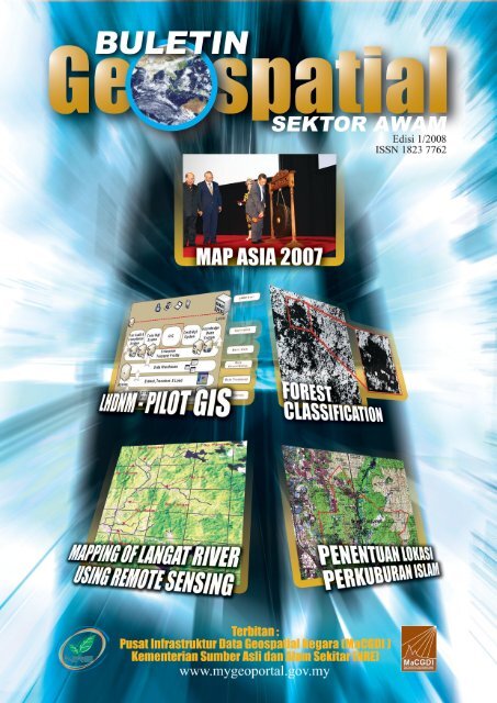
BULETIN GEOSPATIAL SEKTOR AWAM 2DARI MEJA KETUA EDITORKANDUNGANKajian Penentuan Lokasi MemorialPark Menggunakan Aplikasi GIS(Perkuburan Islam)High Resolution Image For ForestClassificationLhdnm Pilot GeographicalInformation System (GIS)Detecting And Mapping Of LangatRiver And Its Tributaries Using RemoteSensingGIS SANA SINIPersidangan dan PameranAntarabangsa MAP ASIA 2007,di Kuala Lumpur Convention Centre(KLCC), Kuala Lumpur pada14 hingga 16 Ogos 2007Galeri Foto1914192731Assalamualaikum dan Salam Sejahtera,Setelah genap 50 tahun kita merdeka, pelbagai kemajuan danpembangunan yang telah kita capai. Begitu juga dengan perkembanganGeographic Information System (GIS) di sektor awam. GIS sekarangmenjadi salah satu mekanisma dalam penyelesaian tugasan harian.Pemangkin kepada pembangunan dan kemajuan GIS adalah denganadanya Pusat Infrastruktur Data <strong>Geospatial</strong> Negara (MaCGDI).Infrastruktur maklumat geospatial negara telah dibangunkan bagimenyediakan perkhidmatan dan kemudahan ke arah penyebaran,perkongsian, penggunaan dan pengurusan maklumat geospatial dikalangan agensi-agensi sektor awam.Seiring dengan kemajuan tersebut MaCGDI juga menekankan akankepentingan dalam pendidikan GIS. Jika dilihat dari realiti semasa,bidang GIS masih bukan menjadi satu bidang pilihan utama di kalanganpelajar ketika melanjutkan pelajaran di institusi-institusi pengajiantinggi, tidak seperti bidang-bidang lain yang lebih ’glamor’ sepertikedoktoran, undang-undang, perakaunan, dan sebagainya. Masihramai lagi yang tidak menyedari wujudnya bidang GIS dan peranannyadi dalam pembangunan tamadun manusia walaupun bidang berkaitanpemetaan bumi adalah di antara profesion tertua di dunia. Selarasdengan itu, adalah menjadi misi kami di MaCGDI untuk ‘mempopularkan’penggunaan GIS di dalam setiap aktiviti berkaitan pembangunan danmenerap ’kepercayaan’ bahawa GIS merupakan satu elemen pentingdi dalam pembangunan sesebuah negara. MaCGDI juga menyedaribahawa komuniti GIS di <strong>Malaysia</strong> masih lagi kecil dan dengan itu adalahmenjadi satu cabaran bagi MaCGDI untuk membina satu komuniti GISyang lebih besar, berdaya saing, berinovasi dan berperanan di dalamkemakmuran negara.Sejarah GIS bermula kira-kira 15,500 tahun yang lampau dengan hanyalakaran-lakaran dan maklumat yang dilukis di dinding gua. Sejajar denganperkembangan tamadun manusia, evolusi GIS mula berkembang hinggake era perkomputeran pada masa kini. Kini, GIS bukan hanya paparanpeta di atas skrin komputer sahaja, tetapi menggabungkan teknologiteknologilain seperti teknologi mudah alih (mobile), teknologi GPS,teknologi berasaskan web, teknologi internet, teknologi penderiaan jauh(remote sensing), teknologi pangkalan data dan sebagainya. Gabunganteknologi-teknologi tersebut dengan teknologi GIS berjaya menghasilkaninovasi dan aplikasi yang mampu membantu manusia di dalam pelbagaiaspek kehidupan.Akhir sekali diharap artikel yang dipaparkan pada kali ini akan memberiilmu yang berguna kepada para pembaca mengenai perkembangan GISsektor awam di <strong>Malaysia</strong>. Selamat membaca!Sidang PengarangPenaungY.B. Dato’ Seri Azmi bin KhalidMenteri Sumber Asli dan Alam SekitarPenasihatY. Bhg. Datuk Suboh bin Mohd YassinKetua SetiausahaKementerian Sumber Asli dan Alam SekitarKetua EditorFuziah binti Abu HanifahPengarahPusat Infrastruktur Data <strong>Geospatial</strong> Negara(MaCGDI)EditorShaharudin bin Idrus - (LESTARI, UKM)Dr. Azhari bin Mohamed - (JUPEM)Hamdan bin Ab. AzizJawahiril Kamaliah binti MohamadDr. Zainal bin A. MajeedAnual bin Haji AzizRaja Abd. Aziz bin Raja AliMariyam binti MohamadNorazmel bin Abd. KarimWan Faizal bin Wan MohamedRekabentukHaji Muhammat Puzi bin Ahmat - (JUPEM)Ya’cob bin AbasSiti Sapura binti RafeeNurul Akmalina binti KhairuddinJurufotoAzlina binti MahadPenerbitPusat Infrastruktur Data <strong>Geospatial</strong> Negara (MaCGDI)Kementerian Sumber Asli dan Alam Sekitar (NRE)Aras 7 & 8, Wisma Sumber Asli,No. 25 Persiaran Perdana, Presint 4,62574 Putrajaya, <strong>Malaysia</strong>.Tel : 603 - 8886 1111Fax : 603 - 8889 4851www.mygeoportal.gov.myPenafian : Kesahihan dan ketepatan tulisan atau pendapat adalah tertakluk pada cetusan idea pengirim artikel.
BULETIN GEOSPATIAL SEKTOR AWAM 1KAJIAN PENENTUAN LOKASIMEMORIAL PARK MENGGUNAKANAPLIKASI GIS (PERKUBURAN ISLAM)Norazman Ismail 1 , Abdullah Hisham Omar 2 , Zainal A Majeed 1AbstrakKeperluan tanah perkuburan (Memorial Park) adalah satu kemudahan asas yang sama pentingnya dengan kemudahanasas lain. Apabila memajukan sesuatu kawasan perumahan seringkali keperluan ini tertinggal dan menimbulkan masalahkepada penduduk kerana tiada tanah perkuburan yang dirancang. Justeru itu kajian penentuan kesesuaian tapak barubagi kawasan perkuburan menggunakan aplikasi GIS dan pemetaan digital adalah salah satu alternatif kepada jalanpenyelesaiannya. Melalui analisis dan hasil akhir yang dicapai menggunakan aplikasi GIS pastinya dapat membantuPihak Berkuasa Tempatan untuk merancang sesuatu pembangunan seiring dengan keperluan penduduk setempat agarlebih berkesan dan terancang. Seterusnya ianya dapat membantu pihak perancang mengenalpasti perancangan sesuatukawasan dan meminimumkan masalah kekurangan tanah untuk kawasan perkuburan di negara kita.PENDAHULUANMatlamat perancangan bandar dan desa di negaraini adalah untuk mewujudkan penempatan manusiayang berkualiti di semua peringkat petempatan,baik di bandar mahupun di desa. Tahap kualitisesebuah petempatan pula mempengaruhidan sering dikaitkan dengan kualiti kehidupanmanusia, yakni pencapaian suatu tahap keadaanpersekitaran sosial, binaan manusia dan alamsemulajadi yang membolehkan masyarakat hidupdengan selesa, sihat, produktif dan selamat. Dibawah Akta Perancangan Bandar dan Desa 1976,setiap Pihak Berkuasa Tempatan (PBT) perlumenyediakan pelan pembangunan (pelan strukturdan pelan tempatan) bagi mengawal guna tanahdan pembangunan kawasannya. Ini bererti setiappelan pembangunan yang menjadi asas rujukanpembangunan perlu sentiasa dikemaskini. Prosesini pastinya memerlukan pembaharuan terhadapkebolehan proses perancangan menerima danmengolah maklumat-maklumat terkini sertamenggunakan kaedah dan peralatan moden.Tanah perkuburan adalah salah satu kemudahanasas yang sama pentingnya dengan kemudahanasas yang lain. Apabila memajukan sesuatukawasan perumahan seringkali keperluan initertinggal dan menimbulkan masalah kepadapenduduk kerana tiada tanah perkuburan yangdirancang. Masalah ini menjadi lebih kritikalkhususnya di kawasan kepadatan yang tinggi iaitudi bandar kerana berlakunya masalah kekurangantanah. Faktor sosial seperti adab resam pendudukbandar yang berbilang kaum juga perlu diberiperhatian dalam merancang tanah perkuburan.Justeru itu dengan adanya aplikasi SistemMaklumat Geografi (GIS) ianya dapat membantuPihak Berkuasa Tempatan untuk merancangsesuatu pembangunan seiring dengan keperluanpenduduk setempat agar lebih berkesan danterancang. Ianya dapat membantu pihak perancanguntuk mengenalpasti kesesuaian kawasan danmeminimakan masalah kekurangan tanah untukkawasan perkuburan di negara kita.
BULETIN GEOSPATIAL SEKTOR AWAM 3iii.iv.Jenazah diwajibkan mengadap ke kiblatatau kaabah. Bagi tujuan ini, tanah yang rataadalah paling sesuai;Jarak di antara tanah perkuburan dan rumahkediaman yang terdekat ialah sekurangkurangnya30 meter;HASIL DAN ANALISISBagi mencapai hasil yang diharapkan, berbagaianalisis telah dijalankan seperti pengkelasan(classification), pengkelasan semula (reclassify),pemodelan (modeling), tindihan (overlay), gabungan(union) dan sebagainya telah dilaksanakan.v. Jenis tanah yang paling sesuai ialah tanahterbuka jenis poros; danvi.Hendaklah jauh dari kawasan sungai, saliranatau lain-lain punca air. Ia sesuai ditempatkandi pinggir kawasan pembangunan danberhampiran dengan rumah ibadat.Analisis PengkelasanPeta Guna tanah Mukim Cheras dihasilkan melaluipemprosesan imej satelit QuickBird Mukim Cheras,bertarikh 15 October 2004 dan 18 Mac 2003. Prosespengkelasan imej dilakukan menggunakan kaedahpengkelasan berpenyelia (supervised classification)seperti ditunjukkan di dalam Jadual 1.0 di bawah.Pemberat Jenis Guna Tanah Kesesuaian1 Unclassified/Air/Awan Amat Tidak Sesuai2 Bangunan (Perumahan, komersial) Tidak Sesuai3 Cleared Land (kawasan yang sedang dibangunkan) kurang Sesuai4 Hutan dan pelbagai tanaman Sesuai5 Kawasan Lapang Paling SesuaiJadual 1.0 : Kelas Kesesuaian Guna Tanah Mukim CherasBerdasarkan kepada Peta Guna Tanah Mukim Cheras yang dihasilkan Rajah 1.2, keluasan setiap kelas bagiguna tanah adalah seperti paparan di dalam Jadual 1.1.Guna Tanah Luas PeratusKawasan (Ha)Air, Awan 769.5 12.8Bangunan 1682.3 28.2Cleared Land 703 11.8Hutan dan 1910.8 32Pelbagai TanamanTanah Lapang 907.4 15.2Luas Keseluruhan 5972.6 100Jadual 1.1 : Keluasan dan Peratusan Guna TanahRajah 1.2 : Peta Guna Tanah Mukim Cheras
BULETIN GEOSPATIAL SEKTOR AWAM 4Analisis KecerunanAnalisis kecerunan dijalankan berdasarkan kepadamuka bumi kawasan kajian yang terdiri daripadabentuk rupa bumi yang berbeza. Bagi kajian ini GarisPanduan Bagi Pemajuan Tanah Untuk PembangunanDi kawasan Berbukit oleh Jabatan Alam Sekitar telahdigunakan seperti ditunjukkan dalam Jadual 1.2 dibawah.KecerunanJadual 1.2 : Garis Panduan Pemajuan Tanah Di KawasanBerbukitDaripada hasil penjanaan Digital Elevation Model(DEM) menggunakan data vektor kontur dengan selaketinggian 20 meter, proses pengkelasan dilakukanbagi tujuan mendapatkan kesesuaian cerun di manasetiap pengkelasan adalah mengikut pemberatseperti yang telah ditetapkan.Rumusan daripada hasil pengkelasan ini didapatikelas paling sesuai yang berkecerunan 0˚ – 10˚mempunyai keluasan 82.4 % iaitu meliputi hampirkeseluruhan Mukim Cheras. Darjah kecerunanini adalah dianggap sebagai paling sesuai untukkawasan perkuburan Islam kerana kecerunannyaadalah dianggap rata. Kawasan ini meliputi keluasan115,361,200 meter persegi yang mana secarakeseluruhannya meliputi kawasan sebelah barat,selatan dan tengah Mukim Cheras. Gambaran jelasdapat dilihat seperti di dalam Rajah 1.3 dan 1.4.12000000010000000080000000600000004000000020000000Kelas< 12˚ Risiko Rendah12˚- 20˚ Risiko Sederhana> 20˚ Risiko Tinggi0G r a f K e lu a s a n T a n a h d a n K e s e s u a ia nKeluasan (meter persegi)Sangat Tidak SesuaiTidak SesuaiKurang SesuaiSesuaiPaling SesuaiRajah 1.4 : Peta Kecerunan Mukim CherasAnalisis PemodelanAnalisis pemodelan ini dijalankan berasaskan kepadapemodelan Weighted Linear Sum (Voegd,1983),di mana formula yang digunakan adalah sepertiberikut:S = (Wj Xij)Di mana S = Output (Tapak KesesuaianPerkuburan)Wj = Pemberat Parameter/Variasi(Pemberat bagi tanah-tanih, cerundan guna tanah)Xij = Pemberat kelas bagi parameter(Pemberat kelas bagi tanah-tanih,cerun dan guna tanah)Pemodelan ini dijalankan dengan menggabungkantiga lapisan data iaitu peta kecerunan, peta gunatanah dan peta tanah-tanih. Tiga lapisan datatersebut dihasilkan melalui proses pengkelasan bagimendapatkan kelas yang terbaik bagi tujuan kajian.Parameter (Wj) adalah nilai pemberat parameteriaitu antara 3 (paling sesuai) dan 1 (tidak sesuai)dan nilainya ditentukan daripada setiap pemberatkelas parameter (Xij) seperti ditunjukkan di dalamJadual 1.3.Rajah 1.3 : Graf Keluasan dan Kelas Kesesuaian
BULETIN GEOSPATIAL SEKTOR AWAM 5Wj = Pemberat Parameter / VariasiXij = Pemberat Kelas Bagi ParameterTanah 3 2 1 1 1Kecerunan 5 4 3 2 1Penggunaan Tanah 5 4 3 2 1Jadual 1.3 : Nilai Pemberat Parameter dan Pemberat Kelas ParameterHasil yang diperolehi, kelas yang paling sesuai adalahmewakili kawasan tanah lapang di mana tanahtersebut tidak dilakukan sebarang pembangunan.Kecerunan pula mewakili kecerunan 0 o - 10 o yangdikategorikan sebagai tanah rata. Bagi jenis tanahyang mengandungi kandungan pasir yang tinggiiaitu struktur tanah yang poros akan memudahkanlaluan air dan udara kesemua arah. Tanah jenis iniadalah membolehkan pereputan mayat dengan lebihcepat berbanding dengan tanah lain. Keluasan danperatusan bagi kelas yang dipilih adalah ditunjukkanseperti Jadual 1.4 dan Rajah 1.5.Kelas Luas (Ha) PeratusPaling Sesuai 246.7 4.5Kurang Sesuai 1367.1 24.5Paling Tidak Sesuai 3976.3 71.0Jadual 1.4 : Jadual Hasil PengkelasanAnalisis Tindih Lapis (Overlay)Daripada hasil analisis empirical model, kajianlebih ditumpukan kepada kelas paling sesuai bagimendapatkan kawasan perkuburan Islam. Melaluioperasi buffering dan operasi union data-data sepertisungai, jalan raya, masjid dan surau diasingkan bagitujuan mendapatkan zon penampan bagi kawasanperkuburan seperti di dalam Jadual 1.5, Rajah1.6,1.7 dan 1.8.DataJarak Penampan (Meter)Jalan 30Sungai 300Surau 500,1000,1500,2000Masjid 500,1000,1500,2000Jadual 1.5 : Data Spatial dan Jarak PenampanRajah 1.5 : Peta Kesesuaian Tanah Mukim CherasRajah 1.6 : Operasi Erase
BULETIN GEOSPATIAL SEKTOR AWAM 6Rajah 1.7 : Hasil Operasi EraseProses terakhir untuk mendapatkan hasil kajian yangdiharapkan adalah melaksanakan analisis tindihlapis (overlay). Analisis tindih lapis ini dijalankanadalah antara data lot kadaster Mukim Cherasdengan kawasan yang paling sesuai bagi CadanganTapak Perkuburan Islam Di Mukim Cheras sepertiditunjukkan di Rajah 1.9. Tujuan analisis ini dijalankanadalah untuk mendapatkan maklumat lot tanah bagikawasan tersebut.Rajah 1.8 : Operasi Penampan Kawasan Masjid dan SurauRajah 1.9 : Hasil Operasi Tindih Lapis
BULETIN GEOSPATIAL SEKTOR AWAM 7Hasil akhir daripada kajian ini didapati bahawakawasan tapak baru bagi perkuburan Islam di MukimCheras adalah memiliki keluasan seluas 801,423.00meter persegi bersamaan dengan 80.14 hektar.Sebanyak 116 lot tanah terletak di atas kawasantersebut. Keluasan ini adalah mengikut kriteria yangdigariskan di dalam Perancangan Tanah PerkuburanMengikut Hierarki Petempatan bagi Kawasan Bandardan Pekan. Mengikut kriteria tersebut, penduduk yangmelebihi 200,000 orang, keperluan tanah perkuburanadalah memerlukan seluas 20 hektar atau lebih dania boleh diagihkan ke beberapa tempat.Kawasan ini adalah dianggap terbaik disebabkanberdekatan dengan jalan raya, kawasanperumahan serta rumah ibadat (masjid) yangmemudahkan pengangkutan jenazah ke tanahperkuburan. Begitu juga dengan ciri-ciri topografiyang terletak di kawasan rata dan tidak bercuramserta jenis tanah yang poros seperti ditunjukkan didalam Rajah 2.0. Hasil akhir kajian ini adalah PetaCadangan Perkuburan Islam Mukim Cheras sepertiditunjukkan di dalam Rajah 2.1.Secara keseluruhannya ia menepati kriteria yangtelah ditetapkan oleh Jabatan Perancang Bandardan Desa melalui Garis Panduan PerancanganPerkuburan Islam dan Bukan Islam <strong>Bil</strong>.17/1997.Rajah 2.0 : Cadangan Tapak Baru Perkuburan IslamCadangan Tapak KuburSungai UtamaLOT_TANAH_CHERASNama TamanJalan_BandarHighwaySempadan_CherasRajah 2.1 : Peta Cadangan Tapak Perkuburan Islam Mukim Cheras
BULETIN GEOSPATIAL SEKTOR AWAM 8KesimpulanSecara keseluruhannya matlamat dan objektifkajian ini telah tercapai di dalam Kajian PenentuanKesesuaian Tapak Baru Perkuburan IslamMenggunakan Aplikasi Sistem Maklumat Geografidan Pemetaan Digital bagi Mukim Cheras.Keputusan ini adalah berpandukan kepadakriteria-kriteria tertentu yang telah ditetapkanoleh Jabatan Perancang Bandar Dan Desa<strong>Malaysia</strong>. Berdasarkan kepada keupayaanyang dilaksanakan ini, maka diyakini ia dapatmembantu pihak perancang mahupun pemajupemajuperumahan dalam merancang sesuatupembangunan khususnya tapak baru perkuburanIslam dengan lebih efektif di samping memberipenekanan kepada konsep pembangunan mapan.CadanganBerdasarkan analisis daripada kajian yangdijalankan, beberapa cadangan dapat diberikanuntuk memperbaiki lagi analisis-analisis yang akandatang khususnya analisis yang berkaitan denganpembinaan tapak baru perkuburan antaranya:1. Hasil daripada kajian ini didapati terdapatkelemahan dari segi kriteria-kriteria yangtidak spesifik yang dikeluarkan oleh agensiyang berkaitan. Diharapkan agar JabatanPerancang Bandar dan Desa dapat mengkajidan menetapkan kriteria yang lebih spesifikcontohnya darjah kecerunan bagi perkuburanIslam dan bukan Islam. Begitu juga denganmeletakkan nilai jarak yang minimum bagijalanraya, kawasan perumahan, kawasanindustri mahupun rumah ibadat daripadakawasan perkuburan.RUJUKAN DAN BIBLIOGRAFIGaris Panduan Perancangan Tanah PerkuburanIslam dan Bukan Islam (2002). Jabatan PerancangBandar dan Desa.Haniah binti Zakariah (2003). Jangkaan PerubahanGunatanah 5 Tahun Akan Datang Di RancanganRizab Krau Menggunakan Aplikasi Remote SensingDan GIS.Jabatan Perancang Bandar dan Desa NegeriSelangor (1999). Projek Strategi PembangunanMampan dan Agenda 21 Selangor.Nor Aizam, Zaharah, Pauziyah (2005). GIS TechniqueFor Incinerator Site Suitability study.Noraisah Yahya (2001). “Planning For HumanSettlement.” Habitat <strong>Malaysia</strong> – Human SettlementsJournal of <strong>Malaysia</strong>.Penyediaan Rancangan Pemajuan, RancanganCheras (1997-2010). Jabatan Perancang Bandardan Desa 2000.Safiza Suhana, (2002). Analisa Penggunaan SistemMaklumat Geografi Untuk Pembangunan MapanPulau Tioman.1 Pusat Infrastruktur Data <strong>Geospatial</strong> Negara (MaCGDI),Kementerian Sumber Asli dan Alam SekitarEmail: ajeman@macgdi.gov.myEmail: zainalmajeed@macgdi.gov.my2 Faculty Of Geoinformation Science & EngineeringUniversity Of Technology <strong>Malaysia</strong>Email: a.hisham@fksg.utmmy2. Cadangan kajian seterusnya perlumenitikberatkan kepada pembangunanpangkalan data bagi kawasan Mukim Cheraskhususnya dalam data-data banci, pelanrancangan struktur dan juga pelan rancangantempatan bagi membolehkan analisis yangdijalankan lebih berkesan. Di samping itujuga, pangkalan data yang dibangunkan perludiperkemas dengan metadata yang terperinci.
BULETIN GEOSPATIAL SEKTOR AWAM 9HIGH RESOLUTION IMAGE FOR FORESTCLASSIFICATIONTan Sek Aun 1 , Nurul Fariza Abd. Azis 2 , Nor Zahrah Suboh 2 , Azhan Idris 1 & Rodziah Hashim 1AbstractUnsupervised classification is also known as clustering because it is based on natural grouping of pixels in the imagedata when the pixels are plotted in the feature space. Clusters are defined with a clustering algorithm, which often usesall or many of the pixels in the input data file for its analysis. ISODATA (Iterative Self-Organizing Data Analysis Technique)are examples of unsupervised classification methods. The aim of this study was to apply the unsupervised classificationmethod for forest mapping using high resolution QuickBird image. The study site was located at the Forest ResearchInstitute <strong>Malaysia</strong> (FRIM), Kepong. The overall accuracy for the unsupervised classification was 77.50% while the kappastatistics, 0.8182.INTRODUCTIONMapping forest resources has become one of the mostimportant activities in sustainable forest management.However, mapping heterogeneous and high densitytropical rain forests is a heavy task. Nevertheless,advancement of satellite remote sensing technologiesand image processing techniques has improved thesituation. One of the basic characteristics of opticalremote sensing is the extensive use of quantitativealgorithms for estimating natural resources. Recently,satellite imagery has become available at spatialresolution nearly comparable to aerial photographs,with the added advantage of digital multi-spectralinformation more complete even than those providedby digital orthophotographs (DOQs). QuickBird isone of the high resolution earth observation satellites(EOS) which is commercially available for Earthsurveillance usage. QuickBird imagery consists of fourdifferent multispectral bands and one panchromaticband. The best resolutions for the multispectral andpanchromatic bands of QuickBird imagery are 2.44m and 0.61 m, respectively (DigitalGlobe Inc. 2002).Using pan-sharpen technique, the resolution formultispectral bands can be improved to 0.61 m.Various image processing techniques have beenintroduced to improve results derived from remotesensing data. The technique used in this study is theUnsupervised Classification method or also knownas clustering. Clustering technique is appropriatefor classifying the types of features on Earth.The common clustering techniques are k-means,ISODATA, hierarchical, fuzzy c-mean and expectationmaximum. ISODATA is the abbreviation for IterativeSelf-Organizing Data Analysis Technique. It uses theminimum spectral distance formula to form clusters.The ISODATA utility repeats the clustering of theimage until either a maximum number of iterationshave been performed or a convergence thresholdhas been reached between iterations. (Erdas 1997).In this study, the rules of 10% canopy cover and areacoverage not less than 0.5 ha were followed in orderto apply the classification method.OBJECTIVEThe main objective for this study was to apply theunsupervised classification to forested areas usinghigh resolution QuickBird satellite image.
BULETIN GEOSPATIAL SEKTOR AWAM 10METHODOLOGYStudy AreaForest Research Institute <strong>Malaysia</strong> (FRIM) is aregenerated secondary forest which is located 16km northwest of Kuala Lumpur. Total coverage ofthe area is 530 ha and is divided into various zonesaccording to the dominant plant species. This studywas carried out in these zones which contain differentdominant species.DataThe remote sensing data used in this study is themultispectral and panchromatic QuickBird imagery.This data was acquired from the <strong>Malaysia</strong>n Centre for<strong>Geospatial</strong> Data Infrastructure (MaCGDI) through itsdata sharing and exchange policy among governmentagencies. Besides the remote sensing data, the studyalso collected other forms of data and informationsuch as Global Positioning System (GPS) and forestcomposition.Data ProcessingFigure 1 shows the flow chart of the methodologyapplied in this study. The steps involved were imageprocessing, ground observation and results analysis.QQuickBird c k B ir d Image I m a g e GC GCPs P s ( (using u s i DGPS) D G P PPre-processing-r o c e s si n g- Geometric o r corr e ct i onSubset s NNormalized m e d DDifferencef e n c eVe Vegetation g eta tio n IIndices n c e s (NDVI) ( V I)MMaskinga s k U ns Unsupervied u r v i se d classificationc f ic at i onIn order to verify the QuickBird data with groundfeatures such as trees and buildings, the image wasregistered to the ground collected GCPs (groundcontrol points). High accuracy Differential GlobalPositioning System (DGPS) device was used tocollect the GCPs at FRIM compound. Table 1 showsthe GCPs collected from the DGPS equipment.Points Easting Northing#1 404527.01 357498.28#2 404649.12 357854.52#3 404174.08 357761.65#4 404072.33 357940.75#5 404333.57 357790.10#6 404151.48 358102.29Table 1 : DGPS collected GCPsGround features such as road junctions and sharpbuilding edges were collected as GCPs. Thesefeatures were first identified from the QuickBird imagebefore the GCPs were collected on the ground. TheGPS-finder software was used to post-processed theGCPs for acquiring better accuracy. The QuickBirdgeocoding process was carried out using ImageGeometric Correction function in ERDAS ImagineVersion 9.1. The image projection was set to RSOPeninsular <strong>Malaysia</strong> map projection with ModifiedEverest as the spheroid and Kertau 1948 as thedatum. The image was then subset to a smaller imagewindow size which only covered the study site.The Normalized Difference Vegetation Index (NDVI)was used to differentiate forested areas from thenon-vegetation features such as buildings, bare land,cloud and shadow. NDVI is an indicator to representthe vividness of vegetation. Green or healthyvegetation will give higher values of NDVI. Nonvegetatedfeatures always show lower NDVI values.The general algorithm is shown as below:Fieldl dv eri f ic ati o nReRe-apply l y uunsupervisedn s u p v i s e dcl classificationa s s i cat i NDVI=⎛⎜⎝NIRNIR− R+ R⎞⎟⎠AnalysisA na-l yAccuracys is- Ac cur a cya s s e s s m e ntwhere NIR = near infra red bandR = red bandFigure 1 : Methodology flow chart
BULETIN GEOSPATIAL SEKTOR AWAM 11The image was then masked to differentiate the highNDVI from low NDVI values. The masking processwas applied by using modeller. The image wasthen classified using Unsupervised Classification(ISODATA) to differentiate various forest classeswithin the forested areas. Unsupervised classificationtechnique is a computer-based process that requiresno specific information to be supplied to the processfor classification. The output will be generatedbased on default setting. ISODATA is an iterativetechnique for choosing a threshold to be applied inthe classification process.To improve the preliminary classification results, fieldverification was carried out in this study. The imagewas then re-classified and labelled based on groundinformation. The number of classes was reduced fromten to five classes, due to the highly heterogeneousconditions in the study area. Accuracy assessmentwas conducted for data analysis.RESULTS AND ANALYSISmisinterpretation between non-vegetation featuresand forested areas and thus increase the final resultsaccuracy. Figure 2 shows the output of NDVI andmasking process of non-vegetation and vegetationareas. Bright areas were the vegetated areas, whilethe black pixels, non-vegetation areas.Figure 3 shows the preliminary unsupervisedclassification results with 10 classes includingshadow and building; while Figure 4 shows the fiveclasses map after the re-classification process. The10-classes map is relatively difficult to be interpreteddue to the patches information from the imageclassification. The map is relatively less helpful inforest management practices due to no detailedinformation such as species grouping. Thus, thenumbers of classes were then reduced to five classesfor better forest composition mapping. The map wasre-classified into four different classes for forestspecies groups and one non-vegetation class suchas buildings, cloud and shadow. The re-classificationprocess was aided with the ground truthing andexisting tree plot information.In order to differentiate the non-vegetation featuressuch as building, cloud and shadow from the forestedareas, the QuickBird image was indexed and masked.The NDVI process was used mainly to separate nonvegetationfeatures from forested areas. Meanwhilethe masking process was applied to cluster allnon-vegetation features into one single class inorder to ease the classification process for forestedareas. Consequently, the process will minimize theFigure 3 : Classification using 10 classesFigure 2 : NDVI and masking results
BULETIN GEOSPATIAL SEKTOR AWAM 12From the ground truthing observation, the reclassificationmap was labelled by the dominanttree species. The classes were labelled as kapur,mahogani, and meranti. The highly mixture forestedarea was labelled as “pure mixed trees”. The buildings,cloud and shadow were labelled as “unclassifiedfeatures”. The cyan color represents the kapur classwith a mix of other tree species, black representsunclassified features, green represents the merantidominated group with a mix of other trees, yellowrepresents the mahogani with a mix of other treesand orange represents mix trees species (Figure 4).The overall accuracy for the re-classification inthis study was 77.50% and the kappa statistic was0.8182. Kappa coefficient is widely used in comparingthe results of an image classification with results of arandom classification (Erdas 1997). In this study, the0.8182 kappa coefficient implied that the result wasgenerated with the effective agreement of 81.28% ina completely random classification process. From thekappa statistic it can be concluded that high kappacoefficient shows that there are mutual agreementsbetween reference data and the image texture data.CONCLUSIONSThe overall classification accuracy in this studywas relatively high with 77.50% using QuickBirdsatellite image. However, no individual tree speciesclassification was performed due to the highly mixedheterogeneous conditions. Different remote sensingtechnologies and tools could be integrated in orderto successfully classify the tropical rain forest. Betterspatial and spectral resolution tools such as laserand hyperspectral are considerably useful to achievethe goal.Figure 4 : After reduced classesACKNOWLEDGEMENTSFigure 5 shows the percentage of tree distributionfor each tree species. Among the four forest classes,Class D had the highest coverage which wasdominated by meranti species while Class B whichwas dominated by the mahogani species showed thelowest percentage of the tree distribution in the studyarea. Although the study area was a plantation forest,the results from this study showed that the area wasa mixture of other tree species.The author thanks the <strong>Malaysia</strong>n Centre for<strong>Geospatial</strong> Data Infrastructure (MaCGDI) for thecourtesy of QuickBird image. The author would alsolike to thank the staff of Geoinformation Unit (UGI) fortheir supports and help throughout this study.REFERENCESDigitalGlobe, Inc. (2002). QuickBird imagery products:Product guide, Revision 3.3. Colorado’ Longmont.Erdas. (1997).Erdas Field Guide. Georgia, Erdas,Inc.J. R Jensen. (1996). Introductory to Digital ImageProcessing Second Edition, Prentice-Hall InternationalLimited London.Figure 5 : Percentage graph of tree distributionJindong Wu, Dong Wang, Marvin E. Bauer (2005),Image-based Atmospheric Correction of QuickBirdImagery of Minnesota Cropland. Remote Sensing ofEnvironment. Pg. 315-325.
BULETIN GEOSPATIAL SEKTOR AWAM 13John A. Richards. (1999). Remote Sensing DigitalImage Analysis, 3rd edition, Springer.Le Wang, Peng Gong, Geogory S. Boging.(2004). Individual Crown Delineation and TreetopDetection in High Spatial Resolution Aerial Imagery.Photogrammetric Engineering & Remote Sensing.Le Wang, Wayne P. Sousa, Peng Gong, GeogoryS. Boging. (2004). Comparison of IKONOS andQuickBird images for mapping mangrove species onthe Carribean coast of Panama. Remote Sensing ofEnvironment. Pg. 432-440.Lund, H. Gyde (2006). Definitions of Forest,Deforestation, Afforestation, and Reforestation.Gainesville, VA: Forest Information Services.M. Heurich, H. Weinecker. (2004). Automated TreeDetection and Measurements in Temperate Forestsof central Europe using Laser Scanning Data.Internatioanl Archives of Photogrammetry, RemoteSensing and Spatial Information Sciences.Robert A. Schowengerth. (1997). Remote SensingModels and Methods for Image Processing, 2ndedition, Academic Press.1 Forest Research Institute <strong>Malaysia</strong> (FRIM)Email: tansekaun@frim.gov.my2 Department of Remote Sensing,Faculty of Science Geoinformation and Engineering,Universiti Teknologi <strong>Malaysia</strong>.Why Using FlashFlashmapping.org is a collection of open source toolsfor Adobe Flash that supports the development ofprofessional mapping applications. Flashmapping.orgis a collection of open source tools for Adobe Flash thatsupports the development of professional mappingapplications. Interactive maps on the web are in bigdemand these days. End of 2005 a big boom of GISstarted since Google and Yahoo producing public mapservices and viewers. This boom creates already ahigher demand from end users. Server based scriptingfor mapping services (such as .NET,.ASP) are notuser friendly enough because of the constant pageloads and the need to wait for the server after oneuser action. Every interaction with a map demandsa request towards the server. These days there areseveral good solutions to achieve that. Solutions suchas AJAX, JAVA clients and Flash macromedia are themost common options these days. They run on theclient what makes the user experience much better.The files are small.Designers and developers can work easily onthe same project.Flash has been for years the tool of designers.It’s easier then learning .NET or JAVA.You can build components and classes in flash.Flash is the number one in add-on for browsers.It’s platform independent. Linux, Windows, Unix,Macintosh.All major internet browsers can integrate theflash plug in.Backwards compatible to older browsers.Flash has no difference on different platformlevels.Integrating animation is easy.Flash supports vector information.source : www.flashmapping.org/
BULETIN GEOSPATIAL SEKTOR AWAM 14LHDNM PILOT GEOGRAPHICAL INFORMATION SYSTEM (GIS)Mohamad Fauzi bin SaatINTRODUCTIONLembaga Hasil Dalam Negeri <strong>Malaysia</strong> (LHDNM) isstrategically positioning its operations to improve theeffectiveness and proficiency of its operations viaadvanced information technology. The developmentof LHDNM GIS system which was started in 2006 willassist all personnel, especially those that have ofsiteassignment, in carrying out their duties in moresystematic, efficient and effective manner. The GISis defined to be a system that would enable LHDNMto perform necessary querying, editing, reporting,analysis and maintenance administration in GISenvironment based on the information residing inthe LHDNM Data Warehouse. Manipulation of dataand mapping the data to geographical location willmake easy by using GIS system. It also provideassistance for LHDNM personnel in executing itscompliance activities.The main objective of LHDNM GIS system isbasically to provide geographical information toLHDNM personnel. Having GIS system, the locationof all information that was made available will beanalyzed, displayed and mapped accordingly for thepurpose of conducting various compliance activitiessuch as;• business survey for expansion of tax base;• audit function; and• revenue collection.The proposed implementation of the LHDNMPilot GIS system shall covers the area of MajlisPerbandaran Petaling Jaya (MPPJ) that is under thejurisdiction of Petaling Jaya LHDNM Branch Office.Subsequent location shall be done in stages basedon project extension or availability of location datalayer. To establish a complete GIS database for thewhole nation will be very time consuming as the databelongs to various external authorities. To gatherall those data may require to follow reacquisitionprocess and it is dependent on the availability ofthe data since not all the areas or towns having thesame level of information detail and some areasmay not yet to have the digital cadastral lot.Figure 1: Sample screen of LHDNM GIS
BULETIN GEOSPATIAL SEKTOR AWAM 15SYSTEM OVERVIEWLHDNM GIS system application requires two sets ofdata; namely tax payer information data and spatialdata (geographic and location data). As part ofLHDNM Data Warehouse Project, the LHDNM pilotGIS system is depending on tax payer informationdata from various internal LHDNM systems (DB2Data Warehouse) as an input to GIS application.The Oracle Spatial Database on the other handcreates, maintain and manage the spatial and textualdata requirements. The following diagram depictsthe synchronization between DB2 Data Warehousedatabase and the Oracle Spatial database.LH d n GIS C lient`LH d n GIS SystemAr cSd ESe r ve rlecarOlatiapSesabtaadd a ta Extr a ctio n& Syn ch r o n izin g C o m p o n e n tsBa tch M o d ed ata Warehouse ApplicationseuoheraWatad2BdesabtaadFigure 2: Data Synchronization between Oracle Spatial and DB2 Data WarehouseThe overview of GIS system in the environment of LHDNM Data Warehouse Project is explained by thefollowing diagram:Figure 3: Overview of the LHDNM Pilot GIS System in Data Warehouse Environment
BULETIN GEOSPATIAL SEKTOR AWAM 16GEO-CODING LEVELThe Geo-coding level will determine the LHDNM GISapplication zooming level. Geo-coding level (zoominglevel) determination of tax payer in this pilot projectcan be achieved base on:1. Lot Level2. Road Level3. Enumeration Block LevelBase on this zooming level, the higher the zoominglevel, the better application will serve the LHDNMneeds. The Ultimate aim is to geocode the tax payerup to lot level. However, some constraints are –• Mechanism to find the most practical(automated) way to geo-code the tax payerinformation with the spatial lot;• There are no direct links between the tax payerinformation from Data Warehouse with thecadastral lot map available at JUPEM or localauthorities;• The availability of data varies from one state toanother state, one town to another town. Notall towns in <strong>Malaysia</strong> have digital cadastral lotand some that have might not be up-to-date.• Therefore, the highest zooming level that canbe perform automatically for the pilot project isup to road level which both of the databasescontains road information – the tax payerinformation in Data Warehouse contains roadinformation in their address system and in GISlayers, the road layers is available from MajlisPerbandaran Petaling Jaya (MPPJ).The following are the possible approaches for taxpayer geo-coding in the LHDNM GIS pilot project:1. Corporate and Sole Proprietor Tax payer:• Using State as the national level ofgrouping.• Using post-code boundary or mukimboundary to group within state level.• Using commercial area/factory areato narrow down to the smaller areacoverage.• Using road to further locate the companylocation.• Using lot number (if Data Warehousedata contain the information) to geo-codethe tax payer information with each ofcadastral lot.2. Individual (SG group)• Using enumeration block map.• Using I/C No. to map the individual taxpayer with location.• Or using tax payer postal address to mapback to the State, district, mukim, androad or lot number of the geo-databaseinformation.• Zoom level – up to enumeration block(80 – 100 tax payers per block).Figure 4: Example screen of LHDNM GIS Zooming Level
BULETIN GEOSPATIAL SEKTOR AWAM 17BASE LAYERThe LHDNM Pilot GIS system shall utilize the baselayer taken from the following authorities such as;• Cadastral Lot - JUPEM/Local Authorities;• Road – JUPEM/JKR;• Enumeration Block – Statistic Department;and• Administrative Boundary – JUPEM.As for the pilot implementation the following set ofbase layer will be created for the LHDNM Pilot GISsystem usage:• Country Boundaries covers Semenanjung<strong>Malaysia</strong>, Sabah and Sarawak.• State Boundaries• District Boundaries• LHDNM Branch Boundaries• LHDNM Zone Boundaries• PostcodeHowever, additional GIS layer can be added usingthe Common Utility Module by System Administratoras when the layer is required in the future.FUNCTION AND BENEFIT OF LHDNM GISSYSTEMWith the implementation of LHDNM GIS system,it is expected that the solution can meet LHDNMimmediate needs of geographical visualization andanalysis aid. Overall, all tax payer information whichis available at LHDNM Data Warehouse databasecan be displayed in geographical manner and thesystem will be able to:• Locate taxpayer;• Be used as one of strategic planning tools inlocating high potential areas of operations;• Identify areas with high potential taxpayer,but low in tax registration;• Display tax-payer location and other taxpayer attributes using GIS;• Display information about premise tenant andpremise owner profile;• Show type of industries in selected area;• Display the tax payer density informationwithin the area;• Display the high risk taxpayer information ingeographical manner.With all the functionalities and capabilities, LHDNMGIS system will help managers:• To plan and program the compliance activity;• To strategize and develop the action plan forcompliance activity;• To plan, execute, observe and developcomputerization and operation system inrelation to the compliance activity; and• To control and monitor the execution ofcompliance activity.Figure 5: Search the tax payer by tax payer’s location address
BULETIN GEOSPATIAL SEKTOR AWAM 18The GIS system allows the users to locate tax payer according to the identified location according to the attributesshown in the below Table 1.NO Attributes Description1 Region Search the tax payer by LHDN region.2 Zone Search the tax payer by LHDN zone.3 Branch Search the tax payer by LHDN branch.4 Tax Payer Name Search the tax payer by tax payer’s name itself.5 Address Search the tax payer by tax payer’s location address.6 Post Code Search the tax payer by tax payer’s address postcode.7 State Search the tax payer by tax payer’s address state.8 Industry Type Search the tax payer by tax payer’s type of industry.9 Land Use Type Search the tax payer by tax payer’s land use type.10 Income Wages From Search the tax payer by tax payer’s income which determines by range.From certain amount to certain amount.11 Income Wages Search the tax payer by tax payer’s income which determines by range. From certain amount to certain famount.12 Year Of Assessment Search the tax payer by tax payer’s year ofassessment.13 Have Report Search the tax payer by tax payer’s report whetherhave report or not.14 Total Report Search the tax payer by tax payer’s total number ofreports.15 Registered In LHDN Search the tax payer by tax payer’s registration withLHDN whether registered or not registered.16 File Type Search the tax payer by tax payer’s LHDN file type.17 Compliance With Search the tax payer by LHDN form compliance.18 LHDN File No Search the tax payer by tax payer’s LHDN file type.19 Total Payroll Search the tax payer by tax payer’s total payroll.20 Registered In SSM Search the tax payer by tax payer’s registration withSSM whether registered or not registered.21 Business Registration Search the tax payer by tax payer’s businessregistration.Example: business as sharing22 Business Type Search the tax payer by tax payer’s business type.Example: mini market23 Registration Year Search the tax payer by tax payer’s year of registration in SSM.Table 1: GIS system allows the users to locate tax payerJabatan PematuhanLembaga Hasil Dalam Negeri <strong>Malaysia</strong>Email : mfauzi@hasil.org.my
BULETIN GEOSPATIAL SEKTOR AWAM 19DETECTING AND MAPPING OF LANGAT RIVERAND ITS TRIBUTARIES USING REMOTE SENSINGMohd. Hasmadi IsmailAbstractRivers are precious living systems and it is important that these resources be protected to ensure continuous and safeutilization, both now and in future. Land denudation is perhaps the most basic culprit of all river pollutants. Agriculture,mining, industrial, urbanization and improper forest harvesting are major potential causes of degradation to the riversystem. Sound management of land use is fundamental both to preserve stable river ecosystem and control pollution.Satellite remote sensing data provides an economic and excellent starting point for mapping and monitoring our riversystem and their changes. Remote sensing data also act both as a base map and thematic map, which are useful fornational and regional planning. This study was carried out to test the capability of Landsat TM to map the Langat River andits tributaries as well as the surrounding areas in an attempt to extract vital information necessary for river management.This paper also describes how Landsat TM together with specific image processing method can be used for Langat Rivermapping and management of its surrounding watershed.INTRODUCTIONThe river system in <strong>Malaysia</strong> is an integral part of thewater resources system. There are more than 1,800rivers and 100 river systems in Peninsular <strong>Malaysia</strong>and 50 river systems in Sabah and Sarawak. Riversystems as a whole, with or without impoundingreservoir, are estimated to contribute almost 96percent of raw water supply source. Moreover, about97 percent of the required water comes from forestedareas in the headwater ridges (Mohd. Hasmadi andKamaruzaman, 1999). Water has always been asignificant factor in the development of any areasince long time ago where the first settlements wereusually located near water bodies or river. Whenpopulation expands and the consequent demand forland increases, more water development had beenplanned to fulfill this society’s demand. Agriculture,mining, industrial, urbanization, recreation and forestharvesting are major potential causes of degradationto the river systems.The contribution of remotely sensed data to themanagement and development of forest resourcesin <strong>Malaysia</strong> has been significant (Kamaruzamanand Haszuliana, 1998). Hence, the possible use ofsatellite imageries for mapping and monitoring riverpattern in the country is being tested. Satellite imagedata enable direct observation of the earth’s surfaceat repetitive intervals and therefore allow mapping ofthe extent, and monitoring of the changes in land use(Mohd. Hasmadi and Kamaruzaman, 1999). Suroso(1985) stated that the advancement of computer aidedremote sensing technology with computer aided hasnot only enhanced the capability of handling data buthas also given a powerful information which consistof spatial and geo-thematic information that can beused in management of land resources.Satellite remote sensing is an evolving technologywith the potential for contributing to studies of the riverand water change by making globally comprehensiveevaluations of many human actions possible.Moreover, satellite remote sensing data provides aneconomic and excellent starting point for mappingand monitoring of our river system and their changes.Remote sensing data also act as both a base mapand thematic map, which are useful for national andregional planning. This study was carried out to testthe capability of Landsat TM to map the Langat Riverand its tributaries as well as the surrounding areasin an attempt to extract present vital informationnecessary for river management.METHODOLOGYDescription of Study AreaThe study area is located in the South-East ofSelangor Darul Ehsan. The area is situated withinlatitudes 101 0 46’E to 101 0 59’E and longitudes 02 058’N to 03 0 17’N. This area was chosen as a study
BULETIN GEOSPATIAL SEKTOR AWAM 20Figure 1: Location of study areasite because of the existing natural resources and twoimportant namely Semenyih Dam and Langat Dam.Figure 1 illustrates the general river system availablein the surrounding watersheds.The climate of Hulu Langat area is typically tropical. Themean annual temperature is 32 0 C with a mean maximumand minimum of 33 0 C, respectively. However, the meantemperature at night ranges from 24 0 C to 28 0 C. Annualprecipitation in the area is approximately 2,316.5 mm –4,223.4 mm. Rainfall mainly occurs in February to Apriland September to November.Generally, the physical features of the Hulu Langatarea are distinctive with undulating lowland, hill andmountains culminating in the highest mountain ofGunung Nuang (4,899m). The mean elevation is21m Above Sea Level (a.s.l) and the maximum reliefof the area is over 1000m. The catchments fall intothe hydrological regional of Kuala Krai-Ulu Langat asdemarcated by the Drainage and Irrigation Department(Goh, 1974). Batangsi River, Congkak River, LawingRiver and Lui River are the main streams in this basin.The four streams are tributaries of the Langat Riverwhose headwater drain the western flank of the mainrange and flow southwest into the Straits of Malacca.Another stream is Semenyih River which is located atthe South of the study area.MethodLandsat TM images scene 127/58 (path/row) of 8February 1998 was used for the study. The scenehas less than 5 percent cloud cover and wasobtained from the <strong>Malaysia</strong>n Centre for RemoteSensing (MACRES) in the form of computer diskwith a spatial resolution of 30m. The TM data wasinitiated by selecting the representative subsectionof the scenes that was covered by the experimentalarea. The ancillary data used in this study weretopographical (1:50,000) and land use maps(1:50,000). These maps were used as a preliminaryabstraction of land use information and assist inimage interpretation. The landsat TM data wasprocessed using a computer based PCI/EASIPACE,available in the Faculty of Forestry, Universiti Putra<strong>Malaysia</strong> for digital analysis and classification. Thework flow is illustrated in Figure 2.
BULETIN GEOSPATIAL SEKTOR AWAM 21Figure 2: The Diagram of StudyImage ProcessingThe Landsat TM image was displayed using the truecolor composite with a combination of several falsecolors composite (FCC). Using histogram equalization,contrast enhancement and spatial filtering, the imagewas manipulated to generate informative data set(s).Mode filtering and Edge filtering of 3 x 3 sizes wasperformed to reduce the noise and improved the dataquality to assist data interpretation. In this pre processingsteps, clouds showed a higher irradiance value thanground data. Moreover, the amount or irradiance variesdepending on whether the clouds are white, gray, blackor combination of different shades. This factor adverselyinfluenced the classification and analysis of imagerydata. However, this problem was minimized by creatingshadow mask using a histogram based on data derivedfrom Channel 1, 2 and 3 TM.Image InterpretationIn the visual interpretation method, different types landuses are separated depending on the tonal variation. Inaddition, the visual interpretation technique is subjectiveand depends on the field knowledge and aptitudeof the interpreter. Image enhancement produced anew enhanced image that is display on False ColorComposite for visual interpretation. By using linearenhancement, image was clearly displayed and easyto classify and interpret than the original image. In thevisual interpretation method different types and coveragewere separated depending on the total variation. Thevisual interpretation techniques have been widely usedfor forest covering mapping (Anon, 1983: Anon, 1993:Porwal et. al., 1994). However, the visual interpretationtechnique is subjective and highly depends on the fieldknowledge and aptitude of the interpreter. The visualinterpretation of Landsat TM data identified road, river,plantation and other land cover types. This image alsoprovided land cover type boundaries, and the arealextent of roads and rivers. Figure 3 showed the resultof visual interpretation using 5-4-2 (RGB) channel to beused in land cover types classification.Ground verification was conducted on 24 and 25February 1999 to verify the results obtained from thepreliminary image analysis, and to determine theaccuracy of assessment. GPS-Trimble GeoExplorer IIwas used to locate the actual land cover of the studyarea based on longitudes and latitudes.
BULETIN GEOSPATIAL SEKTOR AWAM 23ThemeForestAgricultureUrban/Cleared LandWaterCloudsClass12345Pixels75761189478143640Percent Pixels Classified by ClassAccuracy (%) 1 2 3 4 589.37 89.37 9.98 0.61 0.03 0.0176.45 17.33 76.45 6.22 0.00 0.0071.13 0.21 28.24 71.13 0.00 0.4296.50 1.40 0.70 1.40 0.00 0.0099.06 0.00 0.30 0.63 0.00 99.06Average Accuracy 86.50%Overall Accuracy 87.69%Kappa Coefficient 0.72412Standard Deviation 0.00721Confident Level 99 +/- 0.0185995 +/- 0.0141290 +/- 0.01185Table 1: Confusion Matrix for Five Classes of Land Cover in Hulu LangatApart from the advantages of using this data, there aretwo major problems encountered such as to differentiatesome land cover such as rubber and oil palm (Hassanet al., 1997) and orchards (Mohd. Hasmadi, 1998)which are having almost similar spectral responses.The other ones are difficult to discriminate the rivertributaries and skid trail in the forest. The accuracyof classification was assessed on a pixel basis andan error matrix was computed (Card, 1992; Davidand Goetz, 1990; Congalton, 1991). The numbers ofcorrectly classified pixels, meaning the major diagonalin the error matrix for the five classification result arelisted in Table 1. The data was processes to enhancethe classification accuracy for all land cover classeswith the error matrix; an overall accuracy of about 87.69percent was archived. The overall accuracy is higherthan the minimum accuracy value of 85 percent whichis the basic requirement for digitally classified image(Paul, 1991). From the classification, it can be deducedthat forest areas were over exploited principally foragriculture (oil palm and rubber) and resettlement.and Tekali River are easily detected in the scene. Smallrivers like Pangsun River, Chongkak River, PeredakRiver and Mukau River are also quite easily identified.Unfortunately, the other tributaries like Lawing River,Segambir River, Limbat River, Pagoh River, S. Rephen,Semungkis River and etc. are difficult to identify sincethey size factor are very small. River network extractionconsisted of edge detection followed by the constructionof river segments through delineating were illustrated inFigure 6.River MappingAs river appear black or dark, edge detection techniqueis quite suitable to extract river pixels from the image(Figure 5). Meanwhile, by using band 2 of Landsat TMwith linear enhancement and contrast stretching, riversegments appears as white but two of the dams werenot well separated. As river display a linear pattern, itimplies that applying line-edge detector using 3 x 3 and5 x 5 processing windows is more appropriate. In thisstudy the main river such as Lui River, Langat RiverFigure 5: Edge Detection Technique showed theExtraction of River Pixel from Landsat TM Image
BULETIN GEOSPATIAL SEKTOR AWAM 24Characterizing river in satellite imagery is a veryhard task due to the low resolution of satelliteimagery such as those of the Landsat TM. Accordingto Ichoku et al. (1996) computerized detection ofone or more specific features from such imagesare not an easy task. The process of the noise inthe image and the gap between river pixels causedby overhanging trees in the river make the linkingprocess of river pixel very complex. Any waterbodies less than 5 m wide will not be immediatelydetected due to the canopy closure which tendsto cover up the water surfaces. By using ancillarymap (topography map), some small rivers can bedelineated.Figure 6: Landsat TM Data Showing the Main River andTheir Tributaries in Hulu Langat, Selangor
BULETIN GEOSPATIAL SEKTOR AWAM 25CONCLUSIONIn order to extract a complete river network,its tributaries segments need to be linked.Unfortunately, linear features extracted in thestudy are not capable to connect all rivers. Someof them may be roads, mountain valley’s skid trailand others. It can be concluded that thematic mapsextracted from satellite imageries provide a vitalsource of information for river network mapping andmonitoring, especially by the river authorities andtown councils. The river network were delineatedbased on color separation on the TM imagethrough visual interpretation and were corrected bycombination of digital analysis of TM data and thedata obtained from ground verification. Althoughthere are some limitations of this technique, theresults obtained can give a general view of theriver system in Langat River basin. Developmentof Hulu Langat District is expected to increase incommencement of agro-based industrial operationand development of urban centers. This rapiddevelopment has caused a great change on theriver quality such as discharged polluted water tothe river from industrial activities. Hulu Langat andits surrounding hill areas are very important sourceof water supply for downstream users, as part ofany new initiatives, an integrated programme ofprocess hydrology needs to be implemented fora better understandings of within drainage basineffects arising from forest area manipulation orconversion.RECOMMENDATIONSSeveral recommendations that can be deducedfrom this study area as follows:1. Higher classification accuracy can be achievedby using higher resolution of satellite data suchas SPOT where accurate measurement of landcover classification can be obtained.2. The use of other software such as ENVI, ERMapper, ERDAS and ILWIS are necessary forcomparison purposes.3. Future research should emphasis on theeffectiveness of the satellite data to predictriver quality such as sediment impounding andconsider the response of rivers in term of scourand deposition by any new development area.REFERENCESAnon, 1993. Rehabilitation of Logged Over Forestin Asia/Pacific Region. Final Report of Sub ProjectII International Tropical Timber Organization-JapanOverseas Consultant Association, pp 1-79.Anon, 1983. Nationwide Mapping of Forest andNon Forest Areas using Landsat False ColorComposite for the Period 1972-75 and 1980-82.National Remote Sensing Agency, Hyderabad,Technical Report, Vol. 1, pp 1-36.Card, D. H. 1982. Using Known Map CategoryMarginal Frequencies to Improved Estimatesat Thematic Map Accuracy. PhotogrammetricEngineering and Remote Sensing, 48: 431-439.Congalton, R. 1991. Review of Assessing theAccuracy of Classification of Remotely SensedData. Remote Sensing Environment, 37: 35-46.Davis, F.W. and Goef, Z.S. 1990. ModellingVegetation Pattern Using Digital Terrain Data.Landscape Ecology, 4: 69-80.Goh, K.S. 1974. Hydrology Region of Peninsular<strong>Malaysia</strong>. Drainage and Irrigation Department,Ministry of Agriculture <strong>Malaysia</strong>. Water ResourcesPublication. No. 2, Kuala Lumpur, <strong>Malaysia</strong>.Hassan. Z.A, Ramli, K.M.M, I. Selmat, and K. F.Loh. 1997. Complementary Nature of SAR andOptical Data for Land Cover/Use Mapping in theState of Johore, <strong>Malaysia</strong>. Prof. of the 18th AsianConference on Remote Sensing, 20-24 October1997, Hotel Nikko, Kuala Lumpur. pp F1-1-F1-9.Ichoku, C, Karnieli, A, Meisels, A and J. Chorowicz.1996. Detection of Drainage Channel Networks onDigital Satellite Images. Int. J. of Remote Sensing,17, 9: 1659-1678.Kamaruzaman Jusoff and Haszuliana Mohd.Hassan. 1998. An Overview of Satellite RemoteSensing for Land Use Planning with SpecialEmphasis in <strong>Malaysia</strong>. J. remote Sensing Reviews,(16): 209-231.Mohd. Hasmadi Ismail and Kamaruzaman Jusoff.1999. The Potential of Remote Sensing/GIS
BULETIN GEOSPATIAL SEKTOR AWAM 26Technology in Watershed Management. PaperPresented at Seminar of Water: Forestry andLanduse Perspective. 31 March – 1April 1999,Forest Research Institute of <strong>Malaysia</strong> (FRIM),Kepong, Kuala Lumpur, <strong>Malaysia</strong>. 19p.Mohd. Hasmadi Ismail and Kamaruzaman Jusoff.1999. Use of Satellite Remote Sensing in ForestResource Management in <strong>Malaysia</strong>. PaperPresented at Second <strong>Malaysia</strong>n Remote Sensingand GIS Conference, 16-18 March, 1999, ITMResort & Convention Centre, Shah Alam, Selangor,<strong>Malaysia</strong>. 24p.Mohd. Hasmadi Ismail. 1998. Integration of RemoteSensing and GIS Technique for Urban ForestLandscaping at Kuala Lumpur International Airport(KLIA), Sepang, Selangor. B. Sc. (Forestry) Thesis,Faculty of Forestry, Universiti Putra <strong>Malaysia</strong>,Serdang, Selangor, Malayisa. 114p.Paul, M. 1991. Computer processing of RemotelySensed Images. An introduction. Biddley LimitedPublication. 352p.Porwal, M.C., Dabral, S.L and Roy, P.S. 1994.Revision and Updating of Stock Maps usingRemote Sensing and GIS. Proc. ISRS Silver JubileeSymposium, Dehradun, India, pp: 334-342.Suroso. 1985. The Application of Remote Sensing inSupport of Land Use Planning for the Developmentof Physical Agricultural Infrastructure (CaseStudy of Asahan River Basin, North Sumatera,Indonesia). Proc. Workshop on Land Use Planningin a Watershed Context, 17-24 April 1885, Jakarta,Indonesia. Pp: 78-119.Survey and Engineering LaboratoryDepartment of Forest Production, Faculty of ForestryUniversiti Putra <strong>Malaysia</strong>mhasmadi@putra.upm.edu.myGIS TIPShttp://www.mentorsoftwareinc.com/CC/gistips/TIPSarch.HTMhttp://www.planweb.co.uk/tip1.htmhttp://www.urban-research.info/resources/GIS%20Skill%20Builder-distance1.shtmlCalculating the Distance BetweenPointsCarter Vickery, our local GIS guru offersexpert advice on using ArcGIS to createmaps and do spatial analysis. Scenario: Youhave a set of points. You’d like to know thebest way to calculate the distance betweenpoints found in a layer and a specific point(other than using the measure tool). Forexample, if these points represent cities,and you would like to know the distancebetween each of the cities and the capital,this tutorial will illustrate how to calculatethe distances.
BULETIN GEOSPATIAL SEKTOR AWAM 27PERSIDANGAN DAN PAMERAN ANTARABANGSA MAP ASIA 2007,DI KUALA LUMPUR CONVENTION CENTRE (KLCC),KUALA LUMPUR PADA 14 HINGGA 16 OGOS 2007Yaacub bin YusoffLATAR BELAKANGPersidangan dan Pameran Antarabangsa Map Asiaadalah siri Persidangan dan Pameran dalam bidangGeographic Information System (GIS) di peringkatantarabangsa yang dianjurkan secara tahunan. Padatahun ini ia telah diadakan di Kuala Lumpur dari 14hingga 16 Ogos 2007 dan dianjurkan secara bersamadi antara Kementerian Sumber Asli dan Alam Sekitar(NRE) dengan GIS Development, India. Fokusutama Persidangan dan Pameran ini adalah kepadaperkembangan dan penggunaan teknologi GIS dalammentadbir urus perancangan dan pembangunannegara serta kaedah-kaedah pemetaan yang terkiniyang berkaitan. Sasaran jumlah peserta persidangandan pameran adalah 1500 orang peserta dari dalamdan luar Negara.Di <strong>Malaysia</strong>, Jabatan Ukur dan Pemetaan <strong>Malaysia</strong>(JUPEM) dan Pusat Infrastruktur Data <strong>Geospatial</strong>Negara (<strong>Malaysia</strong>n Centre for <strong>Geospatial</strong> DataInfrastructure) (MaCGDI) merupakan agensi pentingdi bawah NRE yang saling menggembleng tenagaY.B Dato’ Seri Azmi bin Khalid sebagai tetamu kehormatPersidangan dan Pameran Antarabangsa Map Asia 2007,Kuala Lumpur.menggunakan GIS, Global Positioning System (GPS)dan Remote Sensing untuk memangkin perancangandan pembangunan negara serta mencapai visiNRE. NRE melalui Jabatan dan Agensi berkenaansangat giat mempromosikan penggunaan ketiga-tigateknologi ini bagi semua pengurusan dan pentadbiranalam sekitar serta sumber asli. Seterusnya,penggunaannya dikembangkan ke lain-lain agensipembekal dan pengguna data GIS di <strong>Malaysia</strong> bagimembawa perubahan dan mempertingkatkan jenteraperkhidmatan awam ke tahap yang lebih efisien.Persidangan ini merupakan platform di mana berbagaikomuniti bertaraf superlative yang terlibat denganpenyediaan dan penggunaan maklumat geospatialmempamerkan, berinteraksi dan bertukar fikiranserta mempersembahkan aktiviti dan perlaksanaanGIS, GPS dan Remote Sensing.UCAPTAMA Y.B. MENTERIY.B. Menteri menyampaikanucapan terima kasih kepadaGIS Development, Indiaselaku penganjur kerana telahmemberikan kepercayaankepada Kerajaan <strong>Malaysia</strong>melalui NRE untuk menjadi tuanrumah kepada PersidanganMap Asia 2007. Selaras dengan hasrat kerajaanmempromosikan <strong>Malaysia</strong> sebagai destinasipelancongan dunia lebih-lebih lagi sekarang adalahtahun melawat <strong>Malaysia</strong>. Di samping itu, Kerajaan<strong>Malaysia</strong> sememangnya memberikan keutamaankepada perkembangan teknologi ICT yang akanmemacu negara ke arah taraf negara maju dalamtahun 2020.
BULETIN GEOSPATIAL SEKTOR AWAM 28Y.B. Menteri menyatakan bahawa Map Asiadiperakui sebagai persidangan dan pameranterbesar Asia dalam bidang Geographic InformationSystem (GIS), Global Positioning System (GPS),Aerial Photography dan Remote Sensing di rantauAsia Tenggara dan Pasific. Persidangan Map Asiaadalah platform kepada komuniti di rantau Asiabagi memanfaat, mengiktiraf dan mewar-warkankemajuan penyebaran maklumat geospatial.Sehubungan itu, ia juga dapat menjana keperluanmasyarakat geo-informasi supaya bersatu dalamperkongsian pengunaan teknologi maklumatgeospatial.Y.B. Menteri juga menyentuh keperihatinan <strong>Malaysia</strong>mengenai isu alam sekitar seperti pemanasan global,pelupusan toksid, biological diversity perlu ditanganisecara berhemah dan bertanggungjawab. TemaPersidangan Map Asia 2007 adalah ‘Maponomics’iaitu gabungan perkataan pemetaan dan ekonomiyang memberi maksud merangsang ekonomimelalui teknologi geo-informasi yang berperananmemajukan ekonomi negara melalui keputusandan polisi secara good governance yang menjuruskepada K-economy.Seterusnya Y.B. Menteri telah merasmikanPameran GIS, GPS dan Remote Sensing di ruangDewan Pameran. Y.B. Menteri telah diiringi oleh Dr.Krishnaswamy Kasturirangan, Ahli Parlimen Indiauntuk mengadakan lawatan ke tapak pameran. Y.B.Menteri telah diberi pendedahan dengan berbagaiteknologi, perisian, aplikasi dan showcase yangmenarik dan inovasi di tapak pameran.Y.B Dato’ Seri Azmi bin Khalid memotong reben bagimerasmikan pameran GIS, GPS dan Remote Sensing diDewan PameranPERSIDANGAN DAN PAMERANPersidangan ini yang terdiri daripada sesi-sesiseminar, telah memberi banyak faedah dari segipendedahan kepada pembangunan dan perancanganterkini teknologi geospatial oleh pakar-pakar darinegara membangun dan negara maju. Pembentangpembentangkertas kerja telah mempersembahkanpengalaman dan kajian kes yang baik untuk diikutioleh para peserta. Sesi seminar telah mempamerkanpengalaman dan kesungguhan para profesional danpakar yang telah bergiat lama dalam penyelidikandan pembangunan di dalam bidang GPS, GISdan Remote Sensing dan organisasi yang berjayamempeloporinya.Kebanyakan kandungan kertas pembentanganmempunyai kaitan rapat dengan core businessyang dijalankan oleh JUPEM, MaCGDI dan jugaJabatan-Jabatan di bawah NRE. Para peserta bolehmeningkatkan keupayaan mereka dengan mengambiliktibar dan pengetahuan terhadap idea dan kajiankes yang dibentangkan. Di samping itu, namapakar GIS dan Remote Sensing serta organisasiGIS yang dikenali dapat digunakan untuk rujukandan pertanyaan jika berbangkit selepas menghadiripersidangan ini.Sementara itu pula, sesi pameran telah menyaksikanpenyertaan syarikat-syarikat antarabangsa dan
BULETIN GEOSPATIAL SEKTOR AWAM 29tempatan yang bergiat hebat dalam perisian danaplikasi teknologi informasi geospatial. Banyakmanfaat dan pendedahan kepada pelawat telahdapat diambil bagi mengenal pasti dan memperbaikiteknologi dan penyelidikan yang dijalankan olehagensi pelawat.Di dalam Sesi Key Notes, seramai 15 orang pakardari dalam dan luar negara dari syarikat danorganisasi berprestij telah membentangkan kertaskertasyang bertemakan Asian Economics: TheSpatial Perspective, Infrastructure Developmentand Engineering, Technology Trends dan Returnon Investment (ROI) in Geo-Spatial TechnologyApplications. Sesi teknikal pula telah menyaksikanpembentangan 61 kertas penyelidikan dan 24 posteryang telah dibahagi kepada tema-tema seperti EarthResources Management, Space Program and RemoteSensing, Water Resources, Disaster Mitigation andManagement, Photogrammetry 3D Visualisation,Web and Internet GIS, Education, DemographicStudies and SDI, Land Information and InfrastructureManagement, Urban and Town Planning, Marine andCoastal GIS, Environment, Forestry and PrecisionFarming, Technology: Trends and Applications danSurveying and Global Positioning & NavigationSystems.Sebanyak dua (2) bengkel telah diadakan. Bengkelpertama menumpu kepada isu dan halatuju teknologipengumpulan data geospatial menggunakan LightDetection and Ranging (LIDAR) yang dianjurkanSyarikat AAMHatch, <strong>Malaysia</strong>, manakala bengkelkedua membincangkan permasalahan dalam prosespemantapan Spatial Data Infrastructure (SDI) anjuranMaCGDI, di mana lima (5) negara telah membuatpembentangan.Bagi sesi Technology Track telah mempamerkanprojek, perisian dan aplikasi yang dibangunkan olehsyarikat-syarikat gergasi geospatial. Tiga (3) buahsyarikat berkenaan yang terlibat adalah merupakanleader dalam teknologi informasi geospatial iaituESRI, Digital Globe dan Fugro Earth Data.Syarikat Bentley Systems telah mengadakan satuperjumpaan meja bulat untuk membincangkan isudan masalah kini teknologi informasi geospatial.Syarikat Bentley telah menunjukkan potensi untukberkecimpung dengan komuniti geospatial di<strong>Malaysia</strong>.Sebanyak 46 syarikat dan organisasi dari dalam danluar negara telah menyertai booth pameran. Pameranini telah disertai oleh syarikat-syarikat bertaraf worldclassdan berpengalaman tinggi dalam memajukanteknologi informasi geospatial. Beberapa showcase,produk, perkhidmatan, nasihat pakar telah ditunjukkandi tapak pameran yang telah dapat menarik ramaipelawat untuk melihat sendiri teknologi terkini dankemajuan yang dicapai. Pameran berkenaan telahmengambarkan trend pasaran dan komuniti geospatialyang ada di serata dunia.Keseluruhannya jumlah kehadiran delegasi sebanyak1491 orang yang telah menyertai Persidangan danPameran Antarabangsa Map Asia 2007 denganpecahannya terdiri daripada 39 buah negara dengan580 orang peserta, 84 orang pembentang, 71 orangpelajar, 64 orang peserta jemputan, 527 orang pelawatluar dan 165 orang untuk sesi pameran.
BULETIN GEOSPATIAL SEKTOR AWAM 30FAEDAH DARI PENGANJURAN PERSIDANGANMelalui maklumat yang telah diperolehi padapersidangan ini, antara faedah-faedah yang telahdicapai oleh para peserta adalah seperti berikut:i) Mendapat pendedahan yang meluas berkaitanteknologi geospatial terkini dan perkembanganaplikasi GIS, GPS dan Remote Sensing;ii)iii)iv)Dapat menimba ilmu melalui pengalamanpengalamanserta maklumat pembentangankajian kes dari dalam dan luar negara yangboleh dijadikan sebagai sumber rujukan;Dapat meningkatkan jaringan di peringkatantarabangsa iaitu antara negara-negaramaju dan membangun sambil dapat bertemudan berinteraksi secara langsung denganpengguna-pengguna aplikasi GIS, GPS danRemote Sensing di serata dunia;Dapat menimba pengalaman perkongsianpenggunaan aplikasi teknologi geospatial dibeberapa peringkat pengurusan bencana,penjagaan alam sekitar dan pengurusan sumberasli serta berpeluang didedahkan kepadakaedah praktikal terbaik untuk mengawalbencana, penjagaan alam sekitar yang lestaridan pengurusan sumber asli yang moden dancanggih; danv) Dapat mencetuskan idea/cadanganpenambahbaikan yang praktikal untukmeningkatkan infra-struktur pangkalan dataspatial dalam organisasi dan negara sendiri.KESIMPULANPersidangan dan pameran Map Asia 2007yang dianjurkan bersama NRE telah mencapaimatlamat yang dikehendaki. Antaranya ialahjumlah penyertaan yang ditetapkan sebanyak1500 penyertaan, dan juga faedah danpendedahan yang comprehensive mengenaiteknologi maklumat geospatial telah dapatdicapai. Penyertaan dari delegasi amat baik dankebanyakan pembentangan kertas kerja dansesi technology tracks telah mendapat sambutanaudience yang baik walaupun telah dijalankansecara serentak di beberapa bilik persidangan(parallel session).Melalui sesi-sesi pembentangan kertas keynote danteknikal yang bertemakan ’Maponomics’, kesedarandan pendedahan terhadap pentingnya kaedahpemetaan dan teknologi informasi geospatial yangdikaitkan dengan perkembangan dan pembangunanekonomi telah dapat diterima oleh delegasi yanghadir. Pembangunan infrastruktur negara, sumberasli dan kesejahteraan alam sekitar tidak bolehdipisahkan dengan pengumpulan hasil negara danekonomi nasional, dan semua pembangunan inimemerlukan informasi geospatial dan teknologiyang digabungkan dengannya untuk menuju ke arahyang lebih berinovasi dan berteknologi tinggi.Pusat Infrastruktur Data <strong>Geospatial</strong> Negara (MaCGDI)Kementerian Sumber Asli dan Alam Sekitar (NRE)E-mel: yaacub@macgdi.gov.my
BULETIN GEOSPATIAL SEKTOR AWAM 31Galeri FotoTaklimat MyGDINegeri SabahTaklimat ini telah diadakan diTabin Wildlife Resort, Lahad Datu,Sabah pada 22 – 27 Februari<strong>2008</strong>Seminar MyGDI Negeri PerakSeminar ini telah diadakan di HotelImpiana Casuarina, Ipoh Perak pada20 – 21 Februari <strong>2008</strong>.
BULETIN GEOSPATIAL SEKTOR AWAM 32Program Perkampungan Sains, Teknologidan Pendidikan Baling <strong>2008</strong>Program ini telah berlangsung di DewanTun Abdul Razak, Baling, Kedah selama 4hari bermula dari 15 – 18 Februari <strong>2008</strong> dandirasmikan oleh Y.B. Datuk Dr Mashitah btIbrahim.World TownPlanning Day 2007Pameran ini telah diadakan di PusatDagangan Dunia Putra (PWTC) pada21 – 22 November 2007.
BULETIN GEOSPATIAL SEKTOR AWAM 33Lawatan Sambil BelajarPelajar-Pelajar BachelorREMOTE SENSING dan GISUniversiti Putra <strong>Malaysia</strong> (UPM)ke MaCGDI pada 6 Ogos 2007Lawatan Sambil Belajar Peserta Kursus“Integrated Environment Planning &Management” Di Bawah Kerjasama ProgramKerjasama Teknikal <strong>Malaysia</strong> (MTCP),INTAN/EPU ke MaCGDI pada 28 Ogos 2007Lawatan Sambil BelajarPeserta Kursus “EnvironmentProtection For CLMVTCountries” Anjuran BersamaINTAN/JICA ke MaCGDIpada 6 Disember 2007
BULETIN GEOSPATIAL SEKTOR AWAM 34International Symposium & Exhibition OnGeoinformation & International Symposium On GPS(ISG/GNSS 2007)Pada 5 hingga 7 November 2007 telahberlangsung seminar ISG/GNSS 2007 diKompleks Persada Johor yang mengetengahkanpencapaian, penemuan baru dan produk-produkberkaitan Remote Sensing.The 28th Asian ConferenceOn Remote Sensing (ACRS)Persidangan dan Pameran ini telahberlangsung pada 12 hingga 16November 2007 di PWTC, Kuala Lumpurdan dirasmikan oleh Timbalan MenteriSains, Teknologi dan Inovasi (MOSTI).Ia merupakan persidangan dan pamerantahunan dalam bidang remote sensing dirantau Asia.
BULETIN GEOSPATIAL SEKTOR AWAM 35Minggu Sains Teknologi dan Ict Negeri Johor 2007(Misti Johor 2007) Johor Darul TakzimPada 20 hingga 25 Julai 2007 telah berlangsungMinggu Sains, Teknologi dan ICT Negeri Johor(MISTI 2007) yang telah dianjurkan oleh UnitSains, Teknologi dan ICT Negeri Johor diKompleks Persada Johor yang telah dirasmikanoleh YAB Dato’ Hj Abdul Ghani bin Othman.Karnival Sains & Teknologi Peringkat Negeri Kelantan 2007Bersempena Program Pembangunan Sains & Teknologi,(Ppst ’07) Peringkat Negeri Kelantan.Majlis telah dirasmikan oleh YAB Tuan GuruDato’ Menteri Besar Kelantan, Tuan HajiNik Abdul Aziz Nik Mat. Ia merupakan acaratahunan yang dilaksanakan oleh KerajaanNegeri Kelantan di Dewan Kompleks BalaiIslam Lundang, Kelantan.
BULETIN GEOSPATIAL SEKTOR AWAM 36Pameran Tunas SaintisKebangsaan Mrsm Se-<strong>Malaysia</strong>Peringkat Menengah RendahKali Ke 16Dirasmikan oleh YB Dato’ Dr. Abdul Latiffbin Awang dan dianjurkan bersama olehKerajaan Negeri Terengganu dari 11 hingga14 Julai 2007.Sebahagian daripada pelajar MRSM di beri penerangan.SAMBUTAN HARI GIS SEMPENA HARI GIS SEDUNIA DI MAKTABRENDAH SAINS MARA, KUALA KELAWANG PADA 14 NOVEMBER 2007DI DEWAN SEMARAK, MRSM KUALA KELAWANG, NEGERI SEMBILANMaktab Rendah Sains Mara Kuala Kelawang, NegeriSembilan telah di pilih yang mana sasaran melibatkansemua pelajar sekolah tersebut. Menerusi program inipara pelajar berpeluang melihat dan memahami kaedahkaedahpengurusan sumber alam dengan menggunakandata-data geografi yang di tadbir urus oleh agensi-agensikerajaan. Program ini telah berjaya berlangsung pada14 November 2007 di Dewan Semarak, MRSM KualaKelawang, Negeri Sembilan.
BULETIN GEOSPATIAL SEKTOR AWAM 37<strong>Buletin</strong> <strong>Geospatial</strong> <strong>Sektor</strong> <strong>Awam</strong> diterbitkan oleh Pusat Infrastruktur Data <strong>Geospatial</strong> Negara (MaCGDI).Sidang Pengarang amat mengalu-alukan sumbangan sama ada berbentuk artikel atau laporanbergambar mengenai perkembangan Sistem Maklumat Geografi di Agensi Kerajaan, Badan Berkanundan Institusi Pengajian Tinggi.Garis Panduan Untuk PenulisBULETIN GEOSPATIALSEKTOR AWAMFORMAT DAN GARIS PANDUANSUMBANGAN ARTIKEL*******************Manuskrip boleh ditulis dalam Bahasa Melayu atau Bahasa Inggeris.Setiap artikel yang mempunyai abstrak perlu ditulis dengan huruf condong (italic).Format manuskrip adalah seperti berikut:Jenis huruf (font): ArialSaiz huruf bagi tajuk : 12Saiz huruf : 10Langkau (spacing)MarginJustifikasi teksLajur (column): single: Atas, bawah, kiri & kanan = 2.5cm: Kiri: Satu lajur setiap mukasuratSumbangan hendaklah dikemukakan dalam bentuk softcopy dalam format Microsoft Word.Semua imej grafik hendaklah dibekalkan dalam format .tif atau .jpg dengan resolusi tidak kurangdaripada 150 d.p.i.Segala pertanyaan dan sumbangan hendaklah dikemukakan kepada :Ketua EditorPusat Infrastruktur Data <strong>Geospatial</strong> Negara (MaCGDI)Kementerian Sumber Asli dan Alam Sekitar (NRE)Aras 7 & 8, Wisma Sumber Asli,No. 25 Persiaran Perdana, Presint 4,62574 PUTRAJAYA,<strong>Malaysia</strong>.Tel : 603-8886 1209Fax : 603-8889 4851Email: yaba@macgdi.gov.mySebarang Pertanyaan Mengenai Kursus-kursus GIS Anjuran MaCGDI, sila hubungi:Encik Muhamad Zamri bin MustaphaTel: 603-88861177Email: zamri@macgdi.gov.my
BULETIN GEOSPATIAL SEKTOR AWAM 38


