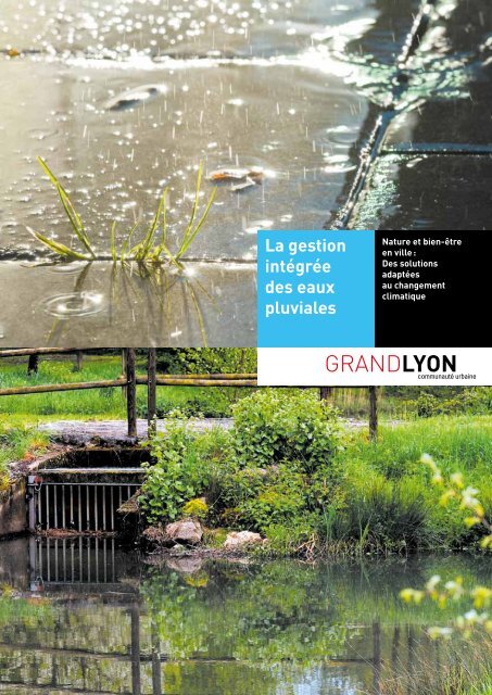
La gestion intégrée des eaux pluviales - AQUA-ADD Interreg IVC ...
La gestion intégrée des eaux pluviales - AQUA-ADD Interreg IVC ...
La gestion intégrée des eaux pluviales - AQUA-ADD Interreg IVC ...

Create successful ePaper yourself
Turn your PDF publications into a flip-book with our unique Google optimized e-Paper software.
<strong>La</strong> <strong>gestion</strong><br />
intégrée<br />
<strong>des</strong> <strong>eaux</strong><br />
<strong>pluviales</strong><br />
Nature et bien-être<br />
en ville :<br />
Des solutions<br />
adaptées<br />
au changement<br />
climatique
2<br />
POUR UNE APPROCHE<br />
GLOBALE DE L’EAU<br />
DANS LA VILLE<br />
Parc de Gerland<br />
Lyon<br />
Tour à tour ressource, bien de consommation, patrimoine,<br />
déchet, levier de développement ou support de coopération,<br />
l’eau revêt de nombreuses facettes. Ses multiples usages<br />
et ses différentes contraintes de <strong>gestion</strong> sont au cœur<br />
<strong>des</strong> préoccupations <strong>des</strong> collectivités locales. Durant<br />
la dernière décennie, les évolutions liées au changement<br />
climatique, à la croissance de l’urbanisme comme<br />
de la pollution, et plus généralement aux impératifs<br />
de développement durable, ont fait de l’eau un enjeu majeur<br />
de nos sociétés. Un enjeu qui nous impose, aujourd’hui,<br />
de repenser notre <strong>gestion</strong> du cycle urbain de l’eau<br />
et de passer d’une vision sectorisée à une prise en compte<br />
globale et intégrée de l’eau sous tous ses aspects.<br />
Une politique cohérente<br />
C’est pourquoi le Grand Lyon a défini une Politique de l’Eau<br />
Durable, favorisant la préservation environnementale,<br />
l’amélioration du cadre de vie et le développement<br />
économique. <strong>La</strong> Direction de l’Eau s’emploie, ainsi,<br />
à chercher <strong>des</strong> solutions innovantes dans tous ses domaines<br />
de compétences, en matière de technologies alternatives<br />
et de <strong>gestion</strong> intégrée.<br />
Agir ensemble durablement<br />
Les objectifs de densification urbaine et les changements<br />
climatiques à venir nous obligent aujourd’hui à repenser<br />
globalement la place de l’eau dans la ville.<br />
Les infrastructures de la <strong>gestion</strong> de l’eau de pluie en ville<br />
ne doivent plus seulement être fonctionnelles et performantes<br />
pour répondre aux besoins de la ville. Elles contribuent<br />
désormais directement à la construction d’un nouveau<br />
patrimoine naturel et paysager en ville, support d’activités<br />
sociales et de loisirs. Leur conception et leur <strong>gestion</strong> doivent<br />
donc être partagées entre tous les acteurs de l’aménagement<br />
et de l’entretien <strong>des</strong> territoires pour s’assurer de cette<br />
multifonctionnalité. L’exemple réussi de l’aménagement<br />
de la Porte <strong>des</strong> Alpes nous encourage à multiplier<br />
les démarches de concertations techniques dans tous nos<br />
projets pour intégrer une vision holistique du cycle de l’eau<br />
dans la ville.<br />
Crédits photos<br />
© Jacques Leone, Grand Lyon<br />
© Unité communication de la<br />
Direction de l’eau, Grand Lyon<br />
© Ilex-paysages<br />
© <strong>La</strong>urence Danière<br />
© Asylum/ Alain Marguerit -<br />
Ateliers paysages<br />
© Klimakvarter.dk,<br />
Ville de Copenhague<br />
Grand Lyon<br />
Direction de l’eau<br />
117, boulevard<br />
Marius Vivier Merle<br />
69003 Lyon<br />
04 78 63 40 40<br />
www.grandlyon.com
3<br />
Les <strong>eaux</strong><br />
<strong>pluviales</strong><br />
urbaines<br />
Une ressource<br />
à valoriser<br />
Place <strong>des</strong> docteurs Mérieux<br />
Lyon<br />
Considérées comme un aléa et une contrainte à gérer, les <strong>eaux</strong><br />
<strong>pluviales</strong> urbaines ont longtemps fait l’objet d’une <strong>gestion</strong><br />
séparée <strong>des</strong> autres enjeux du cycle urbain de l’eau. Aujourd’hui,<br />
cette démarche a montré ses limites et, parallèlement, nous<br />
avons pris conscience de la richesse considérable que pouvait<br />
représenter l’eau de pluie. Rafraîchissement de la ville,<br />
irrigation <strong>des</strong> espaces paysagers plantés, climatisation<br />
<strong>des</strong> immeubles avec les toitures végétalisées… Ses usages<br />
sont nombreux, mais ils nécessitent <strong>des</strong> approches nouvelles.<br />
Sortir <strong>des</strong> réponses exclusivement techniques<br />
Avec le développement urbain <strong>des</strong> dernières décennies,<br />
les sols de l’agglomération sont devenus de moins en moins<br />
perméables, n’autorisant plus suffisamment l’infiltration<br />
<strong>des</strong> <strong>eaux</strong> <strong>pluviales</strong> dans la nappe. L’enjeu d’aujourd’hui<br />
et de demain consiste à favoriser la réinfiltration de ces <strong>eaux</strong><br />
dans les sous-sols pour stabiliser le bâti, limiter les risques<br />
d’inondation, alimenter et préserver les ressources en eau<br />
de l’agglomération.<br />
S’adapter aux territoires<br />
Pour être performants, ces systèmes doivent tenir compte<br />
de la réalité <strong>des</strong> territoires. <strong>La</strong> topographie, l’hydrologie<br />
et la géologie peuvent nous aider à trouver <strong>des</strong> solutions<br />
innovantes. Ainsi, le Grand Lyon se compose de 3 secteurs.<br />
Le centre urbain dense possède un réseau unitaire très<br />
développé qui peut être optimisé. Sur l’Ouest Lyonnais,<br />
constitué de terrains rocheux peu infiltrants, il convient<br />
de développer un réseau séparatif avec rejet dans les ruiss<strong>eaux</strong><br />
Les gui<strong>des</strong> « aménagement et <strong>eaux</strong> <strong>pluviales</strong> »<br />
et le référentiel conception et <strong>gestion</strong> <strong>des</strong> espaces publics<br />
Le Grand Lyon a développé <strong>des</strong> outils pour permettre aux aménageurs<br />
d’intégrer la <strong>gestion</strong> <strong>des</strong> <strong>eaux</strong> <strong>pluviales</strong> dès la conception d’un projet.<br />
Les gui<strong>des</strong> « aménagement et <strong>eaux</strong> <strong>pluviales</strong> » explicitent les règles<br />
de <strong>gestion</strong> et les démarches à suivre. Le référentiel « conception<br />
et <strong>gestion</strong> <strong>des</strong> espaces publics » précise les règles de dimensionnement<br />
de voiries, les types de matériaux pour les espaces publics ou autres<br />
aménagements. En réalisant ces outils, le Grand Lyon a voulu inciter<br />
les différents corps de métiers à travailler en parfaite synergie, pour<br />
aller vers une <strong>gestion</strong> intégrée <strong>des</strong> <strong>eaux</strong> <strong>pluviales</strong>.<br />
Retrouvez les gui<strong>des</strong> et le référentiel sur le site grandlyon.com<br />
A votre service > Eau et assainissement > Gestion <strong>des</strong> <strong>eaux</strong> <strong>pluviales</strong><br />
pour les <strong>eaux</strong> <strong>pluviales</strong>. Assis sur <strong>des</strong> terrains perméables sans<br />
réseau hydrographique, l’Est Lyonnais permet une infiltration<br />
<strong>des</strong> <strong>eaux</strong> de pluie à la parcelle.<br />
Jouer la transversalité <strong>des</strong> services<br />
Sur chaque projet d’aménagement engagé sur son territoire,<br />
la Direction de l’Eau du Grand Lyon travaille en étroite<br />
collaboration avec les Directions de la Voirie, de l’Urbanisme<br />
et de la Propreté du Grand Lyon, ainsi que tous les autres acteurs<br />
de l’aménagement. En croisant les problématiques d’eau, d’air,<br />
de bruit, de climat, de bien-être et de développement<br />
économique, ils mettent en place <strong>des</strong> réalisations durables,<br />
issues de la synergie de toutes les compétences.
4<br />
Des<br />
réalisations<br />
en centre<br />
urbain<br />
dense<br />
<strong>La</strong> <strong>gestion</strong> intégrée<br />
<strong>des</strong> <strong>eaux</strong> <strong>pluviales</strong>,<br />
un principe<br />
développé<br />
en ville<br />
<strong>La</strong> Buire<br />
Quartier de la part-dieu (lyon 3 e )<br />
L’enjeu de ce nouveau quartier dense d’une superficie<br />
de 5,5 ha, situé en centre-ville, consistait à gérer les <strong>eaux</strong><br />
<strong>pluviales</strong> en dehors du réseau unitaire.<br />
Un bassin d’infiltration au cœur du jardin public de <strong>La</strong> Buire<br />
Les <strong>eaux</strong> de toitures et de ruissellement <strong>des</strong> îlots sont<br />
acheminées vers le bassin via un réseau enterré. D’une<br />
capacité de 870 m 3 , le bassin sert à la rétention et à<br />
l’infiltration de l’eau. Une fois infiltrée, l’eau rejoint la nappe.<br />
De leur côté, les <strong>eaux</strong> de ruissellement <strong>des</strong> voies circulées<br />
sont dirigées vers le réseau unitaire. Conçu comme une douve<br />
ceinturant un espace vert dédié aux enfants de l’école voisine,<br />
la <strong>gestion</strong> <strong>des</strong> <strong>eaux</strong> de pluie est complètement intégrée dans<br />
cet espace public.<br />
Les parties les plus inondables de ce bassin ont été conçues<br />
pour être impénétrables grâce à une végétation plus dense.<br />
Cela n’empêche pas cet espace d’être devenu le terrain<br />
d’aventure préféré <strong>des</strong> 5-10 ans qui découvrent les joies<br />
de l’escalade et <strong>des</strong> jeux de cache-cache dans cet espace<br />
protégé. L’école a de son côté dévié une partie <strong>des</strong> <strong>eaux</strong> de<br />
pluies pour arroser les espaces verts et alimenter les bassins<br />
en eau.
5<br />
CARRÉ DE SOIE<br />
VAULX-EN-VELIN / VILLEURBANNE<br />
Dans le respect de l’objectif stratégique du Grand Lyon<br />
de déconnecter les <strong>eaux</strong> de pluie du système<br />
d’assainissement unitaire, la rue de la Poudrette a été<br />
équipée d’une tranchée drainante et infiltrante.<br />
Deux techniques pour un traitement adapté<br />
Constituée de ballast d’une porosité de 40 %, enrobé<br />
d’un géotextile limitant l’apport de fines dans la structure,<br />
la tranchée récupère les <strong>eaux</strong> <strong>pluviales</strong> <strong>des</strong> trottoirs via<br />
les fosses <strong>des</strong> espaces plantés. D’abord stockées, les <strong>eaux</strong><br />
sont ensuite infiltrées sous le trottoir. Elles servent à irriguer<br />
les arbres plantés sur la rue de la Poudrette.<br />
De leur côté, les <strong>eaux</strong> de pluie de la chaussée sont restées<br />
connectées au réseau unitaire, compte tenu de la proximité<br />
du captage d’eau potable.<br />
ZAC DU BON LAIT<br />
LYON 7 e<br />
À vocation d’habitat collectif et de bur<strong>eaux</strong>, la ZAC du Bon <strong>La</strong>it<br />
possédera divers équipements et 20 % d’espaces verts qui<br />
seront irrigués par les <strong>eaux</strong> de pluie récoltées.<br />
Les techniques retenues<br />
Une tranchée drainante s’accompagnera de noues. <strong>La</strong> totalité<br />
de ces équipements sera plantée. Les massifs drainants<br />
seront enrobés d’un géotextile anticontaminant pour écarter<br />
tout risque de contamination du sous-sol en cas de pollution<br />
accidentelle. Les <strong>eaux</strong> de toitures seront gérées à la parcelle<br />
via <strong>des</strong> puits d’infiltration.
6<br />
Des<br />
réalisations<br />
support<br />
de loisirs<br />
et de nouv<strong>eaux</strong><br />
paysages<br />
Des approches<br />
différenciées<br />
PARC DU VALLON<br />
LA DUCHÈRE LYON 9 e<br />
<strong>La</strong>issé à l’abandon durant <strong>des</strong> années, le Parc du Vallon<br />
retrouve sa fonction de 4 e poumon vert de la ville de Lyon,<br />
dans le cadre du Grand Projet de Ville de <strong>La</strong> Duchère.<br />
<strong>La</strong> remise à l’air libre du ruisseau <strong>des</strong> Gorges et les ouvrages<br />
de limitation <strong>des</strong> risques inondations participent<br />
à sa revalorisation.<br />
Les techniques retenues<br />
Les étu<strong>des</strong> préliminaires ont permis d’identifier le risque<br />
inondation important que représente le ruisseau<br />
<strong>des</strong> Gorges de <strong>La</strong> Duchère pour les quartiers de Lyon Vaise<br />
en aval immédiat. Bien qu’enterré depuis plus de 50 ans,<br />
ce ruisseau continue à drainer <strong>des</strong> <strong>eaux</strong> de source et les <strong>eaux</strong><br />
de ruissellement de l’ensemble du secteur de <strong>La</strong> Duchère<br />
et du plateau de la Sauvegarde. <strong>La</strong> transformation globale<br />
du quartier et, notamment, la mise en séparatif du réseau<br />
d’assainissement permettent de supprimer les rejets pollués<br />
vers ce ruisseau et de lui redonner toute sa qualité de milieu<br />
naturel original. Le réaménagement du Parc du Vallon est<br />
également une opportunité unique pour utiliser cet espace<br />
lors <strong>des</strong> pluies exceptionnelles et apporter une protection<br />
substantielle contre les crues pour les quartiers bas de Lyon.<br />
L’ensemble <strong>des</strong> aménagements a été conçu en concertation<br />
étroite avec les habitants du quartier qui se réjouissent<br />
de retrouver leur ruisseau et ses divagations.
7<br />
PARC DE PARILLY<br />
SAINT-PRIEST<br />
Le travail mené conjointement par le Grand Lyon<br />
et les <strong>gestion</strong>naires du parc a permis d’élaborer une solution<br />
satisfaisant les attentes du public en termes d’espace<br />
multifonctions comme les exigences de <strong>gestion</strong> <strong>des</strong> <strong>eaux</strong><br />
de pluie.<br />
Les techniques retenues<br />
Sur les 3 bassins construits, celui de décantation est le seul<br />
fermé au public. Le bassin de rétention stocke les <strong>eaux</strong><br />
de pluie et se transforme en terrain de bicross lorsqu’il<br />
est asséché. Le bassin d’infiltration bénéficie d’un film<br />
anticontaminant pour limiter les migrations <strong>des</strong> polluants<br />
dans le sol. Une partie de ce bassin a été traitée en zone<br />
humide pour bâtir un nouvel habitat aux populations<br />
batraciennes du parc de Parilly.<br />
ZAC DU CONTAL<br />
LA TOUR-DE-SALVAGNY<br />
Réalisée en amont de la conception de l’aménagement<br />
de la ZAC du Contal, une analyse environnementale urbaine<br />
a mis en évidence la topographie très spécifique du terrain<br />
à aménager. Elle a permis de mettre en place un système<br />
de <strong>gestion</strong> en parfaite adéquation avec le cheminement<br />
naturel de l’eau.<br />
Une <strong>gestion</strong> douce <strong>des</strong> <strong>eaux</strong> de pluie<br />
Le réseau d’<strong>eaux</strong> <strong>pluviales</strong> de la ZAC du Contal se constitue<br />
de tranchées drainantes surmontées de noues.<br />
Perpendiculaires à la pente, elles retiennent plus<br />
efficacement les <strong>eaux</strong> de ruissellement. Grâce aux toitures<br />
terrasses <strong>des</strong> habitations et aux citernes de chaque îlot,<br />
les <strong>eaux</strong> <strong>des</strong> parcelles privatives sont rejetées dans ce réseau<br />
à débit limité. Pour préserver le sol d’une éventuelle pollution<br />
accidentelle, une géomembrane anticontaminante tapisse<br />
le fond <strong>des</strong> tranchées.<br />
Des noues enherbées aux bassins de rétention végétalisés…<br />
Une fois dans la noue, les <strong>eaux</strong> percolent dans le sol pour<br />
se retrouver dans la tranchée drainante puis dans le drain,<br />
qui les transporte jusqu’aux 3 bassins de rétention. Implantés<br />
au centre de la ZAC, dans la zone humide, ils sont alimentés<br />
par les <strong>eaux</strong> <strong>pluviales</strong> et par la source de l’Écurie, située au<br />
point haut de la ZAC. Le 1 er bassin reste en eau permanente,<br />
alors que les 2 suivants reçoivent le trop-plein du premier.
8<br />
Nature<br />
en ville<br />
DES RÉALISATIONS<br />
EXEMPLAIRES,<br />
SUPPORT DE NATURE<br />
ET DE BIODIVERSITÉ<br />
LYON - PORTE DES ALPES<br />
UNE DÉMARCHE DE CONCERTATION TECHNIQUE EXEMPLAIRE<br />
Le site de la Porte <strong>des</strong> Alpes à Saint-Priest est la plus belle<br />
démonstration lyonnaise de la <strong>gestion</strong> intégrée <strong>des</strong> <strong>eaux</strong><br />
<strong>pluviales</strong>. Il témoigne également de l’intérêt de la démarche<br />
de concertation technique et de conduite de projet partenariale.<br />
Les enjeux de la <strong>gestion</strong> <strong>des</strong> <strong>eaux</strong> de pluie à la source ont été<br />
pris en compte dans le projet dès sa création. Paysagistes,<br />
urbanistes et experts de l’eau ont collaboré dès les premières<br />
esquisses d’aménagement pour identifier les cheminements<br />
de l’eau à respecter et les meilleurs sites pour le stockage<br />
<strong>des</strong> <strong>eaux</strong> de ruissellement y compris pour <strong>des</strong> situations<br />
de pluie extrême. Le choix s’est porté sur l’organisation<br />
d’une <strong>gestion</strong> en cascade grâce à <strong>des</strong> techniques de noues,<br />
tranchées drainantes, bassins en eau et bassins d’infiltration.<br />
<strong>La</strong> conception finale a demandé de nombreuses concertations<br />
avec les techniciens de la voirie et <strong>des</strong> espaces verts<br />
en intégrant dès le début du projet les contraintes<br />
d’exploitation de chacun.<br />
Ce travail multicompétences de qualité a été possible grâce<br />
à une organisation en conduite de projet pilotée par les services<br />
de l’urbanisme. Dynamique et impliquant la participation<br />
de tous, cette organisation a produit un projet de très grande<br />
qualité, respecté par tous les services urbains et apprécié<br />
par les Grands Lyonnais.<br />
Près de 20 ans après ces phases de conception, le travail<br />
partenarial perdure dans la <strong>gestion</strong> partagée <strong>des</strong> espaces<br />
entre les services et avec les associations de pêche<br />
et de protection de la nature. Des actions de concertation vont<br />
être engagées avec le centre commercial voisin pour mettre<br />
en cohérence les pratiques de <strong>gestion</strong> environnementale<br />
<strong>des</strong> 2 sites et diminuer l’impact global sur les milieux<br />
naturels.
9<br />
DARDILLY<br />
BASSINS DU GODEFROY<br />
Lors de la création du quartier <strong>des</strong> Noyeraies à Dardilly,<br />
le Grand Lyon a réalisé un système de bassins de rétention<br />
paysagés et intégrés dans le vallon naturel du ruisseau<br />
de la Liasse. Ils sont <strong>des</strong>tinés à stocker temporairement<br />
les <strong>eaux</strong> de ruissellement du quartier et à les restituer en débit<br />
limité au ruisseau de la Liasse. Deux bassins constituent<br />
l’ouvrage de rétention du Godefroy : le premier, de faible<br />
capacité de stockage est peu profond, il reçoit les <strong>eaux</strong><br />
<strong>pluviales</strong> (acheminées par fossés ou canalisations) et permet<br />
leur rétention et leur décantation. Les <strong>eaux</strong> sont ensuite<br />
acheminées par un ouvrage limitant le débit vers un deuxième<br />
bassin d’une capacité de stockage plus importante, avant<br />
d’être restituées au ruisseau de la Liasse. Des systèmes<br />
de surverses assurent le fonctionnement de l’ouvrage<br />
par fortes pluies. Conçus comme <strong>des</strong> zones humi<strong>des</strong> avec<br />
une faible lame d’eau, ces bassins ont permis au vallon<br />
de retrouver sa biodiversité originelle pour le plus grand<br />
bonheur <strong>des</strong> biologistes et <strong>des</strong> promeneurs. Les ouvrages<br />
sont désormais gérés par le syndicat du vallon de Serres<br />
et Planches et font l’objet d’évaluations régulières avec<br />
la commune et le Grand Lyon.<br />
DARDILLY<br />
BASSINS DE LA BEFFE<br />
Situé à l’ouest de Dardilly, le quartier de la Beffe se situe<br />
dans un vallon caractérisé par un habitat dispersé<br />
et <strong>des</strong> assainissements non collectifs à la parcelle. À l’origine<br />
du projet, les dysfonctionnements de ces assainissements<br />
autonomes provoquaient la dégradation au fil du temps<br />
du ruisseau de la Beffe à l’aval immédiat de ce quartier.<br />
Un projet de réhabilitation global <strong>des</strong> assainissements<br />
à la parcelle et de l’assainissement pluvial du quartier a été<br />
mené en partenariat avec les riverains, la mairie, l’Agence<br />
de l’Eau Rhône Méditerranée Corse et le Grand Lyon.<br />
Un nouveau collecteur central a été réalisé sous le chemin<br />
de la Beffe pour recueillir les <strong>eaux</strong> <strong>pluviales</strong> ainsi que les <strong>eaux</strong><br />
de sortie <strong>des</strong> filières d’assainissement autonome ne pouvant<br />
être infiltrées. À l’aval de ce collecteur, <strong>des</strong> bassins<br />
de rétention en cascade utilisant les techniques <strong>des</strong> filtres<br />
plantés de ros<strong>eaux</strong> assurent un traitement complémentaire<br />
aux filières individuelles par temps sec ; la rétention<br />
et le traitement <strong>des</strong> <strong>eaux</strong> de ruissellement par temps de pluie.<br />
Ce procédé « rustique », exigeant peu de maintenance, est<br />
bien adapté aux contraintes architecturales et paysagères<br />
du site et garantit la qualité <strong>des</strong> effluents rejetés au milieu<br />
naturel. Le ruisseau de la Beffe en aval peut désormais<br />
retrouver son cours vif et naturel et poursuivre son cours<br />
jusqu’à la rivière Yzeron.
10<br />
Des projets<br />
sur le long<br />
terme<br />
SUIVI ÉCOLOGIQUE<br />
ET ENTRETIEN<br />
DU PATRIMOINE<br />
« EAUX PLUVIALES »<br />
ZAC du Contal<br />
<strong>La</strong>-Tour-de-Salvagny<br />
Suivi écologique <strong>des</strong> lacs et <strong>des</strong> zones humi<strong>des</strong><br />
Outre la surveillance du fonctionnement <strong>des</strong> ouvrages,<br />
<strong>des</strong> bilans écologiques complets sont réalisés régulièrement<br />
depuis leur mise en service.<br />
Ces bilans portent sur les espèces végétales et animales<br />
(essentiellement piscicoles et batraciennes) et sur la qualité<br />
physico-chimique de l’eau et <strong>des</strong> sédiments. <strong>La</strong> réalisation<br />
de ces suivis permet de faire évoluer les pratiques d’entretien<br />
<strong>des</strong> ouvrages pour maintenir les équilibres faunistiques<br />
et floristiques.<br />
Ces résultats sont partagés avec les associations<br />
environnementales locales qui assurent la valorisation auprès<br />
du public au travers notamment de pann<strong>eaux</strong> pédagogiques.<br />
Le développement écologique <strong>des</strong> lacs est qualifié<br />
de remarquable par l’ensemble <strong>des</strong> associations<br />
de sauvegarde de la faune et de la flore. Tous les acteurs<br />
locaux œuvrent aujourd’hui pour préserver la biodiversité<br />
installée sur le site.<br />
Suivi de la nappe à l’aval <strong>des</strong> ouvrages d’infiltration<br />
du Grand Lyon<br />
Le renouvellement et la qualité de la nappe sont<br />
régulièrement analysés. Des contrôles de l’effluent<br />
avant infiltration sont également réalisés :<br />
> Sur l’effluent (4 fois par an) : analyse <strong>des</strong> paramètres DB05,<br />
DCO, NK et hydrocarbures ;<br />
> Sur l’eau de nappe (4 fois par an) : analyse <strong>des</strong> paramètres<br />
conductivité, COT, NK, nitrates, hydrocarbures, pestici<strong>des</strong><br />
azotés (ancienne zone agricole) et métaux lourds.<br />
Le sol de la zone d’infiltration peut également être chargé<br />
en polluants du fait de son rôle de filtre durant l’infiltration<br />
<strong>des</strong> <strong>eaux</strong>. Lors <strong>des</strong> interventions d’entretien, <strong>des</strong> prélèvements<br />
de sol sur 50 cm de profondeur sont effectués puis <strong>des</strong> analyses<br />
permettent de mesurer la quantité de métaux lourds, solvants<br />
chlorés, d’hydrocarbures ainsi que le pH et le COT (détection<br />
de pollution carbonée).<br />
OTHU : mieux comprendre pour mieux gérer<br />
L’Observatoire de Terrain en Hydrologie Urbaine (OTHU)<br />
est un laboratoire hors murs d’observation <strong>des</strong> rejets urbains<br />
et de leurs impacts sur les milieux récepteurs notamment<br />
par temps de pluie. Son rôle est de proposer de nouvelles<br />
solutions de conception et de <strong>gestion</strong> de l’assainissement afin<br />
de répondre aux enjeux portés par le Grand Lyon. Partenaire<br />
de l’OTHU, le Grand Lyon met à disposition ses ouvrages<br />
d’<strong>eaux</strong> usées et d’<strong>eaux</strong> <strong>pluviales</strong> comme terrain d’étu<strong>des</strong><br />
et de recherches. Les résultats sont ensuite partagés<br />
pour être valorisés dans la politique publique de l’eau.
11<br />
Des projets<br />
sur le long<br />
terme<br />
DES RÉAMÉNAGEMENTS<br />
URBAINS EXPÉRIMENTAUX<br />
POUR RÉDUIRE L’UTILISATION<br />
DE L’EAU POTABLE<br />
DANS LES ESPACES PUBLICS<br />
Aménagement de la rue Garibaldi<br />
Lyon<br />
Aménagement de la rue Garibaldi à Lyon<br />
<strong>La</strong> rue Garibaldi, de la rue Vauban à l’avenue Berthelot, fait<br />
l’objet d’une requalification qui doit faire oublier son aspect<br />
d’« autoroute urbaine ». L’objectif est de créer un nouveau<br />
paysage, en favorisant les circulations piétonnes et les mo<strong>des</strong><br />
doux en bonne intelligence avec la voiture. Un volet<br />
« <strong>eaux</strong> <strong>pluviales</strong> » innovant a été intégré au projet.<br />
2 e vie pour une trémie<br />
Les anciennes trémies étaient amenées à devenir <strong>des</strong> espaces<br />
vi<strong>des</strong>, l’une d’entre elle, « Vauban », se <strong>des</strong>tine à un tout autre<br />
avenir. Elle va se transformer en réservoir de récupération<br />
d’eau de pluie. Un remblai de sable et de cailloux filtrera<br />
les <strong>eaux</strong> <strong>pluviales</strong> qui seront acheminées dans de gran<strong>des</strong><br />
cuves d’une capacité de 800 m 3 . Pompée par les véhicules<br />
de la propreté, elles serviront à nettoyer les rues. Un autre<br />
usage a été identifié, l’arrosage <strong>des</strong> nouv<strong>eaux</strong> espaces verts.<br />
<strong>La</strong> réutilisation de ces <strong>eaux</strong> se fera à l’aide de bornes de puisage<br />
alimentées par le bassin souterrain. Ces équipements innovants<br />
feront l’objet d’un suivi expérimental sur les premières<br />
années de fonctionnement afin d’obtenir un solide retour<br />
d’expérience et pouvoir renouveler la mise en place<br />
d’équipements similaires dans de futurs projets.<br />
Une restructuration complète <strong>des</strong> mo<strong>des</strong> de <strong>gestion</strong><br />
<strong>des</strong> <strong>eaux</strong> <strong>pluviales</strong><br />
Outre la réutilisation d’une trémie et d’une partie <strong>des</strong> <strong>eaux</strong><br />
<strong>pluviales</strong> pour les usages propreté et espaces verts, le projet<br />
de requalification de la rue Garibaldi intègre plus globalement<br />
la nécessité de gérer les <strong>eaux</strong> de ruissellement à la source<br />
en collectant, stockant et infiltrant dans le sol après<br />
prétraitement <strong>des</strong> <strong>eaux</strong> <strong>pluviales</strong> <strong>des</strong> surfaces autres que celles<br />
dédiées aux véhicules automobiles, par le biais de noues<br />
intégrées aux espaces verts créés. Le projet apporte ainsi<br />
une amélioration significative de la situation existante par<br />
la déconnexion d’une partie <strong>des</strong> <strong>eaux</strong> <strong>pluviales</strong> jusqu’à lors<br />
envoyées dans le réseau unitaire. L’infiltration de ces <strong>eaux</strong><br />
de pluie et l’augmentation <strong>des</strong> espaces végétalisés de cet axe<br />
urbain contribueront conjointement à limiter les effets d’îlot<br />
de chaleur urbain de ce quartier de centre-ville.
12<br />
Un retour<br />
d’expérience<br />
international<br />
<strong>AQUA</strong>-<strong>ADD</strong> -<br />
UN PROJET EUROPÉEN<br />
POUR FAIRE VALOIR L’EAU<br />
DANS LA VILLE<br />
Espace Taasinge<br />
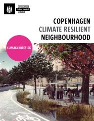
Copenhague<br />
Aqua-Add est un projet européen axé sur les échanges<br />
de pratiques et le développement <strong>des</strong> connaissances dans<br />
le domaine de la mise en valeur de l’eau dans la ville. <strong>La</strong> ville<br />
d’Eindhoven (Pays-Bas) est le chef de file du projet qui réuni<br />
10 autres collectivités territoriales.<br />
Les partenaires du projet Aqua-Add ont identifié sur<br />
leurs territoires <strong>des</strong> enjeux communs et <strong>des</strong> défis à relever<br />
pour améliorer le cycle de l’eau. Il s’agit notamment<br />
de l’amélioration de la qualité et de l’attractivité <strong>des</strong> milieux<br />
aquatiques, la maîtrise du ruissellement <strong>des</strong> <strong>eaux</strong> de pluie<br />
et la réduction <strong>des</strong> stress thermiques (le réchauffement<br />
<strong>des</strong> zones urbaines avec les îlots de chaleur). Ces challenges<br />
actuels seront encore plus importants demain avec les effets<br />
du changement climatique.<br />
<strong>La</strong> mise en place de ces mesures requiert de leur réserver<br />
une certaine place dans la ville ce qui a <strong>des</strong> conséquences<br />
importantes sur les coûts d’investissement. Cependant,<br />
la recherche montre que le foncier situé à proximité<br />
d’un ruisseau ou d’un lac prend de la valeur et se vend mieux.<br />
Les intervenants comprennent les aménageurs et promoteurs,<br />
les résidents, les sociétés et d’autres disciplines qui touchent<br />
la structure de l’espace public. Pour avoir une mesure<br />
de la valeur de l’eau dans les zones urbaines, un modèle sera<br />
développé et appliqué à 8 étu<strong>des</strong> de cas différentes. Aqua-Add<br />
examinera également les modèles de financement dans le but<br />
de réunir les coûts et les avantages pour les répartir entre<br />
les différents acteurs impliqués. Le projet est prévu pour<br />
3 ans (2012-2014).<br />
Partenaires<br />
Depuis mars 2012, les onze partenaires du projet (régions, villes<br />
et universités) se sont réunis 3 fois pour partager leurs expériences<br />
et échanger <strong>des</strong> connaissances. Outre Eindhoven, les villes suivantes<br />
participent: Copenhague (Danemark), le Grand Lyon (France),<br />
Bremerhaven (Allemagne), Sofia (Bulgarie), Imperia (Italie).<br />
En outre, les régions Trans-Tisza (Hongrie) et Aveiro (Portugal)<br />
et les Universités de Gênes (Italie), Aveiro (Portugal) et Debrecen<br />
(Hongrie) prennent part au projet.<br />
Aqua-Add est un projet <strong>Interreg</strong> <strong>IVC</strong>, programme de subvention<br />
à l’échelle européenne visant à l’échange de connaissances.
Integrated<br />
rainwater<br />
management<br />
Nature and well-being<br />
in the city:<br />
Solutions geared<br />
to climate change
2<br />
FOR A GLOBAL APPROACH<br />
TO WATER<br />
IN THE CITY<br />
Gerland Park<br />
Lyon<br />
In turn a resource, commodity, heritage, waste, lever<br />
for development and support for cooperation - water<br />
is clearly multi-faceted. Its multiple uses and the various<br />
constraints associated with its management lie at the heart<br />
of the preoccupations of local authorities. Over the past<br />
decade, developments linked to climate change, increasing<br />
urbanisation and pollution, and more generally the imperatives<br />
of sustainable development, have made water a major<br />
challenge in our society today. A challenge which now forces<br />
us to rethink our management of the urban water cycle<br />
and to switch from a sector-based vision to a comprehensive<br />
and integrated approach to water in all its aspects.<br />
A coherent policy<br />
This is why Grand Lyon has defined a Sustainable Water Policy,<br />
favouring environmental conservation, improvement in<br />
the environment in which we live and economic development.<br />
The Water Department is thus seeking out innovative<br />
solutions in all its areas of responsibility, in the field<br />
of alternative technologies and integrated management.<br />
Acting together and sustainably<br />
The objectives of urban densification and the climate changes<br />
in the future force us today to undertake a total rethink<br />
of the place of water in the city.<br />
The infrastructures for rainwater management in the city must<br />
not only be functional and effective to meet the city’s needs.<br />
They now directly help to build a new natural landscape<br />
heritage in the city - a venue for social and leisure activities.<br />
Their <strong>des</strong>ign and their management must thus be shared<br />
by all those involved in the development and maintenance<br />
of the territories to ensure this multi-functionality.<br />
The successful example of the development of the Porte<br />
<strong>des</strong> Alpes encourages us to reinforce our approach of technical<br />
consultation in all our projects so as to integrate a holistic<br />
vision of the water cycle in the city.<br />
copyright<br />
© Jacques Leone, Grand Lyon<br />
© Unité communication de la<br />
Direction de l’eau, Grand Lyon<br />
© Ilex-paysages<br />
© <strong>La</strong>urence Danière<br />
© Asylum/ Alain Marguerit -<br />
Ateliers paysages<br />
© Klimakvarter.dk,<br />
Ville de Copenhague<br />
Lyon Urban Community<br />
Water Department<br />
117, boulevard<br />
Marius Vivier Merle<br />
69003 Lyon - France<br />
+ 33 (0)4 78 63 40 40<br />
www.grandlyon.com
3<br />
Urban<br />
rainwater<br />
A resource<br />
to be used<br />
Place doctors Mérieux<br />
Lyon<br />
Regarded as a random phenomenon and a constraint to be<br />
managed, urban rainwater has historically been managed<br />
separately from other elements in the urban water cycle.<br />
This approach is today reaching its limits and, in parallel,<br />
we have become aware of the rich resource which rainwater<br />
could represent. Refreshment for the city, irrigation of planted<br />
landscaped spaces, climatisation of buildings with green<br />
roofs ... It can be used in many ways, but new approaches<br />
are called for.<br />
Moving beyond exclusively technical responses<br />
With the urban development of the past few deca<strong>des</strong>, the soil<br />
of the agglomeration has become increasingly less permeable,<br />
and now no longer allows sufficient percolation of rainwater<br />
into the water table. The challenge facing us today and tomorrow<br />
consists of favouring the re-infiltration of this water into the<br />
subsoil, limiting the flood risk, and supplying and conserving<br />
the agglomeration’s water resources.<br />
Adapting to the territory<br />
To be effective, these systems need to take account of the reality<br />
in the territories. The topography, hydrology and geology can<br />
help us to find innovative solutions. Thus, Grand Lyon has<br />
3 sectors. The dense urban centre has a highly developed<br />
combined sewer network which can be optimised. In West<br />
Lyon, with its poorly infiltrating rocky land, a separate network<br />
needs to be developed with rainwater being discharged into<br />
its streams. Lying on permeable land without a hydrographical<br />
network, East Lyon allows rainwater to percolate into the land.<br />
The “Development and Rainwater” gui<strong>des</strong> and the reference work<br />
for the <strong>des</strong>ign and management of public spaces<br />
Grand Lyon has developed tools to help planners integrate rainwater<br />
management from the <strong>des</strong>ign stage of a project. The “Development<br />
and Rainwater” gui<strong>des</strong> explain the management rules and the<br />
procedures to be followed. The reference work on the “Design<br />
and Management of Public Spaces” specifies the highway <strong>des</strong>ign<br />
rules, and the types of materials for public spaces or other<br />
developments. In producing these tools, Grand Lyon wished<br />
to encourage the various tra<strong>des</strong> to work in complete synergy,<br />
in order to move towards an integrated rainwater management.<br />
The gui<strong>des</strong> and the reference work can be found<br />
on Grand Lyon’s website: grandlyon.com<br />
A votre service > Eau et assainissement > Gestion <strong>des</strong> <strong>eaux</strong> <strong>pluviales</strong><br />
Working on the transversality of services<br />
In every development project undertaken in its territory,<br />
Grand Lyon’s Water Department works in close collaboration<br />
with Grand Lyon’s Highways, Urban Design and Sanitation<br />
Departments, and likewise all the other parties involved<br />
in the development. By jointly considering the issues of water,<br />
air, noise, climate, well-being and economic development,<br />
they put in place sustainable solutions, arising from the synergy<br />
of all their skills.
4<br />
Achievements<br />
in the dense<br />
urban centre<br />
Integrated rainwater<br />
management,<br />
a principle developed<br />
in the city<br />
<strong>La</strong> Buire<br />
A DISTRICT IN PART-DIEU (Lyon 3)<br />
The challenge of this new dense district covering an area<br />
of 5.5 hectares, situated in the city centre, consisted of<br />
managing rainwater outside the combined sewer network.<br />
An infiltration basin in the heart of the park at <strong>La</strong> Buire<br />
The rainwater from the roofs and the run-off water from<br />
the city blocks are routed to the basin through an underground<br />
network. With its capacity of 870 m 3 , the basin serves for<br />
the retention and percolation of the water. After percolation,<br />
the water gets back into the water table. As for the run-off<br />
from the roads, it is routed to the combined sewer network.<br />
Designed as a moat around a green space for children<br />
at the nearby school, rainwater management is fully<br />
integrated in this public space.<br />
The parts of this basin most susceptible to flooding were<br />
<strong>des</strong>igned to be impenetrable by means of more dense<br />
vegetation. This has not stopped this area from becoming<br />
the preferred adventure ground for 5 to 10 year-olds who<br />
discover the joys of climbing and of games of hide-and-seek<br />
in this protected space. The school, for its part, uses some<br />
of the rainwater to water green spaces and supply ponds<br />
with water.
5<br />
THE SILK DISTRICT<br />
VAULX-EN-VELIN / VILLEURBANNE<br />
In compliance with Grand Lyon’s strategic objective<br />
to disconnect rainwater from the combined sewer system,<br />
the Rue de la Poudrette has been equipped with a drainage<br />
and percolation trench.<br />
Two techniques - the right solution<br />
Made up of ballast with a porosity of 40%, covered with<br />
a geotextile limiting the furnish of fines into the structure,<br />
the trench recovers rainwater from the pavements by means<br />
of ditches in planted spaces. After initially being stored,<br />
the water then percolates under the pavement. It is used<br />
to irrigate the trees planted on the Rue de la Poudrette.<br />
For its part, the rainwater from the carriageway is still<br />
connected to the combined sewer network, given<br />
the proximity of the potable water catchment.<br />
THE BON LAIT MIXED DEVELOPMENT ZONE<br />
LYON 7<br />
Allocated for residential and office use, the Bon <strong>La</strong>it mixed<br />
development zone will have various equipment and 20% green<br />
spaces which will be irrigated by the rainwater harvested.<br />
The techniques selected<br />
There will be swales in addition to a drainage trench. All these<br />
installations will be planted. The drainage shells will be coated<br />
with an anti-contamination geotextile to prevent any risk<br />
of contamination of the subsoil in the event of accidental<br />
pollution. The water from roofs will be managed on site<br />
by means of diffusion wells.
6<br />
Installations<br />
supporting<br />
leisure<br />
activities<br />
and new<br />
landscapes<br />
Differentiated<br />
approaches<br />
PARC DU VALLON<br />
LA DUCHÈRE LYON 9 e<br />
Abandoned for years, the Parc du Vallon has had its role<br />
as the 4 th green lung of the city of Lyon restored, in the context<br />
of the Major City Project of <strong>La</strong> Duchère. The opening up of<br />
the Ruisseau <strong>des</strong> Gorges and the works to limit the flood risk<br />
have all contributed to its rehabilitation.<br />
The techniques selected<br />
Preliminary studies allowed the major flood risk of the<br />
Ruisseau <strong>des</strong> Gorges in <strong>La</strong> Duchère to be identified with<br />
regard to the districts of Lyon Vaise immediately downstream.<br />
Although underground for more than 50 years, this stream<br />
continues to drain spring water and run-off water from<br />
the entire sector of <strong>La</strong> Duchère and the plateau of the<br />
Sauvegarde. The transformation of the entire district and,<br />
in particular, the stream’s separation from the sewerage<br />
network mean that polluted discharges to this stream<br />
can be halted and its status as an original natural<br />
environment restored. The redevelopment of the Parc<br />
du Vallon is also a unique opportunity to use this space<br />
during periods of exceptional rainfall and to provide<br />
substantial protection against floods for the low-lying areas<br />
of Lyon. All the developments have been <strong>des</strong>igned in close<br />
consultation with the population of the district who are<br />
delighted to see their stream and its meanderings<br />
once again.
7<br />
PARC DE PARILLY<br />
SAINT-PRIEST<br />
The work carried out jointly by Grand Lyon and the park<br />
managers has allowed a solution to be found which satisfies<br />
the public’s expectations in terms of multifunctional space<br />
and the demands of rainwater management.<br />
The techniques selected<br />
Of the 3 basins built, the settling basin is the only one closed<br />
to the public. The retention basin stores rainwater and<br />
becomes a BMX course when it dries out. The infiltration<br />
basin is covered with an anti-contamination film to limit<br />
the migration of pollutants into the ground. Part of this basin<br />
has been made into a wetland area, to establish a new habitat<br />
for the amphibian populations of the Parc de Parilly.<br />
THE CONTAL MIXED DEVELOPMENT ZONE<br />
LA TOUR-DE-SALVAGNY<br />
Carried out prior to the <strong>des</strong>ign of the development of the Contal<br />
Mixed Development Zone, an urban environmental analysis<br />
revealed the highly specific topography of the development<br />
land. It has allowed a management system to be put in place<br />
which follows the natural course of water.<br />
Green rainwater management<br />
The rainwater network in the Contal Mixed Development Zone<br />
comprises drainage trenches topped with swales.<br />
Perpendicular to the slope, they hold back run-off water more<br />
effectively. Thanks to the roof terraces of the homes and the<br />
tanks in each city block, water from private plots discharges<br />
into this limited-flow network. To protect the soil from any<br />
accidental pollution, an anti-contamination geo-membrane<br />
carpets the base of the trenches.<br />
Grassed swales for the planted retention basins...<br />
Once in the swale, the water percolates into the ground,<br />
thereby reaching the drainage trench, and from there passes<br />
into the drain which carries it to the 3 retention basins.<br />
Installed in the centre of the mixed development zone,<br />
in the wetland area, they are supplied with rainwater and water<br />
from the Écurie source, located at the high point of the mixed<br />
development zone. The first basin always contains water while<br />
the following two take the overflow from the first.
8<br />
Nature<br />
in the city<br />
SHINING EXAMPLES,<br />
SUPPORTING NATURE<br />
AND BIODIVERSITY<br />
LYON - PORTE DES ALPES<br />
EXEMPLARY TECHNICAL CONSULTATION<br />
The site of Porte <strong>des</strong> Alpes at Saint-Priest is Lyon’s best<br />
example of integrated rainwater management. It also testifies<br />
to the benefit of the approach of technical consultation<br />
and joint project management. The challenges of rainwater<br />
management at source were taken into account in the project<br />
from the outset. <strong>La</strong>ndscape architects, urban <strong>des</strong>igners<br />
and water experts worked together from the initial sketch<br />
schemes of the development to identify the water routes<br />
to be respected and the best site for storing run-off water,<br />
including in situations of extreme rainfall. In the end,<br />
the solution selected was a cascade organisation, using<br />
the techniques of swales, drainage trenches, water basins<br />
and percolation basins. The final <strong>des</strong>ign called for close<br />
consultation with technicians from the Highways and Parks<br />
Departments, thereby taking account of their operating<br />
constraints from the start of the project.<br />
This quality multi-skilled work was possible thanks to a project<br />
management organisation steered by the Urban Design<br />
Department. Being dynamic and involving the participation<br />
of everyone concerned, this organisation gave rise to an<br />
extremely high-quality project, respected by all the urban<br />
services and held in high regard by the people of Grand Lyon.<br />
Close to 20 years after these <strong>des</strong>ign phases, the partnership<br />
aspect persists in the shared management of spaces between<br />
the departments and with the fishing and nature protection<br />
associations. There will be consultation actions with the<br />
neighbouring shopping centre to align the environmental<br />
management practices of the 2 sites and to reduce the overall<br />
impact on the natural environment.
9<br />
DARDILLY<br />
THE BASINS AT GODEFROY<br />
When the Noyeraies district was created in Dardilly, Grand Lyon<br />
built a system of landscaped retention basins integrated<br />
in the natural dale of the Ruisseau de la Liasse. They are<br />
intended to temporarily store the district’s run-off water<br />
and to feed it back to the Ruisseau de la Liasse at a moderate<br />
flow. Two basins comprise the containment works at Godefroy:<br />
the first, a low-capacity storage basin, is shallow, takes<br />
the rainwater (routed there by ditches and pipes), holds it<br />
and allows it to settle. The water is then routed, via works<br />
which restrict the flow, towards a second basin with a larger<br />
storage capacity before being returned to the Ruisseau<br />
de la Liasse. Overflow systems ensure that the works function<br />
properly during heavy rainfall. Designed as wetlands with a weak<br />
horizontal flow, these basins have allowed the original<br />
biodiversity of the dale to be restored, to the delight of biologists<br />
and walkers. The works are now managed by the Syndicat<br />
du Vallon de Serres et Planches and are regularly reviewed<br />
by the parish and by Grand Lyon.<br />
DARDILLY<br />
THE BASINS AT LA BEFFE<br />
Located to the west of Dardilly, the district of <strong>La</strong> Beffe lies<br />
in a dale characterised by a dispersed habitat and private<br />
on-site sewerage. At the start of the project, the dysfunctional<br />
operation of these independent sewerage systems resulted<br />
in the deterioration over time of the Ruisseau de la Beffe<br />
immediately downstream of this district. A general<br />
rehabilitation project for the individual on-site sewerage<br />
systems and the rainwater management of the district<br />
was carried out with the local residents, the town hall,<br />
the Agence de l’Eau Rhône Méditerranée Corse and Grand<br />
Lyon. A new central main sewer was built under the <strong>La</strong> Beffe<br />
road to take rainwater and the water discharging from<br />
the independent sewerage systems which could not be allowed<br />
to percolate. Downstream from the main sewer, a cascade<br />
of retention basins using the techniques of reed-bed filters<br />
provide an additional treatment for the individual systems<br />
in dry periods, and the containment and treatment of runoff<br />
water in rainy periods. This «rustic” process, requiring<br />
little in the way of maintenance, is well-suited to the site’s<br />
architectural and landscape constraints and guarantees<br />
the quality of the wastewater discharged into the natural<br />
environment. Just downstream, the Ruisseau de la Beffe<br />
can now see its lively and natural course restored<br />
and can continue on its way to the River Yzeron.
10<br />
Long-term<br />
projects<br />
ECOLOGICAL MONITORING<br />
AND MAINTENANCE<br />
OF THE “RAINWATER”<br />
HERITAGE<br />
The Contal mixed development zone<br />
<strong>La</strong>-Tour-de-Salvagny<br />
Ecological monitoring of the lakes and wetland zones<br />
In addition to monitoring the operation of works, full<br />
ecological reviews are carried out regularly from the time<br />
such works come into service.<br />
These reviews cover the species of plants and animals<br />
(essentially fish and amphibians) and the physico-chemical<br />
quality of the water and sediments. By carrying out these<br />
monitoring operations, it has been possible to modify<br />
the servicing practices for the works to maintain<br />
the balance of fauna and flora.<br />
These results are shared with the local environmental<br />
associations which bring them to the public’s attention,<br />
in particular by means of educational panels.<br />
The ecological development of the lakes is regarded<br />
as remarkable by all the fauna and flora conservation<br />
associations. All the local stakeholders are today working<br />
to conserve the biodiversity of the site.<br />
Monitoring of the water table downstream from<br />
Grand Lyon’s percolation works<br />
The renewal and the quality of the water table are analysed<br />
regularly. Checks on the wastewater before percolation are<br />
also carried out:<br />
> On the wastewater (4 times per year): analysis<br />
of the parameters DB05, COD, KN and hydrocarbons;<br />
> On the ground water (4 times per year): analysis<br />
of the parameters of conductivity, TOC, KN, nitrates,<br />
hydrocarbons, pestici<strong>des</strong> containing nitrogen (former<br />
agricultural zone) and heavy metals.<br />
The ground in the percolation zone can also be charged<br />
with pollutants due to its role as a filter during the percolation<br />
of water. During maintenance interventions, soil samples<br />
from a depth of 50 cm are taken and analyses then allow<br />
the quantity of heavy metals, chlorinated solvents,<br />
hydrocarbons and the pH and TOC (detection of carbon<br />
pollution) to be measured.<br />
OTHU: better understanding for better management<br />
The Urban Hydrology <strong>La</strong>nd Observatory (Observatoire<br />
de Terrain en Hydrologie Urbaine - OTHU) is an off-site<br />
laboratory which studies urban waste and its impact<br />
on the receiving environments in particular in periods<br />
of heavy rain. Its role is to propose new sewerage <strong>des</strong>ign<br />
and management solutions in order to respond to the challenges<br />
facing Grand Lyon. A partner of the OTHU, Grand Lyon makes<br />
its wastewater and rainwater works available as a study<br />
and research site. The results are then shared and used<br />
in the public water policy.
11<br />
Long-term<br />
projects<br />
EXPERIMENTAL URBAN<br />
REDEVELOPMENT PROJECTS<br />
TO REDUCE THE USE<br />
OF POTABLE WATER<br />
IN PUBLIC SPACES<br />
Development of Garibaldi<br />
Lyon<br />
Development of Rue Garibaldi in Lyon<br />
Rue Garibaldi from Rue Vauban to Avenue Berthelot is undergoing<br />
a requalification which should wipe away any memory of its<br />
“urban motorway” appearance. The objective is to create a new<br />
landscape, with the emphasis on pe<strong>des</strong>trianisation and green<br />
mo<strong>des</strong> of transport <strong>des</strong>igned intelligently with the car.<br />
An innovative “rainwater” component has been integrated<br />
in the project.<br />
2 nd life for a hopper<br />
The old hoppers had become empty spaces, one of them, «Vauban»,<br />
now has a very different future. It will be converted into<br />
a rainwater recovery tank. A backfill of sand and pebbles<br />
will filter the rainwater which will be routed into large vessels<br />
with a capacity of 800 m 3 . Pumped by the Sanitation Department’s<br />
vehicles, the water will be used for road-cleaning purposes.<br />
Another use has also been identified: the watering of new<br />
green spaces. This water will be re-used by means of hydrants<br />
supplied by the underground basin. The installation of this<br />
innovative equipment is regarded as experimental and as such<br />
will be monitored over its initial years of operation in order to<br />
obtain a sound feedback of experience so that similar equipment<br />
can be installed in the context of future projects.<br />
A complete restructuring of mo<strong>des</strong><br />
of rainwater management<br />
In addition to the re-use of a hopper and some of the rainwater<br />
for cleaning and green spaces, the project for the requalification<br />
of Rue Garibaldi incorporates more generally the need to<br />
manage run-off water at source by the collection, storage<br />
and percolation into the ground after pre-treatment, of<br />
rainwater from surfaces other than those dedicated to motor<br />
vehicles, by means of swales integrated in the green spaces<br />
created. The project thus provi<strong>des</strong> a significant improvement<br />
to the existing situation by the disconnection of some of the<br />
rainwater hitherto sent to the combined sewerage system.<br />
The percolation of this rainwater and the increase in planted<br />
spaces in this urban axis will also help to limit the urban<br />
heat-island effect in this city-centre district.
12<br />
International<br />
feedback of<br />
experience<br />
<strong>AQUA</strong>-<strong>ADD</strong> -<br />
A EUROPEAN PROJECT<br />
TO OPTIMISE WATER<br />
IN THE CITY<br />
Taasinge space<br />
Copenhagen<br />
Aqua-Add is a European project focussing on exchanges<br />
of practices and the development of knowledge in the area<br />
of the optimisation of water in the city. The city of Eindhoven<br />
(Netherlands) is the lead in the project which brings together<br />
10 more local authorities.<br />
The partners in the Aqua-Add project have identified, in their<br />
territories, common issues and challenges to be addressed<br />
to improve the cycle of water. This involves in particular<br />
an improvement in the quality and appeal of aquatic<br />
environments, the management of rainwater run-off and<br />
the reduction in thermal stresses (the reheating of urban<br />
zones with heat islands). These current challenges will be<br />
even greater tomorrow under the effects of climate change.<br />
The introduction of these measures requires a certain<br />
place to be reserved for them in the city, and this has major<br />
consequences on investment costs. However, research shows<br />
that property located close to a stream or a lake increases in<br />
value and sells better.<br />
Those involved include developers, residents, companies<br />
and other disciplines in connection with the structure<br />
of public space. To have a measure of the value of water<br />
in urban zones, a model will be developed and applied<br />
to 8 different case studies. Aqua-Add will also examine<br />
the financing models in order to bring together the costs<br />
and benefits so as to spread them among the various parties<br />
involved. The project is scheduled to last 3 years (2012-2014).<br />
Partners<br />
Since March 2012, the eleven project partners (regions, cities<br />
and universities) have met three times to share their experience<br />
and exchange knowledge. In addition to Eindhoven, the following<br />
cities are involved: Copenhagen (Denmark), Grand Lyon (France),<br />
Bremerhaven (Germany), Sofia (Bulgaria) and Imperia (Italy).<br />
Moreover, the regions of Trans-Tisza (Hungary) and Aveiro (Portugal)<br />
and the universities of Genoa (Italy), Aveiro (Portugal) and Debrecen<br />
(Hungary) are also taking part in the project.<br />
Aqua-Add is an <strong>Interreg</strong> <strong>IVC</strong> project, a subvention programme<br />
at European level aiming to exchange knowledge.