Proceedings of the Second Mediterranean Symposium on Marine
Proceedings of the Second Mediterranean Symposium on Marine
Proceedings of the Second Mediterranean Symposium on Marine

Create successful ePaper yourself
Turn your PDF publications into a flip-book with our unique Google optimized e-Paper software.
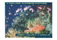
PROCEEDINGS OF THE SECOND MEDITERRANEAN SYMPOSIUM ON MARINE VEGETATION (ATHENS, 12-13 DECEMBER 2003)<br />
150<br />
As established by <str<strong>on</strong>g>the</str<strong>on</strong>g> WFD (2000/60/EC) in order to ensure comparability between <str<strong>on</strong>g>the</str<strong>on</strong>g><br />
values obtained by different m<strong>on</strong>itoring systems an ecological quality ratio (EQR) has to<br />
be calculated. These ratios represent <str<strong>on</strong>g>the</str<strong>on</strong>g> relati<strong>on</strong>ship between <str<strong>on</strong>g>the</str<strong>on</strong>g> values observed in <str<strong>on</strong>g>the</str<strong>on</strong>g><br />
study site and <str<strong>on</strong>g>the</str<strong>on</strong>g> values observed in <str<strong>on</strong>g>the</str<strong>on</strong>g> reference sites.<br />
EQR =<br />
Relati<strong>on</strong> <str<strong>on</strong>g>of</str<strong>on</strong>g> observed values <str<strong>on</strong>g>of</str<strong>on</strong>g> biological parameters<br />
Reference values <str<strong>on</strong>g>of</str<strong>on</strong>g> <str<strong>on</strong>g>the</str<strong>on</strong>g> biological parameters<br />
The reference sites have to be selected based <strong>on</strong> 1) <str<strong>on</strong>g>the</str<strong>on</strong>g>ir undisturbed or very minor<br />
disturbed state and 2) <str<strong>on</strong>g>the</str<strong>on</strong>g>ir similar physico-chemical and hydrogeomorphological<br />
c<strong>on</strong>diti<strong>on</strong>s with <str<strong>on</strong>g>the</str<strong>on</strong>g> valuated site. In our case, <str<strong>on</strong>g>the</str<strong>on</strong>g> reference network for <str<strong>on</strong>g>the</str<strong>on</strong>g> Catalan coast<br />
is formed by three different high status sites: 1) Façade maritime du Parc Naturel<br />
Régi<strong>on</strong>al de Corse, 2) Reserva dels Freus de Formentera i Eivissa and 3) Reserva del<br />
Nord de Menorca. These three reference sites were cartographied in 2001.<br />
The comparis<strong>on</strong> between <str<strong>on</strong>g>the</str<strong>on</strong>g> Catalan coast and <str<strong>on</strong>g>the</str<strong>on</strong>g> reference sites has to be made sector<br />
by sector. First at all, it is important to assess which are <str<strong>on</strong>g>the</str<strong>on</strong>g> geomorphological factors that<br />
affect <str<strong>on</strong>g>the</str<strong>on</strong>g> presence/absence or dominance <str<strong>on</strong>g>of</str<strong>on</strong>g> <str<strong>on</strong>g>the</str<strong>on</strong>g> different communities. A MDS analysis<br />
was performed in <str<strong>on</strong>g>the</str<strong>on</strong>g> reference sites regarding all <str<strong>on</strong>g>the</str<strong>on</strong>g> different situati<strong>on</strong>s (e.g. 174 in our<br />
study) resulting from all <str<strong>on</strong>g>the</str<strong>on</strong>g> combinati<strong>on</strong>s <str<strong>on</strong>g>of</str<strong>on</strong>g> <str<strong>on</strong>g>the</str<strong>on</strong>g> geomorphological variables c<strong>on</strong>sidered<br />
and <str<strong>on</strong>g>the</str<strong>on</strong>g> percentage <str<strong>on</strong>g>of</str<strong>on</strong>g> coast occupied by each community for each situati<strong>on</strong>.<br />
Results <str<strong>on</strong>g>of</str<strong>on</strong>g> this MDS analysis shows that “Coastline morphology” (Fig. 1) and<br />
“Natural\Artificial” (Fig. 2) are <str<strong>on</strong>g>the</str<strong>on</strong>g> most important parameters in <str<strong>on</strong>g>the</str<strong>on</strong>g> determinati<strong>on</strong> <str<strong>on</strong>g>of</str<strong>on</strong>g> <str<strong>on</strong>g>the</str<strong>on</strong>g><br />
littoral benthic communities in <str<strong>on</strong>g>the</str<strong>on</strong>g> reference sites. The combinati<strong>on</strong> <str<strong>on</strong>g>of</str<strong>on</strong>g> <str<strong>on</strong>g>the</str<strong>on</strong>g>se parameters<br />
permits to define six different “geomorphological relevant situati<strong>on</strong>s” (table 2). The value<br />
<str<strong>on</strong>g>of</str<strong>on</strong>g> EQV has been calculated for every<strong>on</strong>e <str<strong>on</strong>g>of</str<strong>on</strong>g> <str<strong>on</strong>g>the</str<strong>on</strong>g>se situati<strong>on</strong>s (table 2).<br />
Fig. 1 : MDS analysis: distributi<strong>on</strong> <str<strong>on</strong>g>of</str<strong>on</strong>g> <str<strong>on</strong>g>the</str<strong>on</strong>g> 174<br />
different situati<strong>on</strong>s resulting from all <str<strong>on</strong>g>the</str<strong>on</strong>g> available<br />
combinati<strong>on</strong>s <str<strong>on</strong>g>of</str<strong>on</strong>g> <str<strong>on</strong>g>the</str<strong>on</strong>g> geomorphological variables<br />
c<strong>on</strong>sidered in reference sites according to <str<strong>on</strong>g>the</str<strong>on</strong>g><br />
percentage <str<strong>on</strong>g>of</str<strong>on</strong>g> coast occupied by each community<br />
for each situati<strong>on</strong>. Artificial and natural substrates<br />
are indicated with different symbols.<br />
Fig. 2 : MDS analysis: distributi<strong>on</strong> <str<strong>on</strong>g>of</str<strong>on</strong>g> <str<strong>on</strong>g>the</str<strong>on</strong>g> 174<br />
different situati<strong>on</strong>s resulting from all <str<strong>on</strong>g>the</str<strong>on</strong>g> available<br />
combinati<strong>on</strong>s <str<strong>on</strong>g>of</str<strong>on</strong>g> <str<strong>on</strong>g>the</str<strong>on</strong>g> geomorphological variables<br />
c<strong>on</strong>sidered in reference sites according to <str<strong>on</strong>g>the</str<strong>on</strong>g><br />
percentage <str<strong>on</strong>g>of</str<strong>on</strong>g> coast occupied by each community<br />
for each situati<strong>on</strong>. Decimetric blocks, low coast and<br />
high coast are indicated with different symbols.