Silva Sight Master
Silva Sight Master
Silva Sight Master

Create successful ePaper yourself
Turn your PDF publications into a flip-book with our unique Google optimized e-Paper software.
<strong>Silva</strong> Sweden AB<br />
Box 998<br />
SE-191 29 Sollentuna<br />
info@silva.se - www.silva.se<br />
See more products from <strong>Silva</strong> at<br />
www.silva.se<br />
Art.no. 70170-99 - ver.2<br />
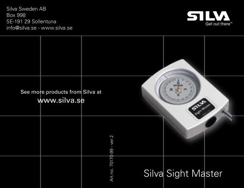
<strong>Silva</strong> <strong>Sight</strong> <strong>Master</strong>
<strong>Silva</strong> <strong>Sight</strong> <strong>Master</strong><br />
Instruction Manual<br />
A B<br />
2 3<br />
Page<br />
Figure A+B 2-3<br />
English 4-6<br />
Svensk 7-9<br />
Français 10-12<br />
Deutsch 13-15<br />
Italiano 16-18<br />
Español 19-21<br />
Figure C 22-23
SILVA <strong>Sight</strong> <strong>Master</strong> Series is the type of compass<br />
to choose if you depend upon the highest possible<br />
accuracy obtainable with a hand-held magnetic<br />
compass. Typical users of this kind of precision<br />
sighting compass are: Engineers, Surveyors,<br />
Geologists, Foresters, Architects, Military forces,<br />
Marine navigation personnel and others who put<br />
extreme accuracy first.<br />
Instructions for use, PICTURE A and B<br />
1. Hold the compass close to one of your eyes<br />
horizontally in front of you.<br />
2. <strong>Sight</strong> with both eyes towards the object. See fig. A<br />
3. At the same time as you read the bearing through<br />
the compass sighting system you sight above the<br />
instrument towards the object. The index line will<br />
appear to “stand up” from the compass housing<br />
making it easy to accurately read the correct<br />
bearing towards the object. See fig. B<br />
4. The bigger scale gives the bearing from your<br />
position to the object and the smaller one the<br />
reverse bearing from the object to your position.<br />
Reverse bearings are essential in accurate<br />
positioning tasks, particularly at sea.<br />
Direct reading of bearing<br />
The scale readable from above by the lubber line is<br />
used when following a certain direction in the terrain<br />
or when using the instrument as auxiliary compass<br />
in a boat. Please note that highest accuracy is always<br />
obtained by using the optical sighting system.<br />
Important!<br />
Some people who have an eye condition called<br />
heterophoria (misalignment of the eye axis) may get<br />
incorrect bearings when reading the compass with<br />
both eyes open. This can be checked as follows:<br />
Take a bearing to the object with both eyes open.<br />
Then close the other eye, and if the bearing does<br />
not change significantly, there is no heterophoria and<br />
bearings can thus be taken with both eyes open.<br />
When there is a difference in the bearings, then<br />
keep the other eye closed and sight partly over the<br />
instrument housing.<br />
PICTURE C<br />
Plotting locations<br />
Aim at two fixed points appearing on the chart, for<br />
ex. lighthouse in direction 20° and landmark in 330°.<br />
Then draw straight lines along the reverse bearings of<br />
20° and 330° (200° and 150°) from the lighthouse and<br />
landmark on the chart. The intersection point of these<br />
bearing lines indicates your location. See fig. C<br />
Declination<br />
The difference between geographical north (towards<br />
which the maps meridians are directed) and the<br />
magnetic north (towards which the compass is<br />
pointing) is called declination (or variation). Declination<br />
changes with location and the local declination is<br />
printed on the maps. Bearing obtained with the<br />
compass should thus be corrected with the local<br />
declination.<br />
4 5
Deviation<br />
The compass should be used as far as possible<br />
away from iron and steel objects, such as engines,<br />
electrical equipment, knives, tooling, etc., causing<br />
magnetic interference, that is, direction errors. Even<br />
wrist watches and steel-framed spectacles may cause<br />
deviation in the bearings.<br />
Specifications<br />
Housing: Anodised aluminium.<br />
<strong>Sight</strong>ing System: Parallax free glass lens<br />
magnification (10x) sighting<br />
system.<br />
Capsule: Anti-static liquid filled for optimal<br />
dampening of the compass card.<br />
Accuracy: Max +/-0.5° from true magnetic<br />
course with precision sighting.<br />
Max +/-2° with direct reading at<br />
the lubber line.<br />
Compass card: Sapphire jewel bearing for friction<br />
free movement.<br />
Dimensions: 75x53x16mm.<br />
Weight: 110g.<br />
SILVA <strong>Sight</strong> <strong>Master</strong> Serien består av kompasser som<br />
ger den största möjliga noggrannhet som kan uppnås<br />
med en handhållen magnetisk kompass. Typiska<br />
användare av noggranna siktkompasser är: geologer,<br />
arkitekter, skogsvaktare, besiktningsmän, ingenjörer,<br />
inspektörer, byggmästare, militärer, användare av<br />
marin navigation och andra som sätter värde på<br />
extrem noggrannhet.<br />
Hur du använder SILVA <strong>Sight</strong> <strong>Master</strong>, Figur A och B<br />
1. Håll kompassen horisontellt framför dig nära ditt<br />
ena öga.<br />
2. Sikta med båda ögonen mot objektet. Se figur A.<br />
3. Sikta ovanför instrumentet mot objektet och<br />
läs samtidigt av bäringen genom kompassens<br />
siktsystem. Tack vare den optiska illusionen<br />
kommer indexlinjen att “sticka ut” från<br />
kompassens hus vilket gör det enkelt att avläsa<br />
den korrekta bäringen mot objektet. Se figur B.<br />
4. Den större skalan visar bäringen från din<br />
position till objektet och den mindre skalan<br />
visar den omvända bäringen från objektet till<br />
din position. Omvänd bäring är viktig vid exakt<br />
positionsbestämning, speciellt till sjöss.<br />
Direkt avläsning av bäring<br />
Skalan som kan läsas av ovanifrån med styrstrecket<br />
används när du följer en specifik riktning i terrängen.<br />
Notera att högsta noggrannhet alltid uppnås genom<br />
att använda det optiska siktsystemet.<br />
6 7
OBS!<br />
Ögonsjukdomen kallad heterophoria, vilket innebär en<br />
förskjutning av ögonens axel, kan hos vissa människor<br />
leda till felaktiga avläsningar när instrumentet avläses<br />
med båda ögonen. Detta kan kontrolleras genom<br />
följande;<br />
Gör en avläsning av objektet med båda ögonen öppna.<br />
Blunda sedan med det ena ögat. Om avläsningen inte<br />
ändras markant har du inga problem med heterophoria<br />
och avläsningar kan därmed göras med båda ögonen<br />
öppna. Om du märker en markant skillnad så blunda<br />
med ena ögat och sikta lite vid sidan av instrumentets<br />
kåpa.<br />
Figur C<br />
Plotta positioner<br />
Sikta på två fasta punkter på sjökortet eller kartan,<br />
till exempel fyren i riktning 20° och landmärke i 330°.<br />
Dra sedan en rak linje längs med den omvända<br />
bäring av 20° och 330° (200° och 150°) från fyren<br />
och landmärket på sjökortet eller kartan. Din position<br />
motsvaras av den punkt där de två bäringslinjerna<br />
korsas. Se figur C.<br />
Deklination<br />
Skillnaden mellan geografisk nord (som kartans<br />
meridianer visar riktningen mot) och magnetisk<br />
nord (som kompassen visar riktningen mot) kallas<br />
deklination (missvisning). Deklinationen är olika<br />
beroende på din position och den lokala deklinationen<br />
skrivs normalt ut på kartan. Bäringen som erhålls<br />
från kompassen bör därför korrigeras med lokal<br />
deklination.<br />
Deviation<br />
Använd kompassen så långt ifrån järn- och stålobjekt,<br />
som till exempel motorer, elektrisk utrustning, knivar,<br />
verktyg osv. De kan orsaka magnetiska störningar<br />
vilket leder till riktningsavvikelser. Till och med klockor<br />
och glasögon med stålbåge kan leda till deviation i<br />
bäringen.<br />
Specifikationer<br />
Kåpa: Anodiserat aluminium.<br />
Siktsystem: Parallaxfri glaslins, förstorning (10x).<br />
Hölje: Fyllt med anti-statiskt vätska för<br />
optimal dämpning av kompassrosen.<br />
Noggrannhet: Max +/-0.5° från verklig magnetisk<br />
kurs vid noggrann siktning. Max +/-2°<br />
vid direkt avläsning med indexstreck.<br />
Kompassros: Safirlagrad för friktionsfri rörelse.<br />
Dimensioner: 75x53x16mm.<br />
Vikt: 110gram.<br />
8 9
La gamme SILVA <strong>Sight</strong> <strong>Master</strong> est le type de<br />
compas qu’il vous faut, si vous avez besoin de la<br />
plus grande précision possible avec un compas<br />
de relèvement magnétique. Cette gamme de<br />
compas de relèvement/boussoles à viser est tout<br />
particulièrement adaptée aux besoins des utilisateurs<br />
suivants : Ingénieurs, Géomètres, Géologues,<br />
Forestiers, Architectes, Forces armées, Navigateurs<br />
et tous les ceux pour lesquels la précision est<br />
primordiale.<br />
Instructions d’emploi, ILLUSTRATIONS A et B<br />
1. Tenez le compas horizontalement devant vous,<br />
près de l’œil.<br />
2. Visez l’objet avec les deux yeux. Voir fig. A<br />
3. Lisez le relèvement apparaissant dans la lentille de<br />
visée du compas quand celle-ci s’aligne sur l’objet<br />
visé au-dessus de l’instrument. L’illusion d’optique<br />
fait que la ligne de foi apparaît au-dessus du boîtier<br />
du compas ce qui facilite la visée et augmente la<br />
précision du relèvement de l’objet. Voir fig. B<br />
4. La grande graduation indique le relèvement<br />
de l’objet depuis votre position tandis que la<br />
petite indique l’azimut inverse, c’est-à-dire le<br />
relèvement de votre position depuis l’objet visé.<br />
Les relèvements inversés sont essentiels pour les<br />
calculs de position, particulièrement en mer.<br />
ou d’utiliser l’instrument comme compas auxiliaire sur un<br />
bateau. Notez cependant que la plus grande précision est<br />
toujours atteinte en utilisant le système de visée optique.<br />
Important !<br />
Certaines personnes présentant une déviation des axes<br />
visuels appelée hétérophorie, peuvent effectuer une<br />
lecture incorrecte du relèvement lorsqu’elles procèdent<br />
à une visée avec les deux yeux ouverts. Cette déviation<br />
peut être contrôlée comme suit :<br />
Prenez un relèvement de l’objet avec les deux yeux<br />
ouverts. Puis fermez l’œil qui ne prend pas la visée sur la<br />
ligne de foi. Si la mesure ne varie pas significativement,<br />
il n’y a pas d’hétérophorie et vous pouvez effectuer les<br />
mesures avec les deux yeux ouverts. Si vous constatez<br />
une différence de mesure, maintenez cet œil fermé et<br />
visez partiellement au-dessus du boîtier de l’instrument.<br />
ILLUSTRATION C<br />
Tracé des positions sur la carte<br />
Visez deux points fixes à terre tracés sur la carte, par<br />
exemple un phare dans le relèvement 20° et un amer<br />
dans le 330. Puis tracez deux lignes droites sur la carte<br />
depuis le phare et l’amer dans les azimuts inverses<br />
aux relèvements 20° et 330° (200° et 150°). Les points<br />
d’intersection de ces lignes de relèvement indiquent votre<br />
position. Voir fig. C<br />
Lecture directe du relèvement<br />
Déclinaison magnétique<br />
La différence entre le nord géographique (vers lequel les<br />
La graduation lisible sur la ligne de foi par-dessus,<br />
méridiens convergent sur la carte) et le nord magnétique<br />
permet de suivre une direction donnée sur le terrain (indiqué par le compas) est appelée déclinaison<br />
10 magnétique. La déclinaison magnétique varie selon<br />
11
la position à la surface du globe. La déclinaison<br />
magnétique locale et sa variation annuelle sont<br />
imprimées sur les cartes. Il faut donc appliquer au<br />
relèvement mesuré avec le compas, une correction<br />
égale à la déclinaison magnétique locale.<br />
Déviation<br />
Il faut utiliser le compas aussi loin que possible<br />
de tout objet en fer ou en acier, tels que moteurs,<br />
appareils électriques, couteaux, outillages, etc., créant<br />
des interférences magnétiques, et donc des erreurs<br />
de relèvement. Même les montres de poignet ou les<br />
lunettes à monture en acier peuvent provoquer une<br />
déviation des relèvements.<br />
Die SILVA <strong>Sight</strong><strong>Master</strong> Präzisionskompasse sind die erst<br />
Wahl, falls Sie höchste Ablesegenauigkeit bei einem Handgerät<br />
des Typ Magnetkompass erreichen wollen. Zu diesen<br />
Anwendern zählen unter anderem Ingenieure, Vermesser,<br />
Geologen, Forstleute, Architekten, Soldaten, Marineverwender<br />
und viele mehr, für die Präzision oberstes Gebot ist.<br />
Gebrauchsanleitung <strong>Sight</strong><strong>Master</strong>, Bilder A und B<br />
1. Halten Sie den Kompass horizontal nahe vor eines Ihrer<br />
Augen.<br />
2. Peilen Sie mit beiden Augen geöffnet ein Objekt an. Siehe<br />
Bild A.<br />
3. Führen Sie die Peilung durch das Präzisionsablese-System<br />
durch, während Sie gleichzeitig auf das Objekt sehen. Durch<br />
optische Täuschung wird es Ihnen vorkommen als läge die<br />
Indexlinie ausserhalb des Kompassgehäuses. Dies macht<br />
es besonders leicht genaue Peilungen in Richtung des<br />
Objektes vorzunehmen. Siehe Bild B.<br />
4. Die größere Skale gibt Ihnen den Kurswert zum Objekt<br />
hin an, die kleiner Skale den Gegenkurs vom Objekt<br />
zu Ihnen. Gegenkursangaben sind wichtig bei vielen<br />
Arten der Positionsbestimmung, insbesondere bei der<br />
Marinenavigation.<br />
Caractéristiques techniques<br />
Boîtier : Aluminium anodisé.<br />
Système de visée : Système de visée à lentille<br />
de grossissement (10x) sans<br />
parallaxe.<br />
Capsule : Remplie d’un liquide anti-statique<br />
pour un amortissement optimal<br />
des mouvements de la rose du<br />
compas.<br />
Précision : Max ±0,5° du cap magnétique<br />
réel avec une visée précise. Max Direktes Ablesen des Kurses<br />
±2° en lecture directe sur la ligne Die Skale auf der Rosette, ausgestattet mit einer roten<br />
de foi.<br />
Markierungslinie, wird verwendet, wenn Sie beispielsweise<br />
Rose du compas : Pivot en saphir pour une rotation einen Kurs im Gelände überprüfen oder den Kompass als<br />
sans friction.<br />
Hilfskompass einsetzen möchten. Der Kurs wird direkt an<br />
Dimensions : 75 × 53 × 16 mm.<br />
der Markierungslinie abgelesen. Beachten Sie, dass höchste<br />
Poids : 110 g.<br />
Genauigkeit im Zweifelsfall immer unter Verwendung des<br />
12 optischen Ablesesystems erreicht wird.<br />
13
Wichtig!<br />
Es gibt Personen, die unter Heterophorie leiden, also einer<br />
Fehlstellung der Blickachsen der Augen. Bei diesen Personen<br />
kann ein korrektes Ablesen mit beiden Augen erschwert oder<br />
unmöglich sein. Überprüft werde kann dies wie folgt:<br />
Lesen Sie einen Kurs zu einem Objekt wie beschrieben mit<br />
beiden Augen ab. Schließen Sie jetzt ein Auge und lesen<br />
mit dem anderen wiederum den Wert ab: Sollte der Wert<br />
sich nicht signifikant verändern, so liegt keine Heterophorie<br />
vor und Sie sollten mit beiden Augen geöffnet Werte<br />
ermitteln. Sollten die Werte voneinander abweichen, dann<br />
sollten Sie ein Auge geschlossen halten und müssen mit<br />
dem geöffneten Auge sowohl den Wert ermitteln als auch<br />
teilweise über Gehäuse hinweg das Ziel anpeilen.<br />
Bild C<br />
Kreuzpeilung<br />
Ermitteln Sie zwei Punkte auf einer Karte, beispielsweise<br />
einen Leuchtturm in Richtung 20°und einen prägnanten Punkt<br />
an Land in 330°. Zeichnen Sie dann zwei gerade Linien unter<br />
Verwendung des Gegenkurses der Werte 20° und 330° (also<br />
200° und 150°) von den jeweiligen Objekten in die Karte ein.<br />
Die Kreuzung dieser Linien zeigt Ihre momentane Position<br />
an. Siehe Bild C.<br />
Deklination (Missweisung)<br />
Der Unterschied zwischen Geographisch-Nord (die<br />
Meridianlinien der Karte verwenden diese Referenz) und<br />
Magnetisch-Nord (in diese Richtung zeigt der Kompass)<br />
wird als Deklination oder auch Missweisung bezeichnet. Die<br />
Deklination ist an verschiedenen Orten unterschiedlich und<br />
der lokale Deklinationswert ist üblicherweise auf guten Karten<br />
verzeichnet. Mit dem Kompass ermittelte Kurswerte sollten<br />
bei Notwendigkeit unter Berücksichtigung der Deklination<br />
korrigiert werden.<br />
Deviation (Ablenkung)<br />
Ein Kompass sollte möglichst in maximaler Entfernung<br />
zu stahl- und eisenhaltigen Objekten wie beispielsweise<br />
Motoren, Elektrogeräten, Messern, Werkzeug, usw...,<br />
die magnetische Störungen und damit Richtungsfehler<br />
verursachen könnten, verwendet werden. Selbst<br />
Armbanduhren oder Brillengestelle können im Extremfall<br />
Richtungsfehler verursachen.<br />
Spezifikation<br />
Gehäuse: Aluminium<br />
Peilsystem: Reflexionsfreie Glaslinse mit 10-facher<br />
Vergrößerung<br />
Kapsel: Antistatisch flüssigkeitsgefüllt für optimale<br />
Dämpfung des Kompasses<br />
Genauigkeit: Bis zu +/- 0,5° bezogen auf Magnetisch-Nord<br />
bei Verwendung des Präzisionsablese-Systems<br />
sowie +/- 2° bei direkter Ablesung<br />
Kompass: Saphirgelagert für praktisch reibungsfreie<br />
Bewegung.<br />
Größe: 75x53x16mm<br />
Gewicht: 110g<br />
14 15
La serie <strong>Sight</strong> <strong>Master</strong> della <strong>Silva</strong> rappresenta la miglior bussola<br />
per utilizzo manuale disponibile sul mercato per qualità costruttiva,<br />
assemblaggio, precisione, affidabilità e longevità. Questa serie<br />
è stata appositamente progettata per applicazioni professionali<br />
– geologi, operatori forestali, architetti, ingegneri, speleologi,<br />
costruttori, esploratori, forze armate, marinai etc - dove la miglior<br />
precisione ed affidabilità sono caratteristiche imprescindibili.<br />
Istruzioni all’uso, Figure A e B<br />
1. Impugnare saldamente la bussola, tenendola in posizione<br />
orizzontale e traguardando il bersaglio nell’ottica dello<br />
strumento, utilizzando un occhio solo.<br />
2. Utilizzando ora entrambi gli occhi, direzionarsi verso il bersaglio<br />
desiderato. Figura A.<br />
3. Effettuate la lettura della scala graduata con un occhio,<br />
collimando il bersaglio con l’altro occhio. Per un principio di<br />
illusione ottica, la linea di riferimento sembrerà apparire al di<br />
fuori del corpo dello strumento, rendendo così molto facile la<br />
lettura dell’angolo misurato. Figura B.<br />
4. La scala graduata grande serve per misurare la vostra<br />
posizione rispetto al bersaglio, mentre la scala graduata piccola<br />
serve per stimare la posizione del bersaglio rispetto alla vostra.<br />
La scala graduata piccola è fondamentale per un’accurato<br />
posizionamento, in special modo nell’impiego in mare.<br />
Importante!<br />
Alcune persone possono soffrire di un disturbo alla vista,<br />
denominato Eteroforia, consistente nell’incapacità di<br />
mantenere paralleli gli assi visivi. In questo modo gli occhi<br />
non riescono a guardare contemporaneamente lo stesso<br />
punto e fissano invece in direzioni differenti nello stesso<br />
momento. Nel caso in cui non fosse possibile giungere<br />
allo stesso valore misurato traguardando dapprima con<br />
entrambi gli occhi aperti e, successivamente, con un solo<br />
occhio, procedere necessariamente come segue: anzichè<br />
utilizzare entrambi gli occhi, uno per l’osservazione a campo<br />
libero dell’oggetto e l’altro per l’osservazione dell’ottica<br />
dello strumento, utilizzare un solo occhio traguardando<br />
parzialmente dentro l’ottica dello strumento e parzialmente<br />
direttamente verso l’oggetto.<br />
Figura C<br />
Determinare la posizione esatta su una mappa<br />
Mirare verso due punti fissi e rappresentati sulla mappa,<br />
per esempio un faro in direzione 20° ed un punto fisso su<br />
terraferma a 330°. Quindi tracciare due linee rette passanti<br />
per i valori letti sulla scala graduata piccola, pari a 200° e<br />
150°, riferiti rispettivamente ai 20° del faro e ai 330° della<br />
punto sulla terraferma letti sulla scala graduata grande.<br />
L’intersezione delle due linee appena tracciate corrisponderà<br />
alla vostra posizione. Figura C.<br />
Lettura diretta dell’orientamento<br />
In determinate situazioni quali bussola di complemento in nave o<br />
per utilizzo cartografico, può essere necessario effettuare la lettura Declinazione magnetica<br />
della posizione direttamente dal quadrante posto sul dorso della La differenza tra il Nord geografico (verso il quale sono<br />
bussola, prendendo come riferimento il valore individuato dalla direzionati i meridiani sulle mappe) ed il Nord magnetico<br />
tacca rossa. La lettura più precisa è comunque quella effettuata (verso il quale la bussola è direzionata) è chiamata<br />
traguardando l’ottica della bussola. Figura 4.<br />
declinazione magnetica. La declinazione varia in base alla<br />
16 propria posizione terrestre: il valore della<br />
17
declinazione del punto occupato può essere letto sulla<br />
mappa, in quanto sulle mappe sono riportati i valori della<br />
declinazione per tutte le località. Pertanto, il valore letto sullo<br />
strumento necessiterà di essere corretto tenendo conto del<br />
valore della declinazione magnetica relativa al luogo dove è<br />
stata effettuata la misura.<br />
La Brújula de la Serie SILVA <strong>Sight</strong> <strong>Master</strong> es el tipo<br />
de brújula a escoger si Vd. necesita la máxima precisión<br />
posible, con una brújula magnética de mano. Los<br />
usuarios habituales de esta brújula de precisión son:<br />
ingenieros, topógrafos, geólogos, forestales, arquitectos,<br />
fuerzas militares, personal de navegación marina...etc,<br />
que sitúan como prioridad la máxima precisión.<br />
Interferenze<br />
La bussola è estremamente sensibile ed influenzabile da<br />
strutture metalliche presenti nelle prossimità, quali motori<br />
Instrucciones de uso, FIGURAS A y B<br />
elettrici, automobili, arredi urbani, cancellate, braccialetti,<br />
1. Sujete la brújula horizontalmente y acérquela a uno de<br />
orologi, etc. Pertanto, per ottenere una misura precisa ed<br />
sus ojos.<br />
attendibile, assicurarsi di operare nelle condizioni ottimali, ad 2. Mantenga ambos ojos abiertos y mire con un ojo a<br />
adeguata distanza da strutture metalliche ed eventualmente través del visor hacia el objeto de referencia.<br />
non indossando braccialetti, orologi, etc.<br />
Ver fig. A.<br />
3. Al mismo tiempo que Vd. esta leyendo el valor de<br />
Caratteristiche tecniche<br />
dirección (rumbo), Vd. está alineando la línea negra<br />
Corpo strumento: Alluminio anodizzato.<br />
sobre el objeto. Por ilusión óptica, la línea índice negra<br />
Sistema di puntamento: Lente in vetro priva di parallasse,<br />
vertical parecerá sobresalir de la brújula facilitando por<br />
10x ingrandimenti.<br />
tanto el realizar una medición precisa de la dirección<br />
Capsula: Riempimento con liquido anti-<br />
del objeto visado. Ver fig. B<br />
statico per un’ottimale scorrimento 4. La escala con números grandes indica la dirección<br />
del disco.<br />
desde la posición que Vd. ocupa al objeto, y la escala<br />
Precisione: Max +/-0.5° per letture eseguite<br />
con numeros pequeños la dirección inversa. Las<br />
tramite il sistema di puntamento<br />
direcciones inversas son esenciales en trabajos que<br />
ottico; Max +/-2° per letture es-<br />
requieren posiciones precisas, especialmente a nivel<br />
eguite tramite il quadrante posto<br />
lateralmente sullo strumento.<br />
marino.<br />
Disco della capsula: Montato su cuscinetto allo zaffiro Lectura directa de la dirección<br />
per un preciso movimento privo di La escala legible desde el exterior (arriba) sin acercar el<br />
attriti.<br />
ojo, se usa al seguir una determinada dirección sobre el<br />
Dimensioni: 75x53x16mm.<br />
terreno, o al usar el instrumento como una brújula<br />
18Peso: 110g.<br />
19
auxiliar en un barco. Tenga en cuenta no obstante, que la<br />
máxima precisión se obtiene utilizando la brújula mediante el<br />
visor óptico.<br />
Importante!<br />
Algunas personas que tienen un problema visual denominado<br />
heterophoria, consistente en una desalineación del eje óptico,<br />
pueden llegar a obtener lecturas incorrectas al visar a traves<br />
del visor del aparato si lo hacen con los dos ojos abiertos. Esto<br />
puede ser comprobado de la siguiente forma:<br />
Tome una referencia de un objeto lejano con los dos ojos<br />
abiertos. Acerque uno de sus ojos al visor del aparato. Cierre el<br />
otro ojo, y si la lectura no varía significativamente con la lectura<br />
previamente hecha con los dos ojos abiertos, es síntoma de<br />
que no existe heterophoria y por tanto las lecturas de dirección<br />
pueden ser tomadas siempre con los dos ojos abiertos. En<br />
el caso de que sí exista una diferencia significativa, realice sus<br />
mediciones con un ojo cerrado y lance su visual parcialmente por<br />
encima de la caja del aparato.<br />
magnético (el que marca la aguja de una brújula) se<br />
denomina declinación (o variación). Las variaciones<br />
de la declinación según la posición geográfica, así<br />
como el valor anual de la declinación aparecen<br />
impresos habitualmente en los mapas. De este modo,<br />
las direcciones obtenidas con la brújula, deben ser<br />
corregidas teniendo en cuenta la declinación magnética<br />
local.<br />
Desviación<br />
La brújula debe de usarse lo más lejos posible de<br />
hierro y objetos metálicos, tales como motores,<br />
equipos eléctricos, cuchillos, herramientas...etc, que<br />
causan interferencias magnéticas y por tanto errores<br />
en la dirección. Incluso los relojes de pulsera y las<br />
gafas con montura metálica pueden causar errores<br />
de desviación.<br />
Especificaciones<br />
Caja: Aluminio anonizado.<br />
FIGURA C<br />
Sistema de visado: Sistema de visado con lente libre<br />
Situación de puntos<br />
de paralaje y aumento (10x)<br />
Lance una visual a dos puntos fijos que aparezcan sobre el<br />
Cápsula: Rellena de líquido anti-estático<br />
mapa, p.ej. un faro en la dirección 20º y un mojón topográfico<br />
para un óptimo balanceado del<br />
en la 330º. Dibuje dos líneas rectas a lo largo de las direcciones<br />
plato magnético.<br />
inversas de 20º y 330º ( es decir 200º y 150º) desde el faro y Precisión: Max +/-0.5° de la dirección<br />
el mojón, sobre el mapa. El punto de intersección de estas<br />
magnética real con visado de<br />
líneas de dirección le indican la posición que ocupa Vd. en estos<br />
precisión. Max +/-2° con lectura<br />
momentos. Ver fig. C<br />
directa en el plato superior.<br />
Plato magnético: Con zafiro central , para un<br />
Declinación<br />
movimiento libre de fricción.<br />
La diferencia entre el Norte geográfico (el que marcan los<br />
Dimensiones: 75x53x16mm.<br />
20meridianos de cualquier mapa) y el Norte<br />
Peso: 110g.<br />
21
C<br />
22 23