Expansion de las Ciudades
Expansion de las Ciudades
Expansion de las Ciudades

Create successful ePaper yourself
Turn your PDF publications into a flip-book with our unique Google optimized e-Paper software.
Heriberto Félix Guerra<br />
Secretario <strong>de</strong> Desarrollo Social<br />
Sara Topelson <strong>de</strong> Grinberg<br />
Subsecretaria <strong>de</strong> Desarrollo Urbano<br />
y Or<strong>de</strong>nación <strong>de</strong>l Territorio<br />
Luis Mejía Guzmán<br />
Subsecretario <strong>de</strong> Desarrollo Social y Humano<br />
Marco Antonio Paz Pellat<br />
Subsecretario <strong>de</strong> Prospectiva, Planeación<br />
y Evaluación<br />
Germán <strong>de</strong> la Garza Estrada<br />
Oficial Mayor<br />
César Ignacio Romero Jacobo<br />
Jefe <strong>de</strong> la Unidad <strong>de</strong> Comunicación Social<br />
Dirección <strong>de</strong>l proyecto<br />
y fotografía <strong>de</strong> portada<br />
Sara Topelson <strong>de</strong> Grinberg<br />
Coordinación <strong>de</strong>l proyecto<br />
Miguel Ángel Uribe Sánchez<br />
Gloria Estela García Fonseca<br />
Revisión <strong>de</strong> contenido<br />
Carolina Reyes Aldasoro<br />
Diseño editorial<br />
Edgar Ramírez Rodríguez<br />
Marcela Ovando Becerra<br />
2012<br />
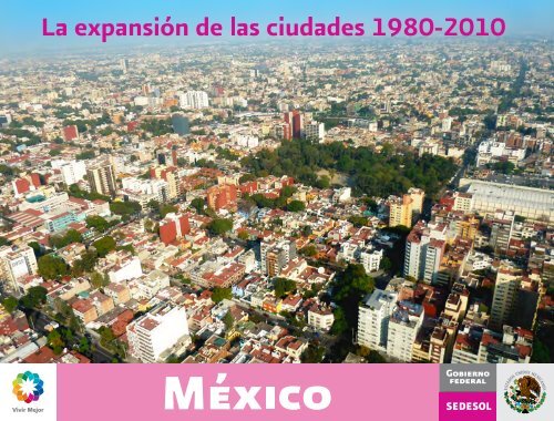
La expansión <strong>de</strong> <strong>las</strong> ciuda<strong>de</strong>s 1980-2010 México<br />
Segunda edición<br />
Secretaría <strong>de</strong> Desarrollo Social<br />
Paseo <strong>de</strong> la Reforma 116, Col. Juárez, Del. Cuauhtémoc,<br />
CP 06600, México, DF.<br />
Se permite la reproducción <strong>de</strong>l material contenido en esta obra<br />
previa autorización y citando la fuente.<br />
Este programa es público, ajeno a cualquier partido político.<br />
Queda prohibido el uso para fines distintos al <strong>de</strong>sarrollo social.<br />
1.<br />
^ Inicio Portada<br />
Prólogo .................................................................. 7<br />
Presentación ......................................................... 8<br />
11 Zonas Metropilitanas<br />
<strong>de</strong> 1 millón <strong>de</strong> habitantes en a<strong>de</strong>lante<br />
Mapa guía ............................................................10<br />
ZM <strong>de</strong>l Valle <strong>de</strong> México ...................................12<br />
ZM <strong>de</strong> Guadalajara ............................................14<br />
ZM <strong>de</strong> Monterrey ..............................................16<br />
ZM <strong>de</strong> Puebla-Tlaxcala .....................................18<br />
ZM <strong>de</strong> Toluca .....................................................20<br />
ZM <strong>de</strong> Tijuana ...................................................22<br />
ZM <strong>de</strong> León ........................................................24<br />
ZM <strong>de</strong> Juárez ......................................................26<br />
ZM <strong>de</strong> La Laguna ..............................................28<br />
ZM <strong>de</strong> Querétaro ...............................................30<br />
ZM <strong>de</strong> San Luis Potosí-Soledad<br />
<strong>de</strong> Graciano Sánchez .........................................32<br />
22 ciuda<strong>de</strong>s<br />
<strong>de</strong> 500 mil habitantes a 1 millón<br />
Mapa guía ...........................................................34<br />
ZM <strong>de</strong> Mérida ....................................................36<br />
ZM <strong>de</strong> Mexicali ..................................................38<br />
ZM <strong>de</strong> Aguascalientes ......................................40<br />
ZM <strong>de</strong> Cuernavaca ........................................... 42<br />
ZM <strong>de</strong> Acapulco ................................................44<br />
ZM <strong>de</strong> Tampico ..................................................46<br />
ZM <strong>de</strong> Chihuahua .............................................48<br />
ZM <strong>de</strong> Morelia ...................................................50<br />
ZM <strong>de</strong> Saltillo .....................................................52<br />
ZM <strong>de</strong> Veracruz .................................................54<br />
ZM <strong>de</strong> Villahermosa ..........................................56<br />
ZM <strong>de</strong> Reynosa-Río Bravo ...............................58<br />
Hermosillo ..........................................................60<br />
ZM <strong>de</strong>Tuxtla Gutierrez .....................................62<br />
ZM <strong>de</strong> Cancún ...................................................64<br />
Culiacán Rosales ................................................66<br />
ZM <strong>de</strong> Xalapa .....................................................68<br />
ZM <strong>de</strong> Oaxaca ...................................................70<br />
ZM <strong>de</strong> Celaya .....................................................72<br />
Victoria <strong>de</strong> Durango ..........................................74<br />
ZM <strong>de</strong> Poza Rica ................................................76<br />
ZM <strong>de</strong> Pachuca ..................................................78
62 ciuda<strong>de</strong>s<br />
<strong>de</strong> 100 mil habitantes a 500 mil<br />
Mapa guía ...........................................................80<br />
ZM <strong>de</strong> Tlaxcala-Apizaco ..................................84<br />
ZM <strong>de</strong> Matamoros ............................................86<br />
ZM <strong>de</strong> Cuautla ...................................................88<br />
ZM <strong>de</strong> Tepic .......................................................90<br />
ZM <strong>de</strong> Orizaba ....................................................92<br />
Irapuato ...............................................................94<br />
ZM <strong>de</strong> Nuevo Laredo .......................................96<br />
Mazatlán .............................................................98<br />
ZM <strong>de</strong> Puerto Vallarta ...................................100<br />
ZM <strong>de</strong> Minatitlán ...........................................102<br />
ZM <strong>de</strong> Coatzacoalcos ....................................104<br />
ZM <strong>de</strong> Colima-Villa <strong>de</strong> Álvarez ....................106<br />
ZM <strong>de</strong> Monclova-Frontera ...........................108<br />
ZM <strong>de</strong> Córdoba ...............................................110<br />
ZM <strong>de</strong> Zacatecas-Guadalupe .......................112<br />
Ciudad Victoria ...............................................114<br />
Ciudad Obregón .............................................116<br />
ZM <strong>de</strong> Tehuacán .............................................118<br />
Ensenada ......................................................... 120<br />
^ Indice Anterior<br />
Uruapan ...........................................................122<br />
Los Mochis ......................................................124<br />
ZM <strong>de</strong> Zamora-Jacona ..................................126<br />
ZM <strong>de</strong> La Piedad-Pénjamo ...........................128<br />
ZM <strong>de</strong> Tulancingo ..........................................130<br />
Campeche ........................................................132<br />
Tapachula <strong>de</strong> Córdova y Ordóñez ................134<br />
La Paz ...............................................................136<br />
Heroica Nogales .............................................138<br />
ZM <strong>de</strong> Tula ......................................................140<br />
ZM <strong>de</strong> Guaymas .............................................142<br />
Chilpancingo <strong>de</strong> los Bravo .............................144<br />
ZM <strong>de</strong> San Francisco <strong>de</strong>l Rincón ..................146<br />
ZM <strong>de</strong> Piedras Negras ...................................148<br />
Ciudad <strong>de</strong>l Carmen .........................................150<br />
ZM <strong>de</strong> Tehuantepec .......................................152<br />
Salamanca .......................................................154<br />
San Luis Río Colorado ...................................156<br />
San Cristóbal <strong>de</strong> <strong>las</strong> Casas .............................158<br />
Tianguistenco ...................................................160<br />
Chetumal .........................................................162<br />
Playa <strong>de</strong>l Carmen ............................................164<br />
ZM <strong>de</strong> Tecomán .............................................166<br />
ZM <strong>de</strong> Ocotlán ................................................168<br />
Manzanillo .......................................................170<br />
San Juan <strong>de</strong>l Río ..............................................172<br />
Ciudad Lázaro Cár<strong>de</strong>nas ................................174<br />
ZM <strong>de</strong> Riover<strong>de</strong>-Ciudad Fernán<strong>de</strong>z ............176<br />
Ciudad Acuña ..................................................178<br />
Cabo San Lucas ..............................................180<br />
Fresnillo ............................................................182<br />
Ciudad Valles ...................................................184<br />
ZM <strong>de</strong> Teziutlán ............................................. 186<br />
Iguala <strong>de</strong> la In<strong>de</strong>pen<strong>de</strong>ncia ............................188<br />
Delicias .............................................................190<br />
Cuauhtémoc ....................................................192<br />
Navojoa ............................................................194<br />
ZM <strong>de</strong> Acayucan ............................................196<br />
Guanajuato ......................................................198<br />
ZM <strong>de</strong> Moroleón-Uriangato .........................200<br />
Túxpam <strong>de</strong> Rodríguez Cano ..........................202<br />
San Juan Bautista Tuxtepec ..........................204<br />
Hidalgo <strong>de</strong>l Parral ............................................206
40 ciuda<strong>de</strong>s<br />
<strong>de</strong> 50 mil habitantes a 100 mil<br />
Mapa guía ......................................................................................208<br />
Apatzingán <strong>de</strong> la Constitución ...................................................210<br />
Lagos <strong>de</strong> Moreno .........................................................................212<br />
Ciudad Guzmán ........................................................................... 214<br />
Comitán <strong>de</strong> Domínguez ............................................................216<br />
Cár<strong>de</strong>nas ......................................................................................218<br />
Tepatitlán <strong>de</strong> Morelos .................................................................220<br />
Zitácuaro .......................................................................................222<br />
San José <strong>de</strong>l Cabo .......................................................................224<br />
Atlixco ...........................................................................................226<br />
Ciudad Mante ..............................................................................228<br />
Martínez <strong>de</strong> la Torre ....................................................................230<br />
Matehuala .....................................................................................232<br />
Agua Prieta ....................................................................................234<br />
Cozumel ........................................................................................236<br />
Heroica Ciudad <strong>de</strong> Juchitán <strong>de</strong> Zaragoza ................................238<br />
Guasave ........................................................................................240<br />
San Miguel <strong>de</strong> Allen<strong>de</strong> ................................................................242<br />
Valle <strong>de</strong> Santiago .........................................................................244<br />
Zihuatanejo ..................................................................................246<br />
Sahuayo <strong>de</strong> Morelos ...................................................................248<br />
Guamúchil ...................................................................................250<br />
Linares ...........................................................................................252<br />
San Andrés Tuxtla .......................................................................254<br />
^ Indice Anterior<br />
Cortazar .........................................................................................256<br />
Ciudad Hidalgo .............................................................................258<br />
Heroica Caborca ...........................................................................260<br />
Acatzingo <strong>de</strong> Hidalgo ..................................................................262<br />
Huauchinango ................................................................................264<br />
Dolores Hidalgo Cuna <strong>de</strong> la In<strong>de</strong>pen<strong>de</strong>ncia Nacional ..............266<br />
Huamantla .....................................................................................268<br />
Acámbaro ......................................................................................270<br />
Puerto Peñasco .............................................................................272<br />
San Luis <strong>de</strong> la Paz .........................................................................274<br />
Nuevo Casas Gran<strong>de</strong>s ..................................................................276<br />
Pátzcuaro .......................................................................................278<br />
Sabinas ...........................................................................................280<br />
Heroica Ciudad <strong>de</strong> Huajuapan <strong>de</strong> León ....................................282<br />
Zacapu ...........................................................................................284<br />
Taxco <strong>de</strong> Alarcón ..........................................................................286<br />
Arandas ..........................................................................................288<br />
Anexos<br />
Anexo 1. Plantilla para traducción <strong>de</strong> gráficas y mapas ..........290
Índice alfabético <strong>de</strong> ciuda<strong>de</strong>s<br />
Acámbaro (Gto) ....................................................................270<br />
Acapulco (Gro) ........................................................................ 44<br />
Acatzingo <strong>de</strong> Hidalgo (Pue) ................................................262<br />
Acayucan (Ver) .....................................................................196<br />
Agua Prieta (Son) .................................................................234<br />
Aguascalientes (Ags) ............................................................. 40<br />
Apatzingán <strong>de</strong> la Constitución (Mich) ..............................210<br />
Arandas (Jal) ..........................................................................288<br />
Atlixco (Pue) .........................................................................226<br />
Cabo San Lucas (B.C.S.) ......................................................180<br />
Campeche (Camp) ...............................................................132<br />
Cancún (Q.Roo) ...................................................................... 64<br />
Cár<strong>de</strong>nas (Tab) ......................................................................174<br />
Celaya (Gto) ............................................................................ 72<br />
Chetumal (Q.Roo) ................................................................162<br />
Chihuahua (Chih) ................................................................... 48<br />
Chilpancingo <strong>de</strong> los Bravo(Gro) .........................................144<br />
Ciudad Acuña (Coah) ..........................................................178<br />
Ciudad <strong>de</strong>l Carmen (Camp) ................................................150<br />
Ciudad Guzmán (Jal) ............................................................214<br />
Ciudad Hidalgo (Mich) ........................................................258<br />
Ciudad Mante (Tamps) ........................................................228<br />
Ciudad Obregón (Son) .........................................................116<br />
Ciudad Valles (S.L.P.) ...........................................................184<br />
Ciudad Victoria (Tamps) .....................................................114<br />
Coatzacoalcos (Ver) .............................................................104<br />
Colima-Villa <strong>de</strong> Álvarez (Col) .............................................106<br />
Comitán <strong>de</strong> Domínguez (Chis) ..........................................216<br />
^ Indice Anterior<br />
Córdoba (Ver) ...................................................................................110<br />
Cortazar (Gto) ...................................................................................256<br />
Cozumel (Q.Roo) .............................................................................236<br />
Cuauhtémoc (Chih) .........................................................................192<br />
Cuautla (Mor) ..................................................................................... 88<br />
Cuernavaca (Mor) .............................................................................. 42<br />
Culiacán Rosales (Sin) ....................................................................... 66<br />
Delicias (Chih) ..................................................................................190<br />
Dolores Hidalgo Cuna <strong>de</strong> la In<strong>de</strong>pen<strong>de</strong>ncia Nacional (Gto) .............266<br />
Ensenada (B.C.) ................................................................................120<br />
Fresnillo (Zac) ...................................................................................182<br />
Guadalajara (Jal) ................................................................................. 14<br />
Guamúchil (Sin) ................................................................................250<br />
Guanajuato (Gto) .............................................................................198<br />
Guasave (Sin) ....................................................................................240<br />
Guaymas (Son) .................................................................................142<br />
Hermosillo (Son) ................................................................................ 60<br />
Heroica Caborca (Son) ....................................................................260<br />
Heroica Ciudad <strong>de</strong> Huajuapan <strong>de</strong> León (Oax) .............................282<br />
Heroica Nogales (Son) .....................................................................138<br />
Hidalgo <strong>de</strong>l Parral (Chih) .................................................................206<br />
Huamantla (Tlax) .............................................................................268<br />
Huauchinango (Pue) ........................................................................264<br />
Iguala <strong>de</strong> la In<strong>de</strong>pen<strong>de</strong>ncia (Gro) ...................................................188<br />
Irapuato (Gto) ..................................................................................... 94<br />
Juárez (Chih) ....................................................................................... 26<br />
Juchitán <strong>de</strong> Zaragoza (Oax) ............................................................238<br />
La Laguna (Coah, Dgo) ..................................................................... 28
La Paz (B.C.S) .....................................136<br />
La Piedad-Pénjamo (Gto, Mich) ......128<br />
Lagos <strong>de</strong> Moreno (Jal) .......................212<br />
Lázaro Cár<strong>de</strong>nas (Mich) ....................174<br />
León (Gto) ..............................................24<br />
Linares (N.L.) ......................................252<br />
Los Mochis (Sin) ................................124<br />
Manzanillo (Col) .................................170<br />
Martínez <strong>de</strong> la Torre (Ver) .................230<br />
Matamoros (Tamps)..............................86<br />
Matehuala (S.L.P.) ..............................232<br />
Mazatlán (Sin)........................................98<br />
Mérida (Yuc) ..........................................36<br />
Mexicali (B.C.) .......................................38<br />
Minatitlán (Ver) ..................................102<br />
Monclova-Frontera (Coah) ...............108<br />
Monterrey (N.L.) ...................................16<br />
Morelia (Mich) .......................................50<br />
Moroleón-Uriangato (Gto) ...............200<br />
Navojoa (Son) .....................................194<br />
Nuevo Casas Gran<strong>de</strong>s (Chih) ...........276<br />
Nuevo Laredo (Tamps) .........................96<br />
Oaxaca (Oax) .........................................70<br />
Ocotlán (Jal) ........................................186<br />
Orizaba (Ver) ..........................................92<br />
Pachuca (Hgo) .......................................78<br />
Pátzcuaro (Mich) ................................278<br />
Piedras Negras (Coah) .......................148<br />
^ Indice Anterior<br />
Playa <strong>de</strong>l Carmen (Q.Roo.) ...............164<br />
Poza Rica (Ver) ......................................76<br />
Puebla-Tlaxcala (Pue, Tlax) ..................18<br />
Puerto Peñasco (Son) ........................272<br />
Puerto Vallarta (Jal, Nay) ..................100<br />
Querétaro (Qro) .....................................30<br />
Reynosa-Río Bravo (Tamps) ................58<br />
Riover<strong>de</strong>-Ciudad Fernán<strong>de</strong>z (S.L.P.) 176<br />
Sabinas (Coah) ....................................280<br />
Sahuayo <strong>de</strong> Morelos (Mich) .............248<br />
Salamanca (Gto) .................................154<br />
Saltillo (Coah) ........................................52<br />
San Andrés Tuxtla (Ver) ....................254<br />
San Cristóbal <strong>de</strong> <strong>las</strong> Casas (Chis) .....158<br />
San Francisco <strong>de</strong>l Rincón (Gto) ........146<br />
San José <strong>de</strong>l Cabo (B.C.) ...................224<br />
San Juan <strong>de</strong>l Río (Qro) .......................172<br />
San Luis <strong>de</strong> la Paz (Gto) ....................274<br />
San Luis Potosí-Soledad <strong>de</strong> Graciano<br />
Sánchez (S.L.P.) .................................... 32<br />
San Luis Río Colorado (Son) .............156<br />
San Miguel <strong>de</strong> Allen<strong>de</strong> (Gto) ............242<br />
Tampico (Tamps, Ver) ...........................46<br />
Tapachula <strong>de</strong> Córdova y Ordóñez (Chis) 134<br />
Taxco <strong>de</strong> Alarcón (Gro) ......................286<br />
Tecomán (Col) ....................................166<br />
Tehuacán (Pue) ...................................118<br />
Tehuantepec (Oax) ............................152<br />
Tepatitlán <strong>de</strong> Morelos (Jal) ................. 220<br />
Tepic (Nay) ..............................................90<br />
Teziutlán (Pue) ..................................... 186<br />
Tianguistenco (Mex) .......................... 160<br />
Tijuana (B.C.) ..........................................22<br />
Tlaxcala-Apizaco (Tlax) .........................84<br />
Toluca (Mex) ...........................................20<br />
Tula (Hgo) ............................................. 140<br />
Tulancingo (Hgo) ................................. 130<br />
Túxpam <strong>de</strong> Rodríguez Cano(Ver)...... 202<br />
Tuxtepec (Oax) .................................... 204<br />
Tuxtla Gutiérrez (Chis) ...........................62<br />
Uruapan (Mich) ................................... 122<br />
Valle <strong>de</strong> México (DF, Hgo, Mex) .........12<br />
Valle <strong>de</strong> Santiago (Gto) ...................... 244<br />
Veracruz (Ver) .........................................54<br />
Victoria <strong>de</strong> Durango (Dgo) ...................74<br />
Villahermosa (Tab) .................................56<br />
Xalapa (Ver) ............................................68<br />
Zacapu (Mich) ..................................... 284<br />
Zacatecas-Guadalupe (Zac) ............... 112<br />
Zamora-Jacona (Mich) ....................... 126<br />
Zihuatanejo (Gro) ................................ 246<br />
Zitácuaro (Mich) .................................. 222
Prólogo<br />
La relación entre población y territorio ha sido tema <strong>de</strong> interés en foros especializados en temas <strong>de</strong>mográficos y <strong>de</strong> <strong>de</strong>sarrollo, don<strong>de</strong> ha quedado en evi<strong>de</strong>ncia<br />
la necesidad <strong>de</strong> buscar un enfoque comprehensivo <strong>de</strong> la problemática que facilite, a los organismos y entida<strong>de</strong>s involucrados, el diseño <strong>de</strong> mejores<br />
soluciones <strong>de</strong> política pública. Dentro <strong>de</strong>l ejercicio permanente <strong>de</strong> reflexión, un aspecto importante consiste en examinar <strong>las</strong> ten<strong>de</strong>ncias y perspectivas <strong>de</strong>l<br />
crecimiento <strong>de</strong> la población urbana y rural, así como los cambios que experimentan <strong>las</strong> ciuda<strong>de</strong>s. Las ten<strong>de</strong>ncias actuales <strong>de</strong>l proceso <strong>de</strong> urbanización a<br />
escala mundial indican que, en los próximos <strong>de</strong>cenios, el crecimiento <strong>de</strong> la población mundial estará <strong>de</strong>terminado, en gran medida, por la dinámica <strong>de</strong> <strong>las</strong><br />
zonas urbanas <strong>de</strong> los países en <strong>de</strong>sarrollo.<br />
El presente documento representa un esfuerzo institucional para p<strong>las</strong>mar en materiales cartográficos, la situación que guarda la expansión física y <strong>de</strong>mográfica<br />
<strong>de</strong> <strong>las</strong> ciuda<strong>de</strong>s mexicanas en <strong>las</strong> últimas tres décadas. Incluye mapas <strong>de</strong> crecimiento <strong>de</strong> <strong>las</strong> ciuda<strong>de</strong>s mayores a 50 mil habitantes, acompañadas <strong>de</strong> una ficha<br />
<strong>de</strong> información socioeconómica básica, con la finalidad <strong>de</strong> proporcionar tanto al público general como a expertos e investigadores en temas urbanos, una visión<br />
sinóptica acerca <strong>de</strong>l crecimiento <strong>de</strong> <strong>las</strong> ciuda<strong>de</strong>s en dicho periodo. La información se agrupa en tres dimensiones: la primera, relacionada a los aspectos básicos<br />
<strong>de</strong> vivienda, habitabilidad y disposición <strong>de</strong> servicios <strong>de</strong> la población; la segunda, compren<strong>de</strong> información relativa a <strong>las</strong> superficies y <strong>de</strong>nsida<strong>de</strong>s en el ámbito<br />
urbano; la tercera dimensión proporciona información relativa a <strong>las</strong> características viales y disponibilidad <strong>de</strong> vehículos automotores. El conglomerado urbano<br />
analizado abarca 11 Zonas Metropolitanas mayores a un millón <strong>de</strong> habitantes; 22 Zonas Metropolitanas y Ciuda<strong>de</strong>s <strong>de</strong>l Sistema Urbano Nacional con una<br />
población comprendida en el rango <strong>de</strong> entre medio millón <strong>de</strong> habitantes y un millón; y 102 ciuda<strong>de</strong>s menores a medio millón <strong>de</strong> habitantes, contabilizando<br />
un total <strong>de</strong> 135 ciuda<strong>de</strong>s don<strong>de</strong> habita el 66% <strong>de</strong> la población total <strong>de</strong>l país y el 92% <strong>de</strong> la población <strong>de</strong>l Sistema Urbano Nacional.<br />
La presente obra viene a llenar un vacío muy importante en la investigación <strong>de</strong> la expansión física <strong>de</strong> <strong>las</strong> ciuda<strong>de</strong>s mexicanas en los últimos años, y su<br />
propósito va más allá <strong>de</strong> un simple ejercicio <strong>de</strong> carácter técnico o estadístico. Busca provocar el <strong>de</strong>bate sobre la necesidad <strong>de</strong> un cambio <strong>de</strong> paradigma, que<br />
nos permita <strong>de</strong>jar atrás el crecimiento <strong>de</strong>sor<strong>de</strong>nado y disperso <strong>de</strong> <strong>las</strong> ciuda<strong>de</strong>s que tiene altos costos humanos y ambientales y promover, en cambio, la<br />
construcción <strong>de</strong> ciuda<strong>de</strong>s más humanas e incluyentes, con calidad <strong>de</strong> vida, hechas para el ciudadano. Ciuda<strong>de</strong>s más compactas, con mayor <strong>de</strong>nsidad, usos<br />
<strong>de</strong>l suelo mixtos, más ver<strong>de</strong>s, menos vulnerables a los <strong>de</strong>sastres naturales, que privilegien el transporte público y no motorizado.<br />
Con este esfuerzo, la Se<strong>de</strong>sol hace patente su compromiso con el impulso <strong>de</strong> una nueva política <strong>de</strong> <strong>de</strong>sarrollo urbano para que los habitantes <strong>de</strong> <strong>las</strong> ciuda<strong>de</strong>s<br />
mexicanas puedan vivir mejor.<br />
Heriberto Félix Guerra<br />
Secretario <strong>de</strong> Desarrollo Social<br />
^ Indice Principal<br />
7
8<br />
Presentación<br />
^ Indice Principal<br />
Las ciuda<strong>de</strong>s mexicanas se han transformado permanentemente durante <strong>las</strong> últimas cinco décadas como resultado <strong>de</strong>l crecimiento poblacional y la continua<br />
expansión territorial. La <strong>de</strong>manda <strong>de</strong> suelo para una diversidad <strong>de</strong> activida<strong>de</strong>s y funciones ha convertido a México en un país urbano, el 72.3% <strong>de</strong> la población<br />
vive en <strong>las</strong> 384 ciuda<strong>de</strong>s <strong>de</strong> más <strong>de</strong> 15,000 habitantes que integran el Sistema Urbano Nacional (SUN). Es preocupante que a nivel nacional persiste la <strong>de</strong>svinculación<br />
entre el crecimiento poblacional y la expansión excesiva <strong>de</strong> <strong>las</strong> manchas urbanas. En términos generales, la población en <strong>las</strong> zonas urbanas <strong>de</strong> México<br />
se ha duplicado en los últimos treinta años, mientras que la extensión <strong>de</strong> <strong>las</strong> manchas urbanas ha crecido en promedio 10 veces. En algunas ciuda<strong>de</strong>s esas cifras<br />
han alcanzado niveles preocupantes, en tanto que el área urbana ha tenido un incremento <strong>de</strong> 25 veces; la población ha crecido únicamente 3.3 veces.<br />
La expansión <strong>de</strong> <strong>las</strong> ciuda<strong>de</strong>s 1980-2010 permitirá contar con documentación que registra y compara <strong>de</strong> manera gráfica y cuantitativa la relación población–<br />
territorio que han guardado nuestras ciuda<strong>de</strong>s durante <strong>las</strong> últimas tres décadas. Esperamos que este primer acercamiento sea <strong>de</strong>tonador <strong>de</strong> investigaciones<br />
posteriores relativas al tema fundamental <strong>de</strong>l crecimiento <strong>de</strong> <strong>las</strong> ciuda<strong>de</strong>s. Esta publicación permite visualizar los posibles escenarios futuros y <strong>las</strong> implicaciones<br />
que tendría la permanencia <strong>de</strong> este mo<strong>de</strong>lo <strong>de</strong> crecimiento en la calidad <strong>de</strong> vida <strong>de</strong> los habitantes <strong>de</strong> continuar con <strong>las</strong> ten<strong>de</strong>ncias hasta hoy registradas. Datos <strong>de</strong><br />
ONU Hábitat indican que el 32.7 por ciento <strong>de</strong> la población urbana <strong>de</strong> los países en <strong>de</strong>sarrollo vive en asentamientos irregulares, en condiciones precarias y en<br />
algunos casos <strong>de</strong> alto riesgo. El crecimiento <strong>de</strong>scontrolado y la construcción masiva <strong>de</strong> viviendas ha provocado una diversidad <strong>de</strong> problemas que involucran una<br />
conectividad <strong>de</strong>ficiente, diseño urbano que incentiva el uso <strong>de</strong>l automóvil, prioriza al vehículo particular sobre el transporte público y la movilidad no motorizada,<br />
margina al ciudadano propiciando la pérdida <strong>de</strong> calidad <strong>de</strong> vida.<br />
La planeación urbana, el or<strong>de</strong>namiento territorial y la integración <strong>de</strong> una política urbano–habitacional constituyen una oportunidad para crear ciuda<strong>de</strong>s más competitivas<br />
y optimizar el uso <strong>de</strong> los recursos naturales y <strong>de</strong>l territorio. La situación actual y la <strong>de</strong>claración <strong>de</strong>l <strong>de</strong>recho a la ciudad, tema <strong>de</strong>l Foro Urbano Mundial<br />
en Río <strong>de</strong> Janeiro 2010, plantea la urgente necesidad <strong>de</strong> fortalecer <strong>las</strong> políticas urbanas para abatir la <strong>de</strong>sigualdad, reducir la marginación y la pobreza, estimular<br />
metrópolis que articulen sustentabilidad, <strong>de</strong>sarrollo urbano y competitividad ante el cambio climático, con una distribución equitativa <strong>de</strong> equipamientos y el<br />
acceso a infraestructura y servicios, particularmente para la población <strong>de</strong> menores ingresos.<br />
En algunos casos, la expansión <strong>de</strong>sor<strong>de</strong>nada <strong>de</strong> <strong>las</strong> ciuda<strong>de</strong>s se ha generado a partir <strong>de</strong> asentamientos informales en zonas <strong>de</strong> riesgo, no aptas para el <strong>de</strong>sarrollo<br />
urbano, teniendo como resultado la precariedad, la irregularidad y la falta <strong>de</strong> equipamientos. Otros factores han sido la <strong>de</strong>bilidad <strong>de</strong> los instrumentos <strong>de</strong> planeación,<br />
la falta en su aplicación, la incorporación <strong>de</strong>sor<strong>de</strong>nada <strong>de</strong> suelo y la autorización <strong>de</strong> <strong>de</strong>sarrollos habitacionales cada vez más alejados <strong>de</strong> <strong>las</strong> zonas urbanas.<br />
Este mo<strong>de</strong>lo <strong>de</strong> crecimiento implica altos costos económicos, sociales y ambientales para los tres ór<strong>de</strong>nes <strong>de</strong> gobierno y para el ciudadano.<br />
A través <strong>de</strong> la creación <strong>de</strong> programas y normas específicas, México fomenta una construcción sustentable vinculada al contexto urbano, promoviendo el fortalecimiento<br />
<strong>de</strong>l tejido comunitario, el compromiso social <strong>de</strong> protección al medio ambiente mediante un mejor manejo <strong>de</strong> residuos, ahorro y uso eficiente <strong>de</strong>
energía y agua que aporte beneficios a distintos sectores prioritarios. Des<strong>de</strong> el ámbito <strong>de</strong> <strong>las</strong> ciuda<strong>de</strong>s se <strong>de</strong>ben generar estrategias <strong>de</strong> sustentabilidad integral en<br />
materia urbana, ambiental, social y económica. Una ciudad equitativa, armoniosa y sustentable crea entornos seguros y habitables para la población. Al mismo<br />
tiempo es necesario promover que todas <strong>las</strong> viviendas se ubiquen en zonas seguras, evitar asentamientos en áreas <strong>de</strong> riesgo y crear una cultura <strong>de</strong> prevención.<br />
En la presente administración existen importantes esfuerzos para lograr el cambio <strong>de</strong> dirección <strong>de</strong>l crecimiento <strong>de</strong> nuestras ciuda<strong>de</strong>s, fomentando acciones como<br />
los Desarrollos Urbanos Integrales Sustentables (DUIS), dando un impulso sin prece<strong>de</strong>nte a la construcción <strong>de</strong> la vivienda vertical, y apoyando a los programas<br />
<strong>de</strong> Producción Social <strong>de</strong> Vivienda. Se han realizado gran<strong>de</strong>s avances en materia <strong>de</strong> movilidad sustentable, energías limpias, manejo <strong>de</strong> residuos y agua y sistemas<br />
<strong>de</strong> iluminación eficientes. La <strong>de</strong>nsificación al interior <strong>de</strong> <strong>las</strong> ciuda<strong>de</strong>s pue<strong>de</strong> reducir significativamente los costos <strong>de</strong> urbanización, mediante el aprovechamiento<br />
<strong>de</strong> infraestructuras y servicios existentes, la erradicación <strong>de</strong> los asentamientos en zonas no aptas y la reversión <strong>de</strong> la fragmentación urbana que se ha producido<br />
entre los territorios <strong>de</strong> <strong>las</strong> urbes.<br />
Esta expansión también implica la pérdida <strong>de</strong> zonas agríco<strong>las</strong>, forestales, <strong>de</strong> recarga <strong>de</strong>l acuífero y <strong>de</strong> servicios ambientales. Los vacíos intraurbanos y <strong>las</strong> zonas<br />
que han perdido su vocación, representan un área <strong>de</strong> oportunidad para la regeneración <strong>de</strong> la vida citadina. La a<strong>de</strong>cuada ubicación y diversidad en la vivienda,<br />
sumadas a la asignación focalizada <strong>de</strong> los subsidios y apoyos hacia los sectores más necesitados, aportará beneficios <strong>de</strong> trascen<strong>de</strong>ncia social, ambiental, urbana<br />
y económica.<br />
En resumen se requieren ciuda<strong>de</strong>s más <strong>de</strong>nsas, compactas e integrales, con transporte público sustentable, menores costos <strong>de</strong> movilidad y mejor calidad <strong>de</strong><br />
vida para sus ciudadanos. Las ciuda<strong>de</strong>s <strong>de</strong>ben ser incluyentes, articuladas, con participación ciudadana comprometida, <strong>de</strong>sarrollo urbano sustentable y propiciar<br />
condiciones <strong>de</strong> igualdad en el acceso a la vivienda y servicios. Esta publicación es una voz <strong>de</strong> alerta ante la actual situación y precisaría <strong>de</strong>l análisis <strong>de</strong> <strong>las</strong> circunstancias<br />
particulares prevalecientes en cada ciudad y municipio, así como los costos asociados a la continua expansión a nivel municipal, ambiental y en la calidad<br />
<strong>de</strong> vida <strong>de</strong>l ciudadano.<br />
Para tener una mayor cobertura, en esta segunda edición se agregaron 40 ciuda<strong>de</strong>s <strong>de</strong> más <strong>de</strong> 50 mil habitantes, lo cual enriquece esta investigación que documenta<br />
los procesos <strong>de</strong> expansión <strong>de</strong> nuestras ciuda<strong>de</strong>s en <strong>las</strong> últimas tres décadas.<br />
La expansión <strong>de</strong> <strong>las</strong> ciuda<strong>de</strong>s 1980-2010 nos invita a reflexionar sobre el mo<strong>de</strong>lo <strong>de</strong> ciudad actual, que ya no es funcional ni sustentable, ha estado orientado<br />
a la expansión continua, a la monofuncionalidad y a la movilidad en automóvil particular; fragmentando el espacio y segregando a la población.<br />
Transitemos a un mo<strong>de</strong>lo <strong>de</strong> ciudad sustentable que integre usos mixtos, vivienda, privilegie el transporte público y no motorizado, re<strong>de</strong>s <strong>de</strong> espacios públicos y<br />
áreas ver<strong>de</strong>s y tenga al centro siempre al ciudadano.<br />
Sara Topelson <strong>de</strong> Grinberg<br />
Subsecretaria <strong>de</strong> Desarrollo Urbano<br />
y Or<strong>de</strong>nación <strong>de</strong>l Territorio<br />
^ Indice Principal<br />
9
10<br />
Mapa guía<br />
11 Zonas Metropilitanas <strong>de</strong> 1 millón <strong>de</strong> habitantes en a<strong>de</strong>lante<br />
6<br />
8<br />
9<br />
2<br />
7<br />
11<br />
3<br />
10<br />
5 1<br />
4<br />
^ Indice Principal
1. ZM <strong>de</strong>l Valle <strong>de</strong> México ........ 12<br />
Distrito Fe<strong>de</strong>ral Azcapotzalco<br />
Distrito Fe<strong>de</strong>ral Coyoacán<br />
Distrito Fe<strong>de</strong>ral Cuajimalpa <strong>de</strong> Morelos<br />
Distrito Fe<strong>de</strong>ral Gustavo A. Ma<strong>de</strong>ro<br />
Distrito Fe<strong>de</strong>ral Iztacalco<br />
Distrito Fe<strong>de</strong>ral Iztapalapa<br />
Distrito Fe<strong>de</strong>ral La Magdalena Contreras<br />
Distrito Fe<strong>de</strong>ral Milpa Alta<br />
Distrito Fe<strong>de</strong>ral Álvaro Obregón<br />
Distrito Fe<strong>de</strong>ral Tláhuac<br />
Distrito Fe<strong>de</strong>ral Tlalpan<br />
Distrito Fe<strong>de</strong>ral Xochimilco<br />
Distrito Fe<strong>de</strong>ral Benito Juárez<br />
Distrito Fe<strong>de</strong>ral Cuauhtémoc<br />
Distrito Fe<strong>de</strong>ral Miguel Hidalgo<br />
Distrito Fe<strong>de</strong>ral Venustiano Carranza<br />
Hidalgo Tizayuca<br />
México Acolman<br />
México Amecameca<br />
México Apaxco<br />
México Atenco<br />
México Atizapán <strong>de</strong> Zaragoza<br />
México Atlautla<br />
México Axapusco<br />
México Ayapango<br />
México Coacalco <strong>de</strong> Berriozábal<br />
México Cocotitlán<br />
México Coyotepec<br />
México Cuautitlán<br />
México Chalco<br />
México Chiautla<br />
México Chicoloapan<br />
México Chiconcuac<br />
México Chimalhuacán<br />
México Ecatepec <strong>de</strong> Morelos<br />
México Ecatzingo<br />
México Huehuetoca<br />
México Hueypoxtla<br />
México Huixquilucan<br />
México Isidro Fabela<br />
México Ixtapaluca<br />
México Jaltenco<br />
México Jilotzingo<br />
México Juchitepec<br />
México Melchor Ocampo<br />
México Naucalpan <strong>de</strong> Juárez<br />
México Nezahualcóyotl<br />
México Nextlalpan<br />
México Nicolás Romero<br />
México Nopaltepec<br />
México Otumba<br />
México Ozumba<br />
México Papalotla<br />
México La Paz<br />
México San Martín <strong>de</strong> <strong>las</strong> Pirámi<strong>de</strong>s<br />
México Tecámac<br />
México Temamatla<br />
México Temascalapa<br />
México Tenango <strong>de</strong>l Aire<br />
México Teoloyucán<br />
México Teotihuacán<br />
México Tepetlaoxtoc<br />
México Tepetlixpa<br />
México Tepotzotlán<br />
México Tequixquiac<br />
México Texcoco<br />
México Tezoyuca<br />
México Tlalmanalco<br />
México Tlalnepantla <strong>de</strong> Baz<br />
México Tultepec<br />
México Tultitlán<br />
México Villa <strong>de</strong>l Carbón<br />
México Zumpango<br />
México Cuautitlán Izcalli<br />
México Valle <strong>de</strong> Chalco Solidaridad<br />
México Tonanitla<br />
2. ZM <strong>de</strong> Guadalajara ................ 14<br />
Jalisco Guadalajara<br />
Jalisco Ixtlahuacán <strong>de</strong> los Membrillos<br />
Jalisco Juanacatlán<br />
Jalisco El Salto<br />
Jalisco Tlajomulco <strong>de</strong> Zúñiga<br />
Jalisco Tlaquepaque<br />
Jalisco Tonalá<br />
Jalisco Zapopan<br />
3. ZM <strong>de</strong> Monterrey .................. 16<br />
Nuevo León Apodaca<br />
Nuevo León Ca<strong>de</strong>reyta Jiménez<br />
Nuevo León García<br />
Nuevo León San Pedro Garza García<br />
^ Indice Principal<br />
Municipios que integran cada Zona Metropolitana <strong>de</strong> más <strong>de</strong> 1 millón <strong>de</strong> habitantes<br />
Nuevo León Gral. Escobedo<br />
Nuevo León Guadalupe<br />
Nuevo León Juárez<br />
Nuevo León Monterrey<br />
Nuevo León Salinas Victoria<br />
Nuevo León San Nicolás <strong>de</strong> los Garza<br />
Nuevo León Santa Catarina<br />
Nuevo León Santiago<br />
4. ZM <strong>de</strong> Puebla-Tlaxcala ......... 18<br />
Puebla Amozoc<br />
Puebla Coronango<br />
Puebla Cuautlancingo<br />
Puebla Chiautzingo<br />
Puebla Domingo Arenas<br />
Puebla Huejotzingo<br />
Puebla Juan C. Bonilla<br />
Puebla Ocoyucan<br />
Puebla Puebla<br />
Puebla San Andrés Cholula<br />
Puebla San Felipe Teotlalcingo<br />
Puebla San Gregorio Atzompa<br />
Puebla San Martín Texmelucan<br />
Puebla San Miguel Xoxtla<br />
Puebla San Pedro Cholula<br />
Puebla San Salvador el Ver<strong>de</strong><br />
Puebla Tepatlaxco <strong>de</strong> Hidalgo<br />
Puebla Tlaltenango<br />
Tlaxcala Ixtacuixtla <strong>de</strong> Mariano Matamoros<br />
Tlaxcala Mazatecochco <strong>de</strong> José María Morelos<br />
Tlaxcala Tepetitla <strong>de</strong> Lardizábal<br />
Tlaxcala Acuamanala <strong>de</strong> Miguel Hidalgo<br />
Tlaxcala Natívitas<br />
Tlaxcala San Pablo <strong>de</strong>l Monte<br />
Tlaxcala Tenancingo<br />
Tlaxcala Teolocholco<br />
Tlaxcala Tepeyanco<br />
Tlaxcala Tetlatlahuca<br />
Tlaxcala Papalotla <strong>de</strong> Xicohténcatl<br />
Tlaxcala Xicohtzinco<br />
Tlaxcala Zacatelco<br />
Tlaxcala San Jerónimo Zacualpan<br />
Tlaxcala San Juan Huactzinco<br />
Tlaxcala San Lorenzo Axocomanitla<br />
Tlaxcala Santa Ana Nopalucan<br />
Tlaxcala Santa Apolonia Teacalco<br />
Tlaxcala Santa Catarina Ayometla<br />
Tlaxcala Santa Cruz Quilehtla<br />
5. ZM <strong>de</strong> Toluca ......................... 20<br />
México Amozoc<br />
México Coronango<br />
México Cuautlancingo<br />
México Chiautzingo<br />
México Domingo Arenas<br />
México Huejotzingo<br />
México Juan C. Bonilla<br />
México Ocoyucan<br />
México Puebla<br />
México San Andrés Cholula<br />
México San Felipe Teotlalcingo<br />
México San Gregorio Atzompa<br />
México San Martín Texmelucan<br />
México San Miguel Xoxtla<br />
6. ZM <strong>de</strong> Tijuana ........................ 22<br />
Baja California Tecate<br />
Baja California Tijuana<br />
Baja California Playas <strong>de</strong> Rosarito<br />
7. ZM <strong>de</strong> León ............................ 24<br />
Guanajuato León<br />
Guanajuato Silao<br />
8. ZM <strong>de</strong> Juárez ......................... 26<br />
Chihuahua Juárez<br />
9. ZM <strong>de</strong> La Laguna .................. 28<br />
Coahuila <strong>de</strong> Zaragoza Matamoros<br />
Coahuila <strong>de</strong> Zaragoza Torreón<br />
Durango Gómez Palacio<br />
Durango Lerdo<br />
10. ZM <strong>de</strong> Querétaro ................... 30<br />
Querétaro Corregidora<br />
Querétaro Huimilpan<br />
Querétaro El Marqués<br />
Querétaro Querétaro<br />
11. ZM <strong>de</strong> San Luis Potosí-Soledad<br />
<strong>de</strong> Graciano Sánchez ............32<br />
San Luis Potosí San Luis Potosí<br />
San Luis Potosí Soledad <strong>de</strong> Graciano Sánchez<br />
San Luis Potosí Ciudad Fernán<strong>de</strong>z<br />
San Luis Potosí Riover<strong>de</strong><br />
11
12<br />
ZM <strong>de</strong>l Valle <strong>de</strong> México<br />
Viviendas particulares habitadas por número <strong>de</strong> cuartos<br />
100<br />
80<br />
60<br />
40<br />
20<br />
0<br />
Con un solo cuarto<br />
Con dos cuartos<br />
Con tres cuartos y más<br />
Disponibilidad <strong>de</strong> bienes en viviendas<br />
particulares habitadas<br />
100<br />
80<br />
60<br />
40<br />
20<br />
0<br />
97.6<br />
6.6<br />
Televisor<br />
Refrigerador<br />
Lavadora<br />
Automóvil o camioneta<br />
Población total:<br />
87.5<br />
14.8<br />
74.6<br />
78.0<br />
343,593<br />
768,419<br />
4,050,098<br />
43.3<br />
5,071,363<br />
4,544,441<br />
3,876,487<br />
2,248,083<br />
20,116,842<br />
Viviendas particulares por condición <strong>de</strong> habitación<br />
Habitadas<br />
5,194,093<br />
Deshabitadas<br />
631,634<br />
De uso temporal<br />
222,478<br />
Total <strong>de</strong> viviendas particulares 6,048,205<br />
Disponibilidad <strong>de</strong> servicios básicos<br />
en viviendas particulares habitadas<br />
100<br />
80<br />
60<br />
40<br />
20<br />
0<br />
85.9<br />
10.4<br />
3.7<br />
99.4 95.8<br />
Luz eléctrica<br />
Agua entubada en el ámbito <strong>de</strong> la vivienda<br />
Drenaje<br />
Piso <strong>de</strong> material diferente <strong>de</strong> tierra<br />
98.5 97.1<br />
5,162,214<br />
4,973,789<br />
5,115,355<br />
5,042,562<br />
^ Indice Principal ^ Indice Ciuda<strong>de</strong>s<br />
16 Delegaciones <strong>de</strong>l Distrito Fe<strong>de</strong>ral<br />
1 Municipio <strong>de</strong> Hidalgo<br />
59 Municipios <strong>de</strong>l Estado <strong>de</strong> México<br />
Vialida<strong>de</strong>s y motorización<br />
Vialida<strong>de</strong>s en km.<br />
Densidad vial (metros por habitante)<br />
Automóviles por habitante<br />
Disponibilidad <strong>de</strong> tecnologías <strong>de</strong> la información y la<br />
comunicación en viviendas particulares habitadas<br />
Computadora<br />
Línea telefónica fija<br />
Teléfono celular<br />
Internet<br />
Fuente: elaboración <strong>de</strong> Se<strong>de</strong>sol con base en la información estadística y cartográfica proveniente <strong>de</strong> Censos y Conteos <strong>de</strong> Población y Vivienda 1980, 2000, 2005 y 2010. Instituto Nacional <strong>de</strong> Estadística y Geografía (INEGI).<br />
100<br />
80<br />
60<br />
40<br />
20<br />
0<br />
41.2<br />
63.6<br />
73.4<br />
40,063.9<br />
31.3<br />
2.0<br />
0.25<br />
2,142,511<br />
3,301,863<br />
3,810,286<br />
1,625,365
^ Indice Principal ^ Indice Ciuda<strong>de</strong>s<br />
N<br />
0 10<br />
20<br />
Km<br />
ZM <strong>de</strong>l Valle <strong>de</strong> México<br />
Incrementos <strong>de</strong> población<br />
y superficie<br />
Año<br />
1980<br />
2000<br />
2005<br />
2010<br />
Población Superficie*<br />
Hectáreas<br />
Incremento en el periodo 1980-2010<br />
1.42 veces 3.57 veces<br />
*Incluye únicamente manzanas<br />
Superficie, población y <strong>de</strong>nsidad<br />
Superficie bruta*<br />
(Ha)<br />
Densidad población<br />
(hab/Ha)<br />
Densidad viviendas<br />
(viv/Ha)<br />
14,122,991 51,908<br />
18,396,677 167,081<br />
19,239,910 174,616<br />
20,116,842 185,291<br />
230,462<br />
*Incluye vialida<strong>de</strong>s y espacios abiertos<br />
84.93<br />
22.00<br />
La expansión <strong>de</strong> <strong>las</strong> ciuda<strong>de</strong>s 1980 - 2010 13
14<br />
ZM <strong>de</strong> Guadalajara<br />
Viviendas particulares habitadas por número <strong>de</strong> cuartos<br />
100<br />
80<br />
60<br />
40<br />
20<br />
0<br />
Con un solo cuarto<br />
Con dos cuartos<br />
Con tres cuartos y más<br />
Disponibilidad <strong>de</strong> bienes en viviendas<br />
particulares habitadas<br />
100<br />
80<br />
60<br />
40<br />
20<br />
0<br />
2.8<br />
98.4<br />
Televisor<br />
Refrigerador<br />
Lavadora<br />
Automóvil o camioneta<br />
Población total:<br />
94.8<br />
10.2<br />
84.0<br />
86.5<br />
29,701<br />
109,137<br />
929,928<br />
59.1<br />
1,057,529<br />
1,019,738<br />
902,822<br />
635,069<br />
4,434,878<br />
Viviendas particulares por condición <strong>de</strong> habitación<br />
Habitadas<br />
1,075,125<br />
Deshabitadas<br />
206,381<br />
De uso temporal<br />
44,698<br />
Total <strong>de</strong> viviendas particulares 1,326,204<br />
Disponibilidad <strong>de</strong> servicios básicos<br />
en viviendas particulares habitadas<br />
100<br />
80<br />
60<br />
40<br />
20<br />
0<br />
81.1<br />
99.5 95.8<br />
Luz eléctrica<br />
Agua entubada en el ámbito <strong>de</strong> la vivienda<br />
Drenaje<br />
Piso <strong>de</strong> material diferente <strong>de</strong> tierra<br />
Vialida<strong>de</strong>s y motorización<br />
Vialida<strong>de</strong>s en km.<br />
Densidad vial (metros por habitante)<br />
Automóviles por habitante<br />
Disponibilidad <strong>de</strong> tecnologías <strong>de</strong> la información y la<br />
comunicación en viviendas particulares habitadas<br />
Computadora<br />
Línea telefónica fija<br />
Teléfono celular<br />
Internet<br />
Fuente: elaboración <strong>de</strong> Se<strong>de</strong>sol con base en la información estadística y cartográfica proveniente <strong>de</strong> Censos y Conteos <strong>de</strong> Población y Vivienda 1980, 2000, 2005 y 2010. Instituto Nacional <strong>de</strong> Estadística y Geografía (INEGI).<br />
3.4<br />
15.6<br />
98.9 96.5<br />
1,069,978<br />
1,029,811<br />
1,063,588<br />
1,038,011<br />
^ Indice Principal ^ Indice Ciuda<strong>de</strong>s<br />
8 Municipios <strong>de</strong> Jalisco<br />
100<br />
80<br />
60<br />
40<br />
20<br />
0<br />
44.7<br />
63.8<br />
83.0<br />
10,893.9<br />
34.5<br />
2.5<br />
0.26<br />
480,568<br />
685,784<br />
892,180<br />
370,672
^ Indice Principal ^ Indice Ciuda<strong>de</strong>s<br />
N<br />
0 4.5<br />
9<br />
Km<br />
Incrementos <strong>de</strong> población<br />
y superficie<br />
Año<br />
1980<br />
2000<br />
2005<br />
2010<br />
Población Superficie*<br />
Hectáreas<br />
Incremento en el periodo 1980-2010<br />
1.98 veces 3.82 veces<br />
*Incluye únicamente manzanas<br />
Superficie, población y <strong>de</strong>nsidad<br />
Superficie bruta*<br />
(Ha)<br />
Densidad población<br />
(hab/Ha)<br />
Densidad viviendas<br />
(viv/Ha)<br />
ZM <strong>de</strong> Guadalajara<br />
2,244,715 12,726<br />
3,699,136 39,795<br />
4,095,853 43,045<br />
4,434,878 48,585<br />
*Incluye vialida<strong>de</strong>s y espacios abiertos<br />
61,538<br />
70.25<br />
17.08<br />
La expansión <strong>de</strong> <strong>las</strong> ciuda<strong>de</strong>s 1980 - 2010 15
16<br />
ZM <strong>de</strong> Monterrey<br />
Viviendas particulares habitadas por número <strong>de</strong> cuartos<br />
100<br />
80<br />
60<br />
40<br />
20<br />
0<br />
Con un solo cuarto<br />
Con dos cuartos<br />
Con tres cuartos y más<br />
Disponibilidad <strong>de</strong> bienes en viviendas<br />
particulares habitadas<br />
100<br />
80<br />
60<br />
40<br />
20<br />
0<br />
2.6<br />
97.0 95.1<br />
Televisor<br />
Refrigerador<br />
Lavadora<br />
Automóvil o camioneta<br />
8.4<br />
86.5<br />
87.2<br />
27,477<br />
87,006<br />
908,001<br />
58.0<br />
1,010,792<br />
990,994<br />
901,544<br />
604,191<br />
Viviendas particulares por condición <strong>de</strong> habitación<br />
Habitadas<br />
1,041,723<br />
Deshabitadas<br />
187,686<br />
De uso temporal<br />
52,948<br />
Total <strong>de</strong> viviendas particulares 1,282,357<br />
Disponibilidad <strong>de</strong> servicios básicos<br />
en viviendas particulares habitadas<br />
100<br />
80<br />
60<br />
40<br />
20<br />
0<br />
81.2<br />
98.4 96.3<br />
Luz eléctrica<br />
Agua entubada en el ámbito <strong>de</strong> la vivienda<br />
Drenaje<br />
Piso <strong>de</strong> material diferente <strong>de</strong> tierra<br />
Vialida<strong>de</strong>s y motorización<br />
Vialida<strong>de</strong>s en km.<br />
Densidad vial (metros por habitante)<br />
Automóviles por habitante<br />
Disponibilidad <strong>de</strong> tecnologías <strong>de</strong> la información y la<br />
comunicación en viviendas particulares habitadas<br />
Computadora<br />
Línea telefónica fija<br />
Teléfono celular<br />
Internet<br />
Fuente: elaboración <strong>de</strong> Se<strong>de</strong>sol con base en la información estadística y cartográfica proveniente <strong>de</strong> Censos y Conteos <strong>de</strong> Población y Vivienda 1980, 2000, 2005 y 2010. Instituto Nacional <strong>de</strong> Estadística y Geografía (INEGI).<br />
4.1<br />
14.6<br />
97.5 96.4<br />
1,024,768<br />
1,003,399<br />
1,015,411<br />
1,004,010<br />
^ Indice Principal ^ Indice Ciuda<strong>de</strong>s<br />
Población total: 4,106,054 13 Municipios <strong>de</strong> Nuevo León<br />
100<br />
80<br />
60<br />
40<br />
20<br />
0<br />
42.1<br />
62.3<br />
77.9<br />
11,925.1<br />
34.4<br />
2.9<br />
0.30<br />
438,652<br />
648,593<br />
811,179<br />
358,402
^ Indice Principal ^ Indice Ciuda<strong>de</strong>s<br />
N<br />
0 5<br />
10<br />
Km<br />
Incrementos <strong>de</strong> población<br />
y superficie<br />
Año<br />
1980<br />
2000<br />
2005<br />
2010<br />
Población Superficie*<br />
Hectáreas<br />
Incremento en el periodo 1980-2010<br />
1.99 veces 4.90 veces<br />
*Incluye únicamente manzanas<br />
Superficie, población y <strong>de</strong>nsidad<br />
Superficie bruta*<br />
(Ha)<br />
Densidad población<br />
(hab/Ha)<br />
Densidad viviendas<br />
(viv/Ha)<br />
ZM <strong>de</strong> Monterrey<br />
2,061,744 12,855<br />
3,381,005 55,035<br />
3,745,073 58,668<br />
4,106,054 63,018<br />
*Incluye vialida<strong>de</strong>s y espacios abiertos<br />
77,747<br />
52.03<br />
13.19<br />
La expansión <strong>de</strong> <strong>las</strong> ciuda<strong>de</strong>s 1980 - 2010 17
18<br />
ZM <strong>de</strong> Puebla-Tlaxcala<br />
Viviendas particulares habitadas por número <strong>de</strong> cuartos<br />
100<br />
80<br />
60<br />
40<br />
20<br />
0<br />
Con un solo cuarto<br />
Con dos cuartos<br />
Con tres cuartos y más<br />
Disponibilidad <strong>de</strong> bienes en viviendas<br />
particulares habitadas<br />
100<br />
80<br />
60<br />
40<br />
20<br />
0<br />
6.1<br />
96.0<br />
14.2<br />
Televisor<br />
Refrigerador<br />
Lavadora<br />
Automóvil o camioneta<br />
78.8<br />
79.0<br />
62.7<br />
40,734<br />
94,509<br />
523,787<br />
41.3<br />
636,992<br />
517,485<br />
415,867<br />
274,069<br />
Viviendas particulares por condición <strong>de</strong> habitación<br />
Habitadas<br />
663,233<br />
Deshabitadas<br />
117,684<br />
De uso temporal<br />
40,666<br />
Total <strong>de</strong> viviendas particulares 821,583<br />
Disponibilidad <strong>de</strong> servicios básicos<br />
en viviendas particulares habitadas<br />
100<br />
80<br />
60<br />
40<br />
20<br />
0<br />
80.7<br />
98.9<br />
86.8<br />
Luz eléctrica<br />
Agua entubada en el ámbito <strong>de</strong> la vivienda<br />
Drenaje<br />
Piso <strong>de</strong> material diferente <strong>de</strong> tierra<br />
Vialida<strong>de</strong>s y motorización<br />
Vialida<strong>de</strong>s en km.<br />
Densidad vial (metros por habitante)<br />
Automóviles por habitante<br />
Disponibilidad <strong>de</strong> tecnologías <strong>de</strong> la información y la<br />
comunicación en viviendas particulares habitadas<br />
Computadora<br />
Línea telefónica fija<br />
Teléfono celular<br />
Internet<br />
Fuente: elaboración <strong>de</strong> Se<strong>de</strong>sol con base en la información estadística y cartográfica proveniente <strong>de</strong> Censos y Conteos <strong>de</strong> Población y Vivienda 1980, 2000, 2005 y 2010. Instituto Nacional <strong>de</strong> Estadística y Geografía (INEGI).<br />
4.9<br />
14.3<br />
96.0 95.5<br />
656,104<br />
575,410<br />
637,010<br />
633,709<br />
^ Indice Principal ^ Indice Ciuda<strong>de</strong>s<br />
Población total: 2,728,790 19 Municipios <strong>de</strong> Puebla<br />
20 Municipios <strong>de</strong> Tlaxcala<br />
100<br />
80<br />
60<br />
40<br />
20<br />
0<br />
32.9<br />
52.3<br />
66.0<br />
9,749.0<br />
24.1<br />
3.6<br />
0.19<br />
218,160<br />
347,145<br />
438,020<br />
159,788
^ Indice Principal ^ Indice Ciuda<strong>de</strong>s<br />
N<br />
0 5<br />
10<br />
Km<br />
ZM <strong>de</strong> Puebla-Tlaxcala<br />
Incrementos <strong>de</strong> población<br />
y superficie<br />
Año<br />
1980<br />
2000<br />
2005<br />
2010<br />
Población Superficie*<br />
Hectáreas<br />
Incremento en el periodo 1980-2010<br />
2.46 veces 12.58 veces<br />
*Incluye únicamente manzanas<br />
Superficie, población y <strong>de</strong>nsidad<br />
Superficie bruta*<br />
(Ha)<br />
Densidad población<br />
(hab/Ha)<br />
Densidad viviendas<br />
(viv/Ha)<br />
1,111,266 4,871<br />
2,269,995 56,619<br />
2,523,321 58,393<br />
2,728,790 61,301<br />
*Incluye vialida<strong>de</strong>s y espacios abiertos<br />
72,117<br />
36.00<br />
8.78<br />
La expansión <strong>de</strong> <strong>las</strong> ciuda<strong>de</strong>s 1980 - 2010 19
20<br />
ZM <strong>de</strong> Toluca<br />
Viviendas particulares habitadas por número <strong>de</strong> cuartos<br />
100<br />
80<br />
60<br />
40<br />
20<br />
0<br />
Con un solo cuarto<br />
Con dos cuartos<br />
Con tres cuartos y más<br />
Disponibilidad <strong>de</strong> bienes en viviendas<br />
particulares habitadas<br />
100<br />
80<br />
60<br />
40<br />
20<br />
0<br />
95.6<br />
4.5<br />
Televisor<br />
Refrigerador<br />
Lavadora<br />
Automóvil o camioneta<br />
71.8<br />
13.1<br />
57.1<br />
81.9<br />
20,002<br />
58,541<br />
365,387<br />
46.6<br />
426,602<br />
320,499<br />
254,759<br />
207,816<br />
Viviendas particulares por condición <strong>de</strong> habitación<br />
Habitadas<br />
446,192<br />
Deshabitadas<br />
66,113<br />
De uso temporal<br />
25,927<br />
Total <strong>de</strong> viviendas particulares 538,232<br />
Disponibilidad <strong>de</strong> servicios básicos<br />
en viviendas particulares habitadas<br />
100<br />
80<br />
60<br />
40<br />
20<br />
0<br />
82.9<br />
98.8<br />
88.8<br />
Luz eléctrica<br />
Agua entubada en el ámbito <strong>de</strong> la vivienda<br />
Drenaje<br />
Piso <strong>de</strong> material diferente <strong>de</strong> tierra<br />
Vialida<strong>de</strong>s y motorización<br />
Vialida<strong>de</strong>s en km.<br />
Densidad vial (metros por habitante)<br />
Automóviles por habitante<br />
Disponibilidad <strong>de</strong> tecnologías <strong>de</strong> la información y la<br />
comunicación en viviendas particulares habitadas<br />
Computadora<br />
Línea telefónica fija<br />
Teléfono celular<br />
Internet<br />
Fuente: elaboración <strong>de</strong> Se<strong>de</strong>sol con base en la información estadística y cartográfica proveniente <strong>de</strong> Censos y Conteos <strong>de</strong> Población y Vivienda 1980, 2000, 2005 y 2010. Instituto Nacional <strong>de</strong> Estadística y Geografía (INEGI).<br />
4.8<br />
93.3<br />
12.3<br />
94.9<br />
440,840<br />
396,226<br />
416,179<br />
423,342<br />
^ Indice Principal ^ Indice Ciuda<strong>de</strong>s<br />
Población total: 1,936,126 15 Municipios <strong>de</strong>l Estado <strong>de</strong> México<br />
100<br />
80<br />
60<br />
40<br />
20<br />
0<br />
31.9<br />
39.9<br />
65.3<br />
5,770.5<br />
22.2<br />
3.0<br />
0.18<br />
142,501<br />
178,139<br />
291,467<br />
99,100
^ Indice Principal ^ Indice Ciuda<strong>de</strong>s<br />
N<br />
0 4<br />
8<br />
Km<br />
Incrementos <strong>de</strong> población<br />
y superficie<br />
Año<br />
1980<br />
2000<br />
2005<br />
2010<br />
Población Superficie*<br />
Hectáreas<br />
Incremento en el periodo 1980-2010<br />
3.41 veces 26.90 veces<br />
*Incluye únicamente manzanas<br />
Superficie, población y <strong>de</strong>nsidad<br />
Superficie bruta*<br />
(Ha)<br />
Densidad población<br />
(hab/Ha)<br />
Densidad viviendas<br />
(viv/Ha)<br />
ZM <strong>de</strong> Toluca<br />
568,004 1,309<br />
1,540,452 29,928<br />
1,710,766 32,456<br />
1,936,126 35,2083<br />
*Incluye vialida<strong>de</strong>s y espacios abiertos<br />
40,307<br />
38.13<br />
8.92<br />
La expansión <strong>de</strong> <strong>las</strong> ciuda<strong>de</strong>s 1980 - 2010 21
22<br />
ZM <strong>de</strong> Tijuana<br />
Viviendas particulares habitadas por número <strong>de</strong> cuartos<br />
100<br />
80<br />
60<br />
40<br />
20<br />
0<br />
Con un solo cuarto<br />
Con dos cuartos<br />
Con tres cuartos y más<br />
Disponibilidad <strong>de</strong> bienes en viviendas<br />
particulares habitadas<br />
100<br />
80<br />
60<br />
40<br />
20<br />
0<br />
97.0<br />
5.8<br />
Televisor<br />
Refrigerador<br />
Lavadora<br />
Automóvil o camioneta<br />
91.9<br />
16.4<br />
76.8<br />
76.7<br />
27,376<br />
76,819<br />
359,970<br />
63.9<br />
455,502<br />
431,661<br />
360,614<br />
300,250<br />
Viviendas particulares por condición <strong>de</strong> habitación<br />
Habitadas<br />
469,585<br />
Deshabitadas<br />
124,002<br />
De uso temporal<br />
26,721<br />
Total <strong>de</strong> viviendas particulares 620,308<br />
Disponibilidad <strong>de</strong> servicios básicos<br />
en viviendas particulares habitadas<br />
100<br />
80<br />
60<br />
40<br />
20<br />
0<br />
75.7<br />
98.2 94.2<br />
Luz eléctrica<br />
Agua entubada en el ámbito <strong>de</strong> la vivienda<br />
Drenaje<br />
Piso <strong>de</strong> material diferente <strong>de</strong> tierra<br />
Vialida<strong>de</strong>s y motorización<br />
Vialida<strong>de</strong>s en km.<br />
Densidad vial (metros por habitante)<br />
Automóviles por habitante<br />
Disponibilidad <strong>de</strong> tecnologías <strong>de</strong> la información y la<br />
comunicación en viviendas particulares habitadas<br />
Computadora<br />
Línea telefónica fija<br />
Teléfono celular<br />
Internet<br />
Fuente: elaboración <strong>de</strong> Se<strong>de</strong>sol con base en la información estadística y cartográfica proveniente <strong>de</strong> Censos y Conteos <strong>de</strong> Población y Vivienda 1980, 2000, 2005 y 2010. Instituto Nacional <strong>de</strong> Estadística y Geografía (INEGI).<br />
4.3<br />
20.0<br />
96.2 94.9<br />
461,339<br />
442,432<br />
451,636<br />
445,605<br />
^ Indice Principal ^ Indice Ciuda<strong>de</strong>s<br />
Población total: 1,751,430 3 Municipios <strong>de</strong> Baja California<br />
100<br />
80<br />
60<br />
40<br />
20<br />
0<br />
43.9<br />
47.7<br />
83.9<br />
35.7<br />
5,757.7<br />
3.3<br />
0.33<br />
206,375<br />
223,867<br />
394,103<br />
167,684
^ Indice Principal ^ Indice Ciuda<strong>de</strong>s<br />
N<br />
0 3<br />
6<br />
Km<br />
Incrementos <strong>de</strong> población<br />
y superficie<br />
Año<br />
1980<br />
2000<br />
2005<br />
2010<br />
Población Superficie*<br />
Hectáreas<br />
Incremento en el periodo 1980-2010<br />
3.56 veces 4.37 veces<br />
*Incluye únicamente manzanas<br />
Superficie, población y <strong>de</strong>nsidad<br />
Superficie bruta*<br />
(Ha)<br />
Densidad población<br />
(hab/Ha)<br />
Densidad viviendas<br />
(viv/Ha)<br />
ZM <strong>de</strong> Tijuana<br />
491,797 6,101<br />
1,352,035 22,380<br />
1,575,026 24,485<br />
1,751,430 26,672<br />
*Incluye vialida<strong>de</strong>s y espacios abiertos<br />
33,127<br />
50.53<br />
13.61<br />
La expansión <strong>de</strong> <strong>las</strong> ciuda<strong>de</strong>s 1980 - 2010 23
24<br />
ZM <strong>de</strong> León<br />
Viviendas particulares habitadas por número <strong>de</strong> cuartos<br />
100<br />
80<br />
60<br />
40<br />
20<br />
0<br />
Con un solo cuarto<br />
Con dos cuartos<br />
Con tres cuartos y más<br />
Disponibilidad <strong>de</strong> bienes en viviendas<br />
particulares habitadas<br />
100<br />
80<br />
60<br />
40<br />
20<br />
0<br />
97.7<br />
2.9<br />
Televisor<br />
Refrigerador<br />
Lavadora<br />
Automóvil o camioneta<br />
90.3<br />
11.1<br />
82.8<br />
85.5<br />
10,647<br />
40,232<br />
310,641<br />
51.7<br />
354,943<br />
327,815<br />
300,609<br />
187,811<br />
Viviendas particulares por condición <strong>de</strong> habitación<br />
Habitadas<br />
363,218<br />
Deshabitadas<br />
60,895<br />
De uso temporal<br />
12,444<br />
Total <strong>de</strong> viviendas particulares 436,557<br />
Disponibilidad <strong>de</strong> servicios básicos<br />
en viviendas particulares habitadas<br />
100<br />
80<br />
60<br />
40<br />
20<br />
0<br />
83.2<br />
98.9<br />
90.6<br />
Luz eléctrica<br />
Agua entubada en el ámbito <strong>de</strong> la vivienda<br />
Drenaje<br />
Piso <strong>de</strong> material diferente <strong>de</strong> tierra<br />
Vialida<strong>de</strong>s y motorización<br />
Vialida<strong>de</strong>s en km.<br />
Densidad vial (metros por habitante)<br />
Automóviles por habitante<br />
Disponibilidad <strong>de</strong> tecnologías <strong>de</strong> la información y la<br />
comunicación en viviendas particulares habitadas<br />
Computadora<br />
Línea telefónica fija<br />
Teléfono celular<br />
Internet<br />
Fuente: elaboración <strong>de</strong> Se<strong>de</strong>sol con base en la información estadística y cartográfica proveniente <strong>de</strong> Censos y Conteos <strong>de</strong> Población y Vivienda 1980, 2000, 2005 y 2010. Instituto Nacional <strong>de</strong> Estadística y Geografía (INEGI).<br />
2.9<br />
13.9<br />
96.7 96.7<br />
359,327<br />
329,144<br />
351,311<br />
351,152<br />
^ Indice Principal ^ Indice Ciuda<strong>de</strong>s<br />
Población total: 1,609,504 2 Municipios <strong>de</strong> Guanajuato<br />
100<br />
80<br />
60<br />
40<br />
20<br />
0<br />
30.8<br />
50.3<br />
71.9<br />
21.1<br />
3,586.1<br />
2.2<br />
0.15<br />
111,972<br />
182,800<br />
260,992<br />
76,593
^ Indice Principal ^ Indice Ciuda<strong>de</strong>s<br />
N<br />
0 2.5<br />
5<br />
Km<br />
Incrementos <strong>de</strong> población<br />
y superficie<br />
Año<br />
1980<br />
2000<br />
2005<br />
2010<br />
Población Superficie*<br />
Hectáreas<br />
Incremento en el periodo 1980-2010<br />
2.20 veces 6.81 veces<br />
*Incluye únicamente manzanas<br />
Superficie, población y <strong>de</strong>nsidad<br />
Superficie bruta*<br />
(Ha)<br />
Densidad población<br />
(hab/Ha)<br />
Densidad viviendas<br />
(viv/Ha)<br />
ZM <strong>de</strong> León<br />
732,845 2,502<br />
1,269,179 12,327<br />
1,425,210 14,999<br />
1,609,504 17,031<br />
*Incluye vialida<strong>de</strong>s y espacios abiertos<br />
21,673<br />
66.37<br />
15.14<br />
La expansión <strong>de</strong> <strong>las</strong> ciuda<strong>de</strong>s 1980 - 2010 25
26<br />
ZM <strong>de</strong> Juárez<br />
Viviendas particulares habitadas por número <strong>de</strong> cuartos<br />
100<br />
80<br />
60<br />
40<br />
20<br />
0<br />
Con un solo cuarto<br />
Con dos cuartos<br />
Con tres cuartos y más<br />
Disponibilidad <strong>de</strong> bienes en viviendas<br />
particulares habitadas<br />
100<br />
80<br />
60<br />
40<br />
20<br />
0<br />
4.1<br />
97.6 95.2<br />
Televisor<br />
Refrigerador<br />
Lavadora<br />
Automóvil o camioneta<br />
14.7<br />
82.6<br />
80.1<br />
13,921<br />
50,568<br />
274,519<br />
63.9<br />
334,678<br />
326,335<br />
283,054<br />
219,025<br />
Viviendas particulares por condición <strong>de</strong> habitación<br />
Habitadas<br />
342,844<br />
Deshabitadas<br />
111,091<br />
De uso temporal<br />
13,109<br />
Total <strong>de</strong> viviendas particulares 467,044<br />
Disponibilidad <strong>de</strong> servicios básicos<br />
en viviendas particulares habitadas<br />
100<br />
80<br />
60<br />
40<br />
20<br />
0<br />
73.4<br />
98.9 97.0<br />
Luz eléctrica<br />
Agua entubada en el ámbito <strong>de</strong> la vivienda<br />
Drenaje<br />
Piso <strong>de</strong> material diferente <strong>de</strong> tierra<br />
Vialida<strong>de</strong>s y motorización<br />
Vialida<strong>de</strong>s en km.<br />
Densidad vial (metros por habitante)<br />
Automóviles por habitante<br />
Disponibilidad <strong>de</strong> tecnologías <strong>de</strong> la información y la<br />
comunicación en viviendas particulares habitadas<br />
Computadora<br />
Línea telefónica fija<br />
Teléfono celular<br />
Internet<br />
Fuente: elaboración <strong>de</strong> Se<strong>de</strong>sol con base en la información estadística y cartográfica proveniente <strong>de</strong> Censos y Conteos <strong>de</strong> Población y Vivienda 1980, 2000, 2005 y 2010. Instituto Nacional <strong>de</strong> Estadística y Geografía (INEGI).<br />
2.8<br />
23.8<br />
97.9 97.0<br />
338,977<br />
332,555<br />
335,546<br />
332,425<br />
^ Indice Principal ^ Indice Ciuda<strong>de</strong>s<br />
Población total: 1,332,131 1 Municipio <strong>de</strong> Chihuahua<br />
100<br />
80<br />
60<br />
40<br />
20<br />
0<br />
34.7<br />
45.9<br />
77.5<br />
25.6<br />
5,614.9<br />
4.2<br />
0.27<br />
119,124<br />
157,296<br />
265,585<br />
87,606
^ Indice Principal ^ Indice Ciuda<strong>de</strong>s<br />
N<br />
0 3<br />
6<br />
Km<br />
Incrementos <strong>de</strong> población<br />
y superficie<br />
Año<br />
1980<br />
2000<br />
2005<br />
2010<br />
Población Superficie*<br />
Hectáreas<br />
Incremento en el periodo 1980-2010<br />
2.35 veces 6.26 veces<br />
*Incluye únicamente manzanas<br />
Superficie, población y <strong>de</strong>nsidad<br />
Superficie bruta*<br />
(Ha)<br />
Densidad población<br />
(hab/Ha)<br />
Densidad viviendas<br />
(viv/Ha)<br />
ZM <strong>de</strong> Juárez<br />
567,365 4,125<br />
1,218,817 19,661<br />
1,313,338 22,184<br />
1,332,131 25,828<br />
*Incluye vialida<strong>de</strong>s y espacios abiertos<br />
35,210<br />
37.62<br />
9.70<br />
La expansión <strong>de</strong> <strong>las</strong> ciuda<strong>de</strong>s 1980 - 2010 27
28<br />
ZM <strong>de</strong> La Laguna<br />
Viviendas particulares habitadas por número <strong>de</strong> cuartos<br />
100<br />
80<br />
60<br />
40<br />
20<br />
0<br />
Con un solo cuarto<br />
Con dos cuartos<br />
Con tres cuartos y más<br />
Disponibilidad <strong>de</strong> bienes en viviendas<br />
particulares habitadas<br />
100<br />
80<br />
60<br />
40<br />
20<br />
0<br />
2.5<br />
98.0<br />
Televisor<br />
Refrigerador<br />
Lavadora<br />
Automóvil o camioneta<br />
94.5<br />
9.4<br />
80.9<br />
87.7<br />
7,770<br />
29,053<br />
271,757<br />
52.2<br />
303,628<br />
292,727<br />
250,689<br />
161,687<br />
Viviendas particulares por condición <strong>de</strong> habitación<br />
Habitadas<br />
309,873<br />
Deshabitadas<br />
77,799<br />
De uso temporal<br />
12,379<br />
Total <strong>de</strong> viviendas particulares 400,051<br />
Disponibilidad <strong>de</strong> servicios básicos<br />
en viviendas particulares habitadas<br />
100<br />
80<br />
60<br />
40<br />
20<br />
0<br />
77.5<br />
99.5 98.1<br />
Luz eléctrica<br />
Agua entubada en el ámbito <strong>de</strong> la vivienda<br />
Drenaje<br />
Piso <strong>de</strong> material diferente <strong>de</strong> tierra<br />
Vialida<strong>de</strong>s y motorización<br />
Vialida<strong>de</strong>s en km.<br />
Densidad vial (metros por habitante)<br />
Automóviles por habitante<br />
Disponibilidad <strong>de</strong> tecnologías <strong>de</strong> la información y la<br />
comunicación en viviendas particulares habitadas<br />
Computadora<br />
Línea telefónica fija<br />
Teléfono celular<br />
Internet<br />
Fuente: elaboración <strong>de</strong> Se<strong>de</strong>sol con base en la información estadística y cartográfica proveniente <strong>de</strong> Censos y Conteos <strong>de</strong> Población y Vivienda 1980, 2000, 2005 y 2010. Instituto Nacional <strong>de</strong> Estadística y Geografía (INEGI).<br />
3.1<br />
19.4<br />
96.3 96.7<br />
308,256<br />
303,911<br />
298,518<br />
299,776<br />
^ Indice Principal ^ Indice Ciuda<strong>de</strong>s<br />
Población total: 1,215,817 2 Municipios <strong>de</strong> Coahuila<br />
2 Municipios <strong>de</strong> Durango<br />
100<br />
80<br />
60<br />
40<br />
20<br />
0<br />
33.2<br />
49.0<br />
72.7<br />
23.4<br />
4,520.8<br />
3.7<br />
0.16<br />
103,030<br />
151,947<br />
225,392<br />
72,497
^ Indice Principal ^ Indice Ciuda<strong>de</strong>s<br />
N<br />
0 3.5<br />
7<br />
Km<br />
Incrementos <strong>de</strong> población<br />
y superficie<br />
Año<br />
1980<br />
2000<br />
2005<br />
2010<br />
Población Superficie*<br />
Hectáreas<br />
Incremento en el periodo 1980-2010<br />
1.76 veces 8.04 veces<br />
*Incluye únicamente manzanas<br />
Superficie, población y <strong>de</strong>nsidad<br />
Superficie bruta*<br />
(Ha)<br />
Densidad población<br />
(hab/Ha)<br />
Densidad viviendas<br />
(viv/Ha)<br />
ZM <strong>de</strong> La Laguna<br />
689,195 2,364<br />
1,007,291 14,904<br />
1,110,890 16,976<br />
1,215,817 18,993<br />
*Incluye vialida<strong>de</strong>s y espacios abiertos<br />
26,667<br />
40.00<br />
10.30<br />
La expansión <strong>de</strong> <strong>las</strong> ciuda<strong>de</strong>s 1980 - 2010 29
30<br />
ZM <strong>de</strong> Querétaro<br />
Viviendas particulares habitadas por número <strong>de</strong> cuartos<br />
100<br />
80<br />
60<br />
40<br />
20<br />
0<br />
Con un solo cuarto<br />
Con dos cuartos<br />
Con tres cuartos y más<br />
Disponibilidad <strong>de</strong> bienes en viviendas<br />
particulares habitadas<br />
100<br />
80<br />
60<br />
40<br />
20<br />
0<br />
97.0<br />
4.5<br />
Televisor<br />
Refrigerador<br />
Lavadora<br />
Automóvil o camioneta<br />
90.2<br />
11.2<br />
75.7<br />
83.8<br />
12,356<br />
30,868<br />
231,002<br />
59.4<br />
267,227<br />
248,560<br />
208,672<br />
163,616<br />
Viviendas particulares por condición <strong>de</strong> habitación<br />
Habitadas<br />
275,517<br />
Deshabitadas<br />
53,650<br />
De uso temporal<br />
19,030<br />
Total <strong>de</strong> viviendas particulares 348,197<br />
Disponibilidad <strong>de</strong> servicios básicos<br />
en viviendas particulares habitadas<br />
100<br />
80<br />
60<br />
40<br />
20<br />
0<br />
79.1<br />
98.9<br />
93.9<br />
Luz eléctrica<br />
Agua entubada en el ámbito <strong>de</strong> la vivienda<br />
Drenaje<br />
Piso <strong>de</strong> material diferente <strong>de</strong> tierra<br />
Vialida<strong>de</strong>s y motorización<br />
Vialida<strong>de</strong>s en km.<br />
Densidad vial (metros por habitante)<br />
Automóviles por habitante<br />
Disponibilidad <strong>de</strong> tecnologías <strong>de</strong> la información y la<br />
comunicación en viviendas particulares habitadas<br />
Computadora<br />
Línea telefónica fija<br />
Teléfono celular<br />
Internet<br />
Fuente: elaboración <strong>de</strong> Se<strong>de</strong>sol con base en la información estadística y cartográfica proveniente <strong>de</strong> Censos y Conteos <strong>de</strong> Población y Vivienda 1980, 2000, 2005 y 2010. Instituto Nacional <strong>de</strong> Estadística y Geografía (INEGI).<br />
5.5<br />
15.4<br />
96.1 96.2<br />
272,531<br />
258,627<br />
264,741<br />
265,166<br />
^ Indice Principal ^ Indice Ciuda<strong>de</strong>s<br />
Población total: 1,097,025 4 Municipios <strong>de</strong> Querétaro<br />
100<br />
80<br />
60<br />
40<br />
20<br />
0<br />
44.5<br />
52.3<br />
81.0<br />
3,321.5<br />
33.7<br />
3.0<br />
0.20<br />
122,594<br />
144,068<br />
223,191<br />
92,794
^ Indice Principal ^ Indice Ciuda<strong>de</strong>s<br />
N<br />
0 2.5<br />
5<br />
Km<br />
Incrementos <strong>de</strong> población<br />
y superficie<br />
Año<br />
1980<br />
2000<br />
2005<br />
2010<br />
Población Superficie*<br />
Hectáreas<br />
Incremento en el periodo 1980-2010<br />
3.39 veces 16.12 veces<br />
*Incluye únicamente manzanas<br />
Superficie, población y <strong>de</strong>nsidad<br />
Superficie bruta*<br />
(Ha)<br />
Densidad población<br />
(hab/Ha)<br />
Densidad viviendas<br />
(viv/Ha)<br />
ZM <strong>de</strong> Querétaro<br />
323,275 782<br />
816,481 9,231<br />
950,828 11,075<br />
1,097,025 12,612<br />
*Incluye vialida<strong>de</strong>s y espacios abiertos<br />
17,409<br />
52.90<br />
13.47<br />
La expansión <strong>de</strong> <strong>las</strong> ciuda<strong>de</strong>s 1980 - 2010 31
32<br />
ZM <strong>de</strong> San Luis Potosí-Soledad <strong>de</strong> Graciano Sánchez<br />
Viviendas particulares habitadas por número <strong>de</strong> cuartos<br />
100<br />
80<br />
60<br />
40<br />
20<br />
0<br />
Con un solo cuarto<br />
Con dos cuartos<br />
Con tres cuartos y más<br />
Disponibilidad <strong>de</strong> bienes en viviendas<br />
particulares habitadas<br />
100<br />
80<br />
60<br />
40<br />
20<br />
0<br />
97.6<br />
1.4<br />
Televisor<br />
Refrigerador<br />
Lavadora<br />
Automóvil o camioneta<br />
92.2<br />
5.7<br />
82.0<br />
92.4<br />
3,632<br />
15,007<br />
241,535<br />
57.5<br />
255,090<br />
240,846<br />
214,185<br />
150,144<br />
Viviendas particulares por condición <strong>de</strong> habitación<br />
Habitadas<br />
261,288<br />
Deshabitadas<br />
50,469<br />
De uso temporal<br />
10,611<br />
Total <strong>de</strong> viviendas particulares 322,368<br />
Disponibilidad <strong>de</strong> servicios básicos<br />
en Viviendas particulares habitadas<br />
100<br />
80<br />
60<br />
40<br />
20<br />
0<br />
81.1<br />
99.1 97.1<br />
Luz eléctrica<br />
Agua entubada en el ámbito <strong>de</strong> la vivienda<br />
Drenaje<br />
Piso <strong>de</strong> material diferente <strong>de</strong> tierra<br />
Vialida<strong>de</strong>s y motorización<br />
Vialida<strong>de</strong>s en km.<br />
Densidad vial (metros por habitante)<br />
Automóviles por habitante<br />
Disponibilidad <strong>de</strong> tecnologías <strong>de</strong> la información y la<br />
comunicación en Viviendas particulares habitadas<br />
Computadora<br />
Línea telefónica fija<br />
Teléfono celular<br />
Internet<br />
Fuente: elaboración <strong>de</strong> Se<strong>de</strong>sol con base en la información estadística y cartográfica proveniente <strong>de</strong> Censos y Conteos <strong>de</strong> Población y Vivienda 1980, 2000, 2005 y 2010. Instituto Nacional <strong>de</strong> Estadística y Geografía (INEGI).<br />
3.3<br />
15.7<br />
98.0 97.6<br />
259,023<br />
253,687<br />
255,944<br />
255,009<br />
^ Indice Principal ^ Indice Ciuda<strong>de</strong>s<br />
Población total: 1,040,443 2 Municipios <strong>de</strong> San Luis Potosí<br />
100<br />
80<br />
60<br />
40<br />
20<br />
0<br />
41.2<br />
58.5<br />
76.8<br />
3,028.4<br />
30.2<br />
2.9<br />
0.28<br />
107,780<br />
152,862<br />
200,689<br />
78,965
^ Indice Principal ^ Indice Ciuda<strong>de</strong>s<br />
ZM <strong>de</strong> San Luis Potosí-Soledad <strong>de</strong> Graciano Sánchez<br />
N<br />
0 2.5<br />
5<br />
Km<br />
Incrementos <strong>de</strong> población<br />
y superficie<br />
Año<br />
1980<br />
2000<br />
2005<br />
2010<br />
Población Superficie*<br />
Hectáreas<br />
Incremento en el periodo 1980-2010<br />
2.21 veces 7.43 veces<br />
*Incluye únicamente manzanas<br />
Superficie, población y <strong>de</strong>nsidad<br />
Superficie bruta*<br />
(Ha)<br />
Densidad población<br />
(hab/Ha)<br />
Densidad viviendas<br />
(viv/Ha)<br />
471,047 2,000<br />
850,828 12,859<br />
957,753 13,681<br />
1,040,443 14,863<br />
*Incluye vialida<strong>de</strong>s y espacios abiertos<br />
18,863<br />
52.74<br />
13.32<br />
La expansión <strong>de</strong> <strong>las</strong> ciuda<strong>de</strong>s 1980 - 2010 33
34<br />
Mapa guía<br />
22 ciuda<strong>de</strong>s <strong>de</strong> 500 mil a 1 millón <strong>de</strong> habitantes<br />
13<br />
24<br />
27<br />
18<br />
31<br />
14<br />
20<br />
19<br />
30<br />
16<br />
15<br />
33<br />
23<br />
17<br />
32<br />
28<br />
29<br />
21<br />
22<br />
25<br />
^ Indice Principal<br />
12<br />
26
Municipios que integran <strong>las</strong> ciuda<strong>de</strong>s <strong>de</strong> 500 mil habitantes a 1 millón<br />
12. ZM <strong>de</strong> Mérida ........................ 36<br />
Yucatán Conkal<br />
Yucatán Kanasín<br />
Yucatán Mérida<br />
Yucatán Ucú<br />
Yucatán Umán<br />
13. ZM <strong>de</strong> Mexicali ...................... 38<br />
Baja California Mexicali<br />
14. ZM <strong>de</strong> Aguascalientes .......... 40<br />
Aguascalientes Aguascalientes<br />
Aguascalientes Jesús María<br />
Aguascalientes San Francisco <strong>de</strong> los Romo<br />
15. ZM <strong>de</strong> Cuernavaca ................ 42<br />
Morelos Cuernavaca<br />
Morelos Emiliano Zapata<br />
Morelos Huitzilac<br />
Morelos Jiutepec<br />
Morelos Temixco<br />
Morelos Tepoztlán<br />
Morelos Xochitepec<br />
16. ZM <strong>de</strong> Acapulco..................... 44<br />
Guerrero Acapulco <strong>de</strong> Juárez<br />
Guerrero Coyuca <strong>de</strong> Benítez<br />
17. ZM <strong>de</strong> Tampico ...................... 46<br />
Tamaulipas Altamira<br />
Tamaulipas Ciudad Ma<strong>de</strong>ro<br />
Tamaulipas Tampico<br />
Veracruz Pánuco<br />
Veracruz Pueblo Viejo<br />
18. ZM <strong>de</strong> Chihuahua .................. 48<br />
Chihuahua Aldama<br />
Chihuahua Aquiles Serdán<br />
Chihuahua Chihuahua<br />
19. ZM <strong>de</strong> Morelia ....................... 50<br />
Michoacán Morelia<br />
Michoacán Tarímbaro<br />
20. ZM <strong>de</strong> Saltillo ......................... 52<br />
Coahuila Arteaga<br />
Coahuila Ramos Arizpe<br />
Coahuila Saltillo<br />
^ Indice Principal<br />
21. ZM <strong>de</strong> Veracruz ..................... 54<br />
Veracruz Alvarado<br />
Veracruz Boca <strong>de</strong>l Río<br />
Veracruz Me<strong>de</strong>llín<br />
Veracruz Veracruz<br />
22. ZM <strong>de</strong> Villahermosa .............. 56<br />
Tabasco Centro<br />
Tabasco Nacajuca<br />
23. ZM <strong>de</strong> Reynosa-Río Bravo ... 58<br />
Tamaulipas Reynosa<br />
Tamaulipas Río Bravo<br />
24. Hermosillo ............................... 60<br />
Sonora Hermosillo<br />
25. ZM <strong>de</strong> Tuxtla Gutiérrez ......... 62<br />
Chiapas Chiapa <strong>de</strong> Corzo<br />
Chiapas Tuxtla Gutiérrez<br />
26. ZM <strong>de</strong> Cancún ....................... 64<br />
Quintana Roo Isla Mujeres<br />
Quintana Roo Benito Juárez<br />
27. Culiacán Rosales .................... 66<br />
Sinaloa Culiacán<br />
28. ZM <strong>de</strong> Xalapa ......................... 68<br />
Veracruz Ban<strong>de</strong>rilla<br />
Veracruz Coatepec<br />
Veracruz Emiliano Zapata<br />
Veracruz Xalapa<br />
Veracruz Jilotepec<br />
Veracruz Rafael Lucio<br />
Veracruz Tlalnelhuayocan<br />
29. ZM <strong>de</strong> Oaxaca ........................ 70<br />
Oaxaca Oaxaca <strong>de</strong> Juárez<br />
Oaxaca San Agustín <strong>de</strong> <strong>las</strong> Juntas<br />
Oaxaca San Agustín Yatareni<br />
Oaxaca San Andrés Huayápam<br />
Oaxaca San Antonio <strong>de</strong> la Cal<br />
Oaxaca San Bartolo Coyotepec<br />
Oaxaca San Jacinto Amilpas<br />
Oaxaca Ánimas Trujano<br />
Oaxaca San Lorenzo Cacaotepec<br />
Oaxaca San Pablo Etla<br />
Oaxaca San Sebastián Tutla<br />
Oaxaca Santa Cruz Amilpas<br />
Oaxaca Santa Cruz Xoxocotlán<br />
Oaxaca Santa Lucía <strong>de</strong>l Camino<br />
Oaxaca Santa María Atzompa<br />
Oaxaca Santa María Coyotepec<br />
Oaxaca Santa María <strong>de</strong>l Tule<br />
Oaxaca Santo Domingo Tomaltepec<br />
Oaxaca Tlalixtac <strong>de</strong> Cabrera<br />
Oaxaca Villa <strong>de</strong> Zaachila<br />
30. ZM <strong>de</strong> Celaya ......................... 72<br />
Guanajuato Celaya<br />
Guanajuato Comonfort<br />
Guanajuato Villagrán<br />
31. Victoria <strong>de</strong> Durango .............. 74<br />
Durango Durango<br />
32. ZM <strong>de</strong> Poza Rica .................... 76<br />
Veracruz Cazones<br />
Veracruz Coatzintla<br />
Veracruz Papantla<br />
Veracruz Poza Rica <strong>de</strong> Hidalgo<br />
Veracruz Tihuatlán<br />
33. ZM <strong>de</strong> Pachuca ...................... 78<br />
Hidalgo Epazoyucan<br />
Hidalgo Mineral <strong>de</strong>l Monte<br />
Hidalgo Pachuca <strong>de</strong> Soto<br />
Hidalgo Mineral <strong>de</strong> la Reforma<br />
Hidalgo San Agustín Tlaxiaca<br />
Hidalgo Zapotlán <strong>de</strong> Juárez<br />
Hidalgo Zempoala<br />
35
36<br />
ZM <strong>de</strong> Mérida<br />
Viviendas particulares habitadas por número <strong>de</strong> cuartos<br />
100<br />
80<br />
60<br />
40<br />
20<br />
0<br />
Con un solo cuarto<br />
Con dos cuartos<br />
Con tres cuartos y más<br />
Disponibilidad <strong>de</strong> bienes en viviendas<br />
particulares habitadas<br />
100<br />
80<br />
60<br />
40<br />
20<br />
0<br />
96.5<br />
5.2<br />
Televisor<br />
Refrigerador<br />
Lavadora<br />
Automóvil o camioneta<br />
91.1<br />
13.0<br />
79.0<br />
80.7<br />
13,722<br />
33,995<br />
211,665<br />
48.5<br />
253,151<br />
238,767<br />
207,261<br />
127,144<br />
Viviendas particulares por condición <strong>de</strong> habitación<br />
Habitadas<br />
262,225<br />
Deshabitadas<br />
49,204<br />
De uso temporal<br />
19,850<br />
Total <strong>de</strong> viviendas particulares 331,279<br />
Disponibilidad <strong>de</strong> servicios básicos<br />
en viviendas particulares habitadas<br />
100<br />
80<br />
60<br />
40<br />
20<br />
0<br />
79.2<br />
98.3 95.5<br />
Luz eléctrica<br />
Agua entubada en el ámbito <strong>de</strong> la vivienda<br />
Drenaje<br />
Piso <strong>de</strong> material diferente <strong>de</strong> tierra<br />
Vialida<strong>de</strong>s y motorización<br />
Vialida<strong>de</strong>s en km.<br />
Densidad vial (metros por habitante)<br />
Automóviles por habitante<br />
Disponibilidad <strong>de</strong> tecnologías <strong>de</strong> la información y la<br />
comunicación en viviendas particulares habitadas<br />
Computadora<br />
Línea telefónica fija<br />
Teléfono celular<br />
Internet<br />
Fuente: elaboración <strong>de</strong> Se<strong>de</strong>sol con base en la información estadística y cartográfica proveniente <strong>de</strong> Censos y Conteos <strong>de</strong> Población y Vivienda 1980, 2000, 2005 y 2010. Instituto Nacional <strong>de</strong> Estadística y Geografía (INEGI).<br />
6.0<br />
92.6<br />
14.9<br />
97.7<br />
257,863<br />
250,486<br />
242,946<br />
256,314<br />
^ Indice Principal ^ Indice Ciuda<strong>de</strong>s<br />
Población total: 973,046 5 Municipios <strong>de</strong> Yucatán<br />
100<br />
80<br />
60<br />
40<br />
20<br />
0<br />
40.0<br />
48.6<br />
82.7<br />
30.3<br />
4,151.4<br />
4.3<br />
0.26<br />
104,913<br />
127,343<br />
216,775<br />
79,561
^ Indice Principal ^ Indice Ciuda<strong>de</strong>s<br />
N<br />
0 3.75<br />
7.5<br />
Km<br />
Incrementos <strong>de</strong> población<br />
y superficie<br />
Año<br />
1980<br />
2000<br />
2005<br />
2010<br />
Población<br />
Incremento en el periodo 1980-2010<br />
Superficie, población y <strong>de</strong>nsidad<br />
Superficie bruta*<br />
(Ha)<br />
Densidad población<br />
(hab/Ha)<br />
Densidad viviendas<br />
(viv/Ha)<br />
ZM <strong>de</strong> Mérida<br />
*Incluye vialida<strong>de</strong>s y espacios abiertos<br />
Superficie*<br />
Hectáreas<br />
443,918 4,775<br />
803,920 18,757<br />
897,740 19,687<br />
973,046 22,598<br />
2.19 veces 4.73 veces<br />
*Incluye únicamente manzanas<br />
27,639<br />
33.69<br />
9.12<br />
La expansión <strong>de</strong> <strong>las</strong> ciuda<strong>de</strong>s 1980 - 2010 37
38<br />
ZM <strong>de</strong> Mexicali<br />
Viviendas particulares habitadas por número <strong>de</strong> cuartos<br />
100<br />
80<br />
60<br />
40<br />
20<br />
0<br />
Con un solo cuarto<br />
Con dos cuartos<br />
Con tres cuartos y más<br />
Disponibilidad <strong>de</strong> bienes en viviendas<br />
particulares habitadas<br />
100<br />
80<br />
60<br />
40<br />
20<br />
0<br />
2.7<br />
97.4 95.8<br />
Televisor<br />
Refrigerador<br />
Lavadora<br />
Automóvil o camioneta<br />
13.9<br />
86.5<br />
82.5<br />
6,986<br />
36,006<br />
213,146<br />
75.6<br />
251,478<br />
247,573<br />
223,313<br />
195,154<br />
Viviendas particulares por condición <strong>de</strong> habitación<br />
Habitadas<br />
258,300<br />
Deshabitadas<br />
64,144<br />
De uso temporal<br />
15,770<br />
Total <strong>de</strong> viviendas particulares 338,214<br />
Disponibilidad <strong>de</strong> servicios básicos<br />
en viviendas particulares habitadas<br />
100<br />
80<br />
60<br />
40<br />
20<br />
0<br />
76.4<br />
98.7 97.0<br />
Luz eléctrica<br />
Agua entubada en el ámbito <strong>de</strong> la vivienda<br />
Drenaje<br />
Piso <strong>de</strong> material diferente <strong>de</strong> tierra<br />
Vialida<strong>de</strong>s y motorización<br />
Vialida<strong>de</strong>s en km.<br />
Densidad vial (metros por habitante)<br />
Automóviles por habitante<br />
Disponibilidad <strong>de</strong> tecnologías <strong>de</strong> la información y la<br />
comunicación en viviendas particulares habitadas<br />
Computadora<br />
Línea telefónica fija<br />
Teléfono celular<br />
Internet<br />
Fuente: elaboración <strong>de</strong> Se<strong>de</strong>sol con base en la información estadística y cartográfica proveniente <strong>de</strong> Censos y Conteos <strong>de</strong> Población y Vivienda 1980, 2000, 2005 y 2010. Instituto Nacional <strong>de</strong> Estadística y Geografía (INEGI).<br />
4.7<br />
92.3<br />
19.0<br />
96.8<br />
254,852<br />
250,552<br />
238,533<br />
250,144<br />
^ Indice Principal ^ Indice Ciuda<strong>de</strong>s<br />
Población total: 936,826 1 Municipio <strong>de</strong> Baja California<br />
100<br />
80<br />
60<br />
40<br />
20<br />
0<br />
45.2<br />
50.7<br />
84.2<br />
36.4<br />
3,930.9<br />
4.2<br />
0.41<br />
116,831<br />
131,055<br />
217,422<br />
94,145
^ Indice Principal ^ Indice Ciuda<strong>de</strong>s<br />
N<br />
0 3<br />
6<br />
Km<br />
Incrementos <strong>de</strong> población<br />
y superficie<br />
Año<br />
1980<br />
2000<br />
2005<br />
2010<br />
Población<br />
Incremento en el periodo 1980-2010<br />
Superficie, población y <strong>de</strong>nsidad<br />
Superficie bruta*<br />
(Ha)<br />
Densidad población<br />
(hab/Ha)<br />
Densidad viviendas<br />
(viv/Ha)<br />
ZM <strong>de</strong> Mexicali<br />
*Incluye vialida<strong>de</strong>s y espacios abiertos<br />
Superficie*<br />
Hectáreas<br />
510,664 4,763<br />
764,602 13,424<br />
855,962 15,295<br />
936,826 17,782<br />
1.83 veces 3.73 veces<br />
*Incluye únicamente manzanas<br />
22,086<br />
37.95<br />
10.54<br />
La expansión <strong>de</strong> <strong>las</strong> ciuda<strong>de</strong>s 1980 - 2010 39
40<br />
ZM <strong>de</strong> Aguascalientes<br />
Viviendas particulares habitadas por número <strong>de</strong> cuartos<br />
100<br />
80<br />
60<br />
40<br />
20<br />
0<br />
Con un solo cuarto<br />
Con dos cuartos<br />
Con tres cuartos y más<br />
Disponibilidad <strong>de</strong> bienes en viviendas<br />
particulares habitadas<br />
100<br />
80<br />
60<br />
40<br />
20<br />
0<br />
2.0<br />
98.1<br />
Televisor<br />
Refrigerador<br />
Lavadora<br />
Automóvil o camioneta<br />
93.2<br />
7.3<br />
84.4<br />
90.4<br />
4,602<br />
16,940<br />
209,403<br />
61.6<br />
227,265<br />
215,908<br />
195,525<br />
142,763<br />
Viviendas particulares por condición <strong>de</strong> habitación<br />
Habitadas<br />
231,710<br />
Deshabitadas<br />
47,396<br />
De uso temporal<br />
10,259<br />
Total <strong>de</strong> viviendas particulares 289,365<br />
Disponibilidad <strong>de</strong> servicios básicos<br />
en viviendas particulares habitadas<br />
100<br />
80<br />
60<br />
40<br />
20<br />
0<br />
80.1<br />
99.5 98.2<br />
Luz eléctrica<br />
Agua entubada en el ámbito <strong>de</strong> la vivienda<br />
Drenaje<br />
Piso <strong>de</strong> material diferente <strong>de</strong> tierra<br />
Vialida<strong>de</strong>s y motorización<br />
Vialida<strong>de</strong>s en km.<br />
Densidad vial (metros por habitante)<br />
Automóviles por habitante<br />
Disponibilidad <strong>de</strong> tecnologías <strong>de</strong> la información y la<br />
comunicación en viviendas particulares habitadas<br />
Computadora<br />
Línea telefónica fija<br />
Teléfono celular<br />
Internet<br />
Fuente: elaboración <strong>de</strong> Se<strong>de</strong>sol con base en la información estadística y cartográfica proveniente <strong>de</strong> Censos y Conteos <strong>de</strong> Población y Vivienda 1980, 2000, 2005 y 2010. Instituto Nacional <strong>de</strong> Estadística y Geografía (INEGI).<br />
3.5<br />
98.8<br />
16.4<br />
98.4<br />
230,522<br />
227,534<br />
228,899<br />
227,917<br />
^ Indice Principal ^ Indice Ciuda<strong>de</strong>s<br />
Población total: 932,369 3 Municipios <strong>de</strong> Aguascalientes<br />
100<br />
80<br />
60<br />
40<br />
20<br />
0<br />
38.8<br />
52.0<br />
77.4<br />
26.6<br />
2,377.6<br />
2.6<br />
0.25<br />
89,847<br />
120,374<br />
179,349<br />
61,714
^ Indice Principal ^ Indice Ciuda<strong>de</strong>s<br />
N<br />
0 2.5<br />
5<br />
Km<br />
ZM <strong>de</strong> Aguascalientes<br />
Incrementos <strong>de</strong> población<br />
y superficie<br />
Año<br />
1980<br />
2000<br />
2005<br />
2010<br />
Población<br />
Incremento en el periodo 1980-2010<br />
Superficie, población y <strong>de</strong>nsidad<br />
Superficie bruta*<br />
(Ha)<br />
Densidad población<br />
(hab/Ha)<br />
Densidad viviendas<br />
(viv/Ha)<br />
*Incluye vialida<strong>de</strong>s y espacios abiertos<br />
Superficie*<br />
Hectáreas<br />
359,454 1,587<br />
727,582 7,768<br />
834,498 8,615<br />
932,369 9,750<br />
2.59 veces 6.14 veces<br />
*Incluye únicamente manzanas<br />
13,053<br />
63.46<br />
15.98<br />
La expansión <strong>de</strong> <strong>las</strong> ciuda<strong>de</strong>s 1980 - 2010 41
42<br />
ZM <strong>de</strong> Cuernavaca<br />
Viviendas particulares habitadas por número <strong>de</strong> cuartos<br />
100<br />
80<br />
60<br />
40<br />
20<br />
0<br />
Con un solo cuarto<br />
Con dos cuartos<br />
Con tres cuartos y más<br />
Disponibilidad <strong>de</strong> bienes en viviendas<br />
particulares habitadas<br />
100<br />
80<br />
60<br />
40<br />
20<br />
0<br />
96.3<br />
7.8<br />
Televisor<br />
Refrigerador<br />
Lavadora<br />
Automóvil o camioneta<br />
90.1<br />
15.8<br />
66.0<br />
76.0<br />
18,820<br />
38,124<br />
183,808<br />
46.3<br />
232,953<br />
217,911<br />
159,657<br />
111,913<br />
Viviendas particulares por condición <strong>de</strong> habitación<br />
Habitadas<br />
241,870<br />
Deshabitadas<br />
50,814<br />
De uso temporal<br />
47,788<br />
Total <strong>de</strong> viviendas particulares 340,472<br />
Disponibilidad <strong>de</strong> servicios básicos<br />
en viviendas particulares habitadas<br />
100<br />
80<br />
60<br />
40<br />
20<br />
0<br />
71.0<br />
99.1<br />
91.1<br />
Luz eléctrica<br />
Agua entubada en el ámbito <strong>de</strong> la vivienda<br />
Drenaje<br />
Piso <strong>de</strong> material diferente <strong>de</strong> tierra<br />
Vialida<strong>de</strong>s y motorización<br />
Vialida<strong>de</strong>s en km.<br />
Densidad vial (metros por habitante)<br />
Automóviles por habitante<br />
Disponibilidad <strong>de</strong> tecnologías <strong>de</strong> la información y la<br />
comunicación en viviendas particulares habitadas<br />
Computadora<br />
Línea telefónica fija<br />
Teléfono celular<br />
Internet<br />
Fuente: elaboración <strong>de</strong> Se<strong>de</strong>sol con base en la información estadística y cartográfica proveniente <strong>de</strong> Censos y Conteos <strong>de</strong> Población y Vivienda 1980, 2000, 2005 y 2010. Instituto Nacional <strong>de</strong> Estadística y Geografía (INEGI).<br />
14.0<br />
14.9<br />
97.1 95.1<br />
239,699<br />
220,383<br />
234,966<br />
229,908<br />
^ Indice Principal ^ Indice Ciuda<strong>de</strong>s<br />
Población total: 924,964 8 Municipios <strong>de</strong> Morelos<br />
100<br />
80<br />
60<br />
40<br />
20<br />
0<br />
37.5<br />
60.3<br />
71.3<br />
30.5<br />
3,503.5<br />
3.8<br />
0.17<br />
90,732<br />
145,857<br />
172,410<br />
73,746
^ Indice Principal ^ Indice Ciuda<strong>de</strong>s<br />
N<br />
0 4.5<br />
9<br />
Km<br />
Incrementos <strong>de</strong> población<br />
y superficie<br />
Año<br />
1980<br />
2000<br />
2005<br />
2010<br />
Población<br />
Incremento en el periodo 1980-2010<br />
Superficie, población y <strong>de</strong>nsidad<br />
Superficie bruta*<br />
(Ha)<br />
Densidad población<br />
(hab/Ha)<br />
Densidad viviendas<br />
(viv/Ha)<br />
ZM <strong>de</strong> Cuernavaca<br />
*Incluye vialida<strong>de</strong>s y espacios abiertos<br />
Superficie*<br />
Hectáreas<br />
368,166 2,552<br />
798,782 16,454<br />
847,144 17,164<br />
924,964 17,450<br />
2.51 veces 6.84 veces<br />
*Incluye únicamente manzanas<br />
20,696<br />
40.47<br />
10.66<br />
La expansión <strong>de</strong> <strong>las</strong> ciuda<strong>de</strong>s 1980 - 2010 43
44<br />
ZM <strong>de</strong> Acapulco<br />
Viviendas particulares habitadas por número <strong>de</strong> cuartos<br />
100<br />
80<br />
60<br />
40<br />
20<br />
0<br />
Con un solo cuarto<br />
Con dos cuartos<br />
Con tres cuartos y más<br />
Disponibilidad <strong>de</strong> bienes en viviendas<br />
particulares habitadas<br />
100<br />
80<br />
60<br />
40<br />
20<br />
0<br />
93.2<br />
18.6<br />
Televisor<br />
Refrigerador<br />
Lavadora<br />
Automóvil o camioneta<br />
85.5<br />
23.4<br />
52.8<br />
57.5<br />
41,251<br />
51,848<br />
127,525<br />
27.0<br />
206,548<br />
189,630<br />
116,995<br />
59,866<br />
Viviendas particulares por condición <strong>de</strong> habitación<br />
Habitadas<br />
221,729<br />
Deshabitadas<br />
48,250<br />
De uso temporal<br />
44,064<br />
Total <strong>de</strong> viviendas particulares 314,043<br />
Disponibilidad <strong>de</strong> servicios básicos<br />
en viviendas particulares habitadas<br />
100<br />
80<br />
60<br />
40<br />
20<br />
0<br />
70.6<br />
98.9<br />
72.8<br />
Luz eléctrica<br />
Agua entubada en el ámbito <strong>de</strong> la vivienda<br />
Drenaje<br />
Piso <strong>de</strong> material diferente <strong>de</strong> tierra<br />
Vialida<strong>de</strong>s y motorización<br />
Vialida<strong>de</strong>s en km.<br />
Densidad vial (metros por habitante)<br />
Automóviles por habitante<br />
Disponibilidad <strong>de</strong> tecnologías <strong>de</strong> la información y la<br />
comunicación en viviendas particulares habitadas<br />
Computadora<br />
Línea telefónica fija<br />
Teléfono celular<br />
Internet<br />
Fuente: elaboración <strong>de</strong> Se<strong>de</strong>sol con base en la información estadística y cartográfica proveniente <strong>de</strong> Censos y Conteos <strong>de</strong> Población y Vivienda 1980, 2000, 2005 y 2010. Instituto Nacional <strong>de</strong> Estadística y Geografía (INEGI).<br />
14.0<br />
15.4<br />
89.2 86.7<br />
219,391<br />
161,415<br />
197,835<br />
192,298<br />
^ Indice Principal ^ Indice Ciuda<strong>de</strong>s<br />
Población total: 863,431 2 Municipios <strong>de</strong> Guerrero<br />
100<br />
80<br />
60<br />
40<br />
20<br />
0<br />
23.2<br />
43.0<br />
63.9<br />
17.6<br />
2,916.9<br />
3.4<br />
0.19<br />
51,507<br />
95,355<br />
141,605<br />
39,035
^ Indice Principal ^ Indice Ciuda<strong>de</strong>s<br />
N<br />
0 2.5<br />
5<br />
Km<br />
Incrementos <strong>de</strong> población<br />
y superficie<br />
Año<br />
1980<br />
2000<br />
2005<br />
2010<br />
Población<br />
Incremento en el periodo 1980-2010<br />
Superficie, población y <strong>de</strong>nsidad<br />
Superficie bruta*<br />
(Ha)<br />
Densidad población<br />
(hab/Ha)<br />
Densidad viviendas<br />
(viv/Ha)<br />
ZM <strong>de</strong> Acapulco<br />
Superficie*<br />
Hectáreas<br />
409,336 1,389<br />
791,558 9,755<br />
786,830 12,750<br />
863,431 13,036<br />
2.11 veces 9.39 veces<br />
*Incluye únicamente manzanas<br />
15,646<br />
46.42<br />
12.06<br />
* *Incluye Incluye vialida<strong>de</strong>s, vialida<strong>de</strong>s y espacios abiertos y no<br />
consi<strong>de</strong>ra el polígono <strong>de</strong> conservación<br />
La expansión <strong>de</strong> <strong>las</strong> ciuda<strong>de</strong>s 1980 - 2010 45
46<br />
ZM <strong>de</strong> Tampico<br />
Viviendas particulares habitadas por número <strong>de</strong> cuartos<br />
100<br />
80<br />
60<br />
40<br />
20<br />
0<br />
Con un solo cuarto<br />
Con dos cuartos<br />
Con tres cuartos y más<br />
Disponibilidad <strong>de</strong> bienes en viviendas<br />
particulares habitadas<br />
100<br />
80<br />
60<br />
40<br />
20<br />
0<br />
94.6<br />
8.2<br />
Televisor<br />
Refrigerador<br />
Lavadora<br />
Automóvil o camioneta<br />
88.9<br />
15.5<br />
76.6<br />
74.7<br />
19,447<br />
36,939<br />
178,004<br />
40.8<br />
225,496<br />
212,011<br />
182,697<br />
97,157<br />
Viviendas particulares por condición <strong>de</strong> habitación<br />
Habitadas<br />
238,361<br />
Deshabitadas<br />
48,926<br />
De uso temporal<br />
11,406<br />
Total <strong>de</strong> viviendas particulares 298,693<br />
Disponibilidad <strong>de</strong> servicios básicos<br />
en viviendas particulares habitadas<br />
100<br />
80<br />
60<br />
40<br />
20<br />
0<br />
79.8<br />
97.4<br />
92.2<br />
Luz eléctrica<br />
Agua entubada en el ámbito <strong>de</strong> la vivienda<br />
Drenaje<br />
Piso <strong>de</strong> material diferente <strong>de</strong> tierra<br />
Vialida<strong>de</strong>s y motorización<br />
Vialida<strong>de</strong>s en km.<br />
Densidad vial (metros por habitante)<br />
Automóviles por habitante<br />
Disponibilidad <strong>de</strong> tecnologías <strong>de</strong> la información y la<br />
comunicación en viviendas particulares habitadas<br />
Computadora<br />
Línea telefónica fija<br />
Teléfono celular<br />
Internet<br />
Fuente: elaboración <strong>de</strong> Se<strong>de</strong>sol con base en la información estadística y cartográfica proveniente <strong>de</strong> Censos y Conteos <strong>de</strong> Población y Vivienda 1980, 2000, 2005 y 2010. Instituto Nacional <strong>de</strong> Estadística y Geografía (INEGI).<br />
3.8<br />
89.8<br />
16.4<br />
94.6<br />
232,049<br />
219,836<br />
214,008<br />
225,541<br />
^ Indice Principal ^ Indice Ciuda<strong>de</strong>s<br />
Población total: 859,419 3 Municipios <strong>de</strong> Tamaulipas<br />
2 Municipios <strong>de</strong> Veracruz<br />
100<br />
80<br />
60<br />
40<br />
20<br />
0<br />
33.4<br />
47.2<br />
78.4<br />
27.5<br />
2,778.2<br />
3.2<br />
0.16<br />
79,521<br />
112,523<br />
186,769<br />
65,542
^ Indice Principal ^ Indice Ciuda<strong>de</strong>s<br />
N<br />
0 3<br />
6<br />
Km<br />
Incrementos <strong>de</strong> población<br />
y superficie<br />
Año<br />
1980<br />
2000<br />
2005<br />
2010<br />
Población<br />
Incremento en el periodo 1980-2010<br />
Superficie, población y <strong>de</strong>nsidad<br />
Superficie bruta*<br />
(Ha)<br />
Densidad población<br />
(hab/Ha)<br />
Densidad viviendas<br />
(viv/Ha)<br />
ZM <strong>de</strong> Tampico<br />
*Incluye vialida<strong>de</strong>s y espacios abiertos<br />
Superficie*<br />
Hectáreas<br />
436,900 2,906<br />
746,417 14,385<br />
803,196 14,905<br />
859,419 15,471<br />
1.97 veces 5.32 veces<br />
*Incluye únicamente manzanas<br />
19,942<br />
39.41<br />
11.02<br />
La expansión <strong>de</strong> <strong>las</strong> ciuda<strong>de</strong>s 1980 - 2010 47
48<br />
ZM <strong>de</strong> Chihuahua<br />
Viviendas particulares habitadas por número <strong>de</strong> cuartos<br />
100<br />
80<br />
60<br />
40<br />
20<br />
0<br />
Con un solo cuarto<br />
Con dos cuartos<br />
Con tres cuartos y más<br />
Disponibilidad <strong>de</strong> bienes en viviendas<br />
particulares habitadas<br />
100<br />
80<br />
60<br />
40<br />
20<br />
0<br />
2.5<br />
98.4 97.5<br />
Televisor<br />
Refrigerador<br />
Lavadora<br />
Automóvil o camioneta<br />
7.9<br />
89.9<br />
89.2<br />
5,919<br />
18,666<br />
211,168<br />
71.8<br />
232,993<br />
230,755<br />
212,738<br />
169,909<br />
Viviendas particulares por condición <strong>de</strong> habitación<br />
Habitadas<br />
236,749<br />
Deshabitadas<br />
50,312<br />
De uso temporal<br />
12,951<br />
Total <strong>de</strong> viviendas particulares 300,012<br />
Disponibilidad <strong>de</strong> servicios básicos<br />
en viviendas particulares habitadas<br />
100<br />
80<br />
60<br />
40<br />
20<br />
0<br />
78.9<br />
99.5 97.5<br />
Luz eléctrica<br />
Agua entubada en el ámbito <strong>de</strong> la vivienda<br />
Drenaje<br />
Piso <strong>de</strong> material diferente <strong>de</strong> tierra<br />
Vialida<strong>de</strong>s y motorización<br />
Vialida<strong>de</strong>s en km.<br />
Densidad vial (metros por habitante)<br />
Automóviles por habitante<br />
Disponibilidad <strong>de</strong> tecnologías <strong>de</strong> la información y la<br />
comunicación en viviendas particulares habitadas<br />
Computadora<br />
Línea telefónica fija<br />
Teléfono celular<br />
Internet<br />
Fuente: elaboración <strong>de</strong> Se<strong>de</strong>sol con base en la información estadística y cartográfica proveniente <strong>de</strong> Censos y Conteos <strong>de</strong> Población y Vivienda 1980, 2000, 2005 y 2010. Instituto Nacional <strong>de</strong> Estadística y Geografía (INEGI).<br />
4.3<br />
16.8<br />
98.8 98.3<br />
235,623<br />
230,890<br />
233,822<br />
232,746<br />
^ Indice Principal ^ Indice Ciuda<strong>de</strong>s<br />
Población total: 852,533 3 Municipios <strong>de</strong> Chihuahua<br />
100<br />
80<br />
60<br />
40<br />
20<br />
0<br />
47.8<br />
64.1<br />
83.9<br />
38.0<br />
4,872.1<br />
5.7<br />
0.31<br />
113,075<br />
151,677<br />
198,621<br />
89,965
^ Indice Principal ^ Indice Ciuda<strong>de</strong>s<br />
N<br />
0 2.5<br />
5<br />
Km<br />
Incrementos <strong>de</strong> población<br />
y superficie<br />
Año<br />
1980<br />
2000<br />
2005<br />
2010<br />
Población<br />
Incremento en el periodo 1980-2010<br />
Superficie, población y <strong>de</strong>nsidad<br />
Superficie bruta*<br />
(Ha)<br />
Densidad población<br />
(hab/Ha)<br />
Densidad viviendas<br />
(viv/Ha)<br />
ZM <strong>de</strong> Chihuahua<br />
*Incluye vialida<strong>de</strong>s y espacios abiertos<br />
Superficie*<br />
Hectáreas<br />
406,830 2,589<br />
696,495 13,136<br />
784,882 16,112<br />
852,533 19,441<br />
2.10 veces 7.51 veces<br />
*Incluye únicamente manzanas<br />
27,556<br />
30.30<br />
8.44<br />
La expansión <strong>de</strong> <strong>las</strong> ciuda<strong>de</strong>s 1980 - 2010 49
50<br />
ZM <strong>de</strong> Morelia<br />
Viviendas particulares habitadas por número <strong>de</strong> cuartos<br />
100<br />
80<br />
60<br />
40<br />
20<br />
0<br />
Con un solo cuarto<br />
Con dos cuartos<br />
Con tres cuartos y más<br />
Disponibilidad <strong>de</strong> bienes en viviendas<br />
particulares habitadas<br />
100<br />
80<br />
60<br />
40<br />
20<br />
0<br />
99.9<br />
3.5<br />
Televisor<br />
Refrigerador<br />
Lavadora<br />
Automóvil o camioneta<br />
91.0<br />
12.4<br />
74.7<br />
83.8<br />
7,196<br />
25,824<br />
54.6<br />
202,024<br />
174,670<br />
189,644<br />
155,650<br />
113,709<br />
Viviendas particulares por condición <strong>de</strong> habitación<br />
Habitadas<br />
208,395<br />
Deshabitadas<br />
61,445<br />
De uso temporal<br />
19,634<br />
Total <strong>de</strong> viviendas particulares 289,474<br />
Disponibilidad <strong>de</strong> servicios básicos<br />
en viviendas particulares habitadas<br />
100<br />
80<br />
60<br />
40<br />
20<br />
0<br />
72.0<br />
99.3<br />
94.2<br />
Luz eléctrica<br />
Agua entubada en el ámbito <strong>de</strong> la vivienda<br />
Drenaje<br />
Piso <strong>de</strong> material diferente <strong>de</strong> tierra<br />
Vialida<strong>de</strong>s y motorización<br />
Vialida<strong>de</strong>s en km.<br />
Densidad vial (metros por habitante)<br />
Automóviles por habitante<br />
Disponibilidad <strong>de</strong> tecnologías <strong>de</strong> la información y la<br />
comunicación en viviendas particulares habitadas<br />
Computadora<br />
Línea telefónica fija<br />
Teléfono celular<br />
Internet<br />
Fuente: elaboración <strong>de</strong> Se<strong>de</strong>sol con base en la información estadística y cartográfica proveniente <strong>de</strong> Censos y Conteos <strong>de</strong> Población y Vivienda 1980, 2000, 2005 y 2010. Instituto Nacional <strong>de</strong> Estadística y Geografía (INEGI).<br />
6.8<br />
21.2<br />
96.5 95.1<br />
206,895<br />
196,321<br />
201,009<br />
198,112<br />
^ Indice Principal ^ Indice Ciuda<strong>de</strong>s<br />
Población total: 829,625 3 Municipios <strong>de</strong> Michoacán<br />
100<br />
80<br />
60<br />
40<br />
20<br />
0<br />
39.4<br />
50.1<br />
77.7<br />
27.2<br />
2,642.3<br />
3.2<br />
0.25<br />
82,151<br />
104,383<br />
161,880<br />
56,664
^ Indice Principal ^ Indice Ciuda<strong>de</strong>s<br />
N<br />
0 3<br />
6<br />
Km<br />
Incrementos <strong>de</strong> población<br />
y superficie<br />
Año<br />
1980<br />
2000<br />
2005<br />
2010<br />
Población<br />
Incremento en el periodo 1980-2010<br />
Superficie, población y <strong>de</strong>nsidad<br />
Superficie bruta*<br />
(Ha)<br />
Densidad población<br />
(hab/Ha)<br />
Densidad viviendas<br />
(viv/Ha)<br />
ZM <strong>de</strong> Morelia<br />
*Incluye vialida<strong>de</strong>s y espacios abiertos<br />
Superficie*<br />
Hectáreas<br />
353,055 1,633<br />
679,109 8,300<br />
755,041 9,095<br />
829,625 10,120<br />
2.35 veces 6.20 veces<br />
*Incluye únicamente manzanas<br />
12,888<br />
54.84<br />
13.87<br />
La expansión <strong>de</strong> <strong>las</strong> ciuda<strong>de</strong>s 1980 - 2010 51
52<br />
ZM <strong>de</strong> Saltillo<br />
Viviendas particulares habitadas por número <strong>de</strong> cuartos<br />
100<br />
80<br />
60<br />
40<br />
20<br />
0<br />
Con un solo cuarto<br />
Con dos cuartos<br />
Con tres cuartos y más<br />
Disponibilidad <strong>de</strong> bienes en viviendas<br />
particulares habitadas<br />
100<br />
80<br />
60<br />
40<br />
20<br />
0<br />
97.6<br />
2.0<br />
Televisor<br />
Refrigerador<br />
Lavadora<br />
Automóvil o camioneta<br />
94.3<br />
7.5<br />
84.9<br />
90.2<br />
4,098<br />
15,696<br />
189,007<br />
61.0<br />
204,582<br />
197,609<br />
177,917<br />
127,980<br />
Viviendas particulares por condición <strong>de</strong> habitación<br />
Habitadas<br />
209,637<br />
Deshabitadas<br />
36,355<br />
De uso temporal<br />
10,725<br />
Total <strong>de</strong> viviendas particulares 256,717<br />
Disponibilidad <strong>de</strong> servicios básicos<br />
en viviendas particulares habitadas<br />
100<br />
80<br />
60<br />
40<br />
20<br />
0<br />
81.7<br />
99.3 96.9<br />
Luz eléctrica<br />
Agua entubada en el ámbito <strong>de</strong> la vivienda<br />
Drenaje<br />
Piso <strong>de</strong> material diferente <strong>de</strong> tierra<br />
Vialida<strong>de</strong>s y motorización<br />
Vialida<strong>de</strong>s en km.<br />
Densidad vial (metros por habitante)<br />
Automóviles por habitante<br />
Disponibilidad <strong>de</strong> tecnologías <strong>de</strong> la información y la<br />
comunicación en viviendas particulares habitadas<br />
Computadora<br />
Línea telefónica fija<br />
Teléfono celular<br />
Internet<br />
Fuente: elaboración <strong>de</strong> Se<strong>de</strong>sol con base en la información estadística y cartográfica proveniente <strong>de</strong> Censos y Conteos <strong>de</strong> Población y Vivienda 1980, 2000, 2005 y 2010. Instituto Nacional <strong>de</strong> Estadística y Geografía (INEGI).<br />
4.2<br />
14.2<br />
97.4<br />
98.5<br />
208,149<br />
203,066<br />
204,255<br />
206,442<br />
^ Indice Principal ^ Indice Ciuda<strong>de</strong>s<br />
Población total: 823,128 3 Municipios <strong>de</strong> Coahuila<br />
100<br />
80<br />
60<br />
40<br />
20<br />
0<br />
36.5<br />
51.1<br />
72.9<br />
26.5<br />
2,987.1<br />
3.6<br />
0.16<br />
76,578<br />
107,069<br />
152,806<br />
55,557
^ Indice Principal ^ Indice Ciuda<strong>de</strong>s<br />
N<br />
0 3<br />
6<br />
Km<br />
Incrementos <strong>de</strong> población<br />
y superficie<br />
Año<br />
1980<br />
2000<br />
2005<br />
2010<br />
Población<br />
Incremento en el periodo 1980-2010<br />
Superficie, población y <strong>de</strong>nsidad<br />
Superficie bruta*<br />
(Ha)<br />
Densidad población<br />
(hab/Ha)<br />
Densidad viviendas<br />
(viv/Ha)<br />
ZM <strong>de</strong> Saltillo<br />
*Incluye vialida<strong>de</strong>s y espacios abiertos<br />
Superficie*<br />
Hectáreas<br />
344,850 1,497<br />
637,273 18,171<br />
725,259 18,804<br />
823,128 19,177<br />
2.39 veces 12.81 veces<br />
*Incluye únicamente manzanas<br />
23,134<br />
33.92<br />
8.64<br />
La expansión <strong>de</strong> <strong>las</strong> ciuda<strong>de</strong>s 1980 - 2010 53
54<br />
ZM <strong>de</strong> Veracruz<br />
Viviendas particulares habitadas por número <strong>de</strong> cuartos<br />
100<br />
80<br />
60<br />
40<br />
20<br />
0<br />
Con un solo cuarto<br />
Con dos cuartos<br />
Con tres cuartos y más<br />
Disponibilidad <strong>de</strong> bienes en viviendas<br />
particulares habitadas<br />
100<br />
80<br />
60<br />
40<br />
20<br />
0<br />
96.3<br />
10.8<br />
Televisor<br />
Refrigerador<br />
Lavadora<br />
Automóvil o camioneta<br />
91.6<br />
14.1<br />
79.3<br />
74.7<br />
24,946<br />
32,459<br />
172,129<br />
37.9<br />
222,125<br />
211,260<br />
182,832<br />
87,372<br />
Viviendas particulares por condición <strong>de</strong> habitación<br />
Habitadas<br />
230,547<br />
Deshabitadas<br />
57,209<br />
De uso temporal<br />
27,186<br />
Total <strong>de</strong> viviendas particulares 314,942<br />
Disponibilidad <strong>de</strong> servicios básicos<br />
en viviendas particulares habitadas<br />
100<br />
80<br />
60<br />
40<br />
20<br />
0<br />
73.2<br />
99.1<br />
91.2<br />
Luz eléctrica<br />
Agua entubada en el ámbito <strong>de</strong> la vivienda<br />
Drenaje<br />
Piso <strong>de</strong> material diferente <strong>de</strong> tierra<br />
Vialida<strong>de</strong>s y motorización<br />
Vialida<strong>de</strong>s en km.<br />
Densidad vial (metros por habitante)<br />
Automóviles por habitante<br />
Disponibilidad <strong>de</strong> tecnologías <strong>de</strong> la información y la<br />
comunicación en viviendas particulares habitadas<br />
Computadora<br />
Línea telefónica fija<br />
Teléfono celular<br />
Internet<br />
Fuente: elaboración <strong>de</strong> Se<strong>de</strong>sol con base en la información estadística y cartográfica proveniente <strong>de</strong> Censos y Conteos <strong>de</strong> Población y Vivienda 1980, 2000, 2005 y 2010. Instituto Nacional <strong>de</strong> Estadística y Geografía (INEGI).<br />
8.6<br />
18.2<br />
97.7 95.4<br />
228,393<br />
210,271<br />
225,275<br />
220,036<br />
^ Indice Principal ^ Indice Ciuda<strong>de</strong>s<br />
Población total: 811,671 5 Municipios <strong>de</strong> Veracruz<br />
100<br />
80<br />
60<br />
40<br />
20<br />
0<br />
35.8<br />
46.7<br />
83.2<br />
28.0<br />
2,274.6<br />
2.8<br />
0.20<br />
82,453<br />
107,640<br />
191,768<br />
64,558
^ Indice Principal ^ Indice Ciuda<strong>de</strong>s<br />
N<br />
0 2<br />
4<br />
Km<br />
Incrementos <strong>de</strong> población<br />
y superficie<br />
Año<br />
1980<br />
2000<br />
2005<br />
2010<br />
Población<br />
Incremento en el periodo 1980-2010<br />
Superficie, población y <strong>de</strong>nsidad<br />
Superficie bruta*<br />
(Ha)<br />
Densidad población<br />
(hab/Ha)<br />
Densidad viviendas<br />
(viv/Ha)<br />
ZM <strong>de</strong> Veracruz<br />
*Incluye vialida<strong>de</strong>s y espacios abiertos<br />
Superficie*<br />
Hectáreas<br />
413,411 1,838<br />
687,820 6,355<br />
751,006 6,936<br />
811,671 7,765<br />
1.96 veces 4.22 veces<br />
*Incluye únicamente manzanas<br />
10,514<br />
69.58<br />
19.75<br />
La expansión <strong>de</strong> <strong>las</strong> ciuda<strong>de</strong>s 1980 - 2010 55
56<br />
ZM <strong>de</strong> Villahermosa<br />
Viviendas particulares habitadas por número <strong>de</strong> cuartos<br />
100<br />
80<br />
60<br />
40<br />
20<br />
0<br />
Con un solo cuarto<br />
Con dos cuartos<br />
Con tres cuartos y más<br />
Disponibilidad <strong>de</strong> bienes en viviendas<br />
particulares habitadas<br />
100<br />
80<br />
60<br />
40<br />
20<br />
0<br />
95.2<br />
14.0 13.4<br />
Televisor<br />
Refrigerador<br />
Lavadora<br />
Automóvil o camioneta<br />
91.3<br />
80.4<br />
72.1<br />
27,706<br />
26,380<br />
142,193<br />
35.7<br />
187,860<br />
180,200<br />
158,667<br />
70,475<br />
Viviendas particulares por condición <strong>de</strong> habitación<br />
Habitadas<br />
197,282<br />
Deshabitadas<br />
31,329<br />
De uso temporal<br />
11,069<br />
Total <strong>de</strong> viviendas particulares 239,680<br />
Disponibilidad <strong>de</strong> servicios básicos<br />
en viviendas particulares habitadas<br />
100<br />
80<br />
60<br />
40<br />
20<br />
0<br />
82.3<br />
99.4<br />
91.9<br />
Luz eléctrica<br />
Agua entubada en el ámbito <strong>de</strong> la vivienda<br />
Drenaje<br />
Piso <strong>de</strong> material diferente <strong>de</strong> tierra<br />
Vialida<strong>de</strong>s y motorización<br />
Vialida<strong>de</strong>s en km.<br />
Densidad vial (metros por habitante)<br />
Automóviles por habitante<br />
Disponibilidad <strong>de</strong> tecnologías <strong>de</strong> la información y la<br />
comunicación en viviendas particulares habitadas<br />
Computadora<br />
Línea telefónica fija<br />
Teléfono celular<br />
Internet<br />
Fuente: elaboración <strong>de</strong> Se<strong>de</strong>sol con base en la información estadística y cartográfica proveniente <strong>de</strong> Censos y Conteos <strong>de</strong> Población y Vivienda 1980, 2000, 2005 y 2010. Instituto Nacional <strong>de</strong> Estadística y Geografía (INEGI).<br />
4.6<br />
13.1<br />
97.9 95.8<br />
196,041<br />
181,348<br />
193,144<br />
189,021<br />
^ Indice Principal ^ Indice Ciuda<strong>de</strong>s<br />
Población total: 755,425 2 Municipios <strong>de</strong> Tabasco<br />
100<br />
80<br />
60<br />
40<br />
20<br />
0<br />
33.3<br />
32.0<br />
79.0<br />
22.7<br />
1,483.1<br />
2.0<br />
0.18<br />
65,680<br />
63,037<br />
155,847<br />
44,801
^ Indice Principal ^ Indice Ciuda<strong>de</strong>s<br />
N<br />
0 2.5<br />
5<br />
Km<br />
Incrementos <strong>de</strong> población<br />
y superficie<br />
Año<br />
1980<br />
2000<br />
2005<br />
2010<br />
Población<br />
Incremento en el periodo 1980-2010<br />
Superficie, población y <strong>de</strong>nsidad<br />
Superficie bruta*<br />
(Ha)<br />
ZM <strong>de</strong> Villahermosa<br />
Densidad población<br />
(hab/Ha)<br />
Densidad viviendas<br />
(viv/Ha)<br />
*Incluye vialida<strong>de</strong>s y espacios abiertos<br />
Superficie*<br />
Hectáreas<br />
250,903 319<br />
600,580 7,697<br />
644,629 9,092<br />
755,425 9,610<br />
3.01 veces 30.13 veces<br />
*Incluye únicamente manzanas<br />
11,536<br />
46.19<br />
12.28<br />
La expansión <strong>de</strong> <strong>las</strong> ciuda<strong>de</strong>s 1980 - 2010 57
58<br />
ZM <strong>de</strong> Reynosa-Río Bravo<br />
Viviendas particulares habitadas por número <strong>de</strong> cuartos<br />
100<br />
80<br />
60<br />
40<br />
20<br />
0<br />
Con un solo cuarto<br />
Con dos cuartos<br />
Con tres cuartos y más<br />
Disponibilidad <strong>de</strong> bienes en viviendas<br />
particulares habitadas<br />
100<br />
80<br />
60<br />
40<br />
20<br />
0<br />
95.5<br />
5.3<br />
Televisor<br />
Refrigerador<br />
Lavadora<br />
Automóvil o camioneta<br />
91.8<br />
21.0<br />
76.3<br />
71.8<br />
9,722<br />
38,569<br />
131,740<br />
56.6<br />
175,167<br />
168,360<br />
140,048<br />
103,891<br />
Viviendas particulares por condición <strong>de</strong> habitación<br />
Habitadas<br />
183,482<br />
Deshabitadas<br />
61,978<br />
De uso temporal<br />
10,412<br />
Total <strong>de</strong> viviendas particulares 255,872<br />
Disponibilidad <strong>de</strong> servicios básicos<br />
en viviendas particulares habitadas<br />
100<br />
80<br />
60<br />
40<br />
20<br />
0<br />
71.7<br />
97.4 94.5<br />
Luz eléctrica<br />
Agua entubada en el ámbito <strong>de</strong> la vivienda<br />
Drenaje<br />
Piso <strong>de</strong> material diferente <strong>de</strong> tierra<br />
Vialida<strong>de</strong>s y motorización<br />
Vialida<strong>de</strong>s en km.<br />
Densidad vial (metros por habitante)<br />
Automóviles por habitante<br />
Disponibilidad <strong>de</strong> tecnologías <strong>de</strong> la información y la<br />
comunicación en viviendas particulares habitadas<br />
Computadora<br />
Línea telefónica fija<br />
Teléfono celular<br />
Internet<br />
Fuente: elaboración <strong>de</strong> Se<strong>de</strong>sol con base en la información estadística y cartográfica proveniente <strong>de</strong> Censos y Conteos <strong>de</strong> Población y Vivienda 1980, 2000, 2005 y 2010. Instituto Nacional <strong>de</strong> Estadística y Geografía (INEGI).<br />
4.1<br />
91.8<br />
24.2<br />
95.2<br />
178,739<br />
173,417<br />
168,519<br />
174,742<br />
^ Indice Principal ^ Indice Ciuda<strong>de</strong>s<br />
Población total: 727,150 2 Municipios <strong>de</strong> Tamaulipas<br />
100<br />
80<br />
60<br />
40<br />
20<br />
0<br />
28.0<br />
37.0<br />
79.7<br />
2,874.9<br />
22.1<br />
4.0<br />
0.27<br />
51,330<br />
67,904<br />
146,247<br />
40,550
^ Indice Principal ^ Indice Ciuda<strong>de</strong>s<br />
N<br />
0 3.5<br />
7<br />
Km<br />
ZM <strong>de</strong> Reynosa-Río Bravo<br />
Incrementos <strong>de</strong> población<br />
y superficie<br />
Año<br />
1980<br />
2000<br />
2005<br />
2010<br />
Población<br />
Incremento en el periodo 1980-2010<br />
Superficie, población y <strong>de</strong>nsidad<br />
Superficie bruta*<br />
(Ha)<br />
Densidad población<br />
(hab/Ha)<br />
Densidad viviendas<br />
(viv/Ha)<br />
*Incluye vialida<strong>de</strong>s y espacios abiertos<br />
Superficie*<br />
Hectáreas<br />
294,934 2,291<br />
524,692 10,579<br />
633,730 12,131<br />
727,150 14,001<br />
2.47 veces 6.11 veces<br />
*Incluye únicamente manzanas<br />
18,152<br />
38.30<br />
9.69<br />
La expansión <strong>de</strong> <strong>las</strong> ciuda<strong>de</strong>s 1980 - 2010 59
60<br />
Hermosillo<br />
Viviendas particulares habitadas por número <strong>de</strong> cuartos<br />
100<br />
80<br />
60<br />
40<br />
20<br />
0<br />
Con un solo cuarto<br />
Con dos cuartos<br />
Con tres cuartos y más<br />
Disponibilidad <strong>de</strong> bienes en viviendas<br />
particulares habitadas<br />
100<br />
80<br />
60<br />
40<br />
20<br />
0<br />
3.1<br />
97.8 96.2<br />
Televisor<br />
Refrigerador<br />
Lavadora<br />
Automóvil o camioneta<br />
9.7<br />
80.2<br />
86.8<br />
6,103<br />
18,883<br />
168,427<br />
70.8<br />
189,917<br />
186,806<br />
155,628<br />
137,511<br />
Viviendas particulares por condición <strong>de</strong> habitación<br />
Habitadas<br />
194,096<br />
Deshabitadas<br />
39,557<br />
De uso temporal<br />
8,547<br />
Total <strong>de</strong> viviendas particulares 242,200<br />
Disponibilidad <strong>de</strong> servicios básicos<br />
en viviendas particulares habitadas<br />
100<br />
80<br />
60<br />
40<br />
20<br />
0<br />
80.1<br />
99.2 97.1<br />
Luz eléctrica<br />
Agua entubada en el ámbito <strong>de</strong> la vivienda<br />
Drenaje<br />
Piso <strong>de</strong> material diferente <strong>de</strong> tierra<br />
Vialida<strong>de</strong>s y motorización<br />
Vialida<strong>de</strong>s en km.<br />
Densidad vial (metros por habitante)<br />
Automóviles por habitante<br />
Disponibilidad <strong>de</strong> tecnologías <strong>de</strong> la información y la<br />
comunicación en viviendas particulares habitadas<br />
Computadora<br />
Línea telefónica fija<br />
Teléfono celular<br />
Internet<br />
Fuente: elaboración <strong>de</strong> Se<strong>de</strong>sol con base en la información estadística y cartográfica proveniente <strong>de</strong> Censos y Conteos <strong>de</strong> Población y Vivienda 1980, 2000, 2005 y 2010. Instituto Nacional <strong>de</strong> Estadística y Geografía (INEGI).<br />
3.5<br />
16.3<br />
98.1 96.3<br />
192,468<br />
188,401<br />
190,426<br />
186,884<br />
^ Indice Principal ^ Indice Ciuda<strong>de</strong>s<br />
Población total: 715,061 1 Municipio <strong>de</strong> Sonora<br />
100<br />
80<br />
60<br />
40<br />
20<br />
0<br />
52.4<br />
57.7<br />
88.0<br />
43.1<br />
2,778.1<br />
3.9<br />
0.27<br />
101,725<br />
111,971<br />
170,810<br />
83,595
^ Indice Principal ^ Indice Ciuda<strong>de</strong>s<br />
N<br />
0 2.5<br />
5<br />
Km<br />
Incrementos <strong>de</strong> población<br />
y superficie<br />
Año<br />
1980<br />
2000<br />
2005<br />
2010<br />
Población<br />
Incremento en el periodo 1980-2010<br />
Superficie, población y <strong>de</strong>nsidad<br />
Superficie bruta*<br />
(Ha)<br />
Densidad población<br />
(hab/Ha)<br />
Densidad viviendas<br />
(viv/Ha)<br />
*Incluye vialida<strong>de</strong>s y espacios abiertos<br />
Hermosillo<br />
Superficie*<br />
Hectáreas<br />
297,175 2,118<br />
545,928 8,960<br />
641,791 10,412<br />
715,061 11,161<br />
2.41 veces 5.27 veces<br />
*Incluye únicamente manzanas<br />
17,595<br />
40.64<br />
11.03<br />
La expansión <strong>de</strong> <strong>las</strong> ciuda<strong>de</strong>s 1980 - 2010 61
62<br />
ZM <strong>de</strong> Tuxtla Gutiérrez<br />
Viviendas particulares habitadas por número <strong>de</strong> cuartos<br />
100<br />
80<br />
60<br />
40<br />
20<br />
0<br />
Con un solo cuarto<br />
Con dos cuartos<br />
Con tres cuartos y más<br />
Disponibilidad <strong>de</strong> bienes en viviendas<br />
particulares habitadas<br />
100<br />
80<br />
60<br />
40<br />
20<br />
0<br />
94.7<br />
14.3<br />
Televisor<br />
Refrigerador<br />
Lavadora<br />
Automóvil o camioneta<br />
86.1<br />
16.8<br />
63.3<br />
68.4<br />
24,649<br />
28,924<br />
117,517<br />
35.8<br />
162,781<br />
148,082<br />
108,891<br />
61,593<br />
Viviendas particulares por condición <strong>de</strong> habitación<br />
Habitadas<br />
171,907<br />
Deshabitadas<br />
22,605<br />
De uso temporal<br />
11,264<br />
Total <strong>de</strong> viviendas particulares 205,776<br />
Disponibilidad <strong>de</strong> servicios básicos<br />
en viviendas particulares habitadas<br />
100<br />
80<br />
60<br />
40<br />
20<br />
0<br />
83.5<br />
98.8<br />
82.0<br />
Luz eléctrica<br />
Agua entubada en el ámbito <strong>de</strong> la vivienda<br />
Drenaje<br />
Piso <strong>de</strong> material diferente <strong>de</strong> tierra<br />
Vialida<strong>de</strong>s y motorización<br />
Vialida<strong>de</strong>s en km.<br />
Densidad vial (metros por habitante)<br />
Automóviles por habitante<br />
Disponibilidad <strong>de</strong> tecnologías <strong>de</strong> la información y la<br />
comunicación en viviendas particulares habitadas<br />
Computadora<br />
Línea telefónica fija<br />
Teléfono celular<br />
Internet<br />
Fuente: elaboración <strong>de</strong> Se<strong>de</strong>sol con base en la información estadística y cartográfica proveniente <strong>de</strong> Censos y Conteos <strong>de</strong> Población y Vivienda 1980, 2000, 2005 y 2010. Instituto Nacional <strong>de</strong> Estadística y Geografía (INEGI).<br />
5.5<br />
11.0<br />
98.0<br />
93.0<br />
169,771<br />
140,948<br />
168,419<br />
159,799<br />
^ Indice Principal ^ Indice Ciuda<strong>de</strong>s<br />
Población total: 684,156 3 Municipios <strong>de</strong> Chiapas<br />
100<br />
80<br />
60<br />
40<br />
20<br />
0<br />
33.5<br />
37.5<br />
79.6<br />
22.8<br />
2,192.5<br />
3.2<br />
0.16<br />
57,589<br />
64,400<br />
136,805<br />
39,238
^ Indice Principal ^ Indice Ciuda<strong>de</strong>s<br />
N<br />
0 3<br />
6<br />
Km<br />
ZM <strong>de</strong> Tuxtla Gutiérrez<br />
Incrementos <strong>de</strong> población<br />
y superficie<br />
Año<br />
1980<br />
2000<br />
2005<br />
2010<br />
Población<br />
Incremento en el periodo 1980-2010<br />
Superficie, población y <strong>de</strong>nsidad<br />
Superficie bruta*<br />
(Ha)<br />
Densidad población<br />
(hab/Ha)<br />
Densidad viviendas<br />
(viv/Ha)<br />
*Incluye vialida<strong>de</strong>s y espacios abiertos<br />
Superficie*<br />
Hectáreas<br />
196,785 927<br />
523,482 12,887<br />
610,714 13,767<br />
684,156 14,145<br />
3.48 veces 15.26 veces<br />
*Incluye únicamente manzanas<br />
16,343<br />
38.30<br />
9.70<br />
La expansión <strong>de</strong> <strong>las</strong> ciuda<strong>de</strong>s 1980 - 2010 63
64<br />
ZM <strong>de</strong> Cancún<br />
Viviendas particulares habitadas por número <strong>de</strong> cuartos<br />
100<br />
80<br />
60<br />
40<br />
20<br />
0<br />
Con un solo cuarto<br />
Con dos cuartos<br />
Con tres cuartos y más<br />
Disponibilidad <strong>de</strong> bienes en viviendas<br />
particulares habitadas<br />
100<br />
80<br />
60<br />
40<br />
20<br />
0<br />
92.3<br />
16.1<br />
Televisor<br />
Refrigerador<br />
Lavadora<br />
Automóvil o camioneta<br />
85.7<br />
22.6<br />
72.1<br />
58.5<br />
30,398<br />
42,643<br />
110,110<br />
40.5<br />
173,944<br />
161,468<br />
135,809<br />
76,358<br />
Viviendas particulares por condición <strong>de</strong> habitación<br />
Habitadas<br />
188,357<br />
Deshabitadas<br />
45,953<br />
De uso temporal<br />
12,917<br />
Total <strong>de</strong> viviendas particulares 247,227<br />
Disponibilidad <strong>de</strong> servicios básicos<br />
en viviendas particulares habitadas<br />
100<br />
80<br />
60<br />
40<br />
20<br />
0<br />
76.2<br />
95.8<br />
86.4<br />
Luz eléctrica<br />
Agua entubada en el ámbito <strong>de</strong> la vivienda<br />
Drenaje<br />
Piso <strong>de</strong> material diferente <strong>de</strong> tierra<br />
Vialida<strong>de</strong>s y motorización<br />
Vialida<strong>de</strong>s en km.<br />
Densidad vial (metros por habitante)<br />
Automóviles por habitante<br />
Disponibilidad <strong>de</strong> tecnologías <strong>de</strong> la información y la<br />
comunicación en viviendas particulares habitadas<br />
Computadora<br />
Línea telefónica fija<br />
Teléfono celular<br />
Internet<br />
Fuente: elaboración <strong>de</strong> Se<strong>de</strong>sol con base en la información estadística y cartográfica proveniente <strong>de</strong> Censos y Conteos <strong>de</strong> Población y Vivienda 1980, 2000, 2005 y 2010. Instituto Nacional <strong>de</strong> Estadística y Geografía (INEGI).<br />
5.2<br />
18.6<br />
95.8 94.2<br />
180,488<br />
162,652<br />
180,352<br />
177,360<br />
^ Indice Principal ^ Indice Ciuda<strong>de</strong>s<br />
Población total: 677,379 2 Municipios <strong>de</strong> Quintana Roo<br />
100<br />
80<br />
60<br />
40<br />
20<br />
0<br />
36.3<br />
35.7<br />
86.6<br />
29.2<br />
2,364.3<br />
3.5<br />
0.22<br />
68,318<br />
67,326<br />
163,129<br />
54,963
^ Indice Principal ^ Indice Ciuda<strong>de</strong>s<br />
N<br />
0 2.5<br />
5<br />
Km<br />
Incrementos <strong>de</strong> población<br />
y superficie<br />
Año<br />
1980<br />
2000<br />
2005<br />
2010<br />
Población<br />
Incremento en el periodo 1980-2010<br />
Superficie, población y <strong>de</strong>nsidad<br />
Superficie bruta*<br />
(Ha)<br />
Densidad población<br />
(hab/Ha)<br />
Densidad viviendas<br />
(viv/Ha)<br />
ZM <strong>de</strong> Cancún<br />
*Incluye vialida<strong>de</strong>s y espacios abiertos<br />
Superficie*<br />
Hectáreas<br />
37,190 478<br />
431,128 4,341<br />
586,288<br />
5,835<br />
677,379 12,340<br />
18.21 veces 25.79 veces<br />
*Incluye únicamente manzanas<br />
15,506<br />
43.48<br />
12.11<br />
La expansión <strong>de</strong> <strong>las</strong> ciuda<strong>de</strong>s 1980 - 2010 65
66<br />
Culiacán Rosales<br />
Viviendas particulares habitadas por número <strong>de</strong> cuartos<br />
100<br />
80<br />
60<br />
40<br />
20<br />
0<br />
Con un solo cuarto<br />
Con dos cuartos<br />
Con tres cuartos y más<br />
Disponibilidad <strong>de</strong> bienes en viviendas<br />
particulares habitadas<br />
100<br />
80<br />
60<br />
40<br />
20<br />
0<br />
2.0<br />
98.0 97.2<br />
Televisor<br />
Refrigerador<br />
Lavadora<br />
Automóvil o camioneta<br />
10.1<br />
81.9<br />
87.2<br />
3,579<br />
17,674<br />
152,460<br />
67.8<br />
171,420<br />
170,082<br />
143,169<br />
118,630<br />
Viviendas particulares por condición <strong>de</strong> habitación<br />
Habitadas<br />
174,892<br />
Deshabitadas<br />
35,533<br />
De uso temporal<br />
8,812<br />
Total <strong>de</strong> viviendas particulares 219,237<br />
Disponibilidad <strong>de</strong> servicios básicos<br />
en viviendas particulares habitadas<br />
100<br />
80<br />
60<br />
40<br />
20<br />
0<br />
79.8<br />
99.3 98.1<br />
Luz eléctrica<br />
Agua entubada en el ámbito <strong>de</strong> la vivienda<br />
Drenaje<br />
Piso <strong>de</strong> material diferente <strong>de</strong> tierra<br />
Vialida<strong>de</strong>s y motorización<br />
Vialida<strong>de</strong>s en km.<br />
Densidad vial (metros por habitante)<br />
Automóviles por habitante<br />
Disponibilidad <strong>de</strong> tecnologías <strong>de</strong> la información y la<br />
comunicación en viviendas particulares habitadas<br />
Computadora<br />
Línea telefónica fija<br />
Teléfono celular<br />
Internet<br />
Fuente: elaboración <strong>de</strong> Se<strong>de</strong>sol con base en la información estadística y cartográfica proveniente <strong>de</strong> Censos y Conteos <strong>de</strong> Población y Vivienda 1980, 2000, 2005 y 2010. Instituto Nacional <strong>de</strong> Estadística y Geografía (INEGI).<br />
4.0<br />
16.2<br />
98.1 96.4<br />
173,704<br />
171,614<br />
171,489<br />
168,656<br />
^ Indice Principal ^ Indice Ciuda<strong>de</strong>s<br />
Población total: 675,773 1 Municipio <strong>de</strong> Sinaloa<br />
100<br />
80<br />
60<br />
40<br />
20<br />
0<br />
48.3<br />
57.3<br />
87.7<br />
38.9<br />
2,418.6<br />
3.6<br />
0.30<br />
84,492<br />
100,292<br />
153,429<br />
67,980
^ Indice Principal ^ Indice Ciuda<strong>de</strong>s<br />
N<br />
0 2<br />
4<br />
Km<br />
Incrementos <strong>de</strong> población<br />
y superficie<br />
Año<br />
1980<br />
2000<br />
2005<br />
2010<br />
Población<br />
Incremento en el periodo 1980-2010<br />
Superficie, población y <strong>de</strong>nsidad<br />
Superficie bruta*<br />
(Ha)<br />
Densidad población<br />
(hab/Ha)<br />
Densidad viviendas<br />
(viv/Ha)<br />
Culiacán Rosales<br />
*Incluye vialida<strong>de</strong>s y espacios abiertos<br />
Superficie*<br />
Hectáreas<br />
304,826 1,833<br />
540,823 7,118<br />
605,304 8,049<br />
675,773 8,312<br />
2.22 veces 4.54 veces<br />
*Incluye únicamente manzanas<br />
12,600<br />
53.63<br />
13.88<br />
La expansión <strong>de</strong> <strong>las</strong> ciuda<strong>de</strong>s 1980 - 2010 67
68<br />
ZM <strong>de</strong> Xalapa<br />
Viviendas particulares habitadas por número <strong>de</strong> cuartos<br />
100<br />
80<br />
60<br />
40<br />
20<br />
0<br />
Con un solo cuarto<br />
Con dos cuartos<br />
Con tres cuartos y más<br />
Disponibilidad <strong>de</strong> bienes en viviendas<br />
particulares habitadas<br />
100<br />
80<br />
60<br />
40<br />
20<br />
0<br />
96.4<br />
10.1<br />
Televisor<br />
Refrigerador<br />
Lavadora<br />
Automóvil o camioneta<br />
84.8<br />
15.6<br />
64.0<br />
74.0<br />
17,890<br />
27,604<br />
130,699<br />
39.8<br />
170,251<br />
149,821<br />
113,051<br />
70,363<br />
Viviendas particulares por condición <strong>de</strong> habitación<br />
Habitadas<br />
176,579<br />
Deshabitadas<br />
28,105<br />
De uso temporal<br />
11,028<br />
Total <strong>de</strong> viviendas particulares 215,712<br />
Disponibilidad <strong>de</strong> servicios básicos<br />
en viviendas particulares habitadas<br />
100<br />
80<br />
60<br />
40<br />
20<br />
0<br />
81.9<br />
99.1 96.4<br />
Luz eléctrica<br />
Agua entubada en el ámbito <strong>de</strong> la vivienda<br />
Drenaje<br />
Piso <strong>de</strong> material diferente <strong>de</strong> tierra<br />
Vialida<strong>de</strong>s y motorización<br />
Vialida<strong>de</strong>s en km.<br />
Densidad vial (metros por habitante)<br />
Automóviles por habitante<br />
Disponibilidad <strong>de</strong> tecnologías <strong>de</strong> la información y la<br />
comunicación en viviendas particulares habitadas<br />
Computadora<br />
Línea telefónica fija<br />
Teléfono celular<br />
Internet<br />
Fuente: elaboración <strong>de</strong> Se<strong>de</strong>sol con base en la información estadística y cartográfica proveniente <strong>de</strong> Censos y Conteos <strong>de</strong> Población y Vivienda 1980, 2000, 2005 y 2010. Instituto Nacional <strong>de</strong> Estadística y Geografía (INEGI).<br />
5.1<br />
13.0<br />
98.2 96.2<br />
174,917<br />
170,178<br />
173,471<br />
169,823<br />
^ Indice Principal ^ Indice Ciuda<strong>de</strong>s<br />
Población total: 666,535 7 Municipios <strong>de</strong> Veracruz<br />
100<br />
80<br />
60<br />
40<br />
20<br />
0<br />
40.0<br />
49.5<br />
76.7<br />
30.4<br />
1,652.4<br />
2.5<br />
0.19<br />
70,709<br />
87,426<br />
135,502<br />
53,597
^ Indice Principal ^ Indice Ciuda<strong>de</strong>s<br />
N<br />
0 1.5<br />
3<br />
Km<br />
Incrementos <strong>de</strong> población<br />
y superficie<br />
Año<br />
1980<br />
2000<br />
2005<br />
2010<br />
Población<br />
Incremento en el periodo 1980-2010<br />
Superficie, población y <strong>de</strong>nsidad<br />
Superficie bruta*<br />
(Ha)<br />
Densidad población<br />
(hab/Ha)<br />
Densidad viviendas<br />
(viv/Ha)<br />
ZM <strong>de</strong> Xalapa<br />
*Incluye vialida<strong>de</strong>s y espacios abiertos<br />
Superficie*<br />
Hectáreas<br />
263,400 917<br />
554,990 6,749<br />
595,043 7,161<br />
666,535 7,927<br />
2.53 veces 8.64 veces<br />
*Incluye únicamente manzanas<br />
9,759<br />
59.76<br />
15.96<br />
La expansión <strong>de</strong> <strong>las</strong> ciuda<strong>de</strong>s 1980 - 2010 69
70<br />
ZM <strong>de</strong> Oaxaca<br />
Viviendas particulares habitadas por número <strong>de</strong> cuartos<br />
100<br />
80<br />
60<br />
40<br />
20<br />
0<br />
Con un solo cuarto<br />
Con dos cuartos<br />
Con tres cuartos y más<br />
Disponibilidad <strong>de</strong> bienes en viviendas<br />
particulares habitadas<br />
100<br />
80<br />
60<br />
40<br />
20<br />
0<br />
10.4<br />
93.8<br />
Televisor<br />
Refrigerador<br />
Lavadora<br />
Automóvil o camioneta<br />
82.1<br />
16.1<br />
58.7<br />
73.0<br />
15,940<br />
24,610<br />
111,592<br />
40.0<br />
143,439<br />
125,527<br />
89,769<br />
61,192<br />
Viviendas particulares por condición <strong>de</strong> habitación<br />
Habitadas<br />
152,864<br />
Deshabitadas<br />
26,559<br />
De uso temporal<br />
11,824<br />
Total <strong>de</strong> viviendas particulares 191,247<br />
Disponibilidad <strong>de</strong> servicios básicos<br />
en viviendas particulares habitadas<br />
100<br />
80<br />
60<br />
40<br />
20<br />
0<br />
79.9<br />
97.9<br />
78.3<br />
Luz eléctrica<br />
Agua entubada en el ámbito <strong>de</strong> la vivienda<br />
Drenaje<br />
Piso <strong>de</strong> material diferente <strong>de</strong> tierra<br />
Vialida<strong>de</strong>s y motorización<br />
Vialida<strong>de</strong>s en km.<br />
Densidad vial (metros por habitante)<br />
Automóviles por habitante<br />
Disponibilidad <strong>de</strong> tecnologías <strong>de</strong> la información y la<br />
comunicación en viviendas particulares habitadas<br />
Computadora<br />
Línea telefónica fija<br />
Teléfono celular<br />
Internet<br />
Fuente: elaboración <strong>de</strong> Se<strong>de</strong>sol con base en la información estadística y cartográfica proveniente <strong>de</strong> Censos y Conteos <strong>de</strong> Población y Vivienda 1980, 2000, 2005 y 2010. Instituto Nacional <strong>de</strong> Estadística y Geografía (INEGI).<br />
6.2<br />
13.9<br />
91.5 90.7<br />
149,578<br />
119,675<br />
139,796<br />
138,621<br />
^ Indice Principal ^ Indice Ciuda<strong>de</strong>s<br />
Población total: 607,963 22 Municipios <strong>de</strong> Oaxaca<br />
100<br />
80<br />
60<br />
40<br />
20<br />
0<br />
37.2<br />
42.3<br />
79.0<br />
23.8<br />
2,774.6<br />
4.6<br />
0.14<br />
56,919<br />
64,659<br />
120,772<br />
36,417
^ Indice Principal ^ Indice Ciuda<strong>de</strong>s<br />
N<br />
0 3<br />
6<br />
Km<br />
Incrementos <strong>de</strong> población<br />
y superficie<br />
Año<br />
1980<br />
2000<br />
2005<br />
2010<br />
Población<br />
Incremento en el periodo 1980-2010<br />
Superficie, población y <strong>de</strong>nsidad<br />
Superficie bruta*<br />
(Ha)<br />
Densidad población<br />
(hab/Ha)<br />
Densidad viviendas<br />
(viv/Ha)<br />
ZM <strong>de</strong> Oaxaca<br />
*Incluye vialida<strong>de</strong>s y espacios abiertos<br />
Superficie*<br />
Hectáreas<br />
175,910 873<br />
501,283 10,748<br />
555,545 12,803<br />
607,963 13,441<br />
3.46 veces 15.40 veces<br />
*Incluye únicamente manzanas<br />
15,780<br />
35.84<br />
9.02<br />
La expansión <strong>de</strong> <strong>las</strong> ciuda<strong>de</strong>s 1980 - 2010 71
72<br />
ZM <strong>de</strong> Celaya<br />
Incorporada en 2012<br />
Viviendas particulares habitadas por número <strong>de</strong> cuartos<br />
100<br />
80<br />
60<br />
40<br />
20<br />
0<br />
Con un solo cuarto<br />
Con dos cuartos<br />
Con tres cuartos y más<br />
Disponibilidad <strong>de</strong> bienes en viviendas<br />
particulares habitadas<br />
100<br />
80<br />
60<br />
40<br />
20<br />
0<br />
96.6<br />
4.1<br />
Televisor<br />
Refrigerador<br />
Lavadora<br />
Automóvil o camioneta<br />
88.0<br />
14.4<br />
74.1<br />
81.1<br />
5,947<br />
20,691<br />
116,505<br />
47.9<br />
138,684<br />
126,391<br />
106,394<br />
68,868<br />
Viviendas particulares por condición <strong>de</strong> habitación<br />
Habitadas<br />
143,639<br />
Deshabitadas<br />
28,142<br />
De uso temporal<br />
7,401<br />
Total <strong>de</strong> viviendas particulares 179,182<br />
Disponibilidad <strong>de</strong> servicios básicos<br />
en viviendas particulares habitadas<br />
100<br />
80<br />
60<br />
40<br />
20<br />
0<br />
80.2<br />
98.5<br />
93.8<br />
Luz eléctrica<br />
Agua entubada en el ámbito <strong>de</strong> la vivienda<br />
Drenaje<br />
Piso <strong>de</strong> material diferente <strong>de</strong> tierra<br />
Vialida<strong>de</strong>s y motorización<br />
Vialida<strong>de</strong>s en km.<br />
Densidad vial (metros por habitante)<br />
Automóviles por habitante<br />
Disponibilidad <strong>de</strong> tecnologías <strong>de</strong> la información y la<br />
comunicación en viviendas particulares habitadas<br />
Computadora<br />
Línea telefónica fija<br />
Teléfono celular<br />
Internet<br />
Fuente: elaboración <strong>de</strong> Se<strong>de</strong>sol con base en la información estadística y cartográfica proveniente <strong>de</strong> Censos y Conteos <strong>de</strong> Población y Vivienda 1980, 2000, 2005 y 2010. Instituto Nacional <strong>de</strong> Estadística y Geografía (INEGI).<br />
4.1<br />
15.7<br />
94.1 93.5<br />
141,502<br />
134,701<br />
135,137<br />
134,236<br />
^ Indice Principal ^ Indice Ciuda<strong>de</strong>s<br />
Población total: 602,045 3 Municipio <strong>de</strong> Guanajuato<br />
100<br />
80<br />
60<br />
40<br />
20<br />
0<br />
29.4<br />
46.3<br />
65.1<br />
21.1<br />
1,539.6<br />
2.6<br />
0.14<br />
42,164<br />
66,440<br />
93,552<br />
30,326
^ Indice Principal ^ Indice Ciuda<strong>de</strong>s<br />
N<br />
0 3.75<br />
7.5<br />
Km<br />
Incorporada en 2012<br />
Incrementos <strong>de</strong> población<br />
y superficie<br />
Año<br />
1980<br />
2000<br />
2005<br />
2010<br />
Población<br />
Incremento en el periodo 1980-2010<br />
Superficie, población y <strong>de</strong>nsidad<br />
Superficie bruta*<br />
(Ha)<br />
Densidad población<br />
(hab/Ha)<br />
Densidad viviendas<br />
(viv/Ha)<br />
ZM <strong>de</strong> Celaya<br />
*Incluye vialida<strong>de</strong>s y espacios abiertos<br />
Superficie*<br />
Hectáreas<br />
141,675 967<br />
496,541 5,547<br />
535,711 6,641<br />
602,045 7,484<br />
4.25 veces 7.74 veces<br />
*Incluye únicamente manzanas<br />
9,358<br />
52.12<br />
12.61<br />
La expansión <strong>de</strong> <strong>las</strong> ciuda<strong>de</strong>s 1980 - 2010 73
74<br />
Victoria <strong>de</strong> Durango<br />
Viviendas particulares habitadas por número <strong>de</strong> cuartos<br />
100<br />
80<br />
60<br />
40<br />
20<br />
0<br />
Con un solo cuarto<br />
Con dos cuartos<br />
Con tres cuartos y más<br />
Disponibilidad <strong>de</strong> bienes en viviendas<br />
particulares habitadas<br />
100<br />
80<br />
60<br />
40<br />
20<br />
0<br />
2.5<br />
97.6<br />
Televisor<br />
Refrigerador<br />
Lavadora<br />
Automóvil o camioneta<br />
92.5<br />
7.9<br />
76.2<br />
89.3<br />
3,113<br />
10,052<br />
113,450<br />
56.8<br />
124,007<br />
117,559<br />
96,829<br />
72,164<br />
Viviendas particulares por condición <strong>de</strong> habitación<br />
Habitadas<br />
127,033<br />
Deshabitadas<br />
20,898<br />
De uso temporal<br />
5,755<br />
Total <strong>de</strong> viviendas particulares 153,686<br />
Disponibilidad <strong>de</strong> servicios básicos<br />
en viviendas particulares habitadas<br />
100<br />
80<br />
60<br />
40<br />
20<br />
0<br />
82.7<br />
99.4 97.6<br />
Luz eléctrica<br />
Agua entubada en el ámbito <strong>de</strong> la vivienda<br />
Drenaje<br />
Piso <strong>de</strong> material diferente <strong>de</strong> tierra<br />
Vialida<strong>de</strong>s y motorización<br />
Vialida<strong>de</strong>s en km.<br />
Densidad vial (metros por habitante)<br />
Automóviles por habitante<br />
Disponibilidad <strong>de</strong> tecnologías <strong>de</strong> la información y la<br />
comunicación en viviendas particulares habitadas<br />
Computadora<br />
Línea telefónica fija<br />
Teléfono celular<br />
Internet<br />
Fuente: elaboración <strong>de</strong> Se<strong>de</strong>sol con base en la información estadística y cartográfica proveniente <strong>de</strong> Censos y Conteos <strong>de</strong> Población y Vivienda 1980, 2000, 2005 y 2010. Instituto Nacional <strong>de</strong> Estadística y Geografía (INEGI).<br />
3.7<br />
13.6<br />
98.3 95.9<br />
126,293<br />
124,042<br />
124,828<br />
121,884<br />
^ Indice Principal ^ Indice Ciuda<strong>de</strong>s<br />
Población total: 518,709 1 Municipio <strong>de</strong> Durango<br />
100<br />
80<br />
60<br />
40<br />
20<br />
0<br />
40.6<br />
60.6<br />
76.9<br />
29.6<br />
2,003.8<br />
3.9<br />
0.24<br />
51,572<br />
77,010<br />
97,646<br />
37,561
^ Indice Principal ^ Indice Ciuda<strong>de</strong>s<br />
N<br />
0 1.5<br />
3<br />
Km<br />
Incrementos <strong>de</strong> población<br />
y superficie<br />
Año<br />
1980<br />
2000<br />
2005<br />
2010<br />
Población<br />
Incremento en el periodo 1980-2010<br />
Superficie, población y <strong>de</strong>nsidad<br />
Superficie bruta*<br />
(Ha)<br />
Victoria <strong>de</strong> Durango<br />
Densidad población<br />
(hab/Ha)<br />
Densidad viviendas<br />
(viv/Ha)<br />
*Incluye vialida<strong>de</strong>s y espacios abiertos<br />
Superficie*<br />
Hectáreas<br />
257,915 984<br />
427,135 5,189<br />
463,830 5,603<br />
518,709 6,049<br />
2.01 veces 6.14 veces<br />
*Incluye únicamente manzanas<br />
9,438<br />
54.96<br />
13.46<br />
La expansión <strong>de</strong> <strong>las</strong> ciuda<strong>de</strong>s 1980 - 2010 75
76<br />
ZM <strong>de</strong> Poza Rica<br />
Viviendas particulares habitadas por número <strong>de</strong> cuartos<br />
100<br />
80<br />
60<br />
40<br />
20<br />
0<br />
Con un solo cuarto<br />
Con dos cuartos<br />
Con tres cuartos y más<br />
Disponibilidad <strong>de</strong> bienes en viviendas<br />
particulares habitadas<br />
100<br />
80<br />
60<br />
40<br />
20<br />
0<br />
91.8<br />
16.2<br />
Televisor<br />
Refrigerador<br />
Lavadora<br />
Automóvil o camioneta<br />
81.6<br />
18.2<br />
60.0<br />
65.2<br />
20,990<br />
23,498<br />
32.3<br />
118,680<br />
105,468<br />
77,600<br />
41,740<br />
84,241<br />
Viviendas particulares por condición <strong>de</strong> habitación<br />
Habitadas<br />
129,288<br />
Deshabitadas<br />
11,574<br />
De uso temporal<br />
7,184<br />
Total <strong>de</strong> viviendas particulares 148,046<br />
Disponibilidad <strong>de</strong> servicios básicos<br />
en viviendas particulares habitadas<br />
100<br />
80<br />
60<br />
40<br />
20<br />
0<br />
87.3<br />
97.1<br />
57.4<br />
Luz eléctrica<br />
Agua entubada en el ámbito <strong>de</strong> la vivienda<br />
Drenaje<br />
Piso <strong>de</strong> material diferente <strong>de</strong> tierra<br />
Vialida<strong>de</strong>s y motorización<br />
Vialida<strong>de</strong>s en km.<br />
Densidad vial (metros por habitante)<br />
Automóviles por habitante<br />
Disponibilidad <strong>de</strong> tecnologías <strong>de</strong> la información y la<br />
comunicación en viviendas particulares habitadas<br />
Computadora<br />
Línea telefónica fija<br />
Teléfono celular<br />
Internet<br />
Fuente: elaboración <strong>de</strong> Se<strong>de</strong>sol con base en la información estadística y cartográfica proveniente <strong>de</strong> Censos y Conteos <strong>de</strong> Población y Vivienda 1980, 2000, 2005 y 2010. Instituto Nacional <strong>de</strong> Estadística y Geografía (INEGI).<br />
4.9<br />
7.8<br />
79.8<br />
82.5<br />
125,560<br />
74,214<br />
103,223<br />
106,666<br />
^ Indice Principal ^ Indice Ciuda<strong>de</strong>s<br />
Población total: 513,518 5 Municipios <strong>de</strong> Veracruz<br />
100<br />
80<br />
60<br />
40<br />
20<br />
0<br />
23.2<br />
34.6<br />
60.4<br />
17.7<br />
1,230.8<br />
2.4<br />
0.14<br />
29,950<br />
44,743<br />
78,072<br />
22,893
^ Indice Principal ^ Indice Ciuda<strong>de</strong>s<br />
N<br />
0 1.25<br />
2.5<br />
Km<br />
Incrementos <strong>de</strong> población<br />
y superficie<br />
Año<br />
1980<br />
2000<br />
2005<br />
2010<br />
Población<br />
Incremento en el periodo 1980-2010<br />
Superficie, población y <strong>de</strong>nsidad<br />
Superficie bruta*<br />
(Ha)<br />
Densidad población<br />
(hab/Ha)<br />
Densidad viviendas<br />
(viv/Ha)<br />
ZM <strong>de</strong> Poza Rica<br />
*Incluye vialida<strong>de</strong>s y espacios abiertos<br />
Superficie*<br />
Hectáreas<br />
344,984 1,664<br />
467,258 5,379<br />
481,389 5,871<br />
513,518 6,101<br />
1.49 veces 3.67 veces<br />
*Incluye únicamente manzanas<br />
7,511<br />
44.76<br />
11.52<br />
La expansión <strong>de</strong> <strong>las</strong> ciuda<strong>de</strong>s 1980 - 2010 77
78<br />
ZM <strong>de</strong> Pachuca<br />
Viviendas particulares habitadas por número <strong>de</strong> cuartos<br />
100<br />
80<br />
60<br />
40<br />
20<br />
0<br />
Con un solo cuarto<br />
Con dos cuartos<br />
Con tres cuartos y más<br />
Disponibilidad <strong>de</strong> bienes en viviendas<br />
particulares habitadas<br />
100<br />
80<br />
60<br />
40<br />
20<br />
0<br />
96.6<br />
3.7<br />
Televisor<br />
Refrigerador<br />
Lavadora<br />
Automóvil o camioneta<br />
84.8<br />
10.7<br />
68.1<br />
85.2<br />
5,089<br />
14,508<br />
115,757<br />
53.4<br />
131,132<br />
115,145<br />
92,509<br />
72,456<br />
Viviendas particulares por condición <strong>de</strong> habitación<br />
Habitadas<br />
135,802<br />
Deshabitadas<br />
41,555<br />
De uso temporal<br />
20,552<br />
Total <strong>de</strong> viviendas particulares 197,909<br />
Disponibilidad <strong>de</strong> servicios básicos<br />
en viviendas particulares habitadas<br />
100<br />
80<br />
60<br />
40<br />
20<br />
0<br />
68.6<br />
98.9 94.8<br />
Luz eléctrica<br />
Agua entubada en el ámbito <strong>de</strong> la vivienda<br />
Drenaje<br />
Piso <strong>de</strong> material diferente <strong>de</strong> tierra<br />
Vialida<strong>de</strong>s y motorización<br />
Vialida<strong>de</strong>s en km.<br />
Densidad vial (metros por habitante)<br />
Automóviles por habitante<br />
Disponibilidad <strong>de</strong> tecnologías <strong>de</strong> la información y la<br />
comunicación en viviendas particulares habitadas<br />
Computadora<br />
Línea telefónica fija<br />
Teléfono celular<br />
Internet<br />
Fuente: elaboración <strong>de</strong> Se<strong>de</strong>sol con base en la información estadística y cartográfica proveniente <strong>de</strong> Censos y Conteos <strong>de</strong> Población y Vivienda 1980, 2000, 2005 y 2010. Instituto Nacional <strong>de</strong> Estadística y Geografía (INEGI).<br />
10.4<br />
97.1<br />
21.0<br />
97.2<br />
134,313<br />
128,807<br />
131,865<br />
132,034<br />
^ Indice Principal ^ Indice Ciuda<strong>de</strong>s<br />
Población total: 512,196 7 Municipios <strong>de</strong> Hidalgo<br />
100<br />
80<br />
60<br />
40<br />
20<br />
0<br />
39.2<br />
46.1<br />
77.1<br />
26.7<br />
2,344.7<br />
4.6<br />
0.29<br />
53,245<br />
62,668<br />
104,655<br />
36,248
^ Indice Principal ^ Indice Ciuda<strong>de</strong>s<br />
N<br />
0 2.5<br />
5<br />
Km<br />
Incrementos <strong>de</strong> población<br />
y superficie<br />
Año<br />
1980<br />
2000<br />
2005<br />
2010<br />
Población<br />
Incremento en el periodo 1980-2010<br />
Superficie, población y <strong>de</strong>nsidad<br />
Superficie bruta*<br />
(Ha)<br />
Densidad población<br />
(hab/Ha)<br />
Densidad viviendas<br />
(viv/Ha)<br />
ZM <strong>de</strong> Pachuca<br />
*Incluye vialida<strong>de</strong>s y espacios abiertos<br />
Superficie*<br />
Hectáreas<br />
135,248 595<br />
375,022 7,918<br />
438,692 10,818<br />
512,196 12,582<br />
3.79 veces 21.14 veces<br />
*Incluye únicamente manzanas<br />
14,907<br />
29.44<br />
7.87<br />
La expansión <strong>de</strong> <strong>las</strong> ciuda<strong>de</strong>s 1980 - 2010 79
80<br />
Mapa guía<br />
62 ciuda<strong>de</strong>s <strong>de</strong> 100 mil a 500 mil habitantes<br />
52<br />
70<br />
61<br />
63<br />
60<br />
50<br />
89<br />
82<br />
54<br />
88<br />
41<br />
87<br />
95<br />
42<br />
37<br />
45<br />
7775<br />
76<br />
83<br />
48<br />
46<br />
81<br />
66<br />
80<br />
40<br />
49<br />
84<br />
35<br />
92<br />
86<br />
64<br />
36<br />
39<br />
65 91<br />
93<br />
56<br />
55<br />
69<br />
78 62<br />
57 85<br />
53<br />
79<br />
72<br />
34<br />
38<br />
51<br />
47<br />
94<br />
44<br />
90 43<br />
68<br />
71<br />
67<br />
59<br />
^ Indice Principal<br />
58<br />
73<br />
74
34. ZM <strong>de</strong> Tlaxcala-Apizaco .........................84<br />
Tlaxcala Amaxac <strong>de</strong> Guerrero<br />
Tlaxcala Apetatitlán <strong>de</strong> Antonio Carvajal<br />
Tlaxcala Apizaco<br />
Tlaxcala Cuaxomulco<br />
Tlaxcala Chiautempan<br />
Tlaxcala Contla <strong>de</strong> Juan Cuamatzi<br />
Tlaxcala Panotla<br />
Tlaxcala Santa Cruz Tlaxcala<br />
Tlaxcala Tetla <strong>de</strong> la Solidaridad<br />
Tlaxcala Tlaxcala<br />
Tlaxcala Tocatlán<br />
Tlaxcala Totolac<br />
Tlaxcala Tzompantepec<br />
Tlaxcala Xaloztoc<br />
Tlaxcala Yauhquemecan<br />
Tlaxcala La Magdalena Tlaltelulco<br />
Tlaxcala San Damián Texoloc<br />
Tlaxcala San Francisco Tetlanohcan<br />
Tlaxcala Santa Isabel Xiloxoxtla<br />
35. ZM <strong>de</strong> Matamoros...................................86<br />
Tamaulipas Matamoros<br />
36. ZM <strong>de</strong> Cuautla .........................................88<br />
Morelos Ayala<br />
Morelos Cuautla<br />
Morelos Tlayacapan<br />
Morelos Yautepec<br />
Morelos Yecapixtla<br />
37. ZM <strong>de</strong> Tepic ..............................................90<br />
Nayarit Xalisco<br />
Nayarit Tepic<br />
38. ZM <strong>de</strong> Orizaba ........................................92<br />
Veracruz Atzacan<br />
Veracruz Camerino Z. Mendoza<br />
Veracruz Huiloapan<br />
Veracruz Ixhuatlancillo<br />
Veracruz Ixtaczoquitlán<br />
Veracruz Mariano Escobedo<br />
Veracruz Nogales<br />
Veracruz Orizaba<br />
Veracruz Rafael Delgado<br />
Veracruz Río Blanco<br />
Veracruz Tlilapan<br />
^ Indice Principal<br />
Municipios que integran ciuda<strong>de</strong>s <strong>de</strong> 100 mil a 500 mil habitantes<br />
39. Irapuato .....................................................94<br />
Guanajuato Irapuato<br />
40. ZM <strong>de</strong> Nuevo Laredo ..............................96<br />
Tamaulipas Nuevo Laredo<br />
41. Mazatlán ...................................................98<br />
Sinaloa Mazatlán<br />
42. ZM <strong>de</strong> Puerto Vallarta .......................... 100<br />
Jalisco Puerto Vallarta<br />
Nayarit Bahía <strong>de</strong> Ban<strong>de</strong>ras<br />
43. ZM <strong>de</strong> Minatitlán .................................. 102<br />
Veracruz Cosoleacaque<br />
Veracruz Chinameca<br />
Veracruz Jáltipan<br />
Veracruz Minatitlán<br />
Veracruz Oteapan<br />
Veracruz Zaragoza<br />
44. ZM <strong>de</strong> Coatzacoalcos .......................... 104<br />
Veracruz Coatzacoalcos<br />
Veracruz Ixhuatlán <strong>de</strong>l Sureste<br />
Veracruz Nanchital <strong>de</strong> Lázaro Cár<strong>de</strong>nas <strong>de</strong>l Río<br />
45. ZM <strong>de</strong> Colima-Villa <strong>de</strong> Álvarez ........... 106<br />
Colima Colima<br />
Colima Comala<br />
Colima Coquimatlán<br />
Colima Cuauhtémoc<br />
Colima Villa <strong>de</strong> Álvarez<br />
46. ZM <strong>de</strong> Monclova-Frontera .................. 108<br />
Coahuila Castaños<br />
Coahuila Frontera<br />
Coahuila Monclova<br />
47. ZM <strong>de</strong> Córdoba ..................................... 110<br />
Veracruz Amatlán <strong>de</strong> los Reyes<br />
Veracruz Córdoba<br />
Veracruz Fortín<br />
Veracruz Yanga<br />
48. ZM <strong>de</strong> Zacatecas-Guadalupe .............. 112<br />
Zacatecas Guadalupe<br />
Zacatecas Zacatecas<br />
49. Ciudad Victoria ..................................... 114<br />
Tamaulipas Victoria<br />
81
82<br />
^ Indice Principal<br />
50. Ciudad Obregón .................................... 116<br />
Sonora Cajeme<br />
51. ZM <strong>de</strong> Tehuacán ................................... 118<br />
Puebla Santiago Miahuatlán<br />
Puebla Tehuacán<br />
52. Ensenada ................................................ 120<br />
Baja California Ensenada<br />
53. Uruapan ................................................. 122<br />
Michoacán Uruapan<br />
54. Los Mochis ............................................ 124<br />
Sinaloa Ahome<br />
55. ZM <strong>de</strong> Zamora-Jacona ......................... 126<br />
Michoacán Jacona<br />
Michoacán Zamora<br />
56. ZM <strong>de</strong> La Piedad-Pénjamo ................. 128<br />
Guanajuato Pénjamo<br />
Michoacán La Piedad<br />
57. ZM <strong>de</strong> Tulancingo ................................. 130<br />
Hidalgo Cuautepec <strong>de</strong> Hinojosa<br />
Hidalgo Santiago Tulantepec <strong>de</strong> Lugo Guerrero<br />
Hidalgo Tulancingo <strong>de</strong> Bravo<br />
58. Campeche .............................................. 132<br />
Campeche Campeche<br />
59. Tapachula <strong>de</strong> Córdova y Ordóñez ...... 134<br />
Chiapas Tapachula<br />
60. La Paz ..................................................... 136<br />
Baja California Sur La Paz<br />
61. Heroica Nogales .................................... 138<br />
Sonora Nogales<br />
62. ZM <strong>de</strong> Tula ............................................. 140<br />
Hidalgo Atitalaquia<br />
Hidalgo Atotonilco <strong>de</strong> Tula<br />
Hidalgo Tlahuelilpan<br />
Hidalgo Tlaxcoapan<br />
Hidalgo Tula <strong>de</strong> Allen<strong>de</strong><br />
63. ZM <strong>de</strong> Guaymas ................................... 142<br />
Sonora Empalme<br />
Sonora Guaymas<br />
^ Indice Anterior<br />
64. Chilpancingo <strong>de</strong> los Bravo ................... 144<br />
Guerrero Chilpancingo <strong>de</strong> los Bravo<br />
65. ZM <strong>de</strong> San Francisco <strong>de</strong>l Rincón ........ 146<br />
Guanajuato Purísima <strong>de</strong>l Rincón<br />
Guanajuato San Francisco <strong>de</strong>l Rincón<br />
66. ZM <strong>de</strong> Piedras Negras .......................... 148<br />
Coahuila Nava<br />
Coahuila Piedras Negras<br />
67. Ciudad <strong>de</strong>l Carmen ............................... 150<br />
Campeche Carmen<br />
68. ZM <strong>de</strong> Tehuantepec ............................. 152<br />
Oaxaca Salina Cruz<br />
Oaxaca San B<strong>las</strong> Atempa<br />
Oaxaca Santo Domingo Tehuantepec<br />
69. Salamanca .............................................. 154<br />
Guanajuato Salamanca<br />
70. San Luis Río Colorado .......................... 156<br />
Sonora San Luis Río Colorado<br />
71. San Cristóbal <strong>de</strong> <strong>las</strong> Casas ................... 158<br />
Chiapas San Cristóbal <strong>de</strong> <strong>las</strong> Casas<br />
72. ZM <strong>de</strong> Tianguistenco ........................... 160<br />
México Almoloya <strong>de</strong>l Río<br />
México Atizapán<br />
México Capulhuac<br />
México Xalatlaco<br />
México Texcalyacac<br />
México Tianguistenco<br />
73. Chetumal ............................................... 162<br />
Quintana Roo Othón P. Blanco<br />
74. Playa <strong>de</strong>l Carmen .................................. 164<br />
Quintana Roo Solidaridad<br />
75. ZM <strong>de</strong> Tecomán .................................... 166<br />
Colima Armería<br />
Colima Tecomán<br />
76. ZM <strong>de</strong> Ocotlán ...................................... 168<br />
Jalisco Ocotlán<br />
Jalisco Poncitlán<br />
77. Manzanillo ............................................. 170<br />
Sinaloa Mazatlán
^ Indice Principal<br />
78. San Juan <strong>de</strong>l Río .................................... 172<br />
Querétaro San Juan <strong>de</strong>l Río<br />
79. Ciudad Lázaro Cár<strong>de</strong>nas ...................... 174<br />
Michoacán Lázaro Cár<strong>de</strong>nas<br />
80. ZM <strong>de</strong> Riover<strong>de</strong>-Ciudad Fernán<strong>de</strong>z ... 176<br />
San Luis Potosí Ciudad Fernán<strong>de</strong>z<br />
San Luis Potosí Riover<strong>de</strong><br />
81. Ciudad Acuña ........................................ 178<br />
Coahuila Acuña<br />
82. Cabo San Lucas .................................... 180<br />
Baja California Sur Los Cabos<br />
83. Fresnillo .................................................. 182<br />
Zacatecas Fresnillo<br />
84. Ciudad Valles ......................................... 184<br />
San Luis Potosí Ciudad Valles<br />
85. ZM <strong>de</strong>Tezuitán ...................................... 186<br />
Puebla Chignautla<br />
Puebla Teziutlán<br />
86. Iguala <strong>de</strong> la In<strong>de</strong>pen<strong>de</strong>ncia .................. 188<br />
Guerrero Iguala <strong>de</strong> la In<strong>de</strong>pen<strong>de</strong>ncia<br />
87. Delicias ................................................... 190<br />
Chihuahua Delicias<br />
88. Cuauhtémoc .......................................... 192<br />
Chihuahua Cuauhtémoc<br />
89. Navojoa .................................................. 194<br />
Sonora Navojoa<br />
90. ZM <strong>de</strong> Acayucan .................................. 196<br />
Veracruz Acayucan<br />
Veracruz Oluta<br />
Veracruz Soconusco<br />
91. Guanajuato ............................................ 198<br />
Guanajuato Guanajuato<br />
92. ZM <strong>de</strong> Moroleón-Uriangato ............... 200<br />
Guanajuato Moroleón<br />
Guanajuato Uriangato<br />
^ Indice Anterior<br />
93. Túxpam <strong>de</strong> Rodríguez Cano ................ 202<br />
Veracruz Alto Lucero<br />
Veracruz Santiago <strong>de</strong> la Peña<br />
Veracruz Túxpam <strong>de</strong> Rodríguez Cano<br />
94. San Juan Bautista Tuxtepec ................ 204<br />
Oaxaca San Juan Bautista Tuxtepec<br />
95. Hidalgo <strong>de</strong>l Parral .................................. 206<br />
Chihuahua Hidalgo <strong>de</strong>l Parral<br />
83
84<br />
ZM <strong>de</strong> Tlaxcala-Apizaco<br />
Viviendas particulares habitadas por número <strong>de</strong> cuartos<br />
100<br />
80<br />
60<br />
40<br />
20<br />
0<br />
Con un solo cuarto<br />
Con dos cuartos<br />
Con tres cuartos y más<br />
Disponibilidad <strong>de</strong> bienes en viviendas<br />
particulares habitadas<br />
100<br />
80<br />
60<br />
40<br />
20<br />
0<br />
5.1<br />
95.0<br />
Televisor<br />
Refrigerador<br />
Lavadora<br />
Automóvil o camioneta<br />
73.2<br />
13.3<br />
53.5<br />
81.3<br />
6,193<br />
16,150<br />
41.3<br />
115,200<br />
98,554<br />
88,750<br />
64,919<br />
50,094<br />
Viviendas particulares por condición <strong>de</strong> habitación<br />
Habitadas<br />
121,272<br />
Deshabitadas<br />
23,051<br />
De uso temporal<br />
8,995<br />
Total <strong>de</strong> viviendas particulares 153,318<br />
Disponibilidad <strong>de</strong> servicios básicos<br />
en viviendas particulares habitadas<br />
100<br />
80<br />
60<br />
40<br />
20<br />
0<br />
79.1<br />
98.8 96.7<br />
Luz eléctrica<br />
Agua entubada en el ámbito <strong>de</strong> la vivienda<br />
Drenaje<br />
Piso <strong>de</strong> material diferente <strong>de</strong> tierra<br />
Vialida<strong>de</strong>s y motorización<br />
Vialida<strong>de</strong>s en km.<br />
Densidad vial (metros por habitante)<br />
Automóviles por habitante<br />
Disponibilidad <strong>de</strong> tecnologías <strong>de</strong> la información y la<br />
comunicación en viviendas particulares habitadas<br />
Computadora<br />
Línea telefónica fija<br />
Teléfono celular<br />
Internet<br />
Fuente: elaboración <strong>de</strong> Se<strong>de</strong>sol con base en la información estadística y cartográfica proveniente <strong>de</strong> Censos y Conteos <strong>de</strong> Población y Vivienda 1980, 2000, 2005 y 2010. Instituto Nacional <strong>de</strong> Estadística y Geografía (INEGI).<br />
5.9<br />
15.0<br />
95.4 96.8<br />
119,876<br />
117,307<br />
115,697<br />
117,373<br />
^ Indice Principal<br />
Población total: 499,567 19 Municipios <strong>de</strong> Tlaxcala<br />
100<br />
80<br />
60<br />
40<br />
20<br />
0<br />
27.5<br />
35.5<br />
^ Indice Ciuda<strong>de</strong>s<br />
65.0<br />
17.6<br />
2,892.5<br />
5.8<br />
0.19<br />
33,322<br />
43,110<br />
78,806<br />
21,322
^ Indice Principal<br />
^ Indice Ciuda<strong>de</strong>s<br />
N<br />
0 3<br />
6<br />
Km<br />
ZM <strong>de</strong> Tlaxcala-Apizaco<br />
Incrementos <strong>de</strong> población<br />
y superficie<br />
Año<br />
1980<br />
2000<br />
2005<br />
2010<br />
Población<br />
Incremento en el periodo 1980-2010<br />
Superficie, población y <strong>de</strong>nsidad<br />
Superficie bruta*<br />
(Ha)<br />
Densidad población<br />
(hab/Ha)<br />
Densidad viviendas<br />
(viv/Ha)<br />
*Incluye vialida<strong>de</strong>s y espacios abiertos<br />
Superficie*<br />
Hectáreas<br />
131,837 431<br />
408,401 23,478<br />
457,655 23,874<br />
499,567 24,630<br />
3.79 veces 57.14 veces<br />
*Incluye únicamente manzanas<br />
28,259<br />
15.73<br />
3.83<br />
La expansión <strong>de</strong> <strong>las</strong> ciuda<strong>de</strong>s 1980 - 2010 85
86<br />
ZM <strong>de</strong> Matamoros<br />
Viviendas particulares habitadas por número <strong>de</strong> cuartos<br />
100<br />
80<br />
60<br />
40<br />
20<br />
0<br />
Con un solo cuarto<br />
Con dos cuartos<br />
Con tres cuartos y más<br />
Disponibilidad <strong>de</strong> bienes en viviendas<br />
particulares habitadas<br />
100<br />
80<br />
60<br />
40<br />
20<br />
0<br />
95.3<br />
6.7<br />
Televisor<br />
Refrigerador<br />
Lavadora<br />
Automóvil o camioneta<br />
90.1<br />
17.0<br />
66.9<br />
74.7<br />
8,730<br />
22,027<br />
96,890<br />
59.4<br />
123,490<br />
116,763<br />
86,738<br />
76,938<br />
Viviendas particulares por condición <strong>de</strong> habitación<br />
Habitadas<br />
129,629<br />
Deshabitadas<br />
35,296<br />
De uso temporal<br />
6,474<br />
Total <strong>de</strong> viviendas particulares 171,399<br />
Disponibilidad <strong>de</strong> servicios básicos<br />
en viviendas particulares habitadas<br />
100<br />
80<br />
60<br />
40<br />
20<br />
0<br />
75.6<br />
96.7 93.2<br />
Luz eléctrica<br />
Agua entubada en el ámbito <strong>de</strong> la vivienda<br />
Drenaje<br />
Piso <strong>de</strong> material diferente <strong>de</strong> tierra<br />
Vialida<strong>de</strong>s y motorización<br />
Vialida<strong>de</strong>s en km.<br />
Densidad vial (metros por habitante)<br />
Automóviles por habitante<br />
Disponibilidad <strong>de</strong> tecnologías <strong>de</strong> la información y la<br />
comunicación en viviendas particulares habitadas<br />
Computadora<br />
Línea telefónica fija<br />
Teléfono celular<br />
Internet<br />
Fuente: elaboración <strong>de</strong> Se<strong>de</strong>sol con base en la información estadística y cartográfica proveniente <strong>de</strong> Censos y Conteos <strong>de</strong> Población y Vivienda 1980, 2000, 2005 y 2010. Instituto Nacional <strong>de</strong> Estadística y Geografía (INEGI).<br />
3.8<br />
89.8<br />
20.6<br />
95.5<br />
125,406<br />
120,799<br />
116,458<br />
123,857<br />
^ Indice Principal<br />
Población total: 489,193 1 Municipio <strong>de</strong> Tamaulipas<br />
100<br />
80<br />
60<br />
40<br />
20<br />
0<br />
28.5<br />
38.9<br />
^ Indice Ciuda<strong>de</strong>s<br />
77.1<br />
22.2<br />
1,982.0<br />
4.1<br />
0.18<br />
36,934<br />
50,375<br />
99,997<br />
28,793
^ Indice Principal<br />
^ Indice Ciuda<strong>de</strong>s<br />
N<br />
0 1.5<br />
3<br />
Km<br />
Incrementos <strong>de</strong> población<br />
y superficie<br />
Año<br />
1980<br />
2000<br />
2005<br />
2010<br />
Población<br />
Incremento en el periodo 1980-2010<br />
Superficie, población y <strong>de</strong>nsidad<br />
Superficie bruta*<br />
(Ha)<br />
Densidad población<br />
(hab/Ha)<br />
Densidad viviendas<br />
(viv/Ha)<br />
ZM <strong>de</strong> Matamoros<br />
*Incluye vialida<strong>de</strong>s y espacios abiertos<br />
Superficie*<br />
Hectáreas<br />
238,840 1,082<br />
418,141 7,055<br />
462,157 7,720<br />
489,193 8,662<br />
2.05 veces 8.00 veces<br />
*Incluye únicamente manzanas<br />
11,230<br />
40.67<br />
10.85<br />
La expansión <strong>de</strong> <strong>las</strong> ciuda<strong>de</strong>s 1980 - 2010 87
88<br />
ZM <strong>de</strong> Cuautla<br />
Viviendas particulares habitadas por número <strong>de</strong> cuartos<br />
100<br />
80<br />
60<br />
40<br />
20<br />
0<br />
Con un solo cuarto<br />
Con dos cuartos<br />
Con tres cuartos y más<br />
Disponibilidad <strong>de</strong> bienes en viviendas<br />
particulares habitadas<br />
100<br />
80<br />
60<br />
40<br />
20<br />
0<br />
95.0<br />
9.6<br />
Televisor<br />
Refrigerador<br />
Lavadora<br />
Automóvil o camioneta<br />
83.7<br />
20.7<br />
60.7<br />
69.3<br />
10,810<br />
23,182<br />
77,663<br />
37.7<br />
106,511<br />
93,879<br />
68,054<br />
42,301<br />
Viviendas particulares por condición <strong>de</strong> habitación<br />
Habitadas<br />
112,114<br />
Deshabitadas<br />
26,046<br />
De uso temporal<br />
22,818<br />
Total <strong>de</strong> viviendas particulares 160,978<br />
Disponibilidad <strong>de</strong> servicios básicos<br />
en viviendas particulares habitadas<br />
100<br />
80<br />
60<br />
40<br />
20<br />
0<br />
69.6<br />
98.4<br />
84.9<br />
Luz eléctrica<br />
Agua entubada en el ámbito <strong>de</strong> la vivienda<br />
Drenaje<br />
Piso <strong>de</strong> material diferente <strong>de</strong> tierra<br />
Vialida<strong>de</strong>s y motorización<br />
Vialida<strong>de</strong>s en km.<br />
Densidad vial (metros por habitante)<br />
Automóviles por habitante<br />
Disponibilidad <strong>de</strong> tecnologías <strong>de</strong> la información y la<br />
comunicación en viviendas particulares habitadas<br />
Computadora<br />
Línea telefónica fija<br />
Teléfono celular<br />
Internet<br />
Fuente: elaboración <strong>de</strong> Se<strong>de</strong>sol con base en la información estadística y cartográfica proveniente <strong>de</strong> Censos y Conteos <strong>de</strong> Población y Vivienda 1980, 2000, 2005 y 2010. Instituto Nacional <strong>de</strong> Estadística y Geografía (INEGI).<br />
14.2<br />
95.4<br />
16.2<br />
91.4<br />
110,275<br />
95,213<br />
106,991<br />
102,455<br />
^ Indice Principal<br />
Población total: 434,147 6 Municipios <strong>de</strong> Morelos<br />
100<br />
80<br />
60<br />
40<br />
20<br />
0<br />
25.0<br />
48.1<br />
^ Indice Ciuda<strong>de</strong>s<br />
63.7<br />
18.2<br />
1,795.5<br />
4.1<br />
0.12<br />
27,978<br />
53,930<br />
71,396<br />
20,372
^ Indice Principal<br />
^ Indice Ciuda<strong>de</strong>s<br />
N<br />
0 3<br />
6<br />
Km<br />
Incrementos <strong>de</strong> población<br />
y superficie<br />
Año<br />
1980<br />
2000<br />
2005<br />
2010<br />
Población<br />
Incremento en el periodo 1980-2010<br />
Superficie, población y <strong>de</strong>nsidad<br />
Superficie bruta*<br />
(Ha)<br />
Densidad población<br />
(hab/Ha)<br />
Densidad viviendas<br />
(viv/Ha)<br />
ZM <strong>de</strong> Cuautla<br />
*Incluye vialida<strong>de</strong>s y espacios abiertos<br />
Superficie*<br />
Hectáreas<br />
138,127 417<br />
372,256 8,294<br />
383,010 8,720<br />
434,147 9,089<br />
3.14 veces 21.80 veces<br />
*Incluye únicamente manzanas<br />
10,824<br />
31.28<br />
8.14<br />
La expansión <strong>de</strong> <strong>las</strong> ciuda<strong>de</strong>s 1980 - 2010 89
90<br />
ZM <strong>de</strong> Tepic<br />
Viviendas particulares habitadas por número <strong>de</strong> cuartos<br />
100<br />
80<br />
60<br />
40<br />
20<br />
0<br />
Con un solo cuarto<br />
Con dos cuartos<br />
Con tres cuartos y más<br />
Disponibilidad <strong>de</strong> bienes en viviendas<br />
particulares habitadas<br />
100<br />
80<br />
60<br />
40<br />
20<br />
0<br />
97.3<br />
3.1<br />
Televisor<br />
Refrigerador<br />
Lavadora<br />
Automóvil o camioneta<br />
92.2<br />
12.3<br />
77.3<br />
84.4<br />
3,560<br />
14,092<br />
96,463<br />
54.4<br />
111,262<br />
105,401<br />
88,412<br />
62,224<br />
Viviendas particulares por condición <strong>de</strong> habitación<br />
Habitadas<br />
114,309<br />
Deshabitadas<br />
21,814<br />
De uso temporal<br />
7,429<br />
Total <strong>de</strong> viviendas particulares 143,552<br />
Disponibilidad <strong>de</strong> servicios básicos<br />
en viviendas particulares habitadas<br />
100<br />
80<br />
60<br />
40<br />
20<br />
0<br />
79.6<br />
99.3 97.2<br />
Luz eléctrica<br />
Agua entubada en el ámbito <strong>de</strong> la vivienda<br />
Drenaje<br />
Piso <strong>de</strong> material diferente <strong>de</strong> tierra<br />
Vialida<strong>de</strong>s y motorización<br />
Vialida<strong>de</strong>s en km.<br />
Densidad vial (metros por habitante)<br />
Automóviles por habitante<br />
Disponibilidad <strong>de</strong> tecnologías <strong>de</strong> la información y la<br />
comunicación en viviendas particulares habitadas<br />
Computadora<br />
Línea telefónica fija<br />
Teléfono celular<br />
Internet<br />
Fuente: elaboración <strong>de</strong> Se<strong>de</strong>sol con base en la información estadística y cartográfica proveniente <strong>de</strong> Censos y Conteos <strong>de</strong> Población y Vivienda 1980, 2000, 2005 y 2010. Instituto Nacional <strong>de</strong> Estadística y Geografía (INEGI).<br />
5.2<br />
15.2<br />
98.6 98.1<br />
113,465<br />
111,094<br />
112,730<br />
112,192<br />
^ Indice Principal<br />
Población total: 429,351 2 Municipios <strong>de</strong> Nayarit<br />
100<br />
80<br />
60<br />
40<br />
20<br />
0<br />
42.0<br />
52.9<br />
^ Indice Ciuda<strong>de</strong>s<br />
80.9<br />
31.2<br />
1,332.9<br />
3.1<br />
0.21<br />
48,046<br />
60,510<br />
92,446<br />
35,638
^ Indice Principal<br />
^ Indice Ciuda<strong>de</strong>s<br />
N<br />
0 2<br />
4<br />
Km<br />
Incrementos <strong>de</strong> población<br />
y superficie<br />
Año<br />
1980<br />
2000<br />
2005<br />
2010<br />
Población<br />
Incremento en el periodo 1980-2010<br />
Superficie, población y <strong>de</strong>nsidad<br />
Superficie bruta*<br />
(Ha)<br />
Densidad población<br />
(hab/Ha)<br />
Densidad viviendas<br />
(viv/Ha)<br />
ZM <strong>de</strong> Tepic<br />
*Incluye vialida<strong>de</strong>s y espacios abiertos<br />
Superficie*<br />
Hectáreas<br />
177,007 876<br />
342,840 4,406<br />
379,296 4,650<br />
429,351 4,620<br />
2.43 veces 5.28 veces<br />
*Incluye únicamente manzanas<br />
6,159<br />
62.22<br />
16.69<br />
La expansión <strong>de</strong> <strong>las</strong> ciuda<strong>de</strong>s 1980 - 2010 91
92<br />
ZM <strong>de</strong> Orizaba<br />
Viviendas particulares habitadas por número <strong>de</strong> cuartos<br />
100<br />
80<br />
60<br />
40<br />
20<br />
0<br />
Con un solo cuarto<br />
Con dos cuartos<br />
Con tres cuartos y más<br />
Disponibilidad <strong>de</strong> bienes en viviendas<br />
particulares habitadas<br />
100<br />
80<br />
60<br />
40<br />
20<br />
0<br />
91.6<br />
12.1<br />
Televisor<br />
Refrigerador<br />
Lavadora<br />
Automóvil o camioneta<br />
72.3<br />
17.5<br />
53.7<br />
70.2<br />
13,104<br />
18,976<br />
29.3<br />
99,585<br />
78,621<br />
58,335<br />
31,802<br />
76,346<br />
Viviendas particulares por condición <strong>de</strong> habitación<br />
Habitadas<br />
108,682<br />
Deshabitadas<br />
12,832<br />
De uso temporal<br />
5,876<br />
Total <strong>de</strong> viviendas particulares 127,390<br />
Disponibilidad <strong>de</strong> servicios básicos<br />
en viviendas particulares habitadas<br />
100<br />
80<br />
60<br />
40<br />
20<br />
0<br />
85.3<br />
98.0<br />
91.7<br />
Luz eléctrica<br />
Agua entubada en el ámbito <strong>de</strong> la vivienda<br />
Drenaje<br />
Piso <strong>de</strong> material diferente <strong>de</strong> tierra<br />
Vialida<strong>de</strong>s y motorización<br />
Vialida<strong>de</strong>s en km.<br />
Densidad vial (metros por habitante)<br />
Automóviles por habitante<br />
Disponibilidad <strong>de</strong> tecnologías <strong>de</strong> la información y la<br />
comunicación en viviendas particulares habitadas<br />
Computadora<br />
Línea telefónica fija<br />
Teléfono celular<br />
Internet<br />
Fuente: elaboración <strong>de</strong> Se<strong>de</strong>sol con base en la información estadística y cartográfica proveniente <strong>de</strong> Censos y Conteos <strong>de</strong> Población y Vivienda 1980, 2000, 2005 y 2010. Instituto Nacional <strong>de</strong> Estadística y Geografía (INEGI).<br />
4.6<br />
10.1<br />
92.8 90.0<br />
106,524<br />
99,648<br />
100,897<br />
97,777<br />
^ Indice Principal<br />
Población total: 427,406 12 Municipios <strong>de</strong> Veracruz<br />
100<br />
80<br />
60<br />
40<br />
20<br />
0<br />
26.7<br />
36.8<br />
^ Indice Ciuda<strong>de</strong>s<br />
60.0<br />
18.6<br />
1,170.2<br />
2.7<br />
0.12<br />
29,061<br />
40,049<br />
65,157<br />
20,167
^ Indice Principal<br />
^ Indice Ciuda<strong>de</strong>s<br />
N<br />
0 2<br />
4<br />
Km<br />
Incrementos <strong>de</strong> población<br />
y superficie<br />
Año<br />
1980<br />
2000<br />
2005<br />
2010<br />
Población<br />
Incremento en el periodo 1980-2010<br />
Superficie, población y <strong>de</strong>nsidad<br />
Superficie bruta*<br />
(Ha)<br />
Densidad población<br />
(hab/Ha)<br />
Densidad viviendas<br />
(viv/Ha)<br />
ZM <strong>de</strong> Orizaba<br />
*Incluye vialida<strong>de</strong>s y espacios abiertos<br />
Superficie*<br />
Hectáreas<br />
209,247 1,124<br />
381,730 6,506<br />
395,899 6,906<br />
427,406 7,246<br />
2.04 veces 6.45 veces<br />
*Incluye únicamente manzanas<br />
8,475<br />
41.89<br />
10.90<br />
La expansión <strong>de</strong> <strong>las</strong> ciuda<strong>de</strong>s 1980 - 2010 93
94<br />
Irapuato<br />
Viviendas particulares habitadas por número <strong>de</strong> cuartos<br />
100<br />
80<br />
60<br />
40<br />
20<br />
0<br />
Con un solo cuarto<br />
Con dos cuartos<br />
Con tres cuartos y más<br />
Disponibilidad <strong>de</strong> bienes en viviendas<br />
particulares habitadas<br />
100<br />
80<br />
60<br />
40<br />
20<br />
0<br />
2.8<br />
98.0<br />
Televisor<br />
Refrigerador<br />
Lavadora<br />
Automóvil o camioneta<br />
92.7<br />
10.8<br />
81.0<br />
86.1<br />
2,518<br />
9,794<br />
51.8<br />
89,122<br />
84,277<br />
73,654<br />
47,122<br />
78,304<br />
Viviendas particulares por condición <strong>de</strong> habitación<br />
Habitadas<br />
90,941<br />
Deshabitadas<br />
15,660<br />
De uso temporal<br />
3,153<br />
Total <strong>de</strong> viviendas particulares 109,754<br />
Disponibilidad <strong>de</strong> servicios básicos<br />
en viviendas particulares habitadas<br />
100<br />
80<br />
60<br />
40<br />
20<br />
0<br />
82.9<br />
99.4 97.7<br />
Luz eléctrica<br />
Agua entubada en el ámbito <strong>de</strong> la vivienda<br />
Drenaje<br />
Piso <strong>de</strong> material diferente <strong>de</strong> tierra<br />
Vialida<strong>de</strong>s y motorización<br />
Vialida<strong>de</strong>s en km.<br />
Densidad vial (metros por habitante)<br />
Automóviles por habitante<br />
Disponibilidad <strong>de</strong> tecnologías <strong>de</strong> la información y la<br />
comunicación en viviendas particulares habitadas<br />
Computadora<br />
Línea telefónica fija<br />
Teléfono celular<br />
Internet<br />
Fuente: elaboración <strong>de</strong> Se<strong>de</strong>sol con base en la información estadística y cartográfica proveniente <strong>de</strong> Censos y Conteos <strong>de</strong> Población y Vivienda 1980, 2000, 2005 y 2010. Instituto Nacional <strong>de</strong> Estadística y Geografía (INEGI).<br />
2.9<br />
14.3<br />
98.8 96.5<br />
90,437<br />
88,880<br />
89,867<br />
87,763<br />
^ Indice Principal<br />
Población total: 393,862 1 Municipio <strong>de</strong> Guanajuato<br />
100<br />
80<br />
60<br />
40<br />
20<br />
0<br />
36.2<br />
52.4<br />
^ Indice Ciuda<strong>de</strong>s<br />
73.1<br />
25.9<br />
991.2<br />
2.5<br />
0.54<br />
32,938<br />
47,696<br />
66,523<br />
23,595
^ Indice Principal<br />
^ Indice Ciuda<strong>de</strong>s<br />
N<br />
0 1.25<br />
2.5<br />
Km<br />
Incrementos <strong>de</strong> población<br />
y superficie<br />
Año<br />
1980<br />
2000<br />
2005<br />
2010<br />
Población<br />
Incremento en el periodo 1980-2010<br />
Superficie, población y <strong>de</strong>nsidad<br />
Superficie bruta*<br />
(Ha)<br />
Densidad población<br />
(hab/Ha)<br />
Densidad viviendas<br />
(viv/Ha)<br />
*Incluye vialida<strong>de</strong>s y espacios abiertos<br />
Irapuato<br />
Superficie*<br />
Hectáreas<br />
170,138 633<br />
326,973 4,001<br />
351,308 4,660<br />
393,862 4,917<br />
2.31 veces 7.76 veces<br />
*Incluye únicamente manzanas<br />
6,169<br />
63.85<br />
14.74<br />
La expansión <strong>de</strong> <strong>las</strong> ciuda<strong>de</strong>s 1980 - 2010 95
96<br />
ZM <strong>de</strong> Nuevo Laredo<br />
Viviendas particulares habitadas por número <strong>de</strong> cuartos<br />
100<br />
80<br />
60<br />
40<br />
20<br />
0<br />
Con un solo cuarto<br />
Con dos cuartos<br />
Con tres cuartos y más<br />
Disponibilidad <strong>de</strong> bienes en viviendas<br />
particulares habitadas<br />
100<br />
80<br />
60<br />
40<br />
20<br />
0<br />
95.6<br />
3.9<br />
Televisor<br />
Refrigerador<br />
Lavadora<br />
Automóvil o camioneta<br />
92.5<br />
14.2<br />
78.6<br />
79.7<br />
3,730<br />
13,488<br />
66.3<br />
90,815<br />
87,846<br />
74,602<br />
62,997<br />
75,663<br />
Viviendas particulares por condición <strong>de</strong> habitación<br />
Habitadas<br />
94,967<br />
Deshabitadas<br />
26,516<br />
De uso temporal<br />
4,174<br />
Total <strong>de</strong> viviendas particulares 125,657<br />
Disponibilidad <strong>de</strong> servicios básicos<br />
en viviendas particulares habitadas<br />
100<br />
80<br />
60<br />
40<br />
20<br />
0<br />
75.6<br />
96.8 95.5<br />
Luz eléctrica<br />
Agua entubada en el ámbito <strong>de</strong> la vivienda<br />
Drenaje<br />
Piso <strong>de</strong> material diferente <strong>de</strong> tierra<br />
Vialida<strong>de</strong>s y motorización<br />
Vialida<strong>de</strong>s en km.<br />
Densidad vial (metros por habitante)<br />
Automóviles por habitante<br />
Disponibilidad <strong>de</strong> tecnologías <strong>de</strong> la información y la<br />
comunicación en viviendas particulares habitadas<br />
Computadora<br />
Línea telefónica fija<br />
Teléfono celular<br />
Internet<br />
Fuente: elaboración <strong>de</strong> Se<strong>de</strong>sol con base en la información estadística y cartográfica proveniente <strong>de</strong> Censos y Conteos <strong>de</strong> Población y Vivienda 1980, 2000, 2005 y 2010. Instituto Nacional <strong>de</strong> Estadística y Geografía (INEGI).<br />
3.3<br />
21.1<br />
95.5 95.5<br />
91,965<br />
90,663<br />
90,718<br />
90,723<br />
^ Indice Principal<br />
Población total: 384,033 1 Municipio <strong>de</strong> Tamaulipas<br />
100<br />
80<br />
60<br />
40<br />
20<br />
0<br />
34.2<br />
48.3<br />
^ Indice Ciuda<strong>de</strong>s<br />
68.4<br />
27.0<br />
1,657.4<br />
4.3<br />
0.17<br />
32,484<br />
45,851<br />
64,917<br />
25,638
^ Indice Principal<br />
^ Indice Ciuda<strong>de</strong>s<br />
N<br />
0 2<br />
4<br />
Km<br />
ZM <strong>de</strong> Nuevo Laredo<br />
Incrementos <strong>de</strong> población<br />
y superficie<br />
Año<br />
1980<br />
2000<br />
2005<br />
2010<br />
Población<br />
Incremento en el periodo 1980-2010<br />
Superficie, población y <strong>de</strong>nsidad<br />
Superficie bruta*<br />
(Ha)<br />
Densidad población<br />
(hab/Ha)<br />
Densidad viviendas<br />
(viv/Ha)<br />
*Incluye vialida<strong>de</strong>s y espacios abiertos<br />
Superficie*<br />
Hectáreas<br />
203,286 1,967<br />
310,915 8,851<br />
355,827 9,663<br />
384,033 10,041<br />
1.89 veces 5.11 veces<br />
*Incluye únicamente manzanas<br />
12,225<br />
31.14<br />
7.71<br />
La expansión <strong>de</strong> <strong>las</strong> ciuda<strong>de</strong>s 1980 - 2010 97
98<br />
Mazatlán<br />
Viviendas particulares habitadas por número <strong>de</strong> cuartos<br />
100<br />
80<br />
60<br />
40<br />
20<br />
0<br />
Con un solo cuarto<br />
Con dos cuartos<br />
Con tres cuartos y más<br />
Disponibilidad <strong>de</strong> bienes en viviendas<br />
particulares habitadas<br />
100<br />
80<br />
60<br />
40<br />
20<br />
0<br />
5.0<br />
97.4 94.8<br />
Televisor<br />
Refrigerador<br />
Lavadora<br />
Automóvil o camioneta<br />
14.6<br />
78.4<br />
79.8<br />
5,302<br />
15,606<br />
85,495<br />
50.2<br />
104,341<br />
101,531<br />
83,930<br />
53,708<br />
Viviendas particulares por condición <strong>de</strong> habitación<br />
Habitadas<br />
107,079<br />
Deshabitadas<br />
21,768<br />
De uso temporal<br />
7,332<br />
Total <strong>de</strong> viviendas particulares 136,179<br />
Disponibilidad <strong>de</strong> servicios básicos<br />
en viviendas particulares habitadas<br />
100<br />
80<br />
60<br />
40<br />
20<br />
0<br />
78.6<br />
99.3 95.9<br />
Luz eléctrica<br />
Agua entubada en el ámbito <strong>de</strong> la vivienda<br />
Drenaje<br />
Piso <strong>de</strong> material diferente <strong>de</strong> tierra<br />
Vialida<strong>de</strong>s y motorización<br />
Vialida<strong>de</strong>s en km.<br />
Densidad vial (metros por habitante)<br />
Automóviles por habitante<br />
Disponibilidad <strong>de</strong> tecnologías <strong>de</strong> la información y la<br />
comunicación en viviendas particulares habitadas<br />
Computadora<br />
Línea telefónica fija<br />
Teléfono celular<br />
Internet<br />
Fuente: elaboración <strong>de</strong> Se<strong>de</strong>sol con base en la información estadística y cartográfica proveniente <strong>de</strong> Censos y Conteos <strong>de</strong> Población y Vivienda 1980, 2000, 2005 y 2010. Instituto Nacional <strong>de</strong> Estadística y Geografía (INEGI).<br />
5.4<br />
16.0<br />
97.2 95.6<br />
106,291<br />
102,695<br />
104,105<br />
102,316<br />
^ Indice Principal<br />
Población total: 381,583 1 Municipio <strong>de</strong> Sinaloa<br />
100<br />
80<br />
60<br />
40<br />
20<br />
0<br />
42.8<br />
58.2<br />
^ Indice Ciuda<strong>de</strong>s<br />
79.4<br />
34.8<br />
1,338.4<br />
3.5<br />
0.20<br />
45,876<br />
62,353<br />
84,969<br />
37,266
^ Indice Principal<br />
^ Indice Ciuda<strong>de</strong>s<br />
N<br />
0 1.5<br />
3<br />
Km<br />
Incrementos <strong>de</strong> población<br />
y superficie<br />
Año<br />
1980<br />
2000<br />
2005<br />
2010<br />
Población<br />
Incremento en el periodo 1980-2010<br />
Superficie, población y <strong>de</strong>nsidad<br />
Superficie bruta*<br />
(Ha)<br />
Densidad población<br />
(hab/Ha)<br />
Densidad viviendas<br />
(viv/Ha)<br />
*Incluye vialida<strong>de</strong>s y espacios abiertos<br />
Mazatlán<br />
Superficie*<br />
Hectáreas<br />
199,830 856<br />
327,989 3,908<br />
352,471 4,171<br />
381,583 4,363<br />
1.91 veces 5.10 veces<br />
*Incluye únicamente manzanas<br />
7,371<br />
51.77<br />
14.53<br />
La expansión <strong>de</strong> <strong>las</strong> ciuda<strong>de</strong>s 1980 - 2010 99
100<br />
ZM <strong>de</strong> Puerto Vallarta<br />
Viviendas particulares habitadas por número <strong>de</strong> cuartos<br />
100<br />
80<br />
60<br />
40<br />
20<br />
0<br />
Con un solo cuarto<br />
Con dos cuartos<br />
Con tres cuartos y más<br />
Disponibilidad <strong>de</strong> bienes en viviendas<br />
particulares habitadas<br />
100<br />
80<br />
60<br />
40<br />
20<br />
0<br />
96.0<br />
10.3<br />
Televisor<br />
Refrigerador<br />
Lavadora<br />
Automóvil o camioneta<br />
92.3<br />
20.4<br />
74.3<br />
68.8<br />
10,211<br />
20,357<br />
50.1<br />
95,573<br />
91,905<br />
73,973<br />
49,913<br />
68,482<br />
Viviendas particulares por condición <strong>de</strong> habitación<br />
Habitadas<br />
99,570<br />
Deshabitadas<br />
27,199<br />
De uso temporal<br />
15,050<br />
Total <strong>de</strong> viviendas particulares 141,819<br />
Disponibilidad <strong>de</strong> servicios básicos<br />
en viviendas particulares habitadas<br />
100<br />
80<br />
60<br />
40<br />
20<br />
0<br />
70.2<br />
99.2 95.3<br />
Luz eléctrica<br />
Agua entubada en el ámbito <strong>de</strong> la vivienda<br />
Drenaje<br />
Piso <strong>de</strong> material diferente <strong>de</strong> tierra<br />
Vialida<strong>de</strong>s y motorización<br />
Vialida<strong>de</strong>s en km.<br />
Densidad vial (metros por habitante)<br />
Automóviles por habitante<br />
Disponibilidad <strong>de</strong> tecnologías <strong>de</strong> la información y la<br />
comunicación en viviendas particulares habitadas<br />
Computadora<br />
Línea telefónica fija<br />
Teléfono celular<br />
Internet<br />
Fuente: elaboración <strong>de</strong> Se<strong>de</strong>sol con base en la información estadística y cartográfica proveniente <strong>de</strong> Censos y Conteos <strong>de</strong> Población y Vivienda 1980, 2000, 2005 y 2010. Instituto Nacional <strong>de</strong> Estadística y Geografía (INEGI).<br />
10.6<br />
19.2<br />
98.2 97.0<br />
98,746<br />
94,917<br />
97,749<br />
96,536<br />
^ Indice Principal<br />
Población total: 379,886 1 Municipio <strong>de</strong> Jalisco<br />
1 Municipio <strong>de</strong> Nayarit<br />
100<br />
80<br />
60<br />
40<br />
20<br />
0<br />
37.4<br />
42.5<br />
^ Indice Ciuda<strong>de</strong>s<br />
85.4<br />
29.7<br />
1,444.9<br />
3.8<br />
0.16<br />
37,244<br />
42,357<br />
85,016<br />
29,562
^ Indice Principal<br />
^ Indice Ciuda<strong>de</strong>s<br />
N<br />
0 2.5<br />
5<br />
Km<br />
ZM <strong>de</strong> Puerto Vallarta<br />
Incrementos <strong>de</strong> población<br />
y superficie<br />
Año<br />
1980<br />
2000<br />
2005<br />
2010<br />
Población<br />
Incremento en el periodo 1980-2010<br />
Superficie, población y <strong>de</strong>nsidad<br />
Superficie bruta*<br />
(Ha)<br />
Densidad población<br />
(hab/Ha)<br />
Densidad viviendas<br />
(viv/Ha)<br />
*Incluye vialida<strong>de</strong>s y espacios abiertos<br />
Superficie*<br />
Hectáreas<br />
57,028 285<br />
244,536 5,070<br />
304,107 5,819<br />
379,886 6,242<br />
6.66 veces 21.89 veces<br />
*Incluye únicamente manzanas<br />
7,953<br />
43.91<br />
11.52<br />
La expansión <strong>de</strong> <strong>las</strong> ciuda<strong>de</strong>s 1980 - 2010 101
102<br />
ZM <strong>de</strong> Minatitlán<br />
Viviendas particulares habitadas por número <strong>de</strong> cuartos<br />
100<br />
80<br />
60<br />
40<br />
20<br />
0<br />
Con un solo cuarto<br />
Con dos cuartos<br />
Con tres cuartos y más<br />
Disponibilidad <strong>de</strong> bienes en viviendas<br />
particulares habitadas<br />
100<br />
80<br />
60<br />
40<br />
20<br />
0<br />
90.0<br />
16.5<br />
Televisor<br />
Refrigerador<br />
Lavadora<br />
Automóvil o camioneta<br />
80.6<br />
19.0<br />
63.9<br />
64.1<br />
15,747<br />
18,216<br />
26.9<br />
86,063<br />
77,060<br />
61,113<br />
25,718<br />
61,319<br />
Viviendas particulares por condición <strong>de</strong> habitación<br />
Habitadas<br />
95,630<br />
Deshabitadas<br />
12,862<br />
De uso temporal<br />
4,067<br />
Total <strong>de</strong> viviendas particulares 112,559<br />
Disponibilidad <strong>de</strong> servicios básicos<br />
en viviendas particulares habitadas<br />
100<br />
80<br />
60<br />
40<br />
20<br />
0<br />
85.0<br />
97.1<br />
62.6<br />
Luz eléctrica<br />
Agua entubada en el ámbito <strong>de</strong> la vivienda<br />
Drenaje<br />
Piso <strong>de</strong> material diferente <strong>de</strong> tierra<br />
Vialida<strong>de</strong>s y motorización<br />
Vialida<strong>de</strong>s en km.<br />
Densidad vial (metros por habitante)<br />
Automóviles por habitante<br />
Disponibilidad <strong>de</strong> tecnologías <strong>de</strong> la información y la<br />
comunicación en viviendas particulares habitadas<br />
Computadora<br />
Línea telefónica fija<br />
Teléfono celular<br />
Internet<br />
Fuente: elaboración <strong>de</strong> Se<strong>de</strong>sol con base en la información estadística y cartográfica proveniente <strong>de</strong> Censos y Conteos <strong>de</strong> Población y Vivienda 1980, 2000, 2005 y 2010. Instituto Nacional <strong>de</strong> Estadística y Geografía (INEGI).<br />
3.6<br />
11.4<br />
94.8 92.6<br />
92,883<br />
59,830<br />
90,635<br />
88,563<br />
^ Indice Principal<br />
Población total: 356,137 6 Municipios <strong>de</strong> Veracruz<br />
100<br />
80<br />
60<br />
40<br />
20<br />
0<br />
23.5<br />
32.1<br />
^ Indice Ciuda<strong>de</strong>s<br />
67.6<br />
17.6<br />
1,109.7<br />
3.1<br />
0.13<br />
22,449<br />
30,695<br />
64,611<br />
16,787
^ Indice Principal<br />
^ Indice Ciuda<strong>de</strong>s<br />
N<br />
0 2<br />
4<br />
Km<br />
Incrementos <strong>de</strong> población<br />
y superficie<br />
Año<br />
1980<br />
2000<br />
2005<br />
2010<br />
Población<br />
Incremento en el periodo 1980-2010<br />
Superficie, población y <strong>de</strong>nsidad<br />
Superficie bruta*<br />
(Ha)<br />
Densidad población<br />
(hab/Ha)<br />
Densidad viviendas<br />
(viv/Ha)<br />
ZM <strong>de</strong> Minatitlán<br />
*Incluye vialida<strong>de</strong>s y espacios abiertos<br />
Superficie*<br />
Hectáreas<br />
217,025 2,130<br />
323,389 7,631<br />
330,781 7,686<br />
356,137 8,292<br />
1.64 veces 3.89 veces<br />
*Incluye únicamente manzanas<br />
9,459<br />
29.39<br />
8.04<br />
La expansión <strong>de</strong> <strong>las</strong> ciuda<strong>de</strong>s 1980 - 2010 103
104<br />
ZM <strong>de</strong> Coatzacoalcos<br />
Viviendas particulares habitadas por número <strong>de</strong> cuartos<br />
100<br />
80<br />
60<br />
40<br />
20<br />
0<br />
Con un solo cuarto<br />
Con dos cuartos<br />
Con tres cuartos y más<br />
Disponibilidad <strong>de</strong> bienes en viviendas<br />
particulares habitadas<br />
100<br />
80<br />
60<br />
40<br />
20<br />
0<br />
94.9<br />
18.8 16.0<br />
Televisor<br />
Refrigerador<br />
Lavadora<br />
Automóvil o camioneta<br />
88.8<br />
76.8<br />
64.9<br />
18,219<br />
15,517<br />
35.5<br />
92,160<br />
86,218<br />
74,569<br />
34,461<br />
63,003<br />
Viviendas particulares por condición <strong>de</strong> habitación<br />
Habitadas<br />
97,136<br />
Deshabitadas<br />
19,256<br />
De uso temporal<br />
5,552<br />
Total <strong>de</strong> viviendas particulares 121,944<br />
Disponibilidad <strong>de</strong> servicios básicos<br />
en viviendas particulares habitadas<br />
100<br />
80<br />
60<br />
40<br />
20<br />
0<br />
79.7<br />
98.8<br />
87.3<br />
Luz eléctrica<br />
Agua entubada en el ámbito <strong>de</strong> la vivienda<br />
Drenaje<br />
Piso <strong>de</strong> material diferente <strong>de</strong> tierra<br />
Vialida<strong>de</strong>s y motorización<br />
Vialida<strong>de</strong>s en km.<br />
Densidad vial (metros por habitante)<br />
Automóviles por habitante<br />
Disponibilidad <strong>de</strong> tecnologías <strong>de</strong> la información y la<br />
comunicación en viviendas particulares habitadas<br />
Computadora<br />
Línea telefónica fija<br />
Teléfono celular<br />
Internet<br />
Fuente: elaboración <strong>de</strong> Se<strong>de</strong>sol con base en la información estadística y cartográfica proveniente <strong>de</strong> Censos y Conteos <strong>de</strong> Población y Vivienda 1980, 2000, 2005 y 2010. Instituto Nacional <strong>de</strong> Estadística y Geografía (INEGI).<br />
4.6<br />
15.8<br />
98.4 96.6<br />
95,989<br />
84,766<br />
95,573<br />
93,787<br />
^ Indice Principal<br />
Población total: 347,257 3 Municipios <strong>de</strong> Veracruz<br />
100<br />
80<br />
60<br />
40<br />
20<br />
0<br />
33.5<br />
40.6<br />
^ Indice Ciuda<strong>de</strong>s<br />
82.4<br />
26.5<br />
1,158.8<br />
3.3<br />
0.21<br />
32,518<br />
39,448<br />
80,076<br />
25,718
^ Indice Principal<br />
^ Indice Ciuda<strong>de</strong>s<br />
N<br />
0 2<br />
4<br />
Km<br />
ZM <strong>de</strong> Coatzacoalcos<br />
Incrementos <strong>de</strong> población<br />
y superficie<br />
Año<br />
1980<br />
2000<br />
2005<br />
2010<br />
Población<br />
Incremento en el periodo 1980-2010<br />
Superficie, población y <strong>de</strong>nsidad<br />
Superficie bruta*<br />
(Ha)<br />
Densidad población<br />
(hab/Ha)<br />
Densidad viviendas<br />
(viv/Ha)<br />
*Incluye vialida<strong>de</strong>s y espacios abiertos<br />
Superficie*<br />
Hectáreas<br />
207,746 845<br />
307,724 6,141<br />
321,182 6,356<br />
347,257 6,625<br />
1.67 veces 7.84 veces<br />
*Incluye únicamente manzanas<br />
8,502<br />
39.08<br />
11.03<br />
La expansión <strong>de</strong> <strong>las</strong> ciuda<strong>de</strong>s 1980 - 2010 105
106<br />
ZM <strong>de</strong> Colima-Villa <strong>de</strong> Álvarez<br />
Viviendas particulares habitadas por número <strong>de</strong> cuartos<br />
100<br />
80<br />
60<br />
40<br />
20<br />
0<br />
Con un solo cuarto<br />
Con dos cuartos<br />
Con tres cuartos y más<br />
Disponibilidad <strong>de</strong> bienes en viviendas<br />
particulares habitadas<br />
100<br />
80<br />
60<br />
40<br />
20<br />
0<br />
96.8<br />
3.1<br />
Televisor<br />
Refrigerador<br />
Lavadora<br />
Automóvil o camioneta<br />
93.0<br />
14.4<br />
76.3<br />
82.2<br />
2,863<br />
13,271<br />
58.1<br />
89,473<br />
85,944<br />
70,472<br />
53,649<br />
75,940<br />
Viviendas particulares por condición <strong>de</strong> habitación<br />
Habitadas<br />
92,389<br />
Deshabitadas<br />
19,089<br />
De uso temporal<br />
7,114<br />
Total <strong>de</strong> viviendas particulares 118,592<br />
Disponibilidad <strong>de</strong> servicios básicos<br />
en viviendas particulares habitadas<br />
100<br />
80<br />
60<br />
40<br />
20<br />
0<br />
77.9<br />
99.3 98.4<br />
Luz eléctrica<br />
Agua entubada en el ámbito <strong>de</strong> la vivienda<br />
Drenaje<br />
Piso <strong>de</strong> material diferente <strong>de</strong> tierra<br />
Vialida<strong>de</strong>s y motorización<br />
Vialida<strong>de</strong>s en km.<br />
Densidad vial (metros por habitante)<br />
Automóviles por habitante<br />
Disponibilidad <strong>de</strong> tecnologías <strong>de</strong> la información y la<br />
comunicación en viviendas particulares habitadas<br />
Computadora<br />
Línea telefónica fija<br />
Teléfono celular<br />
Internet<br />
Fuente: elaboración <strong>de</strong> Se<strong>de</strong>sol con base en la información estadística y cartográfica proveniente <strong>de</strong> Censos y Conteos <strong>de</strong> Población y Vivienda 1980, 2000, 2005 y 2010. Instituto Nacional <strong>de</strong> Estadística y Geografía (INEGI).<br />
6.0<br />
16.1<br />
99.1 96.8<br />
91,717<br />
90,934<br />
91,557<br />
89,445<br />
^ Indice Principal<br />
Población total: 334,240 5 Municipios <strong>de</strong> Colima<br />
100<br />
80<br />
60<br />
40<br />
20<br />
0<br />
40.3<br />
54.9<br />
^ Indice Ciuda<strong>de</strong>s<br />
78.4<br />
30.3<br />
1,354.1<br />
4.1<br />
0.21<br />
37,213<br />
50,676<br />
72,433<br />
28,036
^ Indice Principal<br />
^ Indice Ciuda<strong>de</strong>s<br />
ZM <strong>de</strong> Colima-Villa <strong>de</strong> Álvarez<br />
N<br />
0 1.5<br />
3<br />
Km<br />
Incrementos <strong>de</strong> población<br />
y superficie<br />
Año<br />
1980<br />
2000<br />
2005<br />
2010<br />
Población<br />
Incremento en el periodo 1980-2010<br />
Superficie, población y <strong>de</strong>nsidad<br />
Superficie bruta*<br />
(Ha)<br />
Densidad población<br />
(hab/Ha)<br />
Densidad viviendas<br />
(viv/Ha)<br />
*Incluye vialida<strong>de</strong>s y espacios abiertos<br />
Superficie*<br />
Hectáreas<br />
119,969 920<br />
275,677 5,355<br />
294,828 5,774<br />
334,240 6,369<br />
2.79 veces 6.93 veces<br />
*Incluye únicamente manzanas<br />
7,869<br />
38.73<br />
10.78<br />
La expansión <strong>de</strong> <strong>las</strong> ciuda<strong>de</strong>s 1980 - 2010 107
108<br />
ZM <strong>de</strong> Monclova-Frontera<br />
Viviendas particulares habitadas por número <strong>de</strong> cuartos<br />
100<br />
80<br />
60<br />
40<br />
20<br />
0<br />
Con un solo cuarto<br />
Con dos cuartos<br />
Con tres cuartos y más<br />
Disponibilidad <strong>de</strong> bienes en viviendas<br />
particulares habitadas<br />
100<br />
80<br />
60<br />
40<br />
20<br />
0<br />
2.8<br />
98.0 96.5<br />
Televisor<br />
Refrigerador<br />
Lavadora<br />
Automóvil o camioneta<br />
10.7<br />
85.5<br />
86.2<br />
2,402<br />
8,990<br />
72,763<br />
64.8<br />
82,706<br />
81,398<br />
72,120<br />
54,698<br />
Viviendas particulares por condición <strong>de</strong> habitación<br />
Habitadas<br />
84,366<br />
Deshabitadas<br />
8,176<br />
De uso temporal<br />
3,135<br />
Total <strong>de</strong> viviendas particulares 95,677<br />
Disponibilidad <strong>de</strong> servicios básicos<br />
en viviendas particulares habitadas<br />
100<br />
80<br />
60<br />
40<br />
20<br />
0<br />
88.2<br />
99.3 96.5<br />
Luz eléctrica<br />
Agua entubada en el ámbito <strong>de</strong> la vivienda<br />
Drenaje<br />
Piso <strong>de</strong> material diferente <strong>de</strong> tierra<br />
Vialida<strong>de</strong>s y motorización<br />
Vialida<strong>de</strong>s en km.<br />
Densidad vial (metros por habitante)<br />
Automóviles por habitante<br />
Disponibilidad <strong>de</strong> tecnologías <strong>de</strong> la información y la<br />
comunicación en viviendas particulares habitadas<br />
Computadora<br />
Línea telefónica fija<br />
Teléfono celular<br />
Internet<br />
Fuente: elaboración <strong>de</strong> Se<strong>de</strong>sol con base en la información estadística y cartográfica proveniente <strong>de</strong> Censos y Conteos <strong>de</strong> Población y Vivienda 1980, 2000, 2005 y 2010. Instituto Nacional <strong>de</strong> Estadística y Geografía (INEGI).<br />
3.3<br />
8.5<br />
95.7<br />
98.8<br />
83,744<br />
81,425<br />
80,778<br />
83,372<br />
^ Indice Principal<br />
Población total: 317,313 3 Municipios <strong>de</strong> Coahuila<br />
100<br />
80<br />
60<br />
40<br />
20<br />
0<br />
34.5<br />
51.2<br />
^ Indice Ciuda<strong>de</strong>s<br />
76.0<br />
26.3<br />
1,463.3<br />
4.6<br />
0.17<br />
29,101<br />
43,193<br />
64,129<br />
22,224
^ Indice Principal<br />
^ Indice Ciuda<strong>de</strong>s<br />
N<br />
0 2.5<br />
5<br />
Km<br />
ZM <strong>de</strong> Monclova-Frontera<br />
Incrementos <strong>de</strong> población<br />
y superficie<br />
Año<br />
1980<br />
2000<br />
2005<br />
2010<br />
Población<br />
Incremento en el periodo 1980-2010<br />
Superficie, población y <strong>de</strong>nsidad<br />
Superficie bruta*<br />
(Ha)<br />
Densidad población<br />
(hab/Ha)<br />
Densidad viviendas<br />
(viv/Ha)<br />
*Incluye vialida<strong>de</strong>s y espacios abiertos<br />
Superficie*<br />
Hectáreas<br />
170,478 1,589<br />
282,853 8,124<br />
294,191 8,536<br />
317,313 8,690<br />
1.86 veces 5.47 veces<br />
*Incluye únicamente manzanas<br />
10,818<br />
28.67<br />
7.63<br />
La expansión <strong>de</strong> <strong>las</strong> ciuda<strong>de</strong>s 1980 - 2010 109
110<br />
ZM <strong>de</strong> Córdoba<br />
Viviendas particulares habitadas por número <strong>de</strong> cuartos<br />
100<br />
80<br />
60<br />
40<br />
20<br />
0<br />
Con un solo cuarto<br />
Con dos cuartos<br />
Con tres cuartos y más<br />
Disponibilidad <strong>de</strong> bienes en viviendas<br />
particulares habitadas<br />
100<br />
80<br />
60<br />
40<br />
20<br />
0<br />
94.7<br />
14.5<br />
Televisor<br />
Refrigerador<br />
Lavadora<br />
Automóvil o camioneta<br />
80.9<br />
15.7<br />
56.9<br />
69.3<br />
12,127<br />
13,188<br />
58,128<br />
32.5<br />
79,406<br />
67,886<br />
47,705<br />
27,254<br />
Viviendas particulares por condición <strong>de</strong> habitación<br />
Habitadas<br />
83,890<br />
Deshabitadas<br />
11,704<br />
De uso temporal<br />
3,215<br />
Total <strong>de</strong> viviendas particulares 98,809<br />
Disponibilidad <strong>de</strong> servicios básicos<br />
en viviendas particulares habitadas<br />
100<br />
80<br />
60<br />
40<br />
20<br />
0<br />
84.9<br />
98.4<br />
84.9<br />
Luz eléctrica<br />
Agua entubada en el ámbito <strong>de</strong> la vivienda<br />
Drenaje<br />
Piso <strong>de</strong> material diferente <strong>de</strong> tierra<br />
Vialida<strong>de</strong>s y motorización<br />
Vialida<strong>de</strong>s en km.<br />
Densidad vial (metros por habitante)<br />
Automóviles por habitante<br />
Disponibilidad <strong>de</strong> tecnologías <strong>de</strong> la información y la<br />
comunicación en viviendas particulares habitadas<br />
Computadora<br />
Línea telefónica fija<br />
Teléfono celular<br />
Internet<br />
Fuente: elaboración <strong>de</strong> Se<strong>de</strong>sol con base en la información estadística y cartográfica proveniente <strong>de</strong> Censos y Conteos <strong>de</strong> Población y Vivienda 1980, 2000, 2005 y 2010. Instituto Nacional <strong>de</strong> Estadística y Geografía (INEGI).<br />
3.3<br />
11.8<br />
95.6 92.8<br />
82,583<br />
71,193<br />
80,188<br />
77,846<br />
^ Indice Principal<br />
Población total: 316,032 4 Municipios <strong>de</strong> Veracruz<br />
100<br />
80<br />
60<br />
40<br />
20<br />
0<br />
26.4<br />
37.6<br />
^ Indice Ciuda<strong>de</strong>s<br />
66.8<br />
18.3<br />
747.0<br />
2.4<br />
0.15<br />
22,171<br />
31,535<br />
56,018<br />
15,366
^ Indice Principal<br />
^ Indice Ciuda<strong>de</strong>s<br />
N<br />
0 2<br />
4<br />
Km<br />
Incrementos <strong>de</strong> población<br />
y superficie<br />
Año<br />
1980<br />
2000<br />
2005<br />
2010<br />
Población<br />
Incremento en el periodo 1980-2010<br />
Superficie, población y <strong>de</strong>nsidad<br />
Superficie bruta*<br />
(Ha)<br />
Densidad población<br />
(hab/Ha)<br />
Densidad viviendas<br />
(viv/Ha)<br />
ZM <strong>de</strong> Córdoba<br />
*Incluye vialida<strong>de</strong>s y espacios abiertos<br />
Superficie*<br />
Hectáreas<br />
156,076 901<br />
276,553 3,801<br />
293,768 3,835<br />
316,032 4,298<br />
2.02 veces 4.77 veces<br />
*Incluye únicamente manzanas<br />
5,088<br />
46.67<br />
12.55<br />
La expansión <strong>de</strong> <strong>las</strong> ciuda<strong>de</strong>s 1980 - 2010 111
112<br />
ZM <strong>de</strong> Zacatecas-Guadalupe<br />
Viviendas particulares habitadas por número <strong>de</strong> cuartos<br />
100<br />
80<br />
60<br />
40<br />
20<br />
0<br />
Con un solo cuarto<br />
Con dos cuartos<br />
Con tres cuartos y más<br />
Disponibilidad <strong>de</strong> bienes en viviendas<br />
particulares habitadas<br />
100<br />
80<br />
60<br />
40<br />
20<br />
0<br />
98.1<br />
2.3<br />
Televisor<br />
Refrigerador<br />
Lavadora<br />
Automóvil o camioneta<br />
91.9<br />
8.1<br />
86.7<br />
89.3<br />
1,810<br />
6,419<br />
63.9<br />
77,781<br />
72,916<br />
68,733<br />
50,699<br />
70,809<br />
Viviendas particulares por condición <strong>de</strong> habitación<br />
Habitadas<br />
79,304<br />
Deshabitadas<br />
15,503<br />
De uso temporal<br />
6,546<br />
Total <strong>de</strong> viviendas particulares 101,353<br />
Disponibilidad <strong>de</strong> servicios básicos<br />
en viviendas particulares habitadas<br />
100<br />
80<br />
60<br />
40<br />
20<br />
0<br />
78.2<br />
99.2 96.8<br />
Luz eléctrica<br />
Agua entubada en el ámbito <strong>de</strong> la vivienda<br />
Drenaje<br />
Piso <strong>de</strong> material diferente <strong>de</strong> tierra<br />
Vialida<strong>de</strong>s y motorización<br />
Vialida<strong>de</strong>s en km.<br />
Densidad vial (metros por habitante)<br />
Automóviles por habitante<br />
Disponibilidad <strong>de</strong> tecnologías <strong>de</strong> la información y la<br />
comunicación en viviendas particulares habitadas<br />
Computadora<br />
Línea telefónica fija<br />
Teléfono celular<br />
Internet<br />
Fuente: elaboración <strong>de</strong> Se<strong>de</strong>sol con base en la información estadística y cartográfica proveniente <strong>de</strong> Censos y Conteos <strong>de</strong> Población y Vivienda 1980, 2000, 2005 y 2010. Instituto Nacional <strong>de</strong> Estadística y Geografía (INEGI).<br />
6.5<br />
97.9<br />
15.3<br />
98.3<br />
78,653<br />
76,745<br />
77,627<br />
77,930<br />
^ Indice Principal<br />
Población total: 309,660 3 Municipios <strong>de</strong> Zacatecas<br />
100<br />
80<br />
60<br />
40<br />
20<br />
0<br />
45.0<br />
51.8<br />
^ Indice Ciuda<strong>de</strong>s<br />
78.8<br />
32.0<br />
1,441.1<br />
4.7<br />
0.26<br />
35,658<br />
41,105<br />
61,702<br />
25,367
^ Indice Principal<br />
^ Indice Ciuda<strong>de</strong>s<br />
N<br />
0 1.5<br />
3<br />
Km<br />
ZM <strong>de</strong> Zacatecas-Guadalupe<br />
Incrementos <strong>de</strong> población<br />
y superficie<br />
Año<br />
1980<br />
2000<br />
2005<br />
2010<br />
Población<br />
Incremento en el periodo 1980-2010<br />
Superficie, población y <strong>de</strong>nsidad<br />
Superficie bruta*<br />
(Ha)<br />
Densidad población<br />
(hab/Ha)<br />
Densidad viviendas<br />
(viv/Ha)<br />
*Incluye vialida<strong>de</strong>s y espacios abiertos<br />
Superficie*<br />
Hectáreas<br />
140,166 489<br />
242,720 2,846<br />
271,965 3,457<br />
309,660 3,908<br />
2.21 veces 7.99 veces<br />
*Incluye únicamente manzanas<br />
5,935<br />
48.04<br />
12.40<br />
La expansión <strong>de</strong> <strong>las</strong> ciuda<strong>de</strong>s 1980 - 2010 113
114<br />
Ciudad Victoria<br />
Viviendas particulares habitadas por número <strong>de</strong> cuartos<br />
100<br />
80<br />
60<br />
40<br />
20<br />
0<br />
Con un solo cuarto<br />
Con dos cuartos<br />
Con tres cuartos y más<br />
Disponibilidad <strong>de</strong> bienes en viviendas<br />
particulares habitadas<br />
100<br />
80<br />
60<br />
40<br />
20<br />
0<br />
5.8<br />
95.3<br />
Televisor<br />
Refrigerador<br />
Lavadora<br />
Automóvil o camioneta<br />
92.5<br />
12.9<br />
81.5<br />
79.4<br />
4,629<br />
10,313<br />
63,496<br />
63.5<br />
76,226<br />
73,990<br />
65,196<br />
50,823<br />
Viviendas particulares por condición <strong>de</strong> habitación<br />
Habitadas<br />
79,992<br />
Deshabitadas<br />
10,632<br />
De uso temporal<br />
4,943<br />
Total <strong>de</strong> viviendas particulares 95,567<br />
Disponibilidad <strong>de</strong> servicios básicos<br />
en viviendas particulares habitadas<br />
100<br />
80<br />
60<br />
40<br />
20<br />
0<br />
83.7<br />
96.9 95.8<br />
Luz eléctrica<br />
Agua entubada en el ámbito <strong>de</strong> la vivienda<br />
Drenaje<br />
Piso <strong>de</strong> material diferente <strong>de</strong> tierra<br />
Vialida<strong>de</strong>s y motorización<br />
Vialida<strong>de</strong>s en km.<br />
Densidad vial (metros por habitante)<br />
Automóviles por habitante<br />
Disponibilidad <strong>de</strong> tecnologías <strong>de</strong> la información y la<br />
comunicación en viviendas particulares habitadas<br />
Computadora<br />
Línea telefónica fija<br />
Teléfono celular<br />
Internet<br />
Fuente: elaboración <strong>de</strong> Se<strong>de</strong>sol con base en la información estadística y cartográfica proveniente <strong>de</strong> Censos y Conteos <strong>de</strong> Población y Vivienda 1980, 2000, 2005 y 2010. Instituto Nacional <strong>de</strong> Estadística y Geografía (INEGI).<br />
5.2<br />
11.1<br />
95.9 94.0<br />
77,527<br />
76,616<br />
76,698<br />
75,153<br />
^ Indice Principal<br />
Población total: 305,155 1 Municipio <strong>de</strong> Tamaulipas<br />
100<br />
80<br />
60<br />
40<br />
20<br />
0<br />
43.4<br />
52.6<br />
^ Indice Ciuda<strong>de</strong>s<br />
80.1<br />
35.2<br />
1,190.8<br />
3.9<br />
0.23<br />
34,736<br />
42,038<br />
64,051<br />
28,182
^ Indice Principal<br />
^ Indice Ciuda<strong>de</strong>s<br />
N<br />
0 1.25<br />
2.5<br />
Km<br />
Incrementos <strong>de</strong> población<br />
y superficie<br />
Año<br />
1980<br />
2000<br />
2005<br />
2010<br />
Población<br />
Incremento en el periodo 1980-2010<br />
Superficie, población y <strong>de</strong>nsidad<br />
Superficie bruta*<br />
(Ha)<br />
Densidad población<br />
(hab/Ha)<br />
Densidad viviendas<br />
(viv/Ha)<br />
Ciudad Victoria<br />
*Incluye vialida<strong>de</strong>s y espacios abiertos<br />
Superficie*<br />
Hectáreas<br />
140,161 709<br />
249,029 4,063<br />
278,455 4,274<br />
305,155 4,444<br />
2.18 veces 6.27 veces<br />
*Incluye únicamente manzanas<br />
6,222<br />
49.05<br />
12.86<br />
La expansión <strong>de</strong> <strong>las</strong> ciuda<strong>de</strong>s 1980 - 2010 115
116<br />
Ciudad Obregón<br />
Viviendas particulares habitadas por número <strong>de</strong> cuartos<br />
100<br />
80<br />
60<br />
40<br />
20<br />
0<br />
Con un solo cuarto<br />
Con dos cuartos<br />
Con tres cuartos y más<br />
Disponibilidad <strong>de</strong> bienes en viviendas<br />
particulares habitadas<br />
100<br />
80<br />
60<br />
40<br />
20<br />
0<br />
2.5<br />
97.7 95.9<br />
Televisor<br />
Refrigerador<br />
Lavadora<br />
Automóvil o camioneta<br />
10.1<br />
77.1<br />
86.9<br />
2,114<br />
8,463<br />
62.9<br />
81,733<br />
80,271<br />
64,534<br />
52,643<br />
72,706<br />
Viviendas particulares por condición <strong>de</strong> habitación<br />
Habitadas<br />
83,674<br />
Deshabitadas<br />
19,745<br />
De uso temporal<br />
3,659<br />
Total <strong>de</strong> viviendas particulares 107,078<br />
Disponibilidad <strong>de</strong> servicios básicos<br />
en viviendas particulares habitadas<br />
100<br />
80<br />
60<br />
40<br />
20<br />
0<br />
78.1<br />
99.3 99.1<br />
Luz eléctrica<br />
Agua entubada en el ámbito <strong>de</strong> la vivienda<br />
Drenaje<br />
Piso <strong>de</strong> material diferente <strong>de</strong> tierra<br />
Vialida<strong>de</strong>s y motorización<br />
Vialida<strong>de</strong>s en km.<br />
Densidad vial (metros por habitante)<br />
Automóviles por habitante<br />
Disponibilidad <strong>de</strong> tecnologías <strong>de</strong> la información y la<br />
comunicación en viviendas particulares habitadas<br />
Computadora<br />
Línea telefónica fija<br />
Teléfono celular<br />
Internet<br />
Fuente: elaboración <strong>de</strong> Se<strong>de</strong>sol con base en la información estadística y cartográfica proveniente <strong>de</strong> Censos y Conteos <strong>de</strong> Población y Vivienda 1980, 2000, 2005 y 2010. Instituto Nacional <strong>de</strong> Estadística y Geografía (INEGI).<br />
3.4<br />
18.4<br />
99.1 97.3<br />
83,101<br />
82,950<br />
82,945<br />
81,395<br />
^ Indice Principal<br />
Población total: 303,126 1 Municipio <strong>de</strong> Sonora<br />
100<br />
80<br />
60<br />
40<br />
20<br />
0<br />
44.2<br />
49.3<br />
^ Indice Ciuda<strong>de</strong>s<br />
83.3<br />
34.3<br />
1,098.2<br />
3.6<br />
0.24<br />
36,977<br />
41,285<br />
69,701<br />
28,733
^ Indice Principal<br />
^ Indice Ciuda<strong>de</strong>s<br />
N<br />
0 1.25<br />
2.5<br />
Km<br />
Incrementos <strong>de</strong> población<br />
y superficie<br />
Año<br />
1980<br />
2000<br />
2005<br />
2010<br />
Población<br />
Incremento en el periodo 1980-2010<br />
Superficie, población y <strong>de</strong>nsidad<br />
Superficie bruta*<br />
(Ha)<br />
Densidad población<br />
(hab/Ha)<br />
Densidad viviendas<br />
(viv/Ha)<br />
Ciudad Obregón<br />
*Incluye vialida<strong>de</strong>s y espacios abiertos<br />
Superficie*<br />
Hectáreas<br />
165,572 1,020<br />
255,425 3,369<br />
275,502 3,800<br />
303,126 4,100<br />
1.83 veces 4.02 veces<br />
*Incluye únicamente manzanas<br />
5,844<br />
51.87<br />
14.32<br />
La expansión <strong>de</strong> <strong>las</strong> ciuda<strong>de</strong>s 1980 - 2010 117
118<br />
ZM <strong>de</strong> Tehuacán<br />
Viviendas particulares habitadas por número <strong>de</strong> cuartos<br />
100<br />
80<br />
60<br />
40<br />
20<br />
0<br />
Con un solo cuarto<br />
Con dos cuartos<br />
Con tres cuartos y más<br />
Disponibilidad <strong>de</strong> bienes en viviendas<br />
particulares habitadas<br />
100<br />
80<br />
60<br />
40<br />
20<br />
0<br />
92.8<br />
10.4<br />
Televisor<br />
Refrigerador<br />
Lavadora<br />
Automóvil o camioneta<br />
72.3<br />
20.4<br />
49.0<br />
68.6<br />
7,413<br />
14,503<br />
28.9<br />
65,877<br />
51,301<br />
34,774<br />
20,540<br />
48,707<br />
Viviendas particulares por condición <strong>de</strong> habitación<br />
Habitadas<br />
70,979<br />
Deshabitadas<br />
12,484<br />
De uso temporal<br />
3,869<br />
Total <strong>de</strong> viviendas particulares 87,332<br />
Disponibilidad <strong>de</strong> servicios básicos<br />
en viviendas particulares habitadas<br />
100<br />
80<br />
60<br />
40<br />
20<br />
0<br />
81.3<br />
98.3<br />
90.0<br />
Luz eléctrica<br />
Agua entubada en el ámbito <strong>de</strong> la vivienda<br />
Drenaje<br />
Piso <strong>de</strong> material diferente <strong>de</strong> tierra<br />
Vialida<strong>de</strong>s y motorización<br />
Vialida<strong>de</strong>s en km.<br />
Densidad vial (metros por habitante)<br />
Automóviles por habitante<br />
Disponibilidad <strong>de</strong> tecnologías <strong>de</strong> la información y la<br />
comunicación en viviendas particulares habitadas<br />
Computadora<br />
Línea telefónica fija<br />
Teléfono celular<br />
Internet<br />
Fuente: elaboración <strong>de</strong> Se<strong>de</strong>sol con base en la información estadística y cartográfica proveniente <strong>de</strong> Censos y Conteos <strong>de</strong> Población y Vivienda 1980, 2000, 2005 y 2010. Instituto Nacional <strong>de</strong> Estadística y Geografía (INEGI).<br />
4.4<br />
94.6<br />
14.3<br />
89.5<br />
69,757<br />
63,848<br />
67,116<br />
63,513<br />
^ Indice Principal<br />
Población total: 296,899 2 Municipios <strong>de</strong> Puebla<br />
100<br />
80<br />
60<br />
40<br />
20<br />
0<br />
22.5<br />
36.4<br />
^ Indice Ciuda<strong>de</strong>s<br />
63.7<br />
15.5<br />
1,076.7<br />
3.6<br />
0.11<br />
15,957<br />
25,833<br />
45,217<br />
10,974
^ Indice Principal<br />
^ Indice Ciuda<strong>de</strong>s<br />
N<br />
0 2<br />
4<br />
Km<br />
Incrementos <strong>de</strong> población<br />
y superficie<br />
Año<br />
1980<br />
2000<br />
2005<br />
2010<br />
Población<br />
Incremento en el periodo 1980-2010<br />
Superficie, población y <strong>de</strong>nsidad<br />
Superficie bruta*<br />
(Ha)<br />
Densidad población<br />
(hab/Ha)<br />
Densidad viviendas<br />
(viv/Ha)<br />
ZM <strong>de</strong> Tehuacán<br />
*Incluye vialida<strong>de</strong>s y espacios abiertos<br />
Superficie*<br />
Hectáreas<br />
113,107 718<br />
240,507 6,140<br />
279,409 6,262<br />
296,899 6,469<br />
2.62 veces 9.02 veces<br />
*Incluye únicamente manzanas<br />
7,470<br />
37.18<br />
8.93<br />
La expansión <strong>de</strong> <strong>las</strong> ciuda<strong>de</strong>s 1980 - 2010 119
120<br />
Ensenada<br />
Viviendas particulares habitadas por número <strong>de</strong> cuartos<br />
100<br />
80<br />
60<br />
40<br />
20<br />
0<br />
Con un solo cuarto<br />
Con dos cuartos<br />
Con tres cuartos y más<br />
Disponibilidad <strong>de</strong> bienes en viviendas<br />
particulares habitadas<br />
100<br />
80<br />
60<br />
40<br />
20<br />
0<br />
3.8<br />
96.9 94.1<br />
Televisor<br />
Refrigerador<br />
Lavadora<br />
Automóvil o camioneta<br />
12.2<br />
84.6<br />
82.6<br />
3,161<br />
10,101<br />
68,564<br />
72.3<br />
80,419<br />
78,126<br />
70,202<br />
60,002<br />
Viviendas particulares por condición <strong>de</strong> habitación<br />
Habitadas<br />
83,014<br />
Deshabitadas<br />
14,532<br />
De uso temporal<br />
5,911<br />
Total <strong>de</strong> viviendas particulares 103,457<br />
Disponibilidad <strong>de</strong> servicios básicos<br />
en viviendas particulares habitadas<br />
100<br />
80<br />
60<br />
40<br />
20<br />
0<br />
80.2<br />
98.0 97.0<br />
Luz eléctrica<br />
Agua entubada en el ámbito <strong>de</strong> la vivienda<br />
Drenaje<br />
Piso <strong>de</strong> material diferente <strong>de</strong> tierra<br />
Vialida<strong>de</strong>s y motorización<br />
Vialida<strong>de</strong>s en km.<br />
Densidad vial (metros por habitante)<br />
Automóviles por habitante<br />
Disponibilidad <strong>de</strong> tecnologías <strong>de</strong> la información y la<br />
comunicación en viviendas particulares habitadas<br />
Computadora<br />
Línea telefónica fija<br />
Teléfono celular<br />
Internet<br />
Fuente: elaboración <strong>de</strong> Se<strong>de</strong>sol con base en la información estadística y cartográfica proveniente <strong>de</strong> Censos y Conteos <strong>de</strong> Población y Vivienda 1980, 2000, 2005 y 2010. Instituto Nacional <strong>de</strong> Estadística y Geografía (INEGI).<br />
5.7<br />
14.0<br />
96.4 96.3<br />
81,378<br />
80,538<br />
80,045<br />
79,929<br />
^ Indice Principal<br />
100<br />
80<br />
60<br />
40<br />
20<br />
0<br />
50.2<br />
56.4<br />
^ Indice Ciuda<strong>de</strong>s<br />
Población total: 288,597 1 Municipio <strong>de</strong> Baja California<br />
85.6<br />
41.4<br />
1,351.7<br />
4.7<br />
0.46<br />
41,689<br />
46,820<br />
71,031<br />
34,350
^ Indice Principal<br />
^ Indice Ciuda<strong>de</strong>s<br />
N<br />
0 2<br />
4<br />
Km<br />
Incrementos <strong>de</strong> población<br />
y superficie<br />
Año<br />
1980<br />
2000<br />
2005<br />
2010<br />
Población<br />
Incremento en el periodo 1980-2010<br />
Superficie, población y <strong>de</strong>nsidad<br />
Superficie bruta*<br />
(Ha)<br />
Densidad población<br />
(hab/Ha)<br />
Densidad viviendas<br />
(viv/Ha)<br />
*Incluye vialida<strong>de</strong>s y espacios abiertos<br />
Ensenada<br />
Superficie*<br />
Hectáreas<br />
120,483 1,689<br />
231,241 5,389<br />
268,716 5,865<br />
288,597 6,323<br />
2.40 veces 3.74 veces<br />
*Incluye únicamente manzanas<br />
7,924<br />
36.42<br />
10.48<br />
La expansión <strong>de</strong> <strong>las</strong> ciuda<strong>de</strong>s 1980 - 2010 121
122<br />
Uruapan<br />
Viviendas particulares habitadas por número <strong>de</strong> cuartos<br />
100<br />
80<br />
60<br />
40<br />
20<br />
0<br />
Con un solo cuarto<br />
Con dos cuartos<br />
Con tres cuartos y más<br />
Disponibilidad <strong>de</strong> bienes en viviendas<br />
particulares habitadas<br />
100<br />
80<br />
60<br />
40<br />
20<br />
0<br />
96.4<br />
5.0<br />
Televisor<br />
Refrigerador<br />
Lavadora<br />
Automóvil o camioneta<br />
88.5<br />
13.1<br />
74.3<br />
81.6<br />
3,350<br />
8,804<br />
48.1<br />
64,779<br />
59,483<br />
49,944<br />
32,349<br />
54,824<br />
Viviendas particulares por condición <strong>de</strong> habitación<br />
Habitadas<br />
67,193<br />
Deshabitadas<br />
10,087<br />
De uso temporal<br />
2,498<br />
Total <strong>de</strong> viviendas particulares 79,778<br />
Disponibilidad <strong>de</strong> servicios básicos<br />
en viviendas particulares habitadas<br />
100<br />
80<br />
60<br />
40<br />
20<br />
0<br />
84.2<br />
99.1 97.7<br />
Luz eléctrica<br />
Agua entubada en el ámbito <strong>de</strong> la vivienda<br />
Drenaje<br />
Piso <strong>de</strong> material diferente <strong>de</strong> tierra<br />
Vialida<strong>de</strong>s y motorización<br />
Vialida<strong>de</strong>s en km.<br />
Densidad vial (metros por habitante)<br />
Automóviles por habitante<br />
Disponibilidad <strong>de</strong> tecnologías <strong>de</strong> la información y la<br />
comunicación en viviendas particulares habitadas<br />
Computadora<br />
Línea telefónica fija<br />
Teléfono celular<br />
Internet<br />
Fuente: elaboración <strong>de</strong> Se<strong>de</strong>sol con base en la información estadística y cartográfica proveniente <strong>de</strong> Censos y Conteos <strong>de</strong> Población y Vivienda 1980, 2000, 2005 y 2010. Instituto Nacional <strong>de</strong> Estadística y Geografía (INEGI).<br />
3.1<br />
12.6<br />
96.1 93.8<br />
66,570<br />
65,617<br />
64,581<br />
63,049<br />
^ Indice Principal<br />
Población total: 276,839 1 Municipio <strong>de</strong> Michoacán<br />
100<br />
80<br />
60<br />
40<br />
20<br />
0<br />
28.8<br />
41.6<br />
^ Indice Ciuda<strong>de</strong>s<br />
77.4<br />
20.3<br />
887.2<br />
3.2<br />
0.76<br />
19,342<br />
27,948<br />
51,984<br />
13,651
^ Indice Principal<br />
^ Indice Ciuda<strong>de</strong>s<br />
N<br />
0 1<br />
2<br />
Km<br />
Incrementos <strong>de</strong> población<br />
y superficie<br />
Año<br />
1980<br />
2000<br />
2005<br />
2010<br />
Población<br />
Incremento en el periodo 1980-2010<br />
Superficie, población y <strong>de</strong>nsidad<br />
Superficie bruta*<br />
(Ha)<br />
Densidad población<br />
(hab/Ha)<br />
Densidad viviendas<br />
(viv/Ha)<br />
*Incluye vialida<strong>de</strong>s y espacios abiertos<br />
Uruapan<br />
Superficie*<br />
Hectáreas<br />
122,828 931<br />
232,252 3,418<br />
246,852 3,546<br />
276,839 3,839<br />
2.25 veces 4.12 veces<br />
*Incluye únicamente manzanas<br />
4,782<br />
57.90<br />
14.05<br />
La expansión <strong>de</strong> <strong>las</strong> ciuda<strong>de</strong>s 1980 - 2010 123
124<br />
Los Mochis<br />
Viviendas particulares habitadas por número <strong>de</strong> cuartos<br />
100<br />
80<br />
60<br />
40<br />
20<br />
0<br />
Con un solo cuarto<br />
Con dos cuartos<br />
Con tres cuartos y más<br />
Disponibilidad <strong>de</strong> bienes en viviendas<br />
particulares habitadas<br />
100<br />
80<br />
60<br />
40<br />
20<br />
0<br />
1.9<br />
98.0 96.9<br />
Televisor<br />
Refrigerador<br />
Lavadora<br />
Automóvil o camioneta<br />
11.9<br />
81.1<br />
85.7<br />
1,356<br />
8,302<br />
68.7<br />
68,366<br />
67,588<br />
56,543<br />
47,906<br />
59,751<br />
Viviendas particulares por condición <strong>de</strong> habitación<br />
Habitadas<br />
69,761<br />
Deshabitadas<br />
19,766<br />
De uso temporal<br />
2,671<br />
Total <strong>de</strong> viviendas particulares 92,198<br />
Disponibilidad <strong>de</strong> servicios básicos<br />
en viviendas particulares habitadas<br />
100<br />
80<br />
60<br />
40<br />
20<br />
0<br />
75.7<br />
99.5 97.7<br />
Luz eléctrica<br />
Agua entubada en el ámbito <strong>de</strong> la vivienda<br />
Drenaje<br />
Piso <strong>de</strong> material diferente <strong>de</strong> tierra<br />
Vialida<strong>de</strong>s y motorización<br />
Vialida<strong>de</strong>s en km.<br />
Densidad vial (metros por habitante)<br />
Automóviles por habitante<br />
Disponibilidad <strong>de</strong> tecnologías <strong>de</strong> la información y la<br />
comunicación en viviendas particulares habitadas<br />
Computadora<br />
Línea telefónica fija<br />
Teléfono celular<br />
Internet<br />
Fuente: elaboración <strong>de</strong> Se<strong>de</strong>sol con base en la información estadística y cartográfica proveniente <strong>de</strong> Censos y Conteos <strong>de</strong> Población y Vivienda 1980, 2000, 2005 y 2010. Instituto Nacional <strong>de</strong> Estadística y Geografía (INEGI).<br />
2.9<br />
21.4<br />
98.9 97.4<br />
69,413<br />
68,162<br />
68,971<br />
67,917<br />
^ Indice Principal<br />
Población total: 256,613 1 Municipio <strong>de</strong> Sinaloa<br />
100<br />
80<br />
60<br />
40<br />
20<br />
0<br />
44.7<br />
52.6<br />
^ Indice Ciuda<strong>de</strong>s<br />
85.5<br />
35.3<br />
1,045.8<br />
4.1<br />
0.30<br />
31,180<br />
36,660<br />
59,617<br />
24,601
^ Indice Principal<br />
^ Indice Ciuda<strong>de</strong>s<br />
N<br />
0 1.25<br />
2.5<br />
Km<br />
Incrementos <strong>de</strong> población<br />
y superficie<br />
Año<br />
1980<br />
2000<br />
2005<br />
2010<br />
Población<br />
Incremento en el periodo 1980-2010<br />
Superficie, población y <strong>de</strong>nsidad<br />
Superficie bruta*<br />
(Ha)<br />
Densidad población<br />
(hab/Ha)<br />
Densidad viviendas<br />
(viv/Ha)<br />
Los Mochis<br />
*Incluye vialida<strong>de</strong>s y espacios abiertos<br />
Superficie*<br />
Hectáreas<br />
122,531 878<br />
200,906 2,587<br />
231,977 2,994<br />
256,613 3,273<br />
2.09 veces 3.73 veces<br />
*Incluye únicamente manzanas<br />
5,382<br />
47.68<br />
12.96<br />
La expansión <strong>de</strong> <strong>las</strong> ciuda<strong>de</strong>s 1980 - 2010 125
126<br />
ZM <strong>de</strong> Zamora-Jacona<br />
Viviendas particulares habitadas por número <strong>de</strong> cuartos<br />
100<br />
80<br />
60<br />
40<br />
20<br />
0<br />
Con un solo cuarto<br />
Con dos cuartos<br />
Con tres cuartos y más<br />
Disponibilidad <strong>de</strong> bienes en viviendas<br />
particulares habitadas<br />
100<br />
80<br />
60<br />
40<br />
20<br />
0<br />
3.2<br />
96.6<br />
Televisor<br />
Refrigerador<br />
Lavadora<br />
Automóvil o camioneta<br />
86.4<br />
12.7<br />
68.9<br />
83.5<br />
2,023<br />
8,008<br />
44.0<br />
60,790<br />
54,331<br />
43,370<br />
27,688<br />
52,547<br />
Viviendas particulares por condición <strong>de</strong> habitación<br />
Habitadas<br />
62,907<br />
Deshabitadas<br />
13,769<br />
De uso temporal<br />
4,245<br />
Total <strong>de</strong> viviendas particulares 80,921<br />
Disponibilidad <strong>de</strong> servicios básicos<br />
en viviendas particulares habitadas<br />
100<br />
80<br />
60<br />
40<br />
20<br />
0<br />
77.7<br />
98.9<br />
87.5<br />
Luz eléctrica<br />
Agua entubada en el ámbito <strong>de</strong> la vivienda<br />
Drenaje<br />
Piso <strong>de</strong> material diferente <strong>de</strong> tierra<br />
Vialida<strong>de</strong>s y motorización<br />
Vialida<strong>de</strong>s en km.<br />
Densidad vial (metros por habitante)<br />
Automóviles por habitante<br />
Disponibilidad <strong>de</strong> tecnologías <strong>de</strong> la información y la<br />
comunicación en viviendas particulares habitadas<br />
Computadora<br />
Línea telefónica fija<br />
Teléfono celular<br />
Internet<br />
Fuente: elaboración <strong>de</strong> Se<strong>de</strong>sol con base en la información estadística y cartográfica proveniente <strong>de</strong> Censos y Conteos <strong>de</strong> Población y Vivienda 1980, 2000, 2005 y 2010. Instituto Nacional <strong>de</strong> Estadística y Geografía (INEGI).<br />
5.2<br />
17.0<br />
97.3 96.0<br />
62,216<br />
55,060<br />
61,228<br />
60,366<br />
^ Indice Principal<br />
Población total: 250,113 2 Municipios <strong>de</strong> Michoacán<br />
100<br />
80<br />
60<br />
40<br />
20<br />
0<br />
24.8<br />
46.4<br />
^ Indice Ciuda<strong>de</strong>s<br />
60.6<br />
17.0<br />
704.3<br />
2.8<br />
0.17<br />
15,588<br />
29,189<br />
38,151<br />
10,715
^ Indice Principal<br />
^ Indice Ciuda<strong>de</strong>s<br />
N<br />
0 1.5<br />
3<br />
Km<br />
ZM <strong>de</strong> Zamora-Jacona<br />
Incrementos <strong>de</strong> población<br />
y superficie<br />
Año<br />
1980<br />
2000<br />
2005<br />
2010<br />
Población<br />
Incremento en el periodo 1980-2010<br />
Superficie, población y <strong>de</strong>nsidad<br />
Superficie bruta*<br />
(Ha)<br />
Densidad población<br />
(hab/Ha)<br />
Densidad viviendas<br />
(viv/Ha)<br />
*Incluye vialida<strong>de</strong>s y espacios abiertos<br />
Superficie*<br />
Hectáreas<br />
148,721 660<br />
216,048 3,096<br />
230,777 3,141<br />
250,113 3,405<br />
1.68 veces 5.16 veces<br />
*Incluye únicamente manzanas<br />
4,203<br />
53.75<br />
13.52<br />
La expansión <strong>de</strong> <strong>las</strong> ciuda<strong>de</strong>s 1980 - 2010 127
128<br />
ZM <strong>de</strong> La Piedad-Pénjamo<br />
Viviendas particulares habitadas por número <strong>de</strong> cuartos<br />
100<br />
80<br />
60<br />
40<br />
20<br />
0<br />
Con un solo cuarto<br />
Con dos cuartos<br />
Con tres cuartos y más<br />
Disponibilidad <strong>de</strong> bienes en viviendas<br />
particulares habitadas<br />
100<br />
80<br />
60<br />
40<br />
20<br />
0<br />
95.0<br />
3.7<br />
Televisor<br />
Refrigerador<br />
Lavadora<br />
Automóvil o camioneta<br />
86.5<br />
16.4<br />
67.6<br />
79.5<br />
2,246<br />
9,949<br />
47.2<br />
57,476<br />
52,320<br />
40,922<br />
28,543<br />
48,067<br />
Viviendas particulares por condición <strong>de</strong> habitación<br />
Habitadas<br />
60,499<br />
Deshabitadas<br />
13,475<br />
De uso temporal<br />
5,319<br />
Total <strong>de</strong> viviendas particulares 79,293<br />
Disponibilidad <strong>de</strong> servicios básicos<br />
en viviendas particulares habitadas<br />
100<br />
80<br />
60<br />
40<br />
20<br />
0<br />
76.3<br />
98.4<br />
91.7<br />
Luz eléctrica<br />
Agua entubada en el ámbito <strong>de</strong> la vivienda<br />
Drenaje<br />
Piso <strong>de</strong> material diferente <strong>de</strong> tierra<br />
Vialida<strong>de</strong>s y motorización<br />
Vialida<strong>de</strong>s en km.<br />
Densidad vial (metros por habitante)<br />
Automóviles por habitante<br />
Disponibilidad <strong>de</strong> tecnologías <strong>de</strong> la información y la<br />
comunicación en viviendas particulares habitadas<br />
Computadora<br />
Línea telefónica fija<br />
Teléfono celular<br />
Internet<br />
Fuente: elaboración <strong>de</strong> Se<strong>de</strong>sol con base en la información estadística y cartográfica proveniente <strong>de</strong> Censos y Conteos <strong>de</strong> Población y Vivienda 1980, 2000, 2005 y 2010. Instituto Nacional <strong>de</strong> Estadística y Geografía (INEGI).<br />
6.7<br />
88.7<br />
17.0<br />
96.6<br />
59,540<br />
55,455<br />
53,634<br />
58,458<br />
^ Indice Principal<br />
Población total: 249,512 1 Municipio <strong>de</strong> Guanajuato<br />
1 Municipio <strong>de</strong> Michoacán<br />
100<br />
80<br />
60<br />
40<br />
20<br />
0<br />
18.9<br />
44.0<br />
^ Indice Ciuda<strong>de</strong>s<br />
50.9<br />
11.6<br />
558.8<br />
2.2<br />
0.14<br />
11,434<br />
26,645<br />
30,769<br />
7,001
^ Indice Principal<br />
^ Indice Ciuda<strong>de</strong>s<br />
N<br />
0 1.25<br />
2.5<br />
Km<br />
ZM <strong>de</strong> La Piedad-Pénjamo<br />
Incrementos <strong>de</strong> población<br />
y superficie<br />
Año<br />
1980<br />
2000<br />
2005<br />
2010<br />
Población<br />
Incremento en el periodo 1980-2010<br />
Superficie, población y <strong>de</strong>nsidad<br />
Superficie bruta*<br />
(Ha)<br />
Densidad población<br />
(hab/Ha)<br />
Densidad viviendas<br />
(viv/Ha)<br />
*Incluye vialida<strong>de</strong>s y espacios abiertos<br />
Superficie*<br />
Hectáreas<br />
168,713 442<br />
229,372 3,063<br />
229,289 3,282<br />
249,512 3,309<br />
1.48 veces 7.49 veces<br />
*Incluye únicamente manzanas<br />
4,011<br />
34.68<br />
8.42<br />
La expansión <strong>de</strong> <strong>las</strong> ciuda<strong>de</strong>s 1980 - 2010 129
130<br />
ZM <strong>de</strong> Tulancingo<br />
Viviendas particulares habitadas por número <strong>de</strong> cuartos<br />
100<br />
80<br />
60<br />
40<br />
20<br />
0<br />
Con un solo cuarto<br />
Con dos cuartos<br />
Con tres cuartos y más<br />
Disponibilidad <strong>de</strong> bienes en viviendas<br />
particulares habitadas<br />
100<br />
80<br />
60<br />
40<br />
20<br />
0<br />
93.9<br />
6.5<br />
Televisor<br />
Refrigerador<br />
Lavadora<br />
Automóvil o camioneta<br />
76.1<br />
17.0<br />
52.9<br />
76.0<br />
55,510<br />
3,866<br />
10,047<br />
45.2<br />
44,969<br />
31,263<br />
26,724<br />
44,934<br />
Viviendas particulares por condición <strong>de</strong> habitación<br />
Habitadas<br />
59,094<br />
Deshabitadas<br />
14,864<br />
De uso temporal<br />
2,993<br />
Total <strong>de</strong> viviendas particulares 76,951<br />
Disponibilidad <strong>de</strong> servicios básicos<br />
en viviendas particulares habitadas<br />
100<br />
80<br />
60<br />
40<br />
20<br />
0<br />
76.8<br />
97.7<br />
92.8<br />
Luz eléctrica<br />
Agua entubada en el ámbito <strong>de</strong> la vivienda<br />
Drenaje<br />
Piso <strong>de</strong> material diferente <strong>de</strong> tierra<br />
Vialida<strong>de</strong>s y motorización<br />
Vialida<strong>de</strong>s en km.<br />
Densidad vial (metros por habitante)<br />
Automóviles por habitante<br />
Disponibilidad <strong>de</strong> tecnologías <strong>de</strong> la información y la<br />
comunicación en viviendas particulares habitadas<br />
Computadora<br />
Línea telefónica fija<br />
Teléfono celular<br />
Internet<br />
Fuente: elaboración <strong>de</strong> Se<strong>de</strong>sol con base en la información estadística y cartográfica proveniente <strong>de</strong> Censos y Conteos <strong>de</strong> Población y Vivienda 1980, 2000, 2005 y 2010. Instituto Nacional <strong>de</strong> Estadística y Geografía (INEGI).<br />
3.9<br />
91.7<br />
19.3<br />
95.1<br />
57,754<br />
54,818<br />
54,197<br />
56,219<br />
^ Indice Principal<br />
Población total: 239,579 3 Municipios <strong>de</strong> Hidalgo<br />
100<br />
80<br />
60<br />
40<br />
20<br />
0<br />
21.0<br />
37.3<br />
^ Indice Ciuda<strong>de</strong>s<br />
52.2<br />
13.4<br />
900.2<br />
3.8<br />
0.21<br />
12,438<br />
22,021<br />
30,841<br />
7,890
^ Indice Principal<br />
^ Indice Ciuda<strong>de</strong>s<br />
N<br />
0 2.5<br />
5<br />
Km<br />
Incrementos <strong>de</strong> población<br />
y superficie<br />
Año<br />
1980<br />
2000<br />
2005<br />
2010<br />
Población<br />
Incremento en el periodo 1980-2010<br />
Superficie, población y <strong>de</strong>nsidad<br />
Superficie bruta*<br />
(Ha)<br />
Densidad población<br />
(hab/Ha)<br />
Densidad viviendas<br />
(viv/Ha)<br />
ZM <strong>de</strong> Tulancingo<br />
*Incluye vialida<strong>de</strong>s y espacios abiertos<br />
Superficie*<br />
Hectáreas<br />
70,782 278<br />
193,638 5,050<br />
204,708 5,718<br />
239,579 6,479<br />
3.38 veces 23.30 veces<br />
*Incluye únicamente manzanas<br />
7,427<br />
24.51<br />
6.10<br />
La expansión <strong>de</strong> <strong>las</strong> ciuda<strong>de</strong>s 1980 - 2010 131
132<br />
Campeche<br />
Viviendas particulares habitadas por número <strong>de</strong> cuartos<br />
100<br />
80<br />
60<br />
40<br />
20<br />
0<br />
Con un solo cuarto<br />
Con dos cuartos<br />
Con tres cuartos y más<br />
Disponibilidad <strong>de</strong> bienes en viviendas<br />
particulares habitadas<br />
100<br />
80<br />
60<br />
40<br />
20<br />
0<br />
96.6<br />
10.6<br />
Televisor<br />
Refrigerador<br />
Lavadora<br />
Automóvil o camioneta<br />
90.7<br />
16.0<br />
79.3<br />
73.2<br />
6,746<br />
10,170<br />
40.5<br />
61,516<br />
57,801<br />
50,523<br />
25,797<br />
46,640<br />
Viviendas particulares por condición <strong>de</strong> habitación<br />
Habitadas<br />
63,713<br />
Deshabitadas<br />
8,500<br />
De uso temporal<br />
3,890<br />
Total <strong>de</strong> viviendas particulares 76,103<br />
Disponibilidad <strong>de</strong> servicios básicos<br />
en viviendas particulares habitadas<br />
100<br />
80<br />
60<br />
40<br />
20<br />
0<br />
83.7<br />
98.9 97.3<br />
Luz eléctrica<br />
Agua entubada en el ámbito <strong>de</strong> la vivienda<br />
Drenaje<br />
Piso <strong>de</strong> material diferente <strong>de</strong> tierra<br />
Vialida<strong>de</strong>s y motorización<br />
Vialida<strong>de</strong>s en km.<br />
Densidad vial (metros por habitante)<br />
Automóviles por habitante<br />
Disponibilidad <strong>de</strong> tecnologías <strong>de</strong> la información y la<br />
comunicación en viviendas particulares habitadas<br />
Computadora<br />
Línea telefónica fija<br />
Teléfono celular<br />
Internet<br />
Fuente: elaboración <strong>de</strong> Se<strong>de</strong>sol con base en la información estadística y cartográfica proveniente <strong>de</strong> Censos y Conteos <strong>de</strong> Población y Vivienda 1980, 2000, 2005 y 2010. Instituto Nacional <strong>de</strong> Estadística y Geografía (INEGI).<br />
5.1<br />
11.2<br />
97.3 97.9<br />
63,019<br />
61,972<br />
62,014<br />
62,345<br />
^ Indice Principal<br />
Población total: 228,670 1 Municipio <strong>de</strong> Campeche<br />
100<br />
80<br />
60<br />
40<br />
20<br />
0<br />
39.9<br />
40.5<br />
^ Indice Ciuda<strong>de</strong>s<br />
82.8<br />
31.3<br />
845.5<br />
3.7<br />
0.34<br />
25,441<br />
25,827<br />
52,767<br />
19,921
^ Indice Principal<br />
^ Indice Ciuda<strong>de</strong>s<br />
N<br />
0 1<br />
2<br />
Km<br />
Incrementos <strong>de</strong> población<br />
y superficie<br />
Año<br />
1980<br />
2000<br />
2005<br />
2010<br />
Población<br />
Incremento en el periodo 1980-2010<br />
Superficie, población y <strong>de</strong>nsidad<br />
Superficie bruta*<br />
(Ha)<br />
Densidad población<br />
(hab/Ha)<br />
Densidad viviendas<br />
(viv/Ha)<br />
*Incluye vialida<strong>de</strong>s y espacios abiertos<br />
Campeche<br />
Superficie*<br />
Hectáreas<br />
128,434 987<br />
190,813 3,882<br />
211,671 4,262<br />
228,670 4,673<br />
1.78 veces 4.73 veces<br />
*Incluye únicamente manzanas<br />
5,482<br />
41.72<br />
11.62<br />
La expansión <strong>de</strong> <strong>las</strong> ciuda<strong>de</strong>s 1980 - 2010 133
134<br />
Tapachula <strong>de</strong> Córdova y Ordóñez<br />
Viviendas particulares habitadas por número <strong>de</strong> cuartos<br />
100<br />
80<br />
60<br />
40<br />
20<br />
0<br />
Con un solo cuarto<br />
Con dos cuartos<br />
Con tres cuartos y más<br />
Disponibilidad <strong>de</strong> bienes en viviendas<br />
particulares habitadas<br />
100<br />
80<br />
60<br />
40<br />
20<br />
0<br />
94.9<br />
14.3<br />
Televisor<br />
Refrigerador<br />
Lavadora<br />
Automóvil o camioneta<br />
87.0<br />
18.9<br />
57.3<br />
66.3<br />
8,227<br />
10,909<br />
30.4<br />
54,712<br />
50,201<br />
33,037<br />
17,543<br />
38,237<br />
Viviendas particulares por condición <strong>de</strong> habitación<br />
Habitadas<br />
57,681<br />
Deshabitadas<br />
9,542<br />
De uso temporal<br />
3,253<br />
Total <strong>de</strong> viviendas particulares 70,476<br />
Disponibilidad <strong>de</strong> servicios básicos<br />
en viviendas particulares habitadas<br />
100<br />
80<br />
60<br />
40<br />
20<br />
0<br />
81.8<br />
99.0<br />
79.5<br />
Luz eléctrica<br />
Agua entubada en el ámbito <strong>de</strong> la vivienda<br />
Drenaje<br />
Piso <strong>de</strong> material diferente <strong>de</strong> tierra<br />
Vialida<strong>de</strong>s y motorización<br />
Vialida<strong>de</strong>s en km.<br />
Densidad vial (metros por habitante)<br />
Automóviles por habitante<br />
Disponibilidad <strong>de</strong> tecnologías <strong>de</strong> la información y la<br />
comunicación en viviendas particulares habitadas<br />
Computadora<br />
Línea telefónica fija<br />
Teléfono celular<br />
Internet<br />
Fuente: elaboración <strong>de</strong> Se<strong>de</strong>sol con base en la información estadística y cartográfica proveniente <strong>de</strong> Censos y Conteos <strong>de</strong> Población y Vivienda 1980, 2000, 2005 y 2010. Instituto Nacional <strong>de</strong> Estadística y Geografía (INEGI).<br />
4.6<br />
13.5<br />
98.9<br />
91.9<br />
57,121<br />
45,829<br />
57,029<br />
52,987<br />
^ Indice Principal<br />
Población total: 215,235 1 Municipio <strong>de</strong> Chiapas<br />
100<br />
80<br />
60<br />
40<br />
20<br />
0<br />
27.7<br />
31.7<br />
^ Indice Ciuda<strong>de</strong>s<br />
67.2<br />
18.0<br />
781.3<br />
3.6<br />
0.63<br />
15,954<br />
18,282<br />
38,775<br />
10,372
^ Indice Principal<br />
^ Indice Ciuda<strong>de</strong>s<br />
Tapachula <strong>de</strong> Córdova y Ordóñez<br />
N<br />
0 1.25<br />
2.5<br />
Km<br />
Incrementos <strong>de</strong> población<br />
y superficie<br />
Año<br />
1980<br />
2000<br />
2005<br />
2010<br />
Población<br />
Incremento en el periodo 1980-2010<br />
Superficie, población y <strong>de</strong>nsidad<br />
Superficie bruta*<br />
(Ha)<br />
Densidad población<br />
(hab/Ha)<br />
Densidad viviendas<br />
(viv/Ha)<br />
*Incluye vialida<strong>de</strong>s y espacios abiertos<br />
Superficie*<br />
Hectáreas<br />
85,766 457<br />
182,018 3,309<br />
192,737 3,375<br />
215,235 3,709<br />
2.50 veces 8.11 veces<br />
*Incluye únicamente manzanas<br />
4,574<br />
47.06<br />
12.61<br />
La expansión <strong>de</strong> <strong>las</strong> ciuda<strong>de</strong>s 1980 - 2010 135
136<br />
La Paz<br />
Viviendas particulares habitadas por número <strong>de</strong> cuartos<br />
100<br />
80<br />
60<br />
40<br />
20<br />
0<br />
Con un solo cuarto<br />
Con dos cuartos<br />
Con tres cuartos y más<br />
Disponibilidad <strong>de</strong> bienes en viviendas<br />
particulares habitadas<br />
100<br />
80<br />
60<br />
40<br />
20<br />
0<br />
5.3<br />
97.9 96.2<br />
Televisor<br />
Refrigerador<br />
Lavadora<br />
Automóvil o camioneta<br />
11.0<br />
83.5<br />
76.9 75.7<br />
59,624<br />
58,611<br />
46,828<br />
46,116<br />
3,200<br />
6,692<br />
50,889<br />
Viviendas particulares por condición <strong>de</strong> habitación<br />
Habitadas<br />
60,929<br />
Deshabitadas<br />
10,206<br />
De uso temporal<br />
3,085<br />
Total <strong>de</strong> viviendas particulares 74,220<br />
Disponibilidad <strong>de</strong> servicios básicos<br />
en viviendas particulares habitadas<br />
100<br />
80<br />
60<br />
40<br />
20<br />
0<br />
82.1<br />
99.0 96.7<br />
Luz eléctrica<br />
Agua entubada en el ámbito <strong>de</strong> la vivienda<br />
Drenaje<br />
Piso <strong>de</strong> material diferente <strong>de</strong> tierra<br />
Vialida<strong>de</strong>s y motorización<br />
Vialida<strong>de</strong>s en km.<br />
Densidad vial (metros por habitante)<br />
Automóviles por habitante<br />
Disponibilidad <strong>de</strong> tecnologías <strong>de</strong> la información y la<br />
comunicación en viviendas particulares habitadas<br />
Computadora<br />
Línea telefónica fija<br />
Teléfono celular<br />
Internet<br />
Fuente: elaboración <strong>de</strong> Se<strong>de</strong>sol con base en la información estadística y cartográfica proveniente <strong>de</strong> Censos y Conteos <strong>de</strong> Población y Vivienda 1980, 2000, 2005 y 2010. Instituto Nacional <strong>de</strong> Estadística y Geografía (INEGI).<br />
4.2<br />
13.8<br />
98.8 97.6<br />
60,311<br />
58,912<br />
60,197<br />
59,454<br />
^ Indice Principal<br />
100<br />
80<br />
60<br />
40<br />
20<br />
0<br />
53.3<br />
55.8<br />
^ Indice Ciuda<strong>de</strong>s<br />
Población total: 215,178 1 Municipio <strong>de</strong> Baja California Sur<br />
89.9<br />
44.4<br />
1,005.0<br />
4.7<br />
0.63<br />
32,462<br />
33,971<br />
54,759<br />
27,026
^ Indice Principal<br />
^ Indice Ciuda<strong>de</strong>s<br />
N<br />
0 1.5<br />
3<br />
Km<br />
Incrementos <strong>de</strong> población<br />
y superficie<br />
Año<br />
1980<br />
2000<br />
2005<br />
2010<br />
Población<br />
Incremento en el periodo 1980-2010<br />
Superficie, población y <strong>de</strong>nsidad<br />
Superficie bruta*<br />
(Ha)<br />
Densidad población<br />
(hab/Ha)<br />
Densidad viviendas<br />
(viv/Ha)<br />
*Incluye vialida<strong>de</strong>s y espacios abiertos<br />
La Paz<br />
Superficie*<br />
Hectáreas<br />
91,453 1,885<br />
162,954 2,742<br />
189,176 3,516<br />
215,178 3,896<br />
2.35 veces 2.07 veces<br />
*Incluye únicamente manzanas<br />
5,434<br />
39.60<br />
11.21<br />
La expansión <strong>de</strong> <strong>las</strong> ciuda<strong>de</strong>s 1980 - 2010 137
138<br />
Heroica Nogales<br />
Viviendas particulares habitadas por número <strong>de</strong> cuartos<br />
100<br />
80<br />
60<br />
40<br />
20<br />
0<br />
Con un solo cuarto<br />
Con dos cuartos<br />
Con tres cuartos y más<br />
Disponibilidad <strong>de</strong> bienes en viviendas<br />
particulares habitadas<br />
100<br />
80<br />
60<br />
40<br />
20<br />
0<br />
97.1<br />
5.9<br />
Televisor<br />
Refrigerador<br />
Lavadora<br />
Automóvil o camioneta<br />
93.7<br />
14.1<br />
80.7<br />
79.4<br />
3,238<br />
7,735<br />
64.7<br />
53,250<br />
51,373<br />
44,270<br />
35,495<br />
43,535<br />
Viviendas particulares por condición <strong>de</strong> habitación<br />
Habitadas<br />
54,825<br />
Deshabitadas<br />
11,595<br />
De uso temporal<br />
1,904<br />
Total <strong>de</strong> viviendas particulares 68,324<br />
Disponibilidad <strong>de</strong> servicios básicos<br />
en viviendas particulares habitadas<br />
100<br />
80<br />
60<br />
40<br />
20<br />
0<br />
80.2<br />
98.5<br />
79.3<br />
Luz eléctrica<br />
Agua entubada en el ámbito <strong>de</strong> la vivienda<br />
Drenaje<br />
Piso <strong>de</strong> material diferente <strong>de</strong> tierra<br />
Vialida<strong>de</strong>s y motorización<br />
Vialida<strong>de</strong>s en km.<br />
Densidad vial (metros por habitante)<br />
Automóviles por habitante<br />
Disponibilidad <strong>de</strong> tecnologías <strong>de</strong> la información y la<br />
comunicación en viviendas particulares habitadas<br />
Computadora<br />
Línea telefónica fija<br />
Teléfono celular<br />
Internet<br />
Fuente: elaboración <strong>de</strong> Se<strong>de</strong>sol con base en la información estadística y cartográfica proveniente <strong>de</strong> Censos y Conteos <strong>de</strong> Población y Vivienda 1980, 2000, 2005 y 2010. Instituto Nacional <strong>de</strong> Estadística y Geografía (INEGI).<br />
2.8<br />
17.0<br />
97.0 95.6<br />
53,977<br />
43,499<br />
53,155<br />
52,387<br />
^ Indice Principal<br />
Población total: 212,533 1 Municipio <strong>de</strong> Sonora<br />
100<br />
80<br />
60<br />
40<br />
20<br />
0<br />
40.6<br />
39.6<br />
^ Indice Ciuda<strong>de</strong>s<br />
86.9<br />
29.6<br />
739.5<br />
3.5<br />
0.36<br />
22,261<br />
21,693<br />
47,661<br />
16,201
^ Indice Principal<br />
^ Indice Ciuda<strong>de</strong>s<br />
N<br />
0 1<br />
2<br />
Km<br />
Incrementos <strong>de</strong> población<br />
y superficie<br />
Año<br />
1980<br />
2000<br />
2005<br />
2010<br />
Población<br />
Incremento en el periodo 1980-2010<br />
Superficie, población y <strong>de</strong>nsidad<br />
Superficie bruta*<br />
(Ha)<br />
Densidad población<br />
(hab/Ha)<br />
Densidad viviendas<br />
(viv/Ha)<br />
Heroica Nogales<br />
*Incluye vialida<strong>de</strong>s y espacios abiertos<br />
Superficie*<br />
Hectáreas<br />
65,603 540<br />
156,854 2,443<br />
189,759 2,865<br />
212,533 3,347<br />
3.24 veces 6.20 veces<br />
*Incluye únicamente manzanas<br />
4,219<br />
50.37<br />
12.99<br />
La expansión <strong>de</strong> <strong>las</strong> ciuda<strong>de</strong>s 1980 - 2010 139
140<br />
ZM <strong>de</strong> Tula<br />
Viviendas particulares habitadas por número <strong>de</strong> cuartos<br />
100<br />
80<br />
60<br />
40<br />
20<br />
0<br />
Con un solo cuarto<br />
Con dos cuartos<br />
Con tres cuartos y más<br />
Disponibilidad <strong>de</strong> bienes en viviendas<br />
particulares habitadas<br />
100<br />
80<br />
60<br />
40<br />
20<br />
0<br />
95.2<br />
4.2<br />
Televisor<br />
Refrigerador<br />
Lavadora<br />
Automóvil o camioneta<br />
80.6<br />
13.7<br />
62.4<br />
81.6<br />
2,185<br />
7,048<br />
50.1<br />
48,938<br />
41,452<br />
32,077<br />
25,781<br />
41,992<br />
Viviendas particulares por condición <strong>de</strong> habitación<br />
Habitadas<br />
51,430<br />
Deshabitadas<br />
10,630<br />
De uso temporal<br />
4,460<br />
Total <strong>de</strong> viviendas particulares 66,520<br />
Disponibilidad <strong>de</strong> servicios básicos<br />
en viviendas particulares habitadas<br />
100<br />
80<br />
60<br />
40<br />
20<br />
0<br />
77.3<br />
98.7<br />
89.0<br />
Luz eléctrica<br />
Agua entubada en el ámbito <strong>de</strong> la vivienda<br />
Drenaje<br />
Piso <strong>de</strong> material diferente <strong>de</strong> tierra<br />
Vialida<strong>de</strong>s y motorización<br />
Vialida<strong>de</strong>s en km.<br />
Densidad vial (metros por habitante)<br />
Automóviles por habitante<br />
Disponibilidad <strong>de</strong> tecnologías <strong>de</strong> la información y la<br />
comunicación en viviendas particulares habitadas<br />
Computadora<br />
Línea telefónica fija<br />
Teléfono celular<br />
Internet<br />
Fuente: elaboración <strong>de</strong> Se<strong>de</strong>sol con base en la información estadística y cartográfica proveniente <strong>de</strong> Censos y Conteos <strong>de</strong> Población y Vivienda 1980, 2000, 2005 y 2010. Instituto Nacional <strong>de</strong> Estadística y Geografía (INEGI).<br />
6.7<br />
94.4<br />
16.0<br />
97.4<br />
50,741<br />
45,767<br />
48,561<br />
50,110<br />
^ Indice Principal<br />
Población total: 205,812 5 Municipios <strong>de</strong> Hidalgo<br />
100<br />
80<br />
60<br />
40<br />
20<br />
0<br />
26.6<br />
27.9<br />
^ Indice Ciuda<strong>de</strong>s<br />
70.3<br />
14.5<br />
947.5<br />
4.6<br />
0.24<br />
13,705<br />
14,351<br />
36,154<br />
7,482
^ Indice Principal<br />
^ Indice Ciuda<strong>de</strong>s<br />
N<br />
0 2<br />
4<br />
Km<br />
Incrementos <strong>de</strong> población<br />
y superficie<br />
Año<br />
1980<br />
2000<br />
2005<br />
2010<br />
Población<br />
Incremento en el periodo 1980-2010<br />
Superficie, población y <strong>de</strong>nsidad<br />
Superficie bruta*<br />
(Ha)<br />
Densidad población<br />
(hab/Ha)<br />
Densidad viviendas<br />
(viv/Ha)<br />
ZM <strong>de</strong> Tula<br />
*Incluye vialida<strong>de</strong>s y espacios abiertos<br />
Superficie*<br />
Hectáreas<br />
57,604 323<br />
169,901 6,340<br />
184,691 7,111<br />
205,812 7,709<br />
3.57 veces 23.89 veces<br />
*Incluye únicamente manzanas<br />
8,729<br />
17.79<br />
4.45<br />
La expansión <strong>de</strong> <strong>las</strong> ciuda<strong>de</strong>s 1980 - 2010 141
142<br />
ZM <strong>de</strong> Guaymas<br />
Viviendas particulares habitadas por número <strong>de</strong> cuartos<br />
100<br />
80<br />
60<br />
40<br />
20<br />
0<br />
Con un solo cuarto<br />
Con dos cuartos<br />
Con tres cuartos y más<br />
Disponibilidad <strong>de</strong> bienes en viviendas<br />
particulares habitadas<br />
100<br />
80<br />
60<br />
40<br />
20<br />
0<br />
6.3<br />
95.5<br />
Televisor<br />
Refrigerador<br />
Lavadora<br />
Automóvil o camioneta<br />
90.7<br />
15.4<br />
69.5<br />
77.9<br />
3,416<br />
8,389<br />
54.2<br />
52,001<br />
49,402<br />
37,841<br />
29,511<br />
42,409<br />
Viviendas particulares por condición <strong>de</strong> habitación<br />
Habitadas<br />
54,446<br />
Deshabitadas<br />
10,106<br />
De uso temporal<br />
5,227<br />
Total <strong>de</strong> viviendas particulares 69,779<br />
Disponibilidad <strong>de</strong> servicios básicos<br />
en viviendas particulares habitadas<br />
100<br />
80<br />
60<br />
40<br />
20<br />
0<br />
78.0<br />
97.7 94.4<br />
Luz eléctrica<br />
Agua entubada en el ámbito <strong>de</strong> la vivienda<br />
Drenaje<br />
Piso <strong>de</strong> material diferente <strong>de</strong> tierra<br />
Vialida<strong>de</strong>s y motorización<br />
Vialida<strong>de</strong>s en km.<br />
Densidad vial (metros por habitante)<br />
Automóviles por habitante<br />
Disponibilidad <strong>de</strong> tecnologías <strong>de</strong> la información y la<br />
comunicación en viviendas particulares habitadas<br />
Computadora<br />
Línea telefónica fija<br />
Teléfono celular<br />
Internet<br />
Fuente: elaboración <strong>de</strong> Se<strong>de</strong>sol con base en la información estadística y cartográfica proveniente <strong>de</strong> Censos y Conteos <strong>de</strong> Población y Vivienda 1980, 2000, 2005 y 2010. Instituto Nacional <strong>de</strong> Estadística y Geografía (INEGI).<br />
7.5<br />
85.2<br />
14.5<br />
91.4<br />
53,185<br />
51,400<br />
46,396<br />
49,759<br />
^ Indice Principal<br />
Población total: 203,430 2 Municipios <strong>de</strong> Sonora<br />
100<br />
80<br />
60<br />
40<br />
20<br />
0<br />
36.6<br />
42.4<br />
^ Indice Ciuda<strong>de</strong>s<br />
77.1<br />
27.5<br />
984.2<br />
4.8<br />
0.17<br />
19,945<br />
23,097<br />
41,987<br />
14,980
^ Indice Principal<br />
^ Indice Ciuda<strong>de</strong>s<br />
N<br />
0 1.5<br />
3<br />
Km<br />
Incrementos <strong>de</strong> población<br />
y superficie<br />
Año<br />
1980<br />
2000<br />
2005<br />
2010<br />
Población<br />
Incremento en el periodo 1980-2010<br />
Superficie, población y <strong>de</strong>nsidad<br />
Superficie bruta*<br />
(Ha)<br />
Densidad población<br />
(hab/Ha)<br />
Densidad viviendas<br />
(viv/Ha)<br />
ZM <strong>de</strong> Guaymas<br />
*Incluye vialida<strong>de</strong>s y espacios abiertos<br />
Superficie*<br />
Hectáreas<br />
139,025 371<br />
180,316 2,971<br />
184,816 3,206<br />
203,430 3,392<br />
1.46 veces 9.15 veces<br />
*Incluye únicamente manzanas<br />
5,798<br />
29.56<br />
8.03<br />
La expansión <strong>de</strong> <strong>las</strong> ciuda<strong>de</strong>s 1980 - 2010 143
144<br />
Chilpancingo <strong>de</strong> los Bravo<br />
Viviendas particulares habitadas por número <strong>de</strong> cuartos<br />
100<br />
80<br />
60<br />
40<br />
20<br />
0<br />
Con un solo cuarto<br />
Con dos cuartos<br />
Con tres cuartos y más<br />
Disponibilidad <strong>de</strong> bienes en viviendas<br />
particulares habitadas<br />
100<br />
80<br />
60<br />
40<br />
20<br />
0<br />
94.2<br />
19.2 17.6<br />
Televisor<br />
Refrigerador<br />
Lavadora<br />
Automóvil o camioneta<br />
85.1<br />
51.1<br />
62.7<br />
8,921<br />
8,154<br />
36.4<br />
43,683<br />
39,472<br />
23,682<br />
16,861<br />
29,077<br />
Viviendas particulares por condición <strong>de</strong> habitación<br />
Habitadas<br />
46,360<br />
Deshabitadas<br />
6,855<br />
De uso temporal<br />
4,314<br />
Total <strong>de</strong> viviendas particulares 57,529<br />
Disponibilidad <strong>de</strong> servicios básicos<br />
en viviendas particulares habitadas<br />
100<br />
80<br />
60<br />
40<br />
20<br />
0<br />
80.6<br />
98.7<br />
75.6<br />
Luz eléctrica<br />
Agua entubada en el ámbito <strong>de</strong> la vivienda<br />
Drenaje<br />
Piso <strong>de</strong> material diferente <strong>de</strong> tierra<br />
Vialida<strong>de</strong>s y motorización<br />
Vialida<strong>de</strong>s en km.<br />
Densidad vial (metros por habitante)<br />
Automóviles por habitante<br />
Disponibilidad <strong>de</strong> tecnologías <strong>de</strong> la información y la<br />
comunicación en viviendas particulares habitadas<br />
Computadora<br />
Línea telefónica fija<br />
Teléfono celular<br />
Internet<br />
Fuente: elaboración <strong>de</strong> Se<strong>de</strong>sol con base en la información estadística y cartográfica proveniente <strong>de</strong> Censos y Conteos <strong>de</strong> Población y Vivienda 1980, 2000, 2005 y 2010. Instituto Nacional <strong>de</strong> Estadística y Geografía (INEGI).<br />
7.5<br />
97.3<br />
11.9<br />
87.5<br />
45,738<br />
35,068<br />
45,119<br />
40,567<br />
^ Indice Principal<br />
Población total: 197,052 1 Municipio <strong>de</strong> Guerrero<br />
100<br />
80<br />
60<br />
40<br />
20<br />
0<br />
37.0<br />
41.0<br />
^ Indice Ciuda<strong>de</strong>s<br />
79.3<br />
23.5<br />
846.4<br />
4.3<br />
0.59<br />
17,164<br />
19,007<br />
36,764<br />
10,888
^ Indice Principal<br />
^ Indice Ciuda<strong>de</strong>s<br />
N<br />
0 1<br />
2<br />
Km<br />
Chilpancingo <strong>de</strong> los Bravo<br />
Incrementos <strong>de</strong> población<br />
y superficie<br />
Año<br />
1980<br />
2000<br />
2005<br />
2010<br />
Población<br />
Incremento en el periodo 1980-2010<br />
Superficie, población y <strong>de</strong>nsidad<br />
Superficie bruta*<br />
(Ha)<br />
Densidad población<br />
(hab/Ha)<br />
Densidad viviendas<br />
(viv/Ha)<br />
*Incluye vialida<strong>de</strong>s y espacios abiertos<br />
Superficie*<br />
Hectáreas<br />
67,498 183<br />
148,485 1,915<br />
174,423 2,621<br />
197,052 3,188<br />
2.92 veces 17,39 veces<br />
*Incluye únicamente manzanas<br />
3,880<br />
50.78<br />
11.95<br />
La expansión <strong>de</strong> <strong>las</strong> ciuda<strong>de</strong>s 1980 - 2010 145
146<br />
ZM <strong>de</strong> San Francisco <strong>de</strong>l Rincón<br />
Viviendas particulares habitadas por número <strong>de</strong> cuartos<br />
100<br />
80<br />
60<br />
40<br />
20<br />
0<br />
Con un solo cuarto<br />
Con dos cuartos<br />
Con tres cuartos y más<br />
Disponibilidad <strong>de</strong> bienes en viviendas<br />
particulares habitadas<br />
100<br />
80<br />
60<br />
40<br />
20<br />
0<br />
96.3<br />
3.6<br />
Televisor<br />
Refrigerador<br />
Lavadora<br />
Automóvil o camioneta<br />
87.3<br />
14.3<br />
81.8<br />
81.6<br />
1,434<br />
5,781<br />
51.7<br />
38,792<br />
35,154<br />
32,950<br />
20,843<br />
32,886<br />
Viviendas particulares por condición <strong>de</strong> habitación<br />
Habitadas<br />
40,287<br />
Deshabitadas<br />
8,414<br />
De uso temporal<br />
1,657<br />
Total <strong>de</strong> viviendas particulares 50,358<br />
Disponibilidad <strong>de</strong> servicios básicos<br />
en viviendas particulares habitadas<br />
100<br />
80<br />
60<br />
40<br />
20<br />
0<br />
80.0<br />
98.9 95.9<br />
Luz eléctrica<br />
Agua entubada en el ámbito <strong>de</strong> la vivienda<br />
Drenaje<br />
Piso <strong>de</strong> material diferente <strong>de</strong> tierra<br />
Vialida<strong>de</strong>s y motorización<br />
Vialida<strong>de</strong>s en km.<br />
Densidad vial (metros por habitante)<br />
Automóviles por habitante<br />
Disponibilidad <strong>de</strong> tecnologías <strong>de</strong> la información y la<br />
comunicación en viviendas particulares habitadas<br />
Computadora<br />
Línea telefónica fija<br />
Teléfono celular<br />
Internet<br />
Fuente: elaboración <strong>de</strong> Se<strong>de</strong>sol con base en la información estadística y cartográfica proveniente <strong>de</strong> Censos y Conteos <strong>de</strong> Población y Vivienda 1980, 2000, 2005 y 2010. Instituto Nacional <strong>de</strong> Estadística y Geografía (INEGI).<br />
3.3<br />
16.7<br />
93.2<br />
97.1<br />
39,825<br />
38,634<br />
37,558<br />
39,131<br />
^ Indice Principal<br />
Población total: 182,365 2 Municipios <strong>de</strong> Guanajuato<br />
100<br />
80<br />
60<br />
40<br />
20<br />
0<br />
18.2<br />
37.9<br />
^ Indice Ciuda<strong>de</strong>s<br />
59.7<br />
11.6<br />
399.3<br />
2.2<br />
0.12<br />
7,347<br />
15,265<br />
24,052<br />
4,673
^ Indice Principal<br />
^ Indice Ciuda<strong>de</strong>s<br />
ZM <strong>de</strong> San Francisco <strong>de</strong>l Rincón<br />
N<br />
0 0.5 1<br />
Km<br />
Incrementos <strong>de</strong> población<br />
y superficie<br />
Año<br />
1980<br />
2000<br />
2005<br />
2010<br />
Población<br />
Incremento en el periodo 1980-2010<br />
Superficie, población y <strong>de</strong>nsidad<br />
Superficie bruta*<br />
(Ha)<br />
Densidad población<br />
(hab/Ha)<br />
Densidad viviendas<br />
(viv/Ha)<br />
*Incluye vialida<strong>de</strong>s y espacios abiertos<br />
Superficie*<br />
Hectáreas<br />
66,575 325<br />
145,017 2,192<br />
159,127 2,265<br />
182,365 2,369<br />
2.74 veces 7.28 veces<br />
*Incluye únicamente manzanas<br />
2,832<br />
40.49<br />
9.00<br />
La expansión <strong>de</strong> <strong>las</strong> ciuda<strong>de</strong>s 1980 - 2010 147
148<br />
ZM <strong>de</strong> Piedras Negras<br />
Viviendas particulares habitadas por número <strong>de</strong> cuartos<br />
100<br />
80<br />
60<br />
40<br />
20<br />
0<br />
Con un solo cuarto<br />
Con dos cuartos<br />
Con tres cuartos y más<br />
Disponibilidad <strong>de</strong> bienes en viviendas<br />
particulares habitadas<br />
100<br />
80<br />
60<br />
40<br />
20<br />
0<br />
3.4<br />
98.1 95.8<br />
Televisor<br />
Refrigerador<br />
Lavadora<br />
Automóvil o camioneta<br />
12.4<br />
84.5<br />
83.9<br />
1,623<br />
5,850<br />
65.4<br />
46,184<br />
45,104<br />
39,791<br />
30,788<br />
39,490<br />
Viviendas particulares por condición <strong>de</strong> habitación<br />
Habitadas<br />
47,094<br />
Deshabitadas<br />
8,443<br />
De uso temporal<br />
4,647<br />
Total <strong>de</strong> viviendas particulares 60,184<br />
Disponibilidad <strong>de</strong> servicios básicos<br />
en viviendas particulares habitadas<br />
100<br />
80<br />
60<br />
40<br />
20<br />
0<br />
78.3<br />
99.3 98.1<br />
Luz eléctrica<br />
Agua entubada en el ámbito <strong>de</strong> la vivienda<br />
Drenaje<br />
Piso <strong>de</strong> material diferente <strong>de</strong> tierra<br />
Vialida<strong>de</strong>s y motorización<br />
Vialida<strong>de</strong>s en km.<br />
Densidad vial (metros por habitante)<br />
Automóviles por habitante<br />
Disponibilidad <strong>de</strong> tecnologías <strong>de</strong> la información y la<br />
comunicación en viviendas particulares habitadas<br />
Computadora<br />
Línea telefónica fija<br />
Teléfono celular<br />
Internet<br />
Fuente: elaboración <strong>de</strong> Se<strong>de</strong>sol con base en la información estadística y cartográfica proveniente <strong>de</strong> Censos y Conteos <strong>de</strong> Población y Vivienda 1980, 2000, 2005 y 2010. Instituto Nacional <strong>de</strong> Estadística y Geografía (INEGI).<br />
7.7<br />
96.8<br />
14.0<br />
98.3<br />
46,767<br />
46,211<br />
45,580<br />
46,277<br />
^ Indice Principal<br />
Población total: 180,734 2 Municipios <strong>de</strong> Coahuila<br />
100<br />
80<br />
60<br />
40<br />
20<br />
0<br />
33.8<br />
41.2<br />
^ Indice Ciuda<strong>de</strong>s<br />
80.3<br />
24.8<br />
1,094.6<br />
6.1<br />
0.22<br />
15,932<br />
19,395<br />
37,808<br />
11,660
^ Indice Principal<br />
^ Indice Ciuda<strong>de</strong>s<br />
N<br />
0 2<br />
4<br />
Km<br />
ZM <strong>de</strong> Piedras Negras<br />
Incrementos <strong>de</strong> población<br />
y superficie<br />
Año<br />
1980<br />
2000<br />
2005<br />
2010<br />
Población<br />
Incremento en el periodo 1980-2010<br />
Superficie, población y <strong>de</strong>nsidad<br />
Superficie bruta*<br />
(Ha)<br />
Densidad población<br />
(hab/Ha)<br />
Densidad viviendas<br />
(viv/Ha)<br />
*Incluye vialida<strong>de</strong>s y espacios abiertos<br />
Superficie*<br />
Hectáreas<br />
80,290 547<br />
151,149 5,463<br />
169,771 5,848<br />
180,734 6,250<br />
2.25 veces 11.43 veces<br />
*Incluye únicamente manzanas<br />
7,463<br />
23.76<br />
6.23<br />
La expansión <strong>de</strong> <strong>las</strong> ciuda<strong>de</strong>s 1980 - 2010 149
150<br />
Ciudad <strong>de</strong>l Carmen<br />
Viviendas particulares habitadas por número <strong>de</strong> cuartos<br />
100<br />
80<br />
60<br />
40<br />
20<br />
0<br />
Con un solo cuarto<br />
Con dos cuartos<br />
Con tres cuartos y más<br />
Disponibilidad <strong>de</strong> bienes en viviendas<br />
particulares habitadas<br />
100<br />
80<br />
60<br />
40<br />
20<br />
0<br />
23.5<br />
96.0<br />
Televisor<br />
Refrigerador<br />
Lavadora<br />
Automóvil o camioneta<br />
91.2<br />
17.0<br />
83.9<br />
59.1<br />
10,417<br />
7,545<br />
43.7<br />
42,608<br />
40,489<br />
37,227<br />
19,406<br />
26,228<br />
Viviendas particulares por condición <strong>de</strong> habitación<br />
Habitadas<br />
44,375<br />
Deshabitadas<br />
4,373<br />
De uso temporal<br />
5,023<br />
Total <strong>de</strong> viviendas particulares 53,771<br />
Disponibilidad <strong>de</strong> servicios básicos<br />
en viviendas particulares habitadas<br />
100<br />
80<br />
60<br />
40<br />
20<br />
0<br />
82.5<br />
99.3<br />
80.1<br />
Luz eléctrica<br />
Agua entubada en el ámbito <strong>de</strong> la vivienda<br />
Drenaje<br />
Piso <strong>de</strong> material diferente <strong>de</strong> tierra<br />
Vialida<strong>de</strong>s y motorización<br />
Vialida<strong>de</strong>s en km.<br />
Densidad vial (metros por habitante)<br />
Automóviles por habitante<br />
Disponibilidad <strong>de</strong> tecnologías <strong>de</strong> la información y la<br />
comunicación en viviendas particulares habitadas<br />
Computadora<br />
Línea telefónica fija<br />
Teléfono celular<br />
Internet<br />
Fuente: elaboración <strong>de</strong> Se<strong>de</strong>sol con base en la información estadística y cartográfica proveniente <strong>de</strong> Censos y Conteos <strong>de</strong> Población y Vivienda 1980, 2000, 2005 y 2010. Instituto Nacional <strong>de</strong> Estadística y Geografía (INEGI).<br />
9.3<br />
8.1<br />
98.5 96.2<br />
44,066<br />
35,526<br />
43,720<br />
42,669<br />
^ Indice Principal<br />
Población total: 169,466 1 Municipio <strong>de</strong> Campeche<br />
100<br />
80<br />
60<br />
40<br />
20<br />
0<br />
43.0<br />
38.1<br />
^ Indice Ciuda<strong>de</strong>s<br />
88.8<br />
33.8<br />
431.7<br />
2.5<br />
0.21<br />
19,081<br />
16,913<br />
39,411<br />
14,985
^ Indice Principal<br />
^ Indice Ciuda<strong>de</strong>s<br />
N<br />
0 1<br />
2<br />
Km<br />
Incrementos <strong>de</strong> población<br />
y superficie<br />
Año<br />
1980<br />
2000<br />
2005<br />
2010<br />
Población<br />
Incremento en el periodo 1980-2010<br />
Superficie, población y <strong>de</strong>nsidad<br />
Superficie bruta*<br />
(Ha)<br />
Densidad población<br />
(hab/Ha)<br />
Densidad viviendas<br />
(viv/Ha)<br />
Ciudad <strong>de</strong>l Carmen<br />
*Incluye vialida<strong>de</strong>s y espacios abiertos<br />
Superficie*<br />
Hectáreas<br />
72,489 204<br />
126,024 2,191<br />
154,197 2,203<br />
169,466 2,603<br />
2.34 veces 12.77 veces<br />
*Incluye únicamente manzanas<br />
3,204<br />
52.89<br />
13.85<br />
La expansión <strong>de</strong> <strong>las</strong> ciuda<strong>de</strong>s 1980 - 2010 151
152<br />
ZM <strong>de</strong> Tehuantepec<br />
Viviendas particulares habitadas por número <strong>de</strong> cuartos<br />
100<br />
80<br />
60<br />
40<br />
20<br />
0<br />
Con un solo cuarto<br />
Con dos cuartos<br />
Con tres cuartos y más<br />
Disponibilidad <strong>de</strong> bienes en viviendas<br />
particulares habitadas<br />
100<br />
80<br />
60<br />
40<br />
20<br />
0<br />
88.1<br />
16.9<br />
Televisor<br />
Refrigerador<br />
Lavadora<br />
Automóvil o camioneta<br />
79.7<br />
26.1<br />
57.1<br />
56.6<br />
7,272<br />
11,278<br />
27.1<br />
37,987<br />
34,359<br />
24,641<br />
11,692<br />
24,426<br />
Viviendas particulares por condición <strong>de</strong> habitación<br />
Habitadas<br />
43,137<br />
Deshabitadas<br />
7,232<br />
De uso temporal<br />
2,933<br />
Total <strong>de</strong> viviendas particulares 53,302<br />
Disponibilidad <strong>de</strong> servicios básicos<br />
en viviendas particulares habitadas<br />
100<br />
80<br />
60<br />
40<br />
20<br />
0<br />
80.9<br />
96.6<br />
85.7<br />
Luz eléctrica<br />
Agua entubada en el ámbito <strong>de</strong> la vivienda<br />
Drenaje<br />
Piso <strong>de</strong> material diferente <strong>de</strong> tierra<br />
Vialida<strong>de</strong>s y motorización<br />
Vialida<strong>de</strong>s en km.<br />
Densidad vial (metros por habitante)<br />
Automóviles por habitante<br />
Disponibilidad <strong>de</strong> tecnologías <strong>de</strong> la información y la<br />
comunicación en viviendas particulares habitadas<br />
Computadora<br />
Línea telefónica fija<br />
Teléfono celular<br />
Internet<br />
Fuente: elaboración <strong>de</strong> Se<strong>de</strong>sol con base en la información estadística y cartográfica proveniente <strong>de</strong> Censos y Conteos <strong>de</strong> Población y Vivienda 1980, 2000, 2005 y 2010. Instituto Nacional <strong>de</strong> Estadística y Geografía (INEGI).<br />
5.5<br />
94.9<br />
13.6<br />
85.7<br />
41,653<br />
36,982<br />
40,940<br />
36,968<br />
^ Indice Principal<br />
Población total: 161,337 3 Municipios <strong>de</strong> Oaxaca<br />
100<br />
80<br />
60<br />
40<br />
20<br />
0<br />
20.8<br />
22.4<br />
^ Indice Ciuda<strong>de</strong>s<br />
65.4<br />
11.8<br />
820.6<br />
5.1<br />
0.08<br />
8,969<br />
9,663<br />
28,211<br />
5,079
^ Indice Principal<br />
^ Indice Ciuda<strong>de</strong>s<br />
N<br />
0 2.5<br />
5<br />
Km<br />
Incrementos <strong>de</strong> población<br />
y superficie<br />
Año<br />
1980<br />
2000<br />
2005<br />
2010<br />
Población<br />
Incremento en el periodo 1980-2010<br />
Superficie, población y <strong>de</strong>nsidad<br />
Superficie bruta*<br />
(Ha)<br />
Densidad población<br />
(hab/Ha)<br />
Densidad viviendas<br />
(viv/Ha)<br />
ZM <strong>de</strong> Tehuantepec<br />
*Incluye vialida<strong>de</strong>s y espacios abiertos<br />
Superficie*<br />
Hectáreas<br />
70,682 1,138<br />
145,567 3,712<br />
150,281 4,209<br />
161,337 4,375<br />
2.28 veces 3.84 veces<br />
*Incluye únicamente manzanas<br />
5,087<br />
26.67<br />
7.21<br />
La expansión <strong>de</strong> <strong>las</strong> ciuda<strong>de</strong>s 1980 - 2010 153
154<br />
Salamanca<br />
Viviendas particulares habitadas por número <strong>de</strong> cuartos<br />
100<br />
80<br />
60<br />
40<br />
20<br />
0<br />
Con un solo cuarto<br />
Con dos cuartos<br />
Con tres cuartos y más<br />
Disponibilidad <strong>de</strong> bienes en viviendas<br />
particulares habitadas<br />
100<br />
80<br />
60<br />
40<br />
20<br />
0<br />
1.9<br />
98.4<br />
Televisor<br />
Refrigerador<br />
Lavadora<br />
Automóvil o camioneta<br />
94.8<br />
7.4<br />
88.1<br />
90.4<br />
758<br />
2,969<br />
60.5<br />
39,700<br />
38,235<br />
35,538<br />
24,417<br />
36,469<br />
Viviendas particulares por condición <strong>de</strong> habitación<br />
Habitadas<br />
40,350<br />
Deshabitadas<br />
5,110<br />
De uso temporal<br />
1,182<br />
Total <strong>de</strong> viviendas particulares 46,642<br />
Disponibilidad <strong>de</strong> servicios básicos<br />
en viviendas particulares habitadas<br />
100<br />
80<br />
60<br />
40<br />
20<br />
0<br />
86.5<br />
99.5 97.8<br />
Luz eléctrica<br />
Agua entubada en el ámbito <strong>de</strong> la vivienda<br />
Drenaje<br />
Piso <strong>de</strong> material diferente <strong>de</strong> tierra<br />
Vialida<strong>de</strong>s y motorización<br />
Vialida<strong>de</strong>s en km.<br />
Densidad vial (metros por habitante)<br />
Automóviles por habitante<br />
Disponibilidad <strong>de</strong> tecnologías <strong>de</strong> la información y la<br />
comunicación en viviendas particulares habitadas<br />
Computadora<br />
Línea telefónica fija<br />
Teléfono celular<br />
Internet<br />
Fuente: elaboración <strong>de</strong> Se<strong>de</strong>sol con base en la información estadística y cartográfica proveniente <strong>de</strong> Censos y Conteos <strong>de</strong> Población y Vivienda 1980, 2000, 2005 y 2010. Instituto Nacional <strong>de</strong> Estadística y Geografía (INEGI).<br />
2.5<br />
11.0<br />
98.7 97.2<br />
40,140<br />
39,450<br />
39,808<br />
39,204<br />
^ Indice Principal<br />
Población total: 160,169 1 Municipio <strong>de</strong> Guanajuato<br />
100<br />
80<br />
60<br />
40<br />
20<br />
0<br />
40.5<br />
56.3<br />
^ Indice Ciuda<strong>de</strong>s<br />
78.5<br />
30.0<br />
524.4<br />
3.3<br />
0.28<br />
16,350<br />
22,716<br />
31,687<br />
12,097
^ Indice Principal<br />
^ Indice Ciuda<strong>de</strong>s<br />
N<br />
0 1<br />
2<br />
Km<br />
Incrementos <strong>de</strong> población<br />
y superficie<br />
Año<br />
1980<br />
2000<br />
2005<br />
2010<br />
Población<br />
Incremento en el periodo 1980-2010<br />
Superficie, población y <strong>de</strong>nsidad<br />
Superficie bruta*<br />
(Ha)<br />
Densidad población<br />
(hab/Ha)<br />
Densidad viviendas<br />
(viv/Ha)<br />
*Incluye vialida<strong>de</strong>s y espacios abiertos<br />
Salamanca<br />
Superficie*<br />
Hectáreas<br />
96,703 405<br />
137,000 2,499<br />
143,838 2,628<br />
160,169 2,710<br />
1.66 veces 6.68 veces<br />
*Incluye únicamente manzanas<br />
3,452<br />
26.67<br />
7.21<br />
La expansión <strong>de</strong> <strong>las</strong> ciuda<strong>de</strong>s 1980 - 2010 155
156<br />
San Luis Río Colorado<br />
Viviendas particulares habitadas por número <strong>de</strong> cuartos<br />
100<br />
80<br />
60<br />
40<br />
20<br />
0<br />
Con un solo cuarto<br />
Con dos cuartos<br />
Con tres cuartos y más<br />
Disponibilidad <strong>de</strong> bienes en viviendas<br />
particulares habitadas<br />
100<br />
80<br />
60<br />
40<br />
20<br />
0<br />
5.0<br />
95.4 93.6<br />
Televisor<br />
Refrigerador<br />
Lavadora<br />
Automóvil o camioneta<br />
14.6<br />
79.9<br />
79.1<br />
2,129<br />
6,206<br />
76.3<br />
40,474<br />
39,678<br />
33,884<br />
32,344<br />
33,531<br />
Viviendas particulares por condición <strong>de</strong> habitación<br />
Habitadas<br />
42,407<br />
Deshabitadas<br />
8,384<br />
De uso temporal<br />
2,933<br />
Total <strong>de</strong> viviendas particulares 53,724<br />
Disponibilidad <strong>de</strong> servicios básicos<br />
en viviendas particulares habitadas<br />
100<br />
80<br />
60<br />
40<br />
20<br />
0<br />
78.9<br />
96.7 96.9<br />
Luz eléctrica<br />
Agua entubada en el ámbito <strong>de</strong> la vivienda<br />
Drenaje<br />
Piso <strong>de</strong> material diferente <strong>de</strong> tierra<br />
Vialida<strong>de</strong>s y motorización<br />
Vialida<strong>de</strong>s en km.<br />
Densidad vial (metros por habitante)<br />
Automóviles por habitante<br />
Disponibilidad <strong>de</strong> tecnologías <strong>de</strong> la información y la<br />
comunicación en viviendas particulares habitadas<br />
Computadora<br />
Línea telefónica fija<br />
Teléfono celular<br />
Internet<br />
Fuente: elaboración <strong>de</strong> Se<strong>de</strong>sol con base en la información estadística y cartográfica proveniente <strong>de</strong> Censos y Conteos <strong>de</strong> Población y Vivienda 1980, 2000, 2005 y 2010. Instituto Nacional <strong>de</strong> Estadística y Geografía (INEGI).<br />
5.5<br />
15.6<br />
93.7 94.2<br />
41,002<br />
41,073<br />
39,730<br />
39,941<br />
^ Indice Principal<br />
Población total: 158,089 1 Municipio <strong>de</strong> Sonora<br />
100<br />
80<br />
60<br />
40<br />
20<br />
0<br />
35.9<br />
42.3<br />
^ Indice Ciuda<strong>de</strong>s<br />
80.6<br />
26.2<br />
1,427.5<br />
9.0<br />
0.33<br />
15,216<br />
17,957<br />
34,189<br />
11,115
^ Indice Principal<br />
^ Indice Ciuda<strong>de</strong>s<br />
N<br />
0 1.25<br />
2.5<br />
Km<br />
San Luis Río Colorado<br />
Incrementos <strong>de</strong> población<br />
y superficie<br />
Año<br />
1980<br />
2000<br />
2005<br />
2010<br />
Población<br />
Incremento en el periodo 1980-2010<br />
Superficie, población y <strong>de</strong>nsidad<br />
Superficie bruta*<br />
(Ha)<br />
Densidad población<br />
(hab/Ha)<br />
Densidad viviendas<br />
(viv/Ha)<br />
*Incluye vialida<strong>de</strong>s y espacios abiertos<br />
Superficie*<br />
Hectáreas<br />
76,684 1,387<br />
126,645 3,791<br />
138,796 4,378<br />
158,089 4,527<br />
2.06 veces 3.27 veces<br />
*Incluye únicamente manzanas<br />
6,670<br />
23.70<br />
6.36<br />
La expansión <strong>de</strong> <strong>las</strong> ciuda<strong>de</strong>s 1980 - 2010 157
158<br />
San Cristóbal <strong>de</strong> <strong>las</strong> Casas<br />
Viviendas particulares habitadas por número <strong>de</strong> cuartos<br />
100<br />
80<br />
60<br />
40<br />
20<br />
0<br />
Con un solo cuarto<br />
Con dos cuartos<br />
Con tres cuartos y más<br />
Disponibilidad <strong>de</strong> bienes en viviendas<br />
particulares habitadas<br />
100<br />
80<br />
60<br />
40<br />
20<br />
0<br />
91.5<br />
11.6<br />
Televisor<br />
Refrigerador<br />
Lavadora<br />
Automóvil o camioneta<br />
58.6<br />
14.8<br />
43.6<br />
73.2<br />
4,123<br />
5,263<br />
31.6<br />
32,533<br />
20,824<br />
15,513<br />
11,222<br />
26,018<br />
Viviendas particulares por condición <strong>de</strong> habitación<br />
Habitadas<br />
35,560<br />
Deshabitadas<br />
4,142<br />
De uso temporal<br />
2,982<br />
Total <strong>de</strong> viviendas particulares 42,684<br />
Disponibilidad <strong>de</strong> servicios básicos<br />
en viviendas particulares habitadas<br />
100<br />
80<br />
60<br />
40<br />
20<br />
0<br />
83.3<br />
99.0<br />
94.6<br />
Luz eléctrica<br />
Agua entubada en el ámbito <strong>de</strong> la vivienda<br />
Drenaje<br />
Piso <strong>de</strong> material diferente <strong>de</strong> tierra<br />
Vialida<strong>de</strong>s y motorización<br />
Vialida<strong>de</strong>s en km.<br />
Densidad vial (metros por habitante)<br />
Automóviles por habitante<br />
Disponibilidad <strong>de</strong> tecnologías <strong>de</strong> la información y la<br />
comunicación en viviendas particulares habitadas<br />
Computadora<br />
Línea telefónica fija<br />
Teléfono celular<br />
Internet<br />
Fuente: elaboración <strong>de</strong> Se<strong>de</strong>sol con base en la información estadística y cartográfica proveniente <strong>de</strong> Censos y Conteos <strong>de</strong> Población y Vivienda 1980, 2000, 2005 y 2010. Instituto Nacional <strong>de</strong> Estadística y Geografía (INEGI).<br />
7.0<br />
9.7<br />
97.4<br />
89.2<br />
35,208<br />
33,628<br />
34,651<br />
31,737<br />
^ Indice Principal<br />
Población total: 158,027 1 Municipio <strong>de</strong> Chiapas<br />
100<br />
80<br />
60<br />
40<br />
20<br />
0<br />
27.7<br />
25.3<br />
^ Indice Ciuda<strong>de</strong>s<br />
76.6<br />
15.2<br />
519.5<br />
3.3<br />
0.14<br />
9,843<br />
8,991<br />
27,226<br />
5,400
^ Indice Principal<br />
^ Indice Ciuda<strong>de</strong>s<br />
0 0.5 1<br />
Km<br />
N<br />
San Cristóbal <strong>de</strong> <strong>las</strong> Casas<br />
Incrementos <strong>de</strong> población<br />
y superficie<br />
Año<br />
1980<br />
2000<br />
2005<br />
2010<br />
Población<br />
Incremento en el periodo 1980-2010<br />
Superficie, población y <strong>de</strong>nsidad<br />
Superficie bruta*<br />
(Ha)<br />
Densidad población<br />
(hab/Ha)<br />
Densidad viviendas<br />
(viv/Ha)<br />
*Incluye vialida<strong>de</strong>s y espacios abiertos<br />
Superficie*<br />
Hectáreas<br />
42,026 157<br />
112,442 2,971<br />
142,364 3,017<br />
158,027 3,110<br />
3.76 veces 19.86 veces<br />
*Incluye únicamente manzanas<br />
3,514<br />
44.97<br />
10.12<br />
La expansión <strong>de</strong> <strong>las</strong> ciuda<strong>de</strong>s 1980 - 2010 159
160<br />
ZM <strong>de</strong> Tianguistenco<br />
Incorporada en 2012<br />
Viviendas particulares habitadas por número <strong>de</strong> cuartos<br />
100<br />
80<br />
60<br />
40<br />
20<br />
0<br />
Con un solo cuarto<br />
Con dos cuartos<br />
Con tres cuartos y más<br />
Disponibilidad <strong>de</strong> bienes en viviendas<br />
particulares habitadas<br />
100<br />
80<br />
60<br />
40<br />
20<br />
0<br />
8.3<br />
93.9<br />
Televisor<br />
Refrigerador<br />
Lavadora<br />
Automóvil o camioneta<br />
58.7<br />
18.5<br />
53.0<br />
78.8<br />
2,856<br />
6,320<br />
37.9<br />
32,152<br />
20,105<br />
18,158<br />
12,981<br />
24,942<br />
Viviendas particulares por condición <strong>de</strong> habitación<br />
Habitadas<br />
34,245<br />
Deshabitadas<br />
3,067<br />
De uso temporal<br />
2,697<br />
Total <strong>de</strong> viviendas particulares 40,009<br />
Disponibilidad <strong>de</strong> servicios básicos<br />
en viviendas particulares habitadas<br />
100<br />
80<br />
60<br />
40<br />
20<br />
0<br />
85.6<br />
98.7<br />
93.7<br />
Luz eléctrica<br />
Agua entubada en el ámbito <strong>de</strong> la vivienda<br />
Drenaje<br />
Piso <strong>de</strong> material diferente <strong>de</strong> tierra<br />
Vialida<strong>de</strong>s y motorización<br />
Vialida<strong>de</strong>s en km.<br />
Densidad vial (metros por habitante)<br />
Automóviles por habitante<br />
Disponibilidad <strong>de</strong> tecnologías <strong>de</strong> la información y la<br />
comunicación en viviendas particulares habitadas<br />
Computadora<br />
Línea telefónica fija<br />
Teléfono celular<br />
Internet<br />
Fuente: elaboración <strong>de</strong> Se<strong>de</strong>sol con base en la información estadística y cartográfica proveniente <strong>de</strong> Censos y Conteos <strong>de</strong> Población y Vivienda 1980, 2000, 2005 y 2010. Instituto Nacional <strong>de</strong> Estadística y Geografía (INEGI).<br />
6.7<br />
7.7<br />
93.1 91.1<br />
33,812<br />
32,090<br />
31,869<br />
31,209<br />
^ Indice Principal<br />
100<br />
80<br />
60<br />
40<br />
20<br />
0<br />
18.6<br />
32.4<br />
^ Indice Ciuda<strong>de</strong>s<br />
Población total: 157,944 6 Municipios <strong>de</strong>l Estado <strong>de</strong> México<br />
47.4<br />
10.9<br />
430.5<br />
2.7<br />
0.17<br />
6,384<br />
11,109<br />
16,245<br />
3,726
^ Indice Principal<br />
^ Indice Ciuda<strong>de</strong>s<br />
k<br />
N<br />
0 1.25<br />
2.5<br />
Km<br />
ZM <strong>de</strong> Tianguistenco<br />
Incorporada en 2012<br />
Incrementos <strong>de</strong> población<br />
y superficie<br />
Año<br />
1980<br />
2000<br />
2005<br />
2010<br />
Población<br />
Incremento en el periodo 1980-2010<br />
Superficie, población y <strong>de</strong>nsidad<br />
Superficie bruta*<br />
(Ha)<br />
Densidad población<br />
(hab/Ha)<br />
Densidad viviendas<br />
(viv/Ha)<br />
*Incluye vialida<strong>de</strong>s y espacios abiertos<br />
Superficie*<br />
Hectáreas<br />
38,868 168<br />
127,413 2,161<br />
137,567 2,259<br />
157,944 2,610<br />
4.06 veces 15.52 veces<br />
*Incluye únicamente manzanas<br />
2,943<br />
38.57<br />
8.36<br />
La expansión <strong>de</strong> <strong>las</strong> ciuda<strong>de</strong>s 1980 - 2010 161
162<br />
Chetumal<br />
Viviendas particulares habitadas por número <strong>de</strong> cuartos<br />
100<br />
80<br />
60<br />
40<br />
20<br />
0<br />
Con un solo cuarto<br />
Con dos cuartos<br />
Con tres cuartos y más<br />
Disponibilidad <strong>de</strong> bienes en viviendas<br />
particulares habitadas<br />
100<br />
80<br />
60<br />
40<br />
20<br />
0<br />
96.1<br />
13.0<br />
Televisor<br />
Refrigerador<br />
Lavadora<br />
Automóvil o camioneta<br />
91.1<br />
17.8<br />
82.6<br />
68.7<br />
5,596<br />
7,647<br />
49.0<br />
41,265<br />
39,139<br />
35,484<br />
21,062<br />
29,491<br />
Viviendas particulares por condición <strong>de</strong> habitación<br />
Habitadas<br />
42,948<br />
Deshabitadas<br />
6,030<br />
De uso temporal<br />
2,128<br />
Total <strong>de</strong> viviendas particulares 51,106<br />
Disponibilidad <strong>de</strong> servicios básicos<br />
en viviendas particulares habitadas<br />
100<br />
80<br />
60<br />
40<br />
20<br />
0<br />
84.0<br />
99.4 97.4<br />
Luz eléctrica<br />
Agua entubada en el ámbito <strong>de</strong> la vivienda<br />
Drenaje<br />
Piso <strong>de</strong> material diferente <strong>de</strong> tierra<br />
Vialida<strong>de</strong>s y motorización<br />
Vialida<strong>de</strong>s en km.<br />
Densidad vial (metros por habitante)<br />
Automóviles por habitante<br />
Disponibilidad <strong>de</strong> tecnologías <strong>de</strong> la información y la<br />
comunicación en viviendas particulares habitadas<br />
Computadora<br />
Línea telefónica fija<br />
Teléfono celular<br />
Internet<br />
Fuente: elaboración <strong>de</strong> Se<strong>de</strong>sol con base en la información estadística y cartográfica proveniente <strong>de</strong> Censos y Conteos <strong>de</strong> Población y Vivienda 1980, 2000, 2005 y 2010. Instituto Nacional <strong>de</strong> Estadística y Geografía (INEGI).<br />
4.2<br />
11.8<br />
99.2 97.4<br />
42,698<br />
41,849<br />
42,601<br />
41,822<br />
^ Indice Principal<br />
100<br />
80<br />
60<br />
40<br />
20<br />
0<br />
41.1<br />
40.5<br />
^ Indice Ciuda<strong>de</strong>s<br />
Población total: 156,569 1 Municipio <strong>de</strong> Quintana Roo<br />
86.9<br />
29.5<br />
590.6<br />
3.8<br />
0.67<br />
17,632<br />
17,409<br />
37,332<br />
12,680
^ Indice Principal<br />
^ Indice Ciuda<strong>de</strong>s<br />
N<br />
0 1<br />
2<br />
Km<br />
Incrementos <strong>de</strong> población<br />
y superficie<br />
Año<br />
1980<br />
2000<br />
2005<br />
2010<br />
Población<br />
Incremento en el periodo 1980-2010<br />
Superficie, población y <strong>de</strong>nsidad<br />
Superficie bruta*<br />
(Ha)<br />
Densidad población<br />
(hab/Ha)<br />
Densidad viviendas<br />
(viv/Ha)<br />
*Incluye vialida<strong>de</strong>s y espacios abiertos<br />
Chetumal<br />
Superficie*<br />
Hectáreas<br />
56,709 770<br />
126,095 2,220<br />
141,271 2,331<br />
156,569 2,811<br />
2.76 veces 3.65 veces<br />
*Incluye únicamente manzanas<br />
3,459<br />
45.27<br />
12.42<br />
La expansión <strong>de</strong> <strong>las</strong> ciuda<strong>de</strong>s 1980 - 2010 163
164<br />
Playa <strong>de</strong>l Carmen<br />
Viviendas particulares habitadas por número <strong>de</strong> cuartos<br />
100<br />
80<br />
60<br />
40<br />
20<br />
0<br />
Con un solo cuarto<br />
Con dos cuartos<br />
Con tres cuartos y más<br />
Disponibilidad <strong>de</strong> bienes en viviendas<br />
particulares habitadas<br />
100<br />
80<br />
60<br />
40<br />
20<br />
0<br />
88.8<br />
37.2<br />
Televisor<br />
Refrigerador<br />
Lavadora<br />
Automóvil o camioneta<br />
79.9<br />
17.8<br />
63.3<br />
41.2<br />
16,894<br />
8,100<br />
32.5<br />
40,320<br />
36,281<br />
28,746<br />
14,736<br />
18,718<br />
Viviendas particulares por condición <strong>de</strong> habitación<br />
Habitadas<br />
45,405<br />
Deshabitadas<br />
12,961<br />
De uso temporal<br />
4,678<br />
Total <strong>de</strong> viviendas particulares 63,044<br />
Disponibilidad <strong>de</strong> servicios básicos<br />
en viviendas particulares habitadas<br />
100<br />
80<br />
60<br />
40<br />
20<br />
0<br />
72.0<br />
96.3 95.2<br />
Luz eléctrica<br />
Agua entubada en el ámbito <strong>de</strong> la vivienda<br />
Drenaje<br />
Piso <strong>de</strong> material diferente <strong>de</strong> tierra<br />
Vialida<strong>de</strong>s y motorización<br />
Vialida<strong>de</strong>s en km.<br />
Densidad vial (metros por habitante)<br />
Automóviles por habitante<br />
Disponibilidad <strong>de</strong> tecnologías <strong>de</strong> la información y la<br />
comunicación en viviendas particulares habitadas<br />
Computadora<br />
Línea telefónica fija<br />
Teléfono celular<br />
Internet<br />
Fuente: elaboración <strong>de</strong> Se<strong>de</strong>sol con base en la información estadística y cartográfica proveniente <strong>de</strong> Censos y Conteos <strong>de</strong> Población y Vivienda 1980, 2000, 2005 y 2010. Instituto Nacional <strong>de</strong> Estadística y Geografía (INEGI).<br />
7.4<br />
20.6<br />
95.8 94.3<br />
43,711<br />
43,228<br />
43,506<br />
42,818<br />
^ Indice Principal<br />
100<br />
80<br />
60<br />
40<br />
20<br />
0<br />
29.6<br />
15.7<br />
^ Indice Ciuda<strong>de</strong>s<br />
Población total: 149,923 1 Municipio <strong>de</strong> Quintana Roo<br />
86.4<br />
511.8<br />
19.5<br />
3.41<br />
0.20<br />
13,429<br />
7,126<br />
39,252<br />
8,847
^ Indice Principal<br />
^ Indice Ciuda<strong>de</strong>s<br />
N<br />
0 1.25<br />
2.5<br />
Km<br />
Incrementos <strong>de</strong> población<br />
y superficie<br />
Año<br />
1980<br />
2000<br />
2005<br />
2010<br />
Población<br />
Incremento en el periodo 1980-2010<br />
Superficie bruta*<br />
(Ha)<br />
Densidad población<br />
(hab/Ha)<br />
Densidad viviendas<br />
(viv/Ha)<br />
Playa <strong>de</strong>l Carmen<br />
*Incluye vialida<strong>de</strong>s y espacios abiertos<br />
Superficie*<br />
Hectáreas<br />
737 Sin dato<br />
43,613 748<br />
100,383 1,236<br />
149,923 3,256<br />
203.42 veces 4.35 veces<br />
*Incluye únicamente manzanas<br />
Superficie, población y <strong>de</strong>nsidad<br />
4,029<br />
37.22<br />
11.27<br />
La expansión <strong>de</strong> <strong>las</strong> ciuda<strong>de</strong>s 1980 - 2010 165
166<br />
ZM <strong>de</strong> Tecomán<br />
Viviendas particulares habitadas por número <strong>de</strong> cuartos<br />
100<br />
80<br />
60<br />
40<br />
20<br />
0<br />
Con un solo cuarto<br />
Con dos cuartos<br />
Con tres cuartos y más<br />
Disponibilidad <strong>de</strong> bienes en viviendas<br />
particulares habitadas<br />
100<br />
80<br />
60<br />
40<br />
20<br />
0<br />
92.4<br />
10.9<br />
Televisor<br />
Refrigerador<br />
Lavadora<br />
Automóvil o camioneta<br />
83.8<br />
25.7<br />
61.2<br />
62.9<br />
3,923<br />
9,264<br />
40.5<br />
33,357<br />
30,247<br />
22,103<br />
14,628<br />
22,713<br />
Viviendas particulares por condición <strong>de</strong> habitación<br />
Habitadas<br />
36,095<br />
Deshabitadas<br />
5,296<br />
De uso temporal<br />
2,241<br />
Total <strong>de</strong> viviendas particulares 43,643<br />
Disponibilidad <strong>de</strong> servicios básicos<br />
en viviendas particulares habitadas<br />
100<br />
80<br />
60<br />
40<br />
20<br />
0<br />
82.7<br />
98.6 96.2<br />
Luz eléctrica<br />
Agua entubada en el ámbito <strong>de</strong> la vivienda<br />
Drenaje<br />
Piso <strong>de</strong> material diferente <strong>de</strong> tierra<br />
Vialida<strong>de</strong>s y motorización<br />
Vialida<strong>de</strong>s en km.<br />
Densidad vial (metros por habitante)<br />
Automóviles por habitante<br />
Disponibilidad <strong>de</strong> tecnologías <strong>de</strong> la información y la<br />
comunicación en viviendas particulares habitadas<br />
Computadora<br />
Línea telefónica fija<br />
Teléfono celular<br />
Internet<br />
Fuente: elaboración <strong>de</strong> Se<strong>de</strong>sol con base en la información estadística y cartográfica proveniente <strong>de</strong> Censos y Conteos <strong>de</strong> Población y Vivienda 1980, 2000, 2005 y 2010. Instituto Nacional <strong>de</strong> Estadística y Geografía (INEGI).<br />
5.1<br />
12.1<br />
97.6<br />
90.9<br />
35,584<br />
34,720<br />
35,235<br />
32,815<br />
^ Indice Principal<br />
Población total: 141,421 2 Municipios <strong>de</strong> Colima<br />
100<br />
80<br />
60<br />
40<br />
20<br />
0<br />
17.3<br />
34.4<br />
^ Indice Ciuda<strong>de</strong>s<br />
62.5<br />
11.5<br />
500.8<br />
3.5<br />
0.10<br />
6,258<br />
12,430<br />
22,550<br />
4,166
^ Indice Principal<br />
^ Indice Ciuda<strong>de</strong>s<br />
N<br />
0 1.25<br />
2.5<br />
Km<br />
Incrementos <strong>de</strong> población<br />
y superficie<br />
Año<br />
1980<br />
2000<br />
2005<br />
2010<br />
Población<br />
Incremento en el periodo 1980-2010<br />
Superficie, población y <strong>de</strong>nsidad<br />
Superficie bruta*<br />
(Ha)<br />
Densidad población<br />
(hab/Ha)<br />
Densidad viviendas<br />
(viv/Ha)<br />
ZM <strong>de</strong> Tecomán<br />
*Incluye vialida<strong>de</strong>s y espacios abiertos<br />
Superficie*<br />
Hectáreas<br />
88,911 415<br />
127,863 2,344<br />
123,089 2,426<br />
141,421 2,500<br />
1.59 veces 6.03 veces<br />
*Incluye únicamente manzanas<br />
3,068<br />
41.61<br />
10.72<br />
La expansión <strong>de</strong> <strong>las</strong> ciuda<strong>de</strong>s 1980 - 2010 167
168<br />
ZM <strong>de</strong> Ocotlán<br />
Viviendas particulares habitadas por número <strong>de</strong> cuartos<br />
100<br />
80<br />
60<br />
40<br />
20<br />
0<br />
Con un solo cuarto<br />
Con dos cuartos<br />
Con tres cuartos y más<br />
Disponibilidad <strong>de</strong> bienes en viviendas<br />
particulares habitadas<br />
100<br />
80<br />
60<br />
40<br />
20<br />
0<br />
3.8<br />
96.4<br />
Televisor<br />
Refrigerador<br />
Lavadora<br />
Automóvil o camioneta<br />
90.4<br />
14.6<br />
76.7<br />
81.4<br />
1,264<br />
4,916<br />
52.6<br />
32,382<br />
30,362<br />
25,782<br />
17,659<br />
27,344<br />
Viviendas particulares por condición <strong>de</strong> habitación<br />
Habitadas<br />
33,602<br />
Deshabitadas<br />
4,929<br />
De uso temporal<br />
4,461<br />
Total <strong>de</strong> viviendas particulares 42,992<br />
Disponibilidad <strong>de</strong> servicios básicos<br />
en viviendas particulares habitadas<br />
100<br />
80<br />
60<br />
40<br />
20<br />
0<br />
78.2<br />
99.1<br />
91.5<br />
Luz eléctrica<br />
Agua entubada en el ámbito <strong>de</strong> la vivienda<br />
Drenaje<br />
Piso <strong>de</strong> material diferente <strong>de</strong> tierra<br />
Vialida<strong>de</strong>s y motorización<br />
Vialida<strong>de</strong>s en km.<br />
Densidad vial (metros por habitante)<br />
Automóviles por habitante<br />
Disponibilidad <strong>de</strong> tecnologías <strong>de</strong> la información y la<br />
comunicación en viviendas particulares habitadas<br />
Computadora<br />
Línea telefónica fija<br />
Teléfono celular<br />
Internet<br />
Fuente: elaboración <strong>de</strong> Se<strong>de</strong>sol con base en la información estadística y cartográfica proveniente <strong>de</strong> Censos y Conteos <strong>de</strong> Población y Vivienda 1980, 2000, 2005 y 2010. Instituto Nacional <strong>de</strong> Estadística y Geografía (INEGI).<br />
10.4<br />
11.5<br />
97.7 96.9<br />
33,297<br />
30,730<br />
32,817<br />
32,552<br />
^ Indice Principal<br />
Población total: 141,375 2 Municipios <strong>de</strong> Jalisco<br />
100<br />
80<br />
60<br />
40<br />
20<br />
0<br />
27.2<br />
44.0<br />
^ Indice Ciuda<strong>de</strong>s<br />
67.9<br />
18.4<br />
407.4<br />
2.9<br />
0.12<br />
9,143<br />
14,791<br />
22,811<br />
6,173
^ Indice Principal<br />
^ Indice Ciuda<strong>de</strong>s<br />
N<br />
0 2<br />
4<br />
Km<br />
Incrementos <strong>de</strong> población<br />
y superficie<br />
Año<br />
1980<br />
2000<br />
2005<br />
2010<br />
Población<br />
Incremento en el periodo 1980-2010<br />
Superficie, población y <strong>de</strong>nsidad<br />
Superficie bruta*<br />
(Ha)<br />
Densidad población<br />
(hab/Ha)<br />
Densidad viviendas<br />
(viv/Ha)<br />
ZM <strong>de</strong> Ocotlán<br />
*Incluye vialida<strong>de</strong>s y espacios abiertos<br />
Superficie*<br />
Hectáreas<br />
59,196 380<br />
125,027 2,083<br />
133,157 2,179<br />
141,375 2,384<br />
2.39 veces 6.28 veces<br />
*Incluye únicamente manzanas<br />
2,828<br />
41.01<br />
9.80<br />
La expansión <strong>de</strong> <strong>las</strong> ciuda<strong>de</strong>s 1980 - 2010 169
170<br />
Manzanillo<br />
Viviendas particulares habitadas por número <strong>de</strong> cuartos<br />
100<br />
80<br />
60<br />
40<br />
20<br />
0<br />
Con un solo cuarto<br />
Con dos cuartos<br />
Con tres cuartos y más<br />
Disponibilidad <strong>de</strong> bienes en viviendas<br />
particulares habitadas<br />
100<br />
80<br />
60<br />
40<br />
20<br />
0<br />
96.5<br />
8.2<br />
Televisor<br />
Refrigerador<br />
Lavadora<br />
Automóvil o camioneta<br />
92.3<br />
21.3<br />
73.9<br />
70.0<br />
3,212<br />
8,367<br />
45.7<br />
37,867<br />
36,211<br />
28,987<br />
17,922<br />
27,481<br />
Viviendas particulares por condición <strong>de</strong> habitación<br />
Habitadas<br />
39,241<br />
Deshabitadas<br />
7,063<br />
De uso temporal<br />
6,861<br />
Total <strong>de</strong> viviendas particulares 53,165<br />
Disponibilidad <strong>de</strong> servicios básicos<br />
en viviendas particulares habitadas<br />
100<br />
80<br />
60<br />
40<br />
20<br />
0<br />
73.8<br />
99.2 97.4<br />
Luz eléctrica<br />
Agua entubada en el ámbito <strong>de</strong> la vivienda<br />
Drenaje<br />
Piso <strong>de</strong> material diferente <strong>de</strong> tierra<br />
Vialida<strong>de</strong>s y motorización<br />
Vialida<strong>de</strong>s en km.<br />
Densidad vial (metros por habitante)<br />
Automóviles por habitante<br />
Disponibilidad <strong>de</strong> tecnologías <strong>de</strong> la información y la<br />
comunicación en viviendas particulares habitadas<br />
Computadora<br />
Línea telefónica fija<br />
Teléfono celular<br />
Internet<br />
Fuente: elaboración <strong>de</strong> Se<strong>de</strong>sol con base en la información estadística y cartográfica proveniente <strong>de</strong> Censos y Conteos <strong>de</strong> Población y Vivienda 1980, 2000, 2005 y 2010. Instituto Nacional <strong>de</strong> Estadística y Geografía (INEGI).<br />
12.9<br />
13.3<br />
98.8 96.0<br />
38,946<br />
38,233<br />
38,766<br />
37,661<br />
^ Indice Principal<br />
Población total: 140,290 1 Municipio <strong>de</strong> Colima<br />
100<br />
80<br />
60<br />
40<br />
20<br />
0<br />
35.4<br />
45.4<br />
^ Indice Ciuda<strong>de</strong>s<br />
82.0<br />
27.1<br />
635.7<br />
4.5<br />
0.36<br />
13,898<br />
17,818<br />
32,161<br />
10,645
^ Indice Principal<br />
^ Indice Ciuda<strong>de</strong>s<br />
N<br />
0 1.5<br />
3<br />
Km<br />
Incrementos <strong>de</strong> población<br />
y superficie<br />
Año<br />
1980<br />
2000<br />
2005<br />
2010<br />
Población<br />
Incremento en el periodo 1980-2010<br />
Superficie, población y <strong>de</strong>nsidad<br />
Superficie bruta*<br />
(Ha)<br />
Densidad población<br />
(hab/Ha)<br />
Densidad viviendas<br />
(viv/Ha)<br />
*Incluye vialida<strong>de</strong>s y espacios abiertos<br />
Superficie*<br />
Hectáreas<br />
39,088 180<br />
104,791 3,296<br />
119,668 3,505<br />
140,290<br />
Manzanillo<br />
3,836<br />
3.59 veces 21.37 veces<br />
*Incluye únicamente manzanas<br />
4,540<br />
30.90<br />
8.64<br />
La expansión <strong>de</strong> <strong>las</strong> ciuda<strong>de</strong>s 1980 - 2010 171
172<br />
San Juan <strong>de</strong>l Río<br />
Viviendas particulares habitadas por número <strong>de</strong> cuartos<br />
100<br />
80<br />
60<br />
40<br />
20<br />
0<br />
Con un solo cuarto<br />
Con dos cuartos<br />
Con tres cuartos y más<br />
Disponibilidad <strong>de</strong> bienes en viviendas<br />
particulares habitadas<br />
100<br />
80<br />
60<br />
40<br />
20<br />
0<br />
97.5<br />
3.7<br />
Televisor<br />
Refrigerador<br />
Lavadora<br />
Automóvil o camioneta<br />
91.9<br />
9.3<br />
73.0<br />
86.5<br />
1,376<br />
3,465<br />
57.7<br />
36,371<br />
34,257<br />
27,232<br />
21,514<br />
32,261<br />
Viviendas particulares por condición <strong>de</strong> habitación<br />
Habitadas<br />
37,285<br />
Deshabitadas<br />
8,355<br />
De uso temporal<br />
4,175<br />
Total <strong>de</strong> viviendas particulares 49,815<br />
Disponibilidad <strong>de</strong> servicios básicos<br />
en viviendas particulares habitadas<br />
100<br />
80<br />
60<br />
40<br />
20<br />
0<br />
74.8<br />
99.6 98.8<br />
Luz eléctrica<br />
Agua entubada en el ámbito <strong>de</strong> la vivienda<br />
Drenaje<br />
Piso <strong>de</strong> material diferente <strong>de</strong> tierra<br />
Vialida<strong>de</strong>s y motorización<br />
Vialida<strong>de</strong>s en km.<br />
Densidad vial (metros por habitante)<br />
Automóviles por habitante<br />
Disponibilidad <strong>de</strong> tecnologías <strong>de</strong> la información y la<br />
comunicación en viviendas particulares habitadas<br />
Computadora<br />
Línea telefónica fija<br />
Teléfono celular<br />
Internet<br />
Fuente: elaboración <strong>de</strong> Se<strong>de</strong>sol con base en la información estadística y cartográfica proveniente <strong>de</strong> Censos y Conteos <strong>de</strong> Población y Vivienda 1980, 2000, 2005 y 2010. Instituto Nacional <strong>de</strong> Estadística y Geografía (INEGI).<br />
8.4<br />
16.8<br />
99.0 97.6<br />
37,124<br />
36,844<br />
36,929<br />
36,398<br />
^ Indice Principal<br />
Población total: 138,878 1 Municipio <strong>de</strong> Querétaro<br />
100<br />
80<br />
60<br />
40<br />
20<br />
0<br />
39.9<br />
48.8<br />
^ Indice Ciuda<strong>de</strong>s<br />
82.6<br />
27.3<br />
619.9<br />
4.5<br />
0.23<br />
14,885<br />
18,180<br />
30,786<br />
10,176
^ Indice Principal<br />
^ Indice Ciuda<strong>de</strong>s<br />
N<br />
0 1.25<br />
2.5<br />
Km<br />
Incrementos <strong>de</strong> población<br />
y superficie<br />
Año<br />
1980<br />
2000<br />
2005<br />
2010<br />
Población<br />
Incremento en el periodo 1980-2010<br />
Superficie, población y <strong>de</strong>nsidad<br />
Superficie bruta*<br />
(Ha)<br />
Densidad población<br />
(hab/Ha)<br />
Densidad viviendas<br />
(viv/Ha)<br />
San Juan <strong>de</strong>l Río<br />
*Incluye vialida<strong>de</strong>s y espacios abiertos<br />
Superficie*<br />
Hectáreas<br />
27,204 79<br />
99,483 2,571<br />
120,984 2,986<br />
138,878 3,070<br />
5.11 veces 38.71 veces<br />
*Incluye únicamente manzanas<br />
3,972<br />
34.97<br />
9.39<br />
La expansión <strong>de</strong> <strong>las</strong> ciuda<strong>de</strong>s 1980 - 2010 173
174<br />
Ciudad Lázaro Cár<strong>de</strong>nas<br />
Viviendas particulares habitadas por número <strong>de</strong> cuartos<br />
100<br />
80<br />
60<br />
40<br />
20<br />
0<br />
Con un solo cuarto<br />
Con dos cuartos<br />
Con tres cuartos y más<br />
Disponibilidad <strong>de</strong> bienes en viviendas<br />
particulares habitadas<br />
100<br />
80<br />
60<br />
40<br />
20<br />
0<br />
95.9<br />
11.5<br />
Televisor<br />
Refrigerador<br />
Lavadora<br />
Automóvil o camioneta<br />
92.5<br />
15.8<br />
78.4<br />
71.9<br />
4,059<br />
5,559<br />
47.6<br />
33,740<br />
32,541<br />
27,583<br />
16,756<br />
25,318<br />
Viviendas particulares por condición <strong>de</strong> habitación<br />
Habitadas<br />
35,195<br />
Deshabitadas<br />
4,087<br />
De uso temporal<br />
1,123<br />
Total <strong>de</strong> viviendas particulares 40,405<br />
Disponibilidad <strong>de</strong> servicios básicos<br />
en viviendas particulares habitadas<br />
100<br />
80<br />
60<br />
40<br />
20<br />
0<br />
87.1<br />
98.9<br />
89.8<br />
Luz eléctrica<br />
Agua entubada en el ámbito <strong>de</strong> la vivienda<br />
Drenaje<br />
Piso <strong>de</strong> material diferente <strong>de</strong> tierra<br />
Vialida<strong>de</strong>s y motorización<br />
Vialida<strong>de</strong>s en km.<br />
Densidad vial (metros por habitante)<br />
Automóviles por habitante<br />
Disponibilidad <strong>de</strong> tecnologías <strong>de</strong> la información y la<br />
comunicación en viviendas particulares habitadas<br />
Computadora<br />
Línea telefónica fija<br />
Teléfono celular<br />
Internet<br />
Fuente: elaboración <strong>de</strong> Se<strong>de</strong>sol con base en la información estadística y cartográfica proveniente <strong>de</strong> Censos y Conteos <strong>de</strong> Población y Vivienda 1980, 2000, 2005 y 2010. Instituto Nacional <strong>de</strong> Estadística y Geografía (INEGI).<br />
2.8<br />
10.1<br />
97.9 94.1<br />
34,817<br />
31,605<br />
34,446<br />
33,136<br />
^ Indice Principal<br />
Población total: 137,306 1 Municipio <strong>de</strong> Michoacán<br />
100<br />
80<br />
60<br />
40<br />
20<br />
0<br />
33.9<br />
35.4<br />
^ Indice Ciuda<strong>de</strong>s<br />
83.6<br />
23.5<br />
730.1<br />
5.3<br />
0.19<br />
11,947<br />
12,456<br />
29,409<br />
8,261
^ Indice Principal<br />
^ Indice Ciuda<strong>de</strong>s<br />
N<br />
0 1.25<br />
2.5<br />
Km<br />
Ciudad Lázaro Cár<strong>de</strong>nas<br />
Incrementos <strong>de</strong> población<br />
y superficie<br />
Año<br />
1980<br />
2000<br />
2005<br />
2010<br />
Población<br />
Incremento en el periodo 1980-2010<br />
Superficie, población y <strong>de</strong>nsidad<br />
Superficie bruta*<br />
(Ha)<br />
Densidad población<br />
(hab/Ha)<br />
Densidad viviendas<br />
(viv/Ha)<br />
*Incluye vialida<strong>de</strong>s y espacios abiertos<br />
Superficie*<br />
Hectáreas<br />
94,753 181<br />
126,828 5,488<br />
126,709 5,754<br />
137,306 5,753<br />
3.44 veces 31.74 veces<br />
*Incluye únicamente manzanas<br />
7,598<br />
18.07<br />
4.63<br />
La expansión <strong>de</strong> <strong>las</strong> ciuda<strong>de</strong>s 1980 - 2010 175
176<br />
ZM <strong>de</strong> Ríover<strong>de</strong>-Ciudad Fernán<strong>de</strong>z<br />
Viviendas particulares habitadas por número <strong>de</strong> cuartos<br />
100<br />
80<br />
60<br />
40<br />
20<br />
0<br />
Con un solo cuarto<br />
Con dos cuartos<br />
Con tres cuartos y más<br />
Disponibilidad <strong>de</strong> bienes en viviendas<br />
particulares habitadas<br />
100<br />
80<br />
60<br />
40<br />
20<br />
0<br />
89.9<br />
4.3<br />
Televisor<br />
Refrigerador<br />
Lavadora<br />
Automóvil o camioneta<br />
80.5<br />
18.1<br />
72.9<br />
77.1<br />
1,441<br />
6,041<br />
43.0<br />
29,993<br />
26,839<br />
24,315<br />
14,329<br />
25,719<br />
Viviendas particulares por condición <strong>de</strong> habitación<br />
Habitadas<br />
33,345<br />
Deshabitadas<br />
6,263<br />
De uso temporal<br />
2,375<br />
Total <strong>de</strong> viviendas particulares 41,983<br />
Disponibilidad <strong>de</strong> servicios básicos<br />
en viviendas particulares habitadas<br />
100<br />
80<br />
60<br />
40<br />
20<br />
0<br />
79.4<br />
96.1<br />
83.4<br />
Luz eléctrica<br />
Agua entubada en el ámbito <strong>de</strong> la vivienda<br />
Drenaje<br />
Piso <strong>de</strong> material diferente <strong>de</strong> tierra<br />
Vialida<strong>de</strong>s y motorización<br />
Vialida<strong>de</strong>s en km.<br />
Densidad vial (metros por habitante)<br />
Automóviles por habitante<br />
Disponibilidad <strong>de</strong> tecnologías <strong>de</strong> la información y la<br />
comunicación en viviendas particulares habitadas<br />
Computadora<br />
Línea telefónica fija<br />
Teléfono celular<br />
Internet<br />
Fuente: elaboración <strong>de</strong> Se<strong>de</strong>sol con base en la información estadística y cartográfica proveniente <strong>de</strong> Censos y Conteos <strong>de</strong> Población y Vivienda 1980, 2000, 2005 y 2010. Instituto Nacional <strong>de</strong> Estadística y Geografía (INEGI).<br />
5.7<br />
83.0<br />
14.9<br />
87.6<br />
32,055<br />
27,820<br />
27,667<br />
29,197<br />
^ Indice Principal<br />
100<br />
80<br />
60<br />
40<br />
20<br />
0<br />
17.1<br />
33.8<br />
^ Indice Ciuda<strong>de</strong>s<br />
Población total: 135,452 2 Municipios <strong>de</strong> San Luis Potosí<br />
54.4<br />
10.0<br />
453.8<br />
3.4<br />
0.12<br />
5,702<br />
11,283<br />
18,140<br />
3,335
^ Indice Principal<br />
^ Indice Ciuda<strong>de</strong>s<br />
ZM <strong>de</strong> Ríover<strong>de</strong>-Ciudad Fernán<strong>de</strong>z<br />
N<br />
0 1<br />
2<br />
Km<br />
Incrementos <strong>de</strong> población<br />
y superficie<br />
Año<br />
1980<br />
2000<br />
2005<br />
2010<br />
Población<br />
Incremento en el periodo 1980-2010<br />
Superficie, población y <strong>de</strong>nsidad<br />
Superficie bruta*<br />
(Ha)<br />
Densidad población<br />
(hab/Ha)<br />
Densidad viviendas<br />
(viv/Ha)<br />
*Incluye vialida<strong>de</strong>s y espacios abiertos<br />
Superficie*<br />
Hectáreas<br />
102,567 107<br />
128,935 3,803<br />
126,997 3,995<br />
135,452 3,686<br />
1.32 veces 34.50 veces<br />
*Incluye únicamente manzanas<br />
4,203<br />
20.25<br />
4.91<br />
La expansión <strong>de</strong> <strong>las</strong> ciuda<strong>de</strong>s 1980 - 2010 177
178<br />
Ciudad Acuña<br />
Viviendas particulares habitadas por número <strong>de</strong> cuartos<br />
100<br />
80<br />
60<br />
40<br />
20<br />
0<br />
Con un solo cuarto<br />
Con dos cuartos<br />
Con tres cuartos y más<br />
Disponibilidad <strong>de</strong> bienes en viviendas<br />
particulares habitadas<br />
100<br />
80<br />
60<br />
40<br />
20<br />
0<br />
3.9<br />
97.6 94.3<br />
Televisor<br />
Refrigerador<br />
Lavadora<br />
Automóvil o camioneta<br />
17.6<br />
78.3<br />
78.2<br />
1,380<br />
6,219<br />
56.2<br />
34,584<br />
33,407<br />
27,751<br />
19,929<br />
27,722<br />
Viviendas particulares por condición <strong>de</strong> habitación<br />
Habitadas<br />
35,430<br />
Deshabitadas<br />
8,494<br />
De uso temporal<br />
1,373<br />
Total <strong>de</strong> viviendas particulares 45,297<br />
Disponibilidad <strong>de</strong> servicios básicos<br />
en viviendas particulares habitadas<br />
100<br />
80<br />
60<br />
40<br />
20<br />
0<br />
78.2<br />
99.3 97.1<br />
Luz eléctrica<br />
Agua entubada en el ámbito <strong>de</strong> la vivienda<br />
Drenaje<br />
Piso <strong>de</strong> material diferente <strong>de</strong> tierra<br />
Vialida<strong>de</strong>s y motorización<br />
Vialida<strong>de</strong>s en km.<br />
Densidad vial (metros por habitante)<br />
Automóviles por habitante<br />
Disponibilidad <strong>de</strong> tecnologías <strong>de</strong> la información y la<br />
comunicación en viviendas particulares habitadas<br />
Computadora<br />
Línea telefónica fija<br />
Teléfono celular<br />
Internet<br />
Fuente: elaboración <strong>de</strong> Se<strong>de</strong>sol con base en la información estadística y cartográfica proveniente <strong>de</strong> Censos y Conteos <strong>de</strong> Población y Vivienda 1980, 2000, 2005 y 2010. Instituto Nacional <strong>de</strong> Estadística y Geografía (INEGI).<br />
3.0<br />
18.8<br />
97.6 98.2<br />
35,177<br />
34,398<br />
34,592<br />
34,795<br />
^ Indice Principal<br />
Población total: 134,233 1 Municipio <strong>de</strong> Coahuila<br />
100<br />
80<br />
60<br />
40<br />
20<br />
0<br />
23.3<br />
27.8<br />
^ Indice Ciuda<strong>de</strong>s<br />
78.5<br />
15.1<br />
658.7<br />
4.9<br />
0.13<br />
8,271<br />
9,846<br />
27,828<br />
5,358
^ Indice Principal<br />
^ Indice Ciuda<strong>de</strong>s<br />
N<br />
0 1.25<br />
2.5<br />
Km<br />
Incrementos <strong>de</strong> población<br />
y superficie<br />
Año<br />
1980<br />
2000<br />
2005<br />
2010<br />
Población<br />
Incremento en el periodo 1980-2010<br />
Superficie, población y <strong>de</strong>nsidad<br />
Superficie bruta*<br />
(Ha)<br />
Densidad población<br />
(hab/Ha)<br />
Densidad viviendas<br />
(viv/Ha)<br />
Ciudad Acuña<br />
*Incluye vialida<strong>de</strong>s y espacios abiertos<br />
Superficie*<br />
Hectáreas<br />
38,898 587<br />
108,159 2,652<br />
124,232 3,010<br />
134,233 3,346<br />
3.45 veces 5.70 veces<br />
*Incluye únicamente manzanas<br />
4,095<br />
32.78<br />
8.65<br />
La expansión <strong>de</strong> <strong>las</strong> ciuda<strong>de</strong>s 1980 - 2010 179
180<br />
Cabo San Lucas<br />
Viviendas particulares habitadas por número <strong>de</strong> cuartos<br />
100<br />
80<br />
60<br />
40<br />
20<br />
0<br />
Con un solo cuarto<br />
Con dos cuartos<br />
Con tres cuartos y más<br />
Disponibilidad <strong>de</strong> bienes en viviendas<br />
particulares habitadas<br />
100<br />
80<br />
60<br />
40<br />
20<br />
0<br />
93.8<br />
26.2<br />
Televisor<br />
Refrigerador<br />
Lavadora<br />
Automóvil o camioneta<br />
85.0<br />
21.0<br />
56.7<br />
51.9<br />
9,020<br />
7,213<br />
58.0<br />
32,255<br />
29,217<br />
19,503<br />
19,928<br />
17,855<br />
Viviendas particulares por condición <strong>de</strong> habitación<br />
Habitadas<br />
34,379<br />
Deshabitadas<br />
8,243<br />
De uso temporal<br />
1,857<br />
Total <strong>de</strong> viviendas particulares 44,479<br />
Disponibilidad <strong>de</strong> servicios básicos<br />
en viviendas particulares habitadas<br />
100<br />
80<br />
60<br />
40<br />
20<br />
0<br />
77.3<br />
95.9<br />
73.1<br />
Luz eléctrica<br />
Agua entubada en el ámbito <strong>de</strong> la vivienda<br />
Drenaje<br />
Piso <strong>de</strong> material diferente <strong>de</strong> tierra<br />
Vialida<strong>de</strong>s y motorización<br />
Vialida<strong>de</strong>s en km.<br />
Densidad vial (metros por habitante)<br />
Automóviles por habitante<br />
Disponibilidad <strong>de</strong> tecnologías <strong>de</strong> la información y la<br />
comunicación en viviendas particulares habitadas<br />
Computadora<br />
Línea telefónica fija<br />
Teléfono celular<br />
Internet<br />
Fuente: elaboración <strong>de</strong> Se<strong>de</strong>sol con base en la información estadística y cartográfica proveniente <strong>de</strong> Censos y Conteos <strong>de</strong> Población y Vivienda 1980, 2000, 2005 y 2010. Instituto Nacional <strong>de</strong> Estadística y Geografía (INEGI).<br />
4.2<br />
96.8<br />
18.5<br />
87.7<br />
32,956<br />
25,136<br />
33,263<br />
30,145<br />
^ Indice Principal<br />
100<br />
80<br />
60<br />
40<br />
20<br />
0<br />
36.0<br />
30.0<br />
^ Indice Ciuda<strong>de</strong>s<br />
Población total: 128,057 1 Municipio <strong>de</strong> Baja California Sur<br />
89.2<br />
509.6<br />
29.6<br />
4.00<br />
2.62<br />
12,378<br />
10,310<br />
30,679<br />
10,185
^ Indice Principal<br />
^ Indice Ciuda<strong>de</strong>s<br />
N<br />
0 1<br />
2<br />
Km<br />
Incrementos <strong>de</strong> población<br />
y superficie<br />
Año<br />
1980<br />
2000<br />
2005<br />
2010<br />
Población<br />
Incremento en el periodo 1980-2010<br />
Superficie, población y <strong>de</strong>nsidad<br />
Superficie bruta*<br />
(Ha)<br />
Densidad población<br />
(hab/Ha)<br />
Densidad viviendas<br />
(viv/Ha)<br />
Cabo San Lucas<br />
*Incluye vialida<strong>de</strong>s y espacios abiertos<br />
Superficie*<br />
Hectáreas<br />
4,233 28<br />
48,143 844<br />
87,876 1,414<br />
128,057 2,086<br />
30.25 veces 73.49 veces<br />
*Incluye únicamente manzanas<br />
2,957<br />
43.30<br />
11.63<br />
La expansión <strong>de</strong> <strong>las</strong> ciuda<strong>de</strong>s 1980 - 2010 181
182<br />
Fresnillo<br />
Viviendas particulares habitadas por número <strong>de</strong> cuartos<br />
100<br />
80<br />
60<br />
40<br />
20<br />
0<br />
Con un solo cuarto<br />
Con dos cuartos<br />
Con tres cuartos y más<br />
Disponibilidad <strong>de</strong> bienes en viviendas<br />
particulares habitadas<br />
100<br />
80<br />
60<br />
40<br />
20<br />
0<br />
2.2<br />
97.7<br />
Televisor<br />
Refrigerador<br />
Lavadora<br />
Automóvil o camioneta<br />
91.5<br />
9.6<br />
84.6<br />
87.9<br />
670<br />
2,925<br />
61.9<br />
29,838<br />
27,944<br />
25,840<br />
18,906<br />
26,836<br />
Viviendas particulares por condición <strong>de</strong> habitación<br />
Habitadas<br />
30,530<br />
Deshabitadas<br />
5,086<br />
De uso temporal<br />
1,249<br />
Total <strong>de</strong> viviendas particulares 36,865<br />
Disponibilidad <strong>de</strong> servicios básicos<br />
en viviendas particulares habitadas<br />
100<br />
80<br />
60<br />
40<br />
20<br />
0<br />
82.8<br />
99.3 96.6<br />
Luz eléctrica<br />
Agua entubada en el ámbito <strong>de</strong> la vivienda<br />
Drenaje<br />
Piso <strong>de</strong> material diferente <strong>de</strong> tierra<br />
Vialida<strong>de</strong>s y motorización<br />
Vialida<strong>de</strong>s en km.<br />
Densidad vial (metros por habitante)<br />
Automóviles por habitante<br />
Disponibilidad <strong>de</strong> tecnologías <strong>de</strong> la información y la<br />
comunicación en viviendas particulares habitadas<br />
Computadora<br />
Línea telefónica fija<br />
Teléfono celular<br />
Internet<br />
Fuente: elaboración <strong>de</strong> Se<strong>de</strong>sol con base en la información estadística y cartográfica proveniente <strong>de</strong> Censos y Conteos <strong>de</strong> Población y Vivienda 1980, 2000, 2005 y 2010. Instituto Nacional <strong>de</strong> Estadística y Geografía (INEGI).<br />
3.4<br />
13.8<br />
98.6 97.9<br />
30,305<br />
29,485<br />
30,097<br />
29,879<br />
^ Indice Principal<br />
Población total: 125,846 1 Municipio <strong>de</strong> Zacatecas<br />
100<br />
80<br />
60<br />
40<br />
20<br />
0<br />
33.8<br />
45.4<br />
^ Indice Ciuda<strong>de</strong>s<br />
74.4<br />
22.5<br />
635.6<br />
5.1<br />
0.25<br />
10,325<br />
13,846<br />
22,723<br />
6,872
^ Indice Principal<br />
^ Indice Ciuda<strong>de</strong>s<br />
N<br />
0 1<br />
2<br />
Km<br />
Incrementos <strong>de</strong> población<br />
y superficie<br />
Año<br />
1980<br />
2000<br />
2005<br />
2010<br />
Población<br />
Incremento en el periodo 1980-2010<br />
Superficie, población y <strong>de</strong>nsidad<br />
Superficie bruta*<br />
(Ha)<br />
Densidad población<br />
(hab/Ha)<br />
Densidad viviendas<br />
(viv/Ha)<br />
*Incluye vialida<strong>de</strong>s y espacios abiertos<br />
Fresnillo<br />
Superficie*<br />
Hectáreas<br />
56,066 467<br />
101,151 1,796<br />
115,432 2,103<br />
125,846 2,238<br />
2.24 veces 4.79 veces<br />
*Incluye únicamente manzanas<br />
3,042<br />
41.36<br />
10.03<br />
La expansión <strong>de</strong> <strong>las</strong> ciuda<strong>de</strong>s 1980 - 2010 183
184<br />
Ciudad Valles<br />
Viviendas particulares habitadas por número <strong>de</strong> cuartos<br />
100<br />
80<br />
60<br />
40<br />
20<br />
0<br />
Con un solo cuarto<br />
Con dos cuartos<br />
Con tres cuartos y más<br />
Disponibilidad <strong>de</strong> bienes en viviendas<br />
particulares habitadas<br />
100<br />
80<br />
60<br />
40<br />
20<br />
0<br />
95.1<br />
6.3<br />
Televisor<br />
Refrigerador<br />
Lavadora<br />
Automóvil o camioneta<br />
91.2<br />
14.6<br />
75.2<br />
78.5<br />
2,026<br />
4,705<br />
47.0<br />
30,586<br />
29,328<br />
24,184<br />
15,109<br />
25,253<br />
Viviendas particulares por condición <strong>de</strong> habitación<br />
Habitadas<br />
32,157<br />
Deshabitadas<br />
5,353<br />
De uso temporal<br />
1,578<br />
Total <strong>de</strong> viviendas particulares 39,088<br />
Disponibilidad <strong>de</strong> servicios básicos<br />
en viviendas particulares habitadas<br />
100<br />
80<br />
60<br />
40<br />
20<br />
0<br />
82.3<br />
98.1 95.9<br />
Luz eléctrica<br />
Agua entubada en el ámbito <strong>de</strong> la vivienda<br />
Drenaje<br />
Piso <strong>de</strong> material diferente <strong>de</strong> tierra<br />
Vialida<strong>de</strong>s y motorización<br />
Vialida<strong>de</strong>s en km.<br />
Densidad vial (metros por habitante)<br />
Automóviles por habitante<br />
Disponibilidad <strong>de</strong> tecnologías <strong>de</strong> la información y la<br />
comunicación en viviendas particulares habitadas<br />
Computadora<br />
Línea telefónica fija<br />
Teléfono celular<br />
Internet<br />
Fuente: elaboración <strong>de</strong> Se<strong>de</strong>sol con base en la información estadística y cartográfica proveniente <strong>de</strong> Censos y Conteos <strong>de</strong> Población y Vivienda 1980, 2000, 2005 y 2010. Instituto Nacional <strong>de</strong> Estadística y Geografía (INEGI).<br />
4.0<br />
13.7<br />
95.9 93.6<br />
31,559<br />
30,832<br />
30,835<br />
30,090<br />
^ Indice Principal<br />
100<br />
80<br />
60<br />
40<br />
20<br />
0<br />
29.5<br />
39.6<br />
^ Indice Ciuda<strong>de</strong>s<br />
Población total: 124,644 1 Municipio <strong>de</strong> San Luis Potosí<br />
79.7<br />
20.4<br />
669.8<br />
5.4<br />
0.22<br />
9,499<br />
12,736<br />
25,627<br />
6,576
^ Indice Principal<br />
^ Indice Ciuda<strong>de</strong>s<br />
N<br />
0 1<br />
2<br />
Km<br />
Incrementos <strong>de</strong> población<br />
y superficie<br />
Año<br />
1980<br />
2000<br />
2005<br />
2010<br />
Población<br />
Incremento en el periodo 1980-2010<br />
Superficie, población y <strong>de</strong>nsidad<br />
Superficie bruta*<br />
(Ha)<br />
Densidad población<br />
(hab/Ha)<br />
Densidad viviendas<br />
(viv/Ha)<br />
Ciudad Valles<br />
*Incluye vialida<strong>de</strong>s y espacios abiertos<br />
Superficie*<br />
Hectáreas<br />
65,609 475<br />
105,721 2,585<br />
116,261 2,720<br />
124,644 2,769<br />
1.90 veces 5.82 veces<br />
*Incluye únicamente manzanas<br />
3,465<br />
35.97<br />
9.28<br />
La expansión <strong>de</strong> <strong>las</strong> ciuda<strong>de</strong>s 1980 - 2010 185
186<br />
ZM <strong>de</strong> Teziutlán<br />
Incorporada en 2012<br />
Viviendas particulares habitadas por número <strong>de</strong> cuartos<br />
100<br />
80<br />
60<br />
40<br />
20<br />
0<br />
Con un solo cuarto<br />
Con dos cuartos<br />
Con tres cuartos y más<br />
Disponibilidad <strong>de</strong> bienes en viviendas<br />
particulares habitadas<br />
100<br />
80<br />
60<br />
40<br />
20<br />
0<br />
93.7<br />
10.0<br />
Televisor<br />
Refrigerador<br />
Lavadora<br />
Automóvil o camioneta<br />
61.3<br />
21.4<br />
40.2<br />
68.1<br />
2,916<br />
6,252<br />
22.6<br />
27,409<br />
17,934<br />
11,760<br />
6,621<br />
19,918<br />
Viviendas particulares por condición <strong>de</strong> habitación<br />
Habitadas<br />
29,238<br />
Deshabitadas<br />
3,984<br />
De uso temporal<br />
1,524<br />
Total <strong>de</strong> viviendas particulares 34,746<br />
Disponibilidad <strong>de</strong> servicios básicos<br />
en viviendas particulares habitadas<br />
100<br />
80<br />
60<br />
40<br />
20<br />
0<br />
84.1<br />
98.5 95.7<br />
Luz eléctrica<br />
Agua entubada en el ámbito <strong>de</strong> la vivienda<br />
Drenaje<br />
Piso <strong>de</strong> material diferente <strong>de</strong> tierra<br />
Vialida<strong>de</strong>s y motorización<br />
Vialida<strong>de</strong>s en km.<br />
Densidad vial (metros por habitante)<br />
Automóviles por habitante<br />
Disponibilidad <strong>de</strong> tecnologías <strong>de</strong> la información y la<br />
comunicación en viviendas particulares habitadas<br />
Computadora<br />
Línea telefónica fija<br />
Teléfono celular<br />
Internet<br />
Fuente: elaboración <strong>de</strong> Se<strong>de</strong>sol con base en la información estadística y cartográfica proveniente <strong>de</strong> Censos y Conteos <strong>de</strong> Población y Vivienda 1980, 2000, 2005 y 2010. Instituto Nacional <strong>de</strong> Estadística y Geografía (INEGI).<br />
4.4<br />
89.2<br />
11.5<br />
93.0<br />
28,794<br />
27,970<br />
26,067<br />
27,204<br />
^ Indice Principal<br />
Población total: 122,500 1 Municipio <strong>de</strong> Puebla<br />
100<br />
80<br />
60<br />
40<br />
20<br />
0<br />
19.1<br />
27.2<br />
^ Indice Ciuda<strong>de</strong>s<br />
59.0<br />
11.7<br />
352.2<br />
2.7<br />
0.10<br />
5,590<br />
7,959<br />
17,259<br />
3,411
^ Indice Principal<br />
^ Indice Ciuda<strong>de</strong>s<br />
N<br />
0 1.25<br />
2.5<br />
Km<br />
Incorporada en 2012<br />
Incrementos <strong>de</strong> población<br />
y superficie<br />
Año<br />
1980<br />
2000<br />
2005<br />
2010<br />
Población<br />
Incremento en el periodo 1980-2010<br />
Superficie, población y <strong>de</strong>nsidad<br />
Superficie bruta*<br />
(Ha)<br />
Densidad población<br />
(hab/Ha)<br />
Densidad viviendas<br />
(viv/Ha)<br />
ZM <strong>de</strong> Tezuitlán<br />
*Incluye vialida<strong>de</strong>s y espacios abiertos<br />
Superficie*<br />
Hectáreas<br />
25,119 75<br />
102,727 2,053<br />
115,057 2,362<br />
122,500 2,639<br />
4.88 veces 35.12 veces<br />
*Incluye únicamente manzanas<br />
3,047<br />
30.36<br />
7.47<br />
La expansión <strong>de</strong> <strong>las</strong> ciuda<strong>de</strong>s 1980 - 2010 187
188<br />
Iguala <strong>de</strong> la In<strong>de</strong>pen<strong>de</strong>ncia<br />
Viviendas particulares habitadas por número <strong>de</strong> cuartos<br />
100<br />
80<br />
60<br />
40<br />
20<br />
0<br />
Con un solo cuarto<br />
Con dos cuartos<br />
Con tres cuartos y más<br />
Disponibilidad <strong>de</strong> bienes en viviendas<br />
particulares habitadas<br />
100<br />
80<br />
60<br />
40<br />
20<br />
0<br />
95.2<br />
11.5<br />
Televisor<br />
Refrigerador<br />
Lavadora<br />
Automóvil o camioneta<br />
89.4<br />
18.0<br />
55.7<br />
70.1<br />
3,374<br />
5,289<br />
37.8<br />
28,056<br />
26,339<br />
16,418<br />
11,143<br />
20,660<br />
Viviendas particulares por condición <strong>de</strong> habitación<br />
Habitadas<br />
29,463<br />
Deshabitadas<br />
6,456<br />
De uso temporal<br />
2,079<br />
Total <strong>de</strong> viviendas particulares 37,998<br />
Disponibilidad <strong>de</strong> servicios básicos<br />
en viviendas particulares habitadas<br />
100<br />
80<br />
60<br />
40<br />
20<br />
0<br />
77.5<br />
98.7<br />
75.6<br />
Luz eléctrica<br />
Agua entubada en el ámbito <strong>de</strong> la vivienda<br />
Drenaje<br />
Piso <strong>de</strong> material diferente <strong>de</strong> tierra<br />
Vialida<strong>de</strong>s y motorización<br />
Vialida<strong>de</strong>s en km.<br />
Densidad vial (metros por habitante)<br />
Automóviles por habitante<br />
Disponibilidad <strong>de</strong> tecnologías <strong>de</strong> la información y la<br />
comunicación en viviendas particulares habitadas<br />
Computadora<br />
Línea telefónica fija<br />
Teléfono celular<br />
Internet<br />
Fuente: elaboración <strong>de</strong> Se<strong>de</strong>sol con base en la información estadística y cartográfica proveniente <strong>de</strong> Censos y Conteos <strong>de</strong> Población y Vivienda 1980, 2000, 2005 y 2010. Instituto Nacional <strong>de</strong> Estadística y Geografía (INEGI).<br />
5.5<br />
97.4<br />
17.0<br />
88.5<br />
29,078<br />
22,281<br />
28,693<br />
26,062<br />
^ Indice Principal<br />
Población total: 118,468 1 Municipio <strong>de</strong> Guerrero<br />
100<br />
80<br />
60<br />
40<br />
20<br />
0<br />
32.4<br />
50.0<br />
^ Indice Ciuda<strong>de</strong>s<br />
70.4<br />
22.3<br />
599.0<br />
5.1<br />
0.21<br />
9,543<br />
14,735<br />
20,747<br />
6,577
^ Indice Principal<br />
^ Indice Ciuda<strong>de</strong>s<br />
N<br />
0 1<br />
2<br />
Km<br />
Iguala <strong>de</strong> la In<strong>de</strong>pen<strong>de</strong>ncia<br />
Incrementos <strong>de</strong> población<br />
y superficie<br />
Año<br />
1980<br />
2000<br />
2005<br />
2010<br />
Población<br />
Incremento en el periodo 1980-2010<br />
Superficie, población y <strong>de</strong>nsidad<br />
Superficie bruta*<br />
(Ha)<br />
Densidad población<br />
(hab/Ha)<br />
Densidad viviendas<br />
(viv/Ha)<br />
*Incluye vialida<strong>de</strong>s y espacios abiertos<br />
Superficie*<br />
Hectáreas<br />
66,005 134<br />
104,759 1,760<br />
110,390 2,141<br />
118,468 2,410<br />
1.79 veces 17.97 veces<br />
*Incluye únicamente manzanas<br />
2,978<br />
39.78<br />
9.89<br />
La expansión <strong>de</strong> <strong>las</strong> ciuda<strong>de</strong>s 1980 - 2010 189
190<br />
Delicias<br />
Viviendas particulares habitadas por número <strong>de</strong> cuartos<br />
100<br />
80<br />
60<br />
40<br />
20<br />
0<br />
Con un solo cuarto<br />
Con dos cuartos<br />
Con tres cuartos y más<br />
Disponibilidad <strong>de</strong> bienes en viviendas<br />
particulares habitadas<br />
100<br />
80<br />
60<br />
40<br />
20<br />
0<br />
2.8<br />
98.3 97.0<br />
Televisor<br />
Refrigerador<br />
Lavadora<br />
Automóvil o camioneta<br />
9.7<br />
86.9<br />
87.3<br />
947<br />
3,262<br />
29,486<br />
70.5<br />
33,184<br />
32,755<br />
29,356<br />
23,816<br />
Viviendas particulares por condición <strong>de</strong> habitación<br />
Habitadas<br />
33,775<br />
Deshabitadas<br />
6,677<br />
De uso temporal<br />
1,011<br />
Total <strong>de</strong> viviendas particulares 41,463<br />
Disponibilidad <strong>de</strong> servicios básicos<br />
en viviendas particulares habitadas<br />
100<br />
80<br />
60<br />
40<br />
20<br />
0<br />
81.5<br />
99.7 99.5<br />
Luz eléctrica<br />
Agua entubada en el ámbito <strong>de</strong> la vivienda<br />
Drenaje<br />
Piso <strong>de</strong> material diferente <strong>de</strong> tierra<br />
Vialida<strong>de</strong>s y motorización<br />
Vialida<strong>de</strong>s en km.<br />
Densidad vial (metros por habitante)<br />
Automóviles por habitante<br />
Disponibilidad <strong>de</strong> tecnologías <strong>de</strong> la información y la<br />
comunicación en viviendas particulares habitadas<br />
Computadora<br />
Línea telefónica fija<br />
Teléfono celular<br />
Internet<br />
Fuente: elaboración <strong>de</strong> Se<strong>de</strong>sol con base en la información estadística y cartográfica proveniente <strong>de</strong> Censos y Conteos <strong>de</strong> Población y Vivienda 1980, 2000, 2005 y 2010. Instituto Nacional <strong>de</strong> Estadística y Geografía (INEGI).<br />
2.4<br />
16.1<br />
99.5 99.0<br />
33,670<br />
33,620<br />
33,618<br />
33,439<br />
^ Indice Principal<br />
Población total: 118,071 1 Municipio <strong>de</strong> Chihuahua<br />
100<br />
80<br />
60<br />
40<br />
20<br />
0<br />
39.1<br />
48.4<br />
^ Indice Ciuda<strong>de</strong>s<br />
82.1<br />
26.7<br />
609.3<br />
5.2<br />
0.26<br />
13,208<br />
16,335<br />
27,742<br />
9,026
^ Indice Principal<br />
^ Indice Ciuda<strong>de</strong>s<br />
0 0.5 1<br />
Km<br />
N<br />
Incrementos <strong>de</strong> población<br />
y superficie<br />
Año<br />
1980<br />
2000<br />
2005<br />
2010<br />
Población<br />
Incremento en el periodo 1980-2010<br />
Superficie, población y <strong>de</strong>nsidad<br />
Superficie bruta*<br />
(Ha)<br />
Densidad población<br />
(hab/Ha)<br />
Densidad viviendas<br />
(viv/Ha)<br />
*Incluye vialida<strong>de</strong>s y espacios abiertos<br />
Delicias<br />
Superficie*<br />
Hectáreas<br />
65,504 447<br />
98,615 1,964<br />
108,187 2,082<br />
118,071 2,227<br />
1.80 veces 4.98 veces<br />
*Incluye únicamente manzanas<br />
3,249<br />
36.34<br />
10.39<br />
La expansión <strong>de</strong> <strong>las</strong> ciuda<strong>de</strong>s 1980 - 2010 191
192<br />
Cuauhtémoc<br />
Viviendas particulares habitadas por número <strong>de</strong> cuartos<br />
100<br />
80<br />
60<br />
40<br />
20<br />
0<br />
Con un solo cuarto<br />
Con dos cuartos<br />
Con tres cuartos y más<br />
Disponibilidad <strong>de</strong> bienes en viviendas<br />
particulares habitadas<br />
100<br />
80<br />
60<br />
40<br />
20<br />
0<br />
5.2<br />
97.6 94.3<br />
Televisor<br />
Refrigerador<br />
Lavadora<br />
Automóvil o camioneta<br />
12.2<br />
86.2<br />
82.3<br />
1,640<br />
3,830<br />
72.6<br />
30,677<br />
29,625<br />
27,094<br />
22,829<br />
25,854<br />
Viviendas particulares por condición <strong>de</strong> habitación<br />
Habitadas<br />
31,431<br />
Deshabitadas<br />
3,783<br />
De uso temporal<br />
1,321<br />
Total <strong>de</strong> viviendas particulares 36,535<br />
Disponibilidad <strong>de</strong> servicios básicos<br />
en viviendas particulares habitadas<br />
100<br />
80<br />
60<br />
40<br />
20<br />
0<br />
86.0<br />
99.4 98.7<br />
Luz eléctrica<br />
Agua entubada en el ámbito <strong>de</strong> la vivienda<br />
Drenaje<br />
Piso <strong>de</strong> material diferente <strong>de</strong> tierra<br />
Vialida<strong>de</strong>s y motorización<br />
Vialida<strong>de</strong>s en km.<br />
Densidad vial (metros por habitante)<br />
Automóviles por habitante<br />
Disponibilidad <strong>de</strong> tecnologías <strong>de</strong> la información y la<br />
comunicación en viviendas particulares habitadas<br />
Computadora<br />
Línea telefónica fija<br />
Teléfono celular<br />
Internet<br />
Fuente: elaboración <strong>de</strong> Se<strong>de</strong>sol con base en la información estadística y cartográfica proveniente <strong>de</strong> Censos y Conteos <strong>de</strong> Población y Vivienda 1980, 2000, 2005 y 2010. Instituto Nacional <strong>de</strong> Estadística y Geografía (INEGI).<br />
3.6<br />
10.4<br />
96.9<br />
98.9<br />
31,256<br />
31,018<br />
30,451<br />
31,084<br />
^ Indice Principal<br />
Población total: 114,007 1 Municipio <strong>de</strong> Chihuahua<br />
100<br />
80<br />
60<br />
40<br />
20<br />
0<br />
37.4<br />
50.4<br />
^ Indice Ciuda<strong>de</strong>s<br />
80.8<br />
24.7<br />
725.6<br />
6.4<br />
0.22<br />
11,764<br />
15,834<br />
25,397<br />
7,776
^ Indice Principal<br />
^ Indice Ciuda<strong>de</strong>s<br />
N<br />
0 1.25<br />
2.5<br />
Km<br />
Incrementos <strong>de</strong> población<br />
y superficie<br />
Año<br />
1980<br />
2000<br />
2005<br />
2010<br />
Población<br />
Incremento en el periodo 1980-2010<br />
Superficie, población y <strong>de</strong>nsidad<br />
Superficie bruta*<br />
(Ha)<br />
Densidad población<br />
(hab/Ha)<br />
Densidad viviendas<br />
(viv/Ha)<br />
Cuauhtémoc<br />
*Incluye vialida<strong>de</strong>s y espacios abiertos<br />
Superficie*<br />
Hectáreas<br />
43,456 180<br />
85,387 3,171<br />
98,725 3,262<br />
114,007 4,075<br />
2.62 veces 22.67 veces<br />
*Incluye únicamente manzanas<br />
5,168<br />
22.06<br />
6.08<br />
La expansión <strong>de</strong> <strong>las</strong> ciuda<strong>de</strong>s 1980 - 2010 193
194<br />
Navojoa<br />
Viviendas particulares habitadas por número <strong>de</strong> cuartos<br />
100<br />
80<br />
60<br />
40<br />
20<br />
0<br />
Con un solo cuarto<br />
Con dos cuartos<br />
Con tres cuartos y más<br />
Disponibilidad <strong>de</strong> bienes en viviendas<br />
particulares habitadas<br />
100<br />
80<br />
60<br />
40<br />
20<br />
0<br />
4.6<br />
96.9 93.4<br />
Televisor<br />
Refrigerador<br />
Lavadora<br />
Automóvil o camioneta<br />
13.7<br />
67.0<br />
81.3<br />
1,340<br />
3,995<br />
61.2<br />
28,286<br />
27,273<br />
19,570<br />
17,860<br />
23,743<br />
Viviendas particulares por condición <strong>de</strong> habitación<br />
Habitadas<br />
29,189<br />
Deshabitadas<br />
4,952<br />
De uso temporal<br />
1,042<br />
Total <strong>de</strong> viviendas particulares 35,183<br />
Disponibilidad <strong>de</strong> servicios básicos<br />
en viviendas particulares habitadas<br />
100<br />
80<br />
60<br />
40<br />
20<br />
0<br />
83.0<br />
98.9 95.2<br />
Luz eléctrica<br />
Agua entubada en el ámbito <strong>de</strong> la vivienda<br />
Drenaje<br />
Piso <strong>de</strong> material diferente <strong>de</strong> tierra<br />
Vialida<strong>de</strong>s y motorización<br />
Vialida<strong>de</strong>s en km.<br />
Densidad vial (metros por habitante)<br />
Automóviles por habitante<br />
Disponibilidad <strong>de</strong> tecnologías <strong>de</strong> la información y la<br />
comunicación en viviendas particulares habitadas<br />
Computadora<br />
Línea telefónica fija<br />
Teléfono celular<br />
Internet<br />
Fuente: elaboración <strong>de</strong> Se<strong>de</strong>sol con base en la información estadística y cartográfica proveniente <strong>de</strong> Censos y Conteos <strong>de</strong> Población y Vivienda 1980, 2000, 2005 y 2010. Instituto Nacional <strong>de</strong> Estadística y Geografía (INEGI).<br />
3.0<br />
14.1<br />
86.8<br />
95.1<br />
28,868<br />
27,793<br />
25,343<br />
27,749<br />
^ Indice Principal<br />
Población total: 113,836 1 Municipio <strong>de</strong> Sonora<br />
100<br />
80<br />
60<br />
40<br />
20<br />
0<br />
37.7<br />
43.1<br />
^ Indice Ciuda<strong>de</strong>s<br />
81.5<br />
28.7<br />
601.4<br />
5.3<br />
0.19<br />
11,014<br />
12,587<br />
23,785<br />
8,374
^ Indice Principal<br />
^ Indice Ciuda<strong>de</strong>s<br />
N<br />
0 1<br />
2<br />
Km<br />
Incrementos <strong>de</strong> población<br />
y superficie<br />
Año<br />
1980<br />
2000<br />
2005<br />
2010<br />
Población<br />
Incremento en el periodo 1980-2010<br />
Superficie, población y <strong>de</strong>nsidad<br />
Superficie bruta*<br />
(Ha)<br />
Densidad población<br />
(hab/Ha)<br />
Densidad viviendas<br />
(viv/Ha)<br />
*Incluye vialida<strong>de</strong>s y espacios abiertos<br />
Navojoa<br />
Superficie*<br />
Hectáreas<br />
62,901 387<br />
98,187 2,230<br />
103,312 2,360<br />
113,836 2,385<br />
1.81 veces 6.16 veces<br />
*Incluye únicamente manzanas<br />
3,672<br />
31.00<br />
7.95<br />
La expansión <strong>de</strong> <strong>las</strong> ciuda<strong>de</strong>s 1980 - 2010 195
196<br />
ZM <strong>de</strong> Acayucan<br />
Viviendas particulares habitadas por número <strong>de</strong> cuartos<br />
100<br />
80<br />
60<br />
40<br />
20<br />
0<br />
Con un solo cuarto<br />
Con dos cuartos<br />
Con tres cuartos y más<br />
Disponibilidad <strong>de</strong> bienes en viviendas<br />
particulares habitadas<br />
100<br />
80<br />
60<br />
40<br />
20<br />
0<br />
85.5<br />
17.3<br />
Televisor<br />
Refrigerador<br />
Lavadora<br />
Automóvil o camioneta<br />
75.2<br />
18.6<br />
52.6<br />
63.7<br />
4,980<br />
5,332<br />
21.4<br />
24,572<br />
21,616<br />
15,128<br />
6,138<br />
18,296<br />
Viviendas particulares por condición <strong>de</strong> habitación<br />
Habitadas<br />
28,737<br />
Deshabitadas<br />
4,394<br />
De uso temporal<br />
1,391<br />
Total <strong>de</strong> viviendas particulares 34,522<br />
Disponibilidad <strong>de</strong> servicios básicos<br />
en viviendas particulares habitadas<br />
100<br />
80<br />
60<br />
40<br />
20<br />
0<br />
83.2<br />
95.9<br />
71.1<br />
Luz eléctrica<br />
Agua entubada en el ámbito <strong>de</strong> la vivienda<br />
Drenaje<br />
Piso <strong>de</strong> material diferente <strong>de</strong> tierra<br />
Vialida<strong>de</strong>s y motorización<br />
Vialida<strong>de</strong>s en km.<br />
Densidad vial (metros por habitante)<br />
Automóviles por habitante<br />
Disponibilidad <strong>de</strong> tecnologías <strong>de</strong> la información y la<br />
comunicación en viviendas particulares habitadas<br />
Computadora<br />
Línea telefónica fija<br />
Teléfono celular<br />
Internet<br />
Fuente: elaboración <strong>de</strong> Se<strong>de</strong>sol con base en la información estadística y cartográfica proveniente <strong>de</strong> Censos y Conteos <strong>de</strong> Población y Vivienda 1980, 2000, 2005 y 2010. Instituto Nacional <strong>de</strong> Estadística y Geografía (INEGI).<br />
4.0<br />
12.7<br />
93.2<br />
88.7<br />
27,570<br />
20,422<br />
26,790<br />
25,482<br />
^ Indice Principal<br />
Población total: 112,996 3 Municipios <strong>de</strong> Veracruz<br />
100<br />
80<br />
60<br />
40<br />
20<br />
0<br />
16.7<br />
27.1<br />
^ Indice Ciuda<strong>de</strong>s<br />
56.2<br />
10.5<br />
322.1<br />
2.9<br />
0.08<br />
4,786<br />
7,796<br />
16,164<br />
3,010
^ Indice Principal<br />
^ Indice Ciuda<strong>de</strong>s<br />
N<br />
0 1.25<br />
2.5<br />
Km<br />
Incrementos <strong>de</strong> población<br />
y superficie<br />
Año<br />
1980<br />
2000<br />
2005<br />
2010<br />
Población<br />
Incremento en el periodo 1980-2010<br />
Superficie, población y <strong>de</strong>nsidad<br />
Superficie bruta*<br />
(Ha)<br />
Densidad población<br />
(hab/Ha)<br />
Densidad viviendas<br />
(viv/Ha)<br />
ZM <strong>de</strong> Acayucan<br />
*Incluye vialida<strong>de</strong>s y espacios abiertos<br />
Superficie*<br />
Hectáreas<br />
52,106 544<br />
102,992 1,447<br />
105,552 1,480<br />
112,996 1,584<br />
2.17 veces 2.91 veces<br />
*Incluye únicamente manzanas<br />
1,862<br />
42.88<br />
11.02<br />
La expansión <strong>de</strong> <strong>las</strong> ciuda<strong>de</strong>s 1980 - 2010 197
198<br />
Guanajuato<br />
Viviendas particulares habitadas por número <strong>de</strong> cuartos<br />
100<br />
80<br />
60<br />
40<br />
20<br />
0<br />
Con un solo cuarto<br />
Con dos cuartos<br />
Con tres cuartos y más<br />
Disponibilidad <strong>de</strong> bienes en viviendas<br />
particulares habitadas<br />
100<br />
80<br />
60<br />
40<br />
20<br />
0<br />
97.7<br />
4.8<br />
Televisor<br />
Refrigerador<br />
Lavadora<br />
Automóvil o camioneta<br />
93.3<br />
10.7<br />
82.6<br />
84.1<br />
1,274<br />
2,809<br />
48.3<br />
25,767<br />
24,598<br />
21,772<br />
12,737<br />
22,182<br />
Viviendas particulares por condición <strong>de</strong> habitación<br />
Habitadas<br />
26,372<br />
Deshabitadas<br />
3,937<br />
De uso temporal<br />
2,015<br />
Total <strong>de</strong> viviendas particulares 32,324<br />
Disponibilidad <strong>de</strong> servicios básicos<br />
en viviendas particulares habitadas<br />
100<br />
80<br />
60<br />
40<br />
20<br />
0<br />
81.6<br />
98.9 93.3<br />
Luz eléctrica<br />
Agua entubada en el ámbito <strong>de</strong> la vivienda<br />
Drenaje<br />
Piso <strong>de</strong> material diferente <strong>de</strong> tierra<br />
Vialida<strong>de</strong>s y motorización<br />
Vialida<strong>de</strong>s en km.<br />
Densidad vial (metros por habitante)<br />
Automóviles por habitante<br />
Disponibilidad <strong>de</strong> tecnologías <strong>de</strong> la información y la<br />
comunicación en viviendas particulares habitadas<br />
Computadora<br />
Línea telefónica fija<br />
Teléfono celular<br />
Internet<br />
Fuente: elaboración <strong>de</strong> Se<strong>de</strong>sol con base en la información estadística y cartográfica proveniente <strong>de</strong> Censos y Conteos <strong>de</strong> Población y Vivienda 1980, 2000, 2005 y 2010. Instituto Nacional <strong>de</strong> Estadística y Geografía (INEGI).<br />
6.2<br />
12.2<br />
98.1 97.4<br />
26,095<br />
24,600<br />
25,879<br />
25,696<br />
^ Indice Principal<br />
Población total: 110,011 1 Municipio <strong>de</strong> Guanajuato<br />
100<br />
80<br />
60<br />
40<br />
20<br />
0<br />
49.7<br />
59.6<br />
^ Indice Ciuda<strong>de</strong>s<br />
82.7<br />
36.9<br />
453.3<br />
4.1<br />
0.26<br />
13,107<br />
15,708<br />
21,811<br />
9,732
^ Indice Principal<br />
^ Indice Ciuda<strong>de</strong>s<br />
0 1<br />
2<br />
Km<br />
N<br />
Incrementos <strong>de</strong> población<br />
y superficie<br />
Año<br />
1980<br />
2000<br />
2005<br />
2010<br />
Población<br />
Incremento en el periodo 1980-2010<br />
Superficie, población y <strong>de</strong>nsidad<br />
Superficie bruta*<br />
(Ha)<br />
Densidad población<br />
(hab/Ha)<br />
Densidad viviendas<br />
(viv/Ha)<br />
Guanajuato<br />
*Incluye vialida<strong>de</strong>s y espacios abiertos<br />
Superficie*<br />
Hectáreas<br />
48,981 182<br />
93,513 1,414<br />
101,564 1,841<br />
110,011 1,921<br />
2.25 veces 10.58 veces<br />
*Incluye únicamente manzanas<br />
2,335<br />
47.12<br />
11.30<br />
La expansión <strong>de</strong> <strong>las</strong> ciuda<strong>de</strong>s 1980 - 2010 199
200<br />
ZM <strong>de</strong> Moroleón-Uriangato<br />
Viviendas particulares habitadas por número <strong>de</strong> cuartos<br />
100<br />
80<br />
60<br />
40<br />
20<br />
0<br />
Con un solo cuarto<br />
Con dos cuartos<br />
Con tres cuartos y más<br />
Disponibilidad <strong>de</strong> bienes en viviendas<br />
particulares habitadas<br />
100<br />
80<br />
60<br />
40<br />
20<br />
0<br />
97.1<br />
2.6<br />
Televisor<br />
Refrigerador<br />
Lavadora<br />
Automóvil o camioneta<br />
91.7<br />
15.9<br />
75.7<br />
81.1<br />
44.1<br />
26,711<br />
25,233<br />
20,838<br />
12,135<br />
709<br />
4,371<br />
22,327<br />
Viviendas particulares por condición <strong>de</strong> habitación<br />
Habitadas<br />
27,515<br />
Deshabitadas<br />
7,639<br />
De uso temporal<br />
2,671<br />
Total <strong>de</strong> viviendas particulares 37,825<br />
Disponibilidad <strong>de</strong> servicios básicos<br />
en viviendas particulares habitadas<br />
100<br />
80<br />
60<br />
40<br />
20<br />
0<br />
72.7<br />
99.3<br />
93.8<br />
Luz eléctrica<br />
Agua entubada en el ámbito <strong>de</strong> la vivienda<br />
Drenaje<br />
Piso <strong>de</strong> material diferente <strong>de</strong> tierra<br />
Vialida<strong>de</strong>s y motorización<br />
Vialida<strong>de</strong>s en km.<br />
Densidad vial (metros por habitante)<br />
Automóviles por habitante<br />
Disponibilidad <strong>de</strong> tecnologías <strong>de</strong> la información y la<br />
comunicación en viviendas particulares habitadas<br />
Computadora<br />
Línea telefónica fija<br />
Teléfono celular<br />
Internet<br />
Fuente: elaboración <strong>de</strong> Se<strong>de</strong>sol con base en la información estadística y cartográfica proveniente <strong>de</strong> Censos y Conteos <strong>de</strong> Población y Vivienda 1980, 2000, 2005 y 2010. Instituto Nacional <strong>de</strong> Estadística y Geografía (INEGI).<br />
7.1<br />
95.9<br />
20.2<br />
98.0<br />
27,322<br />
25,812<br />
26,382<br />
26,977<br />
^ Indice Principal<br />
Población total: 108,669 2 Municipios <strong>de</strong> Guanajuato<br />
100<br />
80<br />
60<br />
40<br />
20<br />
0<br />
21.6<br />
49.5<br />
^ Indice Ciuda<strong>de</strong>s<br />
56.0<br />
13.5<br />
362.4<br />
3.3<br />
0.17<br />
5,939<br />
13,618<br />
15,412<br />
3,725
^ Indice Principal<br />
^ Indice Ciuda<strong>de</strong>s<br />
N<br />
0 1<br />
2<br />
Km<br />
ZM <strong>de</strong> Moroleón-Uriangato<br />
Incrementos <strong>de</strong> población<br />
y superficie<br />
Año<br />
1980<br />
2000<br />
2005<br />
2010<br />
Población<br />
Incremento en el periodo 1980-2010<br />
Superficie, población y <strong>de</strong>nsidad<br />
Superficie bruta*<br />
(Ha)<br />
Densidad población<br />
(hab/Ha)<br />
Densidad viviendas<br />
(viv/Ha)<br />
*Incluye vialida<strong>de</strong>s y espacios abiertos<br />
Superficie*<br />
Hectáreas<br />
75,169 273<br />
100,063 1,563<br />
99,828 1,871<br />
108,669 1,910<br />
1.45 veces 6.99 veces<br />
*Incluye únicamente manzanas<br />
2,290<br />
41.31<br />
10.37<br />
La expansión <strong>de</strong> <strong>las</strong> ciuda<strong>de</strong>s 1980 - 2010 201
202<br />
Túxpam <strong>de</strong> Rodríguez Cano<br />
Viviendas particulares habitadas por número <strong>de</strong> cuartos<br />
100<br />
80<br />
60<br />
40<br />
20<br />
0<br />
Con un solo cuarto<br />
Con dos cuartos<br />
Con tres cuartos y más<br />
Disponibilidad <strong>de</strong> bienes en viviendas<br />
particulares habitadas<br />
100<br />
80<br />
60<br />
40<br />
20<br />
0<br />
95.6<br />
14.8 13.9<br />
Televisor<br />
Refrigerador<br />
Lavadora<br />
Automóvil o camioneta<br />
89.1<br />
76.5<br />
71.1<br />
4,227<br />
3,975<br />
36.4<br />
27,337<br />
25,503<br />
21,882<br />
10,415<br />
20,331<br />
Viviendas particulares por condición <strong>de</strong> habitación<br />
Habitadas<br />
28,610<br />
Deshabitadas<br />
4,293<br />
De uso temporal<br />
1,974<br />
Total <strong>de</strong> viviendas particulares 34,877<br />
Disponibilidad <strong>de</strong> servicios básicos<br />
en viviendas particulares habitadas<br />
100<br />
80<br />
60<br />
40<br />
20<br />
0<br />
82.0<br />
98.5<br />
78.7<br />
Luz eléctrica<br />
Agua entubada en el ámbito <strong>de</strong> la vivienda<br />
Drenaje<br />
Piso <strong>de</strong> material diferente <strong>de</strong> tierra<br />
Vialida<strong>de</strong>s y motorización<br />
Vialida<strong>de</strong>s en km.<br />
Densidad vial (metros por habitante)<br />
Automóviles por habitante<br />
Disponibilidad <strong>de</strong> tecnologías <strong>de</strong> la información y la<br />
comunicación en viviendas particulares habitadas<br />
Computadora<br />
Línea telefónica fija<br />
Teléfono celular<br />
Internet<br />
Fuente: elaboración <strong>de</strong> Se<strong>de</strong>sol con base en la información estadística y cartográfica proveniente <strong>de</strong> Censos y Conteos <strong>de</strong> Población y Vivienda 1980, 2000, 2005 y 2010. Instituto Nacional <strong>de</strong> Estadística y Geografía (INEGI).<br />
5.7<br />
90.0<br />
12.3<br />
93.4<br />
28,188<br />
22,511<br />
25,756<br />
26,714<br />
^ Indice Principal<br />
Población total: 108,418 3 Municipios <strong>de</strong> Veracruz<br />
100<br />
80<br />
60<br />
40<br />
20<br />
0<br />
32.6<br />
42.3<br />
^ Indice Ciuda<strong>de</strong>s<br />
78.9<br />
23.1<br />
457.0<br />
4.2<br />
0.16<br />
9,332<br />
12,089<br />
22,578<br />
6,606
^ Indice Principal<br />
^ Indice Ciuda<strong>de</strong>s<br />
N<br />
0 1.25<br />
2.5<br />
Km<br />
Túxpam <strong>de</strong> Rodríguez Cano<br />
Incrementos <strong>de</strong> población<br />
y superficie<br />
Año<br />
1980<br />
2000<br />
2005<br />
2010<br />
Población<br />
Incremento en el periodo 1980-2010<br />
Superficie, población y <strong>de</strong>nsidad<br />
Superficie bruta*<br />
(Ha)<br />
Densidad población<br />
(hab/Ha)<br />
Densidad viviendas<br />
(viv/Ha)<br />
*Incluye vialida<strong>de</strong>s y espacios abiertos<br />
Superficie*<br />
Hectáreas<br />
56,037 214<br />
93,531 2,068<br />
100,586 2,185<br />
108,418 2,299<br />
1.93 veces 10.74 veces<br />
*Incluye únicamente manzanas<br />
2,819<br />
38.45<br />
10.15<br />
La expansión <strong>de</strong> <strong>las</strong> ciuda<strong>de</strong>s 1980 - 2010 203
204<br />
San Juan Bautista Tuxtepec<br />
Viviendas particulares habitadas por número <strong>de</strong> cuartos<br />
100<br />
80<br />
60<br />
40<br />
20<br />
0<br />
Con un solo cuarto<br />
Con dos cuartos<br />
Con tres cuartos y más<br />
Disponibilidad <strong>de</strong> bienes en viviendas<br />
particulares habitadas<br />
100<br />
80<br />
60<br />
40<br />
20<br />
0<br />
12.2<br />
92.7<br />
Televisor<br />
Refrigerador<br />
Lavadora<br />
Automóvil o camioneta<br />
84.1<br />
18.8<br />
67.5<br />
68.3<br />
3,433<br />
5,300<br />
30.8<br />
26,190<br />
23,763<br />
19,063<br />
8,703<br />
19,296<br />
100<br />
80<br />
60<br />
40<br />
20<br />
0<br />
Viviendas particulares por condición <strong>de</strong> habitación<br />
80.6<br />
Habitadas<br />
28,255<br />
Deshabitadas<br />
5,143<br />
De uso temporal<br />
1,644<br />
Total <strong>de</strong> viviendas particulares 35,042<br />
Disponibilidad <strong>de</strong> servicios básicos<br />
en viviendas particulares habitadas<br />
98.3<br />
92.8<br />
Luz eléctrica<br />
Agua entubada en el ámbito <strong>de</strong> la vivienda<br />
Drenaje<br />
Piso <strong>de</strong> material diferente <strong>de</strong> tierra<br />
Vialida<strong>de</strong>s y motorización<br />
Vialida<strong>de</strong>s en km.<br />
Densidad vial (metros por habitante)<br />
Automóviles por habitante<br />
Disponibilidad <strong>de</strong> tecnologías <strong>de</strong> la información y la<br />
comunicación en viviendas particulares habitadas<br />
Computadora<br />
Línea telefónica fija<br />
Teléfono celular<br />
Internet<br />
Fuente: elaboración <strong>de</strong> Se<strong>de</strong>sol con base en la información estadística y cartográfica proveniente <strong>de</strong> Censos y Conteos <strong>de</strong> Población y Vivienda 1980, 2000, 2005 y 2010. Instituto Nacional <strong>de</strong> Estadística y Geografía (INEGI).<br />
4.7<br />
14.7<br />
96.3 94.4<br />
27,777<br />
26,225<br />
27,204<br />
26,667<br />
^ Indice Principal<br />
Población total: 105,182 1 Municipio <strong>de</strong> Oaxaca<br />
100<br />
80<br />
60<br />
40<br />
20<br />
0<br />
27.3<br />
31.3<br />
^ Indice Ciuda<strong>de</strong>s<br />
74.1<br />
17.4<br />
449.6<br />
4.3<br />
0.06<br />
7,719<br />
8,844<br />
20,940<br />
4,903
^ Indice Principal<br />
^ Indice Ciuda<strong>de</strong>s<br />
N<br />
0 1<br />
2<br />
Km<br />
San Juan Bautista Tuxtepec<br />
Incrementos <strong>de</strong> población<br />
y superficie<br />
Año<br />
1980<br />
2000<br />
2005<br />
2010<br />
Población<br />
Incremento en el periodo 1980-2010<br />
Superficie, población y <strong>de</strong>nsidad<br />
Superficie bruta*<br />
(Ha)<br />
Densidad población<br />
(hab/Ha)<br />
Densidad viviendas<br />
(viv/Ha)<br />
*Incluye vialida<strong>de</strong>s y espacios abiertos<br />
Superficie*<br />
Hectáreas<br />
29,050 329<br />
87,071 3,628<br />
97,241 3,741<br />
105,182 3,856<br />
3.62 veces 11.72 veces<br />
*Incluye únicamente manzanas<br />
4,354<br />
24.16<br />
6.49<br />
La expansión <strong>de</strong> <strong>las</strong> ciuda<strong>de</strong>s 1980 - 2010 205
206<br />
Hidalgo <strong>de</strong>l Parral<br />
Viviendas particulares habitadas por número <strong>de</strong> cuartos<br />
100<br />
80<br />
60<br />
40<br />
20<br />
0<br />
Con un solo cuarto<br />
Con dos cuartos<br />
Con tres cuartos y más<br />
Disponibilidad <strong>de</strong> bienes en viviendas<br />
particulares habitadas<br />
100<br />
80<br />
60<br />
40<br />
20<br />
0<br />
3.0<br />
97.8 96.3<br />
Televisor<br />
Refrigerador<br />
Lavadora<br />
Automóvil o camioneta<br />
11.7<br />
84.0<br />
85.1<br />
854<br />
3,298<br />
64.2<br />
27,633<br />
27,199<br />
23,717<br />
18,140<br />
24,024<br />
Viviendas particulares por condición <strong>de</strong> habitación<br />
Habitadas<br />
28,245<br />
Deshabitadas<br />
3,665<br />
De uso temporal<br />
1,357<br />
Total <strong>de</strong> viviendas particulares 33,267<br />
Disponibilidad <strong>de</strong> servicios básicos<br />
en viviendas particulares habitadas<br />
100<br />
80<br />
60<br />
40<br />
20<br />
0<br />
84.9<br />
99.6 98.8<br />
Luz eléctrica<br />
Agua entubada en el ámbito <strong>de</strong> la vivienda<br />
Drenaje<br />
Piso <strong>de</strong> material diferente <strong>de</strong> tierra<br />
Vialida<strong>de</strong>s y motorización<br />
Vialida<strong>de</strong>s en km.<br />
Densidad vial (metros por habitante)<br />
Automóviles por habitante<br />
Disponibilidad <strong>de</strong> tecnologías <strong>de</strong> la información y la<br />
comunicación en viviendas particulares habitadas<br />
Computadora<br />
Línea telefónica fija<br />
Teléfono celular<br />
Internet<br />
Fuente: elaboración <strong>de</strong> Se<strong>de</strong>sol con base en la información estadística y cartográfica proveniente <strong>de</strong> Censos y Conteos <strong>de</strong> Población y Vivienda 1980, 2000, 2005 y 2010. Instituto Nacional <strong>de</strong> Estadística y Geografía (INEGI).<br />
4.1<br />
11.0<br />
99.1 98.0<br />
28,137<br />
27,904<br />
27,992<br />
27,693<br />
^ Indice Principal<br />
Población total: 104,836 1 Municipio <strong>de</strong> Chihuahua<br />
100<br />
80<br />
60<br />
40<br />
20<br />
0<br />
39.0<br />
56.8<br />
^ Indice Ciuda<strong>de</strong>s<br />
75.7<br />
27.9<br />
545.3<br />
5.2<br />
0.23<br />
11,004<br />
16,057<br />
21,395<br />
7,891
^ Indice Principal<br />
^ Indice Ciuda<strong>de</strong>s<br />
N<br />
0 1<br />
2<br />
Km<br />
Incrementos <strong>de</strong> población<br />
y superficie<br />
Año<br />
1980<br />
2000<br />
2005<br />
2010<br />
Población<br />
Incremento en el periodo 1980-2010<br />
Superficie, población y <strong>de</strong>nsidad<br />
Superficie bruta*<br />
(Ha)<br />
Densidad población<br />
(hab/Ha)<br />
Densidad viviendas<br />
(viv/Ha)<br />
Hidalgo <strong>de</strong>l Parral<br />
*Incluye vialida<strong>de</strong>s y espacios abiertos<br />
Superficie*<br />
Hectáreas<br />
75,590 430<br />
98,876 1,557<br />
101,147 1,631<br />
104,836 2,016<br />
1.39 veces 4.69 veces<br />
*Incluye únicamente manzanas<br />
3,094<br />
33.88<br />
9.13<br />
La expansión <strong>de</strong> <strong>las</strong> ciuda<strong>de</strong>s 1980 - 2010 207
208<br />
Mapa guía<br />
40 ciuda<strong>de</strong>s <strong>de</strong> 50 mil a 100 mil habitantes<br />
127<br />
121<br />
108<br />
103<br />
111<br />
116<br />
129<br />
98<br />
131<br />
117<br />
97 124 128<br />
101 112<br />
135<br />
113 119<br />
115 126<br />
133 120<br />
102<br />
96 130<br />
114<br />
107<br />
134<br />
105<br />
123 106<br />
125<br />
104 122<br />
132<br />
118<br />
110<br />
100<br />
99<br />
^ Indice Principal<br />
109
Municipios que integran ciuda<strong>de</strong>s <strong>de</strong> 50 mil a 100 mil habitantes<br />
96. Apatzingán <strong>de</strong> la Constitución .... 210<br />
Michoacán Apatzingán<br />
97. Lagos <strong>de</strong> Moreno .......................... 212<br />
Jalisco Lagos <strong>de</strong> Moreno<br />
98. Ciudad Guzmán ............................. 214<br />
Jalisco Zapotlán el Gran<strong>de</strong><br />
99. Comitán <strong>de</strong> Domínguez ............... 216<br />
Chiapas Comitán <strong>de</strong> Domínguez<br />
100. Cár<strong>de</strong>nas ......................................... 218<br />
Tabasco Cár<strong>de</strong>nas<br />
101. Tepatitlán <strong>de</strong> Morelos ................... 220<br />
Jalisco Tepatitlán <strong>de</strong> Morelos<br />
102. Zitácuaro ........................................ 222<br />
Michoacán Zitácuaro<br />
103. San José <strong>de</strong>l Cabo ......................... 224<br />
Baja California Sur Los Cabos<br />
104. Atlixco ............................................. 226<br />
Puebla Atlixco<br />
105. Ciudad Mante ................................ 228<br />
Tamaulipas El Mante<br />
106. Martínez <strong>de</strong> la Torre ...................... 230<br />
Veracruz Atzalan<br />
Veracruz Martínez <strong>de</strong> la Torre<br />
107. Matehuala ...................................... 232<br />
San Luis Potosí Matehuala<br />
108. Agua Prieta .................................... 234<br />
Sonora Agua Prieta<br />
109. Cozumel ......................................... 236<br />
Quintana Roo Cozumel<br />
110. Juchitán <strong>de</strong> Zaragoza .................... 238<br />
Oaxaca Juchitán <strong>de</strong> Zaragoza<br />
^ Indice Principal<br />
111. Guasave .......................................... 240<br />
Sinaloa Guasave<br />
112. San Miguel <strong>de</strong> Allen<strong>de</strong> ................. 242<br />
Guanajuato San Miguel <strong>de</strong> Allen<strong>de</strong><br />
113. Valle <strong>de</strong> Santiago .......................... 244<br />
Guanajuato Valle <strong>de</strong> Santiago<br />
114. Zihuatanejo .................................... 246<br />
Guerrero José Azueta<br />
115. Sahuayo <strong>de</strong> Morelos ..................... 248<br />
Michoacán Sahuayo<br />
116. Guamúchil ...................................... 250<br />
Sinaloa Salvador Alvarado<br />
117. Linares ............................................ 252<br />
Nuevo León Linares<br />
118. San Andrés Tuxtla ......................... 254<br />
Veracruz San Andrés Tuxtla<br />
119. Cortazar .......................................... 256<br />
Guanajuato Cortazar<br />
120. Ciudad Hidalgo .............................. 258<br />
Michoacán Hidalgo<br />
121. Heroica Caborca ............................ 260<br />
Sonora Caborca<br />
122. Acatzingo <strong>de</strong> Hidalgo ................... 262<br />
Puebla Acatzingo<br />
Puebla Cuapiaxtla <strong>de</strong> Ma<strong>de</strong>ro<br />
Puebla Los Reyes <strong>de</strong> Juárez<br />
123. Huauchinango ........................................264<br />
Puebla Huachinango<br />
124. Dolores Hidalgo Cuna <strong>de</strong> la In<strong>de</strong>pen<strong>de</strong>ncia<br />
Nacional ......................................... 266<br />
Guanajuato Dolores Hidalgo Cuna <strong>de</strong> la In<strong>de</strong>pen<strong>de</strong>ncia Nacional<br />
125. Huamantla ..................................... 268<br />
Tlaxcala Huamantla<br />
126. Acámbaro ....................................... 270<br />
Guanajuato Acámbaro<br />
127. Puerto Peñasco .............................. 272<br />
Sonora Puerto Peñasco<br />
128. San Luis <strong>de</strong> la Paz ......................... 274<br />
Guanajuato San Luis <strong>de</strong> la Paz<br />
129. Nuevo Casas Gran<strong>de</strong>s .................. 276<br />
Chihuahua Nuevo Casas Gran<strong>de</strong>s<br />
130. Pátzcuaro ........................................ 278<br />
Michoacán Pátzcuaro<br />
131. Sabinas ............................................ 280<br />
Coahuila Sabinas<br />
132. Heroica Ciudad <strong>de</strong> Huajuapan<br />
<strong>de</strong> León .........................................282<br />
Oaxaca Heroica Ciudad <strong>de</strong> Huajuapan <strong>de</strong> León<br />
133. Zacapu ............................................ 284<br />
Michoacán Zacapu<br />
134. Taxco <strong>de</strong> Alarcón ........................... 286<br />
Guerrero Taxco <strong>de</strong> Alarcón<br />
135. Arandas ........................................... 288<br />
Jalisco Arandas<br />
209
210<br />
Apatzingán <strong>de</strong> la Constitución<br />
Viviendas particulares habitadas por número <strong>de</strong> cuartos<br />
100<br />
80<br />
60<br />
40<br />
20<br />
0<br />
Con un solo cuarto<br />
Con dos cuartos<br />
Con tres cuartos y más<br />
Disponibilidad <strong>de</strong> bienes en viviendas<br />
particulares habitadas<br />
100<br />
80<br />
60<br />
40<br />
20<br />
0<br />
95.9<br />
8.9<br />
Televisor<br />
Refrigerador<br />
Lavadora<br />
Automóvil o camioneta<br />
92.1<br />
22.5<br />
72.9<br />
68.3<br />
2,139<br />
5,405<br />
47.1<br />
23,071<br />
22,139<br />
17,540<br />
11,325<br />
16,422<br />
Viviendas particulares por condición <strong>de</strong> habitación<br />
Habitadas<br />
24,048<br />
Deshabitadas<br />
3,388<br />
De uso temporal<br />
987<br />
Total <strong>de</strong> viviendas particulares 28,423<br />
Disponibilidad <strong>de</strong> servicios básicos<br />
en viviendas particulares habitadas<br />
100<br />
80<br />
60<br />
40<br />
20<br />
0<br />
84.6<br />
99.0<br />
95.6<br />
Luz eléctrica<br />
Agua entubada en el ámbito <strong>de</strong> la vivienda<br />
Drenaje<br />
Piso <strong>de</strong> material diferente <strong>de</strong> tierra<br />
Vialida<strong>de</strong>s y motorización<br />
Vialida<strong>de</strong>s en km.<br />
Densidad vial (metros por habitante)<br />
Automóviles por habitante<br />
Disponibilidad <strong>de</strong> tecnologías <strong>de</strong> la información y la<br />
comunicación en viviendas particulares habitadas<br />
Computadora<br />
Línea telefónica fija<br />
Teléfono celular<br />
Internet<br />
Fuente: elaboración <strong>de</strong> Se<strong>de</strong>sol con base en la información estadística y cartográfica proveniente <strong>de</strong> Censos y Conteos <strong>de</strong> Población y Vivienda 1980, 2000, 2005 y 2010. Instituto Nacional <strong>de</strong> Estadística y Geografía (INEGI).<br />
3.5<br />
11.9<br />
97.1<br />
86.1<br />
23,808<br />
22,990<br />
23,359<br />
20,705<br />
^ Indice Principal<br />
Población total: 99,010 1 Municipio <strong>de</strong> Michoacán<br />
100<br />
80<br />
60<br />
40<br />
20<br />
0<br />
23.5<br />
37.5<br />
^ Indice Ciuda<strong>de</strong>s<br />
76.5<br />
15.5<br />
426.6<br />
4.3<br />
0.15<br />
5,651<br />
9,019<br />
18,393<br />
3,724
^ Indice Principal<br />
^ Indice Ciuda<strong>de</strong>s<br />
0 0.5 1<br />
Km<br />
Apatzingán <strong>de</strong> la Constitución<br />
N<br />
Incrementos <strong>de</strong> población<br />
y superficie<br />
Año<br />
1980<br />
2000<br />
2005<br />
2010<br />
Población<br />
Incremento en el periodo 1980-2010<br />
Superficie, población y <strong>de</strong>nsidad<br />
Superficie bruta*<br />
(Ha)<br />
Densidad población<br />
(hab/Ha)<br />
Densidad viviendas<br />
(viv/Ha)<br />
*Incluye vialida<strong>de</strong>s y espacios abiertos<br />
Superficie*<br />
Hectáreas<br />
55,522 765<br />
93,756 1,613<br />
93,180 1,699<br />
99,010 1,730<br />
1.78 veces 2.26 veces<br />
*Incluye únicamente manzanas<br />
2,284<br />
43.36<br />
10.53<br />
La expansión <strong>de</strong> <strong>las</strong> ciuda<strong>de</strong>s 1980 - 2010 211
212<br />
Lagos <strong>de</strong> Moreno<br />
Viviendas particulares habitadas por número <strong>de</strong> cuartos<br />
100<br />
80<br />
60<br />
40<br />
20<br />
0<br />
Con un solo cuarto<br />
Con dos cuartos<br />
Con tres cuartos y más<br />
Disponibilidad <strong>de</strong> bienes en viviendas<br />
particulares habitadas<br />
100<br />
80<br />
60<br />
40<br />
20<br />
0<br />
97.7<br />
1.9<br />
Televisor<br />
Refrigerador<br />
Lavadora<br />
Automóvil o camioneta<br />
92.3<br />
9.9<br />
81.2<br />
87.8<br />
440<br />
2,332<br />
57.3<br />
22,909<br />
21,632<br />
19,045<br />
13,422<br />
20,580<br />
Viviendas particulares por condición <strong>de</strong> habitación<br />
Habitadas<br />
23,442<br />
Deshabitadas<br />
4,724<br />
De uso temporal<br />
1,197<br />
Total <strong>de</strong> viviendas particulares 29,363<br />
Disponibilidad <strong>de</strong> servicios básicos<br />
en viviendas particulares habitadas<br />
100<br />
80<br />
60<br />
40<br />
20<br />
0<br />
79.8<br />
99.6 98.3<br />
Luz eléctrica<br />
Agua entubada en el ámbito <strong>de</strong> la vivienda<br />
Drenaje<br />
Piso <strong>de</strong> material diferente <strong>de</strong> tierra<br />
Vialida<strong>de</strong>s y motorización<br />
Vialida<strong>de</strong>s en km.<br />
Densidad vial (metros por habitante)<br />
Automóviles por habitante<br />
Disponibilidad <strong>de</strong> tecnologías <strong>de</strong> la información y la<br />
comunicación en viviendas particulares habitadas<br />
Computadora<br />
Línea telefónica fija<br />
Teléfono celular<br />
Internet<br />
Fuente: elaboración <strong>de</strong> Se<strong>de</strong>sol con base en la información estadística y cartográfica proveniente <strong>de</strong> Censos y Conteos <strong>de</strong> Población y Vivienda 1980, 2000, 2005 y 2010. Instituto Nacional <strong>de</strong> Estadística y Geografía (INEGI).<br />
4.1<br />
16.1<br />
98.4 98.6<br />
23,343<br />
23,047<br />
23,060<br />
23,103<br />
^ Indice Principal<br />
Población total: 98,206 1 Municipio <strong>de</strong> Jalisco<br />
100<br />
80<br />
60<br />
40<br />
20<br />
0<br />
35.2<br />
48.5<br />
^ Indice Ciuda<strong>de</strong>s<br />
75.4<br />
25.9<br />
378.1<br />
3.8<br />
0.12<br />
8,261<br />
11,370<br />
17,684<br />
6,072
^ Indice Principal<br />
^ Indice Ciuda<strong>de</strong>s<br />
N<br />
0 1<br />
2<br />
Km<br />
Incrementos <strong>de</strong> población<br />
y superficie<br />
Año<br />
1980<br />
2000<br />
2005<br />
2010<br />
Población<br />
Incremento en el periodo 1980-2010<br />
Superficie, población y <strong>de</strong>nsidad<br />
Superficie bruta*<br />
(Ha)<br />
Densidad población<br />
(hab/Ha)<br />
Densidad viviendas<br />
(viv/Ha)<br />
Lagos <strong>de</strong> Moreno<br />
*Incluye vialida<strong>de</strong>s y espacios abiertos<br />
Superficie*<br />
Hectáreas<br />
44,223 287<br />
79,592 1,542<br />
92,716 1,808<br />
98,206 1,976<br />
2.22 veces 6.88 veces<br />
*Incluye únicamente manzanas<br />
2,399<br />
40.93<br />
9.77<br />
La expansión <strong>de</strong> <strong>las</strong> ciuda<strong>de</strong>s 1980 - 2010 213
214<br />
Ciudad Guzmán<br />
Viviendas particulares habitadas por número <strong>de</strong> cuartos<br />
100<br />
80<br />
60<br />
40<br />
20<br />
0<br />
Con un solo cuarto<br />
Con dos cuartos<br />
Con tres cuartos y más<br />
Disponibilidad <strong>de</strong> bienes en viviendas<br />
particulares habitadas<br />
100<br />
80<br />
60<br />
40<br />
20<br />
0<br />
98.1<br />
2.2<br />
Televisor<br />
Refrigerador<br />
Lavadora<br />
Automóvil o camioneta<br />
93.2<br />
10.5<br />
82.2<br />
86.9<br />
531<br />
2,533<br />
56.8<br />
23,703<br />
22,504<br />
19,859<br />
13,726<br />
20,993<br />
Viviendas particulares por condición <strong>de</strong> habitación<br />
Habitadas<br />
24,154<br />
Deshabitadas<br />
3,455<br />
De uso temporal<br />
1,942<br />
Total <strong>de</strong> viviendas particulares 29,551<br />
Disponibilidad <strong>de</strong> servicios básicos<br />
en viviendas particulares habitadas<br />
100<br />
80<br />
60<br />
40<br />
20<br />
0<br />
81.7<br />
99.4 98.1<br />
Luz eléctrica<br />
Agua entubada en el ámbito <strong>de</strong> la vivienda<br />
Drenaje<br />
Piso <strong>de</strong> material diferente <strong>de</strong> tierra<br />
Vialida<strong>de</strong>s y motorización<br />
Vialida<strong>de</strong>s en km.<br />
Densidad vial (metros por habitante)<br />
Automóviles por habitante<br />
Disponibilidad <strong>de</strong> tecnologías <strong>de</strong> la información y la<br />
comunicación en viviendas particulares habitadas<br />
Computadora<br />
Línea telefónica fija<br />
Teléfono celular<br />
Internet<br />
Fuente: elaboración <strong>de</strong> Se<strong>de</strong>sol con base en la información estadística y cartográfica proveniente <strong>de</strong> Censos y Conteos <strong>de</strong> Población y Vivienda 1980, 2000, 2005 y 2010. Instituto Nacional <strong>de</strong> Estadística y Geografía (INEGI).<br />
6.6<br />
11.7<br />
99.3 96.8<br />
24,017<br />
23,707<br />
23,981<br />
23,370<br />
^ Indice Principal<br />
Población total: 97,750 1 Municipio <strong>de</strong> Jalisco<br />
100<br />
80<br />
60<br />
40<br />
20<br />
0<br />
39.2<br />
57.8<br />
^ Indice Ciuda<strong>de</strong>s<br />
77.1<br />
28.0<br />
308.4<br />
3.2<br />
0.17<br />
9,475<br />
13,952<br />
18,620<br />
6,770
^ Indice Principal<br />
^ Indice Ciuda<strong>de</strong>s<br />
0 0.5 1<br />
Km<br />
N<br />
Incrementos <strong>de</strong> población<br />
y superficie<br />
Año<br />
1980<br />
2000<br />
2005<br />
2010<br />
Población<br />
Incremento en el periodo 1980-2010<br />
Superficie, población y <strong>de</strong>nsidad<br />
Superficie bruta*<br />
(Ha)<br />
Densidad población<br />
(hab/Ha)<br />
Densidad viviendas<br />
(viv/Ha)<br />
Ciudad Guzmán<br />
*Incluye vialida<strong>de</strong>s y espacios abiertos<br />
Superficie*<br />
Hectáreas<br />
60,938 489<br />
85,118 1,213<br />
93,609 1,237<br />
97,750 1,407<br />
1.6 veces 2.88 veces<br />
*Incluye únicamente manzanas<br />
1,750<br />
55.86<br />
13.80<br />
La expansión <strong>de</strong> <strong>las</strong> ciuda<strong>de</strong>s 1980 - 2010 215
216<br />
Comitán <strong>de</strong> Domínguez<br />
Viviendas particulares habitadas por número <strong>de</strong> cuartos<br />
100<br />
80<br />
60<br />
40<br />
20<br />
0<br />
Con un solo cuarto<br />
Con dos cuartos<br />
Con tres cuartos y más<br />
Disponibilidad <strong>de</strong> bienes en viviendas<br />
particulares habitadas<br />
100<br />
80<br />
60<br />
40<br />
20<br />
0<br />
94.6<br />
7.6<br />
Televisor<br />
Refrigerador<br />
Lavadora<br />
Automóvil o camioneta<br />
76.6<br />
14.0<br />
54.9<br />
78.0<br />
1,829<br />
3,357<br />
38.7<br />
22,656<br />
18,344<br />
13,135<br />
9,268<br />
18,673<br />
Viviendas particulares por condición <strong>de</strong> habitación<br />
Habitadas<br />
23,946<br />
Deshabitadas<br />
3,837<br />
De uso temporal<br />
1,747<br />
Total <strong>de</strong> viviendas particulares 29,530<br />
Disponibilidad <strong>de</strong> servicios básicos<br />
en viviendas particulares habitadas<br />
100<br />
80<br />
60<br />
40<br />
20<br />
0<br />
81.1<br />
99.0<br />
95.3<br />
Luz eléctrica<br />
Agua entubada en el ámbito <strong>de</strong> la vivienda<br />
Drenaje<br />
Piso <strong>de</strong> material diferente <strong>de</strong> tierra<br />
Vialida<strong>de</strong>s y motorización<br />
Vialida<strong>de</strong>s en km.<br />
Densidad vial (metros por habitante)<br />
Automóviles por habitante<br />
Disponibilidad <strong>de</strong> tecnologías <strong>de</strong> la información y la<br />
comunicación en viviendas particulares habitadas<br />
Computadora<br />
Línea telefónica fija<br />
Teléfono celular<br />
Internet<br />
Fuente: elaboración <strong>de</strong> Se<strong>de</strong>sol con base en la información estadística y cartográfica proveniente <strong>de</strong> Censos y Conteos <strong>de</strong> Población y Vivienda 1980, 2000, 2005 y 2010. Instituto Nacional <strong>de</strong> Estadística y Geografía (INEGI).<br />
5.9<br />
97.2<br />
13.0<br />
93.1<br />
23,705<br />
22,831<br />
23,279<br />
22,284<br />
^ Indice Principal<br />
Población total: 97,537 1 Municipio <strong>de</strong> Chiapas<br />
100<br />
80<br />
60<br />
40<br />
20<br />
0<br />
25.5<br />
26.4<br />
^ Indice Ciuda<strong>de</strong>s<br />
77.7<br />
13.7<br />
471.7<br />
4.8<br />
0.15<br />
6,100<br />
6,333<br />
18,610<br />
3,275
^ Indice Principal<br />
^ Indice Ciuda<strong>de</strong>s<br />
N<br />
0 1<br />
2<br />
Km<br />
Comitán <strong>de</strong> Domínguez<br />
Incrementos <strong>de</strong> población<br />
y superficie<br />
Año<br />
1980<br />
2000<br />
2005<br />
2010<br />
Población<br />
Incremento en el periodo 1980-2010<br />
Superficie, población y <strong>de</strong>nsidad<br />
Superficie bruta*<br />
(Ha)<br />
Densidad población<br />
(hab/Ha)<br />
Densidad viviendas<br />
(viv/Ha)<br />
*Incluye vialida<strong>de</strong>s y espacios abiertos<br />
Superficie*<br />
Hectáreas<br />
27,374 126<br />
70,311 2,377<br />
83,571 2,611<br />
97,537 2,888<br />
3.56 veces 22.95 veces<br />
*Incluye únicamente manzanas<br />
3,291<br />
29.64<br />
7.28<br />
La expansión <strong>de</strong> <strong>las</strong> ciuda<strong>de</strong>s 1980 - 2010 217
218<br />
Cár<strong>de</strong>nas<br />
Viviendas particulares habitadas por número <strong>de</strong> cuartos<br />
100<br />
80<br />
60<br />
40<br />
20<br />
0<br />
Con un solo cuarto<br />
Con dos cuartos<br />
Con tres cuartos y más<br />
Disponibilidad <strong>de</strong> bienes en viviendas<br />
particulares habitadas<br />
100<br />
80<br />
60<br />
40<br />
20<br />
0<br />
94.7<br />
9.0<br />
Televisor<br />
Refrigerador<br />
Lavadora<br />
Automóvil o camioneta<br />
90.6<br />
11.1<br />
79.2<br />
79.3<br />
2,180<br />
2,701<br />
37.3<br />
23,020<br />
22,025<br />
19,241<br />
9,056<br />
19,279<br />
Viviendas particulares por condición <strong>de</strong> habitación<br />
Habitadas<br />
24,301<br />
Deshabitadas<br />
3,567<br />
De uso temporal<br />
1,098<br />
Total <strong>de</strong> viviendas particulares 28,966<br />
Disponibilidad <strong>de</strong> servicios básicos<br />
en viviendas particulares habitadas<br />
100<br />
80<br />
60<br />
40<br />
20<br />
0<br />
83.9<br />
99.4<br />
79.2<br />
Luz eléctrica<br />
Agua entubada en el ámbito <strong>de</strong> la vivienda<br />
Drenaje<br />
Piso <strong>de</strong> material diferente <strong>de</strong> tierra<br />
Vialida<strong>de</strong>s y motorización<br />
Vialida<strong>de</strong>s en km.<br />
Densidad vial (metros por habitante)<br />
Automóviles por habitante<br />
Disponibilidad <strong>de</strong> tecnologías <strong>de</strong> la información y la<br />
comunicación en viviendas particulares habitadas<br />
Computadora<br />
Línea telefónica fija<br />
Teléfono celular<br />
Internet<br />
Fuente: elaboración <strong>de</strong> Se<strong>de</strong>sol con base en la información estadística y cartográfica proveniente <strong>de</strong> Censos y Conteos <strong>de</strong> Población y Vivienda 1980, 2000, 2005 y 2010. Instituto Nacional <strong>de</strong> Estadística y Geografía (INEGI).<br />
3.8<br />
12.3<br />
98.7 97.5<br />
24,164<br />
19,239<br />
23,979<br />
23,682<br />
^ Indice Principal<br />
Población total: 95,379 1 Municipio <strong>de</strong> Tabasco<br />
100<br />
80<br />
60<br />
40<br />
20<br />
0<br />
32.4<br />
30.5<br />
^ Indice Ciuda<strong>de</strong>s<br />
84.5<br />
21.0<br />
314.0<br />
3.3<br />
0.08<br />
7,880<br />
7,415<br />
20,526<br />
5,109
^ Indice Principal<br />
^ Indice Ciuda<strong>de</strong>s<br />
N<br />
0 1.25<br />
2.5<br />
Km<br />
Incrementos <strong>de</strong> población<br />
y superficie<br />
Año<br />
1980<br />
2000<br />
2005<br />
2010<br />
Población<br />
Incremento en el periodo 1980-2010<br />
Superficie, población y <strong>de</strong>nsidad<br />
Superficie bruta*<br />
(Ha)<br />
Densidad población<br />
(hab/Ha)<br />
Densidad viviendas<br />
(viv/Ha)<br />
*Incluye vialida<strong>de</strong>s y espacios abiertos<br />
Cár<strong>de</strong>nas<br />
Superficie*<br />
Hectáreas<br />
34,078 96<br />
81,944 1,904<br />
83,099 2,053<br />
95,379 2,149<br />
2.8 veces 22.36 veces<br />
*Incluye únicamente manzanas<br />
2,410<br />
39.57<br />
10.08<br />
La expansión <strong>de</strong> <strong>las</strong> ciuda<strong>de</strong>s 1980 - 2010 219
220<br />
Tepatitlán <strong>de</strong> Morelos<br />
Viviendas particulares habitadas por número <strong>de</strong> cuartos<br />
100<br />
80<br />
60<br />
40<br />
20<br />
0<br />
Con un solo cuarto<br />
Con dos cuartos<br />
Con tres cuartos y más<br />
Disponibilidad <strong>de</strong> bienes en viviendas<br />
particulares habitadas<br />
100<br />
80<br />
60<br />
40<br />
20<br />
0<br />
1.8<br />
98.3 95.2<br />
Televisor<br />
Refrigerador<br />
Lavadora<br />
Automóvil o camioneta<br />
7.1<br />
89.4<br />
90.9<br />
394<br />
1,578<br />
65.5<br />
21,983<br />
21,307<br />
20,010<br />
14,654<br />
20,337<br />
Viviendas particulares por condición <strong>de</strong> habitación<br />
Habitadas<br />
22,373<br />
Deshabitadas<br />
2,489<br />
De uso temporal<br />
1,561<br />
Total <strong>de</strong> viviendas particulares 26,423<br />
Disponibilidad <strong>de</strong> servicios básicos<br />
en viviendas particulares habitadas<br />
100<br />
80<br />
60<br />
40<br />
20<br />
0<br />
84.7<br />
99.7 98.5<br />
Luz eléctrica<br />
Agua entubada en el ámbito <strong>de</strong> la vivienda<br />
Drenaje<br />
Piso <strong>de</strong> material diferente <strong>de</strong> tierra<br />
Vialida<strong>de</strong>s y motorización<br />
Vialida<strong>de</strong>s en km.<br />
Densidad vial (metros por habitante)<br />
Automóviles por habitante<br />
Disponibilidad <strong>de</strong> tecnologías <strong>de</strong> la información y la<br />
comunicación en viviendas particulares habitadas<br />
Computadora<br />
Línea telefónica fija<br />
Teléfono celular<br />
Internet<br />
Fuente: elaboración <strong>de</strong> Se<strong>de</strong>sol con base en la información estadística y cartográfica proveniente <strong>de</strong> Censos y Conteos <strong>de</strong> Población y Vivienda 1980, 2000, 2005 y 2010. Instituto Nacional <strong>de</strong> Estadística y Geografía (INEGI).<br />
5.9<br />
9.4<br />
99.4 98.9<br />
22,297<br />
22,041<br />
22,239<br />
22,135<br />
^ Indice Principal<br />
Población total: 91,959 1 Municipio <strong>de</strong> Jalisco<br />
100<br />
80<br />
60<br />
40<br />
20<br />
0<br />
37.3<br />
52.2<br />
^ Indice Ciuda<strong>de</strong>s<br />
80.5<br />
27.6<br />
326.3<br />
3.5<br />
0.24<br />
8,335<br />
11,670<br />
18,021<br />
6,181
^ Indice Principal<br />
^ Indice Ciuda<strong>de</strong>s<br />
0 0.5 1<br />
Km<br />
N<br />
Tepatitlán <strong>de</strong> Morelos<br />
Incrementos <strong>de</strong> población<br />
y superficie<br />
Año<br />
1980<br />
2000<br />
2005<br />
2010<br />
Población<br />
Incremento en el periodo 1980-2010<br />
Superficie, población y <strong>de</strong>nsidad<br />
Superficie bruta*<br />
(Ha)<br />
Densidad población<br />
(hab/Ha)<br />
Densidad viviendas<br />
(viv/Ha)<br />
*Incluye vialida<strong>de</strong>s y espacios abiertos<br />
Superficie*<br />
Hectáreas<br />
41,813 245<br />
74,262 1,453<br />
82,975 1,665<br />
91,959 2,011<br />
2.2 veces 8.22 veces<br />
*Incluye únicamente manzanas<br />
2,375<br />
38.72<br />
9.42<br />
La expansión <strong>de</strong> <strong>las</strong> ciuda<strong>de</strong>s 1980 - 2010 221
222<br />
Zitácuaro<br />
Viviendas particulares habitadas por número <strong>de</strong> cuartos<br />
100<br />
80<br />
60<br />
40<br />
20<br />
0<br />
Con un solo cuarto<br />
Con dos cuartos<br />
Con tres cuartos y más<br />
Disponibilidad <strong>de</strong> bienes en viviendas<br />
particulares habitadas<br />
100<br />
80<br />
60<br />
40<br />
20<br />
0<br />
94.5<br />
6.4<br />
Televisor<br />
Refrigerador<br />
Lavadora<br />
Automóvil o camioneta<br />
78.1<br />
16.2<br />
60.8<br />
76.7<br />
1,392<br />
3,538<br />
40.1<br />
20,586<br />
17,021<br />
13,254<br />
8,728<br />
16,704<br />
Viviendas particulares por condición <strong>de</strong> habitación<br />
Habitadas<br />
21,789<br />
Deshabitadas<br />
3,336<br />
De uso temporal<br />
1,270<br />
Total <strong>de</strong> viviendas particulares 26,395<br />
Disponibilidad <strong>de</strong> servicios básicos<br />
en viviendas particulares habitadas<br />
100<br />
80<br />
60<br />
40<br />
20<br />
0<br />
82.5<br />
98.2<br />
91.6<br />
Luz eléctrica<br />
Agua entubada en el ámbito <strong>de</strong> la vivienda<br />
Drenaje<br />
Piso <strong>de</strong> material diferente <strong>de</strong> tierra<br />
Vialida<strong>de</strong>s y motorización<br />
Vialida<strong>de</strong>s en km.<br />
Densidad vial (metros por habitante)<br />
Automóviles por habitante<br />
Disponibilidad <strong>de</strong> tecnologías <strong>de</strong> la información y la<br />
comunicación en viviendas particulares habitadas<br />
Computadora<br />
Línea telefónica fija<br />
Teléfono celular<br />
Internet<br />
Fuente: elaboración <strong>de</strong> Se<strong>de</strong>sol con base en la información estadística y cartográfica proveniente <strong>de</strong> Censos y Conteos <strong>de</strong> Población y Vivienda 1980, 2000, 2005 y 2010. Instituto Nacional <strong>de</strong> Estadística y Geografía (INEGI).<br />
4.8<br />
12.6<br />
96.3<br />
89.9<br />
21,393<br />
19,948<br />
20,973<br />
19,581<br />
^ Indice Principal<br />
Población total: 90,520 1 Municipio <strong>de</strong> Michoacán<br />
100<br />
80<br />
60<br />
40<br />
20<br />
0<br />
24.4<br />
37.2<br />
^ Indice Ciuda<strong>de</strong>s<br />
65.9<br />
15.5<br />
383.6<br />
4.2<br />
0.34<br />
5,327<br />
8,108<br />
14,364<br />
3,380
^ Indice Principal<br />
^ Indice Ciuda<strong>de</strong>s<br />
N<br />
0 1<br />
2<br />
Km<br />
Incrementos <strong>de</strong> población<br />
y superficie<br />
Año<br />
1980<br />
2000<br />
2005<br />
2010<br />
Población<br />
Incremento en el periodo 1980-2010<br />
Superficie, población y <strong>de</strong>nsidad<br />
Superficie bruta*<br />
(Ha)<br />
Densidad población<br />
(hab/Ha)<br />
Densidad viviendas<br />
(viv/Ha)<br />
*Incluye vialida<strong>de</strong>s y espacios abiertos<br />
Zitácuaro<br />
Superficie*<br />
Hectáreas<br />
47,520 241<br />
81,700 2,309<br />
83,701 2,340<br />
90,520 2,465<br />
1.9 veces 10.24 veces<br />
*Incluye únicamente manzanas<br />
2,838<br />
31.90<br />
7.68<br />
La expansión <strong>de</strong> <strong>las</strong> ciuda<strong>de</strong>s 1980 - 2010 223
224<br />
San José <strong>de</strong>l Cabo<br />
Viviendas particulares habitadas por número <strong>de</strong> cuartos<br />
100<br />
80<br />
60<br />
40<br />
20<br />
0<br />
Con un solo cuarto<br />
Con dos cuartos<br />
Con tres cuartos y más<br />
Disponibilidad <strong>de</strong> bienes en viviendas<br />
particulares habitadas<br />
100<br />
80<br />
60<br />
40<br />
20<br />
0<br />
94.0<br />
19.6 20.2<br />
Televisor<br />
Refrigerador<br />
Lavadora<br />
Automóvil o camioneta<br />
87.6<br />
59.5<br />
66.9 66.8<br />
22,793<br />
21,250<br />
16,214<br />
16,200<br />
4,760<br />
4,889<br />
14,431<br />
Viviendas particulares por condición <strong>de</strong> habitación<br />
Habitadas<br />
24,250<br />
Deshabitadas<br />
6,662<br />
De uso temporal<br />
2,452<br />
Total <strong>de</strong> viviendas particulares 33,364<br />
Disponibilidad <strong>de</strong> servicios básicos<br />
en viviendas particulares habitadas<br />
100<br />
80<br />
60<br />
40<br />
20<br />
0<br />
72.7<br />
96.6<br />
91.3<br />
Luz eléctrica<br />
Agua entubada en el ámbito <strong>de</strong> la vivienda<br />
Drenaje<br />
Piso <strong>de</strong> material diferente <strong>de</strong> tierra<br />
Vialida<strong>de</strong>s y motorización<br />
Vialida<strong>de</strong>s en km.<br />
Densidad vial (metros por habitante)<br />
Automóviles por habitante<br />
Disponibilidad <strong>de</strong> tecnologías <strong>de</strong> la información y la<br />
comunicación en viviendas particulares habitadas<br />
Computadora<br />
Línea telefónica fija<br />
Teléfono celular<br />
Internet<br />
Fuente: elaboración <strong>de</strong> Se<strong>de</strong>sol con base en la información estadística y cartográfica proveniente <strong>de</strong> Censos y Conteos <strong>de</strong> Población y Vivienda 1980, 2000, 2005 y 2010. Instituto Nacional <strong>de</strong> Estadística y Geografía (INEGI).<br />
7.3<br />
96.5<br />
20.0<br />
91.5<br />
23,418<br />
22,140<br />
23,409<br />
22,180<br />
^ Indice Principal<br />
100<br />
80<br />
60<br />
40<br />
20<br />
0<br />
41.1<br />
35.6<br />
^ Indice Ciuda<strong>de</strong>s<br />
Población total: 87,488 1 Municipio <strong>de</strong> Baja California Sur<br />
89.6<br />
33.6<br />
514.8<br />
5.9<br />
0.55<br />
9,978<br />
8,645<br />
21,717<br />
8,142
^ Indice Principal<br />
^ Indice Ciuda<strong>de</strong>s<br />
N<br />
0 1.5<br />
3<br />
Km<br />
Incrementos <strong>de</strong> población<br />
y superficie<br />
Año<br />
1980<br />
2000<br />
2005<br />
2010<br />
Población<br />
Incremento en el periodo 1980-2010<br />
Superficie, población y <strong>de</strong>nsidad<br />
Superficie bruta*<br />
(Ha)<br />
Densidad población<br />
(hab/Ha)<br />
Densidad viviendas<br />
(viv/Ha)<br />
San José <strong>de</strong>l Cabo<br />
*Incluye vialida<strong>de</strong>s y espacios abiertos<br />
Superficie*<br />
Hectáreas<br />
4,369 16<br />
38,080 957<br />
59,325 1,244<br />
87,488 2,236<br />
20.67 veces 142.82 veces<br />
*Incluye únicamente manzanas<br />
2,699<br />
32.41<br />
8.98<br />
La expansión <strong>de</strong> <strong>las</strong> ciuda<strong>de</strong>s 1980 - 2010 225
226<br />
Atlixco<br />
Viviendas particulares habitadas por número <strong>de</strong> cuartos<br />
100<br />
80<br />
60<br />
40<br />
20<br />
0<br />
Con un solo cuarto<br />
Con dos cuartos<br />
Con tres cuartos y más<br />
Disponibilidad <strong>de</strong> bienes en viviendas<br />
particulares habitadas<br />
100<br />
80<br />
60<br />
40<br />
20<br />
0<br />
95.9<br />
7.5<br />
Televisor<br />
Refrigerador<br />
Lavadora<br />
Automóvil o camioneta<br />
82.6<br />
16.6<br />
61.8<br />
75.3<br />
1,648<br />
3,643<br />
36.0<br />
20,980<br />
18,076<br />
13,520<br />
7,885<br />
16,483<br />
Viviendas particulares por condición <strong>de</strong> habitación<br />
Habitadas<br />
21,887<br />
Deshabitadas<br />
3,726<br />
De uso temporal<br />
1,915<br />
Total <strong>de</strong> viviendas particulares 27,528<br />
Disponibilidad <strong>de</strong> servicios básicos<br />
en viviendas particulares habitadas<br />
100<br />
80<br />
60<br />
40<br />
20<br />
0<br />
79.5<br />
99.3<br />
96.6<br />
Luz eléctrica<br />
Agua entubada en el ámbito <strong>de</strong> la vivienda<br />
Drenaje<br />
Piso <strong>de</strong> material diferente <strong>de</strong> tierra<br />
Vialida<strong>de</strong>s y motorización<br />
Vialida<strong>de</strong>s en km.<br />
Densidad vial (metros por habitante)<br />
Automóviles por habitante<br />
Disponibilidad <strong>de</strong> tecnologías <strong>de</strong> la información y la<br />
comunicación en viviendas particulares habitadas<br />
Computadora<br />
Línea telefónica fija<br />
Teléfono celular<br />
Internet<br />
Fuente: elaboración <strong>de</strong> Se<strong>de</strong>sol con base en la información estadística y cartográfica proveniente <strong>de</strong> Censos y Conteos <strong>de</strong> Población y Vivienda 1980, 2000, 2005 y 2010. Instituto Nacional <strong>de</strong> Estadística y Geografía (INEGI).<br />
7.0<br />
97.9<br />
13.5<br />
95.2<br />
21,735<br />
21,152<br />
21,420<br />
20,826<br />
^ Indice Principal<br />
Población total: 86,690 1 Municipio <strong>de</strong> Puebla<br />
100<br />
80<br />
60<br />
40<br />
20<br />
0<br />
30.0<br />
58.7<br />
^ Indice Ciuda<strong>de</strong>s<br />
60.3<br />
23.1<br />
417.9<br />
4.8<br />
0.12<br />
6,573<br />
12,848<br />
13,195<br />
5,046
^ Indice Principal<br />
^ Indice Ciuda<strong>de</strong>s<br />
N<br />
0 1<br />
2<br />
Km<br />
Incrementos <strong>de</strong> población<br />
y superficie<br />
Año<br />
1980<br />
2000<br />
2005<br />
2010<br />
Población<br />
Incremento en el periodo 1980-2010<br />
Superficie, población y <strong>de</strong>nsidad<br />
Superficie bruta*<br />
(Ha)<br />
Densidad población<br />
(hab/Ha)<br />
Densidad viviendas<br />
(viv/Ha)<br />
*Incluye vialida<strong>de</strong>s y espacios abiertos<br />
Atlixco<br />
Superficie*<br />
Hectáreas<br />
53,207 367<br />
82,838 2,562<br />
86,173 2,674<br />
86,690 2,826<br />
1.63 veces 7.69 veces<br />
*Incluye únicamente manzanas<br />
3,242<br />
26.74<br />
6.75<br />
La expansión <strong>de</strong> <strong>las</strong> ciuda<strong>de</strong>s 1980 - 2010 227
228<br />
Ciudad Mante<br />
Viviendas particulares habitadas por número <strong>de</strong> cuartos<br />
100<br />
80<br />
60<br />
40<br />
20<br />
0<br />
Con un solo cuarto<br />
Con dos cuartos<br />
Con tres cuartos y más<br />
Disponibilidad <strong>de</strong> bienes en viviendas<br />
particulares habitadas<br />
100<br />
80<br />
60<br />
40<br />
20<br />
0<br />
96.6<br />
8.3<br />
Televisor<br />
Refrigerador<br />
Lavadora<br />
Automóvil o camioneta<br />
92.2<br />
19.0<br />
80.6<br />
72.3<br />
1,976<br />
4,517<br />
50.6<br />
22,989<br />
21,948<br />
19,178<br />
12,031<br />
17,192<br />
Viviendas particulares por condición <strong>de</strong> habitación<br />
Habitadas<br />
23,793<br />
Deshabitadas<br />
3,743<br />
De uso temporal<br />
1,375<br />
Total <strong>de</strong> viviendas particulares 28,911<br />
Disponibilidad <strong>de</strong> servicios básicos<br />
en viviendas particulares habitadas<br />
100<br />
80<br />
60<br />
40<br />
20<br />
0<br />
82.3<br />
99.3 98.1<br />
Luz eléctrica<br />
Agua entubada en el ámbito <strong>de</strong> la vivienda<br />
Drenaje<br />
Piso <strong>de</strong> material diferente <strong>de</strong> tierra<br />
Vialida<strong>de</strong>s y motorización<br />
Vialida<strong>de</strong>s en km.<br />
Densidad vial (metros por habitante)<br />
Automóviles por habitante<br />
Disponibilidad <strong>de</strong> tecnologías <strong>de</strong> la información y la<br />
comunicación en viviendas particulares habitadas<br />
Computadora<br />
Línea telefónica fija<br />
Teléfono celular<br />
Internet<br />
Fuente: elaboración <strong>de</strong> Se<strong>de</strong>sol con base en la información estadística y cartográfica proveniente <strong>de</strong> Censos y Conteos <strong>de</strong> Población y Vivienda 1980, 2000, 2005 y 2010. Instituto Nacional <strong>de</strong> Estadística y Geografía (INEGI).<br />
4.8<br />
12.9<br />
96.9 96.7<br />
23,615<br />
23,351<br />
23,057<br />
23,015<br />
^ Indice Principal<br />
Población total: 84,787 1 Municipio <strong>de</strong> Tamaulipas<br />
100<br />
80<br />
60<br />
40<br />
20<br />
0<br />
29.7<br />
47.0<br />
^ Indice Ciuda<strong>de</strong>s<br />
72.7<br />
22.4<br />
424.2<br />
5.0<br />
0.16<br />
7,071<br />
11,183<br />
17,296<br />
5,329
^ Indice Principal<br />
^ Indice Ciuda<strong>de</strong>s<br />
N<br />
0 1<br />
2<br />
Km<br />
Incrementos <strong>de</strong> población<br />
y superficie<br />
Año<br />
1980<br />
2000<br />
2005<br />
2010<br />
Población<br />
Incremento en el periodo 1980-2010<br />
Superficie, población y <strong>de</strong>nsidad<br />
Superficie bruta*<br />
(Ha)<br />
Densidad población<br />
(hab/Ha)<br />
Densidad viviendas<br />
(viv/Ha)<br />
Ciudad Mante<br />
*Incluye vialida<strong>de</strong>s y espacios abiertos<br />
Superficie*<br />
Hectáreas<br />
70,647 611<br />
80,533 1,642<br />
81,884 1,701<br />
84,787 1,760<br />
1.2 veces 2.88 veces<br />
*Incluye únicamente manzanas<br />
2,266<br />
37.42<br />
10.50<br />
La expansión <strong>de</strong> <strong>las</strong> ciuda<strong>de</strong>s 1980 - 2010 229
230<br />
Martínez <strong>de</strong> la Torre<br />
Viviendas particulares habitadas por número <strong>de</strong> cuartos<br />
100<br />
80<br />
60<br />
40<br />
20<br />
0<br />
Con un solo cuarto<br />
Con dos cuartos<br />
Con tres cuartos y más<br />
Disponibilidad <strong>de</strong> bienes en viviendas<br />
particulares habitadas<br />
100<br />
80<br />
60<br />
40<br />
20<br />
0<br />
93.6<br />
15.3<br />
Televisor<br />
Refrigerador<br />
Lavadora<br />
Automóvil o camioneta<br />
83.3<br />
20.4<br />
62.2<br />
66.6<br />
3,260<br />
4,358<br />
29.6<br />
19,961<br />
17,765<br />
13,256<br />
6,315<br />
13,572<br />
Viviendas particulares por condición <strong>de</strong> habitación<br />
Habitadas<br />
21,324<br />
Deshabitadas<br />
3,467<br />
De uso temporal<br />
1,375<br />
Total <strong>de</strong> viviendas particulares 26,116<br />
Disponibilidad <strong>de</strong> servicios básicos<br />
en viviendas particulares habitadas<br />
100<br />
80<br />
60<br />
40<br />
20<br />
0<br />
81.5<br />
97.9<br />
78.4<br />
Luz eléctrica<br />
Agua entubada en el ámbito <strong>de</strong> la vivienda<br />
Drenaje<br />
Piso <strong>de</strong> material diferente <strong>de</strong> tierra<br />
Vialida<strong>de</strong>s y motorización<br />
Vialida<strong>de</strong>s en km.<br />
Densidad vial (metros por habitante)<br />
Automóviles por habitante<br />
Disponibilidad <strong>de</strong> tecnologías <strong>de</strong> la información y la<br />
comunicación en viviendas particulares habitadas<br />
Computadora<br />
Línea telefónica fija<br />
Teléfono celular<br />
Internet<br />
Fuente: elaboración <strong>de</strong> Se<strong>de</strong>sol con base en la información estadística y cartográfica proveniente <strong>de</strong> Censos y Conteos <strong>de</strong> Población y Vivienda 1980, 2000, 2005 y 2010. Instituto Nacional <strong>de</strong> Estadística y Geografía (INEGI).<br />
5.3<br />
95.3<br />
13.3<br />
87.8<br />
20,885<br />
16,724<br />
20,321<br />
18,716<br />
^ Indice Principal<br />
Población total: 78,219 2 Municipio <strong>de</strong> Veracruz<br />
100<br />
80<br />
60<br />
40<br />
20<br />
0<br />
21.9<br />
34.8<br />
^ Indice Ciuda<strong>de</strong>s<br />
68.2<br />
15.3<br />
303.9<br />
4.0<br />
0.13<br />
4,666<br />
7,418<br />
14,552<br />
3,257
^ Indice Principal<br />
^ Indice Ciuda<strong>de</strong>s<br />
0 0.5 1<br />
Km<br />
N<br />
Incrementos <strong>de</strong> población<br />
y superficie<br />
Año<br />
1980<br />
2000<br />
2005<br />
2010<br />
Población<br />
Incremento en el periodo 1980-2010<br />
Superficie, población y <strong>de</strong>nsidad<br />
Superficie bruta*<br />
(Ha)<br />
Martínez <strong>de</strong> la Torre<br />
Densidad población<br />
(hab/Ha)<br />
Densidad viviendas<br />
(viv/Ha)<br />
*Incluye vialida<strong>de</strong>s y espacios abiertos<br />
Superficie*<br />
Hectáreas<br />
25,837 241<br />
65,505 1,393<br />
72,765 1,576<br />
78,219 1,623<br />
3.03 veces 6.72 veces<br />
*Incluye únicamente manzanas<br />
2,006<br />
38.99<br />
10.63<br />
La expansión <strong>de</strong> <strong>las</strong> ciuda<strong>de</strong>s 1980 - 2010 231
232<br />
Matehuala<br />
Viviendas particulares habitadas por número <strong>de</strong> cuartos<br />
100<br />
80<br />
60<br />
40<br />
20<br />
0<br />
Con un solo cuarto<br />
Con dos cuartos<br />
Con tres cuartos y más<br />
Disponibilidad <strong>de</strong> bienes en viviendas<br />
particulares habitadas<br />
100<br />
80<br />
60<br />
40<br />
20<br />
0<br />
97.0<br />
1.5<br />
Televisor<br />
Refrigerador<br />
Lavadora<br />
Automóvil o camioneta<br />
93.7<br />
8.4<br />
85.9<br />
89.6<br />
282<br />
1,597<br />
58.1<br />
18,366<br />
17,733<br />
16,272<br />
10,992<br />
16,972<br />
Viviendas particulares por condición <strong>de</strong> habitación<br />
Habitadas<br />
18,933<br />
Deshabitadas<br />
3,597<br />
De uso temporal<br />
1,652<br />
Total <strong>de</strong> viviendas particulares 24,182<br />
Disponibilidad <strong>de</strong> servicios básicos<br />
en viviendas particulares habitadas<br />
100<br />
80<br />
60<br />
40<br />
20<br />
0<br />
78.3<br />
98.8<br />
95.9<br />
Luz eléctrica<br />
Agua entubada en el ámbito <strong>de</strong> la vivienda<br />
Drenaje<br />
Piso <strong>de</strong> material diferente <strong>de</strong> tierra<br />
Vialida<strong>de</strong>s y motorización<br />
Vialida<strong>de</strong>s en km.<br />
Densidad vial (metros por habitante)<br />
Automóviles por habitante<br />
Disponibilidad <strong>de</strong> tecnologías <strong>de</strong> la información y la<br />
comunicación en viviendas particulares habitadas<br />
Computadora<br />
Línea telefónica fija<br />
Teléfono celular<br />
Internet<br />
Fuente: elaboración <strong>de</strong> Se<strong>de</strong>sol con base en la información estadística y cartográfica proveniente <strong>de</strong> Censos y Conteos <strong>de</strong> Población y Vivienda 1980, 2000, 2005 y 2010. Instituto Nacional <strong>de</strong> Estadística y Geografía (INEGI).<br />
6.8<br />
14.9<br />
94.3 98.0<br />
18,709<br />
18,150<br />
17,857<br />
18,548<br />
^ Indice Principal<br />
100<br />
80<br />
60<br />
40<br />
20<br />
0<br />
32.3<br />
45.3<br />
^ Indice Ciuda<strong>de</strong>s<br />
Población total: 77,328 1 Municipio <strong>de</strong> San Luis Potosí<br />
72.8<br />
21.1<br />
423.8<br />
5.5<br />
0.21<br />
6,113<br />
8,575<br />
13,791<br />
3,986
^ Indice Principal<br />
^ Indice Ciuda<strong>de</strong>s<br />
N<br />
0 1<br />
2<br />
Km<br />
Incrementos <strong>de</strong> población<br />
y superficie<br />
Año<br />
1980<br />
2000<br />
2005<br />
2010<br />
Población<br />
Incremento en el periodo 1980-2010<br />
Superficie, población y <strong>de</strong>nsidad<br />
Superficie bruta*<br />
(Ha)<br />
Densidad población<br />
(hab/Ha)<br />
Densidad viviendas<br />
(viv/Ha)<br />
*Incluye vialida<strong>de</strong>s y espacios abiertos<br />
Matehuala<br />
Superficie*<br />
Hectáreas<br />
41,550 315<br />
64,206 1,483<br />
70,150 1,697<br />
77,328 1,799<br />
1.86 veces 5.71 veces<br />
*Incluye únicamente manzanas<br />
2,286<br />
33.83<br />
8.28<br />
La expansión <strong>de</strong> <strong>las</strong> ciuda<strong>de</strong>s 1980 - 2010 233
234<br />
Agua Prieta<br />
Viviendas particulares habitadas por número <strong>de</strong> cuartos<br />
100<br />
80<br />
60<br />
40<br />
20<br />
0<br />
Con un solo cuarto<br />
Con dos cuartos<br />
Con tres cuartos y más<br />
Disponibilidad <strong>de</strong> bienes en viviendas<br />
particulares habitadas<br />
100<br />
80<br />
60<br />
40<br />
20<br />
0<br />
96.2<br />
5.6<br />
Televisor<br />
Refrigerador<br />
Lavadora<br />
Automóvil o camioneta<br />
92.3<br />
14.3<br />
81.4<br />
79.5<br />
1,110<br />
2,841<br />
73.7<br />
19,047<br />
18,283<br />
16,118<br />
14,601<br />
15,736<br />
Viviendas particulares por condición <strong>de</strong> habitación<br />
Habitadas<br />
19,801<br />
Deshabitadas<br />
3,777<br />
De uso temporal<br />
1,073<br />
Total <strong>de</strong> viviendas particulares 24,651<br />
Disponibilidad <strong>de</strong> servicios básicos<br />
en viviendas particulares habitadas<br />
100<br />
80<br />
60<br />
40<br />
20<br />
0<br />
80.3<br />
96.9<br />
97.7<br />
Luz eléctrica<br />
Agua entubada en el ámbito <strong>de</strong> la vivienda<br />
Drenaje<br />
Piso <strong>de</strong> material diferente <strong>de</strong> tierra<br />
Vialida<strong>de</strong>s y motorización<br />
Vialida<strong>de</strong>s en km.<br />
Densidad vial (metros por habitante)<br />
Automóviles por habitante<br />
Disponibilidad <strong>de</strong> tecnologías <strong>de</strong> la información y la<br />
comunicación en viviendas particulares habitadas<br />
Computadora<br />
Línea telefónica fija<br />
Teléfono celular<br />
Internet<br />
Fuente: elaboración <strong>de</strong> Se<strong>de</strong>sol con base en la información estadística y cartográfica proveniente <strong>de</strong> Censos y Conteos <strong>de</strong> Población y Vivienda 1980, 2000, 2005 y 2010. Instituto Nacional <strong>de</strong> Estadística y Geografía (INEGI).<br />
4.4<br />
15.3<br />
98.3 97.0<br />
19,184<br />
19,340<br />
19,462<br />
19,201<br />
^ Indice Principal<br />
Población total: 77,254 1 Municipio <strong>de</strong> Sonora<br />
100<br />
80<br />
60<br />
40<br />
20<br />
0<br />
33.9<br />
39.8<br />
^ Indice Ciuda<strong>de</strong>s<br />
83.5<br />
25.1<br />
587.5<br />
7.6<br />
0.26<br />
6,713<br />
7,872<br />
16,536<br />
4,973
^ Indice Principal<br />
^ Indice Ciuda<strong>de</strong>s<br />
0 0.5 1<br />
Km<br />
N<br />
Incrementos <strong>de</strong> población<br />
y superficie<br />
Año<br />
1980<br />
2000<br />
2005<br />
2010<br />
Población<br />
Incremento en el periodo 1980-2010<br />
Superficie, población y <strong>de</strong>nsidad<br />
Superficie bruta*<br />
(Ha)<br />
Densidad población<br />
(hab/Ha)<br />
Densidad viviendas<br />
(viv/Ha)<br />
Agua Prieta<br />
*Incluye vialida<strong>de</strong>s y espacios abiertos<br />
Superficie*<br />
Hectáreas<br />
28,862 509<br />
60,420 1,325<br />
68,402 1,512<br />
77,254 1,764<br />
2.68 veces 3.46 veces<br />
*Incluye únicamente manzanas<br />
2,631<br />
29.36<br />
7.53<br />
La expansión <strong>de</strong> <strong>las</strong> ciuda<strong>de</strong>s 1980 - 2010 235
236<br />
Cozumel<br />
Viviendas particulares habitadas por número <strong>de</strong> cuartos<br />
100<br />
80<br />
60<br />
40<br />
20<br />
0<br />
Con un solo cuarto<br />
Con dos cuartos<br />
Con tres cuartos y más<br />
Disponibilidad <strong>de</strong> bienes en viviendas<br />
particulares habitadas<br />
100<br />
80<br />
60<br />
40<br />
20<br />
0<br />
95.7<br />
28.7<br />
Televisor<br />
Refrigerador<br />
Lavadora<br />
Automóvil o camioneta<br />
89.2<br />
23.4<br />
74.8<br />
47.2<br />
6,105<br />
4,971<br />
35.6<br />
20,358<br />
18,967<br />
15,918<br />
7,568<br />
10,044<br />
Viviendas particulares por condición <strong>de</strong> habitación<br />
Habitadas<br />
21,273<br />
Deshabitadas<br />
3,170<br />
De uso temporal<br />
1,032<br />
Total <strong>de</strong> viviendas particulares 25,475<br />
Disponibilidad <strong>de</strong> servicios básicos<br />
en viviendas particulares habitadas<br />
100<br />
80<br />
60<br />
40<br />
20<br />
0<br />
83.5<br />
99.3 96.3<br />
Luz eléctrica<br />
Agua entubada en el ámbito <strong>de</strong> la vivienda<br />
Drenaje<br />
Piso <strong>de</strong> material diferente <strong>de</strong> tierra<br />
Vialida<strong>de</strong>s y motorización<br />
Vialida<strong>de</strong>s en km.<br />
Densidad vial (metros por habitante)<br />
Automóviles por habitante<br />
Disponibilidad <strong>de</strong> tecnologías <strong>de</strong> la información y la<br />
comunicación en viviendas particulares habitadas<br />
Computadora<br />
Línea telefónica fija<br />
Teléfono celular<br />
Internet<br />
Fuente: elaboración <strong>de</strong> Se<strong>de</strong>sol con base en la información estadística y cartográfica proveniente <strong>de</strong> Censos y Conteos <strong>de</strong> Población y Vivienda 1980, 2000, 2005 y 2010. Instituto Nacional <strong>de</strong> Estadística y Geografía (INEGI).<br />
4.1<br />
12.4<br />
98.8 97.9<br />
21,126<br />
20,492<br />
21,025<br />
20,818<br />
^ Indice Principal<br />
100<br />
80<br />
60<br />
40<br />
20<br />
0<br />
37.9<br />
33.5<br />
^ Indice Ciuda<strong>de</strong>s<br />
Población total: 77,236 1 Municipio <strong>de</strong> Quintana Roo<br />
85.2<br />
32.4<br />
242.8<br />
3.1<br />
0.23<br />
8,064<br />
7,124<br />
18,115<br />
6,886
^ Indice Principal<br />
^ Indice Ciuda<strong>de</strong>s<br />
N<br />
0 1<br />
2<br />
Km<br />
Incrementos <strong>de</strong> población<br />
y superficie<br />
Año<br />
1980<br />
2000<br />
2005<br />
2010<br />
Población<br />
Incremento en el periodo 1980-2010<br />
Superficie, población y <strong>de</strong>nsidad<br />
Superficie bruta*<br />
(Ha)<br />
Densidad población<br />
(hab/Ha)<br />
Densidad viviendas<br />
(viv/Ha)<br />
*Incluye vialida<strong>de</strong>s y espacios abiertos<br />
Cozumel<br />
Superficie*<br />
Hectáreas<br />
19,044 98<br />
59,225 1,101<br />
71,401 1,396<br />
77,236 1,891<br />
4.06 veces 19.29 veces<br />
*Incluye únicamente manzanas<br />
2,202<br />
35.08<br />
9.66<br />
La expansión <strong>de</strong> <strong>las</strong> ciuda<strong>de</strong>s 1980 - 2010 237
238<br />
Heroica Ciudad <strong>de</strong> Juchitán <strong>de</strong> Zaragoza<br />
Viviendas particulares habitadas por número <strong>de</strong> cuartos<br />
100<br />
80<br />
60<br />
40<br />
20<br />
0<br />
Con un solo cuarto<br />
Con dos cuartos<br />
Con tres cuartos y más<br />
Disponibilidad <strong>de</strong> bienes en viviendas<br />
particulares habitadas<br />
100<br />
80<br />
60<br />
40<br />
20<br />
0<br />
92.7<br />
15.9<br />
Televisor<br />
Refrigerador<br />
Lavadora<br />
Automóvil o camioneta<br />
81.0<br />
26.9<br />
59.1<br />
56.8<br />
2,809<br />
4,744<br />
21.4<br />
16,366<br />
14,290<br />
10,432<br />
3,783<br />
10,016<br />
Viviendas particulares por condición <strong>de</strong> habitación<br />
Habitadas<br />
17,646<br />
Deshabitadas<br />
1,916<br />
De uso temporal<br />
1,205<br />
Total <strong>de</strong> viviendas particulares 20,767<br />
Disponibilidad <strong>de</strong> servicios básicos<br />
en viviendas particulares habitadas<br />
100<br />
80<br />
60<br />
40<br />
20<br />
0<br />
85.0<br />
98.7<br />
94.4<br />
Luz eléctrica<br />
Agua entubada en el ámbito <strong>de</strong> la vivienda<br />
Drenaje<br />
Piso <strong>de</strong> material diferente <strong>de</strong> tierra<br />
Vialida<strong>de</strong>s y motorización<br />
Vialida<strong>de</strong>s en km.<br />
Densidad vial (metros por habitante)<br />
Automóviles por habitante<br />
Disponibilidad <strong>de</strong> tecnologías <strong>de</strong> la información y la<br />
comunicación en viviendas particulares habitadas<br />
Computadora<br />
Línea telefónica fija<br />
Teléfono celular<br />
Internet<br />
Fuente: elaboración <strong>de</strong> Se<strong>de</strong>sol con base en la información estadística y cartográfica proveniente <strong>de</strong> Censos y Conteos <strong>de</strong> Población y Vivienda 1980, 2000, 2005 y 2010. Instituto Nacional <strong>de</strong> Estadística y Geografía (INEGI).<br />
5.8<br />
9.2<br />
98.2<br />
95.1<br />
17,410<br />
16,664<br />
17,333<br />
16,784<br />
^ Indice Principal<br />
Población total: 74,825 1 Municipio <strong>de</strong> Oaxaca<br />
100<br />
80<br />
60<br />
40<br />
20<br />
0<br />
20.1<br />
20.8<br />
^ Indice Ciuda<strong>de</strong>s<br />
58.7<br />
10.9<br />
328.4<br />
4.4<br />
0.05<br />
3,545<br />
3,669<br />
10,353<br />
1,925
^ Indice Principal<br />
^ Indice Ciuda<strong>de</strong>s<br />
Heroica Ciudad <strong>de</strong> Juchitán <strong>de</strong> Zaragoza<br />
0 0.5 1<br />
Km<br />
N<br />
Incrementos <strong>de</strong> población<br />
y superficie<br />
Año<br />
1980<br />
2000<br />
2005<br />
2010<br />
Población<br />
Incremento en el periodo 1980-2010<br />
Superficie, población y <strong>de</strong>nsidad<br />
Superficie bruta*<br />
(Ha)<br />
Densidad población<br />
(hab/Ha)<br />
Densidad viviendas<br />
(viv/Ha)<br />
*Incluye vialida<strong>de</strong>s y espacios abiertos<br />
Superficie*<br />
Hectáreas<br />
38,801 202<br />
64,642 1,066<br />
70,714 1,233<br />
74,825 1,331<br />
1.92 veces 6.6 veces<br />
*Incluye únicamente manzanas<br />
1,618<br />
46.25<br />
10.91<br />
La expansión <strong>de</strong> <strong>las</strong> ciuda<strong>de</strong>s 1980 - 2010 239
240<br />
Guasave<br />
Viviendas particulares habitadas por número <strong>de</strong> cuartos<br />
100<br />
80<br />
60<br />
40<br />
20<br />
0<br />
Con un solo cuarto<br />
Con dos cuartos<br />
Con tres cuartos y más<br />
Disponibilidad <strong>de</strong> bienes en viviendas<br />
particulares habitadas<br />
100<br />
80<br />
60<br />
40<br />
20<br />
0<br />
2.4<br />
97.0 96.9<br />
Televisor<br />
Refrigerador<br />
Lavadora<br />
Automóvil o camioneta<br />
11.4<br />
80.8<br />
85.6<br />
440<br />
2,104<br />
70.8<br />
17,863<br />
17,844<br />
14,880<br />
13,039<br />
15,762<br />
Viviendas particulares por condición <strong>de</strong> habitación<br />
Habitadas<br />
18,409<br />
Deshabitadas<br />
1,980<br />
De uso temporal<br />
456<br />
Total <strong>de</strong> viviendas particulares 20,845<br />
Disponibilidad <strong>de</strong> servicios básicos<br />
en viviendas particulares habitadas<br />
100<br />
80<br />
60<br />
40<br />
20<br />
0<br />
88.3<br />
99.5 96.3<br />
Luz eléctrica<br />
Agua entubada en el ámbito <strong>de</strong> la vivienda<br />
Drenaje<br />
Piso <strong>de</strong> material diferente <strong>de</strong> tierra<br />
Vialida<strong>de</strong>s y motorización<br />
Vialida<strong>de</strong>s en km.<br />
Densidad vial (metros por habitante)<br />
Automóviles por habitante<br />
Disponibilidad <strong>de</strong> tecnologías <strong>de</strong> la información y la<br />
comunicación en viviendas particulares habitadas<br />
Computadora<br />
Línea telefónica fija<br />
Teléfono celular<br />
Internet<br />
Fuente: elaboración <strong>de</strong> Se<strong>de</strong>sol con base en la información estadística y cartográfica proveniente <strong>de</strong> Censos y Conteos <strong>de</strong> Población y Vivienda 1980, 2000, 2005 y 2010. Instituto Nacional <strong>de</strong> Estadística y Geografía (INEGI).<br />
2.2<br />
9.5<br />
98.3 97.3<br />
18,313<br />
17,731<br />
18,096<br />
17,917<br />
^ Indice Principal<br />
Población total: 71,196 1 Municipio <strong>de</strong> Sinaloa<br />
100<br />
80<br />
60<br />
40<br />
20<br />
0<br />
43.1<br />
51.7<br />
^ Indice Ciuda<strong>de</strong>s<br />
83.2<br />
35.1<br />
346.4<br />
4.9<br />
0.15<br />
7,939<br />
9,521<br />
15,316<br />
6,469
^ Indice Principal<br />
^ Indice Ciuda<strong>de</strong>s<br />
0 0.5 1<br />
Km<br />
N<br />
Incrementos <strong>de</strong> población<br />
y superficie<br />
Año<br />
1980<br />
2000<br />
2005<br />
2010<br />
Población<br />
Incremento en el periodo 1980-2010<br />
Superficie, población y <strong>de</strong>nsidad<br />
Superficie bruta*<br />
(Ha)<br />
Densidad población<br />
(hab/Ha)<br />
Densidad viviendas<br />
(viv/Ha)<br />
*Incluye vialida<strong>de</strong>s y espacios abiertos<br />
Guasave<br />
Superficie*<br />
Hectáreas<br />
35,236 186<br />
62,801 1,095<br />
66,793 1,169<br />
71,196 1,321<br />
2.02 veces 7.1 veces<br />
*Incluye únicamente manzanas<br />
1,834<br />
38.82<br />
10.04<br />
La expansión <strong>de</strong> <strong>las</strong> ciuda<strong>de</strong>s 1980 - 2010 241
242<br />
San Miguel <strong>de</strong> Allen<strong>de</strong><br />
Viviendas particulares habitadas por número <strong>de</strong> cuartos<br />
100<br />
80<br />
60<br />
40<br />
20<br />
0<br />
Con un solo cuarto<br />
Con dos cuartos<br />
Con tres cuartos y más<br />
Disponibilidad <strong>de</strong> bienes en viviendas<br />
particulares habitadas<br />
100<br />
80<br />
60<br />
40<br />
20<br />
0<br />
96.0<br />
4.4<br />
Televisor<br />
Refrigerador<br />
Lavadora<br />
Automóvil o camioneta<br />
90.4<br />
12.6<br />
71.2<br />
82.4<br />
696<br />
2,017<br />
50.4<br />
15,334<br />
14,441<br />
11,377<br />
8,047<br />
13,171<br />
Viviendas particulares por condición <strong>de</strong> habitación<br />
Habitadas<br />
15,979<br />
Deshabitadas<br />
3,246<br />
De uso temporal<br />
2,675<br />
Total <strong>de</strong> viviendas particulares 21,900<br />
Disponibilidad <strong>de</strong> servicios básicos<br />
en viviendas particulares habitadas<br />
100<br />
80<br />
60<br />
40<br />
20<br />
0<br />
73.0<br />
97.7<br />
93.1<br />
Luz eléctrica<br />
Agua entubada en el ámbito <strong>de</strong> la vivienda<br />
Drenaje<br />
Piso <strong>de</strong> material diferente <strong>de</strong> tierra<br />
Vialida<strong>de</strong>s y motorización<br />
Vialida<strong>de</strong>s en km.<br />
Densidad vial (metros por habitante)<br />
Automóviles por habitante<br />
Disponibilidad <strong>de</strong> tecnologías <strong>de</strong> la información y la<br />
comunicación en viviendas particulares habitadas<br />
Computadora<br />
Línea telefónica fija<br />
Teléfono celular<br />
Internet<br />
Fuente: elaboración <strong>de</strong> Se<strong>de</strong>sol con base en la información estadística y cartográfica proveniente <strong>de</strong> Censos y Conteos <strong>de</strong> Población y Vivienda 1980, 2000, 2005 y 2010. Instituto Nacional <strong>de</strong> Estadística y Geografía (INEGI).<br />
12.2<br />
97.1<br />
14.8<br />
95.5<br />
15,610<br />
14,871<br />
15,514<br />
15,256<br />
^ Indice Principal<br />
Población total: 69,811 1 Municipio <strong>de</strong> Guanajuato<br />
100<br />
80<br />
60<br />
40<br />
20<br />
0<br />
41.8<br />
62.6<br />
^ Indice Ciuda<strong>de</strong>s<br />
72.6<br />
32.7<br />
341.9<br />
4.9<br />
0.11<br />
6,673<br />
10,002<br />
11,606<br />
5,220
^ Indice Principal<br />
^ Indice Ciuda<strong>de</strong>s<br />
0 0.5 1<br />
Km<br />
N<br />
San Miguel <strong>de</strong> Allen<strong>de</strong><br />
Incrementos <strong>de</strong> población<br />
y superficie<br />
Año<br />
1980<br />
2000<br />
2005<br />
2010<br />
Población<br />
Incremento en el periodo 1980-2010<br />
Superficie, población y <strong>de</strong>nsidad<br />
Superficie bruta*<br />
(Ha)<br />
Densidad población<br />
(hab/Ha)<br />
Densidad viviendas<br />
(viv/Ha)<br />
*Incluye vialida<strong>de</strong>s y espacios abiertos<br />
Superficie*<br />
Hectáreas<br />
30,003 248<br />
59,691 1,037<br />
62,034 1,152<br />
69,811 1,956<br />
2.33 veces 7.89 veces<br />
*Incluye únicamente manzanas<br />
2,327<br />
29.99<br />
6.87<br />
La expansión <strong>de</strong> <strong>las</strong> ciuda<strong>de</strong>s 1980 - 2010 243
244<br />
Valle <strong>de</strong> Santiago<br />
Viviendas particulares habitadas por número <strong>de</strong> cuartos<br />
100<br />
80<br />
60<br />
40<br />
20<br />
0<br />
Con un solo cuarto<br />
Con dos cuartos<br />
Con tres cuartos y más<br />
Disponibilidad <strong>de</strong> bienes en viviendas<br />
particulares habitadas<br />
100<br />
80<br />
60<br />
40<br />
20<br />
0<br />
97.5<br />
3.9<br />
Televisor<br />
Refrigerador<br />
Lavadora<br />
Automóvil o camioneta<br />
87.2<br />
15.1<br />
76.7<br />
80.6<br />
590<br />
2,263<br />
42.5<br />
14,597<br />
13,053<br />
11,489<br />
6,362<br />
12,078<br />
Viviendas particulares por condición <strong>de</strong> habitación<br />
Habitadas<br />
14,976<br />
Deshabitadas<br />
2,867<br />
De uso temporal<br />
413<br />
Total <strong>de</strong> viviendas particulares 18,256<br />
Disponibilidad <strong>de</strong> servicios básicos<br />
en viviendas particulares habitadas<br />
100<br />
80<br />
60<br />
40<br />
20<br />
0<br />
82.0<br />
99.2 97.0<br />
Luz eléctrica<br />
Agua entubada en el ámbito <strong>de</strong> la vivienda<br />
Drenaje<br />
Piso <strong>de</strong> material diferente <strong>de</strong> tierra<br />
Vialida<strong>de</strong>s y motorización<br />
Vialida<strong>de</strong>s en km.<br />
Densidad vial (metros por habitante)<br />
Automóviles por habitante<br />
Disponibilidad <strong>de</strong> tecnologías <strong>de</strong> la información y la<br />
comunicación en viviendas particulares habitadas<br />
Computadora<br />
Línea telefónica fija<br />
Teléfono celular<br />
Internet<br />
Fuente: elaboración <strong>de</strong> Se<strong>de</strong>sol con base en la información estadística y cartográfica proveniente <strong>de</strong> Censos y Conteos <strong>de</strong> Población y Vivienda 1980, 2000, 2005 y 2010. Instituto Nacional <strong>de</strong> Estadística y Geografía (INEGI).<br />
2.3<br />
15.7<br />
97.3<br />
96.0<br />
14,854<br />
14,527<br />
14,568<br />
14,381<br />
^ Indice Principal<br />
Población total: 68,058 1 Municipio <strong>de</strong> Guanajuato<br />
100<br />
80<br />
60<br />
40<br />
20<br />
0<br />
24.2<br />
42.4<br />
^ Indice Ciuda<strong>de</strong>s<br />
62.6<br />
16.1<br />
214.8<br />
3.2<br />
0.09<br />
3,627<br />
6,353<br />
9,368<br />
2,413
^ Indice Principal<br />
^ Indice Ciuda<strong>de</strong>s<br />
N<br />
0 0.5<br />
1<br />
Km<br />
Incrementos <strong>de</strong> población<br />
y superficie<br />
Año<br />
1980<br />
2000<br />
2005<br />
2010<br />
Población<br />
Incremento en el periodo 1980-2010<br />
Superficie, población y <strong>de</strong>nsidad<br />
Superficie bruta*<br />
(Ha)<br />
Densidad población<br />
(hab/Ha)<br />
Densidad viviendas<br />
(viv/Ha)<br />
Valle <strong>de</strong> Santiago<br />
*Incluye vialida<strong>de</strong>s y espacios abiertos<br />
Superficie*<br />
Hectáreas<br />
37,645 152<br />
58,837 915<br />
62,121 1,011<br />
68,058 1,114<br />
1.81 veces 7.34 veces<br />
*Incluye únicamente manzanas<br />
1,338<br />
50.86<br />
11.19<br />
La expansión <strong>de</strong> <strong>las</strong> ciuda<strong>de</strong>s 1980 - 2010 245
246<br />
Zihuatanejo<br />
Viviendas particulares habitadas por número <strong>de</strong> cuartos<br />
100<br />
80<br />
60<br />
40<br />
20<br />
0<br />
Con un solo cuarto<br />
Con dos cuartos<br />
Con tres cuartos y más<br />
Disponibilidad <strong>de</strong> bienes en viviendas<br />
particulares habitadas<br />
100<br />
80<br />
60<br />
40<br />
20<br />
0<br />
94.2<br />
30.2<br />
Televisor<br />
Refrigerador<br />
Lavadora<br />
Automóvil o camioneta<br />
88.2<br />
17.2<br />
64.3<br />
51.7<br />
5,535<br />
3,155<br />
30.0<br />
17,248<br />
16,143<br />
11,765<br />
5,496<br />
9,470<br />
Viviendas particulares por condición <strong>de</strong> habitación<br />
Habitadas<br />
18,309<br />
Deshabitadas<br />
2,654<br />
De uso temporal<br />
1,099<br />
Total <strong>de</strong> viviendas particulares 22,062<br />
Disponibilidad <strong>de</strong> servicios básicos<br />
en viviendas particulares habitadas<br />
100<br />
80<br />
60<br />
40<br />
20<br />
0<br />
83.0<br />
98.6<br />
73.2<br />
Luz eléctrica<br />
Agua entubada en el ámbito <strong>de</strong> la vivienda<br />
Drenaje<br />
Piso <strong>de</strong> material diferente <strong>de</strong> tierra<br />
Vialida<strong>de</strong>s y motorización<br />
Vialida<strong>de</strong>s en km.<br />
Densidad vial (metros por habitante)<br />
Automóviles por habitante<br />
Disponibilidad <strong>de</strong> tecnologías <strong>de</strong> la información y la<br />
comunicación en viviendas particulares habitadas<br />
Computadora<br />
Línea telefónica fija<br />
Teléfono celular<br />
Internet<br />
Fuente: elaboración <strong>de</strong> Se<strong>de</strong>sol con base en la información estadística y cartográfica proveniente <strong>de</strong> Censos y Conteos <strong>de</strong> Población y Vivienda 1980, 2000, 2005 y 2010. Instituto Nacional <strong>de</strong> Estadística y Geografía (INEGI).<br />
5.0<br />
12.0<br />
96.8<br />
86.1<br />
18,060<br />
13,394<br />
17,715<br />
15,771<br />
^ Indice Principal<br />
Población total: 67,408 1 Municipio <strong>de</strong> Guerrero<br />
100<br />
80<br />
60<br />
40<br />
20<br />
0<br />
29.4<br />
38.8<br />
^ Indice Ciuda<strong>de</strong>s<br />
81.7<br />
22.1<br />
293.9<br />
4.4<br />
0.19<br />
5,387<br />
7,106<br />
14,967<br />
4,055
^ Indice Principal<br />
^ Indice Ciuda<strong>de</strong>s<br />
N<br />
0 0.5<br />
1<br />
Km<br />
Incrementos <strong>de</strong> población<br />
y superficie<br />
Año<br />
1980<br />
2000<br />
2005<br />
2010<br />
Población<br />
Incremento en el periodo 1980-2010<br />
Superficie, población y <strong>de</strong>nsidad<br />
Superficie bruta*<br />
(Ha)<br />
Densidad población<br />
(hab/Ha)<br />
Densidad viviendas<br />
(viv/Ha)<br />
Zihuatanejo<br />
*Incluye vialida<strong>de</strong>s y espacios abiertos<br />
Superficie*<br />
Hectáreas<br />
6,887 124<br />
56,853 607<br />
62,376 689<br />
67,408 871<br />
9.79 veces 7.05 veces<br />
*Incluye únicamente manzanas<br />
1,105<br />
61.01<br />
16.57<br />
La expansión <strong>de</strong> <strong>las</strong> ciuda<strong>de</strong>s 1980 - 2010 247
248<br />
Sahuayo <strong>de</strong> Morelos<br />
Viviendas particulares habitadas por número <strong>de</strong> cuartos<br />
100<br />
80<br />
60<br />
40<br />
20<br />
0<br />
Con un solo cuarto<br />
Con dos cuartos<br />
Con tres cuartos y más<br />
Disponibilidad <strong>de</strong> bienes en viviendas<br />
particulares habitadas<br />
100<br />
80<br />
60<br />
40<br />
20<br />
0<br />
97.3<br />
3.3<br />
Televisor<br />
Refrigerador<br />
Lavadora<br />
Automóvil o camioneta<br />
91.0<br />
16.8<br />
73.1<br />
79.3<br />
528<br />
2,686<br />
12,693<br />
47.3<br />
15,580<br />
14,570<br />
11,710<br />
7,573<br />
Viviendas particulares por condición <strong>de</strong> habitación<br />
Habitadas<br />
16,014<br />
Deshabitadas<br />
2,322<br />
De uso temporal<br />
867<br />
Total <strong>de</strong> viviendas particulares 19,203<br />
Disponibilidad <strong>de</strong> servicios básicos<br />
en viviendas particulares habitadas<br />
100<br />
80<br />
60<br />
40<br />
20<br />
0<br />
83.4<br />
99.2 97.9<br />
Luz eléctrica<br />
Agua entubada en el ámbito <strong>de</strong> la vivienda<br />
Drenaje<br />
Piso <strong>de</strong> material diferente <strong>de</strong> tierra<br />
Vialida<strong>de</strong>s y motorización<br />
Vialida<strong>de</strong>s en km.<br />
Densidad vial (metros por habitante)<br />
Automóviles por habitante<br />
Disponibilidad <strong>de</strong> tecnologías <strong>de</strong> la información y la<br />
comunicación en viviendas particulares habitadas<br />
Computadora<br />
Línea telefónica fija<br />
Teléfono celular<br />
Internet<br />
Fuente: elaboración <strong>de</strong> Se<strong>de</strong>sol con base en la información estadística y cartográfica proveniente <strong>de</strong> Censos y Conteos <strong>de</strong> Población y Vivienda 1980, 2000, 2005 y 2010. Instituto Nacional <strong>de</strong> Estadística y Geografía (INEGI).<br />
4.5<br />
12.1<br />
98.7<br />
96.7<br />
15,889<br />
15,672<br />
15,802<br />
15,488<br />
^ Indice Principal<br />
Población total: 64,431 1 Municipio <strong>de</strong> Michoacán<br />
100<br />
80<br />
60<br />
40<br />
20<br />
0<br />
25.7<br />
51.0<br />
^ Indice Ciuda<strong>de</strong>s<br />
59.7<br />
19.6<br />
240.0<br />
3.7<br />
0.18<br />
4,118<br />
8,166<br />
9,564<br />
3,143
^ Indice Principal<br />
^ Indice Ciuda<strong>de</strong>s<br />
0 0.5 1<br />
Km<br />
N<br />
Incrementos <strong>de</strong> población<br />
y superficie<br />
Año<br />
1980<br />
2000<br />
2005<br />
2010<br />
Población<br />
Incremento en el periodo 1980-2010<br />
Superficie, población y <strong>de</strong>nsidad<br />
Superficie bruta*<br />
(Ha)<br />
Sahuayo <strong>de</strong> Morelos<br />
Densidad población<br />
(hab/Ha)<br />
Densidad viviendas<br />
(viv/Ha)<br />
*Incluye vialida<strong>de</strong>s y espacios abiertos<br />
Superficie*<br />
Hectáreas<br />
43,258 232<br />
57,827 1,190<br />
59,316 1,200<br />
64,431 1,270<br />
1.49 veces 5.48 veces<br />
*Incluye únicamente manzanas<br />
1,548<br />
41.63<br />
10.35<br />
La expansión <strong>de</strong> <strong>las</strong> ciuda<strong>de</strong>s 1980 - 2010 249
250<br />
Guamúchil<br />
Viviendas particulares habitadas por número <strong>de</strong> cuartos<br />
100<br />
80<br />
60<br />
40<br />
20<br />
0<br />
Con un solo cuarto<br />
Con dos cuartos<br />
Con tres cuartos y más<br />
Disponibilidad <strong>de</strong> bienes en viviendas<br />
particulares habitadas<br />
100<br />
80<br />
60<br />
40<br />
20<br />
0<br />
1.7<br />
96.9 97.5<br />
Televisor<br />
Refrigerador<br />
Lavadora<br />
Automóvil o camioneta<br />
11.4<br />
80.6<br />
86.2<br />
288<br />
1,879<br />
67.6<br />
15,998<br />
16,106<br />
13,316<br />
11,170<br />
14,233<br />
Viviendas particulares por condición <strong>de</strong> habitación<br />
Habitadas<br />
16,513<br />
Deshabitadas<br />
2,400<br />
De uso temporal<br />
729<br />
Total <strong>de</strong> viviendas particulares 19,642<br />
Disponibilidad <strong>de</strong> servicios básicos<br />
en viviendas particulares habitadas<br />
100<br />
80<br />
60<br />
40<br />
20<br />
0<br />
84.1<br />
99.5 97.3<br />
Luz eléctrica<br />
Agua entubada en el ámbito <strong>de</strong> la vivienda<br />
Drenaje<br />
Piso <strong>de</strong> material diferente <strong>de</strong> tierra<br />
Vialida<strong>de</strong>s y motorización<br />
Vialida<strong>de</strong>s en km.<br />
Densidad vial (metros por habitante)<br />
Automóviles por habitante<br />
Disponibilidad <strong>de</strong> tecnologías <strong>de</strong> la información y la<br />
comunicación en viviendas particulares habitadas<br />
Computadora<br />
Línea telefónica fija<br />
Teléfono celular<br />
Internet<br />
Fuente: elaboración <strong>de</strong> Se<strong>de</strong>sol con base en la información estadística y cartográfica proveniente <strong>de</strong> Censos y Conteos <strong>de</strong> Población y Vivienda 1980, 2000, 2005 y 2010. Instituto Nacional <strong>de</strong> Estadística y Geografía (INEGI).<br />
3.7<br />
12.2<br />
98.3 97.1<br />
16,435<br />
16,067<br />
16,231<br />
16,027<br />
^ Indice Principal<br />
Población total: 63,743 1 Municipio <strong>de</strong> Sinaloa<br />
100<br />
80<br />
60<br />
40<br />
20<br />
0<br />
37.9<br />
52.2<br />
^ Indice Ciuda<strong>de</strong>s<br />
79.2<br />
28.6<br />
366.0<br />
5.7<br />
0.21<br />
6,255<br />
8,627<br />
13,080<br />
4,717
^ Indice Principal<br />
^ Indice Ciuda<strong>de</strong>s<br />
0 0.5 1<br />
Km<br />
kN<br />
Incrementos <strong>de</strong> población<br />
y superficie<br />
Año<br />
1980<br />
2000<br />
2005<br />
2010<br />
Población<br />
Incremento en el periodo 1980-2010<br />
Superficie, población y <strong>de</strong>nsidad<br />
Superficie bruta*<br />
(Ha)<br />
Densidad población<br />
(hab/Ha)<br />
Densidad viviendas<br />
(viv/Ha)<br />
*Incluye vialida<strong>de</strong>s y espacios abiertos<br />
Guamúchil<br />
Superficie*<br />
Hectáreas<br />
36,308 265<br />
57,547 985<br />
61,862 1,018<br />
63,743 1,149<br />
1.76 veces 4.33 veces<br />
*Incluye únicamente manzanas<br />
1,785<br />
35.72<br />
9.25<br />
La expansión <strong>de</strong> <strong>las</strong> ciuda<strong>de</strong>s 1980 - 2010 251
252<br />
Linares<br />
Viviendas particulares habitadas por número <strong>de</strong> cuartos<br />
100<br />
80<br />
60<br />
40<br />
20<br />
0<br />
Con un solo cuarto<br />
Con dos cuartos<br />
Con tres cuartos y más<br />
Disponibilidad <strong>de</strong> bienes en viviendas<br />
particulares habitadas<br />
100<br />
80<br />
60<br />
40<br />
20<br />
0<br />
3.0<br />
97.3 94.9<br />
Televisor<br />
Refrigerador<br />
Lavadora<br />
Automóvil o camioneta<br />
11.7<br />
83.9<br />
84.5<br />
506<br />
1,945<br />
14,021<br />
61.3<br />
16,154<br />
15,759<br />
13,926<br />
10,183<br />
Viviendas particulares por condición <strong>de</strong> habitación<br />
Habitadas<br />
16,600<br />
Deshabitadas<br />
2,968<br />
De uso temporal<br />
1,293<br />
Total <strong>de</strong> viviendas particulares 20,861<br />
Disponibilidad <strong>de</strong> servicios básicos<br />
en viviendas particulares habitadas<br />
100<br />
80<br />
60<br />
40<br />
20<br />
0<br />
79.6<br />
99.2 97.9<br />
Luz eléctrica<br />
Agua entubada en el ámbito <strong>de</strong> la vivienda<br />
Drenaje<br />
Piso <strong>de</strong> material diferente <strong>de</strong> tierra<br />
Vialida<strong>de</strong>s y motorización<br />
Vialida<strong>de</strong>s en km.<br />
Densidad vial (metros por habitante)<br />
Automóviles por habitante<br />
Disponibilidad <strong>de</strong> tecnologías <strong>de</strong> la información y la<br />
comunicación en viviendas particulares habitadas<br />
Computadora<br />
Línea telefónica fija<br />
Teléfono celular<br />
Internet<br />
Fuente: elaboración <strong>de</strong> Se<strong>de</strong>sol con base en la información estadística y cartográfica proveniente <strong>de</strong> Censos y Conteos <strong>de</strong> Población y Vivienda 1980, 2000, 2005 y 2010. Instituto Nacional <strong>de</strong> Estadística y Geografía (INEGI).<br />
6.2<br />
14.2<br />
95.9 97.2<br />
16,464<br />
16,253<br />
15,924<br />
16,137<br />
^ Indice Principal<br />
Población total: 63,104 1 Municipio <strong>de</strong> Nuevo León<br />
100<br />
80<br />
60<br />
40<br />
20<br />
0<br />
30.0<br />
41.0<br />
^ Indice Ciuda<strong>de</strong>s<br />
74.4<br />
23.2<br />
279.0<br />
4.4<br />
0.2<br />
4,980<br />
6,807<br />
12,347<br />
3,854
^ Indice Principal<br />
^ Indice Ciuda<strong>de</strong>s<br />
0 0.5 1<br />
Km<br />
N<br />
Incrementos <strong>de</strong> población<br />
y superficie<br />
Año<br />
1980<br />
2000<br />
2005<br />
2010<br />
Población<br />
Incremento en el periodo 1980-2010<br />
Superficie, población y <strong>de</strong>nsidad<br />
Superficie bruta*<br />
(Ha)<br />
Densidad población<br />
(hab/Ha)<br />
Densidad viviendas<br />
(viv/Ha)<br />
*Incluye vialida<strong>de</strong>s y espacios abiertos<br />
Linares<br />
Superficie*<br />
Hectáreas<br />
33,102 359<br />
53,681 1,430<br />
56,065 1,521<br />
63,104 1,549<br />
1.91 veces 4.32 veces<br />
*Incluye únicamente manzanas<br />
1,915<br />
32.96<br />
8.67<br />
La expansión <strong>de</strong> <strong>las</strong> ciuda<strong>de</strong>s 1980 - 2010 253
254<br />
San Andrés Tuxtla<br />
Viviendas particulares habitadas por número <strong>de</strong> cuartos<br />
100<br />
80<br />
60<br />
40<br />
20<br />
0<br />
Con un solo cuarto<br />
Con dos cuartos<br />
Con tres cuartos y más<br />
Disponibilidad <strong>de</strong> bienes en viviendas<br />
particulares habitadas<br />
100<br />
80<br />
60<br />
40<br />
20<br />
0<br />
92.9<br />
20.3<br />
Televisor<br />
Refrigerador<br />
Lavadora<br />
Automóvil o camioneta<br />
79.6<br />
12.5<br />
47.4<br />
66.7<br />
3,105<br />
1,906<br />
20.5<br />
14,213<br />
12,183<br />
7,247<br />
3,129<br />
10,198<br />
Viviendas particulares por condición <strong>de</strong> habitación<br />
Habitadas<br />
15,298<br />
Deshabitadas<br />
2,188<br />
De uso temporal<br />
694<br />
Total <strong>de</strong> viviendas particulares 18,180<br />
Disponibilidad <strong>de</strong> servicios básicos<br />
en viviendas particulares habitadas<br />
100<br />
80<br />
60<br />
40<br />
20<br />
0<br />
84.1<br />
98.2 95.8<br />
Luz eléctrica<br />
Agua entubada en el ámbito <strong>de</strong> la vivienda<br />
Drenaje<br />
Piso <strong>de</strong> material diferente <strong>de</strong> tierra<br />
Vialida<strong>de</strong>s y motorización<br />
Vialida<strong>de</strong>s en km.<br />
Densidad vial (metros por habitante)<br />
Automóviles por habitante<br />
Disponibilidad <strong>de</strong> tecnologías <strong>de</strong> la información y la<br />
comunicación en viviendas particulares habitadas<br />
Computadora<br />
Línea telefónica fija<br />
Teléfono celular<br />
Internet<br />
Fuente: elaboración <strong>de</strong> Se<strong>de</strong>sol con base en la información estadística y cartográfica proveniente <strong>de</strong> Censos y Conteos <strong>de</strong> Población y Vivienda 1980, 2000, 2005 y 2010. Instituto Nacional <strong>de</strong> Estadística y Geografía (INEGI).<br />
3.8<br />
12.0<br />
96.6<br />
85.9<br />
15,026<br />
14,657<br />
14,785<br />
13,135<br />
^ Indice Principal<br />
Población total: 61,769 1 Municipio <strong>de</strong> Veracruz<br />
100<br />
80<br />
60<br />
40<br />
20<br />
0<br />
22.4<br />
29.7<br />
^ Indice Ciuda<strong>de</strong>s<br />
68.7<br />
14.5<br />
203.9<br />
3.3<br />
0.05<br />
3,431<br />
4,549<br />
10,508<br />
2,212
^ Indice Principal<br />
^ Indice Ciuda<strong>de</strong>s<br />
N<br />
0 0.5<br />
1<br />
Km<br />
Incrementos <strong>de</strong> población<br />
y superficie<br />
Año<br />
1980<br />
2000<br />
2005<br />
2010<br />
Población<br />
Incremento en el periodo 1980-2010<br />
Superficie, población y <strong>de</strong>nsidad<br />
Superficie bruta*<br />
(Ha)<br />
Densidad población<br />
(hab/Ha)<br />
Densidad viviendas<br />
(viv/Ha)<br />
San Andrés Tuxtla<br />
*Incluye vialida<strong>de</strong>s y espacios abiertos<br />
Superficie*<br />
Hectáreas<br />
40,412 290<br />
54,853 735<br />
58,757 748<br />
61,769 849<br />
1.53 veces 2.93 veces<br />
*Incluye únicamente manzanas<br />
1,050<br />
58.82<br />
14.57<br />
La expansión <strong>de</strong> <strong>las</strong> ciuda<strong>de</strong>s 1980 - 2010 255
256<br />
Cortazar<br />
Viviendas particulares habitadas por número <strong>de</strong> cuartos<br />
100<br />
80<br />
60<br />
40<br />
20<br />
0<br />
Con un solo cuarto<br />
Con dos cuartos<br />
Con tres cuartos y más<br />
Disponibilidad <strong>de</strong> bienes en viviendas<br />
particulares habitadas<br />
100<br />
80<br />
60<br />
40<br />
20<br />
0<br />
97.9<br />
3.1<br />
Televisor<br />
Refrigerador<br />
Lavadora<br />
Automóvil o camioneta<br />
90.0<br />
14.4<br />
83.0<br />
82.2<br />
426<br />
1,971<br />
11,295<br />
43.1<br />
13,439<br />
12,366<br />
11,396<br />
5,925<br />
Viviendas particulares por condición <strong>de</strong> habitación<br />
Habitadas<br />
13,733<br />
Deshabitadas<br />
2,335<br />
De uso temporal<br />
428<br />
Total <strong>de</strong> viviendas particulares 16,496<br />
Disponibilidad <strong>de</strong> servicios básicos<br />
en viviendas particulares habitadas<br />
100<br />
80<br />
60<br />
40<br />
20<br />
0<br />
83.3<br />
99.1<br />
94.5<br />
Luz eléctrica<br />
Agua entubada en el ámbito <strong>de</strong> la vivienda<br />
Drenaje<br />
Piso <strong>de</strong> material diferente <strong>de</strong> tierra<br />
Vialida<strong>de</strong>s y motorización<br />
Vialida<strong>de</strong>s en km.<br />
Densidad vial (metros por habitante)<br />
Automóviles por habitante<br />
Disponibilidad <strong>de</strong> tecnologías <strong>de</strong> la información y la<br />
comunicación en viviendas particulares habitadas<br />
Computadora<br />
Línea telefónica fija<br />
Teléfono celular<br />
Internet<br />
Fuente: elaboración <strong>de</strong> Se<strong>de</strong>sol con base en la información estadística y cartográfica proveniente <strong>de</strong> Censos y Conteos <strong>de</strong> Población y Vivienda 1980, 2000, 2005 y 2010. Instituto Nacional <strong>de</strong> Estadística y Geografía (INEGI).<br />
2.6<br />
14.2<br />
97.3<br />
93.3<br />
13,607<br />
12,972<br />
13,360<br />
12,809<br />
^ Indice Principal<br />
Población total: 61,658 1 Municipio <strong>de</strong> Guanajuato<br />
100<br />
80<br />
60<br />
40<br />
20<br />
0<br />
27.1<br />
43.3<br />
^ Indice Ciuda<strong>de</strong>s<br />
70.7<br />
17.9<br />
182.2<br />
3.0<br />
0.11<br />
3,716<br />
5,945<br />
9,703<br />
2,454
^ Indice Principal<br />
^ Indice Ciuda<strong>de</strong>s<br />
0 0.35 0.7<br />
Km<br />
N<br />
Incrementos <strong>de</strong> población<br />
y superficie<br />
Año<br />
1980<br />
2000<br />
2005<br />
2010<br />
Población<br />
Incremento en el periodo 1980-2010<br />
Superficie, población y <strong>de</strong>nsidad<br />
Superficie bruta*<br />
(Ha)<br />
Densidad población<br />
(hab/Ha)<br />
Densidad viviendas<br />
(viv/Ha)<br />
*Incluye vialida<strong>de</strong>s y espacios abiertos<br />
Cortazar<br />
Superficie*<br />
Hectáreas<br />
35,330 130<br />
53,886 790<br />
57,748 818<br />
61,658 841<br />
1.75 veces 6.49 veces<br />
*Incluye únicamente manzanas<br />
1,029<br />
59.95<br />
13.35<br />
La expansión <strong>de</strong> <strong>las</strong> ciuda<strong>de</strong>s 1980 - 2010 257
258<br />
Ciudad Hidalgo<br />
Viviendas particulares habitadas por número <strong>de</strong> cuartos<br />
100<br />
80<br />
60<br />
40<br />
20<br />
0<br />
Con un solo cuarto<br />
Con dos cuartos<br />
Con tres cuartos y más<br />
Disponibilidad <strong>de</strong> bienes en viviendas<br />
particulares habitadas<br />
100<br />
80<br />
60<br />
40<br />
20<br />
0<br />
96.1<br />
3.3<br />
Televisor<br />
Refrigerador<br />
Lavadora<br />
Automóvil o camioneta<br />
85.0<br />
14.5<br />
69.7<br />
81.7<br />
472<br />
2,087<br />
11,718<br />
49.1<br />
13,798<br />
12,192<br />
10,004<br />
7,044<br />
Viviendas particulares por condición <strong>de</strong> habitación<br />
Habitadas<br />
14,351<br />
Deshabitadas<br />
2,679<br />
De uso temporal<br />
635<br />
Total <strong>de</strong> viviendas particulares 17,665<br />
Disponibilidad <strong>de</strong> servicios básicos<br />
en viviendas particulares habitadas<br />
100<br />
80<br />
60<br />
40<br />
20<br />
0<br />
81.2<br />
99.0 96.6<br />
Luz eléctrica<br />
Agua entubada en el ámbito <strong>de</strong> la vivienda<br />
Drenaje<br />
Piso <strong>de</strong> material diferente <strong>de</strong> tierra<br />
Vialida<strong>de</strong>s y motorización<br />
Vialida<strong>de</strong>s en km.<br />
Densidad vial (metros por habitante)<br />
Automóviles por habitante<br />
Disponibilidad <strong>de</strong> tecnologías <strong>de</strong> la información y la<br />
comunicación en viviendas particulares habitadas<br />
Computadora<br />
Línea telefónica fija<br />
Teléfono celular<br />
Internet<br />
Fuente: elaboración <strong>de</strong> Se<strong>de</strong>sol con base en la información estadística y cartográfica proveniente <strong>de</strong> Censos y Conteos <strong>de</strong> Población y Vivienda 1980, 2000, 2005 y 2010. Instituto Nacional <strong>de</strong> Estadística y Geografía (INEGI).<br />
3.6<br />
15.2<br />
98.3<br />
93.2<br />
14,208<br />
13,861<br />
14,102<br />
13,372<br />
^ Indice Principal<br />
Población total: 60,542 1 Municipio <strong>de</strong> Michoacán<br />
100<br />
80<br />
60<br />
40<br />
20<br />
0<br />
20.9<br />
^ Indice Ciuda<strong>de</strong>s<br />
52.8 51.4<br />
14.4<br />
258.4<br />
4.3<br />
0.19<br />
3,006<br />
7,584<br />
7,379<br />
2,069
^ Indice Principal<br />
^ Indice Ciuda<strong>de</strong>s<br />
0 0.5 1<br />
Km<br />
N<br />
Incrementos <strong>de</strong> población<br />
y superficie<br />
Año<br />
1980<br />
2000<br />
2005<br />
2010<br />
Población<br />
Incremento en el periodo 1980-2010<br />
Superficie, población y <strong>de</strong>nsidad<br />
Superficie bruta*<br />
(Ha)<br />
Densidad población<br />
(hab/Ha)<br />
Densidad viviendas<br />
(viv/Ha)<br />
Ciudad Hidalgo<br />
*Incluye vialida<strong>de</strong>s y espacios abiertos<br />
Superficie*<br />
Hectáreas<br />
32,311 184<br />
54,854 1,081<br />
57,773 1,099<br />
60,542 1,289<br />
1.87 veces 7.02 veces<br />
*Incluye únicamente manzanas<br />
1,571<br />
38.53<br />
9.13<br />
La expansión <strong>de</strong> <strong>las</strong> ciuda<strong>de</strong>s 1980 - 2010 259
260<br />
Heroica Caborca<br />
Viviendas particulares habitadas por número <strong>de</strong> cuartos<br />
100<br />
80<br />
60<br />
40<br />
20<br />
0<br />
Con un solo cuarto<br />
Con dos cuartos<br />
Con tres cuartos y más<br />
Disponibilidad <strong>de</strong> bienes en viviendas<br />
particulares habitadas<br />
100<br />
80<br />
60<br />
40<br />
20<br />
0<br />
4.6<br />
98.1 96.3<br />
Televisor<br />
Refrigerador<br />
Lavadora<br />
Automóvil o camioneta<br />
15.1<br />
80.8<br />
80.0<br />
745<br />
2,435<br />
72.2<br />
15,867<br />
15,578<br />
13,059<br />
11,668<br />
12,936<br />
Viviendas particulares por condición <strong>de</strong> habitación<br />
Habitadas<br />
16,170<br />
Deshabitadas<br />
3,092<br />
De uso temporal<br />
887<br />
Total <strong>de</strong> viviendas particulares 20,149<br />
Disponibilidad <strong>de</strong> servicios básicos<br />
en viviendas particulares habitadas<br />
100<br />
80<br />
60<br />
40<br />
20<br />
0<br />
80.3<br />
99.2 98.3<br />
Luz eléctrica<br />
Agua entubada en el ámbito <strong>de</strong> la vivienda<br />
Drenaje<br />
Piso <strong>de</strong> material diferente <strong>de</strong> tierra<br />
Vialida<strong>de</strong>s y motorización<br />
Vialida<strong>de</strong>s en km.<br />
Densidad vial (metros por habitante)<br />
Automóviles por habitante<br />
Disponibilidad <strong>de</strong> tecnologías <strong>de</strong> la información y la<br />
comunicación en viviendas particulares habitadas<br />
Computadora<br />
Línea telefónica fija<br />
Teléfono celular<br />
Internet<br />
Fuente: elaboración <strong>de</strong> Se<strong>de</strong>sol con base en la información estadística y cartográfica proveniente <strong>de</strong> Censos y Conteos <strong>de</strong> Población y Vivienda 1980, 2000, 2005 y 2010. Instituto Nacional <strong>de</strong> Estadística y Geografía (INEGI).<br />
4.4<br />
15.3<br />
96.5 97.4<br />
16,040<br />
15,899<br />
15,606<br />
15,742<br />
^ Indice Principal<br />
Población total: 59,922 1 Municipio <strong>de</strong> Sonora<br />
100<br />
80<br />
60<br />
40<br />
20<br />
0<br />
42.8<br />
43.6<br />
^ Indice Ciuda<strong>de</strong>s<br />
87.3<br />
33.8<br />
427.1<br />
7.1<br />
0.27<br />
6,915<br />
7,052<br />
14,118<br />
5,473
^ Indice Principal<br />
^ Indice Ciuda<strong>de</strong>s<br />
N<br />
0 1<br />
2<br />
Km<br />
Incrementos <strong>de</strong> población<br />
y superficie<br />
Año<br />
1980<br />
2000<br />
2005<br />
2010<br />
Población<br />
Incremento en el periodo 1980-2010<br />
Superficie, población y <strong>de</strong>nsidad<br />
Superficie bruta*<br />
(Ha)<br />
Densidad población<br />
(hab/Ha)<br />
Densidad viviendas<br />
(viv/Ha)<br />
Heroica Caborca<br />
*Incluye vialida<strong>de</strong>s y espacios abiertos<br />
Superficie*<br />
Hectáreas<br />
33,696 361<br />
49,917 1,542<br />
52,330 1,671<br />
59,922 1,930<br />
1.78 veces 5.35 veces<br />
*Incluye únicamente manzanas<br />
2,724<br />
21.99<br />
5.94<br />
La expansión <strong>de</strong> <strong>las</strong> ciuda<strong>de</strong>s 1980 - 2010 261
262<br />
Acatzingo <strong>de</strong> Hidalgo<br />
Viviendas particulares habitadas por número <strong>de</strong> cuartos<br />
100<br />
80<br />
60<br />
40<br />
20<br />
0<br />
Con un solo cuarto<br />
Con dos cuartos<br />
Con tres cuartos y más<br />
Disponibilidad <strong>de</strong> bienes en viviendas<br />
particulares habitadas<br />
100<br />
80<br />
60<br />
40<br />
20<br />
0<br />
91.4<br />
12.0<br />
Televisor<br />
Refrigerador<br />
Lavadora<br />
Automóvil o camioneta<br />
48.8<br />
25.9<br />
43.9<br />
61.4<br />
1,487<br />
3,203<br />
33.8<br />
11,298<br />
6,028<br />
5,423<br />
4,178<br />
7,590<br />
Viviendas particulares por condición <strong>de</strong> habitación<br />
Habitadas<br />
12,361<br />
Deshabitadas<br />
1,229<br />
De uso temporal<br />
680<br />
Total <strong>de</strong> viviendas particulares 14,270<br />
Disponibilidad <strong>de</strong> servicios básicos<br />
en viviendas particulares habitadas<br />
100<br />
80<br />
60<br />
40<br />
20<br />
0<br />
86.6<br />
98.2<br />
77.8<br />
Luz eléctrica<br />
Agua entubada en el ámbito <strong>de</strong> la vivienda<br />
Drenaje<br />
Piso <strong>de</strong> material diferente <strong>de</strong> tierra<br />
Vialida<strong>de</strong>s y motorización<br />
Vialida<strong>de</strong>s en km.<br />
Densidad vial (metros por habitante)<br />
Automóviles por habitante<br />
Disponibilidad <strong>de</strong> tecnologías <strong>de</strong> la información y la<br />
comunicación en viviendas particulares habitadas<br />
Computadora<br />
Línea telefónica fija<br />
Teléfono celular<br />
Internet<br />
Fuente: elaboración <strong>de</strong> Se<strong>de</strong>sol con base en la información estadística y cartográfica proveniente <strong>de</strong> Censos y Conteos <strong>de</strong> Población y Vivienda 1980, 2000, 2005 y 2010. Instituto Nacional <strong>de</strong> Estadística y Geografía (INEGI).<br />
4.8<br />
8.6<br />
90.9 90.9<br />
12,143<br />
9,620<br />
11,236<br />
11,230<br />
^ Indice Principal<br />
Población total: 59,552 3 Municipios <strong>de</strong> Puebla<br />
100<br />
80<br />
60<br />
40<br />
20<br />
0<br />
10.0<br />
19.7<br />
^ Indice Ciuda<strong>de</strong>s<br />
42.7<br />
6.2<br />
371.3<br />
5.2<br />
0.56<br />
1,236<br />
2,432<br />
5,276<br />
772
^ Indice Principal<br />
^ Indice Ciuda<strong>de</strong>s<br />
kN<br />
0 1.25<br />
2.5<br />
Km<br />
Acatzingo <strong>de</strong> Hidalgo<br />
Incrementos <strong>de</strong> población<br />
y superficie<br />
Año<br />
1980<br />
2000<br />
2005<br />
2010<br />
Población<br />
Incremento en el periodo 1980-2010<br />
Superficie, población y <strong>de</strong>nsidad<br />
Superficie bruta*<br />
(Ha)<br />
Densidad población<br />
(hab/Ha)<br />
Densidad viviendas<br />
(viv/Ha)<br />
*Incluye vialida<strong>de</strong>s y espacios abiertos<br />
Superficie*<br />
Hectáreas<br />
12,506 447<br />
47,197 2,725<br />
54,486 2,743<br />
59,552 2,860<br />
4.76 veces 6.40 veces<br />
*Incluye únicamente manzanas<br />
3,137<br />
18.98<br />
3.94<br />
La expansión <strong>de</strong> <strong>las</strong> ciuda<strong>de</strong>s 1980 - 2010 263
264<br />
Huauchinango<br />
Viviendas particulares habitadas por número <strong>de</strong> cuartos<br />
100<br />
80<br />
60<br />
40<br />
20<br />
0<br />
Con un solo cuarto<br />
Con dos cuartos<br />
Con tres cuartos y más<br />
Disponibilidad <strong>de</strong> bienes en viviendas<br />
particulares habitadas<br />
100<br />
80<br />
60<br />
40<br />
20<br />
0<br />
92.7<br />
12.6<br />
Televisor<br />
Refrigerador<br />
Lavadora<br />
Automóvil o camioneta<br />
70.5<br />
19.4<br />
51.1<br />
67.7<br />
1,787<br />
2,757<br />
9,592<br />
33.9<br />
13,139<br />
9,995<br />
7,250<br />
4,810<br />
Viviendas particulares por condición <strong>de</strong> habitación<br />
Habitadas<br />
14,175<br />
Deshabitadas<br />
1,964<br />
De uso temporal<br />
994<br />
Total <strong>de</strong> viviendas particulares 17,133<br />
Disponibilidad <strong>de</strong> servicios básicos<br />
en viviendas particulares habitadas<br />
100<br />
80<br />
60<br />
40<br />
20<br />
0<br />
82.7<br />
98.9<br />
95.2<br />
Luz eléctrica<br />
Agua entubada en el ámbito <strong>de</strong> la vivienda<br />
Drenaje<br />
Piso <strong>de</strong> material diferente <strong>de</strong> tierra<br />
Vialida<strong>de</strong>s y motorización<br />
Vialida<strong>de</strong>s en km.<br />
Densidad vial (metros por habitante)<br />
Automóviles por habitante<br />
Disponibilidad <strong>de</strong> tecnologías <strong>de</strong> la información y la<br />
comunicación en viviendas particulares habitadas<br />
Computadora<br />
Línea telefónica fija<br />
Teléfono celular<br />
Internet<br />
Fuente: elaboración <strong>de</strong> Se<strong>de</strong>sol con base en la información estadística y cartográfica proveniente <strong>de</strong> Censos y Conteos <strong>de</strong> Población y Vivienda 1980, 2000, 2005 y 2010. Instituto Nacional <strong>de</strong> Estadística y Geografía (INEGI).<br />
5.8<br />
11.5<br />
97.7<br />
92.1<br />
14,018<br />
13,489<br />
13,849<br />
13,061<br />
^ Indice Principal<br />
Población total: 59,256 1 Municipio <strong>de</strong> Puebla<br />
100<br />
80<br />
60<br />
40<br />
20<br />
0<br />
27.4<br />
34.8<br />
^ Indice Ciuda<strong>de</strong>s<br />
69.5<br />
18.6<br />
225.0<br />
3.8<br />
0.11<br />
3,885<br />
4,937<br />
9,850<br />
2,631
^ Indice Principal<br />
^ Indice Ciuda<strong>de</strong>s<br />
N<br />
0 0.5<br />
1<br />
Km<br />
Incrementos <strong>de</strong> población<br />
y superficie<br />
Año<br />
1980<br />
2000<br />
2005<br />
2010<br />
Población<br />
Incremento en el periodo 1980-2010<br />
Superficie, población y <strong>de</strong>nsidad<br />
Superficie bruta*<br />
(Ha)<br />
Densidad población<br />
(hab/Ha)<br />
Densidad viviendas<br />
(viv/Ha)<br />
Huauchinango<br />
*Incluye vialida<strong>de</strong>s y espacios abiertos<br />
Superficie*<br />
Hectáreas<br />
25,778 48<br />
49,452 1,052<br />
54,753 1,104<br />
59,256 1,146<br />
2.3 veces 24.05 veces<br />
*Incluye únicamente manzanas<br />
1,396<br />
42.44<br />
10.15<br />
La expansión <strong>de</strong> <strong>las</strong> ciuda<strong>de</strong>s 1980 - 2010 265
266<br />
Dolores Hidalgo Cuna <strong>de</strong> la In<strong>de</strong>pen<strong>de</strong>ncia Nacional<br />
Viviendas particulares habitadas por número <strong>de</strong> cuartos<br />
100<br />
80<br />
60<br />
40<br />
20<br />
0<br />
Con un solo cuarto<br />
Con dos cuartos<br />
Con tres cuartos y más<br />
Disponibilidad <strong>de</strong> bienes en viviendas<br />
particulares habitadas<br />
100<br />
80<br />
60<br />
40<br />
20<br />
0<br />
95.9<br />
3.1<br />
Televisor<br />
Refrigerador<br />
Lavadora<br />
Automóvil o camioneta<br />
87.2<br />
13.7<br />
75.3<br />
82.7<br />
400<br />
1,768<br />
50.8<br />
12,398<br />
11,273<br />
9,732<br />
6,568<br />
10,693<br />
Viviendas particulares por condición <strong>de</strong> habitación<br />
Habitadas<br />
12,931<br />
Deshabitadas<br />
2,417<br />
De uso temporal<br />
540<br />
Total <strong>de</strong> viviendas particulares 15,888<br />
Disponibilidad <strong>de</strong> servicios básicos<br />
en viviendas particulares habitadas<br />
100<br />
80<br />
60<br />
40<br />
20<br />
0<br />
81.4<br />
98.1 97.3<br />
Luz eléctrica<br />
Agua entubada en el ámbito <strong>de</strong> la vivienda<br />
Drenaje<br />
Piso <strong>de</strong> material diferente <strong>de</strong> tierra<br />
Vialida<strong>de</strong>s y motorización<br />
Vialida<strong>de</strong>s en km.<br />
Densidad vial (metros por habitante)<br />
Automóviles por habitante<br />
Disponibilidad <strong>de</strong> tecnologías <strong>de</strong> la información y la<br />
comunicación en viviendas particulares habitadas<br />
Computadora<br />
Línea telefónica fija<br />
Teléfono celular<br />
Internet<br />
Fuente: elaboración <strong>de</strong> Se<strong>de</strong>sol con base en la información estadística y cartográfica proveniente <strong>de</strong> Censos y Conteos <strong>de</strong> Población y Vivienda 1980, 2000, 2005 y 2010. Instituto Nacional <strong>de</strong> Estadística y Geografía (INEGI).<br />
3.4<br />
15.2<br />
97.3<br />
93.1<br />
12,687<br />
12,581<br />
12,587<br />
12,042<br />
^ Indice Principal<br />
Población total: 59,240 1 Municipio <strong>de</strong> Guanajuato<br />
100<br />
80<br />
60<br />
40<br />
20<br />
0<br />
30.4<br />
46.8<br />
^ Indice Ciuda<strong>de</strong>s<br />
70.6<br />
20.9<br />
237.9<br />
4.0<br />
0.08<br />
3,929<br />
6,058<br />
9,128<br />
2,701
^ Indice Principal<br />
^ Indice Ciuda<strong>de</strong>s<br />
Dolores Hidalgo Cuna <strong>de</strong> la In<strong>de</strong>pen<strong>de</strong>ncia Nacional<br />
0 0.5 1<br />
Km<br />
N<br />
Incrementos <strong>de</strong> población<br />
y superficie<br />
Año<br />
1980<br />
2000<br />
2005<br />
2010<br />
Población<br />
Incremento en el periodo 1980-2010<br />
Superficie, población y <strong>de</strong>nsidad<br />
Superficie bruta*<br />
(Ha)<br />
Densidad población<br />
(hab/Ha)<br />
Densidad viviendas<br />
(viv/Ha)<br />
*Incluye vialida<strong>de</strong>s y espacios abiertos<br />
Superficie*<br />
Hectáreas<br />
23,143 125<br />
50,391 897<br />
54,843 970<br />
59,240 1,009<br />
2.56 veces 8.1 veces<br />
*Incluye únicamente manzanas<br />
1,267<br />
46.77<br />
10.21<br />
La expansión <strong>de</strong> <strong>las</strong> ciuda<strong>de</strong>s 1980 - 2010 267
268<br />
Huamantla<br />
Viviendas particulares habitadas por número <strong>de</strong> cuartos<br />
100<br />
80<br />
60<br />
40<br />
20<br />
0<br />
Con un solo cuarto<br />
Con dos cuartos<br />
Con tres cuartos y más<br />
Disponibilidad <strong>de</strong> bienes en viviendas<br />
particulares habitadas<br />
100<br />
80<br />
60<br />
40<br />
20<br />
0<br />
95.5<br />
7.4<br />
Televisor<br />
Refrigerador<br />
Lavadora<br />
Automóvil o camioneta<br />
61.7<br />
17.5<br />
47.6<br />
74.6<br />
998<br />
2,351<br />
29.7<br />
12,814<br />
8,286<br />
6,394<br />
3,987<br />
10,011<br />
Viviendas particulares por condición <strong>de</strong> habitación<br />
Habitadas<br />
13,422<br />
Deshabitadas<br />
2,404<br />
De uso temporal<br />
714<br />
Total <strong>de</strong> viviendas particulares 16,540<br />
Disponibilidad <strong>de</strong> servicios básicos<br />
en viviendas particulares habitadas<br />
100<br />
80<br />
60<br />
40<br />
20<br />
0<br />
81.1<br />
98.8 96.9<br />
Luz eléctrica<br />
Agua entubada en el ámbito <strong>de</strong> la vivienda<br />
Drenaje<br />
Piso <strong>de</strong> material diferente <strong>de</strong> tierra<br />
Vialida<strong>de</strong>s y motorización<br />
Vialida<strong>de</strong>s en km.<br />
Densidad vial (metros por habitante)<br />
Automóviles por habitante<br />
Disponibilidad <strong>de</strong> tecnologías <strong>de</strong> la información y la<br />
comunicación en viviendas particulares habitadas<br />
Computadora<br />
Línea telefónica fija<br />
Teléfono celular<br />
Internet<br />
Fuente: elaboración <strong>de</strong> Se<strong>de</strong>sol con base en la información estadística y cartográfica proveniente <strong>de</strong> Censos y Conteos <strong>de</strong> Población y Vivienda 1980, 2000, 2005 y 2010. Instituto Nacional <strong>de</strong> Estadística y Geografía (INEGI).<br />
4.3<br />
14.5<br />
98.0 97.3<br />
13,261<br />
13,008<br />
13,150<br />
13,057<br />
^ Indice Principal<br />
Población total: 58,912 1 Municipio <strong>de</strong> Tlaxcala<br />
100<br />
80<br />
60<br />
40<br />
20<br />
0<br />
17.8<br />
23.4<br />
^ Indice Ciuda<strong>de</strong>s<br />
62.2<br />
11.5<br />
244.2<br />
4.7<br />
0.20<br />
2,383<br />
3,145<br />
8,350<br />
1,537
^ Indice Principal<br />
^ Indice Ciuda<strong>de</strong>s<br />
0 0.5 1<br />
Km<br />
N<br />
Incrementos <strong>de</strong> población<br />
y superficie<br />
Año<br />
1980<br />
2000<br />
2005<br />
2010<br />
Población<br />
Incremento en el periodo 1980-2010<br />
Superficie, población y <strong>de</strong>nsidad<br />
Superficie bruta*<br />
(Ha)<br />
Densidad población<br />
(hab/Ha)<br />
Densidad viviendas<br />
(viv/Ha)<br />
Huamantla<br />
*Incluye vialida<strong>de</strong>s y espacios abiertos<br />
Superficie*<br />
Hectáreas<br />
21,944 219<br />
46,195 2,081<br />
53,459 2,083<br />
58,912 2,435<br />
2.68 veces 11.14 veces<br />
*Incluye únicamente manzanas<br />
2,724<br />
21.63<br />
4.93<br />
La expansión <strong>de</strong> <strong>las</strong> ciuda<strong>de</strong>s 1980 - 2010 269
270<br />
Acámbaro<br />
Viviendas particulares habitadas por número <strong>de</strong> cuartos<br />
100<br />
80<br />
60<br />
40<br />
20<br />
0<br />
Con un solo cuarto<br />
Con dos cuartos<br />
Con tres cuartos y más<br />
Disponibilidad <strong>de</strong> bienes en viviendas<br />
particulares habitadas<br />
100<br />
80<br />
60<br />
40<br />
20<br />
0<br />
97.1<br />
2.7<br />
Televisor<br />
Refrigerador<br />
Lavadora<br />
Automóvil o camioneta<br />
90.4<br />
12.2<br />
78.8<br />
84.8<br />
394<br />
1,764<br />
45.9<br />
14,000<br />
13,035<br />
11,354<br />
6,614<br />
12,216<br />
Viviendas particulares por condición <strong>de</strong> habitación<br />
Habitadas<br />
14,414<br />
Deshabitadas<br />
3,178<br />
De uso temporal<br />
1,062<br />
Total <strong>de</strong> viviendas particulares 18,654<br />
Disponibilidad <strong>de</strong> servicios básicos<br />
en viviendas particulares habitadas<br />
100<br />
80<br />
60<br />
40<br />
20<br />
0<br />
77.3<br />
99.0 97.0<br />
Luz eléctrica<br />
Agua entubada en el ámbito <strong>de</strong> la vivienda<br />
Drenaje<br />
Piso <strong>de</strong> material diferente <strong>de</strong> tierra<br />
Vialida<strong>de</strong>s y motorización<br />
Vialida<strong>de</strong>s en km.<br />
Densidad vial (metros por habitante)<br />
Automóviles por habitante<br />
Disponibilidad <strong>de</strong> tecnologías <strong>de</strong> la información y la<br />
comunicación en viviendas particulares habitadas<br />
Computadora<br />
Línea telefónica fija<br />
Teléfono celular<br />
Internet<br />
Fuente: elaboración <strong>de</strong> Se<strong>de</strong>sol con base en la información estadística y cartográfica proveniente <strong>de</strong> Censos y Conteos <strong>de</strong> Población y Vivienda 1980, 2000, 2005 y 2010. Instituto Nacional <strong>de</strong> Estadística y Geografía (INEGI).<br />
5.7<br />
17.0<br />
98.1 97.8<br />
14,268<br />
13,977<br />
14,133<br />
14,094<br />
^ Indice Principal<br />
Población total: 57,972 1 Municipio <strong>de</strong> Guanajuato<br />
100<br />
80<br />
60<br />
40<br />
20<br />
0<br />
26.1<br />
51.2<br />
^ Indice Ciuda<strong>de</strong>s<br />
67.7<br />
18.4<br />
269.7<br />
4.7<br />
0.13<br />
3,769<br />
7,387<br />
9,760<br />
2,656
^ Indice Principal<br />
^ Indice Ciuda<strong>de</strong>s<br />
0 0.5 1<br />
Km<br />
N<br />
Incrementos <strong>de</strong> población<br />
y superficie<br />
Año<br />
1980<br />
2000<br />
2005<br />
2010<br />
Población<br />
Incremento en el periodo 1980-2010<br />
Superficie, población y <strong>de</strong>nsidad<br />
Superficie bruta*<br />
(Ha)<br />
Densidad población<br />
(hab/Ha)<br />
Densidad viviendas<br />
(viv/Ha)<br />
*Incluye vialida<strong>de</strong>s y espacios abiertos<br />
Acámbaro<br />
Superficie*<br />
Hectáreas<br />
38,224 159<br />
55,516 805<br />
55,082 1,281<br />
57,972 1,332<br />
1.52 veces 8.35 veces<br />
*Incluye únicamente manzanas<br />
1,622<br />
35.75<br />
8.89<br />
La expansión <strong>de</strong> <strong>las</strong> ciuda<strong>de</strong>s 1980 - 2010 271
272<br />
Puerto Peñasco<br />
Viviendas particulares habitadas por número <strong>de</strong> cuartos<br />
100<br />
80<br />
60<br />
40<br />
20<br />
0<br />
Con un solo cuarto<br />
Con dos cuartos<br />
Con tres cuartos y más<br />
Disponibilidad <strong>de</strong> bienes en viviendas<br />
particulares habitadas<br />
100<br />
80<br />
60<br />
40<br />
20<br />
0<br />
90.1<br />
9.4<br />
Televisor<br />
Refrigerador<br />
Lavadora<br />
Automóvil o camioneta<br />
85.6<br />
19.5<br />
66.7<br />
71.4 70.6<br />
13,902<br />
13,209<br />
11,023<br />
10,898<br />
1,448<br />
3,017<br />
10,291<br />
Viviendas particulares por condición <strong>de</strong> habitación<br />
Habitadas<br />
15,433<br />
Deshabitadas<br />
4,980<br />
De uso temporal<br />
1,728<br />
Total <strong>de</strong> viviendas particulares 22,141<br />
Disponibilidad <strong>de</strong> servicios básicos<br />
en viviendas particulares habitadas<br />
100<br />
80<br />
60<br />
40<br />
20<br />
0<br />
69.7<br />
90.9<br />
91.8<br />
Luz eléctrica<br />
Agua entubada en el ámbito <strong>de</strong> la vivienda<br />
Drenaje<br />
Piso <strong>de</strong> material diferente <strong>de</strong> tierra<br />
Vialida<strong>de</strong>s y motorización<br />
Vialida<strong>de</strong>s en km.<br />
Densidad vial (metros por habitante)<br />
Automóviles por habitante<br />
Disponibilidad <strong>de</strong> tecnologías <strong>de</strong> la información y la<br />
comunicación en viviendas particulares habitadas<br />
Computadora<br />
Línea telefónica fija<br />
Teléfono celular<br />
Internet<br />
Fuente: elaboración <strong>de</strong> Se<strong>de</strong>sol con base en la información estadística y cartográfica proveniente <strong>de</strong> Censos y Conteos <strong>de</strong> Población y Vivienda 1980, 2000, 2005 y 2010. Instituto Nacional <strong>de</strong> Estadística y Geografía (INEGI).<br />
7.8<br />
22.5<br />
92.4 90.9<br />
14,025<br />
14,169<br />
14,262<br />
14,022<br />
^ Indice Principal<br />
Población total: 56,756 1 Municipio <strong>de</strong> Sonora<br />
100<br />
80<br />
60<br />
40<br />
20<br />
0<br />
37.3<br />
37.0<br />
^ Indice Ciuda<strong>de</strong>s<br />
84.5<br />
29.8<br />
591.6<br />
10.4<br />
0.3<br />
5,751<br />
5,717<br />
13,047<br />
4,595
^ Indice Principal<br />
^ Indice Ciuda<strong>de</strong>s<br />
N<br />
0 1.25<br />
2.5<br />
Km<br />
Incrementos <strong>de</strong> población<br />
y superficie<br />
Año<br />
1980<br />
2000<br />
2005<br />
2010<br />
Población<br />
Incremento en el periodo 1980-2010<br />
Superficie, población y <strong>de</strong>nsidad<br />
Superficie bruta*<br />
(Ha)<br />
Densidad población<br />
(hab/Ha)<br />
Densidad viviendas<br />
(viv/Ha)<br />
Puerto Peñasco<br />
*Incluye vialida<strong>de</strong>s y espacios abiertos<br />
Superficie*<br />
Hectáreas<br />
17,666 213<br />
30,466 1,046<br />
44,647 1,407<br />
56,756 2,285<br />
3.21 veces 10.75 veces<br />
*Incluye únicamente manzanas<br />
3,384<br />
16.77<br />
4.56<br />
La expansión <strong>de</strong> <strong>las</strong> ciuda<strong>de</strong>s 1980 - 2010 273
274<br />
San Luis <strong>de</strong> la Paz<br />
Viviendas particulares habitadas por número <strong>de</strong> cuartos<br />
100<br />
80<br />
60<br />
40<br />
20<br />
0<br />
Con un solo cuarto<br />
Con dos cuartos<br />
Con tres cuartos y más<br />
Disponibilidad <strong>de</strong> bienes en viviendas<br />
particulares habitadas<br />
100<br />
80<br />
60<br />
40<br />
20<br />
0<br />
94.3<br />
5.2<br />
Televisor<br />
Refrigerador<br />
Lavadora<br />
Automóvil o camioneta<br />
76.2<br />
15.7<br />
65.6<br />
78.7<br />
622<br />
1,863<br />
9,353<br />
47.7<br />
11,208<br />
9,058<br />
7,793<br />
5,672<br />
Viviendas particulares por condición <strong>de</strong> habitación<br />
Habitadas<br />
11,885<br />
Deshabitadas<br />
1,772<br />
De uso temporal<br />
581<br />
Total <strong>de</strong> viviendas particulares 14,238<br />
Disponibilidad <strong>de</strong> servicios básicos<br />
en viviendas particulares habitadas<br />
100<br />
80<br />
60<br />
40<br />
20<br />
0<br />
83.5<br />
97.5 96.5<br />
Luz eléctrica<br />
Agua entubada en el ámbito <strong>de</strong> la vivienda<br />
Drenaje<br />
Piso <strong>de</strong> material diferente <strong>de</strong> tierra<br />
Vialida<strong>de</strong>s y motorización<br />
Vialida<strong>de</strong>s en km.<br />
Densidad vial (metros por habitante)<br />
Automóviles por habitante<br />
Disponibilidad <strong>de</strong> tecnologías <strong>de</strong> la información y la<br />
comunicación en viviendas particulares habitadas<br />
Computadora<br />
Línea telefónica fija<br />
Teléfono celular<br />
Internet<br />
Fuente: elaboración <strong>de</strong> Se<strong>de</strong>sol con base en la información estadística y cartográfica proveniente <strong>de</strong> Censos y Conteos <strong>de</strong> Población y Vivienda 1980, 2000, 2005 y 2010. Instituto Nacional <strong>de</strong> Estadística y Geografía (INEGI).<br />
4.1<br />
12.4<br />
93.5 90.9<br />
11,584<br />
11,470<br />
11,108<br />
10,801<br />
^ Indice Principal<br />
Población total: 56,630 1 Municipio <strong>de</strong> Guanajuato<br />
100<br />
80<br />
60<br />
40<br />
20<br />
0<br />
25.5<br />
37.7<br />
^ Indice Ciuda<strong>de</strong>s<br />
66.4<br />
15.5<br />
239.1<br />
4.2<br />
0.09<br />
3,027<br />
4,486<br />
7,886<br />
1,838
^ Indice Principal<br />
^ Indice Ciuda<strong>de</strong>s<br />
0 0.5<br />
1<br />
Km<br />
N<br />
Incrementos <strong>de</strong> población<br />
y superficie<br />
Año<br />
1980<br />
2000<br />
2005<br />
2010<br />
Población<br />
Incremento en el periodo 1980-2010<br />
Superficie, población y <strong>de</strong>nsidad<br />
Superficie bruta*<br />
(Ha)<br />
Densidad población<br />
(hab/Ha)<br />
Densidad viviendas<br />
(viv/Ha)<br />
San Luis <strong>de</strong> la Paz<br />
*Incluye vialida<strong>de</strong>s y espacios abiertos<br />
Superficie*<br />
Hectáreas<br />
19,306 169<br />
46,326 863<br />
50,260 1,000<br />
56,630 1,154<br />
2.93 veces 6.82 veces<br />
*Incluye únicamente manzanas<br />
1,396<br />
40.55<br />
8.51<br />
La expansión <strong>de</strong> <strong>las</strong> ciuda<strong>de</strong>s 1980 - 2010 275
276<br />
Nuevo Casas Gran<strong>de</strong>s<br />
Viviendas particulares habitadas por número <strong>de</strong> cuartos<br />
100<br />
80<br />
60<br />
40<br />
20<br />
0<br />
Con un solo cuarto<br />
Con dos cuartos<br />
Con tres cuartos y más<br />
Disponibilidad <strong>de</strong> bienes en viviendas<br />
particulares habitadas<br />
100<br />
80<br />
60<br />
40<br />
20<br />
0<br />
2.7<br />
97.9 96.7<br />
Televisor<br />
Refrigerador<br />
Lavadora<br />
Automóvil o camioneta<br />
10.2<br />
88.0<br />
86.6<br />
425<br />
1,630<br />
13,841<br />
74.2<br />
15,644<br />
15,445<br />
14,066<br />
11,857<br />
Viviendas particulares por condición <strong>de</strong> habitación<br />
Habitadas<br />
15,979<br />
Deshabitadas<br />
2,833<br />
De uso temporal<br />
816<br />
Total <strong>de</strong> viviendas particulares 19,628<br />
Disponibilidad <strong>de</strong> servicios básicos<br />
en viviendas particulares habitadas<br />
100<br />
80<br />
60<br />
40<br />
20<br />
0<br />
81.4<br />
99.4 98.9<br />
Luz eléctrica<br />
Agua entubada en el ámbito <strong>de</strong> la vivienda<br />
Drenaje<br />
Piso <strong>de</strong> material diferente <strong>de</strong> tierra<br />
Vialida<strong>de</strong>s y motorización<br />
Vialida<strong>de</strong>s en km.<br />
Densidad vial (metros por habitante)<br />
Automóviles por habitante<br />
Disponibilidad <strong>de</strong> tecnologías <strong>de</strong> la información y la<br />
comunicación en viviendas particulares habitadas<br />
Computadora<br />
Línea telefónica fija<br />
Teléfono celular<br />
Internet<br />
Fuente: elaboración <strong>de</strong> Se<strong>de</strong>sol con base en la información estadística y cartográfica proveniente <strong>de</strong> Censos y Conteos <strong>de</strong> Población y Vivienda 1980, 2000, 2005 y 2010. Instituto Nacional <strong>de</strong> Estadística y Geografía (INEGI).<br />
4.2<br />
97.5<br />
14.4<br />
98.9<br />
15,887<br />
15,799<br />
15,577<br />
15,799<br />
^ Indice Principal<br />
Población total: 55,553 1 Municipio <strong>de</strong> Chihuahua<br />
100<br />
80<br />
60<br />
40<br />
20<br />
0<br />
34.5<br />
46.0<br />
^ Indice Ciuda<strong>de</strong>s<br />
76.1<br />
20.9<br />
463.3<br />
8.3<br />
0.2<br />
5,511<br />
7,349<br />
12,168<br />
3,343
^ Indice Principal<br />
^ Indice Ciuda<strong>de</strong>s<br />
N<br />
0 1.25<br />
2.5<br />
Km<br />
Nuevo Casas Gran<strong>de</strong>s<br />
Incrementos <strong>de</strong> población<br />
y superficie<br />
Año<br />
1980<br />
2000<br />
2005<br />
2010<br />
Población<br />
Incremento en el periodo 1980-2010<br />
Superficie, población y <strong>de</strong>nsidad<br />
Superficie bruta*<br />
(Ha)<br />
Densidad población<br />
(hab/Ha)<br />
Densidad viviendas<br />
(viv/Ha)<br />
*Incluye vialida<strong>de</strong>s y espacios abiertos<br />
Superficie*<br />
Hectáreas<br />
28,514 631<br />
50,378 2,617<br />
50,863 2,742<br />
55,553 2,885<br />
1.95 veces 4.57 veces<br />
*Incluye únicamente manzanas<br />
3,686<br />
15.07<br />
4.34<br />
La expansión <strong>de</strong> <strong>las</strong> ciuda<strong>de</strong>s 1980 - 2010 277
278<br />
Pátzcuaro<br />
Viviendas particulares habitadas por número <strong>de</strong> cuartos<br />
100<br />
80<br />
60<br />
40<br />
20<br />
0<br />
Con un solo cuarto<br />
Con dos cuartos<br />
Con tres cuartos y más<br />
Disponibilidad <strong>de</strong> bienes en viviendas<br />
particulares habitadas<br />
100<br />
80<br />
60<br />
40<br />
20<br />
0<br />
96.0<br />
4.5<br />
Televisor<br />
Refrigerador<br />
Lavadora<br />
Automóvil o camioneta<br />
79.6<br />
13.9<br />
67.4<br />
81.2<br />
593<br />
1,821<br />
10,667<br />
43.7<br />
12,613<br />
10,463<br />
8,860<br />
5,743<br />
Viviendas particulares por condición <strong>de</strong> habitación<br />
Habitadas<br />
13,141<br />
Deshabitadas<br />
2,153<br />
De uso temporal<br />
767<br />
Total <strong>de</strong> viviendas particulares 16,061<br />
Disponibilidad <strong>de</strong> servicios básicos<br />
en viviendas particulares habitadas<br />
100<br />
80<br />
60<br />
40<br />
20<br />
0<br />
81.8<br />
99.2<br />
95.1<br />
Luz eléctrica<br />
Agua entubada en el ámbito <strong>de</strong> la vivienda<br />
Drenaje<br />
Piso <strong>de</strong> material diferente <strong>de</strong> tierra<br />
Vialida<strong>de</strong>s y motorización<br />
Vialida<strong>de</strong>s en km.<br />
Densidad vial (metros por habitante)<br />
Automóviles por habitante<br />
Disponibilidad <strong>de</strong> tecnologías <strong>de</strong> la información y la<br />
comunicación en viviendas particulares habitadas<br />
Computadora<br />
Línea telefónica fija<br />
Teléfono celular<br />
Internet<br />
Fuente: elaboración <strong>de</strong> Se<strong>de</strong>sol con base en la información estadística y cartográfica proveniente <strong>de</strong> Censos y Conteos <strong>de</strong> Población y Vivienda 1980, 2000, 2005 y 2010. Instituto Nacional <strong>de</strong> Estadística y Geografía (INEGI).<br />
4.8<br />
13.4<br />
96.3<br />
91.1<br />
13,032<br />
12,495<br />
12,657<br />
11,971<br />
^ Indice Principal<br />
Población total: 55,298 1 Municipio <strong>de</strong> Michoacán<br />
100<br />
80<br />
60<br />
40<br />
20<br />
0<br />
26.8<br />
45.7<br />
^ Indice Ciuda<strong>de</strong>s<br />
63.7<br />
17.6<br />
225.2<br />
4.1<br />
0.15<br />
3,518<br />
6,008<br />
8,376<br />
2,315
^ Indice Principal<br />
^ Indice Ciuda<strong>de</strong>s<br />
0 0.5 1<br />
Km<br />
N<br />
Incrementos <strong>de</strong> población<br />
y superficie<br />
Año<br />
1980<br />
2000<br />
2005<br />
2010<br />
Población<br />
Incremento en el periodo 1980-2010<br />
Superficie, población y <strong>de</strong>nsidad<br />
Superficie bruta*<br />
(Ha)<br />
Densidad población<br />
(hab/Ha)<br />
Densidad viviendas<br />
(viv/Ha)<br />
*Incluye vialida<strong>de</strong>s y espacios abiertos<br />
Pátzcuaro<br />
Superficie*<br />
Hectáreas<br />
32,902 466<br />
47,993 901<br />
51,124 928<br />
55,298 979<br />
1.68 veces 2.1 veces<br />
*Incluye únicamente manzanas<br />
1,212<br />
45.64<br />
10.84<br />
La expansión <strong>de</strong> <strong>las</strong> ciuda<strong>de</strong>s 1980 - 2010 279
280<br />
Sabinas<br />
Viviendas particulares habitadas por número <strong>de</strong> cuartos<br />
100<br />
80<br />
60<br />
40<br />
20<br />
0<br />
Con un solo cuarto<br />
Con dos cuartos<br />
Con tres cuartos y más<br />
Disponibilidad <strong>de</strong> bienes en viviendas<br />
particulares habitadas<br />
100<br />
80<br />
60<br />
40<br />
20<br />
0<br />
2.6<br />
98.3 96.9<br />
Televisor<br />
Refrigerador<br />
Lavadora<br />
Automóvil o camioneta<br />
11.7<br />
87.9<br />
85.5<br />
397<br />
1,771<br />
12,981<br />
64.7<br />
14,925<br />
14,715<br />
13,354<br />
9,832<br />
Viviendas particulares por condición <strong>de</strong> habitación<br />
Habitadas<br />
15,190<br />
Deshabitadas<br />
2,241<br />
De uso temporal<br />
1,071<br />
Total <strong>de</strong> viviendas particulares 18,502<br />
Disponibilidad <strong>de</strong> servicios básicos<br />
en viviendas particulares habitadas<br />
100<br />
80<br />
60<br />
40<br />
20<br />
0<br />
82.1<br />
99.5 98.7<br />
Luz eléctrica<br />
Agua entubada en el ámbito <strong>de</strong> la vivienda<br />
Drenaje<br />
Piso <strong>de</strong> material diferente <strong>de</strong> tierra<br />
Vialida<strong>de</strong>s y motorización<br />
Vialida<strong>de</strong>s en km.<br />
Densidad vial (metros por habitante)<br />
Automóviles por habitante<br />
Disponibilidad <strong>de</strong> tecnologías <strong>de</strong> la información y la<br />
comunicación en viviendas particulares habitadas<br />
Computadora<br />
Línea telefónica fija<br />
Teléfono celular<br />
Internet<br />
Fuente: elaboración <strong>de</strong> Se<strong>de</strong>sol con base en la información estadística y cartográfica proveniente <strong>de</strong> Censos y Conteos <strong>de</strong> Población y Vivienda 1980, 2000, 2005 y 2010. Instituto Nacional <strong>de</strong> Estadística y Geografía (INEGI).<br />
5.8<br />
96.2<br />
12.1<br />
98.7<br />
15,110<br />
14,995<br />
14,620<br />
14,999<br />
^ Indice Principal<br />
Población total: 54,905 1 Municipio <strong>de</strong> Coahuila<br />
100<br />
80<br />
60<br />
40<br />
20<br />
0<br />
34.7<br />
56.8<br />
^ Indice Ciuda<strong>de</strong>s<br />
73.1<br />
26.8<br />
420.4<br />
7.7<br />
0.17<br />
5,278<br />
8,632<br />
11,106<br />
4,072
^ Indice Principal<br />
^ Indice Ciuda<strong>de</strong>s<br />
N<br />
0 1<br />
2<br />
Km<br />
Incrementos <strong>de</strong> población<br />
y superficie<br />
Año<br />
1980<br />
2000<br />
2005<br />
2010<br />
Población<br />
Incremento en el periodo 1980-2010<br />
Superficie, población y <strong>de</strong>nsidad<br />
Superficie bruta*<br />
(Ha)<br />
Densidad población<br />
(hab/Ha)<br />
Densidad viviendas<br />
(viv/Ha)<br />
*Incluye vialida<strong>de</strong>s y espacios abiertos<br />
Sabinas<br />
Superficie*<br />
Hectáreas<br />
27,413 298<br />
47,578 2,150<br />
47,933 2,191<br />
54,905 2,223<br />
3.0 veces 7.45 veces<br />
*Incluye únicamente manzanas<br />
2,823<br />
19.45<br />
5.38<br />
La expansión <strong>de</strong> <strong>las</strong> ciuda<strong>de</strong>s 1980 - 2010 281
282<br />
Heroica Ciudad <strong>de</strong> Huajuapan <strong>de</strong> León<br />
Viviendas particulares habitadas por número <strong>de</strong> cuartos<br />
100<br />
80<br />
60<br />
40<br />
20<br />
0<br />
Con un solo cuarto<br />
Con dos cuartos<br />
Con tres cuartos y más<br />
Disponibilidad <strong>de</strong> bienes en viviendas<br />
particulares habitadas<br />
100<br />
80<br />
60<br />
40<br />
20<br />
0<br />
93.5<br />
8.9<br />
Televisor<br />
Refrigerador<br />
Lavadora<br />
Automóvil o camioneta<br />
80.7<br />
16.2<br />
62.3<br />
74.4<br />
1,140<br />
2,083<br />
9,556<br />
42.2<br />
12,002<br />
10,369<br />
8,003<br />
5,421<br />
Viviendas particulares por condición <strong>de</strong> habitación<br />
Habitadas<br />
12,841<br />
Deshabitadas<br />
2,508<br />
De uso temporal<br />
1,447<br />
Total <strong>de</strong> viviendas particulares 16,796<br />
Disponibilidad <strong>de</strong> servicios básicos<br />
en viviendas particulares habitadas<br />
100<br />
80<br />
60<br />
40<br />
20<br />
0<br />
76.5<br />
98.7<br />
87.6<br />
Luz eléctrica<br />
Agua entubada en el ámbito <strong>de</strong> la vivienda<br />
Drenaje<br />
Piso <strong>de</strong> material diferente <strong>de</strong> tierra<br />
Vialida<strong>de</strong>s y motorización<br />
Vialida<strong>de</strong>s en km.<br />
Densidad vial (metros por habitante)<br />
Automóviles por habitante<br />
Disponibilidad <strong>de</strong> tecnologías <strong>de</strong> la información y la<br />
comunicación en viviendas particulares habitadas<br />
Computadora<br />
Línea telefónica fija<br />
Teléfono celular<br />
Internet<br />
Fuente: elaboración <strong>de</strong> Se<strong>de</strong>sol con base en la información estadística y cartográfica proveniente <strong>de</strong> Censos y Conteos <strong>de</strong> Población y Vivienda 1980, 2000, 2005 y 2010. Instituto Nacional <strong>de</strong> Estadística y Geografía (INEGI).<br />
8.6<br />
14.9<br />
97.4 93.7<br />
12,670<br />
11,250<br />
12,501<br />
12,029<br />
^ Indice Principal<br />
Población total: 53,043 1 Municipio <strong>de</strong> Oaxaca<br />
100<br />
80<br />
60<br />
40<br />
20<br />
0<br />
31.1<br />
41.3<br />
^ Indice Ciuda<strong>de</strong>s<br />
64.9<br />
18.8<br />
300.6<br />
5.7<br />
0.09<br />
3,990<br />
5,305<br />
8,335<br />
2,410
^ Indice Principal<br />
^ Indice Ciuda<strong>de</strong>s<br />
Heroica Ciudad <strong>de</strong> Huajuapan <strong>de</strong> León<br />
0 0.5 1<br />
Km<br />
N<br />
Incrementos <strong>de</strong> población<br />
y superficie<br />
Año<br />
1980<br />
2000<br />
2005<br />
2010<br />
Población<br />
Incremento en el periodo 1980-2010<br />
Superficie, población y <strong>de</strong>nsidad<br />
Superficie bruta*<br />
(Ha)<br />
Densidad población<br />
(hab/Ha)<br />
Densidad viviendas<br />
(viv/Ha)<br />
*Incluye vialida<strong>de</strong>s y espacios abiertos<br />
Superficie*<br />
Hectáreas<br />
16,743 28<br />
43,073 774<br />
45,321 1,159<br />
53,043 1,270<br />
3.17 veces 46.18 veces<br />
*Incluye únicamente manzanas<br />
1,539<br />
34.46<br />
8.34<br />
La expansión <strong>de</strong> <strong>las</strong> ciuda<strong>de</strong>s 1980 - 2010 283
284<br />
Zacapu<br />
Viviendas particulares habitadas por número <strong>de</strong> cuartos<br />
100<br />
80<br />
60<br />
40<br />
20<br />
0<br />
Con un solo cuarto<br />
Con dos cuartos<br />
Con tres cuartos y más<br />
Disponibilidad <strong>de</strong> bienes en viviendas<br />
particulares habitadas<br />
100<br />
80<br />
60<br />
40<br />
20<br />
0<br />
96.1<br />
2.8<br />
Televisor<br />
Refrigerador<br />
Lavadora<br />
Automóvil o camioneta<br />
87.3<br />
12.3<br />
73.4<br />
84.3<br />
380<br />
1,665<br />
11,423<br />
49.5<br />
13,024<br />
11,830<br />
9,949<br />
6,710<br />
Viviendas particulares por condición <strong>de</strong> habitación<br />
Habitadas<br />
13,558<br />
Deshabitadas<br />
2,387<br />
De uso temporal<br />
649<br />
Total <strong>de</strong> viviendas particulares 16,594<br />
Disponibilidad <strong>de</strong> servicios básicos<br />
en viviendas particulares habitadas<br />
100<br />
80<br />
60<br />
40<br />
20<br />
0<br />
81.7<br />
99.0 97.0<br />
Luz eléctrica<br />
Agua entubada en el ámbito <strong>de</strong> la vivienda<br />
Drenaje<br />
Piso <strong>de</strong> material diferente <strong>de</strong> tierra<br />
Vialida<strong>de</strong>s y motorización<br />
Vialida<strong>de</strong>s en km.<br />
Densidad vial (metros por habitante)<br />
Automóviles por habitante<br />
Disponibilidad <strong>de</strong> tecnologías <strong>de</strong> la información y la<br />
comunicación en viviendas particulares habitadas<br />
Computadora<br />
Línea telefónica fija<br />
Teléfono celular<br />
Internet<br />
Fuente: elaboración <strong>de</strong> Se<strong>de</strong>sol con base en la información estadística y cartográfica proveniente <strong>de</strong> Censos y Conteos <strong>de</strong> Población y Vivienda 1980, 2000, 2005 y 2010. Instituto Nacional <strong>de</strong> Estadística y Geografía (INEGI).<br />
3.9<br />
14.4<br />
98.2 94.8<br />
13,420<br />
13,145<br />
13,320<br />
12,856<br />
^ Indice Principal<br />
Población total: 52,806 1 Municipio <strong>de</strong> Michoacán<br />
100<br />
80<br />
60<br />
40<br />
20<br />
0<br />
27.0<br />
43.7<br />
^ Indice Ciuda<strong>de</strong>s<br />
61.0<br />
16.4<br />
229.6<br />
4.3<br />
0.19<br />
3,661<br />
5,926<br />
8,271<br />
2,221
^ Indice Principal<br />
^ Indice Ciuda<strong>de</strong>s<br />
N<br />
0 1<br />
2<br />
Km<br />
Incrementos <strong>de</strong> población<br />
y superficie<br />
Año<br />
1980<br />
2000<br />
2005<br />
2010<br />
Población<br />
Incremento en el periodo 1980-2010<br />
Superficie, población y <strong>de</strong>nsidad<br />
Superficie bruta*<br />
(Ha)<br />
Densidad población<br />
(hab/Ha)<br />
Densidad viviendas<br />
(viv/Ha)<br />
*Incluye vialida<strong>de</strong>s y espacios abiertos<br />
Zacapu<br />
Superficie*<br />
Hectáreas<br />
39,570 236<br />
49,086 1,307<br />
51,386 1,343<br />
52,806 1,377<br />
1.33 veces 5.83 veces<br />
*Incluye únicamente manzanas<br />
1,676<br />
31.51<br />
8.09<br />
La expansión <strong>de</strong> <strong>las</strong> ciuda<strong>de</strong>s 1980 - 2010 285
286<br />
Taxco <strong>de</strong> Alarcón<br />
Viviendas particulares habitadas por número <strong>de</strong> cuartos<br />
100<br />
80<br />
60<br />
40<br />
20<br />
0<br />
Con un solo cuarto<br />
Con dos cuartos<br />
Con tres cuartos y más<br />
Disponibilidad <strong>de</strong> bienes en viviendas<br />
particulares habitadas<br />
100<br />
80<br />
60<br />
40<br />
20<br />
0<br />
96.2<br />
13.4<br />
Televisor<br />
Refrigerador<br />
Lavadora<br />
Automóvil o camioneta<br />
86.7<br />
21.4<br />
50.8<br />
64.8<br />
1,869<br />
2,977<br />
9,035<br />
27.3<br />
13,409<br />
12,080<br />
7,074<br />
3,802<br />
Viviendas particulares por condición <strong>de</strong> habitación<br />
Habitadas<br />
13,933<br />
Deshabitadas<br />
1,756<br />
De uso temporal<br />
736<br />
Total <strong>de</strong> viviendas particulares 16,425<br />
Disponibilidad <strong>de</strong> servicios básicos<br />
en viviendas particulares habitadas<br />
100<br />
80<br />
60<br />
40<br />
20<br />
0<br />
84.8<br />
99.4<br />
91.3<br />
Luz eléctrica<br />
Agua entubada en el ámbito <strong>de</strong> la vivienda<br />
Drenaje<br />
Piso <strong>de</strong> material diferente <strong>de</strong> tierra<br />
Vialida<strong>de</strong>s y motorización<br />
Vialida<strong>de</strong>s en km.<br />
Densidad vial (metros por habitante)<br />
Automóviles por habitante<br />
Disponibilidad <strong>de</strong> tecnologías <strong>de</strong> la información y la<br />
comunicación en viviendas particulares habitadas<br />
Computadora<br />
Línea telefónica fija<br />
Teléfono celular<br />
Internet<br />
Fuente: elaboración <strong>de</strong> Se<strong>de</strong>sol con base en la información estadística y cartográfica proveniente <strong>de</strong> Censos y Conteos <strong>de</strong> Población y Vivienda 1980, 2000, 2005 y 2010. Instituto Nacional <strong>de</strong> Estadística y Geografía (INEGI).<br />
4.5<br />
10.7<br />
98.2 94.5<br />
13,847<br />
12,715<br />
13,680<br />
13,163<br />
^ Indice Principal<br />
Población total: 52,217 1 Municipio <strong>de</strong> Guerrero<br />
100<br />
80<br />
60<br />
40<br />
20<br />
0<br />
26.9<br />
56.2<br />
^ Indice Ciuda<strong>de</strong>s<br />
65.3<br />
20.6<br />
198.5<br />
3.8<br />
0.26<br />
3,753<br />
7,830<br />
9,093<br />
2,877
^ Indice Principal<br />
^ Indice Ciuda<strong>de</strong>s<br />
0 0.5<br />
1<br />
Km<br />
N<br />
Incrementos <strong>de</strong> población<br />
y superficie<br />
Año<br />
1980<br />
2000<br />
2005<br />
2010<br />
Población<br />
Incremento en el periodo 1980-2010<br />
Superficie, población y <strong>de</strong>nsidad<br />
Superficie bruta*<br />
(Ha)<br />
Densidad población<br />
(hab/Ha)<br />
Densidad viviendas<br />
(viv/Ha)<br />
Taxco <strong>de</strong> Alarcón<br />
*Incluye vialida<strong>de</strong>s y espacios abiertos<br />
Superficie*<br />
Hectáreas<br />
36,315 162<br />
50,488 877<br />
50,415 996<br />
52,217 1,000<br />
1.44 veces 6.19 veces<br />
*Incluye únicamente manzanas<br />
1,117<br />
46.74<br />
12.47<br />
La expansión <strong>de</strong> <strong>las</strong> ciuda<strong>de</strong>s 1980 - 2010 287
288<br />
Arandas<br />
Viviendas particulares habitadas por número <strong>de</strong> cuartos<br />
100<br />
80<br />
60<br />
40<br />
20<br />
0<br />
Con un solo cuarto<br />
Con dos cuartos<br />
Con tres cuartos y más<br />
Disponibilidad <strong>de</strong> bienes en viviendas<br />
particulares habitadas<br />
100<br />
80<br />
60<br />
40<br />
20<br />
0<br />
97.1<br />
1.7<br />
Televisor<br />
Refrigerador<br />
Lavadora<br />
Automóvil o camioneta<br />
89.4<br />
11.2<br />
84.6<br />
86.5<br />
229<br />
1,479<br />
11,375<br />
59.7<br />
12,769<br />
11,758<br />
11,127<br />
7,847<br />
Viviendas particulares por condición <strong>de</strong> habitación<br />
Habitadas<br />
13,147<br />
Deshabitadas<br />
2,106<br />
De uso temporal<br />
891<br />
Total <strong>de</strong> viviendas particulares 16,144<br />
Disponibilidad <strong>de</strong> servicios básicos<br />
en viviendas particulares habitadas<br />
100<br />
80<br />
60<br />
40<br />
20<br />
0<br />
81.4<br />
99.5<br />
95.1<br />
Luz eléctrica<br />
Agua entubada en el ámbito <strong>de</strong> la vivienda<br />
Drenaje<br />
Piso <strong>de</strong> material diferente <strong>de</strong> tierra<br />
Vialida<strong>de</strong>s y motorización<br />
Vialida<strong>de</strong>s en km.<br />
Densidad vial (metros por habitante)<br />
Automóviles por habitante<br />
Disponibilidad <strong>de</strong> tecnologías <strong>de</strong> la información y la<br />
comunicación en viviendas particulares habitadas<br />
Computadora<br />
Línea telefónica fija<br />
Teléfono celular<br />
Internet<br />
Fuente: elaboración <strong>de</strong> Se<strong>de</strong>sol con base en la información estadística y cartográfica proveniente <strong>de</strong> Censos y Conteos <strong>de</strong> Población y Vivienda 1980, 2000, 2005 y 2010. Instituto Nacional <strong>de</strong> Estadística y Geografía (INEGI).<br />
5.5<br />
13.0<br />
99.3 98.8<br />
13,084<br />
12,502<br />
13,052<br />
12,994<br />
^ Indice Principal<br />
Población total: 52,175 1 Municipio <strong>de</strong> Jalisco<br />
100<br />
80<br />
60<br />
40<br />
20<br />
0<br />
29.4<br />
40.6<br />
^ Indice Ciuda<strong>de</strong>s<br />
75.7<br />
19.1<br />
204.6<br />
3.9<br />
0.19<br />
3,868<br />
5,334<br />
9,954<br />
2,515
^ Indice Principal<br />
^ Indice Ciuda<strong>de</strong>s<br />
0 0.45 0.9<br />
Km<br />
N<br />
Incrementos <strong>de</strong> población<br />
y superficie<br />
Año<br />
1980<br />
2000<br />
2005<br />
2010<br />
Población<br />
Incremento en el periodo 1980-2010<br />
Superficie, población y <strong>de</strong>nsidad<br />
Superficie bruta*<br />
(Ha)<br />
Densidad población<br />
(hab/Ha)<br />
Densidad viviendas<br />
(viv/Ha)<br />
*Incluye vialida<strong>de</strong>s y espacios abiertos<br />
Arandas<br />
Superficie*<br />
Hectáreas<br />
19,835 153<br />
39,478 816<br />
46,099 918<br />
52,175 952<br />
2.63 veces 6.23 veces<br />
*Incluye únicamente manzanas<br />
1,163<br />
44.87<br />
11.31<br />
La expansión <strong>de</strong> <strong>las</strong> ciuda<strong>de</strong>s 1980 - 2010 289
290<br />
Anexo 1. Plantilla para traducción <strong>de</strong> gráficas y mapas<br />
Single-Family Homes: By number of rooms<br />
100<br />
80<br />
60<br />
40<br />
20<br />
0<br />
One room<br />
Two rooms<br />
Three rooms and more<br />
Availability of goods in<br />
Single-Family Homes:<br />
100<br />
80<br />
60<br />
40<br />
20<br />
0<br />
Television<br />
Refrigerator<br />
Washer<br />
Car or SUV<br />
Population<br />
By conditions of use<br />
Inhabited<br />
Uninhabited<br />
Second homes<br />
Availability of basic services in<br />
Single-Family Homes:<br />
100<br />
80<br />
60<br />
40<br />
20<br />
0<br />
Total Single-Family Homes<br />
Electricity<br />
Piped water within house area<br />
Drainage<br />
Cement floors (not dirt floors)<br />
Municipalities<br />
Roads and vehicles<br />
Roadways (in kilometers)<br />
Road <strong>de</strong>nsity (meters per inhabitant)<br />
Vehicles per capita<br />
Technology and Communications<br />
Single-Family Homes:<br />
Computer<br />
Telephone<br />
Cellular phone<br />
Internet<br />
Source: Se<strong>de</strong>sol, based on statistical and cartographic information from Censuses on Population and Housing 1980, 2000, 2005 and 2010. National Institute of Statistic and Geography (INEGI).<br />
100<br />
80<br />
60<br />
40<br />
20<br />
0<br />
^ Indice Principal
^ Indice Principal<br />
0 0.45 0.9<br />
Km<br />
Increase in population<br />
and area<br />
Year<br />
1980<br />
2000<br />
2005<br />
2010<br />
Population<br />
Increase in the period 1980-2010<br />
*Inclu<strong>de</strong>s only blocks<br />
Area, population and <strong>de</strong>nsity<br />
Net area*<br />
(Ha)<br />
Population <strong>de</strong>nsity<br />
(hab/Ha)<br />
Housing <strong>de</strong>nsity<br />
(viv/Ha)<br />
*Inclu<strong>de</strong>s roads and open spaces<br />
Area*<br />
Hectares<br />
La expansión <strong>de</strong> <strong>las</strong> ciuda<strong>de</strong>s 1980 - 2010 291
La expansión <strong>de</strong> <strong>las</strong> ciuda<strong>de</strong>s 1980-2010<br />
México<br />
se terminó <strong>de</strong> imprimir en agosto <strong>de</strong> 2012<br />
con un tiraje <strong>de</strong> 1000 ejemplares<br />
Versión digital realizada por<br />
Papierpixel, S.A. <strong>de</strong> C.V.