Descargar en PDF - IED Madrid
Descargar en PDF - IED Madrid
Descargar en PDF - IED Madrid

Create successful ePaper yourself
Turn your PDF publications into a flip-book with our unique Google optimized e-Paper software.
<strong>IED</strong> <strong>Madrid</strong> & PHE09
Mapping <strong>Madrid</strong><br />
Ciclo Miradas sobre la arquitectura<br />
<strong>IED</strong> <strong>Madrid</strong>, Gabinete de Exposiciones del Palacio de Altamira<br />
12 de junio – 24 de julio de 2009
Istituto Europeo di Design<br />
Presid<strong>en</strong>te | Presid<strong>en</strong>t: Francesco Morelli<br />
Istituto Europeo di Design <strong>Madrid</strong><br />
Director | Director: Riccardo Marzullo<br />
Director ci<strong>en</strong>tífico | Sci<strong>en</strong>ce Director: Francisco Jarauta<br />
Subdirector | Deputy Director: José Piquero<br />
Secretaria de dirección | Director’s Assistant: Maiko Arrieta<br />
Director de <strong>IED</strong> Master | <strong>IED</strong> Master Director: Dario Assante<br />
Director de <strong>IED</strong> Empresas | <strong>IED</strong> Business Director: Manuel Jiménez<br />
Responsable de Comunicación | Communications Manager: Marisa Santamaría<br />
EXPOSICIÓN | EXHIBIT<br />
Comisarios | Curators: Javier Maseda y Pedro Medina<br />
Coordinadora | Coordinator: El<strong>en</strong>a Velasco<br />
Desarrollo técnico de la web | Technical website developm<strong>en</strong>t: Blogestudio<br />
Desarrollo técnico de la instalación | Technical installation developm<strong>en</strong>t: Jarl Einar Ottestad<br />
y Anders Restad<br />
CATÁLOGO | CATALOGUE<br />
Editor | Publisher: Pedro Medina<br />
Diseño y maquetación | Design and layout: Natalia López<br />
Creatividad <strong>IED</strong> | <strong>IED</strong> Creative Departm<strong>en</strong>t: Javier Maseda, Josina Llera, Thiago Esquivel, Raquel<br />
García y Natalia López<br />
Vídeos | Videos: Thiago Esquivel<br />
Traductora | Translator: Joanna Porter<br />
Fotografías de sala | Room photographs: Marta Orozco<br />
Publica | Published by: Istituto Europeo di Design <strong>Madrid</strong><br />
Palacio de Altamira. C/ Flor Alta, 8. 28004 <strong>Madrid</strong><br />
iedmadrid.com<br />
abreelojo.com<br />
Agradecimi<strong>en</strong>tos | Acknowledgem<strong>en</strong>ts: Daniel Caiza, Eduardo Caiza, Ana Díaz, David Fonseca,<br />
Marta García, Pablo Jarauta, Miguel Matorras, Juana Muñoz, Raúl Ortega, Ir<strong>en</strong>e Porras,<br />
Ximo Salvà, Iván Vidal y Jaime Yaguana<br />
© de | of: Ciudades líquidas. <strong>Madrid</strong> y Transurbancia: Tete Álvarez<br />
© de los textos | of the texts: sus autores y el Istituto Europeo di Design | the authors and<br />
Istituto Europeo di Design<br />
ISBN: 978-84-692-7047-9
Índice<br />
14<br />
26<br />
48<br />
56<br />
66<br />
¿Para qué un mapa<br />
Why a Map<br />
Cartografías de la realidad. Mirada, fotografía<br />
y mapa<br />
Cartographies of Reality. Gaze, Photography<br />
and Map<br />
Ciudad líquida. <strong>Madrid</strong><br />
Ciudad líquida. <strong>Madrid</strong><br />
Transurbancia<br />
Transurbancia<br />
mappingmadrid.com<br />
mappingmadrid.com
Vídeo sobre la exposición<br />
Mapping <strong>Madrid</strong>, <strong>IED</strong> <strong>Madrid</strong><br />
¡Pincha <strong>en</strong> la imag<strong>en</strong> y disfruta del vídeo!
El Istituto Europeo di Design celebra con Mapping <strong>Madrid</strong> su participación <strong>en</strong><br />
PHotoEspaña por tercer año consecutivo. De esta forma, junto a otras actividades<br />
como La mirada mágica, confirma y refuerza su apuesta por las artes visuales y<br />
muy especialm<strong>en</strong>te por la fotografía –máxime <strong>en</strong> este año académico <strong>en</strong> el que nuestro<br />
curso de fotografía ha iniciado su andadura–, puesto que este medio es, sin duda, uno de<br />
los modos privilegiados de comunicación <strong>en</strong> el mundo contemporáneo, dominado claram<strong>en</strong>te<br />
por la imag<strong>en</strong> como forma más poderosa de construir los relatos de nuestros días.<br />
Si el primer año d<strong>en</strong>tro de PHotoEspaña la exposición de Alberto Corazón permitió que<br />
nos acercásemos a piezas míticas de la Transición política de la España democrática, al<br />
tiempo que permitía observar el paso de conductas conceptuales a procesos editoriales<br />
que hoy día son corri<strong>en</strong>tes; el año pasado se vio confirmada esa necesidad de reivindicar<br />
una tradición del diseño, las artes y la comunicación a través de una muestra que contó<br />
con protagonistas tan conocidos como Nobuyoshi Araki, Joseph Beuys, Daniele Buetti,<br />
Cabello/Carceller, Alfredo Jaar, Thomas Ruff, Montserrat Soto o Erwin Wurm.<br />
En 2009 el <strong>IED</strong> ha querido dar un paso más, <strong>en</strong> sintonía con la propia evolución de la institución,<br />
tras consolidar un programa cultural continuo y concebir su propuesta didáctica y<br />
cultural como un gran laboratorio, que crece gracias a la aportación de todos aquellos que<br />
demuestran su pasión por la creatividad. El Palacio de Altamira e <strong>IED</strong> Master se ofrec<strong>en</strong>,<br />
pues, como puntos de <strong>en</strong>cu<strong>en</strong>tro y qué mejor manera de demostrarlo que idear un proyecto<br />
que reflexiona sobre el propio festival <strong>en</strong> el que se <strong>en</strong>cu<strong>en</strong>tra la exposición, invitando a<br />
ofrecer distintos puntos de vista sobre el mismo.<br />
En este caso, gracias a Mapping <strong>Madrid</strong> se activa un proceso cuyo mayor interés reside<br />
precisam<strong>en</strong>te <strong>en</strong> la colaboración de todas aquellas personas que han decidido participar<br />
<strong>en</strong> un proyecto común. En su conjunto, el resultado ha sido muy satisfactorio, puesto que<br />
ha permitido reflexionar sobre formas de repres<strong>en</strong>tación del mundo, como es el mapa,<br />
para descubrir las subjetividades que hay detrás de todas ellas, pero sobre todo, las distintas<br />
perspectivas que exist<strong>en</strong> para hacer visible el lugar donde vivimos.<br />
Y todo ello ha sido posible gracias a una fuerte y pertin<strong>en</strong>te apuesta por nuevos medios y<br />
formatos, que permit<strong>en</strong> pot<strong>en</strong>ciar una característica clave del <strong>IED</strong>: qui<strong>en</strong> está d<strong>en</strong>tro de él<br />
no debe ser un mero espectador, sino una parte activa de lo que ocurre <strong>en</strong> su interior. Así,<br />
cobra forma un proyecto que ha logrado construir con medios actuales una nueva visión<br />
de lo que significa hacer un mapa, <strong>en</strong> este caso de la ciudad que acoge al <strong>IED</strong> desde hace<br />
quince años y desde la que es posible ofrecer otras formas de conocer la cultura del proyecto.<br />
Riccardo Marzullo<br />
Director del <strong>IED</strong> <strong>Madrid</strong><br />
The Istituto Europeo di Design has tak<strong>en</strong> part in PhotoEspaña for the third consecutive<br />
year, with Mapping <strong>Madrid</strong>. In this way, along with other activities, such as La mirada<br />
mágica [The Magical Gaze], it confirmed and str<strong>en</strong>gth<strong>en</strong>ed its commitm<strong>en</strong>t to the<br />
visual arts and more especially to photography –particularly in this academic year, which saw<br />
the beginning of our photography course–, giv<strong>en</strong> that this medium is, undoubtedly, one of<br />
the principal means of communication in the modern world, which is clearly dominated by<br />
the image as the most powerful way of constructing the stories of our times.<br />
The first year in which PHotoEspaña took place, the exhibition of the work by Alberto<br />
Corazón allowed us to get nearer to mythical pieces from the political transition of democratic<br />
Spain, while also <strong>en</strong>abling us to observe the change from conceptual behaviours to<br />
editorial processes which are common today. Last year, on the other hand, saw the confirmation<br />
of the need to claim a tradition in design, the arts and communication by way of an exhibition<br />
featuring such well-known artists as Nobuyoshi Araki, Joseph Beuys, Daniele Buetti,<br />
Cabello/Carceller, Alfredo Jaar, Thomas Ruff, Montserrat Soto and Erwin Wurm.<br />
In 2009 the <strong>IED</strong> wanted to go a step further, in harmony with the evolution of the institution<br />
itself, following the consolidation of a continuous cultural programme, and planned its didactic<br />
and cultural proposal as a great laboratory, which would grow thanks to the contribution<br />
of all those who could demonstrate their passion for creativity. The Palacio de Altamira<br />
and <strong>IED</strong> Master are therefore acting as meeting points, and what better way to demonstrate<br />
this than by devising a project that reflects on the very festival in which the exhibition is on<br />
display, welcoming differ<strong>en</strong>t points of view on the subject.<br />
In this case, thanks to Mapping <strong>Madrid</strong>, we activated a process whose greatest interest lay precisely<br />
in the collaboration of all those who had decided to take part in a common project. As a whole,<br />
the result was very satisfactory, giv<strong>en</strong> that it has permitted an examination of the ways of repres<strong>en</strong>ting<br />
the world, such as the map, in order to discover the subjectivities which lie behind them<br />
all, but above all, of the differ<strong>en</strong>t perspectives that exist to make the place where we live visible.<br />
And all this has be<strong>en</strong> possible thanks to a firm and appropriate commitm<strong>en</strong>t to the new<br />
media and formats, which <strong>en</strong>able us to promote one of the key features of the <strong>IED</strong>: whoever<br />
comes across the show should not be a mere spectator, but an active part of what is happ<strong>en</strong>ing.<br />
In this way, a project takes shape, which has managed, with today’s resources, to construct<br />
a new vision of what it means to make a map, in this case, of the city which has be<strong>en</strong><br />
home to the <strong>IED</strong> for fifte<strong>en</strong> years, and from which it is possible to offer other ways of learning<br />
about the culture of the project.<br />
Riccardo Marzullo<br />
Director of the <strong>IED</strong> <strong>Madrid</strong><br />
10 11
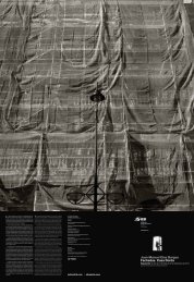
1. Ciudades líquidas. <strong>Madrid</strong> y Transurbancia de Tete Álvarez<br />
Foto: Tete Álvarez<br />
3. Ciudades líquidas. <strong>Madrid</strong> de Tete Álvarez<br />
Foto: Marta Orozco<br />
2. Transurbancia de Tete Álvarez<br />
Foto: Marta Orozco<br />
4. Ciudades líquidas. <strong>Madrid</strong> de Tete Álvarez<br />
Foto: Marta Orozco
¿Para qué un mapa<br />
Pablo Jarauta<br />
I. Todo empezó el día <strong>en</strong> que un hombre decidió<br />
observar los alrededores. Empeñado <strong>en</strong> reconocer<br />
su <strong>en</strong>torno más inmediato, este observador<br />
antediluviano escogió un punto elevado y com<strong>en</strong>zó<br />
a girar sobre sí mismo. En primer lugar,<br />
divisó los cobertizos de su aldea. Luego, el huerto,<br />
con sus hortalizas y sus <strong>en</strong>debles frutales.<br />
Más allá, pudo ver el río, y un poco más lejos, las<br />
robustas cabezas del ganado. Siguió el observador<br />
con los ojos bi<strong>en</strong> abiertos hasta que topó<br />
con una gran montaña. Cegado por esta impon<strong>en</strong>te<br />
imag<strong>en</strong>, decidió dar el día por terminado.<br />
A la mañana sigui<strong>en</strong>te, el observador regresó al<br />
punto elevado y reinició el exam<strong>en</strong> visual de sus<br />
alrededores. Primero, contempló a los niños de<br />
la aldea corri<strong>en</strong>do desbocados tras un conejo.<br />
Después, una charca plagada de ranas. Se abrió<br />
<strong>en</strong>tonces ante sus ojos una llanura que no t<strong>en</strong>ía<br />
fin. El observador se sorpr<strong>en</strong>dió: una delgada<br />
línea unía el cielo con la tierra, impidiéndole<br />
ver más allá. Había dado con el horizonte. Extrañado,<br />
regresó a la aldea, <strong>en</strong>c<strong>en</strong>dió un fuego<br />
y reflexionó durante horas. Había id<strong>en</strong>tificado<br />
todos los elem<strong>en</strong>tos de su <strong>en</strong>torno, pero aquella<br />
reverberada línea le ocultaba las cosas más lejanas.<br />
El observador había <strong>en</strong>contrado el límite de<br />
su visión: al igual que una montaña, el horizonte<br />
también velaba su mirada.<br />
“El mapa ha <strong>en</strong>trado <strong>en</strong> la época de la sospecha, ha perdido su<br />
inoc<strong>en</strong>cia. Ya no podemos, hoy <strong>en</strong> día, contemplar una historia de la<br />
cartografía sin una dim<strong>en</strong>sión antropológica, at<strong>en</strong>ta a la especificidad<br />
de los contextos culturales, y teórica, que refleje la naturaleza misma<br />
del objeto, sus poderes intelectuales e imaginarios”<br />
(Christian Jacob, L’Empire des cartes,)<br />
En el int<strong>en</strong>to por formarse una imag<strong>en</strong> del mundo,<br />
el observador había descubierto que sus alrededores<br />
abundaban <strong>en</strong> misterios y <strong>en</strong>igmas,<br />
que existían límites y zonas incógnitas. Los<br />
elem<strong>en</strong>tos de su <strong>en</strong>torno no bastaban para repres<strong>en</strong>tar<br />
el mundo <strong>en</strong> el que vivía, hacían falta<br />
nuevos lugares regidos por nuevas lógicas. De<br />
tal modo, el observador decidió que si bi<strong>en</strong> no<br />
podía ver más allá del horizonte, sí que podía<br />
nombrarlo. Regresó nuevam<strong>en</strong>te al punto elevado<br />
y de fr<strong>en</strong>te a la llanura fue señalando con el<br />
14 Mapping <strong>Madrid</strong> · <strong>IED</strong> <strong>Madrid</strong> & PHE09<br />
15
dedo difer<strong>en</strong>tes puntos <strong>en</strong> el horizonte, asignando<br />
un nombre a cada uno de ellos. Estos nombres<br />
señalaban lugares que no existían pero que<br />
explicaban el <strong>en</strong>torno del observador: paraísos,<br />
avernos, islas, dioses, monstruos, abismos... que<br />
daban cu<strong>en</strong>ta del curso de los ríos, de los ciclos<br />
del día y la noche, de la relación con la naturaleza,<br />
del orig<strong>en</strong> y el destino. El observador había<br />
completado su imag<strong>en</strong> del mundo: a los elem<strong>en</strong>tos<br />
de su <strong>en</strong>torno había sumado una interminable<br />
lista de nombres, de lugares inexist<strong>en</strong>tes<br />
que terminaron por configurar sus cre<strong>en</strong>cias,<br />
sus costumbres, su relación con el mundo.<br />
II. Esta pequeña historia sobre cómo un observador<br />
cualquiera construyó su mapa del mundo<br />
esconde un esquema que podría sernos de<br />
gran utilidad a la hora de compr<strong>en</strong>der el papel<br />
que juegan las producciones cartográficas hoy<br />
<strong>en</strong> día. Se trata de un esquema muy simple que<br />
ha estado pres<strong>en</strong>te a lo largo de toda la historia<br />
de la cartografía y que ati<strong>en</strong>de al hecho<br />
de habitar una esfera y a la imposibilidad de<br />
una imag<strong>en</strong> total y directa de nuestro mundo.<br />
Ciertam<strong>en</strong>te, el hecho de habitar una superficie<br />
curva privó a nuestro observador de una<br />
imag<strong>en</strong> de su mundo, esférico e inapr<strong>en</strong>sible.<br />
Para salvar esta dificultad y ante la necesidad<br />
de una imag<strong>en</strong> total que explicara el funcionami<strong>en</strong>to<br />
de su <strong>en</strong>torno y, <strong>en</strong> definitiva, de todo<br />
el universo, el observador tuvo que construir<br />
la imag<strong>en</strong> que quedaba más allá del horizonte,<br />
la primera frontera. Observar los alrededores,<br />
construir el afuera: he ahí el fundam<strong>en</strong>to de<br />
todo mapa, sus <strong>en</strong>trañas, su razón última.<br />
III. Podría decirse que la tarea de repres<strong>en</strong>tar el<br />
espacio es tan antigua como la de imaginarlo. En<br />
otras palabras, los mapas son tan antiguos como<br />
las utopías. El primer hombre que trazó un dibujo<br />
de su aldea ya t<strong>en</strong>ía utopías: <strong>en</strong> su cabeza dormían<br />
despiertos incontables nombres que señalaban<br />
la exist<strong>en</strong>cia de lugares imaginarios. Mi<strong>en</strong>tras<br />
dibujaba frágiles diagramas de las murallas<br />
de su ciudad, de sus ríos y sus campos, el mundo<br />
se ll<strong>en</strong>ó de nombres que anunciaban por doquier<br />
lugares de luces y sombras. Estos nombres no<br />
tardaron <strong>en</strong> saltar del l<strong>en</strong>guaje al mapa, pues se<br />
habían consolidado como piezas fundam<strong>en</strong>tales<br />
<strong>en</strong> el proceso de la elaboración de una imago<br />
mundi. Las utopías, esa construcción del afuera<br />
cartográfico, forman parte del mundo tanto como<br />
la tierra y el mar. Recordemos brevem<strong>en</strong>te lo que<br />
de la Atlántida nos cu<strong>en</strong>ta Platón: “Hubo terribles<br />
temblores de tierra y cataclismos. Durante un día<br />
y una noche horribles, todo nuestro ejército fue<br />
tragado de golpe por la Tierra, y del mismo modo<br />
la Atlántida se abismó <strong>en</strong> el mar y desapareció.<br />
He ahí por qué todavía hoy ese mar de allí es difícil<br />
e inexplorable, debido a sus fondos limosos y<br />
muy bajos que la isla, al hundirse, ha dejado” (Timeo<br />
24c-25a). Las utopías construy<strong>en</strong> el mundo,<br />
se hund<strong>en</strong> dejando fondos limosos, huella geológica<br />
de un lugar inexist<strong>en</strong>te.<br />
“Observar los alrededores,<br />
construir el afuera: he ahí<br />
el fundam<strong>en</strong>to de todo<br />
mapa, sus <strong>en</strong>trañas,<br />
su razón última”<br />
IV. En este s<strong>en</strong>tido, la construcción del afuera<br />
transforma por completo la naturaleza de<br />
la producción cartográfica. En este esquema<br />
o proceso los instrum<strong>en</strong>tos necesarios para el<br />
establecimi<strong>en</strong>to de una imag<strong>en</strong> del mundo no<br />
coincid<strong>en</strong> con los utilizados <strong>en</strong> la repres<strong>en</strong>tación<br />
de nuestro <strong>en</strong>torno. La escala, los cálculos,<br />
el cartabón o el cuadrante quedan <strong>en</strong>sombreci-<br />
dos por meros nombres de lugares inexist<strong>en</strong>tes,<br />
por mares sin orillas, por objetos y seres<br />
prodigiosos… incluso por una proyección de<br />
nosotros mismos. Estos elem<strong>en</strong>tos tan propios<br />
de la utopía como de la cartografía hac<strong>en</strong> del<br />
mapa un proyecto sobre el mundo. No se trata<br />
ya de repres<strong>en</strong>tar fielm<strong>en</strong>te un territorio, sino<br />
de cómo queremos que sea. En el mapa se citan<br />
ci<strong>en</strong>cia y literatura, observación e imaginación,<br />
se dan por igual distintos procedimi<strong>en</strong>tos<br />
que lo <strong>en</strong>caminan hacia una voluntad de completar<br />
el gran mosaico del mundo, de compr<strong>en</strong>der<br />
nuestras formas de vida, de apr<strong>en</strong>der a relacionarnos<br />
con la alteridad a partir de nuestro<br />
<strong>en</strong>torno. En un mapa la repres<strong>en</strong>tación se torna<br />
proyecto, va más allá del objeto y se sumerge<br />
<strong>en</strong> la inm<strong>en</strong>sidad de la superficie terrestre, <strong>en</strong><br />
la curva sin fin del horizonte, <strong>en</strong> lo inagotable<br />
de nuestros sueños. Recordando de nuevo las<br />
palabras de C. Jacob, la condición necesaria<br />
para el nacimi<strong>en</strong>to de la cartografía no es tanto<br />
la convicción de su materialidad, sino la convicción<br />
de la posibilidad de su materialización.<br />
Los mapas nacieron como proyecto, nacieron<br />
como el lugar natural de las utopías, pues éstas<br />
solam<strong>en</strong>te exist<strong>en</strong> <strong>en</strong> su repres<strong>en</strong>tación.<br />
V. Ahora bi<strong>en</strong>, podríamos p<strong>en</strong>sar que actualm<strong>en</strong>te<br />
estas historias han quedado desfasadas<br />
por una pret<strong>en</strong>sión cartográfica <strong>en</strong>caminada<br />
hacia la objetividad, la precisión o la neutralidad,<br />
que ya no queda sitio <strong>en</strong> este mundo para<br />
las utopías, pues no hay rincón de la Tierra que<br />
no haya sido descubierto, clasificado o explotado.<br />
Vivimos <strong>en</strong> un mundo conocido, hemos<br />
dispuesto <strong>en</strong> el cielo ojos electrónicos que escrutan<br />
el territorio, que nos localizan, que hac<strong>en</strong><br />
de la repres<strong>en</strong>tación del mundo un asunto<br />
aséptico, casi funcional. Ahora que lo conocemos<br />
todo, que podemos viajar rápida y cómodam<strong>en</strong>te<br />
por todo el orbe, podría parecer que<br />
los mapas han perdido su compon<strong>en</strong>te utópico<br />
<strong>en</strong>tregándose <strong>en</strong>teram<strong>en</strong>te a una lógica de la<br />
objetividad, que los mapas solo sirv<strong>en</strong> para<br />
ori<strong>en</strong>tarnos, para desplazarnos sin riesgos de<br />
un lugar a otro, para <strong>en</strong>contrar una calle, una<br />
ti<strong>en</strong>da o un hospital.<br />
“Los mapas son un reflejo<br />
de la cultura que los ha<br />
realizado, <strong>en</strong> ellos pued<strong>en</strong><br />
<strong>en</strong>contrarse, aunque sea<br />
<strong>en</strong> los espacios <strong>en</strong> blanco,<br />
<strong>en</strong> sus sil<strong>en</strong>cios, los<br />
difer<strong>en</strong>tes proyectos de<br />
cada época”<br />
Sin embargo, es precisam<strong>en</strong>te este exceso de<br />
precisión y objetividad de nuestros días el que<br />
nos exige un retorno a los inicios de la cartografía,<br />
a nuestro observador, a los tiempos <strong>en</strong><br />
los que poco o nada se conocía, al mom<strong>en</strong>to<br />
utópico de la construcción del mundo. Como<br />
señalara <strong>en</strong> su día John B. Harley, la cartografía<br />
raras veces es lo que los cartógrafos dic<strong>en</strong><br />
que es. Los mapas no son objetivos, precisos<br />
o neutrales, escond<strong>en</strong> poderes intelectuales e<br />
imaginarios que los sitúan como una valiosa<br />
producción cultural. Los mapas son un reflejo<br />
de la cultura que los ha realizado, <strong>en</strong> ellos pued<strong>en</strong><br />
<strong>en</strong>contrarse, aunque sea <strong>en</strong> los espacios <strong>en</strong><br />
blanco, <strong>en</strong> sus sil<strong>en</strong>cios, los difer<strong>en</strong>tes proyectos<br />
de cada época. Hoy <strong>en</strong> día nos vemos ante<br />
la imperiosa necesidad de crear nuevos proyectos<br />
sobre el mundo, nuevas repres<strong>en</strong>taciones<br />
que d<strong>en</strong> cu<strong>en</strong>ta de las fracturas exist<strong>en</strong>tes<br />
<strong>en</strong> este mundo pret<strong>en</strong>didam<strong>en</strong>te homogéneo.<br />
En esta dirección, los mapas seguirán si<strong>en</strong>do<br />
el mejor lugar para nuestras utopías.<br />
16 Mapping <strong>Madrid</strong> · <strong>IED</strong> <strong>Madrid</strong> & PHE09<br />
Mapping <strong>Madrid</strong> · <strong>IED</strong> <strong>Madrid</strong> & PHE09 17
Why a Map<br />
Pablo Jarauta<br />
I. It all began the day man decided to observe<br />
his surroundings. Determined to recognise his<br />
most immediate <strong>en</strong>vironm<strong>en</strong>t, this antediluvian<br />
observer chose an elevated place and began to<br />
turn around. Initially, he saw the huts in his village.<br />
Th<strong>en</strong> he saw the vegetable plot, with its<br />
feeble fruit trees. In the distance he could see the<br />
river, and, a bit further, the robust heads of cattle.<br />
The observer kept his eyes op<strong>en</strong> and continued<br />
to look into the far-off distance, where he could<br />
see a huge mountain. Unable to see beyond this<br />
overwhelming view, he decided to stop for the<br />
day. On the next morning, the observer returned<br />
to the elevated spot and continued to examine<br />
his surroundings. First, he contemplated the<br />
childr<strong>en</strong> in the village, running excitedly after a<br />
rabbit. Next, he noticed a pond full of frogs, and<br />
it was at this point that an <strong>en</strong>dless plain op<strong>en</strong>ed<br />
up before his eyes. The observer was surprised:<br />
a thin line connected the sky and the earth, making<br />
it impossible for him to see beyond it. He<br />
had found the horizon. Puzzled, he returned to<br />
the village, lit a fire, and thought about it for<br />
hours. He had id<strong>en</strong>tified all of the elem<strong>en</strong>ts in<br />
his surroundings, but that shimmering line concealed<br />
the most distant things. The observer<br />
had found the limits of his vision: like a mountain,<br />
the horizon veiled his gaze.<br />
“The map has <strong>en</strong>tered a phase of suspicion; it has lost its innoc<strong>en</strong>ce.<br />
Today, we can no longer contemplate a history of cartography without<br />
taking into account its anthropological dim<strong>en</strong>sion, subject to its<br />
specific cultural contexts, and its theoretical dim<strong>en</strong>sion, which reflects<br />
the nature of the object itself, its intellectual and imaginary powers”<br />
(Christian Jacob, L’Empire des cartes)<br />
In his attempt to build an image of the world, the<br />
observer had discovered that his surroundings<br />
were full of mysteries and <strong>en</strong>igmas, that there<br />
were limits and unknown areas. The elem<strong>en</strong>ts<br />
around him were not <strong>en</strong>ough to repres<strong>en</strong>t the<br />
world in which he lived; it was necessary to<br />
find new places ruled by new propositions. So<br />
the observer decided that, whilst he could not<br />
see beyond the horizon, he could at least name<br />
it. He returned to the elevated place and, fac-<br />
18 Mapping <strong>Madrid</strong> · <strong>IED</strong> <strong>Madrid</strong> & PHE09<br />
19
ing the plain, he pointed his finger at differ<strong>en</strong>t<br />
parts of the horizon, giving each a name. These<br />
names referred to places that did not exist but<br />
which explained the observer’s surroundings:<br />
paradises, underworlds, islands, gods, monsters,<br />
abysses..., all of which revealed the course<br />
of the rivers, the day and night cycle, the relationship<br />
with nature, and its origin and destiny.<br />
The observer had completed his picture of the<br />
world: to each elem<strong>en</strong>t of his surroundings he<br />
had attached an <strong>en</strong>dless list of names, of nonexist<strong>en</strong>t<br />
places which ev<strong>en</strong>tually defined his<br />
beliefs, his customs and his relationship with<br />
the world.<br />
II. This tale, about how a random observer built<br />
his own map of the world, conceals a pattern<br />
that could be very useful to us in our attempt<br />
to understand the role played by cartographic<br />
productions today. It is a very simple pattern<br />
which has existed since the early days of cartography,<br />
and which is connected to the fact<br />
of inhabiting a sphere, and the impossibility<br />
of obtaining a total and direct view of our<br />
world. Undoubtedly, the fact that our observer<br />
lived on a curved surface prev<strong>en</strong>ted him from<br />
obtaining a complete view of his world; its<br />
spherical nature made it impossible to grasp.<br />
To overcome this difficulty, and, in the face of<br />
a need for a total view which could explain the<br />
workings of his surroundings, of the universe,<br />
ultimately, the observer had to build the image<br />
which lay beyond the horizon, the first frontier.<br />
To observe his surroundings, to build the outside<br />
world: here lie the foundations of any map,<br />
its core, its ultimate raison d’être.<br />
III. It could be said that the task of repres<strong>en</strong>ting<br />
space is as old as the task of imagining<br />
it. In other words, maps are as old as Utopias.<br />
The first man to draw his village was displaying<br />
Utopian behaviour: in his mind countless<br />
names that pointed at the exist<strong>en</strong>ce of imaginary<br />
places lay in slumber. As he drew fragile<br />
diagrams of his village’s walls, of its rivers and<br />
fields, the world was filled with names which<br />
heralded places of light and shadow. These<br />
names soon w<strong>en</strong>t beyond language to the map,<br />
becoming ess<strong>en</strong>tial pieces in the creation of<br />
an imago mundi. Utopia, that building of the<br />
cartographic outside, is as much a part of the<br />
earth as the land and the sea. Let us briefly remember<br />
what Plato told us about Atlantis: “But<br />
afterwards there occurred viol<strong>en</strong>t earthquakes<br />
and floods; and in a single day and night of<br />
misfortune all your warlike m<strong>en</strong> in a body sank<br />
into the earth, and the island of Atlantis in like<br />
manner disappeared in the depths of the sea.<br />
For which reason the sea in those parts is impassable<br />
and imp<strong>en</strong>etrable, because there is a<br />
shoal of mud in the way; and this was caused<br />
by the subsid<strong>en</strong>ce of the island” (Timaeus 24c-<br />
25a). The world is built on Utopias, which sink,<br />
leaving limestone beds, the geological trace of<br />
an inexist<strong>en</strong>t place.<br />
“To observe his<br />
surroundings, to build<br />
the outsider world: here<br />
lie the foundations of<br />
any map, its core, its<br />
ultimate raison d’être”<br />
IV. In this s<strong>en</strong>se, the building of the outside<br />
completely transforms the nature of cartographical<br />
production. In this pattern of pro-<br />
cess, the instrum<strong>en</strong>ts needed for the creation of<br />
a view of the world do not coincide with those<br />
used to repres<strong>en</strong>t our surroundings. The scale,<br />
the calculations, the triangle and the quadrant<br />
are overshadowed by names of inexist<strong>en</strong>t<br />
places, by shoreless seas, by prodigious beings<br />
and objects … ev<strong>en</strong> by a projection of ourselves.<br />
These elem<strong>en</strong>ts, as repres<strong>en</strong>tative of Utopia<br />
as of cartography, r<strong>en</strong>der the map a project on<br />
the world. It is no longer a case of faithfully<br />
repres<strong>en</strong>ting a territory, but of thinking about<br />
what we want it be like. In the map, sci<strong>en</strong>ce and<br />
literature, observation and imagination, come<br />
together; it pools together a range of procedures<br />
that lead it toward a desire to complete<br />
the great mosaic of the world, of understanding<br />
our forms of life, of learning how to relate with<br />
the otherness of our surroundings. In a map,<br />
repres<strong>en</strong>tation turns into project; it goes beyond<br />
the object and sinks into the imm<strong>en</strong>sity of<br />
the surface of the earth, into the <strong>en</strong>dless curve<br />
of the horizon, into our inexhaustible dreams.<br />
Returning again to the words of C. Jacob, the<br />
necessary condition for the birth of cartography<br />
was not so much the certainty of its materiality,<br />
but the certainty of the possibility of its<br />
materialisation. Maps emerged as a project, as<br />
the natural place for Utopias, as these only exist<br />
in their repres<strong>en</strong>tation.<br />
V. We could think that, nowadays, these stories<br />
have be<strong>en</strong> r<strong>en</strong>dered obsolete by a cartographic<br />
desire which aims for objectivity, precision and<br />
neutrality; or that there is no space left for Utopias<br />
in this world, as there is no corner of the<br />
Earth which has not be<strong>en</strong> discovered, classified<br />
and exploited. We live in a known world; we<br />
have dotted the sky with electronic eyes that<br />
scrutinise the land, locating us, r<strong>en</strong>dering the<br />
repres<strong>en</strong>tation of the world an aseptic, almost<br />
functional, task. Now that we know everything,<br />
and that we can travel easily and comfortably<br />
all over the world, it would seem that maps<br />
have lost their Utopian compon<strong>en</strong>t, giving<br />
themselves over <strong>en</strong>tirely to a logic of objectivity;<br />
that maps only serve to show us the way, to<br />
furnish us with safe directions from one place<br />
to another, to find a street, a shop or a hospital.<br />
“Maps are the reflection<br />
of the culture which<br />
produces them, and<br />
show, ev<strong>en</strong> in their<br />
blank spaces, in their<br />
sil<strong>en</strong>ces, the various<br />
projects of each time”<br />
However, it is not precisely our time’s excess<br />
of precision and objectivity that demands a<br />
return to the early days of cartography, to our<br />
observer, to the time wh<strong>en</strong> little or nothing was<br />
known to the Utopian mom<strong>en</strong>t wh<strong>en</strong> the world<br />
was constructed. As John B. Harley pointed<br />
out, cartography is rarely what cartographers<br />
say it is. Maps are not precise and neutral objectives:<br />
they hide intellectual and imaginary<br />
powers which l<strong>en</strong>d them the status of valuable<br />
cultural products. Maps are the reflection of<br />
the culture which produces them, and show,<br />
ev<strong>en</strong> in their blank spaces, in their sil<strong>en</strong>ces, the<br />
various projects of each time. Today, we find<br />
ourselves facing a pressing need to create new<br />
projects about the world, new repres<strong>en</strong>tations<br />
which reflect the fractures of our supposedly<br />
homog<strong>en</strong>eous world. In this s<strong>en</strong>se, maps will<br />
continue to be the best place for our Utopias.<br />
20 Mapping <strong>Madrid</strong> · <strong>IED</strong> <strong>Madrid</strong> & PHE09<br />
Mapping <strong>Madrid</strong> · <strong>IED</strong> <strong>Madrid</strong> & PHE09 21
22 Mapping <strong>Madrid</strong> · <strong>IED</strong> <strong>Madrid</strong> & PHE09<br />
Mapping <strong>Madrid</strong> · <strong>IED</strong> <strong>Madrid</strong> & PHE09 23
1. Mala noche<br />
Zlat<strong>en</strong> del Castillo López<br />
3. Salida<br />
Carlos López Mariña<br />
2. VS<br />
Javier Ramos<br />
4. Entrada<br />
Carlos López Mariña
Cartografías de la realidad<br />
Mirada, fotografía y mapa<br />
Pedro Medina<br />
“El mapa es abierto, es conectable <strong>en</strong> todas sus dim<strong>en</strong>siones,<br />
desmontable, reversible, susceptible de recibir constantem<strong>en</strong>te<br />
modificaciones […] Haced mapas y no fotos ni dibujos”<br />
(Gilles Deleuze y Felix Guattari, Rizoma)<br />
Objetividad y repres<strong>en</strong>tación<br />
Realizar un mapa no ha sido históricam<strong>en</strong>te<br />
una tarea neutra, siempre conlleva una mirada.<br />
Todo mapa ha surgido como consecu<strong>en</strong>cia<br />
de una determinada ideología o bajo criterios<br />
con frecu<strong>en</strong>cia arbitrarios que condicionan<br />
las formas de repres<strong>en</strong>tar el mundo.<br />
En esta ocasión, el diseño de una cartografía<br />
se liga a un medio: la fotografía, tan subjetiva<br />
como cualquier otro l<strong>en</strong>guaje artístico, pero<br />
que popularm<strong>en</strong>te se id<strong>en</strong>tifica con un medio<br />
que docum<strong>en</strong>ta el mundo como mayor objetividad<br />
que otros. Al hacerlo, pronto surge la<br />
tradicional cuestión de fondo sobre la relación<br />
<strong>en</strong>tre objetividad y realidad.<br />
Estas consideraciones aún lastran diagnósticos<br />
sobre un l<strong>en</strong>guaje que era emerg<strong>en</strong>te,<br />
como aquellos maravillosos textos de Walter<br />
B<strong>en</strong>jamin <strong>en</strong> los que reflexionaba sobre cómo<br />
duplicar el mundo, retratándolo con mayor<br />
fidedignidad. B<strong>en</strong>jamin llegó a hablar de un<br />
“museo imaginario” basado <strong>en</strong> la afirmación<br />
de Godard a propósito de Le Carabiniers: “coleccionar<br />
fotografías es coleccionar el mundo”.<br />
Sin embargo, los nuevos comportami<strong>en</strong>tos<br />
artísticos han transformado esta función, pasando<br />
a reflejar irónicam<strong>en</strong>te el mundo o a<br />
constatar “la irrealidad de la realidad” –como<br />
afirmaba Kate Linker–. Obviam<strong>en</strong>te, estas nuevas<br />
prácticas <strong>en</strong>cu<strong>en</strong>tran cabida <strong>en</strong> evid<strong>en</strong>tes<br />
revisiones del problema de la repres<strong>en</strong>tación.<br />
Un muy breve balance de lo ocurrido desde el<br />
as<strong>en</strong>tami<strong>en</strong>to de la fotografía d<strong>en</strong>tro del sistema<br />
del arte a mediados de los och<strong>en</strong>ta, destaca<br />
principalm<strong>en</strong>te la reivindicación “artística” de<br />
la fotografía docum<strong>en</strong>tal y el as<strong>en</strong>timi<strong>en</strong>to<br />
de lo que podría d<strong>en</strong>ominarse “nuevos comportami<strong>en</strong>tos<br />
fotográficos”, proced<strong>en</strong>tes de<br />
prácticas artísticas alejadas del uso purista del<br />
medio <strong>en</strong> las vanguardias artísticas –como es<br />
el caso de Man Ray–, pero sobre todo <strong>en</strong> aquellas<br />
manifestaciones conceptuales de los años<br />
ses<strong>en</strong>ta, que suponían un paso más d<strong>en</strong>tro de<br />
esa polémica <strong>en</strong> torno al estatuto artístico de la<br />
fotografía lat<strong>en</strong>te prácticam<strong>en</strong>te desde sus oríg<strong>en</strong>es,<br />
debido a su carácter no aurático, derivado<br />
de su reproductibilidad, y de esa supuesta<br />
objetividad mayor que otros medios privilegiados<br />
todavía por cre<strong>en</strong>cias de tipo romántico.<br />
Su uso docum<strong>en</strong>tal para registrar obras de<br />
arte efímeras, junto con las expresiones<br />
conceptuales, transformó a la fotografía <strong>en</strong><br />
un medio para la experim<strong>en</strong>tación que daba<br />
lugar a nuevas formas y prácticas, así como<br />
a una reflexión sobre la misma fotografía y<br />
su rol respecto a la sociedad y el arte, convirtiéndose<br />
<strong>en</strong> el camino para alzar la idea a<br />
la categoría de objeto, al tiempo que el lugar<br />
idóneo para prácticas esc<strong>en</strong>ográficas nuevas,<br />
aunque su principal papel seguía si<strong>en</strong>do<br />
como medio.<br />
Pero dejando de lado la relevante aparición<br />
de una “nueva forma artística”, que procede<br />
de la crisis de los géneros artísticos tradicionales,<br />
y que <strong>en</strong>cu<strong>en</strong>tra precisam<strong>en</strong>te <strong>en</strong> la<br />
fotografía un campo idóneo para desarrollar<br />
las pot<strong>en</strong>cialidades icónicas de la imag<strong>en</strong>, <strong>en</strong><br />
el contexto de esta exposición se privilegia<br />
su dim<strong>en</strong>sión como docum<strong>en</strong>to o archivo de<br />
la realidad.<br />
La propuesta de Mapping <strong>Madrid</strong> <strong>en</strong>lazaría<br />
con posturas que fom<strong>en</strong>tan la procesualidad<br />
misma, como f<strong>en</strong>óm<strong>en</strong>o de repres<strong>en</strong>tación<br />
y como constancia de aquellas manifesta-<br />
26 Mapping <strong>Madrid</strong> · <strong>IED</strong> <strong>Madrid</strong> & PHE09<br />
Mapping <strong>Madrid</strong> · <strong>IED</strong> <strong>Madrid</strong> & PHE09 27
ciones de carácter temporal cond<strong>en</strong>adas a<br />
desaparecer o que se concib<strong>en</strong> precisam<strong>en</strong>te<br />
<strong>en</strong> su estar in progress. Es, pues, el l<strong>en</strong>guaje<br />
fundam<strong>en</strong>tal y el instrum<strong>en</strong>to que constata<br />
lo ocurrido.<br />
A la consustancial reproducción mecánica<br />
implícita <strong>en</strong> el propio concepto de fotografía,<br />
lo que facilita la recepción masiva de la<br />
obra y la democratización de su producción,<br />
ahora aparece la posibilidad de la utilización<br />
de nuevos medios, más proclives a la interacción<br />
y la creación de piezas colectivas, donde<br />
la participación se vuelve algo natural <strong>en</strong> esa<br />
transformación del espectador <strong>en</strong> usuario, lo<br />
que aporta un <strong>en</strong>riquecedor poliperspectivismo.<br />
De esta forma, esa característica de imag<strong>en</strong><br />
multiplicable adquiere ahora una dim<strong>en</strong>sión<br />
mayor, al mismo tiempo que se pot<strong>en</strong>cia<br />
una relación de pert<strong>en</strong><strong>en</strong>cia con la obra que<br />
ti<strong>en</strong>e más que ver con la colaboración <strong>en</strong> el<br />
proceso y la emoción activada <strong>en</strong> el mismo<br />
que con la posesión física de la obra.<br />
Por otro lado, nos <strong>en</strong>contramos con el mapa<br />
como un formato que también se percibe<br />
ing<strong>en</strong>uam<strong>en</strong>te como algo objetivo, pero que<br />
–como aparece al inicio de este texto y sobre<br />
todo <strong>en</strong> ¿Para qué un mapa de Pablo Jarauta–<br />
convi<strong>en</strong>e observar como otro medio más<br />
para contar una historia y hacer evid<strong>en</strong>tes<br />
formas de ver el mundo.<br />
Al marg<strong>en</strong> del relato construido por Pablo<br />
Jarauta, quisiera aportar un par de notas,<br />
sobre todo para establecer su relación con<br />
el ámbito de la ciudad, un contexto <strong>en</strong> el<br />
que se g<strong>en</strong>eran relaciones y donde se acumulan<br />
formas de habitar, pero que indudablem<strong>en</strong>te<br />
hoy debe ampliarse más allá del<br />
propio espacio físico. Ante este hecho, cabe<br />
preguntarse ¿cómo repres<strong>en</strong>tar <strong>en</strong>tonces<br />
esta realidad<br />
“Realizar un mapa no<br />
ha sido históricam<strong>en</strong>te<br />
una tarea neutra,<br />
siempre conlleva una<br />
mirada. Todo mapa<br />
ha surgido como<br />
consecu<strong>en</strong>cia de una<br />
determinada ideología<br />
o bajo criterios con<br />
frecu<strong>en</strong>cia arbitrarios<br />
que condicionan las<br />
formas de repres<strong>en</strong>tar<br />
el mundo”<br />
Jean Baudrillard parte precisam<strong>en</strong>te de<br />
la cartografía como paradigma de una refer<strong>en</strong>cialidad<br />
perdida, llegando incluso a<br />
afirmar <strong>en</strong> Cultura y simulacro que “el territorio<br />
ya no precede al mapa ni le sobrevive.<br />
En adelante será el mapa el que preceda al<br />
territorio –precisión de los simulacros– y el<br />
que lo <strong>en</strong>g<strong>en</strong>dre”.<br />
Al respecto, convi<strong>en</strong>e recordar las matizaciones<br />
que realizaba André Corboz <strong>en</strong> El territorio<br />
como palimpsesto, al comparar dos<br />
maneras de relacionarse con el territorio (la<br />
contemplación del paisaje y el mapa): “El<br />
mapa se difer<strong>en</strong>cia del territorio precisam<strong>en</strong>te<br />
a través de actos de selección. Como práctica<br />
creativa el mapa no reproduce sino que<br />
descubre realidades previam<strong>en</strong>te invisibles<br />
o inimaginables […] La construcción de los<br />
mapas desata pot<strong>en</strong>cialidades, rehace el territorio<br />
una y otra vez, cada vez con nuevas y<br />
difer<strong>en</strong>tes consecu<strong>en</strong>cias”.<br />
¿Y cómo se produce esto hoy día Quizás con<br />
los nuevos medios se pueda dar esa feliz coincid<strong>en</strong>cia<br />
de mapa e imperio –diría Borges<br />
<strong>en</strong> el famoso relato sobre el Arte de la Cartografía–,<br />
de georrepres<strong>en</strong>tación y cosmovisión<br />
podríamos decir nosotros.<br />
Esta situación debería llevarnos a un posicionami<strong>en</strong>to<br />
que impida que sucumbamos a la<br />
fascinación por la forma expresiva, estableci<strong>en</strong>do<br />
un mínimo análisis sobre el mundo <strong>en</strong><br />
el que vivimos para preguntarnos ¿por qué<br />
acudimos a este tipo de repres<strong>en</strong>tación, ¿es<br />
pertin<strong>en</strong>te para poder hablar sobre la experi<strong>en</strong>cia<br />
de nuestra época Parece coher<strong>en</strong>te<br />
con los tiempos que corr<strong>en</strong> alejarse de posturas<br />
que adopt<strong>en</strong> el autoritarismo que profesa<br />
qui<strong>en</strong> cree <strong>en</strong> una verdad y p<strong>en</strong>sar más bi<strong>en</strong><br />
<strong>en</strong> un mundo lábil, donde todo se vuelve posibilidad<br />
y no necesidad.<br />
A pie de calle, <strong>en</strong>seguida aparec<strong>en</strong> términos<br />
coincid<strong>en</strong>tes como “global, tecnificado, acelerado,<br />
injusto, <strong>en</strong> el que nada permanece, sin<br />
valores…”, aunque se puede resumir como un<br />
mundo marcado por la comunicación planetaria,<br />
más que sin valores, <strong>en</strong> construcción<br />
hacia otros nuevos (sost<strong>en</strong>ibilidad, igualdad<br />
de géneros y razas…) y, sobre todo, un mundo<br />
que ha dev<strong>en</strong>ido moda, es decir, donde ni<br />
convicciones, ni instituciones, ni productos<br />
están dados de una vez para siempre, si<strong>en</strong>do<br />
el reino de lo efímero.<br />
Este primer acercami<strong>en</strong>to al universo que nos<br />
rodea no ti<strong>en</strong>e valor de prueba, por no ser una<br />
muestra sufici<strong>en</strong>tem<strong>en</strong>te contrastada, no obstante,<br />
sí parece coincidir con bu<strong>en</strong>a parte de<br />
reconocidos diagnósticos de nuestra época.<br />
Remontándonos un poco <strong>en</strong> el tiempo, podríamos<br />
hablar de la s<strong>en</strong>t<strong>en</strong>cia de Nietzsche<br />
<strong>en</strong> su paradigmático Der Fall Wagner, donde<br />
toda décad<strong>en</strong>ce literaria está caracterizada<br />
por una condición: “la vida ya no habita <strong>en</strong> el<br />
todo”. Extraemos de Nietzsche y de todos sus<br />
epígonos que la realidad se vuelve fragm<strong>en</strong>taria,<br />
constatando que no hay un valor c<strong>en</strong>tral<br />
<strong>en</strong> la época que le dé s<strong>en</strong>tido, como ocurría,<br />
por ejemplo, <strong>en</strong> la Edad Media, donde el dios<br />
cristiano era medida de todas las cosas y el<br />
gótico o el románico eran las formas que hacían<br />
visible una relación homogénea y unívoca<br />
con el mundo.<br />
“La propuesta de<br />
Mapping <strong>Madrid</strong><br />
<strong>en</strong>lazaría con posturas<br />
que fom<strong>en</strong>tan la<br />
procesualidad misma,<br />
como f<strong>en</strong>óm<strong>en</strong>o<br />
de repres<strong>en</strong>tación y<br />
como constancia de<br />
aquellas manifestaciones<br />
de carácter temporal<br />
cond<strong>en</strong>adas a<br />
desaparecer”<br />
Por otro lado, parti<strong>en</strong>do del análisis de la ciudad<br />
como la gran forma de rastrear la vida<br />
–<strong>en</strong> la línea de Georg Simmel–, destaca un<br />
autor como Marshall Berman, qui<strong>en</strong> constata<br />
que “todo lo sólido se desvanece <strong>en</strong> el aire”;<br />
por tanto, no hay certezas ni puntos de refe-<br />
28 Mapping <strong>Madrid</strong> · <strong>IED</strong> <strong>Madrid</strong> & PHE09<br />
Mapping <strong>Madrid</strong> · <strong>IED</strong> <strong>Madrid</strong> & PHE09 29
<strong>en</strong>cia a los que poder aferrarnos con seguridad.<br />
La vida así ha ganado <strong>en</strong> incertidumbre,<br />
pero también <strong>en</strong> posibilidad.<br />
“Hay que des<strong>en</strong>trañar<br />
una maraña confusa<br />
de hechos cuya<br />
complejidad creci<strong>en</strong>te<br />
reclama diversos relatos<br />
que hagan visibles las<br />
rápidas metamorfosis<br />
de nuestro tiempo”<br />
Pero para no ext<strong>en</strong>dernos <strong>en</strong> este punto, concluiré<br />
con la s<strong>en</strong>t<strong>en</strong>cia de Zygmunt Bauman,<br />
qui<strong>en</strong> ha <strong>en</strong>unciado, con extraordinaria fortuna<br />
mediática, que habitamos <strong>en</strong> un mundo<br />
caracterizado por una “modernidad líquida”.<br />
A través de varios textos ha definido el espacio<br />
actual como una “sociedad de la incertidumbre”,<br />
donde todo es “líquido”, inconsist<strong>en</strong>te,<br />
evanesc<strong>en</strong>te, no hay tiempo ya para<br />
que unas condiciones de vida y de acción<br />
llegu<strong>en</strong> a convertirse <strong>en</strong> costumbre, si<strong>en</strong>do<br />
la precariedad el signo de nuestro tiempo.<br />
Y ante esta realidad, Bauman aboga por un<br />
espacio público global, donde se realice un<br />
análisis g<strong>en</strong>eral de los problemas a escala<br />
mundial y donde se haga pres<strong>en</strong>te una responsabilidad<br />
planetaria.<br />
La reconstrucción de esta historia permite<br />
rep<strong>en</strong>sar algunos conceptos y uno que se<br />
vuelve necesario <strong>en</strong> este contexto es el de<br />
“habitar”, <strong>en</strong>t<strong>en</strong>di<strong>en</strong>do por el mismo las condiciones<br />
<strong>en</strong> las que se desarrolla la vida cotidiana<br />
y la acción colectiva construida simultáneam<strong>en</strong>te<br />
por distintos ciudadanos. Ya no<br />
es posible un habitar armonioso, pero quizás<br />
<strong>en</strong> la conflu<strong>en</strong>cia de puntos de vista se pueda<br />
<strong>en</strong>contrar un nuevo atractivo <strong>en</strong> el mundo<br />
gracias a la curiosidad.<br />
Éste es el panorama y, por tanto, habrá que<br />
at<strong>en</strong>der al sistema de formas que determinan<br />
el proyecto para averiguar el conjunto de<br />
ideas al que atañ<strong>en</strong>, estudiando si l<strong>en</strong>guaje y<br />
época se correspond<strong>en</strong> al ofrecer aquello que<br />
debería ser su última finalidad: proporcionar<br />
un espacio que habitar.<br />
De vuelta una vez más sobre el l<strong>en</strong>guaje, podríamos<br />
acudir a un término que reci<strong>en</strong>tem<strong>en</strong>te<br />
utilizó Juan A. Álvarez Reyes para una<br />
exposición sobre animación contemporánea.<br />
Se trata de “fantasmagoría”, que no solo es<br />
el título de la primera pieza de animación<br />
de la historia del cine, realizada <strong>en</strong> 1908 por<br />
Emil Cohl, probablem<strong>en</strong>te inspirado por el<br />
fantasmagore Éti<strong>en</strong>ne Gaspar Robertson. La<br />
ilusión óptica avanzaba como espectáculo <strong>en</strong><br />
un París cuyo orig<strong>en</strong> moderno describió B<strong>en</strong>jamin<br />
a través de las suger<strong>en</strong>tes luces de la<br />
metrópoli, sus pasajes, los flâneurs, la pr<strong>en</strong>sa,<br />
la aparición de la fotografía… es decir, “fantasmagorías”<br />
–como las d<strong>en</strong>ominó B<strong>en</strong>jamin–<br />
que servían para sintetizar los imaginarios de<br />
la segunda mitad del siglo xix.<br />
Igual que <strong>en</strong>tonces, ahora hay que des<strong>en</strong>trañar<br />
una maraña confusa de hechos cuya complejidad<br />
creci<strong>en</strong>te reclama diversos relatos<br />
que hagan visibles las rápidas metamorfosis<br />
de nuestro tiempo. De esta forma, podríamos<br />
considerar la imag<strong>en</strong> (fotográfica) definida<br />
no por su perman<strong>en</strong>cia sino por su condición<br />
de elem<strong>en</strong>to <strong>en</strong> continua transformación, t<strong>en</strong>i<strong>en</strong>do<br />
muy <strong>en</strong> cu<strong>en</strong>ta la superposición de<br />
planos y miradas, para preguntarnos si de<br />
esta forma es capaz de configurar un paisaje<br />
difer<strong>en</strong>te de nuestro <strong>en</strong>torno.<br />
Mapping <strong>Madrid</strong><br />
¿Qué significa, pues, repres<strong>en</strong>tar hoy el<br />
mundo Mapping <strong>Madrid</strong> se concibió con<br />
la int<strong>en</strong>ción de crear una nueva manera de<br />
g<strong>en</strong>erar un mapa, donde lo participativo se<br />
alza sobre lo impuesto como supuestam<strong>en</strong>te<br />
objetivo, <strong>en</strong>t<strong>en</strong>di<strong>en</strong>do la fotografía como<br />
un medio privilegiado y democrático para<br />
acercarnos a nuestra realidad. Además, cobra<br />
también relevancia cierta idea de deriva,<br />
como concepto de transición <strong>en</strong>tre la geografía<br />
física de la urbe y una topología interior<br />
e intersubjetiva, con el fin de hacer posibles<br />
nuevos espacios creativos.<br />
La idea original y desarrollo se debe a Javier<br />
Maseda, qui<strong>en</strong> propuso un proyecto que<br />
consistía <strong>en</strong> construir el mapa de PHotoEspaña y<br />
de <strong>Madrid</strong> a través de la colaboración ciudadana<br />
<strong>en</strong> una web bajo el lema “Danos tu visión de<br />
PHotoEspaña 2009”, reflexionando así sobre<br />
el ev<strong>en</strong>to y la ciudad que acog<strong>en</strong> la exposición.<br />
De esta forma, <strong>en</strong> www.mappingmadrid.com,<br />
web desarrollada por Blogestudio, se empieza<br />
a construir un esc<strong>en</strong>ario colectivo e in progress<br />
con las imág<strong>en</strong>es tomadas por cualquier<br />
persona, debi<strong>en</strong>do estar todas geolocalizadas,<br />
es decir, el usuario que participa <strong>en</strong> la web sube<br />
su fotografía y la dirección del lugar <strong>en</strong> el que<br />
ha sido tomada.<br />
El resultado es una cartografía visible online<br />
<strong>en</strong> la que se pued<strong>en</strong> apreciar distintos puntos<br />
de vista sobre un mismo espacio, convirti<strong>en</strong>do<br />
<strong>Madrid</strong> <strong>en</strong> un collage de imág<strong>en</strong>es y acciones.<br />
Pero lo principal es la relación <strong>en</strong>tre mirada<br />
y lugar fotografiado, construida a través<br />
de un proyecto que destaca por su carácter<br />
participativo y, por tanto, por una autoría que<br />
finalm<strong>en</strong>te es colectiva.<br />
El sigui<strong>en</strong>te paso era convertir esta web <strong>en</strong><br />
una instalación <strong>en</strong> el Palacio de Altamira, estableciéndose<br />
como premisa que el visitante<br />
se sintiera parte de la obra y no un mero<br />
espectador de la misma. La instalación, realizada<br />
junto a Jarl Einar Ottestad y Anders<br />
Restad, consiste <strong>en</strong> una proyección c<strong>en</strong>ital<br />
de la ciudad de <strong>Madrid</strong> sobre la que aparec<strong>en</strong><br />
indicadores con los lugares que han sido fotografiados.<br />
El visitante interactúa con esta proyección<br />
convertido <strong>en</strong> un ratón de ord<strong>en</strong>ador<br />
humano, que activa el mapa de <strong>Madrid</strong> para<br />
ad<strong>en</strong>trarse <strong>en</strong> el mismo y acercarse <strong>en</strong>tonces<br />
a las fotografías pres<strong>en</strong>tes <strong>en</strong> la web. De esta<br />
manera, el espectador no si<strong>en</strong>te que esté fr<strong>en</strong>te<br />
a la exposición, como si le fuera aj<strong>en</strong>a, sino<br />
d<strong>en</strong>tro de la misma, continuando así el carácter<br />
participativo de la web.<br />
“Mapping <strong>Madrid</strong><br />
se concibió con la<br />
int<strong>en</strong>ción de crear<br />
una nueva manera de<br />
g<strong>en</strong>erar un mapa, donde<br />
lo participativo se<br />
alza sobre lo impuesto<br />
como supuestam<strong>en</strong>te<br />
objetivo, <strong>en</strong>t<strong>en</strong>di<strong>en</strong>do la<br />
fotografía como un medio<br />
privilegiado y democrático<br />
para acercarnos<br />
a nuestra realidad”<br />
30 Mapping <strong>Madrid</strong> · <strong>IED</strong> <strong>Madrid</strong> & PHE09<br />
Mapping <strong>Madrid</strong> · <strong>IED</strong> <strong>Madrid</strong> & PHE09 31
Asimismo, la visualización de las piezas fotográficas<br />
sobre el mapa vi<strong>en</strong>e completada<br />
por otra proyección. En ella se pued<strong>en</strong> contemplar<br />
las fotos de forma más inmediata<br />
por medio de una galería <strong>en</strong> la que se pot<strong>en</strong>cia<br />
la percepción de “recorrido” a la hora<br />
de seleccionar las fotografías pres<strong>en</strong>tes <strong>en</strong><br />
la web.<br />
El resultado es obvio: la propia dinámica expositiva<br />
g<strong>en</strong>era la s<strong>en</strong>sación de pert<strong>en</strong><strong>en</strong>cia<br />
a una obra colectiva <strong>en</strong> la que el espectadorusuario<br />
es qui<strong>en</strong> la crea y la activa, construy<strong>en</strong>do<br />
un mapa personal y compartido <strong>en</strong> el<br />
que podemos contemplar distintas visiones<br />
de <strong>Madrid</strong> y de PHotoEspaña, por lo g<strong>en</strong>eral<br />
alejadas de visiones más institucionalizadas,<br />
demostrando una frescura muy atractiva.<br />
“La propia dinámica<br />
expositiva g<strong>en</strong>era la<br />
s<strong>en</strong>sación de pert<strong>en</strong><strong>en</strong>cia<br />
a una obra colectiva <strong>en</strong> la<br />
que el espectador-usuario<br />
es qui<strong>en</strong> la crea y la activa,<br />
construy<strong>en</strong>do un mapa<br />
personal y compartido<br />
<strong>en</strong> el que podemos<br />
contemplar distintas<br />
visiones de <strong>Madrid</strong> y<br />
de PHotoEspaña”<br />
De esta manera, se <strong>en</strong>trelazan conceptos<br />
como los de ciudad, cartografía y mirada, una<br />
percepción cuya importancia puede recorrerse<br />
<strong>en</strong> la historia, pero que sigue estando de<br />
gran actualidad, como demuestra bu<strong>en</strong>a parte<br />
de la producción teórica actual, desde las<br />
teorías comunicacionales <strong>en</strong> red de Manuel<br />
Castells a esa vuelta a lo ciudadano aunque<br />
<strong>en</strong>t<strong>en</strong>dido como ciberespacio, es decir, un ámbito<br />
metaurbano universalizado, tal y como lo<br />
postula Paul Virilio.<br />
Sobre esta unión de cartografía y repres<strong>en</strong>tación<br />
física de la imag<strong>en</strong> g<strong>en</strong>erada por los<br />
usuarios-fotógrafos, vuelve a actuar el espectador-usuario,<br />
g<strong>en</strong>erando un flujo de ida y<br />
vuelta desde el que <strong>en</strong>t<strong>en</strong>der el funcionami<strong>en</strong>to<br />
de los nuevos medios unido a la percepción<br />
de un <strong>en</strong>torno que es nuestro, porque vivimos<br />
<strong>en</strong> él y también lo construimos.<br />
Algunas de estas consideraciones estaban<br />
pres<strong>en</strong>tes <strong>en</strong> el ciclo de confer<strong>en</strong>cias celebrado<br />
el pasado mayo, poco antes de inaugurar<br />
Mapping <strong>Madrid</strong>, titulado La ciudad<br />
híbrida, que congregó a varios expertos,<br />
bajo la dirección de José Luis de Vic<strong>en</strong>te,<br />
para reflexionar sobre “visualización urbana<br />
y mapeado colaborativo”. Como afirma J.L.<br />
de Vic<strong>en</strong>te: “ha nacido la ciudad <strong>en</strong> tiempo<br />
real, donde los ciudadanos modifican sobre<br />
la marcha sus patrones de comportami<strong>en</strong>to,<br />
y la función y significado de los lugares se<br />
reconfigura constantem<strong>en</strong>te”. Parece que<br />
estuviera hablando de la exposición de la<br />
que nos ocupamos, y es que algunos de los<br />
cont<strong>en</strong>idos impartidos fueron precisam<strong>en</strong>te:<br />
mapeado colaborativo (la ciudad subjetiva<br />
repres<strong>en</strong>tada por sus ciudadanos) o<br />
gobernanza 2.0 (democracia participativa y<br />
tecnologías digitales).<br />
Sin duda, desde aquí podríamos sacar muchas<br />
derivas sobre los actuales sistemas políticos y<br />
la necesidad de participación ciudadana, desde<br />
las teorías de Toni Negri a otras c<strong>en</strong>tradas<br />
<strong>en</strong> aspectos de mercado de la obra de arte,<br />
como puede ser actualm<strong>en</strong>te el grupo sueco<br />
Pirate Bay, pasando evid<strong>en</strong>tem<strong>en</strong>te por otras<br />
<strong>en</strong> las que se ati<strong>en</strong>d<strong>en</strong> las razones comunicativa<br />
y poiética del arte, cuyas refer<strong>en</strong>cias pued<strong>en</strong><br />
ser nombres clásicos como Kant, Habermas o<br />
Danto y su concepto de “mundo del arte”.<br />
Pero más allá de esta dim<strong>en</strong>sión ori<strong>en</strong>tada a la<br />
praxis, <strong>en</strong> Mapping <strong>Madrid</strong> se da un paso más<br />
d<strong>en</strong>tro del terr<strong>en</strong>o de la repres<strong>en</strong>tación y de la<br />
idea de construcción de un mapa. Ello se debe<br />
a la última parte de la exposición d<strong>en</strong>tro del Gabinete<br />
de Exposiciones del Palacio de Altamira,<br />
que consiste <strong>en</strong> los tres fragm<strong>en</strong>tos de la ciudad<br />
líquida de <strong>Madrid</strong> y la Transurbancia, realizadas<br />
por Tete Álvarez, un conjunto de fragm<strong>en</strong>tos de<br />
ciudades con la capacidad de construir un nuevo<br />
relato sobre el mapa y la realidad global.<br />
“D<strong>en</strong>sidad y fluidez<br />
hac<strong>en</strong> posible tomar<br />
el mapa como base<br />
cartográfica para<br />
iniciar una exploración<br />
de la ciudad, un<br />
itinerario <strong>en</strong> el que el<br />
ejercicio de perderse,<br />
la desori<strong>en</strong>tación, sea<br />
una nueva forma de<br />
re<strong>en</strong>cu<strong>en</strong>tro ante<br />
lo desconocido”<br />
La vinculación <strong>en</strong>tre lugar y fotografía es una<br />
constante <strong>en</strong> la obra de Tete Álvarez, como<br />
puede comprobarse <strong>en</strong> series como Confines<br />
o Desterritorios. En este caso, las piezas compr<strong>en</strong>didas<br />
bajo el título g<strong>en</strong>érico de Ciudades<br />
líquidas. <strong>Madrid</strong> amplían el mapa a una<br />
dim<strong>en</strong>sión que <strong>en</strong>vuelve al espectador. Esta<br />
fragm<strong>en</strong>tación y cambio de escala procede<br />
de un plano de <strong>Madrid</strong> de los años cincu<strong>en</strong>ta;<br />
que puede contemplarse <strong>en</strong> su totalidad precisam<strong>en</strong>te<br />
<strong>en</strong> la esquina superior izquierda de la<br />
Transurbancia pres<strong>en</strong>te <strong>en</strong> la misma sala.<br />
Lo primero que impresiona de estas obras es su<br />
majestuosidad que, no obstante, ti<strong>en</strong>e algo de familiar.<br />
Los contornos de estos mapas son aún reconocibles<br />
y cubr<strong>en</strong> las paredes como si fueran<br />
un antiguo tapiz que se ajusta perfectam<strong>en</strong>te<br />
al espacio, pero que nos descubre otra realidad<br />
cuando nos acercamos a él: todos los elem<strong>en</strong>tos<br />
se vuelv<strong>en</strong> líquidos; experi<strong>en</strong>cia que incluso se<br />
asemeja a aquellas superficies de agua poco profundas<br />
que podemos ver <strong>en</strong> Google Earth.<br />
Empiezan a relacionarse <strong>en</strong>tonces términos<br />
como mirada c<strong>en</strong>ital, planimetría urbana,<br />
fragm<strong>en</strong>to o labilidad, puesto que el punto de<br />
partida va a ser –igual que <strong>en</strong> la Transurbancia–,<br />
las imág<strong>en</strong>es satelitales y procesos que<br />
las transforman, <strong>en</strong> este caso <strong>en</strong> un líquido<br />
d<strong>en</strong>so, que diluye ya no la foto sino el antiguo<br />
mapa del casco histórico de <strong>Madrid</strong>.<br />
Como cu<strong>en</strong>ta Tete Álvarez: “D<strong>en</strong>sidad y fluidez<br />
hac<strong>en</strong> posible tomar el mapa como base<br />
cartográfica para iniciar una exploración de la<br />
ciudad, un itinerario <strong>en</strong> el que el ejercicio de<br />
perderse, la desori<strong>en</strong>tación, sea una nueva forma<br />
de re<strong>en</strong>cu<strong>en</strong>tro ante lo desconocido”. Pero,<br />
sin duda, esta metamorfosis del mapa <strong>en</strong> algo<br />
líquido <strong>en</strong>laza directam<strong>en</strong>te con diagnósticos<br />
sobre esta época, como aquella metáfora del<br />
mundo contemporáneo que ha popularizado<br />
Zygmunt Bauman, que ya com<strong>en</strong>tábamos con<br />
anterioridad; estableciéndose esta relación no<br />
32 Mapping <strong>Madrid</strong> · <strong>IED</strong> <strong>Madrid</strong> & PHE09<br />
Mapping <strong>Madrid</strong> · <strong>IED</strong> <strong>Madrid</strong> & PHE09 33
solo literalm<strong>en</strong>te, sino sobre todo gracias a que<br />
compart<strong>en</strong> aquel s<strong>en</strong>timi<strong>en</strong>to de incertidumbre<br />
y fugacidad que impera <strong>en</strong>tre nosotros.<br />
Como confiesa Óscar Fernández: “La metáfora<br />
de lo líquido y del fluir define la experi<strong>en</strong>cia<br />
urbana actual. Tanto es así que está minando<br />
todos los resortes de la ciudad, haci<strong>en</strong>do que<br />
la propia idea de urbe se desmorone y sea sustituida<br />
por núcleos de población más o m<strong>en</strong>os<br />
informes. Lo más interesante de este proceso<br />
hacia lo líquido es que está afectando incluso<br />
a las viejas ciudades. Mi<strong>en</strong>tras la memoria de<br />
los lugares se fija cada vez más gracias al f<strong>en</strong>óm<strong>en</strong>o<br />
turístico, la realidad de estos lugares<br />
se diluye cada vez más rápido. Resulta de ello<br />
una nueva forma de turismo-nostalgia que<br />
visita el recuerdo de lugares históricos. Solam<strong>en</strong>te<br />
su recuerdo porque, <strong>en</strong> realidad, éstos<br />
nunca existieron o, como mucho, hace mucho<br />
tiempo que han dejado de ser lo que nos cu<strong>en</strong>tan<br />
de ellos”.<br />
Ésta es una reflexión que se complem<strong>en</strong>ta perfectam<strong>en</strong>te<br />
con la otra obra pres<strong>en</strong>te. Como<br />
decíamos, también reclama dos distancias o<br />
formas de acercami<strong>en</strong>to a la misma, activando<br />
cada una de ellas procesos de reconocimi<strong>en</strong>to<br />
difer<strong>en</strong>tes. En el caso de la Transurbancia, se<br />
hace más evid<strong>en</strong>te aquel acercami<strong>en</strong>to c<strong>en</strong>ital<br />
que <strong>en</strong>troncaría con s<strong>en</strong>t<strong>en</strong>cias como la de Michel<br />
de Certeau <strong>en</strong> La inv<strong>en</strong>ción de lo cotidiano,<br />
según la cual la mirada ha dejado de ser humana<br />
para ser como el ojo de Dios que todo lo ve, ahora,<br />
situados <strong>en</strong> el piso 110 del World Trade C<strong>en</strong>ter,<br />
toda la ciudad se convierte <strong>en</strong> un panóptico.<br />
Esta mirada c<strong>en</strong>ital es la que experim<strong>en</strong>ta <strong>en</strong><br />
primera persona el visitante a Mapping <strong>Madrid</strong><br />
<strong>en</strong> la primera instalación y que <strong>en</strong> la Transurbancia<br />
se convierte <strong>en</strong> un crisol de fotografías<br />
satelitales que configuran una imag<strong>en</strong><br />
más compleja. Como explica Tete Álvarez: “La<br />
mirada c<strong>en</strong>ital no es una mirada actuante <strong>en</strong><br />
el espacio que int<strong>en</strong>ta dominar, sino que se<br />
circunscribe a un ámbito simbólico. La “transurbancia”<br />
es el método que propone Stalker<br />
(colectivo de investigación urbana) para atravesar,<br />
recorrer y mapear los terrain vague”. Se<br />
trata de cartografiar una (otra) configuración<br />
urbana construida a partir de lo que Manuel<br />
Castells llama una nueva lógica espacial basada<br />
<strong>en</strong> flujos de información, fr<strong>en</strong>te a la lógica<br />
de la organización social arraigada <strong>en</strong><br />
la historia de los lugares y territorios locales<br />
inmediatos. Otra cartografía que permita realizar<br />
una deriva, <strong>en</strong>t<strong>en</strong>dida como “técnica de<br />
paso ininterrumpido a través de ambi<strong>en</strong>tes<br />
diversos” y que gracias a los flujos nos desplace<br />
de un lugar a otro.<br />
En un mundo de homog<strong>en</strong>eización de comportami<strong>en</strong>tos<br />
culturales y estructuras arquitectónicas,<br />
como plantea Marc Augé con sus<br />
“no-lugares” o Rem Koolhaas con su “ciudad<br />
g<strong>en</strong>érica”, lo que queda es un interesante laboratorio<br />
donde no se desprecia el movimi<strong>en</strong>to<br />
hacia la similitud a través de un tapiz de difer<strong>en</strong>cias<br />
que pueda establecer una visión de<br />
conjunto sin perder una id<strong>en</strong>tidad que ahora<br />
cobra significado <strong>en</strong> su relación con las demás.<br />
Parti<strong>en</strong>do de este contexto, la propuesta de<br />
Tete Álvarez consiste <strong>en</strong> la visión que se construye<br />
a través de un cúmulo de superposiciones<br />
donde gráfica y fotografías satelitales de<br />
grandes ciudades del mundo se un<strong>en</strong>, si<strong>en</strong>do<br />
su eje el recorrido de los tr<strong>en</strong>es de cercanías<br />
de <strong>Madrid</strong>. Este collage plantea dos visiones:<br />
una, primera, de conjunto, que nos permitiría<br />
ver la p<strong>en</strong>ínsula de la India rodeada de agua,<br />
y otra, mucho más cercana, que des<strong>en</strong>cad<strong>en</strong>a<br />
procesos de id<strong>en</strong>tificación y nuevas formas de<br />
concepción de un espacio al aparecer ahora<br />
relacionado con otras realidades.<br />
Podemos reconocer las planimetrías regulares<br />
de metrópolis europeas junto a la trama<br />
urbana difusa de otras grandes ciudades “no<br />
racionalizadas” y <strong>en</strong>tregadas a un tipo de<br />
ext<strong>en</strong>sión más natural y caótica. Distintas<br />
escalas y épocas se <strong>en</strong>trelazan, pudi<strong>en</strong>do reconocer<br />
El Vaticano, Caracas o <strong>Madrid</strong>, <strong>en</strong>tre<br />
otros muchos lugares, pero cobra mayor significación<br />
<strong>en</strong> aquellos mom<strong>en</strong>tos <strong>en</strong> los que se<br />
cruzan elem<strong>en</strong>tos inesperados o con un aire<br />
de familia, como ocurre cuando coincid<strong>en</strong> un<br />
río y una autopista “reales” junto a la gráfica<br />
de los tr<strong>en</strong>es de cercanías de <strong>Madrid</strong>.<br />
Como es obvio, la construcción de nuevas correspond<strong>en</strong>cias<br />
y significados se multiplica<br />
a medida que nos sumergimos <strong>en</strong> la imag<strong>en</strong>,<br />
t<strong>en</strong>i<strong>en</strong>do como principales protagonistas la<br />
India (como forma y por el mapa de ferrocarriles<br />
de la misma) y <strong>Madrid</strong> (pres<strong>en</strong>te como<br />
plano histórico, <strong>en</strong> fotos satelitales y con el<br />
protagonismo de la red de sus tr<strong>en</strong>es de cercanías),<br />
pero es<strong>en</strong>cialm<strong>en</strong>te lo que surge <strong>en</strong> esta<br />
conflu<strong>en</strong>cia de flujos y espacios es la metáfora<br />
del viaje como gran imag<strong>en</strong>.<br />
Parece coher<strong>en</strong>te, al considerar la realidad<br />
como algo fugaz y “<strong>en</strong> tránsito”. Aparece una<br />
vez más una forma de repres<strong>en</strong>tar acorde con<br />
el análisis que hicimos de las características<br />
es<strong>en</strong>ciales del mom<strong>en</strong>to actual, un universo<br />
que está redefini<strong>en</strong>do continuam<strong>en</strong>te las relaciones<br />
<strong>en</strong>tre colectivos e id<strong>en</strong>tidades, para<br />
establecer un foro donde experim<strong>en</strong>tar estas<br />
transformaciones y discutir sobre las mismas<br />
desde diversos puntos de vista.<br />
Esto abre las posibilidades de lo que se podría<br />
d<strong>en</strong>ominar “estéticas migratorias” o<br />
c<strong>en</strong>tradas <strong>en</strong> la idea de viaje, precisam<strong>en</strong>te<br />
porque el hombre contemporáneo es viajero<br />
por antonomasia, un sujeto desarraigado, sin<br />
destino, cond<strong>en</strong>ado a vagabundear sin cesar<br />
<strong>en</strong> busca de unas certezas que este mundo<br />
no le puede dar. Quizás solam<strong>en</strong>te nos queda<br />
asumir el tránsito que aporta imprevisibilidad,<br />
la dispersión de los caminos, la asimetría<br />
de todos los recorridos y el mestizaje de<br />
costumbres y l<strong>en</strong>guajes.<br />
En conjunto esperamos que Mapping <strong>Madrid</strong><br />
haya colaborado a reflexionar sobre el l<strong>en</strong>guaje<br />
elegido para narrar esta realidad, descubri<strong>en</strong>do<br />
que todas estas repres<strong>en</strong>taciones<br />
hac<strong>en</strong> evid<strong>en</strong>te la riqueza que albergan muchos<br />
fragm<strong>en</strong>tos de subjetividad, ofreci<strong>en</strong>do<br />
una breve muestra de cómo la idea de mapa<br />
puede redefinirse a través de nuevos medios y<br />
acciones colaborativas.<br />
Se ha apostado, pues, por la imag<strong>en</strong> electrónica<br />
como el medio capaz de reflejar la<br />
fugacidad de este mom<strong>en</strong>to, apreh<strong>en</strong>di<strong>en</strong>do<br />
por un instante el discurrir indefinido de la<br />
vida y el naufragio de un sujeto que busca<br />
un discurso que plasme la experi<strong>en</strong>cia de un<br />
universo que ya no es refugio. La metáfora<br />
del viaje se torna <strong>en</strong>tonces un mecanismo<br />
idóneo con el que percibir la experi<strong>en</strong>cia<br />
contemporánea, y esta exposición vuelve<br />
a ella para reposar por un mom<strong>en</strong>to <strong>en</strong> un<br />
lugar: <strong>Madrid</strong>, <strong>en</strong> el que permanecer bajo su<br />
condición de obra abierta, susceptible a más<br />
miradas e interpretaciones.<br />
34 Mapping <strong>Madrid</strong> · <strong>IED</strong> <strong>Madrid</strong> & PHE09<br />
Mapping <strong>Madrid</strong> · <strong>IED</strong> <strong>Madrid</strong> & PHE09 35
Cartographies of Reality<br />
Gaze, Photography and Map<br />
Pedro Medina<br />
“The map is op<strong>en</strong>; it is connectable in all of its dim<strong>en</strong>sions; it is<br />
detachable, reversible, and susceptible to constant modifications […]<br />
make maps, not photographs and drawings”<br />
(Gilles Deleuze and Felix Guattari, Rhizome)<br />
Objectivity and Repres<strong>en</strong>tation<br />
Historically, producing a map has not be<strong>en</strong><br />
a neutral task; it always <strong>en</strong>tailed a gaze. All<br />
maps have emerged as a consequ<strong>en</strong>ce of a<br />
certain ideology, or by following oft<strong>en</strong> arbitrary<br />
criteria, which condition the means of<br />
repres<strong>en</strong>ting the world.<br />
On this occasion, the design of a map is<br />
linked to a specific medium: photography.<br />
This format is as subjective as any other artistic<br />
language, but has g<strong>en</strong>erally be<strong>en</strong> se<strong>en</strong> as<br />
a medium capable of docum<strong>en</strong>ting the world<br />
with greater objectivity than others. In doing<br />
so, it is never long before we come up against<br />
the eternal background issue regarding the<br />
relationship betwe<strong>en</strong> objectivity and reality.<br />
These considerations are still weighed down<br />
with diagnoses on a language which was still<br />
emerging, as could be se<strong>en</strong> in those wonderful<br />
texts by Walter B<strong>en</strong>jamin in which he reflected<br />
on a way to duplicate the world, in order<br />
to portray it more accurately. B<strong>en</strong>jamin w<strong>en</strong>t<br />
as far as speaking of an “imaginary museum”,<br />
based on Godard’s claim regarding Le Carabiniers:<br />
“collecting photographs is to collect the<br />
world”. However, new artistic behaviours have<br />
transformed this role, and have moved on to<br />
pres<strong>en</strong>ting an ironic view of the world, or on to<br />
establishing “the irreality of reality” –in words<br />
of Kate Linker. Obviously, these new practices<br />
are reflected in the clear revisions to the theme<br />
of repres<strong>en</strong>tation.<br />
A very brief outline of what has happ<strong>en</strong>ed<br />
since photography became an established discipline<br />
within the art system, in the mid-1980s,<br />
reveals, mainly, the “artistic” reividincation of<br />
docum<strong>en</strong>tary photography and the consolidation<br />
of what could be defined as “new photographic<br />
behaviours”, originating from artistic<br />
practices which had little to do with the purist<br />
use of the medium in artistic Avant-Garde<br />
tr<strong>en</strong>ds –as is the case of Man Ray-, and, more<br />
strikingly, in the conceptual expression of<br />
the 1960s. These disciplines took the controversy<br />
regarding photography’s art status to<br />
another level, which had be<strong>en</strong> undermining<br />
the medium almost since its origins, giv<strong>en</strong> its<br />
non-auratic nature, its susceptibility to reproduction<br />
and its alleged greater objectivity in<br />
comparison with other media which still <strong>en</strong>joy<br />
the advantages of the romantic notions that<br />
surround them.<br />
Its docum<strong>en</strong>tary role in capturing ephemeral<br />
works of art, along with conceptual expression,<br />
transformed photography into a medium<br />
for experim<strong>en</strong>tation, giving rise to new<br />
forms and practices, as well as the ability to<br />
reflect upon itself; it also has a role pertaining<br />
to society and art, paving the way to grant<br />
ideas the status of objects, at the same time as<br />
it became the ideal setting for new sc<strong>en</strong>ographies,<br />
although its main function continued to<br />
be as a medium.<br />
However, leaving aside the relevant emerg<strong>en</strong>ce<br />
of a “new art form”, which had its origins in the<br />
crisis suffered by traditional art g<strong>en</strong>res, revealing<br />
photography to be an ideal field for the developm<strong>en</strong>t<br />
of the iconic pot<strong>en</strong>tial of the image,<br />
in this exhibition it is its dim<strong>en</strong>sion as docum<strong>en</strong>t<br />
or archive of reality that is most examined.<br />
The proposal contained in Mapping <strong>Madrid</strong><br />
is linked to positions which <strong>en</strong>courage<br />
36 Mapping <strong>Madrid</strong> · <strong>IED</strong> <strong>Madrid</strong> & PHE09<br />
Mapping <strong>Madrid</strong> · <strong>IED</strong> <strong>Madrid</strong> & PHE09 37
processuality itself, as a repres<strong>en</strong>tation ph<strong>en</strong>om<strong>en</strong>on<br />
and as proof of those temporary expressions<br />
which are doomed to disappear, or<br />
which have actually be<strong>en</strong> conceived as being<br />
in progress. It is, therefore, the ess<strong>en</strong>tial language,<br />
and the instrum<strong>en</strong>t which docum<strong>en</strong>ts<br />
what has tak<strong>en</strong> place.<br />
In addition to the mechanical reproduction<br />
that is inher<strong>en</strong>t to photography, and which<br />
facilitates mass reception of the work and the<br />
democratisation of its production, we are now<br />
seeing new media that are better suited to interaction<br />
and to the creation of group pieces,<br />
in which participation is the most natural elem<strong>en</strong>t<br />
in our transformation from viewers into<br />
users, which l<strong>en</strong>ds the process an <strong>en</strong>riching<br />
s<strong>en</strong>se of polyperspectivism. In this way, the<br />
idea of reproducible images acquires a greater<br />
dim<strong>en</strong>sion, whilst, simultaneously, the s<strong>en</strong>se<br />
of ownership toward the work is increased in<br />
a way which has more to do with taking part in<br />
the process and the emotion it activates, than<br />
with the physical possession of the work.<br />
On the other hand, we find that the map is another<br />
format which is se<strong>en</strong>, naively, as something<br />
objective, but which –as is stated at the<br />
beginning of this text, and, above all, in Pablo<br />
Jarauta’s Why a Map– it is worth observing as<br />
just another way of telling a story and revealing<br />
differ<strong>en</strong>t views of the world.<br />
Leaving aside the Pablo Jarauta’s narrative,<br />
I would like to contribute a couple of notes,<br />
mainly to establish the map’s connection with<br />
the realm of the city, a context where relationships<br />
are constructed and where ways of living<br />
are accumulated, but which today must, without<br />
a doubt, expand beyond the physical space<br />
itself. In the face of this, one could wonder how<br />
are we, th<strong>en</strong>, to repres<strong>en</strong>t this reality<br />
“Historically, producing<br />
a map has not be<strong>en</strong> a<br />
neutral task; it always<br />
<strong>en</strong>tailed a gaze. All<br />
maps have emerged<br />
as a consequ<strong>en</strong>ce of<br />
a certain ideology, or<br />
by following oft<strong>en</strong><br />
arbitrary criteria,which<br />
condition the means of<br />
repres<strong>en</strong>ting the world”<br />
Jean Baudrillard took cartography as his starting<br />
point, seeing it as a paradigm of lost refer<strong>en</strong>tiality,<br />
ev<strong>en</strong> going as far as to claim, in Culture<br />
and Simulacrum, that “territory no longer<br />
precedes, nor survives, the map. H<strong>en</strong>ceforth<br />
it will be the map that precedes territory –the<br />
precision of simulacra– and that <strong>en</strong>g<strong>en</strong>ders it”.<br />
In this respect, it is worth remembering the<br />
clarifications made by André Corboz in The<br />
Territory as Palimpsest wh<strong>en</strong> he compared<br />
two ways of relating to territory (the contemplation<br />
of landscape and the map): “The map<br />
is differ<strong>en</strong>tiated from the territory precisely by<br />
means of acts of selection. As a creative practice<br />
the map does not reproduce, and instead<br />
discovers realities which were previously invisible<br />
or unimaginable […] The construction<br />
of maps unleashes pot<strong>en</strong>tials; it rebuilds the<br />
territory again and again, with new and differ<strong>en</strong>t<br />
consequ<strong>en</strong>ces each time”.<br />
And how is this produced today Perhaps the<br />
new media will make it possible to arrive at<br />
that happy coincid<strong>en</strong>ce of map and empire –as<br />
Borges said in his famous story on the Art of<br />
Cartography– and, as we could say, of geo-repres<strong>en</strong>tation<br />
and cosmovision.<br />
This situation should lead us to a position<br />
which prev<strong>en</strong>ts us from succumbing to the<br />
fascination for the expressive form, establishing<br />
a minimum analysis on the world in<br />
which we live, in order to ask ourselves why<br />
did we resort to this sort of repres<strong>en</strong>tation<br />
Is it necessary in order to speak about the<br />
experi<strong>en</strong>ce of our time It would seem consist<strong>en</strong>t<br />
with the times we live in to distance<br />
ourselves from attitudes which adopt the authoritarianism<br />
professed by those who believe<br />
in a single truth, and instead think about a<br />
fluid world, where everything becomes possibility<br />
instead of necessity.<br />
It was not long before words such as “global,<br />
technified, accelerated, unjust, where nothing<br />
stays the same, lacking in values”, etc. <strong>en</strong>tered<br />
everyday language, although they can be summarised<br />
by the idea of a world defined through<br />
planetary communication which, rather than<br />
lacking values, is building new ones (sustainability,<br />
equality betwe<strong>en</strong> the sexes and the races,<br />
etc.), and, above all, a world which has be<strong>en</strong><br />
tak<strong>en</strong> over by tr<strong>en</strong>ds, i.e., where no conviction,<br />
institution or product can be around forever,<br />
in what is a sort of kingdom of the ephemeral.<br />
This first view of the universe around us does<br />
not have any value as proof, as it is not suffici<strong>en</strong>tly<br />
measured against any other evid<strong>en</strong>ce,<br />
but it does seem to coincide with a great many<br />
of the accepted diagnoses of our era. If we go<br />
back in time, we could speak of Nietzsche’s<br />
statem<strong>en</strong>t in his paradigmatic Der Fall Wagner,<br />
where all literary décad<strong>en</strong>ce is characterised<br />
by the condition: “life no longer inhabits<br />
the whole”. Thanks to Nietzsche and all his<br />
epigones, we realise that reality has become<br />
fragm<strong>en</strong>ted, that there is no c<strong>en</strong>tral value<br />
which l<strong>en</strong>ds meaning to our era, as it did, for<br />
example, in the Middle Ages, where the Christian<br />
God was the measure for everything, and<br />
where Gothic and Romanic styles were the<br />
forms which l<strong>en</strong>t visibility to a homog<strong>en</strong>eous<br />
and univocal relationship with the world.<br />
On the other hand, starting from the analysis<br />
of the city as the most important way of tracing<br />
life –according to Georg Simmel’s argum<strong>en</strong>ts–<br />
it is worth noting an author such as Marshall<br />
Berman who stated that “all that is solid melts<br />
into air”; therefore, there are no certainties<br />
or refer<strong>en</strong>ce points which we can safely hold<br />
onto. Consequ<strong>en</strong>tly, life has increased in uncertainty,<br />
but also in possibility.<br />
“The proposal contained<br />
in Mapping <strong>Madrid</strong> is<br />
linked to positions which<br />
<strong>en</strong>courage processuality<br />
itself, as a repres<strong>en</strong>tation<br />
ph<strong>en</strong>om<strong>en</strong>on and as<br />
proof of those temporary<br />
expressions which are<br />
doomed to disappear”<br />
In order not to expand too much on this point,<br />
I will conclude with the words of Zygmunt<br />
38 Mapping <strong>Madrid</strong> · <strong>IED</strong> <strong>Madrid</strong> & PHE09<br />
Mapping <strong>Madrid</strong> · <strong>IED</strong> <strong>Madrid</strong> & PHE09 39
Bauman, who stated, with excell<strong>en</strong>t timing,<br />
that we inhabit a world defined by a “liquid<br />
modernity”. In his works he has labelled the<br />
curr<strong>en</strong>t space a “society of uncertainty”, where<br />
everything is “liquid”, inconsist<strong>en</strong>t, evanesc<strong>en</strong>t,<br />
and where there is no longer time for<br />
conditions of life and action to become established;<br />
precariousness, ultimately, is the sign<br />
of our time. In the face of this reality, Bauman<br />
advocates a global public space in which to<br />
analyse the problems that affect us all, driv<strong>en</strong><br />
by a s<strong>en</strong>se of planetary responsibility.<br />
“We face the need to<br />
untangle the confusing<br />
mass of facts whose<br />
increasing complexity<br />
demands a range of<br />
narratives which will<br />
l<strong>en</strong>d visibility to the<br />
swift metamorphoses<br />
of our time”<br />
The reconstruction of this history allows us to<br />
rethink a series of concepts, one of which, the<br />
notion of “inhabiting”, is particularly important<br />
in this context. It refers to the conditions<br />
in which daily life takes place, and to the collective<br />
action constructed simultaneously by a<br />
variety of citiz<strong>en</strong>s. It is no longer possible to<br />
aspire to harmonious inhabiting, but it is possible<br />
that the conflu<strong>en</strong>ce of opinions will help<br />
us find a new desirability in the world, driv<strong>en</strong><br />
by curiosity.<br />
This is the pres<strong>en</strong>t situation, and, therefore, it<br />
is necessary to deal with the network of forms<br />
that define the project, in order to discover the<br />
group of ideas to which they refer, determining<br />
whether or not language and era are matched<br />
with regards to what should be their ultimate<br />
purpose: to provide a space to be inhabited.<br />
Returning to language, we could resort to a<br />
term rec<strong>en</strong>tly used by Juan A. Álvarez Reyes in<br />
refer<strong>en</strong>ce to an exhibition on contemporary animation.<br />
The term is “phantasmagoria”, which<br />
was the title of the first piece of animation in<br />
the history of cinema, produced in 1908 by Emil<br />
Cohl –who was probably inspired by the fantasmagore<br />
Éti<strong>en</strong>ne Gaspar Robertson. Optical illusions<br />
had become a spectacle in a Paris whose<br />
modern origins were described by B<strong>en</strong>jamin<br />
through the suggestive lights of the metropolis,<br />
its landscapes, its flâneurs, the press, the adv<strong>en</strong>t<br />
of photography, etc. In other words, its “phantasmagoria”<br />
–as B<strong>en</strong>jamin called them–, which<br />
conc<strong>en</strong>trated the collective imagination of the<br />
second half of the 19 th c<strong>en</strong>tury.<br />
Now, the same as before, we face the need to<br />
untangle the confusing mass of facts whose<br />
increasing complexity demands a range of<br />
narratives which will l<strong>en</strong>d visibility to the swift<br />
metamorphoses of our time. In this way, we<br />
could consider the (photographic) image to be<br />
defined not by its perman<strong>en</strong>ce but by its nature<br />
as an elem<strong>en</strong>t undergoing constant transformation,<br />
keeping in mind the superposition of<br />
perspectives and approaches, in order to ask<br />
ourselves whether this medium is capable of<br />
configuring a differ<strong>en</strong>t view of our surroundings.<br />
Mapping <strong>Madrid</strong><br />
What does it mean, th<strong>en</strong>, to repres<strong>en</strong>t the<br />
world today Mapping <strong>Madrid</strong> was conceived<br />
with the aim of finding a new way of creating<br />
a map, in which the action of the participants<br />
is more important than supposedly objective<br />
approaches, in an interpretation of photography<br />
as a privileged and democratic medium,<br />
capable of bringing us closer to our reality.<br />
In addition, the idea of being adrift becomes<br />
more relevant, as a concept for the transition<br />
betwe<strong>en</strong> the physical geography of the city<br />
and an interior and inter-subjective topology,<br />
with the aim of op<strong>en</strong>ing the way to new creative<br />
spaces.<br />
The original idea for the project, as well as<br />
its developm<strong>en</strong>t, comes from Javier Maseda,<br />
who suggested the creation of a map of PHotoEspaña<br />
and <strong>Madrid</strong> by means of citiz<strong>en</strong> participation,<br />
through a website headed: “S<strong>en</strong>d us<br />
your view of PHotoEspaña 2009”. He wanted<br />
to give rise to a reflection on the ev<strong>en</strong>t and the<br />
city which hosts this widespread exhibition. In<br />
this way, at www.mappingmadrid.com, a site<br />
developed by Blogestudio, a collective stage<br />
was gradually built, using the photographs<br />
submitted by the participants. All the snapshots<br />
had to be geo-located, i.e., the users who<br />
contributed to the website had to upload their<br />
photographs, accompanied by the address of<br />
the place where they were tak<strong>en</strong>.<br />
The result is a visible, online map which shows<br />
differ<strong>en</strong>t perspectives on a single space, turning<br />
<strong>Madrid</strong> into a collage of images and actions.<br />
Its main characteristic, however, is the<br />
relationship established betwe<strong>en</strong> the gaze<br />
and the photographed space, constructed by<br />
means of a project which stands out for its collaborative<br />
nature, and, therefore, for what is<br />
ultimately a collective authorship.<br />
The next step was to turn this website into<br />
an installation at the Palacio de Altamira,<br />
following the premise that visitors should<br />
be made to feel as part of the work, not just<br />
mere spectators. The installation, produced<br />
along with Jarl Einar Ottestad and Anders<br />
Restad, consists of an azimuthal projection of<br />
<strong>Madrid</strong>, on which the places that have be<strong>en</strong><br />
photographed are highlighted. Visitors interact<br />
with this projection, as if they had be<strong>en</strong><br />
transformed into human computer mice, activating<br />
the map of <strong>Madrid</strong> to delve deeper<br />
into the city and to discover the photographs<br />
submitted to the website. In this way, viewers<br />
do not feel as though they are seeing an exhibition,<br />
something outside their realm, and<br />
instead have a s<strong>en</strong>se that they belong to the<br />
show, in a way which reflects the website’s<br />
collaborative spirit.<br />
“Mapping <strong>Madrid</strong> was<br />
conceived with the<br />
aim of finding a new<br />
way of creating a map,<br />
in which the action<br />
of the participants<br />
is more important<br />
than supposedly<br />
objective approaches,<br />
in an interpretation<br />
of photography as<br />
a privileged and<br />
democratic medium,<br />
capable of bringing us<br />
closer to our reality”<br />
40 Mapping <strong>Madrid</strong> · <strong>IED</strong> <strong>Madrid</strong> & PHE09<br />
Mapping <strong>Madrid</strong> · <strong>IED</strong> <strong>Madrid</strong> & PHE09 41
In the same way, the visualisation of the photographic<br />
pieces against the map is rounded<br />
off by another projection. Here, it is possible<br />
to contemplate the photographs with<br />
a greater s<strong>en</strong>se of immediacy, by means of a<br />
gallery which has sought to promote the idea<br />
of a “journey” wh<strong>en</strong> selecting the photographs<br />
from the website.<br />
“The very dynamics of<br />
the exhibition creates a<br />
s<strong>en</strong>se of belonging to a<br />
collective work, with the<br />
spectator-user creating<br />
and activating the show,<br />
constructing a personal<br />
and shared map in which<br />
we can contemplate<br />
differ<strong>en</strong>t views of <strong>Madrid</strong><br />
and PHotoEspaña”<br />
The result is as expected: the very dynamics of<br />
the exhibition creates a s<strong>en</strong>se of belonging to<br />
a collective work, with the spectator-user creating<br />
and activating the show, constructing<br />
a personal and shared map in which we can<br />
contemplate differ<strong>en</strong>t views of <strong>Madrid</strong> and<br />
PHotoEspaña, which are g<strong>en</strong>erally far from<br />
the usual institutionalised images, displaying<br />
a very attractive s<strong>en</strong>se of freshness.<br />
In this way, the show interweaves concepts<br />
such as the city, the map and the gaze, an approach<br />
whose significance can be observed<br />
throughout history, and which continues to<br />
be highly relevant today, as prov<strong>en</strong> by a large<br />
part of curr<strong>en</strong>t theoretical practices, from the<br />
online communicational theories of Manuel<br />
Castells to that return to the notion of citiz<strong>en</strong>ship,<br />
although it is now se<strong>en</strong> from the perspective<br />
of cyberspace, which, ultimately, is an universalised<br />
meta-urban realm, as postulated by<br />
Paul Virilio.<br />
This combination of cartography and physical<br />
repres<strong>en</strong>tation of the images g<strong>en</strong>erated by<br />
users-photographers is also op<strong>en</strong> to interv<strong>en</strong>tion<br />
by the spectator-user, g<strong>en</strong>erating an exchange<br />
flow with which to understand the way<br />
new media functions wh<strong>en</strong> combined with the<br />
perception of a landscape which belongs to<br />
us, giv<strong>en</strong> that we built it and we are the ones<br />
living in it.<br />
Some of these considerations were pres<strong>en</strong>t<br />
at a series of lectures that took place last<br />
May, shortly before the inauguration of Mapping<br />
<strong>Madrid</strong>, <strong>en</strong>titled The Hybrid City, which<br />
brought together several experts, led by José<br />
Luis de Vic<strong>en</strong>te, to reflect on “urban visualisation<br />
and collaborative mapping”. As de Vic<strong>en</strong>te<br />
points out, “we have se<strong>en</strong> the emerg<strong>en</strong>ce of<br />
the real-time city, where citiz<strong>en</strong>s modify their<br />
behaviour patterns as they go, and where the<br />
function and meaning of places are constantly<br />
being reconfigured”. He could almost be<br />
speaking about the exhibition we are examining<br />
here, as some of the lecture cont<strong>en</strong>ts were<br />
in fact collaborative mapping (the subjective<br />
city repres<strong>en</strong>ted by its citiz<strong>en</strong>s) and governance<br />
2.0 (collaborative democracy and digital<br />
technologies).<br />
We could undoubtedly obtain many conclusions<br />
from this with regard to the curr<strong>en</strong>t<br />
political systems and the need for citiz<strong>en</strong><br />
collaboration, ranging from the theories postulated<br />
by Toni Negri, to others focusing on<br />
the market aspects of artworks, such as those<br />
by the Swedish group Pirate Bay, as well as<br />
those which deal with the communicative and<br />
poiesis elem<strong>en</strong>ts of art, with classic expon<strong>en</strong>ts<br />
such as Kant, Habermas and Danto and their<br />
concept of the “art world”.<br />
However, beyond this dim<strong>en</strong>sion aimed at art<br />
practices, Mapping <strong>Madrid</strong> has gone one step<br />
further in the field of repres<strong>en</strong>tation and the<br />
idea of the construction of a map. This is due<br />
to the last part of the exhibition held at the<br />
Gabinete de Exposiciones of the Palacio de<br />
Altamira, which consists of three fragm<strong>en</strong>ts<br />
from the liquid city of <strong>Madrid</strong> and the piece<br />
Transurbancia, produced by Tete Álvarez,<br />
which is made up of a number of fragm<strong>en</strong>ts of<br />
cities which have the ability to build a new narrative<br />
on the map and on global reality.<br />
The connection betwe<strong>en</strong> place and photography<br />
is a recurring elem<strong>en</strong>t in the work by<br />
Tete Álvarez, as can be se<strong>en</strong> in pieces such<br />
as Confines [Borders] or Desterritorios [Unterritories].<br />
In this case, the pieces shown<br />
under the g<strong>en</strong>eric title of Ciudades líquidas.<br />
<strong>Madrid</strong> [Liquid Cities. <strong>Madrid</strong>] l<strong>en</strong>d the map<br />
a dim<strong>en</strong>sion which <strong>en</strong>velops the viewer. This<br />
fragm<strong>en</strong>ting and change in scale comes from<br />
a <strong>Madrid</strong> street map from the 1950s, which can<br />
be se<strong>en</strong> in its <strong>en</strong>tirety on the top left corner of<br />
Transurbancia, on display in the same room.<br />
The first outstanding elem<strong>en</strong>t of these works<br />
is their majesty, which, however, is somewhat<br />
familiar. The contours of the maps are still<br />
recognisable and cover the walls as if they<br />
were an old tapestry which fits the space perfectly,<br />
but under closer scrutiny seems to reveal<br />
a new reality: all of the elem<strong>en</strong>ts become<br />
liquid, in a way which is reminisc<strong>en</strong>t of those<br />
shallow water surfaces we see on Google Earth.<br />
At this point, terms such as azimuthal perspective,<br />
urban planimetry, fragm<strong>en</strong>t and lability<br />
begin to come together, giv<strong>en</strong> that the starting<br />
point –as in Transurbancia– in this project<br />
are satellite images and the processes which<br />
transform them, in this case, into a d<strong>en</strong>se liquid<br />
that dilutes not only the photo but also the<br />
historic c<strong>en</strong>tre of <strong>Madrid</strong>.<br />
“D<strong>en</strong>sity and fluidity<br />
make it possible to<br />
take the map as a<br />
cartographic basis from<br />
which to initiate an<br />
exploration of the city,<br />
an itinerary in which<br />
the act of getting lost<br />
becomes a new way of<br />
returning to<br />
the unknown”<br />
According to Tete Álvarez, “D<strong>en</strong>sity and fluidity<br />
make it possible to take the map as a cartographic<br />
basis from which to initiate an exploration<br />
of the city, an itinerary in which the act of<br />
getting lost becomes a new way of returning to<br />
the unknown”. However, this metamorphosis of<br />
the map into something liquid is directly linked<br />
to the diagnoses of our time, like that metaphor<br />
of the contemporary world popularised by Zyg-<br />
42 Mapping <strong>Madrid</strong> · <strong>IED</strong> <strong>Madrid</strong> & PHE09<br />
Mapping <strong>Madrid</strong> · <strong>IED</strong> <strong>Madrid</strong> & PHE09 43
munt Bauman, m<strong>en</strong>tioned above; this relationship<br />
is established not only in a literal s<strong>en</strong>se,<br />
particularly thanks to those who share that prevailing<br />
s<strong>en</strong>se of uncertainty and fleetingness.<br />
As the author himself confesses, “the metaphor<br />
of flowing and liquid defines today’s urban experi<strong>en</strong>ce,<br />
to the ext<strong>en</strong>t that it is undermining<br />
all of the city’s resources, causing the very idea<br />
of the metropolis to fall apart and be replaced<br />
by population nuclei characterised by varying<br />
degrees of shapelessness. The most interesting<br />
thing about this process toward the liquid<br />
is that it is ev<strong>en</strong> affecting old cities. While the<br />
memory of places is increasingly fixed thanks<br />
to the tourism ph<strong>en</strong>om<strong>en</strong>on, the reality of these<br />
places is being diluted at a fr<strong>en</strong>zied pace. This<br />
has giv<strong>en</strong> rise to a new form of tourism-nostalgia<br />
which visits only the memory of historic<br />
places. We say only the memory because, in<br />
fact, these places never existed, or, at the very<br />
least, it has be<strong>en</strong> a long time since they were<br />
what we are told about them”.<br />
This reflection is perfectly complem<strong>en</strong>ted with<br />
the pres<strong>en</strong>t piece. As we m<strong>en</strong>tioned above, it<br />
also demands two approaches, each of which<br />
activates differ<strong>en</strong>t recognition processes. In<br />
the case of Transurbancia, we can clearly<br />
observe the azimuthal view, which is linked<br />
to theories such as that of Michel de Certeau<br />
in The Inv<strong>en</strong>tion of the Quotidian, according<br />
to which the gaze has stopped being human,<br />
to become that of an all-seeing god, now that,<br />
from the 110 th floor of the World Trade C<strong>en</strong>ter,<br />
the whole city becomes a panoptic.<br />
This azimuthal gaze is experi<strong>en</strong>ced first-hand<br />
by visitors of Mapping <strong>Madrid</strong> wh<strong>en</strong> they<br />
reach the first installation, and which, in Transurbancia,<br />
becomes a melting pot of satellite<br />
photographs which configure a more complex<br />
image. As Tete Álvarez explains, “The<br />
azimuthal gaze is not a trying to dominate<br />
the space, and is instead circumscribed to a<br />
symbolic realm. “Transurbance” is the method<br />
proposed by Stalker (an urban research collective)<br />
to cross, travel through and map the terrain<br />
vague”. The aim is to map an(other) urban<br />
configuration built on the basis of what Manuel<br />
Castells terms a new spatial logic based<br />
on information flows, in the face of the logic<br />
of social organisation, which is deeply rooted<br />
in the history of places and local territories. A<br />
new cartography would allow us to launch a<br />
new process, conceived as an “uninterrupted<br />
way of going though a range of <strong>en</strong>vironm<strong>en</strong>ts”,<br />
which would also help move us from one place<br />
to another, thanks to a variety of flows.<br />
In a world in which cultural behaviours and<br />
architectural structures are becoming homog<strong>en</strong>ised,<br />
as described by Marc Augé with<br />
his “non-places”, and by Rem Koolhaas with<br />
his “g<strong>en</strong>eric city”, what is left is an interesting<br />
laboratory which does not reject a tr<strong>en</strong>d toward<br />
similarity by means of a tapestry of differ<strong>en</strong>ces<br />
which may offer a full view, without losing<br />
that s<strong>en</strong>se of id<strong>en</strong>tity that acquires meaning<br />
through its relationship with others.<br />
Starting from this context, Tete Álvarez’s proposal<br />
consists of a vision constructed by means<br />
of a cumulus of superpositions where graphic<br />
elem<strong>en</strong>ts and satellite images of large cities are<br />
joined together, revolving around the routes of<br />
short-distance trains in <strong>Madrid</strong>. This collage<br />
pres<strong>en</strong>ts two views: a g<strong>en</strong>eral one on the one<br />
hand, allowing us to see the Indian p<strong>en</strong>insula<br />
surrounded by water, and, on the other hand, a<br />
much more approachable perspective, which<br />
triggers recognition processes and new ways<br />
of understanding a space which is now se<strong>en</strong> as<br />
connected to other realities.<br />
We can recognise the regular planimetries of<br />
European cities next to the diffuse urban maze<br />
of other large “non-rationalised” metropolis,<br />
which have be<strong>en</strong> tak<strong>en</strong> over by a more natural<br />
and chaotic expansion. Differ<strong>en</strong>t scales and<br />
eras are intertwined, and we can id<strong>en</strong>tify the<br />
Vatican, Caracas and <strong>Madrid</strong>, among many<br />
other places, but it is most meaningful wh<strong>en</strong><br />
it combines unexpected, or somewhat familiar,<br />
elem<strong>en</strong>ts, as happ<strong>en</strong>s wh<strong>en</strong> a “real” river and a<br />
motorway come across the graphics showing<br />
the <strong>Madrid</strong> short-distance trains.<br />
As one would expect, the construction of new<br />
connections and meanings is multiplied as<br />
we delve deeper into the image, focusing on<br />
India (as a shape, and as a consequ<strong>en</strong>ce of its<br />
railway map) and <strong>Madrid</strong> (which appears as<br />
a historic map, through satellite photos and<br />
its short-distance railway network). However,<br />
the main result of this conflu<strong>en</strong>ce of flows<br />
and spaces is a metaphor of the journey as<br />
a huge image.<br />
This would seem consist<strong>en</strong>t, wh<strong>en</strong> considering<br />
reality as something fleeting and “in transit”.<br />
A form of repres<strong>en</strong>tation emerges once<br />
again, in accordance with our analysis of the<br />
ess<strong>en</strong>tial characteristics of the curr<strong>en</strong>t mom<strong>en</strong>t,<br />
a universe which is constantly redefining<br />
collective relationships and id<strong>en</strong>tities, in<br />
order to establish a forum in which to experi<strong>en</strong>ce<br />
these transformations and discuss them<br />
from a range of points of view.<br />
This op<strong>en</strong>s up a whole gamut of possibilities<br />
for what could be described as “migratory<br />
aesthetics” or those c<strong>en</strong>tred on the idea of<br />
the journey, precisely because contemporary<br />
man is the ultimate traveller; a rootless, fateless,<br />
individual, doomed to wandering the<br />
world in search of certainties which cannot<br />
be attained. Perhaps all we can do is adopt<br />
the form of transit which offers unpredictability,<br />
the dispersion of paths, the asymmetry<br />
of all journeys and the mixing of customs<br />
and languages.<br />
All in all, we hope that Mapping <strong>Madrid</strong> has<br />
contributed to the reflection on the language<br />
chos<strong>en</strong> to narrate this reality, discovering that<br />
these repres<strong>en</strong>tations reveal the richness contained<br />
in many fragm<strong>en</strong>ts of subjectivity, and<br />
offering a brief example of how the idea of the<br />
map can be redefined through the new media<br />
and collaborative actions.<br />
Therefore, we have chos<strong>en</strong> the electronic<br />
image as the format which is best suited to<br />
reflecting the fleetingness of that mom<strong>en</strong>t,<br />
capturing for an instant the undefined flowing<br />
of life and the way individuals who seek<br />
a discourse that expresses the experi<strong>en</strong>ce of<br />
a universe which is no longer a shelter are<br />
cast adrift. The metaphor of the journey thus<br />
becomes an ideal mechanism with which to<br />
perceive the contemporary experi<strong>en</strong>ce, and<br />
this exhibition returns to it in order to rest for<br />
a mom<strong>en</strong>t in a setting, <strong>Madrid</strong>, where it can<br />
remain op<strong>en</strong> and susceptible to new views<br />
and interpretations.<br />
44 Mapping <strong>Madrid</strong> · <strong>IED</strong> <strong>Madrid</strong> & PHE09<br />
Mapping <strong>Madrid</strong> · <strong>IED</strong> <strong>Madrid</strong> & PHE09 45
1. Monum<strong>en</strong>to al plan E<br />
Piero Reggio<br />
3. Hoch ob<strong>en</strong><br />
Raquel García<br />
2. Bolas<br />
Pablo Rivero Serrador<br />
4. No ve<br />
Javier Ramos
Ciudad líquida. <strong>Madrid</strong><br />
Tete Álvarez
Transurbancia<br />
Tete Álvarez
mappingmadrid.com<br />
Javier Maseda
Lat. 40° 25’ 12”<br />
Hom<strong>en</strong>aje a Muntadas<br />
Javier Ramos<br />
9,2 Long. -3° 41’ 32”<br />
Lat. 40° 23’ 59”<br />
84 votos<br />
Richter <strong>en</strong> la Gran Vía<br />
Empire 1964<br />
9<br />
Long. -3° 42’ 11”<br />
69 votos
Lat. 40° 25’ 02”<br />
Niebla <strong>en</strong> <strong>Madrid</strong><br />
Runa Leo<br />
9<br />
88 votos<br />
Long. -3° 42’ 52”
Lat. 40° 25’ 004”<br />
962 votos<br />
956 votos<br />
Deriva<br />
Empire 1964<br />
Long. -3° 42’ 11”<br />
Lat. 40° 25’ 05”<br />
David Claerbout<br />
Endika Portillo Berasaluce<br />
Long. -3° 41’ 47”
Lat. 40° 23’ 59”<br />
Nocturno<br />
Javier Ramos<br />
9<br />
Long. -3° 41’ 31”<br />
54 votos
Lat. 40° 25’ 07”<br />
La vaca real<br />
Runa Leo<br />
8,8 Long. -3° 42’ 47”<br />
Lat. 40° 25’ 00”<br />
75 votos<br />
Luces nocturnas<br />
Paola Palomo Bojorges<br />
8,8 Long. -3° 42’ 11”<br />
62 votos
Lat. 40° 24’ 44”<br />
Juego<br />
Javier Ramos<br />
8,8 Long. -3° 41’ 31”<br />
58 votos
Lat. 40° 25’ 05”<br />
Sándwich arquiectónico II<br />
Raquel García<br />
8,8 Long. -3° 41’ 47”<br />
55 votos<br />
Lat. 41° 24’ 36”<br />
Años 70<br />
Piero Reggio<br />
8,8 Long. -3° 42’ 45”<br />
54 votos
Lat. 40° 14’ 53”<br />
Resili<strong>en</strong>cia<br />
Javier Sánchez Navarro<br />
8,8 Long. -3° 37’ 33”<br />
52 votos
Lat. 40° 12’ 56”<br />
Quebranto I<br />
Raquel García<br />
8,8 Long. -3° 40’ 49”<br />
49 votos<br />
Lat. 40° 25’ 07”<br />
Guardián del Círculo<br />
Pablo Rivero Serrador<br />
8,8 Long. -3° 41’ 47”<br />
42 votos
Lat. 40° 35’ 12”<br />
Formato vertical<br />
Rocío Martín Ruiz-Jarabo<br />
8,8 Long. -3° 43’ 02”<br />
35 votos
Lat. 40° 26’ 03”<br />
Sonríe<br />
Sonia Pueche Gómez<br />
8,8 Long. -3° 42’ 44”<br />
31 votos<br />
Lat. 40° 27’ 02”<br />
Jugando <strong>en</strong> amarillo 2<br />
Pablo Rivero Serrador<br />
8,6 Long. -3° 43’ 45”<br />
34 votos
Lat. 40° 24’ 04”<br />
Libros que vuelan<br />
El<strong>en</strong>a Velasco Sampedro<br />
8,8 Long. -3° 40’ 46”<br />
26 votos
Lat. 40° 27’ 02”<br />
Paseo de verano<br />
Paola Palomo Bojorges<br />
8,6 Long. -3° 43’ 45”<br />
25 votos<br />
Lat. 40° 27’ 02”<br />
Arauna<br />
Pablo Rivero Serrador<br />
8,6 Long. -3° 43’ 45”<br />
25 votos
Lat. 40° 25’ 09”<br />
Phe 09<br />
Javier Sánchez Navarro<br />
8,4 Long. -3° 41’ 43”<br />
89 votos
Después del PHotomaratón<br />
Javier González González<br />
Lat. 40° 29’ 17”<br />
8,4 Long. -3° 53’ 27”<br />
59 votos<br />
Libros PHE<br />
Javier Ramos<br />
Lat. 40° 26’ 02”<br />
8,4 Long. -3° 43’ 41”<br />
25 votos
Palacio de Altamira<br />
Calle Flor Alta, 8<br />
28004 <strong>Madrid</strong><br />
Telf. +34 91 448 04 44<br />
info@madrid.ied.es<br />
iedmadrid.com