identificacion de rocas a partir de sensores remotos
identificacion de rocas a partir de sensores remotos
identificacion de rocas a partir de sensores remotos

Create successful ePaper yourself
Turn your PDF publications into a flip-book with our unique Google optimized e-Paper software.
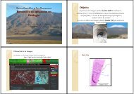
IDENTIFICACION DE ROCAS<br />
A PARTIR DE SENSORES<br />
REMOTOS {<br />
METODOLOGIA<br />
CECILIA WEIDMANN<br />
2012<br />
Se Se procesará procesará la la imagen imagen bajada bajada <strong>de</strong>l <strong>de</strong>l sitio sitio http http:// http http:// ://glcfapp ://glcfapp.glcf.umd.edu<br />
glcfapp glcfapp.glcf.umd.edu.<br />
glcf umd edu<br />
Con Path yRow Row: 232‐80 232 80.<br />
Se realizará: realizará el pre pre‐procesamiento<br />
procesamiento.<br />
Georreferenciación <strong>de</strong> la imagen (si así lo requiere) requiere).<br />
Layer Stacking para juntar las 6 bandas bandas.<br />
Recorte <strong>de</strong> la imagen para procesar solo la zona <strong>de</strong> interés interés.<br />
Combinación <strong>de</strong> bandas<br />
Cociente <strong>de</strong> Bandas <strong>de</strong> la imagen recortada. recortada<br />
Con los cocientes <strong>de</strong> bandas se construirán imágenes RGB. RGB<br />
Se tratará <strong>de</strong> llegar alguna correlación <strong>de</strong> las <strong>rocas</strong> <strong>de</strong> la zona con los<br />
resultados obtenidos <strong>de</strong> los cocientes. cocientes<br />
Clasificación sin supervisar K‐Means Means‐IsoData IsoData.<br />
OBJETIVOS<br />
Se intenta reconocer unida<strong>de</strong>s geológicas g g en el Área<br />
Vinchina Provincia <strong>de</strong> La Rioja Rioja.<br />
Tratar <strong>de</strong> i<strong>de</strong>ntificar las tobas presentes en la zona<br />
IMAGEN IMAGEN Y Y CARACTERÍSTICAS<br />
CARACTERÍSTICAS<br />
En base a imágenes bajadas <strong>de</strong>l sito<br />
http http:// ://glcfapp.glcf.umd.edu<br />
glcfapp.glcf.umd.edu<br />
I Imagen ortorectificada<br />
t tifi d<br />
Satélite LANDSAT 5<br />
Sensor TM<br />
WRS WRS‐2 2<br />
Path 232 ‐ Row 80<br />
Datum WGS84<br />
Tamaño <strong>de</strong>l Pixel 30m<br />
Fecha <strong>de</strong> Adquisición 14 14‐03 03‐2005 2005
ETAPA DE PRE PRE‐PROCESAMIENTO<br />
PROCESAMIENTO<br />
Histograma RGB 741<br />
Sin realce Con realce Lineal 2% Con realce Square Root<br />
Con realce Equalization q<br />
Con realce Gaussiano<br />
LAYER LAYER STACKING<br />
STACKING<br />
RECORTE RECORTE DE IMAGEN IMAGEN<br />
COMBINACION COMBINACION DE DE BANDAS<br />
BANDAS<br />
Banda RGB 542 Banda RGB 741
COMBINACION COMBINACION DE DE BANDAS<br />
BANDAS<br />
Banda RGB 321 Banda RGB 432<br />
Bandas B BBandas d 3/1 3/1‐3/2 3/1 3/2 3/2‐5/4 5/4 Bandas B BBandas d 3/2 3/2‐3/1 3/2 3/1 3/1‐5/4 5/4<br />
COCIENTE DE BANDAS<br />
Bandas 3/2 3/2‐5/4 5/4‐4/3 4/3 Bandas 4/3‐5/7‐3/2<br />
CLASIFICACIÓN CLASIFICACIÓN SIN SUPERVISAR<br />
K‐<br />
Means
Nivel <strong>de</strong> Cuaternario Nivel <strong>de</strong> Cuaternario Nivel <strong>de</strong> Cuaternario Nivel <strong>de</strong> Cuaternario<br />
Roca consolidada<br />
Nivel <strong>de</strong> Cuaternario Nivel <strong>de</strong> Cuaternario Nivel <strong>de</strong> Cuaternario Nivel <strong>de</strong> Cuaternario<br />
Roca consolidada Nivel <strong>de</strong> Cuaternario<br />
CLASIFICACIÓN CLASIFICACIÓN SIN SUPERVISAR<br />
IsoData<br />
RESALTOS ( (Tasseled Tasseled Cap) Capp<br />
Brillo Vegetación Humedad
CONCLUSIONES<br />
Se realizó, el layer stacking para unificar el archivo con las<br />
bandas bandas.<br />
Se recortó la imagen para obtener una zona mas reducida <strong>de</strong><br />
trabajo<br />
Se utilizaron diferentes cocientes <strong>de</strong> bandas en RGB con el<br />
objetivo <strong>de</strong> reconocer unida<strong>de</strong>s <strong>de</strong> roca. roca<br />
Bandas 3/2‐5/4‐4/3, Bandas 4/3‐5/4‐5/7, Bandas 3/1‐3/2‐5/4,<br />
Bandas 3/2‐3/1‐5/4, / / / , Bandas 3/1‐3/2‐5/4, / / / , Se pue<strong>de</strong>n p reconocer<br />
muy bien el contraste en las areniscas, no se pudo diferenciar<br />
los conglomerados <strong>de</strong> las tobas. tobas<br />
Bandas 4/3‐5/7‐3/2, 4/3 5/7 3/2, se diferencian muy bien en color amarillo<br />
las <strong>rocas</strong> ígneas ígneas‐metamórficas<br />
metamórficas <strong>de</strong>l Famatina/Sierra <strong>de</strong>l Toro<br />
Negro <strong>de</strong> las <strong>rocas</strong> sedimentarias <strong>de</strong> la Sierra <strong>de</strong> los<br />
<br />
Colorados Colorados.<br />
Se realizaron dos clasificaciones sin supervisar: supervisar<br />
K‐Means Means/IsoData IsoData don<strong>de</strong> muestra en color rojo la roca<br />
consolidada y diferencia muy bien los diferentes niveles <strong>de</strong><br />
conglomerados <strong>de</strong> la Cuenca <strong>de</strong> Vinchina