Integrated Data Viewer The Integrated Data Viewer - IDV
Integrated Data Viewer The Integrated Data Viewer - IDV
Integrated Data Viewer The Integrated Data Viewer - IDV

Create successful ePaper yourself
Turn your PDF publications into a flip-book with our unique Google optimized e-Paper software.
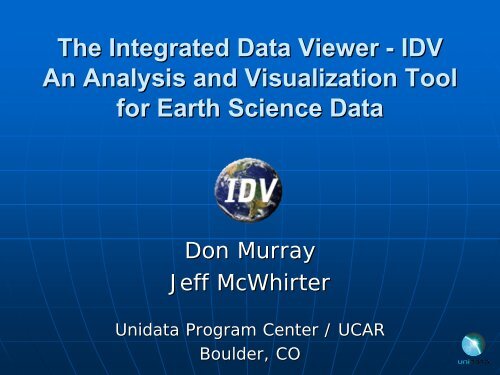
<strong>The</strong> <strong>Integrated</strong> <strong>Data</strong> <strong>Viewer</strong> - <strong>IDV</strong><br />
An Analysis and Visualization Tool<br />
for Earth Science <strong>Data</strong><br />
Don Murray<br />
Jeff McWhirter<br />
Unidata Program Center / UCAR<br />
Boulder, CO
Overview<br />
�� What is the <strong>IDV</strong>?<br />
�� Why use the <strong>IDV</strong>?<br />
�� <strong>IDV</strong> Visualization Examples<br />
�� How is the <strong>IDV</strong> being used?<br />
�� What’s What s next for <strong>IDV</strong>?<br />
�� How can I get the <strong>IDV</strong>?
What is the <strong>IDV</strong>?<br />
�� Visualization and analysis toolset for<br />
data<br />
�� Freely available Java Java framework<br />
and application – multiplatform<br />
�� <strong>Integrated</strong> 2D/3D/4D displays of a<br />
wide range of data<br />
�� Built on VisAD library (UW/SSEC)<br />
�� Community driven capabilities
Why use the <strong>IDV</strong>?<br />
Its USEFUL, CUSTOMIZABLE, EXTENSIBLE,<br />
DAZZLING, FUN, and FREE!<br />
“I I was floored at the capabilities of this<br />
software. I've only been looking at for an<br />
hour or two. WOW is all I can say! I'm<br />
surprised nobody has mentioned this before.” before.<br />
<strong>The</strong> <strong>IDV</strong> has the Fastest growing user base in<br />
the international Unidata community
�� In Classroom:<br />
<strong>IDV</strong> Benefits<br />
• More sophisticated presentation of concepts<br />
with real data<br />
• Better prepares students entering the<br />
atmospheric career field<br />
�� In Research:<br />
• Easy data access<br />
• High level of interaction with data<br />
• Platform independence allows for real-time real time<br />
collaboration between researchers
<strong>IDV</strong> Examples<br />
GFS Model Display
<strong>IDV</strong> Examples<br />
GOES-EAST GOES EAST IR and Radar
<strong>IDV</strong> Examples<br />
Wind Speed Isosurface and Contour Cross Section
<strong>IDV</strong> Examples<br />
EUMETSAT Meteosat-8 3-Band True Color Image
<strong>IDV</strong> Examples<br />
Mantle Convection, Strain rate, Tomography<br />
GEON-<strong>IDV</strong>/UNAVCO<br />
GEON <strong>IDV</strong>/UNAVCO
<strong>IDV</strong> Examples<br />
Time Series Charts
<strong>IDV</strong> Examples<br />
Model simulation of wind, isentropic potential<br />
vorticity and low level moisture flow over the<br />
Great Salt Lake basin
<strong>IDV</strong> Examples<br />
TREX Field Project – GV Tracks
<strong>IDV</strong> Examples<br />
Webcam Display
<strong>IDV</strong> Examples<br />
WMS and Drawing Tool
<strong>IDV</strong> Features<br />
�� Easy to run via installers and Java<br />
Webstart<br />
�� Out of the box data access<br />
�� Versatile data interaction<br />
• 2D/3D/4D views of 4D data!<br />
• Probes to slice and dice – time series,<br />
vertical profiles, etc.<br />
�� Comprehensive user support<br />
• <strong>Integrated</strong> documentation<br />
• support-idv@unidata.ucar.edu<br />
support idv@unidata.ucar.edu<br />
• Training workshops
<strong>IDV</strong> Features<br />
�� Bundles & new “<strong>Data</strong> <strong>Data</strong> Bundles” Bundles<br />
�� Resource creation – color tables,<br />
projections, station models<br />
�� Highly Configurable<br />
• Plug-ins Plug ins<br />
• Multiple UIs & displays – 3D Map, 2D Map,<br />
Globe, Transect<br />
�� Formulas and computation using Jython<br />
�� Scripting language - ISL
Supported <strong>Data</strong> Sources<br />
�� Gridded data – netCDF, GRIB<br />
�� Satellite imagery<br />
�� Radar data – Level II and Level III<br />
�� Point observations<br />
�� Balloon soundings<br />
�� NOAA Profiler network winds<br />
NOAA Profiler network winds<br />
�� Aircraft tracks<br />
Aircraft tracks<br />
�� Fronts<br />
Fronts<br />
�� HTML<br />
�� GIS data - WMS, DEM, Shapefile<br />
�� Quick Time movies<br />
�� Web Cams<br />
�� And more…<br />
more
<strong>IDV</strong> Product Generation<br />
<strong>IDV</strong> supports interactive and script<br />
based generation of:<br />
�� Images<br />
�� Animation – Quick Time, animated<br />
GIF, etc.<br />
�� Google Earth KML/KMZ
<strong>IDV</strong> Community of Users<br />
�� Universities<br />
• Education<br />
• Research (LEAD, GEON)<br />
• Training (EUMETSAT, under evaluation)<br />
�� UCAR (CGD, SCD, RAP, EOL, COMET)<br />
�� US Government (NTSB, NCDC, NWS,<br />
NGDC, USGS, EPA)<br />
�� Military (NUWC, Air Force/ABL)<br />
�� Private Industry<br />
�� International (Gov. of Macau, Norwegian<br />
Met. Institute)
Examples: Educational Modules<br />
Project to develop <strong>IDV</strong>-based <strong>IDV</strong> based educational modules<br />
�� PIs: Brian Etherton, Etherton,<br />
Shelley Holmberg (UNC- (UNC<br />
Charlotte), Jeff Weber (Unidata)<br />
�� Educational modules:<br />
• What climatological factors were present in<br />
the 2005 Tropical Cyclone season to force the<br />
most active season on record?<br />
• Why was Hurricane Katrina so destructive?<br />
• How did Hurricane Wilma become the most<br />
intense hurricane in the Atlantic Basin?
“<strong>IDV</strong> <strong>IDV</strong> Perspective: Climatology of the 2005 Hurricane<br />
Season” Season presented by Shelly at 2007 AMS Annual Meeting<br />
A comparison of Relative Vorticity in the Atlantic basin for the<br />
year 2005 (left panel) to climatology (1971-2001, and in right<br />
panel) and displays the difference of the two in the center panel
Examples: <strong>IDV</strong> in LEAD<br />
�� LEAD Visualization<br />
Tool:<br />
• WRF output from LEAD<br />
workflow simulations<br />
• Initial and boundary<br />
conditions for workflow<br />
• Compare results to<br />
observations<br />
�� LEAD-To LEAD To-LEARN LEARN<br />
modules:<br />
• Bundles associated with<br />
on-line on line modules<br />
• Support inquiry based<br />
learning<br />
Lake Effect Snow Module
Examples: <strong>IDV</strong> in Field Projects<br />
�� Realtime aircraft tracks,<br />
radar, dropsondes, dropsondes,<br />
satellite<br />
and model data in<br />
operations center.<br />
�� Project specific<br />
customization<br />
• Specialized maps,<br />
locations, color tables<br />
�� Visualization tool in the<br />
proposed Virtual<br />
Operations Center (VOC)<br />
T-REX: G-V<br />
tracks and<br />
dropsondes<br />
RICO: C130<br />
track, SPOL<br />
radar and<br />
satellite
�� GEON project is “Unidata Unidata<br />
for the solid earth<br />
sciences” sciences<br />
�� <strong>The</strong> GEON-<strong>IDV</strong> GEON <strong>IDV</strong> is an<br />
extension of the Unidata<br />
<strong>IDV</strong><br />
• Supports 2D and 3D<br />
displays of subsurface<br />
phenomena<br />
• Uses plug-in plug in facility to<br />
customize the user<br />
interface and add<br />
features<br />
• Additional features<br />
include GPS velocity<br />
vectors, earthquake<br />
focal mechanisms, ray<br />
path traces.<br />
Examples: GEON-<strong>IDV</strong> GEON <strong>IDV</strong><br />
Yellowstone Geophiscs: Earthquakes<br />
Mt. and St. tomography Helens siesmic by Univ. activity Utah; 2004<br />
topography from USGS; geology map<br />
image provided by Robert L.<br />
Christiansentens (UNAVCO)
Hyperspectral <strong>Data</strong> Research Application - HYDRA<br />
Tom Rink, Paul Menzel, Tom Whittaker, Paolo Antonelli<br />
University of Wisconsin-Madison, Wisconsin Madison, SSEC/CIMSS<br />
Interrogate, analyze, visualize hyper- hyper and multi-spectral<br />
multi spectral<br />
satellite data<br />
Access local (netCDF, HDF, AREA) or remote datasources<br />
(OpenDAP, OpenADDE)<br />
Spatial and spectral domain subsetting built in: critical for<br />
detailed analysis of very large datasets<br />
Freeware, based on the VisAD library: a state-of state of-the the-art art<br />
interactive display and data integration API<br />
Supported instruments include: MODIS, AIRS, GOES, MSG,<br />
MAS, SHIS, CALIPSO. Has an abstract extensible data<br />
interpretation layer which can extended to new<br />
instruments and datasources.<br />
datasources
Modis (Terra) Direct Broadcast overpass shown in HYDRA via<br />
an OpenDAP server. Only the full resolution data in the green<br />
box is loaded on the client. <strong>The</strong> histogram stretch utility has<br />
be used to emphasize land features in band 1.
Comparison of high resolution spectra (AIRS), and water vapor<br />
retrieval profiles at two locations over the Black Sea – one with<br />
a higher amount of low level moisture – using HYDRA's<br />
MultiChannel<strong>Viewer</strong>.
Example of the Channel Combination and Scatter plot tools being used<br />
to study the relationship between different MODIS bands over a region region<br />
in Northern Wisconsin in an image scene with snow, ice, water and an<br />
clouds.
Example of the transect plot tool being used with MSG SEVIRI,<br />
obtained remotely via an ADDE server at Eumetsat.
L1B image overlayed by the MODIS fire product (MOD14) for a<br />
region in Southern Africa.
Illustration of data fusion capabilities: Calispso track, green line on<br />
AIRS image and corresponding track/altitude plot of the Lidar<br />
backscatter.<br />
backscatter
�� Next generation of<br />
McIDAS will be based<br />
on VisAD and <strong>IDV</strong><br />
�� Provides visualization<br />
and analysis tools for<br />
multi-spectral multi spectral and<br />
hyper-spectral hyper spectral data.<br />
�� HYDRA like<br />
capabilities (BAMS,<br />
Rink, et al, Feb 2007)<br />
McIDAS-V McIDAS<br />
Hyperspectral slicing using AIRS,<br />
MODIS and Calypso data in McIDAS-V<br />
(courtesy Tom Rink, SSEC)
What’s What s Next for <strong>IDV</strong>?<br />
�� PostScript output<br />
�� 2007 Developer’s Developer s training workshop<br />
�� Scripting/Batch processing via Jython<br />
�� New <strong>Data</strong> – ensemble grids<br />
�� New Displays – better charting<br />
capabilities, meteorograms<br />
�� Additional computational &<br />
diagnostic functions
�� <strong>IDV</strong> Homepage:<br />
<strong>IDV</strong> Information<br />
• http://www.unidata.ucar.edu/software/idv<br />
�� LEAD-to LEAD to-LEARN LEARN modules<br />
• http://www.atmos.millersville.edu/~lead/modules.htm<br />
GEON-<strong>IDV</strong><br />
GEON <strong>IDV</strong><br />
• http://geon.unavco.org/unavco/<strong>IDV</strong>_for_GEON.html