INTERNATIONAL GEOSCIENCE PROGRAMME IGCP - Unesco
INTERNATIONAL GEOSCIENCE PROGRAMME IGCP - Unesco
INTERNATIONAL GEOSCIENCE PROGRAMME IGCP - Unesco

Create successful ePaper yourself
Turn your PDF publications into a flip-book with our unique Google optimized e-Paper software.
Ecological and Earth Sciences in UNESCO<br />
United Nations<br />
Educational, Scientific and<br />
Cultural Organization<br />
International<br />
Geoscience<br />
Programme<br />
International<br />
Union of Geological<br />
Sciences<br />
<strong>INTERNATIONAL</strong><br />
<strong>GEOSCIENCE</strong><br />
<strong>PROGRAMME</strong><br />
<strong>IGCP</strong><br />
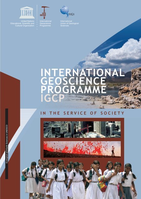
IN THE SERVICE OF SOCIETY
2<br />
What is this brochure for?<br />
This brochure describes the International Geoscience Programme (<strong>IGCP</strong>), a joint operation by UNESCO and<br />
the International Union of Geological Sciences (IUGS). It describes the type of research we conduct under this<br />
Programme, including how to apply, and the conditions for funding. The brochure also explains to potential<br />
sponsor organizations why they should support <strong>IGCP</strong>, and what they will receive in return.<br />
Who should read it?<br />
The brochure is aimed at potential research applicants, typically leading scientists working in the numerous<br />
fields of geoscientific research across the world. It also provides information for national committees of the<br />
<strong>IGCP</strong>, UNESCO’s National Committees, national ‘adhering organizations’ to IUGS, and potential sponsors.<br />
Why sponsor the <strong>IGCP</strong>?<br />
The <strong>IGCP</strong> is the oldest and most successful example of scientific cooperation between a non-governmental<br />
organization (NGO) – the IUGS – and an intergovernmental organization – UNESCO. The <strong>IGCP</strong> enjoys the highest<br />
reputation within the UN system as well as among the world’s scientific organizations, and brings together<br />
junior and senior geoscientists from less and more developed nations. Over the past 35 years, tens of<br />
thousands of scientists have actively taken part in <strong>IGCP</strong> projects; for many of them the Programme has been<br />
the gateway to a successful career in and beyond geoscience. <strong>IGCP</strong> has also been responsible for some major<br />
geoscientific programmes of ground-breaking international standard.<br />
Given that the <strong>IGCP</strong>’s motto is Geosciences in the Service of Society, investing in this Programme will<br />
support applied scientific research directly designed to improve living conditions in modern societies that<br />
are heavily dependent upon their natural environment and local geological conditions.<br />
Through rigorous selection and evaluation procedures only the very best scientific proposals receive funding.<br />
Moreover, the <strong>IGCP</strong>’s long-held policy is to provide starter finance (‘seed money’) only, as a means of bringing<br />
together scientists from as great a number of nations as possible. The imprimatur of the <strong>IGCP</strong> then makes it<br />
easier for the scientists to raise matching funds from other sources.<br />
If you choose to sponsor <strong>IGCP</strong>, your generosity will be acknowledged in all <strong>IGCP</strong> project reports, and on the<br />
<strong>IGCP</strong> website’s home page. Your contribution will guarantee that top young scientists from developing<br />
countries actively interact with some of the world’s leading scientists, thus contributing to capacity-building<br />
worldwide.<br />
What to do next ...<br />
I N T E R N A T I O N A L<br />
If you are a scientist wishing to register initial interest in bringing together a group of fellow scientists from<br />
a number of countries in order to generate a research proposal relevant to one of the described themes<br />
(see pages 5, 7, 9, 11, and 13) or one constituting a basic research topic (see page 15), please go to<br />
www.unesco.org/science/earth and follow the instructions for submission of an <strong>IGCP</strong> project.<br />
If you wish to sponsor <strong>IGCP</strong>, please contact the Secretariat in Paris – see inside back cover for details.
G E O S C I E N C E P R O G R A M M E<br />
What is <strong>IGCP</strong>?<br />
The International Geoscience Programme (<strong>IGCP</strong>) fosters interdisciplinary geoscientific research among<br />
researchers internationally, through joint research work, meetings and workshops. Since its creation in 1972,<br />
<strong>IGCP</strong> has supported over 500 projects in about 150 countries.<br />
<strong>IGCP</strong> brings together scientists from around the world, and provides them with seed money to devise and<br />
conduct joint international research and to collectively publish the results. High on the list of selection<br />
criteria are scientific quality and the extent of the international, multidisciplinary cooperation likely to be<br />
generated by a proposed project.<br />
Which are the main sponsors?<br />
The initiators and main sponsors of the <strong>IGCP</strong> are UNESCO’s Division of Ecological and Earth Sciences, and the<br />
International Union of Geological Sciences (IUGS). Other sponsors include UNESCO’s Water Sciences Division.<br />
Objectives<br />
<strong>IGCP</strong>´s scientific objectives include:<br />
— Increasing our understanding of the geoscientific factors affecting the global environment in order to<br />
improve human living conditions.<br />
— Developing more effective methods to find and sustainably exploit natural resources of minerals, energy<br />
and groundwater.<br />
— Increasing our understanding of geological processes and concepts of global importance, including an<br />
emphasis on socially relevant issues.<br />
— Improving standards, methods and techniques of carrying out geological research, including the transfer<br />
of geological and geotechnological knowledge between industrialized and developing countries.<br />
<strong>IGCP</strong> Secretariat<br />
The <strong>IGCP</strong> Secretariat is based in UNESCO’s Ecological and Earth Sciences Division. The Secretariat manages<br />
the Programme and communicates with the <strong>IGCP</strong> Bureau, project leaders, National Committees, members<br />
of the Scientific Board, Initiators (IUGS and UNESCO), UNESCO regional offices and with sponsors. It organizes<br />
regional meetings to stimulate interest and participation in <strong>IGCP</strong> activities, facilitates publication of <strong>IGCP</strong><br />
documents, and is responsible for the <strong>IGCP</strong> website (www.unesco.org/science/earth) as well as organising<br />
the annual <strong>IGCP</strong> meetings.<br />
World map showing countries<br />
involved in <strong>IGCP</strong> projects in brown<br />
I N T H E S E R V I C E O F S O C I E T Y<br />
3
4<br />
UNESCO’s Division of Ecological<br />
& Earth Sciences<br />
UNESCO promotes cooperation between<br />
nations on various topics in education,<br />
science and culture in order to advance<br />
peace and security. The Earth sciences<br />
programmes within UNESCO’s Natural<br />
Sciences Sector are unique in the UN,<br />
as they give particular attention to<br />
understanding the Earth System. They<br />
address interdisciplinary research and<br />
capacity-building in the fields of geology<br />
and geophysics, including the sustainable<br />
management and development of the<br />
Earth’s mineral and energy resources.<br />
They strongly contribute to the Global<br />
Earth Observation Systems of Systems<br />
(GEOSS) enhancing the ground-based<br />
and satellite observation of the planet.<br />
UNESCO assists in providing better<br />
information for decision-makers to<br />
plan for sustainable socio-economic<br />
development, hazard mitigation and<br />
safeguarding the environment and<br />
geological heritage.<br />
In 2001 UNESCO was invited by its<br />
Executive Board to highlight the<br />
importance of territories or natural parks<br />
with special geological features. This<br />
initiative introduces a unique international<br />
framework linking socio-economic<br />
development and conservation. The<br />
Geopark Initiative works closely with<br />
UNESCO’s World Heritage Centre, the<br />
Man and the Biosphere (MAB) World<br />
Network of Biosphere Reserves and<br />
national and international undertakings<br />
and non-governmental organizations<br />
active in geological heritage conservation.<br />
the Division of Ecological and Earth<br />
Sciences supports the Geopark initiative<br />
and the International Year of Planet Earth<br />
because both of these initiatives promote<br />
international cooperation designed to<br />
improve our understanding of the Earth<br />
System, while sustaining local<br />
communities.<br />
The rise and Fall of the Vendian Biota<br />
(<strong>IGCP</strong> 493)<br />
I N T E R N A T I O N A L<br />
Some 600 million years ago, one of the most significant events<br />
in Earth history occurred – a sudden increase in biodiversity,<br />
culminating in a variety of hard skeleton species. This project<br />
is particularly interested in the precise timing of these events,<br />
the effects that changing environments, climates, global<br />
chemistry and palaeogeogrphy had on the development and<br />
diversification of animals, culminating in the spectacular<br />
Eciacaran/Vendian faunas.<br />
Researchers are investigating the most representative sections<br />
along the coasts of the White Sea in Russia, the Flinders Range<br />
of South Australia, the deserts of southern Namibia and the<br />
coastal outcrops of Newfoundland. Additional material (mainly<br />
from South America) is brought forward to compare its setting<br />
with the better-known faunas elsewhere in the world.<br />
Researchers from many disciplines gain experience with the<br />
Ediacaran assemblages worldwide, and involve students as well<br />
as non-scientists that include artists in particular.<br />
The project is particularly active in public outreach projects,<br />
including a stamp issue and a childrens’ book publication in<br />
association with Australia Post. A teachers’ kit has been<br />
developed to accompany the stamp release, public exhibitions<br />
are being organized, as are symposia and classroom lessons for<br />
the public at large. Besides the research results and related<br />
discoveries, the aim is to educate and to bring front-line science<br />
to the public. In addition, a series of commercial jewellery<br />
depicting Ediacarans has been produced as well as a CD of music<br />
in memory of the Ediacarans.
G E O S C I E N C E P R O G R A M M E<br />
Theme: The Global Change and Evolution of<br />
Life: evidence from the geological record<br />
The biosphere is the ‘living shell’ of planet Earth. It is the unique<br />
characteristic of our planet. Life-forms affect the atmosphere,<br />
oceans, land surface and even the composition of rocks.<br />
Although life began only a few hundred million years after the<br />
Earth was formed, life began to affect the Earth System significantly<br />
about 2.7 billion years ago when living organisms began to produce<br />
oxygen. Much more recently, the biosphere has been affected by<br />
human impact. It is the joint aim of palaeontologists and biologists<br />
worldwide to understand, through their research, the multiple<br />
factors controlling the processes of the biosphere. This research<br />
provides insights into the functioning and stability of past ecosystems<br />
in relation to climate change, understanding biodiversity dynamics<br />
over long time-scales, and predicting future biosphere vitality.<br />
Changes in climate and life on Earth are preserved in the rock<br />
record. Ice and dust records, terrestrial and ocean sediments, and<br />
sequences of fossil plant and animal assemblages, are all part of<br />
this record. Five major and ten smaller mass extinctions have<br />
punctuated the history of life.<br />
These extinctions were the result of dramatic environmental<br />
changes brought about by many factors, including plate tectonics,<br />
volcanism, sea-level fluctuation, changing biogeochemical cycles,<br />
and periodic cataclysmic impacts. Such extinctions also provide<br />
important clues as to how to tackle present-day environmental<br />
challenges, as well as ways of mitigating and managing<br />
environmental damage.<br />
Through this theme, <strong>IGCP</strong> invites scientists around the world to<br />
submit proposals designed to advance understanding of climate<br />
change and the evolution of life from geological records.<br />
I N T H E S E R V I C E O F S O C I E T Y<br />
5
6<br />
What is IUGS?<br />
The International Union of Geological<br />
Sciences (IUGS) offers an international<br />
platform for co-operation among the<br />
approximately half a million practitioners<br />
of the fundamental and applied Earth<br />
sciences. With about 120 member<br />
countries and 40 affiliated bodies,<br />
the IUGS is one of the largest scientific<br />
NGOs in the world. Since its founding<br />
in 1961, IUGS has been a member of the<br />
International Council for Science (ICSU).<br />
IUGS exists to unite the global geological<br />
community by promoting the geosciences<br />
through geoscientific studies relevant to<br />
the Earth system, and by applying the<br />
results to sustainable use of natural<br />
resources, sustaining the ecological<br />
environment, mitigating geohazards,<br />
improving prosperity, and preserving the<br />
quality of human life.<br />
IUGS bodies are concerned with a wide<br />
range of geological research of direct<br />
interest to governments, industry and<br />
academic groups within Earth sciences.<br />
Many of IUGS’s programmes are<br />
conducted in partnership with UNESCO,<br />
the oldest and largest of which is <strong>IGCP</strong>.<br />
I N T E R N A T I O N A L<br />
Seismic micro-zoning of Latin American cities<br />
(<strong>IGCP</strong> 487)<br />
The impact of earthquakes on cities is often catastrophic.<br />
This is particularly true for the many cities built in coastal<br />
zones, and on ancient lake-beds and river plains. Earthquake<br />
impact is significantly increased where seismic energy is<br />
amplified by thick, unconsolidated sediments that underlie such<br />
cities. To improve the protection of citizens we must find out<br />
where and when new earthquakes will occur and which parts<br />
of a city will be most seriously affected.<br />
This <strong>IGCP</strong> project is addressing these questions by bringing<br />
together knowledge of earthquake hazards collected in Latin<br />
America. As an alternative to traditional, costly and timeconsuming<br />
micro-zoning, the next step consists of 3D modelling<br />
of subsurface structures, based on precise geoscientific<br />
information and earthquake simulation. Such models predict<br />
impact of the earthquakes on the ground conditions and describe<br />
the ground motion generated from such simulated quakes.<br />
Software for this was developed by an earlier <strong>IGCP</strong> Project<br />
(414). The hardware consists of a powerful computer network<br />
located at the International Centre for Theoretical Physics in<br />
Trieste, Italy (ICTP). Training on the application of advanced<br />
computational techniques, together with seminars and regional<br />
meetings, forms an important component of this project.
G E O S C I E N C E P R O G R A M M E<br />
Theme: Geohazards: reducing risks<br />
Geohazards can have a drastic effect upon society, as demonstrated<br />
by the 2004 Indian Ocean Tsunami and hurricane Katrina (2005).<br />
While more developed nations suffer mostly in financial terms, the<br />
human impact of geohazards is concentrated in the less developed<br />
world. As population increases, more and more people and<br />
businesses are exposed to geohazards.<br />
Geoscience cannot eliminate geohazards, but it is increasingly<br />
able to reduce their impact and to mitigate associated risks.<br />
This has resulted in improved forecasting (where geohazards may<br />
occur, and how these may impact communities). The next challenge<br />
is to add spatial resolution and temporal precision.<br />
Another challenge facing Earth scientists is how best to communicate<br />
information on risk reduction to governments and decision-makers.<br />
Improved communication with stakeholders will assist in formulating<br />
policies on risk management.<br />
I N T H E S E R V I C E O F S O C I E T Y<br />
7
8<br />
What is the International<br />
Year of Planet Earth?<br />
The International Year of Planet Earth<br />
is a joint initiative of IUGS and UNESCO<br />
to raise awareness of the benefits of the<br />
Earth sciences among the public and<br />
decision makers – who are urged to<br />
apply and translate such knowledge<br />
in their day-to-day policymaking.<br />
The International Year has been<br />
proclaimed by the United Nations<br />
General Assembly for 2008, but its<br />
activities span the triennium 2007 – 2009.<br />
The International Year of Planet Earth<br />
has a science programme and an<br />
outreach programme of about equal<br />
size. The former focuses on 10 themes,<br />
including Groundwater, Hazards, Health,<br />
Earth & Life, Resources, Megacities,<br />
Soil, Ocean, Deep Earth and Climate.<br />
The outreach programme includes<br />
exciting and spectacular public events,<br />
such as balloon launches, geo-trains and<br />
geo-buses, stamps, excursions, public<br />
lectures, exhibitions, Geoparks and<br />
educational programmes – all suggested<br />
by participating individuals and groups<br />
locally.<br />
Both programmes operate in this<br />
responsive (‘bottom-up’) mode, while<br />
international ‘Top Conferences’ in all<br />
continents address the political<br />
dimension by drawing attention to<br />
geo-solutions to societal problems.<br />
Implementation of the ‘Greatest<br />
Geo-Show on Earth’ mainly takes place<br />
at national levels, National Committees<br />
of the International Year being active<br />
in many countries of the world.<br />
I N T E R N A T I O N A L<br />
GIS Metallogeny of Central Asia (<strong>IGCP</strong> 473)<br />
Central Asia is one of the world’s richest mineral provinces.<br />
Despite its enormous potential, production has declined sharply<br />
in the past decade. No reliable geodynamic or metallogenic<br />
studies or maps based on modern plate-tectonic concepts and<br />
international standards exist for the region. State-of-the-art<br />
expertise on sustainable mining and investment is urgently<br />
needed to exploit these deposits and to boost Central Asian<br />
economies. This project aims to develop available expertise in<br />
the region and to bridge the current gap between, on the one<br />
hand, superseded knowledge and assessments incompatible with<br />
international standards, and on the other, modern expertise<br />
based on GIS techniques that have been developed for<br />
metallogenic mapping in the Ural and Altay mountain ranges.<br />
This project correlates stages of crustal evolution, magmatism<br />
and ore formation across national borders, and integrates<br />
existing information with new data to link geotectonic units<br />
of Central Asia with their mineral inventories. Moreover, the<br />
project places metallogenic evolution within the context of<br />
crustal growth, and works towards a unified metallogenicgeodynamic<br />
model of Central Asia. It builds on an earlier <strong>IGCP</strong><br />
Project (373) and has won the <strong>IGCP</strong> Young Scientists Project<br />
Award. Training facilities are provided through the EU; national<br />
funds provide scientists from more than 30 countries in Central<br />
Asia and beyond with opportunities to share expertise<br />
and to gain modern knowledge about mineral prospecting<br />
and sustainable exploitation.
G E O S C I E N C E P R O G R A M M E<br />
Theme: Earth Resources: sustaining society<br />
Nearly everything we make or build, and nearly all the energy we<br />
use, comes out of the Earth. Modern society is, and will remain,<br />
heavily dependent on minerals and fossil energy sources.<br />
Mineral deposits are diverse in nature and composition, reflecting<br />
their origins. Processes that form these deposits range from<br />
intrusions from the Earth’s mantle, to sedimentary processes at<br />
the Earth’s surface and even (in the case of some nickel deposits)<br />
meteorite impacts. To assess their occurrence and prospectivity,<br />
Earth scientists need to understand the processes and interactions<br />
that distinguish them from ordinary rock formations.<br />
The Earth is not ‘running out’ of critical mineral deposits, at<br />
least not in the short term. The ability to find and produce those<br />
resources is being restricted in many regions by competing land-use,<br />
and political/environmental issues. The ‘mineral resource problem’<br />
is mainly a matter of developing resources in a socially and<br />
environmentally responsible manner. Sustainable mining demands<br />
that potentially disruptive impacts of the mine life-cycle<br />
(exploration, development, site rehabilitation etc.) are taken<br />
fully into account. The geosciences can contribute to all these.<br />
The same applies to energy resources, where environmental and<br />
social challenges have proved manageable. Natural gas is becoming<br />
an increasingly attractive fuel, but petroleum can also be used in<br />
a more sustainable way. Underused energy resources such as oil<br />
sands, oil shales, coal-bed methane and gas hydrates, often await<br />
effective exploitation. Sustainable use of such resources, however,<br />
requires research, mainly in geoscience. The <strong>IGCP</strong> provides<br />
opportunities for geoscientific communities all over the world<br />
to address these challenges.<br />
I N T H E S E R V I C E O F S O C I E T Y<br />
9
10<br />
UNESCO Water Science Division<br />
and IHP cooperation<br />
UNESCO’s Water Sciences Division<br />
contributes to the implementation of<br />
<strong>IGCP</strong> projects related to groundwater<br />
resources. The Division also contributes<br />
actively to UNESCO’s midterm strategy<br />
which ‘gives priority to water and<br />
associated ecosystems’, to realising<br />
UN Millennium Development Goals,<br />
and to UNESCO’s Decade for Education<br />
for Sustainable Development. This is<br />
achieved through projects of the<br />
International Hydrological Programme<br />
(IHP), and by building partnerships with<br />
scientific NGOs. The Division is involved<br />
in developing measures to reduce the<br />
vulnerability of water resource systems<br />
and to promote integrated catchment<br />
approaches for water management.<br />
Like <strong>IGCP</strong>, IHP is one of UNESCO’s five<br />
intergovernmental and international<br />
scientific cooperative programmes.<br />
IHP addresses hydrology and has the<br />
global ambition to formulate strategies<br />
for the sustainable management of<br />
water resources. IHP provides the<br />
framework for scientific research into<br />
the World’s freshwater problems.<br />
It builds on partnerships, for example<br />
with the International Association of<br />
Hydrogeologists (IAH) and the<br />
Commission for the Geological Map<br />
of the World (CGMW), both of which<br />
are also affiliated to IUGS in the<br />
development of the Hydrogeological<br />
Map of the World.<br />
I N T E R N A T I O N A L<br />
Karst aquifers and water resources (<strong>IGCP</strong> 513)<br />
Large volumes of fresh groundwater are stored in subsurface<br />
cavities caused by underground dissolution of soluble rocks<br />
(karstification). About 25% of the world’s population relies on<br />
drinking water supplies from karst aquifers, and karst waters are<br />
extremely vulnerable to contamination from land-use (urban,<br />
agricultural etc.). Karst water transport is rapid, with the result<br />
that the natural filtration provided by other types of aquifer do<br />
not occur.<br />
Karst terrains pose a number of threats to the quantity and<br />
quality of water supplies. Moreover, difficult access from the<br />
surface may seriously hamper the study of karst waters and their<br />
underground environment.<br />
This <strong>IGCP</strong> project aims to improve our understanding through<br />
theoretical and applied research, sharing global experience<br />
and resources, and finding solutions to karst water resource<br />
challenges. Theoretical research is crucial to ameliorating<br />
the hardships that karst terrain and hydrology exert. Applied<br />
research is also important for understanding water supply<br />
problems and related environmental issues.
G E O S C I E N C E P R O G R A M M E<br />
Theme: Geoscience of the Water Cycle<br />
The distribution of water on Earth is controlled by the Water Cycle,<br />
which links hydrosphere, atmosphere, biosphere and geosphere.<br />
Groundwater constitutes the underground portion of the Cycle,<br />
and is primarily controlled by geological processes. Groundwater<br />
is fundamentally important, for drinking water and irrigation and<br />
for its role in ecosystems.<br />
Locally and regionally, fresh groundwater resources are at risk – for<br />
example by contamination and saltwater invasion (‘salinization’).<br />
Geological conditions in the subsurface largely determine whether<br />
such risks can be solved naturally or by intervention. As the<br />
population grows and global warming gathers pace, proper<br />
management of groundwater resources is becoming important<br />
for an increasing proportion of the world’s population.<br />
Understanding the water cycle involves contributions from geology,<br />
geophysics, soil sciences, environmental geosciences, engineering<br />
geology, geochemistry, biochemistry, hydrology and atmospheric<br />
sciences. There are significant geographical differences in<br />
groundwater characteristics and composition in different parts<br />
of the world, making the kind of cooperation provided by <strong>IGCP</strong><br />
absolutely vital.<br />
I N T H E S E R V I C E O F S O C I E T Y<br />
11
12<br />
UNESCO and the Decade of<br />
Education for Sustainable<br />
Development<br />
One of United Nations’ responses<br />
to sustainable development was its<br />
participation in the Decade of Education<br />
for Sustainable Development (DESD),<br />
adopted in 2002 by the UN General<br />
Assembly for 2005 to 2014. UNESCO<br />
was charged with promoting the Decade,<br />
which aims to stimulate sustainable skills<br />
and behaviour, inspired by creative and<br />
critical ways of thinking, to encourage<br />
management of problems that may<br />
hamper sustainable development.<br />
UNESCO’s Natural Sciences Sector were<br />
among the first intergovernmental bodies<br />
to demonstrate concern for sustainable<br />
development. Today, sustainable<br />
development occurs in all UNESCO’s<br />
fields of competence – education,<br />
science, culture and communication –<br />
in particular in the projects through<br />
UNESCO’s field offices. In this respect,<br />
UNESCO has a dual role to play.<br />
First, it must integrate education for<br />
sustainable development within national<br />
policies and educational systems.<br />
Beyond that, however, it must aim to<br />
make all actors in civil society, including<br />
the private sector and the media, aware<br />
of the importance of the goals of<br />
sustainable development.<br />
One of UNESCO’s core activities in<br />
Earth science is <strong>IGCP</strong>, which is an<br />
excellent example of how UNESCO<br />
and its programmes can contribute to<br />
the development of improved concepts<br />
and methods bearing upon policy<br />
decisions based on the criteria of<br />
sustainable development.<br />
Images of the Earth’s crust (<strong>IGCP</strong> 474)<br />
I N T E R N A T I O N A L<br />
Since the 1960s, the quantity and quality of seismic images<br />
of the Earth’s crust have improved dramatically. These images<br />
provide detailed insight into the geological structures and<br />
tectonic processes that shape the Planet. Therefore, they<br />
are relevant to natural resources (including groundwater) and<br />
natural hazards, such as earthquakes. They also define processes<br />
that control the evolution of landscape and soils.<br />
Most current seismic images come from more developed nations.<br />
This project aims to convert the results of separate regional<br />
deep seismic programmes into a global scientific framework<br />
by making seismic images across representative orogenic belts,<br />
rifts, and continental margins globally available. In doing so,<br />
such images become meaningful for researchers and educators<br />
in developing nations who have no easy access to the results<br />
of this technology. The results bridge the gap between scientific<br />
research and the public interest and provide real insight into<br />
the nature of the major geological processes in the uppermost<br />
50 - 70 km of the crust that directly affect human life.
G E O S C I E N C E P R O G R A M M E<br />
Theme: The Deep Earth: how it controls<br />
our environment<br />
Earth’s surface, including our habitable environment, is controlled<br />
by processes deep within the planet. During the past few decades<br />
our understanding of the deep Earth has rapidly improved. We can<br />
now produce scientific models that help us to reconstruct the past<br />
and to forecast the future behaviour of geological systems and<br />
patterns within the solid Earth. Deep Earth processes also impact<br />
upon the shallow subsurface, controlling water supply, natural<br />
resources and natural hazards.<br />
Earth scientists use a wide variety of techniques to investigate deep<br />
Earth processes. Improved seismic methods have provided a much<br />
greater understanding of the 3D structure of the Earth’s mantle<br />
and, in much more detail, the overlying lithosphere. We can now<br />
describe how the deep Earth system works and how rocks deform<br />
under pressure from the movements of the Earth’s lithospheric<br />
plates in space and time. Combined with progressively improving<br />
dating techniques, sometimes collected from great depths,<br />
geoscientists are now able to determine the rate of progression<br />
of tectonic and surface processes.<br />
Scientists can now use satellites to monitor vertical and horizontal<br />
movements of the Earth’s crust with great accuracy. Despite<br />
considerable progress during the past few decades, society continues<br />
to demand ever more detailed information on the distribution of<br />
natural resources and hazards. Therefore, <strong>IGCP</strong> invites geoscientists<br />
working on deep Earth problems and those concerned with the<br />
shallow subsurface to submit collaborative research proposals.<br />
I N T H E S E R V I C E O F S O C I E T Y<br />
13
14<br />
I N T E R N A T I O N A L<br />
The Neoproterozoic Pan-African belt of<br />
Central Africa: Sedimentation, deformation<br />
history, magmatism, metamorphism and<br />
geotectonic evolution (<strong>IGCP</strong> 470)<br />
About half-way through Neoproterozoic time (1000 - 540 million<br />
years ago), the landmasses concentrated in a supercontinent<br />
called Rodinia began to break up. One of these, the Atlantica<br />
block, comprised today’s Brazil and Northwest and Central<br />
Africa. Towards the end of the Neoproterozoic, continents began<br />
to merge again and fragments of Atlantica collided to form the<br />
West Gondwana continent.<br />
The Central African region (Cameroon, Chad, Central African<br />
Republic, Gabon, Congo, West of Democratic Republic of Congo<br />
and NW Angola) is one in which the Neoproterozoic is least<br />
understood, despite the vast number of research projects<br />
directed toward mineral exploration in the rich Pan-African-<br />
Brasiliano belt system. The region is unevenly surveyed;<br />
geological research in different countries is fragmented and<br />
cross-border correlation of rock units is poor.<br />
This project, which builds on the results of <strong>IGCP</strong> 440, brings<br />
together Earth scientists from the entire region to exchange<br />
information and jointly produce regional maps of the whole<br />
orogenic belt system in a series of workshops and regional<br />
conferences.
G E O S C I E N C E P R O G R A M M E<br />
Basic research in the <strong>IGCP</strong><br />
Although the <strong>IGCP</strong> has as its motto Geoscience in the Service<br />
of Society, and although the project evaluation criteria include<br />
societal relevance, the <strong>IGCP</strong> may also provide support for<br />
fundamental science. Sound applied science needs sound<br />
fundamental science, and in reality no clear-cut distinction<br />
exists between them.<br />
In the course of <strong>IGCP</strong>’s long history, numerous ‘pure’ science<br />
projects have led to greatly improved understanding of the origin<br />
and evolution of former and buried mountain belts; such knowledge<br />
has been readily applied during successful mineral prospecting<br />
programmes. In fact, this holds true for all of <strong>IGCP</strong>’s themes,<br />
especially given that projects must be multidisciplinary. Such teams<br />
frequently create innovative research that leads to new basic<br />
science concepts, subsequently giving rise to novel applied<br />
knowledge. This is why it is important that Earth scientists of all<br />
specialities should submit proposals for multidisciplinary ‘blue skies’<br />
research.<br />
I N T H E S E R V I C E O F S O C I E T Y<br />
How do I propose a project?<br />
<strong>IGCP</strong> welcomes project proposals on<br />
the following topics:<br />
– topics of particular interest to <strong>IGCP</strong><br />
(as outlined in this document);<br />
– topics defined annually by UNESCO<br />
and IUGS (see websites listed on the<br />
inside back cover);<br />
– other relevant topics in fundamental<br />
and applied geoscience.<br />
Project proposals may be submitted<br />
by individuals or groups.<br />
Project proposals (application forms:<br />
www.unesco.org/science/earth) should<br />
be submitted to the <strong>IGCP</strong> Secretariat<br />
before the deadline (normally before mid-<br />
October). These forms should be accompanied<br />
by a letter of endorsement from<br />
the <strong>IGCP</strong> or IUGS National Committee<br />
representing the project leader’s home<br />
country. The <strong>IGCP</strong> Secretariat in Paris is<br />
ready to advise project leaders on all<br />
aspects of <strong>IGCP</strong> projects.<br />
Proposals are evaluated according to<br />
scientific excellence, feasibility, societal<br />
relevance, education and training<br />
capacities, interdisciplinary and international<br />
cooperation potential, quality of<br />
the team and project leader(s), outreach<br />
potential (e.g. through publications),<br />
and the participation of women, young<br />
scientists, and ethnic minorities.<br />
If granted, funding will be provided on<br />
a ‘seed money’ basis, typically between<br />
US$ 5000 and 10,000 per year for a<br />
maximum duration of five years. <strong>IGCP</strong><br />
funds should be used for organizing and<br />
managing research, meetings, and workshops<br />
related to the project, as well as to<br />
facilitate participation by scientists from<br />
developing countries. Additional resources<br />
are usually needed to ensure that research<br />
goals are reached, and scientists are<br />
strongly encouraged to raise such funds.<br />
15
Texts: Eduardo de Mulder, Edward Derbyshire<br />
and Ted Nield<br />
Lay-out: Jos Rietstap<br />
The designations employed and the presentation<br />
of material throughout this publication do not imply<br />
the expression of any opinion whatsoever on the part<br />
of UNESCO and IUGS concerning the legal status of<br />
any country, territory or city or are or of its authorities,<br />
or concerning the delimitation of its frontiers or<br />
boundaries.<br />
Web sites for further reading<br />
— UNESCO’s Ecological and Earth science Division:<br />
www.unesco.org/science/earth<br />
— IUGS: www.iugs.org<br />
— UNESCO: www.unesco.org<br />
— UNESCO’s Water Science Division: www.unesco.org/water<br />
— International Year of Planet Earth: www.yearofplanetearth.org<br />
— Decade on Education for Sustainable Development:<br />
www.unesco.org/education/desd<br />
— International Hydrological Programme (IHP):<br />
www.unesco.org/water/ihp<br />
International Geoscience Programme (<strong>IGCP</strong>)<br />
<strong>IGCP</strong> Secretariat<br />
Division of Ecological and Earth Sciences<br />
UNESCO<br />
1, Rue Miollis<br />
75732 Paris Cedex 15<br />
France<br />
T +33 1 45 68 84 17/18<br />
F +33 1 45 68 58 22<br />
E igcp@unesco.org<br />
www.unesco.org/science/earth