- Page 1 and 2: Established Phone Canal W fvcb. ffX
- Page 3 and 4: PRINTiJiG Catalogue, Stationery, Pr
- Page 5 and 6: COPYRIGHT, 1915, BY THE WILLIAMS DI
- Page 7 and 8: INDEX TO TOWNS AND VILLAGES OF HAMI
- Page 9 and 10: ANDEBSON TOWNSHIP. Clerk—Restore
- Page 11 and 12: MISCELLANEOUS INFOEMATIOiN. MUlNICI
- Page 13 and 14: 10 MISCELLA'NEOUS INFORMATION. Fred
- Page 15 and 16: 12 MISOELDANEOUS INFORMATION. No. N
- Page 17 and 18: 14 MlS!CELX,ANBOU.S INPORIMATION. 1
- Page 19 and 20: 16 MISCELLANEOUS INFORMATION. amoun
- Page 21 and 22: 18 MISICELLANEOUS INFORMATION, issu
- Page 23 and 24: 20 MISCELLANEOUS INPORMATION. TAXPA
- Page 25 and 26: 22 MISIOEIJLAINIBOUS INFORMATION. W
- Page 27 and 28: 24 UNITED STATES CENSUS: UNITED STA
- Page 29 and 30: 26 CITIES OP OVER 250,000 POPULATIO
- Page 31 and 32: 28 CITIES OF FROM 25,000 TO 100,000
- Page 33 and 34: 30 CITIES OF FROM 25,000 TO lOO.OOO
- Page 35: Members of The Association of Ameri
- Page 39 and 40: 36 thence northwestwardly on Eggles
- Page 41 and 42: 38 thenjce southwestwardly followin
- Page 43 and 44: 40 BOUNDARIES OF WARDS. Cheviot Ave
- Page 45 and 46: Members of The Association of Ameri
- Page 47 and 48: ALEXANDER, changed to Bishop, Clift
- Page 49 and 50: 46 STREET DIRECTORY. BANK, from 190
- Page 51 and 52: 48 STREET DIRECTORY. BLACK ALLEY, s
- Page 53 and 54: 50 STREET DIRECTORY. BRYSON, sixth
- Page 55 and 56: 52 STREET DIRECTORY. CAVANAUGH AV.,
- Page 57 and 58: 54 STREET DIRECTORY. '2600 2801 340
- Page 59 and 60: 56 STREET DIRECTORY. COVINGTON AV.,
- Page 61 and 62: 58 STREET DIRECTORY. DEMING ALLEY,
- Page 63 and 64: 60 BTREET DIRECTORY. EAiSTFORK AV.,
- Page 65 and 66: €2 STREET DIRECTORY. ERIE AV., fi
- Page 67 and 68: 64 STREET DIRECTbRY. FISHER AV., ch
- Page 69 and 70: 66 STREET DIRECTORY. GANO, from 620
- Page 71 and 72: 68 GRANDVIEW AV., north and north-e
- Page 73 and 74: 70 STREET DIRECTORY. HAWTHORNE' AV.
- Page 75 and 76: 72 STREET DIRECTORY. HOWARD AV., ea
- Page 77 and 78: 74 STREET DIRECTORY. KAiN.9AS AV.,
- Page 79 and 80: 76 STREET DIRECTORY. LARONA AV., ea
- Page 81 and 82: 78 STREET DIBBCTOtlY. LOCUST, from
- Page 83 and 84: 80 STREET DIRECTORY. MACE AV., sout
- Page 85 and 86: 82 STREET DIRECTORY. MENLO AV., sou
- Page 87 and 88:
84 STREET DIRECTORY. MUSCOGEE, east
- Page 89 and 90:
86 STREET DIRECTORY. ORCHARD, from
- Page 91 and 92:
88 PIKE, from 600 E. Front north to
- Page 93 and 94:
90' STREET DIRECTORY. RAILROAD AV.,
- Page 95 and 96:
92 STREET DIRECTORY. ROSE HILL AV.,
- Page 97 and 98:
94 STREET DIRECTORY. 600 Mound. 700
- Page 99 and 100:
96 STREET DIRECTORY. SPRING LAWN AV
- Page 101 and 102:
98 STREET DIRECTORY. TERRACE PLACE,
- Page 103 and 104:
100 STREET DIRECTORY. VANCE, from 2
- Page 105 and 106:
102 WEAVER ALLEY, between 8th and 9
- Page 107 and 108:
104 STREET DIRECTORY. WOODBURN AV.,
- Page 109 and 110:
106 PUBLIC BUILDINGS, FLATS, ETC. B
- Page 111 and 112:
108 Klinckhamer Bldg sec 13th and R
- Page 113 and 114:
110 South Port (The) 1626 Chase Av
- Page 115 and 116:
112 ABR CINCINNATI REGISTER. ADA Ab
- Page 117 and 118:
114 AET CINCINNATI REGISTER. ALB -A
- Page 119 and 120:
116 ALL CINCINNATI REGISTER. AME Al
- Page 121 and 122:
118 AME CINCINNATI REGISTER. AME Am
- Page 123 and 124:
120 AND CINCINNATI REGISTER. ANS An
- Page 125 and 126:
122 ARG CINCINNATI REGISTER. ARO Ar
- Page 127 and 128:
124 ATK CINCINNATI REGISTER. AUS At
- Page 129 and 130:
126 BAA CINCINNATI REGISTER. BAE B
- Page 131 and 132:
128 BAL CINCINNATI REGISTER. BAL Ba
- Page 133 and 134:
130 BAR CINCINNATI REGISTER. BAR Ba
- Page 135 and 136:
132 BAU CINCINNATI REGISTER. BAY Ba
- Page 137 and 138:
134 BEC Becker Otto J tinner 259 Em
- Page 139 and 140:
136 BEN CINCINNATI REGISTER. BER Be
- Page 141 and 142:
138 BER CINCINNATI REGISTER. BET Be
- Page 143 and 144:
140 - BIG CINCINNATI REGISTER. BIT
- Page 145 and 146:
142 BLA CINCINNATI REGISTER. BLY Bl
- Page 147 and 148:
144 BOE CINCINNATI REGISTER. BON Bo
- Page 149 and 150:
146 BOS CINCINNATI REGISTER. BOW Bo
- Page 151 and 152:
148 BRA CINCINNATI REGISTER. BRE Br
- Page 153 and 154:
150 BRI CINCINNATI REGISTER. BRO Br
- Page 155 and 156:
152 BRO^ CINCINNATI REGISTER. BRO B
- Page 157 and 158:
154 BRU CINCINNATI REGISTER. BUG Br
- Page 159 and 160:
156 BUN CINCINNATI REGISTER. BUR Bu
- Page 161 and 162:
158 BUR CINCINNATI REGISTER. BUT Bu
- Page 163 and 164:
160 CAL CINCINNATI REGISTER. CAM Ca
- Page 165 and 166:
162 CAR CINCINNATI REGISTER. CAR Ca
- Page 167 and 168:
164 CEC CINCINNATI REGISTER. CHA Ce
- Page 169 and 170:
166 CHI CINCINNATI REGISTER. CIA Ch
- Page 171 and 172:
168 CIN CINCINNATI REGISTER. CIN Ci
- Page 173 and 174:
170 CIN CINCINNATI REGISTER. CIN Ci
- Page 175 and 176:
172 CIN CINCINNATI REGISTER. GIN Ci
- Page 177 and 178:
174 CIN CINCINNATI REGISTER. CIT CI
- Page 179 and 180:
176 CLA CINCINNATI KEGISTBR. CLI Cl
- Page 181 and 182:
178 COF CINCINNATI REGISTER. COL Co
- Page 183 and 184:
180 COL CINCINNATI REGISTER. CON Co
- Page 185 and 186:
182 CON CINCINNATI REGISTER. COO Co
- Page 187 and 188:
184 COR CINCINNATI REGISTER. Corryv
- Page 189 and 190:
186 CRA CINCINNATI, REGISTER. CRE C
- Page 191 and 192:
188 CRY CINCINNATI REGISTER. CUS Cr
- Page 193 and 194:
190 DAN CINCINNATI REGISTER. DAV Da
- Page 195 and 196:
192 DEA CINCINNATI REGISTER. DEI De
- Page 197 and 198:
194 DEN CINCINNATI REGISTER. DEV De
- Page 199 and 200:
196 Die CINCINNATI REGISTER. DIL Di
- Page 201 and 202:
198 DOC CINCINNATI REGISTER. DOL DO
- Page 203 and 204:
200 DOR CINCINNATI REGISTER. DRA DO
- Page 205 and 206:
202 DUB CINCINNATI REGISTER. DUN Du
- Page 207 and 208:
204 EAG CINCINNATI REGISTER. ECK Ea
- Page 209 and 210:
206 EFL CINCINNATI REGISTER. EIC Ef
- Page 211 and 212:
208 ELL CINCINNATI REGISTER. .EMM E
- Page 213 and 214:
219 ENS CINCINNATI REGISTER. ESB En
- Page 215 and 216:
212 EVA CINCINNATI REGISTER. EZE Ev
- Page 217 and 218:
214 FAR CINCINNATI REGISTER. FEC Pa
- Page 219 and 220:
216 FEL CllNCINNATI REGISTER. FEE P
- Page 221 and 222:
218 FIF CINCINNATI REGISTER. FIR Fi
- Page 223 and 224:
220 FIS CINCINNATI REGISTER. FLA Fi
- Page 225 and 226:
222 FLY CINCINNATI REGISTER. FOR Fl
- Page 227 and 228:
224 FOX CINCINNATI REGISTER. FRA Fo
- Page 229 and 230:
226 FRE CINCINNATI REGISTER. FRE Fr
- Page 231 and 232:
228 FRI CINCINNATI REGISTER. FRU Fr
- Page 233 and 234:
230 GAD CINCINNATI REGISTER. GAN Ga
- Page 235 and 236:
232 GAT CINCINNATI REGISTER. GEL /
- Page 237 and 238:
234 GER CINCINNATI REGISTER. GER Ge
- Page 239 and 240:
236 GIL CINCINNATI REGISTER. GLE Gl
- Page 241 and 242:
238 GOD CINCINNATI REGISTER. GOL Go
- Page 243 and 244:
240 GOO CINCINNATI REGISTER. GOW Go
- Page 245 and 246:
242 GRA CINCINNATI. RE&ISTER. GRE G
- Page 247 and 248:
244 GRE CINCINNATI REGISTERi GRI Gr
- Page 249 and 250:
246 GRU CINCINNATI REGISTER. GUS Gr
- Page 251 and 252:
248 HAE CINCINNATI REGISTER. HAL Ha
- Page 253 and 254:
250 HAM CINCINNATI REGISTER. HAN Ha
- Page 255 and 256:
252 HAR CINCINNATI REGISTER. HAR Ha
- Page 257 and 258:
254 HAR CINCINNATI REGISTER. HAU Ha
- Page 259 and 260:
256 HAZ CINCINNATI REGISTER. HEH Ha
- Page 261 and 262:
258 HEI CINCINNATI REGISTER. HEN He
- Page 263 and 264:
260 HER CINCINNATI REGISTER. HER HE
- Page 265 and 266:
262 HEU CINCINNATI REGISTER. HIG He
- Page 267 and 268:
264 HIL CINCINNATI REGISTER. HOB Hi
- Page 269 and 270:
266 HOF CINCINNATI REOrSTER. HOG Ho
- Page 271 and 272:
268 HOL CINCINNATI REGISTER. HOM Ho
- Page 273 and 274:
270 HOR CINCINNATI REGISTER. HOU Ho
- Page 275 and 276:
272 HUB CINCINNATI REGISTER. HUG Hu
- Page 277 and 278:
274 HUN CINCINNATI REGISTER. HUS Hu
- Page 279 and 280:
276 IBO CINCINNATI REGISTER. IND Ib
- Page 281 and 282:
278 INT CINCINNATI REGISTER. JAC In
- Page 283 and 284:
280 JAM CINCINNATI REGISTER. JEN Ja
- Page 285 and 286:
282 JOH CINCINNATI REGISTER. JON Jo
- Page 287 and 288:
284 JOR CINCINNATI REGISTER. JUN Jo
- Page 289 and 290:
28B KAL CINCINNATI REGISTER. KAT Ka
- Page 291 and 292:
288 KEH CINCINNATI REGISTER. KEL Ke
- Page 293 and 294:
290 KEN CINCINNATI REGISTER. KIE Ke
- Page 295 and 296:
292 KIP CINCINNATI REGISTER. KLA Ki
- Page 297 and 298:
294 KLI CINCINNATI REGISTER. KNI Kl
- Page 299 and 300:
296 KOC CINCINNATI REGISTER. KOM ^
- Page 301 and 302:
298 KRA CINCINNATI REGISTER. KRO Kr
- Page 303 and 304:
300 KRU CINCINNATI REGISTER. KUH Kr
- Page 305 and 306:
302 LAC CINCINNATI REGISTER. LAM La
- Page 307 and 308:
304 LAN CINCINNATI REGISTER. LAU La
- Page 309 and 310:
306 LAZ CINCINNATI REGISTER. LEE La
- Page 311 and 312:
308 LEO CINCINNATI REGISTER. LEV LE
- Page 313 and 314:
310 LEW CINCINNATI REGISTER. LIN Le
- Page 315 and 316:
312 LIP CINCINNATI REGISTER. LOB Li
- Page 317 and 318:
314 LON CINCINNATI REGISTER. LOU Lo
- Page 319 and 320:
316 LUE CINCINNATI REGISTER. LYF Lu
- Page 321 and 322:
318 McC CINCINNATI REGISTER. McD Mc
- Page 323 and 324:
320 McG CINCINNATI REGISTER. McK Mc
- Page 325 and 326:
322 MAA CINCINNATI REGISTER. MAC M
- Page 327 and 328:
324 MAL CINCINNATI REGISTER. MAN Ma
- Page 329 and 330:
326 MAR CINCINNATI REGISTER. MAR Ma
- Page 331 and 332:
328 MAS CINCINNATI REGISTER. MAY Ma
- Page 333 and 334:
330 MEE OINCINNATI REGISTER. MEM Me
- Page 335 and 336:
332 MER CINCINNATI REGISTER. MET Me
- Page 337 and 338:
334 MEY CINCINNATI REGISTER. MEY Me
- Page 339 and 340:
336 MIL CINCINNATI REGISTER. MIL Mi
- Page 341 and 342:
338 MIN CINCINNATI REGISTER. MOC Mi
- Page 343 and 344:
340 MOH CINCINNATI REGISTER. MON Mo
- Page 345 and 346:
342 MOO CINCINNATI REGISTER. MOR Mo
- Page 347 and 348:
344 MOT CINCINNATI REGISTER. MUE Mo
- Page 349 and 350:
346 MUL CINCINNATI REGISTER. MUR
- Page 351 and 352:
348 MYE CINCINNATI REGISTER. NAT My
- Page 353 and 354:
350 NAT CINCINNATI REGISTER. NEL Na
- Page 355 and 356:
352 NEW CINCINNATI REGISTER. NEW Ne
- Page 357 and 358:
354 NIE CINCINNATI REGISTER. NOL Ni
- Page 359 and 360:
856 NOR CINCINNATI REGISTER. NUR No
- Page 361 and 362:
358 OCO CINCINNATI REGISTER. OHI O'
- Page 363 and 364:
360 OHI CINCINNATI REGISTER. OLL Oh
- Page 365 and 366:
362 ORR CINCINNATI REGISTER. OTT Or
- Page 367 and 368:
364 PAD CINCINNATI REGISTER. PAR Pa
- Page 369 and 370:
366 PAT CINCINNATI REGISTER. PEA Pa
- Page 371 and 372:
368 PEN CINCINNATI REGISTER. PET Pe
- Page 373 and 374:
370 PFL CINCINNATI REGISTER. PIC Pf
- Page 375 and 376:
372 PIT CINCINNATI REGISTER. POG Pi
- Page 377 and 378:
374 POR- CINCINNATI REGISTER. POW P
- Page 379 and 380:
376 PRI CINCINNATI REGISTER. PRU Pr
- Page 381 and 382:
378 PUT CINCINNATI REGISTER. QUE PU
- Page 383 and 384:
380 QUE CINCINNATI REGISTER. RAH Qu
- Page 385 and 386:
382 RAP CINCINNATI REGISTER. RAW Ra
- Page 387 and 388:
384 REE CINCINNATI REGISTER. REI Re
- Page 389 and 390:
386 REM CINCINNATI REGISTER. RET Re
- Page 391 and 392:
388 RIC CINCINNATI REGISTER. RIE Ri
- Page 393 and 394:
390 RIT CINCINNATI REGISTER. ROB Ri
- Page 395 and 396:
392 ROE CINCINNATI REGISTER. ROL Ro
- Page 397 and 398:
394 ROS CINCINNATI REGISTER. ROT Ro
- Page 399 and 400:
396 ROY CINCINNATI REGISTER. RUH RO
- Page 401 and 402:
398 RUT CINCINNATI REGISTER. SAI Ru
- Page 403 and 404:
400 SAN CINCINNATI REGISTER. SAR Sa
- Page 405 and 406:
402 SCH CINCINNATI REGISTER. SCH Sc
- Page 407 and 408:
404 SCH CINCINNATI REGISTER. SCH Sc
- Page 409 and 410:
406 SCH CINCINNATI REGISTER. SCH Sc
- Page 411 and 412:
408 SCH CINCINNATI REGISTER. SCH SC
- Page 413 and 414:
410 SCH CINCINNATI REGISTER. SCH Sc
- Page 415 and 416:
412 SCH CINCINNATI REGISTER. SEE Sc
- Page 417 and 418:
414 SEL CINCINNATI REGISTER. SHA Se
- Page 419 and 420:
416 SHE CINCINNATI REGISTER. SHO SH
- Page 421 and 422:
418 SIE CINCINNATI REGISTER. SIL Si
- Page 423 and 424:
420 SIS CINCINNATI REGISTER. SMI Si
- Page 425 and 426:
422 SMI CINCINNATI REGISTER. SMO Sm
- Page 427 and 428:
'424 SOT CINCINNATI REGISTER. gPE S
- Page 429 and 430:
426 SPO CINCINNATI REGISTER. STA Sp
- Page 431 and 432:
428 STA CINCINNATI REGISTER. STA ST
- Page 433 and 434:
430 STE CINCINNATI REGISTER. STE St
- Page 435 and 436:
432 STE CINCINNATI REGISTER. STE St
- Page 437 and 438:
434 STO CINCINNATI REGISTER. STR St
- Page 439 and 440:
436 STR CINCINNATI REGISTER. STU St
- Page 441 and 442:
438 SUL CINCINNATI REGISTER. SUT tj
- Page 443 and 444:
440 TAF CINCINNATI REGISTER. TAY Ta
- Page 445 and 446:
442 TEN CINCINNATI REGISTER. THE Te
- Page 447 and 448:
444 THO CINCINNATI REGISTER. TIE Th
- Page 449 and 450:
446 TOE CINCINNATI REGISTER. TRA To
- Page 451 and 452:
448 TRI CINCINNATI REGISTER. TUO TR
- Page 453 and 454:
450 ULL CINCINNATI REGISTER. UNI Ul
- Page 455 and 456:
452 UNI CINCINNATI REGISTER. UNI Un
- Page 457 and 458:
454 VAL CINCINNATI REGISTER. VAN Va
- Page 459 and 460:
456 VIE CINCINNATI REGISTER. VON VI
- Page 461 and 462:
458 WAD CINCINNATI REGISTER. WAL Wa
- Page 463 and 464:
460 WAL CINCINNATI REGISTER. WAR Wa
- Page 465 and 466:
462 WAT CINCINNATI REGISTER. WEB Wa
- Page 467 and 468:
464 WEH CINCINNATI REGISTER. WEI We
- Page 469 and 470:
466 WEL CINCINNATI REGISTER. WER We
- Page 471 and 472:
468 WES CINCINNATI REGISTER. WES We
- Page 473 and 474:
470 WHI CINCINNATI REGISTER. WIE Wh
- Page 475 and 476:
472 WIL CINCINNATI REGISTER. WIL Wi
- Page 477 and 478:
474 WIL CINCINNATI REGISTER. WIN Wi
- Page 479 and 480:
476 WIS CINCINNATI REGISTER. WOG Wi
- Page 481 and 482:
478 WOM CINCINNATI REGISTER. WOO Wo
- Page 483 and 484:
480 WUE CINCINNATI REGISTER. YAN Wu
- Page 485 and 486:
482 YOU CINCINNATI REGISTER. ZIE Yo
- Page 487:
AMERICUS V. WILLIAMS, President. LL
- Page 490 and 491:
ABSOLUTELY PERFECT=WIEDEMANN'S FINE
- Page 492 and 493:
ACCOUNTANTS 487 ADDRESS AUDITS EXAI
- Page 494 and 495:
The Letter Service Company The Larg
- Page 496 and 497:
AGRICULTURAL 491 ARCHITECTS Agricul
- Page 498 and 499:
ART 493 ARTISTS Art Glass. ANCHOR A
- Page 500 and 501:
ATTORNEYS 495 ATTORNEYS Attorneys a
- Page 502 and 503:
ATTORNEYS 497 ATTORNEYS JOHN O. ECK
- Page 504 and 505:
ATTORNEYS 499 ATTORNEYS Harmeyer Ch
- Page 506 and 507:
ATTORNEYS 501 ATTORNEYS Loveland Fr
- Page 508 and 509:
ATTORNEYS 503 ATTORNEYS \ Robertson
- Page 510 and 511:
ATTORNEYS 505 AUTOGRAPHIC Wernke Ha
- Page 512 and 513:
AUTOMOBILE 507 AUTOMOBILE Aiitomobi
- Page 514 and 515:
AUTOMOBILE 509 AXLE Automobile Star
- Page 516 and 517:
BAKERIES 511 BAKERIES S Dierks John
- Page 518 and 519:
BAKING 513 BANKS Droste The HR Oo 8
- Page 520 and 521:
BANKS 515 BARBER WESTBBN GEBMAN BAN
- Page 522 and 523:
BARBER 517 BARBER Jackson Leavy nwc
- Page 524 and 525:
BARGES 519 BEER Barges, Steel. AMER
- Page 526 and 527:
BILL 521 BILLIARD Bill Posters. CIN
- Page 528 and 529:
BLACKSMITH 523 BOARDING Seilkop Fre
- Page 530 and 531:
BOILER 525 BOOK TELEPHONE CANAL 498
- Page 532 and 533:
BOOKSELLERS 527 BOOTS Simcoe Chas &
- Page 534 and 535:
BOOT 529 -BOOT Frank John A 2042 Ea
- Page 536 and 537:
BOOT 531 BOWLING Chrlstoflld Louis
- Page 538 and 539:
BRASS 533 BREWERS Brass (Sheet, Rod
- Page 540 and 541:
BRICKLAYERS 535 BROKERS ILIFF JAS.
- Page 542 and 543:
BROKERS .537 BUGGY MUBBAY CHAS. C.
- Page 544 and 545:
BUILDING 539 BUTTER Building Paper.
- Page 546 and 547:
CAN 5"41 CARBON Can Manufs. AMERIGA
- Page 548 and 549:
CARPENTERS 543 CARPENTERS ii'ine Jo
- Page 550 and 551:
CARPENTERS 545 CARPET stonemets M O
- Page 552 and 553:
CARRIAGE 547 CATTLE Carriage Name P
- Page 554 and 555:
CEMENT 549 CHEMICAL Settle W H & Co
- Page 556 and 557:
CHINA 551 CIGAR THE SAM'L W. TROST'
- Page 558 and 559:
CIGAR 553 CIGARS Lucke The J H Co n
- Page 560 and 561:
CIGARS 555 CIRCULAR CRAWFORD ADDRES
- Page 562 and 563:
CLERGYMEN 557 CLERGYMEN Bruner C C
- Page 564 and 565:
CLERGYMEN 559 CLERGYMEN McGuire Dan
- Page 566 and 567:
CLOAKS 561 CLOTHING Haas B & Son s
- Page 568 and 569:
CLOTHING 563 COAL Eager Frank X 327
- Page 570 and 571:
COAL 565 COAL Pocahontas Coal Sales
- Page 572 and 573:
COAL 567 COAL Coal, Cinders. (In Un
- Page 574 and 575:
COKE 569 COLLECTORS Consolidation C
- Page 576 and 577:
COLOR 571 COMMISSION Color Cards. K
- Page 578 and 579:
CONCRETE 573 CONFECTIONERS MAESCHER
- Page 580 and 581:
CONFECTIONERS 575 CONFECTIONERS Gib
- Page 582 and 583:
CONFECTIONERS 577 CONSULS Russell C
- Page 584 and 585:
CONTRACTORS. 579 CONTRACTORS Rolfes
- Page 586 and 587:
CONTRACTORS 581 COPPERSMITHS (Sewer
- Page 588 and 589:
CREAMERY 583 DAILY Creamery Machine
- Page 590 and 591:
DAILY 585 DAILY Keckeritz Albert 38
- Page 592 and 593:
DAIRIES 587 DAIRIES Brandhuber Fl-a
- Page 594 and 595:
DELICACIES 589 DENTISTS Haller Geo
- Page 596 and 597:
DENTISTS 591 DESIGNERS Ropp Samuel
- Page 598 and 599:
DIAMONDS 593 DISTILLERS OSKAMP THE
- Page 600 and 601:
DRAMATIC 595 DRESSMAKERS Dramatic B
- Page 602 and 603:
DRESSMAKERS 597 DRESSMAKERS Bay Jen
- Page 604 and 605:
DRESSMAKERS 599 DRESSMAKERS Knuepfe
- Page 606 and 607:
DRESSMAKERS 601 DRESSMAKERS Schoeme
- Page 608 and 609:
DRUGGISTS 603 DRUGGISTS Bauer JiDhn
- Page 610 and 611:
DRY 605 DRY STAR DBY CLEANING CO. (
- Page 612 and 613:
DYERS 607 ELECTRIC Dyers of Yarns a
- Page 614 and 615:
ELECTRIC 609 ELECTRICAL Electric Mo
- Page 616 and 617:
ELECTRO 611 ELEVATOR 'PHONE, CANAL
- Page 618 and 619:
EMERY 613 ENGINEER Emery Paper. Que
- Page 620 and 621:
ENGRAVERS 615 EXPRESS MODERN ENGRAV
- Page 622 and 623:
EXPRESS 617 FEATHERS Scroggins LQUI
- Page 624 and 625:
FILING 619 FIRE Filing Cabinets, Wo
- Page 626 and 627:
FLORISTS 621 •FLOUR Corbett Henry
- Page 628 and 629:
FREIGHT 623 FRUITS Lake Shore Lehig
- Page 630 and 631:
FUMIGATING 625 FURNITURE Fumigating
- Page 632 and 633:
FliRNITURE 627 GALVANIZED SOHEYE A
- Page 634 and 635:
GARDENERS 629 GAS Kemper Louis F of
- Page 636 and 637:
GAS 631 GAS Leimann Herman H 1050 M
- Page 638 and 639:
GELATINE 633 GLOVE Gelatine. KINGER
- Page 640 and 641:
GRAIN 635 GROCERS Early & Daniel Co
- Page 642 and 643:
GROCERS 637 GROCERS P„hP Chas F n
- Page 644 and 645:
GROCERS 639 GROCERS Holzmueller Gus
- Page 646 and 647:
GROCERS '641 GROCERS Niehoff Jos H
- Page 648 and 649:
GROCERS 643 GUN Tol^Ig Jos 118 Find
- Page 650 and 651:
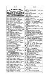
HARDWARE 645 HATS Hardware and Cutl
- Page 652 and 653:
HEAT 647 HOOP Heat Regulating. John
- Page 654 and 655:
HORSE 649 HOSPITALS Nolan John J 95
- Page 656 and 657:
HOTELS 651 ICE •Hotel-sterling Ot
- Page 658 and 659:
ICE 653 INSTALLMENT Pffole Harry 82
- Page 660 and 661:
INSURANCE 655 INSURANCE CARL KLEVE
- Page 662 and 663:
INSURANCE 657 INSURANCE Ferris Agen
- Page 664 and 665:
INSURANCE 659 INSURANCE German Mutu
- Page 666 and 667:
INSURANCE 661 INSURANCE American Ce
- Page 668 and 669:
INSURANCE 663 INSURANCE Glens Falls
- Page 670 and 671:
INSURANCE 665 INSURANCE New Amsterd
- Page 672 and 673:
INSURANCE 667 INTERIOR Southern Sur
- Page 674 and 675:
INVESTMENTS 669 IRON CINCINNATI IRO
- Page 676 and 677:
IRON 671 JEWELERS FORBUS J. F. A CO
- Page 678 and 679:
LABELS 673 LADIES Labels. SCHARF TA
- Page 680 and 681:
LAMPS 675 LAUNDRIES Lamps. (See als
- Page 682 and 683:
LEAD 677 LIBRARIES Lead Pips Manufs
- Page 684 and 685:
LIQUORS 679 LIVERY Liquors. (See Wi
- Page 686 and 687:
LOAN 681 LODGING LEVI HARRY J., Bro
- Page 688 and 689:
LUMBER 683 LUMBER 'PHONE WEST 1330.
- Page 690 and 691:
LUMBER 686 LUNCH Bosken Henry 3408
- Page 692 and 693:
MACHINE 687 MACHINERY EASTERN MACHI
- Page 694 and 695:
MACHINISTS 689 MAIL Benz Adam & Son
- Page 696 and 697:
MANICURES 691 MANUFACTURERS White B
- Page 698 and 699:
MANUFACTURERS 693 MANUFACTURERS (Ha
- Page 700 and 701:
MANUFACTURERS' 695 MARBLE (Steel Ta
- Page 702 and 703:
MEATS 697 MEDICINES GERMAN MEDICINE
- Page 704 and 705:
MEN'S 699 MESSENGER Gordon David 12
- Page 706 and 707:
MICA 701 MILL Mica. Munsell Eugene
- Page 708 and 709:
MILLINERY 703 MIRROR Sander M & E 2
- Page 710 and 711:
MOTOR 705 MOVING Motor Manufs. BOBB
- Page 712 and 713:
MULTIGRAPH 707 MUSIC Multigrapli Ma
- Page 714 and 715:
MUSIC 709 MUSIC Hollweck Theo W 142
- Page 716 and 717:
MUSIC 711 NECKWEAR Winter Adelaide
- Page 718 and 719:
NEWSPAPERS. 713 NEWSPAPERS Publishe
- Page 720 and 721:
NOTARIES 715 NOTARIES Alexander Wm
- Page 722 and 723:
NOTARIES 717 NOTARIES Ginter G A 90
- Page 724 and 725:
NOTARIES 719 NOTARIES Minges Michae
- Page 726 and 727:
NOTARIES 721 NOTIONS Todd Horace M
- Page 728 and 729:
NURSES 723 NURSES Bairnsfather Evel
- Page 730 and 731:
NURSES 725 NURSES Mueller Hattie 37
- Page 732 and 733:
OFFICE 727 OIL The Robt Clarke Book
- Page 734 and 735:
ORNAMENTAL 729 OYSTERS Ornamental I
- Page 736 and 737:
PAINTS 731 PAINTERS Nunn E E 1334 M
- Page 738 and 739:
PAINTERS 733 PAPER qnlain Patrick 5
- Page 740 and 741:
PARQUETRY 735 PATENT PATENTS. 519 M
- Page 742 and 743:
PERIODICAL 737 PHOTOGRAPHERS Period
- Page 744 and 745:
PHYSICIANS 739 PHYSICIANS Broeman Q
- Page 746 and 747:
PHYSICIANS 741 PHYSICIANS Jacobs Wm
- Page 748 and 749:
PHYSICIANS 743 PHYSICIANS
- Page 750 and 751:
PIANO 745 PIANOS TUNING. 'Phone Avo
- Page 752 and 753:
PIANOS uf PICTURES 106EPH S. HOLLME
- Page 754 and 755:
PLANING i^9 PLASTERERS Ferris Chas
- Page 756 and 757:
PLUMBERS 751 PLUMBERS Crotty Edward
- Page 758 and 759:
PLUMBERS 753 POST Plumbers' Marble.
- Page 760 and 761:
PRESERVING 755 PRINTERS Lippincott
- Page 762 and 763:
PRINTERS 757 PRINTERS Schultz Print
- Page 764 and 765:
PULLEYS 759 RAGS Scallan W B & Co 1
- Page 766 and 767:
RANGES 761 REAL •PHONTIS: MAIN 32
- Page 768 and 769:
REAL 763 REAL GRBENE W. Z., 519 Fir
- Page 770 and 771:
REAL 765 REDI^TILLERS Qm Ith •Wm
- Page 772 and 773:
RESTAURANTS 767 RESTAURANTS Climer
- Page 774 and 775:
RIVETS 769 ROOFERS Rivet*. Boebinge
- Page 776 and 777:
ROOFING 771 RUBBER Rooflng Pitch. B
- Page 778 and 779:
SADDLES 773 SALOONS schroeder Fred
- Page 780 and 781:
SALOONS 775 SALOONS Foppe Geo 1001
- Page 782 and 783:
SALOONS , 777 SALOONS Murphy John H
- Page 784 and 785:
SALOONS 779 SANITARY WImberg Geo 76
- Page 786 and 787:
SCHOOLS 781 SCHOOL CAMPBELL COMMERC
- Page 788 and 789:
SEEDS 783 SEWER Manthey's Seed Stor
- Page 790 and 791:
SHEET 785 SHOE Kirk & Blum, York an
- Page 792 and 793:
SHOW 787 SIGN Show Cards. Beach The
- Page 794 and 795:
SILVER 789 SLAUGHTER ESTABLISHED 18
- Page 796 and 797:
SOFT 791 STACK Soft Drinks. Braun E
- Page 798 and 799:
STEAM 793 STEAMBOAT Steam Ejectors.
- Page 800 and 801:
STEEL 795 STENOGRAPHERS DOUGLAS A.
- Page 802 and 803:
STONE 797 STORAGE Danjodt Matthew 2
- Page 804 and 805:
STOVES 799 SUBSCRIPTION Kleemall Th
- Page 806 and 807:
TAILORS 801 TAILORS Tailors'Gas Iro
- Page 808 and 809:
TAILORS 803 TAILOR Sammet Bros 123
- Page 810 and 811:
TAILORS 805 TAXIDERMISTS Fleischer
- Page 812 and 813:
TEAS 807 THEATERS Teas, Wholesale.
- Page 814 and 815:
TIN 809 TINWARE Tin Plate Manufs. A
- Page 816 and 817:
T6ILET 811 TOWEL WE KEER YOU CLEAN.
- Page 818 and 819:
TRANSLATION 813 TURNERS Translation
- Page 820 and 821:
TYPEWRITTEN 815 UMBRELLA '^ff
- Page 822 and 823:
UPHOLSTERERS 817 VASES orlmm Paul G
- Page 824 and 825:
VETERINARY 819 WAGON Veterinary Hos
- Page 826 and 827:
WALL 821 WALL BACHEBERLE CHAS., Wli
- Page 828 and 829:
WATCH 823 WATCHES Hofmeler & Ott rm
- Page 830 and 831:
WEIGHING 825 WHISKIES Weighing Bure
- Page 832 and 833:
WHITEWASHERS 827 WINES Boland Robt
- Page 834 and 835:
WIRE 829 WOOL Wire Fence Manufs.(Wh
- Page 836 and 837:
CLUB REGISTER Giving the Names and
- Page 838 and 839:
Armstrong B S 2496 Observatory Rd A
- Page 840 and 841:
Ditmars John A 301 4th Nat Bk Bldg
- Page 842 and 843:
Hardy Fred, Leesburg O Hargltt Robt
- Page 844 and 845:
Lent L A 644 Lincoln. Av Leonard Ha
- Page 846 and 847:
Porter K E 1016 1st Nat Bk Bldg Pou
- Page 848 and 849:
Strietelmeler J E 567 Stewart Pl St
- Page 850 and 851:
Baker James Pryor 1212 W Liberty Ba
- Page 852 and 853:
Dornette John Jr 1250 Harrison Av D
- Page 854 and 855:
Heflebower R C 22 W 7th Heiat A, St
- Page 856 and 857:
TnwensteIn>H 412 Elm Lowr"e S Gale,
- Page 858 and 859:
Puchta Geo 201 W Pearl Pumphrey Cla
- Page 860 and 861:
Thorndyke Wm sec Court and Main Thu
- Page 862 and 863:
CINCINNATI ART CLUB 857 THE CINCINN
- Page 864 and 865:
CINCINNATI CHAMBER OF COMMERCE 869
- Page 866 and 867:
CINCINNATI CHAMBER OF COMMERCE 861
- Page 868 and 869:
CINCINNATI CHAMBER OF COMMERCE 863
- Page 870 and 871:
CINCINNATI CHAMBER OF COMMERCE 865
- Page 872 and 873:
CINCINNATI CHAMBER OF COMMERCE 867
- Page 874 and 875:
CINCINNATI CHAMBER OF COMMERCE 869
- Page 876 and 877:
CINCINNATI CHAMBER OF COMMERCE 871
- Page 878 and 879:
CINCINNATI CHAMBER OF COMMERCE 873
- Page 880 and 881:
CINCINNATI ROTARY CLUB 875 CINCINNA
- Page 882 and 883:
Robben H J 327 W 4th Robertson Wm B
- Page 884 and 885:
CINCINNATI WOMAN'S CLUB 879 THE CIN
- Page 886 and 887:
Freiberg Mrs Albert H 3577 Alaska A
- Page 888 and 889:
Miller Mrs John W 226 Albany Av Mil
- Page 890 and 891:
Wheeler Miss Ada M, The Nelson, Wal
- Page 892 and 893:
CITY CLUB THE CITY CLUB. Meets at B
- Page 894 and 895:
Keys John B 1329 Union Trust Bldg K
- Page 896 and 897:
COMMERCIAL CLUB OF CINCINNATI 891 T
- Page 898 and 899:
Burgess W H 308 Grove Av, Wyoming B
- Page 900 and 901:
Hohnhorst W T 63 W llth, Covington
- Page 902 and 903:
Price Harry J 224 W 6th Quitman Art
- Page 904 and 905:
Dalrymple H R box 52 Columbus O Dal
- Page 906 and 907:
Lewis Marion K 3980 Rose Hill Av Le
- Page 908 and 909:
Lalold Alex, Sinton Hotel Lackman A
- Page 910 and 911:
Doepke Wm L fiat W Vista Terrace ea
- Page 912 and 913:
walker Chas A J 1539 Madison Av Cov
- Page 914 and 915:
UNIVERSITY CLUB OF CINCINNATI 909 F
- Page 916 and 917:
WILLIAMS' DIRECTORY ^^E TOWNS i VIL
- Page 918 and 919:
Cleage Henry lab bds America Turner
- Page 920 and 921:
Hathaway Mary wid Wm h River Rd, P
- Page 922 and 923:
Moore Andrew lab h River Rd, P O Se
- Page 924 and 925:
Taylor Jos H lab h 1st st (May) Tay
- Page 926 and 927:
Early Wm lab h Carthage Av nr Mills
- Page 928 and 929:
ARLINGTON HEIGHTS-BARNESBURG 923 Sw
- Page 930 and 931:
WuUenweber Fred farm hand Yeager Ba
- Page 932 and 933:
Bachmann Frank J driver h Fenton Av
- Page 934 and 935:
CAMP DENNISON—CHERRY GROVE 929 Cu
- Page 936 and 937:
Baechle John billiards 3001 Harriso
- Page 938 and 939:
Citron Samuel h 3811 North Bend Rd
- Page 940 and 941:
Geiser Frank V cabmkr h 3709 Carson
- Page 942 and 943:
Huenefeld Walter W elk h 3635 Woodb
- Page 944 and 945:
Lovett J B motorman h 3966 Washingt
- Page 946 and 947:
CHEVIOT Nlnnemann Amelia h s w c Gl
- Page 948 and 949:
Rummel Oscar O bricklayer h 3812 Ap
- Page 950 and 951:
Spaeth L Wm elk nwc Harrison Av and
- Page 952 and 953:
Weber John A lab h 3415 Garable Av
- Page 954 and 955:
CLEVES 949 Caine George E mgr nec S
- Page 956 and 957:
Hillgardner Robt engineer h Miami A
- Page 958 and 959:
Richards John lab h Harrison Av (Ro
- Page 960 and 961:
Toung Ida''wid Chester h Spring st
- Page 962 and 963:
^Raltze Henry R far (Millie) Rothga
- Page 964 and 965:
Miller Mary h Webster Av Miller Ste
- Page 966:
Hecht John far Hollander Edward J b
- Page 969 and 970:
964 ELMWOOD PLACE Blom John G Ironw
- Page 971 and 972:
966 ELMWOOD PLACE Cincinnati, Hamil
- Page 973 and 974:
968 Bsllnger Chas driver h 32 Chest
- Page 975 and 976:
970 ELMWOOD PLACE Haramell Chester
- Page 977 and 978:
972 ELMWOOD PLACE JONES O. G., Dry
- Page 979 and 980:
974 Little Frank M switchraan h 401
- Page 981 and 982:
976 ELMWOOD PLACE Nagel Wm tailor h
- Page 983 and 984:
978 Roth Elizabeth wid Lawrence h 5
- Page 985 and 986:
980 ELMWOOD PLACE Smith Elmer L boi
- Page 987 and 988:
982 VonRohr Henry L agt Metropolita
- Page 989 and 990:
984 FERNALD—FRUIT HILL FERNALD (T
- Page 991 and 992:
986 GLENDALE Bloom John caretaker G
- Page 993 and 994:
988 GLENDALE JOHN D. rREYHOr, D EAL
- Page 995 and 996:
990 Heher John G atty h n vy c Shar
- Page 997 and 998:
992 GLENDALE Mahon Sallie wid Mack
- Page 999 and 1000:
994 GLENDALE Ryan Michael lab h Con
- Page 1001 and 1002:
996 GRLFITTHS Miami Township, is a
- Page 1003 and 1004:
998 HARRISON citizens Bank, Prank B
- Page 1005 and 1006:
1000 HARRISON Holden Geo mach hand
- Page 1007 and 1008:
1002 HARRISON Perrine Atwood lumber
- Page 1009 and 1010:
1004 HARRISON—HAZELWOOD Winkley W
- Page 1011 and 1012:
1006 HOOVEN—LOCKLAND Perck Geo J
- Page 1013 and 1014:
1008 LOCKLAND Bartlett Marjorie pia
- Page 1015 and 1016:
1010 LOCKLAND Buchanan John H agt P
- Page 1017 and 1018:
1012 LOCKLAND Cutter Edith h 318 Ce
- Page 1019 and 1020:
1014 LOCKLAND THE FIRST NATIONAL BA
- Page 1021 and 1022:
1016 LOCKLAND Gertz Gus A agt h 112
- Page 1023 and 1024:
1018 LOCKLAND Haught Henry I paperm
- Page 1025 and 1026:
1020 LOCKLAND Husman Ervln steno 11
- Page 1027 and 1028:
1022 LOCKLAND Lane Henry cook bds 3
- Page 1029 and 1030:
1024 LOCKLAND Martin Harry mattress
- Page 1031 and 1032:
1026 LOCKLAND Niehaus Geo metalwkr
- Page 1033 and 1034:
1028 LOCKLAND Proud John far h n e
- Page 1035 and 1036:
1030 LOCKLAND St Clair Annie wid Ge
- Page 1037 and 1038:
1032 LOCKLAND Sparks Pearl h 237 Fo
- Page 1039 and 1040:
1034 LOCKLAND Tye David lab h 309 N
- Page 1041 and 1042:
1036 LOCKLAND White Richard lab h 7
- Page 1043 and 1044:
1038 LOVELAND Hegler Annie P wid Ja
- Page 1045 and 1046:
1040 MADEIRA Bean A F trav salesman
- Page 1047 and 1048:
1042 MADEIRA—MIAMI Reeder Cliffor
- Page 1049 and 1050:
1044 MILFORD—MONTGOMERY Holzlin L
- Page 1051 and 1052:
1046 MONTGOMERY—MT. HEALTHY Ross
- Page 1053 and 1054:
1048 MT. HEALTHY Davis Albert far h
- Page 1055 and 1056:
1050 MT. HEALTHY Heidfeld Jos bds 5
- Page 1057 and 1058:
1052 MT. HEALTHY Lutkehaus John h n
- Page 1059 and 1060:
1054 Roettele Edward (Mt Healthy Br
- Page 1061 and 1062:
1056 MT. HEALTHY Vierling Edraunda
- Page 1063 and 1064:
1058 Brinkmann Clemens dairy, R R N
- Page 1065 and 1066:
1060 NEWTOWN Durham Samuel far h Ch
- Page 1067 and 1068:
1062 NORTH BEND Butler Jos A jr lab
- Page 1069 and 1070:
1064 NORTH BEND—NORTH COLLEGE HIL
- Page 1071 and 1072:
1066 NORTH COLLEGE HILL Muenlch Pra
- Page 1073 and 1074:
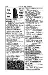
Safe Deposit Boxes, - - - $2.00 Per
- Page 1075 and 1076:
1070 NORWOOD Ahlborn Louisa h 1767
- Page 1077 and 1078:
1072 NORWOOD Armstrong Ploie May h
- Page 1079 and 1080:
1074 Balllnger Dewey hangerrakr h 5
- Page 1081 and 1082:
1076 NORWOOD Becht Clara dressnikr
- Page 1083 and 1084:
1078 NORWOOD Bennett Marjorle maid
- Page 1085 and 1086:
1080 Bilz E Richard mach h 4915 For
- Page 1087 and 1088:
1082 NORWOOD BoUwinkel Wm C mach h
- Page 1089 and 1090:
1084 NORWOOD Brandhorst Fred F engr
- Page 1091 and 1092:
1086 NORWOOD Bronson Jennie cook 23
- Page 1093 and 1094:
1088 NORWOOD Buhr Alfred D P driver
- Page 1095 and 1096:
1090 NORWOOD Cady Rosalind student
- Page 1097 and 1098:
1092 NORWOOD Chaney Evelyn L h 2048
- Page 1099 and 1100:
1094 NORWOOD Cline Geo J foreman h
- Page 1101 and 1102:
1096 NORWOOD Corcoran Bffle tchr h
- Page 1103 and 1104:
1098 NORWOOD Cummings Wm painter h
- Page 1105 and 1106:
1100 NORWOOD Decatur Elmer pressfee
- Page 1107 and 1108:
1102 NORWOOD Diehl Philip G bkpr h
- Page 1109 and 1110:
1104 NORWOOD Drapp Carol elk h 3934
- Page 1111 and 1112:
1106 NORWOOD Edmondson Robt E h 422
- Page 1113 and 1114:
1108 NORWOOD Ervln Anna tchr Marion
- Page 1115 and 1116:
1110 NORWOOD Pels Augusta saleslady
- Page 1117 and 1118:
1112 NORWOOD Flake Lillian E h 2703
- Page 1119 and 1120:
1114 NORWOOD Freer Guy M traffic mg
- Page 1121 and 1122:
L116 NORWOOD Garbeth Frank locksrai
- Page 1123 and 1124:
1118 NORWOOD Gilroy Alice h 4008 El
- Page 1125 and 1126:
1120 NORWOOD Gravenkeraper Chas car
- Page 1127 and 1128:
1122 NORWOOD Guinn Millard F elk h
- Page 1129 and 1130:
1124 NORWOOD Hamlin Horace D tauyer
- Page 1131 and 1132:
1126 NORWOOD Hartung Conrad A molde
- Page 1133 and 1134:
1128 NORWOOD Heiselman Elsie dressm
- Page 1135 and 1136:
1130 Hester Myrtle phone op n w c M
- Page 1137 and 1138:
1132 NORWOOD Hofmann
- Page 1139 and 1140:
1134 NORWOOD Howell Ethel R wid Byr
- Page 1141 and 1142:
1136 NORWOOD Huschle Rose XJ salesl
- Page 1143 and 1144:
1138 NORWOOD Jeckel Myrtle M h 2314
- Page 1145 and 1146:
1140 NORWOOD Justin Earl C h 3960 R
- Page 1147 and 1148:
1142 NORWOOD Kellner Irraa steno Al
- Page 1149 and 1150:
1144 NORWOOD King Geo C heating sup
- Page 1151 and 1152:
1146 NORWOOD Knabe Wm v pres and tr
- Page 1153 and 1154:
1148 NORWOOD Kress Albert B carp 52
- Page 1155 and 1156:
1150 NORWOOD Lakenan J & Son (John
- Page 1157 and 1158:
1152 NORWOOD Leaf Flora h 4417 Flor
- Page 1159 and 1160:
1154 NORWOOD Lindenschmldt Mary A h
- Page 1161 and 1162:
1156 NORWOOD Lowe Ha'rry L h 5028 M
- Page 1163 and 1164:
1158 McDowell Squire T carp h 5222
- Page 1165 and 1166:
1160 NORWOOD Mackenzie Frank W chie
- Page 1167 and 1168:
1162 NORWOOD Martz O G supervisor o
- Page 1169 and 1170:
1164 NORWOOD Mendel-Drucker Co (The
- Page 1171 and 1172:
1166 NORWOOD Miller Carrie wid Henr
- Page 1173 and 1174:
1168 NORWOOD Mohlnjan Theo H h 3804
- Page 1175 and 1176:
1170 NORWOOD Mountel Loretta M h 21
- Page 1177 and 1178:
1172 NORWOOD Napolltano Jos h 4108
- Page 1179 and 1180:
1174 NORWOOD Norris Chas elk h 5030
- Page 1181 and 1182:
1176 NORWOOD O'Hare Thos porter h 4
- Page 1183 and 1184:
1178 NORWOOD Palmer Harry M real es
- Page 1185 and 1186:
1180 NORWOOD Pfau Mfg Co (The) Chas
- Page 1187 and 1188:
1182 NORWOOD Pottebaum Anna H h 176
- Page 1189 and 1190:
1184 Ranke Lillian h 1724 Sherman A
- Page 1191 and 1192:
1186 NORWOOD Renner Sarah (wid Wm S
- Page 1193 and 1194:
1188 NORWOOD Rilt John J elk h 2012
- Page 1195 and 1196:
1190 NORWOOD Ronan Clarence J elk T
- Page 1197 and 1198:
1192 NORWOOD Rush Jas W lab h 4231
- Page 1199 and 1200:
1194 NORWOOD Scales Mark P rubberwk
- Page 1201 and 1202:
1196 NORWOOD Schmldlin Geo A W asst
- Page 1203 and 1204:
1198 NORWOOD Schrlckel Henry C raea
- Page 1205:
1200 NORWOOD Schwarz E H prop Norwo
- Page 1208 and 1209:
Shively Paul A h 2134 Cameron Av Co
- Page 1210 and 1211:
NORWOOD 1205 fimith G Herbert elk s
- Page 1212 and 1213:
Suringfleld F & M Ins Co of Springf
- Page 1215 and 1216:
1210 NORWOOD stockman Burt H traffi
- Page 1217 and 1218:
1212 NORWOOD Sun Insurance Office o
- Page 1219 and 1220:
1214 NORWOOD Thesing Altaert elect'
- Page 1221 and 1222:
1216 NORWOOD ToUett Edward G grinde
- Page 1223 and 1224:
1218 NORWOOD utz Wra H elect'n h 28
- Page 1225 and 1226:
1220 NORWOOD Waggoner Edgar raach h
- Page 1227 and 1228:
1222 NORWOOD Weber John lab bds 481
- Page 1229 and 1230:
1224 NORWOOD Werden Roy B elk The U
- Page 1231 and 1232:
1226 Whiting View Co (The) Wm A Whi
- Page 1233 and 1234:
1228 WlUraan Eber lab bds 2119 Mapl
- Page 1235 and 1236:
1230 NORWOOD Woeltje Herman F shoem
- Page 1237 and 1238:
1232 NORWOOD Yater Meli.-isa wid Ho
- Page 1239 and 1240:
1234 PLAINVILLE—PLEASANT RUN McNe
- Page 1241 and 1242:
1236 READING Atlas Assurance Co (Li
- Page 1243 and 1244:
1238 READING Burns Barrett A supt R
- Page 1245 and 1246:
1240 READING Elsbrock Geo lab h 132
- Page 1247 and 1248:
1242 READING Grein Frank woodwkr h
- Page 1249 and 1250:
1244 READING Hontar Vasile lata tad
- Page 1251 and 1252:
1246 READING Kruse ]V4ary wid Wm h
- Page 1253 and 1254:
1248 READING Meyers Bprnard ragr 20
- Page 1255 and 1256:
1250 READING Rhodes Frank E glass b
- Page 1257 and 1258:
1262 READING Siebel Peter glasswkr
- Page 1259 and 1260:
1254 READING Verkamp Jos A elk The
- Page 1261 and 1262:
1256 RENSSELAER PARK RENSSELAER PAR
- Page 1263 and 1264:
1258 ROSSMOYNE Blrrel Elsie h Blue
- Page 1265 and 1266:
1260 ST. BERNARD Amberg Jerome pres
- Page 1267 and 1268:
1262 ST. BERNARD Boehringer Rosa wi
- Page 1269 and 1270:
1264 ST. BERNARD Carter Maggie J h
- Page 1271 and 1272:
1266 ST. BERNARD Dover John G lab h
- Page 1273 and 1274:
1268 ST. BERNARD Frankel Herbert G
- Page 1275 and 1276:
1270 ST. BERNARD Hake Chas F jr gen
- Page 1277 and 1278:
1272 ST. BERNARD Hoffmeister H Walt
- Page 1279 and 1280:
1274 ST. BERNARD Kathmann August F
- Page 1281 and 1282:
1276 Kunz Rosa tailoress h 4720 Car
- Page 1283 and 1284:
1278 Maurer Mrs Catherine h 212 McC
- Page 1285 and 1286:
1280 ST. BERNARD Nieman Oliver C fi
- Page 1287 and 1288:
1282 ST. BERNARD Rehme Alberta R h
- Page 1289 and 1290:
1284 ST. BERNARD Schell Andrew lab
- Page 1291 and 1292:
1286 ST. BERNARD Schwetschenau Jos
- Page 1293 and 1294:
1288 ST. BERNARD Tausch Josephine h
- Page 1295 and 1296:
1290 ST. BERNARD Waytale H C phys 4
- Page 1297 and 1298:
1292 SAYLER PARK—SHARONVILLE SAYL
- Page 1299 and 1300:
1294 SHARONVILLE Miller Mrs Janle R
- Page 1301 and 1302:
1296 SILVERTON Brown Eupheraia h St
- Page 1303 and 1304:
1298 Meier John C pres The John C M
- Page 1305 and 1306:
1300 SPRINGDALE Boerner Louise E tc
- Page 1307 and 1308:
1302 TERRACE PARK Conkling Roy B pr
- Page 1309 and 1310:
1304 WINSLOW PARK—WOODLAWN Grooms
- Page 1311 and 1312:
1306 WYOMING Allen Ivan J treas h 4
- Page 1313 and 1314:
1308 WYOMING Cowing Mildred res R A
- Page 1315 and 1316:
1310 WYOMING Hartwelf Mary J wid Ge
- Page 1317 and 1318:
1312 McGilliard Chas livery 509 Wyo
- Page 1319 and 1320:
1314 WYOMING Rolfes Herraan U garde
- Page 1321 and 1322:
1316 WYOMING—YANKEETOWN VonRohr C
- Page 1323 and 1324:
BEWARE Of the fake directory man, h
- Page 1325 and 1326:
1320 AFS RURAL RESIDENTS, APW Afspm
- Page 1327 and 1328:
1322 BAG RURAL RESIDENTS. BAR Backs
- Page 1329 and 1330:
1324 BEG RURAL RESIDENTS. BEN Becke
- Page 1331 and 1332:
1326 BET RURAL RESIDENTS. BLO Betz
- Page 1333 and 1334:
1328 BOO RURAL RESIDENTS. BRA Booth
- Page 1335 and 1336:
1330 BRO RURAL RESIDENTS. BRU Brock
- Page 1337 and 1338:
1332 BUG RURAL RESIDENTS. BUT Bughe
- Page 1339 and 1340:
1334 GHA RURAL RESIDENTS. GLO Chalf
- Page 1341 and 1342:
1336 GON RURAL RESIDENTS. GRA Conov
- Page 1343 and 1344:
1338 DAR RURAL RESIDENTS. DEM Darby
- Page 1345 and 1346:
1340 DOE RURAL RESIDENTS. —* Doet
- Page 1347 and 1348:
1342 EIF RUftAL RESIDENTS. ERR Eife
- Page 1349 and 1350:
1344 FED RURAL RESIDENTS. FET Fedel
- Page 1351 and 1352:
1346 FIT RURAL RESIDENTS. FOS Fitzg
- Page 1353 and 1354:
1348 FUG RURAL RESIDENTS. GAU Fuchs
- Page 1355 and 1356:
1350 GLA RURAL RESIDENTS. GRE Glase
- Page 1357 and 1358:
1352 GUD RURAL RESIDENTS. HAH Gudge
- Page 1359 and 1360:
1354 HAN RURAL RESIDENTS. HAU Hansm
- Page 1361 and 1362:
1356 HEI RURAL RESIDENTS. HEN Helle
- Page 1363 and 1364:
1358 HEY RURAL RESIDENTS. HOF Heyob
- Page 1365 and 1366:
1360 HOO RURAL RESIDENTS. HUG Hoove
- Page 1367 and 1368:
1362 ING RURAL RESIDENTS. JEN Ingal
- Page 1369 and 1370:
1364 JUE RURAL RESIDENTS. KEL Jueng
- Page 1371 and 1372:
1366 KIS RURAL RESIDENTS. KOG Kissi
- Page 1373 and 1374:
1368 KRA RURAL RESIDENTS. KUH Krame
- Page 1375 and 1376:
1370 LAN RURAL RESIDENTS. LEM Langh
- Page 1377 and 1378:
1372 LIN RURAL RESIDENTS. LOR Link
- Page 1379 and 1380:
1374 McG RURAL RESIDENTS. MAD McClu
- Page 1381 and 1382:
1376 MAR RURAL RESIDENTS. MEG Marti
- Page 1383 and 1384:
1378 MEY RURAL RESIDENTS. MIL Meyer
- Page 1385 and 1386:
1380 MON RURAL RESIDENTS. MOY Montg
- Page 1387 and 1388:
1382 MYE RURAL RESIDENTS. NEW Myers
- Page 1389 and 1390:
1384 OBE RURAL RESIDENTS. PAD Oberf
- Page 1391 and 1392:
1386 PES RURAL RESIDENTS. PIE Pessl
- Page 1393 and 1394:
1388 POW RURAL RESIDENTS. RAN Powne
- Page 1395 and 1396:
1390 REI RURAL RESIDENTS. RIE Keink
- Page 1397 and 1398:
1392 ROG RURAL RESIDENTS. ROS Rocke
- Page 1399 and 1400:
1394 RUP RURAL RESIDENTS, SAT Rupp
- Page 1401 and 1402:
1396 SGH ftURAL RESIDENTS. SGH Schi
- Page 1403 and 1404:
1398 SGH RURAL RESIDENTS. SGH Schre
- Page 1405 and 1406:
1400 SGO RURAL RESIDENTS. SEN Scott
- Page 1407 and 1408:
1402 SHU RURAL RESIDENTS. SMI Shunk
- Page 1409 and 1410:
1404- SOR RURAL RESIDENTS. STA Strt
- Page 1411 and 1412:
1406 STE RURAL RESIDENTS. STO steph
- Page 1413 and 1414:
1408 SUN RURAL RESIDENTS. THI Sunbe
- Page 1415 and 1416:
1410 TRA RURAL RESIDENTS. VAI Traut
- Page 1417 and 1418:
1412 VON RUftAIi RESIDENTS. WAL Von
- Page 1419 and 1420:
1414 WEB RURAL RESIDENTS. WEL Weber
- Page 1421 and 1422:
1416 WHE RURAL RESIDENTS. WIL Wheat
- Page 1423 and 1424:
1418 WIN RURAL RESIDENTS. WOL t. Wi
- Page 1425 and 1426:
1420 WUE RURAL RESIDENTS. ZIM Wuest
- Page 1427 and 1428:
Can You Hfford To miss a full repre
- Page 1429 and 1430:
1424 AUT Hamilton County Business D
- Page 1431 and 1432:
1426 BLA Hamilton County Business D
- Page 1433 and 1434:
1428 CAN Hamilton County Business D
- Page 1435 and 1436:
1430 CIG Hamilton County Business D
- Page 1437 and 1438:
1432 COA Hamilton County Business D
- Page 1439 and 1440:
1434 DAI Hamilton County Business D
- Page 1441 and 1442:
1436 DRE Hamilton County Business D
- Page 1443 and 1444:
1438 FLO Hamilton County Business D
- Page 1445 and 1446:
1440 GAS Hamilton County Business D
- Page 1447 and 1448:
1442 GRO Hamilton County Business D
- Page 1449 and 1450:
1444 INS Hamilton County Business D
- Page 1451 and 1452:
1446 LUM Hamilton County Business D
- Page 1453 and 1454:
1448 NEW Hamilton County Business D
- Page 1455 and 1456:
1450 PAI Hamilton County Business D
- Page 1457 and 1458:
1452 PRE Hamilton County Business D
- Page 1459 and 1460:
1454 SAL Hamilton County Business D
- Page 1461 and 1462:
1456 STE Hamilton County Business D
- Page 1463 and 1464:
1458 WAL Hamilton County Business D
- Page 1465 and 1466:
1460 PARCEL POST GUIDE The limit of
- Page 1467 and 1468:
1462 PARCEL POST GUIDE Weight. Zone
- Page 1469 and 1470:
1464 CALIFORNIA—FLORIDA Post Offi
- Page 1471 and 1472:
1466 GEORGIA—ILLINOIS Post Office
- Page 1473 and 1474:
1468 INDIANA—KANSAS Post Office.
- Page 1475 and 1476:
1470 KANSAS—KENTUCKY Post Office.
- Page 1477 and 1478:
1472 KENTUCKY Post Office. Zone. Ho
- Page 1479 and 1480:
1474 KENTUCKY—MICHIGAN Post Offic
- Page 1481 and 1482:
1476 MICHIGAN—MINNESOTA Post Offi
- Page 1483 and 1484:
1478 MINNESOTA—MISSISSIPPI Post O
- Page 1485 and 1486:
1480 MONTANA Post Office. Zone. Big
- Page 1487 and 1488:
1482 NEW YORK Post Office. Zone. Po
- Page 1489 and 1490:
1484 NORTH CAROLINA Post Office. Zo
- Page 1491 and 1492:
1486 NORTH CAROLINA—NORTH DAKOTA
- Page 1493 and 1494:
1488 OHIO Post Office. Zone. Post O
- Page 1495 and 1496:
1490 OHIO—OKLAHOMA Post Office. Z
- Page 1497 and 1498:
1492 OREGON—PENNSYLVANIA Post Off
- Page 1499 and 1500:
1494 PENNSYLVANIA Post Office. Zone
- Page 1501 and 1502:
1496 TENNESSEE—TEXAS Post Office.
- Page 1503 and 1504:
1498 TEXAS—VIRGINIA Post Office.
- Page 1505 and 1506:
1500 VIRGINIA Post Office. Zone. Ha
- Page 1507 and 1508:
1502 WASHINGTON—WEST VIRGINIA Pos
- Page 1509:
_ • J ^ AMERICVS V. WILLIAMS, Pre