1 main report - Roads and Highways Department
1 main report - Roads and Highways Department
1 main report - Roads and Highways Department
- TAGS
- roads
- highways
- www.rhd.gov.bd

You also want an ePaper? Increase the reach of your titles
YUMPU automatically turns print PDFs into web optimized ePapers that Google loves.
Government of the People’s Republic of Bangladesh<br />
Ministry of Communications<br />
<strong>Roads</strong> <strong>and</strong> <strong>Highways</strong> <strong>Department</strong><br />
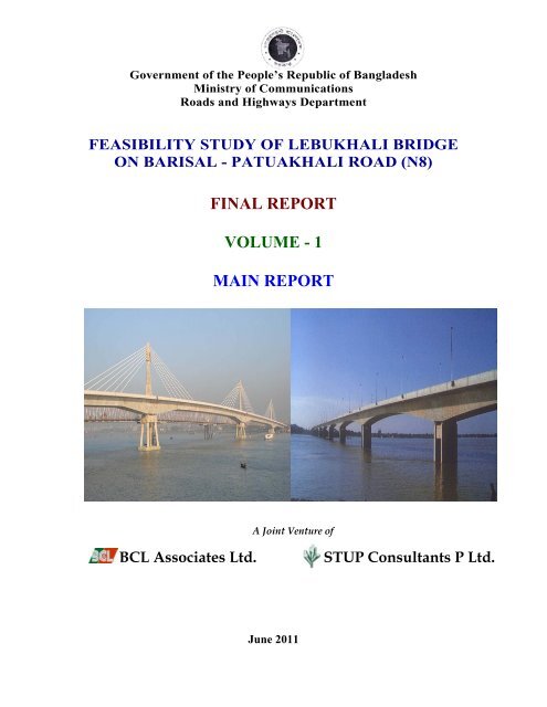
FEASIBILITY STUDY OF LEBUKHALI BRIDGE<br />
ON BARISAL - PATUAKHALI ROAD (N8)<br />
FINAL REPORT<br />
VOLUME - 1<br />
MAIN REPORT<br />
A Joint Venture of<br />
BCL Associates Ltd. STUP Consultants P Ltd.<br />
June 2011
BCL Associates Ltd.<br />
STUP Consultants P Ltd.<br />
Feasibility Study of Lebukhali Bridge<br />
Ref: LB/FS/015/16 Date: 28 June 2011<br />
To<br />
Project Director <strong>and</strong> Additional Chief Engineer, RHD<br />
Bridge Management Wing<br />
<strong>Roads</strong> <strong>and</strong> <strong>Highways</strong> <strong>Department</strong><br />
Sarak Bhaban, Ramna, Dhaka.<br />
Kind Attention: Mr. Md. Saidul Haque<br />
Sub: Feasibility Study of Lebukhali Bridge on Barisal - Patuakhali Road (N8)<br />
- Submission of the Final Feasibility Study Report.<br />
Dear Sir,<br />
We are pleased to submit herewith the Final Feasibility Study Report after incorporation of all<br />
comments <strong>and</strong> suggestions made during the presentation of Draft Feasibility Study Report on<br />
15/6/2011, in 3 Volumes together with one soft copy in CD RoM towards complete compliance of<br />
GCC clause 38 <strong>and</strong> Appendix 2 of the contract. The Contents of each of the 3 volumes are as<br />
follows:<br />
Volume - 1: Main Report – in 25 copies<br />
Volume - 2: Appendices, on the Field Surveys <strong>and</strong><br />
Investigation (Appendices 1 to 5),<br />
Schematic Design of the Bridge <strong>and</strong><br />
Approach <strong>Roads</strong> (Appendix 6) <strong>and</strong><br />
Detailed Cost Estimate (Appendix 7) – in 3 copies<br />
Volume - 3: Drawings – in 3 copies<br />
However, should you require any clarification or modification we will be pleased to offer the<br />
same through our team members who are working <strong>and</strong> ready to take up such work.<br />
Yours Sincerely,<br />
_________<br />
B.R Kundu<br />
Team Leader<br />
Encl: as stated.<br />
Cc: 1. Mr. M A Aziz – Project Director, M/s BCL Ltd. with one copy of the Report.<br />
2. Mr. Amitabha Datta – Executive Director, M/s STUP Consultants P. Ltd, with one<br />
copy of the Report.<br />
Project Office: BCL Office: STUP Office<br />
Lebukhali Bridge Project BCL Associates Limited STUP Consultants P. Ltd<br />
House-41, Road-4, Block-F, Banani, House-95A, Road-4, Block-F, Banani, P-11, Darga Road, Park Circus<br />
Dhaka-1213, BANGLADESH Dhaka-1213, BANGLADESH Kolkata-7000, INDIA<br />
Tel : 880-2-9884130 Tel: 880-2-9862713-6, Fax : 9893321 Tel: 22807430,228074431,22807046<br />
E-mail: bclgroup@bcl.bd.com E-mail: bclgroup@bcl.bd.com Fax: (91-33) 22401876, 22807531<br />
Email: kolkata@stupmail.com
Feasibility Study of Lebukhali Bridge BCL-STUP JV<br />
Final Feasibility Study Report, June 2011<br />
STRUCTURE OF FINAL REPORT<br />
Bridge Location Plan<br />
Executive Summary<br />
Abbreviations<br />
Record Notes of Meeting in the Form of Comments Matrix<br />
VOLUME-1 MAIN REPORT (THIS VOLUME)<br />
CHAPTER 1 INTRODUCTION<br />
CHAPTER 2 BRIDGE LOCATIONS AND APPROACH ROADS STUDY<br />
CHAPTER 3 TRAFFIC STUDY AND FORECAST<br />
CHAPTER 4 GEOTECHNICAL AND MATERIALS STUDY<br />
CHAPTER 5 RIVER HYDROLOGY AND HYDRAULIC STUDY<br />
CHAPTER 6 PRELIMINARY ENGINEERING AND COST ESTIMATE<br />
CHAPTER 7 SOCIAL IMPACT, RESETTLEMENT AND SOCIO-ECONOMIC STUDY<br />
CHAPTER 8 ENVIRONMENTAL IMPACT ASSESSMENT<br />
CHAPTER 9 ECONOMIC EVALUATION OF THE PROPOSED LEBUKHALI BRIDGE<br />
CHAPTER 10 CONCLUSION AND RECOMMENDATION<br />
VOLUME-2 APPENDICES<br />
APPENDIX-1 BRIDGE LOCATION STUDY<br />
APPENDIX-2 TOPOGRAPHICAL SURVEY AND GEOMETRIC DESIGN OF THE<br />
BRIDGE AND APPROACH ROADS<br />
APPENDIX-3 GEOTECHNICAL INVESTIGATIONS ALONG THE PROPOSED<br />
BRIDGE ALIGNMENT<br />
APPENDIX-4 HYDROGRAPHIC SURVEY OF THE RIVER AT PROPOSED BRIDGE<br />
LOCATION<br />
APPENDIX-5 TRAFFIC SURVEY REPORT<br />
APPENDIX-6 SCHEMATIC DESIGN OF BRIDGE AND APPROACH ROADS<br />
APPENDIX-7 COST ESTIMATE DETAIL<br />
VOLUME-3 DRAWINGS<br />
SECTION-1: PSC BOX GIRDER (OPTION-1) BRIDGE’S 12 NOS. GENERAL ARRANGEMENT<br />
DRAWINGS<br />
SECTION-2: EXTRADOSED PSC BOX GIRDER (OPTION-2) BRIDGE’S 11 NOS. GENERAL<br />
ARRANGEMENT DRAWINGS<br />
SECTION-3: TOPOGRAPHIC SURVEY 10 NOS. DRAWINGS
Feasibility Study of Lebukhali Bridge BCL-STUP JV<br />
SECTION-4: GEOMETRIC DESIGN DRAWINGS OF THE BRIDGE AND APPROACH ROADS<br />
FOR 2-ALTERNATIVE LOCATIONS, 17 NOS. DRAWINGS<br />
SECTION-5: RIVER TRAINING AND PROTECTION WORKS, 4 NOS. DRAWINGS<br />
SECTION-6: HYDROGRAPHIC SURVEY, 2 NOS. DRAWINGS<br />
SECTION-7: LAND ACQUISITION PLANS, 2 NOS. DRAWINGS<br />
SECTION-8: BEAUTIFICATION DRAWINGS<br />
(COVERED IN COMMENT MATRIX)<br />
SECTION-9: SOLAR POWER AND LIGHTING, 3 NOS. DRAWINGS<br />
Final Feasibility Study Report, June 2011
Feasibility Study of Lebukhali Bridge BCL-STUP JV<br />
FEASIBILITY STUDY OF LEBUKHALI BRIDGE ON<br />
BARISAL-PATUAKHALI ROAD (N8)<br />
FINAL REPORT<br />
VOLUME-1 MAIN REPORT<br />
CONTENTS<br />
Bridge Location Plan<br />
Executive Summary<br />
Abbreviations<br />
Record Notes of Meeting in the Form of Comments Matrix<br />
CHAPTER 1 : INTRODUCTION........................................................................................................1-1<br />
1.1 Background.................................................................................................................................1-1<br />
1.2 Project Objectives .......................................................................................................................1-4<br />
1.3 Scope of Consultancy Services...................................................................................................1-4<br />
1.4 Outline of the Report ..................................................................................................................1-7<br />
CHAPTER 2 : BRIDGE LOCATIONS AND APPROACH ROADS STUDY ................................2-9<br />
2.1 Introduction.................................................................................................................................2-9<br />
2.2 Bridge Locations Study...............................................................................................................2-9<br />
2.2.1 Salient Features of Alternative Bridge Locations Study <strong>and</strong> selection of Bridge Location .......2-9<br />
2.3 Selection of Bridge <strong>and</strong> Approach <strong>Roads</strong> Locations ................................................................2-11<br />
CHAPTER 3 : TRAFFIC STUDY AND FORECAST .....................................................................3-14<br />
3.1 Background <strong>and</strong> Objective........................................................................................................3-14<br />
3.2 Survey Methodology.................................................................................................................3-14<br />
3.2.1 Methodology Traffic Survey/Transport Study..........................................................................3-14<br />
3.2.2 Collection of Historical Data ....................................................................................................3-15<br />
3.2.3 Road Traffic Survey..................................................................................................................3-15<br />
3.2.4 Vehicle Classification ...............................................................................................................3-15<br />
3.3 Traffic Data Analysis <strong>and</strong> Presentation of Results ...................................................................3-16<br />
3.4 Analysis of Traffic Count by Individual Station.......................................................................3-17<br />
3.4.1 Traffic on Barisal-Lebukhali Ferry Ghat, Barisal End..............................................................3-17<br />
3.4.2 Traffic on Patuakhali-Lebukhali Ferry Ghat, Patuakhali End ..................................................3-18<br />
3.4.3 Traffic on Patuakhali-Amtali- Kuakata Road ...........................................................................3-18<br />
3.4.4 Non-Motorized Traffic..............................................................................................................3-19<br />
3.5 Origin-Destination Survey ........................................................................................................3-19<br />
3.5.1 Passenger Vehicle OD ..............................................................................................................3-19<br />
3.5.2 Freight Truck OD......................................................................................................................3-20<br />
3.5.3 Freight Traffic: Commodity......................................................................................................3-20<br />
3.5.4 Travel Time Delay Survey........................................................................................................3-20<br />
3.6 Approach to Traffic Forecast ....................................................................................................3-21<br />
3.7 Estimation of Traffic on the Bridge ..........................................................................................3-21<br />
3.7.1 Estimation of Normal Traffic....................................................................................................3-22<br />
3.7.2 Estimation of Diverted Traffic..................................................................................................3-22<br />
3.7.3 Estimation of Generated Traffic ...............................................................................................3-22<br />
3.8 Growth Rates <strong>and</strong> Traffic Forecast ...........................................................................................3-22<br />
3.8.1 Growth Rates Forecast..............................................................................................................3-23<br />
3.9 Traffic Projection......................................................................................................................3-24<br />
3.10 Summary of Finding for the Study ...........................................................................................3-24<br />
3.11 Conclusion ................................................................................................................................3-26<br />
CHAPTER 4 : GEOTECHNICAL AND MATERIALS STUDY ...................................................4-27<br />
4.1 Geotechnical Investigation........................................................................................................4-27<br />
4.1.1 General......................................................................................................................................4-27<br />
4.1.2 Field Investigations...................................................................................................................4-27<br />
4.1.3 Laboratory Tests .......................................................................................................................4-27<br />
Final Feasibility Study Report, June 2011 Volume-1 Main Report Page i
Feasibility Study of Lebukhali Bridge BCL-STUP JV<br />
4.1.4 Presentation of Results..............................................................................................................4-27<br />
4.2 Materials Investigations............................................................................................................4-30<br />
4.2.1 General......................................................................................................................................4-30<br />
4.2.2 Source of availability of Materials............................................................................................4-30<br />
CHAPTER 5 : RIVER HYDROLOGY AND HYDRAULIC STUDY............................................5-32<br />
5.1 Introduction...............................................................................................................................5-32<br />
5.2 Objectives .................................................................................................................................5-32<br />
5.3 The River System......................................................................................................................5-32<br />
5.3.1 Tide in the Region.....................................................................................................................5-34<br />
5.4 The River Paira .........................................................................................................................5-34<br />
5.5 Field Investigation ....................................................................................................................5-35<br />
5.5.1 Data Collection <strong>and</strong> Review .....................................................................................................5-35<br />
5.5.2 Data Analysis............................................................................................................................5-36<br />
5.6 Historical Information on Change of River Course <strong>and</strong> Bank Line Shifting............................5-42<br />
5.7 Design Criteria <strong>and</strong> Design Flood Levels.................................................................................5-48<br />
5.7.1 Computation of Design Flood Levels (DFL)............................................................................5-48<br />
5.7.2 St<strong>and</strong>ard High Water (SHW) ....................................................................................................5-49<br />
5.7.3 Design Flow Discharge.............................................................................................................5-49<br />
5.7.4 Waterway Opening <strong>and</strong> Computation of Design Discharge.....................................................5-50<br />
5.8 Navigation Clearance................................................................................................................5-51<br />
5.9 River Training Works ...............................................................................................................5-52<br />
5.9.1 Proposed River Training Works ...............................................................................................5-52<br />
5.9.2 Scour Depth ..............................................................................................................................5-54<br />
5.9.3 Computation of Scour...............................................................................................................5-54<br />
5.10 Design of River Training Works...............................................................................................5-55<br />
5.10.1 Design Data...............................................................................................................................5-55<br />
5.10.2 Design Computation .................................................................................................................5-55<br />
CHAPTER 6 : PRELIMINARY ENGINEERING AND COST ESTIMATE ...............................6-62<br />
6.1 Design St<strong>and</strong>ards ......................................................................................................................6-62<br />
6.1.1 Bridge Design Criteria ..............................................................................................................6-62<br />
6.1.2 Other Design Criteria................................................................................................................6-68<br />
6.1.3 Summary of Bridge Design Criteria .........................................................................................6-69<br />
6.2 Approach Road Design Criteria................................................................................................6-70<br />
6.2.1 Functional Classification (Design type)....................................................................................6-70<br />
6.3 Preliminary Bridge Design .......................................................................................................6-74<br />
6.3.1 Design of Lebukhali Bridge......................................................................................................6-74<br />
6.3.2 Piers ..........................................................................................................................................6-76<br />
6.4 Design of Bank Protection Work..............................................................................................6-78<br />
6.4.1 General......................................................................................................................................6-78<br />
6.5 Preliminary Cost Estimate ........................................................................................................6-78<br />
6.5.1 Project Cost, Economic Cost <strong>and</strong> Financial Cost .....................................................................6-78<br />
6.5.2 Operation <strong>and</strong> Maintenance Cost..............................................................................................6-80<br />
CHAPTER 7 : SOCIAL IMPACT, RESETTLEMENT AND SOCIO-ECONOMIC STUDY ....7-82<br />
CHAPTER 8 : ENVIRONMENTAL IMPACT ASSESSMENT.....................................................8-83<br />
8.1 Project Background...................................................................................................................8-83<br />
8.2 Location ....................................................................................................................................8-83<br />
8.3 Purpose of EIA Study ...............................................................................................................8-83<br />
8.4 Methodologies ..........................................................................................................................8-85<br />
8.4.1 Scoping .....................................................................................................................................8-85<br />
8.4.2 Bounding...................................................................................................................................8-85<br />
8.4.3 Data Collection .........................................................................................................................8-85<br />
8.4.4 Public consultation....................................................................................................................8-85<br />
8.5 Legal Requirement....................................................................................................................8-85<br />
8.5.1 GoB Requirements....................................................................................................................8-85<br />
8.5.2 ADB Requirements...................................................................................................................8-86<br />
Final Feasibility Study Report, June 2011 Volume-1 Main Report Page ii
Feasibility Study of Lebukhali Bridge BCL-STUP JV<br />
8.5.3 World Bank Guidelines.............................................................................................................8-86<br />
8.6 Institutional Arrangements........................................................................................................8-86<br />
8.6.1 National Institutions..................................................................................................................8-86<br />
8.7 Project Interventions .................................................................................................................8-86<br />
8.7.1 Type of Interventions................................................................................................................8-86<br />
8.7.2 Need of the Project....................................................................................................................8-87<br />
8.8 Environmental Components <strong>and</strong> Impacts .................................................................................8-87<br />
8.9 Environmental Impacts .............................................................................................................8-87<br />
8.9.1 Transport <strong>and</strong> Communication .................................................................................................8-87<br />
8.9.2 Water Management...................................................................................................................8-88<br />
8.9.3 Fisheries....................................................................................................................................8-88<br />
8.10 Ecological Resources................................................................................................................8-89<br />
8.10.1 Forests <strong>and</strong> Wildlife Biodiversity .............................................................................................8-89<br />
8.10.2 Wetl<strong>and</strong>s ...................................................................................................................................8-90<br />
8.10.3 Homesteads...............................................................................................................................8-90<br />
8.10.4 Agricultural L<strong>and</strong>......................................................................................................................8-90<br />
8.11 Physical Resources....................................................................................................................8-91<br />
8.11.1 Climate......................................................................................................................................8-91<br />
8.11.2 Topography...............................................................................................................................8-92<br />
8.11.3 Soils <strong>and</strong> L<strong>and</strong> Use ...................................................................................................................8-92<br />
8.11.4 Soil <strong>and</strong> Water Salinity .............................................................................................................8-92<br />
8.11.5 Geology <strong>and</strong> Seismicity ............................................................................................................8-92<br />
8.11.6 River Training Work.................................................................................................................8-93<br />
8.11.7 Hydro-geology ..........................................................................................................................8-93<br />
8.11.8 Hydrology .................................................................................................................................8-93<br />
8.11.9 Distribution of Particle Sizes ....................................................................................................8-94<br />
8.11.10 Disasters <strong>and</strong> Cyclones .............................................................................................................8-94<br />
8.11.11 Sea Level Rise Issue .................................................................................................................8-94<br />
8.12 Human Interest Related Resources ...........................................................................................8-95<br />
8.12.1 Protected / Vulnerable Sites......................................................................................................8-95<br />
8.12.2 Health <strong>and</strong> Sanitation................................................................................................................8-95<br />
8.12.3 Archaeological / Historical relics..............................................................................................8-95<br />
8.12.4 Disturbance to Road Traffic......................................................................................................8-95<br />
8.13 Chemical Pollutions..................................................................................................................8-96<br />
8.13.1 Water Pollution .........................................................................................................................8-96<br />
8.13.2 Air Pollution .............................................................................................................................8-96<br />
8.13.3 Soil Pollution ............................................................................................................................8-97<br />
8.13.4 Noise Pollution .........................................................................................................................8-97<br />
8.14 Socio-Cultural Structures..........................................................................................................8-97<br />
8.15 Socio-Economic Conditions .....................................................................................................8-97<br />
8.15.1 Demography <strong>and</strong> Population.....................................................................................................8-97<br />
8.15.2 Gross Domestic Product (GDP) <strong>and</strong> Per Capita Income ..........................................................8-98<br />
8.15.3 Literacy Rate.............................................................................................................................8-98<br />
8.15.4 Agriculture Practice ..................................................................................................................8-99<br />
8.15.5 Occupation <strong>and</strong> Employment....................................................................................................8-99<br />
8.15.6 Industries...................................................................................................................................8-99<br />
8.15.7 Resettlement Issue ..................................................................................................................8-100<br />
8.16 Environmental Impacts <strong>and</strong> Mitigation Measures ..................................................................8-100<br />
8.16.1 Impacts on the Environmental Parameters <strong>and</strong> Mitigation Measures.....................................8-100<br />
8.16.2 Measures needed at Construction Stage..................................................................................8-102<br />
8.16.3 Environmental Issue relating the Project Activities................................................................8-103<br />
8.17 Environmental Enhancement ..................................................................................................8-104<br />
8.17.1 Tree Plantation........................................................................................................................8-104<br />
8.17.2 Common Facilities..................................................................................................................8-104<br />
8.17.3 Digging of Pond......................................................................................................................8-105<br />
8.18 Environmental Management...................................................................................................8-105<br />
8.18.1 Management Requirements ....................................................................................................8-105<br />
Final Feasibility Study Report, June 2011 Volume-1 Main Report Page iii
Feasibility Study of Lebukhali Bridge BCL-STUP JV<br />
8.18.2 Environmental Management Schedule ...................................................................................8-105<br />
8.18.3 Environmental Management Costs .........................................................................................8-105<br />
8.19 Environmental Monitoring......................................................................................................8-107<br />
8.19.1 Organizational Framework of RHD........................................................................................8-107<br />
8.19.2 Components to Monitoring.....................................................................................................8-107<br />
8.20 Conclusion ..............................................................................................................................8-108<br />
CHAPTER 9 : ECONOMIC EVALUATION OF THE PROPOSED LEBUKHALI BRIDGE 9-118<br />
9.1 General....................................................................................................................................9-118<br />
9.1.1 Introduction.............................................................................................................................9-118<br />
9.1.2 Background.............................................................................................................................9-118<br />
9.1.3 Objectives ...............................................................................................................................9-118<br />
9.2 Evaluation Approach <strong>and</strong> Methodology .................................................................................9-119<br />
9.2.1 Economic Evaluation Assumptions ........................................................................................9-119<br />
9.2.2 Technical Investigations <strong>and</strong> Options.....................................................................................9-119<br />
9.3 Economic Project Cost <strong>and</strong> O&M Cost ..................................................................................9-119<br />
9.3.1 Construction Costs..................................................................................................................9-119<br />
9.3.2 Operation <strong>and</strong> Maintenance Cost............................................................................................9-120<br />
9.4 Project Benefits <strong>and</strong> Beneficiaries ..........................................................................................9-120<br />
9.4.1 Determination of Vehicle Operating Costs (VOC).................................................................9-120<br />
9.4.2 TTC Savings <strong>and</strong> VOC Savings .............................................................................................9-122<br />
9.4.3 Vehicle Waiting Time Costs at Ferry .....................................................................................9-122<br />
9.5 Evaluation Process..................................................................................................................9-123<br />
9.5.1 Premises of Economic Evaluation: Internal Rate of Return (EIRR).......................................9-123<br />
9.5.2 Results of Economic Analysis ................................................................................................9-123<br />
9.5.3 Sensitivity Tests......................................................................................................................9-124<br />
9.6 Summary <strong>and</strong> Conclusions .....................................................................................................9-124<br />
CHAPTER 10 : CONCLUSION AND RECOMMENDATION .................................................10-125<br />
10.1 Project Background...............................................................................................................10-125<br />
10.2 Proposed Lebukhali Bridge along the Existing N8 Route Across Paira River .....................10-125<br />
10.2.1 Selection of Bridge Location ................................................................................................10-125<br />
10.2.2 The Bridge <strong>and</strong> Approach Road Alignment .........................................................................10-125<br />
10.3 Conclusion from the Study ...................................................................................................10-126<br />
10.3.1 Structural Configuration .......................................................................................................10-126<br />
10.3.2 Foundation Type Consideration............................................................................................10-126<br />
10.3.3 Social <strong>and</strong> Resettlement Impact Consideration ....................................................................10-126<br />
10.3.4 Environmental Consideration ...............................................................................................10-126<br />
10.3.5 Economic Justification..........................................................................................................10-126<br />
10.4 Recommendations of the Study ............................................................................................10-127<br />
Final Feasibility Study Report, June 2011 Volume-1 Main Report Page iv
Feasibility Study of Lebukhali Bridge BCL-STUP JV<br />
Final Feasibility Study Report, June 2011<br />
Bridge Location Plan
Feasibility Study of Lebukhali Bridge BCL-STUP JV<br />
EXECUTIVE SUMMARY<br />
1. BACKGROUND INFORMATION AND PROJECT BRIEF<br />
The Government of Bangladesh (GoB) through their nodal agency - <strong>Roads</strong> <strong>and</strong> <strong>Highways</strong><br />
<strong>Department</strong> (RHD) within Ministry of Communication (MoC) has been planning for<br />
construction of the Lebukhali Bridge for a long time. RHD had prepared a Development<br />
Project Proposal (DPP) for a 1450.9m long Dual carriage way bridge with the <strong>main</strong> bridge<br />
being in pre-stressed concrete (PSC) Box Girder together with 6.0 km approach roads at an<br />
estimated investment cost of BDTK 4,461.002 million (US$ 65M) in November 2010.<br />
GoB had approached the Donor agency, the Kuwait Fund for Arab Economic Development<br />
(KFAED), for funding the construction of the project. The agency together with the Embassy<br />
of Kuwait made a site visit on 30 th January, 2011 <strong>and</strong> advised the GoB to submit a Techno-<br />
Economic Feasibility Study Report, carried out through a reputed Consultant, to enable them<br />
to judge the Economic Viability of the project prior to sanctioning of the fund.<br />
Accordingly, GoB has now entrusted the Joint Venture of M/s BCL Associates Ltd of<br />
Bangladesh <strong>and</strong> M/s STUP Consultants P. Ltd of India, as the Consultant for the Feasibility<br />
Study of the proposed Lebukhali Bridge on Barisal-Patuakhali Road (N8), on the 9 th of<br />
February 2011.<br />
The Consultant has immediately started their work from the 10 th of February 2011, submitted<br />
the Draft Feasibility Study Report (DFSR) on the 9 th of June, as directed by RHD, at a<br />
shortened time. A presentation of the DFSR was held at RHD’s office as desired by RHD on<br />
the 15 th of June 2011, which was attended by all concerned officials of RHD including their<br />
in-house advisor from JICA. The presentation was followed by exhaustive discussions among<br />
all presents. RHD concluded the presentation session by requesting the Consultant for<br />
finalization <strong>and</strong> submission of the Final Feasibility Study Report in its present condition with<br />
only inclusion of incorporation of their comments made during the presentation, as soon as<br />
possible within again a shortened time before the end of June 2011.<br />
The summary of discussion <strong>and</strong> comments stating the actions taken by the Consultants are<br />
presented in the form of comment matrix as a leading section of this Final Report.<br />
Accordingly, the Consultant is submitting this Final Feasibility Study Report on the 28 th of<br />
June 2011, keeping provision for further improvement, if desired by RHD, at a later date.<br />
2. STUDY APPROACH AND TECHNICAL STANDARDS<br />
The Consultants Field Studies <strong>and</strong> Investigations, Preliminary Engineering, Schematic<br />
Designs <strong>and</strong> Techno-Economic Evaluations are in accordance with international st<strong>and</strong>ards<br />
<strong>and</strong> procedures but are largely based on <strong>Roads</strong> <strong>and</strong> <strong>Highways</strong> <strong>Department</strong>s (RHD’s)<br />
established st<strong>and</strong>ards for design of Bridges <strong>and</strong> Geometric Design st<strong>and</strong>ards. The principal<br />
international <strong>and</strong> RHD st<strong>and</strong>ards adopted are:<br />
a) Analysis <strong>and</strong> design of Bridge – As per American Association of State Highway <strong>and</strong><br />
Transportation Officials (AASHTO) St<strong>and</strong>ard. Specifications for Highway Bridges,<br />
latest addition presently use in Bangladesh (16 th edition 1996).<br />
Final Feasibility Study Report, June 2011 1
Feasibility Study of Lebukhali Bridge BCL-STUP JV<br />
b) The design specification for loading has been considered as per AASHTO HS 20-44<br />
with provision of IRC class ‘A’ loading (as per ToR) <strong>and</strong> stress checking with single<br />
IRC HB-45 loading.<br />
c) Geometric Design of the Bridge <strong>and</strong> Approach roads – as per RHD’s approved<br />
Geometric Design St<strong>and</strong>ard Manual (Revised), June 2005, <strong>and</strong> RHD’s Bridge Design<br />
St<strong>and</strong>ard, January 2004.<br />
d) Material St<strong>and</strong>ard – AASHTO latest revision in use in Bangladesh.<br />
3. FINDINGS AND SUM-UP<br />
a) The Consultant has conducted the following field surveys <strong>and</strong> investigation:<br />
i) Extensive Reconnaissance surveys by the Consultants team members to identify<br />
the most probable bridge location <strong>and</strong> approach road alignment <strong>and</strong> possible<br />
alternative locations <strong>and</strong> alignments.<br />
ii) Morphological (satellite imagery) studies for river bank stability/shifting<br />
information for last 22 years (1989 to 2010), in the vicinity of the bridge location to<br />
identify alternative bridge location at stable bank locations with or without River<br />
Protection Work.<br />
iii) Hydrographic Survey of the river covering sufficient upstream <strong>and</strong> downstream of<br />
the proposed bridge alignment <strong>and</strong> navigational clearance requirement study.<br />
iv) Topographic Survey of the proposed bridge locations <strong>and</strong> approach road<br />
alignments.<br />
v) Preliminary L<strong>and</strong> Acquisition <strong>and</strong> Resettlement <strong>and</strong> Environmental study at<br />
each alternative bridge location.<br />
vi) Traffic Survey <strong>and</strong> Forecast Study<br />
vii) Preliminary Geotechnical Investigations at the proposed bridge locations.<br />
b) Bridge location <strong>and</strong> Approach Road Alignment has been finalized from the above<br />
studies along the existing N8 route crossing over the river <strong>and</strong> the same has been<br />
accepted by RHD. This alignment provides the least cost techno-economic solution with<br />
minimum disturbances to the existing environment.<br />
c) Structural Configuration <strong>and</strong> Foundation Type<br />
i) Main Bridge<br />
Following two options have been studies:<br />
• Option-1, 100m span PSC Box Girder<br />
Comprising of 4x100m span + 2x75m anchor span totalling 550m in length.<br />
• Option-2, 200m span Extradosed PSC Box Girder<br />
Comprising of 2x200m + 2x115m anchor span totalling 630m in length.<br />
Final Feasibility Study Report, June 2011 2
Feasibility Study of Lebukhali Bridge BCL-STUP JV<br />
ii) Viaduct portion<br />
• Option-1: 12x30m span totalling PSC-I Girder on North bank <strong>and</strong> 18x30m<br />
span PSC-I Girder on South bank totalling 900m long.<br />
• Option-2: 12x30m span PSC-I Girder on North bank <strong>and</strong> 16x30m span PSC-I<br />
Girder on South bank totalling 840m long.<br />
Total length of bridge <strong>and</strong> viaduct for option-1 = 1450m<br />
Total length of bridge <strong>and</strong> viaduct for option-2 = 1470m<br />
iii) Foundation<br />
Foundation in the <strong>main</strong> river channel for option-1 (100m span) has been suggested<br />
in 1500mm diameter RCC Bored Cast-in-situ piles <strong>and</strong> that for option-2 (200m<br />
span) in 3000mm diameter RCC Bored Cast-in-situ piles. Foundation for the<br />
viaduct portion for both the options has been suggested in 1000mm diameter RCC<br />
Bored Cast-in-situ piles.<br />
iv) Abutments <strong>and</strong> Embankment Heights<br />
Abutments <strong>and</strong> maximum embankment height on North bank (Barisal end) has<br />
been kept at 7.5m height while that at South bank (Patuakhali end) has been<br />
restricted for approximately 2.5m height due to poor soil condition at this end.<br />
v) Traffic Forecast<br />
Total forecast projected traffic (vehicles per day) at the selected years are as<br />
follows:<br />
Year of<br />
Significant Year Motorized traffic<br />
Forecast<br />
per day<br />
2017 1 st year of operation of the bridge 5,408<br />
2042 Year of saturation of 2-lane traffic 24,293<br />
2047 Last year of evaluation period (30 years after completion) 31,005<br />
vi) Estimated Project Cost<br />
Estimated project cost (base year May 2011) for the bridge for the two options<br />
along the selected alignment-1 (along the existing N8 route) in BDT <strong>and</strong> equivalent<br />
US dollar (at BDT 74.5 to 1 US dollar) are shown below:<br />
BD Taka US Dollar<br />
Option-1 (in PSC Box Main bridge) 4,039.81 million 54.23 million<br />
Option-2 (in Extradosed Main bridge) 4,376.80 million 58.75 million<br />
vii) Economic Analysis <strong>and</strong> Justification<br />
Economic analysis <strong>and</strong> evaluation shows the following results:<br />
For Option-1<br />
EIRR = 15.9% (base case)<br />
= 14.3% with 10% higher cost <strong>and</strong> 10% down benefit<br />
BCR = 1.67<br />
NPV = BDT 1,740 million<br />
Final Feasibility Study Report, June 2011 3
Feasibility Study of Lebukhali Bridge BCL-STUP JV<br />
For Option-2<br />
EIRR = 15.3% (base case)<br />
= 13.7% with 10% higher cost <strong>and</strong> 10% down benefit<br />
BCR = 1.58<br />
NPV = BDT 1,633 million<br />
In addition to above, there will be substantial intangible qualitative benefits to socioeconomic<br />
backdrop <strong>and</strong> poverty reduction needs of the entire South-Central Region of<br />
Bangladesh.<br />
4. CONCLUSION<br />
The bridge in both the options 1 <strong>and</strong> 2 are found to be Techno-Economically feasible with<br />
EIRR of 15.9% for option-1 <strong>and</strong> 15.3% for option-2, both of which are above the 15%<br />
accounting rate of return considered for taking investment decisions. However, during the<br />
presentation of Draft Feasibility Study Report (DFSR) on 15 th June 2011, RHD expressed<br />
their preference for option-2 (the Extradosed type PSC Box Girder) <strong>and</strong> the Consultant<br />
agreed to this for better aesthetic value at a marginal higher cost within Techno-Economic<br />
feasible limit. Therefore, the construction of the bridge may be taken up with immediate<br />
effect.<br />
The bridge has been designed for 4-lane traffic carrying capacity. It may be noted that last<br />
72km of road between Kuakata <strong>and</strong> Patuakhali will reach traffic saturation for 2-lane road by<br />
the 2042 <strong>and</strong> may need to be taken up for 4-laning by then, which RHD has ensured during<br />
the presentation of DFSR.<br />
Final Feasibility Study Report, June 2011 4
Feasibility Study of Lebukhali Bridge BCL-STUP JV<br />
ABBREVIATION<br />
AADT - Annual Average Daily Traffic<br />
AASHTO - American Association of State Highway <strong>and</strong> Transport Officials<br />
ACV - Aggregate Crushing Value<br />
ADB - Asian Development Bank<br />
ADT - Average Daily Traffic<br />
AP - Affected Person<br />
ASTM - American Society of Testing Material<br />
BBS - Bangladesh Bureau of Statistics<br />
BCL - Bangladesh Consultants Ltd<br />
BCR - Benefit Cost Ratio<br />
BIWTA - Bangladesh Inl<strong>and</strong> Water Transport Authority<br />
BR - Bangladesh Railway<br />
BTM - Bangladesh Transverse Mercator<br />
BWDB - Bangladesh Water Development Board<br />
CBR - California Bearing Ratio<br />
CCL - Cash Compensation under Law<br />
CEGIS - Center for Environmental <strong>and</strong> Geographic Information Services<br />
CLARAP - Consolidated L<strong>and</strong> Acquisition <strong>and</strong> Resettlement Action Plan<br />
CPI - Cost of Price Index<br />
CPR - Common Property Resources<br />
CRO - Chief Resettlement Officer<br />
CSC - Construction Supervision Consultant<br />
DAE - <strong>Department</strong> of Agriculture Extension<br />
DC - Deputy Commissioner<br />
DCI - Direct Calorie Intake<br />
DOF - <strong>Department</strong> of Forest<br />
DoF - <strong>Department</strong> of Fisheries<br />
DSM - Design Supervision <strong>and</strong> Monitoring<br />
EA - Executing Agency<br />
EC - Entitlement Card<br />
EC Circle - Economic Circle<br />
EIA - Environmental Impact Assessment<br />
EIRR - Economic Internal Rate of Return<br />
EP - Entitled Person<br />
FGD - Focus Group Discussion<br />
FM - Fineness Modulus<br />
FS - Feasibility Study<br />
ft - foot /feet (3.28ft=1 m)<br />
FY - Financial Year<br />
GDP - Gross Domestic Product<br />
GOB - Government of Bangladesh<br />
GRC - Grievance Redress Committee<br />
ha - hectare<br />
HDM - Highway Development <strong>and</strong> Management<br />
HIES - Household Income <strong>and</strong> Expenditure Survey<br />
HH - Household<br />
HS - Hydrographic Survey<br />
Final Feasibility Study Report, June 2011 5
Feasibility Study of Lebukhali Bridge BCL-STUP JV<br />
HYSD - High Yield Steel Deformed<br />
IA - Implementing Agency<br />
ID card - Identify Card<br />
IOL - Inventory of losses<br />
IR - Involuntary Resettlement<br />
IRC - Indian <strong>Roads</strong> Congress<br />
IRI - International Roughness Index<br />
IWT - Inl<strong>and</strong> Water Transport<br />
JBIC - Japan Bank for International Co-operation<br />
JICA - Japan International Cooperation Agency<br />
JVS - Joint Verification Survey<br />
JVT - Joint Verification Team<br />
KFAED - Kuwait Fund for Arab Economic Development<br />
km - kilometer<br />
LA - L<strong>and</strong> Acquisition<br />
LAO - L<strong>and</strong> Acquisition Officer<br />
LAP - L<strong>and</strong> Acquisition Plan<br />
LAAV - Los Angles Abrasion Value<br />
LA&R - L<strong>and</strong> Acquisition <strong>and</strong> Resettlement<br />
LGI - Local Government Institution<br />
LIRIP - Livelihood <strong>and</strong> Income Restoration Program<br />
LMS - L<strong>and</strong> Market Survey<br />
LV - Light Vehicles<br />
MARV - Maximum Allowable Replacement Value<br />
M&E - Monitoring & Evaluation<br />
MIS - Management Information System<br />
MOC - Ministry of Communications<br />
MOL - Ministry of L<strong>and</strong><br />
MT - Motorized Traffic<br />
NGO - Non Government Organization<br />
NMT - Non Motorized Traffic<br />
NPV - Net Present Value<br />
NRS - National Resettlement Specialist<br />
OD - Origin Destination<br />
O&M - Operations <strong>and</strong> Maintenance<br />
OPC - Ordinary Portl<strong>and</strong> Cement<br />
OSD - Overtaking Site Distance<br />
PAH - Project Affected Household<br />
PAU - Project Affected Unit<br />
PCU - Passenger Car Unit<br />
PD - Project Director<br />
PDB - Power Development Board<br />
PIB - Public Information Brochure<br />
PMB - Padma Multipurpose Bridge<br />
PPR - Project Progress Report<br />
PPTA - Project Preparatory Techniques Assistance<br />
PRA - Participator Rapid Appraisal<br />
PSC - Pre Stress Concrete<br />
PVAT - Property Valuation Advisory Team<br />
Final Feasibility Study Report, June 2011 6
Feasibility Study of Lebukhali Bridge BCL-STUP JV<br />
PWD - Public Works <strong>Department</strong><br />
R&R - Resettlement <strong>and</strong> Rehabilitation<br />
RAC - Resettlement Advisory Committee<br />
RAP - Resettlement Action Plan<br />
RE - Reinforced Earth<br />
RF - Resettlement Framework<br />
RHD - <strong>Roads</strong> <strong>and</strong> Highway <strong>Department</strong><br />
RO - Resettlement Officer<br />
RoR - Record of Rights<br />
RU - Resettlement Unit<br />
RV - Replacement Value<br />
ROW - Right of Way<br />
RTW - River Training Works<br />
SA - Service Area<br />
SAARC - South Asian Association for Regional Co-operation<br />
SASEC - South Asia Sub-regional Economic Cooperation<br />
SPARRSO - Space Resources <strong>and</strong> Remote Sensing Organization<br />
SDE - Sub-Division Engineer<br />
SES - Socio-Economic Survey<br />
SIA - Social Impact Assessment<br />
SLWL - St<strong>and</strong>ard Low Water Level<br />
SOR - Schedule of Rate<br />
SSD - Stopping Side Distance<br />
SW - South West<br />
TA - Technical Assistance<br />
TOR - Terms of Reference<br />
TK - Taka<br />
TTC - Travel Time Cost<br />
TS - Topographic Survey<br />
UNESCAP - United Nations Economic <strong>and</strong> Social Commission for Asia <strong>and</strong> the Pacific<br />
VAT - Value Added Tax<br />
VH - Vulnerable Household<br />
VOC - Vehicle Operating Cost<br />
WB - World Bank<br />
Final Feasibility Study Report, June 2011 7
Feasibility Study of Lebukhali Bridge BCL-STUP JV<br />
Feasibility Study of Lebukhali Bridge Project on Barisal-Patuakhali Road (N8)<br />
RECORD NOTES OF MEETING<br />
IN THE FORM OF COMMENTS MATRIX<br />
(Only verbal comments have been received from RHD during the presentation of the Draft Feasibility Study Report (DFSR) on 15 th June 2011.<br />
Exhaustive discussion was held between RHD <strong>and</strong> the Consultants during this presentations when clarifications were given by the Consultants to RHD<br />
to the comments whenever possible. This record notes of meeting present the comments <strong>and</strong> their incorporation in the Final Report as the action taken<br />
by the Consultants in the form of comments matrix).<br />
Present: RHD The Consultants<br />
(List of the participants from RHD <strong>and</strong> the Consultants are presented in the separate sheet enclosed herewith).<br />
SlNo Subject<br />
(1) (2)<br />
1 Navigational<br />
clearance<br />
2 Foundation<br />
Design on<br />
position of Pile<br />
Caps in the<br />
<strong>main</strong> river<br />
Channel<br />
Reference to DFSR<br />
(3)<br />
Volume-1, Chapter-5,<br />
section 5.5 <strong>and</strong><br />
Chapter-6, section<br />
6.1.1.5<br />
Volume-1, Chapter-6,<br />
section 6.3.2 <strong>and</strong><br />
Volume-3, section 1&2<br />
drawing nos.<br />
RHD/FS-OP-1/GA/01,<br />
RHD/FS-OP-1/PIER/01<br />
RHD/FS-OP-2/GA/01,<br />
RHD/FS-OP-2/PIER/02<br />
Comment in Brief Consultants Response to Comments Action taken by the Consultants<br />
(4)<br />
(5)<br />
(6)<br />
Navigational clearance Navigational Clearance Certificate Copy of Navigational Clearance Certificate<br />
provided for the Bridge as per issued by BIWTA to RHD dated 06 under issuing reference no. 18, 66, 045, 06,<br />
Guideline of BITWA’s Class-I February 2011 Reference no. 18, 66, 02, 016, 2010/118 dated 06/02/2011 has<br />
Channel is justified but<br />
requires incorporation of<br />
Navigational Clearance<br />
Certificate from BIWTA, in<br />
this respect for this bridge.<br />
045, 06, 02, 016, 2010/118 has been been enclosed in section 6.1.1.5 of Chaptercollected,<br />
<strong>and</strong> shall be incorporated in 6, of Volume-1 of the Final Report.<br />
the Final Report.<br />
Piles Cap bottom levels were<br />
kept above the Lowest Water<br />
Level (LWL) for ease of<br />
construction during dry season.<br />
RHD desired that they should<br />
be embedded in the river bed<br />
ground.<br />
Consultant responded that they could<br />
bring the top level down below the<br />
LWL as bringing it further down to<br />
embedment would be expensive.<br />
However, the Consultant agreed to<br />
revise the pile cap levels to<br />
embedment level as desired by RHD.<br />
The Consultant has revised the pile cap<br />
levels to embedment level, <strong>and</strong> has made<br />
related changes to other sections of the<br />
studies as per revised design requirement,<br />
<strong>and</strong> also has revised the entire cost estimate<br />
<strong>and</strong> the economic analysis. Changes made<br />
are reflected in Volume-3, section 1&2<br />
related drawings, Volume-1, Chapter-6,<br />
Chapter-9 <strong>and</strong> Chapter-10.<br />
Final Feasibility Study Report, June 2011 Page 8
Feasibility Study of Lebukhali Bridge BCL-STUP JV<br />
SlNo Subject<br />
(1) (2)<br />
3 Sub-structure<br />
design, on<br />
Shape of Pier<br />
Column.<br />
4 Report<br />
presentation<br />
consistency.<br />
5 Lighting of the<br />
Bridge <strong>and</strong><br />
Power Supply<br />
Scheme<br />
Reference to DFSR Comment in Brief Consultants Response to Comments Action taken by the Consultants<br />
(3)<br />
(4)<br />
(5)<br />
(6)<br />
Volume-1, Chapter-6, RHD commented that the This comment was not discussed in A thorough review of all the pier columns<br />
section 6.3.2<br />
Main Bridge Sub-structure the meeting during presentation. was made together with the changes<br />
Volume-3, section 1&2 Pier Columns have been However, the Consultant agreed to required for the pile cap lowering<br />
drawings.<br />
provided as 2 nos. Circular review <strong>and</strong> take appropriate action in requirement mentioned by RHD.<br />
Columns of each 2.5m the Final Report.<br />
diameter. From aesthetic point<br />
of view Elliptical shape single<br />
pier may be considered if<br />
found reasonable.<br />
It has been observed that Circular Columns<br />
have been used for all the piers of both the<br />
options from aesthetic point of view <strong>and</strong> not<br />
in the restricted places only as mentioned by<br />
RHD.<br />
Due to lowering of pile cap levels as desired<br />
by RHD, re-analysis was required for the<br />
substantial height increase of the piers. The<br />
related pier size <strong>and</strong> shapes have been<br />
revised using the similar mathematical<br />
model within the very short available time<br />
<strong>and</strong> the drawings <strong>and</strong> cost estimate has been<br />
revised accordingly.<br />
Volume-1 Chapter-2,<br />
Section 2.3 page 2-11,<br />
2.12 & 2-13<br />
Being a Feasibility<br />
Study made in a very<br />
short time, a Lump sum<br />
provision was made for<br />
lighting only in the cost<br />
estimate of the DFSR.<br />
Volume-1, Chapter-2, section<br />
2.3 has been repeated on page<br />
2-12 & 2-13 <strong>and</strong> page 2-12 has<br />
been repeated for Figure 2.2-1.<br />
RHD commented that Solar<br />
Power Panels for 6-hour backup<br />
be considered for the<br />
lighting requirements of the<br />
bridge.<br />
Consultant has done a thorough<br />
review of the entire Report of<br />
Volume-1 <strong>and</strong> Volume-2 <strong>and</strong> has<br />
made all the necessary corrections.<br />
The Consultants agreed to incorporate<br />
the solar power supply <strong>and</strong> lighting<br />
requirement in the Final Report.<br />
Page 2-13 in Section 2.3 has been deleted<br />
<strong>and</strong> replaced by Figure 2.2-1 as page 2-13.<br />
A lighting scheme for the bridge has been<br />
developed <strong>and</strong> added to Volume-3, Section<br />
9 together with Solar Power Panel<br />
requirements. A note has been added in the<br />
summary sheet of cost estimate that the<br />
Consultant is of the opinion that the cost of<br />
Solar Power Supply <strong>and</strong> Lighting being only<br />
a small formation of the contingencies<br />
provided, shall be accommodated within the<br />
estimated cost.<br />
Final Feasibility Study Report, June 2011 Page 9
Feasibility Study of Lebukhali Bridge BCL-STUP JV<br />
SlNo<br />
(1)<br />
Subject<br />
(2)<br />
6 Beautification<br />
scheme for the<br />
bridge<br />
7 Economic<br />
Analysis<br />
-Sensitivity<br />
Study<br />
8 Finalization of<br />
the DFSR <strong>and</strong><br />
submission of<br />
Final Report.<br />
Reference to DFSR<br />
(3)<br />
Not considered in the<br />
Draft Feasibility Study<br />
Report (DFSR)<br />
Volume-1, Chapter-9.<br />
Not included in the<br />
DFSR<br />
All 3 Volumes of<br />
DFSR.<br />
Comment in Brief<br />
(4)<br />
RHD commented that possible<br />
beautification scheme for the<br />
bridge may be considered.<br />
RHD pointed out that the<br />
sensitivity analysis has not<br />
been done in the DFSR <strong>and</strong> the<br />
Consultant has stated that it is<br />
mentioned in the DFSR that no<br />
such analysis is made, but will<br />
be carried out <strong>and</strong> incorporated<br />
in the Final Report.<br />
In the concluding session of<br />
the presentation meeting RHD<br />
accepted the DFSR in the<br />
present state <strong>and</strong> instructed the<br />
Consultant for finalization <strong>and</strong><br />
submission of Final Report<br />
after incorporation of their<br />
comments only within another<br />
shortened time preferably<br />
within a week.<br />
Consultants Response to Comments<br />
(5)<br />
The Consultant agreed to review <strong>and</strong><br />
make necessary incorporation in the<br />
Final Report.<br />
The Consultant agreed with RHD <strong>and</strong><br />
stated that this shall be included in<br />
the Final Report.<br />
Consultant replied to RHD saying<br />
that they would try to finalize the<br />
<strong>report</strong> as desired by RHD <strong>and</strong> try to<br />
submit the Final Report as soon as<br />
possible, before end of June 2011.<br />
Action taken by the Consultants<br />
(6)<br />
During the presentation, RHD expressed<br />
their preference for Option-2 (Extra-dozed<br />
type PSC Box). Such bridges are<br />
conventionally beautified by Decorative<br />
lighting only. A provision has been made in<br />
the cost-estimate for such beautification.<br />
The Entire cost-estimate has been revised<br />
due to the effect of incorporation of RHD’s<br />
comments in the Final Report. The<br />
sensitivity analysis has also been<br />
incorporated in the Final Report in Volume-<br />
1, Chapter-9.<br />
The Consultant has taken into account all<br />
the above mentioned comments,<br />
incorporated their effect in relevant places<br />
during preparation <strong>and</strong> Submission of this<br />
Final Report for the Feasibility Study of the<br />
Lebukhali Bridge on Barisal-Patuakhali<br />
Road (N8), as per the instruction of RHD<br />
during the presentation of DFSR on 15 th<br />
June, 2011.<br />
Final Feasibility Study Report, June 2011 Page 10
Feasibility Study of Lebukhali Bridge BCL-STUP JV<br />
Feasibility Study of Lebukhali Bridge Project on Barisal-Patuakhali Road (N8)<br />
List of participants in the presentation of DFSR at RHD’s office on 15 June 2011.<br />
Present: RHD The Consultants<br />
1. Mr Shahabuddin, Chief Engineer, <strong>Roads</strong> <strong>and</strong> <strong>Highways</strong> <strong>Department</strong><br />
2. Mr Md Shafiqul Islam, Additional Chief Engineer, RHD<br />
3. Mr Md Saidul Haque, Additional Chief Engineer, RHD, Bridge Management Wing &<br />
Project Director, Lebukhali Bridge Project<br />
4. Mr Abdul Azim Zoarder, Additional Chief Engineer, RHD, Administration<br />
5. Mr Md Mahbubul Alam, Additional Chief Engineer, RHD, Technical Services<br />
6. Mr Ito, JICA Expert to RHD<br />
7. Mr Md Abdul Quddus, Additional Chief Engineer, RHD, Dhaka Zone<br />
8. Mr Deleep Kumar Guha, Additional Chief Engineer, RHD, Barisal Zone<br />
9. Mr Md Aftab Hossain Khan, Superintending Engineer, RHD, Maintenance Division<br />
10. Mr Md. Hafizur Rahman, Superintending Engineer, RHD, Administration<br />
11. Mr Bidhan Ch<strong>and</strong>ra Dhar, Superintending Engineer, RHD, Chittagong Circle<br />
12. Mr Md Ahmedur Rahman, Superintending Engineer, RHD, Bridge Management Wing<br />
13. Mr Bipul Ch<strong>and</strong>ra Saha, Superintending Engineer, RHD, Procurement Division<br />
14. Mr Riaz Ahmed Jaber, Executive Engineer, RHD, Bridge Design Division<br />
15. Mr Abdulla Al Mamun, Project Manager, RHD, Dapdapia Bridge Project<br />
16. Ms Shamim Ara Nargis, SDE, RHD<br />
17. Ms Fahmida Haque Khan, SDE, RHD<br />
18. Mr Md Shahidul Alam, AE, RHD<br />
19. Mr Md Badrul Alam, AE, RHD<br />
20. Mr Md Azharul Islam, AE, RHD<br />
1. Mr B. R. Kundu, Team Leader, STUP<br />
2. Mr Kapil Uddin Ahmed, Bridge Design Engineer <strong>and</strong><br />
Co-ordinator of BCL<br />
3. Mr Rafiqul Islam, Expert, Transport Economist of BCL<br />
Final Feasibility Study Report, June 2011 Page 11
Feasibility Study of Lebukhali Bridge BCL-STUP JV<br />
CHAPTER 1: INTRODUCTION<br />
1.1 Background<br />
The project relates to construction of a bridge on the river Paira at Lebukhali at 189 km on<br />
Dhaka-Mawa-Bhanga-Barisal-Patuakhali Road (N8), which is at 26 km on Barisal-Patuakhali<br />
Road.<br />
The location of the proposed Lebukhali Bridge is shown on two (2) location maps. The first<br />
location map (Figure 1.1.1) shows the location of the bridge in the overall Bangladesh map,<br />
<strong>and</strong> the second location map (Figure 1.1.2) shows the location of the bridge in the RHD’s<br />
Road Network map of the Barisal zone together with a satellite map of the river Paira near<br />
the proposed bridge location at Lebukhali.<br />
The Barisal-Patuakhali link further extends upto Kuakata about 287 km from Dhaka, which is<br />
an attractive tourist centre where massive development work is taking place.<br />
RHD has recently completed the Dhapdhapia bridge on this N8 route near Barisal <strong>and</strong> opened<br />
the same to traffic on the 22 nd February 2011.<br />
RHD has also undertaken the widening of the 72 km road from Kuakata towards Patuakhali,<br />
which includes construction of major bridges at the re<strong>main</strong>ing 3-ferry ghats at Kalapara,<br />
Hazipur <strong>and</strong> Mohipur.<br />
Therefore, with the completion of construction of the proposed Lebukhali bridge over the<br />
river Paira, the entire transportation link from Dhaka-Mawa-Bhanga-Barisal-Patuakhali-<br />
Kuakata will provide an uninterrupted through road transport which will aid <strong>and</strong> promote the<br />
developments at Kuakata <strong>and</strong> to the entire southern region of Bangladesh.<br />
The other related feasibility studies for major river crossings in Bangladesh show that road<br />
transport in Bangladesh plays an increasingly important role for overall socio-economic<br />
developments of Bangladesh.<br />
Transport dem<strong>and</strong> by all modes has increased between 1971 <strong>and</strong> 2001 by about 6% per<br />
annum for passenger traffic <strong>and</strong> at 5% per annum for freight traffic <strong>and</strong> more so after 2001 at<br />
8% per annum for passenger traffic <strong>and</strong> at 7% per annum for freight traffic 1 .<br />
The provision of the proposed Lebukhali Bridge is expected to further increase the traffic<br />
dem<strong>and</strong> through improvement of the following:<br />
- Uninterrupted road transport between Dhaka <strong>and</strong> Kuakata Sea Beach via Dhaka-<br />
Mawa-Bhanga-Barisal-Patuakhali-Kuakata route<br />
- Direct road connectivity with Barguna <strong>and</strong> Patuakhali district headquarters with<br />
Barisal divisional headquarters<br />
- Direct road connection of the southern region of Bangladesh with the capital city<br />
Dhaka as well as other parts of Bangladesh<br />
- Consideration of a Third Sea Port at Patuakhali by Government of Bangladesh. This<br />
corridor promises economic opportunity to the country 2 .<br />
1<br />
PPTA Study for Padma Bridge, ADB TA # 4652-BAN by STUP 2007<br />
Final Feasibility Study Report, June 2011 Volume-1 Main Report Page 1-1
Feasibility Study of Lebukhali Bridge BCL-STUP JV<br />
Figure 1.1.1: Location Plan-1<br />
2<br />
DPP prepared by RHD for this project in December 2010<br />
Final Feasibility Study Report, June 2011 Volume-1 Main Report Page 1-2
Feasibility Study of Lebukhali Bridge BCL-STUP JV<br />
Figure 1.1.2: Location Plan-2<br />
Final Feasibility Study Report, June 2011 Volume-1 Main Report Page 1-3
Feasibility Study of Lebukhali Bridge BCL-STUP JV<br />
1.2 Project Objectives<br />
The Government of Bangladesh (GoB) through their Nodal Agency- <strong>Roads</strong> <strong>and</strong> <strong>Highways</strong><br />
<strong>Department</strong> (RHD) within Ministry of Communications (MoC), has been planning for<br />
construction of this bridge for a long time. RHD had prepared a Development Project<br />
Proposal (DPP) for a 1450.94m Dual carriageway bridge <strong>and</strong> 6.00 km approach roads at an<br />
estimated investment cost of BD Tk 4,461.002 million (US$ 65 m) in November 2010. GoB<br />
had also approached the Donor agency, the Kuwait Fund for Arab Economic Development<br />
(KFAED) for funding the construction of the project. The agency together with the Embassy<br />
of Kuwait made a site visit on 30 th January 2011 <strong>and</strong> has advised the GoB to submit a<br />
Techno-Economic Feasibility Study to enable them to judge the Economic Viability of the<br />
project prior to sanctioning of the fund. The <strong>main</strong> objective of establishing the Technoeconomic<br />
viability analysis for this project is to obtain the necessary funding from the GoB<br />
identified KFAED Funding organization as the donor agency for this project.<br />
Accordingly, RHD has entrusted BCL Associates Ltd. in joint venture with STUP<br />
Consultants P. Ltd of India with the Project for Preparation of the Feasibility Study Report.<br />
1.3 Scope of Consultancy Services<br />
The Consultant has to conduct all the required field surveys, investigations <strong>and</strong> data<br />
collections including socio-economic <strong>and</strong> environmental investigations, data analysis,<br />
carryout the selection of bridge location, prepare preliminary design <strong>and</strong> cost estimate <strong>and</strong><br />
finally conduct the techno-economic viability analysis, all as per acceptable professional<br />
st<strong>and</strong>ard <strong>and</strong> sound engineering practice, to fulfill the objectives of the project.<br />
The Consultant has planned, in consultation with RHD to execute the project in distinct 2-<br />
Phases. The 1 st Phase is for preparation of a Draft Feasibility Study Report covering the field<br />
studies, data analysis schematic design of the bridge <strong>and</strong> approach road together with<br />
preparation of essential GA drawings <strong>and</strong> cost estimate <strong>and</strong> to prepare the Techno-Economic<br />
viability <strong>report</strong> within a RHD’s desired shortened time of 4-months as against the tight<br />
contractual period of 5 months <strong>and</strong> the 2 nd Phase was intended to cover the preparation of<br />
Final Report incorporating the impact of all the expected comments from the competent<br />
authority on the Draft Report together with preparation of Design Calculations for analysis of<br />
the selected option of the schematic designs.<br />
Broad activities for each phase are as follows:<br />
Phase-1: Preparation of Draft Feasibility Study Report, Comprising of :<br />
• Alternative Bridge Locations Study <strong>and</strong> Selection of Bridge Location, consisting of<br />
� Reconnaissance surveys to identify the possible alternative Bridge Locations<br />
including connectivity of the access roads for each alternative<br />
� Morphological survey for river bank shifting information for 22 years (1989 to 2010)<br />
in the vicinity of the bridge location, <strong>and</strong> finding out the alternative bridge location<br />
for stable bank location, with or without River Protection Work<br />
� Hydrographic survey of the river covering sufficient upstream <strong>and</strong> downstream of<br />
the proposed bridge alignment<br />
Final Feasibility Study Report, June 2011 Volume-1 Main Report Page 1-4
Feasibility Study of Lebukhali Bridge BCL-STUP JV<br />
� Topographic survey of the proposed bridge location including the viaduct <strong>and</strong><br />
approach road<br />
� Conduct the preliminary l<strong>and</strong> acquisition <strong>and</strong> resettlement study at each<br />
alternative Bridge Location to assess the Cost of Social <strong>and</strong> Resettlement impact of<br />
each alternative, including the cost of Access Road for each alterative<br />
� Carry out indicative design <strong>and</strong> cost estimate including the Social <strong>and</strong><br />
Environmental impact for each alternative<br />
� Analysis of all data <strong>and</strong> selection of appropriate Bridge Location in Consultation<br />
with RHD<br />
A bridge Location map showing alternative Bridge Location is enclosed in Figure 1.1.3.<br />
• Collection of Mouza maps <strong>and</strong> carry out Hydrological <strong>and</strong> Hydraulic study including<br />
Navigational clearance requirement <strong>and</strong> river bank protection requirement.<br />
• Carry out Geotechnical Investigation along the proposed bridge alignment within the<br />
River bed at char location as well as on l<strong>and</strong>s <strong>and</strong> for sub-grade strength of material for<br />
pavement design.<br />
• Conduct Traffic Survey <strong>and</strong> carryout the Traffic projection forecast for economic<br />
evaluation.<br />
• Fixing of Bridge alignment <strong>and</strong> Approach Road alignment.<br />
• Carry out Schematic Design of the bridge structures, substructures, Foundations<br />
<strong>and</strong> Abutments.<br />
• Carry out Material Study <strong>and</strong> Preliminary Pavement Design.<br />
• Carry out Resettlement, Social <strong>and</strong> Environmental impact studies <strong>and</strong> mitigation<br />
requirements.<br />
• Prepare the cost estimate for the bridge, the Approach roads, River Protection<br />
Work <strong>and</strong> the necessary improvement to all Access <strong>Roads</strong> including L<strong>and</strong> Acquisition<br />
cost <strong>and</strong> Social <strong>and</strong> Environmental mitigative cost.<br />
• Perform Techno-economic Evaluation.<br />
Phase-2: Preparation of Final Feasibility Study Report, Comprising of :<br />
• Incorporation of comments from the competent authority on the Draft Feasibility Study<br />
Report <strong>and</strong> carrying out the re<strong>main</strong>ing work of Phase-1.<br />
• Preparation of Analysis <strong>and</strong> Preliminary Design for the selected option of the<br />
schematic design <strong>and</strong> making necessary revisions to the drawings, <strong>and</strong><br />
• Preparation of revised cost estimate <strong>and</strong> the revised Economic Analysis, if required.<br />
Accordingly above <strong>and</strong> as per the directive of RHD, the Consultants completed the Phase-1<br />
work <strong>and</strong> submitted the Draft Feasibility Study Report (DFSR) on time at the end of 4 th<br />
month on 09 June, 2011.<br />
RHD forthwith examined the DFSR, gathered their comments <strong>and</strong> asked the JV Consultants<br />
for a presentation of the DFSR on the 15 th June, 2011 in the conference room of the Chief<br />
Engineer, in the presence of all the concerned RHD officials.<br />
Final Feasibility Study Report, June 2011 Volume-1 Main Report Page 1-5
Feasibility Study of Lebukhali Bridge BCL-STUP JV<br />
Final Feasibility Study Report, June 2011 Volume-1 Main Report Page 1-6
Feasibility Study of Lebukhali Bridge BCL-STUP JV<br />
The presentation was conducted on the 15 th of June 2011 in presence of all the concerned<br />
officials of RHD <strong>and</strong> their JICA Expert <strong>and</strong> was followed by exhaustive discussions among<br />
all the concerned officials. Clarifications were given by the Consultants to all the queries<br />
raised in the discussions.<br />
RHD accepted the Consultants proposal for the bridge location at Alternative-1 location<br />
along the existing N8 route across the river Paira <strong>and</strong> through the existing ferry ghats, this<br />
being the least cost techno-economic solution <strong>and</strong> most environmental friendly as well.<br />
RHD also communicated to the Consultants regarding their preference of choice for the<br />
extradosed type PSC Box Girder as in option-2 of the Consultants <strong>report</strong>.<br />
Finally, RHD concluded that they are happy with the present state of Draft Feasibility Study<br />
Report <strong>and</strong> the Consultant shall forthwith finalize <strong>and</strong> submit the Final Feasibility Study<br />
Report in its present condition, with inclusion of incorporation of their comments made<br />
during the presentation as soon as possible within again at a shortened time before the end of<br />
June 2011.<br />
1.4 Outline of the Report<br />
The Final Feasibility Study Report contains the findings of the Preliminary Field Surveys <strong>and</strong><br />
Investigations, Bridge Location Study, Schematic Design <strong>and</strong> Cost estimates, Environmental<br />
<strong>and</strong> Social impact Studies including their mitigative measures <strong>and</strong> the effect of incorporation<br />
of comments made by RHD during the presentation of DFSR <strong>and</strong> the results of revised<br />
Techno-Economic analysis of the project.<br />
This Final Feasibility Study Report is being presented in 3 Volumes as follows:<br />
VOLUME-1 MAIN REPORT, containing<br />
Bridge Location Plan<br />
Executive Summary<br />
Abbreviations<br />
Record Notes of Meeting in the Form of Comments Matrix on DFSR<br />
Chapter-1 Introduction<br />
Chapter-2 Bridge Locations <strong>and</strong> Approach <strong>Roads</strong> Study<br />
Chapter-3 Traffic Study <strong>and</strong> Forecast<br />
Chapter-4 Geotechnical <strong>and</strong> Materials Study<br />
Chapter-5 River Hydrology <strong>and</strong> Hydraulic Study<br />
Chapter-6 Preliminary Engineering<br />
Chapter-7 Social Impact, Resettlement <strong>and</strong> Socio-Economic Study (covered in Chapter 8)<br />
Chapter-8 Environmental Impact Assessment<br />
Chapter-9 Economic Evaluation of the proposed Lebukhali Bridge<br />
Chapter-10 Conclusion <strong>and</strong> Recommendation<br />
Final Feasibility Study Report, June 2011 Volume-1 Main Report Page 1-7
Feasibility Study of Lebukhali Bridge BCL-STUP JV<br />
VOLUME-2 APPENDICES<br />
Appendix-1 Bridge Location Study<br />
Appendix-2 Topographic <strong>and</strong> Geometric Design of the Bridge <strong>and</strong> Approach <strong>Roads</strong><br />
Appendix-3 Geotechnical Investigations along the Proposed Bridge Alignment<br />
Appendix-4 Hydrographic Survey of the River at Proposed Bridge Location<br />
Appendix-5 Traffic Survey Report<br />
Appendix-6 Schematic Design of Bridge <strong>and</strong> Approach <strong>Roads</strong><br />
Appendix-7 Cost Estimate Detail<br />
VOLUME-3 DRAWINGS<br />
Section - 1: PSC Box Girder (Option-1) Bridge’s General Arrangement Drawings<br />
12 nos. drawings as per list of drawings in Volume-3*<br />
Section - 2: Extradosed PSC Box Girder (Option-2) Bridge’s General Arrangement<br />
Drawings<br />
11 nos. drawings as per list of drawings in Volume-3*<br />
Section - 3: Topographic Survey Drawings<br />
10 nos. drawings as per list of drawings in Volume-3*<br />
Section - 4: Geometric Design Drawings of the Bridge <strong>and</strong> Approach <strong>Roads</strong> for 2-<br />
Alternative Locations<br />
17 nos. drawings as per list of drawings in Volume-3*<br />
Section - 5: River Training <strong>and</strong> Protection Works Drawings<br />
4 nos. drawings as per list of drawings in Volume-3*<br />
Section - 6: Hydrographic Survey Drawings<br />
2 nos. drawings for River Cross Sections as per drawings list in Volume-3*<br />
Section - 7: L<strong>and</strong> Acquisition Plans Drawings<br />
2 nos. drawings as per list of drawings in Volume-3*<br />
Section - 8: Beautification Drawings*<br />
(Covered in Comment Matrix) Volume-3**<br />
Section - 9: Solar Power <strong>and</strong> Lighting Drawings<br />
3 nos. drawings as per list of drawings in Volume-3*<br />
Note: * The drawings enclosed in section-1 although to section 9 prepared as per the in principle guidance<br />
of the Team Leader could not be checked by the Team Leader during Phase-1, due to shortage of<br />
time. These drawings were intended to be checked during Phase-2. However, as per RHD’s<br />
instruction during presentation of DFSR on 15/6/2011, no further work has been done except<br />
incorporation of RHD’s comments.<br />
** Beautification scheme has been covered in the comment matrix <strong>and</strong> a lump sum provision has been<br />
made in the cost estimate. Drawings have not been prepared as stated in the comment matrix.<br />
Final Feasibility Study Report, June 2011 Volume-1 Main Report Page 1-8
Feasibility Study of Lebukhali Bridge BCL-STUP JV<br />
CHAPTER 2: BRIDGE LOCATIONS AND APPROACH<br />
ROADS STUDY<br />
2.1 Introduction<br />
As per the Terms of Reference (ToR), the Consultant shall work out all possible bridge<br />
locations <strong>and</strong> approach embankment including river cross sections, provide a comparative<br />
study <strong>and</strong> recommend the best for consideration by the Government. Further the Consultant<br />
shall perform all necessary field surveys <strong>and</strong> investigations at the proposed bridge location.<br />
The time allotted for selection of bridge location after conducting all necessary surveys <strong>and</strong><br />
investigations at the proposed bridge location, data analysis <strong>and</strong> carrying out the necessary<br />
preliminary design, prepare the drawings <strong>and</strong> the cost estimate, conduct the techno-economic<br />
analysis <strong>and</strong> prepare <strong>and</strong> submit a Draft Feasibility Study Report was within 5 months <strong>and</strong><br />
the Final Report within 6 months.<br />
In the pre-proposal meeting the bidders requested to increase the time from the proposed 6<br />
months to 9 months due to the large amount of field work involved.<br />
At the out-set of starting the Feasibility Study by the Consultants Team, RHD stated that their<br />
higher authorities desires that the Draft Feasibility Study Report be submitted within a<br />
shortened period of 4 months, instead of the allotted 5 months. This was further complicated/<br />
shortened by the visa requirement of the International Team Leader for his input requirement<br />
stretched over the entire 6 months.<br />
Under the circumstances it was discussed <strong>and</strong> agreed between the Consultant <strong>and</strong> RHD that,<br />
the Consultants could be allowed to start the necessary field works <strong>and</strong> investigation<br />
immediately at the most probable selected location from the detailed reconnaissance site visit<br />
by the Consultants Team <strong>and</strong> then prepare the justification of bridge location for the same<br />
after the field investigations <strong>and</strong> studies.<br />
Accordingly <strong>and</strong> to make the optimum use of time <strong>and</strong> resources, the Consultant had divided<br />
this feasibility study into 2 Phases. Broad activities under each phase have been stated under<br />
section 1.3 of this <strong>report</strong>.<br />
2.2 Bridge Locations Study<br />
The Consultant undertook this study <strong>and</strong> the details of this study are presented in Volume-2,<br />
Appendix-1 titled ‘Bridge Location Study’. As detailed here in after, in this study <strong>report</strong>, the<br />
location along the existing alignment of Barisal-Patuakhali Road (N8) designated as<br />
Alternative-1 has been seen as the most desirable proposed alignment location from all<br />
aspects of techno-economic <strong>and</strong> socio-environmental studies.<br />
2.2.1 Salient Features of Alternative Bridge Locations Study <strong>and</strong> selection of Bridge<br />
Location<br />
As stated in section 1.3 of this <strong>report</strong>, this study includes the following broad activities:<br />
• Detailed Reconnaissance Survey of all possible Bridge Locations <strong>and</strong> probable<br />
approach roads locations.<br />
Final Feasibility Study Report, June 2011 Volume-1 Main Report Page 2-9
Feasibility Study of Lebukhali Bridge BCL-STUP JV<br />
• Morphological Survey<br />
This study has been conducted keeping in mind to collect information for river bank<br />
stability <strong>and</strong>/or shifting of river course, if any, in the vicinity of the probable bridge<br />
location covering nearly 5 km upstream <strong>and</strong> 5 km down stream of the existing N8<br />
alignment across the river. Available satellite maps of this area between the years 1989 to<br />
2010, covering a period of 22 years has been collected <strong>and</strong> analyzed by super impositions<br />
of these maps on a single map. The detail of this study together with all the maps has<br />
been presented in Chapter-5 of this <strong>report</strong>.<br />
It may be observed from this superimposed map that from the stability of river bank point<br />
of view, 4 alternative locations marked 1, 2, 3 & 4 as shown in the enclosed Figure 2.2-1<br />
are possible.<br />
However, alternatives 3 <strong>and</strong> 4 are nearly 3 km downstream <strong>and</strong> 3 km upstream<br />
respectively, although the river banks are most stable at these locations. The RHD’s latest<br />
road network at this area shows that there is no existing road network at these locations.<br />
Therefore a bridge at these 2 locations will need nearly 4.5 km new approach road at each<br />
bank <strong>and</strong> will cause substantial disturbance to the people <strong>and</strong> environment. Therefore,<br />
these two alternatives were not considered any further, <strong>and</strong> the other two alternatives 1<br />
<strong>and</strong> 2 with necessary River Protection Works re<strong>main</strong>ed viable from bank stability point of<br />
view.<br />
• Hydrographic Survey<br />
This survey has been conducted covering sufficient upstream <strong>and</strong> down steam areas from<br />
the existing N8 route.<br />
Detail of this hydrographic survey has been repeated in Chapter-5, Volume-1, <strong>and</strong> the<br />
river bed contour maps have been included in section 6 of Volume-3 of this <strong>report</strong>.<br />
It may be observed from these river bed contour maps that there is a substantial<br />
depression along Alignment-1 with steep river bank slope on the southern bank. The<br />
desired location avoiding this deep river bed depression is available around 300m<br />
downstream of the existing N8 route. However, there is an Electrical High Tension Power<br />
line at this location. Therefore, Alignment-2 has been chosen around 250m downstream<br />
instead of 300m downstream.<br />
• Topographic Survey<br />
This study has been conducted along the Alignment-1 route covering nearly 2 km on each<br />
bank Alignment of the proposed bridge <strong>and</strong> approach roads have been shown in the<br />
topographic map. Detail of the topographic survey has been <strong>report</strong>ed in Volume-2,<br />
Appendix-2, <strong>and</strong> the topographic survey drawings are presented in section 3 of Volume-3.<br />
• Conduct the Preliminary Resettlement Study for the Two Alternative Bridge Locations<br />
to estimate resettlement costs, l<strong>and</strong> acquisition cost <strong>and</strong> environmental mitigative cost,<br />
detail of which are presented in Chapter-8 of this <strong>report</strong>.<br />
• Carry out indicative design <strong>and</strong> cost estimate including the Social <strong>and</strong> Environmental<br />
impact of each alternative as shown in Table 2.2-1 <strong>and</strong> 2.2-2 for option-1 <strong>and</strong> option-2<br />
respectively.<br />
Final Feasibility Study Report, June 2011 Volume-1 Main Report Page 2-10
Feasibility Study of Lebukhali Bridge BCL-STUP JV<br />
Table 2.2-1: Comparison of Project cost of Alternative Alignments for Bridge Option 1<br />
(Twin Box type)<br />
Sl.<br />
Description<br />
Amount (BDT in million)<br />
No.<br />
Alternative-1 Alternative-2<br />
1 Project cost for Total Bridge 2,801.71 2,801.71<br />
2 Project cost for Approach <strong>Roads</strong> 99.54 115.37<br />
3 River Training Works 178.82 178.82<br />
4 Environmental Management <strong>and</strong> L<strong>and</strong> Acquisition &<br />
Resettlement Cost<br />
i. L<strong>and</strong> 45.00 108.13<br />
ii. Trees 0.60 15.00<br />
iii. Crops - 0.40<br />
iv. Fisheries 0.20 0.20<br />
v. Rehabilitation 22.00 29.20<br />
vi. Relocation 0.20 1.50<br />
Sub-total of Sl. 4 68.00 154.43<br />
Total 3,148.07 3,250.33<br />
Table 2.2-2: Comparison of Project cost of Alternative Alignments for Bridge Option 2<br />
(Extradosed type)<br />
Sl.<br />
Description<br />
Amount (BDT in million)<br />
No.<br />
Alternative-1 Alternative-2<br />
1 Project cost for Total Bridge 3,064.72 3,064.72<br />
2 Project cost for Approach <strong>Roads</strong> 98.58 115.37<br />
3 River Training Works 178.82 178.82<br />
4 Environmental Management <strong>and</strong> L<strong>and</strong> Acquisition &<br />
Resettlement Cost<br />
i. L<strong>and</strong> 45.00 108.13<br />
ii. Trees 0.60 15.00<br />
iii. Crops - 0.40<br />
iv. Fisheries 0.20 0.20<br />
v. Rehabilitation 22.00 29.20<br />
vi. Relocation 0.20 1.50<br />
Sub-total of Sl. 4 68.00 154.43<br />
Total 3,410.12 3,513.34<br />
2.3 Selection of Bridge <strong>and</strong> Approach <strong>Roads</strong> Locations<br />
Bridge Location Study<br />
Selection of a bridge alignment on a specified road network route depends <strong>main</strong>ly on river<br />
width, river geometry, navigational clearance requirement, historical change in the river<br />
course, required length of approach road for a specific alignment <strong>and</strong> availability of l<strong>and</strong> <strong>and</strong><br />
its acquisition are for the bridge approaches.<br />
Final Feasibility Study Report, June 2011 Volume-1 Main Report Page 2-11
Feasibility Study of Lebukhali Bridge BCL-STUP JV<br />
Final Feasibility Study Report, June 2011 Volume-1 Main Report Page 2-12
Feasibility Study of Lebukhali Bridge BCL-STUP JV<br />
The Consultant have undertaken detail bank line stability study of river Paira covering about<br />
3.5 km upstream <strong>and</strong> 4.5 km down stream of the existing ferry ghat <strong>and</strong> the hydrographic<br />
survey covering sufficient upstream <strong>and</strong> downstream of the river.<br />
From the above study it appears that there is significant bank shifting during 1989 to 2004<br />
along the river course both in the upstream <strong>and</strong> downstream of the existing ferry ghat. Stable<br />
river bank however is available at about 3 km down stream <strong>and</strong> 3 km upstream of the present<br />
ferry ghat.<br />
Concluding from Hydrographic Survey, the Alignment-1 to locate the bridge along the<br />
existing roads connecting the existing N8 route will involve minimum additional l<strong>and</strong> to be<br />
acquired for the bridge approach. The width of the river at this location is minimum but the<br />
depth is quite high along with it’s steep bank slope at Patuakhali end. A deep pocket with<br />
river bed level between -20 to -28m PWD also exists at Patuakhali end near the existing ferry<br />
ghat.<br />
The Alignment-2 is at about 250m downstream because at this place the river depth is about<br />
20m <strong>and</strong> the side slope of river bank is mild, but the <strong>main</strong> problem is the existence of a high<br />
voltage transmission line of 300m down, which crosses the river at this place. There fore<br />
Alternative-2 has been chosen at 50m away from this power line.<br />
The 3 rd Alternative may be at 3 km down stream of the ferry ghat where the river banks are<br />
stable <strong>and</strong> no significant bank shifting has occurred during last 22 years. However this will<br />
involve nearly 4.5 km of approach road embankment on each side through valuable<br />
agricultural l<strong>and</strong> <strong>and</strong> home stead l<strong>and</strong> which may not be acceptable by the local community<br />
<strong>and</strong> will not be economical.<br />
The 4 th Alternative is at about 3 km upstream where the river is also more or less stable but<br />
the required length of approach road of nearly 4.5 km in each bank will make the project<br />
more costly <strong>and</strong> unacceptable.<br />
Therefore, considering the above aspects, the Consultants feel that the Alignment along<br />
Alternative-1 would be the most suitable location for the bridge. The bank erosion problem<br />
shall be mitigated by taking appropriate protection measures as no bank shifting occurred<br />
during last 6 years after BWDB has taken up the bank revetment works.<br />
The <strong>report</strong> concludes that the proposed Lebukhali Bridge at Alternative-1 location along the<br />
existing N8 crossing would provide the minimum project cost with minimum disturbance to<br />
the existing properties <strong>and</strong> with maximum benefit for the techno-economic evaluation.<br />
Therefore, Alternative-1 location has been suggested by the Consultant for the proposed<br />
bridge <strong>and</strong> approach roads location.<br />
During the presentation of the Draft Feasibility Study Report on 15-06-2011, RHD accepted<br />
the Consultants proposal for the proposed Lebukhali Bridge at Alternative-1 location along<br />
the existing N8 route crossing the Paira River.<br />
Final Feasibility Study Report, June 2011 Volume-1 Main Report Page 2-13
Feasibility Study of Lebukhali Bridge BCL-STUP JV<br />
CHAPTER 3: TRAFFIC STUDY AND FORECAST<br />
3.1 Background <strong>and</strong> Objective<br />
Lebukhali ferry across the river Paira is the only major ferry crossing (about 600 m long) still<br />
exists on N8 in between Barisal, Patuakhali, Kalapara <strong>and</strong> Kuakata. N8 highway connects the<br />
entire south <strong>and</strong> southwest regions of the country with the capital city Dhaka via Mawa –<br />
Charjanajat ferry crossing over the mighty Padma. Previously there were number of large<br />
ferries after Bhanga, the junction of N8 with N805 towards Khulna <strong>and</strong> Mongla <strong>and</strong> N804<br />
towards Faridpur. All other major ferries en route Bhanga-Barisal-Patuakhali-Kuakata are<br />
already connected by bridges such as: Shikarpur, Doarika, Dapdapia <strong>and</strong> Patuakhali, etc.<br />
Bridge construction projects have already been undertaken on three other minor existing<br />
ferries at Kalapara, Mohipur <strong>and</strong> Hajipur in between Amtali <strong>and</strong> Kuakata which are expected<br />
to be completed within 2015. The construction of the Padma Bridge is on the highest priority<br />
agenda of the government, design preparation, financing arrangement, etc have been finalized<br />
which may start anytime soon.<br />
Traffic data <strong>and</strong> information is the basic requirement for any transport development plan<br />
including road network development or bridge construction. For Lebukhali Bridge Feasibility<br />
study the Consultants planned for traffic survey <strong>and</strong> studies along with other technical <strong>and</strong><br />
engineering investigations. The objectives of the traffic survey were to collect data on the<br />
existing traffic at selected points on the roads <strong>and</strong> compare them with the existing ferry traffic<br />
data to confirm the traffic on the road. The traffic volume counts surveys have been<br />
conducted at three selected locations on the National Highway N8. The locations are: (i)<br />
Barisal-Lebukhali ferry ghat, Barisal End; (ii) Patuakhali-Lebukhali ferry ghat, Patuakhali<br />
End; <strong>and</strong> (iii) Kalikapur on Patuakhali-Amtali-Kuakata road. All points are on the corridor, 2<br />
near the crossings <strong>and</strong> another beyond Patuakhali town to get the present normal traffic flow<br />
by directions. O-D surveys have been conducted simultaneously along with traffic count<br />
survey to underst<strong>and</strong> the pattern of traffic movement. The survey points have been selected in<br />
such way that ferry crossing traffic may be interviewed <strong>and</strong> assessed.<br />
Several transport studies had been conducted in recent years in the region under donor<br />
financed projects such as SRNDP, Padma Bridge Construction, Priority <strong>Roads</strong> Project for<br />
improvement of N8 corridor into 4-lane, ADB Corridor Improvement Project, Southwest<br />
Rural Infrastructure Project, Tourism Promotion in Kuakata <strong>and</strong> Sundarban <strong>and</strong> so on. The<br />
Consultants reviewed those <strong>report</strong>s <strong>and</strong> collected ferry traffic data from Lebukhali <strong>and</strong><br />
BIWTC to know <strong>and</strong> update the traffic on the selected corridors. The traffic data so collected<br />
was analyzed <strong>and</strong> estimated the annual average daily traffic (AADT).<br />
3.2 Survey Methodology<br />
3.2.1 Methodology Traffic Survey/Transport Study<br />
Following sections describe the methodology of traffic surveys <strong>and</strong> transport studies of<br />
Lebukhali Feasibility Study. Transport study included collection of secondary data from<br />
published materials of BBS, Planning Commission, RHD Economic <strong>and</strong> HDM Circles, etc as<br />
well historical ferry traffic data from RHD regional <strong>and</strong> divisional offices, BIWTA, BIWTC<br />
<strong>and</strong> other sources. Traffic surveys included manual classified traffic counts at 3 locations,<br />
carrying out passenger <strong>and</strong> freight O-D, boat passenger survey <strong>and</strong> waiting time survey for<br />
vehicles <strong>and</strong> passengers at ferry ghats. This also included interviewing vehicle drivers,<br />
private ferry operators <strong>and</strong> RHD officials involved in ferry operation, servicing <strong>and</strong><br />
Final Feasibility Study Report, June 2011 Volume-1 Main Report Page 3-14
Feasibility Study of Lebukhali Bridge BCL-STUP JV<br />
<strong>main</strong>tenance costs, collected ferry procurement costs from central ferry procurement wing. In<br />
course of transport study the Consultants reviewed recent study <strong>report</strong>s on various transport<br />
projects such as Padma Bridge Project Preparation, Southwest Infrastructure Development<br />
Project <strong>and</strong> feasibility of Priority <strong>Roads</strong> project.<br />
3.2.2 Collection of Historical Data<br />
The Consultants have collected historical traffic data as said from HDM Circle, Ferry<br />
Divisions of Patuakhali <strong>and</strong> Barisal <strong>and</strong> RHD Ferry Wing provided procurement costs of new<br />
vessels. RHD ferry data are recorded in a register every day from ferry operation <strong>and</strong><br />
compiled <strong>and</strong> preserved by month by Ferry Divisions. The Consultants collected four years<br />
(2006, 2007, 2009 <strong>and</strong> 2010) ferry data with missing data for months from Patuakhali RHD.<br />
However, the monthly ferry statistics provided a basis for estimating monthly <strong>and</strong> seasonal<br />
variation of traffic on the route. Ferry traffics are different from road traffic <strong>and</strong> always found<br />
less than normal traffic because of termination of many vehicles at ghats.<br />
3.2.3 Road Traffic Survey<br />
Traffic surveys were carried out at 3 selected locations for 5 consecutive days from 09 to 13<br />
March, 2011 consisted of classified traffic counts, origin – destination interviewed <strong>and</strong><br />
vehicle waiting time survey. 2 Locations of survey were selected on Barisal-Patuakhali (N8)<br />
in the vicinity of Lebukhali ferry on both sides <strong>and</strong> 1 location on Patuakhali-Amtali section of<br />
R880. Descriptions of survey stations are as follows:<br />
Station 1: Lebukhali ferry ghat, 500 meter away towards Barisal.<br />
Station 2: Lebukhali ferry ghat, 500 meter away towards Patuakhali.<br />
Station 3: Kalikapur, on Patuakhali-Amtali road, (4 km away from Patuakhali).<br />
Out of 5 consecutive days traffic counts were carried out for 16 hours for 3 days <strong>and</strong> 24 hours<br />
for 2 days respectively including week day <strong>and</strong> week ends. But O-D survey was conducted<br />
for 16 hours all through 5 days. Additionally, waiting time survey i.e. time lost at ferry ghat<br />
due to waiting <strong>and</strong> river crossing was also recorded at both ends of the ferry for 16 hours for<br />
2 days.<br />
3.2.4 Vehicle Classification<br />
Directional counts were carried out manually for thirteen categories of vehicles, which are<br />
presented in Table 3.2.4 below. These vehicle classifications are taken from (Manual Traffic<br />
Count Instruction Guide of HDM Circle, RHD, December 1997). Survey was carried out<br />
using the st<strong>and</strong>ard traffic count tally sheets used by the HDM Circle. The instruments also<br />
include daily summary sheet <strong>and</strong> supervisors <strong>report</strong>. The survey time was for 24 hours (06:00<br />
hour – 06:00 hour) for 2 days in 3 shifts of 8 hours each <strong>and</strong> for 3 days in 16 hours (06:00<br />
hour – 10:00 hour) in 2 shifts of 8 hour each for week <strong>and</strong> non week days. Table 3.2.4<br />
represents the st<strong>and</strong>ard RHD vehicle classification including non-motorized vehicles.<br />
Final Feasibility Study Report, June 2011 Volume-1 Main Report Page 3-15
Feasibility Study of Lebukhali Bridge BCL-STUP JV<br />
Table 3.2.4: Vehicle Classification<br />
Category Type Description<br />
1 Heavy Truck Three or more axles, which includes multi-axle t<strong>and</strong>em trucks, Container<br />
carriers <strong>and</strong> other articulated vehicles.<br />
2 Medium Truck All 2-axle rigid trucks over three tons payload, typically 10-15 tons gross<br />
weight. Agricultural tractors <strong>and</strong> tractors with trailers are also included.<br />
3 Small Truck Small truck up to 3 tons payload <strong>and</strong> Jeep based conversion.<br />
4 Large Bus More than 40 seats on 36 foot or longer chassis <strong>and</strong> double-decker buses.<br />
5 Mini Bus Typical minibus having 16 to 39 seats.<br />
6 Micro Bus Typical microbuses with 12/15 seats.<br />
7 Utility Pick-up, jeeps <strong>and</strong> four-wheel drive station-wagons.<br />
8 Car/Taxi All types of car used either for personal or taxi services.<br />
9 Auto-rickshaw All motorized three wheel vehicles.<br />
10 Motor Cycle All two wheeled motorized vehicles.<br />
11 Bicycle All pedal cycles.<br />
12 Rickshaw/Van All three wheeled non-motorized vehicle. Includes cycle rickshaw vans.<br />
13 Cart All animal <strong>and</strong> manually drawn/pushed carts.<br />
Source: Manual Traffic Count Instruction Guide of HDM Circle, RHD, 1997<br />
3.3 Traffic Data Analysis <strong>and</strong> Presentation of Results<br />
Traffic tally data was transferred to daily summary sheet by hours of counts <strong>and</strong> direction.<br />
Traffic analysis was done to calculate the Average Daily Traffic (ADT) <strong>and</strong> Annual Average<br />
Daily Traffic (AADT) from the volume count survey data. Establishing ADT means<br />
calculating daily traffic for 24 hours irrespective of week <strong>and</strong> non-week days. The AADT is<br />
equal to 1/365 th of the annual traffic volume irrespective of seasonal variation. The road<br />
traffic are subject to hourly, daily <strong>and</strong> seasonal variations. Therefore, calculation of AADT<br />
must include influence of those variations. Following three steps have been used for<br />
converting the counted traffic into ADT <strong>and</strong> AADT.<br />
• Convert 16 hours traffic count results into 24 hours traffic both for week days <strong>and</strong><br />
week ends.<br />
• Calculate mean 24 hours traffic from three week days <strong>and</strong> two non-week day counts.<br />
• Adjust the seasonal factors to ADT volume to estimate AADT.<br />
The survey results are adjusted for hourly, daily <strong>and</strong> seasonal variation <strong>and</strong> presented in terms<br />
of Average Daily Traffic (ADT) <strong>and</strong> Annual Average Daily Traffic (AADT). Volume of<br />
motorized traffic only has been considered for presentation which includes potential traffic<br />
diverted to the bridge. Table 3.3.1 presents the summary of traffic survey results, 2011.<br />
Final Feasibility Study Report, June 2011 Volume-1 Main Report Page 3-16
Feasibility Study of Lebukhali Bridge BCL-STUP JV<br />
Table 3.3.1: Annual Average Daily Traffic at Selected Locations, 2011<br />
Road Name Survey<br />
location<br />
Barisal-<br />
Lebukhali<br />
ferry ghats<br />
Patuakhali-<br />
Lebukhali<br />
ferry ghats<br />
Patuakhali-<br />
Barguna road<br />
Ferry Ghat<br />
(Barisal End)<br />
Ferry Ghat<br />
(Patuakhali<br />
Heavy<br />
Truck/<br />
Trailer/<br />
Container<br />
Medium<br />
Truck<br />
Small<br />
Truck<br />
Large<br />
Bus<br />
Medium<br />
Bus<br />
Micro<br />
Bus<br />
Utility Car Auto<br />
Rickshaw<br />
Motor<br />
Cycle<br />
Total<br />
Motorized<br />
3 160 39 119 237 173 237 77 189 695 1,930<br />
2 166 39 110 189 132 360 79 125 1,507 2,711<br />
End)<br />
Kalikapur 14 117 47 100 207 101 633 51 294 2,042 3,605<br />
Source: Lebukhali Bridge Feasibility Study, 2011<br />
The results of survey on both ends of the ferry show that traffic was similar for 3 wheels <strong>and</strong><br />
above categories of motorized vehicles except for 48 medium buses terminated at Barisal<br />
end. On the other h<strong>and</strong> Patuakhali end shows about 1000 more motor cycles than other end to<br />
carry passengers of terminated vehicles at Barisal end. It can be rightly assumed that the<br />
passenger traffic crossing the ferry by boat or otherwise are direct passengers <strong>and</strong> potential<br />
traffic of the proposed bridge.<br />
The details of traffic volume survey results are presented by date, location <strong>and</strong> road section in<br />
Tables of Appendix-5.<br />
3.4 Analysis of Traffic Count by Individual Station<br />
3.4.1 Traffic on Barisal-Lebukhali Ferry Ghat, Barisal End<br />
The Barisal-Lebukhali Ferry Ghat, Barisal End situated on the char l<strong>and</strong> without any<br />
settlement or market place unlike most of the river ghats. Therefore, it is not a traffic<br />
generating <strong>and</strong> terminating point of its credit. The data show that the shares of trucks (heavy,<br />
medium <strong>and</strong> small truck), buses <strong>and</strong> light vehicles was about 10.49%, 18.44% <strong>and</strong> 71.07%<br />
respectively of total of 1,930 motorized traffic. The traffic analysis by category is shown in<br />
the Table 3.4.1 below <strong>and</strong> the detail results of traffic survey in this ghat are presented in<br />
Table 5A in Appendix-5.<br />
Table 3.4.1: AADT Composition of Barisal-Lebukhali Ferry Ghat, Barisal End<br />
Category of traffic Total traffic % of total traffic<br />
Heavy Truck/Trailer/container 3 0.17<br />
Medium Truck 160 8.28<br />
Small Truck 39 2.04<br />
Large Bus 119 6.18<br />
Medium bus 237 12.26<br />
Micro Bus 173 8.98<br />
Utility 237 12.28<br />
Car 77 3.99<br />
Auto Rickshaw 189 9.80<br />
Motor Cycle 695 36.01<br />
Total 1,930 100.00<br />
Source: Lebukhali Bridge Feasibility Study, 2011<br />
Final Feasibility Study Report, June 2011 Volume-1 Main Report Page 3-17
Feasibility Study of Lebukhali Bridge BCL-STUP JV<br />
3.4.2 Traffic on Patuakhali-Lebukhali Ferry Ghat, Patuakhali End<br />
The Patuakhali-Lebukhali Ferry Ghat at Patuakhali End is situated on the permanent<br />
approach, market place <strong>and</strong> settlement around. Some traffic also generates <strong>and</strong> terminates at<br />
this ghat. The share of trucks, buses <strong>and</strong> light vehicles was about 7.66%, 11.05% <strong>and</strong> 81.29%<br />
respectively, of the total 2,711 motorized traffic. Among the motorized traffic motor cycle<br />
constitutes about 56 percent. Whereas, on the other side of the ferry it was 36 percent.<br />
Growth <strong>and</strong> use of motor cycle as a commercial vehicle to carry passenger on hire is a recent<br />
phenomenon. Unemployed educated youth provide the service for passengers traveling<br />
medium range distance of 20-80 km. This has slowed down the growth of NMT as well as<br />
improvised intermediate motorized vehicles like Auto-rickshaw/Tempo. The traffic analysis<br />
is shown in the Table 3.4.2 below:<br />
Detail results of traffic survey in AADT including NMT by location <strong>and</strong> date are presented in<br />
Table 5B in Appendix-5.<br />
Table 3.4.2: AADT Composition of Patuakhali -Lebukhali Ferry Ghat, Patuakhali End<br />
Category of traffic Total traffic % of total traffic<br />
Heavy Truck/Trailer/container 2 0.08<br />
Medium Truck 166 6.14<br />
Small Truck 39 1.44<br />
Large Bus 110 4.08<br />
Medium bus 189 6.97<br />
Micro Bus 132 4.87<br />
Utility 360 13.30<br />
Car 79 2.90<br />
Auto Rickshaw 125 4.61<br />
Motor Cycle 1,507 55.61<br />
Total 2,711 100<br />
Source: Lebukhali Bridge Feasibility Study, 2011<br />
3.4.3 Traffic on Patuakhali-Amtali- Kuakata Road<br />
Patuakhali-Amtali-Kuakata road is a continuation of N8 after Patuakhali as Regional <strong>Roads</strong><br />
R880 <strong>and</strong> R881. After the development of Kuakata as a full fledged Tourist Spot the roads<br />
might be upgraded to become part of N8. The share of trucks, buses <strong>and</strong> light vehicles was<br />
about 4.93%, 8.53% <strong>and</strong> 86.54% respectively of a total 3,605 motorized traffic. Share of<br />
motor cycle was 57 percent symbolizing similar phenomenon. The traffic analysis is<br />
presented <strong>and</strong> shown in the Table 3.4.3 <strong>and</strong> the detail results of traffic survey in AADT<br />
including NMT are presented in Table 5C in Appendix-5.<br />
Final Feasibility Study Report, June 2011 Volume-1 Main Report Page 3-18
Feasibility Study of Lebukhali Bridge BCL-STUP JV<br />
Table 3.4.3: AADT Composition of Patuakhali-Amtali-Kuakata Road, R880<br />
Category of traffic Total traffic % of total traffic<br />
Heavy Truck/Trailer/container 14 0.40<br />
Medium Truck 117 3.24<br />
Small Truck 47 1.29<br />
Large Bus 100 2.77<br />
Medium bus 207 5.76<br />
Micro Bus 101 2.80<br />
Utility 633 17.55<br />
Car 51 1.41<br />
Auto Rickshaw 294 8.15<br />
Motor Cycle 2,042 56.64<br />
Total 3,605 100<br />
Source: Lebukhali Bridge Feasibility Study, 2011<br />
3.4.4 Non-Motorized Traffic<br />
The NMT on the existing road was found to be small in relation to motorized vehicles unlike<br />
other major roads in other regions of the country. On the north side of the ferry (Barisal End)<br />
there has been no township or settlement around the ghat as a result few NMT (67 bicycles<br />
<strong>and</strong> 99 rickshaws) was found during the survey. On the south side of the ferry (Patuakhali<br />
End) there is a market place <strong>and</strong> a township nearby (Dumki) <strong>and</strong> settlements as a result few<br />
hundred (82 bicycle <strong>and</strong> 322 rickshaw) NMT was found. The growth of NMT looks slow in<br />
the area <strong>and</strong> available motor cycle service may have caused the slackening growth. Normally<br />
long bridges such as Lebukhali on the highways are toll bridges <strong>and</strong> NMT is not allowed to<br />
pass over the bridges to avoid accident hazards or otherwise. Moreover methodology of<br />
economic evaluation of bridges <strong>and</strong> highways normally excludes estimation of NMT benefits<br />
suspecting highly subjective judgment. However, the projection of NMT is made for the<br />
whole of projection period.<br />
3.5 Origin-Destination Survey<br />
Origin-Destination surveys were carried out to establish the current movement pattern of<br />
passenger <strong>and</strong> freight in the project influence zones <strong>and</strong> know the possible diversion to the<br />
new facilities. OD information should include origin, destination, purpose of journey, mode<br />
of transport used, fare or freight, distance traveled, time required for travel, waiting time, etc.<br />
This helps calculate the possible traffic diversion, if any, to new facilities from different<br />
alternative existing modes <strong>and</strong> routes for economic benefits. The origin-destination survey<br />
was carried out at both approaches of proposed Lebukhali Bridge <strong>and</strong> at Kalikapur on<br />
Patuakhli-Amtali-Kuakata road simultaneously with classified traffic counts survey. In all<br />
825 loaded trucks <strong>and</strong> 737 passenger buses of different configuration were intercepted <strong>and</strong><br />
interviewed. St<strong>and</strong>ard questionnaire <strong>and</strong> format was used to carry out the OD survey for<br />
passengers <strong>and</strong> freight. Questionnaires, results are presented in Appendix-5.<br />
3.5.1 Passenger Vehicle OD<br />
Passenger Vehicle OD information included origin, destination, purpose of journey, mode of<br />
transport used, fare charged, distance traveled, time required for travel, etc. Individual<br />
passenger OD was not done for obvious reason of time constraints. Among the total of 737<br />
vehicles 534 passenger bus <strong>and</strong> 203 car <strong>and</strong> microbus were interviewed. Major origins of<br />
passenger vehicles were found Patuakhali (36%), Barguna (30%), Barisal (9%), Dhaka<br />
Final Feasibility Study Report, June 2011 Volume-1 Main Report Page 3-19
Feasibility Study of Lebukhali Bridge BCL-STUP JV<br />
(11%), Khulna (8%) <strong>and</strong> Chittagong (3%). Major destinations were Patuakhali (29%), Dhaka<br />
(20%), Barguna (15%), Barisal (12%), Pirojpur (6%) <strong>and</strong> Khulna (4%). Patukhali includes<br />
the places of Kuakata <strong>and</strong> Kalapara. As mentioned earlier that Kuakata Sea Beach is the<br />
second sea beach in the country <strong>and</strong> place of tourist attraction <strong>and</strong> Kalapara is the major<br />
township in the coastal area provides IWT to coastal isl<strong>and</strong>s. Dry months are tourism season<br />
when traffic peaks. The survey result indicated that 70% of buses travel within the region<br />
(Barisal Division) providing local services <strong>and</strong> rest 30% were inter-district services traveling<br />
from <strong>and</strong> to distant places like Dhaka, Khulna, Chittagong, Rajshahi <strong>and</strong> other places to<br />
Patuakhali <strong>and</strong> Kuakata. Most of the passengers of 193 cars <strong>and</strong> jeeps interviewed were<br />
found traveling from greater Dhaka area to Kuakata. This indicates that travel dem<strong>and</strong> for<br />
tourism industry is growing in this route.<br />
3.5.2 Freight Truck OD<br />
The freight truck OD survey was carried out in the same 3 spots as traffic counts done for 5<br />
days. This was carried out to underst<strong>and</strong> the movement pattern of goods commodities to <strong>and</strong><br />
from Patuakhali <strong>and</strong> Barguna areas. The information asked for included the origin,<br />
destination, type of commodity carried, weight of cargo, freight <strong>and</strong> time traveled. This<br />
involved interviewing drivers of 825 trucks of different configurations – large, medium <strong>and</strong><br />
small. Major origins of trucks interviewed were Patuakhali (41%), Barisal (21%), Barguna<br />
(12%), Dhaka (8%) <strong>and</strong> Khulna (2%). Major destinations are also Patuakhali (37%), Barguna<br />
(18%), Barisal (18%), Dhaka (8%), Khulna (6%) <strong>and</strong> Kushtia (2%). Of the total 634 trucks<br />
were interviewed at both ends of Lebukhali Ferry proposed location of bridge. Table 3.5.2<br />
below describes the movement of trucks.<br />
3.5.3 Freight Traffic: Commodity<br />
Commodity OD was carried out to underst<strong>and</strong> the movement pattern of goods in the area.<br />
All commodities transported are classified into 14 major categories of goods presented in<br />
Table 3.5.3 in Appendix-5. The supplies of food grain, consumer goods, grocery items, edible<br />
oil, clothing <strong>and</strong> garments, cement <strong>and</strong> other construction materials, petroleum products,<br />
electronics, medicine, machinery <strong>and</strong> equipment, etc received by Patuakhali in 302 trucks <strong>and</strong><br />
Barguna 146 trucks <strong>main</strong>ly coming from cities on the other side of the ferry i.e. from Barisal<br />
175 trucks, Dhaka 88 trucks, Chittagong 18 trucks, Khulna 31 trucks <strong>and</strong> from greater<br />
Faridpur 23 trucks. Potatoes, spices, carp fishes, machinery produced of local engineering<br />
workshops, imported fruits, etc are coming from Jessore 10 trucks, Bogra 19 trucks <strong>and</strong> other<br />
northern districts 27 trucks. On the other h<strong>and</strong> cities such as Dhaka, Khulna, Barisal has been<br />
receiving supplies of sea fish, hilsa fish, vegetables, water melon, fire woods, timber logs,<br />
local fruits from Barguna by 96 <strong>and</strong> Patuakhali by 338 trucks respectively. The results of the<br />
commodity OD is presented in Table 3.5.2 in Appendix-5.<br />
3.5.4 Travel Time Delay Survey<br />
Travel time delay survey was done at Lebukhali ferry crossing simultaneously with Traffic<br />
Count Surveys in March 2011. The survey included vehicle waiting time, ferry crossing time<br />
<strong>and</strong> embarkation <strong>and</strong> disembarkation time survey. For vehicle waiting time about 600<br />
vehicles of different category were surveyed for arrival time at ghat, waiting time at ghat,<br />
departure time of ferry, arrival time of ferry at other ghat <strong>and</strong> embarkation <strong>and</strong><br />
disembarkation time. The result of the survey showed that average waiting time was 28<br />
minutes for all vehicles <strong>and</strong> average ferry crossing time was 8 minutes. Ferry loading <strong>and</strong><br />
unloading time for vehicles takes 10 minutes in both ways. Maximum delay was found to be<br />
1.15 hour <strong>and</strong> minimum 11 minutes <strong>and</strong> average ferry crossing time was observed as 8<br />
Final Feasibility Study Report, June 2011 Volume-1 Main Report Page 3-20
Feasibility Study of Lebukhali Bridge BCL-STUP JV<br />
minutes. December to March is very quite season in a year when the rivers in coastal area<br />
re<strong>main</strong>s calm <strong>and</strong> quite <strong>and</strong> ferry can cross the river easily in high <strong>and</strong> low tide situation. But<br />
in rest of the year the rivers re<strong>main</strong> vulnerable <strong>and</strong> rough particularly during high tides <strong>and</strong><br />
ferry takes much more time to cross the river. It was <strong>report</strong>ed that during high tide in full<br />
moon period in monsoon season traffic re<strong>main</strong> suspended for hours due to over flooding of<br />
shores <strong>and</strong> inundation of gangways. Considering all the above situations the average existing<br />
vehicle waiting time was considered as 1 hour. The results of the survey are presented in<br />
Appendix-5.<br />
3.6 Approach to Traffic Forecast<br />
It is necessary to make long-term (30 year) traffic forecast based on traffic survey <strong>report</strong> <strong>and</strong><br />
other pertinent factors for the proposed bridge <strong>and</strong> approach road covering the time horizon<br />
of economic analysis period of the project for the following decision support purposes:<br />
• Designing the bridge <strong>and</strong> approach roads for the forecasted traffic <strong>and</strong> the design life<br />
of the bridge <strong>and</strong> approach road; <strong>and</strong><br />
• Assessing the economic viability of the investment on the proposed project over the<br />
time horizon of economic analysis.<br />
Potential traffic on the bridge project comprise of<br />
• Normal Traffic<br />
• Diverted Traffic <strong>and</strong><br />
• Generated/Induced Traffic<br />
The estimation process of above mentioned traffic type has been described in the following<br />
paragraphs 3.7 through 3.9.<br />
3.7 Estimation of Traffic on the Bridge<br />
It is expected that the construction work of Lebukhali Bridge will start in mid- 2014 <strong>and</strong><br />
complete in early 2017 <strong>and</strong> opened to traffic soon after completion. Time line of the project is<br />
considered as follows: Feasibility Study in 2011, review, acceptance <strong>and</strong> approval of the<br />
Feasibility Report within 2011, completion of Tendering process <strong>and</strong> Consultants selection<br />
for detailed technical studies <strong>and</strong> design, <strong>and</strong> searching financing arrangement, etc in 2012,<br />
preparation of detailed Engineering Design <strong>and</strong> social <strong>and</strong> environmental Compliance studies<br />
in 2013, Donors negotiation, processing for tendering for selection of contractors <strong>and</strong><br />
Consultants, early 2014, <strong>and</strong> Construction Phase in 2014-2017.<br />
The proposed bridge will provide N8 as a direct ferry free connection between Dhaka,<br />
Chittagoong, Sylhet <strong>and</strong> rest of the country with Patuakhali, Barguna <strong>and</strong> Kuakata sea beach<br />
after the construction of the Padma Bridge at Mawa after 2017. The proposed Padma Bridge<br />
at Mawa is supposed to be opened to traffic some time in 2015. This will benefit whole<br />
country providing uninterrupted connection by road particularly the south western region.<br />
Construction of Lebukhali Bridge will enhance the benefits of construction of the Padma<br />
Bridge further to southwest districts.<br />
The estimation of traffic on the Lebukhali Bridge will start from the existing normal traffic of<br />
2011 which will grow usually with the growth of population <strong>and</strong> economic scenario of the<br />
country without bridge situation till 2015. As soon as the bridge is constructed in 2017 the<br />
diversion of traffic is assumed to be happened from other modes particularly from IWT <strong>and</strong><br />
Final Feasibility Study Report, June 2011 Volume-1 Main Report Page 3-21
Feasibility Study of Lebukhali Bridge BCL-STUP JV<br />
other alternative surface routes. The impact of the bridge will also inspire traffic generation<br />
because of improved facilities <strong>and</strong> cheaper transportation. The projection of the bridge for 30<br />
years after opening in 2017 will be made considering normal, diverted <strong>and</strong> generated traffic.<br />
3.7.1 Estimation of Normal Traffic<br />
The normal traffic is considered as the existing traffic of a transport system. Normal traffic on<br />
this road is estimated combining the present road traffic AADT presented in Tables 2.4.1 <strong>and</strong><br />
2.4.2 calculated from the traffic counts of March, 2011 at the fixed ferry crossing points. The<br />
combined AADT was found to be 1799 motorized vehicles including motor cycle <strong>and</strong> 469<br />
NMT including bicycle <strong>and</strong> rickshaw. This has been calculated smoothing out seasonal <strong>and</strong><br />
variations affecting the normal traffic. Normal traffic is the function of population of the<br />
influence zone, economic activities <strong>and</strong> distance of centers of trade <strong>and</strong> commerce from the<br />
locality <strong>and</strong> travel habit of the inhabitants. The growth of normal traffic is considered 1% less<br />
than national level traffic growth due to backward economy <strong>and</strong> slower traffic growth.<br />
3.7.2 Estimation of Diverted Traffic<br />
Diverted traffic at a new facility is estimated from the possible points of diversion such as<br />
neighboring alternative roads, waterways <strong>and</strong> railways as well as diversion from possible<br />
modes of traffic such as pedestrian to vehicular traffic, NMT to MT <strong>and</strong> so on. The Barisal-<br />
Patuakhali section of N8 is a straight <strong>and</strong> unique alignment <strong>and</strong> has no alternative routes in<br />
between pools of rivers. Very few local roads have branched out from it. Therefore the traffic<br />
as present time will ply direct from Barisal to Patuakhali <strong>and</strong> beyond. Possible diversion of<br />
traffic will take place is from long distance IWT traffic at Dhaka <strong>and</strong> Narayanganj. Because<br />
of improvement of the road <strong>and</strong> ferry services in recent years the IWT traffic from Barisal to<br />
Patuakhali has already stopped. The existing ITW service from Barisal–Barguna will<br />
continue to carry traffic due to convenience of east-west travel to <strong>and</strong> from riverine centers.<br />
There is little possibility of diversion of traffic from local rural roads on the west of<br />
Patuakhali due to alienation of places by river gaps. However, the Consultants have estimated<br />
half of the existing passenger traffic as possible diversion of IWT long route traffic Dhaka-<br />
Patuakhali <strong>and</strong> Dhaka-Barguna route to the bridge.<br />
3.7.3 Estimation of Generated Traffic<br />
The generated/induced traffic is grown from the development process in the project area.<br />
Better road connectivity (shortening of route length <strong>and</strong> reduction of roughness), reduced<br />
vehicle operating cost <strong>and</strong> travel time cost will generate traffic in the project area. The<br />
generated traffic on the bridge is assumed to be 70% of the base year traffic comprising of<br />
normal <strong>and</strong> diverted traffic. The generation of traffic takes usually 3 years time to be realized<br />
after the opening of the bridge. For ease of estimation all the generated traffic is attributed to<br />
the existing traffic in opening year 2017.<br />
3.8 Growth Rates <strong>and</strong> Traffic Forecast<br />
The Government has given special attention to develop Kuakata as a Tourist spot <strong>and</strong><br />
undertook planning for its development. During the tourist season (November-February),<br />
more light vehicles <strong>and</strong> passenger buses travel than usual months towards Kuakata from<br />
different parts of the country using Lebukhali ferry. After the bridge the traffic will increase<br />
in large scale while Kuakata will be also grown with all infrastructure facilities, logistics <strong>and</strong><br />
residential accommodations.<br />
Final Feasibility Study Report, June 2011 Volume-1 Main Report Page 3-22
Feasibility Study of Lebukhali Bridge BCL-STUP JV<br />
Barisal, Kalapara, Patharghata <strong>and</strong> Hajipur are several fish l<strong>and</strong>ing centers for catches made<br />
within the Bangladesh economic zone in the northwest Bay of Bengal. Fish is carried by<br />
trawler <strong>and</strong> fishing boats up to the l<strong>and</strong>ing centers then after whole sale auction those are<br />
carried to local markets at Patuakhali, Barguna, Barisal <strong>and</strong> further to Dhaka <strong>and</strong> other<br />
consumption centers by truck. During peak fishing season catches require more supplies of<br />
ice, storage facilities <strong>and</strong> large number of trucks to carry them inside all-over Bangladesh.<br />
The Government has been recently discussing to construct a Third Sea Port in the coastal area<br />
under Patuakhali district. Although, it is a possibility in future but will take long time to plan<br />
<strong>and</strong> develop. But if it is a reality the location of the port is likely to be selected within<br />
influence zone of the N8 <strong>and</strong> the proposed bridge will be a connecting point. The port<br />
development still in conceptual stage <strong>and</strong> no study has been done yet, as a result no additional<br />
traffic on the bridge has been considered.<br />
There are number of Motor Cycle (as compared to other types of traffic) at ferry ghat to carry<br />
passengers (on hire basis) within greater Patuakhali <strong>and</strong> part of Barisal from & to Lebukhali<br />
ferry ghat. There will be a gradual change in modal share affected by the shift as soon as the<br />
Lebukhali Bridge is opened to traffic. Thus the journey will not end at or start from<br />
Lebukhali ferry ghat. Then there will be continuous trips of four wheelers having safe <strong>and</strong><br />
time saving journey to carry passenger among those locations.<br />
The Padma Bridge is expecting to be opened within next four years. Then there will also be a<br />
time saving for the traffic using Lebukhali Bridge as soon as the construction of bridge is<br />
completed. Some 50% of the passenger presently using launch to travel from Sadar ghat<br />
(Dhaka) to Patuakhali or vice-versa will be diverted or attracted to use road.<br />
An ADB funded feasibility study project (Project Preparation Technical Assistance; TA<br />
7383-BAN called as Priority <strong>Roads</strong> Project) of RHD is on going covering Faridpur- Barisal<br />
& Dhaka-Mawa-Bhanga roads having linkage with Barisal-Patuakhali (Lebukhali Bridge)<br />
road. It is expected that the out come of this study will recommend improving the roads to 2lane<br />
dual (4-lane with median) carriageway. The scenario of Barisal-Patuakhali road will<br />
change largely at the end of Priority <strong>Roads</strong> Project.<br />
3.8.1 Growth Rates Forecast<br />
Traffic forecast for Lebukhali Bridge is made under following assumptions: (i) traffic in 2011<br />
calculated from traffic count survey <strong>and</strong> OD at appropriate check points considered as normal<br />
traffic on the road; (ii) normal traffic will grow at 6% which is less than national level growth<br />
rate considering the road in moderate growth region <strong>and</strong> will continue until 2017; (iii)<br />
diverted traffic is estimated from IWT O-D survey done for the Padma Bridge Project<br />
Preparation Study in 2006 <strong>and</strong> applied for the year 2017; (iv) generated traffic is estimated<br />
from the year 2017 (v) base year traffic is established for 2017 the opening year of the bridge;<br />
(vi) The growth rates from 2011 will continue up to 2017 at 6% <strong>and</strong> applied for all types of<br />
vehicle; (vii) higher growth is assumed <strong>and</strong> applied at 8% respectively for freight <strong>and</strong><br />
passenger accommodating initial years (2017-2022) due to joint acceleration of traffic after<br />
opening of Padma <strong>and</strong> the proposed bridge; <strong>and</strong> (viii) declining growth rates are assumed<br />
after 2023 as shown in Table 3.8.1; (ix) traffic projection made for 30 years from the base<br />
year. The same growth rate is applied for all type of vehicles <strong>and</strong> presented in Table 3.8.1.<br />
Final Feasibility Study Report, June 2011 Volume-1 Main Report Page 3-23
Feasibility Study of Lebukhali Bridge BCL-STUP JV<br />
Table 3.8.1: Traffic Growth Rates (2011-2037)<br />
Years Trucks Buses Light vehicles<br />
2011-17<br />
2018-22<br />
2023-27<br />
2028-32<br />
2033-37<br />
2038-42<br />
2042-47<br />
3.9 Traffic Projection<br />
6%<br />
8%<br />
7%<br />
6%<br />
5%<br />
5%<br />
5%<br />
6%<br />
8%<br />
7%<br />
6%<br />
5%<br />
5%<br />
5%<br />
Traffic projection is necessary requirement for designing the Bridge, the pavement <strong>and</strong> for<br />
the economic analysis of the project. For a Bridge project, it is a st<strong>and</strong>ard procedure to adopt<br />
an economic life span of the Bridge although design life of a bridge may be 100 year. For<br />
economic viability analysis purpose economic life of the bridge is assumed 30 years after the<br />
completion of construction of the Bridge expected to be in 2017.<br />
However, for design of pavement life in Bangladesh normally considered 20 years subject to<br />
the projected traffic does not exceed the saturation capacity of flow for designed width.<br />
Normal traffic projection between the year 2011 <strong>and</strong> 2017 has been made using the accepted<br />
traffic growth rate of 6% per annum between these years. The base year traffic data for 2017<br />
was established combined for normal, diverted <strong>and</strong> generated traffic.<br />
Traffic projection is made <strong>and</strong> presented in Table 3.9 for major classes of motorized vehicles.<br />
The projection with all classes of vehicles including mile stone traffic at each 5 year interval<br />
is presented in Table 3.10.<br />
3.10 Summary of Finding for the Study<br />
From the projection of total traffic data it is seen that assuming the maximum capacity of a 4-<br />
Lane bridge <strong>and</strong> approach road as 30,900 motorized vehicles is expected to ply /day in 2047,<br />
the terminal year of economic life.<br />
Traffic volume capacity as estimated above differs from the conventional estimate or RHD<br />
guide lines due to following reasons;<br />
• Roadway factors like lane width, lateral clearance, shoulder width, provision or nonprovision<br />
of NMV lane <strong>and</strong> NMV lane width, surface condition etc. which are not<br />
same in Bangladesh as per conventional st<strong>and</strong>ards <strong>and</strong> most importantly.<br />
• Level of service in Bangladesh for such express ways is designated as ‘E’ with overall<br />
operating speed of below 50-60 km PH as against conventional desired level of<br />
service factor of B with overall operating speed of 95 km PH.<br />
Final Feasibility Study Report, June 2011 Volume-1 Main Report Page 3-24<br />
6%<br />
8%<br />
7%<br />
6%<br />
5%<br />
5%<br />
5%
Feasibility Study of Lebukhali Bridge BCL-STUP JV<br />
Final Feasibility Study Report, June 2011 Volume-1 Main Report Page 3-25
Feasibility Study of Lebukhali Bridge BCL-STUP JV<br />
3.11 Conclusion<br />
The above results <strong>and</strong> analysis is made on the basis of traffic study, manual traffic count<br />
surveys, OD surveys <strong>and</strong> waiting time surveys at ferry points <strong>and</strong> other relevant locations as<br />
well as reviewing different study <strong>report</strong>s. The traffic projection made <strong>and</strong> presented can be<br />
used for road <strong>and</strong> bridge design as well as for economic cost-benefit analysis.<br />
Final Feasibility Study Report, June 2011 Volume-1 Main Report Page 3-26
Feasibility Study of Lebukhali Bridge BCL-STUP JV<br />
CHAPTER 4: GEOTECHNICAL AND MATERIALS STUDY<br />
4.1 Geotechnical Investigation<br />
4.1.1 General<br />
One of the <strong>main</strong> purposes of this feasibility study is to prepare a preliminary design of the<br />
bridge including the sub-structures <strong>and</strong> foundation <strong>and</strong> the preliminary design of the<br />
pavement of the approach roads, with the intension of preparing a reliable cost estimate for<br />
this study. Therefore, the Geotechnical Investigation has been planned <strong>and</strong> executed to assess<br />
the necessary data required for the preliminary design of the bridge foundation <strong>and</strong> for the<br />
preliminary design of the pavement structures of the Approach roads. Emphasis has been<br />
given to assess the sub-soil profile under the river bed <strong>and</strong> along the bridge alignment on<br />
l<strong>and</strong>, <strong>and</strong> to assess the CBR Values for the design of approach roads pavement structure.<br />
Accordingly, 5 nos. Bore holes (BH No: 1, 2, 3, 4 & 5), 1 no: in the river bed at the char area<br />
on the North Bank (BH No. 3) <strong>and</strong> 2 nos. on l<strong>and</strong> at each bank were drilled. A sketch<br />
showing the locations of these Bore Holes is presents in Figure 4.1-1.<br />
4.1.2 Field Investigations<br />
Field investigation has been carried out for conducting SPT at 1.5 m interval in each Bore<br />
Hole, Preparation of Field Bore Hole Logs, Collection of selective disturbed samples from<br />
each Bore Hole <strong>and</strong> Collection of ample amount of soil from the Trial Pits to Conduct<br />
required number of CBR Tests <strong>and</strong> other associated Laboratory Tests necessary for the<br />
design of pavement structure. It was observed that the soil from the Bore Holes did not<br />
contain any cohesive soil. Therefore, no attempt was done to collect any undisturbed soil,<br />
which is normally required for Laboratory test for Atterbarg Limits, Shear strength, <strong>and</strong><br />
Consolidation test of cohesive soils.<br />
4.1.3 Laboratory Tests<br />
All the collected samples were carefully inspected visually <strong>and</strong> by touch <strong>and</strong> the Bore Logs<br />
were finalized accordingly after grain size analysis. Gain size analysis <strong>and</strong> Atterberg Limit<br />
tests have been carried out on selected soil samples, for classification of the soil.<br />
For the soil samples collected from the Trial Pits, St<strong>and</strong>ard Proctor Compaction tests,<br />
Atterbert Limit tests <strong>and</strong> CBR tests have been carried out on 4-days soaked samples at<br />
Optimum Moisture Content (OMC).<br />
4.1.4 Presentation of Results<br />
Field Bore Logs have been modified on the basis of Laboratory inspection <strong>and</strong> classification<br />
of soil from the Grain size analysis tests. A sub-soil profile diagram has been drawn showing<br />
the variation of soil layers encountered, as shown in Figure 4.1-2. It may be noted that the<br />
sub-soil has 3 distinct layers / stratum of varying thickness in each Bore Hole, as follows;<br />
• Stratum-I: Very loose to loose, very fine to fine S<strong>and</strong>y-Silt on the North bank <strong>and</strong><br />
Clayey-Silt on South bank. The layer thickness on the North bank varies from<br />
approximate 7.5 to 8.0m <strong>and</strong> on the South bank the thickness is between 20m to 24m.<br />
Final Feasibility Study Report, June 2011 Volume-1 Main Report Page 4-27
Feasibility Study of Lebukhali Bridge BCL-STUP JV<br />
Figure 4.1-1: Bore Hole Location Plan<br />
Final Feasibility Study Report, June 2011 Volume-1 Main Report Page 4-28
Feasibility Study of Lebukhali Bridge BCL-STUP JV<br />
Figure 4.1-2: Sub-Soil Strata<br />
Final Feasibility Study Report, June 2011 Volume-1 Main Report Page 4-29
Feasibility Study of Lebukhali Bridge BCL-STUP JV<br />
• Stratum-II: Medium dense, fine to medium S<strong>and</strong>y-Silt. The layer thickness on the<br />
North bank is approximately 7.0 to 8.0m increasing to nearly 20.0m in the river bed.<br />
On the South bank this layer is very thin of approximately 3.0 to 4.0m depth.<br />
• Stratum-III: Dense, fine to medium Silty-S<strong>and</strong> starting from approximately 16.0 to<br />
17.0m on North bank increasing to 28.0 to 30.0m in the river bed. On the South bank<br />
this layer starts around 24.0 to 25.0m depth. The dense layer continued in all 5 bore<br />
holes upto terminated depth varying in depth from 27.0 to 49.0m, where it started to<br />
be very dense.<br />
The Proctor compaction tests <strong>and</strong> the CBR Test results show the anticipated field CBR values<br />
for 4-days soaked sample for the nature of soil in this locality are near or below 5%.<br />
An independent <strong>report</strong> has been prepared on the Geotechnical Investigation <strong>and</strong> its finding,<br />
<strong>and</strong> is being enclosed as Appendix-3; to this <strong>report</strong>.<br />
4.2 Materials Investigations<br />
4.2.1 General<br />
There are basically two types of materials required for this project namely;<br />
• The Bridge Materials, comprising of material required for production of concrete<br />
like cement, s<strong>and</strong> (fine aggregate), stone chips (coarse aggregate), water, plasticizer,<br />
Reinforcing steel, Pre-stressing Tendon, Structural steel, bearings, expansion joints<br />
etc..<br />
• The Road Materials, comprising of Sub-base material generally comprising of a<br />
mixture of well burnt brick chips <strong>and</strong> fine s<strong>and</strong> compacted to obtain a minimum CBR<br />
value of 25%, Base course material in two layers namely Base type-1 for the upper<br />
layer <strong>and</strong> Base type-2 for the lower. The upper Base course material generally<br />
comprises of a mixture of well graded crushed stones <strong>and</strong> coarse s<strong>and</strong>, compacted to<br />
obtain minimum CBR values of 80% at 100% modified compaction. The lower layer<br />
of base course generally comprises of well burnt brick chips <strong>and</strong> medium s<strong>and</strong><br />
compacted to obtain a minimum CBR value of 50%, Bituminous Surface course<br />
material comprising of bitumen of penetration grade 80-100 as binder, coarse<br />
aggregate comprising of crushed boulders <strong>and</strong> gravel, fine aggregate comprising of<br />
coarse s<strong>and</strong> <strong>and</strong> mineral filler.<br />
4.2.2 Source of availability of Materials<br />
Source of availability of each of the above mentioned material was studied <strong>and</strong> the study<br />
results are as follows:-<br />
a) Cement<br />
Good Quality Ordinary Portl<strong>and</strong> Cement (CEM-II) to meet the st<strong>and</strong>ard of AASHTO-<br />
M85 or BS-12 are available in plenty of Local or foreign origin.<br />
b) Reinforcing Steel bars<br />
Mild Steel (MS grade 40) <strong>and</strong> High Yield Tensile Steel (HYTS, grade 60) reinforcing<br />
bars are manufactured in Bangladesh in sufficient quantity to meet the requirement.<br />
Cold Twisted deformed bars produced in Bangladesh, meeting the st<strong>and</strong>ard<br />
requirement may also be used.<br />
Final Feasibility Study Report, June 2011 Volume-1 Main Report Page 4-30
Feasibility Study of Lebukhali Bridge BCL-STUP JV<br />
c) Pre-stressing Tendons <strong>and</strong> accessories<br />
These materials are not available in Bangladesh <strong>and</strong> are to be imported.<br />
d) PTFE Pot Type Bearing<br />
These materials are not available in Bangladesh <strong>and</strong> are to be imported.<br />
e) Coarse <strong>and</strong> Fine Aggregates<br />
Coarse aggregate materials of boulders <strong>and</strong> gravel are available in the river beds in<br />
Sunamgonj which meets the st<strong>and</strong>ard requirement of Los Angeles Abrasion Value<br />
(LAAV) <strong>and</strong> Aggregate Crushing Value (ACV). Natural Sylhet s<strong>and</strong> usually meets<br />
the st<strong>and</strong>ard requirement of Fineness Modulus (FM 2.8) <strong>and</strong> specific gravity (≈ 2.6).<br />
f) Construction water<br />
Construction water shall be free from dissolved mineral salts such as chlorides <strong>and</strong><br />
sulphates <strong>and</strong> should be within turbidity limits of 1000 to 2000 parts per million<br />
(PPM). Water from streams <strong>and</strong> wells should be allowed to st<strong>and</strong> in settling basin <strong>and</strong><br />
the impurities should be treated before use. Normally a deep tube well should be<br />
installed.<br />
g) Brick Chips<br />
Well burnt brick chips are available in plenty in local areas / markets.<br />
h) Bitumen<br />
This material is manufactured in the Eastern Refinery in Chittagong as a by product of<br />
petroleum <strong>and</strong> is available in Bangladesh throughout the year.<br />
i) Embankment fill materials<br />
Soil for embankment fill materials are available in local areas/ markets.<br />
j) Improved sub-grade materials<br />
Local s<strong>and</strong> for improved sub-grade materials are available in plenty in local areas/<br />
markets.<br />
Final Feasibility Study Report, June 2011 Volume-1 Main Report Page 4-31
Feasibility Study of Lebukhali Bridge BCL-STUP JV<br />
CHAPTER 5: RIVER HYDROLOGY AND HYDRAULIC STUDY<br />
5.1 Introduction<br />
Bangladesh is located in a sub-tropical monsoon zone <strong>and</strong> has four <strong>main</strong> seasons namely<br />
winter (November to February), pre-monsoon or summer (March to May), monsoon (June to<br />
August) <strong>and</strong> post-monsoon (September to November). Annual average temperatures range<br />
from 19 to 29°C. Temperature varies from 21 to 34°C during April to September <strong>and</strong> from 9<br />
to 29°C during November to January.<br />
Annual average rainfall varies from 1,200 mm in the west to over 5,000 mm in the north east.<br />
Long periods of steady rainfall persisting over several days are common during the monsoon,<br />
but sometimes, local high intensity rainfall of short duration also occurs. Seventy three<br />
percent of rainfall over Bangladesh occurs between June <strong>and</strong> September.<br />
Bangladesh is a flood porn country <strong>and</strong> the floods are generally classified, namely, (1)<br />
Normal Monsoon Flood, (2) Flush Flood, (3) Tidal Surge, <strong>and</strong> (4) Local Inundation due to<br />
high rainfall. Normal monsoon flood <strong>main</strong>ly generates from high upl<strong>and</strong> flow from beyond<br />
the national boundary but when it associates with higher local rainfall, the flood becomes<br />
devastating <strong>and</strong> inundates a vast area for a long period. Figure 5.1-1 shows the flooding area<br />
of Bangladesh during 2004 flood which was a devastating one.<br />
5.2 Objectives<br />
The <strong>main</strong> objectives of the hydrological study of the project are:<br />
• to identity High Flood Levels (HFL) at the bridge location<br />
• to compute the waterway opening of the proposed bridge to identify suitable bridge<br />
length<br />
• to assess requirement of navigational clearance for the inl<strong>and</strong> water traffic <strong>and</strong><br />
• to assess necessary river training works for the bridge by computing maximum<br />
expected scour depth<br />
5.3 The River System<br />
The Southwest Area has a complex drainage pattern of boundary <strong>and</strong> regional rivers, cross<br />
channels, estuarial <strong>and</strong> ephemeral water courses driven by heavy seasonal rainfall <strong>and</strong> inputs<br />
of water <strong>and</strong> sediment from one of the world’s greatest river system. The network of<br />
interlinked channels flows broadly southwest with a number of large tidally driven rivers fed<br />
from the Meghna which flow southwest. There is strong evidence in the form of ab<strong>and</strong>oned<br />
me<strong>and</strong>er scars, cut-off rivers <strong>and</strong> documented changes in the river courses that the area was,<br />
<strong>and</strong> in some areas still is, highly dynamic <strong>and</strong> subject to major natural changes as part of the<br />
delta building process.<br />
Final Feasibility Study Report, June 2011 Volume-1 Main Report Page 5-32
Feasibility Study of Lebukhali Bridge BCL-STUP JV<br />
Figure 5.1.1: Map of Bangladesh showing Areas Affected by Flood, July 2004<br />
Final Feasibility Study Report, June 2011 Volume-1 Main Report Page 5-33
Feasibility Study of Lebukhali Bridge BCL-STUP JV<br />
With such a dynamic river system the impact of human intervention can be critical <strong>and</strong>, if not<br />
carefully planned, significant unforeseen effects can become apparent.<br />
The major esturial rivers of the Southwest are <strong>main</strong>ly Haringhata/Baleswar, Biskhali, Paira,<br />
Buriswar, Lohalia <strong>and</strong> Tentulia channels which are dominated by tidal interchange with the<br />
Meghna <strong>and</strong> to a lesser degree the Padma through the Arial Khan. The estuarial channels are<br />
cross connected increasing tidal flows <strong>and</strong> providing navigable routes across the area with<br />
additional smaller channels, which provide locally important drainage paths.<br />
5.3.1 Tide in the Region<br />
The tides in the Bay of Bengal are predominantly semi-diurnal, that is the tidal period is 12<br />
hours 25 minutes. The predicted ranges of tides varies from 2.5 to 3.0m in the project areas.<br />
The mean water level of the river changes between wet <strong>and</strong> dry season, thus the extreme high<br />
water is high tide in the wet season <strong>and</strong> extreme low water is low tide in the dry season.<br />
As the tidal wave propagates inl<strong>and</strong>, it loses its symmetrical shape due to the different<br />
hydrodynamic characteristics of the rivers <strong>and</strong> cross channels, so the flood <strong>and</strong> ebb tide<br />
characteristics are different.<br />
In addition to tidal effects, there are seasonal changes in water level in the northern part of the<br />
Bay of Bengal due to the onset of the monsoon wind. This results in a 600mm increase in the<br />
sea level from March to July.<br />
One of the most dramatic meteorological spectacles of this area is the tropical cyclone<br />
originating in the Bay of Bengal. These storms have winds with recorded velocities up to 200<br />
km/h generate waves or surges which extend many kilometers inl<strong>and</strong>.<br />
Cyclones are most prevalent over the Bay of Bengal during the months of May to October.<br />
About 5 or 6 depressions occur each year <strong>and</strong> approximately one in ten of such depressions<br />
results in a storm which destroys life <strong>and</strong> property.<br />
Surges created by winds of 160 km/h are not more than three to four meters high at the<br />
coastal area <strong>and</strong> diminish rapidly as the wave moves inl<strong>and</strong>. The most inl<strong>and</strong> point at which<br />
surge has been measured is at Bagerhat, about 95 kilometers from the coast, which recorded a<br />
0.8m rise above normal river level.<br />
5.4 The River Paira<br />
The Bridge will be located over Paira river on Barisal-Patuakhali Road (N8) at Lebukhali.<br />
Paira river originates from lower Meghna river discharge direct to the Bay of Bengal naming<br />
Buriswar in its lower end. Like other coastal rivers, river Paira is associated with strong tidal<br />
current, salinity <strong>and</strong> waves. Fine sediment is transported by tidal currents into the sea. It is<br />
probable that the sediment originated from the Meghna discharge during the wet season <strong>and</strong><br />
is carried westwards by near shore currents created by the NE monsoon in the period July to<br />
November. Sediment is also carried in to the Area by the freshwater rivers at Mirzagonj. The<br />
river falls within the coastal boundary of the country which comprises of extensive flat<br />
coastal <strong>and</strong> deltaic l<strong>and</strong> of the Ganges delta <strong>and</strong> crossed by large tidal rivers discharging into<br />
the Bay of Bengal.<br />
Final Feasibility Study Report, June 2011 Volume-1 Main Report Page 5-34
Feasibility Study of Lebukhali Bridge BCL-STUP JV<br />
5.5 Field Investigation<br />
The Consultant undertook field investigation, following mobilization of the project team. The<br />
<strong>main</strong> aspects of the field investigation are as follows:<br />
• Field reconnaissance<br />
• Erosion of the river near the proposed bridge alignment<br />
• Adequacy of bridge opening in peak flooding condition<br />
• Bathymetric survey covering 650m up stream <strong>and</strong> 850m down stream of the proposed<br />
bridge alignment along with 5 river cross sections<br />
• Topographic survey of the river bank to identify the existing river bank slope.<br />
5.5.1 Data Collection <strong>and</strong> Review<br />
Water Level Data<br />
Bangladesh Water Development Board (BWDB) <strong>main</strong>tains water level <strong>and</strong> discharge records<br />
for all major rivers <strong>and</strong> for number of medium type rivers all over the country. Bangladesh<br />
Inl<strong>and</strong> Water Transport Authority (BIWTA) <strong>main</strong>tains water level record in the coastal areas.<br />
But no water level gauging station in river Paira at the proposed bridge location is available.<br />
Also no discharge measurement is recorded for river Paira. Therefore, the Consultant have<br />
collected historical water level data which are available in the surrounding rivers adjacent to<br />
the project area to identify the design flood level at the proposed bridge location. Water level<br />
gauging stations are shown in Figure 5.5-1. Available data from BWDB are as follows:<br />
Water level<br />
(1) Bakerganj - 1985 - 2009 – 22 years<br />
(2) Kait Para - 1996 - 2009 – 8 years<br />
(3) Mirzaganj - 1990 - 2009 – 20 years<br />
(4) Amtali - 1985 - 2009 – 21 years<br />
Rainfall<br />
(1) Patuakhali - 1985 - 2009 – 22 years<br />
Yearly maximum <strong>and</strong> minimum water levels at 4 stations are shown in Table 5.5-1.<br />
Table 5.5-1: Yearly maximum <strong>and</strong> minimum water levels at different stations<br />
Year<br />
Station Name<br />
Bakerganj Kait Para Mirzaganj Amtali<br />
Max. Min. Max. Min. Max. Min. Max. Min.<br />
1985 2.36 -0.25 - - - - 2.93 -0.87<br />
1986 2.99 -0.09 - - - - 2.93 -0.96<br />
1987 2.33 -0.42 - - - - 2.71 -0.71<br />
1988 2.82 -0.92 - - - - 2.71 -0.64<br />
1989 2.72 -0.96 - - - - 2.80 -0.68<br />
1990 2.37 -0.94 - - 3.05 -0.60 2.90 -0.72<br />
1991 2.22 -0.43 - - 2.43 -0.72 2.82 -0.75<br />
1992 2.20 -0.42 - - 2.49 -0.58 2.73 -0.66<br />
1993 2.22 -0.55 - - 2.78 -0.68 2.87 -0.69<br />
1994 2.50 -0.37 - - 2.60 -0.52 3.18 -0.65<br />
1995 2.55 -0.50 - - 3.23 -0.56 3.52 -0.78<br />
1996 2.58 -0.41 2.73 -0.14 3.22 -0.24 2.92 -0.69<br />
1997 2.52 -0.20 2.70 -0.17 2.75 -0.51 2.50 -0.75<br />
1998 2.60 -0.50 2.83 -0.23 2.85 -0.60 3.00 -0.80<br />
1999 2.52 -0.13 2.64 -0.10 2.64 -0.40 2.88 -0.48<br />
Final Feasibility Study Report, June 2011 Volume-1 Main Report Page 5-35
Feasibility Study of Lebukhali Bridge BCL-STUP JV<br />
Year<br />
Station Name<br />
Bakerganj Kait Para Mirzaganj Amtali<br />
Max. Min. Max. Min. Max. Min. Max. Min.<br />
2000 2.40 -0.40 2.80 -0.20 2.78 -0.40 3.13 -0.81<br />
2001 2.55 -0.26 2.52 0.03 2.85 -0.26 3.41 -0.62<br />
2002 2.40 -0.32 2.68 -0.20 2.85 -0.47 3.27 0.50<br />
2003 2.87 -0.15 2.70 -0.12 2.78 -0.60 3.40 0.50<br />
2004 2.83 -0.24 - - 2.92 -0.53 - -<br />
2005 - -0.02 - - 2.83 -0.60 - -<br />
2006 - - - - 4.05 -0.53 - -<br />
2007 - - - - 2.82 -0.60 - -<br />
2008 2.32 -0.21 - - 2.90 -0.52 2.63 -0.07<br />
2009 2.27 -0.47 - - 3.37 -0.47 2.44 -0.08<br />
Above data have been analyzed <strong>and</strong> interpolated to identify the design flood level at the<br />
bridge location.<br />
5.5.2 Data Analysis<br />
Annual maximum water levels of the hydrological gauge stations as mentioned earlier have<br />
been analyzed to derive the Highest Water Level (HWL) <strong>and</strong> daily rainfall of different return<br />
periods based on the available data. The following analysis has been done by using<br />
1) Grumble Type 1 Distribution.<br />
X = Χ +K δx<br />
Where X = is a Flood of specific probability<br />
Χ = is the mean of the Flood series <strong>and</strong><br />
K = a frequency factor defined by a specific distribution<br />
x = is a function of probability level (Hydrology for Engineer-1 by<br />
Linsley --- page 347<br />
2) Plotting positions have been determined by using the following Weibull's formula:<br />
T = (N+1)/M<br />
Where, N = Number of Years of Records Used<br />
M = Order Number; <strong>and</strong> T = Return Period<br />
Table 5.5-2: Water Level at Different Return Period<br />
Location<br />
Water Level m PWD<br />
2.33 Years 5 Years 10 Years 20 Years 50 Years 100 Years<br />
Max. Min. Max. Min. Max. Min. Max. Min. Max. Min. Max. Min.<br />
Bakerganj 2.51 -0.4 2.67 -0.21 2.80 -0.06 2.93 0.08 3.09 0.27 3.22 0.41<br />
Kait Para 2.70 -0.14 2.77 -0.08 2.82 -0.03 2.88 0.01 2.95 0.07 3.00 0.12<br />
Mirzaganj 2.91 -0.52 3.17 -0.43 3.37 -0.36 3.57 -0.29 3.83 -0.20 4.03 -0.14<br />
Amtali 2.94 -0.54 3.15 -0.25 3.32 -0.01 3.48 0.22 3.69 0.52 3.85 0.74<br />
Note: Detail computation sheets are shown in Table 5.5.3, 5.5.4, 5.5.5 <strong>and</strong> 5.5.6<br />
Final Feasibility Study Report, June 2011 Volume-1 Main Report Page 5-36
Feasibility Study of Lebukhali Bridge BCL-STUP JV<br />
Figure 5.5-1: Water Level Stations<br />
Final Feasibility Study Report, June 2011 Volume-1 Main Report Page 5-37
Feasibility Study of Lebukhali Bridge BCL-STUP JV<br />
Table 5.5-3: Frequency Analysis of River Water Level, Bakerganj<br />
River : Barisal-Buriswar Flow Type: Tidal<br />
Station: SW18.1 Bakerganj Period 1985 - 2009<br />
Year Annual Annual<br />
Monthly Maximum & Minimum Water Level (m, PWD)<br />
Maximum Minimum Jan Feb Mar Apr May Jun Jul Aug Sep Oct Nov Dec<br />
WL. WL. HWL LWL HWL LWL HWL LWL HWL LWL HWL LWL HWL LWL HWL LWL HWL LWL HWL LWL HWL LWL HWL LWL HWL LWL<br />
1985 2.36 -0.25 1.02 -0.24 0.82 -0.25 1.70 -0.25 1.68 -0.04 1.78 -0.02 2.11 0.08 2.15 0.28 2.20 0.02 2.23 -0.02 2.36 0.48 1.68 0.30 1.56 0.06<br />
1986 2.99 -0.09 1.14 -0.09 0.96 -0.03 1.04 0.01 1.87 0.06 2.99 0.27 2.50 0.26 2.91 0.32 2.22 0.37 2.08 0.51 2.12 0.22 1.92 0.18 1.44 0.05<br />
1987 2.33 -0.42 1.11 -0.11 0.99 -0.25 1.52 -0.29 2.03 -0.33 1.28 -0.42 1.78 -0.32 2.24 0.53 2.33 0.92 2.22 1.01 1.93 0.41 1.61 0.05 1.33 -0.09<br />
1988 2.82 -0.92 1.11 -0.47 1.18 -0.83 0.92 -0.92 2.53 -0.73 2.61 0.18 2.63 0.24 2.33 0.27 2.43 0.37 2.22 0.28 1.82 0.27 2.82 0.21 1.93 0.17<br />
1989 2.72 -0.96 1.18 0.12 1.70 -0.63 1.71 -0.96 0.83 -0.93 1.60 -0.77 1.32 -0.71 2.72 -0.63 1.26 0.03 1.43 0.22 1.29 0.08 1.08 -0.77 0.64 -0.84<br />
1990 2.37 -0.94 0.32 -0.92 0.37 -0.92 0.60 -0.94 0.62 -0.92 1.68 -0.85 1.83 -0.67 1.81 0.21 1.87 0.14 1.52 0.16 2.37 -0.26 1.19 -0.53 1.14 -0.73<br />
1991 2.22 -0.43 1.50 -0.40 1.25 -0.39 1.58 -0.43 1.79 -0.40 1.90 0.02 2.06 0.28 2.18 0.63 2.22 0.78 2.09 0.72 1.91 0.45 1.63 -0.01 1.43 -0.31<br />
1992 2.20 -0.42 1.28 -0.32 1.56 -0.42 1.66 -0.40 1.72 -0.36 1.86 -0.30 2.12 0.05 2.20 0.59 2.15 0.32 2.05 0.45 1.91 0.40 1.58 0.10 1.43 -0.12<br />
1993 2.22 -0.55 1.35 -0.40 1.46 -0.40 1.88 -0.55 1.85 -0.40 1.97 -0.25 2.15 0.10 2.03 0.45 2.22 0.53 2.10 0.60 2.00 0.20 1.80 0.05 1.60 0.03<br />
1994 2.50 -0.37 1.35 -0.10 1.35 -0.36 1.90 -0.37 1.90 -0.35 2.00 -0.33 2.40 0.10 2.50 0.40 2.40 0.30 2.10 0.10 1.78 - 1.60 -0.18 1.20 -0.17<br />
1995 2.55 -0.50 0.80 -0.45 0.70 -0.50 1.20 -0.48 1.90 -0.25 2.50 -0.10 2.45 0.09 2.55 0.60 2.25 0.30 2.30 0.35 2.15 0.50 1.98 0.40 1.35 -0.11<br />
1996 2.58 -0.41 1.15 -0.31 1.31 -0.41 1.57 -0.31 1.69 -0.26 1.98 0.14 1.99 0.19 2.18 0.59 2.25 0.70 2.12 0.62 2.58 0.53 1.95 0.27 1.49 -0.05<br />
1997 2.52 -0.20 1.42 -0.02 1.40 -0.01 1.17 -0.13 1.10 -0.15 1.93 -0.09 2.07 0.09 2.30 0.35 2.52 0.15 2.06 0.78 2.00 0.05 1.72 -0.07 1.46 -0.20<br />
1998 2.60 -0.50 1.72 -0.41 1.29 -0.47 1.61 -0.50 1.45 -0.38 2.12 -0.15 2.34 0.25 2.35 0.63 2.19 1.00 2.60 0.76 2.00 0.50 1.84 0.30 1.78 -0.08<br />
1999 2.52 -0.13 1.40 -0.06 1.38 -0.13 1.47 0.01 2.12 0.07 2.42 0.04 2.42 0.32 2.42 0.61 2.52 0.88 2.52 0.93 2.37 0.63 1.86 0.17 1.35 0.12<br />
2000 2.40 -0.40 1.35 -0.20 1.42 -0.40 1.52 -0.17 1.62 0.01 1.74 0.01 2.14 0.27 2.2 0.60 2.2 1.1 2.2 0.63 2.40 0.29 1.80 0.02 1.60 0.02<br />
2001 2.55 -0.26 1.45 -0.13 1.56 -0.22 1.65 -0.26 1.80 -0.22 2.07 0.04 2.23 0.33 2.2 0.61 2.3 0.70 2.6 0.63 2.09 0.63 2.00 0.33 1.45 -0.07<br />
2002 2.40 -0.32 1.00 -0.31 1.45 -0.32 1.46 0.07 1.65 -0.05 2.10 0.20 2.22 0.35 2.3 0.78 2.4 1.0 2.1 0.63 2.20 0.36 1.98 0.60 2.00 0.60<br />
2003 2.87 -0.15 1.97 0.05 1.45 -0.02 1.60 -0.08 1.87 0.13 2.11 0.20 2.10 0.15 2.25 0.45 2.9 0.78 2.05 0.68 2.11 0.55 1.71 0.10 1.40 -0.15<br />
2004 2.83 -0.24 1.53 -0.24 1.40 0.18 1.83 0.20 1.98 0.50 2.05 0.53 2.4 0.63 2.6 0.83 2.7 0.93 2.8 0.70 2.35 0.51 1.73 0.30 1.64 0.28<br />
2005 - -0.02 1.44 -0.02 - - - - - - - - - - - - - - - - - - - - - -<br />
2006 - - - - - - - - - - - - - - - - - - - - - - - - - -<br />
2007 - - - - - - - - - - - - - - - - - - - - - - - - - -<br />
2008 2.32 -0.21 - - - - - - - - - - - - - - 2.13 0.79 2.32 0.71 2.22 0.89 2.09 0.08 1.81 -0.21<br />
2009 2.27 -0.47 1.13 -0.33 1.10 -0.47 1.57 -0.42 1.70 -0.37 2.27 -0.16 2.05 0.27 - - 2.11 0.33 2.11 0.51 - - - - - -<br />
No. of Data = 22 23 22 22 21 21 21 21 21 21 21 21 21 21 20 20 22 22 22 22 21 20 21 21 21 21<br />
Mean, X = 2.51 -0.40 1.26 -0.24 1.24 -0.35 1.48 -0.34 1.70 -0.26 2.05 -0.09 2.16 0.11 2.32 0.46 2.26 0.56 2.17 0.54 2.09 0.38 1.79 0.09 1.48 -0.09<br />
Stdev = 0.23 0.26 0.33 0.23 0.32 0.26 0.33 0.32 0.42 0.34 0.37 0.33 0.29 0.32 0.25 0.31 0.31 0.34 0.31 0.27 0.28 0.25 0.34 0.30 0.29 0.30<br />
Co-eff. of Skewness = 0.58 -1.00 -0.67 -1.04 -1.23 -0.22 -1.26 -0.53 -1.03 -0.17 0.57 -0.73 -1.06 -1.56 0.52 -2.44 -1.27 -0.14 -0.41 -0.51 -0.89 -0.65 0.76 -1.36 -0.77 -0.60<br />
Frequency: Frequency Analysis of Max. & Min. Water Level of Annual <strong>and</strong> Individual Month using Extreme Value Distribution<br />
1 in 2.33 2.51 -0.40 1.26 -0.24 1.24 -0.34 1.48 -0.34 1.70 -0.26 2.05 -0.09 2.16 0.11 2.32 0.46 2.26 0.56 2.17 0.54 2.09 0.38 1.79 0.09 1.48 -0.09<br />
1 in 5 2.67 -0.21 1.50 -0.08 1.47 -0.16 1.72 -0.11 2.00 -0.01 2.31 0.15 2.36 0.34 2.50 0.67 2.5 0.80 2.39 0.74 2.30 0.56 2.04 0.31 1.69 0.13<br />
1 in 10 2.80 -0.06 1.69 0.05 1.66 0.00 1.91 0.08 2.25 0.19 2.53 0.34 2.53 0.53 2.6 0.85 2.7 1.00 2.6 0.89 2.46 0.71 2.24 0.49 1.86 0.31<br />
1 in 20 2.93 0.08 1.88 0.18 1.84 0.15 2.09 0.26 2.49 0.38 2.74 0.53 2.7 0.71 2.8 1.03 2.8 1.19 2.7 1.04 2.62 0.85 2.43 0.66 2.02 0.48<br />
1 in 25 2.97 0.13 1.94 0.22 1.90 0.19 2.15 0.31 2.57 0.44 2.81 0.58 2.7 0.76 2.8 1.08 2.9 1.2 2.8 1.09 2.67 0.89 2.49 0.71 2.07 0.54<br />
1 in 50 3.09 0.27 2.1 0.34 2.08 0.34 2.33 0.49 2.80 0.63 3.01 0.76 2.9 0.94 3.0 1.25 3.1 1.4 3.0 1.23 2.82 1.03 2.68 0.88 2.23 0.70<br />
1 in 100 3.22 0.41 2.3 0.47 2.25 0.48 2.51 0.66 3.03 0.81 3.2 0.94 3.1 1.1 3.1 1.4 3.2 1.6 3.1 1.38 2.98 1.17 2.86 1.04 2.39 0.87<br />
Max 2.99 -0.02 1.97 0.12 1.70 0.18 1.90 0.20 2.53 0.50 2.99 0.53 2.63 0.63 2.91 0.83 2.87 1.05 2.83 1.01 2.58 0.89 2.82 0.60 2.00 0.60<br />
Min 2.20 -0.96 0.32 -0.92 0.37 -0.92 0.60 -0.96 0.62 -0.93 1.28 -0.85 1.32 -0.71 1.81 -0.63 1.26 0.02 1.43 -0.02 1.29 -0.26 1.08 -0.77 0.64 -0.84<br />
Final Feasibility Study Report, June 2011 Volume-1 Main Report Page 5-38
Feasibility Study of Lebukhali Bridge BCL-STUP JV<br />
Table 5.5-4: Frequency Analysis of River Water Level, Kaitpara<br />
River : Lohalia Flow Type: Tidal<br />
Station: SW183 Kaitpara Period 1985 - 2009<br />
Year Annual Annual<br />
Monthly Maximum & Minimum Water Level (m, PWD)<br />
Maximum Minimum Jan Feb Mar Apr May Jun Jul Aug Sep Oct Nov Dec<br />
WL. WL. HWL LWL HWL LWL HWL LWL HWL LWL HWL LWL HWL LWL HWL LWL HWL LWL HWL LWL HWL LWL HWL LWL HWL LWL<br />
1985 - - - - - - - - - - - - - - - - - - - - - - - - - -<br />
1986 - - - - - - - - - - - - - - - - - - - - - - - - - -<br />
1987 - - - - - - - - - - - - - - - - - - - - - - - - - -<br />
1988 - - - - - - - - - - - - - - - - - - - - - - - - - -<br />
1989 - - - - - - - - - - - - - - - - - - - - - - - - - -<br />
1990 - - - - - - - - - - - - - - - - - - - - - - - - - -<br />
1991 - - - - - - - - - - - - - - - - - - - - - - - - - -<br />
1992 - - - - - - - - - - - - - - - - - - - - - - - - - -<br />
1993 - - - - - - - - - - - - - - - - - - - - - - - - - -<br />
1994 - - - - - - - - - - - - - - - - - - - - - - - - - -<br />
1995 - - - - - - - - - - - - - - - - - - - - - - - - - -<br />
1996 2.73 -0.14 1.48 -0.14 1.92 -0.13 1.99 0.07 2.00 -0.06 2.09 0.41 2.24 0.48 2.56 0.75 2.66 1.05 2.42 0.90 2.73 0.67 1.87 0.46 1.65 0.21<br />
1997 2.70 -0.17 1.61 -0.13 1.45 -0.14 1.64 -0.08 1.82 -0.15 2.24 -0.07 2.35 0.55 2.55 0.77 2.70 0.79 2.21 0.51 2.41 0.19 1.71 0.15 1.51 -0.17<br />
1998 2.83 -0.23 1.25 -0.22 1.61 -0.21 1.62 -0.23 1.81 -0.21 2.35 -0.22 2.51 0.85 2.63 1.09 2.72 1.23 2.83 1.07 2.30 0.80 2.37 0.55 1.81 0.24<br />
1999 2.64 -0.10 1.65 -0.09 1.62 0.04 1.86 -0.10 2.17 0.10 2.24 0.45 2.39 0.67 2.48 0.93 2.64 1.00 2.55 1.02 2.41 0.80 2.00 0.44 1.86 0.18<br />
2000 2.80 -0.20 1.63 0.01 1.58 -0.20 1.82 - 2.13 0.08 2.38 0.50 2.72 0.62 2.7 1.05 2.8 1.2 2.7 1.05 2.80 0.77 2.17 0.47 1.95 0.40<br />
2001 2.52 0.03 1.77 0.18 2.08 0.03 2.11 - 2.18 0.03 2.24 0.10 2.37 0.52 2.5 0.90 2.5 0.93 2.4 0.90 2.33 0.84 2.14 0.50 1.77 0.13<br />
2002 2.68 -0.20 1.40 -0.18 1.82 -0.20 1.88 -0.19 2.13 -0.14 2.39 0.22 2.47 0.60 2.6 0.81 2.7 1.1 2.5 0.67 2.20 0.49 2.05 0.28 1.71 0.06<br />
2003 2.70 -0.12 1.55 - 1.57 -0.10 1.85 -0.12 2.16 - 2.48 0.18 2.43 0.18 2.62 0.96 2.7 1.14 2.48 1.07 2.47 0.87 - - - -<br />
2004 - - - - - - - - - - - - - - - - - - - - - - - - - -<br />
2005 - - - - - - - - - - - - - - - - - - - - - - - - - -<br />
2006 - - - - - - - - - - - - - - - - - - - - - - - - - -<br />
2007 - - - - - - - - - - - - - - - - - - - - - - - - - -<br />
2008 - - - - - - - - - - - - - - - - - - - - - - - - - -<br />
2009 - - - - - - - - - - - - - - - - - - - - - - - - - -<br />
No. of Data = 8 8 8 7 8 8 8 6 8 7 8 8 8 8 8 8 8 8 8 8 8 8 7 7 7 7<br />
Mean, X = 2.70 -0.14 1.54 -0.08 1.71 -0.11 1.85 -0.11 2.05 -0.05 2.30 0.20 2.44 0.56 2.56 0.91 2.67 1.05 2.50 0.90 2.46 0.68 2.04 0.41 1.75 0.15<br />
Stdev = 0.10 0.08 0.16 0.14 0.21 0.10 0.16 0.10 0.16 0.12 0.12 0.26 0.14 0.19 0.07 0.13 0.07 0.14 0.18 0.21 0.21 0.23 0.21 0.14 0.14 0.18<br />
Co-eff. of Skewness = -0.61 1.37 -0.63 1.35 0.81 0.85 0.04 0.89 -1.01 0.03 -0.32 -0.43 1.03 -0.79 -0.19 0.16 -1.58 -0.69 0.36 -1.19 0.81 -1.66 -0.13 -1.24 -0.45 -0.72<br />
Frequency: Frequency Analysis of Max. & Min. Water Level of Annual <strong>and</strong> Individual Month using Extreme Value Distribution<br />
1 in 2.33 2.70 -0.14 1.54 -0.08 1.71 -0.11 1.85 -0.11 2.05 -0.05 2.30 0.20 2.44 0.56 2.56 0.91 2.67 1.05 2.50 0.90 2.46 0.68 2.04 0.41 1.75 0.15<br />
1 in 5 2.77 -0.08 1.66 0.02 1.86 -0.04 1.96 -0.03 2.16 0.04 2.39 0.38 2.54 0.70 2.61 1.00 2.7 1.15 2.63 1.05 2.61 0.85 2.20 0.51 1.86 0.28<br />
1 in 10 2.82 -0.03 1.75 0.10 1.98 0.02 2.06 0.03 2.25 0.11 2.46 0.53 2.62 0.81 2.7 1.07 2.8 1.23 2.7 1.17 2.73 0.98 2.32 0.59 1.94 0.38<br />
1 in 20 2.88 0.01 1.85 0.17 2.10 0.07 2.15 0.09 2.34 0.18 2.53 0.67 2.7 0.91 2.7 1.14 2.8 1.31 2.8 1.28 2.84 1.11 2.44 0.67 2.02 0.48<br />
1 in 25 2.90 0.03 1.88 0.20 2.14 0.09 2.18 0.10 2.37 0.20 2.55 0.72 2.7 0.95 2.7 1.16 2.8 1.3 2.9 1.32 2.88 1.15 2.48 0.70 2.05 0.51<br />
1 in 50 2.95 0.07 2.0 0.27 2.26 0.14 2.27 0.16 2.45 0.27 2.62 0.86 2.8 1.05 2.7 1.23 2.9 1.4 3.0 1.44 3.00 1.28 2.60 0.77 2.13 0.61<br />
1 in 100 3.00 0.12 2.1 0.35 2.37 0.20 2.36 0.22 2.54 0.33 2.7 1.00 2.9 1.2 2.8 1.3 2.9 1.5 3.1 1.55 3.11 1.40 2.72 0.85 2.20 0.70<br />
Max 2.83 0.03 1.77 0.18 2.08 0.04 2.11 0.07 2.18 0.10 2.48 0.50 2.72 0.85 2.66 1.09 2.75 1.23 2.83 1.07 2.80 0.87 2.37 0.55 1.95 0.40<br />
Min 2.52 -0.23 1.25 -0.22 1.45 -0.21 1.62 -0.23 1.81 -0.21 2.09 -0.22 2.24 0.18 2.46 0.75 2.52 0.79 2.21 0.51 2.20 0.19 1.71 0.15 1.51 -0.17<br />
Final Feasibility Study Report, June 2011 Volume-1 Main Report Page 5-39
Feasibility Study of Lebukhali Bridge BCL-STUP JV<br />
Table 5.5-5: Frequency Analysis of River Water Level, Mirzaganj<br />
River : Barisal-Buriswar Flow Type: Tidal<br />
Station: SW19 - Mirzaganj Period 1985 - 2009<br />
Year Annual Annual<br />
Monthly Maximum & Minimum Water Level (m, PWD)<br />
Maximum Minimum Jan Feb Mar Apr May Jun Jul Aug Sep Oct Nov Dec<br />
WL. WL. HWL LWL HWL LWL HWL LWL HWL LWL HWL LWL HWL LWL HWL LWL HWL LWL HWL LWL HWL LWL HWL LWL HWL LWL<br />
1985 - - - - - - - - - - - - - - - - - - - - - - - - - -<br />
1986 - - - - - - - - - - - - - - - - - - - - - - - - - -<br />
1987 - - - - - - - - - - - - - - - - - - - - - - - - - -<br />
1988 - - - - - - - - - - - - - - - - - - - - - - - - - -<br />
1989 - - - - - - - - - - - - - - - - - - - - - - - - - -<br />
1990 3.05 -0.60 - - - - - - 2.21 -0.15 2.58 -0.05 2.70 0.40 2.85 0.47 3.05 0.85 2.65 0.65 2.80 0.25 2.35 0.05 1.90 -0.60<br />
1991 2.43 -0.72 1.45 -0.67 1.34 -0.67 1.79 -0.72 2.08 -0.72 2.14 -0.32 2.34 -0.15 2.42 0.07 2.43 0.19 2.25 0.25 2.05 -0.06 1.88 -0.24 1.56 -0.34<br />
1992 2.49 -0.58 1.44 -0.50 1.74 -0.58 1.87 -0.55 1.94 -0.52 2.18 -0.54 2.49 -0.27 2.44 - 2.48 -0.04 2.31 0.07 2.13 -0.08 1.65 -0.20 1.34 -0.30<br />
1993 2.78 -0.68 1.38 -0.50 1.58 -0.53 1.82 -0.65 1.95 -0.68 2.36 -0.24 2.78 0.02 2.38 0.04 2.60 0.38 2.42 0.18 2.23 -0.07 1.83 -0.20 1.66 -0.30<br />
1994 2.60 -0.52 1.59 -0.42 1.61 -0.52 2.25 -0.49 2.20 -0.48 2.30 -0.25 2.49 -0.13 2.54 0.03 2.60 0.04 2.32 -0.12 2.13 -0.50 1.87 -0.30 1.58 -0.34<br />
1995 3.23 -0.56 1.38 -0.56 1.59 -0.45 1.99 -0.49 2.09 -0.30 3.23 0.05 2.70 0.14 2.91 0.24 2.75 0.53 2.85 0.40 2.50 0.13 2.30 0.29 1.81 -0.02<br />
1996 3.22 -0.24 1.62 -0.24 1.74 -0.23 2.03 -0.14 2.26 -0.07 2.54 0.45 2.66 0.45 3.02 0.48 3.09 0.63 2.95 0.58 3.22 0.38 2.33 0.41 1.82 -0.20<br />
1997 2.75 -0.51 1.60 -0.37 1.36 -0.43 1.77 -0.50 1.80 -0.51 2.34 -0.45 2.19 -0.19 2.54 - 2.75 0.10 2.27 0.01 1.99 -0.34 1.70 -0.48 1.48 -0.50<br />
1998 2.85 -0.60 1.16 -0.60 1.55 -0.46 1.72 -0.50 1.75 -0.35 2.42 -0.45 2.53 0.30 2.55 0.35 2.85 0.45 2.75 0.45 2.40 0.25 2.40 - 2.18 0.75<br />
1999 2.64 -0.40 1.50 -0.38 1.58 -0.38 1.83 -0.40 2.22 -0.25 2.30 -0.12 2.60 - 2.46 0.16 2.64 0.29 2.54 0.26 2.36 0.13 2.00 0.01 2.32 -0.15<br />
2000 2.78 -0.40 1.59 -0.30 1.61 -0.34 1.80 -0.40 2.02 -0.25 2.30 -0.20 2.50 -0.25 2.5 0.16 2.8 0.2 2.7 0.33 2.65 0.10 2.20 -0.15 1.85 -0.20<br />
2001 2.85 -0.26 1.55 -0.22 1.70 -0.26 1.97 -0.23 2.07 -0.21 2.50 0.02 2.57 0.12 2.6 0.15 2.9 0.37 2.5 0.25 2.47 0.30 2.38 0.13 1.73 -0.13<br />
2002 2.85 -0.47 1.40 -0.45 1.75 -0.44 2.01 -0.47 2.22 -0.45 2.65 -0.15 2.70 0.10 2.6 0.17 2.9 0.4 2.7 - 2.29 - 2.15 -0.12 1.87 -0.27<br />
2003 2.78 -0.60 1.51 -0.31 1.50 -0.50 1.72 -0.60 2.23 -0.47 2.35 -0.40 2.45 -0.20 2.55 0.12 2.8 0.37 2.45 0.22 2.45 0.10 2.00 -0.10 1.63 -0.12<br />
2004 2.92 -0.53 1.34 -0.32 1.50 -0.50 2.00 -0.53 2.20 -0.27 2.59 -0.30 2.6 0.12 2.8 0.25 2.9 0.23 2.9 0.05 2.39 0.04 1.75 -0.20 1.72 -0.25<br />
2005 2.83 -0.60 1.42 -0.33 1.44 -0.45 1.82 -0.60 2.10 -0.50 2.42 0.02 2.50 0.03 2.75 0.10 2.81 0.08 2.83 0.19 2.55 -0.28 2.20 -0.22 1.83 -0.26<br />
2006 4.05 -0.53 1.72 -0.40 1.65 -0.47 2.02 -0.53 2.05 -0.21 2.40 -0.12 2.35 0.14 2.54 0.15 2.78 0.13 - - - - 4.05 -0.25 1.24 -0.36<br />
2007 2.82 -0.60 1.30 -0.43 1.55 -0.40 1.78 -0.60 2.12 -0.35 2.51 -0.33 2.45 -0.05 2.65 0.20 2.82 0.25 2.52 0.25 2.17 0.07 1.77 -0.10 1.29 -0.35<br />
2008 2.90 -0.52 1.60 -0.30 1.67 -0.52 1.97 -0.50 2.07 -0.30 2.44 -0.07 2.27 -0.03 2.70 0.15 2.75 0.30 2.90 0.25 2.40 -0.02 2.00 -0.08 1.80 -0.10<br />
2009 3.37 -0.47 1.55 -0.30 1.70 -0.38 1.90 -0.47 2.15 -0.33 3.37 -0.20 2.47 0.05 2.65 0.13 2.55 0.03 2.80 0.18 - - - - - -<br />
No. of Data = 20 20 19 19 19 19 19 19 20 20 20 20 20 19 20 18 20 20 19 18 18 17 19 18 19 19<br />
Mean, X = 2.91 -0.52 1.48 -0.40 1.59 -0.45 1.90 -0.49 2.09 -0.37 2.50 -0.18 2.52 0.03 2.62 0.19 2.75 0.29 2.61 0.25 2.40 0.02 2.15 -0.10 1.72 -0.21<br />
Stdev = 0.36 0.12 0.14 0.12 0.12 0.10 0.14 0.14 0.14 0.17 0.31 0.22 0.15 0.21 0.17 0.13 0.17 0.22 0.23 0.19 0.29 0.23 0.52 0.21 0.27 0.27<br />
Co-eff. of Skewness = 1.82 0.90 -0.50 -0.65 -0.58 0.22 0.83 1.12 -1.05 -0.42 1.96 0.95 -0.34 0.44 0.81 1.25 -0.03 0.84 -0.12 0.36 1.23 -0.72 2.85 0.88 0.23 2.52<br />
Frequency: Frequency Analysis of Max. & Min. Water Level of Annual <strong>and</strong> Individual Month using Extreme Value Distribution<br />
1 in 2.33 2.91 -0.52 1.48 -0.40 1.59 -0.45 1.90 -0.49 2.09 -0.37 2.50 -0.18 2.52 0.03 2.62 0.19 2.75 0.29 2.61 0.25 2.40 0.02 2.15 -0.10 1.72 -0.21<br />
1 in 5 3.17 -0.43 1.58 -0.31 1.67 -0.37 2.00 -0.40 2.19 -0.25 2.72 -0.02 2.63 0.18 2.75 0.28 2.9 0.44 2.78 0.38 2.61 0.19 2.52 0.06 1.91 -0.02<br />
1 in 10 3.37 -0.36 1.66 -0.24 1.75 -0.31 2.07 -0.32 2.27 -0.15 2.89 0.11 2.72 0.30 2.8 0.36 3.0 0.57 2.9 0.50 2.78 0.33 2.83 0.18 2.07 0.14<br />
1 in 20 3.57 -0.29 1.73 -0.17 1.81 -0.25 2.15 -0.24 2.35 -0.05 3.07 0.24 2.8 0.42 2.9 0.43 3.1 0.70 3.0 0.60 2.95 0.46 3.12 0.30 2.23 0.29<br />
1 in 25 3.64 -0.27 1.75 -0.15 1.83 -0.23 2.17 -0.22 2.37 -0.02 3.12 0.28 2.8 0.45 3.0 0.45 3.1 0.7 3.1 0.64 3.00 0.50 3.21 0.34 2.28 0.34<br />
1 in 50 3.83 -0.20 1.8 -0.08 1.90 -0.18 2.25 -0.14 2.45 0.07 3.29 0.40 2.9 0.57 3.1 0.52 3.2 0.9 3.2 0.74 3.16 0.63 3.50 0.46 2.43 0.49<br />
1 in 100 4.03 -0.14 1.9 -0.02 1.97 -0.12 2.32 -0.07 2.53 0.16 3.5 0.52 3.0 0.7 3.2 0.6 3.3 1.0 3.3 0.85 3.32 0.75 3.79 0.57 2.58 0.64<br />
Max 4.05 -0.24 1.72 -0.22 1.75 -0.23 2.25 -0.14 2.26 -0.07 3.37 0.45 2.78 0.45 3.02 0.48 3.09 0.85 2.95 0.65 3.22 0.38 4.05 0.41 2.32 0.75<br />
Min 2.43 -0.72 1.16 -0.67 1.34 -0.67 1.72 -0.72 1.75 -0.72 2.14 -0.54 2.19 -0.27 2.38 0.03 2.43 -0.04 2.25 -0.12 1.99 -0.50 1.65 -0.48 1.24 -0.60<br />
Final Feasibility Study Report, June 2011 Volume-1 Main Report Page 5-40
Feasibility Study of Lebukhali Bridge BCL-STUP JV<br />
Table 5.5-6: Frequency Analysis of River Water Level, Amtali<br />
River : Barisal-Buriswar Flow Type: Tidal<br />
Station: SW20 - Amtali Period 1985 - 2009<br />
Year Annual Annual<br />
Monthly Maximum & Minimum Water Level (m, PWD)<br />
Maximum Minimum Jan Feb Mar Apr May Jun Jul Aug Sep Oct Nov Dec<br />
WL. WL. HWL LWL HWL LWL HWL LWL HWL LWL HWL LWL HWL LWL HWL LWL HWL LWL HWL LWL HWL LWL HWL LWL HWL LWL<br />
1985 2.93 -0.87 1.13 -0.69 1.33 -0.87 1.68 -0.79 1.85 -0.78 2.40 -0.62 2.44 -0.33 2.53 -0.27 2.53 -0.14 2.51 -0.27 2.93 -0.29 1.91 -0.49 1.52 -0.62<br />
1986 2.93 -0.96 1.17 -0.74 1.41 -0.96 1.83 -0.92 2.34 -0.69 2.33 -0.62 2.48 -0.34 2.93 -0.17 2.51 - 2.36 -0.27 2.45 -0.39 2.21 -0.42 1.66 -0.59<br />
1987 2.71 -0.71 1.49 -0.59 1.56 -0.65 1.75 -0.71 2.05 -0.65 2.13 -0.54 2.43 -0.30 2.71 0.07 2.63 0.08 2.46 -0.19 2.32 -0.28 2.01 -0.21 1.69 -0.28<br />
1988 2.71 -0.64 1.47 -0.47 1.74 -0.53 1.92 -0.63 2.19 -0.64 2.30 -0.58 2.59 -0.24 2.65 -0.26 2.71 -0.10 2.55 -0.02 2.16 -0.33 2.31 -0.30 1.61 -0.36<br />
1989 2.80 -0.68 1.37 -0.62 1.77 -0.64 1.86 -0.68 2.16 -0.64 2.70 -0.31 2.46 -0.18 2.80 -0.23 2.46 -0.30 2.42 -0.12 2.30 -0.36 2.02 -0.40 1.48 -0.50<br />
1990 2.90 -0.72 1.48 -0.65 1.65 -0.65 2.02 -0.72 2.40 -0.55 2.40 -0.48 2.60 -0.20 2.75 -0.27 2.90 -0.08 2.58 -0.02 2.67 -0.28 2.22 -0.33 1.52 -0.50<br />
1991 2.82 -0.75 1.63 -0.61 1.50 -0.65 1.86 -0.75 2.09 -0.72 2.22 -0.44 2.50 -0.31 2.74 - 2.82 0.07 2.60 0.06 2.36 -0.13 2.14 -0.30 2.05 -0.30<br />
1992 2.73 -0.66 1.60 -0.58 1.87 -0.59 1.92 -0.66 2.09 -0.56 2.27 -0.50 2.72 -0.38 2.62 -0.28 2.73 -0.33 2.69 -0.23 2.50 -0.25 2.05 -0.35 1.70 -0.29<br />
1993 2.87 -0.69 1.75 -0.49 1.74 -0.57 2.15 -0.48 2.25 -0.69 2.60 -0.35 2.75 -0.30 2.81 -0.29 2.87 0.15 2.75 -0.10 2.45 -0.07 2.25 -0.48 1.90 -0.45<br />
1994 3.18 -0.65 1.77 -0.50 1.80 -0.65 2.40 -0.55 2.28 -0.60 2.43 -0.30 2.70 -0.13 2.78 -0.12 3.03 -0.22 3.18 -0.10 2.68 -0.27 2.12 -0.39 1.72 -0.48<br />
1995 3.52 -0.78 1.72 -0.68 1.52 -0.78 2.11 -0.68 2.22 -0.58 3.52 -0.32 3.08 -0.13 2.93 0.01 2.88 0.08 2.73 -0.02 2.58 -0.09 2.55 -0.14 1.99 -0.55<br />
1996 2.92 -0.69 1.38 -0.64 1.37 -0.69 1.77 -0.61 2.26 -0.60 2.52 -0.38 2.54 -0.20 2.72 -0.12 2.92 -0.06 2.72 0.07 2.72 -0.37 2.27 -0.13 2.08 -0.24<br />
1997 2.50 -0.75 1.87 -0.40 1.67 -0.54 2.05 -0.43 2.10 -0.29 2.50 -0.22 - - - - - - - - 2.12 -0.35 1.76 -0.55 1.38 -0.75<br />
1998 3.00 -0.80 2.00 -0.70 1.80 -0.56 2.05 -0.65 2.15 -0.62 2.68 -0.80 2.82 -0.30 2.90 - 3.00 0.28 2.93 0.23 2.73 0.08 2.68 -0.12 1.98 -0.22<br />
1999 2.88 -0.48 1.68 -0.44 1.77 -0.48 1.83 -0.47 2.48 -0.32 2.68 -0.12 2.78 -0.02 2.78 -0.12 2.78 -0.02 2.88 -0.02 2.78 -0.02 2.53 -0.32 2.38 -0.37<br />
2000 3.13 -0.81 2.18 -0.37 2.48 -0.72 2.59 -0.81 2.50 -0.52 2.48 -0.52 2.68 -0.32 2.8 -0.32 2.8 -0.4 2.7 -0.22 3.13 -0.17 2.30 -0.12 2.10 -0.40<br />
2001 3.41 -0.62 1.88 -0.62 1.78 -0.49 1.81 -0.54 1.96 -0.52 - - 2.07 0.76 2.6 0.60 3.4 0.56 3.1 0.51 2.75 0.55 2.60 0.55 2.65 0.53<br />
2002 3.27 0.50 2.45 0.50 2.50 0.50 2.60 0.52 2.61 0.51 2.90 0.53 2.92 0.68 3.0 0.71 3.3 0.7 2.4 0.53 2.65 0.59 2.54 0.55 2.49 0.59<br />
2003 3.40 0.50 2.48 0.55 2.30 0.50 2.35 0.59 2.75 0.60 3.15 0.59 2.85 0.59 3.00 0.60 3.4 0.58 2.95 0.58 3.10 0.60 2.45 0.60 2.00 0.60<br />
2004 - - - - - - - - - - - - - - - - - - - - - - - - - -<br />
2005 - - - - - - - - - - - - - - - - - - - - - - - - - -<br />
2006 - - - - - - - - - - - - - - - - - - - - - - - - - -<br />
2007 - - - - - - - - - - - - - - - - - - - - - - - - - -<br />
2008 2.63 -0.07 - - - - - - - - - - - - - - - - 2.37 0.80 2.63 -0.07 2.19 -0.06 1.77 -0.07<br />
2009 2.44 -0.08 1.67 -0.06 1.84 -0.06 1.92 -0.08 2.12 -0.06 1.99 0.42 2.44 0.04 - - - - - - - - - - - -<br />
No. of Data = 21 21 20 20 20 20 20 20 20 20 19 19 19 19 18 16 18 17 19 19 20 20 20 20 20 20<br />
Mean, X = 2.94 -0.54 1.71 -0.44 1.77 -0.50 2.02 -0.50 2.24 -0.45 2.54 -0.29 2.62 -0.08 2.78 -0.03 2.87 0.05 2.68 0.06 2.60 -0.10 2.26 -0.17 1.88 -0.26<br />
Stdev = 0.29 0.41 0.37 0.36 0.33 0.39 0.27 0.40 0.22 0.38 0.36 0.39 0.23 0.36 0.14 0.35 0.28 0.32 0.24 0.32 0.28 0.32 0.25 0.35 0.35 0.39<br />
Co-eff. of Skewness = 0.42 1.85 0.65 2.11 1.10 1.94 1.04 2.04 0.61 2.07 1.23 1.37 -0.27 1.69 0.05 1.43 0.61 0.67 0.61 1.12 0.15 1.46 -0.04 1.46 0.68 1.44<br />
Frequency: Frequency Analysis of Max. & Min. Water Level of Annual <strong>and</strong> Individual Month using Extreme Value Distribution<br />
1 in 2.33 2.94 -0.54 1.71 -0.44 1.77 -0.50 2.02 -0.50 2.24 -0.45 2.54 -0.29 2.62 -0.08 2.78 -0.03 2.87 0.05 2.68 0.06 2.60 -0.09 2.26 -0.17 1.88 -0.26<br />
1 in 5 3.15 -0.25 1.97 -0.18 2.00 -0.23 2.22 -0.21 2.40 -0.17 2.80 -0.01 2.79 0.17 2.87 0.22 3.1 0.28 2.85 0.29 2.80 0.13 2.43 0.08 2.13 0.02<br />
1 in 10 3.32 -0.01 2.19 0.04 2.20 0.00 2.38 0.02 2.53 0.05 3.01 0.22 2.92 0.38 3.0 0.43 3.2 0.47 3.0 0.48 2.96 0.32 2.58 0.28 2.33 0.25<br />
1 in 20 3.48 0.22 2.39 0.24 2.38 0.22 2.53 0.25 2.65 0.26 3.21 0.44 3.0 0.58 3.0 0.62 3.4 0.65 3.1 0.66 3.12 0.50 2.71 0.47 2.53 0.47<br />
1 in 25 3.53 0.29 2.46 0.30 2.44 0.29 2.58 0.32 2.69 0.33 3.27 0.51 3.1 0.65 3.1 0.68 3.4 0.7 3.2 0.71 3.16 0.56 2.76 0.54 2.59 0.54<br />
1 in 50 3.69 0.52 2.7 0.50 2.62 0.50 2.72 0.54 2.81 0.54 3.47 0.73 3.2 0.84 3.1 0.87 3.6 0.9 3.3 0.89 3.32 0.73 2.89 0.73 2.78 0.76<br />
1 in 100 3.85 0.74 2.9 0.70 2.79 0.71 2.87 0.76 2.93 0.75 3.7 0.94 3.3 1.0 3.2 1.1 3.7 1.1 3.4 1.06 3.47 0.90 3.03 0.91 2.97 0.97<br />
Max 3.52 0.50 2.48 0.55 2.50 0.50 2.60 0.59 2.75 0.60 3.52 0.59 3.08 0.76 3.00 0.71 3.41 0.67 3.18 0.80 3.13 0.60 2.68 0.60 2.65 0.60<br />
Min 2.44 -0.96 1.13 -0.74 1.33 -0.96 1.68 -0.92 1.85 -0.78 1.99 -0.80 2.07 -0.38 2.53 -0.32 2.46 -0.42 2.36 -0.27 2.12 -0.39 1.76 -0.55 1.38 -0.75<br />
Final Feasibility Study Report, June 2011 Volume-1 Main Report Page 5-41
Feasibility Study of Lebukhali Bridge BCL-STUP JV<br />
5.6 Historical Information on Change of River Course <strong>and</strong> Bank Line<br />
Shifting<br />
To identify the change of river course <strong>and</strong> shifting of bank line at the bridge location, the<br />
Consultant have collected Satellite imageries from Space Resources <strong>and</strong> Remote Sensing<br />
Organization (SPARRSO) for past <strong>and</strong>. recent years. SPARRSO <strong>main</strong>tains Satellite imageries<br />
since 1978 but for imageries before 1989 the resolutions are not suitable to identify river<br />
bank line. Consultants, therefore collected the imageries for the year 1989, 1997, 2004 <strong>and</strong><br />
2010. Flooding years have been selected as there were high flood in 1988, 1997 <strong>and</strong> 2004.<br />
The most recent image is however for the year 2010.<br />
Bank line has been drawn on the imageries of each year which were then superimposed to<br />
identify the shifting of the river course <strong>and</strong> bank line during last 22 years (1989 to 2011).<br />
River course during 1989, 1997, 2004 <strong>and</strong> 2010 are shown in Figure 5.6-1 through Figure<br />
5.6-4 while the superimposed bank lines for those years are shown in Figure 5.6-5 <strong>and</strong> 5.6-6.<br />
From the above bank line study, it is observed that, like other me<strong>and</strong>ering rivers, formation of<br />
me<strong>and</strong>ering loop is common in river Paira as a recent cut in it’s me<strong>and</strong>ering loop at about 3.5<br />
km downstream of the proposed bridge alignment is still prominent. The channel however<br />
has taken it’s regular shape at this location <strong>and</strong> the old bend is gradually drying up.<br />
Secondly from Figure 5.6-6 it is clear that maximum bank line changes occurred during last<br />
22 years are at the river bends both in the up stream <strong>and</strong> in the down stream though the river<br />
has not taken any new course. The bank line changes are prominent in it’s north bank (Barisal<br />
end) in the up stream <strong>and</strong> down stream while there is movement of bank line in both banks at<br />
the bridge location though the bank shifting at Patuakhali end appears to be greatly reduced<br />
in recent years (2004-2010). This may be due to the protection works in the bridge location<br />
under taken by BWDB. The channel however narrowed <strong>and</strong> a char l<strong>and</strong> has been developed<br />
at Barisal end. But a long stretch of the river bank at Patuakhali end covering about 3 km in<br />
the upstream <strong>and</strong> 3 km in the down stream appears to be stable for last 6 years with the<br />
BWDB Protective Works in place.<br />
From the above observations the Consultant strongly feels that upper <strong>and</strong> lower me<strong>and</strong>ering<br />
bend is not likely to propagate to-wards the bridge location in near future. The proposed<br />
bridge location at the existing ferry ghat is however erosion prone <strong>and</strong> likely to be shifted<br />
further unless proper protective measures are taken. Present BWDB protective works though<br />
appears to be effective but for the protection of the bridge, more dependable measures is<br />
recommended taking the present morphological <strong>and</strong> hydraulic condition into account.<br />
Proposed bridge alignment is shown in Figure 5.6-7 in a Google Map.<br />
Final Feasibility Study Report, June 2011 Volume-1 Main Report Page 5-42
Feasibility Study of Lebukhali Bridge BCL-STUP JV<br />
Final Feasibility Study Report, June 2011 Volume-1 Main Report Page 5-43
Feasibility Study of Lebukhali Bridge BCL-STUP JV<br />
Final Feasibility Study Report, June 2011 Volume-1 Main Report Page 5-44
Feasibility Study of Lebukhali Bridge BCL-STUP JV<br />
Figure 5.5-5: Super-Imposition of Bankline <strong>and</strong> River Course Shifting<br />
Final Feasibility Study Report, June 2011 Volume-1 Main Report Page 5-45
Feasibility Study of Lebukhali Bridge BCL-STUP JV<br />
Figure 5.5-6: Super-Imposition of Bankline <strong>and</strong> River Course Shifting<br />
Final Feasibility Study Report, June 2011 Volume-1 Main Report Page 5-46
Feasibility Study of Lebukhali Bridge BCL-STUP JV<br />
Final Feasibility Study Report, June 2011 Volume-1 Main Report Page 5-47
Feasibility Study of Lebukhali Bridge BCL-STUP JV<br />
5.7 Design Criteria <strong>and</strong> Design Flood Levels<br />
Road Master Plan Project (RMPP) made an overall hydraulic analysis for the region in 1992<br />
<strong>and</strong> suggested as follows.<br />
Extract from RMPP (Volume V, Hydrology)<br />
Quote<br />
Water way Requirement<br />
Classification of <strong>Roads</strong> for hydraulic condition assessment<br />
The various stretches of the project road have been classified according to past <strong>and</strong> potential<br />
conditions in the three following categories:<br />
Category 1: Stretches exposed to direct overspill from large rivers.<br />
Category 2: <strong>Roads</strong> subject to flush floods caused by high-intensity, short-duration rainfall.<br />
Category 3: <strong>Roads</strong> located in areas subject to floods due to the tidal effect in the<br />
rivers.<br />
Selection of the correct size of waterway openings in a road embankment depends largely on<br />
the hydraulic flow conditions <strong>and</strong> the soil stability at the site. A freeboard of 0.9m was set for<br />
National <strong>and</strong> Regional roads, while 0.6m was considered appropriate for feeder roads.<br />
For Category 1 roads, maximum rainfall <strong>and</strong> maximum flood are independent events <strong>and</strong> the<br />
probability of their simultaneous occupancy is quite low. Therefore, in the assessment of<br />
drainage needs, a flood frequency of 50 years <strong>and</strong> a rainfall intensity of an average yearly<br />
maximum daily rainfall during maximum flooding was selected. For Category 2 roads, the<br />
drainage capacity of the structure should be such that a maximum daily rainfall of 1 in 20<br />
years can be h<strong>and</strong>led.<br />
<strong>Roads</strong> in Category 3, located within the active tidal zone, should have a crest height above<br />
normal high tide <strong>and</strong> the waterway opening should be able to h<strong>and</strong>le a 1 in 20 year maximum<br />
rainfall for a 6 hour duration.<br />
Unquote<br />
Flooding around the project road falls under Category 3 i.e. due to tidal effect in the river.<br />
Therefore, the Consultant is in the opinion that the Bridge should be designed for a flood<br />
frequency of 50 years <strong>and</strong> the road embankment should be designed for a 20 years returns<br />
period with 1m freeboard above the High Flood Level (HFL).<br />
5.7.1 Computation of Design Flood Levels (DFL)<br />
Among the above mentioned water level stations Bakerganj, Kait Para <strong>and</strong> Mirzaganj are<br />
close to the bridge location where the 50 years flood level ranges between 2.95m to 3.83m<br />
PWD.<br />
From Figure 5.5-1, the proposed bridge location at Lebukhali is 6 km downstream of<br />
Bakerganj <strong>and</strong> 16 km upstream from Mirzaganj whereas Kait Para is also at about 6 km up<br />
stream of Lebukhali.<br />
Average of Bakerganj <strong>and</strong> Kait Para = (3.09 + 2.95)/2 = 3.02.<br />
By interpolating the above values, the HFL at Lebukhali comes to<br />
3.02 +6 x (3.83–3.02)/(16+6) = 3.24 m PWD<br />
Final Feasibility Study Report, June 2011 Volume-1 Main Report Page 5-48
Feasibility Study of Lebukhali Bridge BCL-STUP JV<br />
Therefore, from available data <strong>and</strong> by frequency analyze, the Consultant is in the opinion that<br />
the 50 years flood level at Lebukhali can be considered as 3.24m PWD.<br />
For the approach road the design flood level should be 20 years flood as per Road Master<br />
Plan (RMP) recommendation. Therefore 20 years flood level at both bank of the river has<br />
been computed as 2.93 m PWD.<br />
5.7.2 St<strong>and</strong>ard High Water (SHW)<br />
St<strong>and</strong>ard High Water Level (SHWL) has been obtained from BIWTA from their SHW<br />
contour which is 2.50m PWD.<br />
Daily Rainfall records for 25 years have been collected from BWDB at Patuakhali <strong>and</strong><br />
Bauphal which are very close to the Project site.<br />
5.7.3 Design Flow Discharge<br />
As mentioned earlier no historical discharge data of river flow within the vicinity of the<br />
project area are available for statistical analysis. As such indirect method has been used for<br />
calculation of design flow discharge. There are many methods for computing design<br />
discharge <strong>and</strong> each of them has limitations depending on the catchment characteristics. The<br />
most widely used indirect methods are:<br />
• Rational formula for ill defined channels, <strong>and</strong><br />
• Slope area method for defined channels.<br />
The Rational Formula Method<br />
This method of computing design discharge is adopted normally for culverts <strong>and</strong> bridges<br />
where the channel is not defined <strong>and</strong> the catchments boundary is easily demarkable.<br />
Q = CIA<br />
Where, Q = Rainwater discharge (m 3 /sec);<br />
C = Run-off coefficient (for agricultural l<strong>and</strong> C=0.50)<br />
A = Catchment area (km 2 ); <strong>and</strong><br />
I = Rainfall intensity (mm/day)<br />
Catchments boundary of Paira river at Lebukhali is not easy to identify. At the same time the<br />
river is a tidal one therefore, such method can not be used.<br />
Slope Area Method<br />
This method of computation is widely used for defined channel with catchments boundary<br />
extended far with the upstream.<br />
The flow in a channel reach when computed by one of the open channel formula is known as<br />
the Slope Area Method. The most commonly used formula in this method is the Manning's<br />
formula. Unless a computer model is used, the velocity is generally determined using<br />
Manning's formula which considers available cross sectional area for a few of water way at<br />
the proposed bridge site <strong>and</strong> the gradient of the water surface or the channel bed. Manning's<br />
formula for computing the mean velocity is as follows:<br />
Final Feasibility Study Report, June 2011 Volume-1 Main Report Page 5-49
Feasibility Study of Lebukhali Bridge BCL-STUP JV<br />
V= 1/n S½ R2/3<br />
Where, V-Flow velocity (m/sec)<br />
S-Water level slope, <strong>and</strong> n- Roughness coefficient<br />
R-Hydraulic radius (m), R = A/P<br />
A-Cross sectional area of channel (m)<br />
P-Length of wetted bed across the channel (m)<br />
The discharge Q of the channel by using Manning's above equation is Q=AxV<br />
5.7.4 Waterway Opening <strong>and</strong> Computation of Design Discharge<br />
During the monsoon period, most of the project area is flooded. Within this flooded area any<br />
flow discharge through the bridge is controlled by the water level downstream. Construction<br />
of any structure across the channel may create constriction in the flow, resulting in rise of<br />
water level <strong>and</strong> flooding in the area upstream.<br />
Selection of proper waterway openings in bridge depends largely on the hydraulic flow<br />
conditions <strong>and</strong> the stability of soil at the channel-crossing site. The structure should be able to<br />
evacuate the downstream area of stored water at such a rate that there is no danger of an<br />
abnormal rise in the upstream water level. An increase in the difference between upstream<br />
<strong>and</strong> downstream water levels may produce high velocity, endangering the stability of the<br />
structure by scouring or outflanking. These parameters have been taken into account in the<br />
waterway opening definition.<br />
The waterway opening includes the width of piers, which may accounts for maximum 5% of<br />
the total waterway for multiple span bridges. Additional opening has been suggested for<br />
greater safety where the floodwater originates outside the national boundary <strong>and</strong> therefore, no<br />
analysis is possible. Net waterway opening for defined channel has been calculated by<br />
Lacey's formula<br />
Ws= 4.75 √ Q<br />
Where, Ws- Required Waterway opening (m)<br />
Q - Design discharge (m 3 /sec).<br />
Design flood level = 3.24 m PWD<br />
Q = VA<br />
Where, Q = discharge, V = Flow velocity, A= Flow area<br />
V = 1/n√ S½ R 2/3<br />
Where, S = River gradient, n =Roughness Co-efficient, R= Hydraulic radius<br />
R = A/P, where P = Wetted Perimeter<br />
River Cross section at the proposed bridge center line has been considered to compute the<br />
design discharge (Q at HFL 3.24m PWD).<br />
n = 0.025 for river without stones <strong>and</strong> weeds<br />
For tidal rivers the river bed slope cannot be easily identified. Therefore, the maximum<br />
difference of water level in the river at a known distance for a particular time can be<br />
Final Feasibility Study Report, June 2011 Volume-1 Main Report Page 5-50
Feasibility Study of Lebukhali Bridge BCL-STUP JV<br />
considered to identify the flow gradient. Bakerganj <strong>and</strong> Mirzaganj are two tidal stations<br />
located about 22 km apart in the same river Paira. The maximum difference of river stage<br />
was found as 1.08m (1.70-0.63) on 27 July/1998 at 9.00 AM.<br />
Therefore S = 1.08/22,000= 4.8x10- 5<br />
Design discharge QS at HFL 3.24m PWD, = 12,621m3/sec<br />
Computable discharge at different river stage are shown in Table 5.7-1 & Table 5.7-2<br />
Table 5.7-1: Main Channel Discharge<br />
Level n S S<br />
(m)<br />
1/2 A P R=A/P R<br />
(m2) (m) (m)<br />
2/3 V Q=AV<br />
(m/sec) (m3/sec)<br />
-0.4 0.025 0.000048 0.007 5552.368 381.482 14.555 5.961 1.65 9173<br />
0 0.025 0.000048 0.007 5702.028 390.619 14.597 5.973 1.66 9438<br />
2 0.025 0.000048 0.007 6522.081 443.360 14.711 6.004 1.66 10851<br />
3.1 0.025 0.000048 0.007 6997.833 445.438 15.710 6.273 1.74 12165<br />
3.24 0.025 0.000048 0.007 7058.550 445.705 15.837 6.306 1.75 12336<br />
Assuming the width of overl<strong>and</strong> flow as 500m <strong>and</strong> the average level of the flood plain as<br />
1.70m PWD. The depth of flow at HFL comes as =3.24-1.70=1.54m.<br />
Table 5.7-2: Overl<strong>and</strong> Flow Discharge<br />
Level n S S<br />
(m)<br />
1/2 A P R=A/P R<br />
(m2) (m) (m)<br />
2/3 V Q=AV<br />
(m/sec) (m3/sec)<br />
2 0.025 0.000048 0.007 150.000 500.000 0.300 0.448 0.12 19<br />
3.1 0.025 0.000048 0.007 700.000 500.000 1.400 1.251 0.35 243<br />
3.24 0.025 0.000048 0.007 770.000 500.000 1.540 1.334 0.37 285<br />
W = 4.75 √ Q = 4.75 √ 12,621 = 528.0m<br />
W = Regime width of the river (Required waterway opening)<br />
5.8 Navigation Clearance<br />
In Bangladesh rivers <strong>and</strong> channels are generally used as water routes by both mechanized <strong>and</strong><br />
non-mechanized vehicles. Some of the rivers re<strong>main</strong> navigable through out the year, few<br />
rivers for about 7-8 months <strong>and</strong> others get dry during the low water period. Transportation of<br />
goods using the waterways is still the cheapest in this country. People living in <strong>and</strong> around<br />
the flood plains have to transport their agricultural commodities. All these factors require<br />
provision of navigation under the bridges.<br />
Bangladesh Inl<strong>and</strong> Water Transport Authority (BIWTA) <strong>main</strong>tains Navigation route all over<br />
the country <strong>and</strong> the river routes are classified in three categories namely Class I, Class II <strong>and</strong><br />
Class III. Vertical <strong>and</strong> horizontal clearance required for each category of river routes are also<br />
specified by BIWTA. River Paira at the proposed bridge location is classified as Class I<br />
navigation route, where the required vertical clearance as specified by BIWTA is 18.3m<br />
above St<strong>and</strong>ard High Water level (SHW), which has been identified as 2.50 m PWD <strong>and</strong><br />
Final Feasibility Study Report, June 2011 Volume-1 Main Report Page 5-51
Feasibility Study of Lebukhali Bridge BCL-STUP JV<br />
therefore the bridge soffit level over the navigable area shall be <strong>main</strong>tained above 18.3 + 2.5<br />
= 20.8m PWD.<br />
5.9 River Training Works<br />
As discussed earlier, the river Paira is a coastal river <strong>and</strong> have me<strong>and</strong>ering characteristic, a<br />
loop cut, at about 3.5 km downstream of the proposed bridge location has been identified<br />
which appears to be a recent me<strong>and</strong>ering out come in the river bend. The bridge location is<br />
also close to a me<strong>and</strong>ering bend <strong>and</strong> the left bank of the river was under constant erosion<br />
since Bangladesh Water Development Board (BWDB) undertook river bank Protection work<br />
since 2004.<br />
During discussion with the Executive Engineer, BWDB, Patuakhali, it is learnt that, some<br />
protective measures in the form of bank revetment has been taken up to protect the ferry ghat<br />
<strong>and</strong> adjacent area from river bank erosion. But the work is not adequate <strong>and</strong> there are<br />
occasional damages to their protection works due to failure of underlying river bank slope.<br />
He expressed that the present protection work will not be dependable for such major bridge<br />
project. And therefore suggested to undertake major river training works to protect the bridge<br />
from further bank shifting with proper field investigation.<br />
Present BWDB works is however extended from about 150m upstream to about 500m<br />
downstream of the existing ferry ghat (our proposed bridge alignment). The upstream<br />
protection work is <strong>main</strong>ly along the left bank of a canal adjacent to the ferry ghat. Protection<br />
work on the other side of the canal at the out fall is also undertaken to protect the area from<br />
canal erosion.<br />
Present Bangladesh Water Development Board protection work comprise of Cement<br />
Concrete (CC) blocks of different sizes. In the dry slope (upto minimum water level) the CC<br />
block size is 400x400x200 mm <strong>and</strong> in the eroded slope, the block sizes are 300x300x300 <strong>and</strong><br />
400x400x400 mm. Blocks are r<strong>and</strong>omly dumped directly over the river bank in the deep<br />
water which is anticipated to work as a falling apron. While in the dry slope the blocks are<br />
laid over a 3mm non woven geotextile layer. Existing Bangladesh Water Development Board<br />
Protection works are shown in attached Google map in Figure 5.9-1.<br />
5.9.1 Proposed River Training Works<br />
The Consultant therefore recommends that suitable protection works would be undertaken to<br />
protect the area at the bridge location at Patuakhali end which is vulnerable to major bank<br />
shifting. From the Bathymetric survey it appears that a deep pocket with river depth from -25<br />
to -27.00m PWD extends from 50m upstream upto 300m downstream of the proposed bridge<br />
center line. And the river bank slope is quite steep at this location. It is therefore<br />
recommended that this 350m stretch of the river bank at Patuakhali end should be protected<br />
by constructing bank revetment with appropriate slope in the river bank. Protection work may<br />
be further extended by another 200m in the downstream <strong>and</strong> another 150m in the upstream of<br />
the existing Bangladesh Water Development Board protection works.<br />
Final Feasibility Study Report, June 2011 Volume-1 Main Report Page 5-52
Feasibility Study of Lebukhali Bridge BCL-STUP JV<br />
Final Feasibility Study Report, June 2011 Volume-1 Main Report Page 5-53
Feasibility Study of Lebukhali Bridge BCL-STUP JV<br />
5.9.2 Scour Depth<br />
In designing the bridge <strong>and</strong> the associated protection works, it is vital to know to what depth<br />
the bed of the river channel may scour, both generally <strong>and</strong> locally, so that the works can be<br />
designed such that they are not destabilized by such scour. Scour in a river is often divided<br />
into a number of subcategories in order to better underst<strong>and</strong> the processes involved, <strong>and</strong> to<br />
estimate the contribution of each to the overall picture. First it is necessary to differentiate<br />
between bank scour <strong>and</strong> bed scour.<br />
Bank scour is the erosion of the river bank. It can be localized or general over a length of<br />
bank. Local bank scour is usually the result of an eddy or other local turbulence <strong>and</strong> is<br />
common at downstream of structures or at the end of bank protection works. General bank<br />
scour occurs as part of channel realignment (e.g. me<strong>and</strong>ering). The mechanism of bank scour<br />
depends very much on the nature of the material which forms the bank.<br />
Bed scour is the deepening of the river channel either locally or generally, <strong>and</strong> can be divided<br />
into two major subcategories:<br />
• General scour results from long term morphological changes or hydrological changes<br />
in the river system;<br />
• Local scour is caused by an obstruction within the flow (e.g. a bridge pier.)<br />
For design purposes it is normal to estimate scour depths by the use of empirical formula <strong>and</strong><br />
the results of model tests. The <strong>main</strong> types of scour which are relevant to the design of the<br />
bridge <strong>and</strong> for protection works are general scour <strong>and</strong> local scour. General scour is an<br />
important factor for bank protection work while local scour for fixing the pile/caisson depth.<br />
5.9.3 Computation of Scour<br />
General Scour (Gs) = 0.473 (Q/fs ) 1/3 fs =1.76 √ D50 = 1.76 √ 0.08mm = 0.5, D50 (grain size<br />
mean diameter)<br />
Local Scour (DS) = 2 x Gs<br />
River discharge at different river stages <strong>and</strong> at HFL 3.24m PWD are computed <strong>and</strong> shown in<br />
Table 5.7-1 <strong>and</strong> Table 5.7-2 respectively for the <strong>main</strong> channel <strong>and</strong> in the flood plain as over<br />
l<strong>and</strong> flow below Table 5.9-1 shows the Local scour corresponding to 3.24m PWD (HFL) is<br />
at level - 24.55m PWD.<br />
Therefore, Total Scour in the <strong>main</strong> channel would be Gs + scour due to pile affect, (Ps) which<br />
is 2.25 x Pile dia, assuming pile dia = 3.00m. Ps = 3 x 2.25 = 6.75. So the maximum scour<br />
level at pier position comes as - 24.55 - 6.75 = -31.30 m PWD<br />
Total scour level in the Flood plain would be - 4.57 - 4.50 = -9.07m PWD. [Scour due to pile<br />
effect is 1.5 times pile dia when flow depth is less than 5.0m]<br />
The Consultants however do not anticipate that the level -31.30m PWD can be reached all<br />
through out the <strong>main</strong> channel bed. The maximum scour may reach at the deepest point which<br />
can be considered from chainage 3385m to 3425m. Deepest scour at other areas along the<br />
river cross section may be identified by interpolating the value between -9.07 to -31.30m<br />
PWD i.e. from the end of flood plain (chainage 3020m) up to start of deep channel at<br />
chainage 3385m.<br />
Final Feasibility Study Report, June 2011 Volume-1 Main Report Page 5-54
Feasibility Study of Lebukhali Bridge BCL-STUP JV<br />
It is however recommended that from chainage 3385m up to 3470m maximum expected<br />
scour at level should be considered as -31.30m.This is because there will be river training<br />
works in this bank <strong>and</strong> for river training works the design scour at the toe is also 2 x DS.<br />
Computation of scour depth at various discharge condition are shown in Table 5.9-1.<br />
Table 5.9-1: Scour Depth Calculation<br />
Water Discharge Q (m3/sec)<br />
Level Main Overl<strong>and</strong><br />
WL (m) Channel flow Flow<br />
Total<br />
Discharge<br />
QT (m3/sec)<br />
W=<br />
4.7√QT<br />
(m)<br />
D50<br />
(mm)<br />
fs=<br />
1.76√D50<br />
GS=0.473*<br />
(Q/fs) 1/3<br />
(m)<br />
DS=2*GS<br />
(m)<br />
Scour Level =<br />
HFL-Ds (m)<br />
-0.4 9173 0 9173 450.138 0.080 0.50 12.493 24.986 -21.746<br />
0 9438 0 9438 456.609 0.080 0.50 12.613 25.225 -21.985<br />
2 10851 19 10870 490.020 0.080 0.50 13.221 26.441 -23.201<br />
3.1 12165 243 12407 523.524 0.080 0.50 13.817 27.633 -24.393<br />
3.24 12336 285 12621 528.004 0.080 0.50 13.895 27.791 -24.551<br />
Scour depth at <strong>main</strong> Channel Scour depth at flood plain<br />
Flood plain scour due to overl<strong>and</strong> flow<br />
Gs = 0.473*(Q/fs) 1/3 Gs = 0.473*(Q/fs) 1/3<br />
= 0.473*(12336/0.5) 1/3 = 0.473*(285/0.5) 1/3<br />
= 13.76 m = 3.90 m<br />
Hence, Ds = 2*Gs = 2*13.76 = 27.79 m Hence, Ds = 2*Gs = 2*3.90 = 7.80 m<br />
Scour level = 3.24-27.52 = -24.55 m PWD Scour level = 3.24-7.80 = -4.57 m PWD<br />
5.10 Design of River Training Works<br />
5.10.1 Design Data<br />
The following design data used during the design phase of the project were also considered<br />
for the design of revetment works:<br />
- Design discharge (50 yr. return period) = 12,336 m 3 /sec.<br />
- Design Highest Flood Level (HFL) for 50 years return period = 3.24 m PWD<br />
- Lowest Water Level (LWL) = -0.4 m PWD<br />
- St<strong>and</strong>ard High Water Level (SHWL) = 2.5 m PWD<br />
- River width at bridge location = 500 m<br />
- Grain size of the bed materials (D50) = 0.08 mm<br />
- Maximum velocity = 1.75 m/sec.<br />
5.10.2 Design Computation<br />
Revetment Work<br />
Maximum scour level = - 31.30m PWD<br />
Maximum scour depth from LWL, D= - 31.30 + (-) -0.40 = 30.70 (where -0.4m PWD is the<br />
minimum water level)<br />
The width of falling Apron = 1.5 D<br />
= 1.5 x 30.70 = 46.05m<br />
Considering the scour depth, the width of falling apron is recommended as 46.0m<br />
The thickness of slope pitching by CC Block can be computed by T = K(Q) 1/3 (Manual on<br />
Hydrologic <strong>and</strong> Hydraulic Design of Bridges By BUET & IWM Page -75)<br />
Final Feasibility Study Report, June 2011 Volume-1 Main Report Page 5-55
Feasibility Study of Lebukhali Bridge BCL-STUP JV<br />
Where, K is constant value varying from 0.065 to 0.035<br />
assuming K=0.05, T = 1.15m<br />
Stone Size<br />
Table 5.10-1 gives suggested grading specifications for riprap which will be suitable for<br />
different stream flow situations. The table indicates approximate local velocities when used<br />
on side slopes of 1:2. On steeper slopes the allowable velocities should be reduced some what<br />
<strong>and</strong> on flatter slopes they may be slightly increased. Flow is assumed to be parallel to the<br />
bank.<br />
Computed maximum velocity is 1.7m/sec. Assuming a factor of safety of 1.5 for cyclonic<br />
surge etc. the maximum velocity may go up to 2.55m/sec.<br />
Table 5.10-1: Nominal 0.3m diameter or 35kg weight<br />
Allowable local velocity up to 3m/sec.<br />
Grading Kg<br />
100% smaller than 140<br />
at least 20% larger than 70<br />
at least 50% larger than 35<br />
at least 80% larger than 10<br />
Stone diameter / weight conversion chart is shown in Figure 5.10-1.<br />
Note: The percentage are by weight: The size are equivalent spherical diameters = 1.24x3√volume.<br />
For the revetment work, CC blocks will be placed at between +0.4 to -24.55m PWD <strong>and</strong><br />
therefore, the falling height during erosion process will be less than the falling apron. So for<br />
the revetment work, the maximum size of the cc blocks has been considered as 400x400x400<br />
mm.<br />
Stone Grading<br />
weight of 400x400x400 mm = 154 kg (Maximum)<br />
350x350x350 mm = 103 kg (Medium)<br />
300x300x300 mm = 65 kg (Minimum)<br />
River Cross sections at the proposed bridge location <strong>and</strong> typical sections for revetment works<br />
are shown in Figure 5.10.2, 5.10.3, 5.10.4 <strong>and</strong> 5.10.5.<br />
Final Feasibility Study Report, June 2011 Volume-1 Main Report Page 5-56
Feasibility Study of Lebukhali Bridge BCL-STUP JV<br />
Final Feasibility Study Report, June 2011 Volume-1 Main Report Page 5-57
Feasibility Study of Lebukhali Bridge BCL-STUP JV<br />
Final Feasibility Study Report, June 2011 Volume-1 Main Report Page 5-58<br />
Figure 5.10.2
Feasibility Study of Lebukhali Bridge BCL-STUP JV<br />
Final Feasibility Study Report, June 2011 Volume-1 Main Report Page 5-59<br />
Figure 5.10.3
Feasibility Study of Lebukhali Bridge BCL-STUP JV<br />
Final Feasibility Study Report, June 2011 Volume-1 Main Report Page 5-60<br />
Figure 5.10.4
Feasibility Study of Lebukhali Bridge BCL-STUP JV<br />
Final Feasibility Study Report, June 2011 Volume-1 Main Report Page 5-61<br />
Figure 5.10.5
Feasibility Study of Lebukhali Bridge BCL-STUP JV<br />
CHAPTER 6: PRELIMINARY ENGINEERING AND COST<br />
ESTIMATE<br />
6.1 Design St<strong>and</strong>ards<br />
6.1.1 Bridge Design Criteria<br />
6.1.1.1 Analysis <strong>and</strong> Design Specification<br />
The analysis <strong>and</strong> design of the bridge will be in accordance with American Association of<br />
State Highway <strong>and</strong> Transportation Officials (AASHTO) st<strong>and</strong>ard Specification for Highway<br />
Bridges latest edition presently use in Bangladesh (presently 16 th edition 1996). The Service<br />
Load Design method is adopted. The design specification for loading has been considered as<br />
per AASHTO HS 20-44 with the provision of IRC class ‘A’ loading (as per ToR), <strong>and</strong> stress<br />
checking with single IRC HB-45 loading.<br />
6.1.1.2 Design Life<br />
The Bridge has been designed for a design life of 100 years.<br />
6.1.1.3 Loading Criteria<br />
The design criteria for Loading are classified in three types, Viz Dead Loading, Live Loading<br />
<strong>and</strong> Environmental Loading.<br />
Dead load<br />
Structural Dead Loads are permanent loads which would exist during the life of the Structure<br />
<strong>and</strong> would include self weights of all structural elements including parapet. Superimposed<br />
Dead Loads will include footpath, wearing surface, utility services <strong>and</strong> road furniture (signs,<br />
lights, access platforms). For design purpose, two sub categories can be combined together in<br />
calculating the Total Deal Load effects but it must be appreciated that dead loads may be<br />
imposed in stages, depending on the construction method adopted.<br />
Live Loading<br />
The design criteria for live loading are in accordance with the Terms of Reference (ToR).<br />
This is ASHTO HS 20-44 with the provision for IRC class ‘A’ Loading <strong>and</strong> stress checking<br />
with single HB-45 loading units. The side walk, curb <strong>and</strong> parapet loading are in accordance<br />
with AASHTO Class 3.14.<br />
6.1.1.4 Environmental Loading<br />
Wind Loading<br />
A basic wind speed of 260 km/hr in accordance with the Bangladesh National Building Code<br />
1993 (BNBC 1993) has been considered. The wind speed map of the code has been<br />
reproduced in Figure 6.1.<br />
Temperature Effects<br />
Based on the data of meteorological records of maximum <strong>and</strong> minimum air temperature <strong>and</strong><br />
relative humidity of Barisal zone, for design, a range of temperature of 34°c (+l0 o c to +44°c)<br />
<strong>and</strong> average relative humidity of 76% are proposed for the project. The temperature gradient<br />
for the design of structures would be as per AASHTO.<br />
Seismic Loading<br />
The site of the proposed Bridge is within zone 1 of the seismic zoning map given in the<br />
BNBC 1993. The zone coefficient of this area is 0.075. The design has been based on single<br />
Final Feasibility Study Report, June 2011 Volume-1 Main Report Page 6-62
Feasibility Study of Lebukhali Bridge BCL-STUP JV<br />
mode spectral analysis method as given in AASHTO IA with due regard for the Acceleration<br />
Coefficient (A). The zoning map of the code is reproduced in Figure 6.2.<br />
Figure 6.1: Basic Wind Speed Map of Bangladesh<br />
Final Feasibility Study Report, June 2011 Volume-1 Main Report Page 6-63
Feasibility Study of Lebukhali Bridge BCL-STUP JV<br />
Figure 6.2: Seismic Zoning Map of Bangladesh<br />
Final Feasibility Study Report, June 2011 Volume-1 Main Report Page 6-64
Feasibility Study of Lebukhali Bridge BCL-STUP JV<br />
6.1.1.5 Geometric Design Criteria of the Bridge<br />
St<strong>and</strong>ard Bridge Cross-Section<br />
Based upon the RHD’s approved Geometric Design St<strong>and</strong>ard Manual (Revised), June 2005, a<br />
typical bridge cross section has been designed. The adopted width of the bridge cross section<br />
is 17.5m with footpath. Carriageway width is 7.3m, exclusive of footpath. The width the<br />
pedestrian footpath is 1.1m inclusive of 0.2m parapet width. The bridge configuration is<br />
shown in Figure 6.3.<br />
Longitudinal Gradient<br />
The longitudinal gradient of the bridge has been taken 3% in consultation with RHD.<br />
Deck Cross-fall<br />
2% cross slope has been considered as per Appendix-2 of Bridge Design St<strong>and</strong>ards of RHD,<br />
January 2004.<br />
Horizontal <strong>and</strong> Vertical Curve<br />
In this Project Bridge, the minimum horizontal curve radius <strong>and</strong> vertical curve length has<br />
been considered as 500m <strong>and</strong> 200m respectively (as per Geometric Design St<strong>and</strong>ards<br />
Manual, Revised, June 2005).<br />
Navigational Clearance<br />
The Navigational Clearance has been considered in accordance with the current Bangladesh<br />
Inl<strong>and</strong> Water Transport Authority (BIWTA) requirements.<br />
The Table 6.1 below has been given for information purposes only <strong>and</strong> gives the present<br />
minimum vertical <strong>and</strong> horizontal Navigation Clearance as per BIWTA.<br />
Seq. No. Classification of<br />
Table 6.1<br />
Minimum Vertical Minimum Horizontal<br />
Waterways<br />
Clearance (m)<br />
Clearance (m)<br />
1 Class – I 18.30 76.22<br />
2 Class – II 12.20 76.22<br />
3 Class – III 7.62 30.48<br />
4 Class – VI 5.00 20.00<br />
Two spans has been kept wide enough to accommodate intended river traffic. The vertical<br />
clearance should be measured from the St<strong>and</strong>ard High Water Level. The St<strong>and</strong>ard High<br />
Water Level is 2.5m PWD for the project bridge. The project bridge is in the Class-I category<br />
at the Table 6.1 with vertical clearance of 18.30m <strong>and</strong> horizontal clearance of 76.22m. With<br />
the consideration of the width of pile cap <strong>and</strong> desirable clearance from pile cap, the<br />
obligatory span shall be of minimum 90m.<br />
The Navigational Clearance diagram <strong>and</strong> BIWTA’s above mentioned Navigation Clearance<br />
requirement certificate are in Figure 6.4.<br />
BIWTA Vide their letter Reference No. 18.765.045.06.02.016.2010/118 ZvwiL 06/02/2011 Bs<br />
has given the Navigational Clearance for the bridge <strong>and</strong> is enclosed herewith.<br />
Final Feasibility Study Report, June 2011 Volume-1 Main Report Page 6-65
Feasibility Study of Lebukhali Bridge BCL-STUP JV<br />
Figure 6.3: Bridge Cross Section for Twin Box<br />
Final Feasibility Study Report, June 2011 Volume-1 Main Report Page 6-66
Feasibility Study of Lebukhali Bridge BCL-STUP JV<br />
Figure 6.4: Navigational <strong>and</strong> Vertical Clearance Diagram for Proposed Lebukhali<br />
Bridge<br />
Final Feasibility Study Report, June 2011 Volume-1 Main Report Page 6-67
Feasibility Study of Lebukhali Bridge BCL-STUP JV<br />
Table 6.2: Summary of the Geometric Design Criteria for Bridge<br />
Maximum Design Speed 80 kmph<br />
Horizontal Curve (minimum) 500m<br />
Vertical Curve (minimum) 200m (Length)<br />
Maximum Longitudinal Gradient 3%<br />
Cross Fall of Carriageway 2%<br />
Minimum Stopping Sight Distance (SSD) 120m<br />
Minimum Overtaking Sight Distance (OSD) 500m<br />
Formation Width 12.3m (2-Lane) & 22.4m (4-Lane)<br />
Carriageway Width (each side) 7.3m<br />
Footpath width including bridge parapet (each side) 1.1m<br />
6.1.2 Other Design Criteria<br />
6.1.2.1 Utilities<br />
The proposed Bridge has been designed with provision for any potential utility services<br />
including, gas <strong>and</strong> water pipes, cabling for electricity <strong>and</strong> telephone or other cable networks.<br />
6.1.2.2 Safety Aspects<br />
Safety aspects of the design has been considered in accordance with the principles set out in<br />
section 10 of the RHD Bridge Designer’s H<strong>and</strong>book.<br />
6.1.2.3 Design Method<br />
‘Design Principles’ of the RHD Bridge Designers’ H<strong>and</strong>book has been followed.<br />
6.1.2.4 Bridge Railings (Parapets)<br />
Bridge parapets are to be designed to contain vehicles <strong>and</strong> to safeguard pedestrian.<br />
6.1.2.5 Stream Velocity <strong>and</strong> Scour Depth<br />
The stream velocity <strong>and</strong> scour depth in design of foundations of the bridge structure <strong>and</strong> for<br />
deciding protection requirements are as per study on River Hydrology <strong>and</strong> Hydraulics in<br />
Chapter-5. For the bridge of design stream velocity 1.75m/s <strong>and</strong> scoured bed level is (-)<br />
24.55m PWD around the pier foundations within the <strong>main</strong> river bed, <strong>and</strong> at bed level (-)<br />
4.57m PWD over the overhead flow area.<br />
6.1.2.6 Bridge Lighting <strong>and</strong> Power Supply<br />
During the presentation of Draft Feasibility Study Report (DFSR) at RHD’s office on 15 th<br />
June 2011, RHD requested the Consultant to keep provision for solar panel power generation<br />
<strong>and</strong> back up facilities for 6-hour lighting of bridge.<br />
Accordingly the Consultant has provided for this arrangements as shown in the drawings <strong>and</strong><br />
documents under section 9 of Volume-3 of this <strong>report</strong>.<br />
6.1.2.7 Material Properties<br />
• Concrete<br />
The concrete is to be produced from natural coarse aggregate, coarse s<strong>and</strong>, Ordinary Portl<strong>and</strong><br />
Cement (OPC) <strong>and</strong> water without harmful chemical <strong>and</strong> suspended particles. Natural coarse<br />
Final Feasibility Study Report, June 2011 Volume-1 Main Report Page 6-68
Feasibility Study of Lebukhali Bridge BCL-STUP JV<br />
aggregate is available from north of Sylhet along the Indian Border. Mechanically crushed<br />
aggregate to achieve proper grading is proposed.<br />
Cement is produced in Bangladesh. This has been seen to comply with criteria for Ordinary<br />
Portl<strong>and</strong> Cement <strong>and</strong> is considered suitable for this project. Reliable quality of cement is<br />
available from many local factories. Whilst the river would provide a ready source of water<br />
for mixing concrete, the presence of suspended solids <strong>and</strong> possible mineral salts render it<br />
undesirable for the production of high quality concrete. It is proposed that any water source is<br />
tested for quality but that a tube well source is to be preferred.<br />
• Reinforcing Steel<br />
Reinforcing steel both mild (Grade 40) <strong>and</strong> high yield (Grade 60) conforming to ASTM<br />
A615, A616, A617 or A706 is manufactured in Bangladesh. The limiting bar size is 32mm.<br />
The following bar sizes are available.<br />
8, 10, 12, 16, 20, 22, 25, 28 <strong>and</strong> 32mm diameter.<br />
Design data for local High Yield Steel Deformed (HYSD) reinforcements permissible stress<br />
in Tension, Shear <strong>and</strong> Compression as per AASHTO-172 N/mm 2 .<br />
• Pre-Stressing Tendons<br />
These are not available in Bangladesh. Uncoated wire str<strong>and</strong>s as required by the designers<br />
shall conform to the requirement of AASHTO M203 (ASTM A416) supplement SI (Low-<br />
Relaxation).<br />
• Structural Steel<br />
High quality structural steel is not available in Bangladesh. Imported Grade 50 steel<br />
complying with European Code EN or American ASTM with a yield strength of 358 N/mm 2<br />
is proposed for superstructure with steel truss, if considered. For ordinary structural steel<br />
works in bridge joints, railing components <strong>and</strong> other miscellaneous work, structural Steel of<br />
Grade 30 may be used.<br />
6.1.3 Summary of Bridge Design Criteria<br />
Table 6.3 summarizes the bridge design criteria.<br />
Table 6.3: Summary of Bridge Design Criteria<br />
Carriageway width – 7.3m Footpath width including parapet 1.1m<br />
Total width with footpath 17.5m<br />
Analysis <strong>and</strong> Design Code AASHTO St<strong>and</strong>ard Specification for Highway bridge,<br />
16 th Edition 1996<br />
Live Loading AASHTO HS20-44/IRC Class A<br />
Side Walk, Curb <strong>and</strong> Parapet loading AASHTO – Clause 3.14<br />
Basic Wind Speec 260 Km/h<br />
Earth pressure (Fill Soil)<br />
- Soil density 1900 kg/m 3<br />
- Φ 30 o<br />
- Ka 0.33<br />
- Ko 0.5<br />
Earthquake Zone Zone 1 – coefficient = 0.075<br />
Temperature Range Relative Humidity 10 o c to 44 o c<br />
Final Feasibility Study Report, June 2011 Volume-1 Main Report Page 6-69
Feasibility Study of Lebukhali Bridge BCL-STUP JV<br />
Concrete Strengths M-50 Concrete for Bridge Girder <strong>and</strong> M-35 for other<br />
except Minor structures in M-30<br />
Post Tensioned Box Girders <strong>and</strong> RC Box 45 N/mm<br />
Girder ƒ’c<br />
2 (minimum)<br />
Other ƒ’c 35 N/mm 2 Reinforcement Strengths<br />
(minimum)<br />
- Mild Grade 40 (258 N/mm 2 )<br />
- High Yield Grade 60 (460 N/mm 2 )<br />
(Note: maximum bar diameter locally<br />
available is 32mm)<br />
Prestressing Tendons Minimum Ultimate Tensile Strength 1860 N/mm 2<br />
Structural Steelwork - yield strength (only 250 N/mm<br />
at bridge joints <strong>and</strong> railing components)<br />
2<br />
Construction Type of Super Structure Pre-stressed Concrete (cast-in-situ) post tensioned Twin<br />
box girder Continuous over 550m for option-1 <strong>and</strong><br />
continuous over 630m for option-2. PSC I-Girder pre-cast<br />
with slab over the piers for viaduct.<br />
Foundation Cast-in-situ bored concrete piles of 1500mm diameter for<br />
<strong>main</strong> bridge <strong>and</strong> 1000mm diameter for viaduct for option-<br />
1 <strong>and</strong> of 3000mm diameter for <strong>main</strong> bridge <strong>and</strong> 1000mm<br />
dia for viaduct for option-2.<br />
6.2 Approach Road Design Criteria<br />
The approach road has been designed as per Geometric Design St<strong>and</strong>ard Manual (Revised) in<br />
June 2005 by Government of the People’s Republic of Bangladesh, Ministry of<br />
Communications (MoC), <strong>Roads</strong> <strong>and</strong> <strong>Highways</strong> Division (RHD).<br />
6.2.1 Functional Classification (Design type)<br />
6.2.1.1 Design Speed<br />
The bridge will be on National Highway N8.<br />
The speed over the approaches <strong>and</strong> bridge is decided with due consideration to the terrain,<br />
adjacent l<strong>and</strong> use, type of road <strong>and</strong> the possible design speed of adjoining section in future.<br />
Accordingly a design speed of 80km per hour has been proposed for the access roads. For the<br />
design of <strong>main</strong> bridge <strong>and</strong> the viaduct the following criteria has been <strong>main</strong>tained:<br />
(i) No passing <strong>and</strong> overtaking control will be enforced on the bridge <strong>and</strong> their<br />
approach sections<br />
(ii) A toll booth of barrier gate type may be installed close to the approach where all<br />
vehicles have to stop for paying toll.<br />
(iii) Horizontal curve radius has been designed to restrict the speed at 80 km per hour.<br />
6.2.1.2 Grade<br />
The longitudinal grade of 3% prevails in Bangladesh on the bridge approach section because<br />
of the traffic characteristics like high percentage of over-loaded trucks, small trucks, bus of<br />
old vintage <strong>and</strong> other slow moving vehicles. With flatter gradient, the total length of the<br />
bridge approach becomes longer making it uneconomical in terms of construction cost. Since<br />
the vertical clearance of the bridge is high, a 3% gradient is adopted which is generally<br />
acceptable to all types of traffic. However, a slightly higher gradient would ease the<br />
alignment at the meeting point of the approach road.<br />
Final Feasibility Study Report, June 2011 Volume-1 Main Report Page 6-70
Feasibility Study of Lebukhali Bridge BCL-STUP JV<br />
6.2.1.3 Cross-Sectional Elements<br />
Crest width for the approach roads for 2-Lane is 12.3m <strong>and</strong> 4-Lane is 22.4m respectively.<br />
The 2-Lane is for the connection to existing 2-Lane Road. The width of the carriageway has<br />
been kept at 7.30m. On both sides of the carriageway appropriate hard shoulder <strong>and</strong> verge<br />
have been proposed (shown in Figure 6.5).<br />
For the 4-Lane Road, 7.30m wide carriageway, 2.0m shoulder <strong>and</strong> l.0m verge will be<br />
provided on the both sides of 1.2m median with 0.3m shoulder on either side (shown in<br />
Figure 6.6).<br />
Figure 6.5: St<strong>and</strong>ard Cross Section of Approach <strong>Roads</strong><br />
Figure 6.6: St<strong>and</strong>ard Cross Section of Approach <strong>Roads</strong><br />
6.2.1.4 Cross-fall of Traveled Way <strong>and</strong> Shoulder<br />
A proposed cross-fall of 2% on carriageway over the bridges <strong>and</strong> viaducts has been assumed,<br />
as per Appendix-2, Bridge Design St<strong>and</strong>ards for <strong>Roads</strong> & <strong>Highways</strong> <strong>Department</strong>, (January<br />
2004). For approach road in embankment, (as per Geometric Design St<strong>and</strong>ards Manual<br />
(Revised, June 2005) cross-fall of 3% is proposed <strong>and</strong> a cross-fall of a 5% is proposed for the<br />
treated verge in order to use them effectively for surface rainwater flow (as per Geometric<br />
Design St<strong>and</strong>ards Manual) (Revised, June 2005).<br />
Summary of Geometric Design Criteria for the bridge is presented in Table 6.4.<br />
6.2.1.5 Type of Pavement<br />
Considering the ease of construction <strong>and</strong> <strong>main</strong>tenance, the economical <strong>and</strong> functional<br />
viewpoint, flexible type pavement is generally selection. The flexible type pavement agrees<br />
Final Feasibility Study Report, June 2011 Volume-1 Main Report Page 6-71
Feasibility Study of Lebukhali Bridge BCL-STUP JV<br />
with the RHD’s policy to utilize the existing pavement as much as possible as a component of<br />
the total structure of pavement where overlay method is applicable.<br />
A rigid type pavement in proposed to be used at the toll booth areas to pavement damage to<br />
the pavement caused by oil <strong>and</strong> repeated wheel loads in regulated paths.<br />
The design calculation of the flexible pavement of the approaches has been based on IRC: 37,<br />
2001, RHD Pavement Design guide.<br />
Table 6.4: Summary of the Geometric Design Criteria for Approach Road<br />
Maximum Design Speed 80 kmph for straight, 65kmph for bend<br />
Horizontal Curve (minimum) 250m (Radius)<br />
Vertical Curve (minimum) 200m (Length)<br />
Maximum Longitudinal Gradient 3%<br />
Cross fall of Carriageway 3%<br />
Minimum Stopping Sight Distance (SSD) 120m<br />
Minimum Overtaking Sight Distance (OSD) 500m<br />
Formation Width 22.4m (4-Lane)<br />
12.3m (2-Lane)<br />
Carriageway Width (each side) 7.3m<br />
Shoulder Width (each side) 2.0m for 4-lane <strong>and</strong> 1.5m for 2-lane<br />
Verge Width (each side) 1.0m for 4-lane <strong>and</strong> 1.0m 2-lane<br />
Medium Width 1.0m with 0.3m shoulder on either side for 4-lane<br />
Right of Way (ROW) 50.0m<br />
The IRC method considers a design life time for the pavement of 15 years before major<br />
reconstruction is required. However, it does assume that regular <strong>main</strong>tenance is undertaken.<br />
The method relates to million st<strong>and</strong>ard axles “msa” to the California Bearing Ratio (CBR) of<br />
the sub-grade. Therefore this has been adopted for all other methods.<br />
Typical cross sections for the designed approach roads is given in Figure 6.7 <strong>and</strong> Figure 6.8.<br />
This has been based on RHD’s Pavement Design Guide substituted with supplementary<br />
information for IRC-37 <strong>and</strong> the design criteria for various pavement layers are given below:<br />
• Subgrade<br />
Current design methods for flexible pavements are usually based on CBR values of the<br />
subgrade obtained from soil samples compacted at moisture content to 95% of the<br />
st<strong>and</strong>ard proctor density <strong>and</strong> soaked for a period of 4 days (as per IRC: 37, 2001).The<br />
minimum CBR value at site is found to be about 4%. This is required to be improved to<br />
minimum 5% by adding improved subgrade (ISG) layer upto 300mm thick as per<br />
RHD’s Pavement Design Guidelines.<br />
Fine s<strong>and</strong>y materials as available near the project site would be used as improved<br />
subgrade materials.<br />
• Subbase<br />
Subbase materials comprise of natural s<strong>and</strong>, moorum, gravel, laterite, kankar, brick<br />
metal; crushed stone, crushed slag, crushed concrete or combinations there of meeting<br />
the specified grading <strong>and</strong> other physical requirements.<br />
In this project brick chips with medium s<strong>and</strong> is recommended as subbase materials.<br />
Brick chips <strong>and</strong> medium s<strong>and</strong> are available in the area. The minimum CBR value of the<br />
subbase material should not be less than 25% as per RHD’s Pavement Design St<strong>and</strong>ard.<br />
Final Feasibility Study Report, June 2011 Volume-1 Main Report Page 6-72
Feasibility Study of Lebukhali Bridge BCL-STUP JV<br />
Final Feasibility Study Report, June 2011 Volume-1 Main Report Page 6-73
Feasibility Study of Lebukhali Bridge BCL-STUP JV<br />
• Base Course<br />
Base course materials shall be comprised of crushed boulders or gravels with s<strong>and</strong>s in<br />
order to get a well graded specified mix. These are compacted to 100% to given<br />
minimum 50% CBR for Base Type-2 <strong>and</strong> 80% CBR value for Base Type-l as per<br />
RHD’s Pavement Design Guidelines. The lower layer of the base course shall be used as<br />
drainage layer. Average thickness of only Base Type-1 <strong>and</strong> only Base Type-2 has been<br />
adopted for a combination of Base Type-I plus Type-2 <strong>and</strong> has been divided into 2-Lane<br />
following RHD’s guide lines.<br />
• Bituminous Surface<br />
Bituminous surface consists of bitumen, coarse aggregate <strong>and</strong> fine aggregate.<br />
The following is proposed:<br />
Bitumen : Bitumen of 80-100 penetration grade<br />
Coarse aggregate : Coarse aggregate for asphalt concrete is to be<br />
crushed boulders or gravels.<br />
Fine aggregate : Fine aggregate to be blended with coarse aggregate<br />
to get required grading.<br />
• Road Supporting Facilities<br />
The objectives of the road supporting facilities are to <strong>main</strong>tain smooth <strong>and</strong> safe traffic<br />
flow as well as to ensure the benefits of the users.<br />
Following road supporting facilities are to be considered:<br />
- Traffic Signs<br />
- Road markings<br />
- Road lighting<br />
- Traffic barriers<br />
- Toll gate<br />
6.3 Preliminary Bridge Design<br />
6.3.1 Design of Lebukhali Bridge<br />
6.3.1.1 Selection of Bridge Locations <strong>and</strong> Approach Road Alignment<br />
This has been covered under Bridge Locations Study in Appendix-1 of Volume-2 of this<br />
<strong>report</strong>. Salient features are also covered in Chapter-2 of this <strong>report</strong> on Bridge Locations <strong>and</strong><br />
Approach <strong>Roads</strong> Study under sub-section 2.3.<br />
The alignment has been greatly influenced by the Class-I Navigational Clearance requirement<br />
of BIWTA, the deeper section of the river being close to South bank (Patuakhali end), due to<br />
the bend of the river <strong>and</strong> subsoil condition at Patuakhali end. A layout of the bridge has been<br />
presented in Figure 1.1.3 of Chapter-1 of this <strong>report</strong>.<br />
6.3.1.2 Design of the Main Bridge <strong>and</strong> the Viaducts<br />
Considering the structural depth at above <strong>and</strong> side of Navigational Clearance requirement <strong>and</strong><br />
the grade levels of the proposed roads connecting the bridge a total length of approx 1500m is<br />
required upto meeting point elevations of the connecting roads restricting the Abutment<br />
height to maximum 7.0m at Barisal end <strong>and</strong> 2.8m at Patuakhali end for the soil condition <strong>and</strong><br />
ease of <strong>main</strong>tenance, the total bridge length have been kept at 1450m for option-1 <strong>and</strong> 1470m<br />
for option-2. Component wise further detailing <strong>and</strong> design are stated below:<br />
Final Feasibility Study Report, June 2011 Volume-1 Main Report Page 6-74
Feasibility Study of Lebukhali Bridge BCL-STUP JV<br />
• Span Arrangement<br />
The choice of span arrangement is influenced by a number of factors:<br />
1) Overall bridge length (1450m to 1470m)<br />
2) Minimum horizontal navigational clearance (76.22m)<br />
3) River cross-section (length=450m) <strong>and</strong> location of navigable channels during dry<br />
season<br />
4) Foundation bearing stratum condition as in Appendix-3<br />
5) Ease of method of Construction <strong>and</strong> local availability of material <strong>and</strong>/or cost of<br />
import<br />
6) Total cost of the bridge system, <strong>and</strong><br />
7) Aesthetics.<br />
The BIWTA requirement of minimum horizontal clearance of 76.22m requires that at<br />
least one span across the dry season navigation channel will need to be a minimum of<br />
about 90m (considering structure clearance with the piers <strong>and</strong> pile caps). In order to avoid<br />
foundations in deep water <strong>and</strong> for utilization of dry season navigable channel, it would be<br />
preferable to have a minimum span of 100m for option-1 <strong>and</strong> 200m for option-2 across<br />
the deep water channel. For ease of construction to avoid number of foundation in deep<br />
water <strong>and</strong> in order to reduce construction cost <strong>and</strong> time similar big spans are proposed to<br />
be repeated for the waterway portion of the river followed by suitable economic<br />
anchorage span being supported on pier (found to be 65.0m for option-1 <strong>and</strong> 115m for<br />
option-2). The viaduct has been considered for 30.0m span PSC I Girders.<br />
Extensive studies have been made for selection of bridge type related to span <strong>and</strong> cost of<br />
the Main Bridge. Figure 6.9 <strong>and</strong> Table 6.5 show the result of such studies at Total<br />
Construction Cost as a combination of superstructure cost <strong>and</strong> sub-structure cost.<br />
Figure 6.9: Comparison of Cost Related to Span <strong>and</strong> Bridge Type<br />
(on base date 2005)<br />
Source: ADB Ta 4652-BAN<br />
Final Feasibility Study Report, June 2011 Volume-1 Main Report Page 6-75
Feasibility Study of Lebukhali Bridge BCL-STUP JV<br />
Table 6.5: Comparison of Cost Related to Span <strong>and</strong> Bridge Type<br />
Span (m) Bridge Type Superstructure Substructure Total<br />
100 Box Girder 25,089 70,211 95,300<br />
120 26,790 61,569 88,359<br />
140 28,566 55,398 83,964<br />
160 30,415 53,902 84,317<br />
140 Extradosed Girder 31,958 51,960 83,918<br />
160 33,850 47,677 81,527<br />
180 35,752 44,354 80,106<br />
200 37,792 43,165 80,957<br />
180 CS Girder 38,785 57,601 96,386<br />
200 40,783 54,531 95,314<br />
Source: ADB TA 4652-BAN<br />
It may be seen from the Figure 6.9 <strong>and</strong> Table 6.5 that for this project for an economic span of<br />
prestress concrete (PSC) box type could be about 140m or an extradosed PSC Box Girder for<br />
an economic span close to 180-200m are the most economic type.<br />
The extradosed PSC box girder, a relatively new technique, has been considered as an option<br />
to the conventional PSC box girder. This type of bridge looks like a cable stayed girder<br />
bridge at a first glance, in view of the set of diagonal cables <strong>and</strong> pylon. With the moderate<br />
height of pylon <strong>and</strong> stay cables the bridge would be aesthetically elegant <strong>and</strong> can be<br />
considered as a l<strong>and</strong> mark in the area. The new technique has been successfully<br />
implemented in Bangladesh for the 3rd Karnaphuli Bridge with repeated application of spans<br />
<strong>and</strong> was also suggested for the Padma Bridge Project in the Feasibility Study <strong>and</strong> in the<br />
PPTA Study. Therefore, for Lebukhali bridge feasibility study keeping the ToR, the river<br />
cross-section, subsoil condition <strong>and</strong> also the Consultants ready reference data availability in<br />
mind, the Consultant has prepared 2 options for the bridge:<br />
Option-1: PSC Box Girder<br />
Main bridge - 4x100m + 2 x 75m in PSC box type = 550m<br />
Viaduct - 18x30m + 12 x 30m in PSC I - Girder type = 900m<br />
Total Length of bridge = 1450m<br />
Option-2: Extradosed PSC Box Girder<br />
Main bridge - 2x200m + 2 x 115m in Extradosed PSC box type = 630m<br />
Viaduct - 14x30m + 12 x 30m in PSC I - Girder type = 840m<br />
Total Length of bridge = 1470m<br />
6.3.1.3 Sub-Structure <strong>and</strong> Foundations in the Main Water Way<br />
6.3.2 Piers<br />
Numbers of piers <strong>and</strong> foundation will fall in the <strong>main</strong> water way. The choice of pier type is<br />
guided by the super-structure type <strong>and</strong> the height of the pier. Due to higher vertical clearance<br />
with very deep river bed a more rigid solid circular type RCC pier have been suggested, as<br />
per requirement.<br />
Pier Protection<br />
Pier protection against barge or launch impact is necessary. Minimum vessel types plying<br />
through the water way are expected to be Passenger launch of 200 tons DWT of 15kmph <strong>and</strong><br />
Final Feasibility Study Report, June 2011 Volume-1 Main Report Page 6-76
Feasibility Study of Lebukhali Bridge BCL-STUP JV<br />
Cargo vessel of 2000 tons DWT at 7-8 kmph. Forms of pier protection normally adopted in<br />
Bangladesh are:<br />
a) Proprietary fenders fined to structure require the importation of a proprietary system with<br />
inherent <strong>main</strong>tenance problem.<br />
b) Protection of concrete plinth to pier-requires the pier foundations to be designed to resist<br />
the ship impact forces.<br />
c) Steel tubular pile fender remote from structure. This has the advantage of construction<br />
<strong>and</strong> <strong>main</strong>tenance. Due to flexibility of the system much of the energy of the impact is<br />
dissipated in deflection of the piers reducing the damage to the ship as well as the piers.<br />
Although this system does not prevent the lateral impact, such fenders could be provided<br />
with automatic lighting system at night as warning <strong>and</strong> precautions against collision.<br />
Automatic lighting or glowsign painting shall be provided along the length of the pier on<br />
structure created from pile cap to act as warning <strong>and</strong> precaution against lateral input.<br />
Bearing<br />
The deck of the Main Bridge PSC Continuous but separate Twin Box Girders has been<br />
considered as continuous over 550m, <strong>and</strong> that of the extradosed PSC box has been considered<br />
continuous over 630m.<br />
The deck of the viaduct has been considered as PSC I Girders considers continuous over 3<br />
spans of 30m each.<br />
Appropriate bearings are shown in cost estimate as well as in drawings.<br />
Foundations<br />
Considering the sub-soil strata as shown in Figure 4.1-2 in Chapter-4 of this <strong>report</strong> <strong>and</strong> the<br />
estimated scour depth of 8 to 10m below the bed level at pier locations as shown in Table<br />
5.9-1 of Chapter-5 of this <strong>report</strong>, two types of foundation has been considered for the 2<br />
options as stated below:<br />
The large diameter (1.5m) for option-1 <strong>and</strong> 3m diameter piles for option-2 would provide<br />
substantial resistance to bending moment <strong>and</strong> horizontal forces. The pile cap level may be set<br />
at or above the LWL level for ease of construction in dry condition. For this project the<br />
bottom of pile cap level in the river bed has been kept l.0m above the LWL level in the Draft<br />
Feasibility Study Report. However the same has been lowered <strong>and</strong> embedded in ground in the<br />
Final Report, at the Request of RHD during the presentation on DFSR on 15/6/2011. For the<br />
viaduct portion where there is less horizontal forces <strong>and</strong> moments <strong>and</strong> less scour the<br />
estimated pile diameter is 1000mm.The termination level of piles has been decided from the<br />
subsoil profile <strong>and</strong> scour level.<br />
For the viaduct portion where there is less horizontal forces <strong>and</strong> moments <strong>and</strong> less scour the<br />
estimated pile diameter is 1000mm.The termination level of piles has been decided from the<br />
subsoil profile <strong>and</strong> scour level.<br />
Abutments<br />
The basic form of the abutment is st<strong>and</strong>ard cantilever spill through wall type-in-situ RCC<br />
Abutments. The abutments height has been restricted to 2.5m on South bank considering the<br />
subsoil profile <strong>and</strong> that on the North bank has been restricted to 7.5m due to ease of<br />
<strong>main</strong>tenance <strong>and</strong> better sub-soil profile. There is enough l<strong>and</strong> around the wing walls.<br />
Therefore Reinforced Earth (RE) walls have not been considered.<br />
Final Feasibility Study Report, June 2011 Volume-1 Main Report Page 6-77
Feasibility Study of Lebukhali Bridge BCL-STUP JV<br />
An approach slab has been considered behind each abutment due to generally poor<br />
achievable compaction.<br />
6.4 Design of Bank Protection Work<br />
6.4.1 General<br />
Bank protection <strong>and</strong> river training works are an integral part of bridge design particularly for<br />
large bridge over major rivers in alluvial plains. This is necessary for safety of bridge<br />
abutments, piers <strong>and</strong> protection to bank erosion. For this project, 200m of bank at the<br />
upstream <strong>and</strong> 500m at down stream have been considered for bank protection as shown in<br />
Figure 5.9-1 in Chapter-5 of this <strong>report</strong>. Further details of the bank protection work are<br />
included in Chapter-5.<br />
6.5 Preliminary Cost Estimate<br />
The preliminary cost estimate at this stage is based on the schematic design by the<br />
Consultants of the project, based on their study <strong>and</strong> findings <strong>and</strong> their best engineering<br />
judgment.<br />
Basis <strong>and</strong> detail of cost estimate in various forms, separately for each of the 2 selected<br />
options <strong>and</strong> for the 2-Alternative alignments <strong>and</strong> their various combinations are presented in<br />
Appendix-7 of Volume-2.<br />
Tables E-1 of Appendix-7 provides the construction cost of bridge for option-1 type along<br />
Alternative Alignment-1 <strong>and</strong> Table E-2 of Appendix-7 provides the construction cost of<br />
bridge for option-2 type along Alternative Alignment-1.<br />
Table F-1 of Appendix-7 provides the comparison cost of total construction cost of bridge,<br />
approach roads <strong>and</strong> mitigative measures for option-1 along Alternative Alignment 1 & 2,<br />
where as Table F-2 of Appendix-7 provides the comparison cost of total construction cost for<br />
option-2 along Alternative Alignment 1 & 2.<br />
It has been already stated that RHD has accepted the Alternative Alitgnment-1 location for<br />
the bridge <strong>and</strong> Table A-1 provides the total estimated project cost for option-1 type bridge<br />
along Alternative Alignment-1 <strong>and</strong> the Table A-2 provides the total estimated project cost for<br />
option-2 type bridge along Alternative Alignment-1, for which RHD has finally expressed<br />
their preference.<br />
6.5.1 Project Cost, Economic Cost <strong>and</strong> Financial Cost<br />
The preliminary cost estimates for the project are presented in three different forms namely<br />
Project cost, Economic cost <strong>and</strong> Financial cost.<br />
6.5.1.1 Project Cost<br />
This is the Engineers estimate for the cost of the project comprising of 7 components viz.<br />
1. Construction Cost<br />
2. Engineering Cost<br />
3. L<strong>and</strong> Acquisition Cost<br />
4. Administration Cost<br />
5. Physical Contingency<br />
Final Feasibility Study Report, June 2011 Volume-1 Main Report Page 6-78
Feasibility Study of Lebukhali Bridge BCL-STUP JV<br />
6. Price Contingency <strong>and</strong><br />
7. Taxes, Duties <strong>and</strong> VAT etc<br />
There are st<strong>and</strong>ard acceptable norms for preparation of cost estimate. These acceptable norms<br />
are:<br />
• Construction Cost<br />
Construction cost is the cost of construction of all the items of work by the contractor.<br />
• Engineering Cost<br />
Engineering cost comprises of detail design Consultant’s cost <strong>and</strong> the cost of construction<br />
supervision Consultant approximately at 2.5% <strong>and</strong> 3.5% of construction cost respectively.<br />
• L<strong>and</strong> Acquisition, Resettlement <strong>and</strong> EMP Cost<br />
As the name suggests, this cost is the cost of acquisition of L<strong>and</strong> required for the project<br />
together with cost of compensation to the project affected persons <strong>and</strong> the cost of<br />
mitigative measures to be taken for restoring the environment.<br />
• Administration Cost<br />
This is the cost of services provided by the implementing agency. St<strong>and</strong>ard norm for<br />
administration cost at detail design stage is 10% of the cost of detail design Consultants,<br />
<strong>and</strong> that at construction supervision stage is at 10% of the construction supervision<br />
Consultants cost <strong>and</strong> for external. Monitoring <strong>and</strong> NGO operations are at 10% of L<strong>and</strong><br />
Acquisition, Resettlement <strong>and</strong> EMP costs.<br />
• Physical Contingency Cost<br />
Physical contingency cost is meant for quantity variation during actual construction <strong>and</strong> is<br />
accepted up to 15% of the estimated construction Cost at the feasibility study stage.<br />
• Price Contingency Cost<br />
This is normally at a certain yearly percentage of the Combined Cost of Construction<br />
Cost, Engineering Cost <strong>and</strong> Physical Contingency Cost for the unutilized portions of<br />
Construction Cost over the construction period. This is the cost allotted for fluctuations of<br />
exchange rate of the foreign currency to local currency, <strong>and</strong> is normally within 1% to 5%.<br />
• Taxes, duties <strong>and</strong> VAT etc<br />
Tax & VAT have been included with individual cost item rate as per RHD’s practices.<br />
6.5.1.2 Economic Cost<br />
Economic Cost may be derived from the Engineer’s Estimate of Project Cost after deduction<br />
of cost for taxes <strong>and</strong> duties (VAT etc) <strong>and</strong> the price contingency cost as per ADB norms. This<br />
cost also compares well with the alternative method of finding from the Engineer’s estimate<br />
of the Project Cost by applying a factor of 0.85, normally known as shadow pricing.<br />
6.5.1.3 Financial Cost<br />
Financial Cost is derived as per ADB norms by addition for financial charges during<br />
construction comprising of Donor Agencies financing charges <strong>and</strong> the Interest during<br />
Constructions on the Loan Component.<br />
6.5.1.4Estimated Project Cost<br />
The Consultant has found out the quantities for the major items as per the Consultant’s<br />
preliminary design. These quantities have been multiplied by the rate of each item, found out<br />
from the RHD’s schedule of rate (SoR), April 2008 wherever available then updating these<br />
unit rates for May 2011 by increasing them at 10% per annum for 3-finacial years. Where the<br />
rates of these items are not available in the SOR, the rate has been obtained from similar<br />
other projects like 3 rd Karnaphuli Bridge <strong>and</strong> 3 rd Shitalakkha Bridge <strong>and</strong> on prorata to other<br />
similar cost. The estimated summary of Project Cost at May 2011 is presented in Table A-1<br />
Final Feasibility Study Report, June 2011 Volume-1 Main Report Page 6-79
Feasibility Study of Lebukhali Bridge BCL-STUP JV<br />
<strong>and</strong> Table A-2 at Total BDT 4,039.81 million <strong>and</strong> BDT 4,376.80 million respectively for<br />
option-1 <strong>and</strong> option-2 respectively <strong>and</strong> both along Alternative Alignment-1.<br />
The estimated cost of Minimum Access Road Improvement requirement of 4-Laning<br />
approximately 72km of Road including structure between Patuakhali <strong>and</strong> Kuakata in the year<br />
2033 of BDT 5,498.58 million base year rate of May 2011, for the effective traffic flow<br />
requirement over the bridge is presented in Table 6.5-1 for evaluation period of 30 years<br />
after completion of bridge.<br />
However, this cost will be invested from separate funding source.<br />
Table 6.5-1: Estimated Project Cost of Minimum Access Road Improvement Requirement<br />
(72 km) (Base Year May 2011)<br />
Road Name Unit Qty Unit Rate/km<br />
(February 2010)<br />
Unit Rate/km<br />
(May 2011)<br />
(BDT in Million)<br />
Amount<br />
(May 2011)<br />
Patuakhali-Kuakata Road Km 70.22 36.06 39.66 2,855.52<br />
Structure 3 nos m 1780 1.35 1.48 2,643.06<br />
Total= 5,498.58<br />
Notes:<br />
1 The per km unit rate BDT 36.06 million has been taken from Feasibility Study Report of 3 rd Shitalakkha<br />
Bridge Project dated February 2010.<br />
2 This unit rate has been updated @10% increase/year for one financial year for unit rate/km at May 2011.<br />
3 The cost is to be incurred during the construction period of this Road for 4-laning before 2033.<br />
6.5.2 Operation <strong>and</strong> Maintenance Cost<br />
Operation <strong>and</strong> Maintenance cost shall be based on the average for such work in Bangladesh.<br />
Assumed Operation <strong>and</strong> Maintenance Cost are stated below:<br />
• For the bridge:-<br />
- From 1st year to 5th year of operation at the rate of 1.25% of the total Economic cost<br />
per year <strong>and</strong><br />
- From 6th year to 30th year of operation at the rate of 0.75% of the Economic cost per<br />
year.<br />
* Source: ADB TA No. 4652-BAN, 2007, Page 3-7<br />
• For the approach roads:-<br />
This has been as summed as per RHD’s practice.<br />
- First 10 years of operation at the rate of 2% of the total Economic cost per year.<br />
- 11th year to 22nd year of operation at the rate of 2% of the total Economic cost per<br />
year<br />
- From 23rd year to 30th year of operation at the rate of 2% of the Economic cost per<br />
year.<br />
- Periodic <strong>main</strong>tenance on 11th year of operation at the rate of 6% of the Economic<br />
cost.<br />
- Periodic <strong>main</strong>tenance on 22nd year of operation at the rate of 6% of the Economic<br />
cost.<br />
* Source: ADB TA No. 4821-BAN, 2009, Page B-16<br />
6.5.2.1 Break Down of Bridge Cost over the Implementation Period<br />
ToR requires the Consultant to determine the construction period (implementation period)<br />
including year wise break down of cost of the bridge.<br />
Final Feasibility Study Report, June 2011 Volume-1 Main Report Page 6-80
Feasibility Study of Lebukhali Bridge BCL-STUP JV<br />
• The Final Feasibility Study Report is being submitted in June 2011.<br />
• Funding arrangement shall be completed by September 2011.<br />
• Detail Design, Supervision <strong>and</strong> Monitoring Consultants (DSM Consultants) shall be<br />
appointed by March 2012.<br />
• Design, Drawing & Documents shall be made ready by March 2013.<br />
• The contractor shall be mobilized by March 2014.<br />
• Proposed Bridge construction shall be completed during 2015, 2016 <strong>and</strong> 2017.<br />
• It is assumed that the construction of approximately 72 km of access roads would be<br />
required for effective traffic flow over the bridge <strong>and</strong> construction of these access roads<br />
shall be taken up by the year 2033.<br />
The cost estimate has been presented to show the break down of the cost during the<br />
preconstruction period of 2013, 2014 <strong>and</strong> during the construction period of 2015, 2016 <strong>and</strong><br />
2017 as show in Tables A-1 <strong>and</strong> A-2 for the Bridge <strong>and</strong> Approach <strong>Roads</strong>.<br />
6.5.2.2 Detail of Cost Estimate<br />
• For unit rates of each items of Cost estimate, RHD’s Schedule of Rate (SoR)-April 2008,<br />
has been used. Where these are not available prorata Cost of SoR, unit rates from other<br />
similar project <strong>and</strong>/or the Consultant estimate has been used <strong>and</strong> presented in Tables (A-3<br />
/ A-4) <strong>and</strong> in tables under Group-C of Appendix-7.<br />
• RHD’s Rate analysis (April 2008), include the break down of Capital Cost, Equipment,<br />
Labour component, Material component etc <strong>and</strong> relevant items are enclosed in Table B-1<br />
of Appendix-7.<br />
• Detail of unit rates of selected major items of RHD’S Rate analysis is presented in Tables<br />
(C) of Appendix-7.<br />
Final Feasibility Study Report, June 2011 Volume-1 Main Report Page 6-81
Feasibility Study of Lebukhali Bridge BCL-STUP JV<br />
CHAPTER 7: SOCIAL IMPACT, RESETTLEMENT AND<br />
SOCIO-ECONOMIC STUDY<br />
Note: Study <strong>report</strong> relevant to Social Impact, Resettlement <strong>and</strong> Socio-Economic aspects<br />
have been included in Chapter-8, as per ToR provisions <strong>and</strong> RHD’s instruction on 15 th June<br />
2011 to finalize the <strong>report</strong> is in present state considering incorporation of their comments<br />
only, as soon as possible.<br />
Final Feasibility Study Report, June 2011 Volume-1 Main Report Page 7-82
Feasibility Study of Lebukhali Bridge BCL-STUP JV<br />
CHAPTER 8: ENVIRONMENTAL IMPACT ASSESSMENT<br />
8.1 Project Background<br />
The objective of Lebukhali Bridge Project on Barisal-Kuakata Road via Patuakhali is to<br />
divert a fraction of the traffic flow from on going Padma Bridge Project, Dhaka-Chittagong<br />
Restricted entry 4-lane Expressway Project, 3 rd Shitalakkha Bridge Project <strong>and</strong> from north of<br />
the Kalapara, Hazipur <strong>and</strong> Mahipur Ferry Crossings. Subsequent widening <strong>and</strong> strengthening<br />
of the 72 Km existing road between Kuakata <strong>and</strong> Patuakhali is bound to increase traffic flow<br />
in the region from present 3,000 nos. per day. Commissioning of the Padma Bridge, traffic<br />
flow between the North <strong>and</strong> South-Central Region might increase several folds provided the<br />
Kuakata as sea resort <strong>and</strong> Patuakhali as sea port grow at a rapid pace. Hence, full benefit<br />
from the Lebukhali Bridge Project over the Paira River can be harnessed through<br />
simultaneous <strong>and</strong> concerted development of the region. The Lebukhali Bridge Project is<br />
therefore treated by Ministry of Communications (MoC) <strong>and</strong> <strong>Roads</strong> <strong>and</strong> Highway<br />
<strong>Department</strong> (RHD) as a priority project (RHD 2011).<br />
The GoB of late emphasized on the feasibility of establishment of a Deep Sea Port <strong>and</strong><br />
modernization of the existing sea ports with the objective of improved h<strong>and</strong>ling capability of<br />
commodities imported <strong>and</strong> shipped through Bangladesh ports to meet the growing internal<br />
needs <strong>and</strong> to allow other countries use the Bangladesh ports. The planned sea port at<br />
Patuakhali under the situation needed to be developed as sea port for h<strong>and</strong>ling import <strong>and</strong><br />
export of commodities from neighbouring countries. This probably cannot be done unless<br />
two sides of N8 highway is connected by constructing a bridge across the Paira River at<br />
Lebukhali. Moreover, development of Kuakata as a sea resort for promotion of tourism<br />
industry is presently considered a priority for poverty alleviation in the South-Central Region<br />
(SCR). The existing slow <strong>and</strong> risky road communication system will continue to hinder the<br />
development of SCR unless the Lebukhali Bridge is constructed.<br />
8.2 Location<br />
The proposed Lebukhali Bridge is situated in the South-Central Region (SCR, WARPO<br />
August-2000) on N8 highway lying between Barisal <strong>and</strong> Patuakhali districts (Figure 8.3-1).<br />
Exact location of Lebukhali Bridge is at the cross point of 22° 28′. 89.11″ N Latitude <strong>and</strong> 90°<br />
19.49.34″ E Longitude. The N8 highway extends north-south down to Kuakata beach site<br />
over the Low Ganges River estuarine tidal floodplain (FAO 1988 <strong>and</strong> Hassan 1999). The<br />
l<strong>and</strong>scape is level with a low gradient toward south that is at places intersected by tidal rivers<br />
<strong>and</strong> channels. Homesteads occur on low man-made platforms in clusters over the entire area.<br />
Construction of the Lebukhali Bridge over the existing road alignment (Alignment-1) is<br />
preferable than the Alignment-2 aligned 250m west of the existing one as suggested by RHD<br />
because of techno-economic considerations.<br />
8.3 Purpose of EIA Study<br />
An EIA study for a bridge longer than 150m is required as per the Bangladesh Environmental<br />
Conservation Act (BECA) 1995, Bangladesh Environmental Conservation Rules (BECR)<br />
1997 <strong>and</strong> according to the guidelines of <strong>Department</strong> of Environment (DoE). Moreover,<br />
Final Feasibility Study Report, June 2011 Volume-1 Main Report Page 8-83
Feasibility Study of Lebukhali Bridge BCL-STUP JV<br />
information on environment is a tool to assist the decision makers during feasibility study,<br />
design engineers at implementation stage, Contractors during construction stages (BCAS<br />
1999) <strong>and</strong> for obtaining of Environmental Clearance Certificate (ECC) from DoE for<br />
initiation of project implementation.<br />
Figure 8.3-1: Location of Project site on Topographic Map<br />
Source: Inception Report of Lebukhali Bridge Project-BCL-STUP JV<br />
Final Feasibility Study Report, June 2011 Volume-1 Main Report Page 8-84
Feasibility Study of Lebukhali Bridge BCL-STUP JV<br />
8.4 Methodologies<br />
The EIA study for the Lebukhali Bridge Project has been carried out in compliance to the<br />
BECA 1995 <strong>and</strong> BECR 1997 based <strong>main</strong>ly on secondary data <strong>and</strong> few primary data that has<br />
also been collected for study during field visits <strong>and</strong> data collected through conducting of<br />
studies on hydrology, soil, ecology <strong>and</strong> social aspects by different project specialists.<br />
Bangladesh a signatory in several international conventions <strong>and</strong> protocols is under obligation<br />
to deal the environmental issues conforming the requirements of GoB <strong>and</strong> international<br />
agencies those assist Bangladesh financially <strong>and</strong> technically during implementation of<br />
development endeavours. Methodologies followed for the EIA study are as usual scoping,<br />
bounding, data collection <strong>and</strong> public consultation (DoE 1997).<br />
8.4.1 Scoping<br />
Identification of the Important Environmental Components (IECs) at project site, potential<br />
impacts of project implementation activities on identified IECs including physical,<br />
ecological, socio-economic <strong>and</strong> other resources. Parameters of eco-system likely to be<br />
impacted during implementation stages are discussed wherever felt relevant.<br />
8.4.2 Bounding<br />
Spatial bounding of the Lebukhali Bridge Project undoubtedly covers limited area but the<br />
social impacts are wide spread covering vast area in the north <strong>and</strong> southern regions. As<br />
regards time span the Lebukhali Bridge Project is expected to be completed by 2017.<br />
8.4.3 Data Collection<br />
The relevant primary data collected by different project teams have been incorporated in EIA.<br />
The collected data are on natural, ecological, social-economic <strong>and</strong> pollution aspects.<br />
8.4.4 Public consultation<br />
Consultations were made <strong>main</strong>ly with the site engineers of RHD, private individuals, shop<br />
keepers, road users <strong>and</strong> others employed in traffic related activities at ferry ghat.<br />
8.5 Legal Requirement<br />
The environmental rules <strong>and</strong> regulations enacted by Ministry of Environment <strong>and</strong> Forest<br />
(MoEF) make Environmental Assessment (EA) studies obligatory prior to the project design,<br />
planning <strong>and</strong> implementation stages because, an Environmental Clearance Certificate (ECC)<br />
from the <strong>Department</strong> of Environment (DoE) is needed to initiate project implementation<br />
activities. The EA e.g. REA, IEE, EIA, EMP <strong>and</strong> others in reality work as legal document<br />
for the implementation agency <strong>and</strong> management tools for stakeholders involved in project<br />
implementation stages based on degree of impacts.<br />
8.5.1 GoB Requirements<br />
The environmental legislations emphasis on reduction of adverse impacts due to<br />
implementation of infrastructure development projects <strong>and</strong> at the same time for enhancement<br />
of the positive impacts. This st<strong>and</strong> conforms to the National Environmental Policy (1992)<br />
enacted as follow up of the Agenda-21 of Rio Conference <strong>and</strong> requirements included under<br />
the BECA 1995, BECR 1997.<br />
Final Feasibility Study Report, June 2011 Volume-1 Main Report Page 8-85
Feasibility Study of Lebukhali Bridge BCL-STUP JV<br />
The BECR 1997 categorises the development interventions under four Categories based on<br />
project nature <strong>and</strong> degree of the potential impacts. The Lebukhali Bridge Project involves<br />
construction of a bridge shorter than 1,500m across the Paira River. The bridge being longer<br />
than 200m falls under Category-Red, based on DoE categorization (BCAS 1999).<br />
Red Category<br />
• Item 67: include construction/reconstruction/extension of Regional, National <strong>and</strong><br />
International highways/ railways.<br />
• Item 68: include construction/ reconstruction/extension of bridges over 200 meter<br />
length.<br />
8.5.2 ADB Requirements<br />
The environmental papers released by ADB on Sector Guidelines (1993) cover also the EA<br />
Guidelines (1997) that apply for developing countries in Asia. According to these Guidelines<br />
projects have been categorised as A, B <strong>and</strong> C based on degree of adverse impacts. The A-<br />
Category projects possess significant adverse impacts hence require IEE, EIA <strong>and</strong> EMP to<br />
address the impacts properly. The B <strong>and</strong> C category projects possess lesser adverse impacts<br />
hence require either no EA study or only the IEE study. The Lebukhali bridge project<br />
therefore falls under A-B Category as per ADB guideline hence requires a rather<br />
comprehensive EIA (ADB 2003). However, since ADB would not involved as the funding<br />
agency, ADB guidelines may not necessarily be adopted for this project.<br />
8.5.3 World Bank Guidelines<br />
WB procedures for EA study cover the policies, guidelines <strong>and</strong> local best practice (WB<br />
website). Construction of the Lebukhali Bridge Project therefore applies the best practice that<br />
is enforced in Bangladesh. However, since World Bank also would not be involved as the<br />
funding agency such guidelines also may not be necessarily adopted in this project.<br />
8.6 Institutional Arrangements<br />
8.6.1 National Institutions<br />
The National Environmental Policy (NEP 1992) was enacted by the MoEF as follow up of<br />
the National Conservation Strategy (IUCN 1991). DoE being the implementation wing of<br />
MoEF is responsible for implementation of BECA 1995, BECR 1997 <strong>and</strong> other Acts,<br />
Ordinances <strong>and</strong> Rules on environment enacted by the GoB. The Prime Minister headed<br />
National Environmental Council (NEC) resolves the inter sector conflicts while the Secretary<br />
MoEF headed Executive Committee (EC) prepares working paper for NEC <strong>and</strong> keeps all<br />
records.<br />
The Divisional HQs DoE are headed by Directors <strong>and</strong> a Director General heads the Central<br />
Office in Dhaka.<br />
8.7 Project Interventions<br />
8.7.1 Type of Interventions<br />
Lebukhali Bridge Project involves the following activities at the present state:<br />
• Construction of less than 1500m Lebukhali bridge super structure across the Paira<br />
River including via ducts,<br />
Final Feasibility Study Report, June 2011 Volume-1 Main Report Page 8-86
Feasibility Study of Lebukhali Bridge BCL-STUP JV<br />
• Maximum navigational clearance 18.3 m,<br />
• Construction of 910 m approach road having elevation at abutment points 7 m at<br />
North side <strong>and</strong> 3 m at South side.<br />
• Pavement area of approach roads covers 33,722 m 2 on both the sides.<br />
8.7.2 Need of the Project<br />
The proposed bridge project when implemented will permit speedier traffic movement<br />
between Dhaka <strong>and</strong> southern districts down to Kuakuta sea resort via Patuakhali a<br />
prospective sea port of South-Central Region (SCR). The Lebukhali Bridge Project over the<br />
Paira River has been considered at feasibility stage under two alignments (i) along the<br />
existing road alignment (Alignment-1) <strong>and</strong> (ii) along an alternative alignment (Alignment-2)<br />
about 250 m west of the existing route.<br />
8.8 Environmental Components <strong>and</strong> Impacts<br />
Bangladesh is situated on the Tropic of Cancer <strong>and</strong> 90 0 E Meridian. Project site is situated<br />
astride the Latitudes 20°34′ <strong>and</strong> 26°38′ N <strong>and</strong> Longitudes 88°01′ <strong>and</strong> 92°41′ E. Natural<br />
conditions of the Environmental components at Lebukhali Bridge site had been manipulated<br />
due to human activities like tillage for agriculture, infrastructure development, building of<br />
homesteads over the past centuries but retain more or less the original characteristics of<br />
l<strong>and</strong>form, hydrology <strong>and</strong> biodiversity from practical view points. Different environmental<br />
components at the project site are discussed in the present perspectives based on secondary<br />
data <strong>and</strong> primary data collected during field visits (Appendix-1 in this chapter). The potential<br />
impacts of the project on various social, ecological, physical <strong>and</strong> other components with the<br />
respective mitigation measures <strong>and</strong> residual effects have been discussed in Table 8.16-1.<br />
8.9 Environmental Impacts<br />
8.9.1 Transport <strong>and</strong> Communication<br />
� Road Infrastructures<br />
The total road length in Barisal Division is 1,393 Km that occur in Jhalakathi (283 Km),<br />
Patuakhali (650 Km), Bhola (237 Km) <strong>and</strong> Barisal (224 Km). The road system includes the<br />
paved, partly paved, gravel <strong>and</strong> earthen roads. Width of roads ranges between 3.66m <strong>and</strong><br />
6.71m (LGED 2008). The road area <strong>and</strong> total l<strong>and</strong> area ratio calculated based on LGED<br />
(2007) data is 0.10/Km 2 in Barisal division. In addition, food protection embankments in the<br />
area are used as footpath, walkway <strong>and</strong> for movement of bi-cycle <strong>and</strong> motor bike. Recently<br />
youths in the region transport passengers in Motor bikes over the non-motor able LGED road<br />
<strong>and</strong> BWDB embankment on payment basis. Though risky but motor bike transportation<br />
service in SCR has improved the communication system in remote areas. The number of<br />
mechanized vehicles increased in Bangladesh from 36,037 in 1997 to 9,29,760 in 2009 (BBS<br />
2009), in addition 13,260 nos of rickshaws play in Barisal <strong>and</strong> 5,204 nos rickshaws play in<br />
Patuakhali districts (BBS 2009).<br />
The Lebukhali Bridge site is well connected with rest of the country by road <strong>and</strong> water<br />
transports. Though no rail communication has yet been developed in SCR but railway linkage<br />
can be availed from Faridpur <strong>and</strong> air linkage from Barisal. The entire country including the<br />
SCR is covered by satellite communication system.<br />
Final Feasibility Study Report, June 2011 Volume-1 Main Report Page 8-87
Feasibility Study of Lebukhali Bridge BCL-STUP JV<br />
As positive impact of the Lebukhali Bridge l<strong>and</strong> communication between the SCR <strong>and</strong> northwestern<br />
regions will be improved to augment inter <strong>and</strong> intra regional movement of<br />
passengers <strong>and</strong> freight.<br />
� Navigation<br />
Many channels including the Paira River of Barisal Division are Class-1 navigation routes as<br />
per IWTA categorization for water transports. In addition, country boats <strong>and</strong> engine boats ply<br />
in the navigable channels <strong>and</strong> tidal creeks <strong>and</strong> carry passenger <strong>and</strong> transport commodities as<br />
road transportation in SCR is not well developed. Moreover, road communication is quite<br />
slow because of interruptions in ferry ghats. The navigation routes will not be affected due to<br />
bridge construction activities. The number of passengers travelled by water transports was<br />
66.88 million in 1994-95 <strong>and</strong> increased to 208.99 million 2007-08 while the volume of cargo<br />
h<strong>and</strong>les by water transportation system was 5.15 million tonnes in 1994-95 that increased to<br />
26.77 million tonnes in 2008-09 (BBS 2009).<br />
Design of the Lebukhali Bridge includes adequate navigational clearance (18.3m) above the<br />
high tide level to facilitate movement of water transports.<br />
The apprehended disruption of navigation facilities through the Paira River may be<br />
considered localized <strong>and</strong> temporary that can be reversed by adopting mitigation measures.<br />
8.9.2 Water Management<br />
The entire SCR e.g. Barisal, Patuakhali <strong>and</strong> Barguna districts were in the past subject to tidal<br />
inundation by saline water during high tides. The salinity of both soil <strong>and</strong> water showed a<br />
decreasing trend from north toward south. Salinity both in soil <strong>and</strong> water showed a seasonal<br />
gradient reaching the peak in May <strong>and</strong> declining gradually from July reaching to the bottom<br />
level in November-December. Nearly 2.5 million hectare l<strong>and</strong> in Bangladesh coastal region<br />
were used for growing one rain-fed paddy because of salinity. Bangladesh Water<br />
Development Board (BWDB) implemented the 6,000 Km coastal embankment project<br />
between 1960 <strong>and</strong> 1970 <strong>and</strong> protected the vast tract of coastal l<strong>and</strong> from tidal inundation. The<br />
protected l<strong>and</strong> inside the polders is used for two transplanted paddy during kharif-1 <strong>and</strong><br />
kharif-2 season <strong>and</strong> for growing pulses <strong>and</strong> spices during rabi season. The coastal<br />
embankment in addition revolutionized the l<strong>and</strong> communication in the region <strong>and</strong> protects<br />
life <strong>and</strong> properties during cyclones <strong>and</strong> tidal surges.<br />
No adverse impact of any kind on water management both macro <strong>and</strong> micro is anticipated<br />
due to implementation of the project.<br />
8.9.3 Fisheries<br />
The fresh water fish supply in Dhaka <strong>and</strong> other cities comes from capture fisheries in open<br />
water bodies e.g. haor, baor <strong>and</strong> beel <strong>and</strong> from aquaculture from the south of Ch<strong>and</strong>pur.<br />
Large supply of marine fish species by the Fisheries Development Corporation <strong>and</strong> several<br />
other fishing agencies also comes to the urban markets to meet part of the dem<strong>and</strong> for fish.<br />
The annual total fish catch in 2007-8 in Barisal <strong>and</strong> Patuakhali districts are 68,075 tonne <strong>and</strong><br />
33,262 tonne respectively (BBS 2009).<br />
Implementation of the Lebukhali Bridge Project during the construction stage will not impact<br />
fish catch in the region <strong>and</strong> supply in city markets because construction activities is not going<br />
to impact the local or regional hydrology, wetl<strong>and</strong>s <strong>and</strong> tide flow. On the contrary the<br />
improved road combination of the site with the city markets after implementation of project<br />
Final Feasibility Study Report, June 2011 Volume-1 Main Report Page 8-88
Feasibility Study of Lebukhali Bridge BCL-STUP JV<br />
will directly benefit transportation of agricultural, fisheries <strong>and</strong> other produces to market<br />
places.<br />
No adverse impact of any kind on water management both macro <strong>and</strong> micro is anticipated<br />
due to implementation of the project. Moreover, quick transportation of the packaged<br />
fisheries produces to the markets by l<strong>and</strong> route will be beneficial for fisheries.<br />
8.10 Ecological Resources<br />
8.10.1 Forests <strong>and</strong> Wildlife Biodiversity<br />
There exists no natural or planted forest within 50 Km of project site except the trees planted<br />
on road sides, homesteads <strong>and</strong> on coastal embankment sides. Stripe planting of mangrove<br />
species along the shoreline of Bangladesh has been under taken by Forest <strong>Department</strong> (FD)<br />
since 1960 <strong>and</strong> already covered 150,000 hectare. The road side trees planted by FD generate<br />
employment for large number of rural poor <strong>and</strong> these trees add to the national timber <strong>and</strong><br />
energy sources.<br />
Trees on road side include the rain tree (Samanea saman), krishnachura (Cassia spp.),<br />
dewdaru (Polyalthia longifolia), mehagony (Swietonia spp), raj koroi (Albizia richardiana),<br />
babla (Albizia nilotica) etc. while the trees on homestead include fruit trees like am<br />
(Mangifera indica), jam (Syzygium cumini), kathal (Artocarpus heterophyllus), lichu (Litchi<br />
chinensis), narikel (Cocos nucifera), supari (Areca catechu), chakunda (Cassia tora) hijal<br />
(Baringtonia acutangula), barun (Crataeva nurvala), m<strong>and</strong>ar (Erithrina indica), rain tree, raj<br />
koroi, babla, bilati gab, sofeda, etc (IUCN 2002).<br />
There exist 300 medium sized trees on road sides in the southern end of the proposed bridge<br />
while on northern side there exist only 70 trees that may require felling during construction<br />
stage. The number of trees likely to be affected on south side is over 10,000 provided the<br />
bridge alignment is changed 100 m west of the existing alignment while in the north side will<br />
be none.<br />
Terrestrial wildlife species are fox, mongoose, baghdash, squirrel, otter, common vine snake,<br />
cobra, tokey, monitor, kono bang (toad), bhaowa bang (bull frog), indur (mouse), chika<br />
(mole), etc. Aquatic wildlife species are kankra (crabs), jhinuk (mollusk), shamuk (snail),<br />
turtles, tortoise <strong>and</strong> 266 species of fresh water fish.<br />
Amongst the 388 local bird species in Bangladesh dominant species at project site are ghugu<br />
(dove), payra (pigeon), tiya (rose ringed parakeet), water cock, fly catcher, brahamany kite,<br />
papiya (hawk cuckoo), kukil (koel), kubo (crow pheasant), pencha (owl), charai (swift),<br />
masranga, finge (black drongo), shalik (common myna), kak (house crow), bulbul (red<br />
vented bulbul), charui (house sparrow), satare (jungle babler) tuntuni (tailored bird), doel<br />
(magpie robin), shama (black headed munia), konch bak (pond heron), bak (little egret),<br />
gobak (cattle egret), water hen, etc.<br />
Both terrestrial <strong>and</strong> aquatic ecosystem are disturbed due to anthropic activities <strong>and</strong><br />
manipulations hence the wildlife population <strong>and</strong> species diversity of both terrestrial <strong>and</strong><br />
aquatic floras.<br />
The major impact of the project on terrestrial ecology lies due to felling of 480 road side<br />
trees for Alignment-1 <strong>and</strong> 7,500 trees from homestead platforms for the Alignment-2.<br />
Final Feasibility Study Report, June 2011 Volume-1 Main Report Page 8-89
Feasibility Study of Lebukhali Bridge BCL-STUP JV<br />
Impacts of the Lebukhali Bridge on ecological balance at project site will be temporary <strong>and</strong><br />
reversible. Terrestrial wildlife <strong>and</strong> bird species that might leave the project sites due to<br />
construction stage disturbances will return back after completion of the bridge <strong>and</strong> restoration<br />
of ecological condition due to establishment of the trees planted on approach road sides.<br />
8.10.2 Wetl<strong>and</strong>s<br />
Wetl<strong>and</strong>s e.g. rivers, cut-off channels, ponds at homestead sites <strong>and</strong> tidally flooded swamps<br />
may not be impacted in the region significantly except fish catching activities in Paira River<br />
at Lebukhali site during construction stage. Wetl<strong>and</strong>s at project site are highly productive <strong>and</strong><br />
are habitats of diverged floral <strong>and</strong> faunal species. Many people in the region adopted<br />
fisheries as major profession. In addition, many adopt fishing to supplement income while<br />
fishing in open water bodies adds protein to the diets of many others. There are in all 42<br />
ponds <strong>and</strong> ditches on RHD l<strong>and</strong>s <strong>and</strong> 10 pond <strong>and</strong> ditches in homestead site in Option-1 <strong>and</strong><br />
Option-2 respectively.<br />
Implementation of the Lebukhali Bridge Project may temporarily disturb capture fisheries in<br />
Paira River <strong>and</strong> captive fisheries in ponds <strong>and</strong> ditches at village <strong>and</strong> road sides that can be<br />
reversed paying compensation to the project affected persons (PAPs).<br />
No major wetl<strong>and</strong> will be impacted by the bridge, hence no adverse impact anticipated.<br />
8.10.3 Homesteads<br />
Homesteads at project site occur linearly along the river ridges <strong>and</strong> as scattered clusters in the<br />
me<strong>and</strong>er <strong>and</strong>/or estuarine floodplains. Each homestead includes kutcha shanties/ semi-pucca<br />
structures, livestock sheds, kitchen, non- sanitary <strong>and</strong>/or sanitary latrines. Many houses have<br />
open foreyards <strong>and</strong> tree covered backyards. The more affluent households have ponds as<br />
source of potable water <strong>and</strong> fish stocking occupying 10.0 percent of homestead area.<br />
Homesteads ecosystem is rich in biodiversity <strong>and</strong> is the habitats of diverged faunal <strong>and</strong> floral<br />
species. Faunas include the mammal, reptile, snake, birds, amphibian <strong>and</strong> rodents.<br />
Households likely to be affected by the Lebukhali Bridge Project along options-1 <strong>and</strong> 2 are<br />
shown below.<br />
The households (70), tube-wells (6), family graveyards (28) that presently exist on RHD l<strong>and</strong><br />
along Alignment-1 may not be disturbed due to implementation of the Bridge project. The<br />
homestead ecosystem at project site is rich in respect of floral <strong>and</strong> faunal biodiversities.<br />
In case of Alignment-2 households (56), small shops (8) family graveyards (10) will require<br />
relocation or payment of compensation.<br />
8.10.4 Agricultural L<strong>and</strong><br />
Large part of the me<strong>and</strong>er/estuarine floodplains is presently used as agriculture l<strong>and</strong>s.<br />
Agriculture l<strong>and</strong>s at project site like other parts of Bangladesh are the habitats of many<br />
aquatic <strong>and</strong> terrestrial plant species. Many plant species grow as allies <strong>and</strong>/or weeds in<br />
agriculture l<strong>and</strong> ecosystem. Snakes, reptiles, snails, rodents, amphibians <strong>and</strong> birds species<br />
visit the agriculture l<strong>and</strong> frequently in search of food. The impacts of the proposed project on<br />
agricultural l<strong>and</strong> are as follows:<br />
Nearly 1.5 hectare newly accreted khash or privately owned l<strong>and</strong>, 0.35 hectare l<strong>and</strong> for work<br />
site on each side will be disturbed by the project for Alignment-1. The l<strong>and</strong> requirement for<br />
Alignment-2 is 4.5 hectare accreted khash or privately owned l<strong>and</strong>, 2.55 hectare privately<br />
Final Feasibility Study Report, June 2011 Volume-1 Main Report Page 8-90
Feasibility Study of Lebukhali Bridge BCL-STUP JV<br />
owned good agriculture l<strong>and</strong>, 1.3 hectare homestead l<strong>and</strong>, 0.42 hectare wetl<strong>and</strong> <strong>and</strong> 0.35<br />
hectare l<strong>and</strong> for work site on each side.<br />
However, the 0.35 hectare work site l<strong>and</strong> that will be required for a specified period at each<br />
side for use as work camp, parking, office site <strong>and</strong> installation of construction related plants<br />
<strong>and</strong> machineries.<br />
The impact due to loss of agricultural l<strong>and</strong> can affect few PAPs at individual level no doubt<br />
but it is definitely not significant at regional or national levels.<br />
8.11 Physical Resources<br />
8.11.1 Climate<br />
Bangladesh including the South-Central Region has the mega-thermal per humid climate<br />
(Thornthwait 1948). The maximum temperature (May <strong>and</strong> October) is 31-34°C <strong>and</strong> minimum<br />
temperature (November-March) is 11-16°C. Monsoon in Bangladesh (June <strong>and</strong> September) is<br />
characterized by high rainfall <strong>and</strong> temperature, winter season (November <strong>and</strong> February) is<br />
dry <strong>and</strong> cold with temperature ranging between 10°C <strong>and</strong> 16°C while the summer season<br />
(March <strong>and</strong> May) is hot <strong>and</strong> humid. Peak temperature may climb locally up to 40°C (Hassan<br />
1999, Manalo 1975) for a brief period. Average climatic data for Barisal Division are quoted<br />
in Table 8.12-1 considering the climatic data of Barisal city weather station as representative.<br />
Table 8.11-1: Max., Min. & Avg. Temp °C <strong>and</strong> Rainfall (mm) data for Barisal Division<br />
Aver.Max.T 0 C Aver.Mini.T 0 St<strong>and</strong>.<br />
C Rain. (mm)<br />
Months Max.T 0 St<strong>and</strong>.<br />
C 2006 2007 Min.T 0 Av. Rain<br />
C 2006 2007 (mm) 2006 2007<br />
January 26.6 26.3 25.3 11.9 12.1 11.2 8.0 00 00<br />
February 28.2 31.5 27.8 14.9 18.4 16.2 27 00 00<br />
March 32.2 33.2 31.9 20.2 20.9 18.5 56 04 138<br />
April 33.3 34.0 33.4 13.6 24.1 23.9 128 41 29<br />
May 33.0 33.5 34.0 24.7 25.4 25.7 230 272 148<br />
June 31.7 32.4 32.4 25.6 26.6 26.3 409 352 490<br />
July 30.9 31.3 30.9 25.5 26.2 26.2 408 384 549<br />
August 30.9 31.5 31.1 25.5 25.9 26.4 370 378 215<br />
September 31.5 31.9 31.2 25.3 25.8 25.8 268 522 326<br />
October 31.5 32.3 31.5 23.6 24.4 23.6 162 41 326<br />
November 29.6 29.7 29.6 18.8 19.3 20.2 53 02 84<br />
December 26.5 27.3 26.4 13.3 13.8 13.9 15 00 00<br />
Annual Avg. 30.4 31.2 30.4 21.1 12.9 21.5 2134 1998 2351<br />
Source: BBS 2007<br />
However, the rainfall (mm) <strong>and</strong> temperature (°C) data of Bakerganj weather station nearest<br />
to the Lebukhali Bridge site is presented here (Table 8.12-2) as ready reference. The normal<br />
project activities might be interrupted because of excessive rain <strong>and</strong>/or seasonal cyclonic<br />
storms during the monsoon.<br />
Table 8.11-2: Rainfall (mm) <strong>and</strong> Temperature 0C data for Bakerganj weather station<br />
Jan Feb Mar Apr May Jun Jul Aug Sep Oct Nov Dec Total<br />
Rain(mm) 8.3 19.0 25.8 100.9 213.9 512.2 568.4 432.5 333.0 145.3 31.7 9.5 2400.5<br />
Tem (°C) 19.3 22.1 26.5 28.8 29.4 28.6 28.1 28.2 28.6 27.7 14.1 20.4<br />
Source: Manalo, E.B (1975)<br />
Final Feasibility Study Report, June 2011 Volume-1 Main Report Page 8-91
Feasibility Study of Lebukhali Bridge BCL-STUP JV<br />
8.11.2 Topography<br />
The l<strong>and</strong>scape topography in the Low Ganges Floodplain changed due to rice cultivation<br />
puddling <strong>and</strong> other type of human interferences over the past centuries. Development<br />
activities including construction of homesteads on man-made platforms, market places,<br />
infrastructure development <strong>and</strong> the urbanization processes changed the original conditions of<br />
the me<strong>and</strong>ered/estuarine floodplain l<strong>and</strong>scapes at the project site. The average elevation of<br />
the l<strong>and</strong>scape at the project comm<strong>and</strong> area is 3.0 m above the msl (PWD) as revealed from<br />
the topographic survey at project site by project staff.<br />
Wetl<strong>and</strong>s e.g. channel, cut-off channel, pond <strong>and</strong> borrow pit along the highway sides are rich<br />
in aquatic bio-diversity e.g. fisheries, aquatic wildlife, medicinal, ethno-botanical <strong>and</strong> other<br />
plant species. Bio-resources in wetl<strong>and</strong>s at project comm<strong>and</strong> area like elsewhere in<br />
Bangladesh are under severe stress <strong>main</strong>ly due to over exploitation, habitat degradation,<br />
shrinkage of area <strong>and</strong> pollution.<br />
The project activities may not cause any serious impact on wetl<strong>and</strong>s in the region or at site.<br />
8.11.3 Soils <strong>and</strong> L<strong>and</strong> Use<br />
The l<strong>and</strong>s at project comm<strong>and</strong> area <strong>and</strong> other areas along the highway (N-8) are protected<br />
from tidal inundation <strong>and</strong> salinity intrusion by the coastal embankments constructed by<br />
BWDB. The protected l<strong>and</strong>s are used for cultivation of transplanted aman paddy during late<br />
kharif season. Different pulse species particularly mung, mash kolai <strong>and</strong> various spices<br />
varieties like chilly <strong>and</strong> cori<strong>and</strong>er are cultivated during the rabi season. The Low Ganges<br />
River Floodplain region (AEZ FAO 1988) soils are poorly drained, grey calcareous, <strong>and</strong> fine<br />
textured having low bearing capacity when wet. Both soil <strong>and</strong> water may turn locally<br />
brackish during the dry season.<br />
No impact anticipated at site or in the region due to implementation of the project.<br />
8.11.4 Soil <strong>and</strong> Water Salinity<br />
Salinity of river <strong>and</strong> l<strong>and</strong> at project site reduced considerably since commissioning of the<br />
coastal embankment project by BWDB making the soil suitable for larger range of<br />
agricultural crop species. Nearly 2.5 million hectare l<strong>and</strong> in coastal region of Bangladesh is<br />
salinity prone (Karim et al 1982) Salinity in the region shows a seasonal cycle. e.g. soil <strong>and</strong><br />
water salinity increases from February reaching the peak level in May <strong>and</strong> declines from June<br />
reaching bottom level in November. Salinity at project varies from slight to moderate<br />
depending on seasons <strong>and</strong> on local rainfall variations. Soil salinity in Patuakhali is lower<br />
than16 deci simon/meter or 9.6 ppt (BBS 2005). The stated salinity level at project comm<strong>and</strong><br />
area is low to medium as per the USDA st<strong>and</strong>ard accepted globally.<br />
No impact anticipated.<br />
8.11.5 Geology <strong>and</strong> Seismicity<br />
Geologically project site is formed of recent me<strong>and</strong>er <strong>and</strong>/or estuarine deposits of the<br />
Holocene period. The Bengal basin is bounded by Himalayan Arch <strong>and</strong> Shillong Plateau in<br />
the north, Myanmarian Arch <strong>and</strong> Aracan-Yoma Anticlinorium in the east <strong>and</strong> Naga-Disang<br />
thrust zone in the north-east. The seismically active Himalayan <strong>and</strong> Myanmarian mountains<br />
that occur between the Indian <strong>and</strong> Eurasian plates (Morgan <strong>and</strong> McIntire 1956) cause<br />
occasional light to medium intensity tremors north <strong>and</strong> east parts of Bangladesh. The tremors<br />
of low intensity that may not pose serious risk to the infrastructures during <strong>and</strong> after<br />
Final Feasibility Study Report, June 2011 Volume-1 Main Report Page 8-92
Feasibility Study of Lebukhali Bridge BCL-STUP JV<br />
construction stage at project site <strong>and</strong>/or in the vicinity. Bangladesh though experienced at<br />
least 200 mild to medium intensity tremors (below Richter 6.5) in past 30 years but the southcentral<br />
region of Bangladesh where the proposed project is located was not seriously jolted<br />
by either of these earth quakes. Depth of loose alluvial sediments on Pre-Cambium basement<br />
varies from 1,200 m (NER) to 500 m (SCR <strong>and</strong> SWR).<br />
8.11.6 River Training Work<br />
River Training Work (RTW) covering several hundred meters on south bank of Paira River<br />
may be needed as precautionary measure against bank erosion. Sign of bank erosion is visible<br />
at South side of the proposed bridge due to scouring effects in river bed where depth of river<br />
exceeds 22.0 meters.<br />
8.11.7 Hydro-geology<br />
Shallow Ground Water Table (SGWT) that occurs within 50 meters is brackish at project<br />
throughout the year while the Deep Ground Water Table (DGWT) that occurs below 300.0<br />
meters is relatively fresher. Both the GW tables neither do nor show recognizable seasonal<br />
fluctuations. The DGW table in recent years though heavily exploited for supply of domestic<br />
potable water <strong>and</strong> water for agriculture elsewhere in Bangladesh but the South-Central<br />
Region (SCR) does not fall under this category as the ground water in the region is brackish<br />
enough for agricultural use. Exploitation of water from the DGW table for agriculture might<br />
increase in the future years to widen the gap between annual recharge of GW <strong>and</strong> dem<strong>and</strong> for<br />
water to disturb the balance at project site like other areas.<br />
8.11.8 Hydrology<br />
The surface water hydrology in SCR <strong>and</strong> at project site is controlled by local rainfall, fresh<br />
water discharge from upstream sites <strong>and</strong> tidal intrusion from the Bay. The local relief of<br />
l<strong>and</strong>scape at project site <strong>and</strong> adjoining areas also affects local hydrology. The natural<br />
drainage system at project site is slow because of level relief <strong>and</strong> due to field bunds<br />
constructed by farmers to hold water for paddy cultivation. The project site at places<br />
consequently re<strong>main</strong>s water logged during the monsoon <strong>and</strong> even for large part of the year.<br />
However, no serious adverse impact on local <strong>and</strong> regional hydrology of the region is<br />
apprehended due to implementation of the Lebukhali Bridge Project. The drainage<br />
congestion that may be created due obstacles created by the piers of Lebukhali Bridge at low<br />
tide during the operation stage will greatly be reduced due to the presence of Lebukhali-<br />
Barani Khal in the east that is large enough for taking the excess flow from the Paira river<br />
that may be caused due to obstruction by the bridge piers.<br />
The mean maximum <strong>and</strong> minimum tide levels for 5, 10, 20, 50 <strong>and</strong> 100 years at Bakerganj,<br />
Kaitpara, Mirzaganj <strong>and</strong> Amtali collected from Bangladesh Water Development Board<br />
(BWDB) by project staff is shown in Table 8.11-3. More details on hydrological aspect are<br />
available in the Hydrological Study Report.<br />
Final Feasibility Study Report, June 2011 Volume-1 Main Report Page 8-93
Feasibility Study of Lebukhali Bridge BCL-STUP JV<br />
Table 8.11-3: Tide levels at different return periods<br />
Study sites<br />
Tide level (PWD)<br />
5 years 10 years 20 years 50 years 100 years<br />
Max. Min. Max Min. Max. Min. Max. Min. Max. Min.<br />
Bakerganj 2.67 -0.21 2.80 -0.06 2.80 -0.06 2.93 0.08 3.22 0.41<br />
Kait para 2.77 -0.08 2.82 -0.03 2.88 -0.01 2.95 0.07 3.00 0.12<br />
Mirzaganj 3.17 -0.43 3.37 -0.37 3.57 -0.29 3.83 -0.20 4.03 -0.14<br />
Amtali 3.15 -0.25 3.32 -0.01 3.48 -0.22 3.69 0.52 3.85 0.74<br />
Source: Hydrological survey <strong>report</strong> (20m)<br />
Implementation of the Lebukhali Bridge Project in no way going to impact the geology,<br />
hydro-geology <strong>and</strong> local <strong>and</strong> regional hydrology of the region.<br />
No adverse impact anticipated.<br />
8.11.9 Distribution of Particle Sizes<br />
Vertical distribution pattern of particle sizes down to 30 m as observed from bore hole study<br />
conducted at project site show that the sediments were settled under undisturbed condition<br />
fulfilling requirements of Stroke’s Law e.g. finer particles settled fast in the bottom layer<br />
while finer particles settled slowly to occupy the upper layer. S<strong>and</strong> content in all bore holes<br />
varied from 56 to 80 percent showing erratic distribution pattern, clay content showed a<br />
reverse trend varying from 15 to 47 percent <strong>and</strong> silt content showed an intermediary position.<br />
No adverse impact anticipated, due to implementation of the project.<br />
8.11.10Disasters <strong>and</strong> Cyclones<br />
Bangladesh is prone to occasional devastations due to cyclonic storms. The south-eastern<br />
region (SER) of the country though is more prone to cyclonic devastations compared to the<br />
south-central (SCR) <strong>and</strong> south-western (SWR) regions despite the Lebukhali Bridge Project<br />
site still is vulnerable to occasional catastrophic cyclones. Ten hazardous cyclones hit the<br />
Bangladesh coast between 1960 <strong>and</strong> 2000 that caused heavy toll on human life <strong>and</strong> damage<br />
to properties. The cyclones are occasionally accompanied by tidal surge up to 10m high at<br />
the coast. The proposed project site is relatively protected from the devastations of cyclone<br />
induced tidal surge due to coastal embankment of BWDB, 200m wide mangrove belt that has<br />
been raised by FD along the coastline <strong>and</strong> due to occurrence of the project site deep inl<strong>and</strong>.<br />
Bangladesh <strong>and</strong> the project site are prone to occasional Nor-Wester devastations during<br />
March-May <strong>and</strong> September–October periods that also cause damage to life <strong>and</strong> properties.<br />
The project site is subject to shallow tidal inundations during monsoon particularly due to<br />
high spring tides. However, rain water during monsoon is caught inside the low field bunds<br />
for cultivation of kharif-II paddy. The Lebukhali Bridge Project will not impact the flood or<br />
cyclone situations in the region <strong>and</strong> at project site.<br />
No adverse impact anticipated, due to implementation of the project.<br />
8.11.11Sea Level Rise Issue<br />
The entire coastal region of Bangladesh including the SCR is considered to be the victim of<br />
apprehended sea level rise of 0.18m/ 40 years that might accelerate in the next 40 years. If<br />
Final Feasibility Study Report, June 2011 Volume-1 Main Report Page 8-94
Feasibility Study of Lebukhali Bridge BCL-STUP JV<br />
the sea level rise rate accelerates as assumed will affect its coastal plains seriously no doubt<br />
but Bangladesh can do little to combat the issue because of limitation of resources. However,<br />
under no condition implementation of the Lebukhali Bridge Project will impact this issue<br />
adversely. Moreover, the sea level rise issue being global one Bangladesh at the present stage<br />
may leave this issue to destiny particularly during implementation stages of Lebukhali Bridge<br />
Project.<br />
No adverse impact anticipated, due to implementation of the project.<br />
8.12 Human Interest Related Resources<br />
8.12.1 Protected / Vulnerable Sites<br />
There exist no protected or vulnerable sites e.g. conservation site, archaeological/ historical<br />
relics, etc. at project site that would be disturbed due to implementation of the Lebukhali<br />
Bridge Project. The project site occurs in estuarine floodplain the natural beauty of the<br />
l<strong>and</strong>scape will not be harmed by the project as the Lebukhali Bridge connects the two ends of<br />
national highway N8 across Paira River.<br />
8.12.2 Health <strong>and</strong> Sanitation<br />
Most urban people use tap water for all sorts of domestic uses while the rural people use<br />
shallow <strong>and</strong>/or deep tube well water. Water of shallow tube-wells at project site is <strong>report</strong>ed<br />
not to be arsenic contaminated hence, the rural people drinking STW water bear no arsenic<br />
toxicity risk.<br />
People living in pucca or semi pucca houses use more or less hygienic latrines while people<br />
living in kutcha houses use either unhygienic latrines or have no latrine at all. Out of<br />
14,45,300 total households in Barisal Division 5,62,700 use hygienic, 6,12,500 use nonhygienic<br />
<strong>and</strong> 2,70,000 have no latrines (BBS 2005). Health care facilities are available in<br />
upazila <strong>and</strong> district Hospitals. In addition, qualified doctors are sometime available in growth<br />
canters.<br />
The project will have positive impact on health because, road communication will help faster<br />
access to the health service centres available in the region.<br />
8.12.3 Archaeological / Historical relics<br />
No such structures exist at project site, hence no impact anticipated.<br />
8.12.4 Disturbance to Road Traffic<br />
Contractor during the construction stage shall be liable to construct a temporary diversion<br />
road for movement of road traffic unhindered <strong>and</strong> <strong>main</strong>tain necessary safety measures of<br />
diversion roads on both sides of the ferry ghat covering the entire construction stage. The<br />
vehicles crossing the shifted ferry ghat provided the RHD authority decides to construct the<br />
bridge along option-1 alignment. The Contractor during the entire construction stage shall<br />
re<strong>main</strong> legally bound for placement of traffic signs, traffic regulating guards <strong>and</strong> other safety<br />
measures along the diversion road. Under no circumstances the diversion road can be kept<br />
closed for traffic movement without prior permission from Supervising Engineer <strong>and</strong>/or of<br />
RHD.<br />
Final Feasibility Study Report, June 2011 Volume-1 Main Report Page 8-95
Feasibility Study of Lebukhali Bridge BCL-STUP JV<br />
Movement of road transports at bridge construction site will be temporarily disturbed that can<br />
easily be reversed taking due measure as per the EMP (if any), the EIA or the environmental<br />
clauses.<br />
8.13 Chemical Pollutions<br />
The SCR covers approximately 22,730 Km 2 that is chopped by the River Padma <strong>and</strong> its<br />
tributaries <strong>and</strong> distributaries. Open water bodies in the region are tidal <strong>and</strong> subject to<br />
intrusion of salinity deep inl<strong>and</strong>. Important urban centres in SCR are Barisal, Bhola,<br />
Patuakhali, <strong>and</strong> Pirojpur district <strong>and</strong> upazila townships. Like other parts of Bangladesh these<br />
townships are subject to rapid urbanization. Environmental concerns in the region are rapid<br />
urbanization rate, scattered distribution of ill planned industrial units <strong>and</strong> increased use of<br />
agro-chemicals in agriculture e.g. chemical fertilizers, insecticides, pesticides, herbicides, etc.<br />
The proposed bridge project may have some effect on society because of intensive<br />
cultivation <strong>and</strong> change to horticultural crop species instead of paddy varieties by local<br />
farmers for export to urban markets taking advantage of safer, faster <strong>and</strong> improved road<br />
communication facility.<br />
Moreover, implementation of the bridge project may also cause soil, water <strong>and</strong> air pollution<br />
directly due to unplanned storage, h<strong>and</strong>ling <strong>and</strong> disposal of solid waste <strong>and</strong> effluent<br />
generated at workers’ camps, site offices <strong>and</strong> construction sites.<br />
8.13.1 Water Pollution<br />
Locally the surface water in NCR might be polluted due to increased discharge of faecal<br />
pollutants, solid wastes <strong>and</strong> sewerage effluents from workers’ camp, field office <strong>and</strong> from<br />
construction sites. Discharges from localized industries, seepage of agro-chemical residues<br />
from agriculture fields might pollute some open water bodies. Higher rate of withdrawal in<br />
upstream rivers may one of the major causes of salinity intrusion deeper inl<strong>and</strong>. Movement<br />
of mechanized river transports e.g. launce, steamer, ferry service <strong>and</strong> engine boats cause river<br />
water pollution due to leakage <strong>and</strong>/or discharge of petroleum products from the engines of<br />
the water transports.<br />
Ground water pollution in SCR caused primarily due to seepage from non-sanitary latrines,<br />
leakage of agro-chemical residues <strong>and</strong> withdrawal of GW for agricultural uses (WARPO<br />
August 2000). The Lebukhali Bridge Project will have only localized temporary <strong>and</strong><br />
reversible impact on ground water pollution. But discontinuation of ferry operation after the<br />
completion of Lebukhali Bridge will have some positive impact on river water pollution.<br />
8.13.2 Air Pollution<br />
Air pollution in the region is presently caused due to emission of green house gases from<br />
agriculture fields, l<strong>and</strong> transports, industries including brick kilns <strong>and</strong> release of aliphatic <strong>and</strong><br />
gaseous hydrocarbon from wetl<strong>and</strong>s. Increased use of agro-chemicals in agriculture pollutes<br />
air releasing NOx, COx, SOx etc to the atmosphere. Air at construction sites may get<br />
polluted due to blowing of dust <strong>and</strong> dirt during the project implementation stages while the<br />
brick fields pollute air due to release of dark smokes. Air pollution during the construction<br />
<strong>and</strong> operation stages might increase due to increased emissions <strong>and</strong> blowing of dust <strong>and</strong> dirt<br />
from the road transports <strong>and</strong> from smoke <strong>and</strong> other evaporates from bitumen during<br />
pavement construction activities.<br />
Final Feasibility Study Report, June 2011 Volume-1 Main Report Page 8-96
Feasibility Study of Lebukhali Bridge BCL-STUP JV<br />
8.13.3 Soil Pollution<br />
Soil pollution caused due to deposition of fertilizer residues <strong>and</strong> the chemical components<br />
added with chemical fertilizers as impurities, due to loss of nutrient elements from the soil<br />
with removal of crops <strong>and</strong> crop residues. The solid wastes discharged in the field from<br />
human habitations also pollute soil. Pollution of soil along the highway sides <strong>and</strong> at project<br />
sites may be caused due to accidental spillage of petroleum products, bituminous materials<br />
spillage of other noxious chemicals <strong>and</strong> emission of heavy metal from automobile engines<br />
with the exhausts. The dredge materials from piers <strong>and</strong> RTW sites if contain noxious heavy<br />
metals would pollute the soils in the vicinity where these are deposited.<br />
8.13.4 Noise Pollution<br />
Noise pollution at project site may increase several folds due to movement of construction<br />
related automobiles, operation of generators, concrete mixing machine, ballasting machine<br />
<strong>and</strong> other noise producing machineries. The cumulative impacts of noise pollution exceeding<br />
dB60 may be hazardous particularly for children unless measures are taken to mitigate the<br />
affects of noise pollution.<br />
8.14 Socio-Cultural Structures<br />
There exist several kutcha or semi pucca socio-cultural structures e.g. mosque, grave yard,<br />
madrasa <strong>and</strong> school, etc that might be impacted by the project.<br />
Alignment-1: 01 small kutcha prayer shed, 29 family graveyards, 02 schools occur on RHD<br />
l<strong>and</strong> at the Patuakhali end.<br />
Alignment-2: 10 graveyards, 01 madrasa shed, 04 tube-wells will be at south side.<br />
At feasibility study level there had been no provision for socio-economic study at project site<br />
separately. Hence these aspects have partly been dealt in the environmental <strong>and</strong> economic<br />
study <strong>report</strong>s at project site.<br />
8.15 Socio-Economic Conditions<br />
8.15.1 Demography <strong>and</strong> Population<br />
Bangladesh population size is 148.4 million (BBS 2007) but the projected population size<br />
was assumed still higher. Population of Jhalakathi, Bhola <strong>and</strong> Patuakhali districts are<br />
respectively 6,95,000,17,03,000 <strong>and</strong> 14, 61,000 (BBS 2007) in 2001.<br />
The population density in Barisal division was 408/Km 2 in 1974 while the national<br />
population density was 484/Km 2 . Population density in Barisal reached 613/Km 2 in 2001<br />
while the national population density reached 839/Km 2 since then. The rural society is<br />
stratified based on ownership of agricultural l<strong>and</strong>, economic affluence <strong>and</strong> family lineage.<br />
Several NGOs work in Bangladesh on multidimensional socio-economic structures <strong>and</strong> trend<br />
of change in rural societies. The rural-urban migration trend amongst rural population<br />
increased significantly since 1973.<br />
Bangladesh is one of the most densely populated countries with 893 people/Km 2 <strong>and</strong> rate of<br />
population growth is 1.54 percent. The growth rate of urban population is higher than the<br />
rural population growth rate indicate that rural urban migration plays significant roll in the<br />
growth of urban population. The total fertility rate declined from 7.0 in 1970 to 3.0 in 2002<br />
Final Feasibility Study Report, June 2011 Volume-1 Main Report Page 8-97
Feasibility Study of Lebukhali Bridge BCL-STUP JV<br />
still the potential risk of population boom re<strong>main</strong>s in Bangladesh including the project site<br />
because over 60 percent people in this country is below 10 years.<br />
The Lebukhali Bridge will make l<strong>and</strong> communication from the region easier to impact<br />
positively on rural-urban migration trend. Because people taking advantage of road<br />
communication facilities will avail working in urban townships leaving their families at<br />
villages.<br />
8.15.2 Gross Domestic Product (GDP) <strong>and</strong> Per Capita Income<br />
• Gross Domestic Product (GDP)<br />
Gross Domestic Product (GDP) in Bangladesh was Tk 4,674,973 million of which<br />
contribution of Agriculture sector was Tk 617,560 (21.1 percent). While contributions of the<br />
Industry <strong>and</strong> Services sectors were respectively 29.77 <strong>and</strong> 49.12 percent. The SCR in general<br />
<strong>and</strong> Patuakhali, Barisal districts in particular being less industrialized is dependent <strong>main</strong>ly on<br />
agriculture <strong>and</strong> fisheries hence is poorer compared to regions of Bangladesh. Implementation<br />
of the Lebukhali Bridge Project will improve the road communication system <strong>and</strong> would<br />
connect the region with the more economically active regions. This will help tickle down the<br />
benefits of industrialization to this region <strong>and</strong> would thus contribute effectively toward<br />
poverty alleviation.<br />
Implementation of the Lebukhali Bridge Project will cast some positive impact on GDP<br />
particularly of the people at site <strong>and</strong> of SC region.<br />
• Per Capita Income<br />
Over 70 percent of labour force at project site <strong>and</strong> in SCR is engaged in agriculture related<br />
activities. Total l<strong>and</strong> area in Barisal <strong>and</strong> Patuakhali districts is 816,000 <strong>and</strong> 498,000 hectares<br />
respectively of which 680,400 hectare in Barisal <strong>and</strong> 421,600 hectare in Patuakhali districts<br />
are cultivated l<strong>and</strong>s.<br />
Existing l<strong>and</strong> tenure system at project site are (i) people cultivate their own l<strong>and</strong>s <strong>and</strong> rent out<br />
part of the l<strong>and</strong> they own to others, (ii) people cultivate their own l<strong>and</strong> <strong>and</strong> rent some from<br />
others, (iii) people who out rent all l<strong>and</strong>s they own to others, (iv) people who cultivate only<br />
the l<strong>and</strong>s they rent from others <strong>and</strong> (v) people who cultivate the l<strong>and</strong>s they rented from others<br />
<strong>and</strong> rent out their own l<strong>and</strong> to others. Rural households that own less than 0.2 hectare are<br />
called l<strong>and</strong> less people. These people work as agricultural labour, rickshaw peddler, transport<br />
worker, brickfield worker, <strong>and</strong> small trading enterprises, as domestic aid <strong>and</strong> as fisherman.<br />
The per capita income of the people is comparatively low as over 60 percent of them are<br />
involved either in traditional agricultural practice or capture fisheries of subsistence nature.<br />
Implementation of the Lebukhali Bridge Project will cast some positive impact on GDP<br />
particularly of the people at site <strong>and</strong> of SC region.<br />
8.15.3 Literacy Rate<br />
The literacy rate according to GoB data increased from 32.4 percent in 1991 to 41.8 percent<br />
in 2001. Keeping pace with the increasing trend the literacy rate in Barisal district increased<br />
from 43.04 percent in 1991 to 54.92 percent in 2001 while the rate of growth in Patuakhali<br />
district was 36.41 percent in1991 <strong>and</strong> 47.73 percent in 2001. The literacy situation at project<br />
site may not differ widely from the over all situation.<br />
Implementation of the Lebukhali Bridge Project will cast some positive impact on GDP<br />
particularly of the people at site <strong>and</strong> of SC region.<br />
Final Feasibility Study Report, June 2011 Volume-1 Main Report Page 8-98
Feasibility Study of Lebukhali Bridge BCL-STUP JV<br />
8.15.4 Agriculture Practice<br />
Total l<strong>and</strong> area in Barisal Division is 9,68,100 hectare, of which 3,990 hectare is homestead<br />
l<strong>and</strong> <strong>and</strong> 7,65,800 hectare agriculture l<strong>and</strong>. Paddy the major agricultural crop at project site is<br />
cultivated during the kharif-1 <strong>and</strong> kharif-2 seasons. Pulses (mung, mash kalai) <strong>and</strong> spice<br />
(chilly <strong>and</strong> cori<strong>and</strong>er) occupy a fraction of the agriculture l<strong>and</strong> during the rabi <strong>and</strong> kharif-1<br />
seasons.<br />
Implementation of the Lebukhali Bridge Project will cast some positive impact on GDP<br />
particularly of the people at project site <strong>and</strong> of SC region. The improved access to inputs,<br />
implements <strong>and</strong> market linkage will favour growth of agriculture at project site <strong>and</strong> in the<br />
region.<br />
8.15.5 Occupation <strong>and</strong> Employment<br />
As stated earlier over 70 percent people at project site are involved in agriculture, livestock<br />
<strong>and</strong> fisheries related activities. Apart of the population work as rickshaw peddler,<br />
construction, transport <strong>and</strong> industrial worker, domestic aid, shop worker <strong>and</strong> bare footed<br />
business man in their own localities or in urban areas.<br />
Implementation of the Lebukhali Bridge Project will augment agricultural, industrial <strong>and</strong><br />
tourism related activities at project site <strong>and</strong> SCR that will generate temporary jobs for the<br />
skilled, semi-skilled <strong>and</strong> unskilled workers. On the contrary commissioning of the bridge will<br />
directly cut 600 jobs <strong>and</strong> affect nearly 3,000 people.<br />
Because of improved l<strong>and</strong> communication due to implementation of Lebukhali Bridge<br />
Project people in the project comm<strong>and</strong> area will be induced to avail the employment facilities<br />
created in nearby <strong>and</strong> far areas. Moreover people at project comm<strong>and</strong> areas may be induced<br />
to avail diverged profession in addition to their traditional agriculture <strong>and</strong> fisheries, trades.<br />
8.15.6 Industries<br />
The SC Region lags behind compared to other regions of Bangladesh in industrialization <strong>and</strong><br />
consequently employment generation activities. This is because due to lack of road<br />
communication, availability of electric energy, availability of industrial raw materials <strong>and</strong><br />
transportation facilities. The local entrepreneurs invest in other areas considering the above<br />
disadvantages. However, despite the above difficulties a few small-scale industries developed<br />
in district, upazila townships <strong>and</strong> growths centres of SCR are ice factory, rice husking mill,<br />
saw mill, confectionary <strong>and</strong> brick field. A recent UNDP survey revealed only 178 brickfields<br />
occur in Barisal Division. The figure is low compared to other divisions (The Independent<br />
15 th April 2011).<br />
The Lebukhali Bridge Project site occurs in rural area hence the impact on footpath, link<br />
road, drainage system, water <strong>and</strong> gas supply line, electricity supply line, telephone line,<br />
Information Technology (IT) network <strong>and</strong> other service system is minimal. However Option-<br />
2 will impact on four shallow tube wells <strong>and</strong> four kutcha rural FRBs. In Alignment-1, the 11<br />
electricity transmission poles (between chainage 3500 <strong>and</strong> 3700) that occur in RHD l<strong>and</strong> will<br />
not be impacted due to implementation of the project.<br />
As positive impact of improved l<strong>and</strong> communication due to implementation of the Lebukhali<br />
Bridge Project the rate of industrialization in the SCR will expedite to create more<br />
employment opportunities for the local people.<br />
Final Feasibility Study Report, June 2011 Volume-1 Main Report Page 8-99
Feasibility Study of Lebukhali Bridge BCL-STUP JV<br />
8.15.7 Resettlement Issue<br />
In absence of a national policy resettlement issue in the past was dealt inadequately <strong>and</strong><br />
carelessly in Bangladesh particularly in case of GoB funded projects paying little/no heed to<br />
the socio-economic impacts on project affected persons (PAPs). Consequently, PAPs in<br />
many cases became marginalized due to social, economical <strong>and</strong> psychological stresses.<br />
Resettlement issue due to construction of the Lebukhali Bridge will not create major<br />
hindrance <strong>and</strong> no relocation of PAPs will be needed if the bridge is constructed along<br />
Alignment-1. Payment of compensation to the PAPs e.g. squatter, shop worker, mobile<br />
vendor at ferry ghat will however be needed. A shift to Alignment-2, 250 m west of<br />
Alignment-1 will require resettlement of 56 families, l<strong>and</strong> acquisition <strong>and</strong> felling of 7,500<br />
trees to cause greater impacts on socio-economic <strong>and</strong> ecological aspects.<br />
No major resettlement issue will be created due to implementation of the project.<br />
8.16 Environmental Impacts <strong>and</strong> Mitigation Measures<br />
8.16.1 Impacts on the Environmental Parameters <strong>and</strong> Mitigation Measures<br />
The Important Environmental Components (IECs) regarding EIA study of the Lebukhali<br />
Bridge Project implementation activities during Pre-construction stage are due to<br />
apprehended loss of l<strong>and</strong>/ households/ properties/livelihoods, during construction stage are<br />
due to noise, blow of dust, dirt <strong>and</strong> other contaminants <strong>and</strong> during the operation stage is due<br />
to increased road accident risk that might cause injuries <strong>and</strong> death. Pollution caused due to<br />
noise, air pollution, pollution caused due to accidental spillage of noxious chemicals <strong>and</strong><br />
death <strong>and</strong> injury caused due to road accidents can be effectively reduced through compliance<br />
to the traffic rules <strong>and</strong> regulations, <strong>main</strong>tenance of automobile engines, good driving, posting<br />
traffic signs <strong>and</strong> through proper motivation to the pedestrians.<br />
Impact of the Lebukhali Bridge Project on IECs e.g. local <strong>and</strong> regional hydrology, drainage<br />
<strong>and</strong> loss of l<strong>and</strong>scape, wildlife, agriculture <strong>and</strong> ecological environment; loss of l<strong>and</strong>,<br />
homestead, income loss, community split, health <strong>and</strong> safety, <strong>and</strong> air, water, soil <strong>and</strong> noise<br />
pollution are discussed in Table 8.16-1.<br />
Implementa-<br />
tion stages<br />
Table 8.16-1: Impacted IECs <strong>and</strong> their Mitigation Measures<br />
Environmental<br />
Components<br />
Pre-construction stage<br />
Ecological<br />
Environment<br />
Socioeconomic<br />
condition<br />
Movement of<br />
survey team <strong>and</strong><br />
project staff<br />
Potential Impacts Significance<br />
Loss of field crops<br />
Alignment-1<br />
Alignment-2<br />
Tree felling Impact on ecology<br />
Alignment-1<br />
Disturbance to<br />
wildlife<br />
Apprehended<br />
lose of ancestral<br />
homes/ l<strong>and</strong>s <strong>and</strong><br />
properties.<br />
Apprehended loss<br />
of livelihood<br />
Cultural<br />
Resources<br />
Alignment-2<br />
Wildlife migration<br />
Alignment-1<br />
Alignment-2<br />
Psychological stress 1<br />
Alignment-1<br />
Alignment-2<br />
Psychological stress<br />
Alignment-1<br />
Alignment-2<br />
Loss of cultural resources<br />
Alignment-1<br />
Alignment-2<br />
Mitigation<br />
Measures<br />
Residual<br />
effects<br />
Final Feasibility Study Report, June 2011 Volume-1 Main Report Page 8-100<br />
Nil<br />
Low<br />
Low<br />
Low<br />
Nil<br />
Low<br />
Nil<br />
Low<br />
Low<br />
Mod<br />
Nil<br />
Low<br />
None<br />
Avoid disturbance<br />
Reversible<br />
Nil<br />
Cash compensation<br />
Reversible<br />
Minimization of noise Reversible<br />
Inform the real Situation<br />
Inform the actual Situation<br />
Nil<br />
Relocate if inevitable<br />
Tempo.<br />
Tempo.<br />
Reversible
Feasibility Study of Lebukhali Bridge BCL-STUP JV<br />
Implementa- Environmental Potential Impacts Signifi- Mitigation<br />
Residual<br />
tion stages Components<br />
cance Measures<br />
effects<br />
Privacy loss Movement of team<br />
Alignment-1<br />
Nil Avoid disturbance<br />
Tempo/<br />
Alignment-2<br />
Mod<br />
Reversible<br />
Construction Stage<br />
Natural Loss of l<strong>and</strong> Loss of livelihood Reduced food<br />
resources<br />
production<br />
Alignment-1<br />
Low Cash compensation/<br />
Persistent<br />
Alignment-2<br />
Mod. Relocation on Khas l<strong>and</strong> Irreversible<br />
Hydrology/Flood Approach roads might Impact on Nil/ Adequate clearance on Reversible<br />
pattern Hydrology<br />
Low Embankment<br />
Drainage May cause drainage congestion Low/ Adequate openings on Reversible<br />
congestion<br />
None Embankment<br />
Erosion/ Piers might create<br />
Low Paira a tidal river carries small Irreversible<br />
Sedimentation Water head difference<br />
volume of sediment load<br />
Delta formation Delta formation may Induced at Piers<br />
sites<br />
Low Periodic dredging<br />
Reversible<br />
Ecological Loss of Loss of agriculture l<strong>and</strong><br />
resources agriculture Alignment-1 (4.5 ha)<br />
Low Cash compensation<br />
Irreversible<br />
Alignment-2 (9.0 ha)<br />
Mod<br />
/<br />
Loss of trees Impacts ecology <strong>and</strong> Economy<br />
(Nos)<br />
Alignment-1 (470 Nos)<br />
Low Cash compensation<br />
Reversible<br />
Alignment-2 (7,500 Nos)<br />
Mod Plant two for one felled<br />
Loss of fisheries Fishing may be affected in Paira<br />
River<br />
Low Cash compensation<br />
Reversible<br />
Wetl<strong>and</strong> Wetl<strong>and</strong>s may be affected<br />
Alignment-1 (Nil)<br />
Nil Avoid wetl<strong>and</strong>s,<br />
Reversible<br />
Alignment-2 (0.17 ha)<br />
Low Cash compensation, dig<br />
Wildlife Wildlife might migrate due to noise Low Wildlife will return after<br />
construction is completed<br />
Reversible<br />
Socio- Loss of income 600 jobs at ferry ghat may be lost Low Cash compensation, Provide of Reversible<br />
economic<br />
jobs to the PAPs<br />
resources Cultural resource Nothing apprehended<br />
loss<br />
Alignment-1 (1 mosque)<br />
Low Cash compensation<br />
Reversible<br />
Alignment-2 (1 madrasa<br />
10 family graveyards)<br />
Low Relocation<br />
Navigational May create hindrance to navigation Low Compensation, to <strong>main</strong>tain Reversible<br />
restrictions<br />
navigational clearance<br />
Public health Workers in camps might pose public Low Provide safe water, good food<br />
safety<br />
health risk<br />
<strong>and</strong> sanitation<br />
Reversible<br />
Occupational Workers may meet accidents during Low Use PPEs, periodic health Reversible<br />
Health safety works<br />
Check up <strong>and</strong> vaccination<br />
Split from clans High approach roads might split<br />
<strong>and</strong> neighbours families<br />
Alignment-1<br />
Nil Underpass /box culvert Reversible<br />
Alignment-2<br />
Low<br />
Employments Loss of 600 jobs <strong>and</strong> create few jobs Low Employ the PAP’s in project<br />
jobs.<br />
Reversible<br />
Women Will facilitate women empowerment<br />
empowerment Creating jobs for them<br />
Low Maintain gender equity Positive<br />
Road accidents Movement of transports faster may Low Enforce the traffic rules, Reversible<br />
cause road accidents<br />
Maintenance of the<br />
Automobiles <strong>and</strong> road<br />
Chemical Surface water Water at camp site may be polluted Mod/ Avoid wastes, cement, Reversible/<br />
pollution pollution by disposals of solid wastes, faecal Low Bentonite, chemicals, etc.<br />
contaminants, <strong>and</strong> noxious chemicals disposal in water<br />
Air Pollution Emission of SOx, NOx, COx gases Med/ Operate construction plants, Temporary/<br />
from vehicles, plants, etc. <strong>and</strong> dust, Low vehicles properly. Install<br />
dirt, smoke from work sites<br />
plants at safe distance from<br />
locality<br />
Soil<br />
Soil Quality may be affected due to Low Avoid disposing solid wastes Reversible<br />
Contamination solid wastes disposal <strong>and</strong> spillage of on soil, store, transport, h<strong>and</strong>le<br />
noxious contaminants<br />
noxious materials carefully<br />
Noise Pollution Movement of vehicles, operation of Med/ Maintain all plants, vehicles, Temporary<br />
ballast, concrete mixing, other plants, Low machineries properly. Install<br />
generator cause sound pollution<br />
plants be at safe distance.<br />
Operation time is chosen<br />
Final Feasibility Study Report, June 2011 Volume-1 Main Report Page 8-101
Feasibility Study of Lebukhali Bridge BCL-STUP JV<br />
Implementa- Environmental Potential Impacts Signifi- Mitigation<br />
Residual<br />
tion stages Components<br />
cance Measures<br />
discussing with local people.<br />
effects<br />
Use of Bentonite Bentonite used for Piling can Pollute Low Bentonite be stored in closed Reversible<br />
the open water<br />
container avoiding spillage<br />
Works with Cement is toxic for fish, plant <strong>and</strong> Mod/ Cement work sites to be far Reversible<br />
cement <strong>and</strong> animal.<br />
Low from open water bodies. Avoid<br />
concrete<br />
water pollution by concrete<br />
washout.<br />
Contamination by Contamination may be due to oil, Med Works with contaminants be Reversible<br />
oil <strong>and</strong> chemicals chemicals <strong>and</strong> organic wastes<br />
carried out away from open<br />
spillage<br />
water bodies<br />
Accidents Working at Fall from high place causes injury Low Can be reduced using PPEs, Reversible<br />
heights even death<br />
<strong>and</strong> with due protection<br />
training<br />
Working on/near Drowning incidents occur due to lack Low Use lifebelt during work time, Reversible<br />
water bodies of safety measures<br />
avoid working on water bodies<br />
alone<br />
Working with May cause accident when misused Low Good suitably angled ladders Reversible<br />
ladder<br />
be used carefully<br />
Working with Cutting <strong>and</strong> grinding machines, Low Use safe guards to the plants. Reversible<br />
electric gears, chain drives, fans etc. may<br />
Protect workers from contacts<br />
machineries cause lethal accidents<br />
of moving machineries<br />
Accidents at On lookers out of curiosity may enter Low/ Construct temporary fence Reversible<br />
work sites the work sites or pass across the<br />
around the work sites <strong>and</strong> post<br />
Operation stage<br />
work sites<br />
security guards<br />
Physical Hydrology <strong>and</strong> Bridge induced Obstacles may not Low Changed hydrology can be Reversible<br />
resources flooding impact river hydrology<br />
corrected by RTW<br />
Drainage Congestion may be caused by Low Create adequate opening Reversible<br />
congestion approach roads<br />
River bank Lebukhali River shows signs of bank Low RTW will reduce risk of bank Reversible<br />
Erosion erosion<br />
erosion.<br />
Ecological Tree planting on Trees on approach road sides <strong>and</strong> Low Enhancement Positive<br />
resources approach road distribution of tree seedlings will<br />
sides<br />
have positive impact.<br />
Agriculture Safe <strong>and</strong> fast road communication<br />
will cast positive impacts on<br />
agriculture<br />
Mod Enhancement Positive<br />
Wildlife Restoration of environment due to Low/ Enhancement Positive<br />
road side tree planting will favour<br />
wildlife to return<br />
Mod.<br />
Chemical Air Pollution Movement of l<strong>and</strong> transports will Low Maintain vehicles properly <strong>and</strong> Persistent/<br />
pollution<br />
pollute air due to emissions <strong>and</strong><br />
blowing of dust <strong>and</strong> dirt<br />
roads clean.<br />
Noise <strong>and</strong> Project site <strong>and</strong> comm<strong>and</strong> area will Low/ Maintain the vehicle properly Persistent/<br />
vibration be noisy because of movement of<br />
larger nos of vehicles<br />
Mod.<br />
Socio- Road accidents Number of death <strong>and</strong> injury due to Low Proper <strong>main</strong>tenance of road, Persistent<br />
economic<br />
road accident will rise<br />
vehicles <strong>and</strong> strict compliance<br />
condition<br />
to traffic rules<br />
Health <strong>and</strong> Heath <strong>and</strong> sanitation conditions at Low Sporadic growth of shops <strong>and</strong> Positive<br />
sanitation project comm<strong>and</strong> area will improve shanties on approach roads<br />
due to induced urbanization rate<br />
should be checked<br />
Employment Augment work opportunities in the Low Enhancement Positive<br />
opportunities region.<br />
8.16.2 Measures needed at Construction Stage<br />
The stakeholders during construction stage should be careful regarding the aspects below:<br />
• Site welfare e.g. provision <strong>and</strong> use of PPEs, using the electric machineries, using of<br />
ladder during works at heights, using of mobile construction plants, machineries <strong>and</strong><br />
lifting equipments.<br />
• Health hazards e.g. During works with cement, concrete <strong>and</strong> corrosive chemicals.<br />
Final Feasibility Study Report, June 2011 Volume-1 Main Report Page 8-102
Feasibility Study of Lebukhali Bridge BCL-STUP JV<br />
• Environmental awareness e.g. waste collection, h<strong>and</strong>ling <strong>and</strong> disposal, dust <strong>and</strong> dirt<br />
management, management of fuel <strong>and</strong> noxious chemicals, air, water, soil <strong>and</strong> noise<br />
pollutions etc. Pollution of soil <strong>and</strong> water due to spillage of Bentonite caused by<br />
careless h<strong>and</strong>ling storage <strong>and</strong> transportation.<br />
8.16.3 Environmental Issue relating the Project Activities<br />
The EIA deals with potential impacts due to implementation of Lebukhali Bridge Project <strong>and</strong><br />
relevant mitigation measures to minimize/mitigate the impact parameters dealt under<br />
Section-5.1. Relationship amongst the project activities <strong>and</strong> impacts during the<br />
implementation stages are:<br />
Pre- construction stage<br />
• Feasibility survey<br />
• Design <strong>and</strong> planning<br />
Construction stage<br />
• Construction , management <strong>and</strong> monitoring<br />
Post-construction stage<br />
• Operation, <strong>main</strong>tenance <strong>and</strong> monitoring<br />
The potential impacts of the Lebukhali Bridge Project can be categorized as direct, indirect<br />
<strong>and</strong> cumulative covering short term, mid-term <strong>and</strong> long term, localized <strong>and</strong>/or wide spread.<br />
Short-term impacts are crop loss, pollution <strong>and</strong> social disturbances. These are caused during<br />
the construction stage have little or no affect after project activities are completed provided<br />
due mitigation measures suggested as Clauses (Appendix-2) <strong>and</strong> in EMP are complied by<br />
the concerned stakeholders.<br />
Mid-term impacts involve borrow pit digging, loss of l<strong>and</strong>scape beauty due to dumping of<br />
construction materials, setting of labour sheds, construction of diversion roads, etc.<br />
The long-term impacts involve loss of l<strong>and</strong>, impacts on ecologically/archeologically<br />
vulnerable sites, loss of livelihood, loss of ancestral home, etc. These impacts though can be<br />
minimised adopting due mitigation measures but the scars persist in PAPs minds. Activities<br />
during project implementation stages are shown (Table 8.16-2).<br />
Project<br />
Stage<br />
Preconstruction<br />
Stage<br />
Construction<br />
stage<br />
Table 8.16-2: Project Activities <strong>and</strong> related Environmental Key Issues<br />
Activities Key Environmental Issues<br />
Alignments fixing on map • No impact<br />
Survey camp setting <strong>and</strong><br />
surveying<br />
Base camp <strong>and</strong> labour camps<br />
setting at work sites<br />
Mobilization of machinery /<br />
vehicles/ plants<br />
• Psychological stress<br />
• Loss of ecology<br />
• Privacy disturbance<br />
• Employment generation<br />
• Psychological stress<br />
• Noise <strong>and</strong> vibration/dust pollution<br />
• Damage to road pavement/ traffic disruption<br />
• Psychological stress<br />
• Employment generation<br />
Final Feasibility Study Report, June 2011 Volume-1 Main Report Page 8-103
Feasibility Study of Lebukhali Bridge BCL-STUP JV<br />
Operation stage<br />
Site clearance • Loss of ecological balance<br />
• Interference with services facilities<br />
• Demolition of domestic/industrial/commercial<br />
structures<br />
• Loss of livelihood<br />
Earth work , Preparation for<br />
pile driving, Stockpiling of<br />
construction materials <strong>and</strong><br />
bypass road construction<br />
Haulage <strong>and</strong> storage of<br />
materials<br />
• Noise dust <strong>and</strong> vibration pollution<br />
• Loss of l<strong>and</strong><br />
• Traffic disruption<br />
• Loss of l<strong>and</strong>scape beauty<br />
• Employment generation<br />
• Loss of l<strong>and</strong>scape beauty<br />
• Air pollution due to dust <strong>and</strong> dirt blowing<br />
Pavement construction • Air pollution by smoke / Asphalt mix plant<br />
operation<br />
Abutment construction • Induced traffic congestion<br />
• Air pollution<br />
• Noise pollution<br />
• Public health problem<br />
Traffic movement • Improved road traffic system<br />
• Faster movement of traffic<br />
Maintenance of bridge <strong>and</strong><br />
approach roads<br />
• Temporary disruption of road traffic<br />
Monitoring • Resources generation<br />
• Contribution to aesthetic beauty<br />
• Enhanced biodiversity<br />
• Positive impacts on socio-economic conditions<br />
8.17 Environmental Enhancement<br />
8.17.1 Tree Plantation<br />
The recommended tree species for plantation e.g. mehagani (Swietenia spp.), silkoroi<br />
(Albizia procera), ipil-ipil (Leucaena leucocephala), neem (Azadirachta indica), sonalu<br />
(Cassia fistula), raj koroi (Albizia richardiana) khejur (Phocnix sylvestris), etc. at suitable<br />
sites <strong>and</strong> on approach road sides will improve the ecological condition within the project<br />
comm<strong>and</strong> area.<br />
Suitable species for tidally affected site are kadam (Anthocephalus chinensis), jarul<br />
(Lagerstrocmia speciosa), pitali (Trewia nudiflora), hijal (Barringtonia acutangula), m<strong>and</strong>ar<br />
(Erythrina spp.), baroon, karaj, simul (Bombox ceiba), palsh, etc. These are flowering plant<br />
hence, will improve beauty of the project site. Palmyra palms (Phoenix), date palms can be<br />
planted on both sides of the approach roads.<br />
8.17.2 Common Facilities<br />
The 0.37 hectare l<strong>and</strong> if acquired for bridge project for use as work sites during construction<br />
stage may be utilized for common facilities development by RHD <strong>and</strong> leased to the local<br />
entrepreneurs LCOs with assurance of <strong>main</strong>taining the sites for recreation of local people<br />
with facilities accessible on payment. Facilities provided for safe water supply to the workers<br />
during construction stage should be retained even after completion of project activities for<br />
use of locals under some arrangement.<br />
Final Feasibility Study Report, June 2011 Volume-1 Main Report Page 8-104
Feasibility Study of Lebukhali Bridge BCL-STUP JV<br />
8.17.3 Digging of Pond<br />
Fill materials for approach roads should be collected digging large pond either on private l<strong>and</strong><br />
if some one voluntarily offers or on RHD l<strong>and</strong>. Contractor must be refrained from collecting<br />
fill material scraping topsoil of agricultural l<strong>and</strong>s. The fill materials for approach road<br />
construction if collected digging large size ponds will contribute toward <strong>main</strong>taining the<br />
ecological balance at project site <strong>and</strong> in addition can be used for fish culture. Wetl<strong>and</strong>s are<br />
quite productive if utilized properly.<br />
8.18 Environmental Management<br />
8.18.1 Management Requirements<br />
It is assumed that a CSC will be hired by RHD for the project. The environmentalists of CSC<br />
will look after the proper implementation of EMP <strong>and</strong> of the environmental Clauses as per<br />
schedule.<br />
The RHD organogram has been reorganized with provision for an Environmental Circle <strong>and</strong><br />
supporting social <strong>and</strong> environmental staff like LGED. This made the department capable of<br />
performing following activities.<br />
• Supervision <strong>and</strong> monitoring of environmental activities during implementation of RHD<br />
projects <strong>and</strong><br />
• Monitor compliance by Contractor the provisions of EMP <strong>and</strong> environmental clauses<br />
during implementation stages.<br />
8.18.2 Environmental Management Schedule<br />
The Lebukhali Bridge Project includes construction of a 1,450 - 1,470m bridge including via<br />
duct, 500m approach road each side <strong>and</strong> implementation of other enhancement activities.<br />
The mitigation measures during the construction stage <strong>and</strong> enhancement activities might<br />
continue even during the post construction stage. Contractor, the key actor for implementing<br />
the project shall re<strong>main</strong> legally bound to implement the provisions of Environmental Clauses<br />
(Appendix-2) <strong>and</strong> of the EMP as scheduled.<br />
The direct construction impacts on IECs during construction stage include the activities like<br />
haulage <strong>and</strong> storage of construction materials, pile driving, construction of abutment, bridge,<br />
via duct, approach road, etc. avoiding the potential hazards.<br />
The progresses toward implementation of project shall constitute part of the periodic <strong>report</strong><br />
submitted by Management Consultant/ Engineering Representative to RHD authority during<br />
the construction stage (Appendix-3). Failures by Contractor to implement the environmental<br />
requirements <strong>report</strong>ed in the periodic <strong>report</strong>s should follow necessary action as per<br />
recommendations of supervising authority.<br />
8.18.3 Environmental Management Costs<br />
The environmental studies made, mitigation <strong>and</strong> enhancement measures undertaken <strong>and</strong> the<br />
necessary management activities during the implementation stages involve cost. The<br />
preparatory works of EMP in fact begin with the initiation of EA studies made with the target<br />
to complete the EMP before floating of tenders so that mitigation measures can be<br />
incorporated in tender documents for compliance by the Contractor. Contractor is to estimate<br />
Final Feasibility Study Report, June 2011 Volume-1 Main Report Page 8-105
Feasibility Study of Lebukhali Bridge BCL-STUP JV<br />
all cost involvements for EMP implementation <strong>and</strong> of the environmental Clauses. Thus the<br />
EMP becomes an integral part of the contract document through bilateral agreements.<br />
EMP requires updating at stages of project implementation advancement process. In case<br />
additional financial involvement fall on the Contractor due to changes in EMP, Contractor in<br />
such cases will prepare the cost estimate for additional works he/she might have to<br />
accomplish.<br />
However, approximate cost for tree planting on both sides of the bridge approach roads <strong>and</strong><br />
at RTW site east of south end of the Lebukhali Bridge is shown in Table 8.18-1.<br />
Table 8.18-1: Cost of Tree planting on Approach roads <strong>and</strong> elsewhere.<br />
Planting site No of Cost of planting/tree (Tk) Total cost of planting (Tk)<br />
saplings<br />
Forest Dept NGOs Forest Dept NGOs<br />
Approach road sides 1,000 50.00 100.00 50,000.00 100,000.00<br />
River Training Work side 1,500 50.00 100.00 75,000.00 150,000.00<br />
Homestead sites 7,500 50.00 100.00 75,000.00 750,000.00<br />
Gr<strong>and</strong> total 10,000 - - 200,000.00 1000,000.00<br />
Table 8.18-2: Other costs for environmental mitigation <strong>and</strong> management<br />
Environmental Number/ Unit in Environmental mitigation cost (Lakh Tk,)<br />
Resources<br />
different alignments Pre- Construction Post- Total<br />
construction stage construction<br />
stage<br />
stage<br />
Natural Resource<br />
L<strong>and</strong> loss<br />
Newly accreted l<strong>and</strong> cost Alignment-1 (4.5 ha) Nil 450.00 -<br />
450.00<br />
@Tk.40,000/decimal Alignment-2 (4.5 ha) Nil 450.00 -<br />
450.00<br />
Agriculture l<strong>and</strong> Alignment-1 Nil Nil Nil Nil<br />
@Tk.50,000/decimal Alignment-2 (2.5 ha) Nil 312.50 Nil 312.50<br />
Homestead l<strong>and</strong> Alignment-1 Nil Nil Nil Nil<br />
@Tk.60,000/decimal Alignment-2 (1.7 ha) Nil 297.50 Nil 297.50<br />
Wetl<strong>and</strong>s, ponds Alignment-1 Nil Nil Nil Nil<br />
Compensation<br />
Ecological Resources<br />
Trees<br />
Alignment-2(0.17ha) Nil 21.25 Nil 21.25<br />
Compensation (470 trees Alignment -1<br />
owned by RHD)<br />
Nil Nil Nil Nil<br />
Planting cost for 600<br />
trees @Tk 100/unit<br />
Compensation/tree<br />
Nil Nil 6.00 6.00<br />
5,00large@10,000/unit Alignment -2 Nil 50.00 Nil 50.00<br />
1,000 medium @<br />
Nil 50.00 Nil 50.00<br />
6,000 small@ 1,000<br />
Nil 60.00 Nil 50.00<br />
Crops<br />
Alignment-1 Nil Nil Nil Nil<br />
Compensation Alignment-2(0.6 ha) 1.00 3.00 Nil 4.00<br />
Fisheries<br />
Alignment-1 Nil 2.00 Nil 2.00<br />
Compensation<br />
Social Resource<br />
Rehabilitation cost<br />
Alignment-2 Nil 2.00 Nil 2.00<br />
Final Feasibility Study Report, June 2011 Volume-1 Main Report Page 8-106
Feasibility Study of Lebukhali Bridge BCL-STUP JV<br />
Environmental Number/ Unit in Environmental mitigation cost (Lakh Tk,)<br />
Resources<br />
different alignments Pre- Construction Post- Total<br />
construction stage construction<br />
stage<br />
stage<br />
Shifting of 56 families Alignment-1 Nil Nil Nil Nil<br />
@Tk 200,000/family Alignment-2 Nil 112.00 Nil 112.00<br />
Compensation for Alignment-2<br />
homestead structures Tin shed structure Nil 40.00 Nil 40.00<br />
@Tk 100,000/ shed Semi pucca structure Nil 12.00 Nil 12.00<br />
Compensation for kutcha Alignment-1 Nil 50.00 50.00 100.00<br />
business structures(100<br />
units)@Tk100,000/shop<br />
Alignment-2 Nil 8.00 Nil 8.00<br />
Compensation for loss of Alignment-1 Nil Nil 120.00 120.00<br />
livelihoods @Tk<br />
2,000/person<br />
Relocation cost<br />
Alignment-2 Nil Nil 120.00 120.00<br />
One prayer shed Alignment-1 Nil 2.00 Nil 2.00<br />
One RHD workshop<br />
Nil 2.00 Nil 2.00<br />
One Madrasa<br />
Alignment-2 Nil 5.00 Nil 5.00<br />
10 family graveyards<br />
@Tk.100,000/unit<br />
Nil 10.00 10.00 10.00<br />
Gr<strong>and</strong> Total Alignment-1<br />
680.00<br />
Alignment-2<br />
1544.25<br />
Note: There are 26 kutcha <strong>and</strong> 34 semi pucca houses, 28 family graveyards, 11 electric poles, 5 tube wells <strong>and</strong> two schools<br />
on RHD l<strong>and</strong> on both sides of the Alignment-1 alignment that may not be disturbed by the project.<br />
8.19 Environmental Monitoring<br />
Environmental Monitoring needed to be conducted periodically for providing information to<br />
the management authority regarding the progress of project implementation. Monitoring on<br />
environmental aspects may be done on two basic lines during project implementation <strong>and</strong><br />
operation stages. These are (i) compliance monitoring during pre-construction <strong>and</strong><br />
construction stages <strong>and</strong> (ii) impacts monitoring during construction <strong>and</strong> operation stages.<br />
8.19.1 Organizational Framework of RHD<br />
The RHD or its appointed Contractor will re<strong>main</strong> responsible for implementation of the<br />
Lebukhali Bridge Project. Environmental management of the project requires specialized<br />
team of, multidisciplinary <strong>and</strong> multi-sector backgrounds during the construction stage for<br />
management of environmental impacts <strong>and</strong> the mitigation measures. RHD itself may do these<br />
jobs itself or may hire services of specialized Consultant firm for doing the job.<br />
Environmental management being a growing discipline in Bangladesh there exist only few<br />
specialized organization/firm capable to do the job properly on behalf of RHD. The project<br />
involves rather low environmental <strong>and</strong> social involvements particularly for the option-1<br />
during the implementation stages; the Environmental <strong>and</strong> Social Circle of the RHD may<br />
therefore be given the responsibility to h<strong>and</strong>le these matters.<br />
8.19.2 Components to Monitoring<br />
Compliance Monitoring<br />
Environmental activities as per Clauses of the contract documents <strong>and</strong> EMP require<br />
monitoring during the construction stage are (i) Safety <strong>and</strong> Security of workers, (ii) Waste<br />
Management <strong>and</strong> Disposal, (iii) Protection against Pollution, (iv) Gender Equity, (v) Labour<br />
Welfare, (vi) Health <strong>and</strong> Sanitation, (vii) Tidiness at Work sites, etc. (Appendix-2 in this<br />
Final Feasibility Study Report, June 2011 Volume-1 Main Report Page 8-107
Feasibility Study of Lebukhali Bridge BCL-STUP JV<br />
Chapter-8).<br />
Compliance monitoring at pre-construction stage includes checking all the measures taken<br />
for minimization of the negative impacts, inclusion of protective Clauses in contract<br />
document <strong>and</strong> payment of compensation to the PAPs for environmental damages incurred or<br />
likely to incur due to project activities.<br />
Several other issues like impacts on IECs within <strong>and</strong> beyond the comm<strong>and</strong> area <strong>and</strong> impacts<br />
of the project on local people may require monitoring during the construction.<br />
Impacts Monitoring<br />
Impact monitoring involves elaborate <strong>and</strong> lengthy study that might extend beyond the<br />
comm<strong>and</strong> area too. RHD can hire expertise of local NGOs for such monitoring works <strong>and</strong>/or<br />
develop own expertise to deal with all types of environmental impacts caused due to it’s<br />
activities <strong>and</strong>/or periodically supervise performance of the hired Consultants (Appendix).<br />
� Hydrological condition:<br />
Impact of the Lebukhali Bridge Project on river hydrology particularly at abutment site due<br />
to the affect of piers might be monitored during the operation stage. BWDB may be involved<br />
in the task under an MoU signed between the departments for a long duration study.<br />
� Socio-economic condition:<br />
Sustainable socio-economic impacts of Lebukhali Bridge Project on l<strong>and</strong> use, industry,<br />
commerce, service sectors <strong>and</strong> its holistic contributions toward poverty alleviation might<br />
require monitoring during the operation stage. This will help documentation of the social<br />
impacts of the project <strong>and</strong> help to translate the project benefits in economic terms.<br />
� Pollution status<br />
The project during operation stage might have impact on air <strong>and</strong> noise pollution due to<br />
movement of large number of vehicles. Hence, the impacts may be monitored at selected<br />
time, location <strong>and</strong> frequency for documentation of the changes compared to the ambient<br />
conditions.<br />
� Change of l<strong>and</strong> use pattern:<br />
The impacts of Lebukhali Bridge Project might increase undue spread of commercial <strong>and</strong><br />
residential transgressions at the comm<strong>and</strong> area. Improved <strong>and</strong> faster road communication<br />
facility with Dhaka <strong>and</strong> other bigger markets will promote movement of agricultural,<br />
horticultural <strong>and</strong> fisheries outputs from the comm<strong>and</strong> area to other market areas. This might<br />
induce change of existing dem<strong>and</strong> <strong>and</strong> supply balance affecting l<strong>and</strong> use pattern. Hence,<br />
monitoring of changes in l<strong>and</strong> use pattern at the zone of project influence will help to<br />
underst<strong>and</strong> the changing trend caused due to implementation of Lebukhali Bridge Project.<br />
8.20 Conclusion<br />
Impacts of Lebukhali Bridge Project on IECs are low if it is implemented along Alignment-1<br />
while the impacts along Alignment-2 will be greater. Potential impacts of Lebukhali Bridge<br />
Project can be minimized adhering to measures suggested in the EIA <strong>and</strong> Environmental<br />
Clauses (Appendix-2 in this Chapter-8). However, studies may be conducted during the<br />
construction <strong>and</strong> operation stages to generate environmental data for future comparison with<br />
the ambient conditions. This will help assessing the environment friendliness of Lebukhali<br />
Bridge Project <strong>and</strong> the actual socio-economic benefits derived from the investment.<br />
Final Feasibility Study Report, June 2011 Volume-1 Main Report Page 8-108
Feasibility Study of Lebukhali Bridge BCL-STUP JV<br />
Optimum benefits from Lebukhali Bridge can be derived provided the (i) highway down to<br />
Kuakata Beach is improved, widened <strong>and</strong> strengthened further, (ii) planned development of<br />
Kuakata Beach site to ensure adequate accommodation <strong>and</strong> social security both for local <strong>and</strong><br />
expatriate tourists, (iii) Rakhain village at the east of Kuakata Beach may be <strong>main</strong>tained as<br />
tourists’ attraction with incentives if needed for the villagers, (iv) development of connecting<br />
highway from Kuakata to the nearby mangrove forests can attract both local <strong>and</strong> expatriate<br />
tourists as enjoyable <strong>and</strong> diverged pass time. One Helipad if developed nearby the Kuakata<br />
Beach can cut short the long <strong>and</strong> tedious travel time to <strong>and</strong> from Kuakata Beach for those<br />
who can afford.<br />
Faster growth of the Patuakhali inl<strong>and</strong> sea port will help optimal utilization of the Lebukhali<br />
Bridge. Moreover, construction of another highway connecting the N8 with Khulna-Mongla<br />
highway will facilitate movement of passengers <strong>and</strong> transportation of commodities between<br />
SCR, SWR <strong>and</strong> NWR.<br />
The EIA as stated earlier is a legal requirement during implementation of any bridge project<br />
longer than 200 m (BCAS 1999 <strong>and</strong> subsequent Amendments). Based on length factor the<br />
Lebukhali Bridge Project requires an EIA to obtain ECC from DoE for initiating<br />
implementation activities. The present EIA indicates that the environmental impacts of<br />
Lebukhali Bridge Project are minimal that can be further reduced provided the project is<br />
implemented along the Alignment-1. From environment friendliness context if the bridge is<br />
constructed along Alignment-1 that will involve even lower ecological <strong>and</strong> social impacts<br />
than that of Alignment-2. Moreover, the EIA prepared at feasibility study stage can also be<br />
used as environmental management tool during implementation stages with the addition of<br />
few primary data on ecological, social <strong>and</strong> pollution aspects.<br />
Measures may be taken to discourage spontaneous growth of market, shop <strong>and</strong> other<br />
undesirable structures on approach road sides <strong>and</strong>/or along the highway. Sites for commercial<br />
activities on highway sides may be fixed by RHD with due consultation with the local<br />
administration, public representatives, LGED <strong>and</strong> other relevant authorities.<br />
BIBLIOGRAPHY<br />
ADB, March 1993. Environmental Assessment Requirements <strong>and</strong> Environmental Review<br />
Procedures, Manila, Philippines.<br />
ADB, 1997. Guidelines on Operational Procedures- Environmental Considerations in Bank<br />
Operations,<br />
ADB, 2003. Environmental Assessment Guidelines, Manila, Philippines (ADB web site,<br />
http://www.adb.org/documents/manuals/operations/om20.asp).<br />
DB 2003. Environmental Assessment Guidelines, Asian Development Bank, Manila.<br />
BBS 2005. H<strong>and</strong>book on Environmental Statistics. Government of Bangladesh, Dhaka.<br />
BBS 2007. Statistical Pocket Book, Bangladesh. Government of Bangladesh, Dhaka.<br />
BCAS 1999. Guide to the Environmental Conservation Act 1995 <strong>and</strong> Rules 1997. Prepared<br />
by Bangladesh Center for Advanced Studies, Dhaka.<br />
BCL, 2003. Environmental Management Plan, Padma Bridge Project, Dhaka.<br />
BCAS, 1999. Guide to the Environmental Conservation Act 1995 <strong>and</strong> Rules 1997,<br />
Bangladesh Centre for Advanced Studies, Dhaka.<br />
Final Feasibility Study Report, June 2011 Volume-1 Main Report Page 8-109
Feasibility Study of Lebukhali Bridge BCL-STUP JV<br />
DoE, 1997. EIA Guidelines for Industries: Ministry of Environment <strong>and</strong> Forests (MOEF),<br />
Dhaka<br />
DFID December 2006. Toolkit, Health Safety, Welfare <strong>and</strong> Environmental Awareness, HPR,<br />
London.<br />
FAO, 1988. L<strong>and</strong> Resources Appraisal of Bangladesh for Agricultural Development:<br />
UNDP/FAO Project, BDG/18/035 Technical Report No.2-13: FAO Rome<br />
Farooq, M. <strong>and</strong> Rizawana, S. 1996. Law Regulating the Environment in Bangladesh, BELA<br />
Dhaka<br />
GoB, November 1979. Seismic Zone Map of Bangladesh <strong>and</strong> Outline of the Code for<br />
Earthquake Resistant Design for Structures: Final Report. Geological Survey of Bangladesh,<br />
Dhaka<br />
GoB, March 2004. Guidelines for Environmental Impact Assessment of <strong>Roads</strong> <strong>and</strong> Bridges:<br />
Social Environment Circle, <strong>Roads</strong> <strong>and</strong> <strong>Highways</strong> <strong>Department</strong>, Dhaka<br />
GoB, April 2004. National L<strong>and</strong> Transport Policy: Ministry of Communications, Dhaka<br />
Hassan, M.M. 1999. Soils of Bangladesh - Their Genesis, Classification <strong>and</strong> Use Potential:<br />
The March Printers Ltd, Dhaka<br />
IUCN 2000. Red List of Threatened Animals of Bangladesh: IUCN, Bangladesh<br />
IUCN 2002. Biotechnological Zones of Bangladesh, IUCN, Dhaka<br />
IUCN 1991. National Conservation Strategies, Government of Bangladesh, Dhaka.<br />
Karim, Z. et al. 1982. The Coastal Saline Soils <strong>and</strong> their Management in Bangladesh,<br />
Bangladesh Agricultural Research Council (BARC), Dhaka.<br />
Malano, E.B.1975. Annals of Climatic Survey of Bangladesh, International Rice Research<br />
Institute, Manila<br />
MoEF, 1992. Environmental Policy: The <strong>Department</strong> of Environment, Ministry of<br />
Environment <strong>and</strong> Forests (MoEF), Dhaka<br />
Morgan,J.P. <strong>and</strong> W.G. McIntire 1939. Quaternary Geology of Bengal Basin, East Pakistan<br />
<strong>and</strong> India: Geological Survey of America Bulletin-70, USA<br />
RHD, 2011. Consultancy Services Feasibility Study of Lebukhali Bridge in Barisal-<br />
Patuakhali Road (N-8). Inception Report.<br />
The Independent, April 15, 2011. Growing Brick fields in Bangladesh <strong>and</strong> Pollution.<br />
Thornthwaite,C.W. 1948. An Approach Toward a Rational Classification of Climate.<br />
Geographic Review, 38, USA.<br />
WARPO August 2000. National Water Development Plan Project. Development Strategy,<br />
Vol.-1, Annex-O: Regional Environmental Profile.<br />
Final Feasibility Study Report, June 2011 Volume-1 Main Report Page 8-110
Feasibility Study of Lebukhali Bridge BCL-STUP JV<br />
APPENDIX-I : ENVIROMENTAL CHECKLIST<br />
Project Description<br />
Project title:– Lebukhali Bridge Project<br />
Data collector’s name: Eng.Shamimur Rahman<br />
Sections of the project coverage: North-Central<br />
Region<br />
Date: April 10, 2011<br />
Project site<br />
Project site: north <strong>and</strong> south sides<br />
L<strong>and</strong>scape: Estuarine floodplain<br />
Description of alignment<br />
Chainage<br />
Relief: Nearly level<br />
Physical structures Impacts magnitudes<br />
1. Commercial/ Industrial (Nos)<br />
Alignment-1: 100 small shops<br />
Alignment-2: 08 small shops<br />
2. Residential structures (Nos)<br />
Alignment-1: 40 kutcha <strong>and</strong> 16 semi pucca<br />
Alignment-2: 70 kutcha on RHD l<strong>and</strong><br />
3. Households disturbed (Nos. members) Households:<br />
Alignment-1: 100 (none will be disturbed)<br />
Alignment-2: 70 will be disturbed<br />
Archaeological structures if any None<br />
4. Cultural structures (Nos, etc)<br />
Alignment-1: 02 prayer sheds needed relocation<br />
Alignment-2:10 graveyards needed relocation<br />
5. Academic institutions (Nos)<br />
Alignment-1: none exists<br />
Alignment-2: 01 madras relocation needed<br />
Utility services Locations (chain age)<br />
1. Electric/ TV/ Telephone towers, poles, Alignment-1: 11 poles needed relocation<br />
etc. (numbers)<br />
Alignment-2: none exists<br />
2. Water supply line (m), tube well (Nos)<br />
3. Gas line (m)<br />
4. Sewerage line / drains (m)<br />
5. Road/ footpath/ railway track (m)<br />
6. Water storage tanks (number)<br />
7. Access road/ highway (m)<br />
8. Waste dumping facilities (m 2 )<br />
Filling station (if any)<br />
10. Road pavement (if any)<br />
Alignment-1: 05 on RHD l<strong>and</strong> not needed relocation<br />
Alignment-2: 04 Tube-well need relocation<br />
Nil<br />
Nil<br />
Nil<br />
Nil<br />
Nil<br />
None<br />
Natural environment Potential impacts<br />
1. Geological<br />
Holocene <strong>and</strong>/or Recent<br />
2. Hydro-geological (Depth to shallow <strong>and</strong><br />
deep GW tables)<br />
3. Hydrological ( flood situation)<br />
Nil<br />
250-300 m DGW<br />
50-70m SGW<br />
Tidally flooded<br />
Final Feasibility Study Report, June 2011 Volume-1 Main Report Page 8-111
Feasibility Study of Lebukhali Bridge BCL-STUP JV<br />
4. Waterways <strong>and</strong> the categories (m)<br />
5.<br />
Paira River is a Class-I category navigation route<br />
Well/tube well/ pond (Nos) Alignment-1: 36 on RHD l<strong>and</strong><br />
Alignment-2: 10 to be affected<br />
Ecological features<br />
1. Forest /plantation/ trees (Nos. size)<br />
2. Wildlife, (Nos, species)<br />
3. Recreational facilities (park, open<br />
space/others, m2)<br />
4. Wetl<strong>and</strong>s (m 2 )<br />
5. Eco-sensitive sites, park, open space,<br />
conservation area, play ground, etc.<br />
(total area in m 2 )<br />
Human interest related Location<br />
1. Agricultural l<strong>and</strong> (hectare)<br />
2. Loss of livelihood<br />
3. Loss of occupation<br />
4. Local acceptance<br />
5. Health facilities available nearby the<br />
workers’ camps<br />
6. Fire fighting facility (if any)<br />
Pollution<br />
1. Noise pollution at work sites (during<br />
construction/ operation stages)<br />
2. Air pollution at work sites (due to dust<br />
<strong>and</strong> other volatile materials)<br />
3. Water pollution at work site (due to<br />
disposal of sewerage <strong>and</strong> solid wastes)<br />
4. Soil pollution at site (due to solid wastes,<br />
spillage or discharge of pollutants)<br />
Alignment-1: Mahgani(400), babla(70), rain tree(6),<br />
koroi(4), others (30)<br />
Alignment-2: Mahgani (1,000), rain tree (500), Jack<br />
fruit (100), mango (100), betel nut, coconut palm, date<br />
palm, toddy palm <strong>and</strong> other trees (5,000)<br />
Flora: Common rural bird species<br />
Fauna: common mammals, reptiles, amphibian<br />
species<br />
Nil<br />
Alignment-1: 36 ponds <strong>and</strong> ditches<br />
Alignment-2: 10 ponds <strong>and</strong> ditches<br />
None<br />
5 to10 thous<strong>and</strong> in both alignments<br />
Alignment-1: 1,000 households at ferry ghat<br />
Alignment-2: 1,000 at ferry ghat <strong>and</strong> 56 at village site<br />
The project is acceptable locally<br />
Bakerganj Upazila town (30 Km) <strong>and</strong><br />
Patuakhali District town (12 Km)<br />
Bakerganj Upazila town (30 Km) <strong>and</strong><br />
Patuakhali District town (12 Km)<br />
Noise pollution at work sites<br />
Air pollution at work sites <strong>and</strong> along the highway<br />
sides<br />
Water pollution at bridge construction site <strong>and</strong> at<br />
work sites<br />
Water pollution at bridge construction site <strong>and</strong> at<br />
work sites<br />
Final Feasibility Study Report, June 2011 Volume-1 Main Report Page 8-112
Feasibility Study of Lebukhali Bridge BCL-STUP JV<br />
APPENDIX-II : ENVIRONMENTAL CLAUSES<br />
The Contractor shall carry out all projects related activities as specified in the contract<br />
agreement. Environmental awareness creation, due to direct construction impacts <strong>and</strong> for<br />
health, pollution <strong>and</strong> safety issues will be the responsibilities of Contractor. Consultants’<br />
supervisory roles will be in conformity with the relevant Clauses incorporated in the contract<br />
document <strong>and</strong> national legislation. Clauses that to be incorporated in tender documents are:<br />
1. Contractor shall take all steps to protect environment <strong>and</strong> avoid causing damages <strong>and</strong><br />
public nuisances of all types during the implementation <strong>and</strong> operation stages.<br />
2. Contractor shall comply with the existing statutes <strong>and</strong> regulations concerning execution<br />
of works as per DoE requirements <strong>and</strong> donor’s environmental guidelines.<br />
3. Contractor shall be responsible for familiarizing himself <strong>and</strong> the concerned workers with<br />
all legislations relating to environmental protection relevant for his/her activities.<br />
Reference to rational environmental quality guidelines should be made in this regard.<br />
4. Contractor shall be responsible for bearing all costs of cleaning any environmental<br />
pollution that might result from his/her activities if the mechanisms for doing that are<br />
available <strong>and</strong> effective.<br />
5. Contractor in case of surface water pollution caused due to his/her activities, shall take<br />
adequate prevention measures to avoid surface water pollution <strong>and</strong> in case pollution of<br />
surface water occurs he/she shall re<strong>main</strong> liable to revert the pollution affects to restore<br />
the original quality of water particularly so where surface water has potential uses by<br />
people living on both banks. Costs both for tests <strong>and</strong> purification shall be borne by the<br />
Contractor.<br />
6. Where water abstraction from boreholes dug by Contractor results in adverse affects on<br />
groundwater that at the time of commencement of contract was used by local people,<br />
Contractor under such situation shall ensure supply of equivalent quantity of safe water<br />
to the users.<br />
7. Contractor shall <strong>main</strong>tain the work camps <strong>and</strong> construction sites clean <strong>and</strong> tidy <strong>and</strong><br />
provide appropriate <strong>and</strong> adequate facilities for temporary dumping of the wastes<br />
properly before these are disposed.<br />
8. Contractor shall re<strong>main</strong> responsible for safe h<strong>and</strong>ling, transportation <strong>and</strong> disposal of<br />
wastes generated due to his/her activities in a manner so that no environmental pollution<br />
or health hazards are caused to workers <strong>and</strong> locals. If any third party is involved to<br />
dispose the wastes from work sites, Contractor shall even in that case be considered as if<br />
he/she discharged the responsibilities himself /herself under this Clause until the wastes<br />
disposed from the sites under his/her control. He/She re<strong>main</strong>s legally bound to exercise<br />
<strong>and</strong> display due diligence to ascertain the transportation <strong>and</strong> disposal mechanisms are<br />
environment friendly <strong>and</strong> cause no pollution or health hazard.<br />
9. Contractor shall not allow waste oil, lubricant or other petroleum derivatives to be used<br />
as dust suppressants <strong>and</strong> shall take all reasonable precautions to prevent accidental<br />
spillage of petroleum products, contact of such materials with soil or water course<br />
through discharge, run-off <strong>and</strong> seepage.<br />
10. Contractor shall be responsible for provision of adequate sanitary facilities to the<br />
construction workers (including those employed under subcontract) at construction sites,<br />
office <strong>and</strong> camp sites. He shall not knowingly allow discharge of any untreated sanitary<br />
waste to the ground or surface water. Before mobilization of construction workforce,<br />
Contractor shall provide details of sanitary <strong>and</strong> drainage arrangements to the<br />
Final Feasibility Study Report, June 2011 Volume-1 Main Report Page 8-113
Feasibility Study of Lebukhali Bridge BCL-STUP JV<br />
Engineering Representative (ER) for approval. The detail should include <strong>main</strong>tenance<br />
<strong>and</strong> operation plans <strong>and</strong> sufficient other information to allow the ER to assess whether or<br />
not the proposed facilities are adequate.<br />
11. All vehicles <strong>and</strong> the construction related plants operated by Contractor (including subcontractor)<br />
shall be <strong>main</strong>tained properly according to the manufacturers’ specification<br />
<strong>and</strong> their respective manuals, particularly in respect of control of noise pollution <strong>and</strong>/or<br />
air pollution due to smoke emission. The Engineering Representative (ER) at site shall<br />
reserve the right to ask Contractor for replacement or rectification of any vehicle or<br />
construction related plant that are considered not in order within 48 hours serving a<br />
written notice.<br />
12. Contractor shall make every reasonable effort to minimize noise pollution caused due to<br />
construction related activities; if necessary he/she may have to relocate the crusher,<br />
concrete mixture <strong>and</strong> ancillary plants at new site where the distance between plants <strong>and</strong><br />
residential sites is safer for attenuation of noise in existing residential sites.<br />
13. Contractor shall re<strong>main</strong> responsible to take all reasonable measures to minimize dustblowing<br />
from the work sites under his/her control spraying water on earth stockpile, bare<br />
soil, haul road, un-surfaced traffic route <strong>and</strong> other sources of dust <strong>and</strong> dirt blow when<br />
situation so require. If the ER considers dust suppression measures adopted by<br />
Contractor ineffective, Contractor shall in that case take further measure to minimize<br />
dust blowing at construction site as per direction of ER.<br />
14. If any traffic disruption along construction sites caused due to activities of Contractor<br />
(or sub-contractors) at any stage of project implementation, Contractor in such cases<br />
shall re<strong>main</strong> responsible to provide alternative road access for operational use of<br />
vehicles. The facilities provided shall be such that neither of the parties become affected<br />
by such arrangement.<br />
15. In case of any road damage by Contractor (or sub-contractor), Contractor shall notify the<br />
incident to ER <strong>and</strong> shall repair the damaged part of the road bringing it to the original<br />
condition at Contractor’s cost.<br />
16. In case of any damage caused to agriculture or to surrounding homesteads outside RoW<br />
permanently or temporarily due to Contractor’s activities, he/she (Contractor) shall in<br />
such case re<strong>main</strong> responsible to pay cash compensation for damage crops appropriate to<br />
local market value.<br />
17. Contractor on completion of contractual activities shall re<strong>main</strong> responsible to remove all<br />
equipments, unused materials, junks, rubbish generated due to demolition of temporary<br />
structures constructed during construction stage <strong>and</strong> he/she before leaving the sites shall<br />
re<strong>main</strong> responsible to clean the project sites to the satisfaction of locals <strong>and</strong> ER.<br />
18. Contractor must <strong>main</strong>tain friendly relationship with the villagers living in adjacent<br />
villages <strong>and</strong> with local elites. This can be done creating minimal disruptions to<br />
environmental <strong>and</strong> social conditions <strong>and</strong> through proper public relation activities.<br />
19. Contractor shall <strong>main</strong>tain the bypass road properly following the existing traffic safety<br />
regulations <strong>and</strong> place traffic signs <strong>and</strong> traffic control signals at bridge approaches <strong>and</strong><br />
bypasses. Security guards should be posted at vulnerable points for 24 hours at<br />
Contractor’s cost.<br />
20. Contractor shall ensure adequate safety to the workers while they work on water, at high<br />
place <strong>and</strong> with ladders. Contractor shall ensure that no cement, bentonite <strong>and</strong>/or cement<br />
leached are spilled in open water while working at river side <strong>and</strong> on river.<br />
Final Feasibility Study Report, June 2011 Volume-1 Main Report Page 8-114
Feasibility Study of Lebukhali Bridge BCL-STUP JV<br />
APPENDIX-III : ENVIRONMENTAL MONITORING CHECKLIST<br />
Sl.<br />
Ns.<br />
Aspects of<br />
Environmental<br />
issues<br />
CONDITIONS AT SUB-PROJECT SITES<br />
Environmental issues to be Monitored Compliance Status<br />
A. General<br />
1. Site Office <strong>and</strong> camp sites locations proper<br />
2. Health <strong>and</strong> Safety Officer designated<br />
3. Health <strong>and</strong> Safety Committee formed<br />
4. Employment Record keeping arrangement<br />
5. Payment Record keeping arrangement<br />
6. Legal working hours approval<br />
7. Provision for monthly meeting <strong>and</strong> inspection of<br />
site activities<br />
8. Hygienic labour sheds kitchens <strong>and</strong> sanitation<br />
facilities at camp <strong>and</strong> work sites.<br />
9. Waste disposal arrangement at camp <strong>and</strong> work<br />
sites<br />
10. WDP available<br />
B. Health <strong>and</strong> Sanitation<br />
Public Health<br />
1. Sanitary toilets construction with septic tanks<br />
2. Safe water supply arrangements<br />
3. Precautions against rail accidents adequacies<br />
4. Hygienic canteen facility at work sites<br />
5. Emergency medical facilities <strong>and</strong> First Aid Box<br />
at Field Office <strong>and</strong> work sites<br />
6. Trained First Aider Availability at Field Office<br />
<strong>and</strong> work sites<br />
7. Waste disposal arrangement at camp <strong>and</strong> work<br />
sites<br />
8. WDP prepared<br />
Occupational Health<br />
1. First-Aid Box availability at work sites<br />
2. Provision of personal protection equipments<br />
(PPEs) <strong>and</strong> working clothing to workers<br />
3. Protection fence at bridge sites<br />
4. H<strong>and</strong>ling of cement <strong>and</strong> other hazardous<br />
materials by workers<br />
5.<br />
Labour Welfare<br />
Working hour <strong>and</strong> vacation days <strong>main</strong>tained<br />
1. Labour Welfare Committee discusses problems<br />
of workers for due mitigation<br />
2. Provision of recreational facilities at camp sites<br />
both for men <strong>and</strong> women workers<br />
3. Workers’ complains taken care of by a Welfare<br />
FC PC NC<br />
Final Feasibility Study Report, June 2011 Volume-1 Main Report Page 8-115
Feasibility Study of Lebukhali Bridge BCL-STUP JV<br />
Sl.<br />
Ns.<br />
Aspects of<br />
Environmental<br />
issues<br />
Environmental issues to be Monitored Compliance Status<br />
4.<br />
Committee<br />
Provision leaves (national <strong>and</strong> emergency)<br />
5. Conflicts settlement arrangement<br />
6. Children below 15 employment<br />
C. Gender Equity<br />
1. Proportionate recruitment of woman workers as<br />
per rule<br />
2. Woman worker paid equal to man<br />
3. Separate living shed for woman<br />
4. Women workers enjoy separate toilet <strong>and</strong> bath<br />
room facilities<br />
5. Women workers are not teased by male<br />
colleagues<br />
6. Women workers enjoy privacy at work <strong>and</strong><br />
camp sites<br />
D. Environmental Pollution<br />
Dust <strong>and</strong> emission control<br />
1. Proper storage of materials <strong>and</strong> regular watering<br />
of dust blowing sites.<br />
2. Dropping of fill material everywhere during<br />
transportation is avoided<br />
3. Construction vehicles <strong>and</strong> plants <strong>main</strong>tained<br />
properly to reduce emission<br />
4. Embankment slopes protected by grass <strong>and</strong> tree<br />
planting<br />
5.<br />
Noise Pollution<br />
Fill materials collected digging ponds for fish<br />
culture<br />
1. Movement of vehicles <strong>and</strong> operation of plants<br />
fixed at desired hours<br />
2. heavy equipments are <strong>main</strong>tained properly <strong>and</strong><br />
operated at scheduled hours<br />
3.<br />
Water Pollution<br />
Noise control measures at sensitive sites<br />
1. Wastes, cement, effluents <strong>and</strong> junks not disposed<br />
in water<br />
2. Sanitary, kitchen <strong>and</strong> other organic wastes not<br />
disposed in water bodies<br />
3. Blockage of drains at bridges sites avoided<br />
D. Environmental documents at Field Office<br />
1. Field Office possesses copies of EMP, contract<br />
document <strong>and</strong> Environmental Clauses<br />
2. Field Office possesses all Environmental<br />
Documents relevant to project implementation.<br />
3. ER ensures inclusion of an Environment Chapter<br />
FC PC NC<br />
Final Feasibility Study Report, June 2011 Volume-1 Main Report Page 8-116
Feasibility Study of Lebukhali Bridge BCL-STUP JV<br />
Sl.<br />
Ns.<br />
Aspects of<br />
Environmental<br />
issues<br />
Environmental issues to be Monitored Compliance Status<br />
4.<br />
in the monthly Progress Reports<br />
All accidents at work sites recorded <strong>and</strong> <strong>report</strong>ed<br />
to the RHD<br />
5. The Field Office shall obliged presenting the<br />
Environmental Documents <strong>and</strong> <strong>report</strong>s to the<br />
Environment Auditor on dem<strong>and</strong>.<br />
6. The heavy equipments <strong>main</strong>tenance records<br />
Note: FC = fully complied, PC = partly complied <strong>and</strong> NC = not complied<br />
FC PC NC<br />
Final Feasibility Study Report, June 2011 Volume-1 Main Report Page 8-117
Feasibility Study of Lebukhali Bridge BCL-STUP JV<br />
CHAPTER 9: ECONOMIC EVALUATION OF THE<br />
PROPOSED LEBUKHALI BRIDGE<br />
9.1 General<br />
9.1.1 Introduction<br />
The major components of construction of Lebukhali Bridge Project over river Paira at<br />
Lebukhali Ferry consist of: (i) Pre-stressed Twin Box Girder/ Extradosed Girder bridge of<br />
550m - 630m ; (ii) via ducts of 900m - 840m on both approaches of the bridge; (iii) 910m<br />
approach road on both sides of the bridge; <strong>and</strong> (iv) river bank protection works; (v)<br />
engineering services; (vi) l<strong>and</strong> acquisition <strong>and</strong> resettlement; <strong>and</strong> (vii) construction supervision<br />
<strong>and</strong> management. Feasibility study of the bridge was carried out under different alternative<br />
scenarios of different alignment as well as design options. Two proposed alternative design<br />
options tested for economic analysis are (i) Option-1 for Twin Box Girder Bridge; <strong>and</strong> (ii)<br />
Option-2 for Extradosed Box Girder Bridge. Proposed alternative alignments are: (i) A 4-lane<br />
single tire bridge at present ferry crossing point using existing alignment; <strong>and</strong> (ii) A 4-lane<br />
single tire bridge at 250m down of the river on the west of the present ferry crossing with<br />
new alignment of approach roads.<br />
9.1.2 Background<br />
The Government of Bangladesh plans to request the Kuwait Fund for Arab Economic<br />
Development (KFAED) to assist in financing different bridge construction projects including<br />
Lebukhali Bridge. In the past the Agency has funded construction of three major bridges on<br />
the Faridpur-Barisal-Patuakhali sections of N8 at Shikarpur <strong>and</strong> Doarika over the river<br />
Sh<strong>and</strong>hya <strong>and</strong> at Dapdapia over the river Kirtankhola. All of the bridges have been opened to<br />
traffic as soon as construction completed. The Dapdapia Bridge was the last in the series <strong>and</strong><br />
opened to traffic recently on 22 February 2011. During the implementation of the Dapdapia<br />
Bridge RHD has prepared a Development Project Proposal (DPP) for construction of 1450<br />
meter dual carriageway Lebukhali Bridge along with 6 km approach road in November 2010.<br />
The government has approached KFAED further to finance construction of the Bridge on the<br />
same alignment of N8 at 189 km from Dhaka. The Fund Mission visited the bridge site on<br />
30 th January 2011 <strong>and</strong> advised the Government to initiate a feasibility study to assess the<br />
economic viability of the project. This consultancy assignment is an out come of the Kuwait<br />
Mission visited the Bridge site. BCL-STUP Joint Venture Consultants was awarded the<br />
consultancy assignment to carryout the feasibility studies. This chapter presents the <strong>report</strong> of<br />
Economic Analysis of the Bridge Project.<br />
9.1.3 Objectives<br />
The objective of this chapter is to carryout economic feasibility of the project through<br />
economic cost benefits analysis of the bridge. Identification of costs of the project is simple<br />
to underst<strong>and</strong> <strong>and</strong> estimate which involve cost of construction of bridge <strong>and</strong> approach roads,<br />
river training works <strong>and</strong> engineering <strong>and</strong> non-engineering costs. Identification of benefits of<br />
the transport project is a complex exercise <strong>and</strong> involves subjective judgments involves<br />
national interest. However, this generates objectives benefits to the nation in terms of<br />
providing direct, cheaper <strong>and</strong> easier transportation to the people without ferry interference<br />
<strong>and</strong> hassles. Traffic is the <strong>main</strong> determinants of the benefit of a transport project like<br />
Lebukhali Bridge. This includes assessing alternative traffic scenarios based on population,<br />
traffic diversion, economic growth in the region <strong>and</strong> impacts of on-going infrastructure <strong>and</strong><br />
so on to adjudge economic viability of the project.<br />
Final Feasibility Study Report, June 2011 Volume-1 Main Report Page 9-118
Feasibility Study of Lebukhali Bridge BCL-STUP JV<br />
9.2 Evaluation Approach <strong>and</strong> Methodology<br />
9.2.1 Economic Evaluation Assumptions<br />
The approach <strong>and</strong> methodology of economic evaluation examines the road condition, traffic<br />
volume on road <strong>and</strong> ferry crossing, time delay at each ferry points, the length of waiting<br />
vehicle queues, number <strong>and</strong> type of vehicle in the queue, importance of road corridor,<br />
investment <strong>and</strong> <strong>main</strong>tenance costs, vehicle operating costs <strong>and</strong> travel time costs with <strong>and</strong><br />
without the project. The analysis period is considered to be 30 years after the completion of<br />
project. Although the bridges are long lasting structures tended to continue for 100 years, but<br />
the economic studies need reasonable assumption on economic life of the project. According<br />
to the Highway Design <strong>and</strong> Maintenance Model (HDM) the analysis is a comparison of life<br />
cycle costs ‘with’ <strong>and</strong> ‘without’ the project. The economic evaluation was carried out<br />
comparing the life cycle transport costs with <strong>and</strong> without the bridge. The analysis was done in<br />
simple MS Excel worksheet using HDM-4 parametric data from RHD. All costs <strong>and</strong> benefits<br />
are expressed in economic terms deduced from financial estimates. ‘Without project’ option<br />
assumes the business as usual, ferry service in place, normal growth of transport taking place,<br />
existing difficulties continue <strong>and</strong> ferry waiting time gets lingered. While ‘with project’ case<br />
major improvements in traffic movement achieved due to direct connection including<br />
overcoming existing traffic delays <strong>and</strong> disruptions.<br />
9.2.2 Technical Investigations <strong>and</strong> Options<br />
The technical evaluations initially examined the feasibility of construction of a dual carriage<br />
way 4-lane bridge including viaducts along with 1 km approach road with appropriate<br />
gradients, providing vertical <strong>and</strong> horizontal clearance for navigation <strong>and</strong> river bank protection<br />
works. The components of the project are construction of a bridge, approach road, river<br />
protection works, engineering works, l<strong>and</strong> acquisition <strong>and</strong> resettlement, supervision <strong>and</strong><br />
monitoring <strong>and</strong> environmental mitigation measures. The basic structure of the bridge is prestressed<br />
twin box girder bridge consists of RCC pier with RCC deck has been identified <strong>and</strong><br />
proposed as suitable. Two alternative design options as well as alternative alignment options<br />
was tested. New construction <strong>main</strong>ly over the existing ferry points <strong>and</strong> roadway ROW was<br />
envisaged as the base case. Details of technical investigations <strong>and</strong> proposed alternatives are<br />
presented in other chapters of the <strong>report</strong>.<br />
9.3 Economic Project Cost <strong>and</strong> O&M Cost<br />
9.3.1 Construction Costs<br />
The economic costs of bridge construction, approach roads, river protection works <strong>and</strong> bridge<br />
end facilities, l<strong>and</strong> acquisition <strong>and</strong> resettlement, engineering services <strong>and</strong> project<br />
administration are expressed in mid 2011 prices (Table F-1 <strong>and</strong> F-2 in Appendix-7 of<br />
Volume-2) were derived from the project costs estimates (Table A-1 <strong>and</strong> A-2 in Appendix-7<br />
of Volume-2) by deducting taxes <strong>and</strong> duties from the costs of imported equipment <strong>and</strong><br />
materials <strong>and</strong> applying a conversion factor of 0.8 to non-traded items. All costs are estimated<br />
in local currency units. Construction costs included physical contingencies, l<strong>and</strong> acquisition,<br />
environmental mitigation <strong>and</strong> resettlement as well as price contingencies excluding direct<br />
taxes <strong>and</strong> VAT (cost tables are given separately). Following Table 9.3.1 represents the<br />
aggregated financial <strong>and</strong> economic project costs with different alternative options.<br />
Final Feasibility Study Report, June 2011 Volume-1 Main Report Page 9-119
Feasibility Study of Lebukhali Bridge BCL-STUP JV<br />
Table 9.3.1: Construction Costs (Financial <strong>and</strong> Economic in Tk. Million)<br />
Name of Bridge Length (m ) Financial Costs Economic Costs<br />
1.Twin Box Girder Bridge (Option-1)<br />
Alignment -1<br />
Alignment -2<br />
2. Extradose Box Girder Bridge (Option-2)<br />
Alignment -1<br />
Alignment -2<br />
Source: Lebukhali Bridge Feasibility Study, 2011<br />
1450<br />
1450<br />
1470<br />
1470<br />
4,039.81<br />
4,122.54<br />
4,376.80<br />
4,560.25<br />
3,148.00<br />
3,314.52<br />
3,516.45<br />
3,419.60<br />
9.3.2 Operation <strong>and</strong> Maintenance Cost<br />
The operation <strong>and</strong> <strong>main</strong>tenance cost was estimated separately for bridge structure <strong>and</strong> for<br />
approach roads <strong>and</strong> river protection works. For bridge the O&M cost was estimated as 1.25%<br />
of the construction cost for 5 initial years. Thereafter the cost will be reduced to 0.75% of the<br />
construction cost for rest of the 25 years economic life with periodic overlays.<br />
For approach road, the O&M cost was estimated as 2% of the road construction cost except<br />
for 11 th <strong>and</strong> 22 nd year when periodic <strong>main</strong>tenance will require a cost of 6% of the investment<br />
cost for periodic overlay. The O&M for river protection work was assumed as 4% of the<br />
investment costs in protection works. The total <strong>main</strong>tenance cost is coming slightly over 1%<br />
of the total cost of the project in normal year.<br />
9.4 Project Benefits <strong>and</strong> Beneficiaries<br />
The direct <strong>and</strong> quantifiable benefits of the bridge project replacing ferry <strong>main</strong>ly consist of<br />
savings in Waiting Time Costs (WTC) of both passengers <strong>and</strong> vehicles <strong>and</strong> savings from<br />
ferry operation <strong>and</strong> <strong>main</strong>tenance costs. The additional benefits also generated from savings of<br />
Vehicle Operating Costs (VOC) for normal, generated <strong>and</strong> diverted traffic because of<br />
improved approach road <strong>and</strong> bridge end facilities. Un-quantifiable benefits include greater<br />
riding comfort for passengers, uninterrupted travel, reduced <strong>main</strong>tenance costs of vehicles<br />
<strong>and</strong> reduced environmental hazards. The indirect benefits are clean environment for local<br />
inhabitants, pedestrians <strong>and</strong> shoppers <strong>and</strong> reduction in road accidents. The benefits have been<br />
estimated in the form of generated traffic.<br />
Project beneficiaries are by <strong>and</strong> large the population of whole of the south central region of<br />
the country. However, direct beneficiaries will be particularly various categories of road users<br />
such as vehicle owners, operators <strong>and</strong> crew of buses <strong>and</strong> trucks, the passengers of all types of<br />
vehicles, cargo owners, tourist, resort owners, tour operators <strong>and</strong> the population in the zone of<br />
immediate influence (Patuakhali, Barguna <strong>and</strong> Barisal). Benefits accrued in the form of<br />
reduced transport costs due to VOC <strong>and</strong> TTC savings are expected to be evenly distributed<br />
among all stakeholders <strong>and</strong> beneficiaries due to competitive situation in the industry. It has<br />
already been observed that superior quality buses have been introduced to Kuakata by private<br />
operators. The Lebukhali Bridge along with Kalapara, Hajipur <strong>and</strong> Mohipur bridges, road<br />
development between Patuakhali-Amtali-Kuakata <strong>and</strong> development of Kuakata as tourist<br />
resort, <strong>and</strong> other similar nature of projects will boost up private investment in the area.<br />
9.4.1 Determination of Vehicle Operating Costs (VOC)<br />
Vehicle operating costs for representative motorized vehicles are those prepared jointly by<br />
the Consolidation of Institutional Development Components-3 (CIDC3) funded by DFID <strong>and</strong><br />
RHD <strong>and</strong> updated for 2005 have been used. HDM-4 VOC model was used to calculate the<br />
Final Feasibility Study Report, June 2011 Volume-1 Main Report Page 9-120
Feasibility Study of Lebukhali Bridge BCL-STUP JV<br />
VOC for Bangladeshi representative vehicles <strong>and</strong> sensitivity was done in respect to road<br />
surface condition of roughness i.e. following international roughness index (IRI). VOCs are<br />
presented in economic costs derived from the financial costs by excluding all applicable taxes<br />
<strong>and</strong> duties such as custom duties, development surcharge, supplementary duties, VAT,<br />
advance income tax, import permit fees <strong>and</strong> all transfer payments. For fuels, the economic<br />
costs of petrol, diesel, CNG <strong>and</strong> lubricants have been calculated by excluding the tariff <strong>and</strong><br />
other implicit taxes <strong>and</strong> including the economic costs of distribution expenses.<br />
For conversion of financial costs into economic costs a conversion factor of 0.9 was used.<br />
The major benefits of the project will be generated from waiting time savings for passenger<br />
<strong>and</strong> waiting vehicles at ferries. Travel Time Costs were estimated from HDM-4 TTC model<br />
updated for 2005. VOC for the representative vehicles in paved non-urban road is presented<br />
in Table 9.4 in the Appendix-C. For comparison of our Lebukhali project road condition<br />
existing <strong>and</strong> future VOC values for IRI-3 <strong>and</strong> IRI-6 are shown in Table 9.4.1 below.<br />
Table 9.4(1): Bangladesh Vehicle Operating Costs, Paved Non-urban <strong>Roads</strong><br />
(Economic Costs in Taka per Kilometer)<br />
Roughness HEAVY MED. SMALL LARGE MINI MICRO CAR TEMPO MOTO AUTO<br />
IRI TRUCK TRUCK TRUCK BUS BUS BUS<br />
CYCLE RICK-<br />
(m/km)<br />
SHAW<br />
2 14.69 9.18 8.82 10.32 6.60 7.66 5.48 6.58 1.64 3.29<br />
3 15.66 9.79 8.98 10.46 6.68 7.99 5.71 6.85 1.71 3.43<br />
4 16.62 10.39 9.14 10.61 6.76 8.38 5.98 7.18 1.79 3.59<br />
5 17.60 11.00 9.32 10.78 6.84 8.84 6.30 7.56 1.89 3.78<br />
6 18.59 11.62 9.51 10.97 6.93 9.40 6.69 8.03 2.01 4.01<br />
7 19.62 12.26 9.73 11.18 7.03 10.07 7.16 8.59 2.15 4.30<br />
8 20.67 12.92 9.98 11.41 7.14 10.87 7.71 9.25 2.31 4.63<br />
9 21.74 13.59 10.25 11.68 7.27 11.82 8.37 10.04 2.51 5.02<br />
10 22.86 14.29 10.54 11.98 7.43 12.89 9.12 10.94 2.74 5.47<br />
11 24.00 15.00 10.86 12.32 7.61 13.99 9.88 11.86 2.96 5.93<br />
12 25.18 15.74 11.20 12.69 7.82 15.10 10.65 12.78 3.20 6.39<br />
13 26.40 16.50 11.56 13.10 8.05 16.23 11.43 13.72 3.43 6.86<br />
14 27.63 17.27 11.93 13.53 8.30 17.37 12.22 14.66 3.67 7.33<br />
15 28.88 18.05 12.31 14.00 8.57 18.53 13.01 15.61 3.90 7.81<br />
Table 9.4(2): Bangladesh Unit Passenger Time Costs, all Non-urban <strong>Roads</strong><br />
(Economic Costs in Taka per Kilometer)<br />
Roughness HEAVY MED. SMALL LARGE MINI MICRO CAR TEMPO MOTO AUTO<br />
IRI TRUCK TRUCK TRUCK BUS BUS BUS<br />
CYCLE RICK-<br />
(m/km)<br />
SHAW<br />
2 0.0 0.0 0.0 10.0 3.6 2.8 1.0 1.4 0.3 0.7<br />
3 0.0 0.0 0.0 10.2 3.6 2.9 1.0 1.4 0.3 0.7<br />
4 0.0 0.0 0.0 10.2 3.6 2.9 1.1 1.4 0.3 0.7<br />
5 0.0 0.0 0.0 10.4 3.7 2.9 1.1 1.4 0.3 0.7<br />
6 0.0 0.0 0.0 10.5 3.8 3.0 1.1 1.5 0.3 0.8<br />
7 0.0 0.0 0.0 10.9 4.0 3.0 1.1 1.5 0.3 0.8<br />
8 0.0 0.0 0.0 11.2 4.2 3.1 1.2 1.5 0.3 0.8<br />
9 0.0 0.0 0.0 11.6 4.5 3.3 1.2 1.6 0.3 0.8<br />
10 0.0 0.0 0.0 12.1 4.8 3.4 1.3 1.7 0.3 0.9<br />
11 0.0 0.0 0.0 12.8 5.1 3.6 1.4 1.7 0.4 0.9<br />
12 0.0 0.0 0.0 13.3 5.4 3.8 1.5 1.8 0.4 1.0<br />
13 0.0 0.0 0.0 14.1 5.9 3.9 1.6 1.9 0.4 1.0<br />
14 0.0 0.0 0.0 14.7 6.3 4.2 1.6 2.0 0.4 1.1<br />
15 0.0 0.0 0.0 15.8 6.5 4.3 1.7 2.1 0.4 1.1<br />
Final Feasibility Study Report, June 2011 Volume-1 Main Report Page 9-121
Feasibility Study of Lebukhali Bridge BCL-STUP JV<br />
Table 9.4.1: VOC for Representative Vehicles (Tk/km at IRI 3 of 3 <strong>and</strong> 6)<br />
Vehicle Categories IRI of 3 IRI of 6<br />
Medium Truck<br />
Small Truck<br />
Large Bus<br />
Medium Bus<br />
Micro Bus<br />
Car<br />
Utility<br />
Auto Rickshaw<br />
Motor Cycle<br />
Bicycle<br />
Rickshaw / van<br />
Animal Cart<br />
Source: Road User Cost, RHD 2004-2005<br />
9.97<br />
8.98<br />
10.46<br />
6.68<br />
7.99<br />
5.71<br />
7.99<br />
6.85<br />
1.71<br />
0.37<br />
0.78<br />
3.44<br />
11.62<br />
9.51<br />
10.97<br />
6.93<br />
9.40<br />
6.69<br />
9.40<br />
8.03<br />
2.01<br />
0.53<br />
1.27<br />
4.89<br />
9.4.2 TTC Savings <strong>and</strong> VOC Savings<br />
Travel time costs (TTC) also referred to as value of time (VOT) for waiting vehicles <strong>and</strong><br />
passengers on board <strong>and</strong> are very important parameter for economic analysis of transport<br />
projects particularly for bridge constructions replacing ferries, elevated express motor ways,<br />
flyovers, light rail <strong>and</strong> other high-tech mass transit systems where reduction of journey time<br />
is the objective. The economic costs of passenger time are based on the findings of studies<br />
carried out by the Economic Circle, RHD with the assistance of CIDC3 for same reference<br />
period 2004-05. Passenger time value was calculated as Taka per passenger hour. The unit<br />
time value of passengers with respect to IRI <strong>and</strong> speed are presented in Table 9.4(1) in<br />
Appendix-C. Value of passenger time, occupancy <strong>and</strong> per vehicle TTC is shown in Table<br />
9.4.2 below:<br />
Table 9.4.2: Value of Passenger Time (Tk. Per passenger hour)<br />
Vehicle Categories Occupancy<br />
(passenger)<br />
Heavy/Medium Truck<br />
-<br />
Small Truck<br />
-<br />
Bus (large/ medium)<br />
45<br />
Medium Bus<br />
30<br />
Micro Bus<br />
8<br />
Car/Utility<br />
4<br />
Tempo<br />
10<br />
Auto Rickshaw<br />
4<br />
Motor Cycle<br />
1<br />
Source: RHD Road User Cost, Annual Report for 2004-2005<br />
Passenger<br />
(Tk./hr)<br />
14.7<br />
15.0<br />
23.3<br />
29.0<br />
10.6<br />
16.9<br />
29.3<br />
Cargo<br />
(Tk./hr)<br />
TTC Tk. Per<br />
vehicle<br />
661.5<br />
450.0<br />
196.0<br />
116.0<br />
111.5<br />
67.6<br />
30.7<br />
9.4.3 Vehicle Waiting Time Costs at Ferry<br />
Vehicle waiting time cost at ferry arises because of waiting time for board the ferry which<br />
may sometimes extend to hours, the ferry crossing time which is more than normal travel<br />
time on paved road, stop <strong>and</strong> start cycle for boarding <strong>and</strong> off loading from ferry as well as<br />
charges/tolls for ferry crossing. Vehicle waiting time costs have been estimated on the above<br />
considerations. Table 9.4.3 represents the vehicle waiting time at ferry for representative<br />
classes of vehicles.<br />
3<br />
IRI – International Roughness Index<br />
Final Feasibility Study Report, June 2011 Volume-1 Main Report Page 9-122
Feasibility Study of Lebukhali Bridge BCL-STUP JV<br />
Table 9.4.3: Cost of Waiting Times, Crossing Times <strong>and</strong> stop-start Cycle at Ferry<br />
(Tk. per vehicle/hour)<br />
Item Heavy Medium Small Large Mini Micro Car &<br />
Truck Truck Truck Bus Bus Bus Utilities<br />
Vehicle waiting Time cost 445.5 148.5 144.5 861.7 416.8 398.5 221.9<br />
Cost per stop-start cycle<br />
Source: RIP-III, 2003<br />
156 52.0 45.7 53.1 33.8 41.9 29.9<br />
The waiting time estimate was based on OD <strong>and</strong> waiting time surveys at Lebukhali. The<br />
average waiting time for waiting, boarding <strong>and</strong> crossing of all vehicles was considered as 1<br />
hour. Cargo waiting time was not estimated separately.<br />
9.5 Evaluation Process<br />
9.5.1 Premises of Economic Evaluation: Internal Rate of Return (EIRR)<br />
For economic evaluation all relevant costs <strong>and</strong> benefits are expressed in economic terms. Life<br />
cycle cost ‘without project’ involved ferry operation <strong>and</strong> <strong>main</strong>tenance cost, vehicle operation<br />
cost, vehicle waiting time cost, stop-start cycle cost <strong>and</strong> passenger time cost. The life cycle<br />
cost with project involved bridge construction <strong>and</strong> <strong>main</strong>tenance cost, approach road<br />
construction <strong>and</strong> <strong>main</strong>tenance costs, reduced vehicle operating costs, reduced vehicle waiting<br />
time costs <strong>and</strong> reduced passenger time costs <strong>and</strong> relief from ferry operation cost. 12%<br />
discount rate was used in the analysis. The analysis was done for projected traffic for 30<br />
years after the opening of the bridge. All construction, <strong>main</strong>tenance <strong>and</strong> other costs are<br />
updated for 2011.<br />
Economic analysis was done to calculate Benefit-Cost Ratio (BCR), Net Present Value<br />
(NPV) <strong>and</strong> Economic Internal Rate of Returns (EIRR) for adjudging economic viability of<br />
the project. The programme was run for the base case first then tested for each likely<br />
alternative option. This has compared the streams of costs <strong>and</strong> benefits under ‘with’ <strong>and</strong><br />
‘without’ the project scenarios. It was assumed that construction of the bridge will be spread<br />
over 3 years (2014-2017) with approximately 33% of works being completed each year. It<br />
was assumed that periodic <strong>main</strong>tenance <strong>and</strong>/or roadway approach overlays are applied after<br />
every 10 years since completion. The salvage value of the bridge at the end of the 30 year<br />
evaluation period was assumed at 30%. However, the acceptable limit of the salvaged value<br />
of the bridge after 30 years of the completion can be considered upto 50%, which will lead to<br />
substantial increase in EIRR, NPV <strong>and</strong> BCR. This will also lead to acceptable Sensibility<br />
Test Analysis.<br />
The results of programme run are presented in Table 9.5. The summary results of the<br />
economic evaluation are presented in Table 9.5.1 below:<br />
Table 9.5.1: EIRR <strong>and</strong> NPV under Different Alternative Options<br />
Alternative Options EIRR NPV (million Tk.) BCR<br />
Lebukhali Bridge (existing alignment):<br />
Design Option-1 (Twin Box Girder)<br />
Design Option-2 (Extradosed Box Girder)<br />
15.9%<br />
15.3%<br />
1740.0<br />
1633.0<br />
1.67<br />
1.58<br />
9.5.2 Results of Economic Analysis<br />
Economic analyses are carried out for likely options of Lebukhali Bridge on the existing<br />
alignment. The results of alternative design option-1 shows twin box girder bridge that<br />
economic internal rate of return (EIRR) is at 15.9% <strong>and</strong> the worth of Net Present Value<br />
Final Feasibility Study Report, June 2011 Volume-1 Main Report Page 9-123
Feasibility Study of Lebukhali Bridge BCL-STUP JV<br />
(NPV) is positive at Tk.1,740 million. The BCR is 1.67. In all indications the results are<br />
robust <strong>and</strong> design Option-1 is economically viable. The results of economic analysis of<br />
design Option-2 shows that the EIRR is 15.3% while the worth of NPV was at Tk.1,633<br />
million. The BCR is 1.58. The economic indicators for both design options on the existing<br />
alignment alternative are robust <strong>and</strong> very close to each other <strong>and</strong> justify the economic<br />
viability of the project. Technically better options may be recommended for further study<br />
towards implementation.<br />
9.5.3 Sensitivity Tests<br />
A sensitivity analysis has been done to the base case economic analysis for preferred options<br />
in order to adjudge tenacity of the economic viability of proposed investment applying<br />
several adverse conditions which may come up during <strong>and</strong> after the implementation of the<br />
project. Two sensitive parameters in this respect tested are risks of increasing capital cost <strong>and</strong><br />
decreasing benefits due to less than expected traffic. Three tests have been carried out for: (i)<br />
increase in capital costs of the project by 10%; <strong>and</strong> (ii) reduction in the volume of traffic<br />
benefits by 10% or (iii) both increase in cost by 10% <strong>and</strong> reduced benefits by 10% together.<br />
Results of sensitivity are presented in Table 9.5.3 below:<br />
Table 9.5.3: Summary of Sensitivity Test Results<br />
Twin Box Girder-Option-1 EIRR (%) NPV (Tk. Million) BC Ratio<br />
10% increase in costs 14.9 1464.0 1.51<br />
10% reduction in Traffic benefits 15.2 1460.0 1.56<br />
10% cost increase <strong>and</strong> 10% benefit reduction 14.3 1183.0 1.41<br />
Extradose-Option-2<br />
10% increase in costs 14.3 1312.0 1.42<br />
10% reduction in Traffic benefits 14.6 1322.0 1.47<br />
10% cost increase <strong>and</strong> 10% benefit reduction 13.7 1022.0 1.33<br />
Source: Lebukhali Bridge Feasibility Study, 2011<br />
The above results are self explanatory in case of both alternative design options. The results<br />
of sensitivity tests are also close for two options. In any case project will generate sufficient<br />
economic returns to st<strong>and</strong> viable even the capital <strong>and</strong> construction cost goes up to 10 percent<br />
<strong>and</strong> reduce the benefits by 10%. Even in case of joint risk of both adverse effects the<br />
minimum EIRR is 13.7%, NPV is Tk.1022.0 million <strong>and</strong> BC ratio is 1.33, all the economic<br />
indicators are well above cut off rates. However, the analysis shows that impacts of cost<br />
escalation are more sensitive than change in the traffic benefits.<br />
9.6 Summary <strong>and</strong> Conclusions<br />
The project bridge is very important for the road transport network development in the southwest<br />
region of Bangladesh which is even more relevant in the context of the construction of<br />
upcoming Padma Bridge. A great potential for exp<strong>and</strong>ing eco-tourism in Kuakata, the second<br />
sea beach in the country will be explored to the interest of economic development <strong>and</strong> the<br />
beneficiary communities in the region. The review of the results of base cases shows that<br />
both of likely options are economically viable with robust rates of return. The simpler design<br />
option is having slightly higher returns than extradosed design option. Since the extradosed<br />
design is relatively modern <strong>and</strong> sophisticated engineering marvel of the day widely<br />
appreciated both for its strength <strong>and</strong> esthetic beauty popular support will go with this.<br />
Therefore, final selection of the option must consider the technological superiority rather than<br />
small cost advantage.<br />
Final Feasibility Study Report, June 2011 Volume-1 Main Report Page 9-124
Feasibility Study of Lebukhali Bridge BCL-STUP JV<br />
CHAPTER 10: CONCLUSION AND RECOMMENDATION<br />
10.1 Project Background<br />
The Government of Bangladesh (GoB) through their nodal agency- <strong>Roads</strong> <strong>and</strong> <strong>Highways</strong><br />
<strong>Department</strong> (RHD) within Ministry of Communications (MoC) have been planning for<br />
construction of this Lebukhali Bridge for a long time. RHD had prepared a Development<br />
Project Proposal (DPP) for a 1450.9m Dual Carriageway bridge <strong>and</strong> 6.0 km approach roads at<br />
an estimated investment cost of BDT 4,461.002 million (US$ 65m) in November 2010. GoB<br />
had also approached the Donor agency, the Kuwait Fund for Arab Economic Development<br />
(KFAED), for funding the construction of the project. The agency together with the Embassy<br />
of Kuwait made a site visit on 30 th January 2011 <strong>and</strong> had advised the GoB to submit a<br />
Techno-Economic Feasibility Study to enable them to judge the Economic Viability of the<br />
project prior to sanctioning of fund. The <strong>main</strong> objective of establishing the Techno-Economic<br />
Viability analysis for this project is to obtain the necessary funding from the GoB identified<br />
KFAED funding organization as the donor agency for this project.<br />
A Joint Venture of M/s BCL Associates Ltd. of Bangladesh <strong>and</strong> M/s STUP Consultants P.<br />
Ltd. of India was awarded the Feasibility Study on the 9 th of February 2011, by the <strong>Roads</strong> <strong>and</strong><br />
<strong>Highways</strong> <strong>Department</strong> (RHD) of the Government of Bangladesh (GoB).<br />
The study has concentrated on selection of bridge location from all possible alternative<br />
locations based on preliminary base line study. Field investigations have been undertaken at<br />
the selected bridge location to include traffic study <strong>and</strong> forecast, topographical,<br />
morphological, hydrographical, <strong>and</strong> geotechnical survey <strong>and</strong> investigations at the project site<br />
<strong>and</strong> socio-economic profile of the zone of influence <strong>and</strong> environmental impact.<br />
10.2 Proposed Lebukhali Bridge along the Existing N8 Route Across<br />
Paira River<br />
10.2.1 Selection of Bridge Location<br />
The proposed bridge location along the existing N8 route across the river Paira was<br />
recommended by the Consultants in the Draft Feasibility Study Report submitted on the 09 th<br />
of June 2011 from the extensive Reconnaissance survey, Topographic survey, Hydrographic<br />
survey, Morphological study on river bank stability <strong>and</strong> shifting <strong>and</strong> the preliminary<br />
resettlement <strong>and</strong> environmental study for the selected 4 alternative bridge locations from the<br />
reconnaissance survey, RHD’s latest road network around the project <strong>and</strong> the morphological<br />
studies <strong>and</strong> further comparative preliminary techno-economic studies for the selected 2<br />
alternative bridge locations.<br />
RHD accepted the Consultants proposal during the presentation of the Draft Feasibility Study<br />
Report on the 15 th of June 2011.<br />
10.2.2 The Bridge <strong>and</strong> Approach Road Alignment<br />
The bridge <strong>and</strong> approach roads alignments have been fixed keeping in mind the traffic flow<br />
pattern, the river cross-section, connection with the existing <strong>and</strong> planned access roads,<br />
minimum l<strong>and</strong> acquisition <strong>and</strong> minimum disturbance to the existing settlement.<br />
Final Feasibility Study Report, June 2011 Volume-1 Main Report Page 10-125
Feasibility Study of Lebukhali Bridge BCL-STUP JV<br />
10.3 Conclusion from the Study<br />
10.3.1 Structural Configuration<br />
From the hydraulic (including navigational clearance requirement), topographical <strong>and</strong><br />
geotechnical studies <strong>and</strong> the acceptable (3%) longitudinal grade, the total length of the<br />
proposed bridge has come to around 1450m to 1470m, Comprising of the <strong>main</strong> bridge over<br />
the <strong>main</strong> river channel followed by viaduct on either bank covering the flood plain on the<br />
North bank <strong>and</strong> beyond, as also over the south bank.<br />
The <strong>main</strong> bridge has been suggested in two options. Option-1 comprising of post-tensioned<br />
pre-stress concrete Twin Box Girder (PSC Box Girder) continuous with segmental cantilever<br />
construction with span of 100m <strong>and</strong> Option-2 comprising of extradosed post-tensioned prestress<br />
concrete single Box Girder with central pylons for external additional pre-stressing,<br />
continuous with segmental cantilever construction with span of 200m. The viaduct portions<br />
of both options comprise of pre-stress I Girder of span 30 m. The total length of option-1<br />
being 1450m comprises of (4x100+2x75+30x30)m <strong>and</strong> that of option-2 being 1470m<br />
comprises of (2x200+2x115+28x30)m.<br />
Comparative costs of the two options have been presented in Chapter-6. It may be observed<br />
that there is very little to choose between the two options. Keeping aesthetic <strong>and</strong> cost in mind<br />
it appears to the Consultant that option-2 is more desirable, although at a slightly higher cost.<br />
During the presentation of the Draft Feasibility Study Report at RHD’s office on the 15 th of<br />
June 2011, RHD communicated to the Consultant about their preference for option-2 type,<br />
i.e. for the extradosed type of Bridge for the <strong>main</strong> bridge.<br />
10.3.2 Foundation Type Consideration<br />
The foundation type for the 200m span option-2, extradosed type bridge has been adopted<br />
from the only one such bridge so far being constructed in Bangladesh for the 3 rd Karnaphuli<br />
bridge at Chittagong as very large diameter (3000mm) cast-in situ RCC bored piles. The<br />
foundation type of 100m span option-1, PSC box type bridge is quite common in Bangladesh<br />
with large diameter (1500mm) cast-in-situ RCC bored piles <strong>and</strong> that of viaduct span being<br />
with 1000mm diameter Cast-in-situ bored piles.<br />
10.3.3 Social <strong>and</strong> Resettlement Impact Consideration<br />
The proposed bridge alignment at alternative-1 location through the existing Barisal-<br />
Patuakhali N8 route causes least disturbance to the existing settlement <strong>and</strong> is the least cost<br />
solution. RHD accepted this proposal of the Consultants during the presentation of Draft<br />
Feasibility Study Report on 15 th June 2011.<br />
10.3.4 Environmental Consideration<br />
On critical review of the potential environmental impacts, the specific mitigative <strong>and</strong><br />
monitoring measures proposed <strong>and</strong> the benefits to be derived, the project at the proposed<br />
alternative-1 location will not lend to any long term irreversible adverse impact on the<br />
adjacent environmental quality <strong>and</strong> resources.<br />
10.3.5 Economic Justification<br />
The economic analysis carried out for the proposed Lebukhali Bridge for 30 years evaluation<br />
period shows that from the point of view of all the economic parameters considered the<br />
Final Feasibility Study Report, June 2011 Volume-1 Main Report Page 10-126
Feasibility Study of Lebukhali Bridge BCL-STUP JV<br />
project is economically viable <strong>and</strong> the investment is highly justified for both the options. The<br />
NPV of the bridge at 12% discount rate is placed Tk. 1740.0 million for option-1 <strong>and</strong> at Tk.<br />
1633.0 million for option-2 respectively. The EIRR of the project at about 15.9% for option-1<br />
<strong>and</strong> 15.3% for option-2 respectively is above the 15% accounting rate of return considered<br />
for taking investment decision in Bangladesh.<br />
The benefit cost ratio is about 1.67 for option-1 <strong>and</strong> is about 1.58 for option-2 respectively.<br />
10.4 Recommendations of the Study<br />
The recommendations of the study for the proposed Lebukhali Bridge are as follows:<br />
a) The bridge for both the options 1 <strong>and</strong> 2 are found to be feasible from technical <strong>and</strong><br />
economic consideration <strong>and</strong> either option may be taken up for construction. However,<br />
RHD communicated to the Consultants, during the presentation of the Draft Feasibility<br />
Study Report on 15 th June 2011, their preference for option-2 i.e. the extradosed type of<br />
bridge with 200m span.<br />
b) The preferred structural configuration of the <strong>main</strong> bridge superstructure for option-2 for<br />
the post tensioned cast-in-situ single box extradosed type continuous over 650m in<br />
cantilever construction, while the viaduct portion may be in PSC I Girder of 30m simply<br />
supported spans.<br />
c) The most suitable foundations of the piers in the waterway are found to be large diameter<br />
(3000m for the 200m span extradosed type <strong>and</strong> 1500mm for the 100m span PSC Box<br />
Girder) RCC cast-in-situ bored piles with permanent steel casing upto a depth of about<br />
2m from the river bed level, <strong>and</strong> that of the viaduct portion in 1000mm diameter RCC<br />
cast-in-situ bored piles with temporary casing as shown in the drawing.<br />
d) The bridge may not be effective for traffic flow without the minimum improvement of the<br />
72 km access road including structures for 3 nos. bridges to 4-lane by the year 2032. It is<br />
expected that, GoB will arrange for construction <strong>and</strong> completion of the 72 km access road<br />
by the year 2032.<br />
The feasibility study <strong>and</strong> detailed design of the road to Kuakata is planned to be taken up<br />
under an ADB TA project schedule to start in late 2011, <strong>and</strong> as such it is expected that<br />
GoB will arrange for completion of the 72 km access road well before the year 2032.<br />
Final Feasibility Study Report, June 2011 Volume-1 Main Report Page 10-127
Government of the People’s Republic of Bangladesh<br />
Ministry of Communications<br />
<strong>Roads</strong> <strong>and</strong> <strong>Highways</strong> <strong>Department</strong><br />
FEASIBILITY STUDY OF LEBUKHALI BRIDGE<br />
ON BARISAL - PATUAKHALI ROAD (N8)<br />
FINAL REPORT<br />
VOLUME - 2<br />
APPENDICES<br />
A Joint Venture of<br />
BCL Associates Ltd. STUP Consultants P Ltd.<br />
June 2011
Feasibility Study of Lebukhali Bridge BCL-STUP JV<br />
Appendix-1 Bridge Location Study.<br />
Table of Contents<br />
VOLUME 2 APPENDICES<br />
Appendix-2 Topographic <strong>and</strong> Geometric Design of the Bridge <strong>and</strong><br />
Approach <strong>Roads</strong><br />
Appendix-3 Geotechnical Investigations along the Proposed Bridge Alignment.<br />
Appendix-4 Hydrographic Survey of the River at Proposed Bridge Location<br />
Appendix-5 Traffic Survey Report.<br />
Appendix-6 Schematic Design of Bridge <strong>and</strong> Approach <strong>Roads</strong><br />
Appendix-7 Cost Estimate Detail<br />
Final Feasibility Study Report, June 2011 Volume-2 Appendices
Feasibility Study of Lebukhali Bridge BCL-STUP JV<br />
Appendix-1<br />
Bridge Location Study<br />
Methodology <strong>and</strong> steps adopted for the alternative bridge locations study has been stated in<br />
Section 1.3 of Chapter-1 in Volume-1. The detail of each steps including field study are given<br />
in respective field study <strong>report</strong>s in Volume-2 Appendices. The alternative bridge location<br />
from hydrology <strong>and</strong> morphological studies are presented in Chapter-5 of Volume-1, where as<br />
Chapter-2 summarizes the findings.<br />
This appendix has been intended to contain the detail of all related appendices including<br />
Chapter-5 which would lead to the contents of Chapter-2. However, due to the extraordinary<br />
shortened time for preparation of Draft Feasibility Study Report, this write up could not be<br />
prepared at this stage <strong>and</strong> shall be taken up in Phase-2.<br />
However, in Phase-2, during the presentation of Draft Feasibility Study Report (DFSR) on<br />
15/06/2011, RHD again requested to finalize the DFSR within shortest possible time, after<br />
incorporation of RHD’s comments only.<br />
Therefore, this Appendix-1 for Final Report also re<strong>main</strong>s same as the DFSR, since RHD<br />
accepted the proposed bridge location on 15/06/2011.<br />
Final Feasibility Study Report, June 2011 Volume-2, Appendix-1-1
Feasibility Study of Lebukhali Bridge BCL-STUP JV<br />
Appendix-2<br />
Table of Contents<br />
1. Topographical Survey<br />
1.1 Establishment of Horizontal <strong>and</strong> Vertical Controls<br />
1.2 Detailed Topographical Survey<br />
1.3 Instruments used<br />
1.4 List of Topographical Maps<br />
2. Geometric Design of Approach <strong>Roads</strong><br />
2.1 Alignment Alternatives<br />
2.2 Design St<strong>and</strong>ards<br />
2.2.1 Design Speed<br />
2.2.2 Horizontal <strong>and</strong> Vertical Alignment<br />
2.3 Road Cross Section<br />
2.3.1 Design Traffic on the Road<br />
2.3.2 Design Life<br />
2.3.3 Cross Sections<br />
2.3.4 Cross Fall<br />
2.3.5 Side Slope<br />
2.4 L<strong>and</strong> Acquisition Plan<br />
List of Tables<br />
Table 1.1: List of Reference BM <strong>and</strong> TBMs used for Topographical Survey<br />
Table 2.1: Horizontal Geometry<br />
Table 2.2: Vertical Geometry<br />
Table 2.3: Summary of AADT <strong>and</strong> PCU<br />
Final Feasibility Study Report, June 2011 Volume-2, Appendix 2-1
Feasibility Study of Lebukhali Bridge BCL-STUP JV<br />
1.0 Topographical Survey<br />
Appendix-2<br />
Topographical Survey<br />
The field topographical survey for the proposed corridor of the approach roads <strong>and</strong> bridge<br />
was carried out using “Total Station” with automatic data recorder. The field survey steps<br />
followed are establishment of benchmarks <strong>and</strong> horizontal/vertical control points, running an<br />
open traverse, <strong>and</strong> detailed topographical survey. The field survey data was then used for<br />
preparation of survey maps using CivilCAD which has been used for the bridge alignment<br />
<strong>and</strong> geometric design of the bridge <strong>and</strong> approach road.<br />
1.1 Establishment of Horizontal <strong>and</strong> Vertical Controls<br />
For topographical survey, the survey team has collected Benchmark (BM) information from<br />
the Survey of Bangladesh (SOB) <strong>and</strong> used as the survey reference points for elevation. Fly<br />
leveling method has been adopted to carry R.L. from SOB BM to TBM by using Auto level<br />
machine. X <strong>and</strong> Y co-ordinates of a single horizontal control point (HCP) was determined by<br />
Geodatic Precision Survey method (GPS) <strong>and</strong> correlated with national grid of Bangladesh<br />
Transverse Mercator (BTM) system. The coordinates of other control points were determined<br />
with reference to this control point by Total Station. These points were also used as<br />
Temporary Bench Marks (TBM) <strong>and</strong> the elevations of TBMs were determined by Auto Level<br />
with reference to the existing National Bench Mark. Generally, RCC pillars were established<br />
as Horizontal Control Points. RCC pillars were manufactured <strong>and</strong> installed in position so that<br />
at least one is visible from the other <strong>and</strong> Total Station would be set such that at least one of<br />
the consecutive TBM is in safe <strong>and</strong> easy way. Locations of BM <strong>and</strong> TBM/HCP used for<br />
survey are shown in the Figure 1.1, <strong>and</strong> in Table 1.1.<br />
Table 1.1: List of Reference BM <strong>and</strong> TBMs used for Topographical Survey<br />
Ref BM<br />
Location Easting Northing Elevation<br />
No<br />
(m) (m) (m PWD)<br />
FM BM Approx. at 3 km from Lebukhali South Ferry ghat<br />
2.985<br />
4042 toward Patuakhali on N8<br />
TBM 1 Kept on RCC Pillar South-West corner of 535484.780 484539.513 2.502<br />
Guchhogram, approx. 200m North-East of existing<br />
North Bank ferry pontoon.<br />
TBM 2 Kept on RCC Pillar on Guchhogram approach road, 535377.505 484523.974<br />
approx. 40m North of North Bank ferry ghat.<br />
2.072<br />
TBM 3 Kept on RCC Pillar on Barisal Patuakhali road 535349.198 483736.633<br />
approx. 150m South of existing South Bank ferry<br />
pontoon.<br />
2.838<br />
TBM 4 Kept on RCC Pillar on Barisal-Patuakhali road, 535348.375 483642.577<br />
approx. 250m South of existing South Bank ferry<br />
pontoon.<br />
2.043<br />
Final Feasibility Study Report, June 2011 Volume-2, Appendix 2-2
Feasibility Study of Lebukhali Bridge BCL-STUP JV<br />
Final Feasibility Study Report, June 2011 Volume-2, Appendix 2-3
Feasibility Study of Lebukhali Bridge BCL-STUP JV<br />
1.2 Detailed Topographical Survey<br />
The topographical survey was done at project location generally covering the full Right of<br />
Way (RoW) width (50.0m) <strong>and</strong> the required area anticipated for designing the alignment. All<br />
topographical details like existing roads, tracks, buildings, homestead, graveyards, mosques,<br />
ditches, canals, culverts, services/utilities, right of way markers were carefully surveyed.<br />
Points surveyed on the road are centerline, edge of pavement, edge of shoulder at 100m<br />
intervals. The width of the cross-section on each side of the road extended up to 200m.<br />
Survey data has been processed using design software CIVILCAD, which formed the basis of<br />
the geometric design <strong>and</strong> drawing preparation of the approach roads <strong>and</strong> the proposed bridge.<br />
Computer software Auto CAD was used for preparation of all drawings. Topographic maps<br />
prepared as listed below in 1.4 for the area have been presented in Volume-3.<br />
1.3 Instruments Used<br />
Total Station Topcon 321<br />
GPS Trimble 5700<br />
Level Auto Level<br />
1.4 List of Topographical Maps<br />
Sl.No. Drawing No Description<br />
1. RHD/FS/TS 01 Topographic survey map, ch 0 to 700m, sheet 1 of 10<br />
2. RHD/FS/TS 02 Topographic survey map, ch 700 to 1400m, sheet 2 of 10<br />
3. RHD/FS/TS 03 Topographic survey map, ch 1400 to 2100m, sheet 3 of 10<br />
4. RHD/FS/TS 04 Topographic survey map, ch 2100 to 2800m, sheet 4 of 10<br />
5. RHD/FS/TS 05 Topographic survey map, ch 2800 to 3500m, sheet 5 of 10<br />
6. RHD/FS/TS 06 Topographic survey map, ch 3500 to 4200m, sheet 6 of 10<br />
7. RHD/FS/TS 07 Topographic survey map, ch 4200 to 4900m, sheet 7 of 10<br />
8. RHD/FS/TS 08 Topographic survey map, ch 4900 to 5600m, sheet 8 of 10<br />
9. RHD/FS/TS 09 Topographic survey map, ch 5600 to 6300m, sheet 9 of 10<br />
10. RHD/FS/TS 10 Topographic survey map, ch 6300 to 6600m, sheet 10 of 10<br />
2.0 Geometric Design of Approach <strong>Roads</strong><br />
2.1 Alignment Alternatives<br />
The Consultant has made detailed study of <strong>main</strong>ly two alternatives alignments for the<br />
proposed bridge <strong>and</strong> approach roads, assuming that the bridge length for both the alternatives<br />
being extended much beyond the bank line on both banks will re<strong>main</strong> same.<br />
Alternative 1: Generally follows the existing RHD N8 route <strong>and</strong> acquired corridor <strong>and</strong> as a<br />
result, l<strong>and</strong> acquisition for this alternative will be minimum as shown in<br />
Figure 2.1.<br />
Alternative 2: The proposed bridge location will be at about 250m downstream of<br />
alternative 1, <strong>and</strong> considerable amount of private l<strong>and</strong> need to be acquired<br />
for the construction of approach road as shown in Figure 2.2.<br />
Final Feasibility Study Report, June 2011 Volume-2, Appendix 2-4
Feasibility Study of Lebukhali Bridge BCL-STUP JV<br />
Final Feasibility Study Report, June 2011 Volume-2, Appendix 2-5
Feasibility Study of Lebukhali Bridge BCL-STUP JV<br />
Final Feasibility Study Report, June 2011 Volume-2, Appendix 2-6
Feasibility Study of Lebukhali Bridge BCL-STUP JV<br />
2.2 Design St<strong>and</strong>ards<br />
The selection of geometric design st<strong>and</strong>ards is related to function of road, volume of traffic<br />
<strong>and</strong> type of terrain, with additional procedures for the recognition <strong>and</strong> appropriate treatment<br />
of potential hazards.<br />
RHD’s latest “Geometric Design St<strong>and</strong>ards Manual (Revised) 2005” has been generally<br />
followed for design parameters. Additionally “A policy on Geometric Design of Highway<br />
<strong>and</strong> Streets” 1994 by AASHTO has been consulted for reference, which gave guidance on<br />
geometric design st<strong>and</strong>ards for single carriage-way rural (inter-urban) roads in developing<br />
countries.<br />
2.2.1 Design Speed<br />
80 KPH design speed has been used as recommended in the RHD St<strong>and</strong>ard for the national<br />
<strong>and</strong> regional highways.<br />
2.2.2 Horizontal <strong>and</strong> Vertical Alignment<br />
• Horizontal Alignment<br />
The horizontal curves have been designed using the parameter from Table 2.1. For<br />
Alternative 1, one curve on south approach <strong>and</strong> for Alternative 2, two horizontal curves on<br />
both approaches has been provided to connect proposed bridge alignment with N8 road.<br />
Curve details have been shown in drawing no. RHD/FS/GD 04, 09, 10, 12 <strong>and</strong> 13.<br />
• Vertical Alignment<br />
The vertical alignment of the approach roads has been designed for smooth transition from<br />
elevated bridge level to the normal road level or the nominal road level as recommended in<br />
RHD’s Geometric Design St<strong>and</strong>ard. The design heights of the embankments have been fixed<br />
with respect to adequate free board on top of HFL based on 20 years return flood level.<br />
Maximum 3.0% longitudinal gradient has been provided for the approach roads.<br />
• Geometric Design Parameters<br />
Parameters used for design of alignment have been presented in Tables 2.1 <strong>and</strong> 2.2.<br />
Table 2.1: Horizontal Geometry<br />
Desirable/Minimum Values Radius (m) Super-elevation Stopping Sight Distance (m)<br />
Desirable 2000 Nil 250<br />
Desirable minimum 1000 3% 180<br />
Absolute minimum 500 5% 120<br />
Table 2.2: Vertical Geometry<br />
Desirable min. K value 70<br />
Absolute min. K value 35<br />
Side friction factor 0.18<br />
Longitudinal friction factor 0.40<br />
K is the length required for 1% change of grade depending on the speed<br />
Final Feasibility Study Report, June 2011 Volume-2, Appendix 2-7
Feasibility Study of Lebukhali Bridge BCL-STUP JV<br />
Final Feasibility Study Report, June 2011 Volume-2, Appendix 2-8
Feasibility Study of Lebukhali Bridge BCL-STUP JV<br />
2.3 Road Cross Section<br />
2.3.1 Design Traffic on the Road<br />
The design traffic has been estimated based on traffic data obtained from the study under this<br />
project.<br />
The detail of traffic survey has been given in the Traffic Survey Report in Appendix 5 of<br />
Volume 2 <strong>and</strong> the detail of Traffic Study <strong>and</strong> Forecast has been included in Chapter 3 of<br />
Volume 1 of this <strong>report</strong>.<br />
Table 2.3 shows the PCU/AADT for MV, NMV <strong>and</strong> total PCU/AADT as well as total PCU/<br />
peak hour <strong>and</strong> NMV PCU/peak hour.<br />
Table 2.3: Summary of AADT <strong>and</strong> PCU<br />
The <strong>Roads</strong> <strong>and</strong> <strong>Highways</strong> <strong>Department</strong> st<strong>and</strong>ard cross section of roads (Table D-1 of RHD’s<br />
st<strong>and</strong>ard) is included as Figure 2.4.<br />
It may be observed from this table that the NMV to MV ratio is less than 0.2 <strong>and</strong> the NMV<br />
PCU/peak hour at the end of 27 th years (i.e. year 2044) is less than 400 (minimum PCU/hr of<br />
NMV for provision of NMV lane). Also the total PCU/peak hour will exceed 2100, the<br />
maximum allowable PCU/Peak hour for 2-lane road at the end of 15 th year (i.e. year 2032).<br />
Therefore up to the year 2032, RHD’s st<strong>and</strong>ard type-3 road for the 2-lane road with a top<br />
width of 12.3m may be used <strong>and</strong> RHD’s st<strong>and</strong>ard type-2 road for Dual 2-lane carriageway<br />
without provision of NMV lane with a top width of 22.4m may be used up to year 2042.<br />
There after separate NMV lane may be considered.<br />
2.3.2 Design Life<br />
Year Growth<br />
rate<br />
PCU/AADT<br />
Motor<br />
Vehicle only<br />
PCU/<br />
AADT<br />
NMV only<br />
MV PCU/<br />
Peak hour<br />
NMV<br />
PCU/<br />
peak hour<br />
Total<br />
PCU/ peak<br />
hour<br />
Survey Year 2011 as surveyed 3224 696 268 46 314<br />
Opening Year, 2017 6% 8382 972 671 78 748<br />
5th year of design life, 2022 8% 12316 1429 985 114 1100<br />
10th year of design life, 2027 7% 17273 2004 1382 160 1542<br />
15th year of design life, 2032 5% 23115 2682 1849 215 2064<br />
16th year of design life, 2033 5% 24271 2816 1942 225 2167<br />
20th year of design life, 2037 5% 29502 3425 2360 274 2634<br />
25th year of design life, 2042 5% 37653 4368 3012 349 3362<br />
28th year of design life, 2045 5% 43588 5057 3487 405 3892<br />
30th year of design life, 2047 5% 48055 5575 3844 446 4290<br />
Bangladesh Geometric St<strong>and</strong>ard for roads design allows for wide range of mixed traffic <strong>and</strong><br />
low level of service leading to maximum traffic carrying capacity of roads on the basis of<br />
PCU/peak hour <strong>and</strong> the PCU/peak hour capacity for roads with NMV to MV ratio below 0.2<br />
<strong>and</strong> with NMV PCU/peak hour less than 400 is 2100 PCU/hour (total) for type-3 road.<br />
Bangladesh also adopts a design life for pavement structure for 20 years provided the road<br />
type adopted does not cross the maximum carrying capacity limit.<br />
Final Feasibility Study Report, June 2011 Volume-2, Appendix 2-9
Feasibility Study of Lebukhali Bridge BCL-STUP JV<br />
FIGURE 2.4: STANDARD CROSS-SECTION FOR RHD ROADS<br />
Final Feasibility Study Report, June 2011 Volume-2, Appendix 2-10
Feasibility Study of Lebukhali Bridge BCL-STUP JV<br />
It may be observed from Table 2.3 that the maximum carrying capacity for the adopted type-<br />
3 road will exceed the allowable 2100 PCU/peak hr after the 15th years.<br />
Therefore a 15 year design life has been adopted for the pavement design <strong>and</strong> can be<br />
<strong>main</strong>tained up to 15 th year with appropriate up-gradation for the 16 th year to type 2 road.<br />
2.3.3 Cross Sections<br />
The approach roads have been designed as 2-lane carriageway corresponding to design type 3<br />
of RHD st<strong>and</strong>ard. At the both end of the proposed 4-lane bridge, a 2-lane dual carriageway<br />
corresponding to design type 2(a) of RHD st<strong>and</strong>ard also has been proposed. The proposed 2<br />
<strong>and</strong> 4-lane section will be matched by 1:30 taper.<br />
2.3.4 Cross fall<br />
A cross fall of 3.0% has been applied as recommended in RHD’s St<strong>and</strong>ard Design Manual.<br />
For the soft shoulder/verge a cross fall of 5.0% has been provided again as per RHD’s<br />
St<strong>and</strong>ard.<br />
2.3.5 Side slope<br />
Considering the characteristics of the soil of the proposed corridor <strong>and</strong> the project influence<br />
area, which is likely to be used for the construction of the earth embankments, the side slope<br />
ratio of 2.0 (horizontal) to 1.0 (vertical) has been applied for both the roads, as per<br />
recommendation in the RHD’s Geometric Design St<strong>and</strong>ard.<br />
2.4 L<strong>and</strong> Acquisition Plan<br />
The Consultant has collected mouza maps of the proposed corridor of approach roads from<br />
L<strong>and</strong> Records <strong>Department</strong> of L<strong>and</strong> Ministry <strong>and</strong> made an electronic copy by scanning the<br />
maps. On the electronic copy of the mouza maps the alignment of each road has been<br />
superimposed <strong>and</strong> then RoW lines to required widths at different sections have been drawn.<br />
A schedule of the plots of l<strong>and</strong> fallen within the design RoW has been prepared.<br />
L<strong>and</strong> Acquisition Plans have been presented separately in Volume-3 including amount of<br />
l<strong>and</strong> to be acquired <strong>and</strong> the Plot Schedule.<br />
A list of L<strong>and</strong> Acquisition Plan drawing is given below:<br />
1. RHD/FS/LA/01 L<strong>and</strong> Acquisition Plan, sheet 1 of 2<br />
2. RHD/FS/LA/02 L<strong>and</strong> Acquisition Plan, sheet 2 of 2<br />
2.5 Preparation of Detailed Engineering Drawings<br />
Detailed Engineering Drawings, consisting of key plan, alignment plan, profile <strong>and</strong> crosssection<br />
have been prepared on A3 size papers in appropriate scale. Drawings have been<br />
prepared in CivilCAD <strong>and</strong> then transmitted to AutoCAD for labeling <strong>and</strong> text editing <strong>and</strong><br />
printing. Drawings have been presented in Appendix-2.<br />
2.5.1 Plan Drawings<br />
Plan has been prepared showing design road features like centerline, edge of pavement <strong>and</strong><br />
crest, toe line <strong>and</strong> RoW lines with curve details. All roadside features <strong>and</strong> the natural<br />
Final Feasibility Study Report, June 2011 Volume-2, Appendix 2-11
Feasibility Study of Lebukhali Bridge BCL-STUP JV<br />
topography, side roads, river bank line, etc. have been shown on the plan drawings. The plan<br />
drawings prepared as listed below in the scale of 1 in 2000 <strong>and</strong> has been presented along with<br />
profile drawing in Appendix-2 of Volume-3.<br />
Sl Drawing No. Description<br />
No.<br />
1. RHD/FS/GD/04 Alternative 1: Plan & Profile, ch 2+100 - 2+600 km, sheet 1 of 5<br />
2. RHD/FS/GD/05 Alternative 1: Plan & Profile, ch 2+600 - 3+100 km, sheet 2 of 5<br />
3. RHD/FS/GD/06 Alternative 1: Plan & Profile, ch 3+100 - 3+600 km, sheet 3 of 5<br />
4. RHD/FS/GD/07 Alternative 1: Plan & Profile, ch 3+600 - 4+100 km, sheet 4 of 5<br />
5. RHD/FS/GD/08 Alternative 1: Plan & Profile, ch 4+100 - 4+660 km, sheet 5 of 5<br />
6. RHD/FS/GD/09 Alternative 2: Plan & Profile, ch 2+000 - 2+500 km, sheet 1 of 5<br />
7. RHD/FS/GD/10 Alternative 2: Plan & Profile, ch 2+500 - 3+000 km, sheet 2 of 5<br />
8. RHD/FS/GD/11 Alternative 2: Plan & Profile, ch 3+000 - 3+500 km, sheet 3 of 5<br />
9. RHD/FS/GD/12 Alternative 2: Plan & Profile, ch 3+500 - 4+000 km, sheet 4 of 5<br />
10. RHD/FS/GD/13 Alternative 2: Plan & Profile, ch 4+000 - 4+540 km, sheet 5 of 5<br />
2.5.2 Profile Drawings<br />
In the profile drawing the natural surface <strong>and</strong> finished grade lines with vertical curves have<br />
been shown in detail. The levels along centerline of both natural <strong>and</strong> design surfaces have<br />
been shown generally at 20m interval. Levels at change points <strong>and</strong> at HIPs, VIPs <strong>and</strong> TPs<br />
also have been shown. The vertical scale of profile drawings prepared in the scale of 1 in<br />
1000. The profile drawing along with plan drawing (as listed above) have been presented in<br />
Appendix-2 of Volume-3.<br />
2.5.3 Cross-section Drawings<br />
After designing horizontal <strong>and</strong> vertical alignment using digital terrain model, the cross<br />
section templates were designed. The cross-section offset each side of the centerline, showing<br />
existing <strong>and</strong> design levels, was plotted in 1:400 scales. The cross-section drawings as listed<br />
below have been presented in Appendix-2 of Volume-3.<br />
Sl Drawing No. Description<br />
No.<br />
1. RHD/FS/GD/14 Alternative 1: Cross-section, sheet 1 of 2<br />
2. RHD/FS/GD/15 Alternative 1: Cross-section, sheet 2 of 2<br />
3. RHD/FS/GD/16 Alternative 2: Cross-section, sheet 1 of 2<br />
4. RHD/FS/GD/17 Alternative 2: Cross-section, sheet 2 of 2<br />
Final Feasibility Study Report, June 2011 Volume-2, Appendix 2-12
Feasibility Study of Lebukhali Bridge BCL-STUP JV<br />
Appendix-3<br />
Geotechnical Investigation along the Proposed Bridge Alignment<br />
REPORT ON GEOTECHNICAL INVESTIGATION ALONG<br />
THE PROPOSED BRIDGE ALIGNMENT<br />
HAS BEEN SUBMITTED IN SEPARATE BOUND BOOK<br />
DURING PHASE-1 STUDY<br />
AND REMAINED UNCHANGED FOR THE FINAL REPORT<br />
Final Feasibility Study Report, June 2011 Volume-2, Appendix-3-1
Feasibility Study of Lebukhali Bridge BCL-STUP JV<br />
Appendix-4<br />
Hydrographic Survey of the River at Proposed Bridge Location<br />
1. Methodology, Study Procedure <strong>and</strong> Data Presentation<br />
A digital hydrographic survey was carried at site to acquire river bed levels at designated<br />
cross section perpendicular to the river. The cross sectional lines were pre defined parallel to<br />
the proposed centerline at 20m intervals.<br />
A brief description of methodology stated below:<br />
1) Positioning: RTK GPS used for positioning. It has horizontal accuracy ± 0.10mm &<br />
vertical accuracy ±0.20mm.The entire hydrographic survey done with respect to the<br />
ground control point which was preciously set at the time of Topographic survey control<br />
setup. The Geodetic Parameter used for the project as follows:<br />
BUTM<br />
Projection : Transverse Mercator<br />
Semi major Axis(m) : 6377276.3450<br />
I/Flattening : 300.8017<br />
False Northing (m) : 0.0000<br />
False Easting (m) : 500000.0000<br />
Longitude of Central Meridian : 90° East<br />
Latitude of Origin of Projection : 0° North<br />
Scale Factor at Central Meridian : 0.9996<br />
2) Datum (vertical control): During bathymetric survey the water level of the river were<br />
taken at every 30 minutes. These water levels recorded with respect to the ground control<br />
datum.<br />
3) Echosounder Calibration: The measured depth by echosounder checked at site physically<br />
by measuring pole. The draft of echosounder (transducer depth) set at 0.50m below water<br />
level <strong>and</strong> configured it at echosounder.<br />
4) Setup bathymetric equipment: The GPS Receiver was set with no offset of Echosounder<br />
transducer <strong>and</strong> all equipment plug-in to the computer using interface. The hydrographic<br />
survey software HYPAC Max took place of navigation boat <strong>and</strong> data acquisition.<br />
5) Data processing: The survey acquisitioned data processed at office using HYPAC Max.<br />
At first a tide table created with the recorded water level. This table is a simple curve time<br />
verses water level. Deducting the water level at different time the RL’s of river bed level<br />
obtain to develop contour or sections. During processing the bad data of positioning <strong>and</strong><br />
depth were removed from the processed data.<br />
6) Preparation of AutoCAD drawing: The bathy data in text format <strong>and</strong> section drawings<br />
created by the software <strong>and</strong> transfer to AutoCAD format for final edit/presentation as per<br />
client’s requirement. Trimble’s Terramodel was used to perform the post processing<br />
work.<br />
Final Feasibility Study Report, June 2011 Volume-2, Appendix 4-1
Feasibility Study of Lebukhali Bridge BCL-STUP JV<br />
7) Equipment used:<br />
• RTK GPS : TRIMBLE 5700 with e-RTK software<br />
• Echosounder : ODOM MIKEII<br />
• Software : HYPAC MAX <strong>and</strong> Terramodel<br />
8) Some hydrographic data were collected from site <strong>and</strong> Bangladesh Water Development<br />
Board (BWDB) local office are as follow :<br />
High Flood Level : 4.40m PWD<br />
Natural Flood Level : 2.60m PWD<br />
Lowest Water Level : 1.20m PWD<br />
Drawings for the cross-sections were prepared using the data collected from the site <strong>and</strong><br />
using computer software AutoCAD.<br />
All the drawings prepared are presented in Volume-3 of the <strong>report</strong>.<br />
Final Feasibility Study Report, June 2011 Volume-2, Appendix 4-2
Feasibility Study of Lebukhali Bridge BCL-STUP JV<br />
1. Background <strong>and</strong> Objective<br />
2. Survey Methodology<br />
Appendix-5<br />
Table of Contents<br />
2.1 Methodology for Traffic Survey/ Transport Study<br />
2.2 Collection of Historical Data<br />
2.3 Road Traffic Survey<br />
2.4 Vehicle Classification<br />
3. Traffic Data Analysis <strong>and</strong> Presentation of Results<br />
3.1 Analysis of Traffic Count by Individual Station<br />
3.1.1 Traffic on Barisal-Lebukhali Ferry Ghat, Barisal End<br />
3.1.2 Traffic on Patuakhali-Lebukhali Ferry Ghat, Patuakhali End<br />
3.1.3 Traffic on Patuakhali-Amtali-Kuakata Road<br />
3.1.4 Non-Motorized Traffic<br />
4. Origin –Destination Survey<br />
4.1 Passenger Vehicle OD<br />
4.2 Freight Truck OD<br />
4.3 Freight Traffic: Commodity<br />
5. Travel Time Delay Survey<br />
Final Feasibility Study Report, June 2011 Volume-2, Appendix 5-1
Feasibility Study of Lebukhali Bridge BCL-STUP JV<br />
1. Background <strong>and</strong> Objective<br />
Appendix-5<br />
Traffic Survey Report<br />
Lebukhali ferry across the river Paira is the only major ferry crossing (about 600 m long) still<br />
exists on N8 in between Barisal, Patuakhali, Kalapara <strong>and</strong> Kuakata. N8 highway connects the<br />
entire south <strong>and</strong> southwest regions of the country with the capital city Dhaka via Mawa –<br />
Charjanajat ferry crossing over the mighty Padma. Previously there were number of large<br />
ferries after Bhanga, the junction of N8 with N805 towards Khulna <strong>and</strong> Mongla <strong>and</strong> N804<br />
towards Faridpur. All other major ferries en route Bhanga-Barisal-Patuakhali-Kuakata are<br />
already connected by bridges such as: Shikarpur, Doarika, Dapdapia <strong>and</strong> Patuakhali, etc.<br />
Bridge construction projects have already been undertaken on three other minor existing<br />
ferries at Kalapara, Mohipur <strong>and</strong> Hajipur in between Amtali <strong>and</strong> Kuakata which are expected<br />
to be completed within 2015. The construction of the Padma Bridge is on the highest priority<br />
agenda of the government, design preparation, financing arrangement, etc have been finalized<br />
which may start anytime soon.<br />
Traffic data <strong>and</strong> information is the basic requirement for any transport development plan<br />
including road network development or bridge construction. For Lebukhali Bridge Feasibility<br />
study the consultants planned for traffic survey <strong>and</strong> studies along with other technical <strong>and</strong><br />
engineering investigations. The objectives of the traffic survey were to collect data on the<br />
existing traffic at selected points on the roads <strong>and</strong> compare them with the existing ferry traffic<br />
data to confirm the traffic on the road. The traffic volume counts surveys have been<br />
conducted at three selected locations on the national highway H8. The locations are: (i)<br />
Barisal-Lebukhali ferry ghat, Barisal End; (ii) Patuakhali-Lebukhali ferry ghat, Patuakhali<br />
End; <strong>and</strong> (iii) Kalikapur on Patuakhali-Amtali-Kuakata road. All points are on the corridor, 2<br />
near the crossings <strong>and</strong> another beyond Patuakhali town to get the present normal traffic flow<br />
by directions. O-D surveys have been conducted simultaneously along with traffic count<br />
survey to underst<strong>and</strong> the pattern of traffic movement. The survey points have been selected in<br />
such way that ferry crossing traffic may be interviewed <strong>and</strong> assessed.<br />
Several transport studies had been conducted in recent years in the region under donor<br />
financed projects such as SRNDP, Padma Bridge Construction, Priority <strong>Roads</strong> Project for<br />
improvement of N8 corridor into 4-lane, ADB Corridor Improvement Project, Southwest<br />
Rural Infrastructure Project, Tourism Promotion in Kuakata <strong>and</strong> Sundarban <strong>and</strong> so on. The<br />
consultants reviewed those <strong>report</strong>s <strong>and</strong> collected ferry traffic data from Lebukhali <strong>and</strong><br />
BIWTC to know <strong>and</strong> update of traffic on the selected corridors. The traffic data so collected<br />
was analyzed <strong>and</strong> estimated the annual average daily traffic (AADT).<br />
2. Survey Methodology<br />
2.1 Methodology for Traffic Survey/ Transport Study<br />
Following sections describe the methodology of traffic surveys <strong>and</strong> transport studies of<br />
Lebukhali Feasibility Study. Transport study included collection of secondary data from<br />
published materials of BBS, Planning Commission, RHD Economic <strong>and</strong> HDM Circles, etc as<br />
well historical ferry traffic data from RHD regional <strong>and</strong> divisional offices, BIWTA, BIWTC<br />
<strong>and</strong> other sources. Traffic surveys included manual classified traffic counts at 3 locations,<br />
carrying out passenger <strong>and</strong> freight O-D, boat passenger survey <strong>and</strong> waiting time survey for<br />
Final Feasibility Study Report, June 2011 Volume-2, Appendix 5-2
Feasibility Study of Lebukhali Bridge BCL-STUP JV<br />
vehicles <strong>and</strong> passengers at ferry ghats. This also included interviewing vehicle drivers,<br />
private ferry operators <strong>and</strong> RHD official for collecting ferry operation, servicing <strong>and</strong><br />
<strong>main</strong>tenance costs, collected ferry procurement costs from central ferry procurement wing. In<br />
course of transport study the consultants reviewed recent study <strong>report</strong>s on various transport<br />
projects such as Padma Bridge Project Preparation, Southwest Infrastructure development<br />
project <strong>and</strong> feasibility of Priority Road project.<br />
2.2 Collection of Historical Data<br />
The Consultants have collected historical traffic data as said from HDM Circle, Ferry<br />
Divisions of Patuakhali <strong>and</strong> Barisal <strong>and</strong> RHD Ferry Wing provided procurement costs of new<br />
vessels. RHD ferry data are recorded in a register every day from ferry operation <strong>and</strong><br />
compiled <strong>and</strong> preserved by month by Ferry Divisions. The consultants collected four years<br />
(2006, 2007, 2009 <strong>and</strong> 2010) ferry data with missing data for months from Patuakhali RHD.<br />
However the monthly ferry statistics provided a basis for estimating monthly <strong>and</strong> seasonal<br />
variation of traffic on the route. Ferry traffics are different from road traffic <strong>and</strong> always<br />
found less than normal traffic because of termination of many vehicles at ghats.<br />
2.3 Road Traffic Survey<br />
Traffic surveys were carried out at 3 selected locations for 5 consecutive days from 09 to 13<br />
March, 2011 consisted of classified traffic counts, origin-destination (OD) interviewed <strong>and</strong><br />
vehicle waiting time survey. 2 Locations of survey were selected on Barisal-Patuakhali (N8)<br />
in the vicinity of Lebukhali ferry on both sides <strong>and</strong> 1 location on Patuakhali-Amtali section of<br />
R880. Descriptions of survey stations are as follows:<br />
Station 1: Lebukhali ferry ghat, 500 meter away towards Barisal.<br />
Station 2: Lebukhali ferry ghat, 500 meter away towards Patuakhali.<br />
Station 3: Kalikapur, on Patuakhali-Amtali road, (4 km away from Patuakhali).<br />
Out of 5 consecutive days traffic counts were carried out for 16 hours for 3 days <strong>and</strong> 24 hours<br />
for 2 days respectively including week day <strong>and</strong> week ends. But OD survey was conducted for<br />
16 hours all through 5 days. Additionally, waiting time survey i.e. time lost at ferry ghat due<br />
to waiting <strong>and</strong> river crossing was also recorded at both ends of the ferry for 16 hours for 2<br />
days.<br />
2.4 Vehicle Classification<br />
Directional counts were carried out manually for thirteen categories of vehicle, which are<br />
presented in the Table 2.4-1 below. These vehicle classifications are taken from (Manual<br />
Traffic Count Instruction Guide of HDM Circle, RHD, December 1997). Survey was carried<br />
out using the st<strong>and</strong>ard traffic count tally sheets used by the HDM Circle. The instruments also<br />
include daily summary sheet <strong>and</strong> supervisors <strong>report</strong>. The survey time was for 24 hours (06:00<br />
hour – 06:00 hour) for 2 days in 3 shifts of 8 hours each <strong>and</strong> for 3 days in 16 hours (06:00<br />
hour – 10:00 hour) in 2 shifts of 8 hour each for week <strong>and</strong> non week days. Table 2.4-1<br />
represents the st<strong>and</strong>ards RHD vehicle classification including non-motorized vehicles.<br />
Final Feasibility Study Report, June 2011 Volume-2, Appendix 5-3
Feasibility Study of Lebukhali Bridge BCL-STUP JV<br />
Table 2.4-1: Vehicle Classification<br />
Category Type Description<br />
1 Heavy Truck Three or more axles, which includes multi-axle t<strong>and</strong>em trucks, Container<br />
carriers <strong>and</strong> other articulated vehicles.<br />
2 Medium Truck All 2-axle rigid trucks over three tons payload, typically 10-15 tons gross<br />
weight. Agricultural tractors <strong>and</strong> tractors with trailers are also included.<br />
3 Small Truck Small truck up to 3 tons payload <strong>and</strong> Jeep based conversion.<br />
4 Large Bus More than 40 seats on 36 foot or longer chassis <strong>and</strong> double-decker buses.<br />
5 Mini Bus Typical minibus having 16 to 39 seats.<br />
6 Micro Bus Typical microbuses with 12/15 seats.<br />
7 Utility Pick-up, jeeps <strong>and</strong> four-wheel drive station-wagons.<br />
8 Car/Taxi All types of car used either for personal or taxi services.<br />
9 Auto-rickshaw All motorized three wheel vehicles.<br />
10 Motor Cycle All two wheeled motorized vehicles.<br />
11 Bicycle All pedal cycles.<br />
12 Rickshaw/Van All three wheeled non-motorized vehicle. Includes cycle rickshaw vans.<br />
13 Cart All animal <strong>and</strong> manually drawn/pushed carts.<br />
Source: Manual Traffic Count Instruction Guide of HDM Circle, RHD, 1997<br />
3. Traffic Data Analysis <strong>and</strong> Presentation of Results<br />
Traffic tally data was transferred to daily summary sheet by hours of counts <strong>and</strong> direction.<br />
Traffic analysis was done to calculate the Average Daily Traffic (ADT) <strong>and</strong> Annual Average<br />
Daily Traffic (AADT) from the volume count survey data. Establishing ADT means<br />
calculating daily traffic for 24 hours irrespective of week <strong>and</strong> non-week days. The AADT is<br />
equal to 1/365 th of the annual traffic volume irrespective of seasonal variation. As road traffic<br />
are subject to hourly, daily <strong>and</strong> seasonal variations. Therefore, calculation of AADT must<br />
include influence of those variations. Following three steps have been used for converting the<br />
counted traffic in to ADT <strong>and</strong> AADT.<br />
• Convert 16 hours traffic count results into 24 hours traffic both for week days <strong>and</strong><br />
week ends.<br />
• Calculate mean 24 hours traffic from three week days <strong>and</strong> two non-week day counts.<br />
• Adjust the seasonal factors to ADT volume to estimate AADT.<br />
The survey results are adjusted for hourly, daily <strong>and</strong> seasonal variation <strong>and</strong> presented in terms<br />
of Average Daily Traffic (ADT) <strong>and</strong> Annual Average Daily Traffic (AADT). Volume of<br />
motorized traffic only has been considered for presentation which includes potential traffic<br />
diverted to the bridge. Table 3.1 presents the summary of traffic survey results, 2011.<br />
Table 3.1: Annual Average Daily Traffic at Selected Locations, 2011<br />
Road<br />
Name<br />
Barisal-<br />
Lebukhali<br />
ferry ghats<br />
Patuakhali-<br />
Lebukhali<br />
Survey<br />
location<br />
Ferry Ghat<br />
(Barisal<br />
End)<br />
Ferry Ghat<br />
(Patuakhali<br />
Heavy Truck/ Medium Small Large Medium Micro Utility Car Auto Motor Total<br />
Trailer Truck Truck Bus Bus Bus<br />
Rick- Cycle Moto<br />
/Container<br />
shaw rized<br />
3 160 39 119 237 173 237 77 189 695 1,930<br />
2 166 39 110 189 132 360 79 125 1,507 2,711<br />
ferry ghats End)<br />
Patuakhali- Kalikapur<br />
Barguna<br />
road<br />
14 117 47 100 207 101 633 51 294 2,042 3,605<br />
Source: Lebukhali Bridge Feasibility Study, 2011<br />
Final Feasibility Study Report, June 2011 Volume-2, Appendix 5-4
Feasibility Study of Lebukhali Bridge BCL-STUP JV<br />
The results of survey on both end of the ferry show that traffic was similar for 3 wheels <strong>and</strong><br />
above categories of motorized vehicles except for 48 medium buses terminated at Barisal<br />
end. On the other h<strong>and</strong> Patuakhali end shows about 1000 more motor cycles than other end to<br />
carry passengers of terminated vehicles at Barisal end. It can be rightly assumed that the<br />
passenger traffic crossing the ferry by boat or otherwise are direct passengers <strong>and</strong> potential<br />
traffic of the proposed bridge.<br />
The details of traffic volume survey results are presented by date, location <strong>and</strong> road section in<br />
Tables of Appendix-5.<br />
3.1 Analysis of Traffic Count by Individual Station<br />
3.1.1 Traffic on Barisal-Lebukhali Ferry Ghat, Barisal End<br />
The Barisal-Lebukhali Ferry Ghat, Barisal End situated on the char l<strong>and</strong> without any<br />
settlement or market place unlike most of the river ghats. Therefore, it is not a traffic<br />
generating <strong>and</strong> terminating point of its credit. The data show that the shares of trucks (heavy,<br />
medium <strong>and</strong> small truck), buses <strong>and</strong> light vehicles was about 10.49%, 18.44% <strong>and</strong> 71.07%<br />
respectively of total of 1, 930 motorized traffic. The traffic analysis by category is shown in<br />
the Table 3.1.1 below: <strong>and</strong> the detail results of traffic survey in this ghat are presented in<br />
Table 5A.<br />
Table 3.1.1: AADT Composition of Barisal-Lebukhali Ferry Ghat, Barisal End<br />
Category of traffic Total traffic % of total traffic<br />
Heavy Truck/Trailer/container 3 0.17<br />
Medium Truck 160 8.28<br />
Small Truck 39 2.04<br />
Large Bus 119 6.18<br />
Medium bus 237 12.26<br />
Micro Bus 173 8.98<br />
Utility 237 12.28<br />
Car 77 3.99<br />
Auto Rickshaw 189 9.80<br />
Motor Cycle 695 36.01<br />
Total 1,930 100.00<br />
Source: Lebukhali Bridge Feasibility Study, 2011<br />
3.1.2 Traffic on Patuakhali-Lebukhali Ferry Ghat, Patuakhali End<br />
The Patuakhali- Lebukhali Ferry Ghat at Patuakhali End is situated on the permanent<br />
approach, market place <strong>and</strong> settlement around. Some traffic also generates <strong>and</strong> terminates at<br />
this ghat. The share of trucks, buses <strong>and</strong> light vehicles was about 7.66%, 11.05% <strong>and</strong> 81.29%<br />
respectively, of the total 2,711 motorized traffic. Among the motorized traffic motor cycle<br />
constitutes about 56 percent. Whereas, on the other side of the ferry it was 36 percent.<br />
Growth <strong>and</strong> use of motor cycle as a commercial vehicle to carry passenger on hire is a recent<br />
phenomenon. Unemployed educated youth provide the service for passengers traveling<br />
medium range distance of 20-80 km. This has slowed down the growth of NMT as well as<br />
improvised intermediate motorized vehicles like Auto-rickshaw/Tempo. The traffic analysis<br />
is shown in the Table 3.1.2 below.<br />
Detail results of traffic survey in AADT including NMT by location <strong>and</strong> date are presented in<br />
Table 5B.<br />
Final Feasibility Study Report, June 2011 Volume-2, Appendix 5-5
Feasibility Study of Lebukhali Bridge BCL-STUP JV<br />
Table 3.1.2: AADT Composition of Patuakhali -Lebukhali Ferry Ghat, Patuakhali End<br />
Category of traffic Total traffic % of total traffic<br />
Heavy Truck/Trailer/container 2 0.08<br />
Medium Truck 166 6.14<br />
Small Truck 39 1.44<br />
Large Bus 110 4.08<br />
Medium bus 189 6.97<br />
Micro Bus 132 4.87<br />
Utility 360 13.30<br />
Car 79 2.90<br />
Auto Rickshaw 125 4.61<br />
Motor Cycle 1,507 55.61<br />
Total 2,711 100<br />
Source: Lebukhali Bridge Feasibility Study, 2011<br />
3.1.3 Traffic on Patuakhali-Amtali-Kuakata Road<br />
Patuakhali-Amtali-Kuakata road is a continuation of N8 after Patuakhali as Regional <strong>Roads</strong><br />
R880 <strong>and</strong> R881. After the development of Kuakata as a full fledged Tourist Spot the roads<br />
might be upgraded to become part of N8. The share of trucks, buses <strong>and</strong> light vehicles was<br />
about 4.93%, 8.53% <strong>and</strong> 86.54% respectively of a total 3,605 motorized traffic. Share of<br />
motor cycle was 57 percent symbolizing similar phenomenon. The traffic analysis is<br />
presented <strong>and</strong> shown in the Table 3.1.3 <strong>and</strong> the detail results of traffic survey in AADT<br />
including NMT are presented in Table 5C.<br />
Table 3.1.3: AADT Composition of Patuakhali-Amtali-Kuakata Road, R880<br />
Category of traffic Total traffic % of total traffic<br />
Heavy Truck/Trailer/container 14 0.40<br />
Medium Truck 117 3.24<br />
Small Truck 47 1.29<br />
Large Bus 100 2.77<br />
Medium bus 207 5.76<br />
Micro Bus 101 2.80<br />
Utility 633 17.55<br />
Car 51 1.41<br />
Auto Rickshaw 294 8.15<br />
Motor Cycle 2,042 56.64<br />
Total 3,605 100<br />
Source: Lebukhali Bridge Feasibility Study, 2011<br />
3.1.4 Non-Motorized Traffic<br />
The NMT on the existing road was found to be small in relation to motorized vehicles unlike<br />
other major roads in other regions of the country. On the north side of the ferry (Barisal End)<br />
there has been no township or settlement around the ghat as a result few NMT (67 bicycles<br />
<strong>and</strong> 99 rickshaws) was found during the survey. On the south side of the ferry (Patuakhali<br />
End) there is a market place <strong>and</strong> a township nearby (Dumki) <strong>and</strong> settlements as a result few<br />
hundred (82 bicycle <strong>and</strong> 322 rickshaw) NMT was found. The growth of NMT looks slow in<br />
the area <strong>and</strong> available motor cycle service may have caused the slackening growth. Normally<br />
Final Feasibility Study Report, June 2011 Volume-2, Appendix 5-6
Feasibility Study of Lebukhali Bridge BCL-STUP JV<br />
long bridges such as Lebukhali on the highways are toll bridges <strong>and</strong> NMT is not allowed to<br />
pass over the bridges to avoid accident hazards or otherwise. Moreover methodology of<br />
economic evaluation of bridges <strong>and</strong> highways normally excludes estimation of NMT benefits<br />
suspecting highly subjective judgment. However, the projection of NMT is made for the<br />
whole of projection period.<br />
4. Origin –Destination (OD) Survey<br />
Origin-Destination (OD) surveys were carried out to establish the current movement pattern<br />
of passenger <strong>and</strong> freight in the project influence zones <strong>and</strong> know the possible diversion to the<br />
new facilities. OD information should include origin, destination, purpose of journey, mode<br />
of transport used, fare or freight, distance traveled, time required for travel, waiting time, etc.<br />
This helps calculate the possible traffic diversion, if any, to new facilities from different<br />
alternative existing modes <strong>and</strong> routes for economic benefits. The origin-destination survey<br />
was carried out at both approaches of proposed Lebukhali Bridge <strong>and</strong> at Kalikapur on<br />
Patuakhli-Amtali-Kuakata road simultaneously with classified traffic counts survey. In all<br />
825 loaded trucks <strong>and</strong> 737 passenger buses of different configuration were intercepted <strong>and</strong><br />
interviewed. St<strong>and</strong>ard questionnaire <strong>and</strong> format was used to carry out the OD survey for<br />
passengers <strong>and</strong> freight. Questionnaires, results are presented in Appendix-5.<br />
4.1 Passenger Vehicle OD<br />
Passenger Vehicle OD information included origin, destination, purpose of journey, mode of<br />
transport used, fare charged, distance traveled, time required for travel, etc. Individual<br />
passenger OD was not done for obvious reason of time constraints. Among the total of 737<br />
vehicles 534 passenger bus <strong>and</strong> 203 car <strong>and</strong> microbus were interviewed. Major origins of<br />
passenger vehicles were found Patuakhali (36%), Barguna (30%), Barisal (9%), Dhaka<br />
(11%), Khulna (8%) <strong>and</strong> Chittagong (3%). Major destinations were Patuakhali (29%), Dhaka<br />
(20%), Barguna (15%), Barisal (12%), Pirjpur (6%) <strong>and</strong> Khulna (4%). Patuakhali includes<br />
the places of Kuakata <strong>and</strong> Kalapara. As mentioned earlier that Kuakata Sea Beach is the<br />
second sea beach in the country <strong>and</strong> place of tourist attraction <strong>and</strong> Kalapara is the major<br />
township in the coastal area provides IWT to coastal isl<strong>and</strong>s. Dry months are tourism season<br />
when traffic peaks. The survey result indicated that 70% of buses travel within the region<br />
(Barisal Division) providing local services <strong>and</strong> rest 30% were inter-district services traveling<br />
from <strong>and</strong> to distant places like Dhaka, Khulna, Chittagong, Rajshahi <strong>and</strong> other places to<br />
Patukhali <strong>and</strong> Kuakata. Most of the passengers of 193 cars <strong>and</strong> jeeps interviewed were found<br />
traveling from greater Dhaka area to Kuakata. This indicates that travel dem<strong>and</strong> for tourism<br />
industry is growing in this route.<br />
4.2 Freight Truck OD<br />
The freight Truck OD survey was carried out in the same 3 spots as traffic counts done for 5<br />
days. This was carried out to underst<strong>and</strong> the movement pattern of goods commodities to <strong>and</strong><br />
from Patuakhali <strong>and</strong> Barguna areas. The information asked for included the origin,<br />
destination, type of commodity carried, weight of cargo, freight <strong>and</strong> time traveled. This<br />
involved interviewing drivers of 825 trucks of different configurations – large, medium <strong>and</strong><br />
small. Major origins of trucks interviewed were Patukhali (41%), Barisal (21%), Barguna<br />
(12%), Dhaka (8%) <strong>and</strong> Khulna (2%). Major destinations are also Patukhali (37%), Barguna<br />
(18%), Barisal (18%), Dhaka (8%), Khulna (6%) <strong>and</strong> Kushtia (2%). Of the total 634 trucks<br />
were interviewed at both ends of Lebukhali Ferry proposed location of bridge. Table 3.5.2<br />
below describes the movement of trucks.<br />
Final Feasibility Study Report, June 2011 Volume-2, Appendix 5-7
Feasibility Study of Lebukhali Bridge BCL-STUP JV<br />
4.3 Freight Traffic: Commodity<br />
Commodity OD was carried out to underst<strong>and</strong> the movement pattern of goods in the area.<br />
All commodities transported are classified into 14 major categories of goods presented in<br />
Table 4.3 in Appendix-5. The supplies of food grain, consumer goods, grocery items, edible<br />
oil, clothing <strong>and</strong> garments, cement <strong>and</strong> other construction materials, petroleum products,<br />
electronics, medicine, machinery <strong>and</strong> equipment, etc received by Patuakhali in 302 trucks <strong>and</strong><br />
Barguna 146 trucks <strong>main</strong>ly coming from cities on the other side of the ferry i.e. from Barisal<br />
175 trucks, Dhaka 88 trucks, Chittagong 18 trucks, Khulna 31 trucks <strong>and</strong> from greater<br />
Faridpur 23 trucks. Potatoes, spices, carp fishes, machinery produced of local engineering<br />
workshops, imported fruits, etc are coming from Jessore 10 trucks, Bogra 19 trucks <strong>and</strong> other<br />
northern districts 27 trucks. On the other h<strong>and</strong> cities such as Dhaka, Khulna, Barisal has been<br />
receiving supplies of sea fish, hilsa fish, vegetables, water melon, fire woods, timber logs,<br />
local fruits from Barguna by 96 <strong>and</strong> Patuakhali by 338 trucks respectively. The results of the<br />
commodity OD is presented in Table 3.5.3.<br />
5. Travel Time Delay Survey<br />
Travel time delay survey was done at Lebukhali ferry crossing simultaneously with Traffic<br />
Count Surveys in March 2011. The survey included vehicle waiting time, ferry crossing time<br />
<strong>and</strong> embarkation <strong>and</strong> disembarkation time survey. For vehicle waiting time about 600<br />
vehicles of different category were surveyed for arrival time at ghat, waiting time at ghat,<br />
departure time of ferry, arrival time of ferry at other ghat <strong>and</strong> embarkation <strong>and</strong><br />
disembarkation time. The result of the survey showed that average waiting time was 28<br />
minutes for all vehicles <strong>and</strong> average ferry crossing time was 8 minutes. Ferry loading <strong>and</strong><br />
unloading time for vehicles takes 10 minutes in both ways. Maximum delay was found to be<br />
1.15 hour <strong>and</strong> minimum 11 minutes <strong>and</strong> average ferry crossing time was observed as 8<br />
minutes. December to March is very quite season in a year when the rivers in coastal area<br />
re<strong>main</strong>s calm <strong>and</strong> quite <strong>and</strong> ferry can cross the river easily in high <strong>and</strong> low tide situation. But<br />
in rest of the year the rivers re<strong>main</strong> vulnerable <strong>and</strong> rough particularly during high tides <strong>and</strong><br />
ferry takes much more time to cross the river. It was <strong>report</strong>ed that during high tide in full<br />
moon period in monsoon season traffic re<strong>main</strong> suspended for hours due to over flooding of<br />
shores <strong>and</strong> inundation of gangways. Considering all the above situations the average existing<br />
vehicle waiting time was considered as 1 hour.<br />
Final Feasibility Study Report, June 2011 Volume-2, Appendix 5-8
Feasibility Study of Lebukhali Bridge BCL-STUP JV<br />
Final Feasibility Study Report, June 2011<br />
Classified Traffic Count
Link Name Barisal - Labukhali Ferry ghat Division Barisal Link No<br />
Station Name Ferry Ghat (Barisal End) Circle Barisal Road No N8<br />
Traffic Direction Bothways Zone Barisal Hours Counted 16 Hrs/24 Hrs 3 days/2 days<br />
Time<br />
1 2 3 4 5 6 7 8 9 10 11 12 13<br />
Heavy Truck /<br />
Trailer<br />
/Container<br />
Medium<br />
Truck<br />
Small<br />
Truck<br />
Large<br />
Bus<br />
Medium<br />
Bus<br />
Micro<br />
Bus<br />
Utility Car<br />
Auto<br />
Rickshaw<br />
Motor<br />
Cycle<br />
Bicycle<br />
Cycle-<br />
Rickshaw<br />
06.00-07.00 0 8 1 5 7 3 5 1 1 12 1 2 0 43 3 45<br />
07.00-08.00 0 3 2 5 10 4 8 2 3 21 3 6 0 58 8 67<br />
08.00-09.00 0 8 2 4 12 5 15 2 10 42 7 6 0 99 13 113<br />
09.00-10.00 0 4 2 5 17 7 17 5 18 34 5 9 0 109 14 123<br />
10.00-11.00 0 5 2 9 22 10 13 3 17 37 4 7 0 119 11 130<br />
11.00-12.00 0 5 3 4 21 7 14 4 16 35 4 7 0 109 12 121<br />
12.00-13.00 0 6 2 3 15 5 10 4 17 39 7 5 0 100 12 112<br />
13.00-14.00 0 6 3 4 17 10 7 4 9 33 4 6 0 92 10 102<br />
14.00-15.00 0 7 1 6 17 9 7 4 4 36 3 4 0 91 7 98<br />
15.00-16.00 1 5 1 7 15 8 11 2 7 35 3 5 0 92 8 99<br />
16.00-17.00 0 5 1 7 16 14 14 5 12 40 5 8 0 114 13 127<br />
17.00-18.00 0 6 0 5 16 13 20 6 18 59 7 9 0 142 16 158<br />
18.00-19.00 0 6 1 3 13 14 15 4 18 47 6 8 0 120 14 134<br />
19.00-20.00 0 7 2 4 9 17 17 5 10 50 4 6 0 120 10 130<br />
20.00-21.00 0 5 2 7 9 8 8 2 2 32 2 4 0 75 6 80<br />
21.00-22.00 0 3 1 8 7 7 9 3 2 24 1 3 0 63 4 67<br />
22.00-23.00 0 5 1 10 11 4 6 4 0 12 0 1 0 53 1 54<br />
23.00-24.00 0 11 3 6 2 6 1 2 1 8 1 0 0 41 1 43<br />
00.00-01.00 0 4 2 3 1 16 2 1 0 4 1 3 0 33 5 38<br />
01.00-02.00 0 5 2 4 2 6 3 1 0 1 0 0 0 24 0 24<br />
02.00-03.00 0 7 1 4 2 1 1 0 0 2 0 0 0 17 0 17<br />
03.00-04.00 0 6 0 2 0 1 0 0 0 0 0 0 0 9 0 9<br />
04.00-.05.00 0 4 0 3 0 4 1 0 0 1 0 0 0 13 0 13<br />
05.00-06.00 0 7 1 4 0 2 0 0 0 1 0 0 0 15 0 15<br />
ADT 3 139 34 121 239 175 206 67 164 604 67 99 1 1,753 167 1,919<br />
Seasional<br />
Truck Bus Light NM<br />
1.10 0.95 1.10 1.00<br />
Series 1 2 3 4 5 6 7 8 9 10 11 12 13<br />
AADT 3 153 38 115 227 166 227 74 181 665 67 99 1 1,848 167 2,015<br />
Percentage 0.17 8.27 2.04 6.20 12.29 9.00 12.27 3.98 9.79 35.98 40.29 59.31 0.40 100% 100%<br />
Percentage of Motorized <strong>and</strong> Non Motorized 91.7% 8.3% 100%<br />
No of Vehicles<br />
Time<br />
70<br />
60<br />
50<br />
40<br />
30<br />
20<br />
10<br />
0<br />
Factor AADT<br />
Heavy Truck /<br />
Trailer /Container<br />
Medium<br />
Truck<br />
Small<br />
Truck<br />
Motorized Traffic Composition<br />
Large<br />
Bus<br />
1<br />
2<br />
3<br />
4<br />
5<br />
6<br />
7<br />
8<br />
9<br />
10<br />
Table 5A : Classified Traffic Count Survey Result (AADT)<br />
Medium Bus Micro<br />
Bus<br />
Utility Car<br />
Non Motorized Traffic<br />
Composition<br />
Auto<br />
Rickshaw<br />
Hourly Traffic Distribution<br />
Motor<br />
Cycle<br />
11<br />
12<br />
13<br />
Bicycle<br />
Cycle-<br />
Rickshaw<br />
Cart<br />
Cart<br />
Total<br />
Motor<br />
Total<br />
Motor<br />
Total<br />
N-Motor<br />
Total Non-<br />
Motor<br />
Motorized & Non Motorized Traffic<br />
Composition<br />
6 7 8 9 10 11 12 13 14 15 16 17 18 19 20 21 22 23 24 1 2 3 4 5<br />
Time<br />
Total Motor<br />
Gr<strong>and</strong><br />
Total<br />
Gr<strong>and</strong><br />
Total<br />
Total Non-Motor<br />
Series1<br />
Series2<br />
Series3<br />
Series4<br />
Series5<br />
Series6<br />
Series7<br />
Series8<br />
Series9<br />
Series10<br />
Series11<br />
Series12<br />
Series13
Link Name Patuakhali-Labukhali Ferry Ghat Division Barisal Link No<br />
Station Name Ferry Ghat (Patuakhali End) Circle Barisal Road No N8<br />
Traffic Direction Bothways Zone Barisal Hours Counted 16 Hrs/24 Hrs 3 days/2 days<br />
1 2 3 4 5 6 7 8 9 10 11 12 13<br />
Heavy Truck /<br />
Trailer<br />
/Container<br />
Medium<br />
Truck<br />
Small<br />
Truck<br />
Large<br />
Bus<br />
Medium<br />
Bus<br />
Micro<br />
Bus<br />
Utility Car<br />
Auto<br />
Rickshaw<br />
Motor<br />
Cycle<br />
Bicycle<br />
Cycle-<br />
Rickshaw<br />
06.00-07.00 0 8 1 4 2 3 5 1 1 26 0 6 0 51 6 57<br />
07.00-08.00 0 6 2 6 9 4 19 3 3 56 3 14 0 106 17 123<br />
08.00-09.00 0 5 1 5 10 5 28 3 5 89 9 21 0 151 30 181<br />
09.00-10.00 0 7 2 9 12 7 35 3 4 99 11 26 0 179 37 216<br />
10.00-11.00 0 6 1 6 17 6 29 6 7 93 6 27 0 170 34 204<br />
11.00-12.00 0 4 2 2 14 7 25 3 8 93 7 25 0 158 32 189<br />
12.00-13.00 0 5 1 2 14 9 24 4 6 80 5 26 0 145 31 176<br />
13.00-14.00 0 7 1 2 12 8 20 4 5 70 7 19 0 129 26 155<br />
14.00-15.00 1 4 2 4 11 4 11 4 5 63 4 11 0 108 16 124<br />
15.00-16.00 0 6 2 7 11 7 11 5 11 63 4 12 0 123 16 139<br />
16.00-17.00 0 6 2 5 11 10 15 4 12 83 8 24 0 149 32 181<br />
17.00-18.00 0 5 1 5 13 8 21 6 13 96 5 27 0 168 33 201<br />
18.00-19.00 0 9 2 3 9 11 20 4 12 100 5 28 0 170 33 203<br />
19.00-20.00 0 7 2 4 6 9 16 6 7 90 4 23 0 149 27 175<br />
20.00-21.00 0 6 1 8 6 5 10 2 4 75 2 17 0 117 19 137<br />
21.00-22.00 0 4 2 6 4 4 10 3 2 58 1 6 0 93 6 100<br />
22.00-23.00 0 3 1 6 6 4 3 3 0 28 0 3 0 53 3 57<br />
23.00-24.00 0 9 2 8 10 5 3 3 1 23 0 3 0 62 3 65<br />
00.00-01.00 0 8 2 2 6 9 4 1 0 12 0 0 0 44 0 44<br />
01.00-02.00 0 7 1 3 4 5 2 1 0 4 0 0 0 26 0 26<br />
02.00-03.00 0 7 2 4 2 3 0 0 2 1 0 0 0 20 0 20<br />
03.00-04.00 0 4 0 5 1 0 1 0 0 1 0 0 0 12 0 12<br />
04.00-.05.00 0 3 1 2 0 0 2 0 0 1 0 2 0 8 2 10<br />
05.00-06.00 0 7 1 5 0 1 2 0 0 6 0 3 0 24 3 26<br />
ADT 2 145 34 112 191 133 313 68 109 1,311 82 322 2 2,418 405 2,823<br />
Seasional<br />
Truck Bus Light NM<br />
1.10 0.95 1.10 1.00<br />
Series 1 2 3 4 5 6 7 8 9 10 11 12 13<br />
Time<br />
Heavy Truck /<br />
Trailer /Container<br />
Medium<br />
Truck<br />
Small<br />
Truck<br />
Large<br />
Bus<br />
Medium Bus Micro<br />
Bus<br />
Utility Car<br />
AADT 2 159 37 106 181 127 345 75 120 1,442 82 322 2 2,594 405 2,999<br />
Percentage 0.08 6.14 1.44 4.09 6.99 4.89 13.29 2.90 4.61 55.58 20.16 79.46 0.38 100% 100%<br />
Percentage of Motorized <strong>and</strong> Non Motorized 86.5% 13.5% 100%<br />
No of Vehicles<br />
Time<br />
120<br />
100<br />
80<br />
60<br />
40<br />
20<br />
0<br />
Factor AADT<br />
Motorized Traffic Composition<br />
1<br />
2<br />
3<br />
4<br />
5<br />
6<br />
7<br />
8<br />
9<br />
10<br />
Table 5B : Classified Traffic Count Survey Result (AADT)<br />
Non Motorized Traffic<br />
Composition<br />
Auto<br />
Rickshaw<br />
Hourly Traffic Distribution<br />
Motor<br />
Cycle<br />
11<br />
12<br />
13<br />
Bicycle<br />
Cycle-<br />
Rickshaw<br />
Cart<br />
Cart<br />
Total<br />
Motor<br />
Total<br />
Motor<br />
Total<br />
N-Motor<br />
Total Non-<br />
Motor<br />
Motorized & Non Motorized Traffic<br />
Composition<br />
6 7 8 9 10 11 12 13 14 15 16 17 18 19 20 21 22 23 24 1 2 3 4 5<br />
Time<br />
Total Motor<br />
Gr<strong>and</strong><br />
Total<br />
Gr<strong>and</strong><br />
Total<br />
Total Non-Motor<br />
Series1<br />
Series2<br />
Series3<br />
Series4<br />
Series5<br />
Series6<br />
Series7<br />
Series8<br />
Series9<br />
Series10<br />
Series11<br />
Series12<br />
Series13
Link Name Patuakhali-Barguna Division Barisal Link No<br />
Station Name Kalikapur Circle Barisal Road No N8<br />
Traffic Direction Bothways Zone Barisal Hours Counted 16 Hrs/24 Hrs 3 days/2 days<br />
Time<br />
1 2 3 4 5 6 7 8 9 10 11 12 13<br />
Heavy Truck /<br />
Trailer<br />
/Container<br />
Medium<br />
Truck<br />
Small<br />
Truck<br />
Large<br />
Bus<br />
Medium<br />
Bus<br />
Micro<br />
Bus<br />
Utility Car<br />
Auto<br />
Rickshaw<br />
Motor<br />
Cycle<br />
Bicycle<br />
Cycle-<br />
Rickshaw<br />
06.00-07.00 0 3 1 3 3 1 15 1 4 27 10 14 0 57 24 81<br />
07.00-08.00 0 6 2 5 11 4 33 3 17 102 72 90 1 184 163 346<br />
08.00-09.00 1 5 3 5 15 3 40 2 22 113 80 99 2 209 180 389<br />
09.00-10.00 1 8 3 8 12 6 42 2 17 133 54 86 2 232 142 374<br />
10.00-11.00 1 4 3 3 16 6 47 3 19 141 41 85 3 242 129 371<br />
11.00-12.00 2 6 3 2 16 8 51 2 17 136 33 73 2 244 108 351<br />
12.00-13.00 2 6 4 2 15 5 41 3 16 136 35 65 1 230 102 332<br />
13.00-14.00 2 4 2 2 18 4 38 3 12 118 30 55 1 204 86 290<br />
14.00-15.00 1 5 3 3 13 7 32 3 18 105 35 46 2 191 83 274<br />
15.00-16.00 1 4 3 6 15 8 30 3 20 103 33 43 2 194 77 271<br />
16.00-17.00 1 5 2 3 15 7 33 2 14 133 42 52 0 216 93 309<br />
17.00-18.00 1 6 3 4 12 6 49 4 19 154 47 63 1 258 111 368<br />
18.00-19.00 0 6 3 4 13 6 43 4 23 142 44 55 3 244 102 346<br />
19.00-20.00 0 4 2 6 8 6 41 3 22 124 41 34 1 216 76 292<br />
20.00-21.00 0 4 3 7 4 4 28 3 19 104 24 27 1 177 52 229<br />
21.00-22.00 0 4 1 6 4 6 18 2 11 75 18 30 0 128 48 176<br />
22.00-23.00 0 2 0 1 2 0 2 0 2 20 5 5 0 29 10 40<br />
23.00-24.00 0 4 1 5 4 2 7 4 5 33 8 10 0 62 18 80<br />
00.00-01.00 0 8 1 5 3 3 6 0 1 21 2 9 0 46 11 57<br />
01.00-02.00 1 5 1 3 0 2 1 0 0 10 0 0 0 21 0 21<br />
02.00-03.00 0 5 1 2 0 1 1 0 0 4 0 1 0 13 1 14<br />
03.00-04.00 0 6 1 5 0 1 0 0 0 2 0 0 0 14 0 14<br />
04.00-.05.00 0 6 0 3 0 0 1 1 0 2 1 1 0 12 2 13<br />
05.00-06.00 0 3 0 3 0 1 5 1 2 7 5 12 0 21 17 37<br />
ADT 14 117 47 95 198 96 603 48 280 1,945 658 952 23 3,442 1,633 5,075<br />
Seasional<br />
Truck Bus Light NM<br />
1.10 0.95 1.10 1.00<br />
Series 1 2 3 4 5 6 7 8 9 10 11 12 13<br />
AADT 16 128 51 90 188 91 663 53 308 2,139 658 952 23 3,728 1,633 5,360<br />
Percentage 0.42 3.44 1.38 2.43 5.04 2.45 17.78 1.43 8.26 57.38 40.32 58.28 1.40 100% 100%<br />
Percentage of Motorized <strong>and</strong> Non Motorized 69.5% 30.5% 100%<br />
No of Vehicles<br />
Time<br />
180<br />
160<br />
140<br />
120<br />
100<br />
80<br />
60<br />
40<br />
20<br />
Factor AADT<br />
0<br />
Heavy Truck /<br />
Trailer /Container<br />
Medium<br />
Truck<br />
Small<br />
Truck<br />
Motorized Traffic Composition<br />
Large<br />
Bus<br />
1<br />
2<br />
3<br />
4<br />
5<br />
6<br />
7<br />
8<br />
9<br />
10<br />
Table 5C : Classified Traffic Count Survey Result (AADT)<br />
Medium Bus Micro<br />
Bus<br />
Utility Car<br />
Non Motorized Traffic<br />
Composition<br />
Auto<br />
Rickshaw<br />
Hourly Traffic Distribution<br />
Motor<br />
Cycle<br />
11<br />
12<br />
13<br />
Bicycle<br />
Cycle-<br />
Rickshaw<br />
Cart<br />
Cart<br />
Total<br />
Motor<br />
Total<br />
Motor<br />
Total<br />
N-Motor<br />
Total Non-<br />
Motor<br />
Motorized & Non Motorized Traffic<br />
Composition<br />
6 7 8 9 10 11 12 13 14 15 16 17 18 19 20 21 22 23 24 1 2 3 4 5<br />
Time<br />
Total Motor<br />
Gr<strong>and</strong><br />
Total<br />
Gr<strong>and</strong><br />
Total<br />
Total Non-Motor<br />
Series1<br />
Series2<br />
Series3<br />
Series4<br />
Series5<br />
Series6<br />
Series7<br />
Series8<br />
Series9<br />
Series10<br />
Series11<br />
Series12<br />
Series13
Feasibility Study of Lebukhali Bridge BCL-STUP JV<br />
Final Feasibility Study Report, June 2011<br />
O-D Survey Results
Road Name : Barishal-Patuakhali<br />
Survey Location :Labukhali Ferry Ghat<br />
Origin Destination<br />
Agricultural (Rice, Corn, Wheat,<br />
Vegetable, Fruit, etc).<br />
Forest Prod. (Log, Timber, Plywood,<br />
etc).<br />
Fishery Product (Fish, frozen fish,<br />
fish prod.).<br />
Mineral (coal, Iron, Salt, etc.)<br />
Construction material Metals (MS<br />
rod, CI sheets, GP sheets, etc).<br />
Table 3.5.2<br />
STUDY OF LABUKHALI BRIDGE<br />
Origin - Destination Survey<br />
Commodity Flow<br />
Petroleum (diesel, petrol, octane, etc)<br />
Grocery Item ( flour, sugar edible oil,<br />
etc.)<br />
Machinery <strong>and</strong> equipment<br />
Electric Home Appliances<br />
Medicine<br />
Garments Fabrics / Cotton / Yarn<br />
Consumer goods (cloth, garments,<br />
shoes, etc.)<br />
Construction Material<br />
Jute <strong>and</strong> Jute goods<br />
Hide, skin <strong>and</strong> leather<br />
Fertilizer<br />
Others (specify)<br />
Vegetables / Fruits<br />
Grocery Item<br />
Total %<br />
Borga Barguna 2 1 1 4 0%<br />
Barishal 1 1 2 0%<br />
Barguna Barguna 2 1 3 0%<br />
Barishal 8 3 3 2 1 1 1 3 1 1 24 3%<br />
Bhola 1 1 2 0%<br />
Chittagong 4 2 2 1 9 1%<br />
Dhaka 5 3 6 2 2 2 2 1 2 3 3 1 32 4%<br />
Jessore 2 2 0%<br />
Jhinaida 1 1 2 0%<br />
Kishorgonj 1 1 0%<br />
Kushtia 2 1 3 0%<br />
Rajbari 2 1 3 0%<br />
Patuakhali 4 2 1 2 2 2 3 1 2 2 1 4 2 1 2 2 3 36 4%<br />
Barishal Barguna 2 2 3 1 2 4 2 2 2 3 1 4 1 1 4 3 4 41 5%<br />
Chittagong 1 1 1 1 1 5 1%<br />
Dhaka 4 5 2 1 2 3 2 2 2 3 2 3 4 4 5 6 50 6%<br />
Jessore 1 2 1 1 5 1%<br />
Jhinaida 1 1 1 3 0%<br />
Kishorgonj 1 1 2 0%<br />
Kushtia 2 1 1 1 2 7 1%<br />
Rajbari 2 1 1 4 0%<br />
Patuakhali 4 2 2 3 4 1 1 1 3 2 1 2 4 6 8 44 5%<br />
Chittagong Barishal 2 2 4 0%<br />
Barguna 1 1 1 3 0%<br />
Patuakhali 3 1 2 2 3 11 1%<br />
Cox Bazar Patuakhali 2 3 1 1 7 1%
Dhaka Barguna 2 3 2 1 2 4 4 1 1 4 1 2 1 1 3 2 5 39 5%<br />
Patuakhali 1 4 3 2 3 5 6 3 2 1 2 1 1 4 5 6 49 6%<br />
Faridpur Barguna 4 2 1 1 2 2 1 13 2%<br />
Patuakhali 1 2 1 1 2 2 1 10 1%<br />
Gazipur Patuakhali 1 1 1 1 1 1 6 1%<br />
Jessore Patuakhali 2 1 1 1 1 1 2 9 1%<br />
Jhinaida Patuakhali 1 2 1 1 1 1 7 1%<br />
Joypurhat Patuakhali 1 1 1 1 4 0%<br />
Khulna Barguna 1 2 1 1 1 2 2 1 11 1%<br />
Patuakhali 2 3 1 1 1 1 1 10 1%<br />
Kishorgonj Patuakhali 1 2 1 1 1 6 1%<br />
Madaripur Patuakhali 1 1 1 1 1 5 1%<br />
Manikgonj Patuakhali 2 1 1 1 5 1%<br />
Mymensingh Patuakhali 1 1 1 1 4 0%<br />
Natore Patuakhali 2 1 1 2 6 1%<br />
Narail Patuakhali 3 1 1 5 1%<br />
Patuakhali Bagerhat 1 2 1 4 0%<br />
Barishal 14 10 13 4 6 5 4 3 2 2 1 8 3 2 2 3 15 4 10 111 13%<br />
Barguna 2 1 2 2 1 1 1 1 1 1 13 2%<br />
Bhola 1 1 2 0%<br />
Chittagong 1 2 1 1 1 6 1%<br />
Chuadanga 1 1 2 0%<br />
Dhaka 3 5 2 1 2 5 2 1 21 3%<br />
Dinajpur 1 1 2 0%<br />
Faridpur 1 2 1 1 1 1 7 1%<br />
Jessore 1 1 2 1 1 1 7 1%<br />
Jenaidaha 1 1 1 3 0%<br />
Jhalokathi 1 1 1 1 4 0%<br />
Khulna 2 4 3 1 1 1 1 1 1 1 1 2 1 2 22 3%<br />
Kushtia 1 3 1 1 1 2 1 10 1%<br />
Madaripur 1 1 1 1 4 0%<br />
Magura 1 1 1 1 1 5 1%<br />
Noakhali 1 1 1 3 0%<br />
Pabna 1 1 1 1 4 0%<br />
Patuakhali 11 6 8 2 2 2 11 1 2 3 3 2 2 1 1 1 14 4 2 78 9%<br />
Rajbari Patuakhali 1 1 0%<br />
Rangpur Patuakhali 6 1 7 1%<br />
Satkhira Patuakhali 2 3 1 1 7 1%<br />
Shirajganj Patuakhali 3 1 4 0%<br />
Total 137 90 77 23 37 33 42 18 19 29 11 30 18 5 11 12 110 50 73 825<br />
% 17% 11% 9% 3% 4% 4% 5% 2% 2% 4% 1% 4% 2% 1% 1% 1% 13% 6% 9% 100%<br />
Source: Labukhali Bridge Study 2011
Table 3.5.3<br />
STUDY OF LABUKHALI BRIDGE<br />
Origin - Destination Survey<br />
Freight Traffic<br />
Road Name : Barisal-Patuakhali Date : 10.03.2011 - 14.03.2011<br />
Survey Location :Labukhali Ferry Ghat Direction : Bothway<br />
Name of<br />
Location Barisal Bhola Barguna Bagerhat Chittagong Chuadanga Dhaka Dinajpur Faridpur<br />
DESTINATION<br />
Jessore Jhenaidah Khulna Kustia Kishoreganj Madaripur Magura Noakhali Pabna Patuakhali Pirojpur Rajbari Rangpur Satkhira Sirajganj<br />
Total %<br />
ORIGIN<br />
Barisal 2 28 2 12 2 2 3 2 10 2 2 1 3 96 1 2 3 2 175 21%<br />
Bogra 8 11 19 2%<br />
Barguna 21 1 22 3 4 2 5 2 3 3 5 11 3 1 10 96 12%<br />
Chittagong 2 8 8 18 2%<br />
Dhaka 23 41 64 8%<br />
Faridpur 2 11 13 2%<br />
Gazipur 1 3 4 0%<br />
Jessore 2 8 10 1%<br />
Jhalokathi 2 5 7 1%<br />
Jhenaidaha 2 3 5 1%<br />
Joypurhat 1 4 5 1%<br />
Khulna 3 14 17 2%<br />
Kishoreganj 1 2 3 0%<br />
Madaripur 2 4 6 1%<br />
Manikganj 1 1 2 0%<br />
Mymensingh 1 1 0%<br />
Natore 1 4 5 1%<br />
Narail 2 3 5 1%<br />
Patuakhali 115 3 26 3 8 3 46 2 7 5 3 27 9 3 2 1 3 58 6 3 2 3 4 338 41%<br />
Rajbari 2 1 3 0%<br />
Rangpur 1 5 6 12 1%<br />
Satkhira 4 2 6 12 1%<br />
Sirajgonj 1 1 3 5 1%<br />
Total 146 4 146 8 12 5 63 6 12 11 10 48 14 1 5 3 1 6 302 7 3 4 6 6 825<br />
% 18% 0% 18% 1% 1% 1% 8% 1% 1% 1% 1% 6% 2% 0% 1% 0% 0% 1% 37% 1% 0% 0% 1% 1% 100%
Feasibility Study of Lebukhali Bridge BCL-STUP JV<br />
Final Feasibility Study Report, June 2011<br />
Waiting Time Survey
FEASIBILITY STUDY OF LEBUKHALI BRIDGE<br />
ON BARISAL-PATUAKHALI ROAD (N8) IN BANGLADESH<br />
BCL-STUP JV<br />
Waiting Time Survey<br />
SL No Date Road Name Location Driction Vehicle Type Registration Arrival Time<br />
Departure<br />
Time of Ferry<br />
Arrival Time<br />
of Ferry<br />
Name of Surveyor<br />
001 10-03-2011 Barisal - Patuakhali (N8) Lebukhali Ferry Ghat To Patuakhali Medium Truck 14-2961 6:27 AM 7:09 AM 7:15 AM Md. Nasir Uddin 0:48<br />
002 10-03-2011 Barisal - Patuakhali (N8) Lebukhali Ferry Ghat To Patuakhali Large Bus 11-0161 6:27 AM 7:09 AM 7:15 AM Md. Nasir Uddin 0:48<br />
003 10-03-2011 Barisal - Patuakhali (N8) Lebukhali Ferry Ghat To Patuakhali Micro Bus 11-5104 7:39 AM 7:47 AM 7:54 AM Md. Nasir Uddin 0:15<br />
004 10-03-2011 Barisal - Patuakhali (N8) Lebukhali Ferry Ghat To Patuakhali Large Bus 02-0108 7:21 AM 7:47 AM 7:54 AM Md. Nasir Uddin 0:33<br />
005 10-03-2011 Barisal - Patuakhali (N8) Lebukhali Ferry Ghat To Patuakhali Micro Bus 11-6014 7:31 AM 7:47 AM 7:54 AM Md. Nasir Uddin 0:23<br />
006 10-03-2011 Barisal - Patuakhali (N8) Lebukhali Ferry Ghat To Patuakhali Mini Truck 232 7:38 AM 7:47 AM 7:54 AM Md. Nasir Uddin 0:16<br />
007 10-03-2011 Barisal - Patuakhali (N8) Lebukhali Ferry Ghat To Patuakhali Mini Bus 277 7:32 AM 7:47 AM 7:54 AM Md. Nasir Uddin 0:22<br />
008 10-03-2011 Barisal - Patuakhali (N8) Lebukhali Ferry Ghat To Patuakhali Medium Truck 5122 7:37 AM 7:47 AM 7:54 AM Md. Nasir Uddin 0:17<br />
009 10-03-2011 Barisal - Patuakhali (N8) Lebukhali Ferry Ghat To Patuakhali Medium Truck 14-3543 8:07 AM 8:19 AM 8:26 AM Md. Nasir Uddin 0:19<br />
010 10-03-2011 Barisal - Patuakhali (N8) Lebukhali Ferry Ghat To Patuakhali Medium Bus 11-0381 8:09 AM 8:19 AM 8:26 AM Md. Nasir Uddin 0:17<br />
011 10-03-2011 Barisal - Patuakhali (N8) Lebukhali Ferry Ghat To Patuakhali Mini Truck 11-0235 8:06 AM 8:19 AM 8:26 AM Md. Nasir Uddin 0:20<br />
012 10-03-2011 Barisal - Patuakhali (N8) Lebukhali Ferry Ghat To Patuakhali Mini Truck 11-0901 8:05 AM 8:19 AM 8:26 AM Md. Nasir Uddin 0:21<br />
013 10-03-2011 Barisal - Patuakhali (N8) Lebukhali Ferry Ghat To Patuakhali Mini Truck 58-1099 7:51 AM 8:19 AM 8:26 AM Md. Nasir Uddin 0:35<br />
014 10-03-2011 Barisal - Patuakhali (N8) Lebukhali Ferry Ghat To Patuakhali Large Bus 11-1680 7:53 AM 8:19 AM 8:26 AM Md. Nasir Uddin 0:33<br />
015 10-03-2011 Barisal - Patuakhali (N8) Lebukhali Ferry Ghat To Patuakhali Medium Truck 41-0072 7:52 AM 8:19 AM 8:26 AM Md. Nasir Uddin 0:34<br />
016 10-03-2011 Barisal - Patuakhali (N8) Lebukhali Ferry Ghat To Patuakhali Medium Truck 11-0057 8:50 AM 8:51 AM 8:58 AM Md. Nasir Uddin 0:08<br />
017 10-03-2011 Barisal - Patuakhali (N8) Lebukhali Ferry Ghat To Patuakhali Medium Bus 04-147 8:30 AM 8:51 AM 8:58 AM Md. Nasir Uddin 0:28<br />
018 10-03-2011 Barisal - Patuakhali (N8) Lebukhali Ferry Ghat To Patuakhali Large Bus 1299 8:31 AM 8:51 AM 8:58 AM Md. Nasir Uddin 0:27<br />
019 10-03-2011 Barisal - Patuakhali (N8) Lebukhali Ferry Ghat To Patuakhali Medium Truck 11-0829 8:25 AM 8:51 AM 8:58 AM Md. Nasir Uddin 0:33<br />
020 10-03-2011 Barisal - Patuakhali (N8) Lebukhali Ferry Ghat To Patuakhali Medium Truck 11-3441 8:33 AM 8:51 AM 8:58 AM Md. Nasir Uddin 0:25<br />
021 10-03-2011 Barisal - Patuakhali (N8) Lebukhali Ferry Ghat To Patuakhali Large Bus 11-0137 8:41 AM 8:51 AM 8:58 AM Md. Nasir Uddin 0:17<br />
022 10-03-2011 Barisal - Patuakhali (N8) Lebukhali Ferry Ghat To Patuakhali Medium Truck 16-0161 8:25 AM 8:51 AM 8:58 AM Md. Nasir Uddin 0:33<br />
023 10-03-2011 Barisal - Patuakhali (N8) Lebukhali Ferry Ghat To Patuakhali Medium Truck 16-2389 9:20 AM 9:17 AM 9:23 AM Md. Nasir Uddin 0:03<br />
024 10-03-2011 Barisal - Patuakhali (N8) Lebukhali Ferry Ghat To Patuakhali Mini Truck 51-3450 8:58 AM 9:17 AM 9:23 AM Md. Nasir Uddin 0:25<br />
025 10-03-2011 Barisal - Patuakhali (N8) Lebukhali Ferry Ghat To Patuakhali Micro Bus 11-9435 9:13 AM 9:17 AM 9:23 AM Md. Nasir Uddin 0:10<br />
026 10-03-2011 Barisal - Patuakhali (N8) Lebukhali Ferry Ghat To Patuakhali Mini Truck 11-2619 8:57 AM 9:17 AM 9:23 AM Md. Nasir Uddin 0:26<br />
027 10-03-2011 Barisal - Patuakhali (N8) Lebukhali Ferry Ghat To Patuakhali Mini Truck 11-0849 8:45 AM 9:53 AM 10:00 AM Md. Nasir Uddin 1:15<br />
028 10-03-2011 Barisal - Patuakhali (N8) Lebukhali Ferry Ghat To Patuakhali Mini Truck 14-9105 9:50 AM 9:53 AM 10:00 AM Md. Nasir Uddin 0:10<br />
029 10-03-2011 Barisal - Patuakhali (N8) Lebukhali Ferry Ghat To Patuakhali Mini Bus 14-3720 9:48 AM 9:53 AM 10:00 AM Md. Nasir Uddin 0:12<br />
030 10-03-2011 Barisal - Patuakhali (N8) Lebukhali Ferry Ghat To Patuakhali Mini Truck 11-0091 9:45 AM 9:53 AM 10:00 AM Md. Nasir Uddin 0:15<br />
031 10-03-2011 Barisal - Patuakhali (N8) Lebukhali Ferry Ghat To Patuakhali Micro Bus 03-6255 9:46 AM 9:53 AM 10:00 AM Md. Nasir Uddin 0:14<br />
032 10-03-2011 Barisal - Patuakhali (N8) Lebukhali Ferry Ghat To Patuakhali Large Bus 11-0085 10:00 AM 10:23 AM 10:32 AM Md. Nasir Uddin 0:32<br />
033 10-03-2011 Barisal - Patuakhali (N8) Lebukhali Ferry Ghat To Patuakhali Small Truck 11-5053 10:20 AM 10:23 AM 10:32 AM Md. Nasir Uddin 0:12<br />
034 10-03-2011 Barisal - Patuakhali (N8) Lebukhali Ferry Ghat To Patuakhali Medium Bus 6928 9:59 AM 10:23 AM 10:32 AM Md. Nasir Uddin 0:33<br />
035 10-03-2011 Barisal - Patuakhali (N8) Lebukhali Ferry Ghat To Patuakhali Medium Bus 903 10:13 AM 10:23 AM 10:32 AM Md. Nasir Uddin 0:19<br />
036 10-03-2011 Barisal - Patuakhali (N8) Lebukhali Ferry Ghat To Patuakhali Medium Truck 11-1902 10:49 AM 11:25 AM 11:32 AM Md. Nasir Uddin 0:43<br />
037 10-03-2011 Barisal - Patuakhali (N8) Lebukhali Ferry Ghat To Patuakhali Micro Bus 13-3406 10:47 AM 11:25 AM 11:32 AM Md. Nasir Uddin 0:45<br />
038 10-03-2011 Barisal - Patuakhali (N8) Lebukhali Ferry Ghat To Patuakhali Medium Bus ba-18 10:54 AM 11:25 AM 11:32 AM Md. Nasir Uddin 0:38<br />
039 10-03-2011 Barisal - Patuakhali (N8) Lebukhali Ferry Ghat To Patuakhali Private Car 19-4520 11:47 AM 11:50 AM 11:58 AM Md. Nasir Uddin 0:11<br />
040 10-03-2011 Barisal - Patuakhali (N8) Lebukhali Ferry Ghat To Patuakhali Micro Bus 16-6619 11:45 AM 11:50 AM 11:58 AM Md. Nasir Uddin 0:13<br />
041 10-03-2011 Barisal - Patuakhali (N8) Lebukhali Ferry Ghat To Patuakhali Mini Bus 11-5098 11:55 AM 12:07 PM 12:15 PM Md. Nasir Uddin 0:20<br />
042 10-03-2011 Barisal - Patuakhali (N8) Lebukhali Ferry Ghat To Patuakhali Large Bus 11-1098 11:50 AM 12:07 PM 12:15 PM Md. Nasir Uddin 0:25<br />
043 10-03-2011 Barisal - Patuakhali (N8) Lebukhali Ferry Ghat To Patuakhali Medium Truck 11-0002 2:07 PM 2:20 PM 2:27 PM Tareq Ahmed 0:20<br />
Waiting<br />
Time<br />
(Min)<br />
Appendix-5
SL No Date Road Name Location Driction Vehicle Type Registration Arrival Time<br />
Departure<br />
Time of Ferry<br />
Arrival Time<br />
of Ferry<br />
Name of Surveyor<br />
044 10-03-2011 Barisal - Patuakhali (N8) Lebukhali Ferry Ghat To Patuakhali Motor Cycle 11-1679 2:10 PM 2:20 PM 2:28 PM Tareq Ahmed 0:18<br />
045 10-03-2011 Barisal - Patuakhali (N8) Lebukhali Ferry Ghat To Patuakhali Mini Bus 14-2290 2:42 PM 3:09 PM 3:18 PM Tareq Ahmed 0:36<br />
046 10-03-2011 Barisal - Patuakhali (N8) Lebukhali Ferry Ghat To Patuakhali Mini Bus 11-0048 2:44 PM 3:09 PM 3:18 PM Tareq Ahmed 0:34<br />
047 10-03-2011 Barisal - Patuakhali (N8) Lebukhali Ferry Ghat To Patuakhali Mini Truck 11-0927 2:50 PM 3:09 PM 3:18 PM Tareq Ahmed 0:28<br />
048 10-03-2011 Barisal - Patuakhali (N8) Lebukhali Ferry Ghat To Patuakhali Mini Bus 8121 2:49 PM 3:09 PM 3:18 PM Tareq Ahmed 0:29<br />
049 10-03-2011 Barisal - Patuakhali (N8) Lebukhali Ferry Ghat To Patuakhali Large Bus 11-4600 2:53 PM 3:09 PM 3:18 PM Tareq Ahmed 0:25<br />
050 10-03-2011 Barisal - Patuakhali (N8) Lebukhali Ferry Ghat To Patuakhali Pickup 14-1137 3:12 PM 3:38 PM 3:48 PM Tareq Ahmed 0:36<br />
051 10-03-2011 Barisal - Patuakhali (N8) Lebukhali Ferry Ghat To Patuakhali Micro Bus 71-0008 3:14 PM 3:38 PM 3:48 PM Tareq Ahmed 0:34<br />
052 10-03-2011 Barisal - Patuakhali (N8) Lebukhali Ferry Ghat To Patuakhali Mini Bus 11-0196 3:16 PM 3:38 PM 3:48 PM Tareq Ahmed 0:32<br />
053 10-03-2011 Barisal - Patuakhali (N8) Lebukhali Ferry Ghat To Patuakhali Micro Bus 11-0970 3:20 PM 3:38 PM 3:48 PM Tareq Ahmed 0:28<br />
054 10-03-2011 Barisal - Patuakhali (N8) Lebukhali Ferry Ghat To Patuakhali Mini Bus 05-0001 3:48 PM 4:09 PM 4:18 PM Tareq Ahmed 0:30<br />
055 10-03-2011 Barisal - Patuakhali (N8) Lebukhali Ferry Ghat To Patuakhali Mini Bus 11-0011 3:50 PM 4:09 PM 4:18 PM Tareq Ahmed 0:28<br />
056 10-03-2011 Barisal - Patuakhali (N8) Lebukhali Ferry Ghat To Patuakhali Large Bus 11-2550 3:51 PM 4:09 PM 4:18 PM Tareq Ahmed 0:27<br />
057 10-03-2011 Barisal - Patuakhali (N8) Lebukhali Ferry Ghat To Patuakhali Car 17-7353 3:55 PM 4:09 PM 4:18 PM Tareq Ahmed 0:23<br />
058 10-03-2011 Barisal - Patuakhali (N8) Lebukhali Ferry Ghat To Patuakhali Mini Bus 11-0063 3:56 PM 4:09 PM 4:18 PM Tareq Ahmed 0:22<br />
059 10-03-2011 Barisal - Patuakhali (N8) Lebukhali Ferry Ghat To Patuakhali Large Bus 11-2290 4:14 PM 4:55 PM 5:02 PM Tareq Ahmed 0:48<br />
060 10-03-2011 Barisal - Patuakhali (N8) Lebukhali Ferry Ghat To Patuakhali Micro Bus 71-0028 4:20 PM 4:55 PM 5:02 PM Tareq Ahmed 0:42<br />
061 10-03-2011 Barisal - Patuakhali (N8) Lebukhali Ferry Ghat To Patuakhali Car 12-7372 4:23 PM 4:55 PM 5:02 PM Tareq Ahmed 0:39<br />
062 10-03-2011 Barisal - Patuakhali (N8) Lebukhali Ferry Ghat To Patuakhali Mini Bus 8771 4:26 PM 4:55 PM 5:02 PM Tareq Ahmed 0:36<br />
063 10-03-2011 Barisal - Patuakhali (N8) Lebukhali Ferry Ghat To Patuakhali Large Bus 14-0222 4:28 PM 4:55 PM 5:02 PM Tareq Ahmed 0:34<br />
064 10-03-2011 Barisal - Patuakhali (N8) Lebukhali Ferry Ghat To Patuakhali Medium Truck 14-8974 4:51 PM 5:16 PM 5:21 PM Tareq Ahmed 0:30<br />
065 10-03-2011 Barisal - Patuakhali (N8) Lebukhali Ferry Ghat To Patuakhali Car 13-0371 4:56 PM 5:16 PM 5:21 PM Tareq Ahmed 0:25<br />
066 10-03-2011 Barisal - Patuakhali (N8) Lebukhali Ferry Ghat To Patuakhali Small Truck 14-4463 4:53 PM 5:16 PM 5:21 PM Tareq Ahmed 0:28<br />
067 10-03-2011 Barisal - Patuakhali (N8) Lebukhali Ferry Ghat To Patuakhali Large Bus 02-0064 4:57 PM 5:16 PM 5:21 PM Tareq Ahmed 0:24<br />
068 10-03-2011 Barisal - Patuakhali (N8) Lebukhali Ferry Ghat To Patuakhali Mini Bus 680 4:59 PM 5:16 PM 5:21 PM Tareq Ahmed 0:22<br />
069 10-03-2011 Barisal - Patuakhali (N8) Lebukhali Ferry Ghat To Patuakhali Pickup 11-0074 5:15 PM 5:47 PM 5:55 PM Tareq Ahmed 0:40<br />
070 10-03-2011 Barisal - Patuakhali (N8) Lebukhali Ferry Ghat To Patuakhali Medium Truck 11-0076 5:18 PM 5:47 PM 5:55 PM Tareq Ahmed 0:37<br />
071 10-03-2011 Barisal - Patuakhali (N8) Lebukhali Ferry Ghat To Patuakhali Mini Bus 11-0003 5:20 PM 5:47 PM 5:55 PM Tareq Ahmed 0:35<br />
072 10-03-2011 Barisal - Patuakhali (N8) Lebukhali Ferry Ghat To Patuakhali Mini Bus 14-0009 5:25 PM 5:47 PM 5:55 PM Tareq Ahmed 0:30<br />
073 10-03-2011 Barisal - Patuakhali (N8) Lebukhali Ferry Ghat To Patuakhali Car 51-8451 5:30 PM 5:47 PM 5:55 PM Tareq Ahmed 0:25<br />
074 10-03-2011 Barisal - Patuakhali (N8) Lebukhali Ferry Ghat To Patuakhali Motor Cycle 11-1575 6:16 PM 6:45 PM 6:54 PM Tareq Ahmed 0:38<br />
075 10-03-2011 Barisal - Patuakhali (N8) Lebukhali Ferry Ghat To Patuakhali Motor Cycle 11-0193 6:26 PM 6:45 PM 6:54 PM Tareq Ahmed 0:28<br />
076 10-03-2011 Barisal - Patuakhali (N8) Lebukhali Ferry Ghat To Patuakhali Micro Bus 484 6:46 PM 7:30 PM 7:37 PM Tareq Ahmed 0:51<br />
077 10-03-2011 Barisal - Patuakhali (N8) Lebukhali Ferry Ghat To Patuakhali Jeep 11-6577 6:50 PM 7:30 PM 7:35 PM Tareq Ahmed 0:45<br />
078 10-03-2011 Barisal - Patuakhali (N8) Lebukhali Ferry Ghat To Patuakhali Mini Bus 6925 6:51 PM 7:30 PM 7:35 PM Tareq Ahmed 0:44<br />
079 10-03-2011 Barisal - Patuakhali (N8) Lebukhali Ferry Ghat To Patuakhali Micro Bus 11-0476 6:56 PM 7:30 PM 7:35 PM Tareq Ahmed 0:39<br />
080 10-03-2011 Barisal - Patuakhali (N8) Lebukhali Ferry Ghat To Patuakhali Motor Cycle 11-4222 6:59 PM 7:30 PM 7:35 PM Tareq Ahmed 0:36<br />
081 10-03-2011 Barisal - Patuakhali (N8) Lebukhali Ferry Ghat To Patuakhali Micro Bus 51-0003 7:06 PM 7:30 PM 7:35 PM Tareq Ahmed 0:29<br />
082 10-03-2011 Barisal - Patuakhali (N8) Lebukhali Ferry Ghat To Patuakhali Mini Bus 04-147 7:22 PM 7:48 PM 7:58 PM Tareq Ahmed 0:36<br />
083 10-03-2011 Barisal - Patuakhali (N8) Lebukhali Ferry Ghat To Patuakhali Micro Bus 53-0894 7:25 PM 7:48 PM 7:58 PM Tareq Ahmed 0:33<br />
084 10-03-2011 Barisal - Patuakhali (N8) Lebukhali Ferry Ghat To Patuakhali Micro Bus 71-0111 7:28 PM 7:48 PM 7:58 PM Tareq Ahmed 0:30<br />
085 10-03-2011 Barisal - Patuakhali (N8) Lebukhali Ferry Ghat To Patuakhali Micro Bus 53-0725 7:33 PM 7:48 PM 7:58 PM Tareq Ahmed 0:25<br />
086 10-03-2011 Barisal - Patuakhali (N8) Lebukhali Ferry Ghat To Patuakhali Micro Bus 11-0015 7:42 PM 7:48 PM 7:58 PM Tareq Ahmed 0:16<br />
087 10-03-2011 Barisal - Patuakhali (N8) Lebukhali Ferry Ghat To Patuakhali Micro Bus 11-00024 7:50 PM 8:20 PM 8:28 PM Tareq Ahmed 0:38<br />
088 10-03-2011 Barisal - Patuakhali (N8) Lebukhali Ferry Ghat To Patuakhali Jeep 17-7717 8:00 PM 8:20 PM 8:28 PM Tareq Ahmed 0:28<br />
089 10-03-2011 Barisal - Patuakhali (N8) Lebukhali Ferry Ghat To Patuakhali Motor Cycle 35-0202 8:04 PM 8:20 PM 8:28 PM Tareq Ahmed 0:24<br />
090 10-03-2011 Barisal - Patuakhali (N8) Lebukhali Ferry Ghat To Patuakhali Medium Truck 11-0784 8:13 PM 8:20 PM 8:28 PM Tareq Ahmed 0:15<br />
091 10-03-2011 Barisal - Patuakhali (N8) Lebukhali Ferry Ghat To Patuakhali Car 11-0014 9:32 PM 9:45 PM 9:55 PM Tareq Ahmed 0:23<br />
092 10-03-2011 Barisal - Patuakhali (N8) Lebukhali Ferry Ghat To Patuakhali Jeep 02-0839 9:35 PM 9:45 PM 9:55 PM Tareq Ahmed 0:20<br />
Waiting<br />
Time<br />
(Min)<br />
Appendix-5
SL No Date Road Name Location Driction Vehicle Type Registration Arrival Time<br />
Departure<br />
Time of Ferry<br />
Arrival Time<br />
of Ferry<br />
Name of Surveyor<br />
093 10-03-2011 Barisal - Patuakhali (N8) Lebukhali Ferry Ghat To Barisal Mini Bus 11-0228 6:57 AM 7:06 AM 7:14 AM Md. Sajadul Karim 0:17<br />
094 10-03-2011 Barisal - Patuakhali (N8) Lebukhali Ferry Ghat To Barisal Medium Truck 41-0011 6:55 AM 7:06 AM 7:14 AM Md. Sajadul Karim 0:19<br />
095 10-03-2011 Barisal - Patuakhali (N8) Lebukhali Ferry Ghat To Barisal Medium Bus 11-0017 7:03 AM 7:06 AM 7:14 AM Md. Sajadul Karim 0:11<br />
096 10-03-2011 Barisal - Patuakhali (N8) Lebukhali Ferry Ghat To Barisal Mini Bus 05-0005 7:21 AM 7:33 AM 7:40 AM Md. Sajadul Karim 0:19<br />
097 10-03-2011 Barisal - Patuakhali (N8) Lebukhali Ferry Ghat To Barisal Large Truck 16-0611 7:29 AM 7:33 AM 7:40 AM Md. Sajadul Karim 0:11<br />
098 10-03-2011 Barisal - Patuakhali (N8) Lebukhali Ferry Ghat To Barisal Mini Bus 11-0793 7:41 AM 8:04 AM 8:12 AM Md. Sajadul Karim 0:31<br />
099 10-03-2011 Barisal - Patuakhali (N8) Lebukhali Ferry Ghat To Barisal Medium Truck 16-3155 7:55 AM 8:04 AM 8:12 AM Md. Sajadul Karim 0:17<br />
100 10-03-2011 Barisal - Patuakhali (N8) Lebukhali Ferry Ghat To Barisal Medium Truck 44-0083 8:00 AM 8:04 AM 8:12 AM Md. Sajadul Karim 0:12<br />
101 10-03-2011 Barisal - Patuakhali (N8) Lebukhali Ferry Ghat To Barisal Mini Bus 11-0764 8:25 AM 8:34 AM 8:41 AM Md. Sajadul Karim 0:16<br />
102 10-03-2011 Barisal - Patuakhali (N8) Lebukhali Ferry Ghat To Barisal Mini Bus 680 8:25 AM 8:34 AM 8:41 AM Md. Sajadul Karim 0:16<br />
103 10-03-2011 Barisal - Patuakhali (N8) Lebukhali Ferry Ghat To Barisal Large Truck 11-0489 8:14 AM 8:34 AM 8:41 AM Md. Sajadul Karim 0:27<br />
104 10-03-2011 Barisal - Patuakhali (N8) Lebukhali Ferry Ghat To Barisal Mini Bus 11-0047 8:25 AM 8:34 AM 8:41 AM Md. Sajadul Karim 0:16<br />
105 10-03-2011 Barisal - Patuakhali (N8) Lebukhali Ferry Ghat To Barisal Mini Bus 7195 8:24 AM 8:34 AM 8:41 AM Md. Sajadul Karim 0:17<br />
106 10-03-2011 Barisal - Patuakhali (N8) Lebukhali Ferry Ghat To Barisal Medium Truck 11-127 8:24 AM 8:34 AM 8:41 AM Md. Sajadul Karim 0:17<br />
107 10-03-2011 Barisal - Patuakhali (N8) Lebukhali Ferry Ghat To Barisal Mini Bus 04-0030 8:24 AM 8:34 AM 8:41 AM Md. Sajadul Karim 0:17<br />
108 10-03-2011 Barisal - Patuakhali (N8) Lebukhali Ferry Ghat To Barisal Mini Bus 11-0061 8:40 AM 9:04 AM 9:10 AM Md. Sajadul Karim 0:30<br />
109 10-03-2011 Barisal - Patuakhali (N8) Lebukhali Ferry Ghat To Barisal Large Bus 02-0090 8:45 AM 9:04 AM 9:10 AM Md. Sajadul Karim 0:25<br />
110 10-03-2011 Barisal - Patuakhali (N8) Lebukhali Ferry Ghat To Barisal Mini Bus 11-0407 8:41 AM 9:04 AM 9:10 AM Md. Sajadul Karim 0:29<br />
111 10-03-2011 Barisal - Patuakhali (N8) Lebukhali Ferry Ghat To Barisal Large Bus 11-4886 8:50 AM 9:04 AM 9:10 AM Md. Sajadul Karim 0:20<br />
112 10-03-2011 Barisal - Patuakhali (N8) Lebukhali Ferry Ghat To Barisal Mini Bus 11-0011 8:46 AM 9:04 AM 9:10 AM Md. Sajadul Karim 0:24<br />
113 10-03-2011 Barisal - Patuakhali (N8) Lebukhali Ferry Ghat To Barisal Micro Bus 12-2466 8:43 AM 9:04 AM 9:10 AM Md. Sajadul Karim 0:27<br />
114 10-03-2011 Barisal - Patuakhali (N8) Lebukhali Ferry Ghat To Barisal Micro Bus 06-007 8:49 AM 9:04 AM 9:10 AM Md. Sajadul Karim 0:21<br />
115 10-03-2011 Barisal - Patuakhali (N8) Lebukhali Ferry Ghat To Barisal Micro Bus 12-8674 8:48 9:04 AM 9:10 AM Md. Sajadul Karim 0:22<br />
116 10-03-2011 Barisal - Patuakhali (N8) Lebukhali Ferry Ghat To Barisal Mini Truck 11-7480 9:13 AM 9:36 AM 9:47 AM Md. Sajadul Karim 0:34<br />
117 10-03-2011 Barisal - Patuakhali (N8) Lebukhali Ferry Ghat To Barisal Mini Bus 13-0660 9:12 AM 9:36 AM 9:47 AM Md. Sajadul Karim 0:35<br />
118 10-03-2011 Barisal - Patuakhali (N8) Lebukhali Ferry Ghat To Barisal Mini Bus 16-1105 9:19 AM 9:36 AM 9:47 AM Md. Sajadul Karim 0:28<br />
119 10-03-2011 Barisal - Patuakhali (N8) Lebukhali Ferry Ghat To Barisal Mini Bus 14-1563 9:14 AM 9:36 AM 9:47 AM Md. Sajadul Karim 0:33<br />
120 10-03-2011 Barisal - Patuakhali (N8) Lebukhali Ferry Ghat To Barisal Mini Truck 11-0825 9:30 AM 10:07 AM 10:14 AM Md. Sajadul Karim 0:44<br />
121 10-03-2011 Barisal - Patuakhali (N8) Lebukhali Ferry Ghat To Barisal Large Bus 14-1281 9:55 AM 10:07 AM 10:14 AM Md. Sajadul Karim 0:19<br />
122 10-03-2011 Barisal - Patuakhali (N8) Lebukhali Ferry Ghat To Barisal Large Bus 11-4538 9:35 AM 10:07 AM 10:14 AM Md. Sajadul Karim 0:39<br />
123 10-03-2011 Barisal - Patuakhali (N8) Lebukhali Ferry Ghat To Barisal Private Car 11-5677 9:35 AM 10:07 AM 10:14 AM Md. Sajadul Karim 0:39<br />
124 10-03-2011 Barisal - Patuakhali (N8) Lebukhali Ferry Ghat To Barisal Car 11-0026 9:32 AM 10:07 AM 10:14 AM Md. Sajadul Karim 0:42<br />
125 10-03-2011 Barisal - Patuakhali (N8) Lebukhali Ferry Ghat To Barisal Mini Bus 912 9:35 AM 10:07 AM 10:14 AM Md. Sajadul Karim 0:39<br />
126 10-03-2011 Barisal - Patuakhali (N8) Lebukhali Ferry Ghat To Barisal Large Bus 11-0833 9:30 AM 10:07 AM 10:14 AM Md. Sajadul Karim 0:44<br />
127 10-03-2011 Barisal - Patuakhali (N8) Lebukhali Ferry Ghat To Barisal Mini Bus 11-0044 9:30 AM 10:07 AM 10:14 AM Md. Sajadul Karim 0:44<br />
128 10-03-2011 Barisal - Patuakhali (N8) Lebukhali Ferry Ghat To Barisal Mini Bus 04-0791 9:40 AM 10:07 AM 10:14 AM Md. Sajadul Karim 0:34<br />
129 10-03-2011 Barisal - Patuakhali (N8) Lebukhali Ferry Ghat To Barisal Mini Truck 14-3995 9:30 AM 10:07 AM 10:14 AM Md. Sajadul Karim 0:44<br />
130 10-03-2011 Barisal - Patuakhali (N8) Lebukhali Ferry Ghat To Barisal Motor Cycle On Test 9:30 AM 10:07 AM 10:14 AM Md. Sajadul Karim 0:44<br />
131 10-03-2011 Barisal - Patuakhali (N8) Lebukhali Ferry Ghat To Barisal Mini Truck 11-0547 11:00 AM 11:07 AM 11:14 AM Md. Sajadul Karim 0:14<br />
132 10-03-2011 Barisal - Patuakhali (N8) Lebukhali Ferry Ghat To Barisal Large Bus 2181 11:00 AM 11:07 AM 11:14 AM Md. Sajadul Karim 0:14<br />
133 10-03-2011 Barisal - Patuakhali (N8) Lebukhali Ferry Ghat To Barisal Mini Bus 3755 11:00 AM 11:07 AM 11:14 AM Md. Sajadul Karim 0:14<br />
134 10-03-2011 Barisal - Patuakhali (N8) Lebukhali Ferry Ghat To Barisal Mini Truck 11-0077 11:00 AM 11:07 AM 11:14 AM Md. Sajadul Karim 0:14<br />
135 10-03-2011 Barisal - Patuakhali (N8) Lebukhali Ferry Ghat To Barisal Medium Bus 08-0099 2:00 PM 2:50 PM 3:01 PM Md. Helal Ahmed 1:01<br />
136 10-03-2011 Barisal - Patuakhali (N8) Lebukhali Ferry Ghat To Barisal Ambulance 108 2:02 PM 2:50 PM 3:01 PM Md. Helal Ahmed 0:59<br />
137 10-03-2011 Barisal - Patuakhali (N8) Lebukhali Ferry Ghat To Barisal Medium Truck 11-8535 2:23 PM 2:50 PM 3:01 PM Md. Helal Ahmed 0:38<br />
138 10-03-2011 Barisal - Patuakhali (N8) Lebukhali Ferry Ghat To Barisal Truck D-2 2:26 PM 2:50 PM 3:01 PM Md. Helal Ahmed 0:35<br />
139 10-03-2011 Barisal - Patuakhali (N8) Lebukhali Ferry Ghat To Barisal Mini Bus 06-0122 2:27 PM 2:50 PM 3:01 PM Md. Helal Ahmed 0:34<br />
140 10-03-2011 Barisal - Patuakhali (N8) Lebukhali Ferry Ghat To Barisal Medium Bus 11-0002 2:34 PM 2:50 PM 3:01 PM Md. Helal Ahmed 0:27<br />
141 10-03-2011 Barisal - Patuakhali (N8) Lebukhali Ferry Ghat To Barisal Medium Truck 14-2175 2:38 PM 2:50 PM 3:01 PM Md. Helal Ahmed 0:23<br />
Waiting<br />
Time<br />
(Min)<br />
Appendix-5
SL No Date Road Name Location Driction Vehicle Type Registration Arrival Time<br />
Departure<br />
Time of Ferry<br />
Arrival Time<br />
of Ferry<br />
Name of Surveyor<br />
142 10-03-2011 Barisal - Patuakhali (N8) Lebukhali Ferry Ghat To Barisal Jeep 6 2:40 PM 2:50 PM 3:01 PM Md. Helal Ahmed 0:21<br />
143 10-03-2011 Barisal - Patuakhali (N8) Lebukhali Ferry Ghat To Barisal Covert Ven 14-0531 2:42 PM 2:50 PM 3:01 PM Md. Helal Ahmed 0:19<br />
144 10-03-2011 Barisal - Patuakhali (N8) Lebukhali Ferry Ghat To Barisal Small Truck On Test 2:42 PM 2:50 PM 3:01 PM Md. Helal Ahmed 0:19<br />
145 10-03-2011 Barisal - Patuakhali (N8) Lebukhali Ferry Ghat To Barisal Truck DT-6 2:45 PM 2:50 PM 3:01 PM Md. Helal Ahmed 0:16<br />
146 10-03-2011 Barisal - Patuakhali (N8) Lebukhali Ferry Ghat To Barisal Small Truck 14-6438 2:59 PM 3:22 PM 3:29 PM Md. Helal Ahmed 0:30<br />
147 10-03-2011 Barisal - Patuakhali (N8) Lebukhali Ferry Ghat To Pirojpur Medium Bus 05001 3:00 PM 3:22 PM 3:29 PM Md. Helal Ahmed 0:29<br />
148 10-03-2011 Barisal - Patuakhali (N8) Lebukhali Ferry Ghat To Barisal Medium Bus 04-0098 3:02 PM 3:22 PM 3:29 PM Md. Helal Ahmed 0:27<br />
149 10-03-2011 Barisal - Patuakhali (N8) Lebukhali Ferry Ghat To Barisal Micro Bus 53-0898 3:05 PM 3:22 PM 3:29 PM Md. Helal Ahmed 0:24<br />
150 10-03-2011 Barisal - Patuakhali (N8) Lebukhali Ferry Ghat To Barisal Micro Bus 11-0015 3:08 PM 3:22 PM 3:29 PM Md. Helal Ahmed 0:21<br />
151 10-03-2011 Barisal - Patuakhali (N8) Lebukhali Ferry Ghat To Barisal Car 11-0002 3:10 PM 3:22 PM 3:29 PM Md. Helal Ahmed 0:19<br />
152 10-03-2011 Barisal - Patuakhali (N8) Lebukhali Ferry Ghat To Barisal Medium Bus 3011 3:12 PM 3:22 PM 3:29 PM Md. Helal Ahmed 0:17<br />
153 10-03-2011 Barisal - Patuakhali (N8) Lebukhali Ferry Ghat To Barisal Medium Bus 04-0858 3:35 PM 3:55 PM 4:02 PM Md. Helal Ahmed 0:27<br />
154 10-03-2011 Barisal - Patuakhali (N8) Lebukhali Ferry Ghat To Barisal Covert Ven 1120 3:40 PM 3:55 PM 4:02 PM Md. Helal Ahmed 0:22<br />
155 10-03-2011 Barisal - Patuakhali (N8) Lebukhali Ferry Ghat To Barisal Car 19-4520 3:44 PM 3:55 PM 4:02 PM Md. Helal Ahmed 0:18<br />
156 10-03-2011 Barisal - Patuakhali (N8) Lebukhali Ferry Ghat To Barisal Medium Bus 11-0793 3:45 PM 3:55 PM 4:02 PM Md. Helal Ahmed 0:17<br />
157 10-03-2011 Barisal - Patuakhali (N8) Lebukhali Ferry Ghat To Cox's Bazer Large Bus 11-0137 3:46 PM 3:55 PM 4:02 PM Md. Helal Ahmed 0:16<br />
158 10-03-2011 Barisal - Patuakhali (N8) Lebukhali Ferry Ghat To Barisal Medium Bus 1129 3:58 PM 4:32 PM 4:39 PM Md. Helal Ahmed 0:41<br />
159 10-03-2011 Barisal - Patuakhali (N8) Lebukhali Ferry Ghat To Zhalokhati Micro Bus 13-7228 4:02 PM 4:32 PM 4:39 PM Md. Helal Ahmed 0:37<br />
160 10-03-2011 Barisal - Patuakhali (N8) Lebukhali Ferry Ghat To Barisal Truck 11-1902 4:07 PM 4:32 PM 4:39 PM Md. Helal Ahmed 0:32<br />
161 10-03-2011 Barisal - Patuakhali (N8) Lebukhali Ferry Ghat To Barisal Medium Bus 14777 4:08 PM 4:32 PM 4:39 PM Md. Helal Ahmed 0:31<br />
162 10-03-2011 Barisal - Patuakhali (N8) Lebukhali Ferry Ghat To Barisal Medium Bus 903 4:27 PM 5:00 PM 5:08 PM Md. Helal Ahmed 0:41<br />
163 10-03-2011 Barisal - Patuakhali (N8) Lebukhali Ferry Ghat To Barisal Micro Bus 11-5581 4:29 PM 5:00 PM 5:08 PM Md. Helal Ahmed 0:39<br />
164 10-03-2011 Barisal - Patuakhali (N8) Lebukhali Ferry Ghat To Barisal Truck 02-0282 4:30 PM 5:00 PM 5:08 PM Md. Helal Ahmed 0:38<br />
165 10-03-2011 Barisal - Patuakhali (N8) Lebukhali Ferry Ghat To Barisal Medium Bus 11-0407 4:36 PM 5:00 PM 5:08 PM Md. Helal Ahmed 0:32<br />
166 10-03-2011 Barisal - Patuakhali (N8) Lebukhali Ferry Ghat To Barisal Medium Bus 184 4:43 PM 5:00 PM 5:08 PM Md. Helal Ahmed 0:25<br />
167 10-03-2011 Barisal - Patuakhali (N8) Lebukhali Ferry Ghat To Barisal Medium Bus 1158 5:00 PM 5:33 PM 5:40 PM Md. Helal Ahmed 0:40<br />
168 10-03-2011 Barisal - Patuakhali (N8) Lebukhali Ferry Ghat To Zhinaidha 11-2966 5:02 PM 5:33 PM 5:40 PM Md. Helal Ahmed 0:38<br />
169 10-03-2011 Barisal - Patuakhali (N8) Lebukhali Ferry Ghat To Khulna Medium Bus 901 5:04 PM 5:33 PM 5:40 PM Md. Helal Ahmed 0:36<br />
170 10-03-2011 Barisal - Patuakhali (N8) Lebukhali Ferry Ghat To Chittagong Fuel Lorry 41-0072 5:05 PM 5:33 PM 5:40 PM Md. Helal Ahmed 0:35<br />
171 10-03-2011 Barisal - Patuakhali (N8) Lebukhali Ferry Ghat To Barisal Medium Bus 14-0330 5:10 PM 5:33 PM 5:40 PM Md. Helal Ahmed 0:30<br />
172 10-03-2011 Barisal - Patuakhali (N8) Lebukhali Ferry Ghat To Barisal Medium Bus 14-2290 6:02 PM 6:24 PM 6:31 PM Md. Helal Ahmed 0:29<br />
173 10-03-2011 Barisal - Patuakhali (N8) Lebukhali Ferry Ghat To Barisal Truck 16-3497 6:05 PM 6:24 PM 6:31 PM Md. Helal Ahmed 0:26<br />
174 10-03-2011 Barisal - Patuakhali (N8) Lebukhali Ferry Ghat To Barisal Fuel Lorry 41-0003 6:08 PM 6:24 PM 6:31 PM Md. Helal Ahmed 0:23<br />
175 10-03-2011 Barisal - Patuakhali (N8) Lebukhali Ferry Ghat To Barisal Micro Bus 14-0380 6:10 PM 6:24 PM 6:31 PM Md. Helal Ahmed 0:21<br />
176 10-03-2011 Barisal - Patuakhali (N8) Lebukhali Ferry Ghat To Barisal Medium Bus 11046 6:27 PM 7:02 PM 7:14 PM Md. Helal Ahmed 0:47<br />
177 10-03-2011 Barisal - Patuakhali (N8) Lebukhali Ferry Ghat To Bakergonj, Barisal Small Truck 11-2542 6:28 PM 7:02 PM 7:14 PM Md. Helal Ahmed 0:46<br />
178 10-03-2011 Barisal - Patuakhali (N8) Lebukhali Ferry Ghat To Barisal Medium Bus 7941 6:32 PM 7:02 PM 7:14 PM Md. Helal Ahmed 0:42<br />
179 10-03-2011 Barisal - Patuakhali (N8) Lebukhali Ferry Ghat To Barisal Micro Bus 11-0008 7:38 PM 7:59 PM 8:07 PM Md. Helal Ahmed 0:29<br />
180 10-03-2011 Barisal - Patuakhali (N8) Lebukhali Ferry Ghat To Barisal Medium Bus 11-0014 7:30 PM 7:59 PM 8:07 PM Md. Helal Ahmed 0:37<br />
181 10-03-2011 Barisal - Patuakhali (N8) Lebukhali Ferry Ghat To Barisal Medium Bus 14-1727 8:05 PM 8:30 PM 8:38 PM Md. Helal Ahmed 0:33<br />
182 10-03-2011 Barisal - Patuakhali (N8) Lebukhali Ferry Ghat To Barisal Medium Bus 04-0003 8:10 PM 8:30 PM 8:38 PM Md. Helal Ahmed 0:28<br />
183 10-03-2011 Barisal - Patuakhali (N8) Lebukhali Ferry Ghat To Barisal Medium Bus 11-0053 9:14 PM 9:20 PM 9:28 PM Md. Helal Ahmed 0:14<br />
184 10-03-2011 Barisal - Patuakhali (N8) Lebukhali Ferry Ghat To Barisal Fuel Lorry 2200 9:04 PM 9:20 PM 9:28 PM Md. Helal Ahmed 0:24<br />
185 11-03-2011 Barisal - Patuakhali (N8) Lebukhali Ferry Ghat To Patuakhali Large Bus 11-2375 6:40 AM 6:50 AM 6:58 AM Md. Nasir Uddin 0:18<br />
186 11-03-2011 Barisal - Patuakhali (N8) Lebukhali Ferry Ghat To Patuakhali Small Bus 18 6:35 AM 6:50 AM 6:58 AM Md. Nasir Uddin 0:23<br />
187 11-03-2011 Barisal - Patuakhali (N8) Lebukhali Ferry Ghat To Patuakhali Medium Truck 11-0799 6:33 AM 6:50 AM 6:58 AM Md. Nasir Uddin 0:25<br />
188 11-03-2011 Barisal - Patuakhali (N8) Lebukhali Ferry Ghat To Patuakhali Small Bus 04-0001 7:10 AM 7:33 AM 7:40 AM Md. Nasir Uddin 0:30<br />
189 11-03-2011 Barisal - Patuakhali (N8) Lebukhali Ferry Ghat To Patuakhali Mini Truck 11-0036 7:19 AM 7:33 AM 7:40 AM Md. Nasir Uddin 0:21<br />
190 11-03-2011 Barisal - Patuakhali (N8) Lebukhali Ferry Ghat To Patuakhali Medium Truck 11-0425 7:01 AM 7:33 AM 7:40 AM Md. Nasir Uddin 0:39<br />
Waiting<br />
Time<br />
(Min)<br />
Appendix-5
SL No Date Road Name Location Driction Vehicle Type Registration Arrival Time<br />
Departure<br />
Time of Ferry<br />
Arrival Time<br />
of Ferry<br />
Name of Surveyor<br />
191 11-03-2011 Barisal - Patuakhali (N8) Lebukhali Ferry Ghat To Patuakhali Mini Bus 11-9575 6:55 AM 7:33 AM 7:40 AM Md. Nasir Uddin 0:45<br />
192 11-03-2011 Barisal - Patuakhali (N8) Lebukhali Ferry Ghat To Patuakhali Large Bus 148 7:49 AM 7:58 AM 8:07 AM Md. Nasir Uddin 0:18<br />
193 11-03-2011 Barisal - Patuakhali (N8) Lebukhali Ferry Ghat To Patuakhali Micro Bus 11-5407 7:46 AM 7:58 AM 8:07 AM Md. Nasir Uddin 0:21<br />
194 11-03-2011 Barisal - Patuakhali (N8) Lebukhali Ferry Ghat To Patuakhali Small Bus 11-0165 7:45 AM 7:58 AM 8:07 AM Md. Nasir Uddin 0:22<br />
195 11-03-2011 Barisal - Patuakhali (N8) Lebukhali Ferry Ghat To Patuakhali Large Bus 11-0767 7:41 AM 7:58 AM 8:07 AM Md. Nasir Uddin 0:26<br />
196 11-03-2011 Barisal - Patuakhali (N8) Lebukhali Ferry Ghat To Patuakhali Large Bus 14-0008 7:47 AM 7:58 AM 8:07 AM Md. Nasir Uddin 0:20<br />
197 11-03-2011 Barisal - Patuakhali (N8) Lebukhali Ferry Ghat To Patuakhali Large Bus 1299 7:39 AM 7:58 AM 8:07 AM Md. Nasir Uddin 0:28<br />
198 11-03-2011 Barisal - Patuakhali (N8) Lebukhali Ferry Ghat To Patuakhali Mini Bus 11-0178 7:59 AM 8:30 AM 8:38 AM Md. Nasir Uddin 0:39<br />
199 11-03-2011 Barisal - Patuakhali (N8) Lebukhali Ferry Ghat To Patuakhali Private Car 11-2661 7:58 AM 8:30 AM 8:38 AM Md. Nasir Uddin 0:40<br />
200 11-03-2011 Barisal - Patuakhali (N8) Lebukhali Ferry Ghat To Patuakhali Large Bus 05-0001 8:01 AM 8:30 AM 8:38 AM Md. Nasir Uddin 0:37<br />
201 11-03-2011 Barisal - Patuakhali (N8) Lebukhali Ferry Ghat To Patuakhali Small Bus 748 8:02 AM 8:30 AM 8:38 AM Md. Nasir Uddin 0:36<br />
202 11-03-2011 Barisal - Patuakhali (N8) Lebukhali Ferry Ghat To Patuakhali Private Car 19-6631 8:04 AM 8:30 AM 8:38 AM Md. Nasir Uddin 0:34<br />
203 11-03-2011 Barisal - Patuakhali (N8) Lebukhali Ferry Ghat To Patuakhali Small Truck 11-0275 8:11 AM 8:30 AM 8:38 AM Md. Nasir Uddin 0:27<br />
204 11-03-2011 Barisal - Patuakhali (N8) Lebukhali Ferry Ghat To Patuakhali Mini Bus 13-5552 8:36 AM 9:06 AM 9:14 AM Md. Nasir Uddin 0:38<br />
205 11-03-2011 Barisal - Patuakhali (N8) Lebukhali Ferry Ghat To Patuakhali Medium Truck 14-5943 8:59 AM 9:06 AM 9:14 AM Md. Nasir Uddin 0:15<br />
206 11-03-2011 Barisal - Patuakhali (N8) Lebukhali Ferry Ghat To Patuakhali Large Bus 669 8:58 AM 9:06 AM 9:14 AM Md. Nasir Uddin 0:16<br />
207 11-03-2011 Barisal - Patuakhali (N8) Lebukhali Ferry Ghat To Patuakhali Large Bus 11-1666 8:55 AM 9:06 AM 9:14 AM Md. Nasir Uddin 0:19<br />
208 11-03-2011 Barisal - Patuakhali (N8) Lebukhali Ferry Ghat To Patuakhali Large Bus 11-2501 8:49 AM 9:06 AM 9:14 AM Md. Nasir Uddin 0:25<br />
209 11-03-2011 Barisal - Patuakhali (N8) Lebukhali Ferry Ghat To Patuakhali Large Bus 15 8:43 AM 9:06 AM 9:14 AM Md. Nasir Uddin 0:31<br />
210 11-03-2011 Barisal - Patuakhali (N8) Lebukhali Ferry Ghat To Patuakhali Mini Bus 14-2385 8:42 AM 9:06 AM 9:14 AM Md. Nasir Uddin 0:32<br />
211 11-03-2011 Barisal - Patuakhali (N8) Lebukhali Ferry Ghat To Patuakhali Mini Truck 11-0049 9:09 AM 9:36 AM 9:43 AM Md. Nasir Uddin 0:34<br />
212 11-03-2011 Barisal - Patuakhali (N8) Lebukhali Ferry Ghat To Patuakhali Mini Bus 11-1357 9:06 AM 9:36 AM 9:43 AM Md. Nasir Uddin 0:37<br />
213 11-03-2011 Barisal - Patuakhali (N8) Lebukhali Ferry Ghat To Patuakhali Private Car 13-8967 9:05 AM 9:36 AM 9:43 AM Md. Nasir Uddin 0:38<br />
214 11-03-2011 Barisal - Patuakhali (N8) Lebukhali Ferry Ghat To Patuakhali Small Bus 14-2175 9:03 AM 9:36 AM 9:43 AM Md. Nasir Uddin 0:40<br />
215 11-03-2011 Barisal - Patuakhali (N8) Lebukhali Ferry Ghat To Patuakhali Large Bus 11-0014 9:20 AM 9:36 AM 9:43 AM Md. Nasir Uddin 0:23<br />
216 11-03-2011 Barisal - Patuakhali (N8) Lebukhali Ferry Ghat To Patuakhali Small Bus 05-0015 9:18 AM 9:36 AM 9:43 AM Md. Nasir Uddin 0:25<br />
217 11-03-2011 Barisal - Patuakhali (N8) Lebukhali Ferry Ghat To Patuakhali Small Bus 11-0238 9:15 AM 9:36 AM 9:43 AM Md. Nasir Uddin 0:28<br />
218 11-03-2011 Barisal - Patuakhali (N8) Lebukhali Ferry Ghat To Patuakhali Small Bus 05-0005 10:11 AM 10:38 AM 10:43 AM Md. Nasir Uddin 0:32<br />
219 11-03-2011 Barisal - Patuakhali (N8) Lebukhali Ferry Ghat To Patuakhali Medium Bus 11-0169 10:10 AM 10:38 AM 10:43 AM Md. Nasir Uddin 0:33<br />
220 11-03-2011 Barisal - Patuakhali (N8) Lebukhali Ferry Ghat To Patuakhali Private Car 03-4498 10:14 AM 10:38 AM 10:43 AM Md. Nasir Uddin 0:29<br />
221 11-03-2011 Barisal - Patuakhali (N8) Lebukhali Ferry Ghat To Patuakhali Micro Bus 9566 10:15 AM 10:38 AM 10:43 AM Md. Nasir Uddin 0:28<br />
222 11-03-2011 Barisal - Patuakhali (N8) Lebukhali Ferry Ghat To Patuakhali Private Car 03-4066 10:24 AM 10:38 AM 10:43 AM Md. Nasir Uddin 0:19<br />
223 11-03-2011 Barisal - Patuakhali (N8) Lebukhali Ferry Ghat To Patuakhali Micro Bus 05-0007 10:30 AM 10:38 AM 10:43 AM Md. Nasir Uddin 0:13<br />
224 11-03-2011 Barisal - Patuakhali (N8) Lebukhali Ferry Ghat To Patuakhali Medium Truck 14-0051 11:10 AM 11:26 AM 11:33 AM Md. Nasir Uddin 0:23<br />
225 11-03-2011 Barisal - Patuakhali (N8) Lebukhali Ferry Ghat To Patuakhali Micro Bus 11-2173 11:05 AM 11:26 AM 11:33 AM Md. Nasir Uddin 0:28<br />
226 11-03-2011 Barisal - Patuakhali (N8) Lebukhali Ferry Ghat To Patuakhali Micro Bus 11-0018 11:00 AM 11:26 AM 11:33 AM Md. Nasir Uddin 0:33<br />
227 11-03-2011 Barisal - Patuakhali (N8) Lebukhali Ferry Ghat To Patuakhali Medium Truck 11-0087 11:30 AM 12:30 PM 12:38 PM Md. Nasir Uddin 1:08<br />
228 11-03-2011 Barisal - Patuakhali (N8) Lebukhali Ferry Ghat To Patuakhali Small Bus 4255 11:39 AM 12:30 PM 12:38 PM Md. Nasir Uddin 0:59<br />
229 11-03-2011 Barisal - Patuakhali (N8) Lebukhali Ferry Ghat To Patuakhali Mini Truck 14-3493 11:36 AM 12:30 PM 12:38 PM Md. Nasir Uddin 1:02<br />
230 11-03-2011 Barisal - Patuakhali (N8) Lebukhali Ferry Ghat To Patuakhali Mini Bus 51-3311 11:32 AM 12:30 PM 12:38 PM Md. Nasir Uddin 1:06<br />
231 11-03-2011 Barisal - Patuakhali (N8) Lebukhali Ferry Ghat To Patuakhali Micro Bus 12-2276 11:34 AM 12:30 PM 12:38 PM Md. Nasir Uddin 1:04<br />
232 11-03-2011 Barisal - Patuakhali (N8) Lebukhali Ferry Ghat To Patuakhali Small Bus 04-0099 11:37 AM 12:30 PM 12:38 PM Md. Nasir Uddin 1:01<br />
233 11-03-2011 Barisal - Patuakhali (N8) Lebukhali Ferry Ghat To Patuakhali Micro Bus 51-3107 11:45 AM 12:28 PM 12:34 PM Md. Nasir Uddin 0:49<br />
234 11-03-2011 Barisal - Patuakhali (N8) Lebukhali Ferry Ghat To Patuakhali Mini Bus 11-9805 11:43 AM 12:28 PM 12:34 PM Md. Nasir Uddin 0:51<br />
235 11-03-2011 Barisal - Patuakhali (N8) Lebukhali Ferry Ghat To Patuakhali Medium Truck 5663 12:15 PM 1:00 PM 1:08 PM Md. Nasir Uddin 0:53<br />
236 11-03-2011 Barisal - Patuakhali (N8) Lebukhali Ferry Ghat To Patuakhali Medium Bus 11-0016 12:41 PM 1:00 PM 1:08 PM Md. Nasir Uddin 0:27<br />
237 11-03-2011 Barisal - Patuakhali (N8) Lebukhali Ferry Ghat To Patuakhali Small Bus 912 12:39 PM 1:00 PM 1:08 PM Md. Nasir Uddin 0:29<br />
238 11-03-2011 Barisal - Patuakhali (N8) Lebukhali Ferry Ghat To Patuakhali Medium Truck 11-0015 12:40 PM 1:00 PM 1:08 PM Md. Nasir Uddin 0:28<br />
239 11-03-2011 Barisal - Patuakhali (N8) Lebukhali Ferry Ghat To Patuakhali Small Bus 05-0034 12:12 PM 1:00 PM 1:08 PM Md. Nasir Uddin 0:56<br />
Waiting<br />
Time<br />
(Min)<br />
Appendix-5
SL No Date Road Name Location Driction Vehicle Type Registration Arrival Time<br />
Departure<br />
Time of Ferry<br />
Arrival Time<br />
of Ferry<br />
Name of Surveyor<br />
240 11-03-2011 Barisal - Patuakhali (N8) Lebukhali Ferry Ghat To Patuakhali Large Bus 11-2322 12:35 PM 1:00 PM 1:08 PM Md. Nasir Uddin 0:33<br />
241 11-03-2011 Barisal - Patuakhali (N8) Lebukhali Ferry Ghat To Patuakhali Medium Truck 11-5992 12:59 PM 1:23 PM 1:30 PM Md. Nasir Uddin 0:31<br />
242 11-03-2011 Barisal - Patuakhali (N8) Lebukhali Ferry Ghat To Patuakhali Large Bus 14-0708 12:56 PM 1:23 PM 1:30 PM Md. Nasir Uddin 0:34<br />
243 11-03-2011 Barisal - Patuakhali (N8) Lebukhali Ferry Ghat To Patuakhali Large Bus 11-0328 1:15 PM 1:23 PM 1:30 PM Md. Nasir Uddin 0:15<br />
244 11-03-2011 Barisal - Patuakhali (N8) Lebukhali Ferry Ghat To Patuakhali Large Bus 11-0434 1:11 PM 1:23 PM 1:30 PM Md. Nasir Uddin 0:19<br />
245 11-03-2011 Barisal - Patuakhali (N8) Lebukhali Ferry Ghat To Patuakhali Large Bus 14-0247 1:07 PM 1:23 PM 1:30 PM Md. Nasir Uddin 0:23<br />
246 11-03-2011 Barisal - Patuakhali (N8) Lebukhali Ferry Ghat To Patuakhali Mini Truck 14-3037 1:06 PM 1:23 PM 1:30 PM Md. Nasir Uddin 0:24<br />
247 11-03-2011 Barisal - Patuakhali (N8) Lebukhali Ferry Ghat To Patuakhali Heavy Truck 11-7721 1:16 PM 1:23 PM 1:30 PM Md. Nasir Uddin 0:14<br />
248 11-03-2011 Barisal - Patuakhali (N8) Lebukhali Ferry Ghat To Patuakhali Micro Bus 13-4058 1:25 PM 1:47 PM 1:54 PM Md. Nasir Uddin 0:29<br />
249 11-03-2011 Barisal - Patuakhali (N8) Lebukhali Ferry Ghat To Patuakhali Large Bus 04-0156 1:28 PM 1:47 PM 1:54 PM Md. Nasir Uddin 0:26<br />
250 11-03-2011 Barisal - Patuakhali (N8) Lebukhali Ferry Ghat To Patuakhali Small Bus 11-0381 1:20 PM 1:47 PM 1:54 PM Md. Nasir Uddin 0:34<br />
251 11-03-2011 Barisal - Patuakhali (N8) Lebukhali Ferry Ghat To Patuakhali Micro Bus 14-1006 1:21 PM 1:47 PM 1:54 PM Md. Nasir Uddin 0:33<br />
252 11-03-2011 Barisal - Patuakhali (N8) Lebukhali Ferry Ghat To Patuakhali Large Bus 11-1849 2:02 PM 2:30 PM 2:37 PM Tareq Ahmed 0:35<br />
253 11-03-2011 Barisal - Patuakhali (N8) Lebukhali Ferry Ghat To Patuakhali Micro Bus 11-1433 2:08 PM 2:30 PM 2:37 PM Tareq Ahmed 0:29<br />
254 11-03-2011 Barisal - Patuakhali (N8) Lebukhali Ferry Ghat To Patuakhali Mini Bus 11-0764 2:09 PM 2:30 PM 2:37 PM Tareq Ahmed 0:28<br />
255 11-03-2011 Barisal - Patuakhali (N8) Lebukhali Ferry Ghat To Patuakhali Mini Bus 679 2:10 PM 2:30 PM 2:37 PM Tareq Ahmed 0:27<br />
256 11-03-2011 Barisal - Patuakhali (N8) Lebukhali Ferry Ghat To Patuakhali Mini Bus 14-2175 3:05 PM 3:32 PM 3:40 PM Tareq Ahmed 0:35<br />
257 11-03-2011 Barisal - Patuakhali (N8) Lebukhali Ferry Ghat To Borguna Car 11-4341 3:03 PM 3:32 PM 3:40 PM Tareq Ahmed 0:37<br />
258 11-03-2011 Barisal - Patuakhali (N8) Lebukhali Ferry Ghat To Patuakhali Car 51-8743 3:13 PM 3:32 PM 3:40 PM Tareq Ahmed 0:27<br />
259 11-03-2011 Barisal - Patuakhali (N8) Lebukhali Ferry Ghat To Borguna Micro Bus 02-0110 3:40 PM 4:03 PM 4:10 PM Tareq Ahmed 0:30<br />
260 11-03-2011 Barisal - Patuakhali (N8) Lebukhali Ferry Ghat To Patuakhali Micro Bus On Test 3:42 PM 4:03 PM 4:10 PM Tareq Ahmed 0:28<br />
261 11-03-2011 Barisal - Patuakhali (N8) Lebukhali Ferry Ghat To Patuakhali Jeep 13-4068 3:45 PM 4:03 PM 4:10 PM Tareq Ahmed 0:25<br />
262 11-03-2011 Barisal - Patuakhali (N8) Lebukhali Ferry Ghat To Patuakhali Mini Truck 11-0550 4:07 PM 4:35 PM 4:43 PM Tareq Ahmed 0:36<br />
263 11-03-2011 Barisal - Patuakhali (N8) Lebukhali Ferry Ghat To Patuakhali Car 13-3431 4:09 PM 4:35 PM 4:43 PM Tareq Ahmed 0:34<br />
264 11-03-2011 Barisal - Patuakhali (N8) Lebukhali Ferry Ghat To Patuakhali Car 29-7616 4:25 PM 5:09 PM 5:16 PM Tareq Ahmed 0:51<br />
265 11-03-2011 Barisal - Patuakhali (N8) Lebukhali Ferry Ghat To Patuakhali Micro Bus 13-7761 4:30 PM 5:09 PM 5:16 PM Tareq Ahmed 0:46<br />
266 11-03-2011 Barisal - Patuakhali (N8) Lebukhali Ferry Ghat To Patuakhali Large Bus 11-4599 4:35 PM 5:09 PM 5:16 PM Tareq Ahmed 0:41<br />
267 11-03-2011 Barisal - Patuakhali (N8) Lebukhali Ferry Ghat To Patuakhali Pickup 11-6398 4:40 PM 5:09 PM 5:16 PM Tareq Ahmed 0:36<br />
268 11-03-2011 Barisal - Patuakhali (N8) Lebukhali Ferry Ghat To Patuakhali Mini Bus 10 5:04 PM 5:36 PM 5:43 PM Tareq Ahmed 0:39<br />
269 11-03-2011 Barisal - Patuakhali (N8) Lebukhali Ferry Ghat To Patuakhali Mini Bus 11-0793 5:05 PM 5:36 PM 5:43 PM Tareq Ahmed 0:38<br />
270 11-03-2011 Barisal - Patuakhali (N8) Lebukhali Ferry Ghat To Patuakhali Mini Truck 1318 5:07 PM 5:36 PM 5:43 PM Tareq Ahmed 0:36<br />
271 11-03-2011 Barisal - Patuakhali (N8) Lebukhali Ferry Ghat To Patuakhali Large Bus 14-1563 5:09 PM 5:36 PM 5:43 PM Tareq Ahmed 0:34<br />
272 11-03-2011 Barisal - Patuakhali (N8) Lebukhali Ferry Ghat To Patuakhali Mini Bus 11-0017 5:37 PM 6:08 PM 6:16 PM Tareq Ahmed 0:39<br />
273 11-03-2011 Barisal - Patuakhali (N8) Lebukhali Ferry Ghat To Patuakhali Large Bus 11-4539 5:37 PM 6:08 PM 6:16 PM Tareq Ahmed 0:39<br />
274 11-03-2011 Barisal - Patuakhali (N8) Lebukhali Ferry Ghat To Patuakhali Mini Bus 12 5:39 PM 6:08 PM 6:16 PM Tareq Ahmed 0:37<br />
275 11-03-2011 Barisal - Patuakhali (N8) Lebukhali Ferry Ghat To Patuakhali Car 02-1100 5:40 PM 6:08 PM 6:16 PM Tareq Ahmed 0:36<br />
276 11-03-2011 Barisal - Patuakhali (N8) Lebukhali Ferry Ghat To Patuakhali Large Bus 02-0425 5:45 PM 6:08 PM 6:16 PM Tareq Ahmed 0:31<br />
277 11-03-2011 Barisal - Patuakhali (N8) Lebukhali Ferry Ghat To Patuakhali Mini Bus 14-0870 5:48 PM 6:08 PM 6:16 PM Tareq Ahmed 0:28<br />
278 11-03-2011 Barisal - Patuakhali (N8) Lebukhali Ferry Ghat To Patuakhali Mini Bus 11-0044 6:15 PM 6:28 PM 6:35 PM Tareq Ahmed 0:20<br />
279 11-03-2011 Barisal - Patuakhali (N8) Lebukhali Ferry Ghat To Patuakhali Large Bus 02-0095 6:19 PM 6:28 PM 6:35 PM Tareq Ahmed 0:16<br />
280 11-03-2011 Barisal - Patuakhali (N8) Lebukhali Ferry Ghat To Patuakhali Jeep 02-1759 6:50 PM 7:15 PM 7:23 PM Tareq Ahmed 0:33<br />
281 11-03-2011 Barisal - Patuakhali (N8) Lebukhali Ferry Ghat To Patuakhali Car 44-0378 6:53 PM 7:15 PM 7:23 PM Tareq Ahmed 0:30<br />
282 11-03-2011 Barisal - Patuakhali (N8) Lebukhali Ferry Ghat To Patuakhali Mini Bus 11-0807 6:59 PM 7:15 PM 7:23 PM Tareq Ahmed 0:24<br />
283 11-03-2011 Barisal - Patuakhali (N8) Lebukhali Ferry Ghat To Patuakhali Micro Bus 51-0891 7:17 PM 7:58 PM 8:06 PM Tareq Ahmed 0:49<br />
284 11-03-2011 Barisal - Patuakhali (N8) Lebukhali Ferry Ghat To Patuakhali Mini Bus 6628 7:17 PM 7:58 PM 8:06 PM Tareq Ahmed 0:49<br />
285 11-03-2011 Barisal - Patuakhali (N8) Lebukhali Ferry Ghat To Patuakhali Large Bus 11-0106 7:30 PM 7:58 PM 8:06 PM Tareq Ahmed 0:36<br />
286 11-03-2011 Barisal - Patuakhali (N8) Lebukhali Ferry Ghat To Patuakhali Medium Truck 11-0520 8:00 PM 8:14 PM 8:21 PM Tareq Ahmed 0:21<br />
287 11-03-2011 Barisal - Patuakhali (N8) Lebukhali Ferry Ghat To Patuakhali Mini Bus 11-0016 8:01 PM 8:14 PM 8:21 PM Tareq Ahmed 0:20<br />
288 11-03-2011 Barisal - Patuakhali (N8) Lebukhali Ferry Ghat To Patuakhali Mini Bus 11-0043 8:04 PM 8:14 PM 8:21 PM Tareq Ahmed 0:17<br />
Waiting<br />
Time<br />
(Min)<br />
Appendix-5
SL No Date Road Name Location Driction Vehicle Type Registration Arrival Time<br />
Departure<br />
Time of Ferry<br />
Arrival Time<br />
of Ferry<br />
Name of Surveyor<br />
289 11-03-2011 Barisal - Patuakhali (N8) Lebukhali Ferry Ghat To Patuakhali Micro Bus 14-0803 8:13 PM 8:41 PM 8:48 PM Tareq Ahmed 0:35<br />
290 11-03-2011 Barisal - Patuakhali (N8) Lebukhali Ferry Ghat To Patuakhali Micro Bus 13-5945 8:14 PM 8:41 PM 8:48 PM Tareq Ahmed 0:34<br />
291 11-03-2011 Barisal - Patuakhali (N8) Lebukhali Ferry Ghat To Patuakhali Large Bus 05-0023 8:15 PM 8:41 PM 8:48 PM Tareq Ahmed 0:33<br />
292 11-03-2011 Barisal - Patuakhali (N8) Lebukhali Ferry Ghat To Patuakhali Large Bus 148 8:23 PM 8:41 PM 8:48 PM Tareq Ahmed 0:25<br />
293 11-03-2011 Barisal - Patuakhali (N8) Lebukhali Ferry Ghat To Patuakhali Medium Truck 16-0866 8:51 PM 9:24 PM 9:32 PM Tareq Ahmed 0:41<br />
294 11-03-2011 Barisal - Patuakhali (N8) Lebukhali Ferry Ghat To Patuakhali Micro Bus 11-5481 20:52 9:24 PM 9:32 PM Tareq Ahmed 0:40<br />
295 11-03-2011 Barisal - Patuakhali (N8) Lebukhali Ferry Ghat To Patuakhali Medium Truck 397 8:57 PM 9:24 PM 9:32 PM Tareq Ahmed 0:35<br />
296 11-03-2011 Barisal - Patuakhali (N8) Lebukhali Ferry Ghat To Patuakhali Micro Bus 08-6442 9:00 PM 9:24 PM 9:32 PM Tareq Ahmed 0:32<br />
297 11-03-2011 Barisal - Patuakhali (N8) Lebukhali Ferry Ghat To Patuakhali Medium Truck 11-0924 9:39 PM 9:55 PM 10:02 PM Tareq Ahmed 0:23<br />
298 11-03-2011 Barisal - Patuakhali (N8) Lebukhali Ferry Ghat To Patuakhali Medium Truck 02-0037 9:48 PM 9:55 PM 10:02 PM Tareq Ahmed 0:14<br />
299 11-03-2011 Barisal - Patuakhali (N8) Lebukhali Ferry Ghat To Patuakhali Micro Bus 51-1827 9:49 PM 9:55 PM 10:02 PM Tareq Ahmed 0:13<br />
300 11-03-2011 Barisal - Patuakhali (N8) Lebukhali Ferry Ghat To Barisal Medium Truck 11-0829 6:31 AM 6:35 AM 6:42 AM Md. Sajadul Karim 0:11<br />
301 11-03-2011 Barisal - Patuakhali (N8) Lebukhali Ferry Ghat To Barisal Micro Bus 11-0008 6:51 AM 7:22 AM 7:28 AM Md. Sajadul Karim 0:37<br />
302 11-03-2011 Barisal - Patuakhali (N8) Lebukhali Ferry Ghat To Barisal Private Car 12-2134 6:55 AM 7:22 AM 7:28 AM Md. Sajadul Karim 0:33<br />
303 11-03-2011 Barisal - Patuakhali (N8) Lebukhali Ferry Ghat To Barisal Mini Truck 11-0075 6:50 AM 7:22 AM 7:28 AM Md. Sajadul Karim 0:38<br />
304 11-03-2011 Barisal - Patuakhali (N8) Lebukhali Ferry Ghat To Barisal Mini Bus 11-0008 6:58 AM 7:22 AM 7:28 AM Md. Sajadul Karim 0:30<br />
305 11-03-2011 Barisal - Patuakhali (N8) Lebukhali Ferry Ghat To Barisal Mini Bus 11-5799 6:58 AM 7:22 AM 7:28 AM Md. Sajadul Karim 0:30<br />
306 11-03-2011 Barisal - Patuakhali (N8) Lebukhali Ferry Ghat To Barisal Mini Truck 14-6611 7:41 AM 7:45 AM 7:52 AM Md. Sajadul Karim 0:11<br />
307 11-03-2011 Barisal - Patuakhali (N8) Lebukhali Ferry Ghat To Barisal Mini Bus 912 7:40 AM 7:45 AM 7:52 AM Md. Sajadul Karim 0:12<br />
308 11-03-2011 Barisal - Patuakhali (N8) Lebukhali Ferry Ghat To Barisal Medium Truck 41-0011 7:38 AM 7:45 AM 7:52 AM Md. Sajadul Karim 0:14<br />
309 11-03-2011 Barisal - Patuakhali (N8) Lebukhali Ferry Ghat To Barisal Mini Bus 05-0036 8:06 AM 8:18 AM 8:25 AM Md. Sajadul Karim 0:19<br />
310 11-03-2011 Barisal - Patuakhali (N8) Lebukhali Ferry Ghat To Barisal Medium Truck 34 8:05 AM 8:18 AM 8:25 AM Md. Sajadul Karim 0:20<br />
311 11-03-2011 Barisal - Patuakhali (N8) Lebukhali Ferry Ghat To Barisal Mini Truck 11-0824 8:08 AM 8:18 AM 8:25 AM Md. Sajadul Karim 0:17<br />
312 11-03-2011 Barisal - Patuakhali (N8) Lebukhali Ferry Ghat To Barisal Large Bus 02-0235 8:41 AM 8:43 AM 8:50 AM Md. Sajadul Karim 0:09<br />
313 11-03-2011 Barisal - Patuakhali (N8) Lebukhali Ferry Ghat To Barisal Medium Truck 4255 8:39 AM 8:43 AM 8:50 AM Md. Sajadul Karim 0:11<br />
314 11-03-2011 Barisal - Patuakhali (N8) Lebukhali Ferry Ghat To Barisal Mini Bus 11-0328 8:37 AM 8:43 AM 8:50 AM Md. Sajadul Karim 0:13<br />
315 11-03-2011 Barisal - Patuakhali (N8) Lebukhali Ferry Ghat To Barisal Medium Truck 11-1569 8:38 AM 8:43 AM 8:50 AM Md. Sajadul Karim 0:12<br />
316 11-03-2011 Barisal - Patuakhali (N8) Lebukhali Ferry Ghat To Barisal Mini Bus 14-6080 8:36 AM 8:43 AM 8:50 AM Md. Sajadul Karim 0:14<br />
317 11-03-2011 Barisal - Patuakhali (N8) Lebukhali Ferry Ghat To Barisal Mini Bus 14-0407 9:10 AM 9:21 AM 9:30 AM Md. Sajadul Karim 0:20<br />
318 11-03-2011 Barisal - Patuakhali (N8) Lebukhali Ferry Ghat To Barisal M. Bus 04-1479 9:12 AM 9:21 AM 9:30 AM Md. Sajadul Karim 0:18<br />
319 11-03-2011 Barisal - Patuakhali (N8) Lebukhali Ferry Ghat To Barisal Small Bus 6925 9:13 AM 9:21 AM 9:30 AM Md. Sajadul Karim 0:17<br />
320 11-03-2011 Barisal - Patuakhali (N8) Lebukhali Ferry Ghat To Barisal Large Bus 02-0064 9:13 AM 9:21 AM 9:30 AM Md. Sajadul Karim 0:17<br />
321 11-03-2011 Barisal - Patuakhali (N8) Lebukhali Ferry Ghat To Barisal Large Bus 11-4538 9:14 AM 9:21 AM 9:30 AM Md. Sajadul Karim 0:16<br />
322 11-03-2011 Barisal - Patuakhali (N8) Lebukhali Ferry Ghat To Barisal Small Bus 11-0381 9:15 AM 9:21 AM 9:30 AM Md. Sajadul Karim 0:15<br />
323 11-03-2011 Barisal - Patuakhali (N8) Lebukhali Ferry Ghat To Barisal Large Bus 11-1683 9:50 AM 9:52 AM 10:00 AM Md. Sajadul Karim 0:10<br />
324 11-03-2011 Barisal - Patuakhali (N8) Lebukhali Ferry Ghat To Barisal M. Bus 11-0016 9:43 AM 9:52 AM 10:00 AM Md. Sajadul Karim 0:17<br />
325 11-03-2011 Barisal - Patuakhali (N8) Lebukhali Ferry Ghat To Barisal M. Bus 11-0767 9:42 AM 9:52 AM 10:00 AM Md. Sajadul Karim 0:18<br />
326 11-03-2011 Barisal - Patuakhali (N8) Lebukhali Ferry Ghat To Barisal M. Truck 14-0009 9:42 AM 9:52 AM 10:00 AM Md. Sajadul Karim 0:18<br />
327 11-03-2011 Barisal - Patuakhali (N8) Lebukhali Ferry Ghat To Barisal Large Bus 11-3859 9:50 AM 9:52 AM 10:00 AM Md. Sajadul Karim 0:10<br />
328 11-03-2011 Barisal - Patuakhali (N8) Lebukhali Ferry Ghat To Barisal Large Bus 14-1315 9:47 AM 9:52 AM 10:00 AM Md. Sajadul Karim 0:13<br />
329 11-03-2011 Barisal - Patuakhali (N8) Lebukhali Ferry Ghat To Barisal L. Truck 11-1871 9:47 AM 9:52 AM 10:00 AM Md. Sajadul Karim 0:13<br />
330 11-03-2011 Barisal - Patuakhali (N8) Lebukhali Ferry Ghat To Barisal M. Bus 05-0205 9:48 AM 9:52 AM 10:00 AM Md. Sajadul Karim 0:12<br />
331 11-03-2011 Barisal - Patuakhali (N8) Lebukhali Ferry Ghat To Barisal M. Truck 11-1235 9:45 AM 9:52 AM 10:00 AM Md. Sajadul Karim 0:15<br />
332 11-03-2011 Barisal - Patuakhali (N8) Lebukhali Ferry Ghat To Barisal M. Bus 05-0006 10:27 AM 10:30 AM 10:38 AM Md. Sajadul Karim 0:11<br />
333 11-03-2011 Barisal - Patuakhali (N8) Lebukhali Ferry Ghat To Barisal L. Bus 11-0782 10:27 AM 10:30 AM 10:38 AM Md. Sajadul Karim 0:11<br />
334 11-03-2011 Barisal - Patuakhali (N8) Lebukhali Ferry Ghat To Barisal M. Bus 04-0041 10:27 AM 10:30 AM 10:38 AM Md. Sajadul Karim 0:11<br />
335 11-03-2011 Barisal - Patuakhali (N8) Lebukhali Ferry Ghat To Barisal M. Truck 11-0691 10:24 AM 10:30 AM 10:38 AM Md. Sajadul Karim 0:14<br />
336 11-03-2011 Barisal - Patuakhali (N8) Lebukhali Ferry Ghat To Barisal M. Truck 1318 10:27 AM 10:30 AM 10:38 AM Md. Sajadul Karim 0:11<br />
337 11-03-2011 Barisal - Patuakhali (N8) Lebukhali Ferry Ghat To Barisal M. Bus 04-0721 10:23 AM 10:30 AM 10:38 AM Md. Sajadul Karim 0:15<br />
Waiting<br />
Time<br />
(Min)<br />
Appendix-5
SL No Date Road Name Location Driction Vehicle Type Registration Arrival Time<br />
Departure<br />
Time of Ferry<br />
Arrival Time<br />
of Ferry<br />
Name of Surveyor<br />
338 11-03-2011 Barisal - Patuakhali (N8) Lebukhali Ferry Ghat To Barisal M. Bus 11-0047 10:45 AM 10:50 AM 10:56 AM Md. Sajadul Karim 0:11<br />
339 11-03-2011 Barisal - Patuakhali (N8) Lebukhali Ferry Ghat To Barisal M. Bus 83 10:31 AM 10:50 AM 10:56 AM Md. Sajadul Karim 0:25<br />
340 11-03-2011 Barisal - Patuakhali (N8) Lebukhali Ferry Ghat To Barisal L. Truck 11-1094 10:25 AM 10:25 AM 10:32 AM Md. Sajadul Karim 0:07<br />
341 11-03-2011 Barisal - Patuakhali (N8) Lebukhali Ferry Ghat To Barisal M. Bus 05-0009 10:47 AM 11:00 AM 11:07 AM Md. Sajadul Karim 0:20<br />
342 11-03-2011 Barisal - Patuakhali (N8) Lebukhali Ferry Ghat To Barisal L. Bus 11-1780 10:46 AM 11:00 AM 11:07 AM Md. Sajadul Karim 0:21<br />
343 11-03-2011 Barisal - Patuakhali (N8) Lebukhali Ferry Ghat To Barisal M. Bus 14-0357 10:58 AM 11:00 AM 11:07 AM Md. Sajadul Karim 0:09<br />
344 11-03-2011 Barisal - Patuakhali (N8) Lebukhali Ferry Ghat To Barisal M. Bus 14-0870 11:01 AM 11:30 AM 11:39 AM Md. Sajadul Karim 0:38<br />
345 11-03-2011 Barisal - Patuakhali (N8) Lebukhali Ferry Ghat To Barisal M. Bus 14-0331 11:02 AM 11:30 AM 11:39 AM Md. Sajadul Karim 0:37<br />
346 11-03-2011 Barisal - Patuakhali (N8) Lebukhali Ferry Ghat To Barisal Micro Bus 14-0378 11:17 AM 11:33 AM 11:45 AM Md. Sajadul Karim 0:28<br />
347 11-03-2011 Barisal - Patuakhali (N8) Lebukhali Ferry Ghat To Barisal L. Bus 14-0615 11:31 AM 12:10 PM 12:19 PM Md. Sajadul Karim 0:48<br />
348 11-03-2011 Barisal - Patuakhali (N8) Lebukhali Ferry Ghat To Barisal M. Bus 3126 11:30 AM 12:10 PM 12:19 PM Md. Sajadul Karim 0:49<br />
349 11-03-2011 Barisal - Patuakhali (N8) Lebukhali Ferry Ghat To Barisal M. Truck 11-0960 11:30 AM 12:10 PM 12:19 PM Md. Sajadul Karim 0:49<br />
350 11-03-2011 Barisal - Patuakhali (N8) Lebukhali Ferry Ghat To Barisal Large Truck IH-DT-2 11:29 AM 12:10 PM 12:19 PM Md. Sajadul Karim 0:50<br />
351 11-03-2011 Barisal - Patuakhali (N8) Lebukhali Ferry Ghat To Barisal L. Bus 14-0651 12:21 PM 12:45 PM 12:53 PM Md. Sajadul Karim 0:32<br />
352 11-03-2011 Barisal - Patuakhali (N8) Lebukhali Ferry Ghat To Barisal Micro Bus 11-0018 12:30 PM 12:45 PM 12:53 PM Md. Sajadul Karim 0:23<br />
353 11-03-2011 Barisal - Patuakhali (N8) Lebukhali Ferry Ghat To Barisal Medium Truck 71-0197 12:30 PM 12:45 PM 12:53 PM Md. Sajadul Karim 0:23<br />
354 11-03-2011 Barisal - Patuakhali (N8) Lebukhali Ferry Ghat To Barisal Medium Truck 14-1167 12:27 PM 12:45 PM 12:53 PM Md. Sajadul Karim 0:26<br />
355 11-03-2011 Barisal - Patuakhali (N8) Lebukhali Ferry Ghat To Barisal Medium Truck 11-2412 12:25 PM 12:45 PM 12:53 PM Md. Sajadul Karim 0:28<br />
356 11-03-2011 Barisal - Patuakhali (N8) Lebukhali Ferry Ghat To Barisal Medium Bus 14-2775 2:15 PM 2:44 PM 2:52 PM Md. Helal Ahmed 0:37<br />
357 11-03-2011 Barisal - Patuakhali (N8) Lebukhali Ferry Ghat To Barisal Medium Bus 11-0768 2:17 PM 2:44 PM 2:52 PM Md. Helal Ahmed 0:35<br />
358 11-03-2011 Barisal - Patuakhali (N8) Lebukhali Ferry Ghat To Barisal Medium Bus 11-0044 2:21 PM 2:44 PM 2:52 PM Md. Helal Ahmed 0:31<br />
359 11-03-2011 Barisal - Patuakhali (N8) Lebukhali Ferry Ghat To Madaripur 11-0022 2:32 PM 2:44 PM 2:52 PM Md. Helal Ahmed 0:20<br />
360 11-03-2011 Barisal - Patuakhali (N8) Lebukhali Ferry Ghat To Barisal Large Truck DT-6 2:47 PM 3:17 PM 3:24 PM Md. Helal Ahmed 0:37<br />
361 11-03-2011 Barisal - Patuakhali (N8) Lebukhali Ferry Ghat To Barisal Truck 14-1516 2:47 PM 3:17 PM 3:24 PM Md. Helal Ahmed 0:37<br />
362 11-03-2011 Barisal - Patuakhali (N8) Lebukhali Ferry Ghat To Barisal Medium Bus 11-0011 2:50 PM 3:17 PM 3:24 PM Md. Helal Ahmed 0:34<br />
363 11-03-2011 Barisal - Patuakhali (N8) Lebukhali Ferry Ghat To Barisal Micro Bus 11-0028 3:06 PM 3:17 PM 3:24 PM Md. Helal Ahmed 0:18<br />
364 11-03-2011 Barisal - Patuakhali (N8) Lebukhali Ferry Ghat To Barisal Micro Bus 11-9435 3:30 PM 3:47 PM 3:54 PM Md. Helal Ahmed 0:24<br />
365 11-03-2011 Barisal - Patuakhali (N8) Lebukhali Ferry Ghat To Chittagong Large Bus 11-0163 3:33 PM 3:47 PM 3:54 PM Md. Helal Ahmed 0:21<br />
366 11-03-2011 Barisal - Patuakhali (N8) Lebukhali Ferry Ghat To Barisal Medium Bus 11-0014 3:35 PM 3:47 PM 3:54 PM Md. Helal Ahmed 0:19<br />
367 11-03-2011 Barisal - Patuakhali (N8) Lebukhali Ferry Ghat To Dhaka Micro Bus 51-4777 3:37 PM 3:47 PM 3:54 PM Md. Helal Ahmed 0:17<br />
368 11-03-2011 Barisal - Patuakhali (N8) Lebukhali Ferry Ghat To Barisal Medium Bus 912 3:45 PM 4:15 PM 4:22 PM Md. Helal Ahmed 0:37<br />
369 11-03-2011 Barisal - Patuakhali (N8) Lebukhali Ferry Ghat To Barisal Micro Bus 11-0065 3:47 PM 4:15 PM 4:22 PM Md. Helal Ahmed 0:35<br />
370 11-03-2011 Barisal - Patuakhali (N8) Lebukhali Ferry Ghat To Barisal Medium Bus 11-0016 3:51 PM 4:15 PM 4:22 PM Md. Helal Ahmed 0:31<br />
371 11-03-2011 Barisal - Patuakhali (N8) Lebukhali Ferry Ghat To Barisal Micro Bus 11-4619 3:53 PM 4:15 PM 4:22 PM Md. Helal Ahmed 0:29<br />
372 11-03-2011 Barisal - Patuakhali (N8) Lebukhali Ferry Ghat To Barisal Medium Bus 9945 4:19 PM 4:52 PM 4:59 PM Md. Helal Ahmed 0:40<br />
373 11-03-2011 Barisal - Patuakhali (N8) Lebukhali Ferry Ghat Medium Bus 36 4:20 PM 4:52 PM 4:59 PM Md. Helal Ahmed 0:39<br />
374 11-03-2011 Barisal - Patuakhali (N8) Lebukhali Ferry Ghat To Barisal Medium Bus 11-0238 4:20 PM 4:52 PM 4:59 PM Md. Helal Ahmed 0:39<br />
375 11-03-2011 Barisal - Patuakhali (N8) Lebukhali Ferry Ghat To Barisal Micro Bus 14-0378 4:25 PM 4:52 PM 4:59 PM Md. Helal Ahmed 0:34<br />
376 11-03-2011 Barisal - Patuakhali (N8) Lebukhali Ferry Ghat To Barisal Large Bus 669 4:49 PM 5:23 PM 5:31 PM Md. Helal Ahmed 0:42<br />
377 11-03-2011 Barisal - Patuakhali (N8) Lebukhali Ferry Ghat To Barisal Medium Bus 15 4:50 PM 5:23 PM 5:31 PM Md. Helal Ahmed 0:41<br />
378 11-03-2011 Barisal - Patuakhali (N8) Lebukhali Ferry Ghat To Barisal Pickup 11-0094 4:50 PM 5:23 PM 5:31 PM Md. Helal Ahmed 0:41<br />
379 11-03-2011 Barisal - Patuakhali (N8) Lebukhali Ferry Ghat To Barisal Medium Bus 49 4:52 PM 5:23 PM 5:31 PM Md. Helal Ahmed 0:39<br />
380 11-03-2011 Barisal - Patuakhali (N8) Lebukhali Ferry Ghat To Barisal Medium Bus 3092 5:21 PM 5:52 PM 6:00 PM Md. Helal Ahmed 0:39<br />
381 11-03-2011 Barisal - Patuakhali (N8) Lebukhali Ferry Ghat To Barisal Medium Bus 11-0009 5:23 PM 5:52 PM 6:00 PM Md. Helal Ahmed 0:37<br />
382 11-03-2011 Barisal - Patuakhali (N8) Lebukhali Ferry Ghat To Barisal Medium Bus 11-2501 5:23 PM 5:52 PM 6:00 PM Md. Helal Ahmed 0:37<br />
383 11-03-2011 Barisal - Patuakhali (N8) Lebukhali Ferry Ghat To Khulna Medium Bus 892 5:25 PM 5:52 PM 6:00 PM Md. Helal Ahmed 0:35<br />
384 11-03-2011 Barisal - Patuakhali (N8) Lebukhali Ferry Ghat To Barisal 1481 5:26 PM 5:52 PM 6:00 PM Md. Helal Ahmed 0:34<br />
385 11-03-2011 Barisal - Patuakhali (N8) Lebukhali Ferry Ghat To Barisal Medium Bus 11-0095 6:00 PM 6:30 PM 6:39 PM Md. Helal Ahmed 0:39<br />
386 11-03-2011 Barisal - Patuakhali (N8) Lebukhali Ferry Ghat To Barisal Medium Bus 05-0034 6:02 PM 6:30 PM 6:39 PM Md. Helal Ahmed 0:37<br />
Waiting<br />
Time<br />
(Min)<br />
Appendix-5
SL No Date Road Name Location Driction Vehicle Type Registration Arrival Time<br />
Departure<br />
Time of Ferry<br />
Arrival Time<br />
of Ferry<br />
Name of Surveyor<br />
387 11-03-2011 Barisal - Patuakhali (N8) Lebukhali Ferry Ghat To Barisal Medium Bus 5404 6:02 PM 6:30 PM 6:39 PM Md. Helal Ahmed 0:37<br />
388 11-03-2011 Barisal - Patuakhali (N8) Lebukhali Ferry Ghat To Barisal Medium Bus 1158 6:05 PM 6:30 PM 6:39 PM Md. Helal Ahmed 0:34<br />
389 11-03-2011 Barisal - Patuakhali (N8) Lebukhali Ferry Ghat To Barisal Micro Bus 51-0056 6:07 PM 6:30 PM 6:39 PM Md. Helal Ahmed 0:32<br />
390 11-03-2011 Barisal - Patuakhali (N8) Lebukhali Ferry Ghat To Dhaka Large Truck 14-0706 6:33 PM 7:01 PM 7:08 PM Md. Helal Ahmed 0:35<br />
391 11-03-2011 Barisal - Patuakhali (N8) Lebukhali Ferry Ghat To Barisal Truck 11-0015 6:27 PM 7:01 PM 7:08 PM Md. Helal Ahmed 0:41<br />
392 11-03-2011 Barisal - Patuakhali (N8) Lebukhali Ferry Ghat To Dhaka Large Bus 14-0008 6:29 PM 7:01 PM 7:08 PM Md. Helal Ahmed 0:39<br />
393 11-03-2011 Barisal - Patuakhali (N8) Lebukhali Ferry Ghat To Barisal Micro Bus 11-2173 6:30 PM 7:01 PM 7:08 PM Md. Helal Ahmed 0:38<br />
394 11-03-2011 Barisal - Patuakhali (N8) Lebukhali Ferry Ghat To Barisal Jeep 05-0029 6:30 PM 7:01 PM 7:08 PM Md. Helal Ahmed 0:38<br />
395 11-03-2011 Barisal - Patuakhali (N8) Lebukhali Ferry Ghat To Pabna Medium Bus 11-0069 7:00 PM 7:32 PM 7:39 PM Md. Helal Ahmed 0:39<br />
396 11-03-2011 Barisal - Patuakhali (N8) Lebukhali Ferry Ghat To Barisal Truck 11-2329 7:02 PM 7:32 PM 7:39 PM Md. Helal Ahmed 0:37<br />
397 11-03-2011 Barisal - Patuakhali (N8) Lebukhali Ferry Ghat To Barisal Micro Bus 51-2280 7:05 PM 7:32 PM 7:39 PM Md. Helal Ahmed 0:34<br />
398 11-03-2011 Barisal - Patuakhali (N8) Lebukhali Ferry Ghat To Barisal Micro Bus 51-1827 7:07 PM 7:32 PM 7:39 PM Md. Helal Ahmed 0:32<br />
399 11-03-2011 Barisal - Patuakhali (N8) Lebukhali Ferry Ghat To Barisal Medium Bus 05-0012 7:08 PM 7:32 PM 7:39 PM Md. Helal Ahmed 0:31<br />
400 11-03-2011 Barisal - Patuakhali (N8) Lebukhali Ferry Ghat To Dhaka Large Bus 0768 8:17 PM 8:27 PM 8:34 PM Md. Helal Ahmed 0:17<br />
401 11-03-2011 Barisal - Patuakhali (N8) Lebukhali Ferry Ghat To Barisal Medium Bus 11-1666 9:35 PM 9:39 PM 9:51 PM Md. Helal Ahmed 0:16<br />
402 11-03-2011 Barisal - Patuakhali (N8) Lebukhali Ferry Ghat To Dhaka Large Bus 11-1682 9:35 PM 9:39 PM 9:51 PM Md. Helal Ahmed 0:16<br />
403 14-03-2011 Barisal - Patuakhali (N8) Lebukhali Ferry Ghat To Patuakhali Medium 1121 6:25 AM 6:49 AM 6:57 AM Md. Nasir Uddin 0:32<br />
404 14-03-2011 Barisal - Patuakhali (N8) Lebukhali Ferry Ghat To Patuakhali Small Bus 11-0169 7:01 AM 7:28 AM 7:33 AM Md. Nasir Uddin 0:32<br />
405 14-03-2011 Barisal - Patuakhali (N8) Lebukhali Ferry Ghat To Patuakhali Mini Truck 11-0103 7:03 AM 7:28 AM 7:33 AM Md. Nasir Uddin 0:30<br />
406 14-03-2011 Barisal - Patuakhali (N8) Lebukhali Ferry Ghat To Patuakhali Large Bus 11-0936 7:38 AM 7:49 AM 7:56 AM Md. Nasir Uddin 0:18<br />
407 14-03-2011 Barisal - Patuakhali (N8) Lebukhali Ferry Ghat To Patuakhali Medium Bus 277 7:32 AM 7:49 AM 7:56 AM Md. Nasir Uddin 0:24<br />
408 14-03-2011 Barisal - Patuakhali (N8) Lebukhali Ferry Ghat To Patuakhali Mini Truck 11-1534 7:56 AM 8:14 AM 8:21 AM Md. Nasir Uddin 0:25<br />
409 14-03-2011 Barisal - Patuakhali (N8) Lebukhali Ferry Ghat To Patuakhali Large Bus 11-0137 8:03 AM 8:14 AM 8:21 AM Md. Nasir Uddin 0:18<br />
410 14-03-2011 Barisal - Patuakhali (N8) Lebukhali Ferry Ghat To Patuakhali Small Bus 11-0008 7:58 AM 8:14 AM 8:21 AM Md. Nasir Uddin 0:23<br />
411 14-03-2011 Barisal - Patuakhali (N8) Lebukhali Ferry Ghat To Patuakhali Medium Bus 1299 8:27 AM 8:39 AM 8:46 AM Md. Nasir Uddin 0:19<br />
412 14-03-2011 Barisal - Patuakhali (N8) Lebukhali Ferry Ghat To Patuakhali Medium Bus 05-0036 8:18 AM 8:39 AM 8:46 AM Md. Nasir Uddin 0:28<br />
413 14-03-2011 Barisal - Patuakhali (N8) Lebukhali Ferry Ghat To Patuakhali Jeep 07-0227 8:23 AM 8:39 AM 8:46 AM Md. Nasir Uddin 0:23<br />
414 14-03-2011 Barisal - Patuakhali (N8) Lebukhali Ferry Ghat To Patuakhali Mini Truck 14-3175 8:26 AM 8:39 AM 8:46 AM Md. Nasir Uddin 0:20<br />
415 14-03-2011 Barisal - Patuakhali (N8) Lebukhali Ferry Ghat To Patuakhali Micro Bus 14-0535 8:36 AM 9:17 AM 9:23 AM Md. Nasir Uddin 0:47<br />
416 14-03-2011 Barisal - Patuakhali (N8) Lebukhali Ferry Ghat To Patuakhali Medium Truck 11-0087 8:42 AM 9:17 AM 9:23 AM Md. Nasir Uddin 0:41<br />
417 14-03-2011 Barisal - Patuakhali (N8) Lebukhali Ferry Ghat To Patuakhali Medium Truck 16-1823 8:49 AM 9:17 AM 9:23 AM Md. Nasir Uddin 0:34<br />
418 14-03-2011 Barisal - Patuakhali (N8) Lebukhali Ferry Ghat To Patuakhali Car 54-1250 9:18 AM 9:53 AM 10:00 AM Md. Nasir Uddin 0:42<br />
419 14-03-2011 Barisal - Patuakhali (N8) Lebukhali Ferry Ghat To Patuakhali Medium Truck 14-0506 9:10 AM 9:53 AM 10:00 AM Md. Nasir Uddin 0:50<br />
420 14-03-2011 Barisal - Patuakhali (N8) Lebukhali Ferry Ghat To Patuakhali Private Car 17-1000 9:25 AM 9:53 AM 10:00 AM Md. Nasir Uddin 0:35<br />
421 14-03-2011 Barisal - Patuakhali (N8) Lebukhali Ferry Ghat To Patuakhali Small Bus 11-0328 9:28 AM 9:53 AM 10:00 AM Md. Nasir Uddin 0:32<br />
422 14-03-2011 Barisal - Patuakhali (N8) Lebukhali Ferry Ghat To Patuakhali Large Bus 11-0407 9:55 AM 10:23 AM 10:30 AM Md. Nasir Uddin 0:35<br />
423 14-03-2011 Barisal - Patuakhali (N8) Lebukhali Ferry Ghat To Patuakhali Medium Bus 06-0122 9:58 AM 10:23 AM 10:30 AM Md. Nasir Uddin 0:32<br />
424 14-03-2011 Barisal - Patuakhali (N8) Lebukhali Ferry Ghat To Patuakhali Medium Bus 7461 10:09 AM 10:23 AM 10:30 AM Md. Nasir Uddin 0:21<br />
425 14-03-2011 Barisal - Patuakhali (N8) Lebukhali Ferry Ghat To Patuakhali Private Car 14-2385 10:32 AM 10:47 AM 10:54 AM Md. Nasir Uddin 0:22<br />
426 14-03-2011 Barisal - Patuakhali (N8) Lebukhali Ferry Ghat To Patuakhali Medium Truck 14-0270 10:27 AM 10:47 AM 10:54 AM Md. Nasir Uddin 0:27<br />
427 14-03-2011 Barisal - Patuakhali (N8) Lebukhali Ferry Ghat To Patuakhali Small Bus 04-0858 10:40 AM 10:47 AM 10:54 AM Md. Nasir Uddin 0:14<br />
428 14-03-2011 Barisal - Patuakhali (N8) Lebukhali Ferry Ghat To Patuakhali Large Bus 11-0128 10:45 AM 11:21 AM 11:27 AM Md. Nasir Uddin 0:42<br />
429 14-03-2011 Barisal - Patuakhali (N8) Lebukhali Ferry Ghat To Patuakhali Medium Bus 11-0793 10:48 AM 11:21 AM 11:27 AM Md. Nasir Uddin 0:39<br />
430 14-03-2011 Barisal - Patuakhali (N8) Lebukhali Ferry Ghat To Patuakhali Mini Truck 11-0062 10:55 AM 11:21 AM 11:27 AM Md. Nasir Uddin 0:32<br />
431 14-03-2011 Barisal - Patuakhali (N8) Lebukhali Ferry Ghat To Patuakhali Mini Truck 54-2142 10:58 AM 11:21 AM 11:27 AM Md. Nasir Uddin 0:29<br />
432 14-03-2011 Barisal - Patuakhali (N8) Lebukhali Ferry Ghat To Patuakhali Car 11-1146 11:22 AM 11:48 AM 11:58 AM Md. Nasir Uddin 0:36<br />
433 14-03-2011 Barisal - Patuakhali (N8) Lebukhali Ferry Ghat To Patuakhali Medium Truck 11-5053 11:28 AM 11:48 AM 11:58 AM Md. Nasir Uddin 0:30<br />
434 14-03-2011 Barisal - Patuakhali (N8) Lebukhali Ferry Ghat To Patuakhali Medium Bus 11-0023 11:32 AM 11:48 AM 11:58 AM Md. Nasir Uddin 0:26<br />
435 14-03-2011 Barisal - Patuakhali (N8) Lebukhali Ferry Ghat To Patuakhali Medium Truck 41-0013 11:55 AM 12:19 PM 12:27 PM Md. Nasir Uddin 0:32<br />
Waiting<br />
Time<br />
(Min)<br />
Appendix-5
SL No Date Road Name Location Driction Vehicle Type Registration Arrival Time<br />
Departure<br />
Time of Ferry<br />
Arrival Time<br />
of Ferry<br />
Name of Surveyor<br />
436 14-03-2011 Barisal - Patuakhali (N8) Lebukhali Ferry Ghat To Patuakhali Small Bus 8216 12:01 PM 12:19 PM 12:27 PM Md. Nasir Uddin 0:26<br />
437 14-03-2011 Barisal - Patuakhali (N8) Lebukhali Ferry Ghat To Patuakhali Micro Bus 71-0128 12:04 PM 12:19 PM 12:27 PM Md. Nasir Uddin 0:23<br />
438 14-03-2011 Barisal - Patuakhali (N8) Lebukhali Ferry Ghat To Patuakhali Large Bus 11-0012 12:26 PM 12:42 PM 12:48 PM Md. Nasir Uddin 0:22<br />
439 14-03-2011 Barisal - Patuakhali (N8) Lebukhali Ferry Ghat To Patuakhali Car 01-0118 12:18 PM 12:42 PM 12:48 PM Md. Nasir Uddin 0:30<br />
440 14-03-2011 Barisal - Patuakhali (N8) Lebukhali Ferry Ghat To Patuakhali Medium Truck 11-6552 12:51 PM 1:08 PM 1:17 PM Md. Nasir Uddin 0:26<br />
441 14-03-2011 Barisal - Patuakhali (N8) Lebukhali Ferry Ghat To Patuakhali Large Bus 14-2047 12:57 PM 1:08 PM 1:17 PM Md. Nasir Uddin 0:20<br />
442 14-03-2011 Barisal - Patuakhali (N8) Lebukhali Ferry Ghat To Patuakhali Medium Truck 41-0014 12:59 PM 1:08 PM 1:17 PM Md. Nasir Uddin 0:18<br />
443 14-03-2011 Barisal - Patuakhali (N8) Lebukhali Ferry Ghat To Patuakhali Small Bus 67 1:20 PM 1:42 PM 1:51 PM Md. Nasir Uddin 0:31<br />
444 14-03-2011 Barisal - Patuakhali (N8) Lebukhali Ferry Ghat To Patuakhali Medium Truck 11-0493 1:23 PM 1:42 PM 1:51 PM Md. Nasir Uddin 0:28<br />
445 14-03-2011 Barisal - Patuakhali (N8) Lebukhali Ferry Ghat To Patuakhali Medium Truck 16-3451 1:30 PM 1:42 PM 1:51 PM Md. Nasir Uddin 0:21<br />
446 14-03-2011 Barisal - Patuakhali (N8) Lebukhali Ferry Ghat To Patuakhali Mini Bus 04-0522 3:35 PM 4:08 PM 4:15 PM Tareq Ahmed 0:40<br />
447 14-03-2011 Barisal - Patuakhali (N8) Lebukhali Ferry Ghat To Patuakhali Micro Bus 51-6957 3:40 PM 4:08 PM 4:15 PM Tareq Ahmed 0:35<br />
448 14-03-2011 Barisal - Patuakhali (N8) Lebukhali Ferry Ghat To Patuakhali Mini Bus 1129 3:43 PM 4:08 PM 4:15 PM Tareq Ahmed 0:32<br />
449 14-03-2011 Barisal - Patuakhali (N8) Lebukhali Ferry Ghat To Patuakhali Motor Cycle 21-0393 4:00 PM 4:08 PM 4:15 PM Tareq Ahmed 0:15<br />
450 14-03-2011 Barisal - Patuakhali (N8) Lebukhali Ferry Ghat To Patuakhali Large Bus 14-1520 4:02 PM 4:08 PM 4:15 PM Tareq Ahmed 0:13<br />
451 14-03-2011 Barisal - Patuakhali (N8) Lebukhali Ferry Ghat To Patuakhali Pickup 11-0035 4:02 PM 4:08 PM 4:15 PM Tareq Ahmed 0:13<br />
452 14-03-2011 Barisal - Patuakhali (N8) Lebukhali Ferry Ghat To Patuakhali Large Bus 11-4827 4:03 PM 4:08 PM 4:15 PM Tareq Ahmed 0:12<br />
453 14-03-2011 Barisal - Patuakhali (N8) Lebukhali Ferry Ghat To Patuakhali Large Bus 14-0704 4:06 PM 4:08 PM 4:15 PM Tareq Ahmed 0:09<br />
454 14-03-2011 Barisal - Patuakhali (N8) Lebukhali Ferry Ghat To Patuakhali Micro Bus 12-8753 4:06 PM 4:08 PM 4:15 PM Tareq Ahmed 0:09<br />
455 14-03-2011 Barisal - Patuakhali (N8) Lebukhali Ferry Ghat To Patuakhali Medium Truck 14-4114 4:10 PM 4:29 PM 4:37 PM Tareq Ahmed 0:27<br />
456 14-03-2011 Barisal - Patuakhali (N8) Lebukhali Ferry Ghat To Patuakhali Medium Truck 14-2175 4:15 PM 4:29 PM 4:37 PM Tareq Ahmed 0:22<br />
457 14-03-2011 Barisal - Patuakhali (N8) Lebukhali Ferry Ghat To Patuakhali Micro Bus 51-6435 4:18 PM 4:29 PM 4:37 PM Tareq Ahmed 0:19<br />
458 14-03-2011 Barisal - Patuakhali (N8) Lebukhali Ferry Ghat To Patuakhali Medium Bus 11-0048 4:19 PM 4:29 PM 4:37 PM Tareq Ahmed 0:18<br />
459 14-03-2011 Barisal - Patuakhali (N8) Lebukhali Ferry Ghat To Patuakhali Medium Bus 04-0098 4:37 PM 4:57 PM 5:04 PM Tareq Ahmed 0:27<br />
460 14-03-2011 Barisal - Patuakhali (N8) Lebukhali Ferry Ghat To Patuakhali Large Bus 02-0064 4:40 PM 4:57 PM 5:04 PM Tareq Ahmed 0:24<br />
461 14-03-2011 Barisal - Patuakhali (N8) Lebukhali Ferry Ghat To Patuakhali Large Bus 02-0075 4:42 PM 4:57 PM 5:04 PM Tareq Ahmed 0:22<br />
462 14-03-2011 Barisal - Patuakhali (N8) Lebukhali Ferry Ghat To Patuakhali Medium Truck 11-5683 4:45 PM 4:57 PM 5:04 PM Tareq Ahmed 0:19<br />
463 14-03-2011 Barisal - Patuakhali (N8) Lebukhali Ferry Ghat To Patuakhali Car 11-3600 4:40 PM 4:57 PM 5:04 PM Tareq Ahmed 0:24<br />
464 14-03-2011 Barisal - Patuakhali (N8) Lebukhali Ferry Ghat To Patuakhali Micro Bus 13-2422 4:56 PM 4:57 PM 5:04 PM Tareq Ahmed 0:08<br />
465 14-03-2011 Barisal - Patuakhali (N8) Lebukhali Ferry Ghat To Patuakhali Medium Bus 14-2290 5:09 PM 5:23 PM 5:30 PM Tareq Ahmed 0:21<br />
466 14-03-2011 Barisal - Patuakhali (N8) Lebukhali Ferry Ghat To Patuakhali Mini Bus 2777 5:09 PM 5:23 PM 5:30 PM Tareq Ahmed 0:21<br />
467 14-03-2011 Barisal - Patuakhali (N8) Lebukhali Ferry Ghat To Patuakhali Car 11-0014 5:11 PM 5:23 PM 5:30 PM Tareq Ahmed 0:19<br />
468 14-03-2011 Barisal - Patuakhali (N8) Lebukhali Ferry Ghat To Patuakhali Micro Bus 53-0894 5:14 PM 5:23 PM 5:30 PM Tareq Ahmed 0:16<br />
469 14-03-2011 Barisal - Patuakhali (N8) Lebukhali Ferry Ghat To Patuakhali Jeep 9064 5:15 PM 5:23 PM 5:30 PM Tareq Ahmed 0:15<br />
470 14-03-2011 Barisal - Patuakhali (N8) Lebukhali Ferry Ghat To Patuakhali Medium Truck 2200 5:16 PM 5:23 PM 5:30 PM Tareq Ahmed 0:14<br />
471 14-03-2011 Barisal - Patuakhali (N8) Lebukhali Ferry Ghat To Patuakhali Mini Bus 11-0807 5:16 PM 5:23 PM 5:30 PM Tareq Ahmed 0:14<br />
472 14-03-2011 Barisal - Patuakhali (N8) Lebukhali Ferry Ghat To Patuakhali Mini Bus 11-0264 5:17 PM 5:23 PM 5:30 PM Tareq Ahmed 0:13<br />
473 14-03-2011 Barisal - Patuakhali (N8) Lebukhali Ferry Ghat To Patuakhali Mini Bus 14-1727 5:18 PM 5:23 PM 5:30 PM Tareq Ahmed 0:12<br />
474 14-03-2011 Barisal - Patuakhali (N8) Lebukhali Ferry Ghat To Patuakhali Micro Bus 11-4801 5:40 PM 6:23 PM 6:30 PM Tareq Ahmed 0:50<br />
475 14-03-2011 Barisal - Patuakhali (N8) Lebukhali Ferry Ghat To Patuakhali Car 13-0371 5:42 PM 6:23 PM 6:30 PM Tareq Ahmed 0:48<br />
476 14-03-2011 Barisal - Patuakhali (N8) Lebukhali Ferry Ghat To Patuakhali Car 12-7123 5:46 PM 6:23 PM 6:30 PM Tareq Ahmed 0:44<br />
477 14-03-2011 Barisal - Patuakhali (N8) Lebukhali Ferry Ghat To Patuakhali Medium Truck 879 5:50 PM 6:23 PM 6:30 PM Tareq Ahmed 0:40<br />
478 14-03-2011 Barisal - Patuakhali (N8) Lebukhali Ferry Ghat To Patuakhali Medium Bus 11-0011 5:55 PM 6:23 PM 6:30 PM Tareq Ahmed 0:35<br />
479 14-03-2011 Barisal - Patuakhali (N8) Lebukhali Ferry Ghat To Patuakhali Car 12-7123 5:58 PM 6:23 PM 6:30 PM Tareq Ahmed 0:32<br />
480 14-03-2011 Barisal - Patuakhali (N8) Lebukhali Ferry Ghat To Patuakhali Medium Bus 16-0611 6:00 PM 6:23 PM 6:30 PM Tareq Ahmed 0:30<br />
481 14-03-2011 Barisal - Patuakhali (N8) Lebukhali Ferry Ghat To Patuakhali Mini Bus 05-0036 7:30 PM 7:55 PM 8:02 PM Tareq Ahmed 0:32<br />
482 14-03-2011 Barisal - Patuakhali (N8) Lebukhali Ferry Ghat To Patuakhali Car 11-0326 7:31 PM 7:33 PM 7:40 PM Tareq Ahmed 0:09<br />
483 14-03-2011 Barisal - Patuakhali (N8) Lebukhali Ferry Ghat To Patuakhali Car 14-2201 9:06 PM 9:13 PM 9:20 PM Tareq Ahmed 0:14<br />
484 14-03-2011 Barisal - Patuakhali (N8) Lebukhali Ferry Ghat To Patuakhali Jeep 11-1117 9:10 PM 9:13 PM 9:20 PM Tareq Ahmed 0:10<br />
Waiting<br />
Time<br />
(Min)<br />
Appendix-5
SL No Date Road Name Location Driction Vehicle Type Registration Arrival Time<br />
Departure<br />
Time of Ferry<br />
Arrival Time<br />
of Ferry<br />
Name of Surveyor<br />
485 14-03-2011 Barisal - Patuakhali (N8) Lebukhali Ferry Ghat To Patuakhali Mini Bus 11-0328 9:09 PM 9:11 PM 9:18 PM Tareq Ahmed 0:09<br />
486 14-03-2011 Barisal - Patuakhali (N8) Lebukhali Ferry Ghat To Patuakhali Pickup 11-0059 9:10 PM 9:11 PM 9:18 PM Tareq Ahmed 0:08<br />
487 14-03-2011 Barisal - Patuakhali (N8) Lebukhali Ferry Ghat To Patuakhali 11-0001 9:10 PM 9:11 PM 9:18 PM Tareq Ahmed 0:08<br />
488 14-03-2011 Barisal - Patuakhali (N8) Lebukhali Ferry Ghat To Patuakhali Medium Truck 9213 9:33 PM 9:50 PM 9:57 PM Tareq Ahmed 0:24<br />
489 14-03-2011 Barisal - Patuakhali (N8) Lebukhali Ferry Ghat To Patuakhali Mini Bus 2722 9:33 PM 9:50 PM 9:57 PM Tareq Ahmed 0:24<br />
490 14-03-2011 Barisal - Patuakhali (N8) Lebukhali Ferry Ghat To Patuakhali Jeep 11-0311 9:35 PM 9:50 PM 9:57 PM Tareq Ahmed 0:22<br />
491 14-03-2011 Barisal - Patuakhali (N8) Lebukhali Ferry Ghat To Patuakhali Medium Truck 9030 9:30 PM 9:50 PM 9:57 PM Tareq Ahmed 0:27<br />
492 14-03-2011 Barisal - Patuakhali (N8) Lebukhali Ferry Ghat To Patuakhali Car 02-1025 9:45 PM 9:50 PM 9:57 PM Tareq Ahmed 0:12<br />
493 14-03-2011 Barisal - Patuakhali (N8) Lebukhali Ferry Ghat To Patuakhali Medium Truck 0823 9:46 PM 9:50 PM 9:57 PM Tareq Ahmed 0:11<br />
494 14-03-2011 Barisal - Patuakhali (N8) Lebukhali Ferry Ghat To Barisal M. Bus 11-0017 7:11 AM 7:12 AM 7:18 AM Md. Sajadul Karim 0:07<br />
495 14-03-2011 Barisal - Patuakhali (N8) Lebukhali Ferry Ghat To Barisal M. Bus 11-0062 7:32 AM 7:39 AM 7:45 AM Md. Sajadul Karim 0:13<br />
496 14-03-2011 Barisal - Patuakhali (N8) Lebukhali Ferry Ghat To Barisal M. Bus 4382 7:32 AM 7:39 AM 7:45 AM Md. Sajadul Karim 0:13<br />
497 14-03-2011 Barisal - Patuakhali (N8) Lebukhali Ferry Ghat To Barisal M. Bus 05-0005 7:28 AM 7:39 AM 7:45 AM Md. Sajadul Karim 0:17<br />
498 14-03-2011 Barisal - Patuakhali (N8) Lebukhali Ferry Ghat To Barisal Car 08-0001 7:30 AM 7:39 AM 7:45 AM Md. Sajadul Karim 0:15<br />
499 14-03-2011 Barisal - Patuakhali (N8) Lebukhali Ferry Ghat To Barisal M. Bus 11-0793 8:02 AM 8:00 AM 8:08 AM Md. Sajadul Karim 0:06<br />
500 14-03-2011 Barisal - Patuakhali (N8) Lebukhali Ferry Ghat To Barisal Micro Bus 14-0620 7:58 AM 8:00 AM 8:08 AM Md. Sajadul Karim 0:10<br />
501 14-03-2011 Barisal - Patuakhali (N8) Lebukhali Ferry Ghat To Barisal Micro Bus 25-8861 8:00 AM 8:00 AM 8:08 AM Md. Sajadul Karim 0:08<br />
502 14-03-2011 Barisal - Patuakhali (N8) Lebukhali Ferry Ghat To Barisal M. Bus 11-0767 8:14 AM 8:27 AM 8:34 AM Md. Sajadul Karim 0:20<br />
503 14-03-2011 Barisal - Patuakhali (N8) Lebukhali Ferry Ghat To Barisal Medium Truck 11-0279 8:12 AM 8:27 AM 8:34 AM Md. Sajadul Karim 0:22<br />
504 14-03-2011 Barisal - Patuakhali (N8) Lebukhali Ferry Ghat To Barisal M. Bus 13-0456 8:14 AM 8:27 AM 8:34 AM Md. Sajadul Karim 0:20<br />
505 14-03-2011 Barisal - Patuakhali (N8) Lebukhali Ferry Ghat To Barisal M. Bus 18 8:14 AM 8:27 AM 8:34 AM Md. Sajadul Karim 0:20<br />
506 14-03-2011 Barisal - Patuakhali (N8) Lebukhali Ferry Ghat To Barisal Large Bus 11-0637 8:37 AM 8:53 AM 9:00 AM Md. Sajadul Karim 0:23<br />
507 14-03-2011 Barisal - Patuakhali (N8) Lebukhali Ferry Ghat To Barisal Medium Truck 11-0772 8:37 AM 8:53 AM 9:00 AM Md. Sajadul Karim 0:23<br />
508 14-03-2011 Barisal - Patuakhali (N8) Lebukhali Ferry Ghat To Barisal Pickup 14-4229 8:34 AM 8:53 AM 9:00 AM Md. Sajadul Karim 0:26<br />
509 14-03-2011 Barisal - Patuakhali (N8) Lebukhali Ferry Ghat To Barisal Car 11-0041 8:34 AM 8:53 AM 9:00 AM Md. Sajadul Karim 0:26<br />
510 14-03-2011 Barisal - Patuakhali (N8) Lebukhali Ferry Ghat To Barisal M. Bus 48 9:08 AM 9:40 AM 9:47 AM Md. Sajadul Karim 0:39<br />
511 14-03-2011 Barisal - Patuakhali (N8) Lebukhali Ferry Ghat To Barisal Large Bus 11-4886 9:00 AM 9:40 AM 9:47 AM Md. Sajadul Karim 0:47<br />
512 14-03-2011 Barisal - Patuakhali (N8) Lebukhali Ferry Ghat To Barisal M. Bus 748 9:08 AM 9:40 AM 9:47 AM Md. Sajadul Karim 0:39<br />
513 14-03-2011 Barisal - Patuakhali (N8) Lebukhali Ferry Ghat To Barisal Large Bus 11-0519 9:02 AM 9:40 AM 9:47 AM Md. Sajadul Karim 0:45<br />
514 14-03-2011 Barisal - Patuakhali (N8) Lebukhali Ferry Ghat To Barisal Large Bus 11-1149 9:00 AM 9:40 AM 9:47 AM Md. Sajadul Karim 0:47<br />
515 14-03-2011 Barisal - Patuakhali (N8) Lebukhali Ferry Ghat To Barisal Large Bus 1850 9:40 AM 10:10 AM 10:16 AM Md. Sajadul Karim 0:36<br />
516 14-03-2011 Barisal - Patuakhali (N8) Lebukhali Ferry Ghat To Barisal Medium Truck 11-0824 9:38 AM 10:10 AM 10:16 AM Md. Sajadul Karim 0:38<br />
517 14-03-2011 Barisal - Patuakhali (N8) Lebukhali Ferry Ghat To Barisal M. Bus 6225 9:40 AM 10:10 AM 10:16 AM Md. Sajadul Karim 0:36<br />
518 14-03-2011 Barisal - Patuakhali (N8) Lebukhali Ferry Ghat To Barisal L. Bus 0825 10:20 AM 10:37 AM 10:43 AM Md. Sajadul Karim 0:23<br />
519 14-03-2011 Barisal - Patuakhali (N8) Lebukhali Ferry Ghat To Barisal M. Bus 02-0498 10:24 AM 10:37 AM 10:43 AM Md. Sajadul Karim 0:19<br />
520 14-03-2011 Barisal - Patuakhali (N8) Lebukhali Ferry Ghat To Barisal L. Bus 02-0425 10:25 AM 10:37 AM 10:43 AM Md. Sajadul Karim 0:18<br />
521 14-03-2011 Barisal - Patuakhali (N8) Lebukhali Ferry Ghat To Barisal L. Bus 02-0239 10:30 AM 10:37 AM 10:43 AM Md. Sajadul Karim 0:13<br />
522 14-03-2011 Barisal - Patuakhali (N8) Lebukhali Ferry Ghat To Barisal Pickup 14-4483 10:12 AM 10:37 AM 10:43 AM Md. Sajadul Karim 0:31<br />
523 14-03-2011 Barisal - Patuakhali (N8) Lebukhali Ferry Ghat To Barisal L. Bus 11-1683 10:32 AM 10:37 AM 10:43 AM Md. Sajadul Karim 0:11<br />
524 14-03-2011 Barisal - Patuakhali (N8) Lebukhali Ferry Ghat To Barisal L. Bus 14-0009 10:14 AM 10:37 AM 10:43 AM Md. Sajadul Karim 0:29<br />
525 14-03-2011 Barisal - Patuakhali (N8) Lebukhali Ferry Ghat To Barisal M. Bus 1129 10:25 AM 10:37 AM 10:43 AM Md. Sajadul Karim 0:18<br />
526 14-03-2011 Barisal - Patuakhali (N8) Lebukhali Ferry Ghat To Barisal Pickup 14-0229 10:45 AM 11:04 AM 11:11 AM Md. Sajadul Karim 0:26<br />
527 14-03-2011 Barisal - Patuakhali (N8) Lebukhali Ferry Ghat To Barisal L. Bus 11-0528 10:52 AM 11:04 AM 11:11 AM Md. Sajadul Karim 0:19<br />
528 14-03-2011 Barisal - Patuakhali (N8) Lebukhali Ferry Ghat To Barisal M. Bus 11-0513 10:54 AM 11:04 AM 11:11 AM Md. Sajadul Karim 0:17<br />
529 14-03-2011 Barisal - Patuakhali (N8) Lebukhali Ferry Ghat To Barisal L. Bus 27-1432 10:54 AM 11:04 AM 11:11 AM Md. Sajadul Karim 0:17<br />
530 14-03-2011 Barisal - Patuakhali (N8) Lebukhali Ferry Ghat To Barisal L. Bus 41-2032 10:55 AM 11:04 AM 11:11 AM Md. Sajadul Karim 0:16<br />
531 14-03-2011 Barisal - Patuakhali (N8) Lebukhali Ferry Ghat To Barisal M. Bus 06 11:20 AM 11:36 AM 11:42 AM Md. Sajadul Karim 0:22<br />
532 14-03-2011 Barisal - Patuakhali (N8) Lebukhali Ferry Ghat To Barisal Car 9064 11:24 AM 11:36 AM 11:42 AM Md. Sajadul Karim 0:18<br />
533 14-03-2011 Barisal - Patuakhali (N8) Lebukhali Ferry Ghat To Barisal L. Bus 15-7630 11:22 AM 11:36 AM 11:42 AM Md. Sajadul Karim 0:20<br />
Waiting<br />
Time<br />
(Min)<br />
Appendix-5
SL No Date Road Name Location Driction Vehicle Type Registration Arrival Time<br />
Departure<br />
Time of Ferry<br />
Arrival Time<br />
of Ferry<br />
Name of Surveyor<br />
534 14-03-2011 Barisal - Patuakhali (N8) Lebukhali Ferry Ghat To Barisal M. Bus 11:0008 12:20 PM 12:30 PM 12:36 PM Md. Sajadul Karim 0:16<br />
535 14-03-2011 Barisal - Patuakhali (N8) Lebukhali Ferry Ghat To Barisal Micro Bus 04-1250 12:25 PM 12:30 PM 12:36 PM Md. Sajadul Karim 0:11<br />
536 14-03-2011 Barisal - Patuakhali (N8) Lebukhali Ferry Ghat To Barisal M. Bus 11-0509 11:56 AM 12:06 PM 12:14 PM Md. Sajadul Karim 0:18<br />
537 14-03-2011 Barisal - Patuakhali (N8) Lebukhali Ferry Ghat To Barisal M. Bus 11-0016 11:55 AM 12:06 PM 12:14 PM Md. Sajadul Karim 0:19<br />
538 14-03-2011 Barisal - Patuakhali (N8) Lebukhali Ferry Ghat To Barisal M. Bus 14-0704 11:58 AM 12:06 PM 12:14 PM Md. Sajadul Karim 0:16<br />
539 14-03-2011 Barisal - Patuakhali (N8) Lebukhali Ferry Ghat To Barisal M. Bus 05-0036 1:15 PM 1:23 PM 1:30 PM Md. Sajadul Karim 0:15<br />
540 14-03-2011 Barisal - Patuakhali (N8) Lebukhali Ferry Ghat To Barisal M. Bus 11-0328 1:20 PM 1:23 PM 1:30 PM Md. Sajadul Karim 0:10<br />
541 14-03-2011 Barisal - Patuakhali (N8) Lebukhali Ferry Ghat To Barisal L. Bus 8331 1:14 PM 1:23 PM 1:30 PM Md. Sajadul Karim 0:16<br />
542 14-03-2011 Barisal - Patuakhali (N8) Lebukhali Ferry Ghat To Patuakhali Medium Bus 14-2290 6:09 AM 6:49 AM 6:57 AM Md. Nasir Uddin 0:48<br />
543 14-03-2011 Barisal - Patuakhali (N8) Lebukhali Ferry Ghat To Patuakhali Mini Bus 903 6:17 AM 6:49 AM 6:57 AM Md. Nasir Uddin 0:40<br />
544 14-03-2011 Barisal - Patuakhali (N8) Lebukhali Ferry Ghat To Barisal Pickup van 11-0038 3:15 PM 3:55 PM 4:04 PM Md. Helal Ahmed 0:49<br />
545 14-03-2011 Barisal - Patuakhali (N8) Lebukhali Ferry Ghat To Barisal Mini Bus 04-0003 3:20 PM 3:55 PM 4:04 PM Md. Helal Ahmed 0:44<br />
546 14-03-2011 Barisal - Patuakhali (N8) Lebukhali Ferry Ghat To Barisal Mini Bus 277 3:40 PM 3:55 PM 4:04 PM Md. Helal Ahmed 0:24<br />
547 14-03-2011 Barisal - Patuakhali (N8) Lebukhali Ferry Ghat To Barisal Mini Bus 11-0361 3:45 PM 3:55 PM 4:04 PM Md. Helal Ahmed 0:19<br />
548 14-03-2011 Barisal - Patuakhali (N8) Lebukhali Ferry Ghat To Barisal Mini Bus 1299 3:48 PM 3:55 PM 4:04 PM Md. Helal Ahmed 0:16<br />
549 14-03-2011 Barisal - Patuakhali (N8) Lebukhali Ferry Ghat To Barisal Pickup van 11-1534 3:50 PM 3:55 PM 4:04 PM Md. Helal Ahmed 0:14<br />
550 14-03-2011 Barisal - Patuakhali (N8) Lebukhali Ferry Ghat To Barisal Pickup 54-2142 3:54 PM 3:55 PM 4:04 PM Md. Helal Ahmed 0:10<br />
551 14-03-2011 Barisal - Patuakhali (N8) Lebukhali Ferry Ghat To Barisal Mini Bus 11-0023 4:02 PM 4:19 PM 4:27 PM Md. Helal Ahmed 0:25<br />
552 14-03-2011 Barisal - Patuakhali (N8) Lebukhali Ferry Ghat To Barisal Micro Bus 51-4565 4:10 PM 4:19 PM 4:27 PM Md. Helal Ahmed 0:17<br />
553 14-03-2011 Barisal - Patuakhali (N8) Lebukhali Ferry Ghat To Barisal Car 12-2134 4:12 PM 4:19 PM 4:27 PM Md. Helal Ahmed 0:15<br />
554 14-03-2011 Barisal - Patuakhali (N8) Lebukhali Ferry Ghat To Barisal Fuel Lorry 41-0014 4:17 PM 4:19 PM 4:27 PM Md. Helal Ahmed 0:10<br />
555 14-03-2011 Barisal - Patuakhali (N8) Lebukhali Ferry Ghat To Barisal Fuel Lorry 41-0003 4:17 PM 4:19 PM 4:27 PM Md. Helal Ahmed 0:10<br />
556 14-03-2011 Barisal - Patuakhali (N8) Lebukhali Ferry Ghat To Barisal Fuel Lorry 41-0016 4:18 PM 4:19 PM 4:27 PM Md. Helal Ahmed 0:09<br />
557 14-03-2011 Barisal - Patuakhali (N8) Lebukhali Ferry Ghat To Barisal Mini Bus 05-0015 4:22 PM 4:45 PM 4:53 PM Md. Helal Ahmed 0:31<br />
558 14-03-2011 Barisal - Patuakhali (N8) Lebukhali Ferry Ghat To Barisal Mini Bus 912 4:22 PM 4:45 PM 4:53 PM Md. Helal Ahmed 0:31<br />
559 14-03-2011 Barisal - Patuakhali (N8) Lebukhali Ferry Ghat To Barisal Micro Bus 11-0009 4:38 PM 4:45 PM 4:53 PM Md. Helal Ahmed 0:15<br />
560 14-03-2011 Barisal - Patuakhali (N8) Lebukhali Ferry Ghat To Barisal Truck 11-0004 4:40 PM 4:45 PM 4:53 PM Md. Helal Ahmed 0:13<br />
561 14-03-2011 Barisal - Patuakhali (N8) Lebukhali Ferry Ghat To Barisal pickup 11-0002 4:40 PM 4:45 PM 4:53 PM Md. Helal Ahmed 0:13<br />
562 14-03-2011 Barisal - Patuakhali (N8) Lebukhali Ferry Ghat To Barisal Pickup 11-0493 4:41 PM 4:45 PM 4:53 PM Md. Helal Ahmed 0:12<br />
563 14-03-2011 Barisal - Patuakhali (N8) Lebukhali Ferry Ghat To Barisal Mini Bus 6125 4:42 PM 4:45 PM 4:53 PM Md. Helal Ahmed 0:11<br />
564 14-03-2011 Barisal - Patuakhali (N8) Lebukhali Ferry Ghat To Khulna Fuel Lorry 41-0011 4:42 PM 4:45 PM 4:53 PM Md. Helal Ahmed 0:11<br />
565 14-03-2011 Barisal - Patuakhali (N8) Lebukhali Ferry Ghat To Barisal Micro Bus 11-2776 4:43 PM 4:45 PM 4:53 PM Md. Helal Ahmed 0:10<br />
566 14-03-2011 Barisal - Patuakhali (N8) Lebukhali Ferry Ghat To Barisal Mini Bus 04-0858 4:50 PM 5:11 PM 5:20 PM Md. Helal Ahmed 0:30<br />
567 14-03-2011 Barisal - Patuakhali (N8) Lebukhali Ferry Ghat To Barisal Pickup 11-0485 4:52 PM 5:11 PM 5:20 PM Md. Helal Ahmed 0:28<br />
568 14-03-2011 Barisal - Patuakhali (N8) Lebukhali Ferry Ghat To Cox's Bazer Large Bus 11-0137 4:55 PM 5:11 PM 5:20 PM Md. Helal Ahmed 0:25<br />
569 14-03-2011 Barisal - Patuakhali (N8) Lebukhali Ferry Ghat To Barisal mini 3011 4:59 PM 5:11 PM 5:20 PM Md. Helal Ahmed 0:21<br />
570 14-03-2011 Barisal - Patuakhali (N8) Lebukhali Ferry Ghat To Barisal Micro Bus 5164 5:30 PM 5:44 PM 5:52 PM Md. Helal Ahmed 0:22<br />
571 14-03-2011 Barisal - Patuakhali (N8) Lebukhali Ferry Ghat To Barisal Mini Bus 11-0017 5:35 PM 5:44 PM 5:52 PM Md. Helal Ahmed 0:17<br />
572 14-03-2011 Barisal - Patuakhali (N8) Lebukhali Ferry Ghat To Barisal Micro Bus 53-1277 5:38 PM 5:44 PM 5:52 PM Md. Helal Ahmed 0:14<br />
573 14-03-2011 Barisal - Patuakhali (N8) Lebukhali Ferry Ghat To Barisal Mini Bus 67 5:43 PM 5:44 PM 5:52 PM Md. Helal Ahmed 0:09<br />
574 14-03-2011 Barisal - Patuakhali (N8) Lebukhali Ferry Ghat To Barisal Ambulance 71-0624 6:07 PM 6:11 PM 6:19 PM Md. Helal Ahmed 0:12<br />
575 14-03-2011 Barisal - Patuakhali (N8) Lebukhali Ferry Ghat To Barisal Pickup 11-0391 6:08 PM 6:11 PM 6:19 PM Md. Helal Ahmed 0:11<br />
576 14-03-2011 Barisal - Patuakhali (N8) Lebukhali Ferry Ghat To Barisal Truck 11-2578 6:10 PM 6:11 PM 6:19 PM Md. Helal Ahmed 0:09<br />
577 14-03-2011 Barisal - Patuakhali (N8) Lebukhali Ferry Ghat To Barisal Fuel Lorry 44-0084 6:11 PM 6:11 PM 6:19 PM Md. Helal Ahmed 0:08<br />
578 14-03-2011 Barisal - Patuakhali (N8) Lebukhali Ferry Ghat To Barisal Truck 14-2280 6:40 PM 7:13 PM 7:22 PM Md. Helal Ahmed 0:42<br />
579 14-03-2011 Barisal - Patuakhali (N8) Lebukhali Ferry Ghat To Barisal Truck 11-4868 6:50 PM 7:13 PM 7:22 PM Md. Helal Ahmed 0:32<br />
580 14-03-2011 Barisal - Patuakhali (N8) Lebukhali Ferry Ghat To Barisal Micro Bus 11-4619 7:01 PM 7:13 PM 7:22 PM Md. Helal Ahmed 0:21<br />
581 14-03-2011 Barisal - Patuakhali (N8) Lebukhali Ferry Ghat To Barisal Car 17-9948 7:07 PM 7:13 PM 7:22 PM Md. Helal Ahmed 0:15<br />
582 14-03-2011 Barisal - Patuakhali (N8) Lebukhali Ferry Ghat To Barisal Pickup 11-0023 7:39 PM 8:11 PM 8:21 PM Md. Helal Ahmed 0:42<br />
Waiting<br />
Time<br />
(Min)<br />
Appendix-5
SL No Date Road Name Location Driction Vehicle Type Registration Arrival Time<br />
Departure<br />
Time of Ferry<br />
Arrival Time<br />
of Ferry<br />
Name of Surveyor<br />
583 14-03-2011 Barisal - Patuakhali (N8) Lebukhali Ferry Ghat To Dhaka Large Bus 14-0200 7:50 PM 8:11 PM 8:21 PM Md. Helal Ahmed 0:31<br />
584 14-03-2011 Barisal - Patuakhali (N8) Lebukhali Ferry Ghat To Barisal Micro Bus 14-2385 7:55 PM 8:11 PM 8:21 PM Md. Helal Ahmed 0:26<br />
585 14-03-2011 Barisal - Patuakhali (N8) Lebukhali Ferry Ghat To Barisal Truck 16-0118 8:01 PM 8:11 PM 8:21 PM Md. Helal Ahmed 0:20<br />
586 14-03-2011 Barisal - Patuakhali (N8) Lebukhali Ferry Ghat To Barisal Truck 11-0076 8:02 PM 8:11 PM 8:21 PM Md. Helal Ahmed 0:19<br />
587 14-03-2011 Barisal - Patuakhali (N8) Lebukhali Ferry Ghat To Barisal Car 03-4498 9:20 PM 9:40 PM 9:55 PM Md. Helal Ahmed 0:35<br />
588 14-03-2011 Barisal - Patuakhali (N8) Lebukhali Ferry Ghat To Dhaka Large Bus 11-0569 9:22 PM 9:40 PM 9:55 PM Md. Helal Ahmed 0:33<br />
589 14-03-2011 Barisal - Patuakhali (N8) Lebukhali Ferry Ghat To Dhaka Large Bus 14-4539 9:22 PM 9:40 PM 9:55 PM Md. Helal Ahmed 0:33<br />
590 14-03-2011 Barisal - Patuakhali (N8) Lebukhali Ferry Ghat To Dhaka Large Bus 11-4827 9:23 PM 9:40 PM 9:55 PM Md. Helal Ahmed 0:32<br />
591 14-03-2011 Barisal - Patuakhali (N8) Lebukhali Ferry Ghat To Barisal Fuel Lorry 2200 9:24 PM 9:40 PM 9:55 PM Md. Helal Ahmed 0:31<br />
592 14-03-2011 Barisal - Patuakhali (N8) Lebukhali Ferry Ghat To Barisal Truck 11-0982 9:27 PM 9:40 PM 9:55 PM Md. Helal Ahmed 0:28<br />
593 14-03-2011 Barisal - Patuakhali (N8) Lebukhali Ferry Ghat To Barisal Truck 05-0120 9:30 PM 9:40 PM 9:55 PM Md. Helal Ahmed 0:25<br />
Average<br />
0:27<br />
Waiting<br />
Time<br />
(Min)<br />
Appendix-5
Feasibility Study of Lebukhali Bridge BCL-STUP JV<br />
Appendix-6<br />
Schematic Design of Bridge <strong>and</strong> Approach Road<br />
In conventional Draft Feasibility Study Report (DFSR) this section should have been on<br />
Preliminary Design instead of Schematic Design. However, as explained in section 1.3 of<br />
Chapter-1 in Volume-1, due to extraordinary shortened time, for this Phase-1 study, the<br />
Consultant had decided to present a schematic design based on the field data <strong>and</strong> to take up<br />
the preliminary analysis of the bridge <strong>and</strong> approach road in Phase-2.<br />
It was intended that the design calculation as appropriate for preliminary design of the<br />
selected type of bridge <strong>and</strong> that of the approach roads shall be presented as section 6.1 for<br />
Superstructure design, section 6.2 substructure <strong>and</strong> foundation design <strong>and</strong> section 6.3 for<br />
pavement design in Phase-2 <strong>and</strong> presented in the Final Feasibility Report.<br />
The Draft Feasibility Report was submitted, as directed by RHD, on 9 th of June 2011, within<br />
a shortened time, this was followed by a presentation <strong>and</strong> discussion at RHD’s office on 15 th<br />
of June 2011.<br />
After the presentation on the 15 th June 2011, RHD informed the Consultant that they (RHD)<br />
are in a great hurry to finalization of the Feasibility Study Report in its present state but<br />
incorporating only the comments made by RHD during the presentation as soon as possible.<br />
The detail of the schematic design of the bridge <strong>and</strong> approach roads after incorporation of<br />
RHD’s comments have been presented in Chapter-6 of Volume-1, <strong>and</strong> the related drawings<br />
are presented in Volume-3, section 1, 2, 4, 5 <strong>and</strong> 9.<br />
Therefore, the intended analysis <strong>and</strong> design calculations have been omitted from this Final<br />
Report.<br />
Final Feasibility Study Report, June 2011 Volume-2, Appendix-6-1
Feasibility Study of Lebukhali Bridge BCL-STUP JV<br />
A) Tables for Cost Estimates<br />
Appendix-7<br />
Table of Contents<br />
Table A-1: Estimated Project Cost for Option-1 (Twin Box Girder) of Alternative-1<br />
Table A-2: Estimated Project Cost for Option-2 (Extradosed Box Girder) of Alternative-1<br />
Table A-3: Unit Rates of items of Work Bridge Portion<br />
Table A-4: Estimation of Construction Cost of Approach Road (Option-1)<br />
Table A-5: Estimation of Construction Cost of Approach Road (Option-2)<br />
Table A-6: Summary of Approach Road Cost Estimate for the Bridge Project (Option-1)<br />
Table A-7: Summary of Approach Road Cost Estimate for the Bridge Project (Option-2)<br />
Table A-8: Estimation of Construction Cost of River Bank Protection Works<br />
Table A-9: Estimated Cost of Approach Road for Alternative-2<br />
Table A-10: Estimated Project Cost for Option-1 (Twin Box Girder) of Alternative-2<br />
Table A-11: Estimated Project Cost for Option-2 (Extradosed Box Girder) of Alternative-2<br />
B) Tables for Breakdown of Equipment Cost, Material Cost, Labour Cost etc. of major<br />
items of work<br />
Table B-1: Breakdown of Equipment Cost, Labour Cost <strong>and</strong> Material Cost Components<br />
Table B-2: Breakdown of Local Cost <strong>and</strong> Foreign Cost Components<br />
C) Tables for Supporting Documents of Equipment Cost, Labour Cost, Material Cost <strong>and</strong><br />
Rate Analysis<br />
Table C-1: Break down of unit rate RHD Item Code 05/01/02j for M-35 Concrete<br />
Table C-2: Break down of unit rate RHD Item Code 05/02/02 for HYSD Bar (Grade 60)<br />
Table C-3: Break down of unit rate RHD Item Code 05/03/01 for Pre-stressing Wires or Cables<br />
Table C-4: Break down of unit rate RHD Item Code 04/01/05g Permanent Steel Casing<br />
Table C-5: Break down of unit rate RHD Item Code 03/10/02b Wearing Course 50mm thick<br />
Table C-6: Break down of unit rate RHD Item Code 03/03/01 Aggregate Base Type-1<br />
Table C-7: Break down of unit rate RHD Item Code 03/03/02 Aggregate Base Type-2<br />
D) Detail of Cost Estimate of other Divisions<br />
Table D-1: Detail of Cost Estimate for General <strong>and</strong> Site Facilities, Division-1<br />
Table D-2: Detail of Cost Estimate for Subsoil Investigation, Division-2<br />
Table D-3: Detail of Cost Estimate for Embankment Fill in Barisal & Patuakhali ends<br />
Table D-4: Detail of Cost Estimate for Electrical Works<br />
E) Comparison Tables for Cost of Bridge (Main & Viaduct) for the Two Options<br />
Table E-1: Main Bridge (Twin Box Girder) <strong>and</strong> Viaduct Bridge (PSC T-Girder) Option-1<br />
Table E-2: Main Bridge (Extradosed Box Girder) <strong>and</strong> Viaduct Bridge (PSC T-Girder) Option-2<br />
Table E-3: Total Bridge Cost Comparison of Two Options<br />
F) Comparison of Project Cost for the Two Alternatives<br />
Table F-1: Comparison of Project cost of Alternative Alignments for Bridge Option 1<br />
(Twin Box type)<br />
Table F-2: Comparison of Project cost of Alternative Alignments for Bridge Option 2<br />
(Extradosed type)<br />
Final Feasibility Study Report, June 2011 Volume-2, Appendix-7
Feasibility Study of Lebukhali Bridge BCL-STUP JV<br />
Final Feasibility Study Report, June 2011<br />
A) Tables for Cost Estimates
Feasibility Study of Lebukkali Bridge BCL-STUP JV<br />
Table A-1<br />
Estimated Project Cost for the proposed Bridge ( Twin Box Girder)<br />
Option-1 of Alternative Alignment-1<br />
Particulars<br />
Aug-2013 Dec-2014 2015 2016 2017 In Million BDT<br />
Project Cost<br />
1. Construction Cost<br />
a) Bridge 840.51 1,120.68 840.51<br />
Total (Bridge) 840.51 1,120.68 840.51<br />
b) Approach <strong>Roads</strong> 29.86 39.81 29.86<br />
Total (Approach <strong>Roads</strong>) 29.86 39.81 29.86<br />
c) River Protection Works 178.82<br />
Total (River Training works) 178.82<br />
Total construction Cost (Bridge Project only) 870.37 1,160.50<br />
1,049.19<br />
Total<br />
Construction<br />
Cost<br />
2,801.71<br />
2,801.71<br />
99.54<br />
99.54<br />
178.82<br />
178.82<br />
3,080.07<br />
2. Engineering Cost<br />
a) Detailed Design (2.5% of Item 1) 23.10 53.90 77.00<br />
b) Construction Supervision (3.5% of Item 1) 32.34 43.12 32.34 107.80<br />
Total Engineering Cost<br />
3. L<strong>and</strong> Acquisition <strong>and</strong> Resettlement Cost<br />
23.10 53.90 32.34 43.12 32.34 184.80<br />
a) L<strong>and</strong> Acquisition <strong>and</strong> Resettlement Cost 34.00 20.40 6.80<br />
b) External Monitoring <strong>and</strong> NGO Operation Cost 2.50 2.50 2.50<br />
6.80<br />
2.50<br />
68.00<br />
10.00<br />
Total L<strong>and</strong> Acquisition <strong>and</strong> Resettlement, <strong>and</strong><br />
EMP Cost<br />
4. Administration Cost<br />
36.50 22.90 9.30 9.30<br />
78.00<br />
a) Detailed Design stage (10% of Item 2a) 2.54 5.16 7.70<br />
b) Construction Supervision stage (10% of Item 2b) 3.23 4.31 3.23<br />
10.78<br />
c) External Monitoring <strong>and</strong> NGO Operation stage<br />
( 10% of item 3b)<br />
0.30 0.40<br />
Total Administration Cost 2.54 5.16 3.53 4.71<br />
5. Physical Contingency (15% of item 1+2) 146.92 195.89<br />
6. Price Contingency (5% of item 1+2+5) 56.32 75.09<br />
Project Cost for Bridge 25.64 95.56 1132.39 1,488.62<br />
0.30<br />
3.53<br />
146.92<br />
56.32<br />
1,297.61<br />
1.00<br />
19.48<br />
489.73<br />
187.73<br />
4,039.81<br />
Notes:<br />
1) Estimated additional cost of Solar Power, Decorative lighting <strong>and</strong> Beautification approximate BDT 98 million has been assumed to<br />
be covered under the provisional sum of physical contingency <strong>and</strong> price contingency totaling to approximate BDT 678 million.<br />
3) Summary of Approach Road Cost Detail in Table A-6<br />
5) Detail on Construction Cost of Bridge in Table E-1<br />
Preconstruction<br />
Activity & Detailed<br />
Design Cost<br />
6) L<strong>and</strong> Acquisition <strong>and</strong> Resettlement cost in Table 8.18-2 (Chapter 8)<br />
Actual Construction Cost<br />
2) Construction Cost, Unit Rates, Details for Bridge portion in Table A-3 <strong>and</strong> for Approach Road in Table A-4<br />
4) Summary of River protection cost detail in Table A-8<br />
(Base date for unit rates May-2011)<br />
Total Bridge Length (12x30+1x75+4x100+1x75+18x30=1450m)<br />
Final Feasibility Study Report, June 2011 Volume-2, Appendix-7, Table A-1
Feasibility Study of Lebukkali Bridge BCL-STUP JV<br />
Table A-2<br />
Estimated Project Cost for the proposed Bridge (Extradosed Box Girder)<br />
Option-2 of Alternative Alignment-1<br />
(Base date for unit rates May-2011)<br />
Total Bridge Length (12x30+1x115+2x200+1x115+16x30=1470m)<br />
Particulars<br />
Project Cost<br />
1. Construction Cost<br />
a) Bridge 919.42<br />
Total (Bridge) 919.42<br />
Aug-2013 Dec-2014 2015 2016 2017 In Million BDT<br />
1,225.89<br />
1,225.89<br />
919.42<br />
919.42<br />
b) Approach <strong>Roads</strong> 29.57 39.43 29.57<br />
Total (Approach <strong>Roads</strong>) 29.57 39.43 29.57<br />
c) River Protection Works 178.82<br />
Total (River Training works) 178.82<br />
Total construction Cost (Bridge Project only) 948.99 1,265.32 1,127.81<br />
2. Engineering Cost<br />
a) Detailed Design (2.5% of Item 1) 25.07 58.49<br />
b) Construction Supervision (3.5% of Item1) 35.09<br />
Total Engineering Cost 25.07 58.49 35.09<br />
3. L<strong>and</strong> Acquisition <strong>and</strong> Resettlement Cost<br />
a) L<strong>and</strong> Acquisition <strong>and</strong> Resettlement Cost 34.00<br />
20.40<br />
b) External Monitoring <strong>and</strong> NGO Operation Cost 2.50 2.50<br />
Total L<strong>and</strong> Acquisition <strong>and</strong> Resettlement, <strong>and</strong><br />
EMP Cost<br />
4. Administration Cost<br />
0.00 36.50 22.90<br />
a) Detailed Design stage (10% of Item2a) 2.76 5.60<br />
b) Construction Supervision stage (10% of Item 2b) 3.51<br />
c) External Monitoring <strong>and</strong> NGO Operation stage<br />
(10% of item 3b)<br />
Total Administration Cost 2.76 5.60<br />
5. Physical Contingency (15% of item 1+2) 159.42<br />
6. Price Contingency (5% of item 1+2+5) 61.11<br />
Project Cost for Bridge 27.82 100.59<br />
0.30<br />
3.81<br />
1,231.32<br />
46.79<br />
46.79<br />
6.80<br />
2.50<br />
9.30<br />
4.68<br />
0.40<br />
5.08<br />
212.56<br />
81.48<br />
1,620.53<br />
35.09<br />
35.09<br />
6.80<br />
2.50<br />
9.30<br />
3.51<br />
0.30<br />
3.81<br />
159.42<br />
61.11<br />
1,396.54<br />
Total<br />
Construction<br />
Cost<br />
3,064.72<br />
3,064.72<br />
98.58<br />
98.58<br />
178.82<br />
178.82<br />
3,342.12<br />
83.55<br />
116.97<br />
200.53<br />
68.00<br />
10.00<br />
78.00<br />
8.36<br />
11.70<br />
1.00<br />
21.05<br />
531.40<br />
203.70<br />
4,376.80<br />
Notes:<br />
1) Estimated additional cost of Solar Power, Decorative lighting <strong>and</strong> Beautification approximate BDT 98 million has been assumed to<br />
be covered under the provisional sum of physical contingency <strong>and</strong> price contingency totaling to approximate BDT 735 million.<br />
3) Summary of Approach Road Cost Detail in Table A-7<br />
5) Detail on Construction Cost of Bridge in Table E-2<br />
Preconstruction<br />
Activity & Detailed<br />
Design Cost<br />
6) L<strong>and</strong> Acquisition <strong>and</strong> Resettlement cost in Table 8.18-2 (Chapter 8)<br />
Actual Construction Cost<br />
2) Construction Cost, Unit Rates, Details for Bridge portion in Table A-3 <strong>and</strong> for Approach Road in Table A-5<br />
4) Summary of River protection cost detail in Table A-8<br />
Final Feasibility Study Report, June 2011 Volume-2, Appendix-7, Table A-2
Feasibility Study of Lebukhali Bridge BCL-STUP JV<br />
SL No<br />
Table A-3<br />
Unit Rates of Items of work, Bridge Portion<br />
(Base date, May 2011)<br />
Description of Item<br />
Item code of<br />
SoR<br />
Unit Rate (in<br />
BDT)<br />
1 Boring of Φ3.0m cast-in-situ piles<br />
* m 113,276 130,267<br />
2 Boring of Φ1.5m cast-in-situ piles<br />
* m 18,275 21,016<br />
3 Initial vertical load test on pilot piles<br />
* no. 1,289,615 1,483,057<br />
4 Ultrasonic integrity test on working pile<br />
* no. 110,968 127,613<br />
5 Permanent steel casing(20mm) for Φ3.0m<br />
piles.<br />
* m 224,809 224,809<br />
6 Permanent steel casing(10mm) for Φ1.5m<br />
piles.<br />
** m 36,550 40,936<br />
7 Concrete Grade-30 for RCC work.<br />
* cu.m 12,119 13,937<br />
8 Reinforcement Grade-60<br />
05/02/02 tonne 86,112 86,112<br />
9 Formwork for casting concrete sub-structure. * sq.m 2,209 2,540<br />
10 Formwork for Parapet, Curb, Footpath,<br />
Barrier etc.<br />
* sq.m 95 109<br />
11 Formwork for Towers<br />
* sq.m 2,985 3,433<br />
12 Erection of Box Segment(15.2mm 7 wire<br />
str<strong>and</strong>)<br />
* tonne 162,377 162,377<br />
13 For anchoring of Extradosed deck<br />
section(15.2mm 7-wire st<strong>and</strong>)<br />
* tonne 602,907 602,907<br />
14 Concrete Grade-50 for box, tower etc.<br />
* cu.m 20,760 23,874<br />
15 PTFE POT Type Bridge Bearing.<br />
* no. 7,185,447 8,263,264<br />
16 Bearings (1200x600x360)<br />
** no. 700,000 784,000<br />
17 Expansion Joints(2x19.76).<br />
* m 10,000 11,200<br />
18 Provide <strong>and</strong> erect steel Gantry /Traveling<br />
Form (4 nos) for errection<br />
* LS 61,199,589 70,379,527<br />
19 Boring of Φ1.0m cast-in-situ RCC piles (04/01/01e) m 7,713 10,258<br />
20 Temporary steel casing(10mm) for Φ1.0m<br />
piles.<br />
*** m 9,336 9,336<br />
21 Concrete Grade-30 for Φ1.0m cast-in-situ<br />
RCC piles.<br />
* cu.m 12,119 13,937<br />
22 Formwork for casting concrete, deck slab<br />
* sq.m 670 771<br />
23 Pre-stressed concrete girders cast-in-situ<br />
cement concrete Grade-35<br />
* cu.m 13,450 15,468<br />
24 Neoprene/ Elastomeric type bearings.<br />
* no. 19,856 22,834<br />
25 Providing Expansion Joints (28x17.5m). (05/08/01) m 1,593 2,119<br />
26 Supply <strong>and</strong> lay 50mm wearing course (03/10/02a) cu.m 10,039 13,352<br />
27<br />
Note:<br />
Drainage pipes/spouts<br />
* no. 215 247<br />
* Third Karnaphuli Bridge Project.<br />
** Third Shitalakhya Bridge Project<br />
*** Consultants Rate Analysis<br />
1.Adopted rates are equal to RHD Rates in April- 2008 plus 33% & 3rd Karnaphuli Bridge rates(2006) plus 15% Escalation<br />
2. Steel materials rates kept same as Third Karnaphuli Bridge Project(2006) <strong>and</strong> RHD rates(April 2008)<br />
3. Adopted rates is 12% escalated from Third Sitalakhya Bridge (2009)<br />
Unit<br />
Updated Adopted<br />
Rate in BDT (2011)<br />
Final Feasibility Study Report, June 2011 Volume-2, Appendix-7, Table A-3
Feasibility Study of Lebukhali Bridge BCL-STUP JV<br />
Sl<br />
No<br />
Item Name<br />
Table A-4<br />
Estimation of Construction Cost of Approach Road (Option-1)<br />
(Base date, May 2011)<br />
Length of Approach Road = 910m<br />
Reference of<br />
Rates<br />
Unit Qty.<br />
Unit Rate<br />
in BDT<br />
1 50 mm Wearing Course 03/10/02 cu.m 704.00 10,039<br />
2 100 mm Bit. Binder Course<br />
3rd Karnaphuli<br />
Bridge(2006)<br />
cu.m 1446.00 4,630<br />
3<br />
Bitumen in Wearing <strong>and</strong><br />
Binder Course<br />
3rd Karnaphuli<br />
Bridge(2006)<br />
tonne 414.00 32,750<br />
4 125 mm Base Type-1 03/03/01 cu.m 1961.00 3,389<br />
5 150 mm Base Type-2 03/03/02 cu.m 2359.00 2,683<br />
6 200 mm Sub-Base 03/02/01 cu.m 3656.00 2,800<br />
7 300 mm ISG 02/08/01 cu.m 5788.00 627<br />
8 Earth Filling in Shoulders 02/10/01 cu.m 874.00 123<br />
9<br />
Bituminous Prime Coat<br />
(Plant Placed)<br />
03/06/1a sq.m 15687.00 69<br />
Bituminous Tack Coat (Plant<br />
10<br />
Work)<br />
03/07/1a sq.m 35667.00 20<br />
Preparation of Subgrade<br />
11<br />
300mm depth<br />
02/07/02 sq.m 19747.00 32<br />
12 Barrier/Lane divider<br />
3rd Karnaphuli<br />
Bridge(2006)<br />
m 400.00 11,400<br />
Total (in BDT) =<br />
Total (in Million BDT) =<br />
Adopted Unit<br />
Rate in BDT<br />
(May 2011)<br />
13,352<br />
5,325<br />
37,663<br />
4,507<br />
3,568<br />
3,724<br />
834<br />
164<br />
92<br />
27<br />
43<br />
13,110<br />
Note:<br />
Adopted unit Rates are the Rates of RHD in April- 2008 plus 33% & 3rd Karnaphuli Bridge (2006) plus 15% Escalation.<br />
Amount in BDT<br />
9,399,808.00<br />
7,699,227.00<br />
15,592,275.00<br />
8,838,227.00<br />
8,416,912.00<br />
13,614,944.00<br />
4,827,192.00<br />
143,336.00<br />
1,443,204.00<br />
963,009.00<br />
849,121.00<br />
5,244,000.00<br />
77,031,255.00<br />
Final Feasibility Study Report, June 2011 Volume-2, Appendix-7, Table A-4<br />
77.03
Feasibility Study of Lebukhali Bridge BCL-STUP JV<br />
Sl<br />
No<br />
Item Name<br />
Reference of<br />
Rates<br />
Unit Qty.<br />
Unit Rate<br />
in BDT<br />
1 50 mm Wearing Course 03/10/02 cu.m 693.00 10,039<br />
2 100 mm Bit. Binder Course<br />
3<br />
Bitumen in Wearing <strong>and</strong><br />
Binder Course<br />
3rd Karnaphuli<br />
Bridge(2006)<br />
3rd Karnaphuli<br />
Bridge(2006)<br />
cu.m 1425.00 4,630<br />
tonne 411.00 32,750<br />
4 125 mm Base Type-1 03/03/01 cu.m 1932.00 3,389<br />
5 150 mm Base Type-2 03/03/02 cu.m 2324.00 2,683<br />
6 200 mm Sub-Base 03/02/01 cu.m 3598.00 2,800<br />
7 300 mm ISG 02/08/01 cu.m 5694.00 627<br />
8 Earth Filling in Shoulders<br />
02/10/01 cu.m 855.00 123<br />
9<br />
10<br />
11<br />
Bituminous Prime Coat<br />
(Plant Placed)<br />
Bituminous Tack Coat<br />
(Plant Work)<br />
Preparation of Subgrade<br />
300mm depth<br />
12 Barrier/Lane divider<br />
Table A-5<br />
Estimation of Construction Cost of Approach Road (Option-2)<br />
(Base date, May 2011)<br />
Length of Approach Road = 890m<br />
03/06/1a sq.m 15453.00 69<br />
03/07/1a sq.m 35667.00 20<br />
02/07/02 sq.m 19424.00 32<br />
3rd Karnaphuli<br />
Bridge(2006)<br />
m 400.00 11,400<br />
Total (in BDT) =<br />
Total (in Million BDT) =<br />
Adopted Unit<br />
Rate in BDT<br />
(May 2011)<br />
13,352<br />
5,325<br />
37,663<br />
4,507<br />
3,568<br />
3,724<br />
834<br />
164<br />
92<br />
27<br />
43<br />
13,110<br />
Note:<br />
Adopted unit Rates are the Rates of RHD in April- 2008 plus 33% & 3rd Karnaphuli Bridge (2006) plus 15% Escalation.<br />
Amount in BDT<br />
9,252,936.00<br />
7,587,412.50<br />
15,479,287.50<br />
8,707,524.00<br />
8,292,032.00<br />
13,398,952.00<br />
4,748,796.00<br />
140,220.00<br />
1,421,676.00<br />
963,009.00<br />
835,232.00<br />
5,244,000.00<br />
76,071,077.00<br />
Final Feasibility Study Report, June 2011 Volume-2, Appendix-7, Table A-5<br />
76.07
Feasibility Study of Lebukhali Bridge BCL-STUP JV<br />
Table A-6<br />
Summary of Approach Road Cost Estimate for the Bridge Project (Option -1)<br />
(Base date, May 2011)<br />
(A)<br />
Sl No Description of Item Amount<br />
(in Million BDT)<br />
1 Approach Road* 77.03<br />
2 Embankment fill at Barisal & Patuakhali End** 8.30<br />
Total of A = 85.33<br />
(B) Additional Cost of Miscellaneous Items of Work at Lump Sum (Consultant's Estimate)<br />
Sl No Description of Item Amount<br />
(in Million BDT)<br />
1 Concrete Slope Protection 0.45<br />
2 Road Marking - Thermoplastic Material 2.54<br />
3 Traffic Signs 0.35<br />
4 Sign Post 0.25<br />
5 Toll Plaza 10.00<br />
6 Plantation cost at Barisal & Patuakhali end 0.61<br />
Total of B = 14.20<br />
Notes:<br />
Total Amount in Million BDT (A + B) = 99.54<br />
* Approach Road Detail in Table A-4<br />
** Embankment fill at Barisal & Patuakhali end in Table D-3<br />
Final Feasibility Study Report, June 2011 Volume-2, Appendix-7, Table A-6
Feasibility Study of Lebukhali Bridge BCL-STUP JV<br />
Table A-7<br />
Summary of Approach Road Cost Estimate for the Bridge Project (Option-2)<br />
(Base date, May 2011)<br />
(A)<br />
Sl No Description of Item Amount<br />
(in Million BDT)<br />
1 Approach Road* 76.07<br />
2 Embankment fill at Barisal & Patuakhali End** 8.30<br />
Total of A = 84.37<br />
(B) Additional Cost of Miscellaneous Items of Work at Lump Sum (Consultant's Estimate)<br />
Sl No Description of Item Amount<br />
(in Million BDT)<br />
1 Concrete Slope Protection 0.45<br />
2 Road Marking - Thermoplastic Material 2.54<br />
3 Traffic Signs 0.35<br />
4 Sign Post 0.25<br />
5 Toll Plaza 10.00<br />
6 Plantation cost at Barisal & Patuakhali end 0.61<br />
Notes:<br />
* Approach Road Detail in Table A-5<br />
** Embankment fill at Barisal & Patuakhali end in Table D-3<br />
Total of B = 14.20<br />
Total Amount in Million BDT (A + B) = 98.58<br />
Final Feasibility Study Report, June 2011 Volume-2, Appendix-7, Table A-7
Feasibility Study of Lebukhali Bridge BCL-STUP JV<br />
Sl<br />
No<br />
Item Name<br />
Reference<br />
of Rates<br />
Unit Qty.<br />
Unit Rate<br />
in BDT<br />
Adopted Unit<br />
Rate in BDT<br />
(May 2011)<br />
1 Geotextile 3mm thick 3rd KBP* sq.m 9.50 147 169<br />
2<br />
Manufacture <strong>and</strong> place different sizes<br />
of concrete block (Grade-20) in<br />
nominated areas<br />
Size 200mm x 200mm x 200mm 3rd KBP* cu.m 1.40 5200 5,980<br />
3 Size 300mm x 300mm x 300mm 3rd KBP* cu.m 14.00 5200 5,980<br />
4 Size 400mm x 400mm x 400mm 3rd KBP* cu.m 25.00 5200 5,980<br />
5 Earthwork in cutting for guide bund<br />
(LS)<br />
6 Earthwork in filling for guide bund<br />
with excavated earth<br />
Note:<br />
*Third Karnaphuli Bridge Project<br />
Table A-8<br />
Estimation of Construction Cost of River Bank Protection work<br />
(Base date, May 2011)<br />
3rd KBP* cu.m 10.00 760 874<br />
3rd KBP* cu.m 45.00 68 78<br />
Sub-total (in BDT per m length) =<br />
Total (Length = 700 m) =<br />
Total (in Million BDT) =<br />
Amount in BDT<br />
1,606<br />
8,372<br />
83,720<br />
149,500<br />
8,740<br />
3,519<br />
255,457<br />
178,819,883<br />
Final Feasibility Study Report, June 2011 Volume-2, Appendix-7, Table A-8<br />
178.82
Feasibility Study of Lebukhali Bridge BCL-STUP JV<br />
Sl No Item Name<br />
Reference of<br />
Rates<br />
Unit Qty.<br />
Unit Rate in<br />
BDT<br />
(A) Pavement<br />
1 50 mm Wearing Course 03/10/02 cu.m 833.00 10,039<br />
2<br />
3<br />
Table A-9<br />
Estimation of Construction Cost of Approach Road (Alternative-2)<br />
(Base date, May 2011)<br />
Length of Approach Road=1070m<br />
100 mm Bit. Binder Course 3rd Karnaphuli<br />
Bridge(2006)<br />
Bitumen in Wearing <strong>and</strong> Binder<br />
Course<br />
3rd Karnaphuli<br />
Bridge(2006)<br />
cu.m 1617.00 4,630<br />
tonne 452.00 32,750<br />
4 125 mm Base Type-1 03/03/01 cu.m 2195.00 3,389<br />
5 150 mm Base Type-2 03/03/02 cu.m 2641.00 2,683<br />
6 200 mm Sub-Base 03/02/01 cu.m 4119.00 2,800<br />
7 300 mm ISG 02/08/01 cu.m 6541.00 627<br />
8 Earth Filling in Shoulders 02/10/01 cu.m 1028.00 123<br />
Adopted Unit<br />
Rate in BDT<br />
(May 2011)<br />
13,352<br />
5,325<br />
37,663<br />
4,507<br />
3,568<br />
3,724<br />
834<br />
164<br />
Amount in BDT<br />
11,122,216.00<br />
8,609,716.50<br />
17,023,450.00<br />
9,892,865.00<br />
9,423,088.00<br />
15,339,156.00<br />
5,455,194.00<br />
168,592.00<br />
9<br />
Bituminous Prime Coat (Plant<br />
Placed)<br />
03/06/1a sq.m 17559.00 69<br />
92 1,615,428.00<br />
10<br />
Bituminous Tack Coat (Plant<br />
Work)<br />
03/07/1a sq.m 37047.00 20<br />
27 1,000,269.00<br />
11<br />
Preparation of Subgrade 300mm<br />
depth<br />
02/07/02 sq.m 22331.00 32<br />
43 960,233.00<br />
12<br />
Barrier/Lane divider 3rd Karnaphuli<br />
Bridge(2006)<br />
m 400.00 11,400 13,110 5,244,000.00<br />
Sub-total in BDT= 85,854,207.50<br />
(B) Embankment work<br />
1<br />
Embankment fill Barisal End 3rd Karnaphuli<br />
Bridge(2006)<br />
cu.m 53091.00 199 224 11,905,656.75<br />
2<br />
Embankment fill Patuakhali End 3rd Karnaphuli<br />
Bridge(2006)<br />
cu.m 14481.00 199 224 3,247,364.25<br />
Sub-total in BDT= 15,153,021.00<br />
(C) Additional Cost of Miscellaneous Items of Work at Lump Sum<br />
(Consultant's Estimate)<br />
1 Concrete Slope Protection 450,000.00<br />
2<br />
Road Marking - Thermoplastic<br />
Material<br />
2,700,000.00<br />
3 Traffic Signs 350,000.00<br />
4 Sign Post 250,000.00<br />
5 Toll Plaza 10,000,000.00<br />
6<br />
Plantation cost at Barisal &<br />
Patuakhali end<br />
610,000.00<br />
Sub-total in BDT= 14,360,000.00<br />
Total (in BDT) =<br />
Total (in Million BDT) =<br />
Note:<br />
Adopted unit Rates are the Rates of RHD in April- 2008 plus 33% & 3rd Karnaphuli Bridge (2006) plus 15% Escalation.<br />
115,367,228.50<br />
115.37<br />
Final Feasibility Study Report, June 2011 Volume-2, Appendix-7, Table A-9
Feasibility Study of Lebukkali Bridge BCL-STUP JV<br />
Table A-10<br />
Estimated Project Cost for the proposed Bridge ( Twin Box Girder)<br />
Option-1 of Alternative Alignment-2<br />
(Base date for unit rates May-2011)<br />
Total Bridge Length (12x30+1x75+4x100+1x75+18x30=1450m)<br />
Particulars<br />
Aug-13 Dec-14 2015 2016 2017 In Million BDT<br />
Total<br />
Construction<br />
Cost<br />
Project Cost<br />
1. Construction Cost<br />
a) Bridge 840.51 1120.68 840.51 2,801.71<br />
Total (Bridge) 840.51 1120.68 840.51 2,801.71<br />
b) Approach <strong>Roads</strong> 34.61 46.15 34.61 115.37<br />
Total (Approach <strong>Roads</strong>) 34.61 46.15 34.61 115.37<br />
c) River Protection Works 178.82 178.82<br />
Total (River Training works) 178.82 178.82<br />
Total construction Cost (Bridge Project only) 875.12 1166.83 1053.94 3,095.90<br />
2. Engineering Cost<br />
a) Detailed Design (2.5% of Item 1) 23.22 54.18 77.40<br />
b) Construction Supervision (3.5% of Item 1) 32.51 43.34 32.51 108.36<br />
Total Engineering Cost<br />
3. L<strong>and</strong> Acquisition <strong>and</strong> Resettlement Cost<br />
23.22 54.18 32.51 43.34 32.51 185.75<br />
a) L<strong>and</strong> Acquisition <strong>and</strong> Resettlement Cost 77.22 46.33 15.44 15.44 154.43<br />
b) External Monitoring <strong>and</strong> NGO Operation Cost 2.50 2.50 2.50 2.50 10.00<br />
Total L<strong>and</strong> Acquisition <strong>and</strong> Resettlement, <strong>and</strong><br />
EMP Cost<br />
4. Administration Cost<br />
79.72 48.83 17.94 17.94 164.43<br />
a) Detailed Design stage (10% of Item 2a) 2.55 5.19 7.74<br />
b) Construction Supervision stage (10% of Item 2b) 3.25 4.33 3.25 10.84<br />
c) External Monitoring <strong>and</strong> NGO Operation stage<br />
( 10% of item 3b)<br />
0.30 0.40 0.30 1.00<br />
Total Administration Cost 2.55 5.19 3.55 4.73 3.55 19.58<br />
5. Physical Contingency (15% of item 1+2) 147.67 196.90 147.67 492.25<br />
6. Price Contingency (5% of item 1+2+5) 56.61 75.48 56.61 188.69<br />
Project Cost for Bridge 25.77 139.08 1164.29 1505.23 1312.23 4,146.60<br />
Notes:<br />
1) Estimated additional cost of Solar Power, Decorative lighting <strong>and</strong> Beautification approximate BDT 98 million has<br />
been assumed to be covered under the provisional sum of physical contingency <strong>and</strong> price contingency totaling to<br />
approximate BDT 681 million.<br />
3) Summary of Approach Road Cost Detail in Table A-9<br />
5) Detail on Construction Cost of Bridge in Table E-1<br />
Preconstruction<br />
Activity & Detailed<br />
Design Cost<br />
2) Construction Cost, Unit Rates, Details for Bridge portion in Table A-3<br />
4) Summary of River protection cost detail in Table A-8<br />
6) L<strong>and</strong> Acquisition <strong>and</strong> Resettlement cost in Table 8.18-2 (Chapter 8)<br />
Actual Construction Cost<br />
Final Feasibility Study Report, June 2011 Volume-2, Appendix-7, Table A-10
Feasibility Study of Lebukkali Bridge BCL-STUP JV<br />
Table A-11<br />
Estimated Project Cost for the proposed Bridge (Extradosed Box Girder)<br />
Option-2 of Alternative Alignment-2<br />
(Base date for unit rates May-2011)<br />
Total Bridge Length (12x30+1x115+2x200+1x115+16x30=1470m)<br />
Particulars<br />
Aug-13 Dec-14 2015 2016 2017 In Million BDT<br />
Total<br />
Construction<br />
Cost<br />
Project Cost<br />
1. Construction Cost<br />
a) Bridge 919.42 1225.89 919.42 3,064.72<br />
Total (Bridge) 919.42 1225.89 919.42 3,064.72<br />
b) Approach <strong>Roads</strong> 34.61 46.15 34.61 115.37<br />
Total (Approach <strong>Roads</strong>) 34.61 46.15 34.61 115.37<br />
c) River Protection Works 178.82 178.82<br />
Total (River Training works) 178.82 178.82<br />
Total construction Cost (Bridge Project only) 954.03 1272.04 1132.85 3,358.91<br />
2. Engineering Cost<br />
a) Detailed Design (2.5% of Item 1) 25.19 58.78 83.97<br />
b) Construction Supervision (3.5% of Item 1) 35.27 47.02 35.27 117.56<br />
Total Engineering Cost 25.19 58.78 35.27 47.02 35.27 201.53<br />
3. L<strong>and</strong> Acquisition <strong>and</strong> Resettlement Cost<br />
a) L<strong>and</strong> Acquisition <strong>and</strong> Resettlement Cost 77.22 46.33 15.44 15.44 154.43<br />
b) External Monitoring <strong>and</strong> NGO Operation Cost 2.50 2.50 2.50 2.50 10.00<br />
Total L<strong>and</strong> Acquisition <strong>and</strong> Resettlement, <strong>and</strong><br />
EMP Cost<br />
4. Administration Cost<br />
0.00 79.72 48.83 17.94 17.94 164.43<br />
a) Detailed Design stage (10% of Item 2a) 2.77 5.63 8.40<br />
b) Construction Supervision stage (10% of Item 2b) 3.53 4.70 3.53 11.76<br />
c) External Monitoring <strong>and</strong> NGO Operation stage (<br />
10% of item 3b)<br />
0.30 0.40 0.30 1.00<br />
Total Administration Cost 2.77 5.63 3.83 5.10 3.83 21.15<br />
5. Physical Contingency (15% of item 1+2) 160.22 213.63 160.22 534.07<br />
6. Price Contingency (5% of item 1+2+5) 61.42 81.89 61.42 204.73<br />
Project Cost for Bridge 27.96 144.12 1263.59 1637.62 1411.52 4,484.82<br />
Notes:<br />
1) Estimated additional cost of Solar Power, Decorative lighting <strong>and</strong> Beautification approximate BDT 98 million has<br />
been assumed to be covered under the provisional sum of physical contingency <strong>and</strong> price contingency totaling to<br />
approximate BDT 739 million.<br />
3) Summary of Approach Road Cost Detail in Table A-9<br />
5)Detail on Construction Cost of Bridge in Table E-2<br />
Preconstruction<br />
Activity & Detailed<br />
Design Cost<br />
2) Construction Cost, Unit Rates, Details for Bridge portion in Table A-3<br />
4) Summary of River protection cost detail in Table A-8<br />
6) L<strong>and</strong> Acquisition <strong>and</strong> Resettlement cost in Table 8.18-2 (Chapter 8)<br />
Actual Construction Cost<br />
Final Feasibility Study Report, June 2011 Volume-2, Appendix-7, Table A-11
Feasibility Study of Lebukhali Bridge BCL-STUP JV<br />
B) Tables for Breakdown of Equipment cost, Material cost,<br />
Labour cost etc. of major items of work<br />
Final Feasibility Study Report, June 2011
Feasibility Study of Lebukhali Bridge BCL-STUP JV<br />
Table B-1<br />
Breakdown of Equipment Cost, Labour Cost & Material Cost Components<br />
Reference: RHD, SoR of dated - April 2008.<br />
Sl<br />
Description of Item Item Code % of Construction Cost<br />
No<br />
Equipment Labour Material<br />
Cost Cost Cost<br />
1 Concrete Grade-30 - 1.50 13.50 85.00<br />
2 Concrete Grade- 35 05/01/02j 30.00 20.00 50.00<br />
3 Concrete Grade-50 30.00 20.00 50.00<br />
4 High Yield Reinforcement Bars (Grade-60) 05/02/02 1.00 4.00 95.00<br />
5 Prestressing Cable(15.2mm, 7- wire) 05/03/01 0.50 2.50 97.00<br />
6 Permanent Steel Casing (Φ3.0m) 10.00 20.00 70.00<br />
7 Permanent Steel Casing (Φ1.0m) 04/01/05g 10.00 20.00 70.00<br />
8 Bituminous Concrete 03/10/02b 19.95 1.30 78.75<br />
9 Base Type-I 03/03/01 5.50 9.50 85.00<br />
10 Base Type-II 03/03/02 7.00 13.00 80.00<br />
Final Feasibility Study Report, June 2011 Volume-2, Appendix-7, Table B-1
Feasibility Study of Lebukhali Bridge BCL-STUP JV<br />
Table B-2<br />
Breakdown of Local Cost <strong>and</strong> Foreign Cost Components<br />
Sl No Description of Item Reference Currency in (%)<br />
of item Local Foreign<br />
1 Concrete Grade-30 70.00 30.00<br />
2 Concrete Grade-35 45.00 55.00<br />
3 Concrete Grade-50 45.00 55.00<br />
4 High Yield Reinforcement Bars (Grade-60) 75.00 25.00<br />
5 Prestressing Cable 0.00 100.00<br />
6 Permanent Steel Casing (Φ3.0m)* 0.00 100.00<br />
7 Permanent Steel Casing (Φ1.0m) 50.00 50.00<br />
8 Boring for Piles 0.00 100.00<br />
9 Bituminous Concrete 0.00 100.00<br />
10 Base Type-I 0.00 100.00<br />
11 Base Type-II 15.00 85.00<br />
Notes:<br />
* Concrete Grade -50 <strong>and</strong> Permanent Steel Casing (Φ3.0m) refer Consultant's Assumption<br />
Final Feasibility Study Report, June 2011 Volume-2, Appendix-7, Table B-2
Feasibility Study of Lebukhali Bridge BCL-STUP JV<br />
C) Tables of Supporting Documents of<br />
Equipment cost, Labour cost <strong>and</strong> Material cost <strong>and</strong> Rate Analysis<br />
Final Feasibility Study Report, June 2011
Feasibility Study of Lebukhali Bridge BCL-STUP JV<br />
C-1<br />
Buildup of Specification Item, Code : 05/01/02j<br />
General Info<br />
Item Type : Division 5 - Structures<br />
Item Name : Concrete Class - 35<br />
Unit of Estimation : cu metre<br />
Quantity for Estimation : 2.83<br />
Selected Office : Barisal<br />
Breakdown of Input<br />
Items (All prices are in Taka)<br />
Item Name<br />
Item Type : Equipment<br />
Input Items Specification Item Components<br />
Unit Of<br />
Estimation<br />
Qty for<br />
Estimation<br />
Price for<br />
Estim. Qty<br />
Qty for<br />
Estimation<br />
Price for<br />
Estim. Qty Unit Price<br />
Concrete Mixer (7/5) day 1.00 750.00 0.17 124.50 43.96<br />
Concrete Poker Vibrator day 1.00 400.00 0.17 66.40 23.45<br />
Small h<strong>and</strong> tools (1) day 1.00 4.00 9.00 36.00 12.71<br />
Stagging with M. S. pipe<br />
(pc girder bridge)<br />
Item Type : Labour<br />
sq. metre 1.00 1,600.00 7.00 11,200.00 3,954.80<br />
Labour cost for Stagging<br />
(p.c girder bridge)<br />
sq. metre 1.00 550.00 7.00 3,850.00 1,359.46<br />
Labour for fixing <strong>and</strong><br />
removing steel form (pc<br />
girder)<br />
sq. metre 1.00 150.00 24.50 3,675.00 1,297.67<br />
Masons day 1.00 250.00 0.83 207.50 73.27<br />
Semi-skilled labourer day 1.00 180.00 1.33 239.40 84.53<br />
Unskilled labourer day 1.00 150.00 7.50 1,125.00 397.25<br />
Item Type : Material<br />
Cement tonne 1.00 7,000.00 1.25 8,750.00 3,089.69<br />
Coarse S<strong>and</strong> FM>2.5 cu. metre 1.00 1,000.00 1.12 1,120.00 395.48<br />
Crushed boulder/gravel<br />
aggregate
Feasibility Study of Lebukhali Bridge BCL-STUP JV<br />
C-2<br />
Buildup of Specification Item, Code : 05/02/02<br />
General Info<br />
Item Type : Division 5 - Structures<br />
Item Name : High Yield Reinforcement Bars<br />
Unit of Estimation : Tonne<br />
Quantity for Estimation : 1.00<br />
Selected Office : Barisal<br />
Breakdown of Input<br />
Items (All prices are in Taka)<br />
Item Name<br />
Item Type : Equipment<br />
Input Items Specification Item Components<br />
Unit Of<br />
Estimation<br />
Qty for<br />
Estimation<br />
Price for<br />
Estim. Qty<br />
Qty for<br />
Estimation<br />
Price for<br />
Estim. Qty Unit Price<br />
Small h<strong>and</strong> tools (2) day 1.00 5.00 17.00 85.00 85.00<br />
Item Type : Labour<br />
Semi-skilled labourer day 1.00 180.00 6.00 1,080.00 1,080.00<br />
Steel fixers day 1.00 250.00 4.00 1,000.00 1,000.00<br />
Unskilled labourer day 1.00 150.00 6.10 914.25 914.25<br />
Item Type : Material<br />
G.I wire, nails etc kg 1.00 80.00 20.00 1,600.00 1,600.00<br />
M.S. bar 60 grade tonne 1.00 65,000.00 1.03 66,950.00 66,950.00<br />
Total Price of Specification Item : 71,629.25<br />
Basic Unit Price of Specification Item : 71,629.25<br />
Plus Profit at 10.00% : 7,162.93<br />
Sub-Total : 78,792.18<br />
Plus Tax & VAT at 9.2896% : 7,319.48<br />
Total Unit Price of Specification Item : 86,111.66<br />
Assumption : The same comment as Item 05/02/01 applies except that for simple structures the same rate<br />
as Item 04/01/04 may be used.<br />
Final Feasibility Study Report, June 2011 Volume-2, Appendix-7, Table C-2
Feasibility Study of Lebukhali Bridge BCL-STUP JV<br />
C-3<br />
Buildup of Specification Item, Code : 05/03/01<br />
General Info<br />
Item Type : Division 5 - Structures<br />
Item Name : Prestressing Wire or Str<strong>and</strong><br />
Unit of Estimation : Tonne<br />
Quantity for Estimation : 2.51<br />
Selected Office : Barisal<br />
Breakdown of Input<br />
Items (All prices are in Taka)<br />
Item Name<br />
Item Type : Equipment<br />
Input Items Specification Item Components<br />
Unit Of<br />
Estimation<br />
Qty for<br />
Estimation<br />
Price for<br />
Estim. Qty<br />
Qty for<br />
Estimation<br />
Price for<br />
Estim. Qty Unit Price<br />
Hire cost of grouting<br />
machine with labour for PC<br />
girder.<br />
Item Type : Labour<br />
lump sum 1.00 2,000.00 1.00 2,000.00 797.45<br />
Labour for Prestressing tonne 1.00 5,000.00 2.51 12,540.00 5,000.00<br />
Item Type : Material<br />
Cement tonne 1.00 7,000.00 1.00 7,000.00 2,791.07<br />
Grouting Material Pkt 1.00 175.00 20.00 3,500.00 1,395.53<br />
Prestressing Anchorage<br />
system<br />
set 1.00 2,500.00 30.00 75,000.00 29,904.31<br />
Prestressing wire metal<br />
sheathing<br />
lin. metre 1.00 150.00 596.00 89,400.00 35,645.93<br />
Prestressing wire/Str<strong>and</strong> tonne 1.00 120,000.00 2.30 276,415.78 110,213.63<br />
Total Price of Specification Item : 465,855.78<br />
Basic Unit Price of Specification Item : 185,747.92<br />
Plus Profit at 10.00% : 18,574.79<br />
Sub-Total : 204,322.71<br />
Plus Tax & VAT at 9.2896% : 18,980.76<br />
Total Unit Price of Specification Item : 223,303.47<br />
Assumption : Rate has been built up from information given by the Engineers Company <strong>and</strong> assumes a 2m<br />
high by 40m long beam with 12no 7mm wires used to form one tendon.<br />
Final Feasibility Study Report, June 2011 Volume-2, Appendix-7, Table C-3
Feasibility Study of Lebukhali Bridge BCL-STUP JV<br />
C-4<br />
Buildup of Specification Item, Code : 04/01/05g<br />
General Info<br />
Item Type : Division 4 - Foundation Works<br />
Item Name : Permanent steel casing (10 mm thick, 1000mm dia)<br />
Unit of Estimation : Lin. Metre<br />
Quantity for Estimation : 3.00<br />
Selected Office : Barisal<br />
Breakdown of Input<br />
Items (All prices are in Taka)<br />
Item Name<br />
Item Type : Labour<br />
Labour cost for cutting,<br />
bending,welding <strong>and</strong><br />
painting steel plate of<br />
10mm thick.<br />
Labour for driving (10mm<br />
thick) steel casing<br />
1000mm dia<br />
Item Type : Material<br />
Input Items Specification Item Components<br />
Unit Of<br />
Estimation<br />
Qty for<br />
Estimation<br />
Price for<br />
Estim. Qty<br />
Qty for<br />
Estimation<br />
Price for<br />
Estim. Qty Unit Price<br />
kg 1.00 7.00 739.47 5,176.29 1,725.43<br />
lin. metre 1.00 500.00 3.00 1,500.00 500.00<br />
10mm thick steel plate kg 1.00 58.00 739.47 42,889.26 14,296.42<br />
Paint ltr 1.00 150.00 4.55 681.90 227.30<br />
Assumption :<br />
Total Price of Specification Item : 50,247.45<br />
Basic Unit Price of Specification Item : 16,749.15<br />
Plus Profit at 10.00% : 1,674.92<br />
Sub-Total : 18,424.07<br />
Plus Tax & VAT at 9.2896% : 1,711.52<br />
Total Unit Price of Specification Item : 20,135.59<br />
Final Feasibility Study Report, June 2011 Volume-2, Appendix-7, Table C-4
Feasibility Study of Lebukhali Bridge BCL-STUP JV<br />
C-5<br />
Buildup of Specification Item, Code : 03/10/02b<br />
General Info<br />
Item Type : Division 3 - Pavement Works<br />
Item Name : DBS - Wearing Course 50mm thick (Av.)<br />
Unit of Estimation : cu metre<br />
Quantity for Estimation : 25.00<br />
Selected Office : Barisal<br />
Breakdown of Input<br />
Items (All prices are in Taka)<br />
Item Name<br />
Item Type : Equipment<br />
Input Items Specification Item Components<br />
Unit Of<br />
Estimation<br />
Qty for<br />
Estimation<br />
Price for<br />
Estim. Qty<br />
Qty for<br />
Estimation<br />
Price for<br />
Estim. Qty Unit Price<br />
AC Paver day 1.00 6,000.00 1.00 6,000.00 240.00<br />
Asphalt Plant day 1.00 10,000.00 0.50 5,000.00 200.00<br />
Bitumen Distributor day 1.00 3,750.00 0.50 1,875.00 75.00<br />
Dump Truck day 1.00 4,500.00 5.00 22,500.00 900.00<br />
Tyre roller PTR day 1.00 4,000.00 1.00 4,000.00 160.00<br />
Vibratory Roller ( 6-7.5<br />
tonne)<br />
Item Type : Labour<br />
day 1.00 4,500.00 0.50 2,250.00 90.00<br />
Asphalt Mistry day 1.00 250.00 2.00 500.00 20.00<br />
Foreman day 1.00 300.00 1.00 300.00 12.00<br />
Semi-skilled labourer day 1.00 180.00 4.00 720.00 28.80<br />
Unskilled labourer day 1.00 150.00 8.00 1,200.00 48.00<br />
Item Type : Material<br />
Angle Iron<br />
(62.5x62.5x6mm) using<br />
20 times<br />
lin. metre 1.00 15.00 20.00 300.00 12.00<br />
Bitumen tonne 1.00 39,000.00 2.36 92,039.99 3,681.60<br />
Coarse S<strong>and</strong> FM>2.5 cu. metre 1.00 1,000.00 6.25 6,250.00 250.00<br />
Crushed boulder/gravel<br />
aggregate
Feasibility Study of Lebukhali Bridge BCL-STUP JV<br />
C-6<br />
Buildup of Specification Item, Code : 03/03/01<br />
General Info<br />
Item Type : Division 3 - Pavement Works<br />
Item Name : Aggregate Base Type I<br />
Unit of Estimation : cu metre<br />
Quantity for Estimation : 10.00<br />
Selected Office : Barisal<br />
Breakdown of Input<br />
Items (All prices are in Taka)<br />
Item Name<br />
Item Type : Equipment<br />
Input Items Specification Item Components<br />
Unit Of<br />
Estimation<br />
Qty for<br />
Estimation<br />
Price for<br />
Estim. Qty<br />
Qty for<br />
Estimation<br />
Price for<br />
Estim. Qty Unit Price<br />
Flat Bed truck (5tons) day 1.00 4,000.00 0.30 1,200.00 120.00<br />
Small h<strong>and</strong> tools (1) day 1.00 4.00 12.50 50.00 5.00<br />
Vibratory roller ( 7-<br />
10tonne)<br />
Item Type : Labour<br />
day 1.00 5,000.00 0.06 300.00 30.00<br />
Masons day 1.00 250.00 2.00 500.00 50.00<br />
Unskilled labourer day 1.00 150.00 10.50 1,575.00 157.50<br />
Item Type : Material<br />
Crushed boulder/gravel<br />
aggregate 1.0 cu. metre 1.00 475.00 4.43 2,104.25 210.43<br />
Water cu. metre 1.00 10.00 10.00 100.00 10.00<br />
Total Price of Specification Item : 28,192.75<br />
Basic Unit Price of Specification Item : 2,819.28<br />
Plus Profit at 10.00% : 281.93<br />
Sub-Total : 3,101.21<br />
Plus Tax & VAT at 9.2896% : 288.09<br />
Total Unit Price of Specification Item : 3,389.30<br />
Assumption : Type 1 Aggregate Base comprises a 2:1 mixture of Stone aggregate:Sylhet S<strong>and</strong>. Assume<br />
that all materials are brought to the contractor's stock yard <strong>and</strong> then premixed in the<br />
required ratio with water before being taken to site by lorry for spreading <strong>and</strong> rolling. A daily<br />
production of 150Cu.m is assumed with the roller being redeployed to other operations.<br />
Final Feasibility Study Report, June 2011 Volume-2, Appendix-7, Table C-6
Feasibility Study of Lebukhali Bridge BCL-STUP JV<br />
C-7<br />
Buildup of Specification Item, Code : 03/03/02<br />
General Info<br />
Item Type : Division 3 - Pavement Works<br />
Item Name : Aggregate Base Type II<br />
Unit of Estimation : cu metre<br />
Quantity for Estimation : 10.00<br />
Selected Office : Barisal<br />
Breakdown of Input<br />
Items (All prices are in Taka)<br />
Item Name<br />
Item Type : Equipment<br />
Input Items Specification Item Components<br />
Unit Of<br />
Estimation<br />
Qty for<br />
Estimation<br />
Price for<br />
Estim. Qty<br />
Qty for<br />
Estimation<br />
Price for<br />
Estim. Qty Unit Price<br />
Flat Bed truck (5tons) day 1.00 4,000.00 0.30 1,200.00 120.00<br />
Small h<strong>and</strong> tools (1) day 1.00 4.00 15.50 62.00 6.20<br />
Vibratory roller ( 7-<br />
10tonne)<br />
Item Type : Labour<br />
day 1.00 5,000.00 0.06 300.00 30.00<br />
Masons day 1.00 250.00 3.00 750.00 75.00<br />
Unskilled labourer day 1.00 150.00 12.50 1,875.00 187.50<br />
Item Type : Material<br />
S<strong>and</strong> FM>1.0 cu. metre 1.00 475.00 4.42 2,099.50 209.95<br />
Stone Brick Khoa < 40mm cu. metre 1.00 1,800.00 8.85 15,930.00 1,593.00<br />
Water cu. metre 1.00 10.00 10.00 100.00 10.00<br />
Total Price of Specification Item : 22,316.50<br />
Basic Unit Price of Specification Item : 2,231.65<br />
Plus Profit at 10.00% : 223.17<br />
Sub-Total : 2,454.82<br />
Plus Tax & VAT at 9.2896% : 228.04<br />
Total Unit Price of Specification Item : 2,682.86<br />
Assumption : The labour <strong>and</strong> production outputs are the same as for base type I with the only change<br />
being in the blend of the material which is stone:khoa:sylhet s<strong>and</strong> in a ratio of 1:3:2. Again<br />
the roller is considered to be efficiently redeployed to other operation. 100% bricks is used<br />
Final Feasibility Study Report, June 2011 Volume-2, Appendix-7, Table C-7
Feasibility Study of Lebukhali Bridge BCL-STUP JV<br />
Final Feasibility Study Report, June 2011<br />
D) Detail of Cost Estimate of other Divisions
Feasibility Study of Lebukhali Bridge BCL-STUP JV<br />
Item<br />
No.<br />
GENERAL AND SITE FACILITIES<br />
1 Supply, Erect <strong>and</strong> Removal Field Office<br />
for Engineer<br />
01/02/01 LS 1.00 120,219<br />
2 Maintenance Staffing, Security <strong>and</strong> 01/02/02 month 36.00 8,001<br />
Clearing of the Field Office for the<br />
Engineer.<br />
3 Provision of Office Equipment <strong>and</strong> 01/02/03 month 36.00 6,011<br />
Consumables<br />
4 Provision <strong>and</strong> Maintence <strong>and</strong> Removal<br />
of Sign Boards<br />
01/02/04 LS 1.00 6,000<br />
5 Provision<br />
Equipment<br />
<strong>and</strong> Maintence of Survey 01/02/05 month 36.00 601<br />
6 Progress Photographs<br />
01/02/07 month 36.00 962<br />
7 Provide <strong>and</strong> Remove Site Laboratory<br />
<strong>and</strong> Equipment.<br />
01/03/01 LS 1.00 200,030<br />
8 Maintain Site Laboratory<br />
01/03/02 month 36.00 6,011<br />
9 Saloon Car 1200cc Capacity<br />
01/04/01 month 144.00 40,072<br />
10 Pick-Up (Double Cab)<br />
01/04/02 month 144.00 45,000<br />
11 Four Wheel Drive Vehicla Min. 6 Seats 01/04/03 month 144.00 49,611<br />
12 Motor Cycle - 125cc<br />
01/04/04 month 216.00 2,999<br />
13 Motor Boat Min. 5m Length<br />
01/04/05 month 72.00 10,018<br />
Note:<br />
Adopted rates 1.33 times of SoR(2008)<br />
Table D-1<br />
Detail of Cost Estimate for General <strong>and</strong> Site Facilities<br />
Description of Work<br />
Item<br />
Code of<br />
SoR<br />
Unit<br />
Quantity<br />
Rate in<br />
BDT (SoR-<br />
2008)<br />
Adopted<br />
Rate in<br />
BDT<br />
159,891<br />
10,641<br />
7,995<br />
7,980<br />
799<br />
1,279<br />
266,040<br />
7,995<br />
53,296<br />
59,850<br />
65,983<br />
3,989<br />
13,324<br />
Total (in BDT)=<br />
Total (BDT in Million)=<br />
Total Amount<br />
in BDT<br />
159,891<br />
383,088<br />
287,807<br />
7,980<br />
28,776<br />
46,061<br />
266,040<br />
287,807<br />
7,674,589<br />
8,618,400<br />
9,501,499<br />
861,553<br />
959,324<br />
29,082,813<br />
29.08<br />
Final Feasibility Study Report, June 2011 Volume-2, Appendix-7, Table D-1
Feasibility Study of Lebukhali Bridge BCL-STUP JV<br />
Item<br />
No.<br />
Subsoil Investigation<br />
2.1<br />
2.2<br />
a Soil boring on ground (Viaduct<br />
Barisal End) (12x<br />
40.00=480.00m)<br />
b) Soil boring on ground (Viaduct<br />
Patuakhali End) (18x<br />
50.00=900.00m)<br />
c) Soil boring on water (Main<br />
Bridge) (7x 90.00=630.00m)<br />
3rd SBP* m 480.00 466<br />
3rd SBP* m 900.00 466<br />
3rd SBP* m 630.00 599<br />
a) Special or Additional Tests 3rd SBP* LS 1.00 224,000<br />
Note:<br />
* Third Shitalakhya Bridge<br />
Description of Work<br />
Soil boring complete with SPT,<br />
sampling, undisturbed sampling,<br />
testing assessment <strong>and</strong> <strong>report</strong>ing<br />
Laboratory test (Complete with soil<br />
property, structural, chemical tests<br />
<strong>and</strong> <strong>report</strong>ing)<br />
Table D-2<br />
Detail of Cost Estimate for Subsioil Investigation<br />
Reference<br />
of Rates<br />
Unit Quantity<br />
Rate in<br />
BDT<br />
Adopted<br />
Rate in BDT<br />
521.92<br />
521.92<br />
670.88<br />
250,880.00<br />
Total (in BDT)=<br />
Total (BDT in Million)=<br />
Total<br />
Amount in<br />
BDT<br />
223,680<br />
419,400<br />
377,370<br />
224,000<br />
1,244,450<br />
1.24<br />
Final Feasibility Study Report, June 2011 Volume-2, Appendix-7, Table D-2
Feasibility Study of Lebukhali Bridge BCL-STUP JV<br />
Sl<br />
No<br />
Description of Item Unit Quantity Adopted<br />
Unit Rate<br />
(in BDT)<br />
1 Embankment fill at Barisal End cu.m 27,442.00<br />
2 Embankment fill at Patuakhali End cu.m 9,586.00<br />
Note:<br />
Table D-3<br />
Embankment Fill in Barisal <strong>and</strong> Patuakhali approach<br />
(Base date-May 2011)<br />
Sub-Total =<br />
Unit rate is taken from 3rd Karnaphuli Bridge Project with 15% Escalation.<br />
224<br />
224<br />
Amount<br />
(in Million<br />
BDT)<br />
Final Feasibility Study Report, June 2011 Volume-2, Appendix-7, Table D-3<br />
6.15<br />
2.15<br />
8.30
Feasibility Study of Lebukhali Bridge BCL-STUP JV<br />
Item<br />
No.<br />
Table D-4<br />
Detail of Cost Estimate for Electrical Works<br />
Description of Work Unit Quantity Rate in BDT<br />
1 Lighting pole with fixtures No. 100 53,440<br />
2 Internal Lighting<br />
No. 150 6,680<br />
3 Sub-station with switchgear No. 1 1,336,000<br />
4 Ligitining proction system No. 4 54,450<br />
5 Navigation lighting<br />
No. 6 16,700<br />
Adopted Rate<br />
in BDT<br />
53,440<br />
6,680<br />
1,336,000<br />
54,450<br />
16,700<br />
Total (in BDT)=<br />
Total (BDT in Million)=<br />
Total Amount in<br />
BDT<br />
5,344,000.00<br />
1,002,000.00<br />
1,336,000.00<br />
217,800.00<br />
100,200.00<br />
8,000,000<br />
Final Feasibility Study Report, June 2011 Volume-2, Appendix-7, Table D-4<br />
8.00
Feasibility Study of Lebukhali Bridge BCL-STUP JV<br />
E) Comparison Tables for<br />
Cost of Bridge (Main & Viaduct) for the Two Options<br />
Final Feasibility Study Report, June 2011
Feasibility Study of Lebukahli Bridge BCL-STUP JV<br />
SL<br />
Unit Qty. Adopted<br />
No. Description of Work<br />
Rate in BDT<br />
(May-2011)<br />
1. Main Bridge(4x100+2x75=550m)<br />
Foundation Work<br />
1 Boring of Φ1.5m cast-in-situ RCC piles<br />
m 5,480 21,016<br />
2 Initial vertical load test on pilot piles(Φ1.5m)<br />
no. 4 2,224,586<br />
3 Ultrasonic integrity test on working pile<br />
no. 21 127,613<br />
4<br />
Permanent steel casing for Φ1.5m cast-in-situ RCC piles<br />
(10mm)<br />
m 1,861 40,936<br />
5<br />
6<br />
Table E-1<br />
Option-1 of Alternative Alignment-1<br />
Main Bridge (Twin Box Girder) & Viaduct (PSC T-Girder)<br />
Base date for Unit Rates-May 2011<br />
Concrete Grade-30 for RCC work in cast-in-situ piles with<br />
tremie pipe for Φ1.5m cast in situ piles<br />
Reinforcement Grade-60 for Φ3.0m cast-in-situ RCC piles<br />
Sub-total<br />
Sub-Structure Works<br />
Casting in-situ cement concrete Grade-30 for RCC works.<br />
cu.m 8,371 13,937<br />
tonne 1,314 86,112<br />
7 Pile cap<br />
cu.m 3,438 13,937<br />
8 Pier legs & pier cap<br />
cu.m 3,817 13,937<br />
115.17<br />
8.90<br />
2.68<br />
76.18<br />
116.67<br />
113.17<br />
432.77<br />
9 Formwork for casting concrete of pile cap, pier cap, leg<br />
etc.<br />
sq.m 5,640 2,540<br />
14.33<br />
10 Preparation of cofferdam for construction of pilecap below<br />
existing ground level<br />
LS 1 171,000,000 171.00<br />
11 Reinforcement Grade-60<br />
tonne 1,424 86,112<br />
122.61<br />
Sub-total<br />
Super-Structure Works<br />
409.04<br />
12 Formwork for Parapet, Curb, Footpath, Barrier etc. sq.m 5,583 109<br />
0.61<br />
13 Reinforcement Grade-60<br />
Providing <strong>and</strong> laying H.T. Tendons(Grade-270).<br />
tonne 1,371 86,112<br />
14 Erection of Box Segment (15.2mm 7 wire str<strong>and</strong>)<br />
tonne 706 162,377<br />
15 For all pre-stressed concrete works (Concrete grade-50) cu.m 8,994 23,874<br />
16 Casting in-situ cement concrete Grade-30<br />
cu.m 707 13,937<br />
17 Bearings (1200x600x360)<br />
no. 48 784,000<br />
18 Expansion Joints(2x17.5m).<br />
m 35 2,119<br />
19 Supply <strong>and</strong> lay 50mm wearing course<br />
cu.m 402 13,352<br />
20 Drainage pipes/spouts<br />
no. 366 247<br />
21 Provide <strong>and</strong> erect steel Gantry /Traveling Form (4 nos) for<br />
erection<br />
Sub-total<br />
LS 1 42,227,716<br />
Main bridge total (in Million BDT)=<br />
2. Viaduct(12x30+18x30=900m)<br />
Foundation Work<br />
22 Boring in all types of soil for cast-in-situ RCC piles of<br />
Φ1.0m including fixing <strong>and</strong> removal of 6.0m temporary<br />
steel casing.<br />
m 19,889 10,258<br />
23 Initial vertical load test on pilot piles<br />
no. 6 1,483,057<br />
Amount<br />
(in Million BDT)<br />
47.92<br />
53.20<br />
118.04<br />
114.64<br />
214.72<br />
9.85<br />
37.63<br />
0.07<br />
5.37<br />
0.09<br />
42.23<br />
543.26<br />
1,385.07<br />
Final Feasibility Study Report, June 2011 Volume-2, Appendix-7, Table E-1<br />
204.02<br />
8.90
Feasibility Study of Lebukahli Bridge BCL-STUP JV<br />
SL<br />
No. Description of Work<br />
Option-1 of Alternative Alignment-1<br />
Main Bridge (Twin Box Girder) & Viaduct (PSC T-Girder)<br />
Base date for Unit Rates-May 2011<br />
Unit<br />
Qty. Adopted<br />
Rate in BDT<br />
(May-2011)<br />
24 Ultrasonic integrity test on working pile<br />
no. 30 127,613<br />
25 Additional temporary steel casing (10mm) for Φ1.0m piles<br />
beyond 6.0m length.<br />
m 6,324 9,336<br />
26 Concrete Grade-30 for Φ1.0m cast-in-situ RCC piles. cu.m 16,023 15,468<br />
27 Reinforcement Grade-60<br />
Sub-Structure Works<br />
Casting in-situ cement concrete Grade-30 for RCC works.<br />
tonne 1,572 86,112<br />
28 Pile cap<br />
cu.m 8,009 13,937<br />
29 Pier legs & pier cap<br />
cu.m 3,470 13,937<br />
30 Abutments<br />
cu.m 49 13,937<br />
31 Formwork for casting concrete in different components<br />
of structures.<br />
sq.m 10,687 2,540<br />
32 Reinforcement Grade-60<br />
tonne 2,262 86,112<br />
Super-Structure Works<br />
33 Formwork for casting concrete deck, parapet etc<br />
sq.m 24,555 109<br />
34 Reinforcement Grade-60<br />
tonne 1,466 86,112<br />
35 Providing<br />
str<strong>and</strong>).<br />
<strong>and</strong> laying H.T. Tendons(12.7mm 7- wire tonne 201 162,377<br />
36 Pre-stressed concrete girders cast-in-situ cement concrete<br />
Grade-35<br />
cu.m 6,219 15,468<br />
37 Casting in-situ cement concrete Grade-30 for deck, cu.m 4,156 13,937<br />
38<br />
paraphet, footpath slab, railing etc.<br />
Neoprene/ Electrometric type bearings.<br />
no. 480 22,834<br />
39 Providing Expansion Joints(30x17.5m).<br />
m 525 2,119<br />
40 Supply <strong>and</strong> lay 50mm wearing course<br />
cu.m 657 13,352<br />
Amount<br />
(in Million BDT)<br />
3.83<br />
59.04<br />
247.84<br />
135.39<br />
111.62<br />
48.36<br />
0.68<br />
27.14<br />
194.82<br />
2.68<br />
126.24<br />
41 Drainage pipes/spouts<br />
no. 600 247<br />
0.15<br />
Viaduct total (in Million BDT)= 1,378.32<br />
Total Bridge cost (in Million BDT)= 2,763.38<br />
42 General & Site facilities (Table D-1)<br />
29.08<br />
43 Subsoil Investigation (Table D-2)<br />
1.24<br />
44 Electrical & Utilities (Table D-4)<br />
8.00<br />
Total (BDT in Million) 2,801.71<br />
Final Feasibility Study Report, June 2011 Volume-2, Appendix-7, Table E-1<br />
32.64<br />
96.20<br />
57.92<br />
10.96<br />
1.11<br />
8.77
Feasibility Study of Lebukhali Bridge BCL-STUP JV<br />
SL<br />
No. Description of Work<br />
1. Main Bridge(2x200+2x115=630m)<br />
1<br />
Foundation Work<br />
Boring of Φ3.0m cast-in-situ RCC piles<br />
m 1,500 130,267<br />
2 Initial vertical load test on pilot piles(Φ1.5m)<br />
no. 3 2,224,586<br />
3 Ultrasonic integrity test on working pile<br />
no. 18 127,613<br />
4<br />
Permanent steel casing for Φ3.0m cast-in-situ RCC piles<br />
(20mm)<br />
m 248 224,809<br />
5<br />
Concrete Grade-30 for RCC work in cast-in-situ piles with<br />
tremie pipe for Φ3.0m cast in situ piles<br />
cu.m 9,962 13,937<br />
6<br />
Table E-2<br />
Option-2 of Alternative Alignment-1<br />
Main Bridge (Extradosed Box Girder) & Viaduct (PSC T-Girder)<br />
Base date for Unit Rates-May 2011<br />
Reinforcement Grade-60 for Φ3.0m cast-in-situ RCC piles<br />
Sub-total<br />
Sub-Structure Works<br />
Casting in-situ cement concrete Grade-30 for RCC works.<br />
Qty. Adopted<br />
Rate in BDT<br />
(2011)<br />
tonne 1,564 86,112<br />
7 Pile cap<br />
cu.m 3,993 13,937<br />
8 Pier legs & pier cap<br />
cu.m 3,421 13,937<br />
9 Formwork for casting concrete of pile cap, pier cap, legs<br />
etc.<br />
sq.m 5,255 2,540<br />
195.40<br />
6.67<br />
2.30<br />
55.75<br />
138.84<br />
134.68<br />
533.65<br />
10 Preparation of cofferdam for construction of pilecap below<br />
existing ground level<br />
LS 1 176,000,000 176.00<br />
11 Reinforcement Grade-60<br />
tonne 1,455 86,112<br />
Sub-total<br />
12<br />
Super-Structure Works<br />
Formwork for Parapet, Curb, Footpath, Barrier etc.<br />
sq.m 7,529 109<br />
13 Formwork for Towers<br />
sq.m 1,229 3,433<br />
14 Reinforcement Grade-60<br />
tonne 1,528 86,112<br />
15<br />
Providing <strong>and</strong> laying H.T. Tendons(Grade-270).<br />
Erection of Box Segment(15.2mm 7 wire str<strong>and</strong>)<br />
tonne 487 162,377<br />
16 For anchoring of Extradosed deck section(15.2mm 7-wire<br />
str<strong>and</strong><br />
tonne 251 602,907<br />
Casting cement concrete Grade-50 for all Concrete works.<br />
17 For all pre-stressed concrete works for PSC Box<br />
cu.m 8,856 23,874<br />
18 For Tower<br />
cu.m 773 23,874<br />
19 Casting in-situ cement concrete Grade-30<br />
cu.m 1,188 13,937<br />
20 PTFE POT Type Bridge Bearing.<br />
no. 16 8,263,264<br />
21 Expansion Joints(2x19.76m).<br />
m 40 11,200<br />
22 Supply <strong>and</strong> lay 50mm wearing course<br />
cu.m 460 13,352<br />
23 Drainage pipes/spouts<br />
no. 422 247<br />
24 Provide <strong>and</strong> erect steel Gantry /Traveling Form (4 nos) for<br />
erection<br />
LS 1 70,397,527<br />
Unit<br />
Sub-total<br />
Main bridge total (in Million BDT)=<br />
Amount<br />
(in Million BDT)<br />
55.65<br />
47.68<br />
13.35<br />
125.29<br />
417.97<br />
0.82<br />
4.22<br />
131.62<br />
79.02<br />
151.33<br />
211.43<br />
18.45<br />
16.56<br />
132.21<br />
0.44<br />
6.14<br />
0.10<br />
70.40<br />
822.74<br />
1,774.36<br />
Final Feasibility Study Report, June 2011 Volume-2, Appendix-7, Table E-2
Feasibility Study of Lebukhali Bridge BCL-STUP JV<br />
SL<br />
No. Description of Work<br />
2. Viaduct(12x30+16x30=840m)<br />
Option-2 of Alternative Alignment-1<br />
Main Bridge (Extradosed Box Girder) & Viaduct (PSC T-Girder)<br />
Base date for Unit Rates-May 2011<br />
Unit<br />
Qty. Adopted<br />
Rate in BDT<br />
(2011)<br />
25<br />
Foundation Work<br />
Boring in all types of soil for cast-in-situ RCC piles of<br />
Φ1.0m including fixing <strong>and</strong> removal of 6m temporary steel<br />
casing.<br />
m 18,407 10,258<br />
26 Initial vertical load test on pilot piles<br />
no. 6 1,483,057<br />
27 Ultrasonic integrity test on working pile<br />
no. 28 127,613<br />
28 Additional temporary steel casing (10mm) for Φ1.0m piles<br />
beyond 6.0m length.<br />
m 5,836 9,336<br />
29 Concrete Grade-30 for Φ1.0m cast-in-situ RCC piles. cu.m 14,712 13,937<br />
30 Reinforcement Grade-60<br />
Sub-Structure Works<br />
Casting in-situ cement concrete Grade-30 for RCC works.<br />
tonne 1,444 86,112<br />
31 Pile cap<br />
cu.m 7,456 13,937<br />
32 Pier legs & pier cap<br />
cu.m 3,136 13,937<br />
33 Abutments<br />
cu.m 49 13,937<br />
34 Formwork for casting concrete in different components of<br />
structures.<br />
sq.m 9,746 2,540<br />
35 Reinforcement Grade-60<br />
tonne 2,088 86,112<br />
Super-Structure Works<br />
36 Formwork for casting concrete<br />
sq.m 22,078 109<br />
37 Reinforcement Grade-60<br />
tonne 1,368 86,112<br />
38 Providing <strong>and</strong> laying H.T. Tendons(12.7mm 7- wire str<strong>and</strong>). tonne 187 162,377<br />
39 Pre-stressed concrete girders cast-in-situ cement concrete<br />
Grade-35<br />
cu.m 5,804 15,468<br />
40 Casting in-situ cement concrete Grade-30 for deck, cu.m 3,879 13,937<br />
praphet, footpath slab, railing etc.<br />
41 Neoprene/ Electrometric type bearings.<br />
no. 448 22,834<br />
42 Providing Expansion Joints(28x17.5m).<br />
m 490 2,119<br />
43 Supply <strong>and</strong> lay 50mm wearing course<br />
cu.m 613 13,352<br />
Amount<br />
(in Million BDT)<br />
188.82<br />
8.90<br />
3.57<br />
54.48<br />
205.04<br />
124.31<br />
103.91<br />
43.71<br />
0.68<br />
24.75<br />
179.83<br />
2.41<br />
117.82<br />
44 Drainage pipes/spouts<br />
no. 562 247<br />
0.14<br />
Viaduct total (in Million BDT)= 1,252.03<br />
Total Bridge cost (in Million BDT)= 3,026.39<br />
45 General & Site facilities (Table D-1)<br />
29.08<br />
46 Subsoil Investigation (Table D-2)<br />
1.24<br />
47 Electrical & Utilities (Table D-4)<br />
8.00<br />
Total (BDT in Million) 3,064.72<br />
Final Feasibility Study Report, June 2011 Volume-2, Appendix-7, Table E-2<br />
30.36<br />
89.78<br />
54.06<br />
10.23<br />
1.04<br />
8.18
Feasibility Study of Lebukhali Bridge BCL-STUP JV<br />
Alternative Option -1 Option- 2<br />
Title<br />
Table E-3<br />
Total Bridge Cost Comparison of Two Options<br />
Main Bridge(Twin Box Girder Bridge)<br />
& Viaduct (PSC T - Girder)<br />
Main Bridge(Extradosed Box Girder<br />
Bridge) & Viaduct (PSC T - Girder)<br />
Main Bridge Cost<br />
(in Million BDT) 1385.07 1774.36<br />
Viaduct Cost (in<br />
Million BDT) 1378.32 1252.03<br />
Total Cost (in<br />
Million BDT) 2763.38 3026.39<br />
Final Feasibility Study Report, June 2011 Volume-2, Appendix-7, Table E-3
Feasibility Study of Lebukhali Bridge BCL-STUP JV<br />
F) Comparison of Project Cost for the Two Alternatives<br />
Final Feasibility Study Report, June 2011
Feasibility Study of Lebukhali Bridge BCL-STUP JV<br />
Table F-1<br />
Comparison of Project cost of Alternative Alignments for Bridge Option 1<br />
(Twin Box type)<br />
Sl.no. Description<br />
Amount (BDT in million)<br />
Alternative-1 Alternative-2<br />
1 Project cost for Total Bridge 2,801.71 2,801.71<br />
2 Project cost for Approach <strong>Roads</strong> 99.54 115.37<br />
3 River Training Works<br />
4 Environmental Management <strong>and</strong> L<strong>and</strong> Acquisition<br />
& Resettlement Cost<br />
178.82 178.82<br />
i) L<strong>and</strong> 45.00 108.13<br />
ii) Trees 0.60 15.00<br />
iii) Crops - 0.40<br />
iv) Fisheries 0.20 0.20<br />
v) Rehabilitation 22.00 29.20<br />
vi) Relocation 0.20 1.50<br />
Sub-total of Sl. 4 68.00 154.43<br />
Total 3,148.07 3,250.33<br />
Final Feasibility Study Report, June 2011 Volume-2, Appendix-7, Table F-1
Feasibility Study of Lebukhali Bridge BCL-STUP JV<br />
Table F-2<br />
Comparison of Project cost of Alternative Alignments for Bridge Option 2<br />
(Extradosed type)<br />
Sl.no. Description Amount (BDT in million)<br />
Alternative-1 Alternative-2<br />
1 Project cost for Total Bridge 3,064.72 3,064.72<br />
2 Project cost for Approach <strong>Roads</strong> 98.58 115.37<br />
3 River Training Works<br />
4 Environmental Management <strong>and</strong> L<strong>and</strong> Acquisition<br />
& Resettlement Cost<br />
178.82 178.82<br />
i) L<strong>and</strong> 45.00 108.13<br />
ii) Trees 0.60 15.00<br />
iii) Crops - 0.40<br />
iv) Fisheries 0.20 0.20<br />
v) Rehabilitation 22.00 29.20<br />
vi) Relocation 0.20 1.50<br />
Sub-total of Sl. 4 68.00 154.43<br />
Total 3,410.12 3,513.34<br />
Final Feasibility Study Report, June 2011 Volume-2, Appendix-7, Table F-2
Government of the People’s Republic of Bangladesh<br />
Ministry of Communications<br />
<strong>Roads</strong> <strong>and</strong> <strong>Highways</strong> <strong>Department</strong><br />
FEASIBILITY STUDY OF LEBUKHALI BRIDGE<br />
ON BARISAL - PATUAKHALI ROAD (N8)<br />
FINAL REPORT<br />
VOLUME - 3<br />
DRAWINGS<br />
A Joint Venture of<br />
BCL Associates Ltd. STUP Consultants P Ltd.<br />
June 2011