Field Guide for Describing Regolith and Landforms - CRC LEME
Field Guide for Describing Regolith and Landforms - CRC LEME
Field Guide for Describing Regolith and Landforms - CRC LEME

Create successful ePaper yourself
Turn your PDF publications into a flip-book with our unique Google optimized e-Paper software.
C.F. Pain<br />
<strong>CRC</strong><strong>LEME</strong><br />
Cooperative Research Centre <strong>for</strong><br />
L<strong>and</strong>scape Environments<br />
<strong>and</strong> Mineral Exploration<br />
<strong>Field</strong> <strong>Guide</strong> <strong>for</strong><br />
<strong>Describing</strong> <strong>Regolith</strong> <strong>and</strong> L<strong>and</strong><strong>for</strong>ms
<strong>Field</strong> <strong>Guide</strong> For describinG<br />
reGolith And lAndForMs<br />
C. F. Pain<br />
<strong>Describing</strong> <strong>Regolith</strong> <strong>and</strong> L<strong>and</strong><strong>for</strong>ms: <strong>Field</strong> <strong>Guide</strong> iii
iv<br />
© This report is Copyright of the Cooperative Research Centre <strong>for</strong> L<strong>and</strong>scape Environments<br />
<strong>and</strong> Mineral Exploration (<strong>CRC</strong><strong>LEME</strong>) 2008, which resides with its Core Participants:<br />
CSIRO Exploration <strong>and</strong> Mining <strong>and</strong> L<strong>and</strong> <strong>and</strong> Water, The Australian National University,<br />
Curtin University of Technology, The University of Adelaide, Geoscience Australia, Primary<br />
Industry <strong>and</strong> Resources SA, NSW Department of Primary Industries <strong>and</strong> Minerals Council of<br />
Australia.<br />
Apart from any fair dealing <strong>for</strong> the purposes of private study, research, criticism or review,<br />
as permitted under Copyright Act, no part may be reproduced or reused by any process<br />
whatsoever, without prior written approval from the Core Participants mentioned above.<br />
reference:<br />
Pain CF, 2008<br />
<strong>Field</strong> <strong>Guide</strong> <strong>for</strong> <strong>Describing</strong> <strong>Regolith</strong> <strong>and</strong> L<strong>and</strong><strong>for</strong>ms<br />
1. <strong>Regolith</strong>. 2. Geomorphology. 3. Mapping. 4. Site description. 5. L<strong>and</strong><strong>for</strong>ms<br />
ISBN 978-0-9806030-0-2<br />
Published by:<br />
<strong>CRC</strong> <strong>LEME</strong> c/o CSIRO Exploration <strong>and</strong> Mining, P.O. Box 1130, Bentley WA 6102<br />
Electronic copies of this publication in PDF <strong>for</strong>mat can be downloaded from the <strong>CRC</strong> <strong>LEME</strong><br />
website http://crcleme.org.au<br />
disclaimer<br />
The user accepts all risks <strong>and</strong> responsibility <strong>for</strong> losses, damages, costs <strong>and</strong> other consequences<br />
resulting directly or indirectly from using any in<strong>for</strong>mation or material contained in this report.<br />
To the maximum permitted by law, <strong>CRC</strong> <strong>LEME</strong> excludes all liability to any person arising<br />
directly or indirectly from using any in<strong>for</strong>mation or material contained in this report.<br />
Address <strong>and</strong> affiliation of the author<br />
C. F. Pain<br />
<strong>CRC</strong> <strong>LEME</strong><br />
Geoscience Australia<br />
PO Box 378<br />
Canberra ACT 2601<br />
Australia<br />
colin.pain@ga.gov.au<br />
<strong>Describing</strong> <strong>Regolith</strong> <strong>and</strong> L<strong>and</strong><strong>for</strong>ms: <strong>Field</strong> <strong>Guide</strong>
contents<br />
1. PurPose And use oF the <strong>Field</strong> <strong>Guide</strong> . . . . . . . . 1<br />
1.1 Purpose. . . . . . . . . . . . . . . . . . . . . . . . . . . . . . . . . .1<br />
1.2 Use . . . . . . . . . . . . . . . . . . . . . . . . . . . . . . . . . . . .2<br />
1.3 Background . . . . . . . . . . . . . . . . . . . . . . . . . . . . . . .3<br />
1.4 St<strong>and</strong>ards <strong>and</strong> sources . . . . . . . . . . . . . . . . . . . . . . . . . .3<br />
1.5 Brevity . . . . . . . . . . . . . . . . . . . . . . . . . . . . . . . . . .4<br />
1.6 Codes. . . . . . . . . . . . . . . . . . . . . . . . . . . . . . . . . . .4<br />
1.7 St<strong>and</strong>ard terms versus creativity . . . . . . . . . . . . . . . . . . . . .4<br />
1.8 Changes . . . . . . . . . . . . . . . . . . . . . . . . . . . . . . . . .4<br />
1.9 <strong>Field</strong> observations . . . . . . . . . . . . . . . . . . . . . . . . . . . .4<br />
2. site descriPtion . . . . . . . . . . . . . . . . . . . . . . 9<br />
2.1 Project Name. . . . . . . . . . . . . . . . . . . . . . . . . . . . . . .9<br />
2.2 Observer(s) Name . . . . . . . . . . . . . . . . . . . . . . . . . . . .9<br />
2.3 Site ID . . . . . . . . . . . . . . . . . . . . . . . . . . . . . . . . . .9<br />
2.4 Date . . . . . . . . . . . . . . . . . . . . . . . . . . . . . . . . . . .9<br />
2.5 Country . . . . . . . . . . . . . . . . . . . . . . . . . . . . . . . . .9<br />
2.6 State . . . . . . . . . . . . . . . . . . . . . . . . . . . . . . . . . . .9<br />
2.7 Geographic area . . . . . . . . . . . . . . . . . . . . . . . . . . . . .9<br />
2.8 Location Description. . . . . . . . . . . . . . . . . . . . . . . . . . .9<br />
2.9 Air Photo . . . . . . . . . . . . . . . . . . . . . . . . . . . . . . . . .9<br />
2.10 1:100 000 Map . . . . . . . . . . . . . . . . . . . . . . . . . . . . .9<br />
2.11 1:250 000 Map . . . . . . . . . . . . . . . . . . . . . . . . . . . . 10<br />
2.12 GDA94 Easting <strong>and</strong> Northing . . . . . . . . . . . . . . . . . . . . 10<br />
2.13 Datum. . . . . . . . . . . . . . . . . . . . . . . . . . . . . . . . . 10<br />
2.14 Method . . . . . . . . . . . . . . . . . . . . . . . . . . . . . . . . 10<br />
2.15 Elevation . . . . . . . . . . . . . . . . . . . . . . . . . . . . . . . 11<br />
2.16 Exposure type. . . . . . . . . . . . . . . . . . . . . . . . . . . . . 11<br />
<strong>Describing</strong> <strong>Regolith</strong> <strong>and</strong> L<strong>and</strong><strong>for</strong>ms: <strong>Field</strong> <strong>Guide</strong> v
vi<br />
2.17 Geological In<strong>for</strong>mation. . . . . . . . . . . . . . . . . . . . . . . . 11<br />
2.17.1 Geological Region . . . . . . . . . . . . . . . . . . . . . . . . . . . . 11<br />
2.17.2 Bedrock Type. . . . . . . . . . . . . . . . . . . . . . . . . . . . . . . 13<br />
2.17.3 Lithology Name . . . . . . . . . . . . . . . . . . . . . . . . . . . . . 13<br />
2.17.4 Bedrock Stratigraphy. . . . . . . . . . . . . . . . . . . . . . . . . . . 14<br />
2.18 Geomorphic In<strong>for</strong>mation . . . . . . . . . . . . . . . . . . . . . . . 14<br />
2.19 Soil . . . . . . . . . . . . . . . . . . . . . . . . . . . . . . . . . . 15<br />
2.20 Vegetation. . . . . . . . . . . . . . . . . . . . . . . . . . . . . . . 15<br />
2.21 Sketches/photos. . . . . . . . . . . . . . . . . . . . . . . . . . . . 15<br />
2.22 Abstract . . . . . . . . . . . . . . . . . . . . . . . . . . . . . . . . 15<br />
3. reGolith ProFile descriPtion . . . . . . . . . . .17<br />
3.1 <strong>Regolith</strong> Profile . . . . . . . . . . . . . . . . . . . . . . . . . . . . 17<br />
3.2 Zone (General Data) . . . . . . . . . . . . . . . . . . . . . . . . . . 17<br />
3.2.1 Zone Number . . . . . . . . . . . . . . . . . . . . . . . . . . . . . . . 17<br />
3.2.2 Zone Thickness . . . . . . . . . . . . . . . . . . . . . . . . . . . . . . 17<br />
3.2.3 Depth to Lower Boundary. . . . . . . . . . . . . . . . . . . . . . . . . 17<br />
3.2.4 <strong>Regolith</strong> Type . . . . . . . . . . . . . . . . . . . . . . . . . . . . . . . 17<br />
3.2.5 Zone description . . . . . . . . . . . . . . . . . . . . . . . . . . . . . . 18<br />
3.3 Zone Data Types . . . . . . . . . . . . . . . . . . . . . . . . . . . . 18<br />
3.3.1 Age Determination. . . . . . . . . . . . . . . . . . . . . . . . . . . . . 20<br />
3.3.2 Bedding Thickness . . . . . . . . . . . . . . . . . . . . . . . . . . . . 20<br />
3.3.3 Internal Stratification . . . . . . . . . . . . . . . . . . . . . . . . . . . 20<br />
3.3.4 Sequence Types . . . . . . . . . . . . . . . . . . . . . . . . . . . . . . 21<br />
3.3.5 Sedimentary Occurrence Mode . . . . . . . . . . . . . . . . . . . . . . 21<br />
3.3.6 Sedimentary Structures . . . . . . . . . . . . . . . . . . . . . . . . . . 21<br />
3.3.7 Sedimentary Texture. . . . . . . . . . . . . . . . . . . . . . . . . . . . 23<br />
3.3.8 Bedrock structures. . . . . . . . . . . . . . . . . . . . . . . . . . . . . 23<br />
3.3.9 Boundary . . . . . . . . . . . . . . . . . . . . . . . . . . . . . . . . . 23<br />
3.3.10 Nature of drilled material . . . . . . . . . . . . . . . . . . . . . . . . 24<br />
3.3.11 <strong>Regolith</strong> clast composition . . . . . . . . . . . . . . . . . . . . . . . . 24<br />
<strong>Describing</strong> <strong>Regolith</strong> <strong>and</strong> L<strong>and</strong><strong>for</strong>ms: <strong>Field</strong> <strong>Guide</strong>
3.3.12 Coarse fragment orientation . . . . . . . . . . . . . . . . . . . . . . . 24<br />
3.3.13 Colour . . . . . . . . . . . . . . . . . . . . . . . . . . . . . . . . . . 25<br />
3.3.14 Consistence. . . . . . . . . . . . . . . . . . . . . . . . . . . . . . . . 26<br />
3.3.15 Porosity. . . . . . . . . . . . . . . . . . . . . . . . . . . . . . . . . . 26<br />
3.3.16 Rock Strength . . . . . . . . . . . . . . . . . . . . . . . . . . . . . . 26<br />
3.3.17 Fabric. . . . . . . . . . . . . . . . . . . . . . . . . . . . . . . . . . . 27<br />
3.3.18 Fossil . . . . . . . . . . . . . . . . . . . . . . . . . . . . . . . . . . . 27<br />
3.3.19 Geomorphic Processes . . . . . . . . . . . . . . . . . . . . . . . . . . 27<br />
3.3.20 Grain size. . . . . . . . . . . . . . . . . . . . . . . . . . . . . . . . . 28<br />
3.3.21 Quartz grains . . . . . . . . . . . . . . . . . . . . . . . . . . . . . . . 29<br />
3.3.22 Induration . . . . . . . . . . . . . . . . . . . . . . . . . . . . . . . . 31<br />
3.3.23 Mottling . . . . . . . . . . . . . . . . . . . . . . . . . . . . . . . . . 31<br />
3.3.24 Nodules. . . . . . . . . . . . . . . . . . . . . . . . . . . . . . . . . . 32<br />
3.3.25 Matrix . . . . . . . . . . . . . . . . . . . . . . . . . . . . . . . . . . 32<br />
3.3.26 Segregations . . . . . . . . . . . . . . . . . . . . . . . . . . . . . . . 32<br />
3.3.27 Sorting . . . . . . . . . . . . . . . . . . . . . . . . . . . . . . . . . . 33<br />
3.3.28 Sphericity. . . . . . . . . . . . . . . . . . . . . . . . . . . . . . . . . 33<br />
3.3.29 Veins . . . . . . . . . . . . . . . . . . . . . . . . . . . . . . . . . . . 34<br />
3.3.30 Weathering Degree . . . . . . . . . . . . . . . . . . . . . . . . . . . . 34<br />
3.3.31 Weathering Processes . . . . . . . . . . . . . . . . . . . . . . . . . . 34<br />
3.3.32 Weathering Structures . . . . . . . . . . . . . . . . . . . . . . . . . . 35<br />
3.3.33 Magnetic Susceptibility . . . . . . . . . . . . . . . . . . . . . . . . . 35<br />
3.3.34 Gamma Ray Spectrometry . . . . . . . . . . . . . . . . . . . . . . . . 36<br />
3.3.35 pH . . . . . . . . . . . . . . . . . . . . . . . . . . . . . . . . . . . . 36<br />
3.3.36 Photo data . . . . . . . . . . . . . . . . . . . . . . . . . . . . . . . . 36<br />
3.3.37 Remarks . . . . . . . . . . . . . . . . . . . . . . . . . . . . . . . . . 36<br />
3.3.38 Samples. . . . . . . . . . . . . . . . . . . . . . . . . . . . . . . . . . 37<br />
4. soils deFinitions . . . . . . . . . . . . . . . . . . . . .39<br />
4.1 Principal profile <strong>for</strong>m . . . . . . . . . . . . . . . . . . . . . . . . . 39<br />
4.2 Great soil group . . . . . . . . . . . . . . . . . . . . . . . . . . . . 40<br />
<strong>Describing</strong> <strong>Regolith</strong> <strong>and</strong> L<strong>and</strong><strong>for</strong>ms: <strong>Field</strong> <strong>Guide</strong> vii
viii<br />
4.3 Australian soil classification . . . . . . . . . . . . . . . . . . . . . . 41<br />
4.4 Fabric . . . . . . . . . . . . . . . . . . . . . . . . . . . . . . . . . 41<br />
5. GeoMorPholoGY. . . . . . . . . . . . . . . . . . . . . .43<br />
5.1 ASRIS Physiographic In<strong>for</strong>mation . . . . . . . . . . . . . . . . . . 43<br />
5.2 L<strong>and</strong><strong>for</strong>m definitions. . . . . . . . . . . . . . . . . . . . . . . . . . 45<br />
5.2.1 L<strong>and</strong><strong>for</strong>m patterns . . . . . . . . . . . . . . . . . . . . . . . . . . . . . 46<br />
5.2.2 L<strong>and</strong><strong>for</strong>m elements . . . . . . . . . . . . . . . . . . . . . . . . . . . . 57<br />
5.3 Environmental hazard definitions . . . . . . . . . . . . . . . . . . . 68<br />
5.4 Geomorphic process definitions . . . . . . . . . . . . . . . . . . . . 70<br />
5.5 Weathering process definitions . . . . . . . . . . . . . . . . . . . . 73<br />
5.6 <strong>Regolith</strong> definitions . . . . . . . . . . . . . . . . . . . . . . . . . . 77<br />
5.6.1 <strong>Regolith</strong> type . . . . . . . . . . . . . . . . . . . . . . . . . . . . . . . 78<br />
5.6.2 Induration . . . . . . . . . . . . . . . . . . . . . . . . . . . . . . . . . 84<br />
5.6.3 Degree of weathering . . . . . . . . . . . . . . . . . . . . . . . . . . . 85<br />
5.6.4 Zone data . . . . . . . . . . . . . . . . . . . . . . . . . . . . . . . . . 87<br />
5.6.4.1 Boundary. . . . . . . . . . . . . . . . . . . . . . . . . . . . . . . 87<br />
5.6.4.2 Consistence . . . . . . . . . . . . . . . . . . . . . . . . . . . . . 88<br />
5.6.4.3 Rock strength. . . . . . . . . . . . . . . . . . . . . . . . . . . . . 88<br />
6. reFerences. . . . . . . . . . . . . . . . . . . . . . . . . .91<br />
<strong>Describing</strong> <strong>Regolith</strong> <strong>and</strong> L<strong>and</strong><strong>for</strong>ms: <strong>Field</strong> <strong>Guide</strong>
PreFAce<br />
The use of st<strong>and</strong>ard terminology <strong>for</strong> the characterisation of site attributes,<br />
such as l<strong>and</strong><strong>for</strong>m <strong>and</strong> vegetation, <strong>and</strong> <strong>for</strong> the description of regolith has<br />
obvious benefits <strong>for</strong> the various organisations in Australia concerned with<br />
regolith investigations. Some uni<strong>for</strong>mity in the description of regolith<br />
has been achieved over the years with the publication of RTMAP <strong>Regolith</strong><br />
Database <strong>Field</strong> Book <strong>and</strong> Users <strong>Guide</strong> (Pain et al., 1991, 2007), <strong>Regolith</strong><br />
l<strong>and</strong><strong>for</strong>m mapping in the Yilgarn Craton, Western Australia: towards a<br />
st<strong>and</strong>ardised approach (Craig et al., 1999) <strong>and</strong> Genesis, classification <strong>and</strong><br />
atlas of ferruginous materials, Yilgarn Craton (An<strong>and</strong> et al., 2002).<br />
Because there are a number of possible approaches (<strong>for</strong> example, in setting<br />
class limits) <strong>for</strong> many attributes, the classes adopted here are taken, where<br />
possible, from Australian st<strong>and</strong>ards—<strong>and</strong> in particular The Australian Soil<br />
<strong>and</strong> L<strong>and</strong> Survey <strong>Field</strong> H<strong>and</strong>book (McDonald et al., 1990, NCST 2008),<br />
which is considered to be most appropriate <strong>for</strong> Australian conditions.<br />
This <strong>Guide</strong> is based largely on the field component of Pain et al., (2007). It<br />
covers a range of field observations that are convenient to measure or observe,<br />
<strong>and</strong> are relevant both to practical problems of mineral exploration <strong>and</strong> natural<br />
resource management, <strong>and</strong> the scientific study of regolith. Improvements will<br />
depend to a degree on the use of more systematic methods in the recording<br />
of field observations, in order to test the underlying, often un-stated models<br />
that often guide the recording of such observations. It is hoped that the use<br />
of this <strong>Guide</strong> will allow the development of more concise, or more relevant,<br />
field observations than those recommended in it. Improvements will come<br />
only from knowledge of the precise needs of clients.<br />
Colin Pain<br />
Canberra<br />
July 2008<br />
<strong>Describing</strong> <strong>Regolith</strong> <strong>and</strong> L<strong>and</strong><strong>for</strong>ms: <strong>Field</strong> <strong>Guide</strong> ix
x<br />
<strong>Describing</strong> <strong>Regolith</strong> <strong>and</strong> L<strong>and</strong><strong>for</strong>ms: <strong>Field</strong> <strong>Guide</strong>
1. PurPose And use oF the <strong>Field</strong> <strong>Guide</strong><br />
1.1 Purpose<br />
This <strong>Field</strong> <strong>Guide</strong>—with its definitions, concepts <strong>and</strong> codes—is an aid <strong>for</strong><br />
making or reading descriptions of regolith <strong>and</strong> l<strong>and</strong><strong>for</strong>ms, <strong>and</strong> sampling<br />
regolith, as presently practiced within <strong>CRC</strong> <strong>LEME</strong>, Geoscience Australia<br />
(GA) <strong>and</strong> some Australian state <strong>and</strong> territory agencies. It contributes to the<br />
systematic recording of field observations of regolith by:<br />
•<br />
•<br />
•<br />
•<br />
listing attributes that are necessary to adequately describe site <strong>and</strong><br />
regolith characteristics<br />
defining these attributes, wherever possible, in a manner consistent<br />
with their use elsewhere in the world, but giving particular emphasis to<br />
Australian conditions<br />
briefly defining terms <strong>and</strong> categories <strong>for</strong> l<strong>and</strong><strong>for</strong>m, l<strong>and</strong> surface, soil <strong>and</strong><br />
regolith that are based on current use by practising professionals<br />
suggesting codes <strong>for</strong> the various attributes, terms <strong>and</strong> categories so that<br />
concise recording systems may be developed <strong>for</strong> field <strong>and</strong> database use.<br />
The <strong>Field</strong> <strong>Guide</strong> also provides a basis <strong>for</strong> interpreting regolith materials.<br />
<strong>Regolith</strong> properties are measured or inferred from direct observations in<br />
the field or laboratory. <strong>Field</strong> observations provide the basis <strong>for</strong> prediction<br />
<strong>and</strong> extrapolation of regolith knowledge into areas that are not visited (see<br />
Pain 2008 <strong>for</strong> a more detailed discussion). These observations may be<br />
supplemented by data from aerial photos, remotely sensed images, maps,<br />
records, laboratory analyses, experiments, local in<strong>for</strong>mation, <strong>and</strong> so on.<br />
Such prediction <strong>and</strong> extrapolation is clearly successful only some of the time<br />
<strong>and</strong>, where it is not, the weakest link may be the collection of relevant field<br />
data.<br />
This <strong>Field</strong> <strong>Guide</strong> was prepared to meet the needs of regolith surveys <strong>for</strong> both<br />
mineral exploration <strong>and</strong> natural resources management: covering a range of<br />
scales from very detailed to state <strong>and</strong> regional. The observations proposed<br />
are there<strong>for</strong>e relevant to surveys at diverse scales, although surveys at very<br />
large scales commonly dem<strong>and</strong> both more detailed observations, <strong>and</strong> also<br />
observations of particular attributes that probably have not been included<br />
<strong>Describing</strong> <strong>Regolith</strong> <strong>and</strong> L<strong>and</strong><strong>for</strong>ms: <strong>Field</strong> <strong>Guide</strong>
here. At such large scales, many attributes of the site surrounding each point<br />
of regolith observation may be uni<strong>for</strong>m over most of the points <strong>and</strong> thus<br />
of little interest within the context of the given survey. However, if site<br />
attributes are recorded <strong>for</strong> at least a few of the observation points, they may<br />
prove extremely valuable in later, broader scale work.<br />
The recording of regolith <strong>and</strong> l<strong>and</strong><strong>for</strong>m attributes of the site <strong>and</strong> adjacent<br />
areas has two distinct purposes. First, they may be directly relevant to l<strong>and</strong><br />
use—to mining <strong>and</strong> earthmoving costs, erosion hazards, scenic resources,<br />
costs of clearing, likelihood of salinity, <strong>and</strong> so on. Second, they are a link<br />
between the hidden physical <strong>and</strong> chemical properties of the soil, regolith or<br />
bedrock, <strong>for</strong> which data will always be scarce, <strong>and</strong> the visible properties of<br />
l<strong>and</strong><strong>for</strong>m, surface material <strong>and</strong> vegetation that may be more readily mapped<br />
<strong>and</strong> catalogued.<br />
Site attributes link to other attributes both within a site <strong>and</strong> beyond it.<br />
On one h<strong>and</strong>, they are intended to be correlated with regolith <strong>and</strong> other<br />
subsurface properties observed at the site in an ef<strong>for</strong>t to discover significant<br />
relationships between them. Validation is required to justify extrapolative<br />
mapping <strong>and</strong> the setting up of regolith units or l<strong>and</strong> components. On the<br />
other h<strong>and</strong>, the site data are intended to establish local ‘ground truth’ values<br />
<strong>for</strong> the l<strong>and</strong><strong>for</strong>m, surface material <strong>and</strong> vegetative properties that contribute to<br />
the more extensively developed characteristic image, ‘signature’, or pattern<br />
on an aerial photo or other remotely-sensed record.<br />
1.2 use<br />
The <strong>Field</strong> <strong>Guide</strong> is designed as a reference to attributes necessary <strong>for</strong><br />
describing systematically the site, soil <strong>and</strong> regolith conditions as they relate to<br />
l<strong>and</strong><strong>for</strong>m, vegetation, l<strong>and</strong> surface, soil profile <strong>and</strong> regolith. The definitions<br />
of terms will assist users to a uni<strong>for</strong>m underst<strong>and</strong>ing of the meaning of words<br />
used in field notes, in discussion <strong>and</strong> in publications. This will enhance<br />
communication <strong>and</strong>, in this sense, continues the work of the <strong>CRC</strong> <strong>LEME</strong><br />
Glossary (Eggleton 2001).<br />
The attributes to be recorded in a specific survey will depend on its purpose<br />
<strong>and</strong> scale <strong>and</strong> will be decided upon by the organisation conducting the survey.<br />
In reconnaissance surveys, fewer site <strong>and</strong> profile attributes will be described<br />
<strong>Describing</strong> <strong>Regolith</strong> <strong>and</strong> L<strong>and</strong><strong>for</strong>ms: <strong>Field</strong> <strong>Guide</strong>
than in high-intensity surveys. For detailed site <strong>and</strong> profile descriptions,<br />
such as those required <strong>for</strong> geoscience research, or in the legend-making stage<br />
of detailed surveys, most of the attributes given in this <strong>Field</strong> <strong>Guide</strong> will be<br />
recorded, if present.<br />
Most of the attributes of regolith to be observed, layer by layer, are widely<br />
accepted among regolith geoscientists, as well as other geoscientists <strong>and</strong><br />
pedologists.<br />
Importantly, sites <strong>and</strong> profiles should be described as they are <strong>and</strong> not as<br />
they may or may not have been. It is also important that sites <strong>and</strong> profiles<br />
be described as factually as practicable, but genetic inferences are inevitable.<br />
Where these are used, the basis on which the inference is made should be<br />
noted so the user is aware of assumptions made.<br />
1.3 Background<br />
The methodology of regolith descriptions has been developed by regolith<br />
geoscientists since CSIRO <strong>and</strong> GA become involved in regolith studies in<br />
the 1980s (see Pain 2008 <strong>for</strong> a more detailed discussion). CSIRO prepared<br />
a number of reports especially <strong>for</strong> mineral exploration companies, <strong>and</strong> GA<br />
developed a database (RTMAP) <strong>and</strong> first published a field h<strong>and</strong>book in 1991<br />
(Pain et al., 1991).<br />
1.4 St<strong>and</strong>ards <strong>and</strong> sources<br />
This <strong>Field</strong> <strong>Guide</strong> draws on <strong>CRC</strong> <strong>LEME</strong>, CSIRO, the Australian Collaborative<br />
L<strong>and</strong> Evaluation Program (ACLEP) <strong>and</strong> GA conventions <strong>for</strong> describing<br />
l<strong>and</strong><strong>for</strong>ms <strong>and</strong> regolith (An<strong>and</strong> et al., 2002; McDonald et al., 1990; Pain<br />
et al., 1991, 2007; Craig et al., 1999; NCST 2008). This book is not a<br />
guide on ‘how to use RTMAP’ (the GA regolith database), although it is<br />
strongly influenced by the successful use of RTMAP over a number of years.<br />
It is intended to be both current <strong>and</strong> usable by the entire regolith science<br />
community. It is hoped that RTMAP will benefit from feedback from users of<br />
this <strong>Field</strong> <strong>Guide</strong>. St<strong>and</strong>ard procedures <strong>and</strong> terms <strong>for</strong> describing regolith have<br />
developed in recent years. Coincident with this has been the development<br />
<strong>and</strong> use of computer databases to store descriptions <strong>and</strong> in<strong>for</strong>mation. The<br />
nature of databases—<strong>for</strong> better or worse—requires consistent <strong>and</strong> ‘correct’<br />
<strong>Describing</strong> <strong>Regolith</strong> <strong>and</strong> L<strong>and</strong><strong>for</strong>ms: <strong>Field</strong> <strong>Guide</strong>
use of terms. All dimensions are expressed in SI units.<br />
Eggleton (2001) should be consulted as a st<strong>and</strong>ard source <strong>for</strong> definitions.<br />
The <strong>CRC</strong> <strong>LEME</strong> regolith database field h<strong>and</strong>book <strong>and</strong> users guide (Pain<br />
et al., 2007) exp<strong>and</strong>s on material covered in this <strong>Field</strong> <strong>Guide</strong>, including<br />
details on survey procedures <strong>and</strong> definitions of most terms included in this<br />
<strong>Field</strong> <strong>Guide</strong>.<br />
1.5 Brevity<br />
In a field guide, brevity is efficiency. Although this <strong>Field</strong> <strong>Guide</strong> may appear<br />
lengthy, the criteria, definitions <strong>and</strong> concepts presented here are condensed.<br />
Users are urged to review the more comprehensive in<strong>for</strong>mation in Pain et al.<br />
(2007), Pain (2008) <strong>and</strong> the original sources to avoid errors arising from this<br />
brevity.<br />
1.6 Codes<br />
A code is listed <strong>for</strong> each descriptor (the codes are from RTMAP, <strong>and</strong> are<br />
suggested as a guide only). Where appropriate, the codes are hierarchical to<br />
facilitate searches.<br />
1.7 St<strong>and</strong>ard terms versus creativity<br />
Describe <strong>and</strong> record what you observe. Lists in this document are a minimal<br />
set of descriptors. Use additional descriptors, notes <strong>and</strong> sketches to record<br />
pertinent in<strong>for</strong>mation <strong>and</strong>/or features <strong>for</strong> which no data type exists. Record<br />
such in<strong>for</strong>mation as free-h<strong>and</strong> notes under Remarks.<br />
1.8 changes<br />
<strong>Regolith</strong> Science is an evolving field. Changes to this <strong>Field</strong> <strong>Guide</strong> should <strong>and</strong><br />
will occur. Please send comments or suggestions to Geoscience Australia,<br />
GPO Box 378, Canberra ACT 2601.<br />
1.9 <strong>Field</strong> observations<br />
<strong>Field</strong> observations can be recorded in a notebook or recorded electronically<br />
on a suitable field computer. Observations can conveniently be divided into<br />
those about a site <strong>and</strong> those about a regolith profile. Pain (2008) provides<br />
more details.<br />
<strong>Describing</strong> <strong>Regolith</strong> <strong>and</strong> L<strong>and</strong><strong>for</strong>ms: <strong>Field</strong> <strong>Guide</strong>
Figure 1 shows the notebook pages from RTMAP. Page 1 provides a guide<br />
to the capture of field site data; the fields used are those listed in Section 2.<br />
Page 2 provides a place <strong>for</strong> zone data entry. Zone data (Section 3) consist<br />
mainly of attributes, or data types. Values allowed <strong>for</strong> each data types are<br />
called sub-types. Each row provides <strong>for</strong> one sub-type observation. There is<br />
also room <strong>for</strong> free text description <strong>and</strong> a rank. The latter is used if there is<br />
more than one observation of a data type. The following is an example <strong>for</strong> a<br />
zone of alluvial sediments (SDA00):<br />
BED is bedding thickness (in this case medium), SEQ is sequence type (in<br />
this case fining up) <strong>and</strong> GS is grain size (in this case two main sub-types,<br />
gravel <strong>and</strong> fine s<strong>and</strong>). The rank indicates that there is more gravel than fine<br />
s<strong>and</strong> in this zone.<br />
<strong>Describing</strong> <strong>Regolith</strong> <strong>and</strong> L<strong>and</strong><strong>for</strong>ms: <strong>Field</strong> <strong>Guide</strong>
Figure 1a. Page 1 from RTMAP field notebook, representing a logical methodology<br />
<strong>for</strong> capturing field data. <strong>Field</strong>s in bold font are m<strong>and</strong>atory in RTMAP.<br />
<strong>Describing</strong> <strong>Regolith</strong> <strong>and</strong> L<strong>and</strong><strong>for</strong>ms: <strong>Field</strong> <strong>Guide</strong>
Figure 1b. Page 2 from the RTMAP field notebook.<br />
<strong>Describing</strong> <strong>Regolith</strong> <strong>and</strong> L<strong>and</strong><strong>for</strong>ms: <strong>Field</strong> <strong>Guide</strong>
<strong>Describing</strong> <strong>Regolith</strong> <strong>and</strong> L<strong>and</strong><strong>for</strong>ms: <strong>Field</strong> <strong>Guide</strong>
2. site descriPtion<br />
Site refers to the general area around which a regolith observation is made.<br />
The following list is comprehensive, <strong>and</strong> in many cases in<strong>for</strong>mation about<br />
some attributes may not be available.<br />
2.1 Project Name<br />
Record the Project name.<br />
2.2 observer(s) name<br />
Record the name(s) of the person(s) who describe the site.<br />
2.3 Site ID<br />
Record the site ID, making sure that there is no duplication of site IDs.<br />
2.4 Date<br />
This is the date of data collection in the field.<br />
2.5 Country<br />
Record the country within which the site lies.<br />
2.6 State<br />
Record the state within which the site lies.<br />
2.7 Geographic area<br />
Record the general geographic location of the site.<br />
2.8 Location Description<br />
Record any details of the site location.<br />
2.9 Air Photo<br />
Record in<strong>for</strong>mation about the air photo on which the site occurs (run <strong>and</strong><br />
photo number, scale).<br />
2.10 1:100 000 Map<br />
Record the 1:100 000 map number <strong>and</strong> name.<br />
<strong>Describing</strong> <strong>Regolith</strong> <strong>and</strong> L<strong>and</strong><strong>for</strong>ms: <strong>Field</strong> <strong>Guide</strong>
0<br />
2.11 1:250 000 Map<br />
Record the 1:250 000 map number <strong>and</strong> name.<br />
2.12 GDA94 Easting <strong>and</strong> Northing<br />
Record the AMG map coordinates.<br />
2.13 Datum<br />
The datum <strong>for</strong> Australian sites should be GDA94.<br />
2.14 Method<br />
Record the method by which the site was located. The following is the GA<br />
list:<br />
Number<br />
Method Name Accuracy<br />
0 Unknown<br />
1 GPS observation (WGS84 - World Geodetic System 1984) 100<br />
2 GPS observation (AGD66 - Australian Geodetic Datum 1966) 100<br />
3 GPS observation (AGD84 - Australian Geodetic Datum 1984) 100<br />
4 GPS observation (GDA94 - Geocentric Datum of Australian 1994) 100<br />
5 Astronomical observation<br />
6 Surveyed from ground control 5<br />
7 Published report<br />
8 Unpublished report<br />
10 Non-st<strong>and</strong>ard topographic map<br />
11 1:25,000 topographic map 25<br />
12 1:50,000 topographic map 50<br />
13 1:100,000 topographic map (AMG66) 100<br />
14 1:250,000 topographic map 250<br />
15 1:500,000 topographic map 500<br />
16 1:1,000,000 topographic map 1000<br />
20 Non-st<strong>and</strong>ard geological map<br />
21 1:25,000 geological map 25<br />
22 1:50,000 geological map 50<br />
23 1:100,000 geological map (AMG66) 100<br />
24 1:250,000 geolog ical map 250<br />
25 1:500,000 geological map 500<br />
26 1:1,000,000 geological map 1000<br />
30 Differential GPS - survey quality (WGS84)<br />
1<br />
31 Differential GPS (AGD66) 2<br />
35 Averaged GPS (GDA94) 50<br />
40 Orthophoto map<br />
41 Orthophoto image 1:25,000 scale 10<br />
50 Company supplied location - method unknown<br />
51 State/NT supplied location - method unknown<br />
<strong>Describing</strong> <strong>Regolith</strong> <strong>and</strong> L<strong>and</strong><strong>for</strong>ms: <strong>Field</strong> <strong>Guide</strong>
2.15 Elevation<br />
Record the elevation of the site, together with an error margin, to the nearest<br />
integer.<br />
2.16 Exposure type<br />
The type of site is selected from the following list:<br />
AUGER Auger hole (soil/otherwise) OUTCR Outcrop<br />
CANAL Canal PIT H<strong>and</strong> dug pit<br />
CLIFF Cliff PROSP Prospect<br />
CORE Drill core QUARR Quarry<br />
COST Costean RAILW Railway<br />
CUTRA Drill cuttings - RAB ROAD Road/highway cutting<br />
CUTRC Drill cuttings - RC RUBBL Rubble<br />
DAM Dam SOIL Soil<br />
FLOAT Float STREA Stream (<strong>for</strong> creeks/rivers)<br />
GRAVE Gravel scrape SURF Surface<br />
GULLY Gully (<strong>for</strong> gullies/washouts) TRENC Trench<br />
MINE Mine OTHR Other<br />
2.17 Geological In<strong>for</strong>mation<br />
Record the following:<br />
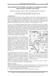
2.17.1 Geological Region<br />
Table 1. Geological Regions (Geoscience Australia 2008) (see Figure 2).<br />
2 Adelaide<br />
3 Albany<br />
4 Amadeus<br />
6 Anakie<br />
5 Arafura<br />
7 Arnhem<br />
8 Arrowie<br />
9 Arunta<br />
112 Ashburton<br />
10 Bancannia<br />
11 Bangemall<br />
12 Birrindudu<br />
13 Bonaparte<br />
14 Bowen<br />
15 Bremer<br />
94 Bresnahan<br />
16 Broken Hill<br />
95 Burke River<br />
43 Cairns<br />
97 Caloola<br />
17 Canning<br />
19 Carnarvon<br />
20 Carpentaria Lowl<strong>and</strong>s<br />
83 Central Tasmania<br />
30 Dundas<br />
31 Eromanga<br />
33 Eucla<br />
282 Fly-Highl<strong>and</strong>s<br />
100 Fraser<br />
34 Galilee<br />
35 Gascoyne<br />
36 Gawler<br />
37 Georgetown<br />
38 Georgina<br />
39 Gippsl<strong>and</strong><br />
40 Halls Creek<br />
41 Hamersley<br />
44 Kanmantoo<br />
46 Kimberley<br />
101 King Isl<strong>and</strong><br />
102 King Leopold<br />
47 Lachlan<br />
49 Leeuwin<br />
50 Litchfield<br />
51 Maryborough<br />
103 Marymia<br />
<strong>Describing</strong> 52 McArthur <strong>Regolith</strong> <strong>and</strong> 84 L<strong>and</strong><strong>for</strong>ms: Tennant Creek <strong>Field</strong> <strong>Guide</strong><br />
53 Money Shoal<br />
105 Northeast Tas<br />
64 Officer<br />
65 Ord<br />
66 Otway<br />
67 Paterson<br />
68 Pedirka<br />
69 Perth<br />
70 Pilbara<br />
71 Pine Creek<br />
72 Polda<br />
106 Proserpine<br />
48 Quinkan<br />
73 Rocky Cape<br />
107 Savory<br />
75 South Nicholson<br />
78 St Vincent<br />
77 Stuart<br />
79 Styx<br />
80 Surat<br />
81 Sydney<br />
82 Sylvania<br />
85 Tanami<br />
108 Tibooburra
94 Bresnahan<br />
16 Broken Hill<br />
95 Burke River<br />
43 Cairns<br />
97 Caloola<br />
17 Canning<br />
19 Carnarvon<br />
20 Carpentaria Lowl<strong>and</strong>s<br />
83 Central Tasmania<br />
98 Charters Towers<br />
21 Clarence - Moreton<br />
99 Clarke River<br />
22 Coen<br />
24 Daly River<br />
25 Darling<br />
26 Davenport<br />
27 Denison<br />
28 Drummond<br />
29 Duaringa<br />
101 King Isl<strong>and</strong><br />
102 King Leopold<br />
47 Lachlan<br />
49 Leeuwin<br />
50 Litchfield<br />
51 Maryborough<br />
103 Marymia<br />
52 McArthur<br />
53 Money Shoal<br />
54 Mount Isa<br />
55 Mount Painter<br />
56 Murphy<br />
57 Murray<br />
58 Musgrave<br />
59 Nabberu<br />
60 New Engl<strong>and</strong><br />
61 Ngalia<br />
104 Nongra<br />
62 Northampton<br />
Figure 2. Geological regions (Geoscience Australia 2008).<br />
<strong>Describing</strong> <strong>Regolith</strong> <strong>and</strong> L<strong>and</strong><strong>for</strong>ms: <strong>Field</strong> <strong>Guide</strong><br />
78 St Vincent<br />
77 Stuart<br />
79 Styx<br />
80 Surat<br />
81 Sydney<br />
82 Sylvania<br />
85 Tanami<br />
84 Tennant Creek<br />
108 Tibooburra<br />
86 Torrens<br />
18 Torres Strait<br />
87 Tyennan<br />
88 Victoria River<br />
96 Wilsons Promontory<br />
109 Winnecke<br />
90 Wiso<br />
91 Wonominta<br />
93 Yilgarn<br />
0 unknown
2.17.2 Bedrock Type<br />
Record the bedrock type from the following list:<br />
Igneous<br />
Sedimentary<br />
Metamorphic<br />
Hydrothermal<br />
Extraterrestrial<br />
Unknown<br />
2.17.3 Lithology Name<br />
The following list (Table 2) is from one proposed by the Government<br />
Geoscience In<strong>for</strong>mation Policy Advisory Committee (GGIPAC). There are<br />
many other lists that can be used <strong>for</strong> lithology, including GA, <strong>and</strong> state <strong>and</strong><br />
territory geological survey agencies.<br />
Table 2. GGIPAC Dominant Lithology Group<br />
GGIPAC Dominant Lithology Group Suggested Code<br />
igneous I<br />
igneous volcanic IV<br />
igneous intrusive II<br />
alkaline ultrabasic Iua<br />
igneous felsic-intermediate volcanic IVfi<br />
igneous felsic volcanic IVf<br />
igneous intermediate volcanic IVi<br />
igneous mafic volcanic IVm<br />
igneous ultramafic volcanic IVu<br />
igneous foid-bearing volcanic IVfe<br />
igneous felsic-intermediate intrusive IIfi<br />
igneous felsic intrusive IIf<br />
igneous intermediate intrusive IIi<br />
igneous mafic intrusive IIm<br />
igneous ultramafic intrusive IIu<br />
igneous feldspathoid-bearing intrusive IIfe<br />
sedimentary S<br />
sedimentary siliciclastic Ss<br />
argillaceous detrital sediment Sa<br />
quartz-rich detrital sediment Sq<br />
feldspar- or lithic-rich arenite to rudite Sf<br />
sedimentary carbonate Sc<br />
sedimentary non-carbonate chemical or biochemical Sncc<br />
organic-rich rock So<br />
metamorphic M<br />
metasedimentary MS<br />
metasedimentary siliciclastic MSs<br />
<strong>Describing</strong> <strong>Regolith</strong> <strong>and</strong> L<strong>and</strong><strong>for</strong>ms: <strong>Field</strong> <strong>Guide</strong><br />
metasedimentary argillaceous MSa<br />
metasedimentary carbonate MSc
sedimentary carbonate<br />
Sf<br />
Sc<br />
sedimentary non-carbonate chemical or biochemical Sncc<br />
organic-rich rock So<br />
metamorphic M<br />
metasedimentary MS<br />
metasedimentary siliciclastic MSs<br />
metasedimentary argillaceous MSa<br />
metasedimentary carbonate MSc<br />
metasedimentary non-carbonate chemical or biochemical MSncc<br />
meta-igneous MI<br />
meta-igneous felsic MIf<br />
meta-igneous felsic volcanic MIVf<br />
meta-igneous felsic intrusive MIIf<br />
meta-igneous mafic MIm<br />
meta-igneous mafic volcanic MIVm<br />
meta-igneous mafic intrusive MIIm<br />
meta-igneous ultramafic MIu<br />
meta-igneous ultramafic volcanic MIVu<br />
meta-igneous ultramafic intrusive MIIu<br />
metamorphic protolith unknown M<br />
High grade metamorphic rock<br />
Mhg<br />
high-P metamorphic rock Mhp<br />
fault / shear rock Msh<br />
metamorphosed hydrothermal Mhy<br />
regolith R<br />
hydrothermal H<br />
metasomatic Hmet<br />
mineralisation Hmin<br />
vein Hv<br />
extraterrestrial E<br />
unknown U<br />
2.17.4 Bedrock Stratigraphy<br />
Enter the bedrock stratigraphic name, if known. This can be derived from<br />
published maps, or from the Stratigraphic Units Database on the GA website:<br />
www.ga.gov.au/oracle/stratnames/index.jsp.<br />
2.18 Geomorphic In<strong>for</strong>mation<br />
See Section 5.1 <strong>for</strong> complete lists.<br />
Australian Soil Resources In<strong>for</strong>mation System (McKenzie et al., 2005)<br />
Physiographic In<strong>for</strong>mation (Section 5.1)<br />
L<strong>and</strong><strong>for</strong>m Pattern or Element (Section 5.2)<br />
The Slope Gradient at a site is usually measured with a h<strong>and</strong> level or<br />
clinometer as an angle between 0 <strong>and</strong> 90 degrees.<br />
The Slope Aspect is measured clockwise from true north as an angle between<br />
0 <strong>and</strong> 360 degrees.<br />
<strong>Describing</strong> <strong>Regolith</strong> <strong>and</strong> L<strong>and</strong><strong>for</strong>ms: <strong>Field</strong> <strong>Guide</strong>
Environmental hazard (Section 5.3)<br />
Geomorphic Processes (Section 5.4)<br />
Weathering Processes (Section 5.5)<br />
2.19 Soil<br />
Record the soil at the site (see Section 4).<br />
2.20 Vegetation<br />
This field is <strong>for</strong> a description of the vegetation at the site. Hnatiuk et al.<br />
(2008) provide a comprehensive discussion <strong>and</strong> classification tables <strong>for</strong> those<br />
who wish to include more data about vegetation.<br />
2.21 Sketches/photos<br />
Record details of any sketches/photos of the site.<br />
2.22 Abstract<br />
The abstract field is <strong>for</strong> a summary description of the site, including brief<br />
comments about the zones.<br />
<strong>Describing</strong> <strong>Regolith</strong> <strong>and</strong> L<strong>and</strong><strong>for</strong>ms: <strong>Field</strong> <strong>Guide</strong>
<strong>Describing</strong> <strong>Regolith</strong> <strong>and</strong> L<strong>and</strong><strong>for</strong>ms: <strong>Field</strong> <strong>Guide</strong>
3. reGolith ProFile descriPtion<br />
The <strong>Regolith</strong> Profile refers to the arrangement of layers of the regolith at a<br />
site. Each layer is called a zone. In the case of transported regolith the zones<br />
are equivalent to stratigraphic units in geology, although in many cases they<br />
will be in<strong>for</strong>mal rather than named units. However, zones in a weathering<br />
profile are not the equivalent of stratigraphic units <strong>and</strong> should not be treated<br />
in the same way. Pain <strong>and</strong> Ollier (1995) provide a discussion of layering in<br />
regolith.<br />
3.1 <strong>Regolith</strong> Profile<br />
This is a descriptive field <strong>for</strong> recording the total known gross profile<br />
characteristics of the regolith, including any truncation or covering that may<br />
have occurred.<br />
3.2 Zone (General Data)<br />
The following fields are <strong>for</strong> general in<strong>for</strong>mation about a single zone within a<br />
regolith profile. Usually there will be several zones at each field site.<br />
3.2.1 Zone Number<br />
The zone number is a 2-digit number in the <strong>for</strong>mat 01, 02, 03 etc., increasing<br />
with depth. Usually this means increasing depth from surface, but <strong>for</strong><br />
transported regolith it may mean elevation or other indicator of relative age.<br />
If the latter, a sketch should be provided in the notebook.<br />
3.2.2 Zone Thickness<br />
This is a number field <strong>for</strong> the average thickness of the zone.<br />
3.2.3 Depth to Lower Boundary<br />
Enter the depth of the lower boundary of the zone.<br />
3.2.4 <strong>Regolith</strong> Type<br />
Record the regolith type (see section 5.6 <strong>for</strong> definitions):<br />
Code Name Code Name<br />
SDT00 terrestrial sediments SDC00 coastal sediments<br />
SDT01 lag on transported regoli SDS00 beach sediments<br />
SDA00 alluvial sediments SDE00 estuarine sediments<br />
SDA10 channel deposits EVA00 evaporite<br />
SDA20 overbank deposits EVA01 halite<br />
SDC00 colluvial sediments EVA02 gypsum<br />
SDC01 scree EVA03 acid sulphates<br />
<strong>Describing</strong> <strong>Regolith</strong> <strong>and</strong> L<strong>and</strong><strong>for</strong>ms: <strong>Field</strong> <strong>Guide</strong>
Code Name Code Name<br />
SDT00 terrestrial sediments SDC00 coastal sediments<br />
SDT01 lag on transported regoli SDS00 beach sediments<br />
SDA00 alluvial sediments SDE00 estuarine sediments<br />
SDA10 channel deposits EVA00 evaporite<br />
SDA20 overbank deposits EVA01 halite<br />
SDC00 colluvial sediments EVA02 gypsum<br />
SDC01 scree EVA03 acid sulphates<br />
SDC02 l<strong>and</strong>slide deposit<br />
SDC03 mudflow deposit VOL00 volcanic materials<br />
SDC04 creep deposit VOL01 lava flow<br />
SDC05 sheet flow deposit VOL02 tephra<br />
SDC06 colluvial fanglomerate IE00 Impact ejecta<br />
SDE00 aeolian sediments<br />
SDE01 aeolian s<strong>and</strong> BU00 unweathered bedrock<br />
SDE02 loess WIR10 saprolith<br />
SDE03 parna WIR11 saprock<br />
SDF00 fill WIR12 moderately weathered bedrock<br />
SDG00 glacial sediments WIR13 highly weathered bedrock<br />
SDG01 moraine WIR14 very highly weathered bedrock<br />
SDG02 ground moraine WIR15 completely weathered bedrock<br />
SDG03 terminal moraine WIR16 saprolite<br />
SDG04 lateral moraine WIR20 residual material<br />
SDG05 glacial outwash WIR21 lag onin situ regolith<br />
SDL00 lacustrine sediments WIR22 residual s<strong>and</strong><br />
SDL01 Clastic lacustrine sediments WIR23 residual clay<br />
SDL02 Calcareous lacustrine sediments WIR24 soil on bedrock<br />
SDL03 Organic lacustrine sediments UOC00 clay (unknown origin)<br />
SDL04 diatomite UOL00 soil (unknown origin)<br />
SDM00 marine sediments UOM00 weathered (unknown origin)<br />
SDM01 Biogenic marine carbonates UOS00 <strong>and</strong> (unknown origin)<br />
SDS02 spiculite<br />
SDB00 microbial sediments<br />
SDP00 swamp (paludal) sediments<br />
SDP01 peat<br />
3.2.5 Zone description<br />
Free text field <strong>for</strong> comments on the zone that cannot be placed elsewhere.<br />
3.3 Zone Data Types<br />
A range of attributes can be recorded <strong>for</strong> each zone; these are listed in<br />
Table 3. See the Section 5.6 <strong>for</strong> more details.<br />
Each attribute, or data type, has a number of sub-types, which are listed<br />
under the appropriate heading below. The sub-type field can be followed by<br />
a free text description (see Figure 1), which is <strong>for</strong> descriptor values (such as<br />
pH or magnetic susceptibility), or any additional in<strong>for</strong>mation relating to the<br />
data type or sub-type. Though this field is free text, values <strong>for</strong> instrument<br />
readings should be recorded as numbers only. This allows them to be easily<br />
<strong>Describing</strong> <strong>Regolith</strong> <strong>and</strong> L<strong>and</strong><strong>for</strong>ms: <strong>Field</strong> <strong>Guide</strong>
etrieved <strong>for</strong> use in a GIS. For example, values <strong>for</strong> magnetic susceptibility<br />
or gamma-ray counts should be entered without any units or comments.<br />
Additional comments relating to the readings, including units, should be<br />
recorded as a separate record using the remarks data type (REM).<br />
Table 3. Data types that are relevant to regolith <strong>and</strong> available in the GA corporate<br />
database.<br />
AGE Age in<strong>for</strong>mation QZGS Quartz grain size<br />
BED Bedding Thickness QZSP Quartz grain sphericity<br />
BNDS Lower boundary-shape RAD Gamma Ray Spectrometry (cps)<br />
BNDT Lower boundary-type RCC <strong>Regolith</strong> clast composition<br />
BST Bedrock structures REM Remarks<br />
CFD Coarse fragment orientation RSTR Rock Strength<br />
COL Colour SEGA Segregations-abundance<br />
CON Consi stence SEGC Segregations-composition<br />
COP Colour pattern SEGS Segregations-size<br />
DRMA Nature of drilled material SEGT Segregations-type<br />
FAB Fabric SEQ Sequence Types<br />
FOS Fossil SF Sampled For<br />
GP Geomorphic processes SOM Sedimentary Occurrence Mode<br />
GS Grain Size SOR Sorting<br />
IN Induration SP Sample Provenance<br />
IS Internal Stratification SPH Sphericity<br />
MAG Magnetic. sus. (SI Units x 10-5) SS Sedimentary Structures<br />
MAGS Sample container size SSTR Soil strength<br />
MC Munsell colour ST Sample type<br />
MOTA Mottles-abundance STK Stickiness<br />
MOTS Mottles-size STX Sedimentary Texture<br />
PH pH level VEIN Vein, dyke or sill<br />
PHO Photo data WEA Degree of Weathering<br />
POR Porosity WP Weathering processes<br />
Rank is an optional single integer field <strong>for</strong> a number from 1 to 9. When a<br />
particular data type is used more than once, the corresponding sub types can<br />
be ranked in order of importance or dominance at the site. This is useful when<br />
interrogating the data with a GIS because it provides users with a method of<br />
identifying <strong>and</strong> displaying only the dominant sub-type in a group of identical<br />
data types.<br />
<strong>Describing</strong> <strong>Regolith</strong> <strong>and</strong> L<strong>and</strong><strong>for</strong>ms: <strong>Field</strong> <strong>Guide</strong>
0<br />
3.3.1 Age Determination<br />
Enter any comments about the age of the zone, including any dates that have<br />
been obtained from samples (see Pillans 2008).<br />
3.3.2 bedding thickness<br />
Data type Sub-type<br />
BED Bedding Thickness LA laminated (1000 mm)<br />
3.3.3 Internal Stratification<br />
Data type Sub-type<br />
IS Internal Stratification CLA corrugated lamination<br />
IS CLR climbing ripples<br />
IS CMI cryptomicrobial (algal laminae)<br />
IS CTS contorted stratification<br />
IS CV convolute<br />
IS HO horizontal<br />
IS HPL horizontal parallel laminae<br />
IS HX hummocky cross bedding<br />
IS HXS herringbone cross-stratification<br />
IS LAM lamination (within a bed)<br />
IS LPX low-angle planar cross bedding<br />
IS LTX low-angle trough cross bedding<br />
IS MAS massive<br />
IS OXB overturned cross bedding<br />
IS PID pillowed<br />
IS RG reverse grading<br />
IS RXL ripple cross laminae<br />
IS STRL stromatolitic lamination<br />
IS WB wavy bedding<br />
IS XB cross-bedded<br />
<strong>Describing</strong> <strong>Regolith</strong> <strong>and</strong> L<strong>and</strong><strong>for</strong>ms: <strong>Field</strong> <strong>Guide</strong>
3.3.4 sequence types<br />
Data type Sub-type<br />
SEQ Sequence Types CU coarsening upward sequence<br />
SEQ FU fining upward sequence<br />
SEQ TKU thickening upward<br />
SEQ TNU thinning upward<br />
3.3.5 Sedimentary Occurrence Mode<br />
Data type Sub-type<br />
SOM Sedimentary CLAS clast<br />
Occurrence Mode<br />
SOM CMT cement<br />
SOM CNC concretion<br />
SOM MT matrix<br />
SOM SDY dyke<br />
3.3.6 Sedimentary Structures<br />
Data type Sub-type<br />
SS Sedimentary Structures ADR adhesion ripples<br />
SS AMB armoured mud balls<br />
SS ASYM asymmetrical ripple mark<br />
SS BIO bioturbated<br />
SS BP ball-<strong>and</strong>-pillow<br />
SS BU burrows<br />
SS BUB bubble prints<br />
SS CC current crescents<br />
SS CHB churned bedding<br />
SS CIC cone-in-cone<br />
SS CNC concretions<br />
SS COP coprolite<br />
SS CRY crystal casts<br />
SS CSP cusp structures<br />
SS DC desiccation cracks<br />
SS DS dish structure<br />
SS DWS de-watering structures<br />
<strong>Describing</strong> <strong>Regolith</strong> <strong>and</strong> L<strong>and</strong><strong>for</strong>ms: <strong>Field</strong> <strong>Guide</strong>
SS ES erosive structures<br />
SS FGNS faceted grains<br />
SS FLM flame structures<br />
SS GEO geopetal<br />
SS GSP gas pits<br />
SS HMK harrow marks<br />
SS ICL intraclast (eg. mudflake)<br />
SS IM imbricated<br />
SS INV involution<br />
SS IR interference ripples<br />
SS LC load casts<br />
SS MC mud cracks<br />
SS MSV mud <strong>and</strong> s<strong>and</strong> volcanoes<br />
SS MT matrix<br />
SS PTG parting<br />
SS PM percussion marks<br />
SS PN pseudonodules<br />
SS POP polished pebbles<br />
SS RHP rain <strong>and</strong> hail prints<br />
SS RIP ripple marks<br />
SS RS reactivation surface<br />
SS SC striated clasts<br />
SS SD s<strong>and</strong>stone dykes<br />
SS SHC shale clasts<br />
SS SHR shrinkage cracks<br />
SS SLN streaming lineation<br />
SS SMR symmetrical ripple mark<br />
SS SLS slump structures<br />
SS SSD soft sediment de<strong>for</strong>mation<br />
SS STY stylolites<br />
SS SYN synaeresis cracks<br />
SS TM tool marks<br />
SS TO toroids<br />
SS TR trails<br />
<strong>Describing</strong> <strong>Regolith</strong> <strong>and</strong> L<strong>and</strong><strong>for</strong>ms: <strong>Field</strong> <strong>Guide</strong>
SS VCLA vertical clasts<br />
SS WBL whirl-balls<br />
SS WM wrinkle marks (runzelmarken)<br />
3.3.7 Sedimentary Texture<br />
Data type Sub-type<br />
STX Sedimentary Texture BX breccia<br />
STX CEM cemented<br />
STX GP geopetal<br />
STX MCC micritic<br />
STX ON oncolitic<br />
STX OO oolitic<br />
STX PE peloidal<br />
3.3.8 Bedrock structures<br />
This data type is <strong>for</strong> bedrock structures which remain within the regolith, so<br />
will refer to saprolith only.<br />
Data type Sub-type<br />
BST Bedrock structures BE bedding<br />
BST CL cleavage<br />
BST CO corestones<br />
BST DY dykes<br />
BST JT joints<br />
BST VN veins<br />
3.3.9 Boundary<br />
The first two data types describe the lower boundary of each zone, <strong>and</strong> are<br />
from McDonald <strong>and</strong> Isbell (1990, 2008).<br />
Data type Sub-type<br />
BNDS Lower boundary shape SM smooth<br />
BNDS D discontinuous<br />
BNDS I irregular<br />
BNDS T tongued<br />
BNDS W wavy<br />
<strong>Describing</strong> <strong>Regolith</strong> <strong>and</strong> L<strong>and</strong><strong>for</strong>ms: <strong>Field</strong> <strong>Guide</strong>
BNDT Lower boundary type SH sharp<br />
BNDT A abrupt<br />
BNDT C clear<br />
BNDT D diffuse<br />
BNDT G gradual<br />
The next lower boundary data type is interpretive, <strong>and</strong> refers to processes<br />
that <strong>for</strong>m the lower boundary.<br />
BNDI Lower boundary BP bedding plane<br />
interpretation<br />
BNDI U uncon<strong>for</strong>mity<br />
BNDI SL stone line<br />
BNDI PF pedoplasmation front<br />
BNDI WF weathering front<br />
BNDI BOCO base of complete oxidation<br />
BNDI BOPO base of partial oxidation<br />
3.3.10 Nature of drilled material<br />
Data type Sub-type<br />
DRMA Nature of drilled<br />
material<br />
AGG aggregate<br />
DRMA CHPS chip strong<br />
DRMA CHPW chip weak<br />
DRMA DISAGG disaggregate<br />
3.3.11 <strong>Regolith</strong> clast composition<br />
This data type is <strong>for</strong> the composition of the >2 mm fraction. The code <strong>for</strong> the<br />
data type is RCC. Data sub-types can be taken from Table 2, or from another<br />
st<strong>and</strong>ard lithology list.<br />
3.3.12 Coarse fragment orientation<br />
Data type Sub-type<br />
CFD Coarse fragment<br />
orientation<br />
U undisturbed<br />
CFD D dispersed r<strong>and</strong>omly<br />
CFD R reoriented<br />
CFD S stratified (e.g. stone lines)<br />
<strong>Describing</strong> <strong>Regolith</strong> <strong>and</strong> L<strong>and</strong><strong>for</strong>ms: <strong>Field</strong> <strong>Guide</strong>
3.3.13 Colour<br />
These data types can be used <strong>for</strong> descriptions of colour, colour changes or<br />
combinations. The use of Munsell colour (MC) is preferred if meaningful<br />
comparisons are to be made (Munsell Color Company 2000, RCAFF 1970,<br />
Rock-Color Chart Committee 1991).<br />
Data type Sub-type<br />
COL Colour BK black<br />
COL BL blue<br />
COL BR brown<br />
COL BU buff<br />
COL CH chocolate<br />
COL CR cream<br />
COL FA fawn<br />
COL GR green<br />
COL GY grey<br />
COL KH khaki<br />
COL MA maroon<br />
COL OL olive<br />
COL OR orange<br />
COL PI pink<br />
COL PU purple<br />
COL RE red<br />
COL VC varicoloured<br />
COL VI violet<br />
COL WH white<br />
COL YE yellow<br />
COP Colour pattern MO mottled<br />
MC Munsell colour Enter code from Munsell colour book<br />
<strong>Describing</strong> <strong>Regolith</strong> <strong>and</strong> L<strong>and</strong><strong>for</strong>ms: <strong>Field</strong> <strong>Guide</strong>
3.3.14 Consistence<br />
Consistence refers to the strength of cohesion <strong>and</strong> adhesion in soil <strong>and</strong> regolith<br />
materials. (For unweathered bedrock <strong>and</strong> strongly indurated materials, refer<br />
to Section 3.3.16, rock strength) Strength will vary according to water<br />
status. Strength is the resistance to breaking or de<strong>for</strong>mation. Stickiness is<br />
a characteristic determined on wet material. NCST (2008) discuss these<br />
properties further, <strong>and</strong> provide definitions <strong>and</strong> means of determination.<br />
Data type Sub-type<br />
SSTR Soil Strength S0 loose<br />
SSTR S1 very weak (400 kPa)<br />
STK Stickiness NS non-sticky<br />
STK SS slightly sticky<br />
STK MS moderately sticky<br />
STK VS very sticky<br />
3.3.15 Porosity<br />
Data type Sub-type<br />
POR Porosity 0 non porous, dense<br />
POR 1 Slightly porous<br />
POR 2 Porous<br />
3.3.16 Rock Strength<br />
Data type Sub-type<br />
RSTR Rock Strength R1 very low rock strength<br />
(1.5-3 Mpa)<br />
RSTR R2 low rock strength (3-10 Mpa)<br />
RSTR R3 medium rock strength<br />
(10-25 Mpa)<br />
RSTR R4 high rock strength (25-80 Mpa)<br />
<strong>Describing</strong> <strong>Regolith</strong> <strong>and</strong> L<strong>and</strong><strong>for</strong>ms: <strong>Field</strong> <strong>Guide</strong>
RSTR R5 very high rock strength<br />
(>800 Mpa)<br />
3.3.17 Fabric<br />
In pedology fabric describes the appearance of the soil material (NCST<br />
2008), <strong>and</strong> the term can be extended to regolith materials. Differences in<br />
fabric are associated with the presence or absence of aggregations, <strong>and</strong> the<br />
presence, size <strong>and</strong> arrangement of voids in the regolith mass. More sub types<br />
will be added to this data type.<br />
Data type Sub-type<br />
FAB Fabric RP relict primary<br />
FAB EA earthy<br />
FAB GS s<strong>and</strong>y (grains prominent)<br />
FAB RO rough-ped<br />
FAB SM smooth-ped<br />
3.3.18 Fossil<br />
Data type Sub-type<br />
FOS Fossil FOSI fossil invertebrates<br />
FOS FOSP fossil plants<br />
FOS FOST trace fossils<br />
FOS FOSV fossil vertebrates<br />
FOS STRO stromatolite<br />
3.3.19 Geomorphic Processes<br />
This data type is used <strong>for</strong> geomorphic processes responsible <strong>for</strong> the <strong>for</strong>mation<br />
of the zone.<br />
Data type Sub-type<br />
GP Geomorphic processes BI00 biological agents; coral<br />
GP DI00 diastrophism; earth movements<br />
GP GR00 gravity<br />
GP GR01 vertical collapse<br />
GP GR02 particle fall<br />
GP GR03 creep<br />
GP GR04 l<strong>and</strong>slide<br />
<strong>Describing</strong> <strong>Regolith</strong> <strong>and</strong> L<strong>and</strong><strong>for</strong>ms: <strong>Field</strong> <strong>Guide</strong>
GP GR05 mudflow<br />
GP HU00 human agents<br />
GP IC00 ice<br />
GP IC01 frost<br />
GP IC02 glacial erosion<br />
GP IC03 glacial deposition<br />
GP MT00 impact by meteors<br />
GP VO00 volcanism<br />
GP VO01 lava flow<br />
GP VO02 ash flow<br />
GP VO03 ash fall<br />
GP WI00 wind<br />
GP WI01 wind erosion (deflation)<br />
GP WI02 s<strong>and</strong> deposition (wind)<br />
GP WI03 dust deposition (wind)<br />
GP WT00 water<br />
GP WT01 channelled stream flow<br />
GP WT02 over-bank stream flow<br />
GP WT03 sheet flow, sheet or surface wash<br />
GP WT04 waves<br />
GP WT05 tides<br />
GP WT06 detrital deposition still water<br />
GP WT07 rilling/gullying<br />
GP WT08 subsurface solution/piping<br />
3.3.20 Grain size<br />
Enter the size of particles in the zone, from the following list. This list is<br />
derived from several sources. Choose the size ranges best suited to the<br />
materials in the zone.<br />
Data type Sub-type<br />
GS Grain Size MUD clay (
GS FS fine s<strong>and</strong> (0.125-0.5 mm)<br />
GS MS medium s<strong>and</strong> (0.25-0.5 mm)<br />
GS CS coarse s<strong>and</strong> (0.5-1 mm)<br />
GS VCS very coarse s<strong>and</strong> (1-2 mm)<br />
GS GV gravel (2-60 mm)<br />
GS FG fine gravel (2-6 mm)<br />
GS MG medium gravel (6-20 mm)<br />
GS CG coarse gravel (20-60 mm)<br />
GS CB cobble (64-256 mm)<br />
GS ST stone (256-600 mm)<br />
GS BO boulder (>256 mm)<br />
GS LPL lapilli (4-64 mm)<br />
GS BM bomb (>64 mm)<br />
GS GL granule (2-4 mm)<br />
GS PB pebble (4-64 mm)<br />
GS F fine (5 mm)<br />
GS MX microcrystalline<br />
GS PEG pegmatitic<br />
GS VC very coarse<br />
GS VF very fine<br />
GS CLAY clay (
0<br />
Data type Sub-type<br />
QZGS Quartz Grain Size BO boulder (>256 mm)<br />
QZGS CB cobble (64-256 mm)<br />
QZGS CLAY clay (2 mm)<br />
QZGS MSA medium s<strong>and</strong> (0.25-0.5 mm)<br />
QZGS MSLT medium silt (0.0156-0.031 mm)<br />
QZGS PB pebble (4-64 mm)<br />
QZGS RMUD clay/silt (
3.3.22 Induration<br />
This data type (IN) covers the degree <strong>and</strong> type of induration.<br />
Undifferentiated<br />
Duricrust<br />
Nodules<br />
Completely<br />
cemented<br />
Moderately<br />
cemented<br />
Partially<br />
cemented<br />
3.3.23 Mottling<br />
Undifferentiated<br />
Continuous<br />
Discontinuous<br />
Undifferentiated<br />
Continuous<br />
Discontinuous<br />
Undifferentiated<br />
Continuous<br />
Discontinuous<br />
Undifferentiated<br />
IN00 IN10 IN20 IN30 IN40 IN50 IN60 IN70<br />
DC00<br />
DC01<br />
DC02<br />
DM00<br />
DM01<br />
DM02<br />
DP00<br />
DP01<br />
DP02<br />
DC10<br />
DC11<br />
DC12<br />
DM10<br />
DM11<br />
DM12<br />
DP10<br />
DP11<br />
DP12<br />
DC20<br />
DC21<br />
DC22<br />
DM20<br />
DM21<br />
DM22<br />
DP20<br />
DP21<br />
DP22<br />
DC30<br />
DC31<br />
DC32<br />
DM30<br />
DM31<br />
DM32<br />
DP30<br />
DP31<br />
DP32<br />
DC40<br />
DC41<br />
DC42<br />
DM40<br />
DM41<br />
DM42<br />
DP40<br />
DP41<br />
DP42<br />
DC50<br />
DC51<br />
DC52<br />
DM50<br />
DM51<br />
DM52<br />
DP50<br />
DP51<br />
DP52<br />
DC60<br />
DC61<br />
DC62<br />
DM60<br />
DM61<br />
DM62<br />
DP60<br />
DP61<br />
DP62<br />
These data types are used <strong>for</strong> comments about the size <strong>and</strong> abundance of<br />
any mottling present. Contrast with surrounding material, <strong>and</strong> strength or<br />
induration, are currently dealt with in the remarks data type (REM).<br />
Data type Sub-type<br />
MOTA Mottles-abundance 0 no mottles<br />
MOTA 1 very few (< 2%)<br />
MOTA 2 few (2 - 10%)<br />
MOTA 3 common (10 -20%)<br />
MOTA 4 many (20 -50%)<br />
MOTS Mottles-size FIN fine (< 5 mm)<br />
MOTS MED medium (5 – 15 mm)<br />
MOTS CSE coarse (15 – 30 mm)<br />
MOTS VCS very coarse (30 – 100 mm)<br />
MOTS MEG megamottles (> 100 mm)<br />
Bauxitic<br />
Calcareous<br />
Indurated material<br />
Clay<br />
DC70<br />
DC71<br />
DC72<br />
DM70<br />
DM71<br />
DM72<br />
DP70<br />
DP71<br />
DP72<br />
NO00 NO10 NO20 NO30 NO40 NO50 NO60 NO70<br />
<strong>Describing</strong> <strong>Regolith</strong> <strong>and</strong> L<strong>and</strong><strong>for</strong>ms: <strong>Field</strong> <strong>Guide</strong><br />
Ferruginous<br />
Gypsum<br />
Siliceous<br />
Humic
3.3.24 Nodules<br />
Nodules can be regarded as a type of induration (see section 3.3.22).<br />
Comments about any nodules present—including size, abundance, contrast<br />
with surrounding material, <strong>and</strong> strength or induration—may also be dealt<br />
with in the remarks data type (REM). The data type Segregations can also<br />
be used <strong>for</strong> nodules (see section 3.3.26.<br />
3.3.25 Matrix<br />
Comments on, <strong>and</strong> a description of the matrix of the zone, are currently dealt<br />
with in the remarks data type (REM).<br />
3.3.26 Segregations<br />
This refers to discrete segregations that have accumulated in the regolith<br />
because of the concentration of some constituent, usually caused by chemical<br />
or biological action. Segregations may be relict or <strong>for</strong>med in situ by current<br />
processes. These data types are <strong>for</strong> the abundance, composition, size <strong>and</strong><br />
type of segregations in the zone.<br />
Data type Sub-type<br />
SEGA Segregationsabundance<br />
0 no segregations<br />
SEGA 1 very few (< 2%)<br />
SEGA 2 few (2 - 10%)<br />
SEGA 3 common (10 - 20%)<br />
SEGA 4 many (20 - 50%)<br />
SEGA 5 very many (> 50%)<br />
SEGC Segregations- U unidentified<br />
composition<br />
SEGC A aluminous<br />
SEGC E earthy<br />
SEGC F ferruginous<br />
SEGC H organic<br />
SEGC K calcareous<br />
SEGC L argillaceous<br />
SEGC M manganiferous<br />
<strong>Describing</strong> <strong>Regolith</strong> <strong>and</strong> L<strong>and</strong><strong>for</strong>ms: <strong>Field</strong> <strong>Guide</strong>
SEGC O other<br />
SEGC Y gypseous<br />
SEGC Z saline<br />
SEGS Segregations-size FIN fine (< 2 mm)<br />
SEGS MED medium (2 – 6 mm)<br />
SEGS CSE coarse (6 – 20 mm)<br />
SEGS VCS very coarse (20 – 60 mm)<br />
SEGS ECS extremely coarse (> 60 mm)<br />
SEGT Segregations-type C concretions<br />
SEGT F fragments<br />
SEGT N nodules<br />
SEGT P pisoliths<br />
SEGT T tubules<br />
3.3.27 Sorting<br />
This data type describes the particle sorting:<br />
Data type Sub-type<br />
SOR Sorting W well sorted<br />
SOR MSO moderately sorted<br />
SOR P poorly sorted<br />
SOR VP very poorly sorted<br />
SOR UNS unsorted<br />
3.3.28 Sphericity<br />
This data type describes the particle sphericity:<br />
Data type Sub-type<br />
SPH Sphericity ANG angular<br />
SPH RO rounded<br />
SPH SAN sub-angular<br />
SPH VA very angular<br />
SPH WR well-rounded<br />
<strong>Describing</strong> <strong>Regolith</strong> <strong>and</strong> L<strong>and</strong><strong>for</strong>ms: <strong>Field</strong> <strong>Guide</strong>
3.3.29 Veins<br />
This field is <strong>for</strong> comments about any veins present.<br />
Data type Sub-type<br />
VEIN Vein QZ quartz<br />
VEIN APL aplite<br />
VEIN CARB carbonate<br />
VEIN DAC dacite<br />
VEIN DLT dolerite<br />
VEIN GRD granodiorite<br />
VEIN GRSN greisen<br />
VEIN GRT granite<br />
VEIN LPY lamprophyre<br />
VEIN PEG pegmatite<br />
VEIN PHY porphyry<br />
VEIN QMG multi-generation quartz veins<br />
3.3.30 Weathering Degree<br />
This is <strong>for</strong> the degree of weathering:<br />
Data type Sub-type<br />
WEA Weathering degree 0 unknown<br />
WEA 1 fresh<br />
WEA 2 slightly weathered<br />
WEA 3 moderately weathered<br />
WEA 4 highly weathered<br />
WEA 5 very highly weathered<br />
WEA 6 completely weathered<br />
WEA 7 varied weathering<br />
3.3.31 Weathering Processes<br />
Enter the weathering processes, the rank <strong>and</strong> the active or relict (A/R) code.<br />
The active code allows present day weathering processes to be recorded,<br />
while the relict code allows recognition of weathering processes active in the<br />
past. The weathering process code comes from the following table:<br />
<strong>Describing</strong> <strong>Regolith</strong> <strong>and</strong> L<strong>and</strong><strong>for</strong>ms: <strong>Field</strong> <strong>Guide</strong>
WE00 weathering<br />
PH00 physical weathering<br />
PH01 abrasion<br />
PH02 frost weathering<br />
PH03 induced fracture<br />
PH04 insolation weathering<br />
PH05 moisture swelling<br />
PH06 sheeting<br />
PH07 salt weathering<br />
PH08 volume increase<br />
PH09 wetting <strong>and</strong> drying<br />
CH00 chemical weathering<br />
CH01 solution<br />
CH02 oxidation <strong>and</strong> reduction<br />
CH03 carbonation<br />
CH04 hydration<br />
CH05 chelation<br />
3.3.32 Weathering Structures<br />
The REM data type can be used <strong>for</strong> any comments about weathering<br />
characteristics of the zone.<br />
3.3.33 Magnetic Susceptibility<br />
CH06 hydrolysis<br />
CH07 ferrolysis<br />
CH08 precipitation/evaporation<br />
IN00 induration<br />
IN01 bauxitic induration<br />
IN02 calcareous induration<br />
IN03 clay induration<br />
IN04 ferruginous induration<br />
IN05 gypsiferous induration<br />
IN06 siliceous induration<br />
BI00 biotic weathering<br />
Data type Sub-type<br />
MAG Magnetic sus. (SI Units x 10 -5 ) MAX maximum<br />
MAG MN mean<br />
MAG MIN minimum<br />
Because magnetic susceptibility measured in the laboratory varies with the<br />
container size, there is an additional data type, sample container size.<br />
Data type Sub-type<br />
MAGS Container size PETRI1 petri dish (85 x 10 mm)<br />
MAGS PETRI1 petri dish (52 x 10 mm)<br />
MAGS TRAY1 tray 5 compartments (190 x 35 x 10 mm)<br />
MAGS TRAY2 tray 5 compartments (190 x 35 x 20 mm)<br />
MAGS TRAY3 tray 20 compartments (24 x 48 x 28 mm)<br />
<strong>Describing</strong> <strong>Regolith</strong> <strong>and</strong> L<strong>and</strong><strong>for</strong>ms: <strong>Field</strong> <strong>Guide</strong>
3.3.34 Gamma Ray Spectrometry<br />
Readings <strong>for</strong> K, Th, U <strong>and</strong> total count should be entered separately, <strong>and</strong> the<br />
values placed in the description field, as numbers only without any units or<br />
comments. Additional comments relating to the readings should be recorded<br />
as a separate record using the remarks data type (REM).<br />
Data type Sub-type<br />
RAD Gamma Ray K potassium<br />
Spectrometry (cps)<br />
RAD TH thorium<br />
RAD U uranium<br />
RAD TC total count<br />
3.3.35 ph<br />
Enter the general pH level. If a pH measurement is made enter the result in<br />
the description column.<br />
Data type Sub-type<br />
PH pH level ACID acidic (0-6.9)<br />
PH BASIC basic (8-14)<br />
PH NEUT neutral (7-7.9)<br />
3.3.36 Photo data<br />
Enter data on photographs taken at the site.<br />
Data type Sub-type<br />
PHO Photodata BN black <strong>and</strong> white negative<br />
PHO CN colour negative<br />
PHO CP colour positive<br />
PHO D digital<br />
3.3.37 remarks<br />
The REM data type can be used <strong>for</strong> any free-text additional comments about<br />
the zone. The sub data type is GE.<br />
<strong>Describing</strong> <strong>Regolith</strong> <strong>and</strong> L<strong>and</strong><strong>for</strong>ms: <strong>Field</strong> <strong>Guide</strong>
3.3.38 samples<br />
The following 3 data types may be entered in the Zones Data block.<br />
Data type Sub-type<br />
SF Sampled <strong>for</strong> UNK unknown<br />
SF GC geochronology<br />
SF HS h<strong>and</strong> specimen<br />
SF MIPA micropaleontology<br />
SF MAPA macropaleontology<br />
SF PI PIMA<br />
SF SO soil chemistry<br />
SF SS stream sediment chemistry<br />
SF TS thin section<br />
SF XRD X-Ray Diffraction<br />
SP Sample provenance UNK unknown<br />
SP ADTS aeolian detritus<br />
SP COLV colluvium<br />
SP DSPB displaced block (near situ)<br />
SP GLE glacial erratic<br />
SP RB alluvial detritus<br />
SP VD volcanic ejectamenta<br />
ST Sample type OC outcrop sample<br />
ST AUG auger<br />
ST CORE core sample<br />
ST CUTT cuttings sample<br />
ST FLT float sample<br />
ST PERC open hole percussion<br />
ST RAB rotary airblast<br />
ST REVC reverse circulation percussion<br />
ST SIDE sidewall sample<br />
ST SOIL soil<br />
<strong>Describing</strong> <strong>Regolith</strong> <strong>and</strong> L<strong>and</strong><strong>for</strong>ms: <strong>Field</strong> <strong>Guide</strong>
<strong>Describing</strong> <strong>Regolith</strong> <strong>and</strong> L<strong>and</strong><strong>for</strong>ms: <strong>Field</strong> <strong>Guide</strong>
4. soils deFinitions<br />
Soil refers to the organically affected upper part of the regolith. Soils are<br />
<strong>for</strong>med by interactions between the mineral material of the regolith <strong>and</strong><br />
organic matter derived largely from vegetation growing in the regolith. Here<br />
we refer to three classifications that are used in Australia.<br />
4.1 Principal profile <strong>for</strong>m<br />
The principal profile <strong>for</strong>m comes from Northcote (1979). The simple<br />
definitions given here will allow people without any knowledge of soil<br />
science to place soils in one of the groups listed in the soils table. The<br />
definitions are taken largely from Northcote (1979) <strong>and</strong> readers should refer<br />
to that publication <strong>for</strong> further details. Northcote’s classification refers to the<br />
arrangement of horizons in the soil.<br />
o organic<br />
Organic soils are dominated by plant remains in at least the top 30 cm,<br />
but they can be much deeper. Any soil containing more than 30% organic<br />
matter may be considered to be organic.<br />
Uc Uni<strong>for</strong>m, coarse textured<br />
Uni<strong>for</strong>m soils are dominated by mineral material <strong>and</strong> have small, if any,<br />
differences in grain size (texture) throughout the profile. The range of<br />
texture falls within the span of one texture group (see texture classes in<br />
Northcote, 1979). Uc soils have textures in the s<strong>and</strong> <strong>and</strong> s<strong>and</strong>y loam or<br />
coarser classes.<br />
Um Uni<strong>for</strong>m, medium textured<br />
Uni<strong>for</strong>m soils with textures in the loams <strong>and</strong> clay loams classes.<br />
Uf Uni<strong>for</strong>m, fine textured, not cracking<br />
Uni<strong>for</strong>m soils with textures in the clay classes, <strong>and</strong> seasonal cracking of<br />
the soil material does not occur.<br />
Ug Uni<strong>for</strong>m, fine textured, cracking<br />
Uni<strong>for</strong>m soils with textures in the clay classes, <strong>and</strong> the soil material is<br />
characterised by seasonal cracking.<br />
<strong>Describing</strong> <strong>Regolith</strong> <strong>and</strong> L<strong>and</strong><strong>for</strong>ms: <strong>Field</strong> <strong>Guide</strong>
0<br />
Gc Gradational, calcareous throughout<br />
Gradational soils are dominated by the mineral fraction <strong>and</strong> show<br />
increasingly finer (more clayey) texture grades on passing to greater<br />
depths. The changes in texture are gradual <strong>and</strong>, over the whole profile,<br />
span more than one texture group. Gc soils are calcareous throughout.<br />
Gn Gradational, not calcareous throughout<br />
Gn soils are gradational, but are not calcareous throughout. However,<br />
calcium carbonate may be present in the lower parts of the soil, either as<br />
nodules or dispersed through the soil material.<br />
Dr Duplex, red clay B horizons<br />
Duplex soils are dominated by the mineral fraction <strong>and</strong> have a texture<br />
contrast of more than 1.5 texture groups between the A (surface) <strong>and</strong> B<br />
(subsurface) horizons. Further, the boundary between the two horizons is<br />
less than 10 cm thick. Dr soils have red B horizons, which in the Munsell<br />
Notation means a hue as red, or redder than, 5YR.<br />
Db Duplex, brown clay B horizons<br />
Db soils are duplex, with brown B horizons, which in the Munsell Notation<br />
means a hue yellower than 5YR.<br />
Dy Duplex, yellow-grey clay B horizons<br />
Dy soils are duplex, with yellow-grey B horizons.<br />
Dd Duplex, dark clay B horizons<br />
Dd soils are duplex, with dark B horizons, which in the Munsell Notation<br />
means a value/chroma less than 3/2 or 2/2.<br />
Dg Duplex, gley clay B horizons<br />
Dg soils are duplex, with gley B horizons, which in the Munsell Notation<br />
means any value on the Munsell ‘gley’ chart.<br />
4.2 Great soil group<br />
Stace et al. (1968) provide a description <strong>and</strong> classification of Australian soils<br />
into great soil groups <strong>and</strong> interested readers are referred to this publication.<br />
The great soil groups are based on both soil morphology <strong>and</strong> soil genesis.<br />
The following are the great soil groups. Codes are taken from Isbell <strong>and</strong><br />
McDonald (1990, 2008).<br />
<strong>Describing</strong> <strong>Regolith</strong> <strong>and</strong> L<strong>and</strong><strong>for</strong>ms: <strong>Field</strong> <strong>Guide</strong>
4.3 Australian soil classification<br />
The Australian Soil Classification (Isbell 1996)—now the st<strong>and</strong>ard <strong>for</strong> soil<br />
surveys in Australia—is based on morphological, chemical <strong>and</strong> physical<br />
properties. The following classes are used:<br />
4.4 Fabric<br />
SK Solonchak<br />
A Alluvial soil<br />
L Lithosol<br />
KS Calcareous s<strong>and</strong><br />
DL Desert loam<br />
RBH Red-brown hardpan soil<br />
GC Grey clay<br />
BC Brown clay<br />
RC Red clay<br />
BE Black earth<br />
R Rendzina<br />
CM Chernozem<br />
PS Prairie soil<br />
W Wiesenboden<br />
SZ Solonetz<br />
SDS Solodized solonetz<br />
SC Solodic soil<br />
SH Soloth<br />
SB Solonized brown soil<br />
RBE Red brown earth<br />
NKB Non calcic brown soil<br />
C Chocolate soil<br />
BRE Brown earth<br />
KRE Calcareous red earth<br />
RE Red earth<br />
SS Siliceous s<strong>and</strong><br />
ES Earthy s<strong>and</strong><br />
GBK Grey brown calcareous soil<br />
RK Red calcareous soil<br />
GE Grey earth<br />
YE Yellow earth<br />
TR Terra rossa soil<br />
E Euchrozem<br />
X Xanthozem<br />
K Krasnozem<br />
GBP Grey brown podzolic soil<br />
RP Red podzolic soil<br />
YP Yellow podzolic soil<br />
BP Brown podzolic soil<br />
LP Lateritic podzolic soil<br />
GP Gleyed podzolic soil<br />
P Podzol<br />
HP Humus podzol<br />
PP Peaty podzol<br />
AH Alpine humus soil<br />
HG Humic gley<br />
NP Neutral peat<br />
ALP Alkaline peat<br />
ACP Acid peat<br />
NSG No suitable group<br />
AN Anthroposols KU Kurosols<br />
CA Calcarosols OR Organosols<br />
CH Chromosols PO Podosols<br />
DE Dermosols RU Rudosols<br />
FE Ferrosols SO Sodosols<br />
HY Hydrosols TE Tenosols<br />
KA K<strong>and</strong>osols VE Vertosols<br />
The following description is from McDonald <strong>and</strong> Isbell (1990, 2008).<br />
Fabric describes the appearance of the soil material (under a ×10 h<strong>and</strong> lens).<br />
Differences in fabric are associated with the presence or absence of peds,<br />
the lustre or lack of lustre of the ped surfaces, <strong>and</strong> the presence, size <strong>and</strong><br />
<strong>Describing</strong> <strong>Regolith</strong> <strong>and</strong> L<strong>and</strong><strong>for</strong>ms: <strong>Field</strong> <strong>Guide</strong>
arrangement of pores (voids) in the soil mass. The descriptions given below<br />
apply primarily to B horizons.<br />
RP Relict primary<br />
Fabric in weathered regolith that has been inherited from the original<br />
material, whether in situ bedrock or transported material.<br />
EA Earthy (or porous) fabric<br />
The soil material is coherent <strong>and</strong> characterised by the presence of pores<br />
(voids) <strong>and</strong> few, if any, peds. Ultimate soil particles (s<strong>and</strong> grains, <strong>for</strong><br />
example) are coated with oxides <strong>and</strong>/or clays <strong>and</strong> are arranged (clumped)<br />
around the pores.<br />
Gs s<strong>and</strong>y fabric<br />
The soil material is coherent, with few, if any, peds. The closely packed<br />
s<strong>and</strong> grains provide the characteristic appearance of the soil mass.<br />
RO Rough-ped fabric<br />
Peds are evident <strong>and</strong> characteristically more than 50% of the peds are<br />
rough-faced; that is, they have relatively porous surfaces. (Rough-faced<br />
peds generally have less clearly defined faces than smooth-faced peds <strong>and</strong><br />
the pedality of the soil may be questioned. However, if the soil mass is<br />
pressed gently, the characteristic size <strong>and</strong> shape of the soil aggregates will<br />
confirm its pedality.) Granular peds with common or many macropores<br />
are always rough-faced, but this condition varies in other ped <strong>for</strong>ms.<br />
SM Smooth-ped fabric<br />
Peds are evident <strong>and</strong> characteristically more than 50% of them are dense<br />
<strong>and</strong> smooth-faced, although the degree of lustre may vary.<br />
<strong>Describing</strong> <strong>Regolith</strong> <strong>and</strong> L<strong>and</strong><strong>for</strong>ms: <strong>Field</strong> <strong>Guide</strong>
5. GeoMorPholoGY<br />
5.1 ASRIS Physiographic In<strong>for</strong>mation<br />
If known, record ASRIS in<strong>for</strong>mation. This can be obtained from the ASRIS<br />
web site [www.asris.csiro.au].<br />
Division<br />
Province (Table 4, Figure 3)<br />
Zone<br />
District<br />
System<br />
Facet<br />
Figure 3. ASRIS level 2 Provinces (see Table 4). Map prepared by Linda Gregory,<br />
ASRIS, CSIRO L<strong>and</strong> <strong>and</strong> Water.<br />
<strong>Describing</strong> <strong>Regolith</strong> <strong>and</strong> L<strong>and</strong><strong>for</strong>ms: <strong>Field</strong> <strong>Guide</strong>
Table 4. ASRIS level 2 Provinces (see Figure 3)<br />
10101<br />
10102<br />
10201<br />
10202<br />
10203<br />
10204<br />
10205<br />
10206<br />
10207<br />
10208<br />
10209<br />
10210<br />
10211<br />
10212<br />
10213<br />
10214<br />
10301<br />
10302<br />
10303<br />
10304<br />
10305<br />
10306<br />
10307<br />
10308<br />
10401<br />
10402<br />
10403<br />
10404<br />
10405<br />
10406<br />
10407<br />
10408<br />
10409<br />
10410<br />
10411<br />
10412<br />
10413<br />
10414<br />
10501<br />
10502<br />
10503<br />
10504<br />
10505<br />
10506<br />
North Reefs<br />
South Reefs<br />
Torres 'High' Isl<strong>and</strong>s<br />
Jardine Upl<strong>and</strong>s<br />
Wenlock Upl<strong>and</strong>s<br />
Coleman Plateau<br />
Laura Plain<br />
Cooktown Ranges<br />
Palmerville Hills<br />
Garnet Upl<strong>and</strong>s<br />
Cairns Ranges<br />
Atherton Tablel<strong>and</strong><br />
Newcastle Ranges<br />
Gilbert Hills<br />
Gregory Range<br />
Einasleigh Plains<br />
Burdekin Plateaux<br />
Burdekin Hills <strong>and</strong><br />
Lowl<strong>and</strong>s<br />
Hervey Tablel<strong>and</strong>s<br />
Townsville Lowl<strong>and</strong><br />
Gilberton Plateau<br />
Cape River Plains<br />
Alice Tablel<strong>and</strong><br />
Bulgonunna Tablel<strong>and</strong><br />
Connors Ranges<br />
Carborough Ranges<br />
Bely<strong>and</strong>o Plains<br />
Scartwater Hills<br />
Townshend Ranges <strong>and</strong><br />
Lowl<strong>and</strong>s<br />
Broad Sound Plains<br />
Mackenzie-Dawson<br />
Lowl<strong>and</strong>s<br />
Cotherstone Plateau<br />
Springsure-Clermont<br />
Plateaux<br />
Drummond Upl<strong>and</strong>s<br />
Nagoa Scarpl<strong>and</strong>s<br />
Buckl<strong>and</strong> Plateau<br />
Expedition Scarpl<strong>and</strong>s<br />
Bunya-Burnett Ranges<br />
Taroom Hills<br />
Maryborough Lowl<strong>and</strong><br />
Moreton Lowl<strong>and</strong><br />
Toowoomba Plateau<br />
Cunningham Slopes<br />
Tenterfield Plateau<br />
10507<br />
10508<br />
10509<br />
10510<br />
10511<br />
10512<br />
10513<br />
10601<br />
10602<br />
10603<br />
10604<br />
10605<br />
10606<br />
10607<br />
10608<br />
10609<br />
10701<br />
10702<br />
10703<br />
10704<br />
10705<br />
10706<br />
10707<br />
10708<br />
10709<br />
10710<br />
10711<br />
10801<br />
10802<br />
10803<br />
10804<br />
Clarence Fall<br />
Clarence Lowl<strong>and</strong>s<br />
N<strong>and</strong>ewar Peaks<br />
Gunnedah Lowl<strong>and</strong><br />
Armidale Plateau<br />
Liverpool-Barrington<br />
Plateaux<br />
Macleay-Barrington Fall<br />
Mitchell Slopes<br />
Warrumbungle Peaks<br />
Merriwa Plateau<br />
Hunter Valley<br />
Goulburn Corridor<br />
Bathurst Tablel<strong>and</strong>s<br />
Hawkesbury-Shoalhaven<br />
Plateaux<br />
Cumberl<strong>and</strong> Lowl<strong>and</strong><br />
Illawarra Plain<br />
Hume Slopes<br />
Werriwa Tablel<strong>and</strong>s<br />
Australian Alps<br />
Tinderry Gourock<br />
Ranges<br />
Monaro Fall<br />
Monaro Tablel<strong>and</strong><br />
East Victorian Upl<strong>and</strong>s<br />
West Victorian Upl<strong>and</strong>s<br />
West Victorian Plains<br />
South Victorian Upl<strong>and</strong>s<br />
Gippsl<strong>and</strong> Plain<br />
Bass Plateaux<br />
Bass Plains<br />
Tasmanian Ridges<br />
Lakes Plateau<br />
10805 Midl<strong>and</strong>s Plain<br />
10806 East Tasmanian Plateaux<br />
20101<br />
20102<br />
20103<br />
20104<br />
20105<br />
20106<br />
20107<br />
20108<br />
20109<br />
20110<br />
20201<br />
Weipa Plateau<br />
Merluna Plain<br />
Holroyd Plains<br />
Karumba Plain<br />
Clara Mitchell Plains<br />
Bulimba Plateau<br />
Normanton Tablel<strong>and</strong><br />
Armraynald Plain<br />
Wondoola Plain<br />
Donors Tablel<strong>and</strong><br />
Winton-Blackall Downs<br />
<strong>Describing</strong> <strong>Regolith</strong> <strong>and</strong> L<strong>and</strong><strong>for</strong>ms: <strong>Field</strong> <strong>Guide</strong><br />
20202<br />
20203<br />
20204<br />
20205<br />
20206<br />
20207<br />
20208<br />
20209<br />
20210<br />
20211<br />
20212<br />
20213<br />
20214<br />
20215<br />
20216<br />
20217<br />
20218<br />
20219<br />
20220<br />
20221<br />
20222<br />
20223<br />
20224<br />
20225<br />
20226<br />
20301<br />
20302<br />
20303<br />
20304<br />
20305<br />
20306<br />
20307<br />
20308<br />
20309<br />
30101<br />
Jericho Plain<br />
Maranoa Lowl<strong>and</strong><br />
Charleville Tablel<strong>and</strong><br />
Condamine Lowl<strong>and</strong>s<br />
Boulia Downs<br />
Whelan Lowl<strong>and</strong>s<br />
Eyre Creek Plain<br />
Eromanga Lowl<strong>and</strong>s<br />
Diamantina Plain<br />
Cooper Plain<br />
Bulloo Plain<br />
Paroo Plain<br />
Warrego Plains<br />
St George Plain<br />
Upper Darling Plains<br />
Lightning Ridge<br />
Lowl<strong>and</strong><br />
Simpson Desert<br />
Dunefield<br />
Sturt Desert Plains<br />
Strzelecki Desert Plains<br />
Grey Range<br />
Warwick Lowl<strong>and</strong><br />
Oodnadatta Tablel<strong>and</strong>s<br />
Alberga Dunefield<br />
EyreFrome Plains<br />
Denison Ranges<br />
Lower Darling Plain<br />
Cobar Plains<br />
Condobolin Plain<br />
Ivanhoe Plains<br />
Riverine Plain<br />
Mallee Dunefield<br />
Wimmera Plain<br />
Coorong Plain<br />
Millicent Plain<br />
BonaparteDiemen<br />
Lowl<strong>and</strong>s<br />
Arnhem Ridges<br />
30102<br />
30103 East Arnhem Plateau<br />
30104 West Arnhem Plateau<br />
30105 Pine Creek Ridges<br />
30106 Daly Lowl<strong>and</strong><br />
30107 Ord-Victoria Plateaux<br />
30108 Whirlwind Plain<br />
30201 Kimberley Plateau<br />
30202 Drysdale Lowl<strong>and</strong>s
Table 4. ASRIS level 2 Provinces (continued)<br />
30203<br />
30204<br />
30205<br />
30206<br />
30207<br />
30208<br />
30209<br />
30210<br />
30211<br />
30301<br />
30302<br />
30303<br />
30401<br />
30402<br />
30403<br />
30404<br />
30405<br />
30406<br />
Couchman Upl<strong>and</strong>s<br />
Leopold-Durack Ranges<br />
Yampi Peninsula<br />
Richenda Foothills<br />
Fitzroy Plains<br />
Napier Limestone Ranges<br />
Springvale Foothills<br />
Halls Creek Ridges<br />
Fitzroy Ranges<br />
Manangoora Plains<br />
Borroloola Fall<br />
Isa Ridges<br />
Larrimah Plateau<br />
Barkly Tablel<strong>and</strong><br />
Wiso S<strong>and</strong>plain<br />
L<strong>and</strong>er Dunefield<br />
Ashburton-Davenport<br />
Ranges<br />
Frew-S<strong>and</strong>over<br />
S<strong>and</strong>plain<br />
Tobermory Plain<br />
30407<br />
30408 Toko Plateaux<br />
30409 Jervois Ranges<br />
30410 Barrow Dulcie Plateaux<br />
30411 Birrundudu Plain<br />
30412 Tanami S<strong>and</strong>plain <strong>and</strong><br />
Ranges<br />
30413 Sturt Creek Floodout<br />
30501 Doreen-Reynolds Ranges<br />
30502 Burt Plain<br />
30503 Alcoota Tablel<strong>and</strong>s<br />
30504 Plenty River Plains<br />
30505 Macdonnell Ranges<br />
30506 Missionary Lowl<strong>and</strong><br />
30507 Henbury Ranges<br />
30508<br />
30509<br />
30510<br />
30511<br />
30512<br />
30601<br />
30602<br />
30603<br />
30604<br />
30605<br />
30606<br />
30607<br />
30608<br />
30609<br />
30610<br />
30611<br />
30612<br />
30701<br />
30702<br />
30703<br />
30704<br />
30705<br />
30706<br />
30707<br />
30801<br />
30802<br />
30803<br />
30804<br />
30805<br />
30806<br />
30807<br />
30808<br />
5.2 L<strong>and</strong><strong>for</strong>m definitions<br />
Amadeus Lowl<strong>and</strong><br />
Rawlinson-Petermann<br />
Ranges<br />
Kulgera Hills<br />
Musgrave Ranges<br />
Warburton Ranges<br />
Dampier Tablel<strong>and</strong>s<br />
Eighty Mile Plain<br />
Anketell Hills<br />
Great S<strong>and</strong>y Desert<br />
Dunefield<br />
Stansmore Dunefield<br />
<strong>and</strong> Ranges<br />
Gibson Desert Plains<br />
Redvers Dunefield<br />
Macdonald S<strong>and</strong>plain<br />
Stanley Hills <strong>and</strong> Dunes<br />
Carnegie Hills<br />
Leemans S<strong>and</strong>plain<br />
Great Victoria Desert<br />
Dunefield<br />
De Grey Lowl<strong>and</strong>s<br />
Nullagine Hills<br />
Rudall Tablel<strong>and</strong>s<br />
Hamersley Plateaux<br />
Chichester Range<br />
Fortescue Valley<br />
Augustus Ranges<br />
Onslow Plain<br />
Carnarvon Dunefield<br />
North West Cape Ridges<br />
Kennedy Range<br />
Carnarvon Plain<br />
Shark Bay Peninsulas<br />
Yaringa S<strong>and</strong>plain<br />
Greenough Hills<br />
30809<br />
30810<br />
30811<br />
30812<br />
30901<br />
30902<br />
30903<br />
30904<br />
30905<br />
30906<br />
30907<br />
30908<br />
30909<br />
30910<br />
30911<br />
30912<br />
31001<br />
31002<br />
31003<br />
31004<br />
31101<br />
31102<br />
31103<br />
31104<br />
31105<br />
31201<br />
31202<br />
31203<br />
31204<br />
31205<br />
31206<br />
D<strong>and</strong>aragan Tablel<strong>and</strong>s<br />
Swan Plain<br />
Donnybrook Lowl<strong>and</strong><br />
Leeuwin Peninsula<br />
Murchison Plateau<br />
Glengarry Hills<br />
Salinal<strong>and</strong> Plateau<br />
Woodramung Hills<br />
Northam Plateau<br />
Narrogin-Ongerup<br />
Plateau<br />
Coonana-Ragged Plateau<br />
Darling Range<br />
Collie-Kalgan Slopes<br />
Albany Headl<strong>and</strong>s <strong>and</strong><br />
Inlets<br />
Stirling <strong>and</strong> Bareen Hills<br />
Esperance Hills<br />
Carlisle Plain<br />
Bunda Plateau<br />
Roe Plain<br />
Israelite Plain<br />
Gairdner Plain<br />
Gawler-Cleve Ranges<br />
Eyre Dunefield<br />
Ceduna Dunefield<br />
Lincoln Hills<br />
Flinders-Lofty Ranges<br />
Torrens-Gulf Plains<br />
Andamooka Tablel<strong>and</strong><br />
Barrier Ranges<br />
Olary Spur<br />
Yorke Peninsula<br />
L<strong>and</strong><strong>for</strong>ms are an expression of the evolution of the l<strong>and</strong>scape in which they<br />
occur. They are a culmination of processes, both past <strong>and</strong> present, acting on<br />
that l<strong>and</strong>scape. L<strong>and</strong><strong>for</strong>ms are also highly visible in the l<strong>and</strong>scape <strong>and</strong> can<br />
be recognised from topographic maps <strong>and</strong> from various kinds of imagery—<br />
both airborne <strong>and</strong> orbital.<br />
The l<strong>and</strong><strong>for</strong>m units listed here are the l<strong>and</strong><strong>for</strong>m patterns <strong>and</strong> elements of<br />
Speight (1990, 2008). In this technique <strong>for</strong> describing l<strong>and</strong><strong>for</strong>ms, the whole<br />
<strong>Describing</strong> <strong>Regolith</strong> <strong>and</strong> L<strong>and</strong><strong>for</strong>ms: <strong>Field</strong> <strong>Guide</strong>
l<strong>and</strong> surface is viewed as a mosaic of tiles of odd shapes <strong>and</strong> sizes. To impose<br />
order, the mosaic is treated as if the tiles are of two distinct sizes: the larger<br />
ones being themselves mosaics of the smaller ones. The larger tiles, which<br />
are more than 600 m across, are called l<strong>and</strong><strong>for</strong>m patterns. They include,<br />
<strong>for</strong> example, flood plain, dune field <strong>and</strong> hills. The smaller tiles, which <strong>for</strong>m<br />
mosaics within l<strong>and</strong><strong>for</strong>m patterns, are about 40 m or more across. These are<br />
called l<strong>and</strong><strong>for</strong>m elements.<br />
The listing <strong>for</strong> l<strong>and</strong><strong>for</strong>m patterns <strong>and</strong> l<strong>and</strong><strong>for</strong>m elements are grouped together<br />
into related l<strong>and</strong><strong>for</strong>m types under general headings, to give a hierarchical<br />
classification. Speight (1990, 2008) defines most of the l<strong>and</strong><strong>for</strong>m units listed<br />
in this table. Other definitions, <strong>and</strong> more details, can be found in Fairbridge<br />
(1968) Eggleton (2001) <strong>and</strong> Goudie (2004). The lists provided here are from<br />
the Corporate Data Model of Geoscience Australia.<br />
5.2.1 L<strong>and</strong><strong>for</strong>m patterns<br />
AL00 Alluvial l<strong>and</strong><strong>for</strong>ms<br />
A complex l<strong>and</strong><strong>for</strong>m pattern on valley floors, with active, inactive or relict<br />
erosion <strong>and</strong> aggradation by channelled <strong>and</strong> over-bank stream flow.<br />
Al10 Alluvial plain<br />
A level, gently sloping or slightly undulating l<strong>and</strong> surface produced<br />
by extensive deposition of alluvium, generally adjacent to a river that<br />
periodically overflows its banks; it may be situated on a flood plain, a<br />
delta, or an alluvial fan.<br />
AL11 Flood plain<br />
An alluvial plain characterised by frequently active aggradation by overbank<br />
stream flow (i.e. by flooding more often than every 50 years) <strong>and</strong><br />
erosion by channelled stream flow.<br />
AL12 Anastomosing plain<br />
A flood plain on which the stream channels join <strong>and</strong> divide, as do the<br />
veins on a leaf. Flood plain with slowly migrating, deep alluvial channels,<br />
usually moderately spaced, <strong>for</strong>ming a divergent to unidirectional integrated<br />
reticulated network. There is frequently active aggradation by over-bank<br />
<strong>and</strong> channelled stream flow.<br />
<strong>Describing</strong> <strong>Regolith</strong> <strong>and</strong> L<strong>and</strong><strong>for</strong>ms: <strong>Field</strong> <strong>Guide</strong>
Al13 bar plain<br />
A flood plain having sub-parallel stream channels that both aggrade <strong>and</strong><br />
erode so as to develop a generally corrugated surface with numerous bars.<br />
Flood plain with numerous rapidly migrating shallow alluvial channels<br />
<strong>for</strong>ming a unidirectional integrated reticulated network. There is frequently<br />
active aggradation <strong>and</strong> erosion by channelled stream flow.<br />
AL14 Covered plain<br />
A flood plain with a number of alluvial channels that are widely-spaced<br />
(i.e. a little under 1 km), migrating, more or less parallel, <strong>and</strong> deep<br />
(i.e. width–depth ratio
AL30 Stagnant alluvial plain<br />
An alluvial plain on which erosion <strong>and</strong> aggradation by channelled <strong>and</strong><br />
over-bank stream flow is slightly active or inactive because of reduced<br />
water supply, without apparent incision or channel enlargement that would<br />
lower the level of stream action.<br />
Al40 terraced l<strong>and</strong><br />
A l<strong>and</strong><strong>for</strong>m pattern including one or more terraces <strong>and</strong> often a flood plain.<br />
Relief is low or very low (9–90 m). Terrace plains or terrace flats occur at<br />
stated heights above the top of the stream bank.<br />
AL50 Alluvial swamp<br />
An almost level, closed, or almost closed, depression with a seasonal or<br />
permanent water table at or above the surface, commonly aggraded by<br />
over-bank stream flow <strong>and</strong> sometimes biological (peat) accumulation.<br />
CO00 Coastal l<strong>and</strong>s<br />
A level to gently undulating l<strong>and</strong><strong>for</strong>m pattern of extremely low relief<br />
eroded or aggraded by waves, tides, over-bank or channel flow, or wind.<br />
The l<strong>and</strong><strong>for</strong>m pattern may be either active or relict.<br />
co01 beach ridge plain<br />
A level to gently undulating l<strong>and</strong><strong>for</strong>m pattern of extremely low relief on<br />
which stream channels are absent or very rare; it consists of relict parallel<br />
linear ridges built up by waves <strong>and</strong> modified by wind.<br />
co02 chenier plain<br />
A level to gently undulating l<strong>and</strong><strong>for</strong>m pattern of extremely low relief on<br />
which stream channels are very rare. The pattern consists of relict, parallel<br />
linear ridges built by waves, separated by, <strong>and</strong> built over, flats aggraded by<br />
tides or over-bank stream flow.<br />
co03 reef<br />
A continuously active or relict l<strong>and</strong><strong>for</strong>m pattern built up to the present<br />
sea level, or that of a <strong>for</strong>mer time, by corals <strong>and</strong> other organisms. It is<br />
mainly level, with moderately inclined to precipitous slopes below sea<br />
level. Stream channels are generally absent, but there may occasionally<br />
be fixed deep erosional tidal stream channels <strong>for</strong>ming a disintegrated non-<br />
<strong>Describing</strong> <strong>Regolith</strong> <strong>and</strong> L<strong>and</strong><strong>for</strong>ms: <strong>Field</strong> <strong>Guide</strong>
tributary pattern.<br />
co04 Marine plain<br />
A plain eroded or aggraded by waves, tides or submarine currents, <strong>and</strong><br />
aggraded by deposition of material from suspension <strong>and</strong> solution in sea<br />
water, elevated above sea level by earth movements or eustacy, <strong>and</strong> little<br />
modified by subaerial agents such as stream flow or wind.<br />
CO05 Tidal flat<br />
A level l<strong>and</strong><strong>for</strong>m pattern with extremely low relief <strong>and</strong> slowly migrating<br />
deep alluvial stream channels that <strong>for</strong>m dendritic tributary patterns; it is<br />
aggraded by frequently active tides.<br />
CO06 Coastal dunes<br />
A level to rolling l<strong>and</strong><strong>for</strong>m pattern of very low to extremely low<br />
relief— without stream channels—built up or locally excavated, eroded<br />
or aggraded by wind. This l<strong>and</strong><strong>for</strong>m pattern occurs in usually restricted<br />
coastal locations.<br />
CO07 Coastal plain<br />
A level l<strong>and</strong><strong>for</strong>m pattern with extremely low relief either with or without<br />
stream channels, built up by coastal—usually tidal—processes.<br />
co08 beach<br />
A short, low, very wide slope, gently or moderately inclined, built up or<br />
eroded by waves, <strong>for</strong>ming the shore of a lake or sea.<br />
DE00 Delta<br />
A flood plain projecting into a sea or lake, with slowly migrating deep<br />
alluvial channels, usually moderately spaced, typically <strong>for</strong>ming a divergent<br />
distributary network. This l<strong>and</strong><strong>for</strong>m is aggraded by frequently active overbank<br />
<strong>and</strong> channelled stream flow that is modified by tides.<br />
DU00 Aeolian l<strong>and</strong><strong>for</strong>ms<br />
A l<strong>and</strong><strong>for</strong>m pattern built up or locally excavated, eroded or aggraded by<br />
wind. Mabbutt (1977) provides a useful summary of the variety of aeolian<br />
l<strong>and</strong><strong>for</strong>ms found in arid climates.<br />
<strong>Describing</strong> <strong>Regolith</strong> <strong>and</strong> L<strong>and</strong><strong>for</strong>ms: <strong>Field</strong> <strong>Guide</strong>
0<br />
DU10 Aeolian dunes<br />
Low mounds, ridges, banks, or hills of loose, windblown granular material<br />
(generally s<strong>and</strong>; in some places volcanic ash), either bare or covered with<br />
vegetation, capable of being moved from place to place by wind, but<br />
always retaining their own characteristic shape.<br />
DU11 Longitudinal dune field<br />
A dune field characterised by long narrow s<strong>and</strong> dunes <strong>and</strong> wide flat swales.<br />
The dunes are oriented parallel with the direction of the prevailing wind<br />
<strong>and</strong>, in cross section, one slope is typically steeper than the other.<br />
DU12 Transverse dune field<br />
A dune field characterised by long narrow s<strong>and</strong> dunes <strong>and</strong> wide flat<br />
swales. The dunes are oriented normal to the direction of the prevailing<br />
wind <strong>and</strong>, in cross section, the windward slope is typically steeper than<br />
the lee slope.<br />
DU13 Irregular dune field<br />
A dune field with a mixture of longitudinal <strong>and</strong> transverse dunes, as well<br />
as other more complicated <strong>for</strong>ms.<br />
DU14 Source bordering dune<br />
A dune <strong>for</strong>med adjacent to the source of the wind-blown material. Most<br />
commonly the source is a river or floodplain that supplies aeolian sediment<br />
during periods of low or no flow.<br />
DU15 Lunette<br />
An elongated, gently curved, low ridge built up by wind on the margin of<br />
a playa, typically with a moderate, wave-modified slope towards the playa<br />
<strong>and</strong> a gentle outer slope.<br />
DU20 Aeolian sheet<br />
A sheet of aeolian material—generally s<strong>and</strong>—<strong>for</strong>med when wind<br />
moulding of the surface is prevented either by vegetation or, more usually,<br />
because the s<strong>and</strong> grains are too coarse. They are commonly associated<br />
with sources that give rise to coarse s<strong>and</strong> grains, such as alluvial plains,<br />
or the weathering of coarse-grained granite, as occurs in the Yilgarn of<br />
Western Australia.<br />
<strong>Describing</strong> <strong>Regolith</strong> <strong>and</strong> L<strong>and</strong><strong>for</strong>ms: <strong>Field</strong> <strong>Guide</strong>
ER00 Erosional l<strong>and</strong><strong>for</strong>ms<br />
A l<strong>and</strong><strong>for</strong>m pattern of very low to high relief <strong>and</strong> very gentle to steep<br />
slopes. The pattern is eroded by continuously active to slightly active or<br />
inactive geomorphic processes.<br />
ER10 Erosional plain<br />
A level to undulating or, rarely, rolling l<strong>and</strong><strong>for</strong>m pattern of extremely low<br />
relief (< 9 m) eroded by continuously active to slightly active or inactive<br />
geomorphic processes.<br />
ER11 Pediment<br />
A gently inclined to level (
er20 rises<br />
A l<strong>and</strong><strong>for</strong>m pattern of very low relief (9–30 m) <strong>and</strong> very gentle to steep<br />
slopes. Fixed erosional stream channels are closely to very widely spaced<br />
<strong>and</strong> <strong>for</strong>m a dendritic to convergent, integrated or interrupted tributary<br />
pattern. The pattern is eroded by continuously active to slightly active<br />
creep <strong>and</strong> sheet flow.<br />
er21 residual rise<br />
A l<strong>and</strong><strong>for</strong>m facet of very low relief (9–30 m) <strong>and</strong> very gentle to steep<br />
slopes. This term is used to refer to an isolated rise surrounded by other<br />
l<strong>and</strong><strong>for</strong>ms.<br />
ER30 Low hills<br />
A l<strong>and</strong><strong>for</strong>m pattern of low relief (30–90 m) <strong>and</strong> gentle to very steep<br />
slopes, typically with fixed erosional stream channels that are closely to<br />
very widely spaced <strong>and</strong> <strong>for</strong>m a dendritic or convergent integrated tributary<br />
pattern. There is continuously active sheet flow, creep <strong>and</strong> channelled<br />
stream flow.<br />
ER31 Residual low hill<br />
A l<strong>and</strong><strong>for</strong>m of low relief (30–90 m) <strong>and</strong> gentle to very steep slopes.<br />
This term is used to refer to an isolated low hill surrounded by other<br />
l<strong>and</strong><strong>for</strong>ms.<br />
er40 hills<br />
A l<strong>and</strong><strong>for</strong>m pattern of high relief (90–300 m) with gently sloping to<br />
precipitous slopes. Fixed, shallow erosional stream channels are closely to<br />
very widely spaced <strong>and</strong> <strong>for</strong>m a dendritic or convergent integrated tributary<br />
network. There is continuously active erosion by wash <strong>and</strong> creep <strong>and</strong>, in<br />
some cases, rarely active erosion by l<strong>and</strong>slides.<br />
ER50 Mountains<br />
A l<strong>and</strong><strong>for</strong>m pattern of very high relief (>300 m) with moderate to<br />
precipitous slopes <strong>and</strong> fixed erosional stream channels that are closely to<br />
very widely spaced <strong>and</strong> <strong>for</strong>m a dendritic of diverging integrated tributary<br />
network. There is continuously active erosion by collapse, l<strong>and</strong>slide, sheet<br />
flow, creep <strong>and</strong> channelled stream flow.<br />
<strong>Describing</strong> <strong>Regolith</strong> <strong>and</strong> L<strong>and</strong><strong>for</strong>ms: <strong>Field</strong> <strong>Guide</strong>
ER60 Escarpment<br />
A steep to precipitous l<strong>and</strong><strong>for</strong>m pattern <strong>for</strong>ming a linearly extensive,<br />
straight or sinuous inclined surface that separates terrains at different<br />
altitudes, that above the escarpment commonly being a plateau. Relief<br />
within the l<strong>and</strong><strong>for</strong>m pattern may be high (hilly) or low (planar). An<br />
included cliff or scarp often marks the upper margin of the scarp.<br />
er70 badl<strong>and</strong>s<br />
A l<strong>and</strong><strong>for</strong>m pattern of low to extremely low relief (
area may give rise to an erosional stream bed between scarps.<br />
FA02 Colluvial fan<br />
A very gently to moderately inclined complex l<strong>and</strong><strong>for</strong>m pattern of<br />
extremely low relief with a generally fan-shaped plan <strong>for</strong>m. Divergent<br />
stream channels are commonly present, but the dominant process is<br />
colluvial deposition of materials. The pattern is usually steeper than an<br />
alluvial fan.<br />
FA03 Sheet-flood fan<br />
A level (
eing removed through underground channels.<br />
MA00 Made l<strong>and</strong><br />
A l<strong>and</strong><strong>for</strong>m pattern typically of very low or extremely low relief <strong>and</strong> with<br />
slopes in the classes level <strong>and</strong> very steep. Sparse, fixed deep artificial<br />
steam channels <strong>for</strong>m a non-directional interrupted tributary pattern. The<br />
l<strong>and</strong><strong>for</strong>m pattern is eroded <strong>and</strong> aggraded, <strong>and</strong> locally built up or excavated,<br />
by rarely active human agency.<br />
ME00 Meteor crater<br />
A rare l<strong>and</strong><strong>for</strong>m pattern comprising a circular closed depression with a<br />
raised margin; it is typically of low to high relief <strong>and</strong> has a large range<br />
of slope values, without stream channels, or with a peripheral integrated<br />
pattern of centrifugal tributary streams. The pattern is excavated, heaved<br />
up <strong>and</strong> built up by a meteor impact <strong>and</strong> now relict.<br />
Pl00 Plain<br />
A level to undulating or, rarely, rolling l<strong>and</strong><strong>for</strong>m pattern of extremely low<br />
relief (
Pl04 s<strong>and</strong> plain<br />
A level l<strong>and</strong><strong>for</strong>m pattern with extremely low relief—typically without<br />
stream channels—aggraded by active wind deposition <strong>and</strong> rarely active<br />
sheet flow.<br />
PT00 Plateau<br />
A level to rolling l<strong>and</strong><strong>for</strong>m pattern of plains, rises or low hills st<strong>and</strong>ing<br />
above a cliff, scarp or escarpment that extends around a large part of<br />
its perimeter. A bounding scarp or cliff may be included or excluded; a<br />
bounding escarpment would be an adjacent l<strong>and</strong><strong>for</strong>m pattern.<br />
PT01 Plateau edge<br />
The cliff, scarp or escarpment that extends around a large part of the<br />
perimeter of a plateau.<br />
PT02 Plateau surface<br />
The low relief surface of a plateau.<br />
VO00 Volcano<br />
A typically very high <strong>and</strong> very steep l<strong>and</strong><strong>for</strong>m pattern without stream<br />
channels, or with erosional stream channels <strong>for</strong>ming a centrifugal or radial<br />
tributary pattern. The l<strong>and</strong><strong>for</strong>m is built up by volcanism <strong>and</strong> modified by<br />
erosional agents.<br />
Vo01 caldera<br />
A rare l<strong>and</strong><strong>for</strong>m pattern typically of very high relief <strong>and</strong> steep to precipitous<br />
slopes. It has no stream channels or has fixed erosional channels <strong>for</strong>ming<br />
a centripetal integrated tributary pattern. The l<strong>and</strong><strong>for</strong>m has subsided or<br />
was excavated as a result of volcanism.<br />
VO02 Cone (volcanic)<br />
A typically low to high relief <strong>and</strong> very steep l<strong>and</strong><strong>for</strong>m pattern without<br />
stream channels, or with erosional rills <strong>for</strong>ming a radial tributary pattern.<br />
The l<strong>and</strong><strong>for</strong>m is built up by volcanism <strong>and</strong> slightly modified by erosional<br />
agents.<br />
Vo03 lava plain<br />
A level to undulating l<strong>and</strong><strong>for</strong>m pattern of very low to extremely low<br />
<strong>Describing</strong> <strong>Regolith</strong> <strong>and</strong> L<strong>and</strong><strong>for</strong>ms: <strong>Field</strong> <strong>Guide</strong>
elief, typically with widely spaced fixed stream channels that <strong>for</strong>m a<br />
non-directional integrated or interrupted tributary pattern. The l<strong>and</strong><strong>for</strong>m<br />
pattern is aggraded by volcanism (lava flow) that is generally relict; it is<br />
subject to erosion by continuously active sheet flow, creep <strong>and</strong> channelled<br />
stream flow.<br />
Vo04 Ash plain<br />
A level to undulating l<strong>and</strong><strong>for</strong>m pattern of very low to extremely low relief<br />
typically with widely spaced fixed stream channels that <strong>for</strong>m an integrated<br />
or interrupted tributary pattern. The l<strong>and</strong><strong>for</strong>m pattern is aggraded by<br />
volcanism (ash fall) that is generally relict; it is subject to erosion by<br />
continuously active sheet flow, creep <strong>and</strong> channelled stream flow.<br />
VO05 Lava flow<br />
A l<strong>and</strong><strong>for</strong>m produced on the l<strong>and</strong> surface by flowing magma. It is generally<br />
relict <strong>and</strong> subject to erosion by continuously active sheet flow, creep <strong>and</strong><br />
channelled stream flow.<br />
VO06 Lava plateau<br />
A plateau aggraded by volcanism (lava flow) that is generally relict <strong>and</strong><br />
subject to erosion by continuously active sheet flow, creep <strong>and</strong> channelled<br />
stream flow.<br />
5.2.2 L<strong>and</strong><strong>for</strong>m elements<br />
CHCR Hillcrest<br />
A very gently inclined to steep crest, smoothly convex, eroded mainly by<br />
creep <strong>and</strong> sheet wash. A typical element of mountains, hills, low hills <strong>and</strong><br />
rises.<br />
CSUS Summit surface (broad crest)<br />
A very wide level to gently inclined crest with abrupt margins, commonly<br />
eroded by water-aided mass movement or sheet wash.<br />
CREC Rise crest<br />
A crest of hillock of low relief (9–30m) (see also Residual Rise).<br />
CDUC Dune crest<br />
A crest built up or eroded by the wind (see Dune).<br />
<strong>Describing</strong> <strong>Regolith</strong> <strong>and</strong> L<strong>and</strong><strong>for</strong>ms: <strong>Field</strong> <strong>Guide</strong>
HTOR Tor<br />
A steep to precipitous hillock, typically convex, with a surface mainly<br />
of bare rock—either coherent or comprising subangular to rounded large<br />
boulders (exhumed core-stones, also themselves called tors) separated by<br />
open fissures—eroded by sheet wash or water-aided mass movement.<br />
hrer residual rise<br />
A hillock of very low relief (9–30 m) <strong>and</strong> very gentle to steep slopes. This<br />
term is used to refer to an isolated rise surrounded by other l<strong>and</strong><strong>for</strong>ms.<br />
htuM tumulus<br />
A hillock heaved up by volcanism (or, elsewhere, built up by human<br />
activity at a burial site).<br />
hdun dune<br />
A moderately inclined to very steep ridge or hillock built up by the wind.<br />
This element may comprise Dune crest <strong>and</strong> Dune slope.<br />
HDUH Hummocky (weakly oriented) dune<br />
A very gently to moderately inclined rises or hillocks built up or eroded by<br />
wind <strong>and</strong> lacking distinct orientation of regular pattern.<br />
hdub barchan<br />
A crescent-shaped dune with tips extending leeward (downwind), making<br />
this side concave <strong>and</strong> the windward (upwind) side convex. Barchan dunes<br />
tend to be arranged in chains extending in the dominant wind direction.<br />
HDUP Parabolic dune<br />
A s<strong>and</strong> dune with a long, scoop-shaped <strong>for</strong>m—which is convex in the<br />
downwind direction so that its horns point upwind—the ground plan of<br />
which, when perfectly developed, approximates the <strong>for</strong>m of a parabola.<br />
hdut transverse dune<br />
A large, sharp-crested, elongated, longitudinal (linear) dune or chain of<br />
s<strong>and</strong> dunes, which is oriented transverse (perpendicular) to the prevailing<br />
wind.<br />
HDUF Linear or longitudinal (Seif) dune<br />
Large, sharp-crested, elongated, longitudinal (linear) dune or chain of<br />
<strong>Describing</strong> <strong>Regolith</strong> <strong>and</strong> L<strong>and</strong><strong>for</strong>ms: <strong>Field</strong> <strong>Guide</strong>
s<strong>and</strong> dunes, oriented parallel, rather than transverse (perpendicular), to the<br />
prevailing wind.<br />
HCON Cone (volcanic)<br />
A hillock with a circular symmetry built up by volcanism. The crest may<br />
<strong>for</strong>m a ring around a crater.<br />
HMOS Mound spring<br />
A hillock <strong>for</strong>med where an artesian spring deposits <strong>and</strong>/or trap sediments<br />
resulting in a mound or ridge. In active springs, water emerges from at, or<br />
near to, the top of the mound or ridge, the height of which is dependent on<br />
the hydraulic head. Mounds are composed of deposited carbonate, silica<br />
<strong>and</strong> sulphate, <strong>and</strong> trapped s<strong>and</strong> <strong>and</strong> clay.<br />
HMOU Mound<br />
A hillock built up by human activity.<br />
rleV levee<br />
A very long, very narrow, nearly level sinuous ridge immediately adjacent<br />
to a stream channel, built up by over-bank flow. Levees are built, usually<br />
in pairs bounding the two sides of a stream channel, at the level reached by<br />
frequent floods. This element is part of a covered plain l<strong>and</strong><strong>for</strong>m pattern.<br />
For an artificial levee, use Embankment. See also Prior stream.<br />
RBAR Bar (stream)<br />
Elongated, gently to moderately inclined low ridge built up by channelled<br />
stream flow; part of a stream bed.<br />
RSCR Scroll<br />
A long, curved very low ridge built up by channelled stream flow <strong>and</strong> left<br />
relict by channel migration. Part of a me<strong>and</strong>er plain l<strong>and</strong><strong>for</strong>m pattern.<br />
RPST Prior stream<br />
A long, generally sinuous low ridge built up from materials originally<br />
deposited by stream flow along the line of a <strong>for</strong>mer stream channel. The<br />
l<strong>and</strong><strong>for</strong>m element may include a depression marking the old stream bed<br />
<strong>and</strong> relict levees.<br />
<strong>Describing</strong> <strong>Regolith</strong> <strong>and</strong> L<strong>and</strong><strong>for</strong>ms: <strong>Field</strong> <strong>Guide</strong>
0<br />
rdun dune<br />
A moderately inclined to very steep ridge or hillock built up by the wind.<br />
This element may comprise Dune crest <strong>and</strong> Dune slope.<br />
RFOR Foredune<br />
A very long, nearly straight, moderately inclined to very steep ridge built<br />
up by the wind from material from an adjacent beach.<br />
RLUN Lunette<br />
An elongated, gently curved, low ridge built up by wind on the margin of<br />
a playa, typically with a moderate, wave-modified slope towards the playa<br />
<strong>and</strong> a gentle outer slope.<br />
rbri beach ridge<br />
A very long, nearly straight low ridge, built up by waves <strong>and</strong> usually<br />
modified by wind. A beach ridge is often a relict feature remote from the<br />
beach.<br />
REMB Embankment<br />
A ridge or slope built up by human activity.<br />
rdAM dam<br />
A ridge built up by human activity so as to <strong>for</strong>m <strong>and</strong> close a depression.<br />
ucli cliff<br />
A very steep (greater than 72º) maximal slope usually eroded by<br />
gravitational fall as a result of erosion of the base by various agencies;<br />
sometimes built up by marine organisms (cf. Scarp).<br />
uscA scarp<br />
A very wide steep to precipitous maximal slope eroded by gravitational<br />
fall water-aided mass movement or sheet flow (cf. Cliff).<br />
UHSL Hill slope<br />
A gently inclined to precipitous slope—commonly simple <strong>and</strong> maximal—<br />
eroded by sheet wash, creep or water-aided mass movement. A typical<br />
element of mountains, hills, low hills <strong>and</strong> rises.<br />
UCUT Cut face<br />
A slope eroded by human activity.<br />
<strong>Describing</strong> <strong>Regolith</strong> <strong>and</strong> L<strong>and</strong><strong>for</strong>ms: <strong>Field</strong> <strong>Guide</strong>
ulds l<strong>and</strong>slide<br />
A moderately inclined to very steep slope, eroded in the upper part <strong>and</strong><br />
aggraded in the lower part by water-aided mass movement, characterised<br />
by irregular hummocks.<br />
UEMB Embankment<br />
A ridge or slope built up by human activity.<br />
SBAN Bank (stream)<br />
A very short, very wide slope, moderately inclined to precipitous, <strong>for</strong>ming<br />
the marginal upper parts of a stream channel <strong>and</strong> resulting from erosion or<br />
aggradation by channelled stream flow.<br />
sbeA beach<br />
A short, low, very wide slope—gently or moderately inclined—built up or<br />
eroded by waves, <strong>for</strong>ming the shore of a lake or sea.<br />
SDUS Dune slope<br />
A slope built up or eroded by the wind (see Dune).<br />
SRES Rise slope<br />
A slope of hillock of very low relief (9–30 m) (see Residual rise).<br />
MBRK Breakaway<br />
A steep maximal mid slope or upper slope, generally comprising both a<br />
very short scarp (free face) that is often bare rockl<strong>and</strong> <strong>and</strong> a stony scarpfoot<br />
slope (debris slope); often st<strong>and</strong>ing above a pediment.<br />
MCFS Cliff-foot slope<br />
A slope situated below a cliff, with its contours generally parallel to the<br />
line of the cliff, eroded by sheet wash or waiter-aided mass movement,<br />
<strong>and</strong> aggraded locally by collapsed material from above.<br />
MSFS Scarp-foot slope<br />
A waning or minimal slope situated below a scarp, with its contours<br />
generally parallel to the line of the scarp.<br />
Mben bench<br />
A short, gently or very gently inclined minimal mid-slope element eroded<br />
or aggraded by any agent.<br />
<strong>Describing</strong> <strong>Regolith</strong> <strong>and</strong> L<strong>and</strong><strong>for</strong>ms: <strong>Field</strong> <strong>Guide</strong>
MBER Berm (artificial)<br />
A short, very gently inclined to level minimal mid slope in an embankment<br />
or cut face, eroded or aggraded by human activity.<br />
LCFS Cliff-foot slope<br />
A slope situated below a cliff, with its contours generally parallel to the<br />
line of the cliff, eroded by sheet wash or waiter-aided mass movement,<br />
<strong>and</strong> aggraded locally by collapsed material from above.<br />
LSFS Scarp-foot slope<br />
A waning or minimal slope situated below a scarp, with its contours<br />
generally parallel to the line of the scarp.<br />
LPED Pediment<br />
A large gently inclined to level (
FRPL Rock plat<strong>for</strong>m<br />
A flat of consolidated rock eroded by waves.<br />
FCOS Cut-over surface<br />
Flat eroded by human activity.<br />
Fscd scald<br />
A flat—bare of vegetation—from which soil has been eroded or excavated<br />
by surface wash or wind.<br />
FPED Pediment<br />
A large gently inclined to level (
FbKP back plain<br />
A large flat resulting from aggradation by over-bank stream flow at some<br />
distance from the stream channel <strong>and</strong> in some cases biological (peat)<br />
accumulation; often characterised by a high water table <strong>and</strong> the presence<br />
of swamps or lakes; part of a covered plain l<strong>and</strong><strong>for</strong>m pattern.<br />
FSRP Scroll plain<br />
A large flat resulting from aggradation by channelled stream flow as a<br />
stream migrates from side to side; the dominant element of a me<strong>and</strong>er<br />
plain l<strong>and</strong><strong>for</strong>m pattern. This l<strong>and</strong><strong>for</strong>m element may include occurrences<br />
of scroll, swale <strong>and</strong> ox-bow.<br />
FFLD Flood-out<br />
A flat inclined radially away from a point on the margin or at the end of<br />
a stream channel, aggraded by over-bank stream flow, or by channelled<br />
stream flow associated with channels developed within the over-bank<br />
flow; part of a covered plain l<strong>and</strong><strong>for</strong>m pattern.<br />
FteP terrace plain<br />
A large or very large flat aggraded by channelled or over-bank stream<br />
flow, st<strong>and</strong>ing above a scarp <strong>and</strong> no longer frequently inundated; part of a<br />
<strong>for</strong>mer flood plain.<br />
FTDF Tidal flat<br />
A large flat subject to inundation by water that is usually salt or brackish,<br />
<strong>and</strong> aggraded by tides. An intertidal flat (ITF) is frequently inundated; a<br />
supratidal flat (STF) is seldom inundated.<br />
FITF Intertidal flat<br />
See Tidal flat.<br />
FSTF Supratidal flat<br />
See Tidal flat.<br />
FFIL Fill-top<br />
A flat aggraded by human activity.<br />
FBER Berm (coastal)<br />
A flat built up by waves above a beach.<br />
<strong>Describing</strong> <strong>Regolith</strong> <strong>and</strong> L<strong>and</strong><strong>for</strong>ms: <strong>Field</strong> <strong>Guide</strong>
FREF Reef flat<br />
A flat built up to sea level by marine organisms.<br />
VALC Alcove<br />
A moderately inclined to very steep, short open depression with a concave<br />
cross-section, eroded by collapse, l<strong>and</strong>slides, creep or surface wash.<br />
VGul Gully<br />
An open depression with short, precipitous walls <strong>and</strong> a moderately inclined<br />
to very gently inclined floor or small stream channel, which is eroded by<br />
channelled stream flow <strong>and</strong> consequent collapse <strong>and</strong> water-aided mass<br />
movement. Sapping may also play a role.<br />
Vcir cirque<br />
A precipitous to gently inclined, typically closed depression with a concave<br />
contour <strong>and</strong> profile that has been excavated by ice. The closed part of the<br />
depression may be shallow, the larger part being an open depression like<br />
an alcove.<br />
VDDE Drainage depression<br />
A level to gently inclined, long, narrow, shallow open depression with<br />
smoothly concave cross-section, rising to moderately inclined side slopes,<br />
which is eroded or aggraded by sheet wash.<br />
VSTC Stream channel<br />
A linear, generally sinuous open depression—eroded in parts—excavated,<br />
built up <strong>and</strong> aggraded by channelled stream flow. This element comprises<br />
stream bed <strong>and</strong> banks.<br />
VSTB Stream bed<br />
A linear, generally sinuous open depression <strong>for</strong>ming the bottom of a<br />
stream channel that is eroded <strong>and</strong> locally excavated, aggraded or built up<br />
by channelled stream flow. The built up parts include bars.<br />
Vtdc tidal creek<br />
An intermittently water-filled open depression—eroded in parts—<br />
excavated, built up <strong>and</strong> aggraded by channelled tide-water flow;<br />
type of stream channel (qv) characterised by a rapid increase in width<br />
<strong>Describing</strong> <strong>Regolith</strong> <strong>and</strong> L<strong>and</strong><strong>for</strong>ms: <strong>Field</strong> <strong>Guide</strong>
downstream.<br />
VEST Estuary<br />
A stream channel close to its junction with a sea or lake, where the action<br />
of channelled stream flow is modified by tide <strong>and</strong> waves. The width<br />
typically increases downstream.<br />
VSWP Swamp<br />
An almost level, closed, or almost closed, depression with a seasonal or<br />
permanent water table at or above the surface, commonly aggraded by<br />
over-bank stream flow <strong>and</strong> sometimes biological (peat) accumulation.<br />
VSWH Channel swale<br />
A long, curved open or closed depression left relict between scrolls built<br />
up by channelled stream flow.<br />
VSWD Dune swale<br />
A linear, level-floored open depression excavated by wind, or left relict<br />
between ridges built up by wind.<br />
VSWC Coastal swale<br />
A linear, level-floored open depression excavated by wind, or left relict<br />
between ridges built up by coastal wind or waves<br />
Vtre trench<br />
An open depression excavated by human activity.<br />
dlAK lake<br />
A large water-filled closed depression.<br />
dPlY Playa<br />
A large, shallow, level-floored closed depression, intermittently waterfilled,<br />
but mainly dry due to evaporation, which is usually bounded by<br />
flats aggraded by sheet flow <strong>and</strong> channelled stream flow.<br />
DDBA Deflation basin<br />
A basin excavated <strong>and</strong> maintained by wind erosion that removes<br />
unconsolidated material <strong>and</strong> commonly leaves a rim of resistant material<br />
surrounding the depression.<br />
<strong>Describing</strong> <strong>Regolith</strong> <strong>and</strong> L<strong>and</strong><strong>for</strong>ms: <strong>Field</strong> <strong>Guide</strong>
DDOL Solution doline<br />
A steep-sided closed circular or elliptical depression—commonly funnelshaped—characterised<br />
by subsurface drainage <strong>and</strong> <strong>for</strong>med by dissolution<br />
of the surface or underlying bedrock.<br />
DDOC Collapse doline<br />
A steep-sided closed, circular or elliptical depression—commonly funnelshaped—characterised<br />
by subsurface drainage <strong>and</strong> <strong>for</strong>med by collapse of<br />
underlying caves within bedrock.<br />
DOXB Ox-bow<br />
A long, curved, commonly water-filled closed depression eroded by<br />
channelled stream flow but closed as a result of aggradation by channelled<br />
or over-bank stream flow during the <strong>for</strong>mation of a me<strong>and</strong>er plain l<strong>and</strong><strong>for</strong>m<br />
pattern. The floor of an ox-bow may be more or less aggraded by overbank<br />
stream flow, wind <strong>and</strong> biological (peat) accumulation.<br />
DLAG Lagoon<br />
A closed depression filled with water that is typically salt or brackish,<br />
bounded at least in part by <strong>for</strong>ms aggraded or built up by waves or reefbuilding<br />
organisms.<br />
DSWP Swamp<br />
An almost level, closed, or almost closed, depression with a seasonal or<br />
permanent water table at or above the surface, commonly aggraded by<br />
over-bank stream flow <strong>and</strong> sometimes biological (peat) accumulation.<br />
DBOU Blow-out<br />
A usually small, open or closed depression excavated by the wind.<br />
dcir cirque<br />
A precipitous to gently inclined, typically closed depression with a concave<br />
contour <strong>and</strong> profile that has been excavated by ice. The closed part of the<br />
depression may be shallow: the larger part being an open depression like<br />
an alcove.<br />
dMAA Maar<br />
A level-floored, commonly water-filled closed depression with a nearly<br />
<strong>Describing</strong> <strong>Regolith</strong> <strong>and</strong> L<strong>and</strong><strong>for</strong>ms: <strong>Field</strong> <strong>Guide</strong>
circular steep rim, excavated by volcanism.<br />
DCRA Crater<br />
A steep to precipitous closed depression excavated by explosions due to<br />
volcanism, human action or the impact of an extraterrestrial object.<br />
DPIT Pit<br />
A closed depression excavated by human activity.<br />
5.3 Environmental hazard definitions<br />
Evidence of environmental hazards can be observed in the field <strong>and</strong><br />
assessments of hazard liability can be made. The hazards listed here are those<br />
that are either directly related to the regolith <strong>and</strong> l<strong>and</strong><strong>for</strong>ms (e.g. l<strong>and</strong>slides),<br />
or their impacts are restricted to particular l<strong>and</strong>scape types that are identified<br />
as part of a regolith l<strong>and</strong><strong>for</strong>m map (e.g. floods). Readers who want more<br />
in<strong>for</strong>mation about environmental hazards should refer to Heathcote <strong>and</strong><br />
Thom (1979) or Blong <strong>and</strong> Johnson (1986) in the first instance.<br />
AV Snow avalanche<br />
The rapid movement of snow down mountain slopes.<br />
CO Coastal erosion<br />
The erosion of coastal l<strong>and</strong> by waves <strong>and</strong> wind. This may be brought<br />
about by several factors, including human disturbance of the <strong>for</strong>edune <strong>and</strong><br />
various effects of climatic change such as rising sea level <strong>and</strong> increased<br />
storminess.<br />
FF Flash flood<br />
The rapid rise of the water level in rivers, sometimes with over-bank<br />
flow, resulting from high intensity rain storms. These events are common<br />
in lower rainfall areas <strong>and</strong> may occur downstream of the location of<br />
rainfall.<br />
FL Flood<br />
The rise of water in rivers followed by over-bank flow, resulting from<br />
prolonged heavy rainfall. Flood waters may affect areas beyond the area<br />
of rainfall.<br />
<strong>Describing</strong> <strong>Regolith</strong> <strong>and</strong> L<strong>and</strong><strong>for</strong>ms: <strong>Field</strong> <strong>Guide</strong>
lA l<strong>and</strong>slide<br />
A rapid mass movement of regolith material down hillslopes.<br />
RO Rockfall<br />
The fall of rock from vertical, or near vertical, cliffs.<br />
SA Salinity<br />
The accumulation of salts at the surface or within the near-surface soil.<br />
This can arise from a number of causes, ranging from a rise in water<br />
table levels in irrigated areas to emergence of subsurface water in lower<br />
footslope areas.<br />
SC Solution cavities<br />
In some circumstances, particularly on calcareous rock types, solution<br />
processes within the underlying rock can lead to the development of<br />
cavities <strong>and</strong> possibly collapse.<br />
SD S<strong>and</strong> drift<br />
The movement of s<strong>and</strong> by wind erosion, transport <strong>and</strong> deposition.<br />
SO Soil erosion<br />
The loss of soil by erosion processes, including surface wash <strong>and</strong> rill<br />
erosion, as well as wind erosion.<br />
ST Storm surge<br />
An unusually high temporary sea levels resulting from storms that <strong>for</strong>ce<br />
sea water onto the l<strong>and</strong> through a combination of strong onshore winds,<br />
high tides <strong>and</strong> lowered barometric pressure.<br />
su subsidence<br />
The sinking of the ground surface—either slowly or by more rapid<br />
collapse—due to, <strong>for</strong> example, underground caves in limestone, mines, or<br />
removal of water from aquifers.<br />
ts tsunamis<br />
Ocean waves generated by either volcanic or seismic activity, usually on<br />
the sea floor. Tsunamis are sometimes (erroneously) called tidal waves.<br />
VE Volcanic activity<br />
The effects resulting from volcanic eruption.<br />
<strong>Describing</strong> <strong>Regolith</strong> <strong>and</strong> L<strong>and</strong><strong>for</strong>ms: <strong>Field</strong> <strong>Guide</strong>
0<br />
5.4 Geomorphic process definitions<br />
In the database, geomorphic processes are those that <strong>for</strong>m or modify l<strong>and</strong><strong>for</strong>m<br />
units. They can refer to either present or past activity. This means that<br />
processes occurring now, as well as those responsible <strong>for</strong> the evolution of a<br />
regolith terrain unit, can be entered into the database. An active/relict (A/R)<br />
code is used to distinguish the two.<br />
Brief definitions are included here. For more detailed descriptions of these<br />
processes the user is referred to textbooks on geomorphology, such as Chorley<br />
et al. (1984). Other suitable references are given below.<br />
GR00 Gravity<br />
Any geomorphic process that acts mainly as a result of gravity. For more<br />
details see Selby (1993).<br />
GR01 Vertical collapse<br />
The collapse of large fragments of rock <strong>and</strong>/or soil, commonly from cliff<br />
faces. The collapsed materials accumulate where they fall <strong>and</strong> may be<br />
acted upon by other processes.<br />
GR02 Particle fall<br />
The more-or-less free fall of small particles of rock <strong>and</strong>/or soil from or<br />
near vertical faces.<br />
Gr03 creep<br />
The slow movement of rock <strong>and</strong>/or soil particles down slope under the<br />
influence of gravity. Creep operates at rates of a few millimetres per year,<br />
with wetting <strong>and</strong> drying, shrinking <strong>and</strong> swelling <strong>and</strong> freezing <strong>and</strong> thawing<br />
all contributing to the movement of material downslope.<br />
Gr04 l<strong>and</strong>slide<br />
The translational movement of material along a shearplane under the<br />
influence of gravity. The moving material may be either a single coherent<br />
mass, or it may consist of a number of sliding fragments. In this type of<br />
movement, the material generally maintains its orientation relative to the<br />
l<strong>and</strong> surface. The resulting deposit contains unbroken blocks or rafts of<br />
material.<br />
<strong>Describing</strong> <strong>Regolith</strong> <strong>and</strong> L<strong>and</strong><strong>for</strong>ms: <strong>Field</strong> <strong>Guide</strong>
GR05 Mudflow<br />
The turbulent movement of material down slope under the influence of<br />
gravity. In this type of movement the moving mass tumbles, rolls <strong>and</strong><br />
flows down slope. The resulting deposit is a mixture of material of all<br />
sizes, with no obvious orientation or indication of original structure.<br />
WT00 Water<br />
The movement <strong>and</strong> deposition of material through the agency of water.<br />
For more details see Morisawa (1985).<br />
WT01 Channelled stream flow<br />
The erosion, transport <strong>and</strong> deposition of material in stream channels.<br />
These commonly give well-sorted deposits that are confined to river<br />
channels—either modern or relict (channel deposits).<br />
WT02 Over-bank stream flow<br />
Erosion, transport <strong>and</strong> deposition of material on flood plains <strong>and</strong> other<br />
areas adjacent to rivers by water that has flowed out of a confined channel<br />
(over-bank deposits).<br />
WT03 Sheet flow, sheet wash, surface wash<br />
The erosion, transport <strong>and</strong> deposition of material by sheets of water flowing<br />
over the ground surface. This unconfined flow occurs on hill slopes <strong>and</strong><br />
on low-angle l<strong>and</strong><strong>for</strong>m units. It commonly removes fine material, leaving<br />
coarser material behind as a lag deposit.<br />
Wt04 Waves<br />
The erosion, transport <strong>and</strong> deposition of material by wave action either on<br />
the sea coast or along lake edges. For more details on coastal processes<br />
see Davies (1980).<br />
Wt05 tides<br />
The erosion, transport <strong>and</strong> deposition of material by movement of tidal<br />
currents.<br />
WT06 Detrital deposition in still water<br />
The deposition of detrital material from a body of st<strong>and</strong>ing water onto the<br />
floor of the basin. In terrestrial l<strong>and</strong>scapes this occurs in lakes. Sources of<br />
<strong>Describing</strong> <strong>Regolith</strong> <strong>and</strong> L<strong>and</strong><strong>for</strong>ms: <strong>Field</strong> <strong>Guide</strong>
detrital material include channel flow into the lake <strong>and</strong> wave action along<br />
lake edges.<br />
WT07 Rill/gully erosion<br />
Linear erosion by water, producing steep sided channels. Rills are less<br />
than 0.3 m deep <strong>and</strong> gullies are more than 0.3 m deep.<br />
ic00 ice<br />
The erosion, transport <strong>and</strong> deposition of material by moving ice. For more<br />
details see Davies (1969).<br />
IC01 Frost<br />
The freezing <strong>and</strong> thawing of water, which leads to shattering <strong>and</strong> movement<br />
of rock fragments <strong>and</strong> disturbance of soil material. Processes include<br />
solifluction <strong>and</strong> the development of patterned ground.<br />
IC02 Glacial erosion<br />
The erosion <strong>and</strong> transport of material by glacial ice, giving rise to distinctive<br />
l<strong>and</strong><strong>for</strong>ms such as U-shaped valleys <strong>and</strong> cirques.<br />
IC03 Glacial deposition<br />
The deposition of material from melting ice. The deposits are generally<br />
referred to as moraine.<br />
Wi00 Wind<br />
The erosion, transport <strong>and</strong> deposition of material by wind. For more<br />
details see Mabbutt (1977).<br />
WI01 Wind erosion (deflation)<br />
The erosion of material by the action of wind. This may involve entrainment<br />
of s<strong>and</strong> <strong>and</strong> dust particles, <strong>and</strong> their movement to other locations. It also<br />
includes the action of s<strong>and</strong> corrasion to produce ventifacts.<br />
WI02 S<strong>and</strong> deposition (wind)<br />
The deposition of s<strong>and</strong> by wind to <strong>for</strong>m various l<strong>and</strong><strong>for</strong>m types, including<br />
dunes <strong>and</strong> s<strong>and</strong> sheets.<br />
WI03 Dust deposition (wind)<br />
The deposition of dust being transported by wind in the atmosphere<br />
as suspended load. This process is responsible <strong>for</strong> deposition of loess.<br />
<strong>Describing</strong> <strong>Regolith</strong> <strong>and</strong> L<strong>and</strong><strong>for</strong>ms: <strong>Field</strong> <strong>Guide</strong>
Where the dust is composed of clay pellets, it <strong>for</strong>ms a special kind of<br />
loess, sometimes called parna in Australia.<br />
DI00 Diastrophism; earth movements<br />
Diastrophic movements are those that result directly or indirectly in<br />
relative or absolute changes of position, level or attitude of rocks <strong>for</strong>ming<br />
the Earth’s crust. This includes uplift <strong>and</strong> faulting.<br />
VO00 Volcanism<br />
Volcanism refers to the group of processes generated by volcanic activity<br />
on the l<strong>and</strong> surface (see Ollier 1988).<br />
VO01 Lava flow<br />
The flow of molten rock across the l<strong>and</strong> surface.<br />
VO02 Ash flow<br />
The flow of volcanic ash material across the l<strong>and</strong> surface. This includes<br />
nuée ardentes. The resulting deposits are sometimes called ignimbrites.<br />
Vo03 Ash fall<br />
The fall of volcanic ash on to the l<strong>and</strong> surface, typically leading to mantles<br />
of volcanic ash (tephra) over all parts of the l<strong>and</strong>scape.<br />
BI00 Biological agents<br />
The <strong>for</strong>mation or changes in the shape of l<strong>and</strong><strong>for</strong>ms by animals or plants;<br />
<strong>for</strong> example, the development of coral reefs.<br />
HU00 Human agents<br />
The <strong>for</strong>mation or changes in the shape of l<strong>and</strong><strong>for</strong>ms by human activity.<br />
MT00 Impact by meteors<br />
The <strong>for</strong>mation or changes in the shape of l<strong>and</strong><strong>for</strong>ms by meteorite impact,<br />
typically producing craters.<br />
5.5 Weathering process definitions<br />
Weathering is an essential first step in l<strong>and</strong>scape development. Without<br />
weathering, there can be no soil <strong>for</strong>mation, nor can there be any erosion <strong>and</strong><br />
transportation of rock materials. Weathering processes range from simple<br />
physical breaking of rocks into smaller pieces to complex chemical alteration<br />
<strong>Describing</strong> <strong>Regolith</strong> <strong>and</strong> L<strong>and</strong><strong>for</strong>ms: <strong>Field</strong> <strong>Guide</strong>
of rock materials. Ollier (1984) provides a detailed discussion of weathering<br />
<strong>and</strong> l<strong>and</strong><strong>for</strong>ms.<br />
WE00 Weathering<br />
Weathering refers to any process that modifies rocks, either physically by<br />
reducing the size of fragments, or chemically by altering the composition<br />
of constituent rock materials.<br />
PH00 Physical weathering<br />
Physical weathering is any process that leads to a reduction in the size of<br />
rock fragments.<br />
PH01 Abrasion<br />
Abrasion is the mechanical breaking of rocks or minerals by either friction<br />
or impact. Friction is common at the base of glaciers, <strong>for</strong> example,<br />
whereas impact abrasion is more common in streams <strong>and</strong> in areas of wind<br />
transport.<br />
PH02 Frost weathering<br />
The breaking <strong>and</strong> separation of rock fragments by the <strong>for</strong>ce exerted<br />
when water freezes to ice. Freeze–thaw cycles are very important in the<br />
breakdown <strong>and</strong> mixing of rock <strong>and</strong> soil material.<br />
PH03 Induced fracture<br />
An induced fracture occurs when a large rock rests on an underlying rock.<br />
This sets up stresses that can act on both the underlying <strong>and</strong> overlying<br />
rock.<br />
PH04 Insolation weathering<br />
Insolation weathering occurs when temperature changes cause expansion<br />
<strong>and</strong>/or shrinkage of rocks. Repeated temperature changes may cause<br />
rocks to fracture; the heating agent is the sun.<br />
PH05 Moisture swelling<br />
Considerable changes in rock volume can be caused by a reversible<br />
absorption of moisture, <strong>and</strong> the volume changes may be enough to cause<br />
physical weathering.<br />
<strong>Describing</strong> <strong>Regolith</strong> <strong>and</strong> L<strong>and</strong><strong>for</strong>ms: <strong>Field</strong> <strong>Guide</strong>
PH06 Sheeting<br />
Sheeting is the division of rock into sheets by joint-like fractures that are<br />
generally parallel to the ground surface. It is caused by pressure release<br />
<strong>and</strong> expansion of rock masses following erosion. Another name <strong>for</strong> this<br />
process is topographic jointing.<br />
PH07 Salt weathering<br />
The growth of salt crystals from solution can sometimes cause breakdown<br />
of rock materials in a manner similar to that caused by freezing of water.<br />
PH08 Volume increase<br />
The chemical alteration of rocks <strong>and</strong> minerals may cause an increase in<br />
volume. This volume increase usually leads to exfoliation, the peeling of<br />
thin shells of material from the parent rock.<br />
PH09 Wetting <strong>and</strong> drying<br />
Repeated wetting <strong>and</strong> drying of rock materials can lead to physical beak<br />
down of the materials into smaller fragments.<br />
CH00 Chemical weathering<br />
Chemical weathering occurs with any chemical alteration of rocks or<br />
minerals. It results from chemical reactions of minerals with air <strong>and</strong><br />
water.<br />
CH01 Solution<br />
Solution is usually the first stage of chemical weathering <strong>and</strong> may take<br />
place in running water or in a thin film of water round a solid particle.<br />
Dissolved chemicals are removed from the weathering rock.<br />
CH02 Oxidation <strong>and</strong> reduction<br />
Oxidation is a reaction between minerals <strong>and</strong> oxygen to produce oxides<br />
or, combined with water, hydroxides. Reduction is the opposite of<br />
oxidation <strong>and</strong> usually takes place in waterlogged <strong>and</strong> other anaerobic sites.<br />
Alternating oxidation <strong>and</strong> reduction in, <strong>for</strong> example, a zone of fluctuating<br />
water level often leads to mottling of weathered materials.<br />
CH03 Carbonation<br />
Carbonation is the reaction of carbonate or bicarbonate ions with minerals.<br />
<strong>Describing</strong> <strong>Regolith</strong> <strong>and</strong> L<strong>and</strong><strong>for</strong>ms: <strong>Field</strong> <strong>Guide</strong>
Carbon dioxide is common in soil air, <strong>and</strong> carbonation can be quite rapid<br />
where carbonic acid is readily available.<br />
CH04 Hydration<br />
Hydration is the addition of water to a mineral to <strong>for</strong>m hydrated mineral<br />
<strong>for</strong>ms, or hydroxides. Hydration is an important process in clay mineral<br />
<strong>for</strong>mation.<br />
CH05 Chelation<br />
Chelation, or complexing, is the holding of an ion—usually a metal—<br />
within a ring structure of organic origin. It is an important process<br />
involving both mineral <strong>and</strong> organic materials.<br />
CH06 Hydrolysis<br />
Hydrolysis—a very important chemical weathering process—involves a<br />
chemical reaction between minerals <strong>and</strong> the H + <strong>and</strong> OH – ions of water.<br />
CH07 Ferrolysis<br />
Originally used by Brinkman (1970) to refer to the gradual destruction of<br />
clays in a soil through repeated cycles of replacement of exchange ions<br />
by Fe2+ during reducing conditions, followed by oxidation of the iron,<br />
consequent drop in pH, partial dissolution of the clays <strong>and</strong> the introduction<br />
of alumina in the exchange sites. More recently, it has been used to refer<br />
only to the decrease in pH caused by hydromorphic oxidation of iron,<br />
according to the equation:<br />
Fe2+ + 3H O = Fe(OH) + 3H 2 3 + + e – .<br />
CH08 Chemical precipitation/evaporation<br />
In suitable chemical environments, various chemicals precipitate from<br />
solution <strong>and</strong> are deposited in various parts of the l<strong>and</strong>scape. This may be<br />
an important source of materials in some parts of the l<strong>and</strong>scape, especially<br />
in situations where water comes to the surface <strong>and</strong> is then evaporated.<br />
IN00 Induration<br />
Induration processes lead to either absolute or relative accumulation<br />
of a cementing agent, to <strong>for</strong>m a duricrust. Sometimes the cementing<br />
agent replaces regolith materials. A duricrust is a hard crust <strong>for</strong>med by<br />
weathering processes.<br />
<strong>Describing</strong> <strong>Regolith</strong> <strong>and</strong> L<strong>and</strong><strong>for</strong>ms: <strong>Field</strong> <strong>Guide</strong>
IN01 Bauxitic induration<br />
Cementation largely by aluminous materials.<br />
IN02 Calcareous induration<br />
The in situ cementation <strong>and</strong>/or replacement of regolith by carbonate.<br />
IN03 Clay induration<br />
The induration of regolith by clay.<br />
IN04 Ferruginous Induration<br />
Cementation by ferruginous materials.<br />
IN05 Gypsiferous induration<br />
The in situ cementation <strong>and</strong>/or replacement of regolith by gypsum.<br />
IN06 Siliceous induration<br />
The in situ cementation <strong>and</strong>/or replacement of regolith by silica.<br />
HA00 Hydrothermal alteration<br />
Hydrothermal alteration is produced by chemical changes in rock materials<br />
caused by hot water <strong>and</strong> steam rising through country rock. This is not<br />
weathering, but produces very similar effects. The best field distinction<br />
between clay bodies <strong>for</strong>med by weathering <strong>and</strong> hydrothermal alteration<br />
is that weathering decreases with depth, <strong>and</strong> hydrothermal alteration<br />
increases with depth.<br />
BI00 Biotic weathering<br />
Biotic weathering is a combination of chemical <strong>and</strong> physical weathering<br />
brought about by biological agents. It has a wide variety of effects, but<br />
is not usually more than locally important. See Ollier (1984) <strong>for</strong> more<br />
details.<br />
5.6 <strong>Regolith</strong> definitions<br />
The list presented here contains the basic regolith types, derived in part<br />
from Speight <strong>and</strong> Isbell (1990, 2008) <strong>and</strong> developed more fully in Pain et al.<br />
(2007). There is potential <strong>for</strong> expansion of this list—see An<strong>and</strong> et al. (2002)<br />
<strong>for</strong> a classification of ferruginous materials that could be incorporated here.<br />
<strong>Describing</strong> <strong>Regolith</strong> <strong>and</strong> L<strong>and</strong><strong>for</strong>ms: <strong>Field</strong> <strong>Guide</strong>
5.6.1 <strong>Regolith</strong> type<br />
BU00 Unweathered bedrock<br />
In some areas, particularly on steep slopes, or on young surfaces, the<br />
regolith consists of soil material <strong>for</strong>med directly on the underlying bedrock.<br />
Commonly the soil has a skeletal profile <strong>and</strong> is less than 1 m thick. These<br />
areas are mapped as bedrock.<br />
EVA00 Evaporite<br />
Sediments <strong>for</strong>med by the precipitation of solutes from water bodies on the<br />
l<strong>and</strong> surface, typically as lacustrine sediments.<br />
EVA01 Halite<br />
Evaporite consisting of sodium chloride.<br />
eVA02 Gypsum<br />
Evaporite consisting of hydrated calcium sulphate.<br />
EVA03 Calcrete<br />
Calcrete broadly refers to regolith carbonate accumulations, <strong>for</strong>ming moreor-less-well<br />
cemented aggregates composed largely of calcium carbonate,<br />
but not excluding dolomitic or magnesitic material. Although some<br />
regolith carbonates clearly cement fragmental regolith to <strong>for</strong>m duricrusts,<br />
others may be pisolitic, nodular, pebbly, slabby or powdery. Calcrete is a<br />
convenient field term <strong>for</strong> all such carbonate accumulations.<br />
SDT00 Sediments (terrestrial)<br />
Materials deposited on the l<strong>and</strong> surface by terrestrial geomorphic<br />
processes.<br />
SDA00 Alluvial sediments<br />
Materials deposited on the l<strong>and</strong> surface from transport by flowing water<br />
confined to a channel or valley floor.<br />
SDA10 Channel deposits<br />
Alluvium that is deposited in an alluvial channel. It is commonly coarser<br />
than surrounding deposits <strong>and</strong> is found in both active <strong>and</strong> relict channels.<br />
It includes deposits in cut-off me<strong>and</strong>ers <strong>and</strong> point bar deposits.<br />
<strong>Describing</strong> <strong>Regolith</strong> <strong>and</strong> L<strong>and</strong><strong>for</strong>ms: <strong>Field</strong> <strong>Guide</strong>
SDA20 Over-bank deposits<br />
Alluvium that is deposited outside an alluvial channel from flowing water<br />
that has overflowed from the channel. It includes levees <strong>and</strong> back swamp<br />
deposits.<br />
SDC00 Colluvial sediments<br />
Sediment mass deposited from transport down slope by gravity. Compared<br />
with alluvium, colluvium lacks bedding structure, is more variable in grain<br />
size <strong>and</strong> contains mainly material derived locally.<br />
sdc01 scree<br />
Scree—sometimes called talus—is colluvium deposited after falling<br />
or rolling from cliffs or precipitous slopes <strong>and</strong> consists of loose rock<br />
fragments of gravel size or larger.<br />
SDC02 L<strong>and</strong>slide deposit<br />
Colluvium rapidly displaced down slope by failure of a mass of earth<br />
or rock. If the mass was not already part of the regolith, the l<strong>and</strong>slide<br />
incorporates it into the regolith. Original rock structures are fragmented<br />
<strong>and</strong> tilted by the action of the l<strong>and</strong>slide.<br />
SDC03 Mudflow deposit<br />
Colluvium rapidly displaced down slope mixed with water to <strong>for</strong>m a<br />
dense fluid. The material is more thoroughly disaggregated than that of a<br />
l<strong>and</strong>slide deposit, but lacks the bedding <strong>and</strong> sorting of grain sizes seen in<br />
alluvium.<br />
SDC04 Creep deposit<br />
Normally a thin layer of rocky or earthy colluvium that moves very<br />
slowly down slope. In some circumstances, it may be recognised by, <strong>for</strong><br />
example, bending of rock b<strong>and</strong>s down slope, but in other cases can only<br />
be inferred.<br />
SDC05 Sheet flow deposit<br />
Colluvium deposited from transport by a very shallow flow of water as a<br />
sheet, or network of rills on the l<strong>and</strong> surface. Sheet flow deposits are very<br />
thin, except at the foot of a slope <strong>and</strong> beneath sheet flood fans.<br />
<strong>Describing</strong> <strong>Regolith</strong> <strong>and</strong> L<strong>and</strong><strong>for</strong>ms: <strong>Field</strong> <strong>Guide</strong>
0<br />
SDC06 Fanglomerate<br />
Sedimentary regolith consisting of slightly water-worn, heterogeneous<br />
fragments of all sizes, deposited in an alluvial fan.<br />
SDE00 Aeolian sediments<br />
Sediments deposited from transport by wind.<br />
SDE01 Aeolian s<strong>and</strong><br />
Wind-blown sediment of s<strong>and</strong> size, often taking the <strong>for</strong>m of dunes, with<br />
characteristic bedding structures.<br />
SDE02 Loess<br />
Aeolian sediment of silt size, often deposited over the l<strong>and</strong>scape as a<br />
blanket.<br />
sde03 Parna<br />
Aeolian sediment of clay size, commonly transported as flakes of larger<br />
size, up to s<strong>and</strong> size.<br />
sdF00 Fill<br />
Artificial sediment mass <strong>for</strong>med by earth-moving works. Fill is sometimes<br />
compacted to the status of a very weak rock, but typically remains an earth<br />
mass.<br />
SDG00 Glacial sediments<br />
Sediments deposited from transport by moving ice. It is neither bedded<br />
nor sorted. It has a matrix of clay or silt enclosing larger particles of<br />
unweathered rock ranging up to large boulders.<br />
SDL00 Lacustrine sediments<br />
Sediments deposited from transport by waves <strong>and</strong> from solution <strong>and</strong><br />
suspension in still water in a closed depression on l<strong>and</strong>.<br />
SDM00 Marine sediments<br />
Sediments deposited from transport by waves <strong>and</strong> from solution <strong>and</strong><br />
suspension in sea water. Marine sediments may occur in the regolith<br />
where the sea has withdrawn from an area during the Quaternary Period.<br />
SDP00 Swamp (paludal) sediments<br />
Fine-grained regolith material accumulated in a closed, or almost closed,<br />
<strong>Describing</strong> <strong>Regolith</strong> <strong>and</strong> L<strong>and</strong><strong>for</strong>ms: <strong>Field</strong> <strong>Guide</strong>
depression with a seasonal or permanent water table at or above the surface,<br />
commonly consisting of over-bank stream deposits <strong>and</strong> sometimes by<br />
biological (peat) accumulation.<br />
SDP01 Peat<br />
Black or brown, partly decomposed, fibrous vegetative matter that has<br />
accumulated in a waterlogged environment, such as a bog.<br />
SDS00 Coastal sediments<br />
Sediments deposited in the coastal zone by coastal processes.<br />
SDS01 Beach sediments<br />
A sediment mass deposited from transport by waves or tides at the shore<br />
of a sea or lake.<br />
SDS02 Estuarine sediments<br />
Sediments deposited in an estuary or lagoon, from transport by tidal<br />
currents.<br />
SDS03 Coral<br />
Material accumulated by the growth of coral in place.<br />
UOC00 Clay (unknown origin)<br />
Some clay deposits cannot be attributed to any particular origin. Such<br />
deposits should be placed in this category.<br />
WMU00 Weathered material (origin unknown)<br />
This category covers those materials that are weathered—<strong>and</strong> so are<br />
regolith—but contain no features that allow them to be characterised as<br />
being either in situ or transported.<br />
UOS00 S<strong>and</strong> (unknown origin)<br />
Some s<strong>and</strong> deposits, particularly in inl<strong>and</strong> locations, cannot be attributed<br />
to any particular origin. Such deposits should be placed in this category.<br />
VOL00 Volcanic material<br />
Material derived from igneous activity at the surface.<br />
Vol01 lava<br />
Igneous rocks solidified after eruption on to the l<strong>and</strong> surface.<br />
<strong>Describing</strong> <strong>Regolith</strong> <strong>and</strong> L<strong>and</strong><strong>for</strong>ms: <strong>Field</strong> <strong>Guide</strong>
VOL02 Volcanic ash (tephra)<br />
Material deposited on the l<strong>and</strong> surface after ejection from a volcano. It<br />
often contains a proportion of highly weatherable glass, <strong>and</strong> mantles the<br />
l<strong>and</strong>scape.<br />
Wir00 In situ weathered rocks<br />
Rock masses that have suffered chemical, mineral <strong>and</strong> physical changes on<br />
exposure to l<strong>and</strong> surface processes, resulting in a loss of up to 85% of the<br />
rock strength (Speight <strong>and</strong> Isbell 1990, 2008). Weathered rocks have thus<br />
been altered by weathering processes: they have been broken into smaller<br />
fragments <strong>and</strong>/or changed in composition. The degree of weathering can<br />
vary from slight to complete (see Section 5.6.3).<br />
WIR10 Saprolith<br />
In situ regolith produced by weathering of rock masses due to exposure to<br />
l<strong>and</strong> surface processes. A number of terms are in general use <strong>for</strong> naming<br />
all or parts of a weathering profile. Some definitions are given here, with<br />
preferred terms indicated. An undisturbed deep weathering profile consists<br />
of an upper soil layer <strong>and</strong> a lower in situ weathered layer. The <strong>for</strong>mer is<br />
developed from the material below, but may have been disturbed. It is<br />
best classed as residual material. The latter is quite undisturbed.<br />
The various layers or zones in deep weathered regolith are often assumed<br />
to be genetically related. In some cases this may be true, but there are so<br />
many exceptions reported in the literature that we have chosen to leave out<br />
all genetic connotations in our definitions. Moreover, the various layers<br />
do not always occur in the same sequence, making genetic implications<br />
suspect in many cases.<br />
The term lateritic profile is sometimes used to refer to a particular type of<br />
deep weathered regolith that has ferruginous upper layers <strong>and</strong> kaolinised<br />
lower layers.<br />
WIR11 Saprock<br />
Compact, slightly weathered rock with low porosity; defined as having<br />
less than 20% of weatherable minerals altered, but generally requiring a<br />
hammer blow to break. It may still contain rock structure.<br />
<strong>Describing</strong> <strong>Regolith</strong> <strong>and</strong> L<strong>and</strong><strong>for</strong>ms: <strong>Field</strong> <strong>Guide</strong>
WIR16 Saprolite<br />
The term saprolite (Becker 1895) is used to refer to all those parts of a<br />
weathering profile that have been <strong>for</strong>med strictly in situ, with interstitial<br />
grain relationships being undisturbed. This contrasts with residual material,<br />
which has been disturbed (see WIR20 below). Saprolite is altered from the<br />
original rock by mainly chemical alteration <strong>and</strong> loss without any change<br />
in volume. This is sometimes referred to as constant volume alteration.<br />
Saprolite is often equivalent to the C horizon in pedology. Some workers<br />
confine the use of the term to weathered material below the zone of<br />
pedological alteration (or pedoplasmation—Flach et al., 1968).<br />
WIR20 Residual material<br />
Material derived from weathering of rock <strong>and</strong> remaining in place after<br />
part of the weathered material has been removed. It results from loss<br />
of volume from the weathered mass. This is similar in concept to the<br />
pedolith <strong>and</strong> the mobile zone (see Eggleton 2001 <strong>for</strong> definitions).<br />
Wir21 lag<br />
A deposit—commonly thin—of fragments larger than s<strong>and</strong> size, spread<br />
over the l<strong>and</strong> surface. Its most common origin is as the coarse material<br />
left behind after fine material has been transported away by wind or, less<br />
commonly, sheet flow.<br />
Wir22 residual s<strong>and</strong><br />
A deposit of s<strong>and</strong>-sized material—commonly composed largely of<br />
quartz—covering the l<strong>and</strong> surface <strong>and</strong> derived from the removal of finer<br />
material either in solution or suspension in subsurface water. It includes<br />
the s<strong>and</strong>y top of some soil types.<br />
Wir23 residual clay<br />
Clay material that remains behind after weathering has removed part of<br />
the original rock. A common example is the clay soil material found on<br />
limestone after solution has removed the calcareous part of the rock.<br />
WIS00 Shallow soil on fresh bedrock<br />
In some areas, particularly on steep slopes, or on young surfaces, the<br />
regolith consists of soil material up to 2 m thick <strong>for</strong>med directly on the<br />
<strong>Describing</strong> <strong>Regolith</strong> <strong>and</strong> L<strong>and</strong><strong>for</strong>ms: <strong>Field</strong> <strong>Guide</strong>
underlying bedrock. Commonly the soil has a skeletal profile <strong>and</strong> is less<br />
than 1 m thick.<br />
5.6.2 Induration<br />
See section 3.3.22 <strong>for</strong> a complete list.<br />
IN00 Indurated material<br />
<strong>Regolith</strong> material that has been hardened <strong>and</strong>/or cemented to some degree.<br />
Note that induration is treated as a modifier of regolith types rather than<br />
a regolith type in its own right. This category can be further subdivided<br />
according to the dominant indurating material.<br />
DU00 Duricrust<br />
A mass of hard material <strong>for</strong>med within the regolith by either relative or<br />
absolute accumulations of natural cements in sediment (which may be<br />
variably weathered), saprolite or partially weathered rock.<br />
DC00 Completely cemented duricrust<br />
A smooth textured duricrust where more than 90% of the material has<br />
been cemented. The suffix ‘crete’ is used <strong>for</strong> these materials.<br />
DM00 Moderately cemented duricrust<br />
Duricrust where the material is 70–90% cemented. It often has a grainy<br />
texture <strong>and</strong> may be mottled.<br />
DP00 Partially cemented duricrust<br />
Duricrust with less than 70% cemented material, often with an open<br />
texture, <strong>for</strong> which the term hardpan is used. This category can be further<br />
subdivided:<br />
NO00 Nodules<br />
Nodules are irregular to spherical units of regolith material that occur<br />
enclosed within the regolith, as lag, or in duricrusts. They generally have<br />
rounded edges. They are distinctive because of a greater concentration of<br />
some constituent, a difference in internal fabric or a distinct boundary with<br />
the surrounding material. We use the term as more or less equivalent to<br />
the glaebule of Brewer (1964). It does not include fragments of weathered<br />
rock, or coarse sedimentary particles unless they have been modified. For<br />
<strong>Describing</strong> <strong>Regolith</strong> <strong>and</strong> L<strong>and</strong><strong>for</strong>ms: <strong>Field</strong> <strong>Guide</strong>
example, a fragment of rock weathered <strong>and</strong> coated with a cutan would fit<br />
our definition.<br />
There are many possible subdivisions of this category, such as pisoliths<br />
<strong>and</strong> concretions. These may be included in revisions.<br />
5.6.3 Degree of weathering<br />
For each regolith type it is preferable to assess the degree of weathering.<br />
Speight <strong>and</strong> Isbell (1990, 2008) have developed a schema <strong>for</strong> in situ rocks.<br />
There is also an Australian St<strong>and</strong>ard, AS1726-1993 (Table 5), <strong>for</strong> rock<br />
material weathering classification.<br />
Table 5. AS1726-1993—Rock material weathering classification.<br />
Term<br />
Residual soil<br />
Extremely weathered<br />
rock<br />
Distinctly weathered<br />
rock<br />
Slightly weathered<br />
rock<br />
Fresh rock<br />
Code<br />
RS<br />
XW<br />
DW<br />
SW<br />
FR<br />
Definitions<br />
Soil developed on extremely weathered rock; the<br />
mass structure <strong>and</strong> substance fabric are no longer<br />
evident; there is a large change in volume but the<br />
soil has not been significantly transported<br />
Rock is weathered to such an extent that it has<br />
"soil" properties, i.e. it either disintegrates, or can<br />
be remoulded, in water.<br />
Rock strength usually changed by weathering. The<br />
rock may be highly discoloured, usually by iron<br />
staining. Porosity may be increased by leaching, or<br />
may be decreased due to deposition of weathering<br />
products in pores.<br />
Rock is slightly discoloured but shows little or no<br />
change of strength from fresh rock.<br />
Rock shows no sign of decomposition or staining.<br />
The definitions here provide <strong>for</strong> transported as well as in situ regolith,<br />
<strong>and</strong> include practical tests from Ollier (1965). It should be noted that<br />
this assessment is <strong>for</strong> chemical weathering only. Physical weathering can<br />
be assessed on the degree to which rocks have been broken into smaller<br />
particles.<br />
0 Unknown<br />
This category is used during reconnaissance mapping when an RTU has<br />
been recognised on imagery or maps, but has not been visited in the field.<br />
<strong>Describing</strong> <strong>Regolith</strong> <strong>and</strong> L<strong>and</strong><strong>for</strong>ms: <strong>Field</strong> <strong>Guide</strong>
1 Unweathered<br />
<strong>Regolith</strong> with no visible signs of weathering. Normally this class will<br />
be confined to sedimentary regolith types because, by definition, fresh<br />
bedrock is not regolith.<br />
2 Slightly weathered<br />
Slightly weathered rock has traces of alteration, including weak iron<br />
staining <strong>and</strong> some earth material. Corestones, if present, are interlocked;<br />
there is slight decay of feldspars <strong>and</strong> a few microfractures. Slightly<br />
weathered rock is easily broken with a hammer.<br />
Slightly weathered sediments have traces of alteration on the surfaces of<br />
sedimentary particles, including weak iron staining. Some earth material<br />
may be present, filling voids between coarse particles.<br />
3 Moderately weathered<br />
Moderately weathered rock has strong iron staining <strong>and</strong> up to 50%<br />
earth material. Corestones, if present, are rectangular <strong>and</strong> interlocked.<br />
Most feldspars have decayed <strong>and</strong> there are microfractures throughout.<br />
Moderately weathered rock can be broken by a kick (with boots on), but<br />
not by h<strong>and</strong>.<br />
Moderately weathered sediments have strong iron staining <strong>and</strong> up to 50%<br />
earth material. Labile particles up to gravel size are completely weathered.<br />
Larger particles have thick weathering skins. Most feldspars in larger<br />
particles have decayed.<br />
4 Highly weathered<br />
Highly weathered rock has strong iron staining <strong>and</strong> more than 50% earth<br />
material. Core stones, if present, are free <strong>and</strong> rounded. Nearly all feldspars<br />
are decayed <strong>and</strong> there are numerous microfractures. The material can be<br />
broken apart in the h<strong>and</strong>s with difficulty.<br />
Highly weathered sediment has strong iron staining <strong>and</strong> more than 50%<br />
earth material. All except the largest particles are weathered right through.<br />
Boulders have thick weathering skins.<br />
5 Very highly weathered<br />
Very highly weathered rock is produced by the thorough decomposition<br />
<strong>Describing</strong> <strong>Regolith</strong> <strong>and</strong> L<strong>and</strong><strong>for</strong>ms: <strong>Field</strong> <strong>Guide</strong>
of rock masses due to exposure to l<strong>and</strong> surface processes. The material<br />
retains structures from the original rock. It may be pallid in colour <strong>and</strong> is<br />
composed completely of earth material. Corestones, if present, are rare<br />
<strong>and</strong> rounded. All feldspars have decayed. It can easily be broken by<br />
h<strong>and</strong>.<br />
Very highly weathered sediment is thoroughly decomposed, but still<br />
retains the shapes of the original sediment particles, as well as laminations<br />
<strong>and</strong> bedding. It is composed completely of earth material.<br />
6 Completely weathered<br />
Completely weathered rock retains no structures from the original rock.<br />
There are no corestones, but there may be mottling. It is composed<br />
completely of earth material.<br />
Completely weathered sediment retains no structures from the original<br />
sediment. It is composed completely of earth material. There may be<br />
mottling.<br />
5.6.4 Zone data<br />
This section defines some of the attributes recorded <strong>for</strong> zones.<br />
5.6.4.1 Boundary<br />
The following definitions are from McDonald <strong>and</strong> Isbell (1990, 2008).<br />
Lower boundary-shape<br />
SM smooth almost a plain surface<br />
W wavy undulations with depressions wider than they are<br />
deep<br />
I irregular undulations with depressions deeper than they are<br />
wide<br />
T tongued depressions considerably deeper than they are wide<br />
D discontinuous the zone is itself discontinuous<br />
Lower boundary-type<br />
SH sharp (100 mm wide)<br />
C clear (20-50 mm wide)<br />
<strong>Describing</strong> <strong>Regolith</strong> <strong>and</strong> L<strong>and</strong><strong>for</strong>ms: <strong>Field</strong> <strong>Guide</strong>
5.6.4.2 Consistence<br />
Consistence refers to the strength of cohesion <strong>and</strong> adhesion in soil <strong>and</strong><br />
regolith materials. Strength will vary according to water status. Strength<br />
is the resistance to breaking or de<strong>for</strong>mation. Stickiness is a characteristic<br />
determined on wet material. McDonald <strong>and</strong> Isbell (1990, 2008) discuss<br />
these properties further <strong>and</strong> provide definitions <strong>and</strong> means of determination.<br />
Soil strength is determined subjectively by the <strong>for</strong>ce just sufficient to break<br />
or de<strong>for</strong>m a 20 mm piece of material when a compressive <strong>for</strong>ce is applied<br />
between thumb <strong>and</strong> <strong>for</strong>efinger.<br />
S0<br />
S1<br />
S2<br />
S3<br />
S4<br />
S5<br />
S6<br />
Stickiness is determined on wet material by pressing the wet sample between<br />
thumb <strong>and</strong> <strong>for</strong>efinger <strong>and</strong> then observing the adherence of material to the<br />
fingers.<br />
NS<br />
SS<br />
MS<br />
VS<br />
loose<br />
very weak (400 kPa)<br />
non-sticky<br />
slightly sticky<br />
moderately sticky<br />
very sticky<br />
5.6.4.3 Rock strength<br />
No <strong>for</strong>ce required. Separate particles such as loose s<strong>and</strong><br />
Very small <strong>for</strong>ce, almost nil<br />
Small but significant <strong>for</strong>ce<br />
Moderate or firm <strong>for</strong>ce<br />
Strong <strong>for</strong>ce but within power of thumb <strong>and</strong> <strong>for</strong>efinger<br />
Beyond power of thumb <strong>and</strong> <strong>for</strong>efinger. Crushes underfoot<br />
Either crushes under foot with difficulty, or not at all<br />
Little or no material adheres<br />
Soil adheres to thumb <strong>and</strong> <strong>for</strong>efinger but is not stretched notably<br />
<strong>and</strong> comes off rather cleanly<br />
Soil adheres to thumb <strong>and</strong> <strong>for</strong>efinger <strong>and</strong> tends to stretch rather<br />
than pull free of fingers<br />
Soil adheres strongly to thumb <strong>and</strong> <strong>for</strong>efinger <strong>and</strong> stretches<br />
notably<br />
Rock strength is the strength of the intact material rather than that of the mass,<br />
the strength of which has generally been reduced by jointing, fracturing <strong>and</strong><br />
other processes.<br />
<strong>Describing</strong> <strong>Regolith</strong> <strong>and</strong> L<strong>and</strong><strong>for</strong>ms: <strong>Field</strong> <strong>Guide</strong>
R1<br />
R2<br />
R3<br />
R4<br />
R5<br />
strength<br />
very low,<br />
(1.5-3 Mpa)<br />
low,<br />
(3-10 Mpa)<br />
medium,<br />
(10-25 Mpa)<br />
high,<br />
(25-80 Mpa)<br />
very high,<br />
(>800 Mpa)<br />
knife<br />
deep cut<br />
Shallow cut<br />
or scratch<br />
Nil or slight<br />
mark<br />
Nil<br />
Nil<br />
pick<br />
crumbles<br />
Deep indent<br />
Shallow indent<br />
Nil<br />
Nil<br />
hammer<br />
flattened or powdered<br />
Shattered into many small fragments<br />
Breaks readily into a few large <strong>and</strong><br />
some small fragments<br />
Breaks into one or two large fragments<br />
Nil<br />
<strong>Describing</strong> <strong>Regolith</strong> <strong>and</strong> L<strong>and</strong><strong>for</strong>ms: <strong>Field</strong> <strong>Guide</strong>
0<br />
<strong>Describing</strong> <strong>Regolith</strong> <strong>and</strong> L<strong>and</strong><strong>for</strong>ms: <strong>Field</strong> <strong>Guide</strong>
6. reFerences<br />
An<strong>and</strong> RR, Paine MD <strong>and</strong> Smith RE 2002. Genesis, classification <strong>and</strong> atlas<br />
of ferruginous materials, Yilgarn Craton. <strong>CRC</strong> <strong>LEME</strong> Open File Report<br />
73.<br />
Becker GF, 1895. Gold fields of the southern Appalachians, Annual Report<br />
of the United States Geological Survey, Part III. Mineral resources of the<br />
United States, 1894, Metallic Products 16, 251–331.<br />
Blong RJ <strong>and</strong> Johnson RW, 1986. Geological hazards in the southwest<br />
Pacific <strong>and</strong> Southeast Asia region: identification, assessment, <strong>and</strong> impact,<br />
BMR Journal of Australian Geology <strong>and</strong> Geophysics 10, 1–15.<br />
Brewer R, 1964. Fabric <strong>and</strong> mineral analysis of soils. John Wiley & Sons,<br />
New York.<br />
Brinkman R, 1970. Ferrolysis, a hydromorphic soil <strong>for</strong>ming process.<br />
Geoderma 3, 199–206.<br />
Chorley RJ, Schumm SA <strong>and</strong> Sugden DE, 1984. Geomorphology. Methuen,<br />
London.<br />
Craig MA, An<strong>and</strong> RR, Churchward HM, Gozzard JR, Smith RE <strong>and</strong> Smith,<br />
K, 1999. <strong>Regolith</strong> l<strong>and</strong><strong>for</strong>m mapping in the Yilgarn Craton, Western<br />
Australia: towards a st<strong>and</strong>ardised approach. <strong>CRC</strong> <strong>LEME</strong> Open File<br />
Report 72.<br />
Davies JL, 1969. L<strong>and</strong><strong>for</strong>ms of cold climates. ANU Press, Canberra.<br />
Davies JL, 1980. Geographical variation in coastal development. Second<br />
edition. Longman, London.<br />
Eggleton RA (editor), 2001. The regolith glossary: surficial geology, soils<br />
<strong>and</strong> l<strong>and</strong>scape. <strong>CRC</strong> <strong>LEME</strong>, Canberra <strong>and</strong> Perth.<br />
Fairbridge RW, 1968. The encyclopedia of geomorphology. Encyclopedia<br />
of Earth Sciences Series, Volume III, Reinhold Book Corporation, New<br />
York.<br />
Flach KW, Cady JG <strong>and</strong> Nettleton WD, 1968. Pedogenic alteration of highly<br />
weathered parent materials. 9th International Congress of Soil Science<br />
Transactions 4, 343–351.<br />
Geoscience Australia, 2008. Geological Regions (National Geoscience<br />
Dataset), , accessed 6<br />
June 2008.<br />
<strong>Describing</strong> <strong>Regolith</strong> <strong>and</strong> L<strong>and</strong><strong>for</strong>ms: <strong>Field</strong> <strong>Guide</strong>
Goudie AS, 2004. Encyclopedia of geomorphology (2 volumes). Routledge,<br />
London.<br />
Heathcote RL <strong>and</strong> Thom BG (Editors), 1979. Natural hazards in Australia.<br />
Australian Academy of Science, Canberra.<br />
Hnatiuk RJ, Thackway R <strong>and</strong> Walker J, 2008. Vegetation: in National<br />
Committee <strong>for</strong> Soil <strong>and</strong> Terrain (editors) Australian soil <strong>and</strong> l<strong>and</strong> survey<br />
field h<strong>and</strong>book. Third edition. NCST Australian Collaborative L<strong>and</strong><br />
Evaluation Program, Canberra.<br />
Isbell RF, 1996. The Australian soil classification: Australian soil <strong>and</strong> l<strong>and</strong><br />
survey h<strong>and</strong>book 4. Inkarta Press, Melbourne.<br />
Isbell RF <strong>and</strong> McDonald RC, 1990. Soil taxonomic units: in McDonald RC,<br />
Isbell RF, Speight JG, Walker J <strong>and</strong> Hopkins MS (editors), Australian<br />
soil <strong>and</strong> l<strong>and</strong> survey field h<strong>and</strong>book. Second edition. pp.171–180 Inkarta<br />
Press, Melbourne.<br />
Isbell RF <strong>and</strong> McDonald RC, 2008. Appendix I: Soil taxonomic units: in<br />
NCST (editors), Australian soil <strong>and</strong> l<strong>and</strong> survey field h<strong>and</strong>book. Third<br />
edition. NCST, Australian Collaborative L<strong>and</strong> Evaluation Program,<br />
Canberra, Australia.<br />
Mabbutt JA, 1977. Desert l<strong>and</strong><strong>for</strong>ms. Australian National University Press,<br />
Canberra.<br />
McDonald RC <strong>and</strong> Isbell RF, 1990. Soil profile: in McDonald RC, Isbell,<br />
RF, Speight, JG, Walker J <strong>and</strong> Hopkins MS (editors), Australian soil <strong>and</strong><br />
l<strong>and</strong> survey field h<strong>and</strong>book. Second edition. pp. 103–152. Inkarta Press,<br />
Melbourne.<br />
McDonald RC <strong>and</strong> Isbell RF 2008, Soil profile: in NCST (editors), Australian<br />
soil <strong>and</strong> l<strong>and</strong> survey field h<strong>and</strong>book. Third edition. NCST, Australian<br />
Collaborative L<strong>and</strong> Evaluation Program, Canberra.<br />
McDonald RC, Isbell RF, Speight JG, Walker J <strong>and</strong> Hopkins MS, 1990.<br />
Australian soil <strong>and</strong> l<strong>and</strong> survey field h<strong>and</strong>book. Second Edition. Inkarta<br />
Press, Melbourne, 198pp.<br />
McKenzie NJ, Jacquier DW, Maschmedt DJ, Griffin EA <strong>and</strong><br />
Brough DM, 2005. The Australian soil resource in<strong>for</strong>mation<br />
system technical specifications. Version 1.5. NCST, Australian<br />
Collaborative L<strong>and</strong> Evaluation Program, CSIRO, Canberra,<br />
<strong>Describing</strong> <strong>Regolith</strong> <strong>and</strong> L<strong>and</strong><strong>for</strong>ms: <strong>Field</strong> <strong>Guide</strong>
,<br />
accessed 14 June 2008.<br />
Morisawa M, 1985. Rivers. Longman, London.<br />
Munsell Color Company 2000. Munsell soil color chart. Munsell Color<br />
Company, Baltimore.<br />
National Committee <strong>for</strong> Soil <strong>and</strong> Terrain (NCST) 2008. Australian soil<br />
<strong>and</strong> l<strong>and</strong> survey field h<strong>and</strong>book. Third Edition. NCST, Australian<br />
Collaborative L<strong>and</strong> Evaluation Program, Canberra.<br />
Northcote KH, 1979. A factual key <strong>for</strong> the recognition of Australian soils.<br />
Fourth edition. Rellim Technical Publications, Adelaide.<br />
Ollier CD, 1965. Some features of granite weathering in Australia. Zeitschrift<br />
für Geomorphologie 9, 285–304.<br />
Ollier CD, 1984. Weathering. Second Edition. Longman, London.<br />
Ollier CD, 1988. Volcanoes. Blackwell, Ox<strong>for</strong>d.<br />
Pain CF, 2008. <strong>Regolith</strong> description <strong>and</strong> mapping: in Scott K <strong>and</strong> Pain CF<br />
(editors), <strong>Regolith</strong> Science. CSIRO Publishing, Melbourne, 281-305.<br />
Pain CF <strong>and</strong> Ollier CD, 1995. <strong>Regolith</strong> stratigraphy: principles <strong>and</strong> problems.<br />
AGSO Journal of Australian Geology <strong>and</strong> Geophysics 16, 197–202.<br />
Pain C, Chan R, Craig M, Hazell M, Kamprad J <strong>and</strong> Wil<strong>for</strong>d J, 1991. RTMAP<br />
BMR regolith database field h<strong>and</strong>book. BMR Record 1991/29.<br />
Pain CF, Chan R., Craig M, Gibson D, Kilgour P <strong>and</strong> Wil<strong>for</strong>d J, 2007.<br />
RTMAP regolith database field book <strong>and</strong> users guide.. Second edition.<br />
<strong>CRC</strong> <strong>LEME</strong> Open File Report 231.<br />
Pillans B, 2008. <strong>Regolith</strong> dating methods: a guide to numerical dating<br />
techniques in Australia. <strong>CRC</strong> <strong>LEME</strong>, Perth.<br />
RCAFF (Research Council <strong>for</strong> Agriculture, Forestry <strong>and</strong> Fisheries), 1970.<br />
Revised st<strong>and</strong>ard soil color charts. RCAFF, Tokyo, Japan.<br />
Rock-Color Chart Committee, 1991. Rock color chart. Geological Society<br />
of America, Boulder, Colorado.<br />
Selby MJ, 1993. Hillslope materials <strong>and</strong> processes. Second Edition. Ox<strong>for</strong>d<br />
University Press, Ox<strong>for</strong>d.<br />
Speight JG, 1990. L<strong>and</strong><strong>for</strong>m: in McDonald RC, Isbell RF, Speight JG,<br />
Walker J <strong>and</strong> Hopkins MS (editors), Australian soil <strong>and</strong> l<strong>and</strong> survey field<br />
h<strong>and</strong>book. Second Edition. pp. 5–57. Inkarta Press, Melbourne.<br />
<strong>Describing</strong> <strong>Regolith</strong> <strong>and</strong> L<strong>and</strong><strong>for</strong>ms: <strong>Field</strong> <strong>Guide</strong>
Speight JG, 2008. L<strong>and</strong><strong>for</strong>m: in NCST (editors) Australian soil <strong>and</strong> l<strong>and</strong><br />
survey field h<strong>and</strong>book. Third edition. NCST, Australian Collaborative<br />
L<strong>and</strong> Evaluation Program, Canberra.<br />
Speight JG <strong>and</strong> Isbell RF, 1990. Substrate: in McDonald RC, Isbell RF,<br />
Speight JG, Walker J <strong>and</strong> Hopkins MS (editors) Australian soil <strong>and</strong> l<strong>and</strong><br />
survey field h<strong>and</strong>book. Second edition. pp.153–170. Inkarta Press,<br />
Melbourne.<br />
Speight JG <strong>and</strong> Isbell RF, 2008. Substrate: in NCST (editors), Australian<br />
soil <strong>and</strong> l<strong>and</strong> survey field h<strong>and</strong>book. Third edition. NCST, Australian<br />
Collaborative L<strong>and</strong> Evaluation Program, Canberra.<br />
Stace HCT, Hubble GD, Brewer R, Northcote KH, Sleeman JR, Mulcahy<br />
MJ <strong>and</strong> Hallsworth EG, 1968. A h<strong>and</strong>book of Australian soils. Rellim<br />
Technical Publications, Adelaide.<br />
<strong>Describing</strong> <strong>Regolith</strong> <strong>and</strong> L<strong>and</strong><strong>for</strong>ms: <strong>Field</strong> <strong>Guide</strong>
notes<br />
<strong>Describing</strong> <strong>Regolith</strong> <strong>and</strong> L<strong>and</strong><strong>for</strong>ms: <strong>Field</strong> <strong>Guide</strong>
<strong>Describing</strong> <strong>Regolith</strong> <strong>and</strong> L<strong>and</strong><strong>for</strong>ms: <strong>Field</strong> <strong>Guide</strong>
<strong>CRC</strong> <strong>LEME</strong> FIELD GUIDES<br />
This <strong>CRC</strong> <strong>LEME</strong> <strong>Field</strong> <strong>Guide</strong> is one of a number of <strong>Field</strong> <strong>Guide</strong>s designed to<br />
complement the <strong>CRC</strong> <strong>LEME</strong> series of <strong>Guide</strong>s <strong>for</strong> Mineral Exploration through<br />
the <strong>Regolith</strong>. Primarily written <strong>for</strong> use by mineral explorers, scientists <strong>and</strong><br />
students dealing with natural resource management, it presents a useful aid<br />
when used in the systematic recording of field observations of regolith: that<br />
layer of weathered material between fresh rock <strong>and</strong> fresh air that blankets<br />
much of Australia.<br />
<strong>CRC</strong> <strong>LEME</strong> <strong>Field</strong> <strong>Guide</strong>s include:<br />
<strong>Field</strong> guide <strong>for</strong> describing regolith <strong>and</strong> l<strong>and</strong><strong>for</strong>ms<br />
<strong>Regolith</strong> dating methods: a guide to numerical dating techniques in Australia<br />
A guide to the use of biogeochemical techniques in mineral exploration in<br />
Australia<br />
The <strong>CRC</strong> <strong>LEME</strong> Explorer’s <strong>Guide</strong>s include:<br />
A guide <strong>for</strong> mineral exploration through the regolith in the Cobar region, Lachlan<br />
Orogen, New South Wales<br />
A guide <strong>for</strong> mineral exploration through the regolith in the Curnamona Province,<br />
South Australia<br />
A guide <strong>for</strong> mineral exploration through the regolith of the Central Gawler Craton,<br />
South Australia<br />
A guide <strong>for</strong> mineral exploration through <strong>and</strong> within the regolith in the southwestern<br />
Thomson Orogen, New South Wales<br />
A guide <strong>for</strong> mineral exploration through the regolith in the Yilgarn Craton,<br />
Western Australia<br />
A guide <strong>for</strong> mineral exploration through the regolith in the Tanami Desert region,<br />
North Australia<br />
Series Editors: D. Garnett, G. Govett <strong>and</strong> L. Worrall.