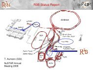
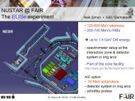
Technical Design Report Super Fragment Separator
Technical Design Report Super Fragment Separator
Technical Design Report Super Fragment Separator

You also want an ePaper? Increase the reach of your titles
YUMPU automatically turns print PDFs into web optimized ePapers that Google loves.
2.4.A3.2.4 Instrumentation<br />
Measuring devices<br />
DRAFT<br />
State-of-the-art Laser Tracker, which is a mobile three-dimensional coordinate measurement<br />
machine, precision Total Stations and precise digital levels, will be the preferred instruments to<br />
fulfil the tasks of surveying and alignment in the majority of cases – both in initial installation<br />
phases and in regular periods of realignment.<br />
The Laser Tracker is a dynamic measurement system which consists of a laser interferometer and a<br />
device for an absolute distance measurement, motor driven rotating mirrors with angle encoders to<br />
follow a corner cube reflector to the desired spot. The tracker gives 3D coordinates of a target in<br />
space with single point accuracy of ~27 µm (2sigma) at a distance of 2 m (~50µm @ 10m /<br />
~110µm @30m). Due to its multiple use this kind of instrument will attend the entire project duration:<br />
from quality checks on components to test measurements at the magnet test facility, from<br />
fiducialization via reference network measurements within the tunnel to the alignment of magnets,<br />
detectors and other experiment installations.<br />
Figure 2.4.143: Type of a Laser Tracker (left) and an Industrial Total Station (right).<br />
At GSI a Laser Tracker is regularly applied since 1996 for fiducialization and in some cases for<br />
network measurement and alignment [98].<br />
The measurements for the primary surface network and the transfer into the tunnel will partly<br />
require receiver of the satellite system GPS and an optical plummet. Due to the forest that has to be<br />
protected as far as possible, some problems will arise with GPS, thus classical triangulation/trilateration<br />
with Total Stations has to be performed, too.<br />
In order to reach positioning accuracies in a range of few millimetres (3D, 1sigma) while using the<br />
Global Positioning System, it is inevitable to use several geodetic double frequency receivers<br />
simultaneously that carry out static measurements of a duration up to 20h; the data post-processing<br />
is necessary using e.g. the Bernese GPS software. A meanwhile well known 'real time kinematic'<br />
solution is not suitable to obtain the required high relative accuracies [99].<br />
171