Coastal Management Profiles : A Directory of Pacific Island - SPREP
Coastal Management Profiles : A Directory of Pacific Island - SPREP
Coastal Management Profiles : A Directory of Pacific Island - SPREP

Create successful ePaper yourself
Turn your PDF publications into a flip-book with our unique Google optimized e-Paper software.
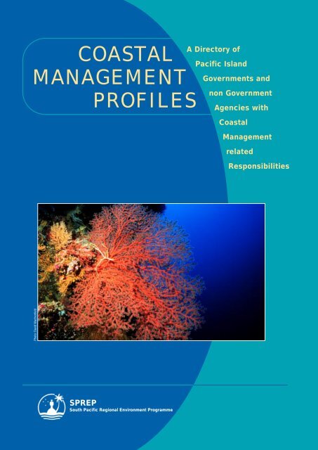
COASTAL<br />
MANAGEMENT<br />
Photo: David Wachenfeld<br />
PROFILES<br />
<strong>SPREP</strong><br />
South <strong>Pacific</strong> Regional Environment Programme<br />
A <strong>Directory</strong> <strong>of</strong><br />
<strong>Pacific</strong> <strong>Island</strong><br />
Governments and<br />
non Government<br />
Agencies with<br />
<strong>Coastal</strong><br />
<strong>Management</strong><br />
related<br />
Responsibilities
<strong>SPREP</strong> Library Cataloguing-in-Publication Data<br />
<strong>Coastal</strong> <strong>Management</strong> <strong>Pr<strong>of</strong>iles</strong> : A <strong>Directory</strong> <strong>of</strong><br />
<strong>Pacific</strong> <strong>Island</strong> Governments and non-Government Agencies<br />
with <strong>Coastal</strong> <strong>Management</strong> Related Responsibilities. –<br />
Apia, Samoa : <strong>SPREP</strong>, 1999.<br />
vi, 205 p. ; 29 cm<br />
ISBN: 982-04-0198-4<br />
1. <strong>Coastal</strong> zone management – Oceania – Directories.<br />
2. <strong>Coastal</strong> engineering - Oceania – Directories.<br />
I. South <strong>Pacific</strong> Regional Environment Programme.<br />
025.1641<br />
Published in June 1999 by the<br />
South <strong>Pacific</strong> Regional Environment Programme<br />
PO Box 240<br />
Apia, Samoa<br />
Email: sprep@sprep.org.ws<br />
Website: http://www.sprep.org.ws/<br />
Produced by <strong>SPREP</strong><br />
Edited by Carole Hunter<br />
Layout and design by Andreas Wagner (WWd, Australia)<br />
email: andreas@wwd.net.au<br />
Cover photo: David Wachenfeld (Triggerfish Images, Australia)<br />
email: triggerfish@bigpond.com<br />
Typeset in 9.5/12 (New Century Schoolbook)<br />
Printed on recycled paper 90gsm Savannah Matt Art (60%) by<br />
Quality Print Ltd, Fiji<br />
© South <strong>Pacific</strong> Regional Environment Programme, 1999.<br />
The South <strong>Pacific</strong> Regional Environment Programme<br />
authorises the reproduction <strong>of</strong> this material, whole or in<br />
part, in any form provided appropriate<br />
acknowledgement is given.<br />
Original Text: English
<strong>SPREP</strong>’s Climate Change<br />
and Integrated <strong>Coastal</strong><br />
<strong>Management</strong> Programme<br />
COASTAL MANAGEMENT PROFILES<br />
A DIRECTORY OF PACIFIC ISLAND GOVERNMENTS AND<br />
NON GOVERNMENT AGENCIES WITH COASTAL MANAGEMENT<br />
RELATED RESPONSIBILITIES<br />
South <strong>Pacific</strong> Regional Environment Programme
FOREWORD<br />
These <strong>Coastal</strong> <strong>Management</strong> <strong>Pr<strong>of</strong>iles</strong> are a direct response to country<br />
requests for a directory containing guidance on who is doing what<br />
in coastal management within the <strong>Pacific</strong> islands region.<br />
Until now, there has been no document available which provided<br />
comprehensive information on the agencies involved in coastal management<br />
activities in the <strong>Pacific</strong> islands region although there have been specific<br />
directories relating to Fisheries contacts. Even within many <strong>of</strong> <strong>SPREP</strong>’s<br />
member countries and territories there can be uncertainty about the<br />
responsibilities and mandates for managing coastal areas and resources.<br />
This <strong>Directory</strong> aims to identify and briefly describe all <strong>of</strong> the organisations,<br />
agencies and individuals in the <strong>Pacific</strong> islands region which have a mandate<br />
or interest in coastal management. It is hoped that this document will fill an<br />
important information gap, providing the necessary information for initiating<br />
and developing integrated coastal management plans and strategies.<br />
It is natural for organisations to undergo change as their mandate evolves or<br />
they restructure. Therefore it is intended that this publication will be a<br />
"living" document, updated as regularly as funding permits.<br />
Tamari’i Tutangata<br />
Director, South <strong>Pacific</strong> Regional Environment Programme<br />
ii
TABLE OF CONTENTS<br />
Foreword ii<br />
Background iv<br />
The <strong>Pacific</strong> islands Region 1<br />
American Samoa 21<br />
Cook <strong>Island</strong>s 30<br />
Fiji 37<br />
Guam 49<br />
Kiribati 57<br />
Marshall <strong>Island</strong>s 66<br />
Micronesia, Federated States <strong>of</strong> 71<br />
Nauru 81<br />
Niue 85<br />
Northern Mariana <strong>Island</strong>s 88<br />
Nouvelle Calédonie/ New Caledonia 96<br />
Palau 118<br />
Papua New Guinea 125<br />
Pitcairn <strong>Island</strong>s 138<br />
Polynésie Française/ French Polynesia 140<br />
Samoa 157<br />
Solomon <strong>Island</strong>s 167<br />
Tokelau 175<br />
Tonga 178<br />
Tuvalu 184<br />
Vanuatu 193<br />
Wallis and Futuna 201
Background<br />
BACKGROUND<br />
INTRODUCTION<br />
Until now there has been no document which<br />
provided an overview <strong>of</strong> integrated coastal<br />
management (ICM) 1 issues and information,<br />
or the agencies involved in ICM, in the <strong>Pacific</strong> islands<br />
region. Even within many countries and territories,<br />
there continues to be uncertainty about what coastal<br />
management and planning actually entails, and the<br />
responsibilities <strong>of</strong> the various agencies that may be<br />
involved in it.<br />
The present directory is intended to help fill this gap<br />
by providing basic information on ICM throughout<br />
the 22 island member countries and territories <strong>of</strong> the<br />
South <strong>Pacific</strong> Regional Environment Programme<br />
(<strong>SPREP</strong>). A chapter on each country presents the<br />
major ICM issues, documents relevant legislation and<br />
lists contact and descriptive information on key<br />
agencies whose mandate is in some way connected to<br />
ICM. The information was compiled by a large<br />
number <strong>of</strong> individuals from published and<br />
unpublished materials and with country, territory<br />
and agency assistance via fax, telephone, e-mail and<br />
PEACESAT. Details <strong>of</strong> the agencies listed were in<br />
most cases either provided or verified by<br />
representatives <strong>of</strong> the agency concerned.<br />
In addition to information on individual countries<br />
and territories, a separate chapter on regional<br />
organisations is included. Regionalism is an<br />
important characteristic <strong>of</strong> the <strong>Pacific</strong> islands. There<br />
are a number <strong>of</strong> inter-governmental agencies and<br />
international non-government organisations (NGOs)<br />
helping <strong>Pacific</strong> island nations deal with ICM<br />
problems, especially those that recur in many<br />
countries, or are <strong>of</strong> such a large scale that they can<br />
only be dealt with on a multi-country basis. There are<br />
also international organisations such as the various<br />
UN agencies that have <strong>of</strong>fices throughout the region.<br />
An attempt has been made to include as many <strong>of</strong><br />
these agencies as possible. However, in order to<br />
maintain the ICM focus <strong>of</strong> the directory and to keep<br />
the compilation work within manageable limits it has<br />
been necessary to exclude generalist agencies (e.g.<br />
bilateral aid donors and embassies) as well as<br />
international organisations which do not have a base<br />
iv<br />
in a <strong>Pacific</strong> island country, even though they may<br />
from time to time be involved in ICM projects in the<br />
region.<br />
An attempt was made to develop a standard format<br />
for the presentation <strong>of</strong> information, but this was not<br />
fully achieved. <strong>Pacific</strong> island countries differ in many<br />
ways, and this includes their ICM situations. The<br />
wide variety <strong>of</strong> ICM issues and responses, the<br />
differences in political and administrative structure<br />
<strong>of</strong> the various countries and territories <strong>of</strong> the region,<br />
and the non-availability <strong>of</strong> comprehensive<br />
information in some cases, ultimately defeated the<br />
objective <strong>of</strong> a universal information format, although<br />
progress has been made towards this goal. It is<br />
anticipated that further standardisation will be<br />
possible in future issues <strong>of</strong> the directory.<br />
ICM is only now beginning to gain attention in many<br />
<strong>Pacific</strong> island countries, and a number <strong>of</strong> agency<br />
reorganisations or restructuring exercises were<br />
underway at the time this directory was prepared. In<br />
addition, some countries were in the process <strong>of</strong><br />
reviewing their legislation relating to aspects <strong>of</strong> ICM,<br />
and not all agencies were able to provide up-to-date<br />
information on their activities. The situation is<br />
therefore quite dynamic and as a result some<br />
information presented here may be incomplete or<br />
already outdated. This is somewhat inevitable in a<br />
publication <strong>of</strong> this nature. If funding is available, the<br />
directory will be updated periodically so that it retains<br />
its usefulness as a primary source <strong>of</strong> information and<br />
contacts relating to ICM in the region.<br />
ACKNOWLEDGEMENTS<br />
Production <strong>of</strong> this directory was managed by<br />
James Aston <strong>of</strong> <strong>SPREP</strong> and coordinated by<br />
Garry Preston <strong>of</strong> Gillett, Preston and<br />
Associates Inc. It is the result <strong>of</strong> the efforts <strong>of</strong> many<br />
people who have been involved in the various stages<br />
<strong>of</strong> preparation since it was first conceived in 1994.<br />
<strong>SPREP</strong> is grateful to all the contributors, who are<br />
listed overleaf. <strong>SPREP</strong> would also like to acknowledge<br />
with gratitude the numerous staff <strong>of</strong> the various<br />
organisations listed, many <strong>of</strong> whom went to<br />
1 Note: Previously CZM (coastal zone management) was a common acronym. Currently, ICM (integrated coastal management), ICZM (integrated<br />
coastal zone management) and ICAM (integrated coastal area management are more common and virtually interchangeable. The “coastal zone” in<br />
many small islands, from a systems and ecological perspective, is for all intents and purposes the whole island. Layered on top <strong>of</strong> this are a range<br />
<strong>of</strong> political, cultural and legal arrangements which affect the utilisation and management <strong>of</strong> resources in the coastal zone. Therefore, defining the<br />
coastal zone or coastal areas in the small islands context should involve flexibility.
considerable efforts to ensure that information on<br />
their particular agency was as accurate and up-todate<br />
as possible.<br />
LIST OF CONTRIBUTORS<br />
■ Moses Amos<br />
Department <strong>of</strong> Fisheries, Port Vila, Vanuatu.<br />
■ James Aston<br />
South <strong>Pacific</strong> Regional Environment Programme,<br />
Apia, Samoa.<br />
■ William Fitzgerald<br />
Oceania-<strong>Pacific</strong> Rim Consultant Services, Guam.<br />
■ Catherine Gabrie<br />
Freelance Consultant, Vanves, France.<br />
■ John Gourley<br />
Micronesian Environmental Services, Saipan,<br />
Northern Mariana <strong>Island</strong>s.<br />
■ Alison Green<br />
Coral Reef Consultant, Buderim, Queensland,<br />
Australia.<br />
■ Paul Holthus<br />
World Conservation Union, Geneva, Switzerland.<br />
■ Noah Idechong<br />
Palau Conservation Society, Koror, Palau.<br />
■ Jennifer Kallie<br />
Fisheries Division, Apia, Samoa.<br />
■ Ursula Kolkolo<br />
National Fisheries Authority, Port Moresby, Papua<br />
New Guinea.<br />
■ Michelle Lam<br />
Fisheries Division, Honiara, Solomon <strong>Island</strong>s.<br />
■ Ed Lovell<br />
Biological Consultants (Fiji) Ltd., Suva, Fiji.<br />
■ Mike McCoy<br />
Gillett, Preston and Associates Inc., Kona-Kailua,<br />
Hawaii.<br />
■ Patrick Nunn<br />
University <strong>of</strong> the South <strong>Pacific</strong>, Suva, Fiji.<br />
■ Tom Panholzer<br />
College <strong>of</strong> Micronesia, Pohnpei, Federated States<br />
<strong>of</strong> Micronesia.<br />
■ Kelvin Passfield<br />
Fisheries and Environmental Resource<br />
Consultants Ltd., Rarotonga, Cook <strong>Island</strong>s.<br />
■ Garry Preston<br />
Gillett, Preston & Associates Inc., Noumea, New<br />
Caledonia.<br />
■ Samisoni Sauni<br />
Marine Studies Programme, University <strong>of</strong> the<br />
South <strong>Pacific</strong>, Suva, Fiji.<br />
v<br />
■ Graham Sem<br />
University <strong>of</strong> Papua New Guinea, Port Moresby,<br />
Papua New Guinea.<br />
■ Neil Sims<br />
Black Pearls Inc., Kona-Kailua, Hawaii.<br />
■ Andrew Smith<br />
The Nature Conservancy, Koror, Palau.<br />
■ Marie-Hélène Teulières<br />
Gillett, Preston & Associates Inc., Noumea, New<br />
Caledonia.<br />
■ Anna Tiraa<br />
Fisheries and Environmental Resource<br />
Consultants Ltd., Rarotonga, Cook <strong>Island</strong>s.<br />
■ Veikila Vuki<br />
Marine Studies Programme, University <strong>of</strong> the<br />
South <strong>Pacific</strong>, Suva, Fiji.<br />
■ Being Yeeting<br />
Atoll Research Programme, USP Centre, Tarawa,<br />
Kiribati.<br />
Background
THE PACIFIC<br />
ISLANDS REGION<br />
ASIA<br />
NORTHERN MARIANA<br />
ISLANDS<br />
GUAM<br />
FEDERATED STATES<br />
PALAU OF MICRONESIA<br />
AUSTRALIA<br />
PAPUA<br />
NEW GUINEA<br />
NEW<br />
CALEDONIA<br />
MARSHALL<br />
ISLANDS<br />
NEW<br />
ZEALAND<br />
KEY STATISTICS<br />
The <strong>Pacific</strong> islands region comprises the 22 island states <strong>of</strong> the central and western <strong>Pacific</strong>, generally<br />
referred to as <strong>Pacific</strong> <strong>Island</strong> Countries (PICs).<br />
Table 1: Key characteristics <strong>of</strong> <strong>Pacific</strong> <strong>Island</strong> countries.<br />
State/ territory Land area EEZ area Est population<br />
(sq km.) (sq km.) (1995)<br />
American Samoa 197 390 000 57 000<br />
Cook <strong>Island</strong>s 180 1830 000 18 100<br />
Fiji 18 376 1290 000 768 700<br />
French Polynesia 3521 5030 000 221 300<br />
Guam 549 218 000 150 000<br />
Kiribati 726 3550 000 80 400<br />
Marshall <strong>Island</strong>s 720 2131 000 56 500<br />
Micronesia, Federated States <strong>of</strong> 702 2978 000 125 100<br />
Nauru 21 320 000 10 400<br />
New Caledonia 19 103 1740 000 186 800<br />
Niue 258 390 000 2200<br />
Northern Marianas 475 1823 000 71 800<br />
Palau 500 629 000 16 900<br />
NIUE<br />
HAWAI<br />
WALLIS AND<br />
NAURU FUTUNA<br />
KIRIBATI<br />
TUVALU<br />
SOLOMON TOKELAU<br />
ISLANDS<br />
AMERICAN<br />
SAMOA<br />
VANUATU SAMOA<br />
FRENCH POLYNESIA<br />
COOK<br />
FIJI<br />
ISLANDS<br />
ISLANDS<br />
1<br />
TONGA<br />
<strong>Pacific</strong> Ocean<br />
0 1,500km<br />
0<br />
PITCAIRN<br />
1,500 mi<br />
The <strong>Pacific</strong> <strong>Island</strong>s Region
The <strong>Pacific</strong> <strong>Island</strong>s Region<br />
Papua New Guinea 461 690 3120 000 4173 200<br />
Pitcairn 5 800 000 100<br />
Samoa 2934 120 000 163 900<br />
Solomon <strong>Island</strong>s 29 785 1340 000 375 000<br />
Tokelau 12 290 000 1600<br />
Tonga 696 700 000 98 900<br />
Tuvalu 26 900 000 9900<br />
Vanuatu 12 189 680 000 168 300<br />
Wallis & Futuna 124 300 000 14 700<br />
Total 552 789 30 569 000 6770 800<br />
Although the region contains only 0.55 million sq km<br />
<strong>of</strong> land, its exclusive economic zones (EEZs) cover an<br />
estimated ocean area <strong>of</strong> 30.57 million sq km,<br />
equivalent to about 29% <strong>of</strong> the world EEZ area. The<br />
disposition <strong>of</strong> land and population in the region<br />
varies greatly from country to country but in most<br />
cases the area <strong>of</strong> maritime jurisdiction is many<br />
thousands <strong>of</strong> times greater than the available<br />
land area.<br />
PHYSICAL CHARACTERISTICS<br />
The region contains about 200 high islands and<br />
2500 low islands and atolls. Apart from the<br />
Pitcairn group and the southern part <strong>of</strong><br />
French Polynesia, all <strong>of</strong> these lie in the tropical zone.<br />
The islands tend to increase in size from east to west,<br />
with Papua New Guinea comprising most <strong>of</strong> the<br />
region’s land area. In general, the islands rise steeply<br />
from the deep ocean floor and have very little<br />
underwater shelf area. Coral reefs characteristically<br />
surround the islands, either close to the shore<br />
(fringing reef) or further <strong>of</strong>fshore (barrier reef), in<br />
which case a coastal lagoon is enclosed. The area<br />
includes many atolls, which are the remnant barrier<br />
reefs <strong>of</strong> islands that have subsided. Some <strong>of</strong> the more<br />
recent islands in the area lack coral reefs. Mangrove<br />
forests <strong>of</strong>ten border the inshore waters, especially<br />
those <strong>of</strong> the larger islands, and provide habitat for<br />
the juveniles <strong>of</strong> many important food fish.<br />
Biodiversity tends to be at a maximum in the<br />
equatorial region in the west <strong>of</strong> the <strong>Pacific</strong> <strong>Island</strong>s<br />
area, and decreases markedly towards the east. For<br />
example, the number <strong>of</strong> naturally occurring species <strong>of</strong><br />
animals and plants is much greater in the Solomon<br />
<strong>Island</strong>s than in Tahiti. This is also true <strong>of</strong> the marine<br />
environment, where fish and invertebrate species,<br />
including corals, are far more numerous in the west<br />
<strong>of</strong> the sub-region than in the east.<br />
Due to the relatively small size <strong>of</strong> most islands, major<br />
bodies <strong>of</strong> fresh water are not widespread in the<br />
2<br />
region, with substantial rivers and lakes only being<br />
found in some <strong>of</strong> the larger islands <strong>of</strong> Melanesia. The<br />
small land areas <strong>of</strong> most islands create limited<br />
freshwater and nutrient run<strong>of</strong>f, resulting in low<br />
enrichment <strong>of</strong> the nearby sea. The ocean waters <strong>of</strong> the<br />
area are usually clear and low in productivity.<br />
Upwellings occur in the boundaries between currents<br />
and in other localised areas, and have important<br />
implications for the abundance and harvesting <strong>of</strong><br />
marine resources.<br />
In general, the larger islands have more fertile soil,<br />
resulting in the greater availability <strong>of</strong> food plants.<br />
Conversely, on the small islands (and especially the<br />
atolls) the poor soil results in limited plant food<br />
production and a greater dependence on marine<br />
products for food and income. As an extreme example,<br />
in Tokelau there were only two species <strong>of</strong> edible land<br />
plants at the time <strong>of</strong> first European contact. The<br />
amount <strong>of</strong> arable land per person in the <strong>Pacific</strong><br />
<strong>Island</strong>s area is relatively small. Estimates <strong>of</strong> this<br />
statistic, in hectares per person, are: Fiji (2.1),<br />
Solomon <strong>Island</strong>s (1.4), Tonga (1.8), Vanuatu (1.4) and<br />
Samoa (3.5) (K<strong>of</strong>e, 1990).<br />
Annual rainfall generally varies between 2000 and<br />
3500 mm, although considerable variation is<br />
experienced across the area. Rain is frequently<br />
seasonal, but not consistently so across the area:<br />
Palau in the west has two periods <strong>of</strong> heavy rainfall<br />
(July/ August and December/ January) while most <strong>of</strong><br />
the rain in French Polynesia in the east occurs in<br />
November and March. Considerable inter-annual<br />
variation in rainfall also occurs and droughts are<br />
common, especially on the smaller islands. The<br />
windward sides <strong>of</strong> the larger islands are<br />
characteristically much wetter than their leeward<br />
sides due to the existence <strong>of</strong> rain shadows.<br />
There are also major differences in the wind patterns<br />
<strong>of</strong> the region. Those islands in the west are more<br />
strongly affected by the Asian land mass (seasonal<br />
reversals <strong>of</strong> the wind direction), while in the east the<br />
southeasterly trade winds dominate for most <strong>of</strong> the
year. Equatorial winds tend to be lighter and more<br />
variable, while those <strong>of</strong> the higher latitudes are<br />
stronger and more constant.<br />
Tropical (cyclonic or, in the northern hemisphere,<br />
anticyclonic) storms represent the most prevalent<br />
natural disaster <strong>of</strong> the region, and occur in all but a<br />
few <strong>of</strong> the equatorial countries (notably Kiribati). On<br />
average the northwestern portion <strong>of</strong> the region (FSM,<br />
Palau, Guam) experiences about four times the<br />
number <strong>of</strong> destructive tropical storms as the areas<br />
south <strong>of</strong> the equator. Tropical storms tend to occur at<br />
the time <strong>of</strong> the year when oceanic warmth is at a<br />
maximum.<br />
The periodic oceanographic phenomenon known as<br />
the El Niño–Southern Oscillation can produce major<br />
climatic aberrations in the <strong>Pacific</strong> <strong>Island</strong>s. At roughly<br />
3–7 year intervals a warm south-flowing current <strong>of</strong>f<br />
the west coast <strong>of</strong> South America changes course and<br />
alters the patterns <strong>of</strong> ocean water temperature across<br />
the <strong>Pacific</strong> Ocean. This can result in major changes in<br />
rainfall patterns and other aspects <strong>of</strong> the weather,<br />
including the frequency, intensity and distribution <strong>of</strong><br />
tropical storms.<br />
POLITICAL CHARACTERISTICS<br />
Ethnically the region is usually broken into<br />
three sub regions: Micronesia, comprising<br />
the northwestern countries <strong>of</strong> Palau,<br />
Federated States <strong>of</strong> Micronesia, Guam, Northern<br />
Mariana <strong>Island</strong>s, Marshall <strong>Island</strong>s and Kiribati;<br />
Polynesia, which includes the southeastern countries<br />
<strong>of</strong> Cook <strong>Island</strong>s, Niue, Pitcairn, French Polynesia, the<br />
Samoas, Tokelau, Tonga, Tuvalu and Wallis and<br />
Futuna (as well as New Zealand); and Melanesia,<br />
which comprises Papua New Guinea, Solomon <strong>Island</strong>s,<br />
3<br />
Vanuatu, New Caledonia and Fiji (the latter being a<br />
transition point between Melanesia and Polynesia).<br />
All but one <strong>of</strong> the countries <strong>of</strong> the region (Tonga) were<br />
colonised by European nations during the 18th<br />
century. Some have since become independent states,<br />
while others continue to be formally associated in<br />
some way with the original colonising nations, or with<br />
other nations.<br />
The region’s ethnic origins, combined with modernday<br />
political affiliations, and the various indigenous<br />
and introduced languages now shared among some<br />
groups <strong>of</strong> states, influence the composition <strong>of</strong> the<br />
various political and economic groupings that exist in<br />
the region. Principal among these is the South <strong>Pacific</strong><br />
Forum, a political alliance which brings together the<br />
independent countries and self-determining states<br />
(the latter being the US- and NZ-affiliated developing<br />
countries shown in table 2) <strong>of</strong> the region, including<br />
Australia and New Zealand. Outside the Forum, the<br />
various US, French and NZ-affiliated states and<br />
territories also have formal political and economic<br />
links, <strong>of</strong>ten with their respective ‘mother’ countries.<br />
The region has a strong history <strong>of</strong> ‘regionalism’,<br />
which derives from several considerations: the fact<br />
that many countries share problems which justify a<br />
collaborative search for common solutions; the small<br />
size and limited human and financial resources <strong>of</strong><br />
most countries, which constrains their ability to fully<br />
address the wide range <strong>of</strong> economic development<br />
problems they face; and the region’s colonial history,<br />
during which the main metropolitan powers<br />
established mechanisms for dialogue and mutually<br />
beneficial cooperation, some <strong>of</strong> which persist today.<br />
Historically, extensive migration has taken place<br />
throughout the region, and this continues today in the<br />
form <strong>of</strong> labour movement and economic migration.<br />
Table 2: The political status <strong>of</strong> the region’s constituent countries, their status as small island<br />
developing states, and their membership <strong>of</strong> the main regional organisations.<br />
State Political status/ affiliation SIDS <strong>SPREP</strong>/SPC/ ForSec/ USP<br />
SOPAC FFA<br />
American Samoa US territory x<br />
Cook <strong>Island</strong>s New Zealand-affiliated developing country x x x x<br />
Fiji Independent developing country x x x x<br />
French Polynesia French territory x<br />
Guam US territory x<br />
Kiribati Independent developing country x x x x<br />
Marshall <strong>Island</strong>s US-affiliated developing country x x x x<br />
Micronesia US-affiliated developing country x x x<br />
Nauru Independent developing country x x x x<br />
The <strong>Pacific</strong> <strong>Island</strong>s Region
The <strong>Pacific</strong> <strong>Island</strong>s Region<br />
New Caledonia French territory x<br />
Niue New Zealand-affiliated developing country x x x x<br />
Northern Marianas US territory x<br />
Palau US-affiliated developing country x x x<br />
Papua New Guinea Independent developing country x x<br />
Pitcairn <strong>Island</strong>s UK territory x<br />
Samoa Independent developing country x x x x<br />
Solomon <strong>Island</strong>s Independent developing country x x x<br />
Tokelau New Zealand territory x x x<br />
Tonga Independent developing country x x x x<br />
Tuvalu Independent developing country x x x x<br />
Vanuatu Independent developing country x x x<br />
Wallis and Futuna French territory x<br />
Note: SIDS=Small <strong>Island</strong> Developing States; <strong>SPREP</strong>=South <strong>Pacific</strong> Regional Environment Programme; SPC=Secretariat for the <strong>Pacific</strong> Community;<br />
SOPAC=South <strong>Pacific</strong> Applied Geoscience Commission; ForSec=South <strong>Pacific</strong> Forum Secretariat; FFA=South <strong>Pacific</strong> Forum Fisheries Agency;<br />
USP=University <strong>of</strong> the South <strong>Pacific</strong>.<br />
ECONOMIC CHARACTERISTICS<br />
Socioeconomic conditions vary widely in PICs. In<br />
general, those people living in territories <strong>of</strong><br />
metropolitan countries (e.g. Guam (USA), New<br />
Caledonia and French Polynesia (France)) have better<br />
access to goods and services than inhabitants <strong>of</strong> the<br />
independent states or those in free association with<br />
metropolitan powers. Throughout the region, urban<br />
residents live a more consumerist lifestyle than those<br />
in small isolated islands, remote coastal areas, and<br />
the interior <strong>of</strong> large islands, who generally live a<br />
subsistence lifestyle and have a relatively low<br />
standard <strong>of</strong> living.<br />
The socioeconomic conditions <strong>of</strong> the independent<br />
<strong>Pacific</strong> <strong>Island</strong>s countries have recently been<br />
summarised in the <strong>Pacific</strong> Human Development<br />
Report (UNDP, 1994). With respect to relative<br />
development the report concludes that, based on the<br />
Human Development Index (HDI), the <strong>Pacific</strong> <strong>Island</strong><br />
countries with the exception <strong>of</strong> Papua New Guinea,<br />
Solomon <strong>Island</strong>s, and Vanuatu would fall into the<br />
category <strong>of</strong> ‘medium human development’. Globally, <strong>of</strong><br />
the 173 countries listed in the report, 65 fall into this<br />
category. PNG, Solomons, and Vanuatu are placed in<br />
the ‘low human development’ category, amongst 55<br />
countries in this category. Unlike Australia and New<br />
Zealand, none <strong>of</strong> the 13 <strong>Pacific</strong> <strong>Island</strong> countries<br />
covered by the report are amongst the 53 countries<br />
categorised as ‘high human development’.<br />
4<br />
For the region as a whole, economic growth during<br />
the past decade was almost nil (World Bank, 1995).<br />
When this is viewed in association with population<br />
growth, the resulting outlook is gloomy. Between<br />
1970 and 1990 the population <strong>of</strong> the region grew by<br />
2 222 000 people which is equal to an annual growth<br />
rate <strong>of</strong> 2.3%, high relative to the world average <strong>of</strong><br />
1.8% (NCDS, 1994). The resulting situation <strong>of</strong> high<br />
population growth coupled with little or no economic<br />
growth is arguably the <strong>Pacific</strong> <strong>Island</strong>s’ greatest longterm<br />
problem.<br />
The economies <strong>of</strong> many PICs are largely based on<br />
agriculture (which for statistical purposes <strong>of</strong>ten<br />
includes fishing). Fiji, FSM, Tonga, Samoa, Kiribati,<br />
Vanuatu and the Solomon <strong>Island</strong>s all have<br />
agricultural sectors which employ more than 40% <strong>of</strong><br />
the labour force (Booth and Muthiah, 1993). There is<br />
a tendency, however, for increasing diversification<br />
into the industry and services sectors, especially in<br />
the smaller countries. Tourism is the most important<br />
sector in some <strong>Pacific</strong> <strong>Island</strong>s economies while in<br />
others it is non-existent. SPC (1995) estimates that<br />
the Northern Mariana <strong>Island</strong>s, Fiji and French<br />
Polynesia received 536 263, 287 462 and 147 847<br />
overseas visitors respectively in 1994. No data was<br />
available for Guam, probably the region’s most<br />
important tourist destination. The Cook <strong>Island</strong>s,<br />
Kiribati, Marshall <strong>Island</strong>s, Niue and Tuvalu recorded<br />
fewer than 10 000 visitors each.<br />
A characteristic <strong>of</strong> <strong>Pacific</strong> island countries is the large<br />
number <strong>of</strong> people who derive most <strong>of</strong> their basic
THE PACIFIC ISLANDS REGION CONT’D<br />
needs from non-monetary subsistence production. In<br />
1992 the Forum Secretariat estimated the proportion<br />
<strong>of</strong> the subsistence economy in the Solomon <strong>Island</strong>s<br />
(80% <strong>of</strong> the population), Tuvalu (80%), Kiribati (80%),<br />
Samoa (60%) and FSM (at least 50%).<br />
The term ‘subsistence affluence’ is sometimes used to<br />
describe the relatively high quality <strong>of</strong> life on some <strong>of</strong><br />
the <strong>Pacific</strong> <strong>Island</strong>s. The term refers to a condition <strong>of</strong><br />
well-being outside the cash economy. Factors<br />
contributing to this situation include low population<br />
densities, fertile soil, a benevolent climate, effective<br />
traditional resource management and social systems<br />
which provide a safety net for disadvantaged<br />
members <strong>of</strong> society. Recently, however, high birth<br />
rates, unsustainable commercial practices in regard<br />
to natural resource use, increasing dependency on the<br />
cash economy, labour migration and the deterioration<br />
<strong>of</strong> traditional authority and social systems are having<br />
a negative impact on the quality <strong>of</strong> subsistence life<br />
on many islands. Nevertheless, the fact that<br />
widespread poverty has not emerged in response to<br />
the gradually deteriorating economic conditions in<br />
most <strong>Pacific</strong> <strong>Island</strong> countries gives some indication<br />
as to the effectiveness <strong>of</strong> the traditional social<br />
support systems<br />
Population movement from outer islands or rural<br />
areas into towns and cities is a prominent<br />
characteristic <strong>of</strong> most <strong>Pacific</strong> <strong>Island</strong> countries. The<br />
average urbanisation rate across the region was 17%<br />
in 1970 but had increased to 24% in 1990. The<br />
problems <strong>of</strong> low per capita GDP becomes much more<br />
acute as populations become more urbanised. Urban<br />
migrants are usually unable to find employment and<br />
have no access to land or fishing rights, both <strong>of</strong> which<br />
are usually governed by strict traditional systems.<br />
Urban migration generates urban poverty which<br />
contrasts starkly with the ‘subsistence affluence’<br />
categorisation, and which is the source <strong>of</strong> many other<br />
social problems, including rising urban crime rates.<br />
The high amount <strong>of</strong> development assistance received<br />
by the region, and remittance income, are two<br />
external factors which will tend to mitigate, at least<br />
in the short term, the appearance <strong>of</strong> poverty. Overall<br />
the region receives a relatively large US$204 <strong>of</strong> aid<br />
per capita (Fairbairn 1994) which is quite unevenly<br />
distributed between the countries.<br />
In many countries, particularly Tonga, Samoa and the<br />
Cook <strong>Island</strong>s, cash remittances by relatives living<br />
overseas are substantial, and may in fact exceed the<br />
value <strong>of</strong> all exports. Remittances from overseas<br />
employment are also very important to Kiribati and<br />
Tuvalu (a large number <strong>of</strong> whose citizens work as<br />
crew on merchant and fishing vessels, and in the<br />
Nauru phosphate mining industry), as well as to<br />
Vanuatu (fishing vessels), and to a lesser extent Fiji<br />
and American Samoa (various types <strong>of</strong> vessels).<br />
5<br />
Both aid and remittances face an uncertain future as<br />
the countries which provide aid and the countries<br />
which accept <strong>Pacific</strong> <strong>Island</strong> immigrants show signs <strong>of</strong><br />
changing their policies. In addition, although<br />
increasing employment <strong>of</strong> <strong>Pacific</strong> <strong>Island</strong>ers aboard<br />
foreign fishing vessels is anticipated, the future<br />
prospects <strong>of</strong> employment in Nauru are poor due to the<br />
exhaustion <strong>of</strong> phosphate reserves.<br />
Natural disasters are common in the <strong>Pacific</strong> <strong>Island</strong>s.<br />
In the period 1960 to 1989, many countries across the<br />
region experiences tropical cyclones, including the<br />
Cook <strong>Island</strong>s (15), Fiji (34), Solomon <strong>Island</strong>s (14),<br />
Tonga (15), Vanuatu (32), Samoa (10), and Papua New<br />
Guinea (2) (Chung, 1991). Other types <strong>of</strong> common<br />
disasters are coastal floods, river floods, drought,<br />
earthquake, tsunami and volcanic eruption. Although<br />
there is no evidence that the incidence <strong>of</strong> disasters is<br />
increasing, for various reasons the amount <strong>of</strong> damage<br />
from each event and the subsequent disaster relief is<br />
growing.<br />
COASTAL ZONE MANAGEMENT<br />
The coastal zone is regularly referred to in PIC<br />
discussions and documents relating to ‘coastal<br />
planning’, ‘coastal management’, ‘coastal zone<br />
management’, ‘integrated coastal zone management’,<br />
or ‘integrated coastal management ‘collectively<br />
referred to here as ICM. These expressions refer to<br />
the concept <strong>of</strong> multi-disciplinary, multi-sector<br />
management arrangements that take into account<br />
the full range <strong>of</strong> <strong>of</strong>ten-conflicting uses <strong>of</strong> the coastal<br />
zone.<br />
Unfortunately a definition <strong>of</strong> what exactly constitutes<br />
the coastal zone, both in the <strong>Pacific</strong> <strong>Island</strong>s region<br />
and in other regions <strong>of</strong> the world, remains elusive.<br />
Clark (1992) states that: “By virtually any set <strong>of</strong><br />
criteria the coastal zone is a linear band <strong>of</strong> land and<br />
water that straddles the coast—a ‘corridor’ in<br />
planning parlance.” However, he then goes on to add<br />
that:<br />
“There is no single description <strong>of</strong> the coastal<br />
area or coastal zone: boundaries are delineated<br />
on the basis <strong>of</strong> the particular problems that<br />
ICM attempts to solve. The zone may extend<br />
inland and seaward to a variable extent—the<br />
boundaries <strong>of</strong> the coastal zone depend on<br />
political, administrative, legal, ecological and<br />
pragmatic considerations because there is a<br />
broad array <strong>of</strong> possible coastal issues and<br />
because the zone can be affected by remote<br />
activities. A narrow coastal zone could be<br />
appropriate if the purpose were to manage only<br />
the shoreline and intertidal areas. If watershed<br />
issues are <strong>of</strong> concern, then an inland extension<br />
The <strong>Pacific</strong> <strong>Island</strong>s Region
The <strong>Pacific</strong> <strong>Island</strong>s Region<br />
is necessary. Likewise, if the issues extend far<br />
seaward then the EEZ might be included. The<br />
boundaries must be adaptive to the goals and<br />
objectives.”<br />
Sorensen and McCreary (1990) agree that<br />
“boundaries for integrated coastal zone management<br />
programmes should be tailored to capture and enable<br />
resolution <strong>of</strong> all the major coastal issues. Because<br />
there is a broad array <strong>of</strong> possible coastal issues there<br />
is also a broad array <strong>of</strong> possible management<br />
boundaries”. Some boundaries are quite narrow, and<br />
are best suited to deal with use conflicts occurring at<br />
the immediate shoreline. But if watershed-generated<br />
impacts are serious then a coastal management<br />
boundary extending far inland would be justified. The<br />
(ICM) zone <strong>of</strong> jurisdiction may be based on political<br />
and administrative considerations as well as<br />
economic and biogeographic ones.<br />
Although the coastal zone may be drawn broadly or<br />
narrowly, it always includes the water’s edge—the<br />
boundary line between land and sea that includes the<br />
subtidal, intertidal and supratidal zones. This is<br />
where authority changes abruptly, where storms hit,<br />
where waterfront development locates, where boats<br />
make their landfalls, and where some <strong>of</strong> the richest<br />
aquatic habitat is found. It is also where typical<br />
terrestrial type planning and resource management<br />
programmes are at their weakest. The edge zone<br />
includes coastal flood plains, mangroves, marshes and<br />
tidal flats, beaches and dunes and fringing corals. It<br />
is a place <strong>of</strong> great dynamism and energy. The water’s<br />
edge is also the place where the greatest competition<br />
and conflict between users is found (Clark, 1992).<br />
By these criteria the entire land area <strong>of</strong> many PICs<br />
can be defined as falling within the coastal zone.<br />
Even in the larger PICs the inland areas are<br />
sufficiently close to the coast, and intimately-enough<br />
connected to it through watersheds and groundwater<br />
resources, that almost all inland development<br />
activities would have direct impacts on the coastal<br />
zone. In the case <strong>of</strong> PICs and other small island<br />
states, therefore, the concept <strong>of</strong> ICM becomes<br />
modified, such that it essentially comprises the<br />
expansion and enhancement <strong>of</strong> general development<br />
planning to adequately cater for the needs and<br />
sensitivities <strong>of</strong> the coastal zone.<br />
Uses <strong>of</strong> the coastal zone, or activities that take place<br />
within it, in PICs may be aquatic or terrestrial and<br />
typically include the following:<br />
■ fishing;<br />
■ coastal shipping;<br />
■ port and harbour development;<br />
■ water-based recreation, such as diving and<br />
other tourism-related activities;<br />
6<br />
■ coastal construction—building <strong>of</strong> houses,<br />
hotels, commercial and industrial premises;<br />
■ infrastructure development—building <strong>of</strong> roads,<br />
installation <strong>of</strong> power and water supply;<br />
■ sewage treatment and disposal;<br />
■ rubbish dumping, discharge <strong>of</strong> factory effluent<br />
and other forms <strong>of</strong> waste disposal;<br />
■ coastal protection - construction <strong>of</strong> sea walls or<br />
other forms <strong>of</strong> shoreline stabilisation;<br />
■ agriculture;<br />
■ logging;<br />
■ mining <strong>of</strong> various types, including<br />
petrochemical extraction; and<br />
■ modification <strong>of</strong> watercourses (dams and so on).<br />
These and other activities take place at variable<br />
distances from the coast, and affect the coastal zone<br />
in one way or another to varying degrees. ICM aims<br />
to ensure that development <strong>of</strong> the coastal zone takes<br />
place in a sustainable manner which allows for<br />
multiple uses <strong>of</strong> the zone, and attempts to prevent<br />
the activities <strong>of</strong> one user group having negative<br />
consequences for those <strong>of</strong> another (or for itself).<br />
Where it exists as a formal process, ICM in the region<br />
is the responsibility <strong>of</strong> government agencies. The<br />
evidence suggests, however, that PICs have made<br />
limited progress in this type <strong>of</strong> planning and<br />
management. Only a few countries have formally<br />
established national or state-level coastal zone<br />
management plans. Various planning and ICM<br />
development exercises have taken place in other<br />
countries, some <strong>of</strong> which have put in place interdepartmental<br />
committees to coordinate or facilitate<br />
multi-disciplinary approaches to coastal zone<br />
development. In the main, however, approaches to<br />
ICM in the region remain informal and ad hoc.<br />
In any case, incorporation <strong>of</strong> ICM issues into the<br />
national development planning cycle would only be a<br />
first step. Even in those countries that have national<br />
development plans, the actual implementation <strong>of</strong> the<br />
plan tends to be incomplete, with development<br />
activities <strong>of</strong>ten responding to the needs <strong>of</strong> short-term<br />
political or economic expediency rather than to longterm<br />
strategies for sustainable resource use. The<br />
reasons vary from country to country, but are<br />
generally related to the widespread difficulties<br />
encountered in all PICs in establishing mechanisms<br />
whereby government departments communicate and<br />
interact effectively with each other, with political<br />
decision-makers, and with institutions, organisations,<br />
communities and individuals outside the public<br />
sector.<br />
PICs are far from being alone in this regard.<br />
According to UN (1992):<br />
“Experience shows integrated marine and<br />
coastal area planning and management to be a
THE PACIFIC ISLANDS REGION CONT’D<br />
highly complex process, entailing the use <strong>of</strong><br />
various policy and economic instruments, and<br />
the introduction <strong>of</strong> special institutional<br />
arrangements. Most countries have<br />
encountered difficulties in implementing this<br />
form <strong>of</strong> management and attribute these to a<br />
general failure to effectively incorporate the<br />
marine and coastal dimension into national<br />
development planning processes and thereby<br />
command adequate political and financial<br />
support. That impediment is also experienced<br />
at the sectoral level, even with respect to such<br />
valuable economic assets as fisheries”.<br />
Despite these failures, it is becoming increasingly<br />
important that the principles <strong>of</strong> integrated coastal<br />
management be adopted in PICs, most <strong>of</strong> which are<br />
now beginning to see the deleterious effects <strong>of</strong><br />
increased sedimentation, eutrophication, toxic<br />
pollution, habitat destruction and other negative<br />
impacts <strong>of</strong> indiscriminate coastal zone use. Truly<br />
integrated coastal management involves a<br />
representative cross section <strong>of</strong> coastal resource users<br />
7<br />
in the planning and management process. Mechanisms<br />
whereby this can occur need to be developed and<br />
implemented in PICs in order to avoid further coastal<br />
degradation, additional pressure on coastal resources<br />
which may already be stressed, economic loss and a<br />
deterioration in the quality <strong>of</strong> life.<br />
In the absence <strong>of</strong> formal government ICM<br />
arrangements, an increasing number <strong>of</strong> nongovernment<br />
organisations (NGOs) and<br />
informally-constituted groups are becoming active in<br />
this area. This <strong>of</strong>ten takes place with the sanction<br />
and support <strong>of</strong> governments, who are increasingly<br />
seeing community-based or participatory<br />
arrangements as an appropriate and cost-effective<br />
alternative to centralised resource management<br />
systems. Although few NGOs have formal ICM<br />
responsibilites, and many are focussed only on local<br />
or specialised issues, their collective influence on<br />
development activities within the coastal zone, and<br />
on government policy in regard to the zone, is<br />
significant and growing.<br />
REGIONAL INTER-GOVERNMENTAL ORGANISATIONS<br />
South <strong>Pacific</strong> Regional Environment Programme (<strong>SPREP</strong>)<br />
PO Box 240 Tel: (685) 21929<br />
Apia Fax: (685) 20231<br />
Samoa E-mail: sprep@sprep.org.ws<br />
Mr Tamarii Tutangata<br />
Director<br />
E-mail: tamariit@sprep.org.ws<br />
Mr James Aston<br />
<strong>Coastal</strong> <strong>Management</strong> Officer<br />
E-mail: jaston@sprep.org.ws<br />
Ms Lucille Apis-Overh<strong>of</strong>f<br />
Wetlands and Mangroves Officer<br />
E-mail: lucille@sprep.org.ws<br />
<strong>SPREP</strong> is a fully independent inter-governmental agency responsible for providing pr<strong>of</strong>essional advice,<br />
coordinating environmental activities and facilitating the implementation <strong>of</strong> the Action Plan for Managing<br />
the Environment <strong>of</strong> the South <strong>Pacific</strong> Region 1997–2000 (Action Plan). The decision to create <strong>SPREP</strong><br />
was taken during the 1982 Conference on the Human Environment in the South <strong>Pacific</strong> in Rarotonga.<br />
<strong>SPREP</strong> is the implementing body for two international conventions:<br />
■ Convention for the Protection <strong>of</strong> the Natural Resources and Environment <strong>of</strong> the South <strong>Pacific</strong><br />
Region and related protocols 1986 (the <strong>SPREP</strong> Convention); and<br />
■ Convention on Conservation <strong>of</strong> Nature in the South <strong>Pacific</strong> 1976 (the Apia Convention).<br />
<strong>SPREP</strong>’s mission is to promote cooperation in the South <strong>Pacific</strong> region and to provide assistance in<br />
order to protect and improve its environment and to ensure sustainable development for present and<br />
future generations. The 1997–2000 Action Plan sets out the objectives and strategies for <strong>SPREP</strong> and<br />
provides the framework for a regional approach to address environmental issues <strong>of</strong> the <strong>Pacific</strong> region.<br />
For the period <strong>of</strong> the Action Plan, attention will be given to building capacity in environmental and<br />
resource management through support to government agencies, non-government agencies and the<br />
private sector.<br />
The <strong>Pacific</strong> <strong>Island</strong>s Region
The <strong>Pacific</strong> <strong>Island</strong>s Region<br />
To achieve the Action Plan goal and objectives the <strong>SPREP</strong> Secretariat develops and implements a<br />
regionally coordinated and interrelated range <strong>of</strong> activities under several programme areas. The <strong>Coastal</strong><br />
<strong>Management</strong> and Planning programme assists member countries and territories to manage and plan<br />
for the multiple use, ecologically sustainable development and conservation <strong>of</strong> coastal areas and<br />
habitats. The broad mandate <strong>of</strong> the programme covers five key areas including:<br />
■ training in <strong>Coastal</strong> Habitats Survey and Monitoring methods;<br />
■ Integrated <strong>Coastal</strong> <strong>Management</strong> to help develop unique and integrated holistic approaches for the<br />
sustainable management <strong>of</strong> <strong>Pacific</strong> <strong>Island</strong>s;<br />
■ improving the capacity <strong>of</strong> <strong>Pacific</strong> <strong>Island</strong> countries to manage changes and threats to the coastal<br />
areas and its resources;<br />
■ follow-up initiatives arising from the 1997 <strong>Pacific</strong> Year <strong>of</strong> the Coral Reef Campaign to raise public<br />
awareness about the plight <strong>of</strong> coral reefs in the countries and territories <strong>of</strong> the region; and<br />
■ identification <strong>of</strong> in-country wetlands and mangrove priorities and issues, and development <strong>of</strong><br />
management tools and responses under the Wetlands and Mangroves <strong>Management</strong><br />
subprogramme.<br />
Each project within this programme is seen as a step in achieving a broader and more general goal <strong>of</strong><br />
providing the impetus to initiate integrated coastal management appropriate to the circumstances and<br />
aspirations <strong>of</strong> <strong>Pacific</strong> <strong>Island</strong>ers.<br />
Key publications include: state <strong>of</strong> the environment reports and national environmental management<br />
strategies for several countries <strong>of</strong> the region; reviews <strong>of</strong> environmental legislation in several countries;<br />
various technical reports on environmental issues relevant to the coastal zone (oil spill contingency<br />
planning, ship grounding, traditional use <strong>of</strong> coastal and marine resources); papers and proceedings <strong>of</strong><br />
meetings and workshops relating to coastal zone management issues; and the <strong>SPREP</strong> newsletter. ■<br />
South <strong>Pacific</strong> Applied Geoscience Commission (SOPAC)<br />
Private Mail Bag Tel: (679) 381139/ 381377<br />
Suva Fax: (679) 370040<br />
Mr Alfred Simpson<br />
Director<br />
E-mail: alf@sopac.org.fj<br />
Dr Russell Howorth<br />
Program Manager<br />
E-mail: russell@sopac.org.fj<br />
Mr Robert B. Smith<br />
Marine Geophysicist<br />
E-mail: robert@sopac.org.fj<br />
Mr Xue Chunting<br />
<strong>Coastal</strong> Geologist<br />
E-mail: chunting@sopac.org.fj<br />
Dr Graham Shorten<br />
<strong>Coastal</strong> Engineering Geologist<br />
E-mail: graham@sopac.org.fj<br />
Mr Jackson Lum<br />
Marine Geologist<br />
E-mail: jack@sopac.org.fj<br />
SOPAC was first established in 1972 as the UN Coordinating Committee for Offshore Prospecting in the<br />
South <strong>Pacific</strong>. The agency’s original responsibilities were to assist South <strong>Pacific</strong> countries by<br />
investigating their non-living marine resources, coordinating marine geological and geophysical studies,<br />
and obtaining baseline data to determine design criteria for coastal engineering and development.<br />
SOPAC’s coastal responsibilities were subsequently extended to include the provision <strong>of</strong> information on<br />
the physical environment <strong>of</strong> coastal areas in order to assist with resource and environmental<br />
management, coastal protection works and the planning and implementation <strong>of</strong> coastal development<br />
projects.<br />
Following a review <strong>of</strong> SOPAC’s future role and direction endorsed by Council in 1997, activities <strong>of</strong> the<br />
SOPAC Work Program <strong>of</strong> direct relevance to coastal management are implemented primarily by the<br />
<strong>Coastal</strong> Unit and secondarily the Mineral Resources Unit (coastal sand and gravel, aggregates studies)<br />
and Hazard Assessment Unit (coastal hazards and risk assessment studies). Support activities are also<br />
8
THE PACIFIC ISLANDS REGION CONT’D<br />
carried out in training, information technology, publications and library.<br />
The overall goal <strong>of</strong> the <strong>Coastal</strong> Unit and related coastal activities elsewhere in the SOPAC Work<br />
Program is improved management <strong>of</strong> the coastal zone <strong>of</strong> island member countries for sustainable<br />
development. The purpose is to assist decision-makers and planners to develop coastal zones and<br />
extract resources while protecting coastal zones from degradation.<br />
Outputs include:<br />
■ coastal process evaluation and assessment studies;<br />
■ coastal environment and resource assessment maps;<br />
■ coastal baseline studies;<br />
■ coastal hydrodynamic models;<br />
■ sediment budget analyses; and<br />
■ trained member country individuals.<br />
Activities include:<br />
■ collection, assessment and analysis <strong>of</strong> information on coastal, oceanic and atmospheric processes;<br />
■ planning and conducting coastal mapping, bathymetric and marine geophysical surveys;<br />
■ monitoring beach erosion;<br />
■ modelling coastal circulation and sediment transport;<br />
■ developing storm surge numerical models;<br />
■ investigating climate variations and their geological causes leading to sea-level rise;<br />
■ training member country pr<strong>of</strong>essionals in coastal assessment and management techniques; and<br />
■ advising on best-practice coastal management procedures.<br />
Reporting on activities to the member countries and regional agencies is primarily by way <strong>of</strong> technical<br />
reports, papers and proceedings <strong>of</strong> meetings and workshops relating to coastal zone management<br />
issues; annual reports to SOPAC Council, SOPAC Projects (biannual) and SOPAC News (biannual). ■<br />
University <strong>of</strong> the South <strong>Pacific</strong> (USP)<br />
PO Box 1168 Tel: (679) 313900<br />
Suva, Fiji Fax: (679) 301305<br />
Mr Esekia Sol<strong>of</strong>a<br />
Vice Chancellor<br />
Fax: (679) 302556<br />
Pr<strong>of</strong>. G. Robin South Tel: (679) 305272<br />
Pr<strong>of</strong>essor <strong>of</strong> Marine Studies Fax: (679) 301490<br />
E-mail: south_r@usp.ac.fj<br />
Ms Vina Ram-Bidesi Tel: (679) 212584<br />
Coordinator, Ocean Resources Fax: (679) 302338<br />
<strong>Management</strong> Programme E-mail Ram_V@usp.ac.fj<br />
Ms Bale Rabuka Tamata Tel: (679) 302403 or 212551<br />
Research Fellow, Institute Fax: (679) 300373<br />
<strong>of</strong> Applied Science E-mail: Tamata_B@usp.ac.fj<br />
USP provides higher education and training in a wide range <strong>of</strong> disciplines including several relevant to<br />
the coastal zone. The University also provides technical consulting services in these fields to various<br />
regional and national organisations. The University’s priority is to serve the countries <strong>of</strong> the USP region<br />
(Cook <strong>Island</strong>s, Fiji, Kiribati, Marshall <strong>Island</strong>s, Nauru, Niue, Samoa, Solomon <strong>Island</strong>s, Tokelau, Tonga,<br />
Tuvalu and Vanuatu) but it also has links to many other countries through strategic alliances, exchange<br />
schemes, student enrollment and the provision <strong>of</strong> consultancy services.<br />
The University Departments most relevant to the area <strong>of</strong> ICM are:<br />
■ The Marine Studies Programme, which covers aspects <strong>of</strong> marine biology, marine chemistry,<br />
oceanography, fisheries management and maritime law, and marine pollution. The main campus at<br />
Laucala Bay, Suva, has world-class facilities for all aspects <strong>of</strong> training, education and research in<br />
marine science. The Marine Studies Programme regularly hosts visiting researchers from all over<br />
the world.<br />
9<br />
The <strong>Pacific</strong> <strong>Island</strong>s Region
The <strong>Pacific</strong> <strong>Island</strong>s Region<br />
The Marine Studies Programme also operates the Institute <strong>of</strong> Marine Resources in Honiara,<br />
Solomon <strong>Island</strong>s, and the Atoll Research Programme in Tarawa, Kiribati. These are described in<br />
this directory under the relevant chapters on those countries.<br />
■ PIMRIS is the <strong>Pacific</strong> <strong>Island</strong>s Marine Resources Information System and is a formal marine<br />
information network system <strong>of</strong> regional organisations and <strong>Pacific</strong> <strong>Island</strong> countries devoted to the<br />
collection, storage, retrieval and dissemination <strong>of</strong> information on fisheries and other living and<br />
non-living marine resources in the tropical <strong>Pacific</strong>.<br />
■ The Institute <strong>of</strong> Applied Science, which deals with aspects <strong>of</strong> terrestrial and marine pollution. It<br />
has an analytical service which supports industries and <strong>of</strong>fers help and support in areas <strong>of</strong> effluent<br />
disposal and water quality testing. The environmental unit has conducted many significant EIAs<br />
for the region and has assisted in drafting environmental legislation for Fiji.<br />
Key publications include courses, teaching materials, newsletters, conference proceedings and technical<br />
reports. ■<br />
Secretariat <strong>of</strong> the <strong>Pacific</strong> Community (SPC)<br />
BP D5 Tel: (687) 262000<br />
98848 Noumea Cedex, New Caledonia<br />
Dr Bob Dun<br />
Director General<br />
Ms Lourdes T. Pangelinan<br />
Deputy Director General<br />
Fax: (687) 263818<br />
Dr Tim Adams<br />
Director, Marine Resources Division<br />
E-mail: TimA@spc.org.nc<br />
SPC was established in 1947 as a multi-disciplinary technical assistance organisation providing<br />
advisory services to states <strong>of</strong> the <strong>Pacific</strong> <strong>Island</strong>s region. SPC’s membership includes all 22 <strong>Pacific</strong> <strong>Island</strong><br />
countries and territories as well as the metropolitan nations <strong>of</strong> Australia, France, New Zealand, United<br />
Kingdom and USA.<br />
The Marine Resources Division is the largest component <strong>of</strong> the work programme and the main element<br />
relevant to ICM. The Division consists <strong>of</strong> two branches:<br />
■ <strong>Coastal</strong> Fisheries: includes programmes relating to inshore fisheries management, development <strong>of</strong><br />
coastal fisheries, training, post-harvest fisheries technology, information, and the role <strong>of</strong> women in<br />
fisheries. There is currently a particular focus on the use <strong>of</strong> participatory, community-based<br />
arrangements as a means <strong>of</strong> improving the management <strong>of</strong> fisheries as well as <strong>of</strong> the coastal zone<br />
in general.<br />
■ Oceanic fisheries: carries out research and monitoring <strong>of</strong> the regions industrial and commercial<br />
fisheries for tuna and allied species, and makes this information available to <strong>Pacific</strong> <strong>Island</strong><br />
governments, the South <strong>Pacific</strong> Forum Fisheries Agency (see entry in this chapter), and other<br />
organisations involved in management <strong>of</strong> these fisheries.<br />
The Noumea headquarters houses a wide range <strong>of</strong> other social and economic development programmes<br />
relating to public health, sanitation, nutrition, education, rural technology, statistics, economics and<br />
women’s development. Many activities carried out under these programmes are also relevant to<br />
management <strong>of</strong> the coastal zone. In addition, SPC maintains a centre in Fiji which has a maritime law<br />
component (see next entry).<br />
Key publications include technical reports; Fisheries Information Bulletins; Tuna Bulletin; technical<br />
meeting papers and reports; Fisheries Newsletter; other newsletters and annual reports. SPC also has a<br />
world wide web site at http://www.spc.org.nc/. ■<br />
10
THE PACIFIC ISLANDS REGION CONT’D<br />
Secretariat <strong>of</strong> the <strong>Pacific</strong> Community (SPC)—Suva Office<br />
Private Mail Bag Tel: (679) 370733/ 370496<br />
Suva, Fiji Fax: (679) 370021<br />
Dr Jimmie Rodgers<br />
Deputy Director General<br />
Dr Peter Heathcote<br />
Maritime Law Specialist<br />
E-mail: JimmieR@spc.org.fj<br />
SPC’s main headquarters is in Noumea (see previous entry) but the organisation also maintains a<br />
centre in Fiji which houses programmes in agriculture, information and media, veterinary science and<br />
other areas. The main programme relevant to ICM is the maritime law programme, which provides<br />
advice and assistance to <strong>Pacific</strong> <strong>Island</strong> countries in the development and implementation <strong>of</strong> legislation<br />
relating to ports, shipping and other uses <strong>of</strong> marine spaces, and the harmonisation <strong>of</strong> such legislation<br />
with international standards. ■<br />
South <strong>Pacific</strong> Forum Fisheries Agency (FFA)<br />
PO Box 629 Tel: (677) 21124<br />
Honiara, Solomon <strong>Island</strong>s Fax: (677) 23995<br />
Mr Victorio Uherbelau<br />
Director<br />
E-mail: victorio.uherbelau@ffa.int<br />
Mr Ian Cartwright<br />
Deputy Director<br />
E-mail: ian.cartwright@ffa.int<br />
FFA provides the Secretariat for the Forum Fisheries Committee, which serves as a means <strong>of</strong><br />
coordinating the national fishery management efforts <strong>of</strong> South <strong>Pacific</strong> Forum member countries,<br />
particularly in regard to the region’s international fisheries for tuna and allied species. FFA also<br />
provides the Secretariat to a number <strong>of</strong> sub-regional fishery management arrangements, particularly<br />
the Nauru Agreement, Federated States <strong>of</strong> Micronesia Arrangement and the Palau Arrangement, as<br />
well as administering the Treaty between The Governments <strong>of</strong> Certain <strong>Pacific</strong> <strong>Island</strong> States and the<br />
Government <strong>of</strong> the Untied States <strong>of</strong> America.<br />
In addition FFA gathers and interprets economic and other fisheries data on behalf <strong>of</strong> its member<br />
countries, and provides technical services and advice in support <strong>of</strong> regional fishery management<br />
systeMs These include maintenance <strong>of</strong> the Regional Register <strong>of</strong> Foreign Fishing Vessels, and the<br />
development <strong>of</strong> a regional satellite-based Vessel Monitoring System.<br />
FFA has a total <strong>of</strong> 48 staff positions, <strong>of</strong> whom 28 are pr<strong>of</strong>essional staff recruited predominately from<br />
member countries.<br />
Key publications include technical reports, Fishery Resource <strong>Pr<strong>of</strong>iles</strong> <strong>of</strong> selected countries, FFA News<br />
Digest Newsletter, and a monthly membership-only newsletter, From the Director’s Desk. FFA also has a<br />
world wide web site at http://www.ffa.org/. ■<br />
South <strong>Pacific</strong> Forum Secretariat (ForSec)<br />
PO Box 856 Tel: (679) 312600<br />
Suva, Fiji Fax: (679) 301102<br />
Mr W. Noel Levi<br />
Secretary-General<br />
E-mail: sg@forumsec.org.fj<br />
Originally established as the South <strong>Pacific</strong> Bureau for Economic Cooperation, the Forum Secretariat has<br />
recently divested itself <strong>of</strong> many <strong>of</strong> its long-term technical activities in order to function more effectively<br />
as the Secretariat to the South <strong>Pacific</strong> Forum, the region’s main political grouping <strong>of</strong> independent<br />
states. Although not having a formal role in ICM, the Forum Secretariat undertakes research and<br />
provides advisory services on many issues relating to the development <strong>of</strong> the coastal zone, such as<br />
domestic and international shipping, energy policies and practices (including oil transportation and<br />
storage), and the development <strong>of</strong> coastal resources. ForSec has a staff <strong>of</strong> 71 persons, <strong>of</strong> whom 33 are<br />
pr<strong>of</strong>essional <strong>of</strong>ficers. The organisation has a world wide web site at http://www.forumsec.org.fj/. ■<br />
11<br />
The <strong>Pacific</strong> <strong>Island</strong>s Region
The <strong>Pacific</strong> <strong>Island</strong>s Region<br />
OTHER GOVERNMENTAL AND INTER-GOVERNMENTAL ORGANISATIONS BASED IN THE PI REGION<br />
Asian Development Bank—South <strong>Pacific</strong> Regional Mission (ADB–SPRM)<br />
PO Box 127 Tel: (678) 23300<br />
Port Vila Fax: (678) 23138<br />
Vanuatu E-mail: adbsprm@mail.asiandevbank.org<br />
Mr M. E. Tusneem<br />
Regional Representative<br />
E-mail: mtusneem@mail.asiandevbank.org<br />
ADB–SPRM is a part <strong>of</strong> the Office <strong>of</strong> <strong>Pacific</strong> Operations (OPO) based at the ADB headquarters in<br />
Manila. The Bank’s 12 developing member countries (DMCs) in the <strong>Pacific</strong> are: Cook <strong>Island</strong>s, Fiji,<br />
Kiribati, Marshall Isalnds, Federated States <strong>of</strong> Micronesia, Nauru, Papua New Guinea, Samoa, Solomon<br />
<strong>Island</strong>s, Tonga, Tuvalu and Vanuatu. ADB provides assistance for major development projects and<br />
programmes in the region through concessional loans and technical assistance grants in all major<br />
sectors <strong>of</strong> the economy, including natural resource management. A number <strong>of</strong> ADB-financed projects in<br />
the region have direct implications for coastal zone management. These include, among others, a<br />
programme <strong>of</strong> ICM training implemented through <strong>SPREP</strong>, management <strong>of</strong> marine resources and ecology<br />
in Cook <strong>Island</strong>s, fishery management in Papua New Guinea, Marshall <strong>Island</strong>s and Federated States <strong>of</strong><br />
Micronesia, and commercial fishery development in Federated States <strong>of</strong> Micronesia and Tonga. SPRM<br />
has a multi-disciplinary team <strong>of</strong> eight staff (<strong>of</strong> whom four are from the <strong>Pacific</strong> region) with expertise in<br />
economics and finance, engineering, infrastructure, agriculture and natural resources management. ■<br />
Economic and Social Commission for Asia and the <strong>Pacific</strong>—<br />
<strong>Pacific</strong> Operations Centre (ESCAP/ POC)<br />
Private Mail Bag 004 Tel: (678) 23458<br />
Port Vila Fax: (678) 23921<br />
Vanuatu E-mail: escap@vanuatu.com.vu<br />
Mr Savenaca Siwatibau<br />
Head<br />
Dr Anthony V. Hughes<br />
Regional Advisor, Economic Development & Planning<br />
Mr Godfred J. Shuma<br />
Regional Advisor, Ports and Harbours Development<br />
Mr Serge Belloni<br />
Regional Advisor, Development Economics and Strategic Planning<br />
Mr Sakaru Tsuchiya<br />
Regional Advisor, Infrastructure Planning, Design & Implementation<br />
Dr Charles G. Kick III<br />
Regional Advisor, Social Development & Planning<br />
Mr Siliga K<strong>of</strong>e<br />
Regional Advisor, Development Policy Formulation & Implementation<br />
ESCAP/POC is a UN body which provides policy and technical advisory services to ESCAP member and<br />
associate member states in the <strong>Pacific</strong>. Although the Centre does not have a direct ICM mandate, it has<br />
occasional involvement through policy advice and studies for governments and regional bodies which<br />
affect development management in or near the coastal zone, and through technical assistance which<br />
have coastal zone dimensions. Recent examples <strong>of</strong> the latter include a survey <strong>of</strong> markets for giant clams<br />
and support to the management <strong>of</strong> a national fishing company. ■<br />
12
THE PACIFIC ISLANDS REGION CONT’D<br />
Food and Agriculture Organization <strong>of</strong> the United Nations—<br />
Sub-Regional Office for the <strong>Pacific</strong> <strong>Island</strong>s (FAO–SAPA)<br />
FAO Private Mail Bag Tel: (685) 20710/ 22127<br />
Apia Fax: (685) 22126<br />
Samoa E-mail: FAO-SAP@field.fao.org<br />
Dr Vili Fuavao<br />
Sub-Regional Representative<br />
E-mail: ViliA.Fuavao@field.fao.org<br />
Mr Masanami Izumi<br />
Fisheries Officer<br />
E-mail: Masanami.Izumi@field.fao.org<br />
Mr Lui Bell<br />
National Pr<strong>of</strong>essional Officer<br />
Mr Gilles Hosch<br />
Associate Pr<strong>of</strong>essional Officer<br />
E-mail: Lui.Bell@field.fao.org<br />
The FAO <strong>of</strong>fice in Apia is the sub-regional <strong>of</strong>fice <strong>of</strong> the Rome-based FAO, a UN agency concerned with<br />
monitoring and enhancing agricultural production, living resource management and world food security.<br />
The FAO Apia <strong>of</strong>fice, known by its acronym <strong>of</strong> SAPA, was upgraded to a sub-regional <strong>of</strong>fice in 1996 and<br />
has since expanded its activities in the area <strong>of</strong> natural resource management in the South <strong>Pacific</strong>. The<br />
establishment <strong>of</strong> SAPA is a tangible reflection <strong>of</strong> FAO’s desire to decentralise and to bring its operations<br />
closer to its member countries <strong>of</strong> the <strong>Pacific</strong>. SAPA’s mandate is to galvanise regional efforts towards<br />
food security. FAO also provides technical assistance to the <strong>Pacific</strong> <strong>Island</strong> countries in the fisheries<br />
sector. Recent projects have included the strengthening <strong>of</strong> fisheries management in Fiji, Solomon<br />
<strong>Island</strong>s, Papua New Guinea and Vanuatu, a fisheries sector study in Tonga and a regional initiative in<br />
the area <strong>of</strong> seafood quality control and food safety.<br />
FAO’s Sub-Regional Office consists <strong>of</strong> 18 staff including 7 technical <strong>of</strong>ficers (fisheries, integrated<br />
resources management, farming systems development & marketing, plant protection, forestry, nutrition<br />
and policy), 2 Associate Pr<strong>of</strong>essional Officers (marine resources information and women in development)<br />
and a National Pr<strong>of</strong>essional Officer, under the overall managerial and administrative leadership <strong>of</strong> the<br />
Sub-Regional Representative.<br />
FAO headquarters in Rome has a fisheries department which compiles world fishery and aquaculture<br />
statistics and promotes international cooperation to support better utilisation and management <strong>of</strong><br />
fishery resources, including in the <strong>Pacific</strong> <strong>Island</strong>s region. ■<br />
FAO South <strong>Pacific</strong> Aquaculture Development Project Phase-II (SPADP)<br />
c/o UNDP Private Mail Bag Tel: (679) 313750<br />
Suva Fax: (679) 313985<br />
Fiji<br />
Mr Hideyuki Tanaka<br />
Chief Technical Advisor<br />
E-mail: faoaqua@mailhost.sopac.org.fj<br />
SPADP-Phase II is a 5-year project which runs from 1994–1999 and which provides 15 <strong>Pacific</strong> <strong>Island</strong> project<br />
member countries with technical assistance and support in the field <strong>of</strong> aquaculture development. The<br />
project’s work takes place in both the coastal zone and inland, and includes the promotion <strong>of</strong> subsistence<br />
and commercial aquaculture production (both freshwater and marine) as well as re-stocking <strong>of</strong> over-exploited<br />
fisheries resources. In addition the project has carried out resource surveys and provided management<br />
advice in regard to living marine resources. ■<br />
13<br />
The <strong>Pacific</strong> <strong>Island</strong>s Region
The <strong>Pacific</strong> <strong>Island</strong>s Region<br />
United Nations Development Programme (UNDP)<br />
UNDP Private Mail Bag Tel: (679) 312500<br />
Suva Fax: (679) 301718<br />
Fiji E-mail: registry@undp.org.fj<br />
Mr Romulo V. Garcia<br />
United Nations Resident Coordinator and<br />
UNDP Resident Representative<br />
E-mail: rvgarcia@undp.org.fj<br />
Mr Francois d’Artagnan<br />
Deputy Resident Representative<br />
E-mail: fdartagnan@undp.org.fj<br />
Ms Jenny Bryant-Tokalau<br />
Sustainable Development Advisor<br />
E-mail: jbryant@undp.org.fj<br />
The United Nations Development Programme <strong>of</strong>fice in Suva is responsible for UNDP country<br />
programmes in Fiji, Kiribati, Nauru, Solomon <strong>Island</strong>s, Tonga, Palau, Federated States <strong>of</strong> Micronesia,<br />
Marshall <strong>Island</strong>s, Tuvalu and Vanuatu. It also has responsibility, in collaboration with UNDP<br />
Headquarters in New York, for the preparation and monitoring <strong>of</strong> regional and sub-regional projects<br />
affecting these countries, and such regional and sub-regional activities which may be <strong>of</strong> interest to other<br />
members <strong>of</strong> the <strong>Pacific</strong> Community (such as French Polynesia, New Caledonia and Wallis and Futuna),<br />
as well as liaising with the Secretariat <strong>of</strong> the <strong>Pacific</strong> Community, Forum Secretariat and other regional<br />
institutions which affect the above countries. (UNDP also has <strong>of</strong>fices in Samoa and Papua New Guinea<br />
which deal with programmes in those countries, and which are included under the relevant country<br />
chapters).<br />
The only UNDP country programme which is relevant to ICM is the <strong>Coastal</strong> Zone <strong>Management</strong> Project<br />
in the Republic <strong>of</strong> Marshall <strong>Island</strong>s. This is described in more detail in the Marshall <strong>Island</strong>s chapter <strong>of</strong><br />
this directory. ■<br />
United Nations Educational, Social and Cultural Organization (UNESCO)<br />
Office for the <strong>Pacific</strong> States<br />
PO Box 5766, Matautu uta PO Tel: (685) 24276<br />
Apia, Samoa<br />
Ms Edna Tait<br />
Director<br />
Vacant (formerly Trevor Sankey)<br />
Fax: (685) 22253<br />
Science Adviser E-mail: science.apia@unesco.org<br />
UNESCO, the United Nations Educational, Scientific and Cultural Organization, is the arm <strong>of</strong> the<br />
United Nations system charged with promoting the international exchange and sharing <strong>of</strong> all forms <strong>of</strong><br />
intellectual knowledge. The aim is to build peace in the world. UNESCO’s programmes cover a very<br />
wide range <strong>of</strong> topics and include the social and human sciences, communication through the media,<br />
information and informatics as well as education, science and culture. UNESCO particularly encourages<br />
the different disciplines to find new and constructive ways <strong>of</strong> working together.<br />
The UNESCO Office for the <strong>Pacific</strong> States in Apia, Samoa was opened in 1984 and serves fourteen<br />
member states through a staff team <strong>of</strong> 12, which includes five pr<strong>of</strong>essionals. UNESCO in the <strong>Pacific</strong> has<br />
a particular interest in promoting the joint application <strong>of</strong> social and environmental sciences and in<br />
exploring the cultural aspects <strong>of</strong> the sustainable use <strong>of</strong> natural resources, including indigenous<br />
knowledge. A number <strong>of</strong> UNESCO programmes relate to coastal zone management. These are<br />
implemented in close cooperation with regional organisations such as <strong>SPREP</strong>, SOPAC and USP.<br />
The UNESCO project on Environment and development in coastal regions and in small islands (CSI) is<br />
a platform for cross-sectoral action to elaborate ‘wise practices’ for coastal areas. In the <strong>Pacific</strong> it works<br />
with the International Hydrological Programme on the combined technical and social study <strong>of</strong><br />
freshwater resources. It has community projects on ‘Education for sustainable village living’ and ‘Values<br />
for sustainable village living’.<br />
In the <strong>Pacific</strong>, the International Hydrological Programme (IHP) promotes combined technical and social<br />
science studies <strong>of</strong> key freshwater resource problems with a strong training element. Studies on<br />
‘Groundwater pollution in villages’ and ‘Atoll groundwater recharge’ are nearing completion.<br />
14
THE PACIFIC ISLANDS REGION CONT’D<br />
The Intergovernmental Oceanographic Commission <strong>of</strong> UNESCO coordinates international cooperative<br />
work on technical aspects <strong>of</strong> marine science and its application to coastal management. It is also the<br />
lead agency in coordinating the emerging Global Ocean Observing System (GOOS) which includes a<br />
coastal component.<br />
The World Heritage Convention provides an international system for designating sites <strong>of</strong> understanding<br />
cultural or natural value. UNESCO’s World Heritage Centre is active in promoting the system in the<br />
<strong>Pacific</strong> and works with other conservation agencies, particularly the World Conservation Union (IUCN).<br />
The Man and the Biosphere programme supports basic research on biodiversity and the International<br />
Biosphere Reserve network, which can include marine protected areas. In the <strong>Pacific</strong> the focus is on<br />
preserving culturally important plants together with the scientific and cultural knowledge about them<br />
through the UNESCO-WWF-Royal Botanic Gardens People & Plants initiative.<br />
The World Solar Programme supports education and information activities related to the application <strong>of</strong><br />
solar and other types <strong>of</strong> renewable energy, and is providing some seed money for a projected regional<br />
renewable energy and training centre in PNG.<br />
Key publications include <strong>of</strong>fice three-monthly report, technical meeting papers and reports. ■<br />
Biodiversity Conservation Network (BCN)—South <strong>Pacific</strong> Field Office<br />
Box 16737 Tel: (679) 312371<br />
Suva, Fiji Fax: (679) 303053<br />
Ms Diane Russell<br />
Senior Programme Officer/ Social Scientist<br />
E-mail drussell@is.com.fj<br />
BCN is a US$ 20 million, 6-year programme funded by the US Agency for International Development<br />
through the US-Asia Environmental Partnership. BCN is part <strong>of</strong> the Biodiversity Support Program, a<br />
consortium <strong>of</strong> the World Wildlife Fund/ US, The Nature Conservancy and the World Resources Institute.<br />
BCN provided twenty sizable grants to organisations in seven countries to set up or maintain<br />
enterprises that are highly linked to biodiversity. The bulk <strong>of</strong> the projects involve harvesting or<br />
processing non-timber forest products, and eco-tourism projects (one <strong>of</strong> them marine-based). One project<br />
funded by BCN involves deep-water fishing enterprises for communities living around a communitymanaged<br />
marine sanctuary. In addition, BCN’s mandate includes analysis <strong>of</strong> the effectiveness and<br />
impact <strong>of</strong> enterprise-based conservation strategies.<br />
BCN’s main <strong>of</strong>fices are in Washington DC, USA. The South <strong>Pacific</strong> Field Office currently comprises eight<br />
pr<strong>of</strong>essional staff—one Director and seven programme <strong>of</strong>ficers located in five countries—and five<br />
administrative staff, along with interns and consultants. The programme is due to end in March 1999.<br />
BCN has a world wide web site whose address is www.bcnet.org. ■<br />
Greenpeace <strong>Pacific</strong><br />
NON-GOVERNMENTAL ORGANISATIONS<br />
Private Mail Bag Tel: (679) 312861<br />
Suva Fax: (679) 312784<br />
Fiji<br />
Ms Bunny McDiarmid<br />
Regional Coordinator<br />
E-mail: greenpeace@is.com.fj<br />
Greenpeace <strong>Pacific</strong> is a regional campaign answerable to Greenpeace International. Greenpeace’s goal is<br />
to enhance understanding <strong>of</strong> the working <strong>of</strong> the natural environment and to stop deleterious effects<br />
upon it. Like other Greenpeace branches, Greenpeace <strong>Pacific</strong> participates in or contributes to global<br />
campaigns as well as concentrating on environmental issues <strong>of</strong> concern to <strong>Pacific</strong> peoples.<br />
15<br />
The <strong>Pacific</strong> <strong>Island</strong>s Region
The <strong>Pacific</strong> <strong>Island</strong>s Region<br />
Current or recent activities relating to coastal management include:<br />
■ recording outbreaks <strong>of</strong> coral bleaching (which includes many associated with the coast);<br />
■ contributing to a database <strong>of</strong> indications <strong>of</strong> climate change;<br />
■ studying the effects <strong>of</strong> upstream development on coastal land forms and ecosystems;<br />
■ community-based management <strong>of</strong> coral reefs;<br />
■ construction <strong>of</strong> mooring buoys to prevent anchor damage to reefs;<br />
■ identifying land-based sources <strong>of</strong> marine pollution and their impacts on coral reefs and assisting in<br />
the identification <strong>of</strong> possible solutions.<br />
There are 6 pr<strong>of</strong>essional staff in the Greenpeace <strong>of</strong>fice in Suva, as well as pr<strong>of</strong>essional staff based in the<br />
Solomons, Papua New Guinea, New Zealand and the United States who work on <strong>Pacific</strong> environmental<br />
issues. Greenpeace <strong>Pacific</strong> receives its funds entirely from private donation. It employs volunteer<br />
workers in addition to its pr<strong>of</strong>essional staff. ■<br />
International Ocean Institute <strong>of</strong> the South <strong>Pacific</strong> (IOI-SP)<br />
USP Marine Studies Programme Tel: (679) 305446 / 212404<br />
PO Box 1168, Suva, Fiji Fax: (679) 301490<br />
Pr<strong>of</strong>. G. Robin South Tel: (679) 305272<br />
Director Fax: (679) 301490<br />
Mr Seremaia Tuqiri<br />
Coordinator<br />
E-mail: south_r@usp.ac.fj<br />
IOI-SP is one <strong>of</strong> four operational centres <strong>of</strong> the IOI, which was established in 1972 in the Netherlands.<br />
The organisation aims to promote peaceful uses <strong>of</strong> ocean space and its resources, their management and<br />
regulation as well as the protection and conservation <strong>of</strong> the marine environment. The Institute is based<br />
at the University <strong>of</strong> the South <strong>Pacific</strong> and serves the countries <strong>of</strong> the USP region. There are 2<br />
pr<strong>of</strong>essional staff, but the Institute also has access to other University staff, particularly those <strong>of</strong> the<br />
Marine Studies Programme.<br />
IOI-SP’s activities are mainly concerned with <strong>of</strong>fshore areas but many impinge on the coast and have<br />
implications for coastal management. Major programmes include: ocean resources and their<br />
management; fisheries; marine environment management strategies; marine biodiversity; law <strong>of</strong> the<br />
sea; marine technology; ports and marine transportation; renewable energy; communications and<br />
networking; and marine public awareness. IOI-SP cooperates with the organisations <strong>of</strong> the UN systems,<br />
other international organisations concerned with ocean affairs, governments, foundations, industries<br />
and academic institutions.<br />
Key publications include courses, teaching materials, Ocean Year Book, quarterly newsletters,<br />
conference proceedings and reports. ■<br />
South <strong>Pacific</strong> Action Committee for Human Ecology<br />
and the Environment (SPACHEE)<br />
PO Box 16737 Tel: (679) 312371<br />
Suva, Fiji Fax: (679) 303053<br />
Ms Leba Hal<strong>of</strong>aki Mataitini<br />
Chairperson<br />
Tel: (679) 300690/ 212410<br />
Ms Cherie Whippy-Morris<br />
Acting Coordinator<br />
E-mail: morris_ch@usp.ac.fj<br />
Established in 1983, SPACHEE’s major objectives are to improve cooperation and communication<br />
between people and agencies involved in environmental management and protection, environmental<br />
and human ecological research, and formal and non-formal environmental education.<br />
16
SPACHEE activities include:<br />
THE PACIFIC ISLANDS REGION CONT’D<br />
■ community-based integrated resource management projects and workshops;<br />
■ Ecowoman (network <strong>of</strong> women in the region who are involved in science, technology and<br />
environment) projects. SPACHEE identifies projects and training programmes that will help rural<br />
women in managing their resources and also in appropriate technology; and<br />
■ organising conferences and lectures on environmental issues by visiting speakers.<br />
Key publications include SPACHEE Newsletter (issued thrice-yearly), SPACHEE Environmental News<br />
Alert and Ecowoman Newsletter. ■<br />
The Nature Conservancy—Asia/<strong>Pacific</strong> Regional Office<br />
1116 Smith Street Tel: (1-808) 537 4508<br />
Honolulu, Hawaii 96817 Fax: (1-808) 545 2019<br />
Ms Audrey Newman<br />
Acting Director<br />
E-mail: anewman@tnc.org<br />
The Nature Conservancy is a US-based international NGO founded in 1951 as a private, non-pr<strong>of</strong>it<br />
organisation. TNC’s mission is ‘to preserve plants, animals and natural communities that represent the<br />
diversity <strong>of</strong> life on Earth by protecting the lands and water they need to survive’. There are<br />
approximately 2000 staff in total, <strong>of</strong> whom approximately 75 are employed in the Asia/<strong>Pacific</strong> program.<br />
There are <strong>Pacific</strong> field <strong>of</strong>fices in Palau, NZ (South <strong>Pacific</strong> programs), Federated States <strong>of</strong> Micronesia<br />
(Pohnpei), Solomon <strong>Island</strong>s and PNG.<br />
TNC’s policy is to use cooperation rather than confrontation to forge effective partnerships with<br />
business, government, individuals and organisations that share a concern about the escalating rate <strong>of</strong><br />
extinction worldwide. Strategies to achieve this include maintenance <strong>of</strong> on-the-ground presence,<br />
encouragement <strong>of</strong> community participation, and building <strong>of</strong> in-country capacity to manage resources in<br />
a sustainable manner.<br />
Current and recent activities relating to coastal management are wide-ranging and include:<br />
■ combating the use <strong>of</strong> sodium cyanide to capture live reef fish;<br />
■ providing policy and management assistance for the control <strong>of</strong> the live reef fish trade;<br />
■ installing mooring buoys at diving sites to protect coral reefs from dive boat anchors;<br />
■ supporting grouper spawning aggregation research and the developing management measures;<br />
■ supporting the development <strong>of</strong> catch-and-release sport fishing activities;<br />
■ development <strong>of</strong> alternative sources <strong>of</strong> income to support marine conservation areas;<br />
■ various Rapid Ecological Assessments on marine areas;<br />
■ establishing a community-managed marine conservation area in Melanesia; and<br />
■ assisting in the development <strong>of</strong> local environmental NGOs.<br />
TNC’s main Asia-<strong>Pacific</strong> Office is based in Hawaii, and the South <strong>Pacific</strong> Program Office in New Zealand<br />
(see next entry). The organisation also has representatives in Micronesia, Palau, Papua New Guinea<br />
and Solomon <strong>Island</strong>s, entries for which are contained under the relevant country chapters. ■<br />
The Nature Conservancy—South <strong>Pacific</strong> Program Office<br />
17 Gulf View Road Tel: (649) 478 9632<br />
Murray’s Bay, Auckland, NZ Fax: (649) 479 1944<br />
Mr Peter Thomas<br />
Director, South <strong>Pacific</strong> Program<br />
E-mail: 103454.2322@compuserve.com<br />
The South <strong>Pacific</strong> Program is responsible for developing and managing the South <strong>Pacific</strong> country<br />
programmes in the Solomon <strong>Island</strong>s and PNG. ■<br />
17<br />
The <strong>Pacific</strong> <strong>Island</strong>s Region
The <strong>Pacific</strong> <strong>Island</strong>s Region<br />
USP Climate Change Researchers’ Group<br />
c/- Chemistry Department<br />
University <strong>of</strong> the South <strong>Pacific</strong> Tel: (679) 212446)<br />
PO Box 1168, Suva, Fiji Fax: (679) 302548<br />
Dr Kanayathu Koshy<br />
Chairman<br />
E-mail: Koshy_K@usp.ac.fj<br />
This is an informally constituted group established to acquire and disseminate information pertaining<br />
to the broad issue <strong>of</strong> climate change, and to enhance awareness <strong>of</strong> this and related issues among the<br />
people <strong>of</strong> the <strong>Pacific</strong> region. The group comprises mostly USP staff but with some outside people, mainly<br />
from the Government <strong>of</strong> the Fijian <strong>Island</strong>s.<br />
The group has supplied people to work on <strong>SPREP</strong>-funded projects to investigate the probable<br />
implications <strong>of</strong> climate change and sea-level rise on <strong>Pacific</strong> <strong>Island</strong> nations. Many <strong>of</strong> these studies<br />
involved assessing present and future coastal management needs and problems, and making<br />
recommendations regarding legislation and policy changes.<br />
Other activities have included:<br />
■ sponsoring a conference on the effects <strong>of</strong> climate change on <strong>Pacific</strong> <strong>Island</strong> ecosystems;<br />
■ production <strong>of</strong> public information pamphlets on the ‘Greenhouse Effect in Fiji’ and ‘Sea-Level Rise<br />
in Fiji’; and<br />
■ organising conferences and lectures on climate change issues by visiting speakers. ■<br />
World Wide Fund for Nature (WWF)<br />
Private Mail Bag Tel: (679) 315533<br />
4 Ma’afu Street, Domain Fax: (679) 315410<br />
Suva, Fiji<br />
Mr Peter Hunnam<br />
Regional Representative<br />
E-mail: wwfspp@is.com.fj<br />
WWF receives its funding from WWF International and also from other funding agencies through its<br />
projects. Conservation <strong>of</strong> Marine and <strong>Coastal</strong> Ecosystems <strong>of</strong> the Western <strong>Pacific</strong> is one <strong>of</strong> six core<br />
initiatives <strong>of</strong> WWF’s strategy in the <strong>Pacific</strong>. The five-year objective <strong>of</strong> this strategy is careful<br />
stewardship <strong>of</strong> inshore marine resources by coastal communities and other stakeholders in <strong>Pacific</strong><br />
<strong>Island</strong>s. WWF is involved in initiating and promoting a series <strong>of</strong> model marine conservation areas in<br />
Melanesia as demonstrations <strong>of</strong> practical marine conservation and sustainable fisheries. At a broader<br />
level, WWF aims to support marine conservation ethics to renew attitudes <strong>of</strong> careful stewardship <strong>of</strong><br />
inshore marine resource among <strong>Pacific</strong> <strong>Island</strong> communities and decision-makers. WWF is also<br />
promoting the Marine Stewardship Council and has recently completed analysis <strong>of</strong> biological diversity<br />
and its global distribution. This has provided a regional map for the <strong>Pacific</strong> identifying priority ecoregions.<br />
These will be the focus <strong>of</strong> WWF’s efforts over the next decade.<br />
There are six pr<strong>of</strong>essional staff based in the regional <strong>of</strong>fice in Suva. There are also other pr<strong>of</strong>essional<br />
staff based in Cook <strong>Island</strong>s and Solomon <strong>Island</strong>s (as well as a presence in Papua New Guinea, but which<br />
is not concerned with ICM issues). The immediate goal <strong>of</strong> the Fiji and Cook <strong>Island</strong>s projects is to<br />
appraise natural resource-related activities by other organisations with a view to identifying, promoting<br />
and facilitating conservation effectiveness. The target groups are communities, other NGOs and<br />
government departments. WWF works with communities in the western province <strong>of</strong> Solomon <strong>Island</strong>s to<br />
provide assistance to customary resource owners to develop sound resource management practices and<br />
viable sustainable development alternatives for their land-based and marine-based resources. (WWF<br />
also has a presence in Papua New Guinea, but which is not concerned with ICM issues).<br />
Current or recent activities relating to coastal management include:<br />
■ reviewing natural resource management and recent conservation initiatives in Fiji;<br />
■ developing a conservation stakeholder survey directory;<br />
■ proposed activities for management <strong>of</strong> the Muri lagoon in Rarotonga, Cook <strong>Island</strong>s; and<br />
■ a proposed marine park/ reserve with Ulunikoro community, Ono, Kadavu, Fiji. ■<br />
18
THE PACIFIC ISLANDS REGION CONT’D<br />
Aalbersberg, W. and Hay, J. 1991 Implications <strong>of</strong><br />
Climate Change and Sea Level Rise for Tuvalu,<br />
<strong>SPREP</strong>, Apia, Samoa.<br />
Aalbersberg, W., Nunn, P. D. and Ravuvu, A. D. (eds)<br />
1993, Climate and Agriculture in the <strong>Pacific</strong><br />
<strong>Island</strong>s: Future Perspectives, Suva: Institute <strong>of</strong><br />
<strong>Pacific</strong> Studies, University <strong>of</strong> the South <strong>Pacific</strong>, 80<br />
pp. [10 figures, 12 plates, 4 tables].<br />
Bleakley, C. 1996, Draft Review <strong>of</strong> Marine Critical<br />
Habitats and Species in the <strong>Pacific</strong> <strong>Island</strong>s Region,<br />
unpublished document, <strong>SPREP</strong>, Apia, Samoa.<br />
Booth, H. and Muthiah, A. 1993, <strong>Pacific</strong> Human<br />
Development Statistical Database, report prepared<br />
for UNDP, Suva.<br />
Carpenter, R. A. and Maragos, J. E. 1989, How to Assess<br />
Environmental Impacts on Tropical <strong>Island</strong>s and<br />
<strong>Coastal</strong> Areas, <strong>SPREP</strong> Training Manual, East-<br />
West Center, Honolulu.<br />
Chung, J. 1991, ‘South <strong>Pacific</strong> country study’, in<br />
Disaster Mitigation in Asia and the <strong>Pacific</strong>, Asian<br />
Development Bank, Manila, Philippines.<br />
Clark, J. R. 1992, Integrated <strong>Management</strong> <strong>of</strong> <strong>Coastal</strong><br />
Zones, FAO Fisheries Technical Paper No. 327,<br />
FAO, Rome, Italy.<br />
Commonwealth Science Council 1985, ‘Environmental<br />
planning programme: coastal zone management <strong>of</strong><br />
tropical islands—coastal zone management <strong>of</strong> the<br />
South <strong>Pacific</strong> region’, Proceedings <strong>of</strong> the<br />
Workshop/Planning Meeting, Tahiti, 27 May–5<br />
June 1985.<br />
Commonwealth Science Council 1986, Environmental<br />
Planning Programme: <strong>Coastal</strong> Zone <strong>Management</strong><br />
<strong>of</strong> Tropical <strong>Island</strong>s—South <strong>Pacific</strong> <strong>Coastal</strong> Zone<br />
<strong>Management</strong> Project (SOPACOAST), project<br />
document, CSC Technical Publication Series 204.<br />
Dahl, A. L. 1980, Regional Ecosystem Survey, <strong>SPREP</strong>,<br />
Noumea, New Caledonia.<br />
Douglas, N. and Douglas, N. (eds) 1994, <strong>Pacific</strong> <strong>Island</strong>s<br />
Yearbook, 17th edn, Fiji Times Ltd., Suva, Fiji, 767<br />
pp.<br />
Fairbairn, T. 1994, ‘<strong>Pacific</strong> <strong>Island</strong> economies: structure,<br />
current developments and prospects’, in <strong>Pacific</strong><br />
<strong>Island</strong>s Yearbook, eds N. Douglas and N. Douglas,<br />
17th edn, Fiji Times Ltd., Suva, Fiji, 767 pp.<br />
Farago, A. 1993, ‘Progress with the action strategy for<br />
nature conservation in the South <strong>Pacific</strong>,<br />
1989–1993’, Fifth South <strong>Pacific</strong> Conference on<br />
Nature Conservation and Protected Areas, 4–8<br />
October 1993, conference papers, vol 2, pp 3–16,.<br />
<strong>SPREP</strong>, Apia, Samoa.<br />
SELECTED DOCUMENTS ON ICM<br />
19<br />
Hoegh-Guldberg, O. 1994, Mass Bleaching <strong>of</strong> Coral<br />
Reefs in French Polynesia, report for Greenpeace<br />
International. 36pp.<br />
Hviding, E. 1992, Upstream Development and <strong>Coastal</strong>-<br />
Zone Conservation: <strong>Pacific</strong> <strong>Island</strong>s Perspectives on<br />
Holistic Planning, discussion paper commissioned<br />
by Greenpeace International.<br />
Johannes, R. E. and Riepen, M. 1995, Environmental,<br />
Economic, and Social Implications <strong>of</strong> the Live Reef<br />
Fish Trade in Asia and the Western <strong>Pacific</strong>, The<br />
Nature Conservancy, Honolulu, 81pp.<br />
K<strong>of</strong>e, S. 1990, Household Food Security in Selected<br />
<strong>Pacific</strong> <strong>Island</strong> Countries, SPC, Noumea.<br />
NCDS, 1994, <strong>Pacific</strong> 2010, National Centre for<br />
Development Studies Research School for<br />
Development Studies, Australian National<br />
University, Canberra, Australia.<br />
<strong>Pacific</strong> Regional Equitable and Sustainable Human<br />
Development Programme (ESHDP) 1993,<br />
Partnership for People-Centred Development: A<br />
<strong>Directory</strong> <strong>of</strong> Non-Governmental Organisations in<br />
South <strong>Pacific</strong> <strong>Island</strong> Countries, UNDP/ESHDP,<br />
Suva, Fiji.<br />
Paine, J. R. 1993, ‘A review <strong>of</strong> the protected areas<br />
system in the South <strong>Pacific</strong>’, Fifth South <strong>Pacific</strong><br />
Conference on Nature Conservation and Protected<br />
Areas, 4–8 October 1993, conference papers, vol 2,<br />
pp. 17–26, <strong>SPREP</strong>, Apia, Samoa.<br />
Preston, G. 1996, Review <strong>of</strong> Fishery <strong>Management</strong> Issues<br />
and Regimes in the <strong>Pacific</strong> <strong>Island</strong>s Region,<br />
unpublished document, <strong>SPREP</strong>, Apia, Samoa.<br />
SOPAC 1994, <strong>Coastal</strong> Protection in the <strong>Pacific</strong> <strong>Island</strong>s:<br />
Current Trends and Future Prospects, SOPAC<br />
miscellaneous publication 177, 196 pp.<br />
Sorensen, J. C. and McCreary, S. T. 1990, Institutional<br />
Arrangements for <strong>Management</strong> <strong>of</strong> <strong>Coastal</strong><br />
Resources, <strong>Coastal</strong> <strong>Management</strong> Publication No. 1,<br />
revised edn, US National Parks Service, United<br />
States Agency for International Development,<br />
Washington DC, USA.<br />
SPC 1995, South <strong>Pacific</strong> Economies—Pocket Statistical<br />
Summary, SPC, Noumea.<br />
<strong>SPREP</strong> 1992, ‘Environment and development: a <strong>Pacific</strong><br />
<strong>Island</strong> perspective’, supporting technical document<br />
for The <strong>Pacific</strong> Way: <strong>Pacific</strong> <strong>Island</strong> Developing<br />
Countries’ Report to the United Nations Conference<br />
on Environment and Development, June 1992, 334<br />
pp.<br />
<strong>SPREP</strong>/ SOPAC 1994, ‘<strong>Coastal</strong> protection in the <strong>Pacific</strong><br />
<strong>Island</strong>s: current trends and future prospects’.<br />
Proceedings <strong>of</strong> the 1st and 2nd Regional <strong>Coastal</strong><br />
The <strong>Pacific</strong> <strong>Island</strong>s Region
The <strong>Pacific</strong> <strong>Island</strong>s Region<br />
THE PACIFIC ISLANDS REGION CONT’D<br />
Protection Meetings, 21–23 February 1994, Apia,<br />
Samoa and 16–20 May 1994, Suva, Fiji. SOPAC<br />
Miscellaneous Report 177. <strong>SPREP</strong>, Apia, Samoa,<br />
196 pp.<br />
UN 1992, Law <strong>of</strong> the Sea: Report <strong>of</strong> the Secretary-<br />
General. United Nations General Assembly, 47th<br />
session.<br />
UNDP 1994, <strong>Pacific</strong> Human Development Report,<br />
UNDP, Suva, Fiji.<br />
Veitayaki, J. 1993, ‘Addressing climate change and sealevel<br />
rise: the role <strong>of</strong> NGOs’, in Climate Change<br />
and Sea Level Rise in the South <strong>Pacific</strong> Region, eds<br />
J. Hay and C. Kaluwin, <strong>SPREP</strong>, Apia, Samoa, pp.<br />
212–216.<br />
World Bank 1995, <strong>Pacific</strong> <strong>Island</strong> Economies—Building<br />
a Resilient Economic Base for the Twenty First<br />
Century, Country Department III, The World<br />
Bank, Washington DC, United States <strong>of</strong> America.<br />
20
14° S<br />
AMERICAN<br />
SAMOA<br />
AMERICAN SAMOA<br />
United States<br />
14°20' S<br />
14°40' S<br />
171° W<br />
0 10 mi<br />
0 10 km<br />
Pago Pago<br />
�<br />
Tutuila<br />
170°40' W<br />
Aunuu<br />
PHYSICAL CHARACTERISTICS<br />
American Samoa is comprised <strong>of</strong> five volcanic<br />
islands (Tutuila, Aunu’u, Ofu, Olosega and<br />
Ta’u) and two coral atolls (Rose and Swains).<br />
It is the only United States Territory south <strong>of</strong> the<br />
equator, and is situated just east <strong>of</strong> the International<br />
Dateline (lat. 14°S; long. 170°E). The islands have a<br />
total land area <strong>of</strong> approximately 202 sq km.<br />
All <strong>of</strong> the islands, except Swains <strong>Island</strong>, are aligned<br />
along the crest <strong>of</strong> a submarine ridge which comprise<br />
the eastern (7%) portion <strong>of</strong> the Samoan Archipelago.<br />
The complex volcanic origin <strong>of</strong> Tutuila, Aunu’u, Ofu,<br />
Olosega, and Ta’u is characterised by rugged<br />
mountainous terrain, high sea cliffs and limited, flat<br />
coastal strips. These high islands rise precipitously<br />
from the sea and are densely covered with lush<br />
tropical vegetation. Inhabitable land is limited to<br />
narrow coastal areas, which are <strong>of</strong>ten fringed with<br />
relatively narrow coral reefs.<br />
Tutuila, the largest island and the population centre,<br />
is 29 km long and from 1 to 9.7 km wide with a total<br />
land area <strong>of</strong> 137 sq km. The island is the top <strong>of</strong> a<br />
composite volcano and is topographically rugged and<br />
geographically complex. The capital Pago Pago is<br />
situated on Tutuila and serves as an administrative<br />
centre. The island is nearly bisected on the southeast<br />
shore by a deep natural embayment known as Pago<br />
Pago Harbor. The numerous mountain peaks, which<br />
form the steep east–west ridge range from 300–460 m<br />
AMERICAN SAMOA<br />
(United States)<br />
<strong>Pacific</strong> Ocean<br />
Ofu<br />
Manua <strong>Island</strong>s<br />
Olosega<br />
Tau Leusoalii<br />
Tau<br />
170°20' W 170° W<br />
169°40' W 169°20' W<br />
21<br />
© 1998 National Geographic Society<br />
in elevation. The physical character <strong>of</strong> the island<br />
group is dominated by two mountains on Tutuila, Mt<br />
Matafao and Mt Pioa (‘Rainmaker’). Matafao Peak is<br />
the highest point with an elevation <strong>of</strong> 653 m. Almost<br />
70% <strong>of</strong> the land on Tutuila has a slope <strong>of</strong> greater than<br />
30%. Short perennial and intermittent streams drain<br />
the divide, while a few larger streams have wide flat<br />
deltaic valleys where villages are <strong>of</strong>ten located. The<br />
Tafuna-Leone Plain is the only expanse <strong>of</strong> flat land<br />
on the island.<br />
Aunu’u is located about 1.6 km <strong>of</strong>f the southeastern<br />
coast <strong>of</strong> Tutuila, and has a land area <strong>of</strong> about 2.6 sq<br />
km. The island is a volcanic cone, and the eastern and<br />
southern rim <strong>of</strong> the crater is steep and rugged, rising<br />
to an elevation <strong>of</strong> 95 m. A shallow lake with a large<br />
expanse <strong>of</strong> freshwater marsh comprises the crater<br />
floor. The village occupies the flattened outside edge<br />
<strong>of</strong> the cone.<br />
The Manu’a Group, including the islands <strong>of</strong> Ofu,<br />
Olosega and Ta’u, lies about 111 km east <strong>of</strong> Tutuila.<br />
Ofu and Olosega are remnants <strong>of</strong> a single volcanic<br />
island, and today have a combined land area <strong>of</strong> 13 sq<br />
km. The islands are separated by the narrow (150 m<br />
wide) Asaga straight. Both islands rise abruptly from<br />
the ocean with only a narrow band <strong>of</strong> flat land along<br />
the coast.<br />
Ta’u is the largest island in the Manu’a Group, and<br />
has a total land are <strong>of</strong> 44 sq km. Most <strong>of</strong> the northern<br />
and western coastline consists <strong>of</strong> a wide coastal plain,<br />
while sheer cliffs with spectacular cascades comprise<br />
American Samoa
American Samoa<br />
the southern shore. The villages on the western end<br />
are located on terraces 3–4.5 m above sea level. At<br />
965 m, Mt Lata is the highest peak in the Territory.<br />
Rose Atoll is located about 241 km east-southeast <strong>of</strong><br />
Pago Pago Harbor. The atoll consists <strong>of</strong> two low sandy<br />
islands (Rose and Sand) on a coralline algae reef that<br />
encloses a 2000 m wide lagoon. The total land and<br />
reef area <strong>of</strong> the atoll is 650 ha. Rose <strong>Island</strong> is 7 ha<br />
with 1 km <strong>of</strong> shoreline. Sand <strong>Island</strong> is 0.8 ha with 0.5<br />
km <strong>of</strong> shoreline. The atoll was designated a US<br />
National Wildlife Refuge in 1973.<br />
Swains <strong>Island</strong> is privately owned and located<br />
approximately 370 km north <strong>of</strong> Tutuila. The island is<br />
a ring-shaped atoll that encloses a large brackish<br />
water lagoon.<br />
It has been estimated that 70% <strong>of</strong> American Samoa’s<br />
land is forest and 30% is classified as suitable for<br />
agriculture although only about 4800 ha <strong>of</strong> land is<br />
under any form <strong>of</strong> cultivation.<br />
American Samoa has a warm, humid, tropical climate<br />
with a mean annual temperature <strong>of</strong> 26°C. Average<br />
monthly temperatures vary from the annual average<br />
by about 1.7°C. The average daily temperature range<br />
is 8.4°C. Relative humidity ranges from 72–93%, with<br />
an average <strong>of</strong> 80%.<br />
During the dry season (May to November) moderate<br />
southeast trade winds predominate. June to August<br />
exhibit the driest and coolest conditions. Weakened<br />
variable winds occur during the wet season<br />
(December to April) causing the highest temperatures<br />
and heaviest rains from January to March. Average<br />
annual rainfall measured at Pago Pago International<br />
Airport weather station is 3175 mm. However,<br />
rainfall varies greatly with elevation and aspect. In<br />
Pago Pago Harbor, rainfall is 5080 mm per year, while<br />
at Mt. Lata on Ta’u, average annual rainfall is<br />
estimated at 7600 mm.<br />
GOVERNMENT STRUCTURE<br />
American Samoa was taken over by the United<br />
States <strong>of</strong> America (USA) in 1900 and is now<br />
an unincorporated US territory. It has a<br />
bicameral legislature (Fono) with an 18 member<br />
Senate and a 20 member House <strong>of</strong> Representatives.<br />
The American Samoan Government (ASG) is divided<br />
into three branches: executive, legislative and<br />
judicial. The chief executive is a Governor who is<br />
popularly elected.<br />
The Office <strong>of</strong> Samoan Affairs (Office <strong>of</strong> Local<br />
Government) supervises operations at the district,<br />
county and village levels, including village water<br />
22<br />
systems, roads, sanitation, agriculture, schools and<br />
arbitration <strong>of</strong> land disputes.<br />
COASTAL ZONE<br />
MANAGEMENT ISSUES<br />
Most coastal zone management issues stem<br />
directly from the impacts <strong>of</strong> rapid<br />
population growth and a high effective<br />
population density. American Samoa’s annual rate <strong>of</strong><br />
population increase is 3.7%, one <strong>of</strong> the highest growth<br />
rates in the South <strong>Pacific</strong>. If this rate continues, the<br />
population has a doubling time <strong>of</strong> just 19 years.<br />
Only 34% <strong>of</strong> the land on Tutuila is on a slope <strong>of</strong> less<br />
than 30%. This defines, for most practical purposes,<br />
the area available for human use; as there is a total<br />
land area <strong>of</strong> only 137 sq km on Tutuila, the island’s<br />
45 000 residents live, in effect, on just 47 sq km. If<br />
you then subtract the area used by the island’s<br />
network <strong>of</strong> roads, without considering the usual<br />
needs or desires for open recreational space, the<br />
effective human population density currently<br />
approaches an average <strong>of</strong> 1042 people per sq km.<br />
Tutuila thus experiences population densities<br />
equivalent to many metropolitan areas. Unlike those<br />
areas, however, land use planning, zoning and other<br />
environmental regulatory functions in American<br />
Samoa have fallen behind any meaningful and<br />
effective control <strong>of</strong> the current pace <strong>of</strong> land<br />
conversion, development and waste output.<br />
American Samoa’s economy is heavily dependent on<br />
fish canneries and government spending. About 33%<br />
<strong>of</strong> the labour force is made up <strong>of</strong> cannery workers,<br />
32% are government workers and 27% are with other<br />
private sector firMs It is estimated that some 25% <strong>of</strong><br />
the total income, including both cash and non-cash, <strong>of</strong><br />
the Samoan community is derived from the natural<br />
environment (Volk et al. 1992).<br />
The original vegetation <strong>of</strong> American Samoa consisted<br />
mostly <strong>of</strong> tropical rainforests, coastal vegetation and<br />
wetlands. As much as 75% <strong>of</strong> the original rainforest<br />
on Tutuila has been cleared for cultivation and/or for<br />
human habitation. This land conversion has led to<br />
increased soil erosion, and will continue to be a<br />
problem with increased demands for residential and<br />
agricultural land. As a result valleys and upper<br />
watershed areas that currently harbour native<br />
vegetation or longstanding secondary vegetation will<br />
become the target for future land conversion.<br />
Habitat conversion through landfilling is common,<br />
especially in coastal wetlands, as more land suitable<br />
for development is sought. Some <strong>of</strong> the wetland<br />
alteration is the result <strong>of</strong> taro cultivation but the vast<br />
majority <strong>of</strong> wetland loss is due to landfilling for
esidential purposes. Between 1961 and 1991, nearly<br />
25% <strong>of</strong> all remaining wetlands on Tutuila were<br />
converted to dry land through landfilling. The island’s<br />
original wetland acreage was, however, significantly<br />
more extensive than that which existed in 1961. For<br />
example, archive records indicate that prior to 1900,<br />
significant portions <strong>of</strong> the Pago Pago Harbor coastal<br />
area, including what is now Pago Pago Park, Aua<br />
Village and Utulei Village, was once vegetated with<br />
mangroves. Furthermore, 95% <strong>of</strong> the coral reefs in<br />
inner Pago Pago Harbor have been completely<br />
destroyed by dredging and filling (IUCN/UNEP<br />
1988).<br />
Natural shorelines are also fast disappearing, aided<br />
by the interactive effects <strong>of</strong> uncontrolled sand mining<br />
and erosion. The tradition <strong>of</strong> removing sand and coral<br />
rubble from the shoreline <strong>of</strong> American Samoa<br />
continues unabated, and in fact accelerated in early<br />
1992 as a result <strong>of</strong> reconstruction efforts in the wake<br />
<strong>of</strong> Cyclone Val. Numerous attempts by the American<br />
Samoan Government to impose restrictions on sand<br />
mining have failed.<br />
The Territory’s leading coastal zone management<br />
issues may thus be summarised as:<br />
■ steady habitat destruction through land<br />
conversion;<br />
■ accelerated soil and coastal erosion (including<br />
sand mining);<br />
■ loss <strong>of</strong> soil fertility;<br />
■ coastal reclamation;<br />
■ wetland filling;<br />
■ coral reef sedimentation, eutrophication and<br />
pollution;<br />
■ overharvesting; and<br />
■ pollution <strong>of</strong> ground, surface and nearshore<br />
waters.<br />
Several marine species are threatened or endangered,<br />
including the hawksbill and green sea turtles<br />
(Eretmochelys imbricata and Chelonia mydas) and<br />
two species <strong>of</strong> giant clam (Tridacna maxima and T.<br />
squamosa). A third species <strong>of</strong> giant clam (Hippopus<br />
hippopus) is already locally extinct.<br />
COASTAL ZONE MANAGEMENT<br />
RESPONSIBILITIES<br />
American Samoa’s <strong>Coastal</strong> <strong>Management</strong><br />
Programme (CMP) is housed and<br />
administered within the Office <strong>of</strong> Economic<br />
Development and Planning (EDPO). Under CMP the<br />
Government <strong>of</strong> American Samoa is responsible for<br />
AMERICAN SAMOA CONT’D<br />
23<br />
coordinating a comprehensive permit and review<br />
process, using the increased technical capability <strong>of</strong> its<br />
personnel, and with sensitivity to Fa’a Samoa (the<br />
traditional Samoan way) in the exercise <strong>of</strong><br />
government administration. The CMP includes<br />
sixteen policies that are to be considered by various<br />
agencies and technically-oriented government<br />
employees during the review <strong>of</strong> proposed projects that<br />
are likely to affect coastal areas. These policies relate<br />
to:<br />
■ shoreline development;<br />
■ coastal hazards;<br />
■ fisheries development;<br />
■ slope erosion;<br />
■ major facility siting;<br />
■ agricultural development;<br />
■ reef protection;<br />
■ recreation/ shorefront access;<br />
■ water quality;<br />
■ marine resources;<br />
■ drinking water quality; and<br />
■ unique areas.<br />
■ archaeological/ cultural/ historic resources<br />
■ air quality<br />
<strong>Coastal</strong> zone management activities currently<br />
underway include:<br />
■ a non-point source management plan and<br />
programme which aims to prevent soil erosion,<br />
stormwater run<strong>of</strong>f, solid waste, pollution from<br />
septic tanks, piggeries and so on;<br />
■ a pollution prevention programme which<br />
focuses on protecting water quality;<br />
■ a coastal hazards mitigation programme which<br />
attempts to plan for, and advise the public on,<br />
coastal hazards such as storms and landslides;<br />
■ a wetlands management programme which<br />
aims to protect the wetlands <strong>of</strong> American<br />
Samoa through education, public awareness<br />
and village-based protection projects;<br />
■ a marine debris prevention programme whose<br />
goals include the prevention <strong>of</strong> solid waste<br />
disposal in streams and the ocean;<br />
■ public awareness and education programmes<br />
including:<br />
• a non-point source public education<br />
programme;<br />
• an anti-litter programme;<br />
• a marine debris prevention programme;<br />
• Americorps Programme (an international<br />
American Samoa
American Samoa<br />
programme training young people for<br />
environmental work);<br />
• Wetland <strong>Management</strong> Program;<br />
• promotional items including brochures,<br />
posters, videos, t-shirts and bumper<br />
stickers;<br />
• annual education projects including <strong>Coastal</strong><br />
Discoveries, Marine Discoveries, Marine<br />
Science Summer Camp, Summer Camp<br />
Programmes and Reefweeks, a three-week<br />
programme for schools;<br />
MAIN ICM ORGANISATIONS<br />
American Samoa <strong>Coastal</strong> <strong>Management</strong> Programme,<br />
Economic and Development Planning Office<br />
American Samoa Government Tel: (684) 633-5155<br />
Pago Pago 96799<br />
Mr John Faumuina Jr.<br />
Director<br />
Economic and Development Planning Office<br />
Fax: (684) 633-4195<br />
Mr Lelei Peau<br />
Manager<br />
<strong>Coastal</strong> <strong>Management</strong> Programme<br />
E-mail: l.peau@ocean.nos.noaa.gov<br />
24<br />
• public awareness and outreach efforts<br />
including Coastweeks (a three-week public<br />
awareness programme with many islandwide<br />
events), Earth Day programmes,<br />
religious leaders environmental<br />
conferences, newspaper releases/columns,<br />
media campaigns, TV ads, Reefweeks<br />
classroom and coloring contests as well as<br />
school competitions, school outreach and<br />
interpretive signage.<br />
The CMP was established in the Territory in 1980, under the stewardship <strong>of</strong> the National Oceanic and<br />
Atmospheric Administration/ Ocean <strong>Coastal</strong> Resources <strong>Management</strong> Office <strong>of</strong> the US Federal<br />
Government. In 1990, the American Samoa Fono passed legislation on coastal management binding the<br />
Territory and its people to conform and abide by regulations and policies regarding the coastal zone.<br />
CMP legislation establishes coastal zone management areas <strong>of</strong> Tutuila; the Manu’a <strong>Island</strong> group,<br />
Aunu’u <strong>Island</strong>, Rose <strong>Island</strong>, Swains <strong>Island</strong>, and all coastal waters and submerged lands for a distance <strong>of</strong><br />
three nautical miles seaward.<br />
ASCMP is housed and administered within the Office <strong>of</strong> Economic Development and Planning. The<br />
ASCMP rules cover development <strong>of</strong> coastal areas, and are aimed at:<br />
■ protecting unique areas, including wetlands and reefs;<br />
■ developing strategies for coastal hazards;<br />
■ conserving marine resources; and<br />
■ coordinating the planning, monitoring, and enforcement by government agencies.<br />
Rules and regulations include:<br />
■ authority for the Project Notification and Review System (PNRS), which is an inter-agency panel<br />
that reviews all development projects in American Samoa for compliance with Federal and<br />
Territorial laws and regulations, aimed at avoiding or mitigating damage to the environment<br />
(including coral reefs). The board specifically reviews all projects, including those which involve<br />
prohibited drilling, blasting and/or dredging, and point and non-point source pollution. Permits are<br />
required for new projects. Enforcement is provided by ASCMP (2 wetland conservation <strong>of</strong>ficers and<br />
2 compliance <strong>of</strong>ficers). Violations result in stop orders, and continued violations are referred to the<br />
Attorney General;<br />
■ rules that prohibit dredging or filling <strong>of</strong> coral reefs and other submerged lands unless a public need<br />
is demonstrated, and provided there are no environmentally preferable alternatives available and<br />
adverse impacts are minimised;<br />
■ administrative rules that prohibit: discharge <strong>of</strong> untreated sewage, petroleum products and other<br />
pollutants or hazardous material; removing sand and aggregate material outside designated sites;
AMERICAN SAMOA CONT’D<br />
destruction <strong>of</strong> reef matter not associated with permitting; disposal <strong>of</strong> trash; and non-permitted<br />
dredge and fill activities; and<br />
■ non-regulatory measures such as public education aimed at reducing erosion and the impact <strong>of</strong><br />
piggeries; technical assistance provided when required; and the provision <strong>of</strong> solid waste and oil<br />
collection facilities.<br />
ASCMP has three special management areas: Leone wetland and Pala, Nu’uuli wetland and Pala and<br />
Pago Pago Bay.<br />
■ The Nu’uuli Pala is the largest mangrove swamp on Tutuila. It is designated a Special<br />
<strong>Management</strong> Area under the <strong>Coastal</strong> <strong>Management</strong> Act <strong>of</strong> 1990, in recognition <strong>of</strong> its size, fish and<br />
wildlife habitat, recreational value and general importance, including subsistence use, to the<br />
community. The wetland (excluding the lagoon) covers 50 ha <strong>of</strong> which approximately 40 ha are<br />
covered with mangroves. Also within the wetland is a narrow strip <strong>of</strong> saltwater marsh at the end <strong>of</strong><br />
Coconut Point, and several areas <strong>of</strong> freshwater marsh. Most <strong>of</strong> the freshwater marshes and much<br />
<strong>of</strong> the mangrove areas have been disturbed by household trash disposal, clearing, and filling that<br />
has altered the hydrology <strong>of</strong> the wetlands. There are several formerly cultivated areas that are<br />
now abandoned. The adjacent Nu’uuli Village is one <strong>of</strong> the largest and fastest growing human<br />
settlements on Tutuila. Pressure to convert fringe wetlands continues to be great, with at least six<br />
cases <strong>of</strong> severe environmental disruption caused by filling wetland for individual use. The ASCMP<br />
is working with territorial and federal agencies to refine the Nu’uuli wetland management plan<br />
and to gain village support for the development <strong>of</strong> a village ordinance favouring wetlands<br />
protection. Delineation maps have been completed and are used by EDPO and the PNRS in the<br />
assessment <strong>of</strong> new land use permit applications within and adjacent to the area.<br />
■ The Leone Pala contains a mangrove swamp within an enclosed embayment. This wetland was<br />
designated a Special <strong>Management</strong> Area due to its importance as fish and wildlife habitat, its<br />
historical significance and its role as a focal point for Leone Village. It encompasses approximately<br />
9 ha, <strong>of</strong> which some 3.4 ha are covered with mangroves. The remainder is freshwater wetland<br />
dependent on inflowing streams, and is a mixture <strong>of</strong> wooded swamp and cultivated marsh. Two<br />
streams and three springs, in addition to the tidal waters, determine the character <strong>of</strong> this unique<br />
wetland. Human impacts are similar to those at Nu’uuli, and include retaining walls, pig pens,<br />
chicken farms and trash disposal within the fringe. Similar management efforts to those used for<br />
the Nu’uuli wetland are under way. ■<br />
American Samoa Environmental Protection Agency<br />
Office <strong>of</strong> the Governor Tel: (684) 633-2304<br />
Pago Pago 96799<br />
Mr Togipa Tausaga<br />
Director<br />
Ms Sheila Wiegman<br />
Programme Coordinator<br />
Fax: (684) 633-5801<br />
ASEPA regulations cover water quality standards and enforcement <strong>of</strong> water quality protection. This<br />
includes:<br />
■ prohibiting the discharge <strong>of</strong> oil or hazardous substances from boats (fines $100–$1000);<br />
■ covering regulations for the use <strong>of</strong> septic tanks, pesticides and activities resulting in soil erosion,<br />
litter and solid waste disposal;<br />
■ requiring National Pollution Discharge Elimination System (NPDES) permits for all discharges<br />
(American Samoa’s Environmental Quality Act provides for standards at various distances from<br />
discharges); and<br />
■ requiring certificates for prohibited drilling, blasting and/or dredging.<br />
Enforcement programmes include marine enforcement, solid waste hotline and enforcement, water<br />
quality violation enforcement and erosion control regulations, plans, and guidance. ■<br />
25<br />
American Samoa
American Samoa<br />
Department <strong>of</strong> Marine and Wildlife Resources<br />
PO Box 3730 Tel: (684) 633-4456/ 5102<br />
Pago Pago 96799 Fax: (684) 633-5944<br />
Mr Ray Tulafono E-mail: dmwr@prel.hawaii.edu<br />
Director<br />
Mr Philip Langford<br />
Deputy Director<br />
or: dmwr@samoatelco.com<br />
DMWR aims to manage, protect and preserve marine and wildlife resources, including coral reef<br />
ecosysteMs<br />
Regulations include:<br />
■ prohibiting the collection <strong>of</strong> coral in less than 60 feet <strong>of</strong> water<br />
■ requiring a permit for the commercial harvest <strong>of</strong> coral below 60 feet;<br />
■ prohibiting the use <strong>of</strong> explosives on reefs and the destruction <strong>of</strong> fish habitat;<br />
■ prohibiting the destruction <strong>of</strong> fish habit; and<br />
■ fishing regulations.<br />
Regulations are enforced by DMWR’s conservation <strong>of</strong>fice.<br />
DMWR has a small Territorial Marine Park on Ofu, which is adjacent to the National Park <strong>of</strong> American<br />
Samoa. The park was obtained as mitigation for coral reef habitat destroyed by the construction <strong>of</strong><br />
Faleasao Harbor on Ta’u, and regulations are yet to be developed for the area. ■<br />
O THER ICM ORGANISATIONS<br />
Fagatele Bay National Marine Sanctuary, Department <strong>of</strong> Commerce<br />
PO Box 4318 Tel: (684) 633-7354<br />
Pago Pago Fax: (684) 633-7355<br />
Ms Nancy Daschbach<br />
Fagatele Bay National Marine<br />
Sanctuary Coordinator<br />
E-mail: ndaschbach@ocean.nos.noaa.gov<br />
Fagatele Bay was established as a National Marine Sanctuary in August 1986 under the US Marine<br />
Protection Research and Sanctuaries Act. Fagatele is a small bay (0.65 sq km) which comprises a<br />
diverse coral reef community.<br />
FBNMS is administered by the ASG/EDPO through a grant from the National Oceanic and Atmospheric<br />
Administration/Office <strong>of</strong> the Ocean and <strong>Coastal</strong> Resources <strong>Management</strong> (NOAA/OCRM), Sanctuaries<br />
and Reserves Division. At present, there are no visitor facilities or improved visitor access to the bay.<br />
FBNMS regulations protect the biological and physical resources <strong>of</strong> Fagatele Bay. These include:<br />
■ prohibiting fishing and the gathering, taking, breaking, cutting, destroying or possessing <strong>of</strong> corals<br />
and other invertebrates;<br />
■ prohibiting vessel discharge, drilling, dredging, blasting, and other alteration <strong>of</strong> the seabed; and<br />
■ controlling anchoring (such as through the provision <strong>of</strong> mooring buoys) so there is no damage to<br />
bottom formations.<br />
FBNMS contracts with DMWR’s conservation <strong>of</strong>fice to patrol the Sanctuary, and NMFS agents are<br />
authorised to enforce federal laws concerning endangered species, including the Lacy Act concerning the<br />
transport <strong>of</strong> endangered species or their products. ■<br />
26
National Park <strong>of</strong> American Samoa<br />
AMERICAN SAMOA CONT’D<br />
Pago Pago 96799 Tel: (684) 633-7082<br />
Mr Christopher Stein<br />
Superintendent<br />
Fax: (684) 633-7085<br />
Dr Robert Cook<br />
Wildlife Biologist<br />
E-mail: Robert_Cook@nps.gov<br />
The US Congress authorised the National Park <strong>of</strong> American Samoa (NPAS) in October 1988. The<br />
purpose <strong>of</strong> the park is to “preserve and protect the tropical forest and archeological and cultural<br />
resources <strong>of</strong> American Samoa, and <strong>of</strong> associated reefs, to maintain the habitat <strong>of</strong> flying foxes, preserve<br />
the ecological balance <strong>of</strong> Samoan tropical forest and, consistent with the preservation <strong>of</strong> these resources,<br />
to provide for the enjoyment <strong>of</strong> the unique resources <strong>of</strong> the Samoan tropical forest by visitors from<br />
around the world”.<br />
The NPAS is comprised <strong>of</strong> three widely separated units on the islands <strong>of</strong> Tutuila, Ta’u and Ofu,<br />
encompassing approximately 7970 acres <strong>of</strong> land and approximately 2550 acres <strong>of</strong> adjacent <strong>of</strong>fshore<br />
waters. The Tutuila Unit takes in approximately 2500 acres <strong>of</strong> land and approximately 1200 acres <strong>of</strong><br />
<strong>of</strong>fshore waters, including coral reefs. This unit is located along the north-central shore <strong>of</strong> Tutuila and<br />
the park boundaries extend to approximately 1/4 mile <strong>of</strong>fshore. The Ta’u Unit comprises approximately<br />
5400 acres <strong>of</strong> land and 1000 acres <strong>of</strong> <strong>of</strong>fshore waters. This unit takes in the southeastern half <strong>of</strong> Ta’u,<br />
and extends to approximately 1/4 mile <strong>of</strong>fshore along the island’s eastern and southern coasts. The Ofu<br />
Unit is the smallest unit, comprising approximately 70 acres <strong>of</strong> land and approximately 350 acres<br />
<strong>of</strong>fshore. The park is located on the southern shore <strong>of</strong> Ofu, and extends from the shoreline to<br />
approximately 1/4 mile <strong>of</strong>fshore, including the fringing reef.<br />
The NPAS was legally established with the signing <strong>of</strong> a 50-year lease agreement between the Governor<br />
<strong>of</strong> American Samoa, acting on behalf <strong>of</strong> the village landowners, and the National Park Service (NPS) in<br />
September 1993. The lease agreement authorises the NPS to manage and use the leased premises for<br />
national park purposes.<br />
The NPAS has recently developed a General <strong>Management</strong> Plan for the future management,<br />
development and public use <strong>of</strong> the park. The plan calls for the implementation <strong>of</strong> management<br />
strategies to ensure the long-term protection <strong>of</strong> the national park’s natural, cultural and subsistence<br />
resources and the development <strong>of</strong> a full programme to interpret those resources for visitors. The<br />
national park is to be operated in a manner consistent with Fa’a Samoa.<br />
Specific coastal zone management activities to date include:<br />
■ closing a nearshore dump site near the village <strong>of</strong> Vatia;<br />
■ developing rules and regulations, including a ban on commercial fishing in the park;<br />
■ participating in PNRS meetings (see ASCMP) which relate to the national park; and<br />
■ sponsoring resource surveys <strong>of</strong> the coral reefs in the Ofu and Tutuila Units.<br />
The following requirements by Congress give additional direction to the NPS with regard to the<br />
management and use <strong>of</strong> the park:<br />
“Traditional Samoan customs are to be maintained within the national park.<br />
Subsistence uses <strong>of</strong> park lands and waters are provided for. Agriculture, gathering,<br />
or fishing uses within the park are to be confined to native American Samoans and<br />
will be very limited in scope and locations. They are to be carried out with<br />
traditional tools and methods. The NPS is expected to work with village leaders to<br />
clarify and reach agreement as to the rules which are to be imposed regarding these<br />
uses.<br />
“The NPS is required to administer the park in accordance with the 1916 Act to<br />
establish the national park system and such other authorities the Service has to<br />
protect the natural and cultural resources <strong>of</strong> the park.” ■<br />
27<br />
American Samoa
American Samoa<br />
Rose Atoll National Wildlife Refuge Complex<br />
PO Box 50167 Tel: (1) 808 541-1201<br />
Honolulu HI 96850 USA<br />
Mr Rick Poetter<br />
Acting Refuge Manager<br />
Dr Beth Flint<br />
Wildlife Biologist<br />
Fax: (1) 808 541-1216<br />
Rose Atoll was designated a National Wildlife Refuge in July 1973. The refuge comprises two islands<br />
(Rose and Sand <strong>Island</strong>s) and the surrounding coral reef, which encloses a central lagoon.<br />
Rose Atoll NWR is co-managed by the US Dept. <strong>of</strong> the Interior’s US Fish and Wildlife Service (USFWS)<br />
in Honolulu and American Samoa’s Dept. <strong>of</strong> Marine and Wildlife Resources. The mission <strong>of</strong> the USFWS<br />
refuge system is to protect wildlife. All other activities within the refuge must be compatible with<br />
wildlife conservation.<br />
The refuge is uninhabited and access is by permit only, obtainable from the USFWS. ■<br />
United States Coast Guard<br />
PO Box 249 Tel: (684) 633-2299<br />
Pago Pago 96799<br />
Lt. Michael Sakaio<br />
USCG MSD Detachment<br />
Fax: (684) 633-1933<br />
The USCG enforces regulations regarding vessel discharge (OPA 90) and levies fines for oil and<br />
sewage spills. ■<br />
Le Vaomatua<br />
PO Box 4570 Tel:: (684) 688-7218<br />
Pago Pago 96799<br />
MrJohn Enright<br />
President<br />
Fax: (684) 688-7218<br />
Le Vaomatua is a tax-exempt non-pr<strong>of</strong>it organisation. Activities include environmental watch-dogging,<br />
lobbying and education. ■<br />
American Samoan Government 1995, ‘American<br />
Samoa coral reef initiative strategic plan, 1995’,<br />
information paper 22, International Coral Reef<br />
Initiative <strong>Pacific</strong> Regional Workshop, 27 Nov–1 Dec<br />
1995, Suva, Fiji. 7 pp.<br />
Green, A. L. 1997, An Assessment <strong>of</strong> the Status <strong>of</strong> the<br />
Coral Reef Resources and their Patterns <strong>of</strong> Use in<br />
the US <strong>Pacific</strong> <strong>Island</strong>s, Final report prepared for<br />
the Western <strong>Pacific</strong> Regional Fisheries<br />
<strong>Management</strong> Council, 1164 Bishop Street, Suite<br />
1405, Honolulu Hawaii 96813, 260 pp.<br />
Hunter, C. 1995, Review <strong>of</strong> Coral Reefs Around<br />
American Flag <strong>Pacific</strong> <strong>Island</strong>s and Assessment <strong>of</strong><br />
SELECTED DOCUMENTS ON ICM<br />
28<br />
Need, Value and Feasibility <strong>of</strong> Establishing a Coral<br />
Reef Fishery <strong>Management</strong> Plan for the Western<br />
<strong>Pacific</strong> Region, final report prepared for Western<br />
<strong>Pacific</strong> Regional Fishery <strong>Management</strong> Council,<br />
Honolulu, Hawaii, 30 pp.<br />
IUCN/ UNEP 1988, Coral Reefs <strong>of</strong> the World: Vol. 3,<br />
Central and Western <strong>Pacific</strong>, IUCN/ UNEP,<br />
Nairobi, Kenya, 329 pp., 30 maps.<br />
NPS 1997, General <strong>Management</strong> Plan/ Environmental<br />
Impact Statement: National Park <strong>of</strong> American<br />
Samoa, United States Department <strong>of</strong> the Interior,<br />
National Park Service Report, October 1996.
PBDC 1995, American Flag <strong>Pacific</strong> <strong>Island</strong>s Coral Reef<br />
Initiative <strong>Management</strong> Program Planning Meeting<br />
Summary Report, prepared on behalf <strong>of</strong> the<br />
American Flag <strong>Pacific</strong> <strong>Island</strong> Governments by<br />
<strong>Pacific</strong> Basin Development Council, 24 pp.<br />
Templet Resources Inc. 1986, Manu’a Economic<br />
Development and Environmental <strong>Management</strong>,<br />
prepared for American Samoa <strong>Coastal</strong><br />
<strong>Management</strong> Program, Pago Pago, American<br />
Samoa.<br />
Volk, R and Kolise, T. 1991, ‘<strong>Pacific</strong> Basin ICM ‘91:<br />
creating a futures vision’, Conference Proceedings,<br />
<strong>Coastal</strong> Zone <strong>Management</strong> Program, Pago Pago,<br />
American Samoa.<br />
AMERICAN SAMOA CONT’D<br />
29<br />
Volk, R. D., Knudsen, P. A., Kluge, K. D. and Herdrich,<br />
D. J. 1992 Towards a Territorial Conservation<br />
Strategy and the Establishment <strong>of</strong> a Conservation<br />
Areas System for American Samoa, a report to the<br />
Natural Resources Commission, 114 pp. A<br />
publication <strong>of</strong> Le Vaomatua, Inc. with funding<br />
provided by the John D. and Catherine T.<br />
MacArthur Foundation through the East-West<br />
Center, Honolulu, Hawai’i.<br />
American Samoa
Cook <strong>Island</strong>s<br />
COOK ISLANDS<br />
COOK ISLANDS<br />
New Zealand<br />
Savai‘i<br />
0 100 mi<br />
0 100 km<br />
Upolu<br />
SAMOA<br />
Ofu<br />
Tau<br />
Tutuila<br />
Niue<br />
(N.Z.)<br />
Rose<br />
Atoll<br />
AMERICAN<br />
SAMOA<br />
(U.S.)<br />
172° W<br />
168° W<br />
© 1998 National Geographic Society<br />
PHYSICAL CHARACTERISTICS<br />
The Cook <strong>Island</strong>s comprise 15 islands, located<br />
between 9° and 23°S latitude and 156 ° and<br />
167 °W longitude. The country is<br />
geographically divided by the 15th parallel into a<br />
northern group and a southern group. The more<br />
populous southern group consists <strong>of</strong> Rarotonga (a<br />
high volcanic island), four raised makatea islands<br />
(Mangaia, Mitiaro, Mauke and Atiu), one emerging<br />
atoll (Aitutaki), two atolls (Palmerston, and the<br />
uninhabited atoll <strong>of</strong> Manuae) and the uninhabited<br />
sand cay <strong>of</strong> Takutea. The Northern group consists <strong>of</strong><br />
four inhabited atolls (Manihiki, Rakahanga, Penryhn<br />
(Tongareva) and Pukapuka), one uninhabited atoll<br />
(Suwarrow) and an inhabited sand cay (Nassau).<br />
Around the majority <strong>of</strong> these islands the sea floor<br />
falls rapidly to a depth <strong>of</strong> between 4000 and 5000 m.<br />
The Manihiki Plateau is the exception, with depths <strong>of</strong><br />
between 2000 and 3000 m. The Exclusive Economic<br />
Zone is one <strong>of</strong> the largest in the South <strong>Pacific</strong> at<br />
1830 000 sq km.<br />
GOVERNMENT STRUCTURE<br />
Rakahanga Atoll<br />
Pukapuka Atoll<br />
(Danger Is.)<br />
Nassau<br />
Palmerston Atoll<br />
164° W<br />
The Cook <strong>Island</strong>s is an internally self-governing<br />
state in free association with New Zealand,<br />
which is responsible for national defence.<br />
C<br />
O<br />
O<br />
( N e w Z e a l a n d )<br />
K<br />
I<br />
S<br />
Suwarrow<br />
L<br />
A<br />
30<br />
Manihiki Atoll<br />
<strong>Pacific</strong> Ocean<br />
N<br />
D<br />
S<br />
Penrhyn Atoll<br />
Aitutaki Atoll<br />
Manuae<br />
Takutea Mitiaro<br />
Atiu Mauke<br />
Rarotonga<br />
Mangaia<br />
160° W 156° W<br />
Motu One<br />
Manuae<br />
Maria<br />
Maupihaa<br />
FRENCH<br />
POLYNESIA<br />
(France)<br />
152° W<br />
10° S<br />
14° S<br />
18° S<br />
22° S<br />
Executive authority is vested in the British monarch,<br />
who is Head <strong>of</strong> State, and is exercised through her<br />
<strong>of</strong>ficial representative. New Zealand maintains a High<br />
Commission on Rarotonga. Executive government is<br />
carried out by the Cabinet, consisting <strong>of</strong> the Prime<br />
Minister and normally eight other ministers. The<br />
Cabinet is collectively responsible to the Parliament,<br />
which is formed <strong>of</strong> 25 members who are elected by<br />
universal adult suffrage every five years (including<br />
one member elected by non-resident voters). The<br />
House <strong>of</strong> Ariki, which comprises up to 15 members<br />
who are hereditary chiefs, advises the government but<br />
has no legislative powers. Each <strong>of</strong> the main islands,<br />
except Rarotonga, has an elected island council and a<br />
government representative who is appointed by the<br />
Prime Minister. Local district councils are planned for<br />
Rarotonga, and expected to be established in 1998.<br />
COASTAL ZONE<br />
MANAGEMENT ISSUES<br />
Due to the small land mass <strong>of</strong> the islands,<br />
human activities on land have had a direct or<br />
indirect impact on the coastal zone. These<br />
impacts include:<br />
■ Soil Erosion. Soil erosion results from poor<br />
land management. Agriculture and<br />
deforestation washes soil into the lagoons<br />
smothering coral and freshwater spawning
sites, especially on the high islands. On<br />
Rarotonga people are now constructing houses<br />
on the inland slopes, where poorly planned<br />
land clearing and road construction sometimes<br />
causes extensive soil erosion.<br />
■ Liquid and solid waste. Waste management is<br />
a problem common to all islands, but especially<br />
Rarotonga where effluent seeps into the lagoon<br />
from household septic tanks, tourist resorts<br />
and farms for pigs and chickens. Poorly<br />
planned sewage systems and overflowing septic<br />
tanks are the major culprits. In most cases<br />
there is no sewage collection from pig pens and<br />
chicken sheds, despite the fact that pigs<br />
outnumber people on the island.<br />
On Rarotonga, most inorganic rubbish is<br />
dumped at the already overfull landfill site.<br />
Irresponsible individuals also dump rubbish on<br />
the beaches and inland valleys. Apart from an<br />
aluminium can crushing centre on Rarotonga,<br />
which exports crushed cans to New Zealand for<br />
recycling, there is no recycling scheme in the<br />
Cook <strong>Island</strong>s. There have been recent positive<br />
steps by environmental NGOs and importers to<br />
initiate a kerb side rubbish sorting system to<br />
reduce waste going into the land fill site and<br />
facilitate recycling <strong>of</strong> plastics and glass.<br />
A stock pile <strong>of</strong> hazardous agricultural<br />
chemicals on Rarotonga, which are no longer<br />
used, is a threat to the environment. A safe<br />
method <strong>of</strong> disposal is required.<br />
■ Over-harvesting <strong>of</strong> marine resources. Overharvesting<br />
<strong>of</strong> certain species including<br />
tridacnid clams, reef fish and coconut crabs<br />
occurs on most islands.<br />
■ Beach mining. The construction industry<br />
requires sand, coral and gravel aggregates that<br />
are <strong>of</strong>ten taken from the beaches in the outer<br />
islands, contributing to coastal erosion. The<br />
Environment Act (1994–95) prohibits this<br />
practice on Rarotonga, but infringements<br />
occasionally occur.<br />
■ Foreshore development. Reclamation <strong>of</strong> land<br />
for construction and inappropriate sea-walls<br />
are major problems, mainly on Rarotonga and<br />
Aitutaki.<br />
An early attempt at integrated <strong>Coastal</strong> Zone<br />
<strong>Management</strong> in the <strong>Pacific</strong> was the Pukapuka<br />
Project. Pukapuka in the northern Cooks was<br />
selected as typical <strong>of</strong> low islands in the <strong>Pacific</strong> and a<br />
ICM planning project was implemented.<br />
The establishment <strong>of</strong> the Environment and<br />
Sustainable Development Task Force (ESDT) in 1992<br />
was a first attempt to bring together a multi-sectoral<br />
government team to address environmental issues. As<br />
31<br />
its principal objective, the ESDT was to guide the<br />
preparation <strong>of</strong> a National Environment <strong>Management</strong><br />
Strategy (NEMS) that aims to address environmental<br />
issues in the Cook <strong>Island</strong>s and provide a framework<br />
for sustainable development. The NEMS was<br />
completed and endorsed in early 1993. Included in<br />
the NEMS was support for an integrated coastal<br />
management programme. This programme is<br />
currently underway in Rarotonga, Aitutaki, Mauke,<br />
Mangaia, Manihiki and Penrhyn.<br />
ENVIRONMENTAL LEGISLATION<br />
The following activities on Rarotonga are<br />
prohibited under the Rarotonga Environment<br />
Act 1994/95:<br />
■ pollution <strong>of</strong> Rarotonga’s waters and internal<br />
waters;<br />
■ dumping waste into the lagoon, or in such a<br />
manner that it may be washed into the lagoon;<br />
■ the removal <strong>of</strong> silt, sand, cobble, gravel,<br />
boulder, coral or any tree from the foreshore or<br />
Rarotonga waters; and<br />
■ indiscriminate disposal <strong>of</strong> toxic chemicals.<br />
The Act also provides for the Queen’s Representative<br />
to legislate for the regulation or prohibition <strong>of</strong><br />
pollution <strong>of</strong> air, water or land, and the prevention and<br />
control <strong>of</strong> soil erosion and siltation. An<br />
Environmental Impact Assessment is required for<br />
any activity likely to affect the environment.<br />
Other environmental legislation includes:<br />
■ The 1986 amendment to the Harbour Control<br />
Regulations 1974, which prohibits net fishing<br />
within the limits <strong>of</strong> Avatiu Harbour. These<br />
regulations also require the ship’s owner to be<br />
responsible for removing any sunken, stranded,<br />
or abandoned ship from Rarotonga’s harbours;<br />
■ The Animal Disease Prevention Regulations<br />
1982 (pursuant to the Animals Act 1975)<br />
prohibits the dumping <strong>of</strong> refuse by any<br />
overseas ship within the Cook <strong>Island</strong>s<br />
Territorial Sea (12 mile limit); and<br />
■ The Marine Resources Act 1989, which is the<br />
cornerstone <strong>of</strong> the Cook <strong>Island</strong>s’ control over<br />
the exploitation and management <strong>of</strong> the<br />
resources <strong>of</strong> its Territorial Sea and Exclusive<br />
Economic Zone (EEZ). The Act provides for the<br />
licensing and control <strong>of</strong> fishing vessels and<br />
fishing activities within those areas.<br />
There are also environmental provisions relevant to<br />
the coastal zone in the Draft Shipping Bill, and the<br />
Cook <strong>Island</strong>s
Cook <strong>Island</strong>s<br />
Draft Marine Pollution Act, both expected to be<br />
tabled in parliament at a future date.<br />
LOCAL GOVERNMENT<br />
The Outer <strong>Island</strong>s Local Government Act 1987<br />
provides the <strong>Island</strong> Councils <strong>of</strong> the Outer<br />
<strong>Island</strong>s with the right to make by-laws on a<br />
range <strong>of</strong> sectors. In general, a bylaw may be<br />
promulgated which “regulates, controls, or prohibits<br />
any act, matter, or thing usually the subject matter <strong>of</strong><br />
local control or prohibition in respect <strong>of</strong> that island”.<br />
With regard to fishing, for example, the Act provides<br />
for the regulation and control <strong>of</strong> fishing, shell fishing,<br />
pearl diving, or the use <strong>of</strong> any net within the lagoon.<br />
The Marine Resources Act 1989 also empowers <strong>Island</strong><br />
Councils, together with local fisheries committees, to<br />
manage and develop their fishery resources. They can<br />
achieve this by recommending the promulgation <strong>of</strong><br />
by-laws for a designated fishery, in accordance with<br />
The Environment Division<br />
MAIN ICM ORGANISATIONS<br />
32<br />
the procedures set out under the Outer <strong>Island</strong>s Local<br />
Government Act 1987.<br />
Few <strong>Island</strong> Councils have actually made use <strong>of</strong> these<br />
provisions to date. Bylaws which have been declared<br />
include:<br />
■ Aitutaki Fisheries Protection Bylaw 1990;<br />
■ Manihiki pearl and pearl shell bylaw 1991;<br />
■ Manihiki Milk fish by laws 1991;<br />
■ Penrhyn pearl and pearl shell by law 1993; and<br />
■ Rakahanga Bylaw, 1997 (Draft).<br />
PO Box 371 Tel: (682) 21256<br />
Rarotonga<br />
Mr Ned Howard<br />
Director<br />
Mr Teariki Rongo<br />
Chief Executive Officer<br />
Fax: (682) 22256, or 21134<br />
The Cook <strong>Island</strong>s also has traditional resource<br />
management rules and practices, in particular use<br />
prohibitions called ra’ui. These are applied by <strong>Island</strong><br />
Councils to particular resources, including shoreline<br />
and <strong>of</strong>fshore resources, with a view to conserving<br />
them.<br />
The Environment Service has recently suffered from significant downsizing, in line with the<br />
Government’s restructuring policy. Staff have been reduced from a high <strong>of</strong> 18 in 1995 to 7 in 1998. The<br />
Division’s priority under these reduced staffing levels is the establishment <strong>of</strong> Environmental Impact<br />
Assessment Guidelines for Rarotonga. The Division’s previous activities in lagoon monitoring, wildlife<br />
conservation and foreshore protection are now largely left to other organisations. ■<br />
Ministry <strong>of</strong> Marine Resources<br />
PO Box 85 Tel: (682) 28721<br />
Rarotonga<br />
Mr Raymond Newnham<br />
Secretary for Marine Resources<br />
Fax: (682) 29721<br />
The Ministry is responsible for promoting the development and ensuring the effective management <strong>of</strong><br />
the Cook <strong>Island</strong>s marine resources. Among other activities, the Ministry negotiates fishery access<br />
agreements and licenses commercial fishing operations. ■
Ministry <strong>of</strong> Tourism and Transport<br />
COOK ISLANDS CONT’D<br />
PO Box 61 Tel: (682) 28810<br />
Rarotonga<br />
Mr Henry Puna<br />
Secretary for Tourism and Transport<br />
Mr Aukino Tairea<br />
Director <strong>of</strong> Shipping<br />
Fax: (682) 28816<br />
Capt. Don Silk<br />
Harbourmaster<br />
Tel: (682) 28814<br />
This ministry is responsible for the development and management <strong>of</strong> Rarotonga harbours, including the<br />
enforcement <strong>of</strong> regulations controlling pollution and dumping in these areas. ■<br />
Disaster <strong>Management</strong> Office<br />
O THER ICM ORGANISATIONS<br />
PO Box 101 Tel: (682) 29609<br />
Rarotonga<br />
Mr Anthony Brown<br />
Director <strong>of</strong> Disaster <strong>Management</strong><br />
Fax: (682) 29331<br />
The <strong>of</strong>fice is responsible for the preparation <strong>of</strong> disaster management plans for all <strong>of</strong> the Cook <strong>Island</strong>s,<br />
covering pre-disaster preparation, mitigation, prevention, response, evacuation, rehabilitation and<br />
reconstruction. ■<br />
Ministry <strong>of</strong> Outer <strong>Island</strong> Affairs<br />
PO Box 383 Tel: (682) 20321<br />
Rarotonga<br />
Mr Kato Tama<br />
Secretary for Outer <strong>Island</strong> Affairs<br />
Fax: (682) 24321<br />
This ministry is responsible for all government activities and staff on the outer islands, though<br />
currently this excludes Marine Resources and Energy. ■<br />
Office <strong>of</strong> the Prime Minister<br />
Private Bag Tel: (682) 25494<br />
Rarotonga<br />
Mr Temu Okotai<br />
Chief Executive Officer<br />
Fax: (682) 23792<br />
The <strong>of</strong>fice is responsible for administering Suwarrow Atoll, declared a National Park to protect the sea<br />
bird colonies in 1978. The PM’s <strong>of</strong>fice also has a policy division, involved in all government policy<br />
decisions, including any to do with coastal zone management. ■<br />
33<br />
Cook <strong>Island</strong>s
Cook <strong>Island</strong>s<br />
Ministry <strong>of</strong> Works<br />
PO Box 102 Tel: (682) 20034<br />
Rarotonga<br />
Mr Keu Mataroa<br />
Acting Secretary<br />
Fax: (682) 21134<br />
The ministry is responsible for implementing some coastal zone protection projects on Rarotonga. ■<br />
Ministry <strong>of</strong> Health<br />
PO Box 109 Tel: (682) 29664<br />
Rarotonga<br />
Dr Roro Daniel<br />
Secretary for Health<br />
Fax: (682) 23109<br />
Tourism Cook <strong>Island</strong>s<br />
PO Box 14 Tel: (682) 29435<br />
Rarotonga<br />
I’o Tuakeu Lyndsay<br />
Chief Executive<br />
Fax: (682) 21435<br />
Tourism Cook <strong>Island</strong>s actively promotes the coastal zone (beaches) <strong>of</strong> the Cook <strong>Island</strong>s as a tourist<br />
destination. ■<br />
Ministry <strong>of</strong> Foreign Affairs<br />
PO Box 105 Tel: (682) 29347<br />
Rarotonga<br />
Mr Edwin Pittman<br />
Secretary for Foreign Affairs<br />
Fax: (682) 21247<br />
This is the <strong>of</strong>ficial Cook <strong>Island</strong> Government focal point for overseas aid donors in all sectors, including<br />
coastal zone management. ■<br />
Taporoporoanga Ipukarea Society Incorporated<br />
PO Box 649 Tel: (682) 26189<br />
Rarotonga<br />
Ms Jolene Bosanquet<br />
President<br />
Fax: (682) 22189<br />
This is an environmental NGO that promotes public awareness on issues affecting the environment,<br />
including the impacts <strong>of</strong> man’s activities on the coastal zone. ■<br />
Cook <strong>Island</strong>s Natural Heritage Project<br />
PO Box 781 Tel: (682) 20959<br />
Rarotonga<br />
Mr Gerald McCormack<br />
Director<br />
Fax: (682) 24894<br />
The project maintains a database on the natural resources <strong>of</strong> the Cook <strong>Island</strong>s, including plants and<br />
animals that inhabit the coastal zone. ■<br />
34
Koutu Nui (Traditional Leaders)<br />
Adams, T. J. H., Bertram, I., Dalzell, P.J., Koroa, M., Matoto,<br />
S., Ngu, J., Terekia, O., Tuara, P.N. 1996, Aitutaki Lagoon<br />
Fishery: Report <strong>of</strong> a Field Survey by the Cook <strong>Island</strong>s<br />
Ministry <strong>of</strong> Marine Resources in Conjunction with the<br />
South <strong>Pacific</strong> Commission Integrated <strong>Coastal</strong> Fisheries<br />
<strong>Management</strong> Project, with Recommendations Towards a<br />
Fishery <strong>Management</strong> Plan, ICFMaP Informal Reports<br />
series, SPC, Noumea.<br />
Baronie, F. 1995, A Report on the State <strong>of</strong> Reef Fish<br />
Populations, Community Fishing Practices and Tourist<br />
Attitudes to Lagoon Issues in Aitutaki, Cook <strong>Island</strong><br />
Conservation Service, Rarotonga.<br />
Barrett Consulting Group, 1995, Final Report for the<br />
Integrated Urban Infrastructure Project, Rarotonga, Cook<br />
<strong>Island</strong>s, main report, Asian Development Bank, Manila.<br />
Barrett Consulting Group 1995, Final Report for the<br />
Integrated Urban Infrastructure Project, Rarotonga, Cook<br />
<strong>Island</strong>s, appendix vol 1, Asian Development Bank,<br />
Manila.<br />
Barrett Consulting Group 1995, Final Report for the<br />
Integrated Urban Infrastructure Project, Rarotonga, Cook<br />
<strong>Island</strong>s, appendix vol 2, zoning code and septic tank code<br />
revisions, Asian Development Bank, Manila.<br />
Barrett Consulting Group 1995, Aitutaki Infrastructure<br />
Evaluation Phase 1, Final Report, Office <strong>of</strong> the Prime<br />
Minister, Rarotonga.<br />
Cook <strong>Island</strong>s Conservation Service 1992, National<br />
Environment <strong>Management</strong> Strategy, <strong>SPREP</strong>, Apia,<br />
Samoa.<br />
COOK ISLANDS CONT’D<br />
PO Box 59 Tel: (682) 24280<br />
Rarotonga<br />
Te Tika Mataiapo (Dorice Reid)<br />
President<br />
Fax: (682) 21585<br />
The Koutu Nui have played a key role in instigating marine protected areas (ra’ui) around Rarotonga. ■<br />
World Wide Fund for Nature (WWF) Partnership<br />
in Conservation and Development Project<br />
PO Box 649 Tel: (682) 25093<br />
Mail Depot 8, Ngatangiia Fax: (682) 25131<br />
Rarotonga<br />
Ms Jacqui Evans<br />
Coordinator, Cook <strong>Island</strong>s Project<br />
E-mail : wwfcooks@gatepoly.co.ck<br />
WWF provides funding assistance and awareness materials for conservation related projects, including<br />
those concerning coastal zone management. (See also the entry on WWF in the ‘Regional’ chapter.) ■<br />
SELECTED DOCUMENTS ON ICM<br />
35<br />
Holden, B. 1992, Ocean Currents and Circulation:<br />
Avarua–Motutoa, Rarotonga, Cook <strong>Island</strong>s, SOPAC<br />
Technical Report no. 143.<br />
Munro, D. M. 1996, Case Study <strong>of</strong> a Traditional Marine<br />
<strong>Management</strong> System, Pukapuka Atoll, Cook <strong>Island</strong>s,<br />
Forum Fisheries Agency, Honiara and FAO, Rome.<br />
Passfield, K. D. 1993, Survey <strong>of</strong> the O’out Fish Nursery<br />
Reserve, Aitutaki, with <strong>Management</strong> Recommendations.<br />
Passfield, K. D. 1997, Cook <strong>Island</strong>s Marine Resources Review,<br />
WWF, Suva, Fiji.<br />
Passfield, K. D. and Tiraa, A. 1998, <strong>Management</strong> Plans for the<br />
Marine Protected Areas (ra’ui) around Rarotonga, a<br />
series <strong>of</strong> 4 plans prepared for Koutu Nui and WWF, Cook<br />
<strong>Island</strong>s Partnership Programme.<br />
Paulay, G. 1994, The State <strong>of</strong> the Reef: Aitutaki Surveys, 1994,<br />
Marine Laboratory, University <strong>of</strong> Guam.<br />
Preston, G., Lewis, A. D., Sims, N., Bertram, I., Howeard, N.,<br />
Malu<strong>of</strong>enua, S., Marsters, B., Passfield, K., Tearii, T.,<br />
Viala, F., Wright, A. and Yeeting, B. 1995, The Marine<br />
Resources <strong>of</strong> Palmerston <strong>Island</strong>, Cook <strong>Island</strong>s, report <strong>of</strong> a<br />
survey carried out in September 1988, SPC, Noumea.<br />
Pulea, M. 1992, <strong>SPREP</strong> Review <strong>of</strong> Environmental Law in the<br />
Cook <strong>Island</strong>s: Strengthening Environment <strong>Management</strong><br />
Capabilities in <strong>Pacific</strong> <strong>Island</strong> Developing Countries,<br />
RETA 5403, Australian Centre for International Law,<br />
Faculty <strong>of</strong> Law, University <strong>of</strong> Sydney, Australia.<br />
RDA International Inc. 1995, Summary Technical Report,<br />
Cook <strong>Island</strong>s Black-lip Pearl Oyster Project, report<br />
Cook <strong>Island</strong>s
Cook <strong>Island</strong>s<br />
prepared under the <strong>Pacific</strong> <strong>Island</strong>s Marine Resource<br />
Project, Cook <strong>Island</strong>s Component, Project No. 879-0020,<br />
RDA International Inc. Placerville, California.<br />
Richards, A. 1993, Fiji Fisheries Resource <strong>Pr<strong>of</strong>iles</strong>, FFA<br />
Report 93/25. Forum Fisheries Agency, Honiara.<br />
Rongo, T. 1993 The Cook <strong>Island</strong>s State <strong>of</strong> the Environment<br />
Report, <strong>SPREP</strong>, Apia, Samoa.<br />
Rongo, T. 1996, Cook <strong>Island</strong>s Environment <strong>Management</strong> Plan<br />
Report for the <strong>Island</strong> <strong>of</strong> Araura Enua (Aitutaki), Cook<br />
<strong>Island</strong>s Environment Service (Tuanga Taporoporo) and<br />
<strong>SPREP</strong>.<br />
Rongo, T. 1996, Cook <strong>Island</strong>s Environment <strong>Management</strong> Plan<br />
Report for the <strong>Island</strong> <strong>of</strong> Tongareva (Penrhyn), Cook<br />
<strong>Island</strong>s Environment Service (Tuanga Taporoporo) and<br />
COOK ISLANDS CONT’D<br />
36<br />
<strong>SPREP</strong>.<br />
Rongo, T. 1996, Cook <strong>Island</strong>s Environment <strong>Management</strong> Plan<br />
Report for the <strong>Island</strong> <strong>of</strong> Akatokamanava (Mauke), Cook<br />
<strong>Island</strong>s Environment Service (Tuanga Taporoporo) and<br />
<strong>SPREP</strong>.<br />
Rongo, T. 1996, Cook <strong>Island</strong>s Environment <strong>Management</strong> Plan<br />
Report for the <strong>Island</strong> <strong>of</strong> Auau Enua (Mangaia), Cook<br />
<strong>Island</strong>s Environment Service (Tuanga Taporoporo) and<br />
<strong>SPREP</strong>.<br />
Thompson, C. S. 1986, The Climate and Weather <strong>of</strong> the<br />
Northern Cook <strong>Island</strong>s, New Zealand Meteorological<br />
Service Miscellaneous Publication no 188(3), Wellington,<br />
New Zealand.
FIJI ISLANDS<br />
0 50 mi<br />
0 50 km<br />
Yasawa<br />
Group<br />
Tavua�<br />
�<br />
Lautoka Ba<br />
�<br />
�Nadi<br />
Viti Levu<br />
�Bua<br />
Nabouwalu�<br />
Bligh Water<br />
� Nausori<br />
Sigatoka�<br />
�<br />
Korolevu � �Suva<br />
Navua<br />
Vatulele<br />
<strong>Pacific</strong> Ocean<br />
© 1998 National Geographic Society<br />
Vanua<br />
Levu<br />
Beqa<br />
Kadavu Pass age<br />
PHYSICAL CHARACTERISTICS<br />
Fiji comprises about 844 islands and islets in an<br />
area within 15–32°S and 177–178°W. The<br />
country extends from Rotuma <strong>Island</strong> in the<br />
north to Tuvana-i-ra in the south. The Yasawa<br />
<strong>Island</strong>s are the westernmost and the easternmost is<br />
Vatoa in the southern Lau group. Fiji’s jurisdiction<br />
over its national water covers approximately 1.3<br />
million sq km.<br />
Fiji’s coastal waters encompass the main islands <strong>of</strong><br />
Viti Levu and Vanua Levu and the islands <strong>of</strong> the<br />
Mamanuca and Yasawa groups which lie on two<br />
submerged shelves, the Viti Levu and Vanua Levu<br />
platforMs Depths here are less than 70 m in inshore<br />
areas, which are characterised by coral reefs. Water<br />
depth increases to 200–300 m outside the reef areas,<br />
then descends more gradually to the abyssal zone.<br />
Depths in the Lau group are 500–1000 m while the<br />
islands <strong>of</strong> Kadavu and those in the Koro Sea are<br />
surrounded by waters deeper than 2500 m. Greater<br />
depths occur elsewhere in Fiji waters, such as in the<br />
north where Rotuma rises from depths <strong>of</strong> 3000 m.<br />
The south equatorial oceanic current flows<br />
southwesterly through the group, though the surface<br />
current is easterly along the southern margins <strong>of</strong> the<br />
islands due to the influence <strong>of</strong> the ESE trade winds.<br />
Water temperatures are always above 20°C and may<br />
be over 30°C in summer. The mean tidal range for<br />
FIJI<br />
Kadavu<br />
Ovalau<br />
Labasa<br />
�<br />
�<br />
Savusavu<br />
Koro<br />
Nairai<br />
Gau<br />
Matuku<br />
Rabi<br />
Taveuni<br />
Koro S e a<br />
Moala<br />
37<br />
Totoya<br />
Cicia<br />
Nayau<br />
Lakeba<br />
Kabara<br />
Vanua Balavu<br />
Fulaga<br />
Lau<br />
Group<br />
Vatoa<br />
180° 178°<br />
16° S<br />
18° S<br />
spring tides is 1.3 m and the neap range is 0.9 m,<br />
varying between 0.0 m and 1.9 m above datum.<br />
With respect to the coastal zone, the prevailing trade<br />
winds and wave action in the windward and semiprotected<br />
areas have provided a natural mechanism<br />
for moderating the problems originating from coastal<br />
activities. By contrast, the Nadi Waters area on the<br />
lee side <strong>of</strong> Viti Levu has shown generalised coral reef<br />
mortality where poor circulation is thought to be a<br />
major contributing factor allowing unspecified<br />
pollutants to concentrate.<br />
In areas <strong>of</strong> river outfall the build-up <strong>of</strong> silt and<br />
periodic flushing by fresh water has given rise to a<br />
s<strong>of</strong>t-bottom biota conditioned to fluctuations in<br />
salinity. Coral reef development is typically very<br />
reduced in these areas. River mouths and relatively<br />
deep water adjacent to many <strong>of</strong> the islands has<br />
provided a natural sink for the terrigenous material,<br />
moderating the effect <strong>of</strong> residual siltation.<br />
GOVERNMENT STRUCTURE<br />
The 1990 Constitution provided for a<br />
parliamentary form <strong>of</strong> government with a<br />
bicameral legislature comprising the elected<br />
70-seat House <strong>of</strong> Representatives and the appointed<br />
Senate with 34 members. The Constitution<br />
established a permanent majority <strong>of</strong> 37 seats in the<br />
Fiji
Fiji<br />
House to be elected by indigenous Fijians, with 27<br />
seats to be elected by those <strong>of</strong> Indian descent, four by<br />
other races (General Electors) and one by voters <strong>of</strong><br />
the island <strong>of</strong> Rotuma. The Senate was to be appointed<br />
by the President <strong>of</strong> the Republic, 24 members on the<br />
advice <strong>of</strong> the Great Council <strong>of</strong> Chiefs from among<br />
their own number, one member on the advice <strong>of</strong> the<br />
Rotuma <strong>Island</strong> Council, and the remaining nine<br />
selected from prominent citizens among other racial<br />
communities.<br />
In 1996 a Joint Parliamentary Select Committee was<br />
appointed to review the Constitution (Reeves Report).<br />
Its recommendations gave rise to the Constitution<br />
(Amendment) Act 1997 which embraced the concept <strong>of</strong><br />
a multi-ethnic government and stipulates that the<br />
Prime Minister establish a multi-party Cabinet <strong>of</strong> fair<br />
representation. This amendment came into effect on 27<br />
July 1998 and alters the election framework. There are<br />
71 members elected: <strong>of</strong> these 46 are elected by multiethnic<br />
electoral rolls and 25 from all communities<br />
registered on an open electoral roll. The Senate<br />
consists <strong>of</strong> 32 members <strong>of</strong> whom 14 are appointed by<br />
the President on the advice <strong>of</strong> the Bose Levu<br />
Vakaturaga; nine on the advice <strong>of</strong> the Prime Minister;<br />
eight on the advice <strong>of</strong> the Leader <strong>of</strong> the Opposition;<br />
and one on the advice <strong>of</strong> the Council <strong>of</strong> Rotuma.<br />
COASTAL ZONE MANAGEMENT<br />
ISSUES<br />
Fiji’s ICM problems are varied. The dual tenure<br />
system <strong>of</strong> governance <strong>of</strong> shallow subtidal<br />
areas increases the political complexity. The<br />
reliance on the natural marine environment for the<br />
traditional subsistence and industrial fishery is at<br />
times in conflict with the development <strong>of</strong> industry<br />
and tourism.<br />
Infrastructure and industrial development in cities<br />
and towns is creating urban pollution that may taint<br />
and otherwise adversely affect fish stocks, such as<br />
through the loss local habitats. Foreshore reclamation<br />
<strong>of</strong>ten involves the loss <strong>of</strong> mangroves and pollution <strong>of</strong><br />
near-shore area with silt. Recruitment <strong>of</strong> many fish<br />
stocks is reliant on mangrove habitats. Similar<br />
problems may result from resort development in<br />
areas removed from urban areas.<br />
The following paragraphs describe some specific ICM<br />
problems in Fiji:<br />
■ Absence <strong>of</strong> a comprehensive Integrated<br />
<strong>Coastal</strong> Zone <strong>Management</strong> Plan. Lack <strong>of</strong> an<br />
integrated coastal zone management plan has<br />
led to an arbitrary approach to activities in<br />
some coastal zone areas. Conflict <strong>of</strong> interest,<br />
lack <strong>of</strong> policy and unclear authority has had a<br />
38<br />
negative impact or given rise to inappropriate<br />
development. Some developments have ignored<br />
environmental impact assessment<br />
requirements without any punitive legal action<br />
by the authorities responsible for their<br />
regulation.<br />
■ Fishery regulation. Over-exploitation <strong>of</strong><br />
fisheries may cause stock depletion. The<br />
harvest <strong>of</strong> undersize catch is a widespread<br />
problem. The use <strong>of</strong> harmful fishing methods<br />
such as poison (e.g. Derris) and explosives<br />
occur in some areas. The unclear status <strong>of</strong><br />
rights under Customary Marine Tenure has<br />
occasionally given rise to conflict between<br />
fishing rights stakeholders and commercial<br />
operators. Coral harvesting involving several<br />
types <strong>of</strong> extraction has proved a source <strong>of</strong><br />
income for local people but has been subject to<br />
controversy as to its affect on the coral reef<br />
environment.<br />
Subsistence fishing is an important aspect <strong>of</strong><br />
the socioeconomics <strong>of</strong> many village<br />
communities. In 1992, the estimated catch from<br />
the subsistence fishery was 16 400 t. A more<br />
recent study estimated a catch <strong>of</strong> 3515 t by<br />
subsistence fishers from rural Viti Levu and an<br />
industrial catch <strong>of</strong> 6206 t. The level <strong>of</strong> fishing<br />
activity in the outer islands is higher than in<br />
coastal communities on Viti Levu. The<br />
estimated total annual subsistence catch by<br />
coastal Fijians on Viti Levu was 470 t<br />
(Rawlinson et al. 1995). It is therefore<br />
important to guard against overexploitation<br />
and unwise usage.<br />
■ Pollution. Waste disposal such as Suva’s Kinoya<br />
Sewage Plant or the Lautoka wastewater<br />
outfalls, though considered effective in terms <strong>of</strong><br />
the apparent cost benefit, may contribute to the<br />
high coliform counts and heavy metal<br />
concentrations found in shellfish. Overflows<br />
from septic systems as well as industrial<br />
discharge are also considered likely sources. The<br />
Lami dump is thought to leach a variety <strong>of</strong><br />
pollutants into Suva Harbour (Cripps 1992).<br />
Live-aboard yachts discharge raw sewage, as do<br />
some resorts. The tri-butyl tin (TBT) toxin in<br />
marine antifouling is widely used and is a<br />
localised problem in port or marina areas. Suva<br />
Harbour has the distinction <strong>of</strong> having the<br />
highest ever recorded concentration <strong>of</strong> TBT.<br />
The <strong>Pacific</strong> Fishing Company’s (PAFCO)<br />
marine outfall seaward <strong>of</strong> the barrier reef has<br />
had a localised eutrophic effect from sewage,<br />
fish <strong>of</strong>fal and washings, promoting extensive<br />
algal growth. The broader, long-term picture <strong>of</strong><br />
the extent <strong>of</strong> reef alteration is uncertain.<br />
Residents <strong>of</strong> Viseisei Village, near Vuda Point,<br />
have complained <strong>of</strong> ‘kerosene’ or petroleum
taint in the shellfish and other gleaned seafood<br />
due to spills from the petroleum distributors<br />
(Shell, Mobil and BP) on Vuda Point (Watling et<br />
al. 1995).<br />
Degradation <strong>of</strong> coral reefs in Mamanuca and<br />
Nadi waters is thought to be caused by as yet<br />
undefined pollution sources. These may<br />
originate from the sewage and wastewater<br />
effluents from the resorts or may be due to<br />
coastal-borne influences such as nutrients from<br />
eroded topsoils and fertilisers, wastewater<br />
outfalls and mill effluents.<br />
■ Eutrophication. General eutrophication <strong>of</strong> the<br />
inshore and fringing reef areas gives rise to the<br />
proliferation <strong>of</strong> macro-algae (principally<br />
Sargassum) which causes extensive coral death<br />
by abrasion and shading. The algal presence<br />
represents a change in dominance on the coral<br />
reef and with it a change in the associated<br />
biota. The number <strong>of</strong> herbivorous fishes may<br />
increase. Ciguatera may be an unwelcome<br />
result with the establishment <strong>of</strong> the toxic<br />
epiphyte Gamberiodiscus toxicus.<br />
■ Sedimentation. Though part <strong>of</strong> the natural<br />
environment, freshwater run-<strong>of</strong>f during time <strong>of</strong><br />
flood and the transport <strong>of</strong> associated sediment<br />
have had an increasingly pronounced effect on<br />
the biota <strong>of</strong> the coastal zone. The alteration <strong>of</strong><br />
the watershed through agricultural practices<br />
and the extraction <strong>of</strong> gravel and boulder<br />
material from the creeks and rivers have<br />
enhanced the transport system for sediments<br />
into the marine environment. <strong>Coastal</strong> dredging,<br />
if not properly carried out, can give rise to the<br />
resuspension <strong>of</strong> sediments, smothering or<br />
adversely affecting biological communities.<br />
Deposition at the river mouths has been<br />
observed to be increasing to the detriment <strong>of</strong><br />
the fishers who have observed a decline or<br />
change in the nature <strong>of</strong> their catch (e.g. Viseisei<br />
Village in Ba)(Watling et al. 1995).<br />
■ Crown-<strong>of</strong>-thorns starfish. Periodic<br />
fluctuations in the abundance <strong>of</strong> the crown-<strong>of</strong>thorns<br />
starfish (Acanthaster planci) cause<br />
widespread coral death. Both the Fiji Dive<br />
Operators Association and Hoteliers<br />
Association have taken steps to eradicate the<br />
starfish through collection and lethal injection.<br />
■ Natural disasters. Cyclone surge, seismic<br />
activity and the potential for sea-level rise are<br />
all considerations in coastal zone development.<br />
Cyclones alter coastlines and the biological<br />
communities that inhabit them. Diversity<br />
within the coral reef may be enhanced by the<br />
reef’s periodic destruction. Several cyclones<br />
within a season may have effects for several<br />
years, which may adversely influence tourist<br />
FIJI CONT’D<br />
39<br />
appeal as the coral reef communities reestablish.<br />
ENVIRONMENTAL LEGISLATION<br />
There is at present an inadequate legislative<br />
infrastructure for the conservation <strong>of</strong> critical<br />
marine habitats. Environmental controls are<br />
dispersed among several different acts and<br />
regulations. In general terms environmental impact<br />
assessments (EIAs) have no formal legal status: their<br />
application is purely discretionary as part <strong>of</strong> planning<br />
permission approval or departmental licensing.<br />
Government developments are not subject to<br />
planning or licensing legislation and are not subject<br />
to any EIA requirement (Watling and Chape, 1993).<br />
Fiji’s proposed Sustainable Development Bill is an<br />
attempt to unify and strengthen environmental<br />
legislation and consolidate the varied delegation <strong>of</strong><br />
authority relating to environmental and resource<br />
management. The Department <strong>of</strong> the Environment, in<br />
consultation with industry sectors, government and<br />
NGOs, developed a first draft in November 1996 and<br />
distributed it for public review. The draft Bill covers<br />
the following topics: environmental impact<br />
assessment, climate change and ozone depletion,<br />
pollution and waste management, management <strong>of</strong><br />
wastes, marine pollution, management <strong>of</strong> hazardous<br />
substances, water quality management, air quality<br />
management, environmental management, resource<br />
management, integrated coastal resource<br />
management, and fisheries conservation and<br />
management. Under the new bill a Coast Resource<br />
<strong>Management</strong> Committee would be comprised <strong>of</strong><br />
members from the Department <strong>of</strong> Environment,<br />
Department <strong>of</strong> Fisheries, Marine Department, Ports<br />
Authority, Lands Department, Mineral Resources<br />
Department, Water and Sewerage Department, Fiji<br />
Navy, Native Lands Trust Board and National<br />
Resource <strong>Management</strong> Unit. The cost <strong>of</strong><br />
implementing the bill is curently being assessed.<br />
Until such time as the new bill may be approved,<br />
rules and responsibilities relating to the coastal zone<br />
remain fragmented and dispersed. The following<br />
paragraphs provide an updated summary <strong>of</strong> the<br />
legislation relevant to ICM.<br />
■ <strong>Coastal</strong> Zone. The littoral zone, foreshore and<br />
submerged sea floor are held by the State<br />
(State Lands Act 1946). Laws require the<br />
approval <strong>of</strong> the Minister for Lands and, prior to<br />
approval, the details <strong>of</strong> the leases must be<br />
gazetted for public comment. Compensation for<br />
rights infringements and disputes fall under<br />
the State Acquisition <strong>of</strong> Lands Act. Fishing<br />
rights are compensated through the Native<br />
Fiji
Fiji<br />
Fisheries Commission. The lessee is<br />
responsible for access and environmental<br />
matters. Natural ecosystems such as<br />
mangroves and coral reefs are protected<br />
through environmental impact assessments<br />
that have become part <strong>of</strong> the conditions <strong>of</strong> the<br />
lease.<br />
The Town Planning Act 1946 provides for the<br />
preparation <strong>of</strong> Town Planning Schemes<br />
including the conservation <strong>of</strong> natural beauties<br />
<strong>of</strong> the area including lakes, banks or rivers,<br />
foreshore or harbours and other parts <strong>of</strong> the<br />
sea, hill slopes, summits and valleys.<br />
Legislation concerned with the protection <strong>of</strong><br />
the natural environment includes the Native<br />
Land Trust Act. Cap 134, Rev. 1985; the<br />
National Trust for Fiji Act. Cap 265, Ed. 1973;<br />
and the Town Planning Act. Cap 139, Ed. 1978.<br />
Harbour Act No. 3 1974 enables heavy<br />
penalties to be imposed for the pollution <strong>of</strong><br />
harbour and coastal waters but these<br />
provisions have never been used. Fiji’s marine<br />
environment is subject to a variety <strong>of</strong> laws and<br />
regulations. The Ports Authority <strong>of</strong> Fiji<br />
Regulations 1990 have strengthened<br />
enforcement against the most conspicuous acts<br />
<strong>of</strong> pollution in Fiji’s ports. The Public Health<br />
Act controls sewage discharge and polluting<br />
industry though the fines are very low and<br />
<strong>of</strong>fer little deterrent in themselves. Pollution<br />
has many origins and the laws dealing with<br />
them in Fiji are the least effective <strong>of</strong> all the<br />
environmental laws. (UNEP/IUCN 1988,<br />
Watling and Chape 1992).<br />
The Department <strong>of</strong> Mineral Resources issue<br />
leases for coral sand mining. All foreshore<br />
dredging requires an EIA though this has been<br />
ignored on several occasions without punitive<br />
ramifications.<br />
■ Fisheries. Fisheries laws seek to conserve and<br />
perpetuate stocks. The 1992 Fisheries Act<br />
includes regulations prohibiting the use <strong>of</strong><br />
dynamite and other explosives and poisons<br />
(including derris, rotenone, plant extracts and<br />
chemicals) for fishing. It provides minimum<br />
size limits for harvestable mangrove crabs,<br />
turtles, trochus and pearl shell, completely<br />
protects the triton and giant helmet shells<br />
(Charonia tritonis and Cassis cornuta), and<br />
prohibits the taking <strong>of</strong> eggs and killing <strong>of</strong><br />
turtles during the 4-month nesting season.<br />
Legal controls on fishing for giant clams are<br />
restricted to the licensing <strong>of</strong> fishermen and<br />
vessels.<br />
In 1984 Cabinet approved a memorandum from<br />
the Minister for Primary Industries setting out<br />
a broad policy for the exploitation <strong>of</strong> living<br />
40<br />
sedentary reef resources. It contains<br />
preliminary guidelines for the controlled<br />
exploitation <strong>of</strong> giant clam (vasua), lobster<br />
(urau), beche-de-mer (dri), trochus (sici),<br />
mother-<strong>of</strong>-pearl (civa), corals (including black<br />
coral), collector’s shells, aquarium fish and<br />
seaweeds. For clams, these include the<br />
restriction <strong>of</strong> harvesting to Fijian nationals<br />
with the written approval <strong>of</strong> the owner <strong>of</strong> the<br />
customary fishing rights, minimum size limits,<br />
monitoring <strong>of</strong> catches, licensing <strong>of</strong> exports and<br />
refusal <strong>of</strong> licenses unless all <strong>of</strong> the clam is<br />
utilised, and a fair price to be paid to local<br />
suppliers. There are similar regulations for<br />
lobster stocks but those for the other resources<br />
are generally less stringent as there is believed<br />
to be less danger <strong>of</strong> over-exploitation (Anon.<br />
1984.)<br />
The 1992 Fisheries Act provides control over<br />
the fishery in Fiji’s Territorial Waters and<br />
Exclusive Economic Zone (EEZ). The Act<br />
provides for licensing and control <strong>of</strong> fishing<br />
vessels and fishing activities but lack <strong>of</strong><br />
financial and personnel resources has<br />
hampered enforcement <strong>of</strong> these regulations.<br />
The Fisheries department is engaged in a<br />
Fisheries Resource Survey as part <strong>of</strong> the<br />
Commodities Development Framework (CDF).<br />
Programmes reinvestigating the viability <strong>of</strong> the<br />
culture <strong>of</strong> Echuema and giant clams are in<br />
progress. Beche-de-mer, trochus and other<br />
living coastal resources are being evaluated,<br />
and a survey <strong>of</strong> the subsistence and industrial<br />
fisheries in rural areas <strong>of</strong> Vanua Levu is<br />
underway.<br />
■ Customary Marine Tenure. The extent <strong>of</strong><br />
indigenous Fijians’ sovereignty over the sea<br />
has been a controversial subject since cession.<br />
Under Clause 4 <strong>of</strong> Fiji’s ‘Deed <strong>of</strong> Cession’ the<br />
islands, waters, reefs and foreshores not<br />
properly alienated and not needed by Fijians<br />
are vested in Her Majesty and Her Successors.<br />
There was some uncertainty after cession as to<br />
the ownership <strong>of</strong> reefs and fishing grounds as<br />
they were traditionally the property <strong>of</strong> Fijian<br />
communities and, as with the land, were<br />
required for their use and sustenance (Pulea,<br />
1991).<br />
The Rivers and Streams Ordinance No. XIV <strong>of</strong><br />
1880 abolished traditional fishing rights in<br />
rivers and streams, which were to be<br />
perpetually open to the public for the<br />
enjoyment <strong>of</strong> all. However, the Fisheries<br />
Ordinance No. III <strong>of</strong> 1894 recognised the<br />
mataqali’s rights <strong>of</strong> exclusive fishery on certain<br />
reefs and made it unlawful for any other<br />
person to do so without obtaining a license.
This was subsequently included in the Birds,<br />
Game & Fish Protection Ordinance No. 20 <strong>of</strong><br />
1923. Ordinance No.4 <strong>of</strong> 1941 made provisions<br />
for the “regulation <strong>of</strong> fishing”. It established<br />
the Native Fisheries Commission with the duty<br />
to ascertain what customary fishing rights<br />
were the rightful and hereditary property <strong>of</strong><br />
native owners, and to establish the title <strong>of</strong> all<br />
customary fishing rights. This was<br />
incorporated into the Fisheries Act <strong>of</strong> 1942.<br />
The State claims legal ownership <strong>of</strong> all land<br />
below mean high water mark (MHWN) and<br />
extending outwards to the outer reef edge.<br />
Although the legal ownership resides with the<br />
State, the traditional fishing rights <strong>of</strong><br />
indigenous Fijian customary owners have been<br />
safeguarded and recognised either by<br />
legislation or in a de facto sense. The<br />
recompensation system established in relation<br />
to mangrove and foreshore reclamation<br />
requires a developer to compensate the<br />
traditional fishing right owners for the loss <strong>of</strong><br />
fishing rights and resources as a result <strong>of</strong> loss<br />
<strong>of</strong> nursery and breeding grounds (Lal, 1983).<br />
This compensation sum is held in a trust fund<br />
and only the interest is paid to present and<br />
future generations <strong>of</strong> customary right owners<br />
(Zann and Vuki, 1994).<br />
Today, traditional customs and practices have<br />
evolved to regulate the use <strong>of</strong> inshore<br />
resources. Fishing rights boundaries have now<br />
been recorded for all the islands. These areas<br />
are defined geographically and fishing and<br />
other commercial activities are controlled by<br />
the mataqali which has CMT rights. The<br />
boundaries are recorded by the Native Lands<br />
and Fisheries Commission (NLFC) and are<br />
<strong>of</strong>ten seaward extensions <strong>of</strong> boundaries on<br />
land, although rights over the marine area are<br />
rights <strong>of</strong> use rather than ownership. Elements<br />
<strong>of</strong> management that are part <strong>of</strong> the rights<br />
exercised under the CMT system include the<br />
placement <strong>of</strong> taboos on qoliqoli areas (which<br />
may result from the death <strong>of</strong> a chief or someone<br />
<strong>of</strong> high rank) or on fishing practices considered<br />
to be undesirable. In the case <strong>of</strong> developments<br />
which can be shown to have adverse effects on<br />
fisheries, fishing rights compensation must be<br />
paid to the native fishing rights owners after<br />
an environmental impact and fisheries<br />
assessment has been carried out (Lal, 1984)<br />
There are no coastal and marine protected areas<br />
(MPAs) as such in Fiji, although some terrestrial<br />
protected areas are in the coastal zone, as shown in<br />
table 3. <strong>Island</strong>s are legally protected but the<br />
surrounding reefs are not.<br />
FIJI CONT’D<br />
41<br />
A privately developed marine sanctuary concept has<br />
been adopted around five islands in the Nadi Waters<br />
area. These are Beachcomber (Tai), Treasure<br />
(Levuka), Kadavu, Navini and Vomo and Vomo Iailai<br />
<strong>Island</strong>s. This relationship was first developed by Dan<br />
Costello and the reef rights custodians for<br />
Beachcomber and Treasure <strong>Island</strong>s in the 1970s.<br />
Similar arrangements exist with other resorts.<br />
Namenalala <strong>Island</strong> Reserve (43ha) is leased by the<br />
NLTB to a private operator who runs the vast<br />
majority <strong>of</strong> the island as a nature reserve, and who is<br />
currently attempting to lease the reef surrounding<br />
the island in order to extend the nature reserve<br />
concept into the marine environment.<br />
New MPAs proposed include the Great Astrolabe<br />
Reef, Yadua Taba <strong>Island</strong>, Tai and Levuka <strong>Island</strong>s and<br />
Namenalala <strong>Island</strong>. A joint terrestrial and marine<br />
park is suggested for Monuriki <strong>Island</strong> in the<br />
Mamanucas (Zann, 1992). Dunlap and Singh (1980)<br />
made recommendations for the protection <strong>of</strong> marine<br />
areas throughout Fiji.<br />
At present the National Trust <strong>of</strong> Fiji administers the<br />
first and only National Park, proclaimed by Cabinet<br />
in 1988, at the Sigatoka Sand Dunes. A 1996<br />
application by the National Trust for the first<br />
National Marine Protected Area (encompassing<br />
islands in the Nadi Waters area) is being considered<br />
by the Ba Provincial council and Native Lands<br />
Commission. Yadua Taba <strong>Island</strong> <strong>of</strong>f the west coast <strong>of</strong><br />
Vanua Levu is managed by the National Trust in<br />
cooperation with the landowners as a sanctuary for<br />
the Crested Iguana (Singh, 1985). A marine baseline<br />
study is to be carried out for Yadua Taba, which is<br />
envisaged as a MPA.<br />
Fiji
Fiji<br />
Protected Area Status Est. Location Type <strong>of</strong> Tenure Area Admin.<br />
feature (ha)<br />
1. National Park<br />
Sigatoka Sand Dune 1988 South Coast Sand dunes, State, 240 National Trust<br />
National Park Viti Levu forest, native/ for Fiji, Public<br />
cultural sites freehold Trustee, NLTB,<br />
& private<br />
2. Nature Reserve<br />
Draunibota and 1959 Suva Recreation State 2.16 Forestry Dept.<br />
Labiko <strong>Island</strong>s Harbour<br />
Vuo <strong>Island</strong> 1960 Suva Forested, State 1.2 Forestry Dept.<br />
Harbour coastal islet<br />
Namenalala <strong>Island</strong> 1984 South Of Seabird Native 43 Lessee / NLTB<br />
Nature Reserve Vanua Levu colony, reefs<br />
3. Forest Park and Amenity Area<br />
Lavena <strong>Coastal</strong> Park 1993 North East Coastline, Native Landowners/<br />
Taveuni rainforest, NZ MSC/ NLTB<br />
waterfalls<br />
4. Other Recreation Areas<br />
Nukulau Early Off Suva, <strong>Island</strong>, reefs State Department <strong>of</strong><br />
1970s Viti Levu Lands<br />
Saweni Beach Early Western Beach Native 0.5 Forestry<br />
1970s Viti Levu Department<br />
Lomolomo Early Western Beach Native 0.5 Forestry<br />
1970s Viti Levu Department<br />
Wildlife Sanctuary<br />
Table 3: List <strong>of</strong> Fiji’s protected areas as at October 1995 (source: NLTB, 1996)<br />
Yadua Taba <strong>Island</strong> 1991 Off Western Forest, Native 50 National Trust<br />
Crested Iguana Reserve Coast Of crested iguana for Fiji<br />
Vanua Levu<br />
Reservations for protection <strong>of</strong> marine areas in the<br />
national rather than the landowner’s interest are<br />
needed for a variety <strong>of</strong> reasons that include<br />
recreation areas, protection <strong>of</strong> representative<br />
habitats, biodiversity attributes etc. Western concepts<br />
<strong>of</strong> resource management through protected areas may<br />
be culturally inappropriate for Fiji where the reefs<br />
are continually utilised for subsistence and industrial<br />
fishery. Given the existing communal marine tenure<br />
system, the setting aside <strong>of</strong> areas as reserves would<br />
require permission and cooperation from their CMT<br />
stakeholders, who depend on the resources from the<br />
marine areas and will rightly expect not to be<br />
financially disadvantaged. This may involve short<br />
and long-term financial resources. Tourism usage<br />
may provide some <strong>of</strong> this funding.<br />
A major drawback is the lack <strong>of</strong> a designated agency<br />
or department to undertake the task <strong>of</strong> identifying,<br />
institutionalising and administering a Parks and<br />
42<br />
Reserves system. A clear national directive is<br />
urgently needed with respect to this issue (Watling<br />
and Chape, 1992).<br />
ICM RESPONSIBILITIES<br />
The Department <strong>of</strong> Environment (DOE) has<br />
superseded the Environmental <strong>Management</strong><br />
Unit in advising the government on<br />
environmental matters, reviewing development<br />
projects and conducting Environmental Impact<br />
Assessments (EIA) for various projects. The Mining<br />
act has environmental provisions, and mining is the<br />
only activity for which an EIA is required by law (Lal,<br />
1984). The DOE oversees this legislation and any<br />
other that may relate to this activity. Depending on<br />
the nature <strong>of</strong> the development, an EIA may also be<br />
required by the Town and Country Planning Division
<strong>of</strong> the Ministry <strong>of</strong> Housing and Urban Development.<br />
The DOE then vets this impact assessment and<br />
recommendations are made.<br />
A dual tenure system exists whereby the coastal<br />
areas are governed by legislated law <strong>of</strong> the Central<br />
Government, and managed through the mataqalis<br />
(traditional social units) under customary marine<br />
tenure systems, fishing rights and areas (qoliqoli’s).<br />
Other committees are responsible for particular<br />
coastal management issues. The Mangrove<br />
<strong>Management</strong> Committee <strong>of</strong> the Ministry <strong>of</strong> Land and<br />
Mineral Resources was established in 1983. It<br />
comprises representatives from 12 government<br />
departments or agencies and advises the Director <strong>of</strong><br />
Lands on development proposals that affect<br />
mangroves.<br />
FIJI CONT’D<br />
MAIN ICM ORGANISATIONS<br />
Department <strong>of</strong> the Environment, Ministry <strong>of</strong><br />
Local Government, Housing and Environment<br />
PO Box 2131, Government Buildings Tel: (679) 311699<br />
Suva<br />
Mr Epeli Nasome<br />
Director <strong>of</strong> Environment<br />
Mr Manasa Sovaki<br />
Principal Officer<br />
Ms Premila Kumar<br />
Environmental Impact Assessment<br />
Fax: (679) 312897<br />
Mr Peni Gavidi<br />
Director<br />
Department <strong>of</strong> Town and Country Planning<br />
(Development Control Section)<br />
Tel: (679) 211787<br />
Established in 1993, the Department’s objectives are:<br />
■ to develop national environmental policy;<br />
43<br />
The National Oil Pollution Committee <strong>of</strong> the Marine<br />
Department was formed in June 1991 as a merger <strong>of</strong><br />
the Ports Authority Spills Steering Committee and<br />
the Oil Pollution Committee. Its purpose is to<br />
coordinate the preparation and implementation <strong>of</strong> a<br />
national pollution response plan. It has private and<br />
public sector representation.<br />
The Rubbish Dump Committee <strong>of</strong> the Ministry <strong>of</strong><br />
Housing and Urban Development has the purpose <strong>of</strong><br />
locating an alternative solid waste disposal site so<br />
that the existing Lami dump can be closed. It has<br />
government and local authority representation. This<br />
is a coastal zone issue as the dump is located on the<br />
Lami foreshore and has caused pollution <strong>of</strong> shellfish<br />
stock in Suva Harbour as well as continued pollution<br />
from the erosion <strong>of</strong> the dump perimeter.<br />
■ to coordinate environmental impact assessment <strong>of</strong> development projects; and<br />
■ to develop environmental education and awareness programmes.<br />
The Department has eight established positions, as well as eight temporary/ aid-funded posts. High<br />
staff turnover has impeded the departmental work programme, which has focused on the<br />
implementation <strong>of</strong> the National Environment Strategy through the work <strong>of</strong> the following units:<br />
■ Environment Impact Assessment Unit;<br />
■ Waste <strong>Management</strong> and Pollution Control Unit;<br />
■ Conservation Unit;<br />
■ Environmental Information and Education Unit;<br />
■ Ozone Protection Unit; and<br />
■ Climate Change Unit.<br />
The Climate Change Unit has prepared the Ovalau Integraterd Resource <strong>Management</strong> Plan as a pilot<br />
phase for the implementation <strong>of</strong> Fiji’s Inter-<strong>Coastal</strong> Resource <strong>Management</strong> Plan.<br />
Fiji
Fiji<br />
Environmental impact assessments have been carried out on numerous coastal projects including<br />
marinas, floating jetties, shipping, sewage plants, waste water treatmant plants, gravel extraction, coral<br />
harvesting, resort developments, beach pollution and foreshore reclamation.<br />
The Ministry also includes the Department <strong>of</strong> Town and Country Planning, whose brief includes<br />
planning for the sustainable development <strong>of</strong> Fiji’s urban areas. ■<br />
Mineral Resources Department, Ministry <strong>of</strong> Lands and Mineral Resources<br />
Private Bag Tel: (679) 381611<br />
Suva<br />
Mr Baskar Rao<br />
Director<br />
Mr Peter Rodda<br />
Principal Geologist<br />
Fax: (679) 370039<br />
Mr Tevita Vuibau<br />
Principal Scientific Officer<br />
Mr Eferemi Dau<br />
Environmental Officer<br />
E-mail: t_vuibau@mrd.gov.fj<br />
MRD has several programmes concerned with the coastal zone: 1) coastal erosion; 2) coastal protection;<br />
3) environmental impact assessment; and 4) survey and research. ■<br />
Ministry <strong>of</strong> Communication, Works and Energy<br />
Ganilau House, Scott Street Tel: (679) 315133<br />
Suva Fax: (679) 313747<br />
Mr Anasa Vocea<br />
Permanent Secretary<br />
Mr Shandil Tel: (679) 315244<br />
Director<br />
Water and Sewerage Section<br />
Public Works Department<br />
Fax: (679) 320313/ 303023<br />
Sewerage wastewater outfalls occur in both nearshore waters and mangroves in the larger towns and<br />
cities. Recently developed foreshore management plans for the next two decades have been completed<br />
for Suva with regard to sewerage requirements. At present no environmental impact assessments<br />
required for government projects. ■<br />
Fisheries Division, Ministry <strong>of</strong> Agriculture, Fisheries and Forests<br />
PO Box 358 Tel: (679) 361122 / 361335<br />
Suva Fax: (679) 361184<br />
Mr Peniasi Kunatuba Tel: (679) 384233<br />
Permanent Secretary Fax: (679) 385234<br />
E-mail: kunatubap@itc.gov.fj<br />
Mr Maciu Lagibalavu<br />
Director <strong>of</strong> Fisheries<br />
Mr Erasoma Ledua<br />
Senior Fisheries Officer<br />
This division is responsible for policy development and regulation <strong>of</strong> fisheries. ■<br />
44
FIJI CONT’D<br />
Central Planning Office, Ministry <strong>of</strong> National Planning<br />
Level 8, Rewa House, Victoria Parade Tel: (679) 211648<br />
Suva Fax: (679) 304809<br />
Mr Peter Wise<br />
Chief Planning Officer<br />
Central Planning Office<br />
Tel: (679) 211570<br />
The CPO assesses the costs and benefits <strong>of</strong> development projects and prioritises them for the Fijian<br />
Government. ■<br />
Ministry <strong>of</strong> Fijian Affairs and ALTA<br />
61 Carnarvon St Tel: (679) 304200<br />
Suva<br />
Ratu Jone Radrodro<br />
Permanent Secretary<br />
Fax: (679) 302585<br />
Native Lands and Fisheries Commission Tel: (679) 301001<br />
PO Box 2100, Govt. Bldg., Suva Fax: (679) 314717<br />
Registration <strong>of</strong> Fishing Rights and Village Tel: (679) 315572<br />
Reserves<br />
PO Box 2100, Govt. Bldg., Suva<br />
Fax: (679) 314717<br />
This ministry is concerned with indigenous development, education and culture. It includes the Native<br />
Lands and Fisheries Commission and administrates the Registration <strong>of</strong> fishing Rights and Village<br />
Reserves. The position <strong>of</strong> the Roko Tui is the Government’s agent for mataqalis liaison for coastal and<br />
other development issues throughout Fiji . ■<br />
Department <strong>of</strong> Lands and Survey, Ministry <strong>of</strong> Lands and Mineral Resources<br />
PO Box 2222 Tel: (679) 211516<br />
Govt. Bldg.<br />
Suva<br />
Mr Jaffar<br />
Director<br />
Fax: (679) 304037<br />
Mr Reddy Tel: (679) 211387<br />
Senior Surveyor Fax: (679) 304037<br />
Marine Department, Ministry <strong>of</strong> Transport and Tourism<br />
PO Box 326<br />
Suva<br />
Capt. Waisale Salu<br />
Director<br />
Tel:<br />
Fax:<br />
(679) 315266<br />
(679) 303251<br />
This department controls and regulates shipping in territorial waters. ■<br />
45<br />
Fiji
Fiji<br />
Ports Authority <strong>of</strong> Fiji<br />
PO Box 780 Tel: (679) 312700<br />
Princess Wharf Fax: (679) 300064<br />
Suva<br />
Mr Aquila Savu<br />
Director<br />
E-mail: mpaf@is.com.fj<br />
The Ports Authority has full control <strong>of</strong> the ports, including their administration, development and<br />
regulation. ■<br />
Department <strong>of</strong> Tourism, Ministry <strong>of</strong> Transport and Tourism<br />
GPO Box 1260 Tel: (679) 312788<br />
Suva<br />
Mr Samisoni Sawilau<br />
Director <strong>of</strong> Tourism<br />
Fax: (679) 302060<br />
The department is responsible for promoting tourism, representing the Government’s interests in this<br />
area and also for arbitrating development probleMs ■<br />
National Trust for Fiji<br />
PO Box 2089 Tel: (679) 301807<br />
Government Buildings Fax: (679) 305092<br />
Suva<br />
Mr Birandra Balbir-Singh<br />
Director<br />
E-mail: nationaltrust@is.com.fj<br />
The Trust aims to advance the conservation and preservation <strong>of</strong> Fiji’s heritage. Prior to the<br />
establishment <strong>of</strong> the Department <strong>of</strong> Environment, it was also the Government’s advocate for<br />
conservation and environment issues, and is still involved in these areas. It is entrusted with the<br />
administration <strong>of</strong> National Parks and reserves, promotes the concept <strong>of</strong> Marine Protected Areas and is<br />
actively lobbying for their establishment. ■<br />
Fiji Dive Operators Association<br />
O THER ICM ORGANISATIONS<br />
PO Box 264 Tel: (679) 850620<br />
Savusavu Fax: (679) 850344<br />
Curly Carswell<br />
Chairman<br />
E-mail: seafijidive@is.com.fj<br />
The association represents tourism-based dive operators throughout Fiji. It campaigns for conservation<br />
and sustainable use <strong>of</strong> the marine environment, and carries out local research and education projects in<br />
support <strong>of</strong> marine conservation. It also holds awareness workshops concerned with the sustainable use<br />
<strong>of</strong> marine resources and lobbies the Government for the establishment <strong>of</strong> Marine Protected Areas. ■<br />
46
Fiji Hotel Association<br />
Anon. 1984, Broad Policy Exploitation <strong>of</strong> Living<br />
Sedentary Reef Resources—Preliminary<br />
Consideration, Draft Cabinet Memorandum by the<br />
Minister <strong>of</strong> Primary Resources, Suva, Fiji.<br />
Cabaniuk, S. 1997, National Biodiversity Conservation<br />
Strategy and Action Plan Towards an Assessment<br />
<strong>of</strong> the Existing Information on Biodiversity in Fiji:<br />
A Literature Review, Dept. <strong>of</strong> Environment, Suva,<br />
Fiji.<br />
Cripps, K. 1992, Survey <strong>of</strong> Point Sources <strong>of</strong> Industrial<br />
Pollution Entering the Port Waters <strong>of</strong> Suva,<br />
Engineering Dept., Ports Authority <strong>of</strong> Fiji, Suva,<br />
Fiji.<br />
Department <strong>of</strong> Environment 1996, Fiji’s Draft<br />
Sustainable Development Bill, Govt. <strong>of</strong> Fiji, 282 pp.<br />
FIJI CONT’D<br />
42 Gorrie St. Tel: (679) 302975/ 302980<br />
Suva Fax: (679) 300331<br />
Mr Tony Cottrell Tel: 666738<br />
Environmental spokesman Fax: 666716<br />
Representing the concerns <strong>of</strong> hoteliers, this is a special interest lobby and information source for the<br />
industry. In terms <strong>of</strong> the environment, it is concerned with how their activities impact on the natural<br />
assets which are central to their appeal. It also establishes artificial habitats. ■<br />
World Wide Fund for Nature (WWF) Partnerships<br />
in Conservation and Development Project<br />
Private Mail Bag Tel: (679) 315533<br />
4 Ma’afu Street, Domain Fax: (679) 315410<br />
Suva, Fiji<br />
Mrs Asenaca Ravuvu<br />
Project Coordinator<br />
E-mail wwfspp@is.com.fj<br />
The project aims to appraise natural resource-related activities by other organisations with a view to<br />
identifying, promoting and facilitating conservation effectiveness. The target groups are communities,<br />
other NGOs and government departments. ■<br />
Foundation for the Peoples <strong>of</strong> the South <strong>Pacific</strong> (FSP)<br />
PO Box 14447 Tel: (679) 300392/ 314160<br />
Suva Fax: (679) 304315<br />
Ms Veronica Lucas<br />
Director<br />
E-mail: fspsuva@mailhost.sopac.org.fj<br />
FSP conducts various reef-related projects, including the Kamba <strong>Island</strong> project (AusAID funded), which<br />
is concerned with developing alternative sources <strong>of</strong> income to ease the reliance on reef resources. It is<br />
also conducting research into coral farming and reef restoration through hard coral transplantation. ■<br />
SELECTED DOCUMENTS ON ICM<br />
47<br />
Dickie R., Fennery, R. M. and Schon, P. W. 1991, Ports<br />
Authority <strong>of</strong> Fiji Planning Manual, Engineering<br />
Dept., Ports Authority <strong>of</strong> Fiji, Suva.<br />
Dunlap, R. C. and Singh, B. B. 1980, A National Parks<br />
and Reserves System for Fiji, a report to the<br />
National Trust <strong>of</strong> Fiji.<br />
Government <strong>of</strong> Fiji 1990, Coral Coast Tourism<br />
Development Study, Department <strong>of</strong> Town and<br />
Country Planning, Government <strong>of</strong> the Republic <strong>of</strong><br />
Fiji, Suva, Fiji, 108 pp.<br />
Hydrographic Office 1997, Fiji Nautical Almanac for<br />
the Year 1998, Marine Dept., Govt. <strong>of</strong> Fiji, 78 pp.<br />
Juvik, J. and Birandra Singh, B. 1989, A Proposal for<br />
National Park and Reserve Establishment in the<br />
Mamanuca/Yasawa <strong>Island</strong> Groups, a report<br />
Fiji
Fiji<br />
prepared by the National Trust for Fiji and<br />
University <strong>of</strong> Hawaii.<br />
Lal, P. N. 1983, Institutional <strong>Management</strong> <strong>of</strong> Mangrove<br />
Resources in Fiji, Fisheries Division Technical<br />
Report 5: 57–75.<br />
Lal, P. N. 1984, ‘Environmental implications <strong>of</strong> coastal<br />
development in Fiji’, Ambio 13(5-6): 316–321.<br />
Lovell, E. R. 1994, Environmental Impact Assessment<br />
<strong>of</strong> the M. V. Salamanda as an Artificial Marine<br />
Habitat.<br />
Lovell, E. R. 1997, The Coral Reefs <strong>of</strong> Ovalau <strong>Island</strong>,<br />
Fiji: Composition and Environmental Assessment,<br />
report prepared for the Department <strong>of</strong> the<br />
Environment by Biological Consultants, Fiji.<br />
Lovell, E. R. 1997, ‘Eutrophication <strong>of</strong> a coral reef by<br />
cannery waste in Fiji: consequences, compromise<br />
and commerce’, Proceedings <strong>of</strong> the VIII <strong>Pacific</strong><br />
Science Inter-Congress: University <strong>of</strong> the South<br />
<strong>Pacific</strong>.<br />
Lovell, E. R. and Odense, R. 1993, Environmental<br />
Monitoring <strong>of</strong> the Construction Impacts on Coral<br />
Reefs Adjacent to the Denarau Development Project,<br />
IAS Environmental Report No. 65. USP.<br />
National Trust for Fiji 1988, ‘Marine reserves’, in<br />
National Trust News, vol.2. no.3., 2 pp.<br />
National Trust for Fiji 1997, ‘Parks and protected<br />
areas’, in National Trust News, vol. 10 no. 1, March<br />
1997, p. 8.<br />
NLTB 1996, The Draft NLTB Tourism Policy Statement<br />
1997—2000.<br />
Nunn, P. D., Ravuvu, A. D., Kay, R. C. and Yamada, K.<br />
1993, Assessment <strong>of</strong> <strong>Coastal</strong> Vulnerability and<br />
Resilience to Sea-Level Rise and Climate Change:<br />
Case Study: Viti Levu <strong>Island</strong>, Fiji. Phase I:<br />
Concepts and Approach, <strong>SPREP</strong>, Apia, Samoa.<br />
Nunn, P. D., Ravuvu, A. D., Aalbersberg, W., Mimura,<br />
N. and Yamada, K. 1994, Assessment <strong>of</strong> <strong>Coastal</strong><br />
Vulnerability and Resilience to Sea-Level Rise and<br />
Climate Change. Case Study: Yasawa <strong>Island</strong>s, Fiji.<br />
Phase 2: Development <strong>of</strong> Methodology, <strong>SPREP</strong>,<br />
Apia, Samoa, 118 pp.<br />
Pulea, M. 1991, Preliminary Report <strong>of</strong> Environmental<br />
Law in Fiji. A Description and Evaluation, Natural<br />
Environmental <strong>Management</strong> Project TA No. 1206,<br />
Fiji.<br />
Rabuka, M. and Cabaniuk, S. 1989, ‘The role <strong>of</strong> the<br />
Native Land Trust Board in the establishment <strong>of</strong><br />
parks and reserves in Fiji’, pp. 71–85 in Report <strong>of</strong><br />
the Workshop on Customary Tenure, Traditional<br />
Resource <strong>Management</strong> and Nature Conservation<br />
(Noumea, New Caledonia, 28 March–1 April 1988,<br />
ed P. E. J. Thomas, <strong>SPREP</strong>, Noumea, New<br />
Caledonia.<br />
Rawlinson, N. J. F., Milton, D. A., Blaber, S. J. M.,<br />
Sesewa, A. and Sharma, S. P. 1995, A Survey <strong>of</strong> the<br />
Subsistence and Artisanal Fisheries in Rural Areas<br />
FIJI CONT’D<br />
48<br />
<strong>of</strong> Viti Levu, Fiji, ACIAR Monograph No. 35, ISBN<br />
1 863 20 142 4.<br />
Singh, B. 1985, ‘Owner involvement in the<br />
establishment <strong>of</strong> parks’, Report <strong>of</strong> the 3rd South<br />
<strong>Pacific</strong> National Parks and Reserve Conference,<br />
Apia, 2: 269–270.<br />
South, G. R., Goulet, D., Tuqiri, S. and Church, M.<br />
(eds.) 1994, Traditional Marine Tenure and<br />
Sustainable <strong>Management</strong> <strong>of</strong> Marine Resources in<br />
Asia and the <strong>Pacific</strong>. International Ocean Institute,<br />
South <strong>Pacific</strong>, Suva, 318pp.<br />
<strong>SPREP</strong> 1980, Country Report 4, SPC, Noumea, New<br />
Caledonia.<br />
UNEP/ IUCN 1988, Coral Reefs <strong>of</strong> the World Vol. 3:<br />
Central and Western <strong>Pacific</strong>, compiled by S. M.<br />
Wells and M. D. Jenkins, UNEP Regional Seas<br />
Directories and Bibliographies, IUCN and UNEP<br />
ISBN 2-88032-945-0.<br />
Watling, D. 1985, A Mangrove <strong>Management</strong> Plan for<br />
Fiji: Phase 1, Government Printer, Suva, Fiji.<br />
Watling, D. 1986, A Mangrove <strong>Management</strong> Plan for<br />
Fiji: Phase II—A Plan for the Mangroves <strong>of</strong> the<br />
Nadi Bay and Suva Locales, Government <strong>of</strong> Fiji<br />
and SPC, Suva, Fiji.<br />
Watling, D. and Chape, S. 1992, Environment: Fiji—<br />
The National State <strong>of</strong> the Environment Report,<br />
prep. by IUCN and ADB with the Govt. <strong>of</strong> Fiji. 154<br />
pp.<br />
Watling, D. and Chape, S. 1993, The National<br />
Environment Strategy, Fiji, Govt. <strong>of</strong> Fiji/ IUCN. 102<br />
pp.<br />
Watling, D, Lovell, E. R. and Naqasima, M. 1995, A<br />
Marine Survey <strong>of</strong> Vuda Point, Ba Province, Viti<br />
Levu, Environmental Consultants (Fiji).<br />
Watling, D. and Mataitoga, W. 1994, <strong>Management</strong> Plan<br />
for Yadua Taba <strong>Island</strong> Sanctuary, Bua, Fiji, a<br />
report prepared for the National Trust for Fiji by<br />
Environmental Consultants (Fiji) Ltd.<br />
Zann, L. P. 1992, ‘The state <strong>of</strong> the marine environment<br />
in Fiji: report on the marine environment’,<br />
National Environmental <strong>Management</strong> Project, TA<br />
No. 1206, Fiji.<br />
Zann, L. P. 1994, ‘The status <strong>of</strong> coral reefs in south<br />
western <strong>Pacific</strong> islands’, Marine Pollution Bulletin,<br />
29(1-3): 52-61.<br />
Zann, L. P. 1992, ‘The state <strong>of</strong> Fiji’s marine<br />
environment’, National Environmental<br />
<strong>Management</strong> Project Report,. TA No 1206 Dept. <strong>of</strong><br />
Town and Country Planning, Govt. <strong>of</strong> Fiji. IUCN.<br />
Zann L. P. and Vuki, V. 1994, ‘Marine environmental<br />
management and the status <strong>of</strong> customary marine<br />
tenure in the <strong>Pacific</strong> <strong>Island</strong>s’, in Traditional<br />
Marine Tenure and Sustainable <strong>Management</strong> <strong>of</strong><br />
Marine Resources in Asia and the <strong>Pacific</strong>, G. R.<br />
South, D. Goulet, S. Tuqiri and M. Church (eds)<br />
International Ocean Institute, South <strong>Pacific</strong>, Suva,<br />
318 pp.
GUAM<br />
United States<br />
0 8 mi<br />
0<br />
8 km<br />
Philippine Sea<br />
PHYSICAL CHARACTERISTICS<br />
The island <strong>of</strong> Guam (13°N latitude, 144°E<br />
longitude) is 48.3 km long and 6.4–19.3 km<br />
wide with a total land area <strong>of</strong> 541.3 sq km.<br />
The central and northern parts <strong>of</strong> the island are<br />
comprised mainly <strong>of</strong> a flat corralline limestone<br />
plateau 50–200 m above sea level. Other physical<br />
characteristics <strong>of</strong> Guam’s coastal area include a<br />
shoreline length <strong>of</strong> 187.5 km, coral reef length <strong>of</strong><br />
128.7 km, 63 km <strong>of</strong> sandy beaches and 13 km <strong>of</strong><br />
mangrove mudflats. In addition, there is one<br />
significant lake with an area <strong>of</strong> 68 hectares, 97<br />
perennial streams and 40 watersheds. A major<br />
groundwater lens is located in the central to northern<br />
area that has the capacity to provide approximately<br />
227 million litres per day <strong>of</strong> well water. The southern<br />
part <strong>of</strong> the island is volcanic in origin and rises to a<br />
height <strong>of</strong> 406 m on Mt Lamlam. The climate is warm<br />
and humid with a mean temperature <strong>of</strong> 27°C (range<br />
<strong>of</strong> 24–30°C). The average annual rainfall is 2500 mm.<br />
The island <strong>of</strong> Guam became a territory <strong>of</strong> the US in<br />
1898 and citizenship was granted in 1950 to persons<br />
born in Guam. The population is 162 308 and is<br />
comprised mainly <strong>of</strong> Chamorros (42%), Filipinos<br />
(23%), Caucasians (14%) and Micronesian (10%).<br />
GOVERNMENT STRUCTURE<br />
Guam is an unincorporated territory <strong>of</strong> the US<br />
with an elected representative in the US<br />
Congress. The Government <strong>of</strong> Guam consists<br />
GUAM<br />
144°45' E<br />
Yigo<br />
�<br />
Dededo<br />
�<br />
Tamuning<br />
�<br />
�Hag˚at˜na<br />
(Agana)<br />
49<br />
GUAM<br />
(United States)<br />
<strong>Pacific</strong> Ocean<br />
13°30' N<br />
13° 15' N<br />
© 1998 National Geographic Society<br />
<strong>of</strong> three branches: executive; legislative; and judicial.<br />
The head <strong>of</strong> the executive branch is a popularly<br />
elected governor. The governor and lieutenantgovernor<br />
are elected for four year terms The<br />
legislature is unicameral, consisting <strong>of</strong> 15 senators<br />
elected for two-year terms.<br />
COASTAL ZONE MANAGEMENT<br />
RESPONSIBILITIES<br />
The Bureau <strong>of</strong> Planning’s <strong>Coastal</strong> Resource<br />
<strong>Management</strong> Program is responsible for all<br />
activities relating to coastal management. The<br />
Director <strong>of</strong> the Bureau <strong>of</strong> Planning is responsible for<br />
managing and implementing the territorial<br />
government’s policies which relate to coastal<br />
management. The entire island <strong>of</strong> Guam falls within<br />
the defined <strong>Coastal</strong> Resource <strong>Management</strong> Program.<br />
Within the provisions <strong>of</strong> the Bureau <strong>of</strong> Planning’s<br />
<strong>Coastal</strong> Resource <strong>Management</strong> Program, a number <strong>of</strong><br />
objectives have been created. These are:<br />
■ to protect, restore or enhance existing coastal<br />
wetlands base and create new coastal wetland<br />
areas;<br />
■ to prevent or reduce threats to life and<br />
destruction <strong>of</strong> property by eliminating<br />
developments and redevelopments in high<br />
hazard areas and anticipating and managing<br />
effects <strong>of</strong> potential sea level rise;<br />
■ to attain increased opportunities for public<br />
access to coastal areas <strong>of</strong> recreational,<br />
Guam
Guam<br />
historical, aesthetic, ecological or cultural<br />
value;<br />
■ to reduce marine debris entering the nation’s<br />
coastal and ocean environment by managing<br />
uses and activities that contribute to their<br />
entry;<br />
■ to prepare and implement special area<br />
management plans for important coastal areas;<br />
and<br />
■ to plan for the use <strong>of</strong> ocean resources.<br />
In addition to the Bureau <strong>of</strong> Planning’s lead role in<br />
coastal zone management, the Guam Environmental<br />
Protection Agency and Aquatic and Wildlife Division<br />
are primary agencies in addressing ICM issues. Other<br />
Government <strong>of</strong> Guam agencies that contribute to the<br />
permit process, resource management, conservation<br />
MAIN ICM ORGANISATIONS<br />
50<br />
and development, along with conducting studies and<br />
research include the University <strong>of</strong> Guam, Department<br />
<strong>of</strong> Commerce, Department <strong>of</strong> Land <strong>Management</strong>, and<br />
Department <strong>of</strong> Parks and Recreation. Federal agencies<br />
with <strong>of</strong>fices on Guam that are involved in aspects <strong>of</strong><br />
coastal zone management include the National<br />
Marine Fisheries Service, US Fish and Wildlife, US<br />
Army Corps <strong>of</strong> Engineers, and US Coast Guard.<br />
There are numerous conservation areas, nature<br />
preserves, historic shipwreck sites and parks around<br />
the island, including the following:<br />
■ Haputo ecological area reserve;<br />
■ Orote ecological area reserve;<br />
■ Guam Territorial Seashore Park; and<br />
■ National Park <strong>of</strong> War in the <strong>Pacific</strong>.<br />
<strong>Coastal</strong> Zone <strong>Management</strong> Program, Bureau <strong>of</strong> Planning<br />
PO Box 2950 Tel: (671) 472-4201/3<br />
Agana 96932<br />
Michael L. Ham<br />
Fax: (671) 477-1812<br />
Administrator E-mail: mham@kuentos.guam.net<br />
The Guam <strong>Coastal</strong> <strong>Management</strong> Program is a local programme (State) authorised and funded by the<br />
Federal Government through the <strong>Coastal</strong> Zone <strong>Management</strong> Act <strong>of</strong> 1972 as amended. The programme is<br />
networked in design, consisting <strong>of</strong> six agencies that carry out various functions such as permitting,<br />
monitoring and enforcement. It employs eight pr<strong>of</strong>essional staff who coordinate development and<br />
environmental issues between Government <strong>of</strong> Guam agencies, between the government and private sector<br />
interests, and between Government <strong>of</strong> Guam and Federal agencies. The programme develops and suggests<br />
policy for environmental issues and for community planning issues. It is a primary reviewing agency for<br />
the Guam Land-Use Commission, and is responsible for Federal consistency review, which allows the<br />
Government <strong>of</strong> Guam to review and significantly affect Federal actions and permits. The programme is<br />
designed to be the balance between the community’s development needs and wants, and the environment’s<br />
capacity for supporting that development. It is the only such voice in the government. ■<br />
Guam Environmental Protection Agency<br />
PO Box 22439 Tel: (671) 475-1658/9<br />
GMF, Barrigada 96921<br />
Mr Jesus T. Salas<br />
Administrator<br />
Fax: (671) 477-9402<br />
Mr Jordan Kaye<br />
Chief Planner<br />
Tel: (671) 475-1662/3<br />
Mr Mike Gawel Tel: (671) 475-1649<br />
Planner IV, Planning and Environmental Review Division<br />
The Environmental Protection Agency in Guam is responsible for activities relating to coastal<br />
management that specifically address environmental quality and protection issues.<br />
GEPA was established in 1973 with Public Law 11–91, a public policy which states that “a high quality
GUAM CONT’D<br />
<strong>of</strong> environment be maintained at all times to guarantee an enjoyable life for all people at present and in<br />
the future, and that environmental degradation <strong>of</strong> the quality <strong>of</strong> land, water, and air by any pollutants,<br />
including all physical, chemical and biological agents, should not be allowed.”<br />
The Administrator <strong>of</strong> Guam Environmental Protection Agency (GEPA) is responsible for managing and<br />
implementing the territorial government’s policies which relate to environmental quality. Within the<br />
provisions <strong>of</strong> GEPA’s programmes, a number <strong>of</strong> environmental regulations have been created. The<br />
organisational framework <strong>of</strong> GEPA consists <strong>of</strong> the following:<br />
■ Administration: carries out all necessary internal and external coordination, interface and<br />
interaction. Overall leadership, direction, management and prosecution stems from this<br />
programme.<br />
■ Environmental planning and review: involves environmental planning, review and evaluation <strong>of</strong><br />
project plans both on land and water, environmental impact assessments and statements, and<br />
environmental protection plans. It constitutes the Agency’s direct membership role in the<br />
Development Review Committee which is the technical arm <strong>of</strong> the Territorial Land Use<br />
Commission and Territorial Seashore Protection Commission. This programme is also involved in<br />
environmental task forces and ad-hoc groups as well as public information outreach. It holds the<br />
lead role in promoting and fostering environmentally sound and sustainable growth and<br />
development in Guam.<br />
■ Water Pollution Control: aims to protect the territory waters from all point and non-point sources<br />
<strong>of</strong> water pollution. This is one <strong>of</strong> the largest and most critical programmes <strong>of</strong> environmental<br />
protection. It affects the health <strong>of</strong> all members <strong>of</strong> the community and the ecological state or health<br />
<strong>of</strong> Guam as a natural resource as well as growth and development. Permitting, inspection and<br />
coordination activities are continuous and extensive.<br />
■ Safe Drinking Water: responsible for ensuring that Guam’s residents have clean and safe<br />
drinking water and that there are no contaminants exceeding the maximum levels specified by<br />
regulations. The main objective is to plan, develop, implement and enforce regulations to ensure<br />
that Guam’s water resources are being properly protected and conserved for the use <strong>of</strong> present and<br />
future generations.<br />
■ Water Resources <strong>Management</strong>: responsible for collecting groundwater data, reviewing proposed<br />
water development projects, and inspecting existing as well as under-construction water<br />
production facilities and recharge and impoundment basins. It is also responsible for well<br />
development and operating regulations including permitting and wellhead protection, as well as<br />
protecting and ensuring the sound and safe development <strong>of</strong> Guam’s finite water resources.<br />
■ Solid/ Hazardous Waste <strong>Management</strong>: maintains activities in solid and hazardous waste<br />
management, spill prevention control and countermeasures, underground storage tanks and<br />
emergency responses.<br />
■ Air Pollution and Radon Control: aims at controlling Guam’s air quality for the protection <strong>of</strong><br />
public health and property.<br />
■ Pesticide Enforcement: regulates the use <strong>of</strong> pesticide products under federal and local pesticide<br />
acts. This involves the registration <strong>of</strong> pesticides and prohibiting the use <strong>of</strong> any pesticides<br />
inconsistent with product labelling, as well as safeguarding the public against unlawful use <strong>of</strong><br />
pesticides.<br />
■ Monitoring Services: provides field and laboratory support for the agency’s other water, air and<br />
land regulatory programmes. This entails monitoring all territorial waters, air monitoring for<br />
sulphur dioxide emissions and particulates, and biological monitoring <strong>of</strong> Guam’s marine<br />
environment.<br />
To better prevent pollution, Guam’s Water Resources Protection and <strong>Management</strong> Plan was adopted in<br />
1997, including a Pesticide <strong>Management</strong> Program. GEPA’s programmes to improve water quality<br />
comprise the following:<br />
■ Section 401 Water Quality Certification;<br />
■ National Pollutant Discharge Elimination System permits;<br />
■ Individual Wastewater System permits;<br />
■ Sewer Connection permits;<br />
■ Soil Erosion and Sediment Control Regulation’s Clearing and Grading permits;<br />
51<br />
Guam
Guam<br />
■ Section 319 Non-Point Source Program;<br />
■ Feedlot Waste <strong>Management</strong>;<br />
■ Land Use and Wetland Use permits under the Guam Land Use Commission;<br />
■ Seashore Protection permits under the Guam Seashore Protection Commission;<br />
■ The Wellhead Protection Program; and<br />
■ Well Licensing Program.<br />
In addition to the above responsibilities, GEPA also administers the following legislation: Water<br />
Resources Conservation Act, Sewer Connection Regulations, Water Pollution Control Act, Toilet<br />
Facilities and Sewage Disposal and Guam Water Quality Standards. ■<br />
Division <strong>of</strong> Aquatic & Wildlife Resources, Department <strong>of</strong> Agriculture<br />
PO Box 2950 Tel: (671) 734-3946/ 3947<br />
Agana 96923 Fax: (671) 734-6570<br />
Mr Robert D. Anderson<br />
Chief<br />
Tel: (671) 735-3979 or 735-3955/6<br />
Mr Gerry Davis<br />
Fisheries Supervisor<br />
Tel: (671) 753-3984<br />
The division has various responsibilities related to the management and conservation <strong>of</strong> marine,<br />
freshwater and land-based wildlife resources. It also has responsibilities through its Conservation<br />
Officer Section to enforce local and Federal laws that pertain to these resources. The division is part <strong>of</strong><br />
the permit review process and issues permits for the importation <strong>of</strong> live animals. The division’s<br />
programmes are federally-funded and include the following.<br />
Fisheries:<br />
■ public information and education on Guam’s Fish and Wildlife Restoration and Endangered<br />
Species programmes;<br />
■ technical guidance to projects affecting Guam’s fish resources;<br />
■ Merizo Pier and boat ramp facility;<br />
■ development <strong>of</strong> inshore fishing access facilities;<br />
■ Masso Reservoir restoration;<br />
■ <strong>of</strong>fshore fisheries survey;<br />
■ marine fish habitat improvement and aggregating devices;<br />
■ maintenance and redeployment <strong>of</strong> DAWR fish aggregating devices and SWMs;<br />
■ fabrication and deployment <strong>of</strong> shallow water moorings;<br />
■ freshwater monitoring; and<br />
■ inshore fisheries survey.<br />
Wildlife:<br />
■ development and testing <strong>of</strong> control methods for enhancing reproduction-affected endangered native<br />
forest birds and fruit bats;<br />
■ captive breeding <strong>of</strong> endangered native birds;<br />
■ population numbers and distribution <strong>of</strong> Phillippine turtle-doves;<br />
■ technical guidance to projects affecting Guam’s wildlife resources;<br />
■ population size and distribution <strong>of</strong> wild Asiatic water buffalo on Guam;<br />
■ development <strong>of</strong> an experimental population <strong>of</strong> Guam rails in the Commonwealth <strong>of</strong> the Northern<br />
Mariana <strong>Island</strong>s (part <strong>of</strong> the Endangered Species programme);<br />
■ population size and distribution <strong>of</strong> black francolin on Guam;<br />
52
GUAM CONT’D<br />
■ determination <strong>of</strong> current population size and distribution <strong>of</strong> Guam deer;<br />
■ population size and distribution <strong>of</strong> wild pigs on Guam;<br />
■ survey for Mariana crows and their nest sites (part <strong>of</strong> the Endangered Species programme);<br />
■ survey and inventory <strong>of</strong> non-game birds;<br />
■ roost site characteristics <strong>of</strong> Marianas fruit baits; and<br />
■ current status, distribution and natural history <strong>of</strong> Marianas fruit bats.<br />
Five marine preserves have been formed through PL 24-21 (1998) that will be administered by the<br />
division when implemented. The reserves include Tumon Bay, Pati Point, Piti Bay, Sasa Bay and Achang<br />
Bay. Within a marine preserve, the taking <strong>of</strong> aquatic animals is restricted. Unless specifically<br />
authorised, all types <strong>of</strong> fishing are prohibited in a preserve including shell collecting, the use <strong>of</strong> gaffs<br />
and the removal <strong>of</strong> sand or rocks. ■<br />
University <strong>of</strong> Guam<br />
O THER ICM ORGANISATIONS<br />
UOG Station Tel: (671) 735-2990<br />
Mangilao 96923 Fax: (671) 734-2296<br />
Dr Gustav Paulay Tel: (671) 735-2175/6<br />
Director, Marine Laboratory Fax: (671) 734-6767<br />
Email: gpaulay@uog9.uog.edu<br />
Dr Hiro Kurashina Tel: (671) 735-2151<br />
Director, RFT Micronesian Area Fax: (671) 734-7403<br />
Research Centre Email: kurashin@uog9.uog.edu<br />
Dr Harley I. Manner Tel: (671) 734-9125/ 9155<br />
Pr<strong>of</strong>essor <strong>of</strong> Geography Fax: (671) 734-5255/ 5362<br />
Email: hmanner@uog9.uog.edu<br />
The Marine Lab conducts research on the marine resources relevant to the Western <strong>Pacific</strong>. In addition<br />
to its graduate degree programme, the Lab provides various environmental and resource studies and<br />
assessments throughout the SPC region.<br />
As well as the Marine Lab, the University has the Micronesian Area Research Centre (MARC) which<br />
carries out cultural studies in addition to holding a reference resource on Micronesia and the <strong>Pacific</strong><br />
<strong>Island</strong>s. ■<br />
Division <strong>of</strong> Economic Development and Planning,<br />
Department <strong>of</strong> Commerce<br />
102 M. Street Tel: (671) 475-0340/ 0321<br />
Tiyan 96913<br />
Mr Joseph C. Cruz<br />
Director<br />
Fax: (671) 477-9031<br />
Ms Dot Harris Tel: (671) 475-0332<br />
Planner IV Fax: (671) 475-0331<br />
Email: harrisd@ns.gov.gu<br />
The Department <strong>of</strong> Commerce, through its Economic Development and Planning Division (EDP), is<br />
responsible for overseeing commercial fisheries activities within the Exclusive Economic Zone <strong>of</strong> Guam.<br />
Commerce is the coordinating agency for Guam’s participation in the Western <strong>Pacific</strong> Fisheries Regional<br />
<strong>Management</strong> Council, which is one <strong>of</strong> seven US regional fisheries management councils under the<br />
National Marine Fisheries Service <strong>of</strong> the US Department <strong>of</strong> Commerce. The agency also serves as<br />
53<br />
Guam
Guam<br />
representative to various national, regional and international organisations that address issues related<br />
to the coastal zone. In addition, the agency coordinates the Guam Ad hoc Fisheries Advisory Committee,<br />
which addresses local commercial fisheries issues. EDP collects and compiles data on the tuna<br />
transshipment industry on Guam, which is coordinated with the National Marine Fisheries Service in<br />
Honolulu, Hawaii. The agency’s Economic Development and Planning Division conducts various<br />
planning efforts that address coastal zone development and management issues. The department,<br />
through EDP, is the Government’s lead agency in aquaculture development. EDP also administers the<br />
Guam Aquaculture Development and Training Center. ■<br />
Guam Territorial Seashore Protection Commission,<br />
Department <strong>of</strong> Land <strong>Management</strong><br />
PO Box 2950 Tel: (671) 475-5278/52<br />
Agana 96932<br />
Mr Carl J.C. Aguon<br />
Director/ Executive Secretary<br />
Territorial Seashore Protection Commission<br />
Fax: (671) 477-0883<br />
Mr John T. Anderson Tel: (671) 475-5201<br />
Chief Planner Email: jtander@ns.gov.gu<br />
The seashore reserve is under the jurisdiction <strong>of</strong> the Territorial Seashore Protection Commission<br />
(21GCA, Chapter 60 and 63). The seashore reserve consists <strong>of</strong> the land and water area <strong>of</strong> Guam<br />
extending seaward to the 10 fathom (60 ft) contour. This includes all islands within the Government’s<br />
jurisdiction except Cabras and those villages wherein residences have been constructed along the<br />
shoreline prior to the effective date <strong>of</strong> the Seashore Act (PL 13-154, 1976). It extends inland for a<br />
distance on a horizontal plan <strong>of</strong> 10 m or the nearest public right-<strong>of</strong>-way (least <strong>of</strong> the two). Any<br />
development within the seashore reserve, whether on land or under water, must obtain the<br />
Commission’s approval. Since such development activities require the issuance <strong>of</strong> a permit from one or<br />
more government agencies, these permits must be approved by the Commission before being granted by<br />
the permit issuing agency. ■<br />
Department <strong>of</strong> Parks and Recreation<br />
PO Box 2950 Tel: (671) 475-6296/7<br />
Agana 96932 Fax: (671) 472-9626<br />
Email: parks@ns.gov.gu<br />
Mr A. J. Sonny Shelton<br />
Director<br />
Email: sshelton@ns.gov.gu<br />
The department administers rules and regulations effecting the recreational use <strong>of</strong> the coastal waters <strong>of</strong><br />
Guam. ■<br />
US National Marine Fisheries Service<br />
Guam Office <strong>of</strong> Enforcement<br />
PO Box 3238 Tel: (671) 477-4725/472-7200<br />
Agana 96932<br />
Mr Fred Kyle<br />
Special Agent<br />
Fax: (671) 472-7310<br />
The <strong>of</strong>fice is responsible for the enforcement <strong>of</strong> federal marine laws and regulations related to fisheries<br />
and marine life including the Magnuson-Stevenson Act, Lacey Act, Marine Mammal Protection Act and<br />
the Endangered Species Act. ■<br />
54
GUAM CONT’D<br />
US Fish and Wildlife Service Guam Office <strong>of</strong> Enforcement<br />
PO Box 23774 Tel: (671) 472-7151/46<br />
GMF 96921 Fax: (671) 472-7150<br />
Vacant (Currently operated out <strong>of</strong> Hawaii)<br />
Special Agent, Office <strong>of</strong> Enforcement<br />
Tel: (808) 541-2681<br />
Mr Roger DiRosa Tel: (671) 355-5097<br />
Manager, Guam National Wildlife Refuge Fax: (671) 355-5098<br />
PO Box 8134, MOU-3<br />
Dededo 96912<br />
Email: roger_dirosa@mail.fws.gov<br />
The US Fish and Wildlife Service on Guam has two components. The first is the Office <strong>of</strong> Enforcement<br />
which is concerned mainly with the enforcement <strong>of</strong> Federal laws and regulations pertaining to fisheries<br />
and wildlife including the Endangered Species Act. The second component is the Guam National<br />
Wildlife Refuge which administers the refuge’s (Ritidian, Northern Guam) cultural, fisheries and<br />
wildlife resources. ■<br />
US Army Corps <strong>of</strong> Engineers<br />
115 San Ramon Street, Suite 302 Tel: (671) 472-8091<br />
Agana 96910 Fax: (671) 349-5155<br />
Mr Frank Dayton<br />
Chief, Guam Operations Office<br />
Email: francis.dayton@pod01.usace.army.mil<br />
The US Army Corps <strong>of</strong> Engineers has jurisdiction over structures that lie in, on over, or under all tidal<br />
waters and for all dredging and/or filling in all tidal waters under Section 10 <strong>of</strong> the River and Harbor<br />
Act <strong>of</strong> 3 March 1899. Permits are also required for the discharge or placement <strong>of</strong> all fill and/or dredged<br />
material into tidal and non-tidal waters and their adjacent wetlands under Section 404 <strong>of</strong> the Clean<br />
Water Act <strong>of</strong> 1972. Section 103 <strong>of</strong> the Marine Protection Research and Sanctuaries Act <strong>of</strong> 1972 requires<br />
a permit for the transportation <strong>of</strong> dredged material that is to be dumped into ocean waters. ■<br />
US Coast Guard<br />
Marianas Section<br />
PSC 455, Box 176 Tel: (671) 339-2001<br />
SPO-AP 96540-1056<br />
Capt. Richard Asaro<br />
Commanding Officer<br />
Fax: (671) 339-2004<br />
Lt. Dawn Kallen<br />
Marine Safety Officer<br />
Tel: (671) 339-2001 ext 163<br />
A major responsibility <strong>of</strong> the Coast Guard is its search and rescue function which covers an area <strong>of</strong><br />
approximately 2.5 million sq mi <strong>of</strong> the Western <strong>Pacific</strong>. The US Coast Guard is the premier maritime<br />
law enforcement body in the waters <strong>of</strong> the US EEZ. This includes enforcement <strong>of</strong> fisheries laws in the<br />
EEZ. It administers and enforces marine recreational and commercial vessel safety. The Coast Guard is<br />
also responsible for aids to navigation. The Coast Guard has an area contingency plan that addresses a<br />
wide range <strong>of</strong> disasters including oil spills. In regard to oil spills, the Coast Guard coordinates with<br />
Government <strong>of</strong> Guam and Federal agencies in the containment and recovery <strong>of</strong> marine wildlife impacted<br />
by spills. ■<br />
55<br />
Guam
Guam<br />
Bureau <strong>of</strong> Planning—Guam <strong>Coastal</strong> <strong>Management</strong><br />
Program 1991, <strong>Coastal</strong> <strong>Management</strong> Program<br />
Final Report, Government <strong>of</strong> Guam, Agana.<br />
Bureau <strong>of</strong> Planning—Guam <strong>Coastal</strong> <strong>Management</strong><br />
Program, Man, Land and Sea Newsletter<br />
(published bi-monthly).<br />
Bureau <strong>of</strong> Planning—Guam <strong>Coastal</strong> <strong>Management</strong><br />
Program, Man, Land and Sea (monthly television<br />
series aired on Guam Public Television).<br />
Bureau <strong>of</strong> Planning—Guam <strong>Coastal</strong> <strong>Management</strong><br />
Program, The Wetlands <strong>of</strong> Guam: A Birthright in<br />
Jeopardy (video).<br />
Bureau <strong>of</strong> Planning—Guam <strong>Coastal</strong> <strong>Management</strong><br />
Program, Wildlife Fliers.<br />
Bureau <strong>of</strong> Planning—Guam <strong>Coastal</strong> <strong>Management</strong><br />
Program. Public Shoreline Access.<br />
Bureau <strong>of</strong> Planning—Guam <strong>Coastal</strong> <strong>Management</strong><br />
Program. Guidebook to Development Requirements<br />
on Guam.<br />
GUAM CONT’D<br />
SELECTED DOCUMENTS ON ICM<br />
56<br />
Bureau <strong>of</strong> Planning—Guam <strong>Coastal</strong> <strong>Management</strong><br />
Program. Procedures Guide for Achieving Federal<br />
Consistency with the Guam <strong>Coastal</strong> <strong>Management</strong><br />
Program.<br />
Guam Environmental Protection Agency 1998, Guam<br />
Water Quality Assessment Report.<br />
Guam Environmental Protection Agency, Numerous<br />
EIS and EIAs are available.<br />
Guam Planning Council 1998, I-Tano’-Ta Land Use<br />
and Planning Code.<br />
Marine Laboratory, University <strong>of</strong> Guam, Numerous<br />
technical reports available on a wide range <strong>of</strong><br />
information relevant to coastal zone management<br />
issues.
KIRIBATI<br />
0 250 mi<br />
0 250 km<br />
Banaba<br />
(Ocean I.)<br />
Tarawa<br />
�<br />
KIRIBATI<br />
Gilbert<br />
<strong>Island</strong>s<br />
TUVALU<br />
© 1998 National Geographic Society<br />
180°<br />
Date Line<br />
Îles Wallis<br />
(France)<br />
PHYSICAL CHARACTERISTICS<br />
The Republic <strong>of</strong> Kiribati comprises 33 low-lying<br />
coral atolls located in the Central <strong>Pacific</strong>. The<br />
country has three main island groups:<br />
■ the Gilbert group to the west which consists <strong>of</strong><br />
12 atolls, four low-lying coral islands and the<br />
once phosphate-rich Banaba (Ocean <strong>Island</strong>)<br />
which is the country’s only raised coral island<br />
(80 m above sea level);<br />
■ the Phoenix group lying approximately 2000<br />
km southeast <strong>of</strong> the Gilbert group, and which<br />
consists <strong>of</strong> three atolls and five table reef<br />
islands;<br />
■ the Line islands lying approximately 4000 km<br />
to the east <strong>of</strong> the Gilberts group which consists<br />
<strong>of</strong> three northern and five southern islands and<br />
includes Kiritimati, the largest island in<br />
Kiribati.<br />
■ over 90% <strong>of</strong> the population lives in the Gilbert<br />
group, with one-third <strong>of</strong> the total population<br />
living on Tarawa atoll, the capital and<br />
commercial centre <strong>of</strong> Kiribati.<br />
Kiribati lies within the equatorial region <strong>of</strong> the<br />
Central <strong>Pacific</strong>. Easterly trade winds predominate<br />
most <strong>of</strong> the year with wind-generated currents<br />
generally traveling in an east-to-west direction.<br />
Westerly winds, <strong>of</strong>ten associated with storms, are<br />
rare but do occur, especially during extended rainy<br />
<strong>Pacific</strong> Ocean<br />
Howland I. (U.S.)<br />
Baker I. (U.S.)<br />
Îles de Horne<br />
(France)<br />
Phoenix <strong>Island</strong>s<br />
Tokelau<br />
(N.Z.)<br />
SAMOA<br />
Palmyra Atoll<br />
(U.S.)<br />
Cook <strong>Island</strong>s<br />
( N.Z.)<br />
AMERICAN SAMOA<br />
(U.S.)<br />
57<br />
160° W<br />
Kingman Reef (U.S.)<br />
Jarvis I.<br />
(U.S.)<br />
Teraina<br />
Tabuaeran<br />
Kiritimati<br />
(Christmas I.)<br />
Malden I.<br />
Line<br />
<strong>Island</strong>s<br />
Starbuck I.<br />
Caroline I.<br />
Vostok I.<br />
Flint I.<br />
Equator 0°<br />
seasons and El Niño events. Kiribati lies close to the<br />
equator and outside the normal cyclone belts to the<br />
north and south <strong>of</strong> the equator. It also lies well<br />
outside the path <strong>of</strong> mid-latitude storm events.<br />
However the effect <strong>of</strong> distant storms and cyclones can<br />
sometimes be felt in the northern-most and southernmost<br />
islands.<br />
GOVERNMENT STRUCTURE<br />
Kiribati has a democratic system <strong>of</strong><br />
government. Legislative power is vested in<br />
the unicameral Maneaba ni Maungatabu<br />
(Parliament). It has thirty-nine members elected by<br />
universal adult suffrage for four years (subject to<br />
dissolution), one nominated representative <strong>of</strong> the<br />
Banaban community and, if he is not an elected<br />
member, the Attorney-General as an ex-<strong>of</strong>ficio<br />
member. The Head <strong>of</strong> State is the Beretitenti<br />
(President), who is also Head <strong>of</strong> Government, and is<br />
elected by direct popular vote. The President governs<br />
with the assistance <strong>of</strong> the Vice-President and Cabinet,<br />
which consists <strong>of</strong> eleven Ministers (whom he appoints<br />
from among the members <strong>of</strong> the Maneaba) and the<br />
Attorney General. Executive authority is vested in the<br />
Cabinet, which is responsible to the Maneaba.<br />
There are four political parties: Maurin Te Maneaba<br />
Party (Government), the Kiribati United Party, the<br />
National Progressive Party and Boutokan aia Koaua<br />
Kain Kiribati. In mid-1997 the three latter parties<br />
Kiribati
Kiribati<br />
joined forces to form a coalition party called<br />
Boutokan inaomatan aia koaua Kain Kiribati (BIKK).<br />
<strong>Island</strong> councils, created under the Local Government<br />
Act <strong>of</strong> 1984, consist <strong>of</strong> elected local councillors led by<br />
a Chief Councillor and representing local village and<br />
island interests. They make decisions and develop<br />
their own by-laws relating to planning, resource<br />
conservation and development projects specific to the<br />
needs <strong>of</strong> the island. By-laws must be reviewed by the<br />
Attorney General’s <strong>of</strong>fice for consistency with other<br />
laws and regulations.<br />
COASTAL ZONE<br />
MANAGEMENT ISSUES<br />
Due to the small size <strong>of</strong> the islands the people<br />
<strong>of</strong> Kiribati depend almost exclusively on the<br />
coastal waters and adjacent shore for their<br />
livelihood. The coastal areas are used for almost<br />
anything from bathing, recreation and food gathering,<br />
to extraction <strong>of</strong> sand and rock for construction,<br />
building <strong>of</strong> sea-walls and causeways and dumping <strong>of</strong><br />
rubbish. Such activities have resulted in a change <strong>of</strong><br />
equilibrium in the coastal zone which has become<br />
more apparent in the more populated islands and<br />
atolls. However the situation is most acute in the<br />
urban centre <strong>of</strong> South Tarawa where the combined<br />
effects <strong>of</strong> population density, overexploitation <strong>of</strong><br />
coastal resources and unregulated coastal<br />
development is greatest. In the outer islands similar<br />
coastal zone management problems associated with<br />
increasing populations are evident but on a smaller<br />
scale.<br />
<strong>Coastal</strong> erosion is a widespread problem in Kiribati.<br />
Most <strong>of</strong> the coastal erosion is a consequence <strong>of</strong><br />
unregulated human activity which has caused a<br />
change in the dynamic equilibrium <strong>of</strong> the coastal<br />
areas. Factors contributing to coastal erosion include:<br />
■ unguided construction and inappropriate<br />
design <strong>of</strong> sea-walls built to reclaim land from<br />
the foreshore or to protect the shoreline;<br />
■ removal <strong>of</strong> beach rock from reef areas, allowing<br />
increased wave action on the shoreline;<br />
■ removal <strong>of</strong> sand and gravel from the beach for<br />
construction purposes; and<br />
■ cutting down <strong>of</strong> mangroves and coastal<br />
vegetation.<br />
The construction <strong>of</strong> solid causeways across natural<br />
reef passages to provide road access between the<br />
separated small islets <strong>of</strong> an island has been a<br />
common practice over the past thirty years. This has<br />
affected the state <strong>of</strong> lagoon fish stocks and their<br />
capacity for recruitment as well as the lagoon water<br />
58<br />
quality. On Makin and Marakei, causeway<br />
construction resulted in reduced flushing, causing<br />
salinity variation and resulting in loss <strong>of</strong> fish and<br />
shellfish populations in the lagoon. In Butaritari and<br />
Tarawa the construction <strong>of</strong> causeways resulted in the<br />
blocking <strong>of</strong> spawning migration routes <strong>of</strong> adult lagoon<br />
species and prevented recruitment <strong>of</strong> larval fish from<br />
the ocean into the lagoon. In the populated areas <strong>of</strong><br />
Tarawa the decrease in circulation caused by the<br />
causeways has resulted in poor lagoon water quality<br />
and contamination <strong>of</strong> edible shellfish stocks.<br />
The blasting <strong>of</strong> reefs to construct new boat channels<br />
or to improve old ones is practiced extensively in<br />
Kiribati. Most <strong>of</strong> the effects are short term and<br />
include the killing <strong>of</strong> fish and invertebrates in the<br />
vicinity <strong>of</strong> the blast. However the newly exposed<br />
broken coral surfaces provide a good habitat for<br />
filamentous algae. These algae are host to the<br />
parasitic din<strong>of</strong>lagellate Gambierdiscus toxicus,<br />
responsible for producing the toxins that cause reef<br />
fish to become ciguatoxic, and hence inedible. In other<br />
countries, including neighbouring Tuvalu, reef<br />
blasting has been implicated in outbreaks <strong>of</strong><br />
ciguatera poisoning in humans.<br />
In South Tarawa an extension <strong>of</strong> the port area and<br />
facilities is currently being undertaken. It is expected<br />
that the dredging for sand fill from the adjacent<br />
lagoon area would cause increased suspended<br />
sediment in the lagoon, at least around the<br />
construction sites. Nearby coral reefs and fish are<br />
likely to be negatively affected by this project. In<br />
addition there are plans to significantly increase the<br />
number <strong>of</strong> fishing boats using Tarawa as their base <strong>of</strong><br />
operations. If these plans come to fruition there is a<br />
prospect <strong>of</strong> increased pollution <strong>of</strong> the harbour and<br />
lagoon from fish processing waste, human sewage,<br />
and fuel and lubrication oils.<br />
The coastal fishery resources <strong>of</strong> Kiribati provide the<br />
main source <strong>of</strong> protein, and a significant source <strong>of</strong><br />
income, recreation and cultural value for the people.<br />
With the increasing fishing pressure from the evergrowing<br />
population, effective fishery management<br />
initiatives should be imposed in order to ensure that<br />
these resources are used sustainably. Marine parks<br />
and some <strong>Island</strong> Council by-laws have been<br />
established to restrict some fishing activities.<br />
However enforcement <strong>of</strong> these regulations is lacking<br />
and their effectiveness cannot always be assessed.<br />
Various activities coordinated by the Environment<br />
Unit are underway to mitigate some ICM probleMs<br />
Environmental public awareness-raising activities<br />
are conducted through radio interviews, singing<br />
competitions, cleaning competitions and through a<br />
drama group on radio and live performances. An<br />
attempt to include environmental programmes in the<br />
curriculum for primary schools has also been made
ut has not yet been very successful due to lack <strong>of</strong><br />
resources. More recently sand mining sites and<br />
dumping sites have been selected and are monitored<br />
by the Lands and Survey Division.<br />
ENVIRONMENTAL LEGISLATION<br />
Environmental issues and problems were never<br />
viewed as a major concern in Kiribati until<br />
the late 1980s. This is reflected in the lack <strong>of</strong><br />
comprehensive environmental laws and regulations.<br />
The Government is nevertheless aware <strong>of</strong> the need to<br />
protect the environment in order to achieve<br />
sustainable development. This is demonstrated<br />
clearly in the Kiribati Seventh Development Plan<br />
(DP7) which notes the need to protect scarce<br />
resources, control over-fishing, protect mangrove<br />
resources, stop coastal erosion and create<br />
environmental awareness through appropriate<br />
education in schools and media.<br />
A review <strong>of</strong> environmental legislation was<br />
undertaken by Pulea and Farrier (1993). They<br />
examined 45 relevant legislative instruments. The<br />
existing legislation provides some control over human<br />
activities in Kiribati but in the main does not<br />
specifically relate directly to the protection <strong>of</strong> the<br />
environment. The most important laws relevant to<br />
ICM are:<br />
■ the Native Lands Ordinance, 1956, and<br />
subsequent amendments, as well as the Non-<br />
Native Lands (Restriction on Alienation)<br />
Ordinance, 1974, and the State Acquisition <strong>of</strong><br />
Lands Ordinance, 1954;<br />
■ the Local Government Act, 1984, including<br />
Town Council By-laws;<br />
■ the Land Planning Ordinance, 1973;<br />
■ the Foreshore and Land Reclamation<br />
Ordinance, 1969 (regulates activities wiithin<br />
the foreshore and allows certain foreshore<br />
areas to be declared unavailable for unlicenced<br />
sand and gravel extraction);<br />
■ the Marine Zones (Declaration) Act (No. 7 <strong>of</strong><br />
1983);<br />
■ the Laws <strong>of</strong> Kiribati Act, 1989<br />
■ the Kiribati Ports Authority Act, 1990, the<br />
Shipping Act, 1990 and the Harbours<br />
Ordinance, 1957 (the Harbours Ordinance<br />
prohibits the removal <strong>of</strong> materials from within<br />
harbour limits);<br />
■ the Fisheries Ordinance, 1977 and subsequent<br />
amendments, as well as the Fisheries<br />
Conservation and Protection Regulations, 1979,<br />
the Fisheries Regulations, 1981 on Vessel<br />
KIRIBATI CONT’D<br />
59<br />
licences and a number <strong>of</strong> <strong>Island</strong> Council By-<br />
Laws that regulate fishing practices in relation<br />
to fishing areas, times and types <strong>of</strong> fish;<br />
■ the Mineral Development Licensing Ordinance,<br />
1978;<br />
■ the Public Utilities Act;<br />
■ the Merchant Shipping (Oil Pollution) (Gilbert<br />
<strong>Island</strong>s) Order, 1975;<br />
■ the Nuclear Installations (Gilbert and Ellice<br />
<strong>Island</strong>s) Order, 1972;<br />
■ the Public Health Regulations;<br />
■ the Closed Districts Act, 1990;<br />
■ the Prohibited Areas Ordinance, 1957; and<br />
■ the Wildlife Conservation Ordinance (cap 100).<br />
A Draft Environmental and Conservation Act was<br />
drawn up in 1996 based on the Environmental<br />
Legislation Review. The Act has been formally<br />
submitted and is pending parliamentary approval.<br />
However the difficulties <strong>of</strong> reconciling economic<br />
development goals with environmental conservation<br />
and protection has been and continues to be a<br />
delaying factor. Most <strong>of</strong> the present issues <strong>of</strong> coastal<br />
zone management are covered in the Draft Act, but it<br />
tends to reflect the Tarawa situation. The extent <strong>of</strong><br />
the Act should be looked at also in relation to the<br />
other outer islands where the ICM problems are not<br />
as significant.<br />
The National Environment <strong>Management</strong> Strategy<br />
(NEMS) provides a long-term perspective <strong>of</strong> a range<br />
<strong>of</strong> strategies and programmes through which Kiribati<br />
can achieve sustainable development. One <strong>of</strong> the<br />
objectives <strong>of</strong> the environmental sub-sector <strong>of</strong> the<br />
NEMS is to develop and implement coastal zone<br />
planning and management in order to have a<br />
coordinated approach to coastal zone management.<br />
<strong>Coastal</strong> zone management is an important issue in<br />
Kiribati. Legislation to directly protect the coastal<br />
zone is lacking, although some legislation exists to<br />
limit human activities and thus indirectly protect<br />
coastal areas. As in other countries, future<br />
developments are likely to bring new ICM issues. The<br />
Draft Environment and Conservation Act once<br />
approved is expected to establish the framework for<br />
future issues.<br />
Kiribati
Kiribati<br />
MAIN ICM ORGANISATIONS<br />
Six government ministries share the responsibility for coastal zone management and planning.<br />
Ministry <strong>of</strong> Environment and Social Development<br />
PO Box 234, Bikenibeu Tel: (686) 28000/ 28211<br />
Tarawa<br />
Teken Tokataake<br />
Fax: (686) 28334<br />
Secretary for Environment and Social Development<br />
Tererei Merang<br />
Environment Coordinator, Environment Unit<br />
This ministry was formed in early 1995 from the (then) Ministry <strong>of</strong> Environment and Natural Resources<br />
Development and the Ministry <strong>of</strong> Health, Family Planning and Social Welfare. The ministry is<br />
responsible for managing the environment and protection <strong>of</strong> all natural resources through the efforts <strong>of</strong><br />
its Environment Unit, which was originally established in 1991. The recently-formed <strong>Coastal</strong> Zone<br />
<strong>Management</strong> Sub-Committee is chaired by the Environment Unit Coordinator and has prepared a draft<br />
<strong>Coastal</strong> Protection Policy. ■<br />
Ministry <strong>of</strong> Natural Resource Development<br />
PO Box 64, Bairiki Tel: (686) 21099<br />
Tarawa, Kiribati<br />
Tinian Reiher<br />
Fax: (686) 21120<br />
Permanent Secretary for Natural Resource Development<br />
Maruia Kamatie<br />
Chief Fisheries Officer, Fisheries Division<br />
The Ministry <strong>of</strong> Natural Resource Development is responsible for the development and management <strong>of</strong><br />
Kiribati’s living resources through its Fisheries and Agricultural Divisions. It also has a small Mineral<br />
Unit that deals with non-living resource prospecting and extraction. ■<br />
Ministry <strong>of</strong> Home Affairs and Rural Development<br />
PO Box 75, Bairiki Tel: (686) 21092<br />
Tarawa<br />
Mikaere Baraniko<br />
Fax: (686) 21133<br />
Secretary for Home Affairs and Rural Development<br />
Erene Nikora<br />
Chief Lands Officer, Lands and Survey Division<br />
The ministry has a Central Land Planning Board which regulates all developments within the country.<br />
The ministry also has a Land and Survey Division that is responsible for the designation <strong>of</strong> areas for<br />
sand and gravel extraction, and which monitors coastal erosion. The Chief Lands Officer is in charge <strong>of</strong><br />
the Lands and Survey Division and issues licenses for extraction <strong>of</strong> rock, gravel and sand for<br />
construction purposes. Within the Lands and Survey Division there is also a Physical Planning Unit<br />
which is responsible for formulating land use policies, and an Urban Planning Section which plays an<br />
important role in environmental management and planning. ■<br />
60
Ministry <strong>of</strong> Works and Energy<br />
KIRIBATI CONT’D<br />
PO Box 498, Betio Tel: (686) 26192<br />
Tarawa<br />
Tabokai Kiritome<br />
Secretary for Works and Energy<br />
Fax: (686) 26172<br />
This ministry is responsible for providing adequate fresh water, sewerage systems and electricity to the<br />
public through its Public Utility Board (PUB). Its Public Works Department (PWD) is responsible for<br />
the construction and maintenance <strong>of</strong> causeways and public roads and for the protection <strong>of</strong> coastlines. ■<br />
Ministry <strong>of</strong> Health and Family Planning<br />
PO Box 268, Bikenibeu Tel: (686) 28100<br />
Tarawa<br />
Dr Takeieta Kienene<br />
Secretary for Health and Family Planning<br />
Fax: (686) 28152<br />
This ministry is in charge <strong>of</strong> public health standards. In particular the ministry is responsible for<br />
monitoring the quality <strong>of</strong> fresh water resources and implementing safe sanitation methods through its<br />
National Water and Sanitation Committee. ■<br />
Ministry <strong>of</strong> Information, Communication and Transport<br />
PO Box 487, Betio Tel: (686) 26003<br />
Tarawa<br />
Meita Belabure<br />
Fax: (686) 26193<br />
Secretary for Information, Communication and Transport<br />
Miteti Abete Merang<br />
Director <strong>of</strong> Marine, Marine Division<br />
This ministry is responsible for maintaining communication between the islands <strong>of</strong> Kiribati and<br />
between Kiribati and the world. Its Marine Division, headed by the Director <strong>of</strong> Marine, is responsible for<br />
ensuring that safe and seaworthy standards are maintained by local shipping. The Division is also<br />
responsible for reef blasting <strong>of</strong> new boat channels, maintenance <strong>of</strong> old channels and the maintenance <strong>of</strong><br />
mooring buoys and navigational beacons. ■<br />
O THER ICM ORGANISATIONS<br />
Ministry <strong>of</strong> Education, Training and Technology<br />
PO Box 263, Bikenibeu Tel: (686) 28091<br />
Tarawa<br />
Taakei Taoabe<br />
Fax: (686) 28222<br />
Secretary for Education, Training and Technology<br />
This ministry’s responsibilities include school curriculum content and development; it is therefore<br />
involved in environmental education programmes aimed at schoolchildren. ■<br />
61<br />
Kiribati
Kiribati<br />
Ministry <strong>of</strong> Finance and Economic Planning<br />
PO Box 67, Bairiki Tel: (686) 21082<br />
Tarawa<br />
Taneti Mamau<br />
Secretary for Finance and Economic Planning<br />
Reina Timau<br />
Chief Planning Officer, Planning Office<br />
Fax: (686) 21307<br />
The Planning Department oversees all major development projects in the country, including those with<br />
significance for the coastal zone. ■<br />
Ministry <strong>of</strong> Commerce, Industry and Tourism<br />
PO Box 510, Betio Tel: (686) 26158<br />
Tarawa<br />
Bureti Williams<br />
Fax: (686) 26223<br />
Secretary for Commerce, Industry and Tourism<br />
Responsible for promotion <strong>of</strong> tourism and industry, all <strong>of</strong> which is centered on the coastal zone in<br />
Kiribati. ■<br />
Police Patrol Boat<br />
PO Box 497, Betio Tel: (686) 26488<br />
Tarawa<br />
Tuare Ioane<br />
Acting Commissioner <strong>of</strong> Police<br />
Fax: (686) 26387/ 26559<br />
The patrol boat is responsible for the apprehension <strong>of</strong> foreign fishing vessels operating illegally within<br />
Kiribati’s waters. ■<br />
Aia Maea Ainen Kiribati (AMAK)<br />
PO Box 234, Bikenibeu Tel: (686) 28517<br />
Tarawa<br />
Tekarei Russell<br />
Director<br />
Fax: (686) 28334<br />
This is the mother National Women’s Organisation that aims to promote the recognition <strong>of</strong> women’s role<br />
in today’s society. ■<br />
Te Itoiningaina<br />
PO Box 79, Bairiki Tel: (686) 21038<br />
Tarawa<br />
Aroita Williams<br />
Coordinator<br />
Fax: (686) 21401<br />
This is the Catholic Church Women’s Organisation, which is actively involved in all <strong>of</strong> the AMAK’S<br />
activities but aims directly at Catholic women. ■<br />
62
Te Reitan Ainen Kiribati (RAK)<br />
KIRIBATI CONT’D<br />
PO Box 80, Bairiki Tel: (686) 21132<br />
Tarawa<br />
Teoraiti Raiota<br />
Coordinator<br />
Fax: (686) 21435<br />
This is the Protestant women’s organisation. Its operation is very similar to the Catholic Women’s<br />
Organisation and it is also affiliated to the AMAK. ■<br />
Foundation for the People <strong>of</strong> the South <strong>Pacific</strong> (FPSP)<br />
PO Box 43, Bairiki Tel: (686) 28101<br />
Tarawa<br />
Sylvia Linggi<br />
Director<br />
Fax: (686) 28082<br />
The FSP in Kiribati has been involved in a lot <strong>of</strong> projects that aim to improve the general health and<br />
life <strong>of</strong> the public. They have a number <strong>of</strong> environmentally-related projects and have been vary active in<br />
environmental campaigns relating to management <strong>of</strong> the coastal areas. ■<br />
Atoll Research Programme (ARP)<br />
PO Box 101, Bairiki Tel: (686) 21493<br />
Tarawa<br />
Temakei Tebano<br />
Manager<br />
Fax: (686) 21348<br />
The ARP is a Tarawa-based research centre that is part <strong>of</strong> the Marine Studies Programme <strong>of</strong> the<br />
University <strong>of</strong> the South <strong>Pacific</strong> in Suva, Fiji. The centre encourages research, mostly in the coastal<br />
marine areas in order to enhance the livelihood <strong>of</strong> the people on atolls and to assist in maintaining the<br />
future sustainability <strong>of</strong> atoll environments. ■<br />
Maurin Kiribati<br />
c/o ARP, PO Box 101, Bairiki Tel: (686) 26488<br />
Tarawa<br />
Dr Alolae Cati<br />
Coordinator<br />
Fax: (686) 26387/ 26559<br />
This is a new organisation that aims to revive the traditional medicine <strong>of</strong> the Kiribati people. In doing<br />
so the organisation promotes the conservation <strong>of</strong> coastal plants having medicinal value, as well as<br />
improved public health through the creation <strong>of</strong> a clean coastal environment. ■<br />
Wildlife Conservation Unit, Ministry <strong>of</strong> Line and Phoenix <strong>Island</strong>s<br />
London, Kiritimati Tel: (686) 81217<br />
Line <strong>Island</strong>s<br />
David Yeeting<br />
Fax: (686) 81278<br />
Permanent Secretary, Line and Phoenix Group<br />
Katino Tebwaki<br />
Wildlife Warden<br />
The unit is responsible for the protection <strong>of</strong> Kiritimati’s unique wildlife, including seabird breeding<br />
colonies. Specific activities in the past have included programmes <strong>of</strong> elimination <strong>of</strong> feral cats and other<br />
introduced species. ■<br />
63<br />
Kiribati
Kiribati<br />
Karikirakean Mwengaraoin Kiribati (KMK)<br />
PO Box 51, Bairiki Tel: (686) 21241<br />
Tarawa, Kiribati<br />
Tiree Kabuta<br />
Director<br />
Fax: (686) 21416/ 21010<br />
KMK succeeded Save The Children (US) in Kiribati in 1991 and has 6 staff (3 administrative and 3<br />
technical). Its mandate is to improve home health, housing and environment in the outer islands <strong>of</strong><br />
Kiribati. The organisation receives its funds from the New Zealand Government and NZ Save the<br />
Children Fund and has close links with Save the Children’s US, NZ and other branches.<br />
KMK has no specific coastal management responsibilities, but is involved in the provision <strong>of</strong> low-cost<br />
housing, sanitation and water supply, all <strong>of</strong> which impinge on the coastal zone. ■<br />
<strong>Island</strong> Councils<br />
Each island has an individual council, with the Chief Councillor as the responsible head. There are two<br />
councils for South Tarawa, the Betio Town Council and the Teineinano Urban Council. ■<br />
Betio Town Council (BTC)<br />
PO Box 477, Betio<br />
Tarawa<br />
Buretau Kaureata<br />
Clerk to the BTC<br />
Rutiano Benetito<br />
Chief Councillor<br />
Tel: (686) 26477<br />
Teineinano Urban Council (TUC)<br />
PO Box 42, Bairiki<br />
Tarawa<br />
Karekeman Teio<br />
Clerk to the TUC<br />
Bauro Atanibeia<br />
Chief Councillor<br />
Tel: (686) 21294<br />
Abbott, R. R. and Yeeting, B. 1995, ‘The use <strong>of</strong> interisland<br />
passages by larval and juvenile fish to enter<br />
Tarawa lagoon’, inBioSystems Analysis, Tarawa<br />
Lagoon <strong>Management</strong> Plan, Vol II: Tech. Report.<br />
Beets, J. 1995, ‘Finfish resources in Tarawa lagoon:<br />
documentation <strong>of</strong> population declines’, in<br />
BioSystems Analysis, Tarawa Lagoon <strong>Management</strong><br />
Plan, Vol II: Tech. Report.<br />
Byrne, G. 1991, ‘Sediment movement on Tarawa,<br />
Kiribati’, Workshop on <strong>Coastal</strong> Processes in the<br />
South <strong>Pacific</strong> <strong>Island</strong> Nations, Lae, Papua New<br />
Guinea, 1–8 October, SOPAC Tech. Bulletin 7,<br />
Suva, Fiji.<br />
SELECTED DOCUMENTS ON ICM<br />
64<br />
Catala, R. L. A. 1957, ‘Report on the Gilbert <strong>Island</strong>s:<br />
some aspects <strong>of</strong> human ecology’, Atoll. Res.<br />
Bulletin, 59: 1–187.<br />
Chen, C. W., D. K. Leva and Kimmerer, W. J. 1995,<br />
‘Circulation and the value <strong>of</strong> passage channels to<br />
water quality <strong>of</strong> Tarawa Lagoon’, in BioSystems<br />
Analysis, Tarawa Lagoon <strong>Management</strong> Plan, Vol<br />
II: Tech. Report.<br />
Crocombe, R. and Mason, L. (eds) 1988, Micronesian<br />
Politics: Politics in the <strong>Pacific</strong> <strong>Island</strong>s, vol 3 <strong>of</strong> the<br />
series, Institute <strong>of</strong> <strong>Pacific</strong> Studies, University <strong>of</strong><br />
the South <strong>Pacific</strong>, Suva, Fiji.
Crutz, B. and Preston, G. L. 1988, ‘Summary <strong>of</strong> a<br />
survey <strong>of</strong> the deep water shrimp resources <strong>of</strong> the<br />
Northern Gilbert <strong>Island</strong>s, Kiribati’, Background<br />
paper 88, Workshop on <strong>Pacific</strong> Inshore Fishery<br />
Resources, South <strong>Pacific</strong> Commission, Nouméa,<br />
New Caledonia.<br />
Danielson, R. E., Abbott, R. R., Kimmerer, W. J. and<br />
Etuati, K. 1995, ‘Microbiological contamination <strong>of</strong><br />
water and shellfish in Tarawa lagoon, Kiribati:<br />
remediation strategies for contaminated shellfish’,<br />
in BioSystems Analysis, Tarawa Lagoon<br />
<strong>Management</strong> Plan, Vol II: Tech. Report.<br />
Johannes, R. E. 1992, <strong>Management</strong> Strategies for<br />
Tarawa Lagoon, Kiribati. Trip Report No. 2. (cited<br />
in Paulay, G. 1995).<br />
Johannes, R. E. and Yeeting, B. 1995, ‘I-Kiribati<br />
knowledge and traditional management <strong>of</strong> lagoon<br />
resources’, in BioSystems Analysis, Tarawa Lagoon<br />
<strong>Management</strong> Plan, Vol II: Tech. Report.<br />
Johannes, R. E., Kimmerer, W., Kinzie, R., Shomura, E.<br />
and Walsh, T. 1979, The Impact <strong>of</strong> Human<br />
Activities on Tarawa Lagoon, SPC, Noumea, New<br />
Caledonia.<br />
Kimmerer, W. J. 1995, ‘Water chemistry and lower<br />
trophic levels’, in BioSystems Analysis, Tarawa<br />
Lagoon <strong>Management</strong> Plan, Vol II: Tech. Report.<br />
Kiribati, Republic <strong>of</strong> 1993, Kiribati National<br />
Environmental <strong>Management</strong> Strategy, prepared for<br />
<strong>SPREP</strong> and the Government <strong>of</strong> Kiribati, <strong>SPREP</strong>,<br />
Apia, Samoa.<br />
Kiribati, Republic <strong>of</strong> 1995a, North Tarawa<br />
Conservation Area Project Document, prepared by<br />
the Environment Unit for the Ministry <strong>of</strong><br />
Environment and Social Development, Tarawa,<br />
Kiribati.<br />
Kiribati, Republic <strong>of</strong> 1995b, Urban <strong>Management</strong> Plan<br />
for South Tarawa, Republic <strong>of</strong> Kiribati, Ministry <strong>of</strong><br />
Home Affairs and Rural Development, Tarawa,<br />
Kiribati.<br />
Kiribati, Republic <strong>of</strong> 1996a, Draft Environment and<br />
Conservation Act for Kiribati, Office <strong>of</strong> the<br />
Attorney General, Tarawa, Kiribati.<br />
Kiribati, Republic <strong>of</strong> 1996b, Proposed Regulations for<br />
the Protection and <strong>Management</strong> <strong>of</strong> the <strong>Coastal</strong><br />
Zone in the Republic <strong>of</strong> Kiribati, Office <strong>of</strong> the<br />
Attorney General, Tarawa, Kiribati.<br />
Lee Jones, H. and Brewer, W. A. 1996, <strong>Coastal</strong> Zone<br />
Protection and Resource <strong>Management</strong> Plan for the<br />
Republic <strong>of</strong> Kiribati, Draft Annex No. 3, Asian<br />
Development Bank TA No. 2199-KIR.<br />
Metz, W. 1996, The Mangroves <strong>of</strong> Kiribati : An<br />
Inventory, Feasibility and <strong>Management</strong> Study,<br />
UFS/ FAO/ UNDP, Ministry <strong>of</strong> Natural Resources<br />
Development, Tarawa, Kiribati.<br />
KIRIBATI CONT’D<br />
65<br />
Paulay, G. 1995, ‘Benthic ecology and biota <strong>of</strong> Tarawa<br />
lagoon: influence <strong>of</strong> equatorial upwelling,<br />
circulation and human predation’, in BioSystems<br />
Analysis, Tarawa Lagoon <strong>Management</strong> Plan, Vol<br />
II: Tech. Report.<br />
Paulay, G. and Kerr, A. M. 1995, ‘Coral reefs and coral<br />
communities <strong>of</strong> Tarawa’, in BioSystems Analysis,<br />
Tarawa Lagoon <strong>Management</strong> Plan, Vol II: Tech.<br />
Report.<br />
Phillips, G. D. 1995, ‘A survey <strong>of</strong> Tarawa residents and<br />
their perceptions <strong>of</strong> Tarawa lagoon’, in BioSystems<br />
Analysis, Tarawa Lagoon <strong>Management</strong> Plan, Vol<br />
II: Tech. Report.<br />
Preston, G. L., Yeeting, B. M., Kamatie, M., Uan, J.,<br />
Reiti, T. and Tuake, T. 1992, Reconnaissance <strong>of</strong> the<br />
Pearl Oyster Resources <strong>of</strong> Abaiang and Butaritari<br />
Atolls, Kiribati, SPC, Nouméa, New Caledonia.<br />
Pulea, M. and Farrier, D. 1993, Environmental<br />
Legislation Review—Kiribati, <strong>SPREP</strong>, Apia,<br />
Samoa.<br />
Sims, N. A., Preston, G. L., Yeeting, B. M. and Alfred, R.<br />
1990, Pearl Oysters in Christmas <strong>Island</strong>, Kiribati,<br />
and the Potential for Development <strong>of</strong> a Pearl<br />
Culture Industry, SPC, Nouméa, New Caledonia.<br />
Tebano, T. 1991, Is it Development or Destruction? The<br />
Impact <strong>of</strong> Physical Innovations on Atolls:<br />
Biological and Ecological Implications, USP<br />
Marine Studies Programme. Tech. Report Series<br />
1991, No. 8.<br />
Tebano, T. and Paulay, G. 1995, ‘Variable recruitment<br />
and changing environments create a fluctuation<br />
resource: the biology <strong>of</strong> Anadara (Bivalvia:<br />
Arcidae) in Tarawa’, in BioSystems Analysis,<br />
Tarawa Lagoon <strong>Management</strong> Plan, Vol II: Tech.<br />
Report.<br />
Teiwaki, R. 1988, <strong>Management</strong> <strong>of</strong> Marine Resources in<br />
Kiribati, Atoll Research and Development,<br />
Institute <strong>of</strong> Marine Resources, University <strong>of</strong> the<br />
South <strong>Pacific</strong>, Suva, Fiji.<br />
Wilson, C. 1994 Kiribati: State <strong>of</strong> the Environment<br />
Report, <strong>SPREP</strong>, Apia, Samoa.<br />
Yeeting, B. 1995 ‘The bonefish resources in Tarawa<br />
Lagoon’, in BioSystems Analysis, Tarawa Lagoon<br />
<strong>Management</strong> Plan, Vol II: Tech. Report.<br />
Zann, L. P. 1990, ‘Traditional management and<br />
conservation <strong>of</strong> fisheries in Kiribati and Tuvalu<br />
atolls’, in Traditional <strong>Management</strong> <strong>of</strong> <strong>Coastal</strong><br />
Systems in Asia and the <strong>Pacific</strong>: A Compendium,<br />
eds K. Ruddle and R. E. Johannes, UNESCO,<br />
Jakarta.<br />
Kiribati
Marshall <strong>Island</strong>s<br />
MARSHALL<br />
ISLANDS<br />
MARSHALL ISLANDS<br />
Ngatik<br />
Senyavin<br />
Is.<br />
0 150 mi<br />
0 150 km<br />
Mokil Atoll<br />
MICRONESIA<br />
© 1998 National Geographic Society<br />
Enewetak<br />
Atoll<br />
Ujelang Atoll<br />
Pingelap Atoll<br />
Kosrae<br />
PHYSICAL CHARACTERISTICS<br />
The Republic <strong>of</strong> Marshall <strong>Island</strong>s (RMI)<br />
consists <strong>of</strong> 29 atolls and five islands situated<br />
in the central <strong>Pacific</strong> Ocean (5–15°N,<br />
162–173°E) and lying in two parallel island chains<br />
known as the ratak (sun rise) and ralik (sunset)<br />
groups. There are almost 1225 individual islands and<br />
islets with a total land area <strong>of</strong> 70 sq miles. The<br />
climate is hot and humid with an annual mean daily<br />
temperature <strong>of</strong> 27°C and mean annual rainfall <strong>of</strong><br />
3350 mm. The northernmost islands are very dry, but<br />
they become progressively wetter further south.<br />
In 1988 the total population was 43 380, with an<br />
annual growth rate <strong>of</strong> 3.8%. Almost half <strong>of</strong> the<br />
population lives on the capital Majuro atoll while a<br />
further 19% live on Ebeye island on Kwajelein atoll.<br />
The estimated mid-year population in 1994 was 54<br />
069.<br />
GOVERNMENT STRUCTURE<br />
164° E<br />
The elected president is both the Head <strong>of</strong> State<br />
and in charge <strong>of</strong> a cabinet <strong>of</strong> ministers. The<br />
legislature, or Nitijela, has 33 members<br />
elected every four years. Legislative power is<br />
centralised with no provinces or states. The 12<br />
member council <strong>of</strong> chiefs (Iroij) has a consultative<br />
Namorik<br />
Atoll<br />
168° E<br />
Taongi<br />
Atoll<br />
Jaluit<br />
Atoll<br />
Kili I.<br />
Ebon Atoll<br />
<strong>Pacific</strong> Ocean<br />
Bikar Atoll<br />
Rongelap<br />
Bikini Atoll<br />
Atoll<br />
Utirik<br />
Atoll<br />
Ailinginae<br />
Atoll<br />
Rongerik<br />
Atoll<br />
Taka Atoll<br />
Ailuk Atoll<br />
Wotho Atoll<br />
Likiep Atoll<br />
Jemo I.<br />
Mejit <strong>Island</strong><br />
Ujae Atoll<br />
Lae<br />
Atoll<br />
Kwajalein<br />
Atoll<br />
Wotje Atoll<br />
Erikub Atoll<br />
Maloelap Atoll<br />
Aur Atoll<br />
Namu Atoll<br />
Jabwot I.<br />
Ailinglapalap Atoll Majuro<br />
Majuro Atoll �<br />
Arno Atoll<br />
66<br />
Ralik Chain<br />
Ratak<br />
Chain<br />
Mili Atoll<br />
172° E<br />
Knox Atoll<br />
12°N<br />
function on land and custom issues. Each inhabited<br />
atoll has a local government consisting <strong>of</strong> a council<br />
and mayor. The local government has jurisdiction<br />
over most coastal zone and marine management<br />
issues on each atoll.<br />
COASTAL ZONE<br />
MANAGEMENT ISSUES<br />
The greatest environmental impacts on the<br />
coastal zone in RMI are concentrated in the<br />
urban centre <strong>of</strong> Majuro, and to a lesser extent<br />
in Ebye. These impacts can be broadly attributed to<br />
increasing population pressure and the growing<br />
consumer economy in these areas. A 1988 report<br />
declared seven areas <strong>of</strong> the Majuro lagoon unsafe for<br />
swimming or fishing, primarily due to high coliform<br />
counts. A sewage reticulation system that will use<br />
ocean outfall is being extended throughout Majuro<br />
township. Solid waste disposal is used for reef<br />
reclamation in Majuro and there is a litter and<br />
plastic debris problem throughout the lagoon area.<br />
<strong>Coastal</strong> erosion problems are associated with<br />
causeways and dredging activities in the main urban<br />
centres. The extensive causeway construction along<br />
the southeastern coast <strong>of</strong> Majuro has also restricted<br />
water circulation in the lagoon, leading to a<br />
deterioration <strong>of</strong> water quality in the DUD area<br />
(Delap-Uliga-Djarrit, the three suburbs that make up<br />
8° N
the larger urban area <strong>of</strong> Majuro town). Pearl oysters<br />
showed poor growth and survival in the southeastern<br />
corner <strong>of</strong> Majuro lagoon, while the results from other<br />
areas <strong>of</strong> the lagoon were satisfactory.<br />
There is also minimal regulation <strong>of</strong> dredging activity,<br />
with a major land reclamation and lagoon sand<br />
mining project adjacent to the one boat channel close<br />
to DUD continuing to act without proper permits.<br />
Much <strong>of</strong> the township also has resorted to ad hoc land<br />
reclamation and attempts to stabilise the beachfront,<br />
usually with poorly designed concrete sea-walls, or<br />
coral rubble enclosed in wire mesh gabions. Armourrock<br />
revetments protect the airport runway and a few<br />
stretches <strong>of</strong> coastline in Majuro and some outer<br />
islands. The armour-rock is quarried from the reef<br />
flat by blasting operations.<br />
There is an ongoing ciguatera problem in Majuro, but<br />
it is mainly confined to apex predators (f.Serranidae<br />
and Lutjanidae) from the outer reef, and there are no<br />
clearly-proven anthropogenic causes.<br />
A recent influx <strong>of</strong> Asian-based live reef fish export<br />
operations to the Republic <strong>of</strong> the Marshall <strong>Island</strong>s<br />
has caused some concerns. These businesses are able<br />
to operate at the sole discretion <strong>of</strong> the respective<br />
<strong>Island</strong> Councils, with minimal oversight by the<br />
National Government authorities.<br />
Some <strong>of</strong> the uninhabited northern atolls are<br />
considered to have ‘reserve’ status under traditional<br />
law, but it is unclear how binding this is, and how<br />
effective these protections are.<br />
Two <strong>of</strong> the northern atolls (Bikini and Enewetak)<br />
were used for atomic weapons testing by the US<br />
during the 1940’s and 1950’s. Three other atolls<br />
suffered from extensive radioactive fallout.<br />
Repopulation efforts are now under way on most <strong>of</strong><br />
these affected islands.<br />
ENVIRONMENTAL LEGISLATION<br />
Marine resource exploitation and<br />
management is regulated by the following<br />
Acts:<br />
■ Marine Zones (Declaration) Act 1984, which<br />
defines the internal waters, archipelagic<br />
waters, the territorial sea, the exclusive<br />
economic zone and the contiguous waters;<br />
■ Public Lands and Resources Act, which defines<br />
all marine areas below the ordinary high water<br />
mark as government-owned;<br />
■ Marshall <strong>Island</strong>s Marine Resources Authority<br />
Act 1988, which sets out the powers and<br />
67<br />
responsibilities <strong>of</strong> the Marshall <strong>Island</strong>s Marine<br />
Resources Authority (MIMRA);<br />
■ Marshall <strong>Island</strong>s Marine Resources Authority<br />
(Amendment) Act 1989, which prohibits the use<br />
<strong>of</strong> drift nets;<br />
■ Marine Resources Act, which regulates fishing<br />
and protects endangered species in the<br />
Marshall <strong>Island</strong>s;<br />
■ Marine Resources (Trochus) Act 1983, which<br />
regulates the harvesting <strong>of</strong> trochus;<br />
■ Endangered Species Act (1975);<br />
■ National Environment Protection Act (1984),<br />
which provides for the establishment <strong>of</strong> a<br />
National Environment Protection Authority;<br />
■ Coast Conservation Act 1988, which makes<br />
provision for coastal zone survey and the<br />
development <strong>of</strong> a coastal zone management<br />
plan by the Director <strong>of</strong> the EPA; and<br />
■ Marine Mammals Protection Act 1990.<br />
ICM PLANS AND ACTIVITIES<br />
The only plan that was to be implemented<br />
during the Second Five-Year<br />
(1992/93–1996/97) Development Plan was the<br />
Majuro Atoll Erosion Control Plan. It provided for an<br />
in-depth feasibility study covering the design and<br />
funding <strong>of</strong> causeway improvements, including the<br />
construction <strong>of</strong> culverts, to protect buildings and<br />
historical grave sites. However, due to unavailability<br />
<strong>of</strong> funds, this plan has not yet been implemented.<br />
Another plan has been developed out <strong>of</strong> the<br />
Biodiversity Convention, with support from the<br />
Global Environmental Facility. This National Plan for<br />
Biodiversity and Conservation Concerns has resulted<br />
in surveys <strong>of</strong> biodiversity (compilation <strong>of</strong> species lists)<br />
for four atolls. This has usually consisted <strong>of</strong> surveys<br />
and interviews with community leaders on each<br />
island, with a compilation <strong>of</strong> lists <strong>of</strong> resources<br />
available, descriptions <strong>of</strong> use practices and an<br />
assessment <strong>of</strong> the current status <strong>of</strong> the resource. This<br />
community-consultative process will eventually<br />
identify areas <strong>of</strong> need for management, resulting in a<br />
Biodiversity Strategy and Action Plan for each island.<br />
There is also a <strong>SPREP</strong>-supported conservation project<br />
in Jaluit Atoll, looking at biological resources. This<br />
falls under the South <strong>Pacific</strong> Regional Biodiversity<br />
Conservation Programme.<br />
Marshall <strong>Island</strong>s
Marshall <strong>Island</strong>s<br />
MAIN ICM ORGANISATIONS<br />
Environmental Protection Agency (EPA)<br />
PO Box 1322 Tel: (692) 625-3035/ 5203<br />
Majuro 96960<br />
Mr Jorelik Tibon<br />
General Manager<br />
Mr Abraham Hicking<br />
Water Resources / Quality<br />
Mr Karness Kusto<br />
Public Awareness<br />
Mr Risen Tarbwillin<br />
Environmental Permits<br />
Fax: (692) 625-5202<br />
In 1984 the Nitijela established the Environmental Protection Agency (EPA) to preserve and improve<br />
the quality <strong>of</strong> the environment. It is a statutory body linked to the Ministry <strong>of</strong> Health Services. The EPA<br />
is led by a five-member board, with four members from Majuro and one member from Ebeye, and<br />
interacts with international organisations such as UNDP, <strong>SPREP</strong>, WHO, UNICEF, US EPA and US<br />
Department <strong>of</strong> Interior. The EPA now operates under the Coast Conservation Act <strong>of</strong> 1988.<br />
The total number <strong>of</strong> staff in the EPA is 11, down from an earlier peak <strong>of</strong> 15. These reductions have<br />
ensued as a result <strong>of</strong> the gradual phase-out <strong>of</strong> Compact funds. The administrative head <strong>of</strong> the EPA is<br />
the General Manager. There is one full-time public education <strong>of</strong>ficer, two environmental specialists, two<br />
water specialists and two secretaries. In addition, a health inspector has been transferred from the<br />
Ministry <strong>of</strong> Health Services. The EPA interacts with international organisations such as UNDP, <strong>SPREP</strong>,<br />
WHO, UNICEF, the US EPA and the US Department <strong>of</strong> Interior.<br />
The EPA’s responsibilities include enforcement <strong>of</strong> environmental regulations concerning marine and<br />
freshwater quality standards, solid waste disposal, sewage systems, earthmoving, pesticides, hazardous/<br />
toxic materials and coastal erosion. The specific regulations administered are EIS, solid waste, public<br />
water supply, earthmoving, toilet facilities and sewage disposal, pesticides and marine water quality. Air<br />
pollution regulations have been drafted, but not yet enacted. Other specific objectives are to monitor<br />
surface and groundwater sources and coastal areas to assess point-source pollutants and take corrective<br />
measures to protect the environment and to conserve land and marine resources.<br />
Regulations under EPA law regarding earthmoving activities and shoreline construction are widely<br />
ignored, with a public perception that such rights and responsibilities rest with the traditional<br />
landowners.<br />
Water quality monitoring activities in Majuro have measured fecal coliform levels throughout Majuro<br />
lagoon from 1986 until the present. Sampling is concentrated in the urban centre <strong>of</strong> Majuro, where<br />
greatest evidence <strong>of</strong> contamination occurs. The South <strong>Pacific</strong> Bureau for Applied Geoscience (SOPAC)<br />
has conducted studies <strong>of</strong> bathymetry, physical water quality and current patterns in Majuro lagoon. ■<br />
<strong>Coastal</strong> <strong>Management</strong> Office, Majuro Atoll Local Government<br />
PO Box 796 Tel: (692) 625-5143<br />
Majuro 96960 Fax: (692) 625-3757<br />
Mr Riyad Mistry<br />
Project Manager, <strong>Coastal</strong> <strong>Management</strong> Program<br />
Ms Chastity Lautez<br />
Project Assistant<br />
Mr Wilbur Allen<br />
Administrator<br />
Mr Ladie Jack<br />
Executive Councilman<br />
68
MARSHALL ISLANDS CONT’D<br />
The Majuro Atoll Local Government (MALGOV) is active in coastal management issues, with coastal<br />
erosion control efforts and management <strong>of</strong> coastal fisheries as the primary concerns. MALGOV’s<br />
activities and effectiveness have increased as a result <strong>of</strong> the recently-implemented project ‘Formulation<br />
<strong>of</strong> a coastal management plan for Majuro Atoll’, and the formation <strong>of</strong> the Interagency <strong>Coastal</strong><br />
<strong>Management</strong> Project Working Group. This is a pilot project receiving financial and technical support<br />
from UNDP and technical support from SOPAC. It was designed, based upon the recommendations <strong>of</strong><br />
<strong>SPREP</strong> and SOPAC, to bring together the diverse aspects <strong>of</strong> <strong>Coastal</strong> Zone <strong>Management</strong> including public<br />
education, scientific studies, government policies and procedures, and local participation.<br />
<strong>Coastal</strong> mapping, sand and aggregate assessment, shoreline erosion control strategies, numeric<br />
modelling <strong>of</strong> lagoon circulation and water quality classification have been the focus <strong>of</strong> the scientific<br />
component <strong>of</strong> the project. A geographic information system (GIS) is being used to update the available<br />
maps. The ICM project has placed an economic value on Majuro’s coastal resources and a ground<br />
breaking (in Micronesia) valuation study completed by the project emphasises the links between<br />
environment and economic issues.<br />
Several training activities and seminars addressing resource economics, coastal fisheries and the role <strong>of</strong><br />
planning have targeted political representatives. Majuro’s local government leaders, including 13<br />
elected council members and one traditional leader, attended two participatory workshops organised by<br />
the coastal project. Vigorous discussions marked this workshop as council members sought to<br />
understand the planning process and to reconcile funding and traditional land use issues. Shoreline<br />
management, public or tourist access to beaches, solid waste management, sand and gravel production<br />
and coastal fisheries surfaced as the most important concerns.<br />
A second workshop focused on coastal fisheries management. Protected areas, restrictions on permits,<br />
size and catch were among the solutions considered after council members voiced their experiences and<br />
perceptions <strong>of</strong> problems in Majuro atoll. Council agreed to formulate an ordinance consistent with<br />
national law and fisheries policy to address these issues. Legislation is being introduced at the local<br />
government level to regulate coastal fisheries, and mooring buoys and fish aggregation devices (FADs)<br />
have been installed.<br />
Publications and audio-visual materials have been produced in the Marshallese language describing<br />
coastal problems and solutions. A first-ever publication in the Marshallese language addressing coastal<br />
issues highlights the cooperation <strong>of</strong> the UNDP project with regional agencies to promote public<br />
understanding <strong>of</strong> complex coastal issues. Kabbe ko an Aelon in <strong>Pacific</strong> is a 38-page illustrated book (in<br />
colour) with a local flavour, based on a 1996 publication by SOPAC. Other outputs <strong>of</strong> the project have<br />
included pamphlets summarising results and a 15-minute video on underwater pollution in Majuro<br />
lagoon.<br />
It is anticipated that the project’s findings and practices can eventually be extended to the other<br />
islands. ■<br />
Marshall <strong>Island</strong>s Marine Resources Authority<br />
PO Box 860 Tel: (692) 625-3262 / 4962<br />
Majuro 96960<br />
Mr Danny Wase<br />
Director<br />
Mr Danny Jack<br />
<strong>Coastal</strong> Fisheries <strong>Management</strong><br />
Fax: (692) 625-5447<br />
Governed by Marshall <strong>Island</strong>s Marine Resources Act 1988. MIMRA is responsible for overall<br />
conservation and management <strong>of</strong> marine resources including:<br />
■ conservation, management and control <strong>of</strong> exploration and exploitation <strong>of</strong> all marine resources;<br />
■ participation in planning and execution <strong>of</strong> programmes related to fisheries;<br />
■ management <strong>of</strong> the exclusive economic zone; and<br />
■ fishing agreements with distant-water fishing nations. ■<br />
69<br />
Marshall <strong>Island</strong>s
Marshall <strong>Island</strong>s<br />
Anon. 1989, Survey <strong>of</strong> Arno Atoll for Shoreline<br />
Protection and Transportation Needs, (review<br />
draft), US Army Engineer District, US Army, Fort<br />
Shafter, Honolulu.<br />
Crawford, M. 1993, Republic <strong>of</strong> the Marshall <strong>Island</strong>s<br />
National Environmental <strong>Management</strong> Strategy,<br />
Parts A and B, <strong>SPREP</strong>, Apia, Samoa.<br />
Crawford, M. et al. 1992, Executive Summary,<br />
Vulnerability Assessment to Accelarated Sea Level<br />
Rise—Case Study: Majuro Atoll.<br />
Curren, F. 1993, Study <strong>of</strong> the Enewetak Trochus<br />
Resource, with Recommendations for <strong>Management</strong><br />
and Marketing, University <strong>of</strong> Hawaii Sea Grant<br />
College Program, Honolulu, Hawaii.<br />
Harding, E. 1992, <strong>SPREP</strong> Review <strong>of</strong> Environmental<br />
Law in the Republic <strong>of</strong> the Marshall <strong>Island</strong>s.<br />
Strengthening environment management<br />
capabilities in <strong>Pacific</strong> <strong>Island</strong> Developing Countries,<br />
RETA 5403, Australian Centre for International<br />
Law, Faculty <strong>of</strong> Law, University <strong>of</strong> Sydney,<br />
Australia.<br />
Harris, L. G. et al. 1992, A Preliminary Study <strong>of</strong><br />
Commercially Important Reef Fish Populations<br />
and Reef Structure on 13 Reefs in the Majuro Atoll<br />
Lagoon, Republic <strong>of</strong> the Marshall <strong>Island</strong>s.<br />
Holthus, P., et al. 1992, Vulnerability Assessment to<br />
Accelarated Sea Level Rise—Case Study: Majuro<br />
Atoll, <strong>SPREP</strong>, Apia, Samoa.<br />
King, P. 1997, The Economic Value <strong>of</strong> Majuro Atoll’s<br />
<strong>Coastal</strong> Resources, UNDP-MALGov.<br />
Milone, P., Posner, G., Shomura, R. and Tuttle, R. 1985,<br />
Potential for Fisheries Development in the<br />
Marshall <strong>Island</strong>s, International Development<br />
Cooperation Agency.<br />
Office <strong>of</strong> Planning and Statistics 1992, Second Five-<br />
Year Development Plan, Republic <strong>of</strong> Marshall<br />
<strong>Island</strong>s, Majuro.<br />
MARSHALL ISLANDS CONT’D<br />
O THER ICM ORGANISATIONS<br />
Department <strong>of</strong> Lands and Survey, Ministry <strong>of</strong> Interior<br />
PO Box 18 Tel: (692) 625-8240<br />
Majuro 96960<br />
Mr Albert Andrike<br />
Mapping<br />
Fax: (692) 625-5353<br />
The Department <strong>of</strong> Lands and Survey is involved in the Integrated <strong>Coastal</strong> <strong>Management</strong> Project<br />
Working Group. They primarily provide assistance on measurement and control <strong>of</strong> coastal erosion<br />
through beach pr<strong>of</strong>iling and with the collation <strong>of</strong> maps. ■<br />
SELECTED DOCUMENTS ON ICM<br />
70<br />
Smith, A. J. 1992, Republic <strong>of</strong> the Marshall <strong>Island</strong>s<br />
Marine Resources <strong>Pr<strong>of</strong>iles</strong>, Forum Fisheries<br />
Agency, Honiara.<br />
Thomas, P. E. J., et al. 1988, Northern Marshall <strong>Island</strong>s<br />
Natural Density and Protected Areas Survey,<br />
<strong>SPREP</strong>, Noumea.<br />
US Army Corps <strong>of</strong> Engineers 1973, Environmental<br />
Assessment for Quarrying Operations in the<br />
Kwajalein Missile Range, US Army Corps <strong>of</strong><br />
Engineers, <strong>Pacific</strong> Ocean Division, Honolulu,<br />
Hawaii.<br />
US Army Corps <strong>of</strong> Engineers n.d. <strong>Coastal</strong> Resources<br />
Inventory for Arno Atoll.<br />
US Army Corps <strong>of</strong> Engineers n.d. <strong>Coastal</strong> Resources<br />
Inventory for Kwajalein Atoll.<br />
US Army Corps <strong>of</strong> Engineers 1989, <strong>Coastal</strong> Resources<br />
Inventory for Majuro Atoll.
FEDERATED STATES<br />
OF MICRONESIA<br />
10° N<br />
0° Equator<br />
140° E Agrihan<br />
Pagan<br />
Guguan<br />
150° E<br />
Yap Is.<br />
Ngulu<br />
Atoll<br />
Ulithi Atoll<br />
Chuuk<br />
Eauripik Atoll<br />
Faraulep<br />
Atoll<br />
Saipan<br />
Tinian<br />
Rota<br />
Guam (U.S.)<br />
<strong>Pacific</strong> Ocean<br />
Namonuito<br />
Atoll<br />
Caroline <strong>Island</strong>s<br />
0 800 mi<br />
0 800 km<br />
MICRONESIA<br />
Pulusuk<br />
Namoluk Atoll<br />
PHYSICAL CHARACTERISTICS<br />
NORTHERN<br />
MARIANA<br />
ISLANDS<br />
(U.S.)<br />
Chuuk<br />
The Federated States <strong>of</strong> Micronesia (FSM)<br />
stretch more than 2500 km across two time<br />
zones in the Western <strong>Pacific</strong>, lying between<br />
1°S and 14°N latitude and between 135 and 166°E<br />
longitude. It includes the former Eastern and<br />
Western Carolines, with the exception <strong>of</strong> Palau, which<br />
is now a separate nation. There are 607 islands, 65 <strong>of</strong><br />
which are inhabited. The islands vary from three<br />
large, high mountainous islands <strong>of</strong> volcanic origin to<br />
small atolls covering approximately 2.6 million sq<br />
km. Yap is a continental island, and there are 31<br />
atolls, 6 low coral islands, 2 barrier reefs and 27<br />
fringing reefs. However, the total land area is only<br />
705 sq km, with an additional 7218 sq km <strong>of</strong> lagoon<br />
area. In contrast, the FSM Economic Exclusive Zone<br />
covers 2978 000 sq km, reaching south <strong>of</strong> the equator<br />
and to the Philippine Sea.<br />
The FSM consists <strong>of</strong> four states. From west to east<br />
they are: Yap State with a land area <strong>of</strong> 1196 sq km<br />
and a lagoon area <strong>of</strong> 1053 sq km; Chuuk (formerly<br />
Truk) State with a total land area <strong>of</strong> 127.4 sq km,<br />
made up <strong>of</strong> 7 major island groups, the largest being<br />
Chuuk Proper which has 98 islands (14 <strong>of</strong> volcanic<br />
origin) and islets <strong>of</strong> which 41 are on the barrier reef<br />
encircling the more than 2080 sq km lagoon; Pohnpei<br />
(formerly Ponape or Senyavin <strong>Island</strong>s) State with a<br />
land area <strong>of</strong> 343.7 sq km consisting <strong>of</strong> Minto Reef and<br />
8 major island groups; and Kosrae (formerly Kusaie)<br />
State with a land area <strong>of</strong> 111.8 sq km and no lagoon.<br />
Murilo<br />
Atoll<br />
Nukuoro Atoll<br />
Oroluk Atoll<br />
Palikir�<br />
Mortlock <strong>Island</strong>s<br />
71<br />
Kapingamarangi<br />
Atoll<br />
Enewetak<br />
Atoll<br />
Pohnpei<br />
<strong>Pacific</strong> Ocean<br />
Ujelang<br />
Atoll<br />
© 1998 National Geographic Society<br />
Kosrae<br />
MARSHALL<br />
ISLANDS<br />
The total population <strong>of</strong> the FSM during the 1994<br />
census was 105 506. Chuuk State registered 53 319,<br />
(50.5%); Pohnpei, 33 692 (31.9%); Yap, 11 178 (10.6%);<br />
and Kosrae, 7317 (6.9%). While these numbers don’t<br />
seem large, population and density problems become<br />
apparent when viewed alongside previous census<br />
figures. For instance, the percentage distribution <strong>of</strong><br />
the population across the states has changed<br />
remarkably from 1920 to 1994. Pohnpei and Kosrae’s<br />
percentage share <strong>of</strong> the FSM population increased<br />
from 19.4 to 31.9% and 2.7 to 6.9% respectively. In<br />
contrast, Yap’s share decreased from 28.1 to 10.6%<br />
due to migration to Guam, Pohnpei and Hawaii. The<br />
population <strong>of</strong> Chuuk has remained relatively<br />
constant at 49.9% in 1920 and 50.5% in 1994.<br />
Population density figures (per square mile) from<br />
1973 to 1994 show similar increases: Yap, 171 to 243;<br />
Chuuk, 645 to 1088; Pohnpei, 143 to 255; and Kosrae,<br />
92 to170.<br />
The annual rate <strong>of</strong> population growth between 1973<br />
and 1994 varies according to the year calculated and<br />
the age group targeted, although generally these<br />
figures fall within the range <strong>of</strong> 1.9 to 3.0%. For<br />
instance, the number <strong>of</strong> 45–49 year olds increased by<br />
1.9% from 1973 to 1980, 0.5% from 1980 to 1989 and<br />
7.0% from 1989 to 1994. For the same periods the<br />
number <strong>of</strong> 15–19 year olds increased 1.5, 3.3 and<br />
3.3% respectively.<br />
The average temperature in the FSM is about 80°F<br />
with little variation, though the early morning hours<br />
in the mountainous interiors can reach as low as<br />
Micronesia
Micronesia<br />
60°F. The relative humidity is about 80%. Rainfall<br />
varies in the different states and atolls. Pohnpei<br />
<strong>Island</strong> with its 350 inches <strong>of</strong> rain in the mountains to<br />
200 along the coast is the wettest. Other islands and<br />
atolls are much drier. Typhoons can hit at any time,<br />
but are most common between September through<br />
November.<br />
GOVERNMENT STRUCTURE<br />
In 1986, the FSM became an independent<br />
federated nation under the Compact <strong>of</strong> Free<br />
Association with the United States. The economic<br />
features <strong>of</strong> this association will expire in 2001. The<br />
nation became a member <strong>of</strong> the United Nations in<br />
1991. The national capital is located in Palikir in<br />
Pohnpei State. The Congress is unicameral consisting<br />
<strong>of</strong> 10 senators apportioned by population who serve<br />
two-year terms, and one senator at-large elected from<br />
each state for a four-year term. The president and<br />
vice president are chosen by the Congress from the<br />
at-large membership to form the executive branch.<br />
They appoint cabinet members pending approval by<br />
the Congress. Currently Chuuk has five two-year<br />
term senators in Congress, Pohnpei three, Kosrae<br />
one, and Yap one. An independent Supreme Court is<br />
the third branch <strong>of</strong> the government. The Chief Justice<br />
and not more than five Associate Justices are<br />
appointed for life. There are no political parties in the<br />
nation.<br />
Although the national government is meant to have<br />
primacy over state governments, states are strong<br />
and there are still some areas over which the states<br />
and national governments argue. Each <strong>of</strong> the four<br />
states has a popularly elected governor, lieutenant<br />
governor and legislature, which is unicameral. In<br />
conjunction with state government, each state has<br />
other levels <strong>of</strong> popularly elected government <strong>of</strong>ficials<br />
at municipal or village levels. Traditional leaders,<br />
especially in Yap and Pohnpei, can influence political<br />
decision-making to various degrees depending upon<br />
the issues involved. Religious leaders, especially in<br />
Pohnpei and Kosrae, also have considerable influence<br />
in political decision-making.<br />
Each state has its own administrative organisations,<br />
plans and strategies for fisheries and land<br />
development and management. The state<br />
governments are responsible for the state waters 12<br />
nautical miles from the island baseline.<br />
Despite the nation’s political independence the FSM<br />
has been heavily dependent in economic terms upon<br />
the United States for funding due to<br />
interrelationships under the Compact <strong>of</strong> Association;<br />
however, the Compact’s economic assistance<br />
terminates in 2001, with negotiations over possible<br />
72<br />
future arrangements due to begin soon. The American<br />
need to continue a strong role in the area has waned<br />
considerably since the end <strong>of</strong> the Cold War, and most<br />
politicians in the nation recognise that the FSM must<br />
now find other means to finance itself. As a result,<br />
Asian businessmen and governments are being<br />
courted for economic assistance in many areas.<br />
COASTAL ZONE<br />
MANAGEMENT ISSUES<br />
ICM issues in the FSM reflect today’s rapidly<br />
changing economic picture. On the one hand,<br />
funds from the Compact <strong>of</strong> Association with the<br />
US are quickly running out, forcing local and state<br />
governments to downsize and restructure. On the<br />
other, agencies and private individuals are spending<br />
money to finish projects that have been long in the<br />
developing stages, leading to extensive dredging in<br />
coastal areas for land and road fill. <strong>Coastal</strong> lands are<br />
being disturbed as roads are built and houses erected<br />
to serve an increasing and more mobile population.<br />
Future development in FSM will mean increased<br />
exploitation <strong>of</strong> the nation’s resources, one <strong>of</strong> the most<br />
important being fish. Such development will require<br />
increased harvesting and increased use <strong>of</strong> coastal<br />
lands and waters to support the industry and its<br />
increasing infrastructure.<br />
At the local level increased sakau (kava) production<br />
has led to deforestation which in turn has caused<br />
erosion and resultant water run<strong>of</strong>f into the<br />
mangroves and rivers. A heavy reliance on pig<br />
production for customary feasts and traditional<br />
burials has led to increases in pig rearing. The wastes<br />
from this are flushed in greater quantities into the<br />
coastal areas.<br />
ENVIRONMENTAL LEGISLATION<br />
The National Constitution <strong>of</strong> FSM, adopted in<br />
1979 and amended in 1991, is the basis for<br />
legal authority and decision-making in the<br />
country. However, laws and regulations to control and<br />
protect the environment have been established both<br />
at the national and the state levels. Environmental<br />
protection authority has essentially been transferred<br />
to the state governments since 1991. Thus much <strong>of</strong><br />
the coastal management responsibility now lies in the<br />
hands <strong>of</strong> state agencies, although at the national level<br />
some responsibility is vested in the administrators <strong>of</strong><br />
Marine Resources and Agriculture departments.
FEDERATED STATES OF MICRONESIA CONT’D<br />
COASTAL ZONE MANAGEMENT<br />
RESPONSIBILITIES<br />
The state government institutions actively<br />
involved in coastal management include Yap<br />
State’s Environmental Protection Authority<br />
and the Departments <strong>of</strong> Conservation and<br />
Development (Kosrae), Conservation and Resources<br />
MAIN ICM ORGANISATIONS<br />
FSM Department <strong>of</strong> Economic Affairs<br />
PO Box PS 12 Tel: (691) 320-2620/5133<br />
Palikir Fax: (691) 320-5854/ 2079<br />
Pohnpei, FM 96941<br />
Mr Sebastian Anefal<br />
Secretary<br />
Mr Moses Nelson<br />
Chief, Fisheries Unit<br />
E-mail: fsmrd@mail.fm<br />
Mr John Wichep<br />
Mangrove Project Officer<br />
E-Mail: jwichep@mail.fm<br />
73<br />
Surveillance (Pohnpei), Marine Resources and<br />
Agriculture (Chuuk) and Resources and Development<br />
(Yap).<br />
The involvement <strong>of</strong> non-government organisations in<br />
coastal management related activities are limited.<br />
Groups such as youth, church, local community,<br />
tourism and service organisations can be engaged in<br />
activities related to coastal management.<br />
This new department developed out <strong>of</strong> a major restructuring in early 1998 that combined many former<br />
divisions under one ro<strong>of</strong> and with different names. The department is responsible for marine resources<br />
and coastal resources management and for providing technical advice and support to the state<br />
governments that also have coastal resource management responsibilities. The now defunct Department<br />
<strong>of</strong> Resources and Development previously held many <strong>of</strong> these responsibilities. ■<br />
FSM Department <strong>of</strong> Health Services<br />
PO Box PS 70 Palikir Tel: (691) 320-2609<br />
Pohnpei, FM 96941<br />
Hon. Dr Eliuel K. Pretrick<br />
Secretary<br />
Mr Natcha Siren<br />
Chief, FSM Environmental Protection Agency<br />
Fax: (691) 320-5263/5375<br />
Mr Jones George Tel: (691) 320-2343<br />
Administrator, Archives Historic<br />
Preservation Program<br />
Fax: (691) 320-5634<br />
This department coordinates federal health-related programmes with the states and reviews relevant<br />
research proposals at national level. ■<br />
Micronesian Maritime Authority<br />
PO Box PS 122, Palikir Tel: (691) 320-2700/5181/5866/ 2009<br />
Pohnpei, FM 96941<br />
Bernard Thoulag<br />
Chief Executive Officer<br />
Fax: (691) 320-2383<br />
This authority grants licensing rights to foreign fishing vessels as well as monitoring vessel activity<br />
and catches. ■<br />
Micronesia
Micronesia<br />
Pohnpei Department <strong>of</strong> Resources <strong>Management</strong> and Development<br />
PO Box 562 Tel: (691) 320-2611/2411<br />
Pohnpei, FM 96941 Fax: (691) 320-5599<br />
Mr David Panuelo<br />
Director<br />
E-Mail: dirrnd@mail.fm<br />
Mr Herson Anson Tel: (691) 320-7457<br />
Chief, Division <strong>of</strong> Resources <strong>Management</strong> Fax: (691) 320-6386<br />
and Development E-mail: herson@mail.fm<br />
Mr Valentin A. Martin Tel: (691) 320-2795<br />
Deputy Chief, Marine and <strong>Coastal</strong><br />
<strong>Management</strong><br />
Fax: (691) 320-6204<br />
Mr Adelino Lorens Tel: (691) 320-2400<br />
Chief, Division <strong>of</strong> Agriculture and Forestry E-Mail: pniforestry@mail.fm<br />
Pohnpei Environmental Protection Agency<br />
PO Box Tel: (691) 320-2927<br />
Pohnpei, FM 96941 Fax: (691) 320-5265<br />
Mr Elden Hellan Tel: (691) 320-2927<br />
Director Fax: (691) 320-5265T<br />
The EPA is involved in the permitting process for any construction or development within the coastal<br />
zone. It reviews environmental impact statements, is responsible for monitoring water quality and is<br />
involved in pollution control and cleanup. It also becomes involved in oil spills within state waters. The<br />
EPA is currently having a difficult time with pig owners cleaning pens in waterways and coastal areas.<br />
It enforces sanitation laws and closely watches the permitting <strong>of</strong> land fill in mangrove areas. ■<br />
Pohnpei Office <strong>of</strong> Historic Preservation<br />
PO Box Tel: (691) 320-2652<br />
Pohnpei, FM 96941<br />
Mr Emensio Eperiam<br />
Historic Preservation Officer<br />
Fax: (691) 320-5706<br />
Pohnpei Tourism Office<br />
PO Box 66 Tel: (691) 320-2421<br />
Pohnpei, FM 96941 Fax: (691) 320-6019<br />
Mr Bumio Silbanuz<br />
Director<br />
E-Mail: Pohnpeivb@mail.fm<br />
Chuuk State Department <strong>of</strong> Commerce and Industry<br />
Weno Tel: (691) 330-2552<br />
Chuuk, FM 96942<br />
Mr Nakama Sana<br />
Director<br />
Mr Elvis Killion<br />
Historical Preservation Officer<br />
Fax: (691) 330-4157<br />
74
FEDERATED STATES OF MICRONESIA CONT’D<br />
Chuuk State Department <strong>of</strong> Planning and Statistics<br />
Weno Tel: (691) 330-2598<br />
Chuuk, FM 96942<br />
Mr Rokucho Billy<br />
Director<br />
Fax: (691) 330-4236<br />
Chuuk Department <strong>of</strong> Resources and Development<br />
PO Box 207, Weno Tel: (691) 330-2660/ 2661<br />
Chuuk, FM 96942<br />
Mr Manikis Sonis<br />
Director<br />
Mr Mathews S. Lokopwe<br />
Chief, Conservation and <strong>Management</strong><br />
Fax: (691) 330-4157<br />
Chuuk Agriculture Division<br />
Weno<br />
Chuuk, FM 96942<br />
Mr Hans Wiliander<br />
Director<br />
Tel: (691) 330-2755<br />
Chuuk Environmental Protection Agency<br />
PO Box 189, Weno Tel: (691) 330-4150<br />
Chuuk, FM 96942<br />
Mr Joseph M. Konno<br />
Chief<br />
Fax: (691) 330-2613<br />
Chuuk Visitor’s Bureau<br />
PO Box Tel: (691) 330-4133/4342<br />
Chuuk, FM 96942 Fax: (691) 330-4194<br />
Mr Simiram Sipenuk<br />
Executive Director<br />
E-Mail: grmori@mail.fm<br />
Kosrae Department <strong>of</strong> Agriculture and Land<br />
PO Box 82 Tel: (691) 370-3017<br />
Kosrae, FM 96944<br />
Mr Nena S. Nena<br />
Director<br />
Fax: (691) 370-3952<br />
This department also includes the Historical Preservation Office and the Public Land <strong>Management</strong><br />
Office. ■<br />
Kosrae Department <strong>of</strong> Commerce and Industry<br />
T<strong>of</strong>ol Tel: (691) 370-3044<br />
Kosrae, FM 96944<br />
Mr Singkitchy George<br />
Director<br />
Fax: (691) 370-2066<br />
Mr Justus Aloka Tel: (691) 370-2228<br />
Chief, Tourism Fax: (691) 370-2187<br />
75<br />
Micronesia
Micronesia<br />
Kosrae Department <strong>of</strong> Fisheries and Marine Resources<br />
PO Box 1066 Tel: (691) 370-3031<br />
Kosrae, FM 96944<br />
Mr Dais F. Aloka<br />
Director<br />
Fax: (691) 370-3362<br />
Kosrae Department <strong>of</strong> Health Services<br />
PO Box 127 Tel: (691) 370-3199<br />
Kosrae, FM 96944<br />
Mr Asher P. Asher<br />
Director<br />
Fax: (691) 370-3073<br />
Kosrae Review Commission<br />
T<strong>of</strong>ol Tel: (691) 370-2076<br />
Kosrae, FM 96944<br />
Mr Simpson Abraham<br />
Fax: (691) 370-3346<br />
Marine Conservation, and Review Commission Officer<br />
This <strong>of</strong>fice manages fisheries programmes in Kosrae. ■<br />
Yap State Department <strong>of</strong> Resources and Development<br />
PO Box 251, Colonia Tel: (691) 350-2294<br />
Yap, FM 96943 Fax: (691) 350-4494<br />
Andy Tafileichig E-Mail: mcmandyyap@mail.fm<br />
Chief, Marine Resources <strong>Management</strong> Division<br />
The review an implementation <strong>of</strong> the Yap State Marine Resources and <strong>Coastal</strong> <strong>Management</strong> Plan is this<br />
department’s responsibility. ■<br />
Yap State Environmental Protection Agency<br />
PO Box 178 Tel: (691) 350-2113/2317<br />
Yap, FM 96943<br />
James Gilmar<br />
Executive Director<br />
Fax: (691) 350-4113<br />
The Yap EPA was created under the Environmental Quality Protection Act passed by the Yap State<br />
Legislature. The <strong>of</strong>fice is staffed by 10 members and is involved in the permitting process for<br />
construction or development within the coastal zone. It reviews environmental impact statements,<br />
issues permits for construction and development and monitors water quality. Current activities relevant<br />
to ICM include c<strong>Coastal</strong> water monitoring, particularly in relation to road building and fish<br />
transshipment in port. A ‘Marine Resources and <strong>Coastal</strong> <strong>Management</strong> Plan’ has been pending approval<br />
for some time. ■<br />
76
FEDERATED STATES OF MICRONESIA CONT’D<br />
O THER ICM ORGANISATIONS<br />
College <strong>of</strong> Micronesia—Federated States <strong>of</strong> Micronesia<br />
PO Box 159 Tel: (691) 320-2480<br />
Pohnpei, FM 96941 Fax: (691) 320-2479<br />
Spensin James<br />
Vice President, Instructional Affairs<br />
E-mail: sjames@mail.fm<br />
Ahser Edward Tel: (691) 320-2523<br />
Sea Grant Extension Agent E-mail: aedward@mail.fm<br />
The college works with the National Government providing reports concerning coastal studies and<br />
fisheries projects, and performs research and works on coastal management projects. Most funding for<br />
this work comes from University <strong>of</strong> Hawaii-Manoa. Additional funding comes from COM-FSM and Land<br />
Grant-Cooperative Extension Service. The college also <strong>of</strong>fers an Associate <strong>of</strong> Science degree in Marine<br />
Science. ■<br />
College <strong>of</strong> Micronesia—Land Grant<br />
PO Box 1179 Tel: (691) 320-2728/2462<br />
Pohnpei, FM 96941 Fax: (691) 320-2726<br />
Simon Ellis<br />
Regional Aquacultural Extension Agent<br />
E-Mail: sellis@mail.fm<br />
The Regional Aquaculture Extension Programme provides technical assistance and training for the<br />
development <strong>of</strong> aquaculture in the United States Affiliated <strong>Pacific</strong> <strong>Island</strong>s. Funding is mainly provided<br />
by the <strong>Pacific</strong> Aquaculture Development Program (financed by the US Department <strong>of</strong> Interior) and the<br />
Center for Tropical and Subtropical Aquaculture (financed by the US Department <strong>of</strong> Agriculture). ■<br />
Micronesia <strong>Island</strong>s Conservation<br />
PO Box 159 Tel: (691) 320-2480<br />
Pohnpei, FM 96941 Fax: (691) 320-2479<br />
Mr Spensin James<br />
President<br />
E-Mail: sjames@mail.fm<br />
Mr Harvey Spegal<br />
Treasurer<br />
E-mail: educcomfsm@mail.fm<br />
MIC is a non-pr<strong>of</strong>it NGO, run solely by volunteers, which provides funds for various environmental<br />
issues on Pohnpei including river and coastal cleanups. It is a major sponsor for the Earth Day events<br />
and works with other organisations on environmental awareness. It is funded through membership<br />
dues, donations and sales <strong>of</strong> posters and booklets. ■<br />
The Nature Conservancy<br />
PO Box 216 Tel: (691) 320-4267<br />
Pohnpei, FM 96941 Fax: (691) 320-7422<br />
Mr Bill Raynor E-Mail: braynor@tnc.org<br />
Director, FSM Country Program or: braynor@mail.fm<br />
The Pohnpei Field Office has been involved with the development <strong>of</strong> community-based watershed<br />
management, now being extended in the coastal areas. The <strong>of</strong>fice also provides assistance to emerging<br />
NGOs in the FSM. ■<br />
77<br />
Micronesia
Micronesia<br />
National Aquaculture Center<br />
PO Box JF Tel: (691) 370-2069<br />
Kosrae, FM 96944<br />
Mr Kevan Charley<br />
Acting Manager<br />
Fax: (691) 370-2069<br />
Utwa-Walung Conservation Area<br />
PO Box 539 Tel: (691) 370-3483<br />
Kosrae, FM 96944 Fax: (691) 370-5839<br />
E-mail: MarinePark@mail.fm<br />
Mr Madison Nena<br />
Director<br />
This is a marine park located between the villages <strong>of</strong> Utwa and Walung. Included in this park is the<br />
wreck <strong>of</strong> the pirate Bully Hayes, the Leonora. No fishing, collection <strong>of</strong> invertebrates or hunting is<br />
permitted. ■<br />
Yap State Historical Preservation Office<br />
PO Box 426, Colonia Tel: (691) 350-4226<br />
Yap, FM 96943<br />
John Tharngan<br />
Historical Preservation Officer<br />
Fax: (691) 350-4256<br />
Yap State Institute <strong>of</strong> Natural Science<br />
PO Box 215 Tel: (691) 350-3115<br />
Yap, FM 96943 Fax: (691) 350-2455<br />
Marjorie C. Falanruw<br />
Director<br />
E-Mail: 105121.1143@compuserve.com<br />
This is a non-pr<strong>of</strong>it organisation chartered under the laws <strong>of</strong> the FSM and Yap State. It seeks to<br />
increase knowledge <strong>of</strong> the natural environment <strong>of</strong> Yap State, promote sustainable agriculture and<br />
fisheries practices, and conduct research on a variety <strong>of</strong> terrestrial and marine topics. ■<br />
78
FEDERATED STATES OF MICRONESIA CONT’D<br />
Ajisaka, Tetsuro, Sachito Enomoto, et al. 1986,<br />
‘Seaweeds mariculture in Pohnpei’, in The Prompt<br />
Report <strong>of</strong> the Fourth Scientific Survey <strong>of</strong> the South<br />
<strong>Pacific</strong>. Report 6, Subject II pp. 53–56, University<br />
Center for the South <strong>Pacific</strong>, Kagoshima<br />
University and Community College <strong>of</strong> Micronesia,<br />
The Shibundo Printing Co. LTD. Kogoshima,<br />
Japan.<br />
Dahl, C. 1989 ‘Developing a coastal resource<br />
management plan for Kosrae State, Federated<br />
States <strong>of</strong> Micronesia’ Case Study No. 23, Fourth<br />
South <strong>Pacific</strong> Conference on Nature Conservation<br />
and Protection Areas, Port Vila, Vanuatu,<br />
September 4-12.<br />
Enomoto, Saichito, Spensin James, et al. 1986, ‘Marine<br />
algae from the atoll <strong>of</strong> Ant Pohnpei chlorophyceae’,<br />
in The Prompt Report <strong>of</strong> the Fourth Scientific<br />
Survey <strong>of</strong> the South <strong>Pacific</strong>, Report 5, Subject II.<br />
University Center for the South <strong>Pacific</strong>,<br />
Kagoshima University and Community College <strong>of</strong><br />
Micronesia, The Shibundo Printing Co. LTD.<br />
Kogoshima, Japan.<br />
Gawel, M. J. 1993, Federated States <strong>of</strong> Micronesia:<br />
State <strong>of</strong> the Environment Report, <strong>SPREP</strong>, Apia,<br />
Samoa.<br />
Graham, T. 1991, Reef Fisheries in Yap Proper: Status<br />
<strong>of</strong> the Traditional Authority Environment and<br />
Implications for <strong>Management</strong>, MRMD Report,<br />
November 1991.<br />
Harding, E. 1992, <strong>SPREP</strong> Review <strong>of</strong> Environmental<br />
Law in the Federated States <strong>of</strong> Micronesia:<br />
Strengthening Environment <strong>Management</strong><br />
Capabilities in <strong>Pacific</strong> <strong>Island</strong> Developing<br />
Countries, RETA 5403, Australian Centre for<br />
International Law, Faculty <strong>of</strong> Law, University <strong>of</strong><br />
Sydney, Australia.<br />
Integrated Renewable Resource <strong>Management</strong> for US<br />
Insular Areas, Congress <strong>of</strong> United States, Office <strong>of</strong><br />
Technology Assessment. Washington, D.C. 20510-<br />
8025.<br />
Inoue, Akio and Gawel, Mike 1986 ‘A toxic<br />
din<strong>of</strong>lagellate in Pingelap <strong>Island</strong> and Truk <strong>Island</strong>s<br />
Federated States <strong>of</strong> Micronesia,’ in The Prompt<br />
Report <strong>of</strong> the Fourth Scientific Survey <strong>of</strong> the South<br />
<strong>Pacific</strong>, Report 3, Subject II, University Center for<br />
the South <strong>Pacific</strong>, Kagoshima University and<br />
Community College <strong>of</strong> Micronesia, The Shibundo<br />
Printing Co. LTD. Kogoshima, Japan.<br />
Lekisi, Henry 1986, ‘Deep sea tuna hand lining in<br />
Pohnpei’, in The Prompt Report <strong>of</strong> the Fourth<br />
Scientific Survey <strong>of</strong> the South <strong>Pacific</strong>, Report 1,<br />
Subject II, University Center for the South <strong>Pacific</strong>,<br />
SELECTED DOCUMENTS ON ICM<br />
79<br />
Kagoshima University and Community College <strong>of</strong><br />
Micronesia, The Shibundo Printing Co. LTD.<br />
Kogoshima, Japan.<br />
Maragos, J. E. 1986, <strong>Coastal</strong> Resources Development<br />
and <strong>Management</strong> in US <strong>Pacific</strong> <strong>Island</strong>s: 1. <strong>Island</strong><br />
by <strong>Island</strong> Analysis, Office <strong>of</strong> Technology<br />
Assessment, US Congress, Washington, D.C.<br />
20510-8025.<br />
Matsuda, Yoshiaki and Gawel, M. et al. 1986, ‘Fisheries<br />
development in Truk and Pohnpei Federated<br />
States <strong>of</strong> Micronesia’, in The Prompt Report <strong>of</strong> the<br />
Fourth Scientific Survey <strong>of</strong> the South <strong>Pacific</strong>,<br />
Report 5, Subject IV, University Center for the<br />
South <strong>Pacific</strong>, Kagoshima University and<br />
Community College <strong>of</strong> Micronesia, The Shibundo<br />
Printing Co. LTD. Kogoshima, Japan.<br />
Ministry <strong>of</strong> Agriculture, Forestry, and Fisheries Japan<br />
1995, US Japan Joint Research for Conservation<br />
and <strong>Management</strong> <strong>of</strong> Mangrove Forests in the South<br />
<strong>Pacific</strong> <strong>Island</strong>s—Structures <strong>of</strong> Mangrove Forests on<br />
Pohnpei <strong>Island</strong>, Report <strong>of</strong> the Bilateral<br />
International Joint Research by Special<br />
Coordination Funds Promotion for Science and<br />
Technology (FY 1993) Forestry and Forest<br />
Products Research Institute.<br />
Nationwide Environmental <strong>Management</strong> Strategies—<br />
FSM 1993, Asian Development Bank, The World<br />
Conservation Union, <strong>SPREP</strong>, Apia, Samoa.<br />
Nakahara, R. H., Lee, J. S. et. al. Water Resources Data:<br />
Hawaii and Other <strong>Pacific</strong> Areas, Water Year 1988,<br />
US Geological Survey Report HI 88-2.<br />
Office <strong>of</strong> Planning and Statistics 1992, Second<br />
National Development Plan: 1992–1996, Federated<br />
States <strong>of</strong> Micronesia.<br />
Soil Survey <strong>of</strong> <strong>Island</strong> <strong>of</strong> Ponape, FM, US Department <strong>of</strong><br />
Agriculture, Soil Conservation Services.<br />
Sudo, K. I. 1984, ‘Social organization and types <strong>of</strong> sea<br />
tenure in Micronesia’, in Maritime Institutions in<br />
the Western <strong>Pacific</strong>, eds K. Ruddle and T.Akimichi,<br />
Senri Ethnobiological Studies No. 17, National<br />
Museum <strong>of</strong> Ethnology, Osaka, pp. 203–230.<br />
Tsuda, Roy (ed) 1978, Marine Biological Survey <strong>of</strong> Yap<br />
Lagoon, Technical Report 45. University <strong>of</strong> Guam<br />
Marine Lab. Guam.<br />
US Corps <strong>of</strong> Army Engineers, Chuuk <strong>Coastal</strong><br />
Resources Atlas.<br />
US Corps <strong>of</strong> Army Engineers, Kosrae <strong>Coastal</strong><br />
Resources Atlas.<br />
US Corps <strong>of</strong> Army Engineers, Kosrae <strong>Coastal</strong> Resource<br />
Inventory, Environmental Section, Honolulu.<br />
Micronesia
Micronesia<br />
FEDERATED STATES OF MICRONESIA CONT’D<br />
US Corps <strong>of</strong> Army Engineers, Pohnpei <strong>Coastal</strong><br />
Resources Atlas.<br />
US Corps <strong>of</strong> Army Engineers, Yap <strong>Coastal</strong> Resources<br />
Atlas.<br />
Ushijima, I. 1982, ‘The control <strong>of</strong> reefs and lagoon:<br />
some aspects <strong>of</strong> the political structure <strong>of</strong> Ulithi<br />
Atoll’ in <strong>Island</strong>ers and Their World: A Report <strong>of</strong><br />
Cultural Anthropological Research in the Caroline<br />
<strong>Island</strong>s <strong>of</strong> Micronesia in 1980–81, ed M. Aoyagi,<br />
Committee for Micronesian Research, St. Paul’s<br />
University, Tokyo, pp. 35–75.<br />
Van der Brug, Otto 1983, Water Resources <strong>of</strong> Kosrae,<br />
US Geological Survey Water-Resources<br />
Investigation Report 83-4161, Department <strong>of</strong><br />
Interior, Honolulu.<br />
Water Resources <strong>of</strong> Ponape 1983 US Geological Survey<br />
Water-Resources Investigation Report 83-4139,<br />
Department <strong>of</strong> Interior, Honolulu.<br />
Water Resources <strong>of</strong> Truk, 1983 US Geological Survey<br />
Water-Resources Investigation Report 83-4161,<br />
Department <strong>of</strong> Interior, Honolulu.<br />
Water Resources <strong>of</strong> the Yap <strong>Island</strong>s, 1983, US<br />
Geological Survey Water-Resources Investigation<br />
Report 83-4161, Department <strong>of</strong> Interior, Honolulu.<br />
Wiens, Herold J. 1965, Atoll Environment and Ecology,<br />
Yale University Press.<br />
80
NAURU<br />
0 1mi<br />
0<br />
1 km<br />
PHYSICAL CHARACTERISTICS<br />
Nauru is a single, raised coralline island<br />
located 41 km south <strong>of</strong> the equator at<br />
166.93°E longitude and 0.31°S latitude. It<br />
has a land area <strong>of</strong> only 21 sq km and a circumference<br />
<strong>of</strong> 19 km. The ground rises from a sandy beach to<br />
form a 50–300 m wide belt <strong>of</strong> relatively fertile land<br />
encircling the island. Further inland, coral cliffs rise<br />
to a central plateau about 30 m above sea level. The<br />
plateau is composed largely <strong>of</strong> phosphate-bearing<br />
rock which covers about 60% <strong>of</strong> the island and which<br />
has been mined extensively, providing Nauru with<br />
most <strong>of</strong> its income. Phosphate reserves are<br />
approaching depletion and are expected to run out<br />
soon after the year 2000.<br />
The island is surrounded by a narrow fringing reef,<br />
which encloses small lagoon pockets in some areas.<br />
Much <strong>of</strong> the reef dries at low tide, making water<br />
access difficult for even small boats. These can only<br />
operate from two boat passages, one on the western<br />
side <strong>of</strong> the island (the Gabab channel) and one on the<br />
east (Anibare channel). The Nauru Phosphate<br />
Corporation also operates a small boat harbour just<br />
north <strong>of</strong> the Gabab channel, where small vessels can,<br />
if necessary, be lifted out <strong>of</strong> the water by crane.<br />
The island has no freshwater streams or other bodies<br />
<strong>of</strong> fresh water, apart from one or two springs. A body<br />
<strong>of</strong> brackish water, the Buada lagoon, is located near<br />
the centre <strong>of</strong> the island, and several other small<br />
brackish ponds are present.<br />
Nauru’s estimated 1994 mid-year population was<br />
10 600 persons. Despite its tiny land area, Nauru has<br />
NAURU<br />
<strong>Pacific</strong> Ocean<br />
© 1998 National Geographic Society<br />
�Yangor<br />
�Nibok<br />
229 ft<br />
(70 m)<br />
�<br />
Yaren<br />
�<br />
166° 55' E<br />
Anna Point<br />
� Ewa<br />
� Baiti<br />
� Uaboe<br />
Buada<br />
Lagoon<br />
81<br />
State<br />
House<br />
�<br />
�Anetan<br />
Anabar�<br />
Anibare�<br />
<strong>Pacific</strong> Ocean<br />
Ijuw�<br />
Anibare<br />
Bay<br />
Meneng Point<br />
0° 31' S<br />
an EEZ that extends over more than 430 000 sq km<br />
and is very rich in marine life. Even the near-shore<br />
open ocean areas are frequented by an abundance <strong>of</strong><br />
tuna and other pelagic fish species which contribute<br />
significantly (more than half) to local fish catches.<br />
GOVERNMENT STRUCTURE<br />
Legislative power is vested in the unicameral<br />
parliament, with eighteen members elected by<br />
universal adult suffrage for up to three years.<br />
Executive authority is vested in a Cabinet, which<br />
consists <strong>of</strong> the President <strong>of</strong> the Republic, elected by<br />
the parliament, and ministers appointed by him. The<br />
Cabinet is collectively responsible to parliament.<br />
Responsibilities for administration are divided<br />
between the Nauru Local Government Council and<br />
the Government. The Council, an elected body <strong>of</strong> nine<br />
members from the country’s fourteen districts, elects<br />
one <strong>of</strong> its members to be Head Chief.<br />
COASTAL ZONE<br />
MANAGEMENT ISSUES<br />
Due to the generally poor, highly porous soil<br />
and irregular rainfall, cultivation in Nauru is<br />
generally restricted to the coastal belt where<br />
coconut palms and pandanus grow, and to the fringe<br />
<strong>of</strong> land surrounding the Buada lagoon where<br />
bananas, pineapples and some vegetables are grown.<br />
The main use <strong>of</strong> coastal waters is for fishing and<br />
gleaning, as well as recreation. The coastal zone is<br />
thus an important source <strong>of</strong> food production, and will<br />
Nauru
Nauru<br />
probably become more so as phosphate revenues<br />
decline and the populace needs to rely on home-grown<br />
rather than imported foodstuffs. Despite a relatively<br />
high GDP derived from large-scale phosphate mining<br />
and significant food imports, Nauruans continue to<br />
favour fresh fish as a food product.<br />
As phosphate resources are now almost depleted, the<br />
country needs to develop alternative sources <strong>of</strong><br />
income to replace mining revenues. With porous soils<br />
and uncertain rainfall, Nauru <strong>of</strong>fers limited<br />
opportunity for agricultural production, and fisheries<br />
development is considered to be the principal<br />
economic prospect for the future. The Government is<br />
currently exploring the feasibility <strong>of</strong> establishing a<br />
domestic, commercial tuna fishery. Although Nauru’s<br />
tuna resources are considered to be abundant,<br />
increased domestic production is constrained by the<br />
restriction in the size <strong>of</strong> fishing craft that can be used<br />
due to the lack <strong>of</strong> harbour. To address this problem<br />
the Government is planning to widen and deepen the<br />
Anibare small boat channel. This would serve the<br />
dual purpose <strong>of</strong> providing a launching and retrieval<br />
point for fishing craft up to 11 m in length, as well as<br />
MAIN ICM ORGANISATIONS<br />
Yaren Tel: (674) 555-6180/ 6181<br />
Mr John Brechterfield<br />
Director (Administration)<br />
Mr Barry Grundler<br />
Director (Operations)<br />
Fax: (674) 444-3791<br />
82<br />
enabling improved cargo discharge when the western<br />
channel is unworkable due to adverse winds.<br />
A Marine Protected Area has been proposed for part<br />
<strong>of</strong> the Anibare Bay but so far no steps have been<br />
taken towards its formal establishment.<br />
COASTAL ZONE MANAGEMENT<br />
RESPONSIBILITIES<br />
Nauru has no coastal protection strategy or<br />
legislation, and coastal management does<br />
not yet have a formal establishment within a<br />
government department. The Department <strong>of</strong> <strong>Island</strong><br />
Development and Industry carry out all coastal<br />
management strategies and decisions in conjunction<br />
and consultation with the Department <strong>of</strong> Public<br />
Works and Community Services. There are no nongovernment<br />
organisations with coastal management<br />
responsibilities.<br />
Department <strong>of</strong> Public Works and Community Services<br />
The department’s mandate in regard to coastal management is to protect Nauru’s dwellings and other<br />
engineered structures through the use <strong>of</strong> seawalls or other barriers from coastal forces, with the least<br />
damage or effects on the natural coastal environment. The department contains the Civil and Building<br />
Division which is chiefly responsible for coastal protection works and other coastal development.<br />
Departmental staff number 300–400 persons, <strong>of</strong> whom about 100 work in the Civil and Building<br />
Division.<br />
Specific responsibilities related to coastal management include:<br />
■ protecting houses and other coastal construction development from damage due to coastal forces;<br />
■ regulating set-back strategies so that buildings are an acceptable distance from high-water levels;<br />
and<br />
■ consulting the Department <strong>of</strong> <strong>Island</strong> Development and Industry as to the best possible engineered<br />
coastal protection barriers and the least possible adverse effects on the natural coastal<br />
environment.<br />
Current activities relating to coastal management include:<br />
■ construction <strong>of</strong> coastal protection barriers for the protection <strong>of</strong> houses and other onshore facilities;<br />
and<br />
■ construction <strong>of</strong> breakwaters and other walls to mitigate or halt coastal erosion. ■
NAURU CONT’D<br />
Department <strong>of</strong> <strong>Island</strong> Development and Industry<br />
Yaren Tel: (674) 444-3181<br />
David Agir<br />
Fax: (674) 444-3791<br />
Secretary for <strong>Island</strong> Development and Industry<br />
The Department <strong>of</strong> <strong>Island</strong> Development and Industry has many divisions including Airlines, Culture<br />
and Tourism, Telecommunications, Lands and Survey, and Environment. <strong>Coastal</strong> management issues<br />
and projects fall under the Environment Division. Departmental policy includes the protection <strong>of</strong><br />
Nauru’s coasts and the natural environment.<br />
Responsibilities related to coastal management include:<br />
■ formulating and developing coastal protection systems and management plans to protect houses<br />
and onshore facilities;<br />
■ formulating and managing plans to protect the natural coastal environment; and<br />
■ <strong>of</strong>fering expertise and advice to the Department <strong>of</strong> Public Works and Community Services and<br />
other building firms with regard to any ongoing or new coastal developments.<br />
Current activities relating to coastal management include:<br />
■ monitoring and assessing coastal zones through the use <strong>of</strong> internal and external consultants;<br />
■ producing reports on any coastal problems such as sand or coastal erosion;<br />
■ preparing plans and projects for rehabilitation and protection <strong>of</strong> troubled coastal areas; and<br />
■ making recommendations to Cabinet concerning any <strong>of</strong> the above. ■<br />
Fisheries and Marine Resources Authority<br />
PO Box 449 Tel: (674) 444-3769<br />
Aiwo District<br />
Mr Anton Jimwereiy<br />
Chief Fisheries Officer<br />
Mr Charleston Deiye<br />
Senior Fisheries Officer - <strong>Coastal</strong><br />
Fax: (674) 444-3812<br />
Fisheries development and management were previously the responsibility <strong>of</strong> the Department <strong>of</strong> <strong>Island</strong><br />
Development and Industry, but in 1997 the Nauru Fisheries and Marine Resources Authority Act came<br />
into force. The Act established the Authority as an entity with the powers and functions to regulate and<br />
develop activities relating to Nauru’s fisheries and marine resources. In the same year the Fisheries Act<br />
(1997), which regulates both foreign and domestic fishing activities, was passed into law, along with the<br />
Sea Boundaries Act (1997), which establishes Nauru’s claim over a 12–mile territorial waters zone, a<br />
24–mile contiguous zone, and a 200–mile EEZ.<br />
Until recently the Marine Resources Act <strong>of</strong> 1978 governed the management <strong>of</strong> fisheries in Nauru, but<br />
made no reference to inshore fisheries. There is thus no history <strong>of</strong> management for Nauru’s inshore<br />
fishery, and there were no regulations in force until the passing <strong>of</strong> the Fisheries Act in 1997, although<br />
some informal restrictions, such as a ban on the use <strong>of</strong> floating gill-nets for flying-fish capture, existed.<br />
The new Act makes provision for the regulation <strong>of</strong> domestic fishing activities, but implementation <strong>of</strong><br />
these provisions as they relate to inshore fisheries has not yet proceeded very far.<br />
The Authority has six staff who are variously involved in the development and management <strong>of</strong> oceanic<br />
and coastal fisheries. ■<br />
83<br />
Nauru
Nauru<br />
Nauru Phosphate Corporation<br />
Anon. 1996, ‘A description <strong>of</strong> the activities <strong>of</strong><br />
governments and other organisations in promoting<br />
marine resources development’, Nauru Country<br />
Statement, 26th Regional Technical Meeting on<br />
Fisheries, SPC, Noumea, New Caledonia.<br />
Cusack, P. J. 1987, ‘Phosphate, FADs and fish’, SPC<br />
Fisheries Newsletter, No. 43, SPC, Noumea, New<br />
Caledonia.<br />
Dalzell, P. J. and Debao, A. 1994, <strong>Coastal</strong> Fisheries<br />
Production on Nauru, SPC, Noumea, New<br />
Caledonia.<br />
Dalzell, P. J., Debao, A. and Jacob, P. 1992, A<br />
Preliminary Account <strong>of</strong> <strong>Coastal</strong> Fisheries in Nauru<br />
with an Outline for a Catch Monitoring<br />
Programme, SPC, Noumea, New Caledonia.<br />
De la Cruz, E. 1992, Buada Lagoon Experimental<br />
Milkfish Pilot Project, FAO South <strong>Pacific</strong> Regional<br />
Aquaculture Development Project.<br />
Mead, P. D. and Cusack, P. J. 1990, Deep Sea Fisheries<br />
Development Project, report on first visit to the<br />
Republic <strong>of</strong> Nauru, 4 April–4 May 1990: Phase 1 <strong>of</strong><br />
the Nauru Fish Aggregation Device (FAD) Project,<br />
SPC, Noumea, New Caledonia.<br />
O THER ICM ORGANISATIONS<br />
Nauru Tel: (674) 555-4171<br />
Although not strictly involved in coastal zone management per se, this is the island’s biggest economic<br />
force, and the one whose activities (which include mining, engineering, phosphate transportation and<br />
shiploading) are most likely to have direct impacts on the coastal zone. NPC operates Nauru’s only boat<br />
harbour and has deployed several deep-water moorings nearby where visiting cargo vessels <strong>of</strong> up to 300<br />
000 tonnes may tie up. NPC has also been involved in the deployment <strong>of</strong> fish aggregating devices and<br />
<strong>of</strong>ten assists other community or government projects through the loan <strong>of</strong> heavy equipment or donation<br />
<strong>of</strong> materials and funds. ■<br />
Nauru Environmental Association<br />
NAURU CONT’D<br />
PO Box 452 Tel: (674) 444-3252<br />
Nauru<br />
Mr Tiree Kabuta<br />
Director<br />
Fax: (674) 444-3001<br />
Mr Nelson Tamakin Tel: (674) 444-3252<br />
Fax: (674) 444-3791<br />
The association’s mandate is to ‘clean and green’ the environment which has been marred by phosphate<br />
mining, to educate people on environmental issues (including those affecting the coastal zone) and to<br />
assist recycling initiatives. ■<br />
SELECTED DOCUMENTS ON ICM<br />
84<br />
Petit-Skinner, S. 1981, The Nauruans, MacDuff Press,<br />
San Francisco.<br />
Watt, P. 1993, Offshore Fisheries Development Project,<br />
FAD project phase III, bottom contour survey,<br />
Nauru, 28 April–2 May 1993, SPC, Noumea, New<br />
Caledonia.<br />
Weeramantry, C. 1992, Nauru: Environmental Damage<br />
Under International Trusteeship, Oxford<br />
University Press.
PHYSICAL CHARACTERISTICS<br />
Niue consists <strong>of</strong> a single uplifted coral atoll<br />
located at about 19°S latitude and 169°W<br />
longitude. The island, which had an<br />
estimated 1994 mid-year population <strong>of</strong> 2100 persons,<br />
is 19 km long by 18 km wide and has an area <strong>of</strong> 258<br />
sq km. In general formation it takes the shape <strong>of</strong> two<br />
terraces, the lower being 27 m above sea level and the<br />
upper saucer-shaped plateau rising to 65 m. A narrow<br />
coral reef encircles a precipitous and broken coastline<br />
characterised by steep cliffs and numerous small<br />
sandy beaches.<br />
Niue’s soil, composed <strong>of</strong> worn-down coral, is fertile<br />
but not abundant. This factor, combined with the<br />
rocky and broken terrain, makes cultivation difficult.<br />
Traditional slash and burn techniques have drained<br />
the soil <strong>of</strong> much <strong>of</strong> its nutrients and more<br />
conservationist agricultural practices are now being<br />
encouraged. Less than 40% <strong>of</strong> the land is suitable for<br />
cultivation and the fragmented nature <strong>of</strong> land<br />
ownership, together with the considerable number <strong>of</strong><br />
absentee landlords living in New Zealand or<br />
elsewhere, result in there being little suitable land<br />
available for sustained cultivation.<br />
Reef gleaning and fishing are important activities;<br />
however, due to the absence <strong>of</strong> a wide protective<br />
lagoon most fishing from boats is carried out in the<br />
open sea, <strong>of</strong>ten using small canoes which are carried<br />
down steep cliff paths to the water. Al<strong>of</strong>i has a<br />
harbour equipped with a crane so that small vessels<br />
can be lifted out for storage or during rough weather.<br />
In addition to the main island, Niue’s territory also<br />
includes the distant reefs <strong>of</strong> Beveridge, Antiope and<br />
Harran, and it has an EEZ that extends over 390 000<br />
NIUE<br />
NIUE<br />
0 3 6 km<br />
0 3 6 mi<br />
�<br />
Al<strong>of</strong>i<br />
�<br />
�<br />
Mutalau �<br />
Hikutavake<br />
Avatele<br />
85<br />
Lakepa<br />
�<br />
Liku<br />
�<br />
South<br />
<strong>Pacific</strong><br />
Ocean<br />
sq km. However, the small size <strong>of</strong> Niue, its lack <strong>of</strong><br />
infrastructure and the very difficult operating<br />
conditions for locally-based vessels preclude Niue from<br />
major involvement in tuna harvesting or processing, or<br />
in providing services to foreign fishing vessels, and the<br />
government has no aspirations in this regard.<br />
GOVERNMENT STRUCTURE<br />
Niue enjoys self-government in free association<br />
with New Zealand. The New Zealand<br />
Government, however, remains responsible<br />
for the island’s defence and external affairs. Executive<br />
government is carried out by the Premier and three<br />
other Ministers. Legislation is the responsibility <strong>of</strong> the<br />
Niue Assembly, which has twenty members (14 village<br />
representatives and six elected on a common roll) but<br />
New Zealand, if called upon to do so by the Assembly,<br />
will also legislate for the island. There is a New<br />
Zealand representative in the Territory.<br />
ENVIRONMENTAL LEGISLATION<br />
In the past the Niue Concerted Action Plan<br />
(1988–90) served as a blueprint for development<br />
activities in the country. Environmental concerns<br />
were not foremost within it; its main thrust was to<br />
work for the maintenance <strong>of</strong> a Living Community on<br />
Niue by stemming emigration, and this remains a<br />
preoccupation <strong>of</strong> the Government. A draft<br />
Environmental <strong>Management</strong> Bill that would provide<br />
the legal framework for a coastal management<br />
programme was under consideration in 1994.<br />
However, although widely supported, this has not yet<br />
been put in place.<br />
Niue
Niue<br />
Government is responsible for the management <strong>of</strong><br />
Niue’s fisheries, and undertakes this role through a<br />
centralised system <strong>of</strong> regulation and enforcement<br />
which extends to the licensing <strong>of</strong> all fishing craft in<br />
Niue, from small canoes to distant-water fishing<br />
vessels. Formal management <strong>of</strong> inshore fisheries is<br />
through a centralised set <strong>of</strong> fishery regulations which<br />
were promulgated in 1995, and which establish size<br />
limits and closed seasons for some species, total bans<br />
on catching and/ or export <strong>of</strong> others, and licensing<br />
and sea safety requirements for small vessels. Quotas<br />
have also been established for giant clams and<br />
lobsters. A traditional system <strong>of</strong> management, based<br />
on total harvesting prohibitions for fixed periods <strong>of</strong><br />
time, has also been used in Niue and provisions still<br />
exist for its use.<br />
In future it is anticipated that the majority <strong>of</strong> marine<br />
resource management activities will be included<br />
MAIN ICM ORGANISATIONS<br />
PO Box 74 Tel: (683) 4032<br />
Al<strong>of</strong>i<br />
Mr Sauni Tongatule<br />
Director<br />
Mr Sioneheke Leolahi<br />
Principal Fisheries Officer<br />
Mr Brendon Pasisi<br />
Fisheries Research Officer<br />
Fax: (683) 4010/ 4232<br />
86<br />
within an integrated coastal zone management<br />
programme currently under development. The<br />
establishment <strong>of</strong> a number <strong>of</strong> marine reserves is<br />
anticipated as part <strong>of</strong> the plan.<br />
COASTAL ZONE<br />
MANAGEMENT ISSUES<br />
The main environmental issue relating to<br />
coastal management is the conservation <strong>of</strong><br />
coral reefs, particularly those <strong>of</strong>f Al<strong>of</strong>i which<br />
are being adversely affected by siltation. Some overharvesting<br />
<strong>of</strong> coral reefs is also occurring, and is being<br />
addressed through the development <strong>of</strong> regulations as<br />
outlined above, as well as through development<br />
projects aimed at promoting the use <strong>of</strong> alternative<br />
resources such as tuna and other pelagic species.<br />
Ministry <strong>of</strong> Agriculture, Forestry, Fisheries and Public Works<br />
Responsibility for fisheries and marine resource matters is vested in the Fisheries Division <strong>of</strong> the<br />
Department <strong>of</strong> Agriculture, Forests and Fisheries. This division is a small organisation managed by a<br />
director and supported by four pr<strong>of</strong>essional and technical staff. The division has a number <strong>of</strong> ongoing<br />
activities relevant to coastal zone management, including the deployment <strong>of</strong> fish aggregation devices to<br />
promote the exploitation <strong>of</strong> pelagic resources, the introduction <strong>of</strong> trochus and other species thought to<br />
have commercial potential, and the development and promulgation <strong>of</strong> fishery regulations relating to<br />
coastal marine resources. ■<br />
Environment Unit, Community Affairs Office<br />
PO Box 77 Tel: (683) 4021/ 4019<br />
Al<strong>of</strong>i<br />
Ms Esther Pavihi<br />
Mr Logopati Seumanu<br />
Fax: (683) 4391<br />
The Community Affairs Office has responsibility for coordinating environmental management in Niue,<br />
and includes Niue’s Environment Unit. With responsibility for on-the-ground management split<br />
between a number <strong>of</strong> agencies and landowners, the key role <strong>of</strong> the unit is to prepare policy and<br />
programmes for implementation by others. ■
Ministry <strong>of</strong> Justice and Lands<br />
Anon. 1993, Niue National Environmental<br />
<strong>Management</strong> Strategy, <strong>SPREP</strong>, Apia, Samoa.<br />
Cernhorsky, W. O. 1970, ‘The littoral marine molluscs<br />
<strong>of</strong> Niue <strong>Island</strong>’, Records <strong>of</strong> the Auckland Institute<br />
and Museum, 7, pp. 175–186.<br />
Crossland, J. 1979, ‘Fisheries at Niue’, SPC Fisheries<br />
Newsletter, 18, pp. 9–11, SPC, Noumea, New<br />
Caledonia.<br />
Fusimalohi, T. 1978, Report on the SPC Deep Sea<br />
Fisheries Development Project in Niue (3 July–31<br />
August 1978), SPC, Noumea, New Caledonia.<br />
Gillett, R. D. 1987, Hawaiian-style Decapterus Fishing<br />
Trials in Niue, FAO/ UNDP Regional Fishery<br />
Support Programme Document 87/4, FAO, Suva,<br />
Fiji.<br />
Government <strong>of</strong> Niue 1991, Niue Country Report for the<br />
United Nations Conference on Environment and<br />
Development (UNCED), Brazil 1992, Al<strong>of</strong>i, Niue.<br />
Lane, J. 1993, Niue State <strong>of</strong> the Environment Report,<br />
1993, <strong>SPREP</strong>, Apia, Samoa.<br />
Mead, P. 1980, Report on the Second Visit <strong>of</strong> the SPC<br />
Deep Sea Fisheries Development Project to Niue (24<br />
August - 25 October 1979), SPC, Noumea, New<br />
Caledonia.<br />
Mead, P. 1997, Report on Third Visit to Niue (19 May<br />
1982–16 February 1983), unpublished report No. 8,<br />
SPC, Noumea, New Caledonia.<br />
Peteru, C. 1993, Environmental Legislation Review—<br />
Niue, Report prepared for the South <strong>Pacific</strong><br />
Regional Environment Programme and the<br />
Government <strong>of</strong> Niue, <strong>SPREP</strong>, Apia, Samoa.<br />
Polovina, J. J., M<strong>of</strong>fitt, R. B. and Benco, R. L. 1987,<br />
Chartlets <strong>of</strong> Selected Areas Around Niue <strong>Island</strong>,<br />
National Marine Fisheries Service, Southwest<br />
Fisheries Center Administrative Report H-87-9, 8<br />
pp.<br />
Punu, B. 1992, Biodiveristy Overview <strong>of</strong> Niue, Report<br />
prepared for the South <strong>Pacific</strong> Biodiversity<br />
Conservation Programme <strong>SPREP</strong>, Apia, Samoa.<br />
NIUE CONT’D<br />
O THER ICM ORGANISATIONS<br />
PO Box 42 Tel: (683) 4224<br />
Al<strong>of</strong>i Fax: (683) 4232<br />
The ministry is responsible for issues relating to land use in Niue including those affecting the coastal<br />
zone. ■<br />
SELECTED DOCUMENTS ON ICM<br />
Schiller, C. 1989, The Status <strong>of</strong> Coconut Crab Stocks on<br />
Niue, ACIAR consultancy report, Australian<br />
Centre for International Agricultural Research,<br />
Canberra, Australia.<br />
SPC 1984, An Assessment <strong>of</strong> the Skipjack and Baitfish<br />
Resources <strong>of</strong> Niue, Skipjack survey and assessment<br />
programme final country report No. 15, SPC,<br />
Noumea, New Caledonia.<br />
Yaldwyn, J. C. 1970, The environment, natural history<br />
and special conservation problems <strong>of</strong> Niue <strong>Island</strong>,<br />
Working Paper 8, Regional Symposium on the<br />
Conservation <strong>of</strong> Nature: Reefs and Lagoons, SPC,<br />
Noumea, New Caledonia.<br />
87<br />
Niue
Northern Mariana <strong>Island</strong>s<br />
NORTHERN<br />
MARIANA ISLANDS<br />
PHYSICAL CHARACTERISTICS<br />
Atypical island arc system, the Commonwealth<br />
<strong>of</strong> the Northern Mariana <strong>Island</strong>s (CNMI)<br />
consists <strong>of</strong> 14 islands that are oriented in a<br />
north–south direction over a distance <strong>of</strong> 543 km. The<br />
archipelago is located 22.5–14.1°N latitude and<br />
145–146°E longitude and has a total land area <strong>of</strong> 475<br />
sq km. From north to south, the islands which<br />
comprise the CNMI include: Uracas (2.6 sq km),<br />
Maug (actually a three island complex) (total 2.08 sq<br />
km), Asuncion (7.28 sq km), Agrihan (29.64 sq km),<br />
Pagan (48.36 sq km), Alamagan (11.44 sq km),<br />
Guguan (3.9 sq km), Sarigan (4.94 sq km), Anatahan<br />
(32.5 sq km), Farallon de Medinitta (1.04 sq km),<br />
Saipan (120.9 sq km), Tinian (101.92 sq km), Aguijuan<br />
(7.02 sq km) and Rota (85.28 sq km). Although Guam<br />
is the southernmost and largest island <strong>of</strong> the<br />
Marianas archipelago, it is politically separate from<br />
the CNMI and is described under a separate chapter.<br />
The islands are geologically divided into two distinct<br />
types; the older arc islands are raised limestone while<br />
the more recent and younger arc islands are still<br />
volcanically active. The older islands, Rota, Aguijan,<br />
Tinian, Saipan and Farallon de Medinilla have<br />
fringing and/or barrier reef systems. In contrast, the<br />
active volcanic arc islands have relatively little coral<br />
reef development. All islands north <strong>of</strong> Esmeralda<br />
144 °<br />
NORTHERN<br />
MARIANA<br />
ISLANDS<br />
Phillipine<br />
Sea<br />
88<br />
147 °<br />
Farallon de Pajaros<br />
Maug <strong>Island</strong><br />
Asuncion <strong>Island</strong><br />
Saipan �<br />
Saipan<br />
Tinian<br />
Aguijan<br />
Rota<br />
Agrihan<br />
Pagan<br />
Alamagan<br />
Guguan<br />
<strong>Pacific</strong><br />
Ocean<br />
Sarigan<br />
Anatahan<br />
Farallon de<br />
Medinitta<br />
18 °<br />
15 °<br />
Bank (i.e., Anatahan, Sarigan, Guguan, Alamagan,<br />
Pagan, Agrihan, Asuncion, Maug and Uracas) are<br />
classified as ‘recent’ with respect to geological time.<br />
Although all the islands in the CNMI have various<br />
stages <strong>of</strong> fringing reef systems, Saipan is the only<br />
island that also has a well-developed barrier<br />
reef/lagoon system. The Saipan Lagoon is<br />
approximately 30 750 sq km in size and the only area<br />
in the CNMI where substantial areas <strong>of</strong> seagrass<br />
meadows are found. Typical for this type <strong>of</strong> reef<br />
system in the <strong>Pacific</strong>, the barrier reef/ lagoon system<br />
lies on the western (leeward) side <strong>of</strong> the island with<br />
the reef located approximately 8 km <strong>of</strong>fshore at its<br />
furthest point. It is reported that the CNMI contains<br />
45 sq km.<strong>of</strong> near shore (0–3nm) reefs and 534 sq km<br />
<strong>of</strong> <strong>of</strong>fshore (3–200 nm) reefs.<br />
Freshwater wetlands (i.e., ponds and/ or marshes) are<br />
only found on the islands <strong>of</strong> Saipan, Tinian and<br />
Pagan. Saipan wetlands are believed to have received<br />
the greatest anthropogenic-related impact <strong>of</strong> any<br />
other island; an estimated 60% loss since the pre-<br />
World War II era when the Japanese cleared most <strong>of</strong><br />
the islands vegetation for sugarcane agriculture. The<br />
<strong>Coastal</strong> Resources <strong>Management</strong> Division (CRMD)<br />
estimates that Saipan contains 281 hectares <strong>of</strong> nontidal<br />
wetlands with approximately 37% under public<br />
domain. The largest single contiguous wetland in the<br />
CNMI is the Lake Susupe marsh complex. Located on
Saipan, this large wetland comprises 60% <strong>of</strong> the total<br />
wetlands known in the CNMI. Other typical wetland<br />
habitat types, such as mangroves, are considered<br />
insignificant and occur only in two small areas <strong>of</strong><br />
Saipan.<br />
GOVERNMENT STRUCTURE<br />
From 1914 to 1944, the Northern Mariana<br />
islands were under Japanese mandate.<br />
However, in 1947 (after World War II) the<br />
Mariana <strong>Island</strong>s (with the exception <strong>of</strong> Guam)<br />
became part <strong>of</strong> the Trust Territory <strong>of</strong> the <strong>Pacific</strong><br />
<strong>Island</strong>s and was administered by the United States.<br />
As determined by an island-wide plebiscite, the<br />
people <strong>of</strong> the Northern Marianas voted to become<br />
‘self-governing’ under the United States flag. The<br />
Covenant was the negotiated document on which this<br />
relationship is based, and was agreed upon by both<br />
parties in January 1978. Special exemptions<br />
identified in the Covenant allowed the CNMI to<br />
control immigration, customs, wages and taxes. The<br />
Covenant also limits fee-simple ownership <strong>of</strong> land to<br />
persons <strong>of</strong> Northern Mariana <strong>Island</strong> descent with a<br />
maximum lease term <strong>of</strong> 55 years to all others.<br />
American citizenship was conferred on island<br />
residents on 4 November 1986. Although US citizens,<br />
CNMI nationals do not vote in Presidential elections<br />
nor do they have a voting delegate in the US House <strong>of</strong><br />
Representatives.<br />
The CNMI Government has three branches:<br />
executive; legislative; and judicial. The executive<br />
branch is headed by a governor and a lieutenantgovernor<br />
who are elected for four-year terms. The<br />
bicameral legislative branch consists <strong>of</strong> the Senate (9<br />
members elected for six-year terms) and the House <strong>of</strong><br />
Representatives (15 members elected for two-year<br />
terms) with elections being held every two years.<br />
Rota, Saipan, Tinian and the Northern <strong>Island</strong>s each<br />
have an elected mayor. The two island political<br />
parties, Democratic and Republican, have no<br />
relationship to the US mainland political parties.<br />
The CNMI is under the American Judicial System<br />
and other than those US laws the Covenant<br />
specifically exempts in the CNMI, most US Federal<br />
laws apply, including environmental laws and<br />
regulations. Under certain circumstances both<br />
Federal and local CNMI environmental permits are<br />
required prior to project commencement. Examples<br />
include wetland filling activities, the taking <strong>of</strong> US<br />
listed Endangered Species, or discharges <strong>of</strong> pollutants<br />
into water bodies.<br />
Only Saipan, Tinian and Rota are regularly inhabited<br />
with 89% <strong>of</strong> the total population living on Saipan.<br />
Saipan serves as the government and administrative<br />
89<br />
centre <strong>of</strong> the CNMI and is the most highly populated.<br />
The indigenous population <strong>of</strong> CNMI consists <strong>of</strong><br />
Chamorros and Carolinians and the un<strong>of</strong>ficial 1995<br />
Mid-Decade Census indicates this group comprises<br />
less than 35% <strong>of</strong> the total population. Alien contract<br />
workers comprise approximately half <strong>of</strong> the total<br />
population and include citizens from the Philippines,<br />
Peoples Republic <strong>of</strong> China and Bangladesh. Income<br />
sources include tourism, garment manufacturing,<br />
trade and services with a 1995 Gross <strong>Island</strong> Product<br />
estimated at $550 million.<br />
COASTAL ZONE<br />
MANAGEMENT ISSUES<br />
Although development-related talks have been<br />
long discussed in relation to some <strong>of</strong> the<br />
northern islands, several islands can not be<br />
developed as they have been designated solely for use<br />
as wildlife sanctuaries (Guguan, Uracas, Maug and<br />
Asuncion). With the limited travel opportunities to<br />
the islands north <strong>of</strong> Saipan, impacts on marine<br />
resources are presently minimal.<br />
Expansion <strong>of</strong> the Saipan Harbor is an ongoing dredge<br />
and fill project which started in 1993 and involves<br />
dredging the entrance channel and turning basin,<br />
and tripling the current capacity <strong>of</strong> dock facilities.<br />
The targeted completion date is 1999. This is an<br />
extremely difficult project to manage from an<br />
environmental perspective and both the <strong>Coastal</strong><br />
Resources <strong>Management</strong> Division (CRMD) and the<br />
Department <strong>of</strong> Environmental Quality (DEQ) have<br />
been actively involved in assessing impacts to<br />
adjacent reef systems as well as attempting to<br />
develop appropriate mitigation plans as impacts are<br />
identified. Additionally, the US Army Corps <strong>of</strong><br />
Engineers (USCOE) was involved through their<br />
Section 10/404 permitting programme, working<br />
closely with the local CRMD and DEQ <strong>of</strong>fices.<br />
Non-point source (NPS) pollution programmes have<br />
been developed by both the CRMD and DEQ. In the<br />
past staff have focused their efforts on maintaining<br />
water quality in the Saipan Lagoon and Laulau Bay, a<br />
relatively large bay located on the windward side <strong>of</strong><br />
Saipan. The current NPS focus is in the West Tapochau<br />
(Garapan) and projects include developing TMDLS and<br />
conducting wetland enhancement demonstration<br />
projects to improve the quality <strong>of</strong> storm-water run<strong>of</strong>f.<br />
The DEQ water quality regulations were updated and<br />
promulgated in January 1997. These water quality<br />
standards are the basis by which the DEQ issues the<br />
Section 401 Water Quality Certification, a required<br />
complimentary permit for most USCOE permits.<br />
These water quaility standards will be revised again<br />
in 1999.<br />
Northern Mariana <strong>Island</strong>s
Northern Mariana <strong>Island</strong>s<br />
The DEQ has established a weekly coastal water<br />
quality monitoring programme which collects surface<br />
water samples from various permanent sampling<br />
stations along the Saipan Lagoon. Water samples are<br />
collected quarterly from the east (windward) side <strong>of</strong><br />
Saipan, Rota and Tinian beaches.<br />
The Puerto Rico dump has the potential <strong>of</strong> being the<br />
single most important environmental problem on<br />
Saipan. This open dump was started by the US<br />
Military during the Trust Territory period along the<br />
shore <strong>of</strong> the Saipan Lagoon. Since its inception, the<br />
dump has steadily encroached into lagoon waters and<br />
has reached elevations <strong>of</strong> 15 m above sea level.<br />
Although actual contamination <strong>of</strong> adjacent marine<br />
resources has not been documented, the potential<br />
impacts <strong>of</strong> this unregulated dump site could be<br />
serious. Presently, the CNMI Government, in<br />
coordination with the DEQ, CRMD, US<br />
Environmental Protection Agency and the USCOE, is<br />
examining options for establishing a sanitary landfill<br />
at an inland site and closing the Puerto Rico dump.<br />
As Saipan is a tourist destination, the CRMD<br />
regulates many <strong>of</strong> the tourist-based water-related<br />
activities in the Saipan Lagoon. These regulations are<br />
meant to minimise use conflicts and maximise lagoon<br />
use by dedicating certain areas <strong>of</strong> the lagoon to<br />
specific activities, such as banana boat rides and<br />
parasailing. Recently an updated Saipan Lagoon Use<br />
Master Plan was completed and is presently under<br />
review by the CRMD and other CNMI agencies for<br />
possible adoption.<br />
Coastline erosion along certain sections <strong>of</strong> the lagoon<br />
beach has become a problem over the past years as<br />
typhoon-related damage is occurring at a greater rate<br />
than natural restoration. The CRMD, in conjunction<br />
with the USCOE, has implemented a beach<br />
restoration and erosion project to slow the process.<br />
The programme was completed several years ago and<br />
is being monitored by the USCOE for determination<br />
<strong>of</strong> its success or failure.<br />
The CRMD includes a permit condition in all major<br />
siting permits which prohibits sand mining within<br />
150 ft (45.75 m) from the mean high water mark on<br />
any beach.<br />
COASTAL ZONE MANAGEMENT<br />
RESPONSIBILITIES<br />
<strong>Management</strong> responsibilities over coastal<br />
resources are shared between the <strong>Coastal</strong><br />
Resources <strong>Management</strong> Division (CRMD),<br />
the Division <strong>of</strong> Environmental Quality (DEQ) and the<br />
Division <strong>of</strong> Fish and Wildlife (DFW). Minimising<br />
physical anthropogenic impacts to the coastal<br />
90<br />
resources is first addressed by the CRMD through its<br />
permitting programme, while DEQ is primarily<br />
responsible for monitoring the quality <strong>of</strong><br />
groundwater; fresh water and marine waters. The<br />
DFW focuses its efforts on maintaining biological<br />
populations and communities at a level sufficient to<br />
sustain existing fishery efforts. This is accomplished<br />
through monitoring various biological parameters for<br />
indications <strong>of</strong> over-fishing.<br />
The CRMD developed an integrated multi-agency<br />
administrative application review procedure for<br />
larger projects that exceed minimal standards<br />
established by regulations. In order to establish<br />
regulatory guidelines within certain environmentally<br />
sensitive areas, the programme set up five Areas <strong>of</strong><br />
Particular Concern (APC): the shoreline, lagoon and<br />
reef, wetlands and mangroves, port and industrial,<br />
and coastal hazards. Within each <strong>of</strong> these APCs,<br />
activities were prioritised which would be authorised<br />
under certain conditions. Ideally, non-compatible<br />
activities would not be issued permits.<br />
In addition the Division <strong>of</strong> Environmental Quality<br />
(DEQ) is responsible for a wide range <strong>of</strong> technical<br />
assistance and regulatory programmes aimed<br />
towards protection <strong>of</strong> public health and the<br />
environment. The DEQ administers grants from the<br />
US Environmental Protection Agency and is<br />
responsible for marine and freshwater water quality<br />
monitoring, groundwater resources management,<br />
solid and hazardous waste management, waste water<br />
management and air emissions. It also provides<br />
permitting programmes in enforcing compliance with<br />
environmental standards and conducts an outreach<br />
programme for public awareness about<br />
environmental issues.<br />
ENVIRONMENTAL LEGISLATION<br />
The <strong>Coastal</strong> Resources <strong>Management</strong> Program<br />
was created in 1983 by Public Law 3-47, the<br />
<strong>Coastal</strong> Resources <strong>Management</strong> Act. This<br />
programme is funded through US Federal grants,<br />
primarily NOAA, and subsidised locally through<br />
permit fees and fines. The local ICM programme was<br />
approved by the OCRM in 1980. Regulations were<br />
promulgated in 1986 and were amended on three<br />
occasions during 1994.<br />
In response to the growing concerns <strong>of</strong> unorganised<br />
and uncontrolled development, the Saipan Zoning<br />
Law was passed (Public Law 6-32) and implemented<br />
in 1993. However, after one year and the problem <strong>of</strong><br />
very complex regulations, certain segments <strong>of</strong> the<br />
population complained that the Zoning Act was<br />
restricting the rights <strong>of</strong> property owners to do as they<br />
wish with privately owned land. As a result the
NORTHERN MARIANA ISLANDS CONT’D<br />
Saipan delegation suspended the Zoning Act in 1994.<br />
Recent government efforts during 1998 have revisited<br />
the concept and the original form is being modified<br />
with a view to possible resubmission for enactment.<br />
The Commonwealth Mitigation Bank was established<br />
by Public Law 10-84, which was signed by the<br />
Governor in January 1998. This will be primarily<br />
utilised as mitigation for the taking <strong>of</strong> US-listed<br />
endangered species as authorised by a Section 10<br />
Incidental Take permit which would be issued by the<br />
US Fish and Wildlife Service.<br />
The DEQ water quality regulations were updated and<br />
promulgated in January 1997 and addressed:<br />
■ classification and establishment <strong>of</strong> water use<br />
areas;<br />
■ specific water quality for surface waters;<br />
■ Section 401 Water Quality Certification; and<br />
■ land disposal <strong>of</strong> waste water.<br />
In addition, revisions to the Drinking Water<br />
Regulations were adopted by the DEQ in 1994<br />
MAIN ICM ORGANISATIONS<br />
Department <strong>of</strong> Lands and Natural Resources (DLNR)<br />
91<br />
[Commonwealth Register, Vol.16(07)] and to the<br />
Underground Storage Tank regulations in 1992<br />
[Commonwealth Register, Vol.14(09)]. Air Pollution<br />
Control Regulations were adopted by the DEQ in<br />
1987 [Commonwealth Register, Vol.9(1)] and are<br />
currently being revised.<br />
The Department <strong>of</strong> Lands and Natural Resources<br />
adopted the Submerged Lands Regulations in 1989<br />
[Commonwealth Register, Vol. 11(03)] while fish and<br />
wildlife regulations were adopted in 1986<br />
[Commonwealth Register, Vol. 8(06)], 1988<br />
[Commonwealth Register, Vol. 10(11)] and 1990<br />
[Commonwealth Register, Vol. 12(07)]. The<br />
establishment <strong>of</strong> the CNMI endangered species list<br />
was adopted in 1991 [Commonwealth Register, Vol.<br />
13(01)].<br />
Rota Local Law 9-1, passed in 1994, established the<br />
Rota–Sasanhaya Fish Reserve. This is the first<br />
marine conservation area to be formally recognised in<br />
CNMI.<br />
Caller Box 10,007 Tel: (670) 322-9830 / 322-9834<br />
Lower Base<br />
Saipan, MP 96950<br />
Dr Joaquin A. Tenorio<br />
Secretary<br />
Fax: (670) 322-2633<br />
DLNR <strong>Coastal</strong> Resources <strong>Management</strong> Division (CRMD)<br />
AAA 2852 Box 1001 Tel: (670) 234-6623/7320/3907<br />
Morgen Bldg., 2nd Floor, San Jose<br />
Saipan, MP 96950<br />
Mr Peter J. Barlas<br />
Acting Director<br />
Fax: (670) 234-0007<br />
The CRMD is a line agency under the direction <strong>of</strong> the Secretary, Department <strong>of</strong> Lands and Natural<br />
Resources.<br />
The CNMI Government initiated the development <strong>of</strong> a <strong>Coastal</strong> Zone <strong>Management</strong> (ICM) programme<br />
plan during 1978. This plan was approved by the US National Oceanic and Atmospheric Administration<br />
(NOAA) in 1980. The enabling legislation, which formulates the mandate <strong>of</strong> the <strong>Coastal</strong> Resources<br />
<strong>Management</strong> Division (CRMD), is Public Law 3-47.<br />
After NOAA approved the local ICM programme plan, the CNMI became eligible to receive US Federal<br />
granting funds for programme support. For the 1997 financial year, the NOAA provided US$646 000 in<br />
programme funds. Additional programme funds are generated locally through permit administrative<br />
Northern Mariana <strong>Island</strong>s
Northern Mariana <strong>Island</strong>s<br />
fees and fines. Project supplemental funds for the 1997 financial year were estimated at US$361 000<br />
however, due to the current downturn in the economy, this figure will probably not be realised.<br />
The CRMD is charged with overseeing and coordinating the ICM permitting programme for<br />
development-related uses <strong>of</strong> the coastal zone and APC’s as specified in the regulations. In addition, they<br />
have jurisdiction over any ‘major projects’ on land if they meet a certain threshold, i.e., have the<br />
‘potential to significantly affect coastal resources’. As per the application requirements, an<br />
environmental impact statement is required in every major siting application package.<br />
CMRD is headed by a director who is appointed by the Governor. The Saipan <strong>of</strong>fice contains<br />
approximately 14 personnel, divided into administrative, permitting, mapping (GIS) and enforcement<br />
sections. The Rota <strong>of</strong>fice has two staff and the Tinian <strong>of</strong>fice has one person; their responsibilities are<br />
primarily related to enforcement.<br />
The CRMD Board <strong>of</strong> Directors consists <strong>of</strong> six members: Secretary, Department <strong>of</strong> Commerce; Secretary,<br />
Department <strong>of</strong> Lands and Natural Resources; Executive Director, Commonwealth Utilities Corporation;<br />
Historical Preservation Officer; Director, Division <strong>of</strong> Environmental Quality; and Secretary, Department<br />
<strong>of</strong> Public Works. The primary responsibility <strong>of</strong> the CRMD Board members is to review major siting<br />
application packages, develop appropriate permit conditions related to their areas <strong>of</strong> expertise and<br />
make the decision on whether a permit will be issued. In order for a CRMD permit to be valid, all six<br />
board members and the CRMD Director must sign the signature page <strong>of</strong> the permit.<br />
In addition to issuing development permits, the CRMD also has an Enforcement Section which followsup<br />
permitted activities regarding compliance with permit conditions, and identifies those projects<br />
currently underway which should have CRMD permits.<br />
The CRMD also serves as a coordinating body for US government agencies involved in various<br />
permitting process: US Army Corps <strong>of</strong> Engineers, US Environmental Protection Agency, US Coast<br />
Guard, US Fish and Wildlife Service and US National Marine Fisheries Service.<br />
Current activities relating to coastal resource management include establishment <strong>of</strong> a geographic<br />
information system workstation, Rota island-wide natural resource conservation plan and updating the<br />
Saipan lagoon use management planry ■<br />
O THER ICM ORGANIZATIONS<br />
DLNR Division <strong>of</strong> Fish and Wildlife (DFW)<br />
PO Box 10007 Tel (670) 322-9627 / 322-9628<br />
Lower Base<br />
Saipan, MP 96950<br />
Mr Richard Seman<br />
Director<br />
Fax: (670) 322-9629<br />
As with the CRMD, the DFW is also a line agency directly under the Secretary, Department <strong>of</strong> Lands<br />
and Natural Resources. The responsibility <strong>of</strong> monitoring subsistence, recreational and commercial<br />
fishing activities within CNMI waters lies with the DFW. To achieve this goal, several on-going surveys<br />
have been established, some since 1984, to quantify and characterise fishing effort and landings from<br />
both nearshore and <strong>of</strong>fshore waters. These surveys include the Commercial Purchase Survey, the<br />
Inshore Creel Survey and the Offshore Creel Survey. Other species-specific population surveys, for<br />
example <strong>of</strong> sea cucumbers and trochus, are also conducted depending upon fishing pressures or<br />
proposed fishing ventures.<br />
There have been efforts by the DFW to designate marine parks around Saipan, Tinian and Rota since at<br />
least 1991. The ecosystem approach to protecting coral reefs has not been fully accepted in the CNMI as<br />
evidenced by the lack <strong>of</strong> commitment from various administrations in <strong>of</strong>ficially designating marine<br />
parks or sanctuaries. The one exception, the Rota-Sasanhaya Fish Reserve is the only marine<br />
conservation area to actually receive such designation. ■<br />
92
NORTHERN MARIANA ISLANDS CONT’D<br />
Department <strong>of</strong> Public Works Division <strong>of</strong> Environmental Quality (DEQ)<br />
PO Box 1304 Tel: (670) 234-6114/1012/6984<br />
Morgen Bldg., 3rd Floor, San Jose<br />
Saipan, MP 96950<br />
Mr Ignacio Cabrera<br />
Director<br />
Fax: (670) 234-1003<br />
The DEQ is a line agency directly under the direction <strong>of</strong> the Secretary, Department <strong>of</strong> Public Works. It is<br />
mandated by the Commonwealth Environmental Protection Act ‘to develop and administer programmes,<br />
including where appropriate, a system <strong>of</strong> standards, permits, or prohibitions, to prevent or regulate<br />
activities concerning the discharge <strong>of</strong> pollutants to the air, land, water, wetlands and submerged lands’.<br />
DEQ is headed by a director who is appointed by the Governor. The Saipan <strong>of</strong>fice contains<br />
approximately 20 personnel divided into seven sections: Administrative, Wastewater/ Earth-moving and<br />
Erosion Control, Above-ground/ Underground Storage Tank and Pesticide <strong>Management</strong>, Air and Toxic<br />
Waste <strong>Management</strong>, Non-Point Source Pollution/ Marine Monitoring, Safe Drinking Water and an<br />
Environmental Surveillance Laboratory. The Rota <strong>of</strong>fice has four personnel and there is one staff<br />
member at the Tinian <strong>of</strong>fice.<br />
DEQ administers a federal grant from the US Environmental Protection Agency and is responsible for<br />
water quality monitoring, groundwater resources management, marine water monitoring, solid and<br />
hazardous waste management and wastewater management. The agency is also responsible for a wide<br />
range <strong>of</strong> technical assistance and regulatory programmes aimed at protection <strong>of</strong> public health and the<br />
environment. It provides permitting programmes in enforcing compliance with environmental standards<br />
and conducts an outreach programme on public awareness about environmental issues. Other roles <strong>of</strong><br />
DEQ include providing technical advice to water and sewage authorities and coordinating emergency<br />
responses to contamination by hazardous materials.<br />
Regulatory programmes, such as permitting individual waste water disposal systems and well drilling,<br />
help protect groundwater resources. Additionally, DEQ permits are required for above- and belowground<br />
fuel storage tanks and power generators. The non-point source pollution programme requires<br />
earth-moving and erosion control permits for all mechanised earth-moving activities. The DEQ also<br />
issues complimentary Section 401 Water Quality Certification for all US Army Corps <strong>of</strong> Engineers<br />
Section 10/404 permits.<br />
The DEQ has formed an interagency Marine Monitoring Team consisting <strong>of</strong> staff from DEQ, CRM, DFW<br />
and Northern Marianas College. The team is resposible for monitoring the near-shore coral reef<br />
ecosystem and is collecting data on sedimentation rates, nutrient levels, coverage <strong>of</strong> coral and algae and<br />
fish communities. Data will be used to monitor long-term changes and evaluate impacts <strong>of</strong> development<br />
projects, and this will serve as the basis on which damage to reef areas can be assessed. ■<br />
Adams, T., Aldan, C. Alfred, V., Bertram, I., Bukurrou,<br />
A., Cruz, J., Flores, T., Ilo, L., Rasa, F., Seman, R.,<br />
Taitano, J., Taman, J., Mendiola, T., Santos, D. and<br />
King, H. 1994, Assessment <strong>of</strong> the Northern<br />
Marianas Trochus Resource and Recommendations<br />
for <strong>Management</strong> <strong>of</strong> the Fishery, Draft Report <strong>of</strong> the<br />
CNMI/SPC Fisheries Survey Team to the Chief <strong>of</strong><br />
the Division <strong>of</strong> Fish and Wildlife, 36 pp.<br />
Amesbury, S. S. 1996, Re-survey <strong>of</strong> Fish Resources in<br />
the Saipan Lagoon (draft), Report to the CNMI<br />
<strong>Coastal</strong> Resources <strong>Management</strong> Office, December<br />
1996. 15 pp.<br />
Amesbury, S.S., Lassuy, D.R., Myers, R.F. and Tyndzik,<br />
V. 1979, A survey <strong>of</strong> the fish resources <strong>of</strong> Saipan<br />
SELECTED DOCUMENTS ON ICM<br />
93<br />
Lagoon, University <strong>of</strong> Guam Marine Laboratory<br />
Technical Report No. 52. 58 pp.<br />
Asakura, A. and Furuki, T. (eds) 1994, Biological<br />
Expedition to the Northern Mariana <strong>Island</strong>s.<br />
Asakura, A. T., Kurozumi and Komai, T. 1994,<br />
‘Anomura (Crustacea: Decapoda) collected from the<br />
Northern Mariana <strong>Island</strong>s, Micronesia’, in<br />
Biological Expedition to the Northern Mariana<br />
<strong>Island</strong>s, Natural History Research, Special Issue,<br />
Number 1: 275–283, Natural History Museum and<br />
Institute, Chiba.<br />
Asano, N. 1938, ‘Experiment <strong>of</strong> Trochus<br />
transplantation in Saipan <strong>Island</strong>’, South Seas<br />
Northern Mariana <strong>Island</strong>s
Northern Mariana <strong>Island</strong>s<br />
Fishery News 2 (3) [in Japanese]. English<br />
translation by M. Izumi 1987, ‘Summary<br />
translations <strong>of</strong> trochus research from South Seas<br />
Fisheries News 1937–1939’. FAO/UNDP Regional<br />
Fishery Support Programme Document 87/2, Suva,<br />
Fiji.<br />
Chandran, R. 1988, The Distribution and Abundance <strong>of</strong><br />
Holothurians in Saipan Lagoon, Mariana <strong>Island</strong>s,<br />
MS Thesis, University <strong>of</strong> Guam, 64 pp.<br />
CNMI Division <strong>of</strong> Fish and Wildlife 1996, FY95 Annual<br />
Report on the Sport Fish Restoration Research<br />
Program; period covered 1 October 1994 to 30<br />
September 1995, CNMI Division <strong>of</strong> Fish and<br />
Wildlife, 27 pp. and appendices.<br />
CNMI Division <strong>of</strong> Fish and Wildlife 1994, Biological<br />
Analysis <strong>of</strong> the Near Shore Reef Fish Fishery <strong>of</strong><br />
Saipan and Tinian, CNMI Division <strong>of</strong> Fish and<br />
Wildlife Technical Report No. 94-02, 124 pp.<br />
CNMI Division <strong>of</strong> Fish and Wildlife 1996 Checklist <strong>of</strong><br />
Fishes <strong>of</strong> the Commonwealth <strong>of</strong> the Northern<br />
Mariana <strong>Island</strong>s, CNMI Division <strong>of</strong> Fish and<br />
Wildlife, 35 pp.<br />
CNMI Division <strong>of</strong> Fish and Wildlife 1994, Report on<br />
Bottom Fish Data Generated from SPC Training<br />
Cruises and the F/V SUN, CNMI Division <strong>of</strong> Fish<br />
and Wildlife Technical Report No. 94-01, 49 pp.<br />
CNMI Division <strong>of</strong> Fish and Wildlife 1996 The Deep<br />
Water Shrimp Fishery <strong>of</strong> the Northern Mariana<br />
<strong>Island</strong>s, CNMI Division <strong>of</strong> Fish and Wildlife<br />
Technical Report No. 96-02, 30 pp.<br />
Commonwealth <strong>of</strong> the Northern Mariana <strong>Island</strong>s Water<br />
Quality Assessment 305(b) Report 1998, Division <strong>of</strong><br />
Environmental Quality, 67pp.<br />
Donaldson, T.J., Myers, R. F. Moyer, J. T. and Schupp,<br />
Peter V. 1994, ‘Zoogeography <strong>of</strong> fishes <strong>of</strong> the<br />
Marianas, Ogasawara and Izu <strong>Island</strong>s: A<br />
preliminary assessment’, in ‘Biological Expedition<br />
to the Northern Mariana <strong>Island</strong>s’, Natural History<br />
Research, Special Issue, Number 1: 303–332,<br />
Natural History Museum and Institute, Chiba.<br />
Duenas and Swavely, Inc. 1985, Saipan Lagoon Use<br />
<strong>Management</strong> Plan, prepared for the CNMI <strong>Coastal</strong><br />
Resources <strong>Management</strong> Office, 4 volume set.<br />
Eldredge, L. G. 1983, Mariana’s Active Arc: A<br />
Bibliography, University <strong>of</strong> Guam Technical<br />
Report #82. 19 pp.<br />
Engineering Science 1991, Environmental<br />
Assessment—Kagman Golf Course, submitted to<br />
the <strong>Coastal</strong> Resources <strong>Management</strong> Office by S.C.<br />
Properties, Inc.<br />
Gourley, John E. The Commonwealth <strong>of</strong> the Northern<br />
Mariana <strong>Island</strong>s: An Assessment <strong>of</strong> the Coral Reef<br />
Resources under Local and Federal Jurisdiction.<br />
Micronesian Environmental Services: WPAC<br />
Contract Number 96-WPC-119, 69 pp.<br />
94<br />
Green, Alison. An Assessment <strong>of</strong> the Status <strong>of</strong> the Coral<br />
Reef Resources, and their Patterns <strong>of</strong> Use, in the US<br />
<strong>Pacific</strong> <strong>Island</strong>s, NOAA Contract Number<br />
NA67AC0940, 259 pp.<br />
Grigg, R. W. 1993, ‘Precious coralfFisheries <strong>of</strong> Hawaii<br />
and the US <strong>Pacific</strong> <strong>Island</strong>s’, Marine Fisheries<br />
Review 55(2):50–60.<br />
Grigg, R. W. and Eldredge, L. G. 1975, The Commercial<br />
Potential <strong>of</strong> Precious Corals in Micronesia Part 1:<br />
The Mariana <strong>Island</strong>s, University <strong>of</strong> Guam Marine<br />
laboratory Technical Report #18, 16 pp.<br />
Hamano, T. 1994, Stomatopod Crustaceans from the<br />
Northern Mariana <strong>Island</strong>s, Micronesia.<br />
Hamm D., Quach, M., So, L.M.K. and Chan, N. 1995,<br />
Fishery Statistics <strong>of</strong> the Western <strong>Pacific</strong>, vol X,<br />
NMFS Southwest Fisheries Center, Honolulu Lab.,<br />
Administrative Report H-95-05.<br />
Hamm D., Dowdell, F. and Quach, M. 1994, Fishery<br />
Statistics <strong>of</strong> the Western <strong>Pacific</strong>, vol IX, NMFS<br />
Southwest Fisheries Center, Honolulu Laboratory,<br />
Administrative Report H-94-02.<br />
Hamm D., Chan, N. and Quach, M. 1996, Fishery<br />
Statistics <strong>of</strong> the Western <strong>Pacific</strong>, vol XI, NMFS<br />
Southwest Fisheries Center, Honolulu Laboratory,<br />
Administrative Report H-96-08.<br />
Hayashi, K., Komai, T. and Asakura, A. 1994, ‘Macrura<br />
(Crustacea: Decapoda: Stenopodidea, Caridea and<br />
Palinulidea) collected from the Northern Mariana<br />
<strong>Island</strong>s, Micronesia’, in ‘Biological Expedition to<br />
the Northern Mariana <strong>Island</strong>s’, Natural History<br />
Research, Special Issue, No 1: 267–273, Natural<br />
History Museum and Institute, Chiba.<br />
Hunter, C.L. 1995, ‘Review <strong>of</strong> status <strong>of</strong> coral reefs<br />
around American flag <strong>Pacific</strong> islands and<br />
assessment <strong>of</strong> need, value, and feasibility <strong>of</strong><br />
establishing a coral reef fishery management plan<br />
for the Western <strong>Pacific</strong> Region’, Final Report to the<br />
WPRFMC 30 pp. in Biological Expedition to the<br />
Northern Mariana <strong>Island</strong>s, Natural History<br />
Research, Special Issue, Number 1: 291-292,<br />
Natural History Museum and Institute, Chiba<br />
Irimura, S., Shigei, M., Saba, M., Kogo, I. and Asakura,<br />
A. 1994, ‘Echinoderms collected from the Northern<br />
Mariana <strong>Island</strong>s, Micronesia’, in ‘Biological<br />
Expedition to the Northern Mariana <strong>Island</strong>s’,<br />
Natural History Research, Special Issue, Number<br />
1: 293–297, Natural History Museum and<br />
Institute, Chiba.<br />
Jones, R. S., Randall, R. H. and Tsuda, R. T. 1974, A<br />
Candidate Marine Environment Impact Survey for<br />
Potential US Military Projects on Tinian <strong>Island</strong>,<br />
Mariana <strong>Island</strong>s, University <strong>of</strong> Guam Marine<br />
Laboratory Technical Report Number 9. 143 pp
NORTHERN MARIANA ISLANDS CONT’D<br />
Kurozumi, T. and Asakura, A. 1994, ‘Marine molluscs<br />
from the Northern Mariana <strong>Island</strong>s, Micronesia’.<br />
in ‘Biological Expedition to the Northern Mariana<br />
<strong>Island</strong>s’, Natural History Research, Special Issue,<br />
Number 1: 121–168, Natural History Museum and<br />
Institute, Chiba.<br />
Myers, R. F. 1991, Micronesian Reef Fishes, Coral<br />
Graphics, Territory <strong>of</strong> Guam, USA. 298 pp.<br />
Natural History Research, Special Issue, No 1, Natural<br />
History Museum and Institute, Chiba, 344 pp.<br />
Office <strong>of</strong> Planning and Statistics 1989, Overall<br />
Economic Development Strategy. Commonwealth<br />
<strong>of</strong> Northern Mariana <strong>Island</strong>s, Saipan.<br />
<strong>Pacific</strong> Basin Environmental Consultants, Inc. 1984,<br />
Final Report—Biological and Physical Survey <strong>of</strong><br />
Bahia Laulau, Saipan, 159 pp. and appendices.<br />
Polovina, J. 1985, ‘Variation in catch rates and species<br />
composition in hand-line catches <strong>of</strong> deep-water<br />
snappers and groupers in the Mariana<br />
Archipelago’, Proceedings <strong>of</strong> the Fifth International<br />
Coral Reef Congress, Tahiti, Vol.5, pp. 515–520.<br />
Polovina, J. and Ralston, S. 1986, ‘An approach to yield<br />
assessment for unexploited resources with<br />
application to the deep slope fishes <strong>of</strong> the<br />
Marianas’, Fishery Bulletin 84(4):759-770.<br />
Radtke, H. and Davis, S. 1995, Analysis <strong>of</strong> Saipan’s<br />
Seafood Markets, A report prepared for the CNMI<br />
Division <strong>of</strong> Fish and Wildlife, Solicitation number<br />
RFP94-0006.<br />
Ralston, S. 1988, ‘Length-Weight regressions and<br />
condition indices <strong>of</strong> Lutjanids and other deep slope<br />
fishes from the Marianas Archipelago’, Micronesia,<br />
21:189-197.<br />
Randall, R. H. 1997, A Biological and Geological<br />
Assessment <strong>of</strong> the Holocene and Modern Fringing<br />
Reef System Developed Along Uyulan Beach, Rota,<br />
Mariana <strong>Island</strong>s, Report to IOTA Partners, 57 pp.<br />
Randall, R. H.(ed) 1985, A Marine Survey <strong>of</strong> the<br />
Tanapag Reef Platform Adjacent to Unai Paupau,<br />
final report to the Office <strong>of</strong> <strong>Coastal</strong> Resources<br />
<strong>Management</strong>, 55 pp.<br />
Randall, R. H. (ed) 1987, A Marine Survey <strong>of</strong> the<br />
Northern Tanapag Reef Platform, Saipan, Mariana<br />
<strong>Island</strong>s, University <strong>of</strong> Guam Technical Report No.<br />
87. 147 pp.<br />
Randall, R. H., Rogers, S.D., Irish, E.E., Wilkins, S.C.,<br />
Smith, B.D. and Amesbury, S.S. 1988, A Marine<br />
Survey <strong>of</strong> the Obyan-Naftan Reef Areas, University<br />
<strong>of</strong> Guam Marine Laboratory Technical Report No.<br />
90. 56 pp.<br />
Richmond, R. (ed) 1995, A Regional <strong>Management</strong> Plan<br />
for a Sustainable Sea Cucumber Fishery for<br />
Micronesia (draft), results <strong>of</strong> a workshop held at<br />
the University <strong>of</strong> Guam on 3–5 March 1993, 77 pp.<br />
95<br />
Takeda, M., Fukui, Y. Wada, K and Asakura, A. 1994,<br />
‘Brachyura (Crustacea: Decapoda) from the<br />
Northern Mariana <strong>Island</strong>s, Micronesia’, in<br />
‘Biological Expedition to the Northern Mariana<br />
<strong>Island</strong>s’, Natural History Research, Special Issue,<br />
Number 1: 285–290, Natural History Museum and<br />
Institute, Chiba.<br />
The CNMI’s Northern Frontier, Jan–Jun 1996, A<br />
newsletter published by the Northern <strong>Island</strong>s<br />
Mayor’s Office. 24pp<br />
Tsuda, R. T. 1996, Survey <strong>of</strong> Commercially-valued Sea<br />
Cucumbers (Echinodermata: Holothuroidea) in the<br />
Saipan Lagoon (draft), report to the CNMI <strong>Coastal</strong><br />
Resources <strong>Management</strong> Office, 20 pp.<br />
US Department <strong>of</strong> Commerce 1995, Fisheries <strong>of</strong> the<br />
United States, 1994, NOAA/NMFS Current<br />
Fishery Statistics No. 9400. 113 pp.<br />
Uchida, Richard N. 1983, Summary <strong>of</strong> Environmental<br />
and Fishing Information on Guam and the<br />
Commonwealth <strong>of</strong> the Northern Mariana <strong>Island</strong>s:<br />
A Review <strong>of</strong> the Plankton Communities and<br />
Fishery Resources, NOAA/NMFS Technical<br />
Memorandum # NOAA-TM-NMFS-SWFC-33, 159<br />
pp.<br />
WPRFMC 1996a Pelagic fisheries <strong>of</strong> the Western<br />
<strong>Pacific</strong> Region’, 1995 Annual Report, Honolulu,<br />
Hawaii.<br />
WPRFMC 1996b, ‘Bottom fish and sea mount ground<br />
fish fisheries <strong>of</strong> the Western <strong>Pacific</strong> Region’, 1995<br />
Annual Report, Honolulu, Hawaii.<br />
Northern Mariana <strong>Island</strong>s
Nouvelle Calédonie/ New Caledonia<br />
NOUVELLE CALÉDONIE/<br />
NEW CALEDONIA<br />
Ile Pot<br />
� Wala<br />
Ile Art<br />
Ile Baaba<br />
Ile Yandé Ile Balabio<br />
Ile Neba<br />
Poum �<br />
Ouégoa� Pouébo<br />
�<br />
Iles Bélep<br />
Koumac �<br />
Kaala-Gomén<br />
�Voh<br />
�Koné<br />
Pouembout�<br />
�<br />
Hienghéne<br />
�<br />
Touho<br />
�<br />
Poindimié<br />
�<br />
Ponérihoues<br />
�<br />
Coral<br />
Sea<br />
�Pova<br />
ORGANISATION DU TERRITOIRE ORGANISATION OF THE TERRITORY<br />
La Nouvelle-Calédonie est un Territoire<br />
français Outre-mer. Son statut actuel est<br />
défini par la loi référendaire du 9 novembre<br />
1988, issue des accords de Matignon du 26 Juin 1988.<br />
Cette loi identifie quatre collectivités territoriales,<br />
l’Etat, le Territoire, les Provinces et les Communes.<br />
Le projet de textes de loi a fait l’objet d’un accord<br />
signé le 20 août 1988 (accords Oudinot).<br />
L’Etat est représenté par le Délégué du<br />
Gouvernement, Haut-Commissaire de la<br />
République qui veille à la légalité des actes<br />
des collectivités du Territoire. Il est le garant de<br />
l’application des accords de Matignon. Le Haut-<br />
Commissaire est également l’exécutif du Territoire.<br />
Pour l’exercice de ces compétences, l’Etat dispose de<br />
services et établissements publics sur le Territoire,<br />
placés sous l’autorité du Haut-Commissaire. Certains<br />
d’entre eux sont des services mixtes Etat/Territoire.<br />
Houailou<br />
�<br />
Thio<br />
Farino �<br />
� � Sarraméa<br />
Moindou � La Foa<br />
�Bouloupari<br />
�<br />
Canala�<br />
Bourail �<br />
96<br />
Ouvéa<br />
St. Joseph �<br />
Fayaoué �<br />
Paita<br />
�<br />
Dumbéa �<br />
�<br />
Nouméa<br />
NEW CALEDONIA<br />
Chépénéhé �<br />
Yaté<br />
�<br />
Mont-Dore<br />
�<br />
New Caledonia is a French Overseas Territory.<br />
Its current status is laid down by the<br />
Referendum Act <strong>of</strong> 9 November 1988<br />
proceeding from the Matignon Accord <strong>of</strong> 26 June<br />
1988. This Act identifies four Territorial authorities:<br />
the State, the Territory, the Provinces and the<br />
Municipalities. The draft legislation was the subject<br />
<strong>of</strong> an agreement signed on 20 August 1988 (Oudinot<br />
Agreements).<br />
L’ETAT THE STATE<br />
Lifou<br />
Ile Ouen<br />
0 25 50 km<br />
0 25 50 mi<br />
Wé<br />
�<br />
Gadji�<br />
Vao �<br />
�<br />
Mou<br />
Ile Tiga<br />
Maré<br />
La Roche<br />
�<br />
Tadine �<br />
�<br />
Wabao<br />
Ile des<br />
Pins<br />
The State is represented by the Government’s<br />
Delegate, the High Commissioner <strong>of</strong> the<br />
Republic, who ensures that the actions <strong>of</strong> the<br />
Territorial authorities are within the law. He is the<br />
guarantor for the enforcement <strong>of</strong> the Matignon<br />
Accord. The High Commissioner is also the Territory’s<br />
executive. To exercise these powers, the State has<br />
government authorities and public entities in the<br />
Territory, placed under the authority <strong>of</strong> the High<br />
Commissioner. Some <strong>of</strong> these are combined<br />
State/Territorial authorities.
LE TERRITOIRE THE TERRITORY<br />
Le Territoire est doté d’un Congrès formé des<br />
trois assemblées de Province, soit 54 membres.<br />
Le Territoire délibère sur l’ensemble des<br />
matières relevant de ses compétences, principalement<br />
la fiscalité (le Territoire redistribue les ressources<br />
fiscales) et les réglementations de sa compétence.<br />
L’exécutif du Territoire est le Haut-Commissaire qui,<br />
à ce titre, prépare et exécute les délibérations du<br />
Congrès et notamment le budget du Territoire. Pour<br />
l’exercice de ces compétences, le Territoire dispose de<br />
services et établissements publics, plusieurs d’entre<br />
eux étant des services mixtes Etat/Territoire.<br />
97<br />
The Territory has a Congress consisting <strong>of</strong> three<br />
Provincial Assemblies with an overall<br />
membership <strong>of</strong> 54. The Territory rules on all<br />
matters within its jurisdiction, mainly taxation (the<br />
Territory redistributes tax resources) and the<br />
regulations for which it is responsible. The Territory’s<br />
executive is the High Commissioner who, in this<br />
capacity, formulates and implements the decisions <strong>of</strong><br />
the Congress including the budget <strong>of</strong> the Territory. To<br />
exercise its powers, the Territory has government<br />
authorities and public entities, several <strong>of</strong> these being<br />
combined State/Territorial authorities.<br />
LES PROVINCES THE PROVINCES<br />
La loi référendaire de 1988 a institué trois<br />
provinces : la Province des Iles (qui regroupe<br />
les 3 îles des Loyauté), la Province nord<br />
(partie nord de la Grande Terre) et la Province sud<br />
(partie sud de la Grande Terre). Celles-ci constituent<br />
des collectivités territoriales disposant d’une<br />
compétence de droit commun et dont les décisions<br />
sont exécutoires de plein droit.<br />
Elles sont chacune dotées d’une Assemblée de<br />
Province comprenant respectivement 7, 15 et 32<br />
membres, élus au suffrage universel direct et à la<br />
représentation proportionnelle pour une durée de six<br />
ans. Le Président de l’assemblée est le chef de<br />
l’exécutif et de l’administration de la Province. Les<br />
assemblées ont en charge le développement<br />
économique, social et culturel des Provinces ; elles<br />
votent le budget provincial et délibèrent dans les<br />
matières qui sont de leur compétence. Les provinces<br />
sont dotées de services publics provinciaux chargés<br />
des délibérations de l’assemblée.<br />
Compétences en matière de gestion des<br />
zones côtières.<br />
Conformément à la loi référendaire de 1988, qui<br />
définit les compétences des collectivités, les<br />
responsabilités en matière de gestion des zones<br />
côtières sont partagées entre l’Etat, le Territoire et<br />
les Provinces. En effet la loi référendaire précise que:<br />
■ L’exploration, l’exploitation, la gestion et la<br />
conservation des ressources naturelles<br />
biologiques et non biologiques de la zone<br />
économique (188 milles depuis la limite<br />
extérieure des eaux territoriales) sont de<br />
compétence Etat (article 8.4 de la loi<br />
référendaire).<br />
The Referendum Act <strong>of</strong> 1988 set up three<br />
Provinces: the <strong>Island</strong> Province (comprising the<br />
3 Loyalty islands), the Northern Province<br />
(northern part <strong>of</strong> the mainland) and the Southern<br />
Province (southern part <strong>of</strong> the mainland). These<br />
constitute Territorial authorities with common law<br />
jurisdiction, their decisions being enforcable by right.<br />
Each Province has a Provincial Assembly <strong>of</strong> 7, 15 and<br />
32 members respectively, elected by direct universal<br />
suffrage and by proportional representation for a<br />
term <strong>of</strong> six years. The President <strong>of</strong> the Assembly is<br />
the head <strong>of</strong> the Provincial executive and<br />
administration. The assemblies are responsible for<br />
the economic, social and cultural development <strong>of</strong> the<br />
Provinces; they pass the Provincial budget and rule<br />
on the matters within their jurisdiction. The<br />
Provinces have public Provincial authorities<br />
responsible for the Assemblies’ decisions.<br />
Powers relating to coastal zone<br />
management<br />
In accordance with the Referendum Act <strong>of</strong> 1988 which<br />
lays down the powers <strong>of</strong> the authorities, the<br />
responsibilities relating to coastal zone management<br />
are shared between the State, the Territory and the<br />
Provinces. The Referendum Act specifies that:<br />
■ the exploration, exploitation, management and<br />
conservation <strong>of</strong> the biological and non-biological<br />
natural resources <strong>of</strong> the Economic Zone (188<br />
miles from the outer limit <strong>of</strong> the territorial<br />
waters) shall be the State’s jurisdiction (Article<br />
8.4 <strong>of</strong> the Referendum Act); and<br />
■ the State shall exercise its sovereignty and<br />
ownership rights over its public and private<br />
maritime domain (Article 8 <strong>of</strong> the Referendum Act).<br />
Nouvelle Calédonie/ New Caledonia
Nouvelle Calédonie/ New Caledonia<br />
■ L’Etat exerce ses droits de souveraineté et de<br />
propriété sur son domaine public et privé<br />
maritime (article 8. de la loi référendaire).<br />
Le domaine public et privé maritime, qui appartient à<br />
l’Etat, est constitué par la zone des 50 pas<br />
géométriques, les eaux intérieures et l’espace couvert<br />
par la mer territoriale (12 milles - sol et sous-sol). La<br />
lutte contre la pollution marine accidentelle est de<br />
compétence Etat (POLMAR).<br />
Par ailleurs, le Territoire est responsable de la police<br />
intéressant les animaux et les végétaux (article 9.12<br />
de la loi référendaire), donc de la réglementation en<br />
matière de pêche côtière.<br />
Les compétences conférées aux Provinces par la loi,<br />
notamment en matière de développement économique<br />
et de protection de l’environnement assurent à ces<br />
Provinces des responsabilités dans le domaine côtier.<br />
Ainsi, les Provinces sont compétentes en matière<br />
d’environnement marin tant que ces compétences ne<br />
remettent pas en cause le principe de souveraineté de<br />
l’Etat. La protection du milieu récifal et lagonaire,<br />
par la mise en place d’aires marines protégées, est<br />
donc de compétence provinciale.<br />
ORGANISMES RESPONSABLES<br />
DE LA GESTION DES ZONES<br />
CÔTIÈRES<br />
98<br />
The public and private maritime domain, which<br />
belongs to the State, comprises the zone <strong>of</strong> the 50<br />
geometric steps (an old French law concept<br />
representing approximately 81.2 m inland from the<br />
coastline), the internal waters and the expanse <strong>of</strong> the<br />
Territorial sea (12 miles, soil and substratum). The<br />
control <strong>of</strong> accidental marine pollution is the State’s<br />
jurisdiction (MARPOL).<br />
In addition, the Territory is responsible for animal<br />
and plant policy (Article 9.12 <strong>of</strong> the Referendum Act),<br />
hence for the coastal fishing regulations.<br />
The powers conferred upon the Provinces by law,<br />
particularly in terms <strong>of</strong> economic development and<br />
protection <strong>of</strong> the environment, give them<br />
responsibilities in the coastal area. Thus the<br />
Provinces have powers relating to the marine<br />
environment, provided that these powers do not<br />
challenge the principle <strong>of</strong> the State’s sovereignty. The<br />
protection <strong>of</strong> the reef and lagoon environment,<br />
through the setting up <strong>of</strong> protected marine areas, is<br />
therefore the Province’s jurisdiction.<br />
ORGANISATIONS<br />
RESPONSIBLE FOR COASTAL<br />
ZONE MANAGEMENT<br />
Services d’Etat et du Territoire State and Territorial Authorities<br />
Service des Affaires Maritimes, de la Marine Marchande<br />
et des Pêches Maritimes<br />
BP 36 Tel: (687) 272626<br />
98845 Noumea CEDEX<br />
M. Guillaume Perrin<br />
Directeur/ Director<br />
Fax: (687) 287286<br />
Missions, politique et textes institutionnels<br />
du service<br />
Ce service comprend deux entités: les Affaires<br />
Maritimes, qui relèvent de l’Etat, la Marine<br />
Marchande et les Pêches Maritimes, qui relèvent<br />
du Territoire.<br />
Le Service d’Etat des Affaires Maritimes a pour<br />
compétence le statut juridique des bâtiments de<br />
mer dont immatriculation, titres de navigation,<br />
sécurité ..., l’assistance et le sauvetage, la gestion<br />
des marins, les transports maritimes<br />
internationaux, la réglementation de la pêche<br />
dans la zone économique exclusive.<br />
Maritime Affairs, Merchant Navy<br />
and Sea Fisheries Department<br />
Functions, policy and legal framework <strong>of</strong><br />
the department<br />
This Department consists <strong>of</strong> two units: Maritime<br />
Affairs, under the State’s authority, and Merchant<br />
Navy and Sea Fisheries, under the Territory’s<br />
authority.<br />
The State Maritime Affairs Department is<br />
responsible for the legal status <strong>of</strong> sea vessels (gross<br />
tonnage >10 tons), including registration,<br />
navigation certificates, safety, assistance and<br />
rescue, the management <strong>of</strong> seamen, international<br />
sea transport and the regulation <strong>of</strong> fishing in the<br />
Exclusive Economic Zone.
NOUVELLE CALÉDONIE/ NEW CALEDONIA CONT’D<br />
Le Service Territorial de la Marine Marchande et<br />
des Pêches Maritimes a pour mission d’élaborer et<br />
de mettre en application toutes délibérations ou<br />
règlements concernant les entreprises d’armement<br />
maritime (transport et pêche), notamment en<br />
matière fiscale, économique ou sociale.<br />
Textes institutionnels du service<br />
■ Service d’Etat des Affaires Maritimes: Arrêté<br />
n° 942/HC du 27 septembre 1960<br />
■ Service Territorial de la Marine Marchande<br />
et les Pêches Maritimes: Arrêté n°68-056 du<br />
1er Février 1968<br />
Organisation du service<br />
Six divisions: administration, gestion des marins,<br />
gestion des navires, Formation, Pêches Maritimes<br />
et Aquaculture, Formation embarquée.<br />
Effectifs: 19<br />
Responsabilités du service en matière de<br />
gestion des zones côtières<br />
Marine Marchande<br />
■ Gestion et réglementation de la navigation<br />
(plaisance et pr<strong>of</strong>essionnelle), dont<br />
immatriculation des navires, autorisations<br />
annuelles de pêche.<br />
■ Gestion des marins.<br />
■ Circulation maritime (surveillance,<br />
manifestations nautiques, épaves,<br />
information nautique).<br />
■ Sécurité des navires (dont prévention des<br />
pollutions marines).<br />
■ Formation maritime.<br />
Pêches maritimes<br />
■ Statistiques sur les pêches maritimes et sur<br />
l’aquaculture.<br />
■ Exploitation de la ZEE (pêche industrielle,<br />
accords de pêche).<br />
■ Utilisation de l’espace maritime et Gestion<br />
du Domaine Public Maritime (DPM).<br />
■ Relations avec les organismes de recherche et<br />
la CPS.<br />
Activités actuelles ou en projet en matière de<br />
gestion des zones côtières<br />
■ Suivi de la pêche<br />
■ Edition annuelle d’un rapport sur les<br />
Statistiques des Pêches et de l’Aquaculture<br />
99<br />
The Territorial Merchant Navy and Sea Fisheries<br />
Department is responsible for the formulation and<br />
enforcement <strong>of</strong> all the decisions or regulations<br />
concerning vessels (gross tonnage
Nouvelle Calédonie/ New Caledonia<br />
Direction du Service d’Etat de l’Agriculture,<br />
de la Forêt et de l’Environnement<br />
Directorate <strong>of</strong> the State Department <strong>of</strong><br />
Agriculture, Forestry and the Environment<br />
BP 256 Tel: (687) 255100<br />
98845 Nouméa CEDEX<br />
M. Jacques Contrant<br />
Directeur par délégation/ Acting Director<br />
Fax: (687) 255129<br />
Missions, politique et textes institutionnels du<br />
service<br />
Le Directeur du Service représente les services<br />
extérieurs des Ministères de l’Agriculture et de<br />
l’Environnement et exerce, sous l’autorité du<br />
Haut-Commissaire de la République, les missions<br />
relevant de ces Ministères. Il est responsable, à ce<br />
titre, de l’application des conventions<br />
internationales, notamment de la Convention de<br />
Washington sur le commerce international des<br />
espèces menacées de la faune et de la flore<br />
sauvages, dont les espèces marines.<br />
Textes institutionnels du service<br />
Décision du 5 3 1992 portant création du Service<br />
d’Etat de l’Agriculture, de la Forêt et de<br />
l’Environnement en Nouvelle-Calédonie.<br />
Organisation du service<br />
La Direction est divisée en 3 services : “Aides de<br />
l’Etat”; “Service de la Formation Agricole (SFA)”;<br />
“Service Technique d’Assistance aux Communes”<br />
(S.T.A.C.).<br />
Effectifs: 12 agents permanents.<br />
Responsabilités du service en matière de gestion<br />
des zones côtières<br />
■ Gestion de la CITES, dont plusieurs espèces<br />
marines sont inscrites sur la liste.<br />
■ Aide à la gestion foncière du domaine de<br />
l’Etat.<br />
Activités actuelles ou en projet en matière de<br />
gestion des zones côtières<br />
Révision de la liste CITES.<br />
100<br />
Functions, policy and legal framework <strong>of</strong> the<br />
department<br />
The Director <strong>of</strong> the department represents the<br />
external divisions <strong>of</strong> the Ministries <strong>of</strong> Agriculture<br />
and <strong>of</strong> the Environment, discharging—under the<br />
authority <strong>of</strong> the High Commissioner <strong>of</strong> the<br />
Republic—the functions pertaining to those<br />
ministries. In this capacity he is responsible for the<br />
enforcement <strong>of</strong> international conventions, notably<br />
the Washington Convention on the International<br />
Trade <strong>of</strong> Endangered Species <strong>of</strong> Wild Animals and<br />
Plants, including the marine species.<br />
Legal framework <strong>of</strong> the department<br />
Decision <strong>of</strong> 5 March 1992 setting up the Service<br />
d’Etat de l’Agriculture, de la Forêt et de<br />
l’Environnement in New Caledonia.<br />
Organisation <strong>of</strong> the department<br />
The Directorate is divided into 3 divisions: State<br />
Aid, Agricultural Training Service and Assistance<br />
to Municipalities (STAC).<br />
Staff: 12 permanent <strong>of</strong>ficers.<br />
Responsibilities <strong>of</strong> the department in terms <strong>of</strong><br />
coastal zone management<br />
■ <strong>Management</strong> <strong>of</strong> CITES, on whose list several<br />
marine species appear.<br />
■ Assistance in land management on stateowned<br />
properties.<br />
Current or planned activities relating to<br />
coastal zone management<br />
Review <strong>of</strong> the CITES list.
NOUVELLE CALÉDONIE/ NEW CALEDONIA CONT’D<br />
Direction de l’Agriculture et de la Forêt (Service Territorial)<br />
Directorate <strong>of</strong> the Territorial Department <strong>of</strong> Agriculture and Forestry<br />
BP 256 Tel: (687) 255100<br />
98845 Nouméa Cedex<br />
M. R. Costa<br />
Directeur par délégation/ Acting Director<br />
Fax: (687) 255129<br />
Missions, politique et textes institutionnels du<br />
service<br />
Ce service territorial assure des missions de<br />
réglementation, de contrôle, de statistiques et<br />
d’action d’intérêt territorial dans les domaines<br />
agricole, rural et vétérinaire.<br />
Textes institutionnels du service<br />
Décision du 5 mars 1992 portant création du<br />
Service d’Etat de l’Agriculture, de la Forêt et de<br />
l’Environnement en Nouvelle-Calédonie.<br />
Organisation du Service<br />
La Direction est divisée en cinq services:<br />
■ le Service d’Administration Générale (SAG),<br />
■ le Service Vétérinaire et la Protection des<br />
Végétaux (SVPV);<br />
■ le Laboratoire Teritorrial de Diagnostic<br />
Vétérinaire (LTDV) et le Laboratoire<br />
d’Analyse des Aliments du Bétail (LAAB);<br />
■ le Service Economique et des Statistiques<br />
Agricoles (SESA),<br />
■ le Service de l’Aménagement (SAM).<br />
Seul le Service de l’Aménagement a une<br />
responsabilité en matière de gestion des zones<br />
côtières.<br />
Effectifs: 74 agents permanents, dont 10 pour le<br />
Service de l’Aménagement.<br />
Responsabilités du service en matière de<br />
gestion des zones côtières<br />
■ Le Service est consulté pour la création<br />
d’aménagements dans le lit des cours d’eau et<br />
donc pour travaux dans les estuaires.<br />
■ Aide à la gestion foncière du domaine<br />
territorial.<br />
101<br />
Functions, policy and legal framework <strong>of</strong> the<br />
department<br />
The Territorial Department carries out regulatory,<br />
supervisory, statistical and Territory-oriented<br />
functions in the agricultural, rural and veterinary<br />
fields.<br />
Legal framework <strong>of</strong> the department<br />
Decision <strong>of</strong> 5 March 1992 setting up the Service<br />
d’Etat de l’Agriculture, de la Forêt et de<br />
l’Environnement in New Caledonia.<br />
Organisation <strong>of</strong> the department<br />
The Directorate is divided into five divisions:<br />
■ General Administration Service (SAG);<br />
■ Veterinary and Plant Protection Service<br />
(SVPV);<br />
■ Territiorial Veterinary Diagnostic Laboratory<br />
(LTDV) and Cattle Food Analysis Laboratory<br />
(LAAB);<br />
■ Economic and Agricultural Statistics Service<br />
(SESA) and;<br />
■ Development Service (SAM).<br />
Only the Development Service has responsibilities<br />
in terms <strong>of</strong> coastal zone management.<br />
Staff: 74 permanent <strong>of</strong>ficers, including 10 in the<br />
Development Service.<br />
Responsibilities <strong>of</strong> the department in terms <strong>of</strong><br />
coastal zone management<br />
■ The service is consulted regarding<br />
developments that affect rivers and<br />
watercourses, and for any works that take<br />
place in estuaries.<br />
■ Assistance to land management <strong>of</strong> stateowned<br />
property.<br />
Nouvelle Calédonie/ New Caledonia
Nouvelle Calédonie/ New Caledonia<br />
Service des Mines et de l’Energie<br />
BP 465 Tel: (687) 273944<br />
98845 Nouméa Cedex<br />
M. J. C. Ardin<br />
Directeur/ Director<br />
Fax: (687) 272345<br />
Missions, politique et textes institutionnels<br />
du service<br />
Ce service est sous la triple tutelle des Provinces<br />
(installations classées, mines et carrières, de<br />
compétence provinciale), l’Etat (mines et carrières<br />
pour ce qui concerne les matières stratégiques et<br />
la sécurité), et le Territoire pour ce qui concerne<br />
l’énergie, les véhicules et la métrologie. Il est par<br />
ailleurs le représentant de l’Agence de<br />
l’Environnement et de la Maîtrise de l’Energie<br />
(ADEME) sur le Territoire.<br />
Ces attributions et compétences concernent:<br />
■ les mines et les carrières—le service est<br />
chargé de l’élaboration et de l’application des<br />
réglementations minières: gestion du<br />
domaine minier et inspection du travail,<br />
respect de l’environnement;<br />
■ l’énergie—ses missions concernent, entre<br />
autre, la participation à la définition et la<br />
mise en oeuvre de la politique énergétique du<br />
Territoire, la maîtrise de l’énergie, le contrôle<br />
des stocks d’hydrocarbures;<br />
■ des contrôles techniques divers pour le<br />
Territoire (installations de production et de<br />
transport d’électricité, véhicules, métrologie),<br />
soit pour les Provinces (carrières);<br />
■ l’élaboration et l’application de la<br />
réglementation des installations classées<br />
pour le compte des Provinces.<br />
Textes institutionnels du service<br />
Arrêté du 13 juillet 1966.<br />
Organisation du service<br />
Le service comprend six divisions: Energie,<br />
Carrières et Administration; Géologie/Economie<br />
minière; Recherche et Technologie;<br />
Industrie/Contrôles techniques et Environnement;<br />
Exploitation minière; Laboratoire d’analyses.<br />
Effectifs: 41 agents, dont 37 permanents et 4<br />
contractuels.<br />
Responsabilités du service en matière de<br />
gestion des zones côtières<br />
■ Suivi de l’exploitation des carrières de<br />
granulats, en particulier les carrières<br />
d’extraction de sable corallien sur les îlots et<br />
l’extraction des sables de plages.<br />
102<br />
Department <strong>of</strong> Mines and Energy<br />
Functions, policy and legal framework <strong>of</strong> the<br />
department<br />
This department is under the triple control <strong>of</strong> the<br />
Provinces (listed facilities, mines and quarries<br />
under Provincial jurisdiction), the State (mines<br />
and quarries regarding strategic materials and<br />
security), and the Territory (regarding energy,<br />
vehicles and metrology). It is also the<br />
representative <strong>of</strong> the Agence de l’Environnement et<br />
de la Maîtrise de l’Energie (ADEME)<br />
[Environment and Energy Harnessing Agency] in<br />
the Territory.<br />
The department’s powers and responsibilities<br />
involve:<br />
■ mines and quarries—the department is<br />
responsible for the formulation and<br />
enforcement <strong>of</strong> mining regulations,<br />
management <strong>of</strong> the mining domain and work<br />
supervision, and consideration for the<br />
environment;<br />
■ energy—its tasks include contributing to the<br />
formulation and implementation <strong>of</strong> the<br />
Territory’s energy policy, the harnessing <strong>of</strong><br />
energy, the monitoring <strong>of</strong> hydrocarbon stocks;<br />
■ various technical inspections for the Territory<br />
(power generation and transmission facilities,<br />
vehicles, meteorology) or for the Provinces<br />
(quarries) and;<br />
■ the formulation and implementation <strong>of</strong><br />
regulations on listed facilities, on behalf <strong>of</strong> the<br />
Provinces.<br />
Legal framework <strong>of</strong> the department<br />
Order <strong>of</strong> 13 July 1966.<br />
Organisation <strong>of</strong> the department<br />
The department consists <strong>of</strong> six divisions: Energy,<br />
Quarries and Administration; Geology/Mining<br />
Economy; Research and Technology;<br />
Industry/Technical Inspections and Environment;<br />
Mining Operations; and Analysis Laboratory.<br />
Staff: 41 <strong>of</strong>ficers (37 permanent, 4 contract<br />
workers).<br />
Responsibilities <strong>of</strong> the department in terms <strong>of</strong><br />
coastal zone management<br />
■ Supervision <strong>of</strong> the working <strong>of</strong> aggregate<br />
quarries, in particular coral sand extraction<br />
quarries on islets and beach sand extraction.
NOUVELLE CALÉDONIE/ NEW CALEDONIA CONT’D<br />
■ Suivi des activités minières (pollutions<br />
mécaniques, recherches d’hydrocarbures).<br />
Activités actuelles ou en projet en matière de<br />
gestion des zones côtières<br />
■ Recensement des sites d’extraction.<br />
■ Suivi des exploitations.<br />
■ Statistiques des volumes exploités.<br />
■ Contrôle et réglementations des extractions.<br />
Service des Domaines<br />
BP D2 Tel: (687) 257540<br />
Noumea Cedex<br />
Mme. Martine Michel<br />
Chef de Service/ Head <strong>of</strong> Department<br />
Mme. Boyer<br />
Adjointe/ Assistant<br />
Fax: (687) 257580<br />
Missions du service<br />
■ Gestion et conservation du patrimoine non<br />
affecté de l’Etat et du Territoire.<br />
■ Vente des matériels et mobiliers<br />
administratifs.<br />
■ Gestion des logements administratifs<br />
territoriaux.<br />
■ Evaluations immobilières.<br />
■ Rédaction des actes administratifs et<br />
assistance technique aux collectivités locales.<br />
Organisation du service<br />
Divisions/Unités: 5<br />
Effectifs: 14 permanents<br />
Responsabilités du service en matière de<br />
gestion des zones côtières<br />
Gestion de la zone des 50 pas géométriques et du<br />
rivage de la mer, dépendant tous deux du domaine<br />
public maritime de l’Etat.<br />
Services de la Province sud<br />
103<br />
■ Monitoring <strong>of</strong> mining activities (mechanical<br />
pollution, oil prospecting).<br />
Current or planned activities relating to<br />
coastal zone management<br />
■ Inventory <strong>of</strong> extraction sites.<br />
■ Monitoring <strong>of</strong> operation.<br />
■ Statistics on volumes worked.<br />
■ Supervision and regulation <strong>of</strong> extraction<br />
operations.<br />
Functions <strong>of</strong> the department<br />
Department <strong>of</strong> Lands<br />
■ <strong>Management</strong> and conservation <strong>of</strong> unallocated<br />
State and Territorial property.<br />
■ Sale <strong>of</strong> administrative equipment and<br />
furniture.<br />
■ <strong>Management</strong> <strong>of</strong> Territorial administrative<br />
premises.<br />
■ Real estate appraisals.<br />
■ Drawing-up <strong>of</strong> administrative deeds and<br />
technical assistance to local authorities.<br />
Organisation <strong>of</strong> the department<br />
Divisions/Units: 5.<br />
Staff: 14 permanent <strong>of</strong>ficers<br />
Responsibilities <strong>of</strong> the department in terms <strong>of</strong><br />
coastal zone management<br />
<strong>Management</strong> <strong>of</strong> the zone <strong>of</strong> 50 geometric paces and<br />
<strong>of</strong> the seashore, both part <strong>of</strong> the State’s maritime<br />
public domain.<br />
Departments <strong>of</strong> the Southern Province<br />
Nouvelle Calédonie/ New Caledonia
Nouvelle Calédonie/ New Caledonia<br />
Services de la Province sud Departments <strong>of</strong> the Southern Province<br />
Direction des Ressources Naturelles<br />
BP 3718 Tel: (687) 243255<br />
98846 Noumea Cedex<br />
M. Thierry Chaverot<br />
Chef de Service/ Head <strong>of</strong> Department<br />
M. Richard Farman<br />
Fax: (687) 243256<br />
Directeur Adjoint chargé des questions d’environnement/ Assistant Director for environmental issues<br />
M. François Devinck<br />
Chef du le Service de l’Environnement/ Head <strong>of</strong> Environment Department<br />
Missions du service<br />
La Direction des Ressources Naturelles est<br />
chargée de l’application des missions de la<br />
Province Sud dans les domaines de<br />
l’aménagement de l’espace terrestre et marin, de<br />
la protection de l’environnement terrestre et<br />
marin et, d’une manière générale, la gestion,<br />
l’exploitation et la préservation des ressources<br />
naturelles dont la compétence relève de la<br />
Province. Elle fait toutes propositions visant à<br />
intégrer les mesures d’exploitation des ressources<br />
naturelles, de gestion et de protection de<br />
l’environnement dans l’ensemble des activités<br />
économiques, sanitaires et sociales de la Province.<br />
Textes institutionnels du service<br />
Arrêté interne nominatif d’organisation de la<br />
direction, septembre 1997.<br />
Organisation du service<br />
La Direction des Ressources Naturelles comprend:<br />
■ une Cellule de Direction, dont dépendent<br />
notamment:<br />
• le Bureau des Installations Classées<br />
(chargé de l’enregistrement des<br />
déclarations et des demandes<br />
d’autorisation relevant de la<br />
réglementation relative aux Installations<br />
Classées pour la protection de<br />
l’environnement);<br />
• le Bureau des Pêches et de l’Aquaculture<br />
qui est chargé du développement et de<br />
l’exploitation des ressources marines et de<br />
leur valorisation;<br />
■ le Service de l’Environnement. Ce service est<br />
spécialement chargé de la protection et de la<br />
réhabilitation du patrimoine naturel et des<br />
paysages. Il définit les mesures de gestion<br />
adaptées à l’utilisation durable des milieux<br />
naturels, de la faune et de la flore terrestre et<br />
marine, ainsi que des écosystèmes et des<br />
paysages;<br />
■ le Service de l’Hydraulique et de<br />
l’Aménagement et le Service des Parcs et<br />
104<br />
Directorate <strong>of</strong> Natural Resources<br />
Functions <strong>of</strong> the department<br />
The Natural Resources Directorate is responsible<br />
for: carrying out the work <strong>of</strong> the South Province<br />
regarding management <strong>of</strong> terrestrial and marine<br />
spaces; protection <strong>of</strong> the terrestrial and marine<br />
environment; and the general management,<br />
exploitation and preservation <strong>of</strong> all natural<br />
resources falling within the Province’s jurisdiction.<br />
It proposes mechanisms to integrate natural<br />
resource exploitation, management and<br />
environmental protection within the broader<br />
economic, health and social development activities<br />
<strong>of</strong> the Province.<br />
Legal framework <strong>of</strong> the department<br />
Internal nomination order for the organisation <strong>of</strong><br />
the directorate, September 1997.<br />
Organisation <strong>of</strong> the department<br />
The Directorate includes:<br />
■ a Director’s Office, to which are attached:<br />
• the Office <strong>of</strong> Classified Installations<br />
(responsible for registering declarations<br />
and permit requests under the<br />
environmental protection regulations<br />
relating to Classified Installations (such as<br />
historic buildings);<br />
• the Office <strong>of</strong> Fisheries and Aquaculture,<br />
which is responsible for the development<br />
and exploitation <strong>of</strong> marine resources, and<br />
for maximising their value;<br />
■ the Environment Service, which has special<br />
responsibility for the protection and<br />
rehabilitation <strong>of</strong> the natural heritage and the<br />
countryside. It defines management measures<br />
appropriate to the sustainable utilisation <strong>of</strong><br />
the natural milieu, <strong>of</strong> terrestrial and marine<br />
flora and fauna, as well as <strong>of</strong> ecosystems and<br />
countryside; and<br />
■ the Water <strong>Management</strong> Service and the Parks<br />
and Reserves Service (not concerned with<br />
ICM).
NOUVELLE CALÉDONIE/ NEW CALEDONIA CONT’D<br />
Réserves Terrestres (non concerné par la<br />
gestion des zones côtières).<br />
Effectif: 61 agents permanents.<br />
Responsabilités de la direction en matière de<br />
gestion des zones côtières<br />
Pêche et Aquaculture<br />
■ Aide technique et financière aux<br />
communautés de pêcheurs.<br />
■ Gestion des espèces (réglementation).<br />
■ Suivi de la production.<br />
■ Suivi des techniques.<br />
■ Mise en place des formations.<br />
Environnement marin<br />
■ Gestion des aires marines protégées<br />
(aménagement, suivi, surveillance).<br />
■ Gestion intégrée des zones côtières.<br />
■ Sensibilisation à l’environnement.<br />
Activités actuelles ou en projet en matière de<br />
gestion des zones côtières<br />
Pêche et aquaculture<br />
■ Étude sur le grossissement en milieu ouvert<br />
de pectinidae à partir de captages naturels.<br />
■ Évaluation des stocks de crustacés<br />
(langoustes et crabes de palétuviers).<br />
■ Étude des circuits de distribution des<br />
produits de la mer.<br />
■ Mise au point d’un modèle de développement<br />
de pêche semi-industrielle.<br />
■ Pêche expérimentale de l’espadon et étude de<br />
marché.<br />
■ Mise en place de DCP.<br />
■ Mise en place d’une OP de crevettes.<br />
■ Étude de faisabilité pisciculture poissons de<br />
mer.<br />
■ Mise en place d’infrastructures collectives.<br />
■ Réalisation d’une plaquette sur la ciguatera<br />
et sur la préparation des fruits de mer.<br />
Environnement marin<br />
■ Gestion des aires marines protégées et des<br />
zones côtières.<br />
■ Etudes: programme d’évaluation des réserves<br />
(en particulier des réserves tournantes) ;<br />
étude de l’avifaune; programmes de suivi de<br />
l’état de l’environnement marin (flore des<br />
îlots, faune piscicole); et mise en place d’une<br />
observation des récifs coralliens (ORC) dans<br />
le cadre du programme “Reefcheck”.<br />
105<br />
Staff: 61 permanent <strong>of</strong>ficers.<br />
Responsibilities <strong>of</strong> the department in terms <strong>of</strong><br />
coastal zone management<br />
Fisheries and aquaculture<br />
■ Financial and technical assistance to fishing<br />
communities.<br />
■ Species management (regulations).<br />
■ Monitoring <strong>of</strong> production.<br />
■ Monitoring <strong>of</strong> methods.<br />
■ Implementation <strong>of</strong> training programmes.<br />
Marine environment<br />
■ <strong>Management</strong> <strong>of</strong> protected marine areas<br />
(improvement, monitoring, surveillance).<br />
■ Integrated coastal zone management.<br />
■ Environmental awareness.<br />
Current or planned activities relating to<br />
coastal zone management<br />
Fisheries and aquaculture.<br />
■ Growth trials <strong>of</strong> scallops in open water using<br />
naturally-captured spat.<br />
■ Assessment <strong>of</strong> shellfish stocks (lobsters and<br />
mangrove crabs).<br />
■ Survey <strong>of</strong> distribution circuits for sea<br />
products.<br />
■ Formulation <strong>of</strong> a development model for semiindustrial<br />
fishing.<br />
■ Experimental swordfish fishing and market<br />
survey.<br />
■ Introduction <strong>of</strong> Fish Aggregation Devices.<br />
■ Setting up <strong>of</strong> Producer Groups for shrimps;<br />
■ Feasibility study for salt-water fish breeding;<br />
■ Setting up <strong>of</strong> a collective infrastructure;<br />
■ Completion <strong>of</strong> a booklet on ciguatera and on<br />
seafood preparation.<br />
Marine Environment<br />
■ <strong>Management</strong> <strong>of</strong> protected marine areas and<br />
coastal zones.<br />
■ Surveys: programme to evaluate reserves<br />
(specially revolving reserves); study <strong>of</strong> the<br />
bird fauna; programmes monitoring the<br />
condition <strong>of</strong> the marine environment (flora <strong>of</strong><br />
coastal islets and fish fauna); and the<br />
establishment <strong>of</strong> a reef observation system<br />
within the framework <strong>of</strong> the ‘Reefcheck’<br />
programme.<br />
Nouvelle Calédonie/ New Caledonia
Nouvelle Calédonie/ New Caledonia<br />
■ Balisage des aires de protection et<br />
installation de corps-morts permettant aux<br />
plaisanciers de mouiller sans dégrader les<br />
coraux (1993);<br />
■ Aurveillance des réserves (deux bateaux).<br />
■ Aménagement et suivi: programmes de lutte<br />
contre l’érosion, suivi de la fréquentation<br />
touristique, programmes de nettoyage, de<br />
réalisation d’infrastructures légères (farés,<br />
barbecues) et approvisionnement en bois de<br />
récupération des “coins feu”.<br />
Sensibilisation<br />
■ Campagne télévisée diffusant un spot sur la<br />
protection du lagon et jeu-concours portant<br />
sur la connaissance de la réglementation des<br />
réserves et de la pêche (1992–1993).<br />
■ Réalisation d’une plaquette “guide du<br />
mouillage”, guide des oiseaux de mer,<br />
réglementation de la pêche, réserves marines<br />
de la Province sud, végétation des îlots.<br />
■ Réédition et réactualisation du poster<br />
réserves marines et de l’autocollant “je<br />
protège le lagon”.<br />
■ Interventions dans les Projets d’Action<br />
Educative des collèges; édition d’un livret de<br />
vulgarisation pour l’environnement marin.<br />
Description de tout plan d’aménagement<br />
effectivement en cours ou en préparation<br />
Elaboration des termes de référence pour un<br />
schéma d’aménagement et de gestion intégrée des<br />
zones maritime côtières du grand Nouméa.<br />
Direction de l’Equipement<br />
BP H4 Tel: (687) 272811<br />
98848 Noumea Cedex<br />
M. M. G. Tran Ap<br />
Directeur/ Director<br />
Fax: (687) 277737<br />
Missions, politique et textes institutionnels du<br />
service<br />
La Direction de l’Equipement a en charge les<br />
missions de la Province Sud dans les domaines de<br />
l’aménagement, de l’urbanisme, du logement, des<br />
constructions publiques, des transports, des<br />
infrastructures et de la distribution d’énergie<br />
électrique. Elle est organisée en deux sous-directions<br />
(Infrastructures: et Urbanisme, Habitat Social et<br />
Constructions Publiques) et un service administratif.<br />
Organisation du service<br />
La sous-direction des Infrastructures se compose:<br />
106<br />
■ Marking out <strong>of</strong> protection areas and provision<br />
<strong>of</strong> moorings so that yachtsmen can drop<br />
anchor without damaging the coral (1993).<br />
■ Monitoring <strong>of</strong> reserves (two surveillance<br />
vessels).<br />
■ Improvement and monitoring programmes to<br />
combat coastal erosion, monitoring <strong>of</strong> visitor<br />
numbers, cleaning programmes,<br />
establishment <strong>of</strong> light infrastructure (shelters,<br />
barbecues) and provision <strong>of</strong> firewood in<br />
barbecue areas.<br />
Public awareness<br />
■ Television campaign broadcasting an<br />
advertisement on lagoon protection and a<br />
knowledge quiz on the regulation <strong>of</strong> reserves<br />
and fisheries (1992–1993).<br />
■ Completion <strong>of</strong> an “Anchoring Guide” booklet<br />
(1993), a guide on sea birds, on the regulation<br />
<strong>of</strong> fisheries, on marine reserves <strong>of</strong> the<br />
Southern Province and on the vegetation <strong>of</strong><br />
coastal islets.<br />
■ Re-issue and updating <strong>of</strong> the marine reserves<br />
poster and <strong>of</strong> the “I protect the lagoon” sticker.<br />
■ Involvement in college Education Action<br />
Projects; production <strong>of</strong> a popular book on the<br />
marine environment.<br />
Description <strong>of</strong> any development plan in<br />
progress or under consideration<br />
Developing terms <strong>of</strong> reference for a integrated<br />
coastal zone management scheme in the Greater<br />
Noumea area.<br />
Division <strong>of</strong> Industrial Equipment<br />
Functions, policy and legal framework <strong>of</strong> the<br />
department<br />
The Division <strong>of</strong> Industrial Equipment carries out<br />
the work <strong>of</strong> the South Province in the areas <strong>of</strong><br />
management, urban development, housing, public<br />
works, transport, infrastructure and electrical<br />
power distribution. It is organised as two subdirectorates<br />
(Infrastructure: and Urban<br />
Development, Social Housing and Public Works)<br />
and an administrative service.<br />
Organisation <strong>of</strong> the department<br />
The Sub-Directorate <strong>of</strong> Infrastructure comprises:
NOUVELLE CALÉDONIE/ NEW CALEDONIA CONT’D<br />
■ du service des Etudes;<br />
■ de la Subdivision de la Programmation et du<br />
Matériel.<br />
Le service des Etudes gère l’ensemble des études<br />
d’infrastructure notamment routière et maritime<br />
relevant de la Province ou des études qui lui sont<br />
confiées par voie conventionnelle notamment par<br />
l’Etat, le Territoire, les Communes et les<br />
Etablissements Publics.<br />
Responsabilités du service en matière de<br />
gestion des zones côtières<br />
■ Mise en oeuvre de la politique<br />
d’aménagement dans la Province sud, y<br />
compris l’aménagement en zone littorale:<br />
études de Plans d’Urbanisme Directoire<br />
(PUD) pour les communes, dont les<br />
communes ayant une façade littorale.<br />
■ Construction des routes littorales.<br />
■ Application de la réglementation des<br />
transports maritimes d’intérêt provincial.<br />
■ Étude et suivi des infrastructures maritimes<br />
relevant de la Province.<br />
■ Protection des routes contre l’érosion<br />
littorale, le cas échéant.<br />
■ Construction des ouvrages d’art en zone<br />
littorale (ports, wharfs, ouvrages de défense<br />
de la côte).<br />
Activités actuelles ou en projet en matière de<br />
gestion des zones côtières<br />
■ Étude du prolongement du wharf de l’îlot<br />
Amédée.<br />
■ Études de routes en zone littorale.<br />
■ Interventions pour des communes dans le<br />
domaine de l’assainissement.<br />
■ Construction d’un golf en zone littorale<br />
(Nouméa).<br />
■ Aménagement de l’îlot Signal.<br />
Description de tout plan d’aménagement en<br />
cours<br />
Révision ou Elaboration de PUD pour des<br />
communes ayant une façade littorale: Révision du<br />
PUD de Nouméa et Etudes des PUD de diverses<br />
communes littorales: Païta, Dumbéa, Mont-Dore,<br />
Bourail.<br />
107<br />
■ the Design Studies Division; and<br />
■ the Programme Planning and Materials Subdivision.<br />
The Design Studies Division oversees all<br />
infrastructural design work (especially regarding<br />
roads and the sea) within the Province’s<br />
jurisdiction, as well as studies entrusted to it via<br />
conventional means, notably by the State, the<br />
Territory, the Municipalities and the various public<br />
establishments.<br />
Responsibilities <strong>of</strong> the department in terms <strong>of</strong><br />
coastal zone management<br />
■ Implementation <strong>of</strong> the development policy in<br />
the Southern Province, including coastal zone<br />
developments: surveys <strong>of</strong> Plans d’Urbanisme<br />
Directoire (PUD) [Executive Town Planning<br />
Projects] for municipalities, including those<br />
with sea frontage.<br />
■ Construction <strong>of</strong> coastal roads.<br />
■ Enforcement <strong>of</strong> sea transport regulations<br />
relating to the Province.<br />
■ Survey and monitoring <strong>of</strong> the maritime<br />
infrastructure within the Province’s<br />
jurisdiction.<br />
■ Protection <strong>of</strong> roads against coastal erosion,<br />
where applicable.<br />
■ Building <strong>of</strong> structures in the coastal zone<br />
(ports, wharves, coast protection structures).<br />
Current or planned activities relating to<br />
coastal zone management<br />
■ Extension study <strong>of</strong> the Amédée Islet wharf.<br />
■ Road design in the coastal zone;<br />
■ Draining operations for municipalities.<br />
■ Construction <strong>of</strong> a golf course in the coastal<br />
zone (Noumea).<br />
■ Development <strong>of</strong> Signal Islet.<br />
Description <strong>of</strong> any development plan in<br />
progress<br />
Review or formulation <strong>of</strong> Executive Town Planning<br />
Projects (PUDs) for municipalities with sea<br />
frontage, review <strong>of</strong> the Noumea PUD and surveys<br />
<strong>of</strong> the PUDs <strong>of</strong> various coastal municipalities:<br />
Païta, Dumbea, Mont-Dore, Bourail.<br />
Nouvelle Calédonie/ New Caledonia
Nouvelle Calédonie/ New Caledonia<br />
Service de l’Environnement et Gestion des Parcs et Réserves<br />
(Direction du Développement Rural)<br />
Department <strong>of</strong> the Environment and <strong>Management</strong> <strong>of</strong><br />
Parks and Reserves (Directorate <strong>of</strong> Rural Development)<br />
BP 2386 Tel: (687) 272674/ 270586<br />
98846 Nouméa Cedex<br />
M. Marcel Boulet<br />
Chef de service/ Department Head<br />
Fax: (687) 270577<br />
Missions du service, politique et textes<br />
institutionnels<br />
Préservation du patrimoine naturel de la Province<br />
et du respect de l’environnement ; Chasse et pêche<br />
en eaux douces: délivrance des permis ; contrôle<br />
pour le respect de la réglementation ; Gestion des<br />
aires protégées terrestres ; Etude de la faune<br />
endémique ; Contrôle des scientifiques étrangers ;<br />
Vulgarisation et sensibilisation, surtout auprès<br />
des écoles, pour une meilleure protection de<br />
l’environnement.<br />
Textes institutionnels du service<br />
Arrêté n° 05-90/PS du 18 janvier 1990 relatif à<br />
l’organisation de la Direction du Développement<br />
rural de la Province sud ; Arrêté n° 741/91/PS du 10<br />
juillet 1991 relatif à la nomination d’un conseiller<br />
technique pour les affaires d’environnement et<br />
secrétaire du Comité pour la Protection de<br />
l’environnement dans la Province sud.<br />
Organisation du service<br />
Direction à Nouméa (3 personnes); une cellule de<br />
vulgarisation et de sensibilisation (1 personne);<br />
une cellule de recherche (1 personne); une cellule<br />
parc et réserve (Rivière Bleue—6 personnes); une<br />
cellule travaux (4 personnes).<br />
Effectifs: 15 personnes.<br />
Responsabilités du service en matière de<br />
gestion des zones côtières<br />
Gestion des aires protégées en milieu côtier<br />
terrestre (le Service de la Mer ayant la<br />
responsabilité pour les aires protégées marines).<br />
Activités actuelles ou en projet en matière de<br />
gestion des zones côtières<br />
Secrétariat du Comité pour la Protection de<br />
l’environnement dans la Province sud, auquel tout<br />
projet de réserve côtière doit être soumis.<br />
108<br />
Functions, policy and legal framework <strong>of</strong> the<br />
department<br />
Preservation <strong>of</strong> the Province’s natural heritage and<br />
<strong>of</strong> the environment; fresh-water hunting and<br />
fishing; issuing <strong>of</strong> permits; monitoring compliance<br />
with the regulations; management <strong>of</strong> protected<br />
areas on dry land; study <strong>of</strong> the endemic fauna;<br />
supervision <strong>of</strong> foreign scientists; popularisation<br />
and public awareness, mainly with schools, for<br />
better environment protection.<br />
Legal framework <strong>of</strong> the department<br />
Order N° 05-90/PS <strong>of</strong> 18 January 1990 for the<br />
organisation <strong>of</strong> the Directorate <strong>of</strong> Rural<br />
Development <strong>of</strong> the Southern Province; Order N°<br />
741/91/PS <strong>of</strong> 10 July 1991 for the appointment <strong>of</strong><br />
a technical adviser for environmental matters and<br />
secretary <strong>of</strong> the Environment Protection Committee<br />
in the Southern Province.<br />
Organisation <strong>of</strong> the department<br />
Directorate in Noumea (3 staff); one Popularisation<br />
and Public Awareness Unit (1 staff); one Research<br />
Unit (1 staff); one Parks and Reserves Unit (Rivière<br />
Bleue—6 staff); and one Works Unit (4 staff).<br />
Staff: 15 <strong>of</strong>ficers.<br />
Responsibilities <strong>of</strong> the department in terms <strong>of</strong><br />
coastal zone management<br />
<strong>Management</strong> <strong>of</strong> protected areas on dry land in the<br />
coastal environment (the Department <strong>of</strong> the Sea is<br />
responsible for the protected marine areas).<br />
Current or planned activities relating to<br />
coastal zone management<br />
Secretariat <strong>of</strong> the Environment Protection<br />
Committee in the Southern Province, to which any<br />
coastal reserve project must be submitted.
NOUVELLE CALÉDONIE/ NEW CALEDONIA CONT’D<br />
Direction Provinciale du Développement et de la Formation (DDF)<br />
Economic Development and Training Division<br />
BP 50 Tel: (687) 455100/ 455171<br />
Wé Fax: (687) 451440/ 455177<br />
98820 Lifou<br />
M. Jean-Christophe Jammes<br />
Directeur/ Director<br />
E-mail: ddf@loyalty.nc<br />
M. Hervé Bru Tel: (687) 455250<br />
Directeur Adjoint à Ouvéa/ Assistant Director in Ouvea<br />
M. Joseph Waikedre<br />
Chef de Service d’Expansion Economique/ Head <strong>of</strong> Economic Expansion Service<br />
M. Ernest UNE<br />
Chef de Service des Affaires Culturelles, Coutumières et de l’Environnement/<br />
Head <strong>of</strong> Cultural Affairs, Custom and Environment Service<br />
M. Damien BURRUS<br />
Chef de Service de l’Observatoire Statistique/ Head <strong>of</strong> Statistical Monitoring Service<br />
Missions politique et textes institutionnels du<br />
service<br />
La direction est chargée d’appliquer la politique de<br />
développement économique arrêtée par la<br />
Province. Les missions de la Direction ont trait à<br />
l’Economie rurale, à l’artisanat et au commerce; au<br />
tourisme; à la pêche; à la forêt et l’environnement;<br />
à l’aménagement des eaux (AEP, irrigation,<br />
protection des nappes, lutte contre les pollutions<br />
et les nuisances); à la santé et la protection<br />
animales, au développement des productions<br />
animales; à la protection des végétaux, des<br />
productions végétales et de leur<br />
commercialisation; à la formation pr<strong>of</strong>essionnelle<br />
et à l’insertion sociale; aux relations entre<br />
coutume et développement économique.<br />
Textes institutionnels du service<br />
Délibération n°96-19/API du 10 mai 1996.<br />
Organisation du service<br />
Le service comprend la Direction, à laquelle sont<br />
attachés les services suivants:<br />
■ Service d’Expansion Economique. Ce service<br />
regroupe toutes les activités économiques,<br />
dont la pêche;<br />
■ Service des Affaires Culturelles, Coutumières<br />
et de l’Environnement;<br />
■ Service de la Formation et de l’Insertion<br />
Pr<strong>of</strong>essionnelle;<br />
■ Service de l’Observatoire Statistique.<br />
Effectifs: 48 permanents.<br />
Responsabilités du service en matière de<br />
gestion des zones côtières<br />
■ Pêche: appui technique aux promoteurs;<br />
orientation et gestion des marchés;<br />
sauvegarde de l’environnement marin et<br />
109<br />
Functions, policy and legal framework <strong>of</strong> the<br />
division<br />
The division is responsible for the implementation<br />
<strong>of</strong> the economic development policy decided by the<br />
Province. It discharges its functions in the fields <strong>of</strong><br />
rural economy, crafts and trade, tourism, fishing,<br />
the forest and the environment, stream<br />
stabilisation (drinking-water supply, irrigation,<br />
protection <strong>of</strong> the water-table, pollution and<br />
nuisance control), animal health and protection,<br />
animal production development, protection <strong>of</strong><br />
plants and plant products and marketing there<strong>of</strong>;<br />
vocational training and job placement; and the<br />
relationship between customary practices and<br />
economic development.<br />
Legal framework <strong>of</strong> the division<br />
Decision N° 92-38/API <strong>of</strong> 26 June 1992 and Order<br />
N° 92-145/PR <strong>of</strong> 30 September 1992.<br />
Organisation <strong>of</strong> the division<br />
The division comprises the Directorate and the<br />
sections reporting to it, as follows:<br />
■ Economic Expansion Service, which includes<br />
all economic activities, including fishing;<br />
■ Cultural Affairs, Custom and Environment<br />
Service;<br />
■ Training and pr<strong>of</strong>essional Placement Service;<br />
and<br />
■ Statistical Monitoring Service.<br />
Staff: 48 permanent <strong>of</strong>ficers.<br />
Responsibilities <strong>of</strong> the division in terms <strong>of</strong><br />
coastal zone management<br />
■ Fishing: technical support to promoters;<br />
market strategy and management;<br />
preservation <strong>of</strong> the marine and coastal<br />
environment; formulation <strong>of</strong> Provincial<br />
Nouvelle Calédonie/ New Caledonia
Nouvelle Calédonie/ New Caledonia<br />
côtier; préparation des orientations<br />
provinciales en matière de pêche;<br />
organisation et suivi de la filière pêche.<br />
■ Tourisme: développement du tourisme dans<br />
les îles, appui aux investisseurs et aux<br />
promoteurs.<br />
Activités actuelles ou en projet en matière de<br />
gestion des zones côtières<br />
■ Pêche: installation de DCP; Formation<br />
pêche; études et recherche en matière de<br />
ressources marines; aides aux groupements<br />
et associations pr<strong>of</strong>essionnelles; introduction<br />
de la réglementation des pêches.<br />
■ Tourisme: développement d’un projet<br />
hôtelier sur Ouvéa et études de projets sur<br />
Mare et sur Lifou.<br />
110<br />
fishing strategies; organisation and<br />
monitoring <strong>of</strong> the fishing network.<br />
■ Tourism: development <strong>of</strong> tourism in the<br />
islands; support to investors and promoters.<br />
Current or planned activities relating to<br />
coastal zone management<br />
■ Fishing: installation <strong>of</strong> Fish Aggregation<br />
Devices; studies and research on marine<br />
resources; subsidies to trade groups and<br />
associations; introduction <strong>of</strong> fishing<br />
regulations.<br />
■ Tourism: development <strong>of</strong> a hotel project in<br />
Ouvéa and formulation <strong>of</strong> projects in Maré<br />
and Lifou.<br />
Direction Provinciale de l’Equipement et de l’Aménagement (DEA)<br />
Provincial Industrial Equipment and Development Division<br />
BP 50 Tel: (687) 455200<br />
Wé, 98820 Lifou<br />
M. Frédéric Pelladeau<br />
Directeur/ Director<br />
Fax: (687) 455211<br />
M. Pierre Siapo Tel: 455213<br />
Chef de Service de l’Habitat et du Patrimoine/ Head <strong>of</strong> Habitat and Heritage Service<br />
M. Laurent Foulonneau Tel: 455210<br />
Chef de Service Topographique/ Head <strong>of</strong> Topographic Service<br />
M. Henri Hmakone<br />
Chef de Service des Etudes et Travaux Neufs/ Head <strong>of</strong> Design and New Works Service<br />
Missions, politique et textes institutionnels du<br />
service<br />
La direction est chargée de mettre en oeuvre les<br />
politiques de la Province en matière d’équipement<br />
et d’aménagement. Elle assure la gestion et<br />
l’entretien du Patrimoine de la Province.<br />
Textes institutionnels du service<br />
Délibération n°96-19/API du 10 mai 1996.<br />
Organisation du service<br />
La direction comprend 4 services:<br />
■ Service de l’Habitat et du Patrimoine;<br />
■ Service Topographique;<br />
■ Service des Etudes et Travaux Neufs;<br />
■ Service Administratif et Financier.<br />
Responsabilités du service en matière de<br />
gestion des zones côtières<br />
Le Bureau des Etudes et Travaux Neufs est<br />
chargé, entre autre, des études générales en<br />
matière d’aménagement et d’urbanisme; des<br />
Functions, policy and legal framework <strong>of</strong> the<br />
division<br />
The division is responsible for the implementation<br />
<strong>of</strong> the Province’s equipment and development<br />
policies. It manages and maintains the Province’s<br />
property.<br />
Legal framework <strong>of</strong> the division<br />
Decision N° 96-19/API <strong>of</strong> 10 May 1996.<br />
Organisation <strong>of</strong> the division<br />
The division comprises four sections:<br />
■ Habitat and Heritage Service;<br />
■ Topographic Service;<br />
■ Design and New Works Service; and<br />
■ Administration and Finance Service.<br />
Responsibilities <strong>of</strong> the division in terms <strong>of</strong><br />
coastal zone management<br />
The responsibilities <strong>of</strong> the Design and New Works<br />
Office include general development and town<br />
planning surveys, transport (coordination,
NOUVELLE CALÉDONIE/ NEW CALEDONIA CONT’D<br />
transports (coordination, organisation et<br />
réglementation), notamment des transports<br />
maritimes.<br />
La Direction émet un avis pour tout projet de<br />
déclassement du Domaine Public de l’Etat (zone<br />
maritime des 50 pas géométriques). La Direction<br />
instruit la partie topographique de la procédure de<br />
déclassement (lever, description des limites,<br />
enquête foncière, application des servitudes).<br />
Activités actuelles ou en projet en matière de<br />
gestion des zones côtières<br />
Dans le cadre de l’aménagement de la ville de Wé<br />
(Baie de Chateaubriand, Wé, Lifou), la Direction<br />
participe à la mise en valeur du littoral. La<br />
Direction assure la conduite d’opération pour<br />
l’aménagement d’un quai sur l’île de Maré et la<br />
construction d’un wharf sur l’île de Tiga.<br />
BP 2217 Tel: (687) 276663<br />
98000 Noumea Cedex<br />
M. J. Dralue<br />
Directeur/ Director<br />
Fax: (687) 276709<br />
111<br />
organisation and regulation) including sea<br />
transport.<br />
The division issues an opinion on any<br />
downgrading project <strong>of</strong> the State’s public domain<br />
(maritime zone <strong>of</strong> the 50 geometric paces). The<br />
division investigates the topographical component<br />
<strong>of</strong> the downgrading procedure (survey, description<br />
<strong>of</strong> boundaries, property search, enforcement <strong>of</strong><br />
easements).<br />
Current or planned activities relating to<br />
coastal zone management<br />
As part <strong>of</strong> the development <strong>of</strong> the town <strong>of</strong> Wé (Baie<br />
de Chateaubriand, Wé, Lifou), the Division<br />
contributes to the reclamation <strong>of</strong> the coastline. The<br />
division is responsible for a programme to improve<br />
a wharf on Maré and the construction <strong>of</strong> another<br />
wharf on Tiga.<br />
Société de Développement des Iles Loyautés (SODIL)<br />
Loyalty <strong>Island</strong>s Development Company<br />
La SODIL est une société d’économie mixte créée<br />
par la Province comme outil de développement<br />
dont les activités concernent les secteurs du<br />
transport maritime, du transport aérien, de la<br />
pêche et du tourisme.<br />
SODIL is a semi-public company set up by the<br />
Province as a development tool, operating in the<br />
sea transport, air transport, fishing and tourism<br />
sectors.<br />
Services de la Province nord Divisions <strong>of</strong> the Northern Province<br />
Direction de l’Aménagement<br />
BP 41 Tel: (687) 477200<br />
98860 Koné<br />
M. Richard Maistre<br />
Directeur/ Director<br />
Fax: (687) 477191<br />
Chef de Service de la Gestion des Terres Tel: (687) 473273<br />
et du Patrimoine/ Head <strong>of</strong> Land and<br />
Property <strong>Management</strong> Division<br />
Fax: (687) 473288<br />
Missions politique et textes institutionnels du<br />
service<br />
Maîtrise d’oeuvre et/ou conduite d’opérations de<br />
tous travaux d’aménagement dans la Province<br />
(routes, ouvrages d’arts, bâtiments, ports,<br />
hydraulique fluviale, littoral, aérodromes).<br />
Development Division<br />
Functions, policy and legal framework <strong>of</strong> the<br />
division<br />
Project management and/or supervision <strong>of</strong> all<br />
development works in the Province (roads,<br />
structures, buildings, ports, river and coast<br />
hydraulics and airfields).<br />
Nouvelle Calédonie/ New Caledonia
Nouvelle Calédonie/ New Caledonia<br />
Textes institutionnels du service<br />
■ Les textes créant la Province et en particulier<br />
la loi N° 88-1028 du 9 novembre 1988<br />
■ Diverses délibérations provinciales créant et<br />
organisant les missions de la direction.<br />
Organisation du service<br />
La direction comprend 4 services: un service<br />
administratif, un service Habitat, Aménagement<br />
de l’espace et Constructions publiques, un service<br />
Etudes, un service Topographique, et 4<br />
subdivisions territoriales.<br />
Effectifs: 162 personnes permanentes dont 14<br />
catégories A (tous permanents)<br />
Responsabilités du service en matière de<br />
gestion des zones côtières<br />
Confiée au Service de la Gestion des Terres et du<br />
Patrimoine (addresse ci-dessus).<br />
Activités actuelles ou en projet en matière de<br />
gestion des zones côtières<br />
■ Contrôle des autorisations de carrières et/ou<br />
des prélèvements de sable, des endigages et<br />
des créations de ports.<br />
■ Construction des ouvrages maritimes.<br />
Description de tout plan d’aménagement en<br />
cours<br />
■ Construction de rampes de beachage.<br />
■ Construction de petits abris pour pêcheurs.<br />
■ Construction d’un port-abri à Belep avec<br />
rampe de beachage.<br />
■ Étude et construction d’un quai de pêche à<br />
Népoui (Poya).<br />
BP 41 Tel: (687) 477239<br />
98860 Koné Cedex<br />
M. Denis Carliez<br />
Directeur/ Director<br />
Fax: (687) 477135<br />
112<br />
Legal framework <strong>of</strong> the division<br />
■ The legislation setting up the Province,<br />
including Act N° 88-1028 <strong>of</strong> 9 November<br />
1988.<br />
■ Various Provincial Decisions setting up and<br />
organising the functions <strong>of</strong> the division.<br />
Organisation <strong>of</strong> the division<br />
The division is made up <strong>of</strong> four sections:<br />
Administration; Housing, Site Development and<br />
Public Works; Design; Topography; and four<br />
Territorial sub-sections.<br />
Staff: 162 permanent <strong>of</strong>ficers including 14 class-A<br />
<strong>of</strong>ficers (all permanent).<br />
Responsibilities <strong>of</strong> the division in terms <strong>of</strong><br />
coastal zone management<br />
These are entrusted to the Land and Property<br />
<strong>Management</strong> Division (address shown above).<br />
Current or planned activities relating to<br />
coastal zone management<br />
■ Monitoring <strong>of</strong> permits for quarrying and/or<br />
sand removal, seawalls and new ports.<br />
■ Construction <strong>of</strong> maritime structures.<br />
Description <strong>of</strong> any development plan in<br />
progress<br />
■ Construction <strong>of</strong> beaching ramps.<br />
■ Construction <strong>of</strong> small shelters for fishermen.<br />
■ Construction <strong>of</strong> a shelter port at Belep with<br />
beaching ramp.<br />
■ Design and construction <strong>of</strong> a fishing wharf at<br />
Népoui (Poya).<br />
Direction du Développement rural et de la Pêche (DDRP)<br />
Rural Development and Fishing Division<br />
Missions politique et textes institutionnels du<br />
service<br />
La DDRP est chargée de la gestion technique,<br />
financière et administrative des opérations<br />
concourant au développement économique de la<br />
Province Nord, principalement dans les domaines<br />
de l’agriculture, de la pêche, l’aquaculture, les<br />
forêts, le tourisme et les PME-PMI.<br />
La DDRP est le service instructeur unique des<br />
dossiers de subventions du code de développement<br />
provincial. Elle est chargée du suivi de l’ensemble<br />
Functions, policy and legal framework <strong>of</strong> the<br />
division<br />
The DDRP is responsible for the technical,<br />
financial and administrative management <strong>of</strong><br />
economic development in the North Province,<br />
principally in the sectors <strong>of</strong> agriculture, fishing,<br />
aquaculture, forestry, tourism and small-medium<br />
enterprise development.<br />
The DDRP is the only division investigating<br />
applications for grants under the Provincial<br />
Development Code. It is responsible for monitoring
NOUVELLE CALÉDONIE/ NEW CALEDONIA CONT’D<br />
des programmes de recherche appliquée réalisés<br />
par les organismes scientifiques, du lien technique<br />
avec les organismes territoriaux et des relations<br />
avec les organisations pr<strong>of</strong>essionnelles<br />
économiques.<br />
Textes institutionnels du service<br />
Délibération n°91/90 du 26 Février 1990 portant<br />
création de la Direction du Développement Rural<br />
et de la Pêche dans la Province Nord.<br />
Organisation du service<br />
La DDRP comprend des services centraux<br />
installés au siège de la Province Nord à Koné et<br />
des antennes décentralisées à Pouembout,<br />
Koumac, Poindimié et Canala.<br />
Les différents services de la DDRP sont au<br />
nombre de 6:<br />
■ Le Service de l’Agriculture (SA);<br />
■ Le Service Forêt-Bois-Environnement<br />
(SFBE);<br />
■ Le Service des Pêches et des Affaires<br />
Maritimes (SPAM);<br />
■ Le Service des Affaires Economiques (SAE);<br />
■ Le Service du Tourisme et des Petites et<br />
Moyennes Entreprises (STPM);<br />
■ La Cellule Administration-Gestion (CAG).<br />
Responsabilités du service en matière de<br />
gestion des zones côtières<br />
Le Service des Pêches et des Affaires Maritimes<br />
est chargé:<br />
■ de l’animation et de la vulgarisation auprès<br />
des pêcheurs;<br />
■ du suivi des organisations pr<strong>of</strong>essionnelles;<br />
■ de l’élaboration et du suivi des opérations de<br />
contrat de développement;<br />
■ du montage technico-économique, du suivi et<br />
de l’évaluation des projets;<br />
■ du suivi des programmes de recherche<br />
halieutique;<br />
■ de la gestion des ressources et des actions<br />
liées à l’environnement marin;<br />
■ des propositions et de la mise en oeuvre des<br />
orientations de la politique provinciale en<br />
terme de développement des filières “Pêche”<br />
et “Aquaculture”;<br />
■ de l’instruction des demandes d’autorisation<br />
de pêche pr<strong>of</strong>essionnelle.<br />
Activités actuelles ou en projet en matière de<br />
gestion des zones côtières<br />
La Province Nord a financé un important<br />
programme d’évaluation des ressources piscicoles<br />
113<br />
all the applied research programmes carried out by<br />
scientific organisations, for technical liaison with<br />
the Territorial organisations, and for relations<br />
with economic pr<strong>of</strong>essional bodies.<br />
Legal framework <strong>of</strong> the division<br />
Decision no 91/90 <strong>of</strong> 26 February 1990 which<br />
created the North Province Rural Development and<br />
Fishing Division.<br />
Organisation <strong>of</strong> the division<br />
The DDRP comprises centralised services based at<br />
the headquarters <strong>of</strong> the North Province in Koné,<br />
and decentralised units at Pouembout, Koumac,<br />
Poindimier and Canala.<br />
There are six different services in the division, as<br />
follows:<br />
■ Agriculture Service;<br />
■ Forest, Woodlands and Environment Service;<br />
■ Fisheries and Maritime Affairs Service;<br />
■ Economic Affairs Service;<br />
■ Tourism and Small and Medium Businesses/<br />
Industries Service; and<br />
■ Administration Unit.<br />
Responsibilities <strong>of</strong> the division in terms <strong>of</strong><br />
coastal zone management<br />
The Fisheries and Marine Affairs Service is<br />
charged with:<br />
■ demonstration and training for fishermen;<br />
■ support to pr<strong>of</strong>essional organisations;<br />
■ formulation and support to development<br />
activities;<br />
■ technical and economic project design,<br />
monitoring and evaluation;<br />
■ support to marine research programmes;<br />
■ resource management and actions related to<br />
the marine environment;<br />
■ proposals and activities which give effect to<br />
the Province’s political orientations regarding<br />
the development <strong>of</strong> fishing and aquaculture;<br />
and<br />
■ management <strong>of</strong> applications for pr<strong>of</strong>essional<br />
fishing permits.<br />
Current or planned activities relating to<br />
coastal zone management<br />
The North Province financed a major programme<br />
to evaluate fish stocks in the northern lagoon. The<br />
study, which was a world first in terms <strong>of</strong> the area<br />
covered, was reported on in detail in 1997. The<br />
programme has been prolonged in order to allow<br />
development <strong>of</strong> resource monitoring and<br />
management.<br />
Nouvelle Calédonie/ New Caledonia
Nouvelle Calédonie/ New Caledonia<br />
du lagon Nord. Cette étude, unique au monde<br />
compte tenu de la surface inventoriée, a fait l’objet<br />
d’une restitution en 1997. Le programme a été<br />
prolongé afin de parfaire les techniques de suivi et<br />
de gestion de la ressource.<br />
Le Service des Pêches et des Affaires Maritimes a,<br />
d’autre part, réalisé plusieurs campagnes de<br />
prospection et d’identification des tortues dans les<br />
îlots du Nord, de même que des missions ont été<br />
organisées dans cette région pour étudier les<br />
populations d’oiseaux marins avec les associations<br />
écologiques (notamment La Société Calédonienne<br />
d’Ornithologie, B.P. 3135, Nouméa, Tel.: 24 14 04).<br />
BP 41 Tel: (687) 473255<br />
98860 Koné Fax: (687) 473256<br />
114<br />
The Fisheries and Marine Affairs Service has also<br />
carried out several missions to locate and identify<br />
turtles in the Northern <strong>Island</strong>s. Similar<br />
expeditions have been carried out in the same area<br />
to study seabirds in partnership with local<br />
ecological organisations, notably the Caledonian<br />
Ornithology Society.<br />
Service de la Gestion des Terres et du Patrimoine<br />
Lands and Property <strong>Management</strong> Division<br />
Le service est responsable de la gestion du foncier,<br />
en particulier en zone littorale<br />
BP 41 Tel: (687) 473255<br />
98860 Koné<br />
M. Emmanuel de Guiran<br />
Directeur/ Director<br />
Fax: (687) 473256<br />
The division is responsible for land management,<br />
particularly in the coastal zone.<br />
Société de Financement et d’investissement de la Province Nord (SOFINOR)<br />
Northern Province Finance and Investment Trust<br />
La SOFINOR est une société d’investissement<br />
dont les actions peuvent contribuer au<br />
développement d’activités en milieu littoral,<br />
comme le tourisme ou l’aquaculture.<br />
SOFINOR is an investment trust whose initiatives<br />
can contribute to the development <strong>of</strong> activities in<br />
the coastal environment, such as tourism or<br />
aquaculture.
NOUVELLE CALÉDONIE/ NEW CALEDONIA CONT’D<br />
AUTRES SERVICES AYANT<br />
DES ACTIVITÉS DANS LE<br />
DOMAINE LITTORAL<br />
BP 4228 Tel: (687) 284242<br />
98847 Noumea Cedex<br />
Dr Gérard Vladyslav<br />
Directeur Général/ Director<br />
Fax: (687) 284322<br />
115<br />
OTHER AUTHORITIES<br />
CARRYING OUT ACTIVITIES<br />
IN THE COASTAL DOMAIN<br />
Agence de Développement Rural et d’Aménagement Foncier (ADRAF)<br />
Rural Development and Land Reclamation Agency<br />
L’ADRAF est un établissement public d’Etat à<br />
caractère industriel et commercial. Elle a pour<br />
mission le rééquilibrage foncier global entre les<br />
ethnies en facilitant l’acquisition et la mise à<br />
disposition des fonds agricoles. L’Agence n’a pas<br />
d’activités spécifiques en matière de zones côtières<br />
mais peut être associée, en collaboration avec les<br />
Service des Domaines, aux questions foncières s’y<br />
rapportant.<br />
Port Autonome de Nouméa<br />
BP 14 Tel: (687) 275966<br />
98845 Noumea Cedex<br />
M. Philippe Lafleur<br />
Directeur/ Director<br />
Fax: (687) 275490<br />
Texte institutionnel<br />
Délibération n° 121 CP du 16 Mai 1991<br />
Le Port Autonome est un Etablissement Public<br />
Territorial chargé d’assurer l’administration,<br />
l’entretien et l’exploitation du Port de Nouméa,<br />
d’en gérer le domaine et d’y exécuter les travaux<br />
d’amélioration et d’extension des installations,<br />
pour permettre que s’exercent l’ensemble des<br />
activités liées au trafic maritime:<br />
importation/exportation de produits et<br />
marchandises diverses, cabotage intérieur,<br />
tourisme de croisière, auxquelles s’ajoutent les<br />
réparations navales et les activités liées à la<br />
plaisance. Il peut également intervenir pour le<br />
compte de tiers et, à ce titre, bénéficier de<br />
concessions du Domaine Public Maritime de<br />
l’Etat.<br />
ADRAF is a state industrial and commercial<br />
public entity. Its task is to readjust the global land<br />
balance between ethnic groups by facilitating the<br />
collection and provision <strong>of</strong> agricultural funds.<br />
Although the agency has no specific activities<br />
relating to coastal zones, it can be involved, in<br />
conjunction with the Service des Domaines, in any<br />
land matter pertaining thereto.<br />
Autonomous Port <strong>of</strong> Noumea<br />
Legal framework<br />
Decision N° 121 CP <strong>of</strong> 16 May 1991.<br />
The Autonomous Port is a Territorial public entity<br />
responsible for the administration, maintenance<br />
and operation <strong>of</strong> the Port <strong>of</strong> Noumea, the<br />
management <strong>of</strong> its domain, and the completion <strong>of</strong><br />
improvement and extension work on its facilities.<br />
This ensures that all the activities connected with<br />
maritime traffic can proceed (import/export <strong>of</strong><br />
various products and goods, inshore navigation,<br />
tourist cruises; shipbuilding repairs and activities<br />
connected with yachting). It can also act on behalf<br />
<strong>of</strong> third parties and, in this capacity, qualify for<br />
concessions in the State Public Maritime Domain.<br />
Nouvelle Calédonie/ New Caledonia
Nouvelle Calédonie/ New Caledonia<br />
Aquarium de Nouméa<br />
BP 395 Tel: (687) 262731<br />
98845 Noumea Cedex<br />
Mme. Pascale Joannot<br />
Directrice/ Director<br />
Fax: (687) 261793<br />
L’aquarium de Nouméa est une structure<br />
municipale. L’établissement assure une<br />
présentation de la faune et de la flore marines de<br />
Nouvelle-Calédonie, essentiellement invertébrés,<br />
particulièrement madréporaires, en aquarium<br />
(circuit d’eau de mer et lumière naturels) et une<br />
information sur la gestion de l’environnement<br />
marin. Il permet la sensibilisation du public et des<br />
écoles à l’environnement marin côtier de Nouvelle-<br />
Calédonie et participe, par ailleurs, aux études du<br />
milieu lagonaire et à l’élaboration des<br />
réglementations en matière de pêche. L’aquarium<br />
comprend 11 agents permanents.<br />
BP 427 Tel: (687) 261000<br />
98845 Noumea Cedex<br />
Mme. Pascale Joannot<br />
Présidente/ President<br />
Mme. Anne-Claire Roudaut<br />
Chargée de mission/ Technical Officer<br />
Mme. Ellen Degott<br />
Chargée de mission/ Technical Officer<br />
Fax: (687) 264326<br />
116<br />
Noumea Aquarium<br />
The Noumea Aquarium is a municipal body. The<br />
establishment presents the marine fauna and flora<br />
<strong>of</strong> New Caledonia, mostly invertebrates with<br />
special attention to madrepores, in an aquarium<br />
(natural seawater and lighting circuit), and<br />
provides information on marine environment<br />
management. It enables the public and schools to<br />
be made aware <strong>of</strong> the coastal marine environment<br />
<strong>of</strong> New Caledonia; it also participates in studies <strong>of</strong><br />
the lagoon environment and in the formulation <strong>of</strong><br />
fishing regulations. The aquarium has a staff <strong>of</strong> 11<br />
permanent <strong>of</strong>ficers.<br />
Le Centre d’Initiation à l’Environnement en Nouvelle-Calédonie (CIE)<br />
Centre for Introduction to the Environment in New Caledonia<br />
Le C.I.E. est une association loi 1901 dont les<br />
objectifs sont la diffusion de la connaissance des<br />
milieux naturels, la création d’outils pédagogiques,<br />
la sensibilisation et la formation des publics aux<br />
problèmes d’environnement.<br />
BP 3135 Tel: (687) 241404<br />
Noumea Cedex Fax: (687) 241404<br />
M. Serge Sirgouant<br />
Président/ President<br />
E-mail: ssir@canl.nc<br />
The centre is an association formed under the law<br />
<strong>of</strong> 1901 whose objectives are dissemination <strong>of</strong><br />
knowledge <strong>of</strong> the natural milieu, production <strong>of</strong><br />
teaching aids and training the public about<br />
environmental issues.<br />
La Société Calédonienne d’Ornithologie<br />
Caledonian Ornithological Society<br />
La Société Calédonienne d’Ornithologie intervient<br />
auprès des pouvoirs publics pour obtenir des<br />
mesures vis à vis des espèces d’oiseaux menacées.<br />
Elle a effectué des missions à but scientifique,<br />
notamment en collaboration avec le Service des<br />
Pêches de la Province nord, pour étudier les<br />
populations d’oiseaux marins (inventaires<br />
The Caledonian Ornithological Society interacts<br />
with public agencies in order to obtain appropriate<br />
measures in regard to threatened bird species. It<br />
has carried out scientific missions, especially in<br />
collaboration with the North Province Fisheries<br />
Service, to study populations <strong>of</strong> marine birds<br />
(qualitative inventories <strong>of</strong> pelagic species which
NOUVELLE CALÉDONIE/ NEW CALEDONIA CONT’D<br />
qualitatifs des espèces pélagiques se reproduisant<br />
sur les iles et îlots de la Grande Terre), mais elle<br />
participe aussi au baguage des espèces pélagiques<br />
pour le compte du Museum d’Auckland, en<br />
collaboration avec le CNRS.<br />
117<br />
reproduce on the islands and islets <strong>of</strong> the<br />
mainland). It also assists in the ring-banding <strong>of</strong><br />
pelagic species for the Auckland Museum, in<br />
collaboration with the CNRS (French National<br />
Scientific Research Centre).<br />
Association pour la Sauvegarde de la Nature Néo-calédonienne<br />
Association for the Protection <strong>of</strong> New Caledonian Nature<br />
12 bvd. Vauban Tel: (687) 283275<br />
Noumea Fax: (687) 283275<br />
L’Association pour la Sauvegarde de la Nature<br />
Néo-calédonienne n’intervient pas non plus<br />
directement dans la gestion des zones côtières.<br />
Mais elle participe a des actions de sauvegarde<br />
des zones de mangroves ou des zones humides en<br />
général (Plaine des Lacs). Elle remplit aussi une<br />
mission d’information et est membre du Wet Land<br />
International.<br />
The Association is not directly involved in coastal<br />
zone management; however it participates in<br />
actions aimed at protecting mangrove areas and<br />
wet zones (such as the Plain <strong>of</strong> Lakes) in general. It<br />
also fulfills an information-dissemination role and<br />
is a member <strong>of</strong> Wetlands International.<br />
Nouvelle Calédonie/ New Caledonia
Palau<br />
PALAU<br />
0<br />
0<br />
Tobi<br />
50 mi 100 mi<br />
50km 100 km<br />
Philippine<br />
Sea<br />
Sonsorol<br />
Puloana<br />
Merir<br />
Helen Reef<br />
Kayangel<br />
Babeldaob<br />
<strong>Pacific</strong><br />
Ocean<br />
Koror<br />
Peleliu<br />
Angaur<br />
PHYSICAL CHARACTERISTICS<br />
The Republic <strong>of</strong> Palau is an island chain<br />
comprising 200 islands and atolls strung in a<br />
northeast to southwest direction in the<br />
southwest <strong>Pacific</strong> Ocean. Only nine islands are<br />
inhabited and these are Kayangel, Babeldaob, Koror,<br />
Peleliu, Angaur, Hatohobei, Sonsorol, Merir and<br />
Puloana. The total land area is 488 sq km and the<br />
total population in 1996 was 18 146 with 68% in<br />
Koror, the main administrative and government<br />
centre.<br />
The climate <strong>of</strong> Palau is maritime tropical with little<br />
seasonal and daily variation. The annual mean<br />
temperature is 26°C and the mean annual rainfall is<br />
3800 mm. The largest island is Babeldaob, which has<br />
extensive fringing reefs. Dense mangrove forests<br />
bound most <strong>of</strong> the islands. Marine life is abundant<br />
with over 1300 species <strong>of</strong> tropical fish and over 700<br />
different species <strong>of</strong> hard and s<strong>of</strong>t corals in the lagoons<br />
and reefs.<br />
GOVERNMENT STRUCTURE<br />
The newly independent Republic has a Compact<br />
<strong>of</strong> Free Association with the United States.<br />
The executive branch <strong>of</strong> government is headed<br />
by a popularly elected president and vice-president<br />
serving four-year terms. The President chooses his<br />
PALAU<br />
PALAU<br />
0 15 mi<br />
0 15 km<br />
Philippine<br />
Sea<br />
Ngemelis<br />
<strong>Island</strong>s<br />
Omaok �<br />
Peleliu<br />
Saipan<br />
�<br />
Angaur<br />
134° E<br />
118<br />
Konrai �<br />
Ngardmau�<br />
Koror�<br />
Arakabesan<br />
Eil Malk<br />
Kossol Passage<br />
Urukthapel<br />
134°30' E<br />
�<br />
Melekeiok<br />
Garusuun<br />
�<br />
Koror<br />
Kayangel<br />
<strong>Island</strong>s<br />
Arekalong<br />
Peninsula<br />
Babeldaob<br />
<strong>Pacific</strong> Ocean<br />
Cabinet (made up <strong>of</strong> ministers) in which the Vice-<br />
President automatically serves as a member. The<br />
national legislature (or Olbiil Era Kelulau) is bicameral,<br />
with a house <strong>of</strong> delegates consisting <strong>of</strong> one<br />
from each <strong>of</strong> the 16 states, and a senate consisting <strong>of</strong><br />
14 senators representing population districts. Each <strong>of</strong><br />
the 16 states has a separate constitution, and is<br />
headed by a governor, some <strong>of</strong> whom are elected and<br />
some chosen due to their traditional status. There is<br />
also a 16 member Council <strong>of</strong> Chiefs that advises the<br />
President <strong>of</strong> matters <strong>of</strong> custom, traditional law and<br />
their relations to the Constitution and the laws <strong>of</strong><br />
Palau. The Judiciary branch is headed by an<br />
appointed chief justice who presides over disputes in<br />
a national court system.<br />
COASTAL ZONE<br />
MANAGEMENT ISSUES<br />
8 ° N<br />
7 ° 30' N<br />
© 1998 National Geographic Society<br />
7° N<br />
The main environmental issue facing Palau is<br />
the rapid growth in tourism. This has been<br />
increasing at the rate <strong>of</strong> about 20% annually<br />
over the last five years with 1997 seeing over 70 000<br />
visitors mainly from Taiwan, Japan and the USA.<br />
Although this has contributed significantly to Palau’s<br />
economic growth and development, there are also<br />
concerns about the impacts to the environment from<br />
tourist-related developments and the activities <strong>of</strong> the<br />
tourists themselves. In addition, this highly<br />
accelerated growth does not give enough opportunity<br />
for coastal management agencies to develop their
capacity to cope with the increasing and <strong>of</strong>ten<br />
complicated coastal management issues.<br />
In response to this threat many communities are<br />
taking the initiative in creating conservation areas to<br />
protect those areas or restore depleted reefs. Palau<br />
now has a substantial and growing system <strong>of</strong> locallymanaged<br />
marine protected areas. The challenge now<br />
is to devise a cost-effective means <strong>of</strong> managing these<br />
areas. In those areas where marine-based tourism is<br />
substantial, management costs can be covered by fees<br />
collected from tourists, with revenue left over serving<br />
as a resource rent for local communities. However in<br />
Palau’s more remote areas the opportunities for<br />
revenue generation from protected areas are fewer,<br />
making it more difficult to justify both the costs <strong>of</strong><br />
management and the protected status <strong>of</strong> the areas.<br />
119<br />
Opportunities are now being explored for enterprise<br />
development and cost-effective enforcement methods,<br />
including development <strong>of</strong> tourist-based catch-andrelease<br />
sports-fishing, and self-enforcement by local<br />
fishermen.<br />
Conservation Areas <strong>of</strong> Palau<br />
Table 3: Conservation areas in Palau.<br />
Palau has a number <strong>of</strong> conservation areas, as shown<br />
in table 3.<br />
Ngaremeduu Bay has been designated under the<br />
National Master Development Plan as a conservation<br />
area. A project is underway by the National<br />
Government to provide for community-based<br />
recognition and a management system.<br />
Area and Location Primary Law Effective Approx. Main Restrictions<br />
Authority Date size<br />
(sq km)<br />
Ngerukewid <strong>Island</strong>s Wildlife Republic <strong>of</strong> PDC 201 1956 12 No fishing, hunting,<br />
Preserve<br />
Koror<br />
Palau (24 PNCA 30) or disturbance<br />
Ngerumekaol Spawning Area Republic <strong>of</strong> PL 6-2-4 1976 0.3 No fishing<br />
(reef channel)<br />
Koror<br />
Palau (24 PNCA 31) 1 April–31 July<br />
Nationwide Individual Various No harvesting<br />
(trochus sanctuaries)<br />
Areas in each <strong>of</strong> 16 states<br />
states state laws <strong>of</strong> trochus<br />
Ngaraard Conservation Area Ngaraard State NSPL 4-4 1994 1.8 Only traditional,<br />
(mangroves) subsistence<br />
Ngaraard and educational<br />
uses allowed<br />
Northern reef channels Ngarchelong, Traditional 1994 90 No fishing<br />
Ngarchelong and Kayangel Kayangel bul in 8 channels<br />
traditional<br />
leaders<br />
1 April–31 July<br />
Ngemelis (marine area)<br />
Koror<br />
Koror State K4-68-95 1995 30 No fishing<br />
Ngaruangel Reserve (atoll) Kayangel State KYPL 1996 35 No entry,<br />
Kayangel 7-02-96 no fishing<br />
(3 years)<br />
Ngemai Conservation Area Ngiwal State NSPL 1997 1 No entry,<br />
(reef) Ngiwal 7-004 no fishing<br />
(5 years)<br />
Lake Ngardok Nature Melekeok State 1998 1 Protecting the<br />
Reserve (watershed) integrity <strong>of</strong> the<br />
Melekeok lake basin<br />
Recently the combined traditional and political<br />
leadership <strong>of</strong> Palau has begun to work with<br />
representatives from the Governments <strong>of</strong> Japan and<br />
the United States to develop a plan for establishing<br />
an International Coral Reef Centre in Palau.<br />
Palau
Palau<br />
COASTAL ZONE MANAGEMENT<br />
RESPONSIBILITIES<br />
<strong>Coastal</strong> resource management responsibilities<br />
are spread among various national<br />
government departments and agencies. States<br />
and local communities have recently become more<br />
actively involved in the protection <strong>of</strong> resources within<br />
their jurisdiction. At the national level, most coastal<br />
management responsibilities dealing with wildlife<br />
and natural resources lie within the Bureau <strong>of</strong><br />
Natural Resources and Development (BNRD). The<br />
bureau directs the various activities <strong>of</strong> its divisions<br />
including the Division <strong>of</strong> Conservation and<br />
Entomology (DCE), the Division <strong>of</strong> Marine Resources,<br />
and the Division <strong>of</strong> Agriculture and Mineral<br />
Resources. The BRND has the lead responsibility for<br />
all planning, coordination and management <strong>of</strong> Palau’s<br />
wildlife laws and regulations. As such, BRND is<br />
expected to facilitate a consultative process between<br />
various government and non-government agencies<br />
pertaining to resource management activities,<br />
including those related to coastal management.<br />
The Palau Environmental Quality Protection Board<br />
(EQPB) is a statutory body responsible for<br />
permitting, monitoring and maintaining compliance<br />
for all earth-moving works within Palau. Other major<br />
responsibilities include water quality monitoring,<br />
potable water use, marine monitoring, sewage and<br />
solid waste management and disposal as well as<br />
controlling pesticide use.<br />
The Bureau <strong>of</strong> Public Safety’s Marine Surveillance<br />
Division coordinates all enforcement activities within<br />
the coast and the entire EEZ.<br />
The 16 state governments, which own most public<br />
lands including all resources within 12 miles <strong>of</strong> the<br />
shore (except highly migratory species), have recently<br />
taken a more active role in the management <strong>of</strong> their<br />
coastal areas. Koror state, the most advanced <strong>of</strong> all,<br />
operates the Department <strong>of</strong> Conservation and<br />
Enforcement which has 15 rangers responsible for<br />
enforcing the State’s conservation regulations and<br />
monitoring the Rock <strong>Island</strong>s. In addition a cadre <strong>of</strong><br />
Beach Boys are responsible for maintaining the Rock<br />
<strong>Island</strong>s visitor facilities and cleaning <strong>of</strong> beaches.<br />
ENVIRONMENTAL LEGISLATION<br />
Environmental regulations include those<br />
enacted by the National Congress, State<br />
legislatures and traditional authorities. Key<br />
legislative instruments include:<br />
120<br />
■ Palau Environmental Quality Protection Act,<br />
24 PNCA Chapter 1 (IV) created the EQPB to<br />
require any earth-moving activities, whether<br />
commercial, residential or governmental, to<br />
obtain a permit. It also administers laws that<br />
regulate solid waste storage and disposal, toilet<br />
and waste water facilities, public water supply<br />
systems, marine and freshwater quality,<br />
pesticide storage, use and importation and air<br />
pollution. EQPB may also require EIS for<br />
large-scale development projects.<br />
■ Marine Protection Act <strong>of</strong> 1994 (RPPL 4-18),<br />
RPPL 4-35, 24 PNCA, 27 PNCA Chapter 12,<br />
RPPL regulates the taking, use and<br />
exportation <strong>of</strong> various marine resources. It also<br />
sets the framework for regulating marine<br />
organisms collected for research and aquarium<br />
trade and bans exportation <strong>of</strong> corals. Other<br />
wildlife protected under 24 PNCA includes<br />
birds (chapter 14), turtles (chapter 12-1),<br />
sponges (chapter 12-1), mother <strong>of</strong> pearls<br />
(chapter 12-3), dugong (chapter 12-4) and<br />
trochus (chapter 12-5). This law also relates to<br />
the establishment <strong>of</strong> national sanctuaries<br />
(chapter 30-31), and endangered species<br />
(chapter 10).<br />
■ Control <strong>of</strong> the introduction <strong>of</strong> exotic species and<br />
diseases are regulated under 25 PNCA Chapter<br />
1, which establishes a quarantine system.<br />
■ Natural Heritage Reserve System Act <strong>of</strong> 1991<br />
establishes a mechanism for designating,<br />
recording and managing conservation areas. To<br />
date, however, no area has been designated<br />
under this system.<br />
■ Key state level legislation includes the Rock<br />
<strong>Island</strong>s Use Act <strong>of</strong> Koror State, which regulates<br />
tourist visits within Koror state. The Fishing<br />
Act <strong>of</strong> Koror State set fishing regulations<br />
within Koror state and prohibits fishing within<br />
major dive sites.
PALAU CONT’D<br />
MAIN ICM ORGANISATIONS<br />
Bureau <strong>of</strong> Natural Resources and Development (BNRD)<br />
PO Box 100<br />
Koror 96940<br />
Mr Demei O. Otobed Tel: (680) 488-1475<br />
Director Fax: (680) 488-1475<br />
Mr Herman Francisco, Tel: (690) 488- 2504<br />
Chief, Division <strong>of</strong> Agriculture and Mineral Resources<br />
Mr Marcello Brell<br />
Forestry Officer<br />
Tel: (680) 488-2504<br />
Mr The<strong>of</strong>anes Isamu Tel: (680) 488-3125<br />
Chief, Division <strong>of</strong> Marine Resources Fax: (680) 488-1725/ 1475<br />
Mr Kammen Taktai Tel: (680) 488-2487<br />
Chief, Division <strong>of</strong> Conservation and Entomology<br />
Mr Alma Ridep-Morris<br />
CASO, Ngaremeduu Bay Conservation Area<br />
Tel: (680) 488-2487<br />
BNRD is headed by a director who is responsible for the promotion, development and conservation <strong>of</strong><br />
the natural resources <strong>of</strong> the Republic including marine and fisheries, agriculture, forestry, mineral and<br />
other land-based and ocean resources. He is also responsible for the performance <strong>of</strong> the duties and<br />
functions <strong>of</strong> the Division <strong>of</strong> Agriculture and Mineral Resources, Division <strong>of</strong> Conservation and<br />
Entomology and the Division <strong>of</strong> Marine Resources.<br />
As the primary government department responsible for natural resources, BNRD is responsible for<br />
planning, coordination and promulgation <strong>of</strong> Palau’s regulations relating to development and<br />
management <strong>of</strong> natural resources. ■<br />
Environmental Quality Protection Board<br />
PO Box 100 Tel: (680) 488-1639/3600<br />
Koror 96940<br />
Paula Holm<br />
Chairperson<br />
Mr Lucio Abraham<br />
Executive Officer<br />
Mr Portia Franz<br />
Lab Supervisor<br />
Mr Pearl Lynn Marumoto<br />
Environmental Education Officer<br />
Mr Bob Marick<br />
Environmental Engineer<br />
Ms Kate Fuller<br />
Legal Council<br />
Fax: (680) 488-2963<br />
The EQPB is a statutory body created by law to ensure the following national policies are followed:<br />
■ fulfill the responsibility <strong>of</strong> each generation as trustee <strong>of</strong> the environment for succeeding<br />
generations;<br />
■ assure for all Palauans safe, healthful, productive and aesthetically and culturally pleasing<br />
surroundings;<br />
■ attain the widest range <strong>of</strong> beneficial uses <strong>of</strong> the environment without degradation, risk <strong>of</strong> health or<br />
safety, or other undesirable and unintended consequences; and<br />
■ preserve important historical, cultural and natural aspects <strong>of</strong> Palauan heritage, and maintain,<br />
whenever possible, an environment which supports diversity and variety <strong>of</strong> individual choice.<br />
121<br />
Palau
Palau<br />
EQPB is responsible for regulating and monitoring all earth-moving activities, water quality, potable<br />
water use, marine monitoring, sewage and solid waste management and disposal, pesticide use and EIA<br />
and EIS. ■<br />
Palau Community College<br />
O THER ICM ORGANISATIONS<br />
PO Box 9 Tel: (680) 488-2471<br />
Koror 96940<br />
Mr Mario Katosang<br />
President<br />
Ms Anita Suta,<br />
Fax: (680) 488-2447<br />
Vice President<br />
Cooperative Research and Extension (CRE)<br />
Tel: (680) 488-4983<br />
Mr Yimnang Golbuu<br />
Aquaculture Specialist<br />
Tel: (680) 488-2746<br />
Mr Kevin Polloi<br />
Extension Agent<br />
Tel: (680) 488-2746<br />
Ms Carol Emaurois<br />
Director, Science Centre<br />
Tel: (680) 488-1037<br />
The Palau Community College, through its CRE programme, is involved in various research and<br />
education activities that relate to the protection <strong>of</strong> the environment. The Science Centre conducts yearround<br />
introductory courses on Palau’s natural history and coral taxonomy as well the popular annual<br />
science fair. ■<br />
Palau Conservation Society<br />
PO Box 1811 Tel: (680) 488-3993<br />
Koror 96940 Fax: (680) 488-3990<br />
Dr Minoru F. Ueki<br />
Chairman, Board <strong>of</strong> Directors<br />
Mr Noah Idechong<br />
Executive Director<br />
Mr Noe Yalap<br />
Community Programme Officer<br />
Mr Tom Graham<br />
Scientific Officer<br />
Ms Charlene Mersai<br />
Rock <strong>Island</strong>s Programme Coordinator<br />
Mr Flemming Umiich Sengebau<br />
Conservation Officer<br />
E-mail: pcs@palaunet.com<br />
The Palau Conservation Society (PCS) is a non-pr<strong>of</strong>it non-government environmental organisation<br />
devoted to protecting Palau’s natural resources. Its mission is to work with the community to preserve<br />
the nation’s unique natural environment and perpetuate its conservation ethic for the economic and<br />
social benefit <strong>of</strong> present and future generations <strong>of</strong> all Palauans and for the enjoyment and education <strong>of</strong><br />
all that visit the islands.<br />
PCS uses a non-confrontational approach and has strong partnerships with local communities,<br />
government agencies and the international scientific community. The organisation’s goals are:<br />
122
PALAU CONT’D<br />
■ to preserve the unique natural environment <strong>of</strong> Palau;<br />
■ to build local community support and public awareness about the benefits derived from protecting<br />
Palau’s natural systems and environment; and<br />
■ to develop and promote desirable economic development.<br />
PCS is directed by an 11-member Board <strong>of</strong> Directors and operated by a staff <strong>of</strong> eight who are supported<br />
by the services <strong>of</strong> numerous volunteers, interns and trainees. It is engaged in four activity areas: public<br />
awareness, research, resource management and policy development. PCS’s successes in these areas and<br />
in promoting sustainable development can be traced to its strong partnerships with local communities.<br />
PCS is supported by a membership <strong>of</strong> about 200, numerous partners from Palau’s business community<br />
and private and governmental overseas sources.<br />
Current activities relating to coastal management include:<br />
■ sportfishing development project in the northern reefs and channels (incorporates catch-andrelease,<br />
reserve areas and legislation);<br />
■ rock islands and southern lagoon projects (with Koror and Peleliu states);<br />
■ Babeldaob forest and watershed conservation project;<br />
■ technical assistance available to states and communities’ conservation initiatives;<br />
■ dugong protection campaign;<br />
■ environmental information packaging and community outreach programme; and<br />
■ policy research and advisory roles.<br />
Key publications include Ngerel a Biib (Newsletter <strong>of</strong> the Palau Conservation Society) and various<br />
technical reports. ■<br />
Koror State Marine Rangers<br />
PO Box 116 Tel: (680) 488-2150<br />
Koror, Palau 96940<br />
Mr Adalbert Eledui<br />
Fax: (680) 488-2862<br />
Director, Department <strong>of</strong> Conservation and Law Enforcement<br />
The <strong>of</strong>fice <strong>of</strong> the Koror State Rangers is responsible for ensuring compliance for all Koror State<br />
regulations dealing with fishing, boating, recreation and the use <strong>of</strong> the Rock <strong>Island</strong>s’ zone. Fifteen<br />
rangers monitor activities within the Rock <strong>Island</strong>s on a 24-hour basis. In addition, a group <strong>of</strong> young<br />
people, called Beach Boys, conduct regular cleaning and maintenance <strong>of</strong> visitor facilities at the Rock<br />
<strong>Island</strong>s. ■<br />
Coral Reef Research Foundation<br />
PO Box 1765 Tel: (680) 488-5255<br />
Koror 96940<br />
Pat and Lori Colin<br />
Directors<br />
Fax: (680) 488-5513<br />
CRRF is a non-pr<strong>of</strong>it organisation whose primary objective is to collect marine organisms for chemical<br />
screening. Locally available facilities and expertise at the foundation are used also for research that<br />
supports and enhances the understanding <strong>of</strong> natural resources found within Palau. Training and<br />
internship arrangements are also available for students in environmental science programmes. ■<br />
123<br />
Palau
Palau<br />
Canfield, J. E. 1981, ‘Palau: Diversity and status <strong>of</strong> the<br />
native vegetation <strong>of</strong> a unique <strong>Pacific</strong> island<br />
ecosystem’, Newsletter <strong>of</strong> the Hawaiian Botanical<br />
Society, 20:14-21.<br />
CoPopChi 1997, Population and Development; Toward<br />
a Palau National Policy for Sustainable Human<br />
Development, Palau National Committee on<br />
Population and Children, 87pp.<br />
Dept. <strong>of</strong> the Army 1997, Draft Environmental Impact<br />
Statement for Construction <strong>of</strong> the Palau Compact<br />
Road Babeldaob <strong>Island</strong>, Republic <strong>of</strong> Palau,<br />
prepared by the US Department <strong>of</strong> the Army for<br />
the US Department <strong>of</strong> the Interior.<br />
Elliot, S. 1993, The Ngerikiil Watershed Inventory and<br />
<strong>Management</strong> Plan, Palau Environmental Quality<br />
Protection Board and University <strong>of</strong> Oregon<br />
Micronesia Program.<br />
Endress, B. A. 1997, Upland Landscape Dynamics <strong>of</strong><br />
Ngeremeduu Bay Drainage Area, Republic <strong>of</strong><br />
Palau, MS Thesis, University <strong>of</strong> Illinois.<br />
Honigman, L. and DCE 1997, A <strong>Management</strong> Plan for<br />
Proposed Lake Ngardok Watershed Reserve<br />
Melekeok State, Division <strong>of</strong> Conservation and<br />
Entomology, Republic <strong>of</strong> Palau, 22pp.<br />
KenCairn, K. 1992, Land Use Inventory <strong>of</strong> Babeldaob,<br />
Palau Division <strong>of</strong> Agriculture and Mineral<br />
Resources and University <strong>of</strong> Oregon Micronesia<br />
Program.<br />
Maiava, I. and Republic <strong>of</strong> Palau 1994, Republic <strong>of</strong><br />
Palau National Environmental <strong>Management</strong><br />
Strategy, <strong>SPREP</strong>, Apia, Samoa, 108pp.<br />
Maragos, J. E., Birkeland, C., Cook, C.,Des Rochers, K.,<br />
Di Rosa, R., Donaldson, T. J., Geermans, S. H.,<br />
PALAU CONT’D<br />
The Nature Conservancy—Palau Field Office<br />
PO Box 1738 Tel: (680) 488-2017<br />
Koror 96940 Fax: (680) 488-4550<br />
Dr Andrew Smith E-mail: andrew_smith@tnc.org<br />
<strong>Coastal</strong>/Marine <strong>Management</strong> Specialist<br />
<strong>Coastal</strong> Marine Programme<br />
Asia/<strong>Pacific</strong> Region<br />
or: 103732.3465@compuserve.com<br />
The Palau Field Office provides support and services to its local partner NGO, Palau Conservation<br />
Society, and state and community groups with the development <strong>of</strong> coastal and marine management<br />
plans, rapid ecological assessments, endangered species surveys (dugongs, turtles, crocodiles), mooring<br />
buoys and related conservation activities.<br />
The Palau Field Office also provides coastal/marine management assistance to the other <strong>Pacific</strong> field<br />
<strong>of</strong>fices, and coordinates TNC’s <strong>Pacific</strong> live reef fish trade strategy through the <strong>Coastal</strong> Marine<br />
Programme. ■<br />
SELECTED DOCUMENTS ON ICM<br />
124<br />
Guilbeaux, M., Hirsh, H., Honigman, L., Idechong,<br />
N., Lobel, P. S., Matthews, E., McDermid, K. J.,<br />
Meier, K. Z., Myers, R., Otobed, D., Richmond, R.<br />
H., Smith, B., Smith, R. 1994, Marine and <strong>Coastal</strong><br />
Areas Survey <strong>of</strong> the Main Palau <strong>Island</strong>s: Part 2<br />
Rapid Ecological Assessment Synthesis Report,<br />
CORIAL, Honolulu and The Nature Conservancy<br />
<strong>Pacific</strong> Region.<br />
Office <strong>of</strong> Planning and Statistics 1987, 1986 Census <strong>of</strong><br />
Population and Housing <strong>of</strong> the Republic <strong>of</strong> Palau,<br />
Koror.<br />
SAGRIC 1996, Palau 2020: National Master<br />
Development Plan, The Foundation for<br />
Development, SAGRIC International Pty Ltd,<br />
Adelaide, Australia.<br />
Van Ess, M. 1997, GIS Land Records Database, Palau<br />
Bureau <strong>of</strong> Lands and Survey and University <strong>of</strong><br />
Oregon Micronesia and South <strong>Pacific</strong> Program.
PAPUA<br />
NEW GUINEA<br />
PAPUA NEW GUINEA<br />
INDONE S IA<br />
Arafura Sea<br />
0 150 mi<br />
0 150 km<br />
AUSTRALIA<br />
© 1998 National Geographic Society<br />
PHYSICAL CHARACTERISTICS<br />
Madang<br />
�<br />
Mount Hagen<br />
�<br />
�Kundiawa �<br />
�<br />
Mendi<br />
Goroka<br />
� Lae<br />
� Bulolo<br />
�<br />
Wau<br />
�<br />
Kerema<br />
�Daru<br />
Gre at Barrier<br />
Reef<br />
145° E<br />
Papua New Guinea (PNG) comprises the<br />
eastern half <strong>of</strong> the island <strong>of</strong> New Guinea and<br />
lies in the southwest <strong>Pacific</strong> Ocean between<br />
141–163°E and 2–12°S. It is a geomorphologically<br />
diverse country comprising the mainland, four large<br />
islands (Manus, New Ireland, New Britain and<br />
Bougainville) and over 600 smaller islands. The total<br />
land area is 459 854 sq km with enormous social,<br />
cultural, physical and biological diversity.<br />
The main island is characterised by block-faulted,<br />
folded and mountainous interiors with the highest<br />
peak, Mt Wilhelm, rising to 4510 m above sea level.<br />
The main island’s mountainous terrain divides the<br />
country north and south and has resulted in the<br />
formation <strong>of</strong> extensive deltaic flood plains (the Sepik/<br />
Ramu and the Fly/ Purari), especially along the south<br />
coast where fresh-water swamps are common. The<br />
total length <strong>of</strong> the coastline is 17 000 km, <strong>of</strong> which<br />
deltaic flood plains and inshore lagoons account for<br />
4250 km and atolls contribute an additional 5440 km.<br />
The extent <strong>of</strong> the coastal zone is diverse, comprising<br />
deltaic flood plains, estuaries, tidal flats and<br />
mangrove habitat, beach, near-shore environments<br />
such as bays, lagoons, sea-grass beds, coral reefs and<br />
�<br />
� Popondetta<br />
� Kwikila<br />
Coral Sea<br />
<strong>Pacific</strong> Ocean<br />
Mussau<br />
Ninigo<br />
Group<br />
� Vanimo<br />
Manus<br />
Lorengau<br />
�<br />
Admiralty Bismarck<br />
<strong>Island</strong>s<br />
Archipelago<br />
New Hanover<br />
� Kavieng<br />
Wewak�<br />
� Angoram<br />
Bismarck Sea<br />
New Ireland<br />
Rabaul �<br />
Po rt<br />
Moresby<br />
125<br />
Long I.<br />
�<br />
Kimbe<br />
Solomon Sea<br />
New Britain<br />
Trobriand<br />
<strong>Island</strong>s<br />
Lihir Group<br />
Buka<br />
D’Entrecasteaux Is.<br />
Alotau<br />
�<br />
Louisiade<br />
�<br />
Samarai Archipelago<br />
Equator 0°<br />
Arawa�<br />
Bougainville<br />
SOLOMON<br />
ISLANDS<br />
Woodlark<br />
155° E<br />
10° S<br />
the <strong>of</strong>fshore environment. The PNG Exclusive<br />
Economic Zone is 2.4 million sq km.<br />
Almost 97% <strong>of</strong> PNG is customary land, owned<br />
either by individuals or under some form <strong>of</strong> clan<br />
ownership. In the coastal areas, Section 5 <strong>of</strong> the<br />
Customs Recognition Act <strong>of</strong> the Constitution bestows<br />
ownership rights over water, reefs, seabed and fish<br />
species to traditional owners. The section states:<br />
5b) the ownership by custom <strong>of</strong> rights in, over and<br />
in connection with the sea or a reef, or in or on<br />
the bed <strong>of</strong> the sea or <strong>of</strong> a river or lake,<br />
including rights <strong>of</strong> fishing; or<br />
5c) the ownership by custom <strong>of</strong> water, or <strong>of</strong> rights<br />
in, over or to water.<br />
In addition to the Customs Recognition Act, various<br />
National Acts on Fisheries (1994), Mining and<br />
Petroleum (1980), Lands (1980) and the Environment<br />
provide the State with the mandate to manage the<br />
environment on behalf <strong>of</strong> the people.<br />
Administratively PNG is divided into 20 provinces.<br />
The capital city <strong>of</strong> Port Moresby, with a population <strong>of</strong><br />
350 000, is in the National Capital District. The rest<br />
<strong>of</strong> the country consists <strong>of</strong> the southern provinces<br />
(Western, Gulf, Central, Milne Bay and Oro), the<br />
Papua New Guinea
Papua New Guinea<br />
highland provinces (Southern Highlands, Enga,<br />
Western Highlands, Simbu and Eastern Highlands),<br />
the northern New Guinea provinces (Morobe,<br />
Madang, East Sepik and Sandaun) and the <strong>Island</strong>s<br />
Region (Manus, New Ireland, East New Britain, West<br />
New Britain and North Solomons).<br />
Each region is unique in its geomorphology and<br />
coastal habitats. The diversity is further enhanced by<br />
having 700 different languages amongst a total<br />
population <strong>of</strong> four million people. When applied in the<br />
coastal areas <strong>of</strong> PNG, the Customs Recognition Act<br />
produces a wide variety <strong>of</strong> ways in which coastal zone<br />
management can be approached. An approach that<br />
may work for a specific coastal community may not<br />
apply or be feasible in a nearby community because <strong>of</strong><br />
different cultural and other characteristics.<br />
Further, each province has its own legislation<br />
relating to development and resource management so<br />
that, for maritime provinces, coastal zone issues<br />
differ according to the kinds <strong>of</strong> development occurring<br />
in the province.<br />
GOVERNMENT STRUCTURE<br />
Papua New Guinea became an independent<br />
nation on 16 September 1975 and is governed<br />
by a constitutional democracy with executive,<br />
legislative and judicial organs. All legislative powers<br />
at the national level are vested in the unicameral<br />
parliament <strong>of</strong> 109 elected members with five-year<br />
terms. Executive authority is controlled and exercised<br />
by the Prime Minister and the appointed cabinet<br />
which comprises the National Executive Council. The<br />
Prime Minister is elected by parliament and is<br />
normally a member who can command an absolute<br />
majority.<br />
At the provincial level, the authority <strong>of</strong> governance is<br />
through a provincial cabinet comprising the Governor<br />
(who is the elected member to the National<br />
Parliament for the province concerned) and the<br />
elected Members <strong>of</strong> the Provincial Assembly (MPAs).<br />
The number <strong>of</strong> MPAs is determined by the area and<br />
the population size <strong>of</strong> the province. MPAs are<br />
normally elected for a term <strong>of</strong> three years to<br />
represent a Local Level Council area in the Provincial<br />
Assembly. Local level councillors are elected by local<br />
communities to control and manage the affairs <strong>of</strong> the<br />
communities.<br />
A major constitutional change in 1995 has led to a<br />
large component <strong>of</strong> the National Budget being reallocated<br />
to the rural areas, hence Local Government<br />
Councils or community governments are funded to<br />
implement development projects at the local level.<br />
This measure is intended to ensure that goods and<br />
126<br />
services are reaching all areas and communities, as<br />
well as non-government organisations such as local<br />
church, youth and women’s groups.<br />
COASTAL ZONE<br />
MANAGEMENT ISSUES<br />
Environmental impact on the coastal zone in<br />
Papua New Guinea is principally from landbased<br />
activities. These include: copper and<br />
gold mining; petroleum (oil and gas) production;<br />
forestry; agriculture schemes for oil palm, coconut,<br />
cocoa and c<strong>of</strong>fee; fish canning waste disposal; urban<br />
waste disposal; and local depletion <strong>of</strong> mangrove<br />
forests for firewood and building timber.<br />
Mining results in increased sediment loads into the<br />
major rivers draining the sea (Ok Tedi copper mine in<br />
the Western Province and Porgera gold mine in Enga<br />
Province) as well as direct mine waste disposal into<br />
the ocean (Misima <strong>Island</strong> and Lihir <strong>Island</strong> gold<br />
mines). New mine leases for submarine and landbased<br />
nickel deposits have been taken out by mining<br />
companies and these will pose new environmental<br />
issues in coastal areas, especially in the case <strong>of</strong><br />
submarine nickel mining. The current lease is for the<br />
Bismarck Sea, a lucrative fishing area for PNG’s tuna<br />
fishery. The coastal zone management issues arising<br />
from mineral resource development over large tracts<br />
<strong>of</strong> ocean in the Bismarck Sea will be <strong>of</strong> national<br />
importance.<br />
Chevron Niugini has rapidly developed the petroleum<br />
industry in PNG, and a large number <strong>of</strong> oil and gas<br />
fields have been in production for some time in the<br />
Southern Highlands Province. The current pipeline<br />
for petroleum and gas runs from the Gobi/ Moran and<br />
Kutubu fields in the Southern Highlands into the<br />
Gulf <strong>of</strong> Papua where the Kumul Platform provides a<br />
depot for large petroleum vessels to load and ship the<br />
petroleum overseas. The Kumul Platform sits in the<br />
middle <strong>of</strong> PNG’s small but valuable Gulf <strong>of</strong> Papua<br />
prawn fishery. The most recent development is the<br />
proposed gas pipeline from the Gulf <strong>of</strong> Papua to<br />
Gladstone in North Queensland, Australia. The draft<br />
Environmental Impact Assessment has been<br />
completed from the Queensland perspective, and the<br />
submarine pipeline is scheduled to be laid in 1999.<br />
Under governnemt law, the mining companies<br />
themselves monitor the extent and magnitude <strong>of</strong><br />
impact from the mining and petroleum sector. Ok<br />
Tedi mining waste into the Fly River system has<br />
killed some 200 km <strong>of</strong> the river and has resulted in<br />
the shallowing <strong>of</strong> coastal deltas. Certain commercial<br />
fisheries, such as that for barramundi which<br />
depended on the Fly River for annual breeding<br />
migrations, could not be sustained and the
commercial fishery has collapsed. The Australian<br />
Government is now initiating a ICM project with the<br />
PNG Government to put in place a ICM plan for the<br />
Western Province.<br />
Opportunities for oil spills and gas leaks causing fires<br />
is a real issue. In response to this potential risk area,<br />
the Department <strong>of</strong> Transport, Marine Division has an<br />
Oil Spill Unit to respond to any future oil spills.<br />
Agriculture and forestry contribute to increased soil<br />
erosion and increased sediment loads into rivers<br />
draining the sea. Oil palm factory waste has been<br />
dumped into coastal areas (West New Britain) causing<br />
the smothering and death <strong>of</strong> nearby reefs. Large<br />
tracts <strong>of</strong> coastal land were developed as coconut and<br />
oil palm estates at the turn <strong>of</strong> the century, with<br />
unknown impacts on adjacent marine areas.<br />
Urban waste such as raw sewage (urban centres) and<br />
untreated cannery waste (Morobe Province) have<br />
degraded the quality <strong>of</strong> the coastal zone in some<br />
areas. <strong>Coastal</strong> communities also use the sea directly<br />
for human waste disposal. On the Papuan coast<br />
(Central Province) the Motuan lifestyle <strong>of</strong> living in<br />
houses built over the water has led to direct output <strong>of</strong><br />
raw sewage into coastal waters. This is especially an<br />
issue for Port Moresby where high loads <strong>of</strong> raw<br />
sewage go directly into the sea. As a result Port<br />
Moresby’s Ela Beach is polluted with high levels <strong>of</strong><br />
Escherischia coli and is now a health hazard that<br />
cannot be used for swimming.<br />
Most <strong>of</strong> PNG’s coastal wetlands are intact and there<br />
has not been much land-filling. In certain coastal<br />
communities localised seashore degradation has<br />
resulted from the use <strong>of</strong> mangroves for house posts<br />
and firewood. In Port Moresby, the National Capital<br />
District Interim Council has an ongoing mangrove<br />
reforestation programme with villagers on the<br />
Motuan coast.<br />
In the near-shore reef areas, impacts on reef<br />
communities result from the use <strong>of</strong> derris root and<br />
dynamite fishing. The National Fisheries Authority<br />
(NFA) has the mandate to prosecute these <strong>of</strong>fences,<br />
and some local people have been jailed for the use <strong>of</strong><br />
dynamite. The NFA has also banned live reef fishing<br />
using cyanide by Chinese operators in coastal<br />
communities as localised damage to reefs and nontarget<br />
species <strong>of</strong> fish was occurring. In addition, the<br />
NFA has control over impacts by large-scale<br />
commercial fishing boats (prawn trawlers and tuna<br />
longliners), although dumping <strong>of</strong> by-catch may be<br />
occurring.<br />
For coastal and international shipping, the<br />
Department <strong>of</strong> Transport is responsible for<br />
implementing international and national legislation<br />
concerning waste dumping at sea.<br />
PAPUA NEW GUINEA CONT’D<br />
127<br />
Issues facing coastal zone management for Papua<br />
New Guinea may be summarised as:<br />
■ oil and gas spills;<br />
■ coral reef, coastal lagoons and deep sea<br />
sedimentation, eutrophication and pollution;<br />
■ loss <strong>of</strong> soil fertility;<br />
■ extinction <strong>of</strong> certain fisheries;<br />
■ coastal pollution from human waste;<br />
■ over-harvesting;<br />
■ destruction <strong>of</strong> coastline resulting from the<br />
removal <strong>of</strong> mangroves; and<br />
■ pollution <strong>of</strong> coastal areas from urban<br />
development and deep sea mining.<br />
In implementing PNG’s fourth national goal, to<br />
conserve natural resources and environment, the<br />
Department <strong>of</strong> Environment and Conservation has<br />
declared various marine parks throughout the country:<br />
■ Nanuk <strong>Island</strong> Provincial Park, Rabaul in East<br />
New Britain Province;<br />
■ Maza Wildlife <strong>Management</strong> Area, Maza/ Fly<br />
delta, Western Province;<br />
■ Ndrolowa Wildlife <strong>Management</strong> Area, Manus<br />
Province;<br />
■ Talele <strong>Island</strong> Provincial Park and Nature<br />
Reserve, Rabaul, East New Britain Province;<br />
■ Long and Crown <strong>Island</strong> Wildlife <strong>Management</strong><br />
Area, Madang Province;<br />
■ Bagiai Wildlife <strong>Management</strong> Area, West New<br />
Britain Province; and<br />
■ Horseshoe Reef Marine Park, Central Province.<br />
PNG has also undertaken a Conservation Needs<br />
Assessment that identified 30 priority areas for<br />
conservation <strong>of</strong> critical marine habitats. Although<br />
recommended sites are yet to be investigated or<br />
declared as conservation areas, a number <strong>of</strong> marine<br />
protected areas are currently being proposed in Milne<br />
Bay Province, with funding being sought from the<br />
Global Environment Facility. The other on-going<br />
proposed coastal zone protection activity is the<br />
Western Province <strong>Coastal</strong> Zone <strong>Management</strong> Project.<br />
Funded by AusAID, this was implemented towards<br />
the end <strong>of</strong> 1998.<br />
ENVIRONMENTAL LEGISLATION<br />
The Department <strong>of</strong> Environment and<br />
Conservation administers eight pieces <strong>of</strong><br />
environmental legislation:<br />
Papua New Guinea
Papua New Guinea<br />
■ Environmental Planning Act 1978 (Chapter<br />
No. 370);<br />
■ Environmental Contaminants Act 1978<br />
(Chapter No. 368);<br />
■ Conservation Areas Act 1978 (Chapter No.<br />
362);<br />
■ National Parks Act 1982 (Chapter No. 157);<br />
■ International Trade (Fauna and Flora) Act<br />
1980 (Chapter No. 391);<br />
■ Fauna Protection and Control Act 1974<br />
(Chapter No. 154);<br />
■ Crocodile Trade (Protection) Act 1982 (Chapter<br />
No. 213); and<br />
■ Water Resources Act 1982 (Chapter No. 206).<br />
The Department also administers certain parts <strong>of</strong> the<br />
following:<br />
■ Dumping <strong>of</strong> Wastes at Sea Act (Chapter 369,<br />
Sections 6 and 7) that deals with permits to<br />
dump wastes in emergency circumstances and<br />
procedure for representations to the Minister<br />
on actions <strong>of</strong> prescribed <strong>of</strong>ficers; and<br />
■ Mining Act (Chapter 363), the Ok Tedi<br />
Agreement and the Supplementary Agreement<br />
(in relation to environmental matters).<br />
Other national legislative instruments relevant to<br />
ICM are:<br />
■ Fisheries Act <strong>of</strong> 1994 (implemented by the<br />
National Fisheries Authority);<br />
■ National Seas Act;<br />
■ Land Act <strong>of</strong> 1980 (implemented by the Lands<br />
Department); and<br />
■ Mining and Petroleum Act (1980).<br />
In 1993, Greenpeace International and the DEC<br />
organised a <strong>Coastal</strong> Zone <strong>Management</strong> Workshop in<br />
Port Moresby which brought together all government<br />
line departments, private sector representatives and<br />
60 village resource owners from the provinces. The<br />
workshop aimed to formulate the background to a<br />
submission by DEC for a comprehensive coastal zone<br />
management legislation for PNG. However a lack <strong>of</strong><br />
internal support for this work within DEC has<br />
delayed the establishment <strong>of</strong> such legislation.<br />
Currently government organisations, NGOs and<br />
other groups working in the coastal areas operate on<br />
their own initiative and mandate with no formal<br />
requirement to work together.<br />
128<br />
COASTAL ZONE MANAGEMENT<br />
RESPONSIBILITIES<br />
The Department <strong>of</strong> Environment and<br />
Conservation, acting as the overall<br />
environmental protection agency, controls all<br />
coastal management responsibilities at the national<br />
level.<br />
Under this umbrella organisation, all the other pieces<br />
<strong>of</strong> national legislation regulating the use <strong>of</strong> natural<br />
resources and development have specific clauses to<br />
implement the fourth National Goal <strong>of</strong> Papua New<br />
Guinea, which is:<br />
“... for Papua New Guinea’s natural<br />
resources and environment to be<br />
conserved and used for the collective<br />
benefit <strong>of</strong> future generations.”<br />
Under the DEC, the other responsible agencies for<br />
coastal zone management are:<br />
■ Department <strong>of</strong> Agriculture and Livestock;<br />
■ National Forest Authority;<br />
■ National Fisheries Authority;<br />
■ Department <strong>of</strong> Mining and Petroleum;<br />
■ Department <strong>of</strong> Lands;<br />
■ Department <strong>of</strong> Commerce and Industry;<br />
■ Department <strong>of</strong> Foreign Affairs; and<br />
■ Provincial Authorities for the 20 Provinces <strong>of</strong><br />
Papua New Guinea.<br />
Irrespective <strong>of</strong> sector, all major development projects<br />
or proposals worth K 250 000 or more must meet the<br />
requirements <strong>of</strong> all national and provincial<br />
legislation before the National Executive Council<br />
approves them. Projects must also be approved by the<br />
DEC, which requires Initial Environmental<br />
Assessments and an Environmental Impact<br />
Statement (EIS) detailing all the potential impacts <strong>of</strong><br />
the project including socioeconomic impacts, waste<br />
disposal methods, and mitigating and monitoring<br />
measures.<br />
To administer the process, the administrative heads<br />
<strong>of</strong> National Government organisations (Secretaries,<br />
Executive Directors or Managing Directors) sit on a<br />
Government Major Projects Committee to assess any<br />
major project before it is considered by the National<br />
Executive Council. Thus, while there is no overall<br />
coastal zone management legislation that integrates<br />
all national and provincial legislation, NGOs and<br />
resource owners into a unified approach towards<br />
coastal zone management, the current legislation and<br />
the structures <strong>of</strong> the various government bodies are
sufficient to allow appropriate coastal zone<br />
management arrangements to be put in place.<br />
International matters relating to <strong>of</strong>fshore or coastal<br />
waters are handled by the Department <strong>of</strong> Foreign<br />
Affairs, which takes the lead role in organising<br />
bilateral or multilateral arrangements with foreign<br />
states. PNG’s 200 mile EEZ has boundaries with<br />
Indonesia, Australia, Solomon <strong>Island</strong>s and the<br />
Federated States <strong>of</strong> Micronesia. PNG has a treaty<br />
with Australia, the Torres Straits Treaty, to jointly<br />
manage coastal resources in PNG’s Western Province<br />
and Australia’s North Queensland area <strong>of</strong> the Torres<br />
Straits. The treaty defines management<br />
arrangements for the use <strong>of</strong> coastal resources in the<br />
area. Where commercial fisheries occur on either side<br />
<strong>of</strong> the treaty border, single stock management<br />
arrangements have been put in place to manage<br />
those resources. Papua New Guinea is also a<br />
signatory to various other international conventions<br />
relating to the protection and management <strong>of</strong> coastal<br />
resources.<br />
In relation to the fisheries sector, the 1994 Fisheries<br />
Act requires that all major fisheries have a<br />
management plan which tries to meet the needs <strong>of</strong> all<br />
stakeholders in the coastal areas (resource owners,<br />
resource users, government, NGOs and so on). Five<br />
Fishery <strong>Management</strong> Plans (FMPs) have been<br />
approved and gazzetted: bêche-de-mer FMPs for<br />
Manus, New Ireland and Western Province, and<br />
prawn FMPs for the Gulf <strong>of</strong> Papua and the Orangerie<br />
Bay area <strong>of</strong> Milne Bay Province. There are about 20<br />
PAPUA NEW GUINEA CONT’D<br />
MAIN ICM ORGANISATIONS<br />
Department <strong>of</strong> Environment and Conservation<br />
129<br />
draft FMPs for other coastal fisheries as well as for<br />
the tuna fishery.<br />
The legislated mandate <strong>of</strong> the National Fisheries<br />
Authority is to manage fish resources and to ensure<br />
that all stakeholders are informed <strong>of</strong> any proposed<br />
projects. Whilst mechanisms for gathering information<br />
and managing the major commercial or industrial<br />
fisheries are in place, near-shore coastal management<br />
presents an ongoing dilemma due to the Customs<br />
Recognition Act, which requires harmonisation <strong>of</strong><br />
current management practices with traditional<br />
practices. Although the coastal environment and<br />
resources belong to customary land and sea owners,<br />
national and provincial legislation is in place to allow<br />
the State to act as manager <strong>of</strong> the coastal zone under<br />
the different Acts mentioned previously.<br />
Awareness <strong>of</strong> environmental issues at the community<br />
level is being promoted by a number <strong>of</strong> nongovernment<br />
organisations, including private<br />
non-pr<strong>of</strong>it organisations with an interest in<br />
conservation and development. These organisations<br />
include Conservation Melanesia Inc., the World Wide<br />
Fund for Nature, Conservation International, The<br />
Nature Conservancy, Greenpeace, the Foundation for<br />
the Peoples <strong>of</strong> the South <strong>Pacific</strong>, and a number <strong>of</strong><br />
churches and women’s groups. Most environmental<br />
awareness-raising activities are targeted towards the<br />
forestry sector, as industrial logging has become a<br />
major issue in PNG. It is only in the last few years<br />
(since 1993) that coastal zone management has been<br />
raised as a national issue.<br />
PO Box 6601 Tel: (675) 327-7391/7393<br />
Boroko, NCD. Fax: (675) 301-1689/1691/1694<br />
Dr Wari Iamo Tel: (675) 301-1606<br />
Secretary Fax: (675) 301-1691<br />
Mr Vagi Renagi Genorupa Tel: (675) 301-1625<br />
Senior Conservation Planner Fax: (675) 301-1694<br />
Mr Navu Kwapena Tel: (675) 301-1631<br />
Director, Nature Conservation Fax: (675) 301-1694<br />
Mr Mick Naimegi Raga Tel: (675) 301-1632<br />
Assistant Director Fax: (675) 301-1694<br />
The DEC’s mission is to ensure that PNG’s natural and physical resources are managed to sustain<br />
environmental quality and well-being. The objectives <strong>of</strong> this government agency are:<br />
■ to develop and implement appropriate policies for the effective management <strong>of</strong> natural resources<br />
for the benefit <strong>of</strong> the people in a sustainable manner;<br />
■ to ensure that people are actively involved in the development <strong>of</strong> policies and projects and are well<br />
Papua New Guinea
Papua New Guinea<br />
informed about the activities <strong>of</strong> the department;<br />
■ to conserve the diverse natural, physical and cultural resources <strong>of</strong> Papua New Guinea; and<br />
■ to be a competent and pr<strong>of</strong>essional department with a reputation <strong>of</strong> being effective.<br />
The Department <strong>of</strong> Environment and Conservation has a total workforce <strong>of</strong> 233 staff (128 permanent,<br />
102 temporary and 3 expatriate contract <strong>of</strong>ficers) organised in the following sections: Minister’s Office;<br />
Secretary’s Office; Policy and Planning Section; Finance and Administrative Division; Environment<br />
Division; Environment Planning and Assessment Section; Mine Monitoring Section; Environment<br />
Protection Section; Nature Conservation Division; Species <strong>Management</strong> Section; Resource Inventory<br />
Section; Crocodile Monitoring Unit; and National Parks Section.<br />
Currently there is only one <strong>Coastal</strong> <strong>Management</strong> Officer who, together with the department, is charged<br />
with:<br />
■ developing coastal management policy and advice to the Government;<br />
■ undertaking coastal environmental and social impact assessment <strong>of</strong> development projects<br />
including forestry, mining and fisheries proposals;<br />
■ control and regulation <strong>of</strong> pollution and hazardous substances;<br />
■ establishment, protection and conservation <strong>of</strong> flora and fauna and management <strong>of</strong> national marine<br />
protected areas; and<br />
■ provision <strong>of</strong> environmental information and advocating environmental policies relating to coastal<br />
areas.<br />
The department recognises the need to develop a <strong>Coastal</strong> Zone <strong>Management</strong> Strategy that will address<br />
many <strong>of</strong> the environmental concerns at both the national, provincial and community levels. No such<br />
strategy has yet been developed although two Integrated <strong>Coastal</strong> Zone <strong>Management</strong> projects have been<br />
completed by consultants with funding from the Asian Development Bank. ■<br />
National Fisheries Authority<br />
PO Box 2016 Tel: (675) 321-2643<br />
Port Moresby<br />
Mr Dennis Renton<br />
Executive Director<br />
Mr Joel Opnai<br />
Fax: (675) 320-2074/ 2061<br />
Executive Manager, <strong>Management</strong> and Industry Support Division<br />
Ms Ursula Kolkolo<br />
Manager, Research and <strong>Management</strong> Branch<br />
The National Fisheries Authority is responsible for managing the fisheries resources <strong>of</strong> Papua New<br />
Guinea. Its mandate is to develop fisheries resources in such a manner so as to conserve fisheries<br />
resources for succeeding generations. The authority has about 300 staff, organised into three divisions;<br />
Licensing and Surveillance, Fisheries <strong>Management</strong> and Industry Support and Corporate Services. The<br />
authority licenses and regulates all fishing and aquaculture activities. The management <strong>of</strong> fisheries<br />
resources is governed by fishery management plans that detail how much can be taken out, what gears<br />
may be used, fishing seasons, allowable catches, licensing periods and so on. The authority also<br />
implements regional fishing arrangements with other South <strong>Pacific</strong> island countries, especially in<br />
relation to the tuna fishery. ■<br />
130
Provincial Governments<br />
PAPUA NEW GUINEA CONT’D<br />
PNG’s 19 provincial governments are all involved in resource and land development and management<br />
activities that may impact on the coastal zone. Even land-locked provinces may affect the coastal zone<br />
through the far-reaching impacts <strong>of</strong> major development activities such as mining and forestry.<br />
Each provincial government is structured individually, with different departments fulfilling various<br />
functions depending on the priorities <strong>of</strong> each province. The contact details for the local government<br />
<strong>of</strong>fices in each province are shown below. Where possible the address given is for the department <strong>of</strong> the<br />
province in question, since this is the location <strong>of</strong> provincial technical agencies and <strong>of</strong>ficers.<br />
Central Province (Department <strong>of</strong>) Tel: (675) 321-2676<br />
Free Mail Bag Service, Konedobu Fax: (675) 321-3895<br />
East New Britain Province (Department <strong>of</strong>) Tel: (675) 983-7876<br />
PO Box 714, Rabaul Fax: (675) 983-7877<br />
East Sepik Province (Department <strong>of</strong>) Tel: (675) 856-2962<br />
BMS Free Mail Bag, Wewak Fax: (675) 856-2220<br />
Eastern Highlands Province (Department <strong>of</strong>) Tel: (675) 732-2644<br />
PO Box 1310, Goroka Fax: (675) 732-2914<br />
Enga Province (Department <strong>of</strong>) Tel: (675) 547-1268<br />
PO Box 109, Wabag Fax: (675) 547-1269<br />
Fly River Provincial Government Tel: (675) 645-9042<br />
PO Box 51, Daru Fax: (675) 645-9042<br />
Gulf Province (Department <strong>of</strong>) Tel: (675) 648-1068<br />
PO Box 87, Kerema Fax: (675) 648-1119<br />
Madang Province (Department <strong>of</strong>) Tel: (675) 852-1183<br />
PO Box 2108, Madang Fax: (675) 852-3237<br />
Manus Province (Department <strong>of</strong>) Tel: (675) 470-9212<br />
PO Box 37, Lorengau Fax: (675) 470-9214<br />
Milne Bay Province (Department <strong>of</strong>) Tel: (675) 641-1256<br />
PO Box 104, Alotau Fax: (675) 641-1486<br />
Morobe Province (Department <strong>of</strong>) Tel: (675) 472-1600/ 1700<br />
PO Box 572, Lae Fax: (675) 42-2347<br />
New Ireland Province (Department <strong>of</strong>) Tel: (675) 984-2175<br />
PO Box 130, Kavieng Fax: (675) 984-2346<br />
North Solomons Province (Department <strong>of</strong>) Tel: (675) 983-9797/ 9809<br />
PO Box 322, Buka Province Fax: (675) 983-9798<br />
Oro Province (Department <strong>of</strong>) Tel: (675) 329-7345<br />
PO Box 132, Popondetta Fax: (675) 329-7525<br />
Sandaun Province (Department <strong>of</strong>) Tel: (675) 857-1324<br />
PO Box 126, Vanimo Fax: (675) 857-1322<br />
Simbu Province (Department <strong>of</strong>) Tel: (675) 735-1044/155/ 1350<br />
PO Box 192, Kundiawa Fax: (675) 735-1024<br />
Southern Highlands Province (Department <strong>of</strong>) Tel: (675) 549-1199<br />
PO Box 249, Mendi Province Fax: (675) 549-1364<br />
West New Britain Province (Department <strong>of</strong>) Tel: (675) 983-5432<br />
PO Box 287, Kimbe Fax: (675) 983-5298<br />
Western Highlands Province (Department <strong>of</strong>) Tel: (675) 542-2296<br />
PO Box 419, Mount Hagen Fax: (675) 542-2316<br />
Western Province (Department <strong>of</strong>) Tel: (675) 645-9170<br />
PO Box 24, Daru Fax: (675) 645-9236<br />
131<br />
Papua New Guinea
Papua New Guinea<br />
University <strong>of</strong> Papua New Guinea<br />
SELECTED DOCUMENTS ON ICM<br />
PO Box 320, University PO Tel: (675) 326-7181<br />
Waigani, NCD Fax: (675) 326-7187/ 0369<br />
Dr David Mowbray<br />
Associate Pr<strong>of</strong>essor and Coordinator,<br />
Environmental Science<br />
Pr<strong>of</strong>. Lance Hill<br />
Head, Department <strong>of</strong> Biology<br />
Tel: (675) 326-7392/ 7659<br />
Dr Ricardo Federizon<br />
Head, Fisheries Section<br />
Tel: (675) 326-7210/ 7183<br />
The University <strong>of</strong> Papua New Guinea is an academic institution that provides PNG with a qualified<br />
source <strong>of</strong> scientists in physics, chemistry, biology and geology. The Biological Sciences programme is a<br />
general programme established to provide biology students with a broad biological knowledge <strong>of</strong> the<br />
functions and integrity <strong>of</strong> terrestrial and marine ecosystems. Various streams (biochemistry,<br />
microbiology) are available in the biological sciences, including fisheries and environmental science. The<br />
fisheries section also provides specific training in fisheries science and fishing gear technology. ■<br />
Department <strong>of</strong> Lands and Physical Planning<br />
PO Box 5665 Tel: (675) 301-3123<br />
Boroko Fax: (675) 301-3139<br />
Mr Maurice Alaluku Tel: (675) 301-3116<br />
Secretary/ Head <strong>of</strong> Department Fax: (675) 301-3299<br />
The Lands Department is responsible for surveying and registering all land (government, local land and<br />
business land) within Papua New Guinea. ■<br />
Land Titles Commission<br />
PO Box 815 Tel: (675) 323-0138 (temporary)<br />
Port Moresby<br />
Mrs Joespha Kanawi<br />
Chief Lands Title Commissioner<br />
Moving to new <strong>of</strong>fice.<br />
The Lands Title Commission is responsible for all customary land that is sold to the Government or is<br />
used by mining, forestry and petroleum industries. ■<br />
National Lands Commission<br />
PO Box 1825<br />
Port Moresby<br />
Mr Nathanael Marum<br />
Commissioner<br />
Tel: (675) 323-0138<br />
The Lands Commission is directly responsible for organising land compensation to landowners as, prior<br />
to colonisation, all land was locally-owned. ■<br />
132
PAPUA NEW GUINEA CONT’D<br />
Department <strong>of</strong> Transport and Works<br />
PO Box 1108 Tel: (675) 300-2303<br />
Boroko<br />
Mr Henry Veratau<br />
Secretary<br />
Mr Lister Heni<br />
Director for Transport<br />
Fax: (675) 300-2304<br />
Mr Chris Rupen Tel: (675) 321-1866<br />
First Assistant Director, Maritime Division Fax: (675) 321-4968<br />
This is a government department that is responsible for public transport, roads, bridges, buildings and<br />
shipping in PNG. The Maritime Division is directly responsible for implementing the Merchant<br />
Shipping Act and any international conventions on marine pollution to which PNG is a signatory. The<br />
division controls and manages shipping, deployment and maintenance <strong>of</strong> navigation aids, registration<br />
and surveys <strong>of</strong> all sea-going vessels and certification <strong>of</strong> seaman. It has <strong>of</strong>fices are in all major seaports<br />
in PNG: Port Moresby, Lae, Rabaul, Madang and Wewak. A large part <strong>of</strong> the marine responsibilities is to<br />
produce marine charts for PNG. The division also has an Oil Spills section that was set up to manage oil<br />
spills and fires. ■<br />
National Parks Service<br />
PO Box 5749 Tel: (675) 301-1630<br />
Boroko Fax: (675) 325-4372<br />
Mr Mick Raga<br />
Assistant Director<br />
Tel: (675) 301-7210/ 7183<br />
The National Parks Service is under the Department <strong>of</strong> Environment and Conservation. The mandate is<br />
to establish national parks, both terrestrial and marine parks for conserving biodiversity and providing<br />
a balanced approach to resource use. ■<br />
Tourism Promotion Authority<br />
PO Box 7144 Tel: (675) 320-0211<br />
Boroko Fax: (675) 320-0233<br />
Mr Kevin Burns<br />
Chief Executive<br />
Tel: (675) 327-6560<br />
The authority’s mandate is to promote PNG as a tourist destination through advertising and<br />
roadshows. ■<br />
Department <strong>of</strong> Mining<br />
Private Mail Bag Tel: (675) 321-4011/ 322-7600<br />
Port Moresby Post Office Fax: (675) 321-7958<br />
Mr Akoka Akoitai<br />
Secretary<br />
Tel: (675) 327-6560<br />
The department approves all mining leases in PNG, including those for submarine mining <strong>of</strong> nickel<br />
deposits. ■<br />
133<br />
Papua New Guinea
Papua New Guinea<br />
Department <strong>of</strong> Petroleum and Energy<br />
PO Box 1993 Tel: (675) 320-1199<br />
Port Moresby Fax: (675) 320-1141<br />
Mr Joseph Gabut<br />
Secretary<br />
Tel: (675) 327-6560<br />
The department is responsible for regulating and licensing all oil and gas development within PNG. In<br />
line with the sustainable development requirements <strong>of</strong> the Constitution, all petroleum industries are<br />
complying with the environmental monitoring requirements <strong>of</strong> the Petroleum Act. Any development <strong>of</strong><br />
submarine sources <strong>of</strong> petroleum products will also be subject to environmental requirements. The<br />
department is also responsible for all geological surveys and for assessing the energy requirements<br />
for PNG. ■<br />
Christensen Research Institute<br />
PO Box 305 Tel: (675) 852-3011<br />
Madang Fax: (675) 852-3011<br />
The Christensen Research Institute was initially established to document PNG’s use <strong>of</strong> plants and<br />
register insect species in tropical rainforests in Madang. More recently, the institute has become<br />
engaged in marine ecosystem studies and providing fellowships for international postgraduate students<br />
doing tropical marine research. The centre has housing facilities, a wet and dry laboratory and diving<br />
equipment, and actively provides a facility for international researchers interested in tropical<br />
ecosystems ■<br />
Melanesian Environment Foundation Inc.<br />
PO Box 4830 Tel: (675) 325-8063<br />
Boroko<br />
Lester Seri<br />
Chairman, Board <strong>of</strong> Directors<br />
Fax: (675) 325-2917<br />
The focus <strong>of</strong> this organisation is environment awareness, education and information dissemination on<br />
the environment, specifically terrestrial ecosystems. The foundation also operates an environmental<br />
resource centre. ■<br />
Foundation for the Peoples <strong>of</strong> the South <strong>Pacific</strong><br />
PO Box 1119 Tel: (675) 325-8470<br />
Boroko, NCD<br />
Mr Yati Bun<br />
Executive Director<br />
Mr Navu Pala<br />
First Secretary<br />
Fax: (675) 325-2670<br />
The organisation has five main programmes, largely on community development.<br />
■ Awareness community theatre. This programme uses theatre as a vehicle to educate people on<br />
health and nutrition issues.<br />
■ Literacy education awareness development programme (LEAD). LEAD provides training and<br />
education for illiterate people in urban settlements and rural areas. Educational material is<br />
translated as books, pamphlets or other literature into a language that is commonly spoken in<br />
those community settings. The languages used are pidgin or motu.<br />
134
PAPUA NEW GUINEA CONT’D<br />
■ Helping grassroots people with opportunities for work. This programme deals with issues<br />
related to health, nutrition and agriculture. The main emphasis is on agriculture, where people at<br />
‘grassroots’ level are trained and encouraged to become self-reliant by engaging in small-scale<br />
agricultural projects, especially in the production <strong>of</strong> peanut butter.<br />
■ Eco-forestry programme. This involves the provision <strong>of</strong> information, advice and training to<br />
resource owners, so that the resource can be properly surveyed and managed on a sustainable<br />
basis. It also includes programmes on reforestation and a seedling nursery. The foundation is<br />
involved in collaborating with international NGO groups such as “Forest Stewardship<br />
Conservation” (FSC) in standardising and formulating guidelines, procedures and so on, for<br />
effective management and sustainability <strong>of</strong> natural resources;<br />
■ Integrated Conservation and Development (ICAD). This project involves eco-tourism and<br />
conservation activities essentially for the preservation <strong>of</strong> resources for educational and tourism<br />
purposes. Currently the project is based in the Lake Kamu Basin (Gulf <strong>of</strong> Papua). ■<br />
The Nature Conservancy<br />
c/o Research Conservation Foundation <strong>of</strong> PNG<br />
PO Box 2750 Tel: (675) 323-0699<br />
Boroko, NCD Fax: (675) 323-0397<br />
Mr Wep Kanawi<br />
PNG Projects Manager<br />
E-mail: wkanawi@tnc.org<br />
Mr Shannon Seeto Tel: (675) 983-4241<br />
Marine Project Coordinator, Kimbe Fax: (675) 983-4241<br />
Bay, West New Britain E-mail: 104471.3713@compuserve.com<br />
TNC’s PNG programme has a marine branch in Kimbe Bay, West New Britain, where it has established<br />
the Mahonia na Dari (Guardians <strong>of</strong> the Sea) Research Station, completed a rapid ecological assessment,<br />
and is currently involved with community awareness and management. The PNG programme has<br />
assisted the National Government with the development <strong>of</strong> a live reef fish management plan and the<br />
establishment <strong>of</strong> a conservation trust fund with seed money from the Japanese Government. ■<br />
Village Development Trust<br />
PO Box 2397 Tel: (675) 472-4824<br />
Lae, Morobe Province Fax: (675) 472-4824<br />
Mr Zibe Sasa<br />
Director<br />
E-mail: vdt@pactok.peg.apc.org<br />
This NGO is based in Lae, Morobe Province and was initially established to promote sustainable forest<br />
development by setting up what is commonly known in PNG as ‘wokabaut somil’. That is, instead <strong>of</strong><br />
large forestry projects, local people can log timber and process the timber themselves. This NGO is now<br />
moving into marine conservation. They have a training centre and a guest house in Salamaua District,<br />
Morobe Province. ■<br />
Conservation International<br />
PO Box 106 Tel: (675) 325-4234<br />
Waigani, NCD Fax: (675) 325-4234<br />
Mr Gaikovina R. Kula<br />
Country Director<br />
Ms Maureen Ewai<br />
Assistant Director<br />
E-mail: 100357.3125@compuserve.com<br />
135<br />
Papua New Guinea
Papua New Guinea<br />
This NGO is involved in sustainable resource management largely on terrestrial ecosystems; however,<br />
over the last four years it has moved into marine conservation programmes. The organisation has<br />
completed a rapid resource survey <strong>of</strong> reefs in Milne Bay Province and is currently working on an<br />
integrated marine resource development and management project expected to be funded by the Global<br />
Environment Facility. This project will involve government and non-government organisations. The<br />
organisation also has another marine programme in Madang Province, and is documenting medicinal<br />
plant uses in PNG. ■<br />
Conservation Melanesia Inc.<br />
PO Box 735 Tel: (675) 323-2758<br />
Boroko, NCD<br />
Ms Carroll Poyep<br />
Executive Director<br />
Ms Anita van Breda<br />
Advisor<br />
Mr Willie Asigau<br />
Programme Director<br />
Fax: (675) 325-2773<br />
The focus <strong>of</strong> this NGO is on community resource conservation and development programmes, and<br />
capacity building <strong>of</strong> community organisations for conservation and management. The organisation runs<br />
leadership and business development training courses, promotes participatory rural action planning,<br />
and carries out conservation needs assessment and biodiversity surveys.<br />
The organisation is mostly involved in conducting and carrying out marine biodiversity surveys in the<br />
coastal waters <strong>of</strong> PNG, with the main emphasis on marine conservation. Its programme involves<br />
studying corals, reefs, sea-grasses and so on. The organisation is planning a survey in the Collinwood<br />
Bay (Popondetta). ■<br />
World Wide Fund for Nature (WWF)<br />
PO Box 8280 Tel: (675) 323-9855<br />
Boroko, NCD<br />
Mr Kelly Kalit<br />
National Coordinator<br />
Fax: (675) 320-3431<br />
The WWF branch in Port Moresby is managed from the regional South <strong>Pacific</strong> <strong>of</strong>fice based in Fiji, which<br />
coordinates programmes in PNG and other South <strong>Pacific</strong> island countries. Its mandate is to promote<br />
sustainable resource use. Although the regional programme includes a range <strong>of</strong> coastal management<br />
activities, the PNG programme focuses on forest management and other terrestrial issues. ■<br />
United Nations Development Programme<br />
PO Box 1041 Tel: (675) 321-2877<br />
Port Moresby<br />
Ms Elizabeth Reid<br />
Resident Representative, Port Moresby<br />
Fax: (675) 321-1224<br />
The Resident Representative will be appointed in July 1998. The mandate <strong>of</strong> the United Nation’s<br />
Development Programme is to promote sustainable human development, focusing on governance,<br />
environment and natural resource management, and sustainable rural livelihood. The programme<br />
administers various projects funded through the Global Environment Facility. See also UNDP regional<br />
<strong>of</strong>fice entry under ‘Regional’ section. ■<br />
136
PAPUA NEW GUINEA CONT’D<br />
Papua New Guinea University <strong>of</strong> Technology<br />
PO Box Private Mail Bag Tel: (675) 473-4551<br />
Lae Fax: (675) 475-7667<br />
Pr<strong>of</strong>. M. R. Khan Tel: (675) 473-4550<br />
Head, Department <strong>of</strong> Applied Sciences Fax: (675) 475-7505<br />
Relevant programmes under the Applied Sciences Department include Applied Chemistry and Food<br />
Technology. These are organised into a four-year degree programme. Graduating students <strong>of</strong>ten find<br />
employment with mining companies and government organisations such as the National Fisheries<br />
Authority and the Health Department (which implements the Pure Foods Act as well as the National<br />
Quarantine Inspection Authority). ■<br />
Agrodev Canada 1990, Inception Report, Department<br />
<strong>of</strong> Fisheries. Fisheries and <strong>Coastal</strong> Resources<br />
<strong>Management</strong> and Development Project—Papua<br />
New Guinea, Asian Development Bank Technical<br />
Assistance No. 1306-PNG. Agrodev Canada Inc.<br />
Agrodev 1991, Brief on Proposed Programme, Fisheries<br />
and <strong>Coastal</strong> Resources <strong>Management</strong> and<br />
Development Project—Papua New Guinea, Asian<br />
Development Bank Technical Assistance., No.<br />
1306-PNG. Agrodev Canada Inc. 78 pp.<br />
Asian Development Bank 1994, Institutional<br />
Strengthening <strong>of</strong> the Department <strong>of</strong> Fisheries and<br />
Marine Resources,. TA. Number 2022-PNG,<br />
Report 4.<br />
Asian Development Bank (1995). Fisheries<br />
<strong>Management</strong> Project, Marine Fisheries Sector Plan<br />
and Provincial Fisheries <strong>Pr<strong>of</strong>iles</strong>. TA. Number<br />
2258-PNG.<br />
SELECTED DOCUMENTS ON ICM<br />
137<br />
Kailola, P. J. 1995 Fisheries Resources <strong>Pr<strong>of</strong>iles</strong>: Papua<br />
New Guinea, FFA Report No. 95/45.<br />
McGregor, K. 1993, Proceedings <strong>of</strong> the Papua New<br />
Guinea <strong>Coastal</strong> Resources <strong>Management</strong> Workshop.<br />
Papua New Guinea Biodiversity Country Study: The<br />
Costs and Benefits <strong>of</strong> Conserving PNG’s<br />
Biodiversity, Dept. <strong>of</strong> Environment and<br />
Conservation Resource Centre, PNG.<br />
Schug, M. D. 1994, Customary and Aquatic Tenure In<br />
Papua New Guinea: A Bibliography with Extracts,<br />
East-West Centre, Honolulu, Hawaii, 22 pp.<br />
Stockwell, A. B. and Turnbull, A. D. 1991, A Report on<br />
<strong>Coastal</strong> Resource Utilization and <strong>Management</strong>,<br />
Fisheries and <strong>Coastal</strong> Resources <strong>Management</strong> and<br />
Development Project-Papua New Guinea, Asian<br />
Development Bank Technical Assistance. No. 1306-<br />
PNG.. Agrodev Canada Inc. p78.<br />
Papua New Guinea
Pitcairn <strong>Island</strong>s<br />
PHYSICAL CHARACTERISTICS<br />
Pitcairn <strong>Island</strong>s, a British Dependent Territory,<br />
includes Pitcairn itself as well as the three<br />
uninhabited islands <strong>of</strong> Oeno, Ducie and<br />
Henderson.<br />
Pitcairn is only 3 km long by 1.5 km wide and has a<br />
land area <strong>of</strong> about 450 ha. It is situated at 25.04°S<br />
latitude and 130.06°W longitude, about 2160 km<br />
southeast <strong>of</strong> Tahiti. Oeno, which lies about 120 km<br />
northwest <strong>of</strong> Pitcairn, is a low atoll some 3.5 km in<br />
diameter. Henderson, about 168 km east-northeast <strong>of</strong><br />
Pitcairn, is roughly rectangular in shape, about 7 km<br />
by 5 km, and is formed <strong>of</strong> upraised coral limestone<br />
about 30 m high. Ducie, an atoll, is the most easterly<br />
<strong>of</strong> the group, lying about 470 km east <strong>of</strong> Pitcairn.<br />
Oeno and Henderson are visited occasionally by<br />
Pitcairners who gather wood for carving, seashells<br />
and other items.<br />
The Pitcairn <strong>Island</strong>s are extremely remote, being<br />
visited only about four times a year by scheduled<br />
supply ships. In addition, passing cargo vessels and<br />
cruising yachts make about 100 visits per year. The<br />
population is only about 65 persons, all <strong>of</strong> whom live<br />
on Pitcairn itself.<br />
GOVERNMENT STRUCTURE<br />
The 1940 Constitution provides for a Governor <strong>of</strong><br />
Pitcairn, Henderson, Ducie and Oeno <strong>Island</strong>s,<br />
representing the British Monarch. Since 1970<br />
the Governor has concurrently held the post <strong>of</strong> British<br />
PITCAIRN<br />
ISLANDS<br />
PITCAIRN ISLANDS<br />
0 25 50 km<br />
0<br />
25 50 mi<br />
Oeno<br />
Henderson<br />
Adamstown<br />
� Bounty Bay<br />
Pitcairn<br />
Sandy<br />
South <strong>Pacific</strong> Ocean<br />
138<br />
Ducie<br />
High Commissioner in New Zealand. An island<br />
magistrate is elected every three years to preside over<br />
the <strong>Island</strong> Court (which has limited jurisdiction) and<br />
the <strong>Island</strong> Council. The Local Government Ordinance<br />
<strong>of</strong> 1964 constituted an <strong>Island</strong> Council <strong>of</strong> ten members.<br />
In addition to the <strong>Island</strong> Magistrate, five members are<br />
elected annually, three are nominated for terms <strong>of</strong> one<br />
year (the Governor appoints two <strong>of</strong> these members at<br />
his own discretion), and the <strong>Island</strong> Secretary is an ex<strong>of</strong>ficio<br />
member. Liaison between the Governor and the<br />
<strong>Island</strong> Council is conducted by a Commissioner,<br />
usually based in the Office <strong>of</strong> the British Consulate-<br />
General in Auckland, New Zealand.<br />
COASTAL ZONE<br />
MANAGEMENT ISSUES<br />
Given the remoteness <strong>of</strong> the islands, lack <strong>of</strong><br />
development or any real potential for such,<br />
limited communications and greatly reduced<br />
population, there are now few if any major<br />
environmental or coastal management concerns.<br />
Illegal fishing within the EEZ is a concern but not<br />
one that the administration is currently able to do<br />
much about.<br />
ENVIRONMENTAL LEGISLATION<br />
On 9 November 1992, Britain declared an<br />
Exclusive Economic Zone around the islands,<br />
but there is no specific legislation relating to<br />
management <strong>of</strong> the coastal zone. In 1988 Henderson<br />
<strong>Island</strong> was added to UNESCO’s World Heritage list.
Pitcairn <strong>Island</strong> Council<br />
MAIN ICM ORGANISATIONS<br />
The Square, Adamstown Tel: (872) 144-5372<br />
Pitcairn <strong>Island</strong><br />
Jay Warren<br />
Fax: (872) 144-5373<br />
<strong>Island</strong> Magistrate and Chairman <strong>of</strong> the <strong>Island</strong> Council<br />
The <strong>Island</strong> Council’s mandate is to manage the islands, including the coastal zone. ■<br />
Office <strong>of</strong> the Governor <strong>of</strong> Pitcairn, Henderson, Ducie and Oeno <strong>Island</strong>s<br />
c/o British Consulate-General Tel: (64) 9-366-0186<br />
Private Bag 92014, Auckland, New Zealand Fax:<br />
Mr Leon Salt<br />
Commissioner for Pitcairn<br />
(64) 9-303 1836<br />
The Commissioner oversees the government <strong>of</strong> the islands. This is an alternative contact for the<br />
Pitcairn <strong>Island</strong> Council. ■<br />
139<br />
Pitcairn <strong>Island</strong>s
Polynésie Française/ French Polynesia<br />
POLYNÉSIE FRANÇAISE/<br />
FRENCH POLYNESIA<br />
Kiribati<br />
Caroline<br />
Austral <strong>Island</strong>s<br />
(Tubuai <strong>Island</strong>s)<br />
ORGANISATION DU TERRITOIRE ORGANISATION OF THE TERRITORY<br />
La loi organique n° 96-312 du 12 avril 1996<br />
modifiée portant statut d’autonomie de la<br />
Polynésie française, avec la loi n° 96-313 du 12<br />
avril 1996 complétant le statut d’autonomie interne<br />
de la Polynésie française. Les collectivités sont l’Etat,<br />
le Territoire et les communes.<br />
L’Etat a pour compétences principales la<br />
sécurité du Territoire, la défense, le droit et la<br />
justice, la monnaie, les relations extérieures,<br />
l’enseignement supérieur et l’administration des<br />
communes. Il est représenté par le Haut-Commissaire<br />
qui veille à la légalité des actes des autorités du<br />
Territoire et exerce un contrôle à posteriori auprès du<br />
Tribunal administratif.<br />
Tuamotu Archipelago<br />
Île Duc<br />
Tureia<br />
de Gloucester<br />
Groupa<br />
Marutea<br />
Temataqi<br />
Acté on<br />
Hangata uta<br />
Rikitea<br />
�<br />
�<br />
Mataura<br />
Res Gambler<br />
Rapa<br />
140<br />
Îles Marotiri<br />
Marquesas<br />
<strong>Island</strong>s<br />
Tatakoto<br />
Haraiki<br />
Akiaki<br />
Hao<br />
Reao<br />
Manuhangi<br />
Pinaki<br />
Hikuero<br />
Ahe Manihi<br />
Îles Sous<br />
Mataiva<br />
Tepoto Pukapuka<br />
Le Vent<br />
Tikei<br />
Aratika Fangatau Tuamotu<br />
Taenga Archipelago<br />
Niau<br />
Rekareka<br />
Uturoa �<br />
Anaa<br />
�<br />
Papeete<br />
Society<br />
<strong>Island</strong>s Îles Du Vent Hereheretue<br />
South <strong>Pacific</strong> Ocean<br />
Taiohae �<br />
0 400 km<br />
300 mi<br />
FRENCH POLYNESIA<br />
The modified organic law No 96-312 and law No<br />
96-313 <strong>of</strong> 12 April 1996 together confer a<br />
status <strong>of</strong> internal autonomy (within the<br />
French Republic) upon French Polynesia. The<br />
administrative units are the State, the Territory and<br />
the Municipalities.<br />
L’ETAT THE STATE<br />
0<br />
The State’s main areas <strong>of</strong> responsibility are<br />
Territorial security, defence, law and justice,<br />
currency, external relations, higher education<br />
and the administration <strong>of</strong> the municipalities. It is<br />
represented by the High Commissioner who ensures<br />
that the actions <strong>of</strong> the Territorial authorities are<br />
within the law, and carries out a posteriori checks<br />
with the Administrative Tribunal.
LE TERRITOIRE THE TERRITORY<br />
Toutes les compétences, dans les matières non<br />
réservées à l’Etat, sont données au Territoire,<br />
et en particulier les compétences en matière<br />
d’environnement. Les institutions territoriales<br />
comprennent l’Assemblée de la Polynésie française, le<br />
Gouvernement de la Polynésie française et le Conseil<br />
Economique, Social et Culturel.<br />
L’Assemblée de la Polynésie française qui détient le<br />
pouvoir législatif, est composée de 41 conseillers élus<br />
au suffrage universel pour cinq ans. Elle exerce un<br />
contrôle politique sur le gouvernement et vote le<br />
budget.<br />
Le Gouvernement est responsable devant<br />
l’Assemblée. Il comprend un Président élu par<br />
l’Assemblée de la Polynésie française parmi ses<br />
membres et des ministres désignés par lui. Le<br />
Président du Gouvernement est le chef de l’exécutif<br />
et à ce titre représente la Polynésie française. Il est le<br />
chef de l’administration de la Polynésie française et<br />
l’ordonnateur du budget. Le Conseil des Ministres est<br />
chargé collégialement et solidairement des affaires de<br />
sa compétence.<br />
Compétences en matière de gestion des zones<br />
côtières<br />
Les compétences en matière de gestion des zones<br />
côtières incombent essentiellement au Territoire. Le<br />
seul service d’Etat impliqué dans la gestion des zones<br />
côtières est le Service de la Navigation et des Affaires<br />
Maritimes.<br />
ORGANISMES RESPONSABLES<br />
DE LA GESTION DES ZONES<br />
CÔTIÈRES<br />
Délégation à l’Environnement<br />
BP 4562 Tel: (689) 432409<br />
Papeete<br />
Mme Annie Aubanel<br />
Fax: (687) 419252<br />
Déléguée à l’Environnement/ Environment Delegate<br />
Missions et politique du service<br />
La Délégation à l’Environnement a pour mission,<br />
sous l’autorité du Ministère de l’Environnement,<br />
d’assurer et de veiller à la gestion de<br />
l’environnement naturel et humain ainsi que de<br />
proposer et définir les composantes nécessaires à<br />
la mise en oeuvre d’une politique cohérente de<br />
141<br />
In areas that are not the State’s preserve, all<br />
powers are given to the Territory, in particular<br />
those powers relating to the environment. The<br />
Territorial institutions include the Assembly <strong>of</strong><br />
French Polynesia, the Government <strong>of</strong> French<br />
Polynesia and the Economic, Social and Cultural<br />
Council.<br />
The Assembly <strong>of</strong> French Polynesia, holding the<br />
legislative power, consists <strong>of</strong> 41 Councillors elected by<br />
universal suffrage for five years. It exercises political<br />
control over the Government and passes the budget.<br />
The Government is responsible to the Assembly. It<br />
consists <strong>of</strong> a President elected by the Assembly <strong>of</strong><br />
French Polynesia from within its members, and<br />
ministers appointed by him. The President <strong>of</strong> the<br />
Government is the head <strong>of</strong> the executive and, in this<br />
capacity, represents French Polynesia. He is the head<br />
<strong>of</strong> the administration <strong>of</strong> French Polynesia and has<br />
authority to pass the budget. The Council <strong>of</strong><br />
Ministers is collectively and jointly responsible for<br />
the matters within its jurisdiction.<br />
Powers relating to coastal zone management<br />
The powers relating to coastal zone management are<br />
in essence the Territory’s responsibility. The only<br />
national government department involved in coastal<br />
zone management is the Navigation and Maritime<br />
Affairs Department.<br />
ORGANISATIONS<br />
RESPONSIBLE FOR COASTAL<br />
ZONE MANAGEMENT<br />
Environment Delegation<br />
Functions and policy <strong>of</strong> the department<br />
The task <strong>of</strong> the Environment Delegation, under the<br />
authority <strong>of</strong> the Ministry <strong>of</strong> the Environment, is to<br />
supervise the management <strong>of</strong> the natural and<br />
human environment, and to recommend and define<br />
the necessary components for the implementation<br />
<strong>of</strong> a consistent environmental policy. The unit<br />
Polynésie Française/ French Polynesia
Polynésie Française/ French Polynesia<br />
l’environnement. Le service assure la coordination<br />
de toute action en matière d’environnement. La<br />
délégation est plus particulièrement chargée de<br />
développer et de veiller à :<br />
■ la protection, la sauvegarde et la<br />
réhabilitation de l’environnement;<br />
■ la prévention, la réduction ou la suppression<br />
des pollutions, nuisances et risques que<br />
peuvent entraîner pour l’environnement les<br />
équipements, aménagements et activités<br />
humaines de toute nature;<br />
■ la formation et l’information relative à<br />
l’environnement;<br />
■ l’établissement de relations de coopération<br />
avec les associations et organismes dont<br />
l’objet intéresse l’environnement.<br />
Textes institutionnels du service<br />
Création par Délibération n°85-1040/AT du 30 mai<br />
1985; attribution et organisation par arrêté<br />
n°0518/CM du 15 mai 1996.<br />
Organisation du service<br />
La Délégation à l’Environnement comprend cinq<br />
unités: le Bureau de la Prévention des Pollutions<br />
et des Nuisances ; le Bureau de l’Eau ; le Bureau<br />
de la Nature, des Paysages et de l’Aménagement ;<br />
le Bureau des Affaires juridiques et de la<br />
Coopération Régionale ; le Bureau de<br />
l’Information, de l’Education et de la Formation.<br />
Effectifs: actuellement 14 permanents plus un<br />
volontaire à l’assistance technique<br />
Responsabilités du service en matière de<br />
gestion des zones côtières<br />
Dans le cadre de ses missions, la délégation<br />
intervient pour tout ce qui concerne la protection<br />
et la sauvegarde de l’environnement côtier et, en<br />
collaboration avec le Service de la Mer et de<br />
l’Aquaculture, de l’environnement lagonaire.<br />
■ Elle assure la surveillance de<br />
l’environnement lagonaire grâce au Réseau<br />
Territorial d’Observation du milieu lagonaire<br />
(RTO) qu’elle anime et auquel elle participe,<br />
en collaboration avec des organismes<br />
scientifiques et d’autres services territoriaux.<br />
■ Elle a un rôle consultatif sur certains dossiers<br />
(extractions de matériaux en zone littorale,<br />
avis sur les rejets d’émissaires en mer) et<br />
participe à diverses commissions instruisant<br />
des dossiers ayant trait à l’environnement<br />
côtier, en particulier la Commission<br />
d’Occupation du Domaine Public.<br />
■ Elle est maître d’oeuvre de diverses études<br />
pour la protection ou la réhabilitation des<br />
milieux côtiers et lagonaires.<br />
142<br />
coordinates all environmental measures. The<br />
delegation is more specifically responsible for the<br />
development and supervision <strong>of</strong>:<br />
■ the protection, preservation and<br />
rehabilitation <strong>of</strong> the environment;<br />
■ the prevention, reduction or elimination <strong>of</strong><br />
any pollution, nuisances and hazards that<br />
may be caused to the environment by<br />
installations, facilities and human activities<br />
<strong>of</strong> any nature;<br />
■ environmental education and information;<br />
and<br />
■ establishing two-way relationships with<br />
bodies and organisations with environmentoriented<br />
aims.<br />
Legal framework <strong>of</strong> the department<br />
Set up by Decision N° 85-1040/AT <strong>of</strong> 30 May 1985;<br />
powers and organisation according to Order N°<br />
0518/CM <strong>of</strong> 15 May 1996.<br />
Organisation <strong>of</strong> the department<br />
The Environment Delegation comprises five<br />
divisions: the Office for the Prevention <strong>of</strong> Pollution<br />
and Nuisances; the Water Office; the Nature,<br />
Landscapes and Developments Office; the Legal<br />
Affairs and Regional Co-Operation Office; and the<br />
Information, Education and Training Office.<br />
Staff: at present 14 permanent <strong>of</strong>ficers, plus a<br />
technical assistance volunteer.<br />
Responsibilities <strong>of</strong> the department in terms <strong>of</strong><br />
coastal zone management<br />
In the course <strong>of</strong> its duties, the delegation intervenes<br />
in all matters concerning the protection and<br />
preservation <strong>of</strong> the coastal environment and,<br />
together with the Sea and Aquaculture<br />
Department, <strong>of</strong> the lagoon environment.<br />
■ Together with scientific organisations and<br />
other Territorial departments, it monitors the<br />
lagoon environment through the Territorial<br />
Lagoon Environment Observation Network <strong>of</strong><br />
which it is a member and a driving force.<br />
■ It has a consultative role on some issues<br />
(extraction <strong>of</strong> materials in coastal areas,<br />
advice on the discharge <strong>of</strong> effluents at sea)<br />
and attends various commissions<br />
investigating coastal environment issues, in<br />
particular the Public Domain Occupation<br />
Commission.<br />
■ It is the project manager <strong>of</strong> various studies for<br />
the protection or rehabilitation <strong>of</strong> the coastal<br />
and lagoon environments.<br />
■ It takes part in discussions on the<br />
management <strong>of</strong> reserves (Scilly and<br />
Bellinghausen, Tetiaroa, Taiaro, etc).
POLYNÉSIE FRANÇAISE/ FRENCH POLYNESIA CONT’D<br />
■ Elle participe aux réflexions sur la gestion<br />
des réserves (Scilly et Bellinghausen,<br />
Tetiaroa, Taiaro, etc.).<br />
Activités actuelles en matière de gestion des<br />
zones côtières<br />
La délégation réalise la synthèse du RTO depuis<br />
sa création (5 ans). Elle a fait engager, par divers<br />
organismes scientifiques ou privés, plusieurs<br />
études concernant l’environnement côtier ou<br />
lagonaire: restauration d’une zone récifale<br />
dégradée, étude d’un indicateur biologique pour<br />
l’étude des pollutions du milieu marin; étude d’un<br />
parc marin sur l’île de Bora-Bora; étude relative à<br />
l’érosion côtière (Bora-Bora); étude des bungalows<br />
sur pilotis.<br />
Description de tout plan d’aménagement en<br />
cours<br />
La délégation joue un rôle important, en<br />
collaboration avec le Service de la Mer et de<br />
l’Aquaculture, dans la définition du cahier des<br />
charges des Plans de Gestion des Espaces<br />
Maritimes (PGEM) ; Une étude de faisabilité<br />
relative au Schéma Général d’Aménagement et de<br />
Gestion des Espaces Maritimes de Polynésie<br />
Française a été proposée.<br />
Informations complémentaires<br />
La Délégation à l’Environnement est le service<br />
technique nominé, avec le Centre de Recherches<br />
Insulaires et Observatoire de l’Environnement<br />
(CRIOBE) pour être les interlocuteurs du Global<br />
Coral Reef Monitoring Network (GCRMN).<br />
BP 1408 Tel: (689) 430050/ 431739<br />
Papeete<br />
M. Michel Bonnard<br />
Chef de Service/ Head <strong>of</strong> Department<br />
Fax: (689) 419241<br />
143<br />
Current activities relating to coastal zone<br />
management<br />
The delegation has been consolidating the work <strong>of</strong><br />
the RTOs since it was set up five years ago.<br />
Through various scientific or private<br />
organisations, it has commissioned several studies<br />
on the coastal or lagoon environment:<br />
rehabilitation <strong>of</strong> a damaged reef area; study <strong>of</strong> a<br />
biological indicator for a survey <strong>of</strong> marine<br />
pollution; study <strong>of</strong> a marine park on the island <strong>of</strong><br />
Bora-Bora; coastal erosion study (Bora-Bora); and<br />
a study <strong>of</strong> bungalows on piles.<br />
Description <strong>of</strong> any development plan in<br />
progress<br />
The delegation plays an important part, together<br />
with the Sea and Aquaculture Department, in<br />
defining the terms <strong>of</strong> reference <strong>of</strong> the <strong>Management</strong><br />
Plans for Maritime Areas (PGEM). A feasibility<br />
study for the General Development and<br />
<strong>Management</strong> Plan for the Maritime Areas <strong>of</strong><br />
French Polynesia has been proposed.<br />
Additional information<br />
The Environment Delegation is the technical<br />
service nominated, with the Centre for Insular<br />
Research and Environmental Monitoring, to be the<br />
<strong>of</strong>ficial contact point for the Global Coral Reef<br />
Monitoring Network.<br />
Service Territorial des Transports Maritimes Interinsulaires<br />
Territorial Interisland Sea Transport Division<br />
Missions et politique du service<br />
Ce Service est sous l’autorité du Ministère de<br />
l’Economie et des Transports. Ses missions<br />
concernent les points suivants:<br />
■ economie et droit des transports territoriaux<br />
maritimes et aériens;<br />
■ etudes, enquêtes, propositions microéconomiques<br />
en matière de transport aériens<br />
et maritimes;<br />
■ encadrement des transports aériens et<br />
maritimes;<br />
■ prospective en liaison avec les services<br />
compétents;<br />
Functions and policy <strong>of</strong> the department<br />
This division is under the authority <strong>of</strong> the Ministry<br />
<strong>of</strong> the Economy and Transport. Its functions focus<br />
on the following points:<br />
■ economic and legal aspects <strong>of</strong> territorial<br />
transport by sea and by air;<br />
■ studies, surveys, microeconomic proposals for<br />
air and sea transport;<br />
■ supervision <strong>of</strong> air and sea transport;<br />
■ future prospects, in conjunction with the<br />
competent services;<br />
■ participation in the programming <strong>of</strong> air and<br />
sea infrastructure operations; and<br />
Polynésie Française/ French Polynesia
Polynésie Française/ French Polynesia<br />
■ participation à la programmation des<br />
opérations d’infrastructure aériennes et<br />
maritimes;<br />
■ gestion du personnel affecté aux aérodromes<br />
territoriaux.<br />
Textes institutionnels du service<br />
Délibération n°92-232/AT du 30.12.92 et Arrêté n°<br />
354/CM du 26.4.93.<br />
Organisation du service<br />
Les service possède, outre la Direction, 4 divisions:<br />
Logistique; Contrôle maritime; Contrôle aérien;<br />
Administratif juridique.<br />
Effectifs: 59 personnes.<br />
Responsabilités du service en matière de<br />
gestion des zones côtières<br />
Le service a la responsabilité de la gestion des<br />
transports maritimes interinsulaires:<br />
■ définition, proposition et mise en oeuvre du<br />
régime et des schémas d’organisation de la<br />
desserte maritime interinsulaire;<br />
■ instruction des projets de desserte (license,<br />
investissement, remplacement...);<br />
■ tarification du transport maritime<br />
interinsulaire (fret et passage);<br />
■ contrôle des navires (contrôle des<br />
connaissements, passagers, et destinations);<br />
■ réglementation en matière de navigation<br />
interinsulaire;<br />
■ Secrétariat du Comité Consultatif de la<br />
Navigation Maritime Insterinsulaire;<br />
■ constitution d’une banque d’informations<br />
fiables sur la desserte maritime<br />
interinsulaire.<br />
Activités actuelles en matière de gestion des<br />
zones côtières<br />
■ Renforcement de la rigueur dans les<br />
contrôles des navires;<br />
■ Gestion des protocoles d’accord signés avec<br />
les syndicats des gens de la mer et des<br />
armateurs;<br />
■ Gestion administrative de la flotille privée;<br />
■ Participation aux commissions consultatives<br />
(commission régionale de sécurité);<br />
■ Modification de certaines réglementations.<br />
Description de tout plan d’aménagement en<br />
cours<br />
Schéma directeur des transports maritimes<br />
interinsulaires.<br />
144<br />
■ management <strong>of</strong> the staff assigned to the<br />
airfields <strong>of</strong> the territory.<br />
Legal framework <strong>of</strong> the department<br />
Decision N° 92-232/AT <strong>of</strong> 30.12.92 and Order N°<br />
354/CM <strong>of</strong> 26.4.93.<br />
Organisation <strong>of</strong> the departmentt<br />
In addition to the Directorate, it has four divisions:<br />
Logistics, Sea Control, Air Control, Administrative<br />
and Legal Affairs.<br />
Staff: 59 <strong>of</strong>ficers.<br />
Responsibilities <strong>of</strong> the department in terms <strong>of</strong><br />
coastal zone management<br />
The division is responsible for the management <strong>of</strong><br />
inter-island sea transport:<br />
■ definition, recommendation and<br />
implementation <strong>of</strong> the organisational system<br />
and plans for inter-island shipping services;<br />
■ investigation <strong>of</strong> applications for shipowner<br />
licences;<br />
■ fixing <strong>of</strong> price scales for inter-island shipping<br />
(freight and passage);<br />
■ vessel control (checking <strong>of</strong> bills <strong>of</strong> lading,<br />
passengers and destinations);<br />
■ regulation <strong>of</strong> inter-island navigation;<br />
■ Secretariat <strong>of</strong> the Consultative Committee on<br />
Inter-island Shipping; and<br />
■ setting-up <strong>of</strong> a reliable databank on interisland<br />
shipping services.<br />
Current activities relating to coastal zone<br />
management<br />
■ More stringent vessel inspections;<br />
■ <strong>Management</strong> <strong>of</strong> the draft agreements signed<br />
with seafarers’ and shipowners’ unions;<br />
■ Administrative management <strong>of</strong> the private<br />
fleet;<br />
■ Participation in consultative commissions<br />
(Regional Security Commission); and<br />
■ Amendment <strong>of</strong> some regulations.<br />
Description <strong>of</strong> any development plan in<br />
progress<br />
Guidelines for inter-island shipping.
POLYNÉSIE FRANÇAISE/ FRENCH POLYNESIA CONT’D<br />
Service de la Navigation et des Affaires Maritimes (SNAM)<br />
Navigation and Maritime Affairs Department<br />
BP 495 Tel: (689) 420252<br />
Papeete<br />
M. Philippe Vinot<br />
Chef de Service/ Head <strong>of</strong> Department<br />
Fax: (689) 434390<br />
Missions et politique du service<br />
Le service est chargé de la gestion administrative<br />
des marins de la marine marchande et de<br />
l’application des règles de la sécurité de la<br />
navigation pour l’ensemble de la flottille<br />
marchande, de pêche et de plaisance.<br />
Service de la Navigation<br />
■ Tutelle et gestion des marins pr<strong>of</strong>essionnels,<br />
réglementation de l’exercice de leur<br />
pr<strong>of</strong>ession et leur formation pr<strong>of</strong>essionnelle.<br />
■ Immatriculation des navires.<br />
■ Suivi de la construction navale.<br />
■ Réglementation et contrôle des normes de<br />
sécurité de la navigation.<br />
■ Délivrance des permis de navigation et<br />
préparation des licences de la navigation<br />
charter.<br />
■ Autorisation et contrôle des exploitations<br />
commerciales de navires.<br />
■ Tutelle de l’activité de Pilotage maritime.<br />
■ Le transport maritime interinsulaire<br />
Service des Affaires Maritimes<br />
Le Service des Affaires Maritimes est un service<br />
extérieur du Secrétariat d’Etat à la Mer qui exerce<br />
les attributions relevant de la compétence de<br />
l’Etat, en application de la loi n° 84-820 du 6<br />
septembre 1984, portant statut du territoire de la<br />
Polynésie française et concernant:<br />
■ le régime de protection sociale des marins;<br />
■ la recherche et le sauvetage en mer;<br />
■ l’application du régime disciplinaire et pénal<br />
de la marine marchande;<br />
■ la Police des Pêches dans la Zone<br />
Economique Exclusive (ZEE);<br />
■ la Police de la Navigation.<br />
Politique actuelle<br />
Mieux assurer la prise en compte des impératifs<br />
de sécurité du transport maritime dans la desserte<br />
maritime interinsulaire, Proposer une<br />
réglementation du travail spécifique aux marins<br />
et notamment un statut du marin-pêcheur.<br />
Organisation du service<br />
Outre la Direction et le Secrétariat, le Service<br />
comprend l’Inspection de la Navigation et quatre<br />
145<br />
Functions and policy <strong>of</strong> the department<br />
The department is responsible for the<br />
administrative management <strong>of</strong> merchant navy<br />
seamen and for enforcing navigation safety rules<br />
for the entire merchant, fishing and yachting fleet.<br />
Navigation Division<br />
■ Supervision and management <strong>of</strong> pr<strong>of</strong>essional<br />
seamen, regulation <strong>of</strong> their trade and their<br />
vocational training.<br />
■ Registration <strong>of</strong> vessels.<br />
■ Monitoring <strong>of</strong> shipbuilding.<br />
■ Regulation and control <strong>of</strong> navigation safety<br />
standards.<br />
■ Issuing <strong>of</strong> navigation permits and drawing<br />
up <strong>of</strong> charter navigation licences.<br />
■ Authorisation and control <strong>of</strong> vessels’<br />
commercial operations.<br />
■ Supervision <strong>of</strong> marine pilotage.<br />
■ Maritime inter-island transport.<br />
Maritime Affairs Division<br />
The Maritime Affairs Division is an external<br />
division <strong>of</strong> the Secrétariat d’Etat à la Mer (Office<br />
<strong>of</strong> the Secretary <strong>of</strong> State for the Sea) which<br />
exercises the powers <strong>of</strong> the State pursuant to the<br />
Status <strong>of</strong> the Territory <strong>of</strong> French Polynesia Act N°<br />
84-820 <strong>of</strong> 6 September 1984 regarding:<br />
■ the seamen’s welfare protection system;<br />
■ search and rescue at sea;<br />
■ the enforcement <strong>of</strong> the merchant navy’s<br />
disciplinary and penal system;<br />
■ policing <strong>of</strong> fishing in the Exclusive Economic<br />
Zone; and<br />
■ policing <strong>of</strong> navigation.<br />
Current policy<br />
Taking better account <strong>of</strong> the safety requirements <strong>of</strong><br />
sea transport in inter-island maritime services,<br />
implementing a system <strong>of</strong> labour regulation for<br />
seafaring work, and particularly a grade <strong>of</strong><br />
pr<strong>of</strong>essional fisherman.<br />
Organisation <strong>of</strong> the department<br />
In addition to the Directorate and the Secretariat,<br />
the division consists <strong>of</strong> the Navigation Inspectorate<br />
Polynésie Française/ French Polynesia
Polynésie Française/ French Polynesia<br />
sections administratives: Gestion, Plaisance/<br />
Examens, Navigation, et ENIM-CRM/CGP.<br />
Effectifs: 15 personnes.<br />
Responsabilités du service en matière de<br />
gestion des zones côtières<br />
Outre les responsabilités relevant des missions<br />
intrinsèques du service (voir plus haut), le service<br />
participe aux travaux du Comité consultatif de la<br />
navigation maritime interinsulaire, de la<br />
Commission technique chargée de l’attribution des<br />
aides au développement des activités marines, à la<br />
Commission d’attribution des licences de pêche, et<br />
au Conseil d’Administration de l’Ecole de<br />
Formation et d’Apprentissage Maritime.<br />
Activités actuelles en matière de gestion des<br />
zones côtières<br />
■ Gestion et réglementation de la navigation<br />
charter.<br />
■ Suivi des accords de pêche avec la Corée.<br />
■ Participation aux travaux des divers comités<br />
et commissions.<br />
■ Contrôle de navires, pour l’application des<br />
règles de sécurité.<br />
■ Réglementation en matière de sécurité des<br />
activités nautique lagonaires (jet-ski).<br />
■ Réflexions sur les problèmes d’immersion en<br />
mer.<br />
146<br />
and four administrative sections: <strong>Management</strong>,<br />
Yachting/ Examinations, Navigation and ENIM-<br />
CRM/CGP.<br />
Staff: 15 <strong>of</strong>ficers.<br />
BP 114 Tel: (689) 544500<br />
Papeete<br />
M. Théodore Ceran-Jerusalemy<br />
Chef de Service/ Head <strong>of</strong> Department<br />
Fax: (689) 428040<br />
Responsibilities <strong>of</strong> the department in terms <strong>of</strong><br />
coastal zone management<br />
In addition to the responsibilities inherent to its<br />
functions (see above), the division takes part in the<br />
proceedings <strong>of</strong> the Consultative Committee on<br />
Inter-island Maritime Navigation, <strong>of</strong> the Technical<br />
Commission Responsible for the Allocation <strong>of</strong><br />
Development Aid to Marine Activities, <strong>of</strong> the<br />
Fishing Licences Allocation Commission, and <strong>of</strong><br />
the Administrative Council <strong>of</strong> the Maritime<br />
Training and Apprenticeship School.<br />
Current activities relating to coastal zone<br />
management<br />
■ <strong>Management</strong> and regulation <strong>of</strong> charter<br />
navigation.<br />
■ Monitoring fishing agreements with Korea.<br />
■ Taking part in the proceedings <strong>of</strong> the various<br />
committees and commissions.<br />
■ Inspection <strong>of</strong> vessels for compliance with<br />
safety rules.<br />
■ Regulations governing lagoon activities (jet<br />
ski).<br />
■ Discussion <strong>of</strong> the problems caused by<br />
dumping at sea.<br />
Direction des Affaires Foncières—Division du Domaine<br />
Department <strong>of</strong> Lands<br />
Missions et politique du service<br />
Section des Domaines<br />
■ Gestion et conservation des domaines du<br />
Territoire (public et privé), autre que les<br />
biens affectés à un service public.<br />
■ Recouvrement des produits et revenus<br />
domaniaux et des ventes diverses (mobilier et<br />
immobilier).<br />
Cellule du Conservatoire du littoral<br />
Elle est chargée de proposer au Gouvernement<br />
une politique foncière de sauvegarde de l’espace<br />
littoral, de respect des sites naturels, de<br />
protection des équilibres écologiques et<br />
Functions and policy <strong>of</strong> the department<br />
Division <strong>of</strong> Lands<br />
■ <strong>Management</strong> and conservation <strong>of</strong> Territorial<br />
lands (public and private) other than those<br />
assigned to a public authority.<br />
■ Collection <strong>of</strong> the proceeds and income from<br />
public lands and various sales (movables and<br />
real estate).<br />
Coast Conservation Unit<br />
Its task is to recommend to the Government a<br />
land policy that will preserve the coastline,<br />
respect natural sites and protect the balance<br />
between ecology and sector-based development.
POLYNÉSIE FRANÇAISE/ FRENCH POLYNESIA CONT’D<br />
d’aménagement sectoriel.<br />
Politique actuelle<br />
Section des Domaines<br />
■ Constitution d’un fichier immobilier<br />
informatisé.<br />
■ Aménagement des Domaines Territoriaux en<br />
vue de leur exploitation agricole notamment.<br />
Cellule du Conservatoire du littoral<br />
Lister l’ensemble des accès publics à la mer<br />
existant sur le Territoire, les aménager et les<br />
entretenir, acquérir de nouveaux accès dans les<br />
zones où la demande est forte.<br />
Textes institutionnels du service<br />
Le Service des Domaines et de l’Enregistrement<br />
a été créé par le Décret du 15 octobre 1851; ses<br />
compétences ont à nouveau été énoncées par<br />
l’arrêté n°310/CM du 9 avril 1985. Au sein de ce<br />
service, la Cellule du Conservatoire du Littoral<br />
a été créée par arrêté n°3 /CM du 9 janvier<br />
1989.<br />
Organisation du service<br />
Le Service comprend quatre divisions: Section des<br />
Domaines; Section de l’Enregistrement;<br />
Conservation des Hypothèques; Cellule du<br />
Conservatoire du Littoral (3 personnes).<br />
Effectif: permanent, contractuel, temporaire: 40<br />
agents permanents (Direction: 7, Domaines: 12,<br />
Enregistrement: 8, Hypothèques: 13).<br />
Responsabilités du service en matière de<br />
gestion des zones côtières<br />
Section des Domaines<br />
■ Gestion du Domaine Public Maritime.<br />
■ Régementation en matière d’occupation du<br />
domaine public maritime.<br />
Cellule du Conservatoire du littoral<br />
■ Acquisition de terrain, en vue de les protéger<br />
et/ou de les aménager.<br />
■ Aménagements d’accès publics à la mer.<br />
Activités actuelles en matière de gestion des<br />
zones côtières<br />
Section des Domaines<br />
■ Instruction des dossiers de demande<br />
d’occupation du domaine public: participation<br />
à la commission consultative des demandes<br />
d’occupation du domaine public pour la<br />
pêche, la perliculture ou l’aquaculture et à la<br />
commission consultative des demandes<br />
d’occupation du domaine public maritime<br />
pour les autres ouvrages (remblais);<br />
147<br />
Current policy<br />
Division <strong>of</strong> Lands<br />
■ Establishing a computerised real estate file.<br />
■ Developing territorial lands for farming,<br />
among other things.<br />
Coast Conservation Unit<br />
This unit is reponsible for listing all public<br />
means <strong>of</strong> access to the sea in the territory,<br />
developing and maintaining them, and<br />
providing further access in areas where demand<br />
is strong.<br />
Legal framework <strong>of</strong> the department<br />
The Lands and Registry Division was set up by<br />
the Order <strong>of</strong> 15 October 1851. Its powers have<br />
again been defined by Order N° 310/CM <strong>of</strong> 9<br />
April 1985. Within this Division, the Coast<br />
Conservation Unit was set up by Order N°<br />
3/CM <strong>of</strong> 9 January 1989.<br />
Organisation <strong>of</strong> the department<br />
The department consists <strong>of</strong> four divisions: Division<br />
<strong>of</strong> Lands, Registration Division, Land Registry,<br />
Coast Conservation Unit (3 <strong>of</strong>ficers).<br />
Staff: 40 permanent <strong>of</strong>ficers (Directorate: 7; Lands:<br />
12; Registration: 8; Land Registry: 13) and other<br />
contract and temporary staff members.<br />
Responsibilities <strong>of</strong> the departmentt in terms<br />
<strong>of</strong> coastal zone management<br />
Division <strong>of</strong> Lands<br />
■ <strong>Management</strong> <strong>of</strong> the Public Maritime Domain.<br />
■ Regulations governing the occupation <strong>of</strong> the<br />
public maritime domain.<br />
Coast Conservation Unit<br />
■ Acquisition <strong>of</strong> land, for protection and/or<br />
development purposes.<br />
■ Provision <strong>of</strong> public means <strong>of</strong> access to the sea.<br />
Current activities relating to coastal zone<br />
management<br />
Division <strong>of</strong> Lands<br />
■ Investigation <strong>of</strong> applications for occupation <strong>of</strong><br />
the public domain: attending the Consultative<br />
Commission on Applications for Occupation<br />
<strong>of</strong> the Public Domain for Fishing, Pearl<br />
Farming or Aquaculture and the Consultative<br />
Commission on Applications for Occupation<br />
<strong>of</strong> the Public Maritime Domain for Other<br />
Structures (reclamations).<br />
■ Formulation <strong>of</strong> a draft decision laying down<br />
new rules for occupation <strong>of</strong> the public<br />
maritime domain.<br />
Polynésie Française/ French Polynesia
Polynésie Française/ French Polynesia<br />
■ Elaboration d’un projet de délibération<br />
définissant de nouvelles règles en matière<br />
d’occupation du domaine public maritime.<br />
Cellule du Conservatoire du littoral<br />
En 1989–1990, la Cellule du Conservatoire du<br />
Littoral a acquis 5 terrains (4 sur Tahiti d’une<br />
surface totale d’environ 28.000 m2 et 1 sur<br />
Huahine de 85.220 m2) et aménagé un accès<br />
public à la mer. En 1991 et 1992, aucune<br />
opération n’a été engagée. En 1993, des<br />
réunions de réflexion ont été conduites sur:<br />
■ la création d’accès publics à la mer;<br />
■ la relance du Conservatoire du littoral sous<br />
une nouvelle forme à définir;<br />
■ l’aménagement de certains sites littoraux.<br />
Un recensement des accès publics à la mer sur<br />
l’île de Tahiti a été réalisé. En 1994, 1995 et<br />
1997 de nouvelles acquisitions de terres ont été<br />
effectuées par la Cellule de Conservation du<br />
Littoral. Elles se sont poursuivies en 1998.<br />
En 1996, une aire de loisirs a été aménagée et<br />
ouverte au public sur le domaine territorial<br />
PAPEHUE sis à cheval sur les communes de<br />
Punaauia et Paea.<br />
Description de tout plan d’aménagement en<br />
cours<br />
Participation de la cellule à l’élaboration des<br />
divers plans d’aménagement en cours:<br />
■ Plan d’aménagement de la zone touristique<br />
d’Outumaoro—Commune de Punaauia<br />
■ Plans Générales d’Aménagement des<br />
communes de Hitiaa O Te Ra (Tahiti), ‘Arue<br />
(Tahiti), Taiarapu-Est (Tahiti), Punaauia<br />
(Tahiti), Paea (Tahiti), Uturoa (Raiatea),<br />
Taputapuatea (Raiatea), Tumaraa (Raiatea),<br />
Bora-Bora et Rangiroa.<br />
Informations complémentaires<br />
Le Service des Domaines et de l’Enregistrement<br />
est appellé à disparaître au cours de l’année 1998.<br />
Une Direction des Affaires Foncières regroupant le<br />
Service des Domaines et de l’Enregistrement et 3<br />
autres services a été en effet instituée par<br />
délibération n°97-87 APF du 29 mai 1996. Un<br />
arrêté n°1518/CM du 31 décembre fixe son<br />
organisation. Sa mise en place est a prori<br />
imminente. Cette nouvelle direction reprend<br />
toutes les attributions précédemment exercées par<br />
le Service des Domaines et de l’Enregistrement.<br />
148<br />
Coast Conservation Unit<br />
In 1989–1990 the Cellule du Conservatoire du<br />
Littoral purchased five sections (four in Tahiti<br />
with a total area <strong>of</strong> approximately 28 000 sq m,<br />
and one <strong>of</strong> 85 220 square metres in Huahine)<br />
and built one public access to the sea. In 1991<br />
and 1992 no project was initiated. In 1993<br />
discussion meetings were organised on:<br />
■ the provision <strong>of</strong> public means <strong>of</strong> access to the<br />
sea;<br />
■ the revitalisation <strong>of</strong> the <strong>Coastal</strong> Conservatory<br />
in a new format to be determined; and<br />
■ the development <strong>of</strong> selected coastal sites.<br />
An inventory <strong>of</strong> public means <strong>of</strong> access to the sea<br />
in the island <strong>of</strong> Tahiti has been carried out. In<br />
1994, 1995 and 1997 new land acquisitions were<br />
carried out by the Coast Conservation Unit.<br />
These are being continued in 1998.<br />
In 1996 a leisure area was developed and<br />
opened to the public at the territorial estate <strong>of</strong><br />
Papehue, situated halfway between Punaauia<br />
and Paea.<br />
Description <strong>of</strong> any development plan in<br />
progress<br />
Participation <strong>of</strong> the unit in the formulation <strong>of</strong> the<br />
various current development plans.<br />
■ Development plan for the Outumaoro tourist<br />
area—municipality <strong>of</strong> Punaauia.<br />
■ General Development Plans for the<br />
municipalities <strong>of</strong> Hitiaa O Te Ra (Tahiti),<br />
‘Arue (Tahiti), Taiarapu-Est (Tahiti),<br />
Punaauia (Tahiti), Paea (Tahiti), Uturoa<br />
(Raiatea), Taputapuatea (Raiatea), Tumaraa<br />
(Raiatea), Bora-Bora and Rangiroa.<br />
Additional information<br />
The Lands and Registration Service is expected to<br />
disappear during the course <strong>of</strong> 1998. A Directorate<br />
<strong>of</strong> Land Affairs which will take over the Lands and<br />
Registration Service as well as three other services<br />
has been instituted by deliberation No. 97-87 APF<br />
<strong>of</strong> 29 May 1996. Order No. 1518/CM od 31<br />
December set out its organisation, the<br />
establishment <strong>of</strong> which is imminent. The new<br />
directorate will take over all the functions<br />
previously exercised by the Lands and Registration<br />
Service.
POLYNÉSIE FRANÇAISE/ FRENCH POLYNESIA CONT’D<br />
Service Territorial du Tourisme<br />
BP 4527 Tel: (689) 505700<br />
Papeete<br />
M. Gérard Vanizette<br />
Chef de Service/ Head <strong>of</strong> Department<br />
Fax: (689) 481275<br />
Missions et politique du service<br />
Ce service, qui dépend du Ministère du Tourisme,<br />
a pour missions de: formuler toute proposition de<br />
développement touristique; Collecter et diffuser<br />
les statistiques touristiques; mener des études et<br />
enquêtes dans le domaine touristique; informer et<br />
assister les investisseurs potentiels dans leur<br />
démarches; procéder au suivi administratif et<br />
technique des investissements touristiques;<br />
instruire et gérer les dossiers touristiques au Code<br />
des Investissements; Elaborer les réglementations<br />
concernant le secteur touristique; contrôler la<br />
qualité du produit touristique et effectuer les<br />
visites d’inspection régulière des infrastructures;<br />
proposer des actions d’aménagement et de<br />
formation dans le domaine touristique.<br />
Divisions/ Unités/ Départements:<br />
Coordinaton des Moyens; Statistiques;<br />
Investissements; Direction.<br />
Effectif: 15 personnes à contrat à durée<br />
indéterminée; 4 personnes à contrat à durée<br />
déterminée; 2 volontaires à l’aide technique (VAT).<br />
Responsabilités du service en matière de<br />
gestion des zones côtières<br />
Ce service a la responsabilité du développement<br />
du tourisme qui, en Polynésie, est essentiellement<br />
localisé en milieu littoral.<br />
Activités actuelles en matière de gestion des<br />
zones côtières<br />
■ Participation aux réflexions en matière de<br />
zones protégées en milieu littoral et<br />
lagonaire, et en particulier de création de<br />
parcs marins.<br />
■ Propositions d’un axe de développement<br />
touristique orienté sur la découverte de la<br />
nature, en particulier de la vie sous-marine<br />
dans le lagon.<br />
■ Proposition d’une délibération complétant le<br />
code de l’Aménagement de la Polynésie<br />
française et instituant des zones touristiques<br />
protégées (Délibération n°95-6 AT du 19<br />
janvier 1995).<br />
Description de tout plan d’aménagement en<br />
cours<br />
■ Elaboration d’un Plan de développement<br />
stratégique du Tourisme en Polynésie<br />
française;<br />
■ Identification d’un réseau de zones<br />
touristiques protégées sur l’ensemble des îles<br />
touristiques, dont plusieurs zones littorales.<br />
149<br />
Territorial Tourism Department<br />
Functions and policy <strong>of</strong> the department<br />
This department, which reports to the Ministry <strong>of</strong><br />
Tourism, has the tasks <strong>of</strong>: formulating any tourism<br />
development proposal; collating and circulating<br />
tourism statistics; conducting studies and surveys<br />
relating to tourism; advising and assisting<br />
potential investors with formalities; administrative<br />
and technical monitoring <strong>of</strong> tourism investments;<br />
investigation and management <strong>of</strong> tourism projects<br />
under the Investment Code; formulation <strong>of</strong><br />
regulations for the tourism industry; quality<br />
control <strong>of</strong> tourism products and regular inspection<br />
<strong>of</strong> the infrastructure; and recommendation <strong>of</strong><br />
development and training policies in tourism.<br />
Divisions/ Units/ Departments: Resource<br />
Coordination; Statistics; Investments; Directorate.<br />
Staff: 15 persons on open-ended contracts; 4<br />
persons on fixed-term contracts; 2 technical<br />
assistance volunteers.<br />
Responsibilities <strong>of</strong> the department in terms <strong>of</strong><br />
coastal zone management<br />
This department is responsible for the development<br />
<strong>of</strong> tourism which, in Polynesia, takes place chiefly<br />
in the coastal environment.<br />
Current activities relating to coastal zone<br />
management<br />
■ Taking part in debates on protected areas in<br />
the coastal and lagoon environment, and on<br />
the establishment <strong>of</strong> marine parks in<br />
particular.<br />
■ Recommendation <strong>of</strong> a tourism development<br />
avenue focusing on the discovery <strong>of</strong> nature, in<br />
particular underwater life in the lagoon.<br />
■ Recommendation <strong>of</strong> a draft decision<br />
expanding the Development Code <strong>of</strong> French<br />
Polynesia and setting up protected tourism<br />
areas (deliberation No. 95-6 <strong>of</strong> 19 January<br />
1995).<br />
Description <strong>of</strong> any development plan in<br />
progress<br />
■ Formulation <strong>of</strong> a strategic development plan<br />
for tourism in French Polynesia.<br />
■ Identification <strong>of</strong> a network <strong>of</strong> protected<br />
tourism areas in all the tourist islands,<br />
including several coastal areas.<br />
Polynésie Française/ French Polynesia
Polynésie Française/ French Polynesia<br />
Arrondissement Maritime (Direction de l’Equipement)<br />
Maritime Authority (Directorate <strong>of</strong> Industrial Equipment)<br />
BP 9025, Motu Uta Tel: (689) 424492<br />
Papeete<br />
M. Patrice Chamaillard<br />
Chef de l’arrondissement/ Head <strong>of</strong> Authority<br />
Fax: (689) 421341<br />
Missions et politique du service<br />
L’arrondissement maritime, sous l’autorité du<br />
Ministère de l’Equipement (Direction de<br />
l’Equipement) a pour missions essentielles:<br />
■ l’entretien, la construction et la gestion des<br />
infrastructures portuaires territoriales à<br />
l’exclusion de celles relevant du Port<br />
autonome de PAPEETE. Il émet par ailleurs<br />
son avis sur les projets de constructions<br />
maritimes privées effectuées sur le littoral de<br />
Polynésie;<br />
■ la participation à la tutelle économique de la<br />
navigation. Il représente la direction à la<br />
Commission de navigation maritime<br />
interinsulaire;<br />
■ la supervision des activités de la subdivision<br />
des Phares et Balises dans ses études,<br />
constructions et entretiens des ouvrages de<br />
signalisation maritime<br />
Textes institutionnels du service<br />
Arrêté n°0069/CM du 17 Janvier 1992 portant<br />
organisation interne du service dénommé<br />
Direction de l’Equipement.<br />
Organisation du service<br />
L’ Arrondissement comprend 7 unités: la<br />
comptabilité; le secrétariat; la subdivision des<br />
travaux maritimes; la subdivision des phares et<br />
balises; le bureau d’études; le bureau des<br />
expéditions; le bureau de l’armement. Il existe en<br />
outre 4 subdivisions dans les îles (Iles Sous-le-<br />
Vent, Australes, Tuamotu-Gambier et Marquises).<br />
Effectif: 100 personnes dans les services<br />
techniques et 128 gens de mer.<br />
Responsabilités du service en matière de<br />
gestion des zones côtières<br />
L’Arrondissement est chargé de:<br />
■ la programmation, la conception et la<br />
réalisation des ouvrages maritimes et<br />
portuaires territoriaux;<br />
■ la gestion et l’exploitation des ouvrages<br />
portuaires;<br />
■ l’exécution, la réalisation et l’entretien de la<br />
signalisation maritime;<br />
■ a gestion de la flottille administrative du<br />
Territoire;<br />
150<br />
Functions and policy <strong>of</strong> the department<br />
The Maritime Authority, under the authority <strong>of</strong> the<br />
Industrial Equipment Directorate, is chiefly<br />
responsible for:<br />
■ the maintenance, construction and<br />
management <strong>of</strong> the Territory’s port<br />
infrastructure, excluding the infrastructure<br />
under the control <strong>of</strong> the autonomous port <strong>of</strong><br />
PAPEETE. It also puts forward its views on<br />
the private maritime construction projects<br />
carried out along the coastline <strong>of</strong> Polynesia;<br />
■ participating in the economic supervision <strong>of</strong><br />
navigation. It represents the Directorate at the<br />
Inter-island Sea Navigation Commission; and<br />
■ supervising the activities <strong>of</strong> the Lighthouses<br />
and Beacons Sub-Division in its studies;<br />
construction and maintenance <strong>of</strong> maritime<br />
signaling devices.<br />
Legal framework <strong>of</strong> the department<br />
Order N° 0069/CM <strong>of</strong> 17 January 1992 for the<br />
internal organisation <strong>of</strong> the entity named Direction<br />
de l’Equipement.<br />
Organisation <strong>of</strong> the department<br />
The authority consists <strong>of</strong> seven units: Accounts;<br />
Secretariat; Maritime Works Sub-Division;<br />
Lighthouses and Beacons Sub-Division; Research<br />
Department; Dispatch Office; and the Equipment<br />
Office. There are also four sub-divisions in the<br />
islands (Leeward, Austral, Tuamotu-Gambier and<br />
Marquesas).<br />
Staff: 100 <strong>of</strong>ficers in the technical divisions and<br />
128 seamen.<br />
Responsibilities <strong>of</strong> the department in terms <strong>of</strong><br />
coastal zone management<br />
The authority is responsible for:<br />
■ programming, designing and building <strong>of</strong><br />
Territorial sea and port structures;<br />
■ management and operation <strong>of</strong> port structures;<br />
■ manufacture and maintenance <strong>of</strong> sea beacons;<br />
■ management <strong>of</strong> the Territory’s administrative<br />
fleet; and<br />
■ organisation <strong>of</strong> sea transport and the<br />
dispatch <strong>of</strong> equipment and materials to the<br />
islands.
POLYNÉSIE FRANÇAISE/ FRENCH POLYNESIA CONT’D<br />
■ l’organisation des transports maritimes et<br />
des expéditions des matériels et matériaux<br />
dans les îles.<br />
Description de tout plan d’aménagement<br />
en cours<br />
L’Arrondissement Maritime aura un rôle<br />
consultatif dans le cadre de l’élaboration des Plans<br />
de Gestion des Espaces Maritimes.<br />
BP 85 Tel: (689) 542853<br />
Papeete<br />
M. René Villot<br />
Chef de Groupement/ Head <strong>of</strong> Group<br />
Fax: (689) 542858<br />
151<br />
Description <strong>of</strong> any development plan in<br />
progress<br />
The Maritime Authority will have a consultative<br />
role in the formulation <strong>of</strong> the <strong>Management</strong> Plans<br />
for Maritime Areas (PGEM).<br />
Groupement Etudes et Gestion du Domaine Public<br />
(GEGDP - Direction de l’Equipement)<br />
Public Domain Research and <strong>Management</strong> Group<br />
(Directorate <strong>of</strong> Industrial Equipment)<br />
Missions et politique du service<br />
Le GEGDP, sous l’autorité du Ministère de<br />
l’Equipement, a pour mission de gérer et de<br />
conserver le domaine public territorial (maritime,<br />
terrestre et fluvial). A ce titre, il instruit les<br />
demandes d’autorisation d’extraction; il instruit<br />
les demandes d’occupation temporaire du domaine<br />
public maritime et fluvial; il surveille l’intégrité<br />
du domaine public territorial; il représente la<br />
Direction de l’Equipement à la commission<br />
territoriale d’occupation du domaine public et en<br />
assure le secrétariat; il représente la Direction de<br />
l’Equipement à la commission des sites et des<br />
monuments naturels; il représente la Direction<br />
lors de l’élaboration des plans généraux<br />
d’aménagement.<br />
Il a également pour mission de participer à<br />
l’adaptation de la réglementation sur les<br />
extractions du domaine public et de réaliser des<br />
études prospectives dans son domaine de<br />
compétences, ainsi que de gérer et d’entretenir au<br />
sein de la cellule hydrologie, le réseau territorial<br />
d’observations hydrologiques.<br />
Textes institutionnels du service<br />
Arrêté n°0069/CM du 17 Janvier 1992 portant<br />
organisation interne du service dénommé<br />
Direction de l’Equipement.<br />
Organisation du service<br />
Le Service comprend trois unités: la cellule<br />
hydrologique; la cellule extraction et la cellule<br />
Domaine Public.<br />
Effectif: 13 personnes.<br />
Functions and policy <strong>of</strong> the department<br />
Under the authority <strong>of</strong> the Directorate <strong>of</strong> Industrial<br />
Equipment, the GEGDP is responsible for the<br />
management and conservation <strong>of</strong> the Territory’s<br />
Public Domain (sea, land and rivers). In this<br />
capacity it investigates applications for extraction<br />
permits and for temporary occupation <strong>of</strong> the public<br />
domain (sea and rivers). It also monitors the<br />
integrity <strong>of</strong> the Territorial public domain,<br />
represents the Directorate <strong>of</strong> Industrial Equipment<br />
before the Territorial Public Domain Occupation<br />
Commission and provides its secretariat. It<br />
represents the Directorate <strong>of</strong> Industrial Equipment<br />
before the Natural Sites and Monuments<br />
Commission and the Directorate at the formulation<br />
phase <strong>of</strong> the General Development Plans.<br />
Its task is also to contribute to the adaptation <strong>of</strong><br />
the regulations on extraction activities in the<br />
public domain, to carry out prospective studies in<br />
its area <strong>of</strong> competence, and to manage and<br />
maintain the Territorial hydrology observation<br />
network within the Hydrology Unit.<br />
Legal framework <strong>of</strong> the department<br />
Order N° 0069/CM <strong>of</strong> 17 January 1992 on the<br />
internal organisation <strong>of</strong> the entity named Direction<br />
de l’Equipement.<br />
Organisation <strong>of</strong> the department<br />
The group consists <strong>of</strong> three units: the Hydrology<br />
Unit, the Extraction Unit and the Public Domain<br />
Unit.<br />
Staff: 13 <strong>of</strong>ficers.<br />
Polynésie Française/ French Polynesia
Polynésie Française/ French Polynesia<br />
Responsabilités du service en matière de<br />
gestion des zones côtières<br />
Le GEGDP assure la gestion du domaine public<br />
territorial comportant notamment le domaine<br />
public maritime (occupation des plages et lagons<br />
par des constructions matérielles) et en assure la<br />
conservation (surveillance, interventions, procèsverbaux<br />
de contravention de grande voirie). La<br />
cellule extraction est chargée de l’instruction des<br />
demandes d’extractions en sites côtier et lagonaire<br />
(extractions de soupe de corail). La cellule du<br />
Domaine public est chargée de l’instruction des<br />
demandes de concessions du domaine public,<br />
notamment à charge de remblais (sur le lagon).<br />
Activités actuelles en matière de gestion des<br />
zones côtières<br />
Contrôle des extractions de matériaux en milieu<br />
littoral (plages et cocoteraie) et en milieu marin<br />
(récifs coralliens): autorisations d’extraction,<br />
statistiques, suivi des extractions (410 dossiers<br />
traités en 1996).<br />
BP 866 Tel: (689) 468023<br />
Papeete<br />
M. Paul Dantu<br />
Chef de Service/ Head <strong>of</strong> Department<br />
Fax: (689) 434983<br />
152<br />
Responsibilities <strong>of</strong> the department in terms <strong>of</strong><br />
coastal zone management<br />
The GEGDP manages the Territory’s public<br />
domain, in particular the maritime public domain<br />
(siting <strong>of</strong> physical structures on beaches and<br />
lagoons) and sees to its conservation (supervision,<br />
intervention and traffic infringement reports). The<br />
Extraction Unit is responsible for investigating<br />
applications for extraction permits on coastal and<br />
lagoon sites (extraction <strong>of</strong> coral soup). The Public<br />
Domain Unit is responsible for investigating<br />
applications for concessions in the public domain,<br />
particularly for bund walls (in the lagoon).<br />
Current activities relating to coastal zone<br />
management<br />
Supervision <strong>of</strong> the extraction <strong>of</strong> materials in the<br />
coastal environment (beaches and coconut groves)<br />
and in the marine environment (coral reefs),<br />
including extraction permits, statistics and<br />
monitoring <strong>of</strong> extraction operations (410 cases<br />
handled in 1996).<br />
Service de l’Urbanisme (Direction de l’Equipement)<br />
Town Planning Department (Directorate <strong>of</strong> Industrial Equipment)<br />
Missions et politique du service<br />
■ Participation à l’aménagement du Territoire<br />
en ce qui concerne notamment le schéma<br />
d’Aménagement Général (SAGE) des Plans<br />
généraux d’aménagement (P.G.A.) et des<br />
plans de gestion des espaces maritimes<br />
(P.G.E.M.).<br />
■ Réalisation d’études, plans et règlements<br />
nécessaires à la mise en oeuvre des<br />
compétences ci-dessus mentionnées, ainsi que<br />
celles liées à l’habitat urbain ou dispersé.<br />
■ La préparation et l’exécution des projets<br />
cartographiques et topographiques<br />
nécessaires aux opérations d’aménagement et<br />
d’urbanisme.<br />
Textes institutionnels du service<br />
Délibération n°88-18/AT du 11 février 1988.<br />
Organisation du service<br />
Le Service comprend 3 sections: la section Etudes<br />
et Plans; la section Urbanisme Opérationnel et<br />
Construction et la section Topographie.<br />
Effectifs: 42 agents permanents à Tahiti, 1<br />
représentant du Service aux Marquises et 8<br />
agents aux Iles Sous-le-Vent.<br />
Functions and policy <strong>of</strong> the department<br />
■ Taking part in town and country planning,<br />
especially regarding the General Development<br />
Project, Specific Development Plans and<br />
plans for the management <strong>of</strong> marine spaces.<br />
■ Implementation <strong>of</strong> the surveys, plans and<br />
regulations required for the exercising <strong>of</strong> the<br />
powers mentioned earlier and <strong>of</strong> those<br />
relating to the urban or scattered habitat.<br />
■ Formulation and completion <strong>of</strong> the mapping<br />
and topography projects required for<br />
development and town planning operations.<br />
Legal framework <strong>of</strong> the department<br />
Decision N° 88-18/AT <strong>of</strong> 11 February 1988.<br />
Organisation <strong>of</strong> the departmentt<br />
The department consists <strong>of</strong> three sections: the<br />
Design and Plans Section, the Operational Town<br />
Planning and Construction Section, and the<br />
Topography Section.<br />
Staff: 42 permanent <strong>of</strong>ficers in Tahiti, 1<br />
representative in the Marquesas and 8 <strong>of</strong>ficers in<br />
the Leeward <strong>Island</strong>s.
POLYNÉSIE FRANÇAISE/ FRENCH POLYNESIA CONT’D<br />
Responsabilités du service en matière de<br />
gestion des zones côtières<br />
Aménagement en milieu littoral; Propositions de<br />
réglementation en matière d’aménagement<br />
littoral.<br />
Activités actuelles en matière de gestion des<br />
zones côtières<br />
■ Elaboration ou participation à l’élaboration<br />
de Plans Généraux d’Aménagement (PGA),<br />
qui couvrent la partie terrestre d’une<br />
commune, dont la zone littorale.<br />
■ Réalisation ou participation à diverses études<br />
d’aménagement de secteurs littoraux: schéma<br />
d’aménagement du front de mer de<br />
PAPEETE, proposition d’aménagement du<br />
littoral d’Outumaoro (Tahiti), schéma<br />
d’aménagement de la baie de Port-Phaèton.<br />
■ Elaboration des Plans de Gestion des<br />
Espaces Maritimes, qui couvrent la partie<br />
lagonaire d’une commune.<br />
Description de tout plan d’aménagement en<br />
cours<br />
■ Schéma Général d’Aménagement et<br />
d’Equipement de la Polynésie française.<br />
■ Plans de Gestion des Espaces Maritimes:<br />
Mise en place des P.G.E.M. sur l’île de<br />
Moorea.<br />
AUTRES SERVICES AYANT<br />
DES ACTIVITÉS DANS LE<br />
DOMAINE LITTORAL<br />
153<br />
Responsibilities <strong>of</strong> the department in terms <strong>of</strong><br />
coastal zone management<br />
Development planning in the coastal environment;<br />
proposed regulations for coastal developments.<br />
Current activities relating to coastal zone<br />
management<br />
■ Formulation or contribution to the<br />
formulation <strong>of</strong> the General Development<br />
Plans (PGA) covering the land area <strong>of</strong> a<br />
municipality, including the coastal area;<br />
■ Completion <strong>of</strong> or contribution to various<br />
development studies <strong>of</strong> coastal areas,<br />
including a sea-front development project in<br />
PAPEETE, the proposed development <strong>of</strong> the<br />
Outumaoro coastline (Tahiti), and a<br />
development project for the Bay <strong>of</strong> Port-<br />
Phaèton; and<br />
■ Contribution to the formulation <strong>of</strong> the<br />
<strong>Management</strong> Plans for <strong>Coastal</strong> Areas covering<br />
the lagoon area <strong>of</strong> a municipality.<br />
Description <strong>of</strong> any development plan in<br />
progress<br />
BP 20 Tel: (689) 439314/ 430574<br />
Papeete<br />
M. Pierre a Teriitehau<br />
Chef de Service/ Head <strong>of</strong> Department<br />
Fax: (689) 438159<br />
■ General Development and Equipment Plan<br />
for French Polynesia.<br />
■ <strong>Management</strong> Plans for Maritime Areas:<br />
contribution to the introduction <strong>of</strong> the<br />
<strong>Management</strong> Plans for <strong>Coastal</strong> Areas in the<br />
island <strong>of</strong> Moorea.<br />
OTHER DEPARTMENTS<br />
CARRYING OUT ACTIVITIES<br />
IN THE COASTAL AREA<br />
Service de la Mer et de l’Aquaculture (SMA)<br />
Sea and Aquaculture Department<br />
Missions et politique du service<br />
Le Service de la Mer et de l’Aquaculture<br />
n’intervient qu’indirectement dans la gestion des<br />
zones côtières (cas des Plans de Gestion des<br />
espaces Maritimes PGEM) avec les autres services<br />
tels que le Service de l’Urbanisme et la Délégation<br />
à l’Environnemrent. Sa compétence réside dans<br />
l’encadrement des activités d’exploration et<br />
d’exploitation des ressources naturelles biologiques<br />
de la mer et d’eau douce et des sols de ces milieux.<br />
Functions and policy <strong>of</strong> the department<br />
The Sea and Aquaculture Department is only<br />
indirectly involved in coastal zone management (in<br />
the case <strong>of</strong> <strong>Management</strong> Plans for Marine Spaces)<br />
along with other government services such as the<br />
Town Planning Department and the Environment<br />
Delegation. The department’s area <strong>of</strong> competence<br />
lies in overseeing the exploration and exploitation<br />
<strong>of</strong> living natural resources <strong>of</strong> marine and fresh<br />
waters, as well as <strong>of</strong> the floors <strong>of</strong> these zones.<br />
Polynésie Française/ French Polynesia
Polynésie Française/ French Polynesia<br />
Le SMA, sous l’autorité du Ministère de la Mer, est<br />
investi d’une compétence générale d’intervention<br />
et d’organisation dans les domaines touchant la<br />
mer et l’aquaculture. Il est chargé de proposer et<br />
de suivre l’exécution de la politique générale<br />
menée par le Territoire en matière de recherche,<br />
de protection et d’exploitation des ressources de la<br />
mer, des rivières et de l’aquaculture; d’assurer la<br />
réglementation et le contrôle de ces activités;<br />
d’apporter une assistance technique aux pêcheurs<br />
et aquaculteurs et de promouvoir la formation des<br />
pr<strong>of</strong>essionnels; d’assurer la gestion des fonds<br />
territoriaux d’aide au développement de ces<br />
secteurs et d’apporter une assistance technique et<br />
administrative aux organismes ou établissements<br />
ayant pour vocation complémentaire le<br />
développement et la valorisation des apports<br />
économiques tirés de ces activités.<br />
Textes institutionnels du service<br />
Délibération n°83-65 du 31 mars 1983.<br />
Organisation du service<br />
Le service est localisé à Papeete et Moorea, Iles du<br />
Vent - aux Iles Sous le Vent: Raiatea, Huahine -<br />
aux Tuamotu-Gambiers: Rangiroa, Takapoto,<br />
Rikitea - aux Marquises: Nuku-Hiva.<br />
Effectifs: 100 agents.<br />
Responsabilités du service en matière de<br />
gestion des zones côtières<br />
Le Service est chargé d’élaborer les propositions<br />
de politiques générales et les plans de<br />
développement et de protection des ressources<br />
marines et de proposer et de suivre l’exécution des<br />
programmes de recherches touchant à ces<br />
domaines.<br />
Il réunit et traite toute information relative aux<br />
activités de la mer et de l’aquaculture. Il élabore<br />
les projets de réglementation et assure la<br />
surveillance des activités réglementées.<br />
Le service est chargé de l’instruction des dossiers<br />
de concessions maritimes à vocation perlicole et de<br />
pêche et de les transmettre au Service des<br />
Domaines et de l’Enregistrement chargé de la<br />
présentation au Conseil des Ministres; Il suit, avec<br />
ce service, le règlement des questions intéressant<br />
le Domaine Public Maritime. En particulier, il<br />
participe à l’établissement des Plans de Gestion<br />
des Espaces Maritimes (PGEM) en collaboration<br />
avec les services de l’Urbanisme (maître d’oeuvre)<br />
et de l’Environnement.<br />
Activités actuelles en matière de gestion des<br />
zones côtières<br />
Gestion de la perliculture<br />
■ Recensement des concessions maritimes.<br />
■ Gestion informatisée des concessions.<br />
154<br />
Under the authority <strong>of</strong> the Ministry <strong>of</strong> the Sea, the<br />
SMA has a general power <strong>of</strong> intervention and<br />
organisation in areas relating to the sea and to<br />
aquaculture. It is responsible for recommending<br />
and monitoring the general policy carried out by<br />
the Territory in terms <strong>of</strong> research, protection and<br />
exploitation <strong>of</strong> the resources <strong>of</strong> the sea, <strong>of</strong> rivers<br />
and <strong>of</strong> aquaculture; for regulating and supervising<br />
these activities; for providing technical assistance<br />
to fishermen and aquaculturists; for promoting<br />
vocational training; and for managing Territorial<br />
development-aid funds for these activities and<br />
providing technical and administrative assistance<br />
to the organisations or institutions whose<br />
subsidiary aim is the development and<br />
enhancement <strong>of</strong> the economic benefits derived from<br />
these activities.<br />
Legal framework <strong>of</strong> the department<br />
Decision N° 83-65 <strong>of</strong> 31 March 1983.<br />
Organisation <strong>of</strong> the department<br />
The department has bases at Papeete and Moorea<br />
(Windward <strong>Island</strong>s), Raiatea and Huahine<br />
(Leeward <strong>Island</strong>s), Rangiroa, Takapoto and Rikitea<br />
(Tuamotu-Gambiers) and Nuku-Hiva (Marquesas).<br />
Staff: 100 <strong>of</strong>ficers.<br />
Responsibilities <strong>of</strong> the department in terms <strong>of</strong><br />
coastal zone management<br />
The department is responsible for drawing up<br />
general policy proposals as well as plans for the<br />
development and protection <strong>of</strong> marine resources,<br />
and for recommending and monitoring research<br />
programmes relating to those fields.<br />
It is responsible for collecting and processing any<br />
information concerning marine and aquaculture<br />
activities. The department is responsible for the<br />
formulation <strong>of</strong> draft regulations and for<br />
monitoring the regulated activities.<br />
The department is also responsible for<br />
investigating applications for maritime<br />
concessions relating to fisheries and pearl farming<br />
and for transmitting these to the Department <strong>of</strong><br />
Lands, which is responsible for submitting them to<br />
the Council <strong>of</strong> Government. In conjunction with<br />
this department, it monitors the settlement <strong>of</strong><br />
matters involving the Public Maritime Domain. It<br />
is specifically responsible, together with other<br />
Departments, for the formulation <strong>of</strong> the Plans de<br />
Gestion des Espaces Maritimes (PGEM)<br />
[<strong>Management</strong> Plans for Maritime Areas].<br />
Current activities relating to coastal zone<br />
management<br />
Pearl farming management<br />
■ Survey <strong>of</strong> maritime concessions.<br />
■ Computer-based management <strong>of</strong> concessions.
POLYNÉSIE FRANÇAISE/ FRENCH POLYNESIA CONT’D<br />
Gestion de la pêche<br />
■ Instruction des demandes de licence de<br />
pêche.<br />
■ Statistiques de pêche (hauturière, lagonaire<br />
et côtière).<br />
■ Suivi des accords de pêche internationnaux<br />
(flotte de palangriers coréens dans la ZEE).<br />
■ Estimation des stocks de trocas et de<br />
burgaux.<br />
■ Suivi des pêcheries (effort de pêche).<br />
■ Suivi des fonds d’investissements.<br />
■ Suivi statistiques (exploitation, production).<br />
■ Collecte des données du secteur et sortie du<br />
bulletin statistique.<br />
Description de tout plan d’aménagement en<br />
cours<br />
■ Délimitation réglementaire des zones de<br />
pêche et fixation des engins autorisés.<br />
■ La mise en oeuvre des Plans de Gestion des<br />
Espaces Maritimes (PGEM) est en cours pour<br />
l’île de Moorea et sera étendue aux îles de<br />
Rangiroa et de Bora Bora dont les Plans<br />
Généraux d’Améngement (PGA) sont en<br />
cours d’élaboration.<br />
Informations complémentaires<br />
Depuis le 1/9/1997, le Service de la Mer et de<br />
l’Aquaculture a repris les activités de<br />
l’Etablissement pour la Valorisation des Activités<br />
Aquacoles et Maritimes (E.V.A.A.M.), dissout par<br />
délibération n° 97-149/APF du 13 août 1997.<br />
155<br />
Fisheries management<br />
■ Processing <strong>of</strong> requests for fishing licences.<br />
■ Fishery statistics (high seas, laggon and<br />
inshore).<br />
■ Monitoring <strong>of</strong> international fishing<br />
agreements (Korean longline fleet in the<br />
EEZ).<br />
■ Assessment <strong>of</strong> trochus and green snail stocks.<br />
■ Fishery monitoring (fishing effort)<br />
■ Monitoring <strong>of</strong> investment funds.<br />
■ Statistical monitoring (exploitation,<br />
production).<br />
■ Gathering information on the sector and<br />
publication <strong>of</strong> a statistical bulletin.<br />
Description <strong>of</strong> any development plan in<br />
progress<br />
BP 85 Tel: (689) 542802/ 542803<br />
98713 Papeete<br />
M. Patrice Segonne<br />
Chef de l’arrondissement/ Head <strong>of</strong> Authority<br />
Fax: (689) 421487<br />
■ Statutory demarcation <strong>of</strong> fishing areas and<br />
definition <strong>of</strong> authorised gears.<br />
■ The establishment <strong>of</strong> a <strong>Management</strong> Plan for<br />
Maritime Areas (PGEM) for the island <strong>of</strong><br />
Moorea is underway and will be extended to<br />
the islands <strong>of</strong> Rangiroa and Bora Bora, where<br />
General Development Plans are currently<br />
being formulated.<br />
Additional information<br />
Since 9 January 1997 the Sea and Aquaculture<br />
Service has taken over the activities <strong>of</strong> the<br />
Establishment for the Valorisation <strong>of</strong> Marine and<br />
Aquaculture Activities (EVAAM) which was<br />
dissolved as a result <strong>of</strong> Deliberation No. 97-<br />
149/APF <strong>of</strong> 13 August 1997.<br />
Arrondissement Infrastructures (Direction de l’Equipement)<br />
Infrastructure Authority (Directorate <strong>of</strong> Industrial Equipment)<br />
Missions et politique du service<br />
Le service, dont les missions concernent l’étude, la<br />
construction et l’entretien des domaines publics<br />
territoriaux routier et aéroportuaire pour<br />
l’ensemble du Territoire, est également chargé de<br />
l’aménagement des rivières et la protection des<br />
berges et du littoral. Il participe à l’aménagement<br />
de sites littoraux d’intérêt touristique (plages et<br />
terrains littoraux).<br />
Functions and policy <strong>of</strong> the department<br />
The authority, whose tasks focus on the design,<br />
construction and maintenance <strong>of</strong> public property<br />
such as roads and airports throughout the<br />
Territory, is also responsible for the development <strong>of</strong><br />
rivers and the protection <strong>of</strong> river banks and the<br />
coastline. It takes part in the development <strong>of</strong><br />
coastal sites with tourism potential (beaches and<br />
coastal lands).<br />
Polynésie Française/ French Polynesia
Polynésie Française/ French Polynesia<br />
POLYNÉSIE FRANÇAISE/ FRENCH POLYNESIA CONT’D<br />
Textes institutionnels du service<br />
Arrêté n°0069/CM du 17 Janvier 1992 portant<br />
organisation interne du service dénommé<br />
“Direction de l’Equipement”, modifié par arrêté<br />
n°635/CM du 30 juin 1994 et arrêté n°1434/CM du<br />
22.12.1997.<br />
156<br />
Legal framework <strong>of</strong> the department<br />
Order N° 0069/CM <strong>of</strong> 17 January 1992 on the<br />
internal organisation <strong>of</strong> the entity named Direction<br />
de l’Equipement, modified by Order No 635/CM <strong>of</strong><br />
30 June 1994 and Order No. 1434/CM <strong>of</strong> 22<br />
December 1997.<br />
Direction de la Santé Publique: Service d’Hygiène<br />
et de Salubrité Publique (SHSP)<br />
Directorate <strong>of</strong> Public Health: Public Hygiene<br />
and Health Division<br />
BP 611 Tel: (689) 454153<br />
Papeete<br />
Dr François Laudon<br />
Fax: (689) 454127<br />
Directeur de la Santé Publique/ Director <strong>of</strong> Public Health<br />
Dr Pierre Delebecque<br />
Chef du Service d’Hygiène et de Salubrité/ Head <strong>of</strong> Public Hygiene and Health Division<br />
Le Service d’Hygiène et de Salubrité Publique<br />
(S.H.S.P.), qui dépend de la Direction de la Santé,<br />
assure le suivi de la qualité des eaux de baignade<br />
en mer sur les îles de Tahiti, Moorea, Bora-Bora,<br />
Raiatea et Huahine: prélèvement, analyse de la<br />
qualité bactériologique des eaux de baignade et<br />
publication annuelle des résultats.<br />
Port Autonome de Papeete<br />
BP 9164, Motu-Uta Tel: (689) 505454<br />
98715 Papeete<br />
Mme Béatrice Chansin<br />
Directeur/ Director<br />
Fax: (689) 421950<br />
Missions et politique du service<br />
Le Port Autonome de PAPEETE est chargé, à<br />
l’intérieur de sa circonscription:<br />
■ des travaux d’extension, d’amélioration, de<br />
renouvellement, de reconstruction,<br />
d’aménagement des zones industrielles<br />
portuaires et de plaisance;<br />
■ de l’exploitation, de l’entretien et de la police<br />
du Port et de ses dépendances;<br />
■ de la gestion du domaine immobilier propre<br />
et affecté.<br />
Organisation du service<br />
Le Port Autonome compte trois divisions: Division<br />
Financière et Commerciale; Division Technique et<br />
Programmation; Division Navigation.<br />
Effectifs: 151 employés.<br />
The Public Hygiene and Health Division, which<br />
reports to the Directorate <strong>of</strong> Public Health,<br />
monitors the quality <strong>of</strong> swimming sea waters in the<br />
islands <strong>of</strong> Tahiti, Moorea, Bora-Bora, Raiatea and<br />
Huahine. This involves sampling and testing the<br />
bacteriological quality <strong>of</strong> swimming waters and<br />
annual publication <strong>of</strong> results.<br />
Autonomous Port <strong>of</strong> Papeete<br />
Functions and policy <strong>of</strong> the department<br />
Within its ward the Autonomous Port <strong>of</strong> Papeete is<br />
responsible for:<br />
■ extension, improvement, replacement,<br />
rebuilding and development work on the<br />
port’s industrial and yachting areas;<br />
■ the operation, maintenance and policing <strong>of</strong><br />
the port and its outbuildings; and<br />
■ the management <strong>of</strong> its own properties and<br />
those assigned to it.<br />
Organisation <strong>of</strong> the department<br />
The port consists <strong>of</strong> three divisions: Finance and<br />
Commercial Division, Technical and Planning<br />
Division and the Navigation Division.<br />
Staff: 151 <strong>of</strong>ficers.
SAMOA<br />
0 10 mi<br />
0 10 km<br />
Falealupo�<br />
Savai‘i<br />
�Falelima<br />
PHYSICAL CHARACTERISTICS<br />
Samoa is an oceanic volcanic archipelago in the<br />
southwest <strong>Pacific</strong> between latitudes 13°25’<br />
–14°05’ S latitude and 171°23’–172°48’ W<br />
longitude. There are two main islands, Upolu and<br />
Savaii, seven smaller islands (two <strong>of</strong> which are<br />
inhabited), and several islets and rock outcrops.<br />
Upolu and Savaii have coastal plains four to five km<br />
wide, rising to central mountains, and most <strong>of</strong> the<br />
islands are surrounded by fringing reefs and barrier<br />
reefs enclosing shallow lagoons.<br />
The country has a total land area <strong>of</strong> 2839 sq km and<br />
an Exclusive Economic Zone (EEZ) <strong>of</strong> 120 000 sq km,<br />
one <strong>of</strong> the smallest in the <strong>Pacific</strong> area. Volcanic<br />
activity is persistent and frequent earth tremors are<br />
experienced. The last eruption occurred in 1911, on<br />
Savaii. The climate is generally hot and wet. The<br />
average annual temperature is 26.5°C and the<br />
average annual rainfall is 3000 mm, with 75% <strong>of</strong> the<br />
precipitation occurring during the distinct wet season<br />
from November to April. Vegetation can be divided<br />
into five broad categories: littoral, wetland,<br />
rainforest, volcanic and disturbed vegetation<br />
(Whistler, 1992).<br />
The 1991 census reported a total national population<br />
<strong>of</strong> 161 298 with 34 126 individuals living in the urban<br />
area <strong>of</strong> the national capital, Apia.<br />
SAMOA<br />
Safotu�<br />
�<br />
Asau �A’opo<br />
Sala‘ilua�<br />
Gataivai�<br />
Taga�<br />
© 1998 National Geographic Society<br />
Fagamalo<br />
�<br />
� Samalaeulu<br />
� Pu‘apu‘a<br />
Tuasivi�<br />
172° W<br />
�Salelologa<br />
�Satupa‘itea<br />
Apolima Strait<br />
Saleimoa<br />
Leulumoega �<br />
Apolima<br />
�<br />
�<br />
�<br />
Apia<br />
Manono Mulifanua<br />
Solosolo�<br />
�<br />
Falelatai<br />
157<br />
Matautu�<br />
<strong>Pacific</strong> Ocean<br />
Safata<br />
Bay<br />
171°30' W<br />
Upolu<br />
Ti‘avea�<br />
Poutasi<br />
� Lalomanu<br />
� �<br />
Salani<br />
Nu‘utele<br />
13°30' S<br />
14° S<br />
GOVERNMENT STRUCTURE<br />
The constitution <strong>of</strong> Samoa provides for a Head<br />
<strong>of</strong> State to be elected by the Legislative<br />
Assembly for a term <strong>of</strong> five years. The present<br />
Head <strong>of</strong> State, however, holds the <strong>of</strong>fice for life. The<br />
Legislative Assembly is composed <strong>of</strong> 49 members, all<br />
<strong>of</strong> whom are elected by universal suffrage. A total <strong>of</strong><br />
47 members are elected from among the holders <strong>of</strong><br />
matai titles and two from non-Samoan candidates.<br />
Members hold <strong>of</strong>fice for five years. Executive power is<br />
held by the Cabinet, comprising the Prime Minister<br />
and eight other members <strong>of</strong> the Assembly. The Prime<br />
Minister is appointed by the Head <strong>of</strong> State with the<br />
necessary approval <strong>of</strong> the Assembly.<br />
COASTAL ZONE<br />
MANAGEMENT ISSUES<br />
Direct and indirect impacts <strong>of</strong> human activities<br />
on the coastal zone in Samoa include:<br />
■ Soil Erosion: Poor land management<br />
(agricultural and forestry practices, land<br />
clearing, housing and road construction<br />
activities) has resulted in excessive soil and<br />
nutrients washing into lagoons and smothering<br />
corals. Destruction <strong>of</strong> reef communities and<br />
deterioration <strong>of</strong> fisheries in some districts has<br />
been reported by Bell (1985) and Zann (1991).<br />
Light inhibition due to heavy silt loads is also<br />
Samoa
Samoa<br />
reported to be a factor in coral death. Although<br />
a regional International Board for Soil<br />
Research and <strong>Management</strong> (IBSRAM) project<br />
on the effects <strong>of</strong> agriculture on slopes is<br />
currently taking place, the monitoring <strong>of</strong> silt<br />
loads in rivers and lagoons is not presently<br />
undertaken due to lack <strong>of</strong> laboratory facilities.<br />
■ Solid and Liquid Waste <strong>Management</strong>: Public<br />
solid waste collection only covers the Apia<br />
urban area, and excludes rural areas.<br />
Consequently, many households must dispose<br />
<strong>of</strong> rubbish by burning, burial or composting.<br />
Indiscriminate dumping <strong>of</strong> rubbish occurs on<br />
banks, into streams and on beaches. A National<br />
Beautification Committee, including<br />
representatives from the Pulenuu<br />
(government-appointed village representative)<br />
and the Department <strong>of</strong> Lands, Surveys and<br />
Environment (DSLE), currently operates a<br />
programme to encourage and promote clean<br />
environments. The local brewery recycles glass,<br />
with cash incentives provided for returning<br />
empty bottles, while private enterprise<br />
manages the recycling <strong>of</strong> aluminium cans,<br />
other metals and the retreading <strong>of</strong> old tyres.<br />
Pesticide residues in shellfish were reported to<br />
be below recommended safe consumption levels<br />
by Taule’alo (1993). However, there are concerns<br />
about the level <strong>of</strong> contamination <strong>of</strong> shellfish in<br />
Vaiusu Bay because <strong>of</strong> continued leaching from<br />
currently unused timber milling sites in the<br />
area. The storage, use and disposal <strong>of</strong> hazardous<br />
agricultural pesticides and herbicides thus<br />
continues to have the potential to threaten the<br />
environment. Relevant issues are addressed by<br />
the Pesticide Technical Committee (comprising<br />
representatives from the DSLE and the<br />
Department <strong>of</strong> Health). A <strong>SPREP</strong>-funded<br />
Persistant Organic Pollutants (POPs) project is<br />
currently assessing the extent and quantities <strong>of</strong><br />
waste chemicals in Samoa as part <strong>of</strong> a regional<br />
programme. The long-term goal <strong>of</strong> the project,<br />
which includes government training and raising<br />
<strong>of</strong> public awareness components, is to remove all<br />
POPs and to remediate contaminated areas.<br />
A draft report funded by Japan International<br />
Cooperation Agency, JICA (1998) suggests that<br />
rivers and streams within urban Apia contain<br />
unacceptably high nitrogen, ammonia,<br />
turbidity and faecal indicator bacteria levels,<br />
underscoring the fact that sewage disposal is<br />
an increasing problem for Samoa. There is<br />
currently no public sewerage system. However,<br />
an Asian Development Bank (ADB) Integrated<br />
Urban Development Project for the Apia urban<br />
area is being discussed, which proposes to set<br />
up an urban planning authority. The project is<br />
currently on hold awaiting the preparation <strong>of</strong> a<br />
158<br />
zoning plan. Both DLSE and the Public Works<br />
Department (PWD) have been suggested as<br />
candidates for the role <strong>of</strong> urban planning<br />
authority but neither is thought to have the<br />
institutional capacity to fulfil the role (Croad &<br />
Westlake, 1998). The project includes a<br />
proposal to discharge Apia’s sewerage <strong>of</strong>f<br />
Mulinuu at a point some 800 m out from the<br />
reef, in 40 m <strong>of</strong> water; however a full EIA,<br />
including monitoring <strong>of</strong> currents and tidal flow<br />
in the area, is still required.<br />
The existing poorly planned septic system is<br />
prone to flooding. Overflow from household<br />
septic tanks, and waste from pig and chicken<br />
farms results in discharge directly to surface<br />
waters, encouraging the breeding <strong>of</strong> worms,<br />
mosquitoes and pathogens. Additionally there is<br />
concern that, with time, the build-up <strong>of</strong><br />
pollution in near-shore water has the potential<br />
to contaminate traditional seafoods. Indicators<br />
<strong>of</strong> increased pollution, such as accelerated algal<br />
and seagrass growth, has been observed in<br />
densely populated coastal areas (Taule’alo,<br />
1993). Large commercial and public institutions<br />
in the urban area currently operate their own<br />
wastewater treatments. However, many <strong>of</strong> the<br />
current systems require upgrading to cope with<br />
increased demand. Additionally the lack <strong>of</strong><br />
regular or routine equipment maintenance may<br />
also have long-term deleterious effects.<br />
■ Sand mining. Sand, coral and gravel<br />
aggregates are taken from beaches and<br />
lagoonal sea bed and river beds for the<br />
construction industry and landscaping<br />
purposes. Uncontrolled mining activities along<br />
the coastal areas <strong>of</strong> Upolu and Savaii have<br />
exposed shorelines to serious erosion as well as<br />
increased the silt levels and decreased depths<br />
<strong>of</strong> lagoons (Gauss, 1981; Soloman, 1994). PWD<br />
and the DSLE currently assess all applications<br />
for authorised permits and provide guidance<br />
for the planning phase before commencement<br />
<strong>of</strong> mining operations. However complete<br />
effectiveness is restricted because <strong>of</strong> limited<br />
personnel to monitor and police illegal activity.<br />
Controls on sand mining imposed by village<br />
communities are an alternative approach, and<br />
information sheets produced by the Fisheries<br />
Division promote community involvement.<br />
■ Foreshore development. Reclamation <strong>of</strong> land<br />
for construction is monitored by the PWD and<br />
DSLE. Donor agencies involved with seawall<br />
construction are required to build to<br />
appropriate standards.<br />
■ Over-harvesting <strong>of</strong> marine resources.<br />
Catches <strong>of</strong> fish and shellfish have been<br />
declining in the lagoons and inshore reefs <strong>of</strong><br />
Samoa for many years (Horsman & Mulipola,
1995). Reasons for this include<br />
overexploitation, the use <strong>of</strong> destructive fishing<br />
methods (including the use <strong>of</strong> dynamite and<br />
bleach) and natural environmental<br />
disturbances (including cyclones Ofa in 1990<br />
and Valelia in 1991). A contrary trend is shown<br />
in the catches <strong>of</strong> <strong>of</strong>fshore pelagic fish that are<br />
being exploited by a rapidly increasing number<br />
<strong>of</strong> small longline vessels. The export <strong>of</strong> tuna<br />
has now become one <strong>of</strong> Samoa’s most important<br />
foreign exchange earners (See later paragraph<br />
on <strong>of</strong>fshore fishing).<br />
Fisheries and marine environment management<br />
strategies<br />
The Fisheries Division, with AusAID support, has<br />
developed a highly successful community-based<br />
extension programme through which coastal villages<br />
are encouraged to manage their own fisheries<br />
resources and the marine environment (King &<br />
Faasili, 1998). Community groups are involved in<br />
meetings which run over several weeks, culminating in<br />
a community-owned Village Fisheries <strong>Management</strong><br />
Plan. Each plan sets out the resource management and<br />
conservation undertakings <strong>of</strong> the community together<br />
with the servicing and technical support required from<br />
the Fisheries Division. Undertakings have ranged from<br />
enforcing laws banning destructive fishing methods to<br />
protecting critical habitats such as mangrove areas.<br />
Some communities have made their village laws into<br />
by-laws which, after government approval, can be<br />
enforced under national law and applied to people<br />
from other villages (Faasili, 1997). Within the first two<br />
years <strong>of</strong> the programme (to April 1998), the extension<br />
process was commenced in 70 villages <strong>of</strong> which 47<br />
villages have produced Village <strong>Management</strong> Plans so<br />
far. The Fisheries Division has produced a video (“Who<br />
cares about the fish?” 1998) which describes the<br />
community-based fisheries management programme.<br />
The Fisheries Division supports villages with<br />
Fisheries <strong>Management</strong> Plans by providing assistance<br />
with the restocking <strong>of</strong> giant clams (Tridacna species),<br />
the farming <strong>of</strong> tilapia and in facilitating the purchase<br />
<strong>of</strong> medium-sized boats to allow community members<br />
to fish outside lagoon areas.<br />
Marine Protected Areas (MPAs)<br />
The DSLE Division <strong>of</strong> Environment and Conservation<br />
(DEC) currently supervises two protected areas:<br />
Palolo Deep Marine Reserve and Sa’anapu/ Sataoa<br />
Conservation Area. Additional reserves are proposed<br />
for Falealupo, Tafua Peninsula and Nu’utele <strong>Island</strong>s.<br />
Surveys <strong>of</strong> the biodiversity <strong>of</strong> species in protected<br />
areas are being undertaken by the division and the<br />
community-based monitoring programme, Reef<br />
Check, is being discussed as a suitable protocol for<br />
Samoa. Currently community conservation measures<br />
SAMOA CONT’D<br />
159<br />
include the organised collection <strong>of</strong> crown <strong>of</strong> thorns<br />
starfish (Acanthaster planci), bans on the removal <strong>of</strong><br />
beach sand and dumping rubbish, bans on collecting<br />
sea cucumbers (Holothuroidea) for export and on<br />
collecting live corals for the overseas aquarium trade.<br />
Small community-owned fish reserves have been<br />
established by 41 villages involved in the Fisheries<br />
Division Extension Programme. All fishing is banned<br />
in these areas. It is believed that the resulting<br />
network <strong>of</strong> individual, highly-protected MPAs across<br />
the country, <strong>of</strong>ten with small separating distances,<br />
maximises linking <strong>of</strong> larval sources and suitable<br />
settlement areas, thus facilitating replenishment<br />
through reproduction and larval migration.<br />
There has also been a recent IUCN proposal to<br />
collaborate with DEC and the Fisheries Division to<br />
create two large MPAs in Samoa in 1998/99. The<br />
proposal would result in several small existing village<br />
fish reserves being subsumed within the larger MPAs<br />
in the districts <strong>of</strong> Aleipata and Safata (King &<br />
Faasili, 1998).<br />
Effects <strong>of</strong> the 1997/98 El Nino event<br />
The El Nino event <strong>of</strong> 1997/1998 caused above average<br />
water temperatures and extraordinarily low tides.<br />
Coral bleaching has been observed, and anecdotal<br />
evidence suggests that as much as 70% <strong>of</strong> corals have<br />
been destroyed in some shallow-water areas. There is<br />
a need to monitor effects more closely and to link<br />
them to changes induced by other natural phenomena.<br />
Offshore fishing<br />
The development <strong>of</strong> the <strong>of</strong>fshore fishery was initiated<br />
as a FAO/DANIDA project in the 1970s and resulted<br />
in the local production <strong>of</strong> a 28 ft ‘alia’ catamaran<br />
powered by a 40 hp outboard engine. Cyclone damage<br />
in 1990 and 1991 greatly reduced the number <strong>of</strong><br />
operating vessels but there are currently more than<br />
250 alia fishing boats actively longline fishing, with<br />
70 boats based in Apia. Simple longline gear,<br />
consisting <strong>of</strong> a mainline <strong>of</strong> up to 8 km with up to 350<br />
hooks, is used and the average catch recorded is 6<br />
fish per 100 hooks. Yellowfin and bigeye tuna are<br />
exported for the fresh fish market, and albacore is<br />
exported to canneries in Pago Pago.<br />
The 1996/1997 estimate <strong>of</strong> domestic fish catches,<br />
inclusive <strong>of</strong> subsistence and commercial fisheries was<br />
6543 metric tons valued at approximately WS$ 31.64<br />
million (Annual Report 1996/97, Fisheries Division).<br />
Official figures published by the Central Bank <strong>of</strong><br />
Samoa showed that fish exports increased<br />
enormously in the period 1992 to 1996. The longline<br />
fishery is expected to continue as one <strong>of</strong> the top<br />
foreign exchange earners for Samoa and an economic<br />
review <strong>of</strong> the tuna fisheries is provided by Stanley<br />
Samoa
Samoa<br />
and Toloa (1998). Although Samoa’s tuna fishery is<br />
locally important, its size relative to the total <strong>Pacific</strong><br />
fishery is small and presents minimal risk <strong>of</strong> resource<br />
depletion. Increased fish processing and handling, on<br />
the other hand, has the potential for causing harbour<br />
and nearby lagoon pollution and will thus require<br />
careful monitoring.<br />
ENVIRONMENTAL LEGISLATION<br />
Traditional law (fa’a Samoa) is still widely used<br />
and can be the most effective way <strong>of</strong><br />
conserving and managing coasts. The villagebased<br />
council (fono) has the principal control over the<br />
majority <strong>of</strong> coastal lands. However traditional<br />
resource management authority has weakened,<br />
causing problems to become acute and necessitating<br />
more formal legislation processes (Peteru, 1993).<br />
The Lands and Environment Act (1989) encompasses<br />
natural resource protection, environmental<br />
management and pollution control. It has since been<br />
amended to become the Lands, Surveys and<br />
Environment Act. The Act has been recently reviewed<br />
along with related Acts pertaining to coastal<br />
management. Environmental guidelines are being<br />
produced for DSLE under an NZODA project and are<br />
due for completion shortly. Under the same project a<br />
draft Environmental Impact Assessment (EIA)<br />
regulation document has been prepared which is<br />
under consideration by Cabinet. The draft regulations<br />
give a higher prominence to DEC for environmental<br />
control and make EIA’s mandatory for public and<br />
private sector projects. Additionally, the draft<br />
regulations set limitations on projects with<br />
unacceptable environmental effects, address<br />
customary rights to a limited extent and include<br />
measures <strong>of</strong> biodiversity protection.<br />
The National Parks and Reservations Acts (1974)<br />
applies only to public land and does not cover<br />
MAIN ICM ORGANISATIONS 1<br />
PO Box 206 Tel: (685) 22561<br />
Apia<br />
Tuisugaletaua A.S. Aveau<br />
Director <strong>of</strong> Agriculture<br />
Fax: (685) 24576<br />
160<br />
customary title land. An attempt to deal with this<br />
issue has been the signing <strong>of</strong> agreements between<br />
overseas donor organisations and local villages. For<br />
example, conservation agreements have been signed<br />
by the villages <strong>of</strong> Fale’alupo, Tafua, Faala and<br />
Salelologa where given areas <strong>of</strong> rainforest are to be<br />
preserved for a period <strong>of</strong> 50 years in return for<br />
development assistance.<br />
The Taking <strong>of</strong> Lands Act (1964) facilitates the<br />
acquisition <strong>of</strong> customary land for conservation<br />
purposes and incorporates compensation for owners,<br />
but Peteru (1993) suggests that this has been an<br />
unrealistic option.<br />
The Water Authority Act (1992/1993) establishes an<br />
independent authority responsible for water resource<br />
management which protects the quality and sources<br />
<strong>of</strong> fresh water and which integrates the protection <strong>of</strong><br />
water resources into environmental planning and<br />
assessment.<br />
The Fisheries Act (1988) and the Local Fisheries<br />
Regulations (1995) facilitate the conservation and<br />
protection <strong>of</strong> marine breeding and feeding areas as<br />
well as integrating the sustainable development <strong>of</strong><br />
marine resources into environmental planning and<br />
assessment. Minimum size limits on fish, shell fish,<br />
crustaceans and turtles and the protection <strong>of</strong><br />
breeding females <strong>of</strong> certain species are imposed. In<br />
addition the use <strong>of</strong> destructive fishing methods are<br />
banned. Village fisheries by-laws are also being<br />
established to protect the marine environment and<br />
fish stocks (Faasili, 1997).<br />
With respect to marine pollution, a comprehensive<br />
Shipping Bill is to be tabled in Parliament shortly<br />
which incorporates all international conventions.<br />
Additionally, a new Fisheries Bill, Ports Authority Bill<br />
and Maritime Zones Bill are in progress. The Fisheries<br />
Bill will repeal the 1988 Fisheries Act and the Ports<br />
Authority Act will control ship borne pollution.<br />
Ministry <strong>of</strong> Agriculture, Forests, Fisheries, Transport and Civil Aviation (MAFFM)<br />
The ministry contains a number <strong>of</strong> divisions with ICM responsibilities, as described below. ■<br />
1 Note: italicised prefixes to the names <strong>of</strong> individuals in Samoan organisations are Matai titles.
Fisheries Division, (MAFFM)<br />
SAMOA CONT’D<br />
PO Box 1874 Tel: (685) 22047/ 22624<br />
Apia Fax: (685) 24292<br />
Mr Ueta Fa’asili<br />
Assistant Director (Fisheries)<br />
Tel: (685) 23863<br />
Dr Michael King Tel: (685) 21097<br />
Team Leader, Fisheries Extension Fax: (685) 20037<br />
and Training Project E-mail: mking@samoa.net<br />
This division is responsible for the sustainable development <strong>of</strong> commercial and subsistence fisheries<br />
resources. It is currently running the Fisheries Extension and Training Project, a major aim <strong>of</strong> which is<br />
to promote community-based management <strong>of</strong> inshore fishery resources. It was also involved with NGOs<br />
and DEC in the <strong>SPREP</strong>-supported 1997 <strong>Pacific</strong> Year <strong>of</strong> the Coral Reef Campaign. ■<br />
Meteorology Division (MAFFM)—formerly Apia Observatory<br />
PO Box 32 Tel: (685) 20855<br />
Apia<br />
Mr Ausetalia Titimaea<br />
Assistant Director<br />
Fax: (685) 23176<br />
The MAFFM is involved in geological, geophysical, hydrological and meteorological studies <strong>of</strong> coastal<br />
morphology, pr<strong>of</strong>ile mapping and coastal erosion surveying in consultation with the South <strong>Pacific</strong><br />
Applied Geoscience Commission. ■<br />
Department <strong>of</strong> Lands, Surveys and Environment (DLSE)<br />
Private Bag Tel: (685) 22481/ 22485<br />
Apia Fax: (685) 23176<br />
Luafasaga Tu’u’u Ieti Taule’alo<br />
E-mail: manumea@pactok.peg.apc.org<br />
Director, Department <strong>of</strong> Lands, Surveys and Environment<br />
Sailimalo Pati Liu<br />
Assistant Director, Division <strong>of</strong> Environment<br />
and Conservation (DEC)<br />
Tel: (685) 25670<br />
Mr Laavasa Malua<br />
Senior Environmental Planning Officer<br />
Mrs Fetoloai Yandall-Lai<br />
Environmental Planning and Education Officer<br />
Mr Tony Tipama’a<br />
Biodiversity Officer<br />
Tel: (685) 23800<br />
The Lands Surveys and Environment Act (1989) encompasses natural resource protection,<br />
environmental management and pollution control. Administration <strong>of</strong> this act is the responsibility <strong>of</strong> the<br />
DEC. The division consists <strong>of</strong> two sections: Environmental <strong>Management</strong>, Planning and Education; and<br />
Biodiversity, National Parks and Reserves. DEC supervises environmental management activities <strong>of</strong><br />
other departments, monitors and controls coastal pollution and the effects <strong>of</strong> climate change on key<br />
coastal ecosystems (including coral reefs and mangroves) and oversees natural resource management<br />
such as sand mining. It also has principal responsibility for the management <strong>of</strong> parks and reserves<br />
(including the Palolo Deep Marine Reserve and the Sa’anapu/ Sataoa Conservation Area). In 1997 it was<br />
involved with NGOs and the Fisheries Division in the Year <strong>of</strong> the Coral Reef campaign. Currently, it is<br />
working with PWD, overseas and local consulting companies on a large five-year coastal hazards<br />
analysis project funded by the World Bank, termed the Infrastructure Asset <strong>Management</strong> Project. The<br />
project includes plans to assess aspects <strong>of</strong> coastal vulnerability vital to the country’s economy. ■<br />
161<br />
Samoa
Samoa<br />
Ministry <strong>of</strong> Public Works<br />
Private Bag Tel: (685) 21611/ 26688/ 24241<br />
Apia<br />
Leiatua Isikuki Punivalu<br />
Director<br />
Fax: (685) 20054/ 26780<br />
The ministry is working on the World Bank-funded Infrastructure Asset <strong>Management</strong> Project building<br />
roads, bridges and seawalls. It is also collaborating with DEC (DLSE) on environmental aspects. PWD is<br />
emerging as a non-regulatory body responsible for the development, management and maintenance <strong>of</strong><br />
infrastructure assets. ■<br />
South <strong>Pacific</strong> Regional Environment Programme (<strong>SPREP</strong>)<br />
PO Box 240 Tel: (685) 21929<br />
Apia Fax: (685) 20231<br />
E-mail sprep@sprep.org.ws<br />
Mr Tamarii Tutangata<br />
Director<br />
E-mail: tamariit@sprep.org.ws<br />
Mr James Aston<br />
<strong>Coastal</strong> <strong>Management</strong> Officer<br />
E-mail: jaston@sprep.org.ws<br />
Ms Lucille Apis-Overh<strong>of</strong>f<br />
Wetlands and Mangroves Officer<br />
E-mail: lucille@sprep.org.ws<br />
The <strong>SPREP</strong>-funded Persistent Organic Pollutants (POPs) project assesses the extent and quantity <strong>of</strong><br />
waste chemicals in Samoa, with a long-term goal <strong>of</strong> removal and remediation <strong>of</strong> contaminated areas.<br />
The project includes components related to government training and raising public awareness. For<br />
additional information on <strong>SPREP</strong>, see the entry in the ‘Regional’ chapter. ■<br />
Education Department<br />
O THER ICM ORGANISATIONS<br />
PO Box 1869 Tel: (685) 21911<br />
Apia<br />
Tupae Esera<br />
Director<br />
Fax: (685) 21917<br />
Mr Peter Varghese<br />
Curriculum Development Unit<br />
Tel: (685) 24614<br />
In 1997 two teaching texts entitled ‘Population Studies’ and ‘The Natural World Around Us’ were<br />
produced with Peace Corps assistance to introduce environmental topics into the Senior School<br />
curriculum. ■<br />
162
Health Department<br />
SAMOA CONT’D<br />
Private Bag Tel: (685) 21212<br />
Apia<br />
Lol<strong>of</strong>iatele Taulealeausumai Dr Eti Enosa<br />
Director General<br />
Fax: (685) 21440<br />
The Health Department monitors National Waste <strong>Management</strong> strategies, population growth, family<br />
planning and community health education via the National Hospital, District Hospitals and rural<br />
Health Centres across the two islands ■<br />
Faasao Savaii Samoa Society<br />
PO Box 5002 Tel: (685) 51271<br />
Saleologa, Savai’i<br />
Vaasili F. Moelagi<br />
President<br />
Ms Etevise Christine Schmidt<br />
Treasurer<br />
Fax: (685) 51271<br />
This is a non-government organisation that promotes public awareness on issues affecting the<br />
environment, including the impacts <strong>of</strong> human activities on the coastal zone. ■<br />
Food and Agriculture Organization <strong>of</strong> the United Nations—<br />
Sub-Regional Office for the <strong>Pacific</strong> <strong>Island</strong>s (FAO–SAPA)<br />
FAO Private Mail Bag Tel: (685) 20710/ 22127<br />
Apia Fax: (685) 22126<br />
E-mail: FAO-SAP@field.fao.org<br />
Dr Vili Fuavao<br />
Sub-Regional Representative<br />
E-mail: ViliA.Fuavao@field.fao.org<br />
Mr Masanami Izumi<br />
Fisheries Officer<br />
Mr Gilles Hosch<br />
Associate Pr<strong>of</strong>essional Officer<br />
E-mail: Masanami.Izumi@field.fao.org<br />
FAO is a worldwide organisation involved in integrated natural resources projects, watershed<br />
management and other related projects with impact on ICM at the national level. The newly appointed<br />
APO is commencing a resource base appraisal <strong>of</strong> fisheries in the region and intends to compile catch<br />
data and other statistics. For more information see the FAO–SAPA entry in the ‘Regional’ chapter.<br />
Ministry <strong>of</strong> Women’s Affairs<br />
POBox 872 Tel: (685) 22421<br />
Apia<br />
Luagalau Foisaga Eteuati Shon<br />
Secretary<br />
Lemalu Nele Leilua<br />
Programme and Training Manager<br />
Fax: (685) 22539<br />
The ministry promotes the vital role <strong>of</strong> women in environmental management and development and<br />
ensures their full participation in all aspects <strong>of</strong> sustainable development. ■<br />
163<br />
Samoa
Samoa<br />
O le Si’osi’omaga Society Inc.<br />
PO Box 5774 Tel: (685) 21993<br />
Apia<br />
Dr Walter J. Vermeulen<br />
Director<br />
Mr Dion Ale<br />
Project Officer<br />
Fax: (685) 21993<br />
O le Si’osi’omaga Society Inc. is a non-government organisation that promotes public awareness,<br />
education and dissemination <strong>of</strong> information regarding environmental issues. In 1997, the society was<br />
involved in the year <strong>of</strong> the Coral Reef Campaign and had input into curriculum units developed by CDU.<br />
It is currently involved in the <strong>SPREP</strong>-funded Uafato Conservation Area project and plans to extend the<br />
project to include the Tiavi area. ■<br />
Samoa Water Authority<br />
PO Box 245 Tel: (685) 20409<br />
Apia<br />
Latu Toga Kupa<br />
General Manager<br />
Fax: (685) 21298<br />
The authority is currently concerned with improving drinking water quality. It includes an<br />
environment section. ■<br />
United Nations Development Programme<br />
UNDP Private Mail Bag Tel: (685) 23670<br />
Apia Fax: (685) 23555<br />
Mr Richard B. Olver<br />
Officer in charge<br />
Mr Sealii Sesega<br />
E-mail sam.fo@undp.org.wf<br />
Head <strong>of</strong> Programme Section 1 (includes environment projects)<br />
Regional programmes current at national level include International Waters Project, <strong>Pacific</strong> <strong>Island</strong>s<br />
Climate Change Assistance Programme and South <strong>Pacific</strong> Biodiversity and Conservation Programme.<br />
See also UNDP regional <strong>of</strong>fice entry under ‘Regional’ section. ■<br />
United Nations Educational, Scientific and<br />
Cultural Organization (UNESCO)<br />
PO Box 5766 Tel: (685) 24276<br />
Apia Fax: (685) 22253<br />
Mr Trevor Sankey<br />
Science Advisor<br />
E-mail uhab@ unesco.org<br />
UNESCO is funding six national workshops entitled the <strong>Pacific</strong> Environment Information Network for<br />
journalists and environment <strong>of</strong>ficials. See entry under ‘Regional’ section for additional information. ■<br />
164
Amos, M. 1996, Feasibility study <strong>of</strong> green snail (Turbo<br />
marmoratus) and trochus (Niloticus)<br />
transplantation to Western Samoa, FAO South<br />
<strong>Pacific</strong> Aquaculture Development Project, Suva,<br />
Fiji.<br />
Annual Report for 1996/97 1998, Fisheries Division,<br />
Ministry <strong>of</strong> Agriculture, Forests, Fisheries and<br />
Meteorology, Apia, Samoa.<br />
Bell, L. A. J. 1990 Environmental Problems in Western<br />
Samoa, Fisheries Division, Apia, Samoa.<br />
Chase, R. and Veitayaki, J. 1992, Implications <strong>of</strong><br />
Climate Change and Sea Level Rise for Western<br />
Samoa, <strong>SPREP</strong>, Apia, Samoa.<br />
Cornforth, R. 1994, ‘Integrated <strong>Coastal</strong> Zone<br />
<strong>Management</strong>: The <strong>Pacific</strong> Way’, Marine Pollution<br />
Bulletin, 29(1-3),10–13.<br />
Croad, R. N. and Westlake, S. J. 1998, Draft report<br />
Proposed IDA ‘Infrastructure Asset <strong>Management</strong><br />
Project’, <strong>Coastal</strong> component, Opus, Wellington<br />
Office, New Zealand.<br />
Department <strong>of</strong> Economic Development 1982, Western<br />
Samoa’s Fifth Development Plan, Government <strong>of</strong><br />
Western Samoa, Apia, Samoa.<br />
SAMOA CONT’D<br />
University <strong>of</strong> the South <strong>Pacific</strong> (USP)<br />
Alafua Campus Tel: (685) 21671<br />
Apia Fax: (685) 22933<br />
Dr Lafita’i Fuata’i<br />
Acting Pro-Vice-Chancellor<br />
E-mail usp@ samoa.net<br />
Mr Mohammed Umar Tel: (685) 21882<br />
Institute for Research, Extension and Training in Agriculture (IRETA).<br />
This is a campus <strong>of</strong> the Fiji-based USP, comprising the School <strong>of</strong> Agriculture. It is involved in an<br />
International Board for Soil Research and <strong>Management</strong> (IBSRAM) project on the effects <strong>of</strong> agriculture<br />
on slopes. See the USP entry in the ‘Regional’ chapter for additional information. ■<br />
Western Samoa Women’s Committees Development Organization<br />
PO Box 1638<br />
Apia<br />
Ms Faatonu Faletoese<br />
President<br />
Tel: (685) 23158<br />
This is a non-government organisation currently involved in community recycling <strong>of</strong> paper and plastic<br />
wastes, in national disaster programmes and in a ‘Clean Samoa’ campaign. The president has recently<br />
organised a Samoa Umbrella Network for NGO’s (SUNGO) in an attempt to coordinate activities. ■<br />
SELECTED DOCUMENTS ON ICM<br />
165<br />
Division <strong>of</strong> Environment and Conservation 1991,<br />
National Report for UNCED: Western Samoa,<br />
Department <strong>of</strong> Economic Development (DEC),<br />
Apia, Samoa.<br />
Faasili, U. 1997, ‘The use <strong>of</strong> village by-laws in marine<br />
conservation and fisheries management’, <strong>Pacific</strong><br />
Science Association Intercongress, Suva, Fiji.<br />
Faasili, U. and King, M. G. 1997, ‘Community-based<br />
marine protected areas’, 6th South <strong>Pacific</strong><br />
Conference on Nature Conservation & Protected<br />
Areas, 29 Sept–3 Oct, Pohnpei, Federated States <strong>of</strong><br />
Micronesia.<br />
Faasili, U. and Time, S. 1997, ‘Alia Longline Fisheries’<br />
in Samoa Conference on Building Sustainable<br />
Tuna Industry in <strong>Pacific</strong> <strong>Island</strong>s, 3–8 November,<br />
Maui Centre, Hawaii, United States.<br />
Gauss, G. A. 1981, Apia Harbour Survey, Samoa.<br />
CCOP/SOPAC Cruise Report 55.<br />
Hewson, C. A. Y., Malele, F. and Muller, I. D. 1982,<br />
‘<strong>Coastal</strong> area management in Western Samoa’, in<br />
Proceedings <strong>of</strong> the Workshop on <strong>Coastal</strong> Area<br />
Development and <strong>Management</strong> in Asia and the<br />
<strong>Pacific</strong>, ed M. Valencia,. East-West Center,<br />
Honolulu, Hawaii.<br />
Samoa
Samoa<br />
King, M. G. and Faasili, U. 1998, ‘Community-based<br />
management <strong>of</strong> subsistence fisheries in Samoa’,<br />
Fisheries Ecology & <strong>Management</strong>, UK.<br />
King, M. G. and Faasili, U. 1998, ‘Village fisheries<br />
management and community-owned Marine<br />
Protected Areas, Naga,’ ICLARM Quarterly,<br />
International Centre for Living Marine Resource<br />
<strong>Management</strong>, Manila, Philippines.<br />
King, M. G. and Faasili, U. 1998, ‘A network <strong>of</strong> small,<br />
community-owned fish reserves in Samoa’, PARKS<br />
8 (2).<br />
King, M. G. and King, S. A. 1996, The Oceans and<br />
<strong>Coastal</strong> Areas and their Resources, UNESCO-<br />
UNEP International Environmental Education<br />
Programme UNESCO, Paris. 99 pp.<br />
Mulipola A. 1997, Report on the Introduction <strong>of</strong> New<br />
Aquatic Species in Samoa, Report <strong>of</strong> the Fisheries<br />
Division, Apia, Samoa.<br />
Nunn, P. D., Ravuvu, A. D., Balogh, E., Mimura, N. and<br />
Yamada, K. 1994, Assessment <strong>of</strong> <strong>Coastal</strong><br />
Vulnerability and Resilience to Sea-Level Rise and<br />
Climate Change. Case Study: Savai’i <strong>Island</strong>,<br />
Western Samoa. Phase 2: Development <strong>of</strong><br />
Methodology, <strong>SPREP</strong>, Apia, Samoa, 109 pp.<br />
Peturu, C. 1993, Western Samoa Environmental<br />
Legislation Review, <strong>SPREP</strong>, Apia, Samoa.<br />
Soloman, S. M. 1994, A Review <strong>of</strong> <strong>Coastal</strong> Processes<br />
and Analysis <strong>of</strong> Historical <strong>Coastal</strong> Change in the<br />
vicinity <strong>of</strong> Apia, Western Samoa.<br />
Stanley, J. and Toloa, F. 1998, Review <strong>of</strong> the Samoa<br />
Longline Fishing Industry, Prepared for the<br />
Government <strong>of</strong> Samoa and Forum Fisheries<br />
Agency, Honiara, Solomon <strong>Island</strong>s.<br />
Taule’alo, T. I. 1993, Western Samoa National<br />
Environmental <strong>Management</strong> Strategies, <strong>SPREP</strong>,<br />
Apia, Samoa.<br />
Taule’alo, T. I. 1993, Western Samoa State <strong>of</strong> the<br />
Environment Report, <strong>SPREP</strong>, Apia, Samoa.<br />
Who cares about the fish? 1998, Public information<br />
video, Fisheries Division, Apia, Samoa.<br />
Zann, L. 1994, ‘The status <strong>of</strong> coral reefs in South<br />
Western <strong>Pacific</strong> <strong>Island</strong>s’, Marine Pollution<br />
Bulletin, 29(1-3), 55–61.<br />
Zann, L. 1995, The Inshore Resources <strong>of</strong> Upolu, Samoa,<br />
Report <strong>of</strong> the Fisheries Division, Apia, Samoa.<br />
Zann, L. 1998, The Inshore Resources <strong>of</strong> Savaii, Samoa,<br />
Report <strong>of</strong> the Fisheries Division, Apia, Samoa.<br />
SAMOA CONT’D<br />
166
5 ° S<br />
Bougainville<br />
PAPUA<br />
NEW GUINEA<br />
10° S<br />
Gizo�<br />
Solomon<br />
Sea<br />
SOLOMON<br />
ISLANDS<br />
Choiseul<br />
�<br />
Sasamungga<br />
New Georgia<br />
Group<br />
Ontong Java<br />
Atoll<br />
New<br />
Georgia<br />
© 1998 National Geographic Society<br />
Yandina�<br />
Honiara �<br />
Guadalcanal<br />
Santa Isabel<br />
Bellona I.<br />
Manggautu�<br />
Tatamba<br />
�<br />
Auki�<br />
�Avu<br />
Avu<br />
San Cristobal<br />
Rennell<br />
PHYSICAL CHARACTERISTICS<br />
Indispensable<br />
Reefs<br />
The Solomon <strong>Island</strong>s lie in the southwest<br />
<strong>Pacific</strong>, to the east and south <strong>of</strong> Papua New<br />
Guinea. The country consists <strong>of</strong> two roughly<br />
parallel island chains with six major island groups:<br />
Choiseul, Isabel and Malaita are found in the<br />
northern group and New Georgia, Guadalcanal and<br />
Makira in the south. Rennell and Bellona, and the<br />
Temotu Province lie to the south and east<br />
respectively <strong>of</strong> these main island groupings, while the<br />
Shortlands lie in the north adjacent to the island <strong>of</strong><br />
Bouganville (Papua New Guinea). The central<br />
archipelago lies 5–12°S and 152–163°E.<br />
In total there are some 992 islands, atolls and reefs<br />
that collectively have a land area <strong>of</strong> nearly 30 000 sq<br />
km distributed over 1280 000 sq km <strong>of</strong> sea. The<br />
Solomon <strong>Island</strong>s is the third largest archipelago in<br />
the South <strong>Pacific</strong>. The main islands vary in length<br />
from 140–200 km and in width from 30–50 km. They<br />
range from rugged, large mountainous islands with<br />
the highest peak at Mt Makarakombou (Guadalcanal)<br />
to small, bare sand and corralline atolls. Guadalcanal<br />
is the largest island (5340 sq km), while the others<br />
range down to a size <strong>of</strong> less than 1 ha.<br />
The climate is tropical with relatively high and<br />
uniform temperature, high humidity and abundant<br />
Malaita<br />
Maramasike<br />
� Kirakira<br />
<strong>Pacific</strong> Ocean<br />
160 ° E 1 65° E<br />
167<br />
SOLOMON ISLANDS<br />
0 100 mi<br />
0 100 km<br />
Nevea�<br />
Santa Cruz<br />
<strong>Island</strong>s<br />
Nendo<br />
Utupua<br />
Vanikolo<br />
Is.<br />
rainfall. The mean annual rainfall ranges from<br />
3000–5000 mm, with annual temperature ranging<br />
from 22–31°C.<br />
The population <strong>of</strong> the Solomon <strong>Island</strong>s in 1994 was<br />
385 000. While the majority <strong>of</strong> these people are<br />
Melanesian (94%), there are also Polynesians and<br />
Micronesians (5%) as well as Chinese and Caucasians<br />
(1%). The population growth rate is one <strong>of</strong> the highest<br />
in the world at 3.5% per annum. The life expectancy<br />
at birth is 59.9 years for men and 61.4 years for<br />
women.<br />
Although the Honiara urban centre has the highest<br />
density with 1702 persons/sq km, most people live in<br />
the province <strong>of</strong> Malaita. The average size <strong>of</strong> settlement<br />
or village is about 44 people and most <strong>of</strong> these are<br />
situated along the coast. Solomon <strong>Island</strong>ers speak<br />
approximately 86 distinct languages. Education is not<br />
compulsory, and the illiteracy rate is estimated at 85%.<br />
The Solomon <strong>Island</strong>s economy is based primarily<br />
upon the utilisation <strong>of</strong> natural resources. Exports<br />
provide the main source <strong>of</strong> income, with timber and<br />
fish in the lead, followed by palm oil, cacao and copra.<br />
Most people (84%) rely upon subsistence agriculture<br />
for income, and the majority live <strong>of</strong>f garden produce<br />
and by fishing and hunting. One-third <strong>of</strong> formally<br />
employed people work in government-related<br />
services.<br />
Solomon <strong>Island</strong>s
Solomon <strong>Island</strong>s<br />
Social status in the Solomon <strong>Island</strong>s is based upon<br />
land ownership. Land tenure remains in the<br />
traditional system and is spread among village<br />
members. Approximately 87% <strong>of</strong> the land is held<br />
according to local traditional or customary land<br />
tenure systems, and remains within family ownership<br />
through inheritance.<br />
GOVERNMENT STRUCTURE<br />
The Solomon <strong>Island</strong>s has been an independent<br />
nation since 1978 and is a member <strong>of</strong> the<br />
British Commonwealth. The country is a<br />
constitutional monarchy with the British monarch as<br />
head <strong>of</strong> state, represented by the Governor-General.<br />
The National Government consists <strong>of</strong> members <strong>of</strong><br />
parliament elected in 50 constituencies, headed by<br />
the Prime Minister. The cabinet has 18 members.<br />
The Solomon <strong>Island</strong>s is divided into 10<br />
administrative areas <strong>of</strong> which nine are provinces<br />
administered by locally elected councils and the<br />
other, Honiara, administered by the Honiara<br />
Municipal Authority. Members <strong>of</strong> Provincial<br />
Governments are elected by wards, with each<br />
province being sub-divided into local development<br />
bodies called area assemblies. The land and marine<br />
tenure system dictates that family groups or clans<br />
legally have strong rights to ownership <strong>of</strong>, and<br />
decision-making for, their forest and nearshore<br />
marine resources.<br />
COASTAL ZONE<br />
MANAGEMENT ISSUES<br />
The Solomon <strong>Island</strong>s coastal zone contains<br />
some <strong>of</strong> the most biologically diverse<br />
ecosystems in the world. Its estuaries,<br />
beaches, mangroves, coral reefs, sea grasses, algal<br />
beds and many small island ecosystems support a<br />
wealth <strong>of</strong> marine resources. Many economically<br />
important marine fish, invertebrates and seaweed are<br />
found within these ecosystems. Traditionally,<br />
Solomon <strong>Island</strong>ers have derived about 90% <strong>of</strong> their<br />
protein from the sea. Today, many continue to do so.<br />
Fishing and gleaning <strong>of</strong> coral reefs provide important<br />
sources <strong>of</strong> animal protein.<br />
The increasing pressure on the use <strong>of</strong> marine<br />
resources has resulted in more and more <strong>of</strong> the<br />
coastal area being subjected to damage by human<br />
activities. Human dependence on reefs for food,<br />
materials and income (tourism or export), the<br />
problem <strong>of</strong> ever-increasing population, unsustainable<br />
exploitation and increasing discharge <strong>of</strong><br />
contaminants are serious and growing.<br />
168<br />
Much <strong>of</strong> the Solomon <strong>Island</strong>s is still covered in<br />
tropical rainforest. In the last two decades a major<br />
timber export industry has developed and some<br />
islands have been extensively logged. Export <strong>of</strong><br />
hardwood logs now provides one third <strong>of</strong> the national<br />
export income. Logging is regarded by some as an<br />
important source <strong>of</strong> income for development-deprived<br />
villages. It is estimated that, at present rates <strong>of</strong><br />
logging, all accessible forests <strong>of</strong> the Solomon <strong>Island</strong>s<br />
will have been logged within 15 years. Few timber<br />
plantations have been established.<br />
Pollution in the Solomon <strong>Island</strong>s stems mainly from<br />
land-based activities. Domestic and industrial<br />
sources, logging and agriculture activities constitute<br />
the main source <strong>of</strong> concern. In Honiara alone 75% <strong>of</strong><br />
sewage flows through a piped collection system<br />
directly into marine nearshore waters.<br />
Due to the diversity <strong>of</strong> the society and cultural<br />
landscape, implementation <strong>of</strong> both traditional and<br />
western technologies and social conventions is<br />
needed. Integration <strong>of</strong> customary land use with<br />
pollution prevention and mitigation measures is most<br />
suitable for the rural areas, on a location specific<br />
basis. In the urban centres, a joint environmental/<br />
engineering and educational approach is most<br />
appropriate.<br />
In conformance with traditional and customary<br />
practices, a land use system for the protection <strong>of</strong><br />
coastal land and ocean resources should be designed<br />
and phased into the current land governance system.<br />
As yet there has not been a plan developed for<br />
Integrated <strong>Coastal</strong> Zone <strong>Management</strong>. If and when<br />
this takes place, some <strong>of</strong> the issues it will need to<br />
cover are as follows:<br />
■ Soil erosion from poor land management and<br />
logging activities, which results in erosion and<br />
sedimentation along the coastline, is becoming<br />
a major concern for ICM. Some <strong>of</strong> the critical<br />
habitats such as mangroves, seagrass beds and<br />
coral reefs are in danger <strong>of</strong> being smothered.<br />
Watersheds are destroyed in the process <strong>of</strong><br />
development.<br />
■ Infrastructure development along the<br />
foreshores and land reclamation are taking<br />
place around the major urban centres. The<br />
Ports Authority in Noro Township, Western<br />
Province, is an example <strong>of</strong> such development.<br />
Poorly planned reclamation not only creates<br />
shore erosion but also adds to sedimentation <strong>of</strong><br />
the surrounding environment.<br />
■ Over-exploitation <strong>of</strong> marine resources has<br />
resulted in severe depletion <strong>of</strong> several<br />
important food and commercial species. These<br />
include the giant clams, black and gold lip<br />
pearl oysters, green snails, coconut crabs and
some types <strong>of</strong> beche-de-mer. Other important<br />
species now under some form <strong>of</strong> protection<br />
include lobster/ crayfish, turtles and trochus.<br />
The Fisheries Act plays an important role in<br />
the regulation <strong>of</strong> these species. The live reef<br />
fish food trade also has the potential to deplete<br />
valuable reef fish if not properly managed.<br />
■ Liquid and solid waste management is a<br />
problem yet to be solved. Currently most urban<br />
sewage is pumped directly into the sea while<br />
the rest goes into septic tanks. In rural areas<br />
beaches and mangroves are used as toilets<br />
creating not only health but also<br />
environmental problems.<br />
Marine protected areas (MPAs) have specific roles<br />
within coastal zone management. The importance <strong>of</strong><br />
protecting these habitats is reflected in the <strong>Directory</strong><br />
<strong>of</strong> Wetlands (produced by <strong>SPREP</strong> in conjunction with<br />
a number <strong>of</strong> international organisations involved<br />
with the Ramsar Convention) that listed ten types <strong>of</strong><br />
wetlands in Solomon <strong>Island</strong>s. IUCN listed six priority<br />
areas for conservation and protection: Are’Are Lagoon<br />
and Maramasike Passage, Arnavon <strong>Island</strong>s,<br />
Indispensable Reef, Marovo Lagoon, Ortega Passage<br />
and Rennell <strong>Island</strong>. With the exception <strong>of</strong> Rennell<br />
<strong>Island</strong>, all are representative <strong>of</strong> the marine<br />
environment. Despite these recommendations very<br />
little scientific work has been carried out in these<br />
areas.<br />
The Arnavon Marine Conservation Area (AMCA),<br />
which comprises three slightly raised coral reef<br />
islands and the surrounding marine area, is situated<br />
at the northwestern peninsula <strong>of</strong> Isabel <strong>Island</strong>. In<br />
1975, the Ministry <strong>of</strong> Natural Resources designated<br />
the Arnavon <strong>Island</strong>s as <strong>of</strong>f-limits under a trespass<br />
law, and in 1979 these islands were included within a<br />
provincial Protected Lands By-law. In April 1980 a<br />
wildlife sanctuary <strong>of</strong> 1000 ha was established in the<br />
Arnavon <strong>Island</strong>s under a Local Government<br />
Ordinance, principally to protect the nesting grounds<br />
<strong>of</strong> Hawksbill and Green Turtles. However the reserve<br />
was subsequently abandoned because <strong>of</strong> disputes over<br />
ownership <strong>of</strong> the islands. In 1992 renewed interest by<br />
SOLOMON ISLANDS CONT’D<br />
169<br />
the Government and landowners in reviving a<br />
protected area for the Arnavon <strong>Island</strong>s and<br />
surrounding marine areas resulted in the<br />
Environment and Conservation Division and the<br />
Fisheries Division establishing the AMCA. The<br />
Nature Conservancy, an international NGO, supports<br />
a community-based committee that oversees<br />
management <strong>of</strong> this MPA. AMCA is the first<br />
successfully established community-managed MPA in<br />
the South <strong>Pacific</strong> region.<br />
Since 1993, the Ministry <strong>of</strong> Forest, Environment<br />
and Conservation has been attempting to place<br />
the Environment Act before Parliament. The<br />
proposed Act includes provisions for environmental<br />
impact assessments, integrated coastal zone planning<br />
and other ways <strong>of</strong> integrating environmental<br />
legislation into the development planning process.<br />
However due to the perceived impact on current land<br />
and marine use practices, the Government has not<br />
yet approved it.<br />
Some <strong>of</strong> the existing legislation relating to ICM<br />
includes:<br />
■ Fisheries Act 1972, and subsequent<br />
amendments;<br />
■ Ports Act Cap 99 (1956) which controls<br />
specified zones along the coastline around<br />
national ports;<br />
■ Forestry Act (1969) and subsequent<br />
amendments, which provide the main vehicle<br />
for managing the harvesting <strong>of</strong> forests and<br />
related impacts;<br />
■ Environmental Health Act 1980;<br />
■ Lands and Title Act; and<br />
MAIN ICM ORGANISATIONS<br />
PO Box G24 Tel: (677) 24325<br />
Honiara<br />
Mr Moses Biliki<br />
Director <strong>of</strong> Environment<br />
Fax: (677) 25747<br />
ENVIRONMENTAL LEGISLATION<br />
■ Mines and Minerals Act 1990.<br />
Ministry <strong>of</strong> Forest, Environment and Conservation<br />
The Environment and Conservation Division coordinates the implementation <strong>of</strong> the National Environment<br />
<strong>Management</strong> Strategy (NEMS). It works closely with the Fisheries Division on ICM issues. ■<br />
Solomon <strong>Island</strong>s
Solomon <strong>Island</strong>s<br />
Ministry <strong>of</strong> Transport, Works and Aviation<br />
PO Box G20 Tel: (677) 21718<br />
Honiara<br />
Mr Mike Ariki<br />
Fax: (677) 20046<br />
Director <strong>of</strong> Meteorology, Meteorological Service Division<br />
This ministry is responsible for climate change issues and for the Global Environment Facility’s Climate<br />
Change project. ■<br />
Fisheries Division, Ministry <strong>of</strong> Agriculture and Fisheries<br />
PO Box G13 Tel: (677) 30107<br />
Honiara Fax: (677) 30256<br />
Mr Albert Wata<br />
Under Secretary for Fisheries<br />
Mr Sylvester Diake<br />
Director <strong>of</strong> Fisheries<br />
Ms Michelle Lam<br />
E-mail: sbfish@ffa.gov.sb<br />
Principal Fisheries Officer, Research and Resource <strong>Management</strong> Section<br />
The division is responsible for the sustainable development and effective management <strong>of</strong> marine<br />
resources. The Fisheries Act aims to assist the management <strong>of</strong> these resources by placing constraints on<br />
the harvest <strong>of</strong> various resources. It regulates marine resources through quota systems, size limits,<br />
seasonal closures, gear restrictions or export regulations. The division is also responsible for Integrated<br />
<strong>Coastal</strong> Zone <strong>Management</strong> by being the umbrella division under which the Global Environment<br />
Facility’s International Waters project is implemented. ■<br />
O THER ICM ORGANISATIONS<br />
Ministry <strong>of</strong> Agriculture and Fisheries<br />
PO Box G13 Tel: (677) 21327<br />
Honiara<br />
Ms Ruth Liloqula<br />
Director <strong>of</strong> Agriculture Research<br />
Fax: (677) 21955<br />
This is responsible for developing better plant varieties and land management systems. ■<br />
Ministry <strong>of</strong> Development and Planning<br />
PO Box G30 Tel: (677) 24538<br />
Honiara<br />
Mr Shadrack Fanega<br />
Under Secretary—Planning<br />
Fax: (677) 25138<br />
The National Planning Unit is responsible for any national development projects and screens them<br />
before approval for implementation. ■<br />
170
Ministry <strong>of</strong> Lands and Housing<br />
SOLOMON ISLANDS CONT’D<br />
PO Box G38 Tel: (677) 23145<br />
Honiara<br />
Chief Planning Officer<br />
Physical Planning Division<br />
Fax: (677) 20094<br />
This ministry’s responsibilities involve general planning issues, including those in coastal areas and, under<br />
the Lands and Title Act, government land. It also administers the Town and Country Planning Act. ■<br />
Ministry <strong>of</strong> Energy, Mines, and Minerals<br />
PO Box G30 Tel: (677) 21521<br />
Honiara<br />
Mr Don Tolia<br />
Director, Geology Division<br />
Fax: (677) 25811<br />
The ministry is responsible for the development <strong>of</strong> non-living resources while at the same time<br />
protecting living resources. ■<br />
World Wide Fund for Nature (WWF) <strong>Coastal</strong> Resource<br />
Conservation and Development Project<br />
PO Box 21 Tel: (677) 60191<br />
Gizo, Western Province Fax: (677) 60294<br />
Ms Kath Means<br />
Senior Technical Advisor<br />
E-mail: 100232.3601@compuserve.com<br />
Established in Gizo in 1995, this project aims to assist resource owners in developmental decisions. It<br />
provides legal and technical advice and support in resource planning methods in order to facilitate<br />
community unity in decision-making. The WWF–CRCD now covers the Western and Choiseul Provinces<br />
and will expand to Isabel Province soon. A joint study is planned with the Fisheries Division to<br />
determine the current status <strong>of</strong> inshore marine resources in the Solomon <strong>Island</strong>s. The study will provide<br />
valuable information for ICM. ■<br />
World Heritage Project, Ministry <strong>of</strong> Culture and Tourism<br />
PO Box G20 Tel: (677) 23574<br />
Honiara<br />
Mr Ben Davi<br />
Project Coordinator<br />
Fax: (677) 23574<br />
In 1989, Solomon <strong>Island</strong>s recommended that world listing be pursued for Lake Tegano (Rennell and<br />
Bellona) and Marovo Lagoon (Western Province). The New Zealand Government was invited to be the<br />
sponsor country to enable Solomon <strong>Island</strong>s to become party to the World Heritage Convention and to<br />
assist with the procedures for listing. In 1992 Solomon <strong>Island</strong>s became a member <strong>of</strong> the convention. In<br />
1994, the New Zealand Ministry <strong>of</strong> Foreign Affairs appointed a project manager, resident in Solomon<br />
<strong>Island</strong>s, to continue to provide public awareness about the World Heritage Programme and to assist in<br />
preparing the nomination document. ■<br />
171<br />
Solomon <strong>Island</strong>s
Solomon <strong>Island</strong>s<br />
The Nature Conservancy (TNC)<br />
PO Box 556 Tel: (677) 20940<br />
Honiara Fax: (677) 20940<br />
Mr George Myers E-mail: tnc@welkam.solomon.com.sb<br />
Programme Manager or: gmyers@tnc.org<br />
TNC is involved in a number <strong>of</strong> conservation projects in the Solomon <strong>Island</strong>s, in particular the<br />
establishment <strong>of</strong> a marine and terrestrial conservation area based around the Arnavon <strong>Island</strong>s. TNC<br />
and its partners have also supported the creation <strong>of</strong> two community-managed cooperative fishing<br />
centres in an attempt to develop a biologically and economically sustainable income source for<br />
communiities affected by the resource harvesting restrictions imposed in the conservation area. ■<br />
ICLARM <strong>Coastal</strong> Aquaculture Centre<br />
PO Box 438 Tel: (677) 29255<br />
Honiara<br />
Dr Johann Bell<br />
Chief Scientist<br />
Fax: (677) 29130<br />
ICLARM’s <strong>Coastal</strong> Aquaculture Centre at Aruligo specialises in scientific research on seed production<br />
and enhancement <strong>of</strong> commercially important species for the region. Scientists are currently researching<br />
seed production <strong>of</strong> giant clams, beche-de-mer and pearl oysters. ■<br />
USP Institute <strong>of</strong> Marine Resources<br />
PO Box 460 Tel: (677) 21287<br />
Honiara<br />
Mr Gunnu Pillai<br />
Director<br />
Fax: (677) 21287/ 30256<br />
IMR is a branch <strong>of</strong> the University <strong>of</strong> the South <strong>Pacific</strong> in Fiji, and is based partly at the USP Centre in<br />
Honiara and partly at the Fisheries Division headquarters. It carries out research on marine resources<br />
and the marine environment as well as running short courses in these areas. ■<br />
Solomon <strong>Island</strong>s Development Trust<br />
PO Box 147 Tel: (677) 23409<br />
Honiara<br />
Mr Nicholas Kikini<br />
Deputy Director<br />
Fax: (677) 21131<br />
This is a local NGO set up in 1982 to focus on awareness building. Its main concern has been in the field<br />
<strong>of</strong> development, environment and health education. ■<br />
Solomon <strong>Island</strong>s Broadcasting Commission<br />
PO Box 654 Tel: (677) 20051<br />
Honiara<br />
Mr Julian Maka’a<br />
Environment Programmes Director<br />
Fax: (677) 23159<br />
A weekly programme broadcasts interviews with specialists, visiting authorities and local groups, as<br />
well as conferences/ workshops and other happenings concerning the environment. ■<br />
172
Boer, B. 1992, <strong>SPREP</strong> Review <strong>of</strong> Environmental Law in<br />
the Solomon <strong>Island</strong>s. Strengthening environment<br />
management capabilities in <strong>Pacific</strong> <strong>Island</strong><br />
Developing Countries, RETA 5403, Australian<br />
Centre for International Law, Faculty <strong>of</strong> Law,<br />
University <strong>of</strong> Sydney, Australia.<br />
Doulman, D. J. 1992, Community Based Fishery<br />
<strong>Management</strong>: Toward the Restoration <strong>of</strong><br />
Traditional Practices in the South <strong>Pacific</strong>, in<br />
FAO/Japan Expert Consultation on the<br />
Development <strong>of</strong> Community Based <strong>Coastal</strong><br />
Fishery <strong>Management</strong> Systems For Asia and the<br />
<strong>Pacific</strong>. FI:CCFM/92/Sp.4. March 1992.<br />
Fakahau, S. T. and Shepard, M. P. 1986, Fisheries<br />
Research Needs in the South <strong>Pacific</strong>: Information<br />
Required for the Effective <strong>Management</strong> and<br />
Development <strong>of</strong> the Fisheries <strong>of</strong> the <strong>Island</strong>s States<br />
<strong>of</strong> the South <strong>Pacific</strong>, report to Forum Fisheries<br />
Agency and Canadian International Center for<br />
Ocean Development. 94pp.<br />
Hviding, E. 1988, Marine Tenure and Resource<br />
Development in Marovo Lagoon, Solomon <strong>Island</strong>s,<br />
FFA Report No: 88/35. Solomon <strong>Island</strong>s.<br />
Hviding, E. 1989, All Things in Our Sea: The dynamics<br />
<strong>of</strong> customary marine tenure, Marovo Lagoon,<br />
Solomon <strong>Island</strong>s, Boroko, Papua New Guinea:<br />
National Research Institute, Special Publication<br />
No. 13.<br />
SOLOMON ISLANDS CONT’D<br />
Solomon <strong>Island</strong>s College <strong>of</strong> Higher Education (SICHE)<br />
PO Box G23 Tel: (677) 30111<br />
Honiara<br />
Mr Frank Wickham<br />
Head <strong>of</strong> School <strong>of</strong> Natural Resources<br />
Fax: (677) 30390<br />
SICHE plays an important role in environmental education in the country. The School <strong>of</strong> Natural<br />
Resources <strong>of</strong>fers certificates in forestry and agriculture, as well as environmental courses. ■<br />
Solomon <strong>Island</strong>s Women’s Information Network (SIWNET)<br />
PO Box 494 Tel: (677) 23371<br />
Honiara<br />
Ms Doreen Sam<br />
Director<br />
Fax: (677) 21339<br />
This organisation, sponsored by the New Zealand Government, provides radio awareness programmes<br />
on a wide range <strong>of</strong> issues, including environmental matters. ■<br />
SELECTED DOCUMENTS ON ICM<br />
173<br />
Hviding, E. and Ruddle, K. 1991, A Regional<br />
Assessment <strong>of</strong> the Potential Role <strong>of</strong> Customary<br />
Marine Tenure (CMT) Systems in Contemporary<br />
Fisheries <strong>Management</strong> in the South <strong>Pacific</strong>, report<br />
to the Forum Fisheries Agency. FFA Report 91/71.<br />
Johannes R. E. and Lam, M. 1998, ‘Current status <strong>of</strong><br />
destructive fishing practices in Solomon <strong>Island</strong>s<br />
and recommendations for government<br />
management <strong>of</strong> the live reef fish trade’, Live Reef<br />
Fish Bulletin.<br />
Lam, M. 1990, An Initial Study <strong>of</strong> Microbial Pollution<br />
<strong>of</strong> the Marine Environment Around Honira,<br />
Solomon <strong>Island</strong>s, Institute <strong>of</strong> Natural Resources<br />
report No. 90/3. USP. Suva Fiji.<br />
Lam, M. 1996 Consideration <strong>of</strong> Customary Marine<br />
Tenure in Marine Protected Areas <strong>of</strong> the South<br />
<strong>Pacific</strong>.<br />
Lam. M. 1997, Solomon <strong>Island</strong>s National Task Force<br />
Input to GEF International Waters Project<br />
Strategic Action Plan for <strong>Pacific</strong>, <strong>SPREP</strong>, Apia,<br />
Samoa.<br />
Leary T. 1993, Solomon <strong>Island</strong>s: State <strong>of</strong> the<br />
Environment Report, <strong>SPREP</strong>, Apia, Samoa.<br />
Mani, L. 1994, An Assessment <strong>of</strong> Fish Cannery Effluent<br />
Discharge on Pollution Stutau <strong>of</strong> Noro Sea Front,<br />
Western Province, Solomon <strong>Island</strong>s, report to the<br />
Joint Training Programme in Marine Pollution<br />
Assessment and Control by the University <strong>of</strong> the<br />
Solomon <strong>Island</strong>s
Solomon <strong>Island</strong>s<br />
South <strong>Pacific</strong>, Fiji, and the University <strong>of</strong> Victoria,<br />
Canada.<br />
Pulea, M. 1993, An Overview <strong>of</strong> Constitutional and<br />
Legal Provisions Relevant to Customary Marine<br />
Tenure and <strong>Management</strong> System in the South<br />
<strong>Pacific</strong>. FFA Report No: 93/23. Solomon <strong>Island</strong>s<br />
Skewes, T. 1990, Marine Resources <strong>Pr<strong>of</strong>iles</strong>: Solomon<br />
<strong>Island</strong>s. FFA Report 90/61.<br />
Solomon <strong>Island</strong>s 1993, National Environmental<br />
<strong>Management</strong> Strategies, <strong>SPREP</strong>, Apia, Samoa.<br />
Wilkinson, C. R and Buddemeier, R. W. 1994, Global<br />
Climate Change and Coral Reefs: Implications for<br />
People and Reefs. IUCN. Switzerland.<br />
Wright, A. and Hill, L. (eds) 1993, Nearshore Marine<br />
Resources <strong>of</strong> the South <strong>Pacific</strong>—Information for<br />
Fisheries Development and <strong>Management</strong>, Institute<br />
<strong>of</strong> <strong>Pacific</strong> Studies, Suva; Forum Fisheries Agency,<br />
Honiara; International Centre for Ocean<br />
Development, Canada.<br />
SOLOMON ISLANDS CONT’D<br />
174
TOKELAU<br />
TOKELAU<br />
Atafu<br />
PHYSICAL CHARACTERISTICS<br />
Tokelau consists <strong>of</strong> three widely spaced atolls<br />
lying 8–10°S latitude and 171–173°W<br />
longitude. Atafu is the northernmost atoll,<br />
92 km northwest <strong>of</strong> Nukunonu, which in turn lies<br />
64 km northwest <strong>of</strong> Faka<strong>of</strong>o. The group lies about<br />
483 km north <strong>of</strong> Samoa, the nearest major landfall.<br />
The population peaked in the 1960s at around 2000<br />
but has been declining ever since. The estimated 1994<br />
mid-year population was 1500.<br />
Each atoll consists <strong>of</strong> a number <strong>of</strong> reef-bound islets<br />
rising 3–5 metres above sea level and encircling a<br />
central lagoon. The size <strong>of</strong> these islets varies from<br />
90 m to over 6 km in length, and from a few metres to<br />
over 200 m in width. The largest atoll, Nukunonu,<br />
has a total land area <strong>of</strong> 4.7 sq km, while Faka<strong>of</strong>o and<br />
Atafu are 4 sq km and 3.5 sq km in area respectively.<br />
The reef extends only a short distance from the shore<br />
and then drops sharply into deep waters.<br />
The physical characteristics <strong>of</strong> the atolls allow very<br />
little scope for economic development and the few<br />
natural resources are sufficient only to meet the<br />
needs <strong>of</strong> the people. Apart from the production <strong>of</strong><br />
copra, agricultural products are <strong>of</strong> a basic subsistence<br />
nature and include coconuts, taro, breadfruit,<br />
pawpaws, pandanus fruit and bananas. Various seeds<br />
have been tested but because <strong>of</strong> the poor quality <strong>of</strong><br />
the soil very poor results have been obtained.<br />
Livestock on the islands comprises pigs, poultry and<br />
goats. Ocean and lagoon fish are captured in quantity<br />
0 20 40 km<br />
0<br />
20 40 mi<br />
South <strong>Pacific</strong> Ocean<br />
Nukunonu<br />
175<br />
Faka<strong>of</strong>a<br />
and form a staple component <strong>of</strong> the diet, accounting<br />
for 55% <strong>of</strong> all animal protein consumed.<br />
Transportation to and from Tokelau is via a 57-tonne<br />
inter-atoll catamaran, which also makes a monthly<br />
trip to Samoa. There are no air services and no plans<br />
to introduce an air link. The islanders have opposed<br />
the construction <strong>of</strong> an airstrip despite the<br />
recommendations <strong>of</strong> overseas missions and studies.<br />
GOVERNMENT STRUCTURE<br />
The Government’s central <strong>of</strong>fice is based on<br />
Atafu, where it operates as the Office <strong>of</strong> the<br />
Faipule (Ofiha o te Faipule). However due to<br />
the difficulties <strong>of</strong> accessing or communicating directly<br />
with Tokelau, most external contact is via the<br />
Tokelau Apia Liaison Office in Samoa.<br />
The administration <strong>of</strong> Tokelau is the responsibility <strong>of</strong><br />
the Minister <strong>of</strong> Foreign Affairs <strong>of</strong> New Zealand, who<br />
is empowered to appoint an Administrator to the<br />
Territory. In practice, most <strong>of</strong> the Administrator’s<br />
powers are delegated to the Office <strong>of</strong> the Faipule.<br />
Each atoll has its own Council <strong>of</strong> Elders (Taupulega),<br />
which comprises the family heads together with two<br />
elected members, the Faipule and the Pulenuku. The<br />
Faipule represents the atoll in its dealings with the<br />
administering power and the public service, and<br />
presides over the council and the court. The Pulenuku<br />
is responsible for the administration <strong>of</strong> village affairs.<br />
The Faipule and the Pulenuku are democratically<br />
Tokelau
Tokelau<br />
elected by universal adult suffrage every three years.<br />
Twice a year, the representatives <strong>of</strong> all three Councils<br />
<strong>of</strong> Elders meet at the General Fono, which is attended<br />
by 15 delegates from each atoll and chaired by the<br />
three Faipules.<br />
COASTAL ZONE<br />
MANAGEMENT ISSUES<br />
The main environmental issues relating to<br />
coastal management in Tokelau are beach<br />
mining for sand and aggregate, waste disposal<br />
and management, soil erosion and land degradation,<br />
and the prospect <strong>of</strong> sea-level rise. There is also<br />
concern about overfishing in some lagoon areas.<br />
Tokelau Apia Liaison Office<br />
MAIN ICM ORGANISATIONS<br />
176<br />
In the past Tokelau’s legislative and judicial<br />
systems were based on the Tokelau Act 1948 and<br />
its amendments. A more coherent body <strong>of</strong> law,<br />
which responds to current needs and gives due<br />
recognition to traditional customs, is currently in<br />
preparation. At present no national laws exist to deal<br />
with conservation and natural resource management.<br />
However each Council <strong>of</strong> Elders has the jurisdiction<br />
to formulate its own set <strong>of</strong> village rules. In regard to<br />
fishing, these <strong>of</strong>ten include the traditional system <strong>of</strong><br />
periodic bans on harvesting or on the use <strong>of</strong> certain<br />
fishing gears or areas.<br />
PO Box 865 Tel: (685) 20822/ 20823/ 22007<br />
Apia, Samoa<br />
Mr Logotasi Iosefa<br />
Manager<br />
Fax: (685) 21761<br />
The <strong>of</strong>fice has no direct coastal management responsibilities but is the normal channel <strong>of</strong><br />
communication with the Office <strong>of</strong> the Faipule (see below). ■<br />
Department <strong>of</strong> Natural Resources and Environment, Office <strong>of</strong> the Faipule<br />
c/o Tokelau Apia Liaison Office Tel: (685) 20822/ 20823<br />
PO Box 865, Apia, Samoa Fax: (685) 21761<br />
Mr Kirifi Kirifi<br />
Director<br />
Mrs Suia Pelasio<br />
Environmental Advisory Officer<br />
Mr Mose Pelasio<br />
Fisheries Advisory Officer<br />
ENVIRONMENTAL LEGISLATION<br />
The Department <strong>of</strong> Natural Resources and Environment deals with all matters relating to the country’s<br />
environment. The director is supported by a management assistant, four <strong>of</strong>ficers and two assistants.<br />
Only two <strong>of</strong> the seven staff deal with environmental issues.<br />
Responsibilities related to coastal management include advising the populace, largely through the<br />
National Fono and <strong>Island</strong> Councils, about environmental issues. Current activities relating to coastal<br />
management include solid waste collection and disposal, seawall gabion basket construction, and<br />
advising the island councils on the use <strong>of</strong> traditional closures for marine fishery conservation. ■
Angelo, A. H. 1993, Environmental Legislation Review:<br />
Tokelau, <strong>SPREP</strong>, Apia, Samoa.<br />
Balazs, G. H. 1983, ‘Sea turtles and their traditional<br />
use in Tokelau’, Atoll Research Bulletin, vol. 279,<br />
pp. 1–29.<br />
Brockliss, C. C. 1990, Report on seawall protection,<br />
Tokelau <strong>Island</strong>s, Maccaferi Gabions New Zealand<br />
Ltd., Auckland, New Zealand.<br />
Gillett, R. 1985, ‘Traditional tuna fishing in Tokelau’,<br />
Topic Review No. 27, <strong>SPREP</strong>/ SPC, Noumea, New<br />
Caledonia.<br />
Gillett, R. 1986, The transplantation <strong>of</strong> trochus from<br />
Fiji to Tokelau, Report 86-001, UNDP Integrated<br />
Atoll Development Programme/ Office <strong>of</strong> Tokelau<br />
Affairs/ FAO South <strong>Pacific</strong> Regional Fishery<br />
Development Programme.<br />
Gillett, R. and Toloa, F. 1988, ‘The importance <strong>of</strong> smallscale<br />
tuna fishing: a Tokelau case study’, in Tuna<br />
Issues and Perspectives in the <strong>Pacific</strong> <strong>Island</strong>s<br />
Region, ed D. Doulman, East-West Centre, Hawaii,<br />
pp. 177–190.<br />
Humphries, S. and Collins, D. 1991, Tokelau Country<br />
Report for the United Nations Conference on<br />
Environment and Development, Brazil, Office for<br />
Tokelau Affairs, Apia, Samoa. 57 pp.<br />
Ioane, M. K. 1994, Tokelau State <strong>of</strong> the Environment<br />
Report, <strong>SPREP</strong>, Apia, Samoa.<br />
Lear, B. 1989, Conservation <strong>of</strong> the Indigenous Marine<br />
and Terrestrial Species and the Associated<br />
Traditional Knowledge and Customs Found in<br />
TOKELAU CONT’D<br />
SELECTED DOCUMENTS ON ICM<br />
177<br />
Tokelau, unpublished report commissioned by<br />
UNDP, Office <strong>of</strong> Tokelau Affairs, Apia, Samoa.<br />
Shuma, G. 1992, Tokelau Environmental Impact <strong>of</strong><br />
Shore Protection Works, unpublished report<br />
commissioned by UNDP, Office <strong>of</strong> Tokelau Affairs,<br />
Apia, Samoa.<br />
Toloa, F. 1994, Tokelau Environmental <strong>Management</strong><br />
Strategy, <strong>SPREP</strong>, Apia, Samoa.<br />
Toloa, F., Gillett, R. and Pelasio, M 1989, ‘Aspects <strong>of</strong><br />
traditional marine conservation in Tokelau’,<br />
Proceedings <strong>of</strong> the Fourth South <strong>Pacific</strong> Conference<br />
on Nature Conservation and Protected Areas, Port<br />
Vila, Vanuatu, <strong>SPREP</strong>, Noumea, New Caledonia.<br />
Toloa, F., Gillett, R. and Pelasio, M. 1994, ‘Traditional<br />
marine conservation in Tokelau’, in Science <strong>of</strong><br />
<strong>Pacific</strong> Peoples, Institute <strong>of</strong> <strong>Pacific</strong> Studies,<br />
University <strong>of</strong> the South <strong>Pacific</strong>, pp. 121–127.<br />
Tulega, L. 1993, Waste <strong>Management</strong> Study for Tokelau,<br />
unpublished paper, <strong>SPREP</strong>, Apia, Samoa.<br />
Wodzicki, K. 1973, ‘The Tokelau <strong>Island</strong>s: Environment,<br />
natural history and special conservation problems,’<br />
in Regional Symposium on Conservation <strong>of</strong> Nature:<br />
Reefs and Lagoons, SPC, Noumea, New Caledonia.<br />
Wodzicki, K. and Laird, M. 1970, ‘Birds and bird lore in<br />
the Tokelau <strong>Island</strong>s’, Notornis, vol. 17, pp.<br />
247–276.<br />
Tokelau
Tonga<br />
TONGA<br />
0 50 mi<br />
0 50 km<br />
<strong>Pacific</strong> Ocean<br />
© 1998 National Geographic Society<br />
PHYSICAL CHARACTERISTICS<br />
Tonga is an archipelagic country comprising<br />
about 170 islands (<strong>of</strong> which 36 are inhabited)<br />
running in a roughly north-south axis. The<br />
three principal groups are Nuku’ al<strong>of</strong>a, where the<br />
administrative centre <strong>of</strong> Tongatapu is located, in the<br />
south; the Ha ‘apai group in the centre; and the Vava’<br />
u group in the north. Other islands extend beyond the<br />
three main groups.<br />
Tonga straddles the Tonga trench, an area <strong>of</strong> active<br />
geological subduction. Tectonic activity is frequent<br />
and the country is prone to earthquakes. Most <strong>of</strong> the<br />
islands are on the east <strong>of</strong> the trench and are <strong>of</strong><br />
coralline formation but there are volcanic islands in<br />
the west, some <strong>of</strong> which are active. The sea floor is<br />
deep and characterised by numerous seamounts,<br />
some <strong>of</strong> which are actively volcanic.<br />
GOVERNMENT STRUCTURE<br />
Tonga is a hereditary monarchy. The King is<br />
the Head <strong>of</strong> State and <strong>of</strong> Government. He<br />
appoints, and presides over, the Privy Council<br />
which includes the Cabinet (10 permanentlyappointed<br />
Ministers led by the Prime Minister), the<br />
Governors <strong>of</strong> Ha’apai and Vava’u, and any others the<br />
King sees fit to call to the council. The Legislative<br />
Assembly comprises the King and 30 members who<br />
TONGA<br />
Fonuafo‘ou<br />
Tongatapu<br />
Kao<br />
T<strong>of</strong>ua<br />
Fua‘amotu�<br />
Tongatapu Group<br />
Nuku‘al<strong>of</strong>a<br />
�<br />
178<br />
Vava‘u Group<br />
Late<br />
Ha‘apai<br />
Group<br />
Nomuka<br />
Group<br />
Nomuka<br />
� Ohonua<br />
‘Eua<br />
Foa Ha‘ano<br />
Lifuka<br />
‘Uiha<br />
‘Otu Tolu<br />
Group<br />
Vava‘u<br />
�<br />
Neiafu<br />
<strong>Pacific</strong> Ocean<br />
174° W 172° W<br />
19° S<br />
21° S<br />
include the Privy Council; nine representatives <strong>of</strong> the<br />
hereditary nobles, chosen by their peers; and nine<br />
people’s representatives, elected by popular vote.<br />
Elected members hold <strong>of</strong>fice for three years. There<br />
are no <strong>of</strong>ficial political parties, although an opposition<br />
group was founded in late 1992 to campaign for<br />
democratic reform.<br />
COASTAL ZONE<br />
MANAGEMENT ISSUES<br />
ICM issues in Tonga are most acute in the urban<br />
centre <strong>of</strong> Nuku’al<strong>of</strong>a, which is adjacent to a<br />
partially enclosed lagoon. <strong>Coastal</strong> construction<br />
and foreshore reclamation, road and port<br />
developments, beach sand mining and waste disposal<br />
are some <strong>of</strong> the predominant issues. In addition recent<br />
agriculture projects have led to high and effectively<br />
unregulated use <strong>of</strong> pesticides and fertilisers, and<br />
rapidly growing numbers <strong>of</strong> motor vehicles have<br />
increased the amount <strong>of</strong> lubricants, coolants and other<br />
chemical wastes for which proper disposal facilities<br />
are not yet in place. Increased contamination <strong>of</strong><br />
Tongatapu’s ground and lagoon waters will occur if<br />
these issues are not addressed. <strong>Coastal</strong> mangroves<br />
and reef areas are periodically reclaimed for land<br />
development, and mining <strong>of</strong> sand for construction<br />
material continues on some <strong>of</strong> Tongatapu’s beaches.<br />
Lagoon and reef fishery resources are heavily<br />
exploited by line and spear fishing, gill-netting,<br />
gleaning and the use <strong>of</strong> fish fences.
Other less urbanised areas face different, probably<br />
less serious but nevertheless growing ICM problems.<br />
<strong>Coastal</strong> erosion due to deforestation is an issue in<br />
some parts <strong>of</strong> Tongatapu and other islands such as<br />
‘Eua. Yachting and sport fishing is becoming<br />
increasingly important to the local economy <strong>of</strong> the<br />
Vava’u group, and the area is also expected to become<br />
the centre <strong>of</strong> a pearl farming industry which the<br />
Government is promoting. Effective conservation <strong>of</strong><br />
the group’s pristine marine environment will be a<br />
major factor in maintaining and strengthening these<br />
econonomic activities.<br />
<strong>Coastal</strong> fishery resources in many parts <strong>of</strong> Tonga are<br />
threatened by growing fishing pressure and the lack<br />
<strong>of</strong> effective fishery management arrangements. For<br />
instance, following a period <strong>of</strong> intensive exploitation,<br />
a 10-year ban on beche-de-mer exports has now been<br />
introduced (late 1997) to allow recovery <strong>of</strong> the<br />
resource. In general, fishery conservation regulations<br />
such as size limits and closed seasons are poorly<br />
known, observed or policed. Five marine parks have<br />
been established in Tonga, all around Nuku’al<strong>of</strong>a, but<br />
they are currently not thought to be enjoying any real<br />
protection from fishing. Dynamite fishing continues<br />
to be practised, even in the marine parks. A marine<br />
park specialist is due to be appointed in 1998 and<br />
this is expected to improve management <strong>of</strong> the<br />
reserves.<br />
The Ministry <strong>of</strong> Fisheries has an active aquaculture<br />
development programme. In order for aquaculture to<br />
be transferred to the private sector as planned it will<br />
be necessary to devise a system whereby usage rights<br />
to coastal waters, which are the property <strong>of</strong> the<br />
Crown, can be allocated on a private or community<br />
basis. This and the development <strong>of</strong> co-management<br />
arrangements (involving both Government and<br />
fishing communities) as a means <strong>of</strong> improving<br />
inshore resource management, are both being studied<br />
as part <strong>of</strong> a review <strong>of</strong> the fisheries sector<br />
commissioned by the Government in late 1997.<br />
Future developments may bring new ICM issues to<br />
Tonga above and beyond those changes associated<br />
with gradually increasing coastal populations.<br />
Planned major road extensions currently underway in<br />
Vava’u, as well as possible wharf improvements, will<br />
create increased sedimentation and reduced water<br />
exchange in semi-enclosed lagoon areas. The<br />
increasing amount <strong>of</strong> yacht traffic in Vava’u is raising<br />
concerns over the amount <strong>of</strong> ship-based effluent being<br />
discharged into areas which are already being<br />
increasingly stressed due to terrestrial sewage<br />
discharge. The area in question is also the site <strong>of</strong><br />
proposed aquaculture developments, which will be<br />
adversely impacted by this problem. Considerable<br />
effort is going into the development <strong>of</strong> a locally based<br />
tuna longline industry, which will involve<br />
redevelopment <strong>of</strong> the port facilities in Nuku’al<strong>of</strong>a<br />
179<br />
(probably at Vuna) including re-dredging <strong>of</strong> the<br />
existing boat basins and wharf construction. The<br />
wharf development, the operation <strong>of</strong> a significantly<br />
increased fishing fleet, and the possibility <strong>of</strong> shorebased<br />
fish processing facilities all have the potential<br />
to increase pollution <strong>of</strong> the main Nuku’al<strong>of</strong>a lagoon.<br />
Hydrocarbon extraction in the Nuku’al<strong>of</strong>a area is a<br />
longer term prospect with significant pollution<br />
potential.<br />
Various projects and activities are underway to<br />
mitigate some <strong>of</strong> the various ICM issues being<br />
experienced. The Environmental Protection Unit<br />
(EPU) undertakes public awareness-raising activities<br />
(especially through radio and TV segments), carries<br />
out enforcement <strong>of</strong> environmental laws, and attempts<br />
to promote coordination between different<br />
government departments whose activities may<br />
impact on the coastal zone. The Ministry <strong>of</strong> Fisheries<br />
also has a fishery management awareness-raising<br />
programme that involves TV advertisements, school<br />
visits and posters. Alternative sand-mining sites are<br />
being investigated by the Ministry <strong>of</strong> Lands, and a<br />
management plan for the Fanga’uta lagoon is being<br />
developed. An Action Strategy for the <strong>Management</strong> <strong>of</strong><br />
the Environment, which put forward 31 specific<br />
sustainable development projects and programmes,<br />
many <strong>of</strong> which have ICM implications, was proposed<br />
in 1993, although so far only a few <strong>of</strong> these<br />
programmes have proceeded towards<br />
implementation. One which has is the Ha’apai<br />
Conservation Area Project, which aims to promote<br />
community-based management <strong>of</strong> both terrestrial<br />
and marine resources in the Ha’apai group.<br />
<strong>Coastal</strong> zone management is an issue <strong>of</strong> growing<br />
importance in Tonga, and especially Nuku’al<strong>of</strong>a, but<br />
has not yet been fully integrated into national and<br />
regional development planning systems. Legislation<br />
relating to the development <strong>of</strong> the coastal zone<br />
remains scattered, and responsibility for its<br />
implementation may rest with different government<br />
or regional agencies. In some cases it may be<br />
inconsistent or contradictory. An inter-disciplinary<br />
committee has been established as a means <strong>of</strong><br />
improving coordination between ministries but the<br />
committee meets infrequently and many coastal<br />
developments continue with insufficient regard their<br />
for broader impacts.<br />
ENVIRONMENTAL LEGISLATION<br />
Since 1981 the Ministry <strong>of</strong> Lands, Surveys and<br />
Natural Resources has been attempting to<br />
place before parliament a bill on land use,<br />
natural resources and environmental planning. The<br />
proposed bill includes provisions for environmental<br />
impact assessments, planning for coastal protection,<br />
Tonga
Tonga<br />
and other ways <strong>of</strong> integrating environmental<br />
legislation into the development planning process.<br />
However it does not seem to have found favour and<br />
acceptance, perhaps because <strong>of</strong> its size and<br />
complexity, as well as its perceived impact on current<br />
land use practices.<br />
A review <strong>of</strong> environmental legislation was<br />
undertaken by Pulea (1992) who examined 35<br />
relevant legislative instruments. The most important<br />
which relate to ICM are:<br />
■ the Land Act, 1936, and subsequent<br />
amendments, as well as the subsidiary Land<br />
(Quarry) Regulations and the Land (Removal<br />
<strong>of</strong> Sand) Regulations;<br />
■ the Fisheries Act, 1989, and subsequent<br />
amendments, as well as the subsidiary Fishery<br />
Conservation and <strong>Management</strong> Regulations;<br />
MAIN ICM ORGANISATIONS<br />
Ministry <strong>of</strong> Lands, Survey and Natural Resources<br />
PO Box 5 Tel: (676) 22655/ 23611<br />
Nuku’al<strong>of</strong>a<br />
Dr Savae Latu<br />
Fax: (676) 23216<br />
Secretary for Lands, Surveys and Natural Resource<br />
Ms Netatua Prescott<br />
Director, Environmental Planning Unit<br />
180<br />
■ the Parks and Reserves Act (1976);<br />
■ the Garbage Act, 1949, and subsequent<br />
amendments; and<br />
■ the Harbours Act, 1903, and subsequent<br />
amendments.<br />
The review found a number <strong>of</strong> instruments to be<br />
inadequate and numerous specific revisions or new<br />
legislative provisions were proposed. However, the<br />
most important step towards improving Tonga’s<br />
environmental law would be parliament’s eventual<br />
approval <strong>of</strong> the draft bill on land use, natural<br />
resources and environmental planning. A draft<br />
Marine Pollution Bill, drawn up in 1992, is also<br />
pending parliamentary approval.<br />
This is one <strong>of</strong> Tonga’s largest government ministries, and the one with broadest responsibility for ICM<br />
and environmental issues in general. The ministry is in charge <strong>of</strong> land use planning and surveying,<br />
physical planning, issue <strong>of</strong> land leases, natural resource management and mineral exploitation<br />
(including authorisation for sand and gravel mining in foreshore areas and issue <strong>of</strong> hydrocarbon<br />
development permits). It also has principal responsibility for the management <strong>of</strong> parks and reserves.<br />
The Environment Planning Unit, which has six pr<strong>of</strong>essional staff, has specific responsibility for most<br />
environmental issues. It also acts as a coordinating mechanism and is responsible to an<br />
Interdepartmental Environment Committee comprising representatives from the Ministries <strong>of</strong>: Lands,<br />
Surveys and Natural Resources; Health; Foreign Affairs; Agriculture and Forestry; Fisheries, Works;<br />
Labour, Commerce and Industries; the Central Planning Department; and the Tonga Visitors’ Bureau.<br />
The EPU is responsible for the administration <strong>of</strong> environmental legislation and the raising <strong>of</strong> public<br />
awareness about environmental issues through a regular radio programme and publication <strong>of</strong> articles in<br />
newspapers.<br />
The Ministry’s geology section carries out research into the effects <strong>of</strong> beach mining and the impacts <strong>of</strong><br />
natural disasters such as cyclones, and maintains maps <strong>of</strong> coastal areas.<br />
A Marine Parks <strong>Management</strong> Authority was established in late 1996 under the Parks and Reserves Act.<br />
The EPU acts as secretariat to the authority, which includes representatives <strong>of</strong> the Ministries <strong>of</strong> Lands,<br />
Fisheries, Marine and Ports, and Tourism. However the authority has not yet convened its first meeting. ■
Ministry <strong>of</strong> Fisheries<br />
TONGA CONT’D<br />
PO Box 871 Tel: (676) 21399/ 23730<br />
Nuku’al<strong>of</strong>a<br />
Hon. Akau’ola<br />
Secretary for Fisheries<br />
Mr Mafi Akau’ola<br />
Deputy Secretary for Fisheries<br />
Fax: (676) 23888<br />
The ministry is responsible for promoting the development and ensuring the effective management <strong>of</strong><br />
Tonga’s living marine resources. It establishes fishery management regulations, licenses fishing<br />
operations and fish processing and exporting establishments, and monitors exploitation levels. The<br />
ministry is currently conducting public awareness campaigns on fishery management issues. The<br />
aquaculture research programme aims to promote commercial aquaculture and also allow restocking <strong>of</strong><br />
certain over-exploited marine species, both <strong>of</strong> which are seen as means to relieve fishing pressure on<br />
coastal resources. ■<br />
Ministry <strong>of</strong> Marine and Ports<br />
PO Box 397 Tel: (676) 22555<br />
Nuku’al<strong>of</strong>a<br />
Capt. Sione Tu’itupo Fotu<br />
Secretary for Marine and Ports<br />
Mr Mosese Fakatau<br />
Deputy Secretary for Marine and Ports<br />
Mr Sunia Vikilami<br />
Senior Marine Officer<br />
Fax: (676) 24267<br />
This ministry is responsible for the development and management <strong>of</strong> Tonga’s ports and harbours,<br />
including the enforcement <strong>of</strong> regulations controlling pollution and dumping in these areas. ■<br />
O THER ICM ORGANISATIONS<br />
Ministry <strong>of</strong> Works and Disaster Relief Activities<br />
PO Box 61 Tel: (676) 23100<br />
Nuku’al<strong>of</strong>a<br />
Mr Sione M. Taumoepeau<br />
Director <strong>of</strong> Works<br />
Fax: (676) 23102<br />
Ministry <strong>of</strong> Education<br />
PO Box 61 Tel: (676) 23511<br />
Nuku’al<strong>of</strong>a<br />
Dr Paula S. Bloomfield<br />
Fax: (676) 23806<br />
Director <strong>of</strong> Education, Civil Aviation and Works<br />
Central Planning Department<br />
Tonga Development Bank Building Tel: (676) 21366<br />
Nuku’al<strong>of</strong>a<br />
Mr Tevita Paulo Lavulo<br />
Director <strong>of</strong> Planning<br />
Fax: (676) 22260<br />
181<br />
Tonga
Tonga<br />
Ministry <strong>of</strong> Agriculture and Forestry<br />
PO Box 5 Tel: (676) 23038<br />
Nuku’al<strong>of</strong>a<br />
Mr Haniteli O. Fa’anunu<br />
Director <strong>of</strong> Agriculture<br />
Fax: (676) 23039<br />
Ministry <strong>of</strong> Health<br />
PO Box 59 Tel: (676) 23200<br />
Nuku’al<strong>of</strong>a<br />
Dr Laumeesi Malolo<br />
Director <strong>of</strong> Health<br />
Fax: (676) 24291<br />
Ministry <strong>of</strong> Labour, Commerce and Industries<br />
PO Box 110 Tel: (676) 23688<br />
Nuku’al<strong>of</strong>a<br />
Mr James W. Harris<br />
Fax: (676) 23880<br />
Secretary for Labour, Commerce and Industries<br />
Tonga Visitor’s Bureau<br />
PO Box 37 Tel: (676) 21733<br />
Nuku’al<strong>of</strong>a<br />
Mr Semisi Taumoepeau<br />
Director <strong>of</strong> Tourism<br />
Fax: (676) 23507<br />
Ministry <strong>of</strong> Foreign Affairs and Defence<br />
PO Box 821 Tel: (676) 23600<br />
Nuku’al<strong>of</strong>a<br />
Hon. Tu’a Taumoepeau Tupou<br />
Secretary for Foreign Affairs<br />
Fax: (676) 23360<br />
Anon. 1996, Tonga-Australia Environment Planning<br />
and <strong>Management</strong> Strengthening Project Feasibility<br />
Study Report and Project Design Document, Vol I<br />
(Report and Annexes) and Vol II (Working Papers),<br />
prepared for AusAID and the Government <strong>of</strong><br />
Tonga.<br />
Bell, L., U Fa’anunu, A. J. and Koloa, T. 1994, Fisheries<br />
Resource <strong>Pr<strong>of</strong>iles</strong>: Kingdom <strong>of</strong> Tonga, FFA Report<br />
94/5, South <strong>Pacific</strong> Forum Fisheries Agency,<br />
Honiara, Solomon <strong>Island</strong>s.<br />
Central Planning Department 1991, Kingdom <strong>of</strong><br />
Tonga, Sixth Development Plan, Nuku’al<strong>of</strong>a<br />
Government <strong>of</strong> Tonga, 331 pp.<br />
SELECTED DOCUMENTS ON ICM<br />
182<br />
Chesher, R. 1984a, Pollution Sources Survey <strong>of</strong> the<br />
Kingdom <strong>of</strong> Tonga, <strong>SPREP</strong> Topic Review 19, SPC,<br />
Nouméa, New Caledonia.<br />
Chesher, R. 1984b, Resource Assessment Report: Black<br />
Coral <strong>of</strong> Tonga, SPC, Nouméa, New Caledonia.<br />
Chesher, R. 1985, ‘Practical problems in coral reef<br />
utilisation and management: A Tongan case study’,<br />
in Proceedings <strong>of</strong> the Fifth International Coral Reef<br />
Congress, Antenne Museum—Moorea, French<br />
Polynesia, vol 4.<br />
Dahl, A. 1978, Environmental and Ecological Report on<br />
Tonga, SPC, Nouméa, New Caledonia.
ESCAP 1990, Environmental <strong>Management</strong> Plan for the<br />
Kingdom <strong>of</strong> Tonga, Bangkok ESCAP.<br />
Faka’osi, T., Filial, L. Thaman R. R. and Smith, A. J.<br />
1996, Tonga <strong>Coastal</strong> Reforestation Project: Final<br />
Project Report, <strong>SPREP</strong>, Apia, Samoa.<br />
Government <strong>of</strong> Tonga 1991, National Report <strong>of</strong> the<br />
Kingdom <strong>of</strong> Tonga to the United Nations<br />
Conference on Environment and Development,<br />
Nuku’al<strong>of</strong>a Government <strong>of</strong> Tonga, 54 pp.<br />
Hayes, T. 1980, Mission Report <strong>of</strong> the Inter-regional<br />
Consultant on Marine Pollution—Kingdom <strong>of</strong><br />
Tonga, Inter-Governmental Maritime Consultative<br />
Organisation.<br />
Holthus, P 1996, Coral Reef Survey, Vava’u, Kingdom<br />
<strong>of</strong> Tonga, <strong>SPREP</strong>, Apia, Samoa.<br />
Matoto, S., Ledua, E., Mou-tham, G., Kulbicki, M. and<br />
Dalzell, P. 1996, The Aquarium-fish Fishery in<br />
Tongatapu, Tonga. Status and Recommendations<br />
for <strong>Management</strong>, SPC, Nouméa, New Caledonia.<br />
Miria-Tairea, M. 1995, Fisheries Legislative Pr<strong>of</strong>ile,<br />
Kingdom <strong>of</strong> Tonga, FFA Report 95/3. Forum<br />
Fisheries Agency, Honiara, Solomon <strong>Island</strong>s.<br />
Ministry <strong>of</strong> Lands, Survey and Natural Resources<br />
1995, Ha’apai Conservation Area Project<br />
Preparation Document, South <strong>Pacific</strong> Biodiversity<br />
Conservation Programme, <strong>SPREP</strong>, Apia, Samoa.<br />
Nunn, P. D. and Waddell, E. 1992, Implications <strong>of</strong><br />
Climate Change and Sea Level Rise for the<br />
Kingdom <strong>of</strong> Tonga. <strong>SPREP</strong>, Apia, Samoa.<br />
TONGA CONT’D<br />
183<br />
Oliver, J. and Smith, A. 1994, Report to the Prime<br />
Minister’s Office Concerning the Collection <strong>of</strong><br />
Corals and Aquarium Fish for Export from the<br />
Kingdom <strong>of</strong> Tonga, <strong>SPREP</strong>, Apia, Samoa.<br />
Tongilava, S. L. 1994, Traditional Practices and their<br />
Implications for Sustainable Development in<br />
Tonga, <strong>SPREP</strong> Reports and Studies Series no. 71,<br />
<strong>SPREP</strong>, Apia, Samoa.<br />
Onorio, K. and Morgan, R. K. 1996, Strategic<br />
Environmental Assessment Report, Neiafu Master<br />
Plan, Vava’u, Kingdom <strong>of</strong> Tonga, <strong>SPREP</strong>, Apia,<br />
Samoa.<br />
Petelo, A., Matoto, S. and Gillett, R. 1995 ‘The case for<br />
community-based fisheries management in Tonga’,<br />
Workshop on Inshore Resource <strong>Management</strong>,<br />
Background Paper 61, Workshop on the<br />
<strong>Management</strong> <strong>of</strong> <strong>Pacific</strong> <strong>Island</strong> Inshore Fisheries.<br />
SPC, Noumea, New Caledonia.<br />
Pulea, M. 1992, <strong>SPREP</strong> Review <strong>of</strong> Environmental Law<br />
in the Kingdom <strong>of</strong> Tonga. Strengthening<br />
Environment <strong>Management</strong> Capabilities in <strong>Pacific</strong><br />
<strong>Island</strong> Developing Countries, RETA 5403.<br />
Australian Centre for International Law, Faculty<br />
<strong>of</strong> Law, University <strong>of</strong> Sydney, Australia.<br />
Thistlethwaite, R., Sheppard, D. and Prescott, N. 1993,<br />
Kingdom <strong>of</strong> Tonga: Action Strategy for Managing<br />
the Environment, <strong>SPREP</strong>, Apia, Samoa.<br />
Tonga
Tuvalu<br />
TUVALU<br />
0 100 mi<br />
0<br />
100 km<br />
PHYSICAL CHARACTERISTICS<br />
Tuvalu, formerly known as the Ellice <strong>Island</strong>s<br />
under the British Protectorate, is an<br />
archipelago consisting <strong>of</strong> three small reef<br />
islands and six atolls. It lies 5°35’–10°45’ S and<br />
176–180°E. The total land area is about 24.4 sq km.<br />
The atolls <strong>of</strong> Tuvalu were formed through the growth<br />
<strong>of</strong> coral fringing reefs surrounding central volcanic<br />
islands that were gradually sinking. The country’s<br />
shallow marine environment is dominantly barrier,<br />
patch and fringing reefs. Patch reefs and relatively<br />
barren coralline sand flats within shallow (less than<br />
50 m) lagoon waters are surrounded by deep open<br />
ocean. Scattered throughout the EEZ are many<br />
submarine seamounts whose summits may rise to<br />
within 30 m <strong>of</strong> the water’s surface. Little <strong>of</strong> the<br />
country exceeds 3 m above sea level.<br />
The natural environment is extremely fragile and<br />
subject to cyclones and coastal erosion. Marine<br />
resources, principally fisheries, are the nation’s main<br />
natural resource. Land-based resources are extremely<br />
limited and characterised by very poor soils, high<br />
salinity and porosity.<br />
GOVERNMENT STRUCTURE<br />
Tuvalu is a constitutional monarchy. Executive<br />
authority is vested in the British sovereign as<br />
Head <strong>of</strong> State, and is exercisable by her<br />
TUVALU<br />
© 1998 National Geographic Society<br />
<strong>Pacific</strong><br />
Nanumea<br />
Nanumanga<br />
Ocean<br />
Niulakita<br />
176° E 178° E<br />
180°<br />
184<br />
Niutao<br />
Nui Atoll<br />
Vaitupu<br />
Nukufetau<br />
Funafuti<br />
Funafuti<br />
�<br />
Nukulaelae<br />
Date Line<br />
10° S<br />
representative, the Governor-General, who is<br />
appointed on the recommendation <strong>of</strong> the Prime<br />
Minister and acts in almost all cases on the advice <strong>of</strong><br />
the Cabinet. Legislative power is vested in the<br />
unicameral parliament, with 12 members elected by<br />
universal adult suffrage for four years (subject to<br />
dissolution). The Cabinet is led by the Prime Minister<br />
who is elected by and from the members <strong>of</strong><br />
parliament. On the Prime Minister’s<br />
recommendation, other ministers are appointed by<br />
the Governor-General. The Cabinet is responsible to<br />
Parliament. Each <strong>of</strong> the inhabited atolls has its own<br />
elected <strong>Island</strong> Council which is responsible for local<br />
government and which is empowered by law to have<br />
control over Crown Lands.<br />
COASTAL ZONE<br />
MANAGEMENT ISSUES<br />
Tuvalu appears well aware <strong>of</strong> the importance <strong>of</strong><br />
protecting its fragile environment and<br />
conserving scarce natural resources. The main<br />
natural threats are coastal erosion arising from wave<br />
action and, in the longer term, inundation if the<br />
predicted effects <strong>of</strong> global warming eventuate. Other<br />
environmental threats are largely anthropogenic and<br />
relate to domestic pollution, waste disposal, harmful<br />
fishing practices and the extraction <strong>of</strong> sand and<br />
gravel.<br />
Traditionally Tuvaluans have depended heavily on<br />
the more easily accessible resources <strong>of</strong> the nearshore<br />
reef environment for their immediate subsistence<br />
6° S<br />
8° S
needs. In the past turtle meat and eggs have been<br />
prized as food while the shell has been used in the<br />
manufacture <strong>of</strong> handicrafts, ornaments and<br />
household articles. Recent regulations restricting the<br />
collection <strong>of</strong> turtles are aimed at curbing overexploitation<br />
<strong>of</strong> what are internationally regarded as<br />
endangered species. Stocks <strong>of</strong> certain invertebrates<br />
have also been depleted due to high demand, the<br />
most important <strong>of</strong> which are giant clam and giant<br />
spider conch. However, no regulations have been<br />
enacted to protect these species. Past surveys and<br />
anecdotal reports from the main island <strong>of</strong> Funafuti<br />
indicated that a decline in populations <strong>of</strong> finfish<br />
resources and other prized food species (notably<br />
turtles, giant clam and spider conch) have already<br />
begun due to direct over-exploitation.<br />
Certain coastal developments have caused<br />
environmental concerns. During the period<br />
1976–1987, there were 19 newly constructed channels<br />
and 170 existing channels. In 1991 Tuvalu requested<br />
further assistance from New Zealand for the<br />
construction <strong>of</strong> additional channels, and the<br />
maintenance and improvement <strong>of</strong> existing channels<br />
on most <strong>of</strong> its atolls. As a consequence <strong>of</strong> the likely<br />
impacts <strong>of</strong> such activities, an environment<br />
assessment <strong>of</strong> the effects <strong>of</strong> channel construction on<br />
coral reef communities was carried out. Many <strong>of</strong> the<br />
effects <strong>of</strong> channels may be subtle (such as changed<br />
lagoon circulation and erosion <strong>of</strong> beaches or land)<br />
though there is evidence that small fringing channels<br />
do not substantially affect subtidal marine<br />
communities or fisheries yield. Not all major coastal<br />
developments (e.g. sea harbours/ wharves) in Tuvalu<br />
require an EIA, particularly those which are directly<br />
funded from overseas.<br />
In coming years, with demographic shifts towards a<br />
growing population centre on Funafuti, pressures on<br />
nearshore resources within the Funafuti lagoon are<br />
likely to increase. Also fish resources may be<br />
adversely impacted by the effects <strong>of</strong> increased<br />
pollution in the lagoon. Dredging in the Funafuti<br />
lagoon for the in-filling <strong>of</strong> ponds (excavated during<br />
World War II) has been evaluated for its effects on the<br />
overall health <strong>of</strong> lagoon flora and fauna, particularly<br />
implications on the continuing productivity <strong>of</strong> the<br />
lagoon and its capacity for sustained harvesting.<br />
There would surely be some ecological consequences<br />
on the lagoon ecosystem if dredging is to continue.<br />
Other reef-related ecosystems in Tuvalu include<br />
small inland ponds with mangrove-covered fringes. In<br />
some areas, especially the capital Funafuti,<br />
overcrowding has resulted in the degradation <strong>of</strong> these<br />
ecosystems so as to make way for housing and other<br />
developments. In fact the Government is currently infilling<br />
the ponds to cater for housing schemes and<br />
other development activities, while some people are<br />
building houses on stilts in the ponds. In other<br />
185<br />
islands <strong>of</strong> Tuvalu where overcrowding is not a<br />
problem these mangrove ecosystems are properly<br />
managed and provide fish for subsistence use.<br />
The establishment <strong>of</strong> the Funafuti Conservation Area<br />
is aimed to conserve marine life, corals, plants and<br />
animals in the area. The marine park covers a large<br />
area <strong>of</strong> over 40 sq km on the western side <strong>of</strong> the<br />
lagoon and includes six islets and adjoining reef and<br />
waters in that zone. The park is operated by the local<br />
community <strong>of</strong> Funafuti with supervision <strong>of</strong> the<br />
Funafuti Town Council and technical and advisory<br />
assistance from the Environment Unit and the<br />
Fisheries Department. To date a bill has been<br />
formulated for the proper management and<br />
conservation <strong>of</strong> the park. In the interim however, the<br />
Funafuti community has made a ruling/ by-law that<br />
prohibits anyone seen actively participating in any<br />
form <strong>of</strong> fishing or harvesting activities in the park;<br />
this includes collection <strong>of</strong> birds and plants on land. It<br />
is possible that the project could be expanded to<br />
include some <strong>of</strong> the outer islands.<br />
Tuvalu has had many problems with ciguatera and<br />
recently, outbreaks <strong>of</strong> crown-<strong>of</strong>-thorns starfish.<br />
Tuvalu has one <strong>of</strong> the highest rates <strong>of</strong> ciguatera<br />
poisoning in the world, with Niutao island having an<br />
incidence rate <strong>of</strong> 10% <strong>of</strong> the population a year. The<br />
presence <strong>of</strong> crown-<strong>of</strong>-thorns starfish in the Funafuti<br />
lagoon has recently been reported, and is a new<br />
event. Knowing their major threat to coral reefs as<br />
they feed on live corals, and <strong>of</strong> their propensity to<br />
undergo population explosions that can cause<br />
widespread damage to coral reefs, the Fisheries<br />
Department is now carrying out investigations. It<br />
seems likely that the animals were only recently<br />
introduced to Tuvalu waters, probably through the<br />
discharge <strong>of</strong> ship ballast waters.<br />
Despite the growing population and intense pressure<br />
on its meagre land resources, Tuvalu has no apparent<br />
problems <strong>of</strong> serious pollution. However Funafuti’s<br />
borrow-pits (land-locked, man-made ponds excavated<br />
for airport construction during the war) are badly<br />
polluted with rubbish as well as with scrap and junk<br />
from World War II. Most rubbish on the island is<br />
dumped in the pits. Elsewhere villages and islands<br />
are meticulously clean; women normally clean the<br />
beaches near the village each Saturday in<br />
preparation for the Sabbath.<br />
Secrecy, clan specialisation and other cultural<br />
features have aided the management <strong>of</strong> Tuvalu’s fish<br />
resources. In Tuvalu, each clan has a specific skill<br />
(such as octopus fishing) and the special techniques<br />
<strong>of</strong> each are closely guarded. The invocation <strong>of</strong> a taboo<br />
was an effective mechanism <strong>of</strong> enforcing a protective<br />
proclamation. It is stated that a range <strong>of</strong> penalties<br />
from fines to removal <strong>of</strong> fishing rights might be<br />
imposed by the island king or community for<br />
Tuvalu
Tuvalu<br />
breaches <strong>of</strong> fisheries regulations. Taboos are rarely<br />
used today, but all taboos and various penalties were<br />
geared towards conserving fish stocks and settling<br />
disputes in the community. From surveys carried out<br />
it appears that sustainable development and<br />
conservation are not new concepts. It appears that<br />
the ancestors <strong>of</strong> Tuvaluan people attempted to<br />
manage their marine resources. Few <strong>of</strong> those<br />
practices involved have survived, although sea tenure<br />
was probably important in limiting access.<br />
Current development efforts emphasise the need for<br />
environmental protection and the formulation <strong>of</strong><br />
appropriate measures to promote coastal zone<br />
management goals. Such efforts include strategies in<br />
the preparation <strong>of</strong> sectoral plans, with the assistance<br />
<strong>of</strong> <strong>SPREP</strong>, to provide guidelines for future activity;<br />
the formulation <strong>of</strong> a disaster preparedness plan; and<br />
devising <strong>of</strong> appropriate regulations that govern<br />
protection and conservation <strong>of</strong> resources in coastal<br />
areas. Tuvalu is also participating in monitoring sealevel<br />
rise resulting from global warming, an activity<br />
which highlights the implications <strong>of</strong> sea-level rises for<br />
small island countries.<br />
ENVIRONMENTAL LEGISLATION<br />
Tuvalu has coastal and environmental<br />
management regulations regarding the proper<br />
use <strong>of</strong> coastal resources and the environment.<br />
Most <strong>of</strong> the eight island councils have passed by-laws<br />
that range from restriction on certain fishing gears/<br />
techniques, waste disposal, total bans on fishing in<br />
certain areas at certain times to the removal <strong>of</strong><br />
stones and gravel from coastal areas. Although some<br />
protection/ conservation <strong>of</strong> coral reefs and related<br />
ecosystems is achieved through regulation <strong>of</strong> waste<br />
disposal and restriction <strong>of</strong> certain fishing gears, there<br />
are no regulations that specifically call for the<br />
protection <strong>of</strong> coral reefs or related ecosystems. This<br />
arises from the fact that most <strong>of</strong> the people including<br />
decision-makers are not sensitised to the economic<br />
significance (e.g. the basis <strong>of</strong> fisheries productivity) <strong>of</strong><br />
coral reefs and related ecosystems as they are<br />
regarding other forms <strong>of</strong> economic development.<br />
Despite that, the Government initiated the process <strong>of</strong><br />
establishing the first marine park which was<br />
<strong>of</strong>ficially formalised in 1995. Furthermore, the<br />
Government has also included regulations for the<br />
protection <strong>of</strong> corals into its tourism development<br />
plans.<br />
The Marine Zones (Declaration) Ordinance1983<br />
demarcates various marine areas, and by doing so<br />
seeks to determine the precise limits <strong>of</strong> Tuvalu’s<br />
jurisdiction under international law. This Ordinance<br />
contains broad powers to make regulations in<br />
relation to activities in the EEZ, covering:<br />
186<br />
■ scientific research;<br />
■ exploration and exploitation for economic<br />
purposes, including the production <strong>of</strong> energy<br />
from waters, currents and winds;<br />
■ the construction and use <strong>of</strong> structures such as<br />
artificial islands and oil rigs; and<br />
■ measures for the protection and preservation <strong>of</strong><br />
the marine environment.<br />
Tuvalu has the same jurisdiction over its internal<br />
waters, archipelagic waters and the territorial sea as<br />
it has over the land mass, although it must allow<br />
passage to ships and aircraft.<br />
Under the Foreshore and Land Reclamation<br />
Ordinance the State, not private individuals, own the<br />
foreshore and seabed, but this is subject to public<br />
rights <strong>of</strong> navigation, fishing and passing over the<br />
foreshore, as well as any private rights which may<br />
exist. This Ordinance also requires a licence from the<br />
<strong>Island</strong> Council for the removal <strong>of</strong> sand, gravel and<br />
reef mud, coral and any similar substances from the<br />
foreshore. Despite variations in such restriction on<br />
each island, Funafuti Town Council appears to have<br />
adopted a more restrictive policy in relation to the<br />
removal <strong>of</strong> coral for aggregate. Such activities are<br />
only restricted on land bordering the foreshore, which<br />
includes the area affected by tidal movement and<br />
does not concern the seabed, which is permanently<br />
covered by water.<br />
The Fisheries Ordinance 1978 emphasises the<br />
Minister’s role in developing the fisheries <strong>of</strong> Tuvalu<br />
by taking appropriate measures to ‘promote the<br />
development <strong>of</strong> fishing and fisheries to ensure that<br />
the fisheries resources are exploited to the full for the<br />
benefit <strong>of</strong> Tuvalu’. Such Ordinance omits any<br />
reference to conservation <strong>of</strong> the resource. It does not<br />
reflect the internationally accepted objective <strong>of</strong><br />
sustainable development. Nevetherless under this<br />
Ordinance the Prime Minister has powers (with the<br />
advice <strong>of</strong> Cabinet) to make regulations relating to the<br />
conservation and protection <strong>of</strong> all species <strong>of</strong> fish, for<br />
example:<br />
■ established closed seasons;<br />
■ limiting the size and quantity <strong>of</strong> fish caught;<br />
■ designating prohibited fishing areas; and<br />
■ prohibiting fishing practices and equipment<br />
likely to damage the fish stock.<br />
Under the Fisheries (Trochus) Regulations 1990,<br />
fishing for trochus is prohibited. The primary aim is<br />
to protect species <strong>of</strong> trochus introduced on the outer<br />
reefs in 1988–1989. There is evidence <strong>of</strong> pressure on<br />
giant clams from subsistence fishing, but there are no<br />
regulations protecting them even though, as with<br />
trochus, introduced species have been seeded for
commercial harvesting. There are no provisions<br />
regulating the harvest <strong>of</strong> turtles or coconut crabs. No<br />
protection is given to turtles while they are at sea,<br />
and the protection given to their eggs under the<br />
Wildlife Conservation Ordinance 1975 is limited.<br />
There are provisions regulating local practices and<br />
these are established in the format <strong>of</strong> local by-laws by<br />
the authority <strong>of</strong> the island councils. Local government<br />
councils for eight islands have been established under<br />
the provisions <strong>of</strong> the Local Government Act. Specific<br />
local regulations may have direct conservation<br />
significance, such as by limiting the catch, although<br />
the primary objective may be to protect those who are<br />
still using traditional practices from commercial<br />
operations and an increasing resort to new<br />
technologies, such as outboard motors.<br />
Some <strong>of</strong> the regualtions in question include:<br />
■ prohibition <strong>of</strong> certain fishing practices;<br />
■ prohibition <strong>of</strong> fishing practices in certain areas;<br />
and<br />
■ prohibition <strong>of</strong> fishing practices in certain areas<br />
at certain times in relation to certain types <strong>of</strong><br />
fish.<br />
The area encompassed under the authority <strong>of</strong> the<br />
island councils includes not only the land and the<br />
lagoon, but also oceanic waters up to three nautical<br />
miles from the coast. In addition to the regulatory<br />
powers <strong>of</strong> the Minister <strong>of</strong> Natural Resources and the<br />
local governments, the Council <strong>of</strong> Chiefs (maneapa)<br />
exercise powers over the fishing practices <strong>of</strong> the<br />
community. For example, by decree <strong>of</strong> the Council <strong>of</strong><br />
Chiefs, the Vaitupu central lagoon has been closed to<br />
fishing for any species but specifically milkfish. On<br />
Nanumea, the Council <strong>of</strong> Chiefs has banned the use<br />
<strong>of</strong> spears within the lagoon. On Nanumaga, the<br />
Council <strong>of</strong> Chiefs has banned the use <strong>of</strong> spears and<br />
prohibited anchoring on the reef. On Nui, spear<br />
fishing is forbidden by the Maneapa by-law. These<br />
laws are recognised by the local communities and<br />
respected. Enforcement <strong>of</strong> these maneapa by-laws is<br />
through the strong social conscience and<br />
responsibility that is characteristic <strong>of</strong> many<br />
Polynesian cultures.<br />
In inshore areas there is already evidence <strong>of</strong> nonsustainable<br />
fishing in relation to some species and<br />
the question is whether the Government should<br />
intervene now on the basis <strong>of</strong> the precautionary<br />
principle. There is clearly the power to make<br />
regulations designed to conserve fish and crustacean<br />
stocks, either under the Fisheries Ordinance or local<br />
by-laws. These could impose size restrictions,<br />
household quotas or closed seasons, depending on<br />
what existing scientific research results suggest<br />
would be most helpful. The problems <strong>of</strong> enforcing<br />
TUVALU CONT’D<br />
187<br />
such regulations should not be underestimated,<br />
however, especially if they conflict with customary<br />
practices.<br />
The following are the regional and international<br />
environmental conventions to which Tuvalu has<br />
become or is about to become a contracting party as<br />
part <strong>of</strong> a regional and global effort to protect the<br />
environment:<br />
■ Convention for the Protection <strong>of</strong> the Ozone<br />
Layer. Tuvalu has acceded to this convention<br />
and the Montreal Protocol;<br />
■ Convention on Climate Change, 1992. Tuvalu<br />
signed in June 1993 and is expected to ratify in<br />
the near future;<br />
■ Convention on the Prevention <strong>of</strong> Marine<br />
Pollution by Dumping <strong>of</strong> Wastes and Other<br />
Matter 1972 (London Dumping Convention).<br />
Tuvalu become a party to this convention in<br />
November 1975 through the ratification by the<br />
UK. This extended the convention to Tuvalu;<br />
■ Convention for the Prohibition <strong>of</strong> Fishing with<br />
Long Driftnets in the South <strong>Pacific</strong>, 1989.<br />
Tuvalu has signed but not ratified this<br />
convention;<br />
■ International Convention for the Prevention <strong>of</strong><br />
Pollution from Ships 1973 and as modified by<br />
the Protocol <strong>of</strong> 1978. Tuvalu is a signatory to<br />
this convention but has not ratified;<br />
■ Convention on Biological Diversity, 1992.<br />
Tuvalu signed this convention June 1992 but<br />
has not ratified; and<br />
■ Convention for the Protection <strong>of</strong> the Natural<br />
Resources and Environment <strong>of</strong> the South<br />
<strong>Pacific</strong> Region, 1986 (<strong>SPREP</strong> Convention).<br />
Tuvalu is a contracting party to this convention<br />
and related protocols.<br />
Tuvalu
Tuvalu<br />
MAIN ICM ORGANISATIONS<br />
Five government ministries and the Office <strong>of</strong> the Attorney General share the responsibility<br />
for coastal zone management and planning.<br />
Ministry <strong>of</strong> Natural Resources & Environment<br />
Vaiaku Tel: (688) 20827<br />
Funafuti<br />
Mr Afelee F Pita<br />
Permanent Secretary<br />
Fax: (688) 20826<br />
Mr Fanoanoaga Patolo<br />
Director, Department <strong>of</strong> Lands & Survey<br />
Tel: (688) 20170<br />
Mr Malaki Tihala Tel: (688) 20344/20742<br />
Acting Director, Department <strong>of</strong> Fisheries Fax: (688) 20346<br />
Mr Mataio Tekinene<br />
Asst. Environmental Officer, Environment Unit<br />
Tel: (688) 20171<br />
Mr Tavau Teii<br />
Director, Department <strong>of</strong> Agriculture<br />
Tel: (688) 20186<br />
This is the most relevant ministry managing resources in coastal areas. The Department <strong>of</strong> Fisheries<br />
handles matters relating to flora and fauna in the marine environment, the Department <strong>of</strong> Agriculture<br />
deals with terrestrial plants in coastal areas and the Environment Unit focuses on the environment in<br />
general. These departments have certain strategies and plans in the overall management <strong>of</strong> resources in<br />
coastal areas. There have been EIAs carried out by this ministry in relation to major development<br />
projects in the country. ■<br />
Ministry <strong>of</strong> Education and Culture<br />
Vaiaku Tel: (688) 20403<br />
Funafuti<br />
Mr Penehuro Hauma<br />
Acting Permanent Secretary<br />
Fax: (688) 20832<br />
Mr David Manuella Tel: (688) 20407<br />
Acting Director, Department <strong>of</strong> Education Fax: (688) 20414<br />
The importance <strong>of</strong> education and promoting awareness <strong>of</strong> ICM in the country is <strong>of</strong>ten seen as a priority.<br />
There is no formal provision for ICM issues in the primary and secondary school curriculum but talks<br />
relating to ICM have been held in schools. There are currently attempts to incorporate environmental<br />
issues (including ICM) in the school curriculum. ■<br />
Ministry <strong>of</strong> Home Affairs & Rural Development<br />
Vaiaku Tel: (688) 20172<br />
Funafuti<br />
Mr Seve Lausaveve<br />
Acting Permanent Secretary<br />
Mr Talakatoa O’Brien<br />
Fax: (688) 20821<br />
Acting Director, Department <strong>of</strong> Rural Development<br />
The management <strong>of</strong> coastal areas should start with ‘grass root’ people living in villages. Thus, the<br />
involvement <strong>of</strong> this ministry in ICM is important, especially where it deals with the development <strong>of</strong><br />
rural areas. The ministry also handles by-laws on each island, and intervenes in conflicts caused by the<br />
use <strong>of</strong> resources in coastal areas. ■<br />
188
Tuvalu<br />
OTHER ICM ORGANISATIONS<br />
Ministry <strong>of</strong> Finance & Economic Planning<br />
Vaiaku Tel: (688) 20202<br />
Funafuti Fax: (688) 20210<br />
Mr Lutelu Faavae<br />
Acting Permanent Secretary<br />
Mr John Howe Tel: (688) 20205/20206<br />
Acting Director, Economic Policy<br />
and Research Division<br />
Fax: (688) 20205<br />
This ministry helps devise and implement policies relating to ICM. All policy matters in every sector are<br />
under the portfolio <strong>of</strong> this ministry, hence its relevance especially to multiple-use or integrated coastal<br />
management plans. This ministry handled all environment-related matters before the recent<br />
establishment <strong>of</strong> the Environment Unit. ■<br />
Ministry <strong>of</strong> Commerce, Trade and Tourism<br />
Vaiaku Tel: (688) 20182<br />
Funafuti<br />
Mr Apisai Ielemia<br />
Acting Permanent Secretary<br />
Mr Uale<br />
Tourism Officer<br />
Fax: (688) 20832<br />
This ministry is new and is primarily responsible for promotion <strong>of</strong> tourism and business in the country.<br />
The number <strong>of</strong> tourists entering the country is low; but policies have nevertheless been formulated to<br />
restrict misuse <strong>of</strong> coastal areas. ■<br />
<strong>Pacific</strong> <strong>Island</strong>s Climate Change Assistance Programme<br />
Vaiaku Tel: (688) 20171<br />
Funafuti<br />
Mr Seluka Seluka<br />
Fax: (688) 20826<br />
National Coordinator E-mail: seluka@internetnorth.com.au<br />
This project which is based at the Ministry <strong>of</strong> Natural Resources and Environment was established in<br />
late 1997. The main purpose <strong>of</strong> the project is to assist Tuvalu build national capacity in order to<br />
implement the United Nations Framework Convention on Climate Change (UNFCCC). The national<br />
coordinator also established a country team comprised <strong>of</strong> 13 different ministries and sectors including<br />
the non-government sector. The Project has completed a Greenhouse Gas Inventory, a Vulnerability and<br />
Adaptation Assessment, and is completing Tuvalu’s first National Communication to the UNFCCC.<br />
Public awareness and training <strong>of</strong> national expertise is a high priority in this project. ■<br />
190
Aalbersberg, W. and Hay, J. 1991, Implications <strong>of</strong><br />
Climate Change and Sea Level Rise for Tuvalu,<br />
<strong>SPREP</strong>, Apia, Samoa.<br />
Anon. 1995, Funafuti Marine Conservation Area<br />
Project, unpublished project preparation<br />
document, Government <strong>of</strong> Tuvalu, 14pp.<br />
Belhadjali, K., 1995, ‘Tuvalu Country Statement:<br />
Tuvalu Fisheries Legislation and <strong>Management</strong>’,<br />
Joint FFA/SPC Workshop on the <strong>Management</strong> <strong>of</strong><br />
the South <strong>Pacific</strong> Inshore Fisheries, Government <strong>of</strong><br />
Tuvalu, 8pp.<br />
Belhadjali, K., 1998, A Survey <strong>of</strong> the Inshore Fisheries<br />
Resources <strong>of</strong> Tuvalu, Fisheries Department,<br />
Government <strong>of</strong> Tuvalu,. 57 pp.<br />
Belhadjali, K., Laloniu, S., Apinelu, N. and Maatusi, S.<br />
1996, Tuvalu Reef Channels Project Environmental<br />
Monitoring: Ciguatera Component; Technical<br />
Report 1: Present status <strong>of</strong> the abundance <strong>of</strong> toxic<br />
din<strong>of</strong>lagellates around the impact and control sites<br />
in Funafuti atoll, before construction, report<br />
submitted to the New Zealand, Ministry <strong>of</strong> Foreign<br />
Affairs and Trade, and the Government <strong>of</strong> Tuvalu.<br />
Braley, R. D. 1988, The Status <strong>of</strong> Giant Clam Stocks<br />
and Potential for Clam Mariculture in Tuvalu, A<br />
report prepared for the Fisheries Division,<br />
Funafuti, Tuvalu and the FAO South <strong>Pacific</strong><br />
Aquaculture Development Project, Suva, Fiji.<br />
41pp.<br />
Buckeley, R. 1985, ‘Environmental survey on Funafuti<br />
Atoll’, Proc. 5th Coral Reef Congr., Tahiti 6:<br />
305–310.<br />
Buckley, R. C. 1983, Tuvalu Lagoon Bed Materials<br />
Resource Survey: Environmental Baseline And<br />
Impact Study, AMDEL Report No. 1508 to ADAB<br />
and Gibb Australia. AMDEL, Adelaide.<br />
TUVALU CONT’D<br />
Funafuti Conservation Area Unit, Funafuti Town Council<br />
Vaiuku Tel: (688) 20489<br />
Funafuti<br />
Sir Toaripi Lauti<br />
Project Manager<br />
Rev. Teleke Peleti<br />
Conservation Officer<br />
Fax: (688) 20800<br />
The conservation area is operated by a special unit under the Funafuti <strong>Island</strong> Council (a nongovernment<br />
organisation), and is directly funded by <strong>SPREP</strong>. This is the first marine park established in<br />
the country, and it is expected to expand to all outer islands. In spite <strong>of</strong> having operated under the<br />
Council, all residents on the island are expected to help in looking after the park. The conservation law<br />
has not yet been passed so, in the interim, it is operated under a by-law <strong>of</strong> the Funafuti maneapa. ■<br />
SELECTED DOCUMENTS ON ICM<br />
191<br />
David, T. W. E. and Sweet, G. 1904, ‘The geology <strong>of</strong><br />
Funafuti’ in Royal Society, The Atoll <strong>of</strong> Funafuti:<br />
Boring into a Coral Reef and the Results, London,<br />
pp. 61–124.<br />
Fairbairn, T. I. 1993, Tuvalu: Economic Situation and<br />
Development Prospects, AIDAB, Australia, 59 pp.<br />
Fawcett and Partners 1982, Report by Consulting<br />
Engineers on <strong>Coastal</strong> Protection Needs Formed the<br />
Basis for A$800 000 Worth <strong>of</strong> Funds from the EEC<br />
(EU).<br />
Jones, J. P., Kaly, U. L. and Clements, K. 1991,<br />
‘Preliminary records <strong>of</strong> the coral reef fishes <strong>of</strong><br />
Tuvalu’, South <strong>Pacific</strong> Journal <strong>of</strong> Natural Science,<br />
11: 40–57.<br />
Kaly U. L and Jones G. P. 1996, Tuvalu Reef Channels<br />
Project Environmental Monitoring. Technical<br />
Report 1, unpublished report, MFAT, New Zealand,<br />
44 pp.<br />
Kaly, U. L., Jones, G. P. and Tricklebank, K. 1991,<br />
‘Preliminary assessment <strong>of</strong> a severe outbreak <strong>of</strong><br />
ciguatera at Niutao, Tuvalu’, South <strong>Pacific</strong> Journal<br />
<strong>of</strong> Natural Science, 11: 62–81.<br />
Kaly, U. L.and Jones, G. P. 1993b, Pilot Dredging<br />
Project—Funafuti, Tuvalu: Assessment <strong>of</strong><br />
Ecological Impacts on Lagoon Communitites.<br />
Kaly, U. L. and Jones, G. P. 1994a, ‘Long term effects <strong>of</strong><br />
blasted boat passages on intertidal organsims in<br />
Tuvalu: A mesoscale human disturbance’, in<br />
Bulletin <strong>of</strong> Marine Science, 54: 164–179.<br />
Kaly, U. L. and Jones, G. P. 1994b, ‘Test <strong>of</strong> the efffect <strong>of</strong><br />
disturbance on ciguatera in Tuvalu’, in Memoirs <strong>of</strong><br />
the Queensland Museum, 34: 523–532.<br />
Kaly, U. L., Jones, G. P. and Asher, P. J. 1995, Tuvalu<br />
Reef Channels Project—Report 1: Project Plans and<br />
Environmental Risks, Report for New Zealand<br />
Ministry <strong>of</strong> Foreign Affairs and Trade,<br />
Development Cooperation Division, 31pp.<br />
Tuvalu
Tuvalu<br />
Langi, V. 1990, Marine Resource Survey on Nanumea<br />
and Nui Is., Northern Tuvalu (giant clams, trochus,<br />
beche-de-mer, pearl oysters), Report for the<br />
Fisheries Division <strong>of</strong> the Ministry <strong>of</strong> Natural<br />
Resources and Home Affairs, Tuvalu.<br />
McLean, R. F. and Hosking, P. L., 1992a, Tuvalu Lands<br />
Resource Survey, Funafuti, <strong>Island</strong> Report No.7,<br />
Government <strong>of</strong> Tuvalu, 58pp<br />
Pita, E. 1985, An Overview <strong>of</strong> the National Fisheries<br />
Development Programme, Fisheries Dvision,<br />
Government <strong>of</strong> Tuvalu, Funafuti, Tuvalu.<br />
Preston, G. L., Gentle, M. T., Kamatie, M. and Naseli,<br />
M. 1990, Report <strong>of</strong> a Survey <strong>of</strong> Pearl Oyster<br />
Resources at Nukulaelae Atoll, Tuvalu, Country<br />
assignment report, SPC, New Caledonia.<br />
Pulea, M. and Farrier, D. 1994, Environmental<br />
Legislation Review—Tuvalu, Report for the South<br />
<strong>Pacific</strong> Regional Environment Programme and the<br />
Government <strong>of</strong> Tuvalu, 81pp.<br />
Royal Society 1904, The Atoll <strong>of</strong> Funafuti, Boring into a<br />
Coral Reef and the Results. London.<br />
Sauni, S. 1997, An Assessment <strong>of</strong> Fisheries Statistics in<br />
Tuvalu: With Specific Reference to Funafuti and<br />
Nukufetau <strong>Island</strong>s, MSc thesis, University <strong>of</strong><br />
Newcastle upon Tyne, England. 94 pp.<br />
Taumaia, P. and G. L. Preston 1982, Report <strong>of</strong> the SPC<br />
Deep Sea Fisheries Development Project’s second<br />
visit to Tuvalu, SPC, Nouméa, New Caledonia.<br />
Tuvalu, 1994, Tuvalu National Environmental<br />
<strong>Management</strong> Strategy, prepared for <strong>SPREP</strong> and<br />
the Government <strong>of</strong> Tuvalu, <strong>SPREP</strong>, Apia, Samoa.<br />
Tuvalu, 1997, Draft Conservation Areas Act for Tuvalu,<br />
Office <strong>of</strong> the Attorney General, Funafuti, Tuvalu.<br />
Zann, L. P. 1983, Man and Atolls: Traditional<br />
Utilisation and Conservation <strong>of</strong> Marine Resources<br />
and Recent Changes in Tuvalu and Kiribati, paper<br />
given at 15th <strong>Pacific</strong> Science Congress, Dunedin,<br />
New Zealand.<br />
Zann, L. P. 1985, ‘Traditional management and<br />
conservation <strong>of</strong> fisheries in Kiribati and Tuvalu<br />
atolls’, in The Traditional Knowledge and<br />
<strong>Management</strong> <strong>of</strong> <strong>Coastal</strong> Systems in Asia and the<br />
<strong>Pacific</strong>, eds K. Ruddle and R. E. Johannes,<br />
UNESCO-ROSTEA, Jakarta, pp 53–77.<br />
Zann, L. P. 1983, Traditional <strong>Management</strong> and<br />
Conservation <strong>of</strong> Fisheries in Kiribati and Tuvalu<br />
Atolls, Institute <strong>of</strong> Marine Studies, The University<br />
<strong>of</strong> the South <strong>Pacific</strong>, Fiji, 23pp.<br />
TUVALU CONT’D<br />
192
VANUATU<br />
0 100 mi<br />
0 100 km<br />
VANUATU<br />
Coral<br />
© 1998 National Geographic Society<br />
Sea<br />
PHYSICAL CHARACTERISTICS<br />
Espiritu Santo<br />
New Caledonia<br />
(FRANCE)<br />
Vanuatu consists <strong>of</strong> 80 islands that lie 12–21°S<br />
latitude and 166–-171°E longitudes. The<br />
main island <strong>of</strong> Efate is home to the capital<br />
city <strong>of</strong> Port Vila and is the centre <strong>of</strong> government. The<br />
total land area is 11 880 sq km with the island <strong>of</strong><br />
Espiritu Santo being the largest. Other larger islands<br />
include Malekula, Maewo, Pentecost, Ambrym, Epi,<br />
Efate, Erromango, Malo, Tanna and Anatom. The<br />
highest peak is at Mt Tambwemasana (1877 m) on<br />
the island <strong>of</strong> Espiritu Santo. The climate is tropical<br />
with a mean annual rainfall <strong>of</strong> 2300 mm and a mean<br />
annual temperature <strong>of</strong> 27°C. The population <strong>of</strong><br />
Vanuatu in 1996 was estimated at 168 400, most <strong>of</strong><br />
whom are indigenous Melanesians. Over 80% <strong>of</strong> the<br />
population is rural.<br />
It is estimated that 75% <strong>of</strong> Vanuatu’s land is under<br />
tropical rainforest. Species diversity and endemism in<br />
Vanuatu is limited although some <strong>of</strong> its coral reefs<br />
have exceptional aesthetic appeal. Vanuatu has large<br />
stocks <strong>of</strong> tuna within its 200-mile exclusive economic<br />
zone. Marine mammals such as dugongs are also<br />
abundant, although there is potential for overfishing<br />
and destruction <strong>of</strong> reefs by land-based extractive<br />
industries such as mining and logging.<br />
Luganville�<br />
165° E 170° E<br />
193<br />
Torres<br />
<strong>Island</strong>s<br />
Vanua Lava<br />
Santa Maria<br />
Aoba<br />
Malakula<br />
�<br />
Lamap<br />
Banks<br />
<strong>Island</strong>s<br />
Port-Vila�<br />
Méré Lava<br />
Maéwo<br />
Pentecost<br />
Ambrym<br />
Épi<br />
Éfaté<br />
Erromango<br />
Tanna<br />
�Potnarvin<br />
Anatom<br />
Aniwa<br />
Futuna<br />
<strong>Pacific</strong><br />
Ocean<br />
15° S<br />
20° S<br />
GOVERNMENT STRUCTURE<br />
Vanuatu was a joint French and British<br />
Condominium for 74 years until 30 July 1980<br />
when it gained independence. The country<br />
subsequently became the 155th member <strong>of</strong> the<br />
United Nations in September 1981.<br />
Vanuatu’s national political structure consists <strong>of</strong><br />
legislative, executive and judiciary branches. The<br />
legislative branch consists <strong>of</strong> a single chamber, the<br />
parliament, with 52 seats. Members <strong>of</strong> parliament are<br />
elected every four years. The executive consists <strong>of</strong> the<br />
Prime Minister and the council <strong>of</strong> ministers, all <strong>of</strong><br />
whom are members <strong>of</strong> parliament (there are nine<br />
ministers). The judiciary consists <strong>of</strong> a Supreme Court<br />
with a chief justice and three judges. The Head <strong>of</strong><br />
State is the President <strong>of</strong> the Republic who is elected<br />
for a period <strong>of</strong> five years by an electoral college<br />
consisting <strong>of</strong> members <strong>of</strong> parliament and the<br />
presidents <strong>of</strong> the six provincial governments. There is<br />
a National Council <strong>of</strong> Chiefs which is mainly a<br />
governmental advisory body and is composed <strong>of</strong><br />
custom chiefs who are elected by their peers sitting in<br />
the Area Council <strong>of</strong> Chiefs. The Council <strong>of</strong> Chiefs<br />
advises on custom and tradition as well as the<br />
preservation and promotion <strong>of</strong> the country’s culture<br />
and indigenous languages. For administrative<br />
efficiency the archipelago is split into six provincial<br />
government areas.<br />
Vanuatu
Vanuatu<br />
Vanuatu’s constitution states that, until otherwise<br />
provided by parliament, pre-independence British<br />
and French laws shall continue to the extent that<br />
they are not expressly revoked or are incompatible<br />
with the independent status <strong>of</strong> the Republic.<br />
The Government’s capital sources <strong>of</strong> revenue include<br />
grant aid, government collection (e.g. import duties,<br />
export duties, licences, company registration, land<br />
registration, other taxes, public enterprises, interest<br />
and rent, fees and fines), foreign borrowing (s<strong>of</strong>t<br />
loans) and direct investment.<br />
COASTAL ZONE<br />
MANAGEMENT ISSUES<br />
In Vanuatu coastal management-related<br />
responsibilities are jointly administered by the<br />
Environment Unit and the Department <strong>of</strong><br />
Fisheries within the Ministry <strong>of</strong> Agriculture,<br />
Livestock, Forestry, Fisheries and Environment; and<br />
the Department <strong>of</strong> Lands and Surveys within the<br />
Ministry <strong>of</strong> Lands and Natural Resources. There is at<br />
present only one coastal management <strong>of</strong>ficer who is<br />
employed to undertake coastal management planning<br />
within the Department <strong>of</strong> Lands and Surveys. There<br />
is no coastal management-related legislation in effect<br />
in Vanuatu.<br />
<strong>Coastal</strong> construction, land reclamation, waste<br />
disposal, livestock farming, logging, soil erosion and<br />
effluent from septic tanks are some <strong>of</strong> the causing<br />
factors which directly affect marine resources. The<br />
well-being, health, safety and economy <strong>of</strong> especially<br />
urban communities depends to a large degree on the<br />
quality <strong>of</strong> fresh and marine waters. Maintaining the<br />
quality <strong>of</strong> these waters to support wildlife, amenity<br />
and landscape values is a priority. However in many<br />
ways, the activities <strong>of</strong> life in and around the urban<br />
areas adversely impact on the valuable fresh and<br />
marine water resources through discharges,<br />
agricultural activities, reclamations and the<br />
harvesting <strong>of</strong> plant and animal life.<br />
Land-based sources <strong>of</strong> pollution have been recognised<br />
as a problem, affecting marine and fresh water alike.<br />
There are two main types <strong>of</strong> discharges that can<br />
affect water quality. These are generally called point<br />
source, those that occur at a definable place, <strong>of</strong>ten<br />
through a pipe or drain, and non-point source<br />
discharges, which are those discharges that enter a<br />
water body from a diffuse source, such as land run<strong>of</strong>f<br />
or infiltration. The most direct point source<br />
contribution to urban waters and lagoons include the<br />
central hospital, which discharges treated effluent.<br />
Non-point sources <strong>of</strong> pollution are sometimes<br />
extremely difficult to identify and quantify. Non-point<br />
sources <strong>of</strong> pollution are carried in both storm water<br />
194<br />
and ground water, and where contaminants are not<br />
retained and treated within the soils, they are<br />
eventually discharged to the sea. The total quantity<br />
<strong>of</strong> contaminants however, does not necessarily reflect<br />
deleterious impact. The total effect <strong>of</strong> different<br />
contributions is dependent on local conditions <strong>of</strong> soil<br />
type and quality, rainfall and hydrology, the health <strong>of</strong><br />
the environment, and the time frame over which an<br />
activity has been occurring.<br />
Contributors to non-point source pollution in Vanuatu<br />
include:<br />
■ activities which generate discharges <strong>of</strong><br />
leachate, nutrients or other chemicals,<br />
including septic tank effluent disposal, pit<br />
toilets, sullage (domestic waste water), timber<br />
processing, garages, agriculture, pig or poultry<br />
farms;<br />
■ activities which have the potential to involve<br />
accidental spills <strong>of</strong> hazardous substances, such<br />
as industry, oil storage and transport; and<br />
■ activities which disturb or generate sediment<br />
when they occur in close proximity to water<br />
courses, such as agricultural activities,<br />
construction and reclamations.<br />
Until recently, the Government <strong>of</strong> Vanuatu through<br />
the relevant departments such as the Department <strong>of</strong><br />
Lands, Geology and Mines, Forestry, Agriculture,<br />
Livestock, Fisheries, and the Environment Unit is<br />
now making an effort to actively and effectively<br />
address ICM issues as they are now potential threats<br />
to the limited and fragile fresh water and marine<br />
resources. In order to effectively address the land<br />
management issues the Government, through the<br />
Department <strong>of</strong> Lands, implemented a Land Use<br />
Planning Project in 1995, with the aim to strengthen<br />
land use planning and resource management systems<br />
to bring about sustainable development <strong>of</strong> land and<br />
other natural resources in Vanuatu. This is a<br />
community development project in partnership with<br />
the Government. It comprises community, provincial,<br />
national, social and physical planning exercises<br />
whose overall objectives are to:<br />
■ establish a sustainable system <strong>of</strong> land use<br />
planning<br />
■ establish a National Resource Information<br />
System (VANRIS)<br />
<strong>Coastal</strong> fisheries resources are also under threat due<br />
to over-exploitation and inefficient strategic and<br />
effective management regimes. The coastal fisheries<br />
resources <strong>of</strong> Vanuatu play a significant role in<br />
providing protein, sources <strong>of</strong> income, recreational and<br />
cultural value for the rural and outer island people.<br />
In 1996, the national population was estimated at<br />
168 400 <strong>of</strong> which 126 200 was in rural areas. Recent
information from the Vanuatu statistics <strong>of</strong>fice<br />
indicates that the national population is increasing at<br />
slightly more than 2.8% annually. The ongoing<br />
introduction <strong>of</strong> a cash economy to many rural<br />
households has also led to much greater fishing effort<br />
as an alternative income-generating activity, with<br />
40% <strong>of</strong> fishing households reporting selling fish seven<br />
days per week. With the increasing levels <strong>of</strong> fishing<br />
intensity, taking into consideration the increasing<br />
population size and its attendant issues, there is a<br />
possibility that unless effective management regimes<br />
are implemented, commercially important marine<br />
resources such as, beche-de-mer, green snails (Turbo<br />
marmoratus), trochus shell (Trochus niloticus) and<br />
giant clams face the risk <strong>of</strong> depletion.<br />
Concern over depletion <strong>of</strong> important marine resources<br />
has created an incentive for the Government through<br />
the Department <strong>of</strong> Fisheries to seriously devise ways<br />
by which marine resources could be sustainably<br />
managed and exploited. The Department <strong>of</strong> Fisheries,<br />
through its <strong>Coastal</strong> Research Programme, has and<br />
will continue to execute research activities into<br />
finding an effective management system. At present,<br />
research has been concentrated on customary marine<br />
tenure, where local communities and the Fisheries<br />
Department collaborate to effectively managed the<br />
marine resources.<br />
There are a number <strong>of</strong> marine protected areas in<br />
Vanuatu, including:<br />
■ President Coolidge/ Million Dollar Point<br />
Reserve, Santo;<br />
■ Narong Marine Reserve, Malekula;<br />
■ Vatthe Conservation Area, Santo;<br />
■ Wiawi Conservation Area, Malekula;<br />
■ Erakor Conservation Area, Efate;<br />
■ Nawo Marine Reserve, Uripiv <strong>Island</strong>,<br />
Malekula; and<br />
■ Lese Marine Reserve, South Pentecost.<br />
VANUATU CONT’D<br />
195<br />
Additional MPAs are proposed at Malekula, Cooks<br />
Reef, Reef <strong>Island</strong>, Elephant <strong>Island</strong>, Epi <strong>Island</strong>,<br />
Tongoa, Laika <strong>Island</strong> and Efate <strong>Island</strong>.<br />
ENVIRONMENTAL LEGISLATION<br />
At present there is no implemented<br />
environmental legislation but the<br />
Government is aware <strong>of</strong> the need to protect<br />
the environment in order to achieve sustainable<br />
development. A new Environment Legislation Bill<br />
has been drafted and is currently in the process <strong>of</strong><br />
submission to the National Parliament. The<br />
legislation has five different components which would<br />
give the Environment Unit more enforcement powers,<br />
make it more regulatory, and would include within its<br />
functions responsibility for environmental impact<br />
assessment, pollution, waste management and<br />
biodiversity conservation.<br />
Despite the absence <strong>of</strong> specific legislation relating to<br />
environmental matters, the following legislative<br />
instruments have some provisions that are relevant<br />
to ICM in Vanuatu:<br />
■ Fisheries Act, Cap 158 <strong>of</strong> 1982;<br />
■ Forestry Act, Cap. 147 <strong>of</strong> 1982;<br />
■ Land Surveyors Act, Cap. 175 <strong>of</strong> 1985;<br />
■ Mine and Minerals Act,Cap.190 <strong>of</strong> 1986;<br />
■ Animal Imports Act, Cap. 98 <strong>of</strong> 1997;<br />
■ Maritime Act, Cap. 131 <strong>of</strong> 1981;<br />
■ Maritime Zones Act, Cap 138 <strong>of</strong> 1982;<br />
■ Explosives Act, Cap.6 <strong>of</strong> 1917 (Revised Edition<br />
1988);<br />
■ Ports Act, Cap. 26 <strong>of</strong> 1957 (Revised Edition<br />
1988); and<br />
■ Public Health Act N0. 22 <strong>of</strong> 1994.<br />
Vanuatu
Vanuatu<br />
MAIN ICM ORGANISATIONS<br />
Four government ministries share the responsibility for coastal zone management and planning.<br />
Department <strong>of</strong> Lands and Surveys,<br />
Ministry <strong>of</strong> Lands and Natural Resources<br />
PO Box 024 Tel: (678) 22427<br />
Port Vila<br />
Mr Goerge Tambe<br />
Director <strong>of</strong> Lands<br />
Mr Mr Edwin Arthur<br />
Director <strong>of</strong> Land Survey<br />
Fax: (678) 25973<br />
The Department <strong>of</strong> Lands and Suuveys is responsible for policing and control <strong>of</strong> urban land, approval <strong>of</strong><br />
land developments and collection <strong>of</strong> land rents. ■<br />
Environment Unit Ministry <strong>of</strong> Agriculture, Livestock,<br />
Forestry, Fisheries and Environment<br />
Private Mail Bag 063 Tel: (678) 25302<br />
Port Vila Fax: (678) 23565<br />
Mr Ernest Bani<br />
Principal Environment Officer<br />
E-mail: enveduin@pactok.peg.apc.org<br />
The Environment Unit is the smallest government unit but has a diverse range <strong>of</strong> responsibilities,<br />
extending from terrestrial resources down to coastal and <strong>of</strong>fshore marine resources. The Unit is<br />
responsible for the coordination <strong>of</strong> all activities across sectors, government agencies, NGOs and the<br />
private sector that deal with environmental matters; it also provides technical advice and specialist<br />
attention on environmental matters. The Unit’s objectives are listed as:<br />
■ complete environmental legislation and formulate an environment master plan to guide future<br />
development activities;<br />
■ review the organisational structure <strong>of</strong> the Environment Unit with the view <strong>of</strong> upgrading its status<br />
to a full department to monitor environmental changes, enforcing environmental legislation,<br />
continuing environmental awareness and educational programmes and continuation <strong>of</strong> Vanuatu’s<br />
active participation in global environmental issues;<br />
■ prioritise environmental problems and ensure that scarce financial resources are committed to<br />
priority areas; and<br />
■ provide community extension programmes that assist individuals to see the importance <strong>of</strong> a<br />
healthy environment and enable community leaders and landowners to establish their own policies<br />
<strong>of</strong> land use, resource protection and sustainable development. ■<br />
Department <strong>of</strong> Fisheries Ministry <strong>of</strong> Agriculture,<br />
Livestock, Forestry, Fisheries and Environment<br />
Private Mail Bag 045 Tel: (678) 23119/ 23621<br />
Port Vila Fax: (678) 23641<br />
Mr Moses Amos<br />
Director<br />
E-mail: fishery@vanuatu.com.vu<br />
The Department <strong>of</strong> Fisheries is responsible for the control, development and management <strong>of</strong> the<br />
196
VANUATU CONT’D<br />
fisheries resources under the Fisheries Act 1983 [CAP. 158]. Development objectives are to:<br />
■ achieve an increased degree <strong>of</strong> economic self-reliance based natural resource development<br />
compatible with appropriate and acceptable levels <strong>of</strong> service provision;<br />
■ accelerate human resource development for increased ni-Vanuatu participation in, and control <strong>of</strong>,<br />
the economy;<br />
■ achieve a more even pattern <strong>of</strong> regional and rural development;<br />
■ further expand the private sector’s contribution to national development efforts for the benefit <strong>of</strong><br />
the whole country; and<br />
■ ensure sustainable utilisation and exploitation <strong>of</strong> aquatic and marine resources. ■<br />
National Planning Office, Office <strong>of</strong> the Prime Minister<br />
Private Mail Bag 008 Tel: (678) 22043<br />
Port Vila<br />
Mr Jimmy Andeng<br />
Acting Director <strong>of</strong> National Planning Office<br />
Mr Johnson Naviti<br />
Natural Resource Planner<br />
Mr George Plant<br />
Natural Resources Advisor<br />
Fax: (678) 23087<br />
The fundamental role <strong>of</strong> the National Planning Office is to coordinate the implementation and<br />
monitoring <strong>of</strong> all development activities executed by government departments. The Planning Office is<br />
responsible for:<br />
■ coordinating the formulation and preparation <strong>of</strong> all national development plans and monitoring<br />
their implementation through the preparation, appraisal, monitoring and evaluation <strong>of</strong><br />
development projects; and<br />
■ improving overall coordination <strong>of</strong> development assistance activities. ■<br />
O THER ICM ORGANISATIONS<br />
Foundation for the Peoples <strong>of</strong> the South <strong>Pacific</strong><br />
PO Box 951 Tel: (678) 22915<br />
Port Vila Fax: (678) 24510<br />
Kathy Fry<br />
FSPI Regional Coordinator<br />
E-mail: kfry@vanuatu.com.vu<br />
FSP International or FSPI is the name <strong>of</strong> the Regional <strong>Pacific</strong> Network for the Foundation for the<br />
Peoples <strong>of</strong> the South <strong>Pacific</strong> independent affiliates. It is an autonomous regional NGO, registered in<br />
Papua New Guinea in 1991. Its board comprises representatives from each <strong>of</strong> the 10 FSP affiliates,<br />
which include: FSP/PNG; SIDT; FSP/Kiribati; FSP/UK; Australian Foundation for Asia and <strong>Pacific</strong><br />
(AFAP); FSP/Vanuatu; FSP/Fiji; FSP/Tonga Trust; and FSP/USA. FSPI has a regional network <strong>of</strong>fice<br />
based in Vanuatu that coordinates regional development programmes, communications and technical<br />
assistance for and between the independent FSP affiliates.<br />
FSPI has been coordinating a sub-regional Melanesian Eco-Forestry programme in PNG, Solomon<br />
<strong>Island</strong>s and Vanuatu for the past five years. This programme was completed in 1996. The main objective<br />
<strong>of</strong> this USAID grant was to build FSP local institutional capacity to work in the community forestry<br />
sector by funding support costs for local pr<strong>of</strong>essional personnel. Matching donor funds supported much<br />
197<br />
Vanuatu
Vanuatu<br />
<strong>of</strong> the actual forestry extension costs, such as training with portable sawmills, a village-based ICAD<br />
project, and general forestry conservation and awareness for communities. In Vanuatu the grant was<br />
matched by substantial funding from the European Union to support the FSP/Vanuatu Community and<br />
Environmental Forestry (CEF) Programme. This programme focused on providing general community<br />
forestry and environmental awareness in high risk areas, and specialised technical expertise to<br />
communities on request in sustainable resource planning using participatory rural appraisal<br />
techniques.<br />
Amongst other environmental activities FSP/Vanuatu provides technical expert advice on coastal zone<br />
management issues. ■<br />
Vatthe Conservation Area Project<br />
c/o Environment Unit, PMB 063 Tel: (678) 36153<br />
Pot Vila Fax: (678) 36153<br />
Charles Vatu<br />
Project Manager<br />
E-mail: environment@vanuatu.paktok.net<br />
Vatthe Conservation Area Project covers a total area <strong>of</strong> 4470 hectares <strong>of</strong> forest. The project was initiated<br />
in 1994, with funding assistance from the Global Environment Facility (GEF) through the United<br />
Nations Development Programme and executed by <strong>SPREP</strong>. The area provides protection for all<br />
terrestrial and aquatic animals. Vatthe Conservation Area is managed by a joint management<br />
committee. The committee decides the types <strong>of</strong> activities to be carried out within the conservation area.■<br />
Amos, M. J. 1991, ‘Experiences on trochus resource<br />
assessment and field survey’, Workshop on Trochus<br />
Resource Assessment, Development and<br />
<strong>Management</strong>, Port Vila, Vanuatu, 13 May—2 June<br />
1991, Department <strong>of</strong> Fisheries, Port Vila, Vanuatu.<br />
10pp.<br />
Amos,M. J. 1991, ‘History and present status <strong>of</strong> the<br />
trochus resource in Vanuatu—Country statement’<br />
Workshop in Trochus Resource Assessment,<br />
Development and <strong>Management</strong>, Port Vila, Vanuatu,<br />
13 May—2 June 1991, Department <strong>of</strong> Fisheries,<br />
Port Vila, Vanuatu, 11pp.<br />
Amos, M. J. 1992, The Overview <strong>of</strong> Trochus and Green<br />
Snails within the Archipelago, Department <strong>of</strong><br />
Fisheries, Port Vila, Vanuatu.<br />
Amos, M. J. 1993, ‘Traditionally based marine<br />
management systems in Vanuatu’, SPC<br />
Traditional Marine Resources <strong>Management</strong> and<br />
Knowledge Information Bulletin, No. 2: 14–17.<br />
Amos, M. J. 1995, A Study on Field Release Techniques<br />
<strong>of</strong> Hatchery-Reared Juvenile Trochus Niloticus and<br />
the Potential <strong>of</strong> using Hatchery-Reared Juveniles<br />
for Stock Enhancement, Department <strong>of</strong> Fisheries,<br />
Port Vila, Vanuatu.<br />
SELECTED DOCUMENTS ON ICM<br />
198<br />
Amos, M. J. 1995, ‘Combination <strong>of</strong> fisheries<br />
management regulation, traditionally based<br />
management and wild stock enhancement using<br />
hatchery-reared trochus juveniles as a<br />
precautionary management principle for Trochus<br />
niloticus resources in Vanuatu’, in South <strong>Pacific</strong><br />
Commission and Forum Fisheries Agency<br />
Workshop on the <strong>Management</strong> <strong>of</strong> South <strong>Pacific</strong><br />
Inshore Fisheries, eds P. Dalzell, and T.J.H. Adams,<br />
SPC, Noumea, New Caledonia.<br />
Amos, M. J. 1996, ‘<strong>Management</strong> policy for trochus<br />
fishery in the <strong>Pacific</strong>’, in Trochus: Status, Hatchery<br />
Practice and Nutrition eds C. L. Lee, and P. W.<br />
Lynch, ACIAR Proceedings No. 79, Australian<br />
Centre for International Agriculture Research,<br />
Canberra, Australia, pp 164–169.<br />
Anon. 1987, Comprehensive Report <strong>of</strong> the Vanuatu<br />
<strong>Coastal</strong> Fishery Development Project, Overseas<br />
Fishery Cooperation Foundation, December 1987,<br />
Department <strong>of</strong> Fisheries, Port Vila, Vanuatu.<br />
Bell, L. A. J. and Amos, M. J. 1993, Republic <strong>of</strong> Vanuatu<br />
Fisheries Resource <strong>Pr<strong>of</strong>iles</strong>, FFA Report 93/49,<br />
Forum Fisheries Agency, Honiara, Solomon<br />
<strong>Island</strong>s.
Blackburn, D. 1982, Summary <strong>of</strong> baitfish survey<br />
conducted jointly between Japanese Fishermen,<br />
South <strong>Pacific</strong> Fishing Company and Vanuatu<br />
Fisheries Department. Department <strong>of</strong> Fisheries,<br />
Port Vila, Vanuatu.<br />
Carter, R. 1983, Baseline Studies <strong>of</strong> Port Vila and<br />
Erakor Lagoon, CCOP/ SOPAC/ <strong>SPREP</strong>/ UNDP,<br />
Cruise Report No: 82.<br />
Chambers, M. R. and E. Bani. 1989, The Status <strong>of</strong> the<br />
Dugong (Dugong Dugong) in Vanuatu,<br />
Environment Unit, Port Vila, Vanuatu.<br />
Chambers, M. R. 1990, ‘Beche-de-mer’, in Vanuatu<br />
Marine Resources: Report <strong>of</strong> a Biological Survey,<br />
eds T. J. Done, and K.F. Navin, Australian Institute<br />
<strong>of</strong> Marine Science, Townsville, Australia.<br />
Chambers, M. R. and D. Esrom 1980, The Status <strong>of</strong> the<br />
Estuarine Crocodile in Vanuatu, Environment<br />
Unit, Port Vila, Vanuatu.<br />
Crossland, J. (n.d.) Vanuatu’s First Marine Reserve,<br />
Department <strong>of</strong> Fisheries, Port Vila, Vanuatu.<br />
Crowe, T. P., Amos, M. J. and Lee, C. L. 1996, ‘The<br />
potential <strong>of</strong> reseeding with juveniles as a tool for<br />
the management <strong>of</strong> Trochus Fisheries’, in Trochus:<br />
Status, Hatchery Practice and Nutrition eds C. L.<br />
Lee, and P. W. Lynch, ACIAR Proceedings No. 79,<br />
Australian Centre for International Agriculture<br />
Research, Canberra, Australia, pp. 170–177.<br />
Dahl, A. 1988, National Conservation Strategy,<br />
Vanuatu, Phase I, Environment Unit, Port Vila,<br />
Vanuatu.<br />
Dalzell, P. 1992, The Status <strong>of</strong> Statistical Reporting<br />
from Artisanal Fisheries in Vanuatu, Inshore<br />
Fisheries Research Project, SPC, Nouméa, New<br />
Caledonia.<br />
David, G. (n.d.) ‘The mangroves <strong>of</strong> Vanuatu’, Naika 22,<br />
Department <strong>of</strong> Fisheries, Port Vila, Vanuatu, pp.<br />
22–28.<br />
David, G. 1985, A Survey <strong>of</strong> Village Fisheries in<br />
Vanuatu 1—Equipment and the Catch. Studies in<br />
Oceanography No. 12, ORSTOM, Vanuatu.<br />
David, G. and Cillaureen, E. 1992, ‘National fisheries<br />
development policy for coastal waters, small-scale<br />
village fishing, and food self-reliance in Vanuatu’,<br />
Man and Culture in Oceania, 8: 35–58.<br />
David, G. and Cillauren, E. 1989, A Survey <strong>of</strong> Village<br />
Subsistence Fishing in Vanuatu Notes and<br />
Documents on Oceanography, No. 19, ORSTOM,<br />
Vanuatu.<br />
David, G. and Cillaurren, E. 1992, National Fisheries<br />
Development Policy for <strong>Coastal</strong> Waters, Small-<br />
Scale Village Fishing and Food Self Reliance in<br />
Vanuatu, ORSTOM, Port Vila, Vanuatu.<br />
VANUATU CONT’D<br />
199<br />
Devambez, L. C. 1959, Survey <strong>of</strong> Trochus Reefs in the<br />
Central and Southern Groups <strong>of</strong> the New Hebrides,<br />
SPC, Noumea, New Caledonia.<br />
Devambez, L. C. 1961, Report on a Supplementary<br />
Survey <strong>of</strong> Trochus and Green Snails in the Central<br />
and Southern Groups <strong>of</strong> the New Hebrides, SPC,<br />
Noumea, New Caledonia.<br />
Done, T. J. and Navin, K. F. 1990, ‘Shallow-water<br />
benthic communities on coral reefs’, in Vanuatu<br />
Marine Resources: Report <strong>of</strong> a Biological Survey,<br />
eds T.J. Done and K.F. Navin (eds.). Australian<br />
Institute <strong>of</strong> Marine Science, Townsville, pp. 10–36.<br />
Fairbairn, T. I. J. 1992, ‘Reef and lagoon tenure in the<br />
Republic <strong>of</strong> Vanuatu and prospects for mariculture<br />
development’, in Giant Clams in the Sustainable<br />
Development <strong>of</strong> the South <strong>Pacific</strong>: Socio-economic<br />
Issues in Mariculture and Conservation, ed C.<br />
Tisdell, ACIAR Monograph No. 18, pp. 153–168.<br />
Fisheries Department 1995, Fisheries Resource<br />
management and Licensing System for Shefa<br />
Provincial Government, Fisheries Department,<br />
Ministry <strong>of</strong> Agriculture, Livestock, Forestry and<br />
Fisheries, Port Vila, Vanuatu.<br />
Fletcher, W. J. 1992, Stock Assessment and<br />
<strong>Management</strong> <strong>of</strong> Coconut crabs (Birgus latro) in<br />
Vanuatu, Fisheries Department, Port Vila,<br />
Vanuatu.<br />
Foster, M. 1989, Environment Law in Vanuatu: A<br />
Description and Evaluation. Preliminary Report.<br />
International Union for Conservation <strong>of</strong> Nature,<br />
(IUCN).<br />
Hickman, R. W. 1989, The Potential for Farming Green<br />
Mussels in the Federated States <strong>of</strong> Micronesia,<br />
Papua New Guinea, the Solomon <strong>Island</strong>s and<br />
Vanuatu, South <strong>Pacific</strong> Aquaculture Development<br />
Project, Food and Agriculture Organisation <strong>of</strong> the<br />
United Nations, Suva, Fiji.<br />
Jim, P. and Johnson, I. 1998, Sanitation Master Plan<br />
for Port Vila, Vanuatu, Asian Development Bank<br />
TA: 2597-VAN, Asian Development Bank, Metro<br />
Manila, Philippines.<br />
Jimmy, R. 1995, ‘Vanuatu—Country statement:<br />
Current management policies and problems <strong>of</strong> the<br />
inshore fisheries in Vanuatu’, in South <strong>Pacific</strong><br />
Commission and Forum Fisheries Agency<br />
Workshop on the <strong>Management</strong> <strong>of</strong> South <strong>Pacific</strong><br />
Inshore Fisheries, eds P. Dalzell, and T. J. H.<br />
Adams,. SPC, Nouméa, New Caledonia.<br />
Jimmy, R. 1995, ‘Case study: the application <strong>of</strong><br />
traditional management on trochus fishery in<br />
South <strong>Pacific</strong> Commission and Forum Fisheries<br />
Agency Workshop on the <strong>Management</strong> <strong>of</strong> South<br />
<strong>Pacific</strong> Inshore Fisheries, eds P. Dalzell, and T. J. H.<br />
Adams,. SPC, Nouméa, New Caledonia.<br />
Vanuatu
Vanuatu<br />
Johannes, R. E. 1994, Government-supported, Villagebased<br />
<strong>Management</strong> <strong>of</strong> Marine Resources in<br />
Vanuatu, FFA Report 94/2, Forum Fisheries<br />
Agency, Honiara, Solomon <strong>Island</strong>s.<br />
Kailola, P. J. 1996, Assessment <strong>of</strong> the Role <strong>of</strong> Women in<br />
Fisheries in Vanuatu, Technical Cooperation<br />
Project TCP VAN/4552, Strengthening <strong>of</strong> National<br />
Fishery Policy. Technical report No. 2, FAO,<br />
Bangkok, Thailand.<br />
Lal, P. N. and Esrom, D. 1990, Utilization and<br />
<strong>Management</strong> <strong>of</strong> Mangroves, “narong”, Resources in<br />
Vanuatu, Environment Unit, Port Vila, Vanuatu.<br />
Marsh, H. 1983, ‘Conserving the dugong (cowfish) in<br />
Vanuatu’, Naika No. 9, Department <strong>of</strong> Fisheries,<br />
Port Vila, Vanuatu.<br />
Messel, H. and King, F.W. 1992, Survey and Plan for<br />
Recovery <strong>of</strong> the Crocodile Population <strong>of</strong> the<br />
Republic <strong>of</strong> Vanuatu, Southwestern <strong>Pacific</strong> Ocean,<br />
Environment Unit, Port Vila, Vanuatu.<br />
Naidu, S. D. and Morrison, R. J. 1988, Water Quality<br />
Assessment <strong>of</strong> Port Vila Habour and Erakor<br />
Lagoon, Vanuatu, <strong>Pacific</strong> Lagoon Study, Interim<br />
Report, INR Technnical Report No: 88/4, Institute<br />
<strong>of</strong> Natural Resources, Univesity <strong>of</strong> the South<br />
<strong>Pacific</strong>, Suva, Fiji.<br />
Nash, W. J. 1990, Spawning and Hatchery Rearing <strong>of</strong><br />
Trochus (Trochus niloticus) in Vanuatu, with a<br />
Discussion <strong>of</strong> <strong>Management</strong> <strong>of</strong> the Vanuatu Trochus<br />
Fishery, FAO South <strong>Pacific</strong> Regional Aquaculture<br />
Development Programme, Suva, Fiji.<br />
Pickering, R. 1983, ‘Marine turtles and their<br />
conservation’, Naika, No. 9, pp. 11–12, Department<br />
<strong>of</strong> Fisheries, Port Vila, Vanuatu.<br />
Preston, G. L. 1996, Masterplan for the Sustainable<br />
<strong>Management</strong> and Development <strong>of</strong> Vanuatu’s<br />
Inshore Fisheries Resources, Technical Cooperation<br />
Project TCP VAN/4552—Strengthening <strong>of</strong> National<br />
Fishery Policy, Technical report No. 2, FAO,<br />
Bangkok, Thailand.<br />
Preston, G. L. 1996, Vanuatu: Fisheries Sector Policy<br />
Statement, Technical Cooperation Project TCP<br />
VAN/4552—Strengthening <strong>of</strong> National Fishery<br />
Policy, Technical report No. 4, FAO, Bangkok,<br />
Thailand.<br />
<strong>SPREP</strong> 1992, Vanuatu: A Country Report for UNCED,<br />
<strong>SPREP</strong>, Apia, Samoa.<br />
Ursula, L. K. and Carter, G. 1998, Environment Impact<br />
Assessment for the Replacement <strong>of</strong> the Erakor<br />
Causeway, Port Vila, Efate, Republic <strong>of</strong> Vanuatu,<br />
Report to Asian Development Bank, Government<br />
<strong>of</strong> Vanuatu and SMEC International, Public Works<br />
Department, Port Vila, Vanuatu.<br />
VANUATU CONT’D<br />
200<br />
Veron, J. E. N. 1990 ‘Hermatypic corals’, in Vanuatu<br />
marine resources: Report <strong>of</strong> a Biological Survey,<br />
eds T.J. Done and K.F. Navin, Australian Institute<br />
<strong>of</strong> Marine Science, Townsville, pp. 37–65.<br />
Williams, D. M. 1990, ‘Shallow-water reef fishes’, in<br />
Vanuatu Marine Resources: Report <strong>of</strong> a Biological<br />
Survey, eds T.J. Done and K.F. Navin, Australian<br />
Institute <strong>of</strong> Marine Science, Townsville, pp. 66–76.<br />
Wright, A. J. 1989, A Review <strong>of</strong> Fisheries Research in<br />
Vanuatu and Suggestions for the Future, FFA<br />
Report 89/20, Forum Fisheries Agency, Honiara,<br />
Solomon <strong>Island</strong>s.<br />
Yuen T. L. 1980, <strong>Coastal</strong> Survey <strong>of</strong> Water Quality<br />
around Port Vila, SPC Document 279/81 Noumea,<br />
New Caledonia.<br />
Zann, L. P. and Ayling, A. M. 1988, ‘Status <strong>of</strong> giant<br />
clams in Vanuatu’, in Giant Clams in Asia and the<br />
<strong>Pacific</strong>, eds J. W. Copland, and J. S. Lucas, ACIAR<br />
Monograph No. 9, Australian Centre for<br />
International Agriculture Research, Canberra,<br />
Australia, pp. 60–63.<br />
Zann, L. P. and Ayling, A. M. 1990, ‘Giant clams’, in<br />
Vanuatu Marine Resources: Report <strong>of</strong> a Biological<br />
Survey, eds T.J. Done and K.F. Navin, Australian<br />
Institute <strong>of</strong> Marine Science, Townsville, pp. 77–81.
WALLIS AND<br />
FUTUNA<br />
WALLIS AND FUTUNA<br />
0 25 50 km<br />
ORGANISATION DU TERRITOIRE ORGANISATION OF THE TERRITORY<br />
Le statut de Wallis et Futuna est fixé par la loi<br />
n° 61.814 du 29 juillet 1961 qui confère aux<br />
îles le statut de Territoire d’outre-mer. Ces îles<br />
se distinguent cependant des autres TOM du fait de<br />
leurs institutions traditionnelles, notamment du<br />
maintien de royaumes : un à Wallis (royaume d’Uvea)<br />
et deux à Futuna (royaume de Sigave et royaume<br />
d’Alo qui s’étend aussi sur l’île d’Al<strong>of</strong>i), où le roi et ses<br />
ministres, choisis parmi les familles nobles, veillent<br />
au respect des règles coutumières.<br />
Quatre collectivités sont en place, l’Etat, le Territoire,<br />
et les circonscriptions. A Wallis seulement, existent<br />
également trois districts (Hihifo, Hahake et Mua). Le<br />
Territoire ne comporte pas de communes.<br />
L’Etat est représenté par un administrateur<br />
supérieur, chef du Territoire (nommé en<br />
Conseil des Ministres). Ses compétences sont<br />
étendues: ordre public, sécurité, respect des lois, des<br />
règlements et décisions des tribunaux,<br />
administration de la justice, relations extérieures,<br />
enseignement, état civil, fonctionnement du Trésor, de<br />
la douane, contrôle administratif, santé publique.<br />
Pour exercer ces compétences, l’Etat dispose de<br />
0<br />
Îles de Horne<br />
25 50 mi<br />
Île Futuna<br />
� Sigave (Leava)<br />
Île Al<strong>of</strong>i<br />
Mata-uti<br />
South <strong>Pacific</strong> Ocean<br />
The status <strong>of</strong> Wallis and Futuna is laid down by<br />
Act No. 61.814 <strong>of</strong> 29 July 1961 which confers<br />
upon the islands the status <strong>of</strong> Overseas<br />
Territory. However, these islands differ from the other<br />
Overseas Territories in terms <strong>of</strong> their traditional<br />
institutions, namely the survival <strong>of</strong> kingdoms—one in<br />
Wallis (Uvea Kingdom) and two in Futuna (Kingdom<br />
<strong>of</strong> Sigave and Kingdom <strong>of</strong> Alo which also extends to<br />
the island <strong>of</strong> Al<strong>of</strong>i)—where the King and his<br />
ministers, chosen among the noble families, ensure<br />
that the customary rules are observed.<br />
There are four established authorities: the State, the<br />
Territory and the Wards. In Wallis only there are also<br />
three Districts (Hihifo, Hahake and Mua). There are<br />
no municipalities in the Territory.<br />
L’ETAT THE STATE<br />
201<br />
Îles<br />
Wallis<br />
�<br />
Île Uvéa<br />
The State is represented by a senior<br />
administrator, the Head <strong>of</strong> the Territory<br />
(appointed in the Council <strong>of</strong> Ministers). His<br />
powers are wide-ranging: law and order, security,<br />
compliance with the laws, the regulations and the<br />
orders <strong>of</strong> the courts, administration <strong>of</strong> justice,<br />
external relations, education, registry <strong>of</strong>fice, treasury,<br />
customs, administrative control and public health. To<br />
exercise these powers, the State has departments<br />
Wallis & Futuna
Wallis & Futuna<br />
services placés sous l’autorité de l’administrateur<br />
supérieur du Territoire, c’est-à-dire le préfet, et sous<br />
l’autorité du Haut-Commissaire de Nouvelle-<br />
Calédonie.<br />
Le Territoire est représenté par<br />
■ le chef du Territoire, qui prend tous actes<br />
réglementaires nécessaires pour assurer<br />
l’exécution des délibérations de l’assemblée<br />
territoriale. Il est l’ordonnateur du budget<br />
territorial;<br />
■ l’Assemblée Territoriale, composée de 20<br />
membres élus au suffrage universel et au<br />
scrutin proportionnel, qui représente l’appareil<br />
législatif et vote le budget préparé par le<br />
représentant de l’Etat. Les sièges sont répartis<br />
en 13 sièges pour Wallis et 7 pour Futuna;<br />
■ le Conseil Territorial, présidé par le préfet et<br />
composé des trois rois et de trois membres<br />
nommés par le chef du Territoire, examine<br />
notamment tous les projets devant être soumis<br />
à l’Assemblée Territoriale.<br />
Les trois circonscriptions administratives, une à<br />
Wallis et deux à Futuna, sont dotées d’une<br />
personnalité morale. L’organisation de ces<br />
circonscriptions est définie par arrêté de<br />
l’administrateur supérieur, après avis de l’Assemblée<br />
et du Conseil territorial. L’administrateur supérieur<br />
exerce les fonctions de chef de circonscription.<br />
202<br />
placed under the authority <strong>of</strong> the senior<br />
administrator <strong>of</strong> the Territory, namely the prefect,<br />
and under the authority <strong>of</strong> the High Commissioner <strong>of</strong><br />
New Caledonia.<br />
LE TERRITOIRE THE TERRITORY<br />
ORGANISMES RESPONSABLES<br />
DE LA GESTION DES ZONES<br />
CÔTIÈRES<br />
The Territory is represented by:<br />
BP 19, Mata Utu Tel: (681) 722823/ 722606<br />
98600 Uvea<br />
M. Bernard Guegan<br />
Chef de Service/ Head <strong>of</strong> Service<br />
Fax: (681) 722544<br />
■ the Head <strong>of</strong> the Territory, who passes the<br />
necessary statutory measures to implement the<br />
decisions <strong>of</strong> the Territorial Assembly. He has<br />
authority to pass the Territorial budget;<br />
■ the Territorial Assembly, made up <strong>of</strong> 20<br />
members elected by universal suffrage and by<br />
proportional representation. It represents the<br />
legislative power and passes the budget<br />
presented by the representative <strong>of</strong> the State.<br />
There are 13 seats allocated to Wallis and 7 to<br />
Futuna; and<br />
■ the Territorial Council, presided over by the<br />
Prefect and made up <strong>of</strong> the three kings and<br />
three members appointed by the Head <strong>of</strong> the<br />
Territory, examines in particular all the<br />
projects to be submitted to the Territorial<br />
Assembly.<br />
The three administrative wards, one in Wallis<br />
and two in Futuna, have legal entity status. The<br />
organisation <strong>of</strong> these wards is determined by order<br />
<strong>of</strong> the senior administrator after consultation <strong>of</strong> the<br />
Territorial Assembly and Council. The senior<br />
administrator discharges the functions <strong>of</strong> head <strong>of</strong><br />
the ward.<br />
ORGANISATIONS<br />
RESPONSIBLE FOR COASTAL<br />
ZONE MANAGEMENT<br />
Service d’Etat de l’Agriculture, de la Forêt et de la Pêche<br />
Department <strong>of</strong> Agriculture, Forestry and Fisheries<br />
Missions et politique du service<br />
Le Directeur est chargé, sous l’autorité de<br />
l’administrateur supérieur, d’appliquer les<br />
politiques agricoles, forestière, de développement,<br />
d’aménagement rural et de la pêche arrêtées dans<br />
les domaines de compétence de l’Etat. Le directeur<br />
est mis à disposition du ministre chargé de<br />
Functions and policy <strong>of</strong> the department<br />
The director is responsible, under the authority <strong>of</strong><br />
the senior administrator, for the implementation <strong>of</strong><br />
the agricultural, forestry, development, country<br />
planning and fisheries policies decided in the<br />
areas <strong>of</strong> State jurisdiction. The director is placed at<br />
the disposal <strong>of</strong> the minister in charge <strong>of</strong> the
l’environnement pour les missions relevant du<br />
ministère métropolitain de l’environnement et du<br />
ministre chargé des DOM-TOM pour les missions<br />
relevant du ministère métropolitain des DOM-<br />
TOM dans les domaines agricole, rural et des<br />
pêches. Il a aussi mission à gérer pour le compte<br />
du Territoire les services Territoriaux compétents<br />
dans les domaines de l’Agriculture, de la forêt et<br />
de la pêche.<br />
Textes institutionnels du service<br />
Arrêté du 4 novembre 1994 portant création du<br />
service. ■<br />
WALLIS AND FUTUNA CONT’D<br />
BP 19, Mata Utu Tel: (681) 722823/ 722606<br />
98600 Uvea<br />
M. Bernard Guegan<br />
Chef de Service/ Head <strong>of</strong> Service<br />
Fax: (681) 722544<br />
203<br />
environment for the duties within the jurisdiction<br />
<strong>of</strong> the French Ministry <strong>of</strong> the Environment, and <strong>of</strong><br />
the minister in charge <strong>of</strong> DOM-TOMs [Overseas<br />
Départements and Territories] for the duties within<br />
the jurisdiction <strong>of</strong> the French Ministry <strong>of</strong> DOM-<br />
TOMs relating to agriculture, the rural sector and<br />
fisheries. He also has the responsibility <strong>of</strong><br />
managing on the Territory’s behalf the Territorial<br />
Services specialising in the fields <strong>of</strong> agriculture,<br />
forestry and fisheries.<br />
Legal framework <strong>of</strong> the department<br />
Order <strong>of</strong> 4 November 1994 setting up the<br />
department. ■<br />
Service Territorial de l’Economie Rurale et de la Pêche<br />
Territorial Department <strong>of</strong> Rural Economy and Fisheries<br />
Missions et politique du service<br />
Le service a la responsabilité du développement<br />
agricole et de la Pêche sur le Territoire. La<br />
politique actuelle est le maintien du potentiel<br />
productif des cultures traditionnelles et la<br />
progression vers l’autosuffisance en produits<br />
alimentaires, notamment en poissons.<br />
Organisation du Service<br />
Outre ladDirection générale et l’administration, le<br />
service compte quatre unités: Pêche; Economie<br />
agricole: Technique et vulgarisation<br />
(phytosanitaire, agriculture, forêt et élevage);<br />
Formation; basé à Wallis, il comprend également<br />
une Antenne à Futuna.<br />
Effectifs: 50 permanents et 4 contractuels; dont<br />
section pêche: 8 personnes.<br />
Responsabilités du service en matière de<br />
gestion des zones côtières<br />
Le service est chargé d’assurer le développement<br />
de la pêche:<br />
■ gestion du secteur de construction navale;<br />
■ mise en place de dispositifs de sécurité;<br />
■ animation du secteur économique de la<br />
pêche;<br />
■ commercialisation, stockage,<br />
conditionnement;<br />
■ mise en place d’infrastructures de pêche;<br />
■ exploitation de la zone Economique;<br />
■ gestion et protection des stocks;<br />
Functions and policy <strong>of</strong> the department<br />
The department is responsible for the development<br />
<strong>of</strong> agriculture and fishing in the Territory. The<br />
current strategy is to maintain the productive<br />
potential <strong>of</strong> traditional cultures and the progress<br />
achieved towards self-sufficiency in foodstuffs,<br />
especially fish.<br />
Organisation <strong>of</strong> the department<br />
In addition to senior management and<br />
administration, the department consists <strong>of</strong> four<br />
units: Fisheries; Agricultural Economy (technology<br />
and popularisation—plant health, agriculture,<br />
forestry and breeding); Training (based in Wallis);<br />
and an outpost in Futuna.<br />
Staff: 50 permanent <strong>of</strong>ficers and 4 contract<br />
workers (including 8 in the Fisheries Unit).<br />
Responsibilities <strong>of</strong> the department in terms <strong>of</strong><br />
coastal zone management<br />
The department is responsible for the<br />
development <strong>of</strong> fishing:<br />
■ management <strong>of</strong> the boat-building industry;<br />
■ establishment <strong>of</strong> safety arrangements;<br />
■ organisation <strong>of</strong> the economic sector <strong>of</strong> fishing;<br />
■ marketing, storage, packaging;<br />
■ setting-up a fishing infrastructure;<br />
■ exploitation <strong>of</strong> the Economic Zone;<br />
■ stock management and protection;<br />
■ formulation <strong>of</strong> fishing regulations; and<br />
Wallis & Futuna
Wallis & Futuna<br />
■ préparation de la réglementation de la pêche;<br />
■ recherche océanographique.<br />
Il assure en particulier la formation des pêcheurs<br />
et l’appui (technique et gestion) aux opérateurs,<br />
l’élaboration des textes réglementaires dans le<br />
domaine de la pêche, le suivi des activités de<br />
pêche, le suivi et l’analyse des statistiques de<br />
pêche (poissons et autres produits de la mer -<br />
crabes, trocas, poulpes, langoustes).<br />
Les objectifs actuels du service tendent à faciliter<br />
l’émergence de petites entreprises artisanales de<br />
pêche.<br />
Activités actuelles en matière de gestion des<br />
zones côtières<br />
Les activités actuelles concernent: Sessions de<br />
formation de stagiaires pêcheurs; Mise en place de<br />
dispositifs de concentration de poissons (DCP);<br />
Suivi de la pêche; Préparation d’une<br />
réglementation en matière de pêche, inexistante<br />
jusqu’alors. Les projets: Etude du potentiel<br />
halieutique du lagon de Wallis, des tombants de<br />
Wallis et Futuna et de la zone des 200 milles;<br />
renouvellement des DCP. ■<br />
Service des Travaux Publics<br />
BP 13, Mata Utu Tel: (681) 722626<br />
98600 Uvea<br />
M. Jean-Yves Gallois<br />
Chef de Service/ Head <strong>of</strong> Service<br />
Fax: (681) 722115<br />
Le service est responsable de l’entretien et de la<br />
construction d’ouvrages en zone littorale (routes,<br />
ports), ainsi que du balisage maritime.<br />
Autres services ayant des activités dans le<br />
domaine littoral<br />
Les circonscriptions administratives, qui ont<br />
pratiquement les attributions des communes, en<br />
métropole, ont la responsabilité de la protection du<br />
littoral contre l’érosion. Leurs activités concernent<br />
ponctuellement la construction de murs de<br />
protection, de remblais ou de digues. ■<br />
Circonscription administrative d’Uvéa<br />
BP 65, Mata Utu Tel: (681) 722588<br />
98600 Uvea<br />
M. Philippe Saffrey<br />
Chef de Service/ Head <strong>of</strong> Service<br />
Fax: (681) 722716<br />
204<br />
■ oceanographic research.<br />
It specifically provides training for fishermen and<br />
support (technical and managerial) for operators,<br />
formulates statutory fishing regulations, monitors<br />
fishing activities, monitors and analyses fishing<br />
statistics (fish and other products <strong>of</strong> the sea, such<br />
as crab, trochus, octopus and lobster).<br />
The current objectives <strong>of</strong> the department aim to<br />
facilitate the emergence <strong>of</strong> small-scale fishing<br />
concerns.<br />
Current activities relating to coastal zone<br />
management<br />
Current activities are as follows: training courses<br />
for trainee fishermen; introduction <strong>of</strong> Fish<br />
Concentration Devices (DCP); monitoring <strong>of</strong><br />
fishing; formulation <strong>of</strong> fishing regulations<br />
(previously non-existent). Projects include: survey<br />
<strong>of</strong> the fishing potential <strong>of</strong> Wallis Lagoon, <strong>of</strong> the<br />
underwater slopes <strong>of</strong> Wallis and Futuna, and <strong>of</strong> the<br />
200-mile zone; replacement <strong>of</strong> Fish Concentration<br />
Devices (DCP). ■<br />
Public Works Department<br />
The service is responsible for the maintenance and<br />
construction <strong>of</strong> works in the coastal zone (roads,<br />
ports) as well as for maritime buoys and beacons.<br />
Other departments carrying out activities in<br />
the coastal area<br />
The administrative wards, whose powers are<br />
virtually those <strong>of</strong> municipalities in mainland<br />
France, are responsible for the protection <strong>of</strong> the<br />
coastline against erosion. Their activities focus on<br />
the construction <strong>of</strong> protection walls, bund walls or<br />
seawalls in selected places. ■<br />
Uvea Administrative Ward
WALLIS AND FUTUNA CONT’D<br />
Circonscription administrative d’Alo et de Sigave<br />
Alo and Sigave Administrative Wards<br />
BP 01, Leava Tel: (681) 723306<br />
98620 Sigave<br />
M. Lemonier<br />
Chef de Service/ Head <strong>of</strong> Service<br />
Fax: (681) 723208<br />
Le service assure ponctuellement, dans le cadre<br />
des opérations “contrats de village”, la réalisation<br />
d’un mur de protection contre la mer, dont les<br />
travaux sont confiés à une entreprise ou aux<br />
chantiers de développement. ■<br />
205<br />
Within the framework <strong>of</strong> the “Village Contracts”<br />
operations, the ward is putting up a protection<br />
wall against the sea in selected places. The works<br />
are entrusted to a business concern or to<br />
development units. ■<br />
Wallis & Futuna