PELAN PENGURUSAN PERSISIRAN PANTAI BERSEPADU ...
PELAN PENGURUSAN PERSISIRAN PANTAI BERSEPADU ...
PELAN PENGURUSAN PERSISIRAN PANTAI BERSEPADU ...

Create successful ePaper yourself
Turn your PDF publications into a flip-book with our unique Google optimized e-Paper software.
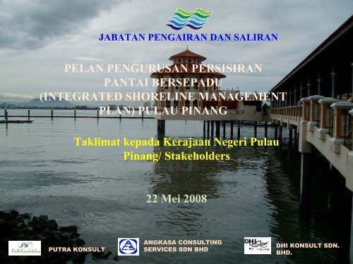
PUTRA KONSULT<br />
JABATAN PENGAIRAN DAN SALIRAN<br />
<strong>PELAN</strong> <strong>PENGURUSAN</strong> <strong>PERSISIRAN</strong><br />
<strong>PANTAI</strong> <strong>BERSEPADU</strong><br />
(INTEGRATED SHORELINE MANAGEMENT<br />
PLAN) PULAU PINANG<br />
Taklimat kepada Kerajaan Negeri Pulau<br />
Pinang/ Stakeholders<br />
22 Mei 2008<br />
ANGKASA CONSULTING<br />
SERVICES SDN BHD<br />
DHI KONSULT SDN.<br />
BHD.
Objectives of Presentation<br />
• Explain what is ISMP<br />
• Why ISMP is critical in the management of<br />
Penang’s shorelines<br />
• Request Penang Government and departments<br />
to assist JPS & consultants in the study<br />
especially in providing key data<br />
• Importance for the Penang Government to adopt<br />
the recommendations of the ISMP & to<br />
implement them in tandem with Penang<br />
Structural Plan and Local Plans in managing the<br />
coastal resources of Penang
� What and why ISMP?<br />
� Objectives and scope of ISMP Penang<br />
� Study approach & methodology<br />
� Coastal issues affecting Penang &<br />
preliminary findings<br />
� Preliminary strategic proposals<br />
� Implementation schedule and status<br />
� Expected output (ISMP Penang)
What is ISMP??<br />
Integrated Shoreline Management Plan<br />
Pelan Pengurusan Persisiran Pantai<br />
Bersepadu
ZON <strong>PANTAI</strong> MALAYSIA<br />
Selat Melaka<br />
Semenanjung Malaysia<br />
Laut Cina Selatan<br />
Sarawak<br />
Total land area : 329,293 sq km<br />
Length of coastline : 4,809 km<br />
Sabah<br />
National Coastal Erosion Study (1986)<br />
1,372 km (28%) faced erosion problem !!
Beach<br />
Erosion<br />
Status in<br />
Penang<br />
Kategori I<br />
(42.4 km)<br />
Kategori II<br />
(19.7 km)<br />
Kategori III<br />
(1.1 km)
Kategori I – Hakisan Kritikal<br />
� kegiatan ekonomi dijejas<br />
� memusnahkan harta benda dan kemudahan awam<br />
� Tindakan segera perlu diambil<br />
Pantai Sabak Kerian, Perak Pantai Manikar, Labuan
Hakisan Kategori I di Pulau Pinang<br />
Some areas experiencing Erosion Category I
Hakisan Kategori II – Hakisan Ketara<br />
� Belum sampai tahap kritikal<br />
� Impak terhadap kegiatan ekonomi dan harta<br />
benda adalah kurang<br />
Pantai Tk Kemang, Port Dickson
Hakisan Kategori III<br />
� Menghadapi masalah hakisan tetapi kawasan<br />
belum lagi dimajukan atau didiami
1. Currently approx. 30% of Malaysian coastlines under various stages or<br />
threat of erosion<br />
2. properties and livelihoods lost or threatened<br />
3. In Penang most of the economic developments occur in the coastal zone<br />
> therefore, very critical to properly manage the shorelines<br />
4. Many studies and reports in the past<br />
> adhoc, very specific & localized (need a more regional approach)<br />
5. Gov & Dept need guidelines to:<br />
- make informed decisions on coastal matters<br />
- better manage the coastal zone of Penang to ensure sustainable<br />
development<br />
* holistic guidelines encompassing engineering, town planning & landuse,<br />
socio- economics & environmental considerations are required *
Objectives of ISMP<br />
1. Formulate guidelines to effectively managed<br />
the coastlines of Penang<br />
2. Assist Penang Gov/ dept in making informed<br />
decisions<br />
3. Improve & enhance quality of tourist beaches<br />
** ISMP is to supplement Structural Plan and Local<br />
Plans not supplant them
Main Scope of ISMP for Penang<br />
� reappraise & re-categorize coastline erosion status under<br />
National Coastal Erosion Study 1985<br />
� coastal erosion control: formulate options, assess impacts<br />
& recommend optimum erosion control measures<br />
� formulate & select most appropriate coastal development<br />
management strategies for the shoreline<br />
� formulate specific guidelines for development activities<br />
along the shoreline<br />
� formulate Beach Beautification and Restoration Plan for<br />
key areas<br />
� set up spatial and non-spatial information management<br />
system
Organizational<br />
Structure<br />
Stakeholders<br />
Engagement thro’<br />
KKPG<br />
Natural<br />
Environment<br />
Consultant<br />
Human Environment Consultants<br />
-Land use planner<br />
-Socio -economist<br />
-Tourism<br />
State Planning Committee<br />
Coordination Committee<br />
YBs<br />
State agencies<br />
NGOs<br />
ISMP Consultants<br />
PK/ ACS/ DHI<br />
Coastal Engineers &<br />
Hydrodynamic Modeler<br />
Legal & Institutional<br />
Beach Beautification<br />
and Restoration<br />
Consultant<br />
Info Management<br />
System Consultant
Approach & Methodology<br />
Phases of<br />
ISMP<br />
Phase 1 –<br />
Data<br />
Collection and<br />
Analysis<br />
Phase 2<br />
Management<br />
Unit<br />
Phase 3<br />
ISMP<br />
Formulation<br />
Output Reports Stakeholder<br />
Consultation<br />
Results of data collection<br />
and analysis carried out<br />
Set management<br />
objectives for the<br />
shorelines<br />
•Shoreline classification<br />
•Coastal defense options<br />
•Coastal development<br />
management strategies<br />
KKPG = Kumpulan Kerja Pengurusan Garispantai<br />
Inception Report<br />
Interim Report<br />
Phase 1 Report<br />
Phase 2 Report<br />
(draft)<br />
Phase 2 Report<br />
(Final)<br />
KKPG #1<br />
KKPG #2<br />
Draft ISMP Report KKPG #3
Coastal Defense Options<br />
ii.Do nothing<br />
iii.Hold existing profile<br />
iv.Advance existing coastline<br />
v.Retreat existing coastlines<br />
Coastal Development Management Strategies<br />
iii.Protected<br />
iv.Development prohibited<br />
v.Development restricted<br />
vi.Development with setback<br />
vii.Urban development<br />
viii.Resort development
Example of coastal defense measures: Rock Revetment
Example of coastal defense measures: Concrete Slab
Example of coastal defense measures: Groyne
Example of coastal defense measures: Breakwaters
STAKEHOLDER CONSULTATION<br />
Kumpulan Kerja Pengurusan Garispantai (KKPG)<br />
Objectives<br />
� to gauge community responses and to encourage greater public<br />
participation.<br />
Participants<br />
� Government departments<br />
� NGOs<br />
� Other stakeholders – fishermen groups, etc<br />
Phase 1 KKPG<br />
� To obtain additional information and solicit views to help formulate<br />
the strategies<br />
Phase 2 and Phase 3 KKPG<br />
� provide a forum for stakeholders to voice their opinions and<br />
concerns and to express their support or objection for certain<br />
options.
P6=7.2km<br />
P5=19.7km<br />
P4=5.1km<br />
P7=12.5km<br />
P Kendir<br />
PSS3 = 3.4km<br />
9 cells on Island<br />
PENANG<br />
ISLAND<br />
P3=16.2km<br />
P Rimau<br />
P1=15.6km<br />
P2=30.9km<br />
P8=10.6km<br />
P Jerejak<br />
PSS2 = 3.6km<br />
M1=23.7km<br />
P Gedong<br />
P Aman<br />
P9=8.9km<br />
Length of Cells<br />
Mainland = 66.4km<br />
Island = 126.7km<br />
Small Islands = 8.3km<br />
Total = 201.4km<br />
M2=42.7km<br />
2 cells on Mainland
Scope of ISMP VS Scope of ICZM<br />
Integrated River<br />
Basin Management<br />
Land<br />
River system<br />
Integrated<br />
Shoreline<br />
Shoreline<br />
Management<br />
Sea<br />
Marine Management
Spatial Limit of ISMP<br />
LAND<br />
≈ 1 km<br />
Shoreline<br />
≈ 3 nautical miles<br />
SEA
Examples of coastal<br />
management issues in<br />
Penang
Gurney Drive<br />
* Siltation / mudflat problem<br />
* Water quality problem<br />
Coastal Management Issues (Cell P1)
Weld Quay &Church Street Pier<br />
& Marina<br />
* Siltation Problem<br />
Sg Pinang<br />
*Water pollution<br />
Channel b/w Penang Island & P Jerejak<br />
*Siltation problem<br />
* Water quality pollution from rivers<br />
Coastal Management Issues (Cell P2 & P8)
Kg Pasir Panjang<br />
•Beach erosion<br />
Gertak Sanggul<br />
* Water quality problem<br />
Teluk Kumbar<br />
*Beach erosion<br />
*Siltation at Sg Batu river mouth<br />
*Sg Bayan Lepas bank erosion<br />
problem<br />
Coastal Management Issues (Cell P3 & P4)
Sg Pinang<br />
*Encroachment of<br />
aquaculture into mangrove<br />
areas<br />
Pulau Betong<br />
*Encroachment of<br />
aquaculture into mangrove<br />
areas<br />
Coastal Management Issues (Cell P5)
Muka Head<br />
* Water pollution from<br />
offshore disposal site on<br />
coastlines to be<br />
assessed<br />
Batu Feringghi<br />
•River pollution<br />
(Sg Satu, Sg Mas, Sg Bt<br />
Feringghi)<br />
* River mouth closure<br />
Coastal Management Issues (Cell P6 & P7)
Pantai Molek /Taman<br />
Robina<br />
* Mudflat<br />
Kuala Sg Tembus<br />
•River mouth siltation<br />
Kuala Sg Endin<br />
* Coastal Siltation<br />
* River mouth siltation<br />
* River bank erosion<br />
Sg Abdul & Padang Benggul<br />
* River mouth siltation<br />
* Coastal Siltation<br />
Pantai Bersih<br />
* Beach erosion<br />
Coastal Management Issues (Cell M1)
Kuala Sg Juru<br />
* Siltation problem.<br />
* Water quality pollution<br />
Coastal Management Issues (Cell M2)
Regional<br />
impacts of<br />
major<br />
developments<br />
on coastal<br />
processes to<br />
be assessed<br />
in the ISMP<br />
Airport Extension<br />
Seri Tanjung Pinang<br />
Tuna Port<br />
Expansion<br />
Bayan Mutiara, Jelutong WF &<br />
Middlebank<br />
Site D (PDC)<br />
Bandar Cassia , Batu Kawan<br />
Proposed 2nd link Bridge
Preliminary Findings and Generic Issues<br />
1. Modification of coastal hydrodynamics<br />
- reclamation projects alters coastlines<br />
- Changes to coastal processes<br />
- Regional impacts:<br />
- Erosion<br />
- Siltation<br />
- Water quality<br />
- Marine/ aquatic biological system<br />
- tourism<br />
siltation<br />
erosion
Preliminary Findings and Generic Issues (cont)<br />
1. Good Coastal Management to ensure harmonious & sustainable<br />
development in coastal zone<br />
- Penang is one of most developed states<br />
- northern growth centre<br />
- manufacturing, tourism, trade & commerce<br />
- logistic hub in NCER (international airport, port, highways, railways, etc)<br />
- future growth of Penang – depends on maintaining its competitive edge<br />
- major constrains to Development<br />
- land scarcity<br />
- no room for expansion along the coast and hilly inland<br />
- Land reclamation has become more common in recent years<br />
- changes coastal processes<br />
- clearing of mangrove & other environmentally sensitive areas<br />
Balance between development and preservation to achieve harmonious<br />
& sustainable development
Preliminary Findings and Generic Issues (cont)<br />
3. Need for Sustainable Management of Coastal Areas in the Key<br />
Development Corridors<br />
Two key development<br />
corridors under PSP<br />
Demand for land on<br />
east coast of PI &<br />
some parts of SP will<br />
continue to persist<br />
Sustainable coastal<br />
management is<br />
necessary<br />
Penang Island<br />
key development<br />
corridor<br />
Mainland key<br />
development<br />
corridor
Preliminary Findings and Generic Issues (cont)<br />
4. Environmental Issues<br />
i. Need to protect Coastal Habitats<br />
- loss of coastal habitats (mangroves, mudflats, seagrass<br />
beds & turtle nesting beaches<br />
- significant loss of mangrove areas 1959 to 2005<br />
(DANCED)<br />
- need for ensure greater protection: some mangrove areas<br />
are not gazetted as reserve<br />
- at risk of being developed & damaged unless protected<br />
- impact livelihood fishing community
Preliminary Findings and Generic Issues (cont)<br />
4. Environmental Issues (cont)<br />
ii. River Mouths & Coastal Siltation<br />
-serious problem e.g Sg Batu Feringgi, Gurney Drive and at<br />
Church Street Marina<br />
-navigation problem (fishermen livelihood)<br />
-expensive maintenance – routine dredging some times daily<br />
iii. Coastal erosion<br />
- e.g. Pantai Bersih, Teluk Kumbar<br />
iii. Water Pollution<br />
-From urban discharges & runoff (residential, commercial,<br />
industrial)<br />
-High suspended sediment concentration<br />
-decline in fish resources, loss of aesthetic values and<br />
recreational fishing, health risk
Preliminary Findings and Generic Issues (cont)<br />
5. Institutional and Legal Issues<br />
� Definition of “shoreline” and “state coastal waters” to be<br />
duly considered and adopted by State Gov<br />
� No legislation which specifically addresses issues related<br />
to coastal zone or shoreline either at Fed or state level.<br />
� Adverse impact of reclamation may be addressed through<br />
EIA and DOE Guideline but with limitations<br />
� Most local authorities do not have funds or staff dedicated<br />
for shoreline management. No by laws for control of<br />
activities on shoreline or coastal areas<br />
� Enforcement capacity among agencies is limited.
Preliminary Findings and Generic Issues (cont)<br />
5. Institutional and Legal Issues (cont)<br />
� Land based sources of pollution are generally the major<br />
cause of water pollution. Current measures are inadequate<br />
to control non point sources of pollution particularly oil and<br />
grease, food waste and solid waste/litter<br />
� State agencies carrying out infrastructure works should<br />
undertake an EIA before implementation to reduce any<br />
adverse impacts<br />
� No laws to preserve, maintain and control the use of<br />
recreational beaches and spaces along the shoreline.
Preliminary Findings and Generic Issues (cont)<br />
5. Institutional and Legal Issues (cont)<br />
� Many agencies are involved with specific functions & responsibilities of<br />
managing shoreline. However no agency is overall responsible or have<br />
authority. This has led to a lack of focus, expertise and capacity within the<br />
State to address the coastline and the sea which are prime assets<br />
� ISMP is Fed Gov’s initiative to improve shoreline management. State Gov<br />
participation is vital for success<br />
� The Penang State Structure Plan contains some recommendations related to<br />
shoreline management. This should be buttressed with well defined policies<br />
and action plans by the State Government<br />
� None of the current inter agency committees appears to be mandated<br />
specifically to address issues related to shoreline management<br />
� Poor or a total lack of enforcement is a major weakness which must be<br />
addressed in a holistic manner.<br />
� Stakeholder participation is important and must be further encouraged for<br />
better and more effective implementation of plans and projects.
Preliminary Strategic Proposals<br />
� Develop clear & specific guidelines on reclamation works<br />
� Integrate Local Plans with ISMP management strategies<br />
� Gazette Environmentally Sensitive Areas as Protected Areas<br />
� Identify & limit future reclamation works to allowable sites<br />
� Review and improve categorization of coastal erosion category<br />
under the NCES<br />
� Adopt precautionary approach in coastal management and<br />
planning<br />
� Undertake beach beautification & restoration at identified<br />
recreational beaches<br />
� set up specific guidelines to protect, conserve and enhance all<br />
recreational beaches<br />
� Streamline existing legislations & remove overlaps<br />
� Improve inter-agency and departmental coordination on coastal<br />
management
Data Collection and Analysis<br />
IMSP<br />
Coastal hydrodynamic modeling<br />
Coastal Engineering<br />
Human Environmental<br />
Natural Environmental<br />
Landuse<br />
Legal & institutional<br />
Socio-economic<br />
Archeological & heritage<br />
Recreational & tourism<br />
Beach Beautification & Restoration Plan<br />
ISMP Info Database & ICT Infra Setup<br />
Setting Coastal Mgmt Objectives<br />
Defining Coastal Developmt Strategies<br />
Defining guidelines & policies<br />
Stakeholder Inception Report Consultation, Workshop & Seminars J<br />
Reporting<br />
monthly report<br />
Interim Report<br />
D<br />
Phase Reports 1 Report (Data collection And Analysis) Inception report<br />
Phase 2 Report (Draft Management Objectives)<br />
Phase 2 Report (Final Management Objectives)<br />
ISMP Report ( Draft)<br />
Data Collection And Analysis Ph2 MU Ph3 – ISMP<br />
Data 2007 Collection & Analysis 2008 Ph 2008 2 MU Ph3 2008 - ISMP<br />
1 2 3 4 5 6 7 8 9 10 11 12 13 14 15 16 17 18<br />
J A S O N D J F M A M J J A S O N D<br />
ISMP Report ( Final)<br />
A<br />
A<br />
M<br />
Interim report<br />
FGD 1<br />
J<br />
Ph 1 Rep (Data collection & Analysis)<br />
J FGD 2<br />
Ph 2 Rep (Drft Mgmt Objectives)<br />
A Ph 2 Rep (Fnl Mgmt Objtv)<br />
N<br />
D<br />
ISMP Draft<br />
FGD 3
Completed or on-going ISMPs<br />
- Pahang (pilot ISMP)<br />
- Negeri Sembilan<br />
- Labuan<br />
- Melaka<br />
- Penang
Pilot ISMP<br />
Pahang<br />
Tg. Berhala<br />
Kuantan Port<br />
Breakwater<br />
MUs<br />
Kuala Pahang<br />
Sub<br />
Cell 1<br />
Sub<br />
Cell 2<br />
Cell<br />
C1<br />
C2
Teluk Cempedak to Tg. Lumpur Coastal Area<br />
Coastal<br />
Development<br />
Management<br />
Strategies
MU 106<br />
FORESTED REGION BETWEEN TG.<br />
PELINDUNG AND TG. PELINDUNG<br />
TENGAH<br />
(MU 106)
FORESTED REGION BETWEEN TG. PELINDUNG AND TG. PELINDUNG TENGAH<br />
(MU 106)<br />
LP PROPOSAL: PROPOSED MEDIUM DENSITY TOURISM<br />
ISMP PROPOSAL : PROMOTED DEVELOPMENT OF HIGH DENSITY TOURISM<br />
PERMITTED DEVELOPMENT CLASS 1
MU 46<br />
HOMESTEAD BEACH RESORT<br />
(MU 46)
HOMESTEAD BEACH RESORT<br />
(MU 46)<br />
LP PROPOSAL : PROPOSED MEDIUM DENSITY TOURISM<br />
ISMP PROPOSAL: STANDARD DEVELOPMET OF LOW / MEDIUM<br />
DENSITY TOURISM<br />
PERMITTED DEVELOPMENT CLASS 2
MU 112<br />
HYATT KUANTAN (MU 122)
HYATT KUANTAN<br />
(MU 112)<br />
LP PROPOSAL: PROPOSED HIGH DENSITY TOURISM<br />
ISMP PROPOSAL: RESTRICTED DEVELOPMENT OF HIGH DENSITY<br />
TOURISM - CARRYING CAPACITY REACHED<br />
PERMITTED DEVELOPMENT CLASS 3
MU 125<br />
KG. TG LEMBAH CENTRAL<br />
(MU 125)
KG. TG. LUMPUR CENTRAL<br />
(MU 125)<br />
LP PROPOSAL: PROPOSED MAIN BUSINESS CENTER OF TG. LUMPUR<br />
ISMP PROPOSAL: RESTRICTED DEVELOPMENT OF INFRASTRUCTURE<br />
REQUIRING COASTAL PROTECTION.<br />
PERMITTED DEVELOPMENT CLASS 3
MU 115<br />
TANJUNG TEMBELING (MU<br />
– 115)
TG. TEMBELING<br />
(MU 115)<br />
LP PROPOSAL: PROPOSED HIGH DENSITY TOURISM<br />
ISMP PROPOSAL: ENVIRONMENTAL PROTECTION (HEADLAND FOREST)<br />
PROHIBITED DEVELOPMENT
Turtle Bay Beach Motel<br />
Pusat Penerangan &<br />
Sanctuari Penyu<br />
Tg. Cerating<br />
Club Med<br />
Tg. Batu Pak Mok<br />
Oblique Aerial Photo No. 045<br />
Club Med
Komleks Pelancongan<br />
Teluk Cempedak<br />
Sri Pantai<br />
Hotel TC & Hillview<br />
Hotal Kuantan Hyatt<br />
Merlin (abandoned)<br />
Tg. Pelindung Tengah<br />
Tg. Tembeling<br />
Oblique Aerial Photo No. 196<br />
Hyatt
Summary<br />
• the ISMP is an integrated and holistic study<br />
taking into account coastal engineering,<br />
environmental, town planning, socio-economic,<br />
legal, landscaping requirements<br />
• useful tool to assist the gov & dept to better<br />
manage the Penang shoreline<br />
• All concerned parties are urged to participate in<br />
the stakeholders consultation<br />
• Cooperation of the various dept in cooperating<br />
and providing key data is vital<br />
• To implement and abide by the strategies<br />
recommended in the ISMP
THANK YOU
Church Street Marina<br />
back
Tuna Port,<br />
Batu Maung<br />
b<br />
a<br />
c
Sg Pinang<br />
back
Teluk Kumbar Beach back
Sg Gertak Sanggul<br />
Beach Near Gertak Sg Sanggul<br />
Sg Gertak Sanggul river mouth<br />
back
Kg Pasir Panjang<br />
back
Aquaculture Sg Pinang back
River Mouth Closure at Batu Feringghi<br />
back<br />
Slide 25
Beach erosion Pantai Bersih<br />
back
Siltation at Mooring<br />
Facilities south Kuala<br />
Muda<br />
back
River siltation<br />
at Kuala Sg. Endin<br />
River mouth siltation<br />
Kuala Sg Tembus<br />
back<br />
Slide 26
ack<br />
Mudflat at<br />
Taman Robina
Siltation at Sg Abdul River Mouth<br />
back
Kg Batu Kawan<br />
back