GEOTOUR GUIDE - City of Kamloops
GEOTOUR GUIDE - City of Kamloops
GEOTOUR GUIDE - City of Kamloops

You also want an ePaper? Increase the reach of your titles
YUMPU automatically turns print PDFs into web optimized ePapers that Google loves.
disaster on the North Thompson and other British Columbia rivers, the Province embarked on a program to map the<br />
flood plains <strong>of</strong> many rivers throughout the province. This work led to the construction <strong>of</strong> a number <strong>of</strong> major dykes built<br />
to protect lands from large floods. The Oak Hills subdivision in northern <strong>Kamloops</strong> lies behind one such major dyke.<br />
WhaT is The reCipe for a really BiG flood?<br />
Floods on big rivers like the Thompson always occur in the spring during the annual snowmelt. The biggest floods require the<br />
rare combination <strong>of</strong> a heavy snow pack (>130% <strong>of</strong> normal), a cool spring that delays the melting <strong>of</strong> the snow, and the onset <strong>of</strong> at<br />
least two weeks <strong>of</strong> hot weather that melts the snow quickly, that is then followed by heavy rains.<br />
hoW Good are <strong>Kamloops</strong>’ dyKes?<br />
The dykes along the North, South, and Thompson Rivers vary<br />
significantly in their ability to protect land from flooding.<br />
Dykes have been built for more than a hundred years - by<br />
individuals, local groups, and the Province - all at different<br />
standards. Many dykes were built during flood emergencies<br />
in great haste to protect property. The dykes that <strong>of</strong>fer the<br />
greatest protection are referred to by the BC Ministry <strong>of</strong> the<br />
Environment as “standard dykes” and built to withstand a<br />
200 year flood.The Oak Hills dyke is a standard dyke. Many<br />
<strong>of</strong> <strong>Kamloops</strong> dykes are high enough to protect against a 1 in<br />
50 year flood. Some dykes are smaller. The ability <strong>of</strong> a dyke<br />
to hold back flood waters depends in part on how well it is<br />
maintained. Good dyke maintenance involves removing trees<br />
and other vegetation from dykes, and protecting dykes from<br />
burrowing animals. However, maintenance <strong>of</strong> the dykes by<br />
the dyking authority can be complicated the dyke is on private<br />
property and the land owners oppose the tree cutting.<br />
WhaT aBouT The ChanGinG ClimaTe<br />
and fuTure floods on The Thompson rivers?<br />
Scientists predict warmer winters and summers in the future for <strong>Kamloops</strong>. Warmer winter temperatures will cause the snow<br />
elevation level to climb, decreasing the area <strong>of</strong> snow pack. This reduces the amount <strong>of</strong> snow in the mountains and therefore the<br />
amount <strong>of</strong> stored water. This may also lead to more frequent extreme low flows in area creeks and rivers during summer and fall,<br />
and possibly reduce flood risk in the spring.<br />
Figure 27. The integrity <strong>of</strong> this dyke on the North Shore along the Thompson<br />
River may be compromised by the trees that grow on it. Trees can weaken<br />
a dyke; when tree roots die, they leave behind small tunnels that can allow<br />
water to flow through the dyke during a flood. Such small water flows can<br />
lead to larger failure <strong>of</strong> the dyke. (Photo by R.Turner)<br />
There is some good news. The outlet <strong>of</strong> <strong>Kamloops</strong> Lake into the Thompson River at Savona is slowly eroding its channel, causing<br />
a slow long-term drop in the levels <strong>of</strong> <strong>Kamloops</strong> Lake. This in turn allows the Thompson River upstream <strong>of</strong> <strong>Kamloops</strong> Lake to<br />
cut downwards. This creates more storage capacity for floodwaters, and slightly reduces the flood risk over time.<br />
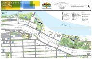
How to get to oaK Hills. From the North Shore, drive north on 8th and then Westsyde Road to Franklin Road.<br />
Turn right and drive to the parking lot <strong>of</strong> Westsyde Centennial Park. Climb up the grassy slope to the trail that follows<br />
the top <strong>of</strong> the dyke for about two kilometres. The dyke separates the banks <strong>of</strong> the North Thompson River from the Oak<br />
Hills subdivision. The dyke is a BC Ministry <strong>of</strong> the Environment “standard dyke”, built to protect against a 200 year flood.<br />
18