Maricopa County Community Wildfire Protection Plan
Maricopa County Community Wildfire Protection Plan
Maricopa County Community Wildfire Protection Plan

Create successful ePaper yourself
Turn your PDF publications into a flip-book with our unique Google optimized e-Paper software.
Arizona State Forestry Division<br />
<strong>Maricopa</strong> <strong>County</strong> Department of Emergency Management<br />
US Department of the Interior Bureau of Land Management<br />
Tonto National Forest<br />
Fort McDowell Indian <strong>Community</strong><br />
Gila River Indian <strong>Community</strong><br />
<strong>Maricopa</strong> <strong>County</strong><br />
<strong>Community</strong> <strong>Wildfire</strong><br />
<strong>Protection</strong> <strong>Plan</strong> FEBRUARY 2010<br />
Tohono O’odham Indian Nation San Lucy District<br />
Salt River Pima-<strong>Maricopa</strong> Indian <strong>Community</strong><br />
Aguila<br />
Apache Junction<br />
Avondale<br />
Buckeye<br />
Buckeye Valley<br />
Cave Creek<br />
Circle City/Morristown<br />
Carefree<br />
Chandler<br />
El Mirage<br />
Fountain Hills<br />
Gila Bend<br />
Glendale<br />
Gilbert<br />
Guadalupe<br />
Goodyear<br />
Harquahala<br />
Litchfield Park<br />
Mesa<br />
New River<br />
Peoria<br />
Phoenix<br />
Paradise Valley<br />
Queen Creek<br />
Rio Verde<br />
Scottsdale<br />
Sun City<br />
Sun City West<br />
Sunflower<br />
Sun Lakes<br />
Surprise<br />
Tempe<br />
Tolleson<br />
Tonopah<br />
Wickenburg<br />
Wittmann<br />
Youngtown
<strong>Maricopa</strong> <strong>County</strong><br />
<strong>Community</strong> <strong>Wildfire</strong> <strong>Protection</strong> <strong>Plan</strong><br />
February 2010<br />
Prepared by:<br />
Logan Simpson Design Inc.<br />
33 North Stone Avenue<br />
Suite 1460<br />
Tucson, AZ 85701<br />
(520) 884-5500<br />
www.logansimpsondesign.com
TABLE OF CONTENTS<br />
Table of Contents<br />
Acronyms and Abbreviations ................................................................................................................... iv<br />
Executive Summary ................................................................................................................................... v<br />
I. Introduction .......................................................................................................................................... 1<br />
A. Background ....................................................................................................................................... 3<br />
B. WUI and Delineation Process ............................................................................................................ 5<br />
C. Desired Future Condition and <strong>Wildfire</strong> Mitigation in the WUI ............................................................. 9<br />
D. Goals for the <strong>Maricopa</strong> <strong>County</strong> CWPP ............................................................................................ 11<br />
E. <strong>Plan</strong>ning Process ............................................................................................................................ 12<br />
II. <strong>Maricopa</strong> <strong>County</strong> CWPP <strong>Community</strong> Assessment and Analysis ................................................... 14<br />
A. Fire Regime and Condition Class .................................................................................................... 21<br />
B. Fuel Hazards ................................................................................................................................... 24<br />
C. Conditions of Ignition and Past Fire Occurrence ............................................................................. 45<br />
D. <strong>Community</strong> Values at Risk .............................................................................................................. 48<br />
E. Summary of <strong>Community</strong> Assessment and Cumulative Risk Analysis .............................................. 51<br />
III. <strong>Community</strong> Mitigation <strong>Plan</strong> ............................................................................................................... 81<br />
A. Fuel Reduction Priorities ................................................................................................................. 81<br />
B. Prevention and Loss Mitigation ....................................................................................................... 98<br />
1. <strong>Maricopa</strong> <strong>County</strong> CWPP Administration and Implementation .................................................... 99<br />
2. Improved <strong>Protection</strong> Capability and Reduction in Structural Ignitability ..................................... 99<br />
3. Promote <strong>Community</strong> Involvement and Improved Public Education,<br />
Information, and Outreach ...................................................................................................... 100<br />
4. Encourage Use of Woody Material from WUI Fuel Mitigation Programs .................................. 101<br />
IV. <strong>Maricopa</strong> <strong>County</strong> CWPP Priorities: Action Recommendations and Implementation ................. 102<br />
A. Administrative Oversight ............................................................................................................... 102<br />
B. Priorities for Mitigation of Hazardous Wildland Fuels .................................................................... 104<br />
C. Identified Action Items for <strong>Protection</strong> Capability and Reduced Structural Ignitability ..................... 104<br />
D. Priorities for Promoting <strong>Community</strong> Involvement through<br />
Education, Information, and Outreach .......................................................................................... 108<br />
V. Monitoring <strong>Plan</strong> ............................................................................................................................... 110<br />
A. Administrative Oversight, Monitoring, and <strong>Maricopa</strong> <strong>County</strong> CWPP Reporting ............................. 110<br />
B. Effectiveness Monitoring ............................................................................................................... 111<br />
VI. Declaration of Agreement and Concurrence ................................................................................ 113<br />
VII. References ...................................................................................................................................... 119<br />
VIII. Glossary of Fire Management Terms ............................................................................................ 123<br />
DRAFT <strong>Maricopa</strong> <strong>County</strong> <strong>Community</strong> <strong>Wildfire</strong> <strong>Protection</strong> <strong>Plan</strong> February 2010<br />
i
APPENDIXES<br />
Table of Contents<br />
Appendix A. Vegetation Association Descriptions ........................................................................... 144<br />
Appendix B. National Fire Danger Rating System<br />
Fuel Model Selection Key .............................................................................................. 152<br />
Appendix C. Educational Resources ................................................................................................... 155<br />
Appendix D. Information Data Sheet and Contacts ............................................................................ 159<br />
Appendix E. Invasive Species ............................................................................................................. 161<br />
Appendix F. National Fire and Aviation Executive Board<br />
Appropriate Management Response ............................................................................. 176<br />
LIST OF TABLES<br />
Table 1.1 <strong>Maricopa</strong> <strong>County</strong> CWPP recommended at-risk communities ...................................................... 6<br />
Table 2.1 Land management within the WUI ............................................................................................ 14<br />
Table 2.2 Fire regime information ............................................................................................................. 21<br />
Table 2.3 Fuel model, fire-danger ratings, and intensity levels on<br />
vegetative associations in the WUI ........................................................................................... 25<br />
Table 2.4 Fuel hazard components .......................................................................................................... 40<br />
Table 2.5 Ignition history and wildfire occurrence ..................................................................................... 48<br />
Table 2.6 <strong>Community</strong> values .................................................................................................................... 51<br />
Table 2.7 Cumulative risk levels by percentage of the WUI area .............................................................. 76<br />
Table 3.1 Fuel modification and treatment plans ...................................................................................... 82<br />
Table 3.2 Identified treatment management units ..................................................................................... 84<br />
Table 3.3 Acres of wildland fuels mitigation treatment conducted by<br />
ASFD fire and fuels crew during an 8-hour on-site workday units ............................................. 97<br />
Table 4.1 Action recommendations for wildland fuel modification ........................................................... 105<br />
Table 4.2 Action recommendations for structural ignitability and public outreach ................................... 106<br />
Table 4.3 Future recommendations for wildland fire protection and reduced ignitability.......................... 108<br />
Table 4.4. Future recommendations for enhanced public education,<br />
information, and outreach ....................................................................................................... 109<br />
Table 5.1 Performance measures to assess <strong>Maricopa</strong> <strong>County</strong> CWPP progress..................................... 112<br />
DRAFT <strong>Maricopa</strong> <strong>County</strong> <strong>Community</strong> <strong>Wildfire</strong> <strong>Protection</strong> <strong>Plan</strong> February 2010<br />
ii
LIST OF FIGURES<br />
Table of Contents<br />
Figure 1.1 Analysis area ............................................................................................................................. 1<br />
Figure 1.2 <strong>Maricopa</strong> <strong>County</strong> CWPP process .............................................................................................. 7<br />
Figure 2.1a <strong>Maricopa</strong> <strong>County</strong> CWPP WUI area, east ................................................................................. 16<br />
Figure 2.1b <strong>Maricopa</strong> <strong>County</strong> CWPP WUI area, west ................................................................................ 17<br />
Figure 2.2a <strong>Maricopa</strong> <strong>County</strong> CWPP vegetation associations, east ........................................................... 30<br />
Figure 2.2b <strong>Maricopa</strong> <strong>County</strong> CWPP vegetation associations, west ........................................................... 31<br />
Figure 2.3a <strong>Maricopa</strong> <strong>County</strong> CWPP flammability, east ............................................................................. 32<br />
Figure 2.3b <strong>Maricopa</strong> <strong>County</strong> CWPP flammability, west ............................................................................. 33<br />
Figure 2.4a <strong>Maricopa</strong> <strong>County</strong> CWPP wildland fuel hazards<br />
during typical fire season, east ................................................................................................ 41<br />
Figure 2.4b <strong>Maricopa</strong> <strong>County</strong> CWPP wildland fuel hazards<br />
during typical fire season, west ................................................................................................ 42<br />
Figure 2.5a <strong>Maricopa</strong> <strong>County</strong> CWPP wildland fuel hazards<br />
during extraordinary rainfall years, east ................................................................................... 43<br />
Figure 2.5b <strong>Maricopa</strong> <strong>County</strong> CWPP wildland fuel hazards<br />
during extraordinary rainfall years, west .................................................................................. 44<br />
Figure 2.6a WUI ignition history, east ......................................................................................................... 46<br />
Figure 2.6b WUI ignition history, west ........................................................................................................ 47<br />
Figure 2.7a <strong>Maricopa</strong> <strong>County</strong> CWPP community values, east .................................................................... 52<br />
Figure 2.7b <strong>Maricopa</strong> <strong>County</strong> CWPP community values, west ................................................................... 53<br />
Figure 2.8a <strong>Maricopa</strong> <strong>County</strong> CWPP cumulative risk analysis, east........................................................... 79<br />
Figure 2.8b <strong>Maricopa</strong> <strong>County</strong> CWPP cumulative risk analysis, west .......................................................... 80<br />
Figure 3.1a <strong>Maricopa</strong> <strong>County</strong> CWPP treatment management units, east ................................................... 94<br />
Figure 3.1b <strong>Maricopa</strong> <strong>County</strong> CWPP treatment management units, west .................................................. 95<br />
LIST OF PHOTOS<br />
Photo 1.1 2005 <strong>Wildfire</strong> in <strong>Maricopa</strong> <strong>County</strong> CWPP .................................................................................. 9<br />
Photo 2.1 Desert Scrub vegetation association ....................................................................................... 35<br />
Photo 2.2 Shrubland vegetation association ............................................................................................ 36<br />
Photo 2.3 Woodland vegetation association ............................................................................................ 37<br />
Photo 2.4 Deciduous Southwest Riparian vegetation association ............................................................ 38<br />
Photo 2.5 Developed land within the WUI ................................................................................................ 39<br />
DRAFT <strong>Maricopa</strong> <strong>County</strong> <strong>Community</strong> <strong>Wildfire</strong> <strong>Protection</strong> <strong>Plan</strong> February 2010<br />
iii
AMR Appropriate Management Response<br />
APS Arizona Public Service<br />
ASLD Arizona State Land Department<br />
ASFD Arizona State Forestry Division<br />
ASP Arizona State Parks Department<br />
BA basal area<br />
BAER burned area emergency response<br />
BLM Bureau of Land Management<br />
CWPP community wildfire protection plan<br />
dbh diameter at breast height<br />
drc diameter at root collar<br />
FO BLM Field Office<br />
FRCC fire regime condition class<br />
FS Forest Service<br />
GIS geographic information system<br />
GPS Global Positioning System<br />
HFRA Healthy Forests Restoration Act of 2003<br />
IGA intergovernmental agreement<br />
IMS Federal Wildland Fire Occurrence Internet Mapping Service<br />
ISO Insurance Services Office<br />
NFDRS National Fire Danger Rating System<br />
MCDEM <strong>Maricopa</strong> <strong>County</strong> Department of Emergency Management<br />
MLRA Major Land Resource Area<br />
PNVG potential natural vegetation group<br />
PPE Personal protection equipment<br />
Rx prescribed fire<br />
SR state route<br />
SRP Salt River Project<br />
SWReGAP Southwest Regional Gap Analysis Project<br />
TES Threatened, endangered, and sensitive species<br />
TNF Tonto National Forest<br />
USDA United States Department of Agriculture<br />
USDI United States Department of the Interior<br />
WUI wildland-urban interface<br />
Table of Contents<br />
DRAFT <strong>Maricopa</strong> <strong>County</strong> <strong>Community</strong> <strong>Wildfire</strong> <strong>Protection</strong> <strong>Plan</strong> February 2010<br />
iv
EXECUTIVE SUMMARY:<br />
MARICOPA COUNTY COMMUNITY WILDFIRE PROTECTION PLAN<br />
Executive Summary<br />
The <strong>Maricopa</strong> <strong>County</strong> <strong>Community</strong> <strong>Wildfire</strong> <strong>Protection</strong> <strong>Plan</strong> (CWPP) was developed in response to the<br />
Healthy Forests Restoration Act of 2003 (HFRA) for the at-risk communities and unincorporated areas in<br />
<strong>Maricopa</strong> <strong>County</strong>, Arizona, located in and around public lands administered by the US Department of the<br />
Interior Bureau of Land Management (USDI BLM) Phoenix District Office and the Tonto National Forest<br />
(TNF). HFRA established unprecedented incentives for communities to develop comprehensive wildfire<br />
protection plans in a collaborative, inclusive process. Furthermore, this legislation gives direction to BLM<br />
and the US Forest Service to address local community priorities in fuel reduction treatments, even on<br />
nonfederal lands. For a community to take full advantage of the opportunities provided in HFRA, it must<br />
first prepare a CWPP. A CWPP developed in accordance with HFRA is the most effective way to acquire<br />
federal funding for fire preparedness and planning. <strong>Maricopa</strong> <strong>County</strong>, partner agencies, and participating<br />
communities wish to adopt a CWPP to better protect their communities from wildfire risk, to better prepare<br />
citizens, and to become eligible to apply for and receive federal and other grant monies to implement<br />
wildland fire mitigation projects and programs.<br />
To ensure that all residents of <strong>Maricopa</strong> <strong>County</strong> were represented in this planning process, two core teams<br />
were formed to implement the agency and public collaboration necessary to develop a CWPP compliant<br />
with HFRA: the Eastern Core Team includes all identified at-risk communities in <strong>Maricopa</strong> <strong>County</strong> located<br />
east of Interstate 17 (I-17) and east of Interstate 10 (I-10), and the Western Core Team includes all<br />
identified at-risk communities west of I-17 and I-10. The Core Teams agreed to and established an efficient<br />
process to be followed throughout the <strong>Maricopa</strong> <strong>County</strong> CWPP development. The Core Teams identified<br />
44 communities and analyzed 3,103,370 acres for potential risk from catastrophic wildland fire within<br />
<strong>Maricopa</strong> <strong>County</strong>.<br />
Section I. Introduction<br />
A primary objective of a CWPP is to help local governments, fire departments and district, and residents<br />
identify at-risk public and private lands to better protect those lands from severe wildfire threat. Additional<br />
functions of a CWPP are to improve fire prevention and suppression activities, as well as to identify funding<br />
needs and opportunities to reduce the risk of wildland fire and enhance public and firefighter safety.<br />
Identifying at-risk areas and improving fire protection capabilities helps the communities to prioritize highrisk<br />
projects and expedites overall project planning. <strong>Maricopa</strong> <strong>County</strong>’s CWPP was created to meet these<br />
objectives at a local level while integrating with overall federal- and state-level fire planning.<br />
The Core Teams identified needed agency and organization partners and interested parties to initiate the<br />
collaborative process and to establish the following overarching goals of the <strong>Maricopa</strong> <strong>County</strong> CWPP:<br />
• Improve fire prevention and suppression, emphasizing firefighter and public safety<br />
• Reduce hazardous fuels, emphasizing public and private property protection<br />
• Restore forest, rangeland, and riparian health<br />
• Promote community involvement and provide for community protection<br />
DRAFT <strong>Maricopa</strong> <strong>County</strong> <strong>Community</strong> <strong>Wildfire</strong> <strong>Protection</strong> <strong>Plan</strong> February 2010<br />
v
Executive Summary<br />
• Recommend measures to reduce structural ignitability in the wildland-urban interface (WUI)<br />
• Encourage economic development in the communities from vegetative treatments<br />
• Promote development of wildfire emergency evacuation and communication plans<br />
• Integrate use of the CWPP with surrounding community and agency fire management plans<br />
The Core Teams developed and concurred with the process that was to be followed in developing the<br />
<strong>Maricopa</strong> <strong>County</strong> CWPP. This section establishes all necessary planning components and clearly<br />
articulates the intent of the <strong>Maricopa</strong> <strong>County</strong> CWPP, discloses the communities identified for analysis, and<br />
ensures that the <strong>Maricopa</strong> CWPP is compliant with HFRA.<br />
Section II. <strong>Community</strong> Assessment<br />
Section II covers the methods used in community wildfire risk assessments; the identification of the WUI;<br />
and the identification of communities with high, moderate, and low wildland fire risk within the WUI. The<br />
<strong>Maricopa</strong> <strong>County</strong> CWPP describes the commitment to hazard mitigation by <strong>Maricopa</strong> <strong>County</strong> and local<br />
jurisdictions by preparing the first <strong>Maricopa</strong> <strong>County</strong> Multi-Jurisdictional Hazard Mitigation <strong>Plan</strong> (2004 <strong>Plan</strong>).<br />
This section ties the multi-jurisdictional planning team (MJPT) collaborative effort to review, evaluate, and<br />
update the 2004 <strong>Plan</strong> into a single, consolidated <strong>Maricopa</strong> <strong>County</strong> Multi-Jurisdictional Hazard Mitigation<br />
<strong>Plan</strong> (<strong>Plan</strong>). The <strong>Plan</strong> also contains a Tribal Annex for each of the two participating Indian Tribes that<br />
address Tribal specific planning elements (MCDEM 2009).<br />
The <strong>Maricopa</strong> <strong>County</strong> CWPP was developed to be complimentary to the <strong>Plan</strong> by developing a quantitative<br />
analysis of wildland fire risk across <strong>Maricopa</strong> <strong>County</strong>, designing mitigation measures and priority needs to<br />
implement mitigation measures, whether wildland fire fuel manipulations, resource response, reduced<br />
structural ignitibility or public education and outreach.<br />
Environmental elements used by the Core Teams to identify the WUI include wildland vegetative fuel<br />
hazards, comparison of average and extreme rainfall years, consideration of aspect and local topography,<br />
historical fire occurrence, and wildfire ignition history. These environmental factors were coupled with<br />
community-based characteristics and values, such as local fire resource preparedness, infrastructure,<br />
evacuation routes, and population/structure density. An external element, the Fire Insurance Service<br />
Organization ratings, was also used in determining wildland fire risk to communities within the WUI. These<br />
elements were all identified and combined using spatial analysis within a geographic information system<br />
(GIS). As a result of the GIS analysis, a WUI and sub-WUI boundary map and a wildfire risk rating map<br />
were created. Sub-WUIs were divided into treatment management areas, according to high, moderate, and<br />
low fuel hazard. Several components, including slope, aspect, vegetation type, vegetation density, ground<br />
fuel loads, and treated areas, were used to make fuel hazard determinations. The <strong>Maricopa</strong> <strong>County</strong> CWPP<br />
analysis consisted of 3,072,461 acres of federal, state, and private lands. Cumulative risk levels across the<br />
<strong>Maricopa</strong> <strong>County</strong> CWPP analysis area include 120,252 acres (4%) of high wildland fire risk,<br />
1,749,492 acres (57%) of moderate risk, and 1, 202,717 acres (39%) of low risk.<br />
DRAFT <strong>Maricopa</strong> <strong>County</strong> <strong>Community</strong> <strong>Wildfire</strong> <strong>Protection</strong> <strong>Plan</strong> February 2010<br />
vi
Section III. <strong>Community</strong> Mitigation <strong>Plan</strong><br />
Executive Summary<br />
Section III prioritizes the areas in need of wildland fuel mitigation and recommends the types and methods<br />
of treatment and management necessary to mitigate the potential for catastrophic wildland fire in the WUI.<br />
Also presented in this section are the <strong>Maricopa</strong> <strong>County</strong> CWPP communities’ recommendations for<br />
enhanced wildland fire protection capabilities; public education, information, and outreach; and support for<br />
businesses and industries centered on local wood products, woody biomass, and wildland vegetative fuel<br />
management.<br />
As part of the community mitigation plan, the Core Teams identified the <strong>Maricopa</strong> <strong>County</strong> CWPP<br />
administrators—<strong>Maricopa</strong> <strong>County</strong> fire chiefs, <strong>Maricopa</strong> <strong>County</strong> Department of Emergency Management<br />
(MCDEM), TNF, Arizona State Forestry Division (ASFD), and BLM—who will be mutually responsible for<br />
implementing and monitoring <strong>Maricopa</strong> <strong>County</strong> CWPP action recommendations in coordination with the<br />
future-established countywide community CWPP Working Group. <strong>Maricopa</strong> <strong>County</strong> CWPP administrators<br />
are responsible for ensuring implementation of the <strong>Maricopa</strong> <strong>County</strong> CWPP, for preparing reports and work<br />
plans, and for developing community bulletins and public service announcements that inform residents of<br />
wildfire dangers and preventive measures. Additional tasks include assisting federal and state agencies<br />
and private landowners to identify appropriate funding sources to implement action recommendations of<br />
the <strong>Maricopa</strong> <strong>County</strong> CWPP, as well as continued coordination with communities outside the analysis area.<br />
<strong>Maricopa</strong> <strong>County</strong> CWPP administrators are also responsible for coordinating monitoring and reporting of<br />
implementation actions that will allow for enhanced coordination of management programs and that will<br />
reduce inconsistencies among local, state, and federal agencies.<br />
To prioritize treatments, the Core Teams identified 112 wildland treatment management units within 53<br />
sub-WUI designations of the WUI. These treatment units were analyzed and categorized according to<br />
potential risk for wildfire. Each unit was also ranked and described along with a recommendation for its<br />
preferred treatment type and method. Preferred treatments were recommended for treatment management<br />
units identified as high risk. These treatments are designed to meet the fuel reduction and modification<br />
objectives of the <strong>Maricopa</strong> <strong>County</strong> CWPP.<br />
Section IV. <strong>Maricopa</strong> <strong>County</strong> CWPP Priorities: Action Recommendations and Implementation<br />
During the development of the <strong>Maricopa</strong> <strong>County</strong> CWPP, the Core Teams identified action<br />
recommendations necessary to achieve the goals outlined in the plan. The first action recommendation<br />
was to identify priority treatment areas for fuel reduction projects. Treatment areas were identified within<br />
the WUI to create defensible space through treatments within the home ignition zone, the use of<br />
strategically placed fuelbreaks, and the modification of hazardous wildland fuels. The objective of a fuels<br />
reduction project is to create an acceptable vegetation condition class for community and infrastructure<br />
protection and public and firefighter safety. Priority treatment management areas were designated in areas<br />
identified as high risk. Table 4.1 in Section IV lists the priority action recommendations for the reduction of<br />
hazardous fuels within the <strong>Maricopa</strong> <strong>County</strong> CWPP area. The second action recommendation identified by<br />
the Core Teams was to reduce structural ignitability. Reduction of structural ignitability is achieved through<br />
evaluation; maintenance; and, at times, upgrades to community response facilities, capabilities, and<br />
DRAFT <strong>Maricopa</strong> <strong>County</strong> <strong>Community</strong> <strong>Wildfire</strong> <strong>Protection</strong> <strong>Plan</strong> February 2010<br />
vii
Executive Summary<br />
equipment. The third action recommendation described is the promotion of community involvement; action<br />
items include community education, information, and outreach.<br />
Section V. Monitoring <strong>Plan</strong><br />
The monitoring plan, outlined in Section V, describes how implementation and monitoring of the<br />
<strong>Maricopa</strong> <strong>County</strong> CWPP will occur. The <strong>Maricopa</strong> <strong>County</strong> CWPP administrators are responsible for<br />
implementation and monitoring. Implementation begins by securing grants and other funding necessary to<br />
execute the action items.<br />
The <strong>Maricopa</strong> <strong>County</strong> CWPP administrators will provide an annual report of successful grant awards and<br />
projects implemented as a result of those awards. The administrators will also update work plans based on<br />
projects completed in the previous years.<br />
Acknowledgments<br />
The following communities and agencies were involved in the preparation of the <strong>Maricopa</strong> <strong>County</strong> CWPP:<br />
Arizona State Forestry Division<br />
Municipal fire departments and local fire districts<br />
Government officials, emergency managers, and fire chiefs from the following communities:<br />
Aguila, Apache Junction, Avondale, Buckeye, Buckeye Valley, Cave Creek, Circle City/Morristown,<br />
Carefree, Chandler, El Mirage, Fountain Hills, Gila Bend, Glendale, Gilbert, Guadalupe, Goodyear,<br />
Harquahala, Litchfield Park, Mesa, New River, Peoria, Phoenix, Paradise Valley, Queen Creek, Rio<br />
Verde, Scottsdale, Sun City, Sun City West, Sunflower, Sun Lakes, Surprise, Tempe, Tolleson,<br />
Tonopah, Wickenburg, Wittmann, and Youngtown<br />
<strong>Maricopa</strong> <strong>County</strong> Department of Emergency Management<br />
US Department of the Interior Bureau of Land Management<br />
Tonto National Forest<br />
Fort McDowell Indian <strong>Community</strong><br />
Gila River Indian <strong>Community</strong><br />
Salt River Pima-<strong>Maricopa</strong> Indian <strong>Community</strong><br />
Tohono O’odham Indian Nation San Lucy District<br />
DRAFT <strong>Maricopa</strong> <strong>County</strong> <strong>Community</strong> <strong>Wildfire</strong> <strong>Protection</strong> <strong>Plan</strong> February 2010<br />
viii
I. INTRODUCTION<br />
Section I. Introduction<br />
The <strong>Maricopa</strong> <strong>County</strong> <strong>Community</strong> <strong>Wildfire</strong> <strong>Protection</strong> <strong>Plan</strong> (CWPP) was developed in response to the<br />
Healthy Forests Restoration Act of 2003 (HFRA) for the at-risk cities and unincorporated areas in<br />
<strong>Maricopa</strong> <strong>County</strong>, Arizona (see Figure 1.1), located around public lands administered by the following<br />
agencies: the US Department of the Interior Bureau of Land Management (USDI BLM) Phoenix District<br />
Office and the Tonto National Forest (TNF) Cave Creek District. HFRA established unprecedented<br />
incentives for communities to develop comprehensive wildfire protection plans in a collaborative, inclusive<br />
process. Furthermore, this legislation gives direction to BLM to address local community priorities in fuel<br />
reduction treatments, even on nonfederal lands.<br />
Congress passed HFRA in November 2003, and the<br />
President signed it into law that December. When<br />
certain conditions are met, Title I of HFRA<br />
authorizes the Secretaries of Agriculture and the<br />
Interior to expedite the development and<br />
implementation of hazardous fuel reduction projects<br />
on federal, tribal, state, and private lands.<br />
HFRA requires federal agencies to collaborate with<br />
communities in developing hazardous fuel reduction<br />
projects and places priority on treatment areas<br />
identified by communities through the development<br />
of a CWPP. Priority areas include the wildland-<br />
urban interface (WUI), municipal watersheds, areas<br />
affected by windthrow or by insect or disease<br />
epidemics, and critical wildlife habitat that would be<br />
negatively affected by a catastrophic wildfire.<br />
In compliance with Title 1 of HFRA, the CWPP<br />
requires agreement among local governments, local<br />
fire departments and districts, and the state agency<br />
responsible for forest management. For the <strong>Maricopa</strong> <strong>County</strong> CWPP, this agency is the Arizona State<br />
Forestry Division (ASFD). The CWPP must also be developed in consultation with interested parties and<br />
the applicable federal agency managing the public lands surrounding the at-risk communities. The majority<br />
of lands surrounding the at-risk communities and unincorporated intermixed community zones within<br />
<strong>Maricopa</strong> <strong>County</strong> are located adjacent to ―public lands,‖ as defined in Sections 3.1.A and B of HFRA; Indian<br />
tribal lands, as defined in Section 3.2 of HFRA; and Arizona State Trust lands.<br />
Figure 1.1. Analysis area<br />
The <strong>Maricopa</strong> <strong>County</strong> CWPP has been developed to assist local governments, fire departments and<br />
districts, and residents to identify lands—including federal lands—at risk from severe wildfire threat and to<br />
identify strategies for reducing hazardous vegetative fuels within the WUI while improving watershed and<br />
rangeland health, supporting local industry and local economies, and improving public and firefighter safety<br />
and response capabilities. The <strong>Maricopa</strong> <strong>County</strong> CWPP is based on the Approved Arizona Statewide Land<br />
DRAFT <strong>Maricopa</strong> <strong>County</strong> <strong>Community</strong> <strong>Wildfire</strong> <strong>Protection</strong> <strong>Plan</strong> February 2010<br />
1
Section I. Introduction<br />
Use <strong>Plan</strong> Amendment for Fire, Fuels, and Air Quality Management and Decision Record (USDI<br />
BLM 2004a); Amendment 25 to the Tonto National Forest Land and Resource Management <strong>Plan</strong> (USDA<br />
FS 2006); and the Statewide Strategy for Restoring Arizona’s Forests (Governor’s Forest Health<br />
Councils 2007). This CWPP has been developed in consultation with the BLM Phoenix District and TNF to<br />
help <strong>Maricopa</strong> <strong>County</strong> and the State of Arizona implement the recommendations of <strong>Maricopa</strong> <strong>County</strong> and<br />
to help the Arizona State Land Department (ASLD); ASFD; TNF; and 44 separate communities, including<br />
27 municipal fire departments, 3 tribal fire departments, and 13 fire districts. Cooperating fire<br />
departments/districts include the Salt River Pima-<strong>Maricopa</strong> Indian <strong>Community</strong> and the participating<br />
municipal fire departments of Apache Junction, Buckeye, Carefree, Cave Creek, Chandler, El Mirage,<br />
Fountain Hills, Glendale, Goodyear, Guadalupe, Gila Bend, Litchfield Park, Paradise Valley, Peoria,<br />
Phoenix, Scottsdale, Surprise, Tolleson, Gilbert, and Youngtown. Cooperating municipal fire departments<br />
include Avondale, Mesa, Queen Creek, Tempe, and Wickenburg. Participating fire districts include Aguila,<br />
Buckeye Valley, Circle City/Morristown, New River/Daisy Mountain, Harquahala, Rio Verde, Sun City, Sun<br />
City West, Sun Lakes, Tonopah Valley, and Tonto Hills. Cooperating fire districts include Gilbert <strong>County</strong><br />
Island and Wittmann. The community of St. Johns is located within the Gila River Indian <strong>Community</strong>.<br />
Additional tribal communities, structures/infrastructures, and recreation areas are included in the Salt River<br />
Pima-<strong>Maricopa</strong> Indian <strong>Community</strong>, the Fort McDowell Indian Reservation, and the Tohono O’odham Nation<br />
San Lucy District analyses; however, they are not presented separately in the <strong>Maricopa</strong> <strong>County</strong> CWPP.<br />
The community of Sunflower is not located within a fire district. The <strong>Maricopa</strong> <strong>County</strong> CWPP also allows<br />
these entities to identify strategies for reducing vegetative fuels within the WUI while improving riparian and<br />
rangeland health, supporting local industry, making recommendations for reducing structural ignitability,<br />
developing wildfire public education and outreach programs, and improving public and firefighter safety and<br />
response capabilities. The <strong>Maricopa</strong> <strong>County</strong> CWPP is based on guidance from Preparing a <strong>Community</strong><br />
<strong>Wildfire</strong> <strong>Protection</strong> <strong>Plan</strong>: A Handbook for Wildland-Urban Interface Communities (Communities Committee<br />
et al. 2004) and the Southwest <strong>Community</strong> <strong>Wildfire</strong> <strong>Protection</strong> <strong>Plan</strong> Guide (Southwest Strategy 2009).<br />
To ensure that all residents of <strong>Maricopa</strong> <strong>County</strong> were represented in this planning process, two core teams<br />
were formed to implement the agency and public collaboration necessary to develop a CWPP compliant<br />
with HFRA: the Eastern Core Team includes all identified at-risk communities in <strong>Maricopa</strong> <strong>County</strong> located<br />
east of Interstate 17 (I-17) and east of Interstate 10 (I-10), and the Western Core Team includes all<br />
identified at-risk communities west of I-17 and I-10. The Core Teams agreed to and established an efficient<br />
process to be followed throughout the <strong>Maricopa</strong> <strong>County</strong> CWPP development. The Core Teams identified<br />
44 communities and analyzed 3,072,461 acres for potential risk from catastrophic wildland fire within<br />
<strong>Maricopa</strong> <strong>County</strong>.<br />
In addition, the Core Teams were formed to ensure that local, state, and federal management<br />
recommendations for wildland fire protection, watershed, and riparian health were addressed in the<br />
<strong>Maricopa</strong> <strong>County</strong> CWPP. The Core Teams represent all identified at-risk communities and principal<br />
developed areas within <strong>Maricopa</strong> <strong>County</strong>. As additional guidance documents become available, changes or<br />
amendments will be incorporated into the <strong>Maricopa</strong> <strong>County</strong> CWPP as necessary.<br />
The following sections detail the background and process used to develop the <strong>Maricopa</strong> <strong>County</strong> CWPP<br />
and define the associated WUI. In addition, the desired future condition of lands covered by the <strong>Maricopa</strong><br />
DRAFT <strong>Maricopa</strong> <strong>County</strong> <strong>Community</strong> <strong>Wildfire</strong> <strong>Protection</strong> <strong>Plan</strong> February 2010<br />
2
Section I. Introduction<br />
<strong>County</strong> CWPP is described; current fire policies and programs are identified; and current projects and<br />
future needs are discussed. Finally, the goals of the <strong>Maricopa</strong> <strong>County</strong> CWPP are presented along with an<br />
outline of planning methods to achieve those goals.<br />
A. Background<br />
The process for developing this CWPP consisted of evaluating <strong>Maricopa</strong> <strong>County</strong>—including tribal trust<br />
lands—to identify communities, infrastructure, and remote private lands at risk from catastrophic wildland<br />
fire. During this analysis the <strong>County</strong> solicited federal, state, and local governments; fire chiefs; and<br />
interested individuals to participate in the Core Teams. The Core Teams were created to define and locate<br />
interface and intermix communities in which significant community values and infrastructure are at risk<br />
because of the potential of wildland fire. 1 The <strong>Maricopa</strong> <strong>County</strong> Department of Emergency Management<br />
(MCDEM) requested that local governments, fire departments and districts, BLM, TNF, ASFD, and<br />
interested individuals throughout <strong>Maricopa</strong> <strong>County</strong> participate in the Core Teams to develop the draft<br />
CWPP. <strong>Maricopa</strong> <strong>County</strong> is the local government authority for the unincorporated communities identified as<br />
at risk, while the city or town councils of the Cities of Avondale, Gilbert, Mesa, Queen Creek, Tempe, and<br />
Wickenburg are the appropriate municipal government authorities for cooperating fire departments in<br />
developing and agreeing to the <strong>Maricopa</strong> <strong>County</strong> CWPP. <strong>Maricopa</strong> <strong>County</strong> and the Core Teams recognize<br />
the value of conveying information developed from the <strong>Maricopa</strong> <strong>County</strong> CWPP process to local citizens.<br />
Therefore, the Core Teams provided updates of the <strong>Maricopa</strong> <strong>County</strong> CWPP development process at<br />
public meetings that were held within the county. These public informational meetings were the foundation<br />
for general public involvement and information dissemination. This process established by the Core Teams<br />
ensures an open public process, with the goal of all community interests being represented during the<br />
development of the <strong>Maricopa</strong> <strong>County</strong> CWPP. The Core Teams, in association with planned public<br />
involvement, meets all collaborative guidance criteria established by the Wildland Fire Leadership Council<br />
(2002).<br />
The Core Teams and collaborators developed this CWPP to increase preparedness, to reduce hazardous<br />
wildland fuels, to reduce impacts from catastrophic wildfire, and to prepare recommendations for reducing<br />
structural ignitability. In addition, the Core Teams developed this CWPP to increase communication with<br />
local, county, state, and federal emergency response personnel by determining areas of high risk from<br />
unwanted wildland fire; by developing mitigation measures to reduce hazardous wildland fuels; by<br />
improving emergency response to unplanned wildfire; by preventing wildfire ignitions from state and public<br />
lands from spreading into the WUI and into the communities; and by preventing wildfire ignitions within the<br />
WUI from spreading to adjacent state and public lands.<br />
During initial analyses for the proposed wildland fuel mitigation recommendations, as well as the<br />
development of the <strong>Maricopa</strong> <strong>County</strong> CWPP, the Core Teams reviewed the following documents:<br />
1 Interface communities exist where structures directly abut wildland fuels; intermix communities exist where structures are<br />
scattered throughout a wildland area (USDA and USDI 2001a).<br />
DRAFT <strong>Maricopa</strong> <strong>County</strong> <strong>Community</strong> <strong>Wildfire</strong> <strong>Protection</strong> <strong>Plan</strong> February 2010<br />
3
Section I. Introduction<br />
―Urban Wildland Interface Communities within the Vicinity of Federal Lands That Are at High Risk<br />
from <strong>Wildfire</strong>,‖ Federal Register Vol. 66, Nos. 3 and 160 (US Department of Agriculture [USDA]<br />
and USDI 2001a and 2001b)<br />
Field Guidance: Identifying and Prioritizing Communities at Risk (National Association of State<br />
Foresters 2003)<br />
Arizona Wildland Urban Interface Assessment (Arizona State Forester 2004)<br />
Arizona-Identified Communities at Risk (Arizona State Forester 2009a)<br />
Statewide Strategy for Restoring Arizona’s Forests (Governor’s Forest Health Councils 2007)<br />
2006 Status Report and Recommendations (Governor’s Arizona Forest Health Oversight Council<br />
2006)<br />
A Collaborative Approach for Reducing Wildland Fire Risks to Communities and the<br />
Environment: 10-Year Comprehensive Strategy Implementation <strong>Plan</strong> (USDA Forest Service [FS]<br />
and USDI BLM 2002)<br />
Approved Arizona Statewide Land Use <strong>Plan</strong> Amendment for Fire, Fuels, and Air Quality<br />
Management and Decision Record (USDI BLM 2004a)<br />
The Core Teams also reviewed Section 101.16.B.iii of HFRA to determine an area adjacent to an<br />
evacuation route for hazardous fuel reduction measures to provide safer evacuation from an at-risk<br />
community. Since 1980, over 4,016 wildfire ignitions have been recorded within the <strong>Maricopa</strong> <strong>County</strong><br />
CWPP WUI. Large wildfires have become increasingly common in the desert vegetation zones due to the<br />
presence of nonnative annual grasses. In total, 13 large wildfires have occurred in or adjacent to the WUI<br />
since 2000, burning over 376,173 acres of wildland habitat within and adjacent to the <strong>Maricopa</strong> <strong>County</strong><br />
CWPP WUI. The fire departments and districts within the county have responded to and suppressed<br />
numerous wildland fires within the WUI during the past several years. The Core Teams determined that the<br />
majority of wildfire starts within the county have occurred within the Gila River riparian corridor from the<br />
south border of the San Tan Mountains through the Gila River Indian <strong>Community</strong> to west of Gila Bend.<br />
Additional high-ignition areas include the I-17 corridor from north Phoenix to the community of New River,<br />
the SR 87 corridor to the community of Sunflower, and the Verde River corridor, from the confluence of the<br />
Verde and Salt rivers north to the WUI boundary. Many of these wildland fire ignitions have occurred within<br />
saltcedar-invaded riparian communities and higher-elevation chaparral and woodland vegetation<br />
associations that threaten the at-risk communities of <strong>Maricopa</strong> <strong>County</strong> with the potential for catastrophic<br />
wildland fire. Continued extreme weather conditions, dry fuels, increased nonnative invasive vegetation,<br />
and increased fuel loading on federal and nonfederal lands contribute to the potential for catastrophic<br />
wildland fires within <strong>Maricopa</strong> <strong>County</strong>. As a result, the fire departments and districts and governmental<br />
agencies have initiated fire preparedness and land-treatment planning efforts to deal with the types and<br />
densities of wildland fuels that significantly threaten communities with potential catastrophic wildfire.<br />
In 2003, Governor Janet Napolitano created the Forest Health Advisory Council and the Forest Health<br />
Oversight Council in response to the increasing number, frequency, and intensity of unwanted wildfires<br />
threatening Arizona communities and forests (Executive Order 2003-16). The councils were directed to<br />
DRAFT <strong>Maricopa</strong> <strong>County</strong> <strong>Community</strong> <strong>Wildfire</strong> <strong>Protection</strong> <strong>Plan</strong> February 2010<br />
4
Section I. Introduction<br />
develop scientific information and policy recommendations to advise the Governor’s administration on<br />
matters of forest health, unnaturally severe forest fires, and community protection. In 2005, the councils<br />
established a subcommittee to begin work on a 20-year strategy to restore forest health, protect<br />
communities from fire, and encourage forest-based economic activity. Governor Napolitano approved and<br />
signed the Statewide Strategy for Restoring Arizona’s Forests in June 2007. Governor Janice Brewer<br />
issued Executive Order 2007-17 re-establishing the Forest Health Council on July 9, 2009. The Core<br />
Teams have reviewed the strategy—specifically, the Sky Islands landscapes—to ensure that the<br />
recommendations adopted by the Core Teams and presented within the <strong>Maricopa</strong> <strong>County</strong> CWPP comply<br />
with, and complement, the Statewide Strategy for Restoring Arizona’s Forests. Using the information<br />
gathered from these supporting documents, the Core Teams and collaborators agreed that the <strong>Maricopa</strong><br />
<strong>County</strong> communities listed in the Arizona-Identified Communities at Risk (Arizona State Forester 2009), as<br />
well as other developed areas identified as at risk within the <strong>Maricopa</strong> <strong>County</strong> CWPP WUI, constitute<br />
interface or intermix communities (see USDA and USDI 2001a; Arizona State Forester 2007) at risk from<br />
wildland fire.<br />
B. WUI and Delineation Process<br />
In 2009, five <strong>Maricopa</strong> <strong>County</strong> communities (St. Johns, Buckeye Valley, Gila Bend, New River, and<br />
Sunflower) were included in the Arizona-Identified Communities at Risk (Arizona State Forester 2009) and<br />
were given a WUI risk rating for catastrophic wildland fire. The Core Teams and collaborators concur with<br />
the listing of at-risk communities within the Arizona-Identified Communities at Risk (Arizona State Forester<br />
2009), as maintained by the Arizona State Forester. The Core Teams and collaborators recommend<br />
maintaining the listing of those 5 communities, based on the results of the <strong>Maricopa</strong> <strong>County</strong> CWPP<br />
wildland fire analysis, and further recommend including 41 other <strong>Maricopa</strong> <strong>County</strong> communities, along with<br />
their associated WUI risk ratings, in the Arizona-Identified Communities at Risk (Arizona State<br />
Forester 2009) (see Table 1.1).<br />
The <strong>Maricopa</strong> <strong>County</strong> CWPP analyzes risk and makes recommendations to reduce the potential for<br />
unwanted wildland fire to the 44 at-risk communities in <strong>Maricopa</strong> <strong>County</strong>, including tribal trust lands. The<br />
<strong>Maricopa</strong> <strong>County</strong> CWPP analysis further refines components of wildland fire risk and prioritizes community<br />
recommendations for reducing wildland fire potential through vegetative fuel management and public<br />
outreach/education and for reducing structural ignitability. Figure 1.2 summarizes the process that the Core<br />
Teams followed to produce the <strong>Maricopa</strong> <strong>County</strong> CWPP. At the far right of each tier is the ―product‖<br />
resulting from the activities in that tier. These tiers correspond to the sections in the <strong>Maricopa</strong> <strong>County</strong><br />
CWPP and serve as a guide for the rest of this document.<br />
According to HFRA, an ―(1) At-risk community . . . means an area – (A) that is comprised of – (i) an<br />
interface community . . . or (ii) a group of homes and other structures with basic infrastructure and services<br />
. . . within or adjacent to Federal land; (B) in which conditions are conducive to a large-scale wildland fire<br />
disturbance event; and (C) for which a significant threat to human life or property exists as a result of a<br />
wildland fire disturbance event‖ (Secs. 101.1.A.i–ii, 101.1.B, and 101.1.C).<br />
DRAFT <strong>Maricopa</strong> <strong>County</strong> <strong>Community</strong> <strong>Wildfire</strong> <strong>Protection</strong> <strong>Plan</strong> February 2010<br />
5
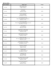
Table 1.1. <strong>Maricopa</strong> <strong>County</strong> CWPP recommended at-risk communities<br />
a WUI<br />
<strong>Community</strong><br />
risk<br />
Fire department/<br />
district<br />
<strong>Community</strong> a<br />
Section I. Introduction<br />
DRAFT <strong>Maricopa</strong> <strong>County</strong> <strong>Community</strong> <strong>Wildfire</strong> <strong>Protection</strong> <strong>Plan</strong> February 2010<br />
6<br />
WUI<br />
risk<br />
Fire department/<br />
district<br />
Aguila L Aguila Fire District Paradise Valley M Phoenix Fire Department<br />
Apache<br />
Junction<br />
M Apache Junction<br />
Fire Department<br />
Peoria L Peoria Fire Department<br />
Avondale M Avondale Fire Department Phoenix L Phoenix Fire Department<br />
Buckeye M Buckeye Fire Department Queen Creek M Queen Creek<br />
Fire Department<br />
Buckeye Valley M Buckeye Fire District Rio Verde Corridor M Rio Verde Fire District<br />
Carefree M Carefree Fire Department* Salt River<br />
Pima-<strong>Maricopa</strong><br />
Indian <strong>Community</strong><br />
M Salt River Pima-<strong>Maricopa</strong><br />
Indian <strong>Community</strong><br />
Fire Department<br />
Cave Creek M Rural Metro Fire Department St. Johns M Gila River Indian<br />
<strong>Community</strong><br />
Fire Department<br />
Chandler L Chandler Fire Department Scottsdale M Scottsdale Fire<br />
Department<br />
Circle City/<br />
Morristown<br />
L Circle City/Morristown<br />
Fire District<br />
Sun City L Sun City Fire District<br />
Sun City West L Sun City West Fire<br />
District<br />
El Mirage L El Mirage Fire Department Sunflower H None<br />
Fort McDowell L Fort McDowell Yavapai Indian<br />
Reservation<br />
Sun Lakes L Sun Lakes Fire District<br />
Fountain Hills M Fountain Hills Fire Department* Surprise M Surprise Fire Department<br />
Gila Bend M Gila Bend Fire Department Tempe L Tempe Fire Department<br />
Gila River<br />
Indian<br />
<strong>Community</strong><br />
Gilbert/<br />
Gilbert <strong>County</strong><br />
Island<br />
M Gila River Indian <strong>Community</strong><br />
Fire Department<br />
New River H Daisy Mountain Fire<br />
District<br />
L Gilbert Fire Department Tonto Hills M Tonto Hills Volunteer Fire<br />
Department and Rural<br />
Metro Fire Department<br />
Glendale L Glendale Fire Department Tolleson L Tolleson Fire Department<br />
Goodyear M Goodyear Fire Department Tonopah Valley L Tonopah Fire District<br />
Guadalupe L Guadalupe Fire Department Wickenburg M Wickenburg<br />
Fire Department<br />
Harquahala L Harquahala Fire District Wittmann L Wittmann Fire District<br />
Litchfield Park L Litchfield Park Fire Department* Youngtown L Youngtown<br />
Fire Department<br />
Mesa L Mesa Fire Department<br />
Mobile L Good Year Fire Department and<br />
<strong>Maricopa</strong> Fire Department**<br />
a St. Johns, Buckeye Valley, Gila Bend, and New River are listed as moderate and Sunflower is listed as low on the 2009 Arizona Communities at<br />
Risk Matrix (www.azsf.az.gov).<br />
b L=Low, M=Moderate, H=High wildland fire risk<br />
* Through agreement with Rural Metro Fire Department.<br />
** By automatic-aid agreement with City of Goodyear.
Figure 1.2. <strong>Maricopa</strong> <strong>County</strong> CWPP process<br />
Section I. Introduction<br />
DRAFT <strong>Maricopa</strong> <strong>County</strong> <strong>Community</strong> <strong>Wildfire</strong> <strong>Protection</strong> <strong>Plan</strong> February 2010<br />
7
Section I. Introduction<br />
The at-risk communities within <strong>Maricopa</strong> <strong>County</strong> are adjacent to federal lands, including public lands<br />
administered by BLM and TNF, and are consistent with the Arizona State Forester’s definition of an<br />
intermix or interface community (2007:1):<br />
The Intermix <strong>Community</strong> exists where structures are scattered throughout a wildland area. There is<br />
no clear line of demarcation; wildland fuels are continuous outside of and within the developed<br />
area. The developed density in the intermix community, ranges from structures very close together<br />
to one structure per forty acres. Local fire departments and/or districts normally provide life and<br />
property fire protection and may also have wildland fire protection responsibilities.<br />
The Interface <strong>Community</strong> exists where structures directly abut wildland fuels. There is a clear line<br />
of demarcation between wildland fuels and residential, business, and public structures. Wildland<br />
fuels do not generally continue into the developed area. The development density for an interface<br />
community is usually three or more structures per acre, with shared municipal services. Fire<br />
protection is generally provided by a local fire department with the responsibility to protect the<br />
structure from both an interior fire and an advancing wildland fire.<br />
In addition to a community’s listing status, the current condition of the wildland fuels within and adjacent to<br />
at-risk communities significantly contributes to the possibility of a catastrophic wildfire capable of damaging<br />
or destroying community values, such as houses, infrastructure, recreational sites, businesses, and wildlife<br />
habitats. Establishing a CWPP to enhance the protection of community values and to minimize the<br />
potential loss of property while ensuring public and firefighter safety during a catastrophic wildfire, remains<br />
the overriding priority recommendation of the <strong>Maricopa</strong> <strong>County</strong> CWPP.<br />
The WUI is commonly described as the zone where structures and other features of human development<br />
meet and intermingle with undeveloped wildland or vegetative fuels. Communities in the WUI face<br />
substantial risk to life, property, and infrastructure. Wildland fire in the WUI is one of the most dangerous<br />
and complicated situations firefighters face. Both the National Fire <strong>Plan</strong> (USDA FS and USDI BLM 2004b),<br />
which is a response to catastrophic wildfires, and A Collaborative Approach for Reducing Wildland Fire<br />
Risks to Communities and the Environment: 10-Year Comprehensive Strategy Implementation <strong>Plan</strong> (USDA<br />
FS and USDI BLM 2002), which is a plan for reducing wildland fire risk, emphasize working collaboratively<br />
with communities in the WUI to reduce their risk from large-scale wildfire. HFRA builds on existing efforts to<br />
restore healthy wildland conditions in the WUI by empowering local communities to determine the extent of<br />
the WUI; by determining appropriate wildland fuel mitigation measures; by enhancing public education for<br />
the prevention of wildland fire; and by authorizing expedited environmental assessments, administrative<br />
appeals, and legal review for qualifying projects on federal land.<br />
The <strong>Maricopa</strong> <strong>County</strong> CWPP process of delineating WUI boundaries for at-risk communities involved<br />
collaboration among local, state, and federal government representatives as well as interested individuals<br />
within the communities. The <strong>Maricopa</strong> <strong>County</strong> CWPP WUI is the minimum area needed to provide<br />
protection to each community and its surrounding community values. The identified WUI includes a total of<br />
3,103,370 acres composed of a mix of private, county, state, tribal trust, and federal lands. The WUI lands<br />
that surround the communities are in a condition conducive to a large-scale wildland fire, and such a<br />
wildfire could threaten human life and properties (see Photo 1.1).<br />
DRAFT <strong>Maricopa</strong> <strong>County</strong> <strong>Community</strong> <strong>Wildfire</strong> <strong>Protection</strong> <strong>Plan</strong> February 2010<br />
8
Photo 1.1. Widland fire in <strong>Maricopa</strong> <strong>County</strong><br />
(courtesy of Avondale Fire Department)<br />
Section I. Introduction<br />
General elements used in creating the WUI for <strong>Maricopa</strong> <strong>County</strong> at-risk communities include the following:<br />
Fuel hazards, local topography, vegetative fuels, and natural firebreaks<br />
Historical fire occurrence<br />
<strong>Community</strong> development characteristics<br />
Firefighting preparedness and response capabilities<br />
Infrastructure and evacuation routes<br />
Recreation and wildlife values<br />
C. Desired Future Condition and <strong>Wildfire</strong> Mitigation in the WUI<br />
The desired future condition of <strong>Maricopa</strong> <strong>County</strong> CWPP lands includes the maintenance of, or return to,<br />
wildland fire resiliency status and the maintenance of, or return to, the vegetation component of the<br />
historical plant potential community across <strong>Maricopa</strong> <strong>County</strong>. This historical plant potential community is<br />
composed of desert scrublands, shrublands (mesquite uplands), riparian corridors, and semidesert<br />
grasslands; all of these plant communities have an associated understory of grasses and shrubs, and<br />
some are also composed of invasive grasses and woody species (NatureServe 2004; Gori and Enquist<br />
2003). The Core Teams intend the <strong>Maricopa</strong> <strong>County</strong> CWPP to complement BLM and TNF objectives; the<br />
Statewide Strategy for Restoring Arizona’s Forests (Governor’s Forest Health Councils 2007); the<br />
Approved Arizona Statewide Land Use <strong>Plan</strong> Amendment for Fire, Fuels, and Air Quality Management and<br />
Decision Record (USDI BLM 2004a); and Amendment 25 to the Tonto National Forest Land and Resource<br />
Management <strong>Plan</strong> (USDA FS 2006). The desired future condition of public lands is consistent with those<br />
described by the Core Teams—community wildfire protection, watershed and rangeland restoration, and<br />
protection of community values, as well as the restoration of native vegetation to historical wildfire return<br />
DRAFT <strong>Maricopa</strong> <strong>County</strong> <strong>Community</strong> <strong>Wildfire</strong> <strong>Protection</strong> <strong>Plan</strong> February 2010<br />
9
Section I. Introduction<br />
intervals. Vegetative types maintained in this historical condition allow natural processes such as fire to be<br />
incorporated into long-term management practices to both sustain habitat health and meet <strong>Maricopa</strong><br />
<strong>County</strong> CWPP management goals while providing for community protection from unwanted wildland fire.<br />
Public education and land treatment projects in the <strong>Maricopa</strong> <strong>County</strong> CWPP area, coupled with current<br />
efforts of local governments, fire departments and districts, TNF, and BLM, will create a better-informed<br />
constituency capable of protecting at-risk communities through restoration and vegetative fuels mitigation<br />
efforts within the WUI. Federal wildfire reduction policy on public lands is planned and administered<br />
primarily by tribal governments, BLM, and TNF, which are the federal governing agencies for the public<br />
lands associated with the <strong>Maricopa</strong> <strong>County</strong> CWPP planning area. BLM and TNF manage wildland fire to<br />
help reduce unnaturally high wildland fuel loads that contribute to catastrophic wildland fire and to help<br />
encourage the return of fire to a more natural role in fire-adapted ecosystems, to achieve ecosystem<br />
benefits, to reduce economic impacts, and to enhance public and firefighter safety.<br />
The desired future condition of federal lands includes improving public and firefighter safety from wildland<br />
fire on public lands, using wildland fire as a management tool to achieve resource objectives, managing<br />
hazardous wildland fuels within and adjacent to the WUI, providing adaptive wildland fire response and<br />
suppression, and returning public lands to Condition Class I status. Federal lands in this condition class<br />
can carry wildfire without significant impacts on habitat components. Once this condition class is achieved,<br />
natural processes such as fire can be incorporated into long-term management practices to sustain habitat<br />
health. Current federal fire policy requires all wildland fires from unplanned ignitions to be managed for<br />
either protection objectives (wildfire) or resource benefit (wildland fire use). Under the current policy a<br />
single wildfire cannot be managed for both objectives concurrently (National Fire and Aviation<br />
Executive Board 2007; see Appendix F). The BLM and TNF adhere to federal policy when managing all<br />
unplanned wildfire ignitions on public lands within the WUI. Federal policy for reducing wildfires on public<br />
lands (that is, BLM and FS lands) is planned and administered locally through the BLM’s field offices and<br />
the TNF’s Cave Creek District. The Salt River Pima-<strong>Maricopa</strong> Indian <strong>Community</strong> (SRPMIC) is a compact<br />
tribe and manages its own wildland fire program. The SRPMIC Fire Department manages and funds all the<br />
equipment and staff, cross-utilizing the resources for the delivery of other emergency services.<br />
Under the proposed action described in the Approved Arizona Statewide Land Use <strong>Plan</strong> Amendment for<br />
Fire, Fuels, and Air Quality Management and Decision Record (USDI BLM 2004a), BLM-administered<br />
public lands are assigned one of two land use allocations for fire management: Allocation 1 includes areas<br />
suitable for wildland fire use for resource-management benefit, and Allocation 2 includes areas not suitable<br />
for wildland fire use for resource benefit. With the exception of the northern and eastern portions of the<br />
analysis area, the majority of the WUI is classified as Allocation 1 lands.<br />
The desired future condition of private lands in the WUI is for landowners to comply with the National<br />
Firewise Communities program (www.Firewise.org) or to meet home-ignition-zone landscaping or fire-safe<br />
landscaping recommended by the <strong>Maricopa</strong> <strong>County</strong> CWPP fire departments and districts in compliance<br />
with local ordinances. Firewise is a national program that helps communities reduce wildfire risks and<br />
provides them with information about protecting themselves against catastrophic wildfires and mitigating<br />
losses from such fires. Within Arizona, the State Forester administers the Firewise certification program.<br />
Fire departments and districts and local governments in <strong>Maricopa</strong> <strong>County</strong> would like to make this<br />
DRAFT <strong>Maricopa</strong> <strong>County</strong> <strong>Community</strong> <strong>Wildfire</strong> <strong>Protection</strong> <strong>Plan</strong> February 2010<br />
10
Section I. Introduction<br />
information available to their citizens and to encourage its application. For example, after making<br />
modifications to include high-desert fuel evaluations and construction as being Firewise eligible, Ancala<br />
West development in the city of Scottsdale was recognized as the first Firewise community in <strong>Maricopa</strong><br />
<strong>County</strong>. Residential and other structures that comply with Firewise standards significantly reduce fire-<br />
ignition risks in a community, as well as the potential for fires to spread to surrounding habitats.<br />
Additionally, structures that comply with Firewise recommendations are more likely to survive wildland fires<br />
that do spread into a community (Cohen 2008).<br />
The Core Teams are aware that wildland fuel accumulations primarily associated with the invasion of<br />
woody species and nonnative grasses, together with community growth in the WUI, have produced areas<br />
at high risk from catastrophic wildfire. The Core Teams aspire to achieve restored, self-sustaining,<br />
biologically diverse habitats of mixed open space and developed areas that contribute to a quality of life<br />
demanded by <strong>Maricopa</strong> <strong>County</strong> citizens. The Core Teams recognize that protection from catastrophic<br />
wildland fire requires collaboration and implementation through all levels of government and through an<br />
informed and motivated public. The Core Teams considered ecosystem restoration to the historical plant<br />
potential community, community protection, and public and firefighter safety while developing this CWPP<br />
(see Photo 1.2).<br />
Financial commitments required to reduce the risk of catastrophic wildfire can be extensive for municipal,<br />
county, state, and federal governments, as well as for the small rural communities surrounded by public<br />
lands. <strong>Maricopa</strong> <strong>County</strong>, TNF, and BLM have implemented wildland fuel mitigation projects within or near<br />
the <strong>Maricopa</strong> <strong>County</strong> CWPP WUI. Fire departments and districts have improved wildland fire suppression<br />
response and continue public education and outreach programs concerning wildland fire threat and home-<br />
ignition-zone recommendations. <strong>Maricopa</strong> <strong>County</strong> fire departments and districts have standing automatic<br />
aid agreements allowing for closest resources to provide initial attack response. The Fire Departments and<br />
Districts of <strong>Maricopa</strong> <strong>County</strong> maintain wildland fire response teams supported by various engines and<br />
support equipment including 57 ambulances, 43 brush trucks, 155 fire engines, 33 ladder trucks,<br />
and5 Heavy Rescue vehicles, and various other specialized response vehicles to help suppress wildland<br />
fires. Additionally, the fire departments and districts have taken proactive measures to encourage willing<br />
property owners to reduce fire risk on private property (HFRA, Sec.103.d.2.B). Wildland fire response<br />
teams are composed of personnel with various levels of wildland firefighting training, including red-carded<br />
firefighters. The response teams are coordinating radio frequencies to improve communications between<br />
initial-attack and responding firefighting agencies and departments. Specially trained wildland fire response<br />
teams not only provide suppression response to brush fires but also provide community awareness<br />
programs and structural-fire risk assessments. The Core Teams, BLM, and TNF collaborators are<br />
proposing additional wildland fuel treatments and wildland fire suppression enhancements and have been<br />
proactive in pursuing funding for wildland fire public outreach programs and fire-suppression training and<br />
equipment.<br />
D. Goals for the <strong>Maricopa</strong> <strong>County</strong> CWPP<br />
To reduce the risks to life and property from catastrophic wildland fire, the Core Teams have agreed on the<br />
following primary goals of the <strong>Maricopa</strong> <strong>County</strong> CWPP:<br />
DRAFT <strong>Maricopa</strong> <strong>County</strong> <strong>Community</strong> <strong>Wildfire</strong> <strong>Protection</strong> <strong>Plan</strong> February 2010<br />
11
Improve fire prevention and suppression, emphasizing firefighter and public safety<br />
Reduce hazardous fuels, emphasizing public and private property protection<br />
Restore forest, rangeland, and riparian health<br />
Promote community involvement and provide for community protection<br />
Recommend measures to reduce structural ignitability in the WUI<br />
Encourage economic development in the communities from vegetative treatments<br />
Promote development of wildfire emergency evacuation and communication plans<br />
Section I. Introduction<br />
Use the CWPP in conjunction with surrounding community and agency fire management plans<br />
E. <strong>Plan</strong>ning Process<br />
During initial analysis, and to aid the overall development of this plan, the Core Teams reviewed the<br />
following documents and studies:<br />
―Urban Wildland Interface Communities within the Vicinity of Federal Lands That Are at High Risk<br />
from <strong>Wildfire</strong>,‖ Federal Register Vol. 66, Nos. 3 and 160 (USDA and USDI 2001a, 2001b)<br />
National Fire <strong>Plan</strong> (USDA FS and USDI BLM 2004b)<br />
Healthy Forests: An Initiative for <strong>Wildfire</strong> Prevention and Stronger Communities<br />
(Presidential Policy 2002)<br />
HFRA<br />
The Healthy Forests Initiative and Healthy Forests Restoration Act: Interim Field Guide<br />
(USDA FS and USDI BLM 2004a)<br />
Preparing a <strong>Community</strong> <strong>Wildfire</strong> <strong>Protection</strong> <strong>Plan</strong>: A Handbook for Wildland-Urban Interface<br />
Communities (Communities Committee et al. 2004)<br />
Field Guidance: Identifying and Prioritizing Communities at Risk (National Association of State<br />
Foresters 2003)<br />
Arizona Wildland Urban Interface Assessment (Arizona State Forester 2004)<br />
Arizona-Identified Communities at Risk (Arizona State Forester 2009)<br />
Identifying Arizona’s Wildland/Urban Interface Communities at Risk: A Guide for State and<br />
Federal Land Managers (Arizona State Forester 2007)<br />
Statewide Strategy for Restoring Arizona’s Forests (Governor’s Forest Health Councils 2007)<br />
A Collaborative Approach for Reducing Wildland Fire Risks to Communities and the<br />
Environment: 10-Year Comprehensive Strategy Implementation <strong>Plan</strong> (USDA FS and USDI<br />
BLM 2002)<br />
Approved Arizona Statewide Land Use <strong>Plan</strong> Amendment for Fire, Fuels, and Air Quality<br />
Management and Decision Record (USDI BLM 2004a)<br />
Tonto National Forest Land and Resource Management <strong>Plan</strong> (USDA FS 2005)<br />
Wildland Fire Use Implementation Procedures Reference Guide (USDI and USDA 2005)<br />
Wildland Fire Suppression (Including Wildland Fire Use) and Rehabilitation in Riparian and<br />
Aquatic Habitats (RA) (USDI BLM 2004b)<br />
DRAFT <strong>Maricopa</strong> <strong>County</strong> <strong>Community</strong> <strong>Wildfire</strong> <strong>Protection</strong> <strong>Plan</strong> February 2010<br />
12
Strategic <strong>Plan</strong> 2007-2012 (Central Arizona Wildland Response Team 2007)<br />
Wildland Fire Use Implementation Procedures Reference Guide (USDI and USDA 2005)<br />
Section I. Introduction<br />
Guidance for Implementation of Federal Wildland Fire Management Policy<br />
(USDA and USDI 2009)<br />
<strong>Maricopa</strong> <strong>County</strong> Multi-Jurisdictional Hazard Mitigation <strong>Plan</strong> (MCDEM and JE Fuller 2009)<br />
Action recommendations for at-risk areas within the <strong>Maricopa</strong> <strong>County</strong> CWPP WUI boundaries have been<br />
developed as part of this planning process. Treatments for wildland vegetative fuels and additional wildland<br />
fire mitigation measures are recommended to be implemented in specific time frames and with associated<br />
monitoring to determine and document measurable outcomes. Successful implementation of the<br />
<strong>Maricopa</strong> <strong>County</strong> CWPP will require collaboration by fire departments and districts, governments, resource-<br />
management agencies, and the private sector. The cooperating agencies must develop processes and<br />
systems that ensure recommended actions of the <strong>Maricopa</strong> <strong>County</strong> CWPP comply with applicable local,<br />
state, and federal environmental regulations. The dedication of the Core Teams and collaborators in<br />
implementing the <strong>Maricopa</strong> <strong>County</strong> CWPP assures that all agencies, groups, and individuals involved will<br />
develop any additional formal agreements necessary to ensure the <strong>Maricopa</strong> <strong>County</strong> CWPP’s timely<br />
implementation, monitoring, and reporting. The Core Teams were formed not only to meet collaborative<br />
requirements of HFRA but also to represent all of the different interests of the <strong>Maricopa</strong> <strong>County</strong><br />
communities, with all parties being involved and being committed to the development and implementation<br />
of the <strong>Maricopa</strong> <strong>County</strong> CWPP.<br />
DRAFT <strong>Maricopa</strong> <strong>County</strong> <strong>Community</strong> <strong>Wildfire</strong> <strong>Protection</strong> <strong>Plan</strong> February 2010<br />
13
II. MARICOPA COUNTY CWPP COMMUNITY ASSESSMENT AND ANALYSIS<br />
Section II. <strong>Community</strong> Assessment and Analysis<br />
The community risk assessment is an analysis of the potential for catastrophic wildland fire to <strong>Maricopa</strong><br />
<strong>County</strong> communities and lands within the WUI identified by the Core Teams. This risk analysis incorporates<br />
the current fire regime-condition class, wildfire fuel hazards, risk of ignition, local preparedness and<br />
protection capabilities and at-risk community values. The Core Teams have reviewed the Arizona State<br />
Forester’s Identifying Arizona’s Wildland/Urban Interface Communities at Risk: A Guide for State and<br />
Federal Land Managers (2007) to ensure that the <strong>Maricopa</strong> <strong>County</strong> CWPP is compatible with and<br />
complementary to statewide CWPP planning efforts. The Core Teams have included all risk factors<br />
required by the Arizona State Forester in the analysis of this CWPP. The areas of concern for wildland fuel<br />
hazards, risk of ignition and wildfire occurrence, local preparedness, and protection capabilities and loss of<br />
community values are evaluated to determine areas of highest wildland fire risk.<br />
The <strong>Maricopa</strong> <strong>County</strong> CWPP planning area includes all of <strong>Maricopa</strong> <strong>County</strong>, including tribal trust lands,<br />
divided into two analysis areas: one for the eastern portion of the county and one for the western portion of<br />
the county (Figures 2.1a and 2.1b). Gila River, Fort McDowell, Gila Bend, and Salt River Pima-<strong>Maricopa</strong><br />
tribal trust lands are included in the total acreage of the WUI. The <strong>Maricopa</strong> <strong>County</strong> CWPP comprises<br />
3,103,370 acres of land (Table 2.1).<br />
Table 2.1. Land management within the WUI<br />
Ownership type Total acres % of total<br />
Barry M. Goldwater Air Force Range 6,456 0<br />
BLM 465,326 15<br />
Bureau of Reclamation 18,495 1<br />
<strong>Maricopa</strong> <strong>County</strong> land 6,387 0<br />
Fort McDowell Indian Reservation 24,869 1<br />
Arizona Game and Fish Department 5,396 0<br />
Gila Bend Indian Reservation 408 0<br />
Tohono O’odham Nation San Lucy District 160,802 5<br />
Hohokam Pima National Monument 626 0<br />
Luke Air Force Base 2,823 0<br />
Military Reservation 1,803 0<br />
Painted Rock Wildlife Area 5,056 0<br />
Private land 1,715,540 55<br />
Salt River Pima-<strong>Maricopa</strong> Indian Reservation 53,711 2<br />
State Trust land 445,061 14<br />
TNF 90,040 3<br />
Williams Air Force Base 2 0<br />
Continued<br />
DRAFT <strong>Maricopa</strong> <strong>County</strong> <strong>Community</strong> <strong>Wildfire</strong> <strong>Protection</strong> <strong>Plan</strong> February 2010<br />
14
Section II. <strong>Community</strong> Assessment and Analysis<br />
Table 2.1. Land management within the WUI<br />
Ownership type Total acres % of total<br />
Buckeye Hills Regional Park 4,441 0<br />
South Mountain Regional Park 15,677 1<br />
Estrella Mountain Regional Park 18,531 1<br />
White Tank Mountain Regional Park 29,195 1<br />
McDowell Mountain Regional Park 21,076 1<br />
Cave Creek Regional Park 2,763 0<br />
Parks and recreation 397 0<br />
Parks and recreation (other) 8,491 0<br />
*Actual total may not add to 100% because of rounding.<br />
Total 3,072,461 100<br />
The <strong>Maricopa</strong> <strong>County</strong> CWPP planning area primarily includes private (55 percent), BLM (15 percent),<br />
ASLD (14 percent), and TNF (3 percent) lands.<br />
Primary land ownership in the <strong>Maricopa</strong> <strong>County</strong> CWPP planning area is a mosaic of privately owned lands<br />
and lands administered by the BLM and ASLD (Table 2.1 and Figures 2.1a and 2.1b). Much of the land<br />
within the <strong>Maricopa</strong> <strong>County</strong> CWPP planning area is urban with associated adjacent urban development in<br />
proximity to undeveloped public and state lands (such as Anthem) and rural communities with minimal<br />
development (such as New River and Sunflower).<br />
Of the publicly owned lands within the WUI, BLM is the largest land manager with 465,326 acres, or<br />
15 percent of lands, located throughout the WUI. State Trust lands were established in 1912 under the<br />
terms of the Arizona Enabling Act. With statehood, Arizona was granted ownership of four sections per<br />
township. The ASLD manages State Trust lands to produce revenue for the Arizona State Trust<br />
beneficiaries, including the state’s school system. Within the <strong>Maricopa</strong> <strong>County</strong> CWPP area, State Trust<br />
lands are managed primarily for recreation, natural resource protection, and livestock grazing.<br />
Of the remaining publicly owned lands within the WUI, TNF lands compose 90,040 acres, or approximately<br />
3 percent, of the WUI. These federal lands provide extensive and popular hiking, hunting, and recreational<br />
areas within or adjacent to the WUI. The potential for escaped campfires or the need to evacuate camping<br />
areas in the event of a wildfire warrants including these lands in the <strong>Maricopa</strong> <strong>County</strong> CWPP area.<br />
Private land within the WUI composes the largest ownership within the WUI at 1,715,540 acres, or roughly<br />
55 percent, of the WUI. Private lands are mostly clustered near the communities, with some scattered<br />
private inholdings located throughout the WUI. The municipalities of Phoenix, Scottsdale, Goodyear,<br />
Surprise, El Mirage, Glendale, Apache Junction, Queen Creek, Paradise Valley, Sun Lakes, Guadalupe,<br />
Mesa, Tempe, Fountain Hills, Gilbert, Salt River Pima-<strong>Maricopa</strong> Indian <strong>Community</strong>, Sun City, Sun City<br />
West, Buckeye, Gila Bend, Wickenburg, Avondale, Chandler, Tolleson, Litchfield Park, Youngtown,<br />
DRAFT <strong>Maricopa</strong> <strong>County</strong> <strong>Community</strong> <strong>Wildfire</strong> <strong>Protection</strong> <strong>Plan</strong> February 2010<br />
15
Figure 2.1a. <strong>Maricopa</strong> <strong>County</strong> CWPP WUI area, east<br />
Section II. <strong>Community</strong> Assessment and Analysis<br />
DRAFT <strong>Maricopa</strong> <strong>County</strong> <strong>Community</strong> <strong>Wildfire</strong> <strong>Protection</strong> <strong>Plan</strong> February 2010<br />
16
Figure 2.1b. <strong>Maricopa</strong> <strong>County</strong> CWPP WUI area, west<br />
Section II. <strong>Community</strong> Assessment and Analysis<br />
DRAFT <strong>Maricopa</strong> <strong>County</strong> <strong>Community</strong> <strong>Wildfire</strong> <strong>Protection</strong> <strong>Plan</strong> February 2010<br />
17
Section II. <strong>Community</strong> Assessment and Analysis<br />
Carefree, Cave Creek, Circle City/Morristown, and New River contain the majority of private land acreage<br />
within the WUI. Commercial structures are clustered along state and federal highways and community<br />
centers, and they are assumed to remain as the principal commercial corridors within the <strong>Maricopa</strong> <strong>County</strong><br />
at-risk communities.<br />
<strong>Maricopa</strong> <strong>County</strong> has experienced considerable growth in population and housing during the recent<br />
decade. The population estimate for <strong>Maricopa</strong> <strong>County</strong> was reported as approximately 3,862,036 with<br />
slightly over 1,536,471 housing units, in 2008—this represents a 22 percent increase in housing units since<br />
the 2000 census (US Census Bureau 2009). Growth is anticipated to continue in both urban and rural<br />
settings in <strong>Maricopa</strong> <strong>County</strong>. <strong>Maricopa</strong> <strong>County</strong> and the Core Teams recognize that the WUI will continue to<br />
grow and that fire departments and districts will be challenged to provide fire response services to an<br />
increasing number of constituents.<br />
The <strong>Maricopa</strong> <strong>County</strong> CWPP planning area boundary is identified in Figures 2.1a and 2.1b and is included<br />
within the Statewide Strategy for Restoring Arizona’s Forests (Governor’s Forest Health Councils, State of<br />
Arizona, 2007), which distinguishes nine forested landscapes. A portion of one of these identified forested<br />
landscapes, the Sky Islands, occurs in <strong>Maricopa</strong> <strong>County</strong>.<br />
The Sky Islands region is located at the confluence of four major bioregions—the southern Rocky<br />
Mountains, the northern Sierra Madre Mountains, the Sonoran Desert, and the Chihuahuan Desert. The<br />
Sky Islands region of the Statewide Strategy for Restoring Arizona’s Forests is circumscribed by the Gila<br />
Mountains to the north, the Baboquivari Mountains to the west, and the Mexican border to the south. The<br />
Eastern Core Team reviewed the current conditions and future restoration needs of the Four Peaks<br />
Wilderness area, within the Sky Islands landscape, to ensure that the <strong>Maricopa</strong> <strong>County</strong> CWPP is<br />
complementary to the recommendations of the Statewide Strategy for Restoring Arizona’s Forests.<br />
Landscape vegetation ranges from madrean encinal to oak woodlands at elevations normally above 3,600<br />
feet to desert shrublands at lower elevations. Due to high levels of topographical complexity and gradient<br />
within the portion of the Sky Islands landscape within the <strong>Maricopa</strong> <strong>County</strong> CWPP WUI, fire characteristics<br />
are variable. Single fires can cross multiple vegetation associations. Unnatural high fuel loads and drought<br />
continue to contribute to high wildland fire risk. Recommendations for “Future Restoration Needs”<br />
(Governor’s Forest Health Councils State of Arizona 2007:115) of the Sky Islands landscape applicable to<br />
the <strong>Maricopa</strong> <strong>County</strong> CWPP include (1) conducting educational outreach to stakeholders that will highlight<br />
the ecological and socioeconomic benefits of ecological restoration; (2) providing incentives and assistance<br />
for restoration of privately owned forests (or lands within the <strong>Maricopa</strong> <strong>County</strong> CWPP); (3) integrating<br />
restoration planning with long-term planning and zoning processes, which will require outreach and<br />
education to planning and zoning commissions; (4) encouraging Firewise landscaping and building in<br />
communities; and (5) encouraging the restoration-based harvesting of firewood as opposed to importing<br />
firewood from Mexico. The Core Teams support the recommendations within the Statewide Strategy for<br />
Restoring Arizona’s Forests and produced the <strong>Maricopa</strong> <strong>County</strong> CWPP to be complementary to those<br />
assessments and recommendations.<br />
The climate of <strong>Maricopa</strong> <strong>County</strong> is varied—ranging from semiarid desert shrub-scrub vegetative<br />
associations with relatively low precipitation, low humidity, and high summer temperatures; to vegetative<br />
communities associated with the Gila, Salt, Verde, Agua Fria, and Hassayampa rivers and riparian<br />
DRAFT <strong>Maricopa</strong> <strong>County</strong> <strong>Community</strong> <strong>Wildfire</strong> <strong>Protection</strong> <strong>Plan</strong> February 2010<br />
18
Section II. <strong>Community</strong> Assessment and Analysis<br />
corridors of New River, Sycamore, and Cave creeks; and to oak and pinyon-juniper woodlands with mild<br />
summers and cool winters. Precipitation averages from 3.5 to 37.0 inches per year depending on elevation<br />
and occurs primarily during two rainy periods—summer rainfall, which usually occurs in local torrential<br />
convection showers, and winter rainfall, which is usually slow and can occur over several days. The<br />
average annual air temperature is 47 to 74 degrees Fahrenheit. The freeze free period averages from 255<br />
to 285 days, decreasing in length with increasing elevation (NRSC 2010a and 2010b).<br />
The planning area includes the Gila, Salt, Verde, Agua Fria, and Hassayampa rivers. The Verde River is a<br />
tributary to the Salt River. The Salt, Agua Fria, and Hassayampa rivers are all direct tributaries of the Gila<br />
River. The Gila River has its source in western New Mexico. It flows into Arizona, past the town of Safford,<br />
and along the southern slope of the Gila Mountains in Graham <strong>County</strong>. It emerges from the mountains into<br />
the valley southeast of Phoenix, where it crosses the Tohono O’odham Nation San Lucy District as an<br />
intermittent stream due to large irrigation diversions. West of Phoenix, the river bends sharply southward<br />
along the Gila Bend Mountains and then turns sharply westward near the town of Gila Bend. It then flows<br />
southwestward through the Gila Mountains in Yuma <strong>County</strong>, and finally it flows into the Colorado River at<br />
Yuma.<br />
The Salt River is formed in eastern Arizona in eastern Gila <strong>County</strong>, by the confluence of the White and<br />
Black rivers. It flows northwest through Salt River Canyon, then southwest and west through the Tonto<br />
National Forest. It passes through the valley between the Mazatzal Mountains and Superstition Mountains,<br />
past Man Island, and supplies several consecutive reservoirs: Lake Roosevelt, Apache Lake, Canyon<br />
Lake, and Saguaro Lake. Near Fountain Hills it is joined by the Verde River. About five miles downstream<br />
of this point, the Granite Reef Diversion Dam diverts all remaining water into the Arizona and South canals,<br />
which deliver drinking and irrigation water to much of the Phoenix metropolitan area. The Salt River joins<br />
the Gila on the southwestern edge of Phoenix approximately 15 miles from the center of the city.<br />
The head of the Verde River begins below the dam that catches water from the Big Chino Wash and<br />
Williamson Valley Wash combining to create Sullivan Lake in Yavapai <strong>County</strong>. This occurs during periods<br />
of sufficient precipitation. The Verde flows freely above- and belowground for 125 miles through private,<br />
state, tribal, and USDA Forest Service lands, specifically the TNF, before encountering the first of two<br />
dams that make Horseshoe Lake and Bartlett Lake. The Verde River converges with the Salt River near<br />
Fountain Hills.<br />
The Agua Fria River is a 120-mile-long intermittent stream that flows generally south from 20 miles eastnortheast<br />
of Prescott. Prescott draws much of its municipal water supply from the upper Agua Fria<br />
drainage. The Agua Fria runs through the Agua Fria National Monument and then flows through Black<br />
Canyon into Lake Pleasant. When flows are sufficient, the Agua Fria River flows into the Gila River. The<br />
Hassayampa River is a mostly underground river in Arizona. However, the river flows aboveground within<br />
the Hassayampa River Canyon Wilderness. The Hassayampa converges with the Gila River near the<br />
Buckeye Hills.<br />
The majority of federally managed public lands within the <strong>Maricopa</strong> <strong>County</strong> CWPP are administered by<br />
BLM. In accordance with the Approved Arizona Statewide Land Use <strong>Plan</strong> Amendment for Fire, Fuels, and<br />
Air Quality Management and Decision Record (USDI BLM 2004a and USDI BLM 2004b), BLM-<br />
DRAFT <strong>Maricopa</strong> <strong>County</strong> <strong>Community</strong> <strong>Wildfire</strong> <strong>Protection</strong> <strong>Plan</strong> February 2010<br />
19
Section II. <strong>Community</strong> Assessment and Analysis<br />
administered public lands are assigned to one of two land use allocations for fire management. Allocation 1<br />
lands include areas where fire is desired and there are few or no constraints for its use. Wildland fire may<br />
be used to achieve resource objectives, such as improved watershed or wildlife habitat. Where fuel loading<br />
is high and conditions are not initially suitable for wildland fire, fuel loads may be reduced by mechanical,<br />
chemical, or biological means to acceptable levels and to meet resource objectives. Allocation 2 lands<br />
include areas where mitigation and suppression are required to prevent direct threats to life or property. It<br />
also includes areas where fire never played a large role in ecosystem management and where unplanned<br />
ignitions would have negative effects on resources. In these areas BLM will implement programs to reduce<br />
unwanted ignitions and emphasize prevention, detection, and rapid suppression. In addition to both land<br />
use allocations, BLM will undertake education, enforcement, and administrative fire-prevention measures<br />
to reduce human-caused fire.<br />
National forest lands are administered by the TNF and consist of four fire management units (FMUs):<br />
FMU 1–Desert, FMU 4–Woodland Brush, FMU 5–Wilderness, and FMU 6–WUI9 (USDA FS 2005) and<br />
USDA FS 2006).<br />
FMU 1 consists of the Sonoran Desert and is represented by National Fire Danger Rating System<br />
(NFDRS) Fuel Model T (See Appendix B for NFDRS fuel model definitions). Areas that have burned at a<br />
high intensity have been converted from Sonoran Desert to desert grasslands composed of nonnative<br />
grasses. Fire intensities from the nonnative species have compounded the problem. The two species that<br />
classify this FMU are the saguaro cactus and the palo verde tree. <strong>Wildfire</strong> will be managed consistent with<br />
resource objectives. Capital investments within these areas will be protected from fire. Actions taken will be<br />
consistent with the appropriate management response (AMR) for this area. <strong>Wildfire</strong>s, or portions of<br />
wildfires, that adversely affect forest resources, endanger public safety, or have a potential to damage<br />
private lands will be suppressed. Suppression efforts will be accomplished with minimal ground disturbance<br />
and least cost suppression methods will be initiated when possible (that is, using existing natural or humanmade<br />
features as control lines).<br />
FMU 4 consists of pinyon pine, juniper, and chaparral and is represented by NFDRS Fuel Model B. Much<br />
of this FMU contains a thick overstory and shrubby understory. Many of the chaparral stands contain old,<br />
decadent components. In areas where the pinyon pines and junipers are less dense, there is often a dense<br />
layer of herbaceous vegetation. <strong>Wildfire</strong>s will be managed consistent with resource objectives. Wildland fire<br />
not meeting management objectives will receive an AMR. Fire management objectives for this area include<br />
providing a mosaic of age classes within the total type, which will provide for a mix of successional stages,<br />
and allowing fire to resume its natural ecological role within ecosystems. <strong>Wildfire</strong>s, or portions of wildfires,<br />
will be suppressed when they adversely affect forest resources, endanger public safety, or have a potential<br />
to damage significant capital investments.<br />
FMU 5 consists of the Four Peaks and Mazatzal Wilderness areas on the TNF and are represented mostly<br />
by NFDRS Fuel Models B and T and partly by Fuel Model U. This FMU contains fuel characteristics that<br />
are found in all the other FMUs, at all elevations, and contains much of the TNF’s various vegetation types.<br />
<strong>Wildfire</strong>s occurring within this FMU will receive an AMR and be managed consistent with Wilderness<br />
resource objectives. <strong>Wildfire</strong>s may be allowed to burn, to function in their natural ecological role, and to<br />
DRAFT <strong>Maricopa</strong> <strong>County</strong> <strong>Community</strong> <strong>Wildfire</strong> <strong>Protection</strong> <strong>Plan</strong> February 2010<br />
20
Section II. <strong>Community</strong> Assessment and Analysis<br />
reduce unnatural fuel hazards as identified in the Forest Service Manual and approved Wilderness<br />
Implementation <strong>Plan</strong>.<br />
FMU 6 consists of national forest lands adjacent to private lands with developments and most infrastructure<br />
sites on national forest lands. This land is defined by a 0.5-mile buffer on each side of a structure or private<br />
boundary. <strong>Wildfire</strong>s occurring within this FMU will be immediately suppressed at the smallest acreage<br />
possible. Both mechanical treatment and prescribed fire will be used to reduce potential wildfire intensity.<br />
A. Fire Regime and Condition Class<br />
Before European settlement of North America, fire played a natural (historical) role in the landscape. Five<br />
historical fire regimes have been identified based on the average number of years between fires (fire<br />
frequency) combined with the severity (amount of overstory replacement) of fire on the dominant overstory<br />
vegetation (Table 2.2).<br />
Table 2.2. Fire regime information<br />
Frequency Severity a<br />
Regime I 0–35 years Low<br />
Regime II 0–35 years High<br />
Regime III 35–100 years Low<br />
Regime IV 35–100 years High<br />
Regime V<br />
Source: Schmidt et al. 2002.<br />
200+ years High<br />
a<br />
Low = less than 75% of the dominant overstory vegetation replaced. High = greater than<br />
75% of the dominant overstory vegetation replaced (stand replacement).<br />
The condition class of wildland habitats describes the degree to which the current fire regime has been<br />
altered from its historical range, the risk of losing key ecosystem components, and the vegetative attribute<br />
changes from historical conditions. The following descriptions of condition classes are provided by the<br />
Arizona State Forester (2007:3):<br />
Condition Class 1:<br />
Fire regimes are within a historical range, and the risk of losing key ecosystem components is low.<br />
Vegetation attributes (species composition and structure) are intact and functioning within the<br />
historical range.<br />
Condition Class 2:<br />
Fire regimes have been moderately altered from their historical range. The risk of losing key<br />
ecosystem components is moderate. Fire frequencies have departed from historical frequencies by<br />
one or more return intervals (either increased or decreased). This results in moderate changes to<br />
one or more of the following: fire size, intensity and severity, and landscape patterns. Vegetation<br />
attributes have been moderately altered from their historical range.<br />
DRAFT <strong>Maricopa</strong> <strong>County</strong> <strong>Community</strong> <strong>Wildfire</strong> <strong>Protection</strong> <strong>Plan</strong> February 2010<br />
21
Condition Class 3:<br />
Section II. <strong>Community</strong> Assessment and Analysis<br />
Fire regimes have been significantly altered from their historical range. The risk of losing key<br />
ecosystem components is high. Fire frequencies have departed from historical frequencies by<br />
multiple return intervals. This results in dramatic changes to one or more of the following: fire size,<br />
intensity, severity, and landscape patterns. Vegetation attributes have been significantly altered<br />
from their historical range.<br />
The <strong>Maricopa</strong> <strong>County</strong> WUI covers 3,072,461 acres, including 633,059 acres of land classified as<br />
developed and low-density open space and barren landscape (21% of WUI acres) and 377,229 acres of<br />
agricultural land (12% of WUI acres). The WUI includes 1,923,633 acres (63% of WUI acres) of Fire<br />
Regime Condition Class (FRCC) I lands, 137,526 acres (4% of WUI acres) of FRCC II lands, and 1,014<br />
acres (
Section II. <strong>Community</strong> Assessment and Analysis<br />
mosaic of different-age, postfire grassland, savannah woodlands, or open shrub patches by leaving<br />
greater than 25 percent of the upper layer (generally less than 40 hectares [100 acres]). Interval[s]<br />
can range up to 50 [years] in systems with high temporal variability.<br />
Desired future conditions for Great Basin Pinyon-Juniper Woodland, Interior Chaparral, Upland and Lower<br />
Sonoran Desert Scrub, Semidesert Grassland, and Riparian habitats, as described in the Approved<br />
Arizona Statewide Land Use <strong>Plan</strong> Amendment for Fire, Fuels, and Air Quality Management and Decision<br />
Record (USDI BLM 2004a:2–3), are as follows:<br />
Great Basin Pinyon-Juniper Woodland:<br />
Annual weeds such as cheatgrass are controlled, ladder fuels and downed woody debris are limited<br />
or not present, and juniper and piñon pine tree densities and cover occur at their historic range of<br />
variation.<br />
Interior Chaparral:<br />
<strong>Wildfire</strong> naturally maintains shrub cover while reducing annual grass cover, the invasion of woody<br />
plants such as juniper and pinyon pine are controlled and the average age of chaparral stands is<br />
reduced through controlled fire or mechanical treatment.<br />
Upland Sonoran Desert Scrub<br />
An adequate cover of and mix of natural plant species that have good vigor. Wildland fire would<br />
control or reduce the exotic annual weeds such as red brome and to limit woody vegetation to nonhazardous<br />
levels.<br />
Lower Sonoran Desert Scrub:<br />
An adequate cover of and mix of natural plant species that have good vigor. Wildland fire would<br />
control or reduce the exotic annual weeds such as red brome and to limit woody vegetation to nonhazardous<br />
levels.<br />
Semidesert Grassland:<br />
Perennial grasses cover its historic range of variability, annual grass cover is reduced and fire<br />
naturally inhibits the invasion of woody plants such as juniper, tarbush, whitethorn and<br />
creosotebush.<br />
Riparian habitat:<br />
Annual weed cover and density is controlled and ladder fuels and downed woody debris are limited<br />
or not present. Disturbances that can potentially reduce natural vegetation cover and vigor are<br />
managed to maintain cover and mix of native riparian plant species.<br />
DRAFT <strong>Maricopa</strong> <strong>County</strong> <strong>Community</strong> <strong>Wildfire</strong> <strong>Protection</strong> <strong>Plan</strong> February 2010<br />
23
B. Fuel Hazards<br />
Section II. <strong>Community</strong> Assessment and Analysis<br />
The arrangement of vegetative fuel, relative flammability, and potential of vegetation to support wildland fire<br />
varies throughout the WUI. Wildland fuel hazards depend on a specific composition, type, arrangement, or<br />
condition of vegetation such that if the fuel were ignited, an at-risk community or its infrastructure could be<br />
threatened. Table 2.3 identifies the total amount of land in the WUI that was evaluated for overall wildland<br />
fire risk because of increased wildland vegetative fuel hazards. Historically, fire played an important role in<br />
keeping woody species in check and light ground fuels low (USDI BLM 2004b:3–8; Gori and Enquist 2003).<br />
However, with the suppression of natural wildfires within the last century, fire return intervals have<br />
increased, and invasions of desert grasslands by woody shrub (such as mesquite and juniper species) and<br />
nonnative grasses (such as buffelgrass, red brome, and Mediterranean grass) have altered native<br />
vegetative associations. The Core Teams reviewed vegetation associations within the WUI that were<br />
identified and mapped using Southwest Regional Gap Analysis Project (SWReGAP) data (USGS 2005;<br />
NatureServe 2004) (Figures 2.2a and 2.2b). These datasets provide the level of landscape description and<br />
vegetative landcover detail necessary for aligning wildland fuel flammability with existing vegetation. The<br />
major distinguishing types for each <strong>Maricopa</strong> <strong>County</strong> CWPP vegetation association were field verified.<br />
The existing arrangement and flammability of vegetation associations largely determine wildland fire<br />
behavior. Flammability for the <strong>Maricopa</strong> <strong>County</strong> WUI is mapped in Figures 2.3a and 2.3b. The Core Teams<br />
and collaborators identified areas at risk from wildland fire by evaluating vegetative fuels on federal and<br />
nonfederal land in the WUI through spatial analysis using geographic information system (GIS) technology<br />
in a series of overlays. For the WUI, the vegetation type, density, and distribution were analyzed to help<br />
categorize areas at highest risk for fire intensity and spread from wildland fuels.<br />
Vegetative data for predicting wildfire behavior was quantified by developing descriptions of associated fuel<br />
properties that are described as fuel models. The fuel model (as described by Anderson 1982 and Scott<br />
and Burgan 2005) and vegetation fuel fire-risk rating within the <strong>Maricopa</strong> <strong>County</strong> CWPP WUI are shown in<br />
Table 2.3. As described by the Arizona State Forester (2007:1),<br />
“EVALUATE RISK TO COMMUNITIES: Not all structures and/or communities that reside in an<br />
“interface” area are at significant risk from wildland fire. It is a combination of factors, including the<br />
composition and density of vegetative fuels, extreme weather conditions, topography, density of<br />
structures, and response capability that determines the relative risk to an interface community. The<br />
criteria listed below are intended to assist interagency teams at the state level in identifying the<br />
communities within their jurisdiction that are at significant risk from wildland fire. The application of<br />
these risk factors should allow for greater nationwide consistency in determining the need and<br />
priorities for Federal projects and funding.”<br />
DRAFT <strong>Maricopa</strong> <strong>County</strong> <strong>Community</strong> <strong>Wildfire</strong> <strong>Protection</strong> <strong>Plan</strong> February 2010<br />
24
Table 2.3. Fuel model, fire-danger ratings, and intensity levels on vegetation associations in the WUI<br />
Fuel type<br />
Desert<br />
shrub-scrub<br />
Vegetation<br />
association<br />
Creosotebush,<br />
mixed desert,<br />
and thorn<br />
scrub<br />
Sonoran<br />
paloverdemixed<br />
cacti<br />
desert scrub<br />
Creosotebushwhite<br />
bursage<br />
desert scrub<br />
Mixed-desert<br />
scrub<br />
<strong>Wildfire</strong><br />
risk<br />
rating a<br />
Anderson<br />
fuel model<br />
Firedanger<br />
rating<br />
model b<br />
Flame<br />
length<br />
(ft)<br />
Fire<br />
intensity<br />
level<br />
Section II. <strong>Community</strong> Assessment and Analysis<br />
DRAFT <strong>Maricopa</strong> <strong>County</strong> <strong>Community</strong> <strong>Wildfire</strong> <strong>Protection</strong> <strong>Plan</strong> February 2010<br />
25<br />
Rate of<br />
spread<br />
ft/hr<br />
(ch/hr)<br />
L 1,2 T 4–6 4 2310–<br />
5150<br />
(35–78)<br />
M 1,3 L and T 4–6 3 2310–<br />
5150<br />
(35–78)<br />
L 1 L and T 4–6 3 2110–<br />
5150<br />
(32–78)<br />
L 1,2 L and T 4–6 3 2310–<br />
5150<br />
(35–78)<br />
Fire<br />
behavior<br />
fuel<br />
model<br />
GR1<br />
GR2<br />
GR1 or<br />
GR2<br />
GR1 or<br />
SH1<br />
GR1 or<br />
GR2<br />
Flame<br />
length (ft)—<br />
low dead<br />
fuel<br />
moisture FIL<br />
0.5–1.7 GR1: 1<br />
1.0–8.0 GR2: 1–4<br />
GR1, 0.5–1.7<br />
GR2, 1.0–8.0<br />
GR1, 0.5–1.7<br />
SH1, 0.2–0.7<br />
GR1, 0.5–1.7<br />
GR2, 1.0–8.0<br />
GR1, 1<br />
GR2, 1–4<br />
GR1, 1<br />
SH1, 1<br />
GR1, 1<br />
GR2, 1–4<br />
Rate of<br />
spread ft/hr<br />
(ch/hr)—<br />
low dead<br />
fuel<br />
moisture<br />
0–990 (0–15)<br />
0–7920 (0–15)<br />
GR1, 0–990<br />
(0–15)<br />
GR2, 0–7920<br />
(0–120)<br />
GR1, 0–990<br />
(0–15)<br />
SH1,<br />
6.6–112.2<br />
(0.1–1.7)<br />
GR1, 0–990<br />
(0–15)<br />
GR2, 0–7920<br />
(0–120)<br />
Acres<br />
(%)<br />
85<br />
(
Table 2.3. Fuel model, fire-danger ratings, and intensity levels on vegetation associations in the WUI<br />
Vegetation<br />
Fuel type association<br />
Shrublands Mesquite<br />
upland scrub<br />
Grasslands Semi-desert<br />
grassland and<br />
steppe<br />
<strong>Wildfire</strong><br />
risk<br />
rating a<br />
Anderson<br />
fuel model<br />
Firedanger<br />
rating<br />
model b<br />
Flame<br />
length<br />
(ft)<br />
Fire<br />
intensity<br />
level<br />
Section II. <strong>Community</strong> Assessment and Analysis<br />
DRAFT <strong>Maricopa</strong> <strong>County</strong> <strong>Community</strong> <strong>Wildfire</strong> <strong>Protection</strong> <strong>Plan</strong> February 2010<br />
26<br />
Rate of<br />
spread<br />
ft/hr<br />
(ch/hr)<br />
M 1,3 B and T 4–12 6 5150–<br />
6860<br />
(78–104)<br />
L 1,2 F and T 4–6 3 2310–<br />
5150<br />
(35–78)<br />
Woodlands Chaparral H 4, 6 B and T 6–19 4–6 2110–<br />
4950<br />
(32–75)<br />
Fire<br />
behavior<br />
fuel<br />
model<br />
GR1,<br />
GS1,<br />
SH1,<br />
SH2, or<br />
SH5<br />
GS1, GR1<br />
or GR2<br />
SH2 or<br />
SH5<br />
Flame<br />
length (ft)—<br />
low dead<br />
fuel<br />
moisture FIL<br />
GR1, 0.5–1.7 GR1, 1<br />
GS1, 1.0– 6.0 GS1, 1–3<br />
SH1, 0.2–0.7 SH1, 1<br />
SH2, 1.0–4.5 SH2, 1–3<br />
SH5, 4.0– SH5, 2–6<br />
25.0+<br />
GS1, 1.0–6.0<br />
GR1, 0.5–1.7<br />
GR2, 1.0–8.0<br />
SH2, 1.0–4.5<br />
SH5, 4.0–<br />
25.0+<br />
GS1, 1–3<br />
GR1, 1<br />
GR2, 1–4<br />
SH2, 1–3<br />
SH5, 2–6<br />
Rate of<br />
spread ft/hr<br />
(ch/hr)—<br />
low dead<br />
fuel<br />
moisture<br />
GR1, 0–990<br />
(0–15)<br />
GS1, 0–3960<br />
(0–60)<br />
SH1,<br />
6.6–112.2<br />
(0.1–1.7)<br />
SH2, 0–1188<br />
(0–18)<br />
SH5,<br />
0–16,500<br />
(0–250+)<br />
GS1, 0–3960<br />
(0–60)<br />
GR1, 0–990<br />
(0–15)<br />
GR2, 0–7920<br />
(0–120)<br />
SH2, 0–1188<br />
(0–18)<br />
SH5,<br />
0–16,500<br />
(0–250+)<br />
Acres<br />
(%)<br />
16,186<br />
(1)<br />
42<br />
(
Table 2.3. Fuel model, fire-danger ratings, and intensity levels on vegetation associations in the WUI<br />
Fuel type<br />
Vegetation<br />
association<br />
Encinal Oak<br />
Woodland<br />
Pinyon-juniper<br />
Woodland<br />
Pine-oak<br />
Forest and<br />
Woodland<br />
<strong>Wildfire</strong><br />
risk<br />
rating a<br />
Anderson<br />
fuel model<br />
Firedanger<br />
rating<br />
model b<br />
Flame<br />
length<br />
(ft)<br />
Fire<br />
intensity<br />
level<br />
Section II. <strong>Community</strong> Assessment and Analysis<br />
DRAFT <strong>Maricopa</strong> <strong>County</strong> <strong>Community</strong> <strong>Wildfire</strong> <strong>Protection</strong> <strong>Plan</strong> February 2010<br />
27<br />
Rate of<br />
spread<br />
ft/hr<br />
(ch/hr)<br />
M 1,3 B and T 2.6–6 4 495–<br />
2310<br />
(7.5–35)<br />
H 2,3 F 6-19 4-6 2110-<br />
4950<br />
(32-75)<br />
M 2,9 F and E 2.6-8 4-5 495-<br />
2310<br />
(7.5-35)<br />
Fire<br />
behavior<br />
fuel<br />
model<br />
GR2,<br />
GR4, or<br />
TL1<br />
GR1,<br />
SH2,<br />
SH5,<br />
SH6, TU3<br />
SH8,<br />
TU3, TL3<br />
Flame<br />
length (ft)—<br />
low dead<br />
fuel<br />
moisture FIL<br />
GR2, 1.0–8.0 GR2, 1–4<br />
GR4, 2.0–21+ GR4, 1–6<br />
TL1, 0.25–0.5 TL1, 1<br />
GR1, 0.5–1.7<br />
SH2, 1.0–4.5<br />
SH5, 4-25+<br />
SH6, 3-15<br />
TU3, 2-16<br />
SH8, 2-22<br />
TU3, 2-16<br />
TL3, 0.4-1.3<br />
GR1-1<br />
SH2, 1–3<br />
SH5, 2-6<br />
SH6, 5-6<br />
TU3, 2-6<br />
SH8,2-6<br />
TU3, 2-6<br />
TL3, 1-2<br />
Rate of<br />
spread ft/hr<br />
(ch/hr)—<br />
low dead<br />
fuel<br />
moisture<br />
GR2, 0–7920<br />
(0–120)<br />
GR4,<br />
0–33000<br />
(0–500+)<br />
TL1, 6.6–46.2<br />
(0.1–0.7)<br />
GR1, 0–990<br />
(0–15)<br />
SH2, 0–1188<br />
(0–18)<br />
SH5, 0–16500<br />
(0–250+)<br />
SH6, 0-7260<br />
(0-110)<br />
TU3, 0-10560<br />
(0-160)<br />
SH8, 0-7260<br />
(0-110)<br />
TU3, 0-10560<br />
(0-160)<br />
TL3 0-198<br />
(0-3)<br />
Acres<br />
(%)<br />
7<br />
(
Table 2.3. Fuel model, fire-danger ratings, and intensity levels on vegetation associations in the WUI<br />
Fuel type<br />
Deciduous<br />
Southwest<br />
Riparian<br />
Vegetation<br />
association<br />
Juniper<br />
savanna<br />
Ponderosa<br />
Pine Woodland<br />
North<br />
American<br />
Warm Desert<br />
Riparian<br />
Mesquite<br />
Bosque<br />
Invasive<br />
Southwest<br />
Riparian<br />
Woodland and<br />
Shrub<br />
<strong>Wildfire</strong><br />
risk<br />
rating a<br />
Anderson<br />
fuel model<br />
Firedanger<br />
rating<br />
model b<br />
Flame<br />
length<br />
(ft)<br />
Fire<br />
intensity<br />
level<br />
Section II. <strong>Community</strong> Assessment and Analysis<br />
DRAFT <strong>Maricopa</strong> <strong>County</strong> <strong>Community</strong> <strong>Wildfire</strong> <strong>Protection</strong> <strong>Plan</strong> February 2010<br />
28<br />
Rate of<br />
spread<br />
ft/hr<br />
(ch/hr)<br />
M 2,6 F 6-8 4 2110-<br />
2310<br />
(32-75)<br />
H 2,9 E and T 2.6->8 4-5 495-<br />
2310<br />
(7.5-35)<br />
H 6,9 E and T 2.6–12 6 495–<br />
2110<br />
(7.5–32)<br />
H 4 G and T 19 6 4950<br />
(75)<br />
Fire<br />
behavior<br />
fuel<br />
model<br />
GR1,<br />
SH2,<br />
SH5,<br />
SH6, TU1<br />
TU5, TL8 TU5, 2-14<br />
TL8, 1-8<br />
SH2,<br />
SH5, or<br />
TL2<br />
Flame<br />
length (ft)—<br />
low dead<br />
fuel<br />
moisture FIL<br />
GR1, 1.0–6.0 GR1, 1<br />
SH2, 1.0–4.5 SH2, 1–3<br />
SH5, 4-25+ SH5, 2-6<br />
SH6, 3-15 SH6, 5-6<br />
TU1, 1-4 TU1, 2-3<br />
SH2, 1.0–4.5<br />
SH5, 4.0–<br />
25.0+<br />
TL2, 0.3–1.0<br />
SH2,SH5 SH2, 1.0-4.5<br />
SH5, 4.5-25+<br />
TU5, 6<br />
TL8, 4<br />
SH2, 1–3<br />
SH5, 2–6<br />
TL2, 1<br />
SH2, 1-3<br />
SH5, 2-6<br />
Rate of<br />
spread ft/hr<br />
(ch/hr)—<br />
low dead<br />
fuel<br />
moisture<br />
GR1, 0–990<br />
(0–15)<br />
SH2, 0–1188<br />
(0–18)<br />
SH5, 0–16500<br />
(0–250+)<br />
SH6, 0-7260<br />
(0-110)<br />
TU1, 0-990<br />
(0-15)<br />
TU5, 0-2,772<br />
(0-42)<br />
TK8, 0-2,640<br />
(0-40)<br />
SH2, 0–1188<br />
(0–18)<br />
SH5,<br />
0–16,500<br />
(0–250+)<br />
TL2, 13.2–132<br />
(0.2–2.0)<br />
SH2, 0-1188<br />
(0-18)<br />
SH5, 0-16,500<br />
(0-250)<br />
Acres<br />
(%)<br />
213<br />
(
Table 2.3. Fuel model, fire-danger ratings, and intensity levels on vegetation associations in the WUI<br />
Fuel type<br />
Vegetation<br />
association<br />
Riparian<br />
Woodland and<br />
Shrubland<br />
<strong>Wildfire</strong><br />
risk<br />
rating a<br />
Anderson<br />
fuel model<br />
Firedanger<br />
rating<br />
model b<br />
Flame<br />
length<br />
(ft)<br />
Fire<br />
intensity<br />
level<br />
Section II. <strong>Community</strong> Assessment and Analysis<br />
DRAFT <strong>Maricopa</strong> <strong>County</strong> <strong>Community</strong> <strong>Wildfire</strong> <strong>Protection</strong> <strong>Plan</strong> February 2010<br />
29<br />
Rate of<br />
spread<br />
ft/hr<br />
(ch/hr)<br />
H 8 and 9 E and T 2.6-6 4-6 495-<br />
2110<br />
(7.5-32)<br />
Fire<br />
behavior<br />
fuel<br />
model<br />
Flame<br />
length (ft)—<br />
low dead<br />
fuel<br />
moisture FIL<br />
SH2, 1-3<br />
SH4, 1.0-16 SH4, 2-6<br />
SH2, SH4 SH2, 1.0-4.5<br />
Rate of<br />
spread ft/hr<br />
(ch/hr)—<br />
low dead<br />
fuel<br />
moisture<br />
SH2, 0-1188<br />
(0-18)<br />
SH4, 0-11,550<br />
(0-175)<br />
Other Agriculture L NA NA NA NA NA NB3 NA NA NA 377,641<br />
(12)<br />
Developed,<br />
Open Space–<br />
Low Intensity<br />
Developed,<br />
Medium–High<br />
Intensity<br />
Barren Lands,<br />
Non-Specific<br />
Volcanic Rock<br />
land and<br />
Cinder land<br />
Acres<br />
(%)<br />
13,032<br />
(
Figure 2.2a. <strong>Maricopa</strong> <strong>County</strong> CWPP vegetation associations, east<br />
Section II. <strong>Community</strong> Assessment and Analysis<br />
DRAFT <strong>Maricopa</strong> <strong>County</strong> <strong>Community</strong> <strong>Wildfire</strong> <strong>Protection</strong> <strong>Plan</strong> February 2010<br />
30
Figure 2.2b. <strong>Maricopa</strong> <strong>County</strong> CWPP vegetation associations, west<br />
Section II. <strong>Community</strong> Assessment and Analysis<br />
DRAFT <strong>Maricopa</strong> <strong>County</strong> <strong>Community</strong> <strong>Wildfire</strong> <strong>Protection</strong> <strong>Plan</strong> February 2010<br />
31
Figure 2.3a. <strong>Maricopa</strong> <strong>County</strong> CWPP flammability, east<br />
Section II. <strong>Community</strong> Assessment and Analysis<br />
DRAFT <strong>Maricopa</strong> <strong>County</strong> <strong>Community</strong> <strong>Wildfire</strong> <strong>Protection</strong> <strong>Plan</strong> February 2010<br />
32
Figure 2.3b. <strong>Maricopa</strong> <strong>County</strong> CWPP flammability, west<br />
Section II. <strong>Community</strong> Assessment and Analysis<br />
DRAFT <strong>Maricopa</strong> <strong>County</strong> <strong>Community</strong> <strong>Wildfire</strong> <strong>Protection</strong> <strong>Plan</strong> February 2010<br />
33
Section II. <strong>Community</strong> Assessment and Analysis<br />
The Core Teams reviewed the fire behavior potential in the WUI and determined that the risk classification<br />
is consistent with Situations 1, 2, and 3 as described by the Arizona State Forester (2007:1–2):<br />
Risk Factor 1: Fire Behavior Potential<br />
Situation 1: In these communities, continuous fuels are in close proximity to structures. The<br />
composition of surrounding fuels is conducive to crown fires or high intensity surface fires. Likely<br />
conditions include steep slopes, predominantly south aspects, dense fuels, heavy duff, prevailing<br />
wind exposure and/or ladder fuels that reduce fire fighting effectiveness. There is a history of large<br />
fire and/or high fire occurrence.<br />
Situation 2: In these communities, intermittent fuels are in proximity to structures. Likely conditions<br />
include moderate slopes and/or rolling terrain, broken moderate fuels, and some ladder fuels. The<br />
composition of surrounding fuels is conducive to torching, spotting, and/or moderate intensity<br />
surface fires. These conditions may lead to moderate fire fighting effectiveness. There is a history of<br />
some large fires and/or moderate fire occurrence.<br />
Situation 3:<br />
In these communities, fine and/or sparse fuels surround structures. There is infrequent<br />
wind exposure and flat terrain to gently rolling terrain. The composition of surrounding fuels is<br />
conducive to low intensity surface fires. Fire fighting generally is highly effective. There is no large<br />
fire history and/or low fire occurrence.<br />
<strong>Maricopa</strong> <strong>County</strong> is composed of two major land resource areas (MLRAs) (Natural Resources<br />
Conservation Service [NRCS] 2007, 2010a, 2010b): Sonoran Basin and Range and Mogollon Transition.<br />
The Sonoran Basin and Range region is in the Sonoran Desert section of the Basin and Range province of<br />
the Intermontane Plateaus and is characterized by many short, fault-block mountain ranges trending<br />
southeast to northeast that rise abruptly from the smooth, gently sloping desert valley floors. Elevation<br />
ranges from 980 to 3600 feet in most areas, with mountains reaching 4590 feet. The Mogollon Transition<br />
region is within the Mexican Highland Section of the Basin and Range Province of the Intermontane<br />
Plateaus. The area is characterized by canyons and structural troughs and valleys with elevations ranging<br />
from 3000 to 5500 feet in most areas with mountains reaching 5100 to 7500 feet.<br />
Vegetative production within these MLRAs ranges from over 4,000 lb/acre in highest-elevation sites in the<br />
>12-inch precipitation zone during favorable precipitation years to
Section II. <strong>Community</strong> Assessment and Analysis<br />
The WUI includes 5 major vegetative fuel types composed of 16 major vegetation associations (including<br />
agricultural lands), 3 mostly nonvegetation associations, and 2 open-space residential developed land<br />
covers, as well as open water (NatureServe 2004). These different vegetative communities are listed and<br />
described in Appendix A. Each vegetative community is assigned to an array of fuel models that predicts<br />
the rate of spread, flame length, and fire-intensity levels possible for each vegetation association during an<br />
average fire season under average weather conditions. Assigning a fuel model to each vegetation<br />
association within the WUI will help predict wildfire behavior and thus proper suppression response (for<br />
detailed fuel model descriptions, see Anderson 1982 and Scott and Burgan 2005).<br />
The mean fire return interval is highly variable among vegetation associations across the WUI. Habitatreplacement<br />
wildfires or wildfires resulting in a major loss of habitat components, in conjunction with<br />
drought, will be reduced in frequency and intensity in lower desert habitats. However, moist periods may<br />
increase fire frequency and intensity in desert habitats due to increased production of annual grasses and<br />
forbs and increased annual growth of perennial grasses and shrubs (FRCC Interagency<br />
Working Group 2005b), in synergy with increased production of invasive grasses and forbs. Total wildland<br />
fuel load ranges from less than 500 lb/acre in desert and scrub/shrub types to over 20 tons/acre in dense<br />
woodland habitats.<br />
1. Vegetation Associations<br />
The Desert Shrub-Scrub vegetation association is the largest natural land cover within the WUI; it occurs<br />
on drier upland sites and includes areas of bare ground and rock habitats supporting a variety of grass,<br />
herbaceous, scrub, and shrub species (Photo 2.1). This major vegetative fuel type ranges from lower<br />
desertscrub-creosotebush-bursage associations to mixed desert scrub types to paloverde-mixed cacti<br />
desertscrub association. The Desert Shrub-Scrub association constitutes 1,977,145 acres (65 percent) of<br />
the WUI. During normal rainfall years and the typical fire season, the majority of the lowest-elevation<br />
associations (mixed desert scrub and creosotebush-white bursage associations) do not support highintensity<br />
wildfires with high rates of spread, and many wildfires self-extinguish from a lack of contiguous<br />
ground or aerial fuels. However, during periods of extraordinary rainfall in the fall, winter, and spring<br />
months, the growth of winter annuals and forbs, in synergy with the presence of invasive grasses and forbs<br />
(for example, buffelgrass, Mediterranean grass, red brome, and mustards), can produce areas with the<br />
potential for extreme rates of spread and enough intensity to ignite overstory vegetation.<br />
Photo 2.1. Desert Shrub-Scrub association<br />
DRAFT <strong>Maricopa</strong> <strong>County</strong> <strong>Community</strong> <strong>Wildfire</strong> <strong>Protection</strong> <strong>Plan</strong> February 2010<br />
35
Section II. <strong>Community</strong> Assessment and Analysis<br />
The Shrublands vegetation association includes the mesquite upland scrub and is the largest naturally<br />
occurring upland vegetative type within the WUI, accounting for 16,186 acres (0.5 percent of the WUI)<br />
(Photo 2.2). The xeroriparian area within this association provides movement corridors and foraging areas<br />
for a variety of wildlife species. Adjacent vegetation associations are often a mix of semidesert grassland<br />
and desert scrub. The understory of the shrub types will vary from a mix of nonnative grass with some<br />
areas of native grasses, depending on canopy closure. Areas of higher canopy closure (>60%) support<br />
little herbaceous and perennial grass cover, which limits fine fuels needed for fire laddering and limits rate<br />
of spread. Stands of mature upland mesquite habitats can include trees with trunks and limbs greater than<br />
6 inches diameter at breast height (dbh), providing habitat for a variety of cavity-nesting bird species. This<br />
shrubland association also provides recreational use, day use, and camping areas. Communities<br />
dominated by mature mesquites may include native or invaded graminoid understory, creating areas of<br />
open woodlands and savannas to areas of high canopy.<br />
Photo 2.2. Shrublands association<br />
The Woodland vegetative fuel type (Photo 2.3) includes the chaparral, pinyon-juniper, pine oak, juniper<br />
savannas, encinal oak woodlands, and ponderosa pine woodland associations. This fuel type covers<br />
13,387 acres of the WUI (0.4 percent of all WUI acres) and is the second largest upland vegetative fuel<br />
type within the WUI. A major vegetative association of shrubland fuel types includes Mogollon chaparral.<br />
This ecological system occurs across central Arizona, western New Mexico, southwestern Utah, and<br />
southeast Nevada. It often dominates along the midelevation transition from the Mojave, Sonoran, and<br />
northern Chihuahuan deserts. It occurs on foothills, mountain slopes, and canyons in drier habitats below<br />
the encinal woodlands. Stands are often associated with more xeric and coarse-textured substrates such<br />
as limestone, basalt, or alluvium, especially in transition areas with more mesic woodlands. The moderate<br />
to dense shrub canopy includes species such as oak, sumac, and ceanothus. Most chaparral species are<br />
fire adapted, resprouting vigorously after burning or producing fire-resistant seeds. Substrates are normally<br />
shallow/rocky and shaley soils at lower elevations.<br />
DRAFT <strong>Maricopa</strong> <strong>County</strong> <strong>Community</strong> <strong>Wildfire</strong> <strong>Protection</strong> <strong>Plan</strong> February 2010<br />
36
Photo 2.3. Woodland association<br />
Section II. <strong>Community</strong> Assessment and Analysis<br />
Encinal oak woodlands occur on foothills, canyons, bajadas, and plateaus in Mexico, extending north into<br />
sub-Mogollon Arizona. These woodlands are dominated by Madrean evergreen oaks along a low-slope<br />
transition normally occurring at higher elevations and within moister habitats than Mogollon chaparral.<br />
Lower-elevation stands are typically open woodlands or savannas where they transition into desert<br />
grasslands, chaparral, or, sometimes, desertscrub. Common evergreen oak species include oaks, and<br />
chaparral species. The graminoid layer usually prominent between trees is grassland or steppe that is<br />
dominated by warm-season grasses typical of semidesert grasslands. This association can also be<br />
composed of stands dominated by shrubby Madrean oaks, typically with a strong graminoid layer and, in<br />
some instances, invasive grasses and forbs. In transition areas with drier chaparral systems, stands of<br />
chaparral are not dominated by the madrean encinal association; however, it may extend down along<br />
drainages.<br />
The Deciduous Southwest Riparian fuel type consists of the North American warm-desert riparian mesquite<br />
bosque, Southwest invasive riparian woodland and shrub, and riparian woodland and shrubland<br />
associations. This vegetative association covers 39,457 acres and is the second largest vegetative<br />
association within the WUI (1.3% of all WUI lands). The <strong>Maricopa</strong> <strong>County</strong> WUI includes the riparian<br />
corridors of the Gila, Verde, Salt, Hassayampa, and Agua Fria rivers. This ecological system consists of<br />
low-elevation riparian corridors along intermittent streams in valleys of southern Arizona into adjacent New<br />
Mexico and Mexico. Dominant trees include mesquite species, and dominant shrubs include desert broom<br />
and desert willow. Vegetation, especially the mesquites, tap groundwater below the streambed when<br />
surface flows stop with high local densities of mesquites being dependent on an annual rise in the water<br />
table for growth and reproduction. This association can be intermixed with an understory of grasses and<br />
shrubs and often includes areas of near monocultures of saltcedar. This vegetation association may be<br />
underrepresented because of some xeroriparian association acres included with the shrubland<br />
associations. This vegetation association, however, contributes significantly to vegetation and wildlife<br />
biodiversity as well as to the principal recreational use areas within the WUI (Photo 2.4). In general,<br />
riparian areas have characteristics that reduce the frequency and severity of fire relative to the surrounding<br />
uplands. These characteristics include less steep slopes, surface water, saturated soils, shade, fewer<br />
DRAFT <strong>Maricopa</strong> <strong>County</strong> <strong>Community</strong> <strong>Wildfire</strong> <strong>Protection</strong> <strong>Plan</strong> February 2010<br />
37
Section II. <strong>Community</strong> Assessment and Analysis<br />
lightning ignitions, higher human-caused ignitions, cooler air temperatures, lower daily maximum<br />
temperature, higher relative humidity, higher fuel moisture content, and lower wind speed. However, late<br />
seral-stage riparian vegetation supports wildland fire similar to the surrounding potential natural vegetation<br />
group (PNVG) when a replacement fire occurs in surrounding PNVG during extreme drought and wind<br />
events. Late seral-stage riparian and bosque habitats can support nonreplacement fire in greater<br />
proportion of total fire frequency than surrounding PNVGs (FRCC Interagency Working Group 2005b:<br />
PNVG Code RIPA).<br />
Photo 2.4. Deciduous Southwest<br />
Riparian association<br />
The desert grassland fuel type is primarily represented by the semi-desert grassland and steppe<br />
association. This is the smallest of the naturally occurring vegetative association, covering only 42 acres<br />
(less than .002 percent) of all WUI acres. This ecological system consists of a broadly defined desert<br />
grassland, mixed shrub-succulent, or tree savannas that are typical of the borderlands of Arizona, New<br />
Mexico, and northern Mexico, but it extends west to the Sonoran Desert, north into the Mogollon Rim, and<br />
throughout much of the Chihuahuan Desert. It is found on gently sloping bajadas that supported frequent<br />
fire throughout the Sky Islands and on mesas and steeper piedmont and foothill slopes in the Chihuahuan<br />
Desert. Diverse perennial grasses typically characterize this association. Common grass species include<br />
grama grasses, Eragrostis intermedia, Muhlenbergia porteri, Muhlenbergia setifolia, and succulent species<br />
of Agave, and Yucca, and tall shrub/short tree species of mesquite and various oaks. Many of the historical<br />
desert grassland and savanna areas have been converted, some to mesquite upland scrub types from<br />
woody species invasions through intensive grazing and other land uses.<br />
Included within the total WUI are residential and open-space community lands occurring in the developed<br />
areas of the community. As depicted in the SWReGAP land cover shows that within the WUI approximately<br />
634,605 acres (20 percent) of lands evaluated for wildland fire potential within the WUI are “developed,”<br />
with at least 20 percent of the land cover consisting of nonpervious surfaces (Photo 2.5). However, private<br />
lands within the WUI account for approximately 55 percent of all WUI lands. Therefore, much of the WUI<br />
lands analyzed include private lands that are predominantly naturally landscaped. Developed, Open<br />
DRAFT <strong>Maricopa</strong> <strong>County</strong> <strong>Community</strong> <strong>Wildfire</strong> <strong>Protection</strong> <strong>Plan</strong> February 2010<br />
38
Section II. <strong>Community</strong> Assessment and Analysis<br />
Space–Low Intensity lands include areas with some construction materials but mostly consist of native<br />
vegetation associations. Impervious surfaces account for less than 20 percent of total cover and most<br />
commonly include large-lot single-family housing units or multiple-acre private lands in single ownership,<br />
parks, golf courses, and vegetation planted in developed settings for recreation, erosion control, or<br />
aesthetic purposes. These areas most commonly include single-family housing units. Developed, Medium–<br />
High Intensity lands include areas with a mixture of constructed materials and vegetation. Impervious<br />
surface accounts for 50 to 79 percent of the total cover. These areas most commonly include single-family<br />
housing units, including highly developed areas where people reside or work in high numbers—examples<br />
include apartment complexes, row houses, and commercial/industrial areas. These lands may be<br />
considered at low risk for wildland fire. However, the threat of fire (structural or wildland ignition) spreading<br />
from developed lands to wildlands has been considered in determining risk within the WUI.<br />
Photo 2.5. Developed lands within the WUI<br />
Several fuel hazard components, including vegetation type and density, previously burned areas, and slope<br />
and aspect, were analyzed for wildland fire potential. For example, areas of the WUI can be heavily<br />
dissected, with some areas having slopes exceeding 20 percent that are heavily vegetated with shrubs.<br />
Slopes greater than or equal to 20 percent and areas with south-, southwest-, or west-facing slopes in<br />
areas of high wildland fuels were identified as having greater risks because of fuel-ladder fire effects and<br />
convectional preheating of vegetative fuels associated with steep terrain and decreased humidity<br />
associated with the microclimates created by southerly exposed aspects. Areas with moderate fuel hazards<br />
on slopes greater than or equal to 20 percent are considered a high fuel hazard, while the same fuel type<br />
on slopes less than 20 percent is still considered a moderate fuel hazard. During extraordinary rainfall<br />
years, when rainfall is above average during the fall, winter, and spring months, increased germination and<br />
growth of Mediterranean grass (Schismus barbatus), buffelgrass (Pennisetum ciliare), and other invasive<br />
species (see Appendix E and AZ-WIPWG 2005), as well as annual grasses and forbs, can result in more<br />
continuous fine fuel cover. This change in fine-fuel continuity can result in faster rates of spread and<br />
increased intensity levels in desert shrub-scrub and shrubland habitats that do not normally sustain<br />
DRAFT <strong>Maricopa</strong> <strong>County</strong> <strong>Community</strong> <strong>Wildfire</strong> <strong>Protection</strong> <strong>Plan</strong> February 2010<br />
39
Section II. <strong>Community</strong> Assessment and Analysis<br />
wildland fire. These areas of low-risk vegetation associations, including lower-elevation desert shrub-scrub<br />
associations in combination with “deep, coarse to fine textured, nearly level to gently sloping soils on<br />
floodplains and lower alluvial fans” (Hendricks 1985) will be favored by some invasive grasses (Hauser<br />
2008 and Rogstad 2008) and will, under these extraordinary circumstances, become areas of extremely<br />
high wildfire risk.<br />
Figures 2.4a and 2.4b shows areas of vegetative fuel hazard during a typical fire season. During a normal<br />
fire season, low-risk vegetative associations will be enhanced to a moderate level by influencing effects of<br />
slope and aspect; in a similar manner, moderate-risk vegetative associations will increase to high risk from<br />
these same influencing factors. Other untreated or unburned areas that fall under the category of moderate<br />
ground fuels and that do not overlap areas with steep slopes or with south, southwest, or west aspects are<br />
considered a moderate risk from fuel hazards. All other areas have a low risk from fuel hazards, including<br />
the areas that have been treated or burned within the last decade. The wildland fuel hazards component<br />
influence was compiled to depict areas of high, moderate, and low wildland fire potential based on<br />
vegetation type, density, and arrangement and to show areas with higher wildfire risk and therefore of<br />
greater concern to the Core Teams during years of extraordinary rainfall and enhanced fire conditions<br />
creating extreme fire behavior. Table 2.4 identifies these various fuel hazards components and their<br />
assigned values. Visual representations of these fuel hazard components during extreme fire seasons are<br />
mapped in Figures 2.5a and 2.5b.<br />
Table 2.4. Fuel hazard components<br />
Component Influenceª<br />
Vegetation type and density<br />
Woodlands in Fuel Models 4,6, and 9; Deciduous Riparian >100 stems/acre; or moderate<br />
H<br />
fuel types in slopes ≥20%<br />
Upland Shrubland associations in Fuel Models 1 and 3 and desert shrublands and<br />
M<br />
grasslands 2, 3, and 6<br />
Desert Scrub associations, barren land types, and agriculture and developed areas L<br />
Burned areas L<br />
Slopes ≥20% H<br />
Aspect (south-, southwest-, or west-facing slopes) M<br />
Source: Logan Simpson Design Inc.<br />
a<br />
H = high, M = moderate, L = low<br />
DRAFT <strong>Maricopa</strong> <strong>County</strong> <strong>Community</strong> <strong>Wildfire</strong> <strong>Protection</strong> <strong>Plan</strong> February 2010<br />
40
Section II. <strong>Community</strong> Assessment and Analysis<br />
Figure 2.4a. <strong>Maricopa</strong> <strong>County</strong> CWPP wildland fuel hazards during typical fire season, east<br />
DRAFT <strong>Maricopa</strong> <strong>County</strong> <strong>Community</strong> <strong>Wildfire</strong> <strong>Protection</strong> <strong>Plan</strong> February 2010<br />
41
Section II. <strong>Community</strong> Assessment and Analysis<br />
Figure 2.4b. <strong>Maricopa</strong> <strong>County</strong> CWPP wildland fuel hazards during typical fire season, west<br />
DRAFT <strong>Maricopa</strong> <strong>County</strong> <strong>Community</strong> <strong>Wildfire</strong> <strong>Protection</strong> <strong>Plan</strong> February 2010<br />
42
Section II. <strong>Community</strong> Assessment and Analysis<br />
Figure2.5a. <strong>Maricopa</strong> <strong>County</strong> CWPP wildland fuel hazards during extraordinary rainfall years, east<br />
DRAFT <strong>Maricopa</strong> <strong>County</strong> <strong>Community</strong> <strong>Wildfire</strong> <strong>Protection</strong> <strong>Plan</strong> February 2010<br />
43
Section II. <strong>Community</strong> Assessment and Analysis<br />
Figure2.5b. <strong>Maricopa</strong> <strong>County</strong> CWPP wildland fuel hazards during extraordinary rainfall years, west<br />
DRAFT <strong>Maricopa</strong> <strong>County</strong> <strong>Community</strong> <strong>Wildfire</strong> <strong>Protection</strong> <strong>Plan</strong> February 2010<br />
44
Section II. <strong>Community</strong> Assessment and Analysis<br />
Riparian corridors, shrublands, and vegetation associations occurring in steep slopes with a south or<br />
southwest aspect are the greatest wildland fuel hazards within the <strong>Maricopa</strong> <strong>County</strong> CWPP. Saltcedar-<br />
invaded and early-seral-stage riparian habitats constitute a second major wildland fire risk vegetative<br />
association. Shrubland areas constitute the next greatest wildland fire risk, in relation to high slopes and<br />
south or southwest aspects. In invaded riparian vegetation associations where riparian deciduous tree<br />
species are located, total wildland fuels can exceed 20 tons per acre and produce flame lengths greater<br />
than 6 feet above the overstory with a rate of spread of over 525 feet (8 chains) per hour. In addition, some<br />
shrublands with heavy invasions of nonnative grasses can produce wildfires of high intensity and high rates<br />
of spread that are capable of igniting adjacent overstory vegetation. Moderate wildland fuel risk is<br />
associated with the ecotone of the riparian and desert upland vegetation associations. In areas where<br />
shrub canopy exceeds 35 percent, light fuels produced by the herbaceous understory are reduced because<br />
of overstory shading and competition from overstory shrub species. Under extreme fire conditions, upland<br />
shrub communities can carry crown fires with moderate intensities and high rates of spread. Lower wildland<br />
fire risk occurs in desert scrub communities in which total fuel loading is low with no continuous<br />
arrangement of ground or aerial fuels. Desert upland vegetation associations are not fire-dependent<br />
communities, and wildfires within desert vegetation associations will be suppressed during years of abovenormal<br />
rainfall when wildfires occurring in these vegetative associations may not self-extinguish.<br />
C. Conditions of Ignition and Past Fire Occurrence<br />
Past regional wildfire events are important for determining the potential of an area to support wildland fire.<br />
Because of the combination of current drought conditions and a regional history of fires, there will be<br />
wildland fire ignitions within the WUI that must be suppressed. The fire history of the planning area,<br />
including recent large wildfires that have occurred within or close to the WUI, has been included in this<br />
analysis to determine the most likely areas for either natural or human wildland fire ignition. Table 2.5<br />
details the high, moderate, and low positive-influence values assigned to fire-start incidents. These include<br />
concentrated areas of lightning strikes and human-caused ignitions. High-potential areas have the greatest<br />
number of fire starts per 1,000 acres. Wildland fire ignition data is obtained from the Federal Wildland Fire<br />
Occurrence Internet Mapping Service (IMS) Web site and database (http://wildfire.cr.usgs.gov/firehistory/)<br />
and from the Arizona State Forester’s Office. The Federal Fire Occurrence IMS is an interactive GIS for<br />
use in the wildland fire and GIS community. The datasets used in this GIS are based on official fire<br />
occurrence data collected from five federal and state agencies that have been merged into one fire history<br />
point layer. According to these data, 4,016 wildfire ignitions have been reported within the WUI since 1980.<br />
The areas with the greatest potential for fire ignition, either from natural or human (though unplanned)<br />
causes, are found within the Gila River corridor, along the northeastern portion of the WUI, including<br />
Sunflower and New River areas, and also within the riparian corridors in the central portion of the WUI.<br />
Moderate fire occurrences are found associated in proximity to higher ignition areas and along the northern<br />
portion of the San Tan Mountain Regional Park east to the Interstate 10 (I-10) corridor (Figures 2.6a and<br />
2.6b).<br />
DRAFT <strong>Maricopa</strong> <strong>County</strong> <strong>Community</strong> <strong>Wildfire</strong> <strong>Protection</strong> <strong>Plan</strong> February 2010<br />
45
Figure 2.6a. WUI ignition history, east<br />
Section II. <strong>Community</strong> Assessment and Analysis<br />
DRAFT <strong>Maricopa</strong> <strong>County</strong> <strong>Community</strong> <strong>Wildfire</strong> <strong>Protection</strong> <strong>Plan</strong> February 2010<br />
46
Figure 2.6b. WUI ignition history, west<br />
Section II. <strong>Community</strong> Assessment and Analysis<br />
DRAFT <strong>Maricopa</strong> <strong>County</strong> <strong>Community</strong> <strong>Wildfire</strong> <strong>Protection</strong> <strong>Plan</strong> February 2010<br />
47
Table 2.5. Ignition history and wildfire occurrence<br />
<strong>Wildfire</strong> occurrence Value<br />
0–2 fire starts/1,000 acres L<br />
2–4 fire starts/1,000 acres M<br />
>4 fire starts/1,000 acres H<br />
Section II. <strong>Community</strong> Assessment and Analysis<br />
D. <strong>Community</strong> Values at Risk<br />
Valued at-risk community resources include private and community structures, communication facilities,<br />
power lines, local recreation areas, cultural and historic areas, sensitive wildlife habitat, watersheds, natural<br />
resources, and air quality. As agreed to by the Core Teams, developed land and other infrastructures<br />
within the area of highest flammability were given the highest priority for protection. In areas where<br />
community values occur within or adjacent to areas of high risk due to the fuel hazards of vegetation<br />
associations, a cumulative risk from catastrophic wildland fire was created.<br />
These areas of cumulative risk are of greatest concern to the community. In accordance with Risk Factor 2:<br />
Risk to Social, Cultural and <strong>Community</strong> Resources identified by the Arizona State Forester (2007b:2), the<br />
Core Teams have determined that the <strong>Maricopa</strong> <strong>County</strong> WUI does include areas consistent with Risk<br />
Factor 2, Situations 1, 2, and 3, as follows:<br />
Risk Factor 2: Risk to Social, Cultural and <strong>Community</strong> Resources<br />
Situation 1: This situation most closely represents a community in an urban interface setting. The<br />
setting contains a high density of homes, businesses, and other facilities that continue across the<br />
interface. There is a lack of defensible space where personnel can safely work to provide<br />
protection. The community watershed for municipal water is at high risk of being burned to other<br />
watersheds within the geographic region. There is a high potential for economic loss to the<br />
community and likely loss of housing units and/or businesses. There are unique cultural, historical<br />
or natural heritage values at risk.<br />
Situation 2: This situation represents an intermix or occluded setting, with scattered areas of highdensity<br />
homes, summer homes, youth camps, or campgrounds that are less than a mile apart.<br />
Efforts to create defensible space or otherwise improve the fire-resistance of a landscape are<br />
intermittent. This situation would cover the presence of lands at risk that are described under state<br />
designations such as impaired watersheds or scenic byways. There is a risk of erosion or flooding<br />
in the community of vegetation burns.<br />
Situation 3: This situation represents a generally occluded setting characterized by dispersed single<br />
homes and other structures that are more than a mile apart. This situation may also include areas<br />
where efforts to create a more fire-resistant landscape have been implemented on a large scale<br />
throughout a community or surrounding watershed.<br />
DRAFT <strong>Maricopa</strong> <strong>County</strong> <strong>Community</strong> <strong>Wildfire</strong> <strong>Protection</strong> <strong>Plan</strong> February 2010<br />
48
1. Housing, Businesses, Essential Infrastructure, and Evacuation Routes<br />
Section II. <strong>Community</strong> Assessment and Analysis<br />
The Core Teams identified high-risk areas—including the major community cores and portions of I-10,<br />
Interstate 8 (I-8), Interstate 17 (I-17), US 60, SR 74, SR 85, SR 87, SR 88,—as the focus of commercial<br />
development. Residential community development is occurring throughout the WUI in a mix of high-<br />
density, single-family, and multiacre parcels. The Core Teams reviewed parcel data developed by<br />
<strong>Maricopa</strong> <strong>County</strong> to determine the distribution of private lands and lands uses within the WUI. These data<br />
were then portioned into risk categories depended on the level of development and presence of natural<br />
landcover types. This includes areas of highly developed lands that lack significant open space or natural<br />
land covers; moderately developed private lands where an intermingling of public and private lands occur<br />
and the major portion of the landscape are comprised as natural landcover types; and lightly developed<br />
private lands where the majority of land cover is composed of natural land cover. Areas of highest<br />
development were considered at low risk of wildfire, areas of moderate development are considered at high<br />
risk of wildfire, and areas of light development are considered areas at moderate risk of wildfire. Therefore,<br />
structures associated with housing and commercial development located in isolated subdivisions and in<br />
more dispersed areas of the WUI with higher Insurance Services Office (ISO) ratings are at highest risk.<br />
The Core Teams identified transportation corridors that will serve as evacuation routes and resource<br />
distribution corridors during a wildland fire. The Core Teams have also recommended fuel modification<br />
treatments for evacuation corridors that will provide safe evacuation as well as emergency vehicle<br />
response during a catastrophic wildland fire in the WUI.<br />
2. Recreation Areas/Wildlife Habitat<br />
Recreational features within and adjacent to the WUI—including camping and recreation areas associated<br />
with several regional parks; designated camping and recreation areas in the TNF and on BLM-managed<br />
public lands; wildlife areas; and major Forest Service trailheads—are located throughout <strong>Maricopa</strong> <strong>County</strong>.<br />
These parks and recreational areas provide scenic vistas of deep canyons, dry washes, sheer cliffs, distant<br />
mountain ranges, colorful soils and rock formations, and mosaics of different vegetation.<br />
These features are environmental, economic, and aesthetic resources for the surrounding communities<br />
and provide year-round recreational opportunities. Because of the benefits that these recreation areas<br />
provide to local citizens and community visitors and the potential for increased human-caused wildfire<br />
ignitions with increased recreational use, these areas have been analyzed as community values and have<br />
an influencing factor on wildland fire risk.<br />
The WUI also includes known and potential habitat areas for several threatened, endangered, and<br />
sensitive (TES) species. Uplands within the WUI provide Sonoran Pronghorn (Antilocapra Americana<br />
sonoriensis), lesser long-nosed bat (Leptonycteris curasoae yerbabuenae), and Mexican spotted owl (Strix<br />
occidentalis lucida), while riparian corridors include southwestern willow flycatcher (Empidonax traillii<br />
extimus), bald eagle (Haliaeetus leucocephalus), California least tern (Sterna antillarum browni), Yuma<br />
clapper rail (Rallus longirostris yumanensis) and yellow-billed cuckoo (Coccyzus americanus) habitat.<br />
Aquatic habitats within <strong>Maricopa</strong> <strong>County</strong> support several species of fish, reptiles, and amphibians. The<br />
land-management agencies use accepted conservation strategies to mitigate risk to these species by<br />
implementing programs that meet natural-resource-management goals and objectives. Wildland fuel and<br />
DRAFT <strong>Maricopa</strong> <strong>County</strong> <strong>Community</strong> <strong>Wildfire</strong> <strong>Protection</strong> <strong>Plan</strong> February 2010<br />
49
Section II. <strong>Community</strong> Assessment and Analysis<br />
vegetative restoration treatments within sensitive-species habitat may require additional site-specific<br />
analysis due to the extraordinary circumstances created by the presence of sensitive species or their<br />
habitats. Before any vegetation treatment by the BLM, or TNF, a biological assessment and evaluation will<br />
be conducted by the appropriate district office wildlife biologist to determine the extent of impacts the<br />
treatments will have on TES species and habitats. The Core Teams reviewed Section 102.a.5.B of HFRA<br />
and understand that site-specific evaluations of individual recommended projects will determine whether<br />
sensitive wildlife species and habitats would benefit from habitat-enhancing treatments that would lessen<br />
the threat of catastrophic wildland fire in the vegetative communities of the WUI while also protecting the<br />
recreational values that local residents and visitors associate with the community.<br />
3. Local Preparedness and <strong>Protection</strong> Capability<br />
For many years, the ISO has conducted assessments and rated communities on the basis of available fire<br />
protection. The rating process grades each community’s fire protection on a scale from 1 to 10 (1 is ideal<br />
and 10 is poor) based on the ISO’s Fire Suppression Rating Schedule. Five factors make up the ISO fire<br />
rating: water supply—the most important factor—accounts for 40 percent of the total rating, while type and<br />
availability of equipment, personnel, ongoing training, and the community’s alarm and paging system<br />
account for the remaining 60 percent of the rating. Some areas within the <strong>Maricopa</strong> <strong>County</strong> WUI are not<br />
within a fire district; the ISO rating for these areas is 10. Other communities and municipalities within the<br />
WUI are within a fire department or district and have ISO ratings ranging from 1 to 9; these areas are<br />
included in the overall risk analysis as reducing the potential of catastrophic wildland fire. ISO ratings will<br />
vary within fire departments and districts depending on housing densities and distance of structures<br />
isolated (usually 3 to 5 miles) from a fire station.<br />
The wildland and structural fire response within the WUI is provided by local fire departments and districts.<br />
BLM, TNF, ASFD, and local fire departments and districts provide support for initial wildland fire attack for<br />
areas within and adjacent to the <strong>Maricopa</strong> <strong>County</strong> CWPP WUI. Initial-attack response from additional local<br />
fire departments and districts can occur under the authority of automatic aid system and mutual-aid<br />
agreements between individual departments or under the intergovernmental agreements (IGAs) that<br />
individual fire departments and districts have with the Arizona State Forester and adjacent fire departments<br />
and districts.<br />
Land use in the planning area consists primarily of residences; agriculture; livestock production; community<br />
businesses; and community services, such as hospitals, schools, organized-sports facilities, and airports.<br />
Surrounding areas are dominated by state lands, BLM and TNF lands, and private properties. Land uses<br />
within or close to the WUI include fuelwood cutting, hunting, and other recreational activities (for example,<br />
hiking, bird watching, nature study, photography, and off-road-vehicle use). Section II.E of this CWPP<br />
provides a more detailed community assessment.<br />
State Trust lands occur on the periphery of the communities and often surround developed private land<br />
parcels. State Trust lands are administered by ASLD, are managed for a variety of uses, and account for<br />
14 percent (445,061 acres) of the WUI. State Trust lands within and adjacent to the WUI could be identified<br />
for sale for residential and commercial development or leased for commercial land development.<br />
DRAFT <strong>Maricopa</strong> <strong>County</strong> <strong>Community</strong> <strong>Wildfire</strong> <strong>Protection</strong> <strong>Plan</strong> February 2010<br />
50
Section II. <strong>Community</strong> Assessment and Analysis<br />
The primary block of federal land in the <strong>Maricopa</strong> <strong>County</strong> CWPP area consists of portions of BLM lands<br />
located throughout the WUI and TNF lands located in the northern and eastern portion of the WUI.<br />
<strong>Maricopa</strong> <strong>County</strong> provides extensive outdoor recreational opportunities. The open space provided by<br />
federal lands and recreational opportunities, in association with the significant wildlife habitats found within<br />
the county, provide the quality-of-life amenities that many county residents desire to protect and enhance.<br />
Table 2.6 identifies the different values given to these community value components. Visual<br />
representations of these community value components are mapped in Figures 2.7a and 2.7b.<br />
Table 2.6. <strong>Community</strong> values<br />
Component Value a<br />
Housing and business structures and infrastructure in the WUI<br />
≥1,000 households/mi 2<br />
Recreation areas and infrastructure in the WUI ≥500 and<br />
Section II. <strong>Community</strong> Assessment and Analysis<br />
The <strong>Plan</strong> has been prepared in compliance with Section 322 of the Robert T. Stafford Disaster Relief and<br />
Emergency Assistance Act (Stafford Act or the Act), 42 U.S. C. 5165, enacted under Sec. 104 the Disaster<br />
Mitigation Act of 2000, (DMA 2000) Public Law 106-390 of October 30, 2000, as implemented at CFR<br />
201.6 and 201.7 dated October, 2007. The <strong>Plan</strong> identifies hazard mitigation measures intended to<br />
eliminate or reduce the effects of future disasters throughout the <strong>County</strong>, and was developed in a joint and<br />
cooperative venture by members of the <strong>Maricopa</strong> <strong>County</strong> MJPT (MCDEM 2009). The <strong>Maricopa</strong> <strong>County</strong><br />
CWPP was developed to be complimentary to the <strong>Plan</strong> by developing a quantitative analysis of wildland<br />
fire risk across <strong>Maricopa</strong> <strong>County</strong>, designing mitigation measures and priority needs to implement mitigation<br />
measures, whether wildland fire fuel manipulations, resource response, reduced structural ignitibility or<br />
public education and outreach.<br />
The major concerns identified by the Core Teams and collaborators are during the development of the<br />
MCCWPP include (1) delayed response time by available mutual-aid fire departments; (2) obtainment of<br />
additional firefighting equipment and training; and (3) insufficient dispatch and communication capabilities<br />
on initial response units. Additionally, many residences in the identified WUIs were not designed with<br />
adequate general or emergency vehicle access. Private structures without adequate access and readily<br />
available water supplies increase the risk of greater habitat and structural losses from large wildland fires.<br />
Recommendations to landowners for wildfire risk mitigation are included in Section III of this CWPP.<br />
Additional recommendations for remote private lands include identifying properties by placing names or<br />
addresses on identification placards, road signs, and wells or surface water sources that could be used to<br />
replenish water supplies for fire response equipment—both ground-based drafting and aerial bucketing.<br />
Water-source names can be placed on placards or road signs as a direction resource to responding<br />
firefighters. The Core Teams recommend researching the possibility of an emergency contact autophone<br />
redial system for emergency alert notifications within portions of the WUI where this service has not been<br />
instituted.<br />
The communities within each WUI are described below in more detail. The community descriptions include<br />
data on population and housing units, major transportation routes, major vegetation associations, and a<br />
summary of where in the WUI the highest risk of wildland fire occurs. Information (name, location, size) on<br />
fires within the last 3 years is included when available. Population and housing data was<br />
obtained from the US Census Bureau 2000 data unless noted otherwise. Population data from<br />
2008 was obtained from the Arizona Department of Commerce community profiles, US Census Bureau<br />
updated data, and compiled data from the Arizona Department of Economic Security Research Division.<br />
DRAFT <strong>Maricopa</strong> <strong>County</strong> <strong>Community</strong> <strong>Wildfire</strong> <strong>Protection</strong> <strong>Plan</strong> February 2010<br />
52
Figure 2.7a. <strong>Maricopa</strong> <strong>County</strong> CWPP community values, east<br />
Section II. <strong>Community</strong> Assessment and Analysis<br />
DRAFT <strong>Maricopa</strong> <strong>County</strong> <strong>Community</strong> <strong>Wildfire</strong> <strong>Protection</strong> <strong>Plan</strong> February 2010<br />
53
Figure 2.7b. <strong>Maricopa</strong> <strong>County</strong> CWPP community values, west<br />
Section II. <strong>Community</strong> Assessment and Analysis<br />
DRAFT <strong>Maricopa</strong> <strong>County</strong> <strong>Community</strong> <strong>Wildfire</strong> <strong>Protection</strong> <strong>Plan</strong> February 2010<br />
54
Section II. <strong>Community</strong> Assessment and Analysis<br />
In addition, largely unincorporated areas of the WUI that are not under the jurisdiction of a fire department<br />
or fire district and that may or may not be serviced by individual subscriptions to Rural/Metro Fire<br />
Department are described as “management areas.” These management areas are included with the<br />
nearest community sub–WUI descriptions and potential wildland fire risk rating.<br />
1. Eastern Sub-WUI Communities<br />
Sunflower Sub-WUI<br />
The Sunflower sub-WUI includes the rural areas surrounding the community of Sunflower, including<br />
Sycamore Creek and Diamond Mountain. “Sunflower was a cavalry water station in 1868 and was a side<br />
station to Camp Reno. Known as Camp O’Connell, there was one building by the roadside on a military<br />
road from Fort McDowell to Camp Reno and to Payson. The military camp left Sunflower in April 1870.<br />
Sunflower was a short-lived PO in <strong>Maricopa</strong> <strong>County</strong> (1943–1949); the area was known locally as Diamond<br />
Ranch (T6N R9E). The Sunflower area is also home to the Sunflower Mine otherwise known as the<br />
National Mine . . . The Sunflower mine produced mercury . . . The mine works building still stands and the<br />
processing machinery can still be seen” (http://www.ghosttowns.com/states/az/sunflower.html).<br />
Transportation routes into Sunflower include SR 87 (Beeline Highway) and Sycamore Creek Road. The<br />
community of Sunflower is included within the Arizona-Identified Communities at Risk (Arizona State<br />
Forester 2009) to be at a low risk of wildland fire. The Sunflower sub-WUI is primarily composed of paloverde<br />
mixed cacti vegetative communities at lower elevations, with chaparral and other woodland and<br />
riparian associations dominating higher elevations. These vegetative fuel types are conducive to intensive<br />
wildland fire due to contiguous aerial and ground fuels. Additionally, this sub-WUI has a history of high<br />
numbers of wildland fire ignitions. There are no major communities within this portion of the sub-WUI, and<br />
the number of private land parcels is reported as low. The area at highest wildfire risk within the WUI<br />
occurs along the SR 87 corridor immediately south of the private lands; this area’s high vegetative fuel risk<br />
is associated with recurring slope and high ignition history. Sunflower has an ISO rating of 10 and there is<br />
no fire district within the WUI. Private lands within the Sunflower area are adjacent to TNF lands. TNF<br />
responds to wildland fire within this sub-WUI. Due to a primarily high wildfire risk, a high ignition history, a<br />
low to moderate density of community values, and no responding fire department or district, the overall<br />
wildland fire risk rating of the sub-WUI is high.<br />
Carefree Sub-WUI<br />
The Carefree sub-WUI includes the community of Carefree and surrounding natural areas. Carefree is a<br />
residential community with a heavy emphasis on resort-style living. Tourism composes a large portion of<br />
the area’s economy. A substantial number of retail and commercial establishments serve the community’s<br />
residents. The primary transportation corridor into Carefree is Cave Creek Road. The population of<br />
Carefree, according to the Arizona Department of Economic Security and the US Census Bureau (2008), is<br />
3,948 people, which is up from 2,927 in 2000. In 2000 there were 1,834 housing units (1,397 occupied:<br />
1,227 owner occupied; 170 renter occupied) in Carefree, which is a density of 207 houses/condos per<br />
square mile. Carefree’s fire protection is provided through a master contract with Rural/Metro Fire<br />
Department. Rural/Metro Fire Department is a private fire protection company that serves incorporated<br />
DRAFT <strong>Maricopa</strong> <strong>County</strong> <strong>Community</strong> <strong>Wildfire</strong> <strong>Protection</strong> <strong>Plan</strong> February 2010<br />
55
Section II. <strong>Community</strong> Assessment and Analysis<br />
communities through master contracts or subscriptions with individual homeowners. Carefree has codified<br />
its fire department and owns the fire stations and associated equipment within the incorporated community.<br />
Rural/Metro provides firefighters, management oversight, and support services to the town. The Carefree<br />
Fire Department has responded to 38 wildland fires from 2001 through 2009 within this WUI. Carefree does<br />
recognize potential wildfire issues with slope and vegetation and with some washes that have heavy<br />
vegetative growth. Carefree prefers to maintain a program of public information and firefighter education.<br />
The public education program has been an ongoing project delivered primarily through mailings in<br />
residents’ monthly water bills in the spring and through the local newspaper. The program has been very<br />
successful, and defensible space around private residences is the norm rather than the exception.<br />
Firefighter training is delivered by Rural/Metro Fire Department to Carefree Fire Department’s employees.<br />
Rural/Metro has a long history of responding to wildland fires with crews highly trained in wildland fire<br />
suppression. Carefree is also a member of the Arizona Mutual Aid Compact and has an IGA with ASLD.<br />
The Carefree Fire Department has an ISO rating of 3/9. The Carefree sub-WUI is composed primarily of<br />
paloverde-mixed cacti vegetation associations and developed, open space–low intensity lands. The area at<br />
highest risk for wildland fires within the WUI occurs within areas of increased slope to the north of the<br />
community (Continental Mountain area) and to the Seven Springs area northeast of the community. This<br />
portion of the sub-WUI also includes areas of low wildfire ignitions. Due to a primarily moderate wildfire<br />
risk, a low ignition history, and a low to moderate density of community values, the overall wildland fire risk<br />
rating of the sub-WUI is moderate.<br />
Cave Creek Sub-WUI<br />
The Cave Creek sub-WUI includes the community of Cave Creek and the surrounding natural areas,<br />
including Cave Creek Wash and the Cave Creek recreation area. Cave Creek is a residential community<br />
with a heavy emphasis on resort-style living. Tourism composes a large portion of the area’s economy. A<br />
substantial number of retail and commercial establishments serve the community’s residents. The primary<br />
transportation corridor into Cave Creek is Cave Creek Road. The population of Cave Creek, according to<br />
the Arizona Department of Economic Security and the US Census Bureau (2008), is 5,132 people, which is<br />
up from 3,728 in 2000. As of the 2000 census, there were 1,753 housing units, which is an average density<br />
of 62.1 houses/condos per square mile. Fire protection for Cave Creek is provided through subscriptions to<br />
Rural/Metro Fire Department. During 2001 through 2009 the Cave Creek Fire Department responded to 89<br />
wildland fires within and adjacent to the community. The communality of Cave Creek does recognize<br />
potential wildland fire issues with slope and with high-risk vegetation associations, including invasive<br />
species. Cave Creek prefers to maintain programs aimed at public education and outreach and firefighter<br />
training. Cave Creek has a work group that has been pursuing grants for invasive-species abatement but<br />
has yet to obtain such a grant. Cave Creek will continue to pursue grant opportunities. The Town of Cave<br />
Creek does have an IGA with ASLD for wildland fire response and is a member of the Arizona State Mutual<br />
Aid Compact. Rural/Metro Fire Department responds to wildland fires for this WUI. Rural/Metro Fire<br />
Department has an ISO rating of 5/9 for the Cave Creek area. The areas of highest wildfire risk are located<br />
along Cave Creek Wash and the foothills north and west of town. Major vegetation associations include the<br />
paloverde-mixed cacti desert scrub within the community, with mesquite upland and chaparral associations<br />
occurring in higher elevations to the north of the community. This portion of the sub-WUI does include<br />
DRAFT <strong>Maricopa</strong> <strong>County</strong> <strong>Community</strong> <strong>Wildfire</strong> <strong>Protection</strong> <strong>Plan</strong> February 2010<br />
56
Section II. <strong>Community</strong> Assessment and Analysis<br />
areas of moderate vegetation risk during extraordinary rainfall years. <strong>Wildfire</strong> ignitions within the Cave<br />
Creek sub-WUI are low; however, the Cave Creek recreation area is considered a moderate risk to high<br />
human use in undeveloped areas of the sub-WUI. Due to a low/moderate wildfire risk, a low ignition history,<br />
and a low to moderate density of community values, the overall wildland fire risk rating of the sub-WUI is<br />
moderate.<br />
New River Sub-WUI<br />
The New River sub-WUI includes the community of New River and the surrounding natural area, including<br />
New River Wash for which the community was named. New River has largely retained its rural character;<br />
however, its future as a rural community is uncertain as the city of Phoenix expands into the region. As of<br />
the 2000 census, the population of New River was 10,781, and there were 4,494 housing units (3,929<br />
occupied: 3,621 owner occupied; 308 renter occupied), which is a housing density of 63 houses/condos<br />
per square mile. Transportation routes into New River are I-17, Lake Pleasant Road, and New River Road.<br />
New River is serviced by the Daisy Mountain Fire District; this fire district also responds to wildland fire<br />
threats within the WUI. The community of New River is included within the Arizona-Identified Communities<br />
at Risk (Arizona State Forester 2009) to be at a moderate risk of wildland fire. Areas of highest wildfire risk<br />
are located along the I-10 corridor both south and north of the community. The primary vegetation<br />
association within the sub-WUI is paloverde-mixed cacti. During extraordinary rainfall years this portion of<br />
the sub-WUI lies within the slopes of the foothills of the New River Mountains. The paloverde-mixed cacti<br />
association occurring in slopes of excess of 20 percent with a southerly exposure can produce high<br />
wildland risk conditions. This portion of the sub-WUI does include areas of high risk based on wildfire<br />
ignitions within the I-10 corridor. Due to areas of high vegetation wildfire risk, areas of high ignition history,<br />
and a low to moderate density of community values, the overall wildland fire risk rating of the sub-WUI is<br />
high.<br />
Fountain Hills and Management Area 11 Sub-WUI<br />
The Fountain Hills sub-WUI includes the town of Fountain Hills and natural areas such as the McDowell<br />
Mountain Regional Park (Management Area 11) and the Verde River corridor. The population of Fountain<br />
Hills, according to the Arizona Department of Economic Security and the US Census Bureau (2008), is<br />
25,995 people, which is up from 20,235 in 2000. In 2000 there were 10,498 housing units (8,647 occupied:<br />
7,237 owner occupied; 1,410 renter occupied) in Fountain Hills, which is a housing density of<br />
578 houses/condos per square mile. Fountain Hills offers a broad range of community facilities, including a<br />
community center, library, several parks, children’s playground, tennis and basketball courts, baseball<br />
fields, and a 25-acre park. Transportation routes into the area are SR 87 (Beeline Highway), Shea<br />
Boulevard, and Rio Verde Drive. Fire protection to the town of Fountain Hills is provided through a master<br />
contract with Rural/Metro Fire Department. The Town of Fountain Hills has codified its fire department. The<br />
Fountain Hills Fire Department includes two Type 1, one Type 2, and one Type 7 fire engines. Rural/Metro<br />
Fire department provides 28 firefighters trained in wildfire suppression. The Fountain Hills Fire Department<br />
responds to wildland fire threats within the WUI and maintains an ISO rating of 3. The highest wildfire risk<br />
occurs in the community core and in areas with slope and southerly aspect effects on paloverde-mixed<br />
cacti vegetative associations during extraordinary rainfall years. This portion of the sub-WUI does include<br />
DRAFT <strong>Maricopa</strong> <strong>County</strong> <strong>Community</strong> <strong>Wildfire</strong> <strong>Protection</strong> <strong>Plan</strong> February 2010<br />
57
Section II. <strong>Community</strong> Assessment and Analysis<br />
areas of moderate risk based on wildfire ignitions in proximity to the Verde River riparian corridor. Due to<br />
areas of high to moderate wildfire risk, a moderate ignition history, and a high to moderate density of<br />
community values, the overall wildland fire risk rating of the sub-WUI is moderate.<br />
Paradise Valley Sub-WUI<br />
The Paradise Valley sub-WUI includes the town of Paradise Valley and the surrounding natural areas such<br />
as the Phoenix Mountain Preserve. Paradise Valley is generally an upscale residential community known<br />
for its excellent school system. The population of Paradise Valley, according to the Arizona Department of<br />
Economic Security and the US Census Bureau (2008), is 14,444 people, which is up from 13,664 in 2000.<br />
Transportation routes into the area are Shea Boulevard and Pima Road. In 2000 there were 5,499 housing<br />
units (5,034 occupied: 4,885 owner occupied; 149 renter occupied) within Paradise Valley. The Town of<br />
Paradise Valley contracts with the City of Phoenix to provide community fire services. The highest wildfire<br />
risk occurs in the community core and in the Phoenix Mountain Preserve and Camelback Mountain areas<br />
where slope and southerly aspect effects on paloverde-mixed cacti vegetative associations occur during<br />
extraordinary rainfall years. This portion of the sub-WUI does include areas of low risk based on wildfire<br />
ignitions. Due to areas of high to moderate wildfire risk, a low ignition history, and a high to moderate<br />
density of community values, the overall wildland fire risk rating of the sub-WUI is moderate.<br />
Scottsdale Sub-WUI<br />
The Scottsdale sub-WUI includes the city of Scottsdale and the surrounding open space. The city boundary<br />
officially covers 184 square miles, and the community offers a wide range of cultural, recreational, and<br />
natural environmental features, including the McDowell Sonoran Preserve. When completed, the preserve<br />
will cover approximately 36,400 acres—57 square miles (or one-third of the community)—a unique 7.5-mile<br />
greenbelt offering an endless range of local recreational opportunities; and the Westworld event complex<br />
that hosts a wide range of major equestrian and visitor activities, including signature events like the Barrett-<br />
Jackson Classic Car Auction. Scottsdale is physically bordered by Phoenix and Paradise Valley to the<br />
west, Carefree and the TNF to the north, and unincorporated areas and the Salt River Pima-<strong>Maricopa</strong><br />
Indian <strong>Community</strong> to the east.<br />
The population of Scottsdale, according to the Arizona Department of Economic Security and the US<br />
Census Bureau (2008), is 242,337 people, which is up from 202,705 in 2000. In 2000 there were<br />
104,949 housing units (90,643 occupied: 63,089 owner occupied; 27,545 renter occupied) within<br />
Scottsdale, which is a housing density of 570 houses/condos per square mile. The primary transportation<br />
routes for the community are the east and north segments of the Loop 101 freeway, along with the<br />
following major surface streets: Bell Road/Frank Lloyd Wright (east-west), Shea Boulevard (east-west),<br />
Dynamite/Rio Verde Drive (east-west), Scottsdale Road (north-south), Hayden Road (north-south), and<br />
Pima Road (north-south).<br />
The Scottsdale Fire Department, with an ISO community rating of 3, is responsible for responding to<br />
wildland fire threats within the local WUI. These areas are primarily located along the Shea Boulevard<br />
corridor and north and east of the Loop 101 freeway and the CAP Canal. Approximately 128 of the city’s<br />
184 square miles are located in this area, which also includes the McDowell Sonoran Preserve, along with<br />
DRAFT <strong>Maricopa</strong> <strong>County</strong> <strong>Community</strong> <strong>Wildfire</strong> <strong>Protection</strong> <strong>Plan</strong> February 2010<br />
58
Section II. <strong>Community</strong> Assessment and Analysis<br />
the southwest slopes and alluvial-fan areas of the McDowell Mountains. The commercial and residential<br />
developments in this area are covered by an ESLO (Environmentally Sensitive Land Ordinance) and by<br />
NAOS (Natural Area Open Space) overlay requirements. The core segments of the community in this area<br />
have the highest risk of wildfire in the WUI. These high Sonoran Desert locations have many lush areas<br />
covered with paloverde-mixed cacti vegetative models, which can increase the fuel loads dramatically<br />
during extraordinary rainfall years. Because of the identified risk and large WUI area, the Scottsdale Fire<br />
Department has aggressively obtained resources and worked with various community groups to address<br />
the wildfire threat. The City has a response agreement with TNF for a 1-mile-in/1-mile-out area along their<br />
shared borders. Scottsdale also has two 2,500-gallon water tenders; four Type 6 brush trucks; one four-<br />
wheel-drive gator outfitted with a brush pack; and one wildland cache/support truck with additional hand<br />
tools, hoses, and adaptors. The Scottsdale Fire Department regularly conducts wildland fire training for its<br />
full-time firefighters, and all of the city’s engine companies are outfitted for initial WUI fire attack. Meetings<br />
with individual homeowners and the numerous associations that are adjacent to the open preserve areas<br />
have resulted in a tremendous amount of fuel management activities and defensible space being<br />
established. <strong>Community</strong> handouts that identify how to establish proper defensible space in these sensitive<br />
areas have been developed and distributed. In addition, an invasive-plant brochure was developed with<br />
assistance from the McDowell Sonoran Preserve Commission; this educational brochure has received a<br />
very positive response from the residents in the WUI areas of the community. The extensive community<br />
outreach effort in these WUI areas has resulted in Ancala West receiving the first official Firewise<br />
<strong>Community</strong> certification in <strong>Maricopa</strong> <strong>County</strong>. The Scottsdale Fire Department expects that several other<br />
local homeowner organizations and master-planned communities will be able to meet the guidelines and<br />
become Firewise certified in the near future.<br />
This portion of the sub-WUI does include areas of low risk based on wildfire ignition in proximity to the<br />
McDowell Mountains. Due to areas of high to moderate wildfire risk, a low ignition history, and a high to<br />
moderate density of community values, the overall wildland fire risk is moderate.<br />
Phoenix Sub-WUI<br />
The Phoenix sub-WUI includes the city of Phoenix, surrounding communities, and natural areas such as<br />
Papago Park and South Mountain Park. Phoenix is the seventh largest city in the nation. The hub of the<br />
rapidly growing Southwest, it is Arizona’s capital and the <strong>Maricopa</strong> <strong>County</strong> seat. The population of Phoenix,<br />
according to the Arizona Department of Economic Security and the US Census Bureau (2008), is<br />
1,561,485 people, which is up from 1,321,045 in 2000. In 2008 there were 554,468 housing units<br />
(484,796 occupied: 297,041 owner occupied; 187,755 renter occupied). Transportation routes into the area<br />
are I-17, I-10, US 60, and the Burlington Northern Santa Fe and Union Pacific railroads. The Phoenix Fire<br />
Department responds to wildland fire threats within the WUI. The highest wildfire risk occurs in the<br />
community core and in the areas of Squaw Peak, North Mountain, Shaw Butte, and Lookout Mountain<br />
where slope and southerly aspect effects on paloverde-mixed cacti vegetative associations occur during<br />
extraordinary rainfall years. This portion of the sub-WUI does include areas of low risk based on wildfire<br />
ignitions in proximity to these areas of higher slope. Due to areas of high to moderate wildfire risk, a low<br />
ignition history, and a low density of community values, the overall wildland fire risk rating of the sub-WUI is<br />
low.<br />
DRAFT <strong>Maricopa</strong> <strong>County</strong> <strong>Community</strong> <strong>Wildfire</strong> <strong>Protection</strong> <strong>Plan</strong> February 2010<br />
59
Mesa Sub-WUI<br />
Section II. <strong>Community</strong> Assessment and Analysis<br />
The Mesa sub-WUI includes the city of Mesa and surrounding communities and natural areas. Mesa offers<br />
a quality urban experience supported by a diversified economic base in proximity to a variety of outdoor<br />
recreational opportunities—including plentiful hiking trails at Usery Mountain Recreation Area in northeast<br />
Mesa and Lost Dutchman State Park near the Superstition Mountains; tubing on the Salt River; and the<br />
Apache Trail, a scenic drive that includes Goldfield Ghost Town, Canyon Lake, and Tortilla Flat Saloon and<br />
Restaurant. The population of Mesa, according to the Arizona Department of Economic Security and the<br />
US Census Bureau (2008), is 459,682 people, which is up from 396,375 in 2000. There are 193,952<br />
housing units (169,028 occupied: 112,988 owner occupied; 56,040 renter occupied) in Mesa. This sub-WUI<br />
also includes the unincorporated areas of <strong>Maricopa</strong> <strong>County</strong> east of the city of Mesa. Fire protection for this<br />
area is serviced by the Rural/Metro Fire Department on an individual subscription basis or through master<br />
agreements with specific homeowner associations. This area is bounded by the Pinal <strong>County</strong> line on the<br />
south, SR 79 seven miles to the east, Power Road on the west, and the TNF on the north. The ISO rating<br />
for this area is 4/9. The Rural/Metro Fire Department maintains 70 personnel all trained in wildland fire<br />
suppression, including five type 1 fire engines, one Type 2 tender, two Type 6 fire engines, and one Type 3<br />
fire engine. The Mesa Fire Department responds to wildland fire threats within the WUI. Mesa has an ISO<br />
rating of 3. Resources include 388 sworn fire personnel, 20 Type 1 pumpers, 5 Type I ladder trucks, 1 Type<br />
2 water tender, and 4 Type 6 fire brush trucks. The highest wildfire risk is associated with paloverde-mixed<br />
cacti vegetation in the southeastern area of the city and in open space areas between the community of<br />
Queen Creek and the city of Mesa during extraordinary rainfall years. This portion of the sub-WUI does<br />
include areas of low risk based on wildfire ignitions in proximity to these open spaces. Due to areas of<br />
primarily low to moderate wildfire risk, a low ignition history, and primarily low to moderate density of<br />
community values, the overall wildland fire risk rating of the sub-WUI is low.<br />
Tempe Sub-WUI<br />
The Tempe sub-WUI includes the city of Tempe and surrounding communities. Tempe is an urban<br />
community located in the center of the Phoenix metropolitan region and is home to Arizona State<br />
University, Tempe Town Lake, and Tempe Beach Park. The population of Tempe, according to the Arizona<br />
Department of Economic Security and the US Census Bureau (2008), is 162,468 people, which is up from<br />
158,625 in 2000. There are 66,145 housing units (58,741 occupied: 29,101 owner occupied; 29,640 renter<br />
occupied) in Tempe. Transportation routes into the area are US 60, Loop 101, Loop 202, and the Union<br />
Pacific Railroad. The Tempe Fire Department, with an ISO rating of 2, responds to wildland fire threats<br />
within the WUI. Areas of highest wildfire risk are located adjacent to the Salt River corridor as it passes<br />
through the community. This portion of the sub-WUI does include areas of low risk based on wildfire<br />
ignitions in proximity to the Salt River. Due to areas of low wildfire risk, a low ignition history, and a low<br />
density of community values, the overall wildland fire risk rating of the sub-WUI is low.<br />
Guadalupe Sub-WUI<br />
The Guadalupe sub-WUI includes the community of Guadalupe, a Yaqui Indian and Mexican community<br />
between Phoenix and Tempe at the base of South Mountain. The population of Guadalupe, according to<br />
the Arizona Department of Economic Security and the US Census Bureau (2008), is 5,990 people, which is<br />
DRAFT <strong>Maricopa</strong> <strong>County</strong> <strong>Community</strong> <strong>Wildfire</strong> <strong>Protection</strong> <strong>Plan</strong> February 2010<br />
60
Section II. <strong>Community</strong> Assessment and Analysis<br />
up from 5,228 in 2000. In 2000 there were 1,184 housing units (1,110 occupied: 761 owner occupied;<br />
349 renter occupied) in Guadalupe, with a housing density of 1,543 houses/condos per square mile. I-10 is<br />
the major transportation route into the area. The risk of wildland fire is minimal within the community of<br />
Guadalupe. Due to areas of low wildfire risk, a low ignition history, and a low density of community values,<br />
the overall wildland fire risk rating of the sub-WUI is low.<br />
Gilbert Sub-WUI<br />
The Gilbert sub-WUI includes the city of Gilbert and Gilbert <strong>County</strong> Island Fire District area. The population<br />
of Gilbert, according to the Arizona Department of Economic Security and the US Census Bureau (2008),<br />
is 214,820 people, which is up from 109,697 in 2000. There are 66,398 housing units (61,630 occupied:<br />
48,251 owner occupied; 13,379 renter occupied) in Gilbert. The Gilbert Fire Department, with an ISO rating<br />
of 4/9, responds to wildland fire threats within the WUI. There is less than 200 acres of high wildland fire<br />
risk areas within the Gilbert sub-WUI. Vegetation associations are primarily creosotebush types, which<br />
have a low potential to support or transport wildfire and a low history of wildland fire ignitions. Due to areas<br />
of low wildfire risk, a low ignition history, and a low density of community values, the overall wildland fire<br />
risk rating of the sub-WUI is low.<br />
Chandler Sub-WUI<br />
The Chandler sub-WUI includes the city of Chandler and the surrounding communities. The population of<br />
Chandler, according to the Arizona Department of Economic Security and the US Census Bureau (2008),<br />
is 244,376 people, which is up from 176,581 in 2000. There are 96,434 housing units (87,265 occupied:<br />
59,723 owner occupied; 27,542 renter occupied) in Chandler. Transportation routes into the area are Loop<br />
101, US 60, and the Union Pacific Railroad. The Chandler Fire Department, with an ISO rating of 3,<br />
responds to wildland fire threats within the WUI. The Chandler Fire Department maintains wildland fire<br />
response and suppression capabilities including one Type 1 and one Type 6 fire engine. The Chandler Fire<br />
Department has a formal agreement with ASLD to provide labor and resources when needed for wildland<br />
fire suppression within the state. There is less than 600 acres of high wildland fire risk areas within the<br />
Chandler sub-WUI. Vegetation associations are primarily creosotebush types, with low potential to support<br />
or transport wildfire and a low history of wildland fire ignitions. Due to areas of low wildfire risk, a low<br />
ignition history, and a low density of community values, the overall wildland fire risk rating of the sub-WUI is<br />
low.<br />
Rio Verde/Tonto Hills and Unincorporated Sub-WUI<br />
Within the northern area of the eastern WUI communities, Rural/Metro serves the unincorporated areas of<br />
the Rio Verde corridor (bounded by TNF to the north, 136 Street to the west, 171 Street to the east, and<br />
Pinnacle Vista to the south) and the unincorporated areas between Scottsdale, Phoenix, Carefree, and<br />
Cave Creek (Dynamite Road on the south, Scottsdale Road on the east, 40th Street on the west, and<br />
Carefree Highway on the north). These areas have an ISO rating of 9. These unincorporated areas are<br />
serviced by two Type 1 engines, one Type 6 engine, and one Type 2 tender. There are 31 firefighters<br />
trained for wildland fire response and suppression. All of these areas have mutual-aid agreements with<br />
Scottsdale, Phoenix, and the Rio Verde Fire District for assistance when needed in their respective<br />
DRAFT <strong>Maricopa</strong> <strong>County</strong> <strong>Community</strong> <strong>Wildfire</strong> <strong>Protection</strong> <strong>Plan</strong> February 2010<br />
61
Section II. <strong>Community</strong> Assessment and Analysis<br />
communities. Additionally, Tonto Hills has a volunteer fire department. Some of these are formal<br />
agreements through an individual town, and some are through agreements with Rural/Metro. The<br />
Rural/Metro Fire Department maintains a wildfire response group. This group is composed of an overhead<br />
team (ratings at engine boss and above). Seven personnel are assigned to the group and are on call year-<br />
round for wildland fire response. The Rural/Metro Fire Department also employs 10 seasonal wildland<br />
firefighters during the active fire season and maintains 12 reserve firefighters on call year-round. All<br />
firefighters in this group are trained in wildland fire suppressions (“red carded”). This group is supported by<br />
Type 6 fire engines, water tenders, and Type 3 fire engines from the <strong>Maricopa</strong> <strong>County</strong> operations and also<br />
has access to Pinal <strong>County</strong> units. The Rural/Metro Fire Department has an IGA with ASLD that includes all<br />
service areas, including those communities that have their own formal agreement. The Rural/Metro Fire<br />
Department has a 1-mile-in/1-mile-out agreement with TNF along their shared boundaries. The Rural/Metro<br />
Fire Department has its own dispatching system linked to both the Mesa and Phoenix Regional<br />
Dispatching systems for mutual-aid response. All units have the capability for integrated communication<br />
with other cooperating agencies, including ASF, TNF, and adjoining fire departments and districts. Areas of<br />
highest wildfire risk are located within the Verde River corridor and within areas of higher slope and<br />
chaparral vegetation communities along the northern and eastern WUI boundary. The Rio Verde Fire<br />
Department has responded to 57 wildland fires from 2001 through 2009. This portion of the sub-WUI does<br />
include areas of high risk based on wildfire ignitions in proximity to these areas of higher slope. Due to<br />
areas of high to moderate wildfire risk, areas of high ignition history, and a low to moderate density of<br />
community values, the overall wildland fire risk rating of the sub-WUI is moderate.<br />
Fort McDowell Yavapai Indian Nation Sub-WUI<br />
The Fort McDowell Yavapai Indian Nation is centrally located within <strong>Maricopa</strong> <strong>County</strong>. Its topography<br />
ranges from tree-lined river bottoms to cactus-studded rolling desert. Created by executive order on<br />
September 15, 1903, the 24,680-acre reservation is home to the Yavapai people. The reservation is only a<br />
small parcel of land that was once considered ancestral territory of these nomadic bands of people who<br />
hunted and gathered food in central Arizona and the Mogollon Rim country. Fort McDowell was named<br />
after General Irwin McDowell. The reservation post was one of the most important outposts in the<br />
Southwest during the Apache Wars between 1865 and 1891. Fort McDowell’s prime economic activity is its<br />
casino; built in 1984, it now occupies nearly 150,000 square feet and has 950 employees. Other<br />
businesses included a large sand and gravel quarry operation; a concrete plant; a 2,000-acre farm; a gas<br />
station; and western-adventures catering facility. Nearby is the Out of Africa Wildlife Park. The Arizona<br />
Department of Commerce and the US Census Bureau reported the population of the Fort McDowell<br />
Yavapai Indian Nation at 602 in 1990 and 743 in 2000. The Fort McDowell Yavapai Indian Nation sub-WUI<br />
is composed primarily of paloverde-mixed cacti and creosotebush-bursage vegetation associations that do<br />
not, under normal circumstances, support wildland fire. This portion of the sub-WUI includes areas of low<br />
risk based on wildfire ignitions. Due to limited areas of low wildfire risk, low ignition history, and areas of<br />
low density of community values, the overall wildland fire risk rating of the sub-WUI is low.<br />
DRAFT <strong>Maricopa</strong> <strong>County</strong> <strong>Community</strong> <strong>Wildfire</strong> <strong>Protection</strong> <strong>Plan</strong> February 2010<br />
62
Queen Creek and Management Area 12 Sub-WUI<br />
Section II. <strong>Community</strong> Assessment and Analysis<br />
The Queen Creek sub-WUI includes the town of Queen Creek and the San Tan Mountains Regional Park<br />
(Management Area 12). The population of Queen Creek, according to the Arizona Department of Economic<br />
Security and the US Census Bureau (2008), is 23,827 people, which is up from 4,316 in 2000. There are<br />
10,256 housing units (9,016 occupied: 7,623 owner occupied; 1,393 renter occupied) in Queen Creek.<br />
Transportation routes into the area are Power Road, Chandler Heights Road, and the Union Pacific<br />
Railroad. The Queen Creek Fire Department responds to wildland fire threats within the WUI; it maintains<br />
two Type 1 fire engines for structure protection, one Type 1 tactical water tender, and one Type 6 brush<br />
truck and has firefighters trained in wildland fire suppression. In addition, the Town of Queen Creak Fire<br />
Department has developed and published the Town of Queen Creek Fire Department 2009 Wildland Fire<br />
Risk Assessment (Assessment). This Assessment divides the town into four quadrants, delineates and<br />
describes areas of concern, and makes recommendations for enhanced firefighter and public safety<br />
enhancements; these recommendations are included in Section 3 of the <strong>Maricopa</strong> <strong>County</strong> CWPP. The<br />
Assessment concludes that the Town of Queen Creek does have a moderate to high chance for<br />
catastrophic fire within the town limits. The Town of Queen Creek does have an IGA with ASLD for wildland<br />
fire response and is a member of the Arizona State Mutual Aid Compact. The Queen Creek Fire<br />
Department has an ISO rating of 6/9. Areas of highest wildfire risk are located to the south of the<br />
community within the unincorporated areas north of the San Tan Mountains adjacent to the San Tan<br />
Mountain Regional Park. This portion of the sub-WUI does include areas of moderate risk based on wildfire<br />
ignitions in proximity to these areas of higher slope, which are highly infested with buffelgrass. Additionally,<br />
the riparian corridors of Queen Creek and Sonoqui Wash are highly infested with saltcedar. Due to areas of<br />
moderate to high wildfire risk, areas of moderate ignition history, and a moderate density of community<br />
values, the overall wildland fire risk rating of the sub-WUI is moderate.<br />
Salt River Pima-<strong>Maricopa</strong> Indian <strong>Community</strong> Sub-WUI<br />
The Salt River Pima-<strong>Maricopa</strong> Indian <strong>Community</strong> (SRPMIC) sub-WUI includes the communities under the<br />
jurisdiction of the SRPMIC. US census data were not readily available for this analysis. The SRPMIC is a<br />
compact tribe that manages its own wildland fire program with recommendations from the regional office.<br />
There are fire-control objectives identified by the Fire Management Office with respect to response times,<br />
control resources, control limits by acreage, and development of extended-attack mutual-aid agreements.<br />
Fire-control restraints within the community that have been identified include aerial support from at least<br />
one aircraft, a limited number of Type 4 through 6 engines, and limited access to portions of the<br />
community. During 2009 the SRPMIC Fire Department responded to 12 wildfire fires; all of these were kept<br />
to acceptable acreage limits with initial-attack resources. The SRPMIC Fire Department operates from four<br />
stations located throughout the community. There are three Type 1 and one Type 6 engines that are<br />
available for initial-attack response. In addition, there are two Type 1 engines that can be placed in service<br />
from reserve, one of which could be deployed outside the community. There are 25 trained personnel<br />
working per shift. Each firefighter is trained to National Wildland Coordinating Group (NWCG) standards<br />
and has been issued personal protective equipment (PPE) that includes one fire shelter per position. The<br />
fire department receives recurring preparedness funding from the BIA through the Office of Self-<br />
Governance. The last fiscal year funding was $28,400.00. These funds are received by the Office of Self-<br />
DRAFT <strong>Maricopa</strong> <strong>County</strong> <strong>Community</strong> <strong>Wildfire</strong> <strong>Protection</strong> <strong>Plan</strong> February 2010<br />
63
Section II. <strong>Community</strong> Assessment and Analysis<br />
Governance and set aside by the SRPMIC in a fund earmarked specifically for the wildland fire program. It<br />
is the fire department’s basic policy to suppress all wildland fires within the community. There are standard<br />
operating guidelines (SOGs) that prescribe the proper and safe methods for activities on wildland fire<br />
incidents. The BIA has given the authority to the SRPMIC Fire Department to suppress all wildland fires<br />
within the community. There are some mutual-aid agreements that the SRPMIC has approved with<br />
neighboring jurisdictions to assist in initial-attack operations. An MOU has been developed between the<br />
BIA and the USDA Forest Service for those wildland areas where there are contiguous borders. The<br />
majority of the fire management philosophy comes from the Wildland and Prescribed Fire Management<br />
<strong>Plan</strong> (May 2000), which was developed for the Salt River Agency.<br />
The SRPMIC consists of a 56,000-acre fire management zone (FMZ). The FMZ is broken into two initial-<br />
attack zones (IAZs) that identify the different attack strategies. One of the IAZs is a 19,000-acre preserve<br />
that is only used by community members, that has a dedicated ranger, and that has the most potential for<br />
large acreage loss. This IAZ is located in the far eastern portion of the community and has limited access.<br />
The other IAZ is composed of the WUI zone adjacent to agriculture plots. This IAZ is more specifically<br />
located in and around agricultural areas and those centered in the central and western portions of the<br />
community. SPRMIC Fire Department does not protect any other areas as an initial-attack responder.<br />
There are no contracts with other agencies for initial-attack responses within the community. Mutual-aid<br />
agreements exist between the SRPMIC and the Fort McDowell Yavapai Nation, the City of Mesa, and the<br />
City of Scottsdale. There is an MOU between the BIA and the USDA Forest Service for initial attack along<br />
the river/preserve areas. This MOU states that both agencies can take initial-attack actions on fires within<br />
1 mile of their shared border if they have been notified of a fire. The responding agency must notify the<br />
other agency that it is responding into the other’s jurisdiction. Once the host agency has resources on the<br />
fire, they must either release the mutual-aid responders or request for extended-attack resources.<br />
General fire occurrence is only available for fiscal year 2000–2001. During that period of time there were<br />
12 fires of less than 20 acres that were managed with the initial-attack resources. All of this fire occurred<br />
within the WUI IAZ. Fire season within the unit runs from April through July, with some incidents in October.<br />
SRPMIC Fire Department objectives include the following:<br />
• Preserve Zone—to respond and keep fire incidents under 1 acre 90 percent of the time. To respond<br />
and keep fire incidents under 5 acres 95 percent of the time.<br />
• Wildland Urban Interface/Agriculture Zone—to respond and keep fire incidents under 1 acre<br />
90 percent of the time. To respond and keep fires incidents under 5 acres 95 percent of the time. To<br />
respond to and protect all residential and commercial structures from wildland fire incidents 100<br />
percent of the time.<br />
Within the SRPMIC sub-WUI the areas of highest wildfire risk are located within the Salt River corridor.<br />
Vegetation within the riparian corridor can produce intense wildfire within large areas of contiguous heavy<br />
vegetative fuels. This portion of the sub-WUI does include areas of moderate risk based on wildfire<br />
ignitions in proximity to these riparian corridors. Due to areas of high to moderate wildfire risk, a moderate<br />
ignition history, and areas of low-density community values, the overall wildland fire risk rating of the sub-<br />
WUI is moderate.<br />
DRAFT <strong>Maricopa</strong> <strong>County</strong> <strong>Community</strong> <strong>Wildfire</strong> <strong>Protection</strong> <strong>Plan</strong> February 2010<br />
64
2. Western WUI Communities<br />
Surprise Sub-WUI<br />
Section II. <strong>Community</strong> Assessment and Analysis<br />
The Surprise sub-WUI includes the city of Surprise. Surprise is in the fast-growing northwestern part of the<br />
Phoenix Valley, along US 60 and SR 93. White Tank Regional Park, which borders the city to the west, has<br />
unusual Indian petroglyphs in its 26,000 acres where camping, hiking, and picnicking are popular activities.<br />
Surprise is also home to the world-class retirement community Sun City Grand. The population of Surprise,<br />
according to the Arizona Department of Economic Security and the US Census Bureau (2008), is<br />
112,020 people, which is up from 30,848 in 2000. There are 46,975 housing units (39,628 occupied:<br />
32,345 owner occupied; 7,283 renter occupied) in Surprise. Transportation routes into the area are along<br />
US 60, SR 93, SR 74, Loop 303, and the Burlington Northern Santa Fe Railroad. The Surprise Fire<br />
Department maintains an ISO rating of 4 within the urban core and an ISO rating of 5 in the rural areas of<br />
the sub-WUI. The Surprise Fire Department does respond to wildland fire threats within the WUI. Areas of<br />
highest wildfire risk are located within the Trilby Wash Basin and the Agua Fria river corridor. Vegetation<br />
within these riparian areas can produce intense wildfire within large areas of contiguous heavy vegetative<br />
fuels. This portion of the sub-WUI does include areas of moderate risk based on wildfire ignitions in<br />
proximity to these riparian corridors. Due to areas of high to moderate wildfire risk, a moderate ignition<br />
history, and areas of high-density community values, the overall wildland fire risk rating of the sub-WUI is<br />
moderate.<br />
El Mirage Sub-WUI<br />
The El Mirage sub-WUI includes the city of El Mirage. El Mirage is a residential community with a pleasant<br />
small-town environment on the west bank of the usually dry Agua Fria River. The population of El Mirage,<br />
according to the Arizona Department of Economic Security and the US Census Bureau (2008), is<br />
35,332 people, which is up from 7,609 in 2000. There are 10,361 housing units (9,318 occupied:<br />
6,856 owner occupied; 2,462 renter occupied) in El Mirage. Transportation routes into the area are US 60<br />
and the Burlington Northern Santa Fe Railroad. The El Mirage Fire Department responds to wildland fire<br />
threats within the WUI. Areas of highest wildfire risk are located within the Agua Fria River corridor.<br />
Vegetation within this riparian area can produce intense wildfire within large areas of contiguous heavy<br />
vegetative fuels. This portion of the sub-WUI does include areas of low risk based on wildfire ignitions in<br />
proximity to the riparian corridor. Due to areas of high to moderate wildfire risk within the riparian corridor, a<br />
low ignition history, and areas of primarily low-density community values, the overall wildland fire risk rating<br />
of the sub-WUI is low.<br />
Youngtown Sub-WUI<br />
The Youngtown sub-WUI lies between the El Mirage and Peoria sub-WUIs. Youngtown is the nation’s<br />
oldest retirement community. The population of Youngtown, according to the Arizona Department of<br />
Economic Security and the US Census Bureau (2008), is 6,522 people, which is up from 3,010 in 2000. In<br />
2000 there were 1,783 housing units (1,641 occupied: 1,015 owner occupied; 626 renter occupied) in<br />
Youngtown. Transportation routes into the area are US 60 and the Burlington Northern Santa Fe Railroad.<br />
The Youngtown Fire Department, with an ISO rating of 9, responds to wildland fire threats within the WUI.<br />
DRAFT <strong>Maricopa</strong> <strong>County</strong> <strong>Community</strong> <strong>Wildfire</strong> <strong>Protection</strong> <strong>Plan</strong> February 2010<br />
65
Section II. <strong>Community</strong> Assessment and Analysis<br />
An area of moderate wildfire risk is located within the Agua Fria River corridor. The Youngtown sub-WUI<br />
consists of less than 10 acres of high wildland fire risk. This portion of the sub-WUI does include areas of<br />
low risk based on wildfire ignitions in proximity to the riparian corridor. Due to limited areas of high to<br />
moderate wildfire risk within the riparian corridor, a low ignition history, and areas of primarily low-density<br />
community values, the overall wildland fire risk rating of the sub-WUI is low.<br />
Peoria Sub-WUI<br />
The Peoria sub-WUI includes the city of Peoria. Peoria is a rapidly growing suburban community. Formerly<br />
an agricultural town, today it is a business and medical hub for the Northwest Valley. The population of<br />
Peoria, according to the Arizona Department of Economic Security and the US Census Bureau (2008), is<br />
151,693 people, which is up from 108,364 in 2000. There are 58,092 housing units (52,914 occupied:<br />
41,613 owner occupied; 11,301 renter occupied) in Peoria. Transportation routes into the area are I-17,<br />
US 60, and Loops 101 and 303. The Peoria Fire Department responds to wildland fire threats within the<br />
WUI. Areas of highest wildfire risk are located within the northern portion of the sub-WUI. This area<br />
consists of paloverde-mixed cacti vegetation communities and riparian vegetation associated with the Agua<br />
Fria River corridor south of SR 74 that can support wildland fire during extraordinary rainfall years and that<br />
can produce intense wildfire within large areas of contiguous heavy vegetative fuels. This portion of the<br />
sub-WUI does include areas of low risk based on wildfire ignitions in proximity to the riparian corridor. Due<br />
to areas of high to moderate wildfire risk within the riparian corridor, a low ignition history, and limited areas<br />
of high- to moderate-density community values, the overall wildland fire risk rating of the sub-WUI is low.<br />
Glendale Sub-WUI<br />
The Glendale sub-WUI includes the city of Glendale. Glendale, Arizona’s fourth largest city, is the<br />
commercial, industrial, and educational hub of the northwest portion of the Phoenix metropolitan area. The<br />
population of Glendale, according to the Arizona Department of Economic Security and the US Census<br />
Bureau (2008), is 248,435 people, which is up from 218,112 in 2000. There are 85,705 housing units<br />
(76,262 occupied: 48,233 owner occupied; 28,029 renter occupied) in Glendale. Transportation routes into<br />
the area are I-17, I-10, US 60, Loop 101, and the Burlington Northern Santa Fe Railroad. The Glendale<br />
Fire Department, with ISO ratings of 2 and 9, responds to wildland fire threats within the WUI. This area<br />
consists primarily of densely developed lands—of which approximately 80 percent of the land cover is<br />
impervious surface—but also includes Thunderbird Conservation Park and land adjacent to the White Tank<br />
Mountains and Conservation Area. Therefore, the risk of unwanted wildland fire occurring within or<br />
immediately adjacent to the municipality is low. This portion of the sub-WUI does not include areas of<br />
moderate to high risk based on wildfire ignitions. Due to areas of low wildfire risk, a low ignition history, and<br />
limited areas of high- to moderate-density community values, the overall wildland fire risk rating of the sub-<br />
WUI is low.<br />
Litchfield Park Sub-WUI<br />
The Litchfield Park sub-WUI includes the city of Litchfield Park. Litchfield Park is a planned residential<br />
community boasting a small town atmosphere and casual lifestyle. The population of Litchfield Park,<br />
according to the Arizona Department of Economic Security and the US Census Bureau (2008), is 5,093<br />
DRAFT <strong>Maricopa</strong> <strong>County</strong> <strong>Community</strong> <strong>Wildfire</strong> <strong>Protection</strong> <strong>Plan</strong> February 2010<br />
66
Section II. <strong>Community</strong> Assessment and Analysis<br />
people, which is up from 3,810 in 2000. In 2000 there were 1,633 housing units (1,508 occupied: 1,313<br />
owner occupied; 195 renter occupied) in Litchfield Park. Transportation routes into the area are I-10. Fire<br />
protection is provided to Litchfield through individual subscriptions, as is the protection for the<br />
unincorporated areas bounded by 160th Avenue on the west, Pinnacle Peak Road on the north, the Gila<br />
River to the south, and 75th Avenue to the east. Fire-response apparatus and personnel include two Type<br />
1 fire engines, one Type 2 fire engine, and one Type 7 fire engine. There are 28 firefighters trained in<br />
wildfire response. Litchfield Park has an ISO rating of 3, while the unincorporated areas have an ISO rating<br />
of 4/9. Areas of highest wildfire risk are located within the Agua Fria River corridor. Vegetation within this<br />
riparian area can produce intense wildfire within large areas of contiguous heavy vegetative fuels. This<br />
portion of the sub-WUI does include areas of low risk based on wildfire ignitions in proximity to the riparian<br />
corridor. Due to limited areas of high to moderate wildfire risk within the riparian corridor, a low ignition<br />
history, and areas of primarily low-density community values, the overall wildland fire risk rating of the sub-<br />
WUI is low.<br />
Tolleson Sub-WUI<br />
The Tolleson sub-WUI includes the city of Tolleson. Tolleson, measuring approximately 6 square miles, is<br />
a self-contained community west of downtown Phoenix. The population of Tolleson, according to the<br />
Arizona Department of Economic Security and the US Census Bureau (2008), is 6,833 people, which is up<br />
from 4,974 in 2000. In 2000 there were 1,485 housing units (1,432 occupied: 940 owner occupied;<br />
492 renter occupied) in Tolleson. Transportation routes into the area are I-10 and Loop 101. The City of<br />
Tolleson Fire Department responds to wildland fire threats within the WUI. Vegetation within the Tolleson<br />
sub-WUI consists of lower-elevation desert scrub types adjacent to areas of dense development. These<br />
vegetative communities and densely developed areas do not normally support wildland fire; therefore, the<br />
potential of unwanted wildland fire is low. This portion of the sub-WUI includes areas of low risk based on<br />
wildfire ignitions in proximity to the I-10 corridor. Due to low wildfire risk, a low ignition history, and areas of<br />
primarily moderate-density community values along the I-10 corridor, the overall wildland fire risk rating of<br />
the sub-WUI is low.<br />
Avondale Sub-WUI<br />
The Avondale sub-WUI includes the city of Avondale. Nestled at the base of the scenic Estrella Mountains<br />
where the Agua Fria and Gila rivers meet, Avondale is on the I-10 and the Loop 101 corridors, just a<br />
15-minute commute from the heart of Phoenix. The population of Avondale, according to the Arizona<br />
Department of Economic Security and the US Census Bureau (2008), is 76,648 people, which is up from<br />
35,883 in 2000. There are 23,237 housing units (20,345 occupied: 13,819 owner occupied; 6,526 renter<br />
occupied) in Avondale. Transportation routes into the area are I-10 and Loop 101. The Avondale Fire<br />
Department, with ISO ratings of 4 and 9, responds to wildland fire threats within the WUI. Areas of highest<br />
wildfire risk are located within the Agua Fria river corridor. Vegetation within these riparian areas can<br />
produce intense wildfire within large areas of contiguous heavy vegetative fuels. This portion of the sub-<br />
WUI does include areas of low risk based on wildfire ignitions in proximity to these riparian corridors. Due<br />
to areas of high to moderate wildfire risk, a moderate ignition history, and areas of high-density community<br />
values, the overall wildland fire risk rating of the sub-WUI is moderate.<br />
DRAFT <strong>Maricopa</strong> <strong>County</strong> <strong>Community</strong> <strong>Wildfire</strong> <strong>Protection</strong> <strong>Plan</strong> February 2010<br />
67
Goodyear and Management Areas 7, 8, and 9 Sub-WUI<br />
Section II. <strong>Community</strong> Assessment and Analysis<br />
The Goodyear sub-WUI includes the city of Goodyear. Management Area 9 includes the area of the Pinal-<br />
<strong>Maricopa</strong> <strong>County</strong> border immediately south of I-8, including the Table Top Wilderness area and the<br />
primarily agricultural lands associated with the Pinal <strong>County</strong> community of Stanfield. Management Area 8<br />
includes the Vekol Wash area from I-8 to north along the eastern boundary of the South <strong>Maricopa</strong><br />
Mountain Wilderness area. Management Area 8 also includes the landfill site to the west of the community<br />
of Mobile and the Goodyear city limits. Management Area 7 includes the Waterman Wash area and the<br />
Rainbow Valley area along the western edge of the Estrella Mountain Regional Park. Goodyear is a<br />
suburban community southwest of metro Phoenix and was founded by Goodyear Tire/Rubber Co. for the<br />
farming of cotton. The population of Goodyear, according to the Arizona Department of Economic Security<br />
and the US Census Bureau (2008), is 59,436 people, which is up from 18,911 in 2000. There are<br />
20,854 housing units (18,721 occupied: 15,231 owner occupied; 3,490 renter occupied) in Goodyear.<br />
Transportation routes into the area are I-10 and SR 85. In 2007, Mobile was annexed into the city of<br />
Goodyear as part of a 67-square-mile expansion, part of an agreement with Montage Holdings, a local<br />
developer, to develop a master-planned community in the area. The master-planned community, named<br />
Amaranth—envisioned as a self-sustaining community with a regional mall, employment centers, and<br />
eventually home to over 50,000 people—has been placed on hold until at least 2010 due to the economic<br />
slowdown. The delay, as well as the developer’s inability to meet financial obligations to the City, has<br />
forced Goodyear to cut back on emergency services to the area. Transportation routes into the area are<br />
SR 238. The Goodyear Fire Department responds to wildland fire threats within the WUI. Guadalupe Fire<br />
Department also responds to wildland fire within the vicinity of Mobile through an automatic-aid agreement<br />
with the City of Goodyear. The area at highest risk for wildland fire within the WUI occurs within the Gila<br />
River riparian corridor, near the Waterman Wash confluence with the Gila River. Vegetation within the Gila<br />
River riparian corridor is composed of areas that are heavily infested with saltcedar. Saltcedar-infested<br />
riparian vegetation can produce intense wildfire within large areas of contiguous heavy vegetative fuels,<br />
sending fire brands in excess of 700 feet in front of the headfire. This portion of the sub-WUI includes areas<br />
of low risk based on wildfire ignitions in proximity to the Gila River riparian corridor. Due to limited areas of<br />
high to moderate wildfire risk, low ignition history, and areas of moderate- to high-density community<br />
values, the overall wildland fire risk rating of the sub-WUI is moderate.<br />
Gila River Indian <strong>Community</strong> and St. Johns Sub-WUI<br />
The Gila River Indian <strong>Community</strong> consists of 372,000 acres approximately 25 miles south of Phoenix and<br />
70 miles north of Tucson. The tribal administrative offices and departments are located in Sacaton,<br />
Arizona, and serve residents within seven community districts. The community of St. Johns is listed as<br />
moderate risk within the Arizona-Identified Communities at Risk (Arizona State Forester 2009) and is<br />
located adjacent to the Gila River within the Gila River sub-WUI. St. Johns is adjacent to the Gila River<br />
near the confluence with the Santa Cruz Wash. Census data for the St. Johns area was not readily<br />
available; the population of the zip code that includes the St. Johns area (85326) is 22,019. There are<br />
6,245 housing units (5,774 occupied: 4,290 owner occupied; 1,484 renter occupied) in the zip code.<br />
Transportation routes into the area are Beltline Road, 51st Avenue, and I-10.The principal land use within<br />
the sub-WUI is agricultural, with steadily increasing industrial, retail, and recreational development. The<br />
DRAFT <strong>Maricopa</strong> <strong>County</strong> <strong>Community</strong> <strong>Wildfire</strong> <strong>Protection</strong> <strong>Plan</strong> February 2010<br />
68
Section II. <strong>Community</strong> Assessment and Analysis<br />
community owns and operates three industrial parks—the Lone Butte Park is considered one of the most<br />
successful tribal industrial parks. Structural and wildland fire protection is provided to the communities by<br />
the Gila River Fire Department. The 2000 census reported the population of the Gila River Indian<br />
<strong>Community</strong> at 11,257. The vegetation of the sub-WUI consists primarily of desert scrub-shrub vegetation<br />
associations. Creosotebush flats dominate the upland landscape and are not conducive to intensive<br />
wildland fire due to noncontiguous aerial or ground fuels. However, during extreme rainfall years the deep<br />
loamy soils can produce abundant light fuels from invasive annual and perennial grasses. The highest<br />
wildland fire risk within the sub-WUI is related to the Gila River and Santa Cruz Wash riparian corridors that<br />
have been heavily invaded by saltcedar. Wildland fires within dominant stands of saltcedar can burn at high<br />
intensities and have relatively high rates of spread. During normal burning conditions, fire brands<br />
commonly move in excess of 700 feet in front of the headfire. The Gila River sub-WUI does have a history<br />
of a high number of wildland fire ignitions. Many of these ignitions have occurred within agricultural lands<br />
and are consistent with normal agricultural practices. However, ignitions, whether natural or human<br />
caused, within proximity to the riparian corridor have the potential to create unwanted wildfire. <strong>Wildfire</strong>s that<br />
occur within riparian corridors can have significant watershed and community water supply impacts due to<br />
ash, increased heavy metals, and soil erosion following extreme wildfire behavior that removes vegetative<br />
cover. The majority of the sub-WUI has a low to moderate population density. Due to a generally low<br />
upland and high riparian wildfire risk, a high ignition history, and a low to moderate density of community<br />
values, the overall wildland fire risk rating of the sub-WUI is moderate.<br />
Wickenburg Sub-WUI<br />
The Wickenburg sub-WUI includes the town of Wickenburg and surrounding areas within the WUI.<br />
Wickenburg lies in the foothills of the Bradshaw Mountains, along the banks of the Hassayampa River. The<br />
population of Wickenburg, according to the Arizona Department of Economic Security and the US Census<br />
Bureau (2008), is 6,442 people, which is up from 5,082 in 2000. In 2000, there were 2,691 housing units<br />
(2,341 occupied: 1,519 owner occupied; 822 renter occupied) in Wickenburg. Transportation routes into the<br />
area are US 60, SR 93, and the Burlington Northern Santa Fe Railroad. The Wickenburg Fire Department<br />
maintains an ISO rating of 4 within the municipal water system, an area of approximately 21 square miles.<br />
The remainder of the fire department service area is beyond the “1,000-foot distance from a water hydrant”<br />
range and has an ISO rating of 8b. The Wickenburg Fire Department service area covers 88 square miles<br />
within and adjacent to the town, within the counties of <strong>Maricopa</strong> and Yavapai. The portion of the fire<br />
department’s service area within Yavapai <strong>County</strong> is included within the Yavapai <strong>County</strong> CWPP. The<br />
Wickenburg Fire Department does respond to wildland fire threats within the WUI. The area at highest risk<br />
for wildland fire within the WUI occurs within the Hassayampa River riparian corridor. Vegetation within the<br />
Hassayampa River riparian corridor is composed of extensive riparian woodlands. Some areas within the<br />
Hassayampa River have become heavily infested with saltcedar. Saltcedar-infested riparian vegetation can<br />
produce intense wildfires within large areas of contiguous heavy vegetative fuels, creating extreme wildland<br />
fire behavior. This portion of the sub-WUI includes areas of moderate risk based on wildfire ignitions in<br />
proximity to the Hassayampa River riparian corridor. Due to limited areas of high to moderate wildfire risk,<br />
low ignition history, and areas of moderate-density community values, the overall wildland fire risk rating of<br />
the sub-WUI is moderate<br />
DRAFT <strong>Maricopa</strong> <strong>County</strong> <strong>Community</strong> <strong>Wildfire</strong> <strong>Protection</strong> <strong>Plan</strong> February 2010<br />
69
Section II. <strong>Community</strong> Assessment and Analysis<br />
Buckeye, Management Area 1, Management Area 4 (Buckeye Hills Recreation Area), and Management<br />
Area 10 (White Tank Mountain Regional Park) Sub-WUI<br />
The Buckeye sub-WUI includes the town of Buckeye, located at the confluence of the Gila and<br />
Hassayampa rivers, and spans approximately 650 square miles of incorporated mixed land use. This sub-<br />
WUI also includes the area within and adjacent to the White Tank Mountain Regional Park, unincorporated<br />
areas to the northwest of the municipal boundary, and the Buckeye Hills Regional Park. The population of<br />
Buckeye, according to the Arizona Department of Economic Security and the US Census Bureau (2008), is<br />
50,143 people, which is up from 8,497 in 2000. There are 11,256 housing units (10,161 occupied: 7,457<br />
owner occupied; 2,704 renter occupied) in Buckeye. The Buckeye sub-WUI includes the Palo Verde<br />
Nuclear Generating Station. Emergency evacuation of the nuclear-generating station will include <strong>Maricopa</strong><br />
<strong>County</strong> Road 85, within the Buckeye sub-WUI. Transportation routes into the area are I-10 and SR 85 and<br />
the Union Pacific Railroad. The Buckeye Valley area is included within the Arizona-Identified Communities<br />
at Risk (Arizona State Forester 2009) to be at a moderate risk of wildland fire. The Buckeye Fire<br />
Department maintains an ISO rating of 4 within the incorporated master-planned communities and town<br />
limits. Areas within the Buckeye sub-WUI that are undeveloped open land, including BLM and State Trust<br />
lands, have an ISO rating of 9. The Buckeye Fire Department responds to several brush and grass fires<br />
annually. From January 2001 to October 2009 the fire department responded to 292 grass- and brush-<br />
related fires. The highest incidents occurred during the extreme fire year of 2005 when the fire department<br />
responded to 54 wildland fires. The highest wildland fire risk within the sub-WUI is related to the Gila,<br />
Hassayampa, Agua Fria, and New River riparian corridors that have been heavily invaded by saltcedar.<br />
Wildland fires within dominant stands of saltcedar can burn at high intensities and have relatively high rates<br />
of spread. During normal burning conditions, fire brands will commonly move in excess of 700 feet in front<br />
of the headfire. The Gila River sub-WUI does have a history of a high number of wildland fire ignitions.<br />
Many of these ignitions have occurred within agricultural lands and are consistent with normal agricultural<br />
practices. However, ignitions, whether natural or human caused, within proximity to the riparian corridor<br />
have the potential to create unwanted wildfire. <strong>Wildfire</strong>s that occur within riparian corridors can have<br />
significant watershed and community water supply impacts due to ash, increased heavy metals, and soil<br />
erosion following extreme wildfire behavior that removes vegetative cover. The majority of the sub-WUI has<br />
a low to moderate population density. Due to areas of generally low upland and high riparian wildfire risk,<br />
limited areas of moderate to high ignition history, and a low to moderate density of community values, the<br />
overall wildland fire risk rating of the sub-WUI is moderate.<br />
Buckeye Valley, Management Area 5 Sub-WUI<br />
This sub-WUI includes the area to the west of the municipality of Buckeye along the Hassayampa River<br />
corridor and south along the western uplands of the Gila River corridor, including agricultural areas north of<br />
the community of Gila Bend. The Buckeye Valley area is included within the Arizona-Identified<br />
Communities at Risk (Arizona State Forester 2009) to be at a moderate risk of wildland fire. This is an area<br />
of limited development and sparsely populated. The highest area of wildland fire risk in Buckeye Valley<br />
includes uplands and agricultural areas within the Gila River riparian corridor. The majority of the sub-WUI<br />
has a low wildland fire risk, low wildland fire ignition history, a low density of community values; the overall<br />
wildland fire risk rating of the sub-WUI is moderate.<br />
DRAFT <strong>Maricopa</strong> <strong>County</strong> <strong>Community</strong> <strong>Wildfire</strong> <strong>Protection</strong> <strong>Plan</strong> February 2010<br />
70
Section II. <strong>Community</strong> Assessment and Analysis<br />
Gila Bend, Tohono O’odham Nation San Lucy District, Management Area 6 (Painted Rock Wildlife Area)<br />
Sub-WUI<br />
The Gila Bend sub-WUI is on a desert plain in southwestern <strong>Maricopa</strong> <strong>County</strong> and includes the town of<br />
Gila Bend, the Tohono O’odham Nation San Lucy District and the Painted Rock Wildlife Area, located near<br />
a sharp bend in the Gila River. This sub-WUI includes upland areas north of the community along SR 85,<br />
agricultural areas within the Gila Bend Valley, west to the Painted Rock Wildlife area, the Gila River<br />
riparian corridor and upland agricultural areas adjacent to I-8. The population of Gila Bend, according to the<br />
Arizona Department of Economic Security and the US Census Bureau (2008), is 1,899 people, which is<br />
down from 1,980 in 2000. In 2000 there were 766 housing units (659 occupied: 384 owner occupied; 275<br />
renter occupied) in Gila Bend. Transportation routes into the area are I-8, SR 85, and the Union Pacific<br />
Railroad. The San Lucy District of the Tohono O’odham Indian Nation is located adjacent to the Town of<br />
Gila Bend. The San Lucy District has a tribal enrollment of 1,850 persons with 625 living on the reservation<br />
(http://www.tonation-nsn.gov/districts.aspx Jan. 2010). The Gila Bend Fire Department responds to<br />
wildland fire threats within the WUI. The Gila Bend area is included within the Arizona-Identified<br />
Communities at Risk (Arizona State Forester 2009) to be at a moderate risk of wildland fire. The highest<br />
wildland fire risk within the sub-WUI is related to the Gila River riparian corridor that has been heavily<br />
invaded by saltcedar. Wildland fires within dominant stands of saltcedar can burn at high intensities and<br />
have relatively high rates of spread. During normal burning conditions, fire brands commonly move in<br />
excess of 700 feet in front of the headfire. The Gila Bend sub-WUI does have a history of moderate to high<br />
numbers of wildland fire ignitions. Many of these ignitions have occurred within agricultural lands and are<br />
consistent with normal agricultural practices. However, ignitions, whether natural or human caused, within<br />
proximity to the riparian corridor have the potential to create unwanted wildfire. <strong>Wildfire</strong>s that occur within<br />
riparian corridors can have significant watershed and community water supply impacts due to ash,<br />
increased heavy metals, and soil erosion following extreme wildfire behavior that removes vegetative<br />
cover. The majority of the sub-WUI has a low to moderate population density. Due to areas of generally low<br />
upland and high riparian wildfire risk, limited areas of moderate to high ignition history, and a low to<br />
moderate density of community values, the overall wildland fire risk rating of the sub-WUI is moderate.<br />
Aguila Sub-WUI<br />
Aguila is a small unincorporated community in <strong>Maricopa</strong> <strong>County</strong>. It is located on US 60 approximately<br />
20 miles west of Wickenburg, or at approximately 50000 N. 510th Avenue. Major economic activities<br />
include cantaloupe farming and formerly included mining. Aguila uses the same street numbering system<br />
as Phoenix. Aguila is included in the 85320 zip code. The population was 1,064—including 753 total<br />
housing units, of which 293 were single-family homes—as of the 2000 census. Fire protection is provided<br />
to the residents by the Aguila Fire District. The Aguila sub-WUI within the <strong>Maricopa</strong> <strong>County</strong> CWPP analysis<br />
area does not include high wildland fire risk acres. Vegetation within this sub-WUI is primarily paloverdemixed<br />
cacti association, which during extraordinary rainfall years can support wildland fire. This portion of<br />
the sub-WUI includes areas of low risk based on wildfire ignitions in proximity to the riparian corridor. Due<br />
to areas of low wildfire risk, a low ignition history, and areas of primarily low-density community values, the<br />
overall wildland fire risk rating of the sub-WUI is low.<br />
DRAFT <strong>Maricopa</strong> <strong>County</strong> <strong>Community</strong> <strong>Wildfire</strong> <strong>Protection</strong> <strong>Plan</strong> February 2010<br />
71
Apache Junction Sub-WUI<br />
Section II. <strong>Community</strong> Assessment and Analysis<br />
Apache Junction is a rural community located along US 60 approximately 30 miles east of Phoenix. US 60<br />
is the major transportation route into this community; SR 77 also serves as a transportation route into<br />
Apache Junction. The Apache Junction Fire District encompasses 62 square miles and serves the city of<br />
Apache Junction and unincorporated areas of Gold Canyon, Superstition Foothills, and the Goldfield<br />
Foothills area. A small area of Apache Junction is located within <strong>Maricopa</strong> <strong>County</strong>. The majority of Apache<br />
Junction is included with the Pinal <strong>County</strong> CWPP. In accordance with that analysis the overall wildland fire<br />
risk rating for Apache Junction is moderate. For additional information on the wildland fire analysis for this<br />
sub-WUI, refer to the 2009 Pinal <strong>County</strong> CWPP.<br />
Circle City/Morristown Sub-WUI<br />
Circle City is an unincorporated community in <strong>Maricopa</strong> <strong>County</strong>. It derives its name from the Workmen’s<br />
Circle, a Jewish fraternal organization formed during the early twentieth century. It is located 14 miles<br />
northwest of Surprise, Arizona, on US 60 within the 85361 zip code area. As of 2000 it had a population of<br />
4,147 residents and 1,511 total housing units, of which 401 are single-family homes. The Circle<br />
City/Morristown Volunteer Fire Department provides fire protection to the residents of this sub-WUI. The<br />
Circle City/Morristown sub-WUI is composed primarily of paloverde-mixed cacti and creosotebush-bursage<br />
vegetation associations that do not, under normal circumstances, support wildland fire. This portion of the<br />
sub-WUI includes areas of low risk based on wildfire ignitions. Due to limited areas of low wildfire risk, low<br />
ignition history, and areas of a low density of community values, the overall wildland fire risk rating of the<br />
sub-WUI is low.<br />
Harquahala, Management Area 3 Sub-WUI<br />
This sub-WUI is in the unincorporated community of Harquahala, west of Phoenix. The Harquahala Fire<br />
District covers 432 square miles, including a 20-mile stretch of the I-10. The Harquahala Fire District has<br />
12 full-time firefighters, aided by paid on-call reserves, and 3 administrative members. Harquahala Fire<br />
District uses a 48-hour-on/96-hour-off rotation schedule with an A, B, and C shift to ensure the safety and<br />
security of residents within the district. The Harquahala Fire District handles all medical issues, fires,<br />
hazardous material incidents, vehicle extractions, and other calls for assistance as needed within the<br />
district. Additionally, the department serves as needed for backup on large incidents on the mutual-aid<br />
system. The Harquahala sub-WUI is composed primarily of paloverde-mixed cacti and creosotebushbursage<br />
vegetation associations that do not, under normal circumstances, support wildland fire. Limited<br />
areas of moderate to high wildfire risk occur along the I-10 corridor at the La Paz–<strong>Maricopa</strong> <strong>County</strong><br />
boundary. This portion of the sub-WUI includes areas of low risk based on wildfire ignitions. Due to limited<br />
areas of low wildfire risk, low ignition history, and areas of a low density of community values, the overall<br />
wildland fire risk rating of the sub-WUI is low.<br />
Sun Lakes Sub-WUI<br />
Sun Lakes is a 3,500-acre master-planned community for active adults. Located 7 miles south of Chandler<br />
in metropolitan Phoenix, Sun Lakes offers a small-town atmosphere with world-class resort amenities.<br />
Established in 1972 by Edward J. Robson of Robson Communities, Sun Lakes is home to more than<br />
DRAFT <strong>Maricopa</strong> <strong>County</strong> <strong>Community</strong> <strong>Wildfire</strong> <strong>Protection</strong> <strong>Plan</strong> February 2010<br />
72
Section II. <strong>Community</strong> Assessment and Analysis<br />
15,000 residents who enjoy an active, healthy lifestyle. The exceptional quality of life available at Sun<br />
Lakes has been recognized locally and nationally. New Choices Magazine, a Reader’s Digest publication,<br />
has listed Sun Lakes as one of the “Top 20 Retirement Communities in America” for the past several years.<br />
The majority of Sun Lakes residents are retired, and income is derived from social security, stocks and<br />
bonds, investments, and savings. The surrounding communities are a center for the high-tech industry.<br />
Motorola and Intel have four plants in the area. Other high-tech industries include Rogers, Avnet, Aircraft<br />
Gear, ST Microwave, Orbital Sciences, and Microchip Technology. The population of Sun Lakes, according<br />
to the Arizona Department of Economic Security and the US Census Bureau (2000), is 11,936 residents, a<br />
significant increase from the 6,578 residents reported in 1990. In 2000 there were 7,746 total housing units,<br />
of which 5,472 were single-family homes. The major transportation route into the area is I-10. The Sun<br />
Lakes Fire Department responds to wildland fire threats within the WUI. The Sun Lakes sub-WUI is<br />
composed primarily of paloverde-mixed cacti and creosotebush-bursage vegetation associations that do<br />
not, under normal circumstances, support wildland fire. This portion of the sub-WUI includes areas of low<br />
risk based on wildfire ignitions. Due to limited areas of low wildfire risk, low ignition history, and areas of a<br />
low density of community values, the overall wildland fire risk rating of the sub-WUI is low.<br />
Sun City Sub-WUI<br />
Sun City is the quintessential retirement community, known for the active lifestyle of its senior citizens.<br />
There are over 350 clubs and civic organizations and 7 recreation centers. Sun City began as a partnership<br />
between builder Del Webb and cotton farmer J. G. Boswell who owned the land. It opened on New Year’s<br />
Day in 1960 with a three-bedroom, two-bath house selling for $11,300. The community was an instant<br />
success; 237 homes were sold in the first three days. Sun City deed restrictions require that at least one<br />
resident per household be 55 years or older. It encompasses 8,900 acres, of which 1,200 are golf courses,<br />
making it a “golfers’ paradise.” The electric golf cart is a favorite form of transportation. Sun City residents<br />
are almost all retired, and income derives from social security, stocks and bonds, investments, and<br />
savings. Annual income is estimated at $1 billion, and net worth at $8 billion. Residents spend about $300<br />
million annually for local goods and services. Employment is found in several shopping centers, numerous<br />
restaurants, service centers, and real estate companies. Its taxes are one-half to two-thirds lower than in<br />
most other area communities. The Sun City Fire Department provides fire protection to the residents of Sun<br />
City sub-WUI. The population of Sun City, according to the Arizona Department of Economic Security and<br />
the US Census Bureau (2000), is 38,309 residents, a fairly stable population compared with the<br />
38,128 residents reported in 1990. In 2000 there were 27,731 total housing units, of which 18,101 were<br />
single-family homes. The major transportation route into the area is US 60. The Sun City sub-WUI is<br />
composed primarily of paloverde-mixed cacti and creosotebush-bursage vegetation associations that do<br />
not, under normal circumstances, support wildland fire. This portion of the sub-WUI includes areas of low<br />
risk based on wildfire ignitions. Due to limited areas of low wildfire risk, low ignition history, and areas of a<br />
low density of community values, the overall wildland fire risk rating of the sub-WUI is low.<br />
Sun City West Sub-WUI<br />
Sun City West, about 12 miles northwest of Phoenix, is a master-planned active-adult community for<br />
people 55 and over. It began in 1978 when all available land in Sun City, which is 2 miles east, was built<br />
DRAFT <strong>Maricopa</strong> <strong>County</strong> <strong>Community</strong> <strong>Wildfire</strong> <strong>Protection</strong> <strong>Plan</strong> February 2010<br />
73
Section II. <strong>Community</strong> Assessment and Analysis<br />
upon. The community, together with Sun City, has been rated the third best location out of 100 top-rated<br />
retirement communities in the nation. Nearly 24,000 residents call Sun City West home, and when the<br />
community is fully completed, there will be a population of 32,000. With eight golf courses and four<br />
recreation centers, it is designed for an active way of life. Numerous clubs and civic organizations are<br />
available. Residents are often said to be “too busy to retire.” The majority of Sun City West residents are<br />
retired, and income is derived from social security, stocks and bonds, investments, and savings. Sun City<br />
West has a high employment rate because of the number of businesses servicing its sizable population;<br />
most of the people employed in Sun City West live in El Mirage, Surprise, Glendale, and Peoria. The<br />
Sundome Center for the Performing Arts has more than 7,000 seats and brings in top-name entertainment.<br />
The population of Sun City West, according to the Arizona Department of Economic Security and the US<br />
Census Bureau (2000), is 26,344 residents, an increasing population from the 15,997 residents recorded<br />
by the 1990 census. In 2000 there were 17,359 total housing units (659 occupied: 384 owner occupied;<br />
275 renter occupied), of which 13,374 were single-family homes. The major transportation route into the<br />
area is US 60. The Burlington Northern Santa Fe Railroad passes through the community. Fire protection<br />
is provided to the residents by the Sun City West Fire District. The district has an ISO rating of 2. The<br />
district has one Type 6 and two Type 1 fire engines with wildland/brush response capabilities. The district<br />
maintains a wildland firefighting team that responds to wildfires on state and federal lands. The team is<br />
composed of 10 members who train year-round for wildland fire suppression as a specialty group. Each<br />
frontline firefighter outside the wildland fire team is also given annual refresher training in wildland fire<br />
response. Sun City West recently annexed a large land area expected to increase the community WUI.<br />
The Sun City West Fire Department has responded to 37 wildland fire incidents within the community<br />
between January 2000 and November 2009. The majority of wildland fire response occurred during the<br />
active fire season of 2005 and 2006 (11 and 10 responses, respectively). Areas of highest wildfire risk are<br />
located within the Agua Fria River corridor adjacent to the eastern portion of the community. Vegetation<br />
within this riparian area can produce intense wildfire within large areas of contiguous heavy vegetative<br />
fuels. This portion of the sub-WUI includes areas of low risk based on wildfire ignitions in proximity to the<br />
riparian corridor. Due to areas of high to moderate wildfire risk only within the riparian corridor, a low<br />
ignition history, and areas of primarily low-density community values, the overall wildland fire risk rating of<br />
the sub-WUI is low.<br />
Tonopah Valley, Management Area 2 Sub-WUI<br />
Tonopah is surrounded by mountains to the north (Belmont Mountains), west (Saddle Mountain), and south<br />
(Palo Verde Hills) and opens to the east into the Hassayampa River. The mountains are of volcanic origin<br />
and are formed of a similar material, which underlies the Tonopah Basin. One of the outstanding features<br />
of the area is the thermal water, which led to the construction of hot-bath houses in the 1930s. Mining<br />
became popular in the 1920s when the Belmont Mine opened. The first school was built in 1929. In 1951,<br />
the area’s first cotton crops were planted in the area that is now downtown Tonopah. Area employment<br />
includes the Palo Verde Nuclear Generating Station and farming and agriculture. Wal-Mart (bulk storage<br />
and packaging) and Schult Homes (manufactured housing) in nearby communities also provide<br />
employment. The town is located in the <strong>Maricopa</strong> <strong>County</strong> Westside Enterprise Zone, which offers income<br />
tax credits and other incentives (up to $5,000 per employee) for companies locating or expanding into the<br />
DRAFT <strong>Maricopa</strong> <strong>County</strong> <strong>Community</strong> <strong>Wildfire</strong> <strong>Protection</strong> <strong>Plan</strong> February 2010<br />
74
Section II. <strong>Community</strong> Assessment and Analysis<br />
zone. There are several areas surrounding Tonopah that offer hiking, hunting, bird watching, and other<br />
scenic and recreational opportunities. Visitors can chose from three wilderness areas, visit the El Dorado<br />
Hot Springs, or hike along Saddle Mountain. Each year the community holds an annual Spring Fling,<br />
Fourth of July celebration, and a winter carnival. The Tonopah Valley Fire District provides fire protection to<br />
the residents of this sub-WUI. Census data for the Tonopah Valley sub-WUI is not directly available. The<br />
major transportation route into the area is I-10 and Buckeye Road. The Tonopah Valley sub-WUI is<br />
composed primarily of paloverde-mixed cacti and creosotebush-bursage vegetation associations that do<br />
not, under normal circumstances, support wildland fire. This portion of the sub-WUI includes areas of low<br />
risk based on wildfire ignitions. Due to limited areas of low wildfire risk, low ignition history, and areas of a<br />
low density of community values, the overall wildland fire risk rating of the sub-WUI is low.<br />
Wittmann Sub-WUI<br />
Wittmann is a small unincorporated community in <strong>Maricopa</strong> <strong>County</strong>, located along US 60 in the central part<br />
of Arizona, about 35 miles northwest of central Phoenix. Although it is technically located within the<br />
Phoenix metropolitan area, it is generally regarded by locals to be just outside of it. According to the 2000<br />
census, 4,174 residents were recorded as living within the 85361 zip code and thus having a Wittmann<br />
address. There are 1,511 total housing units, of which 401 are single-family homes. Wittmann does not<br />
have any official or census-designated boundaries. Wittmann is located in an area of rapid growth, and the<br />
locale has suffered from numerous growing pains. The Nadaburg Elementary School District located in<br />
Wittmann, which had long been considered a small rural school, was forced to construct a larger,<br />
modernized school in 2004 to accommodate the influx of students; the district is already planning for a<br />
second school nearby. Increased traffic along US 60 necessitated a widening of the highway. The<br />
highway’s location parallel to the Burlington Northern Santa Fe Railroad tracks unfortunately meant that the<br />
widening would claim a number of homes and local businesses, including the only prominent service<br />
station between Phoenix and Wickenburg, as well as the community’s landmark overpass footbridge<br />
servicing the elementary school. Past efforts to incorporate the community failed largely due to opposition<br />
from local landowners, and thus there has been no real local government or planning agency. The nearby<br />
City of Surprise has in recent years annexed much of the land near and around the town, and has included<br />
it as part of its general plan. Fire protection is provided by the Wittmann Fire District. The Wittmann sub-<br />
WUI is composed primarily of paloverde-mixed cacti and creosotebush-bursage vegetation associations<br />
that do not, under normal circumstances, support wildland fire. This portion of the sub-WUI includes areas<br />
of low risk based on wildfire ignitions. Due to limited areas of low wildfire risk, low ignition history, and<br />
areas of a low density of community values, the overall wildland fire risk rating of the sub-WUI is low.<br />
3. Cumulative Risk Analysis<br />
The cumulative risk analysis synthesizes the risk associated with fuel hazards, wildfire ignition points,<br />
wildfire occurrence, and community values. These different components were analyzed spatially, and an<br />
overall cumulative risk for the WUI was calculated. Table 2.7 and Figures 2.8a and 2.8b display the results<br />
of the cumulative risk analyses, identifying the areas and relative percentages of WUI areas of high,<br />
moderate, and low risk.<br />
DRAFT <strong>Maricopa</strong> <strong>County</strong> <strong>Community</strong> <strong>Wildfire</strong> <strong>Protection</strong> <strong>Plan</strong> February 2010<br />
75
Table 2.7. Cumulative risk levels, by percentage of the WUI area<br />
<strong>Maricopa</strong> <strong>County</strong><br />
CWPP community<br />
sub-WUI<br />
High risk<br />
(%) Acres<br />
Moderate<br />
risk (%) Acres<br />
Section II. <strong>Community</strong> Assessment and Analysis<br />
Low risk<br />
(%) Acres<br />
Total<br />
acres<br />
Aguila 0 0 17 728 83 3,692 4,420<br />
Apache Junction 3,239*<br />
Wickenburg
Table 2.7. Cumulative risk levels, by percentage of the WUI area<br />
<strong>Maricopa</strong> <strong>County</strong><br />
CWPP community<br />
sub-WUI<br />
High risk<br />
(%) Acres<br />
Moderate<br />
risk (%) Acres<br />
Section II. <strong>Community</strong> Assessment and Analysis<br />
Low risk<br />
(%) Acres<br />
Total<br />
acres<br />
Guadalupe 0 0 1 10 99 689 699<br />
Queen Creek 1 254 36 9,032 63 15,895 25,181<br />
Carefree
Table 2.7. Cumulative risk levels, by percentage of the WUI area<br />
<strong>Maricopa</strong> <strong>County</strong><br />
CWPP community<br />
sub-WUI<br />
High risk<br />
(%) Acres<br />
Moderate<br />
risk (%) Acres<br />
Section II. <strong>Community</strong> Assessment and Analysis<br />
Low risk<br />
(%) Acres<br />
Total<br />
acres<br />
Management Area 4 0 0 72 19,636 28 7,677 27,313<br />
Management Area 5 0 0 74 21,261 26 7,514 28,775<br />
Management Area 6
Figure 2.8a. <strong>Maricopa</strong> <strong>County</strong> CWPP cumulative risk analysis, east<br />
Section II. <strong>Community</strong> Assessment and Analysis<br />
DRAFT <strong>Maricopa</strong> <strong>County</strong> <strong>Community</strong> <strong>Wildfire</strong> <strong>Protection</strong> <strong>Plan</strong> February 2010<br />
79
Figure 2.8b. <strong>Maricopa</strong> <strong>County</strong> CWPP cumulative risk analysis, west<br />
Section II. <strong>Community</strong> Assessment and Analysis<br />
DRAFT <strong>Maricopa</strong> <strong>County</strong> <strong>Community</strong> <strong>Wildfire</strong> <strong>Protection</strong> <strong>Plan</strong> February 2010<br />
80
III. COMMUNITY MITIGATION PLAN<br />
Section III. <strong>Community</strong> Mitigation <strong>Plan</strong><br />
This section outlines <strong>Maricopa</strong> <strong>County</strong> CWPP priorities for wildland fuels treatments, as well as the<br />
recommended methods of treatment and management strategies for mitigating the potential spread of<br />
catastrophic wildland fire throughout the WUI. This section also presents recommendations for enhanced<br />
wildland fire protection capabilities and public education, information, and outreach.<br />
A. Fuel Reduction Priorities<br />
After determining the areas at greatest risk for wildland fire (Section II of this CWPP), the Core Teams<br />
developed a series of proposed actions, including residential treatments; a series of firebreaks appropriate<br />
for the wildland fuel types; and fuel mitigation treatments for undeveloped landscape areas (Table 3.1). The<br />
Core Teams have proposed wildland fire mitigation projects for at-risk public, tribal trust, and private lands.<br />
These proposed actions are recommended to prevent wildfire spread from public lands onto private land<br />
and, conversely, to reduce the risk of fires spreading from private land onto public lands by reducing<br />
wildland fuels and creating a defensible space for wildland firefighters. A primary goal of the <strong>Maricopa</strong><br />
<strong>County</strong> CWPP is for proposed treatments to be continuous across property boundaries, allowing for the<br />
most effective protection from wildfires.<br />
Hazardous fuels reduction recommendations on public lands vary by constituting either a single firebreak in<br />
appropriate width and length within the WUI or broader land treatment applications of wildland fuel<br />
reduction and habitat restorations within the WUI. Additional firebreaks or hazardous fuels reduction<br />
projects may be developed over time and will conform to the types of treatment recommendations<br />
developed by the Core Teams. The MCDEM, ASFD, TNF, BLM, tribal and local fire departments and<br />
districts, and the Core Teams’ participating resource specialists developed firebreak recommendations by<br />
vegetative fuel types. These recommendations are based on firebrand movement during the peak fire<br />
season under normal seasonal weather conditions in relation to slope and fuel type. The recommended<br />
land treatments and fuelbreaks will enhance public and firefighter safety, provide for community value<br />
protection, enhance restoration of native vegetation, and provide for wildlife habitat needs. Several<br />
designated wilderness areas are within or adjacent to the <strong>Maricopa</strong> <strong>County</strong> CWPP WUI: North and South<br />
<strong>Maricopa</strong> Mountains, Sierra Estrella, Hummingbird Springs, Big Horn Mountains, Signal Mountains,<br />
Woolsey Peak, Mazatal, Four Peaks, and Superstition Wilderness areas. Wildland fuel mitigation<br />
treatments within wilderness areas will be conducted by BLM and TNF under appropriate wilderness<br />
regulations. The Core Teams may recommend fuelbreaks along specific identified private in-holdings<br />
adjacent to wilderness boundaries to allow BLM and TNF to use appropriate management response<br />
(Appendix F).<br />
DRAFT <strong>Maricopa</strong> <strong>County</strong> <strong>Community</strong> <strong>Wildfire</strong> <strong>Protection</strong> <strong>Plan</strong> February 2010<br />
81
Table3.1. Fuel modification and treatment plans<br />
Treatment<br />
No.<br />
Treatment<br />
category<br />
Zone 1<br />
(0–10 feet from<br />
structures)<br />
Vegetation Remove ladder fuels by<br />
pruning the lower third<br />
of trees or shrubs up to<br />
a maximum of 10 feet to<br />
reduce flammable<br />
vegetation.<br />
Remove and destroy<br />
insect-infested,<br />
diseased, and dead<br />
trees and shrubs.<br />
Grasses and forbs may<br />
be cut with a mower to a<br />
4-inch stubble.<br />
Remove dead plant<br />
material from ground;<br />
prune tree limbs<br />
overhanging roof;<br />
remove branches within<br />
10 feet of chimney;<br />
remove flammable<br />
debris from gutters and<br />
roof surfaces.<br />
Slash Remove or reduce<br />
natural flammable<br />
material 2–4 feet above<br />
the ground around<br />
improvements. Remove<br />
vegetation that may<br />
grow into overhead<br />
electrical lines, ladder<br />
fuels, and dead trees.<br />
Thinning from live trees<br />
must be removed<br />
(chipped, etc.). Remove<br />
all leaf litter to a depth of<br />
1 inch.<br />
1<br />
Developed private parcels 8 inch drc should be<br />
thinned to a variable distance of<br />
15–35 feet between trees.<br />
Trees and shrubs
Table 3.1. Fuel modification and treatment plans<br />
Treatment No. 5<br />
Treatment<br />
category<br />
Prescribed fire<br />
Federal, state, or private lands<br />
Vegetation Rx will be used as a tool to accomplish<br />
specific resource management objectives<br />
in accordance with ASLD, ASFD, CNF,<br />
TNF, and/or BLM standards and guides.<br />
Rx on federal land is authorized if part of<br />
an approved Rx burn plan. As additional<br />
areas within the WUI are identified, Rx<br />
may be used as a treatment tool provided<br />
that a wildland fire implementation plan is<br />
in effect and that all conditions set forth<br />
have been met.<br />
Rx can occur at low, moderate, and high<br />
intensity. High-intensity fire will be used to<br />
create openings by removing all<br />
aboveground vegetation.<br />
Slash Slash, jack piles, and down logs may be<br />
burned as appropriate in consideration of<br />
local conditions and distance from private<br />
property. Pile or Rx can be used to<br />
remove fuel from private land as<br />
designated. Snags and down woody<br />
material may be retained in areas where<br />
fire resilience is not compromised.<br />
Note: BA = basal area, Rx = prescribed fire, drc = diameter at root collar.<br />
6<br />
Escape and resource transportation<br />
corridors<br />
(federal and nonfederal lands)<br />
Federal, state, or local government where<br />
designated as escape route<br />
Reduce fuel loading by thinning trees<br />
8 inches drc may be cut to reduce<br />
safety hazards or when needed to reach desired<br />
15-foot spacing.<br />
Escape and resource transportation corridors may<br />
serve as firebreaks in all vegetative types.<br />
Firebreaks for each vegetative type, as described in<br />
this table, would be implemented at appropriate<br />
distance from the centerline of the escape and<br />
resource transportation corridors to produce fireresilient<br />
stands and to enhance evacuation and<br />
response access.<br />
Emphasis will be placed on removing nonnative and<br />
flammable species.<br />
Grasses and forbs may be cut with a mower to<br />
4-inch stubble.<br />
Snags, slash, and down logs will be removed in<br />
proximity to private land. Pile burning or Rx can be<br />
used to remove fuel. Snags and down woody<br />
material may be retained in areas where fire<br />
resilience is not compromised. Vehicle pullouts<br />
should be planned in appropriate numbers and<br />
locations where vegetation, slope, and terrain<br />
permit.<br />
a List of Firewise plants can be found in the Firewise literature listed in Appendix C, Educational Resources.<br />
Section III. <strong>Community</strong> Mitigation <strong>Plan</strong><br />
DRAFT <strong>Maricopa</strong> <strong>County</strong> <strong>Community</strong> <strong>Wildfire</strong> <strong>Protection</strong> <strong>Plan</strong> February 2010<br />
83<br />
7<br />
Riparian areas<br />
(federal, nonfederal, and private lands)<br />
8<br />
Conditional suppression areas<br />
(federal and nonfederal lands)<br />
9<br />
Saltcedar removal for restoration<br />
purposes<br />
(federal and nonfederal lands)<br />
Federal or state lands Firebreaks on private lands Federal, state, or private lands Federal, state, or private lands<br />
Riparian treatments will be limited in scope.<br />
The majority of riparian areas that fall within<br />
the WUI boundary will be avoided unless<br />
deemed a fuel hazard.<br />
Clearing or cutting of any material by<br />
mechanized equipment within 10 feet of any<br />
stream on federal land may be prohibited to<br />
prevent the risk of accelerating erosion.<br />
Treatments may include some overstory<br />
removal of deciduous riparian trees and shrubs<br />
in areas where encroachment has increased<br />
heavy woody fuels (emphasizing removal and<br />
control of saltcedar and other invasive trees).<br />
Treatments will emphasize nonnative species.<br />
Snags >8 inches may be retained. All<br />
presettlement trees, including snags, will be<br />
targeted for retention.<br />
Restricting the removal of the vegetative<br />
overstory in the riparian areas to the period of<br />
October 15–March 31 will prevent the<br />
disturbance of any nesting by neotropical<br />
migrant bird species, including the<br />
southwestern willow flycatcher. Fuels reduction<br />
should occur October 15–March 31 in riparian<br />
areas, as long as fire danger is not extreme.<br />
Emphasis will be placed on removing species<br />
listed in Appendix A.<br />
After removal of heavy woody fuels, fine fuels<br />
may be maintained by cool-season lowintensity<br />
Rx that moves slowly downslope or<br />
into prevailing winds to midslope. Large down<br />
woody material and snags (≥12 inches) may be<br />
retained in riparian areas.<br />
Private land treatment should use hand<br />
tools, chain saws, or mowers. Dead<br />
vegetation and slash should be removed.<br />
Ladder fuels, including limbs and branches,<br />
should be removed up to a maximum of<br />
8 feet aboveground.<br />
All mechanized equipment must meet state<br />
and local fire-department/district standards.<br />
Perform treatments October–March<br />
annually. Treatment of annuals may be best<br />
when annuals are green.<br />
Fuel treatments and woody material removal<br />
will occur on existing roads. Cool-season<br />
low-intensity Rx may be used for<br />
maintenance of fine fuels. Pile or jackpot<br />
burning will not occur in ephemeral,<br />
intermittent, or perennial stream channels.<br />
This prescription includes lands with desert<br />
shrub/scrub vegetative types in which no fuel<br />
modification treatments have been identified as<br />
necessary to provide protection from wildland fire.<br />
The threat from catastrophic wildland fire is low or<br />
nonexistent. This includes areas in which fire<br />
never played a historical role in developing and<br />
maintaining ecosystems. Historically, in these<br />
areas, fire return intervals were very long. These<br />
are areas in the WUI in which fire could have<br />
negative effects unless fuel modifications take<br />
place. These include areas in which the use of fire<br />
may have ecological, social, or political constraints<br />
and areas in which mitigation and suppression are<br />
required to prevent direct threats to life or property.<br />
Wildland fire growth within these areas will be<br />
monitored for private-property, ecological, and<br />
cultural threats before initiating suppression.<br />
Agency and fire-department/district policy<br />
provisions will determine suppression response.<br />
Response will be full suppression when firefighter<br />
and public safety, property, improvements, or<br />
natural resources are threatened.<br />
Areas of monotypic saltcedar or in mix with<br />
mesquite or other riparian tree species may<br />
be treated mechanically or chemically or by<br />
controlled burning and reburning to reduce<br />
stem density, canopy, and excessive fuel<br />
loading. Mechanical removal for saltcedar by<br />
cutting below the root collar during<br />
November–January is preferred. Mechanical<br />
whole-tree extraction has achieved as high<br />
as 90% mortality on initial treatments and<br />
may be considered a preferred treatment.<br />
Low-volume oil-based herbicide applications<br />
in late spring through early fall would be<br />
considered for controlling small plants<br />
(
Section III. <strong>Community</strong> Mitigation <strong>Plan</strong><br />
The wildland vegetative fuel and firebreak recommended treatments meet the <strong>Maricopa</strong> <strong>County</strong> CWPP<br />
goals of enhancing firefighter and public safety, reducing hazardous wildland fuels on public and private<br />
lands, improving fire prevention and suppression, restoring riparian and rangeland health, involving the<br />
community, and expediting project implementation. To prioritize wildland fuel mitigation projects, the Core<br />
Teams analyzed wildland fuel hazards, fire history, and community values. This combined risk assessment<br />
was compiled in a single community base map depicting areas of low-, moderate-, and high-risk<br />
evaluations (see Figure 2.8). These risk areas were further identified and categorized into a total of<br />
112 management site-specific areas (treatment management units) of the WUI, with an overall risk value<br />
determined for each management unit (Figures 3.1a and 3.1b).<br />
The Core Teams described the location of each treatment management unit in the WUI and then assigned<br />
recommended treatments for each unit (Table 3.2).The management units listed in Table 3.2 do not always<br />
coincide with fire-department or fire-district boundaries or lie within established fire departments and<br />
districts. For example, the Harquahala community sub-WUI is much larger than the fire district bounday,<br />
and wildfire management areas are not in any fire departments or districts or under FS jurisdiction for fire<br />
protection; therefore, no fire departments or districts are responsible for that community’s treatment<br />
management.<br />
Table 3.2. Identified treatment management units<br />
Treatment<br />
management Map<br />
unit ID<br />
Risk<br />
value<br />
Location and<br />
description<br />
Avondale AD1 M City of Avondale<br />
north and south of<br />
I-10<br />
AD2 M Lands south of<br />
AD1, including<br />
portions of<br />
Estrella Mt. Park<br />
Aguila AG1 L Lands immediately<br />
west of<br />
Wickenburg<br />
boundary<br />
Apache<br />
Junction b<br />
Recommended<br />
treatment a<br />
Total<br />
acres<br />
AJ1 L Municipal<br />
boundary of<br />
Apache Junction in<br />
<strong>Maricopa</strong> <strong>County</strong><br />
1,2,3 3,329<br />
Buckeye BE1 M Lands in the NE<br />
corner of the<br />
municipal<br />
boundary<br />
BE2 M Lands north of,<br />
and adjacent to,<br />
west boundary of<br />
White Tank Mt.<br />
Regional Park<br />
Federal<br />
acres<br />
State<br />
Trust<br />
acres<br />
Nonfederal<br />
acres<br />
Tribal<br />
acres<br />
1,2,3,4,7,9 25,856 424 3,861 21,388 184<br />
1,2,3,8 8,958 2 2,631 2,273 6,325<br />
1,2,3,8,9 4,760 0 4,271 490 0<br />
1,2,3,4,7,8,9 56,203 13,989 4,341 37,368 0<br />
1,2,3,4,7,8,9 48,435 1,672 14,469 32,295 0<br />
Continued<br />
DRAFT <strong>Maricopa</strong> <strong>County</strong> <strong>Community</strong> <strong>Wildfire</strong> <strong>Protection</strong> <strong>Plan</strong> February 2010<br />
84
Table 3.2. Identified treatment management units<br />
Treatment<br />
management Map<br />
unit ID<br />
Buckeye<br />
Valley<br />
Cave<br />
Creek<br />
Risk<br />
value<br />
Location and<br />
description<br />
BE3 M Lands NE of<br />
community center<br />
BE4 M Lands NE of town<br />
and south of White<br />
Tank Mt. Regional<br />
Park<br />
BE5 L Lands SW of town<br />
and north of Gila<br />
River, including<br />
Palo Verde<br />
Nuclear<br />
Generating Station<br />
BE6 L Lands SE of town,<br />
north of Gila River<br />
BE7 L Lands SE of town,<br />
including Gila<br />
River<br />
BE8 M Lands south of<br />
Buckeye Hills<br />
Regional Park<br />
within and east of<br />
Gila River<br />
Recommended<br />
treatment a<br />
Total<br />
acres<br />
Federal<br />
acres<br />
Section III. <strong>Community</strong> Mitigation <strong>Plan</strong><br />
State<br />
Trust<br />
acres<br />
Nonfederal<br />
acres<br />
1,2,3,4,7,8,9 41,963 1,843 6,261 33,859 0<br />
1,2,3,7,9 40,655 10,861 10,546 19,248 0<br />
1,2,3,6,8 23,306 0 1,740 21,566 0<br />
1,2,3,8 25,684 0 1,257 24,427 0<br />
1,2,3,4,5,6, 7, 9 28,798 5,289 1,511 21,998 0<br />
1,2,3,4,5,6, 7, 9 25,818 7,182 4,727 13,909 0<br />
BV1 M Lands west of the<br />
town of Buckeye<br />
adjacent to<br />
1,2,3,4,5,6, 7, 8,9 36,681 357 12,133 25,191 0<br />
Hassayampa River<br />
BV2 L Lands SE of<br />
Buckeye adjacent<br />
to north boundary<br />
of Buckeye Hills<br />
Regional Park<br />
1,2,3,4,5,6, 7, 8,9 13,329 1,746 78 11,505 0<br />
BV3 M Lands west of<br />
Buckeye Regional<br />
Park, including<br />
Gila and<br />
Hassayampa River<br />
confluence<br />
1,2,3,4,5,6, 7, 8,9 26,893 11,304 5,980 9,609 0<br />
CC1 M Town of Cave<br />
Creek, Cave Creek<br />
Recreation Area,<br />
north to TNF<br />
boundary<br />
1,2,3,4,5,8 24,043 2,718 8,.556 12,769 0<br />
CC2 L Lands NE of Cave<br />
Creek to TNF<br />
boundary<br />
1,2,3,4,5, 8 7,551 2,424 676 4,452 0<br />
Tribal<br />
acres<br />
Continued<br />
DRAFT <strong>Maricopa</strong> <strong>County</strong> <strong>Community</strong> <strong>Wildfire</strong> <strong>Protection</strong> <strong>Plan</strong> February 2010<br />
85
Table 3.2. Identified treatment management units<br />
Treatment<br />
management Map<br />
unit ID<br />
Circle City/<br />
Morristown<br />
Risk<br />
value<br />
Location and<br />
description<br />
CCMT1 L Town of Circle<br />
City/Morristown<br />
and immediate<br />
surrounding lands<br />
Carefree CF1 M Town of Carefree<br />
and immediate<br />
surrounding lands<br />
Chandler CH1 L Municipality of<br />
Chandler<br />
El Mirage EL1 L Municipality of<br />
El Mirage<br />
Fountain<br />
Hills<br />
Fort McDowell<br />
Indian<br />
<strong>Community</strong><br />
FH1 M Town of<br />
Fountains Hills<br />
FMD1 M Tribal trust lands of<br />
Fort McDowelI<br />
Indian <strong>Community</strong><br />
Gila Bend GB1 M Lands SE of Gila<br />
Bend south of I-8<br />
GB2 M Lands NE of Gila<br />
Bend north of I-8<br />
GB3 M Lands NW of Gila<br />
Bend, primarily<br />
agricultural lands<br />
GB4 M Lands in western<br />
municipal<br />
boundary of Gila<br />
Bend and north<br />
and south of I-8<br />
GB5 M Lands north of Gila<br />
Bend along SR 85<br />
corridor<br />
Glendale GD1 L Lands on western<br />
municipality<br />
boundary<br />
GD2 L Lands in eastern<br />
municipality,<br />
including SR 60<br />
and SR 303<br />
corridors<br />
GD3 L Lands north of city<br />
center, north along<br />
the municipal<br />
boundary to<br />
SR 101<br />
Gilbert GIL1 L Municipality of<br />
Gilbert<br />
Recommended<br />
treatment a<br />
Total<br />
acres<br />
Federal<br />
acres<br />
Section III. <strong>Community</strong> Mitigation <strong>Plan</strong><br />
State<br />
Trust<br />
acres<br />
Nonfederal<br />
acres<br />
1,2,3,4,5, 8 52,608 9,100 28,723 14,785 0<br />
1,2,3,4,5, 8 5,927 0 79 5,849 0<br />
1,2,3 43,241 0 90 43,151 0<br />
1,2,3 7,328 66 3 7,259 0<br />
1,2,3,4,8 12,515 0 0 12,486 29<br />
Tribal<br />
acres<br />
1,2,3,4,7,8,9 25,126 76 42 152 24,855<br />
1,2,3,4,5,8 20,877 12,719 1,306 6,852 0<br />
1,2,3,4,5,8 11,886 4,073 6,445 1,368 0<br />
1,2,3,5,7,8,9 11,393 1,265 1,746 8,159 224<br />
1,2,3,5,7,8,9 30,441 8,895 2,424 18,938 184<br />
1,2,3,5,7,8,9 17,508 6,245 3,601 7,662 0<br />
1,2,3,7,9 25,797 2,253 196 23,349 0<br />
1,2,3,7,9 16,924 0 60 16,864 0<br />
1,2,3,7,9 19,027 10 952 18,064 0<br />
1,2,3,7,9 48,432 2 61 48,369 0<br />
Continued<br />
DRAFT <strong>Maricopa</strong> <strong>County</strong> <strong>Community</strong> <strong>Wildfire</strong> <strong>Protection</strong> <strong>Plan</strong> February 2010<br />
86
Table 3.2. Identified treatment management units<br />
Treatment<br />
management Map<br />
unit ID<br />
Gila River<br />
Indian<br />
<strong>Community</strong><br />
Risk<br />
value<br />
Location and<br />
description<br />
GRIC1 M Tribal lands<br />
adjacent to<br />
Gila River, NW of<br />
St. Johns<br />
GRIC2 M Tribal lands west<br />
of St. Johns on<br />
east-facing slopes<br />
of Estrella Mts.<br />
GRIC3 H <strong>Community</strong> of<br />
St. Johns and<br />
surrounding<br />
Gila River riparian<br />
corridor<br />
Recommended<br />
treatment a<br />
Total<br />
acres<br />
Federal<br />
acres<br />
Section III. <strong>Community</strong> Mitigation <strong>Plan</strong><br />
State<br />
Trust<br />
acres<br />
Nonfederal<br />
acres<br />
Tribal<br />
acres<br />
1,2,3,5,6,7,8,9 26,135 0 40 854 25,251<br />
1,2,3,5,6,7,8,9 24,827 11,962 3,241 674 8,950<br />
1,2,3,5,6,7,8,9 13,596 0 14 102 13,480<br />
GRIC4 M Lands SW of St.<br />
Johns, along Gila<br />
River to Pinal<br />
<strong>County</strong> east to I-10<br />
corridor<br />
1,2,3,5,6,7,8,9 37,211 626 3 518 36,064<br />
GRIC5 M Lands north of<br />
Beltline Road to<br />
north boundary of<br />
GRIC<br />
GRIC6 H Lands along<br />
SR 347 east and<br />
west of I-10<br />
corridor to the<br />
tribal boundary<br />
GRIC7 M Lands east of I-10<br />
corridor south of<br />
<strong>Maricopa</strong> <strong>County</strong><br />
along Gila River<br />
riparian corridor<br />
Guadalupe GU1 L Municipality of<br />
Guadalupe<br />
Goodyear GY1 L Lands at the north<br />
municipal<br />
boundary north of<br />
I-10 corridor<br />
GY2 L <strong>Community</strong> of<br />
Goodyear south of<br />
I-10 corridor<br />
GY3 M Lands south of the<br />
city of Goodyear<br />
along west<br />
boundary of<br />
Estrella Mt.<br />
Regional Park,<br />
including the Gila<br />
River<br />
1,2,3,5,6,7,8,9 17,712 0 0 0 17,752<br />
1,2,3,5,6,7,8,9 18,426 0 0 0 18,426<br />
1,2,3,5,6,7,8,9 40,947 234 0 1,057 39,656<br />
1,2,3 699 0 0 699 0<br />
1,2,3 12,223 0 1,572 10,651 0<br />
1,2,3 13,824 0 101 13,723 0<br />
1,2,3, 4,7,9 15,674 530 734 14,410 0<br />
Continued<br />
DRAFT <strong>Maricopa</strong> <strong>County</strong> <strong>Community</strong> <strong>Wildfire</strong> <strong>Protection</strong> <strong>Plan</strong> February 2010<br />
87
Table 3.2. Identified treatment management units<br />
Treatment<br />
management Map<br />
unit ID<br />
Harquahala<br />
Valley<br />
Litchfield<br />
Park<br />
Management<br />
Area 1<br />
Management<br />
Area 2<br />
Management<br />
Area 3<br />
Management<br />
Area 4<br />
Management<br />
Area 5<br />
Management<br />
Area 6<br />
Risk<br />
value<br />
Location and<br />
description<br />
GY4 M Lands south of the<br />
city of Goodyear,<br />
including portions<br />
of Estrella Mt.<br />
Regional Park and<br />
Gila River<br />
Recommended<br />
treatment a<br />
Total<br />
acres<br />
Federal<br />
acres<br />
Section III. <strong>Community</strong> Mitigation <strong>Plan</strong><br />
State<br />
Trust<br />
acres<br />
Nonfederal<br />
acres<br />
1,2,3, 4,7,9 14,453 137 8,765 5,552 0<br />
GY5 M Lands south of<br />
Estrella Mt.<br />
Regional Park to<br />
the municipal<br />
boundary,<br />
including the<br />
community of<br />
1,2,3, 4,7,9 105,808 52,477 12,703 40,362 266<br />
Mobile and SR 238<br />
H1 M Lands on eastern<br />
boundary of WUI<br />
along I-10 corridor<br />
H2 M Lands south of I-10<br />
corridor, including<br />
Harquahala Valley<br />
and Centennial<br />
Wash<br />
LP1 L Municipality of<br />
Litchfield Park<br />
MA1 M Open lands in NW<br />
portion of WUI<br />
MA2 M Lands north of I-10<br />
corridor, west of<br />
Buckeye city limits<br />
MA3 M Lands to east,<br />
primarily south of<br />
Harquahala Valley<br />
and east of<br />
Tonopah<br />
MA4 M Buckeye Hills<br />
Regional Park and<br />
surrounding lands<br />
west of SR 85<br />
MA5 M Lands south of<br />
Buckeye/Arlington<br />
Valley along Gila<br />
corridor to north of<br />
Gila Bend<br />
MA6 M Developed lands<br />
west of Gila Bend<br />
municipal<br />
boundaries along<br />
I-8 corridor<br />
1,2,3,4,5,8 61,838 21,038 18,033 22,767 0<br />
1,2,3,4,5,8 63,240 8,735 7,045 47,460 0<br />
1,2,3 2,183 0 0 2,183 0<br />
1,2,3,4,5,8 36,177 8,717 1,823 25,638 0<br />
1,2,3,4,5,8 72,563 7,956 6,150 58,457 0<br />
1,2,3,4,5,8 53,536 20,605 8,442 24,489 0<br />
1,2,3,4,5,8 27,753 19,437 6,483 727 0<br />
1,2,3,4,5,8 29,581 14,052 1,167 14,362 0<br />
1,2,3,4,5,8 89,003 26,752 6,808 55,444 0<br />
Tribal<br />
acres<br />
Continued<br />
DRAFT <strong>Maricopa</strong> <strong>County</strong> <strong>Community</strong> <strong>Wildfire</strong> <strong>Protection</strong> <strong>Plan</strong> February 2010<br />
88
Table 3.2. Identified treatment management units<br />
Treatment<br />
management Map<br />
unit ID<br />
Management<br />
Area 7<br />
Management<br />
Area 8<br />
Management<br />
Area 9<br />
Management<br />
Area 10<br />
Management<br />
Area 11<br />
Management<br />
Area 12<br />
Risk<br />
value<br />
Location and<br />
description<br />
MA7 M Lands adjacent to<br />
Santa Cruz River,<br />
south of Gila/<br />
Santa Cruz River<br />
confluence<br />
MA8 M Lands north of I-8<br />
along Santa Cruz<br />
River corridor to<br />
south of SR 238<br />
MA9 L Lands north of I-8,<br />
west of the Santa<br />
Cruz River, north<br />
to the GRIC<br />
boundary<br />
MA10 M White Tank Mt.<br />
Regional Park<br />
MA11 M McDowell Mt.<br />
Regional Park<br />
MA12 L Lands at SE WUI<br />
boundary,<br />
including portions<br />
of San Tan Mt.<br />
Regional Park<br />
Mesa ME1 L City of Mesa south<br />
of SR 202/SR 87<br />
to SR 60<br />
ME2 M Lands east of<br />
Mesa south of<br />
SR 87, including<br />
SR 202 corridor<br />
ME3 M Lands SE of Mesa<br />
north of Queen<br />
Creek, including<br />
SR 202 corridor<br />
New River NR1 L Lands east of I-17<br />
corridor, adjacent<br />
to Cave Creek<br />
Recreation Area,<br />
north to TNF<br />
boundary<br />
Recommended<br />
treatment a<br />
Total<br />
acres<br />
Federal<br />
acres<br />
Section III. <strong>Community</strong> Mitigation <strong>Plan</strong><br />
State<br />
Trust<br />
acres<br />
Nonfederal<br />
acres<br />
1,2,3,4,5,7,8,9 23,456 11,524 3,086 8,846 0<br />
1,2,3,4,5,7,8,9 58,727 38,271 1,480 18,976 0<br />
1,2,3,4,5,8 46,440 42,415 2,052 1,970 3<br />
1,2,3,4,5,8 44,898 0 40,826 4,026 0<br />
1,2,3,4,5,8 39,953 5,945 20,892 13,095 21<br />
1,2,3,4,5,8 22,940 6,617 729 15,579 16<br />
Tribal<br />
acres<br />
1,2,3,4 49,838 126 949 48,252 511<br />
1,2,3,4,5,8 38,318 6,708 4,417 26,945 247<br />
1,2,3,4,5,8 32,165 0 5,239 26,627 0<br />
1,2,3,4,5,8 41,375 8,739 24,253 8,383 0<br />
NR2 M Lands immediately 1,2,3,4,5,8<br />
west of I-17, north<br />
of the community<br />
to New River to the<br />
WUI boundary<br />
6,283 2,532 3,521 229 0<br />
NR3 M Lands south of the<br />
community of New<br />
River to north of<br />
SR 74<br />
1,2,3,4,5,8 8,859 172 1,937 6,750 0<br />
Continued<br />
DRAFT <strong>Maricopa</strong> <strong>County</strong> <strong>Community</strong> <strong>Wildfire</strong> <strong>Protection</strong> <strong>Plan</strong> February 2010<br />
89
Table 3.2. Identified treatment management units<br />
Treatment<br />
management Map<br />
unit ID<br />
Risk<br />
value<br />
Location and<br />
description<br />
NR4 M Lands north of<br />
New River, west of<br />
I-17 at Yavapai<br />
<strong>County</strong> boundary<br />
NR5 L Lands NE of New<br />
River, west of I-17<br />
Peoria PE1 L Lands north and<br />
south of SR 74,<br />
northwest of the<br />
community of<br />
Peoria<br />
PE2 L Lands north and<br />
south of SR 74,<br />
north of the<br />
community of<br />
Peoria<br />
PE3 M Lands north and<br />
south of SR 74,<br />
east of PE2, north<br />
of the community<br />
of Peoria<br />
Recommended<br />
treatment a<br />
Total<br />
acres<br />
Federal<br />
acres<br />
Section III. <strong>Community</strong> Mitigation <strong>Plan</strong><br />
State<br />
Trust<br />
acres<br />
Nonfederal<br />
acres<br />
1,2,3,4,5,8 6,158 5,173 78 907 0<br />
1,2,3,4,5,8 19,512 10,074 5,232 4,206 0<br />
1,2,3,4,5,8 31,071 3,366 14,376 13,329 0<br />
1,2,3,4,5,8 68,295 23,123 19,382 25,790 0<br />
1,2,3,4,5,8 23,794 1,314 11,699 10,780 0<br />
PE4 M Lands north and<br />
south of SR 74,<br />
south of PE3, north<br />
of the community<br />
of Peoria<br />
1,2,3,4,5,8 11,882 180 844 10,859 0<br />
PE5 L City of Peoria 1,2,3 22,323 2 588 21,733 0<br />
Phoenix PHX1 L North of I-10/I-17<br />
junction, east of<br />
Tolleson, west of<br />
I-17 north to the<br />
community of<br />
New River<br />
Paradise<br />
Valley<br />
Queen<br />
Creek<br />
PHX2 M South of Tolleson<br />
to South Mt.<br />
Regional Park,<br />
including<br />
Gila River<br />
PHX3 M South Mt. Regional<br />
Park north of I-10<br />
corridor<br />
PHX4 L North and west of<br />
I-17 corridor to<br />
north of Cave<br />
Creek Road<br />
PV1 L Municipality of<br />
Paradise Valley<br />
QC1 M Municipality of<br />
Queen Creek<br />
1,2,3,4,5,8 91,637 2,419 34,608 54,610 0<br />
1,2,3,4,5,6,7,9 68,295 23,123 19,382 25,790 0<br />
1,2,3,4,7,9 60,070 10 12,144 47,915 0<br />
1,2,3,4,7,9 158,978 819 33,766 124,393 0<br />
1,2,3 10,579 0 0 10,579 0<br />
1,2,3,5,8 25,457 0 1,547 23,910 0<br />
Tribal<br />
acres<br />
Continued<br />
DRAFT <strong>Maricopa</strong> <strong>County</strong> <strong>Community</strong> <strong>Wildfire</strong> <strong>Protection</strong> <strong>Plan</strong> February 2010<br />
90
Table 3.2. Identified treatment management units<br />
Treatment<br />
management Map<br />
unit ID<br />
Risk<br />
value<br />
Location and<br />
description<br />
Rio Verde RV1 M Lands north and<br />
east on Fort<br />
McDowell Indian<br />
<strong>Community</strong><br />
RV2 L Lands east of Fort<br />
McDowell Indian<br />
<strong>Community</strong>, east<br />
of Verde River,<br />
north of SR 87<br />
RV3 M SR 87 corridor, NE<br />
of Verde River<br />
RV4 M SR 87 corridor to<br />
vicinity of Four<br />
Peaks Road<br />
Scottsdale S1 M Lands east of<br />
Carefree to the<br />
TNF boundary to<br />
the north and east<br />
WUI boundary<br />
S2 M Lands north of<br />
Salt River Pima-<br />
<strong>Maricopa</strong> Indian<br />
<strong>Community</strong> and<br />
SR 101 corridor<br />
S3 M Lands adjacent to<br />
west boundary of<br />
McDowell Mt.<br />
Regional Park and<br />
Fountain Hills<br />
Recommended<br />
treatment a<br />
Total<br />
acres<br />
Federal<br />
acres<br />
Section III. <strong>Community</strong> Mitigation <strong>Plan</strong><br />
State<br />
Trust<br />
acres<br />
Nonfederal<br />
acres<br />
1,2,3,4,5,6,7,9 10,413 9,098 0 1,301 14<br />
SR 87 corridor to<br />
vicinity of Four<br />
Peaks Road<br />
5,802 1,552 0 4,205 44<br />
1,2,3,4,5,6,7,9 9,979 8,462 0 1,506 11<br />
3,4,5,8 7,709 7,709 0 0 0<br />
1,2,3,5,8 42,332 9,269 13,136 19,926 0<br />
1,2,3,5,8 41,252 0 3,410 37,843 0<br />
1,2,3,5,8 21,467 0 4,603 16,864 0<br />
S4 L City of Scottsdale 1,2,3 21,607 62 538 20,144 863<br />
Sun City SC1 L City of Sun City 1,2,3 9,100 0 0 9,100 0<br />
Sun City<br />
West<br />
SCW1 L City of Sun City<br />
West<br />
Sunflower SF1 M SR 89 corridor<br />
north of Four<br />
Peaks Road<br />
SF2 M SR 89 corridor<br />
immediately south<br />
of Sunflower<br />
SF3 M <strong>Community</strong> of<br />
Sunflower<br />
SF4 H Sunflower along<br />
Sycamore Creek<br />
SF5 M Lands NE of<br />
Sunflower, east of<br />
SR 87<br />
1,2,3 17,517 378 3,793 13,346<br />
2,3,4,5,8 6,901 6,871 0 30 0<br />
2,3,4,5,8 6,633, 6,408 0 225 0<br />
2,3,4,5,8 6,954 6,779 0 175 0<br />
3,4,5,6,7,8,9, 1,320 1,320 0 0 0<br />
2,3,4,5,8 5,079 4,868 0 211 0<br />
Tribal<br />
acres<br />
Continued<br />
DRAFT <strong>Maricopa</strong> <strong>County</strong> <strong>Community</strong> <strong>Wildfire</strong> <strong>Protection</strong> <strong>Plan</strong> February 2010<br />
91
Table 3.2. Identified treatment management units<br />
Treatment<br />
management Map<br />
unit ID<br />
Risk<br />
value<br />
Location and<br />
description<br />
Sun Lakes SL1 L <strong>Community</strong> of<br />
Sun Lakes<br />
Salt River<br />
Pima-<br />
<strong>Maricopa</strong><br />
Indian<br />
<strong>Community</strong><br />
SRPMIC1 M East of Scottsdale<br />
boundary along<br />
Gila River<br />
SRPMIC2 L East of Scottsdale<br />
boundary, north of<br />
Gila River<br />
SRPMIC3 M East of Scottsdale<br />
boundary, north to<br />
the north SRPMIC<br />
boundary<br />
SRPMIC4 M Northern SRPMIC<br />
boundary<br />
SRPMIC5 M SRPMIC southern<br />
boundary, east<br />
along Gila River to<br />
east boundary and<br />
adjacent lands<br />
Surprise SU1 M NE of the city of<br />
Surprise along<br />
the US 60 corridor,<br />
including Trilby<br />
Wash Basin<br />
SU2 M Lands NE of the<br />
city of Surprise<br />
along US 60<br />
corridor<br />
Recommended<br />
treatment a<br />
Total<br />
acres<br />
Federal<br />
acres<br />
Section III. <strong>Community</strong> Mitigation <strong>Plan</strong><br />
State<br />
Trust<br />
acres<br />
Nonfederal<br />
acres<br />
1,2,3 3,864 0 0 3,859 4<br />
Tribal<br />
acres<br />
1,2,3,7,9 11,884 0 6 467 11,411<br />
1,2,3 7,592 0 0 0 7,592<br />
1,2,3 7,165 0 0 104 7,061<br />
1,2,3 10,716 0 0 244 10,472<br />
1,2,3,7,9 20,200 3,326 0 1,443 15,431<br />
1,2,3,5,7,8,9 32,117 254 11,558 20,306 0<br />
1,2,3,5,8 20,455 0 3,476 16,978 0<br />
SU3 L City of Surprise 1,2,3 24,964 0 97 24,867 0<br />
Tempe T1 L Municipality of<br />
Tempe<br />
Tonto Hills TH1 L Tonto Hills<br />
subdivision<br />
Tonopah<br />
Valley<br />
TO1 M Lands south of<br />
I-10, east of<br />
community of<br />
Tonopah, adjacent<br />
to Palo Verde<br />
Nuclear<br />
Generating Station<br />
TO2 M Tonopah Valley,<br />
including<br />
community of<br />
Tonopah south of<br />
I-10 corridor<br />
1,2,3 23,898 84 555 23260 57<br />
1,2,3 480 39 0 442 0<br />
1,2,3,4,5,8 49,982 6,863 8,225 34,894 0<br />
1,2,3,4,5,8 47,235 22,824 7,281 17,130<br />
Continued<br />
DRAFT <strong>Maricopa</strong> <strong>County</strong> <strong>Community</strong> <strong>Wildfire</strong> <strong>Protection</strong> <strong>Plan</strong> February 2010<br />
92
Table 3.2. Identified treatment management units<br />
Treatment<br />
management Map<br />
unit ID<br />
Risk<br />
value<br />
Location and<br />
description<br />
Tolleson TOL1 M <strong>Community</strong> of<br />
Tolleson<br />
Wickenburg WB1 L City of<br />
Wickenburg,<br />
Hassayampa<br />
River, and lands<br />
immediately west<br />
WB2 M City of Wickenburg<br />
and lands<br />
immediately west<br />
Wittmann WT1 M Lands surrounding<br />
the community of<br />
Wittmann<br />
Recommended<br />
treatment a<br />
Total<br />
acres<br />
Federal<br />
acres<br />
Section III. <strong>Community</strong> Mitigation <strong>Plan</strong><br />
State<br />
Trust<br />
acres<br />
Nonfederal<br />
acres<br />
1,2,3 3,967 0 3 3,964 0<br />
1,2,3,4,5,7,8,9 26,927 1,078 11,818 14,030 0<br />
1,2,3,4,5,8 11,457 1,491 4,686 5,280 0<br />
1,2,3,4,5,8 16,044 0 3,375 12,669 0<br />
Youngtown YT1 L City of Youngtown 1,2,3 1,503 0 24 1,479 0<br />
Note: L = low, M = moderate, H = high.<br />
a See Table 3.1 for recommended treatments.<br />
b Apache Junction is included in the 2009 Pinal <strong>County</strong> CWPP.<br />
Tribal<br />
acres<br />
DRAFT <strong>Maricopa</strong> <strong>County</strong> <strong>Community</strong> <strong>Wildfire</strong> <strong>Protection</strong> <strong>Plan</strong> February 2010<br />
93
Figure 3.1a. <strong>Maricopa</strong> <strong>County</strong> CWPP treatment management units, east<br />
Section III. <strong>Community</strong> Mitigation <strong>Plan</strong><br />
DRAFT <strong>Maricopa</strong> <strong>County</strong> <strong>Community</strong> <strong>Wildfire</strong> <strong>Protection</strong> <strong>Plan</strong> February 2010<br />
94
Figure 3.1b. <strong>Maricopa</strong> <strong>County</strong> CWPP treatment management units, west<br />
Section III. <strong>Community</strong> Mitigation <strong>Plan</strong><br />
DRAFT <strong>Maricopa</strong> <strong>County</strong> <strong>Community</strong> <strong>Wildfire</strong> <strong>Protection</strong> <strong>Plan</strong> February 2010<br />
95
Section III. <strong>Community</strong> Mitigation <strong>Plan</strong><br />
Private land treatments in the WUI typically occur on small land parcels near power lines, structures, and<br />
other obstacles. In many cases, cut trees and slash cannot be piled and burned on small private land<br />
parcels, or it is not the preferred slash treatment by the owner of a small residential lot or by the local fire<br />
departments. Therefore, the Core Teams recommend that slash from wildland fuel reduction treatments on<br />
small residential parcels be removed, whole or chipped, and transported to a disposal site. The Core<br />
Teams do not oppose alternative vegetative treatments to achieve wildland vegetative fuel mitigation<br />
objectives, such as an experimental grazing program using primary grazers within the WUI, adjacent to<br />
state or federal lands. The Core Teams also recommend that fallow agricultural lands be restored through<br />
the planting of native vegetation species in accordance with the National Conservation Practice Standards,<br />
Range <strong>Plan</strong>ting, Code 550 (NRCS 2002). The Core Teams also recommend that firebreaks constructed on<br />
public and private lands to restrict wildland fire movement be maintained in accordance with the above-<br />
mentioned mitigation measures and stipulations on a rotating 2- or 3-year interval, or as deemed<br />
necessary, to ensure the integrity of the firebreak through removal of fine and light vegetative fuels.<br />
Treatment of wildland fuels within the WUI is expected to generate considerable slash and vegetative<br />
waste material. Private individual use of wood products from fuel reduction treatments within the WUI is<br />
primarily for fuelwood. Commercial use of the woody material from fuel reduction treatments is also<br />
primarily limited to fuelwood, and any commercial value of treatment by-products will not significantly affect<br />
land treatment costs. Recent costs of fuels mitigation treatment on BLM lands within the WUI include<br />
$100.00/acre for mowing, $500.00/acre for mastication and if wildland fuel modification prescriptions<br />
require follow-up pile burning or herbicide application after vegetation treatment, the total cost per acre<br />
treated could be as high as $500.00 to $1,000.00/acre on small land parcels consisting mostly of<br />
treatments within riparian corridor treatments as high as $3,500.00 per acre for small acreage treatments in<br />
heavy chaparral/timber (USDA and New Mexico Energy, Minerals and Natural Resources Department,<br />
Forestry Division 2005; San Juan <strong>County</strong> Watershed Group 2005; Ken Shaver, BLM, pers. comm. 2009).<br />
For private land treatments to be both fiscally reasonable and timely, the Core Teams investigated land<br />
treatment costs from a variety of sources. Equivalent land treatment costs are not directly available for the<br />
<strong>Maricopa</strong> <strong>County</strong> CWPP WUI.<br />
The Core Teams recommend that when available, wildland fuel modification projects be contracted to<br />
ASFD to ensure that treatments are conducted in a timely fashion and at a reasonable cost. The estimates<br />
of daily costs, which include a 20-person inmate labor crew and a chipper for a 100-mile roundtrip to the<br />
project site by an ASLD Forestry Division crew carrier, are as follows:<br />
8-hour day—$750.00<br />
10-hour day—$830.00<br />
12-hour day—$910.00<br />
Cost estimates for treatments in the WUI are based on the estimates provided by the ASLD Forestry<br />
Division for the Fire and Fuels Crew costs for both federal and nonfederal land treatments (see Table 3.3).<br />
The ASLD Forestry Division Fire and Fuels Crews do not remove hazard trees or provide ―climbers‖ for<br />
pruning or segmented tree removal sometimes required on private lands. The Core Teams do support and<br />
DRAFT <strong>Maricopa</strong> <strong>County</strong> <strong>Community</strong> <strong>Wildfire</strong> <strong>Protection</strong> <strong>Plan</strong> February 2010<br />
96
Section III. <strong>Community</strong> Mitigation <strong>Plan</strong><br />
encourage local business development that will complement wildland fuel mitigation needs within federal<br />
and nonfederal lands of the WUI. Vegetative fuel mitigation costs for this CWPP are estimated to be<br />
$350.00/acre, which is comparable to the estimated cost of the ASLD Forestry Division Fire and Fuels<br />
Crews and to estimated fuel-mitigation costs on adjacent federal lands.<br />
Table 3.3. Acres of wildland fuels mitigation treatment conducted by ASFD Fire and Fuels<br />
Crew during an 8-hour on-site workday<br />
Vegetation association Average acres per day treated<br />
Ponderosa pine/mixed conifer 0.5 to 1 acre per day<br />
Pinyon/juniper 1 to 2 acres per day<br />
Mesquite woodland 3 to 4 acres per day<br />
Oak woodland 3 to 4 acres per day<br />
Riparian 1 to 2 acres per day (depending on fuel loading)<br />
Grassland 2 to 4 acres per day (depending on grass type and fuel loading)<br />
The Core Teams recommend that private landowners who wish to adopt fuel modification plans other than<br />
those described in Table 3.1 have the plan prepared or certified by a professional forester, by a certified<br />
arborist, by other qualified individuals, or in conjunction with local fire department or fire districts<br />
recommendations that reference Firewise guidelines. Fuel modification plans for federal and state lands<br />
within 0.5 mile of private land may be prepared for wildlife and watershed benefits—including the retention<br />
of large snags or vegetative patches of high wildlife value in areas more than 600 feet from private lands in<br />
which fire resiliency is not impaired and will not compromise public or firefighter safety. A fuel modification<br />
plan should identify the actions necessary to promote rangeland, wildlife, or watershed health and to help<br />
prevent the spread of fire to adjacent properties by establishing and maintaining defensible space. The<br />
action identified by the fuel modification plan should be completed before development of the property or<br />
identified during project initiation on federal and state lands.<br />
Alternate Federal, State, or Private Land Wildland Fuel Modification <strong>Plan</strong><br />
A fuel modification plan for federal and state lands will follow agency procedures, standards, and<br />
guidelines. Fuel modification treatment plans for private land parcels should at least include the following<br />
information:<br />
A copy of the site plan<br />
Methods and timetables for controlling, changing, or modifying fuels on the properties in a timely<br />
and effective manner<br />
Elements for removal of slash, snags, and vegetation that may grow into overhead electrical lines;<br />
removal of other ground fuels, ladder fuels, and diseased, dying, and dead trees; and thinning of<br />
live trees<br />
Methods and timetables for controlling and eliminating diseased or insect-infested vegetation<br />
DRAFT <strong>Maricopa</strong> <strong>County</strong> <strong>Community</strong> <strong>Wildfire</strong> <strong>Protection</strong> <strong>Plan</strong> February 2010<br />
97
Section III. <strong>Community</strong> Mitigation <strong>Plan</strong><br />
A plan for the ongoing maintenance of the proposed fuel reduction and control measures for<br />
disease and insect infestations<br />
A proposed vegetation management plan for groupings of parcels under multiple ownership that<br />
has been accepted by all individual owners (subject to compliance with this section)<br />
HFRA was designed to expedite administrative procedures for conducting hazardous wildland fuel<br />
reduction and restoration projects on federal lands. Regardless of priority treatments selected for federal<br />
lands, an environmental assessment must be conducted for fuel reduction projects. Although HFRA<br />
creates a streamlined and improved process for reviewing fuel reduction and restoration treatments, it still<br />
requires that appropriate environmental assessments be conducted and that collaboration be maintained.<br />
The recommended treatments within the <strong>Maricopa</strong> <strong>County</strong> CWPP have been developed consistent with<br />
federal land-management action alternatives and are intended to be compliant with and facilitate efficient<br />
planning and decision making concerning fuels mitigation treatments or habitat rehabilitation of areas so as<br />
to reduce risks to communities caused by severe fires, and to restore fire-adapted ecosystems<br />
(USDA FS 2000).<br />
B. Prevention and Loss Mitigation<br />
The <strong>Maricopa</strong> <strong>County</strong> CWPP will be used as a resource to help coordinate long-term interagency mitigation<br />
of catastrophic wildfire events in at-risk communities within <strong>Maricopa</strong> <strong>County</strong>. The <strong>Maricopa</strong> <strong>County</strong> CWPP<br />
Core Teams established specific goals for wildland fire prevention and loss mitigation as follows:<br />
Improve fire prevention and suppression for firefighter and public safety and to protect private<br />
property<br />
Promote community collaboration, involvement, and education<br />
Recommend measures to reduce structural ignitability in the <strong>Maricopa</strong> <strong>County</strong> CWPP WUI<br />
Preserve the aesthetics and wildlife values within riparian areas<br />
Identify funding needs and opportunities<br />
Expedite project planning through partnerships with ASFD, BLM, and other private and public<br />
entities in managing wildland fire risk within the WUI<br />
The <strong>Maricopa</strong> <strong>County</strong> CWPP will be reviewed and updated as needed. Successful implementation of this<br />
plan will require a collaborative process among multiple layers of government entities and a broad range of<br />
community interests. The MCDEM and Core Teams have also discussed the advantage of working<br />
cooperatively with Salt River Project (SRP) and Arizona Public Service (APS) utility companies in<br />
maintaining acceptable wildland fuel conditions within SRP and APS existing utility corridor rights-of-way<br />
and easements, within areas of the WUI at high risk. The Core Teams, APS, and SRP also recognize the<br />
benefits of working cooperatively to achieve acceptable wildland fuel conditions adjacent to APS and SRP<br />
easements and rights-of-way. APS has already undertaken a vegetative management program with its<br />
main power transmission lines that run northwest from Pima and Dynamite Road to the TNF. The Core<br />
Teams recognize existing agreements between SRP, APS, land-management agencies, and private<br />
DRAFT <strong>Maricopa</strong> <strong>County</strong> <strong>Community</strong> <strong>Wildfire</strong> <strong>Protection</strong> <strong>Plan</strong> February 2010<br />
98
Section III. <strong>Community</strong> Mitigation <strong>Plan</strong><br />
landowners for vegetative treatments within rights-of-way and easements, and agree that the <strong>Maricopa</strong><br />
<strong>County</strong> CWPP does not bind or obligate SRP and APS in maintenance of vegetative fuels outside their<br />
rights-of-way or easements. The Core Teams believe that these agreements and resultant vegetative<br />
treatments are complementary to the objectives of the <strong>Maricopa</strong> <strong>County</strong> CWPP. Therefore, at the request<br />
of the MCDEM and the Core Teams, APS and SRP have agreed to be included as signatories to the<br />
<strong>Maricopa</strong> <strong>County</strong> CWPP and to become partners in implementation of action recommendations.<br />
The Core Teams and collaborators have made the following action recommendations to meet the goals of<br />
the <strong>Maricopa</strong> <strong>County</strong> CWPP:<br />
1. <strong>Maricopa</strong> <strong>County</strong> CWPP Administration and Implementation<br />
Establish a countywide community <strong>Maricopa</strong> <strong>County</strong> CWPP Working Group—composed of<br />
<strong>Maricopa</strong> <strong>County</strong> fire chiefs, MCDEM, ASFD, BLM, TNF, community members, concurring<br />
agencies, and members of the Core Teams to coordinate individual agency implementation of the<br />
recommendations for fuel modification, public outreach, protection capability, and structural<br />
ignitability within the <strong>Maricopa</strong> <strong>County</strong> CWPP WUI, including fuel hazards removal on private lands<br />
within the WUI.<br />
2. Improved <strong>Protection</strong> Capability and Reduction in Structural Ignitability<br />
The <strong>Maricopa</strong> <strong>County</strong> CWPP considers the risks of wildland fire igniting and spreading throughout the WUI<br />
a serious threat. The Core Teams and collaborators believe that actions to reduce fire risks and promote<br />
effective responses to wildland fires must be undertaken. The following are recommendations to enhance<br />
protection capabilities for at-risk communities within <strong>Maricopa</strong> <strong>County</strong>:<br />
Obtain one fully functional Type 6 engine and one fully functional Type 1 engine for wildland fire<br />
response by local fire departments and districts.<br />
Obtain a medium-size water tender for local use by fire departments and districts; strategically<br />
locate additional water-storage tanks, wells, or other water sources for tender filling throughout the<br />
fire departments and districts; maintain helicopter landing sites; and update mapping capabilities of<br />
local fire departments and districts.<br />
Encourage fire departments and districts to participate in annual multi-agency wildland fire safety<br />
training conducted prior to the fire season.<br />
Improve dispatch and alerting capabilities by establishing a community emergency alert system.<br />
The <strong>County</strong> and local communities will continue to jointly investigate an emergency contact<br />
autophone redial system for emergency public communication.<br />
Obtain a chipper/shredder, tub grinder, air curtain destructor, and other equipment necessary for<br />
treatment and processing of vegetative slash for use by local fire departments and districts for<br />
wildland fuel mitigation projects.<br />
Obtain one multipurpose utility vehicle with attachments for chipping, brush cutting, and miniwater<br />
tending tool, such as the Bobcat Toolcat.<br />
DRAFT <strong>Maricopa</strong> <strong>County</strong> <strong>Community</strong> <strong>Wildfire</strong> <strong>Protection</strong> <strong>Plan</strong> February 2010<br />
99
Section III. <strong>Community</strong> Mitigation <strong>Plan</strong><br />
Implement GIS and GPS (Global Positioning System) software and laptops to update mapping<br />
capabilities of local fire departments and districts.<br />
Arrange for the acquisition, operation, and maintenance of a green-waste disposal site within<br />
reasonable proximity to the citizens and encourage the use of the disposal site for all vegetative<br />
material removed during wildland fuel treatments on private lands within the WUI.<br />
Provide enhanced and coordinated firefighting training and equipment, such as personal protective<br />
equipment (PPE) and second-generation fire shelters, for newly certified wildland firefighters and<br />
volunteer firefighters.<br />
Develop and maintain mutual-aid agreements with neighboring fire departments or districts for<br />
wildland and structural fire response support and other emergency response.<br />
Meet annually with representatives from APS and SRP to mutually identify locations of needed<br />
vegetative treatments within rights-of-way in high-risk areas of the WUI and support the Core Team<br />
in obtaining grants and agreements necessary to implement vegetative fuel reduction projects<br />
adjacent to rights-of-way.<br />
Develop a presuppression plan with BLM and FS along the boundary of the WUI.<br />
Develop additional wildland fire preplans for all high-hazard locations across <strong>Maricopa</strong> <strong>County</strong><br />
where they have not been adopted.<br />
Develop IGAs with <strong>Maricopa</strong> <strong>County</strong> on nuisance-abatement projects located in high-hazard<br />
communities.<br />
Meet annually, immediately before the fire season, to coordinate early suppression deployment and<br />
to determine training and equipment needs.<br />
3. Promote <strong>Community</strong> Involvement and Improved Public Education, Information, and Outreach<br />
<strong>Maricopa</strong> <strong>County</strong>, BLM, CNF, TNF, ASFD, local fire departments and districts, and the Core Teams will<br />
continue developing and implementing public outreach programs to help create an informed citizenry. The<br />
goal is to have residents support concepts of Firewise landscaping and naturally functioning wildland<br />
systems through restoration management and rapid response to wildland fire. The <strong>Maricopa</strong> <strong>County</strong> CWPP<br />
is intended to be a long-term strategic instrument containing prescriptive recommendations to address<br />
hazardous fuels. A grassroots collaborative structure of individual citizens, supported by local governments<br />
as full partners, will provide the most effective long-term means to achieve these goals and to maintain<br />
community momentum. Additional educational resources are listed in Appendix C. The components of<br />
such a structure include the following recommendations:<br />
Assist in implementing a Firewise Communities/USA Recognition program in communities where<br />
the program is supported by the local fire departments and districts. The Firewise Communities<br />
approach emphasizes community and individual responsibility for safer home construction and<br />
design, landscaping, and maintenance. The Core Teams will also help identify high-priority<br />
communities that would most benefit from a Firewise Communities program.<br />
Expand the use of current public information tools for fire-safe residential treatments as an<br />
immediate action step. This will be accomplished through information mailers to homeowners,<br />
DRAFT <strong>Maricopa</strong> <strong>County</strong> <strong>Community</strong> <strong>Wildfire</strong> <strong>Protection</strong> <strong>Plan</strong> February 2010<br />
100
Section III. <strong>Community</strong> Mitigation <strong>Plan</strong><br />
presentations by local fire departments and districts, and the development of specific promotional<br />
materials by <strong>Maricopa</strong> <strong>County</strong>.<br />
Place fire-danger information signs on major access roads throughout the WUI. <strong>Community</strong><br />
bulletins and other public service announcements concerning wildfire threat and preparedness<br />
should be developed with assistance from ASFD, BLM, and <strong>Maricopa</strong> <strong>County</strong>.<br />
Place and maintain bilingual wildfire caution signs within camping areas and access routes in some<br />
areas of the WUI.<br />
Complete wildfire home assessments through the use of Redzone software, or an equivalent<br />
software system, and submit wildfire hazard mitigation strategies to landowners for each private<br />
property assessed within highest risk communities.<br />
Replace and maintain fencing adjacent to high-use and illegal off-road-vehicle use areas within or<br />
adjacent to the WUI.<br />
4. Encourage Use of Woody Material from WUI Fuel Mitigation Programs<br />
The Core Teams and their collaborators will continue to support and promote private contractors who<br />
perform Firewise mitigation work. The <strong>County</strong> will continue to support and promote new businesses<br />
involved in the wildland fuel reduction market. <strong>Maricopa</strong> <strong>County</strong>, CNF, TNF, BLM, and local fire<br />
departments and districts are committed to encouraging, as appropriate, the use of vegetative by-products<br />
from the WUI fuel management program for commercial or community-service organization use. Possible<br />
by-product uses encouraged by the Core Teams include the following:<br />
Bagged mesquite wood for sale to visitors and larger-community markets as ―campfire cooking‖ for<br />
commercial or personal culinary uses<br />
Firewood marketed to local residents, visitors, and adjacent communities<br />
Mesquite, pinyon pine, and juniper wood marketed for artwork, furniture, and other specialty wood<br />
products<br />
DRAFT <strong>Maricopa</strong> <strong>County</strong> <strong>Community</strong> <strong>Wildfire</strong> <strong>Protection</strong> <strong>Plan</strong> February 2010<br />
101
Section IV. Action Recommendations and Implementation<br />
IV. MARICOPA COUNTY CWPP PRIORITIES: ACTION RECOMMENDATIONS AND<br />
IMPLEMENTATION<br />
The Core Teams have developed action recommendations (see Section III of this CWPP) necessary to<br />
meet the plan’s objectives. A series of recommendations that will reduce structural ignitability, improve fire<br />
prevention and suppression, and enhance public outreach have also been developed by the Core Teams.<br />
A unified effort to implement this collaborative plan requires timely decision making at all levels of<br />
government.<br />
To meet <strong>Maricopa</strong> <strong>County</strong> CWPP objectives, the Core Teams have developed the following action<br />
recommendations. At the end of each year, projects implemented from these action recommendations will<br />
be monitored for effectiveness of meeting <strong>Maricopa</strong> <strong>County</strong> CWPP objectives. For the life of the <strong>Maricopa</strong><br />
<strong>County</strong> CWPP, recommendations for additional projects will be made for each future year on the basis of<br />
project performance from the previous implemented projects.<br />
A. Administrative Oversight<br />
Generally, the most efficient way to manage the mitigation of wildland fire threat in the WUI is through<br />
identifying, delegating, implementing, and monitoring the action recommendations of the <strong>Maricopa</strong> <strong>County</strong><br />
CWPP. Establishing a unified effort to collaboratively implement the <strong>Maricopa</strong> <strong>County</strong> CWPP embraces<br />
adaptive management principles that enhance decision making and reduce inconsistency at all levels of<br />
government.<br />
The Core Teams recommend the establishment of a countywide community CWPP Working Group (CWPP<br />
Working Group)—composed of the fire chiefs from <strong>Maricopa</strong> <strong>County</strong> or their representatives, ASFD,<br />
MCDEM, TNF, and BLM—to work with the Core Teams and concurring agencies to accomplish the<br />
recommendations for outreach and structural ignitability within the <strong>Maricopa</strong> <strong>County</strong> CWPP WUI area,<br />
which include fuel hazards removal on private lands within the WUI. The CWPP Working Group should<br />
consist of community members; local fire departments and districts; and, as needed, additional<br />
representatives from the MCDEM, ASFD, ASLD, TNF, BLM, and other concurring agencies. MCDEM will<br />
be the lead agency responsible for coordinating the CWPP Working Group and producing the monitoring<br />
reports and future updating of the CWPP.<br />
The CWPP Working Group will prioritize wildland fuel modification, structural ignitability, protection<br />
capability, and public outreach projects listed in the approved <strong>Maricopa</strong> <strong>County</strong> CWPP on a countywide<br />
basis, and will review these priority recommendations for possible reprioritization at least once annually<br />
subsequent to approval of the <strong>Maricopa</strong> <strong>County</strong> CWPP by ASFD. Fuel modification and community<br />
planning, outreach, and warning programs will be prioritized by the CWPP Working Group as a whole;<br />
other projects involving firefighter training, equipment, communications, facilities, and apparatus will be<br />
recommended by the fire chiefs from <strong>Maricopa</strong> <strong>County</strong> or their representatives in the CWPP Working<br />
Group.<br />
The CWPP Working Group is expected to be an advocate for and provide support to fire departments and<br />
districts or other agencies in the submittal of grant applications and the solicitation of other funding<br />
DRAFT <strong>Maricopa</strong> <strong>County</strong> <strong>Community</strong> <strong>Wildfire</strong> <strong>Protection</strong> <strong>Plan</strong> February 2010<br />
102
Section IV. Action Recommendations and Implementation<br />
opportunities to implement wildland fuel modification, structural ignitability, protection capability, and public<br />
outreach projects established as priorities by the CWPP Working Group. Additionally, individual agencies<br />
will be able to seek letters of support from the CWPP Working Group or partner agencies in applying for<br />
funding for projects identified as priorities by the Working Group.<br />
The CWPP Working Group will also compile annual monitoring and reporting from cooperating agencies to<br />
provide information on additional measures necessary to meet <strong>Maricopa</strong> <strong>County</strong> CWPP goals, including<br />
additional future recommendations from fire departments and districts and other agencies for inclusion in<br />
the priorities list. The CWPP Working Group may also act as an advisory group to <strong>Maricopa</strong> <strong>County</strong><br />
<strong>Plan</strong>ning and Zoning and to developers in outlying areas to ensure adequate road conditions and to<br />
provide vegetation mitigation and landscaping recommendations, water supplies for emergency services,<br />
and recommendations for establishing and funding fire services and equipment in residential and<br />
commercial developments.<br />
The following general criteria will be used for prioritizing proposed projects and action items:<br />
1. Geographic/fuel-load/residential density:<br />
a. The New River, Sunflower, St. Johns, and Gila River riparian corridor from St. Johns through the<br />
Gila Bend Valley sub-WUIs will receive long-term priority due to high vegetative fuel risk, ignition<br />
history, and threatened structures and infrastructures.<br />
b. In any given year, the CWPP Working Group will evaluate countywide weather, vegetation, and<br />
fuel-load conditions and projections, as well as current residential and commercial densities, to<br />
determine short-term priority adjustments for projects in all WUI areas of the county for that year.<br />
c. In any given year, the CWPP Working Group will evaluate the progress of new developments and<br />
increasing residential and commercial densities to determine potential needs and priorities within<br />
the WUI for the next 3 years following that given year.<br />
2. Categorical/functional criteria—priorities will generally be established in the order listed below; these<br />
priorities are subject to review and change by the <strong>Maricopa</strong> <strong>County</strong> CWPP Working Group on an<br />
ongoing basis:<br />
a. Fuel modification projects (first priorities will be for those projects within fire-department and fire-<br />
district, TNF, BLM, or ASFD jurisdictions within the New River, Sunflower, St. Johns, and Gila River<br />
riparian corridor sub-WUIs)<br />
b. Enhanced wildland firefighter training and acquisition of personal protection equipment (PPE)<br />
c. Wildland-fire suppression equipment and tools, including brush engines and tenders<br />
d. Water-storage sites and supply facilities<br />
e. <strong>Community</strong> planning and outreach activities, including warning signs/systems and identification and<br />
improvement of evacuation routes<br />
f. Radios for primary use by trained and designated wildland fire crews<br />
g. Helicopter pads for firefighter deployment or evacuation<br />
h. Fire stations in areas with sufficiently high threat and population densities as determined annually<br />
by the CWPP Working Group<br />
DRAFT <strong>Maricopa</strong> <strong>County</strong> <strong>Community</strong> <strong>Wildfire</strong> <strong>Protection</strong> <strong>Plan</strong> February 2010<br />
103
i. Other communications projects<br />
Section IV. Action Recommendations and Implementation<br />
The agencies involved in the formation of this plan support local community efforts and will work with the<br />
communities as needed to accomplish action items. BLM, TNF, ASFD, MCDEM, and fire departments and<br />
districts will coordinate fuel mitigation projects on state, public, and forest lands, and also within SRP and<br />
APS utility corridors, within the WUI in coordination with the CWPP Working Group when established. The<br />
Core Teams and the proposed CWPP Working Group will be responsible for submitting grants and<br />
soliciting other opportunities to implement wildland fuel mitigation projects on private lands and to support<br />
public information, education, and outreach within the WUI. Successful award of grant funds will be used to<br />
implement the action recommendations for private land treatments, mitigation features for reduced<br />
structural ignitability, firefighting response, and public outreach. BLM, TNF, ASFD, MCDEM, fire<br />
departments and districts, and the Core Teams will pursue funding to construct and maintain firebreaks as<br />
well as broader applications of wildland fuel mitigation projects within the WUI. Annual monitoring and<br />
reporting compiled by the CWPP Working Group will provide information on additional measures necessary<br />
to meet <strong>Maricopa</strong> <strong>County</strong> CWPP goals.<br />
B. Priorities for Mitigation of Hazardous Wildland Fuels<br />
Table 4.1 displays the priority for constructing firebreaks and landscape wildland fuel treatments within the<br />
WUI as recommended by the Core Teams. These action recommendations will reduce wildfire potential to<br />
the community and have high valuations for reducing wildland fire risk. The Core Teams recognize that not<br />
all acres within a high-risk landscape can be treated. Site-specific analysis will determine treatment acres<br />
and methods that produce a fire-resilient vegetative stand appropriate for the habitat.<br />
C. Identified Action Items for <strong>Protection</strong> Capability and Reduced Structural Ignitability<br />
The Core Teams and collaborators will evaluate; maintain; and, where necessary, upgrade community<br />
wildfire preparation and response facilities, capabilities, and equipment. Table 4.2 lists the identified action<br />
items proposed by the Core Teams for consideration by individual fire departments and districts for<br />
structural ignitability and public outreach within their respective jurisdictions. Table 4.3 lists the future<br />
recommendations for wildland fire protection and reduced ignitability.<br />
The CWPP Working Group will meet subsequent to the ASFD’s final approval of the <strong>Maricopa</strong> <strong>County</strong><br />
CWPP to prioritize projects on a countywide basis for the upcoming year and, thereafter, at least annually<br />
to reevaluate projects and reallocate priorities as needed. Such countywide prioritization will not impinge on<br />
or interfere with the fire departments’ and districts’ rights to independently seek funding for projects within<br />
their jurisdictions without CWPP Working Group support.<br />
DRAFT <strong>Maricopa</strong> <strong>County</strong> <strong>Community</strong> <strong>Wildfire</strong> <strong>Protection</strong> <strong>Plan</strong> February 2010<br />
104
Table 4.1. Action recommendations for wildland fuel modification<br />
Management<br />
area a<br />
Location and<br />
description<br />
SF2 Lands along SR 89 to the south<br />
of the community of Sunflower<br />
NR3 Lands along the I-10 corridor,<br />
south of the community of<br />
New River<br />
GRIC1 Gila River corridor west of<br />
St. Johns<br />
GB2 Gila Bend Valley north of the<br />
community of Gila Bend<br />
Firebreak<br />
maintenance<br />
1- to 2-year rotating<br />
maintenance of fine and light<br />
fuels in Firebreaks SF1, NR2,<br />
GR4, and GB2<br />
Project<br />
partner<br />
Section IV. Action Recommendations and Implementation<br />
Estimated treatment cost b<br />
MCDEM, ASFD, and TNF 2,153 high-risk acres, 30% of lands to<br />
be treated over 3 years estimated to be<br />
215 acres/year in FY 2011–14 =<br />
$72,250.00/year; cost estimated to<br />
average $350.00/acre on federal,<br />
ASLD, and private lands<br />
MCDEM, ASLD, ASFD, and<br />
Daisy Mountain Fire District<br />
MCDEM, Gila River Indian<br />
<strong>Community</strong>, and Bureau of<br />
Indian Affairs Pima Agency<br />
MCDEM, ASFD, BLM, and<br />
Gila Bend Fire District<br />
ASLD, ASFD, CNF, TNF,<br />
MCDEM, and participating<br />
fire departments and<br />
districts<br />
a SF = Sunflower; NR = New River; GRIC = Gila River Indian <strong>Community</strong>; GB = Gila Bend.<br />
1,412 high-risk acres, 30% of lands to<br />
be treated over 3 years estimated to be<br />
140 acres/year in FY 2011–14 =<br />
$49,000.00/year; cost estimated to<br />
average $350.00/acre on federal,<br />
ASLD, and private lands<br />
8,180 high-risk acres, 30% of lands to<br />
be treated (riparian acres) over 3 years<br />
estimated to be 90 acres/year in<br />
FY 2011–14 = $315,00.00/year; cost<br />
estimated to average $350.00/acre on<br />
tribal lands<br />
403 high-risk acres, 30% of lands to be<br />
treated (riparian acres) over 3 years<br />
estimated to be 40 acres/year in<br />
FY 2011–14 = $14,000.00/year; cost<br />
estimated to average $350.00/acre on<br />
private lands<br />
500 acres/year of light understory<br />
fuel treatments in excess of<br />
4 acres treated/10-hour day at<br />
$830.00/day costs = $415,000.00/year<br />
b Total acres to be treated during the life of the plan; one-third of acres estimated to be treated based on site-specific analysis, which will<br />
determine actual acres available for treatment in each area.<br />
DRAFT <strong>Maricopa</strong> <strong>County</strong> <strong>Community</strong> <strong>Wildfire</strong> <strong>Protection</strong> <strong>Plan</strong> February 2010<br />
105
Table 4.2. Action recommendations for structural ignitability and public outreach<br />
Project partner Project<br />
MCDEM and Queen<br />
Creek Fire<br />
Department<br />
MCDEM, TNF,<br />
CNF, ASFD, ASLD,<br />
and associated fire<br />
departments and<br />
districts<br />
MCDEM and Gilbert<br />
Fire Department<br />
MCDEM and<br />
Rural/Metro, Cave<br />
Creek, and Carefree<br />
Fire Departments<br />
MCDEM, TNF,<br />
CNF, ASFD, ASLD,<br />
and associated fire<br />
departments and<br />
districts<br />
MCDEM, TNF,<br />
CNF, ASFD, ASLD,<br />
and associated fire<br />
departments and<br />
districts<br />
E1—Wildland Fire<br />
<strong>Protection</strong> and<br />
Reduced Ignitability<br />
A1—Wildland Fire<br />
<strong>Protection</strong> and<br />
Reduced Ignitability<br />
A2—Enhanced<br />
Public Education,<br />
Information, and<br />
Outreach<br />
E2—Wildland Fire<br />
<strong>Protection</strong> and<br />
Reduced Ignitability<br />
E3—Wildland Fire<br />
<strong>Protection</strong> and<br />
Reduced Ignitability<br />
A2—Enhanced<br />
Public Education,<br />
Information, and<br />
Outreach<br />
A3—Enhanced<br />
Public Education,<br />
Information, and<br />
Outreach<br />
Specific<br />
recommendation<br />
Purchase one Type 3 fire<br />
engine for use by Queen<br />
Creek Fire Department<br />
Construct a series of<br />
5,000-gal water-storage<br />
facilities located strategically<br />
throughout residential areas<br />
<strong>Wildfire</strong> Public Education<br />
Brochures<br />
Obtain one Type 6 brush<br />
truck for wildland fire<br />
response within the<br />
Cave Creek and Carefree<br />
communities<br />
Obtain 10 handheld<br />
programmable radios for<br />
firefighter dispatch and<br />
communication<br />
Work with land agencies for<br />
the acquisition, operation,<br />
and maintenance of a greenwaste<br />
disposal site within<br />
reasonable proximity to<br />
community<br />
Develop a fire-safety<br />
awareness program for<br />
community groups<br />
Create fire-safety and<br />
fire-awareness posters for<br />
public places<br />
Section IV. Action Recommendations and Implementation<br />
Estimated<br />
cost Timeline<br />
New acquisition with<br />
standard equipment<br />
$210,000.00<br />
Install water-storage<br />
facilities/year:<br />
$5,000.00/facility<br />
Produce and publish<br />
community specific<br />
wildfire informational<br />
brochures<br />
New acquisition with<br />
standard equipment<br />
$101,000.00<br />
King digital<br />
programmable<br />
handheld radios,<br />
$1,380.00/radio:<br />
$13,800.00<br />
Locate and coordinate<br />
with land management<br />
agency; excavate pit<br />
and fence: $20,000.00<br />
Promote and conduct<br />
a community fireawareness<br />
day at local<br />
fire departments and<br />
districts: $2,000.00<br />
Development, printing,<br />
and distribution costs:<br />
$5,000.00<br />
Begin grant<br />
applications in<br />
2010; purchase in<br />
2011<br />
Locate and install<br />
one water-storage<br />
facility in 2010<br />
Begin grant<br />
applications in<br />
2010; continue on<br />
an ongoing basis<br />
in 2011<br />
Begin grant<br />
applications in<br />
2010; purchase in<br />
2011<br />
Obtain grant<br />
funding in 2010<br />
Begin planning<br />
with agencies in<br />
FY 2009/10;<br />
implement in<br />
FY 2010/11<br />
Solicit funds for<br />
promotion,<br />
brochures, and<br />
event materials in<br />
2010; conduct in<br />
2010<br />
Solicit funds for<br />
production and<br />
printing in 2010;<br />
publish and post<br />
in 2010<br />
DRAFT <strong>Maricopa</strong> <strong>County</strong> <strong>Community</strong> <strong>Wildfire</strong> <strong>Protection</strong> <strong>Plan</strong> February 2010<br />
106
Table 4.2. Action recommendations for structural ignitability and public outreach<br />
Project partner Project<br />
MCDEM and<br />
Glendale Fire<br />
Department<br />
E4—Wildland Fire<br />
<strong>Protection</strong> and<br />
Reduced Ignitability<br />
Specific<br />
recommendation<br />
Obtain one Type 6 brush<br />
truck and a water tender for<br />
wildland fire response within<br />
Glendale<br />
Section IV. Action Recommendations and Implementation<br />
Estimated<br />
cost Timeline<br />
New acquisition with<br />
standard equipment<br />
$101,000.00; 1,500-gal<br />
water tender, 4-wheel<br />
drive: $85,000.00:<br />
$186,000<br />
a Projects are designated by project type (E = equipment; A = administrative) but not ranked in order of importance.<br />
Begin grant<br />
applications in<br />
2010; purchase in<br />
2011<br />
DRAFT <strong>Maricopa</strong> <strong>County</strong> <strong>Community</strong> <strong>Wildfire</strong> <strong>Protection</strong> <strong>Plan</strong> February 2010<br />
107
Section IV. Action Recommendations and Implementation<br />
Table 4.3. Future recommendations for wildland fire protection and reduced ignitability<br />
Project partner Project a Equipment/expense Timeline<br />
MCDEM, ASFD,<br />
FS, and<br />
associated fire<br />
departments and<br />
districts<br />
MCDEM, ASFD,<br />
FS, and<br />
associated fire<br />
departments and<br />
districts<br />
MCDEM, ASFD,<br />
CNF, TNF, BLM,<br />
and associated<br />
fire departments<br />
and districts<br />
MCDEM, ASFD,<br />
CNF, TNF, BLM,<br />
and associated<br />
fire departments<br />
and districts<br />
MCDEM, ASFD,<br />
CNF, TNF, BLM,<br />
APS, SRP, and<br />
associated fire<br />
departments and<br />
districts<br />
E5—Obtain a medium-size water tender to<br />
better traverse rural landscape than larger units<br />
I1—Retrofit existing wells or water supplies for<br />
local fire department/district use (outlet pipes,<br />
valves, and hose thread adaptors); maintain<br />
sites; cost-share hose and nozzle for immediate<br />
protection at site<br />
A4—Develop and maintain written mutual-aid<br />
agreements with neighboring fire departments<br />
and districts for wildland fire, structure fire, and<br />
other emergency response<br />
A5—Work with <strong>Maricopa</strong> <strong>County</strong> to develop a<br />
notification and evacuation plan for the<br />
community<br />
A6—Work with SRP and APS on vegetative<br />
management treatments within and adjacent to<br />
utility corridors where opportunities exist<br />
1,500-gal water tenders,<br />
4-wheel drive: $85,000.00<br />
Pipe and valve installation<br />
and site maintenance:<br />
$10,000.00 initial, $2,500.00<br />
annually<br />
Staff time, coordination<br />
efforts, research, and<br />
meetings: $5,000.00<br />
Staff time, coordination<br />
efforts, research, and<br />
meetings: $5,000.00<br />
Staff time, coordination<br />
efforts, research, and<br />
meetings: $5,000.00<br />
Acquire tender in<br />
FY 2010/11; assess<br />
additional tender<br />
needs in FY 2010/11<br />
Begin in FY 2010/11;<br />
maintain annually<br />
Inventory existing<br />
agreements;<br />
determine deficiencies<br />
and implement any<br />
needed agreements in<br />
FY 2011/12<br />
Begin planning in<br />
FY 2010/11;<br />
implement in FY 2012<br />
Begin planning in<br />
FY 2010/11;<br />
implement in FY 2012<br />
a Projects are designated by project type (E = equipment, I = infrastructure, A = administrative) but not ranked in order of importance.<br />
D. Priorities for Promoting <strong>Community</strong> Involvement through Education, Information, and Outreach<br />
The MCDEM and the Core Teams will implement public outreach and education programs for residents to<br />
heighten awareness and understanding of the threat that wildland fire poses to the communities.<br />
Table 4.4 displays the <strong>Maricopa</strong> <strong>County</strong> CWPP priority recommendations to promote community<br />
involvement. Additional programs that could be used or developed to enhance community outreach and<br />
education may be developed and implemented in the future. The Core Teams will use the resources of the<br />
DRAFT <strong>Maricopa</strong> <strong>County</strong> <strong>Community</strong> <strong>Wildfire</strong> <strong>Protection</strong> <strong>Plan</strong> February 2010<br />
108
Section IV. Action Recommendations and Implementation<br />
ASFD, TNF, and BLM for additional public education programs and community outreach. <strong>Community</strong><br />
bulletins and other public service announcements concerning wildfire threat and preparedness should be<br />
developed with assistance from ASFD, TNF, and BLM.<br />
Table 4.4. Future recommendations for enhanced public education, information, and outreach<br />
Project<br />
partner Project a Equipment/expense Timeline<br />
MCDEM, CNF,<br />
TNF, BLM,<br />
ASFD, and<br />
associated fire<br />
departments<br />
and districts<br />
A7—Establish and maintain roadside firedanger<br />
warning signs and other<br />
informational and directional road signs<br />
along major roads as determined by the<br />
<strong>Maricopa</strong> <strong>County</strong> Fire Officers Association<br />
A8—Create and distribute community<br />
bulletins<br />
I2—Acquire Redzone, or equivalent<br />
software, and field data recorders or PDAs<br />
(personal digital assistants) to complete<br />
home fire assessments and implement firesafe<br />
recommendations<br />
I3—Encourage private businesses that<br />
perform Firewise land treatments;<br />
encourage market development of WUI byproducts<br />
from vegetative fuel mitigation<br />
programs<br />
I4—Replace and maintain fencing adjacent<br />
to high OHV (off-highway vehicle) use areas<br />
Construction and placement:<br />
$5,000.00<br />
Development, printing, and<br />
distribution costs: $5,000.00<br />
Software and data recorder:<br />
$1,300.00<br />
Assessment completion:<br />
$2,000.00<br />
Construct and<br />
implement in<br />
FY 2010/11<br />
Develop in FY 2010;<br />
distribute continually<br />
Acquire software and<br />
complete assessments<br />
in FY 2010/11;<br />
implement<br />
recommendations in<br />
FY 2011<br />
Marketing plan to be developed Initiate community<br />
marketing planning<br />
meetings in FY 2011<br />
Assess in 2011, initial plan for<br />
1 mile of new or repaired<br />
fencing<br />
a Projects are designated by project type (A = administrative; I = infrastructure) but not ranked in order of importance.<br />
Estimate $6,000.00m<br />
per mile of standard<br />
4-wire fencing<br />
DRAFT <strong>Maricopa</strong> <strong>County</strong> <strong>Community</strong> <strong>Wildfire</strong> <strong>Protection</strong> <strong>Plan</strong> February 2010<br />
109
V. MONITORING PLAN<br />
Section V. Monitoring <strong>Plan</strong><br />
Monitoring is essential to ensure that <strong>Maricopa</strong> <strong>County</strong> CWPP goals are met. The <strong>Maricopa</strong> <strong>County</strong> CWPP<br />
administrators, the local fire departments and districts, MCDEM, ASFD, TNF, and BLM will actively monitor<br />
the progress of the <strong>Maricopa</strong> <strong>County</strong> CWPP action recommendations to determine the effectiveness of<br />
ongoing and completed projects in meeting <strong>Maricopa</strong> <strong>County</strong> CWPP objectives, as well as to recommend<br />
future projects necessary to meet <strong>Maricopa</strong> <strong>County</strong> CWPP goals.<br />
In accordance with Section 102.g.5 of HFRA, <strong>Maricopa</strong> <strong>County</strong> CWPP communities will participate in any<br />
multiparty monitoring program established by state and federal agencies, or other interested parties, to<br />
assess progress toward meeting <strong>Maricopa</strong> <strong>County</strong> CWPP objectives. This authority to participate in<br />
multiparty monitoring will be vested in the CWPP Working Group. The Core Teams believe that<br />
participation in multiparty monitoring will provide effective and meaningful ecological and socioeconomic<br />
feedback on landscape and site-specific fuel reduction projects and watershed enhancements and will also<br />
help BLM, TNF, ASFD, ASLD, MCDEM, local municipalities, and fire departments and districts with land-<br />
management planning.<br />
The CWPP Working Group will request participation in any post-wildfire analysis and burned area<br />
emergency response (BAER) planning with lead state or federal agencies. Immediate post-wildfire analysis<br />
and planning is essential to <strong>Maricopa</strong> <strong>County</strong> to enhance public safety from possible flood and debris flows,<br />
municipal watershed pollution, and other post-wildfire habitat and community impacts.<br />
This section details the performance measures that will be used to assess the effectiveness of<br />
implementing the <strong>Maricopa</strong> <strong>County</strong> CWPP action recommendations. Monitoring will include assessing and<br />
evaluating the success of individual <strong>Maricopa</strong> <strong>County</strong> CWPP project implementation and a given project’s<br />
effectiveness in furthering <strong>Maricopa</strong> <strong>County</strong> CWPP objectives.<br />
A. Administrative Oversight, Monitoring, and <strong>Maricopa</strong> <strong>County</strong> CWPP Reporting<br />
The CWPP Working Group, composed of <strong>Maricopa</strong> <strong>County</strong> fire chiefs, MCDEM, TNF, ASFD, and BLM, will<br />
be mutually responsible for implementing and monitoring <strong>Maricopa</strong> <strong>County</strong> CWPP action recommendations<br />
in coordination with a future established CWPP Working Group. The CWPP Working Group should identify<br />
appropriate grant and other funding mechanisms necessary to implement the action recommendations of<br />
the <strong>Maricopa</strong> <strong>County</strong> CWPP. Grant information should be routinely searched to identify updated grant<br />
application cycles. In addition to the resources listed in Appendix C of this CWPP, the following is a list of<br />
federal, state, and nongovernmental Web sites that can be monitored to obtain updated information about<br />
grant application cycles:<br />
Federal<br />
www.fs.fed.us/r3<br />
www.fs.fed.us/r3/partnerships/<br />
www.fireplan.gov<br />
www.firegrantsuport.com<br />
www.az.nrcs.usda.gov<br />
DRAFT <strong>Maricopa</strong> <strong>County</strong> <strong>Community</strong> <strong>Wildfire</strong> <strong>Protection</strong> <strong>Plan</strong> February 2010<br />
110
State<br />
www.blm.gov/az<br />
www.firewise.org<br />
www.ncwg.gov<br />
www.azsf.az.gov<br />
www.azgfd.gov<br />
www.cals.arizona.edu/firewise<br />
www.southwestareagrants.org<br />
Nongovernmental<br />
www.iwjv.org<br />
www.sonoran.org<br />
www.iafc.org<br />
Section V. Monitoring <strong>Plan</strong><br />
As needed, the MCDEM, in coordination with the future-established countywide community CWPP Working<br />
Group, will produce a report detailing the success of <strong>Maricopa</strong> <strong>County</strong> CWPP project implementation and<br />
overall progress toward meeting <strong>Maricopa</strong> <strong>County</strong> CWPP goals. The CWPP Working Group should report<br />
successful grant awards received for implementing the <strong>Maricopa</strong> <strong>County</strong> CWPP action recommendations<br />
to the <strong>Maricopa</strong> <strong>County</strong> CWPP signatories. The CWPP Working Groups’ report will also include<br />
recommendations to the signatories for updating the <strong>Community</strong> Mitigation <strong>Plan</strong> and the Prevention and<br />
Loss Mitigation <strong>Plan</strong> portions of the <strong>Maricopa</strong> <strong>County</strong> CWPP, through the use of the principles of adaptive<br />
management. This information will ensure timely decision making for all levels of government and will<br />
provide input necessary for developing future work plans and for prioritizing project recommendations over<br />
the life of the <strong>Maricopa</strong> <strong>County</strong> CWPP. Appendix D provides information on the data used in the analysis of<br />
the <strong>Maricopa</strong> <strong>County</strong> CWPP and the appropriate contacts for updating the <strong>Maricopa</strong> <strong>County</strong> CWPP. Once<br />
the <strong>Maricopa</strong> <strong>County</strong> CWPP is updated, it will be submitted to the MCDEM, the Arizona State Forester, all<br />
cooperating fire departments and districts, municipal governments, TNF, and BLM for their concurrence.<br />
Once concurrence is achieved, the action recommendations of the updated <strong>Maricopa</strong> <strong>County</strong> CWPP are to<br />
be forwarded for funding through HFRA and other appropriate funding sources.<br />
B. Effectiveness Monitoring<br />
Table 5.1 outlines the performance measures that the CWPP Working Group will use to assess <strong>Maricopa</strong><br />
<strong>County</strong> CWPP performance against goals for the fiscal year. In addition to monitoring the listed<br />
performance measures, <strong>Maricopa</strong> <strong>County</strong> CWPP administrators should assess the current status of<br />
wildland fuel hazards and look for any new or developing issues not covered by the <strong>Maricopa</strong> <strong>County</strong><br />
CWPP. As new issues arise, such as new invasive-species infestations, further risks and recommendations<br />
for treatment should be identified, and the <strong>Maricopa</strong> <strong>County</strong> CWPP should be updated or amended as<br />
necessary to meet the <strong>Maricopa</strong> <strong>County</strong> CWPP goals. To help track fuel treatments being planned and<br />
completed through local, state, and federal programs, the <strong>Maricopa</strong> <strong>County</strong> CWPP administrators will<br />
cooperate by providing requested detailed mapping information to the Arizona State Forester’s office.<br />
DRAFT <strong>Maricopa</strong> <strong>County</strong> <strong>Community</strong> <strong>Wildfire</strong> <strong>Protection</strong> <strong>Plan</strong> February 2010<br />
111
Table 5.1. Performance measures to assess <strong>Maricopa</strong> <strong>County</strong> CWPP progress<br />
Goal Performance measure<br />
Improve fire<br />
prevention<br />
and<br />
suppression<br />
Reduce<br />
hazardous<br />
vegetative<br />
fuels<br />
Restore<br />
watershed<br />
health<br />
Promote<br />
community<br />
involvement<br />
Encourage<br />
economic<br />
development<br />
Reduction of wildland fire occurrence and acres burned (unplanned) in the WUI:<br />
Green-waste disposal sites available in high-risk communities.<br />
Type 3 fire engine acquired by Queen Creek Fire Department.<br />
Type 6 brush truck acquired for use in Carefree and Cave Creek sub-WUIs.<br />
Effectiveness monitoring of fire prevention and suppression will include the following:<br />
— Acres burned and degree of severity of wildland fire<br />
— Percentage of wildland fire controlled on initial attack<br />
— Number of homes and structures lost to wildland fire<br />
New water sources developed in key areas.<br />
Consistent fire training in use.<br />
Wildland firefighter PPE (personal protection equipment) acquired as needed.<br />
Effective treatment of high-risk areas by acre:<br />
Section V. Monitoring <strong>Plan</strong><br />
Number of treated acres of nonfederal WUI lands that are in Condition Class 2 or 3 are identified as<br />
high priorities by the <strong>Maricopa</strong> <strong>County</strong> CWPP and should be moved to Condition Class 1 or another<br />
acceptable level of wildland fuel loading and continuity.<br />
Acres treated to acceptable fuel levels within priority treatment management areas.<br />
Total acres treated through any fuel-reduction measures, including prescribed fire, that are conducted<br />
in, or adjacent to, the WUI. The change of condition class should be determined for small projects or<br />
treatment areas through the use of the LANDFIRE database.<br />
Acres of fuel reduction or watershed enhancement treatments that meet restoration treatment guidelines for<br />
riparian habitats:<br />
Coordination with and support of MCDEM, ASFD, ASLD, TNF, and BLM in implementing and<br />
determining social, economic, and environmental effects of riparian restoration treatments<br />
(Treatments 7 and 9, see Table 3.1 in mitigation plan).<br />
Acres of saltcedar-invaded riparian areas identified and undergoing restoration treatments.<br />
Initiation of public outreach programs:<br />
<strong>County</strong>wide community CWPP Working Group initiated.<br />
Public outreach programs and promotions implemented to enhance volunteer efforts to reduce<br />
hazardous fuels.<br />
Number and areas (community or dispersed residents) of private landowners supporting and<br />
implementing fuel reduction projects.<br />
MCDEM and local fire departments and districts developed and implemented evacuation plans for<br />
identified high-risk areas.<br />
Roadside fire-danger warning signs in English and Spanish installed at strategic points within the WUI.<br />
Green-waste disposal and processing site secured and operational.<br />
Fire-awareness articles printed in local newspapers.<br />
Fire-safety awareness program, posters, and information available in public places.<br />
Wood-products industry growth and diversification to use all sizes of material removed by fuelreduction<br />
treatments:<br />
Number of value-added wood products developed by the community.<br />
Number of new markets (local firewood sales) for local products created.<br />
DRAFT <strong>Maricopa</strong> <strong>County</strong> <strong>Community</strong> <strong>Wildfire</strong> <strong>Protection</strong> <strong>Plan</strong> February 2010<br />
112
VI. DECLARATION OF AGREEMENT AND CONCURRENCE<br />
Section VI. Declaration of Agreement and Concurrence<br />
The following partners in the development of the <strong>Maricopa</strong> <strong>County</strong> <strong>Community</strong> <strong>Wildfire</strong> <strong>Protection</strong> <strong>Plan</strong><br />
have reviewed and do mutually agree or concur with its contents:<br />
Agreement<br />
<strong>Maricopa</strong> <strong>County</strong> Board of Supervisors Date<br />
City of Aguila Date<br />
City of Apache Junction Date<br />
City of Avondale Date<br />
City of Buckeye Date<br />
Town of Carefree Date<br />
City of Cave Creek Date<br />
City of Chandler Date<br />
Town of Circle City-Morristown Date<br />
Town of El Mirage Date<br />
Town of Fountain Hills Date<br />
Town of Gila Bend Date<br />
DRAFT <strong>Maricopa</strong> <strong>County</strong> <strong>Community</strong> <strong>Wildfire</strong> <strong>Protection</strong> <strong>Plan</strong> February 2010<br />
113
Section VI. Declaration of Agreement and Concurrence<br />
Town of Gilbert Date<br />
City of Glendale Date<br />
City of Goodyear Date<br />
Town of Guadalupe Date<br />
City of Litchfield Park Date<br />
City of Mesa Date<br />
City of Paradise Valley Date<br />
City of Peoria Date<br />
City of Phoenix Date<br />
Town of Queen Creek Date<br />
City of Tempe Date<br />
City of Tolleson Date<br />
City of Scottsdale Date<br />
City of Sun City Date<br />
DRAFT <strong>Maricopa</strong> <strong>County</strong> <strong>Community</strong> <strong>Wildfire</strong> <strong>Protection</strong> <strong>Plan</strong> February 2010<br />
114
Section VI. Declaration of Agreement and Concurrence<br />
City of Sun City West Date<br />
City of Sun Lakes Date<br />
City of Surprise Date<br />
Town of Wickenburg Date<br />
Town of Wittmann Date<br />
Town of Yountown Date<br />
Arizona Public Service Company Date<br />
Chief, Aguila Fire District Date<br />
Chief, Apache Junction Fire Department Date<br />
Chief, Avondale Fire Department Date<br />
Chief, Buckeye Fire Department Date<br />
Chief, Buckeye Valley Rural Fire District Date<br />
Chief, Carefree Fire Department Date<br />
Chief, Cave Creek Fire Department Date<br />
DRAFT <strong>Maricopa</strong> <strong>County</strong> <strong>Community</strong> <strong>Wildfire</strong> <strong>Protection</strong> <strong>Plan</strong> February 2010<br />
115
Section VI. Declaration of Agreement and Concurrence<br />
Chief, Chandler Fire Department Date<br />
Chief, Circle City-Morristown Vol. Fire Department Date<br />
Chief, Daisy Mountain Fire District Date<br />
Chief, El Mirage Fire Department Date<br />
Chief, Fountain Hills Fire Department Date<br />
Chief, Gilbert Fire Department Date<br />
Chief, Glendale Fire Department Date<br />
Chief, Goodyear Fire Department Date<br />
Chief, Guadalupe Fire Department Date<br />
Chief, Fountain Hills Fire Department Date<br />
Chief, Gila Bend Vol. Fire Department Date<br />
Chief, Mesa Fire Department Date<br />
Chief, Paradise Valley Fire Department Date<br />
Chief, Peoria Fire Department Date<br />
DRAFT <strong>Maricopa</strong> <strong>County</strong> <strong>Community</strong> <strong>Wildfire</strong> <strong>Protection</strong> <strong>Plan</strong> February 2010<br />
116
Section VI. Declaration of Agreement and Concurrence<br />
Chief, Phoenix Fire Department Date<br />
Chief, Queen Creek Fire Department Date<br />
Chief, Scottsdale Fire Department Date<br />
Chief, Sun City Fire District Date<br />
Chief, Sun City West Fire District Date<br />
Chief, Sun Lakes Fire District Date<br />
Chief, Surprise Fire Department Date<br />
Chief, Rio Verde Fire District Date<br />
Chief, Tempe Fire Department Date<br />
Chief, Wickenburg Fire Department Date<br />
Chief, Wittmann Fire District Date<br />
Chief, Youngtown Fire Department Date<br />
DRAFT <strong>Maricopa</strong> <strong>County</strong> <strong>Community</strong> <strong>Wildfire</strong> <strong>Protection</strong> <strong>Plan</strong> February 2010<br />
117
Concurrence<br />
Section VI. Declaration of Agreement and Concurrence<br />
Arizona State Forester Date<br />
Arizona State Forestry Division<br />
Phoenix District Manager Date<br />
Bureau of Land Management<br />
Cave Creek District Ranger Date<br />
Tonto National Forest<br />
Emergency Manager Date<br />
Salt River Pima-<strong>Maricopa</strong> Indian <strong>Community</strong><br />
DRAFT <strong>Maricopa</strong> <strong>County</strong> <strong>Community</strong> <strong>Wildfire</strong> <strong>Protection</strong> <strong>Plan</strong> February 2010<br />
118
VII. REFERENCES<br />
VII. References<br />
Anderson, H. E. 1982. Aids to Determining Fuel Models for Estimating Fire Behavior. INT-122. National<br />
Wildlife Coordinating Group, Washington, DC.<br />
Arizona Department of Commerce. 2009. <strong>Community</strong> Profiles. http://www.azcommerce.com.<br />
Arizona Wildlands Invasive <strong>Plan</strong>t Working Group (AZ-WIPWG). 2005. Invasive Non-Native <strong>Plan</strong>ts that<br />
Threaten Wildlands In Arizona: A Categorized List Developed by the Arizona Wildland Invasive <strong>Plan</strong>t<br />
Working Group. August.<br />
Arizona State Forester. 2004. Arizona Wildland Urban Interface Assessment. http://www.azstatefire.org.<br />
Arizona State Forester. 2007. Identifying Arizona’s Wildland/Urban Interface Communities at Risk: A Guide<br />
for State and Federal Land Managers.<br />
Arizona State Forester. 2009. Arizona-Identified Communities at Risk. http://www.azstatefire.org.<br />
Buffelgrass Working Group. 2008. Southern Arizona Buffelgrass Strategic <strong>Plan</strong>. February.<br />
Burgan, R. E. 1988. 1988 Revisions to the 1978 National Fire-Danger Rating System. Research Paper SE-<br />
273. USDA Forest Service, Southeastern Forest Experiment Station, Asheville, NC.<br />
Central Arizona Wildland Response Team. 2007. Strategic <strong>Plan</strong> 2007-2012.<br />
Cohen, J. 2008. The Wildland Urban Interface Fire Problem A Consequence of the Fire Exclusion<br />
Paradigm. Forest History Today. Forest History Society. http://www.ForestHistory.org.<br />
Communities Committee of the Seventh American Forest Congress, Society of American Foresters, the<br />
National Association of State Foresters (NASF), the National Association of Counties, and the Western<br />
Governors Association (WGA). 2004. Preparing a <strong>Community</strong> <strong>Wildfire</strong> <strong>Protection</strong> <strong>Plan</strong>: A Handbook for<br />
Wildland-Urban Interface Communities.<br />
Fire Regime Condition Class (FRCC) Interagency Working Group. 2005a. Interagency Fire Regime<br />
Condition Class Guidebook. Fire Regime Condition Class Version 1.2.<br />
http://www.frcc.gov/docs/1.2.2.2/Complete_Guidebook_V1.2.pdf.<br />
FRCC Interagency Working Group. 2005b. Fire Regime Condition Class (FRCC) Interagency Handbook<br />
Reference Conditions. Fire Regime Condition Class Potential Natural Vegetation Group (BpS)<br />
Descriptions. http://www.frcc.gov/pnvgSummaries.html.<br />
Gori, D. F., and C. A. F. Enquist. 2003. An Assessment of the Spatial Extent and Condition of Grasslands<br />
in Central and Southern Arizona, Southwestern New Mexico and Northern Mexico. The Nature<br />
Conservancy, Arizona Chapter.<br />
DRAFT <strong>Maricopa</strong> <strong>County</strong> <strong>Community</strong> <strong>Wildfire</strong> <strong>Protection</strong> <strong>Plan</strong> January 2010<br />
119
VII. References<br />
Governor’s Arizona Forest Health Oversight Council. 2006. 2006 Status Report and Recommendations.<br />
Executive Order 2003-16. Final. April 25.<br />
Governor’s Forest Health Councils, State of Arizona. 2007. The Statewide Strategy for Restoring Arizona’s<br />
Forests, edited by E. Aumack, T Sisk, and J. Palumbo. Arizona Public Service, Phoenix. June.<br />
Hauser, A. S. 2008. Pennisetum ciliare. In Fire Effects Information System. US Department of Agriculture,<br />
Forest Service, Rocky Mountain Research Station, Fire Sciences Laboratory.<br />
http://www.fs.fed.us/database/feis/.<br />
Hendricks, D. M. 1985. Arizona Soils. College of Agriculture, University of Arizona. Tucson.<br />
<strong>Maricopa</strong> <strong>County</strong> Department of Emergency Management (MCDEM) and JE Fuller / Hydrology and<br />
Geomorphology. 2009. <strong>Maricopa</strong> <strong>County</strong> Multi-Jurisdictional Hazard Mitigation <strong>Plan</strong>.<br />
National Association of State Foresters. 2003. Field Guidance: Identifying and Prioritizing Communities At<br />
Risk. http://www.stateforesters.org/reports/COMMUNITIESATRISKFG.pdf.<br />
National Fire and Aviation Executive Board. 2007. Clarification of Appropriate Management Response.<br />
http://www.nifc.gov/fire_policy/.<br />
National <strong>Wildfire</strong> Coordinating Group. 2006. Re-release of NWCG Interagency Wildland Fire Key<br />
Messages. National Interagency Fire Center, Boise, ID.<br />
Natural Resource Conservation Service (NRCS). 2002. National Conservation Practice Standards, Range<br />
<strong>Plan</strong>ting. Code 550.<br />
NRCS. 2007. National Cooperative Soil Survey Rangeland Productivity and <strong>Plan</strong>t Composition-Pima<br />
<strong>County</strong>, Eastern Part.<br />
NRCS. 2010. MLRA Explorer Custom Report. D-Western Range and Irrigated Region 40-Sonoran Basin<br />
and Range. USDA Agriculture Handbook 296. http://soils.usda.giv/MLRAExplorer (accessed January<br />
2010).<br />
NRCS. 2010. MLRA Explorer Custom Report. D-Western Range and Irrigated Region 38-Mogollon<br />
Transition. USDA Agriculture Handbook 296 http://soils.usda.giv/MLRAExplorer (accessed January<br />
2010).<br />
NatureServe. 2004. Southwest ReGAP Analysis Project- Land Cover Data Legend Descriptions.<br />
http://earth.gis.usu.edu/swregap/legend_desc.html.<br />
Presidential Policy. 2002. Healthy Forests: An Initiative for <strong>Wildfire</strong> Prevention and Stronger Communities.<br />
August 22.<br />
Rogstad, Alex. Ed. 2008. Southern Arizona Bufflegrass Strategic <strong>Plan</strong>. A Regional Guide for Control,<br />
Mitigation and Restoration. Arizona-Sonora Desert Museum, Tucson.<br />
DRAFT <strong>Maricopa</strong> <strong>County</strong> <strong>Community</strong> <strong>Wildfire</strong> <strong>Protection</strong> <strong>Plan</strong> January 2010<br />
120
San Juan <strong>County</strong> Watershed Group. 2005. San Juan Basin Watershed Management <strong>Plan</strong>.<br />
VII. References<br />
Schmidt, K. M., J. P. Menakis, C. C. Hardy, W. J. Hann, and D. L. Bunnell. 2002. Development of Coarse-<br />
Scale Spatial Data for Wildland Fire and Fuel Management. RMRS-87. USDA Forest Service,<br />
Washington, DC.<br />
Scott, Joe H., and Robert E. Burgan. 2005. Standard Fire Behavior Fuel Models: A Comprehensive Set for<br />
Use with Rothermel’s Surface Fire Spread Model. Gen. Tech. Rep. RMRS-GTR-153. US Department<br />
of Agriculture, Forest Service, Rocky Mountain Research Station, Fort Collins, CO.<br />
Southwest Strategy. 2009. Southwest <strong>Community</strong> <strong>Wildfire</strong> <strong>Protection</strong> <strong>Plan</strong> Guide. Southwest Strategy<br />
Wildland Urban Interface Task Team. http://azsf.az.gov/UserFiles/PDF/wildfire_plan_guide.pdf<br />
(accessed October 2009).<br />
US Census Bureau. 2008. <strong>Maricopa</strong> <strong>County</strong>, Arizona, ACS [American <strong>Community</strong> Survey] Demographic<br />
and Housing Estimates: 2007. American FactFinder. http://factfinder.census.gov/.<br />
US Department of Agriculture Forest Service (USDA FS). 1978. The National Fire Danger Rating System.<br />
GTR INT-39.<br />
USDA FS. 2000. USDA Forest Service Handbook 1909. Washington, DC.<br />
USDA FS. 2003. Fire Regime and Condition Class (FRCC) Field Procedures—Standard and Scorecard<br />
Methods. FIREMON v1.1 – 10/30/03-1. Washington, DC.<br />
USDA FS. 2005. Tonto National Forest Land and Resource Management <strong>Plan</strong>. Tonto National Forest,<br />
Mesa.<br />
USDA FS. 2006. Amendment 25 to the Tonto National Forest Land and Resource Management <strong>Plan</strong>.<br />
Tonto National Forest, Mesa.<br />
USDA FS and New Mexico Energy, Minerals and Natural Resources Department, Forestry Division. 2005.<br />
Strategy for Long-Term Management of Exotic Trees in Riparian Areas for New Mexico’s Five River<br />
Systems, 2005-2014.<br />
USDA FS and USDI Bureau of Land Management (USDI BLM). 2002. A Collaborative Approach for<br />
Reducing Wildland Fire Risks to Communities and the Environment: 10-Year Comprehensive Strategy<br />
Implementation <strong>Plan</strong>. Washington, DC.<br />
USDA FS and USDI BLM. 2004a. The Healthy Forests Initiative and Healthy Forests Restoration Act:<br />
Interim Field Guide. FS-799. Washington, DC.<br />
USDA FS and USDI BLM. 2004b. National Fire <strong>Plan</strong>. Washington, DC. http://www.fireplan.gov (accessed<br />
March 2008).<br />
DRAFT <strong>Maricopa</strong> <strong>County</strong> <strong>Community</strong> <strong>Wildfire</strong> <strong>Protection</strong> <strong>Plan</strong> January 2010<br />
121
VII. References<br />
USDA FS and USDI BLM. 2009. Guidance for Implementation of Federal Wildland Fire Management<br />
Policy. Fire Executive Council. February 13, 2009<br />
USDA and USDI. 2001a. “Urban Wildland Interface Communities within the Vicinity of Federal Lands That<br />
Are at High Risk from <strong>Wildfire</strong>,” Federal Register Vol. 66, no. 3, pp. 751–777. January 4.<br />
USDA and USDI. 2001b. “Urban Wildland Interface Communities within the Vicinity of Federal Lands That<br />
Are at High Risk from <strong>Wildfire</strong>” (update), Federal Register Vol. 66, no. 160, pp. 43383–43435.<br />
August 17.<br />
USDI BLM. 2004a. Approved Arizona Statewide Land Use <strong>Plan</strong> Amendment for Fire, Fuels, and Air Quality<br />
Management and Decision Record.<br />
USDI BLM. 2004b. Wildland Fire Suppression (Including Wildland Fire Use) and Rehabilitation in Riparian<br />
and Aquatic Habitats (RA).<br />
USDI and USDA 2005. Wildland Fire Use Implementation Procedures Reference Guide. May 2005.<br />
US Geological Survey (USGS) National GAP Analysis Program. 2005. Southwest Regional GAP Analysis<br />
Project—Land Cover Data Legend Descriptions. RS/GIS Laboratory, College of Natural Resources,<br />
Utah State University. http://ftp.nr.usu.edu/swgap/legend_desc.html.<br />
Wildland Fire Leadership Council. 2002. Memorandum of Understanding.<br />
http://www.fireplan.gov/leadership/memorandum.html.<br />
Zouhar, K. 2003. Tamarix spp. Fire Effects Information System (online). USDA Forest Service, Rocky<br />
Mountain Research Station, Fire Sciences Laboratory(Producer). http://www.fs.fed.us/database/feis/.<br />
DRAFT <strong>Maricopa</strong> <strong>County</strong> <strong>Community</strong> <strong>Wildfire</strong> <strong>Protection</strong> <strong>Plan</strong> January 2010<br />
122
VIII. GLOSSARY OF FIRE MANAGEMENT TERMS<br />
Section VIII. Glossary of Fire Management Terms<br />
A<br />
Aerial Fuels: All live and dead vegetation in the forest canopy or above surface fuels, including tree branches,<br />
twigs and cones, snags, moss, and high brush.<br />
Aerial Ignition: Ignition of fuels by dropping incendiary devices or materials from aircraft.<br />
Air Tanker: A fixed-wing aircraft equipped to drop fire retardants or suppressants.<br />
Agency: Any federal, state, county, or city government organization participating with jurisdictional<br />
responsibilities.<br />
Anchor Point: An advantageous location, usually a barrier to fire spread, from which to start building a fire line.<br />
An anchor point is used to reduce the chance of firefighters being flanked by fire.<br />
Appropriate Tools: Methods for reducing hazardous fuels including prescribed fire, wildland fire use, and various<br />
mechanical methods such as crushing, tractor and hand piling, thinning (to produce commercial or precommercial<br />
products), and pruning. They are selected on a site-specific case and are ecologically appropriate<br />
and cost effective.<br />
Aramid: The generic name for a high-strength, flame-resistant synthetic fabric used in the shirts and jeans of<br />
firefighters. Nomex, a brand name for aramid fabric, is the term commonly used by firefighters.<br />
Aspect: Direction toward which a slope faces.<br />
B<br />
Backfire: A fire set along the inner edge of a fireline to consume the fuel in the path of a wildfire and/or change<br />
the direction of force of the fire’s convection column.<br />
Backpack Pump: A portable sprayer with hand-pump, fed from a liquid-filled container fitted with straps, used<br />
mainly in fire and pest control. (see Bladder Bag)<br />
Bambi Bucket: A collapsible bucket slung below a helicopter. Used to dip water from a variety of sources for fire<br />
suppression.<br />
Behave: A system of interactive computer programs for modeling fuel and fire behavior that consists of two<br />
systems: BURN and FUEL.<br />
Bladder Bag: A collapsible backpack portable sprayer made of neoprene or high-strength nylon fabric fitted with<br />
a pump. (see Backpack Pump)<br />
Glossary adapted from the NIFC, http://www.nifc.gov/fireinfo/glossary.html (2006). See also the Glossary of Wildland Fire<br />
Terminology, http://www.nwcg.gov (National <strong>Wildfire</strong> Coordinating Group, Incident Operations Standards Working Team, 2007).<br />
DRAFT <strong>Maricopa</strong> <strong>County</strong> <strong>Community</strong> <strong>Wildfire</strong> <strong>Protection</strong> <strong>Plan</strong> February 2010<br />
123
Section VIII. Glossary of Fire Management Terms<br />
Blow-up: A sudden increase in fire intensity or rate of spread strong enough to prevent direct control or to upset<br />
control plans. Blow-ups are often accompanied by violent convection and may have other characteristics of a<br />
fire storm. (see Flare-up)<br />
Brush: A collective term that refers to stands of vegetation dominated by shrubby, woody plants, or low growing<br />
trees, usually of a type undesirable for livestock or timber management.<br />
Brush Fire: A fire burning in vegetation that is predominantly shrubs, brush and scrub growth.<br />
Bucket Drops: The dropping of fire retardants or suppressants from specially designed buckets slung below a<br />
helicopter.<br />
Buffer Zones: An area of reduced vegetation that separates wildlands from vulnerable residential or business<br />
developments. This barrier is similar to a greenbelt in that it is usually used for another purpose such as<br />
agriculture, recreation areas, parks, or golf courses.<br />
Bump-up Method: A progressive method of building a fire line on a wildfire without changing relative positions in<br />
the line. Work is begun with a suitable space between workers. Whenever one worker overtakes another, all<br />
workers ahead move one space forward and resume work on the uncompleted part of the line. The last worker<br />
does not move ahead until completing his or her space.<br />
Burnable Acres: Any vegetative material/type that is susceptible to burning.<br />
Burned Area Rehabilitation: The treatment of an ecosystem following fire disturbance to minimize subsequent<br />
effects. (1995 Federal Wildland Fire Policy.)<br />
Burn Out: Setting fire inside a control line to widen it or consume fuel between the edge of the fire and the<br />
control line.<br />
Burning Ban: A declared ban on open air burning within a specified area, usually due to sustained high fire<br />
danger.<br />
Burning Conditions: The state of the combined factors of the environment that affect fire behavior in a specified<br />
fuel type.<br />
Burning Index: An estimate of the potential difficulty of fire containment as it relates to the flame length at the<br />
most rapidly spreading portion of a fire’s perimeter.<br />
Burning Period: That part of each 24-hour period when fires spread most rapidly, typically from 10:00 a.m. to<br />
sundown.<br />
Burn Intensity: The amount and rate of surface fuel consumption. It is not a good indicator of the degree of<br />
chemical, physical and biological changes to the soil or other resources. (see Fire Severity)<br />
C<br />
DRAFT <strong>Maricopa</strong> <strong>County</strong> <strong>Community</strong> <strong>Wildfire</strong> <strong>Protection</strong> <strong>Plan</strong> February 2010<br />
124
Section VIII. Glossary of Fire Management Terms<br />
Campfire: As used to classify the cause of a wildland fire, a fire that was started for cooking or warming that<br />
spreads sufficiently from its source to require action by a fire control agency.<br />
Candle or Candling: A single tree or a very small clump of trees that is burning from the bottom up.<br />
Catastrophic: Fire that burns more intensely than the natural or historical range or variability, thereby<br />
fundamentally changing the ecosystem, destroying communities and/or rare or threatened species/habitats, or<br />
causing unacceptable erosion [definition added from the Proposed Statewide Land Use <strong>Plan</strong> for Fire, Fuels and<br />
Air Quality Management (USDI Bureau of Land Management 2004)]. (see Severe Wildland Fire)<br />
Chain: A unit of linear measurement equal to 66 horizontal feet.<br />
Closure: Legal restriction, but not necessarily elimination of specified activities such as smoking, camping, or<br />
entry that might cause fires in a given area.<br />
Cold Front: The leading edge of a relatively cold air mass that displaces warmer air. The heavier cold air may<br />
cause some of the warm air to be lifted. If the lifted air contains enough moisture, the result may be cloudiness,<br />
precipitation, and thunderstorms. If both air masses are dry, no clouds may form. Following the passage of a<br />
cold front in the Northern Hemisphere, westerly or northwesterly winds of 15 to 30 or more miles per hour often<br />
continue for 12 to 24 hours.<br />
Cold Trailing: A method of controlling a partly dead fire edge by carefully inspecting and feeling with the hand for<br />
heat to detect any fire, digging out every live spot, and trenching any live edge.<br />
Command Staff: The command staff consists of the information officer, safety officer and liaison officer. They<br />
report directly to the incident commander and may have assistants.<br />
<strong>Community</strong> Impact Zone (CIZ): The zone around a community that may be impacted by wildfire. Similar to<br />
Defensible Space, but on a community level.<br />
Complex: Two or more individual incidents located in the same general area, which are assigned to a single<br />
incident commander or unified command.<br />
Condition Class: Based on coarse scale national data, Fire Condition Classes measure general wildfire risk as<br />
follows:<br />
Condition Class 1. For the most part, fire regimes in this Fire Condition Class are within historical ranges.<br />
Vegetation composition and structure are intact. Thus, the risk of losing key ecosystem components from<br />
the occurrence of fire remains relatively low.<br />
Condition Class 2. Fire regimes on these lands have been moderately altered from their historical range<br />
by either increased or decreased fire frequency. A moderate risk of losing key ecosystem components<br />
has been identified on these lands.<br />
Condition Class 3. Fire regimes on these lands have been significantly altered from their historical return<br />
interval. The risk of losing key ecosystem components from fire is high. Fire frequencies have departed<br />
DRAFT <strong>Maricopa</strong> <strong>County</strong> <strong>Community</strong> <strong>Wildfire</strong> <strong>Protection</strong> <strong>Plan</strong> February 2010<br />
125
Section VIII. Glossary of Fire Management Terms<br />
from historical ranges by multiple return intervals. Vegetation composition, structure and diversity have<br />
been significantly altered. Consequently, these lands verge on the greatest risk of ecological collapse.<br />
(Cohesive Strategy 2002, in draft)<br />
Contain a Fire: A fuel break around the fire has been completed. This break may include natural barriers or<br />
manually and/or mechanically constructed line.<br />
Control a Fire: The complete extinguishment of a fire, including spot fires. Fireline has been strengthened so<br />
that flare-ups from within the perimeter of the fire will not break through this line.<br />
Control Line: All built or natural fire barriers and treated fire edge used to control a fire.<br />
Cooperating Agency: An agency supplying assistance other than direct suppression, rescue, support, or service<br />
functions to the incident control effort; e.g., Red Cross, law enforcement agency, telephone company, etc.<br />
Coyote Tactics: A progressive line construction duty involving self-sufficient crews that build fire line until the end<br />
of the operational period, remain at or near the point while off duty, and begin building fire line again the next<br />
operational period where they left off.<br />
Creeping Fire: Fire burning with a low flame length and spreading slowly.<br />
Crew Boss: A person in supervisory charge of usually 16 to 21 firefighters and responsible for their performance,<br />
safety, and welfare.<br />
Critical Ignition Zones: Those areas that are likely to be key in the formation of large wildfires if ignition occurs at<br />
that location. These include locations such as at the bottom of a hill, or in fuels that will ignite easily and sustain<br />
growth of fire with increasing flame lengths and fire intensity.<br />
Crown Fire (Crowning): The movement of fire through the crowns of trees or shrubs more or less independently<br />
of the surface fire.<br />
Curing: Drying and browning of herbaceous vegetation or slash.<br />
D<br />
Dead Fuels: Fuels with no living tissue in which moisture content is governed almost entirely by atmospheric<br />
moisture (relative humidity and precipitation), dry-bulb temperature, and solar radiation.<br />
Debris Burning: A fire spreading from any fire originally set for the purpose of clearing land or for rubbish,<br />
garbage, range, stubble, or meadow burning.<br />
Defensible Space: An area either natural or manmade where material capable of causing a fire to spread has<br />
been treated, cleared, reduced, or changed to act as a barrier between an advancing wildland fire and the loss<br />
to life, property, or resources. In practice, “defensible space” is defined as an area a minimum of 30 feet around<br />
a structure that is cleared of flammable brush or vegetation. (see Survivable Space)<br />
Deployment: See Fire Shelter Deployment.<br />
DRAFT <strong>Maricopa</strong> <strong>County</strong> <strong>Community</strong> <strong>Wildfire</strong> <strong>Protection</strong> <strong>Plan</strong> February 2010<br />
126
Detection: The act or system of discovering and locating fires.<br />
Section VIII. Glossary of Fire Management Terms<br />
Direct Attack: Any treatment of burning fuel, such as by wetting, smothering, or chemically quenching the fire or<br />
by physically separating burning from unburned fuel.<br />
Dispatch: The implementation of a command decision to move a resource or resources from one place to<br />
another.<br />
Dispatcher: A person employed who receives reports of discovery and status of fires, confirms their locations,<br />
takes action promptly to provide people and equipment likely to be needed for control in first attack, and sends<br />
them to the proper place.<br />
Dispatch Center: A facility from which resources are directly assigned to an incident.<br />
Division: Divisions are used to divide an incident into geographical areas of operation. Divisions are established<br />
when the number of resources exceeds the span-of-control of the operations chief. A division is located with the<br />
Incident Command System organization between the branch and the task force/strike team.<br />
Dozer: Any tracked vehicle with a front-mounted blade used for exposing mineral soil.<br />
Dozer Line: Fire line constructed by the front blade of a dozer.<br />
Drip Torch: Hand-held device for igniting fires by dripping flaming liquid fuel on the materials to be burned;<br />
consists of a fuel fount, burner arm, and igniter. Fuel used is generally a mixture of diesel and gasoline.<br />
Drop Zone: Target area for air tankers, helitankers, and cargo dropping.<br />
Drought Index: A number representing net effect of evaporation, transpiration, and precipitation in producing<br />
cumulative moisture depletion in deep duff or upper soil layers.<br />
Dry Lightning Storm: Thunderstorm in which negligible precipitation reaches the ground. Also called a dry storm.<br />
Duff: The layer of decomposing organic materials lying below the litter layer of freshly fallen twigs, needles, and<br />
leaves and immediately above the mineral soil.<br />
E<br />
Ecosystem: A spatially explicit, relative homogeneous unit of the Earth that includes all interacting organisms<br />
and components of any part of the natural environment within its boundaries. An ecosystem can be of any size,<br />
e.g., a log, pond, field, forest, or the Earth’s biosphere (Society of American Foresters, 1998).<br />
Ecosystem Integrity: The completeness of an ecosystem that at geographic and temporal scales maintains its<br />
characteristics diversity of biological and physical components, composition, structure, and function (Cohesive<br />
Strategy, 2000).<br />
Energy Release Component (ERC): The computed total heat released per unit area (British thermal units per<br />
square foot) within the fire front at the head of a moving fire.<br />
DRAFT <strong>Maricopa</strong> <strong>County</strong> <strong>Community</strong> <strong>Wildfire</strong> <strong>Protection</strong> <strong>Plan</strong> February 2010<br />
127
Section VIII. Glossary of Fire Management Terms<br />
Engine: Any ground vehicle providing specified levels of pumping, water and hose capacity.<br />
Engine Crew: Firefighters assigned to an engine. The Fireline Handbook defines the minimum crew makeup by<br />
engine type.<br />
Entrapment: A situation where personnel are unexpectedly caught in a fire behavior-related, life-threatening<br />
position where planned escape routes or safety zones are absent, inadequate, or compromised. An entrapment<br />
may or may not include deployment of a fire shelter for its intended purpose. These situations may or may not<br />
result in injury. They include “near misses.”<br />
Environmental Assessment (EA): EAs were authorized by the National Environmental Policy Act (NEPA) of<br />
1969. They are concise, analytical documents prepared with public participation that determine if an<br />
Environmental Impact Statement (EIS) is needed for a particular project or action. If an EA determines an EIS is<br />
not needed, the EA becomes the document allowing agency compliance with NEPA requirements.<br />
Environmental Impact Statement (EIS): EISs were authorized by the National Environmental Policy Act (NEPA)<br />
of 1969. Prepared with public participation, they assist decision makers by providing information, analysis and<br />
an array of action alternatives, allowing managers to see the probable effects of decisions on the environment.<br />
Generally, EISs are written for large-scale actions or geographical areas.<br />
Equilibrium Moisture Content: Moisture content that a fuel particle will attain if exposed for an infinite period in an<br />
environment of specified constant temperature and humidity. When a fuel particle reaches equilibrium moisture<br />
content, net exchange of moisture between it and the environment is zero.<br />
Escape Route: A preplanned and understood route firefighters take to move to a safety zone or other low-risk<br />
area, such as an already burned area, previously constructed safety area, a meadow that won’t burn, natural<br />
rocky area that is large enough to take refuge without being burned. When escape routes deviate from a defined<br />
physical path, they should be clearly marked (flagged).<br />
Escaped Fire: A fire that has exceeded or is expected to exceed initial attack capabilities or prescription.<br />
Extended Attack Incident: A wildland fire that has not been contained or controlled by initial attack forces and for<br />
which more firefighting resources are arriving, en route, or being ordered by the initial attack incident<br />
commander.<br />
Extreme Fire Behavior: “Extreme” implies a level of fire behavior characteristics that ordinarily precludes<br />
methods of direct control action. One of more of the following is usually involved: high rate of spread, prolific<br />
crowning and/or spotting, presence of fire whirls, strong convection column. Predictability is difficult because<br />
such fires often exercise some degree of influence on their environment and behave erratically, sometimes<br />
dangerously.<br />
F<br />
Faller: A person who fells trees. Also called a sawyer or cutter.<br />
DRAFT <strong>Maricopa</strong> <strong>County</strong> <strong>Community</strong> <strong>Wildfire</strong> <strong>Protection</strong> <strong>Plan</strong> February 2010<br />
128
Section VIII. Glossary of Fire Management Terms<br />
Field Observer: Person responsible to the Situation Unit Leader for collecting and reporting information about an<br />
incident obtained from personal observations and interviews.<br />
Fine (Light) Fuels: Fast-drying fuels, generally with a comparatively high surface area-to-volume ratio, which are<br />
less than 1/4-inch in diameter and have a timelag of one hour or less. These fuels readily ignite and are rapidly<br />
consumed by fire when dry.<br />
Fingers of a Fire: The long narrow extensions of a fire projecting from the main body.<br />
Fire Behavior: The manner in which a fire reacts to the influences of fuel, weather and topography.<br />
Fire Behavior Forecast: Prediction of probable fire behavior, usually prepared by a Fire Behavior Officer, in<br />
support of fire suppression or prescribed burning operations.<br />
Fire Behavior Specialist: A person responsible to the <strong>Plan</strong>ning Section Chief for establishing a weather data<br />
collection system and for developing fire behavior predictions based on fire history, fuel, weather and<br />
topography.<br />
Firebreak: A natural or constructed barrier used to stop or check fires that may occur or to provide a control line<br />
from which to work.<br />
Fire Cache: A supply of fire tools and equipment assembled in planned quantities or standard units at a strategic<br />
point for exclusive use in fire suppression.<br />
Fire Crew: An organized group of firefighters under the leadership of a crew leader or other designated official.<br />
Fire Defense System: The cumulative effect of the fire suppression system of a community, including fuels<br />
reduction programs, fire breaks, defensible space, and the response capabilities of emergency personnel.<br />
Fire Frequency: The natural return interval for a particular ecosystem.<br />
Fire Front: The part of a fire within which continuous flaming combustion is taking place. Unless otherwise<br />
specified the fire front is assumed to be the leading edge of the fire perimeter. In ground fires, the fire front may<br />
be mainly smoldering combustion.<br />
Fire Hazard Reduction Zone: Home ignition zone area, where fuel reduction and home fire resistant projects<br />
should take place to reduce the risk of a wildfire damaging a structure.<br />
Fire Intensity: A general term relating to the heat energy released by a fire.<br />
Fire Line: A linear fire barrier that is scraped or dug to mineral soil.<br />
Fire Load: The number and size of fires historically experienced on a specified unit over a specified period<br />
(usually one day) at a specified index of fire danger.<br />
Fire Management <strong>Plan</strong> (FMP): A strategic plan that defines a program to manage wildland and prescribed fires<br />
and documents the Fire Management Program in the approved land use plan. The plan is supplemented by<br />
DRAFT <strong>Maricopa</strong> <strong>County</strong> <strong>Community</strong> <strong>Wildfire</strong> <strong>Protection</strong> <strong>Plan</strong> February 2010<br />
129
Section VIII. Glossary of Fire Management Terms<br />
operational plans such as preparedness plans, preplanned dispatch plans, prescribed fire plans, and prevention<br />
plans.<br />
Fire Management <strong>Plan</strong>ning: A generic term referring to all levels and categories of fire management planning,<br />
including: preparedness, prevention, hazardous risk assessment, and mitigation planning.<br />
Fire Perimeter: The entire outer edge or boundary of a fire.<br />
Fire-prone ecosystem: Ecosystems that historically burned intensely at low frequencies (stand replacing fires),<br />
those that burned with low intensity at a high frequency (understory fires), and those that burned very<br />
infrequently historically, but are not subject to much more frequent fires because of changed conditions. These<br />
include fire-influenced and fire-adapted ecosystems (Cohesive Strategy, 2000).<br />
Fire Regime: A generalized description of the role fire plays in an ecosystem. It is characterized by fire<br />
frequency, predictability, seasonality, intensity, duration, scale (patch size), as well as regularity or variability.<br />
Five combinations of fire frequency, expressed as fire return interval in fire severity, are defined:<br />
Groups I and II include fire return intervals in the 0–35 year range. Group I includes Ponderosa pine,<br />
other long needle pine species, and dry site Douglas fir. Group II includes the drier grassland types, tall<br />
grass prairie, and some Pacific chaparral ecosystems.<br />
Groups III and IV include fire return internals in the 35–100+ year range. Group III includes interior dry<br />
site shrub communities such as sagebrush and chaparral ecosystems. Group IV includes lodgepole pine<br />
and jack pine.<br />
Group V is the long interval (infrequent), stand replacement fire regime and includes temperate rain<br />
forest, boreal forest, and high elevation conifer species.<br />
Fire-Return Interval: The number of years between successive fire events at a specific site or an area of a<br />
specified size.<br />
Fire Risk Reduction Zone: A zone targeted for risk reduction, including measures such as fuels reduction,<br />
access protection, and construction of structures to minimize the risk of ignition from wildfire.<br />
Fire Season: (1) Period(s) of the year during which wildland fires are likely to occur, spread, and affect resource<br />
values sufficient to warrant organized fire management activities. (2) A legally enacted time during which<br />
burning activities are regulated by state or local authority.<br />
Fire Severity: The amount of heat that is released by a fire and how it affects other resources. It is dependent on<br />
the type of fuels and the behavior of the fuels when they are burned. (see Burn Intensity)<br />
Fire Shelter: An aluminized tent offering protection by means of reflecting radiant heat and providing a volume of<br />
breathable air in a fire entrapment situation. Fire shelters should only be used in life-threatening situations, as a<br />
last resort.<br />
Fire Shelter Deployment: The removing of a fire shelter from its case and using it as protection against fire.<br />
DRAFT <strong>Maricopa</strong> <strong>County</strong> <strong>Community</strong> <strong>Wildfire</strong> <strong>Protection</strong> <strong>Plan</strong> February 2010<br />
130
Section VIII. Glossary of Fire Management Terms<br />
Firestorm: A fire of great size and intensity that generates and is fed by strong inrushing winds from all sides; the<br />
winds add fresh oxygen to the fire, increasing the intensity.<br />
Fire Triangle: Instructional aid in which the sides of a triangle are used to represent the three factors (oxygen,<br />
heat, fuel) necessary for combustion and flame production; removal of any of the three factors causes flame<br />
production to cease.<br />
Fire Use Module (Prescribed Fire Module): A team of skilled and mobile personnel dedicated primarily to<br />
prescribed fire management. These are national and interagency resources, available throughout the prescribed<br />
fire season, that can ignite, hold and monitor prescribed fires.<br />
Fire Use: The combination of wildland fire use and prescribed fire application to meet resource objectives.<br />
Fire Weather: Weather conditions that influence fire ignition, behavior and suppression.<br />
Fire Weather Watch: A term used by fire weather forecasters to notify using agencies, usually 24 to 72 hours<br />
ahead of the event, that current and developing meteorological conditions may evolve into dangerous fire<br />
weather.<br />
Fire Whirl: Spinning vortex column of ascending hot air and gases rising from a fire and carrying aloft smoke,<br />
debris, and flame. Fire whirls range in size from less than one foot to more than 500 feet in diameter. Large fire<br />
whirls have the intensity of a small tornado.<br />
Firewise: A public education program developed by the National Wildland Fire Coordinating Group that assists<br />
communities located in proximity to fire-prone lands. (For additional information, see http://www.firewise.org)<br />
Firefighting Resources: All people and major items of equipment that can or potentially could be assigned to<br />
fires.<br />
Flame Height: The average maximum vertical extension of flames at the leading edge of the fire front.<br />
Occasional flashes that rise above the general level of flames are not considered. This distance is less than the<br />
flame length if flames are tilted due to wind or slope.<br />
Flame Length: The distance between the flame tip and the midpoint of the flame depth at the base of the flame<br />
(generally the ground surface); an indicator of fire intensity.<br />
Flaming Front: The zone of a moving fire where the combustion is primarily flaming. Behind this flaming zone,<br />
combustion is primarily glowing. Light fuels typically have a shallow flaming front, whereas heavy fuels have a<br />
deeper front. Also called fire front.<br />
Flanks of a Fire: The parts of a fire’s perimeter that are roughly parallel to the main direction of spread.<br />
Flare-up: Any sudden acceleration of fire spread or intensification of a fire. Unlike a blow-up, a flare-up lasts a<br />
relatively short time and does not radically change control plans.<br />
DRAFT <strong>Maricopa</strong> <strong>County</strong> <strong>Community</strong> <strong>Wildfire</strong> <strong>Protection</strong> <strong>Plan</strong> February 2010<br />
131
Section VIII. Glossary of Fire Management Terms<br />
Flash Fuels: Fuels such as grass, leaves, draped pine needles, fern, tree moss and some kinds of slash, that<br />
ignite readily and are consumed rapidly when dry. Also called fine fuels.<br />
Forb: A plant with a soft, rather than permanent woody stem, that is not a grass or grass-like plant.<br />
Fuel: Combustible material. Includes, vegetation, such as grass, leaves, ground litter, plants, shrubs and trees,<br />
that feed a fire. (see Surface Fuels)<br />
Fuel Bed: An array of fuels usually constructed with specific loading, depth and particle size to meet<br />
experimental requirements; also, commonly used to describe the fuel composition in natural settings.<br />
Fuel Loading: The amount of fuel present expressed quantitatively in terms of weight of fuel per unit area.<br />
Fuel Model: Simulated fuel complex (or combination of vegetation types) for which all fuel descriptors required<br />
for the solution of a mathematical rate of spread model have been specified.<br />
Fuel Moisture (Fuel Moisture Content): The quantity of moisture in fuel expressed as a percentage of the weight<br />
when thoroughly dried at 212 degrees Fahrenheit.<br />
Fuel Reduction: Manipulation, including combustion, or removal of fuels to reduce the likelihood of ignition<br />
and/or to lessen potential damage and resistance to control. Incorporated within this are treatments to protect,<br />
maintain, and restore land health and desired fire cycles.<br />
Fuel Type: An identifiable association of fuel elements of a distinctive plant species, form, size, arrangement, or<br />
other characteristics that will cause a predictable rate of fire spread or difficulty of control under specified<br />
weather conditions.<br />
Fusee: A colored flare designed as a railway-warning device and widely used to ignite suppression and<br />
prescription fires.<br />
G<br />
General Staff: The group of incident management personnel reporting to the incident commander. They may<br />
each have a deputy, as needed. Staff consists of operations section chief, planning section chief, logistics<br />
section chief, and finance/administration section chief.<br />
Geographic Area: A political boundary designated by the wildland fire protection agencies, where these<br />
agencies work together in the coordination and effective utilization of firefighting resources.<br />
Ground Fuel: All combustible materials below the surface litter, including duff, tree or shrub roots, dried out dead<br />
wood, peat, and sawdust that normally support a glowing combustion without flame.<br />
H<br />
Haines Index: An atmospheric index used to indicate the potential for wildfire growth by measuring the stability<br />
and dryness of the air over a fire.<br />
DRAFT <strong>Maricopa</strong> <strong>County</strong> <strong>Community</strong> <strong>Wildfire</strong> <strong>Protection</strong> <strong>Plan</strong> February 2010<br />
132
Hand Line: A fire line built with hand tools.<br />
Section VIII. Glossary of Fire Management Terms<br />
Hazard Reduction: Any treatment of a hazard that reduces the threat of ignition and fire intensity or rate of<br />
spread.<br />
Hazardous Fuels Reduction: “Fuel Reduction” is defined as the manipulation or removal of fuels, including<br />
combustion, to reduce the likelihood of ignition and/or to lessen potential damage and resistance to control.<br />
Incorporated within this are treatments to protect, maintain, and restore land health and desired fire cycles.<br />
“Hazard Reduction” is defined as any treatment of a hazard that reduces the threat of ignition and fire intensity<br />
or rate of spread.<br />
Head of a Fire: The side of the fire having the fastest rate of spread.<br />
Heavy Fuels: Fuels of large diameter such as snags, logs, large limb wood, that ignite and are consumed more<br />
slowly than flash fuels.<br />
Helibase: The main location within the general incident area for parking, fueling, maintaining, and loading<br />
helicopters. The helibase is usually located at or near the incident base.<br />
Helispot: A temporary landing spot for helicopters.<br />
Helitack: The use of helicopters to transport crews, equipment, and fire retardants or suppressants to the fire<br />
line during the initial stages of a fire.<br />
Helitack Crew: A group of firefighters trained in the technical and logistical use of helicopters for fire<br />
suppression.<br />
Holding Actions: <strong>Plan</strong>ned actions required to achieve wildland prescribed fire management objectives. These<br />
actions have specific implementation timeframes for fire use actions but can have less sensitive implementation<br />
demands for suppression actions.<br />
Holding Resources: Firefighting personnel and equipment assigned to do all required fire suppression work<br />
following fireline construction but generally not including extensive mop-up.<br />
Home Ignitability: The ignition potential within the Home Ignition Zone.<br />
Home Ignition Zone: The home and its immediate surroundings. The home ignition zone extends to a few tens<br />
of meters around a home not hundreds of meters or beyond. Home ignitions and, thus, the WUI fire loss<br />
problem principally depend on home ignitability.<br />
Hose Lay: Arrangement of connected lengths of fire hose and accessories on the ground, beginning at the first<br />
pumping unit and ending at the point of water delivery.<br />
Hotshot Crew: A highly trained fire crew used mainly to build fireline by hand.<br />
Hotspot: A particular active part of a fire.<br />
DRAFT <strong>Maricopa</strong> <strong>County</strong> <strong>Community</strong> <strong>Wildfire</strong> <strong>Protection</strong> <strong>Plan</strong> February 2010<br />
133
Section VIII. Glossary of Fire Management Terms<br />
Hotspotting: Reducing or stopping the spread of fire at points of particularly rapid rate of spread or special<br />
threat, generally the first step in prompt control, with emphasis on first priorities.<br />
I<br />
Incendiary: Causing or capable of causing fire.<br />
Incident: A human-caused or natural occurrence, such as wildland fire, that requires emergency service action<br />
to prevent or reduce the loss of life or damage to property or natural resources.<br />
Incident Action <strong>Plan</strong> (IAP): Contains objectives reflecting the overall incident strategy and specific tactical<br />
actions and supporting information for the next operational period. The plan may be oral or written. When<br />
written, the plan may have a number of attachments, including: incident objectives, organization assignment list,<br />
division assignment, incident radio communication plan, medical plan, traffic plan, safety plan, and incident map.<br />
Incident Command Post (ICP): Location at which primary command functions are executed. The ICP may be colocated<br />
with the incident base or other incident facilities.<br />
Incident Command System (ICS): The combination of facilities, equipment, personnel, procedure and<br />
communications operating within a common organizational structure, with responsibility for the management of<br />
assigned resources to effectively accomplish stated objectives pertaining to an incident.<br />
Incident Commander: Individual responsible for the management of all incident operations at the incident site.<br />
Incident Management Team: The incident commander and appropriate general or command staff personnel<br />
assigned to manage an incident.<br />
Incident Objectives: Statements of guidance and direction necessary for selection of appropriate strategy(ies),<br />
and the tactical direction of resources. Incident objectives are based on realistic expectations of what can be<br />
accomplished when all allocated resources have been effectively deployed.<br />
Indigenous Knowledge: Knowledge of a particular region or environment from an individual or group that lives in<br />
that particular region or environment, e.g., traditional ecological knowledge of American Indians (FS National<br />
Resource Book on American Indian and Alaskan Native Relations, 1997).<br />
Infrared Detection: The use of heat sensing equipment, known as Infrared Scanners, for detection of heat<br />
sources that are not visually detectable by the normal surveillance methods of either ground or air patrols.<br />
Initial Attack: The actions taken by the first resources to arrive at a wildfire to protect lives and property, and<br />
prevent further extension of the fire.<br />
J<br />
Job Hazard Analysis: This analysis of a project is completed by staff to identify hazards to employees and the<br />
public. It identifies hazards, corrective actions and the required safety equipment to ensure public and employee<br />
safety.<br />
DRAFT <strong>Maricopa</strong> <strong>County</strong> <strong>Community</strong> <strong>Wildfire</strong> <strong>Protection</strong> <strong>Plan</strong> February 2010<br />
134
Jump Spot: Selected landing area for smokejumpers.<br />
Jump Suit: Approved protection suite work by smokejumpers.<br />
Section VIII. Glossary of Fire Management Terms<br />
K<br />
Keech Byram Drought Index (KBDI): Commonly used drought index adapted for fire management applications,<br />
with a numerical range from 0 (no moisture deficiency) to 800 (maximum drought).<br />
Knock Down: To reduce the flame or heat on the more vigorously burning parts of a fire edge.<br />
L<br />
Ladder Fuels: Fuels that provide vertical continuity between strata, thereby allowing fire to carry from surface<br />
fuels into the crowns of trees or shrubs with relative ease. They help initiate and assure the continuation of<br />
crowning.<br />
Large Fire: (1) For statistical purposes, a fire burning more than a specified area of land, for example, 300 acres.<br />
(2) A fire burning with a size and intensity such that its behavior is determined by interaction between its own<br />
convection column and weather conditions above the surface.<br />
Lead <strong>Plan</strong>e: Aircraft with pilot used to make dry runs over the target area to check wing and smoke conditions<br />
and topography and to lead air tankers to targets and supervise their drops.<br />
Light (Fine) Fuels: Fast-drying fuels, generally with a comparatively high surface area-to-volume ratio, which are<br />
less than 1/4-inch in diameter and have a timelag of one hour or less. These fuels readily ignite and are rapidly<br />
consumed by fire when dry.<br />
Lightning Activity Level (LAL): A number on a scale of 1 to 6 that reflects frequency and character of cloud-to<br />
ground lightning. The scale is exponential, based on powers of 2 (i.e., LAL 3 indicates twice the lightning of LAL<br />
2).<br />
Line Scout: A firefighter who determines the location of a fire line.<br />
Litter: Top layer of the forest, scrubland, or grassland floor, directly above the fermentation layer, composed of<br />
loose debris of dead sticks, branches, twigs, and recently fallen leaves or needles, little altered in structure by<br />
decomposition.<br />
Live Fuels: Living plants, such as trees, grasses, and shrubs, in which the seasonal moisture content cycle is<br />
controlled largely by internal physiological mechanisms, rather than by external weather influences.<br />
M<br />
Micro-Remote Environmental Monitoring System (Micro-REMS): Mobile weather monitoring station. A Micro-<br />
REMS usually accompanies an incident meteorologist and ATMU to an incident.<br />
DRAFT <strong>Maricopa</strong> <strong>County</strong> <strong>Community</strong> <strong>Wildfire</strong> <strong>Protection</strong> <strong>Plan</strong> February 2010<br />
135
Section VIII. Glossary of Fire Management Terms<br />
Mineral Soil: Soil layers below the predominantly organic horizons; soil with little combustible material.<br />
Mobilization: The process and procedures used by all organizations, federal, state and local for activating,<br />
assembling, and transporting all resources that have been requested to respond to or support an incident.<br />
Modular Airborne Firefighting System (MAFFS): A manufactured unit consisting of five interconnecting tanks, a<br />
control pallet, and a nozzle pallet, with a capacity of 3,000 gallons, designed to be rapidly mounted inside an<br />
unmodified C-130 (Hercules) cargo aircraft for use in dropping retardant on wildland fires.<br />
Mop-up: To make a fire safe or reduce residual smoke after the fire has been controlled by extinguishing or<br />
removing burning material along or near the control line, felling snags, or moving logs so they won’t roll downhill.<br />
Multiagency Coordination (MAC): A generalized term that describes the functions and activities of<br />
representatives of involved agencies and/or jurisdictions who come together to make decisions regarding the<br />
prioritizing of incidents and the sharing and use of critical resources. The MAC organization is not a part of the<br />
on-scene ICS and is not involved in developing incident strategy or tactics.<br />
Mutual Aid Agreement: Written agreement between agencies and/or jurisdictions in which they agree to assist<br />
one another upon request, by furnishing personnel and equipment.<br />
N<br />
National Environmental Policy Act (NEPA): NEPA is the basic national law for protection of the environment,<br />
passed by Congress in 1969. It sets policy and procedures for environmental protection, and authorizes<br />
Environmental Impact Statements and Environmental Assessments to be used as analytical tools to help federal<br />
managers make decisions.<br />
National Fire Danger Rating System (NFDRS): A uniform fire danger rating system that focuses on the<br />
environmental factors that control the moisture content of fuels.<br />
National <strong>Wildfire</strong> Coordinating Group (NWCG): A group formed under the direction of the Secretaries of<br />
Agriculture and the Interior and comprised of representatives of the US Forest Service, Bureau of Land<br />
Management, Bureau of Indian Affairs, National Park Service, US Fish and Wildlife Service, and Association of<br />
State Foresters. The group’s purpose is to facilitate coordination and effectiveness of wildland fire activities and<br />
provide a forum to discuss, recommend action, or resolve issues and problems of substantive nature. NWCG is<br />
the certifying body for all courses in the National Fire Curriculum.<br />
Nomex: Trade name for a fire-resistant synthetic material used in the manufacturing of flight suits and pants and<br />
shirts used by firefighters. (see Aramid)<br />
Normal Fire Season: (1) A season when weather, fire danger, and number and distribution of fires are about<br />
average. (2) Period of the year that normally comprises the fire season.<br />
O<br />
DRAFT <strong>Maricopa</strong> <strong>County</strong> <strong>Community</strong> <strong>Wildfire</strong> <strong>Protection</strong> <strong>Plan</strong> February 2010<br />
136
Section VIII. Glossary of Fire Management Terms<br />
Operations Branch Director: Person under the direction of the operations section chief who is responsible for<br />
implementing that portion of the incident action plan appropriate to the branch.<br />
Operational Period: The period of time scheduled for execution of a given set of tactical actions as specified in<br />
the Incident Action <strong>Plan</strong>. Operational periods can be of various lengths, although usually not more than 24<br />
hours.<br />
Overhead: People assigned to supervisory positions, including incident commanders, command staff, general<br />
staff, directors, supervisors, and unit leaders.<br />
P<br />
Pack Test: Used to determine the aerobic capacity of fire suppression and support personnel and assign<br />
physical fitness scores. The test consists of walking a specified distance, with or without a weighted pack, in a<br />
predetermined period of time, with altitude corrections.<br />
Paracargo: Anything dropped, or intended for dropping, from an aircraft by parachute, by other retarding<br />
devices, or by free fall.<br />
Participating Agency: 1) an agency that has an interest in, is consulted about, and has the opportunity to<br />
become involved in a project or program; or 2) an agency invited to be included in the production, review,<br />
development of plans or process for a project without authority to act or does not intent to act with respect to the<br />
project<br />
Peak Fire Season: That period of the fire season during which fires are expected to ignite most readily, to burn<br />
with greater than average intensity, and to create damages at an unacceptable level.<br />
Performance Measures: A quantitative or qualitative characterization of performance (Government Performance<br />
and Results Act of 1993).<br />
Personal Protective Equipment (PPE): All firefighting personnel must be equipped with proper equipment and<br />
clothing in order to mitigate the risk of injury from, or exposure to, hazardous conditions encountered while<br />
working. PPE includes, but is not limited to, 8-inch-high laced leather boots with lug soles, fire shelter, hard hat<br />
with chin strap, goggles, ear plugs, aramid shirts and trousers, leather gloves, and individual first aid kits.<br />
Preparedness: Condition or degree of being ready to cope with a potential fire situation.<br />
Prescribed Fire: Any fire ignited by management actions under certain, predetermined conditions to meet<br />
specific objectives related to hazardous fuels or habitat improvement. A written, approved prescribed fire plan<br />
must exist, and NEPA requirements must be met, prior to ignition.<br />
Prescribed Fire <strong>Plan</strong> (Burn <strong>Plan</strong>): This document provides the prescribed fire burn boss information needed to<br />
implement an individual prescribed fire project.<br />
DRAFT <strong>Maricopa</strong> <strong>County</strong> <strong>Community</strong> <strong>Wildfire</strong> <strong>Protection</strong> <strong>Plan</strong> February 2010<br />
137
Section VIII. Glossary of Fire Management Terms<br />
Prescription: Measurable criteria that define conditions under which a prescribed fire may be ignited, guide<br />
selection of appropriate management responses, and indicate other required actions. Prescription criteria may<br />
include safety, economic, public health, environmental, geographic, administrative, social, or legal<br />
considerations.<br />
Prevention: Activities directed at reducing the incidence of fires, including public education, law enforcement,<br />
personal contact, and reduction of fuel hazards.<br />
Project Fire: A fire of such size or complexity that a large organization and prolonged activity is required to<br />
suppress it.<br />
Pulaski: A combination chopping and trenching tool, which combines a single-bitted axe-blade with a narrow<br />
adze-like trenching blade fitted to a straight handle. Useful for grubbing or trenching in duff and matted roots.<br />
Well-balanced for chopping.<br />
R<br />
Radiant Burn: A burn received from a radiant heat source.<br />
Radiant Heat Flux: The amount of heat flowing through a given area in a given time, usually expressed as<br />
calories/square centimeter/second.<br />
Rappelling: Technique of landing specifically trained firefighters from hovering helicopters; involves sliding down<br />
ropes with the aid of friction-producing devices.<br />
Rate of Spread: The relative activity of a fire in extending its horizontal dimensions. It is expressed as a rate of<br />
increase of the total perimeter of the fire, as rate of forward spread of the fire front, or as rate of increase in area,<br />
depending on the intended use of the information. Usually it is expressed in chains or acres per hour for a<br />
specific period in the fire’s history.<br />
Reburn: The burning of an area that has been previously burned but that contains flammable fuel that ignites<br />
when burning conditions are more favorable; an area that has reburned.<br />
Red Card: Fire qualification card issued to fire rated persons showing their training needs and their qualifications<br />
to fill specified fire suppression and support positions in a large fire suppression or incident organization.<br />
Red Flag Warning: Term used by fire weather forecasters to alert forecast users to an ongoing or imminent<br />
critical fire weather pattern.<br />
Rehabilitation: The activities necessary to repair damage or disturbance caused by wildland fires or the fire<br />
suppression activity.<br />
Relative Humidity (Rh): The ratio of the amount of moisture in the air, to the maximum amount of moisture that<br />
air would contain if it were saturated. The ratio of the actual vapor pressure to the saturated vapor pressure.<br />
DRAFT <strong>Maricopa</strong> <strong>County</strong> <strong>Community</strong> <strong>Wildfire</strong> <strong>Protection</strong> <strong>Plan</strong> February 2010<br />
138
Section VIII. Glossary of Fire Management Terms<br />
Remote Automatic Weather Station (RAWS): An apparatus that automatically acquires, processes, and stores<br />
local weather data for later transmission to the GOES Satellite, from which the data is re-transmitted to an earthreceiving<br />
station for use in the National Fire Danger Rating System.<br />
Resiliency: The capacity of an ecosystem to maintain or regain normal function and development following<br />
disturbance (Society of American Foresters, 1998).<br />
Resources: (1) Personnel, equipment, services and supplies available, or potentially available, for assignment to<br />
incidents. (2) The natural resources of an area, such as timber, grass, watershed values, recreation values, and<br />
wildlife habitat.<br />
Resource Management <strong>Plan</strong> (RMP): A document prepared by field office staff with public participation and<br />
approved by field office managers that provides general guidance and direction for land management activities<br />
at a field office. The RMP identifies the need for fire in a particular area and for a specific benefit.<br />
Resource Order: An order placed for firefighting or support resources.<br />
Response Time: The amount of time it takes from when a request for help is received by the emergency<br />
dispatch system until emergency personnel arrive at the scene.<br />
Retardant: A substance or chemical agent that reduces the flammability of combustibles.<br />
Restoration: The active or passive management of an ecosystem or habitat toward its original structure, natural<br />
compliment of species, and natural functions or ecological processes (Cohesive Strategy, 2000).<br />
Run (of a fire): The rapid advance of the head of a fire with a marked change in fire line intensity and rate of<br />
spread from that noted before and after the advance.<br />
Running: A rapidly spreading surface fire with a well-defined head.<br />
Rural Fire Assistance: The Department of the Interior Rural Fire Assistance program is a multi-million dollar<br />
program to enhance the fire protection capabilities of rural fire districts. The program will assist with training,<br />
equipment purchase, and prevention activities, on a cost-share basis.<br />
S<br />
Safety Zone: An area cleared of flammable materials used for escape in the event the line is outflanked or in<br />
case a spot fire causes fuels outside the control line to render the line unsafe. In firing operations, crews<br />
progress so as to maintain a safety zone close at hand allowing the fuels inside the control line to be consumed<br />
before going ahead. Safety zones may also be constructed as integral parts of fuel breaks; they are greatly<br />
enlarged areas, which can be used with relative safety by firefighters and their equipment in the event of a blowup<br />
in the vicinity.<br />
Scratch Line: An unfinished preliminary fire line hastily established or built as an emergency measure to check<br />
the spread of fire.<br />
DRAFT <strong>Maricopa</strong> <strong>County</strong> <strong>Community</strong> <strong>Wildfire</strong> <strong>Protection</strong> <strong>Plan</strong> February 2010<br />
139
Section VIII. Glossary of Fire Management Terms<br />
Severe Wildland Fire (catastrophic wildfire): Fire that burns more intensely than the natural or historical range of<br />
variability, thereby fundamentally changing the ecosystem, destroying communities and / or rate or threatened<br />
species /habitat, or causing unacceptable erosion (GAO / T-RCED-99-79) (Society of American Foresters,<br />
1998).<br />
Severity Funding: Funds provided to increase wildland fire suppression response capability necessitated by<br />
abnormal weather patterns, extended drought, or other events causing abnormal increase in the fire potential<br />
and/or danger.<br />
Single Resource: An individual, a piece of equipment and its personnel complement, or a crew or team of<br />
individuals with an identified work supervisor that can be used on an incident.<br />
Size-up: To evaluate a fire to determine a course of action for fire suppression.<br />
Slash: Debris left after logging, pruning, thinning or brush cutting; includes logs, chips, bark, branches, stumps<br />
and broken understory trees or brush.<br />
Sling Load: Any cargo carried beneath a helicopter and attached by a lead line and swivel.<br />
Slop-over: A fire edge that crosses a control line or natural barrier intended to contain the fire.<br />
Slurry: A mixture typically of water, red clay, and fertilizer dropped from air tankers for fire suppression.<br />
Smokejumper: A firefighter who travels to fires by aircraft and parachute.<br />
Smoke Management: Application of fire intensities and meteorological processes to minimize degradation of air<br />
quality during prescribed fires.<br />
Smoldering Fire: A fire burning without flame and barely spreading.<br />
Snag: A standing dead tree or part of a dead tree from which at least the smaller branches have fallen.<br />
Spark Arrester: A device installed in a chimney, flue, or exhaust pipe to stop the emission of sparks and burning<br />
fragments.<br />
Spot Fire: A fire ignited outside the perimeter of the main fire by flying sparks or embers.<br />
Spot Weather Forecast: A special forecast issued to fit the time, topography, and weather of each specific fire.<br />
These forecasts are issued upon request of the user agency and are more detailed, timely, and specific than<br />
zone forecasts.<br />
Spotter: In smokejumping, the person responsible for selecting drop targets and supervising all aspects of<br />
dropping smokejumpers.<br />
Spotting: Behavior of a fire producing sparks or embers that are carried by the wind and start new fires beyond<br />
the zone of direct ignition by the main fire.<br />
DRAFT <strong>Maricopa</strong> <strong>County</strong> <strong>Community</strong> <strong>Wildfire</strong> <strong>Protection</strong> <strong>Plan</strong> February 2010<br />
140
Section VIII. Glossary of Fire Management Terms<br />
Staging Area: Locations set up at an incident where resources can be placed while awaiting a tactical<br />
assignment on a three-minute available basis. Staging areas are managed by the operations section.<br />
Strategy: The science and art of command as applied to the overall planning and conduct of an incident.<br />
Strike Team: Specified combinations of the same kind and type of resources, with common communications,<br />
and a leader.<br />
Strike Team Leader: Person responsible to a division/group supervisor for performing tactical assignments given<br />
to the strike team.<br />
Structure Fire: Fire originating in and burning any part or all of any building, shelter, or other structure.<br />
Suppressant: An agent, such as water or foam, used to extinguish the flaming and glowing phases of<br />
combustion when direction applied to burning fuels.<br />
Suppression: All the work of extinguishing or containing a fire, beginning with its discovery.<br />
Surface Fuels: Loose surface litter on the soil surface, normally consisting of fallen leaves or needles, twigs,<br />
bark, cones, and small branches that have not yet decayed enough to lose their identity; also grasses, forbs, low<br />
and medium shrubs, tree seedlings, heavier branchwood, downed logs, and stumps interspersed with or<br />
partially replacing the litter.<br />
Survivable Space: The distance between vegetational fuels and a structure necessary to protect the building<br />
from radiant heat and its ignition mechanics. The separation distance was formerly called “defensible space”<br />
due to the implication that the fire department could intervene. The term “survivable space” eliminates the<br />
dependence on manual suppression and implies that the distance alone provides the protection. (see Defensible<br />
Space)<br />
Swamper: (1) A worker who assists fallers and/or sawyers by clearing away brush, limbs and small trees.<br />
Carries fuel, oil and tools and watches for dangerous situations. (2) A worker on a dozer crew who pulls winch<br />
line, helps maintain equipment, etc., to speed suppression work on a fire.<br />
T<br />
Tactics: Deploying and directing resources on an incident to accomplish the objectives designated by strategy.<br />
Tanker: Either a tank truck used to deliver water from a water source to the scene of a fire, or a fixed wing<br />
aircraft used for fire suppression by dropping slurry on the flank or head of a fire.<br />
Temporary Flight Restrictions (TFR): A restriction requested by an agency and put into effect by the Federal<br />
Aviation Administration in the vicinity of an incident that restricts the operation of nonessential aircraft in the<br />
airspace around that incident.<br />
Terra Torch: Device for throwing a stream of flaming liquid, used to facilitate rapid ignition during burn out<br />
operations on a wildland fire or during a prescribed fire operation.<br />
DRAFT <strong>Maricopa</strong> <strong>County</strong> <strong>Community</strong> <strong>Wildfire</strong> <strong>Protection</strong> <strong>Plan</strong> February 2010<br />
141
Section VIII. Glossary of Fire Management Terms<br />
Test Fire: A small fire ignited within the planned burn unit to determine the characteristic of the prescribed fire,<br />
such as fire behavior, detection performance and control measures.<br />
Timelag: Time needed under specified conditions for a fuel particle to lose about 63 percent of the difference<br />
between its initial moisture content and its equilibrium moisture content. If conditions remain unchanged, a fuel<br />
will reach 95 percent of its equilibrium moisture content after four timelag periods.<br />
Torching: The ignition and flare-up of a tree or small group of trees, usually from bottom to top.<br />
Two-way Radio: Radio equipment with transmitters in mobile units on the same frequency as the base station,<br />
permitting conversation in two directions using the same frequency in turn.<br />
Type: The capability of a firefighting resource in comparison to another type. Type 1 usually means a greater<br />
capability due to power, size, or capacity.<br />
U<br />
Uncontrolled Fire: Any fire that threatens to destroy life, property, or natural resources and (a) is not burning<br />
within the confines of firebreaks or (b) is burning with such intensity that it could not be readily extinguished with<br />
ordinary tools commonly available [Parts a and b of definition added from the National <strong>Wildfire</strong> Coordinating<br />
Group’s Glossary of Wildland Fire Terminology, http://www.nwcg.gov/pms/pubs/glossary]. (see <strong>Wildfire</strong>)<br />
Underburn: A fire that consumes surface fuels but not trees or shrubs. (see Surface Fuels)<br />
Unplanned and Unwanted Wildland Fires: An unplanned and unwanted fire is one burning outside the<br />
parameters as defined in land use plans and fire management plans for that location (including areas where the<br />
fire can be expected to spread) under current and expected conditions. Unplanned and unwanted fires include<br />
fires burning in areas where fire is specifically excluded; fires that exhibit burning characteristics (intensity,<br />
frequency, and seasonality) that are outside prescribed ranges, specifically including fires expected to produce<br />
severe fire effects; unauthorized human caused fires (arson, escaped camp fires, equipment fires, etc.); and<br />
fires that occur during high fire dangers, or resource shortage, where the resources needed to manage the fire<br />
are needed for more critical fire management needs. Unplanned is not the same as unscheduled. The time of a<br />
lightning fire ignition is not known; however, a lightning-caused fire could still be used to meet fuels and<br />
ecosystem management objectives if that type of fire is expected to burn within the parameters of an approved<br />
plan; the fire is burning within the parameters for the area; is not causing, or has the potential to cause,<br />
unacceptable effects; and funding and resources to manage the fire are available.<br />
V<br />
Vectors: Directions of fire spread as related to rate of spread calculations (in degrees from upslope).<br />
Volunteer Fire Department (VFD): A fire department of which some or all members are unpaid.<br />
DRAFT <strong>Maricopa</strong> <strong>County</strong> <strong>Community</strong> <strong>Wildfire</strong> <strong>Protection</strong> <strong>Plan</strong> February 2010<br />
142
W<br />
Water Tender: A ground vehicle capable of transporting specified quantities of water.<br />
Section VIII. Glossary of Fire Management Terms<br />
Weather Information and Management System (WIMS): An interactive computer system designed to<br />
accommodate the weather information needs of all federal and state natural resource management agencies.<br />
Provides timely access to weather forecasts, current and historical weather data, the National Fire Danger<br />
Rating System (NFDRS), and the National Interagency Fire Management Integrated Database (NIFMID).<br />
Wet Line: A line of water, or water and chemical retardant, sprayed along the ground, that serves as a<br />
temporary control line from which to ignite or stop a low-intensity fire.<br />
<strong>Wildfire</strong>: An unplanned, unwanted wildland fire including unauthorized human-caused fires, escaped wildland<br />
fire use events, escaped prescribed fire projects, and all other wildland fire where the objective is to put the fire<br />
out [definition added from the National <strong>Wildfire</strong> Coordinating Group’s Glossary of Wildland Fire Terminology,<br />
http://www.nwcg.gov/pms/pubs/glossary]. (see Uncontrolled Fire; Wildland Fire)<br />
Wildland: Wildland is an area of land where plants and animals exist free of human interference. Ecologists<br />
assert that wildlands promote biodiversity, that they preserve historic genetic traits and that they provide habitat<br />
for wild flora and fauna [definition added from Wikipedia, http://en.wikipedia.org/wiki/Wildland].<br />
Wildland Fire: Any nonstructure fire, other than prescribed fire, that occurs in the wildland.<br />
Wildland Fire Implementation <strong>Plan</strong> (WFIP): A progressively developed assessment and operational<br />
management plan that documents the analysis and selection of strategies and describes the appropriate<br />
management response for a wildland fire being managed for resource benefits.<br />
Wildland Fire Situation Analysis (WFSA): A decision-making process that evaluates alternative suppression<br />
strategies against selected environmental, social, political, and economic criteria. Provides a record of decisions.<br />
Wildland Fire Use: The management of naturally ignited wildland fires to accomplish specific, planned resource<br />
management objectives in predefined geographic areas outlined in Fire Management <strong>Plan</strong>s. Wildland fire use is<br />
not to be confused with “fire use,” which includes prescribed fire.<br />
Wildland Urban Interface (WUI): The line, area or zone where structures and other human development meet or<br />
intermingle with undeveloped wildland or vegetative fuels (Glossary of Wildland Fire Terminology, 1996).<br />
Wind Vectors: Wind directions used to calculate fire behavior.<br />
DRAFT <strong>Maricopa</strong> <strong>County</strong> <strong>Community</strong> <strong>Wildfire</strong> <strong>Protection</strong> <strong>Plan</strong> February 2010<br />
143
APPENDIX A. DESCRIPTIONS OF VEGETATION ASSOCIATIONS<br />
Appendix A. Descriptions of Vegetation Associations<br />
The following vegetation information was adapted from the Southwest Regional GAP Analysis Project—<br />
Land Cover Data Legend Descriptions (USGS 2005) and was used to analyze vegetation associations<br />
composing the WUI of the <strong>Maricopa</strong> <strong>County</strong> CWPP. For additional information, see the Southwest<br />
Regional Landcover Data Web site (http://ftp.nr.usu.edu/swgap/landcover.html).<br />
DESERT SHRUB-SCRUB ASSOCIATIONS<br />
S070 Sonora-Mohave Mixed Salt Desert Scrub<br />
Concept Summary: This system includes extensive open-canopied shrublands of typically saline basins in<br />
the Mojave and Sonoran deserts. Stands often occur around playas. Substrates are generally fine-textured<br />
saline soils. Vegetation is typically composed of one or more Atriplex species such as Atriplex canescens<br />
or Atriplex polycarpa along with other species of Atriplex. Species of Allenrolfea, Salicornia, Suaeda, or<br />
other halophytic plants are often present to codominant. Graminoid species may include Sporobolus<br />
airoides or Distichlis spicata at varying densities.<br />
S129 Sonoran Mid-elevation Desert Scrub<br />
Concept Summary: This transitional desert scrub system occurs along the northern edge of the<br />
Sonoran Desert in an elevational band along the lower slopes of the Mogollon Rim/Central Highlands<br />
region between 750–1,300 m. Stands occur in the Bradshaw, Hualapai, and Superstition mountains among<br />
other desert ranges and are found above Sonoran Paloverde-Mixed Cacti Desert Scrub (CES302.761) and<br />
below Mogollon Chaparral (CES302.741). Sites range from a narrow strip on steep slopes to very broad<br />
areas such as the Verde Valley. Climate is too dry for chaparral species to be abundant, and freezing<br />
temperatures during winter are too frequent and prolonged for many of the frost-sensitive species that are<br />
characteristic of the Paloverde Mixed-Cacti Desert Scrub such as Carnegiea gigantea, Parkinsonia<br />
microphylla, Prosopis spp., Olneya tesota, Ferocactus sp., and Opuntia bigelovii. Substrates are generally<br />
rocky soils derived from parent materials such as limestone, granitic rocks, or rhyolite. The vegetation is<br />
typically composed of an open shrub layer of Larrea tridentata, Ericameria linearifolia, or Eriogonum<br />
fasciculatum with taller shrubs such as Fourqueria splendens, Canotia holacantha (limestone or granite), or<br />
Simmondsia chinensis (rhyolite). The herbaceous layer is generally sparse.<br />
S063 Sonoran Paloverde-Mixed Cacti Desert Scrub<br />
Concept Summary: This ecological system occurs on hillsides, mesas, and upper bajadas in southern<br />
Arizona and extreme southeastern California. The vegetation is characterized by a diagnostic sparse,<br />
emergent tree layer of Carnegiea gigantea (3–16 m tall) and/or a sparse to moderately dense canopy<br />
codominated by xeromorphic deciduous and evergreen tall shrubs Parkinsonia microphylla and Larrea<br />
tridentata with Prosopis sp., Olneya tesota, and Fouquieria splendens less prominent. Other common<br />
shrubs and dwarf-shrubs include Acacia greggii, Ambrosia deltoidea, Ambrosia dumosa (in drier sites),<br />
Calliandra eriophylla, Jatropha cardiophylla, Krameria erecta, Lycium spp., Menodora scabra, and<br />
Simmondsia chinensis and many cacti including Ferocactus spp., Echinocereus spp., and Opuntia spp.<br />
DRAFT <strong>Maricopa</strong> <strong>County</strong> <strong>Community</strong> <strong>Wildfire</strong> <strong>Protection</strong> <strong>Plan</strong> February 2010<br />
144
Appendix A. Descriptions of Vegetation Associations<br />
(both cholla and prickly pear). The sparse herbaceous layer is composed of perennial grasses and forbs<br />
with annuals seasonally present and occasionally abundant. On slopes, plants are often distributed in<br />
patches around rock outcrops where suitable habitat is present.<br />
S062 Chihuahuan Creosotebush, Mixed Desert, and Thorn Scrub<br />
Concept Summary: This widespread Chihuahuan Desert land cover type is composed of two ecological<br />
systems the Chihuahuan Creosotebush Xeric Basin Desert Scrub (CES302.731) and the Chihuahuan<br />
Mixed Desert and Thorn Scrub (CES302.734 ). This cover type includes xeric creosotebush basins and<br />
plains and the mixed desert scrub in the foothill transition zone above, sometimes extending up to the<br />
lower montane woodlands. Vegetation is characterized by Larrea tridentata alone or mixed with thorn scrub<br />
and other desert scrub such as Agave lechuguilla, Aloysia wrightii, Fouquieria splendens, Dasylirion<br />
leiophyllum, Flourensia cernua, Leucophyllum minus, Mimosa aculeaticarpa var. biuncifera, Mortonia<br />
scabrella (= Mortonia sempervirens ssp. scabrella), Opuntia engelmannii, Parthenium incanum, Prosopis<br />
glandulosa, and Tiquilia greggii. Stands of Acacia constricta, Acacia neovernicosa, or Acacia greggii<br />
dominated thornscrub are included in this system, and limestone substrates appear important for at least<br />
these species. Grasses such as Dasyochloa pulchella, Bouteloua curtipendula, Bouteloua eriopoda,<br />
Bouteloua ramosa, Muhlenbergia porter, and Pleuraphis mutica may be common but generally have lower<br />
cover than shrubs.<br />
S069 Sonoran Mohave Creosotebush-White Bursage Desert Scrub<br />
Concept Summary: This ecological system forms the vegetation matrix in broad valleys, lower bajadas,<br />
plains, and low hills in the Mojave and lower Sonoran deserts. This desert scrub is characterized by a<br />
sparse to moderately dense layer (2%–50% cover) of xeromorphic microphyllous and broad-leaved shrubs.<br />
Larrea tridentata and Ambrosia dumosa are typically dominants, but many different shrubs, dwarf-shrubs,<br />
and cacti may codominate or form typically sparse understories. Associated species may include Atriplex<br />
canescens, Atriplex hymenelytra, Encelia farinosa, Ephedra nevadensis, Fouquieria splendens, Lycium<br />
andersonii, and Opuntia basilaris. The herbaceous layer is typically sparse but may be seasonally<br />
abundant with ephemerals. Herbaceous species such as Chamaesyce spp., Eriogonum inflatum,<br />
Dasyochloa pulchella, Aristida spp., Cryptantha spp., Nama spp., and Phacelia spp. are common.<br />
SHRUBLANDS ASSOCIATIONS<br />
S058 Apacherian-Chihuahuan Mesquite Upland Scrub<br />
Concept Summary: This ecological system occurs as upland shrublands that are concentrated in the<br />
extensive grassland-shrubland transition in foothills and piedmont in the Chihuahuan Desert. It extends into<br />
the Sky Island region to the west and the Edwards Plateau to the east. Substrates are typically derived<br />
from alluvium, often gravelly without a well-developed argillic or calcic soil horizon that would limit<br />
infiltration and storage of winter precipitation in deeper soil layers. Prosopis spp. and other deep-rooted<br />
shrubs exploit this deep soil moisture that is unavailable to grasses and cacti. Vegetation is typically<br />
dominated by Prosopis glandulosa or Prosopis velutina and succulents. Other desert scrub that may<br />
DRAFT <strong>Maricopa</strong> <strong>County</strong> <strong>Community</strong> <strong>Wildfire</strong> <strong>Protection</strong> <strong>Plan</strong> February 2010<br />
145
Appendix A. Descriptions of Vegetation Associations<br />
codominate or dominate includes Acacia neovernicosa, Acacia constricta, Juniperus monosperma, or<br />
Juniperus coahuilensis. Grass cover is typically low. During the last century, the area occupied by this<br />
system has increased through conversion of desert grasslands as a result of drought, overgrazing by<br />
livestock, and/or decreases in fire frequency. It is similar to Chihuahuan Mixed Desert and Thorn Scrub<br />
(CES302.734) but is generally found at higher elevations where Larrea tridentata and other desert scrub<br />
are not codominant. It is also similar to Chihuahuan Stabilized Coppice Dune and Sand Flat Scrub<br />
(CES302.737) but does not occur on eolian-deposited substrates.<br />
GRASSLANDS ASSOCIATIONS<br />
S077 Apacherian-Chihuahuan Piedmont Semi-Desert Grassland and Steppe<br />
Concept Summary: This ecological system is a broadly defined desert grassland, mixed shrub-succulent,<br />
or xeromorphic tree savanna that is typical of the borderlands of Arizona, New Mexico, and northern<br />
Mexico [Apacherian region] but that extends west to the Sonoran Desert, north into the Mogollon Rim, and<br />
throughout much of the Chihuahuan Desert. It is found on gently sloping bajadas that supported frequent<br />
fire throughout the Sky Islands and on mesas and steeper piedmont and foothill slopes in the Chihuahuan<br />
Desert. It is characterized by typically diverse perennial grasses. Common grass species include Bouteloua<br />
eriopoda, B. hirsuta,B. rothrockii, B. curtipendula, B. gracilis, Eragrostis intermedia, Muhlenbergia porteri,<br />
Muhlenbergia setifolia, Pleuraphis jamesii, Pleuraphis mutica, and Sporobolus airoides; succulent species<br />
of Agave, Dasylirion, and Yucca; and tall shrub/short tree species of Prosopis and various oaks (e.g.,<br />
Quercus grisea, Quercus emoryi, Quercus arizonica). Many of the historical desert grassland and savanna<br />
areas have been converted, some to Chihuahuan Mesquite Woodlands Vegetation Associations.<br />
WOODLANDS ASSOCIATIONS<br />
S057 Mogollon Chaparral<br />
Concept Summary: This ecological system occurs across central Arizona (Mogollon Rim), western New<br />
Mexico, southwestern Utah, and southeast Nevada. It often dominates along the mid-elevation transition<br />
from the Mojave, Sonoran, and northern Chihuahuan deserts into mountains (1,000–2,200 m). It occurs on<br />
foothills, mountain slopes, and canyons in drier habitats below the encinal and Pinus ponderosa<br />
woodlands. Stands are often associated with more xeric and coarse-textured substrates such as limestone,<br />
basalt, or alluvium, especially in transition areas with more mesic woodlands. The moderate to dense shrub<br />
canopy includes species such as Quercus turbinella, Quercus toumeyi, Cercocarpus montanus, Canotia<br />
holacantha, Ceanothus greggii, Forestiera pubescens (= Forestiera neomexicana), Garrya wrightii,<br />
Juniperus deppeana, Purshia stansburiana, Rhus ovata, Rhus trilobata, and Arctostaphylos pungens, and<br />
Arctostaphylos pringlei at higher elevations. Most chaparral species are fire adapted, resprouting<br />
vigorously after burning or producing fire-resistant seeds. Stands occurring within montane woodlands are<br />
seral and a result of recent fires.<br />
DRAFT <strong>Maricopa</strong> <strong>County</strong> <strong>Community</strong> <strong>Wildfire</strong> <strong>Protection</strong> <strong>Plan</strong> February 2010<br />
146
S051 Madrean Encinal<br />
Appendix A. Descriptions of Vegetation Associations<br />
Concept Summary: Madrean Encinal occurs on foothills, canyons, bajadas, and plateaus in the Sierra<br />
Madre Occidentale and Sierra Madre Orientale in Mexico, extending north into Trans-Pecos Texas,<br />
southern New Mexico, and sub-Mogollon Arizona. These woodlands are dominated by Madrean evergreen<br />
oaks along a low-slope transition below Madrean Pine-Oak Forest and Woodland (CES305.796) and<br />
Madrean Pinyon-Juniper Woodland (CES305.797). Lower elevation stands are typically open woodlands or<br />
savannas where they transition into desert grasslands, chaparral, or, sometimes, desert scrub. Common<br />
evergreen oak species include Quercus arizonica, Quercus emoryi, Quercus intricata, Quercus grisea,<br />
Quercus oblongifolia, Quercus toumeyi, and, in Mexico, Quercus chihuahuaensis and Quercus albocincta.<br />
Madrean pine, Arizona cypress, pinyon, and juniper trees may be present but do not codominate.<br />
Chaparral species such as Arctostaphylos pungens, Cercocarpus montanus, Purshia spp., Garrya wrightii,<br />
Quercus turbinella, Frangula betulifolia (= Syn Rhamnus betulifolia), or Rhus spp. may be present but do<br />
not dominate. The graminoid layer usually prominent between trees is grassland or steppe that is<br />
dominated by warm-season grasses such as Aristida spp., Bouteloua gracilis, Bouteloua curtipendula,<br />
Bouteloua rothrockii, Digitaria californica, Eragrostis intermedia, Hilaria belangeri, Leptochloa dubia,<br />
Muhlenbergia spp., Pleuraphis jamesii, or Schizachyrium cirratum; these species are typical of Chihuahuan<br />
Piedmont Semi-Desert Grassland (CES302.735). This system includes seral stands dominated by shrubby<br />
Madrean oaks typically with strong graminoid layer. In transition areas with drier chaparral systems, stands<br />
of chaparral are not dominated by Madrean oaks, however Madrean encinal may extend down along<br />
drainages.<br />
S112 Madrean Pinyon-Juniper Woodland<br />
Concept Summary: This system occurs on foothills, mountains, and plateaus in the Sierra Madre<br />
Occidentale and Sierra Madre Orientale in Mexico, in Trans-Pecos Texas, in southern New Mexico, and in<br />
southern and central Arizona from the Mogollon Rim south to the Sky Islands. Substrates are variable, but<br />
soils are generally dry and rocky. The presence of Pinus cembroides, Pinus discolor, or other Madrean<br />
trees and shrubs is diagnostic of this woodland system. Juniperus coahuilensis, Juniperus deppeana,<br />
Juniperus pinchotii, Juniperus monosperma, and/or Pinus edulis may be present to dominant. Madrean<br />
oaks such as Quercus arizonica, Quercus emoryi, Quercus grisea, or Quercus mohriana may be<br />
codominant. Pinus ponderosa is absent or sparse. If present, understory layers are variable and may be<br />
dominated by shrubs or graminoids<br />
S115 Madrean Juniper Savanna<br />
Concept Summary: This Madrean ecological system occurs in lower foothills and plains of southeastern<br />
Arizona, southern New Mexico, and extending into west Texas and Mexico. These savannas have widely<br />
spaced mature juniper trees and moderate to high cover of graminoids (>25% cover). The presence of<br />
Madrean Juniperus spp. such as Juniperus coahuilensis, Juniperus pinchotii, and/or Juniperus deppeana is<br />
diagnostic. Juniperus monosperma may be present in some stands, and Juniperus deppeana has a range<br />
that extends beyond this Madrean system into southern stands of the Southern Rocky Mountain Juniper<br />
Woodland and Savanna (CES306.834). Stands of Juniperus pinchotii may be short and resemble a<br />
shrubland. Graminoid species are a mix of those found in the Western Great Plains Shortgrass Prairie<br />
DRAFT <strong>Maricopa</strong> <strong>County</strong> <strong>Community</strong> <strong>Wildfire</strong> <strong>Protection</strong> <strong>Plan</strong> February 2010<br />
147
Appendix A. Descriptions of Vegetation Associations<br />
(CES303.672) and the Apachierian-Chihuahuan Piedmont Semi-Desert Grassland and Steppe<br />
(CES302.735), with Bouteloua gracilis and Pleuraphis jamesii being most common. In addition, these areas<br />
include succulents such as species of Yucca, Opuntia, and Agave. Juniper savanna expansion into<br />
grasslands has been documented in the last century.<br />
S036 Rocky Mountain Ponderosa Pine Woodland<br />
Concept Summary: This very widespread ecological system is most common throughout the cordillera of<br />
the Rocky Mountains. It is also found in the Colorado Plateau region, west into scattered locations in the<br />
Great Basin, and north into southern British Columbia. These woodlands occur at the lower<br />
treeline/ecotone between grassland or shrubland and more mesic coniferous forests typically in warm, dry,<br />
exposed sites. Elevations range from less than (Ecological Systems: Copyright © 2003 NatureServe)<br />
48500 m in British Columbia to 2,800 m in the New Mexico mountains. Occurrences are found on all slopes<br />
and aspects; however, moderately steep to very steep slopes or ridgetops are most common. This<br />
ecological system generally occurs on igneous-, metamorphic-, and sedimentary-derived soils, with<br />
characteristic features of good aeration and drainage, coarse textures, circumneutral to slightly acid pH, an<br />
abundance of mineral material, rockiness, and periods of drought during the growing season. These<br />
woodlands in the eastern Cascades, Okanagan, and northern Rockies regions receive winter and spring<br />
rains, and thus have a greater spring “green-up” than the drier woodlands in the central Rockies. Pinus<br />
ponderosa is the predominant conifer; Pseudotsuga menziesii, Pinus edulis, and Juniperus spp. may be<br />
present in the tree canopy. The understory is usually shrubby, with Artemisia nova, Artemisia tridentata,<br />
Arctostaphylos patula, Arctostaphylos uva-ursi, Cercocarpus montanus, Cercocarpus ledifolius, Purshia<br />
stansburiana, Purshia tridentata, Quercus gambelii, Symphoricarpos oreophilus, Prunus virginiana,<br />
Amelanchier alnifolia, and Rosa spp. as common species. Pseudoroegneria spicata and species of<br />
Hesperostipa, Achnatherum, Festuca, Muhlenbergia, and Bouteloua are some of the common grasses.<br />
Mixed fire regimes and ground fires of variable return interval maintain these woodlands, depending on<br />
climate, degree of soil development, and understory density.<br />
EVERGREEN FOREST TYPES<br />
S035 Madrean Pine-Oak Forest and Woodland<br />
Concept Summary: This system occurs on mountains and plateaus in the Sierra Madre Occidentale and<br />
Sierra Madre Orientale in Mexico, in Trans-Pecos Texas, in southern New Mexico, and in southern and<br />
central Arizona from the the Mogollon Rim southeastward to the Sky Islands. These forests and woodlands<br />
are composed of Madrean pines (Pinus arizonica, Pinus engelmannii, Pinus leiophylla or Pinus<br />
strobiformis) and evergreen oaks (Quercus arizonica, Quercus emoryi, or Quercus grisea) intermingled<br />
with patchy shrublands on most mid-elevation slopes (1,500–2,300 m elevation). Other tree species<br />
include Cupressus arizonica, Juniperus deppeana, Pinus cembriodes, Pinus discolor, Pinus ponderosa<br />
(with Madrean pines or oaks), and Pseudotsuga menziesii. Subcanopy and shrub layers may include<br />
typical encinal and chaparral species such as Agave spp., Arbutus arizonica, Arctostaphylos pringlei,<br />
Arctostaphylos pungens, Garrya wrightii, Nolina spp., Quercus hypoleucoides, Quercus rugosa, and<br />
DRAFT <strong>Maricopa</strong> <strong>County</strong> <strong>Community</strong> <strong>Wildfire</strong> <strong>Protection</strong> <strong>Plan</strong> February 2010<br />
148
Appendix A. Descriptions of Vegetation Associations<br />
Quercus turbinella. Some stands have moderate cover of perennial graminoids such as Muhlenbergia<br />
emersleyi, Muhlenbergia longiligula, Muhlenbergia virescens, and Schizachyrium cirratum. Fires are<br />
frequent with perhaps more crown fires than ponderosa pine woodlands, which tend to have more frequent<br />
ground fires on gentle slopes.<br />
DECIDUOUS SOUTHWEST RIPARIAN ASSOCIATIONS<br />
S098 North American Warm Desert Riparian Mesquite Bosque<br />
Concept Summary: This ecological system consists of low-elevation (
Appendix A. Descriptions of Vegetation Associations<br />
western United States. Because of the difficulty to remove, Tamarix spp. may have irreversibly changed<br />
the vegetation along many rivers.<br />
Classification Comments: This broadly defined alliance is composed of many diverse Tamarix spp.dominated<br />
vegetation communities from a wide variety of environments. Common species of Tamarix<br />
include Tamarix ramosissima, Tamarix chinensis, and Tamarix parviflora, but other species are reported<br />
from the western United States, such as Tamarix africana, Tamarix aphylla, Tamarix aralensis, Tamarix<br />
canariensis, Tamarix gallica, and Tamarix tetragyna.<br />
OTHER COVER TYPES AND NONVEGETATED ASSOCIATIONS:<br />
ALTERED, DISTURBED, AND DEVELOPED<br />
N21 Developed, Open Space–Low Intensity<br />
Concept Summary: Developed Open Space includes areas with a mixture of some construction materials<br />
but mostly includes vegetation in the form of lawn grasses. Impervious surfaces account for less than 20<br />
percent of total cover. These areas most commonly include large-lot single-family housing units, parks, golf<br />
courses, and vegetation planted in developed settings for recreation, erosion control, or aesthetic<br />
purposes. Developed, Low Intensity includes areas with a mixture of constructed materials and vegetation.<br />
Impervious surfaces account for 20–49 percent of total cover. These areas most commonly include singlefamily<br />
housing units.<br />
N22 Developed, Medium–High Intensity<br />
Concept Summary: Developed, Medium Intensity includes ncludes areas with a mixture of constructed<br />
materials and vegetation. Impervious surface accounts for 50–79 percent of the total cover. These areas<br />
most commonly include single-family housing units. Developed, High Intensity includes highly developed<br />
areas where people reside or work in high numbers. Examples include apartment complexes, row houses,<br />
and commercial/industrial. Impervious surfaces account for 80–100 percent of the total cover (National<br />
Land Cover Data) draft legend, July 25, 2003).<br />
N31 Barren Land Types, Non-specific<br />
Concept Summary: (Rock/Sand/Clay) Barren areas of bedrock, desert pavement, scarps, talus, slides,<br />
volcanic material, glacial debris, sand dunes, strip mines, gravel pits, and other accumulation of earthen<br />
material. Generally, vegetation accounts for less than 15 percent of total cover.<br />
DRAFT <strong>Maricopa</strong> <strong>County</strong> <strong>Community</strong> <strong>Wildfire</strong> <strong>Protection</strong> <strong>Plan</strong> February 2010<br />
150
N80 Agriculture<br />
Concept Summary: Agriculture—unable to make distinction between N81 and N82.<br />
S013 Inter-Mountain Basins Volcanic Rock and Cinderland<br />
Appendix A. Descriptions of Vegetation Associations<br />
Concept Summary: This ecological system occurs in the Intermountain western United States and is<br />
limited to barren and sparsely vegetated volcanic substrates (generally
APPENDIX B. NATIONAL FIRE DANGER RATING SYSTEM<br />
FUEL MODEL SELECTION KEY<br />
I. Mosses, lichens, and low shrubs predominate ground fuels<br />
A. Overstory of conifers occupies more than one-third of the site<br />
Model Q<br />
B. No overstory, or it occupies less than one-third of the site<br />
Model S<br />
II. Marsh grasses and/or reeds predominate<br />
Model N<br />
III. Grasses and/or forbs predominate<br />
A. Open overstory of conifer and/or hardwoods<br />
Model C<br />
B. No overstory<br />
Appendix B. National Fire Danger Rating System Fuel Model Selection Key<br />
1. Woody shrubs occupy more than one-third but less than two-thirds of the site<br />
Model T<br />
2. Woody shrubs occupy less than two-thirds of the site<br />
a. Grasses and forbs are primarily annuals<br />
Model A<br />
b. Grasses and forbs are primarily perennials<br />
Model L<br />
IV. Brush, shrubs, tree reproduction, or dwarf tree species predominate<br />
A. Average height of woody plants is 6 feet or greater<br />
1. Woody plants occupy two-thirds or more of the site<br />
a. One-fourth or more of the woody foliage is dead<br />
(1) Mixed California chaparral<br />
Model B<br />
(2) Other types of brush<br />
Model F<br />
b. Up to one-fourth of the woody foliage is dead<br />
Model Q<br />
c. Little dead foliage<br />
Model O<br />
DRAFT <strong>Maricopa</strong> <strong>County</strong> <strong>Community</strong> <strong>Wildfire</strong> <strong>Protection</strong> <strong>Plan</strong> February 2010<br />
152
2. Woody plants occupy less than two-thirds of the site<br />
Model F<br />
B. Average height of woody plants is less than 6 feet<br />
1. Woody plants occupy two-thirds or more of the site<br />
a. Western United States<br />
Model F<br />
b. Eastern United States<br />
Model O<br />
Appendix B. National Fire Danger Rating System Fuel Model Selection Key<br />
2. Woody plants occupy less than two-thirds but greater than one-third of the site<br />
a. Western United States<br />
Model T<br />
b. Eastern United States<br />
Model D<br />
3. Woody plants occupy less than one-third of the site<br />
a. Grasses and forbs are primarily annuals<br />
Model A<br />
b. Grasses and forbs are primarily perennials<br />
Model L<br />
V. Trees predominate<br />
A. Deciduous broadleaf species predominate<br />
1. Area has been thinned or partially cut, leaving slash as the major fuel component<br />
Model K<br />
2. Area has not been thinned or partially cut<br />
a. Overstory is dormant; leaves have fallen<br />
Model E<br />
b. Overstory is in full leaf<br />
Model R<br />
B. Conifer species predominate<br />
1. Lichens, mosses, and low shrubs dominate as understory fuels<br />
Model Q<br />
2. Grasses and forbs are the primary ground fuel<br />
Model C<br />
3. Woody shrubs and/or reproduction dominate as understory fuels<br />
a. Understory burns readily<br />
DRAFT <strong>Maricopa</strong> <strong>County</strong> <strong>Community</strong> <strong>Wildfire</strong> <strong>Protection</strong> <strong>Plan</strong> February 2010<br />
153
(1) Western United States<br />
Model T<br />
(2) Eastern United States<br />
(a) Understory is more than 6 feet tall<br />
Model O<br />
(b) Understory is less than 6 feet tall<br />
Model D<br />
b. Understory seldom burns<br />
Model H<br />
Appendix B. National Fire Danger Rating System Fuel Model Selection Key<br />
4. Duff and litter, branch wood, and tree boles are the primary ground fuel<br />
a. Overstory is over mature and decadent; heavy accumulation of dead debris<br />
Model G<br />
b. Overstory is not decadent; only a nominal accumulation of debris<br />
(1) Needles are 2 or more inches long (most pines)<br />
(a) Eastern United States<br />
Model P<br />
(b) Western United States<br />
Model U<br />
(2) Needles are less than 2 inches long<br />
Model H<br />
VI. Slash predominates<br />
A. Foliage is still attached; little settling<br />
1. Loading is 25 tons/acre or greater<br />
Model I<br />
2. Loading is less than 25 tons/acre but greater than 15 tons/acre<br />
Model J<br />
3. Loading is less than 15 tons/acre<br />
Model K<br />
B. Settling is evident; foliage is falling off; grasses, forbs and shrubs are invading<br />
1. Loading is 25 tons/acre or greater<br />
Model J<br />
2. Loading is less than 25 tons/acre<br />
Model K<br />
DRAFT <strong>Maricopa</strong> <strong>County</strong> <strong>Community</strong> <strong>Wildfire</strong> <strong>Protection</strong> <strong>Plan</strong> February 2010<br />
154
APPENDIX C. EDUCATIONAL RESOURCES<br />
Firewise Information and Web Sites<br />
Firewise Communities/USA national recognition program. http://www/Firewise.org/USA.<br />
Appendix C. Educational Resources<br />
<strong>Wildfire</strong> Defense Get in the Zone, Reduce Your Risk of <strong>Wildfire</strong>, pamphlet. The FireFree Program,<br />
sponsored by SAFECO Corporation. http://www.Safeco.com/Safeco/about/giving/firefree.org.<br />
Living with Fire—A Homeowners’ Guide. A 12-page tabloid, which is produced regionally by US<br />
Department of Interior agencies (Bureau of Indian Affairs, Bureau of Land Management, Fish and Wildlife<br />
Service, National Park Service), the US Forest Service, and state land departments. This is one of the<br />
most detailed pieces of Firewise information for landowners to reference when creating survivable space<br />
around their homes. http://www.or.blm.gov/nwfire/docs/Livingwithfire.pdf.<br />
Fire Information Clearinghouse, San Juan Public Lands Center.<br />
http://www.SouthwestColoradoFires.org.<br />
Best Management Practices and Tools for Collaboration<br />
The Collaboration Handbook, Red Lodge Clearinghouse. http://www.rlch.org/content/view/261/49.<br />
Ecosystem management Initiative at the University of Michigan.<br />
http://wwwsnre.umich.edu/ecomgt.collaboration.htm.<br />
Western Collaborative Assistance Network. http://www.westcanhelp.org.<br />
BLM Partnership. http://www.blm.gov/partnerships/tools.htm.<br />
Forest Service Partnership Resource Center. http://www.partnershipresourcescenter, org/index.shtml.<br />
International Association of Fire Chief’s Leader’s guide for Developing a <strong>Community</strong> <strong>Wildfire</strong> <strong>Protection</strong><br />
<strong>Plan</strong>. http://wwwcsfs.colostate.edu/librar/.pdfs/cwpp/CWPP_LG.pdf.<br />
Joint Fire Sciences Collaboration and CWPP Presentation. http://www.jfsp.fortlewis.edu/KTWorkshops.asp.<br />
Grant Web Sites<br />
Southwest Area Forest, Fire, and <strong>Community</strong> Assistance Grants. This Web site lists grants that<br />
are available to communities to reduce the risk of wildfires in the urban interface.<br />
http://www.SouthwestAreaGrants.org.<br />
Department of Homeland Security. This Web site lists granting opportunities for Staffing for Adequate Fire<br />
and Emergency Services (SAFER) grants and provides other useful information.<br />
http://www.firegrantsupport.com.<br />
ESRI Grant Assistance program for GIS users. http://www.esri.com/grants.<br />
US Fire Administration—Assistance to Firefighters Grant Program.<br />
http://www.usfa.fema.gove/dhtml/inside-usfa/grants.cfm.<br />
DRAFT <strong>Maricopa</strong> <strong>County</strong> <strong>Community</strong> <strong>Wildfire</strong> <strong>Protection</strong> <strong>Plan</strong> February 2010<br />
155
National Association of State Foresters Listing of Grant Sources and Appropriations.<br />
http://www/stateforesters.org/S&PF/FY_2002.html.<br />
Stewardship and Landowner Assistance—Financial Assistance Programs.<br />
http://www.na.fs.fed.us/spfo/stewardship/financial.htm.<br />
The Fire Safe Council. http://www.FireSafeCouncil.org.<br />
Pre-disaster Mitigation Program. http://www/cfda/gov/public/viewprog.asp?progid=1606.<br />
Firewise. http://www.firewise.org/usa/funding.htm.<br />
Environmental <strong>Protection</strong> Agency. http://cfpub.epa.gov/fedfund.<br />
Appendix C. Educational Resources<br />
Rural Fire Assistance and other State Forestry Grants. http://www.azsf.az.gov/grant_information.<br />
Grant opportunities. http://www.grants.gov.<br />
Arizona <strong>Wildfire</strong> and the Environment Series<br />
Firewise publications from the University of Arizona: Forest Home Fire Safety; Fire-Resistant Landscaping;<br />
Creating <strong>Wildfire</strong>-Defensible Spaces for Your Home and Property; Homeowners’ “Inside and Out” <strong>Wildfire</strong><br />
Checklist; Firewise <strong>Plan</strong>t Materials for 3000 Feet and Higher Elevations; Soil Erosion Control After a<br />
<strong>Wildfire</strong>; Recovering from <strong>Wildfire</strong>; A Guide for Arizona’s Forest Owners; <strong>Wildfire</strong> Hazard Severity Rating<br />
Checklist for Arizona Homes and Communities. http://cals.arizona.edu; http://cals.arizona.edu/pubs.<br />
Monitoring and Evaluation Resources<br />
US Forest Service Collaborative Restoration Program—Multiparty Monitoring Guidelines.<br />
http://www.fs.fed.us/r3/spf/cfrp/monitoring/index.shtml.<br />
Rural Voices for Conservation Coalition – Multiparty Monitoring Issue Paper.<br />
http://www.ri.uoregon.edu/programs/CCE/communityfireplanning.html.<br />
Other<br />
Federal Emergency Management Agency (FEMA) State Hazard Mitigation Offices.<br />
http://www.floods.org/shmos.htm.<br />
National Fire <strong>Plan</strong>. http://www.fireplan.gov/community_assist.crm.<br />
National Fire <strong>Protection</strong> Association (NFPA) standards: NFPA 299 (Standard for <strong>Protection</strong> of Life and<br />
Property from <strong>Wildfire</strong>); NFPA 295 (Standard for <strong>Wildfire</strong> Control); NFPA 291 (Recommended Practice for<br />
Fire Flow Testing and Marking of Hydrants); NFPA 703 (Standard for Fire Retardant Impregnated Coatings<br />
for Building Materials); NFPA 909 (<strong>Protection</strong> of Cultural Resources); NFPA 1051 (Standard for Wildland<br />
Fire Fighter Professional Qualifications); NFPA 1144 (Standard for <strong>Protection</strong> of Life and Property from<br />
<strong>Wildfire</strong>); NFPA 1977 (Standard on Protective Clothing and Equipment for Wildland Fire Fighting).<br />
http://www.nfpa.org; http://www.nfpa.org/Catalog.<br />
National Fire Lab. http://www.firelab.org/fbp/fbresearch/WUI/home.htm.<br />
DRAFT <strong>Maricopa</strong> <strong>County</strong> <strong>Community</strong> <strong>Wildfire</strong> <strong>Protection</strong> <strong>Plan</strong> February 2010<br />
156
Appendix C. Educational Resources<br />
Protect Your Home from <strong>Wildfire</strong>, Colorado State Forest Service. Publications to help assist you with<br />
wildfire prevention. http://www.colostate.edu/Depts/CSFS/homefire.html.<br />
US Fire Administration, FEMA, US Department of Homeland Security. http://www.usfa.fema.gov;<br />
http://www.fema.gov/regions/viii/fires/shtm; http://www.fema.gov/kidswldfire.<br />
Fire Education Materials. http://www.symbols.gov.<br />
National Interagency Fire Center, National Park Service fire Web site. http://www.nifc.nps.gov/fire.<br />
―Fire Wars,‖ PBS NOVA. http://www.pbs.org/wgbh/nova/fire.<br />
D’Goat Ranch, LLC. Jason Garn. (801) 440-2149. Leasing and goat herding for vegetative mitigation<br />
projects.<br />
Woody Biomass Utilization Desk Guide.<br />
http://www.forestsandrangelands.gov/woody_biomass/documents/biomass_deskguide.pdf.<br />
Pamphlets<br />
Saving Homes from <strong>Wildfire</strong>s: Regulating the Home Ignition Zone, American <strong>Plan</strong>ning Association (APA),<br />
May 2001. This issue of the APA’s Zoning News examines the wildfire threat to the wildland urban interface<br />
zone and shows how development codes can be used to save residential areas.<br />
Books<br />
Everyone's Responsibility: Fire <strong>Protection</strong> in the Wildland Urban Interface, NFPA, 1994. This National Fire<br />
<strong>Protection</strong> Association book shows how three communities dealt with interface problems.<br />
Firewise Construction Design and Materials Publication, sponsored by the Colorado State Forest Service<br />
(CSFS) and FEMA. This 38-page booklet details home construction ideas to make a home Firewise.<br />
Various other publications are available from the CSFS on wildland urban interface issues.<br />
Is Your Home Protected from <strong>Wildfire</strong> Disaster? A Homeowner’s Guide to <strong>Wildfire</strong> Retrofit, Institute for<br />
Business and Home Safety (IBHS), 2001. This IBHS book provides homeowners with guidance on ways to<br />
retrofit and build homes to reduce losses from wildfire damage.<br />
Stephen Bridge, Road Fire Case Study, NFPA, 1991. Provides information to assist planners, local<br />
officials, fire service personnel, and homeowners.<br />
Wildland Fire—Communicator’s Guide. This is a guide for fire personnel, teachers, community leaders, and<br />
media representatives.<br />
CD ROMs<br />
Arizona Firewise Communities Educator's Workshop, Payson, AZ, February 18–19, 2003.<br />
Burning Issues, Florida State University and the US Bureau of Land Management. 2000. Interactive<br />
multimedia program for middle and high school students to learn about the role of fire in the ecosystems<br />
and the use of fire managing rural areas.<br />
DRAFT <strong>Maricopa</strong> <strong>County</strong> <strong>Community</strong> <strong>Wildfire</strong> <strong>Protection</strong> <strong>Plan</strong> February 2010<br />
157
Wildland Fire Communicator's Guide. This interactive CD-ROM compliments the book.<br />
Other Publications<br />
Appendix C. Educational Resources<br />
It Can’t Happen to My Home! Are You Sure? A publication by the US Forest Service, Southwestern<br />
Region, 12 page document.<br />
<strong>Wildfire</strong> Strikes Home! (Publication no. NFES 92075); It Could Happen to You, How to Protect Your Home!<br />
(Publication no. NFES 92074). Homeowners handbooks from the US Bureau of Land Management, the US<br />
Forest Service, and state foresters.<br />
DRAFT <strong>Maricopa</strong> <strong>County</strong> <strong>Community</strong> <strong>Wildfire</strong> <strong>Protection</strong> <strong>Plan</strong> February 2010<br />
158
APPENDIX D. INFORMATION DATA SHEET AND CONTACTS<br />
D.1. CWPP Base Information Data Source<br />
Appendix D. Information Data Sheet and Contacts<br />
Name Type Source Contact / Web address<br />
Wildland Fuel Hazards Shapefile Logan Simpson Design Inc. Jared Wahlberg (480) 967-1343;<br />
jwahlberg@lsdaz.com<br />
Wildland-Urban Interface (WUI) Shapefile Logan Simpson Design Inc. Jared Wahlberg (480) 967-1343;<br />
jwahlberg@lsdaz.com<br />
Vegetation Zones Raster Southwest Regional<br />
Gap Analysis Project<br />
(USGS 2005)<br />
http://earth.gis.usu.edu/swgap/<br />
Well Locations Shapefile ADWR ADWR<br />
602-771-8638<br />
mxb@azwater.gov<br />
Land Ownership Shapefile Arizona State Land Department Land Resources Information System<br />
Land Parcel data Shapefile <strong>Maricopa</strong> <strong>County</strong> Assessors<br />
Office<br />
Published 20071029<br />
Gary Irish (602) 542-2605<br />
(602) 506-3406<br />
http://www.maricopa.gov/Assessor<br />
Ignition History Shapefile Bureau of Land Management http://wildfire.cr.usgs.gov/firehistory/<br />
All final-analysis GIS data—including flammability analysis, fuel hazards analysis, ignition history and<br />
density, community values analysis, cumulative risk analysis, treatment management units, and areas of<br />
elevated concern—are located at the <strong>Maricopa</strong> <strong>County</strong> Department of Emergency Management and at<br />
Logan Simpson Design Inc.<br />
D.2. <strong>Maricopa</strong> <strong>County</strong> CWPP Contacts<br />
Cristina Herrera<br />
Emergency Services <strong>Plan</strong>ner<br />
Department of Emergency Management<br />
2035 N 52nd Street<br />
Phoenix, Arizona 95008<br />
(602) 273-1411<br />
cristinaherrera@mail.maricopa.gov<br />
Richard Remington<br />
Senior Project Manager<br />
Logan Simpson Design Inc.<br />
33 N. Stone Ave., Suite 1460<br />
Tucson, Arizona 85701<br />
(520) 884-5500<br />
rremington@lsdaz.com<br />
DRAFT <strong>Maricopa</strong> <strong>County</strong> <strong>Community</strong> <strong>Wildfire</strong> <strong>Protection</strong> <strong>Plan</strong> February 2010<br />
159
Marcos Coria<br />
<strong>Maricopa</strong> <strong>County</strong><br />
Regional Development Services Agency<br />
301 W. Jefferson Street<br />
Phoenix, AZ 85003<br />
(602) 506-3011<br />
mcoria@mail.maricopa.gov<br />
Jared Wahlberg<br />
GIS Technician II<br />
Appendix D. Information Data Sheet and Contacts<br />
Logan Simpson Design Inc.<br />
51 W. Third Street, Suite 450<br />
Tempe, AZ 85281<br />
(480) 967-1343<br />
jwahlberg@lsdaz.com<br />
DRAFT <strong>Maricopa</strong> <strong>County</strong> <strong>Community</strong> <strong>Wildfire</strong> <strong>Protection</strong> <strong>Plan</strong> February 2010<br />
160
APPENDIX E. INVASIVE SPECIES<br />
Appendix E. Invasive Species<br />
The following information is presented by the Core Teams to assist municipal, state, and federal land<br />
managers with basic recommendations for the management of invading saltcedar, red brome, cheatgrass,<br />
buffelgrass, and Mediterranean grass within <strong>Maricopa</strong> <strong>County</strong>. Information about invading tree species is<br />
from the USDA‘s online Fire Effects Information System (Zouhar 2003 and Hauser 2008), the Strategy for<br />
Long-Term Management of Exotic Trees in Riparian Areas for New Mexico’s Five River Systems, 2005–<br />
2014 (USDA FS and New Mexico Energy, Minerals and Natural Resources Department, Forestry Division<br />
2005), and the San Juan Basin Watershed Management <strong>Plan</strong> (San Juan <strong>County</strong> Watershed Group 2005).<br />
Information for red brome, cheatgrass, and bufflegrass is from the USDA‘s online Fire Effects Information<br />
System (Hauser 2008). Additional information is available from Invasive Non-Native <strong>Plan</strong>ts that Threaten<br />
Wildlands in Arizona: A Categorized List Developed by the Arizona Wildlands Invasive <strong>Plan</strong>t Working<br />
Group (AZ-WIPWG 2005) and from the Southern Arizona Buffelgrass Strategic <strong>Plan</strong> (Buffelgrass Working<br />
Group 2008).<br />
Saltcedar<br />
The continued degradation of native riparian plant communities from invading tree species is a significant<br />
concern to the citizens of <strong>Maricopa</strong> <strong>County</strong>.<br />
Saltcedar is one of the most widely distributed and troublesome nonnative invasive plants along<br />
watercourses in the southwestern United Sates. Saltcedar reduces recreational usage of parks and riparian<br />
areas for camping, hunting, fishing, and agriculture. Since its escape from cultivation, saltcedar has spread<br />
primarily in the southwestern United States and northern Mexico, although its distribution extends into<br />
many parts of North America. It is especially pervasive in, and has dominated, many low areas bordering<br />
the channel of the Southwest river systems since the 1940s. More than 50 percent of the area covered by<br />
floodplain plant communities was dominated by saltcedar by 1970 ().<br />
Saltcedar-dominated communities are often monotypic, though cottonwood and willow are common<br />
associates. Several studies in Arizona and New Mexico suggest that saltcedar communities do not support<br />
as high a density of native bird species as do native plant communities; however saltcedar provides habitat<br />
for a number of bird species including white-winged and mourning doves, summer tanager, yellow-billed<br />
cuckoo, and the endangered southwestern willow flycatcher. Saltcedar communities can trap and stabilize<br />
alluvial sediments, reducing the width, depth, and water-holding capacity of river channels. This can<br />
subsequently increase the frequency and severity of overbank flooding. These stands can have extremely<br />
high evapotranspiration rates when water tables are high but not necessarily when water tables are low or<br />
under drought conditions. Because saltcedar stands tend to extend beyond the boundaries of native<br />
phreatophytes and to develop higher leaf area index, water use by saltcedar on a regional scale might be<br />
substantially higher than for other riparian species. While the natural flood disturbance regime seems to<br />
promote native species and discourage saltcedar, consistent natural river-flow conditions through riparian<br />
areas is rarely sustained in the <strong>Maricopa</strong> <strong>County</strong> CWPP.<br />
There is little quantitative information on prehistoric frequency, seasonality, severity, and spatial extent of<br />
fire in North American riparian ecosystems. Fires in low- to mid-elevation southwestern riparian plant<br />
communities dominated by cottonwood, willow, and/or mesquite are thought to have been infrequent.<br />
DRAFT <strong>Maricopa</strong> <strong>County</strong> <strong>Community</strong> <strong>Wildfire</strong> <strong>Protection</strong> <strong>Plan</strong> February 2010<br />
161
Appendix E. Invasive Species<br />
Increases in fire size or frequency have been reported for river systems in recent decades. Fire appears to<br />
be less common in riparian ecosystems where saltcedar has not invaded. Increases in fire size and<br />
frequency are attributed to a number of factors including an increase in ignition sources, increased fire<br />
frequency in surrounding uplands, and increased abundance of fuels. The structure of saltcedar stands<br />
may be more conducive to repeated fire than that of native vegetation. Saltcedar can contribute to<br />
increased vertical canopy density that creates volatile fuel ladders, thereby increasing the likelihood of<br />
negative impacts of wildfire. Saltcedar plants can have many stems and high rates of stem mortality,<br />
resulting in a dense accumulation of dead, dry branches vertically within the canopy as well as within the<br />
fuel bed. Large quantities of dead branches and leaf litter are caught in saltcedar branches above the<br />
ground surface, enhancing the crowns‘ flammability. In summary, the likelihood of fire in southwestern<br />
riparian ecosystems is greatest with the combination of flood suppression, water stress, and saltcedar<br />
presence. The presence of saltcedar in southwestern riparian ecosystems may favor its own propagation<br />
by further altering the natural disturbance regime, thereby further decreasing the already limited extent of<br />
native cottonwood and willow communities. Additionally, in the absence of flooding, regeneration of native<br />
trees is impeded and organic matter accumulates, thus increasing chances for future fires that may further<br />
alter the species composition and structure of southwestern riparian systems and promote the spread of<br />
saltcedar and other fire-tolerant species ().<br />
Once established in large stands, saltcedar can rarely be controlled or eradicated with a single method,<br />
and many researchers and managers recommend combining physical, biological, chemical, and cultural<br />
control methods. Removing saltcedar must also be accompanied by an ecologically healthy plant<br />
community that is weed resistant and that meets other land use objectives such as wildlife habitat or<br />
recreational use benefits. The best phenological stage to burn and reburn saltcedar to reduce density,<br />
canopy, and hazardous fuel loads is during the peak of summer, presumably due to ensuing water stress.<br />
Use of fire alone to control saltcedar, however, is generally ineffective, only killing aboveground portions of<br />
the plant and leaving the root crown intact and able to produce vigorous sprouts. Saltcedar stands can burn<br />
hot with erratic fire behavior with numerous firebrands transported downwind from the headfire. Prescribe<br />
fire setup requires poorly receptive fuels downwind from the headfire. Saltcedar in dense stands that have<br />
not burned in 25–30 years exhibit extreme fire behavior and crowning due to closed canopy at any time of<br />
the year. They can have flame lengths exceeding 140 feet, resulting in near-complete fuel consumption.<br />
Stands reburned after 5 to 6 years show vastly different fire behavior, carrying fire only if there is adequate<br />
fine-fuel load and continuity. Due to the ability to transport fire brands at least 500 feet downwind,<br />
blacklines should be at least 700 feet wide, and headfires should be installed with temperatures of 65°F–<br />
95°F, relative humidity of 25–40 percent, and wind speeds less than 15 miles per hour.<br />
Managers must be prepared for extreme fire behavior in old decadent stands. Where high-intensity fire is<br />
not preferred due to the presence of less fire-resistant vegetative species, fuel reductions through<br />
mechanical and chemical controls are recommended. Ignited prescribed fire can be used to thin dense<br />
saltcedar stands to follow-up applications of mechanical and chemical controls<br />
(www.fs.fed.us/database/feis/plants/tree/tamspp/fire_effects). Mechanical and chemical methods are<br />
commonly employed for saltcedar control (Low-Impact, Selective Herbicide Application for Control of Exotic<br />
Trees: Saltcedar, Russian Olive and Siberian Elm A preliminary Field Guide by Doug Parker and Max<br />
DRAFT <strong>Maricopa</strong> <strong>County</strong> <strong>Community</strong> <strong>Wildfire</strong> <strong>Protection</strong> <strong>Plan</strong> February 2010<br />
162
Appendix E. Invasive Species<br />
Williamson, USDA May 2003). November through January is the most effective time to achieve first time<br />
kills of saltcedar by cutting below the root collar, probably because the plants are entering dormancy at that<br />
time and translocating resources into their roots. Whole tree extraction through use of equipment such as<br />
the patented Boss Tree Extractor (www.bossreclamation.com) has achieved 90 percent mortality<br />
subsequent to initial treatment. In areas where native riparian vegetation species or other habitat issues<br />
create a need for agile specific treatment designs, whole tree removal may be considered as the preferred<br />
treatment. Herbicide application is most effective when applied immediately after cutting. Full-strength<br />
application of Garlon painted on cut stumps within 15 minutes of cutting or applied with a backpack sprayer<br />
using 20–30 percent mix of Garlon with Ag. Oil has been successful with the exception of spring months<br />
when sap is moving up from the root mass (Parker and Williamson 2003). Extraction and mulching of<br />
saltcedar will require treatments of resprouts by mechanical or chemical control methods. Changes in<br />
nature of disturbance from fire (frequency, intensity, and severity) have been affected by both saltcedar<br />
invasion and by other changes in the invaded communities. Fire frequency and fire behavior in saltcedar-<br />
invaded communities are thought to be different than in native plant communities. In the absence of<br />
flooding to remove debris, accumulation of woody material can increase to levels that may have a profound<br />
effect on the ecology of the system.<br />
Red Brome<br />
In general, red brome initiation and establishment is a direct response to fall rains. Initial growth is relatively<br />
slow, followed by a rapid increase in vegetative growth coinciding with warming spring temperatures.<br />
Flowering and fruiting generally occur in April and May. Seeds are disseminated in summer.<br />
Red brome is commonly an early to mid-seral species in California chaparral. It is usually sparse in early<br />
succession chaparral systems of northern California but may increase rapidly in areas of low soil fertility<br />
and moisture. Peak population numbers require several years for seed dispersal into burns or buildup from<br />
on-site producers. Continued disturbance such as grazing and repeated low-severity fires favor red brome<br />
over native early-seral chaparral species.<br />
Red brome generally shortens fire return intervals. The increased presence of red brome has promoted<br />
fires in areas where fire was previously infrequent due to insufficient fuels. Once established red brome<br />
may increase fire frequency by enhancing potential for start and spread. In general, red brome produces an<br />
abundant and continuous cover of persistent fine fuels, promoting fast and ―hot‖ fires. Desert scrub-shrub<br />
and grasslands dominated by red brome are more susceptible to fire than areas dominated by native forbs.<br />
Dead red brome culms and blades are persistent (commonly 2 years); herbage of most desert annual<br />
species usually lasts 1 year or less. Red brome produces high amounts of persistent flammable fuels in<br />
perennial plant interspaces, promoting ignition and spread.<br />
Heat generated by burning red brome is sufficient to ignite and consume dead stems of native desert forbs.<br />
Flames may also consume small shrubs such as white bursage (Ambrosia dumosa), winterfat<br />
(Krascheninnikovia lanata), white burrobush, and Anderson wolfberry (Lycium andersonii). However,<br />
flames fueled by red brome are generally insufficient to ignite large shrubs such as creosotebush. See<br />
Cheatgrass section below for additional information.<br />
DRAFT <strong>Maricopa</strong> <strong>County</strong> <strong>Community</strong> <strong>Wildfire</strong> <strong>Protection</strong> <strong>Plan</strong> February 2010<br />
163
Appendix E. Invasive Species<br />
Within the Sonoran Desert, dead and dry red brome is easily ignited, supporting fast-moving surface fires.<br />
Fire return intervals are also shortened, changing the vegetal composition through increase of nonnative<br />
components and loss of native plant species. Arizona interior chaparral communities are composed of<br />
varying plant species compositions, enhanced by the predominant bimodal rainfall patterns of <strong>Maricopa</strong><br />
<strong>County</strong>. Soils in this type are mostly shallow decomposed granite complexes that may hinder<br />
establishment of annual grasses. Red Brome can become a wildlife fire enhancing component in down<br />
slope desert scrub/shrub types in years of extraordinary rainfall.<br />
Cheatgrass<br />
Cheatgrass is most widespread in sagebrush-steppe communities of the Intermountain West. Many of the<br />
ecosystems that cheatgrass has invaded are seriously altered, and no longer support the vegetation of the<br />
potential natural community. Cheatgrass can maintain dominance for many years on sites where native<br />
vegetation has been eliminated or severely reduced by grazing, cultivation, or fire. The concept of potential<br />
natural communities based only on native species is seriously challenged by cheatgrass. Where<br />
cheatgrass is highly adapted, it might have to be recognized as a component of the potential plant<br />
community. In these situations, cheatgrass may remain the de facto climax dominant, regardless of site<br />
potential. The following discussion focuses primarily on component species of potential natural<br />
communities that cheatgrass has invaded, from low-elevation salt-desert shrub communities in the<br />
southern Great Basin into higher-elevation juniper (Juniperus spp.), pinyon-juniper (Pinus-Juniperus spp.),<br />
pine woodlands, and the coniferous forest zone of the Rocky Mountains.<br />
According to Stewart and Hull in 1949 and Beatley in 1966, (Hauser 2008) only a few cheatgrass plants<br />
were found in black greasewood-shadscale (Sarcobatus vermiculatus-Atriplex confertifolia) and salt-desert<br />
shrub associations. Today, cheatgrass is common in these communities, especially in wet years.<br />
Associated species may include budsage (Artemisia spinescens), bottlebrush squirreltail (Elymus<br />
elymoides), Sandberg bluegrass (Poa secunda), and Indian ricegrass (Achnatherum<br />
hymenoides). Cheatgrass also occurs with blackbrush (Coleogyne ramosissima), galleta (Pleuraphis<br />
jamesii), and many other salt-desert species.<br />
In the Intermountain West, and most specifically the sagebrush-steppe and bunchgrass zones, cheatgrass<br />
occurs in and often dominates large acreages of rangeland where native dominants include big sagebrush<br />
(Artemisia tridentata), bluebunch wheatgrass (Pseudoroegneria spicata), Thurber needlegrass<br />
(Achnatherum thurberianum), needle-and-thread grass (Hesperostipa comata), western wheatgrass<br />
(Pascopyrum smithii), basin wildrye (Elymus cinereus, Idaho fescue (Festuca idahoensis), rough fescue (F.<br />
altaica), bottlebrush squirreltail, low sagebrush (Artemisia arbuscula), spiny hopsage (Grayia spinosa), and<br />
rabbitbrush (Chrysothamnus spp.). Cheatgrass often co-occurs with Sandberg bluegrass and/or<br />
bottlebrush squirreltail and, on some Nevada sites, has replaced Indian ricegrass or blue grama (Bouteloua<br />
gracilis). By 1932 cheatgrass had replaced big sagebrush on burned-over areas in the Great Salt Lake<br />
region of Utah, and occupied these sites in dense stands associated with cutleaf filaree (Erodium<br />
cicutarium), rabbitbrush, broom snakeweed (Gutierrezia sarothrae), and several other relatively<br />
unpalatable species and annual weeds. Cheatgrass invades sites dominated by silver sagebrush (A. cana)<br />
and blue grama in Wyoming.<br />
DRAFT <strong>Maricopa</strong> <strong>County</strong> <strong>Community</strong> <strong>Wildfire</strong> <strong>Protection</strong> <strong>Plan</strong> February 2010<br />
164
Appendix E. Invasive Species<br />
In pinyon-juniper and mountain brush lands, cheatgrass can be found growing among Rocky Mountain<br />
juniper (J. scopulorum), western juniper (J. occidentalis), singleleaf pinyon (Pinus monophylla), Utah<br />
juniper (J. osteosperma), Colorado pinyon (P. edulis), Gambel oak (Quercus gambelii), Emory oak (Q.<br />
emoryi), antelope bitterbrush (Purshia tridentata), curlleaf mountain-mahogany (Cercocarpus ledifolius),<br />
skunkbush sumac (Rhus trilobata), snowberry (Symphoricarpos spp.), serviceberry (Amelanchier pallida),<br />
and mountain big sagebrush.<br />
Disturbance<br />
Often the critical factor opening niches for cheatgrass invasion is a heightened disturbance regime.<br />
Cultivation and subsequent land abandonment, excessive livestock grazing, overstory removal, and<br />
repeated fires can interact, or act singly, to proliferate cheatgrass. Excessive grazing and frequent fires can<br />
damage biological soil crusts and many perennial plants, thus encouraging cheatgrass establishment,<br />
survival, persistence, and dominance. Where fires have occurred at higher elevations, bunchgrasses have<br />
recovered vigorously with little cheatgrass invasion. Cheatgrass is less invasive in mesic environments,<br />
where it does not compete as effectively with established perennial grasses.<br />
Fire Adaptations<br />
Cheatgrass establishes from soil-stored and transported seed after fire. It has long been known that<br />
cheatgrass is highly adapted to a regime of frequent fires. Cheatgrass has a very fine structure, tends to<br />
accumulate litter, and dries completely in early summer, thus becoming a highly flammable and often<br />
continuous fuel. By the time of burning most cheatgrass seeds are already on the ground, and those not<br />
near the heat of burning shrubs can survive and allow cheatgrass to pioneer in the newly burned area.<br />
Even if fire comes when cheatgrass plants are still green and kills them before they can set seed, there<br />
may be enough viable cheatgrass seed in litter and upper layers of soil for plants to reestablish.<br />
Cheatgrass is a strong competitor in the postfire environment, where it takes advantage of increased<br />
resource availability and produces an abundant seed crop. A cheatgrass population may average around<br />
1,000 plants per square foot (10,750 per m 2 ) prior to burning. During a wildfire, most of the cheatgrass<br />
seeds beneath a shrub canopy may be killed by the heat associated with the burning of the shrub. Some<br />
cheatgrass seeds located in the interspaces among shrubs are also consumed, while those that are buried<br />
or lying in cracks in the soil will likely survive. The next season, surviving seeds germinate and establish at<br />
a density of about 1 plant per square foot (11/m 2 ). These plants are released from competition, and have<br />
more water and nutrients available to them. The cheatgrass plants in this sparse population can produce<br />
abundant tillers, each supporting many flowers, thus producing a large seed crop.<br />
Fire facilitates cheatgrass dominance on some sites by interrupting successional trajectories of postfire<br />
plant communities, and cheatgrass facilitates fire and can thus shorten the interval between fires. This<br />
grass/fire cycle is a serious ecological threat on sites where most native plant species are poorly adapted<br />
to fire and is recognized in many ecosystems worldwide. This cycle has been documented in the Great<br />
Basin since the 1930s, and has been reported in the Mojave and Sonoran deserts beginning in the early<br />
1980s. The result is a type conversion from native shrub and perennial grasslands to annual grasslands<br />
adapted to frequent fires.<br />
DRAFT <strong>Maricopa</strong> <strong>County</strong> <strong>Community</strong> <strong>Wildfire</strong> <strong>Protection</strong> <strong>Plan</strong> February 2010<br />
165
Fire Regimes<br />
Appendix E. Invasive Species<br />
Cheatgrass expansion has dramatically changed fire regimes and plant communities over vast areas of<br />
western rangelands by creating an environment where fires are easily ignited, spread rapidly, cover large<br />
areas, and occur frequently. Cheatgrass promotes more frequent fires by increasing the biomass and<br />
horizontal continuity of fine fuels that persist during the summer lightning season and by allowing fire to<br />
spread across landscapes where fire was previously restricted to isolated patches. Fire in these habitats<br />
can have severe effects on native species of plants and animals, although the impact of fire regime<br />
changes may differ by region and ecosystem type due to differences in the composition and structure of<br />
the invaded plant communities and to climatic differences such as occurrence of summer thunderstorms.<br />
Postfire desert scrub-shrub plant communities are typically dominated by nonnative annual grasses, so<br />
burned areas are likely to be more susceptible to fire than unburned areas. Repeated fires stress and kill<br />
native perennials. Eventually wind and water erosion may occur, removing and diluting soil organic matter<br />
and attendant nutrient concentrations and safe sites around shrubs. After fire has eliminated native<br />
perennials, essential mycorrhizae may also be eliminated. Biological soil crusts are also killed by severe<br />
fire, and the unusually large, frequent fires associated with cheatgrass dominance can preclude crust<br />
species recolonization and succession.<br />
Cheatgrass Fire Regime<br />
Cheatgrass often dominates postfire plant communities, and once established, cheatgrass-dominated<br />
grasslands greatly increase the potential and recurrence of wildfires. Cheatgrass fires tend to burn fast and<br />
cover large areas, with a fire season from 1 to 3 months longer than that of native rangeland. The average<br />
fire-return interval for cheatgrass-dominated stands is less than 10 years. This adaptation to and promotion<br />
of frequent fires is what gives cheatgrass its greatest competitive advantage in ecosystems that evolved<br />
with less frequent fires. The cheatgrass-fire cycle is self-promoting, as it reduces the ability of many<br />
perennial grasses and shrubs to reestablish and furthers the dominance of cheatgrass. Moisture availability<br />
can affect cheatgrass productivity and thus affect fuel loads on a site. Drought years may reduce the<br />
dominance of cheatgrass in both recently burned and unburned areas, thus decreasing fuel loads and the<br />
chance of fire.<br />
Immediate Fire Effect on Cheatgrass<br />
Live cheatgrass plants are susceptible to heat kill, as with a flame thrower or handheld propane torch,<br />
though they are difficult to burn when green. When cheatgrass plants are dry enough to burn, they are<br />
already dead and have already set seed. Fire will then reduce cheatgrass plants to ash.<br />
Cheatgrass seeds are also susceptible to heat kill, but can survive fires of low severity if the entire litter<br />
layer is not consumed or if seeds are buried deeply enough to be insulated from the heat. The amount of<br />
litter or ash left on a site is a good indicator of the amount of cheatgrass seed surviving on that site. Low<br />
density of cheatgrass immediately following fire indicates either low numbers of cheatgrass seed in the<br />
seed bank, or poor survival of seeds during fire.<br />
DRAFT <strong>Maricopa</strong> <strong>County</strong> <strong>Community</strong> <strong>Wildfire</strong> <strong>Protection</strong> <strong>Plan</strong> February 2010<br />
166
Discussion and Qualification of Fire Effect<br />
Appendix E. Invasive Species<br />
The effects of fire on cheatgrass plants and seeds vary with timing and severity of fire and the composition<br />
and density of the prefire plant community. If fire occurs when seed remains in panicles aboveground, most<br />
seeds will be killed and cheatgrass density will decline immediately following fire. The chances of seed<br />
surviving fire are enhanced once they have dispersed onto or beneath the soil surface. The woody biomass<br />
of some desert shrub, plus litter accumulations, provide sufficient fuel to elevate temperatures high enough<br />
for a long enough period to consume cheatgrass seeds on these microsites. Some cheatgrass seeds in the<br />
interspace zones are also consumed by fire, but many survive even though the cheatgrass herbage is<br />
completely consumed. Fire from herbaceous fuel alone is not usually hot enough to consume cheatgrass<br />
seeds. Although fires in pure cheatgrass stands, without woody fuel, are less severe, cheatgrass seed<br />
banks can be substantially reduced after fire.<br />
Discussion and Qualification of <strong>Plan</strong>t Response<br />
Cheatgrass response to fire depends on plant community and seed bank composition, density, and spatial<br />
distribution; season of burning; fire severity, frequency and patchiness; scale of consideration; postfire<br />
management; and climatic conditions. Generalizations are difficult because each combination of climate,<br />
vegetation, and soil must be considered separately, as well as considerations of environmental differences<br />
both at the time of burning and during subsequent plant reestablishment.<br />
Timing of Fire<br />
If burned during a crucial time during seed ripening, fire can greatly reduce the density of the succeeding<br />
cheatgrass stand; however, postfire seed production may equal or exceed that of the prefire population,<br />
resulting in increased density the following year. Timing of fire is important also because of variable<br />
damage to potential competitors in the native community. For example, cool-season perennial grasses<br />
such as bluebunch wheatgrass and western wheatgrass may be less damaged by late-summer wildfires<br />
than by fires earlier in the growing season.<br />
Fire Size and Frequency<br />
Nonnative invasive grasses generally benefit from fire and promote recurrent fire. Fire kills biologic soil<br />
crusts, thereby allowing more germination sites for cheatgrass for several years or even decades, as crusts<br />
are slow to recover. Recurrent fires also tend to enhance cheatgrass dominance because native species<br />
cannot usually persist under a regime of frequent fires. Native plant assemblages are thus converted to<br />
nonnative annual grasslands. Frequency and size of fires is then further increased.<br />
Fire-Management Considerations<br />
As a management tool, fire can be used to either kill unwanted species or to simulate historical fire regimes<br />
and promote desired species. Historical fire regimes did not occur in the presence of many invasive plants<br />
that are currently widespread, and the use of fire may not be a feasible or appropriate management action<br />
if fire-tolerant invasive plants are present. For example, while fire may be an important natural component<br />
of the Great Basin ecosystem, its reintroduction by land mangers is complicated by the presence of<br />
invasive plants such as cheatgrass. Fire management should be conducted in ways that prevent<br />
DRAFT <strong>Maricopa</strong> <strong>County</strong> <strong>Community</strong> <strong>Wildfire</strong> <strong>Protection</strong> <strong>Plan</strong> February 2010<br />
167
Appendix E. Invasive Species<br />
establishment of invasive species, and the management of fire and invasive plants must be closely<br />
integrated for each to be managed effectively.<br />
Rasmussen presents considerations (e.g., species composition, fuel load, fuel continuity, and weather) to<br />
be addressed when using prescribed fire in sagebrush steppes, and general prescriptions that could be<br />
used. When precipitation is below 12 inches (300 mm), caution should be used to ensure desired plant<br />
response. If the objective is to maintain the perennial herbaceous vegetation, prescribed burning is most<br />
effective when used before sagebrush dominates the site and effectively excludes perennial herbaceous<br />
plants. Such timing reduces the need for seeding following a burn. If the objective is to maintain the<br />
sagebrush, prescribed burning has very limited applicability.<br />
Cheatgrass Fuels<br />
In the absence of grazing, grass biomass during the fire season may represent 2 years of fuel<br />
accumulation, which appears to be optimal for grassland fires. Abundant, continuous cover of cheatgrass<br />
can lead to rapid spread of wildfires so that under conditions of high temperatures, low humidity, and wind,<br />
the fires are very difficult to suppress.<br />
Brooks compared the roles of nonnative annual grasses and other annual plants in facilitating the spread of<br />
fires in the Mojave Desert. Landscapes dominated by nonnative annual grasses, especially annual bromes<br />
(Bromus spp.), are more flammable than those dominated by native forbs. Possible explanations for this<br />
include higher surface-to-volume ratio of grasses compared to forbs; more continuous vegetative cover;<br />
and the ability of alien annual grasses to remain rooted and upright longer than native forbs, allowing them<br />
to persist as flammable fuels into the summer when the threat of fire is highest. Thick layers of annual plant<br />
litter accumulate, and litter decomposes especially slowly in desert regions. Accumulations of litter led to<br />
particularly hot temperatures, long flame residence times, and continuous burn patterns in experimental<br />
fires in the Mojave Desert.<br />
Cheatgrass provides a flammable link between open grasslands and forests. It cures early in the fire<br />
season and ignites readily during dry periods because of its finely divided stems and pedicels, and it<br />
responds readily to changes in atmospheric moisture because of its fine structure. Moisture content is the<br />
single most important factor influencing cheatgrass flammability, and varies with plant phenology and color<br />
change as follows:<br />
<strong>Plan</strong>t color Moisture content (%)<br />
Green >100<br />
Purple 30–100<br />
Straw
Appendix E. Invasive Species<br />
average of 14 days. The onset of purple coloring forewarns of hazardous fire conditions within about<br />
2 weeks.<br />
Cheatgrass ignites and burns easily when dry, regardless of quantity, and can support rapid rate of fire<br />
spread. Flammability of cheatgrass fuels depends primarily on moisture content, weight, and porosity.<br />
Fuel Management/Fire Prevention<br />
On areas where cheatgrass is abundant, special measures may be necessary to prevent recurrent fires,<br />
and thus prevent the elimination of fire-sensitive perennial grasses and forbs and other potential adverse<br />
impacts. Fire suppression can discourage invasion and spread of cheatgrass. Grazing management to<br />
reduce fuel loads and greenstripping are 2 methods employed to prevent large recurrent fires in areas<br />
dominated by cheatgrass. Additionally, herbicides are being tested for effectiveness in creating fuelbreaks<br />
in cheatgrass-dominated range.<br />
Cattle grazing can reduce the accumulation of cheatgrass litter and thus lessen the fire hazard on a site.<br />
Grazing cheatgrass in winter can reduce cheatgrass herbage and seeds while protecting the dormant<br />
perennial grasses..<br />
Greenstripping is a method of establishing fuel breaks to impede the flow of wildfires and thereby increase<br />
the fire-free interval on a site dominated by cheatgrass. These fuel breaks are 30 to 400 feet (10-120 m)<br />
wide, and are seeded with fire-resistant vegetation. As of 1994, 451 miles (16,280 acres) of experimental<br />
and operational greenstrips had been established in Idaho. The effectiveness of greenstrips, or any fuels<br />
modification project, in reducing wildfire spread is enhanced by 3 factors: (1) disrupting fuel continuity (e.g.,<br />
by replacing cheatgrass with caespitose grasses such as crested wheatgrass, which have large spaces<br />
between individual shrubs); (2) reducing fuel accumulations and volatility (e.g., shrub stands are thinned to<br />
maintain a minimum distance of 10 feet (3 m) between plants); and (3) increasing the density of plants with<br />
high moisture and low volatile oil content, thus reducing both the potential for ignition and rate of fire<br />
spread. <strong>Plan</strong>ts used in greenstrips remain green and moist into late summer, making the greenstrip area<br />
less flammable for a longer time. <strong>Wildfire</strong> speed may slow when entering a greenstrip, thus allowing fire-<br />
suppression crews to extinguish the fire. Some wildfires burn into greenstrips and extinguish. Native plants<br />
in the Great Basin generally do not meet firebreak criteria. Crested wheatgrass and forage kochia are<br />
effective in retarding wildfire spread, compete well in a weedy environment, and have been the most<br />
successful species in greenstrips. Both plants can, however, be invasive and spread into areas where<br />
cheatgrass is being managed with prescribed fire.<br />
Revegetation after Cheatgrass Fires<br />
After wildfires or when planning prescribed burning in areas where cheatgrass is present, managers must<br />
decide whether the burned area should be seeded or whether sufficient perennial grasses are present to<br />
revegetate a site and successfully compete with cheatgrass. Seeding may not be necessary or desirable if<br />
native plant species are able to recover after fire. Cheatgrass-dominated communities tend to have<br />
extremely sparse perennial seed banks, however, and the cheatgrass seed bank generally recovers by the<br />
2nd postfire year. In Utah, natural revegetation (no seeding) is most effective at higher elevations where<br />
sufficient moisture and a diverse population of perennial vegetation exist, especially on north- and east-<br />
DRAFT <strong>Maricopa</strong> <strong>County</strong> <strong>Community</strong> <strong>Wildfire</strong> <strong>Protection</strong> <strong>Plan</strong> February 2010<br />
169
Appendix E. Invasive Species<br />
facing slopes. Below 6,000 feet (1,820 m) and in much of Utah‘s arid environment, cheatgrass and other<br />
weedy species readily invade and dominate burned areas. Seeding following fire may be needed to<br />
prevent cheatgrass dominance in Wyoming big sagebrush and pinyon-juniper communities, but not in<br />
mountain big sagebrush communities.<br />
Revegetation of burned areas is desirable to assure forage for livestock and wildlife, and to minimize the<br />
potential for erosion and/or invasion by nonnative species. Ideally, wildfire rehabilitation should enhance<br />
the recovery of native vegetation through the seeding of native plants adapted to local environmental<br />
conditions. Early seral species may provide managers with native plant materials that can successfully<br />
germinate and establish in the presence of invasive annuals and do well after subsequent fire. Bottlebrush<br />
squirreltail deserves consideration as a post-wildfire revegetation species because in greenhouse<br />
experiments, it has substantially greater growth in post-wildfire soil compared with unburned soil, and<br />
exhibits relatively higher growth rates in post-wildfire soil compared to cheatgrass. Restoration projects<br />
using native species mixes to provide a variety of above- and belowground growth forms, and sowing at<br />
high densities, may increase establishment of desirable plants while providing adequate competition<br />
against invasive plants. Federal policy currently encourages the use of native plant materials on public<br />
lands; but because the primary objective of wildfire rehabilitation on public lands is not ecological<br />
restoration but rather prevention of erosion and invasion by undesirable nonnative species, and because of<br />
the limited availability of native seeds, the use of native species is not mandatory for revegetation. Because<br />
of difficulties related to cost, handling, and reliability of native seed supplies in wildfire rehabilitation<br />
situations, many managers prefer nonnative plant materials and traditional seeding methods.<br />
Many large areas have been seeded with nonnative, herbaceous forage species including crested<br />
wheatgrass, intermediate wheatgrass, tall wheatgrass (Thinopyrum ponticum), Russian wildrye<br />
(Psathyrostachys juncea), smooth brome, alfalfa, and yellow sweetclover (Melilotus officinalis). Seeds for<br />
these species are readily available and responsive to standard seeding methods; plants establish and grow<br />
rapidly, and have wide environmental tolerances. Many cultivars are also drought tolerant, grazing tolerant,<br />
and competitive against other, less desirable nonnative species. The most reliable and persistent grass for<br />
low-elevation, drought-prone areas of the Intermountain West is crested wheatgrass. It establishes rapidly<br />
even under relatively dry conditions and tends to persist for many years, although some sites seeded to<br />
crested wheatgrass return to cheatgrass dominance over time. Grasses that are most competitive against<br />
cheatgrass include ‗Hycrest‘ crested wheatgrass, ‗Luna‘ intermediate wheatgrass, ‗Bozoisky‘ Russian<br />
wildrye, and smooth brome. The competitive advantage for establishment of crested wheatgrass seedlings<br />
is lost if burned areas are not seeded the year of the fire. Forbs such as alfalfa tend to have low<br />
persistence in rehabilitation seedings. Current goals of making wildfire rehabilitation objectives compatible<br />
with other management objectives on public lands may require careful planning of treatments and some<br />
modifications of standard practices, such as greater use of native plants. The identification and use of<br />
competitive native perennial plants for arid-land rehabilitation has become a priority for managers and<br />
researchers. In big fire years—such as 1996, when millions of acres burned—the scale of the demand for<br />
seed greatly exceeds the supply of native plant seed, especially of local genotypes. The competitive ability<br />
of nonnative species and the relatively low cost and high availability of their seed will continue to appeal to<br />
DRAFT <strong>Maricopa</strong> <strong>County</strong> <strong>Community</strong> <strong>Wildfire</strong> <strong>Protection</strong> <strong>Plan</strong> February 2010<br />
170
Appendix E. Invasive Species<br />
those faced with large-scale burns in cheatgrass-prone areas. If managers are able to predict large fires in<br />
advance, perhaps more efforts could be made to have more native seed available for specific sites.<br />
Buffelgrass<br />
Buffelgrass is native to Africa, India, and western Asia. It was introduced into Texas in the 1940s to<br />
stabilize overgrazed rangelands and provide livestock forage. It was introduced into Arizona in the 1930s<br />
and 1940s to control erosion. Buffelgrass also established in Arizona from seed dispersed from Sonora,<br />
Mexico, where over 1,000,000 acres (400,000 ha) of native desert and thornscrub vegetation was<br />
converted to buffelgrass pasture. Buffelgrass was first collected on the island of Hawaii in 1932. It was<br />
intentionally planted on Kaho‘olawe Island, Hawaii in 1988 and 1990. The literature does not describe how<br />
buffelgrass arrived in other areas of the United States. Buffelgrass has also been introduced into Australia,<br />
where it is considered highly invasive.<br />
Buffelgrass occurs in the southern United States from California to Florida (with the exception of Alabama,<br />
Georgia, and the panhandle of Florida), with outlying populations in Oklahoma, Missouri, and New York. It<br />
also occurs in Puerto Rico and Hawaii. In North America, buffelgrass is most prominent in the Sonoran<br />
Desert of southern Arizona and northern Mexico and in the Chihuahuan Desert of southwestern Texas.<br />
Buffelgrass occurs in desert and thornscrub communities in southern Arizona and northern Mexico. It<br />
occurs in communities dominated by brittlebush (Encelia farinosa), acacia (Acacia spp.), Arizona mimosa<br />
(Mimosa distachya var. laxiflora), honey mesquite (Prosopis glandulosa var. glandulosa) creosotebush<br />
(Larrea tridentata), saltbush (Atriplex spp.), bursage (Ambrosia spp.), desert ironwood (Olneya tesota),<br />
yellow paloverde (Parkinsonia microphylla), and/or saguaro (Carnegiea gigantea).<br />
The two greatest impacts of buffelgrass in the United States are the alteration of plant communities and fire<br />
regimes in the Sonoran Desert. In a news article, United States Geological Survey researcher Julio<br />
Betancourt describes the establishment and spread of buffelgrass in the Sonoran Desert of Arizona as<br />
―one of the most impressive ecosystem conversions happening in North America.‖ Williams and Baruch<br />
describe buffelgrass as ―one of the world‘s most notorious invaders.‖ Buffelgrass was introduced into<br />
Arizona by the Natural Resources Conservation Service in the late 1930s and early 1940s. The spread of<br />
buffelgrass in the Sonoran Desert of Arizona now is largely from seed from Mexico. On the plains of<br />
Sonora, buffelgrass distribution has expanded from 19,000 acres (7,700 ha) in 1973 to over 350,000 acres<br />
(140,000 ha) in 2000. As of 2006, as much as 4 million acres (1.6 million ha) has been seeded to<br />
buffelgrass in Sonora. Between 1990 and 1998, the Mexican government subsidized cattle ranchers to<br />
convert native desert and thornscrub to buffelgrass pastures. The vast conversion of native communities to<br />
buffelgrass pasture may facilitate the spread of buffelgrass not just into native communities in the Sonoran<br />
Desert of Mexico and Arizona, but also into the Mojave and Sonoran Desert of California and Baja<br />
California. Buffelgrass persistence and spread can lead to reduced richness and diversity in invaded<br />
communities in the Sonoran Desert. When native trees are replaced by buffelgrass, a large guild of<br />
associated plants and animals also disappears from the area. Unpublished data cited by Burquez and<br />
others indicate severe reductions of native plant richness and diversity and less vertical complexity in<br />
buffelgrass grasslands compared to native desert scrub. Large reductions in standing crop biomass were<br />
also calculated: from 5 to 20 Mg/ha in native vegetation, to 1 to 4 Mg/ha in buffelgrass. Most native<br />
DRAFT <strong>Maricopa</strong> <strong>County</strong> <strong>Community</strong> <strong>Wildfire</strong> <strong>Protection</strong> <strong>Plan</strong> February 2010<br />
171
Appendix E. Invasive Species<br />
vegetation that is removed for the establishment of buffelgrass pastures is burned, resulting in substantial<br />
losses of carbon from these ecosystems as CO². Thus the widespread conversion (both active and<br />
passive) of native desert scrub to buffelgrass grasslands may have implications for climate change.<br />
Buffelgrass establishment and spread are associated with a reduction or loss of native plant species in the<br />
Sonoran Desert, the Lower Rio Grande Valley, Hawaii, and Australia. In areas where buffelgrass occurs, it<br />
often outcompetes native species for limited water and nutrient resources by germinating earlier, growing<br />
faster, and creating denser stands than native plants. Buffelgrass can negatively affect native plant species<br />
richness in areas where it is dominant.<br />
According to the Buffelgrass Working Group (2008), buffelgrass impacts on native plant communities are<br />
greatest in the Sonoran Desert. In the Sonoran Desert of northwest Mexico, buffelgrass invasions in<br />
columnar cactus (Pachycereus pecten-aboriginum) stands severely affect cactus reproduction. While<br />
buffelgrass does not affect cactus seed production, seedlings fail to establish in buffelgrass stands.<br />
Buffelgrass established in the Organ Pipe Cactus National Monument, Arizona, during the 1970s and<br />
1980s. By 1994, it occupied 20 to 25 square miles (50–65 km²) of the monument and was spreading<br />
rapidly. At Organ Pipe Cactus National Monument, buffelgrass reduces abundance of native shrubs such<br />
as creosotebush, saltbush, and bursage, as well as abundance of associated native grasses and forbs.<br />
Buffelgrass is described as a fire-adapted species. Fire adaptations vary with reproductive morphology,<br />
which varies among forms. Buffelgrass may establish, persist, and spread following fire. Buffelgrass may<br />
establish from on-site seed sources after fire. However, in Botswana, no buffelgrass seeds survived<br />
prescribed burning when harvested from a savanna and sown on the soil surface in a curlyleaf (Eragrostis<br />
rigidior) plant community before burning. It is possible that buried or protected buffelgrass seed may<br />
survive and germinate following fire. Buffelgrass seed is dispersed by multiple sources, so it may establish<br />
on burned sites via offsite seed sources. More information is needed on seed banking and heat tolerance<br />
of buffelgrass seeds.<br />
Buffelgrass can persist after fire by sprouting from rhizomes, tillers, or buds that survive fire. Sources<br />
describe buffelgrass as simply ―sprouting‖ or ―rapidly resprouting‖ after fire, without indicating the source of<br />
sprouts. Esque and others state that buffelgrass resprouts rapidly from the root crown after fire. New<br />
buffelgrass growth can appear as soon as 5–10 days following complete top-kill by summer fires; however,<br />
postfire response of buffelgrass may depend on season of burning and postfire weather conditions.<br />
Buffelgrass fine fuel loads are generally much higher than fine fuel loads from native plants in desert<br />
environments. Thus, fires in buffelgrass stands may have longer flame lengths, greater rates of spread,<br />
and higher temperatures than fires in native desert vegetation, and cause high mortality in native flora and<br />
fauna. Buffelgrass stands burn ―very hot‖ and can burn when green. In the Sonoran Desert, buffelgrass-<br />
fueled fires can reach temperatures so hot that the soil is scorched and the bedrock cracked. Headfires in<br />
buffelgrass stands can reach temperatures of 1,090 to 1,300°F (585°C–700°C). Esque and others state<br />
that buffelgrass grows into an ―almost-woody subshrub,‖ accumulating flammable material over several<br />
years, ―in effect unlinking fire frequency from annual climatic variability and increasing the fire intensity.‖<br />
Buffelgrass fuel loads in Saguaro National Park are large enough to carry fire and were found to be high in<br />
comparison to fine fuels from annuals in warm desert biomes of North America. Fine fuels from annuals<br />
DRAFT <strong>Maricopa</strong> <strong>County</strong> <strong>Community</strong> <strong>Wildfire</strong> <strong>Protection</strong> <strong>Plan</strong> February 2010<br />
172
Appendix E. Invasive Species<br />
(natives and nonnatives combined) typically range from 0 to greater than 625 lb/acre in warm deserts. In<br />
June 2003, buffelgrass fuel loads on 14 plots in 2 areas of Saguaro National Park (4 at Javelina Picnic<br />
Area and 10 at Panther Peak) were measured. During the year of the study, sites received less than 10.5<br />
inches (267 mm) of rain and buffelgrass moisture content was very low (3.6%). Nevertheless, buffelgrass<br />
dry, aboveground biomass averaged 2,523 lb/acre and 2,213 lb/acre on the 2 sites.<br />
Buffelgrass growth and spread are greatest in wet years. In northwestern Sonora, Mexico, buffelgrass<br />
production was measured in summers of below- and above-average precipitation. On northwestern<br />
Mexican rangelands, peak growth is in August. Production ranges from 1,000 lbs/acre in dry years to 6,000<br />
lbs/acre in wet years. Average summer (July-September) precipitation in Sonora is 7.56 inches (192 mm).<br />
During the summer of 1987, precipitation was 5.75 inches (146 mm) below average and buffelgrass<br />
biomass production was 465 kg/ha. During the summer of 1986, precipitation was above average by 14.1<br />
inches (358 mm), and buffelgrass biomass production was 3,025 kg/ha. On the Desert Laboratory grounds<br />
of Tucson, Arizona, buffelgrass ―greatly‖ expanded its range following 2 unusually wet summers.<br />
Buffelgrass had been on the site since 1968.<br />
Although buffelgrass has been in North America for many decades, in the last couple of decades it has<br />
spread to the point of altering fuel characteristics and impacting fire regimes of native desert communities.<br />
Research regarding its impacts on native fire regimes is limited at the time of this writing (2008), although<br />
abundant anecdotal evidence is available. A 2001 review article by Brooks and Pyke describes how<br />
buffelgrass and other nonnative plants are beginning to alter fire regimes in the Sonoran Desert. Brooks<br />
and Esque warn that shortened fire-return intervals caused by invasive grasses, including buffelgrass, pose<br />
a serious threat to plants and animals in the Sonoran Desert.<br />
While buffelgrass occurs in many of the southern States, the majority of buffelgrass fire ecology information<br />
comes from areas in the Sonoran Desert, including central and northern Sonora, Mexico, and southern<br />
Arizona. In these areas, buffelgrass invasion can increase the biomass and continuity of fine fuels,<br />
resulting in large and frequent fires. Buffelgrass also fuels frequent fires in Hawaii and Australia. In central<br />
Australia, buffelgrass produces 2 to 3 times as much flammable material as native grasses on some sites.<br />
Historically, watercourses were natural firebreaks, but the expansion of buffelgrass in watercourses from<br />
water-dispersed seed have turned these areas into ―wicks‖ for fire.<br />
Historically, fires were rare in the Sonoran Desert because fine fuels were sparse and discontinuous and<br />
rarely carried fire. The primary carriers of contemporary fires in the Sonoran Desert are introduced<br />
perennial plants. In contrast to native species, buffelgrass produces a large amount of continuous, fine fuel,<br />
thereby increasing the potential for frequent, intense, and large fires. The buffelgrass fire season in the<br />
Sonoran Desert begins at the end of the summer rainy season in late September and continues until the<br />
following July when the summer rains return. During winter rains and the cool-season growth period,<br />
however, buffelgrass-fueled fires are fewer than in the warm, dry months.<br />
The fire hazard caused by buffelgrass in the Sonoran Desert of Arizona and northern Mexico is increasing.<br />
In a news article, a fire inspector in Tucson, Arizona, said, ―buffelgrass is like taking a kiddie pool, filling it<br />
with gas, and putting it in your front yard.‖ He claimed that buffelgrass fires can go from 4-foot (1 m) flames<br />
to 30-foot (10 m) flames in 20 seconds. He described the desert surrounding Tucson as formerly ―fire<br />
DRAFT <strong>Maricopa</strong> <strong>County</strong> <strong>Community</strong> <strong>Wildfire</strong> <strong>Protection</strong> <strong>Plan</strong> February 2010<br />
173
Appendix E. Invasive Species<br />
resistant‖, but 15 to 20 buffelgrass-fueled fires occurred within a 6-week period during the summer of 2007.<br />
Similarly, in Hermosillo, Sonora, Mexico, fires were virtually unknown prior to the establishment of<br />
buffelgrass in the 1940s. By the 1960s, sporadic buffelgrass-fueled fires were reported. By the late 1990s,<br />
buffelgrass-fueled fires had increased to 1 fire every 2 days during the dry summer months.<br />
If buffelgrass continues to spread in the Sonoran Desert, it is likely to lead to a grass/fire cycle, negatively<br />
impacting the persistence of native vegetation. While some Sonoran Desert plants can establish or sprout<br />
following fire, many cannot. Native plant establishment via seed may take 20 or more years after fire to<br />
return to prefire vegetative cover. Buffelgrass can sprout quickly after fire and ―outcompete‖ or even<br />
replace native plants. Cacti in the Sonoran Desert may be able to survive a single fire; however, a second<br />
fire within 10 years may be ―catastrophic‖ to cacti. Buffelgrass-fueled fires may lead to decline of saguaro,<br />
yellow paloverde, and other native Sonoran Desert plants. In a review, West and Nabhan reported that<br />
buffelgrass burns so hot in the Sonoran Desert Biological Reserve that desert ironwood (Olneya tesota)<br />
trees are completely consumed, and the native desert vegetation is replaced by a dry grassland with no<br />
recruitment of native perennials. Esque and others also describe buffelgrass-fueled fires near El Batamote,<br />
Mexico completely incinerating desert ironwood and fragrant bursera (Bursera fagaroides) trees.<br />
Fire in the Sonoran Desert negatively affects bird habitat quality. Buffelgrass fuels frequent and intense<br />
fires that remove native vegetation crucial for some bird species. Buffelgrass fires in national parks and<br />
national wildlife refuges in Texas and Arizona threaten desert tortoises, jaguarondis, and ocelots, and other<br />
animals that depend upon woody plants or dense litter. Clearing native vegetation and replacing it with<br />
buffelgrass in southern Sonora, Mexico, has caused a decline in the Tarahumara frog. The conversion of<br />
desert scrub and foothill thornscrub to buffelgrass pastures in the Sonoran Desert is ―devastating‖ to the<br />
Sonoran Desert tortoise. Fires that generally follow the transformation of native vegetation to buffelgrass<br />
are converting vast areas of tortoise habitat into tracts of nonnative grasslands. In Australia, the expansion<br />
of buffelgrass is associated with a decrease in vertebrate and invertebrate diversity.<br />
Control<br />
Given that buffelgrass has only become a problematic species in the United States within the last 10 to 20<br />
years, research on its control is limited. At the time of this writing (2008), physical removal of buffelgrass<br />
seems to be the best control method available. Some research suggests that buffelgrass can be controlled<br />
by herbicide applications. Physical removal may be the best method of controlling buffelgrass. Based on<br />
research by Ward and others, manual removal of buffelgrass should take place at least 4 days after<br />
periods of precipitation that exceed roughly 0.67 inch (17 mm).<br />
Physical removal of buffelgrass can be successful if sites are treated for at least 2 years. In year 2,<br />
seedlings need to be removed prior to maturity. In 1994, physical removal (hand pulling and digging with a<br />
shovel) of buffelgrass at Organ Pipe Cactus National Monument was initiated in a test plot. The following<br />
winter, many buffelgrass seedlings were removed from the site. By 1996, seedlings were not found at the<br />
site. At west Quitobaquito Springs, physical removal of buffelgrass resulted in almost no reestablishment.<br />
Large-scale physical removal of buffelgrass in the monument has proven successful. Sites where<br />
buffelgrass is most likely to reestablish following physical removal include burned sites, buffelgrass stands<br />
DRAFT <strong>Maricopa</strong> <strong>County</strong> <strong>Community</strong> <strong>Wildfire</strong> <strong>Protection</strong> <strong>Plan</strong> February 2010<br />
174
Appendix E. Invasive Species<br />
at least several years old, areas near a seed source, areas where vehicles or humans move through a site,<br />
areas with white-throated woodrat middens, or areas with topsoil loss due to erosion or bulldozing.<br />
There is very little information on the prevention of buffelgrass establishment and spread. Further<br />
information on this topic is needed. On Tumamoc Hill, Arizona, a group known as the ―Weedwackers‖ has<br />
initiated a program of revegetating disturbed areas with native species to prevent buffelgrass<br />
establishment. The program has been successful at eliminating buffelgrass stands in washes; leading to<br />
the reestablishment of native vegetation.<br />
An integrated management program at 2 sites on the island of Hawaii successfully removed buffelgrass,<br />
allowing the establishment of native pili grass. Burns were conducted in February 1998, then reburned<br />
once or twice in the next 4 years. On some plots, burning was combined with hand pulling or glyphosate<br />
treatment. All sites were seeded with pili grass 3 weeks after the first burn, and watered to counteract<br />
effects of drought. In 2002, 4 years after the initial treatments, pili grass cover was less than 10% on<br />
unburned and burn-only plots, but was approximately 34% on plots from which buffelgrass had been<br />
removed.<br />
Beginning around 2000, the group ―Weedwackers‖ physically removed 4,600 tons (4,200 t) of buffelgrass<br />
and other exotic species from roadsides, vehicle pullouts, and washes in Tucson Mountain Park, Arizona.<br />
Using National Park Service funding, volunteers removed over 40 tons (40 t) of buffelgrass from Organ<br />
Pipe Cactus National Monument between 1994 and 2004.<br />
Mediterranean Grass<br />
Two similar species are known as Mediterranean grass, Schismus barbatus and Schismus arabicus.<br />
Mediterranean grass is a low growing tufted grass (under 20 cm tall) that is abundant in many areas of the<br />
desert southwest. According to Invasive Non-Native <strong>Plan</strong>ts that Threaten Wildlands in Arizona (Arizona<br />
Wildlands Invasive <strong>Plan</strong>t Working Group 2005), both species of Schismus are ranked as a medium threat<br />
level for Arizona‘s wildlands. A medium ranking means that these species have a substantial impact on<br />
Arizona‘s ecosystems; have invasive attributes that are conducive to moderate to high rates of dispersal,<br />
often enhanced by ground disturbance; and are found with a diversity of ecosystems and the distribution<br />
with those ecosystem can range from limited to widespread.<br />
DRAFT <strong>Maricopa</strong> <strong>County</strong> <strong>Community</strong> <strong>Wildfire</strong> <strong>Protection</strong> <strong>Plan</strong> February 2010<br />
175
Appendix F. National Fire and Aviation Executive Board Appropriate Management Response<br />
APPENDIX F. NATIONAL FIRE AND AVIATION EXECUTIVE BOARD<br />
APPROPRIATE MANAGEMENT RESPONSE<br />
Memorandum<br />
To: Fire Management<br />
National Fire and Aviation Executive Board<br />
From: National Fire and Aviation Executive Board<br />
Date: June 20, 2007<br />
Subject: Clarification of Appropriate Management Response<br />
The National Fire and Aviation Executive Board (NFAEB) provides the following clarification for<br />
implementing the Appropriate Management Response (AMR) under current Federal Wildland Fire<br />
Management Policy and agency directives. The intent is to clarify Federal Wildland Fire Management<br />
Policy, to enable agency administrators to take full advantage of the flexibility afforded by existing<br />
policy.<br />
Key Points to Clarify Policy:<br />
The Interagency Strategy for the Implementation of Federal Wildland Fire Management Policy (2003) is the<br />
primary wildland fire policy reference source. Agencies have incorporated policy intent and direction<br />
from that source in respective directives, manuals, handbooks, and interagency operations guides.<br />
The Federal Fire Policy requires all wildland fires from unplanned ignitions to be managed for either<br />
protection objectives (wildfire) or resource benefit objectives (wildland fire use). Under current policy,<br />
a single fire cannot be managed for both objectives concurrently.<br />
Appropriate Management Response (AMR) encompasses all of the response actions necessary to manage<br />
a wildfire or wildland fire use event for the duration of the event. In implementing the AMR, the full<br />
spectrum of tactical options, from monitoring a fire at a distance to intensive suppression actions are<br />
available to the fire manager. Beginning with the initial response to any wildland fire, decisions will<br />
reflect the goal of using available firefighting resources to manage the fire for the most effective, most<br />
efficient and safest means available.<br />
Draft <strong>Maricopa</strong> <strong>County</strong> <strong>Community</strong> <strong>Wildfire</strong> <strong>Protection</strong> <strong>Plan</strong> February 2010<br />
176
Appendix F. National Fire and Aviation Executive Board Appropriate Management Response<br />
The AMR strategies and tactics used to manage a wildland fire will be based on objectives identified in the<br />
Land/Resource Management <strong>Plan</strong> and/or Fire Management <strong>Plan</strong>.<br />
The AMR strategies and tactics will consider firefighter and public health and safety, fire cause, current and<br />
predicted weather, current and potential fire behavior and fire effects, values to be protected from fire,<br />
management priorities, resource availability, cumulative effects of the fire, and cost effectiveness.<br />
Direct assessment of resource benefits from fire is currently allowed only where wildland fire use has<br />
been identified in the Land/Resource Management <strong>Plan</strong> and/or Fire Management <strong>Plan</strong> as an<br />
acceptable strategy.<br />
Draft <strong>Maricopa</strong> <strong>County</strong> <strong>Community</strong> <strong>Wildfire</strong> <strong>Protection</strong> <strong>Plan</strong> February 2010<br />
177