The Draft Record of Protected Structures - Sligo County Council
The Draft Record of Protected Structures - Sligo County Council
The Draft Record of Protected Structures - Sligo County Council

Create successful ePaper yourself
Turn your PDF publications into a flip-book with our unique Google optimized e-Paper software.
SLIGO<br />
<strong>Draft</strong> <strong>Record</strong> <strong>of</strong> <strong>Protected</strong> <strong>Structures</strong><br />
2011-2017<br />
SLIGO<br />
<strong>County</strong><br />
<strong>Council</strong><br />
June 2010
<strong>Draft</strong> <strong>Record</strong> <strong>of</strong> <strong>Protected</strong> <strong>Structures</strong><br />
2011-2017<br />
June 2010<br />
SLIGO<br />
<strong>County</strong><br />
<strong>Council</strong>
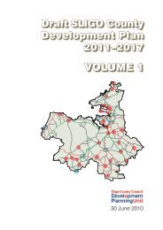
<strong>Sligo</strong> <strong>County</strong> <strong>Council</strong><br />
<strong>The</strong> <strong>Draft</strong> <strong>County</strong> Development Plan 2011-2017<br />
comprises two separate parts:<br />
the main document (two volumes) and<br />
the <strong>Draft</strong> <strong>Record</strong> <strong>of</strong> <strong>Protected</strong> <strong>Structures</strong><br />
(this publication)<br />
All CDP publications<br />
may be inspected or purchased<br />
at the Planning Office<br />
<strong>of</strong> <strong>Sligo</strong> <strong>County</strong> <strong>Council</strong>,<br />
<strong>County</strong> Hall, Riverside, <strong>Sligo</strong><br />
<strong>The</strong>y are available for free download<br />
from the <strong>Council</strong>’s website at<br />
www.sligococo.ie<br />
Design and layout by the<br />
Development Planning Unit<br />
<strong>of</strong> <strong>Sligo</strong> <strong>County</strong> <strong>Council</strong><br />
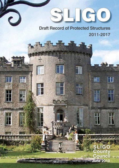
Cover photo: Markree Castle – south-eastern façade
Contents<br />
What is a <strong>Record</strong> <strong>of</strong> <strong>Protected</strong> <strong>Structures</strong>? 1<br />
Background to the RPS 2<br />
How the RPS is organised 2<br />
<strong>Protected</strong> <strong>Structures</strong> – quickfinder 4<br />
<strong>Protected</strong> <strong>Structures</strong> 13<br />
Proposed additions – quickfinder 67<br />
Proposed <strong>Protected</strong> <strong>Structures</strong> 71<br />
Appendix: RPS - advice notes 107
Introduction<br />
What is a <strong>Record</strong> <strong>of</strong> <strong>Protected</strong> <strong>Structures</strong>?<br />
A <strong>Record</strong> <strong>of</strong> <strong>Protected</strong> <strong>Structures</strong> (RPS) is a mechanism for the statutory protection <strong>of</strong> the<br />
architectural heritage <strong>of</strong> an area. Under the Planning and Development Act 2000 as amended, each<br />
planning authority is required to compile and maintain an RPS for its functional area. <strong>The</strong> RPS<br />
forms part <strong>of</strong> the development plan and must include every structure, that is, in the opinion <strong>of</strong><br />
the planning authority, <strong>of</strong> special architectural, historical, archaeological, artistic, cultural, scientific,<br />
social or technical interest. By including structures on the RPS, their importance is recognised<br />
and highlighted, they are legally protected from adverse impacts to their character and structural<br />
integrity and there is potential access for property owners to grant aid for conservation works.<br />
A planning authority may add a record to, or delete a structure from its RPS when reviewing its<br />
development plan or at any other time. <strong>The</strong> Minister for the Environment, Heritage and Local<br />
Government may also make recommendations to a planning authority concerning the inclusion <strong>of</strong><br />
a structure on its RPS.<br />
A ‘proposed protected structure’ is a structure whose owner and occupier has received notification<br />
<strong>of</strong> the intention <strong>of</strong> the planning authority to include it on the RPS. Statutory protection applies<br />
equally to protected structures and proposed protected structures. Once a planning authority<br />
notifies an owner/occupier <strong>of</strong> the proposal to add a particular structure to the RPS, protection<br />
applies during the consultation period, pending a final decision as to whether protection shall be<br />
made permanent. <strong>The</strong> making <strong>of</strong> an addition to, or deletion from, the RPS is a function reserved<br />
for the elected representatives.<br />
In relation to a protected or proposed protected structure, the term ‘structure’ includes the interior<br />
<strong>of</strong> the structure, the land lying within the curtilage <strong>of</strong> the structure, any other structures lying<br />
within that curtilage (and their interiors) and all fixtures and features that form part <strong>of</strong> the interior<br />
or exterior <strong>of</strong> the structure. <strong>The</strong> protection also extends to any specified feature within the attendant<br />
grounds <strong>of</strong> the structure (for definitions refer to Section 2(1) <strong>of</strong> the Planning and Development<br />
Act 2000 as amended).<br />
<strong>The</strong> owner or occupier <strong>of</strong> a protected structure is entitled to ask the <strong>Council</strong> for a written<br />
declaration indicating the type <strong>of</strong> works that would or would not materially affect the character<br />
<strong>of</strong> that structure, or any element <strong>of</strong> it that contributes to its special interest. Declarations provide<br />
guidance as to what works would or would not require planning permission in the context <strong>of</strong> the<br />
protection <strong>of</strong> the architectural heritage.<br />
Alternatively, if an owner <strong>of</strong> a protected structure (or proposed protected structure) wishes to<br />
determine whether particular works to the structure would constitute exempted development under<br />
the provisions <strong>of</strong> the Planning and Development Acts or whether they would require planning<br />
permission, the person may apply for a Certificate <strong>of</strong> Exempted Development in accordance with<br />
Section 5 <strong>of</strong> the Planning and Development Act 2000 (as amended).<br />
Detailed information regarding protected structures can be found on the website <strong>of</strong> the DoEHLG<br />
at : www.environ.ie/en/Publications/Heritage/ArchitecturalHeritage<br />
1
Background to the RPS<br />
<strong>Draft</strong> RPS 2011-2017<br />
<strong>The</strong> <strong>Sligo</strong> <strong>County</strong> Development Plan 1999–2004 contained a list <strong>of</strong> ‘Buildings and structures to be<br />
preserved’. This list, consisting <strong>of</strong> 51 items, became the RPS for <strong>County</strong> <strong>Sligo</strong> on 1st January 2000<br />
under the Local Government (Planning & Development) Act, 1999. <strong>The</strong> RPS was reviewed in tandem<br />
with the review <strong>of</strong> the <strong>County</strong> Development Plan.<br />
<strong>The</strong> existing RPS for the <strong>County</strong> <strong>of</strong> <strong>Sligo</strong> was formulated and came into force on the 16th May<br />
2005. This new list <strong>of</strong> protected structures had regard to the previous RPS (2000), a report from<br />
the Heritage Consultancy Services Ltd commissioned by <strong>Sligo</strong> <strong>County</strong> <strong>Council</strong> and the built heritage<br />
provisions contained in existing Local Area Plans. This document also had regard to the <strong>Draft</strong><br />
Guidelines for Planning Authorities on Architectural Heritage Protection (DoEHLG, 2001).<br />
Following the public display and consultation process, some items were deleted from the RPS and<br />
many new buildings/structures were added to it. <strong>The</strong> result was a much extended RPS for <strong>County</strong><br />
<strong>Sligo</strong>.<br />
In 2007, the National Inventory <strong>of</strong> Architectural Heritage (NIAH) published its survey <strong>of</strong> architectural<br />
heritage in <strong>County</strong> <strong>Sligo</strong> in 2007. Where an NIAH survey has been carried out, those structures<br />
which have been attributed a rating value <strong>of</strong> international, national or regional importance in<br />
the inventory are recommended by the Minister <strong>of</strong> the EHLG to the relevant planning authority<br />
for inclusion on the RPS. In accordance with Section 53 <strong>of</strong> the Planning and Development Act<br />
2000, if a planning authority, after considering a recommendation made to it under this section, decides<br />
not to comply with the recommendation, it shall inform the Minister in writing <strong>of</strong> the reason<br />
for its decision.<br />
<strong>The</strong> NIAH identified 464 structures <strong>of</strong> regional importance, 6 structures <strong>of</strong> national importance,<br />
and 35 structures <strong>of</strong> local importance. Of these, 249 structures were already included on the RPS<br />
2005-2011 (including 36 structures not given a specific identity number but protected by their association<br />
with a main structure). <strong>The</strong> remaining 256 structures were reviewed by the Planning and<br />
Heritage Sections <strong>of</strong> <strong>Sligo</strong> <strong>County</strong> <strong>Council</strong> and 172 structures were deemed to merit protected<br />
structure status and are included in this document as Proposed <strong>Protected</strong> <strong>Structures</strong>. <strong>The</strong> remaining<br />
structures include 12 structures protected by the <strong>Record</strong> <strong>of</strong> Monuments and Places, 31 structures<br />
rated <strong>of</strong> local importance and 39 structures rated <strong>of</strong> regional importance, which were not deemed worthy<br />
<strong>of</strong> protection. Two structures are already protected on the RPS for the <strong>Sligo</strong> and Environs Development<br />
Plan 2010-16. A further 10 structures which were not given a rating by the NIAH are proposed<br />
to be added to this <strong>Draft</strong> RPS.<br />
It is proposed to delete six structures from the existing RPS and these are highlighted in this document<br />
using red text. <strong>The</strong> descriptions <strong>of</strong> some <strong>of</strong> the existing protected structures have been<br />
amended to specify additional structures or features associated with the main building, for the purposes<br />
<strong>of</strong> clarity. This additional text is highlighted in green.<br />
Official notifications<br />
This <strong>Draft</strong> RPS forms part <strong>of</strong> the <strong>Draft</strong> <strong>County</strong> Development Plan 2011–2017. As part <strong>of</strong> the development<br />
plan making process, all owners <strong>of</strong> the proposed protected structures will be notified <strong>of</strong><br />
the intention <strong>of</strong> <strong>Sligo</strong> <strong>County</strong> <strong>Council</strong> to include the relevant structure on the RPS for the <strong>County</strong>.<br />
How the draft RPS is organized<br />
In rural areas, the townland is the most important component <strong>of</strong> an address. <strong>The</strong>refore, the<br />
structures included on the RPS are listed in alphabetical order by townland. <strong>The</strong>re is one exception<br />
to this rule: where structures located in different townlands are pertaining to, or associated with a<br />
significant building, they are listed immediately after the respective building. Example: entries 183<br />
to 193, representing structures pertaining to Markree Demesne, are listed immediately after entry<br />
‘Markree Castle’ (no. 183). <strong>The</strong> Address column includes firstly the townland (<strong>of</strong>ten more than one<br />
in the case <strong>of</strong> bridges) and secondly the nearest town or village as identified on Ordnance Survey<br />
maps. When the names <strong>of</strong> the townland and town/village coincide, one is omitted. <strong>The</strong> Grid<br />
References include eastings and northings given to the nearest metre (they were determined using<br />
GPS<br />
2
<strong>The</strong> sample reference G 992 267 would read:<br />
E-199200<br />
N-326700<br />
Introduction<br />
– Global Positioning System – devices). Ordnance Survey Ireland’s Discovery map series includes<br />
guidance for giving/reading grid references to the nearest 100 metres, as shown in the figure below.<br />
if the sample point represented a structure included on the RPS.<br />
This document is divided into existing protected structures and proposed protected structures<br />
which are proposed for addition to the RPS for <strong>County</strong> <strong>Sligo</strong>. Each section is preceded by a<br />
‘Quickfinder’ which lists the structures according to the type <strong>of</strong> structure/building.<br />
Abbreviations and acronyms<br />
CoI Church <strong>of</strong> Ireland<br />
DoEHLG Department <strong>of</strong> the Environment, Heritage and Local Government<br />
GPS Global Positioning System (a system <strong>of</strong> satellites and receiving devices used<br />
to compute positions on the Earth, owned by the US Department <strong>of</strong> Defense;<br />
GPS is used in navigation, and its precision supports cadastral surveying)<br />
NIAH National Inventory <strong>of</strong> Architectural Heritage<br />
RC Roman Catholic<br />
RPS <strong>Record</strong> <strong>of</strong> <strong>Protected</strong> <strong>Structures</strong><br />
3
<strong>Record</strong> <strong>of</strong> protected structures – quickfinder<br />
For ease <strong>of</strong> use, the quickfinder lists all protected structures included in this draft RPS, categorised<br />
by type and arranged alphabetically, by name <strong>of</strong> structure, under each category. <strong>The</strong> number<br />
preceding each entry is the <strong>of</strong>ficial RPS record number <strong>of</strong> the respective structure.<br />
Bath houses<br />
65 Bath House, Enniscrone<br />
66 Kilcullen’s Hot Seawater and Seaweed Baths,<br />
Enniscrone<br />
Boathouse<br />
240 Temple House Demesne – Boathouse,<br />
Ballymote<br />
Bridges - pedestrian<br />
219 Rinroe Bridge,<br />
Rinroe Td/Cloontyproklis Td, Grange<br />
Bridges - railway<br />
13 Railway Bridge, (over water),<br />
Ardcotten/Bleachgreen, Collooney<br />
50 Railway Bridge (over road),<br />
Collooney, Bleachgreen, Collooney<br />
Bridges – road<br />
157 Aclare Bridge, Kilmacteige/Lislea (Leyny<br />
Barony), Carns (Leyny Barony), Aclare<br />
5 Annagh Bridge,<br />
Annagh (Leyny Barony), Banada<br />
10 Annaghmore Demesne – Bridge,<br />
Annaghmore (Tirerrill Barony/Leyny<br />
Barony), Collooney<br />
17 Ardkill Bridge, Ardkill, Templeboy<br />
243 Ardnaglass (Dunmoran) Bridge,<br />
Toberawnaun/Soodry, Skreen<br />
44 Ardnaglass Bridge,<br />
Barnaderg/Grogagh, Grange<br />
28 Ballinphull Bridge,<br />
Ballinphull (ED Cliffony North), Cliffony<br />
143 Ballintrillick Bridge, Keeloges, Ballintrillick<br />
31 Ballygrania Bridge,<br />
Ballygrania/Rathrippin, Collooney<br />
166 Ballysadare Bridge, Knockmuldoney/<br />
Ballysadare/Knoxspark, Ballysadare<br />
40 Banada Bridge, Banada<br />
45 Behy Bridge, Behy, Drumfin<br />
70 Bellarush Bridge, Cartronroe/Bellarush/<br />
Annagh (Tirerrill Barony), Castlebaldwin<br />
<strong>Draft</strong> RPS 2011-2017<br />
4<br />
181 Big Bridge,<br />
(Lissananny Beg/Bearvaish), Rathmullen<br />
47 Billa Bridge,<br />
Billa/Glen (Leyny Barony), Collooney<br />
14 Bridge spanning the Douglas River,<br />
Ardcumber/Ardkeeran (Tirerrill Barony),<br />
Riverstown<br />
97 Bridge spanning the Unshin River,<br />
Cooperhill/Ardkeeran (Tirerrill Barony),<br />
Riverstown<br />
57 Camcuill/Toorboy Bridge,<br />
Camcuill/Carrigeens (Tireragh Barony),<br />
Dromore West<br />
85 Castletown Bridge,<br />
bridge leading to Deer Park/Taheny’s Bridge,<br />
Cloonmacduff, Collooney<br />
121 Closkeybeg Bridge,<br />
Drumfin/Murillyroe, Drumfin<br />
94 Coolaney Bridge, Coolaney/Rathosey, Coolaney<br />
18 Coolbock Bridge,<br />
Ardneeskan/Cooperhill/Coolbock, Drumfin<br />
100 Coopershill Bridge, Cooperhill, Drumfin<br />
113 Donaghintraine Bridge,<br />
Donaghintraine, Dromore West<br />
111 Easkey Bridge,<br />
Curraghnagap/Bunowna, Easkey<br />
115 Fawcetts Bridge,<br />
Doonally/Calry (Drumcliff East ED), <strong>Sligo</strong><br />
124 Finned Bridge, Finned (Tireragh Barony)/<br />
Castletown, Easkey<br />
127 Foyoges Bridge, Foyoges, Geevagh<br />
230 Geevagh Bridge,<br />
Straduff/Ballyculleen, Geevagh<br />
75 Gleniff Bridge, Clogh, Ballintrillick/Gleniff<br />
206 Grange Bridge,<br />
Newtown (Carbury Barony), Grange<br />
64 Ladies Brae Bridge, Carrowculleen, Skreen<br />
173 Lisconny Bridge, Lisconny, Collooney<br />
191 Markree Bridge,<br />
west <strong>of</strong> stable block, (pertaining to Markree<br />
Demesne) Clooneenroe, Collooney<br />
224 Metal Bridge, Sessuegarry, Tobercurry<br />
55 Owenykeevan Bridge,<br />
Caltragh (ED Rathmacurkey), Culleens
215 Rathhugh Bridge,<br />
Rathhugh/Drumfad, Grange<br />
242 Temple House Bridge,<br />
Rathbaun/Kilbrattan/Temple House<br />
Demesne, Ballymote<br />
Business/dwellings<br />
27 Former Gillespie’s Shop,<br />
Ballinphull (ED Cliffony North), Cliffony<br />
91 Inishfree Crystal Factory Shop -<br />
only façade, gables and ro<strong>of</strong> pr<strong>of</strong>ile <strong>of</strong> the<br />
building, Collooney<br />
33 L. Hayden’s pub and town house,<br />
Lord Edward Street, Ballymote<br />
42 Mullarkey’s pub and house, Banada<br />
218 Quigley’s shopfront and house,<br />
Rinn (Leyny Barony), Collooney<br />
Castles<br />
199 Classie Bawn Castle,<br />
Mullaghmore (Carbury Barony) Cliffony<br />
183 Markree Castle and associated features,<br />
Markree Demesne, Collooney<br />
Churches (Church <strong>of</strong> Ireland)<br />
105 Aghanagh Church,<br />
Cuilsheeghary More, Aghanagh<br />
163 Ballysadare Church,<br />
Knockmuldoney, Ballysadare<br />
234 Christchurch,<br />
Tanrego East/Carrowmore, Beltra<br />
32 Emlaghfad Parish Church,<br />
Lord Edward Street, Ballymote<br />
131 Gorteen Church,<br />
Gorteen (Coolavin Barony), Gorteen<br />
152 Killanly Church, Killanly, Enniscrone<br />
58 Kilmactranny Church,<br />
Carrickard, Kilmactranny<br />
212 Kilornan Church, Rathbarran, Coolaney<br />
25 Lissadell Church, Ballinphull (ED Lissadell<br />
East), Carney<br />
220 Rosses Point Church,<br />
Rosses Upper, Rosses Point<br />
170 St. Anne’s Church, Larass, Strandhill<br />
119 St. Columba’s Church,<br />
Drumcliff South, Drumcliff<br />
1 St. Crumnathy’s Cathedral, Achonry<br />
244 St. George’s Church, Tobercurry<br />
203 St. Kevin’s Church, Mullaghnaneane, Grange<br />
84 St. Mary’s Church,<br />
Quickfinder<br />
5<br />
Cloonasc<strong>of</strong>fagh, Dromore West<br />
90 St. Paul’s Church, Collooney<br />
96 Tawnagh Church,<br />
Cooperhill, Riverstown<br />
Churches (Methodist)<br />
89 Collooney Methodist Church, Collooney<br />
209 Former Methodist Church,<br />
Rahaberna, Rathcormack<br />
Churches (Presbyterian)<br />
138 Graniamore Presbyterian Church,<br />
Graniamore, Ballymote<br />
226<br />
Church (Roman Catholic)<br />
Castlebaldwin Chapel,<br />
Sheerevagh, Castlebaldwin<br />
228 Church <strong>of</strong> the Blessed Virgin and Her<br />
Immaculate Conception, Stoneparks, Ballymote<br />
26 Cliffony Church,<br />
Ballinphull (ED Cliffony North), Cliffony<br />
123 Kesh Church, Fallougher, Kesh<br />
156 Kilmacteige Church, Kilmacteige, Aclare<br />
225 Rockfield Church,<br />
Shancough (Leyny Barony), Coolaney<br />
194 St. Aiden’s Church, Monasteraden<br />
216 St. Attracta’s Church, Rathtermon, Killaraght<br />
248 St. Attracta’s Church, Tourlestraun, Aclare<br />
132 St. Brigid’s Church, Gortnahoula, Ballintrillick<br />
118 St. Columba’s Church,<br />
Drumcliff South, Rathcormack<br />
246 St. John the Evangelist Church, Tobercurry<br />
37 St. Joseph’s Church, Ballynashee, Geevagh<br />
145 St. Joseph’s Church, Kilcreevin (Phibbs),<br />
Ballymote<br />
133 St. Molaise’s Church, Grange<br />
76 St. Patrick’s Church, Cloghboley, Maugherow<br />
88 St. Patrick’s Church, Colgagh, Calry<br />
198 St. Patrick’s Church, Moylough, Tobercurry<br />
16 Tawnagh Church,<br />
Ardkeeran (Tirerrill Barony), Riverstown<br />
Coastguard station<br />
21 Coastguard Station: front façade, tower wall<br />
and boathouse’s gable end walls – original<br />
stone masonry only, Derkmore, Skreen<br />
Convents
41 Banada Abbey Convent (Sisters <strong>of</strong> Charity)<br />
and Church façade(s) only, Banada<br />
245 Marist Convent, original convent building<br />
(built 1906) – front façade only, Tobercurry<br />
147 Star <strong>of</strong> the Sea Convent and Church,<br />
Kilkilloge, Mullaghmore<br />
Cottages (slated)<br />
99 Cottage opposite Coopershill grounds,<br />
front façade only, Cooperhill, Drumfin<br />
102 Cottage, Corkagh Beg, Templeboy<br />
193 Group <strong>of</strong> seven former estate cottages,<br />
south <strong>of</strong> Markree Demesne, (pertaining to<br />
Markree Demesne) Knockrawer (Tirerrill<br />
Barony), Collooney<br />
151 House at Sand Hill, south <strong>of</strong> Mullaghmore,<br />
Kilkilloge, Mullaghmore<br />
104 Palmerstown Cottage, Creevymore, Cliffony<br />
169<br />
Cottages (thatched)<br />
Dolly’s Cottage, Larass, Strandhill<br />
53 Thatched cottage,<br />
Cabragh (Tireragh Barony), Easkey<br />
52 Thatched cottage (Streamlet Villa),<br />
Cabragh (Tireragh Barony), Finned, Easkey<br />
68 Thatched cottage and barn,<br />
Carrownacreevy (Dromard East ED), Beltra<br />
54 Thatched cottage, Cabraghkeel, Rathlee<br />
72 Thatched cottage,<br />
Castlegarran, Cashelgarran village<br />
79 Thatched cottage, Cloghermore, Calry<br />
101 Thatched cottage, Corhawnagh, Ballysadare<br />
116 Thatched cottage, Doongelagh, Geevagh<br />
128 Thatched cottage, Gortarowey, Milltown<br />
129 Thatched cottage,<br />
Gorteen (Carbury Barony), Ballintrillick<br />
140 Thatched cottage, Grellagh, Castlegal<br />
141 Thatched cottage,<br />
Halfquarter (Leyny Barony), Ballysadare<br />
158 Thatched cottage, Kiltycahill, Calry<br />
160 Thatched cottage, Kintogher, Rathcormack<br />
175 Thatched cottage,<br />
Lisduff (Leyny Barony), Ballysadare<br />
207 Thatched cottage,<br />
(except rear flat-ro<strong>of</strong>ed extension) and its<br />
two-storey granary, Parke, Enniscrone<br />
221 Thatched cottage, Rosses Upper, Rosses Point<br />
227 Thatched cottage, Soodry, Skreen<br />
231 Thatched cottage, Streamstown<br />
<strong>Draft</strong> RPS 2011-2017<br />
6<br />
(ED Ballysadare West), Ballysadare<br />
Country houses<br />
6 Annaghmore Demesne – House,<br />
Annaghmore (Leyny Barony), Collooney<br />
19 Ardtermon House and gate lodge,<br />
Ardtermon, Maugherow<br />
162 Avena House, Knockmuldoney, Ballysadare<br />
159 Ballindoon House, Kingsborough, Riverstown<br />
30 Ballyglass House,<br />
Ballyglass (Carbury Barony), Calry<br />
48 Camp Hill House, Bleachgreen, Collooney<br />
73 Castledargan House, Castledargan, Ballygawley<br />
103 Castletown House and farm complex,<br />
Cottlestown, Corbally<br />
69 Castleview House,<br />
Tobbercurry Rd, Carrownanty, Ballymote<br />
74 Chaffpool House façade only and ro<strong>of</strong> pr<strong>of</strong>ile,<br />
Chaffpool, Ballymote<br />
80 Clogherevagh House and 2 Gate Lodges,<br />
Clogherevagh<br />
87 Colgagh House, Colgagh, Calry<br />
78 Coolavin House and gate lodge, Clogher,<br />
Monasteraden<br />
98 Coopershill House, walled garden and associated<br />
farm complexes, Cooperhill, Drumfin<br />
114 Doonally House and outbuildings,<br />
Doonally (Drumcliff East ED), <strong>Sligo</strong><br />
67 Doonecoy House,<br />
Carrowmacrory, Templeboy<br />
62 Earlsfield House (Sisters <strong>of</strong> Mercy Convent),<br />
Carrownanty/Earlsfield, Ballymote<br />
253 Glen Lodge, estate house and stable buildings,<br />
Woodpark, Strandhill<br />
36 Heathfield House and Gate Lodge,<br />
Ballynaboll, Ballymote<br />
142 Hollybrooke House and associated farm<br />
buildings, Hollybrooke Demesne, Castlebaldwin<br />
122 Hollyfield House,<br />
Edencullentragh or Hollyfield, Ballintrillick<br />
172 Holy Hill Hermitage, formerly Carrowcullen<br />
House, Lecarrow (ED Skreen), Skreen<br />
176 Lissadell House and associated features and<br />
structures, Lissadell, Carney<br />
205 Newpark House, Newpark, Drumfin<br />
210 Rahelly House, Rahelly, Cashelgarran<br />
165 Rapid’s Lodge, Knockmuldoney, Ballysadare<br />
213 Rathcarrick House, Rathcarrick, Strandhill
204 Redhill House, Mullaghroe, Gorteen<br />
22 Rossaville House, Ballincar, Rosses Point<br />
154 Seaview House,<br />
Killeenduff (Tireragh Barony), Easkey<br />
232 Streedagh House, Streedagh, Grange<br />
235 Tanrego House,<br />
Tanrego East/Carrowmore, Beltra<br />
236 Temple House,<br />
Temple House Demesne, Ballymote<br />
155 Templeview House,<br />
Killeenduff (Tireragh Barony), Easkey<br />
247 Toberpatrick House, Toberpatrick, Aughris<br />
161 Woodhill House, Knockaculleen, Dromore West<br />
Courthouses<br />
34 Ballymote Courthouse/Library and attached<br />
west wing, Teeling Street, Ballymote<br />
3 Easkey Courthouse, Aderavoher, Easkey<br />
86 Grange Courthouse, Cloontyprocklis, Grange<br />
Creamery<br />
108 Milltown Creamery (Drumcliffe Co-Op)<br />
– original creamery only, without modern<br />
extension and outbuildings to the west,<br />
Cullagh Beg, Milltown, Drumcliff<br />
Dwellings<br />
130 Church View,<br />
Gorteen (Coolavin Barony), Gorteen<br />
252 Deerpark Lodge, Union, Collooney<br />
222 Elsinore House, Rosses Upper, Rosses Point<br />
4 Former Home <strong>of</strong> Seamus Devins TD,<br />
façade only, Aghagad, Grange<br />
77 Former RIC Barracks, Clogher, Monasteraden<br />
29 House at southern end <strong>of</strong> Cliffony village,<br />
façade only, Ballinphull (ED Cliffony North),<br />
Cliffony<br />
174 Lisconny House Servants Quarter,<br />
Lisconny, Collooney<br />
182 Longford House – Pavillion,<br />
Longford Demesne, Beltra<br />
188 Markree, Gardener’s House and associated<br />
outbuildings, Markree Demesne, Collooney<br />
148 McGloin’s, Kilkilloge, Mullaghmore<br />
202 Toberscanavan House, Mullaghnabreena,<br />
Collooney<br />
Farm houses<br />
46 Ardagh House and farm complex,<br />
Quickfinder<br />
7<br />
223<br />
Bellanascarva, Riverstown<br />
Ashdale House, Scurmore, Enniscrone<br />
51 Breeoge House,<br />
Breeoge, Redgate Crossroads or Ransboro<br />
56 Cuffe House (formerly Camphill House),<br />
Camcuill, Dromore West<br />
117 Dromore House, Dromore, Dromore West<br />
125 Finned House, Finned (Tireragh Barony), Easkey<br />
120 Former Carrigeenview House, Drumfin<br />
249 House east <strong>of</strong> Tullymore House,<br />
Tully Beg, Ballygawley<br />
106 Kingsville House, Cuiltylough, Riverstown<br />
15 Millview House,<br />
Ardkeeran (Tirerrill Barony), Riverstown<br />
196 Mount Temple House, Mount Temple, Grange<br />
208 Quarryfield House, Quarryfield, Bunnanadden<br />
11 Stand House, Ardnaglass, Ardabrone, Skreen<br />
250 Tullymore House, Tullymore, Ballygawley<br />
201 White House,<br />
Mullaghmore (Carbury Barony) Cliffony<br />
Forge<br />
112 Former forge, Derry, Grange<br />
Gate lodges<br />
9 Annaghmore Demesne – Gate Lodge,<br />
Ardcree. Annaghmore (Tirerrill Barony),<br />
Collooney<br />
8 Annaghmore Demesne – Main Gate Lodge,<br />
Annaghmore (Tirerrill Barony/Leyny<br />
Barony), Collooney<br />
24 Ballindoon House Gate Lodge,<br />
Ballindoon, Riverstown<br />
251 Beehive Lodge, Deer Park, Union, Collooney<br />
200 Classie Bawn Gate Lodge,<br />
Mullaghmore (Carbury Barony) Cliffony<br />
83 Cloonamahan Gate Lodge,<br />
Cloonamahan, Drumfin<br />
214 Former Southern Gate Lodge,<br />
Rathcarrick House, Rathcarrick, Strandhill<br />
177 Lissadell Gate Lodge 1, (pertaining to<br />
Lissadell Demesne) Ballygilgan, Carney<br />
178 Lissadell Gate Lodge 2, (pertaining to<br />
Lissadell Demesne) Lissadill, Carney<br />
238 Main Gate Lodge to Temple House,<br />
Temple House Demesne, Ballymote<br />
185 Markree Former Gate Lodge, North Lodge 1,<br />
east <strong>of</strong> Ballygrania Bridge, (pertaining to<br />
Markree Demesne) Ballygrania, Collooney
186 Markree Gate Lodge, North Lodge 2,<br />
west <strong>of</strong> Ballygrania Bridge, (pertaining to<br />
Markree Demesne) Rathrippin, Collooney<br />
184 Markree Main Gate (current),<br />
Markree Demesne, Collooney<br />
187 Markree West Gate Lodge,<br />
Markree Demesne, Collooney<br />
71 Rahelly House Gate Lodge, Cashelgarran<br />
233 Streedagh House Gate Lodge,<br />
Streedagh, Grange<br />
Glebe houses<br />
195 Former Ahamlish Glebe, Moneygold,<br />
Grange<br />
12 Glebe House, except modern flat-ro<strong>of</strong><br />
extension at the rear, Ardcotten, Collooney<br />
168 Glebe House, Knoxspark, Ballysadare<br />
211 Kilornan Glebe House, now called<br />
Rathbarren House, Rathbarran, Coolaney<br />
Golf club house<br />
39 <strong>County</strong> <strong>Sligo</strong> Golf Club – south façade,<br />
Rosses Upper, Rosses Point<br />
Harbour<br />
146 Mullaghmore Harbour, Kilkilloge, Mullaghmore<br />
Ice houses<br />
164 Former Ice House (Salmon Hatchery),<br />
Knockmuldoney, Ballysadare<br />
190 Markree Castle’s Ice House,<br />
Markree Demesne, Collooney<br />
Lodges<br />
23 Denver Lodge, Ballincastle, Cliffony<br />
241 Lodge to Temple House,<br />
(pertaining to Temple House Demesne)<br />
Carrowntawy, Ballymote<br />
217 Rathtermon House, Rathtermon, Killaraght<br />
239 Temple House Hunting Lodge,<br />
Temple House Demesne, Ballymote<br />
Manse house<br />
139 Manse, Graniamore, Ballymote<br />
Mills<br />
49 Collooney Mills Complex on west bank <strong>of</strong><br />
Owenmore, including associated buildings<br />
<strong>Draft</strong> RPS 2011-2017<br />
8<br />
and mill race, Bleachgreen, Collooney<br />
144 Former Corn Mill, Keenaghan, Ballymote<br />
126 Water wheel next to Foyoges Bridge,<br />
Foyoges, Geevagh<br />
Monuments<br />
136 “Sapper’s Stone”, Grange<br />
59 Teeling Monument, Collooney – monument<br />
and plinth only, Carricknagat (Leyny Barony),<br />
Collooney<br />
60 <strong>The</strong> Cannon, Carrowbunnaun, Strandhill<br />
Observatory<br />
192 Markree Demesne, former observatory,<br />
(pertaining to Markree Demesne),<br />
Clooneenroe, Collooney<br />
Parochial halls<br />
2 Achonry Parochial Hall, Achonry<br />
95 Cooper Memorial Hall, Cooperhill, Riverstown<br />
134<br />
Parochial houses<br />
Parochial House, Grange<br />
229 Parochial House, Straduff, Geevagh<br />
Pier<br />
20 Pollachurry Pier, Aughris, Templeboy<br />
Public building<br />
82 Cloonamahon Residential Centre – Health<br />
Service Executive for the North-Western<br />
Area, Cloonamahan, Collooney<br />
Public houses<br />
135 Lang’s Pub – façade and old bar interior only,<br />
Grange<br />
167 <strong>The</strong> Thatch, thatched building only,<br />
Knoxspark, Ballysadare<br />
Railway stations<br />
35 Ballymote Railway Station and associated<br />
buildings and features, Tubbercurry Rd, Ballymote/Carrownanty,<br />
Ballymote<br />
38 Former Ballysadare railway station and goods<br />
shed, Ballysadare<br />
93 Leyny Station and associated buildings, Coolaney
Rectories<br />
179 Former Rectory/Parsonage (pertaining to<br />
Lisadell Demesne), Lissadill, Carney<br />
171 Former Rectory to St Anne’s Church,<br />
Larass, Strandhill<br />
43 Former Rectory and gate lodge, Toberfeckin,<br />
Barnabrack, Beltra<br />
153 Moysdale House, Killanly, Enniscrone<br />
110 Old Rectory, Easkey, Curraghnagap, Easkey<br />
Round structure/tower<br />
109 Round structure/tower,<br />
possibly former dairy, Cummeen, Strandhill<br />
Schools (converted to dwellings)<br />
61 Former Carrowgarry National School,<br />
Carrowcardin, Enniscrone<br />
197 Old National School, Moylough, Tobercurry<br />
137 Primrose Grange House, Knocknarea/<br />
Strandhill, Grange North, Strandhill<br />
Schools (national)<br />
63 Carrowcrory Former National School,<br />
Carrowcrory, Ballinafad<br />
81 Former Castlebaldwin National School,<br />
Cloghoge Upper, Castlebaldwin<br />
Quickfinder<br />
9<br />
92 Former Clooneenmore National School,<br />
Cooga, Rathlee<br />
107 Former Milltown National School,<br />
Cullagh Beg, Milltown, Drumcliff<br />
180 Lissadell Former National School, (pertaining<br />
to Lisadell Demesne), Lissadill, Carney<br />
149 Mullaghmore National School,<br />
Kilkilloge, Mullaghmore<br />
Stables<br />
7 Annaghmore Demesne – Stables and<br />
Coach House, Annaghmore (Leyny Barony),<br />
Collooney<br />
189 Markree – former stable yard buildings,<br />
Markree Demesne, Collooney<br />
237 Temple House Demesne – Stable Courtyard,<br />
walled garden and farmyard, Temple House<br />
Demesne, Ballymote<br />
Watch tower<br />
150 Classiebawn Watch Tower,<br />
Kilkilloge, Mullaghmore
<strong>Protected</strong><br />
<strong>Structures</strong>
No Name and dating Address Grid Refs Photographic record<br />
1 St. Crumnathy’s<br />
Cathedral (CoI)<br />
1820-1830<br />
2 Achonry<br />
Parochial Hall<br />
1790-1820<br />
3 Easky<br />
Courthouse<br />
1870<br />
4 Former Home <strong>of</strong><br />
Seamus Devins<br />
TD<br />
(façade only)<br />
5 Annagh Bridge<br />
1840-1860<br />
Achonry,<br />
Achonry<br />
Achonry,<br />
Achonry<br />
Aderavoher,<br />
Easky<br />
Aghagad,<br />
Grange<br />
Annagh<br />
(Leyny<br />
Barony),<br />
Banada<br />
<strong>Protected</strong> structures<br />
13<br />
E-157189<br />
N-314516<br />
E-156119<br />
N-315594<br />
E-137743<br />
N-337796<br />
E-165763<br />
N-349200<br />
E-146672<br />
N-312343
No Name and dating Address Grid Refs Photographic record<br />
6 Annaghmore<br />
Demesne - House<br />
1820-1830<br />
7 Annaghmore<br />
Demesne -<br />
Stables and<br />
Coach house<br />
1864<br />
8 Annaghmore<br />
Demesne - Main<br />
Gate Lodge<br />
1820-1830<br />
9 Annaghmore<br />
Demesne -<br />
School house<br />
1820-1830<br />
10 Annaghmore<br />
Demesne - Bridge<br />
1810-1830<br />
Annaghmore<br />
(Leyny<br />
Barony),<br />
Collooney<br />
Annaghmore<br />
(Leyny<br />
Barony),<br />
Collooney<br />
Annaghmore<br />
(Tirerrill<br />
Barony/<br />
Leyny<br />
Barony),<br />
Collooney<br />
Annaghmore<br />
(Tirerrill<br />
Barony),<br />
Collooney<br />
Annaghmore<br />
(Tirerrill<br />
Barony/<br />
Leyny<br />
Barony),<br />
Collooney<br />
<strong>Draft</strong> RPS 2011-2017<br />
E-165246<br />
N-324124<br />
E-165269<br />
N-324203<br />
E-166089<br />
N-324153<br />
E-165844<br />
N-324203<br />
E-165527<br />
N-324175<br />
14
No Name and dating Address Grid Refs Photographic record<br />
11 Stand House,<br />
Ardnaglass<br />
1640-1660<br />
12 Glebe House<br />
(Except modern<br />
flat-ro<strong>of</strong>ed extension<br />
at the rear)<br />
1820-1860<br />
13 Railway Bridge<br />
(over water),<br />
1880-1910<br />
14 Bridge<br />
spanning the<br />
Douglas River<br />
1830-1870<br />
15 Millview House<br />
1850-1890<br />
Ardabrone,<br />
Skreen<br />
Ardcotten,<br />
Collooney<br />
Ardcotten/<br />
Bleachgreen/<br />
Col looney,<br />
Collooney<br />
Ardcumber/<br />
Ardkeeran<br />
(Tirerrill<br />
Barony),<br />
Riverstown<br />
Ardkeeran<br />
(Tirerrill<br />
Barony),<br />
Riverstown<br />
<strong>Protected</strong> structures<br />
15<br />
E-153898<br />
N-334575<br />
E-167528<br />
N-326220<br />
E-167690<br />
N-326150<br />
E-174309<br />
N-320493<br />
E-174044<br />
N-320130
No Name and dating Address Grid Refs Photographic record<br />
16 Tawnagh Church<br />
(RC)<br />
1920-1940<br />
17 Ardkill Bridge<br />
1840-1860<br />
18 Coolbock Bridge<br />
1830-1880<br />
19 Ardtermon House<br />
and gate lodge<br />
1820-1860<br />
20 Pollachurry Pier<br />
1850-1900<br />
<strong>Draft</strong> RPS 2011-2017<br />
Ardkeeran<br />
(Tirerrill<br />
Barony),<br />
Riverstown<br />
Ardkill,<br />
Templeboy<br />
Ardneeskan/<br />
Cooperhill/<br />
Coolbock,<br />
Drumfin<br />
Ardtermon,<br />
Maugherow<br />
Aughris,<br />
Templeboy<br />
E-174201<br />
N-320220<br />
E-146276<br />
N-333134<br />
E-171906<br />
N-321034<br />
E-159545<br />
N-343587<br />
E-150857<br />
N-336278<br />
16
No Name and dating Address Grid Refs Photographic record<br />
21 Coastguard<br />
Station<br />
(front façade,<br />
tower wall and boathouse’s<br />
gable end<br />
walls – original stone<br />
masonry only)<br />
1860-1880<br />
22 Rossaville House<br />
1880-1900<br />
23 Denver Lodge<br />
1860-1880<br />
24 Ballindoon House<br />
Gate Lodge<br />
1840-1850<br />
25 Lissadell Church<br />
(CoI)<br />
1820-1870<br />
Derkmore,<br />
Skreen<br />
Ballincar,<br />
Rosses<br />
Point<br />
Ballincastle,<br />
Cliffony<br />
Ballindoon,<br />
Riverstown<br />
Ballinphull<br />
(ED<br />
Lissadell<br />
East),<br />
Carney<br />
<strong>Protected</strong> structures<br />
17<br />
E-157590<br />
N-335250<br />
E-167641<br />
N-338707<br />
E-170246<br />
N-353302<br />
E-178881<br />
N-315107<br />
E-162110<br />
N-345630
No Name and dating Address Grid Refs Photographic record<br />
26 RC Church<br />
1870-1890<br />
27 Former<br />
Gillespie’s Shop<br />
1850-1890<br />
28 Ballinphull Bridge<br />
1850-1900<br />
29 House at<br />
southern end <strong>of</strong><br />
Cliffony village<br />
(façade only)<br />
1860-1890<br />
30 Ballyglass House<br />
1850-1900<br />
Ballinphull<br />
(ED Cliffony<br />
North),<br />
Cliffony<br />
Ballinphull<br />
(ED Cliffony<br />
North),<br />
Cliffony<br />
Ballinphull<br />
(ED Cliffony<br />
North),<br />
Cliffony<br />
Ballinphull<br />
(ED Cliffony<br />
North),<br />
Cliffony<br />
Ballyglass<br />
(Carbury<br />
Barony),<br />
Calry<br />
<strong>Draft</strong> RPS 2011-2017<br />
E-170574<br />
N-353601<br />
E-170612<br />
N-353302<br />
E-170369<br />
N-353956<br />
E-170540<br />
N-353626<br />
E-172251<br />
N-336923<br />
18
No Name and dating Address Grid Refs Photographic record<br />
31 Ballygrania<br />
Bridge<br />
1830-1870<br />
32 Emlaghfad<br />
Parish Church<br />
(CoI)<br />
1810-1830<br />
33 L. Hayden’s pub<br />
and town house<br />
1830-1870<br />
34 Ballymote<br />
Courthouse/<br />
Library<br />
and attached<br />
west wing<br />
1820-1860<br />
35 Ballymote<br />
Railway Station<br />
and associated<br />
buildings<br />
and features<br />
1850-1860<br />
Ballygrania/<br />
Rathrippin,<br />
Collooney<br />
Lord<br />
Edward<br />
Street,<br />
Ballymote<br />
E-169486<br />
N-325956<br />
E-166344<br />
N-315638<br />
Ballymote E-166305<br />
N-315735<br />
Ballymote E-166363<br />
N-315789<br />
Ballymote/<br />
Carrow–<br />
nanty,<br />
Ballymote<br />
<strong>Protected</strong> structures<br />
19<br />
E-165994<br />
N-315579
No Name and dating Address Grid Refs Photographic <strong>Record</strong><br />
36 Heathfield House<br />
and Gate Lodge<br />
1860-1880<br />
37 St Joseph’s<br />
Church (RC)<br />
1860-1890<br />
38 Former<br />
Ballysadare<br />
railway station<br />
and goods shed<br />
1850-1900<br />
39 <strong>County</strong> <strong>Sligo</strong><br />
Golf Club,<br />
(south façade)<br />
1890-1900<br />
40 Banada Bridge<br />
1820-1880<br />
<strong>Draft</strong> RPS 2011-2017<br />
Ballynaboll,<br />
Ballymote<br />
Ballynashee,<br />
Geevagh<br />
E-165797<br />
N-321965<br />
E-183756<br />
N-316820<br />
Ballysadare E-167246<br />
N-325<br />
Ballyweelin,<br />
Rosses<br />
Point<br />
E-163216<br />
N-339959<br />
Banada E-146573<br />
N-310012<br />
20
No Name and dating Address Grid Refs Photographic record<br />
41 Banada Abbey<br />
Convent (Sisters<br />
<strong>of</strong> Charity) and<br />
Church<br />
(façade(s) only)<br />
1800-1900<br />
42 Mullarkey’s pub<br />
and house<br />
1840-1880<br />
43 Former Rectory<br />
and gate lodge<br />
1810-1820<br />
44 Ardnaglass<br />
Bridge<br />
1840-1860<br />
45 Behy Bridge<br />
1800-1870<br />
Banada E-146536<br />
N-310298<br />
Banada E-146556<br />
N-309991<br />
Barnabrack,<br />
Beltra<br />
Barnaderg/<br />
Grogagh,<br />
Grange<br />
Behy,<br />
Drumfin<br />
<strong>Protected</strong> structures<br />
21<br />
E-159753<br />
N-329900<br />
E-167888<br />
N-347984<br />
E-171749<br />
N-319178
No Name and dating Address Grid Refs Photographic record<br />
46 Ardagh House<br />
1780-18200<br />
47 Billa Bridge<br />
1885-1890<br />
48 Camp Hill House<br />
1795-1800<br />
49 Collooney<br />
Mills Complex<br />
(including associated<br />
buildings<br />
and mill race),<br />
built c. 1800<br />
50 Railway Bridge<br />
(over road),<br />
1880-1910<br />
Bellana–<br />
scarva,<br />
Riverstown<br />
Billa/Glen<br />
(Leyny<br />
Barony),<br />
Collooney<br />
<strong>Draft</strong> RPS 2011-2017<br />
Bleachgreen,<br />
Collooney<br />
Bleachgreen,<br />
Collooney<br />
Bleachgreen,<br />
Collooney<br />
E-174930<br />
N-319310<br />
E-163925<br />
N-325700<br />
E-167814<br />
N-326442<br />
E-167814<br />
N-326442<br />
E-167743<br />
N-326720<br />
22
No Name and dating Address Grid Refs Photographic record<br />
51 Breeoge House<br />
Built c. 1850<br />
52 Thatched cottage<br />
(Streamlet Villa)<br />
1841-1915<br />
53 Thatched cottage<br />
1700-1840<br />
54 Thatched cottage<br />
1780-1820<br />
55 Owenykeevan<br />
Bridge<br />
1820-1860<br />
Breeoge,<br />
Redgate<br />
Crossroads<br />
or<br />
Ransboro<br />
Cabragh<br />
(Tireragh<br />
Barony),<br />
Easkey<br />
Cabragh<br />
(Tireragh<br />
Barony),<br />
Easkey<br />
Cabraghkeel,<br />
Rathlee<br />
Caltragh<br />
(ED Rathmacurkey),<br />
Culleens<br />
<strong>Protected</strong> structures<br />
23<br />
E-164586<br />
N-332010<br />
E-132920<br />
N-335450<br />
E-132926<br />
N-335436<br />
E-131615<br />
N-336591<br />
E-136981<br />
N-330857
No Name and dating Address Grid Refs Photographic record<br />
56 Cuffe House<br />
(formerly Camphill<br />
House),<br />
1860-1880<br />
57 Camcuill/<br />
Toorboy Bridge<br />
1840-1860<br />
58 Kilmactranny<br />
Church (CoI)<br />
1830-1860<br />
59 Teeling<br />
Monument,<br />
Collooney<br />
(monument and<br />
plinth only),<br />
1895-1900<br />
Camcuill,<br />
Dromore<br />
West<br />
Camcuill/<br />
Carrieens<br />
(Tireragh<br />
Barony),<br />
Dromore<br />
West.<br />
Carrickard,<br />
Kilmactranny<br />
Carricknagat<br />
(Leyny<br />
Barony),<br />
Collooney<br />
60 Cannon Carrowbunnaun,<br />
Strandhill<br />
<strong>Draft</strong> RPS 2011-2017<br />
24<br />
E-139795<br />
N-332498<br />
E-139988<br />
N-333321<br />
E-183349<br />
N-312414<br />
E-167866<br />
N-327090<br />
E-160350<br />
N-335930
No Name and dating Address Grid Refs Photographic record<br />
61 Former<br />
Carrowgarry<br />
National School<br />
1850-1900<br />
62 Earlsfield House<br />
(Sisters <strong>of</strong> Mercy<br />
Convent),<br />
1750-1760<br />
63 Carrowcrory<br />
Former National<br />
School<br />
1950-1960<br />
64 Ladies Brae<br />
Bridge<br />
1830-1870<br />
65 Bath House<br />
1860-1890<br />
Carrowcardin,<br />
Enniscrone<br />
Carrownanty/<br />
Earlsfield,<br />
Ballymote<br />
Carrowcrory,<br />
Ballinafad<br />
Carrowculleen,<br />
Skreen<br />
<strong>Protected</strong> structures<br />
Carrowhubbuck<br />
South,<br />
Enniscrone<br />
25<br />
E-128579<br />
N-326934<br />
E-166440<br />
N-316198<br />
E-173274<br />
N-308836<br />
E-151975<br />
N-330017<br />
E-128604<br />
N-330289
No Name and dating Address Grid Refs Photographic record<br />
66 Kilcullen’s Hot<br />
Seawater and<br />
Seaweed Baths<br />
1890-1930<br />
67 Doonecoy House<br />
1700-1750<br />
68 Thatched cottage<br />
and barn<br />
1701 - 1840<br />
69 Castleview House<br />
1820-1860<br />
70 Bellarush Bridge<br />
1500’s possibly<br />
Carrowhubbuck<br />
South,<br />
Enniscrone<br />
Carrowmacrory,<br />
Templeboy<br />
Carrownacreevy<br />
(Dromard<br />
East ED),<br />
Beltra<br />
Carrownanty,<br />
Ballymote<br />
<strong>Draft</strong> RPS 2011-2017<br />
Cartronroe/<br />
Bellarush/<br />
Annagh<br />
(Tirerrill<br />
Barony),<br />
Castlebaldwin<br />
E-128617<br />
N-330422<br />
E-146218<br />
N-333569<br />
E-159300<br />
N-331940<br />
E-165937<br />
N-315523<br />
E-176780<br />
N-315790<br />
26
No Name and dating Address Grid Refs Photographic record<br />
71 Rahelly House<br />
Gate Lodge<br />
1840-1880<br />
72 Thatched cottage<br />
1800-1850<br />
73 Castledargan<br />
House<br />
1860-1890<br />
74 Chaffpool House<br />
(façade only and<br />
ro<strong>of</strong> pr<strong>of</strong>ile),<br />
1880-1890<br />
75 Gleniff Bridge<br />
1700 - 1840<br />
Cashelgarran<br />
Cashelgarran<br />
Castledargan,<br />
Ballygawley<br />
Chaffpool,<br />
Ballymote<br />
<strong>Protected</strong> structures<br />
Clogh,<br />
Ballintrillick/<br />
Gleniff<br />
27<br />
E-164879<br />
N-345722<br />
E-166000<br />
N-345850<br />
E-171570<br />
N-327740<br />
E-156968<br />
N-311325<br />
E-174018<br />
N-350147
No Name and dating Address Grid Refs Photographic record<br />
76 St Patrick’s<br />
Church (RC)<br />
1840-1880<br />
77 Former RIC<br />
Barracks<br />
1900 - 1920<br />
78 Coolavin House<br />
and Gate Lodge<br />
1870-1890<br />
79 Thatched cottage<br />
1700-1840<br />
80 Clogherevagh<br />
House and 2 Gate<br />
Lodges<br />
1860-1890<br />
Cloghboley,<br />
Maugherow<br />
Clogher,<br />
Monasteraden<br />
Clogher,<br />
Monasteraden<br />
Clogher<br />
More,<br />
Calry<br />
Clogherevagh<br />
<strong>Draft</strong> RPS 2011-2017<br />
E-160560<br />
N-344510<br />
E-166637<br />
N-298793<br />
E-166608<br />
N-298270<br />
E-174583<br />
N-336531<br />
E-174926<br />
N-334554<br />
28
No Name and dating Address Grid Refs Photographic record<br />
81 Former<br />
Castlebaldwin<br />
National School<br />
1890-1910<br />
82 Cloonamahon<br />
Residential Centre<br />
(Health Service<br />
Executive for the<br />
North-Western<br />
Area)<br />
83 Cloonamahan<br />
Gate Lodge<br />
1850-1890<br />
84 St Mary’s Church<br />
(CoI)<br />
1820-1830<br />
85 Castletown<br />
Bridge/Union<br />
Bridge<br />
1830-1870<br />
Cloghoge<br />
Upper,<br />
Castlebaldwin<br />
Cloonamahan,<br />
Collooney<br />
Cloonamahan,<br />
Drumfin<br />
Cloonasc<strong>of</strong>fagh,<br />
Dromore<br />
West<br />
Cloonmacduff,<br />
Collooney<br />
<strong>Protected</strong> structures<br />
29<br />
E-175485<br />
N-314469<br />
E-168360<br />
N-322920<br />
E-168260<br />
N-323360<br />
E-143786<br />
N-333482<br />
E-168450<br />
N-326562
No Name and dating Address Grid Refs Photographic record<br />
86 Grange<br />
Courthouse<br />
1820-1880<br />
87 Colgagh House<br />
1770-1810<br />
88 St Patrick’s<br />
Church (RC)<br />
1850-1900<br />
89 Collooney<br />
Methodist Church<br />
1830-1870<br />
90 St Paul’s Church<br />
(CoI)<br />
1800-1850<br />
Cloontyprocklis,<br />
Grange<br />
Colgagh,<br />
Calry<br />
Colgagh,<br />
Calry<br />
<strong>Draft</strong> RPS 2011-2017<br />
E-165818<br />
N-349346<br />
E-173142<br />
N-337054<br />
E-174176<br />
N-337253<br />
Collooney E-167930<br />
N-326170<br />
Collooney E-167941<br />
N-326071<br />
30
No Name and dating Address Grid Refs Photographic record<br />
91 Innishfree<br />
Crystal Factory<br />
Shop<br />
(only façade,<br />
gables and ro<strong>of</strong><br />
pr<strong>of</strong>ile <strong>of</strong> the<br />
building)<br />
92 Former<br />
Clooneenmore<br />
National School<br />
1830-1850<br />
93 Leyny Station<br />
and associated<br />
buildings<br />
1880-1900<br />
94 Coolaney Bridge<br />
1830-1840<br />
95 Cooper<br />
Memorial Hall<br />
1870-1890<br />
Collooney E-167972<br />
N-326496<br />
Cooga,<br />
Rathlee<br />
E-134597<br />
N-335101<br />
Coolaney E-160535<br />
N-324590<br />
Coolaney /<br />
Rathosey,<br />
Coolaney<br />
Cooperhill,<br />
Riverstown<br />
<strong>Protected</strong> structures<br />
31<br />
E-160780<br />
N-325300<br />
E-173869<br />
N-320035
No Name and dating Address Grid Refs Photographic record<br />
96 Tawnagh Church<br />
(CoI)<br />
1820-1850<br />
97 Bridge<br />
spanning<br />
the Unshin River<br />
1800-1860<br />
98 Coopershill<br />
House,<br />
walled garden<br />
and associated<br />
farm complexes<br />
1760-1780<br />
99 Cottage<br />
opposite<br />
Coopershill<br />
grounds<br />
(front façade only),<br />
1860-1890<br />
100 Coopershill<br />
Bridge<br />
1750-1760<br />
<strong>Draft</strong> RPS 2011-2017<br />
Cooperhill,<br />
Riverstown<br />
Cooperhill/<br />
Ardkeeran<br />
(Tirerrill<br />
Barony),<br />
Riverstown<br />
Cooperhill,<br />
Drumfin<br />
Cooperhill,<br />
Drumfin<br />
Cooperhill,<br />
Drumfin<br />
32<br />
E-173885<br />
N-320093<br />
E-173976<br />
N-320134<br />
E-172802<br />
N-321085<br />
E-172615<br />
N-320291<br />
E-172848<br />
N-320909
No Name and dating Address Grid Refs Photographic record<br />
101 Thatched cottage<br />
1700-1840<br />
102 Cottage<br />
1880-1900<br />
103 Castletown<br />
House and farm<br />
complex<br />
1670-1850<br />
104 Palmerstown<br />
Cottage<br />
1840-1880<br />
105 Aghanagh<br />
Church (CoI)<br />
1860-1880<br />
<strong>Protected</strong> structures<br />
Corhawnagh,<br />
Ballysadare<br />
Corkagh<br />
Beg,<br />
Templeboy<br />
Cottles town,<br />
Corbally<br />
Creevymore,<br />
Cliffony<br />
Cuilsheeghary<br />
More,<br />
Aghanagh<br />
33<br />
E-166117<br />
N-328612<br />
E-151530<br />
N-334777<br />
E-129070<br />
N-325940<br />
E-171160<br />
N-354140<br />
E-177748<br />
N-311024
No Name and dating Address Grid Refs Photographic record<br />
106 Kingsville House<br />
1840-1870<br />
107 Former Milltown<br />
National School<br />
1850-1890<br />
108 Milltown<br />
Creamery<br />
(Drumcliff Co-Op -<br />
original creamery only,<br />
without modern extension<br />
and outbuildings<br />
to the west),<br />
1900-1910<br />
109 Round structure/<br />
tower<br />
(possibly former<br />
dairy),<br />
1700-1850<br />
110 Old Rectory<br />
1840-1860<br />
Cuiltylough,<br />
Riverstown<br />
Cullagh<br />
Beg,<br />
Milltown<br />
Cullagh<br />
Beg,<br />
Milltown<br />
<strong>Draft</strong> RPS 2011-2017<br />
Cummeen,<br />
Strandhill<br />
Curraghnagap,<br />
Easky<br />
34<br />
E-174334<br />
N-320400<br />
E-167330<br />
N-343700<br />
E-167348<br />
N-343649<br />
E-165760<br />
N-336250<br />
E-137545<br />
N-337738
No Name and dating Address Grid Refs Photographic record<br />
111 Easky Bridge Curraghnagap<br />
/<br />
Bunowna,<br />
Easky<br />
112 Former forge<br />
c.1800<br />
113 Donaghintraine<br />
Bridge<br />
1830-1850<br />
114 Doonally House<br />
and outbuildings<br />
c. 1790<br />
115 Fawcetts Bridge<br />
1830-1860<br />
Derry,<br />
Grange<br />
Donaghintraine,<br />
Dromore<br />
West<br />
Doonally<br />
(Drumcliff<br />
East ED),<br />
<strong>Sligo</strong><br />
Doonally/<br />
Calry<br />
(Drumcliff<br />
East ED),<br />
<strong>Sligo</strong><br />
<strong>Protected</strong> structures<br />
35<br />
E-137540<br />
N-337818<br />
E-167218<br />
N-350197<br />
E-143845<br />
N-334360<br />
E-171725<br />
N-339018<br />
E-171825<br />
N-339048
No Name and dating Address Grid Refs Photographic record<br />
116 Thatched cottage<br />
1841-1915<br />
117 Dromore House<br />
1770-1800<br />
118 St Columba’s<br />
Church (RC)<br />
1830-1835<br />
119 St Columba’s<br />
Church (CoI)<br />
1810-1812<br />
120 Former<br />
Carrigeenview<br />
House<br />
1860-1880<br />
Doongelagh,<br />
Geevagh<br />
Dromore,<br />
Dromore<br />
West<br />
Drumcliff<br />
South,<br />
Rathcormack<br />
Drumcliff<br />
South,<br />
Drumcliff<br />
<strong>Draft</strong> RPS 2011-2017<br />
E-179010<br />
N-317481<br />
E-143060<br />
N-333548<br />
E-168830<br />
N-341180<br />
E-167933<br />
N-342059<br />
Drumfin E-171165<br />
N-320291<br />
36
No Name and dating Address Grid Refs Photographic record<br />
121 Closkeybeg<br />
Bridge<br />
1830-1880<br />
122 Hollyfield House<br />
1850-1880<br />
123 Kesh Church<br />
(RC)<br />
1800-1820<br />
124 Finned Bridge<br />
1820-1850<br />
125 Finned House<br />
1820-1850<br />
Drumfin/<br />
Murillyroe,<br />
Drumfin<br />
Edencullentragh<br />
or<br />
Hollyfield,<br />
Ballintrillick<br />
Fallougher,<br />
Kesh<br />
Finned<br />
(Tireragh<br />
Barony) /<br />
Castletown,<br />
Easky<br />
Finned<br />
(Tireragh<br />
Barony),<br />
Easky<br />
<strong>Protected</strong> structures<br />
37<br />
E-171410<br />
N-320530<br />
E-173541<br />
N-351157<br />
E-170958<br />
N-311265<br />
E-134969<br />
N-337941<br />
E-134810<br />
N-338240
No Name and dating Address Grid Refs Photographic record<br />
126 Water wheel<br />
next to<br />
Foyoges Bridge<br />
1880-1900<br />
127 Foyoges Bridge<br />
1830-1880<br />
128 Thatched cottage<br />
1700-1840<br />
129 Thatched cottage<br />
1700 - 1840<br />
130 House, Church<br />
View<br />
1870-1890<br />
Foyoges,<br />
Geevagh<br />
Foyoges,<br />
Geevagh<br />
Gortarowey,<br />
Milltown<br />
Gorteen<br />
(Carbury<br />
Barony),<br />
Balintrillick<br />
Gorteen<br />
(Coolavin<br />
Barony),<br />
Gorteen<br />
<strong>Draft</strong> RPS 2011-2017<br />
38<br />
E-184785<br />
N-315580<br />
E-184745<br />
N-315586<br />
E-166990<br />
N-344980<br />
E-174140<br />
N-351880<br />
E-166618<br />
N-305100
No Name and dating Address Grid Refs Photographic record<br />
131 Gorteen Church<br />
(CoI)<br />
1750-1820<br />
132 St Brigid’s<br />
Church (RC)<br />
1855-1860<br />
133 St Molaise’s<br />
Church (RC)<br />
1905-1910<br />
134 Parochial House<br />
1890-1910<br />
135 Lang’s Pub<br />
(façade and old<br />
bar interior only)<br />
Gorteen<br />
(Coolavin<br />
Barony),<br />
Gorteen<br />
<strong>Protected</strong> structures<br />
Gortnahoula,<br />
Ballintrillick<br />
E-166607<br />
N-304698<br />
E-174780<br />
N-351700<br />
Grange E-165972<br />
N-349538<br />
Grange E-165938<br />
N-349539<br />
Grange E-166045<br />
N-349531<br />
39
No Name and dating Address Grid Refs Photographic <strong>Record</strong><br />
136 “Sapper’s Stone”<br />
(on the façade <strong>of</strong><br />
Barry’s Pub),<br />
1874<br />
137 Primrose Grange<br />
House<br />
1720-1725<br />
138 Graniamore<br />
Presbyterian<br />
Church<br />
1840-1860<br />
139 Manse<br />
(associated with<br />
the Graniamore<br />
Presbyterian<br />
Church),<br />
1840-1860<br />
140 Thatched cottage<br />
1700 - 1840<br />
Grange E-166093<br />
N-349502<br />
Grange<br />
North,<br />
Strandhill<br />
Graniamore,<br />
Ballymote<br />
Graniamore,<br />
Ballymote<br />
Grellagh,<br />
Castlegal<br />
<strong>Draft</strong> RPS 2011-2017<br />
40<br />
E-163981<br />
N-333909<br />
E-170655<br />
N-315052<br />
E-170660<br />
N-315077<br />
E-175071<br />
N-356853
No Name and dating Address Grid Refs Photographic record<br />
141 Thatched cottage<br />
1700-1840<br />
142 Hollybrooke<br />
House and associated<br />
farm buildings<br />
1756-1800<br />
143 Ballintrillick<br />
Bridge<br />
1860<br />
144 Former corn mill<br />
1780-1860<br />
145 St Joseph’s<br />
Church (RC)<br />
1830-1860<br />
Halfquarter<br />
(Leyny<br />
Barony),<br />
Ballysadare<br />
Hollybrooke<br />
Demesne,<br />
Hollybrooke,<br />
Castle–<br />
baldwin<br />
Keeloges,<br />
Ballintrillick<br />
Keenaghan,<br />
Ballymote<br />
Kilcreevin<br />
(Phibbs),<br />
Ballymote<br />
<strong>Protected</strong> structures<br />
41<br />
E-165244<br />
N-328980<br />
E-177630<br />
N-312280<br />
E-173720<br />
N-350290<br />
E-166357<br />
N-315165<br />
E-169837<br />
N-317389
No Name and dating Address Grid Refs Photographic record<br />
146 Mullaghmore<br />
Harbour<br />
1830-1850<br />
147 Star <strong>of</strong> the Sea<br />
Convent and<br />
Church<br />
1850-1880<br />
148 McGloin’s<br />
1870-1890<br />
149 Mullaghmore<br />
National School<br />
1930-1940<br />
150 Classiebawn<br />
Watchtower<br />
1810-1840<br />
Kilkilloge<br />
Mullaghmore<br />
Kilkilloge,<br />
Mullaghmore<br />
Kilkilloge<br />
Mullaghmore<br />
Kilkilloge,<br />
Mullaghmore<br />
Kilkilloge,<br />
Mullaghmore<br />
<strong>Draft</strong> RPS 2011-2017<br />
42<br />
E-170987<br />
N-357473<br />
E-170865<br />
N-357592<br />
E-170914<br />
N-357633<br />
E-170835<br />
N-357711<br />
E-170490<br />
N-358000
No Name and dating Address Grid Refs Photographic record<br />
151 House<br />
(at Sand Hill),<br />
1830-1880<br />
152 Killanly Church<br />
(CoI)<br />
1800 - 1820<br />
153 Moysdale House<br />
1820-1860<br />
154 Seaview House<br />
1800-1840<br />
155 Templeview<br />
House<br />
1840-1880<br />
Kilkilloge,<br />
Mullaghmore<br />
Killanly,<br />
Enniscrone<br />
Killanly<br />
Enniscrone<br />
Killeenduff<br />
(Tireragh<br />
Barony),<br />
Easkey<br />
Killeenduff<br />
(Tireragh<br />
Barony),<br />
Easkey<br />
<strong>Protected</strong> structures<br />
43<br />
E-170730<br />
N-356040<br />
E-126574<br />
N-325107<br />
E-126310<br />
N-325140<br />
E-138576<br />
N-337642<br />
E-139115<br />
N-337346
No Name and dating Address Grid Refs Photographic record<br />
156 Kilmacteige<br />
Church (RC)<br />
1870-1920<br />
157 Aclare Bridge<br />
1820-1850<br />
158 Thatched cottage<br />
1841-1915<br />
159 Ballindoon House<br />
1835-1850<br />
160 Thatched cottage<br />
1700-1840<br />
Kilmac teige,<br />
Aclare<br />
Kilmac teige/<br />
Lislea<br />
(Leyny By),<br />
Carns<br />
(Leyny By),<br />
Aclare<br />
Kiltycahill,<br />
Calry<br />
Kingsborough,<br />
Riverstown<br />
Kintogher,<br />
Rathcormack<br />
<strong>Draft</strong> RPS 2011-2017<br />
44<br />
E-139538<br />
N-310470<br />
E-141047<br />
N-310040<br />
E-173360<br />
N-335992<br />
E-178282<br />
N-314740<br />
E-168347<br />
N-340925
No Name and dating Address Grid Refs Photographic record<br />
161 Woodhill House<br />
1860-1900<br />
162 Avena House and<br />
main entrance<br />
gates<br />
1840-1880<br />
163 Ballysadare<br />
Church (CoI)<br />
1830-1860<br />
164 Former Ice House<br />
(Salmon<br />
Hatchery),<br />
1850-1900<br />
165 Rapid’s Lodge<br />
1850-1880<br />
Knockaculleen,<br />
D romore<br />
West<br />
<strong>Protected</strong> structures<br />
Knockmuldoney,<br />
Ballysadare<br />
Knockmuldoney,<br />
Ballysadare<br />
Knockmuldoney,<br />
Ballysadare<br />
Knockmuldoney,<br />
Ballysadare<br />
45<br />
E-143272<br />
N-333935<br />
E-166906<br />
N-329200<br />
E-166923<br />
N-329357<br />
E-166829<br />
N-329857<br />
E-166681<br />
N-329662
No Name and dating Address Grid Refs Photographic record<br />
166 Ballysadare<br />
Bridge<br />
1770-1970<br />
167 <strong>The</strong> Thatch,<br />
(thatched building<br />
only),<br />
1700-1840<br />
168 Glebe House<br />
1820-1850<br />
169 Dolly’s Cottage<br />
1700-1840<br />
170 St Anne’s Church<br />
(CoI)<br />
1860-1880<br />
Knockmuldoney/Ballysadare/<br />
Knoxs park,<br />
Ballysadare<br />
Knoxspark,<br />
Ballysadare<br />
Knoxspark,<br />
Ballysadare<br />
Larass,<br />
Strandhill<br />
Larass,<br />
Strandhill<br />
<strong>Draft</strong> RPS 2011-2017<br />
46<br />
E-166816<br />
N-329034<br />
E-166985<br />
N-328831<br />
E-166831<br />
N-328987<br />
E-161996<br />
N-335935<br />
E-162530<br />
N-336143
No Name and dating Address Grid Refs Photographic record<br />
171 Former Rectory to<br />
St Anne’s Church<br />
1880-1920<br />
172 Holy Hill<br />
Hermitage<br />
(formerly<br />
Carrowcullen<br />
House),<br />
1840-1860<br />
173 Lisconny Bridge<br />
1830-1870<br />
174 Lisconny House<br />
Servants Quarter<br />
1850-1890<br />
175 Thatched<br />
cottage<br />
1841-1850<br />
Larass,<br />
Strandhill<br />
Lecarrow<br />
(ED Skreen),<br />
Skreen<br />
Lisconny,<br />
Collooney<br />
Lisconny,<br />
Collooney<br />
<strong>Protected</strong> structures<br />
Lisduff<br />
(Leyny<br />
Barony),<br />
Ballysadare<br />
47<br />
E-162482<br />
N-336132<br />
E-152881<br />
N-330797<br />
E-169800<br />
N-322900<br />
E-170300<br />
N-322710<br />
E-163209<br />
N-328498
No Name and dating Address Grid Refs Photographic record<br />
176 Lissadell House<br />
and associated<br />
features and<br />
structures<br />
1830-1835<br />
177 Lissadell<br />
Demesne - Gate<br />
Lodge (I)<br />
1830-1850<br />
178 Lissadell<br />
Demesne - Gate<br />
Lodge (II)<br />
1835-1850<br />
179 Former Rectory/<br />
Parsonage<br />
1830-1850<br />
180 Lissadell former<br />
National School<br />
1810-1850<br />
Lissadell,<br />
Carney<br />
Ballygilgan,<br />
Carney<br />
Lissadell,<br />
Carney<br />
Lissadell,<br />
Carney<br />
Lissadell,<br />
Carney<br />
<strong>Draft</strong> RPS 2011-2017<br />
48<br />
E-162270<br />
N-344390<br />
E-163989<br />
N-344131<br />
E-162693<br />
N-345393<br />
E-161660<br />
N-345550<br />
E-162169<br />
N-345608
No Name and dating Address Grid Refs Photographic record<br />
181 Big Bridge<br />
1800-1840<br />
182 Longford House<br />
- Pavilion<br />
1630-1880<br />
183 Markree<br />
Demesne -<br />
Markree Castle<br />
and associated<br />
features<br />
1720-1900<br />
184 Markree<br />
Demesne -<br />
Main Gate<br />
(current)<br />
1700-1750<br />
185 Markree<br />
Demesne -<br />
former Gate<br />
Lodge<br />
(North Lodge I)<br />
1800-1880<br />
Lissananny<br />
Beg/ Bearvaish,<br />
Rathmullen<br />
Longford<br />
Demesne,<br />
Beltra<br />
Markree<br />
Demesne,<br />
Collooney<br />
Markree<br />
Demesne,<br />
Collooney<br />
<strong>Protected</strong> structures<br />
Ballygrania,<br />
Collooney<br />
49<br />
E-166623<br />
N-312364<br />
E-156465<br />
N-329969<br />
E-169920<br />
N-325120<br />
E-168974<br />
N-325912<br />
E-169536<br />
N-325972
No Name and dating Address Grid Refs Photographic record<br />
186 Markree<br />
Demesne - Gate<br />
Lodge,<br />
(North Lodge 2)<br />
1800-1880<br />
187 Markree<br />
Demesne - West<br />
Gate Lodge<br />
1720-1760<br />
188 Markree<br />
Demesne - Gardener’s<br />
House<br />
and associated<br />
outbuildings<br />
1800-1840<br />
189 Markree<br />
Demesne - former<br />
stable yard<br />
buildings<br />
1820-1840<br />
190 Markree<br />
Demesne -<br />
Markree Castle’s<br />
Ice House<br />
1780-1820<br />
Rathrippin,<br />
Collooney<br />
Markree<br />
Demesne,<br />
Collooney<br />
Markree<br />
Demesne,<br />
Collooney<br />
Markree<br />
Demesne,<br />
Collooney<br />
Markree<br />
Demesne,<br />
Collooney<br />
<strong>Draft</strong> RPS 2011-2017<br />
50<br />
E-169403<br />
N-325961<br />
E-169022<br />
N-323676<br />
E-169560<br />
N-324820<br />
E-170140<br />
N-325280<br />
E-169553<br />
N-325517
No Name and dating Address Grid Refs Photographic record<br />
191 Markree<br />
Demesne -<br />
Markree Bridge<br />
(to the west <strong>of</strong> the<br />
stable block),<br />
1820-1870<br />
192 Markree Demesne<br />
- former<br />
observatory<br />
1830-1835<br />
193 Markree<br />
Demesne - Group<br />
<strong>of</strong> seven former<br />
estate cottages<br />
1860-1880<br />
194 St Aiden’s<br />
Church (RC)<br />
1880-1890<br />
195 Former<br />
Ahamlish Glebe<br />
1840-1860<br />
Clooneenroe,<br />
Collooney<br />
Clooneenroe,<br />
Collooney<br />
Knockrawer<br />
(Tirerrill<br />
Barony),<br />
Collooney<br />
Monasteraden<br />
<strong>Protected</strong> structures<br />
Moneygold,<br />
Grange<br />
51<br />
E-170030<br />
N-325160<br />
E-170170<br />
N-325240<br />
E-170430<br />
N-324070<br />
E-167489<br />
N-299563<br />
E-167167<br />
N-350865
No Name and dating Address Grid Refs Photographic record<br />
196 Mount Temple<br />
House<br />
1830-1850<br />
197 Old National<br />
School<br />
1900-1920<br />
198 St Patrick’s<br />
Church (RC)<br />
1890-1910<br />
199 Classie Bawn<br />
Castle<br />
1870-1875<br />
200 Classie Bawn<br />
Gate Lodge<br />
1820-1880<br />
Mount<br />
Temple,<br />
Grange<br />
Moylough,<br />
Tobercurry<br />
Moylough,<br />
Tobercurry<br />
Mullaghmore<br />
(Carbury<br />
Barony),<br />
Cliffony<br />
Mullaghmore<br />
(Carbury<br />
Barony)<br />
Cliffony<br />
<strong>Draft</strong> RPS 2011-2017<br />
52<br />
E-167575<br />
N-351855<br />
E-154265<br />
N-309324<br />
E-154012<br />
N-308918<br />
E-169610<br />
N-356410<br />
E-170438<br />
N-356685
No Name and dating Address Grid Refs Photographic record<br />
201 White House<br />
1850-1890<br />
202 Toberscanavan<br />
House<br />
1860-1880<br />
203 St Kevin’s<br />
Church (CoI)<br />
1860-1880<br />
204 Redhill House<br />
1790-1810<br />
205 Newpark House<br />
1780-1800<br />
Mullaghmore,<br />
(Carbury<br />
Barony)<br />
Cliffony<br />
Mullaghnabreena,<br />
Collooney<br />
Mullaghnaneane,<br />
Grange<br />
Mullaghroe,<br />
Gorteen<br />
Newpark,<br />
Drumfin<br />
<strong>Protected</strong> structures<br />
53<br />
E-170166<br />
N-356811<br />
E-168330<br />
N-324300<br />
E-165645<br />
N-347251<br />
E-169595<br />
N-303689<br />
E-169835<br />
N-318401
No Name and dating Address Grid Refs Photographic record<br />
206 Grange Bridge<br />
1840-1880<br />
207 Thatched cottage<br />
(except rear flatro<strong>of</strong>ed<br />
extension)<br />
and its two-storey<br />
granary<br />
1700-1840<br />
208 Quarryfield<br />
House<br />
1830-1870<br />
209 Former<br />
Methodist Church<br />
1860-1880<br />
210 Rahelly House<br />
1830-1870<br />
Newtown<br />
(Carbury<br />
Barony),<br />
Grange<br />
Parke,<br />
Enniscrone<br />
Quarryfield,<br />
Bunnanadden<br />
Rahaberna,<br />
Rathcormack<br />
Rahelly,<br />
Cashelgarran<br />
<strong>Draft</strong> RPS 2011-2017<br />
54<br />
E-166060<br />
N-349439<br />
E-130969<br />
N-332389<br />
E-159920<br />
N-310030<br />
E-170520<br />
N-340310<br />
E-164990<br />
N-345597
No Name and dating Address Grid Refs Photographic record<br />
211 Kilornan<br />
Glebe House<br />
(now called<br />
Rathbarren House)<br />
1811<br />
212 Kilornan Church<br />
(CoI)<br />
1800-1820<br />
213 Rathcarrick<br />
House<br />
1840-1850<br />
214 Rathcarrick<br />
House - Former<br />
Southern<br />
Gate Lodge<br />
1840-1860<br />
215 Rathhugh Bridge<br />
1810-1830<br />
Rathbarran,<br />
Coolaney<br />
Rathbarran,<br />
Coolaney<br />
Rathcarrick,<br />
Strandhill<br />
Rathcarrick,<br />
Strandhill<br />
Rathhugh/<br />
Drumfad,<br />
Grange<br />
<strong>Protected</strong> structures<br />
55<br />
E-160582<br />
N-322946<br />
E-160511<br />
N-323096<br />
E-163790<br />
N-335258<br />
E-164029<br />
N-334088<br />
E-168280<br />
N-350670
No Name and dating Address Grid Refs Photographic record<br />
216 St Attracta’s<br />
Church (RC),<br />
Monasteraden<br />
1890-1910<br />
217 Rathtermon<br />
House<br />
1790-1800<br />
218 Quigley’s<br />
shopfront<br />
and house,<br />
1880-1900<br />
Rathtermon,<br />
Killaraght<br />
Rathtermon,<br />
Killaraght<br />
Rinn<br />
(Leyny<br />
Barony),<br />
Collooney<br />
219 Rinroe Bridge Rinroe Td/<br />
Cloontyprocklis<br />
Td,<br />
Grange<br />
220 Rosses Point<br />
Church (CoI)<br />
1860-1880<br />
Rosses<br />
Upper,<br />
Rosses<br />
Point<br />
<strong>Draft</strong> RPS 2011-2017<br />
56<br />
E-174006<br />
N-299055<br />
E-173110<br />
N-298942<br />
E-167961<br />
N-326599<br />
E-165090<br />
N-349530<br />
E-164360<br />
N-339782
No Name and dating Address Grid Refs Photographic record<br />
221 Thatched<br />
cottage<br />
1841-1915<br />
222 Elsinore House<br />
1850-1890<br />
223 Ashdale House<br />
1850-1900<br />
224 Metal Bridge<br />
1880-1882<br />
225 Rockfield Church<br />
(RC)<br />
1880-1910<br />
Rosses<br />
Upper,<br />
Rosses<br />
Point<br />
Rosses<br />
Upper,<br />
Rosses<br />
Point<br />
Scurmore,<br />
Enniscrone<br />
Sessuegarry,<br />
Tobercurry<br />
Shancough<br />
(Leyny<br />
Barony),<br />
Coolaney<br />
<strong>Protected</strong> structures<br />
57<br />
E-163922<br />
N-340083<br />
E-163060<br />
N-339959<br />
E-127286<br />
N-327511<br />
E-146376<br />
N-313761<br />
E-159531<br />
N-324404
No Name and dating Address Grid Refs Photographic record<br />
226 Castlebaldwin<br />
RC Chapel<br />
1860-1890<br />
227 Thatched cottage<br />
1700-1840<br />
228 Church <strong>of</strong> the<br />
Blessed Virgin<br />
and Her Immaculate<br />
Conception<br />
(RC)<br />
1857-1861<br />
229 Parochial House<br />
1870-1890<br />
230 Geevagh Bridge<br />
c.1790-1810<br />
Sheer evagh,<br />
Castlebaldwin<br />
Soodry,<br />
Skreen<br />
Stoneparks,<br />
Ballymote<br />
Straduff,<br />
Geevagh<br />
Straduff/<br />
Ballyculleen,<br />
Geevagh<br />
<strong>Draft</strong> RPS 2011-2017<br />
58<br />
E-175653<br />
N-315568<br />
E-153191<br />
N-334528<br />
E-166056<br />
N-315649<br />
E-183754<br />
N-316822<br />
E-183451<br />
N-316548
No Name and dating Address Grid Refs Photographic record<br />
231 Thatched cottage<br />
1700-1840<br />
232 Streedagh House<br />
1810-1850<br />
233 Streedagh House<br />
Gate Lodge<br />
1810-1850<br />
234 Christchurch<br />
(CoI)<br />
1817-1820<br />
235 Tanrego House<br />
1760-1800<br />
Streamstown<br />
(ED Ballysadare<br />
West),<br />
Ballysadare<br />
Streedagh,<br />
Grange<br />
Streedagh,<br />
Grange<br />
Tanrego<br />
East/<br />
Carrowmore,<br />
Beltra<br />
Tanrego<br />
East/<br />
Carrowmore,<br />
Beltra<br />
<strong>Protected</strong> structures<br />
59<br />
E-164624<br />
N-328766<br />
E-163400<br />
N-349753<br />
E-163751<br />
N-349740<br />
E-159945<br />
N-330395<br />
E-160188<br />
N-331330
No Name and dating Address Grid Refs Photographic record<br />
236 Temple House<br />
Demesne –<br />
Temple House<br />
1820-1863<br />
237 Temple House<br />
Demesne –<br />
stable courtyard,<br />
walled garden<br />
and farm yard<br />
1820-1870<br />
238 Temple House<br />
Demesne –<br />
main gate lodge<br />
to Temple House<br />
1850-1900<br />
239 Temple House<br />
Demesne –<br />
Temple House<br />
hunting lodge<br />
1820-1863<br />
240 Temple House<br />
Demesne –<br />
boathouse<br />
1820-1863<br />
<strong>Draft</strong> RPS 2011-2017<br />
Temple<br />
House<br />
Demesne,<br />
Ballymote<br />
Temple<br />
House<br />
Demesne,<br />
Ballymote<br />
Templehouse<br />
Demesne,<br />
Ballymote<br />
Templehouse<br />
Demesne,<br />
Ballymote<br />
Templehouse<br />
Demesne<br />
Ballymote<br />
60<br />
E-161757<br />
N-318423<br />
E-161698<br />
N-318520<br />
E-162377<br />
N-318833<br />
E-161757<br />
N-318423<br />
E-161929<br />
N-318218
No Name and dating Address Grid Refs Photographic record<br />
241 Temple House<br />
Demesne –<br />
lodge to Temple<br />
House<br />
1880-1910<br />
242 Templehouse<br />
Bridge<br />
1850-1910<br />
243 Ardnaglass<br />
(Dunmoran)<br />
Bridge<br />
c. 1750<br />
244 St George’s<br />
Church (CoI)<br />
1820-1860<br />
245 Marist Convent<br />
(original convent<br />
building, built 1906<br />
to include front<br />
façade only),<br />
1890-1910<br />
Protect ed structures<br />
<strong>Protected</strong> structures<br />
Carrow ntawy,<br />
Ballymote<br />
Rathbaun/<br />
Kilbrattan/<br />
Templehouse<br />
Demesne<br />
Ballymote<br />
Toberawnaun/<br />
Soodry,<br />
Skreen<br />
E-161693<br />
N-319533<br />
E-162546<br />
N-318543<br />
E-153120<br />
N-334300<br />
Tobercurry E-152434<br />
N-312092<br />
Tobercurry E-152502<br />
N-311903<br />
61
No Name and dating Address Grid Refs Photographic record<br />
246 St John<br />
the Evangelist<br />
Church (RC)<br />
1900-1940<br />
247 Toberpatrick<br />
House<br />
1650-1700<br />
248 St Attracta’s<br />
Church (RC)<br />
1820-1860<br />
249 House<br />
(east <strong>of</strong><br />
Tullymore House),<br />
1860-1880<br />
250 Tullymore House<br />
1860-1880<br />
<strong>Draft</strong> RPS 2011-2017<br />
Tobercurry E-152432<br />
N-311754<br />
Tober patrick<br />
Aughris<br />
Tourlestraun,<br />
Aclare<br />
Tully Beg,<br />
Ballygawley<br />
Tullymore,<br />
Ballygawley<br />
62<br />
E-154499<br />
N-335348<br />
E-144819<br />
N-310295<br />
E-170990<br />
N-325860<br />
E-170880<br />
N-325850
No Name and dating Address Grid Refs Photographic record<br />
251 Beehive Lodge,<br />
Deer Park<br />
1870-1880<br />
252 Deerpark Lodge<br />
1850-1890<br />
253 Glen Lodge –<br />
estate house<br />
and stable<br />
buildings<br />
1850-1880<br />
Union,<br />
Collooney<br />
Union,<br />
Collooney<br />
<strong>Protected</strong> structures<br />
Woodpark,<br />
Strandhill<br />
63<br />
E-168202<br />
N-327344<br />
E-168584<br />
N-326985<br />
E-162479<br />
N-333055
Proposed<br />
<strong>Protected</strong><br />
<strong>Structures</strong>
Proposed <strong>Protected</strong> <strong>Structures</strong> – quickfinder<br />
For ease <strong>of</strong> use, the quickfinder lists all proposed protected structures included in the <strong>Draft</strong><br />
RPS categorised by type and arranged alphabetically, by name <strong>of</strong> structure, under each category.<br />
Bank Buildings<br />
P84 A.I.B., Emmet Street, Tobercurry<br />
P51 Bank <strong>of</strong> Ireland, Lord Edward Street,<br />
Ballymote<br />
P80 Bank <strong>of</strong> Ireland, Teeling Street, Tobercurry<br />
P50 Ulster Bank, Lord Edward Street, Ballymote<br />
Barracks<br />
P95 Former Constabulary Barracks, Carns, Aclare<br />
Beacon<br />
P20 Metal Man Beacon, Ballynadrimna,<br />
Rosses Point<br />
Boat House<br />
P178 Boat House, Woodpark, Strandhill<br />
Bridges – road over river<br />
P149 Ardcree Bridge, Ardcree, Collooney<br />
P126 Ballygilcash Bridge, Ballygilcash, Dromore<br />
West<br />
P158 Bellawaddy Bridge, Enniscrone<br />
P147 Bridge, Carha, Coolaney<br />
P160 Bridge, Cullaghmore, Carney<br />
P75 Bridge, Curry<br />
P39 Bridge, Rathgeean, Ballintogher<br />
P146 Carha Bridge, Carrownsakeagh, Coolaney<br />
Bridges – railway over river<br />
P76 Railway Bridge, Curry<br />
Bridges – railway over road<br />
P2 Ballydrehid Bridge, Kilmacowen, Ballysadare<br />
Bridges – road over railway<br />
P176 Road Bridge, Carrownanty, Ballymote<br />
P177 Road Bridge, Carrownanty, Ballymote<br />
Bridges – pedestrian<br />
P174 Wrought iron suspension bridge, Markree<br />
Demesne, Collooney<br />
Quickfinder<br />
67<br />
Business/Public Houses<br />
P89 Aclare Pharmacy, Lislea, Aclare<br />
P42 D’s Barber Shop, O’Connell Street,<br />
Ballymote<br />
P43 Dwyer’s, O’Connell Street, Ballymote<br />
P27 J Costello Shop, Grange<br />
P93 Leonard’s, Teeling Street, Tobercurry<br />
P87 Mc Intyre and Durkin, Humbert Street,<br />
Tobercurry<br />
P44 Tighes (formely Cawley’s), O’Connell Street,<br />
Ballymote<br />
P46 Doddy’s, O’Connell Street, Ballymote<br />
P23 J Waters, Grange<br />
P41 Kielty’s Rock Bar, O’Connell Street,<br />
Ballymote<br />
P111 <strong>The</strong> Beach Bar, Aughris, Templeboy<br />
Castles<br />
P31 Castle Neymoe, Ballysumaghan,<br />
Sooey<br />
Churches (Church <strong>of</strong> Ireland)<br />
P11 Ahamlish Church, Moneygold, Grange<br />
P30 Ballysumaghan Church, Ballysumaghan,<br />
Sooey<br />
P106 Kilglass Church, Kilglass, Enniscrone<br />
P130 Saint Anne’s Church, Curraghnagap, Easkey<br />
P102 Skreen Church, Skreen More, Skreen<br />
P58 Tiraghrill Church, Kingsfort, Ballintogher<br />
Churches (Presbyterian)<br />
137 Former presbyterian church,<br />
Knockacullen, Dromore West<br />
Church (Roman Catholic)<br />
P32 Saint Columb’s Church,<br />
Drumnasoohy, Sooey<br />
P62 Saint <strong>The</strong>rese’s Church, Kingsfort,<br />
Ballintogher<br />
P64 Church <strong>of</strong> the Assumption,<br />
Collooney<br />
P74 Sacred Heart Church, Carrowntawa,<br />
Lavagh, Tobercurry
P77 Saint Patrick’s Church, Rathmadder,<br />
Gorteen<br />
P98 Saint Peter and Saint Paul Church,<br />
Altanelvick, Dromard<br />
P113 Saint Adamman’s Church, Leekfield,<br />
Skreen<br />
P114 Star <strong>of</strong> the Sea Church, Rathlee,<br />
Easkey<br />
P116 Templeboy Church, Lugdoon,<br />
Templeboy<br />
P148 Church <strong>of</strong> Saint Fechin and Saint<br />
Lassara, Ballynacarrow<br />
P153 Corhawanagh Church, Corhawanagh,<br />
Ballysadare<br />
Coach House<br />
P157 St Anne’s Coach House, Larass,<br />
Strandhill<br />
Court House<br />
P150 Former Coolaney Court House,<br />
Coolaney<br />
Convent<br />
P63 Collooney Convent <strong>of</strong> Mercy,<br />
Collooney<br />
Cottages/single-storey houses<br />
(slated)<br />
P33 Cloonlurg House, Cloonlurg, Riverstown<br />
(Ruin)<br />
P17 House, Drumcliff North<br />
P18 House, Drumcliff North<br />
P125 House, Carrowhubbuck South, Enniscrone<br />
P159 House, Carrowhubbuck South, Enniscrone<br />
P161 House, Oyster Island<br />
P162 House, Oyster Island<br />
P163 House, Oyster Island<br />
P164 House, Oyster Island<br />
P7 House, Rathcarrick, Strandhill (Ruin)<br />
P8 Saint Helen’s, Cregg, Rosses Point<br />
P69 Single Storey House, Wolfe Tone Street,<br />
Ballymote<br />
P145 Somerton House, Rathbaun, Ballinacarrow<br />
P99 Swallow L<strong>of</strong>t, Cutteanta, Dromard<br />
Cottages (thatched)<br />
P117 Thatched cottage, Ardogelly, Templeboy<br />
P142 Thatched cottage, Camcuill, Dromore West<br />
<strong>Draft</strong> RPS 2011-2017<br />
68<br />
P143 Thatched cottage, Carrowbrickeen, Dromard<br />
P154 Thatched cottage, Cooney, Ballysadare<br />
P28 Thacthed Cottage, Corrado East, Ballinafad<br />
Country houses<br />
P101 Carrowgarry House, Tanrego West, Beltra<br />
P139 Castle Villa, Bracetown, Easkey<br />
P6 Cummeen house, Cummeen, <strong>Sligo</strong> (Ruin)<br />
P36 Doonamurray House, Doonamurray,<br />
Ballygawley<br />
P72 Doobeg House, Doobeg, Tubbercurry<br />
P118 Glenburne House, Ballymeeny, Dromore<br />
West<br />
P61 Kingsfort House, Kingsfort, Ballintogher<br />
P107 Kilglass House, Kilglass, Enniscrone<br />
P141 Longford House and associated gate and<br />
railings, Longford Demesne, Beltra (Ruin)<br />
P1 Lisheen House, Lisheenacooravan, Strandhill<br />
(Ruin)<br />
P105 Meadowside, Kilglass, Enniscrone<br />
P108 Oghil House, Oghil, Culleens<br />
P78 Springmount, Carrowntober, Tobercurry<br />
P86 <strong>The</strong> Mount, Tobercurry, Killeenduff<br />
(Tireragh Barony), Easkey<br />
Creamery<br />
P15 Ballinful Creamery, Ballinphull, Carney<br />
Dwellings<br />
P37 Ardnisbrack House, Arnasbrack, Ballygawley<br />
P132 Bridge House, Bunowna, Easkey<br />
P112 Derk Lodge, Derk Beg, Dromard<br />
P4 Doonaleragh Lodge, Killaspugbrone<br />
P169 Former estate house, Lisadell, Carney<br />
P138 Fort Laurel House, Ardogelly, Templeboy<br />
P19 Greenland Villas, Rosses Upper, Rosses<br />
Point<br />
P179 Homeville House, Kintogher, Drumcliff<br />
P129 House, Aderavogher, Easkey<br />
P16 House, Ballinphull, Carney<br />
P34 House, Ballinvoher, Ballymote<br />
P66 House, Ballysadare<br />
P67 House, Ballysadare<br />
P94 House, Carns, Aclare<br />
P38 House, Carricknagat, Ballygawley
P122 House, Carrowhubbuck South, Enniscrone<br />
P123 House, Carrowhubbuck South, Enniscrone<br />
P144 House, Carrowntawy, Ballinacarrow<br />
P97 House, Clogher, Monasteraden<br />
P26 House, Cullagh Beg, Drumcliff<br />
P25 House, Cullagh More, Carney<br />
P52 House, Emmet Street, Ballymote<br />
P83 House, Emmet Street, Tobbercurry<br />
P85 House, Emmet Street, Tobercurry<br />
P88 House, Lislea, Aclare<br />
P92 House, Lislea, Aclare<br />
P45 House with shopfront, O’Connell Street,<br />
Ballymote<br />
P109 House, Soodry, Skreen<br />
P53 House, Teeling Street, Ballymote<br />
P56 House, Teeling Street, Ballymote<br />
P59 House, Tiratick, Ballintogher<br />
P60 House, Tiratick, Ballintogher<br />
P110 House, Toberpatrick, Dromard<br />
P96 Knockalass House, Knockalass, Tobercurry<br />
P134 O’Sullivan’s House, Curraghnagap, Easkey<br />
P133 Riverside House, Bracetown, Easkey<br />
P128 Roslea Cottage, Cloonagleavragh, Easkey<br />
P65 Roughcast House, Ballysadare<br />
P55 Stone House, Teeling Street, Ballymote<br />
P136 Swan House, Curraghnagap, Easkey<br />
P121 <strong>The</strong> South Lodge, Carrowhubbuck South,<br />
Enniscrone<br />
P68 Two Storey House, Wolfe Tone Street,<br />
Ballymote<br />
P9 Urlar House, Urlar, Carney<br />
Farm Buildings<br />
P119 Limestone farm building, Fortland,<br />
Easkey<br />
P104 House and associated out buildings,<br />
Trotts, Enniscrone<br />
P135 Former store, Curraghnagap, Easkey<br />
P172 Home farm - former farmyard complex,<br />
Markree Castle, Clooneenroe, Ballymote<br />
Garda Station<br />
P47 Garda Station, Lord Edward Street,<br />
Ballymote<br />
P57 Riverstown Garda Station, Cooperhill,<br />
Riverstown<br />
Quickfinder<br />
69<br />
Gate lodges<br />
P40 Gate Lodge, Ballygawley, Ballysadare<br />
P171 Hollybrook House - former gate lodge,<br />
Aghanagh, Ballinafad<br />
P173 Newpark House - former gate lodge,<br />
Newpark, Ballymote<br />
P24 Scarden Beg Gate House, Scarden Beg,<br />
Strandhill<br />
P73 <strong>The</strong> Lodge, Banada, Tobercurry<br />
Handball alley<br />
P91 Handball alley, Kilmacteige, Aclare<br />
Hall<br />
P100 Community hall, Tanrego West, Beltra<br />
Harbour/pier<br />
P14 Raghly Harbour, Raghly, Carney<br />
P120 Limestone pier, Carrohubbuck South,<br />
Enniscrone<br />
Industrial structures<br />
P168 Bunnannaddan Mill, Ballynaraw South,<br />
Tobercurry<br />
P165 Former brick and tile workhouse, Tullaghan,<br />
Coolaney<br />
P127 Former stone mill, Dromore, Dromore West<br />
P156 Former corn mill and associated out<br />
buildings, Cottlestown, Enniscrone<br />
P22 Lime-burning kiln, Oyster Island, Rosses<br />
Point<br />
Lighthouse<br />
P12 Blackrock Lighthouse, <strong>Sligo</strong> Bay<br />
P21 Oyster Island Lighthouse, Oyster Island,<br />
Rosses Point<br />
Market house<br />
P48 Former market house, Lord Edward Street,<br />
Ballymote<br />
Parochial house<br />
P82 Parochial house, Tobercurry<br />
P35<br />
Pillars<br />
Gate piers, Union, Ballysadare<br />
P5 Stone pillars, Cummeen/Dorrins Strand
Post <strong>of</strong>fices/boxes<br />
P49 Ballymote Post Office, Market Street,<br />
Ballymote<br />
P103 Cast-iron victorian post box, Cutteana,<br />
Dromard<br />
P54 Post box, Teeling Street, Ballymote<br />
P3 Post box, Larass, Strandhill<br />
Railway station<br />
P175 Collooney railway station and associated<br />
engine shed, Bleachgreen, Collooney<br />
P29<br />
Rectories<br />
Ballysumaghan Rectory, Lurgan, Sooey<br />
P90 <strong>The</strong> Glebe, Kilmacteige, Aclare<br />
Former national schools<br />
P10 Benbulben School House, Kiltykere, Grange<br />
P155 Dromard National School, Ross, Dromard<br />
P140 National school, Castlefarm, Skreen<br />
P79 National school, Ballynaraw South,<br />
Bunnanaddan<br />
P115 Templeterrace School, Lugdoon, Templeboy<br />
<strong>Draft</strong> RPS 2011-2017<br />
70<br />
Schools (national)<br />
P151 Carrowmore National School, Carrowmore,<br />
Lavagh<br />
P131 Easkey Vocational School, Bunowna, Easkey<br />
P70 Riverstown National School, Ardkeernan,<br />
Riverstown<br />
P13<br />
Tower<br />
Tower, Cloghboley, Carney<br />
P81 Water tower, Tobercurry<br />
Water pumps<br />
P167 Cast-iron water pump, Banada, Tobercurry<br />
P71 Cast-iron water pump, Carney<br />
P166 Cast-iron water pump, Straduff, Geevagh<br />
P170 Stone water supply/memorial, Knockrawer,<br />
Markree Demesne, Collooney<br />
Well<br />
P180 Kellystown Well, Cartronabree, Strandhill<br />
Weir<br />
P152 Stone weir, Knockmuldoney, Ballysadare<br />
Workhouse<br />
P124 Carrigeens workhouse, Carrigeens, Dromore<br />
West
No Name and dating Address Grid Refs Photographic record<br />
P<br />
1<br />
P<br />
2<br />
P<br />
3<br />
P<br />
4<br />
P<br />
5<br />
Lisheen House<br />
1840 - 1845<br />
Ballydrehid<br />
Bridge<br />
1860-1880<br />
Post box<br />
1900-1910<br />
Doonaleragh<br />
Lodge<br />
1840-60<br />
Stone pillars<br />
1840-1850<br />
Proposed protected structures<br />
Lisheenacooravan,<br />
Strandhill<br />
Kilmacowen,<br />
Ballysadare<br />
Larass,<br />
Strandhill<br />
Killaspugbrone,<br />
Strandhill<br />
Cummeen/<br />
Dorrins<br />
Strand<br />
71<br />
E-162979<br />
N-332336<br />
E-167322<br />
N-330387<br />
E-162451<br />
N-336085<br />
E-161661<br />
N-337273<br />
E-163039<br />
N-337661
No Name and dating Address Grid Refs Photographic record<br />
P<br />
6<br />
P<br />
7<br />
P<br />
8<br />
P<br />
9<br />
P<br />
10<br />
Cummeen House<br />
1750-1850<br />
House<br />
1840-1880<br />
Saint Helen’s<br />
1880-1900<br />
Urlar House<br />
1820-1860<br />
Benbulben<br />
School House<br />
1860-1880<br />
Cummeen,<br />
<strong>Sligo</strong><br />
Rathcarrick,<br />
Strandhill<br />
Cregg,<br />
Rosses<br />
Point<br />
Urlar,<br />
Carney<br />
Kiltykere,<br />
Grange<br />
<strong>Draft</strong> RPS 2011-2017<br />
E-166014<br />
N-336392<br />
E-163210<br />
N-335297<br />
E-166322<br />
N-339301<br />
E-167100<br />
N-344293<br />
E-167934<br />
N-348961<br />
72
No Name and dating Address Grid Refs Photographic record<br />
P<br />
11<br />
P<br />
12<br />
P<br />
13<br />
P<br />
14<br />
P<br />
15<br />
Ahamlish<br />
Church <strong>of</strong> Ireland<br />
1810-1820<br />
Blackrock<br />
Lighthouse<br />
1815-1820<br />
Tower<br />
1820-1860<br />
Raghly Harbour<br />
1830-1850<br />
Ballinful<br />
Creamery<br />
1880-1920<br />
Proposed protected structures<br />
Moneygold,<br />
Grange<br />
E-166988<br />
N-350893<br />
<strong>Sligo</strong> Bay E-159841<br />
N-340048<br />
Cloghboley,<br />
Carney<br />
Raghly,<br />
Carney<br />
Ballinphull,<br />
Carney<br />
73<br />
E-160993<br />
N-343767<br />
E-158152<br />
N-341798<br />
E-161682<br />
N-346329
No Name and dating Address Grid Refs Photographic record<br />
P<br />
16<br />
P<br />
17<br />
P<br />
18<br />
P<br />
19<br />
P<br />
20<br />
House<br />
1870-1890<br />
House<br />
1880- 1900<br />
House<br />
1880-1900<br />
Greenland Villas<br />
1890-1910<br />
Metal Man<br />
Beacon<br />
1820-1825<br />
Ballinphull,<br />
Carney<br />
Drumcliff<br />
North,<br />
Drumcliff<br />
Drumcliff<br />
North,<br />
Drumcliff<br />
Rosses<br />
Upper,<br />
Rosses<br />
Point<br />
Ballynadrimna,<br />
Rosses<br />
Point<br />
<strong>Draft</strong> RPS 2011-2017<br />
E-161931<br />
N-346374<br />
E-167489<br />
N-342375<br />
E-167457<br />
N-342385<br />
E-163260<br />
N-339908<br />
E-162566<br />
N-339597<br />
74
No Name and dating Address Grid Refs Photographic record<br />
P<br />
21<br />
P<br />
22<br />
P<br />
23<br />
P<br />
24<br />
P<br />
25<br />
Oyster Island<br />
Lighthouse<br />
1930-1935<br />
Lime Burning Kiln<br />
1870-1930<br />
House/Public<br />
House - J Waters<br />
1860-1880<br />
Scarden Beg<br />
Gate House<br />
1830-1870<br />
House<br />
1880-1900<br />
Proposed protected structures<br />
Oyster<br />
Island,<br />
Rosses<br />
Point<br />
Oyster<br />
Island,<br />
Rosses<br />
Point<br />
E-162863<br />
N-339380<br />
E-162978<br />
N-339394<br />
Grange E-166077<br />
N-349530<br />
Scarden<br />
Beg,<br />
Strandhill<br />
Cullagh<br />
More,<br />
Carney<br />
75<br />
E-164236<br />
N-336193<br />
E-165730<br />
N-343397
No Name and dating Address Grid Refs Photographic record<br />
P<br />
26<br />
P<br />
27<br />
P<br />
28<br />
P<br />
29<br />
P<br />
30<br />
House<br />
1880-1900<br />
J Costello Shop<br />
1850-1870<br />
Thatched cottage<br />
1810-1830<br />
Ballysumaghan<br />
Rectory<br />
1890-1910<br />
Ballysumaghan<br />
Church (CoI)<br />
1810-1840<br />
Cullagh<br />
Beg,<br />
Drumcliff<br />
E-167325<br />
N-343674<br />
Grange E-166490<br />
N-349803<br />
Corradoo<br />
East,<br />
Ballinafad<br />
Lurgan,<br />
Sooey<br />
<strong>Draft</strong> RPS 2011-2017<br />
Ballysumaghan,<br />
Sooey<br />
E-176773<br />
N-308297<br />
E-173632<br />
N-325946<br />
E-174031<br />
N-325342<br />
76
No Name and dating Address Grid Refs Photographic record<br />
P<br />
31<br />
P<br />
32<br />
P<br />
33<br />
P<br />
34<br />
P<br />
35<br />
Castle Neymoe<br />
1770-1810<br />
St Columb’s RC<br />
Church<br />
built c. 1850<br />
Cloonlurg House<br />
1860-1890<br />
House<br />
1870-1900<br />
Gate piers<br />
1820-1830<br />
Proposed protected structures<br />
Ballysumaghan,<br />
Sooey<br />
Drumnasoohy,<br />
Sooey<br />
Cloonlurg,<br />
Riverstown<br />
Ballinvoher,<br />
Ballymote<br />
Union,<br />
Ballysadare<br />
77<br />
E-174560<br />
N-325526<br />
E-179349<br />
N-320905<br />
E-170830<br />
N-318998<br />
E-170491<br />
N-315109<br />
E-167992<br />
N-327582
No Name and dating Address Grid Refs Photographic <strong>Record</strong><br />
P<br />
36<br />
P<br />
37<br />
P<br />
38<br />
P<br />
39<br />
P<br />
40<br />
Doonamurray<br />
House<br />
1870-1890<br />
Ardnisbrack<br />
House<br />
1850-1890<br />
House<br />
1830-1850<br />
Bridge<br />
1830-1850<br />
Gate lodge<br />
1860-1900<br />
<strong>Draft</strong> RPS 2011-2017<br />
Doonamurray,<br />
Ballygawley<br />
Arnasbrack,<br />
Ballygawley<br />
Carricknagat,<br />
Ballygawley<br />
Rathgeean,<br />
Ballintogher<br />
Ballydawley,<br />
Ballysadare<br />
E-171457<br />
N-326864<br />
E-172917<br />
N-328160<br />
E-173852<br />
N-326615<br />
E-177175<br />
N-326993<br />
E-169326<br />
N-329531<br />
78
No Name and dating Address Grid Refs Photographic record<br />
P<br />
41<br />
P<br />
42<br />
P<br />
43<br />
P<br />
44<br />
P<br />
45<br />
House /<br />
Public House –<br />
Kielty’s Rock Bar<br />
1870-1890<br />
House/Shop –<br />
D’s Barber Shop<br />
1860-1900<br />
House/Shop –<br />
Dwyer’s<br />
1860-1880<br />
House/Shop –<br />
Tighe’s (formerly<br />
Cawley’s)<br />
1860-1880<br />
House with<br />
shopfront<br />
1860-1880<br />
Proposed protected structures<br />
O’Connell<br />
Street,<br />
Ballymote<br />
O’Connell<br />
Street,<br />
Ballymote<br />
O’Connell<br />
Street,<br />
Ballymote<br />
O’Connell<br />
Street,<br />
Ballymote<br />
O’Connell<br />
Street,<br />
Ballymote<br />
79<br />
E-166288<br />
N-315586<br />
E-166298<br />
N-315579<br />
E-166302<br />
N-315568<br />
E-166303<br />
N-315555<br />
E-166305<br />
N-315548
No Name and dating Address Grid Refs Photographic record<br />
P<br />
46<br />
P<br />
47<br />
P<br />
48<br />
P<br />
49<br />
P<br />
50<br />
House/Shop –<br />
Doddy’s<br />
1850-1890<br />
Former<br />
Garda Station<br />
1920-1940<br />
Former<br />
market house<br />
1860-1880<br />
Ballymote<br />
Post Office<br />
1880-1900<br />
Ulster Bank<br />
1850-1890<br />
O’Connell<br />
Street,<br />
Ballymote<br />
Lord Edward<br />
Street,<br />
Ballymote<br />
Lord Edward<br />
Street,<br />
Ballymote<br />
Market<br />
Street,<br />
Ballymote<br />
<strong>Draft</strong> RPS 2011-2017<br />
Lord Edward<br />
Street,<br />
Ballymote<br />
E-166319<br />
N-315503<br />
E-166259<br />
N-315658<br />
E-166259<br />
N-315658<br />
E-166277<br />
N-315615<br />
E-166280<br />
N-315602<br />
80
No Name and dating Address Grid Refs Photographic record<br />
P<br />
51<br />
P<br />
52<br />
P<br />
53<br />
P<br />
54<br />
P<br />
55<br />
Bank <strong>of</strong> Ireland<br />
1910-1940<br />
House,<br />
Emmet Street<br />
1870-1890<br />
House<br />
1850-1870<br />
Post box<br />
1910-1920<br />
Stone House<br />
1810-1850<br />
Lord Edward<br />
Street,<br />
Ballymote<br />
Emmet<br />
Street,<br />
Ballymote<br />
Teeling<br />
Street,<br />
Ballymote<br />
Teeling<br />
Street,<br />
Ballymote<br />
Teeling<br />
Street,<br />
Ballymote<br />
<strong>Draft</strong> RPS 2011-2017<br />
81<br />
E-166279<br />
N-315716<br />
E-166402<br />
N-315618<br />
E-166314<br />
N-315788<br />
E-166371<br />
N-315805<br />
E-166372<br />
N-315802
No Name and dating Address Grid Refs Photographic record<br />
P<br />
56<br />
P<br />
57<br />
P<br />
58<br />
P<br />
59<br />
P<br />
60<br />
House<br />
1860-1880<br />
Riverstown<br />
Garda Station<br />
1870-1910<br />
Tiraghrill Church<br />
(CoI)<br />
1840-1860<br />
House<br />
1850-1900<br />
House<br />
1880-1900<br />
Teeling<br />
Street,<br />
Ballymote<br />
Cooperhill,<br />
Riverstown<br />
<strong>Draft</strong> RPS 2011-2017<br />
Kingsfort,<br />
Ballintogher<br />
Tiratick,<br />
Ballintogher<br />
Tiratick,<br />
Ballintogher<br />
E-166322<br />
N-315756<br />
E-173902<br />
N-320126<br />
E-176286<br />
N-328043<br />
E-176210<br />
N-328019<br />
E-176202<br />
N-328015<br />
82
No Name and dating Address Grid Refs Photographic record<br />
P<br />
61<br />
P<br />
62<br />
P<br />
63<br />
P<br />
64<br />
P<br />
65<br />
Kingsfort House<br />
1790-1830<br />
Saint <strong>The</strong>rese’s<br />
Church (RC)<br />
1930-1935<br />
Collooney<br />
Convent <strong>of</strong> Mercy<br />
1880-1900<br />
Church <strong>of</strong> the<br />
Assumption (RC)<br />
1840-1845<br />
Roughcast House<br />
1865-1870<br />
Proposed protected structures<br />
Kingsfort,<br />
Ballintogher<br />
Kingsfort,<br />
Ballintogher<br />
E-176217<br />
N-327968<br />
E-176139<br />
N-327930<br />
Collooney E-168096<br />
N-326349<br />
Collooney E-168004<br />
N-326367<br />
Knockmuldoney,<br />
Ballysadare<br />
83<br />
E-166928<br />
N-329266
No Name and dating Address Grid Refs Photographic record<br />
P<br />
66<br />
P<br />
67<br />
P<br />
68<br />
P<br />
69<br />
P<br />
70<br />
House<br />
1850-1870<br />
House<br />
1860-1880<br />
Two-storey house<br />
1820-1840<br />
Single-storey<br />
house (thatched<br />
ro<strong>of</strong> underneath<br />
corrugated iron<br />
ro<strong>of</strong>),<br />
1820-1860<br />
Riverstown<br />
National School<br />
1880-1900<br />
Ballysadare E-166923<br />
N-329216<br />
Ballysadare E-166848<br />
N-329094<br />
Wolfe Tone<br />
Street,<br />
Ballymote<br />
Wolfe Tone<br />
Street,<br />
Ballymote<br />
<strong>Draft</strong> RPS 2011-2017<br />
Ardkeernan<br />
Riverstown<br />
E-166384<br />
N-315363<br />
E-166384<br />
N-315363<br />
E-174031<br />
N-320171<br />
84
No Name and dating Address Grid Refs Photographic record<br />
P<br />
71<br />
P<br />
72<br />
P<br />
73<br />
P<br />
74<br />
P<br />
75<br />
Cast iron pump<br />
1935-1945<br />
Doobeg House<br />
1860-1880<br />
<strong>The</strong> Lodge<br />
1880-1890<br />
Sacred Heart<br />
Church (RC)<br />
1880-1890<br />
Road over<br />
river bridge<br />
1830-1870<br />
Proposed protected structures<br />
Carney E-165724<br />
N-343442<br />
Doobeg,<br />
Tobercurry<br />
Banada,<br />
Tobercurry<br />
Carrowntawa,<br />
Lavagh,<br />
Tobercurry<br />
E-159093<br />
N-309342<br />
E-146397<br />
N-310078<br />
E-155172<br />
N-317584<br />
Curry E-149352<br />
N-306102<br />
85
No Name and dating Address Grid Refs Photographic record<br />
P<br />
76<br />
P<br />
77<br />
P<br />
78<br />
P<br />
79<br />
P<br />
80<br />
Railway Bridge<br />
1880-1900<br />
Saint Patrick’s<br />
Church (RC)<br />
1830-1850<br />
Springmount<br />
1880-1900<br />
National school<br />
1833<br />
Bank <strong>of</strong> Ireland<br />
1900-1920<br />
Curry E-149431<br />
N-306044<br />
Rathmadder,<br />
Gorteen<br />
Carrowntober,<br />
Tobercurry<br />
Ballynaraw<br />
South,<br />
Bunnanaddan<br />
Teeling<br />
Street,<br />
Tobercurry<br />
<strong>Draft</strong> RPS 2011-2017<br />
E-166180<br />
N-305095<br />
E-152173<br />
N-312168<br />
E-160548<br />
N-311897<br />
E-152118<br />
N-311730<br />
86
No Name and dating Address Grid Refs Photographic record<br />
P<br />
81<br />
P<br />
82<br />
P<br />
83<br />
P<br />
84<br />
P<br />
85<br />
Water tower<br />
1850-1870<br />
Parochial house<br />
1900-1920<br />
House<br />
1850-1870<br />
A.I.B. building<br />
1900-1920<br />
House<br />
1850-1870<br />
Proposed protected structures<br />
Tobercurry E-152462<br />
N-311769<br />
Tobercurry E-152462<br />
N-311769<br />
Emmet<br />
Street,<br />
Tobercurry<br />
Emmet<br />
Street,<br />
Tobercurry<br />
Emmet<br />
Street,<br />
Tobercurry<br />
87<br />
E-152357<br />
N-311881<br />
E-152385<br />
N-311868<br />
E-152353<br />
N-311885
No Name and dating Address Grid Refs Photographic <strong>Record</strong><br />
P<br />
86<br />
P<br />
87<br />
P<br />
88<br />
P<br />
89<br />
P<br />
90<br />
<strong>The</strong> Mount<br />
1900-1920<br />
Mc Intyre<br />
and Durkin<br />
1900-1930<br />
House<br />
1870-1890<br />
Aclare Pharmacy<br />
1870-1890<br />
<strong>The</strong> Glebe<br />
1800-1820<br />
Tobercurry E-152592<br />
N-312074<br />
Humbert<br />
Street,<br />
Tobercurry<br />
Lislea,<br />
Aclare<br />
Lislea,<br />
Aclare<br />
<strong>Draft</strong> RPS 2011-2017<br />
Kilmacteige<br />
Aclare<br />
E-152403<br />
N-312079<br />
E-141130<br />
N-310037<br />
E-141130<br />
N-310037<br />
E-139482<br />
N-310192<br />
88
No Name and dating Address Grid Refs Photographic record<br />
P<br />
91<br />
P<br />
92<br />
P<br />
93<br />
P<br />
94<br />
P<br />
95<br />
Handball Alley<br />
1890-1910<br />
House<br />
1840-1860<br />
House/Shop –<br />
Leonard’s<br />
1860-1880<br />
House<br />
1840-1860<br />
Former<br />
Constabulary<br />
Barracks<br />
1820-1840<br />
Proposed protected structures<br />
Kilmacteige<br />
Aclare<br />
Lislea,<br />
Aclare<br />
Teeling<br />
Street,<br />
Tobercurry<br />
Carns,<br />
Aclare<br />
Carns,<br />
Aclare<br />
89<br />
E-139520<br />
N-310384<br />
E-141149<br />
N-310049<br />
E-152100<br />
N-311715<br />
E-141750<br />
N-309935<br />
E-141222<br />
N-310048
No Name and dating Address Grid Refs Photographic record<br />
P<br />
96<br />
P<br />
97<br />
P<br />
98<br />
P<br />
99<br />
P<br />
100<br />
Knockalass<br />
House<br />
1830-1850<br />
House<br />
1880-1900<br />
Saint Peter and<br />
Saint Paul Church<br />
(RC)<br />
1825-1830<br />
Extended cottage<br />
- Swallow L<strong>of</strong>t<br />
1700-1800<br />
Community hall<br />
1900-1910<br />
Knockalass,<br />
Tobercurry<br />
Clogher,<br />
Monasteraden<br />
Altanelvick,<br />
Dromard<br />
Cutteanta,<br />
Dromard<br />
Tanrego<br />
West,<br />
Beltra<br />
<strong>Draft</strong> RPS 2011-2017<br />
90<br />
E-160480<br />
N-309850<br />
E-166458<br />
N-298777<br />
E-157039<br />
N-329901<br />
E-157085<br />
N-330030<br />
E-159311<br />
N-330426
No Name and dating Address Grid Refs Photographic record<br />
P<br />
101<br />
P<br />
102<br />
P<br />
103<br />
P<br />
104<br />
P<br />
105<br />
Carrowgarry<br />
House<br />
1880-1890<br />
Skreen Church<br />
(CoI)<br />
1815-1820<br />
Cast iron<br />
victorian post box<br />
1840-1890<br />
House<br />
1830-1870<br />
House –<br />
Meadowside<br />
1850-1890<br />
Proposed protected structures<br />
Tanrego<br />
West,<br />
Beltra<br />
Skreen<br />
More,<br />
Skreen<br />
Cutteana,<br />
Dromard<br />
Trotts,<br />
Enniscrone<br />
Kilglass,<br />
Enniscrone<br />
91<br />
E-159439<br />
N-330962<br />
E-152433<br />
N-332676<br />
E-157042<br />
N-329959<br />
E-129530<br />
N-330316<br />
E-131461<br />
N-331433
No Name and dating Address Grid Refs Photographic record<br />
P<br />
106<br />
P<br />
107<br />
P<br />
108<br />
P<br />
109<br />
P<br />
110<br />
Kilglass Church<br />
(CoI)<br />
1820-1830<br />
Kilglass House<br />
1800-1860<br />
Oghil House<br />
1830-1840<br />
House<br />
1790-1830<br />
House<br />
1820-1860<br />
Kilglass,<br />
Enniscrone<br />
Kilglass,<br />
Enniscrone<br />
Oghil,<br />
Culleens<br />
Soodry,<br />
Skreen<br />
Toberpatrick,<br />
Dromard<br />
<strong>Draft</strong> RPS 2011-2017<br />
92<br />
E-130860<br />
N-331831<br />
E-131116<br />
N-332051<br />
E-135760<br />
N-332188<br />
E-153531<br />
N-334489<br />
E-155023<br />
N-334780
No Name and dating Address Grid Refs Photographic record<br />
P<br />
111<br />
P<br />
112<br />
P<br />
113<br />
P<br />
114<br />
P<br />
115<br />
<strong>The</strong> Beach Bar<br />
1800-1850<br />
Derk Lodge<br />
1860-1900<br />
Saint Adamman’s<br />
Church (RC)<br />
1830-1870<br />
Star <strong>of</strong> the Sea<br />
Church (RC)<br />
1880-1900<br />
Templeterrace<br />
School<br />
1870-1880<br />
Proposed protected structures<br />
Aughris,<br />
Templeboy<br />
Derk Beg,<br />
Dromard<br />
Leekfield,<br />
Skreen<br />
Rathlee,<br />
Easkey<br />
Lugdoon,<br />
Templeboy<br />
93<br />
E-150711<br />
N-335837<br />
E-157319<br />
N-334699<br />
E-153926<br />
N-332979<br />
E-133373<br />
N-336979<br />
E-147223<br />
N-332972
No Name and dating Address Grid Refs Photographic record<br />
P<br />
116<br />
P<br />
117<br />
P<br />
118<br />
P<br />
119<br />
P<br />
120<br />
Templeboy<br />
Church (RC)<br />
1860-1880<br />
Thatched cottage<br />
1800-1850<br />
House –<br />
Glenburne<br />
1880-1900<br />
Limestone farm<br />
building<br />
1840-1860<br />
Limestone pier<br />
1840-1860<br />
Lugdoon,<br />
Templeboy<br />
Ardogelly,<br />
Templeboy<br />
Ballymeeny,<br />
Dromore<br />
West<br />
Fortland,<br />
Easkey<br />
<strong>Draft</strong> RPS 2011-2017<br />
Carrowhubbuck<br />
South,<br />
Enniscrone<br />
94<br />
E-147253<br />
N-332986<br />
E-149138<br />
N-333883<br />
E-141224<br />
N-335569<br />
E-137967<br />
N-337119<br />
E-128523<br />
N-330678
No Name and dating Address Grid Refs Photographic record<br />
P<br />
121<br />
P<br />
122<br />
P<br />
123<br />
P<br />
124<br />
P<br />
125<br />
<strong>The</strong> South Lodge<br />
1860-1880<br />
House<br />
1810-1850<br />
House<br />
1810-1850<br />
Carrigeens<br />
workhouse<br />
1850-1855<br />
House<br />
1800-1820<br />
Proposed protected structures<br />
Carrowhubbuck<br />
South,<br />
Enniscrone<br />
Carrowhubbuck<br />
South,<br />
Enniscrone<br />
Carrowhubbuck<br />
South,<br />
Enniscrone<br />
Carrigeens,<br />
Dromore<br />
West<br />
Carrowhubbuck<br />
South,<br />
Enniscrone<br />
95<br />
E-128853<br />
N-330264<br />
E-128842<br />
N-329967<br />
E-128832<br />
N-329964<br />
E-140185<br />
N-333253<br />
E-128709<br />
N-329842
No Name and dating Address Grid Refs Photographic record<br />
P<br />
126<br />
P<br />
127<br />
P<br />
128<br />
P<br />
129<br />
P<br />
130<br />
Ballygilcash<br />
Bridge<br />
1830-1870<br />
Former stone mill<br />
1860-1880<br />
Roslea Cottage<br />
1810-1850<br />
House<br />
1890-1910<br />
Saint Anne’s<br />
Church (CoI)<br />
1730-1770<br />
Ballygilcash,<br />
Dromore<br />
West<br />
Dromore,<br />
Dromore<br />
West<br />
Cloonagleavragh,<br />
Easkey<br />
Aderavogher,<br />
Easkey<br />
Curraghnagap,<br />
Easkey<br />
<strong>Draft</strong> RPS 2011-2017<br />
96<br />
E-143751<br />
N-334101<br />
E-143067<br />
N-333695<br />
E-138545<br />
N-337329<br />
E-137714<br />
N-337805<br />
E-137482<br />
N-337813
No Name and dating Address Grid Refs Photographic record<br />
P<br />
131<br />
P<br />
132<br />
P<br />
133<br />
P<br />
134<br />
P<br />
135<br />
Easkey<br />
Vocational School<br />
1845-1850<br />
Bridge House<br />
1820-1860<br />
Riverside House<br />
1900-1920<br />
House –<br />
O’Sullivan’s<br />
1860-1880<br />
Former store<br />
1850-1870<br />
Proposed protected structures<br />
Bunowna,<br />
Easkey<br />
Bunowna,<br />
Easkey<br />
Bracetown,<br />
Easkey<br />
Curraghnagap,<br />
Easkey<br />
Curraghnagap,<br />
Easkey<br />
97<br />
E-137774<br />
N-337878<br />
E-137597<br />
N-337819<br />
E-137596<br />
N-337786<br />
E-137365<br />
N-337916<br />
E-137326<br />
N-337894
No Name and dating Address Grid Refs Photographic record<br />
P<br />
136<br />
P<br />
137<br />
P<br />
138<br />
P<br />
139<br />
P<br />
140<br />
Swan House<br />
1860-1880<br />
Former<br />
presbyterian<br />
church<br />
1830-1870<br />
Fort Laurel House<br />
1840-1870<br />
House –<br />
Castle Villa<br />
1880-1900<br />
Former National<br />
School<br />
1850-1860<br />
Curraghnagap,<br />
Easkey<br />
Knockacullen,<br />
Dromore<br />
West<br />
<strong>Draft</strong> RPS 2011-2017<br />
Ardogelly,<br />
Templeboy<br />
Bracetown,<br />
Easkey<br />
Castlefarm,<br />
Skreen<br />
98<br />
E-137353<br />
N-337919<br />
E-142816<br />
N-333892<br />
E-149084<br />
N-333719<br />
E-137655<br />
N-337770<br />
E-152161<br />
N-332675
No Name and dating Address Grid Refs Photographic record<br />
P<br />
141<br />
P<br />
142<br />
P<br />
143<br />
P<br />
144<br />
P<br />
145<br />
Longford House<br />
and associated<br />
gate and railings<br />
1780-1800<br />
Thatched cottage<br />
1820-1860<br />
Thatched cottage<br />
1820-1860<br />
House<br />
1830-1850<br />
Stone house –<br />
Somerton<br />
1820-1840<br />
Protect ed structures<br />
Proposed protected structures<br />
Longford<br />
Demesne,<br />
Beltra<br />
Camcuill,<br />
Dromore<br />
West<br />
Carrowbrickeen,<br />
Dromard<br />
Carrowntawy,Ballinacarrow<br />
Rathbaun,<br />
Ballinacarrow<br />
99<br />
E-156417<br />
N-329920<br />
E-139802<br />
N-333237<br />
E-157100<br />
N-334703<br />
E-161845<br />
N-319798<br />
E-162878<br />
N-319594
No Name and dating Address Grid Refs Photographic record<br />
P<br />
146<br />
P<br />
147<br />
P<br />
148<br />
P<br />
149<br />
P<br />
150<br />
Carha Bridge<br />
1790-1810<br />
Bridge<br />
1790-1870<br />
Church <strong>of</strong> Saint<br />
Fechin and Saint<br />
Lassara (RC)<br />
1900-1910<br />
Ardcree Bridge<br />
1820-1860<br />
Coolaney Court<br />
House<br />
1860-1900<br />
Carrownaskeagh,<br />
Coolaney<br />
Carha,<br />
Coolaney<br />
Ballynacarrow<br />
<strong>Draft</strong> RPS 2011-2017<br />
Ardcree,<br />
Collooney<br />
E-154896<br />
N-323377<br />
E-154832<br />
N-322674<br />
E-163568<br />
N-320778<br />
E-164328<br />
N-322630<br />
Coolaney E-160699<br />
N-325134<br />
100
No Name and dating Address Grid Refs Photographic record<br />
P<br />
151<br />
P<br />
152<br />
P<br />
153<br />
P<br />
154<br />
P<br />
155<br />
Carrowmore<br />
National School<br />
1830-1835<br />
Stone weir<br />
1860-1900<br />
Corhawnagh<br />
Church (RC)<br />
1870-1910<br />
Thatched cottage<br />
1860-1900<br />
Dromard National<br />
School<br />
1891<br />
Proposed protected structures<br />
Carrowmore,<br />
Lavagh<br />
Knockmuldowney,<br />
Ballysadare<br />
Corhawnagh,<br />
Ballysadare<br />
Cooney,<br />
Ballysadare<br />
Ross,<br />
Dromard<br />
101<br />
E-154768<br />
N-319269<br />
E-166723<br />
N-329416<br />
E-165225<br />
N-328938<br />
E-164474<br />
N-328158<br />
E-153855<br />
N-330431
No Name and dating Address Grid Refs Photographic record<br />
P<br />
156<br />
P<br />
157<br />
P<br />
158<br />
P<br />
159<br />
P<br />
160<br />
Former corn mill<br />
1780-1820<br />
St. Anne’s Coach<br />
House<br />
1860-1880<br />
Bellawaddy<br />
Bridge<br />
1860-1880<br />
Single-storey<br />
house<br />
1810-1830<br />
Carney Bridge<br />
1840-1860<br />
Cottlestown,<br />
Enniscrone<br />
Larass,<br />
Strandhill<br />
E-128983<br />
N-325880<br />
E-162436<br />
N-336069<br />
Enniscrone E-128448<br />
N-329633<br />
Carrowhubuck<br />
South, Enniscrone<br />
Cullagh<br />
More,<br />
Carney<br />
<strong>Draft</strong> RPS 2011-2017<br />
102<br />
E-128883<br />
N-329941<br />
E-165762<br />
N-343183
No Name and dating Address Grid Refs Photographic record<br />
P<br />
161<br />
P<br />
162<br />
P<br />
163<br />
P<br />
164<br />
P<br />
165<br />
House 1<br />
1810-1830<br />
House 2<br />
1810-1830<br />
House 3<br />
1810-1830<br />
House 4<br />
1810-1830<br />
Former brick<br />
and tile works<br />
1800-1880<br />
Proposed protected structures<br />
Oyster<br />
Island<br />
Oyster<br />
Island<br />
Oyster<br />
Island<br />
Oyster<br />
Island<br />
Tullaghan,<br />
Coolaney<br />
103<br />
E-163210<br />
N-339348<br />
E-163257<br />
N-339348<br />
E-163322<br />
N-339337<br />
E-163051<br />
N-339442<br />
E-162051<br />
N-325634
No Name and dating Address Grid Refs Photographic record<br />
P<br />
166<br />
P<br />
167<br />
P<br />
168<br />
P<br />
169<br />
P<br />
170<br />
Cast iron<br />
water pump<br />
1880-1920<br />
Cast iron<br />
water pump<br />
1890-1910<br />
Bunnanaddan<br />
Mill<br />
1780-1820<br />
Former<br />
estate house<br />
1880-1900<br />
Stone water<br />
supply/memorial<br />
1910-1920<br />
Straduff,<br />
Geevagh<br />
Banada,<br />
Tobercurry<br />
Ballynaraw<br />
South,<br />
Tobercurry<br />
Lisadell,<br />
Carney<br />
<strong>Draft</strong> RPS 2011-2017<br />
Knockrawer,<br />
Markree<br />
Demesne<br />
104<br />
E-183740<br />
N-316789<br />
E-146638<br />
N-309990<br />
E-160053<br />
N-312032<br />
E-161933<br />
N-344710<br />
E-170719<br />
N-324075
No Name and dating Address Grid Refs Photographic record<br />
P<br />
171<br />
P<br />
172<br />
P<br />
173<br />
P<br />
174<br />
P<br />
175<br />
Hollybrook House<br />
1810-1850<br />
Markree Castle<br />
(home farm) –<br />
former farmyard<br />
complex<br />
1770-1775<br />
Newpark House<br />
Gate Lodge<br />
1820-1860<br />
Wrought iron<br />
suspension<br />
bridge<br />
1830-1850<br />
Collooney<br />
Railway Station<br />
and associated<br />
engine shed<br />
1880-1910<br />
Proposed protected structures<br />
Aghanagh,<br />
Ballinfad<br />
Clooneenroe,<br />
Ballymote<br />
Newpark,<br />
Ballymote<br />
Markree<br />
Demesne,<br />
Collooney<br />
Bleachgreen,<br />
Collooney<br />
105<br />
E-177945<br />
N-310987<br />
E-169979<br />
N-325337<br />
E-170037<br />
N-318308<br />
E-169858<br />
N-324804<br />
E-167736<br />
N-326504
No Name and dating Address Grid Refs Photographic record<br />
P<br />
176<br />
P<br />
177<br />
P<br />
178<br />
P<br />
179<br />
P<br />
180<br />
Road over<br />
railway bridge<br />
1860-1890<br />
Road over<br />
railway bridge<br />
1860-1890<br />
Boat house<br />
1860-1900<br />
Homeville house<br />
c.1850<br />
Carrownanty,<br />
Ballymote<br />
Carrownanty,<br />
Ballymote<br />
Woodpark,<br />
Strandhilll<br />
Kintogher,<br />
Drumcliff<br />
Kellystown Well Cartronabree,<br />
Strandhill<br />
<strong>Draft</strong> RPS 2011-2017<br />
106<br />
E-165968<br />
N-315534<br />
E-165881<br />
N-315860<br />
E-162419<br />
N-332864<br />
E-168040<br />
N-340586<br />
E-163350<br />
N-331758
Appendix<br />
<strong>Protected</strong> and Proposed <strong>Protected</strong> <strong>Structures</strong> –<br />
advice notes<br />
<strong>The</strong> legal framework governing the protection <strong>of</strong> structures <strong>of</strong> special architectural, historical,<br />
archaeological, artistic, cultural, scientific, social or technical interest is set out in Planning and<br />
Development Act 2000 (as amended), and the Planning and Development Regulations 2001 (as<br />
amended).<br />
<strong>The</strong> Department <strong>of</strong> Environment, Heritage and Local Government has also published Architectural<br />
Heritage Protection – Guidelines for Planning Authorities (2004).<br />
In addition, a departmental leaflet, PL 12 – A Guide to Architectural Heritage, has been produced as a<br />
practical guide to understanding the protection <strong>of</strong> structures. <strong>The</strong> leaflet is available free <strong>of</strong> charge<br />
from the Planning Office <strong>of</strong> <strong>Sligo</strong> <strong>County</strong> <strong>Council</strong>. <strong>The</strong> information contained in this leaflet is set<br />
out below. This leaflet is not a definitive legal interpretation <strong>of</strong> the legislation in force and owners<br />
or potential buyers <strong>of</strong> existing and proposed protected structures are advised to consult with the<br />
Planning Authority with regard to any works that they might wish to undertake on such structures.<br />
PL 12 - A Guide to Architectural Heritage<br />
This is a practical guide to understanding the protection <strong>of</strong> structures <strong>of</strong> special architectural, historical,<br />
archaeological, artistic, cultural, scientific, social or technical interest under the Planning and<br />
Development Acts, 2000 and 2001, and the Planning and Development Regulations, 2001 to 2002.<br />
<strong>The</strong> leaflet is intended as a practical guide. It is not a definitive legal interpretation <strong>of</strong> planning law.<br />
For further information, you should consult your local authority.<br />
1. What laws are there in relation to the preservation <strong>of</strong> historic buildings?<br />
<strong>The</strong> law in relation to this subject is set out in the Planning and Development Acts, 2000 and<br />
2001 and the Planning and Development Regulations, 2001 to 2002. Under new arrangements<br />
which came into operation on 1 January 2000, the system <strong>of</strong> listing buildings has been<br />
replaced with strengthened procedures for the preservation <strong>of</strong> protected structures and<br />
structures in architectural conservation areas.<br />
Other historic structures may alternatively, or in addition, be protected under the National<br />
Monuments Acts 1930 - 1994.<br />
2. What is a protected structure?<br />
A protected structure is a structure or part <strong>of</strong> a structure that a planning authority considers<br />
to be <strong>of</strong> special interest from an architectural, historical, archaeological, artistic, cultural,<br />
scientific, social or technical point <strong>of</strong> view. Details <strong>of</strong> protected structures are entered by the<br />
authority in its <strong>Record</strong> <strong>of</strong> <strong>Protected</strong> <strong>Structures</strong>, which is part <strong>of</strong> the Development Plan. <strong>The</strong><br />
owner and/or occupier <strong>of</strong> a protected structure are legally obliged to ensure that no danger<br />
is caused to the structure. This obligation applies from the time when an owner or occupier<br />
is notified <strong>of</strong> a proposal to include a structure in the <strong>Record</strong> <strong>of</strong> <strong>Protected</strong> <strong>Structures</strong> (at<br />
which time a structure becomes a “proposed protected structure”).<br />
3. What parts <strong>of</strong> a protected structure must be preserved?<br />
<strong>The</strong> obligation to preserve a protected structure applies initially to all parts <strong>of</strong> the structure,<br />
including its interior, all land around it, and any other structures on that land and their interiors.<br />
<strong>The</strong> obligation also applies to any exterior or interior fixtures and fittings <strong>of</strong> a protected<br />
structure or <strong>of</strong> any structure on land immediately within its curtilage. If a declaration<br />
is sought (see section 7 below), the planning authority can clarify which, if any, parts <strong>of</strong> the<br />
107
<strong>Draft</strong> RPS 2011-2017<br />
structure or its surrounding curtilage are not <strong>of</strong> special architectural, historical, archaeological,<br />
artistic, cultural, scientific, social or technical interest, and therefore do not require special<br />
protection.<br />
4. How does a structure become a protected structure?<br />
A structure becomes a protected structure when it is included in the <strong>Record</strong> <strong>of</strong> <strong>Protected</strong><br />
<strong>Structures</strong> compiled by the planning authority. You should check with your planning authority<br />
if you would like to know if a structure is protected or proposed for protection.<br />
A planning authority must follow certain procedures if it proposes to deem a structure to be<br />
a protected structure. <strong>The</strong>se involve notifying the owners and occupiers <strong>of</strong> the structure and<br />
certain interested bodies <strong>of</strong> the proposal and also notifying the public by means <strong>of</strong> a newspaper<br />
advertisement. <strong>The</strong> owner or occupier <strong>of</strong> the structure, along with any member <strong>of</strong> the<br />
public, is entitled to make comments on the proposal to the authority. <strong>The</strong>se comments are<br />
taken into account before the planning authority’s elected members decide whether or not<br />
the structure should become a protected structure.<br />
5. What obligations fall on owners and occupiers to ensure the preservation <strong>of</strong> protected<br />
structures?<br />
An owner or occupier <strong>of</strong> a protected structure must ensure that the structure or any element<br />
<strong>of</strong> it is not endangered.<br />
Endangering a structure can mean either directly or indirectly damaging the structure, or any<br />
element <strong>of</strong> it, by neglecting the structure to such an extent that it is damaged.<br />
6. Can I carry out development to a protected structure without planning permission?<br />
Under the planning system, many minor works to structures do not normally require planning<br />
permission. <strong>The</strong>se works are known as exempted development (see PL 7). However, for<br />
a protected structure, such works can be carried out without planning permission only if the<br />
works would not affect the character <strong>of</strong> the structure or any element <strong>of</strong> the structure that<br />
contributes to its special interest. You may seek a declaration from the planning authority as<br />
to the type <strong>of</strong> works which would or would not materially affect the character <strong>of</strong> the structure<br />
(see section 7 below) and which would or would not require planning permission.<br />
7. How does an owner or occupier know which works require planning permission?<br />
An owner or occupier <strong>of</strong> a protected structure may request the planning authority to issue<br />
a declaration regarding the structure and its curtilage. This will indicate the types <strong>of</strong> works<br />
that could be carried out without affecting the character <strong>of</strong> the protected structure or any<br />
element <strong>of</strong> the structure which contributes to its special architectural, historical, archaeological,<br />
artistic, cultural, scientific, social or technical interest, and those which cannot. Works<br />
which are normally exempt and which do not affect the character <strong>of</strong> the structure would not<br />
require planning permission.<br />
However, owners or occupiers who carry out such works without a specific exemption in a<br />
declaration from the planning authority do so at their own risk. An owner or occupier may<br />
request a declaration from the planning authority at any time, even where no works are contemplated.<br />
7a. How is a declaration issued?<br />
A declaration is issued to the owner or occupant <strong>of</strong> a protected structure free <strong>of</strong> charge on<br />
application. A local planning authority will issue such a declaration within twelve weeks <strong>of</strong><br />
receiving a request. It will be necessary for an <strong>of</strong>ficial <strong>of</strong> the authority to carry out a detailed<br />
inspection <strong>of</strong> the structure. <strong>The</strong> applicant for a declaration may be asked to state the extent<br />
<strong>of</strong> the property in their control, and to submit a drawing or map outlining its extent. Although<br />
the declaration is available to be inspected at the planning <strong>of</strong>fice, no information <strong>of</strong> a<br />
sensitive nature will be included in the record available to the public.<br />
8. How does an owner or an occupier apply for planning permission to carry out<br />
works to a protected structure?<br />
108
Advice notes<br />
A planning application involving a protected structure is made in the same way as any other<br />
planning application (see PL 2). However, because <strong>of</strong> the sensitivity <strong>of</strong> most protected structures<br />
to inappropriate works, a planning application for works to a protected structure will be<br />
generally required to be more detailed. <strong>The</strong> relevant newspaper and site notice for the planning<br />
application must indicate that the application relates to a protected structure. Additional<br />
information on how the proposed development would affect the character <strong>of</strong> the structure<br />
must be submitted with the application. <strong>The</strong> local authority will notify other interested bodies,<br />
including Dúchas, the Heritage <strong>Council</strong> and An Taisce, before making a decision on the<br />
application. It may be advisable to check with your planning authority in advance <strong>of</strong> applying<br />
for permission for development to make sure that your application is complete.<br />
9. Are there any measures in place to assist owners and occupiers to preserve a protected<br />
structure?<br />
Yes. A scheme <strong>of</strong> grants is operated by county councils and county borough councils, to assist<br />
the owner or occupier <strong>of</strong> a protected structure to undertake necessary works to secure its<br />
conservation.<br />
<strong>The</strong> standard amount <strong>of</strong> grant is 50% <strong>of</strong> the approved cost <strong>of</strong> works, up to a maximum<br />
<strong>of</strong> €13,000. A planning authority may, at its discretion, vary this amount downwards or, in<br />
exceptional circumstances, upwards, subject to a maximum allowable grant <strong>of</strong> 75% <strong>of</strong> the<br />
approved cost <strong>of</strong> works, or €25,000, whichever is the lesser. Any grant greater than €13,000<br />
requires the prior approval <strong>of</strong> the Department <strong>of</strong> the Environment and Local Government.<br />
Full details <strong>of</strong> the scheme are available from the relevant authorities.<br />
10. Do planning authorities have special powers in relation to protected structures?<br />
Yes. A planning authority may:<br />
■ require an owner or an occupier <strong>of</strong> a protected structure to carry out works if it considers<br />
that the structure is or may become endangered. Where a planning authority requires<br />
works to be carried out to prevent a protected structure from becoming or continuing<br />
to be endangered, the owner or occupier concerned may be eligible for financial assistance<br />
from the planning authority;<br />
■ require an owner or an occupier <strong>of</strong> a protected structure to carry out works if it considers<br />
that the character <strong>of</strong> the structure ought to be restored. <strong>The</strong> Planning Authority will<br />
in certain circumstances pay the reasonable expenses <strong>of</strong> carrying out the works required;<br />
■ acquire, by agreement or compulsorily, a protected structure if it considers that this is<br />
desirable or necessary in relation to the protection <strong>of</strong> the structure. Where a local authority<br />
acquire a protected structure compulsorily, compensation equal to the value <strong>of</strong><br />
the structure may be payable.<br />
11. What is an architectural conservation area?<br />
An architectural conservation area is a place, area, group <strong>of</strong> structures or townscape which is<br />
<strong>of</strong> either special architectural, historical, archaeological, artistic, cultural, scientific, social or<br />
technical interest in its own right or contributes to the appreciation <strong>of</strong> protected structures.<br />
This could include, for example, a terrace <strong>of</strong> houses, buildings surrounding a square, or any<br />
group <strong>of</strong> buildings which together give a special character to an area. In a rural setting an<br />
architectural conservation area could include for example a group <strong>of</strong> structures associated<br />
with a mill or with a country house estate. An architectural conservation area could also include<br />
protected structures. <strong>The</strong> planning authority may designate an area as an architectural<br />
conservation area in its development plan to ensure that its character is preserved. Planning<br />
permission would normally be required before any works can be carried out to the exterior<br />
<strong>of</strong> a structure in an architectural conservation area.<br />
A planning application involving a structure in an architectural conservation area is generally<br />
made in the same way as any other planning application. <strong>The</strong> relevant newspaper and site notice<br />
for the planning application must indicate that the application relates to a structure in an<br />
architectural conservation area. Additional information on how the proposed development<br />
would affect the character <strong>of</strong> that area must be submitted with the application. <strong>The</strong> planning<br />
authority will notify other interested bodies including Dúchas, the Heritage <strong>Council</strong> and An<br />
109
Taisce, before making a decision on the application.<br />
It may be advisable to check with your planning authority in advance <strong>of</strong> applying for permission<br />
for development to make sure that your application is complete.<br />
12. Are there penalties for causing damage to protected structures?<br />
Yes. Any person who damages a protected structure or proposed protected structure commits<br />
an <strong>of</strong>fence. It is also an <strong>of</strong>fence to undertake any work to a protected structure which<br />
requires planning permission without obtaining that permission.<br />
13. Can I get further information?<br />
<strong>The</strong> law governing protected structures is set out in the Planning and Development Acts<br />
2000 to 2009 and the Local Government (Planning and Development) Regulations 2001 to<br />
2009 which may be purchased from the Government Publications Sales Office, Sun Alliance<br />
House, Molesworth Street, Dublin 2, Telephone (01) 6476995/4 or downloaded from www.<br />
environ.ie.<br />
Guidelines on architectural heritage protection have been published and are available for<br />
viewing at http://www.environ.ie/en/Publications/Heritage/ArchitecturalPolicy/.<br />
<strong>The</strong> Department <strong>of</strong> Environment, Heritage and Local Government also produces several<br />
leaflets in a series called Conservation Guidelines. <strong>The</strong>se, along with other advice documents<br />
are available for viewing at the above website.<br />
<strong>The</strong>se are: No. 1 Conservation Principles/General Information<br />
No. 2 Sources <strong>of</strong> Information<br />
No. 3 Windows<br />
No. 4 Mortars, Pointing and Renders<br />
No. 5 Interior Joinery and Fittings<br />
No. 6 Decorative Plasterwork<br />
No. 7 Stone-walling<br />
No. 8 Brickwork and Stonework<br />
No. 9 Paving and Street Furniture<br />
No. 10 Ro<strong>of</strong>s and Rainwater Goods<br />
No. 11 Rising Damp and Timber Decay<br />
No. 12 Interior Decoration and Finishes<br />
No. 13 Ironwork<br />
No. 14 Shopfronts<br />
<strong>Draft</strong> RPS 2011-2017<br />
No. 15 Settings and Landscapes<br />
No. 16 Fire Safety, Security and Maintenance<br />
110