

Bull Trout Action Plan - Yakima Basin Fish & Wildlife Recovery Board
Bull Trout Action Plan - Yakima Basin Fish & Wildlife Recovery Board
Bull Trout Action Plan - Yakima Basin Fish & Wildlife Recovery Board

Create successful ePaper yourself
Turn your PDF publications into a flip-book with our unique Google optimized e-Paper software.
<strong>Yakima</strong> <strong>Bull</strong> <strong>Trout</strong> <strong>Action</strong> <strong>Plan</strong> (Draft Release, May 2012)<br />
AUTHORS:<br />
K. Yuki Reiss (<strong>Yakima</strong> <strong>Basin</strong> <strong>Fish</strong> and <strong>Wildlife</strong> <strong>Recovery</strong> <strong>Board</strong>)<br />
Jeff Thomas (U.S. <strong>Fish</strong> and <strong>Wildlife</strong> Service)<br />
Eric Anderson (Washington Department of <strong>Fish</strong> and <strong>Wildlife</strong>)<br />
Jim Cummins (Washington Department of <strong>Fish</strong> and <strong>Wildlife</strong>)<br />
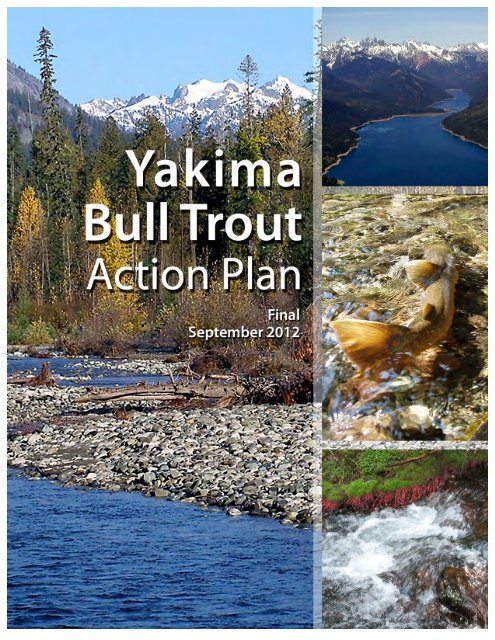
Cover photo credits (clockwise from left): Teanaway River with mountains (J. Cummins);<br />
aerial view of Kachess Lake (W. Meyer); bull trout on spawning grounds (W. Meyer); exposed<br />
alder roots in the Middle Fork Ahtanum (Y. Reiss).<br />
iii
ACKNOWLEDGEMENTS:<br />
The YBTAP Working Group would like to thank our agencies for supporting staff time on this<br />
effort: WDFW South Central <strong>Fish</strong>eries Program, USFWS Mid-Columbia <strong>Fish</strong>ery Resource<br />
Office, and the <strong>Yakima</strong> <strong>Fish</strong> and <strong>Wildlife</strong> <strong>Recovery</strong> <strong>Board</strong>. We received helpful comments to<br />
improve earlier drafts of this document from David Child, Sean Gross, Richard Visser and Pat<br />
Monk, and general comments/discussion from all members of the larger bull trout working<br />
group. Thank you to Judy Neibauer (USFWS Middle Columbia <strong>Recovery</strong> Lead) for her<br />
involvement in the development of this plan, comments and keeping us up to date on the<br />
recovery planning progress. Thank you to Heather Hadsel (YBFWRB) for compiling the final<br />
bibliography, to Laura Berg for technical editing, and to Jennifer Hackett for producing all<br />
document maps. A big thanks to <strong>Board</strong> members of the YBFWRB and to the state Recreation &<br />
Conservation Office (RCO) for seeing bull trout as a priority, and providing financial support.<br />
And finally, thank you to all the biologists who braved cold bull trout waters in waders and<br />
drysuits to collect the data presented in this plan!<br />
iii
CONTENTS<br />
EXECUTIVE SUMMARY ............................................................................................................ 1<br />
INTRODUCTION .......................................................................................................................... 7<br />
What Is Included in This <strong>Plan</strong> ..................................................................................................... 8<br />
Relationship to Other <strong>Plan</strong>s ........................................................................................................ 9<br />
Overview of the <strong>Yakima</strong> <strong>Basin</strong> ................................................................................................... 9<br />
<strong>Bull</strong> <strong>Trout</strong> Life History ............................................................................................................. 10<br />
YAKIMA BULL TROUT OVERVIEW ...................................................................................... 12<br />
Population Designation ............................................................................................................. 12<br />
Redd Surveys ............................................................................................................................ 16<br />
Genetic Data.............................................................................................................................. 16<br />
Presence/Absence Surveys........................................................................................................ 17<br />
Other Studies ............................................................................................................................. 18<br />
METHODS/ANALYSIS .............................................................................................................. 19<br />
Threat Definitions ..................................................................................................................... 19<br />
Threat Analysis ......................................................................................................................... 20<br />
Prioritization of <strong>Action</strong>s ............................................................................................................ 26<br />
Broad Scale <strong>Action</strong>s .................................................................................................................. 26<br />
Population Scale <strong>Action</strong>s .......................................................................................................... 27<br />
Monitoring <strong>Action</strong>s ................................................................................................................... 27<br />
BROAD SCALE ACTIONS......................................................................................................... 28<br />
Restore Healthy Salmon Populations........................................................................................ 28<br />
Passage at Major Storage Dams ................................................................................................ 29<br />
INDIVIDUAL POPULATION INFORMATION ........................................................................ 35<br />
Ahtanum Creek ......................................................................................................................... 35<br />
Naches River Fluvial Populations Overview ............................................................................ 45<br />
Naches River Fluvial Populations FMO Habitat Overview ..................................................... 45<br />
Rattlesnake Creek ..................................................................................................................... 46<br />
iv
Crow Creek ............................................................................................................................... 54<br />
American River ......................................................................................................................... 63<br />
Rimrock Lake Adfluvial Populations ....................................................................................... 71<br />
Rimrock Lake FMO Habitat Overview .................................................................................... 71<br />
Indian Creek .............................................................................................................................. 71<br />
South Fork Tieton River ........................................................................................................... 81<br />
North Fork Tieton River ........................................................................................................... 90<br />
Bumping Lake Adfluvial Population ........................................................................................ 98<br />
Deep Creek................................................................................................................................ 98<br />
Cle Elum/Waptus River Population Overviews ..................................................................... 107<br />
Cle Elum River ....................................................................................................................... 107<br />
Waptus River .......................................................................................................................... 117<br />
Kachess Lake Adfluvial Populations Overview ..................................................................... 121<br />
Box Canyon Creek .................................................................................................................. 121<br />
Upper Kachess River .............................................................................................................. 130<br />
Gold Creek .............................................................................................................................. 138<br />
Teanaway River ...................................................................................................................... 147<br />
Upper <strong>Yakima</strong> River ............................................................................................................... 156<br />
<strong>Action</strong>s Detail ............................................................................................................................. 164<br />
Acronyms, Abbreviations and Glossary ..................................................................................... 215<br />
APPENDIX A: Atlas of Threats ................................................................................................. A-1<br />
APPENDIX B: Redd Count Data and Methods ......................................................................... B-1<br />
APPENDIX C: Genetic Sample DATA and Methods ................................................................ C-1<br />
APPENDIX D: Supplementation OVERVIEW ......................................................................... D-1<br />
APPENDIX E: Threats Analysis by Population .......................................................................... E-1<br />
APPENDIX F: <strong>Fish</strong>ing Regulation History for Each Population ................................................ F-1<br />
APPENDIX G: Key Meetings During <strong>Plan</strong> Development ......................................................... G-1<br />
BIBLIOGRAPHY ..................................................................................................... Bibliography-1<br />
v
LIST OF FIGURES<br />
Figure 1. Overview map of spawning and FMO areas for bull trout populations in the <strong>Yakima</strong><br />
<strong>Basin</strong>. .................................................................................................................................... 15<br />
Figure 2. <strong>Bull</strong> trout redd counts in the three forks of Ahtanum Creek. ........................................ 36<br />
Figure 3. Ahtanum Creek subwatershed ....................................................................................... 38<br />
Figure 4. <strong>Bull</strong> trout redd counts in Rattlesnake Creek. ................................................................. 47<br />
Figure 5. Rattlesnake Creek subwatershed. .................................................................................. 49<br />
Figure 6. <strong>Bull</strong> trout redd counts in Crow Creek............................................................................ 55<br />
Figure 7. Crow Creek subwatershed ............................................................................................. 57<br />
Figure 8. <strong>Bull</strong> trout redd counts in the American River. .............................................................. 64<br />
Figure 9. American River subwatershed. ...................................................................................... 66<br />
Figure 10. <strong>Bull</strong> trout redd counts in Indian Creek. ....................................................................... 73<br />
Figure 11. Indian Creek subwatershed. ......................................................................................... 75<br />
Figure 12. <strong>Bull</strong> trout redd counts in the South Fork Tieton River. ............................................... 82<br />
Figure 13. South Fork Tieton River subwatershed. ...................................................................... 84<br />
Figure 14. North Fork Tieton River subwatershed. ...................................................................... 92<br />
Figure 15. <strong>Bull</strong> trout redd counts in Deep Creek. ....................................................................... 100<br />
Figure 16. Deep Creek subwatershed. ........................................................................................ 102<br />
Figure 17. Cle Elum River/Waptus River subwatersheds. ......................................................... 109<br />
Figure 18. <strong>Bull</strong> trout redd counts in Box Canyon Creek. ........................................................... 122<br />
Figure 19. Box Canyon Creek subwatershed. ............................................................................. 124<br />
Figure 20. <strong>Bull</strong> trout redd counts in the upper Kachess River. ................................................... 132<br />
Figure 21. Kachess River subwatershed. .................................................................................... 133<br />
Figure 22. <strong>Bull</strong> trout redd counts in Gold Creek. ....................................................................... 139<br />
Figure 23. Gold Creek subwatershed. ......................................................................................... 141<br />
Figure 24. Teanaway River subwatershed. ................................................................................. 150<br />
vi
LIST OF TABLES<br />
Table 1. Local populations of bull trout in the <strong>Yakima</strong> <strong>Basin</strong>. ..................................................... 14<br />
Table 2. Example of threat mechanisms and specific effect on bull trout life stages. .................. 22<br />
Table 3. Criteria used to assign severity ratings. .......................................................................... 24<br />
Table 4. Example of a threats analysis for Ahtanum Creek. ........................................................ 25<br />
Table 5: Number of annual spawning adults for bull trout local populations and population<br />
aggregates. ............................................................................................................................ 31<br />
Table 6. Ahtanum Creek threats, highest severity rating in any life stage/effect category,<br />
abbreviated list of associated actions and action priority. .................................................... 41<br />
Table 7. Rattlesnake Creek threats, highest severity rating in any life stage/effect category,<br />
abbreviated list of associated actions and action priority. .................................................... 51<br />
Table 8. Crow Creek threats, highest severity rating in any life stage/effect category, abbreviated<br />
list of associated actions and action priority. ........................................................................ 59<br />
Table 9. American River threats, highest severity rating in any life stage/effect category,<br />
abbreviated list of associated actions and action priority. .................................................... 68<br />
Table 10. Indian Creek threats, highest severity rating in any life stage/effect category,<br />
abbreviated list of associated actions and action priority. .................................................... 78<br />
Table 11. South Fork Tieton River threats, highest severity rating in any life stage/effect<br />
category, abbreviated list of associated actions and action priority. ..................................... 86<br />
Table 12. Deep Creek threats, highest severity rating in any life stage/effect category,<br />
abbreviated list of associated actions and action priority. .................................................. 104<br />
Table 13. Cle Elum River threats, highest severity rating in any life stage/effect category,<br />
abbreviated list of associated actions and action priority ................................................... 114<br />
Table 14. Box Canyon Creek threats, highest severity rating in any life stage/effect category,<br />
abbreviated list of associated actions and action priority. .................................................. 126<br />
Table 15. Kachess River threats, highest severity rating in any life stage/effect category,<br />
abbreviated list of associated actions and action priority. .................................................. 135<br />
Table 16. Gold Creek threats, highest severity rating in any life stage/effect category, abbreviated<br />
list of associated actions and action priority. ...................................................................... 144<br />
Table 17. Teanaway River threats, highest severity rating in any life stage/effect category,<br />
abbreviated list of associated actions and action priority. .................................................. 153<br />
vii
EXECUTIVE SUMMARY<br />
The <strong>Yakima</strong> <strong>Bull</strong> <strong>Trout</strong> <strong>Action</strong> <strong>Plan</strong> (YBTAP) is a locally developed, up-to-date summary of<br />
information on bull trout (Salvelinus confluentus) populations in the <strong>Yakima</strong> <strong>Basin</strong>. It includes<br />
information on population status, trend and distribution, habitat, a detailed analysis of threats by<br />
life stage for each population, and specific monitoring and restoration actions that address those<br />
threats. The main goal of this plan is to identify the specific actions that will most benefit bull<br />
trout populations in the <strong>Yakima</strong> <strong>Basin</strong>. This document is also meant to be a broadly accessible<br />
summary of information on bull trout populations and is linked to a document library of local<br />
bull trout documents (grey literature) as well as published documents, so that readers can easily<br />
access additional detail.<br />
This action plan was developed by biologists from the <strong>Yakima</strong> <strong>Basin</strong> <strong>Fish</strong> and <strong>Wildlife</strong> <strong>Recovery</strong><br />
<strong>Board</strong> (YBFWRB), Washington Department of <strong>Fish</strong> and <strong>Wildlife</strong> (WDFW), and the U.S. <strong>Fish</strong><br />
and <strong>Wildlife</strong> Service (USFWS) Mid-Columbia <strong>Fish</strong>ery Resource Office (collectively, the<br />
YBTAP Working Group), and was reviewed by a broader bull trout working group during its<br />
development.<br />
There are currently 15 identified bull trout populations in the <strong>Yakima</strong> <strong>Basin</strong>, representing<br />
adfluvial, fluvial, and resident life history types. The <strong>Yakima</strong> <strong>Basin</strong> is considered a “Core Area”<br />
by the USFWS and is part of the Middle Columbia <strong>Recovery</strong> Unit. <strong>Bull</strong> trout across their range<br />
within the contiguous United States were listed as Threatened under the Endangered Species Act<br />
(ESA) in 1998. At this time, the USFWS is developing an ESA-mandated recovery plan for <strong>Bull</strong><br />
<strong>Trout</strong>. It is our hope that the detailed information and analysis of the <strong>Yakima</strong> Core Area included<br />
in this document will inform development of the <strong>Yakima</strong> Core Area portion of the USFWS plan.<br />
In the YBTAP, threats are analyzed by each life stage: spawning/egg incubation, juvenile<br />
rearing, adults and subadults in Foraging, Migratory and Overwintering (FMO) Habitat and<br />
during pre/post spawning migrations. For each threat, all possible effects and mechanisms were<br />
considered for each life stage, and severity was evaluated for all local populations. The YBTAP<br />
then identifies actions that address the most severe threats for each population, summarized in<br />
the table below.<br />
The actions proposed are divided into several categories. Broad-scale actions are those that will<br />
benefit bull trout population in the long term (10-25+ years), but will require coordinated efforts<br />
across multiple entities in the basin or require congressional funding (e.g., passage at major<br />
storage dams). <strong>Action</strong>s that will directly benefit local populations and are implementable in a<br />
short- to mid-range time scale (1-10 years) were identified for multiple populations and for<br />
individual populations. In addition, actions to monitor bull trout populations and their habitat,<br />
implement project monitoring, and increase our understanding of key uncertainties are identified.<br />
This plan identifies a suite of actions for each local population. However, acknowledging that<br />
funding is limited, an additional filter was used to help prioritize actions across populations. Five<br />
populations were categorized as “<strong>Action</strong>” populations, which have the highest priority for shortterm<br />
action implementation (Tier I). These are areas where we anticipate significant<br />
improvements in population performance in response to proposed actions. The six “Protection”<br />
populations are ones where bull trout populations are relatively stable and where identified shortterm<br />
actions, while important, are only expected to make incremental improvements in<br />
1
population performance. For these populations, protecting the habitat conditions that have<br />
allowed them to perform well is the primary short-term focus. The four “Monitor” populations<br />
are the lowest priority for implementation of bull trout actions (Tier III), as there is significant<br />
uncertainty about the continued existence of these populations and what factors are limiting their<br />
performance. The tables presented below summarize the recommended actions for each of these<br />
population groups.<br />
The analysis and information presented in this plan will help resource managers in the <strong>Yakima</strong><br />
<strong>Basin</strong> best use limited resources to identify and implement on-the-ground actions that result in<br />
significant and sustainable improvements in bull trout viability. The goal is to work together with<br />
partners across the basin and the larger region to aid in recovering this often-forgotten native<br />
fish.<br />
THREAT<br />
SEVERITY:<br />
POPULATION:<br />
Significant Moderately<br />
Significant<br />
2<br />
Unknown But Believed<br />
to Be Significant<br />
Forest Management Passage Barriers Angling<br />
Low Abundance Altered Flows Development<br />
Ahtanum Creek<br />
Rattlesnake<br />
Entrainment<br />
Prey Base<br />
Recreation<br />
Creek Low Abundance Prey Base<br />
Low Abundance<br />
Angling<br />
Crow Creek<br />
Prey Base<br />
Recreation<br />
Passage Barriers<br />
Low Abundance Angling<br />
American River<br />
Prey Base<br />
Recreation<br />
Passage Barriers<br />
Angling<br />
Entrainment<br />
Indian Creek<br />
Introduced Species<br />
Prey Base<br />
Recreation<br />
Passage Barriers<br />
Angling<br />
Entrainment<br />
S. F. Tieton River<br />
Prey Base<br />
Recreation<br />
Grazing<br />
Passage Barriers<br />
Angling<br />
N. F. Tieton River<br />
Entrainment<br />
Introduced Species<br />
Prey Base
THREAT Significant Moderately<br />
Unknown But Believed<br />
SEVERITY:<br />
Significant<br />
to Be Significant<br />
Passage Barriers<br />
Angling<br />
Deep Creek<br />
Dewatering<br />
Introduced Species<br />
Prey Base<br />
Cle Elum/Waptus<br />
Introduced Species<br />
Entrainment<br />
River Low Abundance<br />
Prey Base<br />
Passage Barriers Recreation<br />
Low Abundance<br />
Angling<br />
Box Canyon<br />
Passage Barriers<br />
Entrainment<br />
Creek<br />
Limited Extent of Habitat<br />
Prey Base<br />
Recreation<br />
Low Abundance Dewatering Angling<br />
Kachess River Passage Barriers<br />
Entrainment<br />
Prey Base<br />
Dewatering<br />
Angling<br />
Gold Creek Low Abundance<br />
Development<br />
Passage Barriers<br />
Entrainment<br />
Prey Base<br />
Low Abundance<br />
Altered Flows<br />
Angling<br />
Teanaway River<br />
Development<br />
Prey Base<br />
Recreation<br />
Passage Barriers<br />
Introduced Species<br />
Altered Flows<br />
Upper <strong>Yakima</strong><br />
Low Abundance<br />
Angling<br />
River<br />
Development<br />
Passage Barriers<br />
Prey Base<br />
3
HIGHEST PRIORITY ACTION POPULATIONS ACTIONS (TIER I)<br />
Population Population Scale <strong>Action</strong>s Monitoring <strong>Action</strong>s<br />
Ahtanum Creek<br />
Instream and floodplain<br />
restoration<br />
Ahtanum Creek Address forest health<br />
Relocate roads adjacent to<br />
Ahtanum Creek<br />
streams<br />
Ahtanum Creek<br />
Increase instream flow in<br />
lower Ahtanum Creek<br />
Ahtanum Creek Screen all diversions<br />
Ahtanum Creek<br />
Close or relocate Tree<br />
Phones campground<br />
Close or relocate Snow<br />
Ahtanum Creek<br />
Cabin campground<br />
Box Canyon Monitor/fix passage<br />
Creek problems at mouth<br />
Box Canyon<br />
Passage over Peekaboo Falls<br />
Creek<br />
Box Canyon<br />
Creek<br />
Crow Creek<br />
Crow Creek<br />
Crow Creek<br />
Carcass analog pilot study<br />
Implement Little Naches<br />
River <strong>Action</strong> <strong>Plan</strong><br />
Relocate Crow Creek<br />
campground<br />
Land acquisitions in Little<br />
Naches watershed<br />
Gold Creek Hydrologic assessment<br />
Gold Creek<br />
Gold Creek<br />
Gold Creek<br />
N.F. Tieton R.<br />
Multiple Pops<br />
#1<br />
Multiple Pops<br />
#2<br />
Implement Forest Service<br />
Gold Creek floodplain<br />
restoration<br />
Land acquisitions in lower<br />
Gold Creek<br />
Monitor/fix passage<br />
problems at mouth<br />
Clear Creek Dam<br />
assessment/improve passage<br />
Outreach (<strong>Bull</strong> <strong>Trout</strong> Task<br />
Force)<br />
Evaluate movement<br />
patterns between forks<br />
Monitor screens at<br />
diversions<br />
Monitor cattle exclusion<br />
fencing<br />
Habitat surveys<br />
Periodic extended redd<br />
surveys<br />
Continue Little Naches<br />
River sediment monitoring<br />
Monitor bank stabilization<br />
projects<br />
Redd surveys<br />
4<br />
Broad Scale<br />
<strong>Action</strong>s<br />
Restore salmon<br />
populations<br />
Passage at<br />
Kachess Dam<br />
Restore salmon<br />
populations<br />
Passage at<br />
Rimrock Dam<br />
Passage at<br />
Bumping Dam<br />
Passage at<br />
Keechelus Dam<br />
Passage at Tieton<br />
Dam
Population Population Scale <strong>Action</strong>s Monitoring <strong>Action</strong>s<br />
Multiple Pops<br />
#3<br />
Multiple Pops<br />
#4<br />
Multiple Pops<br />
#5<br />
Multiple Pops<br />
#6<br />
Multiple Pops<br />
#7<br />
Multiple Pops<br />
#8<br />
Multiple Pops<br />
#9<br />
Evaluate supplementation<br />
Carcass analog placement<br />
Floodplain protection in<br />
Naches River mainstem<br />
Manage operations to reduce<br />
entrainment at Tieton Dam<br />
Temperature monitoring<br />
Monitor brook trout<br />
introgression<br />
Periodic entrainment<br />
studies at dams<br />
PROTECTION POPULATION BULL TROUT ACTIONS (TIER II)<br />
Population Population Scale <strong>Action</strong>s Monitoring <strong>Action</strong>s<br />
American<br />
River<br />
American<br />
River<br />
Protect and restore<br />
streambanks<br />
Indian Creek Reroute motorcycle race<br />
Rattlesnake<br />
Creek<br />
Monitor effectiveness of<br />
screens on diversions<br />
5<br />
Broad Scale<br />
<strong>Action</strong>s<br />
Broad Scale<br />
<strong>Action</strong>s<br />
Restore salmon<br />
populations<br />
Passage at Tieton<br />
Dam<br />
S.F. Tieton<br />
River<br />
Restrict streamside camping Monitor cattle exclusions<br />
S.F. Tieton<br />
River<br />
Address problem roads<br />
S.F. Tieton Implement Dry Forest<br />
River<br />
Restoration Strategy<br />
S.F. Tieton Relocate river to natural<br />
River<br />
mouth<br />
Deep Creek<br />
Passage at<br />
Bumping Dam<br />
NO POPULATION SCALE ACTIONS FOR DEEP OR KACHESS POPULATIONS
MONITOR GROUP BULL TROUT ACTIONS (TIER III- lower short-term priority for<br />
bull trout)<br />
Population Population Scale <strong>Action</strong>s Monitoring <strong>Action</strong>s<br />
Cle Elum River<br />
Lake trout<br />
assessment/removal<br />
Cle Elum River Campsite restoration<br />
Teanaway<br />
River<br />
Teanaway<br />
River<br />
Teanaway<br />
River<br />
Teanaway<br />
River<br />
Upper <strong>Yakima</strong><br />
River<br />
Upper <strong>Yakima</strong><br />
River<br />
Upper <strong>Yakima</strong><br />
River<br />
Upper <strong>Yakima</strong><br />
River<br />
Waptus River<br />
Increase instream flows<br />
Extensive surveys for bull<br />
trout presence<br />
Annual snorkel surveys for<br />
bull trout presence<br />
Floodplain acquisitions Habitat surveys<br />
Reduce road densities<br />
Implement cattle<br />
exclusions/riparian<br />
restoration<br />
Improve flow conditions<br />
Floodplain acquisitions<br />
Implement Forest Service<br />
Upper <strong>Yakima</strong> Restoration<br />
<strong>Plan</strong><br />
Periodic surveys for bull<br />
trout presence<br />
Monitor/improve screens<br />
on diversions<br />
Extensive surveys for bull<br />
trout presence<br />
6<br />
Broad Scale<br />
<strong>Action</strong>s<br />
Passage at Cle<br />
Elum Dam<br />
Restore salmon<br />
populations<br />
Restore salmon<br />
populations<br />
Passage at<br />
Keechelus Dam<br />
Passage at<br />
Kachess Dam<br />
Passage at Cle<br />
Elum Dam
INTRODUCTION<br />
The <strong>Yakima</strong> <strong>Bull</strong> <strong>Trout</strong> <strong>Action</strong> <strong>Plan</strong> (YBTAP) is a locally developed, up-to-date summary of<br />
information on bull trout populations in the <strong>Yakima</strong> <strong>Basin</strong>. It includes information on population<br />
status, trend and distribution, habitat, detailed analyses of threats by life stage for each<br />
population, and specific monitoring and restoration actions that address identified threats. This<br />
document serves as an accessible repository for information on bull trout populations and is<br />
linked to a document library of local bull trout documents (grey literature) as well as published<br />
documents. This action plan was developed by biologists from the <strong>Yakima</strong> <strong>Basin</strong> <strong>Fish</strong> and<br />
<strong>Wildlife</strong> <strong>Recovery</strong> <strong>Board</strong> (YBFWRB), Washington Department of <strong>Fish</strong> and <strong>Wildlife</strong> (WDFW),<br />
and the U.S. <strong>Fish</strong> and <strong>Wildlife</strong> Service (USFWS) Mid-Columbia <strong>Fish</strong>ery Resource Office<br />
(collectively, the YBTAP Working Group). The primary goal of this plan is to define actions that<br />
will benefit bull trout populations in the <strong>Yakima</strong> <strong>Basin</strong>.<br />
<strong>Bull</strong> trout (Salvelinus confluentus) were listed as Threatened under the Endangered Species Act<br />
(ESA) in 1998. In the original listing (USFWS 1998), the <strong>Yakima</strong> <strong>Basin</strong> was part of the<br />
Columbia River Distinct Population Segment (DPS) and was one of 22 “<strong>Recovery</strong> Units” within<br />
that DPS. In 1999, the USFWS relisted the bull trout into one coterminous DPS and delineated<br />
the Columbia River basin as an interim <strong>Recovery</strong> Unit, until a final recovery plan is completed<br />
(USFWS 1999b). A Draft <strong>Bull</strong> <strong>Trout</strong> <strong>Recovery</strong> <strong>Plan</strong>, released in 2002, was never finalized<br />
(USFWS 2002). In 2010, the USFWS reinitiated the recovery planning process, with new<br />
geographic delineations. In this current planning process, the <strong>Yakima</strong> <strong>Basin</strong> is one of 34 Core<br />
Areas within the larger Middle Columbia <strong>Recovery</strong> Unit, and all recovery units are part of the<br />
range-wide DPS listing (see http://www.fws.gov/pacific/bulltrout/<strong>Recovery</strong>.html). Each of these<br />
bull trout core areas is expected to function as a metapopulation, a basic unit for ensuring longterm<br />
sustainability of an aggregate of local populations.<br />
The development of this action plan is concurrent with the formal USFWS <strong>Bull</strong> <strong>Trout</strong> recovery<br />
planning process. The goal is to work together to ensure that the actions and information<br />
presented in this plan link with the strategies in the USFWS Final <strong>Bull</strong> <strong>Trout</strong> <strong>Recovery</strong> <strong>Plan</strong>.<br />
Building a crosswalk to the USFWS <strong>Recovery</strong> <strong>Plan</strong> will be an ongoing effort. This plan contains<br />
a much finer level of detail on population status, threats, and actions needed to address<br />
population threats than will be available in the larger-scale USFWS <strong>Recovery</strong> <strong>Plan</strong>.<br />
Developing a locally driven plan has allowed us to work outside of the bounds of “regional<br />
templates” and create a document that will be immediately useful within the <strong>Yakima</strong> <strong>Basin</strong> for<br />
basinwide (e.g., <strong>Yakima</strong> River <strong>Basin</strong> Water Enhancement Program Integrated <strong>Plan</strong> and <strong>Yakima</strong><br />
Project Biological Opinion) and reach-scale decision processes (project grant funding and<br />
watershed-level planning). As USFWS recovery planning progresses, it is expected that this<br />
document will also serve as a Core Area implementation plan guiding recovery of bull trout in<br />
the <strong>Yakima</strong> <strong>Basin</strong>.<br />
In 1999, after bull trout were listed, USFWS convened recovery-planning groups around the<br />
region to help in developing local chapters for the 2002 Draft <strong>Bull</strong> <strong>Trout</strong> <strong>Recovery</strong> <strong>Plan</strong>. In the<br />
<strong>Yakima</strong> <strong>Basin</strong> a group of biologists from the original <strong>Yakima</strong> <strong>Basin</strong> bull trout recovery team has<br />
remained dedicated to working on bull trout issues during the last decade. This document is a<br />
way to formalize the discussions of this group and come to consensus on priority actions to<br />
benefit local bull trout populations. During the process of developing the content and writing the<br />
7
YBTAP, several meetings were held to allow the team to review and comments on content<br />
(Appendix G).<br />
What Is Included in This <strong>Plan</strong><br />
This document includes a wealth of information on bull trout in the <strong>Yakima</strong> <strong>Basin</strong>. The YBTAP<br />
includes detailed information specific to each local bull trout population, with links to relevant<br />
documents and literature. The description for each population is divided into sections on<br />
Population Distribution, Status and Trend, Habitat, Threats, and <strong>Action</strong>s.<br />
The first section, Individual Population Information, describes population distribution, life<br />
history and status; genetic data; and redd count and population monitoring history. The document<br />
provides this information in one place and makes it available for anyone seeking information<br />
about bull trout in particular drainages within the <strong>Yakima</strong> <strong>Basin</strong>.<br />
The next section, Habitat, is an overview of the general characteristics of spawning and rearing<br />
habitat and of foraging, migratory, and overwintering (FMO) habitat used by the population. It<br />
also describes past and present habitat monitoring in those areas. The Threats section, which<br />
follows the Habitat information, summarizes the key threats for the population (based on the life<br />
stages that are most severely affected) in both narrative and table forms. Also included in the<br />
Threats table for each population is an abbreviated list of actions that address all high and<br />
medium priority threats (See Methods below). These tables are included to display the critical<br />
results generated from the threats analysis. Full results of this analysis are presented in Appendix<br />
E. The analysis provides the rationale for the recommended actions.<br />
The final section, <strong>Recovery</strong> <strong>Action</strong>s, includes actions from all categories. The strategy is an<br />
overall synopsis of what needs to be done for the population and lists the Broad Scale <strong>Action</strong>s<br />
that apply to the population. Next we list all the Completed <strong>Action</strong>s in the geographic area that<br />
benefit bull trout or address identified threats. Recommended <strong>Action</strong>s include specific<br />
Population Scale <strong>Action</strong>s and also a series of Monitoring <strong>Action</strong>s.<br />
To compile this master list of actions, landowners and stakeholders from each of the local<br />
population areas were contacted to provide information on past and planned projects. Some<br />
actions are well developed and could be initiated immediately if funding were available. Others<br />
are more conceptual or describe long-term goals and would be implemented by a series of<br />
projects over time.<br />
Within the Individual Population Information section of the document, actions are included as a<br />
bulleted list with a link to the <strong>Action</strong>s Detail section in the back of the document where more<br />
action-specific information is provided. In the individual population <strong>Action</strong>s subsections, we<br />
include actions from the <strong>Yakima</strong> Steelhead <strong>Recovery</strong> <strong>Plan</strong> that would also benefit bull trout. It<br />
will be critical to coordinate bull trout efforts in the basin with ongoing steelhead and salmon<br />
recovery efforts.<br />
The individual population sections conclude with a map of the population area that show roads,<br />
trails, wilderness areas, and campgrounds in relation to bull trout spawning, rearing, and FMO<br />
habitat.<br />
8
After the Individual Population Information sections, there is a section with <strong>Action</strong> Details that<br />
includes specific information necessary to implement each proposed action (description,<br />
partners, cost estimate, etc.). The <strong>Action</strong> Details will assist with the schedule of recovery actions<br />
and final inform the USFWS final <strong>Bull</strong> <strong>Trout</strong> <strong>Recovery</strong> <strong>Plan</strong> as well as the <strong>Yakima</strong> <strong>Basin</strong> Core<br />
Area implementation plan.<br />
Relationship to Other <strong>Plan</strong>s<br />
The relationship of this YBTAP to the Draft <strong>Bull</strong> <strong>Trout</strong> <strong>Recovery</strong> <strong>Plan</strong> (USFWS 2002)and the<br />
Final <strong>Recovery</strong> <strong>Plan</strong> (USFWS, in prep) is described above. Additional information was drawn<br />
from the USFWS Five Year Status Review (USFWS 2008) and the USFWS Critical Habitat<br />
Listing Package (USFWS 2010). For each of these efforts, the USFWS, working with the local<br />
bull trout team, has summarized and updated the information and status of <strong>Yakima</strong> <strong>Basin</strong> bull<br />
trout populations. The YBTAP presents that information, plus additional analysis and actions, in<br />
a document that is specific to the <strong>Yakima</strong> <strong>Basin</strong>.<br />
Other basinwide planning efforts include the <strong>Yakima</strong> Subbasin <strong>Plan</strong> (<strong>Yakima</strong> <strong>Basin</strong> <strong>Fish</strong> and<br />
<strong>Wildlife</strong> <strong>Plan</strong>ning <strong>Board</strong> 2005), the Salmon <strong>Recovery</strong> <strong>Plan</strong> (<strong>Yakima</strong> <strong>Basin</strong> <strong>Fish</strong> and <strong>Wildlife</strong><br />
<strong>Plan</strong>ning <strong>Board</strong> 2005), the Limiting Factors Analysis (Haring 2001) and the <strong>Yakima</strong> <strong>Basin</strong><br />
Integrated Water Resource Management <strong>Plan</strong> (Ecology 2012). Each of these includes summary<br />
information about bull trout populations and recovery needs but few comprehensive details. The<br />
YBTAP contains the most inclusive and current information about bull trout populations and will<br />
be maintained as a real-time document that is updated annually or as new information is<br />
available.<br />
Steelhead are the other ESA-listed fish species in the basin, and the 2009 <strong>Yakima</strong> Steelhead<br />
<strong>Recovery</strong> <strong>Plan</strong> describes a suite of actions that would benefit steelhead populations (<strong>Yakima</strong><br />
<strong>Basin</strong> <strong>Fish</strong> and <strong>Wildlife</strong> <strong>Recovery</strong> <strong>Board</strong> 2009). Many of these actions will also benefit other<br />
species, including bull trout. The bull trout populations that will most benefit from steelhead<br />
actions are those that utilize FMO habitat below the reservoirs. Implementing actions for bull<br />
trout where there is benefit to multiple species will increase funding opportunities, efficiency,<br />
and potential for success. However, bull trout are unique in that some populations reside in high<br />
elevation habitat that is currently inaccessible to anadromous species. An important role for the<br />
YBTAP is to highlight actions and projects in areas that are not currently priorities for broader<br />
salmon recovery efforts.<br />
Overview of the <strong>Yakima</strong> <strong>Basin</strong><br />
The <strong>Yakima</strong> River basin is located in south central Washington and drains approximately 6,155<br />
square miles. Almost all the basin lies within areas either ceded to the United States by the<br />
Yakama Nation or areas reserved for their use. The basin occupies most of <strong>Yakima</strong> and Kittitas<br />
counties, about half of Benton County, and a small portion of Klickitat County. The <strong>Yakima</strong><br />
River basin is bounded on the west by the Cascade Range, on the north by the Wenatchee<br />
Mountains, on the east by the Rattlesnake Hills, and on the south by the Horse Heaven Hills.<br />
Altitudes range from 8,184 feet above mean sea level in the Cascades to 340 feet where the<br />
<strong>Yakima</strong> River enters the Columbia River at river mile (RM) 333 near the City of Richland,<br />
9
Washington. The <strong>Yakima</strong> River basin is a rich agricultural area almost totally dependent on<br />
irrigation. It contains about 500,000 acres of irrigated land with the water for most of this<br />
acreage supplied by the USBR’s <strong>Yakima</strong> Project. Other major land uses include livestock<br />
production (ranching, feedlots, and dairies), timber production, and recreation.<br />
The climate of the <strong>Yakima</strong> River basin ranges from alpine along the crest of the Cascade Range<br />
to arid in the lower valleys. Air temperatures are inversely related to altitude. Summer<br />
temperatures in the high elevation areas are warm, with a transition to hot temperatures in the<br />
lower elevation areas. Winters are generally cold throughout. Precipitation also varies<br />
considerably depending on altitude. Mean annual accumulations range from about 128 inches in<br />
the mountainous western and northern parts of the basin to about 8 inches in the eastern portion.<br />
Most of the precipitation occurs as snow at higher elevations, generally from November through<br />
March. While the valleys receive some snow, the majority of the precipitation falls as rain<br />
between October and March. If climate change predictions for the Northwest are realized, these<br />
patterns may shift over time, with potential to impact bull trout populations.<br />
The <strong>Yakima</strong> River flows southeasterly for about 214 miles from its modern-day origin at<br />
Keechelus Dam to its confluence with the Columbia River. Located west of the <strong>Yakima</strong> River is<br />
its largest tributary, the Naches River, which flows 45 miles to join the <strong>Yakima</strong> River near the<br />
city of <strong>Yakima</strong>. The Naches River forms at the confluence of the Bumping, American, and Little<br />
Naches rivers. Its major tributaries are Rattlesnake Creek and the Tieton River. Other major<br />
tributaries of the upper <strong>Yakima</strong> River (above the Naches River confluence) include the Cle Elum<br />
and Teanaway rivers. Below this point the most significant tributaries include Ahtanum Creek,<br />
which enters just south of <strong>Yakima</strong>, and Toppenish and Satus creeks, which are on the Yakama<br />
Indian Reservation. Smaller tributary streams, too numerous to name here, also contribute to<br />
flows in the basin’s rivers. The hydrographs of the basin’s major rivers have been severely<br />
altered by the storage, release, and diversion of irrigation water. In many of the smaller streams,<br />
tributary diversions cause seasonal dewatering.<br />
There are five major storage reservoirs in the <strong>Yakima</strong> River basin: Keechelus, Kachess, and Cle<br />
Elum reservoirs are located high in the upper <strong>Yakima</strong> basin. The dams forming these reservoirs<br />
were completed in 1917, 1912 and 1933, respectively. In the Naches River subbasin, Bumping<br />
Dam was constructed in 1910, while Tieton Dam (forming Rimrock reservoir) was completed in<br />
1925. All of these dams except for Tieton were built at the outlets of natural lakes. <strong>Fish</strong> passage<br />
facilities were not constructed at any of them. Native sockeye salmon, which depend on the<br />
natural lakes and spawn in the streams above them, were extirpated; other anadromous salmonid<br />
species were excluded from the streams above these dams; and populations of resident fish<br />
species such as bull trout were isolated above the dams.<br />
<strong>Bull</strong> <strong>Trout</strong> Life History<br />
The range of bull trout in the contiguous United States includes populations in Montana, Idaho,<br />
Oregon and Washington. In Washington, bull trout occur sympatrically with Dolly Varden<br />
populations only on the west side of the Cascade mountain range. The two species were<br />
determined to be genetically and physically distinct in 1978 (Cavender 1978); however,<br />
confusion on this distinction continues amongst the general public. <strong>Bull</strong> trout have complex and<br />
highly variable life history patterns. Unlike salmon, which spawn once and die, bull trout are<br />
10
iteroparous, meaning they can spawn multiple times throughout their lives. <strong>Bull</strong> trout spawn in<br />
the fall, primarily in cold, high elevation headwater streams where water temperatures during<br />
spawning and incubation do not exceed 8 °C (Rieman and McIntyre 1993; Rieman and Chandler<br />
1999; Dunham et al. 2003). Juveniles spend two to four years rearing in their natal streams and<br />
then migrate as subadults to a larger body of water. Fluvial populations migrate into mainstem<br />
rivers, adfluvial populations to lakes or reservoirs, and resident populations remain in their natal<br />
stream throughout their lives. As with other salmonid species, multiple life history strategies may<br />
occur within the same population, with some individuals adopting a migratory pattern and others<br />
residualizing for some portion of their adult lives (Rieman and Dunham 2000; Neraas 2001;<br />
Nelson 2002; Bahr and Shrimpton 2004; Al-Chokhachy et al. 2005). Some coastal populations<br />
have anadromous life history forms that utilize near-shore ocean habitat (Brenkman and Corbett<br />
2005). These larger bodies of water are characterized as Foraging, Migratory and Overwintering<br />
(FMO) habitat, while smaller, natal streams are defined as spawning and rearing habitat.<br />
<strong>Bull</strong> trout are piscivorous (fish eating) and past misconceptions about the role of bull trout as<br />
dangerous predators that are causing the decline of salmon has created negative public opinion<br />
about the species (Leary et al. 1993). At one time there were bounties on bull trout, and other<br />
attempts to eradicate the species. Now the focus has shifted to protecting and enhancing<br />
remaining bull trout populations.<br />
11
YAKIMA BULL TROUT OVERVIEW<br />
Population Designation<br />
The number of recognized local populations in the <strong>Yakima</strong> <strong>Basin</strong> has shifted throughout the last<br />
decade. The 2002 Draft <strong>Recovery</strong> <strong>Plan</strong> for the <strong>Yakima</strong> Core Area recognized 13 local bull trout<br />
populations (USFWS 2002). These included four fluvial populations (mainstem <strong>Yakima</strong> River,<br />
American River, Crow Creek, and Rattlesnake Creek), two resident populations (North Fork<br />
Teanaway River and Ahtanum Creek), and seven adfluvial populations (Gold Creek, Box<br />
Canyon Creek, Kachess River, Cle Elum River, Deep Creek, Indian Creek, and the South Fork<br />
Tieton River) (Figure 1; Table 1). With the 2008 USFWS Status Update, three more populations<br />
were added—all adfluvial (North Fork Tieton River, Bumping River, and Waptus Lake) for a<br />
total of 16 local populations. The North Fork Tieton River was a newly discovered population,<br />
confirmed during surveys in 2004. The other two populations, Bumping River and Waptus Lake,<br />
were identified as populations in order to be consistent in applying the definition of a<br />
“population” (i.e., documented spawning within recent history and multiple life stages of bull<br />
trout present). Recent genetic analysis has identified 12 distinct bull trout populations in the<br />
<strong>Yakima</strong> <strong>Basin</strong> (Small et al. 2009), although this does not include genetic samples from three of<br />
the local population areas (Upper <strong>Yakima</strong>, Cle Elum, and Waptus rivers) due to a lack of<br />
available fish to sample.<br />
For this action plan, we are working with USFWS on incorporating the newest information on<br />
the number of populations, which appears to be 15 (see Table 1). Results of genetic analyses<br />
(Small and Martinez 2011) conducted to date have shown that bull trout found in the upper<br />
Bumping River belong to the Deep Creek population. Questions about the status of several local<br />
populations remain. The upper <strong>Yakima</strong> River has confirmed bull trout spawning and rearing but<br />
in very low numbers due to the frequent difficulty in distinguishing between bull trout redds and<br />
sympatric spring Chinook salmon redds. <strong>Bull</strong> trout found in the upper <strong>Yakima</strong> River may be a<br />
distinct local population or also could represent bull trout that were entrained at one of the<br />
reservoirs and took refuge in this fluvial habitat. New information or an alternate interpretation<br />
of the definition of “local population” may result in more or fewer populations in the future.<br />
Additionally, several areas in the basin have been identified as bull trout critical habitat (USFWS<br />
2010) that may be candidates for bull trout reintroduction (or introduction) efforts. These areas<br />
include Cowiche Creek (South Fork), Nile Creek, the forks of Little Naches River and its<br />
tributaries, upper Taneum Creek, Cold Creek (tributary to Keechelus Lake), and the Middle Fork<br />
Teanaway River. Taneum Creek and the Little Naches River forks are specifically listed in the<br />
USFWS 2002 Draft <strong>Bull</strong> <strong>Trout</strong> <strong>Recovery</strong> <strong>Plan</strong> as potential local populations, as they are thought<br />
to be areas of historic distribution and/or have high quality habitat that could support a local<br />
population of bull trout. Threats and recovery actions that would benefit these potential<br />
populations will be identified as the USFWS <strong>Recovery</strong> <strong>Plan</strong> is further developed.<br />
The 15 populations discussed above and listed in Table 1 have spawning areas in headwater<br />
streams and also use lower reaches of the stream and larger rivers and/or connected lakes as<br />
FMO areas (Figure 1). Known presence extends downstream to the confluence of the <strong>Yakima</strong><br />
and Naches rivers, with presumed presence to the mouth of the <strong>Yakima</strong> River at the confluence<br />
with the mainstem Columbia River (McMichael 1997). As evidenced in the Wenatchee basin and<br />
12
other areas (Kelly Ringel and DeLaVerne 2008), there is no evidence of this migration pattern<br />
(Mizell and Anderson 2010). Large-scale genetic analysis of interior Columbia bull trout basins<br />
shows historical connectivity between the Snake River, <strong>Yakima</strong> River, and upper Columbia<br />
(Wenatchee, Methow, Chelan) basins (Ardren 2011).<br />
13
Table 1. Local populations of bull trout in the <strong>Yakima</strong> <strong>Basin</strong>.<br />
Geographic<br />
Area<br />
Population Life<br />
History<br />
Type<br />
Status* Year Spawning<br />
First Observed<br />
14<br />
(10 year geomean)<br />
Ahtanum Creek Ahtanum Resident** Critical 1993 (6 redds)<br />
Naches River Rattlesnake Fluvial Critical 1990 (35 redds)<br />
Crow Fluvial Critical 1999 (6 redds)<br />
American Fluvial Critical 1996 (34 redds)<br />
Rimrock Lake Indian Adfluvial Healthy 1984 (101 redds)<br />
South Fork<br />
Tieton<br />
North Fork<br />
Tieton<br />
Adfluvial Healthy<br />
1990 (192 redds)<br />
Adfluvial Not rated 2004 (insufficient<br />
data)<br />
Bumping Lake Deep Adfluvial Depressed 1990 (113 redds)<br />
Bumping<br />
River<br />
Adfluvial Not a population 1994 (NA)<br />
Cle Elum Lake Cle Elum Adfluvial Potentially<br />
Extirpated?<br />
Waptus Adfluvial Potentially<br />
Extirpated?<br />
No confirmed redds<br />
No confirmed redds<br />
Kachess Lake Box Canyon Adfluvial Critical 1984 (10 redds)<br />
Kachess Adfluvial Critical<br />
1999 (8 redds)<br />
Keechelus Lake Gold Adfluvial Critical 1984 (15 redds)<br />
<strong>Yakima</strong> River Upper<br />
<strong>Yakima</strong><br />
Teanaway<br />
River<br />
Fluvial Not rated 2000 (NA)<br />
Teanaway Resident** Potentially<br />
Extirpated?<br />
1996 (NA)<br />
*Status reported here is from the WDFW Salmonid Stock Inventory (SaSI) database.<br />
**Currently appear to be resident populations, but were likely fluvial historically.
Figure 1. Overview map of spawning and FMO areas for bull trout populations in the <strong>Yakima</strong> <strong>Basin</strong>.<br />
(Data provided by WDFW.)<br />
15
Redd Surveys<br />
Local biologists from multiple agencies began conducting redd surveys during the fall spawning<br />
period for populations throughout the <strong>Yakima</strong> <strong>Basin</strong> long before bull trout were listed under the<br />
ESA in 1998. WDFW began exploratory bull trout spawning surveys in 1984 to locate important<br />
spawning tributaries, establish spawning survey index areas, and monitor population trends.<br />
Indian Creek, Gold Creek, and Box Canyon Creek have been surveyed every year since 1984,<br />
although some of the earliest surveys did not cover the entire reaches that are in current index<br />
areas. Starting in 1990, a few additional streams were surveyed each year, and by 2000, index<br />
areas were established for most populations. The data are used to track trends in redd production<br />
and presumably relative abundance from year to year. Given the remote locations of most bull<br />
trout spawning reaches, their nocturnal nature, an affinity for substrate and cover, and the lack of<br />
monitoring infrastructure (i.e., dams and weirs) in bull trout areas, redd surveys are considered<br />
an effective and consistent way to monitor local populations. For more detail, see Appendix B:<br />
Redd Count Data and Methods.<br />
For a species like bull trout, where we do not have dams for counting adults (as with many<br />
salmon species), redd counts are most often used to approximate adult population abundance. To<br />
directly correlate redd numbers to the number of adults requires data on spawners per redd, good<br />
spawning surveys conditions each year, and precise redd counts. The imprecision of redd counts<br />
is discussed in the literature as a potential problem (Rieman and McIntyre 1996; Rieman and<br />
Myers 1997; Maxell 1999; Dunham et al. 2001; Al-Chokhachy et al. 2005), although precision is<br />
likely improved by having the same surveyors cover index reaches year after year (Muhlfeld et<br />
al. 2006). Another complicating factor is that only a certain proportion of sexually mature adults<br />
spawn in any given year (Fraley and Shepard 1989; Rieman and Allendorf 2001; James 2002a).<br />
In the <strong>Yakima</strong> River basin, where redd surveys have been conducted consistently in the same<br />
index areas and often by the same biologists over many years, estimates are believed to provide<br />
accurate representations of population trends and relative abundance among populations.<br />
Genetic Data<br />
In the <strong>Yakima</strong> <strong>Basin</strong> there is a well-established genetic baseline for most local bull trout<br />
populations (see Appendix C). This began in 2001-2002 with Yuki Reiss’s thesis project (Reiss<br />
2003) for Central Washington University (CWU). Reiss collected and analyzed samples from 12<br />
local bull trout populations. The two primary sources of tissue samples for this study were: 1)<br />
adults captured and sampled as part of a tagging study in the reservoirs (James 2002a), and 2)<br />
night snorkel surveys to capture juveniles in known spawning and rearing reaches. The results of<br />
this analysis showed a high level of differentiation among all populations, with some evidence of<br />
limited gene flow among the connected fluvial populations. However, above the reservoirs, even<br />
those with multiple local populations that use the same FMO reservoir habitat, there was no<br />
evidence of gene flow between populations. Two of the local populations that are currently<br />
considered “resident” life history type (Teanaway River and Ahtanum Creek) appeared quite<br />
distinct from all other populations, despite current connectivity to the fluvial system. Subsequent<br />
genetic analyses (Hawkins and Von Bargen 2006; Hawkins and Von Bargen 2007; Small et al.<br />
2009; Small and Martinez 2011), using different genetic markers and including additional<br />
16
genetic samples, have shown similar patterns and provided information about newly sampled<br />
populations or areas (e.g., North Fork Tieton and Upper Bumping rivers).<br />
As part of this <strong>Bull</strong> <strong>Trout</strong> <strong>Action</strong> <strong>Plan</strong>, a master list was compiled of all known bull trout samples<br />
that have been collected in the <strong>Yakima</strong> <strong>Basin</strong> (see Appendix C). This database (in Excel format)<br />
tracks collection data from the field through genetic analysis. In the future, this will be the<br />
central repository of information on bull trout genetic samples and will be updated as needed. In<br />
the Individual Population Information sections of this document, we present relevant results and<br />
the genetic sampling history for each population. We also identify future genetic monitoring<br />
needed to either: 1) improve the baseline for a population, 2) observe any temporal changes in<br />
genetic patterns, especially for population with low or highly fluctuating abundance, or 3)<br />
document the presence of any new populations or subpopulations within currently identified<br />
local populations.<br />
Presence/Absence Surveys<br />
Over the last 25 years, many exploratory surveys have been made to determine where bull trout<br />
are present. Many areas where we now have confirmed bull trout populations were discovered<br />
through these surveys. The details of the surveys are included below in the Population<br />
Monitoring subsection of the Individual Population Information summaries. However, a large<br />
number of surveys (listed below) did not detect bull trout. Although it is still prudent to continue<br />
to explore and to revisit areas where no bull trout have been detected, these surveys increase our<br />
confidence that there are unlikely to be “undiscovered” populations in the <strong>Yakima</strong> <strong>Basin</strong>. This is<br />
significant. In many basins across the Northwest, large unexplored areas remain where bull trout<br />
populations are suspected but not confirmed. Predictive models are often used to speculate on<br />
where such populations may exist. In the <strong>Yakima</strong> <strong>Basin</strong>, however, there is a strong empirical<br />
dataset of presence/absence data from many electrofishing and snorkel surveys.<br />
In the early years of exploration, WDFW conducted electrofishing surveys on many miles of<br />
habitat. In addition to areas now confirmed as occupied by bull trout, surveys included Cowiche<br />
Creek and tributaries, Little Naches River and tributaries, Nile Creek, Oak Creek, and Little<br />
Rattlesnake Creek (Washington Dept of Game 1978b; WDFW 1991b; WDFW 1993; WDFW<br />
1994b; Anderson 1998; WDFW 1998). Surveys have also been done above barrier falls in many<br />
of the streams that support bull trout in the lower reaches (i.e., Indian Creek, South Fork Tieton<br />
River, Deep Creek, and Box Canyon Creek).<br />
Night snorkel surveys have also been widely used to determine bull trout presence/absence. The<br />
Forest Service completed night snorkel surveys on Middle Fork Teanaway River (Haskins 2003),<br />
Upper Bumping River above the falls (USFS 2003a), Oak Creek (USFS 2003b), Little<br />
Rattlesnake Creek (USFS 2002), Cooper River (Reiss and Wassell 2004), Clear Creek (Torretta<br />
2005), two tributaries to the North Fork Teanaway River—Beverly Creek and Stafford Creek<br />
(Reiss 2006), North and South forks of the Little Naches River (Reiss 2008), Gale Creek (USFS<br />
1991) and Silver Creek (USFS 1993). (The U.S. Forest Service is abbreviated in the text as<br />
Forest Service rather than USFS to more easily differentiate it from USFWS.)<br />
WDFW completed night surveys in the upper forks of Cowiche Creek, following up on a<br />
sighting by a Yakama Nation (YN) biologist (Anderson 2002). Some of these surveys followed<br />
17
the Peterson et al. (2002) protocol for bull trout presence/absence surveys, which calls for<br />
randomized survey reaches and block nets and allows for efficiency estimates. Others used a<br />
modified protocol (no block nets) or a simple, non-randomized survey method designed to<br />
sample portions of all likely or suitable habitat. In addition, day snorkels were completed in Cold<br />
Creek and Meadow Creek (Craig 1996), tributaries to Keechelus Lake, and in Gale Creek (Craig<br />
1994), a tributary to Kachess Lake. The Forest Service conducted day snorkel surveys in the<br />
South Fork Little Naches (USFS 1996a). During all of these surveys, no bull trout were detected.<br />
Other Studies<br />
Other bull trout studies in the <strong>Yakima</strong> <strong>Basin</strong> include radio telemetry, tagging, and entrainment<br />
studies. A three-year radio telemetry study (2003-6) tracked adults in the Naches River fluvial<br />
system, Rimrock Lake, and Bumping Lake (Mizell and Anderson 2010). Results confirmed<br />
overwintering areas for the Naches River fluvial and reservoir populations. A three-year tagging<br />
study (1996-1998) of adults in Rimrock and Bumping lakes (James 2002a) showed the high site<br />
fidelity of fish in these populations and provided some data on the proportion of the population<br />
that spawns in any given year. There have also been four separate entrainment studies on<br />
Rimrock Lake and on Keechelus Lake (Hiebert et al. 2002; James 2002b; Hiebert 2003;<br />
Underwood and Cramer 2007; Courter and Vaughan 2011). Rimrock Lake has the highest rate of<br />
entrainment of bull trout due to reservoir management and the location of outlet works. No bull<br />
trout were captured in the trap below Keechelus Lake during the sampling period in 2011. Six<br />
Master’s theses focused on bull trout were completed through Central Washington University<br />
between 1980 and 2012 (Sexauer 1994; Craig 1997; James 1997; Meyer 2002; Reiss 2003;<br />
Lamperth 2012).<br />
18
METHODS/ANALYSIS<br />
Threat Definitions<br />
The threats categories used in this document are based on those used by USFWS for recovery<br />
planning and status assessments. This was intentionally done to maintain consistency between<br />
this document and the USFWS <strong>Recovery</strong> <strong>Plan</strong> (in prep). However, for this document it was<br />
necessary to clearly define what was included or not included in each of the threats categories.<br />
The following definitions are used:<br />
Agriculture: Impacts associated with agricultural operation (excluding livestock grazing) on<br />
lands adjacent to bull trout bearing waters (includes riparian degradation, sedimentation,<br />
impaired water quality, and harassment of bull trout).<br />
Altered flow: Impacts associated with flow regimes that are significantly altered in terms of<br />
magnitude, timing, and duration through water storage operations and/or water withdrawal.<br />
Angling: Impacts associated with angling, legal and illegal.<br />
Development: Impacts associated with residential development (urban, rural, or Forest Service<br />
cabins) along bull trout bearing waters (includes riparian degradation, erosion and sedimentation,<br />
channel disturbance, and harassment of bull trout).<br />
Dewatering: A dewatering of stream reaches that restricts fish habitat access, quantity, and<br />
quality and can also result in stranding. Dewatering associated with irrigation withdrawal,<br />
reservoir management, etc. is categorized as altered flows or passage barriers.<br />
Entrainment: Inadvertent passage of fish through the unscreened outlet works of storage dams<br />
or irrigations diversions, resulting in physical trauma, isolation from upstream habitats, and/or<br />
entrainment into irrigation systems.<br />
Forest management: Negative impacts on stream condition including hydrology, sediment load,<br />
riparian health, and water temperature that result from current and/or past forest management<br />
practices (includes impacts from forest roads).<br />
Grazing: Impacts associated with livestock grazing on lands adjacent to bull trout bearing<br />
waters (includes riparian degradation, sedimentation, impaired water quality, and harassment of<br />
bull trout.<br />
Introduced species: Presence and potential impacts (e.g., introgression or competition)<br />
associated with the introduction of lake, brook, or brown trout.<br />
Limited extent of habitat: Habitat quantity (i.e., stream distance accessible) that has been<br />
altered in streams whose lower reaches were inundated by reservoir construction.<br />
Low abundance: A demographic threat resulting from a low population census size as estimated<br />
from annual redd counts. Populations receiving a significant threat level under this threat are<br />
believed to be at an elevated risk of extirpation.<br />
19
Mining: Negative impacts on stream health resulting from mining operations (oil, natural gas,<br />
coal, precious metals, and gravel).<br />
Passage barriers: Artificial barriers to fish passage, including storage dams, diversion dams,<br />
recreational dams constructed by the public, culverts, and passage problems associated with<br />
irrigation reservoir depletion that preclude passage into spawning tributaries (i.e., dewatering at<br />
the mouth of a stream on reservoir bed).<br />
Prey base: Impacts that have negatively affected the availability of food (fish and<br />
macroinvertebrates).<br />
Recreation: Impacts associated with recreational use of lands adjacent to bull trout bearing<br />
waters (includes riparian degradation, erosion and sedimentation, channel disturbance, and<br />
harassment of bull trout). Does not include impacts of associated forest roads or angling<br />
pressures on bull trout.<br />
Transportation networks: Impacts associated with major roads or highways (paved) or rail<br />
lines.<br />
Water Quality, which was included as a separate threat in the USFWS 2008 status review, was<br />
not viewed in this document as a stand-alone threat but is the effect of other threats such as<br />
forest management or agriculture.<br />
For each threat we also created maps to represent the spatial distribution of the impact across<br />
populations and across the <strong>Yakima</strong> <strong>Basin</strong> (Appendix A: Threats Atlas). These maps will be<br />
updated as needed to reflect changes in Threats (e.g., increased urbanization or removal of<br />
passage barriers) or changes in our current knowledge base.<br />
Threat Analysis<br />
To better understand the way in which each of the threats listed above could effect a population,<br />
the mechanism for this effect, and what life stages would be impacted, the YBTAP Working<br />
Group (Yuki Reiss, Jeff Thomas, Eric Anderson, Jim Cummins, and Alex Conley) developed a<br />
Threats Analysis methodology. The analysis was a lengthy iterative process completed in close<br />
collaboration with Judy Neibauer, the USFWS <strong>Recovery</strong> Lead for the <strong>Yakima</strong> Core Area. This<br />
analysis linked threats directly to bull trout biology. As part of the analysis, the severity of each<br />
threat was also rated, as was the certainty regarding the effect on a specific life stage, and the<br />
justification/supporting data for the rating.<br />
The analysis began with a list of all bull trout life stages and potential negative effects to that life<br />
stage. For each threat, the YBTAP Working Group, relying on expert opinion and relevant<br />
literature, considered whether or not a mechanism was present to create the negative effect and<br />
what that mechanism would be. Although <strong>Yakima</strong> bull trout populations were frequently used<br />
for calibration purposes, the goal was to think broadly of all possible effects and mechanisms.<br />
The following table (Table 2) gives an example of this process for two different threats—<br />
entrainment and forest management. These examples illustrate the nature of different threats,<br />
with one that impacts bull trout populations via direct mortality to fish (entrainment) and one<br />
with primarily indirect impacts via reductions in habitat quality (forest management). The same<br />
20
process was completed for all threats (see Appendix E: Threats Analysis). The advantage of this<br />
process over previous evaluations of population threats is the transparency and clear logic trail<br />
that allows for a better understanding of how a specific threat may limit a population.<br />
Scale was an important factor in defining severity (Table 3). At a larger recovery-unit scale, the<br />
threat severity rating is based on the risk of extinction or on what percentage of a Core Area is<br />
affected. For the local population-scale used in this analysis, tying the severity rating to a percent<br />
of population affected was too arbitrary and difficult. Instead the threat severity rating was based<br />
on expected population response, using abundance (redd counts) as a response metric. Thus, for<br />
each threat/effect combination, the YBTAP Working Group considered whether the threat was<br />
limiting the population and whether a population-scale response could be expected (and at what<br />
level) if it were addressed. This puts the focus on current condition, future actions, and expected<br />
population response.<br />
21
Table 2. Example of threat mechanisms and specific effect on bull trout life stages.<br />
Life Stage<br />
Spawning/egg<br />
incubation<br />
Juvenile rearing<br />
THREAT<br />
Effect<br />
22<br />
ENTRAINMENT<br />
Mechanism<br />
Reduced fertility NA NA<br />
Reduced population<br />
productivity<br />
Increased spawning<br />
temperatures<br />
Habitat degradation (loss of<br />
riparian and/or instream<br />
complexity, increased<br />
sedimentation etc.)<br />
If many fish are<br />
entrained, could be<br />
reduced at<br />
population level<br />
NA<br />
NA<br />
FOREST<br />
MANAGEMENT<br />
Mechanism<br />
NA<br />
Habitat availability/access NA NA<br />
Direct mortality (eggs) NA<br />
Summer temperatures NA<br />
Habitat availability/access NA NA<br />
Habitat degradation (loss of<br />
riparian, increased<br />
sedimentation, soil<br />
compaction etc.)<br />
NA<br />
Reduced growth/condition NA<br />
Direct mortality<br />
Entrainment into<br />
irrigation systems<br />
Loss of<br />
riparian/upland trees<br />
via logging or fire<br />
Loss of<br />
riparian/upland trees<br />
via logging or fire;<br />
forest roads<br />
Sediment input<br />
while eggs in gravel<br />
Loss of<br />
riparian/upland trees<br />
via logging or fire<br />
Loss of<br />
riparian/upland trees<br />
via logging or fire;<br />
forest roads<br />
If habitat quality is<br />
lower (loss of<br />
benthic<br />
productivity)<br />
NA
Life Stage<br />
Subadults/adults<br />
in FMO habitat<br />
Pre/post<br />
spawning<br />
migrations<br />
THREAT<br />
Effect<br />
Direct mortality<br />
Isolated from natal<br />
population<br />
Reduced growth/condition NA<br />
Habitat<br />
availability/access/quality<br />
Increased temperatures NA<br />
Reduced habitat<br />
availability/access<br />
Increase stress/reduced<br />
condition/possible direct<br />
mortality<br />
23<br />
ENTRAINMENT<br />
Mechanism<br />
Entrainment into<br />
irrigation systems;<br />
mortality during<br />
passage through<br />
reservoir outlet<br />
works<br />
Adults cannot return<br />
to reservoirs<br />
FOREST<br />
MANAGEMENT<br />
Mechanism<br />
NA<br />
NA<br />
NA NA<br />
NA NA<br />
NA NA<br />
If habitat quality is<br />
lower (loss of<br />
benthic<br />
productivity)<br />
Loss of<br />
riparian/upland trees<br />
via logging or fire<br />
Once this step was completed for all threats, all “Not Applicable” (NA) boxes were taken out,<br />
and a table was completed with only potential threat/effect combinations. For each possible<br />
Threats/Life Stage/Effect combination, we evaluated the severity for each local bull trout<br />
population based on criteria determining significance and certainty (Table 3).
Table 3. Criteria used to assign severity ratings.<br />
Present, significant impacts<br />
Threat Severity Color Abbreviation<br />
24<br />
Red SIGNIFICANT<br />
Present, moderately significant impacts Yellow MODERATE<br />
Impacts unknown but could be significant or<br />
moderately significant<br />
Impacts unknown. No judgment as to potential<br />
significance<br />
Impacts unknown but not believed to be<br />
significant<br />
Present, not thought to be significant at reach or<br />
population level<br />
Orange<br />
UNKNOWN<br />
SIGNIFICANT<br />
Dark Blue UNKNOWN<br />
Light Blue<br />
UNKNOWN<br />
LOW<br />
Green LOW<br />
Mechanism not present or extremely rare Gray NOT PRESENT<br />
In addition to the severity rating, the YBTAP Working Group provided justification and/or<br />
supporting data for each rating with links to relevant literature and reports. Certainty (confidence<br />
regarding severity ratings) was built into the severity definitions via incorporation of “unknown”<br />
impacts. Table 4 provides an example of a High, a Moderate, a Low, and a Not Present<br />
threat/effect combination for Ahtanum Creek. The entire analysis for each threat/effect<br />
combination, for Ahtanum, and for all other populations is presented in Appendix E.
Table 4. Example of a threats analysis for Ahtanum Creek.<br />
Threat Life Stage Effect Mechanism Severity Justification/Supporting<br />
Data<br />
Low<br />
abundance<br />
(high risk of<br />
extirpation<br />
Forest<br />
management<br />
Adult Inability of<br />
population to<br />
maintain<br />
genetic health<br />
and/or recover<br />
from<br />
catastrophic<br />
events<br />
Spawning/<br />
egg<br />
incubation<br />
Angling Pre/post<br />
spawning<br />
migrations<br />
Altered flows Pre/post<br />
spawning<br />
migrations<br />
Introduced<br />
Species<br />
Pre/post<br />
spawning<br />
migrations<br />
Habitat<br />
degradation<br />
Direct<br />
mortality<br />
Habitat<br />
availability/<br />
access<br />
Reduced<br />
growth/<br />
condition<br />
Low effective<br />
population size<br />
Sedimentation,<br />
loss of riparian<br />
cover and soil<br />
compaction<br />
Hooking or<br />
stress related<br />
mortality<br />
caused by<br />
capture<br />
Regulated flows<br />
(too high of<br />
low) restrict fish<br />
movement<br />
Competition for<br />
food and space<br />
SIGNIFICANT Effective population size<br />
estimated based on<br />
annual red counts. Adult<br />
spawner numbers are<br />
low in all three forks and<br />
have been for years.<br />
SIGNIFICANT High road density in<br />
spawning habitat.<br />
Clearcut upstream. Risk<br />
of catastrophic wildfire<br />
due to overstocked<br />
stands in watershed.<br />
Questions about future<br />
management (status of<br />
DNR staff)<br />
MODERATE Legal angling for other<br />
species does occur in<br />
migration for this<br />
population. Illegal<br />
angling for bull trout may<br />
also occur. Unknown<br />
impact from incidental or<br />
targeted take, but could<br />
LOW Low flows in early fall in<br />
lower reaches due to<br />
irrigation withdrawal, but<br />
minimum flows are likely<br />
sufficient to allow<br />
migrations<br />
NOT<br />
PRESENT<br />
No introduced species<br />
are present based on<br />
snorkel and<br />
electrofishing data<br />
25<br />
Future Monitoring/<br />
Data Needs<br />
Annual spawning<br />
surveys, collect any<br />
data required before<br />
supplementation can<br />
be implemented<br />
Determine if forest<br />
practice rules are<br />
adequate, applied<br />
and enforced. On the<br />
ground monitoring of<br />
sediment, riparian<br />
condition and habitat<br />
quality<br />
Creel surveys (<strong>Bull</strong><br />
<strong>Trout</strong> Task Force-<br />
BTTF)<br />
Track flow<br />
measurement data in<br />
FMO habitat during<br />
migration period<br />
Periodic fish surveys<br />
to ensure no brook<br />
trout are established<br />
Future <strong>Action</strong>s<br />
Population<br />
supplementation<br />
Relocate road<br />
NF Ahtanum<br />
Creek near<br />
Shellneck Creek<br />
(EIS 2011). SF<br />
Aht road? Road<br />
density-1m/sq<br />
m<br />
Public<br />
education, field<br />
contact (BTTF)<br />
and<br />
enforcement<br />
If needed,<br />
acquire<br />
additional<br />
instream water<br />
If needed,<br />
brook trout<br />
removal efforts
Prioritization of <strong>Action</strong>s<br />
After completion of the Threats Analysis, the next step was to crosswalk threats to future<br />
restoration actions (the heart of this plan). For each threat a list of possible actions was created.<br />
<strong>Action</strong>s that address threats identified as significant or moderate severity become the highest<br />
priority for that population. Threats with unknown severity, especially those that are thought to<br />
be significant, became the highest priority for future monitoring actions. Using the severity<br />
categories from Table 2 significant and moderate threats (red and yellow) were identified as the<br />
highest priority; unknown but potentially significant or simply unknown (orange and dark blue)<br />
were assigned a medium priority. The lowest priority was assigned to threats of unknown<br />
consequence but not believed to be significant (light blue), threats deemed insignificant (green),<br />
and threats which were not present (gray). This resulted in a list for each population of associated<br />
monitoring and population-scale actions in order of priority, with the prioritization based on<br />
expected population response.<br />
This approach is useful for looking at potential actions within a particular population but it is<br />
also important to be able to look across all bull trout populations within the <strong>Yakima</strong> <strong>Basin</strong> and<br />
understand overall priorities. Funding for bull trout recovery actions and monitoring is limited.<br />
Under ideal circumstances all actions in this plan could be completed. Under the current funding<br />
scenario, however, it will be critical to be able to first implement actions with immediate benefit<br />
to populations in peril. To be used as the next “filter” for prioritization populations were divided<br />
into three categories. The categories are as follows:<br />
TIER I: “ACTION” populations: These are populations where recovery actions would provide<br />
an immediate benefit to habitat conditions and population levels, and thus are the highest priority<br />
across all populations (Ahtanum Creek, Crow Creek, Gold Creek, North Fork Tieton River, and<br />
Box Canyon Creek).<br />
TIER II: “PROTECTION” populations: These are populations to protect and continue<br />
monitoring but where actions are expected to elicit a limited population level response (Deep<br />
Creek, Indian Creek, South Fork Tieton River, Kachess River, American River, and Rattlesnake<br />
Creek). These populations are the next priority tier for implementing recommended actions.<br />
TIER III: “MONITOR” populations: These are populations where the priority action is to<br />
determine if bull trout are currently present, because the number of individuals in these<br />
populations is low or unknown. Implementation of recovery actions is a low priority. If an<br />
extant, self-sustaining population of bull trout is discovered, or when<br />
supplementation/reintroduction efforts are initiated, these would be re-evaluated (Cle Elum<br />
River, Waptus River, Teanaway River, and Upper <strong>Yakima</strong> River).<br />
As the method described above was applied, we created a comprehensive list of actions,<br />
prioritized among and within populations. The recommended actions may be Broad Scale<br />
<strong>Action</strong>s, Population Scale <strong>Action</strong>s, or Monitoring <strong>Action</strong>s. The scale varies temporally and<br />
spatially.<br />
Broad Scale <strong>Action</strong>s<br />
Broad-scale actions apply across multiple populations and require dedicated programs, funding,<br />
and authorities to implement (see section below).<br />
26
Population Scale <strong>Action</strong>s<br />
Population-scale actions are mostly specific to individual populations, or a group of populations,<br />
and are mainly addressed in the Individual Population Information section. The focus is on-theground<br />
actions, many of them ready to be implemented if funding becomes available.<br />
Monitoring <strong>Action</strong>s<br />
Monitoring actions encompass a wide variety of on-the-ground activities. Monitoring is an<br />
important way to track progress towards goals, document trends, and test hypotheses. It is often<br />
difficult to find funding for monitoring projects, thus making it critical to prioritize and clearly<br />
define the questions being asked. Ideally, many of the proposed monitoring actions will direct us<br />
towards broad-scale or population-scale recovery actions and increase our confidence that these<br />
actions will address true limiting factors for <strong>Yakima</strong> bull trout populations.<br />
Monitoring <strong>Action</strong>s can be divided into:<br />
Population Monitoring: Snorkel or redd surveys to detect presence of bull trout and to monitor<br />
trends in abundance, juvenile densities, etc.<br />
Baseline Habitat Monitoring: Gathering data on trends in habitat over time, such as<br />
temperature, flow, sediment, etc.<br />
Implementation Monitoring of Completed and Recommended <strong>Action</strong>s: Effectiveness<br />
monitoring to determine longevity of actions (e.g., cattle or camping exclusions) or intended<br />
habitat response (e.g., “Did the riparian restoration result in increased stream shade?”).<br />
Threats Research & Monitoring: These actions address uncertainties regarding the threats<br />
severity ratings and effects on populations. For example, through the Threats Analysis, angling<br />
was identified as a threat that may be significant for most bull trout populations. Data collected<br />
during creel surveys could substantiate this and direct attention to problem areas.<br />
Monitoring actions specific to individual populations are listed in the Individual Population<br />
Information section, and are described in detail in the <strong>Action</strong>s Detail section.<br />
27
BROAD SCALE ACTIONS<br />
Broad-scale actions are crucial to the recovery of bull trout populations and require wide-ranging<br />
coordination among entities across the basin. These actions are described separately to draw<br />
attention to this distinction. The implementation of these actions will benefit bull trout over a<br />
long period of time.<br />
Restore Healthy Salmon Populations<br />
This action primarily addresses the threat identified as a “limited prey base.” Although we have<br />
no specific historic data on bull trout utilization of salmon resources in the <strong>Yakima</strong> <strong>Basin</strong>, one<br />
can assume that bull trout thrived as a result of the abundance of numerous species of<br />
anadromous salmonids that historically returned to the <strong>Yakima</strong> <strong>Basin</strong> to spawn. It is estimated<br />
that between 500,000 to 800,000 adults historically returned annually including runs of spring,<br />
summer, and fall chinook salmon, coho salmon, sockeye salmon, and steelhead (Tuck 1995;<br />
<strong>Yakima</strong> <strong>Basin</strong> <strong>Fish</strong> and <strong>Wildlife</strong> <strong>Plan</strong>ning <strong>Board</strong> 2005). As a result of the intense development of<br />
the <strong>Yakima</strong> and Columbia River basins since the late 1800s these runs have been reduced to a<br />
small fraction of those historical numbers and several species (summer chinook, sockeye, and<br />
coho) were in fact extirpated (coho have been reintroduced and efforts to reintroduce sockeye<br />
and summer chinook are in beginning stages).<br />
The impact on the basin’s aquatic ecosystem from over a century of development has been<br />
profound and the abundance and productivity of bull trout populations have likely suffered as a<br />
result. The juvenile offspring of anadromous salmonids are no longer an abundant prey base for<br />
subadult and adult bull trout. Perhaps more significantly, juvenile bull trout, especially those<br />
rearing in tributaries above barrier dams, have likely experienced a decline in prey availability as<br />
well. These fish feed on aquatic invertebrates whose populations were historically sustained by<br />
marine derived nutrients obtained annually from the decaying carcasses of hundreds of thousands<br />
of salmon.<br />
Although there are population-scale actions that address prey base and/or productivity of lake<br />
and river systems (e.g., pilot study of carcass analog disbursement), or that may contribute to our<br />
knowledge of the impacts on bull trout populations (e.g., monitoring condition factor), the broadscale<br />
action identified here is the need to maintain and enhance existing efforts to recover salmon<br />
and steelhead in the <strong>Yakima</strong> <strong>Basin</strong> to improve the prey base for bull trout.<br />
There are many programs making progress towards this goal. The <strong>Yakima</strong>-Klickitat <strong>Fish</strong>eries<br />
Project (www.ykfp.org) is dedicated to enhancing stocks of salmon currently present in the basin<br />
(spring and fall Chinook) and reintroducing extirpated stocks (coho and summer chinook). The<br />
Yakama Nation has also initiated a program to reintroduce sockeye salmon into Cle Elum Lake,<br />
in anticipation of re-establishment of fish passage at this reservoir. Steelhead recovery is being<br />
implemented with habitat improvement projects throughout the basin, in addition to a Yakama<br />
Nation steelhead kelt reconditioning program.<br />
28
Passage at Major Storage Dams<br />
<strong>Fish</strong> Passage Priorities for <strong>Yakima</strong> <strong>Basin</strong> <strong>Bull</strong> <strong>Trout</strong><br />
The five <strong>Yakima</strong> Project storage dams constructed between 1910 and 1933 do not have any fish<br />
passage facilities (see Appendix A: Atlas of Threats). They act as barriers that exclude<br />
anadromous fish from the watersheds above these dams and prevent resident fishes that spawn<br />
above the dams, including bull trout, from regularly using downstream habitats. <strong>Bull</strong> trout that<br />
move downstream of these dams cannot return to spawn in their natal streams. This disruption of<br />
natural migration routes has had significant negative effects on <strong>Yakima</strong> <strong>Basin</strong> bull trout<br />
populations by:<br />
1. Creating small isolated populations at risk of inbreeding depression and loss of genetic<br />
diversity.<br />
2. Reducing or eliminating the likelihood that stray fish will recolonize areas after isolated<br />
catastrophic events reduce or eliminate local populations.<br />
3. Reducing the productivity of juvenile and adult bull trout by limiting access to foraging<br />
habitat and eliminating the input of anadromous nutrients from downstream areas.<br />
The effects of the loss of connectivity on isolated bull trout populations are rooted in the tenets<br />
of conservation biology and negatively affect the ability of a population to persist on a long-term<br />
basis. Each of these factors is reviewed and applied to bull trout in the <strong>Yakima</strong> <strong>Basin</strong> below.<br />
1. Genetic Integrity and Effective Population Size<br />
Because of the inherent unpredictability of nature, the conservation of species depends on<br />
protecting their genetic diversity. When diversity is lost, genetic combinations that ensure<br />
survival in variable environments may be lost as well (Rieman and McIntyre 1993; Rieman and<br />
Allendorf 2001). Genetic variation will be lost through time in isolated populations, and this loss<br />
will occur more quickly in small populations than in large ones. Loss of genetic variation can<br />
influence the dynamics and persistence of populations through at least three mechanisms:<br />
inbreeding depression, loss of phenotypic variation and plasticity, and loss of evolutionary<br />
potential (Allendorf 2002). Both theory and empirical evidence clearly indicate the populations<br />
that are small and isolated will eventually lose genetic variation and have an increased<br />
probability of extirpation (Frankham 1996; Wofford et al. 2005; Whiteley et al. 2010)<br />
The implication is that some minimum number of organisms and effective interactions are<br />
necessary to maintain genetic diversity and ensure the persistence of a population. Soulé (1987)<br />
asserted that the scientific community should provide guidance for the public so conservation<br />
programs could proceed. In 1980, he proposed the “50/500” rule (Soule 1980). That is, in a<br />
completely closed population, an effective population size (Ne) of 50 is needed to prevent<br />
excessive rates of inbreeding and 500 are needed to maintain genetic variation.<br />
Following the “50/500” rule, Rieman and Allendorf (2001) used VORTEX (Miller and Lacy<br />
1999), a generalized, age-structured, simulations model, to relate Ne to adult numbers under a<br />
range of life histories and other conditions characteristic of bull trout populations. Their most<br />
realistic estimates of Ne were between 0.5 and 1.0 times the mean number of adults spawning<br />
annually. Therefore, a cautious interpretation of their results would be that an average of 100<br />
29
(i.e., 100 x 0.5 = 50) adults spawning each year would be required to minimize risks of<br />
inbreeding in a population and 1,000 (i.e., 1,000 x 0.5 = 500) would be necessary to maintain<br />
genetic variation indefinitely. Based on published literature, two spawners per redd is average<br />
(Dunham et al. 2001; Al-Chokhachy et al. 2005). Thus, the geometric mean from annual redd<br />
counts can be translated into number of adults spawning annually (Table 5).<br />
Few local bull trout populations are known to support 1,000 or more spawners. However, the<br />
aggregation of local populations in a geographic area may exceed this number. These<br />
populations must, of course, have access to one another for the criteria to be met. Maintaining<br />
natural connections and potential for gene flow is critical (Rieman and Allendorf 2001).<br />
Dispersal and the full expression of life histories require free movement of migratory fish. Where<br />
local populations cannot support the minimum Ne necessary to maintain genetic variation,<br />
managers should seek to conserve a collection of interconnected populations (i.e.,<br />
metapopulation) at least large enough to meet the minimum of 1,000 annual spawners.<br />
Application to the <strong>Yakima</strong> <strong>Basin</strong><br />
Of the local bull trout populations in the <strong>Yakima</strong> <strong>Basin</strong>, only three (South Fork Tieton River and<br />
Indian and Deep creeks) currently meet the minimum requirements for Ne. The Naches River<br />
fluvial populations meet this minimum if taken as an aggregate. No local populations or<br />
aggregate of currently connected local populations meet the 1,000 mean annual spawners<br />
threshold although the Rimrock aggregate is close. The Upper <strong>Yakima</strong> River populations are<br />
currently not connected as a functional aggregate of local populations. As demonstrated in Table<br />
5, even with connectivity, this aggregate would not total 1000 mean annual spawners given<br />
extremely low abundance in the Upper <strong>Yakima</strong> River local populations.<br />
30
Table 5: Number of annual spawning adults for bull trout local populations and population aggregates.<br />
10 Geometric<br />
mean Redd<br />
Count<br />
If 2<br />
Spawners<br />
Per Redd<br />
If 2.5<br />
Spawners<br />
Per Redd<br />
Ahtanum 6 12 15<br />
American 34 68 85<br />
Rattlesnake 35 70 88<br />
Crow 6 12 15<br />
Naches Fluvial<br />
Aggregate<br />
Total 162 203<br />
N.F. Tieton<br />
INSUFF<br />
DATA<br />
Indian 101 202 253<br />
S.F. Tieton 192 384 480<br />
Rimrock<br />
Aggregate<br />
Total 586 733<br />
Deep 113 226 283<br />
Box 10 20 25<br />
Kachess 8 16 20<br />
Gold 15 30 38<br />
Cle Elum 0 0 0<br />
Waptus 0 0 0<br />
Teanaway 0 0 0<br />
Upper <strong>Yakima</strong> 0 0 0<br />
Upper <strong>Yakima</strong><br />
Total (not<br />
connected) 66 83<br />
2. Metapopulation Structure and Recolonization<br />
Groups of subpopulations or local populations form larger regional metapopulations (Hanski and<br />
Simberloff 1997). The interaction of populations in a metapopulation reduces extinction risk for<br />
a species because the loss of all populations at any one time is unlikely, and dispersal among<br />
local populations provides a mechanism for supporting weaker populations or re-establishing<br />
those that become extirpated (Rieman and McIntyre 1993). The study of metapopulation<br />
dynamics suggests that such mechanisms may strongly influence the probability of persistence<br />
31
for a species (Gilpin 1987; Fahrig 1990; Stacey 1992). At any given time, some populations may<br />
act as “sources” and others as “sinks” (Pulliam 1988; Stacey 1992) with all contributing, over<br />
time, to the stability, persistence, and diversity of the whole (Poff and Ward 1990).<br />
The concept that regional populations of a species may persist in variable environments as<br />
collections of local populations interacting through dispersal (Hanski and Simberloff 1997) has<br />
been widely accepted by biologists and managers. The theory has been repeatedly invoked in<br />
recent discussions regarding conservation and land management relevant to threatened or<br />
sensitive populations of salmonids in the Pacific Northwest (Rieman and McIntyre 1993; Reeves<br />
et al. 1995; Schlosser and Angermeier 1995; Independent Scientific 1996; National Research<br />
Council . Committee on et al. 1996; Lee et al. 1997; Policansky and Magnuson 1998).<br />
Salmonids, including bull trout, appear to have a metapopulation structure because spawning and<br />
rearing habitats are usually spatially discrete. Also dispersal patterns, local environmental<br />
variability and disturbance regimes often create a patch dynamic described by metapopulation<br />
models (Rieman and McIntyre 1993; Reeves et al. 1995; Rieman and McIntyre 1995; Schlosser<br />
and Angermeier 1995; Dunham and Rieman 1999).<br />
However, the results of genetic studies suggest that strong natal site fidelity in bull trout<br />
translates to limited dispersal. Strong population structure is shown in almost all genetic studies<br />
of bull trout local populations, including the <strong>Yakima</strong> <strong>Basin</strong> (Spruell et al. 1999; Costello et al.<br />
2003; Dehaan et al. 2011; Small and Martinez 2011). In the short-term, this may limit "sourcesink"<br />
metapopulation dynamics or successful recolonization from "frequent" extinctionrecolonization<br />
events. Over many decades or centuries, however, dispersal rates are likely high<br />
enough to re-establish extirpated populations or provide an important influx of genes. There is<br />
good evidence that an extinction-recolonization event occurred in the Pend Oreille River system<br />
in Idaho about 30 years ago (B. Rieman, pers comm, 2002). Given enough time and a source of<br />
colonists, expansion of populations into suitable habitats seems almost certain for most salmonid<br />
species (Rieman and Dunham 2000)<br />
Application to the <strong>Yakima</strong> <strong>Basin</strong><br />
For successful dispersal, even over a long timeframe, there must be populations large enough to<br />
support some degree of straying. In the Naches River subbasin there are currently multiple<br />
fluvial populations with steady abundance trends (American River and Rattlesnake Creek); the<br />
three strongest local populations in the basin (South Fork Tieton River, Indian and Deep creeks)<br />
exist above two storage dams (Tieton and Bumping). If fish passage were restored at either of<br />
these dams, it would be reasonable to assume that the current fluvial metapopulation structure<br />
and recolonization potential would be strengthened, as would individual population resilience.<br />
In the upper <strong>Yakima</strong> River basin, however, the remaining bull trout populations have poor<br />
abundance trends (Gold and Box Canyon creeks and Kachess River), and several populations are<br />
clinging to existence (Cle Elum, Waptus, Teanaway and Upper <strong>Yakima</strong> rivers). Given current<br />
conditions, even with restored fish passage at the upper basin storage dams, there may not be<br />
enough individual bull trout to ensure dispersal and recolonization without significant<br />
improvements in the size of the local populations. Restoration actions proposed in this <strong>Action</strong><br />
<strong>Plan</strong> may help increase abundance of the Upper <strong>Yakima</strong> River populations, which would in turn<br />
increase the chances of a functional metapopulation when fish passage is obtained. Without<br />
significant abundance improvements in individual populations, metapopulation benefits from<br />
passage reconnection in the Upper <strong>Yakima</strong> subbasin may be limited.<br />
32
3. Passage, Salmon Reintroduction and <strong>Bull</strong> <strong>Trout</strong> Productivity<br />
Restoration of passage at the reservoir dams will be important to bull trout for dispersal and<br />
genetic connectivity. In many areas, salmon and steelhead co-evolved with bull trout and<br />
provided an important prey base for bull trout and other native trout. Passage restoration will be<br />
largely driven by the desire to reintroduce salmon and steelhead to suitable headwater habitat<br />
above the dams.<br />
Discussed above were the effects on the bull trout prey base resulting from the steep decline of<br />
anadromous salmonid populations in the <strong>Yakima</strong> <strong>Basin</strong>. Restoring salmon populations below<br />
impassable dams will not benefit local bull trout populations above them. Providing passage at<br />
the dams and restoring anadromous fish runs above them would increase prey availability for<br />
subadult and adult bull trout in the reservoirs as well as juveniles inhabiting their tributary<br />
streams. However, in some areas reintroduced anadromous species may also compete directly<br />
with bull trout.<br />
Interference competition via redd superimposition can have a major effect on spawning success<br />
for a species. For example, in New Zealand interference competition for spawning space<br />
between brown trout and rainbow trout was studied by Hayes (1987). He found that redd<br />
superimposition by later spawning rainbow trout caused a 94% reduction in spawning success<br />
for brown trout. Negative effects from interspecific competition between salmon and bull trout<br />
fry and juveniles for space and food might also be anticipated. Underwood et al. (1995) studied<br />
competitive interactions between hatchery-reared steelhead and spring chinook salmon and bull<br />
trout in four streams in southeastern Washington. They found that in the streams most heavily<br />
supplemented with anadromous salmonids, bull trout displayed the slowest growth.<br />
Application to the <strong>Yakima</strong> <strong>Basin</strong><br />
Historically, there were certainly overlaps in spawn timing for various species of salmon and<br />
local populations of bull trout. Currently, there are few population areas across the basin with<br />
spatial overlap. They are the American River, Rattlesnake Creek and potentially the Upper<br />
<strong>Yakima</strong> River. Chinook salmon, which generally spawn earlier in the fall than bull trout, are<br />
present in all three areas; steelhead are present as well but are spring spawners. In the upper<br />
watersheds above the reservoirs, it is probable that salmon and bull trout were spatially<br />
segregated to some degree. For example, in lake systems bull trout likely migrated higher into<br />
headwater habitats to spawn while sockeye salmon utilized spawning habitat lower in the stream<br />
(J. Neibauer, USFWS, pers comm).<br />
After the construction of storage dams at the outlets of four natural lakes in the basin these lakes<br />
were substantially enlarged and significant amounts of tributary habitat were inundated, reducing<br />
the amount of spawning and rearing habitat available. If large-scale programs are undertaken to<br />
reintroduce salmon above the dams the result may be significant levels of redd superimposition<br />
and interspecific competition among juveniles. This is primarily a concern in areas where extent<br />
of spawning habitat is limited (Bumping and Kachess lakes).<br />
Current Status of <strong>Fish</strong> Passage at Dams:<br />
Establishing volitional, two-way fish passage at each of the storage dams in the <strong>Yakima</strong> <strong>Basin</strong> is<br />
identified as a priority by multiple agencies, for multiple fish species. In 2002, the Bureau of<br />
Reclamation began an assessment process to evaluate passage possibilities at each of the dams.<br />
33
Based on this process, Cle Elum and Bumping reservoirs were selected to move forward to<br />
feasibility studies, and a Final Cle Elum <strong>Fish</strong> Passage Environmental Impact Statement (EIS)<br />
was released in 2011 (see: http://www.usbr.gov/pn/programs/ucao_misc/fishpassage/index.html).<br />
Funding to construct the fish passage facilities would require congressional action, which is<br />
being pursued by USBR and other partners. Meanwhile, interim downstream fish passage was<br />
constructed at Cle Elum Dam in 2005 and the Yakama Nation has been working to re-establish a<br />
sockeye salmon run into this watershed by transporting adult sockeye from the Columbia River<br />
to Cle Elum Lake.<br />
34
INDIVIDUAL POPULATION INFORMATION<br />
Ahtanum Creek<br />
Ahtanum Creek is a tributary of the <strong>Yakima</strong> River that enters the river just south of the city of<br />
<strong>Yakima</strong> at RM 107. The stream is composed primarily of a North and a South Fork, which<br />
merge at around RM 23 to form a single main channel. The North Fork is approximately 23<br />
miles in length while the South Fork is approximately 15 miles. Another fork, the Middle Fork,<br />
enters the North Fork at about its halfway point.<br />
Population Distribution and Life History<br />
The Ahtanum Creek drainage supports what is currently treated as a single local population of<br />
bull trout. There are known spawning areas in the upper reaches in all three forks and Shellneck<br />
Creek, a tributary to the North Fork (Figure 3). However, there is a falls at RM 2.5 on the South<br />
Fork Ahtanum Creek that is believed to be a barrier to upstream migration. Juvenile rearing<br />
occurs in the upper reaches and may extend all the way to the confluence of the forks. Adults are<br />
assumed to utilize the entire drainage as FMO habitat. It is possible that some adults migrate<br />
seasonally into the mainstem <strong>Yakima</strong> River when conditions (i.e., water temperatures) are<br />
suitable (see below), but timing of migration from FMO areas to spawning reaches is unknown.<br />
Currently this population is considered a resident/fluvial life history type. Low stream flows due<br />
to irrigation withdrawals, thermal barriers, and habitat conditions in lower Ahtanum Creek<br />
limited migratory access to the mainstem <strong>Yakima</strong> River as early as 1880 with the construction of<br />
numerous irrigation diversions. These conditions persisted through the 1900s and beyond.<br />
Migratory conditions have improved in the last decade but there is very limited evidence of<br />
fluvial connectivity. A smolt trap has been operated by the Yakama Nation at the mouth of<br />
Ahtanum Creek since 2000 to enumerate juvenile steelhead and coho leaving the drainage<br />
(Anderson 2010). Only one out-migrating adult bull trout has been caught in the trap during its<br />
operation.<br />
Population Status<br />
The USFWS considers the Ahtanum Creek population to be depressed, decreasing, and at risk of<br />
stochastic extirpation (USFWS 1998); the WDFW rates the status of this population as critical<br />
(WDFW 2004). If future genetic analysis determines that each of the forks represents a distinct,<br />
isolated population, each of these populations would warrant a depressed or critical status.<br />
Genetic analysis concurs with this lack of connectivity to the larger fluvial system (<strong>Yakima</strong> or<br />
Naches rivers). Genetic samples were collected from all tributaries in the Ahtanum Creek<br />
drainage and were analyzed as one population. The population was unique when compared to all<br />
the other <strong>Yakima</strong> <strong>Basin</strong> populations and did not cluster with the Naches River fluvial populations<br />
(Reiss 2003; Small et al. 2009).<br />
Population Trend<br />
The Ahtanum Creek population spawns primarily during the month of September. Complete<br />
redd counts were first recorded in established index areas on the North Fork Ahtanum Creek in<br />
35
1993, the South Fork Ahtanum Creek in 2001, and the Middle Fork Ahtanum Creek in 2002. The<br />
index area on the North Fork is 1.9 miles long with the lower 0.5 miles of Shellneck Creek (a<br />
high elevation tributary) also surveyed. The length of the index areas for the Middle Fork and<br />
South Fork are 2.0 and 2.7 miles, respectively. Annual redd counts are presented graphically in<br />
Figure 2. Considering the last 10 years (when data are available for all three forks), this<br />
population appears small and generally getting smaller. Redd numbers steadily declined over the<br />
first four years of that period from a high of 36 in 2002 down to 14 in 2005. With the exception<br />
of 2008 (seven redds), counts have held between 16 and 18 since 2005. Noteworthy is the steady<br />
decline in the number of redds observed in the North Fork over the last decade. In contrast, the<br />
Middle Fork has experienced an increase in spawning activity over the last four years.<br />
25<br />
20<br />
15<br />
10<br />
5<br />
0<br />
1993 1994 1995 1996 1997 1998 1999 2000 2001 2002 2003 2004 2005 2006 2007 2008 2009 2010 2011<br />
Figure 2. <strong>Bull</strong> trout redd counts in the three forks of Ahtanum Creek.<br />
Population Monitoring<br />
Ahtanum Creek<br />
North Fork Middle Fork South Fork<br />
WDFW electrofishing surveys documented the presence of bull trout in the North and Middle<br />
forks of Ahtanum Creek in 1993 (Anderson 1993). During that same year redd surveys within<br />
established index areas began in the North Fork Ahtanum Creek (including Shellneck Creek).<br />
The Yakama Nation documented bull trout in the South Fork Ahtanum Creek in 1998 and 2000<br />
(Gullett 2001). Redd surveys were initiated on the Middle Fork Ahtanum Creek in 1996 and on<br />
the South Fork Ahtanum Creek in 2000; however, index areas were not fully established and<br />
complete surveys were not conducted on these forks until 2002 and 2001, respectively<br />
(Appendix B). The Yakama Nation conducts the surveys on the South Fork Ahtanum Creek and<br />
WDFW is the lead on the other forks.<br />
Snorkel surveys were conducted in 2000 as part of a statewide project to predict how habitat<br />
variables affect juvenile bull trout (Dunham and Chandler 2001). There were also snorkel<br />
surveys in 2001 in association with collection of genetic samples for Reiss (2003). In 2002<br />
genetic samples were collected during electrofishing surveys as part of a statewide WDFW bull<br />
36
trout genetics baseline (Small and Martinez 2011). WDFW day and night snorkeled and<br />
electroshocked the North Fork and Shellneck Creek in 2003 as part of a project to develop a bull<br />
trout presence/absence sampling protocol (Hoffman et al. 2005). Larsen et al. (2003) examined<br />
these data in more detail with Peterson et al. (2005) providing final analysis.<br />
Adult bull trout have been captured in two fish salvage efforts. WDFW collected 5-6 resident<br />
bull trout at the Bachelor-Hatton construction site on mainstem Ahtanum Creek in 1994 (WDFW<br />
1996) and Scott (2010) captured two bull trout during the removal of a low dam at the North<br />
Fork Ahtanum Creek USGS gage site.<br />
Mizell and Anderson (2010) investigated the migratory behavior of adult bull trout in the Middle<br />
and North forks of Ahtanum Creek. None of the radio tagged fish migrated outside of the<br />
Ahtanum Creek drainage. Only one fish moved below the confluence of the North and Middle<br />
forks of Ahtanum Creek.<br />
37
Figure 3. Ahtanum Creek subwatershed<br />
38
Habitat<br />
Habitat Overview<br />
The area inhabited by bull trout on Ahtanum Creek ranges in elevation from 960 feet at the<br />
mouth to about 5,000 feet at the upstream end of the spawning area in the North fork (all<br />
elevations provided in this document are above mean sea level). The known spawning, and<br />
presumably primary juvenile rearing, habitat in all three forks occurs in reaches at higher<br />
elevations (4,200-5,000 feet) although it is probable that rearing habitat extends downstream to<br />
the confluence of the forks (elevation ~2,100 feet). Above the forks, land ownership consists<br />
primarily of Washington Department of Natural Resources (DNR) lands and commercial timber<br />
company holdings; Yakama Reservation lands occur south of the South fork for its entire length.<br />
Habitat conditions in the Ahtanum Creek watershed were described in detail in the Salmonid<br />
Habitat Limiting Factors Analysis for the <strong>Yakima</strong> River watershed conducted by the Washington<br />
State Conservation Commission (Haring 2001).<br />
In the upper watershed, timber harvest (and associated roads), livestock grazing and heavy<br />
recreational use have degraded habitat conditions. Negative impacts on channel condition (pool<br />
frequency and depth, LWD presence), substrate condition (resulting from increased fine<br />
sediment load) and riparian condition have all occurred. Impacts from livestock grazing have<br />
lessened considerably over the last decade but forest practices, road density and recreational<br />
impacts remain a concern. The latter is primarily associated with two DNR campgrounds located<br />
on the banks of the North Fork, which contribute to bank erosion and riparian damage, and the<br />
construction of recreational dams that impede or prevent fish passage.<br />
In addition to the FMO habitat available in the three forks of the Ahtanum Creek, the 23 miles of<br />
the mainstem below the confluence of the North and South forks are utilized as well. Lands<br />
along the mainstem are almost entirely privately owned to the north of the creek with the<br />
Yakama Reservation to the south. The primary land use is agriculture with rural residential<br />
housing and some industrial development in the lower part of the creek. Irrigation development<br />
began in the mid-1800s and by the early 1900s there were over 100 diversions, primarily on the<br />
mainstem Ahtanum Creek. Most, if not all, were unscreened. Today there are two main irrigation<br />
projects on the creek: Ahtanum Irrigation District (AID) which serves the agricultural lands<br />
north of the creek, and the Wapato Irrigation Project (WIP) which serves the Yakama<br />
Reservation lands to the south. In addition, there are numerous smaller pump and gravity<br />
diversions, which are private. The effects of agricultural development on fish populations and<br />
habitat have been profound. Haring (2001) provided extensive detail regarding these effects.<br />
Since the document was published there have been significant improvements with respect to<br />
screening diversions although a small number remain unscreened. There have also been<br />
improvements regarding instream flow, the most significant being the agreement with the WIP to<br />
provide a minimum flow of 10 cubic feet per second (cfs) in a 7-8 mile reach that was annually<br />
dried up between mid-July and mid-October. These improvements notwithstanding, the<br />
mainstem remains flow depleted in the summer and early fall and other problems exist as well.<br />
The creeks floodplain has been disconnected by dikes; channel condition is poor due to extensive<br />
bank erosion and the lack of LWD; riparian condition is poor due to livestock grazing, residential<br />
development and flow depletion; and summer water temperatures are unsuitable for bull trout<br />
due to riparian disturbance, floodplain disconnection, and flow depletion.<br />
39
Habitat Monitoring<br />
USGS reported the effects of Mount St. Helens eruptions on several watersheds, including<br />
Ahtanum Creek (Lee 1996). Chesney (1998; 2000) monitored channel condition and functioning<br />
of wood for a long-term habitat monitoring program on DNR lands. For the Dunham and<br />
Chandler (2001) study referenced above, temperature, large wood, gradient, wetted channel<br />
width, mean depth, maximum depth, undercut banks, and substrate were measured within<br />
designated reaches.<br />
The WDFW, through <strong>Fish</strong> Restoration and Irrigation Mitigation Program (FRIMA) funding,<br />
conducted an extensive fish passage and diversion screening survey on Ahtanum Creek from<br />
March-August 2003. This survey consisted of an inventory of all fish passage barriers and water<br />
diversions encountered within the watershed (Kohr et al. 2004).<br />
The Department of Ecology facilitated the Ahtanum Creek Watershed Restoration Program<br />
(ACWRP) which was intended to resolve water resource problems in the watershed by providing<br />
a unified program to restore stream flows and fish habitat and to improve water supply for<br />
irrigation (Ecology 2005). This resulted in a detailed plan for habitat work in the watershed but<br />
dedicated funding has not been secured.<br />
The Washington Department of Ecology (DOE) monitored water quality at the mouth of<br />
Ahtanum Creek (Fulbright Park) in 2009. Temperature and fecal coliform exceeded state water<br />
quality standards for several months during the summer irrigation period (Ecology 2009). The<br />
U.S. Geologic Survey (USGS) has also collected water quality data from 1973-2000 at five sites<br />
on Ahtanum Creek, from the mouth to Tampico (USGS website). The Yakama Nation has<br />
collected other temperature monitoring data in the Ahtanum Creek drainage (G. Morris, YN, pers<br />
comm). Nine sites along the Middle, South and North forks of Ahtanum Creek, as well as several<br />
tributaries were monitored as year-round sites from 2003-2006. There has been no water<br />
temperature data collected in Ahtanum Creek since 2006; this is identified as a data gap.<br />
Threats<br />
The highest severity threats to this population, forest management and low abundance, as shown<br />
in Table 6, result from land ownership patterns—private and DNR forest lands that have<br />
degraded habitat conditions and presumably lowered population viability (Table 5). Passage<br />
barriers, resulting from low flow conditions in the lower reaches (i.e., altered flows) and<br />
recreation dams in the upper spawning reaches, also appear to be limiting bull trout productivity<br />
in this system. There are multiple threats of unknown but potentially significant severity<br />
including: angling, entrainment, prey base and recreation. Further monitoring work is necessary<br />
to confirm the severity of each of these threats.<br />
Certain threats, which are commonly associated with the Ahtanum Creek system (agriculture and<br />
grazing) were rated as unknown in the analysis but were not considered significant. Agriculture,<br />
though present in the lower FMO reaches, was not found to have direct mechanisms for affecting<br />
the bull trout population. Instead the potential effect is indirect via water quality issues or<br />
riparian degradation, although neither is considered significant. Grazing allotments are present in<br />
the spawning and rearing reaches. However, riparian fencing has reduced the severity of this<br />
threat to insignificant. A road along the length of the mainstem Ahtanum Creek in the FMO<br />
habitat is believed not to present a significant threat. There are no known areas of natural<br />
dewatering, or introduced brook trout, or mining, and the extent of habitat is not limiting.<br />
40
Table 6. Ahtanum Creek threats, highest severity rating in any life stage/effect category, abbreviated<br />
list of associated actions and action priority.<br />
THREAT Rating ACTIONS Priority<br />
Forest management SIGNIFICANT<br />
Low abundance SIGNIFICANT<br />
Passage barriers<br />
Altered flows<br />
Angling<br />
Development<br />
Entrainment<br />
Prey base<br />
Recreation<br />
Restoration; address forest<br />
health; road closures;<br />
sediment monitoring HIGH<br />
Monitor; evaluate<br />
supplementation; evaluate<br />
movement patterns HIGH<br />
MOD<br />
SIGNIFICANT Remove recreation dams HIGH<br />
MOD<br />
SIGNIFICANT Increase instream flow HIGH<br />
UNKNOWN<br />
SIGNIFICANT Outreach MEDIUM<br />
UNKNOWN<br />
SIGNIFICANT Habitat surveys/projects MEDIUM<br />
UNKNOWN<br />
SIGNIFICANT Screen all diversions MEDIUM<br />
UNKNOWN<br />
SIGNIFICANT Carcass analogs MEDIUM<br />
UNKNOWN<br />
SIGNIFICANT<br />
Relocate Tree Phones and<br />
Snow Cabin campgrounds;<br />
Outreach MEDIUM<br />
Agriculture UNKNOWN Temperature monitoring MEDIUM<br />
Grazing UNKNOWN Monitor exclusion fencing MEDIUM<br />
Transportation UNKNOWN LOW — LOW<br />
Dewatering NOT PRESENT — NA<br />
Introduced species NOT PRESENT — NA<br />
Limited extent habitat NOT PRESENT — NA<br />
Mining NOT PRESENT — NA<br />
41
ACTIONS<br />
Strategy<br />
This population has been identified as a high priority “<strong>Action</strong>” population (see Prioritization of<br />
<strong>Action</strong>s). The highest priority recovery actions are those that improve habitat and access to<br />
habitat in the upper spawning and rearing reaches and those that restore instream flow and<br />
reduce entrainment in the lower FMO reaches. To address threats to the Ahtanum Creek bull<br />
trout population, it will be critical to work with staff at the DNR to implement road closures and<br />
habitat restoration projects in important bull trout rearing areas. Protection and restoration of<br />
downstream FMO habitat will involve partnerships with private landowners. This is an area<br />
where habitat improvements are currently being completed based on their importance for<br />
anadromous species. Addressing the current Low Abundance threat by continued population<br />
monitoring will be critical, as will understanding the movement patterns between forks. This is a<br />
candidate population for evaluating the feasibility of supplementation (see Appendix D).<br />
Outreach is a priority in order to document angling pressures and to educate anglers,<br />
recreationists, and landowners throughout the watershed. The Broad Scale actions that apply to<br />
the Ahtanum Creek populations include: Restore Healthy Salmon Populations.<br />
Completed <strong>Action</strong>s<br />
• Screened nine unscreened gravity diversions and side channel construction (2001-2008).<br />
• Riparian exclusion fence constructed within grazing allotment in spawning areas of the<br />
North Fork Ahtanum Creek in 2004.<br />
• Cattle grazing allotment in Middle Fork Ahtanum Creek not renewed in 2008.<br />
• Passage barrier removed at North Fork Gaging Station in 2010 (YTAHP).<br />
• Herke fish screen (SRFB project 10-1764). (Project was funded in 2010 and should be<br />
completed in Fall 2012.)<br />
• The North <strong>Yakima</strong> Conservation District screened three unscreened (non-compliant)<br />
pump diversions in 2005.<br />
• Agreement between Yakama Nation and principle irrigators to maintain a minimum of 10<br />
cubic feet per second (cfs) instream flows.<br />
• <strong>Fish</strong>ing regulations have been implemented to protect bull trout in Ahtanum Creek (see<br />
Appendix F).<br />
Recommended <strong>Action</strong>s<br />
For additional detail on the actions listed below, see <strong>Action</strong>s Detail (starting on p. 164)<br />
Population Scale<br />
• Ahtanum Creek #1: Instream and floodplain restoration.<br />
42
• Ahtanum Creek #2: Address forest health in Ahtanum Creek watershed.<br />
• Ahtanum Creek #3: Relocate road adjacent to Shellneck Creek and reduce road densities<br />
throughout the forested area of the drainage.<br />
• Multiple Populations #4: Evaluate supplementation (see Appendix D).<br />
• Ahtanum #5: Increase instream flows via water conservation and diversion consolidation<br />
in the mainstem Ahtanum Creek.<br />
• Multiple Populations #1: Monitor for recreational dams on an annual basis and remove as<br />
necessary.<br />
• Multiple Populations #1: Outreach on bull trout conservation issues (landowners,<br />
recreationists, anglers, school groups, and others).<br />
• Ahtanum Creek #7: Ensure all pump and gravity diversions are adequately screened<br />
including all three Herke Ranch diversions (the last unscreened open ditches).<br />
• Multiple Populations #5: Carcass analog placement if pilot studies demonstrate success.<br />
• Ahtanum Creek #8: Close or relocate Tree Phones Campground.<br />
• Ahtanum Creek #9: Close Snow Cabin Campground and restore the site.<br />
Population Monitoring<br />
• Multiple Populations #2: Continue redd surveys within the established index areas of all<br />
forks to monitor long-term abundance trends.<br />
• Ahtanum Creek #4: Evaluate movement patterns and genetic connectivity between forks.<br />
Baseline Habitat Monitoring<br />
• Multiple Populations #3: Continue temperature monitoring throughout Ahtanum Creek<br />
drainage, expanding as necessary.<br />
Implementation Monitoring of Completed and Recommended <strong>Action</strong>s<br />
• Ahtanum Creek #10: Monitor effectiveness of cattle exclusion fencing in the North and<br />
South forks.<br />
• Ahtanum Creek #7: Monitor condition and effectiveness of fish screens on irrigation<br />
diversions.<br />
Threats Research & Monitoring<br />
• Ahtanum Creek #6: Habitat surveys in areas affected by grazing, forest management,<br />
agriculture, or residential development.<br />
<strong>Action</strong>s Identified in YSRP that would benefit bull trout<br />
(<strong>Yakima</strong> <strong>Basin</strong> <strong>Fish</strong> & <strong>Wildlife</strong> <strong>Recovery</strong> <strong>Board</strong> 2009)<br />
43
Naches River <strong>Action</strong> #24: Protect instream flow improvements in Ahtanum Creek<br />
Naches River <strong>Action</strong> #25: Develop off-channel storage in Ahtanum Creek<br />
Naches River <strong>Action</strong> #26: Minimize irrigation conveyance loss in Ahtanum Creek<br />
Naches River <strong>Action</strong> #27: Ahtanum Creek floodplain and side channel restoration<br />
Naches River <strong>Action</strong> #28: Protect Ahtanum Creek riparian areas to lessen developmental impacts<br />
Naches River <strong>Action</strong> #29: Reduce livestock impacts on Ahtanum Creek riparian areas<br />
44
Naches River Fluvial Populations Overview<br />
The Naches River is the main tributary of the <strong>Yakima</strong> River entering just north of the city of<br />
<strong>Yakima</strong>. It begins approximately 45 miles upstream at the confluence of the Bumping and Little<br />
Naches rivers (the American River flows into the Bumping River about 3.5 miles above this<br />
point). Major tributaries of the Naches River include the Tieton River and Rattlesnake Creek.<br />
With the exception of storage dams, which block upstream migration on the Bumping and Tieton<br />
rivers, bull trout are able to migrate freely within the system. Below these dams there are 16.5<br />
miles of habitat available to fish on the Bumping River and 21 miles on the Tieton River.<br />
Numerous smaller tributary streams also flow into the Naches River.<br />
At this time three local bull trout populations comprise the Naches River fluvial populations.<br />
These populations spawn in the American River, Rattlesnake Creek, and Crow Creek (tributary<br />
to the Little Naches River) and all use the mainstem Naches River as FMO habitat, as well as<br />
possibly the mainstem <strong>Yakima</strong> River upstream and downstream of the confluence with the<br />
Naches River. There is limited evidence of movement outside of the Naches River although one<br />
fish tagged during the WDFW radio telemetry study (Mizell and Anderson 2010) moved into the<br />
<strong>Yakima</strong> River and one bull trout sampled at Roza Dam (RM 205.9) genetically assigned back to<br />
Rattlesnake Creek (Small and Martinez 2011). The contribution to the Naches River fluvial<br />
populations from fish entrained out of Rimrock and Bumping reservoirs is largely unknown but<br />
appears to occur to some limited extent; two of 13 adult bull trout trapped in 2003 after spawning<br />
in Rattlesnake Creek assigned to the South Fork Tieton River population, evidence that entrained<br />
fish may be contributing to Naches River fluvial bull trout populations (Small and Martinez<br />
2011). These populations, however, remain distinct from populations above the reservoirs,<br />
indicating that one-way gene flow since the time of dam construction (~100 years) is not<br />
homogenizing populations (Small et al. 2009).<br />
Naches River Fluvial Populations FMO Habitat Overview<br />
An overview of spawning and rearing habitat for each Naches River fluvial population is<br />
described below in the individual population sections. The shared FMO habitat for all of these<br />
populations is considered to be primarily located in the Naches River although there is some<br />
evidence that the Tieton River and mainstem <strong>Yakima</strong> River are used as well. It is difficult to<br />
summarize habitat conditions in the Naches River given the length of the river (45 miles).<br />
Generally, the upper 27 miles (above the Tieton River confluence) flows through forested lands<br />
of mixed ownership. Much of this is National Forest but there are also areas that are privately<br />
owned; residences and groups of residences are ubiquitous with a few small farms present lower<br />
in the reach. There is also considerable recreational access and use. State Route (SR) 410 runs<br />
adjacent to the river for the entire length of this segment and has impacted floodplain function.<br />
Below the Tieton River confluence land use along the Naches River converts to predominantly<br />
agricultural (orchards, irrigated pasture, and hay production) and there are numerous water<br />
diversions. U.S. Highway 12 runs adjacent to the river from the Tieton River confluence<br />
downstream to the mouth impairing floodplain function. Haring (2001) describes numerous<br />
positive habitat attributes such as good riparian condition (in the upper portion of the river), good<br />
pool frequency and depth, good LWD and substantial amounts of off-channel habitat. These<br />
positive attributes combined with the length of river available for bull trout habitation suggest<br />
that FMO habitat conditions in the mainstem Naches River are not limiting population<br />
productivity for Naches River fluvial bull trout populations.<br />
45
The significance of the Tieton River as FMO habitat for the Naches River fluvial populations is<br />
unknown. However, adult bull trout have been captured in the Tieton River (in the stilling basin<br />
directly below Tieton Dam) that genetically assigned to the Rattlesnake Creek and American<br />
River populations (Small et al. 2009). The Tieton River flows for just over 23 miles from the<br />
base of the dam to its confluence with the Naches River. U.S. Highway 12 parallels the river on<br />
the left bank for much of this length, which has altered the riparian corridor. However, this road<br />
has little effect on floodplain function as the river is naturally confined in this section. Other<br />
roads, structures, several developed campgrounds, and the <strong>Yakima</strong>-Tieton diversion dam<br />
contribute to the rivers disturbed condition. The channel is in poor condition due to structural<br />
restrictions and an almost complete absence of LWD (Haring 2001). The most significant<br />
negative impact on fish habitat in the Tieton River is the regulated flow regime, which also<br />
contributes to the lack of LWD and channel complexity. The timing and magnitude of stream<br />
discharge in the river is the most highly altered of any in the <strong>Yakima</strong> <strong>Basin</strong>. Winter flows are 60-<br />
80% less than would occur under unregulated conditions and flow variability is extremely low.<br />
At a time when overwintering bull trout would be seeking pool habitat with cover, relatively<br />
none exists. During the first week of September an extreme, managed hydrologic event (“flipflop”)<br />
occurs when dam releases are rapidly increased and average river flows often exceed by<br />
an order of magnitude what would be a natural base flow, sometimes exceeding 2,000 cfs. This<br />
condition persists to varying degrees for over a month.<br />
Rattlesnake Creek<br />
Rattlesnake Creek is a right-bank tributary of the Naches River, which originates in the William<br />
O. Douglas Wilderness Area and is approximately 20 miles in length from its origin to its<br />
confluence with the Naches River at RM 28. The north fork is much shorter and appears<br />
impassable for fish a short distance upstream of the confluence of the two forks. Several small<br />
tributaries enter the south fork along its course, including Little Wildcat, Shell, Dog and Hindoo<br />
creeks. Little Rattlesnake Creek enters well below the forks about a mile above the mouth of<br />
Rattlesnake Creek.<br />
Population Distribution and Life History<br />
Rattlesnake Creek supports a single local population of bull trout, which displays a fluvial life<br />
history type; a resident component may exist as well but this has not been confirmed. The<br />
primary spawning area for this population is located in the south fork above the wilderness<br />
boundary at RM 14 and extends about seven miles upstream; it includes Little Wildcat and Shell<br />
creeks (Figure 5). Juvenile bull trout are assumed to rear in Rattlesnake Creek all the way down<br />
to the mouth; adult FMO habitat is primarily the Naches River below the Rattlesnake confluence<br />
but some adults also utilize FMO habitat upstream (Mizell and Anderson 2010). An unknown<br />
but assumed small number of adult bull trout evidently migrate up the Tieton River and the<br />
mainstem <strong>Yakima</strong> River as well (see Population Monitoring below). Adult bull trout migrate into<br />
Rattlesnake Creek in late June and July and are in close proximity to their spawning grounds by<br />
mid-August.<br />
Status<br />
The USFWS (1998) did not consider the Rattlesnake Creek population singularly but considered<br />
the Naches River “subpopulation” (i.e., all three Naches River fluvial populations) to be<br />
46
depressed with an unknown trend. WDFW similarly lumped the Naches River fluvial<br />
populations and rated the status of this stock as critical (WDFW 2004).<br />
Results of genetic analyses show this population is genetically distinct from all other <strong>Yakima</strong><br />
<strong>Basin</strong> populations but did cluster with the other Naches River fluvial populations, indicating<br />
some degree of gene flow either currently or historically (Reiss 2003; Small et al. 2009).<br />
Juvenile samples for the genetic baseline were collected in spawning and rearing areas above the<br />
wilderness boundary on Rattlesnake Creek, and adults were collected in a box trap postspawning<br />
during the radio telemetry studies (Mizell and Anderson 2010). No samples were<br />
collected in the smaller tributaries.<br />
Trends<br />
The Rattlesnake Creek population spawns primarily during the month of September. Complete<br />
redd surveys have been conducted for this population since 1996 in an index area beginning<br />
about 2.8 river miles above the wilderness boundary and extending upstream 7.1 miles; also<br />
surveyed are 0.1 mile of Shell Creek and 0.5 mile of Little Wildcat Creek. This index area is<br />
believed to cover the entirety of the spawning habitat currently utilized. Annual redd counts have<br />
been highly variable with counts ranging from 13 to 69 (Figure 4).<br />
.<br />
80<br />
70<br />
60<br />
50<br />
40<br />
30<br />
20<br />
10<br />
0<br />
1996 1997 1998 1999 2000 2001 2002 2003 2004 2005 2006 2007 2008 2009 2010 2011<br />
Figure 4. <strong>Bull</strong> trout redd counts in Rattlesnake Creek.<br />
Population Monitoring<br />
Rattlesnake Creek<br />
The USFWS first documented the presence of bull trout (although they called them Dolly<br />
Varden) during habitat and fish barrier surveys conducted during 1935-1936 (McIntosh 1990). A<br />
survey by the Washington Department of Game <strong>Fish</strong>eries Research Team in 1975 also<br />
47
documented bull trout (Dolly Varden) (Washington Dept of Game 1975). The population was<br />
not investigated again until WDFW captured several juvenile bull trout in Rattlesnake Creek<br />
during electroshocking surveys (Anderson 1991). Exploratory spawning surveys were first<br />
conducted in 1994 with complete surveys initiated in 1996. In 2001 juvenile bull trout were<br />
captured in the creek during snorkel surveys conducted in association with the collection of<br />
genetic samples (Reiss 2003).<br />
Mizell and Anderson (2010) investigated the migratory behavior of bull trout in the Naches<br />
River and its tributaries. They reported on migration timing and overwintering habitat. In<br />
October after spawning, adults migrate back to the Naches River to over-winter. Although not<br />
observed during this radio telemetry study, a few Rattlesnake Creek adults appear to make their<br />
way up the Tieton River. Small et al. (2009) reported that six of 34 adult bull trout captured in<br />
the stilling basin directly below Tieton dam, most during a fish salvage operation in December<br />
2005, genetically assigned to the Rattlesnake Creek population. Evidence that Naches River<br />
fluvial bull trout may use FMO habitat in the mainstem <strong>Yakima</strong> River comes from a single bull<br />
trout that was sampled at Roza Dam in 2005, which also genetically assigned to the American<br />
River population (see Appendix C).<br />
Attempting to determine the complete distribution of bull trout in the Rattlesnake Creek<br />
watershed, WDFW also conducted electroshocking surveys on the North Fork Rattlesnake Creek<br />
and Little Rattlesnake Creek in 1990 and 1994, finding no bull trout (WDFW 1990). In addition<br />
the Forest Service completed night snorkel surveys on this tributary in 2002 using the bull trout<br />
presence/absence protocols developed by Peterson et al. (2002). No bull trout were found during<br />
these surveys (USFS 2002). Technicians with YN Coho Program documented subadult bull trout<br />
in the lower portion of Little Rattlesnake Creek in 2006 and 2011 (T. Newsome, YN, pers<br />
comm.). Due to the absence of bull trout found in the previous surveys, it is assumed this fish<br />
belonged to the Rattlesnake Creek population.<br />
48
Figure 5. Rattlesnake Creek subwatershed.<br />
49
Habitat<br />
Habitat Overview<br />
Rattlesnake Creek is a high gradient stream with elevations ranging from 1,960 feet at its mouth<br />
to over 3,500 feet at the upstream extent of the spawning area. Approximately 56% of the<br />
watershed, including the entire portion where bull trout spawn, is in the wilderness. Habitat<br />
conditions in the spawning area are excellent considering all rating parameters—channel<br />
condition (pool frequency and depth, LWD presence); substrate condition (suitable spawning<br />
gravels, sedimentation); riparian condition; water quality (temperature, chemicals/minerals); and<br />
water quantity (Haring 2001). <strong>Bull</strong> trout juveniles rear above and below the wilderness<br />
boundary. Below the boundary the creek flows primarily through National Forest land with the<br />
exception of some private holdings in the lower mile of the stream corridor. There are a small<br />
number of private residences (less than 10) located on Forest Service land 5-6 miles upstream of<br />
the mouth and several on the private land nearer the mouth. The upstream residences are not<br />
believed to significantly affect habitat quality in the creek. Haring (2001) described habitat<br />
condition in the non-wilderness section of Rattlesnake Creek as good above the Little<br />
Rattlesnake Creek confluence (RM 1.0). Below this point, the channel has been constrained by a<br />
bridge and by diversion structures, limiting the area available for sediment deposition in the<br />
floodplain and resulting in chronic aggradation at the confluence with the Naches River. There<br />
have been concerns in the past that in dry years adult bull trout migration into the creek may be<br />
impeded. The span of the bridge was lengthened in 2008, which should, over time, reduce<br />
aggradation; the most significant diversion was removed in 2009.<br />
Habitat Monitoring<br />
The Forest Service has conducted habitat surveys on Rattlesnake Creek and its tributaries using a<br />
Hankin and Reeves protocol (Hankin and Reeves 1988). On the mainstem Rattlesnake Creek, 7.2<br />
miles were surveyed in 1996, Little Rattlesnake Creek survey was completed in 2002, and all<br />
tributaries were surveyed in 1994, including Little Wildcat and Shell creeks (USFS 2003c).<br />
During these surveys, data were collected on pool/riffle frequency, riparian and channel<br />
condition, substrate, LWD, and temperature. Sediment samples were collected and analyzed in a<br />
reach of Rattlesnake Creek below the wilderness boundary in 1997 and 2002 (Matthews 2006).<br />
In 2009, the Forest Service completed a road condition survey on major roads within the<br />
Rattlesnake drainage (USFS 2009).<br />
Temperature monitoring via thermographs deployed during the summer low flow period has<br />
been sporadic, but some degree of monitoring occurred in 11 out of 17 years between 1991 and<br />
2007 (USFS 2011a). Monitoring sites were located in Rattlesnake, NF Rattlesnake and Little<br />
Rattlesnake creeks. Collection of temperature data since 2007 is a monitoring gap.<br />
Threats<br />
With a geometric mean of
another potential threat to this population. However, because of difficult recreational access, this<br />
is not likely a limiting factor. The potential for entrainment into irrigation diversions is present in<br />
the lower reaches, and the impact to migrating or rearing juvenile bull trout is unknown.<br />
Brook trout (an introduced species) are present in lower reaches of Rattlesnake Creek and in the<br />
Naches River, but no evidence of hybridization was found during genetic sampling. Dewatering,<br />
altered flows, development, forest management issues, roads, passage barriers (potential) and<br />
recreational impacts are all present in the FMO habitat and lower rearing reaches of Rattlesnake<br />
Creek but are not believed to be significantly impacting the population. There is a sheep grazing<br />
allotment in the Rattlesnake drainage but this has never been documented to damage riparian<br />
areas. Altered flows have been an issue in the past in lower Rattlesnake Creek but recent<br />
improvements appear to have adequately mitigated this threat. Threats that are not present for<br />
this population include: agriculture, limited extent of habitat, and mining.<br />
Table 7. Rattlesnake Creek threats, highest severity rating in any life stage/effect category,<br />
abbreviated list of associated actions and action priority.<br />
THREATS Rating ACTIONS Priority<br />
Low Abundance MODERATE Monitor MEDIUM<br />
Prey base<br />
UNKNOWN<br />
SIGNIFICANT Carcass analogs MEDIUM<br />
Angling UNKNOWN Outreach MEDIUM<br />
Entrainment UNKNOWN<br />
Improve screening on<br />
diversions MEDIUM<br />
Introduced species UNKNOWN LOW — LOW<br />
Transportation LOW — LOW<br />
Altered Flows LOW — LOW<br />
Development LOW — LOW<br />
Forest management LOW — LOW<br />
Recreation LOW — LOW<br />
Dewatering LOW — LOW<br />
Passage Barriers LOW — LOW<br />
Grazing LOW — LOW<br />
Limited extent habitat NOT PRESENT — NA<br />
Agriculture NOT PRESENT — NA<br />
Mining NOT PRESENT — NA<br />
51
<strong>Action</strong>s<br />
Strategy<br />
This population has been identified as a “Protection” population with a priority for continued<br />
population monitoring but with limited restoration actions recommended. Spawning and rearing<br />
occurs in the wilderness where no threats are present and threats are limited in the reach outside<br />
of the wilderness where rearing also occurs. In the lower reaches of Rattlesnake Creek and in the<br />
Naches River, implementing restoration actions would benefit this population. Current<br />
conditions in these reaches, however, are not thought to be limiting. Outreach is a priority in<br />
order to document angling pressures and educate anglers, recreationists, and landowners<br />
throughout the watershed. The Broad Scale <strong>Action</strong>s that apply to the Rattlesnake Creek<br />
population include: Restore Healthy Salmon Populations and Passage at Major Storage Dams<br />
(Bumping and Rimrock). Revitalizing salmon and steelhead runs in the <strong>Yakima</strong> <strong>Basin</strong> would<br />
significantly improve the prey base for all bull trout life stages. Providing passage at the two<br />
storage dams in the Naches subbasin would benefit the Naches River fluvial bull trout<br />
populations in general.<br />
Completed <strong>Action</strong>s<br />
• The Boyd Brown diversion (associated with altered flows) near the Nile Road Bridge was<br />
removed in 2009.<br />
• WDFW in 2001 manually modified multiple channels at the mouth of Rattlesnake Creek<br />
into a single channel to provide fish passage in 2001 drought year.<br />
• One unscreened (non-compliant) pump diversion was screened in 2011 by the North<br />
<strong>Yakima</strong> Conservation District.<br />
• The Nile Road Bridge over Rattlesnake Creek was replaced in 2008.<br />
• <strong>Fish</strong>ing regulations have been implemented to protect bull trout in Rattlesnake Creek (see<br />
Appendix F).<br />
Recommended <strong>Action</strong>s<br />
For additional detail on the actions listed below, see <strong>Action</strong>s Detail (starting on p. 164)<br />
Population Scale<br />
• Multiple Populations #1: Outreach on bull trout conservation issues (landowners,<br />
recreationists, anglers, school groups, and others).<br />
• Multiple Populations #5: Carcass analog placement if pilot studies demonstrate success.<br />
• Multiple Populations #6: Floodplain acquisition/easements along the mainstem Naches<br />
River to benefit FMO habitat quality.<br />
Population Monitoring<br />
52
• Multiple Populations #2: Continue redd surveys within the established index areas to<br />
monitor long-term abundance trends.<br />
Baseline Habitat Monitoring<br />
• Multiple Populations #3: Continue temperature monitoring.<br />
Implementation Monitoring of Completed and Recommended <strong>Action</strong>s<br />
• Rattlesnake #1: Monitor effectiveness of fish screens on irrigation diversions.<br />
Threats Research & Monitoring<br />
None recommended<br />
<strong>Action</strong>s Identified in YSRP that would benefit bull trout<br />
(<strong>Yakima</strong> <strong>Basin</strong> <strong>Fish</strong> & <strong>Wildlife</strong> <strong>Recovery</strong> <strong>Board</strong> 2009)<br />
Naches River <strong>Action</strong> #5: Restore lower Naches River floodplain<br />
Naches River <strong>Action</strong> #7: Protect habitats in Naches River mainstem above Tieton River<br />
confluence<br />
Naches River <strong>Action</strong> #9: Provide passage at Bumping Lake Dam<br />
Naches River <strong>Action</strong> #17: Increase instream flows in lower Rattlesnake Creek<br />
Naches River <strong>Action</strong> #18: Improve sediment transport at Rattlesnake Creek/Naches River<br />
confluence<br />
53
Crow Creek<br />
Crow Creek is tributary of the Little Naches River, which originates in the Norse Peak<br />
Wilderness Area. The creek flows for approximately 20 miles to its confluence with the Little<br />
Naches River about four river miles above its confluence with the Bumping River. All but the<br />
lower 6.2 miles of Crow Creek are in the wilderness and its only tributaries are very small and<br />
tend to dry up seasonally.<br />
Population Distribution and Life History<br />
Crow Creek supports a single local population of bull trout that displays a fluvial life history; a<br />
resident component may occur as well but this is unconfirmed. The creek is the only known bull<br />
trout spawning stream in the Little Naches drainage despite its large size and the presence of<br />
suitable habitat elsewhere. The spawning area for this local bull trout population extends from<br />
about a mile below the wilderness boundary (RM 5.2) to about 4.5 miles above with most<br />
spawning concentrated in the upper end of this reach (Figure 7). There is no known spawning<br />
activity in the smaller tributaries.<br />
Juvenile bull trout rearing likely occurs throughout the length of Crow Creek. Adult FMO habitat<br />
includes the Little Naches River, the mainstem Naches River, and likely the Bumping and<br />
American rivers although this is unconfirmed. Timing of spawning migration is unknown but<br />
likely occurs in the late summer, similar to other Naches fluvial populations.<br />
Population Status<br />
The USFWS (1998) did not consider the Crow Creek population singularly but considered the<br />
Naches River “subpopulation” (i.e., all three Naches River fluvial populations) to be depressed<br />
with an unknown trend. WDFW similarly lumped the Naches fluvial populations and rated the<br />
status of this stock as critical (WDFW 2004).<br />
Results of genetic analyses show this population is genetically distinct from all other <strong>Yakima</strong><br />
<strong>Basin</strong> populations but clusters with the other Naches River fluvial populations, indicating some<br />
degree of gene flow (Reiss 2003; Small et al. 2009). Juvenile samples for the baseline were<br />
collected in spawning and rearing areas above the wilderness boundary (Reiss 2003).<br />
Population Trend<br />
The Crow Creek population spawns primarily during the month of September. Complete redd<br />
surveys have been conducted for this population since 1999. They are conducted in an index<br />
area, which extends from the wilderness boundary (RM 6.2) to about 4.3 miles above it. In 2008<br />
and 2009, the index area was shortened to exclude the lower 1.8 miles of this reach as redds are<br />
rarely observed in this stretch. However, surveying of the full index area resumed in 2010 and is<br />
expected to continue in the foreseeable future.<br />
This population appears to be quite small. After relatively high counts the first two years of<br />
surveying, the number of observed redds plummeted and has not bounced back (Figure 6). Since<br />
2001 an average of only seven redds has been counted annually in Crow Creek.<br />
54
30<br />
25<br />
20<br />
15<br />
10<br />
5<br />
0<br />
1999 2000 2001 2002 2003 2004 2005 2006 2007 2008 2009 2010 2011<br />
Figure 6. <strong>Bull</strong> trout redd counts in Crow Creek.<br />
Population Monitoring<br />
Crow Creek<br />
WDFW captured one bull trout while electroshocking in Crow Creek in September 1990<br />
(Anderson 1990). Seven bull trout were observed during snorkel surveys to determine<br />
presence/absence in 1993 (Plum Creek TImber Company 1993; Plum Creek Timber Company<br />
1995). Westslope cutthroat trout and rainbow/steelhead trout were observed during both of these<br />
monitoring efforts but it is important to note that no brook trout were observed. Juvenile bull<br />
trout samples were collected during snorkel surveys in 2001 (Reiss 2003).<br />
Spawning surveys have been conducted annually since 1999 in the index area mentioned above.<br />
In addition, exploratory spawning surveys have been conducted in the Crow Creek basin above<br />
and below the index area. In 1999, the USFS surveyed from the top of the current index area to<br />
Crow Creek Lake (an additional 4 miles), and also ~1 mile of habitat on Crow Creek above the<br />
lake. In 2001 and 2009 WDFW repeated the extended survey to Crow Creek Lake. In 2000,<br />
WDFW surveyed from the lower end of the index area to the mouth of Crow Creek. No redds<br />
were found outside of the index area during any of these surveys.<br />
Mizell and Anderson (2010) investigated the migratory behavior of bull trout in the Naches<br />
River and tributaries using radio telemetry. Overwintering bull trout in the Naches River were<br />
captured and tagged in 2003 and subsequently tracked to spawning grounds the following fall.<br />
Only one of these tagged bull trout was tracked into Crow Creek. This fish was genetically<br />
assigned to the Crow Creek population using the genetics baseline. One juvenile bull trout was<br />
captured in a trap near the mouth during the radio telemetry study, but was too small to radio tag.<br />
Some juvenile bull trout were observed in Crow Creek below the spawning grounds during<br />
snorkel surveys in 2005. None were of a size that allowed them to be radio tagged.<br />
55
As mentioned above the Little Naches River watershed is large and contains apparently suitable<br />
bull trout habitat in streams other than Crow Creek. Many surveys have been conducted in the<br />
Little Naches River and various tributaries over the years (see Presence/Absence Survey); no<br />
bull trout have been found. There have been individual bull trout sightings reported throughout<br />
the Little Naches stream network but their origin is unknown (Anderson 2010).<br />
56
Figure 7. Crow Creek subwatershed<br />
57
Habitat<br />
Habitat Overview<br />
Crow Creek is a high gradient, high elevation stream with elevations ranging from 2,700 feet at<br />
its mouth to about 3,700 feet at the upstream extent of the known spawning area. Approximately<br />
60% of the Crow Creek watershed, including the primary bull trout spawning area, is in the<br />
wilderness. The creek flows through National Forest land below the wilderness boundary to its<br />
confluence with the Little Naches River. Limited timber harvest outside of the riparian corridor<br />
occurred in the past but the area has regrown. As a result spawning and rearing habitat for bull<br />
trout is generally considered to be in good to excellent condition as is water quality and quantity.<br />
An exception is the area immediately upstream of the creek’s mouth where a popular Forest<br />
Service campground is located along the left stream bank along with a few off-road vehicle<br />
trails. Bank erosion and degraded of riparian vegetation are evident in this area.<br />
FMO habitat for this population includes the Little Naches River, the mainstem Naches River,<br />
and perhaps the Bumping and American Rivers, although this has not been confirmed. The Little<br />
Naches River originates in the Norse Peak Wilderness but the river flows mostly through<br />
National Forest and private timberlands. The Little Naches watershed has a long history of<br />
human disturbance. Intense grazing of sheep and cattle occurred from the late 1880s through the<br />
1950s. The watershed has been logged heavily with most of the private timberlands in the lower<br />
river valley completely harvested by the mid-1940s. Beginning in the mid-1970s and extending<br />
through the 1990s the upper watershed was heavily harvested. Primarily as a result of timber<br />
harvest operations, road densities in the watershed are extremely high. The watershed is one of<br />
the most popular recreational areas in the <strong>Yakima</strong> <strong>Basin</strong>, particularly for off-road vehicle<br />
enthusiasts. As a result, off-road trails are almost too numerous to count and the impacts on the<br />
stream and its tributaries have been significant. The major habitat concerns in the Little Naches<br />
watershed are excessive amounts of fine sediments, lack of deep pools, loss of habitat<br />
complexity, an absence of LWD, increased frequency and magnitude of peak stream flows, and<br />
high water temperatures (Haring 2001). <strong>Bull</strong> trout FMO habitat in the river is in extremely poor<br />
condition.<br />
Habitat Monitoring<br />
The Forest Service conducted habitat surveys on Crow Creek in 1990 (12.6 miles) and in 2000<br />
(5.0 miles) using the Hankin and Reeves protocol (1988). In these surveys data were collected on<br />
pool/riffle frequency, riparian and channel condition, substrate, LWD, and temperature. Many<br />
habitat surveys have been conducted in the mainstem Little Naches River and associated<br />
tributaries from 1988-2010. The 2001 data were used in a thesis project comparing the American<br />
and Little Naches rivers (Muir 2003).<br />
In 2001, the Forest Service contracted aerial thermal infrared remote sensing surveys on the<br />
Little Naches River from the mouth to the confluence of the North and South forks (Watershed<br />
Sciences 2002). Accuracy of temperatures was confirmed with instream sensors. The flights<br />
were completed in early September and stream temperatures ranged from 12.8-15.5 °C. Crow<br />
Creek was measured at the confluence with the Little Naches River, and the temperature was<br />
13.1 °C, providing a cooling influence.<br />
58
The Forest Service and the Yakama Nation Timber <strong>Fish</strong> & <strong>Wildlife</strong> Program (TFW) have<br />
worked cooperatively to maintain a long-term data set of sediment monitoring data in the Little<br />
Naches drainage, although Crow Creek itself is not monitored (Matthews 2011). There are 10<br />
reaches in the mainstem Little Naches River and tributaries (South and North forks, Bear and<br />
Pyramid creeks) that have been sampled every year from 1992 to present. This monitoring effort<br />
demonstrates an overall trend of reduced fine sediments in the substrate; monitoring will<br />
continue for the foreseeable future.<br />
Temperature monitoring via thermographs deployed during the summer low flow period at two<br />
locations on Crow Creek has been sporadic, but some degree of monitoring occurred in 11 out of<br />
15 years between 1991 and 2005 (USFS 2011a). Other thermographs were deployed throughout<br />
the Little Naches drainage at a variety of monitoring sites, primarily in the time period from<br />
1998-2005. Temperature data since 2005 is a monitoring gap.<br />
Threats<br />
The most immediate threat to the Crow Creek population is an extremely low abundance of<br />
spawners (10 year geometric mean = 6 redds). This population is at high risk of extirpation.<br />
Threats that have contributed to the severe reduction in population viability include angling, lack<br />
of prey base, recreation, forest management, and passage barriers (i.e., recreational dams).<br />
Angling is open in Crow Creek as well as the Little Naches and Naches rivers; however due to<br />
difficult access into Crow Creek, it likely does not receive much fishing pressure. The extent of<br />
illegal angling of bull trout is unknown. Given the small population size, however, removing any<br />
adults could potentially have a significant effect. Currently there are steelhead, spring chinook<br />
and coho salmon spawning in the mainstem Little Naches River and lower reaches of Crow<br />
Creek, but in much lower numbers than historically. The primary spawning and rearing area for<br />
bull trout is above the wilderness boundary, but in the lower reaches of Crow Creek and in the<br />
Little Naches River (FMO habitat), recreation and forest management have caused habitat<br />
degradation and sedimentation issues. It is unknown to what extent the condition of habitat in the<br />
Little Naches River affects the Crow Creek population. Introduced brook trout are present in the<br />
Little Naches River but not in Crow Creek. The brook trout are not believed to present a<br />
significant threat to the population.<br />
Altered flows, development, and transportation (paved roads) are present in the FMO habitat for<br />
this population but are not believed to be negatively affecting it. There is a grazing allotment in<br />
the Crow Creek drainage, but due to local topography, there are no effects on the creek or<br />
riparian corridor. The following threats are not present: agriculture, dewatering, entrainment,<br />
mining, and limited extent of habitat.<br />
Table 8. Crow Creek threats, highest severity rating in any life stage/effect category, abbreviated list<br />
of associated actions and action priority.<br />
THREATS Rating ACTIONS Priority<br />
Low abundance SIGNIFICANT<br />
Angling<br />
59<br />
Monitor; evaluate<br />
supplementation HIGH<br />
UNKNOWN<br />
SIGNIFICANT Outreach MEDIUM
THREATS Rating ACTIONS Priority<br />
Prey base<br />
Recreation<br />
Passage barriers<br />
UNKNOWN<br />
SIGNIFICANT Carcass analogs MEDIUM<br />
UNKNOWN<br />
SIGNIFICANT<br />
Forest management UNKNOWN<br />
60<br />
Outreach; restoration;<br />
relocate Crow Creek<br />
campground MEDIUM<br />
UNKNOWN<br />
SIGNIFICANT Remove recreation dams MEDIUM<br />
Little Naches habitat<br />
projects; land acquisitions MEDIUM<br />
Introduced species UNKNOWN LOW — LOW<br />
Altered flows UNKNOWN LOW — LOW<br />
Transportation UNKNOWN LOW — LOW<br />
Development LOW — LOW<br />
Grazing LOW — LOW<br />
Agriculture NOT PRESENT — NA<br />
Dewatering NOT PRESENT — NA<br />
Entrainment NOT PRESENT — NA<br />
Limited extent habitat NOT PRESENT — NA<br />
Mining NOT PRESENT — NA<br />
<strong>Action</strong>s<br />
Strategy<br />
This population has been identified as an “<strong>Action</strong>” population. The most significant threat to the<br />
population (Low Abundance) will require continued, and preferably expanded, monitoring to<br />
confirm that all spawning activity is being documented. This is a high priority. If the extremely<br />
low abundance of spawning adults observed in recent years is confirmed the Crow Creek<br />
population is a candidate for evaluating the feasibility of supplementation (see Appendix D).<br />
Outreach to document angling pressures and to educate anglers and recreationists is a medium<br />
priority as are reducing recreational impacts and insuring no passage barriers exist near the<br />
mouth of the creek. There are few concerns relating to spawning and rearing habitat quality<br />
upstream of the mouth. Although restoration actions implemented in the Naches River would<br />
benefit this population, current conditions are not thought to be limiting. FMO habitat<br />
degradation is present in the Little Naches River (USFS 2011c). <strong>Action</strong>s to restore and protect<br />
habitat in the Little Naches River are a moderate priority for this population. The Broad Scale<br />
<strong>Action</strong>s that apply to the Crow Creek population include: Restore Healthy Salmon Populations<br />
and Passage at Major Storage Dams (Bumping and Rimrock). Revitalizing salmon and steelhead
uns in the <strong>Yakima</strong> <strong>Basin</strong> would significantly improve the prey base for all bull trout life stages.<br />
Providing passage at the two storage dams in the Naches subbasin would benefit the Naches<br />
River fluvial bull trout populations in general.<br />
Completed <strong>Action</strong>s<br />
• <strong>Fish</strong>ing regulations have been implemented to protect bull trout in Crow Creek (see<br />
Appendix F).<br />
• In lower Crow Creek, restoration actions implemented include instream restoration to<br />
diversify habitat, and riparian fencing (USFS 2011c).<br />
• In the Little Naches drainage (FMO habitat), restoration actions implemented in the last<br />
20 years include: instream work, riparian fencing, motorized trail and campsite<br />
relocations, streambank restoration, road restoration, and placement of an engineered log<br />
jam (USFS 2011c).<br />
• From 2003-2008 the Forest Service hired a “river ranger” to educate recreationists on fish<br />
and riparian habitat issues and to remove recreation dams.<br />
Recommended <strong>Action</strong>s<br />
For additional detail on the actions listed below, see <strong>Action</strong>s Detail (starting on p.164).<br />
Population Scale<br />
• Crow Creek #2: Implement restoration actions in the Forest Service Little Naches River<br />
<strong>Action</strong> <strong>Plan</strong> including: floodplain road relocation/removal, channel complexity<br />
restoration, transportation management (road improvement, storage, retention, or<br />
obliteration), floodplain recreation management, upsizing culverts to improve capacity<br />
and aquatic organism passage, floodplain large wood supplementation, and removal of<br />
non-native plant species within riparian areas.<br />
• Crow Creek #3: Relocate (set back) Crow Creek campground at mouth away from<br />
current location directly on the creek.<br />
• Crow Creek #4: Acquisition of private land holdings in the Little Naches watershed.<br />
• Multiple Populations #6: Floodplain acquisition/easements along the mainstem Naches<br />
River to benefit FMO habitat quality.<br />
• Multiple Populations #1: Outreach on bull trout conservation issues (landowners,<br />
recreationists, anglers, school groups, and others).<br />
• Multiple Populations #1: Monitor for recreational dams on an annual basis and remove as<br />
necessary.<br />
• Multiple Populations #4: Evaluate supplementation (see Appendix D).<br />
• Multiple Populations #5: Carcass analog placements if pilot studies demonstrate success.<br />
Population Monitoring<br />
61
• Crow Creek #1: Periodic expanded spawning surveys above and below current index<br />
area.<br />
• Multiple Populations #2: Continue redd surveys within the established index area.<br />
• Continue to collect tissue samples from any bull trout captured within the Little Naches<br />
watershed and compare to the Crow Creek genetics baseline. Samples that do not assign<br />
back to this population or to one of the other Naches River populations may indicate<br />
unknown spawning areas in this watershed.<br />
Baseline Habitat Monitoring<br />
• Multiple Populations #3: Continue temperature monitoring throughout the Little Naches<br />
drainage.<br />
• Crow Creek #5: Continue sediment-monitoring program in Little Naches drainage.<br />
Implementation Monitoring of Completed and Recommended <strong>Action</strong>s<br />
None at this time<br />
Threats Research & Monitoring<br />
None at this time<br />
<strong>Action</strong>s Identified in YSRP that would benefit bull trout<br />
(<strong>Yakima</strong> <strong>Basin</strong> <strong>Fish</strong> & <strong>Wildlife</strong> <strong>Recovery</strong> <strong>Board</strong> 2009)<br />
Naches River <strong>Action</strong> #5: Restore lower Naches River floodplain<br />
Naches River <strong>Action</strong> #7: Protect habitats in Naches River mainstem above Tieton confluence<br />
Naches River <strong>Action</strong> #8: Maintain, upgrade or abandon forest roads<br />
Naches River <strong>Action</strong> #9: Provide passage at Bumping Lake Dam<br />
Naches River <strong>Action</strong> #11: Restore side channels and floodplain of the Little Naches River<br />
Naches River <strong>Action</strong> #13: Reduce dispersed recreation impacts in key tributaries<br />
Naches River <strong>Action</strong> #14: Protect habitat in the Little Naches River<br />
62
American River<br />
The American River originates in the William O. Douglas Wilderness Area and flows<br />
unimpeded for over 25 miles before converging with the Bumping River about 3.5 miles<br />
upstream of the latter’s convergence with the Little Naches River. For much of its length it is<br />
bordered by wilderness; however, SR 410 runs parallel to the river for a significant portion. The<br />
American River is fed by numerous tributary streams, three of the most significant being Union,<br />
Kettle, and Timber creeks. In addition to supporting bull trout, the American River is the most<br />
productive spring chinook spawning stream in the Naches River watershed.<br />
Population Distribution and Life History<br />
The American River supports what is believed to be a single local population of bull trout that<br />
displays a fluvial life history type; there may be a resident component as well but this has not<br />
been confirmed. The known spawning area for the American River bull trout population includes<br />
the American River beginning just below where Kettle Creek enters the stream (~RM 9) and<br />
extending about 8.5 miles upstream (Figure 9). It also includes Union Creek, which enters the<br />
river at RM 11.5, and the lower reaches of Kettle Creek.<br />
Juvenile bull trout most likely rear throughout the length of the river but presumably most<br />
remain within the spawning areas. Adult FMO habitat includes the Bumping, Little Naches, and<br />
mainstem Naches rivers. An unknown but assumed small number of adult bull trout evidently<br />
migrate up the Tieton River as well (see Population Monitoring below). Adults migrate upstream<br />
on the Naches River throughout the summer and into the American River in August.<br />
Population Status<br />
The USFWS (1998) did not consider the American River population singularly. The agency<br />
considered the Naches River “subpopulation” (i.e., all three Naches River fluvial populations) to<br />
be depressed with an unknown trend. WDFW similarly lumps the Naches fluvial populations and<br />
rates the status of this stock as critical (WDFW 2004).<br />
The American River population, while genetically distinct from all other populations, clustered<br />
with the other Naches River fluvial populations, indicating some degree of gene flow. Juvenile<br />
samples for the genetics baseline were collected in spawning and rearing areas, and adults were<br />
collected in a box trap after spawning during the radio telemetry studies in Union Creek (Mizell<br />
and Anderson 2010). Samples from the American River and Union Creek were run separately to<br />
determine whether bull trout spawning there were genetically distinct from one another and they<br />
were found to be genetically identical (Reiss 2003; Hawkins and Von Bargen 2007). Kettle<br />
Creek was not sampled separately; it is believed to be part of the same population group because<br />
of its proximity to the other spawning locations and relatively small number of redds.<br />
Population Trend<br />
The American River population spawns primarily during the month of September. Complete<br />
redd surveys have been conducted for this population since 1996 in two American River index<br />
reaches and in Kettle and Union creeks. The lower mainstem index reach covers 0.4 mile below<br />
the Union Creek confluence, and the upper covers 2.8 miles at the upstream end of the known<br />
spawning area. The length of the reaches surveyed in Kettle and Union creeks are 0.7 and 0.4<br />
63
miles, respectively. Both reaches begin at the mouth of the creek and end at natural fish passage<br />
barriers. Annual redd counts for the American River bull trout population has remained relatively<br />
stable over the period of record (Figure 8).<br />
60<br />
50<br />
40<br />
30<br />
20<br />
10<br />
0<br />
1996 1997 1998 1999 2000 2001 2002 2003 2004 2005 2006 2007 2008 2009 2010 2011<br />
Figure 8. <strong>Bull</strong> trout redd counts in the American River.<br />
Population Monitoring<br />
American River<br />
The USFWS first documented the presence of bull trout (although they called them Dolly<br />
Varden) in the American River during habitat and fish barrier surveys conducted during 1935<br />
and 1936 (McIntosh 1990). The population was not investigated again until WDFW captured<br />
several bull trout during electroshocking surveys in 1978 and 1985 (Washington Dept of Game<br />
1978; WDFW 1985). Returning to conduct presence/absence electroshocking surveys in 1993,<br />
they reconfirmed the presence of bull trout in the American River and also documented the<br />
species’ presence in Union, Timber, and Kettle creeks (Anderson 1993b). Also present were<br />
cutthroat trout and brook trout. The Forest Service in 1993 also caught juvenile bull trout in<br />
minnow traps in Timber, Kettle and Union creeks (USFS 1993b). As mentioned above, annual<br />
spawning surveys have been conducted since 1996.<br />
Mizell and Anderson (2010) investigated the migratory behavior of bull trout in the Naches<br />
River and tributaries. <strong>Bull</strong> trout that spawn in the American River and tributaries overwinter in<br />
the Naches River, generally downstream from Rattlesnake Creek. Their presence staging in pools<br />
in the American from Union Creek to the mouth in early fall has been documented on numerous<br />
occasions. The study revealed that adult bull trout leave the American River immediately after<br />
spawning, spending a short time in the Bumping River before moving downstream into the<br />
Naches River to overwinter.<br />
In 2005, a hydroelectric project was constructed on Tieton Dam, at the head of the Tieton River.<br />
Thirty seven bull trout were captured in the stilling basin directly below Tieton Dam during a<br />
64
fish salvage effort (Ackerman 2005). Genetic samples were collected from these fish, and six<br />
were genetically assigned to the American River population (Small et al. 2009).<br />
65
Figure 9. American River subwatershed.<br />
66
Habitat<br />
Habitat Overview<br />
The American River is a relatively high elevation river ranging from 2,750 feet to 3,600 feet<br />
within the area inhabited by bull trout. The known spawning area for bull trout is located along<br />
the boundary of the Norse Peak Wilderness Area to the north and the William O. Douglas<br />
Wilderness Area to the south. As was noted above this is also considered the primary juvenile<br />
rearing area. SR 410 parallels the river along this boundary, but the road’s effects on floodplain<br />
confinement are minimal as the river is naturally confined for the most part (USFS 1998).<br />
Habitat conditions in the American River were described in detail in the Limiting Factors<br />
Analysis (Haring 2001). Good to excellent conditions were noted for channel condition, substrate<br />
condition, riparian condition, water quality, and water quantity. Concerning riparian condition,<br />
some degradation leading to bank erosion was noted in areas where Forest Service campgrounds<br />
(Pleasant Valley, Hells Crossing, Lodgepole) are located. Spawning and rearing habitat in the<br />
two important tributaries (Union and Kettle creeks) were not addressed in the analysis but are<br />
considered to be highly suitable by local bull trout experts.<br />
The Naches River is believed to provide the primary FMO habitat for American River adult and<br />
subadult bull trout but it is probable that habitat in the Bumping and Little Naches rivers is also<br />
used to some extent. Habitat conditions in the Naches and Little Naches rivers were described<br />
previously (see Naches Fluvial Populations FMO Habitat Overview; Crow Creek Habitat<br />
Overview). Below Bumping Dam the river flows for over 16 miles through National Forest land<br />
and is in close proximity to the William O. Douglas Wilderness Area. Like the American River,<br />
a road parallels the Bumping for much of its length. Four Forest Service campgrounds are<br />
located along its banks as well as a numerous private residences. None of this recreational<br />
development is believed to have a significant impact on FMO habitat quality in the Bumping<br />
River.<br />
Habitat Monitoring<br />
The Forest Service completed habitat surveys on the American River in 1992 (22.4 miles) and<br />
again in 2001 (9.8 miles) using Hankin and Reeves protocol (USFS 2003c). The 2001 data were<br />
used in a thesis project comparing the American and Little Naches rivers (Muir 2003). Kettle<br />
Creek (1.5 miles) was surveyed in 1993 (USFS 2003c). In all of these surveys, data were<br />
collected on pool/riffle frequency, riparian and channel condition, substrate, LWD, and<br />
temperature.<br />
In 2001, the Forest Service contracted aerial thermal infrared remote sensing surveys on the<br />
American River from the mouth to the confluence with Rainier Fork (Watershed Sciences 2002).<br />
Accuracy of temperatures was confirmed with instream sensors. The flights were completed in<br />
early September and stream temperatures ranged from 8.8-12.8 °C. Kettle Creek and Union<br />
Creek were measured at their confluences with the American River, and the temperatures were<br />
10.1 °C and 9.7 °C respectively.<br />
In addition, the Forest Service completed a watershed analysis of the American River system in<br />
1998. Banish (2003) measured bull trout microhabitat and mesohabitat in 10 Eastern Washington<br />
and Oregon streams. Banish conducted day and night snorkeling in Kettle Creek; however, he<br />
pooled his data and did not report results for individual steams.<br />
67
Temperature monitoring in the American River system is primarily from Forest Service<br />
thermographs deployed during the summer low flow period. One thermograph on the American<br />
River at the USGS gage was deployed in most years from 1991-2007. Other thermographs were<br />
deployed in five other locations on the American River and on associated tributaries, including<br />
Union and Kettle creeks, during the years from 1995-2007, although not consistently (USFS<br />
2011a). Temperature data since 2007 is a monitoring gap.<br />
Threats<br />
With a geometric mean of
THREATS Rating ACTIONS Priority<br />
Agriculture NOT PRESENT — NA<br />
Dewatering NOT PRESENT — NA<br />
Entrainment NOT PRESENT — NA<br />
Grazing NOT PRESENT — NA<br />
Limited extent habitat NOT PRESENT — NA<br />
Passage barriers NOT PRESENT — NA<br />
Mining NOT PRESENT — NA<br />
<strong>Action</strong>s<br />
Strategy<br />
This population has been identified as a “Protection” population with a priority for continuation<br />
of population monitoring but with limited restoration actions recommended. Although spawning<br />
and rearing occurs outside of the wilderness, the American River and associated spawning<br />
tributaries (Union and Kettle creeks) have generally excellent habitat. Recreation sites along the<br />
river are the source of some habitat degradation and actions to minimize and prevent riparian<br />
damage are a moderate priority. Outreach is a priority in order to document angling pressures<br />
and to educate anglers and recreationists throughout the watershed. Although restoration actions<br />
implemented in the Naches River would benefit this population, current conditions are not<br />
thought to be limiting. The Broad Scale <strong>Action</strong>s that apply to the American River population<br />
include: Restore Healthy Salmon Populations and Passage at Major Storage Dams (Bumping and<br />
Rimrock). Revitalizing salmon and steelhead runs in the <strong>Yakima</strong> <strong>Basin</strong> would significantly<br />
improve the prey base for all bull trout life stages. Providing passage at the two storage dams in<br />
the Naches subbasin would benefit the Naches River fluvial bull trout populations in general.<br />
Completed <strong>Action</strong>s<br />
• Approximately 2.8 miles of dispersed camp roads were closed between 2003 and 2006.<br />
• Between Pinus Creek and Timber Creek over 27 acres of riparian/valley floor acres<br />
habitat have been protected with 6.5 acres replanted with native grass and shrubs between<br />
2003 and 2006.<br />
• <strong>Fish</strong> harassment issues at Forest Service stream-adjacent campgrounds (Lodgepole, Hells<br />
Crossing, and Pleasant Valley) have been addressed through public contact and<br />
interpretive signing between 2003 and 2006.<br />
• <strong>Fish</strong>ing regulations have been implemented to protect American River bull trout (see<br />
Appendix F).<br />
69
Recommended <strong>Action</strong>s<br />
For additional detail on the actions listed below, see <strong>Action</strong>s Detail (starting on p. 164).<br />
Population Scale<br />
• Multiple Populations #1: Outreach on bull trout conservation issues (landowners,<br />
recreationists, anglers, school groups, and others).<br />
• Multiple Populations #6: Floodplain acquisition/easements along the mainstem Naches<br />
River to benefit FMO habitat quality.<br />
• American River #1: Protect and restore stream banks by relocating and restoring<br />
campsites.<br />
• Multiple Populations #5: Carcass analog placement if pilot studies demonstrate success.<br />
Population Monitoring<br />
• Multiple Populations #2: Continue redd surveys within the established index areas to<br />
monitor long-term abundance trends.<br />
Baseline Habitat Monitoring<br />
• Multiple Populations #3: Continue temperature monitoring.<br />
Implementation Monitoring of Completed and Recommended <strong>Action</strong>s<br />
• Forest Service to continue monitoring of restored riparian areas to ensure compliance<br />
with camping exclusions.<br />
Research, Monitoring, and Evaluation<br />
None recommended at this time.<br />
<strong>Action</strong>s Identified in YSRP that would benefit bull trout<br />
(<strong>Yakima</strong> <strong>Basin</strong> <strong>Fish</strong> & <strong>Wildlife</strong> <strong>Recovery</strong> <strong>Board</strong> 2009)<br />
Naches River <strong>Action</strong> #5: Restore lower Naches River floodplain<br />
Naches River <strong>Action</strong> #7: Protect habitats in Naches River mainstem above Tieton River<br />
confluence<br />
Naches River <strong>Action</strong> #9: Provide passage at Bumping Lake Dam<br />
Naches River <strong>Action</strong> #13: Reduce dispersed recreation impacts in key tributaries<br />
70
Rimrock Lake Adfluvial Populations<br />
Rimrock Lake is the only one of the five major storage reservoirs in the <strong>Yakima</strong> <strong>Basin</strong> that was<br />
not a natural lake prior to impoundment. The reservoir holds 198,000 acre-feet of water at full<br />
pool with a surface area of 2,562 acres. Tieton Dam was constructed on the Tieton River in 1925<br />
about 21 miles upstream of the confluence with the Naches River. The dam is a complete barrier<br />
to migration, isolating three local populations of bull trout that now reside in the lake and spawn<br />
in upstream tributaries. One of these populations spawns in Indian Creek, one spawns in the<br />
South Fork Tieton River, and the third spawns in the North Fork Tieton River above Clear Lake,<br />
which was impounded with the construction of Clear Creek Dam in 1914. All three populations<br />
use Rimrock Lake as primary FMO habitat and all undoubtedly benefit from the abundance of<br />
kokanee salmon and relatively high lake productivity. The Indian Creek and South Fork Tieton<br />
River populations are the healthiest in the <strong>Yakima</strong> <strong>Basin</strong>. The demographics of the North Fork<br />
Tieton River population are still unknown but this population is likely impacted by marginal<br />
passage at Clear Creek Dam.<br />
In addition to blocking upstream passage, Tieton Dam entrains fish through its outlet works.<br />
Adults and subadults residing in the reservoir are entrained annually through the outlet works of<br />
the dam as Rimrock Lake is rapidly drawn down to provide for irrigation demands downstream<br />
in the late summer and early fall. <strong>Bull</strong> trout mortality as a result of entrainment has been<br />
documented. Although some survive entrainment, they are permanently displaced from the lake<br />
and their natal streams. The fate of most of these fish remains unknown. There is some evidence<br />
of entrained fish spawning with Naches River fluvial bull trout populations, but genetic<br />
distinctions between populations do not indicate a high level of gene flow.<br />
Rimrock Lake FMO Habitat Overview<br />
FMO habitat for the following bull trout populations is in Rimrock Lake. Shoreline development<br />
is low density, thus it is not believed to influence habitat quality; water sports activities on the<br />
surface of the reservoir are not likely an issue either given the preference of bull trout for deep<br />
water. Like all of the storage reservoirs in the <strong>Yakima</strong> <strong>Basin</strong>, Rimrock Lake is drafted heavily<br />
during the irrigation season and the reservoir pool remains depleted for much of the winter.<br />
Unlike the other impoundments, Rimrock Lake can be nearly emptied as it was in 1979 when<br />
just 30 acre-feet of water remained. The effects of extremely low carryover storage on Rimrock<br />
Lake bull trout have not been quantified but have been a concern for many years. In the midst of<br />
the 2001 drought year SOAC, WDFW, the USFWS and the Yakama Nation submitted<br />
recommendations to USBR to maintain at least 30,000 acre-feet in the reservoir based on the<br />
work of (Mongillo 1982). Although the Rimrock pool ultimately declined below this level in<br />
2001 it has not since.<br />
Indian Creek<br />
Indian Creek flows into the northwest end of Rimrock Reservoir, which inundated an extensive<br />
meadow complex known as McAllister Meadows after impoundment in 1925. Before<br />
impoundment Indian Creek was a tributary of the North Fork Tieton River. It becomes one again<br />
each year when the reservoir is drawn down and the North Fork Tieton River flows across the<br />
dry bed of the reservoir, usually between late September and mid-October. <strong>Fish</strong> passage<br />
conditions at the mouth of Indian Creek can deteriorate during this time period in dry years,<br />
71
although bull trout access was precluded only in 2001. Indian Creek originates in the William O.<br />
Douglas Wilderness Area, and approximately five miles of the stream is accessible to bull trout<br />
below a waterfall that is a total barrier to upstream passage. The lower four miles of this reach is<br />
on the Okanogan-Wenatchee National Forest, with the upper mile in the wilderness area. Several<br />
springs contribute flow to Indian Creek in the accessible reach; other than these no perennial<br />
tributaries enter the Indian Creek below the barrier waterfall. Short reaches of the creek can<br />
experience dewatering in extremely dry years.<br />
Population Distribution and Life History<br />
Indian Creek supports a single local population of bull trout, which displays an adfluvial life<br />
history type. It is possible that a resident component exists although this has not been confirmed.<br />
The primary spawning area for this population extends from the U.S. Highway 12 bridge to the<br />
barrier waterfall 4.3 miles upstream although occasionally a few fish have been observed<br />
spawning a short distance below the bridge, usually within about a tenth of a mile (the distance<br />
from the bridge to the mouth of the creek is about a half mile). Between 2.0 and 2.5 miles above<br />
the bridge several springs enter the creek. Two of these in particular contribute significant flow<br />
and are utilized for spawning. Juvenile bull trout use the entire length of Indian Creek for<br />
rearing. Rimrock Lake provides FMO habitat for subadult and adult fish (Figure 11). Adult bull<br />
trout enter the creek in late August/early September just prior to commencement of spawning<br />
(James 2002a).<br />
Population Status<br />
The USFWS (USFWS 1998) did not consider the Indian Creek population singularly, but<br />
considered the Rimrock “subpopulation” to be stable and increasing. WDFW similarly lumps the<br />
Rimrock adfluvial populations and rates the status of this stock as healthy (WDFW 2004).<br />
The Indian Creek population is genetically distinct from all other populations in the <strong>Yakima</strong><br />
<strong>Basin</strong> including the other adfluvial populations residing in Rimrock Lake to which it is<br />
physically connected (South and North Fork Tieton rivers). All genetic samples that have been<br />
analyzed to date were collected from post-spawn adults captured in 1996 in a box trap deployed<br />
in the creek, although additional juvenile samples were collected in 2011. Connectivity and thus<br />
the potential for genetic exchange with downstream populations in the Naches River fluvial<br />
system was eliminated by the construction of Tieton Dam in 1925.<br />
Population Trend<br />
The spawning period for the Indian Creek population occurs primarily during the month of<br />
September but can extend through mid-October. Complete redd surveys have been conducted on<br />
Indian Creek since 1988 from the U.S. Highway 12 bridge upstream to the barrier waterfall, a<br />
distance of 4.3 river miles. The index area includes a spring (South Spring) contributing singlechannel<br />
flow, which enters the creek on the right bank at about the half-way point of the reach<br />
and another spring (North Spring) which enters from the left bank about a little further upstream.<br />
The latter is a spring complex with multiple channels of significant length, together totaling an<br />
estimated 0.25 mile of spawning habitat. The surveyed index area covers nearly the entire length<br />
of the stream currently utilized for spawning.<br />
72
The number of redds observed in Indian Creek rose steadily over the first eight years of surveys<br />
to average over 200 between 1995 and 2000 (Figure 10). At the time the Indian Creek population<br />
was considered the strongest in the <strong>Yakima</strong> <strong>Basin</strong>. In 2001, redd numbers declined to an average<br />
of 94 redds with two particularly depressed years. It is speculated that this may have been the<br />
result of the large winter flood in 1996 that scoured the primary spawning and rearing area for<br />
multiple age classes. This could have affected adult recruitment five years later. Redd counts<br />
have increased since 2009, although not quite to the level observed during the peak period.<br />
Given the pattern evident over the last 11 years it is difficult to determine a distinct trend for this<br />
population. To a great extent it appears to have recovered from the eight-year depression. Counts<br />
obtained over the next few years may confirm this trend. At this point the population can still be<br />
considered one of the healthiest in the basin.<br />
250<br />
200<br />
150<br />
100<br />
50<br />
0<br />
Figure 10. <strong>Bull</strong> trout redd counts in Indian Creek.<br />
Population Monitoring<br />
Indian Creek<br />
In 1982 a snorkel survey was conducted on Indian Creek and found bull trout and cutthroat trout<br />
but no brook trout (Plum Creek TImber Company 1993). Shortly thereafter in 1984, exploratory<br />
spawning surveys began with complete surveys conducted since 1988. The Indian Creek bull<br />
trout population has received considerable attention since. In 1994, when Plum Creek Timber<br />
Company returned and conducted night surveys, only bull trout and whitefish were observed<br />
(Plum Creek Timber Company 1995). In work for her CWU Master’s degree, Sexauer studied<br />
life history aspects of bull trout in several Okanogan-Wenatchee National Forest streams<br />
including Indian Creek, reporting on juvenile bull trout population densities and habitat use<br />
(Sexauer 1994; James and Sexauer 1997; Sexauer and James 1997). A CWU graduate student,<br />
Brenda James studied the feeding ecology of juvenile bull trout in the stream (James 1997). Paul<br />
James (2002a) studied the population status and life history characteristics of the Indian Creek<br />
population. To determine genetic variability within bull trout populations in the <strong>Yakima</strong> River<br />
basin, Reiss (2003) analyzed genetic samples collected from post-spawn adults in Indian Creek<br />
73
in 1996. WDFW snorkeled and electroshocked Indian Creek in 2003 as part of a project to<br />
develop a bull trout presence/absence sampling protocol (Hoffman et al. 2005). Larsen et al.<br />
(2003) examined these data in more detail with Peterson et al. (2005) providing final analysis.<br />
Although no brook trout were observed in the initial 1982 snorkel survey of Indian Creek the<br />
species’ presence has since been confirmed by the Hoffman study cited above and by Polacek<br />
and James (2003) who reported that bull trout were the predominant species in the creek but<br />
brook trout were also present at much lower densities (along with cutthroat trout, mountain<br />
whitefish, and sculpin). It has also been confirmed that hybridization between bull and brook<br />
trout has occurred, although this confirmation comes from the analysis of just one genetic sample<br />
collected from a juvenile fish in 1998 (Small et al. 2009).<br />
As was noted above, Rimrock Lake bull trout are entrained in the outlet works of Tieton Dam.<br />
The population-scale impact of entrainment on the Indian Creek population or either of the other<br />
two adfluvial populations residing in the lake has not been quantified. Estimates have been<br />
derived on the number of fish entrained. Three years of entrainment monitoring occurred in the<br />
early 2000s. James (2002b) estimated that the number of bull trout entrained ranged from 46–87<br />
in 2001 and Hiebert et al. (2002; 2003) estimated the entrainment loss to be 145 bull trout in<br />
2002 and 140 in 2003. Underwood and Cramer (2007) used data from these entrainment studies,<br />
as well as James’ population data to create a life cycle model that was used to simulate effect of<br />
entrainment on long-term population dynamics.<br />
During the 2005 construction of the Tieton hydroelectric project a fish salvage effort was<br />
conducted; 37 bull trout were captured in the stilling basin directly below Tieton Dam<br />
(Ackerman 2005). Genetic samples were collected from these fish, and 11 were assigned to the<br />
Indian Creek population (Small et al. 2009). Additional evidence of entrained bull trout<br />
surviving and migrating within the <strong>Yakima</strong> <strong>Basin</strong> comes from a single fish that was captured and<br />
sampled at Roza Dam in 2004. This fish genetically assigned to the Indian Creek population (see<br />
Genetics Baseline). Courter and Cramer subsequently reported on higher survival estimates for<br />
entrained bull trout post-construction of the hydroelectric project, with estimated mortality<br />
reduced from 85% to 45% (Courter and Vaughan 2011).<br />
74
Figure 11. Indian Creek subwatershed.<br />
75
Habitat<br />
Habitat Overview<br />
Indian Creek is a relatively high elevation stream ranging from 2,900 feet at its mouth to about<br />
3,700 feet at the upstream end of the spawning area. As mentioned previously, the upper mile<br />
(approximate) of the reach accessible to migratory bull trout is located in the wilderness. The<br />
remainder of the creek flows through the Okanogan-Wenatchee National Forest and, with the<br />
exception of the half-mile reach extending from the US Highway 12 Bridge to Rimrock<br />
Reservoir, is also relatively undisturbed. There are several reasons for this: the lower section of<br />
the creek is paralleled by a Forest Service road (1308) for about three miles but its average<br />
distance from the stream is approximately 1,000 feet with a minimum distance of 300 feet<br />
(overall road density in the watershed is low); the most recent timber harvest in the vicinity<br />
occurred over 20 years ago and no harvesting occurred near the riparian corridor; livestock<br />
grazing has not occurred in the area to any significant degree for over a century; and residential<br />
development is non-existent. Habitat conditions in this reach were most recently reported in a<br />
1999 stream survey report (USFS 1999). This report describes a stream with multiple channels<br />
occurring in 15% of the length surveyed (3.5 miles) having an active floodplain of variable<br />
width. The riparian corridor was healthy but often set back some distance from the active<br />
channel. Partly because of this, Indian Creek fell well below Forest <strong>Plan</strong> standards for LWD.<br />
Since the presence of LWD is closely correlated with pool formation, the creek also fell well<br />
short of the standards for pool frequency and depth. In considering these observations it should<br />
be noted that well over a mile of the creek’s mainstem at the upstream end was not surveyed nor<br />
apparently were the two springs previously mentioned (see Population Distribution and Life<br />
History, Trend). The quality of spawning and rearing habitat in these areas is considered<br />
excellent by local biologists.<br />
Habitat quality in the reach below the bridge is not nearly as good as above it and diminishes<br />
appreciably closer to the mouth of the creek. Not far below the bridge a few summer homes are<br />
located on the banks of the creek and Indian Creek Campground is situated close to the stream at<br />
the mouth. The bridge itself does not appear to restrict floodplain function, as it is located at a<br />
natural bedrock constriction of the channel. The riparian disturbance from the homes is minimal;<br />
some bank erosion occurs during snowmelt runoff in the spring. The campground does not<br />
significantly contribute to habitat degradation, but the activities of campers sometimes do.<br />
Wood, presumably for campfires, is often removed from the creek, but the larger issue is the<br />
construction of recreational dams that impede upstream fish passage. These obstructions are<br />
found and dismantled on an annual basis by biologists conducting redd surveys in September. A<br />
motorcycle race held annually in September on the dry bed of the depleted reservoir adjacent to<br />
Indian Creek is a concern. While efforts are made to avoid direct impacts on the channel the race<br />
undoubtedly disturbs the behavior of bull trout ascending the creek to spawn. A final issue of<br />
moderate concern is passage conditions at the mouth of Indian Creek in late summer. Passage for<br />
pre-spawn bull trout may be impeded when flows and the reservoir volume are low such as<br />
occurred in 2001 when remedial measures had to be taken to reestablish connectivity.<br />
Habitat Monitoring<br />
Mongillo (1982) measured water quality parameters and zooplankton densities for Rimrock<br />
Reservoir. Sexauer (1994) surveyed habitat use by juvenile and pre-spawning adult bull trout.<br />
76
James (1997) measured and summarized habitat parameters and water temperature in Indian<br />
Creek and the North Spring of Indian Creek. The Forest Service did a stream survey on Indian<br />
Creek in 1999, using Hankin and Reeves survey protocol (Hankin and Reeves 1988; USFS<br />
1999). In these surveys, data were collected on pool/riffle frequency, riparian and channel<br />
condition, substrate, LWD, and temperature. Croci (2001) and Harvester (2007) summarized<br />
temporary measures that were implemented to alleviate upstream adult bull trout passage<br />
impediments due to drought conditions, resulting low flows, low reservoir levels, and a wide,<br />
shallow steam channel.<br />
During annual spawning surveys, the following observations have been made: low flows and<br />
split channels occasionally impede upstream migration, generally near Trail 1147 crossing at the<br />
end of the Indian Creek Road. In 2010, a high intensity rain event caused a delivery of high<br />
sediment from upland areas into the spawning and rearing area adjacent to the North Spring area<br />
of Indian Creek.<br />
Banish (2003) measured bull trout microhabitat and mesohabitat in 10 Eastern Washington and<br />
Oregon streams. Banish conducted day- and night-time snorkeling in Indian Creek. He pooled<br />
his data, however, and did not report results for individual steams. Polacek and James (2003)<br />
studied diel microhabitat use of age-0 bull trout in Indian Creek. Microhabitat variables included<br />
water depth and velocity, distance from the stream bottom, habitat and refuge use, substrate type,<br />
and substrate embeddedness.<br />
Indian Creek at the Highway 12 crossing was monitored for temperature via thermographs<br />
deployed during the summer low flow period in 10 out of 11 years from 1997-2007 (USFS<br />
2011a). Other thermographs were deployed in and around the spring tributaries in 2000.<br />
Temperature data since 2007 is a monitoring gap.<br />
Threats<br />
Several of the highest severity threats to this population result from the presence of Tieton Dam<br />
(passage barriers, entrainment and prey base). The dam precludes gene flow with downstream<br />
Naches River fluvial populations, entrains adult and subadult fish during irrigation withdrawal,<br />
and has eliminated anadromy in Indian Creek. Other high and medium severity threats include<br />
passage barriers caused by recreational dams, illegal angling in Rimrock Lake, documented<br />
introgression with brook trout, and recreation activities, particularly the annual Rimrock<br />
Motocross event. Dewatering within the upper spawning reaches has been occasionally observed<br />
but is not believed to be a significant threat.<br />
Forest management issues are present in the form of forest roads and potential future timber<br />
harvest but are currently not affecting habitat conditions in Indian Creek. Low abundance is<br />
identified as a potential threat due to unstable abundance trends in this population, although<br />
recent redd counts have been high. The only potential transportation issue is the U.S. Highway<br />
12 Bridge, which is not believed to present a threat. The following threats are not present in this<br />
population area: agriculture, altered flows, development, grazing, mining, and limited extent of<br />
habitat.<br />
77
Table 10. Indian Creek threats, highest severity rating in any life stage/effect category, abbreviated list<br />
of associated actions and action priority.<br />
THREATS Rating ACTIONS Priority<br />
Passage barriers SIGNIFICANT<br />
Angling<br />
Entrainment<br />
Introduced species<br />
Prey base<br />
Recreation<br />
Passage at Tieton Dam;<br />
recreation dam removal HIGH<br />
UNKNOWN<br />
SIGNIFICANT Outreach MEDIUM<br />
UNKNOWN<br />
SIGNIFICANT Passage at Tieton Dam MEDIUM<br />
UNKNOWN<br />
SIGNIFICANT Monitor introgression MEDIUM<br />
UNKNOWN<br />
SIGNIFICANT Carcass analogs MEDIUM<br />
UNKNOWN<br />
SIGNIFICANT<br />
Outreach; re-route motocross<br />
event MEDIUM<br />
Dewatering UNKNOWN LOW — LOW<br />
Forest management LOW — LOW<br />
Low abundance LOW — LOW<br />
Transportation LOW — LOW<br />
Agriculture NOT PRESENT — NA<br />
Altered flows NOT PRESENT — NA<br />
Development NOT PRESENT — NA<br />
Grazing NOT PRESENT — NA<br />
Limited extent habitat NOT PRESENT — NA<br />
Mining NOT PRESENT — NA<br />
<strong>Action</strong>s<br />
Strategy<br />
This population has been identified as a “Protection” population with a priority for continuation<br />
of population monitoring but with limited immediate restoration actions recommended.<br />
Spawning and rearing habitat is excellent and fed by very cold spring water. Highest priority<br />
actions include outreach to document angling pressures and educate anglers and recreationists;<br />
annual removal of recreation dams and monitoring of passage conditions at the mouth; and<br />
78
erouting of the Rimrock Motocross event. Certain threats will require additional monitoring<br />
prior to developing and implementing actions. Brook trout introgression has been documented<br />
but eradication of brook trout will be a difficult if not impossible task. Similarly, implementing<br />
carcass analog placement to address lack of marine derived nutrients will likely only happen<br />
after a successful pilot study is implemented elsewhere in the basin and the measure is deemed<br />
necessary. The reservoir contains a healthy population of reproducing kokanee salmon providing<br />
an abundant food source for Indian Creek bull trout. Passage at Tieton Dam is a Broad Scale<br />
<strong>Action</strong> that will be implemented on a different time schedule than the other actions listed above.<br />
Nonetheless passage is critical to the long-term genetic health of the population.<br />
Completed <strong>Action</strong>s<br />
• <strong>Fish</strong>ing regulations implemented to protect bull trout in Indian Creek (see Appendix F).<br />
Recommended <strong>Action</strong>s<br />
For additional detail on the actions listed below, see <strong>Action</strong>s Detail (starting on p. 164).<br />
Population Scale<br />
• Multiple Populations #1: Outreach on bull trout conservation issues (cabin owners,<br />
recreationists, anglers, school groups, and others).<br />
• Multiple Populations #1: Identify recreational dams annually and remove as necessary.<br />
• Multiple Populations #5: Carcass analog placement if pilot studies demonstrate success.<br />
• Multiple Populations #8: Manage Tieton Dam operations to reduce entrainment.<br />
• Indian Creek #1: Reroute annual Rimrock Motocross race to a location that directs traffic<br />
away from Indian Creek.<br />
• Multiple Populations #9: Periodic entrainment studies at storage dams.<br />
Population Monitoring<br />
• Multiple Populations #2: Continue redd surveys within the established index areas to<br />
monitor long-term abundance trends.<br />
Baseline Habitat Monitoring<br />
• Multiple Populations #3: Continue temperature monitoring.<br />
Implementation Monitoring of Completed and Recommended <strong>Action</strong>s<br />
None<br />
Threats Research & Monitoring<br />
• Multiple Populations #7: Continue to screen all collected genetic samples for evidence of<br />
genetic introgression with brook trout.<br />
79
<strong>Action</strong>s Identified in YSRP that would benefit bull trout<br />
(<strong>Yakima</strong> <strong>Basin</strong> <strong>Fish</strong> & <strong>Wildlife</strong> <strong>Recovery</strong> <strong>Board</strong> 2009)<br />
None<br />
80
South Fork Tieton River<br />
The South Fork Tieton River is the largest tributary of Rimrock Lake, entering the reservoir from<br />
the south at its eastern end. Prior to impoundment the South Fork joined the North Fork in<br />
McAllister Meadows to form the mainstem Tieton River. The South Fork Tieton River originates<br />
in the Goat Rocks Wilderness Area, and most of the stream is contained within the Okanogan-<br />
Wenatchee National Forest. A waterfall 14.2 miles upstream of the reservoir represents an<br />
impassable barrier for migratory fish. Numerous small tributary streams enter the South Fork<br />
Tieton River below this waterfall, including Bear, Short and Dirty, Grey, Spruce, and Corral<br />
creeks. Bear Creek, which enters the stream 1.6 mile below the barrier falls, is the largest of<br />
these.<br />
Population Distribution and Life History<br />
The South Fork Tieton River supports a single local population of bull trout, which displays an<br />
adfluvial life history type. It is possible that a resident component exists as well although this has<br />
not been confirmed. The known spawning area for this population is located entirely within the<br />
National Forest, extending from about RM 5.0 to the waterfall (Figure 13). It also includes Bear<br />
Creek but none of the other tributaries.<br />
Juvenile bull trout primarily rear within the spawning area and have also been found in several of<br />
the creeks in which spawning activity has not been documented. Rimrock Lake provides FMO<br />
habitat for subadult and adult fish. It appears that adult bull trout enter the South Fork Tieton<br />
River prior to spawning earlier than other populations in the <strong>Yakima</strong> <strong>Basin</strong>. A copy of a local<br />
angler’s fishing journal provided to Eric Anderson documented his catch from 1987-1994 and<br />
included bull trout caught in June. Snorkel surveys in 2000 to document spawning migration<br />
timing found adult bull trout moving into the river in late July (James 2002a).<br />
Population Status<br />
The USFWS (1998) did not consider the South Fork Tieton River population singularly. The<br />
agency considered the Rimrock “subpopulation” to be stable and increasing. WDFW similarly<br />
lumps the Rimrock adfluvial populations and rates the status of this stock as healthy (WDFW<br />
2004).<br />
Results of genetic analyses show that this population is genetically distinct from all other<br />
populations in the <strong>Yakima</strong> <strong>Basin</strong> including the other adfluvial populations residing in Rimrock<br />
Lake to which it is physically connected (Indian Creek and North Fork Tieton River). The<br />
population did cluster with the other Naches River fluvial populations, indicating some degree of<br />
gene flow (Reiss 2003; Small et al. 2009). This likely reflects a pre-dam exchange of genetic<br />
material or a more recent one-way genetic contribution from entrained fish. All genetic samples<br />
were collected from post-spawn adults captured in 1996 and 2000 in a box trap deployed in the<br />
river. Connectivity and thus the potential for genetic exchange with downstream populations in<br />
the Naches River fluvial system was eliminated by the construction of Tieton Dam in 1925.<br />
Population Trend<br />
The spawning period for the South Fork Tieton River population occurs primarily during the<br />
month of September but can extend through mid-October. Complete bull trout redd surveys have<br />
81
een conducted in an index area on the South Fork Tieton River since 1994. This index area<br />
begins at river mile 8.4 in an area locally referred to as “Blue Slide” and extends 5.8 miles<br />
upstream to the barrier waterfall. Also included in the annual survey is 0.6 mile of Bear Creek<br />
from the mouth to an impassable barrier. This creek annually hosts large numbers of spawners<br />
despite its relatively small size and limited accessible length. Many years, especially over the last<br />
decade, additional surveying has been done in a 3.5-mile reach directly below the mainstem<br />
index area with as many as 30 additional redds found. Despite these observations there are<br />
currently no plans to expand the South Fork Tieton River index area to include this reach. To do<br />
so would make population trend comparisons across all years difficult. The redd counts<br />
presented below in Figure 12 do not include redds observed in this additional reach.<br />
Excluding 1995 (an incomplete survey year), an average of 187 redds has been counted annually.<br />
The highest counts during the period of record have been observed in three of the last four years<br />
(surveys were hampered in 2010 by high flows). The South Fork Tieton River population has<br />
been the most stable bull trout population over time in the <strong>Yakima</strong> <strong>Basin</strong> and is currently<br />
considered the strongest in terms of abundance.<br />
300<br />
250<br />
200<br />
150<br />
100<br />
50<br />
0<br />
1994 1995 1996 1997 1998 1999 2000 2001 2002 2003 2004 2005 2006 2007 2008 2009 2010 2011<br />
Figure 12. <strong>Bull</strong> trout redd counts in the South Fork Tieton River.<br />
Population Monitoring<br />
South Fork Tieton River<br />
WDFW began exploratory spawning surveys in the South Fork Tieton River in 1990 with a<br />
mainstem index area established and complete surveys started in 1994. Bear Creek was included<br />
in the survey after WDFW found numerous bull trout in the lower end of Bear Creek during<br />
electroshocking surveys that same year. Short and Dirty Creek was also electrofished in 1994,<br />
and juvenile bull trout were observed (Anderson 1994). In 1993 the Forest Service captured<br />
juvenile bull trout in minnow traps in several South Fork Tieton tributaries (Milk, Bear, Spruce<br />
and Corral creeks) (USFS 1993b). Sexauer (1994) estimated juvenile bull trout population<br />
density and derived length frequencies for both juveniles and adults in the South Fork Tieton<br />
82
River in 1992. The author also studied life history aspects of the species in the river and<br />
documented habitat use. James (2002a) trapped and tagged bull trout annually from 1995-2000<br />
and conducted snorkel surveys in 1992, 1996, and 2000 while studying the population status and<br />
life history characteristics of the South Fork Tieton population. WDFW snorkeled and<br />
electroshocked Bear Creek in 2003 as part of a project to develop a bull trout presence/absence<br />
sampling protocol (Hoffman et al. 2005). Larsen et al. (2003) examined these data in more detail,<br />
and Peterson et al. (2005) provided final analysis.<br />
The results of studies investigating the entrainment of Rimrock Lake bull trout through the outlet<br />
works of Tieton Dam were discussed previously in the Population Monitoring section for Indian<br />
Creek. Also discussed was the collection of 37 bull trout from the stilling basin directly below<br />
Tieton Dam during a fish salvage effort in 2005 and the subsequent analysis of genetic samples<br />
taken from these fish. This analysis revealed that eight of the bull trout captured in the stilling<br />
basin below the dam assigned to the South Fork Tieton River population (Small et al. 2009).<br />
83
Figure 13. South Fork Tieton River subwatershed.<br />
84
Habitat<br />
Habitat Overview<br />
South Fork Tieton River elevations range from 2,900 feet at the mouth to 3,850 feet at the base<br />
of the impassable waterfall located just over 14 miles upstream. As mentioned previously this<br />
entire reach is located in the Okanogan-Wenatchee National Forest. The primary land use<br />
activities in the watershed are recreation and livestock grazing. Bank erosion and riparian<br />
damage has occurred in areas where two established campgrounds and scattered dispersed<br />
campsites are located. These same impacts have resulted from off-road vehicle use near the<br />
stream. The Forest Service has actively addressed these issues over the last decade. Livestock<br />
grazing (and direct access to the river) has also impacted bank stability and riparian condition,<br />
most likely to a greater extent than recreation, as it has been more widespread. While significant<br />
measures have been recently implemented to address grazing impacts, they are an ongoing issue.<br />
Timber harvest has been heavy in the past but is now limited. However, the associated roads<br />
remain and road density in the watershed is relatively high. Except at crossings these roads are<br />
generally not close to the river, but a relatively high percentage of them (30%) are within high<br />
erosion hazard landforms (Haring 2001). Forest health in the South Fork Tieton watershed is a<br />
definite concern. A growing fear is that extensive beetle kill combined with high tree density<br />
could fuel a catastrophic wildfire.<br />
Despite the impacts described above spawning and rearing habitat conditions in the South Fork<br />
Tieton River are considered very good. Channel and riparian condition, LWD, pool frequency<br />
and quality, and water temperatures all rate high (Haring 2001). The river appears to receive<br />
considerable sediment input from various sources, particularly in the area known as “Blue Slide”<br />
(RM 8.4), which is a natural landform. One potential concern derives from hydraulic conditions<br />
at the mouth of the river.<br />
The issue is one of habitat access and was created when a bridge on Forest Service Road 1200<br />
was constructed years ago. The natural channel of the river was relocated to flow under the<br />
bridge through a notch blasted out of bedrock. A waterfall begins to form at this location when<br />
the reservoir is drafted below 131,000 acre-feet. It is believed to become impassable for bull<br />
trout attempting to migrate upstream when the pool volume drops below 127,000 acre-feet<br />
(Thomas 2001). An informal agreement is in place with the USBR to maintain at least this<br />
minimum pool through August 10 of each year, the date <strong>Yakima</strong> basin biologists agree bull trout<br />
have likely concluded their spawning migration into the South Fork Tieton River. Under current<br />
operations heavy drafting of Rimrock Lake does not begin until early September and the<br />
reservoir has held more than 127,000 acre-feet on August 10 (average 177,155) for the 32 years<br />
since modern-day operations (i.e., flip-flop) were initiated in 1981. Previous to this at least part<br />
of the spawning migration may have been blocked from entering the South Fork Tieton; should a<br />
proposal to change current reservoir operations occur in the future it could resurface as an issue.<br />
Habitat Monitoring<br />
Sexauer (1994) surveyed habitat use by juvenile and pre-spawning adult bull trout. Thomas<br />
(2001) assessed the potential impact of the waterfall at the confluence with Rimrock Lake on<br />
bull trout passage. Two glaciers, Mead and Conrad, are in the headwaters of South Fork Tieton<br />
River. USGS (Josberger et al. 2007) have photographic evidence and density measurement<br />
showing that Conrad Glacier is receding. Flows may decrease as these glaciers recede.<br />
85
Mongillo (1982) measured water quality parameters and zooplankton densities for Rimrock<br />
Lake. The Forest Service completed habitat surveys on the South Fork Tieton River in 1991<br />
(15.8 miles) and again in 2000 (6.0 miles) using Hankin and Reeves protocol (USFS 2003c).<br />
Bear Creek and other associated tributaries were surveyed between 1991-1998. In all of these<br />
surveys, data were collected on pool/riffle frequency, riparian and channel condition, substrate,<br />
LWD, and temperature.<br />
The Forest Service and the Yakama Nation Timber <strong>Fish</strong> & <strong>Wildlife</strong> Program (TFW) have<br />
worked cooperatively to maintain a long-term data set of sediment monitoring data in the South<br />
Fork Tieton River (Matthews 2011). There are three reaches that have been sampled every year<br />
from 1999 to present. This monitoring effort demonstrates an overall relatively high level of fine<br />
sediments in the substrate within the spawning reach (~12-14%), which would qualify as<br />
“functioning at risk” (USFWS 1999) and may indicate a need to address sediment sources in the<br />
drainage.<br />
The South Fork Tieton River was monitored for temperature via thermographs deployed at three<br />
sites on the mainstem during the summer low flow period in the majority of years from 1995-<br />
2007 (USFS 2011a). Other thermographs were deployed in associated tributaries, including Bear<br />
Creek during that same time period, primarily in 1995. Temperature data since 2007 is a<br />
monitoring gap.<br />
Threats<br />
Similar to the Indian Creek population, several of the highest severity threats to the South Fork<br />
Tieton population result from the presence of Tieton Dam are (passage barriers, entrainment, and<br />
prey base). The dam precludes upstream gene flow from Naches River fluvial populations,<br />
entrains adult and subadult fish through the outlet works, and has eliminated anadromous fish<br />
access to the South Fork Tieton River. Other high and medium severity threats include illegal<br />
angling in Rimrock Lake, potential introgression with brook trout, recreation activities<br />
(campsites adjacent to spawning areas), extensive forest health issues (forest management), and<br />
grazing. There is a grazing allotment within the spawning and rearing area but an agreement<br />
stipulates that cattle are to be excluded during the spawning period. However, cows were<br />
observed in Bear Creek in 2011 during spawning, which may constitute a significant threat.<br />
Agriculture, altered flows, development, dewatering, limited extent of habitat, transportation, and<br />
mining are not threats present for this population.<br />
Table 11. South Fork Tieton River threats, highest severity rating in any life stage/effect category,<br />
abbreviated list of associated actions and action priority.<br />
THREATS Rating ACTIONS Priority<br />
Passage barriers SIGNIFICANT Passage at Tieton Dam & SFT Falls HIGH<br />
Angling<br />
Entrainment<br />
UKNOWN<br />
SIGNIFICANT Outreach MEDIUM<br />
UKNOWN<br />
SIGNIFICANT Passage at Tieton Dam MEDIUM<br />
Prey base UKNOWN Carcass analogs MEDIUM<br />
86
THREATS Rating ACTIONS Priority<br />
SIGNIFICANT<br />
Recreation<br />
Grazing<br />
Forest management UNKNOWN<br />
UKNOWN<br />
SIGNIFICANT Close streamside campsites MEDIUM<br />
UKNOWN<br />
SIGNIFICANT Maintain cattle exclusion MEDIUM<br />
Dry Forest Restoration Strategy;<br />
address problem roads MEDIUM<br />
Introduced species UNKNOWN Monitor brook trout introgression MEDIUM<br />
Low abundance LOW — LOW<br />
Agriculture NOT PRESENT — NA<br />
Altered flows NOT PRESENT — NA<br />
Development NOT PRESENT — NA<br />
Dewatering NOT PRESENT — NA<br />
Limited extent habitat NOT PRESENT — NA<br />
Transportation NOT PRESENT — NA<br />
Mining NOT PRESENT — NA<br />
<strong>Action</strong>s<br />
Strategy<br />
This population has been identified as a “Protection” population with a priority for continuation<br />
of population monitoring but with limited immediate restoration actions recommended. The<br />
highest priority actions involved improving passage conditions, both at a metapopulation scale<br />
(i.e., passage at Tieton Dam) and at a local population scale (i.e., relocate river to natural mouth).<br />
Other recommended actions include outreach to document angling pressures and educate anglers,<br />
closing streamside campsites along the spawning and rearing reaches, implementing Forest<br />
Service Dry Forest Restoration Strategy, addressing problem roads, and ensuring that cattle are<br />
excluded during the spawning period. Brook trout introgression should continue to be monitored<br />
as genetic samples are taken. No specific brook trout removal efforts are recommended at this<br />
time. Implementing carcass analog placement to address lack of marine derived nutrients will<br />
likely only happen after a successful pilot study is implemented elsewhere in the basin, and the<br />
measure is deemed necessary. The reservoir contains a healthy population of reproducing<br />
kokanee salmon providing an abundant food source for South Fork Tieton River bull trout.<br />
87
Completed <strong>Action</strong>s<br />
• Tieton Allotment Management <strong>Plan</strong> (USFS 2006c) changed regulations to not allow<br />
grazing after August 15 in pastures adjacent to the South Fork Tieton River.<br />
• As of 2010 the number of permitted livestock was reduced (prior to August 15) from 398<br />
cow/calf pairs to 248 cow/calf pairs.<br />
• Fencing (300 feet total) was constructed along South Fork Tieton River in 2002 and 2003<br />
at a dispersed campsite and at Minnie Meadows Campground, protecting four acres of<br />
riparian habitat.<br />
• Fencing (600 feet) was constructed in 2009 along lower Corral Creek protecting two<br />
acres of riparian habitat and eliminating motorized access.<br />
• A Forest Service watershed restoration project in 2010 decommissioned 1.1 miles of<br />
system roads, decommissioned 0.3 miles of unauthorized jeep road, removed 4<br />
impassible stream culverts on minor tributaries of South Fork Tieton River, and closed 2<br />
jeep trail fords in bull trout spawning habitat (lower Spruce Creek and South Fork Tieton<br />
River at Grey Creek Campground).<br />
• <strong>Fish</strong>ing regulations have been implemented to protect bull trout in South Fork Tieton<br />
River (see Appendix F).<br />
Recommended <strong>Action</strong>s<br />
For additional detail on the actions listed below, see <strong>Action</strong>s Detail (starting on p. 164).<br />
Population Scale<br />
• South Fork Tieton River #1: Limit access to camping areas (dispersed and developed)<br />
immediately adjacent to bull trout holding/spawning areas when adult bull trout are<br />
present.<br />
• South Fork Tieton River #2: Address problem roads.<br />
• South Fork Tieton River #3: Implement Dry Forest Restoration Strategy<br />
• South Fork Tieton River #4: Relocate river channel at current mouth to eliminate bull<br />
trout migration problems associated with the waterfall that forms as lake levels drop.<br />
• Multiple Populations #1: Outreach on bull trout conservation issues (landowners,<br />
recreationists, anglers, school groups, and others).<br />
• Multiple Populations #5: Carcass analog placement if pilot studies demonstrate success.<br />
• Multiple Populations #8: Manage Rimrock Dam operations to reduce entrainment.<br />
• Multiple Populations #9: Periodic entrainment studies at storage dams.<br />
Population Monitoring<br />
88
• Multiple Populations #2: Continue annual spawning surveys in established index areas.<br />
Baseline Habitat Monitoring<br />
• Multiple Populations #3: Continue temperature monitoring.<br />
Implementation Monitoring of Completed and Recommended <strong>Action</strong>s<br />
• South Fork Tieton River #5: Monitor compliance of cattle exclusions and timing<br />
restrictions during spawning period.<br />
Threats Research & Monitoring<br />
None at this time<br />
<strong>Action</strong>s Identified in YSRP that would benefit bull trout<br />
(<strong>Yakima</strong> <strong>Basin</strong> <strong>Fish</strong> & <strong>Wildlife</strong> <strong>Recovery</strong> <strong>Board</strong> 2009)<br />
None<br />
89
North Fork Tieton River<br />
The North Fork Tieton River flows into Rimrock Lake at its western end. The river originates in<br />
the Goat Rocks Wilderness Area and flows for an undetermined distance before entering Clear<br />
Lake, a small (5500 acre-foot) impoundment formed when Clear Creek Dam was constructed in<br />
1914. A waterfall exists about nine miles upstream of Clear Lake representing an impassable<br />
barrier for migratory fish. The wilderness boundary is approximately four miles below this<br />
waterfall with the remaining length of the river located in the Okanogan-Wenatchee National<br />
Forest. Several small tributary streams enter the North Fork Tieton River above Clear Lake, the<br />
largest being Scatter Creek. Clear Creek, once the most significant tributary of the North Fork<br />
Tieton River, now flows into Clear Lake from the west. Below Clear Creek Dam, the North Fork<br />
Tieton River flows for about 0.7 mile before entering Rimrock Lake.<br />
Population Distribution and Life History<br />
The North Fork Tieton River population was recently “discovered” although catch records from<br />
the 1950s documented the presence of adult bull trout (referred to at the time as Dolly Varden) in<br />
Clear Lake and biologists from CWU found a single adult bull trout above the lake in 1996<br />
(Craig 1996). However, there was no clear indication that a spawning population inhabited the<br />
North Fork Tieton River until 2004. During the fall of that year a fish census was conducted in<br />
the river that documented the presence of 14 bull trout including seven juveniles (500 mm TL) adults<br />
(USFWS 2004). In addition spawning activity was confirmed with the discovery of a single redd<br />
and a couple of large adults observed about 0.6 mile below the waterfall. As a result of the data<br />
collected and observations made in 2004, a local population of bull trout was officially<br />
recognized in the North Fork Tieton River. This population appears to be adfluvial, based on the<br />
large size of the fish. A resident component may exist, but this has not been confirmed.<br />
Although data are limited it appears that all spawning activity occurs above the wilderness<br />
boundary located about five miles upstream of Clear Lake with most of that occurring in the<br />
reach extending from the waterfall downstream for approximately two miles (Figure 14). Over<br />
the last four years bull trout have also been observed spawning in a very small, unnamed<br />
tributary which enters the river from the west in this two-mile reach. Juvenile rearing likely<br />
occurs throughout the reach above Clear Lake, but all juvenile observations to date have been<br />
above the wilderness boundary.<br />
At this time it is assumed that the primary FMO habitat for adults and subadults is Rimrock Lake<br />
(see discussion under Population Monitoring). It is possible, perhaps probable, that these life<br />
stages utilize FMO habitat in Clear Lake for some limited period of time, but is considered<br />
unlikely that they remain there over the winter. Timing of migration into the North Fork Tieton<br />
River for spawning is unknown but will be addressed in a multi-year study beginning in 2012.<br />
Passage conditions at Clear Creek Dam will also be comprehensively evaluated. This dam was<br />
originally constructed without fish ladders. In 1992, the USBR constructed two ladders in the<br />
steep bedrock spillway channel adjacent to the dam; the upper ladder is a pool and weir that<br />
appears to be functional but the lower one (a denil ladder) was poorly engineered and has<br />
persistent problems with bedload accumulation. Without the benefit of an effective ladder,<br />
passage conditions up the channel for bull trout are rigorous at best and most likely impossible at<br />
higher flows. The data acquired during this study will be critical to determine the extent to which<br />
90
passage conditions at Clear Creek Dam are impeding successful migration and what can be done<br />
to alleviate the problem.<br />
Population Status<br />
Due to its very recent recognition the status of this population has not been rated by either the<br />
WDFW or the USFWS. Based on redd counts to date, it appears to be depressed.<br />
Six genetic samples were collected from bull trout juveniles during the 2004 study (USFWS<br />
2004). Efforts to collect additional samples were constrained by turbidity issues until 2010 when<br />
enough genetic samples (30+) were collected to analyze the uniqueness of this population.<br />
Results indicate that this population is genetically distinct from all other populations in the<br />
<strong>Yakima</strong> <strong>Basin</strong> including the other adfluvial populations residing in Rimrock Lake (Indian Creek<br />
and South Fork Tieton River) to which it is physically connected (Small and Martinez 2011). Of<br />
the genetic samples analyzed to date, three have been identified as brook trout x bull trout<br />
hybrids. Connectivity and thus the potential for genetic exchange with downstream populations<br />
in the Naches River fluvial system was eliminated by the construction of Tieton Dam in 1925.<br />
Population Trend<br />
The spawning period for the North Fork Tieton River population occurs primarily during the<br />
month of September but can extend through mid-October. Problems have been encountered in<br />
attempting to annually conduct complete redd surveys in the North Fork Tieton River. The river<br />
is glacial-fed and is usually milky with glacial flower until late in the summer. Its hydrology is<br />
“flashy” and river discharge quickly changes from stable and clear to high and turbid after fall<br />
rains or high daytime temperatures, both of which are common during the bull trout spawning<br />
period. This results not only in difficult survey conditions but also in conditions in which redds<br />
become undetectable if an event occurs before or between surveys. Although the first redd was<br />
observed in the North Fork in 2004, a complete survey was not accomplished until 2007 for the<br />
reasons just described. The surveys conducted in 2009 and 2010 were incomplete.<br />
Surveys are conducted in an index reach approximately 2.3 miles in length, which ends at the<br />
barrier waterfall. Included in this index area since 2008 is a small, unnamed tributary—its mouth<br />
is barely detectable from the main channel—that has contained a surprising number of bull trout<br />
redds. For logistical reasons (i.e., access and hydrologic timing), just two survey passes are<br />
attempted annually. During the first year of redd surveys 37 redds were observed and the<br />
unnamed tributary was not included. The count was 28 redds in 2008 and included 5 redds found<br />
in the tributary. As mentioned above, the surveys in the two subsequent years were not complete<br />
and thus counts were lower with 15 and 18 redds observed in 2009 and 2010, respectively.<br />
Favorable survey conditions prevailed in 2011 however and just 11 redds were counted. With<br />
these limited data it is difficult to determine a trend for this population.<br />
91
Figure 14. North Fork Tieton River subwatershed.<br />
92
Population Monitoring<br />
The monitoring history for the North Fork Tieton River population is fairly recent. In 1993, the<br />
Forest Service captured a juvenile bull trout in a minnow trap on the margins of Clear Lake<br />
(USFS 1993b). The first organized investigation of bull trout in the North Fork Tieton River<br />
appears to have occurred in 1994 when Central Washington University coordinated with WDFW<br />
to monitor the effectiveness of the fish ladders constructed in the spillway channel of Clear<br />
Creek Dam two years previous. No bull trout were observed in the ladders but nine adult bull<br />
trout were captured and tagged below the base of the dam. It is assumed that these fish were<br />
attempting to find a migration route upstream and would thus have belonged to the North Fork<br />
Tieton River population. Two years later an adult bull trout was observed in the North Fork<br />
Tieton River about six miles above Clear Lake during a snorkel survey (Craig 1996). Presence of<br />
a spawning population existed in the North Fork Tieton River was confirmed in a 2004 fish<br />
census survey conducted cooperatively by the USFWS and the Forest Service (USFWS 2004).<br />
The details of this monitoring effort were discussed above in the Population Distribution and<br />
Life History section.<br />
WDFW radio-tracked five adult bull trout captured and tagged in the North Fork Tieton River<br />
below Clear Creek Dam in July 2005. These fish all migrated downstream to Rimrock Lake by<br />
late fall to overwinter and returned to the area near the mouth of the North Fork by early June the<br />
next year. Only one eventually entered the river and did not attempt to ascend the ladders in the<br />
spillway channel (Mizell and Anderson 2008). However, one fish that was collected below Clear<br />
Creek Dam in 2005 did genetically assign to the North Fork Tieton River population (Small and<br />
Martinez 2011). Apparently the reach below the dam is used by all Rimrock Lake populations,<br />
not just North Fork Tieton River adults intending to migrate above the dam to spawn.<br />
As with the other two Rimrock Lake populations, North Fork Tieton River bull trout are subject<br />
to entrainment through the outlet works of Tieton Dam. The results of studies investigating the<br />
entrainment of Rimrock Lake bull trout through the outlet works of Tieton Dam were discussed<br />
previously in the Population Monitoring section for Indian Creek. Also discussed was the<br />
collection of 37 bull trout from the stilling basin directly below Tieton Dam during a fish salvage<br />
effort in 2005 and the subsequent analysis of genetic samples taken from those fish. This analysis<br />
revealed that two of the bull trout captured in the stilling basin below the dam assigned to the<br />
North Fork Tieton River population (Small et al. 2009). This provides further evidence that the<br />
North Fork Tieton River population uses Rimrock Lake as FMO habitat.<br />
In 2010, snorkel surveys coordinated by the USFWS were successful in collecting enough<br />
genetic samples from juvenile bull trout to supplement those collected previously and enable an<br />
analysis of the genetic uniqueness of the North Fork Tieton River bull trout population (Small<br />
and Martinez 2011).<br />
In 2011, the <strong>Bull</strong> <strong>Trout</strong> Task Force conducted creel surveys in Clear Lake during the summer<br />
months. Fifty five anglers were interviewed and no bull trout were caught by any of these anglers<br />
(WDFW 2011). Previous creel surveys and observations by WDFW biologists during annual<br />
fishing derbies support this evidence that bull trout are not commonly caught in Clear Lake,<br />
despite heavy fishing pressure throughout the summer season (E. Anderson, WDFW, pers<br />
comm).<br />
93
Habitat<br />
Habitat Overview<br />
The North Fork Tieton River is one of the higher elevation streams inhabited by bull trout in the<br />
<strong>Yakima</strong> <strong>Basin</strong>. Elevations range from 3,000 feet where it enters Clear Lake to about 4,000 feet at<br />
the impassable waterfall located just over nine miles upstream. As mentioned previously,<br />
approximately four miles of the river is in the Goat Rocks Wilderness with the lower five miles<br />
flowing through the Okanogan-Wenatchee National Forest. A Forest Service road (1207)<br />
parallels the river for these five miles but is rarely close to it with thick forest separating the two.<br />
The main human activity in the watershed is recreation—primarily hiking and horseback riding<br />
on trails that are not directly on the river. There are no established campgrounds; dispersed<br />
campsites are limited and generally not in close proximity to the riverbanks. Timber harvest<br />
occurred in the past but well upslope of the river. The area is now designated as Late<br />
Successional Reserve and will receive very little future harvest. Road density in the drainage is<br />
low, and livestock grazing does not occur. In short, the North Fork Tieton River is undisturbed<br />
above the wilderness boundary and for the most part below it as well. The floodplain is<br />
connected and properly functioning, the riparian corridor is healthy, LWD is plentiful, and water<br />
quality is excellent (USFS 1998a). Pool frequency did not meet Forest <strong>Plan</strong> standards but it was<br />
noted that the evaluation was limited to full channel pools and that smaller pools (not evaluated)<br />
were prevalent in riffle habitat. The North Fork Tieton River is a relatively sediment-rich river.<br />
This is likely due to the fact that it received a great deal of fine volcanic material during the 1980<br />
eruption of Mount St. Helens and because its waters are of glacial origin. Much less fine<br />
sediment is present in the upstream reaches, which may explain why all of the spawning activity<br />
and juvenile fish observed to date have occurred above the wilderness boundary.<br />
Habitat Monitoring<br />
A number of documents explore preliminary designs and options for fish passage facilities at<br />
Clear Creek Dam (WDFW 2003; WDFW 2007; USBR 2008b). <strong>Fish</strong> passage is considered<br />
potentially problematic for bull trout during the presumed spawning migration period (July-<br />
September).<br />
The Forest Service completed a habitat survey using Hankin and Reeves protocol on the North<br />
Fork Tieton River (Hankin and Reeves 1988; USFS 1998a). In this survey, data were collected<br />
on pool/riffle frequency, riparian and channel condition, substrate, LWD, and temperature.<br />
The North Fork Tieton River was monitored for temperature via thermographs deployed at the<br />
FS 1200 road crossing during the summer low flow period in 7 out of 11 years from 1997-2007<br />
(USFS 2011a). A thermograph was also deployed at the confluence of Scatter Creek in 1997.<br />
Temperature data since 2007 is a monitoring gap.<br />
Threats<br />
The highest severity threats to the North Fork Tieton River population are associated with<br />
passage issues both at Tieton Dam, which is complete passage barrier, and at Clear Creek Dam,<br />
which appears to be problematic for passage under certain conditions. Also resulting from lack<br />
of passage at Tieton Dam are the threats of entrainment and lack of prey base. Other threats to<br />
this population include illegal angling in Rimrock Lake and possibly Clear Lake, and<br />
94
introgression with brook trout. Low abundance and unstable redd numbers are possibly the result<br />
of passage problems at Clear Creek Dam.<br />
While forest management and recreation issues—both dispersed and managed forest roads and<br />
campsites—are present in the North Fork Tieton River population area, they are not believed to<br />
be significant threats. Agriculture, altered flows, development, dewatering, grazing, limited<br />
extent of habitat, transportation issues, and mining are not present in this population area.<br />
Table 11. North Fork Tieton River threats, highest severity rating in any life stage/effect<br />
category, abbreviated list of associated actions and action priority.<br />
THREATS Rating ACTIONS Priority<br />
Passage barriers SIGNIFICANT<br />
Angling<br />
Entrainment<br />
Introduced species<br />
Prey base<br />
Passage at Clear Creek and<br />
Tieton dams HIGH<br />
UNKNOWN<br />
SIGNIFICANT Outreach MEDIUM<br />
UNKNOWN<br />
SIGNIFICANT<br />
UNKNOWN<br />
SIGNIFICANT<br />
Low abundance UNKNOWN<br />
Passage at Clear Creek and<br />
Tieton dams MEDIUM<br />
Monitor brook trout<br />
introgression MEDIUM<br />
UNKNOWN<br />
SIGNIFICANT Carcass analogs MEDIUM<br />
Monitor; improve passage at<br />
Clear Creek Dam MEDIUM<br />
Forest management LOW — LOW<br />
Recreation LOW — LOW<br />
Agriculture NOT PRESENT — NA<br />
Altered flows NOT PRESENT — NA<br />
Development NOT PRESENT — NA<br />
Dewatering NOT PRESENT — NA<br />
Grazing NOT PRESENT — NA<br />
Limited extent habitat NOT PRESENT — NA<br />
Transportation NOT PRESENT — NA<br />
Mining NOT PRESENT — NA<br />
95
<strong>Action</strong>s<br />
Strategy<br />
This population has been identified as a high priority “<strong>Action</strong>” population. The highest priority<br />
actions are the broad-scale action of Passage at Tieton Dam and the immediate population-scale<br />
action of improving passage at Clear Creek Dam. Adults from this population appear to use<br />
Rimrock Lake for FMO habitat and are targeted by anglers. Continued outreach to educate<br />
anglers is a priority. Brook trout introgression has been documented in this population and<br />
should continue to be monitored, although no brook trout removal efforts are recommended at<br />
this time. Implementing carcass analog placement to address lack of marine derived nutrients<br />
will likely only happen after a successful pilot study is implemented elsewhere in the basin and<br />
deemed necessary. Rimrock Lake contains a healthy population of reproducing kokanee salmon<br />
while Clear Lake is heavily planted with rainbow trout. Both provide an abundant food source<br />
for North Fork Tieton River bull trout.<br />
Completed <strong>Action</strong>s<br />
• <strong>Fish</strong> ladders were installed in the spillway channel in 1992. Only one of these, the pool<br />
and weir at the upper end, is functional at all flows. The denil ladder at the lower end is<br />
poorly designed and does not function to pass bull trout.<br />
• <strong>Fish</strong>ing regulations were implemented to protect bull trout in North Fork Tieton River<br />
(see Appendix F).<br />
Recommended <strong>Action</strong>s<br />
For additional detail on the actions listed below, see <strong>Action</strong>s Detail (starting on p. 164).<br />
Population Scale<br />
• North Fork Tieton River #1: Evaluate passage at Clear Creek Dam and implement<br />
subsequent action to ensure effective adult bull trout passage.<br />
• Multiple Populations #1: Outreach on bull trout conservation issues (landowners,<br />
recreationists, anglers, school groups, and others).<br />
• Multiple Populations #5: Carcass analog placement if pilot studies demonstrate success.<br />
• Multiple Populations #8: Manage Tieton Dam operations to reduce entrainment.<br />
• Multiple Populations #9: Periodic entrainment studies at storage dams.<br />
Population Monitoring<br />
• Multiple Populations #2: Continue annual spawning surveys to monitor trends in<br />
population abundance.<br />
Baseline Habitat Monitoring<br />
• Multiple Populations #3: Continue temperature monitoring.<br />
96
Implementation Monitoring of Completed and Recommended <strong>Action</strong>s<br />
None at this time<br />
Threats Research & Monitoring<br />
• Multiple Populations #7: Current genetic samples indicate that this population may have<br />
a high level of introgression with brook trout. Continue to monitor, targeting fish that<br />
show phenotypic hybrid characteristics.<br />
<strong>Action</strong>s Identified in YSRP that would benefit bull trout<br />
(<strong>Yakima</strong> <strong>Basin</strong> <strong>Fish</strong> & <strong>Wildlife</strong> <strong>Recovery</strong> <strong>Board</strong> 2009)<br />
None<br />
97
Bumping Lake Adfluvial Population<br />
Bumping Dam was constructed on the Bumping River in 1910 about 16.5 miles above its<br />
confluence with the Little Naches River. The dam was constructed on the outlet to a natural lake<br />
and formed a reservoir holding 33,700 acre-feet of water with a surface area of 1,303 acres at full<br />
pool. The dam was constructed without fish passage facilities and is a complete barrier to<br />
migration, isolating fish residing above it. Under certain infrequent operating conditions, strong<br />
swimmers may be able to return to the lake from downstream through the outlet gates. A single<br />
adfluvial population of bull trout resides in Bumping Lake, spawning and rearing in Deep Creek.<br />
The upper Bumping River is the other major tributary to the lake. Limited bull trout spawning<br />
and rearing have been observed in the approximate one-mile reach of this stream accessible<br />
below a barrier waterfall (the stream is extensively braided approximately doubling the length of<br />
its accessible habitat). As a result of these observations, a Bumping River local population was<br />
designated during the 2008 USFWS Status Review. However, because subsequent genetic<br />
analysis of juveniles collected in the upper Bumping River showed them to be indistinct from<br />
Deep Creek bull trout, this designation will be dropped. The upper Bumping River will continue<br />
to be considered important rearing and FMO habitat.<br />
Bumping Dam represents another potential threat aside from the passage issue. Some adults<br />
and/or subadults residing in the reservoir are probably entrained annually through the outlet<br />
works of the dam, although data are not available to confirm this. While bull trout mortality as a<br />
result of entrainment would be less likely due to the dam’s low elevation, entrained bull trout<br />
would likely be permanently displaced.<br />
Deep Creek<br />
Deep Creek is the larger of two main tributaries to Bumping Lake. Deep Creek originates in the<br />
William O. Douglas Wilderness Area and the reach accessible to migratory fish is entirely within<br />
the Okanogan-Wenatchee National Forest. A waterfall that is a complete barrier to upstream<br />
migration exists approximately 5.6 miles above the lake. It is not uncommon even in years that<br />
are just moderately dry for the creek to experience severely diminished flows and/or complete<br />
dewatering in some reaches. The only significant tributary in the reach below the barrier<br />
waterfall is Copper Creek, which enters at about the halfway point (RM 2.9)<br />
Population Distribution and Life History<br />
Deep Creek supports a single local population of bull trout, which displays an adfluvial life<br />
history type. It is possible, although unconfirmed, that a resident component exists as well. The<br />
spawning and rearing area for the population extends from the mouth to the waterfall with some<br />
limited spawning also taking place in the lower portion (~0.25 mile) of Copper Creek. (A<br />
bedrock cascade directly above this point is believed to be impassable.) Bumping Lake and the<br />
upper Bumping River provide FMO habitat for subadult and adult fish (Figure 16). Adult bull<br />
trout generally enter Deep Creek in late July to mid-August.<br />
As mentioned above, Deep Creek adults occasionally stray into the upper Bumping River to<br />
spawn. A few bull trout redds have been observed in the upper Bumping over the years and<br />
juveniles have been observed during snorkel surveys. Genetic samples analyzed from 30+<br />
juveniles collected in 2002 and 2010 revealed that these fish were not genetically distinct from<br />
Deep Creek bull trout. These data support the hypothesis that adults spawning in the upper<br />
98
Bumping River are strays from Deep Creek and indicate that the stream does not support a<br />
separate, genetically distinct population.<br />
Population Status<br />
The USFWS (1998) considered the Deep Creek population to be depressed, decreasing, and at<br />
risk of stochastic extirpation. The WDFW rates the status of this stock as depressed (WDFW<br />
2004). Both of these ratings warrant reconsideration (see Population Trend below).<br />
Results of genetic analyses show this population is genetically distinct from all other populations<br />
in the <strong>Yakima</strong> <strong>Basin</strong> (Reiss 2003; Small et al. 2009). Genetic samples for the baseline were<br />
collected from post-spawn adults during a tagging study begun in 1997 (James 2002a).<br />
Interestingly, this population had a lower level of genetic diversity than would be expected based<br />
on abundance estimates. It may have experienced a genetic bottleneck when rotenone was<br />
applied to Bumping Lake in 1950 to eliminate suckers (Catostomus spp.) and Northern<br />
pikeminnow (WDFW 1991). Connectivity and thus the potential for genetic exchange with<br />
downstream populations in the Naches River fluvial system was eliminated by the construction<br />
of Bumping Dam in 1910.<br />
Population Trend<br />
The spawning period for the Deep Creek population begins earlier than any other local<br />
population in the <strong>Yakima</strong> <strong>Basin</strong>. Spawning begins in late August is usually completed by mid-<br />
September. Complete bull trout redd surveys have been conducted on Deep Creek since 1991.<br />
These surveys cover the entire length of the mainstem spawning area (see above) and<br />
approximately the lower quarter-mile of Copper Creek.<br />
Redd counts over the period of record have been highly variable. Yet there has been a steadily<br />
increasing trend over the last five years (Figure 15). Through 2006 (16 years) an average of 84<br />
redds were observed in Deep Creek; since that time the average has more than doubled to 169<br />
with over 190 redds observed in 2010 and 2011. At this time it is one of the strongest in the<br />
<strong>Yakima</strong> <strong>Basin</strong>.<br />
Another extrapolation from the data is the effect dry years, and thus the occurrence of reach<br />
dewatering, have on this population’s reproductive success. The effect is evident in the redd<br />
counts obtained during particularly dry years (e.g., 1993, 1994, 1996, 2001, 2003, and 2005)<br />
when the number of redds observed ranged from 12 to 73. In contrast, the last five years have<br />
been good-to-excellent water years in the <strong>Yakima</strong> <strong>Basin</strong>.<br />
99
200<br />
180<br />
160<br />
140<br />
120<br />
100<br />
80<br />
60<br />
40<br />
20<br />
0<br />
1991 1992 1993 1994 1995 1996 1997 1998 1999 2000 2001 2002 2003 2004 2005 2006 2007 2008 2009 2010 2011<br />
Figure 15. <strong>Bull</strong> trout redd counts in Deep Creek.<br />
Population Monitoring<br />
Deep Creek<br />
After the 1950 rotenone application Dolly Varden (i.e., bull trout) began to show up in WDFW<br />
creel surveys in 1953 and continued to do so until legal angling for the species was prohibited in<br />
the 1990s (WDFW file data). The first official monitoring of Bumping Lake’s fish assemblage<br />
appears to have been done by Mongillo and Faulconer (1982) who gillnetted the lake and<br />
captured five bull trout. A number of other salmonid species were also captured including brook<br />
trout, which continue to maintain a presence in the stream. Exploratory spawning surveys were<br />
begun in Deep Creek in 1989 with complete surveys conducted annually since 1991.<br />
The first Deep Creek genetic samples were collected from juvenile bull trout in 1997 with the<br />
subsequent analysis reported by Reiss (2003). James (2002a) trapped and tagged adult bull trout<br />
in Deep Creek from 1997 through 2000 while studying the population status and life history<br />
characteristics of the population. In 2000, snorkel surveys were conducted in the creek to<br />
determine the migration timing of pre-spawn adults. WDFW snorkeled and electroshocked Deep<br />
Creek in 2003 as part of a project to develop a bull trout presence/absence sampling protocol<br />
(Hoffman et al. 2005). Larsen et al. (2003) examined these data in more detail with Peterson et<br />
al. (2005) providing final analysis.<br />
Seventeen post-spawn bull trout were captured in 2005 and implanted with radio tags to track<br />
their movements after they returned to Bumping Lake (Mizell and Anderson 2008). Included in<br />
these were five implanted with archival tags to monitor preferred water temperatures and depths,<br />
but only two of these tags were recovered. All 17 of the tagged bull trout remained in Bumping<br />
Lake, which was of interest because, as is the case for the other storage dams in the <strong>Yakima</strong><br />
<strong>Basin</strong>, the outlet works of Bumping Dam are unscreened.<br />
100
The upper Bumping River has also received monitoring attention. Beginning in 1999, sporadic<br />
snorkel surveys have been conducted in the stream. No bull trout were observed by Craig (Craig<br />
1999). Subsequent snorkel surveys (2002, 2003, and 2010) documented the presence of bull trout<br />
juveniles although not in large numbers (Reiss 2011). Exploratory spawning surveys, also<br />
sporadic, have resulted in one bull trout redd observed in 1994 and two in 2009 (Reiss 2011). In<br />
six other years none were found and none of the fish tracked by Mizell and Anderson (2008)<br />
entered the upper Bumping River.<br />
It is possible for Deep Creek bull trout to become displaced downstream if entrained through the<br />
unscreened outlet works of Bumping Dam. About a half-mile of the Bumping River below the<br />
dam was snorkeled in 2001 and six bull trout, all greater than 12 inches in total length, were<br />
observed (Kalin and Ackerman 2002). However, none of these fish were confirmed to have<br />
originated in Bumping Lake.<br />
101
Figure 16. Deep Creek subwatershed.<br />
102
Habitat<br />
Habitat Overview<br />
Deep Creek ranges in elevation from 3,435 feet at its mouth to 3,840 feet at the barrier waterfall.<br />
This reach is entirely within the National Forest with the primary land use being recreation,<br />
mostly hiking and horseback riding. There are numerous dispersed campsites in the drainage.<br />
These are close to the two roads in the watershed but only a couple of them are close to the<br />
creek’s banks; most are located on elevated terraces well away from the channel. One of the two<br />
roads (FS 1800) is not near Deep Creek until it crosses it about a mile above Bumping Lake. A<br />
new bridge was constructed in 2011 to replace two perched culverts that were a barrier to<br />
juvenile fish passage under certain flow conditions. There were also habitat impacts from<br />
dispersed camping at this site. The passage problem has been remedied; it remains to be seen if<br />
the camping impact resurfaces but for the time being the area has been restored. The other road<br />
(FS 1808) runs adjacent but not in close proximity to Deep Creek for several miles. This road<br />
used to cross the stream over a problematic undersized culvert about a half-mile below the<br />
upstream barrier before a flood in 2006 washed it out. A new bridge was constructed at this site<br />
in 2011 and the road continues on the other side of the creek. Overall, habitat conditions in Deep<br />
Creek are good to excellent for all rating parameters. There is abundant LWD, a low percentage<br />
of fine sediments, abundant spawning gravels, a healthy riparian corridor, and excellent water<br />
quality (USFS 2006a). Although technically Deep Creek did not meet Forest <strong>Plan</strong> standards for<br />
pool frequency, the percentage of the stream classified as pool habitat was large (44%) so this<br />
standard is somewhat deceiving.<br />
Undoubtedly the most significant habitat issue in Deep Creek is the dewatering mentioned in the<br />
paragraph introducing this population. Between the FS 1800 bridge (RM 0.9) and the Copper<br />
Creek confluence (RM 2.6), it is not uncommon, even in years that are just moderately dry, for a<br />
portion of Deep Creek to experience severely diminished flows and/or complete dewatering<br />
during the late summer. The dewatering is typically first observed about a half-mile above the<br />
bridge and can extend as much as a half-mile upstream, often continuous. This is a low-energy<br />
reach with a broad floodplain to the east. The west side of the valley is controlled by a steep talus<br />
slope preventing the lateral movement of the stream and contributing loose unarmored substrate.<br />
Subsurface flow appears to move laterally to the east; just downstream of the area an extensive<br />
side-channel complex occurs in thick forest. This complex is heavily utilized by spawning bull<br />
trout.<br />
FMO habitat for the Deep Creek bull trout population is in Bumping Lake. Neither the sparse<br />
shoreline development or water sports activities on the lake are believed to influence habitat<br />
quality. Bumping Lake is the smallest storage reservoir in the <strong>Yakima</strong> <strong>Basin</strong> and does experience<br />
extreme drawdown in the summer (avg. 80%). A 14,000 acre-foot conservation pool (i.e., dead<br />
storage), however, cannot be accessed. As a result, Bumping Lake reservoir, which has the<br />
highest refill ratio in the basin, recovers quickly when irrigation releases cease. The effects of<br />
reservoir depletion on FMO habitat quality and quantity are unknown but not believed to be<br />
significant.<br />
Habitat Monitoring<br />
Flooding in 2006 damaged Forest Service Roads 1800 and 1808 where Deep Creek flowed<br />
through culverts. Both culverts were considered impediments to upstream passage of juvenile<br />
103
fish at some flows although adults passed upstream through both culverts. A number of<br />
documents and emails have been written regarding the replacement/repair of these culverts and<br />
roads (Gonzales 2007; Krupka 2007; McCoy 2008). Both culverts were replaced with bridges in<br />
2011.<br />
Banish (2003) measured bull trout microhabitat and mesohabitat in 10 Eastern Washington and<br />
Oregon streams. He conducted day and night snorkeling in Copper Creek, a tributary of Deep<br />
Creek. He pooled his data, however, and did not report results for individual steams.<br />
USBR examined Bumping Lake limnology from 1998-2001, and data are reported in Ackerman<br />
et al (2002). Lieberman and Grabowski (2007) conducted limnological studies in Bumping<br />
Reservoir from 2003-2005. They concluded that zooplankton densities may limit the lake’s<br />
capacity to support resident fish as well as introduced salmonids and suggested the nutrient<br />
enrichment may be one method to increase both algal and zooplankton production.<br />
The Forest Service completed habitat surveys on Deep Creek in 1993 (4.9 miles) and again in<br />
2005 using Hankin and Reeves protocol (Hankin and Reeves 1988; USFS 2006a). The upper<br />
Bumping River was surveyed in 1994-95 (9.5 miles) and 2003 (10.0 miles) (USFS 2003a). In all<br />
of these surveys, data was collected on pool/riffle frequency, riparian and channel condition,<br />
substrate, LWD, and temperature.<br />
Deep Creek at the 1800 Road crossing was monitored for temperature via thermographs<br />
deployed during the summer low flow period in 9 out of 10 years from 1996-2005 (USFS<br />
2011a). A thermograph was deployed on the upper Bumping River in 1996 and again from 2000-<br />
2004. Temperature data since 2005 is a monitoring gap.<br />
Threats<br />
The highest severity threat to the Deep Creek population is Bumping Dam, which is a complete<br />
barrier to passage and isolates this population from the Naches River fluvial populations.<br />
Entrainment through the dam may also reduce population productivity, as individuals are lost<br />
from the population. Other threats to this population include illegal angling in Bumping Lake,<br />
dewatering in spawning and rearing reaches, introgression with brook trout, and lack of<br />
anadromous prey base and marine derived nutrients. A potential threat that is not rated here, but<br />
could have a very significant impact on this population, is the proposal in the <strong>Yakima</strong> <strong>Basin</strong><br />
Integrated Water Resource <strong>Plan</strong> (Ecology 2012) to expand the storage capacity of Bumping<br />
Lake. This would elevate the threat of limited habitat by inundating .75 miles of spawning and<br />
rearing habitat and also potentially exacerbate the effect of dewatering.<br />
While forest management issues, the potential for low abundance (large annual fluctuations in<br />
abundance), and recreation are all present in the population area, they are not considered<br />
significant threats. Agriculture, altered flows, development, grazing, limited extent of habitat,<br />
transportation issues, and mining are not present in this population area.<br />
Table 12. Deep Creek threats, highest severity rating in any life stage/effect category, abbreviated list<br />
of associated actions and action priority.<br />
THREATS Rating ACTIONS Priority<br />
Passage barriers SIGNIFICANT Passage at Bumping Dam HIGH<br />
104
THREATS Rating ACTIONS Priority<br />
Angling<br />
Dewatering<br />
Introduced species<br />
Prey base<br />
UNKNOWN<br />
SIGNIFICANT Outreach MEDIUM<br />
UNKNOWN<br />
SIGNIFICANT Natural−no actions MEDIUM<br />
UNKNOWN<br />
SIGNIFICANT Monitor brook trout introgression MEDIUM<br />
UNKNOWN<br />
SIGNIFICANT Carcass analogs MEDIUM<br />
Entrainment UNKNOWN Passage at Bumping Dam MEDIUM<br />
Forest management LOW — LOW<br />
Low abundance LOW — LOW<br />
Recreation LOW — LOW<br />
Agriculture NOT PRESENT — NA<br />
Altered flows NOT PRESENT — NA<br />
Development NOT PRESENT — NA<br />
Grazing NOT PRESENT — NA<br />
Limited extent habitat NOT PRESENT — NA<br />
Transportation NOT PRESENT — NA<br />
Mining NOT PRESENT — NA<br />
<strong>Action</strong>s<br />
Strategy<br />
This population has been identified as a “Protection” population with a priority for continuation<br />
of population monitoring but with limited restoration actions recommended. The highest priority<br />
action is Passage at Bumping Dam. Bumping Lake is a popular fishing location; a priority<br />
recommended action is outreach to educate anglers and recreationists. Brook trout introgression<br />
has been documented in this population and should be monitored with future genetic sampling,<br />
but no specific brook trout removal actions are recommended at this time. Implementing carcass<br />
analog placement to address lack of marine derived nutrients will likely only happen after a<br />
successful pilot study is implemented elsewhere in the basin and is deemed necessary. Bumping<br />
Lake contains a healthy population of reproducing kokanee salmon providing an abundant food<br />
source for Deep Creek bull trout. There is currently a proposal to expand the capacity of<br />
Bumping Lake by 170 acre-feet, which would inundate the lower portion of Deep Creek. It will<br />
be critical to ensure that the proposed reservoir expansion does not compromise the viability of<br />
the Deep Creek population.<br />
105
Completed <strong>Action</strong>s<br />
• Culverts (partial passage barriers) on forest roads 1800 and 1808 were replaced with<br />
bridges in 2011.<br />
• <strong>Fish</strong>ing regulations have been implemented to protect bull trout in Deep Creek (see<br />
Appendix F).<br />
Recommended <strong>Action</strong>s<br />
For additional detail on the actions listed below, see <strong>Action</strong>s Detail (starting on p. 164).<br />
Population Scale<br />
• Multiple Populations #1: Outreach on bull trout conservation issues (landowners,<br />
recreationists, anglers, school groups, and others).<br />
• Multiple Populations #5: Carcass analog placement if pilot studies demonstrate success.<br />
• Multiple Populations #9: Periodic entrainment studies at storage dams.<br />
• Ensure impacts to bull trout from the proposed reservoir enlargement are minimized.<br />
Population Monitoring<br />
• Multiple Populations #2: Continue redd surveys within the established index areas to<br />
monitor long-term abundance trends.<br />
Baseline Habitat Monitoring<br />
• Multiple Populations #3: Continue temperature monitoring in Deep Creek.<br />
Implementation Monitoring of Completed and Recommended <strong>Action</strong>s<br />
None<br />
Threats Research & Monitoring<br />
• Multiple Populations #7: Continue to screen all collected genetic samples for evidence of<br />
genetic introgression with brook trout.<br />
<strong>Action</strong>s Identified in YSRP that would benefit bull trout<br />
(<strong>Yakima</strong> <strong>Basin</strong> <strong>Fish</strong> & <strong>Wildlife</strong> <strong>Recovery</strong> <strong>Board</strong> 2009)<br />
None<br />
106
Cle Elum/Waptus River Population Overviews<br />
Cle Elum Dam was constructed in 1933 on the Cle Elum River just over eight miles upstream of<br />
its confluence with the <strong>Yakima</strong> River (at RM 186.5). The dam was built on the outlet of a natural<br />
lake and its storage reservoir is the largest in the <strong>Yakima</strong> <strong>Basin</strong>. The reservoir holds 437,000<br />
acre-feet of water at full pool and covers 4,812 surface acres. Like the other storage dams in the<br />
basin, Cle Elum Dam was not constructed with fish passage, although interim downstream<br />
passage has been provided during a limited period in the spring for reintroduced anadromous<br />
salmonids in most years since 2006,. Because upstream fish passage remains impossible, bull<br />
trout that leave the reservoir volitionally or are entrained on the unscreened outlet works of the<br />
dam become permanently isolated from their natal populations.<br />
The Cle Elum Lake watershed is extremely large and diverse. The upper Cle Elum River is the<br />
primary tributary to the reservoir. The river’s headwaters feed a sizeable natural lake, Hyas,<br />
about 18.7 river miles upstream of Cle Elum Lake. Numerous small creeks enter the upper Cle<br />
Elum River along its course along with two major tributaries, the Waptus and Cooper rivers.<br />
Natural lakes are also present on both of these with Cooper and Waptus lakes located about 4.6<br />
and 8.5 river miles upstream of their respective confluences with the upper Cle Elum River.<br />
Relatively little is known about the bull trout that inhabit the Cle Elum Lake watershed and its<br />
associated subwatersheds. In 1998, WDFW recognized a single Cle Elum/Waptus Lakes stock<br />
speculating that it may have originated from a pre-dam adfluvial life history form with the<br />
possibility that fluvial forms may have been present in the area as well (WDFW 2004). Just a<br />
decade ago the USFWS in the draft <strong>Recovery</strong> <strong>Plan</strong> for the Middle Columbia River <strong>Recovery</strong><br />
Unit (i.e., the <strong>Yakima</strong> <strong>Basin</strong>) identified one local adfluvial population above Cle Elum Dam<br />
(USFWS 2002). Based on fish observations made since, and the fact that physical barriers to<br />
migration separate the spawning areas of bull trout populations in the Cle Elum and Waptus<br />
systems, the two will be considered separate populations in this document. The Cle Elum River<br />
population is defined as bull trout that may be present in Cle Elum Lake and the mainstem upper<br />
Cle Elum River (including tributary creeks). The Waptus Lake population includes bull trout<br />
present in Waptus Lake, the Waptus River above the lake, and the river below the lake (but<br />
above a barrier waterfall occurring at about river mile 2.5). This is consistent with the<br />
conclusions reached in the USFWS 2008 Status Review.<br />
Although an angler reportedly caught a bull trout in Cooper Lake in 2007, several subsequent<br />
hook-and-line and snorkel surveys in the Cooper River produced none. Therefore, a separate<br />
Cooper River bull trout population is not recognized in this plan. It should also be noted that any<br />
adfluvial bull trout seeking to migrate up the Cooper River would likely be precluded by a steep<br />
series of cascades which begins just over a half-mile upstream of the river mouth.<br />
Cle Elum River<br />
The upper Cle Elum River originates in the Alpine Lakes Wilderness and is the primary tributary<br />
to the reservoir, entering at its extreme northern end. As mentioned above, the river flows for<br />
about 19 miles from the outlet of Hyas Lake (Figure 17), with less than a mile of potential<br />
habitat in the headwater reach above the lake. About a mile below Hyas Lake, the upper Cle<br />
Elum River leaves the wilderness and enters lands owned and managed by the Forest Service.<br />
Approximately one mile further downstream, it enters a low gradient valley where it spreads out<br />
over a marshy floodplain (Tucquala Lake) for a distance of about 2.75 miles before the channel<br />
107
once again is confined. Three miles above Cle Elum Lake the Cooper River enters the upper Cle<br />
Elum River, while the Waptus River comes in 2.5 miles further upstream. Several smaller<br />
tributaries enter the upper Cle Elum River along its course; the largest of these are Fortune and<br />
Boulder creeks. A series of steep cascades is present about ten miles upstream of the lake<br />
(locally known as China Falls). These present a potential barrier to fish migrating upstream.<br />
Population Distribution and Life History<br />
Both adult and juvenile bull trout have been found in the upper Cle Elum River (see Population<br />
Monitoring section below) but not a single confirmed bull trout redd has ever been documented<br />
in the river or any of its tributaries. Redd surveys have been sporadic and incomplete (a detailed<br />
description of the survey efforts is presented in Population Monitoring section below). It is<br />
probable that adfluvial bull trout were present in Cle Elum Lake following construction of the<br />
dam, however confirmation of this has been elusive. The National Marine <strong>Fish</strong>eries Service<br />
(NMFS) reportedly captured 17 bull trout in floating Merwin traps set in the lake during a 1990-<br />
91 Cle Elum Lake sockeye restoration feasibility study (Pasley 1993). Some believe that these<br />
fish may have been misidentified lake trout, which are relatively abundant (Eric Anderson,<br />
WDFW, pers comm).<br />
Since that time no attempts have been made to capture bull trout in the lake and no anglers have<br />
reported encountering them (Eric Anderson, WDFW, pers comm). In 1996, biologists from<br />
Central Washington University observed several adult bull trout during a snorkel survey below<br />
Salmon la Sac bridge (Craig 1996). Due to their size (reported as “large”), the observers<br />
speculated that they might be migrating adfluvial fish (Paul James, CWU, pers comm). In 2002,<br />
two adult bull trout were observed by USFWS snorkelers just below the potential barrier<br />
mentioned above (Mallas 2003), however these fish were not of the size characteristic of<br />
adfluvial adults. In summary, it is uncertain if a viable adfluvial bull trout population still<br />
inhabits Cle Elum Lake; it is also unknown if a resident component exists in the upper Cle Elum<br />
River, although that is possible. Further investigation is warranted.<br />
108
Figure 17. Cle Elum River/Waptus River subwatersheds.<br />
109
Population Status<br />
This population was last officially rated while combined with Waptus Lake. The USFWS<br />
(USFWS 1998) considered the Cle Elum/Waptus population depressed, decreasing, and at risk of<br />
stochastic extirpation. WDFW rates the status of this stock as unknown (WDFW 2004). For the<br />
purposes of this document the status of the Cle Elum River population should be considered<br />
unknown.<br />
No genetic samples have been taken from this population to date. Connectivity and thus the<br />
potential for genetic exchange with downstream populations in the <strong>Yakima</strong> River fluvial system<br />
was eliminated by the construction of Cle Elum Dam in 1933.<br />
Population Trend<br />
It is not possible to determine a trend for this population. The history of conducting spawning<br />
surveys in the upper Cle Elum River is presented in the section below.<br />
Population Monitoring<br />
Prior to the 1990-91, NMFS study mentioned above, Cle Elum Lake was sampled with gillnets<br />
by WDFW in 1978-79. Among other species captured was lake trout. No bull trout were<br />
included in the catch (Mongillo and Faulconer 1980). Although not targeting bull trout, none<br />
were collected in gillnets set by WDFW in a mid-1990s assessment of the pygmy whitefish<br />
population in the lake (Eric Anderson, WDFW, pers comm).<br />
The upper Cle Elum River has received considerable attention over the last two decades by<br />
biologists conducting day and night snorkel surveys and electrofishing surveys. In 1992, the<br />
Forest Service conducted night snorkel surveys at several locations throughout the Cle Elum<br />
drainage and found no bull trout (USFS 1992). In 1996, the Forest Service conducted stream<br />
surveys, which appear to have employed electrofishing as the primary method, finding mostly<br />
rainbow and brook trout but no bull trout (USFS 1996). As mentioned above, biologists from<br />
Central Washington University observed two adult bull trout in the upper Cle Elum River in the<br />
fall of 1996 (Craig 1996). WDFW biologists snorkeled the upper Cle Elum River in September<br />
1997 and observed rainbow trout and brook trout (Anderson 2001).<br />
In the most concentrated effort to date, in 2002 the USFWS surveyed 19 randomly selected<br />
sampling units using the presence/absence protocols established by Peterson et al. (Peterson et al.<br />
2002). Fourteen additional opportunistic sampling units were also snorkeled and limited hookand-line<br />
sampling was conducted in Hyas and Tucquala lakes. In all 4.9 miles of the river was<br />
snorkeled between the Waptus River confluence (~RM 5.5) and Hyas Lake (~RM 19). Twentyfour<br />
juvenile (220 mm) were observed and<br />
identified with certainty (Mallas 2003). Survey crews coordinated by the Forest Service in the<br />
fall of 2008 revisited the area where the juvenile observations were made. Working at night,<br />
snorkelers surveyed approximately two miles of the river. No bull trout were found, although<br />
brook trout and introduced coho salmon juveniles were abundant (Reiss 2008).<br />
110
Fortune Creek, which enters the river at about RM 12, has also been the focus of fish surveys.<br />
The Forest Service conducted employed various methods in 1991 and reported the presence of<br />
rainbow and brook trout only. In 2000, the Forest Service snorkeled a portion of the creek and<br />
reported the presence of three bull trout (life stage unavailable but assumed juvenile). They also<br />
observed brook and rainbow trout. Returning in the fall of 2008, snorkelers working at night<br />
surveyed about 0.5 miles of Fortune Creek and did not observe any bull trout (Reiss 2008).<br />
About 0.7 miles of the creek was snorkeled by the USFWS in their 2002 effort. This surveying<br />
was done during the day and produced no bull trout observations.<br />
Spawning surveys have been conducted sporadically in the upper Cle Elum River since 1996.<br />
With 19 miles to cover, the task is difficult. An index area has not been established, and none of<br />
the surveys can be described as complete. Habitat reconnaissance since 1999 has revealed that<br />
the most suitable spawning habitat exists above the Fortune Creek confluence (excluding the<br />
Tucquala Lake area) where the river has less gradient and the most suitable gravels.<br />
Nevertheless, no confirmed redds have been found in eight redd surveys conducted since 2000<br />
(2000-2003, 2006-2009). The most promising “redds” observed were found by biologists from<br />
the USFWS and WDFW in September 2002 in the short (
campsites upstream. Most of these are between Fortune Creek and Tucquala Lake. Many are<br />
located on the banks of the river, although the Forest Service has been working over the last<br />
decade to relocate and/or restrict access to some of the more problematic of them. There are just<br />
a few private residences located on land leased from the Forest Service; most in a small cluster<br />
near Big Boulder Creek (~RM 8).<br />
Much of the upper Cle Elum River is confined in a canyon reach about eight miles in length<br />
beginning near RM 4.0. Large substrate materials dominated by boulders, high stream gradients<br />
and high water velocities characterize this reach. A series of steep bedrock cascades at RM 9.7<br />
present a potential barrier for fish migrating upstream. Below the canyon reach the river channel<br />
displays alluvial characteristics, which could provide good spawning conditions for bull trout.<br />
Above Fortune Creek (~RM 12), the channel is also alluvial and physical habitat conditions for<br />
spawning and rearing are much better than were available in the canyon reach. This was the only<br />
portion of the river that approached meeting Forest <strong>Plan</strong> standards for pool quantity and LWD<br />
(USFS 1996). The riparian corridor is basically healthy except in areas where concentrations of<br />
dispersed campsites are present. In the mid-1990s fine sediment levels (in riffles) met standards,<br />
but concerns were raised that increased delivery of fine sediments was likely from dispersed<br />
recreational activity. Forest roads are not considered to be a leading contributor of fine sediment<br />
in the watershed (Haring 2001). Elevated water temperatures in the upper Cle Elum River could<br />
be a problem for bull trout. The river is on the CWA 303(d) impaired water quality list for water<br />
temperature and investigators have recorded maximum temperatures exceeding 15 o C for<br />
extended periods in the summer (Mallas 2003). This is most likely a natural condition probably<br />
due to the presence of Hyas and Tucquala lakes as well as the fact that there are large segments<br />
of the river where the riparian canopy is naturally sparse.<br />
Detailed habitat information is not available for smaller tributaries of the upper Cle Elum River.<br />
Redd survey notes compiled by the USFWS in 2002 provide some general descriptions of habitat<br />
conditions in several of these creeks (Fortune, Camp, Big Boulder, Paris). All of them had very<br />
steep gradients (>5%) and substrate materials dominated by small and large boulders; suitable<br />
spawning gravels were limited and found primarily in small pockets. Steep cascades and small<br />
waterfalls were prevalent, many of them at least potential barriers to fish migration. Fortune<br />
Creek has the longest stream length available above its mouth, approximately 2.5 miles, before a<br />
definite passage barrier is encountered. The distance from the mouth to a barrier waterfall in Big<br />
Boulder Creek is approximately a half-mile, but the creek is essentially a continuous steep<br />
cascade for this entire distance. The other two creeks have barrier waterfalls located within 100-<br />
200 yards upstream of their mouths. All four of these streams are subject to extremely low flows<br />
in late summer and early autumn.<br />
If a viable adfluvial bull trout population still exists in Cle Elum Lake, FMO habitat for that<br />
population is provided by the lake. Neither the sparse shoreline development or water sports<br />
activities on the lake are believed to impact habitat quality. Cle Elum Lake is the largest storage<br />
reservoir in the <strong>Yakima</strong> <strong>Basin</strong>. Although it does experience extreme drawdown in the summer, a<br />
265,000 acre-foot conservation pool (i.e., dead storage) cannot be accessed. This is the only lake<br />
in the <strong>Yakima</strong> <strong>Basin</strong> with a strong population of lake trout, which has been identified as a major<br />
limiting factor for bull trout populations in Montana (Donald and Alger 1993; Martinez et al.<br />
2009).<br />
112
Habitat Monitoring<br />
Mongillo (1982) measured water quality parameters and zooplankton densities for Cle Elum<br />
Reservoir. Mongillo and Faulconer (1980) conducted limnological studies in Cle Elum Reservoir<br />
in 1978 and 1979. They recommended lake fertilization as one method to increase productivity.<br />
Mongillo proposed a Cle Elum Lake fertilization implementation and monitoring study. Flagg et<br />
al. (2000) reviewed Cle Elum Lake productivity and fertilization potential. Lieberman and<br />
Grabowski (2007) conducted limnological studies in Cle Elum Reservoir from 2003-2005. They<br />
concluded that zooplankton densities may limit the lakes capacity to support resident fish as well<br />
as introduced salmonids and suggested the nutrient enrichment may be one method to increase<br />
both algal and zooplankton production.<br />
Sediment samples were collected and analyzed for the Cle Elum River and Cooper River in 1990<br />
(Mayo 1998). Cle Elum River samples were collected between the reservoir and Fortune Creek.<br />
This monitoring effort demonstrated a level of fine sediments in the substrate within the<br />
spawning reach (~3-9%), which would qualify as “functioning appropriately” (USFWS 1999)<br />
although this data are from only one year.<br />
The Forest Service completed habitat surveys on the Cle Elum River in 2000 (lower reach) and<br />
in 2005 (upper reach) using Hankin and Reeves protocol (Hankin and Reeves 1988; USFS<br />
1996). In these surveys, data was collected on pool/riffle frequency, riparian and channel<br />
condition, substrate, LWD, and temperature. In 2006 an Aquatic Species Environmental Baseline<br />
was completed for the Cle Elum watershed (USFS 2006d). In 2004, a Federal Roads Analysis<br />
was completed for the Cle Elum watershed, including an aquatic rating.<br />
In 2001, the Forest Service contracted aerial thermal infrared remote sensing surveys on the Cle<br />
Elum River from Cle Elum Lake upstream to the outlet of Hyas Lake (Watershed Sciences<br />
2002). Accuracy of temperatures was confirmed with instream sensors. The flights were<br />
completed in early September and stream temperatures ranged from 13.9-17.4 °C.<br />
There are three long-term monitoring sites in the Cle Elum River drainage where thermographs<br />
have been deployed during the summer low flow period for numerous years: Cle Elum River<br />
above French Cabin Creek (2000-2011), Cooper River (1994-2011) and Waptus River (1994-<br />
2006) (USFS 2011b). There are a number of other sites throughout the system that have been<br />
monitored by the Forest Service for a period of time, mostly between the years of 2000-2005.<br />
Threats<br />
The highest severity threat to this population appears to be low abundance. It is uncertain<br />
whether bull trout are still present anywhere in the Cle Elum drainage as their presence was last<br />
documented in 2002. A high severity threat that appears to have contributed to this possible<br />
extirpation is the presence of strong populations of introduced species (brook trout, lake trout,<br />
and brown trout). Passage barriers have also likely contributed, both Cle Elum Dam, which has<br />
limited connectivity to other bull trout populations and precluded anadromy, and recreation dams<br />
that may limit migrations within the system. Other threats to the population include lack of<br />
marine derived nutrients, habitat degradation due to recreation and forest management and illegal<br />
angling.<br />
Transportation issues associated with the paved road along the mainstem Cle Elum River and<br />
active mining claims are present in this population area, but are not thought to be significant<br />
113
threats. Agriculture, altered flows, development, dewatering, grazing, and limited habitat are not<br />
present in this population area.<br />
Table 13. Cle Elum River threats, highest severity rating in any life stage/effect category, abbreviated<br />
list of associated actions and action priority<br />
THREATS Rating ACTIONS Priority<br />
Introduced species<br />
SIGNIFICANT<br />
Low abundance SIGNIFICANT<br />
Passage barriers SIGNIFICANT<br />
Entrainment<br />
Prey base<br />
Recreation<br />
Lake trout removal; Monitor<br />
brook trout introgression HIGH<br />
Monitor; Evaluate<br />
supplementation HIGH<br />
Passage at Cle Elum Dam;<br />
Remove recreation dams HIGH<br />
UNKNOWN<br />
SIGNIFICANT Passage at Cle Elum Dam MEDIUM<br />
UNKNOWN<br />
SIGNIFICANT Support reintroduction effort MEDIUM<br />
UNKNOWN<br />
SIGNIFICANT Outreach; Riparian restoration MEDIUM<br />
Angling UNKNOWN Outreach MEDIUM<br />
Forest management UNKNOWN Riparian restoration MEDIUM<br />
Transportation<br />
Mining<br />
UNKNOWN<br />
LOW — LOW<br />
UNKNOWN<br />
LOW — LOW<br />
Agriculture NOT PRESENT — NA<br />
Altered flows NOT PRESENT — NA<br />
Development NOT PRESENT — NA<br />
Dewatering NOT PRESENT — NA<br />
Grazing NOT PRESENT — NA<br />
Limited extent habitat NOT PRESENT — NA<br />
<strong>Action</strong>s<br />
Strategy<br />
The Cle Elum River population has been identified as a “Monitor” population with a low priority<br />
for implementing bull trout actions beyond population monitoring actions used to determine<br />
114
whether there are extant bull trout remaining. If bull trout are found in this basin, the highest<br />
priority to recover this population would be to reduce the populations of brook trout, lake trout,<br />
and brown trout (to a lesser extent) which dominant this system. There is currently work being<br />
done to restore passage and reintroduce anadromous species including sockeye into the Cle Elum<br />
system. However, actions to provide passage (Passage at Major Storage Dams) recover salmon<br />
populations (Restore Healthy Salmon Populations), address riparian health, extend outreach to<br />
anglers and remove recreational dams will do little to benefit bull trout if there are none present.<br />
Supplementation will likely be necessary to recover viable populations of bull trout in this<br />
system in the future but issues with introduced species would need to mitigated first.<br />
Completed <strong>Action</strong>s<br />
• Cle Elum Dam fish passage facility final design and DEIS, which includes reintroduction<br />
of anadromous species, was completed in 2010.<br />
• Dispersed campsites near confluence of Cooper and Cle Elum rivers were closed or<br />
relocated by USFS in 2007 and 2008.<br />
• Numerous dispersed campsites along the river from the northwest end of Cle Elum Lake<br />
to the Fortune Creek area were relocated and/or had vehicle access restricted by USFS in<br />
1996.<br />
• Roads in the watershed that were acquired over the last ten years by the Forest Service in<br />
land exchanges were decommissioned between 2006 and 2008 (most of these roads were<br />
in the upper headwaters of the Cooper River and Thorp and French Cabin creeks).<br />
• Three segments of Forest Service Road 4330 (totaling one mile) located in the active<br />
floodplain of the Cle Elum River that are chronic sediment sources are scheduled to be<br />
relocated; old road prisms were decommissioned in 2012.<br />
• Drainage and hydraulic improvements were completed along Forest Service Road 4330<br />
in 2011 (1,000 feet of road treated).<br />
• Motor vehicle use on the lakebed was restricted to a limited number of access points and<br />
for ingress and egress to shoreline only; off-road vehicle activity on the lakebed was<br />
prohibited by USFS in 1999.<br />
• <strong>Fish</strong>ing regulations have been implemented to protect bull trout in the Cle Elum and<br />
Waptus rivers (see Appendix F).<br />
Recommended <strong>Action</strong>s<br />
For additional detail on the actions listed below, see <strong>Action</strong>s Detail (starting on p. 164).<br />
Population Scale<br />
• Cle Elum River #1: Lake trout assessment and removal.<br />
115
• Cle Elum River #3: Restoration of dispersed campsites located along 12 miles of FS<br />
(Forest Service) Road 4330 from Salmon la Sac Campground up to the Deception Pass<br />
Trailhead.<br />
• Multiple Populations #1: Outreach on bull trout conservation issues (landowners,<br />
recreationists, anglers, school groups, other).<br />
• Multiple Populations #4: Evaluate supplementation (see Appendix D).<br />
• Multiple Populations #1: Monitor for recreational dams on an annual basis and remove as<br />
necessary.<br />
• Population Monitoring<br />
• Cle Elum River #2: Conduct additional snorkel surveys in the Cle Elum River and<br />
tributaries and extensively sample Cle Elum Lake for bull trout using hook-and-line and<br />
possibly short-set gill nets.<br />
Baseline Habitat Monitoring<br />
• Multiple Populations #3: Continue to monitor temperature.<br />
Implementation Monitoring of Completed and Recommended <strong>Action</strong>s<br />
None<br />
Threats Research & Monitoring<br />
• Multiple Populations #7: Monitor introgression with brook trout in any genetic samples<br />
collected.<br />
<strong>Action</strong>s Identified in YSRP that would benefit bull trout<br />
(<strong>Yakima</strong> <strong>Basin</strong> <strong>Fish</strong> & <strong>Wildlife</strong> <strong>Recovery</strong> <strong>Board</strong> 2009)<br />
• Upper <strong>Yakima</strong> #8: Provide passage at Cle Elum Dam<br />
116
Waptus River<br />
The Waptus River is the larger of the two major tributaries of the upper Cle Elum River, entering<br />
the river about 5.5 miles above Cle Elum Lake. The Waptus originates as the outflow from<br />
several lakes high in the Alpine Lakes Wilderness about two miles upstream of Waptus Lake.<br />
From the outlet of Waptus Lake the river flows for approximately 8.5 miles to its confluence<br />
with the upper Cle Elum River. Most of the river is in the wilderness, with the last mile or so<br />
flowing through the Okanogan-Wenatchee National Forest (Figure 17). Numerous high-gradient<br />
creeks are tributaries to the river, all of them subject to seasonal flow depletion and all providing<br />
limited access for fish. A waterfall located on the lower Waptus River approximately 2.5 river<br />
miles above the mouth (near the Hour Creek confluence) is believed to be a complete barrier to<br />
upstream fish migration.<br />
Population Distribution and Life History<br />
There have been very few bull trout redd surveys conducted in the Waptus River. These include<br />
incomplete surveys conducted by WDFW in 1997-98 and a single survey in the reach below the<br />
barrier waterfall conducted by the USFWS in 2003. Also in 2003, the USFWS conducted a redd<br />
survey in a reach extending from Waptus Lake upstream approximately 0.6 mile. No bull trout<br />
redds were observed in any of these surveys (USFWS 2004b). <strong>Bull</strong> trout were present<br />
historically in Waptus Lake. Catch records compiled by WDFW documented bull trout presence<br />
in the 1940s and early 1950s when they were evidently abundant according to anecdotal<br />
accounts. The species presence in the lake was further documented by WDFW in 1996 when a<br />
single juvenile was captured in a gill net and again the next year when an adult was caught by<br />
hook-and-line (Anderson 2001). In 2003, the USFWS sampled the lake via angling for 6-8 hours<br />
and captured numerous brook trout but no bull trout. Juvenile bull trout were reportedly observed<br />
in the Waptus River (specific location unknown) during snorkel surveys conducted by the Forest<br />
Service in 1990, but an extensive presence/absence survey conducted by the USFWS in 2003<br />
throughout the length of the river produced only one potential bull trout observation, which was<br />
made above the lake (USFWS 2004b). A subsequent genetic analysis of a tissue sample taken<br />
from this juvenile fish revealed it to be an F2 hybrid (see Population Status section below).<br />
It is believed that Waptus Lake once supported a healthy and likely distinct population of<br />
adfluvial bull trout. At this point, the evidence suggests that while some bull trout may persist in<br />
Waptus Lake, a viable population may not. It is also possible that a resident component exists in<br />
the Waptus subwatershed but this has not been confirmed. Further investigation is warranted.<br />
Population Status<br />
This population was last officially rated while combined with Cle Elum Lake. The USFWS<br />
(1998) considered the Cle Elum/Waptus River population to be depressed, decreasing, and at risk<br />
of stochastic extirpation. WDFW rates the status of this stock as unknown (WDFW 1994). For<br />
the purposes of this document the status of the Waptus population should be considered<br />
unknown.<br />
There has only been one genetic sample collected from this population. A fin clip was taken<br />
from a juvenile fish observed and captured above the lake in 2003. The results of the genetic<br />
analysis for this fish indicated it was an F2 hybrid, a cross between a brook trout and a bull<br />
trout/brook trout hybrid (Paul Spruell, University of Montana, pers comm).<br />
117
Population Trend<br />
It is not possible to determine a trend for this population. The history of spawning surveys in the<br />
Waptus River was presented above in the Population Distribution and Life History section.<br />
Population Monitoring<br />
The first documentation of bull trout presence in Waptus Lake occurred during creel surveys<br />
conducted in 1940, 1948, and 1957 (Washington Dept of Game 1967). Introduced brook trout<br />
also entered the creel as early as 1940. A 1951 Washington Department of Game High Lake<br />
Survey Report states that “dollies,” eastern brook, rainbow, and cutthroat trout were found in<br />
Waptus Lake (Washington Dept of Game 1951). It appears that the lake and river were not<br />
investigated again until 1995 when the Forest Service conducted stream surveys in the Waptus<br />
River below the lake (USFS 1995). They reported that bull trout were observed while snorkeling,<br />
but data are lacking concerning the size of the fish observed and where specifically they were<br />
found.<br />
WDFW conducted hook-and-line surveys in Waptus Lake in 1995 and no bull trout were<br />
detected (Anderson 1995).WDFW conducted snorkel and hook-and-line surveys in the Waptus<br />
River above and below Waptus Lake in 1996 and 1997 (Anderson 2001). In 1996 one juvenile<br />
bull trout was captured in a gillnet in Waptus Lake and in 1997 an adult fish (462 mm TL) was<br />
caught. No bull trout were caught in the river. Also in 1997, gillnets in Waptus Lake caught a<br />
few rainbow and brook trout and possibly a bull trout or bull trout/brook trout hybrid (Mongillo<br />
1997).<br />
The most concentrated effort to date occurred in 2003 when the USFWS night-snorkeled 19<br />
randomly selected sampling units using the presence/absence protocols established by (Peterson<br />
et al. 2002; USFWS 2004b). The sampling units were located both above and below Waptus<br />
Lake; in the river below the lake, units were sampled both above and below the barrier waterfall.<br />
A total of 1.2 miles of the river were surveyed in approximately 25 person-hours of effort.<br />
Opportunistic snorkel surveys were also conducted in various reaches of the Waptus River that<br />
appeared to contain suitable bull trout habitat, including several of its tributaries, Hour, Spinola,<br />
and Spade creeks. An additional 20-to-24 person hours of effort were expended on this effort.<br />
The predominant species observed during the course of the study was rainbow trout (63%)<br />
followed by brook trout (23%). No pure bull trout were found but one F2 hybrid was observed<br />
and captured.<br />
Habitat<br />
Habitat Overview<br />
Below Waptus Lake, elevations in the Waptus River range from 2,970 feet at the lake outlet to<br />
2,510 feet at its mouth. The alpine lakes from which the river originates are at elevations greater<br />
than 4,000 feet. The entire watershed is relatively undisturbed by human activities, the only<br />
access to it being foot and horse trails that do not impact the river. Riverine habitat and the<br />
riparian corridor are in a natural condition. The most complete description of habitat in the river<br />
can be found in a final report on bull trout presence/absence surveys conducted in 2003 (USFWS<br />
2004b).<br />
118
A variety of habitat conditions exist in the Waptus River. Below Waptus Lake a habitat transition<br />
zone is evident around RM 4.2 (about the half-way point). Below this the river has an average<br />
gradient of 1.5% and the channel displays a low degree of sinuosity. The riverbed is composed<br />
primarily of large colluvial material (boulders and large cobbles) and spawning-size gravel is<br />
scarce; pool frequency and depth are low and LWD is infrequently encountered. Above this<br />
point the average gradient drops to 0.9%, and the channel meanders much more. Here a shift<br />
towards smaller bed materials and spawning-size gravel occurs; pool frequency and depth<br />
increases significantly; and LWD (both individual pieces and extensive aggregates) abounds.<br />
Water temperatures in the lower Waptus River were suitable for bull trout in 2003, generally<br />
remaining below the threshold thought to limit the species’ distribution (15 0 C) during the first<br />
two weeks of September. Readings slightly warmer than this were recorded directly below<br />
Waptus Lake but these warmer water temperatures only persisted for a short distance (
<strong>Action</strong>s<br />
Strategy<br />
The Waptus populations has been identified as a “Monitor” population with a low priority for<br />
implementing bull trout actions beyond population monitoring actions used to determine whether<br />
there are extant populations of bull trout remaining. The Waptus River is within the wilderness<br />
area and the only future actions that might be recommended would be brook trout eradication<br />
and bull trout supplementation. Brook trout eradication would be an extremely difficult<br />
undertaking, however supplementation would not likely be successful without it.<br />
Completed <strong>Action</strong>s<br />
• <strong>Fish</strong>ing regulations have been implemented to protect bull trout in the Waptus River (see<br />
Appendix F).<br />
Recommended <strong>Action</strong>s<br />
For additional detail on the actions listed below, see <strong>Action</strong>s Detail (starting on p. 164).<br />
Population Scale<br />
• Multiple Populations #1: Outreach on bull trout conservation issues (landowners,<br />
recreationists, anglers, school groups, other).<br />
• Multiple Populations #4: Evaluate supplementation (see Appendix D).<br />
Population Monitoring<br />
• Waptus Lake #1: Conduct additional snorkel surveys in Waptus Rivers and tributaries<br />
and Waptus Lake for bull trout using hook-and-line and possibly short-set gill nets.<br />
Baseline Habitat Monitoring<br />
• Multiple Populations #3: Continue to monitor temperature.<br />
Implementation Monitoring of Completed and Recommended <strong>Action</strong>s<br />
None<br />
Threats Research & Monitoring<br />
• Multiple Populations #7: Monitor introgression with brook trout in any genetic samples<br />
collected.<br />
<strong>Action</strong>s Identified in YSRP that would benefit bull trout:<br />
None<br />
120
Kachess Lake Adfluvial Populations Overview<br />
Kachess Lake was a natural lake prior to the construction Kachess Dam on its outlet in 1912. At<br />
full pool the lake holds 239,000 acre-feet of water with a surface area of 4535 acres. The dam is<br />
a complete barrier to migration, isolating two local populations of bull trout, which now reside in<br />
the lake and spawn in upstream tributaries. One spawns in Box Canyon Creek and the other, in<br />
the upper Kachess River. Both of these populations are relatively small with each having a<br />
limited amount of spawning and rearing habitat available below waterfalls that block further<br />
upstream access. Several other smaller tributaries also flow into Kachess Lake. None are known<br />
to support bull trout.<br />
As is the case for the other adfluvial populations in the <strong>Yakima</strong> <strong>Basin</strong>, the potential exists for<br />
individuals to be entrained through the unscreened outlet works of the dam and permanently<br />
displaced downstream. The likelihood of this occurring is reduced because of dead storage in the<br />
reservoir (432,000 acre-feet), and the location of the dam’s outlet works.<br />
Box Canyon Creek<br />
Box Creek originates in the Alpine Lakes Wilderness Area and flows into Kachess Lake from<br />
the northwest near its northern end. The reach accessible to migratory fish is about three miles<br />
downstream of the wilderness boundary and entirely within the Okanogan-Wenatchee National<br />
Forest. This reach is relatively short with an impassable waterfall (Peekaboo Falls) located at its<br />
upstream end approximately 1.6 miles above the lake. No significant tributaries enter the creek in<br />
the accessible reach. Complete dewatering at the mouth of Box Canyon Creek has been known to<br />
occur in late summer during dry years when streamflow is low and the reservoir level has<br />
dropped significantly due to irrigation demands.<br />
Population Distribution and Life History<br />
The Box Canyon Creek population displays an adfluvial life history type. It is possible that a<br />
resident component exists as well although this has not been confirmed. The spawning area<br />
extends from Peekaboo Falls downstream, generally ending a short distance (~0.1 mile) above<br />
Kachess Lake. Juvenile rearing occurs in the entire 1.6-mile accessible reach. The lake provides<br />
FMO habitat for subadult and adult fish (Figure 19). Adult bull trout move into Box Canyon<br />
Creek in mid-July to mid-August, prior to spawning, and numerous fish migrate to and hold in<br />
the large pool directly below Peekaboo Falls.<br />
Population Status<br />
The USFWS (1998) considered the Kachess subpopulation to be depressed, decreasing, and at<br />
risk of stochastic extirpation. At the time this subpopulation included only the Box Canyon<br />
Creek local population, as bull trout spawning had not been observed yet in the upper Kachess<br />
River nor was a local population recognized. WDFW rates the status of the Kachess Lake stock<br />
(which included the upper Kachess River population) as critical, further stating that it was very<br />
near extirpation (WDFW 2004).<br />
Results of genetic analyses show the Box Canyon Creek population is genetically distinct from<br />
all other populations in the <strong>Yakima</strong> <strong>Basin</strong> (Reiss 2003; Small et al. 2009). Genetic samples for<br />
121
the baseline were collected from juveniles during a snorkel survey in 2001 (Reiss 2003; Small et<br />
al. 2009). Connectivity and thus the potential for genetic exchange with downstream populations<br />
in the <strong>Yakima</strong> River fluvial system was eliminated by the construction of Kachess Dam in 1912.<br />
Population Trend<br />
The spawning period for the Box Canyon Creek population begins in early September and can<br />
extend through mid-October. Complete bull trout redd surveys have been conducted since 1984<br />
and cover the entire spawning area from just upstream of Kachess Lake to Peekaboo Falls. Redd<br />
counts have been highly variable (Figure 18). Over the first ten years of surveys, the counts were<br />
very low including three years when none were observed. This was probably due in large part to<br />
limited adult access to the creek as several years from the late 1980s through the mid-1990s were<br />
drought years in the <strong>Yakima</strong> <strong>Basin</strong>. The chronic passage problems that occur at the mouth were<br />
not yet fully recognized or monitored at that time. Since 1996 the average number of bull trout<br />
redds found in Box Canyon Creek has been 15 (excluding 2007 when surveys were curtailed due<br />
to high flows). Considerable variability is still evident, and the average is skewed by the counts<br />
the last three years, which were progressively the highest recorded. The population trend looks<br />
positive considering the last three years. <strong>Basin</strong> biologists, however, remain skeptical until this is<br />
sustained for a longer period of time.<br />
35<br />
30<br />
25<br />
20<br />
15<br />
10<br />
5<br />
0<br />
Figure 18. <strong>Bull</strong> trout redd counts in Box Canyon Creek.<br />
Population Monitoring<br />
Box Canyon Creek<br />
The first known documentation of bull trout inhabiting Kachess Lake came in 1941 from creel<br />
data collected by WDFW (then known as the Washington Department of Game) between 1937<br />
and 1966. Interestingly, very few bull trout (referred to as Dolly Varden) entered the creel during<br />
that time period. In 1982, four bull trout were captured by the agency in gillnets set in the lake<br />
(Mongillo 1982), and that same year the species was observed, apparently for the first time, by<br />
122
snorkelers in Box Canyon Creek. As noted above, spawning surveys were initiated two years<br />
later, beginning the period of consistent monitoring of the Box Canyon Creek bull trout<br />
population that continues today. In 1994, Plum Creek Timber Company conducted night snorkel<br />
surveys, observing cutthroat and bull trout (Plum Creek Timber Company 1995).<br />
The Forest Service conducted snorkel surveys in Box Canyon Creek in 1991 and 1993,<br />
observing relatively small numbers of bull trout. CWU researcher Paul James unsuccessfully<br />
attempted to trap post-spawn bull trout near the mouth of the creek in 1999; the next year he<br />
observed adults while snorkeling in the summer to determine spawn migration timing (James<br />
2002a).<br />
CWU graduate students Yuki Reiss and William Meyer both spent time snorkeling Box Canyon<br />
Creek. Reiss captured 31 juvenile bull trout and collected genetic samples in 2001 (Reiss 2003),<br />
and Meyer observed both juveniles and adults in 2000 and 2001, ultimately electing not to use<br />
these data in his thesis work (William Meyer, WDFW, pers comm).<br />
In 2011, the USBR conducted an entrainment study directly below Kachess Dam. A screw trap<br />
and a fyke net were deployed in the river channel to capture fish entrained through the outlet<br />
works of the dam and passed to the river below. The sampling was done over a range of flow<br />
releases from mid-June through mid-October. Nearly 2,700 fish were captured during the course<br />
of the study representing 16 species but no bull trout were collected (Arden Thomas, USBR, pers<br />
comm).<br />
123
Figure 19. Box Canyon Creek subwatershed.<br />
124
HABITAT<br />
Habitat Overview<br />
Elevations on Box Canyon Creek range from 2,270 feet at its mouth to 2,540 feet at the barrier<br />
waterfall. This reach is entirely within the Okanogan-Wenatchee National Forest although there<br />
are scattered private timber company holdings in the watershed. The current primary land use in<br />
the watershed is recreation. Logging has occurred in the past and timber harvest is possible in the<br />
future. FS Road 4930 runs parallel and fairly close (
elevations when Box Canyon Creek was not passable to upstream migrating adult bull trout.<br />
USBR (2008) wrote an appraisal report on potential options for constructing permanent passage.<br />
Sediment samples were collected and analyzed for Box Canyon Creek in 1990. The percent<br />
average fine sediment level was found to be 8.2% (Mayo 1998), which would qualify as<br />
“functioning appropriately” (USFWS 1999), although this data are from only one year. The<br />
Forest Service completed a stream survey on Box Canyon Creek in 2002 (USFS 2002b) using<br />
Hankin and Reeves protocol (Hankin and Reeves 1988). In this survey, data were collected on<br />
pool/riffle frequency, riparian and channel condition, substrate, LWD, and temperature. In 2004,<br />
a Federal Roads Analysis was completed for the Box Canyon watershed, including an aquatic<br />
rating. Mongillo (1982) measured water quality parameters and zooplankton densities for<br />
Kachess Lake.<br />
There is a long-term monitoring site on Box Canyon Creek and temperature has been recorded<br />
via a thermograph deployed during the summer low flow period for most years from 1994-2011<br />
(USFS 2011b).<br />
Threats<br />
The highest severity threats to this population are passage barriers in the form of Kachess Dam at<br />
the outlet of the lake and from low water conditions at the mouth of the spawning tributary<br />
during the migratory period. This population also has a low population abundance, which<br />
increases the risk of extirpation. Other threats include illegal angling in Kachess Lake,<br />
entrainment at Kachess Dam, limited habitat due to inundation of lower reaches of Box Canyon<br />
Creek when the reservoir was created, lack of marine derived nutrients, recreation (large<br />
campsite at mouth of spawning reach), forest management (road densities), and the presence of<br />
brook trout.<br />
Agriculture, altered flows, development, dewatering, grazing, transportation issues, and mining<br />
are not present in this population.<br />
Table 14. Box Canyon Creek threats, highest severity rating in any life stage/effect category,<br />
abbreviated list of associated actions and action priority.<br />
THREATS Rating ACTIONS Priority<br />
Low abundance SIGNIFICANT<br />
Passage barriers SIGNIFICANT<br />
Angling<br />
Entrainment<br />
Limited extent habitat<br />
Monitor; evaluate<br />
supplementation HIGH<br />
Passage at Kachess Dam,<br />
monitor passage at mouth HIGH<br />
UNKNOWN<br />
SIGNIFICANT Outreach MEDIUM<br />
UNKNOWN<br />
SIGNIFICANT Passage at Kachess Dam MEDIUM<br />
UNKNOWN<br />
SIGNIFICANT Passage at Peekaboo Falls MEDIUM<br />
Prey base UNKNOWN Carcass analog pilot study MEDIUM<br />
126
THREATS Rating ACTIONS Priority<br />
SIGNIFICANT<br />
Recreation<br />
UNKNOWN<br />
SIGNIFICANT Outreach MEDIUM<br />
Forest management UNKNOWN Riparian restoration MEDIUM<br />
Introduced species UNKNOWN — MEDIUM<br />
Agriculture NOT PRESENT — NA<br />
Altered flows NOT PRESENT — NA<br />
Development NOT PRESENT — NA<br />
Dewatering NOT PRESENT — NA<br />
Grazing NOT PRESENT — NA<br />
Transportation NOT PRESENT — NA<br />
Mining NOT PRESENT — NA<br />
<strong>Action</strong>s<br />
Strategy<br />
This population has been identified as a high priority “<strong>Action</strong>” population (see Prioritization of<br />
<strong>Action</strong>s). The highest priority threats involve creating passage at the broad scale (passage at<br />
Kachess Dam) and at the local scale through monitoring and ensuring passage at the creek’s<br />
mouth. Other actions that are identified as a priority are outreach to anglers and recreationists,<br />
riparian restoration as needed at campsites, and evaluating the feasibility of passage at Peekaboo<br />
Falls to provide additional spawning and rearing habitat. Available habitat was reduced when the<br />
reservoir was constructed and lower reaches were inundated. Addressing the threat of limited<br />
habitat should be considered with this population because it is physically possible and good<br />
quality habitat is available above the falls. This population is a good candidate for a pilot project<br />
that would place carcass analogs to address lack of marine derived nutrients. Salmon have been<br />
excluded from this system for ~100 years, there is suitable access for delivering carcasses, and<br />
the stream is short enough to allow for extensive data monitoring.<br />
Completed <strong>Action</strong>s<br />
• Campsite next to Peekaboo Falls was closed to overnight camping by USFS in 2002.<br />
• Approximately 15 dispersed campsites along the creek were either re-engineered or<br />
closed and rehabilitated to protect sensitive riparian areas by USFS in 1996. There has<br />
been ongoing maintenance at the sites.<br />
• With no flow at the mouth on August 23, 1996, USBR made channel modifications to<br />
provide passage.<br />
127
• A 623-foot segment of Box Canyon Road (FS Road 4930), which was a chronic source of<br />
sediment, was relocated upslope and stabilized by USFS in 2006.<br />
• Construction of a temporary straw bale and plastic flume near the confluence of Box<br />
Canyon Creek and Kachess Reservoir was required in 2001, 2003, and 2005 (Harvester<br />
2001; Meyer 2001; Meyer 2005) to provide upstream bull trout passage.<br />
• <strong>Fish</strong>ing regulations have been implemented to protect bull trout in Box Canyon Creek<br />
(see Appendix F).<br />
Recommended <strong>Action</strong>s<br />
For additional detail on the actions listed below, see <strong>Action</strong>s Detail (starting on p. 164).<br />
Population Scale<br />
• Multiple Populations #4: Evaluate supplementation (see Appendix D).<br />
• Box Canyon Creek #1: Monitor and fix as necessary passage impediments into stream for<br />
pre-spawn adfluvial adults migrating from Kachess Lake.<br />
• Multiple Populations #1: Provide outreach on bull trout conservation issues (landowners,<br />
recreationists, anglers, school groups, and others).<br />
• Box Canyon Creek #4: Conduct assessment and pilot study on feasibility of carcass<br />
analogs to enhance prey base for juveniles.<br />
• Multiple Populations #9: Periodic entrainment studies at storage dams.<br />
• Box Canyon Creek #2: Provide passage past Peekaboo Falls (and the second barrier<br />
immediately upstream) if habitat is determined to be suitable for bull trout spawning and<br />
rearing and if density dependent effects are found to be limiting juvenile production in<br />
accessible habitat.<br />
Population Monitoring<br />
• Multiple Populations #2: Continue redd surveys within the established index areas to<br />
monitor long-term abundance trends.<br />
Baseline Habitat Monitoring<br />
• Multiple Populations #3: Continue temperature monitoring throughout the Box Canyon<br />
Creek drainage including above Peek-a-Boo Falls.<br />
Implementation Monitoring of Completed and Recommended <strong>Action</strong>s<br />
• Forest Service continues monitoring of restored riparian areas to ensure compliance with<br />
camping exclusions.<br />
Threats Research & Monitoring<br />
128
• Multiple Populations #7: Monitor for brook trout introgression when collecting genetic<br />
samples.<br />
<strong>Action</strong>s Identified in YSRP that would benefit bull trout<br />
(<strong>Yakima</strong> <strong>Basin</strong> <strong>Fish</strong> & <strong>Wildlife</strong> <strong>Recovery</strong> <strong>Board</strong> 2009)<br />
None<br />
129
Upper Kachess River<br />
The upper Kachess River is the smaller of two streams in what is locally known as the<br />
Kachess/Mineral system. Mineral Creek joins the river approximately 1.2 miles above the<br />
reservoir (at full pool) and contributes an estimated 75% of the combined flow of the two<br />
streams (Meyer 2002). Despite this flow discrepancy the stream is referred to as the Kachess<br />
River below this confluence, a fact that has caused some confusion in the past. It is referred to as<br />
the upper Kachess River in this document to differentiate it from the short reach remaining<br />
below Kachess Dam before it flows into Lake Easton the <strong>Yakima</strong> River.<br />
Mineral Creek originates in the Alpine Lakes Wilderness Area and the headwaters of the upper<br />
Kachess River originate on other lands managed by the Forest Service. The river flows into<br />
Kachess Lake at its northern end. Barrier waterfalls, which prohibit further upstream fish<br />
migration on Mineral Creek and the upper Kachess River, are located about 0.6 and 0.9 miles<br />
upstream of the confluence of the two streams, respectively. All accessible fish habitat in the two<br />
streams is in the Okanogan-Wenatchee National Forest. The upper Kachess River almost always<br />
goes dry for a considerable distance above the lake during late summer and early fall. Typically<br />
the river also experiences intermittent subsurface flows even further upstream in dry years (up to<br />
about a mile).<br />
Population Distribution and Life History<br />
The upper Kachess River population displays an adfluvial life history type. It is possible that a<br />
resident component exists as well although this has not been confirmed. The population spawns<br />
primarily in the upper Kachess River above the Mineral Creek confluence although a few redds<br />
are sometimes found below this point. While Mineral Creek contains some suitable spawning<br />
habitat bull trout do not appear to spawn there. Brown (1992) reported that three redds were<br />
found in the creek in 1980 but no bull trout redds or adult bull trout have been observed since.<br />
However, the surveys done in Mineral Creek are mostly spot checks and not part of the<br />
established index area so it is possible that some undetected spawning activity takes place.<br />
Juvenile bull trout are known to use both Mineral Creek and the upper Kachess River for rearing<br />
with their distribution extending to the lake. Kachess Lake provides FMO habitat for subadult<br />
and adult fish (Figure 21). Adults have been observed to migrate into the upper Kachess River in<br />
October, after fall rains have re-watered the reach above the lake (W. Meyer, WDFW, pers<br />
comm, 2012).<br />
Population Status<br />
The USFWS (1998) considered the Kachess River subpopulation to be depressed, decreasing,<br />
and at risk of stochastic extirpation. At the time this subpopulation did not include the upper<br />
Kachess River local population as bull trout spawning had not been observed yet in the upper<br />
Kachess River and a local population was not recognized. WDFW rates the status of the Kachess<br />
Lake stock (which included the upper Kachess River population) as critical, further stating that it<br />
was very near extirpation (WDFW 2004).<br />
Results of genetic analyses show this population is genetically distinct from all other populations<br />
in the <strong>Yakima</strong> <strong>Basin</strong> (Reiss 2003; Small et al. 2009). Genetic samples for the baseline were<br />
collected from juveniles during a snorkel survey conducted in 1997 by CWU researchers assisted<br />
by WDFW biologists (Reiss 2003). Connectivity and thus the potential for genetic exchange with<br />
130
downstream populations in the <strong>Yakima</strong> River fluvial system was eliminated by the construction<br />
of Kachess Dam in 1912.<br />
Population Trend<br />
The spawning period for this population totally depends on fall precipitation rewatering the<br />
stream channel and allowing access to the stream. In a typical year, this period extends from<br />
mid-October thru mid-November, at least a full month later than for other bull trout populations<br />
in the <strong>Yakima</strong> <strong>Basin</strong>. While the rains provide necessary access for fish, they also can hamper the<br />
ability to monitor this population. The upper Kachess River responds quickly to rainfall, and<br />
high flows have often severely reduced or eliminated the ability to conduct complete redd<br />
surveys. There has been an attempt to conduct complete redd surveys in the river since 2000.<br />
These surveys cover the entire upper Kachess River from Kachess Lake (which is at low pool at<br />
that time) to the barrier waterfall, a distance of approximately 2.5 miles. The annual count has<br />
been highly variable (Figure 20). High flows in three years (2005, 2006, and 2009) resulted in<br />
incomplete surveys and very low counts. In 2008, high flows between survey passes are<br />
suspected of obscuring redds established between surveys. These conditions are not conducive to<br />
determining a trend for this population. Nonetheless the population is clearly small. Despite the<br />
upper Kachess River population’s obvious obstacles (i.e., access and limited habitat area), it<br />
continues to persist. The highest redd count on record (33) was documented in 2011.<br />
Population Monitoring<br />
The documentation of bull trout in Kachess Lake was described above in the Box Canyon Creek<br />
population section. Adult bull trout (four) were first observed in October 1980 in the upper<br />
Kachess River by a WDFW (then Washington Department of <strong>Wildlife</strong>) electrofishing crew<br />
(USFS 1980). Brown also reported that adults were found in Mineral Creek and that bull trout<br />
redds (three in Mineral Creek and two in the Kachess River) were observed. Returning in 1993<br />
on four separate dates between late August and mid-October, no adult bull trout were found,<br />
though juveniles were. A CWU graduate student reported the presence of “small” adult bull trout<br />
in the Kachess/Mineral system in July 1996, but found no redds when he returned in October<br />
(Craig 1996). In 1998, WDFW conducted an exploratory redd survey finding no redds and<br />
observing no adult bull trout. It was not until two years later that adult presence was once again<br />
documented,when 17 adults were observed in 11 snorkel surveys conducted from July thru<br />
November 2000 (Meyer 2002; James 2002a). That same year 15 bull trout redds were found in<br />
the first complete redd survey conducted.<br />
131
35<br />
30<br />
25<br />
20<br />
15<br />
10<br />
5<br />
Upper Kachess River<br />
0<br />
2000 2001 2002 2003 2004 2005 2006 2007 2008 2009 2010 2011<br />
Figure 20. <strong>Bull</strong> trout redd counts in the upper Kachess River.<br />
Through these efforts, it became clear that the timing of adult bull trout presence in the upper<br />
Kachess River was dependent on fall precipitation reconnecting the river with the lake and that<br />
the population was thus adfluvial. The redd surveys conducted since 2000 support this.<br />
Juvenile bull trout presence in the Kachess/Mineral system was first documented in 1980 when<br />
WDFW conducted the electrofishing described above; bull trout were found in both streams. The<br />
Forest Service observed juveniles in snorkel surveys conducted in Mineral Creek in 1990 and<br />
1991. Craig observed juvenile bull trout in the system in 1996 (Craig 1996). CWU researchers<br />
Paul and Brenda James, with assistance from WDFW, snorkeled about 0.7 mile in the<br />
Kachess/Mineral system in 1997 starting about a tenth of a mile below the confluence of the two<br />
streams and continuing up Mineral Creek to the barrier waterfall. They obtained genetic samples<br />
from 30 juvenile bull trout (Reiss 2003). In 2000 CWU graduate student William Meyer<br />
conducted snorkel surveys from late July through mid-November from the mouth of the upper<br />
Kachess River up to the barrier waterfall on the river. He observed both juvenile and adult bull<br />
trout. For his thesis work investigating the effects of seasonal dewatering on different age classes<br />
of bull trout, he calculated juvenile densities, determined adult migration and spawn timing,<br />
monitored stream discharge and channel condition, and documented life-stage specific<br />
mortalities resulting from channel dewatering (Meyer 2002).<br />
In 2011, the USBR conducted an entrainment study directly below Kachess Dam. A screw trap<br />
and a fyke net were deployed in the river channel to capture fish entrained through the outlet<br />
works of the dam and passed to the river below. The sampling was done over a range of flow<br />
releases from mid-June through mid-October. Nearly 2,700 fish were captured during the course<br />
of the study representing 16 species, but no bull trout were collected (Arden Thomas, USBR,<br />
pers comm).<br />
132
Figure 21. Kachess River subwatershed.<br />
133
Habitat<br />
Habitat Overview<br />
Elevations on the upper Kachess River range from 2,270 feet at its mouth to about 2,500 feet at<br />
the barrier waterfall, a similar elevation as the base of the barrier falls on Mineral Creek. All of<br />
reaches accessible to bull trout in both streams are located in the Okanogan-Wenatchee National<br />
Forest. The upper Kachess River has a varied history of resource extraction (Meyer 2002).<br />
Copper deposits were discovered on Mineral Creek in the late 1800s. A wagon road was built<br />
shortly thereafter to extract ore mined from the hillsides adjacent to the creek. The tailings of the<br />
mining operation are still visible as are the remains of the mining operations, even though they<br />
ended long ago. The watershed was heavily logged from 1968 through 1987 with some harvest<br />
occurring directly adjacent to the lower segment of the upper Kachess River. The roads that were<br />
built to accommodate timber harvest have been decommissioned except for FS 4600, which does<br />
not impact the upper Kachess River and ends a short distance from the lower portion of it.<br />
Currently the main human activity in the watershed is recreation, which is limited to a hiking<br />
trail that crosses the lower river near where FS 4600 ends.<br />
Habitat conditions in the upper Kachess system vary (except for water temperatures which are<br />
suitable throughout). Above the confluence of Mineral Creek and the Kachess River, the stream<br />
gradient of both streams is between 2 and 7% with channel widths ranging between 15 and 25<br />
feet. Pools are frequent, LWD is prevalent and the availability of spawning-size gravels, at least<br />
in the upper Kachess River, is good. The riparian corridor on both streams is composed of typical<br />
old-growth understory species and is healthy. Below the confluence for a distance of about 0.5<br />
mile, high alluvial banks frequently confine the river. The channel widens, stream gradient<br />
decreases to about 1%, and pool frequency and depth decreases. The riparian corridor shows<br />
some signs of past disturbance but can still be described as healthy. Below this reach habitat<br />
conditions change dramatically. The channel width often exceeds 150 feet; LWD is scarce. The<br />
segment contains mostly riffle habitat and few pools. It is within this reach, often beginning near<br />
its upstream end, that the upper Kachess River goes completely dry almost every year in the late<br />
summer and early fall. There may be short intermittent sections of flowing water, but for the<br />
most part the water in the river goes subsurface. These conditions are believed to result from the<br />
deposition of massive amounts of alluvial material, most likely tailings left from past copper<br />
mining activities, which washed down during flood events (Meyer 2002). The river generally<br />
remains disconnected from its upstream reaches until fall rains reconnect it, typically sometime<br />
in October.<br />
FMO habitat for the upper Kachess River bull trout population is in Kachess Lake. Neither the<br />
sparse shoreline development or water sports activities on the lake are believed to influence<br />
habitat quality. The effects of reservoir depletion during the summer and early fall are less<br />
concerning in Kachess Lake than in any of the other <strong>Yakima</strong> basin impoundments. The reservoir<br />
has a conservation pool (i.e., dead storage) of well over 400,000 acre-feet that cannot be<br />
accessed for irrigation withdrawal.<br />
Habitat Monitoring<br />
Meyer (2002) studied the effects of dewatering on juvenile bull trout and adult migration. The<br />
lower reach of the upper Kachess River is generally dewatered from mid-summer until heavy<br />
134
precipitation waters the channel in late fall. Flows have been monitored during annual spawning<br />
surveys since 2000.<br />
Mongillo (1982) measured water quality parameters and zooplankton densities in Kachess<br />
Reservoir. There has been limited Forest Service monitoring in this reach of the Kachess River.<br />
To date no habitat surveys, sediment monitoring efforts, road inventories, or even temperature<br />
monitoring have been conducted. This is identified as a monitoring gap.<br />
Threats<br />
The highest severity threats to this population are passage barriers (Kachess Dam) and low<br />
population abundance. Dewatering in the lower reaches of the spawning tributary also appears to<br />
be limiting the population, although this is likely natural or the legacy effect of logging and/or<br />
mining operations. Other threats include illegal angling in Kachess Lake, entrainment at Kachess<br />
Dam, lack of marine derived nutrients, presence of brook trout, and the limited habitat due to the<br />
inundation of lower reaches of the upper Kachess River when the dam was completed and the<br />
reservoir filled.<br />
While forest management and recreation issues are present, they not considered a significant<br />
threat. Agriculture, altered flows, development, grazing, transportation issues, and mining are not<br />
present in this population area.<br />
Table 15. Kachess River threats, highest severity rating in any life stage/effect category, abbreviated<br />
list of associated actions and action priority.<br />
THREATS Rating ACTIONS Priority<br />
Low abundance SIGNIFICANT<br />
Monitor; evaluate<br />
supplementation HIGH<br />
Passage barriers SIGNIFICANT Passage at Kachess Dam HIGH<br />
Dewatering<br />
Angling<br />
Entrainment<br />
Prey base<br />
Introduced species<br />
MOD<br />
SIGNIFICANT Natural: no actions HIGH<br />
UNKNOWN<br />
SIGNIFICANT Monitor; outreach MEDIUM<br />
UNKNOWN<br />
SIGNIFICANT Passage at Kachess Dam MEDIUM<br />
UNKNOWN<br />
SIGNIFICANT Carcass analogs MEDIUM<br />
UNKNOWN<br />
Monitor brook trout<br />
introgression MEDIUM<br />
Limited extent habitat UNKNOWN No action MEDIUM<br />
Forest management LOW — LOW<br />
Recreation LOW — LOW<br />
135
THREATS Rating ACTIONS Priority<br />
Agriculture NOT PRESENT — NA<br />
Altered flows NOT PRESENT — NA<br />
Development NOT PRESENT — NA<br />
Grazing NOT PRESENT — NA<br />
Transportation NOT PRESENT — NA<br />
Mining NOT PRESENT — NA<br />
<strong>Action</strong>s<br />
Strategy<br />
This population has been identified as a “Protection” population with a priority for continuation<br />
of population monitoring, but with limited restoration actions recommended. The highest priority<br />
actions involve passage at the broad scale (passage at Kachess Dam) and potentially addressing<br />
low abundance via supplementation. Other recommended actions are outreach to educate anglers<br />
and recreationists and carcass analog placement if pilot study results from Box Canyon Creek are<br />
positive.<br />
Completed <strong>Action</strong>s<br />
• <strong>Fish</strong>ing regulations have been implemented to protect bull trout in Kachess River (see<br />
Appendix F).<br />
Recommended <strong>Action</strong>s<br />
For additional detail on the actions listed below, see <strong>Action</strong>s Detail (starting on p. 164).<br />
Population Scale<br />
• Multiple Populations #4: Conduct supplementation feasibility.<br />
• Multiple Populations #1: Provide outreach on bull trout conservation issues (landowners,<br />
recreationists, anglers, school groups, and others).<br />
• Multiple Populations #9: Periodic entrainments surveys at storage dams.<br />
Population Monitoring<br />
• Multiple Populations #2: Continue redd surveys within established index areas to monitor<br />
long-term trends in abundance.<br />
Baseline Habitat Monitoring <strong>Action</strong>s<br />
• Multiple Populations #3: Continue temperature monitoring.<br />
136
Implementation Monitoring of Completed and Recommended <strong>Action</strong>s<br />
None<br />
Threats Research & Monitoring<br />
• Multiple Populations #7: Monitor any genetic samples for introgression with brook trout.<br />
<strong>Action</strong>s Identified in YSRP that would benefit bull trout<br />
(<strong>Yakima</strong> <strong>Basin</strong> <strong>Fish</strong> & <strong>Wildlife</strong> <strong>Recovery</strong> <strong>Board</strong> 2009)<br />
None<br />
137
Gold Creek<br />
Gold Creek is one of several tributaries of Keechelus Lake, the uppermost storage reservoir in<br />
the <strong>Yakima</strong> <strong>Basin</strong>. Keechelus was a natural lake prior to the construction of Keechelus Dam on<br />
its outlet in 1917. The dam is the upstream terminus of the <strong>Yakima</strong> River, which continues 214<br />
river miles downstream to the Columbia River. At full pool the reservoir holds 158,000 acre-feet<br />
of water with a surface area of 2562 acres. The dam is a complete barrier to migration isolating<br />
the only population of bull trout residing in Keechelus Lake, which spawns in Gold Creek. As is<br />
the case for the other adfluvial populations in the <strong>Yakima</strong> <strong>Basin</strong> the potential exists for<br />
individuals to be entrained through the unscreened outlet works of the dam and permanently<br />
displaced downstream.<br />
Gold Creek originates in the Alpine Lakes Wilderness Area and flows into Keechelus Lake at its<br />
northern end. About 6.8 miles of Gold Creek is accessible to migratory fish up to a barrier<br />
waterfall. A bedrock cascade about a half-mile below this barrier may also impede upstream<br />
migration (Craig 1997). A little less than half of the stream’s length below the waterfall is in the<br />
wilderness. Once Gold Creek exits the wilderness land use is a mix of National Forest, State and<br />
private. In this reach the channel typically dewaters intermittently during August and September<br />
in a section beginning just above the outlet of Gold Creek Pond at RM 0.6. The length of stream<br />
which dewaters varies, but the affected reach has been observed to extend for up to two miles<br />
upstream (Craig 1997).<br />
Population Distribution and Life History<br />
The Gold Creek population displays an adfluvial life history type. It is possible that a resident<br />
component exists as well although this has not been confirmed. The spawning area extends from<br />
the barrier waterfall downstream to the lake but bull trout usually spawn above the wilderness<br />
boundary if migration is possible through the reach below. Spawning is infrequently observed<br />
between the bedrock cascade and the waterfall. A major avalanche occurred sometime during the<br />
early spring of 2008 completely covering about a quarter-mile section of Gold Creek with large<br />
wood and rock debris, earth, snow, and ice. The affected reach was in the wilderness 3.75 miles<br />
above Keechelus Lake. It was feared that passage would be blocked to spawning habitat above it.<br />
This has fortunately not proven true as redds were found in and above the avalanche zone the<br />
following fall and in the two years following that. Rearing juveniles are present throughout the<br />
length of the stream. Keechelus Lake provides FMO habitat for subadult and adult fish (Figure<br />
23). Timing of migration into Gold Creek is dependent on continuous stream flow during the late<br />
summer period. Some adult fish begin to move into the stream in late July to mid-August; in<br />
years when dewatering occurs there is a subset of adults that migrate after the stream rewaters<br />
with fall rains (James 2002a).<br />
Population Status<br />
The USFWS (USFWS 1998) considers the Keechelus subpopulation (i.e., Gold Creek) to be<br />
depressed, decreasing, and at risk of stochastic extirpation. WDFW rates the status of the<br />
Keechelus Lake stock as critical (WDFW 2004).<br />
Results of genetic analyses show the Gold Creek population is genetically distinct from all other<br />
populations in the <strong>Yakima</strong> <strong>Basin</strong> (Reiss 2003; Small et al. 2009). Initial genetic samples for the<br />
baseline were collected from juvenile bull trout during a snorkel surveys conducted in 2001<br />
138
(Reiss 2003). Additional samples were collected in 2010 by the USFWS. Connectivity and thus<br />
the potential for genetic exchange with downstream populations in the <strong>Yakima</strong> River fluvial<br />
system was eliminated by the construction of Keechelus Dam in 1917.<br />
Population Trend<br />
The spawning period for the Gold Creek population begins in early September and can extend<br />
through mid-October. Complete bull trout redd surveys have been conducted since 1984 and<br />
cover the entire spawning area from the FS Road 4832 bridge up to the barrier waterfall. Redd<br />
counts have been highly variable (Figure 22). This probably reflects, at least in part, the<br />
migration difficulties that spawners frequently encounter as a result of the near annual<br />
dewatering of the channel. Years of low, medium, or high counts generally do not cluster. This<br />
makes it impossible to identify a population trend but it would be accurate to classify the Gold<br />
Creek population as small and vulnerable.<br />
60<br />
50<br />
40<br />
30<br />
20<br />
10<br />
0<br />
Figure 22. <strong>Bull</strong> trout redd counts in Gold Creek.<br />
Population Monitoring<br />
Gold Creek<br />
The first official documentation of the presence of bull trout in Keechelus Lake comes from<br />
1982 when WDFW captured five adults in gill nets (Mongillo 1982). As noted above, spawning<br />
surveys in Gold Creek were initiated two years later and consistent monitoring of the Gold Creek<br />
bull trout population began. Other than these spawning surveys Gold Creek did not receive much<br />
attention until 1996 when CWU graduate student Scott Craig investigated habitat conditions<br />
affecting bull trout spawning areas in the creek (Craig 1997). To do so he used the redd count<br />
data collected during the annual spawning surveys.<br />
CWU researcher Paul James studied the population status and life history characteristics of the<br />
Gold Creek population (James 2002a). To determine outmigration timing he attempted to trap<br />
139
post-spawn bull trout in the channel adjacent to Gold Creek Pond in 1999 without success. They<br />
did manage to trap three adults (and one juvenile) in 2000. That same year his crew conducted<br />
four daytime snorkel surveys to determine migration timing, observing 16 adults in the creek by<br />
the end of July. The stream became intermittently dewatered in late August, and he documented<br />
a few adults unable to migrate upstream of the Gold Creek Pond. Also in 2000, William Meyer<br />
conducted nine nighttime snorkel surveys in Gold Creek between 19 July and 9 November. He<br />
observed both adults and juvenile bull trout and reported juvenile densities lower than those<br />
observed in the upper Kachess River by 25-50% (Meyer 2002).<br />
In 2001, snorkel surveys were conducted in Gold Creek by Yuki Reiss to capture juvenile bull<br />
trout and obtain genetic samples. Twenty samples were obtained, less than the number generally<br />
desired (30) to establish a genetic baseline Reiss (2003). The USFWS and WDFW returned to<br />
the creek in 2010 to collect additional genetic samples to supplement this baseline (See genetics<br />
baseline).<br />
WDFW day and night snorkeled and electroshocked Gold Creek in 2003 as part of a project to<br />
develop a bull trout presence/absence sampling protocol (Hoffman et al. 2005). Larsen et al.<br />
(2003) examined these data in more detail with Peterson et al. (2005) providing final analysis.<br />
In 2010, the USBR conducted an entrainment study directly below Keechelus dam. A screw trap<br />
was deployed in the river channel to capture fish entrained through the outlet works of the dam<br />
and passed to the river below. The sampling was done over a range of flow releases from mid-<br />
May through August. A total of 526 fish were captured during the course of the study,<br />
representing at least 11 species but no bull trout were collected (USBR 2010).<br />
140
Figure 23. Gold Creek subwatershed.<br />
141
HABITAT<br />
Habitat Overview<br />
Elevations on Gold Creek range from 2,530 feet at its mouth to around 3,500 feet at the barrier<br />
waterfall. Approximately 3.2 miles of the stream is in the Alpine Lakes Wilderness; the<br />
remainder flows mostly through National Forest lands with some State (former Plum Creek<br />
Timber Company) and private ownership in the lower 1.5 miles. Gold mining occurred in the<br />
upper part of the watershed in the late 1800s and early 1900s (prior to wilderness designation). It<br />
is unknown what impact these operations may have had on Gold Creek. From 1968 thru the mid-<br />
1980s extensive commercial logging of old growth occurred adjacent to the creek in the lower<br />
mile. Some of the logged lands were subsequently sold by Plum Creek and subdivided; a large<br />
number of seasonal-use private cabins are now present on the east side of Gold Creek between<br />
RM 1.5 and 1.8. The lower mile of the creek sustained a major impact in the late-1970s when<br />
gravel was mined from the floodplain for the construction of Interstate 90. The major current<br />
land use activity in the watershed is recreation. No campgrounds are present in the watershed,<br />
and dispersed campsites are not an issue.<br />
The upper portion of Gold Creek from the barrier waterfall to about two miles below the<br />
wilderness boundary contains excellent habitat conditions for bull trout. For about a quarter-mile<br />
mile below this point several of the cabins mentioned above are located close to the stream’s<br />
banks; mature riparian vegetation has been removed and the banks have become unstable. As a<br />
result property owners have made efforts to stabilize them to the detriment of instream habitat<br />
quality. Heavy equipment has operated in the channel, fine sediment has been mobilized, LWD<br />
has been removed, and the channel has been redirected in places. Downstream of the<br />
development the stream channel becomes progressively wider and more braided. Riffle habitat<br />
containing coarse substrate materials (cobbles and boulders) is predominant, and LWD is less<br />
prevalent; what is present is often isolated on cobble bars. The active base-flow channel is<br />
primarily located a significant distance from any riparian influence and intermittent dewatering<br />
frequently occurs in the reach.<br />
The most serious effects of past land use practices on Gold Creek are in the lower mile of the<br />
creek. As a result of past old-growth harvest, almost no key pieces of LWD (i.e., large and<br />
immobile) are present to stabilize the channel and stream banks (Haring 2001). The creek has<br />
essentially “mined” those banks, increasing bed load and creating a channel that is extensively<br />
braided with widths frequently exceeding 200 feet (Meyer 2002). The channel dewatering<br />
prevents migrating adult bull trout from reaching spawning habitat upstream and can strand adult<br />
and juveniles present in the reach. Wissmar and Craig (1997) documented stranding mortality in<br />
Gold Creek in 1993 and 1994, estimating that 63% and 24%, respectively, of adult post-spawn<br />
bull trout died in these years. The loss of continuous surface flow is practically an annual event,<br />
which typically occurs in parts of August and September (Thomas 2001b; Meyer 2002). A dry<br />
streambed is usually first encountered just above RM 0.6 where the outlet of Gold Creek Pond<br />
enters the creek. The affected reach extends upstream a variable distance, which has been<br />
observed to be as much as two miles (Craig 1997). It characteristically has very short sections of<br />
flowing water and isolated pools indicating the stream is flowing not far below the surface of its<br />
bed. The causal mechanisms for this phenomenon have not been formally investigated but it is<br />
suspected that, in addition to channel condition, excavation of the 22-acre gravel pit (Gold Creek<br />
Pond) as well as other anthropomorphic hydrologic disturbances have occurred on the lower east<br />
side of the Gold Creek valley and are contributing factors. Often overlooked because of the<br />
142
problems upstream are potential passage problems on the reservoir bed. By late summer<br />
Keechelus Lake is depleted, and Gold Creek flows for a considerable distance (0.50-0.75 mile)<br />
across the exposed reservoir bed. The channel becomes extensively braided, and the main<br />
channel is poorly defined.<br />
FMO habitat for the Gold Creek bull trout population is in Keechelus Lake. There is no shoreline<br />
development and water sports activities on the lake are believed to influence habitat quality.<br />
While the active pool of reservoir is significantly depleted over the course of the irrigation<br />
season (up to 94%), a conservation pool of over 156,000 acre-feet remains which cannot be<br />
accessed.<br />
Habitat Monitoring<br />
The Forest Service constructed a spawning channel between Gold Creek Pond and Gold Creek in<br />
1972 and 1992. Goetz (1997) monitored the relationship between habitat and bull trout juvenile<br />
rearing. Mongillo (1982) measured water quality parameters and zooplankton densities for<br />
Keechelus Reservoir. USBR examined Keechelus Lake limnology from 1998-2001, and data are<br />
reported in Ackerman et al. (2002).<br />
Sediment samples were collected in 1990. Fine sediment levels averaged 4.7-13.2% across the<br />
three reaches that were sampled (Mayo 1998). The Forest Service completed a stream survey of<br />
seven 100 meter sections of Gold Creek in 1998, using Timber, <strong>Fish</strong> and <strong>Wildlife</strong> protocol<br />
(USFS 1998b). Channel type, LWD, flow, temperature, bankfull width, and pool/riffle ratios<br />
were measured during this survey. In 2004, a Federal Roads Analysis was completed for the<br />
Gold Creek watershed, including an aquatic rating.<br />
Craig (1997) monitored habitat conditions that affect bull trout spawning in several <strong>Yakima</strong><br />
<strong>Basin</strong> spawning tributaries including Gold Creek. Dewatering often prevents upstream and<br />
downstream migration of adult bull trout in Gold Creek. Thomas (Thomas 2001b) summarized<br />
dates, years, flows, and reservoir elevations when Gold Creek was not passable to upstream<br />
migrating adult bull trout. Similar data for Coal, Cold, and Meadow creeks, and Keechelus Lake<br />
tributaries was summarized.<br />
Willey (2007) collected 2005-2007 temperature data in Gold Creek. Gold Creek was monitored<br />
for temperature via thermographs deployed during the summer low flow period at three sites in<br />
2007 and two other sites in 2010 (USFS 2011b). Consistent temperature data are a monitoring<br />
gap.<br />
Threats<br />
One of the highest severity threats to this population is the frequent channel dewatering within<br />
the spawning reach that results in direct mortality and limits access to spawning habitat<br />
upstream. Other high severity threats include low population abundance and the passage barrier<br />
at Keechelus Dam. Other threats include illegal angling in Keechelus Lake, development in the<br />
lower reaches of Gold Creek, entrainment at Keechelus Dam, lack of marine derived nutrients,<br />
and documented introgression with brook trout.<br />
While forest management and recreation issues are present, they are not thought to be significant.<br />
Interstate-90 crosses Gold Creek at its mouth (when the reservoir is at full pool) significantly<br />
143
impacting floodplain function; however effects on bull trout are unknown. Agriculture, altered<br />
flows, grazing, limited habitat, and mining are not present in this population area.<br />
Table 16. Gold Creek threats, highest severity rating in any life stage/effect category, abbreviated list<br />
of associated actions and action priority.<br />
THREATS Rating ACTIONS Priority<br />
Dewatering SIGNIFICANT<br />
Hydrological assessment;<br />
floodplain restoration HIGH<br />
Low abundance SIGNIFICANT Evaluate supplementation HIGH<br />
Passage barriers SIGNIFICANT Passage at Keechelus Dam HIGH<br />
Angling<br />
Development<br />
Entrainment<br />
Prey base<br />
UNKNOWN<br />
SIGNIFICANT Monitor; outreach MEDIUM<br />
UNKNOWN<br />
SIGNIFICANT<br />
Land acquisition; monitor bank<br />
stabilization projects MEDIUM<br />
UNKNOWN<br />
SIGNIFICANT Passage at Keechelus Dam MEDIUM<br />
UNKNOWN<br />
SIGNIFICANT Carcass analogs MEDIUM<br />
Introduced species UNKNOWN Monitor brook trout introgression MEDIUM<br />
Transportation<br />
UNKNOWN<br />
LOW — LOW<br />
Forest management LOW — LOW<br />
Recreation LOW — LOW<br />
Agriculture NOT PRESENT — NA<br />
Altered Flows NOT PRESENT — NA<br />
Grazing NOT PRESENT — NA<br />
Limited extent habitat NOT PRESENT — NA<br />
Mining NOT PRESENT — NA<br />
<strong>Action</strong>s<br />
Strategy<br />
This population has been identified as a high priority “<strong>Action</strong>” population (see Prioritization of<br />
<strong>Action</strong>s). The highest priority action for this population is a hydrologic assessment and<br />
subsequent restoration project to connect dewatered sections in the stream, which strand fish and<br />
prevent access to spawning grounds. Other high priority actions include passage at Keechelus<br />
144
Dam and an evaluation of supplementation to address low abundance. Other actions to address<br />
threats include outreach, protection from future development and carcass analog placement if a<br />
pilot study conducted elsewhere in the basin is successful. There have been documented hybrids<br />
in the system, and introgression with brook trout should continue to be monitored, although no<br />
large-scale removal actions are recommended at this time.<br />
Completed <strong>Action</strong>s<br />
• WSDOT purchased 550 acres on west side of lower Gold Creek around 2008 (ownership<br />
has since been transferred to the Forest Service).<br />
• The Cascade Land Conservancy has purchased a total of 221 acres on the east side of<br />
lower Gold Creek since 2008.<br />
• Length expansion of the Interstate-90 bridge over lower Gold Creek, a WSDOT project<br />
benefitting the lower Gold Creek floodplain, is scheduled to be completed in 2012.<br />
• <strong>Fish</strong>ing regulations have been implemented to protect bull trout in Gold Creek (see<br />
Appendix F).<br />
Recommended <strong>Action</strong>s<br />
For additional detail on the actions listed below, see <strong>Action</strong>s Detail (starting on p. 164).<br />
Population Scale<br />
• Gold Creek #1: Conduct comprehensive hydrogeomorphic evaluation in lower Gold<br />
Creek to determine the causal mechanisms (and possible solutions) for annual<br />
dewatering. Implement solutions if determined to be feasible.<br />
• Gold Creek #2: Gold Creek Floodplain Restoration would include the removal of legacy<br />
dikes and road fill from the gravel pit operation, relocation of an ADA-accessible trail<br />
away from Gold Creek, relocation of the footbridge out of the floodplain, restoration of<br />
hydraulic connectivity through the parking area, and installation of an engineered logjam<br />
in Gold Creek (USFS).<br />
• Multiple Populations #4: Evaluate supplementation (see Appendix D).<br />
• Multiple Populations #1: Provide outreach on bull trout conservation issues (landowners,<br />
recreationists, anglers, school groups, and others).<br />
• Multiple Populations #5: Carcass analog placement if pilot studies demonstrate success.<br />
• Gold Creek #4: Floodplain acquisition/easements in lower creek corridor.<br />
• Gold Creek #5: Monitor, document, and fix (where possible) passage problems due to<br />
dewatering on the reservoir bed on an annual basis.<br />
• Multiple Populations #9: Periodic entrainment studies at dams.<br />
Population Monitoring<br />
145
• Multiple Populations #2: Continue redd surveys within established index areas to monitor<br />
long-term trends in abundance.<br />
Baseline Habitat Monitoring<br />
• Multiple Populations #3: Continue temperature monitoring.<br />
Implementation Monitoring of Completed and Recommended <strong>Action</strong>s<br />
• If instream work is completed to address the dewatering issues, monitoring of flows posttreatment<br />
will be critical.<br />
Research, Monitoring, and Evaluation<br />
• Gold Creek #3: Monitor all bank stabilization projects that include instream work.<br />
• Multiple Populations #7: Continue to screen all collected genetic samples for evidence of<br />
genetic introgression with brook trout.<br />
<strong>Action</strong>s Identified in YSRP that would benefit bull trout<br />
(<strong>Yakima</strong> <strong>Basin</strong> <strong>Fish</strong> & <strong>Wildlife</strong> <strong>Recovery</strong> <strong>Board</strong> 2009)<br />
None<br />
146
Teanaway River<br />
The Teanaway River is a tributary to the <strong>Yakima</strong> River, entering the river at RM 176. The river<br />
system consists of three forks: The North Fork is 16 miles long, the Middle Fork is 12, and West<br />
Fork is 8 miles long. Below the confluence of the three forks the mainstem Teanaway River<br />
flows for another 11.7 miles before entering the <strong>Yakima</strong> River. In the North Fork numerous<br />
small tributaries enter the stream, DeRoux, Jungle, Jack, Beverly and Stafford creeks being the<br />
most significant. All of the lands in the Teanaway watershed are owned and managed by the<br />
Forest Service, the State of Washington, timber companies, or are classified as rural residential.<br />
The Teanaway system was historically one of the top producers of spring Chinook salmon,<br />
steelhead, and coho salmon in the <strong>Yakima</strong> <strong>Basin</strong> (Bryant and Parkhurst 1950). These stocks were<br />
essentially eliminated from the Teanaway River by the middle of 20 th century if not earlier. They<br />
are rebounding somewhat as a result of recent restoration efforts.<br />
Population Distribution and Life History<br />
Little is known about the bull trout that inhabit the Teanaway River system. It is speculated that a<br />
fluvial population existed historically, but evidence suggests it may no longer. It is also possible<br />
that there was a resident component but this has not been confirmed. Currently only a single<br />
population is recognized in the Teanaway system, and it is classified as fluvial/resident (USFWS<br />
1998; WDFW 2004). In this document, the population is referred to as the North Fork Teanaway<br />
River population based on the fact that bull trout redds have only been observed in the upper 1.5<br />
miles of this fork, and in DeRoux Creek, a tributary entering at RM 14.5. A few bull trout have<br />
been observed in the Teanaway River below the forks by the <strong>Yakima</strong> Species Interaction Study<br />
(YSIS) team, whose members snorkeled and electro-fished throughout the Teanaway drainage<br />
from 1991 to 2010. They did not find bull trout (any life stage) in either the Teanaway’s west or<br />
middle forks.<br />
Population Status<br />
The USFWS (1998) considers the North Fork Teanaway River subpopulation to be depressed,<br />
decreasing, and at risk of stochastic extirpation. WDFW rates the status of the North Fork<br />
Teanaway River stock as critical (WDFW 2004).<br />
Results of genetic analyses show the North Fork Teanaway River population is genetically<br />
distinct from all other populations in the <strong>Yakima</strong> <strong>Basin</strong> (Reiss 2003; Small et al. 2009). Genetic<br />
samples for the baseline were collected from juvenile bull trout during a snorkel surveys<br />
conducted in 2001; however, only 11 samples were obtained, not the 30+ that is considered<br />
optimal for genetic analysis (Reiss 2003).<br />
Population Trend<br />
There is some question as to whether a viable population still exists in the North Fork Teanaway<br />
River. Only six redds have been observed since the first exploratory spawning survey was<br />
conducted in 1996 including the two found that year. Although all six of these redds were<br />
unoccupied, they were presumably bull trout redds as no other fall-spawning salmonids utilize<br />
the area. Four were found between the mouth of DeRoux Creek at RM 14.5 and a barrier<br />
waterfall at RM 16, and two were observed in DeRoux Creek (Figure 24). Between 1996 and<br />
147
2005, no redd surveys were conducted in the North Fork Teanaway River. Since 2005 complete<br />
surveys have been conducted in only three years (2007, 2009, 2011). These surveys covered the<br />
1.5-mile long reach described above and also about a mile of DeRoux Creek from the mouth to a<br />
barrier waterfall. No more than two redds have been found in any year and the last observed, a<br />
single redd, was in 2009. Extensive efforts to locate fish in the North Fork Teanaway River have<br />
also had limited success. The last bull trout sighting in the North Fork Teanaway River, its<br />
tributaries, or in the mainstem Teanaway River below the forks was in 2006. A detailed<br />
description of all documented bull trout observations in the Teanaway River appears below in the<br />
Population Monitoring section.<br />
A viable population may no longer exist in the North Fork Teanaway River. If it does, it appears<br />
to be on the brink of extirpation.<br />
Population Monitoring<br />
The earliest known reference to bull trout presence in the Teanaway subbasin comes from a 1936<br />
Washington Bureau of <strong>Fish</strong>eries report that lists them as present in the North Fork Teanaway<br />
River, the mainstem Teanaway River, and Beverly Creek (McIntosh 1990). It is not well<br />
documented if fish populations in the system received any significant monitoring attention again<br />
until the 1990s when Forest Service and WDFW Ecological Interactions Team (EIT) biologists<br />
became active.<br />
In 1992, the Forest Service conducted night snorkel surveys at several locations throughout the<br />
Teanaway drainage (north, west, and middle forks) and found no bull trout (USFS 1992). In<br />
1993 and 1994, the Forest Service conducted snorkel surveys in the North Fork Teanaway and<br />
West Fork Teanaway rivers and Stafford Creek. During these surveys, four juveniles were<br />
observed in the North Fork in 1993; none were observed elsewhere. The Forest Service returned<br />
to the North Fork to snorkel in 1996, Stafford Creek in 1998 and 1999, and DeRoux Creek in<br />
1998. No bull trout were observed during any of these surveys. The Forest Service conducted<br />
extensive snorkel surveys in the Middle Fork Teanaway River in 2003 and encountered no bull<br />
trout (Haskins 2003). The USFWS conducted snorkel surveys in 2005 in the North Fork<br />
Teanaway River and DeRoux Creek with the same result (Morgan 2005). <strong>Bull</strong> trout were once<br />
again located in the North Fork Teanaway River in 2006 when five were seen by snorkelers<br />
(Reiss 2006). During that same snorkeling effort none were observed in De Roux, Jack, or<br />
Stafford creeks. These five juvenile fish were the last confirmed bull trout sightings in the<br />
Teanaway system. Night snorkel surveys conducted in the North Fork in 2009, 2010, and 2011<br />
produced no bull trout observations (USFWS 2009; Reiss 2010; Reiss 2011).<br />
The most consistent information about bull trout in the North Fork Teanaway system is available<br />
from EIT surveys. EIT crews tagged 6 bull trout in the North Fork Teanaway River in 1990 and<br />
1992, and captured 17 bull trout in traps from 1991-1995, including 2 juveniles in Jungle Creek<br />
in 1994 and 1 in Jack Creek in 1995. The EIT team observed 4 juvenile bull trout while<br />
snorkeling the North Fork Teanaway River in 1994, including an adult 500+ mm in length. From<br />
1997-2008, crews surveyed designated reaches on the mainstem North Fork Teanaway in August<br />
or September and recorded information about all species seen. A summary of bull trout sighted<br />
during these snorkel surveys is in the table below. When bull trout were not found in the three<br />
years after 2005, this survey was subsequently dropped from the EIT sampling scheme in 2009<br />
(G. Temple, WDFW, pers comm 2012).<br />
148
In 2001, Reiss and crew collected 11 bull trout fin clip genetic samples in one night of snorkeling<br />
(Reiss 2003). This snorkel effort was for a thesis project, and covered approximately 3,000<br />
meters of the mainstem North Fork Teanaway River in the reach between Johnson and Eldorado<br />
creeks.<br />
<strong>Bull</strong> trout sightings recorded by EIT snorkel teams in the North Fork Teanaway.<br />
Year Total # of bull trout seen<br />
(night snorkel surveys)<br />
1997 4 Not taken<br />
149<br />
Size Range<br />
1998 12 225-700 mm<br />
1999 20 61-660 mm<br />
2000 13 63-720 mm<br />
2001 20 100-650 mm<br />
2002 13 Young of year-440<br />
2003 16 45-280<br />
2004 0 NA<br />
2005 2 180, 220<br />
2006 0 NA<br />
2007 0 NA<br />
2008 0 NA
Figure 24. Teanaway River subwatershed.<br />
150
Habitat<br />
Habitat Overview<br />
The upper 1.5 miles of the North Fork Teanaway River (below a barrier waterfall) and the lower<br />
mile of DeRoux Creek are the only areas in the Teanaway system where presumed bull trout<br />
redds have been observed. These areas are located in the Okanogan-Wenatchee National Forest.<br />
Elevations in these areas range from 3,800-4,300 feet. Mining occurred in the early 1900s in the<br />
headwaters of the North Fork Teanaway River and a Forest Service road parallels the river along<br />
the entire reach. The impact the mining activities may have had on the creek is unknown but is<br />
not evident today; the road generally runs along a terrace above and away from the stream and is<br />
not believed to impact habitat quality. Habitat conditions for bull trout spawning and rearing are<br />
considered good in both this reach of the North Fork Teanaway River and DeRoux Creek.<br />
Lower in the North Fork Teanaway River, land ownership is a mix of State, private timber<br />
company, and rural residential holdings. The impacts of human occupation on the river and its<br />
tributaries are greater in the lower reaches than they are in the spawning area. Historic<br />
disturbances include intensive sheep grazing, logging, splash dam log drives, stream cleanout (to<br />
accommodate the log drives), water diversion, and road and rail construction. Cattle have since<br />
replaced sheep and grazing practices have improved and water withdrawals are better managed.<br />
However, more recent activities affecting habitat in the North Fork Teanaway River have<br />
emerged. These include increased recreational use and rapidly accelerating residential<br />
development. The result of these past and current activities is a loss of habitat quantity and<br />
quality for all salmonids in the North Fork Teanaway River. Riparian vegetation has been<br />
removed, bank stability has been compromised, LWD is lacking, and pool frequency and depth<br />
ratings are below Forest <strong>Plan</strong> standards, and the stream is currently listed on the State’s 303d list<br />
as “water quality impaired” for water temperatures (USFS 2009b). While considerable success<br />
has been achieved over the last decade in containing and shrinking the footprint of watershed<br />
disturbance, the Forest Service concludes that the Teanaway watershed is currently not<br />
functioning properly.<br />
The effects identified above can be repeated and magnified for the mainstem Teanaway River<br />
below the forks. Impacts from agricultural development are much greater in the mainstem then in<br />
the North Fork Teanaway River. The river flows through a broad valley consisting mainly of<br />
irrigated hayfields although rural residential home sites are rapidly being developed. Much of the<br />
channel has been rerouted to the edge of the valley and confined by dikes; riparian vegetation is<br />
sparse. LWD has generally been removed from this reach to minimize the potential for bank<br />
erosion or channel change. In addition, State Route 970 functions as a levee in the lower four<br />
miles, constraining floodplain function and natural channel migration during peak flow events<br />
(Haring 2001). Historically, flow depletion resulting from water diversions has been a huge<br />
problem in the mainstem and complete dewatering has occurred. While various water<br />
conservation projects have improved instream flows in the river over the last 10-15 years, flow<br />
depletion in the lower mainstem still occurs to some degree. This may impede bull trout<br />
migration at certain times of the year, not just physically but as a result of thermal barriers as<br />
well. Most of the diversions on the Teanaway River were unscreened in the past, causing direct<br />
mortality for fish entrained in them. This problem has been addressed through the efforts of<br />
numerous entities and is no longer an issue.<br />
151
Habitat Monitoring<br />
The USFWS conducted a habitat and fish barrier survey on the North Fork Teanaway River,<br />
DeRoux Creek, and Teanaway River in 1935-1936 (McIntosh 1990). In addition to other<br />
salmonids, Dolly Varden (bull trout) were reported to be present but scarce. From the late 1800’s<br />
through the early 1900’s, the streambed was scoured during log drives (1996; April 23, 1891).<br />
In 2001, the Forest Service contracted aerial thermal infrared remote sensing surveys on the<br />
mainstem Teanaway River (mouth to forks), the North Fork Teanaway River (mouth to DeRoux<br />
Creek), the Middle Fork Teanaway River (mouth to Jolly Creek), and on the West Fork<br />
Teanaway River (mouth to Tumble Creek) (Watershed Sciences 2002). Accuracy of<br />
temperatures was confirmed with instream sensors. The flights were completed in early<br />
September. Stream temperatures on the mainstem Teanaway River ranged from 16.9-20.4 °C. In<br />
the North Fork Teanaway, temperatures ranged from 19.4 °C at the mouth to 9.4 °C at the<br />
upstream end where bull trout are generally found. In the Middle Fork and West Fork Teanaway<br />
rivers the range was 11.0-12.7 °C and 10.9-20.9 °C, respectively.<br />
The Forest Service collected and analyzed sediment samples for three reaches in the North Fork<br />
Teanaway River in 1990 and 1995 and from 2000-2011 (W. Ehinger, USFS, pers comm). In<br />
2009, an Aquatic Species Environmental Baseline was completed for the Teanaway watershed<br />
(USFS 2009b). In 2004, a Federal Roads Analysis was completed for the Teanaway watershed,<br />
including an aquatic rating.<br />
The Forest Service completed a stream surveys in 1992, 1997, 1998, and 2006. Cle Elum Ranger<br />
District (USFS 2006b) conducted habitat surveys on the following tributaries to the North Fork<br />
Teanaway: Jungle, Stafford, Beverly, Johnson and DeRoux creeks. In these surveys, data were<br />
collected on pool/riffle frequency, riparian and channel condition, substrate, LWD, and<br />
temperature.<br />
The North Fork Teanaway River (above Stafford Creek confluence) was monitored for<br />
temperature via a thermograph deployed during the summer low flow period from 1994-2011(no<br />
data from 1999) (USFS 2011b). Four other sites in the North Fork Teanaway and all tributaries<br />
(DeRoux, Johnson, Beverly, Stafford, Bear, Standup, Miller, Jack, Jungle creeks) have been<br />
monitored periodically during the same time period. Temperature data on DeRoux Creek since<br />
2004 is a monitoring gap.<br />
Morgan (2005) observed recreational dams during snorkel surveys.<br />
Threats<br />
The highest severity threat to the Teanaway River population is low abundance given that no bull<br />
trout have been positively identified in this system since 2006. Other threats include altered<br />
flows in the lower reaches of the mainstem (which may impede migration), illegal angling in the<br />
open or closed sections of the river, passage barriers in the form of recreation dams, habitat<br />
degradation and harassment due to development, recreation, agriculture and/or forest<br />
management. Cattle grazing along the mainstem and North Fork Teanaway rivers also appears to<br />
be degrading the stream banks and riparian zones.<br />
Unlike many of the streams in the <strong>Yakima</strong> <strong>Basin</strong>, brook trout are not found within the presumed<br />
spawning and rearing areas for bull trout. However, the species is found in tributaries. This threat<br />
152
(introduced species) is not currently considered significant but should be monitored.<br />
Transportation issues (associated with the paved road along the mainstem Teanaway River) and<br />
mining are not believed to be significant. Entrainment due to irrigation withdrawals in the lower<br />
reaches of the Teanaway River have been, and continue to be, addressed through ongoing<br />
diversion screening efforts. Natural dewatering and limited extent of habitat are not present.<br />
Table 17. Teanaway River threats, highest severity rating in any life stage/effect category, abbreviated<br />
list of associated actions and action priority.<br />
THREATS Rating ACTIONS Priority<br />
Low abundance SIGNIFICANT<br />
Altered flows<br />
Angling<br />
Development<br />
Prey Base<br />
Recreation<br />
Passage barriers<br />
Snorkel surveys; evaluate<br />
supplementation HIGH<br />
UNKNOWN<br />
SIGNIFICANT Increase instream flows MEDIUM<br />
UNKNOWN<br />
SIGNIFICANT Monitoring; outreach MEDIUM<br />
UNKNOWN<br />
SIGNIFICANT Land acquisition MEDIUM<br />
UNKNOWN<br />
SIGNIFICANT Carcass analogs MEDIUM<br />
UNKNOWN<br />
SIGNIFICANT Outreach MEDIUM<br />
UNKNOWN<br />
SIGNIFICANT Remove recreation dams MEDIUM<br />
Agriculture UNKNOWN Habitat surveys MEDIUM<br />
Forest management UNKNOWN Reduce road densities MEDIUM<br />
Grazing UNKNOWN Maintain cattle exclusion MEDIUM<br />
Introduced species UNKNOWN LOW — LOW<br />
Transportation UNKNOWN LOW — LOW<br />
Mining UNKNOWN LOW — LOW<br />
Entrainment LOW — LOW<br />
Dewatering NOT PRESENT — NA<br />
Limited extent habitat NOT PRESENT — NA<br />
153
<strong>Action</strong>s<br />
Strategy<br />
Currently this is identified as a “Monitor” population with a low priority to implement actions<br />
specifically to benefit bull trout. However, this population has been identified as a candidate for<br />
supplementation/reintroduction (see Appendix D). For this to proceed addressing the identified<br />
threats would be essential and the Teanaway River population would shift to an “<strong>Action</strong>”<br />
population. Land in the Teanaway drainage is primarily owned and managed by the Forest<br />
Service, American Forestry Resources (AFR), and private interests. Addressing threats would<br />
require working cooperatively with all landowners to address habitat and floodplain restoration,<br />
increasing instream flows, and protecting large parcels from development and fragmentation.<br />
This work is currently a high priority of broader salmon recovery efforts. A Broad Scale <strong>Action</strong><br />
that would be beneficial to bull trout in the Teanaway system is to Restore Healthy Salmon<br />
Populations.<br />
Completed <strong>Action</strong>s<br />
• Culvert replacements on Indian and Jack creeks (North Fork tributaries) were completed<br />
in 2009. (See SRFB project 07-1517).<br />
• The decommissioning of a gravity diversion and removal of a push-up berm on the<br />
mainstem Teanaway River is scheduled for completion in 2012. (See SRFB project 09-<br />
1612, 3M Ditch Project.)<br />
• Several large gravity fed diversions were replaced with pump stations (at Lambert and<br />
Red Bridge roads) in the late 1990s, removing passage barriers allowing water to be left<br />
instream several miles to the new diversions, and reducing overall irrigation diversions.<br />
Flooding in 2010 damaged the new pump stations; the Lambert Road diversion was<br />
replaced in 2011 by USBR, and the Red Bridge Road diversion is scheduled for<br />
completion in 2012-13 (see SRFB project 10-1847).<br />
• Numerous projects to augment instream flows have been completed (WDOE/YRBWEP).<br />
• Numerous dispersed campsites have been closed and rehabilitated by the Forest Service<br />
along the North Fork Teanaway River and Stafford Creek over the last 10 years.<br />
• Jack Creek channel and floodplain restoration along lower two miles of creek will be<br />
completed in 2012 (see SRFB project 10-1786).<br />
• Relocation of FS Road 9738 out of the active floodplain of Jack Creek was completed in<br />
2011.<br />
• <strong>Fish</strong>ing regulations have been implemented to protect bull trout in the Teanaway River<br />
system (See Appendix F).<br />
Recommended <strong>Action</strong>s<br />
For additional detail on the actions listed below, see <strong>Action</strong>s Detail (starting on p. 164).<br />
154
Population Scale<br />
• Multiple Populations #4: Evaluate supplementation (see Appendix D).<br />
• Teanaway River #2: Continue to pursue water conservation projects and water<br />
lease/purchase agreements to enhance summer instream flows.<br />
• Multiple Populations #1: Provide outreach on bull trout conservation issues to<br />
landowners, recreationists, anglers, school groups, and others.<br />
• Teanaway River #4: Acquire floodplain areas or obtain easements.<br />
• Teanaway River #5: Reduce road densities.<br />
• Teanaway River #6: Implement cattle exclusion from and restoration of riparian areas.<br />
Population Monitoring<br />
• Teanaway River #1: Continue snorkel surveys on an annual basis to document presence<br />
of any bull trout in the North Fork Teanaway River or DeRoux Creek. Capture any bull<br />
trout found and insert a PIT tag to help determine movement patterns (using fixed sites<br />
that have already been established for steelhead monitoring).<br />
Baseline Habitat Monitoring<br />
• Multiple Populations #3: Continue temperature monitoring.<br />
Implementation Monitoring of Completed and Recommended <strong>Action</strong>s<br />
None<br />
Research, Monitoring, and Evaluation<br />
• Teanaway River #3: Conduct habitat surveys to determine the extent of habitat<br />
degradation from recreational impacts, development, agriculture, and grazing. Develop<br />
habitat improvement projects as warranted.<br />
<strong>Action</strong>s Identified in YSRP that would benefit bull trout<br />
(<strong>Yakima</strong> <strong>Basin</strong> <strong>Fish</strong> & <strong>Wildlife</strong> <strong>Recovery</strong> <strong>Board</strong> 2009)<br />
Upper <strong>Yakima</strong> #4: Improve instream flows in Swauk Creek and Teanaway River watersheds<br />
Upper <strong>Yakima</strong> #13: Protect and restore floodplain, riparian, and in-channel habitats in Upper<br />
<strong>Yakima</strong>, Kittitas and Easton/Cle Elum reaches<br />
Upper <strong>Yakima</strong> #14: Restore instream and floodplain habitat complexity in Swauk and Taneum<br />
creeks and Teanaway and lower Cle Elum rivers<br />
Upper <strong>Yakima</strong> #15: Restore tributary riparian areas<br />
Upper <strong>Yakima</strong> #16: Build conservation easements and other habitat protections into<br />
development plans<br />
Upper <strong>Yakima</strong> #17: Protect Teanaway watershed from negative impacts of development<br />
Upper <strong>Yakima</strong> #18: Relocate forest roads and campsites and revegetate clearcuts in the<br />
Teanaway watershed<br />
155
Upper <strong>Yakima</strong> River<br />
The <strong>Yakima</strong> River begins at the outlet of Keechelus Dam and flows southeasterly for about 214<br />
miles to its confluence with the Columbia River. The rivers major tributaries include the Naches<br />
River at RM 117.2, the Teanaway River at RM 176, and the Cle Elum River at RM 186.6. The<br />
<strong>Yakima</strong> River also has many smaller tributaries too numerous to mention. The river flows<br />
through both public (Federal and State) and private lands with the former more prevalent in the<br />
upper reaches of the river and the latter more prevalent in the lower reaches. The <strong>Yakima</strong> River<br />
is heavily regulated. The flow regime is significantly affected by water storage operations at the<br />
reservoirs—three of them are in close proximity to one another in the upper <strong>Yakima</strong> basin—and<br />
by irrigation water withdrawal at six major diversion dams located along the course of the river.<br />
With so many points of inflow and outflow, the river has many different reach-specific flow<br />
regimes. All of them are characterized by stream discharges that are lower in the winter and<br />
spring than would occur under unregulated conditions. In the upper half of the river, summer<br />
flows are significantly higher than unregulated flows would be. In the lower half of the river,<br />
major diversions reduce summer flows below what would occur naturally.<br />
About 12 miles below Keechelus Dam, the river is diverted for the first time at Easton Diversion<br />
Dam. This dam forms Lake Easton, a 237-acre impoundment (at full pool) that also captures the<br />
outflow from Kachess Dam located slightly less than a mile upstream of the lake. Easton<br />
Diversion Dam is equipped with upstream and downstream fish passage facilities as are the other<br />
diversion dams in the <strong>Yakima</strong> <strong>Basin</strong>. The river reach extending from the dam down to the<br />
Teanaway River confluence is the most productive spring chinook salmon spawning area in the<br />
<strong>Yakima</strong> <strong>Basin</strong>. These fish also spawn in significant numbers in the 11-mile reach between Lake<br />
Easton and Keechelus Dam. It is in this reach that the only documented bull trout spawning<br />
activity in the <strong>Yakima</strong> River has been observed.<br />
Population Distribution and Life History<br />
At the time of listing the USFWS found no evidence that a subpopulation of bull trout remained<br />
in the mainstem <strong>Yakima</strong> River (USFWS 1998). The WDFW, however, did recognize a mainstem<br />
<strong>Yakima</strong> stock (WDFW 2004). The assignment of stock status was based on old catch records,<br />
anecdotal accounts, and a relative few adult bull trout captures occurring in the 1990s. One of<br />
these fish was captured just 28 miles above the mouth of the <strong>Yakima</strong> River, one was illegally<br />
harvested by an angler in Lake Easton, and four were collected between Cle Elum and<br />
Ellensburg. Until 2000, no bull trout redds had been found in the <strong>Yakima</strong> River and no bull trout<br />
had been observed in the upper river between Keechelus Dam and Lake Easton. In that year, bull<br />
trout redds (two) were found in the reach, with adults observed in close proximity. Six additional<br />
redds and a few adults have been observed in the reach between 2001-2007 (see the Population<br />
Trends and Populations Monitoring sections below for more detailed information concerning<br />
redd and fish observations).<br />
In the 2000s, Yakama Nation (YN) biologists have routinely captured bull trout during spring<br />
Chinook brood stock collection at the Roza Dam facility located at RM 128. Twenty bull trout<br />
were captured (and released) in 1999. In the years since between one and five bull trout have<br />
been documented annually. These fish have all been in the 200-400 mm size range (Mark<br />
Johnston, YN, pers comm). Scale, genetic samples and biological data (size, weight, sex) have<br />
been collected on bull trout captured since the mid-2000s.<br />
156
Considering this information it is difficult to ascertain the demographics and life history of the<br />
bull trout population in the mainstem <strong>Yakima</strong> River. The bull trout that have been observed<br />
could belong to a single population group that spawns above Lake Easton but will migrate long<br />
distances when conditions (e.g., water temperatures) are favorable. It is also possible that some<br />
are fluvial fish belonging to an undiscovered spawning population. There are also questions<br />
about the origin of this population. Although no bull trout were captured in USBR’s 2010<br />
Keechelus Dam entrainment study (USBR 2010), bull trout from Keechelus Lake have been<br />
entrained through the dam’s outlet works in the past. A very large (>750 mm) adult bull trout,<br />
which probably came from the lake, was found dead by YN biologists conducting a spring<br />
chinook redd survey in 2001. Two adult bull trout, one dead and the other close to it, were<br />
retrieved from the outlet tunnel of Keechelus Dam during a maintenance inspection in the winter<br />
of 2004. In 2005, an adult bull trout was caught directly below Kachess Dam. A subsequent<br />
genetic analysis linked this fish to the Gold Creek population in Keechelus Lake. Whatever their<br />
origin, there now appears to be a group of bull trout, apparently small, that spawns in the upper<br />
<strong>Yakima</strong> River and displays a fluvial life history type.<br />
Population Status<br />
At the time of listing the USFWS found no evidence that a subpopulation of bull trout remained<br />
in the mainstem <strong>Yakima</strong> River (USFWS 1998). WDFW rates the status of the <strong>Yakima</strong> River<br />
stock as critical (WDFW 2004).<br />
Very few genetic samples have been collected from bull trout in the Upper <strong>Yakima</strong> River. As<br />
mentioned above, an analysis done on a genetic sample taken from an adult bull trout caught at<br />
the base of Kachess Dam in 2005 genetically assigned the fish to the Gold Creek population. In<br />
2011, Ecological Interactions Team (EIT) crews captured one juvenile bull trout near Lake<br />
Easton, but the genetic sample taken from this fish has not yet been analyzed. There are eight<br />
genetics samples available from fish captured at Roza Dam. Two of these samples have been<br />
analyzed and the fish genetically assigned to the Rattlesnake and Indian Creek populations (see<br />
Genetics Baseline). Analysis of the remaining samples and of those collected in the future should<br />
provide information that will help to determine the origin and status of this population.<br />
Population Trend<br />
A bull trout redd survey was first conducted in the 11-mile reach between Keechelus Dam and<br />
Lake Easton in 2000 when two redds were found near Crystal Springs less than a mile below the<br />
dam. Surveys were conducted in 6 of the next 11 years (2001-2003, 2006-2007, and 2011) with 6<br />
additional redds found. A defined index area has not been established and most of these surveys<br />
cannot be described as complete. A single redd was found in 2001 and in 2003. The most<br />
extensive effort to completely survey the reach was undertaken from mid-September through late<br />
October 2002. Four passes were made in the upper three miles of the reach, three passes in a sixmile<br />
section directly below it, and one pass in the lower two miles of the reach where a redd had<br />
been found at the mouth of Cabin Creek the previous year. Despite the effort no confirmed bull<br />
trout redds were documented. Three redds were observed in 2006 with one reported in 2007; no<br />
redds were observed in an incomplete survey done in 2011. One of the pitfalls of surveying this<br />
reach is the presence of spring chinook salmon that spawn in mid-September and an abundant<br />
population of brook trout that spawn shortly thereafter. Only a few of the bull trout redds<br />
observed over the period of record had fish associated with them. This leaves some question as<br />
157
to whether the unoccupied redds were actually those of bull trout. This was the case in 2002<br />
when four suspected bull trout redds were observed, but were recorded as “possible” because no<br />
bull trout were observed on or near them.<br />
A population trend cannot be derived from these data. This population, if it can actually be<br />
considered distinct, appears to be very small.<br />
Population Monitoring<br />
Most of the monitoring history for this population has been covered above to describe<br />
distribution and trend. Details on other monitoring work are provided below.<br />
The YKFP Ecological Interactions Team (EIT) has established fish monitoring sites in the Upper<br />
<strong>Yakima</strong> River and electrofishing surveys have been conducted annually during the fall period<br />
(1991-present). There are five 2.8-mile long index reaches between the confluence with the Cle<br />
Elum River (~RM 195) and the Roza Diversion Dam (RM 128). Only four bull trout have been<br />
captured at these sites: 1992 (474 mm), 1994 (205 mm), 1995 (433 mm) and 2011 (153 mm).<br />
Three of these fish were caught near Cle Elum and one near Ellensburg (G. Temple, WDFW,<br />
pers comm 2012).<br />
The EIT also has used minnow traps in tributaries for monitoring, and an adult bull trout was<br />
caught in a trap about 0.1 mile up Swauk Creek (an upper <strong>Yakima</strong> River tributary) in 1993. It<br />
was assumed to have migrated up the creek from the <strong>Yakima</strong> River but the population of origin<br />
is unknown (WDFW 2004). Other bull trout sightings in the 1990s included an adult bull trout<br />
illegally caught in 1996 by an angler in Lake Easton and an adult fish captured by WDFW<br />
biologists in 1997 near Benton City at about RM 28 (Anderson 2008).<br />
Redd surveys conducted since 2000 in the reach between Keechelus Dam and Lake Easton were<br />
described above. As noted, only a small number of adult bull trout have been observed in the<br />
reach since surveys began. Four of these were seen in the immediate vicinity of the redds found<br />
in 2000 during a snorkel survey, and another was observed on a redd at the mouth of Cabin<br />
Creek in 2001 by a Forest Service biologist (Tina Mayo, USFS, pers comm). In addition to these<br />
observations, two adult bull trout, one subadult, and an adult that was possibly a bull trout/brook<br />
hybrid were observed during snorkel surveys conducted in the upper mile of the reach in 2006.<br />
Habitat<br />
Habitat Overview<br />
This uppermost reach of the <strong>Yakima</strong> River is approximately 11 miles in length from the outlet of<br />
Keechelus Dam to Lake Easton. It is the only documented spawning area for the local bull trout<br />
population inhabiting the mainstem <strong>Yakima</strong> River. Elevations range from 2,440 feet at the outlet<br />
to 2,190 feet at Lake Easton, the lowest for any bull trout spawning area in the <strong>Yakima</strong> <strong>Basin</strong>.<br />
The overall gradient of the reach is low at about 0.4%. The lands surrounding the reach are of<br />
mixed ownership and have been significantly disturbed. Extensive logging has occurred and road<br />
densities are very high (>4 mi./sq. mi.). Several active gravel-mining operations are located close<br />
to the river near the upper end of the reach. Interstate 90 runs adjacent to the river to the east, a<br />
reasonable distance away on average (>0.3 mile) but coming within 0.1 mile in some locations.<br />
Nevertheless, many of the constituent habitat elements in most of the reach are good.<br />
158
The reach can be subdivided into three fairly distinct sections based primarily on channel type.<br />
From the outlet downstream for approximately a half-mile the river is channelized with berms<br />
confining it. There is no channel complexity, pools are non-existent, and LWD is absent for the<br />
most part. From the end of this section and extending downstream for approximately 1.5 miles,<br />
channel complexity improves. There are a few side-channels, LWD is present (although not<br />
abundant), and some pool habitat is available. Gravels of suitable size for spawning bull trout,<br />
essentially absent from the section upstream, are also present but mostly in scattered patches.<br />
About a half-mile above the downstream end of this section, a subsurface spring (Crystal)<br />
contributes around 8-10 cfs to river discharge. The lowest section of the reach is nine miles long<br />
and distinctly different from those upstream. The channel is extensively braided, LWD<br />
(including several huge logjams) is abundant, pool frequency and depth are good, and spawning<br />
gravels are abundant. Two significant tributaries enter the lower section, Cabin Creek about 1.3<br />
miles above Lake Easton and Stampede Creek at around RM 5.5. Riparian condition is described<br />
as excellent in all three sections of the upper <strong>Yakima</strong> River (Haring 2001).<br />
It is likely that the most serious habitat problems facing bull trout in the upper <strong>Yakima</strong> River are<br />
related to the flow regime and water temperatures. The regulated flow regime is highly altered<br />
from a natural condition. The most extreme alteration occurs in July, August and September<br />
when the average daily discharge for the respective months are 408%, 873%, and 386% higher<br />
than those that would occur under unregulated conditions. In contrast, fall and winter flows are<br />
significantly lower. During the winter months of November through March average daily flows<br />
are just 16-50% of those that would occur naturally. In October, when bull trout would be<br />
spawning, the average daily flow declines 67% from September’s daily average (data source:<br />
USBR, <strong>Yakima</strong> Field Office, Hydromet database, 1981-2010). The situation with water<br />
temperatures may be worse considering the stringent requirements for bull trout at all life stages.<br />
Examining water temperature data from 2006-2011, the average daily temperature of water<br />
released from the reservoir in August was 16.5 0 C; the average daily temperature exceeded 15 0 C<br />
for periods lasting from 11-31 days in those years, four of them the entire month or just one or<br />
two days short of it. In September and October, the average daily temperature was 14.5 0 C and<br />
11.5 0 C with four periods during September exceeding 15 0 C for 9-10 days (data source: USBR,<br />
<strong>Yakima</strong> Field Office, Hydromet database, 2006-2011).<br />
Whether or not a distinct bull trout population exists in the upper <strong>Yakima</strong> River the fish that have<br />
been observed spawning there presumably use the mainstem <strong>Yakima</strong> River for FMO habitat.<br />
Since over 200 miles of the river extend below Lake Easton and because the <strong>Yakima</strong> changes<br />
drastically from reach to reach over this length, it is not practical to describe the habitat<br />
conditions of the mainstem river in this document. This information is available in numerous<br />
documents published over the years including the <strong>Yakima</strong> Subbasin <strong>Plan</strong> (<strong>Yakima</strong> <strong>Basin</strong> <strong>Fish</strong><br />
and <strong>Wildlife</strong> <strong>Plan</strong>ning <strong>Board</strong> 2005), Comprehensive <strong>Basin</strong> Operating <strong>Plan</strong> for the <strong>Yakima</strong><br />
Project (USBR 2002), and the <strong>Yakima</strong> Steelhead <strong>Recovery</strong> <strong>Plan</strong> (<strong>Yakima</strong> <strong>Basin</strong> <strong>Fish</strong> and<br />
<strong>Wildlife</strong> <strong>Recovery</strong> <strong>Board</strong> 2009).<br />
There is speculation that Upper <strong>Yakima</strong> River bull trout may descend to Lake Easton to<br />
overwinter and never actually leave the upper <strong>Yakima</strong> River. This has not been confirmed. If the<br />
fish stayed in Lake Easton, there would likely be habitat quality issues as the lake is annually<br />
drawn down to very low levels for much of the winter.<br />
159
Habitat Monitoring<br />
USBR temperature data summary indicates that water temperatures are higher than those found<br />
in other <strong>Yakima</strong> <strong>Basin</strong> habitats utilized by bull trout for spawning (McKenzie 2008). The Forest<br />
Service has monitored temperature at one site on the <strong>Yakima</strong> River (above Cabin Creek) via a<br />
thermograph deployed during the summer period from 2000-2011 (no data from 2008) (USFS<br />
2011b).<br />
In 2005, the Forest Service completed an Aquatic Species Environmental Baseline for the Upper<br />
<strong>Yakima</strong> Watershed (USFS 2005). In 2004, the Forest Service completed a Federal Roads<br />
Analysis for the upper <strong>Yakima</strong> watershed, including an aquatic rating.<br />
In a collaborative project between students at the University of Washington School of Forest<br />
Resources, USGS, and the NOAA Northwest <strong>Fish</strong>eries Science Center, 60 miles of habitat on the<br />
mainstem upper <strong>Yakima</strong> River (Ellensburg to the base of Keechelus Dam) were surveyed in<br />
2007 (Cram et al. 2012). Individual habitat units (e.g., pools, riffles, etc.) were identified and<br />
bankfull channel widths, depth, cover, and substrate data were collected from each one.<br />
Threats<br />
The highest severity threat to the Upper <strong>Yakima</strong> River population is low abundance. Other<br />
threats include the presence of a strong population of brook trout, altered flows in the <strong>Yakima</strong><br />
River, illegal angling in the open or closed sections of the river, and habitat degradation due to<br />
development. Easton dam is a potential passage barrier to juvenile trout at certain flows.<br />
Although spring chinook salmon are spawning in the upper <strong>Yakima</strong> River, salmon runs are<br />
greatly reduced from historic numbers and this has likely affected bull trout population viability.<br />
Due to the many unknowns about this population, there is also considerable uncertainty<br />
regarding severity of threats. Agriculture, entrainment, forest management, and transportation<br />
issues are all present in potential spawning, rearing, or FMO areas for the Upper <strong>Yakima</strong> River<br />
population, but until these areas are better defined, it is difficult to assess the severity. The<br />
threats of natural dewatering, grazing, limited extent of habitat, and mining are not present.<br />
Table 18. Gold Creek threats, highest severity rating in any life stage/effect category, abbreviated list<br />
of associated actions and action priority.<br />
THREATS Rating ACTIONS Priority<br />
Introduced Species<br />
SIGNIFICANT<br />
Monitor brook trout<br />
introgression<br />
Redd/snorkel<br />
HIGH<br />
Low Abundance SIGNIFICANT surveys HIGH<br />
UNKNOWN Improve flow<br />
Altered Flows SIGNIFICANT<br />
UNKNOWN<br />
conditions MEDIUM<br />
Angling<br />
SIGNIFICANT<br />
UNKNOWN<br />
Outreach MEDIUM<br />
Development SIGNIFICANT Land acquisitions MEDIUM<br />
Improve juvenile<br />
UNKNOWN passage at Easton<br />
Passage Barriers SIGNIFICANT dam MEDIUM<br />
160
THREATS Rating ACTIONS Priority<br />
UNKNOWN Support YKFP<br />
Prey Base<br />
SIGNIFICANT program<br />
Habitat restoration<br />
MEDIUM<br />
UNKNOWN in lower <strong>Yakima</strong><br />
Agriculture<br />
FMO habitat MEDIUM<br />
Entrainment UNKNOWN Monitor diversions MEDIUM<br />
Forest Management<br />
UNKNOWN<br />
Implement USFS<br />
restoration priorities<br />
Support I-90 habitat<br />
MEDIUM<br />
UNKNOWN improvement<br />
Transportation<br />
projects MEDIUM<br />
Recreation LOW LOW<br />
Dewatering NOT PRESENT LOW<br />
Grazing NOT PRESENT LOW<br />
Limited Extent<br />
Habitat NOT PRESENT LOW<br />
Mining NOT PRESENT LOW<br />
<strong>Action</strong>s<br />
Strategy<br />
The Upper <strong>Yakima</strong> River population has been identified as a “Monitor” population with a low<br />
priority for implementing bull trout actions beyond population monitoring actions to better<br />
understand the origin and status of bull trout in this area. If a self-sustaining bull trout population<br />
was found to exist in this area, the highest priorities for recovering this population would be to<br />
reduce introduced species, improve flow conditions, protect and restore habitat degraded by<br />
development, improve passage conditions at Easton dam, and support the YKFP salmon<br />
supplementation program. Broad Scale <strong>Action</strong>s that may benefit bull trout in this reach include:<br />
Passage at Major Storage Dams (Keechelus, Kachess and Cle Elum) and Restore Healthy<br />
Salmon Populations.<br />
Completed <strong>Action</strong>s<br />
• A conservation easement was purchased on the Hundley property, adjacent to the <strong>Yakima</strong><br />
River mainstem in 2008 (see SRFB project 06-2143).<br />
• In Big Creek, an upper <strong>Yakima</strong> River tributary, the Cascade Land Conservancy acquired<br />
a property of 182 total acres in 2008 and 2010.<br />
• Phase 1 of the Interstate-90 Snoqualmie Pass Project, which included highway<br />
improvements but also wildlife corridors, culvert improvements and new bridges (see:<br />
http://www.wsdot.wa.gov/Projects/I90/SnoqualmiePassEast/).<br />
• Crystal Springs campground (Keechelus-to-Lake Easton reach) closed in 2009.<br />
161
Recommended <strong>Action</strong>s<br />
For additional detail on the actions listed below, see <strong>Action</strong>s Detail (starting on p. 164).<br />
Population Scale<br />
• Upper <strong>Yakima</strong> River #2: Improve flow conditions.<br />
• Upper <strong>Yakima</strong> River #3: Floodplain acquisition/easements along the upper <strong>Yakima</strong> River<br />
and tributaries (above the Cle Elum River confluence).<br />
• Upper <strong>Yakima</strong> River #4: Evaluate and improve juvenile passage at Easton Dam.<br />
• Upper <strong>Yakima</strong> River #6: Implement the Forest Service Upper <strong>Yakima</strong> Restoration<br />
Project.<br />
• Multiple Populations River #1: Outreach on bull trout conservation issues (landowners,<br />
recreationists, anglers, school groups, and others).<br />
Population Monitoring<br />
• Upper <strong>Yakima</strong> River #1: Continue periodic snorkel surveys to determine whether bull<br />
trout are present in the Upper <strong>Yakima</strong> River, including Easton Lake. PIT tag fish is<br />
possible.<br />
Baseline Habitat Monitoring<br />
• Multiple Populations #3: Continue temperature monitoring.<br />
Implementation Monitoring of Completed and Recommended <strong>Action</strong>s<br />
None<br />
Research, Monitoring, and Evaluation<br />
• Upper <strong>Yakima</strong> River #5: Improve and monitor effectiveness of screens on diversions.<br />
• Multiple Populations #7: Continue to screen any bull trout genetic samples collected in<br />
this reach for evidence of brook trout introgression.<br />
• Multiple Populations #9: Periodic entrainment studies at dams.<br />
<strong>Action</strong>s Identified in YSRP that would benefit bull trout<br />
(<strong>Yakima</strong> <strong>Basin</strong> <strong>Fish</strong> & <strong>Wildlife</strong> <strong>Recovery</strong> <strong>Board</strong> 2009)<br />
Upper <strong>Yakima</strong> River #3: Modify flip-flop regime<br />
Upper <strong>Yakima</strong> River #9: Continue providing access to <strong>Yakima</strong> River above Easton Dam in all<br />
areas<br />
Upper <strong>Yakima</strong> River #12: Reduce confinement of Upper <strong>Yakima</strong> River<br />
Upper <strong>Yakima</strong> River #13: Protect and restore floodplain, riparian, and in-channel habitats in<br />
Upper <strong>Yakima</strong>, Kittitas, and Easton/Cle Elum reaches<br />
Upper <strong>Yakima</strong> #15: Restore tributary riparian areas<br />
162
Upper <strong>Yakima</strong> River #16: Build conservation easements and other habitat protections into<br />
development plans<br />
Upper <strong>Yakima</strong> River #21: Provide adequate late fall/winter flows below storage dams<br />
163
ACTIONS DETAIL<br />
The following pages provide detailed information on the actions identified in previous sections.<br />
This information is maintained in an Access database, allowing for it to be queried, searched, and<br />
readily updated.<br />
164
Broad Scale <strong>Action</strong> #1: Restore Healthy Salmon Populations<br />
<strong>Action</strong> Type: <strong>Recovery</strong><br />
Spawning/egg incubation, Subadults/ Adults in<br />
FMO Habitat<br />
Threat addressed: Prey Base/ Nutrient Cycle<br />
Severity: Unknown significant Link to Threats Table: A10‐12,A/U1‐3,B7‐9,C/W9‐11,C5‐7,G16‐18,IN5,KA7‐<br />
9,NFT6,R1‐3,SFT2,T7‐9<br />
<strong>Action</strong> Description<br />
Continue to support and facilitate the restoration of anadromous salmonid populations in the <strong>Yakima</strong> <strong>Basin</strong>.<br />
Justification/Background<br />
Prey availability (juvenile fish) for bull trout has been reduced as a result of the severe depletion of<br />
anadromous salmonid populations which historically returned to the <strong>Yakima</strong> River and its tributaries to spawn.<br />
Key Partners<br />
All agencies involved in fish recovery efforts<br />
Time to Implement: Ongoing Time to Benefit: 10‐25 years<br />
Cost Estimate:<br />
Cost Derivation<br />
Unknown<br />
<strong>Action</strong> Type: <strong>Recovery</strong><br />
Life stage(s) affected:<br />
Broad Scale <strong>Action</strong> #2: Passage at Tieton Dam<br />
Threat addressed: Passage Barriers<br />
Severity: Significant<br />
Link to Threats Table: IN1,NFT1,SFT1<br />
Spawning/egg incubation<br />
<strong>Action</strong> Description<br />
Construct permanent upstream and downstream fish passage facilities at Tieton Dam.<br />
Justification/Background<br />
Studies have shown that bull trout are entrained through the unscreened outlet works of Tieton dam, either<br />
causing direct mortality or permanently displacing them. Under either outcome, the population lose<br />
productivity.<br />
Key Partners<br />
BOR, DOE, YN<br />
Time to Implement: 9‐12 years Time to Benefit: >10 years<br />
Cost Estimate:<br />
$80‐130 million<br />
Life stage(s) affected:<br />
Cost Derivation<br />
1/3 of $234‐410 million estimated cost in YRBWEP Integrated Package for passage at Tieton, Kachess and<br />
Keechelus dams.<br />
165
Broad Scale <strong>Action</strong> #3: Passage at Keechelus Dam<br />
<strong>Action</strong> Type: <strong>Recovery</strong><br />
Threat addressed: Passage Barriers<br />
Severity: Significant<br />
Link to Threats Table: G6<br />
Spawning/egg incubation<br />
<strong>Action</strong> Description<br />
Construct permanent upstream and downstream fish passage facilities at Keechelus Dam.<br />
Justification/Background<br />
An entrainment study was conducted at Keechelus Dam in 2010. Although no bull trout were captured, bull<br />
trout have been found during spawning and snorkel surveys downstream of the dam and it is believed these<br />
fish originated from Keechelus Lake. They cannot return since upstream passage is not available at the dam.<br />
The Gold Creek population is small and cannot afford to lose potential spawners.<br />
Key Partners<br />
BOR, DOE, YN<br />
Time to Implement: 9‐12 years Time to Benefit: >10 years<br />
Cost Estimate:<br />
$80‐130 million<br />
Life stage(s) affected:<br />
Cost Derivation<br />
1/3 of $234‐410 million estimated cost in YRBWEP Integrated Package for passage at Tieton, Kachess and<br />
Keechelus dams.<br />
Broad Scale <strong>Action</strong> #4: Passage at Kachess Dam<br />
<strong>Action</strong> Type: <strong>Recovery</strong><br />
Threat addressed: Passage Barriers<br />
Severity: Significant<br />
Link to Threats Table: B2, KA2<br />
Spawning/egg incubation<br />
<strong>Action</strong> Description<br />
Construct permanent upstream and downstream fish passage facilities at Kachess Dam.<br />
Justification/Background<br />
The Box Canyon and Kachess River populations are both small and habitat limited. Long term sustainability will<br />
most likely depend on genetic interaction with other populations in the <strong>Yakima</strong> <strong>Basin</strong>.<br />
Key Partners<br />
BOR, DOE, YN<br />
Time to Implement: 9‐12 years Time to Benefit: >10 years<br />
Cost Estimate:<br />
$80‐130 million<br />
Life stage(s) affected:<br />
Cost Derivation<br />
1/3 of $234‐410 million estimated cost in YRBWEP Integrated Package for passage at Tieton, Kachess and<br />
Keechelus dams.<br />
166
Broad Scale <strong>Action</strong> #5: Passage at Bumping Dam<br />
<strong>Action</strong> Type: <strong>Recovery</strong><br />
Threat addressed: Passage Barriers<br />
Severity: Significant<br />
Link to Threats Table: B2<br />
Spawning/egg incubation<br />
<strong>Action</strong> Description<br />
Construct permanent upstream and downstream fish passage facilities at Bumping Dam.<br />
Justification/Background<br />
Bumping Dam is impassable and the Deep Creek population is disconnected. Long term sustainability will<br />
depend on genetic interaction with other populations in the <strong>Yakima</strong> <strong>Basin</strong>.<br />
Key Partners<br />
BOR, DOE, YN<br />
Time to Implement: 7‐10 years Time to Benefit: >10 years<br />
Cost Estimate:<br />
$21‐37 million<br />
Cost Derivation<br />
YRBWEP Integrated <strong>Plan</strong> initial cost estimates.<br />
<strong>Action</strong> Type: <strong>Recovery</strong><br />
Life stage(s) affected:<br />
Broad Scale <strong>Action</strong> #6: Passage at Cle Elum Dam<br />
Threat addressed: Passage Barriers<br />
Severity: Significant<br />
Link to Threats Table: B2<br />
Spawning/egg incubation<br />
<strong>Action</strong> Description<br />
Construct permanent upstream and downstream fish passage facilities at Cle Elum Dam.<br />
Justification/Background<br />
Cle Elum Dam is impassable and any remnant population would be disconnected. <strong>Bull</strong> trout which have been<br />
previously displaced downstream by entrainment through the outlet works of the dam are unable to return.<br />
Key Partners<br />
BOR, DOE, YN<br />
Time to Implement: 3‐5 years Time to Benefit: 5‐10 years<br />
Cost Estimate:<br />
$70‐123 million<br />
Cost Derivation<br />
YRBWEP Integrated <strong>Plan</strong> initial cost estimates.<br />
Life stage(s) affected:<br />
167
Multiple Pops <strong>Action</strong> #1: Outreach (<strong>Bull</strong> <strong>Trout</strong> Task Force)<br />
<strong>Action</strong> Type: <strong>Recovery</strong><br />
Threat addressed: Angling; Passage, Low Abundance<br />
Severity: Varied; Unkown significantLink<br />
to Threats Table:<br />
Spawning/egg incubation, Pre/post spawning<br />
migrations, Subadults/ Adults in FMO Habitat<br />
<strong>Action</strong> Description<br />
This action is a suggested way to accomplish the goals of several other reccommended actions: 1) Outreach on<br />
bull <strong>Trout</strong> conservation issues via public education and field contacts by an established, prominent posting of<br />
fishing regulations and presentations; 2) Remove and document recreation dams and 3) Population<br />
monitoring. As this program continues, other actions or elements of other actions may be folded into it's<br />
scope.<br />
Justification/Background<br />
<strong>Bull</strong> trout occupy a wide range of habitat, primarily foraging and overwintering in mainstem rivers and<br />
reservoirs, with spawning and rearing in headwater tributaries. These habitats are also where recreation is<br />
focused, and the intent of the <strong>Bull</strong> <strong>Trout</strong> Task Force (BTTF) is to provide an on‐the‐ground crew to mitigate<br />
impacts to bull trout from the public (poaching, misidentification resulting in incidental take, recreation dams,<br />
habitat degradation) and assist with monitoring efforts (spawning and snorkel surveys, temperature<br />
monitoring)<br />
Key Partners<br />
YBFWRB, MCFEG, WDFW, USFS<br />
Time to Implement: Ongoing Time to Benefit: Immediate<br />
Cost Estimate:<br />
$600,000<br />
Cost Derivation<br />
$60,000 per year for 10 years.<br />
Life stage(s) affected:<br />
168
Multiple Pops <strong>Action</strong> #2: Redd surveys<br />
<strong>Action</strong> Type: Monitoring<br />
Threat addressed: Low Abundance (increased risk of extirpation)<br />
Severity: Significant<br />
Link to Threats Table:<br />
Spawning/egg incubation<br />
<strong>Action</strong> Description<br />
Annual surveys in all spawning index areas, using experienced and trained personnel. All redds are<br />
dcoumented with a GPS waypoint.<br />
Justification/Background<br />
In all populations, even those where low abundance does not currently seem to be a severe threat, monitoring<br />
yearly fluctuations in redd numbers, and documenting spatial distribution is critical to managing and<br />
protecting bull trout.<br />
Key Partners<br />
WDFW, USFWS, USFS, YBFWRB, BOR, YN<br />
Time to Implement: Ongoing Time to Benefit: Immediate<br />
Cost Estimate:<br />
$253,000<br />
Life stage(s) affected:<br />
Cost Derivation<br />
$25,300 per year for 10 year period ($17,300 cost to WDFW, plus 20 days in‐kind from other agencies @<br />
$200/day = $8000).<br />
169
Multiple Pops <strong>Action</strong> #3: Temperature Monitoring<br />
<strong>Action</strong> Type: Monitoring<br />
Threat addressed: Climate Change; suite of water quality threats<br />
Severity: Significant<br />
Link to Threats Table:<br />
<strong>Action</strong> Description<br />
Continue to monitor water temperatures in all bull trout streams.<br />
Spawning/egg incubation, Pre/post spawning<br />
migrations, Subadults/ Adults in FMO Habitat<br />
Justification/Background<br />
The majority of climate scientists agree that global climate change is occuring and that air temperatures are<br />
increasing at an alarming trend. In the Pacific Northwest, models predict that winters will be wetter and<br />
warmer with reduced snowpack. This is likely to have serious consequences for bull trout. Baseline<br />
temperature data will be needed to assess potential impacts and address the species requirements to survive.<br />
Key Partners<br />
USFS, YBFWRB<br />
Time to Implement: 1‐3 years Time to Benefit: Immediate<br />
Cost Estimate:<br />
$5000<br />
Life stage(s) affected:<br />
Cost Derivation<br />
50 HOBOs @ $100 each = $5000. Deployed annually in all bull trout streams by the <strong>Bull</strong> <strong>Trout</strong> Task Force.<br />
170
Multiple Pops <strong>Action</strong> #4: Evaluate Supplementation<br />
<strong>Action</strong> Type: Research/ <strong>Recovery</strong>/<br />
Adult<br />
Threat addressed: Low Abundance (increased risk of extirpation)<br />
Severity: Varied<br />
Link to Threats Table: A3,B1,C1,G5,KA1,T1<br />
<strong>Action</strong> Description<br />
A supplementation or transplantation project may be required to enhance some bull trout populations.<br />
Conduct a feasibility study to determine if supplementation is a viable course of action (see <strong>Yakima</strong> <strong>Basin</strong><br />
Reintroduction/Supplementation <strong>Plan</strong>, Appendix D). Pilot populations are proposed, but any population where<br />
low abundance is identified as a threat could be considered if initial efforts were successful.<br />
Justification/Background<br />
The effective population size of several bull trout populations in the <strong>Yakima</strong> basin is chronically low based on<br />
annual redd counts, and in some areas bull trout appear to becoming functionally extirpated.<br />
Key Partners<br />
WDFW<br />
Time to Implement: 1‐5 years Time to Benefit: >10 years<br />
Cost Estimate:<br />
$2 million<br />
Life stage(s) affected:<br />
Cost Derivation<br />
Based on the YBFWRB Integrated <strong>Plan</strong> cost estimate for this action: $100,000 per year for 20 years.<br />
171
Multiple Pops <strong>Action</strong> #5: Carcass analog placement<br />
<strong>Action</strong> Type: <strong>Recovery</strong><br />
Juvenile rearing<br />
Threat addressed: Prey Base<br />
Severity: Unknown significant Link to Threats Table: A12,A/U3,B9,C/W11,C7,D3,G18,IN5,KA9,NFT6,R3,SF<br />
T2,T9<br />
<strong>Action</strong> Description<br />
For the long term, continue to support and facilitate the restoration of anadromous salmonid populations in<br />
the <strong>Yakima</strong> <strong>Basin</strong>. In the short term, disburse salmon carcasses or carcass analogs to increase nutrient<br />
availability and invertebrate productivity, beginning in a pilot area. Monitoring before and after this action is<br />
essential to determine the effect on invertebrate and juvenile fish productivity.<br />
Justification/Background<br />
Numbers of anadromous salmonids which return to spawn have been severely depleted, robbing the streams<br />
and rivers of marine‐derived nutrients once obtained from their carcasses. These nutrients likely drove<br />
invertebrate productivity, the primary food source for juvenile bull trout.<br />
Key Partners<br />
WDFW, BOR, YBFWRB<br />
Life stage(s) affected:<br />
Time to Implement: 2‐5 years Time to Benefit: 5+ years<br />
Cost Estimate: $564,000<br />
Cost Derivation<br />
Cost estimate is based on estimate cost of treatment @ $0.50/foot, and assumed treatment of 10 miles/year.<br />
Additional cost is $30,000 per year for monitoring (30 days/year @ $200/day).<br />
172
Multiple Pops <strong>Action</strong> #6: Floodplain protection and restoration in Naches mainstem<br />
<strong>Action</strong> Type: <strong>Recovery</strong><br />
Threat addressed: Development<br />
Severity: Low<br />
Link to Threats Table:<br />
<strong>Action</strong> Description<br />
Floodplain restoration/easements/acquisitions in the Naches River.<br />
Subadults/ Adults in FMO Habitat<br />
Justification/Background<br />
This action emphasizes protection element, as current habitat quality is good and not thought to be limiting.<br />
Key Partners<br />
WDFW, USFS, USFWS, WSDOT, County,<br />
Time to Implement: Ongoing Time to Benefit: 5‐10 years<br />
Cost Estimate:<br />
$12.4 million<br />
Life stage(s) affected:<br />
Cost Derivation<br />
Cost estimate derived from <strong>Yakima</strong> Steelhead <strong>Recovery</strong> <strong>Plan</strong> Naches <strong>Action</strong>s (5, 6, ,7 and 31) that describe<br />
protection and restoration of the Naches River floodplain habitat.<br />
Multiple Pops <strong>Action</strong> #7: Monitor brook trout introgression<br />
<strong>Action</strong> Type: Monitoring<br />
Spawning/egg incubation<br />
Threat addressed: Non‐native<br />
Severity: Significant<br />
Link to Threats Table: A/U10,B20‐21,C/W1‐3,D2,D9,G27‐28,IN4,IN9,KA 13‐<br />
14, NFT4, NFT10,SFT13‐14<br />
<strong>Action</strong> Description<br />
Monitor all bull trout genetic samples that are collected for signs of introgression with brook trout, targeting<br />
populations with known issues. If deemed possible in the future, design an action to reduce or eliminate brook<br />
trout populations in bull trout areas.<br />
Justification/Background<br />
In many population areas, brook trout and other non‐native species are present. In some populations, hybrids<br />
between bull and brook trout have been identified. In others, no introgression has been identified but there is<br />
still competition for space and resources.<br />
Key Partners<br />
WDFW genetics lab, USFWS<br />
Time to Implement: Ongoing Time to Benefit: 5‐10 years<br />
Cost Estimate:<br />
$30,000<br />
Life stage(s) affected:<br />
Cost Derivation<br />
Currently all samples are screened for brook trout alleles; $ for future genetic analysis (100 samples/year @<br />
$30 per) = $3000 annually for 10 years.<br />
173
Multiple Pops <strong>Action</strong> #8: Manage operations to reduce entrainment at Tieton Dam<br />
<strong>Action</strong> Type: <strong>Recovery</strong><br />
Threat addressed: Entrainment<br />
Severity: Unknown significant Link to Threats Table: IN6, IN7, IN8<br />
Spawning/egg incubation, Subadults/ Adults in<br />
FMO Habitat<br />
<strong>Action</strong> Description<br />
Manage dam releases to reduce entrainment (with guidance from past entrainment studies). Screening of<br />
outlet works could be considered but would be difficult to undertake and may harm bull trout populations due<br />
to the level of drawdown necessary to do so. Provide upstream passage at Tieton Dam to enable displaced bull<br />
trout to return to the lake.<br />
Justification/Background<br />
Tieton Dam entrainment studies, hydro project salvage, and genetic studies all indicate that entrainment is<br />
occuring through Tieton Dam. Entrained fish either die or are unable to migrate back to the lake past the<br />
impassable dam.<br />
Key Partners<br />
BOR, USFWS, WDFW, YN, JB<br />
Time to Implement: Ongoing Time to Benefit: Immediate<br />
Cost Estimate:<br />
Cost Derivation<br />
Part of SOAC negotiations<br />
Life stage(s) affected:<br />
174
Multiple Pops <strong>Action</strong> #9: Periodic entrainment studies at dams<br />
<strong>Action</strong> Type: Monitoring<br />
Threat addressed: Entrainment<br />
Severity: Unknown significant Link to Threats Table: B12, B13, B14<br />
Spawning/egg incubation, Subadults/ Adults in<br />
FMO Habitat<br />
<strong>Action</strong> Description<br />
At periodic intervals over the next decade, conduct entrainment studies at each of the reservoirs to monitor<br />
on‐going levels of bull trout entrainment.<br />
Justification/Background<br />
The outlet works of all dams are unscreened and entrainment of bull trout is likely occuring to some extent.<br />
The fate of entrained fish is either death or permanent displacement since upstream passage is not available<br />
at the dam.<br />
Key Partners<br />
BOR, USFWS<br />
Time to Implement: 5‐10 years Time to Benefit: 5‐10 years<br />
Cost Estimate:<br />
$600,000<br />
Life stage(s) affected:<br />
Cost Derivation<br />
BOR estimated cost of an etrainment study is $120,000, and assuming 5 studies over a 10 year period.<br />
175
Ahtanum <strong>Action</strong> #1: Riparian restoration of spawning and rearing reaches.<br />
<strong>Action</strong> Type: <strong>Recovery</strong><br />
Threat addressed: Forest Management Practices<br />
Severity: Significant<br />
Link to Threats Table: A1, A2<br />
Spawning/egg incubation, Juvenile Rearing<br />
<strong>Action</strong> Description<br />
Initiate active restoration of the floodplain and riparian corridors in the forested spawning and rearing<br />
reaches in all three forks (South, Middle and North) of Ahtanum Creek.<br />
Justification/Background<br />
Habitat has been degraded by forest management practices, recreation sites and road sedimentation.<br />
Restoration will require active development of projects.<br />
Key Partners<br />
DNR, NYCD, YN, private landowners<br />
Time to Implement: 2‐10 years Time to Benefit: 5‐10 years<br />
Cost Estimate:<br />
$400,000<br />
Life stage(s) affected:<br />
Cost Derivation<br />
Based on $100,000 for an initial assessment and creation of a list of potential projects, then treatment of ~1<br />
mile of streambank per year, for 10 years, at a cost of $30,000 per mile. <strong>Action</strong>s include LWD, revegetating<br />
banks and site protection.<br />
176
Ahtanum <strong>Action</strong> #2: Address forest health<br />
<strong>Action</strong> Type: <strong>Recovery</strong><br />
Threat addressed: Forest Management Practices<br />
Severity: Significant<br />
Link to Threats Table: A1, A2<br />
Spawning/egg incubation, Juvenile Rearing<br />
<strong>Action</strong> Description<br />
Coordinate with DNR to insure adequate steps are being taken to address forest health in the Ahtanum Creek<br />
watershed (e.g. overstocked stands, disease and insect outbreaks) . Further recommended actions would<br />
depend on the results of those discussions.<br />
Justification/Background<br />
The condition of forest stands directly affects watershed processes threaten bull trout habitat. Clear cuts have<br />
occurred high in the watershed contributing to sedimentation and riparian degradation. Overstocked stands<br />
which could produce a catostrophic wildfire are also a concern, as is the potential for disease and/or insect<br />
infestation.<br />
Key Partners<br />
DNR, WDFW, YN, private land owners<br />
Time to Implement: Ongoing Time to Benefit: 5‐10 years<br />
Cost Estimate:<br />
$1.2‐2.25 million<br />
Life stage(s) affected:<br />
Cost Derivation<br />
Based on treatment of 2000‐5000 acres/year at $350/acre for a 10 year period. Acre costs were esimated<br />
based on average costs from other dry forest restoration initiatives, where some treatments generate saleable<br />
products and others do not. Additional planning cost of $500,000 were added.<br />
177
Ahtanum <strong>Action</strong> #3: Relocate Shellneck Creek Rd & other roads adjacent to streams<br />
<strong>Action</strong> Type: <strong>Recovery</strong><br />
Threat addressed: Forest Management Practices<br />
Severity: Significant<br />
Link to Threats Table: A1, A2<br />
Spawning/egg incubation, Juvenile Rearing<br />
<strong>Action</strong> Description<br />
Relocate road adjacent to Shellneck Creek on North Fork to reduce sediment, riparian loss and soil<br />
compaction. Identify other roads which for which relocation or closure would be desirable.<br />
Justification/Background<br />
Road densities are high in the Ahtanum Creek watershed, and this negatively correlated to bull trout<br />
persistence.<br />
Key Partners<br />
DNR, WDFW, YN<br />
Time to Implement: 1‐3 years Time to Benefit: 3‐5 years<br />
Cost Estimate:<br />
$1.5 million<br />
Life stage(s) affected:<br />
Cost Derivation<br />
DNR bid estimate for Shellneck Road was ~$150, 000. Cost estimate is based on implementing a similar project<br />
annually for 10 years.<br />
Ahtanum <strong>Action</strong> #4: Sediment monitoring<br />
<strong>Action</strong> Type: Monitoring<br />
Threat addressed: Forest Management; Recreational Impacts<br />
Severity: Significant<br />
Link to Threats Table: A1, A2, A17, A18<br />
Spawning/egg incubation, Juvenile Rearing<br />
<strong>Action</strong> Description<br />
Collect sediment samples at established locations within the Ahtanum drainage and analyze to determine<br />
percent fine sediment.<br />
Justification/Background<br />
Initiate a long term sediment monitoring in the Ahtanum drainage, focusing on the upper reaches of the<br />
North, South and Middle Forks where forest management issues, roads and recreation impacts overlap with<br />
bull trout spawning and rearing areas.<br />
Key Partners<br />
DNR, YN, MCFEG<br />
Time to Implement: 1‐3 years Time to Benefit: 5‐10 years<br />
Cost Estimate:<br />
$47,000<br />
Life stage(s) affected:<br />
Cost Derivation<br />
Cost estimate is based on costs reported by the Forest Service ($1700/year) to collect samples, and the<br />
Yakama Nation ($3000/year)to analyze samples and generate annual reports, over a 10 year period.<br />
178
Ahtanum <strong>Action</strong> #5: Evaluate movement patterns between forks.<br />
<strong>Action</strong> Type: Monitoring<br />
Adults<br />
Threat addressed: Low Abundance (increased risk of extirpation)<br />
Severity: Significant<br />
Link to Threats Table: A3<br />
<strong>Action</strong> Description<br />
Collect enough samples from each stream to determine if North, South and Middle Forks of Ahtanum Creek<br />
are genetically distinct from each other. Snorkel surveys to determine the downstream distribution of<br />
juveniles.<br />
Justification/Background<br />
This is an isolated population of bull trout in a headwater system. If each of the forks contains a genetically<br />
distinct population, then each is at a higher risk of extripation from a stochastic or human‐caused event,<br />
however, having mulitiple sub‐populations within the system and no barriers to movement creates an<br />
opportunity for natural re‐colonization if necessary.<br />
Key Partners<br />
WDFW, USFWS, YN<br />
Time to Implement: 1‐3 years Time to Benefit: 3‐5 years<br />
Cost Estimate:<br />
$16,500<br />
Life stage(s) affected:<br />
Cost Derivation<br />
90 genetic samples * $50/per sample = $4500. Sampling and snorkel surveys = $12,000 (10 miles of survey @<br />
0.5 miles per night * 3 person days @ $200/day).<br />
179
Ahtanum <strong>Action</strong> #6: Increase instream flow in lower Ahtanum Creek<br />
<strong>Action</strong> Type: <strong>Recovery</strong><br />
Threat addressed: Altered Flow Regimes<br />
Severity: Moderate<br />
Link to Threats Table: A4<br />
Subadults/ Adults in FMO Habitat<br />
<strong>Action</strong> Description<br />
Look for opportunities for diversion reduction‐ consolidation agreements and/or water right purchases or<br />
leases and/or on‐farm water conservation projects to reduce water use and augment instream flows.<br />
Additional flow will increase habitat complexity.<br />
Justification/Background<br />
Minimum flows have been established in lower reaches but irrigation withdrawal still results in significant flow<br />
depletion during the summer and early fall resulting in a net loss of habitat complexity.<br />
Key Partners<br />
WDFW, USFWS, YBFWRB, YN<br />
Time to Implement: Ongoing Time to Benefit: 3‐10 years<br />
Cost Estimate:<br />
$2.4 million<br />
Life stage(s) affected:<br />
Cost Derivation<br />
Cost in Ahtanum system is estimated as ~$120, 000 per cfs as permanent in‐stream purchase. Assume that<br />
additional 20 cfs would be ideal over next 10 year period.<br />
180
Ahtanum <strong>Action</strong> #7: Monitor habitat & develop projects in mainstem Ahtanum<br />
<strong>Action</strong> Type: Monitoring<br />
Subadults/ Adults in FMO Habitat<br />
Threat addressed: Development (residential and urbanization), Agriculture, Forest Management, Grazing<br />
Severity: Unknown significant Link to Threats Table: A14, A21, A23, A26<br />
<strong>Action</strong> Description<br />
Monitoring needed to determine where significant habitat degradation is occuring. Where habitat<br />
degradation is observed, work with landowners individually to develop in‐stream and floodplain restoration<br />
projects.<br />
Justification/Background<br />
There is considerable residential and urban development in FMO habitat which is resulting in habitat<br />
degradation. Agricultural activities and residential development occur below the forks but their specific effects<br />
with respect to habitat degradation are unknown, but have the potential to increase sediment, impact riparian<br />
cover, and compact soil.<br />
Key Partners<br />
WDFW, USFWS, YBFWRB<br />
Time to Implement: 3‐10 years Time to Benefit: 10‐25 years<br />
Cost Estimate:<br />
$6.5‐10.6 million<br />
Life stage(s) affected:<br />
Cost Derivation<br />
Ahtanum Creek Watershed Restoration Program economic modeling listed this cost estimate for the "Habitat"<br />
subcomponent of the analysis (DOE 2005). Habitat monitoring to initiate a revised project list = ~$60,000 for a<br />
seasonal crew that would cover areas throughout the basin, including Ahtanum.<br />
181
Ahtanum <strong>Action</strong> #8: Screen all diversions<br />
<strong>Action</strong> Type: <strong>Recovery</strong><br />
Threat addressed: Entrainment<br />
Severity: Unknown significant Link to Threats Table: A15, A16<br />
Spawning/egg incubation, Subadults/ Adults in<br />
FMO Habitat<br />
<strong>Action</strong> Description<br />
Screen two remaining unscreened gravity diversions (Herke diversion and one across the river nearby on<br />
Yakama Reservation. Screen remaining non‐compliant pump diversions (~14). Ensure screened diversions are<br />
functioning adequately.<br />
Justification/Background<br />
There are two remaining unscreened diversions in resident adult and subadult habitat through which potential<br />
spawning could be lost.<br />
Key Partners<br />
YTAPH,WDFW, USFWS, YBFWRB, YN<br />
Time to Implement: 1‐2 years Time to Benefit: 2‐10 years<br />
Cost Estimate:<br />
$295,000<br />
Life stage(s) affected:<br />
Cost Derivation<br />
Cost estimate for the Herke diversion is $130,000, and assume that the adjacent diversion on the Yakama<br />
Reservation would have a similar cost. To screen the non‐compliant pump diversions, $2500 per pump.<br />
182
Ahtanum <strong>Action</strong> #9: Close and restore Tree Phones campground<br />
<strong>Action</strong> Type: <strong>Recovery</strong><br />
Threat addressed: Recreational Impacts<br />
Severity: Unknown significant Link to Threats Table: A17, A18, A19<br />
<strong>Action</strong> Description<br />
Close or relocate Tree Phones Campground.<br />
Spawning/egg incubation, Juvenile Rearing<br />
Justification/Background<br />
Tree Phones Campground is located in a bull trout spawning and rearing habitat and cause sedimentation, loss<br />
of riparian cover, soil compaction, and removal of LWD, compromising habitat complexity.<br />
Key Partners<br />
DNR<br />
Time to Implement: 3‐5 years Time to Benefit: 5‐10 years<br />
Cost Estimate:<br />
$90,000<br />
Life stage(s) affected:<br />
Cost Derivation<br />
Cost estimate is based on restoration cost for 1/2 mile of stream that has been impacted by campground, as<br />
well as cost to re‐open a new campground in a more suitable location. $50,000 in planning cost is also<br />
included.<br />
Ahtanum <strong>Action</strong> #10: Close Snow Cabin & restore adjacent riparian area.<br />
<strong>Action</strong> Type: <strong>Recovery</strong><br />
Threat addressed: Recreational Impacts<br />
Severity: Unknown significant Link to Threats Table: A17, A18, A19<br />
<strong>Action</strong> Description<br />
Permanently close DNR's Snow Cabin campground and restore the site.<br />
Spawning/egg incubation, Juvenile Rearing<br />
Justification/Background<br />
Snow Cabin Campground is located in bull trout spawning and rearing habitat and the area is degraded<br />
(sedimentation, loss of riparian cover, soil compaction). Habitat complexity is compromised. The campground<br />
was closed in 2010, but is set to open again in 2012.<br />
Key Partners<br />
DNR<br />
Time to Implement: 1‐2 years Time to Benefit: 3‐5 years<br />
Cost Estimate:<br />
$90,000<br />
Life stage(s) affected:<br />
Cost Derivation<br />
Cost estimate is based on restoration cost for 1/2 mile of stream that has been impacted by campground, as<br />
well as cost to re‐open a new campground in a more suitable location. $50,000 in planning cost was also<br />
included.<br />
183
Ahtanum <strong>Action</strong> #11: Monitor cattle fencing<br />
<strong>Action</strong> Type: Monitoring/<strong>Recovery</strong><br />
Threat addressed: Grazing<br />
Severity: Unknown<br />
Link to Threats Table: A26<br />
Subadults/ Adults in FMO Habitat<br />
<strong>Action</strong> Description<br />
Monitor cattle exclusion fencing that was built to protect spawning and rearing areas for effectiveness,<br />
repairing sites as necessary. Consider long term purchase of grazing lease if possible.<br />
Justification/Background<br />
Cattle exclusion fencing was installed to protect bull trout spawning and rearing areas, and it is critical to<br />
monitor effectiveness of this method of protection.<br />
Key Partners<br />
DNR,WDFW, USFWS<br />
Time to Implement: 0‐3 years Time to Benefit: Immediate<br />
Cost Estimate:<br />
Cost Derivation<br />
<strong>Action</strong> Type: <strong>Recovery</strong><br />
Life stage(s) affected:<br />
Included in cost estimate for <strong>Bull</strong> <strong>Trout</strong> Task Force (see Multiple Pop <strong>Action</strong> #1).<br />
American <strong>Action</strong> #1: Protect and restore streambanks<br />
Threat addressed: Recreational Impacts<br />
Severity: Unknown significant Link to Threats Table: A/U10<br />
Juvenile Rearing<br />
<strong>Action</strong> Description<br />
Stream bank restoration at Lodgepole, Hells Crossing, and Pleasant Valley campgrounds, including improved<br />
definition and consolidation of river access trails, relocation of some dispersed campsites and restoration of<br />
dispersed sites closed previously. Continued riparian protection via spur road closures and excluding vehicles<br />
via boulder placement.<br />
Justification/Background<br />
Three USFS campgrounds and several dispersed sites are located on the banks of the river adjacent to bull<br />
trout spawning and rearing habitat. Habitat degradation is associated with these recreation areas.<br />
Key Partners<br />
USFS<br />
Time to Implement: 1‐5 years Time to Benefit: 3‐10 years<br />
Cost Estimate:<br />
$50,000<br />
Life stage(s) affected:<br />
Cost Derivation<br />
Cost estimate is based on previous restoration work along the American River.<br />
184
Box Canyon <strong>Action</strong> #1: Monitor/Fix passage problems at mouth<br />
<strong>Action</strong> Type: <strong>Recovery</strong><br />
Threat addressed: Passage Barriers<br />
Severity: Significant<br />
Link to Threats Table: B2, B3<br />
Spawning/egg incubation, Pre/post spawning<br />
migrations<br />
<strong>Action</strong> Description<br />
Work with the BOR to develop a solid plan to address the problem when it occurs with an official and solidly<br />
funded program (possibly an expanded role for the <strong>Bull</strong> <strong>Trout</strong> Task Force). To address the occasional problems<br />
associated with recreational dams, use the Task Force to educate public about, monitor for, and disassemble<br />
recreational dams when they occur.<br />
Justification/Background<br />
Passage for pre‐spawn adults has frequently been observed at the mouth of the creek (e.g. 2001, 2003, 2005)<br />
as a result of reservoir draw down and low flows across the permeable reservoir bed. This problem is expected<br />
to persist and this small population cannot afford the loss of production that could occur as a result. A<br />
permanent solution is difficult as the mouth of the creek is inundated during most months of the year.<br />
Recreational dams have also been observed in vicinity of Kachess Campground.<br />
Key Partners<br />
BOR, WDFW, USFWS, YBFWRB<br />
Time to Implement: 1‐3 years Time to Benefit: Immediate<br />
Cost Estimate:<br />
$100‐200,000<br />
Life stage(s) affected:<br />
Cost Derivation<br />
Monitoring of passage conditions and for recreation dams is included in the cost estimate for the <strong>Bull</strong> <strong>Trout</strong><br />
Task Force (Multiple Pop #1). Cost estimates are based on expected response needed 2‐4 times in the next 10<br />
years, @ $50,000 per.<br />
185
Box Canyon <strong>Action</strong> #2: Passage over Peek‐a‐Boo Falls<br />
<strong>Action</strong> Type: Research/ <strong>Recovery</strong><br />
Threat addressed: Limited Extent of Habitat<br />
Severity: Unknown significant Link to Threats Table: B15, B22<br />
Juvenile Rearing, Resident Adults If present);<br />
Spawning/egg incubation<br />
<strong>Action</strong> Description<br />
Conduct a study to determine if available rearing habitat area is potentially limiting juvenile growth and<br />
survival or if available spawning habitat area is potentially limiting spawning success. If so, providing passage<br />
past Peekaboo falls and the barrier directly upstream should be considered. Phase 1 of the feasibility study<br />
should be establishing snorkel index areas to determine seasonal juvenile density patterns.<br />
Justification/Background<br />
Juvenile rearing is limited to about 1.5 miles of stream below a natural barrier. Snorkel surveys reveal high<br />
densities of juveniles and density dependent mortality is possible. Spawning habitat availability does not<br />
appear to be limiting population at its current size (professional opinion) but could if the population were to<br />
grow.<br />
Key Partners<br />
USFS, BOR, USFWS<br />
Time to Implement: 3‐5 years Time to Benefit: Immediate<br />
Cost Estimate:<br />
$800,000<br />
Life stage(s) affected:<br />
Cost Derivation<br />
Snorkeling for juvenile densities could be accomplished by the <strong>Bull</strong> <strong>Trout</strong> Task Force and volunteer biologists,<br />
beginning in 2012, with no additional costs associated. A complete feasibility study would cost ~$50,000 to<br />
collect and analyze habitat and population data. Passage at the two barrier falls would cost $100‐200,000 for<br />
engineering and $500‐700,000 to implement.<br />
186
Box Canyon <strong>Action</strong> #4: Carcass analog assessment/pilot project<br />
<strong>Action</strong> Type: Research/ <strong>Recovery</strong><br />
Threat addressed: Prey Base<br />
Severity: Unknown<br />
Link to Threats Table: B7, B8, B9<br />
Spawning/egg incubation, Subadults/ Adults in<br />
FMO Habitat, juvenile rearing<br />
<strong>Action</strong> Description<br />
Evaluate the need for increased nutrients in Box Canyon Creek and also determine juvenile densities of bull<br />
trout. If conditions warrant, begin an experimental program of nutrient enhancement via carcass analogs.<br />
Justification/Background<br />
Anadromous fish have been excluded from the Kachess Lake system for nearly 100 years, and this system does<br />
not support a large population of kokanee. This system would be a suitable pilot project due to good stream<br />
access, reported high juvenile densities, the long period without marine dervied nutrients, and as a baseline<br />
stream to monitor prior to the potential reintroduction of sockeye salmon in the future.<br />
Key Partners<br />
USFS, USFWS, MCFEG, YBFWRB, YKFP<br />
Time to Implement: 1‐5 years Time to Benefit: 5+ years<br />
Cost Estimate:<br />
$280,000<br />
Life stage(s) affected:<br />
Cost Derivation<br />
Cost estimates are based on $15,000/year for 2 years to assess need, and $50,000/year for 5 years to<br />
implement carcass analog distribution ($20,000 for carcass analogs and $30,000 for monitoring).<br />
187
Cle Elum <strong>Action</strong> #1: Lake trout assessment/removal<br />
<strong>Action</strong> Type: Research<br />
Threat addressed: Introduced Species<br />
Severity: Significant<br />
Link to Threats Table: C/W1<br />
Subadults/ Adults in FMO Habitat (includes<br />
resident adults if present)<br />
<strong>Action</strong> Description<br />
Conduct lake trout population assessment in Cle Elum Lake to determine population demographics and<br />
seasonal concentrations (e.g. primary spawning grounds). Using the information obtained in the lake trout<br />
population assessment, initiate a lake trout eradication program in Cle Elum Lake.<br />
Justification/Background<br />
Significant numbers of lake trout, a species known to depress bull trout populations, are present in Cle Elum<br />
Lake.<br />
Key Partners<br />
WDFW, BOR, USFWS, YN<br />
Time to Implement: 3‐5 years Time to Benefit: 5‐10 years<br />
Cost Estimate:<br />
$1 million<br />
Life stage(s) affected:<br />
Cost Derivation<br />
Cost estimate is based on $200,000 per year over a 5 year period. This would include assessment of current<br />
population conditions, evaluation of eradication options and implementation of a comprehensive program.<br />
188
Cle Elum <strong>Action</strong> #2: Snorkel surveys<br />
<strong>Action</strong> Type: Monitoring<br />
Adult<br />
Threat addressed: Low Abundance (increased risk of extirpation)<br />
Severity: Significant<br />
Link to Threats Table: C/W4<br />
<strong>Action</strong> Description<br />
Additional monitoring is needed to understand population demographics. Night snorkel surveys are the most<br />
efficient and complete method for determining bull trout presence/absence, but hook and line or gill netting<br />
surveys may also be considered in the future.<br />
Justification/Background<br />
The data needs for this population (or populations) are huge, Despite a great deal of effort we still know little<br />
about bull trout in the upper Cle Elum River watershed.<br />
Key Partners<br />
USFWS, BOR, USFS, YBFWRB<br />
Time to Implement: 1‐5 years Time to Benefit: Immediate<br />
Cost Estimate:<br />
$12,000<br />
Life stage(s) affected:<br />
Cost Derivation<br />
Large‐scale effort to cover Cle Elum, Waptus and select tribs would need to cover ~10 miles of stream via night<br />
snorkel surveys. 0.5 miles require 3 person‐hours, so 60 person hours * $200/person‐hour/day.<br />
189
Cle Elum <strong>Action</strong> #3: Riparian restoration (campsite and roads)<br />
<strong>Action</strong> Type: <strong>Recovery</strong><br />
Threat addressed: Recreational Impacts; Forest Management<br />
Severity: Unknown significant Link to Threats Table: C/W12<br />
Juvenile Rearing<br />
<strong>Action</strong> Description<br />
Restore degraded dispersed camp sites along FS Road 4330 from Salmon la Sac campground to Deception Pass<br />
trailhead. Also address forest roads that are contributing to riparian degradation.<br />
Justification/Background<br />
Habitat degradation is occuring as a result of recreational activities in the upper Cle Elum River watershed.<br />
Dispersed camp sites along the Cle Elum River cause sedimentation, loss of riparian cover, soil compaction,<br />
and the removal of LWD resulting in loss of habitat complexity.<br />
Key Partners<br />
USFS<br />
Time to Implement: 1‐5 years Time to Benefit: 5‐25 years<br />
Cost Estimate:<br />
$600,000<br />
Life stage(s) affected:<br />
Cost Derivation<br />
Cost estimate is based on planning and implementation costs for the first phases of the upper Cle Elum valley<br />
restoration project (~$350,000).<br />
Crow Creek <strong>Action</strong> #1: Expanded redd surveys<br />
<strong>Action</strong> Type: Monitoring<br />
Threat addressed: Low Abundance<br />
Severity: Significant<br />
Link to Threats Table: C1<br />
Spawning/egg incubation<br />
<strong>Action</strong> Description<br />
On a periodic basis, cover reaches on Crow Creek above and below the current index area, to confirm that no<br />
spawning occurs in these reaches.<br />
Justification/Background<br />
The spawning index area on Crow Creek is based on historic surveys on the entire creek, and where spawning<br />
has occurred, but redd locations may shift over time with changes in habitat conditions and/or natural passage<br />
barriers.<br />
Key Partners<br />
WDFW, USFS, YBFWRB, other<br />
Time to Implement: 1‐3 years Time to Benefit: Immediate<br />
Cost Estimate:<br />
$0<br />
Life stage(s) affected:<br />
Cost Derivation<br />
Cost is included as part of redd survey expenses (Multiple Pop #2)<br />
190
Crow <strong>Action</strong> #2: Little Naches <strong>Action</strong> <strong>Plan</strong><br />
<strong>Action</strong> Type: <strong>Recovery</strong><br />
Threat addressed: Recreational Impacts. Forest Management<br />
Severity: Unknown significant Link to Threats Table: C8, C9<br />
Subadults/ Adults in FMO Habitat<br />
<strong>Action</strong> Description<br />
Implement the proposed Little Naches Aquatic <strong>Action</strong> <strong>Plan</strong> (USFS 2011). This includes relocation of the lower<br />
1900 road away from the floodplain, restoration of recreation areas, land acquisitions, road culvert<br />
improvements (22 culverts identified), obliteration or closure of 140+ miles of roads, and thinning projects to<br />
restore encroached meadows and improve forest health.<br />
Justification/Background<br />
There is heavy recreational use in the Little Naches River watershed that has caused habitat degradation. High<br />
road densities are source of sediment, loss of riparian cover and soil compaction resulting in loss of habitat<br />
complexity. There are also significant recreational activities throughout the Naches River corridor but these<br />
activites are not believed to be causing habitat degradation that is significant at the reach scale. High forest<br />
road densitities in the Little Naches watershed have a high potential to contribute sediment to the stream.<br />
Key Partners<br />
USFS, YN<br />
Time to Implement: 5‐20 years Time to Benefit: 5‐50 years<br />
Cost Estimate:<br />
$28 million<br />
Life stage(s) affected:<br />
Cost Derivation<br />
Cost estimate is presented in the Little Naches <strong>Action</strong> <strong>Plan</strong>.<br />
191
Crow <strong>Action</strong> #3: Relocate Crow Creek campground<br />
<strong>Action</strong> Type: <strong>Recovery</strong><br />
Threat addressed: Recreational Impacts.<br />
Severity: Unknown significant Link to Threats Table: C8<br />
Subadults/ Adults in FMO Habitat<br />
<strong>Action</strong> Description<br />
Though restoration of recreation areas is encompassed in the Little Naches <strong>Action</strong> <strong>Plan</strong>, the action of<br />
relocating Crow Creek campground is not specifically addressed, and will have direct benefit to the Crow Creek<br />
bull trout population.<br />
Justification/Background<br />
Crow Creek campground is compacting and denuding the banks of lower Crow Creek. Camping in this area also<br />
makes migrating, foraging or rearing bull trout more vulnerable to harassment, poaching, and passage barriers<br />
via recreation dams.<br />
Key Partners<br />
USFS<br />
Time to Implement: 5‐10 years Time to Benefit: 5+ years<br />
Cost Estimate:<br />
$90,000<br />
Life stage(s) affected:<br />
Cost Derivation<br />
Cost estimate is based on restoration of 1/2 mile of compacted streambank and cost associated with<br />
relocation of the campground, including planning costs.<br />
Crow <strong>Action</strong> #4: Land Acquisitions<br />
<strong>Action</strong> Type: <strong>Recovery</strong><br />
Threat addressed: Recreational Impacts. Forest Management<br />
Severity: Unknown significant Link to Threats Table: C8, C11<br />
Subadults/ Adults in FMO Habitat<br />
<strong>Action</strong> Description<br />
Acquire private land holdings in the Little Naches drainage to prevent development in this area.<br />
Justification/Background<br />
There are a number of sections of land in the upper Little Naches drainage that are available for purchase and<br />
funding is being pursued to acquire these lands and return them to public ownership.<br />
Key Partners<br />
USFS, TNC, WDFW, RMEF, others<br />
Time to Implement: 2‐5 years<br />
Time to Benefit:<br />
Cost Estimate:<br />
$19.5 million<br />
Life stage(s) affected:<br />
Cost Derivation<br />
Cost estimate was included in the Little Naches <strong>Action</strong> <strong>Plan</strong>.<br />
192
Crow <strong>Action</strong> #5: Continue sediment monitoring<br />
<strong>Action</strong> Type: Monitoring<br />
Threat addressed: Recreational Impacts. Forest Management<br />
Severity: Unknown significant Link to Threats Table: C8, C9<br />
Subadults/ Adults in FMO Habitat<br />
<strong>Action</strong> Description<br />
Collect sediment samples at established locations within the Little Naches drainage and analyze to determine<br />
percent fine sediment.<br />
Justification/Background<br />
Sediment monitoring in the Little Naches drainage has been ongoing since 1992. Continuation of this program<br />
is important for monitoring conditions in the FMO habitat.<br />
Key Partners<br />
USFS, YN<br />
Time to Implement: Ongoing Time to Benefit: Immediate<br />
Cost Estimate:<br />
$47,000<br />
Life stage(s) affected:<br />
Cost Derivation<br />
Cost estimate is based on $1700/year Forest Service budget to collect samples, and $3000 Yakama Nation<br />
budget to analyze samples and generate annual reports, over a 10 year period.<br />
193
Gold <strong>Action</strong> #1: Hydrologic assessment/stream restoration<br />
<strong>Action</strong> Type: Monitoring/<strong>Recovery</strong><br />
Spawning/egg incubation, Pre/post spawning<br />
migrations, Juvenile Rearing<br />
Threat addressed: Dewatering<br />
Severity: Significant<br />
Link to Threats Table: G1,G2,G3,G4,G10,G11,G12,G19,G25, G26<br />
<strong>Action</strong> Description<br />
Conduct a comprehensive hydro‐geomorphic evaluation in lower Gold Creek to determine the causal<br />
mechanisms (and possible solutions) for annual dewatering. The study could potentially lead to stream<br />
restoration actions to provide continuous flow depending on evaluation's conclusions.<br />
Justification/Background<br />
Dewatering (which may be the result of past land use actions) occurs annually in the late summer and early fall<br />
in a one‐to‐two mile reach. Primary spawning habitat is above the dry reach and can be inaccessible for<br />
weeks or more at a time. Dewatering also strands and causes mortality of adult and juvenile fish, reduces<br />
invertebrate biomass, and decreases habitat complexity (the loss of pool holding habitat is of particular<br />
concern).<br />
Key Partners<br />
USFS, USFWS, BOR, YBFWRB, KCT<br />
Time to Implement: 1‐3 years Time to Benefit: 5+ years<br />
Cost Estimate:<br />
$115, 000<br />
Life stage(s) affected:<br />
Cost Derivation<br />
Cost estimate is based on 2012 Salmon <strong>Recovery</strong> Funding <strong>Board</strong> proposal assessment and initial design phase.<br />
Estimate for stream restoration would be dependant on suggested solutions.<br />
194
Gold <strong>Action</strong> #2: Implement Lower Gold Floodplain Restoration <strong>Plan</strong><br />
<strong>Action</strong> Type: <strong>Recovery</strong><br />
Spawning/egg incubation, Pre/post spawning<br />
migrations, Juvenile Rearing<br />
Threat addressed: Dewatering<br />
Severity: Significant<br />
Link to Threats Table: G1,G2,G3,G4,G10,G11,G12,G19,G25, G26<br />
<strong>Action</strong> Description<br />
Gold Creek Floodplain Restoration (USFS) which would include the removal of legacy dikes and road fill from<br />
the gravel pit operation, relocation of ADA accessible trail away from Gold Creek, relocation of the footbridge<br />
out of floodplain, restoration of hydraulic connectivity through the parking area, installation of an engineered<br />
logjam in Gold Creek and replacement of the current Forest Service road bridge.<br />
Justification/Background<br />
The US Forest Service, in the process of completing a large‐scale scoping NEPA document, included this project<br />
as a placeholder for restoration actions suggested by the results the a hydrological study (Gold #1).<br />
Key Partners<br />
USFS, USFWS, BOR, YBFWRB, KCT<br />
Time to Implement: 3‐5 years Time to Benefit: 5+ years<br />
Cost Estimate:<br />
$1 million<br />
Life stage(s) affected:<br />
Cost Derivation<br />
Cost estimate is based on Forest Service initial estimate for project implementation.<br />
195
Gold <strong>Action</strong> #3: Monitor bank stabilization projects<br />
<strong>Action</strong> Type: <strong>Recovery</strong>/ Monitoring<br />
Threat addressed: Development (residential and urbanization)<br />
Severity: Unknown significant Link to Threats Table: G20, G21, G22, G23<br />
Spawning/egg incubation, Pre/post spawning<br />
migrations, Juvenile Rearing<br />
<strong>Action</strong> Description<br />
Stringently evaluate all projects associated with residential bank stabilization. Insure all actions are properly<br />
permitted and legally conducted. Utilize the <strong>Bull</strong> <strong>Trout</strong> Task Force to monitor land use actions on creek via<br />
annual photo documentation.<br />
Justification/Background<br />
Bank stabilization and channel redirection has occurred, and is likely to continue to occur, in the middle reach<br />
of Gold Creek where. These activities are very intrusive, cause habitat degradation and likely stress migrating<br />
and spawning bull trout.<br />
Key Partners<br />
WDFW, BTTF<br />
Time to Implement: 1‐5 years Time to Benefit: 2‐10 years<br />
Cost Estimate:<br />
$0<br />
Life stage(s) affected:<br />
Cost Derivation<br />
Cost is included in estimate for <strong>Bull</strong> <strong>Trout</strong> Task Force (Multiple Pops 1).<br />
196
Gold <strong>Action</strong> #4: Land acquistion<br />
<strong>Action</strong> Type: <strong>Recovery</strong><br />
Threat addressed: Development (residential and urbanization)<br />
Severity: Unknown significant Link to Threats Table: G20, G21, G22, G24<br />
<strong>Action</strong> Description<br />
Floodplain acquisition/easements in lower creek corridor.<br />
Spawning/egg incubation, Pre/post spawning<br />
migrations, Juvenile Rearing<br />
Justification/Background<br />
Adverse impacts on bull trout habitat is possible as a result of residential/recreational development on private<br />
land holdings.<br />
Key Partners<br />
WSDOT, USFS, KCT, other?<br />
Time to Implement: 5‐10 years Time to Benefit: 5+ years<br />
Cost Estimate:<br />
$1‐3 million<br />
Life stage(s) affected:<br />
Cost Derivation<br />
Cost estimate is based on initial discussions with land owners in the lower creek corridor and associated<br />
appraisal values.<br />
197
Gold <strong>Action</strong> #5: Monitor/fix passage problems<br />
<strong>Action</strong> Type: Monitoring/<strong>Recovery</strong><br />
Threat addressed: Passage Barriers<br />
Severity: Unknown significant Link to Threats Table: G24<br />
Pre/post spawning migrations<br />
<strong>Action</strong> Description<br />
Passage problems which preclude or hinder passage into the Gold Creek from the lake are the responsibility<br />
of the USBR. Work with the agency to develop a solid plan to address these problems when they occur with an<br />
official and solidly funded program (possibly an expanded role for the <strong>Bull</strong> <strong>Trout</strong> Task Force). Use the Task<br />
Force to monitor for developing passage problems and to address the occasional problems associated with<br />
recreational dams (e.g. educating the public about, monitoring for presence, and dismantling when found).<br />
Justification/Background<br />
Field observations indicate that there are potential passage problems into the creek from the lake.<br />
Recreational dams have also occasionaly been observed in the lower reaches of the creek.<br />
Key Partners<br />
USFS, USFWS, BOR, BTTF<br />
Time to Implement: 1‐5 years Time to Benefit: Immediate<br />
Cost Estimate:<br />
$100‐200,00<br />
Life stage(s) affected:<br />
Cost Derivation<br />
Monitoring of passage conditions and for recreation dams is included in the cost estimate for the <strong>Bull</strong> <strong>Trout</strong><br />
Task Force (Multiple Pop #1). Cost estimates are based on expected response needed 2‐4 times in the next 10<br />
years, @ $50,000 per.<br />
198
Indian <strong>Action</strong> #1: Re‐route motorcycle race<br />
<strong>Action</strong> Type: <strong>Recovery</strong><br />
Threat addressed: Recreational Impacts<br />
Severity: Unknown significant Link to Threats Table: IN11<br />
<strong>Action</strong> Description<br />
Eliminate the motorcycle race held in September from the current location.<br />
Pre/post spawning migrations<br />
Justification/Background<br />
Non‐angling harassment occurs as a result of the motorcycle race held on lake bed in the fall which crosses<br />
Indian Creek.<br />
Key Partners<br />
USFS, WDFW, USFWS<br />
Time to Implement: 1‐3 years Time to Benefit: Immediately upon im<br />
Cost Estimate:<br />
$0<br />
Life stage(s) affected:<br />
Cost Derivation<br />
No direct costs from action, but Forest Service and WDFW staff time spent in negotiations with event<br />
organizers.<br />
Indian <strong>Action</strong> #2: Test for genetic temporal stability<br />
<strong>Action</strong> Type: Monitoring<br />
Threat addressed: Low abundance<br />
Severity: Link to Threats Table:<br />
Adult<br />
<strong>Action</strong> Description<br />
Collect genetic samples from 30+ juvenile bull trout in Indian Creek and analyze with WDFW standardized<br />
microsatellite loci.<br />
Justification/Background<br />
All genetic samples for Indian Creek were collected in 1996. Since this time the population has experienced<br />
major shifts in population abundance, and it would be valuable to resample the population to test for<br />
temporal stability in allele frequencies. Collecting juvenile samples would also ensure that the fish are sampled<br />
in their population of origin, and not foraging individuals from other populations.<br />
Key Partners<br />
UWFWS, YBFWRB<br />
Time to Implement: Completed in 2011 Time to Benefit: Immediate<br />
Cost Estimate:<br />
$1500<br />
Life stage(s) affected:<br />
Cost Derivation<br />
Cost estimate is based on analysis of 30 samples @ $50 per sample. Genetic samples were collected in 2011.<br />
199
NF Tieton <strong>Action</strong> #1: Clear Lake dam assessment/modification<br />
<strong>Action</strong> Type: Research/ Monitoring<br />
Threat addressed: Passage Barriers<br />
Severity: Unknown significant Link to Threats Table: NFT1, NFT5<br />
Pre/post spawning migrations<br />
<strong>Action</strong> Description<br />
A passage assessment should be conducted at Clear Lake Dam. If it is concluded that bull trout passage is<br />
impeded, effective upstream passage facilities should be constructed.<br />
Justification/Background<br />
<strong>Fish</strong> passage past Clear Lake Dam is questionable. The Denil fish ladder constructed in the spillway channel is<br />
poorly designed and ineffective. Passage via the spillway channel adjacent to this ladder, while apparently<br />
possible at some flows, is unrelaible.<br />
Key Partners<br />
USFWS, BOR, WDFW, MCFEG<br />
Time to Implement: 1‐3 years Time to Benefit: 3‐5 years<br />
Cost Estimate:<br />
$273, 000<br />
Life stage(s) affected:<br />
Cost Derivation<br />
Cost estimate is based on budget for a 4 year PIT tag study underway as a joint effort between USFWS, BOR<br />
and WDFW. Cost to modify the dam to maximize passage opportunities for bull trout at all life stages in<br />
unknown pending results of study.<br />
200
Rattlesnake <strong>Action</strong> #1: Improve screening on diversion/monitor effectiveness<br />
<strong>Action</strong> Type: Monitoring<br />
Threat addressed: Entrainment<br />
Severity: Low<br />
Link to Threats Table:<br />
Juvenile rearing<br />
<strong>Action</strong> Description<br />
Monitor condition and effectiveness of fish screens on irrigation diversions, and improve screening as<br />
necessary.<br />
Justification/Background<br />
This is one of the few populations where there are irrigation diversions within the known spawning and<br />
rearing reach. Entrainment of juveniles and sub‐adults could negatively impact the population.<br />
Key Partners<br />
WDFW, irrigators, YN<br />
Time to Implement: 1‐5 years Time to Benefit: Immediate<br />
Cost Estimate:<br />
$2000<br />
Life stage(s) affected:<br />
Cost Derivation<br />
Initial cost estimates based on 10 days @ $200/day to monitor diversions via electrofishing for entrainted fish.<br />
Opportunity to partner with Yakama Nation and the Coho Reintroduction Program. Cost to improve screening<br />
if necessary is unknown.<br />
201
SF Tieton <strong>Action</strong> #1: Close streamside campsites<br />
<strong>Action</strong> Type: <strong>Recovery</strong><br />
Threat addressed: Recreational Impacts<br />
Severity: Unknown significant Link to Threats Table: SFT8, SFT9<br />
Spawning/egg incubation, Pre/post spawning<br />
migrations<br />
<strong>Action</strong> Description<br />
Close access to dispersed campsites and those in developed campgrounds that are immediately adjacent to<br />
bull trout holding/ spawning areas. This would not require closing/relocating the entire campground, but<br />
focusing on sites adjacent to the stream.<br />
Justification/Background<br />
Some spawning takes place in close proximity to campgrounds. Some non‐angling harassment is probable due<br />
to the proximity of the SF Tieton to roads and campgrounds. Several campsites are located adjacent to prime<br />
holding pools.<br />
Key Partners<br />
USFS, USFWS<br />
Time to Implement: 5‐7 years Time to Benefit: 5+ years<br />
Cost Estimate:<br />
$90,000<br />
Life stage(s) affected:<br />
Cost Derivation<br />
Cost estimate is based on relocation and restoration costs, including planning.<br />
202
SF Tieton <strong>Action</strong> #2: Address problem roads<br />
<strong>Action</strong> Type: Monitoring<br />
Threat addressed: Forest Management Practices<br />
Severity: Unknown<br />
Link to Threats Table: SFT11, SFT12<br />
Spawning/egg incubation, Juvenile Rearing<br />
<strong>Action</strong> Description<br />
Identify roads which may be contributing sediment to the stream, and reduce road densities, prioritizing<br />
roads with highest potential to contribute sediment.<br />
Justification/Background<br />
Logging and recreation occurs in the watershed and forest roads are chronic sediment source. In this drainage,<br />
there are a number of abandoned roads that would a prime candidate for formal closures and restoration.<br />
Key Partners<br />
USFS, TNC, USFWS<br />
Time to Implement: 1‐5 years Time to Benefit: 3‐10 years<br />
Cost Estimate:<br />
$150‐250,000<br />
Life stage(s) affected:<br />
Cost Derivation<br />
1‐2 miles of road per year, and $10,000 per mile for road obliteration and reshaping, over a 10 year period.<br />
Includes $50,000 in planning costs.<br />
SF Tieton <strong>Action</strong> #3: Implement Dry Forest Restoration Strategy<br />
<strong>Action</strong> Type: <strong>Recovery</strong><br />
Threat addressed: Forest Management Practices<br />
Severity: Unknown<br />
Link to Threats Table: SFT11, SFT12<br />
Spawning/egg incubation, Juvenile Rearing<br />
<strong>Action</strong> Description<br />
The Collaborative Forest Landscape Restoration prject (CFLR), a joint effort between the Forest Service and the<br />
Nature Conservancy (TNC) has identified the SF Tieton as a priority area for dry forest restoration techniques.<br />
Justification/Background<br />
The watershed has experienced an extensive spruce budworm kill and the forest is at risk of a catstrophic<br />
wildfire with potentially dire consequences for this bull trout population.<br />
Key Partners<br />
USFS, TNC, USFWS<br />
Time to Implement: 3‐5 years Time to Benefit: 5+ years<br />
Cost Estimate:<br />
$1.2‐ 2.25 million<br />
Life stage(s) affected:<br />
Cost Derivation<br />
Based on treatment of 2000‐5000 acres/year at $350/acre for a 10 year period. Acre costs were esimated<br />
based on average costs from other dry forest restoration initiatives, where some treatments generate saleable<br />
products and others do not. Additional planning cost of $500,000 were added.<br />
203
SF Tieton <strong>Action</strong> #4: Relocate river to natural mouth<br />
<strong>Action</strong> Type: <strong>Recovery</strong><br />
Threat addressed: Passage Barriers<br />
Severity: Unknown<br />
Link to Threats Table: SFT15<br />
Pre/post spawning migrations<br />
<strong>Action</strong> Description<br />
The desirable long‐ term solution would be to relocate the mouth of the river near its historic location. In the<br />
interim, continue to maintain Rimrock pool level through mid‐August to allow successful pre‐spawn migration<br />
into the stream.<br />
Justification/Background<br />
The lower‐most segment of the SF Tieton was rerouted and bridged when the road was built. As a result an<br />
impassable waterfall forms at the mouth of the stream when Rimrock Reservoir is drawn down rapidly during<br />
flip‐flop in September. When post‐spawn bull trout return to the reservoir they must migrate downstream<br />
over this waterfall which is vertical and reaches a height approaching 10‐12 meters. The landing area is rocky<br />
and not particularly deep. Some mortality is probable but has not been confirmed.<br />
Key Partners<br />
BOR, USFWS, USFS<br />
Time to Implement: 5‐10 years Time to Benefit: 5+ years<br />
Cost Estimate:<br />
$2.5 million<br />
Life stage(s) affected:<br />
Cost Derivation<br />
Cost estimate is from the <strong>Yakima</strong> <strong>Basin</strong> Integrated <strong>Plan</strong>, which has included this action in the Habitat<br />
component.<br />
204
SF Tieton <strong>Action</strong> #5: Monitor cattle exclusion<br />
<strong>Action</strong> Type: Monitoring<br />
Threat addressed: Grazing<br />
Severity: Unknown low<br />
Link to Threats Table: SFT16, SFT18<br />
Pre/post spawning migrations<br />
<strong>Action</strong> Description<br />
Continue to monitor compliance of cattle exclusions and timing restrictions during spawning period.<br />
Justification/Background<br />
A number of egotiations and agreements with Forest Service and grazing leasee are in place to protect bull<br />
trout. It is important to continue monitoring to ensure compliance.<br />
Key Partners<br />
USFS, WDFW<br />
Time to Implement: 1‐3 years Time to Benefit: Immediate<br />
Cost Estimate:<br />
$0<br />
Life stage(s) affected:<br />
Cost Derivation<br />
Cost is included in estimate for <strong>Bull</strong> <strong>Trout</strong> Task Force (Multiple Pops #1).<br />
Teanaway <strong>Action</strong> #1: Snorkel surveys/PIT tags<br />
<strong>Action</strong> Type: <strong>Recovery</strong><br />
Adult<br />
Threat addressed: Low Abundance (increased risk of extirpation)<br />
Severity: Significant<br />
Link to Threats Table: T2<br />
<strong>Action</strong> Description<br />
Continue annual snorkel and redd survey efforts to determine if bull trout are still present in the Teanaway. If<br />
possible, PIT tag any bull trout captured to help track movement patterns and habitat use.<br />
Justification/Background<br />
<strong>Bull</strong> trout in the Teanaway system may be functionally extirptated. There is a need to determine if this is the<br />
case before recovery funds are expended to benefit a population that may no longer exists and to determine if<br />
reintroduction should be pursued.<br />
Key Partners<br />
YBFWRB, USFWS, WDFW, BOR, YN<br />
Time to Implement: Ongoing Time to Benefit: Immediate<br />
Cost Estimate:<br />
$36,000<br />
Life stage(s) affected:<br />
Cost Derivation<br />
Cost to cover 0.5 miles via night snorkeling = 3 person days* $200, so total cost to cover 3 miles annually is<br />
$3600. Cost is over a 10 year period.<br />
205
Teanaway <strong>Action</strong> #2: Increase in‐stream flow<br />
<strong>Action</strong> Type: <strong>Recovery</strong><br />
Threat addressed: Altered Flow Regimes<br />
Severity: Unknown significant Link to Threats Table: T2, T3<br />
Pre/post spawning migrations, Subadults/ Adults<br />
in FMO Habitat<br />
<strong>Action</strong> Description<br />
Continue to pursue water conservation projects and water lease/purchase agreements to enhance summer<br />
stream flows. Assignment of a dedicated stream patrolman who will ensure proper regulation of water rights<br />
during the irrigation season to fully protect all of the acquired instream flow water rights against diversion and<br />
off‐stream use by junior‐priority irrigation water right holders.<br />
Justification/Background<br />
Summer flow reductions in lower reaches occur as a result of irrigation withdrawals. Habitat complexity is<br />
limited and excessive water temperatures are a documented problem in the lower reaches.<br />
Key Partners<br />
WDFW, WWT, DOE, WRBWEP, YN, MCFEG<br />
Time to Implement: Ongoing Time to Benefit: Immediate<br />
Cost Estimate:<br />
$4.6 million<br />
Life stage(s) affected:<br />
Cost Derivation<br />
Cost in Teanaway system is estimated as ~$200,000 per cfs as permanent in‐stream purchase. Assume that<br />
additional 20 cfs would be ideal over next 10 year period. Cost for patrolperson estimated at $60,000 annually.<br />
206
Teanaway <strong>Action</strong> #3: Habitat surveys and develop projects<br />
<strong>Action</strong> Type: Monitoring<br />
Spawning/egg incubation, Subadults/ Adults in<br />
FMO Habitat, Juvenile Rearing<br />
Threat addressed: Recreational Impacts, Development, Agriculture<br />
Severity: Unknown significant Link to Threats Table: T10,T13, T14, T15, T17, T18<br />
<strong>Action</strong> Description<br />
Monitoring is needed to determine if significant habitat degradation is occuring. If so, work with landowners<br />
individually to address issues.<br />
Justification/Background<br />
Moderate to heavy recreational activity occurs which may be leading to habitat degradation for these life<br />
stages. While the impact on habitat quality is unknown this population (or one that might be reintoduced)<br />
needs all the help that it can get. There is considerable residential development along the lower reaches of<br />
the Teanaway River which is probably contributing to habitat degradation to some extent.<br />
Key Partners<br />
USFS, MCFEG, YN, KCT, YBFWRB<br />
Time to Implement: 5+ years Time to Benefit: 10+ years<br />
Cost Estimate:<br />
$50‐100,000<br />
Life stage(s) affected:<br />
Cost Derivation<br />
Cost estimates are based on survey crew for 1‐2 year period. Costs for projects developed as a result of these<br />
surveys is unknown.<br />
207
Teanaway <strong>Action</strong> #4: Floodplain acquistions<br />
<strong>Action</strong> Type: <strong>Recovery</strong><br />
Threat addressed: Development (residential and urbanization)<br />
Severity: Unknown significant Link to Threats Table: T17<br />
Pre/post spawning migrations<br />
<strong>Action</strong> Description<br />
Pursue floodplain acquisitions and easements wherever available in the Teanaway system.<br />
Justification/Background<br />
There has been an extensive loss of floodplain function in the Teanaway watershed primarily as a result of<br />
residential development.<br />
Key Partners<br />
WDFW, KCT, USFS, BOR, CLC, other<br />
Time to Implement: 3‐5 years Time to Benefit: 5+ years<br />
Cost Estimate:<br />
$4.6 million<br />
Life stage(s) affected:<br />
Cost Derivation<br />
Cost estimate is from a similar action described in the <strong>Yakima</strong> Steelhead <strong>Recovery</strong> <strong>Plan</strong> (Upper <strong>Yakima</strong> <strong>Action</strong><br />
#17).<br />
208
Teanaway <strong>Action</strong> #5: Reduce road density<br />
<strong>Action</strong> Type: <strong>Recovery</strong><br />
Spawning/egg incubation, Subadults/ Adults in<br />
FMO Habitat, Juvenile Rearing, Pre/post spawning<br />
migrations<br />
Threat addressed: Forest Management Practices<br />
Severity: Unknown<br />
Link to Threats Table: T19, T20, T21, T22, T23, T24<br />
<strong>Action</strong> Description<br />
Reduce forest road density. Replace undersized bridges and culverts. Restore riparian condition. Ensure proper<br />
application of Forest Practices Permits and adherence to the FPHCP.<br />
Justification/Background<br />
The impacts and potential impacts from past and current forest management practices are numerous and<br />
extend across many bull trout life stages. These include high sediment input, elevated water temperatures,<br />
degraded riparian condition, and impaired habitat quality. Road density is very high in the watershed;<br />
undersized bridges and culverts impair floodplain function.<br />
Key Partners<br />
WDFW, USFS, private<br />
Time to Implement: 3‐10 years Time to Benefit: 5+ years<br />
Cost Estimate:<br />
$400‐800,000<br />
Life stage(s) affected:<br />
Cost Derivation<br />
Cost estimates is based on road treatment of 1‐2 miles of road per year over a 10 year period. Costs will vary<br />
depending on the treatment needed (relocation, obliteration, culvert replacement etc) but average cost,<br />
including planning is esimated at $40,000 per mile.<br />
209
Teanaway <strong>Action</strong> #6: Grazing management<br />
<strong>Action</strong> Type: <strong>Recovery</strong><br />
Threat addressed: Grazing<br />
Severity: Unknown<br />
Link to Threats Table: T25, T26, T27, T28<br />
<strong>Action</strong> Description<br />
Reduce impacts of grazing in riparian areas and restore degraded areas.<br />
Spawning/egg incubation, Subadults/ Adults in<br />
FMO Habitat, Juvenile Rearing, Pre/post spawning<br />
migrations<br />
Justification/Background<br />
Numbers of cattle have diminished in recent years and with them the impacts from grazing but habitat<br />
degradation and the stressing of bull trout is still a potential threat to the population and should not be<br />
considered fully addressed.<br />
Key Partners<br />
WDFW, KCT, USFS, private, KCCD, NOAA<br />
Time to Implement: 5‐10 years Time to Benefit: 5+ years<br />
Cost Estimate:<br />
$350,000<br />
Life stage(s) affected:<br />
Cost Derivation<br />
Cost estimate is based on fencing cost of $5000 per mile for 10 miles and restoration of the same length of<br />
stream at $30,000 per mile.<br />
210
Upper <strong>Yakima</strong> <strong>Action</strong> #1: Snorkel surveys/PIT tags<br />
<strong>Action</strong> Type: <strong>Recovery</strong><br />
Threat addressed: Low Abundance<br />
Severity: Significant<br />
Link to Threats Table: UY4<br />
<strong>Action</strong> Description<br />
Continue peridoic snorkel and redd survey efforts to determine if bull trout are present in the Upper <strong>Yakima</strong><br />
River. If possible, PIT tag any bull trout captured to help track movement patterns and habitat use.<br />
Justification/Background<br />
It is unknown whether there is a genetically distinct, viable bull trout population in the upper <strong>Yakima</strong> River.<br />
There is a need to determine if this is the case before recovery funds are expended to benefit a population<br />
that may not exist .<br />
Key Partners<br />
YBFWRB, USFWS, WDFW, BOR, YN<br />
Adult<br />
Time to Implement: Ongoing Time to Benefit: Immediate<br />
Cost Estimate:<br />
$40,000<br />
Life stage(s) affected:<br />
Cost Derivation<br />
Cost estimate is based on 3 person days to cover 0.5 miles via night snorkeling @ $200/person day, thus<br />
$7200 annually to cover 6 miles. This would be done 5 times over the next 10 year period, in addition to 5<br />
years of redd surveys @ 4 person days to cover 6 miles.<br />
Upper <strong>Yakima</strong> <strong>Action</strong> #2: Improve flow conditions<br />
<strong>Action</strong> Type: <strong>Recovery</strong><br />
Threat addressed: Altered Flows<br />
Severity: Unknown significant Link to Threats Table: UY5<br />
Juvenile rearing<br />
<strong>Action</strong> Description<br />
This action is part of a larger, ongoing effort to improve rearing conditions for juvenile salmonids in the upper<br />
<strong>Yakima</strong> River.<br />
Justification/Background<br />
High flows are persistent throughout the summer months in the upper <strong>Yakima</strong> River due to irrigation delivery<br />
and the subsequent dropping of flows in the fall may strand fish and deplete invertebrate communities.<br />
Key Partners<br />
USFWS, BOR, YN<br />
Time to Implement: Ongoing Time to Benefit: Immediate<br />
Cost Estimate:<br />
Cost Derivation<br />
Unknown<br />
Life stage(s) affected:<br />
211
Upper <strong>Yakima</strong> <strong>Action</strong> #3: Land acquisition<br />
<strong>Action</strong> Type: <strong>Recovery</strong><br />
Threat addressed: Development<br />
Severity: Unknown significant Link to Threats Table: UY8, UY9, UY10<br />
<strong>Action</strong> Description<br />
Floodplain acquisition/easements in upper <strong>Yakima</strong> River corridor.<br />
Spawning/egg incubation; juvenile rearing<br />
Justification/Background<br />
Adverse impacts on bull trout habitat is possible as a result of residential/recreational development on private<br />
land holdings.<br />
Key Partners<br />
WSDOT, USFS, CLC, YN<br />
Time to Implement: 5‐10 years Time to Benefit: 5+ years<br />
Cost Estimate:<br />
$3‐5 million<br />
Cost Derivation<br />
Cost estimate is based on estimate land values.<br />
<strong>Action</strong> Type: <strong>Recovery</strong><br />
Life stage(s) affected:<br />
Upper <strong>Yakima</strong> <strong>Action</strong> #4: Evaluate/improve juvenile passage at Easton dam<br />
Threat addressed: Passage barriers<br />
Severity: Unknown significant Link to Threats Table: UY12<br />
Juvenile rearing<br />
<strong>Action</strong> Description<br />
Evaluate and improve juvenile passage at Easton dam so passage is possible under all conditions.<br />
Justification/Background<br />
There is debate as to the ability of juvenile fish to migrate upstream past Easton dam under certain flow<br />
conditions. If this is true, it would be limiting to any juvenile bull trout that are using this reach for rearing.<br />
Key Partners<br />
USFWS, BOR, YN<br />
Time to Implement: 1‐5 years Time to Benefit: 5+ years<br />
Cost Estimate:<br />
Cost Derivation<br />
$500,000<br />
Life stage(s) affected:<br />
212
Upper <strong>Yakima</strong> <strong>Action</strong> #5: Improve/Monitor effectiveness of screens on diversions<br />
<strong>Action</strong> Type: Monitoring<br />
Threat addressed: Entrainment<br />
Severity: Unknown<br />
Link to Threats Table: UY25, UY26<br />
Adults/subadults in FMO<br />
<strong>Action</strong> Description<br />
Monitor irrigation diversion sites to ensure properly functioning screens and also canals for evidence of<br />
entrainment. If necessary, improve irrigation systems to minimize entrainment effects.<br />
Justification/Background<br />
There are numerous irrigation diversions on the <strong>Yakima</strong> River in the reach that adults and subadults are<br />
potentially using as FMO habitat.<br />
Key Partners<br />
USFWS, KCCD, JB, YN<br />
Time to Implement: 1‐5 years Time to Benefit: 5+ years<br />
Cost Estimate:<br />
$600,000<br />
Life stage(s) affected:<br />
Cost Derivation<br />
Cost estimate is based on annual salary cost of $60,000/year for a 10 year period to hire a dedicated person to<br />
monitor fish entrainment and analyze results.<br />
Upper <strong>Yakima</strong> <strong>Action</strong> #6: Implement USFS Upper <strong>Yakima</strong> Restoration Project<br />
<strong>Action</strong> Type: <strong>Recovery</strong><br />
Spawning/egg incubation, Subadults/ Adults in<br />
FMO Habitat, Juvenile Rearing, Pre/post spawning<br />
migrations<br />
Threat addressed: Forest Management<br />
Severity: Unknown<br />
Link to Threats Table: UY27, UY28, UY29, UY30, UY31, UY32<br />
<strong>Action</strong> Description<br />
Implement the Forest Service Upper <strong>Yakima</strong> Restoration Project which includes campground closures and<br />
restoration, road closures and decommissioning, floodplain and in‐stream restoration.<br />
Justification/Background<br />
The Upper <strong>Yakima</strong> watershed was selected as the Forest Service focus watershed and a large number of<br />
restoration projects have been proposed that would benefit bull trout and other aquatic species.<br />
Key Partners<br />
USFS, TNC, WSDOT<br />
Time to Implement: 5‐10 years Time to Benefit: 5+ years<br />
Cost Estimate:<br />
$7 million<br />
Life stage(s) affected:<br />
Cost Derivation<br />
Cost estimate is based on Forest Service intial estimates.<br />
213
Waptus <strong>Action</strong> #1: Snorkel/hook and line surveys<br />
<strong>Action</strong> Type: Monitoring<br />
Adult<br />
Threat addressed: Low Abundance (increased risk of extirpation)<br />
Severity: Significant<br />
Link to Threats Table: C/W4<br />
<strong>Action</strong> Description<br />
Additional monitoring is needed to understand population demographics. At this point addressing the threats<br />
through the other actions described herein is critical prior to proposing any supplemenation<br />
Justification/Background<br />
The data needs for this population (or populations) are huge, Despite a great deal of effort we still know little<br />
about bull trout in the upper Cle Elum River watershed, including the Waptus system.<br />
Key Partners<br />
USFWS, BOR, USFS, YBFWRB<br />
Time to Implement: 1‐5 years Time to Benefit: Immediate<br />
Cost Estimate:<br />
$7,200<br />
Life stage(s) affected:<br />
Cost Derivation<br />
Cost estimate is based on 3 person days to cover 0.5 miles via night snorkeling @ $200/person day, thus<br />
$7200 annually to cover 6 miles.<br />
214
ACRONYMS, ABBREVIATIONS AND GLOSSARY<br />
Acronyms and Abbreviations<br />
BLM Bureau of Land Management (federal)<br />
BTAP <strong>Bull</strong> <strong>Trout</strong> <strong>Action</strong> <strong>Plan</strong> (also see YBTAP)<br />
CBFWA Columbia River <strong>Fish</strong> and <strong>Wildlife</strong> Authority<br />
CRITFC Columbia River Inter-Tribal <strong>Fish</strong> Commission<br />
CWU Central Washington University<br />
DNA Deoxyribonucleic acid<br />
DPS Distinct Population Segment<br />
EIT Ecological Interactions Team (YKFP)<br />
ESA Endangered Species Act<br />
FMO or FM&O Foraging, Migrating, and Overwintering<br />
FR Federal Register<br />
FS U.S. Forest Service road<br />
GIS Geographic Information System<br />
MBTSG Montana <strong>Bull</strong> <strong>Trout</strong> Scientific Group<br />
NA Not applicable<br />
Ne<br />
N.F./NF North Fork<br />
Effective population size<br />
NOAA National Oceanic and Atmospheric Administration<br />
NYCD North <strong>Yakima</strong> Conservation District<br />
PIT tag Passive Integrated Transponder tag<br />
Rd Road<br />
RM River mile<br />
SaSi Salmonid Stock Inventory (WDFW)<br />
S.F./SF South Fork<br />
S&R Spawning and rearing<br />
SRFB Salmon <strong>Recovery</strong> Funding <strong>Board</strong> (Washington)<br />
215
STRS Supplementation, Transplantation and/or Reintroduction Strategies<br />
UBC University of British Columbia<br />
USBR U.S. Bureau of Reclamation<br />
USDA U.S. Department of Agriculture<br />
USFS U.S. Forest Service<br />
USGS U.S. Geological Survey<br />
USFWS U.S. <strong>Fish</strong> and <strong>Wildlife</strong> Service<br />
WDFW Washington Department of <strong>Fish</strong> and <strong>Wildlife</strong><br />
WDNR Washington Department of Natural Resources (also known as DNR)<br />
WDOT Washington Department of Transportation<br />
WDOE Washington Department of Ecology<br />
YRBWEP <strong>Yakima</strong> River <strong>Basin</strong> Water Enhancement Project<br />
YBFWRB <strong>Yakima</strong> <strong>Basin</strong> <strong>Fish</strong> & <strong>Wildlife</strong> <strong>Recovery</strong> <strong>Board</strong><br />
YBTAP <strong>Yakima</strong> <strong>Bull</strong> Troup <strong>Action</strong> <strong>Plan</strong> (also see BTAP)<br />
YKFP <strong>Yakima</strong>/Klickitat <strong>Fish</strong>eries Project<br />
YN Yakama Nation (also known as, Confederated Tribes and Bands of the<br />
Yakama Nation)<br />
YSRP <strong>Yakima</strong> Steelhead <strong>Recovery</strong> <strong>Plan</strong><br />
216
Glossary<br />
adfluvial: A life history strategy of fish in which spawning by adults and rearing of juveniles<br />
occurs in streams, but subadults and adults live in lakes or reservoirs.<br />
abundance: The number of adult fish in a defined population group (local population,<br />
metapopulations, recovery unit, etc.).<br />
anadromous: Life history strategy of fish in which a species is born and rears in freshwater,<br />
migrates to and matures in salt water, and returns to freshwater to spawn.<br />
anadromy: The expression of the anadromous migratory life cycle.<br />
bull trout: Salvelinus confluentus<br />
connectivity: Ability for a species to move unimpeded between adjoining, accessible habitats of<br />
different types and sufficient quantity and quality to support various life stages of a species;<br />
especially critical to the bull trout’s migratory forms.<br />
Core Area: The USFWS uses this term to define the basic unit on which to gauge recovery. A<br />
core area represents the closest approximation of a biologically functioning unit<br />
(metapopulations) for bull trout.<br />
Denil/denil: A fishway using a series of closely spaced baffles on the walls and bottom of a<br />
man-made channel.<br />
distinct population segment (DPS): Term applied to a fish stock if (1) it is substantially<br />
reproductively isolated from other stocks, and (2) it is an important component in the<br />
evolutionary legacy of the species. <strong>Yakima</strong> bull trout are part of the Columbia River DPS as<br />
defined jointly by USFWS and NMFS (67 FR 4722).<br />
diversity: All the genetic and phenotypic (life history, behavioral, and morphological) variation<br />
within a population. Variations could include fecundity, run timing, spawn timing, juvenile<br />
behavior, age at smolting, age at maturity, egg size, developmental rate, ocean distribution<br />
patterns, male and female spawning behavior, physiology, molecular genetic characteristics, etc.<br />
ecosystem: A complex of biological, chemical, and physical components that form and function<br />
as a natural environmental unit.<br />
effective population size (Ne): The number of individuals in a population who contribute<br />
offspring to the next generation. This is differentiated from total population size in that it refers<br />
to genetic variation, and is usually less than the total number of individuals.<br />
endangered: Species that are at risk of extinction throughout a significant portion of their range.<br />
entrainment: The incidental trapping of fish and other aquatic organisms, occurring for<br />
example, in waters being diverted for irrigation or similar purposes.<br />
extinct: There are no individuals of this former population or species anywhere.<br />
extinction risk: The likelihood that a species or population will become extinct within a defined<br />
period of time.<br />
217
extirpated: Elimination of a species from a particular local area.<br />
fluvial: A life history of fish in which spawning by adults and rearing of juveniles occurs in<br />
tributaries, but the subadults and adults occupy habitats in larger streams and mainstem rivers.<br />
fry: Young salmonids that have emerged from the substrate and absorbed their yolk sac; up to<br />
the time young salmonids are about 2 inches long.<br />
geometric mean: A type of statistical mean or average, which indicates the central tendency or<br />
typical value of a set of numbers.<br />
habitat: Specific place or area occupied by an organism, population, or community that provides<br />
the basic life requirements of food, water and cover.<br />
heterozygosity: An estimate of the amount of genetic variation in a population.<br />
hybridization: A crossing of individuals of different genetic composition, typically different<br />
species, that results in hybrid offspring.<br />
interspecific competition: Competition for resources between two or more different species.<br />
introduction: <strong>Fish</strong> planted into a habitat where it has not been historically.<br />
introgression: The spread of genes from one species into the gene pool of another by<br />
hybridization (or by interbreeding between hybrid and parental species or between hybridized<br />
individuals).<br />
legacy effects: Impacts from past activities (usually a land use) that continue to affect a stream<br />
or watershed in the present day.<br />
local population: A group of bull trout that spawn within a particular stream or portion of a<br />
stream system. Multiple local populations may exist within a core area. A local population is<br />
considered to be the smallest group of fish that is known to represent an interacting reproductive<br />
unit. For most waters where specific information is lacking, a local population may be<br />
represented by a single headwater tributary or complex of headwater tributaries. Gene flow may<br />
occur between local populations (e.g., those within a core population), but is assumed to be<br />
infrequent compared with that among individuals within a local population.<br />
loci: From the Latin for 'places.' The physical places or positions occupied by genes or segments<br />
of base pairs on a molecule of DNA (chromosome).<br />
mainstem: Term applied to the principal channel of a major stream or river that is fed by<br />
numerous tributaries in a watershed.<br />
metapopulation: A group of semi-isolated population or subpopulations of bull trout that are<br />
interconnected and that likely share genetic material.<br />
microsatellite: A genetic marker within the non-coding portion of the DNA that consists of a<br />
series of a repeating 2-5 nucleotide segment (ex. CAGCAG). This type of genetic marker has<br />
become widely used due to the high levels of variability, simple inheritance patterns (one gene<br />
from each parent) and a non-lethal sampling requirement.<br />
218
migratory life history form (bull trout): <strong>Bull</strong> trout that travel from spawning and rearing<br />
habitat to lakes, reservoirs, or larger rivers.<br />
phenotype: Any observable characteristic of an organism, such as its external appearance,<br />
development, biochemical or physiological properties, or behavior.<br />
productivity: The average number of surviving offspring per parent. Used as an indicator of a<br />
population’s ability to sustain itself or its ability to rebound from low numbers.<br />
radio telemetry: Transmission of data from tags attached to an animal and transmit radio<br />
signals. The signals are read at either fixed receiving stations or by mobile tracking devices.<br />
Radio tags for fish are usually inserted into the stomach or surgically into the body cavity.<br />
recovery unit (bull trout): A USFWS term for one of the nested units delineated for recovery<br />
efforts. Biologically, recovery units are considered groupings of bull trout for which gene flow<br />
was historically or is currently possible. The <strong>Yakima</strong> Core Area, is one of many core areas<br />
within the Middle Columbia recovery unit, and there are multiple recovery units within the<br />
Distinct Population Segment (DPS).<br />
redd: A cavity or “nest” dug by female bull trout and other salmonids in streambed gravels<br />
where females deposit and bury eggs fertilized by one or more males. Redds can be<br />
distinguished in the streambed gravel by a cleared depression and an associated mound of gravel<br />
directly downstream.<br />
resident: Life history strategy in which the entire life cycle occurs in a water body, such as that<br />
of resident Ahtanum Creek bull trout, which occur in small headwater streams.<br />
salmonid: <strong>Fish</strong> of the family Salmonidae, including bull trout (and other trout species) salmon,<br />
chars, grayling, and whitefish. In general usage, the term most often refers to salmon, trout, and<br />
chars (subfamily Salmoninae).<br />
stochastic: Describes a natural event or process that is random or unpredictable. Examples<br />
include environmental conditions such as rainfall, runoff, and storms, or life-cycle events, such<br />
as survival or fecundity rates.<br />
species: Animals that are behaviorally, genetically, or reproductively isolated from similar<br />
groups of animals.<br />
subpopulation: Groups of local populations between which migration is presumed to occur.<br />
supplementation: The release and management of artificially propagated fish in streams with<br />
the intent to increase or establish naturally spawning fish populations while minimizing<br />
associated genetic and ecological risks.<br />
sympatric: Occurring in the same geographic area but without interbreeding as with closely<br />
related but distinct species.<br />
threatened: Any species that is likely to become endangered within the foreseeable future<br />
throughout all or a significant portion of its range—as defined in the Endangered Species Act.<br />
watershed: Term applied to catchment area of a sloping landscape that collects precipitation and<br />
drains the resulting surface and groundwater.<br />
219
APPENDIX A: ATLAS OF THREATS<br />
The maps that were created for this <strong>Action</strong> <strong>Plan</strong> are meant to give a spatial representation of the<br />
distribution, severity and extent of identified Threats to local bull trout populations. The maps<br />
were completed by a GIS consultant (Jennifer Hackett of Manastash Mapping), working under<br />
the direction of the BTAP Working Group. Data, layers, geodatabases, etc. were acquired by<br />
Manastash Mapping with express consent of the original source. Data chosen for each map was<br />
based on what the BTAP Working Group believed to be the best representation of each Threat.<br />
Notes on rationale and data sources for each map are listed below.<br />
A - 1
Overview Map:<br />
This map provided the base layer for the creation of all the other maps. The stream layer for this,<br />
and all maps, was the Hydrosort hydrology layer, produced by www.streamnet.org. This layer<br />
most accurately reflects water courses across land ownerships throughout the <strong>Yakima</strong> <strong>Basin</strong> and<br />
has the added advantage of having names for most water courses. For roads, the Washington<br />
State Department of Transportation (DOT) highway layer was used, as well as Forest Service<br />
and Bureau of Land Management road layers. <strong>Bull</strong> trout distribution was acquired from the<br />
WDFW distribution map.<br />
A - 2
Agriculture:<br />
This map demonstrates the extent to which agricultural areas overlap with known bull trout<br />
areas. All of the spawning and rearing areas are within the upper, forested reaches of streams, but<br />
in the lower FM&O areas, there are irrigated crop lands with fruit, grass and row crops. The data<br />
for this map comes from the USDA crop data layer, and was simplified to focus on key crop<br />
types.<br />
A - 3
Altered Flows:<br />
This map is meant to show the extent to which flows in bull trout use areas are manipulated by<br />
flow regulations. This includes all changes from “normative” flows, both flows that are lower<br />
than the seasonal norm and those that are higher. In the months when irrigation water is not<br />
A - 4
eing delivered (November-March), bull trout are primarily occupying either headwater rearing<br />
areas or downstream FM&O areas. Flows are Low to Very Low, in comparison to estimated<br />
unregulated flow, as water is held in upstream reservoirs for irrigation use in the spring.<br />
A - 5
Angling:<br />
This map shows the spatial extent of protective fishing regulations in streams with bull trout<br />
presence (closures, gear restrictions and/or catch and release). The data was interpreted from the<br />
WDFW 2011 <strong>Fish</strong>ing Regulations Guide.<br />
A - 6
Development:<br />
This map shows land use in the <strong>Yakima</strong> <strong>Basin</strong>, and how this overlaps with bull trout distribution.<br />
It is interesting to note that the most abundant populations exist where there is solid public<br />
ownership, and where the landscape is more highly fragmented by private timber lands and<br />
encroaching agriculture and development there are more at-risk populations. The data on public<br />
lands came from either the county assessor data (Kittitas and <strong>Yakima</strong> counties) or the DNR<br />
Major Public Lands Data (Benton and Klickitat counties). Private land outside of the reservation<br />
was symbolized using the WDOE land use layer and categorized as Agriculture, Development<br />
(residential and industrial), Timber, <strong>Fish</strong>ing and Mining, or Public.<br />
A - 7
Dewatering:<br />
This map displays areas where natural dewatering occurs in bull trout spawning and rearing<br />
areas. The criteria used to determine “natural” dewatering was that it was not associated with<br />
irrigation withdrawals (this was listed as Altered Flows). However, there are several streams<br />
(Gold Creek and Kachess River) where it is believed that the dewatering patterns are caused by<br />
the legacy effects of logging and/or mining. The data for this map was compiled by the BTAP<br />
Working Group based on observations in the field.<br />
A - 8
Entrainment:<br />
This map shows where bull trout could become entrained if adequate screening is not<br />
maintained, and highlights the large irrigation dams where bull trout are entrained from the<br />
reservoir populations. Most diversions are screened, due to 80 years of screening programs, but<br />
some unscreened diversions remain, and existing screens need to be maintained and operated in a<br />
manner that adequately protects fish. Only diversions present in areas with bull trout are<br />
displayed. The data for this map came from the USBR diversion layer and the WDOE diversion<br />
layer.<br />
A - 9
Forest Management I:<br />
This Threat is represented on two separate maps, one showing management designations for<br />
various land ownerships, and one showing road density by watershed. The first map addresses<br />
potential issues of timber harvest and silvicultural treatments in different forestry zoning. Private<br />
timberlands and WDNR is the least restrictive, operating under state timberlands rules. On Forest<br />
Service land, there are general use lands, as well as Late Seral Reserve lands, which have more<br />
restrictions on harvest, and Wilderness designated areas, where no timber is harvested. Fire<br />
management and disease treatment also varies across the landscape. The forest zoning data are<br />
based on Forest Service data layers.<br />
A - 10
Forest Management II:<br />
The second Forest Management map shows road density by watershed. This is revealing in that,<br />
as with Development, the highest road densities are in the upper <strong>Yakima</strong> basin, where we also<br />
have the weakest bull trout populations. In the literature, road densities are strongly correlated<br />
with presence or absence of extant bull trout populations (Baxter et al. 1999; Dunham and<br />
Rieman 1999). The road densities were calculated by the Forest Service, and are only available<br />
for watersheds with >25% Forest Service ownership, therefore excluding the Ahtanum Creek<br />
watershed, and also much of the middle and lower <strong>Yakima</strong> River.<br />
A - 11
Grazing:<br />
This map shows grazing allotments on Forest Service and DNR lands that are actively grazed<br />
annually, and also pasture/shrubland, which may or may not be actively grazed at any given<br />
time. The active grazing on forested land where there is bull trout spawning and rearing has the<br />
most potential to directly impact bull trout. In the South Fork Tieton River and Ahtanum Creek,<br />
where grazing and bull trout spawning areas overlap, there are seasonal restrictions and riparian<br />
fencing. In Crow Creek, where there is also a grazing allotment adjacent to a bull trout stream,<br />
the local geography protects the streams, as it is much too steep for cows to access. The map was<br />
built with data on grazing allotments provided by the Forest Service, WDFW and DNR and<br />
private lands grazing derived from the WDOE land use layer<br />
A - 12
Introduced Species:<br />
This map displays where there is a risk of introgression/competition between bull trout and<br />
introduced species. Lake trout and brown trout are limited to the Cle Elum River system.<br />
Locations of known bull trout/brook trout hybrids are included on the map based on snorkeling<br />
data reports and the genetics results. The data for this map comes primarily from WDFW and<br />
Forest Service fish distribution layers. The brook trout population strength information was<br />
estimated by the BTAP working group. .<br />
A - 13
Passage Barriers:<br />
This map shows where passage barriers restrict bull trout movement. The irrigation dams at the<br />
five large reservoirs are full barriers during all seasons and have been in place for ~100 years.<br />
Recreation dams are seasonal barriers made by recreationists, usually during the late summer low<br />
flow period, which may delay or completely block upstream migration of adult bull trout. They<br />
have been found at the mapped locations in the past. Culverts are potential barriers that may be<br />
present in areas where bull trout are distributed. Many agencies with large land holdings have<br />
completed inventories of culverts that do not meet standards and need to be replaced (Forest<br />
Service, DNR, YN). However, many of these culverts, though they are out of compliance, are<br />
not actually barriers to fish. For this map, we only included one culvert that has been a known<br />
A - 14
arrier to juvenile bull trout. Data source for this map was USBR layer for dam locations, and<br />
BTAP working group field notes for recreation dam locations.<br />
A - 15
Prey Base:<br />
This map shows the current and historic distribution of anadromous salmon and steelhead in the<br />
<strong>Yakima</strong> <strong>Basin</strong>, in relation to current distribution of bull trout spawning and rearing. While there<br />
are some areas of overlap (though abundance is greatly reduced from historic numbers) there are<br />
also a lot of bull trout populations above irrigation dams that preclude anadromy. The data used<br />
for this map is from NOAA’s intrinsic potential analysis for steelhead, assuming that this was the<br />
most widely distributed species, and other salmon species were found within this range.<br />
A - 16
Recreation:<br />
This map displays all campgrounds (BLM, DNR, State Park, Forest Service, and private) that are<br />
within 1,000 feet of a stream with bull trout distribution. It shows the heavy overlap between bull<br />
trout use and recreational areas and highlights the potential for habitat degradation and illegal<br />
fishing (Angling) and indicates the presence of roads (Forest Management). There were no<br />
mapping layers with complete data for locations of dispersed campsites, but these create<br />
additional recreation pressure on and near bull trout streams. Data source for this map was<br />
A - 17
individual agency layers (Forest Service, BLM, DNR) and also WDOE land use layer for private<br />
campgrounds, which was confirmed by consulting a local recreation guide.<br />
A - 18
Mining:<br />
In the Threats Analysis, Mining was not found to be a significant threat to any bull trout<br />
population in the <strong>Yakima</strong> <strong>Basin</strong>. However, we chose to include this as part of the Threats Atlas<br />
to demonstrate the presence of mining within FMO habitat. The map includes rock/stone and<br />
sand/gravel quarries, as well as other (unspecified) mining operations, all of which were present<br />
in the WDOE data layer.<br />
A - 19
Transportation:<br />
This Threat was defined as paved highways (forest roads are include under the Forest<br />
Management Threat), and the map displays roads that are within 500 feet of a stream or river.<br />
The intent is to show where there are roads that disconnect the floodplain adjacent to bull trout<br />
streams. This was not rated as a significant threat to any bull trout population.<br />
A - 20
Water Quality:<br />
In the Threats Analysis, Water Quality was not found to be a significant threat for any bull trout<br />
population. There are 303D listings for temperature, dissolved oxygen and chemical/bacteria/pH<br />
in many locations within the FM&O habitat for bull trout, as displayed on this map. However,<br />
the BTAP Working Group did not find these to be limiting to bull trout population<br />
A - 21
APPENDIX B: REDD COUNT DATA AND METHODS<br />
Table B-1. Summary of bull trout spawning surveys (redd counts) in index areas of the <strong>Yakima</strong> subbasin, 1984-2011.<br />
WDFW Files, <strong>Yakima</strong>, WA.<br />
(R=Resident, F=Fluvial, F/R=Fluvial/Resident, AD=adfluvial).<br />
<strong>Yakima</strong> River<br />
(F)<br />
Keechelus<br />
to Easton<br />
Reach<br />
Ahtanum Cr.<br />
N.F.<br />
Ahtanum<br />
Cr.<br />
(Shellneck<br />
Cr.)<br />
M.F.<br />
Ahtanum<br />
Cr.<br />
1984<br />
1985<br />
1986<br />
1987<br />
1988<br />
1989<br />
1990<br />
1991<br />
1992<br />
1993<br />
1994<br />
1995<br />
1996<br />
B - 1<br />
1997<br />
1998<br />
1999<br />
2000<br />
2001<br />
2002<br />
2003<br />
2004<br />
2005<br />
2 1 1 3 1 0<br />
9 14 6 5 7 5 7 11 20 17 12 8 6 7 8 1 3 0 1<br />
1 1 0 10 1 6 8 11 5 6 5 3 9 15 11<br />
S.F.<br />
Ahtanum<br />
Cr.<br />
Naches R.<br />
(F)<br />
5 14 13 7 5 3 4 5 3 6 2 1<br />
Rattlesnake<br />
Cr.<br />
(L. Wildcat,<br />
Shell Cr.)<br />
2 4 26 38 46 53 44 45 57 69 54 32 15 40 13 37 36 64 42<br />
American R.<br />
(Union Cr.,<br />
Kettle Cr.)<br />
25 24 31 30 44 36 27 30 40 35 55 31 22 29 47 40<br />
Crow Cr. 19 26 6 9 9 6 4 8 8 2 5 9 7<br />
Rimrock<br />
Lake (AD)<br />
S.F. Tieton<br />
R.<br />
32 38 167 95 226 177 142 161 144 158 141 178 178 205 189 152 266 259 194 235<br />
2006<br />
2007<br />
2008<br />
2009<br />
2010<br />
2011
(Bear Cr.)<br />
1984<br />
1985<br />
1986<br />
1987<br />
1988<br />
1989<br />
1990<br />
1991<br />
1992<br />
1993<br />
1994<br />
1995<br />
1996<br />
Indian Cr. 29 69 16 35 25 39 69 123 142 140 179 201 193 193 212 205 226 117 100 101 50 91 106 58 130 200 144 147<br />
(+spring<br />
tribs)<br />
N.F. Tieton<br />
(upper)<br />
(+unnamed<br />
trib)<br />
Bumping<br />
Lake (AD)<br />
B - 2<br />
1997<br />
1998<br />
1999<br />
2000<br />
2001<br />
2002<br />
2003<br />
2004<br />
2005<br />
2006<br />
2007<br />
2008<br />
2009<br />
2010<br />
1 1 37 28 15 18 11<br />
Deep Cr. 17 15 84 78 45 12 101 46 126 98 107 147 51 120 57 97 73 95 130 145 178 199 192<br />
Bumping<br />
River<br />
N.F.<br />
Teanaway<br />
NF<br />
Teanaway/<br />
De Roux Cr.<br />
Kachess<br />
Lake (AD)<br />
Box Canyon<br />
Cr.<br />
1 0 0 0 0 0 2 9 0<br />
2 2 1 0 0 1 0 0<br />
5 4 3 0 0 0 5 9 5 4 11 4 8 10 16 17 10 14 15 8 19 8 8 2 8 21 30 31<br />
Kachess R.<br />
(upper)<br />
Keechelus<br />
Lake (AD)<br />
0 15 14 0 16 8 3 0 22 2 2 15 33<br />
Gold Cr. 2 2 21 15 12 3 11 16 14 11 16 13 51 31 36 40 19 15 31 9 20 7 8 6 40 29 23 7<br />
Cle Elum &<br />
Waptus Lks<br />
(AD)<br />
Cle Elum R.<br />
(up.) &<br />
Waptus R.<br />
0 0 0 0 0 0 0 0 0 0 0<br />
2011
Summary<br />
Notes:<br />
1984<br />
36<br />
1985<br />
75<br />
1986<br />
40<br />
1987<br />
50<br />
1988<br />
37<br />
1989<br />
59<br />
1990<br />
134<br />
1991<br />
232<br />
1992<br />
239<br />
1993<br />
247<br />
1994<br />
404<br />
1995<br />
446<br />
*Incomplete survey; index area not fully defined or adequately monitored: <strong>Yakima</strong> R. 2000, 2001, 2003, 2006. M.F. Ahtanum 1996-2001, 2008. S.F. Ahtanum 2000,<br />
Rattlesnake 1990-1995, 2007, 2008, 2011. S.F. Tieton 1990-1993,1995, 2010, Indian 1984-1987, Deep 1989-1990, N.F. Teanaway 1996, 2005, 2006, 2008. Kachess 1998, 2005, 2006<br />
Cle Elum 1996, 2000-2002, 2006, 2007, Waptus 1997,1998, N.F. Tieton 2004, 2006, 2010, Bumping 1994, 2000, 2004, 2008. Box 2007, Gold 2007, Crow 2008, 2010, 2011.<br />
(Redds in small tribs (parenthesis) included in total stream count.)<br />
*S.F. Tieton redd counts outside of the standard index area not included in above totals: 1995=0, 1996=7, 1997=1, 1998-2002 not checked, 2003=14, 2004=2, 2005=6,<br />
2006=22, 2007 & 2008 not checked, 2009=30, 2010=6, 2011=19<br />
*Exploratory redd count surveys conducted in 2009:N.F. Little Naches - 0, Quartz & N.F. Quartz - 0, Nile - 0, upper Crow (above barrier falls) - 0<br />
1996<br />
595<br />
B - 3<br />
1997<br />
615<br />
1998<br />
593<br />
1999<br />
630<br />
2000<br />
704<br />
2001<br />
504<br />
2002<br />
548<br />
2003<br />
490<br />
2004<br />
475<br />
2005<br />
457<br />
2006<br />
531<br />
2007<br />
478<br />
2008<br />
687<br />
2009<br />
795<br />
2010<br />
760<br />
2011<br />
760
Methods<br />
Although WDFW takes the lead, personnel from many agencies participate in the spawning<br />
surveys. WDFW does not have the resources to survey all of the bull trout populations in the<br />
<strong>Yakima</strong> <strong>Basin</strong> without the interagency participation that has been an important component of<br />
survey effort through the years.<br />
<strong>Bull</strong> trout spawning ground (redd count) survey procedures were adopted from Shepard and<br />
Graham (1983) and have been refined as described by Brown (1992) and Bonar et al (1997).<br />
Surveys are conducted in established “index areas” for each population, which allows for yearto-year<br />
comparisons and assessing long-term trends. The goal is to conduct three passes, the first<br />
at the beginning of active spawning, the second at the peak of spawning, with the final pass<br />
conducted after spawning is completed and after most adults have left the area. The first two<br />
surveys offer trend information, which is useful in case the final survey is cancelled or rendered<br />
ineffective due to inclement weather and/or high turbulent stream flow. Also, the first two<br />
surveys are important for tracking the spawning progression, especially in those areas with a<br />
protracted spawning period (i.e., some redds at the start of the season may look old and even<br />
indistinguishable by the third survey). Spawn timing varies among populations in the basin.<br />
Generally, surveys start in early to mid-September and final pass surveys are conducted in the<br />
Naches/Ahtanum drainage by late September to early October and in the upper <strong>Yakima</strong> River by<br />
late October to early November (Table 1).<br />
Table B-2. Timing of spawning period for bull trout populations in the <strong>Yakima</strong> <strong>Basin</strong>.<br />
Spawning Period Aug Sept Oct Nov<br />
Ahtanum Creek<br />
Rattlesnake Creek<br />
Crow Creek<br />
American River<br />
Indian Creek<br />
SF Tieton River<br />
NF Tieton River<br />
Deep Creek<br />
Cle Elum/Waptus Unknown<br />
Box Canyon Creek<br />
Kachess River<br />
Gold Creek<br />
Teanaway River Unknown<br />
B - 4
Spawning surveys consist of enumerating “definite”, “probable” and “possible” redds, along<br />
with numbers of adult bull trout observed. The following redd identification criteria are used for<br />
every redd survey:<br />
Definite: No doubt about it. The area is definitely cleaned and a pit (excavated pocket) and<br />
tailspill are recognizable. Adult bull trout may still be attending the site. Not in an area normally<br />
scoured by stream hydraulics.<br />
Probable: An area cleaned that may possibly be due to stream hydraulics, but a pit and tail spill<br />
are recognizable, or an area that does not appear clean, but has a definite pit and tail spill (an<br />
“old” redd).<br />
Possible: A cleaned area of about the right size and appearance from a distance, but which does<br />
not have a definite pit or tailspill. This could be caused by stream hydraulics, by the tentative<br />
digging of spawners (false or test dig), or by wading anglers, etc.<br />
For final reports and trend analysis, only definite and probable redds are included. Occasionally,<br />
large (up to 5 m x 10 m) multiple redds are encountered in the field where surveyors may find it<br />
difficult to determine the exact number of individual redds at the site. In such instances, each<br />
identifiable pit or pocket is counted as a separate redd. In such areas, definite and probable redds<br />
will also have overlapping tailspills.<br />
During every survey, each new redd is marked (flagged) with the date, redd type, number of fish<br />
observed and the surveyor(s) initials. Bright fluorescent colored (e.g., orange) flagging tape is<br />
usually used for this purpose. A foot-long strip of flagging is tied to a nearby overhanging bush,<br />
tree limb, etc. All information is recorded in the surveyor’s field notebook and transferred to the<br />
biologist or manager responsible for summarizing the redd count data. This is done in a<br />
consistent survey format that includes the surveyors name, stream name, section, date, water<br />
temperature, start and end time, number of new and old (definite, probable and possible) redds,<br />
number of adult, subadult and juvenile bull trout observed and any other pertinent information<br />
the surveyor may observe during the survey (e.g. carcasses, genetic sample, water clarity,<br />
conditions, etc.).<br />
In addition to conducting redd counts for known populations in the <strong>Yakima</strong> subbasin,<br />
“exploratory” surveys are conducted each year to determine if bull trout are spawning outside of<br />
established index areas or in potential spawning tributaries where bull trout surveys have not<br />
been conducted in the past. These surveys are usually conducted in areas where a bull trout may<br />
have been recently reported by other field biologists or where it was questionable about whether<br />
bull trout were able to migrate past a barrier to spawn.<br />
Starting in 2009 the location (GPS derived latitude/longitude) was marked for every redd in the<br />
basin. This spatial data are currently being assimilated by WDFW District Habitat Biologist,<br />
William Meyer, and <strong>Yakima</strong> <strong>Basin</strong> <strong>Recovery</strong> Coordinator, Yuki Reiss. <strong>Bull</strong> trout spawning<br />
survey index area lengths have been determined from GPS data and Terrain Navigator<br />
topographic map software. A few adjustments were made for annual channel changes and split<br />
channels.<br />
B - 5
At the end of every spawning season, the current year’s data are summarized and added to the<br />
annual summary table that includes redd count data for all previous years in the <strong>Yakima</strong><br />
subbasin. The annual summary table is then distributed to various federal, state, tribal and local<br />
resource management authorities. Hard copies of all surveys for each year are stored at the<br />
WDFW Regional Office in <strong>Yakima</strong>.<br />
B - 6
APPENDIX C: GENETIC SAMPLE DATA AND METHODS<br />
Across the range of bull trout, genetic analyses have been used to answer a variety of questions<br />
from regional colonization patterns (Leary et al. 1993; Costello et al. 2003; Spruell 2003)to local<br />
population dynamics (Spruell et al. 1999; Whiteley et al. 2006; Dehaan and Godfrey 2009).<br />
There are four laboratories that have been primarily involved in bull trout genetics research:<br />
University of British Columbia (UBC) in Vancouver, Wild <strong>Trout</strong> and Salmon Genetics Lab<br />
(WTSGL) at the University of Montana in Missoula, USFWS Abernathy <strong>Fish</strong> Technology<br />
Center (AFTC) in Longview, WA, and WDFW Molecular Genetics Laboratory in Olympia, WA.<br />
Early studies used allozyme or isozyme markers, which require lethal sampling to obtain liver,<br />
eye or muscle tissue for the analysis. The ESA listing of bull trout in 1998 and low numbers of<br />
fish in many populations made this type of genetic study impractical. Most labs transitioned to<br />
using microsatellites markers. Microsatellites are genetic markers within the non-coding portion<br />
of the DNA that consist of a series of a repeating 2-5 nucleotide segment (ex. CAGCAG). This<br />
type of genetic marker has become widely used due to the high levels of variability, simple<br />
Mendelian inheritance (one gene from each parent) and a non-lethal sampling requirement.<br />
In the early 2000s, labs doing bull trout analysis primarily used microsatellite loci that had been<br />
developed for use in other fish species, but were present in bull trout as well. This often worked<br />
to answer specific questions, but overall there was less variability, and without consistency<br />
between labs, it was impossible to compare results. In 2005, geneticists from the multiple labs<br />
working with bull trout met and began work on a suite of standardized loci developed<br />
specifically for bull trout (Dehaan and Ardren 2005). These loci are currently used by WDFW<br />
Genetics Lab, USFWS Abernathy <strong>Fish</strong>eries Technology Center, University of British Columbia<br />
Genetics Department and the University of Montana’s Wild <strong>Trout</strong> and Salmon Genetics Lab in<br />
all analyses of bull trout samples (M. Small, WDFW, pers comm 2011).<br />
In the <strong>Yakima</strong> <strong>Basin</strong> there is a well-established genetics baseline for most local bull trout<br />
populations. This began in 2001-2002 with Yuki Reiss’s thesis project for Central Washington<br />
University (Reiss 2003). Reiss collected and analyzed samples from 12 local bull trout<br />
populations. The two primary sources of tissue samples for this study were: 1) adults captured<br />
and sampled as part of a tagging study in the reservoirs (James 2002a), and 2) night snorkel<br />
surveys to capture juveniles in known spawning and rearing reaches. These samples were run at<br />
the Wild <strong>Trout</strong> and Salmon Genetics Lab in Montana, using six loci not developed for bull trout,<br />
but commonly used for bull trout genetic analysis.<br />
The results of this analysis showed a high level of differentiation among all populations, with<br />
some evidence of limited gene flow among the connected fluvial populations. However, above<br />
the reservoirs, even those with multiple local populations that use the same FMO habitat there<br />
was no evidence of gene flow between populations. In addition, one population from above<br />
Rimrock Lake (South Fork Tieton River) showed some level of gene flow with the Naches River<br />
fluvial populations below the dam. Two of the local populations which are currently considered<br />
“resident” life history type (Teanaway and Ahtanum rivers) appeared quite distinct, despite<br />
current connectivity to the fluvial system.<br />
Subsequent genetic analyses (Hawkins and Von Bargen 2006; Hawkins and Von Bargen 2007;<br />
Small et al. 2009; Small and Martinez 2011) using the standardized genetic markers re-analyzed<br />
C - 1
these samples, and included additional genetic samples. Similar patterns emerged and<br />
information was provided about newly sampled populations or areas (e.g., North Fork Tieton and<br />
Upper Bumping rivers).<br />
Many new genetics samples were collected during the 2003-2006 WDFW 4 year radio telemetry<br />
study of the bull trout in the <strong>Yakima</strong> <strong>Basin</strong>, focusing on the Naches River fluvial system (Mizell<br />
and Anderson 2010). This was the impetus to re-analyze the genetic baseline of local populations<br />
using the newly developed standardized microsatellite loci. Genetic analysis was used as a tool<br />
to help verify movement patterns detected while tracking tagged fish. The samples were run in<br />
three phases, each with a subsequent report (Hawkins and Von Bargen 2006; Hawkins and Von<br />
Bargen 2007; Small et al. 2009). The results of the analysis using a larger suite of more variable<br />
loci showed similar patterns to Reiss (2003).<br />
Aside from these two large-scale studies (Reiss thesis work and the radio telemetry study),<br />
genetic samples have been collected based on specific questions. This has mostly involved<br />
additions to the baseline (e.g., North Fork Tieton population in 2004/2010, Upper Bumping<br />
juvenile samples in 2010, etc.). However, biologists working in the field across the basin are<br />
encouraged to collect tissue samples from captured or dead bull trout whenever possible.<br />
Individuals that are captured outside of the normal S&R or FMO reaches (e.g., at Roza Dam)<br />
give us new information about movement patterns within the basin, or potentially about the<br />
presence of a new population.<br />
A complete inventory of all bull trout genetic samples from the <strong>Yakima</strong> <strong>Basin</strong>, including<br />
information from collection in the field to results of genetic analysis is available via the<br />
following link:<br />
http://www.ybfwrb.org/Assets/Documents/<strong>Plan</strong>s/BTAP/<strong>Bull</strong>_<strong>Trout</strong>_Genetics_Samples.xlsx<br />
This database (in Microsoft Excel format) will be updated as more samples are added to the<br />
genetics baseline in the future.<br />
C - 2
APPENDIX D: SUPPLEMENTATION OVERVIEW<br />
Supplementation, Transplantation and Reintroduction Strategies in<br />
the <strong>Yakima</strong> <strong>Basin</strong> to Restore <strong>Bull</strong> <strong>Trout</strong> Populations<br />
Prepared by: Washington Department of <strong>Fish</strong> and <strong>Wildlife</strong>, 2012<br />
Executive Summary<br />
This brief summary document should be viewed as a primer to a more in depth feasibility study<br />
for using supplementation, transplantation and/or reintroduction strategies (STRS) for the<br />
purpose of restoring bull trout populations in the <strong>Yakima</strong> <strong>Basin</strong>. Some of the previous efforts<br />
and approaches to restoring bull trout populations in other geographic areas were reviewed<br />
and summarized. Various restoration guidelines for reestablishing locally extinct populations<br />
and augmentation strategies for extant bull trout populations were also reviewed for the<br />
primary purpose of creating a template for a feasibility study in the <strong>Yakima</strong> <strong>Basin</strong>. This<br />
document should be viewed in the context of a much larger “action plan” for the basin. The<br />
<strong>Yakima</strong> <strong>Basin</strong> <strong>Bull</strong> <strong>Trout</strong> <strong>Action</strong> <strong>Plan</strong> (YBTAP) should be referred to for additional details about<br />
each population, including status, threats analysis, completed and future actions, monitoring<br />
history and future monitoring priorities (see Draft <strong>Yakima</strong> <strong>Basin</strong> <strong>Bull</strong> <strong>Trout</strong> <strong>Action</strong> <strong>Plan</strong>, 2012).<br />
Genetic analysis has identified 12 distinct bull trout populations in the <strong>Yakima</strong> <strong>Basin</strong> (Small et.<br />
al., 2009). There are also several unknown or functionally extirpated populations and there are<br />
some areas identified as critical bull trout habitat (USFWS, 2010) that may be candidates for<br />
potential bull trout reintroduction. The focus of this report is to concentrate efforts at restoring<br />
bull trout via supplementation or transplantation into areas where they are functionally extinct<br />
and /or in very low abundance. A primary caveat for this to occur is that the area contains<br />
sufficient and suitable habitat to support all life stages. Other factors include restrictive angling<br />
regulations to protect the population, prey availability and a potential donor. Although major<br />
obstacles in the basin remain, such as irrigation storage dams that fragment bull trout<br />
populations, there have been considerable advances and improvements in protecting bull trout<br />
and their habitats to the extent that there is justification for implementing supplementation or<br />
transplantation strategies for recovering bull trout in the <strong>Yakima</strong> core area.<br />
Potential strategies include the establishment of a supplementation facility at Gold Creek near<br />
Snoqualmie Pass. Gold Creek bull trout would be a donor source (5 yr. avg.; 21 redds). The<br />
facility would include an adult trap, holding pond and rearing vessels for eggs/fry and juvenile<br />
rearing. Juveniles would be planted back into Gold Creek and also reintroduced into other<br />
upper <strong>Yakima</strong> tributaries, such as the N.F. Teanaway River and Taneum, Big and Cold creeks.<br />
Supplementation could also be used to bolster juvenile production in the Ahtanum drainage,<br />
but would necessitate the need for collecting fertilized eggs, fry or juveniles from that<br />
population for short-term rearing in a hatchery environment before translocation back into<br />
Ahtanum Creek (e.g., captive rearing strategy). In the Naches basin, the S.F. Tieton River, Deep<br />
Creek and Indian Creek bull trout populations could be used as potential donor sources for<br />
juveniles to be transplanted into Crow Creek, or introduced into Cowiche and Nile Creeks. The<br />
D - 1
S.F. Tieton River is consistently the healthiest population in the basin (5 yr. avg.; 212 redds),<br />
followed by Deep Creek (5 yr. avg.; 149 redds) and Indian Creek (5 yr. avg.; 127 redds). Juvenile<br />
bull trout from these healthier populations could also be a potential donor source for<br />
reintroduction into the N.F. Teanaway and other upper <strong>Yakima</strong> River tributaries, especially if<br />
Gold Creek is deemed as unsuitable due to its smaller population size.<br />
Introduction<br />
Status of current populations, habitat conditions, threats.<br />
Currently, genetic analysis has identified 12 distinct bull trout populations in the <strong>Yakima</strong> <strong>Basin</strong><br />
(Small et. al., 2009). Although there are several additional areas in the basin where bull trout<br />
are known to occur, they have not been analyzed due to lack of genetic samples. Most adult<br />
bull trout in the <strong>Yakima</strong> subbasin migrate from large upper basin reservoirs to smaller tributary<br />
streams to spawn (adfluvial life history) or they migrate from the mainstem Naches River to<br />
smaller spawning tributaries (fluvial). Two populations do not migrate long distances, but<br />
instead spend most of their time (all life stages) in the same stream (resident life history).<br />
Currently, there are seven adfluvial populations: Gold Creek, Box Canyon Creek, Kachess River,<br />
Deep Creek, Indian Creek, N.F. Tieton River and the S.F. Tieton River; three fluvial populations:<br />
American River, Crow Creek, and Rattlesnake Creek; and two resident populations: Ahtanum<br />
Creek and N.F. Teanaway River. Although a few redds have been observed in the upper<br />
Bumping River (above Bumping Lake), the fish are genetically the same as those found in Deep<br />
Creek (Small et. al., 2009). A few bull trout redds have also been observed in the mainstem<br />
<strong>Yakima</strong> River below Keechelus Dam (Keechelus Lake), but there is insufficient data to confirm<br />
whether they belong to a distinct bull trout population. Likewise, only a few bull trout have<br />
been reported from the Cle Elum/Waptus Lake drainage in recent history and no bull trout<br />
redds have been confirmed there. It is quite possible that the bull trout observed below<br />
Keechelus Dam were entrained out of the reservoir and originated from the Gold Creek<br />
population. <strong>Bull</strong> trout from the upper Cle Elum/Waptus Lake drainage (adfluvial population)<br />
and the Teanaway River drainage (resident/fluvial population) may be functionally extinct.<br />
Additionally, there are several areas in the basin identified as critical bull trout habitat (USFWS,<br />
2010) that may be candidates for potential bull trout reintroduction, although few to no fish<br />
have been found in these areas. They include Cowiche Creek (S. Fork), Nile Creek, and the Little<br />
Naches River tributaries (Naches drainage), Taneum Creek (upper <strong>Yakima</strong> drainage) and Cold<br />
Creek (Keechelus Lake).<br />
Annual redd counts have been conducted for the past 10-26 years for most populations in the<br />
<strong>Yakima</strong> <strong>Basin</strong> (see Redd Count Summary and Population Data section of BTAP document).<br />
Generally, redd counts are greater and populations healthier in the Naches arm of the drainage<br />
than in the upper <strong>Yakima</strong> arm or in the Ahtanum drainage. Although isolated populations of<br />
adfluvial bull trout exist in the upper Naches reservoirs (i.e., Rimrock & Bumping), generally<br />
they have a greater amount of accessible and connected spawning, rearing and FMO habitat<br />
that consistently maintains populations at a higher level than in other areas of the drainage.<br />
There is also an abundant forage base in the form of kokanee salmon that helps to sustain the<br />
health of these isolated adfluvial populations. The Naches fluvial populations (except for Crow<br />
D - 2
Creek) are also relatively stable compared to populations in the upper <strong>Yakima</strong>. This is partly due<br />
to interconnected, high quality spawning, rearing and FMO habitat that also receives some<br />
marine derived nutrients from anadromous salmon & steelhead populations, thus increasing<br />
the system’s productivity (although productivity continues to be low in upper portions of the<br />
basin where bull trout rear).<br />
In contrast, redd counts and bull trout population strength in the upper <strong>Yakima</strong> is much weaker<br />
than the Naches system (see Population Data section in BTAP document). Although there is<br />
some level of anadromous productivity that furnishes marine derived nutrients to fluvial areas<br />
of the upper <strong>Yakima</strong>, past problems associated with migration barriers (i.e., irrigation diversions<br />
dams, low stream flows, etc.) in tributary streams (e.g., Teanaway River, Taneum Creek) and<br />
passage barriers at upper <strong>Yakima</strong> reservoirs (i.e., Keechelus, Kachess, Cle Elum) and in the main<br />
stem <strong>Yakima</strong> River (i.e., Roza Dam) have isolated and fragmented bull trout populations to the<br />
extent that some are functionally extinct (i.e., N.F. Teanaway River). The added presence of<br />
naturally reproducing, non-native lake trout, brown trout and eastern brook trout in the Cle<br />
Elum/Waptus drainage appear to have decimated bull trout in that drainage. Despite these<br />
problems there is still prime spawning, rearing and FMO habitat in the Keechelus and Kachess<br />
drainages (i.e., Gold Creek, Box Canyon Creek, upper Kachess River) and the potential for<br />
introduction and recovery of bull trout in tributary streams of the main stem <strong>Yakima</strong> River (e.g.,<br />
Taneum Creek tributaries, Big Creek, and Teanaway River). A habitat overview for each<br />
population is presented in the “<strong>Bull</strong> <strong>Trout</strong> <strong>Action</strong> <strong>Plan</strong>”.<br />
Improvements have been made in some tributaries, such as the removal of a passage barrier on<br />
lower Taneum Creek, increasing instream flows in the Teanaway River by consolidating<br />
irrigation diversions and implementing other water saving measures. Angling restrictions for<br />
bull trout and stream closures in spawning habitat have also been a major factor in helping to<br />
protect and restore <strong>Yakima</strong> <strong>Basin</strong> bull trout populations. A project to provide anadromous fish<br />
passage at Cle Elum dam has been recently initiated and there are plans to reduce or remove<br />
lake trout populations (funds pending). However, there remain major issues of blocked<br />
upstream fish passage at all the reservoir dams and issues of low productivity (particularly in<br />
Keechelus & Kachess Reservoirs). There are additional problems associated with access into<br />
tributary spawning streams connected to the reservoirs, particularly during low water years.<br />
<strong>Bull</strong> trout in the <strong>Yakima</strong> <strong>Basin</strong> appear to be losing genetic diversity in comparison to bull trout<br />
throughout their range in the United States. Average allelic richness in <strong>Yakima</strong> bull trout was<br />
lower than average allelic richness in Columbia and Snake River bull trout (Small et. al., 2009).<br />
As population sizes decline genetic diversity is lost. This lower diversity could be the result of<br />
environmental conditions in the <strong>Yakima</strong> <strong>Basin</strong>. A summary of these and other threats by life<br />
stage and habitat use type (e.g., spawning & egg incubation, juvenile rearing, FMO—foraging,<br />
migration, overwintering habitat) for each population is presented in the “<strong>Bull</strong> <strong>Trout</strong> <strong>Action</strong><br />
<strong>Plan</strong>” which includes a detailed threats analysis by life stage for each <strong>Yakima</strong> basin bull trout<br />
population. (NOTE: A list of useful definitions is provided near the end of this document).<br />
Assessing the need for a Supplementation, Transplantation and/or Reintroduction Strategy.<br />
<strong>Bull</strong> trout abundance is so low in some areas of the <strong>Yakima</strong> <strong>Basin</strong> that despite past<br />
improvements in habitat conditions and fish protections, some populations continue to decline<br />
D - 3
(e.g., Ahtanum Creek, Crow Creek, N.F. Teanaway River,). It is likely that the last real hope for<br />
the continued existence and recovery of these critically low or functionally extirpated<br />
populations is some type of population enhancement to kick start them back to some higher<br />
level of abundance. Provided the major habitat issues and threats associated with the<br />
demise/decline of these populations can be addressed and alleviated (or mitigated), then it is<br />
possible to move forward with a plan of recovery by using some form of supplementation,<br />
transplantation, or reintroduction strategy (STRS). It is the purpose of this document to provide<br />
information for consideration in formulating a local strategy to restore and recover selected<br />
bull trout populations in the basin.<br />
In the 2002 USFWS Draft <strong>Bull</strong> <strong>Trout</strong> <strong>Recovery</strong> <strong>Plan</strong>, the Middle Columbia <strong>Recovery</strong> Unit Team<br />
(MCRUT) determined that to reach a recovered condition within 25 years in the <strong>Yakima</strong> Core<br />
Area, the use of artificial propagation may be required (USFWS, 2002; Chapter 21). Further, this<br />
artificial propagation could involve the transfer of bull trout into unoccupied habitat within the<br />
historic range as has occurred in Oregon (ODFW 1997) or it could involve the use of state or<br />
federal hatcheries to assist in recovery efforts (Montana <strong>Bull</strong> <strong>Trout</strong> Scientific Group, 1996). The<br />
team (MCRUT) recommended that studies be initiated to determine the effectiveness and<br />
feasibility of using artificial propagation in bull trout recovery. Section 3(3) of the Endangered<br />
Species Act lists artificial propagation and transplantation as methods that may be used for the<br />
conservation of listed species.<br />
As per joint policy of the U.S. <strong>Fish</strong> and <strong>Wildlife</strong> Service (USFWS) and the National Marine<br />
<strong>Fish</strong>eries Service (NMFS), any artificial propagation program of listed species initiated in the<br />
Middle Columbia <strong>Recovery</strong> Unit must follow certain policy guidelines (65 FR 56916). The policy<br />
states that every effort should be made to recover the species in the wild before implementing<br />
a propagation program. However, the policy does allow for experimental pilot projects for<br />
propagating bull trout for recovery purposes. Unfortunately, delay and hesitation in making<br />
policy decisions concerning the use of supplementation methods may allow the population size<br />
to get too small before acting, hence reduced population viability occurs and the population<br />
fails to persist. Maintaining an adequate population size is necessary for natural population<br />
viability and persistence mechanisms to function, although this population size is not well<br />
defined in the literature. The minimum genetically effective population size for short and longterm<br />
persistence remains speculative. General guidelines suggest that effective population sizes<br />
of 50 adult spawners are needed to minimize inbreeding and 500 for maintenance of adaptive<br />
genetic variation for long-term sustainability (Allendorf and Ryman, 2002). Rieman and<br />
Allendorf (2001) conclude that cautious, long-term management goals for bull trout<br />
populations should include an average of at least 1,000 adults spawning each year. Where local<br />
populations are too small, managers should seek to conserve an aggregate of “interconnected<br />
populations” that is at least large enough in total to meet this minimum.<br />
The use of a supplementation, transplantation or reintroduction strategy that bolsters a<br />
population’s size or reintroduces fish to formerly occupied (or presumed occupied) habitat<br />
could be a very powerful tool for recovering bull trout in the <strong>Yakima</strong> <strong>Basin</strong>. Strategies,<br />
populations and habitats should be considered carefully with an approach that gives high<br />
priority to the preservation of wild populations along with their locally adapted gene pools and<br />
D - 4
characteristic phenotypes and behaviors. Such an approach is in marked contrast to the typical<br />
traditional hatchery programs in which success is a function of the number of fish produced to<br />
create a harvestable surplus of fish (Anders, 1998). However, a conservation aquaculture<br />
strategy that includes supplementation, transplantation, or reintroduction (STR) should be<br />
viewed as just one component of a multi-faceted restoration and recovery plan. Conservation<br />
aquaculture is designed to be implemented simultaneously with habitat improvement and<br />
ecosystem restoration activities (Anders, 1998). Regardless of the approach used to recover<br />
populations, an STR strategy for the <strong>Yakima</strong> <strong>Basin</strong> will need peer review and ultimately must be<br />
approved by the USFWS. That review should include potential effects of the STR activity on<br />
other species as well as the donor population. Any aquaculture activity in the basin must also<br />
meet applicable state and federal fish-handling and disease policies.<br />
As previously mentioned, genetic studies show that bull trout in the <strong>Yakima</strong> <strong>Basin</strong> appear to be<br />
losing genetic diversity in comparison to other bull trout populations throughout their range.<br />
This low diversity is likely due to the isolated and fragmented nature of the current populations.<br />
A conservation aquaculture (supplementation), transplantation and reintroduction program<br />
designed to preserve genetic fitness and diversity of bull trout populations in the basin, while<br />
also making habitat and passage improvements, seems like a worthwhile strategy to pursue.<br />
The overall recovery strategy for bull trout in the Middle Columbia <strong>Recovery</strong> Unit should<br />
continue to emphasize identifying and correcting threats affecting the fish and their habitats,<br />
but it should also include the preservation of genetic traits and enhancement of existing (and<br />
future) populations through a restoration stocking program. This will ensure the populations<br />
are demographically robust to take full advantage of habitat enhancement and threat<br />
reduction.<br />
Recent history of bull trout recovery strategies.<br />
The following Oregon & California efforts were summarized from Clackamas River <strong>Bull</strong> <strong>Trout</strong><br />
Reintroduction <strong>Plan</strong>s (2010) as well as personal communications with ODFW staff.<br />
There have been several efforts to propagate or translocate bull trout. In 1989, over 60 resident<br />
adult bull trout from the Sprague River in the Upper Klamath <strong>Basin</strong> were captured and spawned<br />
in the Klamath Hatchery for a reintroduction effort in the McCloud River, California. Prespawning<br />
mortality, egg and juvenile mortality resulted in only 270 juvenile bull trout available<br />
for stocking into the wild during the spring of 1990. After five years of monitoring in the<br />
McCloud River, the reintroduction was determined a failure and terminated (Buchanan et al.<br />
1997). Contributing factors were the low number of bull trout that were stocked and the<br />
resurgence of brook trout overlapping in distribution with the introduced bull trout even<br />
though a previous rotenone treatment program was attempted to eradicate brook trout.<br />
In Northeast Oregon, bull trout were thought to be extirpated from the watershed above<br />
Wallowa Lake by the 1950s (Buchanan et al. 1997). A reintroduction program using<br />
translocated bull trout and/or Dolly Varden from Alaska began in 1968 and ran through 1978<br />
before being terminated. The program was determined to be unsuccessful after no bull trout or<br />
Dolly Varden were detected in creel surveys at Wallowa Lake from 1980 to 1996 (Buchanan et<br />
al. 1997). (Editorial note: spawning surveys may have been more conclusive). In 1997, 600 bull<br />
D - 5
trout (2 to 15 inches) were taken from Big Sheep Creek (tributary of the Imnaha River) during<br />
canal salvage, and translocated to Wallowa Lake. No funds were available to monitor this effort<br />
and the status of the translocated fish is generally unknown (Brad Smith, Oregon Department<br />
of <strong>Fish</strong> and <strong>Wildlife</strong>, August 2006). Though no official creel surveys have been conducted in<br />
recent years, sporadic catches of bull trout are reported, and individual bull trout have been<br />
occasionally observed in the Wallowa River above Wallowa Lake. Limiting factors in this<br />
reintroduction may include limited spawning habitat, redd superimposition by kokanee, and the<br />
presence of lake trout, a known predator and competitor with bull trout.<br />
In the Middle Fork Willamette River, a transplantation program has been implemented since<br />
1997. <strong>Bull</strong> trout were thought to be extirpated or in extremely low abundance at the time the<br />
program was initiated. Since 1998, over 10,000 fry have been captured (via screw trap) from<br />
Anderson Creek in the McKenzie River (also a Willamette River tributary) and transported<br />
directly to multiple release sites in the Middle Fork Willamette River above Hills Creek<br />
Reservoir. Over time, annual monitoring has provided evidence of survival, and in 2005<br />
spawning was documented for the first time from 11 adults. Successful recruitment was<br />
subsequently documented during the summer of 2006. Since 2007, ODFW has continued bull<br />
trout fry collections from Anderson Creek with subsequent transfer of fish to Leaburg <strong>Fish</strong><br />
Hatchery under a captive rearing program. This program is designed to rear bull trout fry for a<br />
period of time before reintroduction into various upper Willamette tributaries to improve<br />
survival rates for out-planted fish while also minimizing impact on the donor population (Nick<br />
Zymonas, ODFW, per. com. May, 2011).<br />
<strong>Bull</strong> trout were recently reintroduced (2011) into the Clackamas River, Oregon from the<br />
Metolius River after a nearly 50-year absence. Initial efforts included the reintroduction of<br />
more than 100 bull trout. Some of the fish are already spawning in their new home waters. The<br />
Clackamas River <strong>Basin</strong> <strong>Bull</strong> <strong>Trout</strong> <strong>Recovery</strong> Team includes individuals from the U.S. <strong>Fish</strong> and<br />
<strong>Wildlife</strong> Service, Oregon Department of <strong>Fish</strong> and <strong>Wildlife</strong>, U.S. Geological Survey, and Mt. Hood<br />
National Forest. In June 2011, the Clackamas team began transferring bull trout from a healthy<br />
population in the Metolius River to the Clackamas River within Mt. Hood National Forest.<br />
Additional fish transfers will be made annually for at least seven and possibly up to 15 years.<br />
The goal is to reestablish a self-sustaining population of 300-500 spawning adult bull trout<br />
within 20 years. <strong>Bull</strong> trout have been extirpated from four subbasins in the Willamette River<br />
<strong>Basin</strong>, including the Clackamas River since 1963. If the reintroduction effort continues<br />
successfully, it could be a model for other bull trout reintroductions to reestablish and<br />
reconnect isolated populations.<br />
Montana, Idaho & Canada efforts summarized from MT <strong>Bull</strong> <strong>Trout</strong> Scientific Group, “The Role of<br />
Stocking in <strong>Bull</strong> <strong>Trout</strong> <strong>Recovery</strong> (1996)”.<br />
<strong>Bull</strong> trout are probably the most geographically widespread char native to North America that<br />
has not been extensively cultured in hatcheries. As a result, little information exists on bull<br />
trout propagation, especially with regard to stocking individuals in the wild. The most extensive<br />
information comes from propagation efforts beginning in 1993 by the Creston National <strong>Fish</strong><br />
Hatchery in Montana. In addition to successfully propagating bull trout, experiments were<br />
D - 6
undertaken to evaluate the effects of water temperature, diet, structure, cover, and rearing<br />
density on growth and behavior and to evaluate time of imprinting by juvenile bull trout via<br />
thyroid hormone analysis (Fredenberg et al. 1995, Fredenberg, 1998). Due to various concerns,<br />
no progeny from these experiments have been stocked into the wild.<br />
Other experiments in bull trout cultivation have occurred by Montana <strong>Fish</strong>, <strong>Wildlife</strong> and Parks in<br />
the 1940s and 1950s within the Clark Fork and Kootenai River drainages. One effort in 1949 and<br />
1950 involved the collection of 876,000 eggs from bull trout in the Clark Fork River drainage.<br />
Subsequently, during 1950 to 1952, about 10,000 of these fish were planted into Lake Pend<br />
Oreille and about 65,000 into Flathead Lake (Pratt and Huston 1993).<br />
More recently, several experiments in bull trout cultivation occurred in Idaho and Canada. From<br />
1989 to1991, Idaho <strong>Fish</strong> and Game conducted a small experimental hatchery program at<br />
Cabinet Gorge Hatchery to investigate techniques for egg taking, egg incubation and hatchery<br />
rearing (Pratt and Huston 1993). Canada’s Kootenay <strong>Trout</strong> Hatchery in British Columbia<br />
conducted experimental work with bull trout in the early 1980s and that work continued at Hill<br />
Creek Hatchery in the headwaters of the Columbia River drainage as part of a mitigation<br />
program for loss of bull trout spawning habitat due to dam construction. Wild bull trout adults<br />
are captured annually, spawned, and then returned to the wild. Resulting juveniles are planted<br />
in tributaries as four-inch fingerlings in the fall. Post stocking evaluation of the program has<br />
been inadequate to assess its outcome; however, the program is continuing (MBTSG 1996).<br />
Washington efforts summarized from personal communications with USFWS staff at Abernathy<br />
Hatchery (May, 2011).<br />
Efforts on bull trout culture at Abernathy Hatchery was tried, but has been restricted by a lack<br />
of proper water temperatures. Adults were held in 10-foot circular tanks supplied with well<br />
water at 12 to 13.5 C. Creek water was not utilized due to disease concerns. Spawning occurs in<br />
October, egg viability is very poor. The best result was 10% hatch from a female that was held<br />
for two months in chilled well water at 10 C. Using a chiller/recycle system eggs were incubated<br />
at 6 C. Swim up fry was gradually transitioned to 12 C for rearing. Fry accepted salmonid starter<br />
feed and grew well. Unlike salmon and steelhead juveniles, bull trout do not use the water<br />
column so rearing density should be based on bottom surface area of the tank. Due to<br />
aggressive behavior/cannibalism, all life stages should be reared with fish of the same size.<br />
Adding structure (e.g., sections of PVC pipes) to tanks and shade cloth helps to provide cover<br />
and reduce stress (John Holmes, USFWS, Abernathy Hatchery, per. comm. May, 2011).<br />
Use of supplementation stocking, reintroduction & transplanting in recovery of ESA listed<br />
species.<br />
Supplementation relies on artificial production where there is an attempt to replicate natural<br />
conditions as much as possible to avoid the problems associated with conventional hatchery<br />
production (Sterne, 1995). The process involves taking brood stock from a native population<br />
and carefully mating those individuals to provide a representative genetic sample of the<br />
population. Spawned fish are released back into the wild or held in a hatchery environment<br />
(captive broodstock). Biologists and culturists attempt to simulate natural feeding conditions<br />
D - 7
and teach predator avoidance. Juveniles are acclimated into receiving waters and release<br />
densities are kept low to prevent competition with native populations. The ultimate goal of<br />
supplementation is to produce fish that retain the genetic makeup of the native stream<br />
population so they will return to the stream to reproduce naturally (Stern, 1995).<br />
Supplementation can be used for restoration, introduction, rearing augmentation and harvest<br />
augmentation. All of these seek to increase the overall survival rate of the target stock, but<br />
there is some degree of risk to wild fish inherent in each. Some of these risks have been<br />
addressed, but there continues to be some controversy regarding supplementation and the<br />
risks associated with it. Much depends on how it is used (e.g., harvest augmentation or<br />
aquaculture for conservation and recovery purposes) and the timing of its implementation<br />
relative to the demographic and genetic status of the population to be conserved (Stern, 1995).<br />
The Montana <strong>Bull</strong> <strong>Trout</strong> Scientific Group (MBTSG) evaluated seven strategies for the potential<br />
use of artificial propagation in the recovery of bull trout (MBTSG 1996). The group evaluated<br />
the use of hatcheries in establishing genetic reserves, restoration stocking, research activities,<br />
supplementation programs, introductions to expand distribution, and the establishment of<br />
“put, grow, and take” fisheries. They concluded that the potential use of hatcheries in bull trout<br />
recovery could include the establishment of genetic reserves for declining populations,<br />
restoration stocking, and some research activities including the evaluation of hybridization.<br />
They further concluded that the use of hatcheries for bull trout “put, grow, and take” stocking<br />
and introductions outside the historic range were not appropriate. The MBTSG recommended<br />
that a study be initiated to determine the effectiveness and feasibility of using artificial<br />
propagation in bull trout recovery and that specific goals and objectives for the use of<br />
hatcheries in the recovery and conservation of bull trout should be identified. It has been 16<br />
years since the MBTSG recommendations and there have been no studies conducted to<br />
address the issue. Information gleaned from such a study could help guide proposed artificial<br />
propagation programs identified in individual recovery units.<br />
A decision to move forward with a restoration plan in the <strong>Yakima</strong> River basin, regardless of<br />
whether it consists of supplementation stocking, reintroductions or transplanting, will require<br />
the development of an implementation plan. That plan will need to be proceeded with an onthe-ground<br />
feasibility/pilot study to determine what the best restoration strategy might be.<br />
Several potential strategies include the use of artificial propagation, captive rearing and<br />
transplanting (see definition section). The restoration plan may include or utilize elements from<br />
more than one strategy. Advantages and disadvantages of these strategies are outlined below<br />
(summarized from Clackamas Feasibility and Restoration <strong>Plan</strong>s, 2010).<br />
Artificial Propagation:<br />
Advantages: 1) can stock a large number of individuals thereby increasing the probability of a<br />
successful enhancement of existing population or reintroduction; and 2) reduced risk to the<br />
donor population due to a reduced number of individuals needing to be removed.<br />
D - 8
Disadvantages: 1) high cost relative to other strategies; 2) potential loss of genetic variability<br />
and ecological diversity; and 3) possible increase in the frequency of deleterious recessive<br />
alleles.<br />
Captive Rearing:<br />
Advantages: 1) better survival of wild eggs, fry and juveniles in hatchery environment<br />
compared to in the wild may result in greater numbers available for a reintroduction, and may<br />
reduce the number of individuals removed from the donor stock; 2) older age and larger size of<br />
captive reared individuals may result in better survival rates when stocked into the wild,<br />
relative to individuals translocated directly to the receiving habitat from the wild; 3) captive<br />
rearing may allow individuals to attain a size prior to release that would allow for implantation<br />
of PIT tags, greatly facilitating future monitoring of survival, growth, movement, distribution<br />
and other parameters; 4) captive rearing prior to release into the wild may facilitate disease<br />
testing.<br />
Disadvantages: 1) moderate cost relative to other reintroduction strategies (i.e., lower cost<br />
relative to artificial propagation, but higher cost than direct transplantation); 2) higher potential<br />
for disease transmission relative to direct transplantation; 3) potential catastrophic loss of<br />
valuable wild individuals from hatchery malfunction (e.g., temperature, dissolved oxygen,<br />
disease); and 4) possible increase in the frequency of deleterious recessive alleles.<br />
Transplantation:<br />
Advantages: 1) lowest relative cost when compared to other reintroduction strategies; 2)<br />
assuming appropriate numbers of individuals transferred, least potential for loss of genetic<br />
variability and ecological diversity<br />
Disadvantages: 1) highest risk to the donor population relative to the other reintroduction<br />
strategies due to the number of individuals needed to start a new population. 2) assuming a<br />
transplantation of fry and juveniles, naturally high mortality suggests numbers of individuals<br />
transplanted may need to be high, plus the added logistics and effort needed to capture the<br />
fish. 3) Assuming a transplantation of eggs would have high mortality rates associated with<br />
both the physical aspect of transplanting eggs and naturally high mortality rates in the receiving<br />
waters.<br />
Regardless of which strategy or combination of strategies is used in planting or transferring ESA<br />
listed bull trout, careful consideration should be given in all of the following areas:<br />
1) risk to the donor population; 2) life stage to introduce; 3) stocking rate or number to<br />
introduce to fully reflect the genetic composition and survival capabilities of the donor stock;<br />
and 4) how long to conduct the transfer (how many years). Regulatory issues will also need to<br />
be addressed; such items include following appropriate state, federal, and tribal fish handling<br />
and disease policies. Assessment and planning work should be conducted by a team of bull<br />
trout experts in the basin with fisheries management, genetics and fish culture experience.<br />
Ultimately, the restoration plan will require peer review, as well as concurrence from various<br />
stakeholders in the basin and be approved by the USFWS and NMFS.<br />
D - 9
Potential <strong>Yakima</strong> <strong>Basin</strong> Restoration Strategies<br />
Potential restoration strategies may include the establishment of a supplementation facility at<br />
Gold Creek near Snoqualmie Pass. Such a facility would include an adult trap, holding pond and<br />
rearing vessels for eggs/fry and juvenile rearing. Juveniles would be planted back into Gold<br />
Creek and also reintroduced into other upper <strong>Yakima</strong> tributaries, such as the N.F. Teanaway,<br />
Taneum, Big and Cold Creeks. The area near Gold Creek Pond has good year round access from<br />
Interstate 90 as well as a reliable cold groundwater supply that feeds the creek & pond. A<br />
negative factor for using this population as a potential donor source is its lower abundance of<br />
adult spawners (5 yr. avg.; 21 redds).<br />
Supplementation could also be used to bolster juvenile production in the Ahtanum drainage,<br />
but would necessitate the need for collecting fertilized eggs, fry or juveniles from that<br />
population for rearing in a hatchery environment (e.g., captive rearing) before translocation<br />
back into the Ahtanum Creek tributaries.<br />
In the Naches basin, the S.F. Tieton River, Deep Creek and Indian Creek bull trout populations<br />
could be used as potential donor sources for juveniles to be transplanted into Crow Creek or<br />
introduced into S.F. Cowiche and Nile Creeks. The S.F. Tieton River is consistently the healthiest<br />
population in the basin (5 yr. avg.; 212 redds), followed by Deep Creek (5 yr. avg.; 149 redds)<br />
and Indian Creek (5 yr. avg.; 127 redds). Juvenile bull trout from these healthier populations<br />
could also be a potential donor source for reintroduction into the N.F. Teanaway and other<br />
upper <strong>Yakima</strong> River tributaries, especially if Gold Creek is deemed as unsuitable due to its<br />
smaller population size. Indian Creek, which has a very reliable, year round, cold groundwater<br />
source that feeds the N. Spring tributary, is another potential supplementation facility site. It<br />
has good access from Hwy 12.<br />
<strong>Yakima</strong> populations and proposed restoration stocking options:<br />
12 populations are genetically distinct<br />
� Upper <strong>Yakima</strong> cluster: Adfluvial -- Gold, Box Canyon, Kachess, Fluvial/Resident -- N.F.<br />
Teanaway (likely extirpated)<br />
� Naches cluster: Adfluvial -- Indian, S.F. Tieton, N.F. Tieton, Deep Fluvial -- American,<br />
Crow, Rattlesnake<br />
� Ahtanum cluster: Resident – N., M. & S. Forks<br />
� 2 unknown – Upper <strong>Yakima</strong> and Cle Elum/Waptus<br />
� Other potential areas – Taneum, Big, Cold, Little Naches, Cowiche, Nile<br />
Decision-pathway questions for restoration stocking strategies:<br />
� “Critically” low populations: 1) Are numbers (demographics) of mature adults too low to<br />
successfully rebound? (YES); 2) Is the habitat limited? (NO); Recommended <strong>Action</strong>:<br />
Supplementation - with artificial production of juveniles or translocation of juveniles<br />
from a suitable donor stock<br />
� Functionally extirpated populations: 1) Are neighboring populations too weak to<br />
passively re-colonize suitable, but barren habitat? (YES); 2) Have habitat concerns been<br />
D - 10
addressed? (YES); Recommended <strong>Action</strong>: Reintroduction - with artificial production of<br />
juveniles or translocation of juveniles from a suitable donor stock<br />
� No known population: Is there enough designated critical habitat? (YES); Recommended<br />
<strong>Action</strong>: Introduce - with artificial production of juveniles or translocation of juveniles<br />
from a suitable donor stock.<br />
Potential Options for Stocking<br />
� Transplant juveniles, subadults from suitable donor stock directly into receiving waters<br />
(no hatchery rearing).<br />
� Obtain gametes/eggs or juveniles from donor stock and rear in hatchery for a specified<br />
period and out-plant juveniles into receiving waters (process used in Willamette basin).<br />
� Captive brood stock of adults (used in Montana).<br />
Status of <strong>Yakima</strong> populations<br />
� Critically low (average
Gold Creek / Pond Supplementation Site<br />
Advantages<br />
� Head of the basin (upper <strong>Yakima</strong> River).<br />
� Source of entrained fish into <strong>Yakima</strong> R.<br />
� Federal (USFS) land.<br />
� Easy year round access off I-90 with parking, power.<br />
� Gold Creek Pond has a year round, cold groundwater source that flows through the<br />
pond into Gold Creek that could be developed as a supplementation site for collecting<br />
(trapping/spawning adults) and or rearing juveniles for out planting into other areas of<br />
the basin.<br />
� Good site for public education (kiosk promoting multi-agency bull trout recovery,<br />
cooperation, education, etc.).<br />
Disadvantages<br />
� Depressed stock, dewatering in the Gold Creek channel above the pond causes delayed<br />
spawning, increased mortality of adults, juveniles.<br />
� If surface water is used, there may be potential concerns about viral diseases as there<br />
are other species of fish that occupy the pond and creek (i.e., kokanee, cutthroat trout).<br />
Indian Creek (N. Spring) Supplementation Site<br />
Advantages<br />
� Head of the basin (upper Naches basin).<br />
� A source of entrained fish into the Tieton/Naches R. (S.F. Tieton also major source of<br />
entrained fish into Tieton)<br />
� Federal (USFS) land.<br />
� Easy year round access off Hwy 12.<br />
� Indian Creek has a year round, cold groundwater source that flows from the N. Spring<br />
right next to a USFS gravel road. Could be developed as a supplementation site for<br />
collecting (trapping/spawning adults) and or rearing juveniles for out planting into other<br />
areas of the basin.<br />
� Good site for public education (kiosk promoting multi-agency bull trout recovery,<br />
cooperation, education, etc.).<br />
� Moderately healthy stock.<br />
Disadvantages<br />
� Stock not as healthy as S.F. Tieton or Deep Creek.<br />
� Road access, but no power close by (nearest power 1.5 miles).<br />
Note: Intercepting and taking gametes from adult bulls before they reach spawning grounds or<br />
capturing juvenile bull trout and rearing for a period of time before out planting may reduce<br />
mortality rates, increase survivability of the population and provide a genetically feasible<br />
gamete source for out planting into other areas (i.e. N.F. Teanaway, etc.).<br />
Methods<br />
D - 12
Feasibility assessments.<br />
Existing guidelines were consulted and utilized for crafting a framework for assessing the<br />
feasibility of using supplementation, transplantation and reintroduction strategies in the<br />
<strong>Yakima</strong> <strong>Basin</strong> to restore bull trout populations. This report reviewed and utilized information<br />
from a variety of sources, but the most useful of these was adapted and modified from Dunham<br />
& Gallo, 2008. The AFS guidelines attached to the end of this document should also be<br />
consulted as it offers valuable insight into the types of things that should be considered in the<br />
restoration of ESA listed species.<br />
The first step in the Dunham & Gallo (2008) feasibility assessment process is to determine the<br />
recipient habitats and populations that have the potential to be restored or enhanced via<br />
supplementation, reintroduction or transplantation. The second is to determine the potential<br />
donor population(s). The following outline provides a useful format for making this assessment.<br />
Each step is followed by a series of key questions that will need to be addressed. The bulleted<br />
list provides additional information in major category areas that should be considered when<br />
making the assessments and formulating a restoration plan that uses supplementation,<br />
reintroduction or transplantation strategies. This should be considered carefully. A final plan<br />
that includes goals, objectives and strategies, methods, monitoring protocols, evaluation<br />
procedures and reporting timelines and recommendations will need to be formulated. An<br />
adaptive management process that allows for some degree of flexibility is imperative.<br />
Knowledgeable members of the local basin bull trout recovery planning group or team should<br />
guide this technical assessment. Ultimately the final plan will need additional peer review by<br />
local basin stakeholders, recovery team members and the USFWS.<br />
Draft Assessment Outline for <strong>Yakima</strong> <strong>Basin</strong> <strong>Bull</strong> <strong>Trout</strong> Restoration/Enhancement Strategies<br />
1. Potential for recipient habitat(s) to support supplementation, reintroduction or<br />
transplantation.<br />
a) Was the recipient habitat historically occupied by a self-sustaining population of bull<br />
trout?<br />
b) Are bull trout currently present in the recipient habitat?<br />
c) Is the habitat suitable for supporting a self-sustaining population of bull trout (i.e.,<br />
contains adequate spawning, rearing & FMO habitat)?<br />
d) Have threats been corrected or sufficiently mitigated to justify supplementation,<br />
reintroduction or transplantation?<br />
e) Is recolonization of the recipient habitat unlikely in the short term?<br />
2. Potential donor population(s) that can be utilized to support supplementation,<br />
reintroduction or transplantation.<br />
a) Is there a donor population that is a sufficient evolutionary match to the recipient?<br />
b) Can the donor population provide a sufficient number of eggs, fry, juveniles,<br />
subadults or adults to the recipient without damage to the donor?<br />
D - 13
Major areas to consider in the feasibility assessment and restoration planning process:<br />
Primary Areas for Assessment<br />
� Populations – Status, Abundance, Distribution, Life History (Extirpated Populations?)<br />
� Current Habitat Conditions<br />
� <strong>Fish</strong> Population & Habitat Threats Assessment<br />
� Potential <strong>Recovery</strong> Methods (e.g., Supplementation, Translocation, Reintroduction)<br />
� Donor Stock Availability & Risk<br />
� Genetic Considerations<br />
� Ecological Interactions<br />
� Monitoring and Evaluation<br />
� Reporting and Recommendations<br />
Population Analysis & Genetic Considerations (Recipient & Donor Populations)<br />
� Adult Abundance (redd counts, etc.)<br />
� Juvenile Distribution / Abundance<br />
� Genetic Analysis (Recipient & Donor Populations, Brood Source?)<br />
� Genetics of Donor Population, Brood Source (How to pick?)<br />
� Minimum Population Size of Donor? (Limit Risk to Donor)<br />
� Stocking Density & Frequency<br />
� Number needed to Stock, Size & Life Stage? (Juvenile, etc.)<br />
� Timeframe to Stock (When, Where, How Long?)<br />
Habitat Analysis<br />
� Survey Data Reports (Past to Present)<br />
� <strong>Basin</strong> Size (Catchment Area)<br />
� Stream Size / Volume<br />
� Stream Miles for Spawning / Rearing/ FMO Habitat<br />
� Current Temperature Data<br />
� Stream Temperatures (Daily Summer Maximum in FMO, Rearing & Spawning Habitat)<br />
� Natural & Artificial Barriers<br />
� Development, Road Density<br />
� Connectivity with other Streams / Populations / Areas of Suitable Habitat<br />
Ecological Interactions<br />
� Presence / Absence of Exotics / Hybridization Issues? (e.g., Brook <strong>Trout</strong>)<br />
� Competition / Predation issues with Exotic & Native Species (e.g. Lake <strong>Trout</strong>)<br />
� Productivity (Forage Base, Presence / Abundance of Salmon Populations)<br />
� Interactions with Listed Steelhead / Salmon Populations<br />
Supplementation, Transplantation & Reintroduction Strategies<br />
� Which strategy will be more effective, economically feasible? -- Risk assessment to the<br />
donor and recipient populations. -- Life stage and number of fish or eggs to stock or<br />
introduce for effective survival to adult. – Stocking frequency and density?<br />
� Brood & Donor Sources -- In basin or out of basin? Genetic Considerations? Size of<br />
donor population?<br />
D - 14
� Introductions – which to use? Eggs, fry, juveniles, sub adults, adults -- planted into<br />
habitat not historically occupied by bull trout.<br />
� Transplanting – which to use? Eggs, fry, juveniles, sub adults, adults -- taken from the<br />
wild and transported directly into the receiving habitat.<br />
� Artificial Propagation -- wild donor stock are captured and held in a hatchery<br />
environment for development of a captive brood stock. The resulting progeny are<br />
released into the wild.<br />
� Captive Rearing -- fertilized eggs, fry or juveniles are taken into a hatchery environment<br />
for short-term rearing before translocation into the wild.<br />
Monitoring & Evaluation<br />
� Distribution (spawning area, juvenile distr., FMO)<br />
� Spawning Success<br />
� Recruitment, & Growth<br />
� Genetic monitoring of recipient and donor stocks<br />
� Species Interactions<br />
Past, present and potential future threats.<br />
A threats assessment is included in the <strong>Bull</strong> Tout <strong>Action</strong> <strong>Plan</strong> (BTAP) document. The analysis<br />
includes threats for each population by life stage (i.e., spawning and incubation, juvenile<br />
rearing, adult/sub adult forging, migration and overwintering habitat). Additional careful review<br />
of existing habitat conditions and threats to each population will be needed prior to starting a<br />
supplementation, transplantation or reintroduction strategy.<br />
Assessment of donor populations.<br />
As for potential in-basin (<strong>Yakima</strong>) donor populations, the healthiest populations likely offer the<br />
best sources as potential donors. However, there would need to be some evaluation and<br />
assessment made as to the threshold (or limit) on the number of eggs, fry or adults that could<br />
be extracted from the donor population to be used in the recovery of the recipient population<br />
without causing the donor population undue strain. This is an assessment that the local<br />
recovery team will need to make based on their comfort level related to the overall health of<br />
the donor population and the perceived risk associated to both the donor and recipient<br />
populations. An assessment would have to include a genetic component as to what donor<br />
source (in basin or out of basin) is appropriate. It would also require a determination of how<br />
many eggs, fry or adults would be needed (and how many years) to stock into the recipient<br />
population to produce a reasonable response for recovery. Currently, by far the healthiest inbasin<br />
donor sources are populations that reside in Rimrock Reservoir (S. F. Tieton, Indian Creek)<br />
and in Bumping Reservoir (Deep Creek). Whether their populations are robust enough to<br />
support being used as a donor or if they can fit the genetic match needed to be used in the<br />
recipient areas intended for recovery remains to be evaluated. That evaluation should be done<br />
by the <strong>Yakima</strong> <strong>Basin</strong> bull trout recovery team committee with input solicited from the genetics<br />
unit in WDFW and additional review/approval by the USFWS.<br />
Screening criteria, interim & long-term objectives.<br />
D - 15
Refer to the assessment outline section. Additional information needs and screening objectives<br />
include: risk to donor population; life stage to use; number of fish to introduce; genetic<br />
composition; method of supplementation / introduction and the number of years to continue<br />
the introduction.<br />
Research needs.<br />
Additional information needs include downstream juvenile distribution and summer maximum<br />
stream temperature data for spawning, rearing areas & FMO habitat.<br />
<strong>Recovery</strong> Strategies<br />
<strong>Yakima</strong> basin populations proposed for supplementation, transplantation and reintroduction<br />
strategies.<br />
A technical team of local bull trout experts from the <strong>Yakima</strong> <strong>Basin</strong> should be assembled to guide<br />
the assessment, planning and restoration process. Ideally this will include individuals already<br />
associated with recovery planning efforts (e.g., BTAP representatives). Initial efforts might be<br />
considered only for those areas where bull trout are extirpated, or nearly so; and for those<br />
areas with chronically low population abundance. Supplementation, transplantation and<br />
reintroduction strategies should not be used for populations that are reasonably healthy, stable<br />
and /or showing long-term signs of increasing population abundance trends (e.g., most of the<br />
Naches populations). It should also be focused on areas where past threats have been<br />
corrected or mitigated to the extent that there is a strong likelihood of success with the<br />
selected restoration strategy and where there is a negligible chance of negatively affecting<br />
nearby populations. Current populations in the <strong>Yakima</strong> <strong>Basin</strong> that seem to best fit this initial<br />
criterion include the N. Fork Teanaway River, Ahtanum Creek, and Crow Creek. The N.F.<br />
Teanaway could be a potential candidate for a “reintroduction” as bull trout appear to be<br />
functionally extirpated from that drainage. The isolated resident population in Ahtanum Creek<br />
and the fluvial population in Crow Creek both have very small effective population sizes. The<br />
concern is that natural and artificial recovery options may be rendered ineffective when<br />
populations decline below a certain threshold limit which is often difficult to determine. This<br />
limit still needs to be defined. Both populations could be candidates for “supplementation” or<br />
“transplantation” strategies. If a donor population source could be identified, “transplantation”<br />
may be a better fit for both Crow Creek and Ahtanum Creek. Regardless, assessments will need<br />
to be conducted for these populations to determine whether such a plan is feasible or not.<br />
Additional locations in the basin that may be considered for potential recovery efforts and<br />
assessment work include areas currently identified by the USFWS (2010) as critical bull trout<br />
habitat, although there have been few to no bull trout found in these areas. Potential<br />
“reintroduction” areas in the Naches River drainage include the South Fork Cowiche Creek, Nile<br />
Creek and the upper Little Naches River. Potential “reintroduction” areas in the upper <strong>Yakima</strong><br />
drainage include upper Taneum Creek and Cold Creek (Keechelus Reservoir tributary).<br />
Areas of the basin that have isolated, depressed populations that may be suitable as potential<br />
“mitigation candidates for future supplementation” due to impassable dams include the upper<br />
<strong>Yakima</strong> basin reservoirs (Keechelus, Kachess and Cle Elum). All but Cle Elum have known bull<br />
D - 16
trout spawning populations; the Gold Creek spawning population in Keechelus Reservoir and<br />
the Box Canyon Creek and Kachess River spawning populations in Kachess Reservoir. These<br />
latter three local populations are all depressed and may be the best potential candidates for an<br />
upper basin supplementation recovery strategy for the entire upper section of the <strong>Yakima</strong><br />
River. The potential to utilize captive brood stock from all three spawning populations for<br />
recovery of bull trout in that portion of the drainage should be assessed.<br />
There have been no spawning populations positively identified in the upper Cle Elum River<br />
watershed although adult and juvenile bull trout have been found fairly recently in the drainage<br />
(WDFW survey file data, 1996) and are thought to have once been abundant in Waptus Lake<br />
(anecdotal information). Regardless, in the face of naturally reproducing populations of lake<br />
trout, brown trout and eastern brook trout in the Cle Elum system it is hard to conceive or<br />
justify pursuing supplementation or reintroduction recovery strategies in that drainage at the<br />
present time. Cold Creek, a tributary to Keechelus Reservoir may have the potential for<br />
reintroduction of bull trout, but it would require fixing an impassable barrier at the mouth. This<br />
was recently accomplished by the Bureau of Reclamation, but due to inadequate design<br />
specifications, it was wiped out by a high water in November 2008, just weeks after completion<br />
and has not been rebuilt.<br />
Potential Pilot Project(s).<br />
It seems appropriate to begin a supplementation assessment by focusing initial efforts on<br />
several different areas of the basin as “experimental pilot projects”. By focusing on different<br />
areas, each with their own set of past threats and potential for recovery, it may provide a<br />
greater chance of success as opposed to the “putting all eggs in one basket” type of approach.<br />
Suggested pilot projects include the N. Fork Teanaway River, Crow Creek and the Ahtanum<br />
Creek tributaries. All of these areas still have high quality habitat, two are connected to the<br />
<strong>Yakima</strong> River and one to the Naches River and each are located in geographically distinct areas<br />
of the <strong>Yakima</strong> <strong>Basin</strong>. <strong>Bull</strong> trout are basically extirpated from the N.F. Teanaway and although<br />
still present in Crow Creek and the Ahtanum tributaries, they are at very low, chronically<br />
depressed levels. The Teanaway could be a potential bull trout reintroduction project while<br />
Crow and the Ahtanum would benefit from transplantation/supplementation. All three could<br />
benefit from the use of donor fry from other areas of the <strong>Yakima</strong> <strong>Basin</strong>. Other potential pilot<br />
projects include supplementation of Gold or Box Canyon Creeks in the upper <strong>Yakima</strong> drainage.<br />
The specific details of any plan would need to be worked through a recovery team and an in<br />
depth assessment made as to the best approach, with consideration given to current threats,<br />
genetic composition of recipient and donor populations, risk to other populations, etc. (see<br />
Methods -- Feasibility Assessments).<br />
Short of going down the path of constructing a full-scale supplementation facility, perhaps the<br />
most economically feasible and viable pilot project is to utilize the S.F. Tieton River as a donor<br />
source for juveniles. The S.F. Tieton River is consistently the healthiest population in the basin<br />
(5 yr. avg.; 212 redds), followed by Deep Creek (5 yr. avg.; 149 redds) and Indian Creek (5 yr.<br />
avg.; 127 redds). Any of these populations could potentially supply juvenile bull trout for<br />
planting into the Teanaway, Crow Creek or the Ahtanum. Juveniles would be captured during<br />
the early part of the year, March-May via rotary screw traps if possible and transported to the<br />
D - 17
eceiving waters. It may be beneficial to hold and rear juvenile bull trout for 4-5 months before<br />
out planting. This may reduce mortality rates and increase survivability of the population. It also<br />
allows the fry to grow to sufficient juvenile size for potential PIT tagging prior to release; an<br />
important factor for monitoring later in the study. Of course this would require a cold water<br />
hatchery source, with virus free well or spring water. A traditional hatchery may be suitable<br />
provided adequate chillers were available.<br />
Populations maintained as status quo.<br />
With the exception of the proposed pilot projects most <strong>Yakima</strong> River basin bull trout<br />
populations would be maintained as status quo except for those areas identified as potential inbasin<br />
donor sources.<br />
Monitoring and Evaluation<br />
Regular surveys should be conducted to determine initial survival, recruitment of young, and<br />
persistence through environmental disturbances (such as floods, drought, or fire). During the first<br />
year, quarterly monitoring may be warranted. If the population becomes established, annual<br />
monitoring should be continued for many years to determine long- term survivorship (Williams<br />
et al, 1988). (Also refer to Appendix 1-- AFS Guidelines.)<br />
Continued genetic and demographic monitoring and inventory will be needed to evaluate past<br />
and present restoration efforts. Post restoration population abundance surveys should be<br />
conducted on both recipient and donor populations.<br />
Definitions<br />
Effective Population Size – an important concept in the management of threatened species like<br />
bull trout, Salvelinus confluentus. General guidelines suggest that effective population sizes of<br />
50 adult spawners are needed to minimize inbreeding and 500 for maintenance of adaptive<br />
genetic variation for long-term sustainability (Allendorf and Ryman, 2002).<br />
Artificial Propagation – wild donor stock (adults) are captured and held in a hatchery<br />
environment for development of a captive brood stock. The resulting progeny are released into<br />
the wild.<br />
Conservation Aquaculture – the use of aquaculture for conservation and recovery of threatened<br />
and endangered fishes (also see Supplementation). (Note -- for all practical purposes & for use<br />
in this document, the terms conservation aquaculture and supplementation are often used<br />
interchangeably.).<br />
Captive Brood Stock Conservation Program – wild adults are captured and taken into a hatchery<br />
environment where they are spawned and their progeny (juveniles) planted back out into the<br />
wild.<br />
Captive Rearing – fertilized eggs, fry or juveniles are taken into a hatchery environment for<br />
rearing before translocation into the wild.<br />
D - 18
Genetic Reserve – a stock maintained under wild or hatchery conditions to preserve the genetic<br />
diversity of a population (i.e., may be captive brood stock maintained in hatchery or wild,<br />
naturally spawning fish).<br />
Introduction – fish planted into a habitat where it has not been historically.<br />
Rearing augmentation – juveniles from artificial propagation or translocated from a donor stock<br />
are planted in underutilized habitat to recover a weak population.<br />
Reintroduction – introducing a native species into habitat from which it has disappeared.<br />
Supplementation – (NMFS) the use of artificial propagation to reestablish or increase the<br />
abundance of naturally reproducing populations.<br />
– (CRITFC & CBFWA) the stocking of fish into the natural habitat to increase the abundance of<br />
naturally reproducing fish populations (under this definition supplementation includes the out<br />
planting of wild or naturally reproducing fish).<br />
Transplantation or Translocation -- wild fish (fertilized eggs, fry, juveniles, subadults or adults)<br />
are taken from a healthy donor stock and transported directly into the receiving habitat.<br />
Literature Cited<br />
Allendorf, F.W., and N. Ryman. 2002. The role of genetics in population viability analysis. Pages<br />
50-85 in Population Viability Analysis, S.R. Beissinger and D.R. McCullough, editors. The<br />
University of Chicago Press, Chicago, IL.<br />
Anders. P.J. 1998. Conservation Aquaculture and Endangered Species: Can Objective Science<br />
Prevail Over Risk Anxiety? <strong>Fish</strong>eries 23 (11):28.<br />
Dunham, J., Gallo, K., 2008, Assessing the Feasibility of Native <strong>Fish</strong> Reintroductions: A<br />
Framework and Example Applied to <strong>Bull</strong> <strong>Trout</strong> in the Clackamas River, Oregon: Reston,<br />
Virginia, U.G. Geological Survey, Open-File Report 2008-1007, p. 23.<br />
Epifanio, J., G. Haas, K. Pratt, B. Rieman, P. Spruell, C. Stockwell, F. Utter and W. Young. 2003.<br />
Integrating Conservation Genetic Considerations into conservation <strong>Plan</strong>ning: A case study of<br />
bull trout in the Lake Pend Oreille—lower Clark Fork River system. <strong>Fish</strong>eries 28 (8): 10-24.<br />
Fredenberg, W., P. Dwyer and R. Barrows. 1995, Experimental <strong>Bull</strong> <strong>Trout</strong> Hatchery. Progress<br />
Report 1993- 1994. Creston <strong>Fish</strong> & <strong>Wildlife</strong> Center & Bozeman <strong>Fish</strong> Technology Center, MT.<br />
Fredenberg, W. 1998. Experimental <strong>Bull</strong> <strong>Trout</strong> Hatchery. Progress Report Two. 1995- 1997.<br />
Creston <strong>Fish</strong> & <strong>Wildlife</strong> Center, Kalispell, MT.<br />
Holmes, J. 2011. Personal communication, notes on rearing, spawning bull trout at Abernathy<br />
Hatchery, May 2011. USFWS, Abernathy Hatchery.<br />
McPhail, J.D. and J.S. Baxter. 1996. A review of <strong>Bull</strong> <strong>Trout</strong> (Salvelinus confluentus) life-history<br />
and habitat use in relation to compensation and improvement opportunities. <strong>Fish</strong> Mgmt.<br />
Report No. 104. Dept. of Zoology, Vancouver, B.C.<br />
D - 19
Minckley, W.L. 1995. Translocations as a tool for Conserving Imperiled <strong>Fish</strong>es: Experiences in<br />
the Western U.S. Biological Conservation 72 (1995) 297-309.<br />
Montana <strong>Bull</strong> <strong>Trout</strong> Scientific Group. 1996. The Role of Stocking in <strong>Bull</strong> <strong>Trout</strong> <strong>Recovery</strong>.<br />
Montana <strong>Fish</strong> <strong>Wildlife</strong> and Parks, Helena, MT.<br />
Rieman, B.E., and F.W. Allendorf. 2001. Effective Population Size and Genetic Conservation<br />
Criteria for <strong>Bull</strong> <strong>Trout</strong>. North American Journal of <strong>Fish</strong>eries Management 21:756-764.<br />
Small, M.P., D. Hawkins and J. Von Bargen. 2009. Genetic Analysis of <strong>Yakima</strong> <strong>Basin</strong> <strong>Bull</strong> <strong>Trout</strong><br />
(Salvelinus confluentus). Final Revised Report, June 17, 2009. Federal Contract E-1-81.<br />
Washington Dept. of <strong>Fish</strong> & <strong>Wildlife</strong>. Genetics Lab. Olympia, WA.<br />
Sterne, Jr., J.K. 1995. Supplementation of Wild Salmon Stocks. Coastal Management. V(23). pp.<br />
123-152.<br />
U.S. <strong>Fish</strong> and <strong>Wildlife</strong> Service. 2002. Chapter 1, Introduction. In: <strong>Bull</strong> <strong>Trout</strong> (Salvelinus<br />
confluentus) Draft <strong>Recovery</strong> <strong>Plan</strong>. U.S. <strong>Fish</strong> and <strong>Wildlife</strong> Service, Portland, Oregon. 137 pps.<br />
Williams, et al. 1988. AFS Guidelines for Introductions of Threatened & Endangered Species,<br />
<strong>Fish</strong>eries.<br />
Zymonas, N. May 2011. Personal communication concerning Willamette <strong>Basin</strong> <strong>Bull</strong> <strong>Trout</strong> <strong>Action</strong><br />
<strong>Plan</strong>s. Oregon Dept. <strong>Fish</strong> and <strong>Wildlife</strong>.<br />
_____________________________________________________________________________<br />
D - 20
American <strong>Fish</strong>eries Society Guidelines for Introductions of Threatened and Endangered <strong>Fish</strong>es<br />
(abbreviated version).<br />
1. Selecting the Introduction Site<br />
A. Restrict introductions to within the native or historic habitat whenever possible.<br />
B. Restrict introductions to a protected site.<br />
C. Restrict introductions to sites where the potential for dispersal has been determined and is<br />
acceptable.<br />
D. Restrict introductions to sites that fulfill life history requirements of the species.<br />
E. Restrict introductions to sites that contain sufficient habitat to support a viable population.<br />
F. Prohibit introductions into areas where the endangered or threatened fish could hybridize<br />
with other species or subspecies.<br />
G. Prohibit introductions into areas where other rare or endemic taxa could be adversely<br />
affected.<br />
2. Conducting the Introduction<br />
A. Choose introduction stock from appropriate source.<br />
B. Examine taxonomic status of introduction stock.<br />
C. Examine introduction stock for presence of undesirable pathogens.<br />
D. Obtain introduction stock of sufficient number and character.<br />
E. Carefully and quickly transport stock.<br />
F. Introduce stock under most favorable conditions.<br />
G. Document the translocation.<br />
3. Post- Introduction Activities<br />
A. Conduct systematic monitoring of introduced populations.<br />
B. Restock if warranted.<br />
C. Determine cause of failures.<br />
D. Document findings and conclusions reached during the post- introduction process.<br />
______________________________________________________________________________<br />
D - 21
APPENDIX E: Threats Analysis by Population<br />
Ahtanum Creek (North, Middle, and South Forks)<br />
Severity: Present,<br />
significant<br />
impacts<br />
Present,<br />
moderately<br />
significant<br />
impacts<br />
Impacts unknown but<br />
could be significant or<br />
moderately significant<br />
(see justification/<br />
supporting data)<br />
Impacts unknown. No<br />
judgment as to potential<br />
significance<br />
E - 1<br />
Impacts<br />
unknown but<br />
not believed to<br />
be significant<br />
Present, not<br />
thought to be<br />
significant at<br />
reach or<br />
population level<br />
Mechanism<br />
not<br />
present or<br />
extremely<br />
rare<br />
# Threat Life Stage Effect Mechanism Severity<br />
A1 Forest<br />
Management<br />
Practices<br />
A2 Forest<br />
Management<br />
Practices<br />
A3 Low Abundance<br />
(increased risk of<br />
extirpation)<br />
A4 Altered Flow<br />
Regimes<br />
Spawning/egg<br />
incubation<br />
Habitat degradation Sedimentation,<br />
loss of riparian<br />
cover and soil<br />
compaction<br />
Juvenile Rearing Habitat degradation Sedimentation,<br />
loss of riparian<br />
cover and soil<br />
compaction<br />
Adult Inability of population to<br />
maintain genetic health<br />
and/or recover from<br />
catastrophic events<br />
Subadults/Adults<br />
in FMO Habitat<br />
(includes resident<br />
adults if present)<br />
Reduced<br />
growth/condition<br />
Low population<br />
size<br />
Reduction in<br />
habitat<br />
complexity (side<br />
channel habitat,<br />
pool frequency<br />
& depth, and<br />
habitat<br />
heterogeneity)<br />
Justification/Supporting Data<br />
(JSD)<br />
High road density in spawning<br />
habitat. Clearcut upstream.<br />
Risk of catastrophic wildfire<br />
due to overstocked stands in<br />
watershed, Questions about<br />
future management (status of<br />
DNR staff)<br />
High road density in rearing<br />
habitat. Clearcut upstream.<br />
Risk of catastrophic wildfire<br />
due to overstocked stands in<br />
watershed, Questions about<br />
future management (status of<br />
DNR staff)<br />
Population size estimated<br />
based on annual redd counts.<br />
Adult spawner numbers are<br />
low in all three forks and<br />
have been for years (
# Threat Life Stage Effect Mechanism Severity<br />
A5 Passage Barriers Spawning/egg<br />
incubation<br />
A6 Passage Barriers Pre/post<br />
spawning<br />
migrations<br />
A7 Angling Spawning/egg<br />
incubation<br />
A8 Angling Pre/post<br />
spawning<br />
migrations<br />
A9 Angling Subadults/ Adults<br />
in FMO Habitat<br />
(includes resident<br />
adults if present)<br />
Population productivity<br />
decreased<br />
Habitat availability/<br />
access<br />
Population productivity<br />
decreased<br />
E - 2<br />
At population<br />
level reduced<br />
because<br />
potential<br />
spawners<br />
unable to reach<br />
spawning<br />
habitat or lack<br />
of gene flow<br />
Spawners<br />
unable to reach<br />
spawning<br />
habitat and/or<br />
return to FMO<br />
habitat<br />
Removal of<br />
potential<br />
spawners by<br />
illegal angling<br />
Direct mortality Hooking or<br />
stress related<br />
mortality<br />
caused by<br />
capture<br />
Direct mortality Hooking or<br />
stress related<br />
mortality<br />
caused by<br />
capture<br />
Justification/Supporting Data<br />
(JSD)<br />
Recreational dams are the<br />
issue here and they have<br />
been observed on this stream<br />
in the past. They could<br />
potentially block spawners<br />
from access to the North<br />
Fork. Impact would be<br />
moderately significant.<br />
Recreational dams are the<br />
issue here and they have<br />
been observed on this stream<br />
in the past. They could<br />
potentially block spawners<br />
from access to the North<br />
Fork. Impact would be<br />
moderately significant.<br />
Legal angling for other<br />
species does occur in the<br />
adult and subadult habitats<br />
for this population. Illegal<br />
angling for bull trout may also<br />
occur. Unknown impact from<br />
incidental or targeted take<br />
but could be significant given<br />
the small size of this<br />
population<br />
Legal angling for other<br />
species does occur in the<br />
migration corridor for this<br />
population. Illegal angling for<br />
bull trout may also occur.<br />
Unknown impact from<br />
incidental or targeted take<br />
but could be significant given<br />
the small size of this<br />
population<br />
Legal angling for other<br />
species does occur in the<br />
FMO habitat for this<br />
population. Illegal angling for<br />
bull trout may also occur.<br />
Unknown impact from<br />
incidental or targeted take<br />
but could be significant given<br />
the small size of this
# Threat Life Stage Effect Mechanism Severity<br />
A10 Prey Base/<br />
Nutrient Cycle<br />
A11 Prey Base/<br />
Nutrient Cycle<br />
A12 Prey Base/<br />
Nutrient Cycle<br />
A13 Development<br />
(residential and<br />
urbanization)<br />
A14 Development<br />
(residential and<br />
urbanization)<br />
Spawning/egg<br />
incubation<br />
Subadults/ Adults<br />
in FMO Habitat<br />
(includes resident<br />
adults if present)<br />
Population productivity<br />
decreased<br />
Reduced<br />
growth/condition<br />
Juvenile rearing Reduced<br />
growth/condition/<br />
survival<br />
Pre/post<br />
spawning<br />
migrations<br />
Subadults/ Adults<br />
in FMO Habitat<br />
(includes resident<br />
adults if present)<br />
Increase stress/reduced<br />
condition/possible direct<br />
mortality<br />
E - 3<br />
Reduced prey<br />
base results in<br />
smaller adults<br />
and less<br />
fecundity (fewer<br />
eggs in gravel)<br />
Reduced food<br />
availability<br />
results in poorer<br />
overall adult<br />
health<br />
Decreased<br />
invertebrate<br />
biomass<br />
Harassment<br />
(intentional or<br />
inadvertent)<br />
Habitat degradation Sedimentation,<br />
loss of riparian<br />
cover and soil<br />
compaction,<br />
removal of LWD<br />
resulting in loss<br />
of habitat<br />
complexity<br />
Justification/Supporting Data<br />
(JSD)<br />
population<br />
Anadromous fish runs<br />
severely depleted from<br />
historic levels. Juvenile<br />
anadromous salmonid prey is<br />
scarce or not available.<br />
Impact is unknown but could<br />
be significant<br />
Anadromous fish runs<br />
severely depleted from<br />
historic levels. Juvenile<br />
anadromous salmonid prey is<br />
scarce or not available.<br />
Impact is unknown but could<br />
be significant<br />
Dearth of anadromous<br />
carcasses robs stream of<br />
marine-derived nutrients that<br />
likely drove invertebrate<br />
productivity. Impact is<br />
unknown but could be<br />
significant<br />
Considerable residential<br />
development below spawning<br />
and rearing habitat. Impacts<br />
associated with this<br />
mechanism are unknown but<br />
could be moderately<br />
significant<br />
Considerable residential<br />
development in FMO<br />
(resident adult) habitat.<br />
Impacts associated with this<br />
mechanism are unknown but<br />
could be moderately<br />
significant
# Threat Life Stage Effect Mechanism Severity<br />
A15 Entrainment Spawning/egg<br />
incubation<br />
A16 Entrainment Subadults/ Adults<br />
in FMO Habitat<br />
(includes resident<br />
adults if present)<br />
A17 Recreational<br />
Impacts<br />
A18 Recreational<br />
Impacts<br />
A19 Recreational<br />
Impacts<br />
A20 Agricultural<br />
Practices<br />
Spawning/egg<br />
incubation<br />
Population productivity<br />
decreased<br />
E - 4<br />
Loss of potential<br />
spawners<br />
through<br />
unscreened<br />
outlet works of<br />
storage dams or<br />
unscreened<br />
irrigation<br />
diversions<br />
Direct mortality Mortality<br />
caused by<br />
entrainment<br />
through<br />
unscreened<br />
outlet works of<br />
storage dams or<br />
irrigation<br />
diversions<br />
Habitat degradation Sedimentation,<br />
loss of riparian<br />
cover and soil<br />
compaction,<br />
removal of LWD<br />
resulting in loss<br />
of habitat<br />
complexity<br />
Juvenile Rearing Habitat degradation Sedimentation,<br />
loss of riparian<br />
cover and soil<br />
compaction,<br />
removal of LWD<br />
resulting in loss<br />
of habitat<br />
complexity<br />
Spawning/egg<br />
incubation<br />
Pre/post<br />
spawning<br />
migrations<br />
Population productivity<br />
decreased<br />
Increase stress/reduced<br />
condition/possible direct<br />
mortality<br />
Stressed fish<br />
and/or direct<br />
mortality of<br />
eggs in gravel<br />
Impaired water<br />
quality<br />
(chemical and<br />
high temps)<br />
Justification/Supporting Data<br />
(JSD)<br />
There are two remaining<br />
unscreened diversions in<br />
resident adult (and subadult)<br />
habitat through which<br />
potential spawners could be<br />
lost. The effect is unknown<br />
but could be moderately<br />
significant at the population<br />
level given the small size of<br />
this population<br />
There are two remaining<br />
unscreened diversions in<br />
FMO habitat through which<br />
subadults and adults could be<br />
lost. The effect is unknown<br />
but could be moderately<br />
significant given the small size<br />
of this population<br />
All mechanisms present in<br />
Tree Phones Campground<br />
area. Former site of Snow<br />
Cabin Campground is also<br />
degraded. Impact is unknown<br />
but believed to be<br />
moderately significant<br />
All mechanisms present in<br />
Tree Phones Campground<br />
area. Former site of Snow<br />
Cabin Campground is also<br />
degraded. Impact is unknown<br />
but believed to be<br />
moderately significant<br />
All mechanisms present in<br />
TreePhones Campground<br />
area. Impact is unknown but<br />
believed to be moderately<br />
significant<br />
Agricultural activities occur<br />
below the forks but their<br />
specific effects on water<br />
quality are unknown.
# Threat Life Stage Effect Mechanism Severity<br />
A21 Agricultural<br />
Practices<br />
A22 Forest<br />
Management<br />
Practices<br />
A23 Forest<br />
Management<br />
Practices<br />
A24 Forest<br />
Management<br />
Practices<br />
A25 Forest<br />
Management<br />
Practices<br />
Subadults/ Adults<br />
in FMO Habitat<br />
(includes resident<br />
adults if present)<br />
Pre/post<br />
spawning<br />
migrations<br />
Subadults/ Adults<br />
in FMO Habitat<br />
(includes resident<br />
adults if present)<br />
Subadults/ Adults<br />
in FMO Habitat<br />
(includes resident<br />
adults if present)<br />
A26 Grazing Subadults/ Adults<br />
in FMO Habitat<br />
(includes resident<br />
adults if present)<br />
A27 Recreational<br />
Impacts<br />
Habitat degradation Sedimentation,<br />
loss of riparian<br />
cover and soil<br />
compaction,<br />
removal of<br />
LWD, loss of<br />
instream<br />
complexity<br />
Increase stress/reduced<br />
condition/possible direct<br />
mortality<br />
E - 5<br />
Impaired water<br />
quality (high<br />
water<br />
temperatures)<br />
Habitat degradation Sedimentation,<br />
loss of riparian<br />
cover and soil<br />
compaction<br />
Reduced<br />
growth/condition<br />
Juvenile Rearing Reduced<br />
growth/condition<br />
Pre/post<br />
spawning<br />
migrations<br />
Transportation Subadults/ Adults<br />
in FMO Habitat<br />
(includes resident<br />
adults if present)<br />
Impaired water<br />
quality (high<br />
water<br />
temperatures)<br />
Impaired water<br />
quality (high<br />
water<br />
temperatures)<br />
Habitat degradation Sedimentation,<br />
loss of riparian<br />
cover and soil<br />
compaction<br />
Increase stress/reduced<br />
condition/possible direct<br />
mortality<br />
Harassment<br />
(intentional or<br />
inadvertent)<br />
Habitat degradation Road networks<br />
disconnect<br />
creek from<br />
floodplain.<br />
Justification/Supporting Data<br />
(JSD)<br />
Agricultural activities occur<br />
below the forks but their<br />
specific effects on habitat<br />
degradation are unknown.<br />
Elevated water temperatures<br />
possible as a result of largescale<br />
harvest. Impact<br />
unknown<br />
Increased sediment input<br />
possible from activities<br />
upstream. Impact unknown<br />
Elevated water temperatures<br />
possible as a result of largescale<br />
harvest. Impact<br />
unknown<br />
Elevated water temperatures<br />
possible as a result of largescale<br />
harvest. Impact<br />
unknown<br />
Effects were significant in the<br />
past. Many have been<br />
addressed via exclusion<br />
fencing in grazing allotment.<br />
No reports of non-angling<br />
harassment, but possible due<br />
to proximity to dispersed<br />
campsites and roads. Impact<br />
unknown<br />
Ahtanum Road parallels the<br />
creek for portions of FMO<br />
habitat. Impact unknown but<br />
believed to be low.
# Threat Life Stage Effect Mechanism Severity<br />
Agricultural<br />
Practices<br />
Altered Flow<br />
Regimes<br />
Juvenile Rearing Habitat degradation Sedimentation,<br />
loss of riparian<br />
cover and soil<br />
compaction,<br />
removal of<br />
LWD, loss of<br />
instream<br />
complexity<br />
Pre/post<br />
spawning<br />
migrations<br />
Grazing Spawning/egg<br />
incubation<br />
Grazing Spawning/egg<br />
incubation<br />
Grazing Pre/post<br />
spawning<br />
migrations<br />
Habitat availability/<br />
access<br />
E - 6<br />
Regulated flows<br />
(too high or<br />
low) restrict<br />
movement of<br />
fish<br />
Habitat degradation Sedimentation,<br />
loss of riparian<br />
cover and soil<br />
compaction<br />
Population productivity<br />
decreased<br />
Increase stress/reduced<br />
condition/possible direct<br />
mortality<br />
Stressed fish<br />
and/or direct<br />
mortality of<br />
eggs in gravel<br />
Harassment<br />
(intentional or<br />
inadvertent)<br />
Grazing Juvenile Rearing Habitat degradation Sedimentation,<br />
loss of riparian<br />
cover and soil<br />
compaction<br />
Passage Barriers Juvenile rearing Habitat availability/<br />
access<br />
Restrict access<br />
to suitable<br />
habitat<br />
Justification/Supporting Data<br />
(JSD)<br />
Depends on extent of juvenile<br />
rearing habitat. There is<br />
limited agriculture above the<br />
forks but If rearing habitat<br />
extends below the<br />
mechanism is possible but<br />
not likely significant impacts<br />
Low flows in early fall in<br />
lower reaches due to<br />
irrigation withdrawal but<br />
established minimum flows<br />
are likely sufficient to allow<br />
migrations<br />
Most of the grazing concerns<br />
have been addressed in<br />
spawning habitat. Threat may<br />
still be present to some<br />
degree but no longer<br />
believed to be significant<br />
Most of the grazing concerns<br />
have been addressed in<br />
spawning habitat. Threat may<br />
still be present to some<br />
degree but no longer<br />
believed to be significant<br />
This effect possible but would<br />
be unlikely<br />
Most of the grazing concerns<br />
have been addressed in<br />
juvenile rearing habitat.<br />
Threat may still be present to<br />
some degree but no longer<br />
believed to be significant<br />
Recreational dams are the<br />
issue here. Could possibly<br />
restrict juvenile habitat<br />
access in the short term but<br />
not thought to be significant
# Threat Life Stage Effect Mechanism Severity<br />
Passage Barriers Subadults/ Adults<br />
in FMO Habitat<br />
(includes resident<br />
adults if present)<br />
Recreational<br />
Impacts<br />
Agricultural<br />
Practices<br />
Altered Flow<br />
Regimes<br />
Altered Flow<br />
Regimes<br />
Subadults/ Adults<br />
in FMO Habitat<br />
(includes resident<br />
adults if present)<br />
Spawning/egg<br />
incubation<br />
Subadults/ Adults<br />
in FMO Habitat<br />
(includes resident<br />
adults if present)<br />
Habitat availability/<br />
access<br />
E - 7<br />
Restrict access<br />
to suitable<br />
habitat<br />
Habitat degradation Sedimentation,<br />
loss of riparian<br />
cover and soil<br />
compaction,<br />
removal of LWD<br />
resulting in loss<br />
of habitat<br />
complexity<br />
Habitat degradation Sedimentation,<br />
loss of riparian<br />
cover and soil<br />
compaction,<br />
removal of<br />
LWD, loss of<br />
instream<br />
complexity<br />
Reduced<br />
growth/condition<br />
Juvenile Rearing Reduced<br />
growth/condition<br />
Low winter<br />
flows, high<br />
summer flows<br />
reduce foraging<br />
efficiency and<br />
availability of<br />
prey<br />
Low winter<br />
flows, high<br />
summer flows<br />
reduce foraging<br />
efficiency and<br />
availability of<br />
prey<br />
Angling Juvenile rearing Direct mortality Hooking or<br />
stress related<br />
mortality<br />
caused by<br />
capture<br />
Justification/Supporting Data<br />
(JSD)<br />
Recreational dams are the<br />
issue here. Could possibly<br />
restrict habitat access short<br />
term for this life stage but not<br />
thought to be significant<br />
No specific data. On the<br />
ground observations do not<br />
reveal significant recreational<br />
impact on habitat quality in<br />
FMO habitat<br />
No agricultural activities<br />
occur in spawning habitat<br />
No reservoirs in watershed.<br />
Flows in summer are lower<br />
not higher than desired<br />
because of irrigation<br />
manipulations<br />
No reservoirs in watershed.<br />
Flows in juvenile rearing<br />
habitat are not subject to<br />
manipulation<br />
Remotely possible that<br />
juvenile fish are occasionally<br />
caught but the impact would<br />
be insignificant
# Threat Life Stage Effect Mechanism Severity<br />
Development<br />
(residential and<br />
urbanization)<br />
Development<br />
(residential and<br />
urbanization)<br />
Development<br />
(residential and<br />
urbanization)<br />
Spawning/egg<br />
incubation<br />
Spawning/egg<br />
incubation<br />
Dewatering Not present for<br />
any life stage<br />
Habitat degradation Sedimentation,<br />
loss of riparian<br />
cover and soil<br />
compaction,<br />
removal of LWD<br />
resulting in loss<br />
of habitat<br />
complexity<br />
Population productivity<br />
decreased<br />
E - 8<br />
Stressed fish<br />
and/or direct<br />
mortality of<br />
eggs in gravel<br />
Juvenile Rearing Habitat degradation Sedimentation,<br />
loss of riparian<br />
cover and soil<br />
compaction,<br />
removal of LWD<br />
resulting in loss<br />
of habitat<br />
complexity<br />
NA NA<br />
Entrainment Juvenile rearing Direct mortality Loss of juveniles<br />
through<br />
unscreened<br />
irrigation<br />
diversions<br />
Entrainment Subadults/ Adults<br />
in FMO Habitat<br />
(includes resident<br />
adults if present)<br />
Introduced<br />
Species<br />
Not present for<br />
any life stage<br />
Isolated from natal<br />
population<br />
NA NA<br />
Entrainment<br />
through<br />
unscreened<br />
outlet works of<br />
storage dam. No<br />
upstream<br />
passage back to<br />
lake<br />
Justification/Supporting Data<br />
(JSD)<br />
Essentially no<br />
residential/urban<br />
development occurs in the<br />
habitat for this life stage<br />
Essentially no<br />
residential/urban<br />
development occurs in the<br />
habitat for this life stage<br />
Essentially no<br />
residential/urban<br />
development occurs in the<br />
habitat for this life stage<br />
No natural dewatering of<br />
stream reaches has been<br />
observed.<br />
Juvenile rearing habitat is<br />
upstream of any irrigation<br />
diversions<br />
Not an adfluvial population.<br />
No storage dam<br />
No introduced species are<br />
present based on snorkel and<br />
electrofishing data
# Threat Life Stage Effect Mechanism Severity<br />
Limited Extent of<br />
Habitat<br />
Limited Extent of<br />
Habitat<br />
Spawning/egg<br />
incubation<br />
Juvenile<br />
Rearing/resident<br />
adults<br />
Passage Barriers Pre/post<br />
spawning<br />
migrations<br />
Mining Not present for<br />
any life stage<br />
Population productivity<br />
limited<br />
Reduced<br />
growth/condition<br />
E - 9<br />
Less available<br />
spawning<br />
habitat than<br />
population<br />
could use<br />
Insufficient<br />
rearing habitat<br />
leading to<br />
intraspecific<br />
competition for<br />
food and space<br />
Direct mortality Impingement or<br />
blunt trauma<br />
during<br />
downstream<br />
migration<br />
NA NA<br />
Justification/Supporting Data<br />
(JSD)<br />
Field observations. There is<br />
an excess of available<br />
spawning habitat to support<br />
this population even if it grew<br />
beyond its current small size<br />
There is an excess of available<br />
rearing habitat to support<br />
this population even if it grew<br />
beyond its current small size<br />
(based on field observations)<br />
Recreational dams are the<br />
issue here but extremely<br />
unlikely to cause direct<br />
mortality to downstream<br />
migrants<br />
There are no mining<br />
operations or claims within<br />
the population area.
American River /Union Creek<br />
Severity: Present,<br />
significant<br />
impacts<br />
Present,<br />
moderately<br />
significant<br />
impacts<br />
Impacts unknown but<br />
could be significant or<br />
moderately significant<br />
(see justification/<br />
supporting data)<br />
Impacts unknown. No<br />
judgment as to potential<br />
significance<br />
E - 10<br />
Impacts<br />
unknown but<br />
not believed to<br />
be significant<br />
Present, not<br />
thought to be<br />
significant at<br />
reach or<br />
population level<br />
Mechanism<br />
not<br />
present or<br />
extremely<br />
rare<br />
# Threat Life Stage Effect Mechanism Severity<br />
A/U1 Low Abundance Adult Inability of population to<br />
maintain genetic health<br />
and/or recover from<br />
catastrophic events<br />
A/U2 Prey Base/<br />
Nutrient Cycle<br />
A/U3 Prey Base/<br />
Nutrient Cycle<br />
A/U4 Prey Base/<br />
Nutrient Cycle<br />
Spawning/egg<br />
incubation<br />
Subadults/ Adults<br />
in FMO Habitat<br />
(includes resident<br />
adults if present)<br />
Population productivity<br />
decreased<br />
Reduced<br />
growth/condition<br />
Juvenile rearing Reduced<br />
growth/condition/survival<br />
Low population<br />
size<br />
Reduced prey<br />
base results in<br />
smaller adults<br />
and less<br />
fecundity (fewer<br />
eggs in gravel)<br />
Reduced food<br />
availability<br />
results in poorer<br />
overall adult<br />
health<br />
Decreased<br />
invertebrate<br />
biomass<br />
Justification/Supporting Data<br />
(JSD)<br />
Population size estimated<br />
based on spawning survey<br />
data. The adult population<br />
size is chronically low (25-50<br />
redds per year) based on<br />
spawning surveys.<br />
Anadromous fish runs<br />
severely depleted from<br />
historic levels. Juvenile<br />
anadromous salmonid prey is<br />
scarce or not available.<br />
Impact is unknown but could<br />
be significant<br />
Anadromous fish runs<br />
severely depleted from<br />
historic levels. Juvenile<br />
anadromous salmonid prey is<br />
scarce or not available.<br />
Impact is unknown but could<br />
be significant<br />
Dearth of anadromous<br />
carcasses robs stream of<br />
marine-derived nutrients that<br />
likely drove invertebrate<br />
productivity. Impact is<br />
unknown but could be<br />
significant
# Threat Life Stage Effect Mechanism Severity<br />
A/U5 Angling Spawning/egg<br />
incubation<br />
A/U6 Angling Pre/post<br />
spawning<br />
migrations<br />
A/U7 Angling Subadults/ Adults<br />
in FMO Habitat<br />
(includes resident<br />
adults if present)<br />
A/U8 Recreational<br />
Impacts<br />
A/U9 Recreational<br />
Impacts<br />
A/U10 Recreational<br />
Impacts<br />
Spawning/egg<br />
incubation<br />
Pre/post<br />
spawning<br />
migrations<br />
Population productivity<br />
decreased<br />
E - 11<br />
Removal of<br />
potential<br />
spawners by<br />
illegal angling<br />
Direct mortality Hooking or<br />
stress related<br />
mortality<br />
caused by<br />
capture<br />
Direct mortality Hooking or<br />
stress related<br />
mortality<br />
caused by<br />
capture<br />
Population productivity<br />
decreased<br />
Increase stress/reduced<br />
condition/possible direct<br />
mortality<br />
Stressed fish<br />
and/or direct<br />
mortality of<br />
eggs in gravel<br />
Harassment<br />
(intentional or<br />
inadvertent)<br />
Juvenile Rearing Habitat degradation Sedimentation,<br />
loss of riparian<br />
cover and soil<br />
compaction,<br />
removal of LWD<br />
resulting in loss<br />
of habitat<br />
complexity<br />
Justification/Supporting Data<br />
(JSD)<br />
Legal angling for other<br />
species does occur in the<br />
American and Naches rivers.<br />
Illegal angling for bull trout<br />
may also occur. Unknown<br />
impact from incidental or<br />
targeted takes but could be<br />
moderately significant.<br />
Legal angling for other<br />
species does occur in the<br />
American and Naches rivers.<br />
Illegal angling for bull trout<br />
may also occur. Unknown<br />
impact from incidental or<br />
targeted take but could be<br />
moderately significant<br />
Legal angling for other<br />
species does occur in the<br />
American and Naches rivers.<br />
Illegal angling for bull trout<br />
may also occur. Unknown<br />
impact from incidental or<br />
targeted takes but could be<br />
moderately significant.<br />
Union Creek, a major<br />
spawning tributary, is very<br />
accessible (highway crosses<br />
it, cabins nearby). Impact is<br />
unknown but possibly<br />
moderately significant.<br />
No reports of non-angling<br />
harassment, but possible due<br />
to proximity of camp sites<br />
near river. Impact is unknown<br />
but possibly moderately<br />
significant<br />
Three USFS campgrounds and<br />
several dispersed sites<br />
located on river banks.<br />
Habitat degradation is<br />
documented. Impact is<br />
unknown but possibly<br />
moderately significant
# Threat Life Stage Effect Mechanism Severity<br />
A/U11 Introduced<br />
Species<br />
A/U12 Introduced<br />
Species<br />
Introduced<br />
Species<br />
Altered Flow<br />
Regimes<br />
Altered Flow<br />
Regimes<br />
Juvenile rearing Reduced<br />
growth/condition<br />
Spawning/egg<br />
incubation<br />
Subadults/ Adults<br />
in FMO Habitat<br />
(includes resident<br />
adults if present)<br />
Subadults/ Adults<br />
in FMO Habitat<br />
(includes resident<br />
adults if present)<br />
Subadults/ Adults<br />
in FMO Habitat<br />
(includes resident<br />
adults if present)<br />
Transportation Subadults/ Adults<br />
in FMO Habitat<br />
(includes resident<br />
adults if present)<br />
E - 12<br />
Competition for<br />
food and space<br />
Justification/Supporting Data<br />
(JSD)<br />
Brook trout are present but<br />
there are no data regarding<br />
competition. Significance of<br />
threat is unknown<br />
Decrease in fertility Hybridization Brook trout present but no<br />
hybrids have been identified<br />
through genetics analyses.<br />
Significance of threat is<br />
unknown<br />
Reduced<br />
growth/condition<br />
Reduced<br />
growth/condition<br />
Reduced<br />
growth/condition<br />
Competition for<br />
food and space<br />
Low winter<br />
flows, high<br />
summer flows<br />
reduce foraging<br />
efficiency and<br />
availability of<br />
prey<br />
Reduction in<br />
habitat<br />
complexity (side<br />
channel habitat,<br />
pool frequency<br />
& depth, and<br />
habitat<br />
heterogeneity)<br />
Habitat degradation Road networks<br />
disconnect river<br />
from floodplain<br />
Brook trout are present in<br />
FMO habitat. Impacts<br />
associated with this<br />
mechanism are unknown but<br />
believed to be insignificant<br />
due to the extent of habitat<br />
area available for this life<br />
stage<br />
Altered flows in FMO habitat<br />
are result of reservoir<br />
releases from Bumping and<br />
Tieton Dams. Impacts<br />
associated with this<br />
mechanism are unknown but<br />
believed to be insignificant<br />
Altered flows in FMO habitat<br />
are result of reservoir<br />
releases from Bumping and<br />
Tieton dams. Impacts<br />
associated with this<br />
mechanism are unknown but<br />
believed to be insignificant<br />
Highway 410 parallels both<br />
the American and Naches<br />
rivers (FMO habitat). Impacts<br />
associated with this<br />
mechanism are unknown but<br />
believed to be insignificant.
# Threat Life Stage Effect Mechanism Severity<br />
Transportation Spawning/egg<br />
incubation<br />
Transportation Pre/post<br />
spawning<br />
migrations<br />
Habitat degradation Road networks<br />
disconnect river<br />
from floodplain<br />
Habitat degradation Road networks<br />
disconnect river<br />
from floodplain<br />
Transportation Juvenile rearing Habitat degradation Road networks<br />
disconnect river<br />
from floodplain<br />
Development<br />
(residential and<br />
urbanization)<br />
Development<br />
(residential and<br />
urbanization)<br />
Development<br />
(residential and<br />
urbanization)<br />
Forest<br />
Management<br />
Practices<br />
Spawning/egg<br />
incubation<br />
Pre/post<br />
spawning<br />
migrations<br />
Subadults/ Adults<br />
in FMO Habitat<br />
(includes resident<br />
adults if present)<br />
Spawning/egg<br />
incubation<br />
Population productivity<br />
decreased<br />
Increase stress/reduced<br />
condition/possible direct<br />
mortality<br />
E - 13<br />
Stressed fish<br />
and/or direct<br />
mortality of<br />
eggs in gravel<br />
Harassment<br />
(intentional or<br />
inadvertent)<br />
Habitat degradation Sedimentation,<br />
loss of riparian<br />
cover and soil<br />
compaction,<br />
removal of LWD<br />
resulting in loss<br />
of habitat<br />
complexity<br />
Habitat degradation Sedimentation,<br />
loss of riparian<br />
cover and soil<br />
compaction<br />
Justification/Supporting Data<br />
(JSD)<br />
Highway 410 parallels the<br />
American River adjacent to<br />
spawning and rearing habitat.<br />
Impacts associated with this<br />
mechanism are unknown but<br />
believed to be insignificant.<br />
Highway 410 parallels both<br />
the American and Naches<br />
rivers (FMO habitat). Impacts<br />
associated with this<br />
mechanism are unknown but<br />
believed to be insignificant.<br />
Highway 410 parallels the<br />
American River adjacent to<br />
spawning and rearing habitat.<br />
Impacts associated with this<br />
mechanism are unknown but<br />
believed to be insignificant.<br />
Most spawning occurs away<br />
from any residential<br />
development. A few cabins<br />
relatively close to Union<br />
Creek. Mechanism possible<br />
but not thought to be<br />
significant<br />
Mechanism not an issue<br />
except maybe near the cabins<br />
on Union Creek. Impact not<br />
thought to be significant<br />
Residential development is<br />
present in FMO habitat but is<br />
not thought to cause<br />
significant habitat<br />
degradation considering the<br />
extent of FMO habitat<br />
Logging has occurred in the<br />
watershed. Not sure of future<br />
harvest plans. Impact from<br />
this threat does not appear to
# Threat Life Stage Effect Mechanism Severity<br />
Forest<br />
Management<br />
Practices<br />
Forest<br />
Management<br />
Practices<br />
Forest<br />
Management<br />
Practices<br />
Forest<br />
Management<br />
Practices<br />
Forest<br />
Management<br />
Practices<br />
Low Abundance<br />
(increased risk of<br />
extirpation)<br />
Pre/post<br />
spawning<br />
migrations<br />
Subadults/ Adults<br />
in FMO Habitat<br />
(includes resident<br />
adults if present)<br />
Subadults/ Adults<br />
in FMO Habitat<br />
(includes resident<br />
adults if present)<br />
Increase stress/reduced<br />
condition/possible direct<br />
mortality<br />
E - 14<br />
Impaired water<br />
quality (high<br />
water<br />
temperatures)<br />
Habitat degradation Sedimentation,<br />
loss of riparian<br />
cover and soil<br />
compaction<br />
Reduced<br />
growth/condition<br />
Impaired water<br />
quality (high<br />
water<br />
temperatures)<br />
Juvenile Rearing Habitat degradation Sedimentation,<br />
loss of riparian<br />
cover and soil<br />
compaction<br />
Juvenile Rearing Reduced<br />
growth/condition<br />
Adult Inability of population to<br />
maintain genetic health<br />
and/or recover from<br />
catastrophic events<br />
Impaired water<br />
quality (high<br />
water<br />
temperatures)<br />
Low effective<br />
population size<br />
Justification/Supporting Data<br />
(JSD)<br />
be significant at this time<br />
Logging has occurred in the<br />
watershed. Not sure of future<br />
harvest plans. Impact from<br />
this threat does not appear to<br />
be significant at this time<br />
Logging has occurred in the<br />
watershed. Not sure of future<br />
harvest plans. Impact from<br />
this threat does not appear to<br />
be significant at this time<br />
Logging has occurred in the<br />
watershed. Not sure of future<br />
harvest plans. Impact from<br />
this threat does not appear to<br />
be significant at this time<br />
Logging has occurred in the<br />
watershed. Not sure of future<br />
harvest plans. Impact from<br />
this threat does not appear to<br />
be significant at this time<br />
Logging has occurred in the<br />
watershed. Not sure of future<br />
harvest plans. Impact from<br />
this threat does not appear to<br />
be significant at this time<br />
Effective population size<br />
estimated based on annual<br />
redd counts. Adult population<br />
size is small to moderate but<br />
appears stable. Population's<br />
risk of extirpation is probably<br />
low due to it's connectivity to<br />
other fluvial populations
# Threat Life Stage Effect Mechanism Severity<br />
Recreational<br />
Impacts<br />
Recreational<br />
Impacts<br />
Agricultural<br />
Practices<br />
Altered Flow<br />
Regimes<br />
Altered Flow<br />
Regimes<br />
Spawning/egg<br />
incubation<br />
Subadults/ Adults<br />
in FMO Habitat<br />
(includes resident<br />
adults if present)<br />
Not present for<br />
any life stage<br />
Juvenile Rearing Reduced<br />
growth/condition<br />
Pre/post<br />
spawning<br />
migrations<br />
Habitat degradation Sedimentation,<br />
loss of riparian<br />
cover and soil<br />
compaction,<br />
removal of LWD<br />
resulting in loss<br />
of habitat<br />
complexity<br />
Habitat degradation Sedimentation,<br />
loss of riparian<br />
cover and soil<br />
compaction,<br />
removal of LWD<br />
resulting in loss<br />
of habitat<br />
complexity<br />
E - 15<br />
Justification/Supporting Data<br />
(JSD)<br />
Camping areas generally not<br />
near spawning areas. No data<br />
but impact believed to be<br />
insignificant based on field<br />
observations.<br />
Recreational activities occur<br />
in FMO habitat but are not<br />
thought to cause significant<br />
habitat degradation<br />
considering the extent of<br />
FMO habitat<br />
NA NA No agricultural activities<br />
occur in spawning and rearing<br />
or FMO habitat.<br />
Habitat availability/<br />
access<br />
Low winter<br />
flows, high<br />
summer flows<br />
reduce foraging<br />
efficiency and<br />
availability of<br />
prey<br />
Regulated flows<br />
(too high or<br />
low) restrict<br />
movement of<br />
fish<br />
Angling Juvenile rearing Direct mortality Hooking or<br />
stress related<br />
mortality<br />
caused by<br />
capture<br />
Development<br />
(residential and<br />
urbanization)<br />
Spawning/egg<br />
incubation<br />
Habitat degradation Sedimentation,<br />
loss of riparian<br />
cover and soil<br />
compaction,<br />
removal of LWD<br />
resulting in loss<br />
Unnatural flow alterations of<br />
any kind do not occur in<br />
juvenile rearing habitat<br />
Threat is not present. High<br />
flows in lower Naches during<br />
flip-flop but pre-spawn bull<br />
trout are well upstream by<br />
the time they occur<br />
Remotely possible that<br />
juvenile fish are occasionally<br />
caught but the impact would<br />
be insignificant<br />
Essentially no<br />
residential/urban<br />
development occurs in the<br />
habitat for this life stage
# Threat Life Stage Effect Mechanism Severity<br />
Development<br />
(residential and<br />
urbanization)<br />
Dewatering Not present for<br />
any life stage<br />
Entrainment Not present for<br />
any life stage<br />
Grazing Not present for<br />
any life stage<br />
Limited Extent of<br />
Habitat<br />
Limited Extent of<br />
Habitat<br />
E - 16<br />
of habitat<br />
complexity<br />
Juvenile Rearing Habitat degradation Sedimentation,<br />
loss of riparian<br />
cover and soil<br />
compaction,<br />
removal of LWD<br />
resulting in loss<br />
of habitat<br />
complexity<br />
Spawning/egg<br />
incubation<br />
Juvenile<br />
Rearing/resident<br />
adults<br />
Passage Barriers Not present for<br />
any life stage<br />
Justification/Supporting Data<br />
(JSD)<br />
Essentially no<br />
residential/urban<br />
development occurs in the<br />
habitat for this life stage<br />
NA NA No natural dewatering of<br />
stream reaches has been<br />
observed.<br />
NA NA The potential for entrainment<br />
of subadults or adults does<br />
not exist on the American<br />
River and would be highly<br />
unlikely in the FMO habitat<br />
for this population<br />
NA NA No livestock grazing occurs in<br />
the population area.<br />
Population productivity<br />
limited<br />
Reduced<br />
growth/condition<br />
Less available<br />
spawning<br />
habitat than<br />
population<br />
could use<br />
Insufficient<br />
rearing habitat<br />
leading to<br />
intraspecific<br />
competition for<br />
food and space<br />
Field observations. There is<br />
an excess of available<br />
spawning habitat to support<br />
this population<br />
There is an excess of available<br />
rearing habitat to support<br />
this population (based on<br />
field observations)<br />
NA NA Passage problems of any kind<br />
have not been observed.
# Threat Life Stage Effect Mechanism Severity<br />
Mining Not present for<br />
any life stage<br />
E - 17<br />
Justification/Supporting Data<br />
(JSD)<br />
NA NA No mining operations or<br />
claims in this population area
Box Canyon Creek<br />
Severity: Present,<br />
significant<br />
impacts<br />
Present,<br />
moderately<br />
significant<br />
impacts<br />
Impacts unknown but<br />
could be significant or<br />
moderately significant<br />
(see justification/<br />
supporting data)<br />
Impacts unknown. No<br />
judgment as to potential<br />
significance<br />
E - 18<br />
Impacts<br />
unknown but<br />
not believed to<br />
be significant<br />
Present, not<br />
thought to be<br />
significant at<br />
reach or<br />
population level<br />
Mechanism<br />
not<br />
present or<br />
extremely<br />
rare<br />
# Threat Life Stage Effect Mechanism Severity<br />
B1 Low Abundance<br />
(increased risk of<br />
extirpation)<br />
B2 Passage Barriers Spawning/egg<br />
incubation<br />
B3 Passage Barriers Pre/post<br />
spawning<br />
migrations<br />
Adult Inability of population to<br />
maintain genetic health<br />
and/or recover from<br />
catastrophic events<br />
Population productivity<br />
decreased<br />
Habitat availability/<br />
access<br />
Low population<br />
size<br />
At population<br />
level reduced<br />
because<br />
potential<br />
spawners<br />
unable to reach<br />
spawning<br />
habitat or lack<br />
of gene flow<br />
Spawners<br />
unable to reach<br />
spawning<br />
habitat and/or<br />
return to FMO<br />
habitat<br />
Justification/Supporting Data<br />
(JSD)<br />
Population size estimated<br />
based on spawning survey<br />
data. The adult population<br />
size is chronically low based<br />
on spawning surveys (
# Threat Life Stage Effect Mechanism Severity<br />
B4 Angling Pre/post<br />
spawning<br />
migrations<br />
B5 Angling Spawning/egg<br />
incubation<br />
B6 Angling Subadults/ Adults<br />
in FMO Habitat<br />
(includes resident<br />
adults if present)<br />
B7 Prey Base/<br />
Nutrient Cycle<br />
B8 Prey Base/<br />
Nutrient Cycle<br />
Spawning/egg<br />
incubation<br />
Subadults/ Adults<br />
in FMO Habitat<br />
(includes resident<br />
adults if present)<br />
Direct mortality Hooking or<br />
stress related<br />
mortality<br />
caused by<br />
capture<br />
Population productivity<br />
decreased<br />
E - 19<br />
Removal of<br />
potential<br />
spawners by<br />
illegal angling<br />
Direct mortality Hooking or<br />
stress related<br />
mortality<br />
caused by<br />
capture<br />
Population productivity<br />
decreased<br />
Reduced<br />
growth/condition<br />
Reduced prey<br />
base results in<br />
smaller adults<br />
and less<br />
fecundity (fewer<br />
eggs in gravel)<br />
Reduced food<br />
availability<br />
results in poorer<br />
overall adult<br />
health<br />
Justification/Supporting Data<br />
(JSD)<br />
Stream is closed to fishing but<br />
illegal angling for bull trout<br />
has occurred. Unknown<br />
impact but could be<br />
significant given the small size<br />
of this population<br />
Stream is closed to fishing but<br />
illegal angling for bull trout<br />
has occurred. Is definitely<br />
possible that bull trout are<br />
caught in the lake<br />
(incidentally or illegally<br />
targeted). Unknown impact<br />
but could be significant given<br />
the small size of this<br />
population<br />
FMO habitat is in the lake.<br />
Definitely possible that bull<br />
trout are caught in the lake<br />
(incidentally or illegally<br />
targeted). Unknown impact<br />
but could be significant given<br />
the small size of this<br />
population<br />
Anadromous fish excluded<br />
from streams above<br />
impassable dam. Juvenile<br />
anadromous salmonid prey<br />
not available and introduced<br />
kokanee population in lake is<br />
weak. Impact is theoretically<br />
unknown but could be<br />
significant<br />
Anadromous fish excluded<br />
from streams above<br />
impassable dam. Juvenile<br />
anadromous salmonid prey<br />
not available and introduced<br />
kokanee population in lake is<br />
weak. Impact is theoretically<br />
unknown but could be<br />
significant
# Threat Life Stage Effect Mechanism Severity<br />
B9 Prey Base/<br />
Nutrient Cycle<br />
B10 Recreational<br />
Impacts<br />
B11 Recreational<br />
Impacts<br />
Juvenile rearing Reduced<br />
growth/condition/<br />
survival<br />
Pre/post<br />
spawning<br />
migrations<br />
Spawning/egg<br />
incubation<br />
B12 Entrainment Spawning/egg<br />
incubation<br />
B13 Entrainment Subadults/ Adults<br />
in FMO Habitat<br />
(includes resident<br />
adults if present)<br />
Increase stress/reduced<br />
condition/possible direct<br />
mortality<br />
Population productivity<br />
decreased<br />
Population productivity<br />
decreased<br />
E - 20<br />
Decreased<br />
invertebrate<br />
biomass<br />
Harassment<br />
(intentional or<br />
inadvertent)<br />
Stressed fish<br />
and/or direct<br />
mortality of<br />
eggs in gravel<br />
Loss of potential<br />
spawners<br />
through<br />
unscreened<br />
outlet works of<br />
storage dams or<br />
unscreened<br />
irrigation<br />
diversions<br />
Direct mortality Mortality<br />
caused by<br />
entrainment<br />
through<br />
unscreened<br />
outlet works of<br />
storage dams or<br />
irrigation<br />
diversions<br />
Justification/Supporting Data<br />
(JSD)<br />
No anadromous carcasses<br />
robs stream of marinederived<br />
nutrients that likely<br />
drove invertebrate<br />
productivity. Impact is<br />
theoretically unknown but<br />
could be significant<br />
The entire stream is fairly<br />
accessible to large numbers<br />
of people due to its proximity<br />
to Kachess Lake Campground<br />
and the road. Area below<br />
Peekaboo Falls is particular<br />
concern. Impact is unknown<br />
but is believed to be AT LEAST<br />
moderately significant<br />
Spawning area is fairly<br />
accessible to large numbers<br />
of people due to its proximity<br />
to Kachess Lake Campground<br />
and the road. Impact is<br />
unknown but possibly<br />
moderately significant<br />
No diversions Box Canyon<br />
Creek. Entrainment through<br />
Kachess Dam possible but<br />
effects are unknown. Could<br />
be moderately significant<br />
given small population size.<br />
FMO habitat is in Lake<br />
Kachess. Entrainment<br />
through Kachess Dam<br />
possible but effects are<br />
unknown. Could be<br />
moderately significant given<br />
small population size.
# Threat Life Stage Effect Mechanism Severity<br />
B14 Entrainment Subadults/ Adults<br />
in FMO Habitat<br />
(includes resident<br />
adults if present)<br />
B15 Limited Extent of<br />
Habitat<br />
B16 Forest<br />
Management<br />
Practices<br />
B17 Forest<br />
Management<br />
Practices<br />
B18 Forest<br />
Management<br />
Practices<br />
B19 Forest<br />
Management<br />
Practices<br />
B20 Introduced<br />
Species<br />
Juvenile<br />
Rearing/resident<br />
adults<br />
Spawning/egg<br />
incubation<br />
Isolated from natal<br />
population<br />
Reduced<br />
growth/condition<br />
E - 21<br />
Entrainment<br />
through<br />
unscreened<br />
outlet works of<br />
storage dam. No<br />
upstream<br />
passage back to<br />
lake<br />
Insufficient<br />
rearing habitat<br />
leading to<br />
intraspecific<br />
competition for<br />
food and space<br />
Habitat degradation Sedimentation,<br />
loss of riparian<br />
cover and soil<br />
compaction<br />
Juvenile Rearing Habitat degradation Sedimentation,<br />
loss of riparian<br />
cover and soil<br />
compaction<br />
Juvenile Rearing Reduced<br />
growth/condition<br />
Pre/post<br />
spawning<br />
migrations<br />
Increase stress/reduced<br />
condition/possible direct<br />
mortality<br />
Juvenile rearing Reduced<br />
growth/condition<br />
Impaired water<br />
quality (high<br />
water<br />
temperatures)<br />
Impaired water<br />
quality (high<br />
water<br />
temperatures)<br />
Competition for<br />
food and space<br />
Justification/Supporting Data<br />
(JSD)<br />
FMO habitat is in Lake<br />
Kachess. Entrainment<br />
through Kachess Dam<br />
possible but effects are<br />
unknown. Could be<br />
moderately significant given<br />
small population size.<br />
Juvenile rearing is limited to<br />
about 1.5 miles of stream<br />
below a natural barrier. Much<br />
of lower creek was inundated<br />
with construction of Kachess<br />
Dam in 1912. Snorkel surveys<br />
reveal high densities of<br />
juveniles. Impact is unknown<br />
but could be moderately<br />
significant<br />
Logging has occurred in the<br />
watershed. Not sure of future<br />
harvest plans. Impact from<br />
this threat is unknown<br />
Logging has occurred in the<br />
watershed. Not sure of future<br />
harvest plans. Impact from<br />
this threat is unknown<br />
Logging has occurred in the<br />
watershed. Not sure of future<br />
harvest plans. Impact from<br />
this threat is unknown<br />
Logging has occurred in the<br />
watershed. Not sure of future<br />
harvest plans. Impact from<br />
this threat is unknown<br />
Small numbers of brook trout<br />
are present based on snorkel<br />
observations. Significance of<br />
threat is unknown
# Threat Life Stage Effect Mechanism Severity<br />
B21 Introduced<br />
Species<br />
B22 Limited Extent of<br />
Habitat<br />
Introduced<br />
Species<br />
Recreational<br />
Impacts<br />
Recreational<br />
Impacts<br />
Agricultural<br />
Practices<br />
Spawning/egg<br />
incubation<br />
Spawning/egg<br />
incubation<br />
Subadults/ Adults<br />
in FMO Habitat<br />
(includes resident<br />
adults if present)<br />
Spawning/egg<br />
incubation<br />
E - 22<br />
Justification/Supporting Data<br />
(JSD)<br />
Decrease in fertility Hybridization Small numbers of brook trout<br />
are present based on snorkel<br />
observations but no<br />
hybridization has been<br />
observed. Significance of<br />
threat is unknown<br />
Population productivity<br />
limited<br />
Reduced<br />
growth/condition<br />
Less available<br />
spawning<br />
habitat than<br />
population<br />
could use<br />
Competition for<br />
food and space<br />
Habitat degradation Sedimentation,<br />
loss of riparian<br />
cover and soil<br />
compaction,<br />
removal of LWD<br />
resulting in loss<br />
of habitat<br />
complexity<br />
Juvenile Rearing Habitat degradation Sedimentation,<br />
loss of riparian<br />
cover and soil<br />
compaction,<br />
removal of LWD<br />
resulting in loss<br />
of habitat<br />
complexity<br />
Not present for<br />
any life stage<br />
Accessible spawning reach is<br />
less than 1.5 miles in length.<br />
Much of lower creek was<br />
inundated with construction<br />
of Kachess Dam in 1912.<br />
Spawning habitat availability<br />
does not appear to be<br />
limiting population at its<br />
current size (professional<br />
opinion). Unknown if it would<br />
if the population were to<br />
grow<br />
FMO habitat is in Kachess<br />
Lake where brook trout are<br />
present in small numbers.<br />
Threat is unknown but<br />
believed to be insignificant<br />
No known problem based on<br />
observations during spawning<br />
surveys. Very limited<br />
recreational activity that<br />
would result in habitat<br />
degradation for this life stage<br />
No known problem based on<br />
observations during spawning<br />
surveys. Very limited<br />
recreational activity that<br />
would result in habitat<br />
degradation for this life stage<br />
NA NA No agricultural activities<br />
occur in population area.
# Threat Life Stage Effect Mechanism Severity<br />
Altered Flow<br />
Regimes<br />
Not present for<br />
any life stage<br />
Angling Juvenile rearing Direct mortality Hooking or<br />
stress related<br />
mortality<br />
caused by<br />
capture<br />
Development<br />
(residential and<br />
urbanization)<br />
Not present for<br />
any life stage<br />
Dewatering Not present for<br />
any life stage<br />
E - 23<br />
Justification/Supporting Data<br />
(JSD)<br />
NA NA FMO habitat is in the lake and<br />
unnatural flow manipulations<br />
do not occur in the stream.<br />
Remotely possible that<br />
juvenile fish are occasionally<br />
caught but the impact would<br />
be insignificant<br />
NA NA Essentially no<br />
residential/urban<br />
development occurs in the<br />
habitat for any life stage<br />
NA NA No natural dewatering occurs<br />
above the mouth of the<br />
creek. Could happen during<br />
severe drought years but<br />
would be rare otherwise<br />
Entrainment Juvenile rearing Direct mortality Loss of juveniles<br />
through<br />
unscreened<br />
irrigation<br />
diversions<br />
Forest<br />
Management<br />
Practices<br />
Forest<br />
Management<br />
Practices<br />
Subadults/ Adults<br />
in FMO Habitat<br />
(includes resident<br />
adults if present)<br />
Subadults/ Adults<br />
in FMO Habitat<br />
(includes resident<br />
adults if present)<br />
Grazing Not present for<br />
any life stage<br />
Passage Barriers Pre/post<br />
spawning<br />
migrations<br />
Habitat degradation Sedimentation,<br />
loss of riparian<br />
cover and soil<br />
compaction<br />
Reduced<br />
growth/condition<br />
Impaired water<br />
quality (high<br />
water<br />
temperatures)<br />
There are no irrigation<br />
diversions in juvenile rearing<br />
habitat<br />
FMO habitat is in the lake.<br />
Mechanism is not applicable<br />
FMO habitat is in the lake.<br />
Mechanism is not applicable<br />
NA NA No livestock grazing occurs in<br />
the habitat for this<br />
population.<br />
Direct mortality Impingement or<br />
blunt trauma<br />
during<br />
downstream<br />
No barriers exist to<br />
downstream migration. Postspawn<br />
bull trout likely return<br />
to lake when stream flows<br />
increase following rainfall
# Threat Life Stage Effect Mechanism Severity<br />
Passage Barriers Juvenile rearing Habitat availability/<br />
access<br />
Passage Barriers Subadults/ Adults<br />
in FMO Habitat<br />
(includes resident<br />
adults if present)<br />
Recreational<br />
Impacts<br />
Subadults/ Adults<br />
in FMO Habitat<br />
(includes resident<br />
adults if present)<br />
Transportation Not present for<br />
any life stage<br />
Mining Not present for<br />
any life stage<br />
Habitat availability/<br />
access<br />
E - 24<br />
migration event<br />
Restrict access<br />
to suitable<br />
habitat<br />
Restrict access<br />
to suitable<br />
habitat<br />
Habitat degradation Sedimentation,<br />
loss of riparian<br />
cover and soil<br />
compaction,<br />
removal of LWD<br />
resulting in loss<br />
of habitat<br />
complexity<br />
Justification/Supporting Data<br />
(JSD)<br />
Recreational dams observed<br />
near the Kachess Lake<br />
Campground would not<br />
impede access to juvenile<br />
spawning and rearing habitat<br />
Not applicable. FMO habitat<br />
is in the lake downstream<br />
FMO habitat is in the lake.<br />
Mechanism is not applicable<br />
NA NA No paved road networks in<br />
population area.<br />
NA NA No mining operations or<br />
claims in population area.
Cle Elum/Waptus<br />
Severity: Present,<br />
significant<br />
impacts<br />
Present,<br />
moderately<br />
significant<br />
impacts<br />
Impacts unknown but<br />
could be significant or<br />
moderately significant<br />
(see justification/<br />
supporting data)<br />
Impacts unknown. No<br />
judgment as to potential<br />
significance<br />
E - 25<br />
Impacts<br />
unknown but<br />
not believed to<br />
be significant<br />
Present, not<br />
thought to be<br />
significant at<br />
reach or<br />
population level<br />
Mechanism<br />
not<br />
present or<br />
extremely<br />
rare<br />
# Threat Life Stage Effect Mechanism Severity<br />
C/W1 Introduced<br />
Species<br />
C/W2 Introduced<br />
Species<br />
C/W3 Introduced<br />
Species<br />
C/W4 Low Abundance<br />
(increased risk of<br />
extirpation)<br />
Subadults/ Adults<br />
in FMO Habitat<br />
(includes resident<br />
adults if present)<br />
Reduced<br />
growth/condition<br />
Juvenile rearing Reduced<br />
growth/condition<br />
Spawning/egg<br />
incubation<br />
Competition for<br />
food and space<br />
Competition for<br />
food and space<br />
Justification/Supporting Data<br />
(JSD)<br />
Significant numbers of lake<br />
trout are present in Cle Elum<br />
Lake and significant numbers<br />
of brook trout are present in<br />
Waptus Lake (based on hook<br />
& line and creel surveys).<br />
Lake trout are generally<br />
confined to the lake but<br />
brook trout are ubiquitous<br />
throughout the streams in<br />
the watershed. The threat is<br />
believed to be significant<br />
Brook trout are ubiquitous<br />
throughout the streams in<br />
the watershed based on all<br />
manner of surveying. The<br />
threat is believed to be<br />
significant<br />
Decrease in fertility Hybridization Brook trout are present, but<br />
no bull trout redds have been<br />
positively identified<br />
anywhere in the watershed.<br />
Limited genetics analysis has<br />
identified brook x bull<br />
hybrids. Although impact is<br />
unknown it is believed to be<br />
significant<br />
Adult Inability of population to<br />
maintain genetic health<br />
and/or recover from<br />
catastrophic events<br />
Low population<br />
size<br />
Given very limited success<br />
locating bull trout in this<br />
system, this population (or<br />
populations) appear to be on
# Threat Life Stage Effect Mechanism Severity<br />
C/W5 Passage Barriers Spawning/egg<br />
incubation<br />
C/W6 Entrainment Spawning/egg<br />
incubation<br />
C/W7 Entrainment Subadults/ Adults<br />
in FMO Habitat<br />
(includes resident<br />
adults if present)<br />
C/W8 Entrainment Subadults/ Adults<br />
in FMO Habitat<br />
(includes resident<br />
adults if present)<br />
Population productivity<br />
decreased<br />
Population productivity<br />
decreased<br />
E - 26<br />
At population<br />
level reduced<br />
because<br />
potential<br />
spawners<br />
unable to reach<br />
spawning<br />
habitat or lack<br />
of gene flow<br />
Loss of potential<br />
spawners<br />
through<br />
unscreened<br />
outlet works of<br />
storage dams or<br />
unscreened<br />
irrigation<br />
diversions<br />
Direct mortality Mortality<br />
caused by<br />
entrainment<br />
through<br />
unscreened<br />
outlet works of<br />
storage dams or<br />
irrigation<br />
diversions<br />
Isolated from natal<br />
population<br />
Entrainment<br />
through<br />
unscreened<br />
outlet works of<br />
storage dam. No<br />
upstream<br />
passage back to<br />
lake<br />
Justification/Supporting Data<br />
(JSD)<br />
the brink of extirpation<br />
Cle Elum Dam is impassable.<br />
Population is disconnected.<br />
Cle Elum and Waptus Lake<br />
are disconnected by a barrier<br />
falls.<br />
No diversions in these<br />
watersheds. Entrainment<br />
through Cle Elum Dam<br />
possible but effects are<br />
unknown. Population size is<br />
likely very small. Effect of<br />
entraining just a few fish<br />
could be significant. Lake<br />
trout and burbot have both<br />
been found below dam<br />
FMO habitat is in the lakes.<br />
Entrainment through Cle<br />
Elum Dam possible but<br />
effects are unknown.<br />
Population size is likely very<br />
small. Effect of entraining just<br />
a few fish could be<br />
significant. Lake trout and<br />
burbot have both been found<br />
below dam.<br />
FMO habitat is in the lakes.<br />
Entrainment through Cle<br />
Elum Dam possible but<br />
effects are unknown.<br />
Population size is likely very<br />
small. Effect of entraining just<br />
a few fish could be<br />
significant. Lake trout and<br />
burbot have both been found<br />
below dam
# Threat Life Stage Effect Mechanism Severity<br />
C/W9 Prey Base/<br />
Nutrient Cycle<br />
C/W10 Prey Base/<br />
Nutrient Cycle<br />
C/W11 Prey Base/<br />
Nutrient Cycle<br />
C/W12 Recreational<br />
Impacts<br />
Spawning/egg<br />
incubation<br />
Subadults/ Adults<br />
in FMO Habitat<br />
(includes resident<br />
adults if present)<br />
C/W13 Angling Subadults/ Adults<br />
in FMO Habitat<br />
(includes resident<br />
adults if present)<br />
Population productivity<br />
decreased<br />
Reduced<br />
growth/condition<br />
Juvenile rearing Reduced<br />
growth/condition/<br />
survival<br />
E - 27<br />
Reduced prey<br />
base results in<br />
smaller adults<br />
and less<br />
fecundity (fewer<br />
eggs in gravel)<br />
Reduced food<br />
availability<br />
results in poorer<br />
overall adult<br />
health<br />
Decreased<br />
invertebrate<br />
biomass<br />
Juvenile Rearing Habitat degradation Sedimentation,<br />
loss of riparian<br />
cover and soil<br />
compaction,<br />
removal of LWD<br />
resulting in loss<br />
of habitat<br />
complexity<br />
Direct mortality Hooking or<br />
stress related<br />
mortality<br />
caused by<br />
capture<br />
Justification/Supporting Data<br />
(JSD)<br />
Anadromous fish excluded<br />
from streams above<br />
impassable dam. Juvenile<br />
anadromous salmonid prey<br />
not available and introduced<br />
kokanee population in lake is<br />
weak. Impact is theoretically<br />
unknown but could be<br />
significant<br />
Anadromous fish excluded<br />
from streams above<br />
impassable dam. Juvenile<br />
anadromous salmonid prey<br />
not available and introduced<br />
kokanee population in lake is<br />
weak. Impact is theoretically<br />
unknown but could be<br />
significant<br />
No anadromous carcasses<br />
robs stream of marinederived<br />
nutrients that likely<br />
drove invertebrate<br />
productivity. Impact is<br />
theoretically unknown but<br />
could be significant<br />
Juveniles have been found in<br />
the Cle Elum River. Impact<br />
from dispersed camp sites<br />
(100+) is unknown but<br />
believed to be moderately<br />
significant<br />
FMO habitat is in the lake(s).<br />
Possible that bull trout are<br />
caught there (incidentally or<br />
illegally targeted). Anecdotal<br />
accounts of bull trout caught<br />
in Waptus Lake in the past<br />
but not confirmed in<br />
relatively recent hook and<br />
line sampling. Unknown<br />
impact from this threat
# Threat Life Stage Effect Mechanism Severity<br />
C/W14 Angling Spawning/egg<br />
incubation<br />
C/W15 Angling Pre/post<br />
spawning<br />
migrations<br />
C/W16 Forest<br />
Management<br />
Practices<br />
C/W17 Forest<br />
Management<br />
Practices<br />
Pre/post<br />
spawning<br />
migrations<br />
Population productivity<br />
decreased<br />
E - 28<br />
Removal of<br />
potential<br />
spawners by<br />
illegal angling<br />
Direct mortality Hooking or<br />
stress related<br />
mortality<br />
caused by<br />
capture<br />
Increase stress/reduced<br />
condition/possible direct<br />
mortality<br />
Juvenile Rearing Reduced<br />
growth/condition<br />
Impaired water<br />
quality (high<br />
water<br />
temperatures)<br />
Impaired water<br />
quality (high<br />
water<br />
temperatures)<br />
Justification/Supporting Data<br />
(JSD)<br />
Legal angling for other<br />
species does occur in these<br />
lakes and streams. Is<br />
definitely possible that bull<br />
trout are caught in the lake<br />
(incidentally or illegally<br />
targeted). Probably does not<br />
occur much, if at all, in the<br />
streams because of the<br />
scarcity of the species.<br />
Anecdotal accounts of bull<br />
trout caught in Waptus Lake<br />
in the past but not confirmed<br />
in relatively recent hook and<br />
line sampling. Unknown<br />
impact<br />
Legal angling for other<br />
species does occur in these<br />
streams. Illegal angling for<br />
bull trout possible but<br />
probably does not occur<br />
much, if at all, because of the<br />
scarcity of the species.<br />
Unknown impact.<br />
Summer and early fall water<br />
temperatures in the upper<br />
Cle Elum River push or extend<br />
beyond the suitable range for<br />
bull trout. Whether this is<br />
partially the result of past<br />
Forest Management Practices<br />
or mostly due to the lakes<br />
upstream is unknown.<br />
Summer and early fall water<br />
temperatures in the upper<br />
Cle Elum River push or extend<br />
beyond the suitable range for<br />
bull trout. Whether this is<br />
partially the result of past<br />
Forest Management Practices<br />
or mostly due to the lakes<br />
upstream is unknown.
# Threat Life Stage Effect Mechanism Severity<br />
Transportation Subadults/ Adults<br />
in FMO Habitat<br />
(includes resident<br />
adults if present)<br />
Transportation Spawning/egg<br />
incubation<br />
Transportation Pre/post<br />
spawning<br />
migrations<br />
Habitat degradation Road networks<br />
disconnect river<br />
from floodplain<br />
Habitat degradation Road networks<br />
disconnect river<br />
from floodplain<br />
Habitat degradation Road networks<br />
disconnect river<br />
from floodplain<br />
Transportation Juvenile rearing Habitat degradation Road networks<br />
disconnect river<br />
from floodplain<br />
Mining Spawning/egg<br />
incubation<br />
Forest<br />
Management<br />
Practices<br />
Spawning/egg<br />
incubation<br />
Disruption of egg<br />
incubation due to mining<br />
gravels in stream<br />
E - 29<br />
Mining disturbs<br />
instream<br />
gravels.<br />
Habitat degradation Sedimentation,<br />
loss of riparian<br />
cover and soil<br />
compaction<br />
Justification/Supporting Data<br />
(JSD)<br />
Highway 903 parallels both<br />
Cle Elum Lake and the upper<br />
Cle Elum River. Impacts<br />
associated with this<br />
mechanism are unknown but<br />
believed to be insignificant.<br />
Highway 903 parallels both<br />
Cle Elum Lake and the upper<br />
Cle Elum River. Impacts<br />
associated with this<br />
mechanism are unknown but<br />
believed to be insignificant.<br />
Highway 903 parallels both<br />
Cle Elum Lake and the upper<br />
Cle Elum River. Impacts<br />
associated with this<br />
mechanism are unknown but<br />
believed to be insignificant.<br />
Highway 903 parallels both<br />
Cle Elum Lake and the upper<br />
Cle Elum River. Impacts<br />
associated with this<br />
mechanism are unknown but<br />
believed to be insignificant.<br />
As no redds have been<br />
positively identified in the Cle<br />
Elum watershed, effects of<br />
this threat are unknown.<br />
Logging has occurred in the<br />
upper Cle Elum River<br />
watershed but not in the<br />
upper Waptus watershed<br />
(wilderness). Not sure of<br />
future harvest plans.<br />
Mechanism does not present<br />
a current problem but<br />
possible in the future
# Threat Life Stage Effect Mechanism Severity<br />
Forest<br />
Management<br />
Practices<br />
Agricultural<br />
Practices<br />
Altered Flow<br />
Regimes<br />
Juvenile Rearing Habitat degradation Sedimentation,<br />
loss of riparian<br />
cover and soil<br />
compaction<br />
Not present for<br />
any life stage<br />
Not present for<br />
any life stage<br />
Angling Juvenile rearing Direct mortality Hooking or<br />
stress related<br />
mortality<br />
caused by<br />
capture<br />
Development<br />
(residential and<br />
urbanization)<br />
Not present for<br />
any life stage<br />
Dewatering Not present for<br />
any life stage<br />
E - 30<br />
Justification/Supporting Data<br />
(JSD)<br />
Logging has occurred in the<br />
upper Cle Elum River<br />
watershed but not in the<br />
upper Waptus watershed<br />
(wilderness). Not sure of<br />
future harvest plans.<br />
Mechanism does not present<br />
a current problem but<br />
possible in the future<br />
NA NA No agricultural activities<br />
occur in spawning, rearing or<br />
FMO habitat.<br />
NA NA FMO habitat is in the lake(s)<br />
and unnatural flow<br />
manipulations do not occur in<br />
the rivers.<br />
Remotely possible that<br />
juvenile fish are occasionally<br />
caught but the impact would<br />
be insignificant<br />
NA NA A few scattered cabins along<br />
the upper Cle Elum, none<br />
along the Waptus, threat is<br />
rare or not present.<br />
NA NA No natural dewatering of<br />
stream reaches has been<br />
observed.<br />
Entrainment Juvenile rearing Direct mortality Loss of juveniles<br />
through<br />
unscreened<br />
irrigation<br />
diversions<br />
Forest<br />
Management<br />
Practices<br />
Subadults/ Adults<br />
in FMO Habitat<br />
(includes resident<br />
adults if present)<br />
Habitat degradation Sedimentation,<br />
loss of riparian<br />
cover and soil<br />
compaction<br />
There are no irrigation<br />
diversions in juvenile rearing<br />
habitat<br />
FMO habitat is in the lakes.<br />
Mechanism is not applicable
# Threat Life Stage Effect Mechanism Severity<br />
Forest<br />
Management<br />
Practices<br />
Subadults/ Adults<br />
in FMO Habitat<br />
(includes resident<br />
adults if present)<br />
Grazing Not present for<br />
any life stage<br />
Limited Extent of<br />
Habitat<br />
Limited Extent of<br />
Habitat<br />
Spawning/egg<br />
incubation<br />
Juvenile<br />
Rearing/resident<br />
adults<br />
Passage Barriers Pre/post<br />
spawning<br />
migrations<br />
Passage Barriers Pre/post<br />
spawning<br />
migrations<br />
Reduced<br />
growth/condition<br />
E - 31<br />
Impaired water<br />
quality (high<br />
water<br />
temperatures)<br />
Justification/Supporting Data<br />
(JSD)<br />
FMO habitat is in the lakes.<br />
Mechanism is not applicable<br />
NA NA No livestock grazing occurs in<br />
the population area.<br />
Population productivity<br />
limited<br />
Reduced<br />
growth/condition<br />
Habitat availability/<br />
access<br />
Passage Barriers Juvenile rearing Habitat availability/<br />
access<br />
Less available<br />
spawning<br />
habitat than<br />
population<br />
could use<br />
Insufficient<br />
rearing habitat<br />
leading to<br />
intraspecific<br />
competition for<br />
food and space<br />
Spawners<br />
unable to reach<br />
spawning<br />
habitat and/or<br />
return to FMO<br />
habitat<br />
Direct mortality Impingement or<br />
blunt trauma<br />
during<br />
downstream<br />
migration<br />
Restrict access<br />
to suitable<br />
Have not located any redds in<br />
this system. Adult<br />
observations have been few<br />
and far between. Plenty of<br />
available spawning habitat in<br />
upper Cle Elum River but may<br />
be limited by high water<br />
temperatures. Spawning<br />
habitat above Waptus Lake<br />
may be limited based on<br />
limited field observations.<br />
Area is remote<br />
Small numbers of juveniles<br />
have been observed in the<br />
upper Cle Elum River and one<br />
hybrid was observed and<br />
captured in the upper<br />
Waptus River. Rearing habitat<br />
is everywhere in both rivers<br />
but high water temperatures<br />
may diminish its suitability in<br />
the upper Cle Elum River<br />
Passage problems of any kind<br />
have not been observed<br />
Passage problems of any kind<br />
have not been observed<br />
Passage problems of any kind<br />
have not been observed
# Threat Life Stage Effect Mechanism Severity<br />
Passage Barriers Subadults/ Adults<br />
in FMO Habitat<br />
(includes resident<br />
adults if present)<br />
Recreational<br />
Impacts<br />
Recreational<br />
Impacts<br />
Recreational<br />
Impacts<br />
Recreational<br />
Impacts<br />
Spawning/egg<br />
incubation<br />
Spawning/egg<br />
incubation<br />
Pre/post<br />
spawning<br />
migrations<br />
Subadults/ Adults<br />
in FMO Habitat<br />
(includes resident<br />
adults if present)<br />
Habitat availability/<br />
access<br />
E - 32<br />
habitat<br />
Restrict access<br />
to suitable<br />
habitat<br />
Habitat degradation Sedimentation,<br />
loss of riparian<br />
cover and soil<br />
compaction,<br />
removal of LWD<br />
resulting in loss<br />
of habitat<br />
complexity<br />
Population productivity<br />
decreased<br />
Increase stress/reduced<br />
condition/possible direct<br />
mortality<br />
Stressed fish<br />
and/or direct<br />
mortality of<br />
eggs in gravel<br />
Harassment<br />
(intentional or<br />
inadvertent)<br />
Habitat degradation Sedimentation,<br />
loss of riparian<br />
cover and soil<br />
compaction,<br />
removal of LWD<br />
resulting in loss<br />
of habitat<br />
complexity<br />
Justification/Supporting Data<br />
(JSD)<br />
Not applicable. FMO habitat<br />
is in the lake downstream<br />
Recreational use along the<br />
Cle Elum River is heavy and<br />
the impact might be<br />
moderately significant if we<br />
could find a spawning area.<br />
But we haven't so the threat<br />
is not present at this point.<br />
Impacts on the Waptus River<br />
are non-existent.<br />
Recreational use along the<br />
Cle Elum River is heavy and<br />
the impact might be<br />
moderately significant if we<br />
could find a spawning area.<br />
But we haven't so the threat<br />
is not present at this point.<br />
Impacts on the Waptus River<br />
are non-existent<br />
Recreational use along the<br />
Cle Elum River is heavy and<br />
the impact might be<br />
moderately significant if we<br />
could find a spawning area.<br />
But we haven't so the threat<br />
is not present at this point.<br />
Impacts on the Waptus River<br />
are non-existent.<br />
FMO habitat is in the lake(s).<br />
Mechanism is not applicable
Crow Creek<br />
Severity: Present,<br />
significant<br />
impacts<br />
Present,<br />
moderately<br />
significant<br />
impacts<br />
Impacts unknown but<br />
could be significant or<br />
moderately significant<br />
(see justification/<br />
supporting data)<br />
Impacts unknown. No<br />
judgment as to potential<br />
significance<br />
E - 33<br />
Impacts<br />
unknown but<br />
not believed to<br />
be significant<br />
Present, not<br />
thought to be<br />
significant at<br />
reach or<br />
population level<br />
Mechanism<br />
not<br />
present or<br />
extremely<br />
rare<br />
# Threat Life Stage Effect Mechanism Severity<br />
C1 Low Abundance<br />
(increased risk of<br />
extirpation)<br />
C2 Angling Subadults/ Adults<br />
in FMO Habitat<br />
(includes resident<br />
adults if present)<br />
C3 Angling Pre/post<br />
spawning<br />
migrations<br />
Adult Inability of population to<br />
maintain genetic health<br />
and/or recover from<br />
catastrophic events<br />
Low population<br />
size<br />
Direct mortality Hooking or<br />
stress related<br />
mortality<br />
caused by<br />
capture<br />
Direct mortality Hooking or<br />
stress related<br />
mortality<br />
caused by<br />
capture<br />
Justification/Supporting Data<br />
(JSD)<br />
Population size estimated<br />
based on annual redd counts.<br />
Adult spawner numbers are<br />
chronically low (
# Threat Life Stage Effect Mechanism Severity<br />
C4 Angling Spawning/egg<br />
incubation<br />
C5 Prey Base/<br />
Nutrient Cycle<br />
C6 Prey Base/<br />
Nutrient Cycle<br />
C7 Prey Base/<br />
Nutrient Cycle<br />
C8 Recreational<br />
Impacts<br />
C9 Forest<br />
Management<br />
Practices<br />
Spawning/egg<br />
incubation<br />
Subadults/ Adults<br />
in FMO Habitat<br />
(includes resident<br />
adults if present)<br />
Population productivity<br />
decreased<br />
Population productivity<br />
decreased<br />
Reduced<br />
growth/condition<br />
Juvenile rearing Reduced<br />
growth/condition/survival<br />
Subadults/ Adults<br />
in FMO Habitat<br />
(includes resident<br />
adults if present)<br />
Subadults/ Adults<br />
in FMO Habitat<br />
(includes resident<br />
adults if present)<br />
E - 34<br />
Removal of<br />
potential<br />
spawners by<br />
illegal angling<br />
Reduced prey<br />
base results in<br />
smaller adults<br />
and less<br />
fecundity (fewer<br />
eggs in gravel)<br />
Reduced food<br />
availability<br />
results in poorer<br />
overall adult<br />
health<br />
Decreased<br />
invertebrate<br />
biomass<br />
Habitat degradation Sedimentation,<br />
loss of riparian<br />
cover and soil<br />
compaction,<br />
removal of LWD<br />
resulting in loss<br />
of habitat<br />
complexity<br />
Habitat degradation Sedimentation,<br />
loss of riparian<br />
cover and soil<br />
compaction<br />
Justification/Supporting Data<br />
(JSD)<br />
Legal angling for other<br />
species does occur in the<br />
adult and subadult habitats<br />
for this population. Illegal<br />
angling for bull trout may also<br />
occur. Unknown impact from<br />
incidental or targeted take<br />
but could be significant given<br />
the small size of this<br />
population<br />
Anadromous fish runs<br />
severely depleted from<br />
historic levels. Juvenile<br />
anadromous salmonid prey is<br />
scarce or not available.<br />
Impact is unknown but could<br />
be significant<br />
Anadromous fish runs<br />
severely depleted from<br />
historic levels. Juvenile<br />
anadromous salmonid prey is<br />
scarce or not available.<br />
Impact is unknown but could<br />
be significant<br />
Dearth of anadromous<br />
carcasses robs stream of<br />
marine-derived nutrients that<br />
likely drove invertebrate<br />
productivity. Impact is<br />
unknown but could be<br />
significant<br />
Crow creek FMO includes<br />
Little Naches. Heavy<br />
recreational use in Little<br />
Naches and some along<br />
Naches River. Impact likely<br />
insignificant on the Naches; is<br />
unknown in the Little Naches<br />
but could be moderately<br />
significant<br />
High road densities in the<br />
Little Naches may be source<br />
of sediment. Impact unknown
# Threat Life Stage Effect Mechanism Severity<br />
Introduced<br />
Species<br />
Altered Flow<br />
Regimes<br />
Altered Flow<br />
Regimes<br />
Subadults/ Adults<br />
in FMO Habitat<br />
(includes resident<br />
adults if present)<br />
Subadults/ Adults<br />
in FMO Habitat<br />
(includes resident<br />
adults if present)<br />
Subadults/ Adults<br />
in FMO Habitat<br />
(includes resident<br />
adults if present)<br />
Transportation Subadults/ Adults<br />
in FMO Habitat<br />
(includes resident<br />
adults if present)<br />
Development<br />
(residential and<br />
urbanization)<br />
Subadults/ Adults<br />
in FMO Habitat<br />
(includes resident<br />
adults if present)<br />
Passage Barriers Spawning/egg<br />
incubation<br />
Reduced<br />
growth/condition<br />
Reduced<br />
growth/condition<br />
Reduced<br />
growth/condition<br />
E - 35<br />
Competition for<br />
food and space<br />
Low winter<br />
flows, high<br />
summer flows<br />
reduce foraging<br />
efficiency and<br />
availability of<br />
prey<br />
Reduction in<br />
habitat<br />
complexity (side<br />
channel habitat,<br />
pool frequency<br />
& depth, and<br />
habitat<br />
heterogeneity)<br />
Habitat degradation Road networks<br />
disconnect<br />
creek from<br />
floodplain.<br />
Habitat degradation Sedimentation,<br />
loss of riparian<br />
cover and soil<br />
compaction,<br />
removal of LWD<br />
resulting in loss<br />
of habitat<br />
complexity<br />
Population productivity<br />
decreased<br />
At population<br />
level reduced<br />
because<br />
potential<br />
spawners<br />
unable to reach<br />
spawning<br />
habitat or lack<br />
Justification/Supporting Data<br />
(JSD)<br />
Brook trout are present in the<br />
Naches and Little Naches<br />
Rivers. Impacts associated<br />
with this mechanism are<br />
unknown but believed to be<br />
insignificant due to the extent<br />
of habitat area available for<br />
this life stage<br />
Altered flows in FMO habitat<br />
are result of reservoir<br />
releases from Bumping and<br />
Tieton dams. Threat present<br />
but not believed to<br />
significantly affect growth<br />
and condition by this<br />
mechanism<br />
Altered flows in FMO habitat<br />
are result of reservoir<br />
releases from Bumping and<br />
Tieton dams. Threat present<br />
but not believed to<br />
significantly affect growth<br />
and condition by this<br />
mechanism<br />
Highway 410 parallels the<br />
FMO habitat. Impact<br />
unknown but believed to be<br />
low.<br />
No residential/urban<br />
development occurs Crow<br />
Creek or the Little Naches<br />
River. Some occurs on the<br />
Naches River but is not<br />
believed to be a significant<br />
cause of habitat degradation<br />
Recreational dams<br />
occasionally observed. Effect<br />
not believed to be significant
# Threat Life Stage Effect Mechanism Severity<br />
Passage Barriers Pre/post<br />
spawning<br />
migrations<br />
Passage Barriers Subadults/ Adults<br />
in FMO Habitat<br />
(includes resident<br />
adults if present)<br />
Recreational<br />
Impacts<br />
Pre/post<br />
spawning<br />
migrations<br />
Grazing Spawning/egg<br />
incubation<br />
Grazing Spawning/egg<br />
incubation<br />
Agricultural<br />
Practices<br />
Altered Flow<br />
Regimes<br />
Not present for<br />
any life stage<br />
Habitat availability/<br />
access<br />
Habitat availability/<br />
access<br />
Increase stress/reduced<br />
condition/possible direct<br />
mortality<br />
E - 36<br />
of gene flow<br />
Spawners<br />
unable to reach<br />
spawning<br />
habitat and/or<br />
return to FMO<br />
habitat<br />
Restrict access<br />
to suitable<br />
habitat<br />
Harassment<br />
(intentional or<br />
inadvertent)<br />
Habitat degradation Sedimentation,<br />
loss of riparian<br />
cover and soil<br />
compaction<br />
Population productivity<br />
decreased<br />
Juvenile Rearing Reduced<br />
growth/condition<br />
Stressed fish<br />
and/or direct<br />
mortality of<br />
eggs in gravel<br />
Justification/Supporting Data<br />
(JSD)<br />
Recreational dams<br />
occasionally observed. Effect<br />
not believed to be significant<br />
Recreational dams<br />
occasionally observed could<br />
possibly restrict habitat<br />
access short term for this life<br />
stage but not thought to be<br />
significant<br />
No reports of non-angling<br />
harassment, but possible<br />
near campground at mouth<br />
and in heavily recreated Little<br />
Naches River. Not likely<br />
significant<br />
There is a grazing allotment<br />
along Crow Creek but due to<br />
local topography, cows have<br />
no direct access to creek.<br />
There is a grazing allotment<br />
along Crow Creek but due to<br />
local topography, cows have<br />
no direct access to creek.<br />
NA NA No agricultural activities<br />
occur in this population area<br />
Low winter<br />
flows, high<br />
summer flows<br />
reduce foraging<br />
efficiency and<br />
availability of<br />
Unnatural flow alterations of<br />
any kind do not occur in<br />
juvenile rearing habitat
# Threat Life Stage Effect Mechanism Severity<br />
Altered Flow<br />
Regimes<br />
Pre/post<br />
spawning<br />
migrations<br />
Habitat availability/<br />
access<br />
E - 37<br />
prey<br />
Regulated flows<br />
(too high or<br />
low) restrict<br />
movement of<br />
fish<br />
Angling Juvenile rearing Direct mortality Hooking or<br />
stress related<br />
mortality<br />
caused by<br />
capture<br />
Development<br />
(residential and<br />
urbanization)<br />
Development<br />
(residential and<br />
urbanization)<br />
Development<br />
(residential and<br />
urbanization)<br />
Development<br />
(residential and<br />
urbanization)<br />
Spawning/egg<br />
incubation<br />
Spawning/egg<br />
incubation<br />
Pre/post<br />
spawning<br />
migrations<br />
Dewatering Not present for<br />
any life stage<br />
Habitat degradation Sedimentation,<br />
loss of riparian<br />
cover and soil<br />
compaction,<br />
removal of LWD<br />
resulting in loss<br />
of habitat<br />
complexity<br />
Population productivity<br />
decreased<br />
Increase stress/reduced<br />
condition/possible direct<br />
mortality<br />
Stressed fish<br />
and/or direct<br />
mortality of<br />
eggs in gravel<br />
Harassment<br />
(intentional or<br />
inadvertent)<br />
Juvenile Rearing Habitat degradation Sedimentation,<br />
loss of riparian<br />
cover and soil<br />
compaction,<br />
removal of LWD<br />
resulting in loss<br />
of habitat<br />
complexity<br />
Justification/Supporting Data<br />
(JSD)<br />
Threat is not present. High<br />
flows in lower Naches during<br />
flip-flop but pre-spawn bull<br />
trout are well upstream by<br />
the time they occur<br />
Juvenile rearing habitat is<br />
located in remote with access<br />
difficult. Threat does not exist<br />
Essentially no<br />
residential/urban<br />
development occurs in the<br />
habitat for this life stage<br />
Essentially no<br />
residential/urban<br />
development occurs in the<br />
habitat for this life stage<br />
Essentially no<br />
residential/urban<br />
development occurs in the<br />
habitat for this life stage<br />
Essentially no<br />
residential/urban<br />
development occurs in the<br />
habitat for this life stage<br />
NA NA No natural dewatering of<br />
stream reaches has been<br />
observed.
# Threat Life Stage Effect Mechanism Severity<br />
Entrainment Not present for<br />
any life stage<br />
Forest<br />
Management<br />
Practices<br />
Forest<br />
Management<br />
Practices<br />
Forest<br />
Management<br />
Practices<br />
Forest<br />
Management<br />
Practices<br />
Forest<br />
Management<br />
Practices<br />
Spawning/egg<br />
incubation<br />
Pre/post<br />
spawning<br />
migrations<br />
Subadults/ Adults<br />
in FMO Habitat<br />
(includes resident<br />
adults if present)<br />
Grazing Pre/post<br />
spawning<br />
migrations<br />
E - 38<br />
Justification/Supporting Data<br />
(JSD)<br />
NA NA The potential for entrainment<br />
of subadults or adults does<br />
not exist on Crow Creek and<br />
would be highly unlikely in<br />
the FMO habitat for this<br />
population<br />
Habitat degradation Sedimentation,<br />
loss of riparian<br />
cover and soil<br />
compaction<br />
Increase stress/reduced<br />
condition/possible direct<br />
mortality<br />
Reduced<br />
growth/condition<br />
Impaired water<br />
quality (high<br />
water<br />
temperatures)<br />
Impaired water<br />
quality (high<br />
water<br />
temperatures)<br />
Juvenile Rearing Habitat degradation Sedimentation,<br />
loss of riparian<br />
cover and soil<br />
compaction<br />
Juvenile Rearing Reduced<br />
growth/condition<br />
Increase stress/reduced<br />
condition/possible direct<br />
mortality<br />
Impaired water<br />
quality (high<br />
water<br />
temperatures)<br />
Harassment<br />
(intentional or<br />
inadvertent)<br />
Spawning habitat is in<br />
wilderness where no logging<br />
occurs. Mechanism is not<br />
applicable<br />
Logging does not occur in the<br />
Crow Creek subbasin but has<br />
occurred in the Little Naches<br />
and Naches Rivers subbasins.<br />
Elevated water temperatures<br />
as result have not been<br />
observed. Mechanism<br />
probably not present or rare<br />
Logging does not occur in the<br />
Crow Creek subbasin but has<br />
occurred in the Little Naches<br />
and Naches Rivers subbasins.<br />
Elevated water temperatures<br />
as result have not been<br />
observed. Mechanism<br />
probably not present or rare<br />
Rearing habitat is mostly in<br />
the wilderness where no<br />
logging occurs. Mechanism is<br />
not applicable<br />
Rearing habitat is mostly in<br />
the wilderness where no<br />
logging occurs. Mechanism is<br />
not applicable<br />
Livestock grazing does not<br />
interfere with migration into<br />
Crow Creek. That which<br />
occurs downstream in the<br />
Naches River would not<br />
present the threat of<br />
harassment to migrating fish
# Threat Life Stage Effect Mechanism Severity<br />
Grazing Subadults/ Adults<br />
in FMO Habitat<br />
(includes resident<br />
adults if present)<br />
Introduced species Juvenile rearing Reduced<br />
growth/condition<br />
Introduced species Spawning/egg<br />
incubation<br />
Limited Extent of<br />
Habitat<br />
Limited Extent of<br />
Habitat<br />
Spawning/egg<br />
incubation<br />
Juvenile<br />
Rearing/resident<br />
adults<br />
Passage Barriers Pre/post<br />
spawning<br />
migrations<br />
Habitat degradation Sedimentation,<br />
loss of riparian<br />
cover and soil<br />
compaction<br />
E - 39<br />
Competition for<br />
food and space<br />
Justification/Supporting Data<br />
(JSD)<br />
Some livestock grazing occurs<br />
along the Naches River but<br />
habitat degradation<br />
significant at the reach scale<br />
is not believed to occur<br />
No introduced species are<br />
present in the habitat for this<br />
life stage based on snorkel<br />
and electrofishing data<br />
Decrease in fertility Hybridization No introduced species are<br />
present in the habitat for this<br />
life stage based on snorkel<br />
and electrofishing data<br />
Population productivity<br />
limited<br />
Reduced<br />
growth/condition<br />
Passage Barriers Juvenile rearing Habitat availability/<br />
access<br />
Recreational<br />
Impacts<br />
Spawning/egg<br />
incubation<br />
Less available<br />
spawning<br />
habitat than<br />
population<br />
could use<br />
Insufficient<br />
rearing habitat<br />
leading to<br />
intraspecific<br />
competition for<br />
food and space<br />
Direct mortality Impingement or<br />
blunt trauma<br />
during<br />
downstream<br />
migration<br />
Restrict access<br />
to suitable<br />
habitat<br />
Habitat degradation Sedimentation,<br />
loss of riparian<br />
cover and soil<br />
compaction,<br />
removal of LWD<br />
resulting in loss<br />
of habitat<br />
Population is very small.<br />
Available spawning habitat<br />
could support many more<br />
spawners than it currently<br />
does (field observations)<br />
Spawning population is very<br />
small. Available rearing<br />
habitat could support many<br />
more juveniles than it<br />
currently does (expert<br />
opinion)<br />
Recreational dams<br />
occasionally observed are<br />
extremely unlikely to cause<br />
direct mortality to<br />
downstream migrants<br />
Recreational dams<br />
occasionally observed are<br />
well downstream of spawning<br />
and rearing habitat<br />
Spawning is in isolated areas<br />
remote from recreational<br />
areas. No impacts
# Threat Life Stage Effect Mechanism Severity<br />
Recreational<br />
Impacts<br />
Recreational<br />
Impacts<br />
Spawning/egg<br />
incubation<br />
Mining Not present for<br />
any life stage<br />
Population productivity<br />
decreased<br />
E - 40<br />
complexity<br />
Stressed fish<br />
and/or direct<br />
mortality of<br />
eggs in gravel<br />
Juvenile Rearing Habitat degradation Sedimentation,<br />
loss of riparian<br />
cover and soil<br />
compaction,<br />
removal of LWD<br />
resulting in loss<br />
of habitat<br />
complexity<br />
Justification/Supporting Data<br />
(JSD)<br />
Spawning is in isolated areas<br />
remote from recreational<br />
areas. No impacts<br />
Juvenile rearing occurs<br />
mostly in isolated areas<br />
remote from recreational<br />
areas. No impacts<br />
NA NA No mining operations or<br />
claims in this population area.
Deep Creek<br />
Severity: Present,<br />
significant<br />
impacts<br />
Present,<br />
moderately<br />
significant<br />
impacts<br />
Impacts unknown but<br />
could be significant or<br />
moderately significant<br />
(see justification/<br />
supporting data)<br />
Impacts unknown. No<br />
judgment as to potential<br />
significance<br />
E - 41<br />
Impacts<br />
unknown but<br />
not believed to<br />
be significant<br />
Present, not<br />
thought to be<br />
significant at<br />
reach or<br />
population level<br />
Mechanism<br />
not<br />
present or<br />
extremely<br />
rare<br />
# Threat Life Stage Effect Mechanism Severity<br />
D1 Passage Barriers Spawning/egg<br />
incubation<br />
D2 Introduced<br />
Species<br />
D3 Prey Base/<br />
Nutrient Cycle<br />
Spawning/egg<br />
incubation<br />
D4 Angling Spawning/egg<br />
incubation<br />
Population productivity<br />
decreased<br />
At population<br />
level reduced<br />
because<br />
potential<br />
spawners<br />
unable to reach<br />
spawning<br />
habitat or lack<br />
of gene flow<br />
Justification/Supporting Data<br />
(JSD)<br />
Bumping Dam is impassable.<br />
Population is disconnected.<br />
Genetic diversity lower than<br />
other populations (Reiss,<br />
Small) and for long-term<br />
sustainability better to have<br />
gene flow (Rieman, Dunham).<br />
Decrease in fertility Hybridization Brook trout are present in<br />
stream and some<br />
hybridization with bull trout<br />
has been documented. Longterm<br />
impact of this threat<br />
could be significant<br />
Juvenile rearing Reduced<br />
growth/condition/survival<br />
Population productivity<br />
decreased<br />
Decreased<br />
invertebrate<br />
biomass<br />
Removal of<br />
potential<br />
spawners by<br />
illegal angling<br />
No anadromous carcasses<br />
robs stream of marinederived<br />
nutrients that likely<br />
drove invertebrate<br />
productivity. Impact is<br />
unknown but could be<br />
significant<br />
Stream is closed to fishing but<br />
illegal angling for bull trout<br />
may occur to a limited extent.<br />
Is probable that some bull<br />
trout are caught in the lake<br />
(incidentally or illegally<br />
targeted). Unknown impact<br />
but could be moderately<br />
significant
# Threat Life Stage Effect Mechanism Severity<br />
D5 Angling Subadults/ Adults<br />
in FMO Habitat<br />
(includes resident<br />
adults if present)<br />
D6 Angling Pre/post<br />
spawning<br />
migrations<br />
D7 Dewatering Spawning/egg<br />
incubation<br />
D8 Dewatering Pre/post<br />
spawning<br />
migrations<br />
D9 Introduced<br />
Species<br />
D10 Entrainment Subadults/ Adults<br />
in FMO Habitat<br />
(includes resident<br />
adults if present)<br />
Direct mortality Hooking or<br />
stress related<br />
mortality<br />
caused by<br />
capture<br />
Direct mortality Hooking or<br />
stress related<br />
mortality<br />
caused by<br />
capture<br />
Population Productivity<br />
decreased<br />
Juvenile rearing Reduced<br />
growth/condition<br />
E - 42<br />
Habitat access-<br />
Dry reaches<br />
preclude access<br />
to spawning<br />
habitat<br />
upstream<br />
Habitat access Spawners<br />
unable to<br />
physically reach<br />
spawning<br />
habitat and/or<br />
return to FMO<br />
habitat<br />
Isolated from natal<br />
population<br />
Competition for<br />
food and space<br />
Entrainment<br />
through<br />
unscreened<br />
outlet works of<br />
storage dam. No<br />
upstream<br />
Justification/Supporting Data<br />
(JSD)<br />
FMO habitat is in the lake. Is<br />
probable that some bull trout<br />
are caught in the lake<br />
(incidentally or illegally<br />
targeted). Unknown impact<br />
but could be moderately<br />
significant<br />
Stream is closed to fishing but<br />
illegal angling for bull trout<br />
may occur to a limited extent.<br />
Unknown impact but could<br />
be moderately significant<br />
Dewatering occurs frequently<br />
in a reach that begins at<br />
about RM 1.5. This precludes<br />
further upstream movement<br />
of spawners. Overall impact<br />
on productivity is unknown<br />
but could be moderately<br />
significant<br />
Dewatering occurs frequently<br />
in a reach that begins at<br />
about RM 1.5. This precludes<br />
further upstream movement<br />
of spawners. Overall impact is<br />
unknown but could be<br />
moderately significant.<br />
Probably not a problem for<br />
post-spawn fish returning to<br />
the lake. They can just wait<br />
until the it is passable<br />
Brook trout are present in the<br />
stream. No data regarding<br />
impact on juvenile growth<br />
and condition as a result of<br />
competition. Unknown<br />
impact but could be<br />
moderately significant<br />
FMO habitat is Bumping Lake.<br />
Genetic studies confirm that<br />
Deep Creek fish are entrained<br />
through Bumping Dam. The<br />
impact on this population is<br />
unknown
# Threat Life Stage Effect Mechanism Severity<br />
D11 Entrainment Spawning/egg<br />
incubation<br />
D12 Entrainment Subadults/ Adults<br />
in FMO Habitat<br />
(includes resident<br />
adults if present)<br />
Introduced<br />
Species<br />
Subadults/ Adults<br />
in FMO Habitat<br />
(includes resident<br />
adults if present)<br />
Population productivity<br />
decreased<br />
E - 43<br />
passage back to<br />
lake<br />
Loss of potential<br />
spawners<br />
through<br />
unscreened<br />
outlet works of<br />
storage dams or<br />
unscreened<br />
irrigation<br />
diversions<br />
Direct mortality Mortality<br />
caused by<br />
entrainment<br />
through<br />
unscreened<br />
outlet works of<br />
storage dams or<br />
irrigation<br />
diversions<br />
Reduced<br />
growth/condition<br />
Competition for<br />
food and space<br />
Dewatering Juvenile Rearing Direct mortality Juvenile fish<br />
stranded in<br />
dewatered<br />
habitat<br />
Dewatering Pre/post<br />
spawning<br />
migrations<br />
Habitat quality Holding habitat-<br />
Reduced pool<br />
quantity and<br />
quality<br />
Justification/Supporting Data<br />
(JSD)<br />
FMO habitat is Bumping Lake.<br />
Genetic studies confirm that<br />
Deep Creek fish are entrained<br />
through Bumping Dam. The<br />
impact on this population is<br />
unknown. No irrigation<br />
diversions exist on Deep<br />
Creek<br />
FMO habitat is Bumping Lake.<br />
Genetic studies confirm that<br />
Deep Creek fish are entrained<br />
through Bumping Dam. The<br />
impact on this population is<br />
unknown. No irrigation<br />
diversions exist on Deep<br />
Creek<br />
FMO habitat is in Bumping<br />
Lake where brook trout are<br />
present. Threat is unknown<br />
but believed to be<br />
insignificant<br />
Possible that some juvenile<br />
fish may die as a result of<br />
stranding in the dewatered<br />
reach but never actually<br />
observed. Loss would not be<br />
significant at the population<br />
level<br />
Very few, if any, holding<br />
pools are present in the reach<br />
that dewaters (which is only a<br />
few hundred yard long). No<br />
overall effect on quantity and<br />
quality of holding habitat
# Threat Life Stage Effect Mechanism Severity<br />
Dewatering Pre/post<br />
spawning<br />
migrations<br />
Dewatering Spawning/egg<br />
incubation<br />
Forest<br />
Management<br />
Practices<br />
Forest<br />
Management<br />
Practices<br />
Forest<br />
Management<br />
Practices<br />
Forest<br />
Management<br />
Practices<br />
Spawning/egg<br />
incubation<br />
Pre/post<br />
spawning<br />
migrations<br />
Direct mortality Pre- and/or<br />
post-spawn fish<br />
stranded in<br />
dewatered<br />
migration<br />
reaches<br />
Population Productivity<br />
decreased<br />
E - 44<br />
Direct mortality-<br />
Pre-spawn fish<br />
stranded in<br />
dewatered<br />
habitat<br />
Habitat degradation Sedimentation,<br />
loss of riparian<br />
cover and soil<br />
compaction<br />
Increase stress/reduced<br />
condition/possible direct<br />
mortality<br />
Impaired water<br />
quality (high<br />
water<br />
temperatures)<br />
Juvenile Rearing Habitat degradation Sedimentation,<br />
loss of riparian<br />
cover and soil<br />
compaction<br />
Juvenile Rearing Reduced<br />
growth/condition<br />
Impaired water<br />
quality (high<br />
water<br />
temperatures)<br />
Justification/Supporting Data<br />
(JSD)<br />
Dewatering occurs frequently<br />
in a reach that begins at<br />
about RM 1.5. No stranded<br />
adults have been observed.<br />
Mechanism is possible but is<br />
not believed to result in a<br />
significant impact on the<br />
population<br />
Dewatering occurs frequently<br />
in a reach that begins at<br />
about RM 1.5. No stranded<br />
adults have been observed.<br />
Mechanism is possible but is<br />
not believed to result in a<br />
significant impact on the<br />
population<br />
Logging has occurred in the<br />
watershed. Not sure of future<br />
harvest plans. Impact from<br />
this threat does not appear to<br />
be significant at this time<br />
Logging has occurred in the<br />
watershed. Not sure of future<br />
harvest plans. Impact from<br />
this threat does not appear to<br />
be significant at this time<br />
Logging has occurred in the<br />
watershed. Not sure of future<br />
harvest plans. Impact from<br />
this threat does not appear to<br />
be significant at this time<br />
Logging has occurred in the<br />
watershed. Not sure of future<br />
harvest plans. Impact from<br />
this threat does not appear to<br />
be significant at this time
# Threat Life Stage Effect Mechanism Severity<br />
Low Abundance<br />
(increased risk of<br />
extirpation)<br />
Prey Base/<br />
Nutrient Cycle<br />
Prey Base/<br />
Nutrient Cycle<br />
Recreational<br />
Impacts<br />
Recreational<br />
Impacts<br />
Adult Inability of population to<br />
maintain genetic health<br />
and/or recover from<br />
catastrophic events<br />
Spawning/egg<br />
incubation<br />
Subadults/ Adults<br />
in FMO Habitat<br />
(includes resident<br />
adults if present)<br />
Spawning/egg<br />
incubation<br />
Spawning/egg<br />
incubation<br />
Population productivity<br />
decreased<br />
Reduced<br />
growth/condition<br />
E - 45<br />
Low population<br />
size<br />
Reduced prey<br />
base results in<br />
smaller adults<br />
and less<br />
fecundity (fewer<br />
eggs in gravel)<br />
Reduced food<br />
availability<br />
results in poorer<br />
overall adult<br />
health<br />
Habitat degradation Sedimentation,<br />
loss of riparian<br />
cover and soil<br />
compaction,<br />
removal of LWD<br />
resulting in loss<br />
of habitat<br />
complexity<br />
Population productivity<br />
decreased<br />
Stressed fish<br />
and/or direct<br />
mortality of<br />
eggs in gravel<br />
Justification/Supporting Data<br />
(JSD)<br />
Population size estimated<br />
based on spawning survey<br />
data. The adult population<br />
size is large and stable (>50<br />
redds per year). Population is<br />
isolated behind impassable<br />
dam so the possibility exists<br />
of long-term genetic effects.<br />
Population not believed to be<br />
at significant risk of<br />
extirpation due to its size<br />
Anadromous fish excluded<br />
from streams above<br />
impassable dam. Juvenile<br />
anadromous salmonid prey<br />
not available but introduced<br />
kokanee population in lake is<br />
reasonably healthy. Impact is<br />
theoretically unknown but<br />
may be insignificant because<br />
of numbers of kokanee in<br />
lake<br />
Recreational activities occur<br />
in the watershed but<br />
associated impacts are not<br />
believed to be significant<br />
Recreational activities occur<br />
in the watershed but<br />
associated impacts are not<br />
believed to be significant
# Threat Life Stage Effect Mechanism Severity<br />
Recreational<br />
Impacts<br />
Recreational<br />
Impacts<br />
Agricultural<br />
Practices<br />
Altered Flow<br />
Regimes<br />
Pre/post<br />
spawning<br />
migrations<br />
Increase stress/reduced<br />
condition/possible direct<br />
mortality<br />
E - 46<br />
Harassment<br />
(intentional or<br />
inadvertent)<br />
Juvenile Rearing Habitat degradation Sedimentation,<br />
loss of riparian<br />
cover and soil<br />
compaction,<br />
removal of LWD<br />
resulting in loss<br />
of habitat<br />
complexity<br />
Not present for<br />
any life stage<br />
Not present for<br />
any life stage<br />
Angling Juvenile rearing Direct mortality Hooking or<br />
stress related<br />
mortality<br />
caused by<br />
capture<br />
Development<br />
(residential and<br />
urbanization)<br />
Not present for<br />
any life stage<br />
Dewatering Spawning/egg<br />
incubation<br />
Dewatering Spawning/egg<br />
incubation<br />
Justification/Supporting Data<br />
(JSD)<br />
Recreational activities occur<br />
in the watershed but<br />
associated impacts are not<br />
believed to be significant<br />
Recreational activities occur<br />
in the watershed but<br />
associated impacts are not<br />
believed to be significant<br />
NA NA No agricultural activities<br />
occur in population area.<br />
NA NA FMO habitat is in the lake and<br />
unnatural flow manipulations<br />
do not occur in the stream.<br />
Remotely possible that<br />
juvenile fish are occasionally<br />
caught but the impact would<br />
be insignificant<br />
NA NA Essentially no<br />
residential/urban<br />
development occurs in the<br />
habitat for this population.<br />
Population Productivity<br />
decreased<br />
Population Productivity<br />
decreased<br />
Water<br />
temperatures-<br />
Low flows<br />
increase water<br />
temperatures to<br />
unsuitable<br />
levels for<br />
successful<br />
spawning<br />
Direct mortality<br />
(eggs)- Redds<br />
dewatered<br />
Dewatering mentioned above<br />
does not appear to affect<br />
water temperatures<br />
downstream where large<br />
numbers of redds are usually<br />
found. Since the water that<br />
went subsurface returns<br />
downstream it may actually<br />
have a cooling effect<br />
Reach that dewaters does not<br />
contain suitable spawning<br />
habitat. Dewatered redds<br />
have not been observed in<br />
the stream during years of
# Threat Life Stage Effect Mechanism Severity<br />
Dewatering Juvenile Rearing Reduced growth and<br />
condition<br />
Dewatering Juvenile Rearing Reduced growth and<br />
condition<br />
Dewatering Juvenile Rearing Reduced growth and<br />
condition<br />
Dewatering Juvenile Rearing Reduced growth and<br />
condition<br />
Dewatering Pre/post<br />
spawning<br />
migrations<br />
E - 47<br />
Habitat access-<br />
Dry reaches<br />
limit access to<br />
rearing habitat<br />
Habitat quality-<br />
Suitable rearing<br />
habitat dried up<br />
or loss of<br />
complexity (e.g.<br />
pools, side<br />
channels)<br />
Food shortage-<br />
Loss of aquatic<br />
invertebrate<br />
biomass in<br />
dewatered<br />
channel<br />
Water<br />
temperatures-<br />
Low flows<br />
increase water<br />
temperatures to<br />
levels which<br />
negatively affect<br />
juvenile<br />
physiology<br />
Habitat access Habitat access-<br />
Higher water<br />
temperatures<br />
resulting from<br />
low flows result<br />
in thermal<br />
barriers to<br />
migration<br />
Justification/Supporting Data<br />
(JSD)<br />
spawning surveys<br />
Dewatering is short term. The<br />
reach waters up readily with<br />
rainfall that always occurs in<br />
the fall. Limited access to<br />
juvenile rearing habitat does<br />
not persist long enough to<br />
significantly affect growth<br />
and condition<br />
Dewatering is short term. The<br />
dewatered reach is only a few<br />
hundred yards long and is not<br />
great rearing habitat anyway<br />
(the creek is a bit over five<br />
miles in length below the<br />
barrier waterfall) Net effect<br />
on overall rearing habitat<br />
quality is negligible<br />
Doubtful that invertebrate<br />
biomass is significantly<br />
affected by the dewatering at<br />
the reach level<br />
Dewatering does not appear<br />
to affect water temperatures<br />
downstream. Since the water<br />
that went subsurface returns<br />
downstream it may actually<br />
have a cooling effect<br />
Dewatering does not appear<br />
to affect water temperatures<br />
downstream. Since the water<br />
that went subsurface returns<br />
downstream it may actually<br />
have a cooling effect
# Threat Life Stage Effect Mechanism Severity<br />
Dewatering Subadults/ Adults<br />
in FMO Habitat<br />
(includes resident<br />
adults if present)<br />
Dewatering Subadults/ Adults<br />
in FMO Habitat<br />
(includes resident<br />
adults if present)<br />
Dewatering Subadults/ Adults<br />
in FMO Habitat<br />
(includes resident<br />
adults if present)<br />
Direct mortality <strong>Fish</strong> stranded in<br />
dewatered FMO<br />
habitat<br />
Reduced<br />
growth/condition<br />
Reduced<br />
growth/condition<br />
E - 48<br />
Habitat access-<br />
Dry reaches<br />
limit access to<br />
FMO habitat<br />
Habitat quality-<br />
Suitable FMO<br />
habitat dried up<br />
or loss of<br />
complexity (e.g.<br />
pools, side<br />
channels)<br />
Entrainment Juvenile rearing Direct mortality Loss of juveniles<br />
through<br />
unscreened<br />
irrigation<br />
diversions<br />
Forest<br />
Management<br />
Practices<br />
Forest<br />
Management<br />
Practices<br />
Subadults/ Adults<br />
in FMO Habitat<br />
(includes resident<br />
adults if present)<br />
Subadults/ Adults<br />
in FMO Habitat<br />
(includes resident<br />
adults if present)<br />
Grazing Not present for<br />
any life stage<br />
Limited Extent of<br />
Habitat<br />
Spawning/egg<br />
incubation<br />
Habitat degradation Sedimentation,<br />
loss of riparian<br />
cover and soil<br />
compaction<br />
Reduced<br />
growth/condition<br />
Impaired water<br />
quality (high<br />
water<br />
temperatures)<br />
Justification/Supporting Data<br />
(JSD)<br />
FMO habitat is in the lake.<br />
Mechanism is not applicable<br />
FMO habitat is in the lake.<br />
Mechanism is not applicable<br />
FMO habitat is in the lake.<br />
Mechanism is not applicable<br />
There are no irrigation<br />
diversions in juvenile rearing<br />
habitat<br />
FMO habitat is in the lake.<br />
Mechanism is not applicable<br />
FMO habitat is in the lake.<br />
Mechanism is not applicable<br />
NA NA No livestock grazing occurs in<br />
the habitat for this<br />
population.<br />
Population productivity<br />
limited<br />
Less available<br />
spawning<br />
habitat than<br />
population<br />
could use<br />
Just over five miles of Deep<br />
Creek is accessible to<br />
spawners. Plenty of available<br />
spawning habitat but access<br />
can be sporadically restricted<br />
to the lower 1.5 miles<br />
because of natural<br />
dewatering.
# Threat Life Stage Effect Mechanism Severity<br />
Limited Extent of<br />
Habitat<br />
Juvenile<br />
Rearing/resident<br />
adults<br />
Passage Barriers Pre/post<br />
spawning<br />
migrations<br />
Passage Barriers Pre/post<br />
spawning<br />
migrations<br />
Reduced<br />
growth/condition<br />
Habitat availability/<br />
access<br />
Passage Barriers Juvenile rearing Habitat availability/<br />
access<br />
Passage Barriers Subadults/ Adults<br />
in FMO Habitat<br />
(includes resident<br />
adults if present)<br />
Recreational<br />
Impacts<br />
Subadults/ Adults<br />
in FMO Habitat<br />
(includes resident<br />
adults if present)<br />
Transportation Not present for<br />
any life stage<br />
E - 49<br />
Insufficient<br />
rearing habitat<br />
leading to<br />
intraspecific<br />
competition for<br />
food and space<br />
Spawners<br />
unable to reach<br />
spawning<br />
habitat and/or<br />
return to FMO<br />
habitat<br />
Direct mortality Impingement or<br />
blunt trauma<br />
during<br />
downstream<br />
migration<br />
Habitat availability/<br />
access<br />
Restrict access<br />
to suitable<br />
habitat<br />
Restrict access<br />
to suitable<br />
habitat<br />
Habitat degradation Sedimentation,<br />
loss of riparian<br />
cover and soil<br />
compaction,<br />
removal of LWD<br />
resulting in loss<br />
of habitat<br />
complexity<br />
Justification/Supporting Data<br />
(JSD)<br />
Quality rearing habitat is<br />
abundant<br />
Culverts thought to be partial<br />
passage barriers on FS Roads<br />
1800 and 1808 are only<br />
known passage issues for this<br />
life stage. Culverts will be<br />
replaced with bridges during<br />
summer of 2011<br />
No artificial downstream<br />
barriers exist<br />
The culverts scheduled for<br />
removal on FS Roads 1800<br />
and 1808 were likely barriers<br />
to juvenile migration but<br />
probably did not matter. The<br />
entire creek is spawning and<br />
rearing habitat.<br />
Not applicable. FMO habitat<br />
is in the lake downstream<br />
FMO habitat is in the lake.<br />
Mechanism is not applicable<br />
NA NA No paved road networks<br />
within population area.
# Threat Life Stage Effect Mechanism Severity<br />
Mining Not present for<br />
any life stage<br />
E - 50<br />
Justification/Supporting Data<br />
(JSD)<br />
NA NA No mining operations or<br />
claims within population<br />
area.
Gold Creek<br />
Severity: Present,<br />
significant<br />
impacts<br />
Present,<br />
moderately<br />
significant<br />
impacts<br />
Impacts unknown but<br />
could be significant or<br />
moderately significant<br />
(see justification/<br />
supporting data)<br />
Impacts unknown. No<br />
judgment as to potential<br />
significance<br />
E - 51<br />
Impacts<br />
unknown but<br />
not believed to<br />
be significant<br />
Present, not<br />
thought to be<br />
significant at<br />
reach or<br />
population level<br />
Mechanism<br />
not<br />
present or<br />
extremely<br />
rare<br />
# Threat Life Stage Effect Mechanism Severity<br />
G1 Dewatering Spawning/egg<br />
incubation<br />
G2 Dewatering Spawning/egg<br />
incubation<br />
G3 Dewatering Pre/post<br />
spawning<br />
migrations<br />
Population Productivity<br />
decreased<br />
Population Productivity<br />
decreased<br />
Habitat access-<br />
Dry reaches<br />
preclude access<br />
to spawning<br />
habitat<br />
upstream<br />
Direct mortality-<br />
Pre-spawn fish<br />
stranded in<br />
dewatered<br />
habitat<br />
Habitat access Spawners<br />
unable to<br />
physically reach<br />
spawning<br />
habitat and/or<br />
return to FMO<br />
habitat<br />
Justification/Supporting Data<br />
(JSD)<br />
Dewatering (which may be<br />
the result of past land use<br />
actions) occurs annually in<br />
the late summer and early fall<br />
in a one-to-two mile reach<br />
that begins about a mile<br />
upstream of the mouth.<br />
Primary spawning habitat<br />
above this reach is<br />
inaccessible for weeks (or<br />
more) at a time. Very low<br />
redd counts in many years for<br />
this small population indicate<br />
that this impact is significant<br />
Dewatered reach is extensive<br />
and numerous carcasses of<br />
stranded fish have been<br />
found over the years. Given<br />
the small size of this<br />
population the impact is<br />
believed to be significant<br />
Dewatering (which may be<br />
the result of past land use<br />
actions) occurs annually in<br />
the late summer and early fall<br />
in a one-to-two mile reach<br />
that begins about a mile<br />
upstream of the mouth.<br />
Primary spawning habitat<br />
above this reach is<br />
inaccessible for weeks (or<br />
more) at a time. Very low<br />
redd counts in many years for<br />
this small population indicate
# Threat Life Stage Effect Mechanism Severity<br />
G4 Dewatering Pre/post<br />
spawning<br />
migrations<br />
G5 Low Abundance<br />
(increased risk of<br />
extirpation)<br />
G6 Passage Barriers Spawning/egg<br />
incubation<br />
Direct mortality Pre- and/or<br />
post-spawn fish<br />
stranded in<br />
dewatered<br />
migration<br />
reaches<br />
Adult Inability of population to<br />
maintain genetic health<br />
and/or recover from<br />
catastrophic events<br />
Population productivity<br />
decreased<br />
E - 52<br />
Low population<br />
size<br />
At population<br />
level reduced<br />
because<br />
potential<br />
spawners<br />
unable to reach<br />
spawning<br />
habitat or lack<br />
of gene flow<br />
Justification/Supporting Data<br />
(JSD)<br />
that this impact is significant<br />
Dewatered reach is extensive<br />
and numerous carcasses of<br />
stranded fish have been<br />
found over the years. Given<br />
the small size of this<br />
population the impact is<br />
believed to be significant<br />
Population size estimated<br />
based on spawning survey<br />
data. The adult population<br />
size is chronically low based<br />
on spawning surveys (
# Threat Life Stage Effect Mechanism Severity<br />
G7 Angling Spawning/egg<br />
incubation<br />
G8 Angling Pre/post<br />
spawning<br />
migrations<br />
G9 Angling Subadults/ Adults<br />
in FMO Habitat<br />
(includes resident<br />
adults if present)<br />
Population productivity<br />
decreased<br />
G10 Dewatering Juvenile Rearing Reduced growth and<br />
condition<br />
E - 53<br />
Removal of<br />
potential<br />
spawners by<br />
illegal angling<br />
Direct mortality Hooking or<br />
stress related<br />
mortality<br />
caused by<br />
capture<br />
Direct mortality Hooking or<br />
stress related<br />
mortality<br />
caused by<br />
capture<br />
Food<br />
availability- Loss<br />
of aquatic<br />
invertebrate<br />
biomass in<br />
dewatered<br />
channel<br />
G11 Dewatering Juvenile Rearing Direct mortality Juvenile fish<br />
stranded in<br />
dewatered<br />
habitat<br />
Justification/Supporting Data<br />
(JSD)<br />
Stream is closed to fishing but<br />
illegal angling for bull trout<br />
may occur, particularly nearer<br />
the mouth. Is definitely<br />
possible that bull trout are<br />
caught in the lake<br />
(incidentally or illegally<br />
targeted). Unknown impact<br />
but could be significant given<br />
the small size of this<br />
population<br />
Stream is closed to fishing but<br />
illegal angling for bull trout<br />
may occur near mouth.<br />
Unknown impact but could<br />
be significant given the small<br />
size of this population<br />
FMO habitat is in the lake.<br />
Definitely possible that bull<br />
trout are caught in the lake<br />
(incidentally or illegally<br />
targeted). Unknown impact<br />
but could be significant given<br />
the small size of this<br />
population<br />
Since the reach essentially<br />
dewaters every summer for<br />
extended periods and is<br />
extensive in length it is<br />
reasonable to assume that<br />
invertebrate biomass gets<br />
hammered. Impact is<br />
unknown but could be<br />
significant<br />
Dewatered reach is extensive<br />
and stranded juveniles are<br />
often observed. If not already<br />
dead most will die from<br />
various causes (avian and<br />
mammalian predation,<br />
starvation etc.). Impact is<br />
unknown but could be<br />
significant
# Threat Life Stage Effect Mechanism Severity<br />
G12 Dewatering Juvenile Rearing Reduced growth and<br />
condition<br />
G13 Entrainment Spawning/egg<br />
incubation<br />
G14 Entrainment Subadults/ Adults<br />
in FMO Habitat<br />
(includes resident<br />
adults if present)<br />
G15 Entrainment Subadults/ Adults<br />
in FMO Habitat<br />
(includes resident<br />
adults if present)<br />
Population productivity<br />
decreased<br />
E - 54<br />
Habitat quality-<br />
Suitable rearing<br />
habitat dried up<br />
or loss of<br />
complexity (e.g.<br />
pools, side<br />
channels)<br />
Loss of potential<br />
spawners<br />
through<br />
unscreened<br />
outlet works of<br />
storage dams or<br />
unscreened<br />
irrigation<br />
diversions<br />
Direct mortality Mortality<br />
caused by<br />
entrainment<br />
through<br />
unscreened<br />
outlet works of<br />
storage dams or<br />
irrigation<br />
diversions<br />
Isolated from natal<br />
population<br />
Entrainment<br />
through<br />
unscreened<br />
outlet works of<br />
storage dam. No<br />
upstream<br />
passage back to<br />
lake<br />
Justification/Supporting Data<br />
(JSD)<br />
Habitat quality in the<br />
dewatered reach is either<br />
nonexistent or severely<br />
diminished for extended<br />
periods in the summer and<br />
early fall. Impact is unknown<br />
but could be significant<br />
because of the amount of<br />
potential habitat involved<br />
Entrainment studies were<br />
conducted at Keechelus Dam<br />
in 2010. No bull trout were<br />
captured but bull trout have<br />
been found during spawning<br />
and snorkel surveys<br />
downstream of the dam. The<br />
impact on this population is<br />
unknown but could be<br />
significant due to small<br />
population size. No irrigation<br />
diversions exist on Gold Creek<br />
FMO habitat is Keechelus<br />
Lake. Entrainment studies<br />
were conducted at Keechelus<br />
Dam in 2010. No bull trout<br />
were captured but bull trout<br />
have been found during<br />
spawning and snorkel surveys<br />
downstream of the dam. The<br />
impact on this population is<br />
unknown but could be<br />
significant due to small<br />
population size<br />
FMO habitat is Keechelus<br />
Lake. Entrainment studies<br />
were conducted at Keechelus<br />
Dam in 2010. No bull trout<br />
were captured but bull trout<br />
have been found during<br />
spawning and snorkel surveys<br />
downstream of the dam. The<br />
impact on this population is<br />
unknown but could be<br />
significant due to small<br />
population size
# Threat Life Stage Effect Mechanism Severity<br />
G16 Prey Base/<br />
Nutrient Cycle<br />
G17 Prey Base/<br />
Nutrient Cycle<br />
G18 Prey Base/<br />
Nutrient Cycle<br />
Spawning/egg<br />
incubation<br />
Subadults/ Adults<br />
in FMO Habitat<br />
(includes resident<br />
adults if present)<br />
G19 Dewatering Pre/post<br />
spawning<br />
migrations<br />
G20 Development<br />
(residential and<br />
urbanization)<br />
Population productivity<br />
decreased<br />
Reduced<br />
growth/condition<br />
Juvenile rearing Reduced<br />
growth/condition/<br />
survival<br />
Spawning/egg<br />
incubation<br />
E - 55<br />
Reduced prey<br />
base results in<br />
smaller adults<br />
and less<br />
fecundity (fewer<br />
eggs in gravel)<br />
Reduced food<br />
availability<br />
results in poorer<br />
overall adult<br />
health<br />
Decreased<br />
invertebrate<br />
biomass<br />
Habitat quality Holding habitat-<br />
Reduced pool<br />
quantity and<br />
quality<br />
Habitat degradation Sedimentation,<br />
loss of riparian<br />
cover and soil<br />
compaction,<br />
removal of LWD<br />
resulting in loss<br />
of habitat<br />
complexity<br />
Justification/Supporting Data<br />
(JSD)<br />
Anadromous fish excluded<br />
from streams above<br />
impassable dam. Juvenile<br />
anadromous salmonid prey<br />
not available and introduced<br />
kokanee population in lake is<br />
weak. Impact is unknown but<br />
could be significant<br />
Anadromous fish excluded<br />
from streams above<br />
impassable dam. Juvenile<br />
anadromous salmonid prey<br />
not available and introduced<br />
kokanee population in lake is<br />
weak. Impact is unknown but<br />
could be significant<br />
No anadromous carcasses<br />
robs stream of marinederived<br />
nutrients that likely<br />
drove invertebrate<br />
productivity. Impact is<br />
unknown but could be<br />
significant<br />
Given the extensive length of<br />
the dewatered reach, holding<br />
habitat is obviously reduced<br />
or severely degraded in<br />
quality. Unknown impact but<br />
probably at least moderately<br />
significant<br />
Bank stabilization and<br />
channel redirection has<br />
occurred, and is likely to<br />
continue to occur, in the<br />
middle reach of Gold Creek<br />
where redds are occasionally<br />
found. These activities are<br />
very intrusive and cause<br />
habitat degradation. The<br />
impacts are unknown but<br />
given the small size of this<br />
population could be<br />
moderately significant
# Threat Life Stage Effect Mechanism Severity<br />
G21 Development<br />
(residential and<br />
urbanization)<br />
G22 Development<br />
(residential and<br />
urbanization)<br />
G23 Development<br />
(residential and<br />
urbanization)<br />
Juvenile Rearing Habitat degradation Sedimentation,<br />
loss of riparian<br />
cover and soil<br />
compaction,<br />
removal of LWD<br />
resulting in loss<br />
of habitat<br />
complexity<br />
Spawning/egg<br />
incubation<br />
Pre/post<br />
spawning<br />
migrations<br />
G24 Passage Barriers Pre/post<br />
spawning<br />
migrations<br />
Population productivity<br />
decreased<br />
Increase stress/reduced<br />
condition/possible direct<br />
mortality<br />
Habitat availability/<br />
access<br />
E - 56<br />
Stressed fish<br />
and/or direct<br />
mortality of<br />
eggs in gravel<br />
Harassment<br />
(intentional or<br />
inadvertent)<br />
Spawners<br />
unable to reach<br />
spawning<br />
habitat and/or<br />
return to FMO<br />
habitat<br />
Justification/Supporting Data<br />
(JSD)<br />
Bank stabilization and<br />
channel redirection has<br />
occurred, and is likely to<br />
continue to occur, in the<br />
middle reach of Gold Creek.<br />
These activities are very<br />
intrusive and cause some<br />
juvenile rearing habitat<br />
degradation. Effect is<br />
unknown but may be<br />
moderately significant<br />
Bank stabilization and<br />
channel redirection has<br />
occurred, and is likely to<br />
continue to occur, in the<br />
middle reach of Gold Creek.<br />
These activities are very<br />
intrusive and would likely<br />
stress fish. Although the<br />
effect is unknown it could be<br />
moderately significant<br />
Field observations that there<br />
are potential passage<br />
problems into the creek from<br />
the lake. Effect is unknown<br />
but thought to be moderately<br />
significant Recreational dams<br />
have occasionally been<br />
observed during spawning<br />
surveys.
# Threat Life Stage Effect Mechanism Severity<br />
G25 Dewatering Juvenile Rearing Reduced growth and<br />
condition<br />
G26 Dewatering Pre/post<br />
spawning<br />
migrations<br />
G27 Introduced<br />
Species<br />
G28 Introduced<br />
Species<br />
Introduced<br />
Species<br />
Juvenile rearing Reduced<br />
growth/condition<br />
Spawning/egg<br />
incubation<br />
Subadults/ Adults<br />
in FMO Habitat<br />
(includes resident<br />
adults if present)<br />
Transportation Pre/post<br />
spawning<br />
migrations<br />
E - 57<br />
Habitat access-<br />
Dry reaches<br />
limit access to<br />
rearing habitat<br />
Habitat access Habitat access-<br />
Higher water<br />
temperatures<br />
resulting from<br />
low flows result<br />
in thermal<br />
barriers to<br />
migration<br />
Competition for<br />
food and space<br />
Justification/Supporting Data<br />
(JSD)<br />
The dewatered reach would<br />
obviously restrict access to<br />
summer rearing habitat for<br />
extended periods. Access to<br />
rearing habitat above and<br />
below the dewatered reach is<br />
restored with the normal fall<br />
precipitation. Impact is<br />
unknown<br />
Dewatering in the upstream<br />
reach does not appear to<br />
affect water temperatures<br />
downstream. The water that<br />
went subsurface may actually<br />
return cooler. However,<br />
elevated water temperatures<br />
resulting from dewatering<br />
that occurs on the lakebed<br />
could dissuade spawners<br />
from entering the creek.<br />
Impact is unknown<br />
Brook trout are present in the<br />
stream. No data regarding<br />
impact on juvenile growth<br />
and condition. Unknown<br />
impact<br />
Decrease in fertility Hybridization Brook trout are present in the<br />
stream. Hybridization with<br />
bull trout has not been<br />
documented. Significance of<br />
the threat is unknown<br />
Reduced<br />
growth/condition<br />
Competition for<br />
food and space<br />
Habitat degradation Road networks<br />
disconnect river<br />
from floodplain<br />
FMO habitat is in Keechelus<br />
Lake where brook trout are<br />
present. Threat is unknown<br />
but believed to be<br />
insignificant<br />
Interstate 90 crosses the<br />
lower end of Gold Creek, with<br />
an expanded bridge in 2012.<br />
Impacts associated with this<br />
mechanism are unknown but<br />
believed to be insignificant.
# Threat Life Stage Effect Mechanism Severity<br />
Transportation Juvenile rearing Habitat degradation Road networks<br />
disconnect river<br />
from floodplain<br />
Dewatering Spawning/egg<br />
incubation<br />
Population Productivity<br />
decreased<br />
Dewatering Juvenile Rearing Reduced growth and<br />
condition<br />
Forest<br />
Management<br />
Practices<br />
Forest<br />
Management<br />
Practices<br />
Forest<br />
Management<br />
Practices<br />
Spawning/egg<br />
incubation<br />
Pre/post<br />
spawning<br />
migrations<br />
E - 58<br />
Direct mortality<br />
(eggs)- Redds<br />
dewatered<br />
Water<br />
temperatures-<br />
Low flows<br />
increase water<br />
temperatures to<br />
levels which<br />
negatively affect<br />
juvenile<br />
physiology<br />
Habitat degradation Sedimentation,<br />
loss of riparian<br />
cover and soil<br />
compaction<br />
Increase stress/reduced<br />
condition/possible direct<br />
mortality<br />
Impaired water<br />
quality (high<br />
water<br />
temperatures)<br />
Juvenile Rearing Habitat degradation Sedimentation,<br />
loss of riparian<br />
cover and soil<br />
compaction<br />
Justification/Supporting Data<br />
(JSD)<br />
Interstate 90 crosses the<br />
lower end of Gold Creek, with<br />
an expanded bridge in 2012.<br />
Impacts associated with this<br />
mechanism are unknown but<br />
believed to be insignificant.<br />
Mechanism has not been<br />
observed. May occur but the<br />
dewatered reach, when it has<br />
flowing water, is not normally<br />
spawned in. Even if is not<br />
completely dewatered<br />
streamflows are considerably<br />
depleted. Mechanism<br />
possible but not likely a<br />
significant impact<br />
Dewatering does not appear<br />
to affect water temperatures<br />
downstream. The water that<br />
went subsurface may actually<br />
return cooler. However, any<br />
juveniles stranded for<br />
extended periods in pools in<br />
the dewatered reach would<br />
likely suffer, if not die, from<br />
water temperatures that are<br />
too warm. Mechanism is<br />
present but probably not<br />
significant at the population<br />
level<br />
Logging has occurred in the<br />
watershed. Not sure of future<br />
harvest plans. Impact from<br />
this threat does not appear to<br />
be significant at this time<br />
Logging has occurred in the<br />
watershed. Not sure of future<br />
harvest plans. Impact from<br />
this threat does not appear to<br />
be significant at this time<br />
Logging has occurred in the<br />
watershed. Not sure of future<br />
harvest plans. Impact from<br />
this threat does not appear to
# Threat Life Stage Effect Mechanism Severity<br />
Forest<br />
Management<br />
Practices<br />
Recreational<br />
Impacts<br />
Recreational<br />
Impacts<br />
Recreational<br />
Impacts<br />
Recreational<br />
Impacts<br />
Agricultural<br />
Practices<br />
Altered Flow<br />
Regimes<br />
Juvenile Rearing Reduced<br />
growth/condition<br />
Spawning/egg<br />
incubation<br />
Spawning/egg<br />
incubation<br />
Pre/post<br />
spawning<br />
migrations<br />
E - 59<br />
Impaired water<br />
quality (high<br />
water<br />
temperatures)<br />
Habitat degradation Sedimentation,<br />
loss of riparian<br />
cover and soil<br />
compaction,<br />
removal of LWD<br />
resulting in loss<br />
of habitat<br />
complexity<br />
Population productivity<br />
decreased<br />
Increase stress/reduced<br />
condition/possible direct<br />
mortality<br />
Stressed fish<br />
and/or direct<br />
mortality of<br />
eggs in gravel<br />
Harassment<br />
(intentional or<br />
inadvertent)<br />
Juvenile Rearing Habitat degradation Sedimentation,<br />
loss of riparian<br />
cover and soil<br />
compaction,<br />
removal of LWD<br />
resulting in loss<br />
of habitat<br />
complexity<br />
Not present for<br />
any life stage<br />
Not present for<br />
any life stage.<br />
Justification/Supporting Data<br />
(JSD)<br />
be significant at this time<br />
Logging has occurred in the<br />
watershed. Not sure of future<br />
harvest plans. Impact from<br />
this threat does not appear to<br />
be significant at this time<br />
Recreational activities occur<br />
in the watershed but<br />
associated impacts are not<br />
believed to be significant<br />
Recreational activities occur<br />
in the watershed but<br />
associated impacts are not<br />
believed to be significant<br />
Recreational activities occur<br />
in the watershed but<br />
associated impacts are not<br />
believed to be significant<br />
Recreational activities occur<br />
in the watershed but<br />
associated impacts are not<br />
believed to be significant<br />
NA NA No agricultural activities<br />
occur in this population area.<br />
NA NA FMO habitat is in the lake and<br />
unnatural flow manipulations<br />
do not occur in the stream.
# Threat Life Stage Effect Mechanism Severity<br />
Angling Juvenile rearing Direct mortality Hooking or<br />
stress related<br />
mortality<br />
caused by<br />
capture<br />
Development<br />
(residential and<br />
urbanization)<br />
Subadults/ Adults<br />
in FMO Habitat<br />
(includes resident<br />
adults if present)<br />
Dewatering Spawning/egg<br />
incubation<br />
Dewatering Subadults/ Adults<br />
in FMO Habitat<br />
(includes resident<br />
adults if present)<br />
Dewatering Subadults/ Adults<br />
in FMO Habitat<br />
(includes resident<br />
adults if present)<br />
Dewatering Subadults/ Adults<br />
in FMO Habitat<br />
(includes resident<br />
adults if present)<br />
Habitat degradation Sedimentation,<br />
loss of riparian<br />
cover and soil<br />
compaction,<br />
removal of LWD<br />
resulting in loss<br />
of habitat<br />
complexity<br />
Population Productivity<br />
decreased<br />
E - 60<br />
Water<br />
temperatures-<br />
Low flows<br />
increase water<br />
temperatures to<br />
unsuitable<br />
levels for<br />
successful<br />
spawning<br />
Direct mortality <strong>Fish</strong> stranded in<br />
dewatered FMO<br />
habitat<br />
Reduced<br />
growth/condition<br />
Reduced<br />
growth/condition<br />
Habitat access-<br />
Dry reaches<br />
limit access to<br />
FMO habitat<br />
Habitat quality-<br />
Suitable FMO<br />
habitat dried up<br />
or loss of<br />
complexity (e.g.<br />
pools, side<br />
channels)<br />
Entrainment Juvenile rearing Direct mortality Loss of juveniles<br />
through<br />
unscreened<br />
Justification/Supporting Data<br />
(JSD)<br />
Remotely possible that<br />
juvenile fish are occasionally<br />
caught but the impact would<br />
be insignificant<br />
FMO habitat is in the lake.<br />
There are few or no lakeshore<br />
residences. Mechanism is not<br />
applicable<br />
Dewatering mentioned above<br />
does not appear to affect<br />
water temperatures<br />
downstream. The water that<br />
went subsurface may actually<br />
return cooler. <strong>Bull</strong> trout do<br />
not normally spawn below<br />
the dewatered reach unless<br />
they are denied access to<br />
higher quality habitat<br />
upstream<br />
FMO habitat is in the lake.<br />
Mechanism is not applicable<br />
FMO habitat is in the lake.<br />
Mechanism is not applicable<br />
FMO habitat is in the lake.<br />
Mechanism is not applicable<br />
There are no irrigation<br />
diversions in juvenile rearing
# Threat Life Stage Effect Mechanism Severity<br />
Forest<br />
Management<br />
Practices<br />
Forest<br />
Management<br />
Practices<br />
Subadults/ Adults<br />
in FMO Habitat<br />
(includes resident<br />
adults if present)<br />
Subadults/ Adults<br />
in FMO Habitat<br />
(includes resident<br />
adults if present)<br />
Grazing Not present for<br />
any life stage<br />
Limited Extent of<br />
Habitat<br />
Limited Extent of<br />
Habitat<br />
Spawning/egg<br />
incubation<br />
Juvenile<br />
Rearing/resident<br />
adults<br />
Passage Barriers Pre/post<br />
spawning<br />
migrations<br />
E - 61<br />
irrigation<br />
diversions<br />
Habitat degradation Sedimentation,<br />
loss of riparian<br />
cover and soil<br />
compaction<br />
Reduced<br />
growth/condition<br />
Impaired water<br />
quality (high<br />
water<br />
temperatures)<br />
Justification/Supporting Data<br />
(JSD)<br />
habitat<br />
FMO habitat is in the lake.<br />
Mechanism is not applicable<br />
FMO habitat is in the lake.<br />
Mechanism is not applicable<br />
NA NA No livestock grazing occurs in<br />
the habitat for this<br />
population.<br />
Population productivity<br />
limited<br />
Reduced<br />
growth/condition<br />
Passage Barriers Juvenile rearing Habitat availability/<br />
access<br />
Less available<br />
spawning<br />
habitat than<br />
population<br />
could use<br />
Insufficient<br />
rearing habitat<br />
leading to<br />
intraspecific<br />
competition for<br />
food and space<br />
Direct mortality Impingement or<br />
blunt trauma<br />
during<br />
downstream<br />
migration<br />
Restrict access<br />
to suitable<br />
habitat<br />
Approximately 6.8 miles of<br />
Gold Creek is accessible to<br />
spawners below a natural<br />
barrier. There is ample<br />
spawning habitat to support<br />
this population but a serious<br />
dewatering issue is present<br />
that limits access to spawning<br />
habitat.<br />
Rearing habitat is sufficient to<br />
support this population but<br />
dewatering mentioned above<br />
is a concern.<br />
Recreational dams<br />
occasionally observed are<br />
extremely unlikely to cause<br />
direct mortality to<br />
downstream migrants<br />
Recreational dams<br />
occasionally observed are<br />
generally well downstream of<br />
spawning and rearing habitat<br />
and would not impede<br />
juvenile access to juvenile<br />
rearing habitat
# Threat Life Stage Effect Mechanism Severity<br />
Passage Barriers Subadults/ Adults<br />
in FMO Habitat<br />
(includes resident<br />
adults if present)<br />
Recreational<br />
Impacts<br />
Subadults/ Adults<br />
in FMO Habitat<br />
(includes resident<br />
adults if present)<br />
Mining Not present for<br />
any life stage<br />
Habitat availability/<br />
access<br />
E - 62<br />
Restrict access<br />
to suitable<br />
habitat<br />
Habitat degradation Sedimentation,<br />
loss of riparian<br />
cover and soil<br />
compaction,<br />
removal of LWD<br />
resulting in loss<br />
of habitat<br />
complexity<br />
Justification/Supporting Data<br />
(JSD)<br />
Not applicable. FMO habitat<br />
is in the lake downstream<br />
FMO habitat is in the lake.<br />
Mechanism is not applicable<br />
NA NA No mining operations or<br />
claims in population area.
Indian Creek<br />
Severity: Present,<br />
significant<br />
impacts<br />
Present,<br />
moderately<br />
significant<br />
impacts<br />
Impacts unknown but<br />
could be significant or<br />
moderately significant<br />
(see justification/<br />
supporting data)<br />
Impacts unknown. No<br />
judgment as to potential<br />
significance<br />
E - 63<br />
Impacts<br />
unknown but<br />
not believed to<br />
be significant<br />
Present, not<br />
thought to be<br />
significant at<br />
reach or<br />
population level<br />
Mechanism<br />
not<br />
present or<br />
extremely<br />
rare<br />
# Threat Life Stage Effect Mechanism Severity<br />
IN1 Passage Barriers Spawning/egg<br />
incubation<br />
IN2 Angling Spawning/egg<br />
incubation<br />
IN3 Angling Pre/post<br />
spawning<br />
migrations<br />
IN4 Introduced<br />
Species<br />
Spawning/egg<br />
incubation<br />
Population productivity<br />
decreased<br />
Population productivity<br />
decreased<br />
At population<br />
level reduced<br />
because<br />
potential<br />
spawners<br />
unable to reach<br />
spawning<br />
habitat or lack<br />
of gene flow<br />
Removal of<br />
potential<br />
spawners by<br />
illegal angling<br />
Direct mortality Hooking or<br />
stress related<br />
mortality<br />
caused by<br />
capture<br />
Justification/Supporting Data<br />
(JSD)<br />
Tieton Dam is impassable.<br />
Population is disconnected.<br />
Genetic diversity is not<br />
particularly low (Reiss, Small)<br />
but for long-term<br />
sustainability better to have<br />
gene flow (Rieman, Dunham)<br />
Stream is closed to fishing but<br />
illegal angling for bull trout<br />
occurs, particularly near the<br />
mouth. Unknown impact but<br />
could be significant. Is also<br />
probable that some bull trout<br />
are caught in the lake<br />
(incidentally or illegally<br />
targeted)<br />
Stream is closed to fishing but<br />
illegal angling for bull trout<br />
occurs, particularly near the<br />
mouth. Unknown impact but<br />
could be significant. Is also<br />
probable that some bull trout<br />
are caught in the lake<br />
(incidentally or illegally<br />
targeted)<br />
Decrease in fertility Hybridization Brook trout are present in<br />
stream and some<br />
hybridization with bull trout<br />
has been documented. Longterm<br />
impact of this threat
# Threat Life Stage Effect Mechanism Severity<br />
IN5 Prey Base/<br />
Nutrient Cycle<br />
IN6 Entrainment Spawning/egg<br />
incubation<br />
IN7 Entrainment Subadults/ Adults<br />
in FMO Habitat<br />
(includes resident<br />
adults if present)<br />
IN8 Entrainment Subadults/ Adults<br />
in FMO Habitat<br />
(includes resident<br />
adults if present)<br />
Juvenile rearing Reduced<br />
growth/condition/<br />
survival<br />
Population productivity<br />
decreased<br />
E - 64<br />
Decreased<br />
invertebrate<br />
biomass<br />
Loss of potential<br />
spawners<br />
through<br />
unscreened<br />
outlet works of<br />
storage dams or<br />
unscreened<br />
irrigation<br />
diversions<br />
Direct mortality Mortality<br />
caused by<br />
entrainment<br />
through<br />
unscreened<br />
outlet works of<br />
storage dams or<br />
irrigation<br />
diversions<br />
Isolated from natal<br />
population<br />
Entrainment<br />
through<br />
unscreened<br />
outlet works of<br />
storage dam. No<br />
upstream<br />
passage back to<br />
lake<br />
Justification/Supporting Data<br />
(JSD)<br />
could be significant<br />
No anadromous carcasses<br />
robs stream of marinederived<br />
nutrients that likely<br />
drove invertebrate<br />
productivity. Impact is<br />
unknown but could be<br />
significant<br />
Tieton Dam entrainment<br />
studies, hydro project<br />
salvage, and genetic studies<br />
all indicate that entrainment<br />
is occurring through Tieton<br />
Dam. The impacts on this<br />
population are unknown but<br />
could be moderately<br />
significant. There are no<br />
irrigation diversions on the<br />
creek<br />
Tieton Dam entrainment<br />
studies, hydro project<br />
salvage, and genetic studies<br />
all indicate that entrainment<br />
is occurring through Tieton<br />
Dam. The impacts on this<br />
population are unknown but<br />
could be moderately<br />
significant. There are no<br />
irrigation diversions on the<br />
creek
# Threat Life Stage Effect Mechanism Severity<br />
IN9 Introduced<br />
Species<br />
IN10 Passage Barriers Pre/post<br />
spawning<br />
migrations<br />
IN11 Recreational<br />
Impacts<br />
Juvenile rearing Reduced<br />
growth/condition<br />
Pre/post<br />
spawning<br />
migrations<br />
IN12 Angling Subadults/ Adults<br />
in FMO Habitat<br />
(includes resident<br />
adults if present)<br />
Dewatering Spawning/egg<br />
incubation<br />
Dewatering Pre/post<br />
spawning<br />
migrations<br />
Habitat availability/<br />
access<br />
Increase stress/reduced<br />
condition/possible direct<br />
mortality<br />
E - 65<br />
Competition for<br />
food and space<br />
Spawners<br />
unable to reach<br />
spawning<br />
habitat and/or<br />
return to FMO<br />
habitat<br />
Harassment<br />
(intentional or<br />
inadvertent)<br />
Direct mortality Hooking or<br />
stress related<br />
mortality<br />
caused by<br />
capture<br />
Population Productivity<br />
decreased<br />
Habitat access-<br />
Dry reaches<br />
preclude access<br />
to spawning<br />
habitat<br />
upstream<br />
Habitat access Spawners<br />
unable to<br />
physically reach<br />
spawning<br />
habitat and/or<br />
return to FMO<br />
Justification/Supporting Data<br />
(JSD)<br />
Brook trout are present in the<br />
stream. No data regarding<br />
impact on juvenile growth<br />
and condition as a result of<br />
competition. Unknown<br />
impact but could be<br />
moderately significant<br />
Field observations that there<br />
are rarely passage problems<br />
out of the lake (happened in<br />
2001) but recreational dams<br />
have frequently been<br />
observed before and during<br />
spawning surveys near<br />
campground on lower creek.<br />
Impact is unknown but<br />
possibly moderately<br />
significant<br />
Non-angling harassment<br />
definitely possible due to<br />
proximity of Indian Creek<br />
campground to lower creek<br />
and motorcycle race on lake<br />
bed. Effects are unknown but<br />
could be moderately<br />
significant<br />
FMO habitat is in the lake. Is<br />
probable that some bull trout<br />
are caught in the lake<br />
(incidentally or illegally<br />
targeted). Unknown impact<br />
Dewatering of intermittent<br />
reaches has been observed<br />
occasionally during extremely<br />
dry years. Unknown impact<br />
but not believed to be<br />
significant at the population<br />
level<br />
Dewatering of intermittent<br />
reaches has been observed<br />
occasionally during extremely<br />
dry years. Unknown impact<br />
but not believed to be<br />
significant at the population
# Threat Life Stage Effect Mechanism Severity<br />
Introduced<br />
Species<br />
Subadults/ Adults<br />
in FMO Habitat<br />
(includes resident<br />
adults if present)<br />
Dewatering Spawning/egg<br />
incubation<br />
Dewatering Spawning/egg<br />
incubation<br />
Reduced<br />
growth/condition<br />
Population Productivity<br />
decreased<br />
Population Productivity<br />
decreased<br />
Dewatering Juvenile Rearing Reduced growth and<br />
condition<br />
Dewatering Pre/post<br />
spawning<br />
migrations<br />
E - 66<br />
habitat level<br />
Competition for<br />
food and space<br />
Direct mortality-<br />
Pre-spawn fish<br />
stranded in<br />
dewatered<br />
habitat<br />
Direct mortality<br />
(eggs)- Redds<br />
dewatered<br />
Food shortage-<br />
Loss of aquatic<br />
invertebrate<br />
biomass in<br />
dewatered<br />
channel<br />
Habitat quality Holding habitat-<br />
Reduced pool<br />
quantity and<br />
quality<br />
Justification/Supporting Data<br />
(JSD)<br />
Brook trout present are<br />
present in Rimrock Lake. No<br />
data regarding impact on<br />
growth and condition. Threat<br />
is believed to be insignificant<br />
Dewatering mentioned above<br />
has been occasional. No<br />
carcasses of stranded adult<br />
fish have been observed in<br />
years of redd surveys.<br />
Possible impact but not likely<br />
significant at population level<br />
Dewatering has been<br />
occasional. No dewatered<br />
redds have been observed in<br />
years of surveys. Possible<br />
impact but not likely<br />
significant at population level<br />
Dewatering has been<br />
occasional. Stream rewaters<br />
with fall rains. Possibly some<br />
impact on invertebrate<br />
biomass but would not likely<br />
affect juvenile growth and<br />
condition at the population<br />
level<br />
Dewatering has been<br />
occasional. Probably some<br />
reduction in quantity and<br />
quality of pool habitat when<br />
it happens but not likely a<br />
significant impact at the<br />
reach level
# Threat Life Stage Effect Mechanism Severity<br />
Dewatering Pre/post<br />
spawning<br />
migrations<br />
Forest<br />
Management<br />
Practices<br />
Forest<br />
Management<br />
Practices<br />
Forest<br />
Management<br />
Practices<br />
Forest<br />
Management<br />
Practices<br />
Low Abundance<br />
(increased risk of<br />
extirpation)<br />
Spawning/egg<br />
incubation<br />
Pre/post<br />
spawning<br />
migrations<br />
Direct mortality Pre- and/or<br />
post-spawn fish<br />
stranded in<br />
dewatered<br />
migration<br />
reaches<br />
Habitat degradation Sedimentation,<br />
loss of riparian<br />
cover and soil<br />
compaction<br />
Increase stress/reduced<br />
condition/possible direct<br />
mortality<br />
E - 67<br />
Impaired water<br />
quality (high<br />
water<br />
temperatures)<br />
Juvenile Rearing Habitat degradation Sedimentation,<br />
loss of riparian<br />
cover and soil<br />
compaction<br />
Juvenile Rearing Reduced<br />
growth/condition<br />
Adult Inability of population to<br />
maintain genetic health<br />
and/or recover from<br />
catastrophic events<br />
Impaired water<br />
quality (high<br />
water<br />
temperatures)<br />
Low population<br />
size<br />
Justification/Supporting Data<br />
(JSD)<br />
Dewatering mentioned above<br />
has been occasional. No<br />
carcasses of stranded adult<br />
fish have been observed in<br />
years of redd surveys.<br />
Possible impact but not likely<br />
significant at population level<br />
Logging has occurred in the<br />
watershed. Not sure of future<br />
harvest plans. Impact from<br />
this threat does not appear to<br />
be significant at this time<br />
Logging has occurred in the<br />
watershed. Not sure of future<br />
harvest plans. Impact from<br />
this threat does not appear to<br />
be significant at this time<br />
Logging has occurred in the<br />
watershed. Not sure of future<br />
harvest plans. Impact from<br />
this threat does not appear to<br />
be significant at this time<br />
Logging has occurred in the<br />
watershed. Not sure of future<br />
harvest plans. Impact from<br />
this threat does not appear to<br />
be significant at this time<br />
Population size estimated<br />
based on spawning survey<br />
data. The adult population<br />
size appears healthy (>50<br />
redds per year) and<br />
recovered after an apparent<br />
crash (2001-2007) but the<br />
cause of that event is still<br />
unknown and the population<br />
may be vulnerable to a<br />
similar event in the future.<br />
Population is isolated behind<br />
Tieton Dam but connected to<br />
two other populations in the<br />
Rimrock Lake basin.<br />
Population not believed to be<br />
at significant risk of
# Threat Life Stage Effect Mechanism Severity<br />
Prey base Spawning/egg<br />
incubation<br />
Prey base Subadults/ Adults<br />
in FMO Habitat<br />
(includes resident<br />
adults if present)<br />
Transportation Pre/post<br />
spawning<br />
migrations<br />
Population productivity<br />
decreased<br />
Reduced<br />
growth/condition<br />
E - 68<br />
Reduced prey<br />
base results in<br />
smaller adults<br />
and less<br />
fecundity (fewer<br />
eggs in gravel)<br />
Reduced food<br />
availability<br />
results in poorer<br />
overall adult<br />
health<br />
Habitat degradation Road networks<br />
disconnect river<br />
from floodplain<br />
Transportation Juvenile rearing Habitat degradation Road networks<br />
disconnect river<br />
from floodplain<br />
Agricultural<br />
Practices<br />
Altered Flow<br />
Regimes<br />
Not present for<br />
any life stage<br />
Not present for<br />
any life stage.<br />
Angling Juvenile rearing Direct mortality Hooking or<br />
stress related<br />
mortality<br />
Justification/Supporting Data<br />
(JSD)<br />
extirpation<br />
Anadromous fish excluded<br />
from streams above<br />
impassable dam. Juvenile<br />
anadromous salmonid prey<br />
not available but introduced<br />
kokanee population in lake is<br />
healthy. Impact is<br />
theoretically unknown but<br />
may be insignificant because<br />
of numbers of kokanee in<br />
lake<br />
Highway 12 crosses the lower<br />
end of Indian Creek. Impacts<br />
associated with this<br />
mechanism are unknown but<br />
believed to be insignificant.<br />
Highway 12 crosses the lower<br />
end of Indian Creek. Impacts<br />
associated with this<br />
mechanism are unknown but<br />
believed to be insignificant.<br />
NA NA No agricultural activities<br />
occur in this population area.<br />
NA NA FMO habitat is in the lake and<br />
unnatural flow manipulations<br />
do not occur in the stream.<br />
Remotely possible that<br />
juvenile fish are occasionally<br />
caught but the impact would
# Threat Life Stage Effect Mechanism Severity<br />
Development<br />
(residential and<br />
urbanization)<br />
Not present for<br />
any life stage<br />
Dewatering Spawning/egg<br />
incubation<br />
E - 69<br />
caused by<br />
capture<br />
Justification/Supporting Data<br />
(JSD)<br />
be insignificant<br />
NA NA Essentially no<br />
residential/urban<br />
development occurs in the<br />
habitat for this population.<br />
Population Productivity<br />
decreased<br />
Dewatering Juvenile Rearing Reduced growth and<br />
condition<br />
Dewatering Juvenile Rearing Reduced growth and<br />
condition<br />
Dewatering Juvenile Rearing Reduced growth and<br />
condition<br />
Water<br />
temperatures-<br />
Low flows<br />
increase water<br />
temperatures to<br />
unsuitable<br />
levels for<br />
successful<br />
spawning<br />
Habitat access-<br />
Dry reaches<br />
limit access to<br />
rearing habitat<br />
Habitat quality-<br />
Suitable rearing<br />
habitat dried up<br />
or loss of<br />
complexity (e.g.<br />
pools, side<br />
channels)<br />
Water<br />
temperatures-<br />
Low flows<br />
increase water<br />
temperatures to<br />
levels which<br />
negatively affect<br />
juvenile<br />
physiology<br />
No natural dewatering of<br />
stream reaches has been<br />
observed that would<br />
significantly affect spawning<br />
water temperatures.<br />
Dewatering has been<br />
occasional. Stream rewaters<br />
with fall rains. Habitat access<br />
limitations would be shortterm<br />
and would not likely<br />
affect juvenile growth and<br />
condition at the population<br />
level<br />
Dewatering has been<br />
occasional. Stream rewaters<br />
with fall rains. Decrease in<br />
habitat quality would be<br />
short-term and would not<br />
likely affect juvenile growth<br />
and condition at the<br />
population level<br />
No natural dewatering of<br />
stream reaches has been<br />
observed that would<br />
significantly affect water<br />
temperatures
# Threat Life Stage Effect Mechanism Severity<br />
Dewatering Juvenile Rearing Direct mortality Juvenile fish<br />
stranded in<br />
dewatered<br />
habitat<br />
Dewatering Pre/post<br />
spawning<br />
migrations<br />
Dewatering Subadults/ Adults<br />
in FMO Habitat<br />
(includes resident<br />
adults if present)<br />
Dewatering Subadults/ Adults<br />
in FMO Habitat<br />
(includes resident<br />
adults if present)<br />
Dewatering Subadults/ Adults<br />
in FMO Habitat<br />
(includes resident<br />
adults if present)<br />
Habitat access Habitat access-<br />
Higher water<br />
temperatures<br />
resulting from<br />
low flows result<br />
in thermal<br />
barriers to<br />
migration<br />
Direct mortality <strong>Fish</strong> stranded in<br />
dewatered FMO<br />
habitat<br />
Reduced<br />
growth/condition<br />
Reduced<br />
growth/condition<br />
E - 70<br />
Habitat access-<br />
Dry reaches<br />
limit access to<br />
FMO habitat<br />
Habitat quality-<br />
Suitable FMO<br />
habitat dried up<br />
or loss of<br />
complexity (e.g.<br />
pools, side<br />
channels)<br />
Entrainment Juvenile rearing Direct mortality Loss of juveniles<br />
through<br />
unscreened<br />
irrigation<br />
diversions<br />
Forest<br />
Management<br />
Practices<br />
Subadults/ Adults<br />
in FMO Habitat<br />
(includes resident<br />
adults if present)<br />
Habitat degradation Sedimentation,<br />
loss of riparian<br />
cover and soil<br />
compaction<br />
Justification/Supporting Data<br />
(JSD)<br />
Dewatering has been<br />
occasional. Possibly some<br />
juvenile mortality as a result<br />
of stranding but never<br />
observed. Not likely a<br />
significant impact<br />
No natural dewatering of<br />
stream reaches has been<br />
observed that would<br />
significantly affect water<br />
temperatures downstream<br />
FMO habitat is in the lake.<br />
Mechanism is not applicable<br />
FMO habitat is in the lake.<br />
Mechanism is not applicable<br />
FMO habitat is in the lake.<br />
Mechanism is not applicable<br />
There are no irrigation<br />
diversions in juvenile rearing<br />
habitat<br />
FMO habitat is in the lake.<br />
Mechanism is not applicable
# Threat Life Stage Effect Mechanism Severity<br />
Forest<br />
Management<br />
Practices<br />
Subadults/ Adults<br />
in FMO Habitat<br />
(includes resident<br />
adults if present)<br />
Grazing Not present for<br />
any life stage.<br />
Limited Extent of<br />
Habitat<br />
Limited Extent of<br />
Habitat<br />
Spawning/egg<br />
incubation<br />
Juvenile<br />
Rearing/resident<br />
adults<br />
Passage Barriers Pre/post<br />
spawning<br />
migrations<br />
Reduced<br />
growth/condition<br />
E - 71<br />
Impaired water<br />
quality (high<br />
water<br />
temperatures)<br />
Justification/Supporting Data<br />
(JSD)<br />
FMO habitat is in the lake.<br />
Mechanism is not applicable<br />
NA NA No livestock grazing occurs in<br />
the habitat for this<br />
population.<br />
Population productivity<br />
limited<br />
Reduced<br />
growth/condition<br />
Passage Barriers Juvenile rearing Habitat availability/<br />
access<br />
Passage Barriers Subadults/ Adults<br />
in FMO Habitat<br />
(includes resident<br />
adults if present)<br />
Recreational<br />
Impacts<br />
Spawning/egg<br />
incubation<br />
Less available<br />
spawning<br />
habitat than<br />
population<br />
could use<br />
Insufficient<br />
rearing habitat<br />
leading to<br />
intraspecific<br />
competition for<br />
food and space<br />
Direct mortality Impingement or<br />
blunt trauma<br />
during<br />
downstream<br />
migration<br />
Habitat availability/<br />
access<br />
Restrict access<br />
to suitable<br />
habitat<br />
Restrict access<br />
to suitable<br />
habitat<br />
Habitat degradation Sedimentation,<br />
loss of riparian<br />
cover and soil<br />
compaction,<br />
removal of LWD<br />
resulting in loss<br />
Nearly five miles of Indian<br />
Creek is accessible to<br />
spawners below a natural<br />
barrier. There is ample<br />
spawning habitat to support<br />
this population<br />
Rearing habitat is sufficient to<br />
support this population<br />
(based on expert opinion)<br />
Recreational dams observed<br />
are extremely unlikely to<br />
cause direct mortality to<br />
downstream migrants<br />
Recreational dams observed<br />
are generally well<br />
downstream of spawning and<br />
rearing habitat and would not<br />
impede juvenile access to<br />
juvenile rearing habitat<br />
Not applicable. FMO habitat<br />
is in the lake downstream<br />
No known problem based on<br />
observations during spawning<br />
surveys
# Threat Life Stage Effect Mechanism Severity<br />
Recreational<br />
Impacts<br />
Recreational<br />
Impacts<br />
Recreational<br />
Impacts<br />
Spawning/egg<br />
incubation<br />
Subadults/ Adults<br />
in FMO Habitat<br />
(includes resident<br />
adults if present)<br />
Mining Not present for<br />
any life stage<br />
Population productivity<br />
decreased<br />
E - 72<br />
of habitat<br />
complexity<br />
Stressed fish<br />
and/or direct<br />
mortality of<br />
eggs in gravel<br />
Habitat degradation Sedimentation,<br />
loss of riparian<br />
cover and soil<br />
compaction,<br />
removal of LWD<br />
resulting in loss<br />
of habitat<br />
complexity<br />
Juvenile Rearing Habitat degradation Sedimentation,<br />
loss of riparian<br />
cover and soil<br />
compaction,<br />
removal of LWD<br />
resulting in loss<br />
of habitat<br />
complexity<br />
Justification/Supporting Data<br />
(JSD)<br />
No known problem based on<br />
observations during spawning<br />
surveys<br />
FMO habitat is in the lake.<br />
Mechanism is not applicable<br />
No known problem based on<br />
observations during spawning<br />
surveys. Essentially no<br />
recreational use in juvenile<br />
rearing habitat that would<br />
result in habitat degradation<br />
NA NA No mining operations or<br />
claims in this population area.
Kachess River<br />
Severity: Present,<br />
significant<br />
impacts<br />
Present,<br />
moderately<br />
significant<br />
impacts<br />
Impacts unknown but<br />
could be significant or<br />
moderately significant<br />
(see justification/<br />
supporting data)<br />
Impacts unknown. No<br />
judgment as to potential<br />
significance<br />
E - 73<br />
Impacts<br />
unknown but<br />
not believed to<br />
be significant<br />
Present, not<br />
thought to be<br />
significant at<br />
reach or<br />
population level<br />
Mechanism<br />
not<br />
present or<br />
extremely<br />
rare<br />
# Threat Life Stage Effect Mechanism Severity<br />
KA1 Low Abundance<br />
(increased risk of<br />
extirpation)<br />
KA2 Passage Barriers Spawning/egg<br />
incubation<br />
KA3 Dewatering Spawning/egg<br />
incubation<br />
Adult Inability of population to<br />
maintain genetic health<br />
and/or recover from<br />
catastrophic events<br />
Population productivity<br />
decreased<br />
Population Productivity<br />
decreased<br />
Low population<br />
size<br />
At population<br />
level reduced<br />
because<br />
potential<br />
spawners<br />
unable to reach<br />
spawning<br />
habitat or lack<br />
of gene flow<br />
Habitat access-<br />
Dry reaches<br />
preclude access<br />
to spawning<br />
habitat<br />
upstream<br />
Justification/Supporting Data<br />
(JSD)<br />
Population size estimated<br />
based on spawning survey<br />
data. The adult population<br />
size is chronically low based<br />
on spawning surveys (
# Threat Life Stage Effect Mechanism Severity<br />
KA4 Dewatering Pre/post<br />
spawning<br />
migrations<br />
KA5 Angling Spawning/egg<br />
incubation<br />
KA6 Angling Subadults/ Adults<br />
in FMO Habitat<br />
(includes resident<br />
adults if present)<br />
KA7 Prey Base/<br />
Nutrient Cycle<br />
KA8 Prey Base/<br />
Nutrient Cycle<br />
Spawning/egg<br />
incubation<br />
Subadults/ Adults<br />
in FMO Habitat<br />
(includes resident<br />
adults if present)<br />
Habitat access Spawners<br />
unable to<br />
physically reach<br />
spawning<br />
habitat and/or<br />
return to FMO<br />
habitat<br />
Population productivity<br />
decreased<br />
E - 74<br />
Removal of<br />
potential<br />
spawners by<br />
illegal angling<br />
Direct mortality Hooking or<br />
stress related<br />
mortality<br />
caused by<br />
capture<br />
Population productivity<br />
decreased<br />
Reduced<br />
growth/condition<br />
Reduced prey<br />
base results in<br />
smaller adults<br />
and less<br />
fecundity (fewer<br />
eggs in gravel)<br />
Reduced food<br />
availability<br />
results in poorer<br />
overall adult<br />
health<br />
Justification/Supporting Data<br />
(JSD)<br />
Population spawns later than<br />
any other population in basin<br />
because spawners are usually<br />
precluded from entering the<br />
stream until late October or<br />
early November. In some dry<br />
years they fail to show up at<br />
all when the delay extends<br />
later. The impact of this<br />
threat is believed to be<br />
moderately significant. Not<br />
believed to be a problem for<br />
fish returning to lake when<br />
stream is reconnected<br />
Stream is closed to fishing<br />
and difficult to access. Is<br />
possible that bull trout are<br />
caught in the lake<br />
(incidentally or illegally<br />
targeted). Unknown impact<br />
but could be significant given<br />
the small size of this<br />
population<br />
FMO habitat is in the lake.<br />
Definitely possible that bull<br />
trout are caught in the lake<br />
(incidentally or illegally<br />
targeted). Unknown impact<br />
but could be significant given<br />
the small size of this<br />
population<br />
Anadromous fish excluded<br />
from streams above<br />
impassable dam. Juvenile<br />
anadromous salmonid prey<br />
not available and introduced<br />
kokanee population in lake is<br />
weak. Impact is unknown but<br />
could be significant<br />
Anadromous fish excluded<br />
from streams above<br />
impassable dam. Juvenile<br />
anadromous salmonid prey<br />
not available and introduced<br />
kokanee population in lake is<br />
weak. Impact is unknown but
# Threat Life Stage Effect Mechanism Severity<br />
KA9 Prey Base/<br />
Nutrient Cycle<br />
KA10 Entrainment Spawning/egg<br />
incubation<br />
KA11 Entrainment Subadults/ Adults<br />
in FMO Habitat<br />
(includes resident<br />
adults if present)<br />
KA12 Entrainment Subadults/ Adults<br />
in FMO Habitat<br />
(includes resident<br />
adults if present)<br />
KA13 Introduced<br />
Species<br />
Juvenile rearing Reduced<br />
growth/condition/<br />
survival<br />
Population productivity<br />
decreased<br />
E - 75<br />
Decreased<br />
invertebrate<br />
biomass<br />
Loss of potential<br />
spawners<br />
through<br />
unscreened<br />
outlet works of<br />
storage dams or<br />
unscreened<br />
irrigation<br />
diversions<br />
Direct mortality Mortality<br />
caused by<br />
entrainment<br />
through<br />
unscreened<br />
outlet works of<br />
storage dams or<br />
irrigation<br />
diversions<br />
Isolated from natal<br />
population<br />
Juvenile rearing Reduced<br />
growth/condition<br />
Entrainment<br />
through<br />
unscreened<br />
outlet works of<br />
storage dam. No<br />
upstream<br />
passage back to<br />
lake<br />
Competition for<br />
food and space<br />
Justification/Supporting Data<br />
(JSD)<br />
could be significant<br />
No anadromous carcasses<br />
robs stream of marinederived<br />
nutrients that likely<br />
drove invertebrate<br />
productivity. Impact is<br />
unknown but could be<br />
significant<br />
No diversions on Kachess<br />
River. Entrainment through<br />
Kachess Dam possible but<br />
effects are unknown. Could<br />
be moderately significant<br />
given small population size.<br />
FMO habitat is Kachess Lake.<br />
Entrainment through Kachess<br />
Dam possible but effects are<br />
unknown. Could be<br />
moderately significant given<br />
small population size.<br />
FMO habitat is Kachess Lake.<br />
Entrainment through Kachess<br />
Dam possible but effects are<br />
unknown. Could be<br />
moderately significant given<br />
small population size.<br />
Small numbers of brook trout<br />
are present based on snorkel<br />
observations. Significance of<br />
threat is unknown
# Threat Life Stage Effect Mechanism Severity<br />
KA14 Introduced<br />
Species<br />
KA15 Limited Extent of<br />
Habitat<br />
Spawning/egg<br />
incubation<br />
Spawning/egg<br />
incubation<br />
Angling Pre/post<br />
spawning<br />
migrations<br />
Introduced<br />
Species<br />
Subadults/ Adults<br />
in FMO Habitat<br />
(includes resident<br />
adults if present)<br />
E - 76<br />
Justification/Supporting Data<br />
(JSD)<br />
Decrease in fertility Hybridization Small numbers of brook trout<br />
are present based on snorkel<br />
observations but no<br />
hybridization has been<br />
observed. Significance of<br />
threat is unknown<br />
Population productivity<br />
limited<br />
Less available<br />
spawning<br />
habitat than<br />
population<br />
could use<br />
Direct mortality Hooking or<br />
stress related<br />
mortality<br />
caused by<br />
capture<br />
Reduced<br />
growth/condition<br />
Dewatering Juvenile Rearing Reduced growth and<br />
condition<br />
Forest<br />
Management<br />
Practices<br />
Spawning/egg<br />
incubation<br />
Competition for<br />
food and space<br />
Food shortage-<br />
Loss of aquatic<br />
invertebrate<br />
biomass in<br />
dewatered<br />
channel<br />
Habitat degradation Sedimentation,<br />
loss of riparian<br />
cover and soil<br />
compaction<br />
Slightly less than two miles of<br />
spawning habitat is available<br />
below a natural barrier. Much<br />
of lower creek was inundated<br />
with construction of Kachess<br />
Dam in 1912. Spawning<br />
habitat availability does not<br />
appear to be limiting<br />
population at its current size<br />
(professional opinion).<br />
Stream is closed to fishing<br />
and difficult to access. Illegal<br />
angling for bull trout may<br />
occur but has not been<br />
documented. Unknown<br />
impact but probably not<br />
significant due to relative<br />
inaccessibility and time of<br />
year adult bull trout are<br />
present<br />
FMO habitat is in Kachess<br />
Lake where brook trout are<br />
present in small numbers.<br />
Threat is unknown but<br />
believed to be insignificant<br />
Stream does not dewater<br />
above lower-most reach.<br />
Some loss of invertebrate<br />
biomass probable but not<br />
likely a significant impact on<br />
juvenile growth and condition<br />
at the population level<br />
Logging has occurred in the<br />
watershed. Not sure of future<br />
harvest plans. Impact from<br />
this threat does not appear to<br />
be significant at this time
# Threat Life Stage Effect Mechanism Severity<br />
Forest<br />
Management<br />
Practices<br />
Forest<br />
Management<br />
Practices<br />
Forest<br />
Management<br />
Practices<br />
Limited Extent of<br />
Habitat<br />
Pre/post<br />
spawning<br />
migrations<br />
Increase stress/reduced<br />
condition/possible direct<br />
mortality<br />
E - 77<br />
Impaired water<br />
quality (high<br />
water<br />
temperatures)<br />
Juvenile Rearing Habitat degradation Sedimentation,<br />
loss of riparian<br />
cover and soil<br />
compaction<br />
Juvenile Rearing Reduced<br />
growth/condition<br />
Juvenile<br />
Rearing/resident<br />
adults<br />
Passage Barriers Pre/post<br />
spawning<br />
migrations<br />
Recreational<br />
Impacts<br />
Recreational<br />
Impacts<br />
Spawning/egg<br />
incubation<br />
Spawning/egg<br />
incubation<br />
Reduced<br />
growth/condition<br />
Habitat availability/<br />
access<br />
Impaired water<br />
quality (high<br />
water<br />
temperatures)<br />
Insufficient<br />
rearing habitat<br />
leading to<br />
intraspecific<br />
competition for<br />
food and space<br />
Spawners<br />
unable to reach<br />
spawning<br />
habitat and/or<br />
return to FMO<br />
habitat<br />
Habitat degradation Sedimentation,<br />
loss of riparian<br />
cover and soil<br />
compaction,<br />
removal of LWD<br />
resulting in loss<br />
of habitat<br />
complexity<br />
Population productivity<br />
decreased<br />
Stressed fish<br />
and/or direct<br />
mortality of<br />
Justification/Supporting Data<br />
(JSD)<br />
Logging has occurred in the<br />
watershed. Not sure of future<br />
harvest plans. Impact from<br />
this threat does not appear to<br />
be significant at this time<br />
Logging has occurred in the<br />
watershed. Not sure of future<br />
harvest plans. Impact from<br />
this threat does not appear to<br />
be significant at this time<br />
Logging has occurred in the<br />
watershed. Not sure of future<br />
harvest plans. Impact from<br />
this threat does not appear to<br />
be significant at this time<br />
Juvenile rearing habitat<br />
includes not only the Kachess<br />
River but potentially slightly<br />
more than half a mile of<br />
Mineral Creek. Doubtful that<br />
rearing habitat is limited.<br />
Spawning population is small<br />
based on annual redd counts<br />
Definite passage problem into<br />
stream from the lake but<br />
thought to be natural (see<br />
dewatering threat).<br />
Occasional recreational dams<br />
observed but effect not<br />
thought to be significant<br />
Recreational activities occur<br />
in the watershed but<br />
associated impacts are not<br />
believed to be significant<br />
Recreational activities occur<br />
in the watershed but<br />
associated impacts are not
# Threat Life Stage Effect Mechanism Severity<br />
Recreational<br />
Impacts<br />
Recreational<br />
Impacts<br />
Agricultural<br />
Practices<br />
Altered Flow<br />
Regimes<br />
Pre/post<br />
spawning<br />
migrations<br />
Increase stress/reduced<br />
condition/possible direct<br />
mortality<br />
E - 78<br />
Justification/Supporting Data<br />
(JSD)<br />
eggs in gravel believed to be significant<br />
Harassment<br />
(intentional or<br />
inadvertent)<br />
Juvenile Rearing Habitat degradation Sedimentation,<br />
loss of riparian<br />
cover and soil<br />
compaction,<br />
removal of LWD<br />
resulting in loss<br />
of habitat<br />
complexity<br />
Not present for<br />
any life stage.<br />
Not present for<br />
any life stage.<br />
Angling Juvenile rearing Direct mortality Hooking or<br />
stress related<br />
mortality<br />
caused by<br />
capture<br />
Development<br />
(residential and<br />
urbanization)<br />
Not present for<br />
any life stage.<br />
Dewatering Spawning/egg<br />
incubation<br />
Recreational activities occur<br />
in the watershed but<br />
associated impacts are not<br />
believed to be significant<br />
Recreational activities occur<br />
in the watershed but<br />
associated impacts are not<br />
believed to be significant<br />
NA NA No agricultural activities<br />
occur in population area.<br />
NA NA FMO habitat is in the lake and<br />
unnatural flow manipulations<br />
do not occur in the stream.<br />
Remotely possible that<br />
juvenile fish are occasionally<br />
caught but the impact would<br />
be insignificant<br />
NA NA Essentially no<br />
residential/urban<br />
development occurs in the<br />
habitat for this population.<br />
Population Productivity<br />
decreased<br />
Water<br />
temperatures-<br />
Low flows<br />
increase water<br />
temperatures to<br />
unsuitable<br />
levels for<br />
successful<br />
spawning<br />
Stream does not dewater<br />
above lower-most reach and<br />
population spawns late.<br />
Mechanism does not occur
# Threat Life Stage Effect Mechanism Severity<br />
Dewatering Spawning/egg<br />
incubation<br />
Dewatering Spawning/egg<br />
incubation<br />
Population Productivity<br />
decreased<br />
Population Productivity<br />
decreased<br />
Dewatering Juvenile Rearing Reduced growth and<br />
condition<br />
Dewatering Juvenile Rearing Reduced growth and<br />
condition<br />
Dewatering Juvenile Rearing Reduced growth and<br />
condition<br />
E - 79<br />
Direct mortality-<br />
Pre-spawn fish<br />
stranded in<br />
dewatered<br />
habitat<br />
Direct mortality<br />
(eggs)- Redds<br />
dewatered<br />
Habitat access-<br />
Dry reaches<br />
limit access to<br />
rearing habitat<br />
Habitat quality-<br />
Suitable rearing<br />
habitat dried up<br />
or loss of<br />
complexity (e.g.<br />
pools, side<br />
channels)<br />
Water<br />
temperatures-<br />
Low flows<br />
increase water<br />
temperatures to<br />
levels which<br />
negatively affect<br />
juvenile<br />
physiology<br />
Dewatering Juvenile Rearing Direct mortality Juvenile fish<br />
stranded in<br />
dewatered<br />
habitat<br />
Dewatering Pre/post<br />
spawning<br />
migrations<br />
Habitat access Habitat access-<br />
Higher water<br />
temperatures<br />
resulting from<br />
low flows result<br />
in thermal<br />
barriers to<br />
migration<br />
Justification/Supporting Data<br />
(JSD)<br />
Stream does not dewater<br />
above lower-most reach.<br />
Stranded adults have not<br />
been observed there.<br />
Mechanism does not occur<br />
Stream does not dewater<br />
above lower-most reach that<br />
fish don't spawn in.<br />
Mechanism does not occur<br />
Stream does not dewater<br />
above lower-most reach.<br />
Mechanism does not occur<br />
Stream does not dewater<br />
above lower-most reach.<br />
Mechanism does not occur<br />
Stream does not dewater<br />
above lower-most reach.<br />
Mechanism does not occur<br />
Stream does not dewater<br />
above lower-most reach that<br />
is not rearing habitat.<br />
Mechanism does not occur<br />
No natural dewatering of<br />
stream reaches has been<br />
observed that would<br />
significantly affect water<br />
temperatures downstream
# Threat Life Stage Effect Mechanism Severity<br />
Dewatering Pre/post<br />
spawning<br />
migrations<br />
Dewatering Pre/post<br />
spawning<br />
migrations<br />
Dewatering Subadults/ Adults<br />
in FMO Habitat<br />
(includes resident<br />
adults if present)<br />
Dewatering Subadults/ Adults<br />
in FMO Habitat<br />
(includes resident<br />
adults if present)<br />
Dewatering Subadults/ Adults<br />
in FMO Habitat<br />
(includes resident<br />
adults if present)<br />
Habitat quality Holding habitat-<br />
Reduced pool<br />
quantity and<br />
quality<br />
Direct mortality Pre- and/or<br />
post-spawn fish<br />
stranded in<br />
dewatered<br />
migration<br />
reaches<br />
Direct mortality <strong>Fish</strong> stranded in<br />
dewatered FMO<br />
habitat<br />
Reduced<br />
growth/condition<br />
Reduced<br />
growth/condition<br />
E - 80<br />
Habitat access-<br />
Dry reaches<br />
limit access to<br />
FMO habitat<br />
Habitat quality-<br />
Suitable FMO<br />
habitat dried up<br />
or loss of<br />
complexity (e.g.<br />
pools, side<br />
channels)<br />
Entrainment Juvenile rearing Direct mortality Loss of juveniles<br />
through<br />
unscreened<br />
irrigation<br />
diversions<br />
Forest<br />
Management<br />
Practices<br />
Forest<br />
Management<br />
Practices<br />
Subadults/ Adults<br />
in FMO Habitat<br />
(includes resident<br />
adults if present)<br />
Subadults/ Adults<br />
in FMO Habitat<br />
(includes resident<br />
adults if present)<br />
Habitat degradation Sedimentation,<br />
loss of riparian<br />
cover and soil<br />
compaction<br />
Reduced<br />
growth/condition<br />
Impaired water<br />
quality (high<br />
water<br />
temperatures)<br />
Justification/Supporting Data<br />
(JSD)<br />
Stream does not dewater<br />
above lower-most reach that<br />
is not rearing habitat.<br />
Mechanism does not occur<br />
Stream does not dewater<br />
above lower-most reach.<br />
Stranded adults have not<br />
been observed there.<br />
Mechanism does not occur<br />
FMO habitat is in the lake.<br />
Mechanism is not applicable<br />
FMO habitat is in the lake.<br />
Mechanism is not applicable<br />
FMO habitat is in the lake.<br />
Mechanism is not applicable<br />
There are no irrigation<br />
diversions in juvenile rearing<br />
habitat<br />
FMO habitat is in the lake.<br />
Mechanism is not applicable<br />
FMO habitat is in the lake.<br />
Mechanism is not applicable
# Threat Life Stage Effect Mechanism Severity<br />
Grazing Not present for<br />
any life stage.<br />
Passage Barriers Pre/post<br />
spawning<br />
migrations<br />
Passage Barriers Juvenile rearing Habitat availability/<br />
access<br />
Passage Barriers Subadults/ Adults<br />
in FMO Habitat<br />
(includes resident<br />
adults if present)<br />
Recreational<br />
Impacts<br />
Subadults/ Adults<br />
in FMO Habitat<br />
(includes resident<br />
adults if present)<br />
Transportation Not present for<br />
any life stage<br />
Mining Not present for<br />
any life stage<br />
E - 81<br />
Justification/Supporting Data<br />
(JSD)<br />
NA NA No livestock grazing occurs in<br />
the habitat for this<br />
population.<br />
Direct mortality Impingement or<br />
blunt trauma<br />
during<br />
downstream<br />
migration<br />
Habitat availability/<br />
access<br />
Restrict access<br />
to suitable<br />
habitat<br />
Restrict access<br />
to suitable<br />
habitat<br />
Habitat degradation Sedimentation,<br />
loss of riparian<br />
cover and soil<br />
compaction,<br />
removal of LWD<br />
resulting in loss<br />
of habitat<br />
complexity<br />
Recreational dams<br />
occasionally observed are<br />
extremely unlikely to cause<br />
direct mortality to<br />
downstream migrants<br />
Recreational dams<br />
occasionally observed would<br />
not impede juvenile access to<br />
juvenile rearing habitat<br />
Not applicable. FMO habitat<br />
is in the lake downstream<br />
FMO habitat is in the lake.<br />
Mechanism is not applicable<br />
NA NA No paved road networks<br />
within population area.<br />
NA NA No mining operations or<br />
claims within population<br />
area.
North Fork Tieton River<br />
Severity: Present,<br />
significant<br />
impacts<br />
Present,<br />
moderately<br />
significant<br />
impacts<br />
Impacts unknown but<br />
could be significant or<br />
moderately significant<br />
(see justification/<br />
supporting data)<br />
Impacts unknown. No<br />
judgment as to potential<br />
significance<br />
E - 82<br />
Impacts<br />
unknown but<br />
not believed to<br />
be significant<br />
Present, not<br />
thought to be<br />
significant at<br />
reach or<br />
population level<br />
Mechanism<br />
not<br />
present or<br />
extremely<br />
rare<br />
# Threat Life Stage Effect Mechanism Severity<br />
NFT1 Passage Barriers Spawning/egg<br />
incubation<br />
NFT2 Angling Spawning/egg<br />
incubation<br />
Population productivity<br />
decreased<br />
Population productivity<br />
decreased<br />
At population<br />
level reduced<br />
because<br />
potential<br />
spawners<br />
unable to reach<br />
spawning<br />
habitat or lack<br />
of gene flow<br />
Removal of<br />
potential<br />
spawners by<br />
illegal angling<br />
Justification/Supporting Data<br />
(JSD)<br />
Tieton Dam is impassable this<br />
population is disconnected<br />
from fluvial populations<br />
below the dam. Genetic<br />
diversity is not particularly<br />
low (Reiss, Small) but for<br />
long-term sustainability<br />
better to have gene flow<br />
(Rieman, Dunham). Also, <strong>Fish</strong><br />
passage past Clear Lake Dam<br />
is questionable. Denil fish<br />
ladder constructed in spillway<br />
channel is poorly designed<br />
and ineffective.<br />
Legal angling for other<br />
species occurs in the stream<br />
and the two lakes (Clear and<br />
Rimrock). Is definitely<br />
possible that bull trout are<br />
caught in the lakes<br />
(incidentally or illegally<br />
targeted) and in the stream<br />
as well, particularly in the<br />
reach directly below Clear<br />
Lake Dam. Unknown impact<br />
but could be significant given<br />
the apparent small size of this<br />
population
# Threat Life Stage Effect Mechanism Severity<br />
NFT3 Angling Pre/post<br />
spawning<br />
migrations<br />
NFT4 Introduced<br />
Species<br />
Spawning/egg<br />
incubation<br />
NFT5 Passage Barriers Pre/post<br />
spawning<br />
migrations<br />
NFT6 Prey Base/<br />
Nutrient Cycle<br />
Direct mortality Hooking or<br />
stress related<br />
mortality<br />
caused by<br />
capture<br />
E - 83<br />
Justification/Supporting Data<br />
(JSD)<br />
Legal angling for other<br />
species occurs in the stream,<br />
particularly in the reach<br />
below Clear Lake Dam where<br />
migrating fish congregate.<br />
Illegal angling for bull trout<br />
has been known to occur in<br />
this reach and incidental<br />
catching of bull trout is<br />
possible both there and<br />
above Clear Lake. Unknown<br />
impact but could be<br />
significant given the apparent<br />
small size of this population<br />
Decrease in fertility Hybridization Brook trout are present in<br />
stream and some<br />
hybridization with bull trout<br />
has been documented. Longterm<br />
impact of this threat<br />
could be significant<br />
Habitat availability/<br />
access<br />
Juvenile rearing Reduced<br />
growth/condition/<br />
survival<br />
Spawners<br />
unable to reach<br />
spawning<br />
habitat and/or<br />
return to FMO<br />
habitat<br />
Decreased<br />
invertebrate<br />
biomass<br />
<strong>Fish</strong> passage past Clear Lake<br />
Dam is questionable. The<br />
Denil fish ladder constructed<br />
in spillway channel is poorly<br />
designed and ineffective.<br />
Passage via the spillway<br />
channel adjacent to this<br />
ladder, while apparently<br />
possible at some flows, is<br />
unreliable. While the effect<br />
on the population is unknown<br />
it is believed to be significant<br />
No anadromous carcasses<br />
robs stream of marinederived<br />
nutrients that likely<br />
drove invertebrate<br />
productivity. Kokanee in lake<br />
don't solve this problem.<br />
Impact is unknown but could<br />
be significant
# Threat Life Stage Effect Mechanism Severity<br />
NFT7 Entrainment Spawning/egg<br />
incubation<br />
NFT8 Entrainment Subadults/ Adults<br />
in FMO Habitat<br />
(includes resident<br />
adults if present)<br />
NFT9 Entrainment Subadults/ Adults<br />
in FMO Habitat<br />
(includes resident<br />
adults if present)<br />
NFT10 Introduced<br />
Species<br />
NFT11 Angling Subadults/ Adults<br />
in FMO Habitat<br />
(includes resident<br />
adults if present)<br />
Population productivity<br />
decreased<br />
E - 84<br />
Loss of potential<br />
spawners<br />
through<br />
unscreened<br />
outlet works of<br />
storage dams or<br />
unscreened<br />
irrigation<br />
diversions<br />
Direct mortality Mortality<br />
caused by<br />
entrainment<br />
through<br />
unscreened<br />
outlet works of<br />
storage dams or<br />
irrigation<br />
diversions<br />
Isolated from natal<br />
population<br />
Juvenile rearing Reduced<br />
growth/condition<br />
Entrainment<br />
through<br />
unscreened<br />
outlet works of<br />
storage dam. No<br />
upstream<br />
passage back to<br />
lake<br />
Competition for<br />
food and space<br />
Direct mortality Hooking or<br />
stress related<br />
mortality<br />
caused by<br />
capture<br />
Justification/Supporting Data<br />
(JSD)<br />
Tieton Dam entrainment<br />
studies, hydro project<br />
salvage, and genetic studies<br />
all indicate that entrainment<br />
is occurring through Tieton<br />
Dam. The impacts on this<br />
population are unknown but<br />
could be moderately<br />
significant. There are no<br />
irrigation diversions on the<br />
creek<br />
Tieton Dam entrainment<br />
studies, hydro project<br />
salvage, and genetic studies<br />
all indicate that entrainment<br />
is occurring through Tieton<br />
Dam. The impacts on this<br />
population are unknown but<br />
could be moderately<br />
significant. There are no<br />
irrigation diversions on the<br />
creek<br />
Brook trout are present in the<br />
stream. No data regarding<br />
impact on juvenile growth<br />
and condition as a result of<br />
competition. Unknown<br />
impact but could be<br />
moderately significant<br />
FMO habitat is in the lake<br />
(presumably Rimrock). Is<br />
probable that some bull trout<br />
are caught in the lake<br />
(incidentally or illegally<br />
targeted). Unknown impact
# Threat Life Stage Effect Mechanism Severity<br />
NFT12 Low Abundance<br />
(increased risk of<br />
extirpation)<br />
Introduced<br />
Species<br />
Forest<br />
Management<br />
Practices<br />
Forest<br />
Management<br />
Practices<br />
Forest<br />
Management<br />
Practices<br />
Adult Inability of population to<br />
maintain genetic health<br />
and/or recover from<br />
catastrophic events<br />
Subadults/ Adults<br />
in FMO Habitat<br />
(includes resident<br />
adults if present)<br />
Pre/post<br />
spawning<br />
migrations<br />
Passage Barriers Pre/post<br />
spawning<br />
migrations<br />
Reduced<br />
growth/condition<br />
Increase stress/reduced<br />
condition/possible direct<br />
mortality<br />
E - 85<br />
Low population<br />
size<br />
Competition for<br />
food and space<br />
Impaired water<br />
quality (high<br />
water<br />
temperatures)<br />
Juvenile Rearing Habitat degradation Sedimentation,<br />
loss of riparian<br />
cover and soil<br />
compaction<br />
Juvenile Rearing Reduced<br />
growth/condition<br />
Impaired water<br />
quality (high<br />
water<br />
temperatures)<br />
Direct mortality Impingement or<br />
blunt trauma<br />
during<br />
downstream<br />
migration<br />
Justification/Supporting Data<br />
(JSD)<br />
Population size estimated<br />
based on spawning survey<br />
data (but data very limited).<br />
The adult population size<br />
appears small. Population is<br />
isolated behind Tieton Dam<br />
but connected to two other<br />
populations in the Rimrock<br />
Lake basin. Risk of extirpation<br />
is hard to estimate<br />
Brook trout present are<br />
present in Rimrock and Clear<br />
Lakes. No data regarding<br />
impact on growth and<br />
condition. Threat is believed<br />
to be insignificant<br />
Logging has occurred in the<br />
watershed. Not sure of future<br />
harvest plans. Impact from<br />
this threat does not appear to<br />
be significant at this time<br />
Logging has occurred in the<br />
watershed. Not sure of future<br />
harvest plans. Impact from<br />
this threat does not appear to<br />
be significant at this time<br />
Logging has occurred in the<br />
watershed. Not sure of future<br />
harvest plans. Impact from<br />
this threat does not appear to<br />
be significant at this time<br />
Clear Lake Dam is the only<br />
barrier to downstream<br />
migration. <strong>Bull</strong> trout are<br />
believed to use the spillway<br />
channel to return to Rimrock<br />
Lake. Effect on population is<br />
not believed to be significant.<br />
They can hang in Clear Lake<br />
until time is right
# Threat Life Stage Effect Mechanism Severity<br />
Prey Base/<br />
Nutrient Cycle<br />
Prey Base/<br />
Nutrient Cycle<br />
Recreational<br />
Impacts<br />
Agricultural<br />
Practices<br />
Altered Flow<br />
Regimes<br />
Spawning/egg<br />
incubation<br />
Subadults/ Adults<br />
in FMO Habitat<br />
(includes resident<br />
adults if present)<br />
Pre/post<br />
spawning<br />
migrations<br />
Not present for<br />
any life stage.<br />
Not present for<br />
any life stage.<br />
Population productivity<br />
decreased<br />
Reduced<br />
growth/condition<br />
Increase stress/reduced<br />
condition/possible direct<br />
mortality<br />
E - 86<br />
Reduced prey<br />
base results in<br />
smaller adults<br />
and less<br />
fecundity (fewer<br />
eggs in gravel)<br />
Reduced food<br />
availability<br />
results in poorer<br />
overall adult<br />
health<br />
Harassment<br />
(intentional or<br />
inadvertent)<br />
Angling Juvenile rearing Direct mortality Hooking or<br />
stress related<br />
mortality<br />
caused by<br />
capture<br />
Justification/Supporting Data<br />
(JSD)<br />
Anadromous fish excluded<br />
from streams above<br />
impassable dam. Juvenile<br />
anadromous salmonid prey<br />
not available but introduced<br />
kokanee population in lake is<br />
healthy. Impact is<br />
theoretically unknown but<br />
may be insignificant because<br />
of numbers of kokanee in<br />
lake<br />
No reports of non-angling<br />
harassment but mechanism is<br />
possible due to proximity of<br />
NF Tieton River to roads, the<br />
campground at Clear Lake<br />
Dam and dispersed camp<br />
sites upstream of Clear Lake.<br />
Impact not believed to be<br />
significant<br />
NA NA No agricultural activities<br />
occur in the population area.<br />
NA NA FMO habitat is in the lake and<br />
unnatural flow manipulations<br />
do not occur in the stream.<br />
Remotely possible that<br />
juvenile fish are occasionally<br />
caught but the impact would<br />
be insignificant
# Threat Life Stage Effect Mechanism Severity<br />
Development<br />
(residential and<br />
urbanization)<br />
Not present for<br />
any life stage.<br />
Dewatering Not present for<br />
any life stage.<br />
Dewatering Pre/post<br />
spawning<br />
migrations<br />
E - 87<br />
Justification/Supporting Data<br />
(JSD)<br />
NA NA Essentially no<br />
residential/urban<br />
development occurs in the<br />
habitat for this population.<br />
NA NA No natural dewatering of<br />
stream reaches has been<br />
observed that would preclude<br />
access to habitat.<br />
Direct mortality Pre- and/or<br />
post-spawn fish<br />
stranded in<br />
dewatered<br />
migration<br />
reaches<br />
Entrainment Juvenile rearing Direct mortality Loss of juveniles<br />
through<br />
unscreened<br />
irrigation<br />
diversions<br />
Forest<br />
Management<br />
Practices<br />
Forest<br />
Management<br />
Practices<br />
Forest<br />
Management<br />
Practices<br />
Spawning/egg<br />
incubation<br />
Subadults/ Adults<br />
in FMO Habitat<br />
(includes resident<br />
adults if present)<br />
Subadults/ Adults<br />
in FMO Habitat<br />
(includes resident<br />
adults if present)<br />
Grazing Not present for<br />
any life stage.<br />
Limited Extent of<br />
Habitat<br />
Spawning/egg<br />
incubation<br />
Habitat degradation Sedimentation,<br />
loss of riparian<br />
cover and soil<br />
compaction<br />
Habitat degradation Sedimentation,<br />
loss of riparian<br />
cover and soil<br />
compaction<br />
Reduced<br />
growth/condition<br />
Impaired water<br />
quality (high<br />
water<br />
temperatures)<br />
No natural dewatering of<br />
stream reaches that would<br />
strand migrating adults has<br />
been observed<br />
There are no irrigation<br />
diversions in juvenile rearing<br />
habitat<br />
Spawning habitat is in<br />
wilderness where no logging<br />
occurs. Mechanism is not<br />
applicable<br />
FMO habitat is in the lake<br />
(presumably Rimrock).<br />
Mechanism is not applicable<br />
FMO habitat is in the lake<br />
(presumably Rimrock).<br />
Mechanism is not applicable<br />
NA NA No livestock grazing occurs in<br />
the habitat for this<br />
population.<br />
Population productivity<br />
limited<br />
Less available<br />
spawning<br />
habitat than<br />
population<br />
<strong>Fish</strong> spawn high in the<br />
subbasin. Based on field<br />
observations there are<br />
several miles of quality
# Threat Life Stage Effect Mechanism Severity<br />
Limited Extent of<br />
Habitat<br />
Juvenile<br />
Rearing/resident<br />
adults<br />
Reduced<br />
growth/condition<br />
Passage Barriers Juvenile rearing Habitat availability/<br />
access<br />
Passage Barriers Subadults/ Adults<br />
in FMO Habitat<br />
(includes resident<br />
adults if present)<br />
Recreational<br />
Impacts<br />
Recreational<br />
Impacts<br />
Recreational<br />
Impacts<br />
Spawning/egg<br />
incubation<br />
Spawning/egg<br />
incubation<br />
Subadults/ Adults<br />
in FMO Habitat<br />
(includes resident<br />
adults if present)<br />
Habitat availability/<br />
access<br />
E - 88<br />
Justification/Supporting Data<br />
(JSD)<br />
could use habitat below a natural<br />
barrier. Spawning population<br />
is relatively small base on<br />
redd counts conducted since<br />
2004. No habitat limitations<br />
Insufficient<br />
rearing habitat<br />
leading to<br />
intraspecific<br />
competition for<br />
food and space<br />
Restrict access<br />
to suitable<br />
habitat<br />
Restrict access<br />
to suitable<br />
habitat<br />
Habitat degradation Sedimentation,<br />
loss of riparian<br />
cover and soil<br />
compaction,<br />
removal of LWD<br />
resulting in loss<br />
of habitat<br />
complexity<br />
Population productivity<br />
decreased<br />
Stressed fish<br />
and/or direct<br />
mortality of<br />
eggs in gravel<br />
Habitat degradation Sedimentation,<br />
loss of riparian<br />
cover and soil<br />
compaction,<br />
removal of LWD<br />
resulting in loss<br />
of habitat<br />
complexity<br />
Rearing habitat is available in<br />
approximately nine miles of<br />
the NF above Clear Lake,<br />
more than sufficient to<br />
support this population<br />
There are no artificial passage<br />
barriers that would limit<br />
access to juvenile spawning<br />
and rearing habitat<br />
Not applicable. FMO habitat<br />
is in the lake downstream<br />
Spawning habitat is relatively<br />
isolated far upstream of<br />
recreational activities<br />
Spawning habitat is relatively<br />
isolated far upstream of<br />
recreational activities<br />
FMO habitat is probably<br />
Rimrock Lake. Mechanism is<br />
not applicable
# Threat Life Stage Effect Mechanism Severity<br />
Recreational<br />
Impacts<br />
Transportation Not present for<br />
any life stage<br />
Mining Not present for<br />
any life stage<br />
Juvenile Rearing Habitat degradation Sedimentation,<br />
loss of riparian<br />
cover and soil<br />
compaction,<br />
removal of LWD<br />
resulting in loss<br />
of habitat<br />
complexity<br />
E - 89<br />
Justification/Supporting Data<br />
(JSD)<br />
Recreational activities which<br />
would result in habitat<br />
degradation would be rare<br />
NA NA No paved road networks<br />
within population area.<br />
NA NA No mining operations or<br />
claims within population<br />
area.
Rattlesnake Creek<br />
Severity: Present,<br />
significant<br />
impacts<br />
Present,<br />
moderately<br />
significant<br />
impacts<br />
Impacts unknown but<br />
could be significant or<br />
moderately significant<br />
(see justification/<br />
supporting data)<br />
Impacts unknown. No<br />
judgment as to potential<br />
significance<br />
E - 90<br />
Impacts<br />
unknown but<br />
not believed to<br />
be significant<br />
Present, not<br />
thought to be<br />
significant at<br />
reach or<br />
population level<br />
Mechanism<br />
not<br />
present or<br />
extremely<br />
rare<br />
# Threat Life Stage Effect Mechanism Severity<br />
R1 Low Abundance Adult Inability of population to<br />
maintain genetic health<br />
and/or recover from<br />
catastrophic events<br />
R2 Prey Base/<br />
Nutrient Cycle<br />
R3 Prey Base/<br />
Nutrient Cycle<br />
R4 Prey Base/<br />
Nutrient Cycle<br />
Spawning/egg<br />
incubation<br />
Subadults/ Adults<br />
in FMO Habitat<br />
(includes resident<br />
adults if present)<br />
Population productivity<br />
decreased<br />
Reduced<br />
growth/condition<br />
Juvenile rearing Reduced<br />
growth/condition/survival<br />
Low population<br />
size<br />
Reduced prey<br />
base results in<br />
smaller adults<br />
and less<br />
fecundity (fewer<br />
eggs in gravel)<br />
Reduced food<br />
availability<br />
results in poorer<br />
overall adult<br />
health<br />
Decreased<br />
invertebrate<br />
biomass<br />
Justification/Supporting Data<br />
(JSD)<br />
Population size estimated<br />
based on spawning survey<br />
data. The adult population<br />
size is chronically low (25-50<br />
redds per year) based on<br />
spawning surveys.<br />
Anadromous fish runs<br />
severely depleted from<br />
historic levels. Juvenile<br />
anadromous salmonid prey is<br />
scarce or not available.<br />
Impact is unknown but likely<br />
significant<br />
Anadromous fish runs<br />
severely depleted from<br />
historic levels. Juvenile<br />
anadromous salmonid prey is<br />
scarce or not available.<br />
Impact is unknown but likely<br />
significant<br />
Dearth of carcasses robs<br />
stream of marine-derived<br />
nutrients that drove<br />
invertebrate productivity.<br />
Impact is unknown but likely<br />
significant
# Threat Life Stage Effect Mechanism Severity<br />
R5 Angling Spawning/egg<br />
incubation<br />
R6 Angling Pre/post<br />
spawning<br />
migrations<br />
R7 Angling Subadults/ Adults<br />
in FMO Habitat<br />
(includes resident<br />
adults if present)<br />
Introduced<br />
Species<br />
Subadults/ Adults<br />
in FMO Habitat<br />
(includes resident<br />
adults if present)<br />
Transportation Pre/post<br />
spawning<br />
migrations<br />
Population productivity<br />
decreased<br />
E - 91<br />
Removal of<br />
potential<br />
spawners by<br />
illegal angling<br />
Direct mortality Hooking or<br />
stress related<br />
mortality<br />
caused by<br />
capture<br />
Direct mortality Hooking or<br />
stress related<br />
mortality<br />
caused by<br />
capture<br />
Reduced<br />
growth/condition<br />
Competition for<br />
food and space<br />
Habitat degradation Road networks<br />
disconnect river<br />
from floodplain<br />
Transportation Juvenile rearing Habitat degradation Road networks<br />
disconnect river<br />
from floodplain<br />
Justification/Supporting Data<br />
(JSD)<br />
Legal angling for other<br />
species does occur in the<br />
adult and subadult habitats<br />
for this population. Illegal<br />
angling for bull trout may also<br />
occur. Unknown impact from<br />
incidental or targeted take<br />
Legal angling for other<br />
species does occur in the<br />
migration corridor for this<br />
population. Illegal angling for<br />
bull trout may also occur.<br />
Unknown impact from<br />
incidental or targeted take<br />
Legal angling for other<br />
species does occur in the<br />
FMO habitat for this<br />
population. Illegal angling for<br />
bull trout may also occur<br />
(probably does to a limited<br />
extent). Unknown impact<br />
Brook trout are present in the<br />
Naches River but there are no<br />
data regarding competition.<br />
Threat believed to be<br />
insignificant due to the extent<br />
of habitat area available for<br />
this life stage<br />
Highway 410 crosses the<br />
lower end of Rattlesnake<br />
Creek. Impacts associated<br />
with this mechanism are<br />
unknown but believed to be<br />
insignificant.<br />
Highway 410 crosses the<br />
lower end of Rattlesnake<br />
Creek. Impacts associated<br />
with this mechanism are<br />
unknown but believed to be<br />
insignificant.
# Threat Life Stage Effect Mechanism Severity<br />
Altered Flow<br />
Regimes<br />
Altered Flow<br />
Regimes<br />
Development<br />
(residential and<br />
urbanization)<br />
Development<br />
(residential and<br />
urbanization)<br />
Forest<br />
Management<br />
Practices<br />
Forest<br />
Management<br />
Practices<br />
Subadults/ Adults<br />
in FMO Habitat<br />
(includes resident<br />
adults if present)<br />
Subadults/ Adults<br />
in FMO Habitat<br />
(includes resident<br />
adults if present)<br />
Pre/post<br />
spawning<br />
migrations<br />
Subadults/ Adults<br />
in FMO Habitat<br />
(includes resident<br />
adults if present)<br />
Pre/post<br />
spawning<br />
migrations<br />
Subadults/ Adults<br />
in FMO Habitat<br />
(includes resident<br />
adults if present)<br />
Reduced<br />
growth/condition<br />
Reduced<br />
growth/condition<br />
Increase stress/reduced<br />
condition/possible direct<br />
mortality<br />
E - 92<br />
Low winter<br />
flows, high<br />
summer flows<br />
reduce foraging<br />
efficiency and<br />
availability of<br />
prey<br />
Reduction in<br />
habitat<br />
complexity (side<br />
channel habitat,<br />
pool frequency<br />
& depth, and<br />
habitat<br />
heterogeneity)<br />
Harassment<br />
(intentional or<br />
inadvertent)<br />
Habitat degradation Sedimentation,<br />
loss of riparian<br />
cover and soil<br />
compaction,<br />
removal of LWD<br />
resulting in loss<br />
of habitat<br />
complexity<br />
Increase stress/reduced<br />
condition/possible direct<br />
mortality<br />
Impaired water<br />
quality (high<br />
water<br />
temperatures)<br />
Habitat degradation Sedimentation,<br />
loss of riparian<br />
cover and soil<br />
compaction<br />
Justification/Supporting Data<br />
(JSD)<br />
Altered flows in FMO habitat<br />
are result of reservoir<br />
releases from Bumping and<br />
Tieton Dams. Threat present<br />
but not believed to<br />
significantly affect growth<br />
and condition by this<br />
mechanism<br />
Altered flows in FMO habitat<br />
are result of reservoir<br />
releases from Bumping and<br />
Tieton dams. Threat present<br />
but not believed to<br />
significantly affect growth<br />
and condition by this<br />
mechanism<br />
A few cabins in the low to<br />
mid reaches of the creek.<br />
Harassment of migrating fish<br />
is possible but not believed to<br />
be a significant threat<br />
Residential development is<br />
present in FMO habitat but is<br />
not thought to cause<br />
significant habitat<br />
degradation considering the<br />
extent of FMO habitat<br />
Logging has occurred in the<br />
watershed. Not sure of future<br />
harvest plans. Impact from<br />
this threat does not appear to<br />
be significant at this time<br />
Logging has occurred in the<br />
watershed. Not sure of future<br />
harvest plans. Impact from<br />
this threat does not appear to<br />
be significant at this time
# Threat Life Stage Effect Mechanism Severity<br />
Forest<br />
Management<br />
Practices<br />
Forest<br />
Management<br />
Practices<br />
Forest<br />
Management<br />
Practices<br />
Low Abundance<br />
(increased risk of<br />
extirpation)<br />
Recreational<br />
Impacts<br />
Recreational<br />
Impacts<br />
Subadults/ Adults<br />
in FMO Habitat<br />
(includes resident<br />
adults if present)<br />
Reduced<br />
growth/condition<br />
E - 93<br />
Impaired water<br />
quality (high<br />
water<br />
temperatures)<br />
Juvenile Rearing Habitat degradation Sedimentation,<br />
loss of riparian<br />
cover and soil<br />
compaction<br />
Juvenile Rearing Reduced<br />
growth/condition<br />
Adult Inability of population to<br />
maintain genetic health<br />
and/or recover from<br />
catastrophic events<br />
Impaired water<br />
quality (high<br />
water<br />
temperatures)<br />
Low effective<br />
population size<br />
Juvenile rearing Direct mortality Loss of juveniles<br />
through<br />
unscreened<br />
irrigation<br />
diversions<br />
Subadults/ Adults<br />
in FMO Habitat<br />
(includes resident<br />
adults if present)<br />
Grazing Pre/post<br />
spawning<br />
migrations<br />
Habitat degradation Sedimentation,<br />
loss of riparian<br />
cover and soil<br />
compaction,<br />
removal of LWD<br />
resulting in loss<br />
of habitat<br />
complexity<br />
Increase stress/reduced<br />
condition/possible direct<br />
mortality<br />
Harassment<br />
(intentional or<br />
inadvertent)<br />
Justification/Supporting Data<br />
(JSD)<br />
Logging has occurred in the<br />
watershed. Not sure of future<br />
harvest plans. Impact from<br />
this threat does not appear to<br />
be significant at this time<br />
Logging has occurred in the<br />
watershed. Not sure of future<br />
harvest plans. Impact from<br />
this threat does not appear to<br />
be significant at this time<br />
Logging has occurred in the<br />
watershed. Not sure of future<br />
harvest plans. Impact from<br />
this threat does not appear to<br />
be significant at this time<br />
Effective population size<br />
estimated based on annual<br />
redd counts. Adult population<br />
size is small to moderate but<br />
appears stable. Population's<br />
risk of extirpation is probably<br />
low due to it's connectivity to<br />
other fluvial populations<br />
A couple of unscreened pump<br />
diversions remain but effects<br />
are not likely to be significant<br />
at reach level.<br />
Recreational activities occur<br />
in FMO habitat but are not<br />
thought to cause significant<br />
habitat degradation<br />
considering the extent of<br />
FMO habitat<br />
Sheep grazing does occur<br />
along this river but is not<br />
believed to present a threat<br />
of harassment to migrating<br />
fish
# Threat Life Stage Effect Mechanism Severity<br />
Grazing Juvenile Rearing Habitat degradation Sedimentation,<br />
loss of riparian<br />
cover and soil<br />
compaction<br />
Agricultural<br />
Practices<br />
Altered Flow<br />
Regimes<br />
Altered Flow<br />
Regimes<br />
Not present for<br />
any life stage.<br />
Juvenile Rearing Reduced<br />
growth/condition<br />
Pre/post<br />
spawning<br />
migrations<br />
E - 94<br />
Justification/Supporting Data<br />
(JSD)<br />
Sheep grazing occurs in the<br />
habitat for this life stage, but<br />
is not believed to be a<br />
significant threat.<br />
NA NA No agricultural activities<br />
occur in population area.<br />
Habitat availability/<br />
access<br />
Low winter<br />
flows, high<br />
summer flows<br />
reduce foraging<br />
efficiency and<br />
availability of<br />
prey<br />
Regulated flows<br />
(too high or<br />
low) restrict<br />
movement of<br />
fish<br />
Angling Juvenile rearing Direct mortality Hooking or<br />
stress related<br />
mortality<br />
caused by<br />
capture<br />
Development<br />
(residential and<br />
urbanization)<br />
Development<br />
(residential and<br />
urbanization)<br />
Spawning/egg<br />
incubation<br />
Spawning/egg<br />
incubation<br />
Habitat degradation Sedimentation,<br />
loss of riparian<br />
cover and soil<br />
compaction,<br />
removal of LWD<br />
resulting in loss<br />
of habitat<br />
complexity<br />
Population productivity<br />
decreased<br />
Stressed fish<br />
and/or direct<br />
mortality of<br />
eggs in gravel<br />
Unnatural flow alterations of<br />
any kind do not occur in<br />
juvenile rearing habitat<br />
Threat is not present. High<br />
flows in lower Naches during<br />
flip-flop but pre-spawn bull<br />
trout are well upstream by<br />
the time they occur<br />
Possible that juvenile fish are<br />
occasionally caught but the<br />
impact would be insignificant<br />
Essentially no<br />
residential/urban<br />
development occurs in the<br />
habitat for this life stage<br />
Essentially no<br />
residential/urban<br />
development occurs in the<br />
habitat for this life stage
# Threat Life Stage Effect Mechanism Severity<br />
Development<br />
(residential and<br />
urbanization)<br />
Dewatering Spawning/egg<br />
incubation<br />
Dewatering Spawning/egg<br />
incubation<br />
Dewatering Spawning/egg<br />
incubation<br />
Dewatering Spawning/egg<br />
incubation<br />
Juvenile Rearing Habitat degradation Sedimentation,<br />
loss of riparian<br />
cover and soil<br />
compaction,<br />
removal of LWD<br />
resulting in loss<br />
of habitat<br />
complexity<br />
Population Productivity<br />
decreased<br />
Population Productivity<br />
decreased<br />
Population Productivity<br />
decreased<br />
Population Productivity<br />
decreased<br />
Dewatering Juvenile Rearing Reduced growth and<br />
condition<br />
E - 95<br />
Habitat access-<br />
Dry reaches<br />
preclude access<br />
to spawning<br />
habitat<br />
upstream<br />
Water<br />
temperatures-<br />
Low flows<br />
increase water<br />
temperatures to<br />
unsuitable<br />
levels for<br />
successful<br />
spawning<br />
Direct mortality-<br />
Pre-spawn fish<br />
stranded in<br />
dewatered<br />
habitat<br />
Direct mortality<br />
(eggs)- Redds<br />
dewatered<br />
Habitat access-<br />
Dry reaches<br />
limit access to<br />
rearing habitat<br />
Justification/Supporting Data<br />
(JSD)<br />
Essentially no<br />
residential/urban<br />
development occurs in the<br />
habitat for this life stage<br />
No natural dewatering of<br />
stream reaches has been<br />
observed that would preclude<br />
access to spawning habitat.<br />
Could happen during severe<br />
drought years but would be<br />
rare otherwise<br />
No natural dewatering of<br />
stream reaches has been<br />
observed that would<br />
significantly affect spawning<br />
water temperatures. Could<br />
happen during severe<br />
drought years but would be<br />
rare otherwise<br />
No natural dewatering of<br />
stream reaches that would<br />
strand pre-spawn fish has<br />
been observed. Could happen<br />
during severe drought years<br />
but would be rare otherwise<br />
No natural dewatering of<br />
stream reaches has been<br />
observed that would dewater<br />
redds. Could happen during<br />
severe drought years but<br />
would be rare otherwise<br />
No natural dewatering of<br />
stream reaches has been<br />
observed that would preclude<br />
juvenile habitat access. Could<br />
happen during severe<br />
drought years but would be<br />
rare otherwise
# Threat Life Stage Effect Mechanism Severity<br />
Dewatering Juvenile Rearing Reduced growth and<br />
condition<br />
Dewatering Juvenile Rearing Reduced growth and<br />
condition<br />
Dewatering Juvenile Rearing Reduced growth and<br />
condition<br />
E - 96<br />
Habitat quality-<br />
Suitable rearing<br />
habitat dried up<br />
or loss of<br />
complexity (e.g.<br />
pools, side<br />
channels)<br />
Food shortage-<br />
Loss of aquatic<br />
invertebrate<br />
biomass in<br />
dewatered<br />
channel<br />
Water<br />
temperatures-<br />
Low flows<br />
increase water<br />
temperatures to<br />
levels which<br />
negatively affect<br />
juvenile<br />
physiology<br />
Dewatering Juvenile Rearing Direct mortality Juvenile fish<br />
stranded in<br />
dewatered<br />
habitat<br />
Dewatering Pre/post<br />
spawning<br />
migrations<br />
Dewatering Pre/post<br />
spawning<br />
migrations<br />
Habitat access Spawners<br />
unable to<br />
physically reach<br />
spawning<br />
habitat and/or<br />
return to FMO<br />
habitat<br />
Habitat access Habitat access-<br />
Higher water<br />
temperatures<br />
resulting from<br />
low flows result<br />
in thermal<br />
Justification/Supporting Data<br />
(JSD)<br />
No natural dewatering of<br />
stream reaches has been<br />
observed that would<br />
significantly affect juvenile<br />
rearing habitat quality. Could<br />
happen during severe<br />
drought years but would be<br />
rare otherwise<br />
No natural dewatering of<br />
stream reaches has been<br />
observed that would<br />
significantly affect<br />
invertebrate biomass. Could<br />
happen during severe<br />
drought years but would be<br />
rare otherwise<br />
No natural dewatering of<br />
stream reaches has been<br />
observed that would<br />
significantly affect water<br />
temperatures in juvenile<br />
rearing habitat. Could happen<br />
during severe drought years<br />
but would be rare otherwise<br />
No natural dewatering of<br />
stream reaches that would<br />
strand juvenile fish has been<br />
observed. Could happen<br />
during severe drought years<br />
but would be rare otherwise<br />
No natural dewatering of<br />
stream reaches has been<br />
observed that would limit<br />
movement of adult fish.<br />
Could happen during severe<br />
drought years but would be<br />
rare otherwise<br />
No natural dewatering of<br />
stream reaches has been<br />
observed that would<br />
significantly affect water<br />
temperatures and result in<br />
thermal barriers to migration.
# Threat Life Stage Effect Mechanism Severity<br />
Dewatering Pre/post<br />
spawning<br />
migrations<br />
Dewatering Pre/post<br />
spawning<br />
migrations<br />
Dewatering Subadults/ Adults<br />
in FMO Habitat<br />
(includes resident<br />
adults if present)<br />
Dewatering Subadults/ Adults<br />
in FMO Habitat<br />
(includes resident<br />
adults if present)<br />
Dewatering Subadults/ Adults<br />
in FMO Habitat<br />
(includes resident<br />
adults if present)<br />
Entrainment Spawning/egg<br />
incubation<br />
E - 97<br />
barriers to<br />
migration<br />
Habitat quality Holding habitat-<br />
Reduced pool<br />
quantity and<br />
quality<br />
Direct mortality Pre- and/or<br />
post-spawn fish<br />
stranded in<br />
dewatered<br />
migration<br />
reaches<br />
Direct mortality <strong>Fish</strong> stranded in<br />
dewatered FMO<br />
habitat<br />
Reduced<br />
growth/condition<br />
Reduced<br />
growth/condition<br />
Population productivity<br />
decreased<br />
Habitat access-<br />
Dry reaches<br />
limit access to<br />
FMO habitat<br />
Habitat quality-<br />
Suitable FMO<br />
habitat dried up<br />
or loss of<br />
complexity (e.g.<br />
pools, side<br />
channels)<br />
Loss of potential<br />
spawners<br />
through<br />
unscreened<br />
outlet works of<br />
storage dams or<br />
unscreened<br />
irrigation<br />
Justification/Supporting Data<br />
(JSD)<br />
Could happen during severe<br />
drought years but would be<br />
rare otherwise<br />
No natural dewatering of<br />
stream reaches has been<br />
observed that would<br />
significantly affect holding<br />
habitat quality. Could happen<br />
during severe drought years<br />
but would be rare otherwise<br />
No natural dewatering of<br />
stream reaches that would<br />
strand migrating adults has<br />
been observed. Could happen<br />
during severe drought years<br />
but would be rare otherwise<br />
No natural dewatering of<br />
stream reaches that would<br />
strand adult fish has been<br />
observed<br />
No natural dewatering of<br />
stream reaches has been<br />
observed that would limit<br />
access to FMO habitat<br />
No natural dewatering of<br />
stream reaches has been<br />
observed that would<br />
significantly affect FMO<br />
habitat quality<br />
The potential for entrainment<br />
of adults is low in Rattlesnake<br />
Creek and would be highly<br />
unlikely in the FMO habitat<br />
for this population
# Threat Life Stage Effect Mechanism Severity<br />
Entrainment Subadults/ Adults<br />
in FMO Habitat<br />
(includes resident<br />
adults if present)<br />
Entrainment Subadults/ Adults<br />
in FMO Habitat<br />
(includes resident<br />
adults if present)<br />
Forest<br />
Management<br />
Practices<br />
Spawning/egg<br />
incubation<br />
Grazing Spawning/egg<br />
incubation<br />
Grazing Spawning/egg<br />
incubation<br />
Grazing Subadults/ Adults<br />
in FMO Habitat<br />
(includes resident<br />
adults if present)<br />
E - 98<br />
diversions<br />
Direct mortality Mortality<br />
caused by<br />
entrainment<br />
through<br />
unscreened<br />
outlet works of<br />
storage dams or<br />
irrigation<br />
diversions<br />
Isolated from natal<br />
population<br />
Entrainment<br />
through<br />
unscreened<br />
outlet works of<br />
storage dam. No<br />
upstream<br />
passage back to<br />
lake<br />
Habitat degradation Sedimentation,<br />
loss of riparian<br />
cover and soil<br />
compaction<br />
Habitat degradation Sedimentation,<br />
loss of riparian<br />
cover and soil<br />
compaction<br />
Population productivity<br />
decreased<br />
Stressed fish<br />
and/or direct<br />
mortality of<br />
eggs in gravel<br />
Habitat degradation Sedimentation,<br />
loss of riparian<br />
cover and soil<br />
compaction<br />
Justification/Supporting Data<br />
(JSD)<br />
The potential for entrainment<br />
into the two remaining<br />
unscreened pumps is low for<br />
this life stage.<br />
Not an adfluvial population.<br />
No storage dam<br />
Spawning habitat is in<br />
wilderness where no logging<br />
occurs. Mechanism is not<br />
applicable<br />
No livestock grazing occurs in<br />
the habitat for this life stage<br />
No livestock grazing occurs in<br />
the habitat for this life stage<br />
Some livestock grazing occurs<br />
along the Naches River but<br />
habitat degradation<br />
significant at the reach scale<br />
is not believed to occur
# Threat Life Stage Effect Mechanism Severity<br />
Introduced<br />
Species<br />
Introduced<br />
Species<br />
Limited Extent of<br />
Habitat<br />
Limited Extent of<br />
Habitat<br />
Juvenile rearing Reduced<br />
growth/condition<br />
Spawning/egg<br />
incubation<br />
Spawning/egg<br />
incubation<br />
Juvenile<br />
Rearing/resident<br />
adults<br />
Passage Barriers Spawning/egg<br />
incubation<br />
Passage Barriers Pre/post<br />
spawning<br />
migrations<br />
Passage Barriers Pre/post<br />
spawning<br />
migrations<br />
E - 99<br />
Competition for<br />
food and space<br />
Justification/Supporting Data<br />
(JSD)<br />
No introduced species are<br />
present in the habitat for this<br />
life stage based on snorkel<br />
and electrofishing data<br />
Decrease in fertility Hybridization No introduced species are<br />
present in the habitat for this<br />
life stage based on snorkel<br />
and electrofishing data<br />
Population productivity<br />
limited<br />
Reduced<br />
growth/condition<br />
Population productivity<br />
decreased<br />
Habitat availability/<br />
access<br />
Less available<br />
spawning<br />
habitat than<br />
population<br />
could use<br />
Insufficient<br />
rearing habitat<br />
leading to<br />
intraspecific<br />
competition for<br />
food and space<br />
At population<br />
level reduced<br />
because<br />
potential<br />
spawners<br />
unable to reach<br />
spawning<br />
habitat or lack<br />
of gene flow<br />
Spawners<br />
unable to reach<br />
spawning<br />
habitat and/or<br />
return to FMO<br />
habitat<br />
Direct mortality Impingement or<br />
blunt trauma<br />
during<br />
downstream<br />
migration<br />
<strong>Fish</strong> spawn high in the creek<br />
in the wilderness. No<br />
spawning habitat limitations<br />
based on field observations<br />
Rattlesnake Creek is over 20<br />
miles in length. Rearing<br />
habitat is more than<br />
sufficient to support this<br />
population<br />
Passage problems of any kind<br />
have not been observed<br />
Passage problems of any kind<br />
have not been observed<br />
Passage problems of any kind<br />
have not been observed
# Threat Life Stage Effect Mechanism Severity<br />
Passage Barriers Juvenile rearing Habitat availability/<br />
access<br />
Passage Barriers Subadults/ Adults<br />
in FMO Habitat<br />
(includes resident<br />
adults if present)<br />
Recreational<br />
Impacts<br />
Recreational<br />
Impacts<br />
Recreational<br />
Impacts<br />
Recreational<br />
Impacts<br />
Spawning/egg<br />
incubation<br />
Spawning/egg<br />
incubation<br />
Pre/post<br />
spawning<br />
migrations<br />
Mining Not present for<br />
any life stage.<br />
Habitat availability/<br />
access<br />
E - 100<br />
Restrict access<br />
to suitable<br />
habitat<br />
Restrict access<br />
to suitable<br />
habitat<br />
Habitat degradation Sedimentation,<br />
loss of riparian<br />
cover and soil<br />
compaction,<br />
removal of LWD<br />
resulting in loss<br />
of habitat<br />
complexity<br />
Population productivity<br />
decreased<br />
Increase stress/reduced<br />
condition/possible direct<br />
mortality<br />
Stressed fish<br />
and/or direct<br />
mortality of<br />
eggs in gravel<br />
Harassment<br />
(intentional or<br />
inadvertent)<br />
Juvenile Rearing Habitat degradation Sedimentation,<br />
loss of riparian<br />
cover and soil<br />
compaction,<br />
removal of LWD<br />
resulting in loss<br />
of habitat<br />
complexity<br />
Justification/Supporting Data<br />
(JSD)<br />
There are no artificial passage<br />
barriers that would limit<br />
access to juvenile spawning<br />
and rearing habitat<br />
There are no artificial passage<br />
barriers that would limit<br />
access to FMO habitat<br />
There are no recreational<br />
activities that would result in<br />
habitat degradation where<br />
fish spawn. The area can only<br />
be accessed by trail and is in<br />
the Wilderness Area.<br />
Spawning area is remote and<br />
far removed from<br />
recreationists other than an<br />
occasional backpacker or<br />
hunter<br />
No reports of non-angling<br />
harassment. Most of the river<br />
is remote and access is<br />
difficult<br />
There are no recreational<br />
activities that would result in<br />
degradation of juvenile<br />
rearing habitat.<br />
NA NA No mining operations or<br />
claims in population area.
South Fork Tieton River<br />
Severity: Present,<br />
significant<br />
impacts<br />
Present,<br />
moderately<br />
significant<br />
impacts<br />
Impacts unknown but<br />
could be significant or<br />
moderately significant<br />
(see justification/<br />
supporting data)<br />
Impacts unknown. No<br />
judgment as to potential<br />
significance<br />
E - 101<br />
Impacts<br />
unknown but<br />
not believed to<br />
be significant<br />
Present, not<br />
thought to be<br />
significant at<br />
reach or<br />
population level<br />
Mechanism<br />
not<br />
present or<br />
extremely<br />
rare<br />
# Threat Life Stage Effect Mechanism Severity<br />
SFT1 Passage Barriers Spawning/egg<br />
incubation<br />
SFT2 Prey Base/<br />
Nutrient Cycle<br />
SFT3 Angling Pre/post<br />
spawning<br />
migrations<br />
SFT4 Angling Spawning/egg<br />
incubation<br />
Population productivity<br />
decreased<br />
Juvenile rearing Reduced<br />
growth/condition/<br />
survival<br />
At population<br />
level reduced<br />
because<br />
potential<br />
spawners<br />
unable to reach<br />
spawning<br />
habitat or lack<br />
of gene flow<br />
Decreased<br />
invertebrate<br />
biomass<br />
Direct mortality Hooking or<br />
stress related<br />
mortality<br />
caused by<br />
capture<br />
Population productivity<br />
decreased<br />
Removal of<br />
potential<br />
spawners by<br />
illegal angling<br />
Justification/Supporting Data<br />
(JSD)<br />
Tieton Dam is impassable.<br />
Population is disconnected.<br />
Genetic diversity is not<br />
particularly low (Reiss, Small)<br />
but for long-term<br />
sustainability better to have<br />
gene flow (Rieman, Dunham).<br />
No anadromous carcasses<br />
robs stream of marinederived<br />
nutrients that likely<br />
drove invertebrate<br />
productivity. Kokanee in lake<br />
don't solve this problem.<br />
Impact is unknown but could<br />
be significant<br />
Stream is closed to fishing but<br />
illegal angling for bull trout<br />
occurs. The impact is<br />
unknown but could be<br />
moderately significant<br />
Stream is closed to fishing but<br />
illegal angling for bull trout<br />
occurs. The impact is<br />
unknown but could be<br />
moderately significant
# Threat Life Stage Effect Mechanism Severity<br />
SFT5 Entrainment Subadults/ Adults<br />
in FMO Habitat<br />
(includes resident<br />
adults if present)<br />
SFT6 Entrainment Subadults/ Adults<br />
in FMO Habitat<br />
(includes resident<br />
adults if present)<br />
SFT7 Entrainment Spawning/egg<br />
incubation<br />
SFT8 Recreational<br />
Impacts<br />
SFT9 Recreational<br />
Impacts<br />
Spawning/egg<br />
incubation<br />
Pre/post<br />
spawning<br />
migrations<br />
Isolated from natal<br />
population<br />
E - 102<br />
Entrainment<br />
through<br />
unscreened<br />
outlet works of<br />
storage dam. No<br />
upstream<br />
passage back to<br />
lake<br />
Direct mortality Mortality<br />
caused by<br />
entrainment<br />
through<br />
unscreened<br />
outlet works of<br />
storage dams or<br />
irrigation<br />
diversions<br />
Population productivity<br />
decreased<br />
Population productivity<br />
decreased<br />
Increase stress/reduced<br />
condition/possible direct<br />
mortality<br />
Loss of potential<br />
spawners<br />
through<br />
unscreened<br />
outlet works of<br />
storage dams or<br />
unscreened<br />
irrigation<br />
diversions<br />
Stressed fish<br />
and/or direct<br />
mortality of<br />
eggs in gravel<br />
Harassment<br />
(intentional or<br />
inadvertent)<br />
Justification/Supporting Data<br />
(JSD)<br />
Tieton Dam entrainment<br />
studies, hydro project<br />
salvage, and genetic studies<br />
all indicate that entrainment<br />
is occurring through Tieton<br />
Dam. The impacts on this<br />
population are unknown but<br />
could be moderately<br />
significant. There are no<br />
irrigation diversions on the<br />
creek<br />
Some spawning takes place in<br />
proximity to campgrounds.<br />
Mechanism is possible but<br />
effects are unknown. Could<br />
be moderately significant<br />
No direct reports of nonangling<br />
harassment but is<br />
definitely possible due to<br />
proximity of SF Tieton to<br />
roads and campgrounds.<br />
Several campsites located<br />
adjacent to prime holding<br />
pools. Believed to have<br />
moderately significant
# Threat Life Stage Effect Mechanism Severity<br />
SFT10 Grazing Pre/post<br />
spawning<br />
migrations<br />
SFT11 Grazing Spawning/egg<br />
incubation<br />
SFT12 Grazing Spawning/egg<br />
incubation<br />
Increase stress/reduced<br />
condition/possible direct<br />
mortality<br />
E - 103<br />
Harassment<br />
(intentional or<br />
inadvertent)<br />
Habitat degradation Sedimentation,<br />
loss of riparian<br />
cover and soil<br />
compaction<br />
Population productivity<br />
decreased<br />
Stressed fish<br />
and/or direct<br />
mortality of<br />
eggs in gravel<br />
SFT13 Grazing Juvenile Rearing Habitat degradation Sedimentation,<br />
loss of riparian<br />
cover and soil<br />
compaction<br />
SFT14 Angling Subadults/ Adults<br />
in FMO Habitat<br />
(includes resident<br />
adults if present)<br />
Direct mortality Hooking or<br />
stress related<br />
mortality<br />
caused by<br />
capture<br />
Justification/Supporting Data<br />
(JSD)<br />
impacts<br />
<strong>Bull</strong> trout are believed to be<br />
migrating upstream while<br />
cattle still have access to the<br />
stream (before August 15).<br />
Impact from this mechanism<br />
is unknown but probably not<br />
significant<br />
Grazing allotment in<br />
watershed cut from 398<br />
cow/calf pairs to 248 in 2010.<br />
Cattle excluded after August<br />
15 in pastures adjacent to<br />
river since 2006 but not<br />
always a timely removal.<br />
Threat is still present and may<br />
be moderately significant if<br />
cattle exclusion is not<br />
maintained.<br />
If regulations cited above are<br />
not followed, cattle may be<br />
present adjacent to the<br />
stream when spawning<br />
occurs.<br />
Cattle have access to the<br />
stream from spring to late<br />
summer. Significant<br />
degradation of juvenile<br />
habitat is possible.<br />
FMO habitat is in the lake. Is<br />
probable that some bull trout<br />
are caught in the lake<br />
(incidentally or illegally<br />
targeted). Unknown impact
# Threat Life Stage Effect Mechanism Severity<br />
SFT15 Forest<br />
Management<br />
Practices<br />
SFT16 Forest<br />
Management<br />
Practices<br />
SFT17 Introduced<br />
Species<br />
SFT18 Introduced<br />
Species<br />
Spawning/egg<br />
incubation<br />
Habitat degradation Sedimentation,<br />
loss of riparian<br />
cover and soil<br />
compaction<br />
Juvenile Rearing Habitat degradation Sedimentation,<br />
loss of riparian<br />
cover and soil<br />
compaction<br />
Juvenile rearing Reduced<br />
growth/condition<br />
Spawning/egg<br />
incubation<br />
SFT19 Passage Barriers Pre/post<br />
spawning<br />
migrations<br />
Introduced<br />
Species<br />
Subadults/ Adults<br />
in FMO Habitat<br />
(includes resident<br />
adults if present)<br />
E - 104<br />
Competition for<br />
food and space<br />
Justification/Supporting Data<br />
(JSD)<br />
Logging occurs in the<br />
watershed. Roads are<br />
possible sediment source but<br />
impact unknown. High risk for<br />
catastrophic wild fire due to<br />
extensive spruce budworm<br />
kill<br />
Logging occurs in the<br />
watershed. Roads are<br />
sediment source but impact<br />
unknown. High risk for<br />
catastrophic wild fire due to<br />
extensive spruce budworm<br />
kill<br />
Brook trout are present in the<br />
stream. No data regarding<br />
impact on juvenile growth<br />
and condition. Unknown<br />
impact<br />
Decrease in fertility Hybridization Brook trout are present in<br />
stream. Genetic analyses to<br />
date do not indicate that<br />
hybridization is occurring.<br />
Significance of the threat is<br />
unknown<br />
Direct mortality Impingement or<br />
blunt trauma<br />
during<br />
downstream<br />
migration<br />
Reduced<br />
growth/condition<br />
Competition for<br />
food and space<br />
By the time post-spawn bull<br />
trout return to the lake a<br />
waterfall has formed at the<br />
mouth of the South Fork. <strong>Fish</strong><br />
must spill over it. Effect on<br />
population is unknown but<br />
some mortality is possible<br />
Brook trout present are<br />
present in Rimrock Lake. No<br />
data regarding impact on<br />
growth and condition. Threat<br />
is believed to be insignificant
# Threat Life Stage Effect Mechanism Severity<br />
Low Abundance<br />
(increased risk of<br />
extirpation)<br />
Prey Base/<br />
Nutrient Cycle<br />
Prey Base/<br />
Nutrient Cycle<br />
Recreational<br />
Impacts<br />
Adult Inability of population to<br />
maintain genetic health<br />
and/or recover from<br />
catastrophic events<br />
Spawning/egg<br />
incubation<br />
Subadults/ Adults<br />
in FMO Habitat<br />
(includes resident<br />
adults if present)<br />
Spawning/egg<br />
incubation<br />
Population productivity<br />
decreased<br />
Reduced<br />
growth/condition<br />
E - 105<br />
Low population<br />
size<br />
Reduced prey<br />
base results in<br />
smaller adults<br />
and less<br />
fecundity (fewer<br />
eggs in gravel)<br />
Reduced food<br />
availability<br />
results in poorer<br />
overall adult<br />
health<br />
Habitat degradation Sedimentation,<br />
loss of riparian<br />
cover and soil<br />
compaction,<br />
removal of LWD<br />
resulting in loss<br />
of habitat<br />
complexity<br />
Justification/Supporting Data<br />
(JSD)<br />
Population size estimated<br />
based on spawning survey<br />
data. The adult population<br />
size is large and stable (>50<br />
redds per year). Population is<br />
isolated behind Dam but<br />
connected to two other<br />
populations in the Rimrock<br />
Lake basin. Substantial risk of<br />
catastrophic wildfire in the<br />
spawning/rearing watershed.<br />
Barring such a catastrophic<br />
event the risk of extirpation is<br />
low<br />
Anadromous fish excluded<br />
from streams above<br />
impassable dam. Juvenile<br />
anadromous salmonid prey<br />
not available but introduced<br />
kokanee population in lake is<br />
healthy. Impact is unknown<br />
but may be insignificant<br />
because of numbers of<br />
kokanee in lake<br />
No known problem based on<br />
observations during spawning<br />
surveys. Much of spawning<br />
habitat is difficult to access.<br />
Recreational Impacts on<br />
habitat quality probably<br />
occur in more accessible<br />
areas but impacts thought to<br />
be insignificant
# Threat Life Stage Effect Mechanism Severity<br />
Recreational<br />
Impacts<br />
Agricultural<br />
Practices<br />
Altered Flow<br />
Regimes<br />
Juvenile Rearing Habitat degradation Sedimentation,<br />
loss of riparian<br />
cover and soil<br />
compaction,<br />
removal of LWD<br />
resulting in loss<br />
of habitat<br />
complexity<br />
Not present for<br />
any life stage.<br />
Not present for<br />
any life stage.<br />
Angling Juvenile rearing Direct mortality Hooking or<br />
stress related<br />
mortality<br />
caused by<br />
capture<br />
Development<br />
(residential and<br />
urbanization)<br />
Not present for<br />
any life stage.<br />
Dewatering Not present for<br />
any life stage.<br />
E - 106<br />
Justification/Supporting Data<br />
(JSD)<br />
Recreational Impacts on<br />
habitat quality probably<br />
occur in areas near<br />
campgrounds but impacts<br />
thought to be insignificant<br />
NA NA No agricultural activities<br />
occur in population area.<br />
NA NA FMO habitat is in the lake and<br />
unnatural flow manipulations<br />
do not occur in the stream.<br />
Remotely possible that<br />
juvenile fish are occasionally<br />
caught but the impact would<br />
be insignificant<br />
NA NA Essentially no<br />
residential/urban<br />
development occurs in the<br />
habitat for this population.<br />
NA NA No natural dewatering of<br />
stream reaches has been<br />
observed that would preclude<br />
access to habitat.<br />
Entrainment Juvenile rearing Direct mortality Loss of juveniles<br />
through<br />
unscreened<br />
irrigation<br />
diversions<br />
Forest<br />
Management<br />
Practices<br />
Pre/post<br />
spawning<br />
migrations<br />
Increase stress/reduced<br />
condition/possible direct<br />
mortality<br />
Impaired water<br />
quality (high<br />
water<br />
temperatures)<br />
There are no irrigation<br />
diversions in juvenile rearing<br />
habitat<br />
Unsuitably high water<br />
temperatures have not been<br />
observed in the stream in<br />
many years of redd surveys.<br />
Mechanism does not appear<br />
to be present
# Threat Life Stage Effect Mechanism Severity<br />
Forest<br />
Management<br />
Practices<br />
Forest<br />
Management<br />
Practices<br />
Forest<br />
Management<br />
Practices<br />
Subadults/ Adults<br />
in FMO Habitat<br />
(includes resident<br />
adults if present)<br />
Subadults/ Adults<br />
in FMO Habitat<br />
(includes resident<br />
adults if present)<br />
Grazing Subadults/ Adults<br />
in FMO Habitat<br />
(includes resident<br />
adults if present)<br />
Limited Extent of<br />
Habitat<br />
Limited Extent of<br />
Habitat<br />
Habitat degradation Sedimentation,<br />
loss of riparian<br />
cover and soil<br />
compaction<br />
Reduced<br />
growth/condition<br />
Juvenile Rearing Reduced<br />
growth/condition<br />
Spawning/egg<br />
incubation<br />
Juvenile<br />
Rearing/resident<br />
adults<br />
Passage Barriers Pre/post<br />
spawning<br />
migrations<br />
E - 107<br />
Impaired water<br />
quality (high<br />
water<br />
temperatures)<br />
Impaired water<br />
quality (high<br />
water<br />
temperatures)<br />
Habitat degradation Sedimentation,<br />
loss of riparian<br />
cover and soil<br />
compaction<br />
Population productivity<br />
limited<br />
Reduced<br />
growth/condition<br />
Habitat availability/<br />
access<br />
Less available<br />
spawning<br />
habitat than<br />
population<br />
could use<br />
Insufficient<br />
rearing habitat<br />
leading to<br />
intraspecific<br />
competition for<br />
food and space<br />
Spawners<br />
unable to reach<br />
spawning<br />
habitat and/or<br />
return to FMO<br />
habitat<br />
Justification/Supporting Data<br />
(JSD)<br />
FMO habitat is in the lake.<br />
Mechanism is not applicable<br />
FMO habitat is in the lake.<br />
Mechanism is not applicable<br />
Unsuitably high water<br />
temperatures have not been<br />
observed in the stream in<br />
many years of redd surveys.<br />
Mechanism does not appear<br />
to be present<br />
FMO habitat is in the lake.<br />
Mechanism is not applicable<br />
Over 14 miles of the SF Tieton<br />
is accessible to spawners<br />
below a natural barrier. This<br />
population is very healthy but<br />
there is ample spawning<br />
habitat to support it base on<br />
field observations<br />
Rearing habitat is sufficient to<br />
support this population<br />
No problems for fish entering<br />
the stream from the lake as<br />
long as the reservoir pool is<br />
127 KAF or more through<br />
mid-August (has not been<br />
below this level on this date<br />
since flip-flop was<br />
implemented in 1981).
# Threat Life Stage Effect Mechanism Severity<br />
Passage Barriers Juvenile rearing Habitat availability/<br />
access<br />
Passage Barriers Subadults/ Adults<br />
in FMO Habitat<br />
(includes resident<br />
adults if present)<br />
Recreational<br />
Impacts<br />
Subadults/ Adults<br />
in FMO Habitat<br />
(includes resident<br />
adults if present)<br />
Transportation Not present for<br />
any life stage<br />
Mining Not present for<br />
any life stage<br />
Habitat availability/<br />
access<br />
E - 108<br />
Restrict access<br />
to suitable<br />
habitat<br />
Restrict access<br />
to suitable<br />
habitat<br />
Habitat degradation Sedimentation,<br />
loss of riparian<br />
cover and soil<br />
compaction,<br />
removal of LWD<br />
resulting in loss<br />
of habitat<br />
complexity<br />
Justification/Supporting Data<br />
(JSD)<br />
There are no artificial passage<br />
barriers that would limit<br />
access to juvenile spawning<br />
and rearing habitat<br />
Not applicable. FMO habitat<br />
is in the lake downstream<br />
FMO habitat is in the lake.<br />
Mechanism is not applicable<br />
NA NA No paved road networks<br />
within population area.<br />
NA NA No mining operations or<br />
claims within population<br />
area.
Teanaway River<br />
Severity: Present,<br />
significant<br />
impacts<br />
Present,<br />
moderately<br />
significant<br />
impacts<br />
Impacts unknown but<br />
could be significant or<br />
moderately significant<br />
(see justification/<br />
supporting data)<br />
Impacts unknown. No<br />
judgment as to potential<br />
significance<br />
E - 109<br />
Impacts<br />
unknown but<br />
not believed to<br />
be significant<br />
Present, not<br />
thought to be<br />
significant at<br />
reach or<br />
population level<br />
Mechanism<br />
not<br />
present or<br />
extremely<br />
rare<br />
# Threat Life Stage Effect Mechanism Severity<br />
T1 Low Abundance<br />
(increased risk of<br />
extirpation)<br />
T2 Altered Flow<br />
Regimes<br />
T3 Altered Flow<br />
Regimes<br />
Adult Inability of population to<br />
maintain genetic health<br />
and/or recover from<br />
catastrophic events<br />
Subadults/ Adults<br />
in FMO Habitat<br />
(includes resident<br />
adults if present)<br />
Pre/post<br />
spawning<br />
migrations<br />
Reduced<br />
growth/condition<br />
Habitat availability/<br />
access<br />
Low effective<br />
population size<br />
Reduction in<br />
habitat<br />
complexity (side<br />
channel habitat,<br />
pool frequency<br />
& depth, and<br />
habitat<br />
heterogeneity)<br />
Low summer<br />
flows physically<br />
restrict<br />
movement of<br />
fish and result in<br />
elevated water<br />
temperatures<br />
that function as<br />
thermal barriers<br />
to migration<br />
Justification/Supporting Data<br />
(JSD)<br />
Given very little success<br />
locating bull trout, this<br />
population appears to be on<br />
the brink of extirpation.<br />
Summer flow reductions in<br />
lower reaches occur as a<br />
result of irrigation<br />
withdrawals. Impact on FMO<br />
habitat complexity is<br />
unknown but could be<br />
significant<br />
Mechanism is documented<br />
and although recent actions<br />
have improved the condition<br />
to some extent negative<br />
impacts still exists and could<br />
be significant
# Threat Life Stage Effect Mechanism Severity<br />
T4 Angling Spawning/egg<br />
incubation<br />
T5 Angling Pre/post<br />
spawning<br />
migrations<br />
T6 Angling Subadults/ Adults<br />
in FMO Habitat<br />
(includes resident<br />
adults if present)<br />
T7 Prey Base/<br />
Nutrient Cycle<br />
Spawning/egg<br />
incubation<br />
Population productivity<br />
decreased<br />
E - 110<br />
Removal of<br />
potential<br />
spawners by<br />
illegal angling<br />
Direct mortality Hooking or<br />
stress related<br />
mortality<br />
caused by<br />
capture<br />
Direct mortality Hooking or<br />
stress related<br />
mortality<br />
caused by<br />
capture<br />
Population productivity<br />
decreased<br />
Reduced prey<br />
base results in<br />
smaller adults<br />
and less<br />
fecundity (fewer<br />
eggs in gravel)<br />
Justification/Supporting Data<br />
(JSD)<br />
Legal angling for other<br />
species does occur in the<br />
adult and subadult habitats<br />
for this population. Illegal<br />
angling for bull trout may also<br />
occur but probably without<br />
success given that we rarely<br />
see a fish in the Teanaway<br />
River. Unknown impact from<br />
incidental or targeted take<br />
but would be significant if<br />
even one fish was taken<br />
Legal angling for other<br />
species does occur in the<br />
migration corridor for this<br />
population. Illegal angling for<br />
bull trout may also occur but<br />
probably without success<br />
given that we rarely see a fish<br />
in the Teanaway River.<br />
Unknown impact from<br />
incidental or targeted take<br />
but would be significant if<br />
even one fish was taken<br />
Legal angling for other<br />
species does occur in the<br />
FMO habitat for this<br />
population. Illegal angling for<br />
bull trout may also occur but<br />
probably without success<br />
given that we rarely see a fish<br />
in the Teanaway River.<br />
Unknown impact from<br />
incidental or targeted take<br />
but would be significant if<br />
even one fish was taken<br />
Anadromous fish runs<br />
severely depleted from<br />
historic levels. Juvenile<br />
anadromous salmonid prey is<br />
scarce or not available.<br />
Impact is unknown but could<br />
be significant
# Threat Life Stage Effect Mechanism Severity<br />
T8 Prey Base/<br />
Nutrient Cycle<br />
T9 Prey Base/<br />
Nutrient Cycle<br />
T10 Recreational<br />
Impacts<br />
T11 Recreational<br />
Impacts<br />
T12 Recreational<br />
Impacts<br />
T13 Recreational<br />
Impacts<br />
Subadults/ Adults<br />
in FMO Habitat<br />
(includes resident<br />
adults if present)<br />
Reduced<br />
growth/condition<br />
Juvenile rearing Reduced<br />
growth/condition/<br />
survival<br />
Spawning/egg<br />
incubation<br />
Spawning/egg<br />
incubation<br />
Pre/post<br />
spawning<br />
migrations<br />
Subadults/ Adults<br />
in FMO Habitat<br />
(includes resident<br />
adults if present)<br />
E - 111<br />
Reduced food<br />
availability<br />
results in poorer<br />
overall adult<br />
health<br />
Decreased<br />
invertebrate<br />
biomass<br />
Habitat degradation Sedimentation,<br />
loss of riparian<br />
cover and soil<br />
compaction,<br />
removal of LWD<br />
resulting in loss<br />
of habitat<br />
complexity<br />
Population productivity<br />
decreased<br />
Increase stress/reduced<br />
condition/possible direct<br />
mortality<br />
Stressed fish<br />
and/or direct<br />
mortality of<br />
eggs in gravel<br />
Harassment<br />
(intentional or<br />
inadvertent)<br />
Habitat degradation Sedimentation,<br />
loss of riparian<br />
cover and soil<br />
compaction,<br />
removal of LWD<br />
resulting in loss<br />
of habitat<br />
complexity<br />
Justification/Supporting Data<br />
(JSD)<br />
Anadromous fish runs<br />
severely depleted from<br />
historic levels. Juvenile<br />
anadromous salmonid prey is<br />
scarce or not available.<br />
Impact is unknown but could<br />
be significant<br />
Dearth of anadromous<br />
carcasses robs stream of<br />
marine-derived nutrients that<br />
likely drove invertebrate<br />
productivity. Impact is<br />
unknown but could be<br />
significant<br />
Moderate to heavy<br />
recreation near spawning<br />
habitat based on field<br />
observations and reports.<br />
Impact is unknown but could<br />
be significant<br />
Moderate to heavy<br />
recreation near spawning<br />
habitat based on field<br />
observations and reports.<br />
Impact is unknown but could<br />
be significant<br />
Moderate to heavy<br />
recreation occurs in the<br />
migration corridor. Impact is<br />
unknown but could be<br />
significant<br />
Moderate to heavy<br />
recreation near spawning<br />
habitat based on field<br />
observations and reports.<br />
Impact is unknown but could<br />
be significant
# Threat Life Stage Effect Mechanism Severity<br />
T14 Recreational<br />
Impacts<br />
T15 Development<br />
(residential and<br />
urbanization)<br />
T16 Development<br />
(residential and<br />
urbanization)<br />
T17 Agricultural<br />
Practices<br />
T18 Agricultural<br />
Practices<br />
T19 Forest<br />
Management<br />
Practices<br />
Juvenile Rearing Habitat degradation Sedimentation,<br />
loss of riparian<br />
cover and soil<br />
compaction,<br />
removal of LWD<br />
resulting in loss<br />
of habitat<br />
complexity<br />
Subadults/ Adults<br />
in FMO Habitat<br />
(includes resident<br />
adults if present)<br />
Pre/post<br />
spawning<br />
migrations<br />
Pre/post<br />
spawning<br />
migrations<br />
Subadults/ Adults<br />
in FMO Habitat<br />
(includes resident<br />
adults if present)<br />
Spawning/egg<br />
incubation<br />
Habitat degradation Sedimentation,<br />
loss of riparian<br />
cover and soil<br />
compaction,<br />
removal of LWD<br />
resulting in loss<br />
of habitat<br />
complexity<br />
Increase stress/reduced<br />
condition/possible direct<br />
mortality<br />
Increase stress/reduced<br />
condition/possible direct<br />
mortality<br />
E - 112<br />
Harassment<br />
(intentional or<br />
inadvertent)<br />
Impaired water<br />
quality<br />
(chemical and<br />
high temps)<br />
Habitat degradation Sedimentation,<br />
loss of riparian<br />
cover and soil<br />
compaction,<br />
removal of<br />
LWD, loss of<br />
instream<br />
complexity<br />
Habitat degradation Sedimentation,<br />
loss of riparian<br />
cover and soil<br />
compaction<br />
Justification/Supporting Data<br />
(JSD)<br />
Moderate to heavy<br />
recreation near spawning<br />
habitat based on field<br />
observations and reports.<br />
Impact is unknown but could<br />
be significant<br />
There is considerable<br />
residential development<br />
(residential and urbanization)<br />
along the lower reaches of<br />
the Teanaway River. The<br />
impacts related to this<br />
mechanism are unknown but<br />
could be moderately<br />
significant<br />
There is considerable<br />
residential development<br />
(residential and urbanization)<br />
along the lower reaches of<br />
the Teanaway River. The<br />
impacts related to this<br />
mechanism are unknown but<br />
could be moderately<br />
significant<br />
Limited agricultural activities<br />
are present lower in the river.<br />
Unknown impacts from this<br />
threat<br />
Limited agricultural activities<br />
are present lower in the river.<br />
Unknown impacts from this<br />
threat<br />
Logging occurs in the<br />
watershed. High road<br />
densities are possible<br />
sediment source. Unknown<br />
impact. Hardly any adult bull<br />
trout ever observed
# Threat Life Stage Effect Mechanism Severity<br />
T20 Forest<br />
Management<br />
Practices<br />
T21 Forest<br />
Management<br />
Practices<br />
T22 Forest<br />
Management<br />
Practices<br />
T23 Forest<br />
Management<br />
Practices<br />
T24 Forest<br />
Management<br />
Practices<br />
Subadults/ Adults<br />
in FMO Habitat<br />
(includes resident<br />
adults if present)<br />
Habitat degradation Sedimentation,<br />
loss of riparian<br />
cover and soil<br />
compaction<br />
Juvenile Rearing Habitat degradation Sedimentation,<br />
loss of riparian<br />
cover and soil<br />
compaction<br />
Subadults/ Adults<br />
in FMO Habitat<br />
(includes resident<br />
adults if present)<br />
Reduced<br />
growth/condition<br />
Juvenile Rearing Reduced<br />
growth/condition<br />
Pre/post<br />
spawning<br />
migrations<br />
Increase stress/reduced<br />
condition/possible direct<br />
mortality<br />
E - 113<br />
Impaired water<br />
quality (high<br />
water<br />
temperatures)<br />
Impaired water<br />
quality (high<br />
water<br />
temperatures)<br />
Impaired water<br />
quality (high<br />
water<br />
temperatures)<br />
T25 Grazing Juvenile Rearing Habitat degradation Sedimentation,<br />
loss of riparian<br />
cover and soil<br />
compaction<br />
Justification/Supporting Data<br />
(JSD)<br />
Logging occurs in the<br />
watershed. High road<br />
densities are possible<br />
sediment source. Unknown<br />
impact. Hardly any bull trout<br />
ever observed<br />
Logging occurs in the<br />
watershed. High road<br />
densities are possible<br />
sediment source. Unknown<br />
impact. Hardly any adult bull<br />
trout ever observed<br />
Elevated water temperatures<br />
have been observed in FMO<br />
habitat. Could possibly be<br />
due in part from past forest<br />
management practices.<br />
Impact unknown. Hardly any<br />
adult bull trout ever observed<br />
Depends on the extent of<br />
rearing habitat (can't find<br />
juveniles). If summer rearing<br />
habitat extends well<br />
downstream from spawning<br />
elevated water temperatures<br />
could be a problem.<br />
Unknown impact<br />
Elevated water temperatures<br />
have been observed along<br />
the migration corridor. Could<br />
possibly be due in part from<br />
past forest management<br />
practices. Impact unknown.<br />
Hardly any adult bull trout<br />
ever observed<br />
Can't find redds and also<br />
can't find juveniles. Since we<br />
don't know where they are<br />
rearing it is difficult to assign<br />
a threat level so it is given an<br />
unknown
# Threat Life Stage Effect Mechanism Severity<br />
T26 Grazing Subadults/ Adults<br />
in FMO Habitat<br />
(includes resident<br />
adults if present)<br />
T27 Grazing Pre/post<br />
spawning<br />
migrations<br />
T28 Grazing Spawning/egg<br />
incubation<br />
Grazing Spawning/egg<br />
incubation<br />
Introduced<br />
Species<br />
Introduced<br />
Species<br />
Subadults/ Adults<br />
in FMO Habitat<br />
(includes resident<br />
adults if present)<br />
Habitat degradation Sedimentation,<br />
loss of riparian<br />
cover and soil<br />
compaction<br />
Increase stress/reduced<br />
condition/possible direct<br />
mortality<br />
Population productivity<br />
decreased<br />
E - 114<br />
Harassment<br />
(intentional or<br />
inadvertent)<br />
Stressed fish<br />
and/or direct<br />
mortality of<br />
eggs in gravel<br />
Habitat degradation Sedimentation,<br />
loss of riparian<br />
cover and soil<br />
compaction<br />
Reduced<br />
growth/condition<br />
Juvenile rearing Reduced<br />
growth/condition<br />
Competition for<br />
food and space<br />
Competition for<br />
food and space<br />
Justification/Supporting Data<br />
(JSD)<br />
Grazing impacts have<br />
diminished in recent years<br />
but mechanism still possible<br />
on AFR lands. Severity of the<br />
threat is unknown<br />
Numbers of cattle have<br />
diminished in recent years<br />
but mechanism still possible<br />
on AFR lands. Severity of the<br />
threat is unknown<br />
Numbers of cattle have<br />
diminished in recent years<br />
but mechanism still possible<br />
on AFR lands. Severity of the<br />
threat is unknown<br />
With the exception of Deroux<br />
Creek where there is no<br />
grazing no redds have been<br />
found elsewhere in this<br />
subbasin. Habitat<br />
degradation for this life stage<br />
resulting from this<br />
mechanism is unknown. If<br />
bull trout spawn where we<br />
think they should the threat<br />
would not likely be significant<br />
Brook trout are present in<br />
FMO habitat in small<br />
numbers. Threat believed to<br />
be insignificant due to the<br />
extent of habitat area<br />
available for this life stage<br />
Brook trout are present in<br />
stream in small numbers. No<br />
data on impacts to this life<br />
but believed to be<br />
insignificant
# Threat Life Stage Effect Mechanism Severity<br />
Introduced<br />
Species<br />
Spawning/egg<br />
incubation<br />
Mining Spawning/egg<br />
incubation<br />
Transportation Subadults/ Adults<br />
in FMO Habitat<br />
(includes resident<br />
adults if present)<br />
Entrainment Spawning/egg<br />
incubation<br />
E - 115<br />
Justification/Supporting Data<br />
(JSD)<br />
Decrease in fertility Hybridization Brook trout are present in<br />
stream. Genetic analyses to<br />
date do not indicate that<br />
hybridization is occurring.<br />
Significance of the threat is<br />
unknown but believed to be<br />
insignificant<br />
Disruption of egg<br />
incubation due to mining<br />
gravels in stream<br />
Mining disturbs<br />
instream<br />
gravels.<br />
Habitat degradation Road networks<br />
disconnect river<br />
from floodplain<br />
Population productivity<br />
decreased<br />
Loss of potential<br />
spawners<br />
through<br />
unscreened<br />
outlet works of<br />
storage dams or<br />
unscreened<br />
irrigation<br />
diversions<br />
Entrainment Juvenile rearing Direct mortality Loss of juveniles<br />
through<br />
unscreened<br />
irrigation<br />
diversions<br />
Entrainment Subadults/ Adults<br />
in FMO Habitat<br />
(includes resident<br />
adults if present)<br />
Direct mortality Mortality<br />
caused by<br />
entrainment<br />
through<br />
unscreened<br />
outlet works of<br />
storage dams or<br />
irrigation<br />
diversions<br />
As very few redds have been<br />
positively identified in the<br />
Teanaway watershed, effects<br />
of this threat are unknown.<br />
Highway parallels the<br />
mainstem Teanaway River.<br />
Impacts associated with this<br />
mechanism are unknown but<br />
believed to be insignificant.<br />
The potential for entrainment<br />
of subadults and adults into<br />
irrigation diversions in the NF<br />
Teanaway River is greatly<br />
diminished as a result of<br />
relatively recent actions but<br />
still possible, Impacts from<br />
this threat are not believed to<br />
be significant<br />
The potential for entrainment<br />
of juveniles into irrigation<br />
diversions in the NF<br />
Teanaway River is greatly<br />
diminished as a result of<br />
relatively recent actions but<br />
still possible, Impacts from<br />
this threat are not believed to<br />
be significant<br />
The potential for entrainment<br />
of subadults and adults into<br />
irrigation diversions in the NF<br />
Teanaway River is greatly<br />
diminished as a result of<br />
relatively recent actions but<br />
still possible, Impacts from<br />
this threat are not believed to<br />
be significant
# Threat Life Stage Effect Mechanism Severity<br />
Passage Barriers Spawning/egg<br />
incubation<br />
Passage Barriers Pre/post<br />
spawning<br />
migrations<br />
Passage Barriers Pre/post<br />
spawning<br />
migrations<br />
Passage Barriers Subadults/Adults<br />
in FMO Habitat<br />
(includes resident<br />
adults if present)<br />
Agricultural<br />
Practices<br />
Agricultural<br />
Practices<br />
Spawning/egg<br />
incubation<br />
Population productivity<br />
decreased<br />
Habitat availability/<br />
access<br />
E - 116<br />
At population<br />
level reduced<br />
because<br />
potential<br />
spawners<br />
unable to reach<br />
spawning<br />
habitat or lack<br />
of gene flow<br />
Spawners<br />
unable to reach<br />
spawning<br />
habitat and/or<br />
return to FMO<br />
habitat<br />
Direct mortality Impingement or<br />
blunt trauma<br />
during<br />
downstream<br />
migration<br />
Habitat availability/<br />
access<br />
Restrict access<br />
to suitable<br />
habitat<br />
Habitat degradation Sedimentation,<br />
loss of riparian<br />
cover and soil<br />
compaction,<br />
removal of<br />
LWD, loss of<br />
instream<br />
complexity<br />
Juvenile Rearing Habitat degradation Sedimentation,<br />
loss of riparian<br />
cover and soil<br />
compaction,<br />
removal of<br />
LWD, loss of<br />
instream<br />
complexity<br />
Justification/Supporting Data<br />
(JSD)<br />
Passage problems associated<br />
with push-up berms in river<br />
either have been or will soon<br />
be rectified. Recreational<br />
dams occasionally observed.<br />
Effect not believed to be<br />
significant<br />
Passage problems associated<br />
with push-up berms in river<br />
either have been or will soon<br />
be rectified. Recreational<br />
dams occasionally observed.<br />
Effect not believed to be<br />
significant<br />
No artificial downstream<br />
barriers exist<br />
Recreational dams<br />
occasionally observed could<br />
possibly restrict habitat<br />
access short term for this life<br />
stage but not thought to be<br />
significant<br />
No agricultural activities<br />
occur in spawning habitat<br />
No agricultural activities<br />
occur in juvenile rearing<br />
habitat
# Threat Life Stage Effect Mechanism Severity<br />
Altered Flow<br />
Regimes<br />
Altered Flow<br />
Regimes<br />
Subadults/ Adults<br />
in FMO Habitat<br />
(includes resident<br />
adults if present)<br />
Reduced<br />
growth/condition<br />
Juvenile Rearing Reduced<br />
growth/condition<br />
E - 117<br />
Low winter<br />
flows, high<br />
summer flows<br />
reduce foraging<br />
efficiency and<br />
availability of<br />
prey<br />
Low winter<br />
flows, high<br />
summer flows<br />
reduce foraging<br />
efficiency and<br />
availability of<br />
prey<br />
Angling Juvenile rearing Direct mortality Hooking or<br />
stress related<br />
mortality<br />
caused by<br />
capture<br />
Development<br />
(residential and<br />
urbanization)<br />
Development<br />
(residential and<br />
urbanization)<br />
Development<br />
(residential and<br />
urbanization)<br />
Spawning/egg<br />
incubation<br />
Spawning/egg<br />
incubation<br />
Dewatering Not present for<br />
any life stage.<br />
Habitat degradation Sedimentation,<br />
loss of riparian<br />
cover and soil<br />
compaction,<br />
removal of LWD<br />
resulting in loss<br />
of habitat<br />
complexity<br />
Population productivity<br />
decreased<br />
Stressed fish<br />
and/or direct<br />
mortality of<br />
eggs in gravel<br />
Juvenile Rearing Habitat degradation Sedimentation,<br />
loss of riparian<br />
cover and soil<br />
compaction,<br />
removal of LWD<br />
resulting in loss<br />
of habitat<br />
complexity<br />
Justification/Supporting Data<br />
(JSD)<br />
No reservoirs in watershed.<br />
Flows in summer are lower<br />
not higher than desired<br />
because of irrigation<br />
manipulations<br />
No reservoirs in watershed.<br />
Flows in juvenile rearing<br />
habitat are not subject to<br />
manipulation<br />
Very difficult, if not<br />
impossible, to find any<br />
juvenile fish so the threat<br />
would be rare<br />
Essentially no<br />
residential/urban<br />
development occurs in the<br />
habitat for this life stage<br />
Essentially no<br />
residential/urban<br />
development occurs in the<br />
habitat for this life stage<br />
Essentially no<br />
residential/urban<br />
development occurs in the<br />
habitat for this life stage<br />
NA NA No natural dewatering of<br />
stream reaches has been<br />
observed that would preclude
# Threat Life Stage Effect Mechanism Severity<br />
Entrainment Subadults/ Adults<br />
in FMO Habitat<br />
(includes resident<br />
adults if present)<br />
Limited Extent of<br />
Habitat<br />
Limited Extent of<br />
Habitat<br />
Spawning/egg<br />
incubation<br />
Juvenile<br />
Rearing/resident<br />
adults<br />
Isolated from natal<br />
population<br />
Population productivity<br />
limited<br />
Reduced<br />
growth/condition<br />
Passage Barriers Juvenile rearing Habitat availability/<br />
access<br />
E - 118<br />
Entrainment<br />
through<br />
unscreened<br />
outlet works of<br />
storage dam. No<br />
upstream<br />
passage back to<br />
lake<br />
Less available<br />
spawning<br />
habitat than<br />
population<br />
could use<br />
Insufficient<br />
rearing habitat<br />
leading to<br />
intraspecific<br />
competition for<br />
food and space<br />
Restrict access<br />
to suitable<br />
habitat<br />
Justification/Supporting Data<br />
(JSD)<br />
access to habitat.<br />
Not an adfluvial population.<br />
No storage dam<br />
Potential spawning area is<br />
extensive and not limited.<br />
Only a handful of redds have<br />
been found over the years.<br />
Extensive stream network<br />
with abundant rearing<br />
habitat, presently unused as<br />
far as we can tell<br />
There are no artificial passage<br />
barriers that would limit<br />
access to juvenile spawning<br />
and rearing habitat
Upper <strong>Yakima</strong> River<br />
Severity: Present,<br />
significant<br />
impacts<br />
Present,<br />
moderately<br />
significant<br />
impacts<br />
Impacts unknown but<br />
could be significant or<br />
moderately significant<br />
(see justification/<br />
supporting data)<br />
Impacts unknown. No<br />
judgment as to potential<br />
significance<br />
E - 119<br />
Impacts<br />
unknown but<br />
not believed to<br />
be significant<br />
Present, not<br />
thought to be<br />
significant at<br />
reach or<br />
population level<br />
Mechanis<br />
m not<br />
present or<br />
extremely<br />
rare<br />
# Threat Life Stage Effect Mechanism Severity<br />
UY1 Introduced<br />
Species<br />
UY2 Introduced<br />
Species<br />
UY3 Introduced<br />
Species<br />
UY4 Low Abundance<br />
(increased risk of<br />
extirpation)<br />
UY5 Altered Flow<br />
Regimes<br />
Subadults/ Adults<br />
in FMO Habitat<br />
(includes resident<br />
adults if present)<br />
Reduced<br />
growth/condition<br />
Juvenile rearing Reduced<br />
growth/condition<br />
Spawning/egg<br />
incubation<br />
Competition for<br />
food and space<br />
Competition for<br />
food and space<br />
Justification/Supporting Data<br />
(JSD)<br />
There is a strong population<br />
of brook trout in the<br />
presumed spawning and<br />
rearing reach for bull trout in<br />
the upper <strong>Yakima</strong> River<br />
There is a strong population<br />
of brook trout in the<br />
presumed spawning and<br />
rearing reach for bull trout in<br />
the upper <strong>Yakima</strong> River<br />
Decrease in fertility Hybridization There is a strong population<br />
of brook trout in the<br />
presumed spawning and<br />
rearing reach for bull trout in<br />
the upper <strong>Yakima</strong> River<br />
Adult Inability of population to<br />
maintain genetic health<br />
and/or recover from<br />
catastrophic events<br />
Juvenile Rearing Reduced<br />
growth/condition<br />
Low population<br />
size<br />
Low winter<br />
flows, high<br />
summer flows<br />
reduce foraging<br />
efficiency and<br />
availability of<br />
Given that we know very little<br />
about this population, but<br />
bull trout are extremely rare,<br />
this is a significant threat.<br />
Population is either on the<br />
brink of extirpation or this<br />
was not historically a local<br />
population.<br />
This condition is a significant<br />
issue for this population.<br />
Impacts associated with this<br />
mechanism are unknown but<br />
could be significant
# Threat Life Stage Effect Mechanism Severity<br />
UY6 Angling Pre/post<br />
spawning<br />
migrations<br />
UY7 Angling Subadults/ Adults<br />
in FMO Habitat<br />
(includes resident<br />
adults if present)<br />
UY8 Development<br />
(residential and<br />
urbanization)<br />
UY9 Development<br />
(residential and<br />
urbanization)<br />
UY10 Development<br />
(residential and<br />
urbanization)<br />
Spawning/egg<br />
incubation<br />
Spawning/egg<br />
incubation<br />
E - 120<br />
prey<br />
Direct mortality Hooking or<br />
stress related<br />
mortality<br />
caused by<br />
capture<br />
Direct mortality Hooking or<br />
stress related<br />
mortality<br />
caused by<br />
capture<br />
Habitat degradation Sedimentation,<br />
loss of riparian<br />
cover and soil<br />
compaction,<br />
removal of LWD<br />
resulting in loss<br />
of habitat<br />
complexity<br />
Population productivity<br />
decreased<br />
Stressed fish<br />
and/or direct<br />
mortality of<br />
eggs in gravel<br />
Juvenile Rearing Habitat degradation Sedimentation,<br />
loss of riparian<br />
cover and soil<br />
compaction,<br />
removal of LWD<br />
resulting in loss<br />
of habitat<br />
complexity<br />
Justification/Supporting Data<br />
(JSD)<br />
Legal angling for other<br />
species does occur in the<br />
migration corridor for this<br />
population. Illegal angling for<br />
bull trout may also occur.<br />
Unknown impact but would<br />
be significant if only a few<br />
fish were killed given the<br />
small size of this population<br />
Legal angling for other<br />
species does occur in the<br />
FMO habitat for this<br />
population. Illegal angling for<br />
bull trout may also occur<br />
(probably does to a limited<br />
extent). Unknown impact but<br />
could be significant given the<br />
small size of this population<br />
Residential development is<br />
present in the spawning area.<br />
Impacts associated with this<br />
mechanism are unknown but<br />
could be moderately<br />
significant<br />
Residential development is<br />
present in the spawning area.<br />
Impacts associated with this<br />
mechanism are unknown but<br />
could be moderately<br />
significant<br />
Residential development is<br />
present in juvenile rearing<br />
habitat areas. Impacts<br />
associated with this<br />
mechanism are unknown but<br />
could be moderately<br />
significant
# Threat Life Stage Effect Mechanism Severity<br />
UY11 Passage Barriers Juvenile rearing Habitat availability/<br />
access<br />
UY12 Prey Base/<br />
Nutrient Cycle<br />
UY13 Prey Base/<br />
Nutrient Cycle<br />
UY14 Prey Base/<br />
Nutrient Cycle<br />
UY15 Agricultural<br />
Practices<br />
UY16 Agricultural<br />
Practices<br />
Spawning/egg<br />
incubation<br />
Subadults/ Adults<br />
in FMO Habitat<br />
(includes resident<br />
adults if present)<br />
Population productivity<br />
decreased<br />
Reduced<br />
growth/condition<br />
Juvenile rearing Reduced<br />
growth/condition/<br />
survival<br />
Pre/post<br />
spawning<br />
migrations<br />
Subadults/ Adults<br />
in FMO Habitat<br />
(includes resident<br />
adults if present)<br />
Increase stress/reduced<br />
condition/possible direct<br />
mortality<br />
E - 121<br />
Restrict access<br />
to suitable<br />
habitat<br />
Reduced prey<br />
base results in<br />
smaller adults<br />
and less<br />
fecundity (fewer<br />
eggs in gravel)<br />
Reduced food<br />
availability<br />
results in poorer<br />
overall adult<br />
health<br />
Decreased<br />
invertebrate<br />
biomass<br />
Impaired water<br />
quality<br />
(chemical and<br />
high temps)<br />
Habitat degradation Sedimentation,<br />
loss of riparian<br />
cover and soil<br />
compaction,<br />
removal of<br />
LWD, loss of<br />
instream<br />
complexity<br />
Justification/Supporting Data<br />
(JSD)<br />
Passage for juvenile bull trout<br />
at Easton Diversion Dam is<br />
questionable. Impacts<br />
associated with this<br />
mechanism are unknown but<br />
could be moderately<br />
significant<br />
Anadromous fish runs<br />
severely depleted from<br />
historic levels. Juvenile<br />
anadromous salmonid prey is<br />
scarce or not available.<br />
Impact is theoretically<br />
unknown but likely significant<br />
Anadromous fish runs<br />
severely depleted from<br />
historic levels. Juvenile<br />
anadromous salmonid prey is<br />
scarce or not available.<br />
Impact is theoretically<br />
unknown but likely significant<br />
Dearth of carcasses robs<br />
stream of marine-derived<br />
nutrients that drove<br />
invertebrate productivity.<br />
Impact is theoretically<br />
unknown but likely significant<br />
This mechanism would<br />
definitely affect bull trout in<br />
the lower river but it is not<br />
known to what extent this<br />
population resides there if at<br />
all. Impact is unknown<br />
Agricultural impacts in the<br />
mainstem <strong>Yakima</strong> River are<br />
primarily restricted to the<br />
lower <strong>Yakima</strong> River below the<br />
city of <strong>Yakima</strong>. Impacts in the<br />
river above <strong>Yakima</strong> are<br />
unknown
# Threat Life Stage Effect Mechanism Severity<br />
UY17 Altered Flow<br />
Regimes<br />
UY18 Altered Flow<br />
Regimes<br />
Subadults/ Adults<br />
in FMO Habitat<br />
(includes resident<br />
adults if present)<br />
Subadults/ Adults<br />
in FMO Habitat<br />
(includes resident<br />
adults if present)<br />
UY19 Angling Spawning/egg<br />
incubation<br />
UY20 Entrainment Subadults/ Adults<br />
in FMO Habitat<br />
(includes resident<br />
adults if present)<br />
UY21 Entrainment Spawning/egg<br />
incubation<br />
UY22 Development<br />
(residential and<br />
urbanization)<br />
Subadults/ Adults<br />
in FMO Habitat<br />
(includes resident<br />
Reduced<br />
growth/condition<br />
Reduced<br />
growth/condition<br />
Population productivity<br />
decreased<br />
E - 122<br />
Reduction in<br />
habitat<br />
complexity (side<br />
channel habitat,<br />
pool frequency<br />
& depth, and<br />
habitat<br />
heterogeneity)<br />
Low winter<br />
flows, high<br />
summer flows<br />
reduce foraging<br />
efficiency and<br />
availability of<br />
prey<br />
Removal of<br />
potential<br />
spawners by<br />
illegal angling<br />
Direct mortality Mortality<br />
caused by<br />
entrainment<br />
through<br />
unscreened<br />
outlet works of<br />
storage dams or<br />
irrigation<br />
diversions<br />
Population productivity<br />
decreased<br />
Loss of potential<br />
spawners<br />
through<br />
unscreened<br />
outlet works of<br />
storage dams or<br />
unscreened<br />
irrigation<br />
diversions<br />
Habitat degradation Sedimentation,<br />
loss of riparian<br />
cover and soil<br />
Justification/Supporting Data<br />
(JSD)<br />
Heavily altered flows occur in<br />
FMO habitat as a result of<br />
reservoir operations<br />
(Keechelus, Kachess, Cle<br />
Elum). The impacts on habitat<br />
complexity for this life stage<br />
are unknown<br />
Heavily altered flows occur in<br />
FMO habitat as a result of<br />
reservoir operations<br />
(Keechelus, Kachess, Cle<br />
Elum). The impacts on<br />
foraging efficiency and<br />
availability of prey for this life<br />
stage are unknown<br />
Legal angling for other<br />
species does occur in the<br />
adult and subadult habitats<br />
for this population. Illegal<br />
angling for bull trout may also<br />
occur. Unknown impact from<br />
incidental or targeted take<br />
No storage dams are present<br />
in FMO habitat. Very few<br />
unscreened diversions remain<br />
in the FMO habitat for this<br />
population. Impacts are<br />
unknown<br />
No storage dams are present<br />
in FMO habitat. Very few<br />
unscreened diversions remain<br />
in the FMO habitat for this<br />
population. Impacts are<br />
unknown<br />
Residential development and<br />
urban development is<br />
present in FMO habitat. The
# Threat Life Stage Effect Mechanism Severity<br />
UY23 Development<br />
(residential and<br />
urbanization)<br />
UY24 Forest<br />
Management<br />
Practices<br />
UY25 Forest<br />
Management<br />
Practices<br />
UY26 Forest<br />
Management<br />
Practices<br />
UY27 Forest<br />
Management<br />
Practices<br />
UY28 Forest<br />
Management<br />
Practices<br />
adults if present) compaction,<br />
removal of LWD<br />
resulting in loss<br />
of habitat<br />
complexity<br />
Pre/post<br />
spawning<br />
migrations<br />
Spawning/egg<br />
incubation<br />
Subadults/ Adults<br />
in FMO Habitat<br />
(includes resident<br />
adults if present)<br />
Increase stress/reduced<br />
condition/possible direct<br />
mortality<br />
E - 123<br />
Harassment<br />
(intentional or<br />
inadvertent)<br />
Habitat degradation Sedimentation,<br />
loss of riparian<br />
cover and soil<br />
compaction<br />
Habitat degradation Sedimentation,<br />
loss of riparian<br />
cover and soil<br />
compaction<br />
Juvenile Rearing Habitat degradation Sedimentation,<br />
loss of riparian<br />
cover and soil<br />
compaction<br />
Subadults/ Adults<br />
in FMO Habitat<br />
(includes resident<br />
adults if present)<br />
Reduced<br />
growth/condition<br />
Juvenile Rearing Reduced<br />
growth/condition<br />
Impaired water<br />
quality (high<br />
water<br />
temperatures)<br />
Impaired water<br />
quality (high<br />
water<br />
temperatures)<br />
Justification/Supporting Data<br />
(JSD)<br />
extent to which habitat is<br />
degraded on a reach scale is<br />
unknown but not believed to<br />
be significant<br />
Residential development and<br />
urban development is<br />
present in FMO habitat. The<br />
effects of this mechanism on<br />
migrating fish are unknown<br />
but not believed to be<br />
significant<br />
Extensive logging occurred in<br />
the upper <strong>Yakima</strong> River in the<br />
distant past. The legacy<br />
effects of these activities are<br />
unknown but not believed to<br />
be significant<br />
Extensive logging occurred in<br />
the upper <strong>Yakima</strong> River in the<br />
distant past. The legacy<br />
effects of these activities are<br />
unknown but not believed to<br />
be significant<br />
Extensive logging occurred in<br />
the upper <strong>Yakima</strong> River in the<br />
distant past. The legacy<br />
effects of these activities are<br />
unknown but not believed to<br />
be significant<br />
Extensive logging occurred in<br />
the upper <strong>Yakima</strong> River in the<br />
distant past. The legacy<br />
effects of these activities are<br />
unknown but not believed to<br />
be significant<br />
Extensive logging occurred in<br />
the upper <strong>Yakima</strong> River in the<br />
distant past. The legacy<br />
effects of these activities are<br />
unknown but not believed to<br />
be significant
# Threat Life Stage Effect Mechanism Severity<br />
UY29 Forest<br />
Management<br />
Practices<br />
Pre/post<br />
spawning<br />
migrations<br />
UY30 Passage Barriers Subadults/ Adults<br />
in FMO Habitat<br />
(includes resident<br />
adults if present)<br />
UY31 Recreational<br />
Impacts<br />
UY32 Recreational<br />
Impacts<br />
UY33 Recreational<br />
Impacts<br />
Spawning/egg<br />
incubation<br />
Subadults/ Adults<br />
in FMO Habitat<br />
(includes resident<br />
adults if present)<br />
UY34 Passage Barriers Spawning/egg<br />
incubation<br />
Increase stress/reduced<br />
condition/possible direct<br />
mortality<br />
Habitat availability/<br />
access<br />
E - 124<br />
Impaired water<br />
quality (high<br />
water<br />
temperatures)<br />
Restrict access<br />
to suitable<br />
habitat<br />
Habitat degradation Sedimentation,<br />
loss of riparian<br />
cover and soil<br />
compaction,<br />
removal of LWD<br />
resulting in loss<br />
of habitat<br />
complexity<br />
Habitat degradation Sedimentation,<br />
loss of riparian<br />
cover and soil<br />
compaction,<br />
removal of LWD<br />
resulting in loss<br />
of habitat<br />
complexity<br />
Juvenile Rearing Habitat degradation Sedimentation,<br />
loss of riparian<br />
cover and soil<br />
compaction,<br />
removal of LWD<br />
resulting in loss<br />
of habitat<br />
complexity<br />
Population productivity<br />
decreased<br />
At population<br />
level reduced<br />
because<br />
potential<br />
spawners<br />
Justification/Supporting Data<br />
(JSD)<br />
Extensive logging occurred in<br />
the upper <strong>Yakima</strong> River in the<br />
distant past. The legacy<br />
effects of these activities are<br />
unknown but not believed to<br />
be significant<br />
<strong>Fish</strong> passage facilities at<br />
mainstem diversion dams<br />
were designed for<br />
anadromous salmonids but<br />
likely are effective for adult<br />
bull trout as well. Impacts of<br />
this mechanism are unknown<br />
but not believed to be<br />
significant<br />
Light recreational activities<br />
occur in the spawning habitat<br />
for this population. The<br />
impact on habitat quality is<br />
unknown but not believed to<br />
be significant<br />
Recreational activities occur<br />
in the mainstem <strong>Yakima</strong><br />
River. The effects on this life<br />
stage are unknown but not<br />
believed to be significant<br />
Recreational activities occur<br />
in the mainstem <strong>Yakima</strong><br />
River. The effects on this life<br />
stage are unknown but not<br />
believed to be significant<br />
<strong>Fish</strong> passage facilities at<br />
mainstem diversion dams<br />
were designed for<br />
anadromous salmonids but<br />
likely are effective for adult
# Threat Life Stage Effect Mechanism Severity<br />
UY35 Passage Barriers Pre/post<br />
spawning<br />
migrations<br />
UY36 Passage Barriers Pre/post<br />
spawning<br />
migrations<br />
UY37 Recreational<br />
Impacts<br />
UY38 Recreational<br />
Impacts<br />
UY39 Agricultural<br />
Practices<br />
UY40 Agricultural<br />
Practices<br />
Spawning/egg<br />
incubation<br />
Pre/post<br />
spawning<br />
migrations<br />
Spawning/egg<br />
incubation<br />
Habitat availability/<br />
access<br />
E - 125<br />
unable to reach<br />
spawning<br />
habitat or lack<br />
of gene flow<br />
Spawners<br />
unable to reach<br />
spawning<br />
habitat and/or<br />
return to FMO<br />
habitat<br />
Direct mortality Impingement or<br />
blunt trauma<br />
during<br />
downstream<br />
migration<br />
Population productivity<br />
decreased<br />
Increase stress/reduced<br />
condition/possible direct<br />
mortality<br />
Stressed fish<br />
and/or direct<br />
mortality of<br />
eggs in gravel<br />
Harassment<br />
(intentional or<br />
inadvertent)<br />
Habitat degradation Sedimentation,<br />
loss of riparian<br />
cover and soil<br />
compaction,<br />
removal of<br />
LWD, loss of<br />
instream<br />
complexity<br />
Juvenile Rearing Habitat degradation Sedimentation,<br />
loss of riparian<br />
cover and soil<br />
compaction,<br />
Justification/Supporting Data<br />
(JSD)<br />
bull trout as well. Impacts of<br />
this mechanism are unknown<br />
but not believed to be<br />
significant<br />
Diversion dams in the<br />
mainstem <strong>Yakima</strong> River,<br />
though designed for<br />
anadromous salmonids, are<br />
believed to be effective in<br />
passing bull trout as well.<br />
Mechanism is present but the<br />
effects are not thought to be<br />
significant<br />
Possible that this mechanism<br />
could occur at Easton<br />
Diversion Dam but unlikely<br />
Light recreational activities<br />
occur in the spawning habitat<br />
for this population but the<br />
impact through this<br />
mechanism is not believed to<br />
be significant<br />
Recreational activities occur<br />
in the mainstem <strong>Yakima</strong><br />
River. The effects on this life<br />
stage are not believed to be<br />
significant<br />
No agricultural activities<br />
occur in the spawning habitat<br />
for this population<br />
No agricultural activities<br />
occur in juvenile rearing<br />
habitat
# Threat Life Stage Effect Mechanism Severity<br />
UY41 Altered Flow<br />
Regimes<br />
Pre/post<br />
spawning<br />
migrations<br />
Habitat availability/<br />
access<br />
E - 126<br />
removal of<br />
LWD, loss of<br />
instream<br />
complexity<br />
Low summer<br />
flows physically<br />
restrict<br />
movement of<br />
fish and result<br />
in elevated<br />
water<br />
temperatures<br />
that function as<br />
thermal barriers<br />
to migration<br />
UY42 Angling Juvenile rearing Direct mortality Hooking or<br />
stress related<br />
mortality<br />
caused by<br />
capture<br />
UY43 Dewatering Spawning/egg<br />
incubation<br />
UY44 Dewatering Spawning/egg<br />
incubation<br />
UY45 Dewatering Spawning/egg<br />
incubation<br />
UY46 Dewatering Spawning/egg<br />
incubation<br />
Population Productivity<br />
decreased<br />
Population Productivity<br />
decreased<br />
Population Productivity<br />
decreased<br />
Population Productivity<br />
decreased<br />
Habitat access-<br />
Dry reaches<br />
preclude access<br />
to spawning<br />
habitat<br />
upstream<br />
Water<br />
temperatures-<br />
Low flows<br />
increase water<br />
temperatures to<br />
unsuitable<br />
levels for<br />
successful<br />
spawning<br />
Direct mortality-<br />
Pre-spawn fish<br />
stranded in<br />
dewatered<br />
habitat<br />
Direct mortality<br />
(eggs)- Redds<br />
Justification/Supporting Data<br />
(JSD)<br />
Low summer flows is the<br />
opposite of what this<br />
population experiences<br />
Remotely possible that<br />
juvenile fish are occasionally<br />
caught but the impact would<br />
be insignificant<br />
Dewatering does not occur in<br />
the spawning area for this<br />
population<br />
Dewatering does not occur in<br />
the spawning area for this<br />
population<br />
Dewatering does not occur in<br />
the spawning area for this<br />
population<br />
Dewatering does not occur in<br />
the spawning area for this
# Threat Life Stage Effect Mechanism Severity<br />
UY47 Dewatering Juvenile Rearing Reduced growth and<br />
condition<br />
UY48 Dewatering Juvenile Rearing Reduced growth and<br />
condition<br />
UY49 Dewatering Juvenile Rearing Reduced growth and<br />
condition<br />
UY50 Dewatering Juvenile Rearing Reduced growth and<br />
condition<br />
E - 127<br />
dewatered population<br />
Habitat access-<br />
Dry reaches<br />
limit access to<br />
rearing habitat<br />
Habitat quality-<br />
Suitable rearing<br />
habitat dried up<br />
or loss of<br />
complexity (e.g.<br />
pools, side<br />
channels)<br />
Food shortage-<br />
Loss of aquatic<br />
invertebrate<br />
biomass in<br />
dewatered<br />
channel<br />
Water<br />
temperatures-<br />
Low flows<br />
increase water<br />
temperatures to<br />
levels which<br />
negatively<br />
affect juvenile<br />
physiology<br />
UY51 Dewatering Juvenile Rearing Direct mortality Juvenile fish<br />
stranded in<br />
dewatered<br />
habitat<br />
UY52 Dewatering Pre/post<br />
spawning<br />
migrations<br />
Habitat access Spawners<br />
unable to<br />
physically reach<br />
spawning<br />
habitat and/or<br />
return to FMO<br />
habitat<br />
Justification/Supporting Data<br />
(JSD)<br />
Dewatering does not occur in<br />
the juvenile rearing area for<br />
this population<br />
Dewatering does not occur in<br />
the juvenile rearing area for<br />
this population<br />
Dewatering does not occur in<br />
the juvenile rearing area for<br />
this population<br />
Dewatering does not occur in<br />
the juvenile rearing area for<br />
this population<br />
Dewatering does not occur in<br />
the juvenile rearing area for<br />
this population<br />
Dewatering does not occur<br />
anywhere in the <strong>Yakima</strong> River
# Threat Life Stage Effect Mechanism Severity<br />
UY53 Dewatering Pre/post<br />
spawning<br />
migrations<br />
UY54 Dewatering Pre/post<br />
spawning<br />
migrations<br />
UY55 Dewatering Pre/post<br />
spawning<br />
migrations<br />
UY56 Dewatering Subadults/ Adults<br />
in FMO Habitat<br />
(includes resident<br />
adults if present)<br />
UY57 Dewatering Subadults/ Adults<br />
in FMO Habitat<br />
(includes resident<br />
adults if present)<br />
UY58 Dewatering Subadults/ Adults<br />
in FMO Habitat<br />
(includes resident<br />
adults if present)<br />
UY59 Entrainment Subadults/ Adults<br />
in FMO Habitat<br />
(includes resident<br />
adults if present)<br />
Habitat access Habitat access-<br />
Higher water<br />
temperatures<br />
resulting from<br />
low flows result<br />
in thermal<br />
barriers to<br />
migration<br />
Habitat quality Holding habitat-<br />
Reduced pool<br />
quantity and<br />
quality<br />
Direct mortality Pre- and/or<br />
post-spawn fish<br />
stranded in<br />
dewatered<br />
migration<br />
reaches<br />
Direct mortality <strong>Fish</strong> stranded in<br />
dewatered FMO<br />
habitat<br />
Reduced<br />
growth/condition<br />
Reduced<br />
growth/condition<br />
Isolated from natal<br />
population<br />
E - 128<br />
Habitat access-<br />
Dry reaches<br />
limit access to<br />
FMO habitat<br />
Habitat quality-<br />
Suitable FMO<br />
habitat dried up<br />
or loss of<br />
complexity (e.g.<br />
pools, side<br />
channels)<br />
Entrainment<br />
through<br />
unscreened<br />
outlet works of<br />
storage dam.<br />
No upstream<br />
passage back to<br />
lake<br />
Justification/Supporting Data<br />
(JSD)<br />
Dewatering does not occur<br />
anywhere in the <strong>Yakima</strong> River<br />
Dewatering does not occur<br />
anywhere in the <strong>Yakima</strong> River<br />
Dewatering does not occur<br />
anywhere in the <strong>Yakima</strong> River<br />
Dewatering does not occur<br />
anywhere in the <strong>Yakima</strong> River<br />
Dewatering does not occur<br />
anywhere in the <strong>Yakima</strong> River<br />
Dewatering does not occur<br />
anywhere in the <strong>Yakima</strong> River<br />
Not an adfluvial population.<br />
No storage dams are present<br />
in FMO habitat
# Threat Life Stage Effect Mechanism Severity<br />
UY60 Entrainment Juvenile rearing Direct mortality Loss of juveniles<br />
through<br />
unscreened<br />
irrigation<br />
diversions<br />
UY61 Grazing Juvenile Rearing Habitat degradation Sedimentation,<br />
loss of riparian<br />
cover and soil<br />
compaction<br />
UY62 Grazing Subadults/ Adults<br />
in FMO Habitat<br />
(includes resident<br />
adults if present)<br />
UY63 Grazing Pre/post<br />
spawning<br />
migrations<br />
UY64 Grazing Spawning/egg<br />
incubation<br />
UY65 Grazing Spawning/egg<br />
incubation<br />
UY66 Limited Extent of<br />
Habitat<br />
UY67 Limited Extent of<br />
Habitat<br />
Spawning/egg<br />
incubation<br />
Juvenile<br />
Rearing/resident<br />
adults<br />
Habitat degradation Sedimentation,<br />
loss of riparian<br />
cover and soil<br />
compaction<br />
Increase stress/reduced<br />
condition/possible direct<br />
mortality<br />
Population productivity<br />
decreased<br />
E - 129<br />
Harassment<br />
(intentional or<br />
inadvertent)<br />
Stressed fish<br />
and/or direct<br />
mortality of<br />
eggs in gravel<br />
Habitat degradation Sedimentation,<br />
loss of riparian<br />
cover and soil<br />
compaction<br />
Population productivity<br />
limited<br />
Reduced<br />
growth/condition<br />
Less available<br />
spawning<br />
habitat than<br />
population<br />
could use<br />
Insufficient<br />
rearing habitat<br />
leading to<br />
intraspecific<br />
competition for<br />
food and space<br />
Justification/Supporting Data<br />
(JSD)<br />
No unscreened diversions<br />
occur in the presumed<br />
juvenile rearing area for this<br />
population. The mechanism is<br />
not present for this life stage<br />
Livestock grazing does not<br />
occur in the spawning or<br />
juvenile rearing areas for this<br />
population<br />
Livestock grazing is very<br />
limited along the mainstem<br />
<strong>Yakima</strong> River. The mechanism<br />
is not present<br />
Livestock grazing is very<br />
limited along the mainstem<br />
<strong>Yakima</strong> River. The mechanism<br />
is not present<br />
Livestock grazing does not<br />
occur in the spawning or<br />
juvenile rearing areas for this<br />
population<br />
Livestock grazing does not<br />
occur in the spawning or<br />
juvenile rearing areas for this<br />
population<br />
Spawning habitat is abundant<br />
in the upper <strong>Yakima</strong> River<br />
Juvenile rearing habitat is<br />
abundant in the upper<br />
<strong>Yakima</strong> River
APPENDIX F: <strong>Fish</strong>ing Regulation History for Each Population<br />
Ahtanum Creek<br />
<strong>Fish</strong>ing regulations have been implemented to specifically protect bull trout populations in the<br />
Ahtanum drainage. Restrictive fishing regulations for bull trout began in 1986 with a one fish<br />
catch limit and an 8-inch minimum size limit in streams. Additionally, fishing for bull trout was<br />
prohibited from August 15 to September 30 to protect spawning fish. Starting in 1992 fishing for<br />
bull trout in the Ahtanum Creek drainage has been prohibited (part of a statewide closure).<br />
Sections of the North Fork have been closed to fishing since in 1998 and the Middle Fork since<br />
2010 to protect spawning and rearing bull trout. Also, beginning in 1998 the use of bait and<br />
barbed treble hooks has been prohibited in the North and Middle Forks of Ahtanum Creek,<br />
thereby reducing the mortality rate of released bull trout.<br />
American River<br />
<strong>Fish</strong>ing regulations have been implemented specifically to protect bull trout populations in the<br />
American drainage. Restrictive fishing regulations for bull trout began in 1986 with a one fish<br />
catch limit and an 8-inch minimum size limit in streams. Additionally, fishing for bull trout was<br />
prohibited from August 15 to September 30 to protect spawning fish. Starting in 1992 fishing for<br />
bull trout in the American River and tributaries has been prohibited (part of a statewide closure).<br />
Beginning in 1998 there has been a total fishing season closure on a section of Union Creek to<br />
protect spawning and early-rearing bull trout. Since 2007 a section of the American River has<br />
been closed from July 16-Sept. 15 to protect staging and spawning bull trout. Also, since 1998<br />
the use of bait and barbed treble hooks has been prohibited in the Naches, Little Naches,<br />
Bumping and American rivers (including the Rainier Fork) and in Cowiche Creek, thereby<br />
reducing the mortality rate of released bull trout.<br />
Kachess Lake, Box Canyon Creek, and Kachess River<br />
<strong>Fish</strong>ing regulations have been implemented specifically to protect bull trout populations in Box<br />
Canyon Creek. Restrictive fishing regulations for bull trout began in 1984 with a one-fish catch<br />
limit and 20-inch minimum size limit for fish caught in Kachess Reservoir and six inches for fish<br />
caught in tributary streams. In 1986 the minimum size limit was increased statewide to eight<br />
inches in streams. Additionally, fishing for bull trout was prohibited from August 15 to<br />
September 30 to protect spawning fish. Since 1987 fishing for bull trout has been prohibited in<br />
Kachess Lake. In addition, there has been a total fishing season closure on sections of Box<br />
Canyon Creek since 1990. Since 2008 the Box Canyon Creek fishing closure has included that<br />
part of the creek flowing through the dry Kachess Reservoir lakebed.<br />
<strong>Fish</strong>ing regulations have been implemented specifically to protect bull trout populations in<br />
Kachess Lake and Kachess River. Restrictive fishing regulations for bull trout began in 1984<br />
with a one-fish catch limit and a 20-inch minimum size limit for fish caught in the lake and six<br />
inches for fish caught in streams. In 1986 the minimum size limit was increased to eight inches<br />
in streams and fishing for bull trout in lakes and streams was closed from August 15 to<br />
September 30 to protect spawning fish. Since 1987 fishing for bull trout has been prohibited in<br />
F - 1
Kachess Lake. There has been a total fishing season closure on sections of the Kachess River and<br />
Mineral Creek since 1990 to protect spawning and early-rearing bull trout.<br />
Bumping Lake and Deep Creek<br />
<strong>Fish</strong>ing regulations have been implemented specifically to protect bull trout populations in<br />
Bumping Reservoir and Deep Creek. Restrictive fishing regulations for bull trout began in 1984<br />
with a one-fish catch limit and 20-inch minimum size limit for fish caught in the lake and six<br />
inches for fish caught in tributary streams. In 1986 the minimum size limit was increased to eight<br />
inches in streams, and fishing for bull trout in Bumping Reservoir and tributary streams was<br />
closed from August 15 to September 30 to protect spawning fish. Since 1992 fishing for bull<br />
trout has been prohibited in the Bumping Lake drainage (part of a statewide closure). Also, since<br />
1998 the use of bait and barbed treble hooks has been prohibited in the Bumping River<br />
downstream of the reservoir.<br />
<strong>Fish</strong>ing regulations have been implemented specifically to protect bull trout populations in Deep<br />
Creek. Restrictive fishing regulations for bull trout began in 1984 with a one-fish catch limit and<br />
20-inch minimum size limit for fish caught in the Bumping Lake and six inches for fish caught in<br />
tributary streams. In 1986 the minimum size limit was increased to eight inches in streams, and<br />
fishing for bull trout in lakes and streams was closed from August 15 to September 30 to protect<br />
spawning fish. Beginning in 1992 fishing for bull trout was prohibited in the Bumping Lake<br />
drainage (part of a statewide closure). In addition, there has been a total fishing season closure in<br />
a section of Deep Creek since 1995 to protect spawning and rearing bull trout.<br />
Cle Elum/Waptus Rivers<br />
<strong>Fish</strong>ing regulations have been implemented specifically to protect bull trout populations in the<br />
Cle Elum/Waptus drainage. Restrictive fishing regulations for bull trout/Dolly Varden began in<br />
1984 with a one-fish catch limit and 20-inch minimum size limit for fish caught in Cle Elum<br />
Lake. More restrictive fishing regulations for bull trout began in 1986 with a one fish catch limit<br />
and an 8-inch minimum size limit in streams. Additionally, fishing for bull trout was prohibited<br />
from August 15 to September 30 in lakes and streams to protect spawning fish. Starting in 1992<br />
fishing for bull trout in the Cle Elum River and tributaries has been prohibited (part of a<br />
statewide closure). Also, since 2002 the use of bait and barbed treble hooks has been prohibited<br />
in the upper Cle Elum River.<br />
Crow Creek<br />
<strong>Fish</strong>ing regulations have been implemented specifically to protect bull trout populations in Crow<br />
Creek. Restrictive fishing regulations for bull trout began in 1986 with a one fish catch limit and<br />
an 8 inch minimum size limit in streams. Additionally, fishing for bull trout was prohibited from<br />
August 15 to September 30 to protect spawning fish. Since 1992 fishing for bull trout in the<br />
Crow Creek drainage has been prohibited (part of a statewide closure).<br />
F - 2
Keechelus Lake and Gold Creek<br />
<strong>Fish</strong>ing regulations have been implemented specifically to protect bull trout populations in Gold<br />
Creek. Restrictive fishing regulations for bull trout began in 1984 with a one-fish catch limit and<br />
a 20-inch minimum size limit for fish caught in the lake and six inches for fish caught in streams.<br />
In 1986 the minimum size limit was increased to eight inches in streams and fishing for bull trout<br />
in lakes and streams was closed from August 15 to September 30 to protect spawning fish. Since<br />
1987 fishing for bull trout was prohibited in Keechelus Lake. In addition, there has been a total<br />
fishing season closure on Gold Creek since 1990 to protect spawning and rearing bull trout.<br />
Rimrock Lake and Indian Creek fishing regulations have been implemented specifically to<br />
protect bull trout populations in Indian Creek. Restrictive fishing regulations for bull trout began<br />
in 1984 with a one-fish catch limit and a 20-inch minimum size limit for fish caught in the lake<br />
and six inches for fish caught in streams. In 1986 the minimum size limit was increased to eight<br />
inches in streams and fishing for bull trout in lakes and streams was closed from August 15 to<br />
September 30 to protect spawning fish. In addition, there have been total fishing season closures<br />
on Indian Creek since 1990 to protect spawning and rearing bull trout. In 1992 fishing for bull<br />
trout was prohibited (part of a statewide closure). Since 2008 the Indian Creek fishing closure<br />
has included that part of the creek flowing through the dry Rimrock Reservoir lakebed.<br />
North Fork Tieton River<br />
<strong>Fish</strong>ing regulations have been implemented specifically to protect bull trout populations in the<br />
North Fork Tieton River. Restrictive fishing regulations for bull trout began in 1984 with a onefish<br />
catch limit and a 20-inch minimum size limit for fish caught in Rimrock Reservoir and six<br />
inches for fish caught in streams. In 1986 the minimum size limit was increased to eight inches<br />
in streams and fishing for bull trout in lakes and streams was closed from August 15 to<br />
September 30 to protect spawning fish. In 1992 fishing for bull trout was prohibited (part of a<br />
statewide closure. Since 2008 the North Fork Tieton River has been closed to fishing after<br />
August 15, including the river below Clear Lake that flow in the dry lake bed (Rimrock<br />
Reservoir).<br />
South Fork Tieton River<br />
<strong>Fish</strong>ing regulations have been implemented specifically to protect bull trout populations in the<br />
South Fork Tieton River. Restrictive fishing regulations for bull trout began in 1984 with a onefish<br />
catch limit and a 20-inch minimum size limit for fish caught in Rimrock Reservoir and six<br />
inches for fish caught in streams. In 1986 the minimum size limit was increased to eight inches<br />
in streams and fishing for bull trout in lakes and streams was closed from August 15 to<br />
September 30 to protect spawning fish. In 1992 fishing for bull trout was prohibited (part of a<br />
statewide closure). In addition, there has been a total fishing season closure on South Fork Tieton<br />
River since 1995. Since 1998 a section of Bear Creek (a tributary to the South Fork) has been<br />
closed to fishing.<br />
F - 3
Rattlesnake Creek<br />
<strong>Fish</strong>ing regulations have been implemented specifically to protect the bull trout population in<br />
Rattlesnake Creek. Restrictive fishing regulations for bull trout began in 1986 with a one-fish<br />
catch limit and an eight-inch minimum size limit in streams. Additionally, fishing for bull trout<br />
was prohibited from August 15 to September 30 to protect spawning fish. Catch-and-release<br />
regulations were implemented in 1990 on Rattlesnake Creek.<br />
North Fork Teanaway River/DeRoux Creek<br />
<strong>Fish</strong>ing regulations have been implemented specifically to protect bull trout populations in the<br />
Teanaway drainage. Restrictive fishing regulations for bull trout began in 1986 with a one-fish<br />
catch limit and an eight-inch minimum size limit in streams. Additionally, fishing for bull trout<br />
was prohibited from August 15 to September 30 to protect spawning fish. In 1992 fishing for<br />
bull trout was prohibited in the Teanaway drainage. Beginning in 1998 the use of bait and barbed<br />
treble hooks has been prohibited in the Teanaway River, North Fork Teanaway River and<br />
DeRoux Creek to reduce hooking mortality of released fish. Part of the North Fork Teanaway<br />
River has been closed to all fishing since 2008. Also starting in 2008, the Teanaway River and<br />
that part of the North Fork Teanaway River open to fishing have been restricted to catch-andrelease<br />
fishing for trout.<br />
Upper <strong>Yakima</strong> River<br />
<strong>Fish</strong>ing regulations have been implemented specifically to protect bull trout populations in the<br />
upper <strong>Yakima</strong> River. Restrictive fishing regulations for bull trout began in 1986 with a one-fish<br />
catch limit and an eight-inch minimum size limit in streams. Additionally, fishing for bull trout<br />
was prohibited from August 15 to September 30 to protect spawning fish. Beginning in 1992<br />
fishing for bull trout was prohibited in the <strong>Yakima</strong> River drainage (part of a statewide closure).<br />
Since 1990 the use of bait and barbed treble hooks has been prohibited in the upper <strong>Yakima</strong><br />
River (from Roza Dam to Keechelus Dam), thereby reducing the mortality rate of released bull<br />
trout. In addition, since 1990 the upper <strong>Yakima</strong> River has been open year round for catch-andrelease<br />
trout fishing.<br />
F - 4
APPENDIX G: KEY MEETINGS DURING PLAN DEVELOPMENT<br />
December 14, 2010, 1-4 PM: Meeting of the bull trout informal working group<br />
Convened by the <strong>Yakima</strong> <strong>Basin</strong> <strong>Fish</strong> and <strong>Wildlife</strong> <strong>Recovery</strong> <strong>Board</strong> and the U.S. <strong>Fish</strong> and<br />
<strong>Wildlife</strong> Service<br />
YBTAP on the agenda: Presented template, discussed purpose of the plan and updates on<br />
ongoing bull trout projects<br />
Meeting location: YBFWRB office, 1110 W Lincoln Ave, <strong>Yakima</strong>, WA<br />
Participants:<br />
Yuki Reiss, Alex Conley (YBFWRB)<br />
Jeff Thomas, Judy delaVergne, Pat Monk, Richard Visser (USFWS)<br />
Eric Anderson, Jim Cummins, William Meyer (WDFW)<br />
Sean Gross (NOAA)<br />
David Child (<strong>Yakima</strong> <strong>Basin</strong> Joint <strong>Board</strong>)<br />
Arden Thomas (BOR)<br />
March 31, 2011, 9 AM-3 PM: Meeting of the bull trout informal working group<br />
Convened by the <strong>Yakima</strong> <strong>Basin</strong> <strong>Fish</strong> and <strong>Wildlife</strong> <strong>Recovery</strong> <strong>Board</strong> and the U.S. <strong>Fish</strong> and<br />
<strong>Wildlife</strong> Service<br />
YBTAP on the agenda: Review draft of YBTAP including Threats Analysis and prioritization<br />
of actions<br />
Meeting location: YBFWRB office, 1110 W Lincoln Ave, <strong>Yakima</strong>, WA<br />
Participants:<br />
Yuki Reiss (YBFWRB)<br />
Jeff Thomas, Judy delaVergne (USFWS)<br />
Eric Anderson, Jim Cummins (WDFW)<br />
Sean Gross (NOAA)<br />
David Child (<strong>Yakima</strong> <strong>Basin</strong> Joint <strong>Board</strong>)<br />
Arden Thomas (BOR)<br />
Jim Matthews, Tim Resseguie (Yakama Nation)<br />
Gary Torretta, Tina Mayo (U.S. Forest Service)<br />
December 13, 2011, 9 AM-12 PM: Meeting of the bull trout informal working group<br />
Convened by the <strong>Yakima</strong> <strong>Basin</strong> <strong>Fish</strong> and <strong>Wildlife</strong> <strong>Recovery</strong> <strong>Board</strong> and the U.S. <strong>Fish</strong> and<br />
<strong>Wildlife</strong> Service<br />
YBTAP on the agenda: Review of controversial proposed actions, discussion of passage at<br />
dams, and updates on bull trout projects<br />
Meeting location: YBFWRB office, 1110 W Lincoln Ave, <strong>Yakima</strong>, WA<br />
Participants:<br />
Yuki Reiss, Alex Conley (YBFWRB)<br />
G - 1
Jeff Thomas, Richard Visser, Pat Monk (USFWS)<br />
Eric Anderson, William Meyer, John Easterbrooks (WDFW)<br />
David Child (<strong>Yakima</strong> <strong>Basin</strong> Joint <strong>Board</strong>)<br />
Arden Thomas (BOR)<br />
Tim Resseguie, Dave Fast (Yakama Nation)<br />
KC Briggs (U.S. Forest Service)<br />
G - 2
BIBLIOGRAPHY<br />
The majority of the following documents are available in digital format via this link to the<br />
YBFWRB website: LINK TO CITATIONS. By Fall 2012, this digital library will be migrated to<br />
the Columbia River Inter-Tribal <strong>Fish</strong> Commission (CRITFC) StreamNet Library, in a searchable<br />
on-line bibliography format.<br />
(April 23, 1891). Teanaway. Cle Elum Tribune. Cle Elum, WA.<br />
Ackerman, N. K. (2005). <strong>Fish</strong> Salvage from the Tieton Dam Stilling <strong>Basin</strong>, Tieton River,<br />
Washington. Goldendale, WA, Tieton Hydropower, LLC.<br />
Ackerman, N. K., S. P. Cramer, et al. (2002). Estimation of Production Potential for<br />
Anadromous Salmonids above Keechelus Dam in the <strong>Yakima</strong> <strong>Basin</strong>. <strong>Yakima</strong>,<br />
Washington, <strong>Yakima</strong> <strong>Basin</strong> Joint <strong>Board</strong>.<br />
Al-Chokhachy, R., P. Budy, et al. (2005). "Understanding the Significance of Redd Counts: A<br />
Comparison between Two Methods for Estimating the Abundance of and Monitoring<br />
<strong>Bull</strong> <strong>Trout</strong> Populations." North American Journal of <strong>Fish</strong>eries Management 25(4): 1505-<br />
1512.<br />
Allendorf, F. W., N. Ryman (2002). The role of genetics in population viability analysis. .<br />
Population Viability Analysis. D. R. M. S.R. Beissinger. Chicago, University of Chicago<br />
Press.<br />
Anderson, E. (1990). Crow Creek electrofishing data.<br />
Anderson, E. (1991). Rattlesnake Creek electrofishing data.<br />
Anderson, E. (1993). MIddle and North Forks Ahtanum Creek Electrofishing data. <strong>Yakima</strong>, WA,<br />
WDFW.<br />
Anderson, E. (1993b). American River Electrofishing data. <strong>Yakima</strong>, WA, WDFW.<br />
Anderson, E. (1994). Short and Dirty Creek Electrofishing data, WDFW.<br />
Anderson, E. (1995). Waptus Lake Hook and Line Surveys, WDFW.<br />
Anderson, E. (1998). Nile Creek Electrofishing data, WDFW.<br />
Anderson, E. (2001). Waptus, Cle Elum and upper <strong>Yakima</strong> rivers electrofishing data.<br />
Anderson, E. (2002). Cowiche bull trout documentation. G. Morris.<br />
Anderson, E. (2008). Historical and Present Distribution of <strong>Bull</strong> <strong>Trout</strong> in the <strong>Yakima</strong> Subbasin<br />
Anderson, E. (2010). <strong>Bull</strong> <strong>Trout</strong> sightings compiled by Eric Anderson for Yuki Reiss.<br />
Ardren, W. (2011). Population structure and evolutionary history of bull trout in the United<br />
States inferred from mitochondrial and microsatellite DNA.<br />
Bahr, M. A. and J. M. Shrimpton (2004). "Spatial and quantitative patterns of movement in large<br />
bull trout (Salvelinus confluentus) from a watershed in north-western British Columbia,<br />
Bibliography- 1
Canada, are due to habitat selection and not differences in life history." Ecology of<br />
Freshwater <strong>Fish</strong> 13(4): 294-304.<br />
Banish, N. P. (2003). Diel summer habitat use by bull trout, Salvelinus confluentus, in eastern<br />
cascades streams, University of Georgia.<br />
Baxter, C. V., C. A. Frissell, et al. (1999). "Geomorphology, Logging Roads, and the<br />
Distribution of <strong>Bull</strong> <strong>Trout</strong> Spawning in a Forested River <strong>Basin</strong>: Implications for<br />
Management and Conservation." Transactions of the American <strong>Fish</strong>eries Society 128(5):<br />
854-867.<br />
Boise Cascade (1996). Teanaway Watershed Analysis Resource Assessment Report, Boise<br />
Cascade Corporation.<br />
Bonar, S., M. Divens, et al. (1997). Methods for sampling the distribution and abundance of bull<br />
trout and Dolly Varden., Inland <strong>Fish</strong>eries Investigations, Resources Assessment Division.<br />
Brenkman, S. J. and S. C. Corbett (2005). "Extent of Anadromy in <strong>Bull</strong> <strong>Trout</strong> and Implications<br />
for Conservation of a Threatened Species." NORTH AMERICAN JOURNAL OF<br />
FISHERIES MANAGEMENT 25: 1073-1081.<br />
Brown, L. G. (1992). On the zoogeography and life history of Washington native charr Dolly<br />
Varden (Salvelinus malma) and bull trout (Salvelinus confluentus). <strong>Fish</strong>eries<br />
Management Division Report, Washington Department of <strong>Wildlife</strong>.<br />
Bryant, F. G. and Z. E. Parkhurst (1950). Survey of the Columbia River and its tributaries-4.<br />
Area III, Washington streams from the Klickitat and Snake Rivers to Grand Coulee Dam<br />
on the Columbia and its tributaries above Grand Coulee Dam. Special Scientific Report -<br />
<strong>Fish</strong>eries, USFWS. 37.<br />
Cavender, T. M. (1978). "Taxonomy and distribution of bull trout, Salvelinus confluentus<br />
(Suckley), from the American Northwest." California <strong>Fish</strong> and Game 64(3): 139-174.<br />
Chesney, C. (1998). Channel condition assessment for the Ahtanum Watershed Analysis.<br />
Chesney, C. (2000). "Functions of wood in small, steep streams in eastern Washington: summary<br />
of results for project activity in the Ahtanum, Cowiche, and Tieton <strong>Basin</strong>s, TFW<br />
effectiveness monitoring report.".<br />
Costello, A. B., T. E. Down, et al. (2003). "The Influence of History and Contemporary Stream<br />
Hydrology on the Evolution of Genetic Diversity within Species: An Examination of<br />
Microsatellite DNA Variation in <strong>Bull</strong> <strong>Trout</strong>, Salvelinus Confluentus (Pisces:<br />
Salmonidae)." Evolution 57(2): 328-344.<br />
Courter, I. and J. Vaughan (2011). "Hydropower Operations Reduce <strong>Bull</strong> <strong>Trout</strong> Entrainment<br />
Mortality at Tieton Dam." Hydro Review July 2011.<br />
Craig, S. (1994). Gale Creek Snorkel and Habitat Data, CWU.<br />
Craig, S. (1999). Snorkel surveys in Deep Creek, upper Bumping River and Clear Creek Central<br />
Washington University.<br />
Craig, S. D. (1996). Scott Craig snorkel surveys 1996, Central Washington University<br />
Bibliography- 2
Craig, S. D. (1997). Habitat conditions affecting bull trout, Salvelinus confluentus, spawning<br />
areas within the <strong>Yakima</strong> River <strong>Basin</strong>, Washington., Central Washington University.<br />
Cram, J. M., C. E. Torgersen, et al. (2012). "Tradeoffs between homing and habitat quality for<br />
spawning site selection by hatchery-origin Chinook salmon." Environmental Biology of<br />
<strong>Fish</strong>es.<br />
Croci, S. (2001). re: Indian Creek / <strong>Bull</strong> <strong>Trout</strong>. J. Thomas.<br />
Dehaan, P. W. and W. R. Ardren (2005). "Characterization of 20 highly variable tetranucleotide<br />
microsatellite loci for bull trout (Salvelinus confluentus) and cross-amplification in other<br />
Salvelinus species." Molecular Ecology Notes 5(3): 582-585.<br />
Dehaan, P. W., S. J. Brenkman, et al. (2011). "Genetic Population Structure of Olympic<br />
Peninsula <strong>Bull</strong> <strong>Trout</strong> Populations and Implications for Elwha Dam Removal." Northwest<br />
Science 85(3): 463-475.<br />
Dehaan, P. W. and L. Godfrey (2009). Genetic Analysis of <strong>Bull</strong> <strong>Trout</strong> in the Jarbidge River<br />
Watershed, Nevada/Idaho, US <strong>Fish</strong> and <strong>Wildlife</strong> Service.<br />
Donald, D. B. and D. J. Alger (1993). "Geographic distribution, species displacement, and niche<br />
overlap for lake trout and bull trout in mountain lakes." Canadian Journal of Zoology<br />
71(2): 238-247.<br />
Dunham, J., B. Rieman, et al. (2003). "Influences of Temperature and Environmental Variables<br />
on the Distribution of <strong>Bull</strong> <strong>Trout</strong> within Streams at the Southern Margin of Its Range."<br />
NORTH AMERICAN JOURNAL OF FISHERIES MANAGEMENT 23: 894-904.<br />
Dunham, J., B. Rieman, et al. (2001). "Sources and Magnitude of Sampling Error in Redd<br />
Counts for <strong>Bull</strong> <strong>Trout</strong>." NORTH AMERICAN JOURNAL OF FISHERIES<br />
MANAGEMENT 21: 343-352.<br />
Dunham, J. B. and G. L. Chandler (2001). Models to predict suitable habitat for juvenile bull<br />
trout in Washington State, U.S. Forest Service, Rocky Mountain Research Center.<br />
Dunham, J. B. and B. E. Rieman (1999). "Metapopulation Structure of <strong>Bull</strong> <strong>Trout</strong>: Influences of<br />
Physical, Biotic, and Geometrical Landscape Characteristics." Ecological Applications<br />
9(2): 642-655.<br />
Ecology, D. o. (2005). Final programmatic environmental impact statement for the Ahtanum<br />
Creek watershed restoration program. <strong>Yakima</strong> County, Wash., Dept. of Ecology.<br />
Ecology, D. o. (2009). "Ahtanum temperature data."<br />
Ecology, D. o. (2012). <strong>Yakima</strong> River <strong>Basin</strong> Integrated Water Resource Management <strong>Plan</strong>: Final<br />
Programmatic Environmental Impact Statement <strong>Yakima</strong>, WA, USBR and WDOE.<br />
Fahrig, L. (1990). Simulation methods for developing general landscape-level hypotheses of<br />
single-species dynamics. Quantitative methods in landscape ecology: the analysis and<br />
interpretation of landscape heterogeneity. Ecological Studies. M. G. Turner and R. H.<br />
Gardner. New York, Springer-Verlag: 438-442.<br />
Bibliography- 3
Flagg, T. A., T. E. Ruehle, et al. (2000). Cle Elum Lake Anadromous Salmon Restoration<br />
Feasibility Study: Summary of Research.<br />
Fraley, J. J. and B. B. Shepard (1989). "Life History, Ecology and Population Status of<br />
Migratory <strong>Bull</strong> <strong>Trout</strong> (Salvelinus confluentus) in the Flathead Lake and River System,<br />
Montana " Northwest Science NOSCAX 63(4): 133-142.<br />
Frankham, R. (1996). "Relationship in genetic variation to population size in wildlife."<br />
Conservation Biology 10(6): 1500-1508.<br />
Gilpin, M. E. (1987). Spatial structure and population vulnerability. Viable Populations for<br />
Conservation. M. E. Soule. Cambridge, New York, Cambridge University Press: 125-<br />
139.<br />
Goetz, F. (1997). Diel behavior of juvenile bull trout and its influence on selection of appropriate<br />
sampling techniques. Friends of the <strong>Bull</strong> <strong>Trout</strong>, Alberta, Canada, <strong>Bull</strong> <strong>Trout</strong> Task Force<br />
Alberta, <strong>Trout</strong> Unlimited Canada.<br />
Gonzales, J. (2007). Deep Creek Road Failure. R. Shepard, Naches District Ranger.<br />
Gullett, K. (2001). SF Ahtanum electrofishing data Y. Nation. <strong>Yakima</strong>, WA.<br />
Hankin, D. and G. H. Reeves (1988). "Estimating Total <strong>Fish</strong> Abundance and Total Habitat Area<br />
in Small Streams Based on Visual Estimation Methods." Canadian Journal of <strong>Fish</strong>eries<br />
and Aquatic Sciences 45: 834-844.<br />
Hanski, I. and D. Simberloff (1997). The metapopulation approach, its history, conceptual<br />
domain, and application to conservation. Metapopulation biology : ecology, genetics, and<br />
evolution. I. Hanski and M. E. Gilpin. New York, Academic Press: 5-26.<br />
Haring, D. (2001). Habitat limiting factors <strong>Yakima</strong> River Watershed, water resource inventory<br />
areas 37-39 : Final Report. Lacey, Wash., Washington State Conservation Commission.<br />
Harvester, P. (2001). Box Canyon Creek Update - Results of October 4 Spawning Survey. W.-D.<br />
Team, J. Thomas, K. Puckett, J. Cummins and E. Anderson.<br />
Harvester, P. (2007). Re: Indian Creek. W. R. Meyer, J. Cummins, E. Anderson and<br />
Easterbrooks.<br />
Haskins, J. (2003). Snorkel Survey of Middle Fork Teanaway, August 2003, USFS.<br />
Hawkins, D. and J. Von Bargen (2006). Microsatellite Analysis of <strong>Yakima</strong> <strong>Basin</strong> <strong>Bull</strong> <strong>Trout</strong><br />
(Salvelinus confluentus). Genetics Laboratory Report, Washington Department of <strong>Fish</strong><br />
and <strong>Wildlife</strong>.<br />
Hawkins, D. and J. Von Bargen (2007). Phase 2: Microsatellite Analysis of <strong>Yakima</strong> <strong>Basin</strong> <strong>Bull</strong><br />
<strong>Trout</strong> (Salvelinus confluentus). Genetics Laboratory Progress Report, Washington<br />
Department of <strong>Fish</strong> and <strong>Wildlife</strong>.<br />
Hayes, J. W. (1987). "Competition for Spawning Space Between Brown (Salmo trutta) and<br />
Rainbow <strong>Trout</strong> (S.gairdneri) in a Lake Inlet Tributary, New Zealand." Can. J. <strong>Fish</strong>.<br />
Aquat. Sci. Canadian Journal of <strong>Fish</strong>eries and Aquatic Sciences 44(1): 40-47.<br />
Bibliography- 4
Hiebert, S. (2003). <strong>Fish</strong> entrainment from Rimrock Reservoir, Tieton River Washington, 2002,<br />
USBR.<br />
Hiebert, S., E. Best, et al. (2002). <strong>Fish</strong> Entrainment from Rimrock Reservoir, Tieton River,<br />
Washington, Bureau of Reclamation.<br />
Hoffman, A., K. Reidinger, et al. (2005). Review of <strong>Bull</strong> <strong>Trout</strong> Presence/Absence Protocol<br />
Development Including the Washington Validation Study, U.S. <strong>Fish</strong> and <strong>Wildlife</strong><br />
Service.<br />
Independent Scientific, G. (1996). "Return to the river restoration of salmonid fishes in the<br />
Columbia River ecosystem : development of an alternative conceptual foundation and<br />
review and synthesis of science underlying the <strong>Fish</strong> and <strong>Wildlife</strong> Program of the<br />
Northwest Power <strong>Plan</strong>ning Council." from http://purl.access.gpo.gov/GPO/LPS87815.<br />
James, B. B. (1997). The feeding ecology and conservation of juvenile bull trout, Salvelinus<br />
confluentus, in an eastern Cascade stream Central Washington University.<br />
James, P. W. (2002a). Population Status and Life History Characteristics of <strong>Bull</strong> <strong>Trout</strong> in the<br />
<strong>Yakima</strong> River <strong>Basin</strong>. Ellensburg, Washington, Central Washington University.<br />
James, P. W. (2002b). Rimrock Lake <strong>Fish</strong> Entrainment Study 2001: Final Report, Central<br />
Washington University.<br />
James, P. W. and H. Sexauer (1997). Spawning Behaviour, Spawning Habitat, and Alternative<br />
Mating Strategies in an Adfluvial Population of <strong>Bull</strong> <strong>Trout</strong>. Friends of the <strong>Bull</strong> <strong>Trout</strong><br />
Conference Proceedings.<br />
Josberger, E. G., W. R. Bidlake, et al. (2007). "Glacier mass-balance fluctuations in the Pacific<br />
Northwest and Alaska, USA." Annals of Glaciology 46: 291-296.<br />
Kalin, A. and C. E. G. Ackerman (2002). Analysis of Effects of Low Incubation Flows on Spring<br />
Chinook Abundance in the Bumping River, <strong>Yakima</strong> <strong>Basin</strong> Joint <strong>Board</strong>.<br />
Kelly Ringel, B. and J. DeLaVerne (2008). Movement Patterns of Adult <strong>Bull</strong> <strong>Trout</strong> in the<br />
Wenatchee River <strong>Basin</strong>, Washington, U.S. <strong>Fish</strong> and <strong>Wildlife</strong> Service.<br />
Kohr, J., N. P. Ferguson, et al. (2004). Ahtanum Creek fish passage and diversion screening<br />
priority inventory, WDFW, Habitat Program Technical Applications Division.<br />
Krupka, J. (2007). Deep Creek fish salvage (1800 road crossing), USFWS.<br />
Lamperth, J. (2012). Using a spatially explicit approach to evaluate bull trout spawning habitat<br />
selection. Master of Science, Central Washington University.<br />
Larsen, C. A., R.F. Thurow, J.W. Guzevich, and J.T. Peterson (2003). Development of bull trout<br />
sampling protocols, 2nd Quarterly report, U.S. Forest Service and U.S. Geological<br />
Survey.<br />
Leary, R. F., F. W. Allendorf, et al. (1993). "Conservation Genetics of <strong>Bull</strong> <strong>Trout</strong> in the<br />
Columbia and Klamath River Drainages." Conservation Biology 7(4): 856-865.<br />
Bibliography- 5
Lee, D. B. (1996). Effects of the Eruptions of Mount St. Helens on Physical, Chemical, and<br />
Biological Characteristics of Surface Water, Ground Water, and Precipitation in the<br />
Western United States, U.S. Department of the Interior.<br />
Lee, D. C., J. Sedell, et al. (1997). Broadscale assessment of aquatic species and habitats.<br />
Portland, Oregon, U.S. Forest Service, NW Research Station: 1058-1496.<br />
Lieberman, D., Grabowski, S. (2007). Physical, Chemical and Biological Characteristics of Cle<br />
Elum and Bumping Lakes in the Upper <strong>Yakima</strong> River <strong>Basin</strong>, Storage Dam <strong>Fish</strong> Passage<br />
Study, <strong>Yakima</strong> Project, Washington. Boise, ID, U.S. Bureau of Reclamation.<br />
Mallas, S. (2003). Surveys of bull trout presence in the upper Cle Elum River <strong>Basin</strong>, USFWS,<br />
Mid-Columbia River <strong>Fish</strong>ery Resource Office.<br />
Martinez, P. J., P. E. Bigelow, et al. (2009). "Western Lake <strong>Trout</strong> Woes." <strong>Fish</strong>eries 34(9): 424-<br />
442.<br />
Matthews, J. (2006). Sediment Sampling Results memo. Y. Reiss.<br />
Matthews, J. (2011). 2010 Sediment Sampling Results from the Little Naches and South Fork<br />
Tieton, Yakama Nation.<br />
Maxell, B. A. (1999). "A Power Analysis on the Monitoring of <strong>Bull</strong> <strong>Trout</strong> Stocks Using Redd<br />
Counts." North American journal of fisheries management. 19(4): 860.<br />
Mayo, T. (1998). Tina Mayo document. Probably for Subbasin planning, Cle Elum Ranger Dist.<br />
USFS.<br />
McCoy, G. (2008). Deep Creek crossing scoping report.<br />
McIntosh, B., J.Sedell, S. Clarke (1990). Bureau of <strong>Fish</strong>eries Stream Habitat Surveys, <strong>Yakima</strong><br />
River <strong>Basin</strong>, Summary Report 1934-1942.<br />
McMichael, G. (1997). Lower <strong>Yakima</strong> River Sampling update.<br />
Meyer, W. (2001). William's BT Thesis work and an update E. Anderson.<br />
Meyer, W. (2005). Box Canyon de-watering status 8-18-05 (with photos). Various.<br />
Meyer, W. R. (2002). The effects of seasonal stream de-watering on three age classes of bull<br />
trout, Salvelinus confluenctus, Central Washington University.<br />
Mizell, M. and E. Anderson (2008). Monitoring Federally Listed <strong>Bull</strong> <strong>Trout</strong> (Salvelinus<br />
confluentus) Movements Proximate to Bureau of Reclamation Dams in the <strong>Yakima</strong><br />
<strong>Basin</strong>, WDFW Submitted to USBR.<br />
Mizell, M. and E. Anderson (2010). An investigation into the migratory behavior, habitat use and<br />
genetic composition of fluvial and resident bull trout (Salvelinus confluentus) in the<br />
<strong>Yakima</strong> River <strong>Basin</strong> + appendices, Washington Department of <strong>Fish</strong> and <strong>Wildlife</strong>.<br />
Mongillo, P. (1997). Waptus Lake gillnet surveys, WDFW.<br />
Mongillo, P. and L. Faulconer (1980). <strong>Yakima</strong> <strong>Fish</strong>eries Enhancement Study, Washington<br />
Department of <strong>Fish</strong> and <strong>Wildlife</strong>.<br />
Bibliography- 6
Mongillo, P. a. L. F. (1982). <strong>Yakima</strong> fisheries enhancement study. Phase II Final Report,<br />
Washington Dept of Game Applied <strong>Wildlife</strong> Ecology.<br />
Morgan, D. (2005). 2005 Teanaway redd surveyes. E. Anderson.<br />
Muhlfeld, C. C., M. L. Taper, et al. (2006). "Observer Error Structure in <strong>Bull</strong> <strong>Trout</strong> Redd Counts<br />
in Montana Streams: Implications for Inference on True Redd Numbers." Transactions of<br />
the American <strong>Fish</strong>eries Society 135(3): 643-654.<br />
Muir, M. (2003). Evaluation of restoration projects and channel changes in the Little Naches<br />
basin, with a comparison to the American River basin, WA, University of Washington.<br />
National Research Council . Committee on, P., S. Management of Pacific Northwest<br />
Anadromous, et al. (1996). "Upstream Salmon and Society in the Pacific Northwest."<br />
from<br />
http://search.ebscohost.com/login.aspx?direct=true&scope=site&db=nlebk&db=nlabk&A<br />
N=1178.<br />
Nelson, M. L., T.E. McMahon, and R.F.Thurow (2002). "Decline of the migratory form in bull<br />
charr, Salvelinus confluentus, and implications for conservation." Environmental Biology<br />
of <strong>Fish</strong>es 64: 321-332.<br />
Neraas, L. P. a. P. S. (2001). "Fragmentation of riverine systesm: the genetic effects of dams on<br />
bull trout (Salvelinus confluentus) in the Clark Fork River system." Molecular Ecology<br />
10: 1153-1164.<br />
Pasley (1993). Cle Elum Lake bull trout. NOAA.<br />
Peterson, J., J. Dunham, et al. (2002). Protocol for determining bull trout presence. Athens,<br />
Georgia, USGS Georgia Cooperative <strong>Fish</strong> and <strong>Wildlife</strong> Research Unit.<br />
Peterson, J. T., N. P. Banish, et al. (2005). "Are Block Nets Necessary?: Movement of Stream-<br />
Dwelling Salmonids in Response to Three Common Survey Methods." North American<br />
Journal of <strong>Fish</strong>eries Management 25(2): 732-743.<br />
Plum Creek TImber Company (1993). 1993 Washington bull trout survey results. G. Watson,<br />
PlumCreek Timber Company.<br />
Plum Creek Timber Company (1995). 1994 Washington <strong>Bull</strong> <strong>Trout</strong> Survey Results. Memo to<br />
Eric Anderson. G. Watson.<br />
Poff, N. L. and J. V. Ward (1990). "Physical habitat of lotic systems: recovery in the context of<br />
historical pattern of spatiotemporal heterogeneity." Environmental Management 14: 629-<br />
645.<br />
Polacek, M. C. and P. W. James (2003). "Diel microhabitat use of age-0 bull trout in Indian<br />
Creek, Washington." Ecology of Freshwater <strong>Fish</strong> 12(1): 81-86.<br />
Policansky, D. and J. J. Magnuson (1998). "Genetics, Metapopulations, and Ecosystem<br />
Management of <strong>Fish</strong>eries." Ecological Applications 8(1): S119-S123.<br />
Pulliam, H. R. (1988). "Sources, Sinks, and Population Regulation." American Naturalist 132(5):<br />
652-661.<br />
Bibliography- 7
Reeves, G. H., L. E. Benda, et al. (1995). A disturbance-based ecosystem approach to<br />
maintaining and restoring freshwater habitats of evolutionarily significant units of<br />
anadromous salmonids in the Pacific Northwest. Evolution and the aquatic ecosystem:<br />
defining unique units in population conservation. American <strong>Fish</strong>eries Society Symposium<br />
17, Bethesda, MD.<br />
Reiss, K. Y. (2003). "Genetic variability within bull trout (Salvelinus confluentus) populations in<br />
the <strong>Yakima</strong> River basin." A Thesis. Central Washington University.<br />
Reiss, K. Y. (2008). Cle Elum River bull trout night snorkel data 2008<br />
Reiss, K. Y. (2008). SF Little Naches snorkel surveys, Naches Ranger District, Okanogan-<br />
Wenatchee National Forest.<br />
Reiss, K. Y. (2009). Cle Elum <strong>Bull</strong> <strong>Trout</strong> Summary 2000-2009.<br />
Reiss, K. Y. (2010). N.F. Teanaway spawning survey and snorkel data. YBFWRB.<br />
Reiss, K. Y. (2011). N.F. Teanaway River spawning survey and snorkel data.<br />
Reiss, K. Y. (2011). Upper Bumping River bull trout summary (as of May 2011).<br />
Reiss, Y. (2003). Genetic variability within bull trout (Salvelinus confluentus) populations in the<br />
<strong>Yakima</strong> River <strong>Basin</strong>., Central Washington University.<br />
Reiss, Y. (2006). Surveys for <strong>Bull</strong> <strong>Trout</strong> Presence/Genetic Sampling Surveys in the North Fork<br />
Teanaway and Tributaries.<br />
Reiss, Y. and B. Wassell (2004). Lower Cooper River night snorkel, U.S. Forest Service.<br />
Rieman, B. and G. L. Chandler (1999). Empirical Evaluation of Temperature Effects on <strong>Bull</strong><br />
<strong>Trout</strong> Distribution in the Northwest, U.S. Forest Service, Rocky Mountain Research<br />
Station.<br />
Rieman, B. E. and F. W. Allendorf (2001). "Effective Population Size and Genetic Conservation<br />
Criteria for <strong>Bull</strong> <strong>Trout</strong>." NORTH AMERICAN JOURNAL OF FISHERIES<br />
MANAGEMENT 21: 756-764.<br />
Rieman, B. E. and J. B. Dunham (2000). "Metapopulations and salmonids: a synthesis of life<br />
history patterns and empirical observations." ECOLOGY OF FRESHWATER FISH 9:<br />
51-64.<br />
Rieman, B. E. and J. D. McIntyre (1993). Demographic and habitat requirements for<br />
conservation of bull trout. Ogden, UT (324 25th St. Ogden 84401), U.S. Dept. of<br />
Agriculture, Forest Service, Intermountain Research Station.<br />
Rieman, B. E. and J. D. McIntyre (1995). "Occurrence of <strong>Bull</strong> <strong>Trout</strong> in Naturally Fragmented<br />
Habitat Patches of Varied Size." Transactions of the American <strong>Fish</strong>eries Society. 124(3):<br />
285.<br />
Rieman, B. E. and J. D. McIntyre (1996). "Spatial and Temporal Variability in <strong>Bull</strong> <strong>Trout</strong> Redd<br />
Counts." NORTH AMERICAN JOURNAL OF FISHERIES MANAGEMENT 16(1):<br />
132-141.<br />
Bibliography- 8
Rieman, B. E. and D. L. Myers (1997). "Use of Redd Counts to Detect Trends in <strong>Bull</strong> <strong>Trout</strong><br />
(Salvelinus confluentus) Populations." Conservation Biology 11(4): 1015-1018.<br />
Schlosser, I. J. and P. L. Angermeier (1995). Spatial variation in demographic processes of lotic<br />
fishes: conceptual models, epirical evidence, and implications for conservation. Evolution<br />
and the aquatic ecosystem: defining unique units in population conservation, American<br />
<strong>Fish</strong>eries Society Symposium 17. J. L. Nielson. Bethesda, MD: 392-401.<br />
Scott, J. (2010). N.F. Ahtanum fish salvage, WDFW.<br />
Sexauer, H. (1994). Life history of bull trout, Salvelinus confluentus, in the eastern Cascades,<br />
Washington, Central Washington University.<br />
Sexauer, H. and P. James (1997). Microhabitat Use by Juvenile <strong>Bull</strong> <strong>Trout</strong> Located in The<br />
Eastern Cascades Washington. Friends of the <strong>Bull</strong> <strong>Trout</strong> Conference Proceedings.<br />
Shepard, B. B. and P. J. Graham (1983). <strong>Fish</strong> resource monitoring program for the upper flathead<br />
basin. Flathead River <strong>Basin</strong> Environmental Study.<br />
Small, M. P., D. Hawkins, et al. (2009). WDFW <strong>Yakima</strong> bull trout report. Phase 3: Genetic<br />
Analysis of <strong>Yakima</strong> <strong>Basin</strong> <strong>Bull</strong> <strong>Trout</strong> (Salvelinus confluentus), Washington Department<br />
of <strong>Fish</strong> and <strong>Wildlife</strong>.<br />
Small, M. P. and E. Martinez (2011). Interim Genetic analysis of <strong>Yakima</strong> basin bull trout.<br />
Soule, M. E. (1980). Thresholds for survival: maintaining fitness and evolutionary potential.<br />
Conservation Biology: an evolutionary-ecological perspective. M. E. Soule and B. A.<br />
Wilcox. Sunderland, MA, Sinauer: 151-169.<br />
Soule, M. E. (1987). Where do we go from here? . Viable populations for conservation. M. E.<br />
Soule. Cambridge, England, Cambridge University Press: 175-183.<br />
Spruell, P., A.R. Hemmingsen, P.J. Howell, N. Kanda, and F.W. Allendorf (2003).<br />
"Conservation genetics of bull trout: Geographic distribution of variation at microsatellite<br />
loci." Conservation Genetics 4: 17-29.<br />
Spruell, P., B. E. Rieman, et al. (1999). "Genetic population structure within streams:<br />
Microsatellite analysis of bull trout populations." ECOLOGY OF FRESHWATER FISH<br />
8(3): 114-121.<br />
Stacey, P. B. a. M. T. (1992). "Environmental variation and the persistence of small<br />
populations." Ecological Applications 2(1): 18-29.<br />
Thomas, J. (2001b). Hydrologic and water temperature investigation of tributaries to Keechelus<br />
Reservoir, USFWS, Mid-Columbia <strong>Fish</strong>ery Resource Office.<br />
Thomas, J. (2007). Kachess Lake Hydrology Analytical Summary, USFWS.<br />
Thomas, J. A. (2001). Final recommendation regarding Rimrock Reservoir pool elevation,<br />
Submitted to the U.S. Bureau of Reclamation, <strong>Yakima</strong> Field Office.<br />
Torretta, G. (2005). Cleak Creek night snorkel data.<br />
Bibliography- 9
Tuck, R. L. (1995). The impacts of irrigation development on anadromous fish in the <strong>Yakima</strong><br />
<strong>Basin</strong>. Master's Central Washington University.<br />
Underwood, K. and S. P. Cramer (2007). Simulation of human effects on bull trout population<br />
dynamics in Rimrock Reservoir, Washington. . American <strong>Fish</strong>eries Society Symposium<br />
53.<br />
Underwood, K. D., F. United States. Bonneville Power Administration. Division of, et al. (1995).<br />
Investigations of bull trout (Salvelinus confluentus), steelhead trout (Oncorhynchus<br />
mykiss), and spring chinook salmon (O. tshawytscha) interactions in southeast<br />
Washington streams : 1992 final report. Portland, Or., Prepared for U.S. Dept. of Energy,<br />
Bonneville Power Administration, Division of <strong>Fish</strong> & <strong>Wildlife</strong>.<br />
USBR (2002). Interim Comprehensive <strong>Basin</strong> Operating <strong>Plan</strong> for the <strong>Yakima</strong> Project,<br />
Washington<br />
USBR (2008). Appraisal Report: Box Canyon Creek. Boise, ID, USBR Region Design Group<br />
USBR (2008b). Clear Lake Dam Operations Summary. <strong>Yakima</strong>, WA.<br />
USBR (2010). Keechelus Dam Entrainment Study Results.<br />
USFS (1980). Kachess River Study. Cle Elum Ranger District, Cle Elum, WA, Wenatchee<br />
National Forest.<br />
USFS (1991). Gale Creek Stream Survey Report, U.S. Forest Service, Wenatchee National<br />
Forest, Cle Elum Ranger District.<br />
USFS (1992). <strong>Fish</strong> Population Trends for Management Indicator Species: 1992 <strong>Bull</strong> <strong>Trout</strong><br />
Monitoring. Cle Elum Ranger District, Cle Elum, WA.<br />
USFS (1993). Silver Creek Stream Survey Report, U.S. Forest Service, Wenatchee National<br />
Forest, Cle Elum Ranger District.<br />
USFS (1993b). BLC Minnow Trap data. Naches Ranger District, Okanogan-Wenatchee National<br />
Forest.<br />
USFS (1995). Waptus River Stream Survey Report, U.S. Forest Service, Wenatchee National<br />
Forest, Cle Elum Ranger District.<br />
USFS (1996). Cle Elum River Stream Survey Report, U.S. Forest Service, Wenatchee National<br />
Forest, Cle Elum Ranger District.<br />
USFS (1996a). South Fork Little Naches FIsh Distribution Survey. Naches Ranger District,<br />
Okanogan-Wenatchee National Forest.<br />
USFS (1998a). North Fork Tieton River Stream Survey Report, U.S. Forest Service, Wenatchee<br />
National Forest, Naches Ranger District.<br />
USFS (1998b). Gold Creek Stream Survey Report, U.S. Forest Service, Wenatchee National<br />
Forest, Cle Elum Ranger District.<br />
USFS (1999). Indian Creek Stream Survey Report, U.S. Forest Service, Wenatchee National<br />
Forest, Naches Ranger District.<br />
Bibliography- 10
USFS (2002). Little Rattlesnake Creek Snorkel Surveys for <strong>Bull</strong> <strong>Trout</strong> Presence, U.S. Forest<br />
Service, Wenatchee National Forest, Naches Ranger District.<br />
USFS (2002b). Box Canyon Stream Survey Report, USFS, Okanogan-Wenatchee National<br />
Forest, Cle Elum Ranger District.<br />
USFS (2003a). Upper Bumping River Stream Survey Report, U.S. Forest Service, Wenatchee<br />
National Forest, Naches Ranger District.<br />
USFS (2003b). Oak Creek Snorkel Surveys for <strong>Bull</strong> <strong>Trout</strong> Presence, U.S. Forest Service,<br />
Wenatchee National Forest, Naches Ranger District.<br />
USFS (2003c). Naches Ranger District Stream Survey Index, U.S. Forest Service, Wenatchee<br />
National Forest, Naches Ranger District.<br />
USFS (2005). Upper <strong>Yakima</strong> Aquatic Species Environmental Baseline, USFS, Okanogan-<br />
Wenatchee National Forest, Cle Elum Ranger District.<br />
USFS (2006a). Deep Creek Stream Survey Report, U.S. Forest Service, Wenatchee National<br />
Forest, Naches Ranger District.<br />
USFS (2006b). North Fork Teanaway Tributaries (Jungle Creek, Stafford Creek, Beverly Creek,<br />
Johnson Creek, and DeRoux Creek) Stream Survey Report, U.S. Forest Service,<br />
Wenatchee National Forest, Naches Ranger District.<br />
USFS (2006c). Tieton Allotment Management <strong>Plan</strong>, USFS, Okanogan-Wenatchee National<br />
Forest, Naches Ranger District.<br />
USFS (2006d). Cle Elum Aquatic Species Environmental Baseline, USFS, Okanogan-Wenatchee<br />
National Forest, Cle Elum Ranger District.<br />
USFS (2009). Master Survey Record for Nile/Dry/Lower Rattlesnake Creek Road Condition<br />
Survey.<br />
USFS (2009b). Teanaway Watershed Aquatic Species Environmental Baseline, USFS,<br />
Okanogan-Wenatchee National Forest, Cle Elum Ranger District.<br />
USFS (2011a). Summary of temperature monitoring locations on the Naches Ranger District<br />
1989-2011, USFS, Okanogan-Wenatchee National Forest, Naches Ranger District.<br />
USFS (2011b). Summary of temperature monitoring location on the Cle Elum Ranger District<br />
1994-2011, USFS, Okanogan-Wenatchee National Forest, Cle Elum Ranger District.<br />
USFS (2011c). Aquatic Restoration <strong>Plan</strong> for the National Forest Lands within the Little Naches<br />
River Watershed, USFS, Okanogan-Wenatchee National Forest, Naches Ranger District.<br />
USFWS (1998). Endangered and Threatened <strong>Wildlife</strong> and <strong>Plan</strong>ts: Determination of Threatened<br />
Status for the Klamath RIver and Columbia RIver Distinct Population Segments of <strong>Bull</strong><br />
<strong>Trout</strong>. 50 CFR Part 17. USFWS, Dept of Interior. 1018-AB94.<br />
USFWS (1999). A Framework to Assist in Making Endangered Species Act Determinations of<br />
Effect for Individual or Grouped <strong>Action</strong>s at the <strong>Bull</strong> <strong>Trout</strong> Subpopulation Watershed<br />
Scale, U.S. <strong>Fish</strong> and <strong>Wildlife</strong> Service.<br />
Bibliography- 11
USFWS (1999b). Endangered and Threatened <strong>Wildlife</strong> and <strong>Plan</strong>ts; Determination of Threatened<br />
Status for <strong>Bull</strong> <strong>Trout</strong> in the Coterminous United States; Final Rule 50 CFR Part 17. D. o.<br />
Interior. 1018-AF01.<br />
USFWS (2002). Draft <strong>Bull</strong> <strong>Trout</strong> <strong>Recovery</strong> <strong>Plan</strong>, Chapter 21, Middle Columbia <strong>Recovery</strong> Unit.<br />
Portland, OR, Region 1 USFWS.<br />
USFWS (2004). North Fork Tieton River night snorkel data<br />
USFWS (2004b). Surveys for <strong>Bull</strong> <strong>Trout</strong> Presence in the Waptus River <strong>Basin</strong>, 2003. Final report,<br />
U.S. <strong>Fish</strong> and <strong>Wildlife</strong> Service, Mid-Columbia River <strong>Fish</strong>ery Resource Office.<br />
USFWS (2008). <strong>Bull</strong> <strong>Trout</strong> (Salvelinus confluentus) 5 Year Review: Summary and Evaluation.<br />
Portland, OR, USFWS.<br />
USFWS (2009). N.F.Teanaway Spawning and snorkel survey data, USFWS, WDFW.<br />
USFWS (2010). Endangered and Threatened <strong>Wildlife</strong> and <strong>Plan</strong>ts: Revised Designation of<br />
Critical Habitat for <strong>Bull</strong> <strong>Trout</strong> in the Coterminous United States. 50 CFR Part 17. D. o. I.<br />
USFWS. 1018-AW88.<br />
Washington Dept of Game (1951). High Lakes Survey Report: Waptus Lake. R. Roberson.<br />
Washington Dept of Game (1967). Creel Survey Results for Waptus Lake 1940-1967.<br />
Washington Dept of Game (1975). Rattlesnake Creek Survey. <strong>Yakima</strong>, WA.<br />
Washington Dept of Game (1978). Electrofishing Data: American, Bumping and Naches rivers.<br />
<strong>Yakima</strong>, WA, WDFW.<br />
Washington Dept of Game (1978b). Cowiche Creek electrofishing data. <strong>Yakima</strong>, WA.<br />
Watershed Sciences (2002). Aerial Surveys in the <strong>Yakima</strong> River Sub-<strong>Basin</strong>: Therman Infrared<br />
and Color Videography.<br />
WDFW (1985). Electrofishing data: American River. <strong>Yakima</strong>, WA.<br />
WDFW (1990). Electrofishing data: North Fork Rattlesnake Creek. E. Anderson. <strong>Yakima</strong>, WA.<br />
WDFW (1991). Management Briefs for Lakes Previously Poisoned in <strong>Yakima</strong> and Benton<br />
Counties. <strong>Yakima</strong>, WA, WDFW.<br />
WDFW (1991b). Electrofishing data: Little Naches. E. Anderson. <strong>Yakima</strong>, WA, SE Regional<br />
Office.<br />
WDFW (1993). Electrofishing data, WDFW.<br />
WDFW (1994). Washington State Salmonid Stock Inventory: <strong>Bull</strong> <strong>Trout</strong>/Dolly Varden, WDFW.<br />
WDFW (1994b). Nile Creek electrofishing data. Divens/Beech. <strong>Yakima</strong>, WA, WDFW SE<br />
Regional Office.<br />
WDFW (1996). Ahtanum Creek <strong>Bull</strong> <strong>Trout</strong>/Upper WIP Phase 2 Screen Project. J. Easterbrooks,<br />
WDFW.<br />
Bibliography- 12
WDFW (1998). Nile Creek electrofishing data. Anderson/Cummins. <strong>Yakima</strong>, WA, SE Regional<br />
Office.<br />
WDFW (2003). Clear Lake Ladder Site Visit 11/19/2003.<br />
WDFW (2004). 1998 Salmonid Stock Inventory (SaSI) <strong>Bull</strong> <strong>Trout</strong>/Dolly Varden Volume.<br />
WDFW (2007). FY 2007-2009 F&W Program Project Solicitation: Clear Lake Dam <strong>Fish</strong><br />
Passage Facility Final Design (North Fork Tieton).<br />
WDFW (2011). Creel survey and contact data from the 2011 <strong>Bull</strong> <strong>Trout</strong> Task Force.<br />
Whiteley, A. R., K. Hastings, et al. (2010). "Genetic variation and effective population size in<br />
isolated populations of coastal cutthroat trout " Conservation Genetics 11(5): 1929-1943.<br />
Whiteley, A. R., P. Spruell, et al. (2006). "Can common species provide valuable information for<br />
conservation?" Mol Ecol 15(10): 2767-2786.<br />
Willey, S. (2007). Gold Creek temperature data, Scott Willey USBR.<br />
Wissmar, R. C. and S. D. Craig (1997). <strong>Bull</strong> <strong>Trout</strong> Spawning Activity, Gold Creek, Washington,<br />
<strong>Fish</strong>eries Research Institute, School of <strong>Fish</strong>eries, University of WA.<br />
Wofford, J. E. B., R. E. Gresswell, et al. (2005). "Influence of Barriers to Movement on Within-<br />
Watershed Genetic Variation of Coastal Cutthroat <strong>Trout</strong>." Ecological Applications 15(2):<br />
628-637.<br />
<strong>Yakima</strong> <strong>Basin</strong> <strong>Fish</strong> and <strong>Wildlife</strong> <strong>Plan</strong>ning <strong>Board</strong> (2005). Salmon <strong>Recovery</strong> <strong>Plan</strong>. <strong>Yakima</strong>, WA.<br />
<strong>Yakima</strong> <strong>Basin</strong> <strong>Fish</strong> and <strong>Wildlife</strong> <strong>Plan</strong>ning <strong>Board</strong> (2005). <strong>Yakima</strong> Subbasin <strong>Plan</strong>. <strong>Yakima</strong>, WA.<br />
<strong>Yakima</strong> <strong>Basin</strong> <strong>Fish</strong> and <strong>Wildlife</strong> <strong>Recovery</strong> <strong>Board</strong> (2009). <strong>Yakima</strong> Steelhead <strong>Recovery</strong> <strong>Plan</strong>.<br />
Bibliography- 13