Shepparton Irrigation Region Implementation Committee - Goulburn ...
Shepparton Irrigation Region Implementation Committee - Goulburn ...
Shepparton Irrigation Region Implementation Committee - Goulburn ...

You also want an ePaper? Increase the reach of your titles
YUMPU automatically turns print PDFs into web optimized ePapers that Google loves.
<strong>Shepparton</strong> <strong>Irrigation</strong> <strong>Region</strong><br />
<strong>Implementation</strong> <strong>Committee</strong><br />
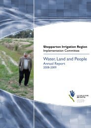
Water, Land and People<br />
Annual Report<br />
2010 - 2011
2<br />
For further information contact:<br />
Peter Howard<br />
<strong>Goulburn</strong> Broken Catchment Management Authority<br />
<strong>Shepparton</strong> <strong>Irrigation</strong> <strong>Region</strong> <strong>Implementation</strong> <strong>Committee</strong><br />
C/o Department of Primary Industries<br />
255 Ferguson Road<br />
Tatura<br />
Victoria 3616<br />
Phone: (03) 5833 5343<br />
Fax: (03) 5833 5299<br />
Email: peter.howard@dpi.vic.gov.au<br />
Published by<br />
<strong>Goulburn</strong> Broken Catchment Management Authority<br />
PO BOX 1752<br />
<strong>Shepparton</strong><br />
Victoria 3632<br />
ISSN: 1440 – 987X<br />
Find more information about the <strong>Goulburn</strong> Broken Catchment Management Authority on the web at:<br />
www.gbcma.vic.gov.au<br />
Cover image and page 7: Roger Wrigley, Chair of <strong>Shepparton</strong> <strong>Irrigation</strong> <strong>Region</strong> <strong>Implementation</strong> <strong>Committee</strong>.<br />
Photographer: Peter Howard - GB CMA<br />
Acknowledgment<br />
This project is funded as part of the <strong>Goulburn</strong> Broken Catchment Management Authority <strong>Region</strong>al Catchment Strategy<br />
in the <strong>Shepparton</strong> <strong>Irrigation</strong> <strong>Region</strong> and is provided with support and funding from the Australian Government and<br />
Victorian Government. This project is delivered primarily through partnerships between the Department of Primary<br />
Industries, <strong>Goulburn</strong>-Murray Water, Department of Sustainability and Environment, the <strong>Goulburn</strong> Broken Catchment<br />
Management Authority, North Central Catchment Management Authority and other bodies.<br />
Disclaimer<br />
The information contained in this report is offered by the State of Victoria, solely to provide information. While the<br />
information contained in this report has been formulated with due care, the State of Victoria, its servants and agents<br />
accept no responsibility for any error, omission, loss or other consequence which may arise from any person relying on<br />
anything contained in this paper.
Contents<br />
OVERVIEW ........................................................................................ 4<br />
CHAIR’S MESSAGE .......................................................................... 7<br />
ACTIVITIES and ACHIEVEMENTS ............................................... 9<br />
Executive Team Report ...................................................................................................9<br />
Environment Program ...................................................................................................10<br />
Farm Program ................................................................................................................13<br />
Surface Water Management Program .........................................................................14<br />
Groundwater and Salt Management Program............................................................15<br />
Waterways Program ......................................................................................................17<br />
Monitoring Program ......................................................................................................19<br />
Program Support ...........................................................................................................22<br />
Research Program ..........................................................................................................23<br />
APPENDICES .................................................................................. 26<br />
ABBREVIATIONS ........................................................................... 38<br />
ACKNOWLEDGMENTS ................................................................ 39<br />
3
OVERVIEW<br />
4<br />
OVERVIEW<br />
<strong>Goulburn</strong> Broken Catchment Management<br />
Authority<br />
The <strong>Goulburn</strong> Broken Catchment Management Authority<br />
(GB CMA) is a statutory authority established by the<br />
Victorian Government to coordinate land, water and<br />
biodiversity management. Under the Catchment and<br />
Land Protection Act 1994 the GB CMA was established<br />
as the peak natural resource management body in the<br />
<strong>Goulburn</strong> Broken catchment to develop and oversee the<br />
implementation of the <strong>Region</strong>al Catchment Strategy.<br />
The GB CMA has two geographically based<br />
<strong>Implementation</strong> <strong>Committee</strong>s: the <strong>Shepparton</strong><br />
<strong>Irrigation</strong> <strong>Region</strong> <strong>Implementation</strong> <strong>Committee</strong> and the<br />
Broken <strong>Goulburn</strong> <strong>Implementation</strong> <strong>Committee</strong>. The<br />
<strong>Implementation</strong> <strong>Committee</strong>s comprise community<br />
representatives appointed by the GB CMA and a nonvoting<br />
representative from each of the Department of<br />
Primary Industries, Department of Sustainability and<br />
Environment and <strong>Goulburn</strong>-Murray Water.<br />
The prime function of <strong>Implementation</strong> <strong>Committee</strong>s is<br />
to support and communicate implementation of the<br />
priorities of the <strong>Region</strong>al Catchment Strategy and to<br />
provide feedback on the local community’s view. The<br />
<strong>Implementation</strong> <strong>Committee</strong> members are appointed for a<br />
period of four years.<br />
A charter established by the GB CMA sets out<br />
operational guidance and direction, an operational<br />
framework, together with roles and responsibilities for<br />
the <strong>Implementation</strong> <strong>Committee</strong>s.<br />
The <strong>Implementation</strong> <strong>Committee</strong> roles include:<br />
• providing advice to the Board on GB CMA Policy,<br />
including the <strong>Region</strong>al Catchment Strategy;<br />
• providing comment and feedback on proposed GB<br />
CMA works programs;<br />
• involving others in decision-making (where relevant)<br />
and/or keeping them up-to-date about appropriate<br />
decisions and actions;<br />
• listening to, understanding and passing on the regional<br />
communities’ points of view;<br />
• reporting to and/or providing feedback from various<br />
community committees to enhance the connection<br />
of the GB CMA to the community.<br />
The <strong>Region</strong>al Catchment Strategy in the <strong>Shepparton</strong><br />
<strong>Irrigation</strong> <strong>Region</strong> is funded jointly by the regional<br />
community, the Australian, Victorian and Local<br />
Governments. The works program is delivered by<br />
government agencies and landholders working in<br />
partnership to implement the <strong>Region</strong>al Catchment<br />
Strategy.<br />
<strong>Shepparton</strong> <strong>Irrigation</strong> <strong>Region</strong><br />
<strong>Implementation</strong> <strong>Committee</strong><br />
The <strong>Shepparton</strong> <strong>Irrigation</strong> <strong>Region</strong> <strong>Implementation</strong><br />
<strong>Committee</strong> (SIR IC) provides community engagement and<br />
supports the priorities and programs of the <strong>Goulburn</strong><br />
Broken <strong>Region</strong>al Catchment Strategy in the <strong>Shepparton</strong><br />
<strong>Irrigation</strong> <strong>Region</strong>. These programs are collectively referred<br />
to as the <strong>Shepparton</strong> <strong>Irrigation</strong> <strong>Region</strong> Catchment<br />
<strong>Implementation</strong> Strategy (SIRCIS).<br />
The SIRCIS is a 30-year strategy that provides the<br />
framework for land, water and biodiversity management.<br />
Commencing in 1989, with whole community cooperation,<br />
the strategy aims to improve the condition of<br />
natural resources in the <strong>Shepparton</strong> <strong>Irrigation</strong> <strong>Region</strong>.<br />
SIR IC community representatives have the opportunity<br />
to provide advice as members of working groups and<br />
technical support committees. The operational framework<br />
of SIR IC is illustrated in the chart on page 5.<br />
Working Groups<br />
SIR IC operates four Working Groups: Farm and<br />
Environment; Surface Water Management; Groundwater<br />
and Salt Management, and Waterways. All Working<br />
Groups comprise community representatives including<br />
representatives from each of the four Water Service<br />
<strong>Committee</strong>s of <strong>Goulburn</strong>-Murray Water, Victorian<br />
Farmers Federation, Local Government, environmental<br />
groups and agency representatives.<br />
Technical support<br />
SIR IC is supported by an Executive Team and Partnership<br />
Agency representatives who provide executive support<br />
and technical advice. SIR IC community representatives<br />
have the opportunity to provide advice on issues through<br />
the <strong>Shepparton</strong> <strong>Irrigation</strong> <strong>Region</strong> Technical Support<br />
<strong>Committee</strong>, (SIRTEC).<br />
Partnership collaboration<br />
To deliver the SIRCIS works program, a collaborative<br />
partnership between government agencies and the GB<br />
CMA has been established. The partnerships operate<br />
under a memorandum of understanding. Agencies include:<br />
the Department of Primary Industries, <strong>Goulburn</strong>-<br />
Murray Water and the Department of Sustainability and<br />
Environment. “Service Level Agreements” are established
annually between the agencies and the GB CMA covering<br />
an agreed program of works.<br />
SIR IC maintains close links with local government under<br />
formal arrangements with Greater <strong>Shepparton</strong> City<br />
Council, Shire of Campaspe and Moira Shire through the<br />
Municipal Catchment Coordinator role.<br />
The <strong>Shepparton</strong> <strong>Irrigation</strong> <strong>Region</strong> - Our<br />
region<br />
The <strong>Shepparton</strong> <strong>Irrigation</strong> <strong>Region</strong> covers over 500,000<br />
hectares and occupies approximately one third of the<br />
<strong>Goulburn</strong> Broken catchment, the eastern area of the<br />
North Central catchment and forms part of the Murray-<br />
Darling Basin.<br />
The irrigated area of 317,000 hectares within the<br />
<strong>Shepparton</strong> <strong>Irrigation</strong> <strong>Region</strong> utilises approximately 1.5<br />
million megalitres of water each year.<br />
<strong>Committee</strong>s, Agencies, Community Groups<br />
<strong>Shepparton</strong> <strong>Irrigation</strong> <strong>Region</strong> Catchment <strong>Implementation</strong> Strategy Partners<br />
North Central<br />
Catchment<br />
Management<br />
Authority<br />
Executive Support<br />
Working Groups:<br />
• Farm & Environment<br />
• Surface Drainage<br />
• Groundwater & Salt<br />
• Waterways<br />
Landcare<br />
Groups<br />
Community<br />
Action<br />
Groups<br />
<strong>Goulburn</strong> Broken Catchment<br />
Management Authority<br />
<strong>Shepparton</strong><br />
<strong>Irrigation</strong> <strong>Region</strong><br />
<strong>Implementation</strong><br />
<strong>Committee</strong><br />
Landholder<br />
Groups<br />
including<br />
Local Area<br />
Plan Groups<br />
The gross value of agricultural production in 2005-2006<br />
(ABS) was $1.38 billion. This accounts for 14.9 percent of<br />
Victoria’s gross value of agricultural production. The main<br />
primary industries are horticulture, dairying, cropping and<br />
grazing.<br />
The population of the <strong>Shepparton</strong> <strong>Irrigation</strong> <strong>Region</strong> is<br />
over 120,000 people and includes more than 7000 rural<br />
properties, with over 20 percent of those landholders<br />
being of a multicultural background.<br />
Our region is home to the largest Indigenous Australian<br />
population outside metropolitan Melbourne. Cultural<br />
and linguistic diversity is a feature of the region where<br />
well established communities, primarily as a result of<br />
Southern European post-war migration, co-exist with<br />
more recently arrived communities from countries such<br />
as Iraq, Iran and India.<br />
Broken <strong>Goulburn</strong><br />
<strong>Implementation</strong><br />
<strong>Committee</strong><br />
Partnership Agencies:<br />
DPI, DSE, G-MW,<br />
NVIRP & GVW<br />
SIR Technical Support<br />
<strong>Committee</strong><br />
Local Government<br />
Shire of Campaspe<br />
Moira Shire<br />
City of Greater <strong>Shepparton</strong><br />
Drainage<br />
Groups<br />
Individual<br />
Landholders<br />
OVERVIEW<br />
5
Victoria<br />
<strong>Goulburn</strong> Broken<br />
Catchment<br />
Peter Gibson<br />
• Member since 1995<br />
• Past Chair<br />
• Member of the<br />
Surface Water<br />
Management<br />
Working Group<br />
Peter is an irrigation<br />
dairy farmer and<br />
business manager at<br />
Nanneella and is involved in a number<br />
of committees and organisations. He is<br />
passionate about the use of water and its<br />
impact on the environment into the future.<br />
The <strong>Region</strong>al Catchment Strategy is a<br />
critical document and sets targets and<br />
priorities for on-ground works. Peter has<br />
been Chair of the Nanneella/Timmering<br />
Landcare group for a number of years<br />
and is a member of the Rochester<br />
Campaspe Water Services <strong>Committee</strong>.<br />
6<br />
<strong>Shepparton</strong> <strong>Irrigation</strong> <strong>Region</strong><br />
Community <strong>Implementation</strong> Representatives <strong>Committee</strong><br />
Stephen Farrell<br />
• Member since 2002<br />
• Member of the<br />
Surface Water<br />
Management<br />
Working Group<br />
Stephen is a dairy<br />
farmer from Echuca.<br />
Stephen is an active<br />
Landcare member and<br />
is concerned about all aspects affecting<br />
the environment. Stephen believes<br />
landowners should be encouraged to use<br />
better farming practices and communities<br />
made aware of the long term benefits of<br />
the implementation of on-ground works.<br />
Stephen’s main focus is to balance<br />
environmental management with farming<br />
practices. Another important focus is<br />
maintaining farm productivity, profitability<br />
and provide a future for our sons and<br />
daughters.<br />
Nick Ryan<br />
• Member since 2004<br />
• Member of the<br />
Waterways Working<br />
Group and Farm<br />
and Environment<br />
Working Group<br />
Nick is an irrigation<br />
dairy farmer and has<br />
a keen interest in<br />
sustainable economic growth and natural<br />
resource management in the <strong>Shepparton</strong><br />
<strong>Irrigation</strong> <strong>Region</strong>. Nick is Chairman of<br />
a Steering <strong>Committee</strong> project ‘Future<br />
Dairy Farming Systems’. Nick brings a<br />
number of skills to the program and is a<br />
keen advocate of community consultation<br />
keeping the public informed of the work<br />
done by the implementation committee<br />
and its working groups.<br />
Allen Canobie<br />
• Member since 1990<br />
• Past Chair<br />
• Chair of the Surface<br />
Water Management<br />
Working Group<br />
Allen is an irrigation<br />
farmer at Numurkah<br />
who has been involved<br />
with environmental<br />
management since the days of the salinity<br />
program (Salinity Program Advisory Council).<br />
He is committed to promoting better farming<br />
practices encompassing revegetation,<br />
nutrients and fertiliser use. Allen also has<br />
a strong commitment to developing better<br />
partnerships with processing bodies and<br />
industry and the wider community.<br />
John Gray<br />
• Member since 2006<br />
• Member of the<br />
Waterways<br />
Working Group<br />
and Farm and<br />
Environment<br />
Working Group<br />
John Gray is a retired<br />
school teacher<br />
who has had vast<br />
experience as a municipal councillor, and<br />
as a government appointee to the former<br />
Catchment and Land Protection Board, the<br />
GB CMA and <strong>Goulburn</strong> Valley Water. He is<br />
proud to have enthusiastically embraced<br />
successful cultural and organisational<br />
changes in natural resource management,<br />
the water industry and local government<br />
over the past progressive couple of decades.<br />
John is committed to the environment,<br />
sound sustainable land planning principles,<br />
floodplain management and best utilisation<br />
of our finite water resource.<br />
Roger Wrigley<br />
Chair<br />
• Chair since<br />
September 2010<br />
• Member since 2006<br />
• Member of the<br />
Waterways Working<br />
Group and Farm<br />
and Environment<br />
Working Group<br />
Roger is a geotechnical and environmental<br />
engineer and soil scientist engaged as an<br />
academic by the University of Melbourne<br />
at Dookie College and Monash University.<br />
His research and practice is related to<br />
soil,water and waste management.<br />
Helen Reynolds<br />
Deputy Chair<br />
• Deputy Chair since<br />
September 2010<br />
• Member since 2006<br />
• Member of the<br />
Groundwater and<br />
Salt Management<br />
Working Group<br />
Helen is an irrigation<br />
grain farmer and<br />
enthusiastic conservationist and has a<br />
background in ecology and natural resource<br />
management. She is President of the<br />
<strong>Goulburn</strong> Valley Environment Group and<br />
an active member of the Victorian Farmers<br />
Federation and the Victorian Irrigated<br />
Cropping Council. She is interested in<br />
seeing the region flourish through improved<br />
environmental management on farms and<br />
enhanced protection and management of<br />
public land.
CHAIR’S MESSAGE<br />
Roger Wrigley<br />
Chair<br />
<strong>Shepparton</strong><br />
<strong>Irrigation</strong><br />
<strong>Region</strong><br />
<strong>Implementation</strong><br />
<strong>Committee</strong><br />
The <strong>Shepparton</strong> <strong>Irrigation</strong> <strong>Region</strong> <strong>Implementation</strong><br />
<strong>Committee</strong> (SIR IC) in collaboration with our<br />
partner agencies, Local Government, landholders and<br />
communities supports a program of works that align<br />
with the objectives of the <strong>Shepparton</strong> <strong>Irrigation</strong> <strong>Region</strong><br />
Catchment <strong>Implementation</strong> Strategy (SIRCIS). This annual<br />
report details those works and the progress achieved<br />
during 2010-2011.<br />
The Victorian and Australian Governments approved<br />
$49 million for the Sustainable <strong>Irrigation</strong> Program<br />
through various initiatives. Of these funds, $21.1 million<br />
was provided by the Federal Government Department<br />
of Sustainability, Environment, Water, Population and<br />
Communities (SEWPAC) and $16.4 million by the<br />
Northern Victoria <strong>Irrigation</strong> Renewal Project for the first<br />
round of the Farm Water On-Farm <strong>Irrigation</strong> Efficiency<br />
Program. The Farm Water Program funding was allocated<br />
over 2010-2011 and 2011-2012.<br />
The amount of funds available for 2010-2011 for the<br />
SIRCIS was $33.4 million for Environmental, Farm, Surface<br />
Water, Groundwater and Salt Management; $11.9 million<br />
for the River Health programs and $21.5 million for the<br />
Farm Water Program. In addition, SIR IC attracted over<br />
$2.1 million of regional funds.<br />
Reduced funding has limited the Groundwater and Salt<br />
and the Surface Water Management program activities.<br />
Farm Program activities have however increased as a<br />
means of encouraging landholders to use water more<br />
efficiently (integration with the irrigation modernisation<br />
program) and to find water savings (On-farm <strong>Irrigation</strong><br />
Efficiency Program).<br />
The result of the long dry period interspersed with<br />
periods of drought between 1997 and 2009 continues<br />
to have an impact on our works programs, especially the<br />
Environmental, the Surface Water, and the Groundwater<br />
and Salt Management programs. The heavy spring rains<br />
and frequent storm events through summer brought<br />
significant flooding events and a return of water in the<br />
storages for a more normal irrigation season next year.<br />
In 2010-2011 the risks of land salinisation, waterlogging<br />
and saline inflows into the River Murray have increased<br />
due to high spring and summer rainfall, the resulting rise<br />
in shallow watertables and more regular water quality<br />
issue responses.<br />
Works undertaken through SIR IC’s programs since 1990<br />
mean that the <strong>Shepparton</strong> <strong>Irrigation</strong> <strong>Region</strong> programs are<br />
still the most effective means to manage a return to a run<br />
of wet years in terms of drainage, water table control and<br />
salinity mitigation.<br />
During 2010-2011 the <strong>Goulburn</strong> Broken Catchment<br />
Management Authority (GB CMA) conducted a review of<br />
the <strong>Implementation</strong> <strong>Committee</strong> structure in recognition<br />
of changes in project delivery arrangements and the need<br />
for increased accountability.<br />
As an outcome of this review, SIR IC will conclude<br />
operations and a new community engagement approach,<br />
adopted by the GB CMA Board will commence from<br />
August 2011.<br />
The new community engagement structure will be aligned<br />
to support the delivery of the three GB CMA Programs<br />
plus a ‘Whole of Catchment’ community forum that will<br />
be established to advise the Board.<br />
The three GB CMA delivery Programs are:<br />
• Sustainable <strong>Irrigation</strong>,<br />
• Land and Biodiversity, and<br />
• River & Wetland Health and Floodplain Management.<br />
The Sustainable <strong>Irrigation</strong> Program will establish a<br />
Community Engagement Advisory Group which will meet<br />
the community’s desire to provide advice on natural<br />
resource management issues. It is proposed that this<br />
group will be formed in early 2012.<br />
After chairing SIR IC for four years, Peter Gibson<br />
returned to SIR IC as a community representative. I was<br />
elected Chair and Helen Reynolds was elected Deputy<br />
Chair. The new advisory group will have the advantage<br />
of drawing on the experience of some ex-SIR IC<br />
members and building on years of successful community<br />
engagement conducted under the auspices of SIR IC.<br />
This augurs well for their success.<br />
CHAIR’S MESSAGE<br />
7
CHAIR’S MESSAGE<br />
8<br />
I would like to thank my fellow committee members:<br />
Allen Canobie, Steve Farrell, Peter Gibson, John Gray,<br />
Helen Reynolds, Nick Ryan and John Wenske for their<br />
contribution to the <strong>Committee</strong>, Working Groups and<br />
individual community forums throughout the year.<br />
As this is the last Annual Report from SIR IC, I would also<br />
like to acknowledge the tremendous contribution made<br />
by all the community members of the <strong>Implementation</strong><br />
<strong>Committee</strong> during its 16 years in operation.<br />
They are listed in the table below. Their wit, wisdom,<br />
experience and willingness to work together have<br />
provided a vital link with the people and communities of<br />
the <strong>Shepparton</strong> <strong>Irrigation</strong> <strong>Region</strong>.<br />
Roger Wrigley<br />
Chair<br />
<strong>Shepparton</strong> <strong>Irrigation</strong> <strong>Region</strong> <strong>Implementation</strong> <strong>Committee</strong><br />
Member Position Term of service<br />
John Avard SIRIC Community Member 1995-2002<br />
Ron Brooks SIRIC Community Member 1997-1998<br />
Morris Brown SIRIC Community Member 1997-1998<br />
Allen Canobie SIRIC Chair 1995-2011<br />
John Cornish SIRIC Community Member 1995-1998<br />
Ross Crawford SIRIC Community Member 1997-1998<br />
Stephen Farrell SIRIC Community Member 2002-2011<br />
Peter Gibson SIRIC Chair/Deputy Chair 1995-2011<br />
John Gray SIRIC Community Member 2006-2011<br />
Morice Holland SIRIC Community Member 1995-1998<br />
Ian Klein SIRIC Community Member 1995-1998<br />
Dennis Leavesley SIRIC Community Member 1995-1997<br />
Peter McCamish SIRIC Deputy Chair 2000-2008<br />
Athol McDonald SIRIC Chair 1995-1998, 2000-2004<br />
Murray McDonald SIRIC Community Member 1995-1997<br />
Stephen Mills SIRIC Community Member 1998-2002<br />
Russell Pell SIRIC Chair 1998-2006<br />
John Pettigrew SIRIC Deputy Chair 1995-2000<br />
Helen Reynolds SIRIC Deputy Chair 2006-2011<br />
Ann Roberts SIRIC Community Member 2000-2006<br />
Nick Roberts SIRIC Community Member 2002-2006<br />
Noel Russell SIRIC Chair/Deputy Chair 1995-2000<br />
Nick Ryan SIRIC Community Member 2004-2011<br />
George Trew SIRIC Community Member 1995-1998<br />
Gordon Weller SIRIC Community Member 1995-1998<br />
John Wenske SIRIC Community Member 2008-2010<br />
Geoff Witten (deceased) SIRIC Community Member 1995-1998<br />
Roger Wrigley SIRIC Chair/Deputy Chair 1998-2000, 2006-2011
ACTIVITIES and ACHIEVEMENTS<br />
Executive Team Report<br />
Written by Carl Walters and Peter Howard, <strong>Shepparton</strong><br />
<strong>Irrigation</strong> <strong>Region</strong> <strong>Implementation</strong> <strong>Committee</strong> and Rod<br />
McLennan, <strong>Goulburn</strong> Broken Catchment Management<br />
Authority<br />
<strong>Implementation</strong> of the <strong>Shepparton</strong> <strong>Irrigation</strong> <strong>Region</strong><br />
Catchment <strong>Implementation</strong> Strategy (SIRCIS) continues<br />
to progress despite the region enduring widely varying<br />
climatic conditions and changing funding priorities.<br />
Reduced commodity prices and an inability to meet<br />
community demand for drainage and therefore salinity<br />
control have impacted on the region.<br />
The Victorian and Australian Governments approved $49<br />
million to the Sustainable <strong>Irrigation</strong> Program through<br />
various initiatives such as, Healthy Waterways, Large Scale<br />
River Restoration, Linking Farms, Salinity Infrastructure,<br />
Sustainable Irrigated Agricultural Land Management<br />
(SIALM), Victorian Water Trust – Water Smart Farms,<br />
Caring for Our Country and Natural Resources<br />
Investment Program and the On-Farm <strong>Irrigation</strong> Efficiency<br />
Program.<br />
The emphasis again was to link implementation of<br />
the SIRCIS with the various modernisation programs,<br />
especially the Northern Victoria <strong>Irrigation</strong> Renewal<br />
Project (NVIRP) and the Farm Water Program, to<br />
optimise opportunities presented by changes to delivery<br />
systems.<br />
Works and activities are delivered in collaboration<br />
with our regional partners in the Department of<br />
Primary Industries, <strong>Goulburn</strong>-Murray Water and the<br />
Department of Sustainability and Environment, NVIRP<br />
and most importantly the community. Our links with<br />
Local Government form part of the strategy to ensure<br />
a consistent approach to natural resource management<br />
issues across the <strong>Shepparton</strong> <strong>Irrigation</strong> <strong>Region</strong>.<br />
<strong>Irrigation</strong> Modernisation<br />
Through NVIRP a $2 billion works program is being<br />
undertaken to modernise Victoria’s Foodbowl region<br />
by upgrading ageing irrigation infrastructure. An average<br />
of more than 800 gigalitres of water is being lost every<br />
year through leaks, system inefficiencies, evaporation and<br />
seepage.<br />
Modernisation will improve efficiency and service to<br />
irrigators and will underpin future economic growth<br />
and regional prosperity. Modernisation will recover an<br />
estimated 225 gigalitres of lost water by 2012. The water<br />
savings will be shared equally between irrigators, the<br />
environment and Melbourne. Modernisation will provide<br />
confidence for communities that are facing significant<br />
challenges because of the drought and uncertainty<br />
created by the draft Guide to the Murray-Darling Basin<br />
Plan and implications of Sustainable Diversion Limits<br />
SIR IC has worked closely with NVIRP and other<br />
modernisation activities to ensure that water saving<br />
projects are consistent with and complementary to<br />
implementation of the SIRCIS.<br />
In the latter stages of 2010-2011, significant efforts were<br />
devoted to developing the On-Farm <strong>Irrigation</strong> Efficiency<br />
Program Round 2 funding bid, locally known as the ‘Farm<br />
Water Program’, and the subsequent business case. The<br />
Farm Water Program started to roll out in 2010-2011.<br />
NVIRP approved $16.4 million in September for 75<br />
projects and the Australia Government approved $21.1<br />
million for 78 projects in November. As at 30 June 2011,<br />
149 projects had been funded.<br />
Works and operations - highlights<br />
• Whole Farm Plans on 256 properties covering<br />
21,388 hectares were completed, including 69<br />
‘revised modernised’ plans, bringing the total number<br />
of whole farm plans under this incentive to 4,090<br />
covering 283,636 hectares or 89.5 per cent of the<br />
irrigated area.<br />
• Seven re-use systems draining 4,518 hectares were<br />
installed under the Farm Water Program, bringing<br />
the total number of reuse systems constructed with<br />
assistance from this scheme to 632 serving 40,384<br />
hectares.<br />
• No automatic irrigation systems were installed,<br />
but many are underway through the Farm Water<br />
Program. The total number of automatic irrigation<br />
systems constructed remains at 149, serving 8,710<br />
hectares.<br />
• Twenty-five landholders were supported to<br />
undertake environmental and tree growing projects.<br />
They fenced 18 kilometres of fencing helping protect<br />
60 hectares of remnant vegetation, and enhanced 21<br />
hectares.<br />
• A total of 2.5 kilometres of fencing was erected<br />
to protect 440 hectares of remnant vegetation in<br />
Kanyapella Basin. Five hectares of open country was<br />
revegetated with the support of the Kanyapella-<br />
Koyuga Landcare Group. A four-week fox control<br />
program was conducted throughout the Basin helping<br />
reduce the fox population.<br />
ACTIVITIES AND ACHIEVEMENTS<br />
9
ACTIVITIES AND ACHIEVEMENTS<br />
10<br />
• Environmental site assessments completed across<br />
the <strong>Goulburn</strong> Murray <strong>Irrigation</strong> District for NVIRP<br />
comprised:<br />
• 1,245 assessments on meters and 133 on access<br />
to the meter sites<br />
• 139 assessments on channel regulators and 16<br />
on access to the regulators<br />
• 177 connections’ business cases; including 600<br />
individual assessments (channel decommissioning,<br />
culverts, road crossings, subways, meters,<br />
regulators)<br />
• 6,079 field work hours.<br />
• Highlights of the River Health and Wetland program<br />
included 41 hectares of revegetation, 5.0 kilometre<br />
of Lower Broken Creek (34 hectares direct seeding<br />
and 7.6 hectares of woody weed control and the<br />
reinstatement of 150 cubic metres of large woody<br />
debris (snags) in the <strong>Goulburn</strong> River below Toolamba.<br />
<strong>Shepparton</strong> <strong>Irrigation</strong> <strong>Region</strong> Catchment<br />
<strong>Implementation</strong> Strategy Program reports<br />
• Environment (including Biodiversity)<br />
• Farm<br />
• Surface Water Management<br />
• Groundwater and Salt Management<br />
• Waterways<br />
• Monitoring<br />
• Program Support<br />
• Research<br />
Environment Program<br />
Written by Jen Pagon, Department of Primary Industries<br />
Program Goal: To protect and enhance natural assets and their<br />
ecosystem processes and functions in a way that provides<br />
benefits for native biodiversity, social and economic aspects.<br />
The Environment Program is a component of the<br />
Farm and Environment Program and a key delivery<br />
program for the <strong>Shepparton</strong> <strong>Irrigation</strong> <strong>Region</strong><br />
Catchment <strong>Implementation</strong> Strategy. The Environment<br />
Program supports the main action programs including:<br />
Groundwater and Salt Management, Farm, Surface Water<br />
Management and Waterways.<br />
The Environment Program provides a key service to the<br />
Groundwater and Salt Management Program and Surface<br />
Water Management Program in particular by providing<br />
Environmental Assessments of planned and completed<br />
works.<br />
The Environment Program has increasingly been involved<br />
in protecting natural assets through the modernisation<br />
and reconfiguration project, and ensuring that the natural<br />
assets of our catchment are incorporated into day-to-day<br />
farm management.<br />
Activities and achievements<br />
Surface Water Management Program:<br />
Timmering Primary Surface Water Management<br />
System<br />
A meeting at Corop on 25 November between Parks<br />
Victoria, <strong>Goulburn</strong>-Murray Water, Department of Primary<br />
Industries and landholders adjacent to Mansfield Swamp<br />
addressed some concerns over the operation and<br />
function of Timmering drain structures during the spring<br />
floods. Structures in the Timmering drain have been<br />
designed to divert flows (when desired) into Mansfield<br />
Swamp. The recent floods are the first time these<br />
structures have been seriously tested.<br />
This was an opportunity to hear from landowners firsthand<br />
how the drain structures functioned over a wet<br />
spring, the impact on private land and the impact on<br />
Mansfield Swamp. It also helped inform landowners about<br />
how the drain supports Mansfield Swamp, while providing<br />
drainage service to irrigated farms. The issues raised as a<br />
result of the discussions will be followed up to ensure the<br />
drainage network achieves the best possible outcomes<br />
for both landowners and environmental assets.
Groundwater and Salt Management Program<br />
High Value Environmental Features bus trip<br />
A bus trip to showcase some of the ongoing and<br />
completed works at the Millewa Nature Conservation<br />
Reserve and Kanyapella Basin was held on the 29th June.<br />
The trip included presentations by technical staff from<br />
Department of Primary Industries and <strong>Goulburn</strong>-Murray<br />
Water and also community representatives regarding<br />
managing social, groundwater and salinity impacts of the<br />
works. Twenty five community members were shown<br />
some of the significant environmental features of both<br />
Millewa and Kanyapella.<br />
Attendees on the High Value Environmental Features Millewa – Kanyapella<br />
bus trip<br />
Environmental and Tree Growing Projects<br />
The Environmental and Tree Growing Projects provide<br />
advice to landholders throughout the <strong>Shepparton</strong><br />
<strong>Irrigation</strong> <strong>Region</strong> relating to protection, enhancement and<br />
revegetation of native vegetation.<br />
This year the Environment Project contributed to the<br />
protection of 39 hectares of remnant vegetation. Of<br />
this area, over 21 hectares were enhanced with new<br />
plantings. An additional 31 hectares of native vegetation<br />
was established. The protection, enhancement and<br />
establishment works required 5.6 kilometres of fence to<br />
be erected, 10,213 plants and 48.5 km of direct seeding.<br />
The Tree Growing Project completed 19 hectares of new<br />
plantings where 12.6 km of fence was erected and 17,029<br />
plants were planted.<br />
The Environmental and Tree Growing Project incentives<br />
were increased during 2010-2011 to more closely reflect<br />
the incentives offered in other parts of the <strong>Goulburn</strong><br />
Broken Catchment. The new rates (applicable to all<br />
new incentives processed from 1st of July onwards)<br />
are $8.00/m fence, $3.00 /plant and $366.66/km direct<br />
seeding.<br />
Modernisation<br />
<strong>Goulburn</strong> Murray <strong>Irrigation</strong> District:<br />
Through aligning our service delivery with Northern<br />
Victoria <strong>Irrigation</strong> Renewal Project (NVIRP) the<br />
Environment Program successfully negotiated a contract<br />
with NVIRP for provision of Environmental Site<br />
Assessments (for four staff members) for works across<br />
the <strong>Goulburn</strong> Murray <strong>Irrigation</strong> District.<br />
Environmental Site Assessment works for 2010-2011<br />
were:<br />
• 1,245 meter sites<br />
• 133 meter site access<br />
• 139 channel regulators<br />
• 16 regulator access<br />
• 177 connections business cases; including 600<br />
individual assessments (channel decommissioning,<br />
culverts, road crossings, subways, meters, regulators)<br />
• 6,079 field work hours<br />
Wetland Management<br />
The Environment Program provides services to partner<br />
agencies and farm businesses in the area of wetland<br />
management.<br />
Achievements<br />
Kanyapella Basin<br />
The Kanyapella Basin Expression of Interest for funding<br />
through the <strong>Goulburn</strong> Broken Catchment Management<br />
Authority was successful. The project will be implemented<br />
over 2010-2011 and will see two inlet/control structures<br />
installed to assist with water management across the<br />
basin, fox control, revegetation and fencing, information<br />
signs erected and extension brochures developed.<br />
The Koyuga Kanyapella Landcare Group conducted a<br />
tree planting day at Kanyapella Basin on 3rd October.<br />
Approximately three hectares of Black Box Woodland<br />
was planted by volunteers (1,300 plants). The work was<br />
funded by the <strong>Goulburn</strong> Broken Catchment Management<br />
Authority, through the Department of Primary Industries<br />
led Kanyapella Basin Steering <strong>Committee</strong>.<br />
The Kanyapella Basin Steering <strong>Committee</strong> (facilitated<br />
by Department of Primary Industries), agreed to<br />
install fox bait stations and conduct a summer baiting<br />
program on <strong>Goulburn</strong>-Murray Water managed land at<br />
Kanyapella Basin. This expands the area controlled from<br />
approximately 500 hectares to 2,500 hectares and is<br />
part of a year round fox control strategy that includes<br />
an annual winter fox hunt managed by Field and Game<br />
Australia.<br />
ACTIVITIES AND ACHIEVEMENTS<br />
11
ACTIVITIES AND ACHIEVEMENTS<br />
12<br />
The four week fox baiting program was conducted from<br />
April 18th - May 18th. The contractors reported on the<br />
success of the baiting project to the steering committee<br />
meeting. A fox population survey prior to baiting<br />
estimated that Kanyapella Basin had approximately 200<br />
foxes. Following the baiting program the estimated fox<br />
population has been reduced to approximately 22 foxes.<br />
The significant rainfall events this year have resulted in<br />
increased volumes of surface water entering the Basin<br />
during December. High flows through the Tongala, Coram<br />
and Wyuna drainage networks, combined with the high<br />
Lower <strong>Goulburn</strong> River, have resulted in a greater area of<br />
flooding in the River Red Gum forest than occurred in<br />
September. <strong>Goulburn</strong>-Murray Water opened the Yambuna<br />
Creek structure again, as well as the inlet channels into<br />
Wildlife Bays 1 and 2 in the southern section of the Basin<br />
to maximise the flood event.<br />
Flooding in Kanyapella Basin at the Tongala Primary Surface Water Management<br />
System outfall into Warrigal Creek.<br />
There was 2.5km of new boundary fence constructed<br />
along Tehan Road in May and a cattle grid was also<br />
installed.<br />
Gaynor Swamp Environmental Management Plan<br />
The draft Gaynor Swamp Environmental Management<br />
Plan was presented to SIRTEC on 12 July and SIR IC on<br />
30 July for comment. This document is undergoing its<br />
technical review process under the guidelines for the<br />
development of Environmental Management Plans in the<br />
<strong>Shepparton</strong> <strong>Irrigation</strong> <strong>Region</strong>.<br />
Analysis of acoustic data<br />
Professor Stuart Gage, Michigan State University, visited<br />
DPI Tatura on 24 November as part of a broader<br />
Australian visit. Professor Gage provided technical<br />
support and advice for a project to analyse two years of<br />
acoustic data collected from Reedy Swamp while it was<br />
artificially flooded as a drought refuge in the <strong>Shepparton</strong><br />
<strong>Irrigation</strong> <strong>Region</strong> between April 2008 and April 2010. The<br />
analysis will provide an assessment of the health of the<br />
Reedy Swamp ecosystem over time.<br />
Biodiversity<br />
Written by Steve Wilson, <strong>Goulburn</strong> Broken Catchment<br />
Management Authority<br />
During 2010-2011 there was a suite of biodiversityrelated<br />
activity across the <strong>Shepparton</strong> <strong>Irrigation</strong> <strong>Region</strong>.<br />
This included:<br />
• Completion of the “Caring For Our Country” Multi-<br />
<strong>Region</strong>al Woodlands projects which has been running<br />
for the past two years; over 600ha of woodlands sites<br />
were protected in the past 12 months;<br />
• The Caring For Our Country Biodiversity Incentives<br />
– Woodlands project is now active. The Department<br />
of Primary Industries is delivering the fencing<br />
and revegetation component and Department of<br />
Sustainability and Environment is driving the Bush<br />
Returns element. Through a Woodlands tender<br />
process, sites will be sourced across the catchment<br />
including the <strong>Shepparton</strong> <strong>Irrigation</strong> <strong>Region</strong>. This<br />
project will run through to June 2013; which is when<br />
the current “Caring For Country” project cycle<br />
ceases;<br />
• The long standing Superb Parrot Project continues<br />
to deliver good on-ground revegetation works with<br />
25 hectares of revegetation occurring in the past 12<br />
months;<br />
• Support to our local community groups that deliver<br />
good on-ground community outcomes at a local<br />
level such as activities by the Whroo Goldfields<br />
Catchment Management Network in the Goldfields<br />
area of the <strong>Shepparton</strong> <strong>Irrigation</strong> <strong>Region</strong>, coupled<br />
with the <strong>Goulburn</strong> Murray Landcare Network.<br />
Permanent Habitat Protection (Trust for Nature)<br />
Trust for Nature continues to work in the <strong>Shepparton</strong><br />
<strong>Irrigation</strong> <strong>Region</strong> seeking permanent protection of<br />
remnant vegetation through conservation covenants.
Farm Program<br />
Written by Rabi Maskey, Department of Primary<br />
Industries<br />
Program goal: To reduce groundwater accessions, soil<br />
salinisation and waterlogging on farms.<br />
Activities and achievements<br />
Whole Farm Plan Project<br />
There has been a high number of Whole Farm Plans<br />
prepared across all areas of the <strong>Shepparton</strong> <strong>Irrigation</strong><br />
<strong>Region</strong> in the 2010-2011 year with many landowners<br />
developing new or updating existing plans to design<br />
on-farm irrigation delivery in line with <strong>Goulburn</strong>-Murray<br />
Water upgraded infrastructure.<br />
A total of 256 Whole Farm Plans were completed<br />
covering an area of 21,388 hectares during 2010-<br />
11. This included the preparation of 69 modernised<br />
existing Whole Farm Plans covering 6,805 hectares.<br />
These modernised plans were prepared in response to<br />
modernisation activities on properties where a Whole<br />
Farm Plan had been prepared previously.<br />
<strong>Irrigation</strong> area No<br />
Area<br />
(ha)<br />
Incentives totalling $1,492,800 (excluding GST) were<br />
paid to landowners for preparing their Whole Farm Plans.<br />
Landowners paid $ 304,483, for the preparation of these<br />
plans. A total of 70 incentives were paid to landowners<br />
for having their plans certified by Local Government,<br />
resulting in 27 per cent of all plans completed in 2010-<br />
2011.<br />
Farm Water Program<br />
The Department of Primary Industries, through the<br />
Northern Rivers <strong>Irrigation</strong> team, helped in the delivery<br />
of the first and second rounds of the Farm Water<br />
Program during 2010-2011 with GB CMA. The Farm<br />
Water Program is the Australian Government funded<br />
program supporting irrigators in implementing on-farm<br />
infrastructure projects to improve the efficiency and<br />
productivity of water use and management.<br />
In Round One, the team assisted 150 landowners to<br />
prepare Farm Water Program funding applications. The<br />
process included verifying the eligibility of the landowners<br />
for the program, calculating the water savings generated<br />
by proposed activities and assisting in completing the<br />
comprehensive application form.<br />
Grant<br />
$<br />
Total cost $ Plan Cert<br />
Murray Valley 55 6,095 379,229 452,823 15<br />
Murray Valley: Horticulture 9 647 141,783 166,804 0<br />
Rochester - SIR-GB 21 1,822 114,821 139,229 7<br />
Rochester - SIR-NC 11 744 63,435 74,824 7<br />
Central <strong>Goulburn</strong> 46 2,933 190,833 235,780 12<br />
Central <strong>Goulburn</strong>: Horticulture 9 379 72,812 85,661 1<br />
<strong>Shepparton</strong> 31 1,830 128,443 156,749 19<br />
<strong>Shepparton</strong>: Horticulture 5 134 29,808 35,068 0<br />
Diversions 0 0 - - 0<br />
Totals 187 14,583 1,121,164 1,346,937 61<br />
Whole Farm Plan Totals – <strong>Irrigation</strong> Area, 30 June 2011<br />
<strong>Irrigation</strong> area No<br />
Area<br />
(ha)<br />
Grant<br />
$<br />
Total cost<br />
$<br />
Plan Cert<br />
Murray Valley 33 4044 175,480 213,971 3<br />
Rochester - SIR-GB 2 354 18,095 21,288 0<br />
Rochester - SIR-NC 2 466 12,937 15,220 0<br />
Central <strong>Goulburn</strong> 19 1354 89,282 110,477 2<br />
<strong>Shepparton</strong> 13 587 75,842 89,389 4<br />
Totals 69 6805 371,636.35 450,345.95 9<br />
Modernised Whole Farm Plans – <strong>Irrigation</strong> Area, 30 June 2011<br />
ACTIVITIES AND ACHIEVEMENTS<br />
13
ACTIVITIES AND ACHIEVEMENTS<br />
14<br />
In January 2011 the Federal Government announced<br />
Round Two of the Farm Water Program. The demand<br />
for the program has been very high with over 300<br />
“Expression of Intent” forms submitted. A ballot process<br />
was used to select 91 projects as ‘successful’ and another<br />
63 were selected as reserve projects. The team helped<br />
develop detailed application for 123 projects, 23 projects<br />
were put on hold and 8 projects have been withdrawn.<br />
In order to promote the program, the team was also<br />
involved in running 15 Farm Water Program Round<br />
Two information sessions across the <strong>Goulburn</strong> Murray<br />
<strong>Irrigation</strong> District and the North East. These sessions<br />
were designed to update landowners and service<br />
providers on the status of the Farm Water Program<br />
Round Two, provide information on specific irrigation<br />
technologies, identify economic considerations which<br />
should be addressed prior to participating in the<br />
Farm Water Program and provide an opportunity for<br />
landowners to discuss any potential projects.<br />
Department of Primary Industries prepared information<br />
notes on different forms of irrigation technology. These<br />
were prepared for drainage reuse systems, pipes and riser<br />
systems, centre pivot and lateral move sprinkler systems,<br />
surface irrigation automation systems and sub-surface<br />
drip systems. Landowners participating in Farm Water<br />
Program Round Two were able to use these information<br />
notes as part of their considerations before adopting a<br />
particular technology on their farms.<br />
Evaluation of the Farm Water Program<br />
An evaluation report has been prepared focusing on<br />
Department of Primary Industry processes within the<br />
Farm Water Program. The results are presented in a<br />
report entitled ‘Review of Round 1 of the Farm Water<br />
Program: Department of Primary Industries Processes’.<br />
Similarly, a series of semi-structured interviews were used<br />
to seek feedback from landowners as to their perceptions<br />
of how Round One of the Farm Water Program was<br />
implemented. The results are presented in a report<br />
entitled ‘Landowner Perceptions of the Effectiveness of<br />
the Farm Water Program; round one implementation<br />
process’.<br />
Farm Services Victoria Award<br />
The Department of Primary Industries Northern Rivers<br />
<strong>Irrigation</strong> team won the Customer Service category in<br />
the Department of Primary Industries Farm Services<br />
Victoria Awards in 2010. The award was presented for the<br />
work that the team had carried out in the delivery of the<br />
Farm Water Program.<br />
Surface Water Management Program<br />
Written by Neil McLeod, Department of Primary<br />
Industries and Sam Green, <strong>Goulburn</strong>-Murray Water<br />
Program Goal: By 2020, improve the health of natural<br />
resources and reduce the risk to investment in the <strong>Shepparton</strong><br />
<strong>Irrigation</strong> <strong>Region</strong>, by providing an appropriate surface water<br />
management service in areas where the total benefits,<br />
including economic, social and environmental benefits exceed<br />
the costs.<br />
Activities and achievements<br />
Primary Surface Water Management<br />
Highlights<br />
<strong>Goulburn</strong>-Murray Water delivered $816,735 of surface<br />
drainage works, funded by the <strong>Goulburn</strong> Broken and<br />
North Central Catchment Management Authorities.<br />
These works included work on Mosquito Drain 40 south<br />
of Tatura, Stanhope Depression Primary Surface Water<br />
Management System west of Stanhope and the start of<br />
the Deakin 16 Extension east of Stanhope. <strong>Goulburn</strong>-<br />
Murray Water also managed the construction of the<br />
Mosquito 8/25P Community Surface Water Management<br />
System at Byrneside.<br />
<strong>Goulburn</strong>-Murray Water provided general drainage<br />
support and responses to several ministerial enquiries<br />
following heavy rain and floods at the start of 2011.<br />
<strong>Goulburn</strong>-Murray Water provided advice to the Northern<br />
Victoria <strong>Irrigation</strong> Renewal Project (NVIRP), through the<br />
Connections Environmental Infrastructure <strong>Committee</strong>,<br />
in relation to asset rationalisation and supply of water to<br />
environmental features.<br />
<strong>Irrigation</strong> Drainage Memorandum of<br />
Understanding<br />
The revised <strong>Irrigation</strong> Drainage Memorandum of<br />
Understanding was signed by partner organisations the<br />
North Central and <strong>Goulburn</strong> Broken CMAs, <strong>Goulburn</strong>-<br />
Murray Water, Environment Protection Authority,<br />
Department of Primary Industries and Department of<br />
Sustainability and Environment.<br />
Wetland Reports and Works<br />
The irrigation infrastructure around eight wetlands was<br />
assessed for its current and possible future ability to<br />
supply environmental water with the information to be<br />
presented in detailed reports to the GB CMA.
Whole Farm Plan Referrals<br />
Whole Farm Plans are referred to <strong>Goulburn</strong>-Murray<br />
Water by the local shires under the Planning and<br />
Environment Act. <strong>Goulburn</strong>-Murray Water responded to<br />
117 whole farm plans which were referred by the shires<br />
for assessment of their impact on <strong>Goulburn</strong>-Murray<br />
Water assets and drainage flows.<br />
Community Surface Water Management<br />
Incentives<br />
Targets<br />
• Construction of 5.95km of Community Surface<br />
Water Management System<br />
• Initiation and Survey and Design of a number of<br />
Community Surface Water Management Systems<br />
Progress<br />
• Initiation of Community Surface Water Management<br />
Systems<br />
• The Muckatah 19P and 21P both began the<br />
initiation process during 2010-2011. Interest was<br />
expressed by landowners following heavy rainfall<br />
in early 2011.<br />
• Survey and Design of Community Surface Water<br />
Management Systems completed or in progress:<br />
• Survey and Design completed for the Muckatah<br />
22P, 18P and 4/8P<br />
• The final Survey and Design process continued<br />
for the Muckatah 2/3, 3/8 with plans to be<br />
finalised early 2011-12.<br />
• Construction of Community Surface Water<br />
Management Systems:<br />
• Construction of the Mosquito 8/25 Community<br />
Surface Water Management System was<br />
completed. This system is 1.4 km in length and<br />
services 5 landowners.<br />
Policy implementation<br />
• The Community Surface Water Management<br />
Program completed Phase II of the Muckatah<br />
Scoping Study with a survey and information on the<br />
program sent to 70 landholders in the catchment.<br />
A 20 per cent response rate was achieved for the<br />
survey which did not indicate significant support<br />
for new Community Surface Water Management<br />
systems. However since this work was completed the<br />
catchment has received significant rainfall and as a<br />
result two new systems are currently completing the<br />
initiation phase with hope that they will progress to<br />
Survey and Design during 2011-2012.<br />
Groundwater and Salt Management Program<br />
Written by James Burkitt and Stephen Feiss, <strong>Goulburn</strong>-<br />
Murray Water<br />
Program Goal: To work with and unite community and<br />
all government agency stakeholders to provide adaptive<br />
groundwater and salt management services which support<br />
sustainable agricultural practices, foster viable communities<br />
and improve key environmental assets across the <strong>Shepparton</strong><br />
<strong>Irrigation</strong> <strong>Region</strong>.<br />
Team Leader Report<br />
The past year has seen a return to wetter conditions<br />
which has again highlighted the significant risks<br />
associated with flooding, water logging, high water<br />
tables and salinity. The retention of <strong>Goulburn</strong>-Murray<br />
Water technical capacity in these areas greatly assisted<br />
in the response to requests for information from the<br />
community and government relating to the flooding and<br />
drainage requirements in the region. The assessment<br />
and communication of the groundwater response to the<br />
wetter conditions by <strong>Goulburn</strong>-Murray Water staff has<br />
been instrumental in raising stakeholder awareness of the<br />
re-emergence of salinity risk.<br />
In these challenging times, the strategic approach and<br />
planning within the Groundwater and Salt Management<br />
Program enabled the program to be in a position to<br />
respond to the above-average rainfall observed over<br />
the past year. An example of this is the salt and water<br />
balance project being led by <strong>Goulburn</strong>-Murray Water to<br />
consider the combined impacts of variable climate and<br />
reduced recharge resulting from the transfer of water<br />
entitlement and the modernisation of farm and regional<br />
irrigation infrastructure. This detailed planning improves<br />
understanding of the processes occurring within our<br />
region and assists in the development of appropriate<br />
adaptive management strategies and tools to minimise ACHIEVEMENTS<br />
the impact irrigation has on farm enterprises and the<br />
environment.<br />
AND<br />
Activities and achievements<br />
Public Groundwater Pumps<br />
Due to the continuation of drought conditions, the public<br />
salinity control groundwater pumping program continued<br />
to consolidate outstanding works with no new works<br />
initiated. A total of 48 public salinity control groundwater<br />
pumps now protect more than 9,800 hectares. ACTIVITIES<br />
15
ACTIVITIES AND ACHIEVEMENTS<br />
16<br />
Private Groundwater Pumps<br />
Demand for the Private Groundwater Pumping Program<br />
in both the Farm Exploratory Drilling Service (FEDS)<br />
and Capital Grants Programs was reduced in 2010-<br />
2011 due to funding constraints. The return to wetter<br />
conditions also reduced landholder need to seek new<br />
sources of water. This saw the pasture FEDS complete<br />
six investigations with two being declared successful and<br />
four unsuccessful. There were four investigations still in<br />
progress and 15 properties on the waiting list.<br />
There was no demand for horticulture FEDS<br />
investigations.<br />
Capital Grants for Groundwater and Salt<br />
Management<br />
No new groundwater pumps were installed or upgraded<br />
under the pasture private groundwater pumping program<br />
in 2010-2011 due to the wetter conditions experienced<br />
as landholders were reluctant to proceed with works. The<br />
cumulative total of pumps remains at 379 which include<br />
302 new pumps and 77 existing pumps upgraded.<br />
The overall Plan targets to the end of 2010-2011 were<br />
for 303 new installations and 71 upgrades to protect<br />
approximately 37,000 ha. The cumulative area protected<br />
from the works to date is estimated to be around 41,000<br />
ha.<br />
There are three new pumps currently in the process<br />
of being installed and no pumps in the process of being<br />
upgraded.<br />
Strategic Plan support<br />
The Groundwater and Salt Management Program<br />
Research & Investigation Strategic Plan Annual Report for<br />
2009-2010 was produced. Management and support were<br />
provided as required. Significant effort and resources have<br />
been directed to the ‘Salt & Water Balance Project’ which<br />
was identified as the highest priority project resulting<br />
from the reprioritisation of the Research & Investigation<br />
Strategic Plan.<br />
Strategic Plan implementation<br />
The key outputs for 2010-2011 were:<br />
• Eight management and 16 implementation projects<br />
being progressed over the 2010-2011 financial year.<br />
This included:<br />
• Five new projects being brought into the<br />
program for implementation based on 2010-<br />
2011 prioritisation.<br />
• Two implementation projects were completed<br />
(one as it became redundant). These two<br />
projects are:<br />
• Project GI03 014 “Assessment of selected<br />
chemical elements and compounds in<br />
shallow SIR groundwater” (completed), and<br />
• Project GG10 001 “Optimise the<br />
opportunities for the GSMP as part of<br />
the CMA reorganisation” (removed from<br />
program).<br />
• One management project was completed.<br />
“Management of Consolidated SIR Salt and<br />
Water Balance Projects” was removed from<br />
the 2010-2011 Program as Projects GG10<br />
008 “Water Balance Changes in the SIR” and<br />
GG09 002 “Investigation of salt mobilisation<br />
processes for various climate change scenarios”<br />
were combined into Project GG10 002 “SIR<br />
Salt and Water Balance”. Incurred management<br />
costs associated with this project were<br />
included as one expenditure figure under the<br />
implementation component of the 2010-2011<br />
Research & Investigation Program.<br />
Winter/Spring salt disposal management<br />
Salt disposal from private shallow groundwater pumps<br />
was terminated in 2006-2007. The process to remove the<br />
impact of private pump winter disposal from the Murray<br />
Darling Basin Authority Basin Salinity Management Plan<br />
Register has been submitted by Victoria and the Murray<br />
Darling Basin Authority has undertaken a peer review of<br />
the request.<br />
Approval of the review by Murray Darling Basin<br />
Authority will see the salinity impact of works within<br />
the <strong>Shepparton</strong> <strong>Irrigation</strong> <strong>Region</strong> reduce to 1.3 EC debit<br />
based on implementation of works to 2007-2008.<br />
Management and <strong>Committee</strong> support<br />
The Groundwater and Salt Management Program<br />
continues to provide significant support to the<br />
<strong>Shepparton</strong> <strong>Irrigation</strong> <strong>Region</strong> Catchment <strong>Implementation</strong><br />
Strategy in the form of:<br />
• Support, participation and engagement of committees<br />
and working groups<br />
• Input to funding bids and various forms of annual<br />
reporting requirements (eg: GB CMA, SIRCIS,<br />
Murray Darling Basin Salinity Management Strategy –<br />
Victoria)<br />
• Budget planning and management<br />
• Capacity building of staff and resources<br />
• Strategic Planning<br />
• Coordination of Local Government funding<br />
contributions to the Groundwater and Salt<br />
Management Drainage Program (Moira, Campaspe<br />
and City of Greater <strong>Shepparton</strong>).
Waterways Program<br />
Written by Mark Turner, <strong>Goulburn</strong> Broken Catchment<br />
Management Authority<br />
Program Goal: Protection and enhancement of the<br />
environmental, economic, recreational and aesthetic values of<br />
the rivers and waterways (stream health). Protection of public<br />
and private assets from stream-related impacts.<br />
Activities and achievements<br />
Water supply and environmental flows<br />
The <strong>Goulburn</strong> Broken Catchment received above average<br />
rainfall for most of 2010-2011, with widespread flooding<br />
in September and December and in some rivers during<br />
January and February. The associated flows provided<br />
all environmental flow components for the Catchment<br />
rivers, connecting the floodplains and their wetlands to<br />
the river channel for the first time in many years.<br />
A total of 211.2 gigalitres of the Environmental Water<br />
Allocation was released over six months to manage low<br />
dissolved oxygen levels in the Broken Creek and lower<br />
<strong>Goulburn</strong> River, to maintain minimum flows in the lower<br />
<strong>Goulburn</strong> River, and to ensure success of waterbird<br />
breeding events in the Barmah-Millewa Forest.<br />
Minimum flows in the <strong>Goulburn</strong> and Broken Rivers were<br />
reduced under qualification of rights from 1 July 2010 and<br />
returned to normal levels in August 2010 following high<br />
inflows and increased storage levels. As a result of high<br />
flows inundating the lower <strong>Goulburn</strong> River floodplain in<br />
December 2010 and poor quality water from the midcatchment,<br />
dissolved oxygen levels at McCoys Bridge fell<br />
to between 0.5 and 0 milligrams per litre, resulting in fish<br />
deaths and crayfish leaving the water. The same problems<br />
were widespread in the Murray system.<br />
Environmental water was deployed in the <strong>Goulburn</strong> River<br />
after the flood to speed recovery of river water quality,<br />
and it was deployed again after the January flood caused a<br />
second, but less severe, low dissolved oxygen event.<br />
A total of 428 gigalitres of Environmental Water was<br />
delivered to Barmah-Millewa Forest over six months from<br />
the Victorian (184.5 gigalitres) and New South Wales<br />
shares of the Barmah-Millewa and The Living Murray<br />
environmental water accounts. The releases were made<br />
to maintain continuous wetland flooding by bridging<br />
natural flood peaks in the River Murray. The flooding<br />
stimulated over 40 waterbird species to breed, including<br />
the threatened Brolga, Eastern Great Egret, Intermediate<br />
Egret, Little Egret, Rufous Night Heron, Australasian<br />
Bittern and Musk Duck.<br />
With the assistance of partner organisations, the GB<br />
CMA has delivered and managed environmental water<br />
since early 2000 to maintain and enhance ecological<br />
values of rivers, floodplains and wetlands.<br />
The Wetland Working Group continued to provide<br />
community and agency input to the management<br />
of wetlands in the catchment. GB CMA supported<br />
development of an environmental watering plan for<br />
Broken Creek on behalf of NVIRP.<br />
The <strong>Goulburn</strong> Broken regional refuge zonation project<br />
was commissioned to assist in identifying important<br />
refuge for fish in a drying climate. Fish surveys assessed<br />
the impact of flooding and blackwater in the <strong>Goulburn</strong><br />
River.<br />
Support continued for the Victorian Environmental<br />
Flow Monitoring and Assessment Program (VEFMAP)<br />
undertaken across the State at eight priority waterways,<br />
with work in this region focused on the Broken and<br />
<strong>Goulburn</strong> Rivers, and the Broken Creek.<br />
Works continued at Tahbilk Wetland to secure and<br />
protect the Eel-tailed Catfish population.<br />
GB CMA is a partner and project leader in an eWater<br />
Cooperative Research Centre project investigating how<br />
off-channel habitats might be affected under various<br />
water supply scenarios.<br />
Environmental watering plans, including recommendations<br />
on water management, were prepared for Black Swamp,<br />
Doctors Swamp, Kinnairds Swamp, Reedy Swamp and<br />
One Tree and Two Tree Swamps (combined) following<br />
receipt of funding from the State Government.<br />
The scoping of works to help deliver environmental<br />
water to key wetlands in the <strong>Shepparton</strong> <strong>Irrigation</strong><br />
<strong>Region</strong> continued. The ecological response of waterbirds,<br />
frogs and aquatic vegetation to flooding was formally<br />
monitored at key wetlands across the catchment. Fish<br />
communities supported by lower <strong>Goulburn</strong> River<br />
floodplain wetlands were investigated to inform delivery<br />
of environmental flows.<br />
ACTIVITIES AND ACHIEVEMENTS<br />
Riparian and in-stream habitat and channel<br />
form<br />
Significant effort and resources have been invested in<br />
recovering from damage along river frontages caused<br />
by the February 2009 Black Saturday bushfires and<br />
the series of unseasonal floods across the catchment<br />
from September 2010 to February 2011. The GB CMA<br />
partnered the community and government agencies in a<br />
range of natural resource and community based activities, 17
ACTIVITIES AND ACHIEVEMENTS<br />
18<br />
including fencing, revegetation, pest plant and animal<br />
control, sediment control, water quality monitoring and<br />
employment.<br />
Works to improve instream habitat were investigated and<br />
commissioned on the <strong>Goulburn</strong> River and Broken Creek.<br />
Key monitoring projects to assess the impact of works<br />
included:<br />
• ecological effects of the Tungamah pipeline on<br />
ephemeral systems<br />
• the effects of the Lake Mokoan decommissioning on<br />
turbidity and fish communities in the Broken River<br />
• the contribution of slackwater habitats to instream<br />
diversity in the Broken River<br />
• riparian trend assessment (application of the Statewide<br />
rapid appraisal method at Large Scale River<br />
Restoration sites on the <strong>Goulburn</strong> River).<br />
A program of works were funded by the Victorian<br />
Government (Large Scale River Restoration project, Fire<br />
and Flood Recovery Programs and Base Program) and<br />
the Australian Government (Caring for Our Country<br />
Program).<br />
The statewide Securing Priority Riparian Areas project,<br />
which began in January 2011 and continues into 2011-<br />
2012, aims to improve management through better<br />
extension and engagement, more rigorous management<br />
agreements, and increased compliance with Crown water<br />
frontage licence conditions.<br />
The GB CMA and partner agencies attracted funds to<br />
address ‘Weeds of National Significance’ in the Barmah<br />
Wetland and in spring wetlands of the upper <strong>Goulburn</strong><br />
River catchment. These projects are supported by key<br />
regional Traditional Owner Groups, the Yorta Yorta<br />
Nations Aboriginal Corporation and the Taungurung<br />
Clans Aboriginal Corporation.<br />
Other collaborative activities include:<br />
• support of Department of Primary Industries<br />
and partners in developing the <strong>Goulburn</strong> Broken<br />
Fisheries Management Plan<br />
• the launch of the ‘Fish of the GB CMA <strong>Region</strong>’<br />
booklet during Native Fish Awareness Week, an<br />
initiative under Murray-Darling Basin Authority’s<br />
Native Fish Strategy<br />
• major input and resources into the Greater<br />
<strong>Shepparton</strong> City Council RiverConnect project.<br />
Flooding reduced opportunities to help protect the<br />
ecological character of the Barmah-Millewa Forest via a<br />
Caring for Our Country initiative being undertaken with<br />
the Yorta Yorta Nations Aboriginal Corporation.<br />
The GB CMA started planning for the region’s Flood<br />
Employment Program after the Victorian Government<br />
announced financial support to employ primary<br />
producers and rural workers in fencing and repairing<br />
riparian areas, cleaning up flood debris and rubbish and<br />
controlling weeds, which will complement the erosion<br />
and public asset protection program that received<br />
support earlier in the year.<br />
Instream habitat of the Broken Creek between Nathalia<br />
and Numurkah was assessed by Arthur Rylah Institute<br />
and plans for improving instream diversity were prepared<br />
for when site and climatic conditions improve.<br />
The status of fish was reported in the Lower <strong>Goulburn</strong><br />
Fish Communities project, part of a long term monitoring<br />
program being undertaken by Arthur Rylah Institute, with<br />
successful breeding of perch species, recorded for the<br />
first time in the monitoring program’s history, thought to<br />
be linked to flooding and connection of the river to the<br />
floodplain for the first time in many years.<br />
Impacts of turbidity on native fish communities in the<br />
Broken River are being monitored to assess the effects of<br />
decommissioning Lake Mokoan.<br />
A PIT (Passive Integrated Transponder) tag reader was<br />
manufactured for the <strong>Shepparton</strong> weir to assess the<br />
migration and movement of native fish, including Murray<br />
Cod and Trout Cod, although high river flows meant that<br />
it could not be installed.<br />
Large wood is being installed in the Broken River and the<br />
effect on native fish is being monitored.<br />
Water quality (nutrients) in rivers and<br />
streams<br />
In 2010-2011, the focus of water quality management<br />
shifted to the impact of floods on instream water quality,<br />
a stark contrast to the preceding years of focusing on dry<br />
inflow conditions and catastrophic fire events.<br />
Research and investigations continued, including realtime<br />
monitoring and assessment of fires and floods<br />
on instream water quality. The frequency and type of<br />
monitoring within the <strong>Shepparton</strong> <strong>Irrigation</strong> <strong>Region</strong> was<br />
reviewed, resulting in changes that allow for low flow<br />
periods in particular and to create more efficient data<br />
gathering, while maintaining the integrity of records built<br />
up over many years.<br />
<strong>Region</strong>al partners continued to actively participate in<br />
regional water quality forums. The GB CMA continued its<br />
involvement in the North East Water Quality Monitoring
Network, which merged with the North West Group in<br />
mid-year to form the Northern Partnership.<br />
The River and Contingency Planning Group played<br />
important roles in flooding, blackwater and low dissolved<br />
oxygen events. The <strong>Goulburn</strong> Broken Waterwatch<br />
program continued to be highly successful in educating<br />
and providing water quality data and Waterwatch<br />
community actions were increasingly linked to the<br />
<strong>Goulburn</strong> Broken <strong>Region</strong>al River Health Strategy<br />
priorities.<br />
Real-time, website accessible, water quality monitoring of<br />
the lower Broken Creek system and the lower <strong>Goulburn</strong><br />
River provided important information in responding to<br />
blackwater and low dissolved oxygen events.<br />
The GB CMA, <strong>Goulburn</strong>-Murray Water, <strong>Goulburn</strong><br />
Valley Water, the Environment Protection Authority,<br />
Department of Primary Industries and Department of<br />
Sustainability and Environment are represented on the<br />
<strong>Goulburn</strong> Broken Drought Water and River Contingency<br />
Planning Group, which plans for potential hazards as a<br />
result of drought and low flows.<br />
Collection of data on nutrient load volumes was<br />
hampered by extensive flooding throughout the year.<br />
Damage to monitoring sites and backflow effects at<br />
gauging sites within the <strong>Shepparton</strong> <strong>Irrigation</strong> <strong>Region</strong><br />
required more detailed assessment than usual, but flow<br />
volumes following the rains were significant. The effect of<br />
our water quality improvement programs over the years<br />
will be apparent once we complete the analysis.<br />
An evaluation of the requirements of water quality<br />
monitoring within the <strong>Goulburn</strong> Broken Catchment<br />
was commissioned in partnership with <strong>Goulburn</strong>-<br />
Murray Water and North Central CMA. A further<br />
State-commissioned project, managed by the GB CMA,<br />
is looking at the impact of climate change on aquatic<br />
ecosystem and river values, with the focus on water<br />
quality, which will increase our understanding of potential<br />
impacts so that priorities can be identified.<br />
Monitoring Program<br />
Written by Greg Smith, <strong>Goulburn</strong>-Murray Water<br />
Program Goal: To understand the water quality and quantity<br />
characteristics of surface drainage and ground water systems.<br />
To detect trends in water quality and quantity over time<br />
and identify areas requiring further investigation. To identify<br />
progress in achieving catchment strategy targets.<br />
Activities and achievements<br />
Water Monitoring Review<br />
A review of water monitoring programs was undertaken<br />
to provide a better understanding of the groundwater<br />
and surface water monitoring programs within both<br />
the GB and North Central CMA regions to assist in<br />
improving effectiveness and efficiencies of the water<br />
monitoring programs.<br />
The project scope was to collate monitoring data<br />
relevant to surface and groundwater monitoring in<br />
the North Central and GB CMA regions. Monitoring<br />
site information was collated and monitoring program<br />
information collected.<br />
The final report included:<br />
• an inventory of current monitoring, including funding<br />
sources and program costs, purpose of monitoring<br />
programs and site specific details;<br />
• documentation of how the current water monitoring<br />
programs fit into the Monitoring, Evaluation and<br />
Reporting (MER) process for the respective CMA’s<br />
and State Government reporting requirements;<br />
• an “Access Database” as a tool for accessing collated<br />
information.<br />
Preliminary Action plans have also been prepared<br />
for all water monitoring programs to assist program<br />
managers improve the monitoring programs. The aspects<br />
to be considered by program managers during the<br />
implementation of the program action plans are:<br />
• refine the recommendations based on information<br />
obtained in stage 1;<br />
• update program understanding as a result of program<br />
manager reviews of respective monitoring programs;<br />
• develop criteria for site assessment and applicability;<br />
• identify potential overlaps between and within<br />
various programs;<br />
ACTIVITIES AND ACHIEVEMENTS<br />
19
ACTIVITIES AND ACHIEVEMENTS<br />
20<br />
• identify opportunities for changing monitoring,<br />
particularly in regard to avoiding redundancy,<br />
improved efficiency (assess frequency and spatial<br />
extent) and therefore cost savings. The risk to<br />
catchment management objectives from changing<br />
monitoring programs will be highlighted;<br />
• identify and document known critical gaps in existing<br />
monitoring and identify key knowledge gaps to assist<br />
in deciding where additional changes can be made.<br />
Surface water<br />
Monitoring of surface water management systems for<br />
flow and quality continued throughout the year. Flow and<br />
salinity were continuously monitored while nutrients,<br />
suspended solids, turbidity and pH were tested fortnightly.<br />
High rainfall, up to three times more than the average,<br />
caused extended periods of flooding across the region’s<br />
waterways, which in turn impacted upon the reliability<br />
of data from many drain monitoring sites. This presents<br />
some challenges to infill flow data to enable nutrient load<br />
calculations.<br />
Estimated Total Phosphorous loads from irrigation drains<br />
Preliminary analysis of 2010-2011 data indicates flows<br />
and nutrient loads were similar to the mid-1990s, a<br />
massive increase on recent years. While the 5-year rolling<br />
average, phosphorus load rose, it was still well below the<br />
long-term target (refer diagram following).<br />
Analysis of the previous year’s data was undertaken,<br />
published and reported to stakeholders.<br />
Estimated Total Phosphorous loads from irrigation drains
Groundwater<br />
Routine bore monitoring; database input and bore<br />
maintenance continued. Analysis of groundwater from a<br />
selection of public groundwater pumps also continued.<br />
<strong>Irrigation</strong> Drain Management<br />
Targets<br />
• Coordinate project<br />
• Fortnightly water sampling & field measurements at<br />
15 sites<br />
• Laboratory analysis of all samples<br />
• Analyse and report on 2009-2010 monitoring data.<br />
Progress<br />
• Quarterly calculation and reporting of phosphorus<br />
loads against strategy targets continued during<br />
2010-2011. Coordination of analysis reports. Manage<br />
contractors and database. Periodic data reviews and<br />
checks<br />
• Water samples and field measurements taken from<br />
drains fortnightly<br />
<strong>Shepparton</strong> <strong>Region</strong> August watertable contours 2010<br />
• Samples analysed for nutrients, suspended solids, pH,<br />
turbidity, etc. Chlorophyll-A monitoring continued<br />
at Deakin Drain and MV Drain 6 sites. Data<br />
management<br />
• Report prepared for 2009-2010 review and analysis<br />
Drain flow leaving the <strong>Shepparton</strong> <strong>Irrigation</strong> <strong>Region</strong> in<br />
2010-2011 was at least 30 per cent of water delivered<br />
into the <strong>Shepparton</strong> <strong>Irrigation</strong> <strong>Region</strong>. It was expected<br />
that most of the drain flow was local rainfall runoff.<br />
Phosphorus export from drains in 2009-2010 was similar<br />
to the previous three years.<br />
The 5-year rolling average Total Phosphorous load<br />
continued to decline and remained well below the target<br />
value for reduction of nutrient loads from irrigation<br />
drains (see figure).<br />
ACTIVITIES AND ACHIEVEMENTS<br />
21
ACTIVITIES AND ACHIEVEMENTS<br />
22<br />
Program Support<br />
Written by Terry Batey, Department of Primary<br />
Industries, Rachael Spokes, <strong>Goulburn</strong> Broken Catchment<br />
Management Authority and James Burkitt, <strong>Goulburn</strong>-<br />
Murray Water.<br />
Program Goal: To provide the framework to manage and<br />
coordinate the <strong>Shepparton</strong> <strong>Irrigation</strong> <strong>Region</strong> Catchment<br />
<strong>Implementation</strong> Strategy.<br />
Salinity Program Management, Department<br />
of Primary Industries<br />
In April 2009, the Department of Primary Industries-<br />
Farm Services Victoria released the Better Services to<br />
Farmers Strategy. Following its release, Farm Services<br />
Victoria, after consultation with key stakeholders and<br />
industry, restructured its business to more closely align<br />
with an Analysis-Design-Delivery operating model.<br />
The restructure, taking effect from November 2010<br />
saw Sustainable Irrigated Landscapes-<strong>Goulburn</strong> Broken<br />
project split across industry branches including Dairy,<br />
Horticulture and Community and Natural Resource<br />
Services.<br />
Within the Dairy Services Branch, irrigation, wateruse<br />
efficiency and whole farm planning projects were<br />
consolidated while environmental, community surface<br />
water management and broader support functions were<br />
located in different programs.<br />
Multicultural services were located in the Horticulture<br />
Services Branch and Landcare moved into the<br />
Community and Natural Resource Services Branch.<br />
During the restructure and change management, our<br />
program was able to deliver the first round of the<br />
Australian Government On-Farm <strong>Irrigation</strong> Efficiency<br />
Program (Farm Water Program) and secure funding from<br />
the Northern Victoria <strong>Irrigation</strong> Renewal Project for<br />
conducting Environmental Site Assessments.<br />
Agricultural and natural emergencies dominated 2010-<br />
2011 with locusts, mice, fruit fly and severe flooding<br />
across northern Victoria in December 2010 and January<br />
2011.<br />
Our engagement with Culturally and Linguistically Diverse<br />
farming communities following sever frosts concluded.<br />
This was a two year project working with Ethnic Councils<br />
and horticulture industry groups in areas including<br />
Sunraysia, Werribee and the <strong>Goulburn</strong> Valley.<br />
<strong>Goulburn</strong>-Murray Water Program<br />
Management<br />
Staff provided support to the <strong>Shepparton</strong> <strong>Irrigation</strong><br />
<strong>Region</strong> <strong>Implementation</strong> <strong>Committee</strong> by ensuring the<br />
coordination of many functions including management of<br />
existing works and delivery of strategic planning projects.<br />
Staff also supported promotion and communication<br />
of project objectives through production of annual<br />
reports, performance indicators, media information and<br />
contribution to catchment partnerships.<br />
Catchment <strong>Implementation</strong> Strategy<br />
Coordination<br />
This key function ensures that maximum value is gained<br />
from the public funds allocated to the <strong>Implementation</strong><br />
<strong>Committee</strong> and closely monitors the achievements and<br />
progress of the Catchment Strategy.<br />
SIR IC attracted an integrated budget of close to $35<br />
million in 2010-2011 for the Environmental, Farm, Surface<br />
Water, Groundwater and Salt Management programs.<br />
Funding was coordinated across some 50 projects and<br />
three agencies. The success of the program requires<br />
strong liaison and cooperation between agency staff to<br />
ensure works are completed on time and within budget<br />
allocations.<br />
Community Education<br />
Catchment Education and Awareness Grants<br />
The Catchment Education and Awareness Grants<br />
program has been successfully administered across<br />
the <strong>Goulburn</strong>-Broken Catchment since 1986. It began<br />
before the <strong>Shepparton</strong> Salinity Pilot Program Advisory<br />
<strong>Committee</strong> launched the <strong>Shepparton</strong> <strong>Irrigation</strong> <strong>Region</strong><br />
Land & Water Management Plan in 1989, and has been<br />
embraced by the current, broader, <strong>Region</strong>al Catchment<br />
Strategy introduced by the <strong>Goulburn</strong>-Broken Catchment<br />
Management Authority.<br />
The purpose of the Catchment Education and Awareness<br />
Grants program is to encourage non-profit organisations<br />
to undertake activities that increase the community’s<br />
awareness and understanding of salinity related issues in<br />
the catchment.<br />
SIR IC allocated $19,638 of grants to schools, Landcare<br />
and community groups to undertake community<br />
awareness projects that increase awareness and<br />
understanding of salinity, biodiversity, water quality, pest<br />
plants and animals and climate change. These grants will<br />
be distributed in the 2010-2011 financial year.
Municipal Coordination<br />
A formal link with Local Government has been a key<br />
strategy of the <strong>Shepparton</strong> <strong>Irrigation</strong> <strong>Region</strong> since 1989.<br />
This link, through the role of the Municipal Catchment<br />
Coordinator supports an effective partnership between<br />
the municipalities of Greater <strong>Shepparton</strong> City Council,<br />
Shire of Campaspe, Moira Shire Council and the<br />
<strong>Shepparton</strong> <strong>Irrigation</strong> <strong>Region</strong> <strong>Implementation</strong> <strong>Committee</strong>.<br />
The Municipal Catchment Coordinator provides a liaison<br />
and coordination role to strengthen common ownership<br />
and commitment to natural resource management and<br />
regional development issues across the <strong>Shepparton</strong><br />
<strong>Irrigation</strong> <strong>Region</strong> and to facilitate local government<br />
participation in the delivery of the <strong>Shepparton</strong> <strong>Irrigation</strong><br />
<strong>Region</strong> Catchment <strong>Implementation</strong> Strategy and vice<br />
versa.<br />
Key activities for this reporting period include:<br />
• continued engagement with the Greater <strong>Shepparton</strong><br />
City Council, Shire of Campaspe, and Moira Shire<br />
Council through meetings with each Council, council<br />
briefings and Municipal Catchment Coordinator<br />
Steering <strong>Committee</strong> meetings;<br />
• support for local government funding applications to<br />
the Strengthening Basin Communities Program and,<br />
conversely, local government supported the GB CMA<br />
On-Farm <strong>Irrigation</strong> Efficiency Program (Farm Water<br />
Program) funding bid;<br />
• input into various local government plans including<br />
Greater <strong>Shepparton</strong> City Council’s RiverConnect<br />
Strategic Plan, its Kialla Landfill Rehabilitation<br />
Concept Plan and its <strong>Shepparton</strong> South East Growth<br />
Corridor Development Plan and the Shire of<br />
Campaspe Roadside Conservation Strategy.<br />
Research Program<br />
Written by Bruce Gill and Mike Morris, Department of<br />
Primary Industries<br />
Program Goal: The overall program goal is to provide sound,<br />
up-to-date science to support the ongoing implementation and<br />
evolution of the <strong>Shepparton</strong> <strong>Irrigation</strong> <strong>Region</strong> component of<br />
the <strong>Goulburn</strong> Broken <strong>Region</strong>al Catchment Strategy.<br />
Activities and achievements<br />
Linking Spatial Sciences to Extension –<br />
<strong>Shepparton</strong> Geographic Information System<br />
services<br />
Background<br />
The <strong>Shepparton</strong> Geographic Information System (GIS)<br />
project is a key project that supports the Dairy Services<br />
Northern Rivers <strong>Irrigation</strong> (Eastern) Group, Surface<br />
Water Management Group and Sustainability Services<br />
(Eastern) Group in the implementation, monitoring and<br />
review of the SIR CIS. The objectives of this project are:<br />
• to improve information management, leading to<br />
better land and water management policy decisions,<br />
more effective targeting of effort and expenditure,<br />
and improved effectiveness monitoring;<br />
• to develop a strategic suite of datasets, information<br />
management tools and expertise applied to the range<br />
of land and water management and associated issues.<br />
Project activities<br />
The project takes a structured approach to the delivery<br />
of corporate and local spatial information to the<br />
SIRLWMP, the components of which are training, technical<br />
support, information tools development, map production<br />
and information delivery.<br />
Achievements and implications<br />
• Deployment of an upgraded Geographic Information<br />
Systems (GIS), supporting spatial data<br />
• GIS training<br />
• Farm Program 2010-2011 Incentives capture<br />
• Compilation and reporting of farm program activities<br />
across the entire <strong>Goulburn</strong> Murray <strong>Irrigation</strong> District<br />
The Spatial Information Sciences group has created<br />
a user friendly GIS interface that has allowed staff to<br />
successfully use a GIS to make informed decisions and<br />
spatial products for farm planning and management. This is<br />
delivered with a user specific training course, deployment<br />
of GIS and support system.<br />
The updated interface has been instrumental in the<br />
delivery of the Water Smart Farms Project. Allowing easy<br />
access to assess field sites before going into the field,<br />
Field trips are regularly conducted by program staff 23<br />
ACTIVITIES AND ACHIEVEMENTS
ACTIVITIES AND ACHIEVEMENTS<br />
24<br />
streamline information for land-holder visits and calculate<br />
incentive data.<br />
<strong>Irrigation</strong> in dry conditions<br />
Background<br />
In the past decade a dry climate, water buy-back<br />
and reductions in irrigation water allocations have<br />
driven widespread change from perennial pasture to<br />
farming systems based on annuals, with consequent<br />
increased production costs for the dairy industry. The<br />
performance and efficiency of border-check irrigation<br />
is well understood under the conditions that prevailed<br />
in the 1990s – perennial pasture, winter rainfall excess,<br />
saturated subsoils, high watertables and legacy irrigation<br />
infrastructure. How well bordercheck systems perform<br />
under current conditions is less certain.<br />
Our existing knowledge needs to be validated under<br />
current conditions and, if necessary, modified. The<br />
objectives for this project are:<br />
• knowledge of water losses from surface irrigation<br />
under changed climatic conditions, the current range<br />
of soil types and irrigated crops and modernised<br />
irrigation delivery system in northern Victoria;<br />
• development of appropriate guidelines for farm<br />
irrigation design, irrigation system selection<br />
and management on major soil types under dry<br />
conditions, annual and perennial crops.<br />
Project activities<br />
Fast flow surface irrigation is being investigated by<br />
measurement of surface irrigation events throughout<br />
the irrigation season on paired “high” and “normal best<br />
practice” irrigation bays on a representative range of<br />
soil types and crops. Surface irrigation models are being<br />
used to assess the efficiency of irrigations, and to develop<br />
best practice guidelines for border-check irrigation flow<br />
rate and duration under different soil types, crops and<br />
moisture conditions.<br />
<strong>Irrigation</strong>s were measured on paired bays throughout in<br />
the 2010-2011 irrigation season at two sites – perennial<br />
pasture on a medium soil (Lemnos loam) near Kyabram,<br />
and lucerne on a light soil (Cobram loam) near Katunga.<br />
Surface irrigation modelling could not be applied to the<br />
Kyabram site because of the use of spinner cuts down the<br />
entire length of irrigation bays. Modelling has been used<br />
at the Katunga site to evaluate and optimise irrigation<br />
performance.<br />
Results<br />
At the Kyabram site, soil moisture measurements<br />
throughout the season revealed an impermeable subsoil<br />
below about 0.6 m. <strong>Irrigation</strong>s in both the high flow and<br />
low flow bay fully replenished soil moisture above this<br />
depth and had no impact on soil moisture below it. The<br />
advantage of high flow at this site was therefore limited<br />
to reductions in the duration of irrigations, reducing<br />
labour costs.<br />
At the Katunga site, surface irrigation modelling has been<br />
used to examine the trade-offs between soil moisture<br />
deficit, irrigation flow rate and infiltration depth. Under<br />
the soil moisture conditions that prevailed at the site<br />
prior to each irrigation, an irrigation depth of about 80<br />
mm could be applied using high flow while achieving<br />
good uniformity and limiting runoff. Attempting to apply<br />
lighter irrigations using even higher flow rates quickly<br />
compromised irrigation uniformity. The low irrigation flow<br />
rate provided an irrigation depth of 110 mm, with good<br />
uniformity and limited runoff. High flow could not apply<br />
this depth without significant runoff.<br />
Achievements and implications<br />
The data for the last season shows that adoption<br />
of higher flow rate irrigation may not necessarily<br />
improve irrigation efficiency, which is also influenced<br />
by soil properties, site layout and required irrigation<br />
depth. Efficient irrigation at higher flow rates requires<br />
concurrent improvements in irrigation management,<br />
supported by automation, improved scheduling, and<br />
surface drainage and reuse systems of adequate capacity.<br />
Farm Salinity Management (Mt Scobie Partial<br />
Conjunctive groundwater re-use study)<br />
Background<br />
The management of salt is an integral part of sustainable<br />
irrigated agriculture in Northern Victoria. This project,<br />
the only one of it type in the <strong>Shepparton</strong> <strong>Irrigation</strong><br />
<strong>Region</strong>, provides a substantial record of the effects of<br />
groundwater pumping from pre-drought times (1998)<br />
to the present. It measures groundwater levels and<br />
salinity both inside and out of the “area of influence” of<br />
a groundwater pump. It also records regular (including in<br />
2010) soil salinity, pH, and cation data from the same area.<br />
In the past, landholders have been encouraged to manage<br />
their salt by exporting it ‘off farm’ via the many drains and<br />
rivers that exit the <strong>Shepparton</strong> <strong>Irrigation</strong> <strong>Region</strong> into the<br />
River Murray. This has resulted in significant increases<br />
in the salt load leaving the region which impacts on<br />
downstream water users. To reduce the amount of salt<br />
that leaves the <strong>Shepparton</strong> <strong>Irrigation</strong> <strong>Region</strong>, systems that<br />
retain salt ‘on farm’, such as the one employed at this site<br />
are required.
This project developed, established and examined a<br />
system that employs a conventional groundwater pump<br />
with partial conjunctive re-use and disposal of the<br />
pumped groundwater to a salt tolerant tree plantation.<br />
Project activities<br />
A groundwater pump was installed to lower watertables<br />
to stop salt accumulating in the root-zone and allow<br />
leaching. The pumped water was disposed of in two<br />
ways. About 60 percent of the pumped groundwater<br />
was disposed of to a 4 hectare mixed species, salt<br />
tolerant, tree plantation which was established in an<br />
already salt affected area. The remaining 40 percent was<br />
conjunctively re-used (mixed with fresh channel water)<br />
across the property on pastures and crops within the<br />
‘area of influence’ of the groundwater pump<br />
Achievements and implications<br />
A number of major changes in groundwater levels and<br />
soil salinities have occurred at the site over the 13 years<br />
of Study. Initial watertable levels across the property<br />
were around 1 metre (1998 to 2001) from this time<br />
these levels declined to below 3 metres across most of<br />
the study area 2006 to 2009. This decline was due to<br />
the groundwater pumping and the continuing drought. In<br />
early 2010 water levels began to rapidly rise to currently<br />
be about 1.5 to 2 meters below the surface. This has<br />
primarily been due to a large increase in rainfall over the<br />
past 18 months.<br />
Soil salinities have slowly declined across the salt<br />
affected areas of the property, with the remainder of<br />
the property, except in the tree block staying relatively<br />
constant. In the tree block soil salinities have increased<br />
as a result of saline irrigation.<br />
Groundwater salinities have changed little, except under<br />
the trees where groundwater salinity has increased<br />
from 15dS/m to 20dS/m. The increase in soil salinity<br />
has affected tree survival and growth rates amongst<br />
the species planted, with the eucalypt (Eucalyptus<br />
occidentalis) significantly outperforming both species of<br />
Casuarina (C. glauca & C. cunninghamiana) trialled at the<br />
site.<br />
The overall results of the study indicate that the<br />
“Scobie” system of salt management is a viable system<br />
for the management of high salinity and high watertable<br />
locations where off-site disposal of groundwater is not<br />
preferred or available. From a regional perspective,<br />
this system provides a way to minimise the loss of salt<br />
downstream. It also offers a system of salinity control to<br />
farms that have higher groundwater salinities, as well as<br />
having measurable habitat, biodiversity, carbon capture<br />
and aesthetic benefits.<br />
Service Design Research<br />
Background<br />
DPI’s Service Design Research (SDR) design frameworks<br />
to help find answers to five enduring problems:<br />
1. What is the best use of government resources to<br />
deliver on the given policy objective?<br />
2. What policy instruments would be best suited to<br />
achieve the desired policy objective?<br />
3. What are landholders likely to do and why?<br />
4. What are the consequences for the organisations<br />
involved in implementation?<br />
5. What management tools would support<br />
organisations to achieve implementation?<br />
Project activities<br />
The SDR Group works in partnership with a range of<br />
clients who are responsible for the implementation of<br />
policy in regional Victoria. Our long term clients include<br />
Catchment Management Authorities, other government<br />
departments (such as DSE and DPI) and regional<br />
bodies involved in natural resource management and<br />
agricultural policy.<br />
The group also conducts a collaborative research<br />
program with organisations such as Environment<br />
Waikato in New Zealand, and the University of New<br />
England. These collaborations provide opportunities to<br />
develop comparative policy case studies and further<br />
refine our frameworks.<br />
Achievements and implications<br />
Understanding landholder behaviour and organisational<br />
factors enables programs to be designed and resourced<br />
effectively. This ensures effective implementation and<br />
delivery of policy objectives.<br />
Implementing policy objectives<br />
• Improving water use efficiency,<br />
• Modernisation of irrigation infrastructure,<br />
• Assisting primary producers adapt to climate<br />
change.<br />
Landholder behaviour<br />
• Mapping water trade behaviour,<br />
Organisational behaviour<br />
• Organisational relationships to implement irrigation<br />
policy in the GB <strong>Shepparton</strong> <strong>Irrigation</strong> <strong>Region</strong><br />
• Role of partnerships in the Linking Farm and<br />
Catchment initiative in regard to modernisations<br />
• Organisational issues in the implementation of new<br />
or modified programs including irrigation incentive<br />
programs, bush tender and bush broker, and water<br />
quality and water policy.<br />
ACTIVITIES AND ACHIEVEMENTS<br />
25
APPENDICES<br />
26<br />
APPENDICES<br />
Notes. Outputs achieved 2010-2011<br />
i Includes 59 ha of remnant protection from the Mega Murray catchment wide project.<br />
ii In 2010-11, the area achieved was established from the area that has been put under Whole Farm Plan for the<br />
year including modernised Whole Farm Plans and achievements from the Farm Water Program of 297 hectares.<br />
iii Surface water management enables the removal of excess rainfall run-off from irrigated lands, alleviating soil<br />
salinity. Nutrient loads collected by the drains are managed through drainage reuse and management plans, and<br />
monitored against the resource condition target.<br />
iv Fencing and laneways are relocated along primary drains to control stock. Drains are also hydromulched and<br />
seeded to provide vegetative cover on bare batters. 6 kilometres were constructed during 2009-10 and 3<br />
kilometres were prepared for handover to <strong>Goulburn</strong>-Murray Water for it to manage. Handed-over drains not<br />
accounted for in 2005-06 and 2006-07 were recorded in 2007-08.<br />
v Reuse dams allow for the collection and re-irrigation of high nutrient run-off, reducing the water and nutrient<br />
loads leaving the farm. Target was 0 in 2010-11 as incentives are no longer offered while Farm Water Program is<br />
running.<br />
vi High flow diversion. None completed because of dry conditions.<br />
vii Improved irrigation systems includes laser grading, automatic irrigation and micro-irrigation. These results<br />
include improved irrigation activities as a result of the Farm Water Program (801ha).<br />
viii Target cannot be set with any confidence because achievement is prone to extreme variation, being affected by<br />
seasonal conditions.<br />
ix Pest Plant and Animal achievements do not include those for the Second Generation Landcare program as<br />
community groups are usually collated every five years (the last time they were included was in 2004-05).<br />
x Results include achievements from DPI Farm Services Victoria and River health programs.<br />
xi Fox control works were achieved through the Broken Boosey Conservation Management Network.<br />
xii Includes 181.5 ha of re-vegetation achieved under the Mega Murray and Large Scale River Restoration<br />
catchment wide projects.
Outputs achieved 2010-2011<br />
Threat<br />
Land and water use practices Target Achieved Achieved %<br />
Fence terrestrial remnant vegetation (ha)<br />
Stock grazing:<br />
• ha = terrestrial<br />
• km = riparian<br />
1 193 559 32<br />
Fence wetland remnant(ha) 5 0 0<br />
Fence stream/river remnant (ha) 48 118 246<br />
Fence 48 49 102<br />
Off-stream watering (no.) 21 14 0<br />
Binding Management Agreement (license, Section<br />
173, covenant) (ha)<br />
59 50 84<br />
Induced threat<br />
Saline water and high watertables Target Achieved Achieved %<br />
Landform/lasergrading (ha)<br />
Surface water<br />
ii 10,080 19,546 194<br />
Drain – primary (km) iii 2 1.1 55<br />
Drain – community (km) iv 5.95 1.4 67<br />
Farm reuse system (no.) v Drain – additional water diverted from regional<br />
drains (ML)<br />
0 7<br />
vi<br />
<strong>Irrigation</strong> systems – improved (ha) vii 10,080 20,050 199<br />
Groundwater and salt<br />
management<br />
New groundwater pumps – public (no.)<br />
New groundwater pumps – private (new and<br />
upgrade no.)<br />
4 0 0<br />
Volume water pumped (ML) 400 0 0<br />
Nutrient-rich & turbid water<br />
& suspended solids<br />
Stormwater management projects (no.) 1 0 0<br />
In-stream and near-stream Bed and bank protection actions (km) 8 3 33<br />
erosion<br />
In-stream & tributary erosion controlled (km) 2 0 0<br />
Changed flow pattern Water allocated – e.g. wetlands (ML) 100 238,943 viii<br />
Weeds - aquatic weeds controlled/eradicated (km) 24 326 1,358<br />
Weed invasion<br />
Targeted infestations of weeds in high priority<br />
areas covered by control programs (ha) x 63 121 192<br />
Pest animals ix<br />
Area of high priority rabbit infested land covered<br />
by control programs (ha) x Area of high priority fox infested land covered by<br />
control programs (ha)<br />
3 3 100<br />
xi Impact<br />
2 1 100<br />
Habitat Target Achieved Achieved %<br />
Habitat loss - terrestrial<br />
Revegetation – plant natives within or next to<br />
remnants (ha) xii Threatened Species Recovery Plan and Action<br />
Statements (no. of projects)<br />
430<br />
1<br />
267<br />
1<br />
62<br />
100<br />
Planning Target Achieved Achieved %<br />
Whole Farm Plans Whole Farm Plans (no.) 140 256 183<br />
APPENDICES<br />
27
APPENDICES<br />
28<br />
Salinity targets achieved since 1990<br />
SIRCIS Targets v Outputs<br />
1990-2011<br />
1990-2011<br />
target<br />
1990-2011<br />
Output achieved<br />
% Target<br />
completed<br />
Strategy<br />
target<br />
% Strategy<br />
target<br />
achieved<br />
Landforming (ha) 190,080 249,372 131 375,000 66<br />
Whole farm plans (ha) 269,646 283,638 105 316,853 90<br />
Whole farm plans (no.) 3,984 3,990 10 5,384 74<br />
Reuse systems (no.)<br />
- includes 2712 pre scheme<br />
2,301 3,352 146 5,360 63<br />
Primary SWMS (km) 234 229 98 339 68<br />
Community SWMS (km) 630 448 71 2,102 21<br />
Area protected by SWMS (ha) 88,484 63,706 72 276,200 23<br />
Drain diversion- nutrient removal (no.) 65 34 52 200 17<br />
Ground water pumps, public-new (no.) 58 48 83 375 13<br />
Ground water pumps, private-new (no.) 295 306 104 460 67<br />
Area protected by ground water pumps (ha) 47,959 52,697 110 171,300 31<br />
Salt Disposal Entitlements used (EC) 6.9 3.2 46 10.8 30<br />
Vegetation planted (ha) 1,470 1,489 101 2,145 69<br />
Remnant protected-terrestrial (ha) 800 1,005 126 1,160 87<br />
Remnant protected-wetlands (ha) 200 122 61 290 42<br />
Area served by automatic irrigation systems<br />
(ha)<br />
4,900 8,710 178<br />
Whole farm plans modernised1 (no.) - 131 -<br />
Whole farm plan modernised (ha) - 12,296 -<br />
1 Modernised Whole Farm Plans: Modernised Whole Farm Plans take advantage of modernisation activities in the<br />
area. These are undertaken by landholders who already, in most cases, have a Whole Farm Plan for their property but<br />
would need updating to reflect the modernised supply system or a proposed change to the farm irrigation system. The<br />
incentive contribution to these types of Whole Farm Plans would depend upon weighing up of the private and public<br />
benefits. For the past three years the Northern Victoria <strong>Irrigation</strong> Renewal Project have recognised the importance<br />
of this aspect and have contributed significantly to the cost-share funding of these modernised plans where they<br />
complement modernisation works.
Salt Disposal Report<br />
Activity<br />
Up to 2009-<br />
2010<br />
Salinity debits (EC)<br />
Incurred in 2010-2011 Total to 2010-2011<br />
Surface Water Management Systems -0.53 0.00 -0.53<br />
Public Groundwater Pumps 1.69 0.00 1.69<br />
Horticultural Sub-surface Drainage 0.16 0.00 0.16<br />
Total 1.32 0.00 1.32<br />
Winter disposal from private groundwater pumps was ceased in 2007 and has been endorsed by the Murray<br />
Darling Basin Authority Basin Salinity Management Advisory Panel for removal as a component of the <strong>Shepparton</strong><br />
Salinity Management Plan (SSMP) action. This has reduced the register entry to 1.3 EC based on 2007-2008 levels of<br />
development. Given that the scenarios used for the 2007-2008 levels of development assessment did not allow for a<br />
breakdown of the individual activities/components of the SSMP, a proportioning approach has been used in the table as<br />
the assumptions used have not changed since the previous 5 year review. This breakdown will be updated during the<br />
next 5 year review.<br />
Additional work since 2007-2008 is estimated at 0.02 EC.<br />
There was no disposal opportunity for public groundwater pumps during the 2010 winter-spring period. In addition,<br />
very little disposal from horticultural systems occurred, and drain flows to the River Murray continued to remain low.<br />
However 32 public groundwater pumps (including horticultural systems) operated during the 2010-2011 summer<br />
period with 1,560 ML being pumped. 29<br />
APPENDICES
APPENDICES<br />
30<br />
Summary of Cost Sharing<br />
Partners<br />
2010-11 Expenditure<br />
$<br />
Accumulated Expenditure<br />
Government 27,309 387,471<br />
Community 43,442 954,276<br />
Totals 70,752 1,347,748<br />
Government expenditure<br />
Government expenditure includes expenditure of funds from budget allocation, plus funds transferred into the Strategy<br />
during the year. The total amount for the year was for works related to the SIRCIS and the On Farm <strong>Irrigation</strong><br />
Efficiency Program.<br />
Government expenditure has been obtained from reports on each project, provided by relevant agency. Appropriate<br />
managers, subject to verification certified the expenditure reports as correct by audit.<br />
Community expenditure<br />
<strong>Region</strong>al community and landholder expenditure was derived from a survey of farmers within the SIR, and from<br />
records of government administered assistance programs.<br />
Accumulated expenditure<br />
Accumulated expenditure is expressed in 2010-11 dollars. Previous expenditure was adjusted by applying the Victorian<br />
CPI increase of 3.3% in 2010-11.<br />
Catchment Education and Awareness Grants<br />
Catchment Education and Awareness Grants were established in 1986 to help raise awareness and understanding of<br />
salinity.<br />
Grants are available for salinity education and demonstration projects undertaken by schools, farmers and community<br />
groups in the <strong>Goulburn</strong> Broken catchment. The scheme encourages projects that are related to local salinity<br />
management plans and strategies. Groups may apply for a grant up to a maximum of $8,000.<br />
SIRIC allocated $19,638 of grants to schools, Landcare and community groups to undertake community education and<br />
awareness projects that increase awareness and understanding of salinity, biodiversity, water quality, pest plants and<br />
animals and climate change.<br />
The Catchment Education and Awareness Grants are being transferred to a whole of catchment program in 2011-2020<br />
and these funds will be allocated to groups as part of that process.<br />
$
SIRCIS Budget & Final Expenditure 2010-2011<br />
Programs<br />
State<br />
funds<br />
NVIRP<br />
State<br />
funds<br />
SEWPAC<br />
& CFoC<br />
DSE<br />
Direct &<br />
<strong>Region</strong>al<br />
Carried<br />
forward<br />
2009-<br />
2010<br />
State<br />
Total funds Expended<br />
$’000s $’000s $’000s $’000s $’000s $’000s $’000s<br />
Environmental<br />
Protection<br />
137 278 234 649 633<br />
Farm 2,472 640 150 966 -161 4,067 3,063<br />
Surface Water<br />
Management<br />
Groundwater and Salt<br />
Management<br />
1,286 152 156 1,594 1,351<br />
1,597 139 122 1,858 1,769<br />
Monitoring 374 323 697 746<br />
Program Support 523 761 1403 244 200 1,830 1,445<br />
Research 190 54 5 249 335<br />
River Health -<br />
Waterways<br />
947 78 462 1,487 961<br />
Biodiversity 11 11 11<br />
Large Scale River<br />
Restoration<br />
1,169 8 377 1,554 1,055<br />
Farm Water Program 9,754 11,743 -42 21,455 21,455<br />
Total SIRCIS 8,695 11,155 12,082 2,156 1,363 35,451 32,824<br />
APPENDICES<br />
31
APPENDICES<br />
32<br />
<strong>Committee</strong>s and Working Group Members 2010-2011<br />
<strong>Shepparton</strong> <strong>Irrigation</strong> <strong>Region</strong> <strong>Implementation</strong> <strong>Committee</strong> Members<br />
Community members<br />
Roger Wrigley – Wangaratta (Chair from<br />
17/9/10)<br />
Helen Reynolds – Congupna (Deputy Chair<br />
from 17/9/10)<br />
Allen Canobie - Numurkah<br />
Stephen Farrell - Echuca<br />
Peter Gibson– Nanneella (Chair to 17/9/10)<br />
John Gray - Toolamba<br />
Nick Ryan - Lancaster<br />
John Wenske - Katandra West (Resigned<br />
20/10/10)<br />
Non-voting members<br />
agency representatives<br />
Terry Batey - DPI<br />
James Burkitt - G-MW<br />
Rob Steel - DSE<br />
Executive Support<br />
agency staff<br />
Carl Walters - GB CMA<br />
Peter Howard - GB CMA<br />
Rachael Spokes - GB CMA<br />
Mark Turner - GB CMA<br />
Steve Wilson - GB CMA<br />
David Lawler – DPI/CMA<br />
Jen Pagon - DPI<br />
Sam Green - G-MW<br />
Rhonda McKie - DPI<br />
Rabi Maskey – DPI<br />
Neil McLeod - DPI<br />
Attendance Record<br />
Name 10-5 10-6 10-7 10-8 11-1 11-2 11-3 11-4<br />
Roger Wrigley Yes Yes Yes Yes Yes Apology Yes Yes<br />
Helen Reynolds Yes Yes Yes Apology Yes Yes Yes Yes<br />
Allen Canobie Apology Yes Yes Yes Yes Yes Apology Apology<br />
Steve Farrell Yes Yes Yes Yes Yes Yes Apology Yes<br />
Peter Gibson Yes Apology Yes Apology Yes Yes Yes Yes<br />
John Gray Yes Yes Apology Apology Yes Yes Apology Apology<br />
Nick Ryan Yes Yes Apology Yes Yes Apology Apology Yes<br />
John Wenske Yes Apology - - - - - -<br />
Working Group Members<br />
Group Community members Agency representatives<br />
<strong>Shepparton</strong> <strong>Irrigation</strong> <strong>Region</strong><br />
Technical Support <strong>Committee</strong><br />
(SIRTEC)<br />
Allen Canobie<br />
Peter Gibson<br />
Helen Reynolds<br />
Roger Wrigley<br />
Carl Walters - GB CMA<br />
James Burkitt - G-MW<br />
Sam Green - G-MW<br />
John Mansfield – G-MW<br />
Greg Smith - G-MW<br />
Craig Dyson - DPI NC<br />
Terry Batey - DPI<br />
David Lawler – DPI/CMA<br />
Jen Pagon - DPI<br />
Neil McLeod – DPI<br />
Rhonda McKie - DPI<br />
Brigette Keeble – SDR DPI<br />
Helen Murdoch - SDR DPI<br />
Alister Terry - FFSR DPI<br />
Peter Howard - GB CMA<br />
Rachael Spokes - GB CMA<br />
Mark Turner - GB CMA<br />
Wayne Tennant - GB CMA<br />
Steve Wilson - GB CMA
Groundwater and Salt<br />
Management Working Group<br />
Surface Water Management<br />
Working Group<br />
Farm and Environment Program<br />
Working Group<br />
Waterways Working Group<br />
Roger Wrigley (Chair)<br />
Heather du Vallon<br />
Ian Klein<br />
Murray McDonald<br />
Bill McMinn<br />
Menon Parameswaran<br />
Helen Reynolds<br />
Ian Whatley<br />
Allen Canobie (Chair)<br />
Max Baker<br />
Ron Brooks<br />
Steve Farrell<br />
Kevin Fitzsimmons<br />
Peter Gibson<br />
John Horder<br />
Hank Sanders<br />
Ken Wood<br />
Roger Wrigley (Chair)<br />
Gerado Fasano<br />
John Gray<br />
Alfred Heupermann<br />
Bill Jones<br />
John Laing<br />
Alan Lavis<br />
Athol McDonald<br />
Bill Probst<br />
Eril Rathjen<br />
Craig Reynolds<br />
Nick Ryan<br />
Bo Silverstein<br />
Graeme Talarico<br />
The Waterways Working Group did<br />
not convene during 2010-11 due to<br />
Drought Employment Program and Fire<br />
Recovery Program commitments of the<br />
Waterways staff.<br />
Carl Walters - GB CMA<br />
Terry Hunter - G-MW<br />
James Burkitt - G-MW<br />
John Mansfield – G-MW<br />
Bruce Gill - FFSR DPI<br />
Terry Batey- DPI<br />
Louissa Rogers - DSE<br />
Carl Walters - GB CMA<br />
Craig Rath - DPI<br />
Neil McLeod - DPI<br />
John Bourchier - DPI<br />
Chris Guthrie - G-MW<br />
Sam Green - G-MW<br />
Rob O’Meara - G-MW<br />
Greg Smith - G-MW<br />
Neville Atkinson - GB CMA<br />
Rachael Spokes - GB CMA<br />
Julie Engström - DPI<br />
Terry Batey - DPI<br />
David Lawler – DPI/CMA<br />
Rabi Maskey - DPI<br />
Chris Nicholson – DPI/CMA<br />
Jen Pagon - DPI<br />
Joel Pike - DPI<br />
Eamon Reeves - DPI<br />
Carl Walters - GB CMA<br />
Rachael Spokes - GB CMA<br />
APPENDICES<br />
33
APPENDICES<br />
34<br />
Partnership Agency Staff 2010-2011<br />
The <strong>Shepparton</strong> <strong>Irrigation</strong> <strong>Region</strong> <strong>Implementation</strong> <strong>Committee</strong> acknowledges the valuable contribution and dedication<br />
of the staff of our partnership Agencies throughout the past year.<br />
Biodiversity<br />
Environment<br />
Farm<br />
Farm Water<br />
Tim Barlow GB CMA<br />
Jim Begley GB CMA<br />
Melanie Haddow GB CMA<br />
Vanessa Keogh GB CMA<br />
Janice Mentiplay-Smith GB CMA<br />
Jenny Wilson GB CMA<br />
Steve Wilson GB CMA<br />
Rolf Weber DSE<br />
Vanessa Campbell DPI<br />
Keith Chalmers (to Jan 11) DPI<br />
Jo Wood (to Sep 10) DPI<br />
Nickee Freeman ( to Dec 10) DPI<br />
Andrew Morrison (from April 11) DPI<br />
Jen Pagon DPI<br />
Joel Pike DPI<br />
Julie Engström DPI<br />
Joel Fitzgerald DPI<br />
Chris Kooloos (from May 11) DPI<br />
David Lawler (to Oct 10) DPI<br />
Rabi Maskey DPI<br />
Chris Nicholson (to June 11) DPI<br />
Jeremy Patt DPI<br />
Eamon Reeves DPI<br />
Brendan Stary DPI<br />
Ingrid Thomas DPI<br />
David Lawler (from Oct10) GB CMA<br />
Megan McFarlane GB CMA<br />
Vicki McKenzie GB CMA<br />
Chris Nicholson (from June 11) GB CMA
Surface Water Management<br />
Groundwater and Salt Management<br />
Monitoring<br />
Program Support<br />
John Bourchier DPI<br />
Andrew Morrison (to April 11) DPI<br />
Neil McLeod DPI<br />
Rebecca Pike DPI<br />
Craig Rath DPI<br />
Sam Green G-MW<br />
Chris Guthrie G-MW<br />
Robert O’Meara G-MW<br />
James Burkitt G-MW<br />
Josh Cimera G-MW<br />
Kate Cockroft G-MW<br />
Terry Hunter G-MW<br />
John Mansfield G-MW<br />
Lisa O’Dea G-MW<br />
Mark Potter G-MW<br />
Tom Russell G-MW<br />
Luke Stacey G-MW<br />
Louissa Rogers DSE<br />
Anne Graesser G-MW<br />
Stephen Lamb G-MW<br />
Nadene Perry G-MW<br />
Greg Smith G-MW<br />
Lyndall Ash DPI<br />
Raechel Ballinger DPI<br />
Terry Batey DPI<br />
Rhonda McKie DPI<br />
Olive Montecillo DPI<br />
Melly Pandher DPI<br />
Peter Howard GB CMA<br />
Menon Parameswaran GB CMA<br />
Rachael Spokes GB CMA<br />
Carl Walters GB CMA<br />
APPENDICES<br />
35
APPENDICES<br />
36<br />
Research<br />
Department of Primary Industries Branch<br />
Waterways<br />
Peter Clayton FFSR<br />
Tony Cook FFSR<br />
Rick Dabrowski FFSR<br />
Bruce Gill FFSR<br />
Sherridan Greenwood FFSR<br />
Dave Haberfield FFSR<br />
Amjed Hussain FFSR<br />
Tracey Jones FFSR<br />
Hayden Lewis FFSR<br />
Richard Maxwell FFSR<br />
Andrew McAllister FFSR<br />
Mike Morris FFSR<br />
Georgina Nunn FFSR<br />
Nick O’Halloran FFSR<br />
Abdi Qassim FFSR<br />
Abdur Rab FFSR<br />
Susan Robson FFSR<br />
Alister Terry FFSR<br />
Cinzia Ambrosio FSV<br />
Neil Barr FSV<br />
Lisa Cowan FSV<br />
Nadine Edwards FSV<br />
Patricia Fitzsimmons FSV<br />
John Ford FSV<br />
Megan Hill FSV<br />
Geoff Kaine FSV<br />
Chris Linehan FSV<br />
Samantha Longley FSV<br />
Ruth Lourey FSV<br />
Helen Murdoch FSV<br />
Ben Rowbottom FSV<br />
Eloise Seymour FSV<br />
Jo Vigliaturo FSV<br />
Roger Wilkinson FSV<br />
Brigette Keeble Consulting Researcher<br />
Vic Wright Consulting Researcher<br />
Simon Casanelia GB CMA<br />
Jim Castles GB CMA<br />
Keith Chalmers (from Jan 11) GB CMA<br />
Steve Collins GB CMA
Meegan Judd GB CMA<br />
Tom O’Dwyer GB CMA<br />
Gaye Sutherland GB CMA<br />
Wayne Tennant GB CMA<br />
Mark Turner GB CMA<br />
Richard Warburton GB CMA<br />
Keith Ward GB CMA<br />
Corey Wilson GB CMA<br />
Jo Wood (from Sep 10) GB CMA<br />
APPENDICES<br />
37
ABBREVIATIONS<br />
38<br />
ABBREVIATIONS<br />
AAV Aboriginal Affairs Victoria<br />
ANCID Australian National <strong>Committee</strong> of <strong>Irrigation</strong> and Drainage<br />
CaLP Catchment and Land Protection<br />
CMA Catchment Management Authority<br />
CRC Cooperative Research Centre<br />
DPI Department of Primary Industries<br />
DSE Department of Sustainability & Environment<br />
EMS Environmental Management System<br />
EPA Environment Protection Authority<br />
FEDS Farm Exploratory Drilling Scheme<br />
F&EWG Farm & Environment Working Group<br />
GIS Geographical Information System<br />
GMLN <strong>Goulburn</strong> Murray Landcare Network<br />
G-MW <strong>Goulburn</strong>-Murray Water<br />
GSMWG Groundwater and Salt Management Working Group<br />
MDBA Murray-Darling Basin Authority<br />
NHT Natural Heritage Trust<br />
RCS <strong>Region</strong>al Catchment Strategy<br />
SIR <strong>Shepparton</strong> <strong>Irrigation</strong> <strong>Region</strong><br />
SIR IC <strong>Shepparton</strong> <strong>Irrigation</strong> <strong>Region</strong> <strong>Implementation</strong> <strong>Committee</strong><br />
SIRCIS <strong>Shepparton</strong> <strong>Irrigation</strong> <strong>Region</strong> Catchment <strong>Implementation</strong> Strategy<br />
SIRTEC <strong>Shepparton</strong> <strong>Irrigation</strong> <strong>Region</strong> Technical Support <strong>Committee</strong><br />
SKM Sinclair Knight Merz<br />
SPC <strong>Shepparton</strong> Preserving Company<br />
SSDP Sub-surface Drainage Program<br />
SSDWG Sub-surface Drainage Working Group
ACKNOWLEDGMENTS<br />
ACKNOWLEDGMENTS<br />
The preparation of this report has been made possible by the contribution of the following people and is greatly<br />
appreciated.<br />
<strong>Goulburn</strong> Broken Catchment Management Authority<br />
Peter Howard<br />
Rod McLennan<br />
Rachael Spokes<br />
Wayne Tennant<br />
Mark Turner<br />
Carl Walters<br />
Steve Wilson<br />
Department of Primary Industries<br />
Lyndall Ash<br />
Raechel Ballinger<br />
Terry Batey<br />
Bruce Gill<br />
Fiona Johnson<br />
Brigette Keeble<br />
Rabi Maskey<br />
Andy McAllister<br />
Neil McLeod<br />
Olive Monticello<br />
Mike Morris<br />
Helen Murdoch<br />
Jen Pagon<br />
<strong>Goulburn</strong>-Murray Water<br />
James Burkitt<br />
Sam Green<br />
Greg Smith<br />
Department of Sustainability and Environment<br />
Rolf Weber<br />
Photography and map production<br />
Photographs used in the Annual Report were gratefully received from the staff of <strong>Goulburn</strong> Broken CMA, Department<br />
of Primary Industries and <strong>Goulburn</strong>-Murray Water staff.<br />
The GIS Group at DPI Tatura produced maps used in this report.<br />
ACKNOWLEDGMENTS<br />
39