LUXURY AND UTILITY COMBINED - Eurocopter
LUXURY AND UTILITY COMBINED - Eurocopter
LUXURY AND UTILITY COMBINED - Eurocopter

You also want an ePaper? Increase the reach of your titles
YUMPU automatically turns print PDFs into web optimized ePapers that Google loves.
26 LIFE OF THE RANGE<br />
On July 16, 2010, an innovative display system developed by <strong>Eurocopter</strong> was certified<br />
by the European Aviation Safety Agency (EASA). Details below.<br />
For the first time, the WAAS (1) function<br />
(see inset) has been integrated with<br />
an existing helicopter display system<br />
based on the “ILS look-alike (2) ” concept. The<br />
end goal of this adaptation work is to obtain<br />
certifications for new approach technology<br />
(LPV, LNAV/VNAV) (3) . It has already undergone<br />
intensive test campaigns (four in 2009<br />
and one in 2010) at the American <strong>Eurocopter</strong><br />
plant in Grand Prairie: To date, more than<br />
230 WAAS approaches totaling more than<br />
61 flight hours have been performed. As<br />
part of an ongoing certification process, the<br />
FAA participated in a flight campaign last<br />
December. The new system makes it possible<br />
to land at sites not equipped with ground<br />
SBAS<br />
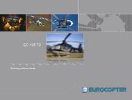
DISPLAY SYSTEM FOR THE EC135, EC145 <strong>AND</strong> EC155<br />
Successful<br />
WAAS Integration<br />
SBAS (1) is the general term<br />
used to describe technologies<br />
such as WAAS and EGNOS (2) .<br />
These complementary systems<br />
significantly improve both the<br />
accuracy and reliability (through<br />
improved data integrity) of the<br />
GPS system. WAAS has been fully<br />
operational in the United States<br />
since 2003. Meanwhile, more<br />
WAAS approaches are performed<br />
there than traditional ILS (3) landings.<br />
(1) Satellite Based Augmentation Systems<br />
(2) European Geostationary Navigation Overlay<br />
Service (slated for certification in November 2010)<br />
(3) Instrument Landing System: traditional system<br />
requiring a ground support infrastructure<br />
© DR<br />
ROTOR JOURNAL - NO.87 - OCTOBER/NOVEMBER 2010<br />
ARTICLE: STEPHANIE POTRATZ<br />
stations, which are expensive to operate and<br />
maintain. It can also be used for landings at<br />
hospital helipads and on oil rigs—even in<br />
harsh weather conditions. Mario Kolbe, an<br />
R&D engineer at <strong>Eurocopter</strong>, talked about<br />
another major advantage offered by the<br />
system: “The pilot’s workload remains well<br />
within the acceptable range even for steep<br />
approaches up to 6°.”<br />
This upgraded system was originally<br />
intended for all the helicopters equipped<br />
with “Avionique Nouvelle” (the EC135,<br />
EC145 and EC155), but the results may<br />
be adapted for integration in the display<br />
systems of other helicopters, such as the<br />
EC175 and EC225. “Helicopters equipped<br />
with this technology will soon be available<br />
in the United States,” said Wolfgang Leprich<br />
and Michael Baumgart, R&D engineers at<br />
<strong>Eurocopter</strong>. “The technical work required<br />
to fit helicopters with the new system is<br />
relatively minor. <strong>Eurocopter</strong> is now perfectly<br />
poised to introduce this new technology on<br />
the European market.” ■<br />
(1) Wide Area Augmentation System<br />
(2) During the approach phase, the GPS/SBAS-compatible<br />
receiver uses an interface very similar to that of the ILS<br />
receiver. The GPS sensor sends the position offset signals<br />
to the electronic display system via the existing ILS input.<br />
The display system then sends the information to the<br />
autopilot. A major advantage of the system is that the<br />
coupling with the autopilot is maintained.<br />
(3) Localizer Performance with Vertical Guidance / Lateral<br />
Navigation / Vertical Navigation: new GPS approach<br />
procedures