see workshop handouts - OLAC
see workshop handouts - OLAC
see workshop handouts - OLAC

Create successful ePaper yourself
Turn your PDF publications into a flip-book with our unique Google optimized e-Paper software.
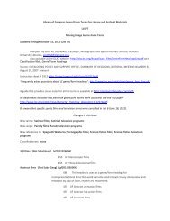
Handouts:<br />
Resources<br />
Scale<br />
Projection and Coordinates<br />
Scale Exercises<br />
Measuring Examples<br />
MAP CATALOGING WORKSHOP<br />
November 1998<br />
<strong>OLAC</strong> Conference, Charlotte North Carolina<br />
Catherine Gerhart<br />
(206) 685-2827<br />
gerhartkkwashirxtomedu<br />
and<br />
Paula E. Moehle<br />
(706) 542-0585<br />
pemoeNe@!libris.libs.una.edu<br />
Major Differences between Book and Map Cataloging (Minus mathematical and physical<br />
descriptions)<br />
How to Date a Road Map<br />
Sample Records<br />
Scale Exercises Answers
Cataloging Rules (in addition to AACR2rev.j:<br />
RESOURCES ’<br />
Cartographic materials : a manual of interpretation for AACR2 / prepared by the Anglo-American<br />
Cataloging Committee for Cartographic Materials. Chicago : ALA ; Ottawa : CLA, 1982. ISBN O-<br />
8389-0363-o (ALA) ISBN 0-88802-169-O (CLA) [very hard to get a copy of, new edition will be out<br />
soon, however]<br />
Map cataloging manual / prepared by Geography and Map Division, Library of Congress.<br />
Washington, DC : Cataloging Distribution Service, Library of Congress, 1991, ISBN o-87071-361-2<br />
Natural Scale Indicator/Map Scale Indicator:<br />
Plastic version (approx. $5-$10)<br />
Department of Geography<br />
Memorial University of Newfoundland<br />
St. John’s, Newfoundland AlB 3XP<br />
Canada<br />
For General information about maps and man librarianship<br />
Heavy-paper version (no cost?)<br />
U.S. Department of Commerce<br />
National Oceanic & Atmospheric Administration<br />
National Ocean Service<br />
Physical Science Services Branch<br />
Rockville, MD 20852<br />
Map librarianship : an introduction / Mary Lynette Larsgaard. 3rd ed. Englewood, Colo. : Libraries<br />
Unlimited, 1998. ISBN l-56308-474-0 (Includes a very extensive bibliography, as well as discussions<br />
of classification schemes, cataloging problems, acquisitions, preservation, etc.)<br />
USGS maps (USGS brochure with examples of different types of maps and relief.)<br />
Request from: USGS Map Distribution, Box 25286, Denver, CO 80225<br />
For information about mapmakine. and/or man Droiections:<br />
Choosing a world map : attributes, distortions, classes, aspects / Committee on Map Projections of the<br />
American Cartographic Association. Falls Church, Va. : American Congress on Surveying and<br />
Mapping, ~1988. Special Publication No. 2. ISBN O-9613459-2-6<br />
Map appreciation / Mark Monmonier, George A. Schnell. Englewood Cliffs, NJ : Prentice Hall,<br />
~1988. ISBN o-13-556052-7<br />
Map use : reading, analysis, and interpretation / Phillip C. Muehrcke, Juliana 0. Muehrcke. 4* ed.<br />
Madison, WI : JP Publications, ~1998. ISBN o-9602978-4-7<br />
Matching the map projection to the need / Committee on Map Projections of the American<br />
Cartographic Association. Bethesda, Md. : American Congress on Surveying and Mapping, ~1991.<br />
Special Publication No. 3. ISBN 0-9613459-5-O
ative Fractions<br />
1. 1: 600 (“large scale”)<br />
034 1 a#b600<br />
255 Scale 1:600.<br />
2. 1:300,000,000 (“small scale”)<br />
034 1 a;tb300000000<br />
255 Scale 1:300,000,000.<br />
SCALE<br />
w (63,360 inches in a mile; lC@,OOO cm. in a km.)<br />
3. One inch to one mile.<br />
034 1 a#b63360<br />
255 Scale [1:63,360]. 1 in. to 1 mile.<br />
4. 1 centimeter equals approximately 10.5 kilometers.<br />
034 1 a#b1050000<br />
255 Scale [ca. 1:1,050,000]. 1 cm. = approx. 10.5 km.<br />
Graphic ka4s<br />
5. 8 I<br />
0 1000 2000 3000<br />
Feet<br />
034 1 azb12000<br />
255 Scale [ca. 1:12,000].<br />
034 1 a#b1900800<br />
255 Scale [ca. 1:1,900,800].<br />
AVG<strong>OLAC</strong>9410
Scale, p. 2<br />
bove<br />
SOUTHERN QUEBEC<br />
Ianbert Canformal Conic Projcctim. Standard Parallelr 47%’ and 593’<br />
SCALE 1:1,550,000<br />
I CENTIMETER=lS.S KILOMETERS OR I INCH=24.5 MILES<br />
034 1 aGb1550000<br />
255 Scale 1:1,550,000. 1 cm. = 15.5 km. or 1 in. = 24.5 miles.<br />
Non-Retxesentative Fraction Scale Statements<br />
8. Scale varies<br />
9. Scales differ<br />
Use when the scale within a single map varies across the map and the outside values are<br />
not known.<br />
034 0 a<br />
255 Scale varies.<br />
If the outside values are known, record both scales, connected by a hyphen.<br />
034 3 a#b19000;fb33000<br />
255 Scale 1:19,000-1:33,000.<br />
Use when there are three or more maps of equal importance on the sheet or in the set<br />
and their scales are not the same.<br />
034 0 a<br />
255 Scales differ.<br />
When there are two or more maps of equal importance with only two different scales,<br />
two scale statements are given. Give the larger scale first, unless the smaller scale is<br />
clearly predominate or there are only two maps with no collective title. In the latter case,<br />
give the scales in the order corresponding to the individual titles in the title area. (If all<br />
the information in the mathematical data area is the same for two maps of equal<br />
importance, only one mathematical data area is given.)<br />
034 1 a+b25000<br />
034 1 a +b 30000<br />
255 Scale 1:25,000.<br />
255 Scale 1:30,000.<br />
AVG<strong>OLAC</strong>9410
Scale, p. 3<br />
10. Scale not given<br />
Use only when the only way to determine the scale is to compare the map with a map of<br />
known scale (<strong>see</strong> below) and the library’s policy is not to do so.<br />
11. Scale indeterminable<br />
034 0 a<br />
255 Scale not given.<br />
Use only when there is truly no way to determine the scale using one of the<br />
methods described here, including the use of the comparison method.<br />
12. Not drawn to scale<br />
Use of La&u&<br />
034 0 a<br />
255 Scale indeterminable.<br />
Use for birds-eye views, map views, maps of imaginary places, celestial charts and<br />
other maps with nonlinear scales which do not give scale information on the item and<br />
which are not drawn to scale.<br />
034 0 a<br />
255 Not drawn to scale.<br />
Use a scale indicator, if available. If using a ruler, the formula is<br />
n<br />
11 ,ooo,ooo<br />
where n is the number of centimeters measured on the map for lo latitude<br />
1 l,OOO,OOO is the approximate number of centimeters on the ground for lo latitude<br />
13.<br />
To get the representative fraction, divide the numerator and the denominator by n, giving<br />
you 1 to the left of the colon and 11,000,000/n to the right of the colon.<br />
440<br />
450<br />
034 1 a #b 3450000<br />
255 Scale [ca. 1:3,450,000].<br />
AVG<strong>OLAC</strong>9410
scale, p. 4<br />
On scale indicator (lo latitude): On ruler:<br />
lo mark crosses at 3,450,OOO 3.2 cm = lo<br />
lo = 3,450,ooo 3.2/3.2 = 11,000,000/3.2<br />
1:3,450.000 1:3,437,500<br />
When there is more than one degree latitude between lines, remember to multiply<br />
11 ,OOO,OOO by the number of degrees represented before applying the formula.<br />
14. 300<br />
150<br />
034 1. a;tb97500000<br />
255 Scale [ca. 1:97,500,000].<br />
On scale indicator (lo latitude):<br />
15O mark crosses at 6,500,OOO<br />
15O = 6,500,OOO x 15<br />
1:97,500,000<br />
On ruler:<br />
1.7 cm = 15O<br />
1.7 cm. = 15 x 1 l,OOO,OOO cm.<br />
1.7/1.7 = 165,000,000/1.7<br />
1:97,058,824<br />
(Note that both methods are only approximations; a difference of 450,000 at this small scale is not<br />
very significant.)<br />
non with a Man of Known SC&<br />
--Choose a map of known scale which shares identifiable points with the map of unknown scale.<br />
--Measure the distance between two identifiable points on the map of known scale.<br />
--Measure the distance between the same two identifiable points on the map of unknown scale.<br />
--Apply the following equation:<br />
n -mxa<br />
b<br />
where n is the denominator of the RF of the map of unknown scale<br />
m is the denominator of the RF of the map of known scale<br />
a is the distance between the two identifiable points on the map of known scale<br />
b is the distance between the two identifiable points on the map of unknown scale<br />
(a and b must be in the same units)<br />
Note that this is the least accurate way of determining scale and that the scale of the known map and<br />
the projection of the two maps, as well as the location on the maps of the identifiable points will<br />
greatly influence the accuracy of the caIcuIation. The Library of Congress does not use this method<br />
of calculating scale.<br />
AVG<strong>OLAC</strong>9410
PROJECTIO1V refers to the system used to represent information about the spherical surface of the earth on a<br />
flat surface. There are many different types of projection. You don’t need to understand any of them to<br />
catalog a map.<br />
Transcribe a statement of projection found on the map, its container or case, or accompanying printed<br />
material in the mathematicaf data (255) area. Transcribe the statement in English, regardless of the language<br />
in which it appears; use standard abbreviations (e.g., “proj.” for “projection”) and numerals in place of words.<br />
Capitalize proper names. (Cartographic Materials, 3C) (Note: Map Cataloging Manual, p. 2.5, says to<br />
capitalize first word as well. OCLC’s manual follows LC.)<br />
255 Scale 1: 150,000 ; +b Transverse Mercator proj.<br />
COORDINATES referto the geographical grid lines used to pinpoint locations on the earth.<br />
--Longitude lines (or “meridians”) run north/south between the poles.<br />
--Latitude lines (or “parallels”) run east/west parallel to the equator.<br />
Both sets of lines are measured in degrees, minutes, and seconds from a standard base line (the number<br />
represents the angle measured between the subject line and the base line through the center of the earth).<br />
--For longitude, the standard base line (or “prime meridian”) is usually the line which passes through<br />
Greenwich, England. It can be other lines, however, since Greenwich is significant for Great Britain but<br />
not necessarily for other countries. Older maps often have non-Greenwich prime meridians, such as<br />
Amsterdam, Paris, Washington, DC, etc. Longitude is counted 180’ east or west from the prime<br />
meridian. Record longitude from westernmost to easternmost points.<br />
--For latitude, the standard base line is the equator. Latitude is counted 90’ north or south from the<br />
equator. Record latitude from northernmost to southernmost points.<br />
034 1 a +b 1000 +d W1013015 se WO203000 +fN0490000 +g NO343015<br />
255 Scale l:l,OOO+c(W 101°30’15”--W20° 30’ OO”/N49O 00’ 00” --N34’30’ 15”).<br />
NOTE: Record only coordinates based on Greenwich and the equator in the mathematical data (255) area.<br />
Coordinates for the moon, planets, and other celestial bodies can be given in a note.<br />
500 Lunar coordinates: E 15’--E 17’/S 8’--S 9’.<br />
INPUTTING TIP: The correct symbols for degrees, minutes, and seconds are special characters:<br />
Degrees: Superscript zero (“)<br />
Minutes (and feet): Miagkii znak ( ’ )<br />
Seconds (and inches): Tverdyi znak (“)<br />
AVGGLAC96 10
1. One inch represents six miles<br />
SCALEEXERCISES<br />
2. 1 centimeter on the map represents 20 kilometers on the ground<br />
3. One inch equals approximately 40 miles or 64.4 kilometers<br />
4. One inch: approximately 17.3 miles<br />
1<br />
5. 0 Is 50 1s loo<br />
I.<br />
8.<br />
Km.<br />
.<br />
I25 I50<br />
0 500 loao 1500<br />
Feet<br />
SOUTHERNQUEBEC<br />
AVG<strong>OLAC</strong>9410
Scale Exercises, p. 2<br />
9. 3o”<br />
32O<br />
10. 170<br />
AVG<strong>OLAC</strong>9410
1. 1 map:#bcol.;fc23x32cm.<br />
Measuring Examples<br />
--Measure height x width (with map in reading positions)<br />
2. 1 map : #b col. ; #c 35 x 35 cm., folded to 22 x 10 cm.<br />
--Also give folded size if map is designed to be folded (has panel or cover)<br />
3. 1 map : fb col. ; #b 55 x 68 cm., folded to 29 x 11 cm.<br />
--If cartographic detail extends beyond the neat line, include it in the measurement.<br />
4. 1 map : fb col. ; #c 64 x 24 cm.<br />
--No neat line: measure cartographic extent, which could be entire sheet.<br />
5. 1 map ; fc 22 x 20 cm., on sheet 38 x 43 cm., folded to 28 x 11 cm.<br />
--Also give sheet size if either dimension of map is less than half the same dimension of sheet.<br />
6. 1 map in 3 segments : #b col. #c 143 x 22 cm., on sheet 55 x 65 cm.<br />
--Map in segments at consistent scale: measure as if segments are joined; also give sheet size.<br />
7. 2 maps on 1 sheet : #b both sides, col. ; fc 36 x 46<br />
to 19x IOcm.<br />
cm. and 36 x 54 cm., sheet 38 x 65 cm., folded<br />
--2 maps on equal importance (collective title): measure both maps; also give sheet size.<br />
8. 1 map on 2 sheets : &b col. ;/c 94 x 128 cm., sheets 121 x 87 cm.<br />
--Map on multiple sheets: measure as if sheets joined, excluding any overlap; give sheet sizes.<br />
9. 3 maps on 1 sheet : fb both sides, co1 . ; Y$ 37 x 27 or smaller, on sheet 43 x 28 cm.<br />
--3 or more maps, or sheets give the greatest height of any of them followed by the greatest width<br />
of any of them, followed by “or smaller.”<br />
10. 1 map : #b col. ; ec 90 x 57 cm., on sheet 61 x 95 cm., folded to 20 x 12 cm.<br />
--1 map continued on back: measure as if one map, excluding overlap; also give sheet size.<br />
*L<br />
11. 1 map : kb co]. ; 42 by 59 cm.<br />
--A continuation ancillary map is not included in measurement; mention it in a note (but<br />
coordinates do take continuation into account).<br />
12. 1 map : fb col. ; #c 57 cm. in diam., on sheet 76 x 64 cm<br />
--Circular map: give diameter and label as such; also give sheet size.<br />
13. 1 view ; #c on sheet 97 x 64 cm.<br />
--Map too difficult to measure: simply give sheet size.
Major Differences between Book and Map Cataloging<br />
(minus Mathematical and Physical Description)<br />
Note: AACR2=Anglo-American Cataloging Rules, 2”d ed., revised<br />
CM=Cartographic Materials<br />
MCM=Map Cataloging Manual<br />
I. Fixed Fields<br />
A. All cartographic materials whether digital or not are coded Type “e”. (Note:<br />
034 and 255 required for all type “e” records). There are four initial<br />
determinations to make when beginning to catalog a cartographic item.<br />
1. Is it an atlas?<br />
Atlases are collections of maps intended to be used like a book and<br />
shelve together that can be bound or loose-leaf, flat or folded, in<br />
cases, boses, portfolios, or folders. (CM p. 185)<br />
2. Is it a single map sheet?<br />
Single maps can be printed on two or more sheets (usually less than<br />
12), are published together, have incomplete borders, and, have the<br />
main title and legend on only one of the sheets (MCM 7.2)<br />
3. Is it a maps set/series?<br />
Map set/series are collections of maps, with common unifying<br />
features, often similar sized, with the same scale and relieElsymbols.<br />
They may form a single map when assembled, of-ten will have a<br />
collective title and individual sheet designations, A distinguishing<br />
feature from single maps are that maps set/series are intended to be<br />
used individually as well as together. (MCM 7.2-7.4)<br />
4. Is it a serial?<br />
Map serials are infrequent but when they do occur they look very<br />
much like regular serials with serial title constant from issue to issue<br />
and a numbering system which includes issue number and date of,<br />
issue. (CM p. 177)<br />
5. Is it a digital map?<br />
When deciding whether a computer should be considered a<br />
cartographic materials consult the “Guidelines for Distinguishing<br />
Cartographic Materials on Computer File Carriers from other<br />
Materials on Computer File Carriers” This document can be found<br />
at http://lcweb.loc.gov/marc/cfmap.html.
B.<br />
C.<br />
D.<br />
II. Chief Source<br />
006 for maps, digital maps and atlases. Optionally add the following:<br />
1. 006 for accompanying maps<br />
2. 006 for book aspects of atlases<br />
LC is adding these when there is substantial text in an atlas<br />
so you’ll <strong>see</strong> it on copy, UW will not routinely add.<br />
3. 006 for computer files aspects of digital maps<br />
007 for maps, digital maps and atlases. Always add a map 007 when use the<br />
type code “e”. This will mean that digital maps will have a map 007 and a<br />
computer file 006.<br />
008 (fixed fields) (Note that the 006 fields are defined the same as the 008)<br />
1. CrTp (Type of Cartographic Materialk use “a” Single map for<br />
digital maps per LC.<br />
2. Prme (Prime meridian) - only used if piece specifies<br />
3. Proj (Projection) - only used if piece specifies<br />
4. Relf (Relief) - use with relief note<br />
5. SpFm (Special Format Characteristics) - use to indicate whether<br />
map is also something like a wall map, calendar, game, puzzle,<br />
etc. (May also bring out more tilly these characteristics in the<br />
006)<br />
Note: For digital maps, although the type code and fixed fields use the map format, the<br />
cataloging rules still instruct that the primary chapter for these materials is Chapter 9 with<br />
instructions taken from Chapter 3 as needed. So, only the purely map fields discussed<br />
below will pertain to digital maps. For instance, use Chapter 9 for chief source of<br />
information for digital maps, not Chapter 3 chief source.<br />
Also note: The rules for cataloging atlases primarily come from Chapter 2 with<br />
cartographic areas (300, 255/034) from Chapter 3.<br />
A. No straightforward title page equivalent exists for maps since the chief source<br />
is the entire map. (WCR2 3.OB2)<br />
B. Title is chosen on the basis of sequence or layout. If the layout is not clear the<br />
most comprehensive title (includes both subject and geographic area) is used.<br />
(CM lB8b and AACR2 3.lB3)<br />
C. The definition of prominence is much different. Prominent is anywhere on the<br />
map even in very little type. (AACR2 0.8)
III. Main entry<br />
A.<br />
B.<br />
C.<br />
D.<br />
IV. Titfe proper<br />
Main entry is based less on prominence and more on who did what.<br />
The cartographer has to be more than just the mechanical drawer or tracer to<br />
get the main entry.<br />
The corporate body must be a map-making body to get main entry. (&XX?<br />
21.2B2f)<br />
There is often no statement of responsibility.<br />
A. Major difference is that you are encouraged to bracket additional area (place<br />
name) information in the subtitle ifit is not present in the title. (AACR2<br />
3.1E2)<br />
V. GMD Since LC does not use a GMD in their system, OCLC has asked that<br />
contributors to their database also not use it. UW has decided not to add locally.<br />
Remember for digital maps the GMD will be [computer file] since you’re using<br />
primarily Chapter 9.<br />
VI. Publisher/Date<br />
Notes<br />
A.<br />
B.<br />
DO NOT bracket publisher information repeated from elsewhere in the<br />
description (e.g., 245 or quoted 500 note) even if it appears only once on the<br />
map. (MCM p. 2.6) Note: this does not include the date. If the date appears<br />
only once on the map and is transcribed as any other part of the description<br />
(such as the title, edition or notes), it is bracketed in the date of publication.<br />
Dates (MCM 2.10-2.13)<br />
1. Road maps problems<br />
2. Park service maps (MCM 9.6-9.8<br />
3. Soil service maps (MCM 9.8-9.10)<br />
A. The first notes are unique to maps. They show:<br />
+ additional content of the map not found in the title (bird’s eye, cadastral,<br />
additional place information),<br />
+ justification for the date of situation in the call number (MCM 3.7), and
+ relief on main map (AACR2 3.7B 1 and MCM p. 3.6-3.12)<br />
Kinds of relief include:<br />
contours satellite imagery<br />
form lines gradient tints<br />
spot heights hachures<br />
shading pictorial<br />
soundings landforms<br />
B. Give the source of the title proper whenever it is not taken from the recta of<br />
the map, namely, when it is taken from the verso, cover, panel, or<br />
accompanying text. @KM p. 3.14 - p. 3.18)<br />
C. A statement of responsibility note may contain the name of the copyright<br />
holder if an access point is needed. (MCM p. 2.2 and p. 5.2)<br />
D. Orientation<br />
E. Contents<br />
1.<br />
2.<br />
The order of the notes in this area is very specific: recta, verso, cover.<br />
(MCM p. 3.30)<br />
There are specific definitions attached to various terms used in these<br />
notes. (MCM p. 3.32-3.42)
H o w to Date a R o a d Map<br />
Most maps are easily dated either by a prominent date on the<br />
cover or in the map legend. But there are 6till many maps on which<br />
no date can be found. Rand McNally and H.M. Cou6ha use a code hidden<br />
on a map margin to date their maps. These codes are explained below.<br />
General Drafting has not used euch a code, yet they have varied<br />
their dating and an explanation is given for them as well. For all<br />
Other map publisher6, either their code is not known, if they have<br />
one, or their date is easily read,<br />
When a map is undated, dates mu6t be determined by comparing the<br />
map to a map of known date. Many companies also changed their covers<br />
each year, 60 that once a particular cover design is dated, other<br />
maps of the same design are considerced as the Same date. But this<br />
method of comparing covers of like design is prone to possible error,<br />
so care should be taken when using this method.<br />
first appeared in 1926 but do not show on most maps Until 1927. For<br />
older maps this is a helpful guide. Many states numbered their,roads<br />
well before 1926.<br />
The detailed tables which are included in this catalog may also<br />
be used to some degree to date a map. Most companies have used<br />
different publisher6 over the year6 a6 well as both expanding and<br />
contracting the territory they Serve, thus helping to limit<br />
possibilities.<br />
Rand McNally Map Date Codes<br />
Over the years Rand appear6 to have used a number of "systems"<br />
to date their maps. All variations may not be explained here -- but<br />
most maps should still be able to be dated. One big exception, in<br />
the 20's some Rand maps have no letter6 or numbers at all and these<br />
must be dated by comparing to known dated maps.<br />
First, Rand used a simple letter code, A for 1919, B for 1920,<br />
through Z in 1944. However, some year6 prior to 1944 number6 began<br />
to appear after the letter. If the set of number6 has 4 digits, the<br />
first 2 digits indicate the year the base map was drafted while the<br />
second 2 digits either indicate the year the first Rand map was made<br />
of the area (the original base) or simply a code for the area<br />
covered. The latter <strong>see</strong>ms more likely except that it limits Rand to<br />
100 areas. If only 2 digit6 exist after the letter, they <strong>see</strong>m to be<br />
a code for. the area.<br />
Now after 1944 the letter was replaced by a 1 or 2 digit year<br />
preceding the above series of digit6 and often separated by a hyphen-<br />
From 1945 to 1965 only the last digit of the year was u6ed. To<br />
distinguish 1945 from 1955 from 1965 generally requires common<br />
sense--look at the census date if given, interstate highways, etc.<br />
From 1966 to present, the last 2 digits of the year are used.<br />
At some point the series of 4 digits was increased to 6 digits<br />
although .this now has been discontinued. It is thought these extra<br />
digit6 indicate the number of printings and would change for each Oil<br />
company, etc. Lastly, still one or two more digits were added after<br />
the above series of digits and are separated by a hyphen. These<br />
represent the number of edition6 (possibly updates) to the base map<br />
thru the current map.<br />
Examples:<br />
Z 4424 The Z indicates a 1944 printing, the 44 shows that the<br />
base map was newly drawn this year, the 24 either shows the original<br />
base map was drawn in 1924 or simply a code signifying the area
covered. (It is a Texaco Illinois map.)<br />
O-3868-4 The 0 indicates either a 1950 or 1960 printing (in<br />
this case it is clearly 1950 based on the map), the 38 shows that the<br />
base map was drawn in 1938, the 68 cannot be 1968 and so must be a<br />
code for the area, and the 4 indicates 4 updates to the base from<br />
1938 to 1950. (It is Buffalo-Niagara Falls for Gulf.)<br />
Now to all this may be added a letter N, S, E, W, or even V for<br />
North, South, etc. when only a portion of the base is used. The V<br />
stands for a Velox print (?I.<br />
One more. 3-58463OV-5 The 3 is either 1953 or 1963 (map has a<br />
1963 copyright statement!), 58 for a 1958 base map, 46 for either<br />
first map in 1946 or a code for the area, 30 for 30 printings since<br />
1958 for various companies and years, V for Velox, and 5 for 5<br />
editions (updates) between 1958 and 1963. '(Texaco map of St.<br />
Petersburg.)<br />
A - 1919<br />
B- 1920<br />
C- 1921<br />
D- 1922<br />
E- 1923<br />
F- 1924<br />
G- 1925<br />
H- 1926<br />
I- 1927<br />
J- 1928<br />
K - 1929 u - 1939<br />
L- 1930 v - 1940<br />
tl- 1931 w - 1941<br />
N- 1932 x - 1942<br />
O- .1933 Y - 1943<br />
P- 1934 z - 1944<br />
Q- 1935<br />
R- 1936<br />
S- 1937<br />
T- 1938<br />
H.M. Gousha Map Date Codes<br />
O- 1950,196O 66 - 1966<br />
l- 1951,196l xx - from 66 on,<br />
2- 1952,1962 last two<br />
3- 1953,1963 digits of<br />
4- 1954,1964 year.<br />
5- 1945,1955,1965<br />
6- 1946,1956<br />
7- 1947,1957<br />
8- 1948,1958<br />
9- 1949,1959<br />
The H.M. Gousha Company was founded in 1926 in Chicago by former<br />
employees of Rand McNally and like Rand, they used a hidden date.<br />
While some of their maps are dated in the legend or even on the<br />
cover, many Gousha maps do not contain an obvious date.<br />
The code used is one or two letters in a bottom map margin,<br />
generally with a series of digits and even another letter. The<br />
digits are not relevant to the date, they indicate the map masters<br />
for a filing system. The older the map, the fewer the digits, if any<br />
at all. If two groups of letters appear in the series, check both<br />
and use the one which makes most sense based on the map.<br />
Occasionally, a map code may indicate different dates on each side of<br />
the map or with a particular inset. In this case the map is<br />
classified by the newest such date.<br />
Letter A was assigned to 1927, B to 1928 and so forth through Z<br />
in 1952. Then AA for 1953, BB for 1954 and so forth through ZZ in<br />
1978. At this point the code gets confusing, refer to the table<br />
below.<br />
A- 1927 M - 1939<br />
B- 1928 N - 1940<br />
C - 1929. 0 - 1941<br />
D - 1930 P - 1942<br />
E- 1931 Q - 1943<br />
F- 1932 R - 1944<br />
G- 1933 s - 1945<br />
H - 1934 T - 1946<br />
I - 1935 u - 1947<br />
3 - 1936' V - 1948<br />
K- 1937 w - 1949<br />
L- 1938 x - 1950<br />
Y- 1951<br />
z - 1952<br />
AA - 1953<br />
BB - 1954<br />
cc - 1955<br />
DD - 1956<br />
EE - 1957<br />
FF - 1958<br />
GG - 1959<br />
HH - 1960<br />
II - 1961<br />
JJ - 1962<br />
KK - 1963<br />
LL - 1964<br />
MM - 1965<br />
NN - 1966<br />
00 - 1967<br />
PP - 1968<br />
QQ - 1969<br />
RR - 1970<br />
ss - 1971<br />
TT - 1972<br />
uu - 1973<br />
vu - 1974<br />
ww - 1975 QD - 1987<br />
xx - 1976 WJ - 1988<br />
YY - 1977 ER - 1989<br />
zz - 1978 IV - 1990<br />
AB - 1979 SF - 1991<br />
AC - 1980 UH - 1992<br />
AN - 1981 GT - 1993<br />
HZ - 1982<br />
OB - 1983<br />
YL - 1984<br />
CP - 1985<br />
KX - 1986<br />
All maps published after 1987 have the edition year on the copyriqht statement.
General Drafting Date Codes<br />
General Drafting has not used a date code in the sense of Rand<br />
or Gousha. If any problem exists with GD it is that they use too many<br />
dates! The exception is some maps from the 1920's are completely<br />
undated and can only be dated by comparing with maps of known date.<br />
If a date is shown on the cover or in the legend, then that is<br />
the date to use. When two dates are given, such as 1955-1956 or<br />
1970-71, then always use the first year. Many maps also have a<br />
copyright date which is frequently one year earlier than the legend<br />
date, in this case use the legend date. However, if the copyright<br />
date is the only date, there is no other date in the legend, then use<br />
the copyright date (this is particularly true since 19791.<br />
In the 1960's, the legend frequently contained a month in<br />
addition to the year. In these cases, for January through august,<br />
use the year given; but for September through December, use the next<br />
year. This is basically the system GD uses and it will result in<br />
common cover designs being called the same year. (This applies to the<br />
years 1962 - 1966 in the detailed map listings.).<br />
Due to reprintings, it is possible for the same map to exist as<br />
1970 and 1970-71, and similarly for other years. These are not<br />
listed as separate dates but, in this example, only as 1970.<br />
Since the 1940's, most GD maps contain three or four small<br />
digits plus a letter in the margin or on the back cover. This is the<br />
month and year of'printing and should not be used to dafe the map<br />
unless nothing else exists. These change for each reprinting. The<br />
letter indicates the printing company. The only one known for sure is<br />
W for Western Publishing and Printing Co.<br />
fill of the above explains how to determine the date on which the<br />
map was issued. But since about 1958, GD has used a code to date the<br />
masters from which the map was created. This date is coded as a<br />
small-A' plus a number in a bottom corner of a map. Th i s number<br />
indicates the year the base map was first drafted. It is not updated<br />
unless the base is redrawn. Al was for 1953. The following table is<br />
for quick reference, but IS NOT THE DATE THE MAP WAS ISSUED.’<br />
Al - 1953 A7 - 1959<br />
A2 - 1954 A8 - 1960<br />
A3 - 1955 A9 - 1961<br />
A4 - 1956 Al0 - 1962<br />
A5 - 1957 All 4 1963<br />
A6 - 1958 Al2 - 1964<br />
Al3 - 1965 Al9 - 1971 A25 - 1977<br />
Al4 - 1966 A20 - 1972 A26 - 1978<br />
Al5 - 1967 A21 - 1973 A27 - 1979<br />
Al6 - 1968 A22 - 1974 A28 - 1980<br />
Al7 - 1969 A23 - 1975 A29 - 1981<br />
Al8 - 1970 A24 - 1976 A30 - 1982<br />
Geographers A-Z Hap Company (Code Is located in or near<br />
the border at one corner of maps. Atlases are coded<br />
differently. Send a photocopy of the title page to the<br />
company and they will provide accurate dates).<br />
J I H G F E D C B A<br />
1 . 2 3 4 5 6 7 8 9 0<br />
“FDC” is “578” or May, 1978.<br />
Information courtesy of Peter L. Stark,<br />
with additions from Mark A. Bozanich, and Velma Parker.
1.<br />
2.<br />
3.<br />
4.<br />
5.<br />
1 mile = 63,360 inches<br />
1 foot = 12 inches<br />
1 inch = 2.54 cm.<br />
I ’ latitude = approx. 1 l,OOO,OOO cm.<br />
0341 asb380160<br />
255 Scale [1:380,160]. 1<br />
1 in. = 6 miles<br />
1 in. = 6 x 63,360 in.<br />
1:380,160<br />
034 1 a+b2000000<br />
255 Scale [ 1:2,000,000]<br />
lcm.=20km.<br />
1 cm. = 20 x 100,000 cm.<br />
1:2,000,000<br />
SCALE EXERCISES ANSWERS<br />
in. represents 6 miles.<br />
1 cm. represents 20 km.<br />
1 km. = 100,000 cm.<br />
1 km. = 1,009 m.<br />
1 m. = 100 cm.<br />
0341 a+b2534400<br />
255 Scale [ca. 1:2,534,400]. 1 in. = approx. 40 miles or 64.4 km.<br />
1 in. = 40 miles 2.54 cm. = 64.4 km.<br />
1 in. = 40 x 63,360 in. 2.54 cm. = 64.4 x 100,000 cm.<br />
1:2,534,400 2.54/2.54 = 6,440,000/2.54<br />
1:2,535,433<br />
034 1 a+b1096128<br />
255 Scale [ca. 1:1,096,128]. 1 in. : approx. 17.3 miles.<br />
1 in. = 17.3 miles<br />
1 in. = 17.3 x 63,360 in.<br />
1:1,096,128<br />
034 1 a+b 1665000<br />
255 Scale [ca. 1: 1,665,000].<br />
On scale indicator (1 km.):<br />
150~km.-mark crosses at 11,100<br />
1 km. = 11,100x 150km.<br />
1: 1,665,OOO<br />
On ruler:<br />
6 cm. = 100 km.<br />
6cm.= 100 x 100,000 cm.<br />
6/6 = 10,000,000/6<br />
1: 1,666,667<br />
AVG<strong>OLAC</strong>96 10
Scale Exercises Answers, p. 2<br />
6. 034 1 asb253440<br />
255 Scale [ca. 1:253,440].<br />
On scale indicator (1 mile): On ruler:<br />
4-mile mark crosses at 63,360 1 in. = 4 miles<br />
1 mile = 63,360 x 4 miles 1 in. = 4 x 63,360 in.<br />
1:253,440 1:253,440<br />
7. 034 1 a*b6000<br />
255 Scale [ca. 1:6,000].<br />
On scale indicator (1000 ft.):<br />
lOOO-foot mark crosses at 6000<br />
1:6,000 .<br />
On ruler:<br />
1 in. = 500 A.<br />
1 in. = 500 x 12 in.<br />
1:6,000<br />
8. 034 1 a*b2062500<br />
255 Scale [ca. 1:2,062,500] not “1:1,550,000” ; *b Lambert conformal conic proj.,<br />
standard parallels47°55’ and 59O35’.<br />
On scale indicator (1 mile):<br />
75-mile mark crosses at 27,500<br />
1 mile = 27,500 x 75 miles<br />
1:2,062,500<br />
9. 034 1 a+b6600000<br />
255 Scale [ca. 1:6,600,000].<br />
On scale indicator (1 O latitude):<br />
2 O-mark crosses at 3,300,OOO<br />
1 O = 3,300,000 x 2<br />
1:6,600,000<br />
10. 034 1 a +b 24000000<br />
255 Scale [ca. 1:24,000,000].<br />
On scale indicator (1 O latitude):<br />
5 O-mark crosses at 4,800,OOO<br />
1 O = 4,800,OOO x 5<br />
1:24,000,000<br />
On ruler:<br />
2.4 cm. = 50 km.’<br />
2.4 cm. = 50 x 100,000 cm.<br />
2.4/2.4 = 5,000,000/2.4<br />
1:2,083,333<br />
On ruler:<br />
3.35 cm. = 2’<br />
3.35 cm. = 2 x 1 l,OOO,OOO cm.<br />
3.3513.35 = 22,000,000/3.35<br />
1:6,567,164<br />
On ruler:<br />
2.3 cm. = 5’<br />
2.3 cm. = 5 x 1 l,~OO,OOO cm.<br />
2.3/2.3 = 55,000,000/2.3<br />
1:23,913,043<br />
AVG<strong>OLAC</strong>96 10
NO HOLDINGS IN WAU - 2 OTHER HOLDINGS<br />
OCLC: 17226477 Ret stat: C<br />
Entered: 19871109 Replaced: 19930919 Used: 19971004<br />
) Type: e<br />
BLvl: m<br />
CrTp: a<br />
Desc: a i<br />
) 1 010<br />
) 2 040<br />
) 3 007<br />
) 4 034 0<br />
) 5 050 00<br />
) 6 052<br />
) 7 090<br />
) 8 049<br />
) 9 245 00<br />
) 10 255<br />
) 11 260<br />
) 12 300<br />
to 23 x 11 cm.<br />
) 13 500<br />
) 14 500<br />
buildings. B<br />
b 15 500<br />
ELvl: Srce: Relf: Ctrl: Lang:~ eng<br />
SpFm: GPub: Prme: MRec: Ctry: Pau<br />
Indx: 1 Proj: DtSt: s Dates: 1987,<br />
87_695679/MAPS/r93 3<br />
DLC *c DLC n<br />
a +b y +d c *e a +f n *g z +h n 3<br />
all<br />
G3824.S93:2S9A3 1987 *b .S9 g<br />
3824 +b S93:2S9 JI<br />
*:b q<br />
WAUW YI<br />
Swarthmore. I<br />
Not drawn to scale. P<br />
[Swarthmore, Pa.? : *b s.n., *c 198771 I<br />
1 view : +b col. ; *c 34 x 59,cm., on sheet 46 x 61 cm., folded<br />
B .<br />
Bird's_eye view of Swarthmore College, Swarthmore (Pa.). I[<br />
Includes index of facilities and 2 ancillary views of outlying<br />
Text, descriptive index of buildings, 2 location maps, title<br />
panel, and col. ill. on verso. P<br />
) 16 610 20 Swarthmore College Ox Aerial views. I
NO HOLDINGS IN WAU - 3 OTHER HOLDINGS<br />
OCLC: 19104159 Ret stat: n<br />
Entered: 19890206 Replaced: 19890206 Used: 19901128<br />
) Type: e ELvl: I Srce: d Relf: Ctrl: Lang: eng<br />
BLvl: m SpFm: GPub: Prme: MRec: Ctry: ilu<br />
CrTp: a Indx: 1 Proj: DtSt: s Dates: 1986,<br />
Desc: a B<br />
) 1 040 GSU *c GSU 9<br />
) 2 007 a *b j *d c *e a +f n *g z *h n I[<br />
) 3 034 1 a *b 34848 f<br />
) 4 034 1 a +b 38016 1[<br />
) 5 052 4364 *b 02 I[<br />
) 6 052 4362 +b S22 I<br />
) 7 090 G4364.02 1986 +b .R36 q<br />
) 8 090 *b II<br />
) 9 049 WAUW I<br />
) 10 110 2 Rand McNally and Company. II<br />
) 11 245 10 Oakland, East Bay cities map : +b including Alameda, Albany,<br />
Berkeley, Castro Valley . . . / *c Rand McNally. P<br />
) 12 246 1 +i Title on legend: *a East Bay cities street map B<br />
) 13 255 Scale [ca. 1:34,848]. 1 in. - approx. 0.55 mi. f<br />
) 14 255 Scale [ca. 1:38,016]. 1 in. = approx. 0.60 mi. g<br />
) 15 260 [Chicago] : +b Rand McNally & Co., *c [1986?] I<br />
) 16 300 2 maps on 1 sheet : +b both sides, col. ; +c 102 x 31 cm. and<br />
103 x 38 cm., sheet 115 x 46 cm. q<br />
) 17 500 "866810-12. 866809-12." a<br />
b 18 500 Panel title. i<br />
) 19 500 Includes indexes and ancillary map of "Metropolitan San<br />
Francisco." P<br />
b 20 505 0 East Bay cities street map (southern section) -- East Bay cities<br />
street map (northern section). I[<br />
) 21 651 0 Oakland (Calif.) *x Maps. I[<br />
) 22 651 0 Oakland Metropolitan Area (Calif.) *x Maps. i[<br />
) 23 651 0 San Francisco Bay Area (Calif.) *x Maps. I