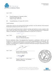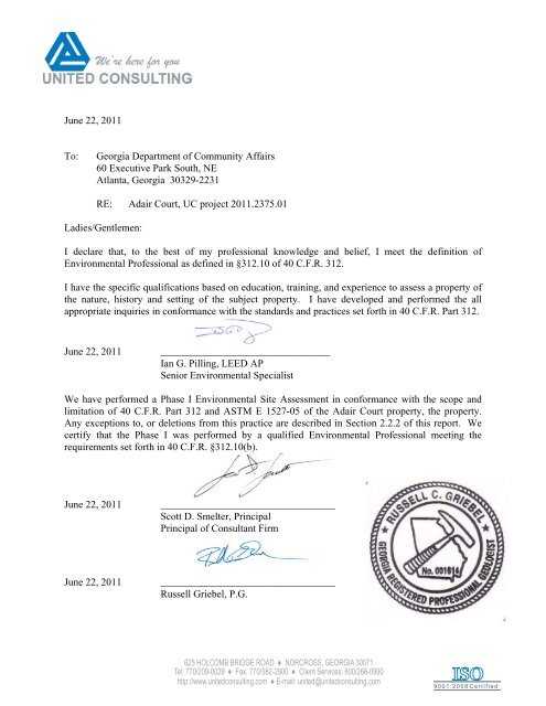
June 22, 2011 To: Georgia Department of Community Affairs 60 ...
June 22, 2011 To: Georgia Department of Community Affairs 60 ...
June 22, 2011 To: Georgia Department of Community Affairs 60 ...

Create successful ePaper yourself
Turn your PDF publications into a flip-book with our unique Google optimized e-Paper software.
<strong>June</strong> <strong>22</strong>, <strong>2011</strong><br />
<strong>To</strong>: <strong>Georgia</strong> <strong>Department</strong> <strong>of</strong> <strong>Community</strong> <strong>Affairs</strong><br />
<strong>60</strong> Executive Park South, NE<br />
Atlanta, <strong>Georgia</strong> 30329-<strong>22</strong>31<br />
RE: Adair Court, UC project <strong>2011</strong>.2375.01<br />
Ladies/Gentlemen:<br />
I declare that, to the best <strong>of</strong> my pr<strong>of</strong>essional knowledge and belief, I meet the definition <strong>of</strong><br />
Environmental Pr<strong>of</strong>essional as defined in §312.10 <strong>of</strong> 40 C.F.R. 312.<br />
I have the specific qualifications based on education, training, and experience to assess a property <strong>of</strong><br />
the nature, history and setting <strong>of</strong> the subject property. I have developed and performed the all<br />
appropriate inquiries in conformance with the standards and practices set forth in 40 C.F.R. Part 312.<br />
<strong>June</strong> <strong>22</strong>, <strong>2011</strong> _________________________________<br />
Ian G. Pilling, LEED AP<br />
Senior Environmental Specialist<br />
We have performed a Phase I Environmental Site Assessment in conformance with the scope and<br />
limitation <strong>of</strong> 40 C.F.R. Part 312 and ASTM E 1527-05 <strong>of</strong> the Adair Court property, the property.<br />
Any exceptions to, or deletions from this practice are described in Section 2.2.2 <strong>of</strong> this report. We<br />
certify that the Phase I was performed by a qualified Environmental Pr<strong>of</strong>essional meeting the<br />
requirements set forth in 40 C.F.R. §312.10(b).<br />
<strong>June</strong> <strong>22</strong>, <strong>2011</strong> __________________________________<br />
Scott D. Smelter, Principal<br />
Principal <strong>of</strong> Consultant Firm<br />
<strong>June</strong> <strong>22</strong>, <strong>2011</strong> __________________________________<br />
Russell Griebel, P.G.<br />
625 HOLCOMB BRIDGE ROAD ♦ NORCROSS, GEORGIA 30071<br />
Tel: 770/209-0029 ♦ Fax: 770/582-2900 ♦ Client Services: 800/266-0990<br />
http://www.unitedconsulting.com ♦ E-mail: united@unitedconsulting.com<br />
9 0 0 1 : 2 0 0 8 C e r t i f i e d
UNITED CONSULTING<br />
625 Holcomb Bridge Road | Norcross, GA 30071 | (770) 209-0029<br />
www.unitedconsulting.com<br />
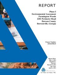
REPORT<br />
Phase I<br />
Environmental Assessment<br />
Adair Court<br />
806 Murphy Avenue<br />
Fulton County<br />
Atlanta, <strong>Georgia</strong><br />
Project Number<br />
<strong>2011</strong>.2375.01<br />
Report Date:<br />
<strong>June</strong> <strong>22</strong>, <strong>2011</strong><br />
Regulatory<br />
Review:<br />
<strong>June</strong> 2, <strong>2011</strong><br />
Site Visits:<br />
<strong>June</strong> 7, 10,<br />
and 13, <strong>2011</strong>
<strong>June</strong> <strong>22</strong>, <strong>2011</strong><br />
Adair Court, L.P.<br />
198 Boulevard<br />
Athens, <strong>Georgia</strong><br />
Attn: Mr. Curry Wadsworth<br />
RE: Phase I Environmental Assessment<br />
Adair Court<br />
806 Murphy Avenue<br />
Atlanta, <strong>Georgia</strong><br />
Project No.: <strong>2011</strong>.2375.01<br />
Dear Mr. Wadsworth:<br />
United Consulting is pleased to submit this report <strong>of</strong> our Phase I Environmental Assessment for the<br />
above-referenced project. The results <strong>of</strong> the environmental assessment and our comments pertinent to this<br />
project are included in the enclosed report. The Phase I Environmental Assessment was performed in<br />
substantial conformance with the standards developed by the American Society for Testing and Materials<br />
(ASTM) and with the United States Environmental Protection Agency (EPA), ”All Appropriate<br />
Inquiry” Rules, dated November 1, 2005 (Rules), annotated per DCA’s <strong>2011</strong> Environmental Manual<br />
requirements. In addition, this assessment was performed to conform with the Housing and Urban<br />
Development (HUD) guidelines referenced in the DCA manual. This report has been prepared for the use<br />
<strong>of</strong> Adair Court, L.P., the <strong>Georgia</strong> Housing and Finance Authority (GHFA), and the DCA. Any materials<br />
referenced or presented herein are, according to United Consulting, believed to be accurate and may be<br />
relied upon by the above parties.<br />
We appreciate the opportunity to assist you with this project. Please contact us if you have any questions<br />
or if we can be <strong>of</strong> further assistance.<br />
Respectfully,<br />
UNITED CONSULTING<br />
Ian G. Pilling, LEED AP David P. Huetter<br />
Senior Environmental Specialist Associate Environmental Specialist<br />
IGP/DPH/tl<br />
SP: <strong>2011</strong>.2375.01.dca.1.doc<br />
625 HOLCOMB BRIDGE ROAD ♦ NORCROSS, GEORGIA 30071<br />
Tel: 770/209-0029 ♦ Fax: 770/582-2900 ♦ Client Services: 800/266-0990<br />
http://www.unitedconsulting.com ♦ E-mail: united@unitedconsulting.com<br />
9 0 0 1 : 2 0 0 8 C e r t i f i e d
TABLE OF CONTENTS<br />
1.0 EXECUTIVE SUMMARY<br />
1.1 Location and Legal Description <strong>of</strong> the Property ....................................................................5<br />
1.2 Environmental Concerns and Conclusions .............................................................................5<br />
1.2.1 On-Site ..................................................................................................................5<br />
1.2.2 Off-Site .................................................................................................................6<br />
1.3 Recommendations ..................................................................................................................6<br />
1.3.1 On-Site ..................................................................................................................6<br />
1.3.2 Off-Site .................................................................................................................7<br />
2.0 INTRODUCTION .....................................................................................................................7<br />
2.1 Background .............................................................................................................................7<br />
2.2 Procedures ..............................................................................................................................8<br />
2.3 Significant Assumptions .........................................................................................................8<br />
2.4 Qualifications <strong>of</strong> Personnel/Documentation <strong>of</strong> qualifications as an “Environmental<br />
Pr<strong>of</strong>essional” .................................................................................................................................9<br />
2.5 Assessment <strong>of</strong> Specialized Knowledge or Experience <strong>of</strong> User and/or “Environmental<br />
Pr<strong>of</strong>essional” .................................................................................................................................9<br />
2.6 Limitations and Exceptions ..................................................................................................10<br />
2.7 Special or Additional Conditions or Contract Terms ...........................................................11<br />
3.0 SITE SETTING .......................................................................................................................11<br />
3.1 General Description <strong>of</strong> the Site and Vicinity .......................................................................11<br />
3.1.1 Current Site Use and Description .......................................................................11<br />
3.1.2 Current Uses <strong>of</strong> Adjoining Properties .................................................................11<br />
3.1.3 Description <strong>of</strong> Structures, Roads, and Other Improvements ..............................11<br />
3.2 Hydrogeology .......................................................................................................................12<br />
3.2.1 Geologic Setting .................................................................................................12<br />
3.2.2 Surface Drainage .................................................................................................12<br />
3.2.3 Groundwater .......................................................................................................12<br />
3.3 Wetlands ...............................................................................................................................13<br />
3.4 Floodplain/Floodway ............................................................................................................13<br />
3.5 State Waters ..........................................................................................................................14<br />
3.6 Endangered Species ..............................................................................................................14<br />
4.0 REGULATORY INFORMATION..........................................................................................14<br />
4.1 Data Review .........................................................................................................................14<br />
4.1.1 Standard Environmental Record Sources ...........................................................14<br />
4.1.1.1 Sites Listed in Section 8.2.1 <strong>of</strong> ASTM E 1527-05 and in Exhibit B1 .................. 17<br />
4.1.1.2 Orphan/Unmappable Sites .................................................................................... 17<br />
4.1.2 Additional Environmental Record Sources ........................................................21<br />
4.1.2.1 Local Brownfield Lists ......................................................................................... 21<br />
4.1.2.2 Local Lists <strong>of</strong> Landfill/Solid Waste Disposal Sites .............................................. 21<br />
4.1.2.3 Local Lists <strong>of</strong> Hazardous Waste/Contaminated Sites ........................................... 21<br />
4.1.2.4 Local Lists <strong>of</strong> Registered Storage Tanks .............................................................. 21<br />
4.1.2.5 Local Land Records (for activity and use limitations) ......................................... <strong>22</strong><br />
4.1.2.6 Records <strong>of</strong> Emergency Release Reports ............................................................... <strong>22</strong><br />
4.1.2.7 Records <strong>of</strong> Contaminated Public Wells ................................................................ <strong>22</strong><br />
4.1.2.8 Planning <strong>Department</strong> Records .............................................................................. <strong>22</strong><br />
4.1.2.9 Local/Regional Pollution Control Agency Records ............................................. <strong>22</strong><br />
9 0 0 1 : 2 0 0 8 C e r t i f i e d
4.1.2.10 Local/Regional Water Quality Agency Records ................................................ <strong>22</strong><br />
4.1.2.11 Local Electric Utility Company .......................................................................... 23<br />
4.1.2.12 Other ................................................................................................................... 23<br />
4.2 Agency Contacts/Records ....................................................................................................23<br />
4.2.1 Local Fire <strong>Department</strong> Official ...........................................................................23<br />
4.2.2 State, Local or Regional Health or Environmental Agency ...............................23<br />
4.2.3 Local Building Permit Agency Official ..............................................................23<br />
4.2.4 Local Groundwater Use Permit Agency Official................................................24<br />
4.3 Interviews .............................................................................................................................24<br />
4.3.1 Current Key Site Manager, Occupants, or Owners <strong>of</strong> the Property ...................24<br />
4.3.2 Current Owners or Occupants <strong>of</strong> Neighboring Properties ..................................24<br />
4.3.3 Past Owners, Occupants, or Operators <strong>of</strong> the Property ......................................24<br />
4.3.4 User(s) .................................................................................................................24<br />
4.3.4.1 Title Records ......................................................................................................... 24<br />
4.3.4.2 Environmental Liens ............................................................................................. 25<br />
4.3.4.3 Specialized Knowledge <strong>of</strong> the User ...................................................................... 25<br />
4.3.4.4 Commonly Known/Reasonably Ascertainable Information ................................. 25<br />
4.3.4.5 Reason for Performing the Phase I ....................................................................... 25<br />
4.3.4.6 Relationship <strong>of</strong> Purchase Price to Fair Market Value........................................... 25<br />
4.3.4.6.1 Purchase Price .................................................................................. 25<br />
4.3.4.6.2 Differential Between Purchase Price and Market Value ................. 25<br />
4.3.4.6.3 Reasons For Any Differential .......................................................... 25<br />
5.0 SITE INFORMATION AND USE ..........................................................................................26<br />
5.1 Site Reconnaissance Methodology and Limiting Conditions ..............................................26<br />
5.2 General Site Setting ..............................................................................................................26<br />
5.3 Assessment <strong>of</strong> Commonly Known/Reasonably Ascertainable Information ........................26<br />
5.4 Current Site Use ...................................................................................................................26<br />
5.4.1 Storage Tanks .....................................................................................................26<br />
5.4.2 Hazardous and Petroleum Products Containers/Drums ......................................26<br />
5.4.3 Heating and Cooling ...........................................................................................27<br />
5.4.4 Solid Waste .........................................................................................................27<br />
5.4.5 Sewage Disposal / Septic Tanks .........................................................................27<br />
5.4.6 Hydraulic Equipment ..........................................................................................27<br />
5.4.7 Contracted Maintenance Services .......................................................................27<br />
5.4.8 Electrical Equipment / PCBs ..............................................................................27<br />
5.4.9 Water Supply and Wells .....................................................................................27<br />
5.4.10 Drains and Sumps .............................................................................................27<br />
5.4.11 Pits, Ponds, Lagoons and Surface Water ..........................................................27<br />
5.4.12 Stressed Vegetation ...........................................................................................27<br />
5.4.13 Stained Soil or Pavement ..................................................................................28<br />
5.4.14 Odors .................................................................................................................28<br />
5.4.15 Utilities / Roadway Easements .........................................................................28<br />
5.4.16 Chemical Use ....................................................................................................28<br />
5.4.17 Water Leaks / Mold / Fungi / Microbial Growth ..............................................28<br />
5.4.18 Asbestos ............................................................................................................28<br />
5.4.19 Lead-Based Paint ..............................................................................................28<br />
5.4.20 Lead in Drinking Water ....................................................................................28<br />
5.4.21 Radon: ...............................................................................................................29<br />
5.4.<strong>22</strong> Noise .................................................................................................................29<br />
5.4.23 Vapor Encroachment Screening .......................................................................29<br />
9 0 0 1 : 2 0 0 8 C e r t i f i e d
5.4.24 Other Site Reconnaissance Issues .....................................................................30<br />
5.5 Past Site Use .........................................................................................................................30<br />
5.5.1 Recorded Land Title Records .............................................................................30<br />
5.5.2 Environmental Liens ...........................................................................................30<br />
5.5.3 Activity and Use Limitations ..............................................................................30<br />
5.5.4 Aerial Photographs and <strong>To</strong>pographic Maps .......................................................30<br />
5.5.5 Sanborn Fire Insurance Maps .............................................................................31<br />
5.5.6 City Directories ...................................................................................................31<br />
5.5.7 Previous Environmental Studies .........................................................................32<br />
5.5.8 Other ...................................................................................................................34<br />
5.6 Current Surrounding Land Use ............................................................................................34<br />
5.6.1 North ...................................................................................................................34<br />
5.6.2 East ......................................................................................................................34<br />
5.6.3 South ...................................................................................................................34<br />
5.6.4 West ....................................................................................................................34<br />
5.7 Past Surrounding Land Use ..................................................................................................36<br />
5.7.1 North ...................................................................................................................36<br />
5.7.2 East ......................................................................................................................36<br />
5.7.3 South ...................................................................................................................36<br />
5.7.4 West ....................................................................................................................36<br />
5.8 Historic Preservation ............................................................................................................36<br />
6.0 DATA GAPS ...........................................................................................................................37<br />
6.1 Identification <strong>of</strong> Data Gaps ..................................................................................................37<br />
6.2 Sources <strong>of</strong> Information Consulted to Address Data Gaps ....................................................37<br />
6.3 Significance <strong>of</strong> Data Gaps ....................................................................................................37<br />
7.0 ENVIRONMENTAL CONCERNS .........................................................................................38<br />
7.1 On-Site ..................................................................................................................................38<br />
7.2 Off-Site .................................................................................................................................39<br />
8.0 CONCLUSIONS AND RECOMMENDATIONS ..................................................................39<br />
8.1 On-Site ..................................................................................................................................39<br />
8.2 Off-Site .................................................................................................................................40<br />
9.0 DATA REFERENCES ............................................................................................................40<br />
10.0 VALUATION REDUCTION ................................................................................................41<br />
10.1 Purchase Price ....................................................................................................................41<br />
10.2 Interview <strong>of</strong> Broker Regarding Market Value ....................................................................41<br />
10.3 Differential between Purchase Price and Market Value .....................................................41<br />
10.4 Environmental Reasons For Any Differential ....................................................................42<br />
TABLES<br />
Table 1 - Regulatory Agency Review<br />
Table 2 - Summary <strong>of</strong> Identified Facilities<br />
Table 3 - Area Reconnaissance Information<br />
Table 4 - Summary <strong>of</strong> Potential Data Failures/Gaps<br />
9 0 0 1 : 2 0 0 8 C e r t i f i e d
APPENDICES<br />
Appendix A Figures and Maps<br />
Figure 1 National Wetlands Inventory Map<br />
Figure 2 FEMA Floodplain Map<br />
Figure 3 Site Plan (showing anticipated groundwater flow direction)<br />
Figure 4 USGS <strong>To</strong>pographic Map<br />
Appendix B Photographs<br />
Appendix C Historical Research Documentation<br />
1. Historic Aerial Maps<br />
2. Sanborn Fire Insurance Maps<br />
3. Historic <strong>To</strong>pographic Maps<br />
4. City Directories<br />
Appendix D Documentation From Title Company/Title Pr<strong>of</strong>essional<br />
1. Recorded Land Title Records<br />
2. Records <strong>of</strong> environmental liens and activity and use limitations<br />
3. Legal Description<br />
Appendix E Phase II Report<br />
1. Current Phase II – Scope <strong>of</strong> Work<br />
2. Current Phase II<br />
3. Other Testing Results<br />
a. Lead-Based Paint (not applicable)<br />
b. Lead in Soil<br />
c. Lead in Water (not applicable)<br />
d. Asbestos (not applicable)<br />
e. Radon (not applicable)<br />
f. Vapor Encroachment Screening (see Phase II Report)<br />
4. Previous Phase II Reports<br />
Appendix F Regulatory Search Information<br />
Appendix G Record <strong>of</strong> Communications and Interviews<br />
1. User/applicant interview<br />
2. Interview <strong>of</strong> owners and occupants <strong>of</strong> neighboring properties<br />
3. Documentation <strong>of</strong> attempts to interview:<br />
a. Local fire department<br />
b. State or health department or environmental agency<br />
c. Local agency responsible for issuance <strong>of</strong> building permits<br />
d. Local agency responsible for issuance <strong>of</strong> groundwater permits<br />
Appendix H Author Credentials, Documentation <strong>of</strong> Qualification as an “Environmental<br />
Pr<strong>of</strong>essional”<br />
Appendix I Previous Environmental Reports<br />
Appendix J Noise Assessment Documentation<br />
1. Noise Assessment Report<br />
2. Noise Attenuation Plan (not applicable)<br />
9 0 0 1 : 2 0 0 8 C e r t i f i e d
Appendix K Additional HOME Requirements<br />
1. HOME and HUD Environmental Questionnaire<br />
2. HOME and HUD Questionnaire supporting documentation<br />
3. 8-step process for floodplains and wetlands (not applicable)<br />
Appendix L Owners Environmental Questionnaire<br />
Appendix M Property Log and Information Checklist<br />
Appendix N Pro<strong>of</strong> <strong>of</strong> Insurance<br />
Appendix O Letters <strong>of</strong> Reference<br />
Appendix P Environmental Certification<br />
Appendix Q Consumer Confidence Report on Water Quality<br />
Appendix R Endangered Species Documentation<br />
Appendix S SHPO Review Documentation<br />
Appendix T Operation and Maintenance Manual (not applicable)<br />
Appendix U Other<br />
9 0 0 1 : 2 0 0 8 C e r t i f i e d
1.0 EXECUTIVE SUMMARY 1<br />
United Consulting has performed a Phase I Environmental Assessment for the Adair Court<br />
property (hereinafter referred to as the Project Site) in substantial conformance with the scope<br />
and limitations <strong>of</strong> ASTM Practice E 1527-05 and the guidelines established by the <strong>Georgia</strong><br />
<strong>Department</strong> <strong>of</strong> <strong>Community</strong> <strong>Affairs</strong> (DCA), dated <strong>2011</strong>.<br />
1.1 Location and Legal Description <strong>of</strong> the Property<br />
A Phase I Environmental Assessment has been completed on the Project Site referenced by the<br />
address <strong>of</strong> 806 Murphy Avenue in Atlanta, Fulton County, <strong>Georgia</strong>. The Project Site was 2.15acres<br />
<strong>of</strong> land, located in Land Lot 107, 14 th District <strong>of</strong> Fulton County, <strong>Georgia</strong>. The text <strong>of</strong> the<br />
report provides more detailed discussion <strong>of</strong> the items summarized below. A legal description is<br />
located in Appendix D.<br />
1.2 Environmental Concerns and Conclusions<br />
The Phase I Environmental Assessment (Phase I) included document research, interviews and<br />
site reconnaissance. The results <strong>of</strong> the site reconnaissance, research, and analysis are provided<br />
below:<br />
1.2.1 On-Site<br />
The Project Site consisted <strong>of</strong> a 2.15-acre tract <strong>of</strong> vacant land. The Project Site was historically<br />
developed with five residential and three commercial structures dating back to at least 1911. The<br />
Project Site was listed as a Non-HSI and Brownfields property on the databases reviewed.<br />
Two drums were identified on the southern portion <strong>of</strong> the Project Site; these drums reportedly<br />
contained drilling derived wastes from previously performed assessments at the Project Site.<br />
No visual evidence <strong>of</strong> RECs on the Project Site such as stained soils, stressed vegetation, land<br />
filling, or illegal disposal <strong>of</strong> hazardous substances was identified. Based on the entirety <strong>of</strong> the<br />
Phase I Environmental Site Assessment, on-site RECs were identified that include; the historic<br />
presence <strong>of</strong> the commercial businesses on the southern portion <strong>of</strong> the Project Site and the<br />
groundwater impacts that led to the Project Site being listed as Brownfield and Non-HSI facility.<br />
Other items regarding the Project Site include:<br />
• The <strong>Georgia</strong> Environmental Protection Division Brownfield’s Program (BfP) issued a<br />
letter dated <strong>June</strong> 17, <strong>2011</strong> which amended the currently approved Brownfield Prospective<br />
Purchaser Corrective Action Plan (PPCAP) to include Adair Court, LP as a prospective<br />
purchaser. Thus enabling Adair Court, LP to qualify for the Brownfield Protections<br />
1 This Executive Summary is not intended to be used or relied upon without reference to the entire report and<br />
cannot otherwise be properly understood and interpreted. It is provided solely for the convenience <strong>of</strong> the Client and<br />
not as a substitute for the report or review <strong>of</strong> the report.<br />
Page 5 <strong>of</strong> 42<br />
9 0 0 1 : 2 0 0 8 C e r t i f i e d
afforded under <strong>Georgia</strong> Hazardous Site Reuse and Redevelopment Act, O.C.G.A. § 12-8-<br />
200 et.seq. (The Brownfields Act).<br />
• Due to the former structures locate on the Project Site lead in soil testing was conducted<br />
due to the DCA requirements that soil be tested for lead if there were structures present<br />
on the Project Site prior to 1978. Lead in soil testing did not indicate regulated<br />
concentrations <strong>of</strong> lead in the soils.<br />
• Based on United Consulting’s investigation, there are no wetlands or state waters<br />
requiring a buffer located on the Project Site.<br />
1.2.2 Off-Site<br />
The Project Site was immediately surrounded by roads, the Metropolitan Artists <strong>Community</strong><br />
warehouses, Adair Park, an automobile repair facility, an automobile shop, vacant commercial<br />
buildings, and residential structures. Forty-eight listed, regulated and historic facilities were<br />
identified within the prescribed search distances and within 1,500 feet from the Project Site.<br />
Based on information reviewed, topography, and distance, in United Consulting’s opinion, three<br />
<strong>of</strong> the listed facilities represent RECs to the Project Site. Additionally, based on the historic<br />
research conducted, two properties that were not listed in the regulatory information reviewed,<br />
located to the west <strong>of</strong> the Project Site, represent RECs with respect to the Project Site. One <strong>of</strong><br />
these was the current and historic auto repair facility located adjacent to the west <strong>of</strong> the northern<br />
portion <strong>of</strong> the Project Site.<br />
1.3 Recommendations<br />
1.3.1 On-Site<br />
United Consulting has performed a Phase I Environmental Assessment for the Project Site. The<br />
assessment is in substantial conformance with the scope and limitations <strong>of</strong> ASTM Practice E<br />
1527-05 and with the environmental guidelines established by the DCA, dated <strong>2011</strong>. Based on<br />
this assessment, research, site reconnaissance and investigation, evidence <strong>of</strong> "on-site” RECs<br />
were identified on the Project Site. The RECs identified included the former commercial<br />
structures located on the southern portion <strong>of</strong> the Project Site, and the formerly detected impacts<br />
<strong>of</strong> chlorinated solvents in the groundwater adjacent to the west <strong>of</strong> the northern portion <strong>of</strong> the<br />
Project Site, which lead to the Project Site being listed as a Non-HSI facility and Brownfield<br />
facility. Based on this assessment, further investigations are recommended. The Phase II<br />
Environmental Assessment conducted to address these RECs is included in appendix E.<br />
Additionally, lead in soil testing is recommended due to the HUD requirements that soil be<br />
tested for lead if there were structures present on the Project Site prior to 1978; the lead in soil<br />
testing report is located in Appendix E.<br />
Page 6 <strong>of</strong> 42<br />
9 0 0 1 : 2 0 0 8 C e r t i f i e d
1.3.2 Off-Site<br />
United Consulting has performed a Phase I Environmental Assessment <strong>of</strong> the Project Site in<br />
substantial conformance with the applicable scope and limitations <strong>of</strong> ASTM Practice E 1527-05<br />
and the guidelines established by the DCA, dated <strong>2011</strong>.<br />
Based on information reviewed, topography, and/or distance, in United Consulting’s opinion,<br />
three <strong>of</strong> the listed facilities represent RECs to the Project Site. Additionally, several historic<br />
businesses that were located to the west <strong>of</strong> the Project Site are considered RECs; this includes<br />
the property located to the west <strong>of</strong> the northern portion <strong>of</strong> the Project Site where groundwater<br />
impacts were detected. Based on this assessment, further investigations are recommended; the<br />
Phase II Environmental Assessment conducted to address these RECs is included in Appendix E.<br />
2.1 Background<br />
2.0 INTRODUCTION<br />
United Consulting was retained by Adair Court, L.P. to perform a Phase I Environmental<br />
Assessment <strong>of</strong> the Project Site. This assessment was conducted with the understanding that the<br />
client proposes to purchase the property for development <strong>of</strong> a senior residence complex. The<br />
purpose <strong>of</strong> this assessment was to determine whether the property is environmentally suitable for<br />
multifamily housing, and whether there is evidence <strong>of</strong> Recognized Environmental Conditions<br />
(RECs) on or adjacent to the Project Site, which could impose an environmental liability on the<br />
Project Site. The purpose <strong>of</strong> this assessment was therefore to satisfy one <strong>of</strong> the requirements to<br />
qualify for the bona fide prospective purchaser limitations on CERCLA liability, innocent<br />
landowner protection, and the contiguous property owner protection.<br />
The intent was to identify conditions indicative <strong>of</strong> releases and threatened releases <strong>of</strong> hazardous<br />
substances on, at, in, or to the property, and to conduct all appropriate inquiry into the previous<br />
ownership and uses <strong>of</strong> the property. A standard approach was used, which substantially<br />
followed the methodology developed by the American Society for Testing and Materials<br />
(ASTM) Practice E 1527-05 Standard Practice for Environmental Site Assessments: Phase I<br />
Environmental Site Assessment Process, the All Appropriate Inquiry (AAI) Rules, 40 CFR 312 2 ,<br />
annotated per the DCA <strong>2011</strong> Environmental Manual requirements. The ASTM approach<br />
constitutes a limited, but commercially prudent and reasonable, inquiry. This assessment was<br />
performed to identify environmental concerns that may be discerned by visual observation and<br />
information-gathering procedures.<br />
2 Title 40 <strong>of</strong> the Code <strong>of</strong> Federal Regulations, Part 312 (40 CFR 312), Standards and Practices for All Appropriate<br />
Inquiries, Effective November 1, 2006, as published in the Federal Register: November 1, 2005 (Volume 70,<br />
Number 210), pages 6<strong>60</strong>69-66113.<br />
Page 7 <strong>of</strong> 42<br />
9 0 0 1 : 2 0 0 8 C e r t i f i e d
2.2 Procedures<br />
The general procedures, scope <strong>of</strong> services, deviations, United Consulting’s qualifications, and<br />
the limitations are included in the following sections <strong>of</strong> this report, and include:<br />
• Reconnaissance <strong>of</strong> the Project Site and surrounding area, with a focus on environmental<br />
issues;<br />
• Research <strong>of</strong> readily available Federal and State environmental agency records for<br />
evidence <strong>of</strong> hazardous substances or related activities on or near the Project Site;<br />
• Review <strong>of</strong> historic maps and aerial photographs to assess area history and past use <strong>of</strong> the<br />
Project Site;<br />
• Review <strong>of</strong> the Fulton County title records for evidence <strong>of</strong> hazardous waste liens,<br />
industrial use, or other environmental concerns pertaining to the Project Site as provided<br />
by the client;<br />
• Interviews with residents near the Project Site to assess past and present activities which<br />
may have impacted the Project Site;<br />
• Interviews with five government agencies (as required by the DCA), including local fire<br />
and health <strong>of</strong>ficials as possible;<br />
• Assessing for potential vapor intrusion risks, including a tier one screening per the<br />
ASTM Standard for “Assessment <strong>of</strong> Vapor Intrusion into Structures”, E2<strong>60</strong>0-08;<br />
• Completion <strong>of</strong> the DCA Environmental Review Documentation Information checklist<br />
and review <strong>of</strong> the Owner Environmental Questionnaire and Disclosure Statement, and<br />
• Preparation <strong>of</strong> this report to document the results <strong>of</strong> the site reconnaissance, historical<br />
and regulatory research and interviews, and to provide United Consulting's pr<strong>of</strong>essional<br />
opinion <strong>of</strong> the environmental condition <strong>of</strong> the Project Site.<br />
The Phase I Environmental Assessment was performed to substantially meet the requirements <strong>of</strong><br />
ASTM for such investigations. The technical requirements <strong>of</strong> the ASTM standard, revised in the<br />
year 2005, were followed. Deviations made from the ASTM standard include use <strong>of</strong> the DCAmandated<br />
format and review <strong>of</strong> certain non-scope, DCA-mandated issues.<br />
2.3 Significant Assumptions<br />
This Assessment was based on the following significant assumptions in the preparation <strong>of</strong> this<br />
report:<br />
Page 8 <strong>of</strong> 42<br />
9 0 0 1 : 2 0 0 8 C e r t i f i e d
• Site Use – This assessment was conducted for a DCA tax credit application with the<br />
understanding that the client proposes to construct a senior residential development on<br />
the Project Site.<br />
• Groundwater Flow Direction - The direction <strong>of</strong> groundwater flow in the area <strong>of</strong> the<br />
property has been inferred based on the site observations <strong>of</strong> topographic slope, proximity<br />
<strong>of</strong> nearby water bodies, and review <strong>of</strong> the current USGS topographic map.<br />
• Regulatory Records Information - We assume that all information provided by<br />
Environmental Data Resources, Inc., (EDR) regarding the regulatory status <strong>of</strong> facilities<br />
within the minimum search distances is complete, accurate, and current.<br />
• Data Gaps – Only the identified significant data gaps affect the assessment.<br />
• Other - This assessment is also based on all information provided through interviews <strong>of</strong><br />
pertinent agencies, occupants, users, and persons familiar with the property being<br />
complete and unbiased.<br />
These limitations are referred to in the ASTM Standard as assumptions. They form part <strong>of</strong> the<br />
basis for the assessment performed for this Project Site. If any <strong>of</strong> these items are not accurate,<br />
United Consulting must be so informed so appropriate re-assessment can be performed.<br />
2.4 Qualifications <strong>of</strong> Personnel/Documentation <strong>of</strong> qualifications as an<br />
“Environmental Pr<strong>of</strong>essional”<br />
United Consulting has been providing engineering and environmental service for over 20 years.<br />
The Principals started performing Phase I Environmental Assessments in 1986 and have adopted<br />
the ASTM standards as they were developed and modified. The Environmental Pr<strong>of</strong>essionals<br />
(EP) performing the reconnaissance and supervising this Phase I Environmental Assessment<br />
have more than five and 15 years <strong>of</strong> relevant environmental experience, respectively. The<br />
company has performed thousands <strong>of</strong> these assessments, and over 100 in the last twelve months.<br />
Resumes <strong>of</strong> the persons performing this assessment are included in Appendix H. A few letters<br />
<strong>of</strong> reference are attached in Appendix O <strong>of</strong> this report. Neither, United Consulting or the<br />
environmental pr<strong>of</strong>essional (EP), is affiliated with the Owner/developer or a buyer or seller <strong>of</strong><br />
the project<br />
2.5 Assessment <strong>of</strong> Specialized Knowledge or Experience <strong>of</strong> User and/or<br />
“Environmental Pr<strong>of</strong>essional”<br />
The DCA User Questionnaire was provided by the client and indicated that the client did not<br />
have specialized knowledge <strong>of</strong> the Project Site.<br />
During completion <strong>of</strong> this Phase I Environmental Assessment, the EP conducted a<br />
reconnaissance <strong>of</strong> the Project Site, a visual review <strong>of</strong> the adjoining properties, reviewed the<br />
regulatory database report, and reviewed the results <strong>of</strong> the interviews from these sources; the EP<br />
had no specialized knowledge <strong>of</strong> the Project Site or surrounding properties.<br />
Page 9 <strong>of</strong> 42<br />
9 0 0 1 : 2 0 0 8 C e r t i f i e d
2.6 Limitations and Exceptions<br />
United Consulting has performed appropriate inquiry for this Phase I Environmental Site<br />
Assessment in substantial conformance with the scope and limitations <strong>of</strong> ASTM Practice E<br />
1527-05 and according to the DCA guidelines. The Phase I Environmental Assessment was also<br />
written for the benefit <strong>of</strong> DCA, HUD, and GHFA, which may rely on this report in deciding<br />
whether to make the requested loan and/or allocations <strong>of</strong> tax credits on the property involved.<br />
No environmental site assessment can wholly eliminate uncertainty regarding the potential for<br />
recognized environmental conditions in connection with a site. United Consulting's assessment<br />
is based on a visual evaluation <strong>of</strong> the surficial conditions only. No other warranty or guarantee is<br />
expressed or implied. This report must be considered in its entirety.<br />
This report is for the exclusive use <strong>of</strong> Adair Court, L.P., The Woda Group, LLC, GHFA, and<br />
the DCA and may be used only in reference to the project or site described herein. United<br />
Consulting is not affiliated with the owner/developer or a buyer or seller <strong>of</strong> the Project Site.<br />
United Consulting’s conclusions, opinions and suggestions have been prepared using generally<br />
accepted standards prevailing within the relevant disciplines as practiced within the southeastern<br />
United States. Nothing contained within this report is intended to supersede or replace the<br />
judgment <strong>of</strong> the Client. All decisions relating to the aforementioned project or site are the sole<br />
responsibility <strong>of</strong> said user(s).<br />
The right to rely upon this report and the data herein may not be assigned without the express<br />
written permission <strong>of</strong> United Consulting. As a prerequisite for the granting <strong>of</strong> such permission,<br />
the third-party users (including, but not limited to, the Client’s successors and assigns) must<br />
agree to be bound by the terms and conditions <strong>of</strong> the original agreement between United<br />
Consulting and the Client. Further, reliance is dependent on similar uses <strong>of</strong> the property and the<br />
document.<br />
United Consulting’s conclusions, opinions and suggestions are based upon the information<br />
furnished and reviewed, including governmental records, as well as United Consulting’s<br />
pr<strong>of</strong>essional experience. This assessment may not detect or account for all conditions or factors<br />
present at a project area or Project Site. Should such unexpected conditions or factors become<br />
manifest during subsequent activities at a site, it will be necessary for United Consulting to<br />
review and re-evaluate any and all conclusions, opinions and suggestions made with respect to<br />
this project or Project Site. Accordingly, United Consulting should be contacted immediately in<br />
such a situation.<br />
In the event that there are any subsequent changes or additions to the project or Project Site<br />
information provided to United Consulting in connection with the preparation <strong>of</strong> this report, the<br />
contents <strong>of</strong> this report must be considered invalid unless such changes or additions are reviewed<br />
by United Consulting and the associated conclusions, opinions and suggestions are either<br />
verified or modified in writing. United Consulting should also be consulted concerning any<br />
Page 10 <strong>of</strong> 42<br />
9 0 0 1 : 2 0 0 8 C e r t i f i e d
future work to be performed in connection with the project or Project Site so that we can<br />
determine whether such work is consistent with our conclusions, opinions and suggestions.<br />
2.7 Special or Additional Conditions or Contract Terms<br />
The terms and conditions for this Phase I Environmental Assessment were set forth in United<br />
Consulting’s proposal, which was executed by the client. A significant condition <strong>of</strong> this<br />
agreement was that Adair Court, LP would be responsible for providing United Consulting with<br />
a boundary survey, property access, chain-<strong>of</strong>-title search records, search <strong>of</strong> environmental liens<br />
and activity and use limitations, and comment on the value <strong>of</strong> the property (per DCA<br />
requirements).<br />
3.0 SITE SETTING<br />
3.1 General Description <strong>of</strong> the Site and Vicinity<br />
The Project Site was referenced by the address <strong>of</strong> 806 Murphy Avenue, Atlanta, Fulton County,<br />
<strong>Georgia</strong>. The Project Site consisted <strong>of</strong> 2.15-acres <strong>of</strong> vacant land. The Project Site is currently<br />
vacant land, covered with trees, scrub brush, and kudzu. The area surrounding the Project Site<br />
was developed with residential structures, a park, an automobile repair facility, an automobile<br />
shop, vacant buildings, an artist community, and rail road tracts. The general location <strong>of</strong> the<br />
Project Site is shown on Figure 5.<br />
A Proposed Architectural Survey <strong>of</strong> the Project Site dated July 30, 2008 and prepared by Pimsler<br />
Hoss Architects, Inc. was provided by the client. The Survey was used as a guide to locate the<br />
boundaries <strong>of</strong> the Project Site. A copy <strong>of</strong> the client provided survey is found in Appendix A as<br />
Figure 3. A copy <strong>of</strong> the legal description is located in Appendix D.<br />
3.1.1 Current Site Use and Description<br />
A site reconnaissance was conducted on <strong>June</strong> 7, <strong>2011</strong>. At that time, the Project Site was<br />
undeveloped vacant land, covered with trees, scrub brush, and kudzu.<br />
3.1.2 Current Uses <strong>of</strong> Adjoining Properties<br />
The Project Site was immediately surrounded by roads, residential structures, a park, automotive<br />
businesses, vacant buildings, an artist community, and rail road tracts.<br />
3.1.3 Description <strong>of</strong> Structures, Roads, and Other Improvements<br />
The Project Site is currently vacant land, covered with trees, scrub brush, and kudzu. The<br />
Project Site was accessed via Murphy Avenue and a concrete driveway <strong>of</strong>f <strong>of</strong> Lowndes Street.<br />
Typical utility easements were observed along the surrounding streets. Local utilities including<br />
sewer and water services were reportedly available for use at the Project Site. Figure 3 in<br />
Appendix A shows the Project Site and utility locations on the Project Site.<br />
Page 11 <strong>of</strong> 42<br />
9 0 0 1 : 2 0 0 8 C e r t i f i e d
3.2 Hydrogeology<br />
3.2.1 Geologic Setting<br />
The topography, geology and hydrogeology commonly control the migration <strong>of</strong> chemicals<br />
released at a site/facility. The relative location <strong>of</strong> the properties will <strong>of</strong>ten define their potential<br />
interaction and hydraulic connection. The description <strong>of</strong> the physical setting for the Project Site<br />
is provided below, starting with the topography and geology. The estimated surface water and<br />
groundwater flow directions are then estimated and described.<br />
The Project Site is located in the Piedmont Physiographic Province <strong>of</strong> <strong>Georgia</strong>, which is<br />
characterized by medium- to high-grade metamorphic rocks and scattered igneous intrusions.<br />
<strong>To</strong>pography in the province is variable and ranges from gently rolling hills in the south to<br />
moderate to steep hills in the north. Based on the United States Geological Survey (USGS) 7.5minute<br />
topographic quadrangle map <strong>of</strong> the area, Southwest Atlanta, <strong>Georgia</strong>, 1997, elevations in<br />
the vicinity <strong>of</strong> the Project Site range from approximately 1,000 feet above mean sea level (ft<br />
amsl) to approximately 1,070 ft amsl.<br />
The metamorphic rocks comprising the Piedmont were formed when older “parent” rocks were<br />
subjected to high temperatures and/or pressures during regional metamorphism that occurred<br />
during the creation <strong>of</strong> the Appalachian Mountains. The same high temperatures and pressures<br />
also caused some “parent” rocks to fully melt and subsequently re-crystallize as intrusive<br />
igneous rocks. According to the Geologic Map <strong>of</strong> <strong>Georgia</strong>, the rock types underlying the Project<br />
Site have been mapped as porphyrltic granite, which are metamorphic rocks.<br />
3.2.2 Surface Drainage<br />
<strong>To</strong>pography in the area <strong>of</strong> the Project Site generally sloped down to the east with the highest<br />
elevations at the Project Site located along the western boundary. Surface water flow from the<br />
property generally flows northeast on the northern portion <strong>of</strong> the Project Site and east-southeast<br />
on the southern portion <strong>of</strong> the Project Site towards storm water drains located throughout the<br />
area. Figure 4 shows the topography <strong>of</strong> the Project Site and surrounding areas.<br />
3.2.3 Groundwater<br />
Groundwater in this region is contained in joints, fractures and other openings in bedrock and the<br />
pore spaces in the overlying residual soil. Groundwater recharge occurs by seepage <strong>of</strong> water<br />
through the soil and/or rock or by flowing directly into openings in outcropping rock. The<br />
primary source <strong>of</strong> recharge water is from precipitation that falls in the area, but can also originate<br />
from river discharge during dry periods. The movement <strong>of</strong> groundwater typically follows the<br />
original surface topography, moving from hilltops and uplands to stream valleys. The water<br />
table is generally 30 to 100 feet below the ground surface on hilltops and hillsides, but is at or<br />
near the ground surface in stream valleys and draws. In this type <strong>of</strong> geologic setting, the<br />
direction <strong>of</strong> groundwater flow can be anticipated to generally conform to that <strong>of</strong> the surface<br />
water.<br />
Page 12 <strong>of</strong> 42<br />
9 0 0 1 : 2 0 0 8 C e r t i f i e d
Based on the USGS topographic map <strong>of</strong> the area, groundwater below the Project Site is<br />
anticipated to flow generally northeast on the northern portion <strong>of</strong> the Project Site and eastsoutheast<br />
on the southern portion <strong>of</strong> the Project Site. Areas considered up-gradient <strong>of</strong> the Project<br />
Site are adjacent to the west <strong>of</strong> the Project Site. This anticipated direction <strong>of</strong> groundwater flow<br />
was used to assist in the evaluation <strong>of</strong> potential impacts from nearby properties. The anticipated<br />
direction <strong>of</strong> groundwater flow is shown on the DCA site map.<br />
3.3 Wetlands<br />
United Consulting performed a preliminary wetland investigation to identify wetlands and other<br />
jurisdictional waters <strong>of</strong> the United States (U.S.) on the Project Site. The areas <strong>of</strong> the Project Site<br />
were evaluated in accordance with the guidelines outlined in the U.S. Army Corps <strong>of</strong> Engineers<br />
(USACE) Wetland Delineation Manual, 1987.<br />
USACE has specific criteria for wetlands. For an area to be classified as a wetland, the area<br />
must exhibit characteristics that satisfy criteria within the following three parameters: a<br />
dominance <strong>of</strong> wetland vegetation; physical evidence <strong>of</strong> wetland hydrology; and indications <strong>of</strong><br />
hydric soils. Hydric soil characteristics occur in soils that are saturated or flooded long enough<br />
during the growing season to develop anaerobic (low oxygen) conditions that support wetland<br />
(or hydrophytic) vegetation. Other jurisdictional waters <strong>of</strong> the U.S. include areas such as lakes,<br />
ponds, rivers, and streams.<br />
Background research was conducted to determine the potential for wetlands and other<br />
jurisdictional waters <strong>of</strong> the U.S. on the Project Site. This research included review <strong>of</strong> the Pierce<br />
County Soil Survey, United States Fish and Wildlife Service (USFWS) National Wetland<br />
Inventory (NWI) map, and the Federal Emergency Management Agency (FEMA) Flood<br />
Insurance Rate Map <strong>of</strong> Fulton County, <strong>Georgia</strong>. Additionally, an on-site investigation was<br />
conducted for visual evidence <strong>of</strong> wetlands and other jurisdictional waters on the Project Site.<br />
The Soil Survey <strong>of</strong> Fulton County indicated the soils mapped on the Project Site were listed as<br />
Urban Land. Urban Lands are not listed on the national or local hydric soils lists.<br />
Review <strong>of</strong> the USFWS NWI map <strong>of</strong> the area (Southwest Atlanta, <strong>Georgia</strong> Quadrangle) did not<br />
indicate previously mapped wetlands on the Project Site. A copy <strong>of</strong> the NWI map <strong>of</strong> the area is<br />
included as Figure 1 <strong>of</strong> this report.<br />
During the field investigation, no streams or wetland areas were observed on the Project Site.<br />
3.4 Floodplain/Floodway<br />
The Project Site was located within the FEMA Flood Insurance Rate Map (<strong>Community</strong> Panel<br />
No. 13121C0356E). The Project Site was not located within the mapped limits <strong>of</strong> the 100-year<br />
floodplain. A copy <strong>of</strong> the FEMA floodplain map is included as Figure 2 <strong>of</strong> this report.<br />
Page 13 <strong>of</strong> 42<br />
9 0 0 1 : 2 0 0 8 C e r t i f i e d
3.5 State Waters<br />
United Consulting’s investigation <strong>of</strong> the Project Site was also conducted to identify areas that<br />
would meet the definition for state waters, as defined in the Official Code <strong>of</strong> <strong>Georgia</strong> Annotated<br />
(OCGA), Volume 10, 12-7-3: Definitions, (13) “State waters” and interpreted by the <strong>Georgia</strong><br />
Environmental Protection Division (EPD). According to the 2005 changes in the EPD rules<br />
concerning state waters and buffers, a stream feature must contain ‘normal stream flow’ (which<br />
has been interpreted to mean ‘base flow’) in order to be subject to the buffer requirements.<br />
Based on United Consulting’s investigation, there are no state waters requiring a buffer located<br />
on the Project Site.<br />
3.6 Endangered Species<br />
United Consulting reviewed the U.S. Fish and Wildlife Service list <strong>of</strong> endangered species for<br />
Pierce County (http://www.georgiawildlife.com/node/1370 ). In addition, the list <strong>of</strong> federal and<br />
state protected species for Fulton County was obtained from the <strong>Georgia</strong> <strong>Department</strong> <strong>of</strong> Natural<br />
Resources (DNR) website. Further, we reviewed the DNR Natural Heritage Inventory Program<br />
(NHIP) for occurrence records in the project area. Our review <strong>of</strong> the NHIP identified one<br />
federally candidate species (<strong>Georgia</strong> aster, Symphyotrichum georgianum) listed within the<br />
topographic quarter-quadrangle that includes the Project Site. Based on our on-site<br />
investigation, the current conditions <strong>of</strong> the site, past disturbance, exotic vegetation growth, and<br />
habitat requirements <strong>of</strong> <strong>Georgia</strong> aster, this species is not likely present on the Project Site. No<br />
threatened or endangered species have been identified on the Project Site. It is not anticipated<br />
that the proposed development would impact species protected under the Endangered Species<br />
Act.<br />
4.1 Data Review<br />
4.0 REGULATORY INFORMATION<br />
4.1.1 Standard Environmental Record Sources<br />
Reasonably ascertainable Federal and State environmental agency records were reviewed for<br />
evidence <strong>of</strong> regulated or investigated facilities within the minimum search distances outlined by<br />
ASTM E 1527-05 and 40 C.F.R. Part 312. The search distances are for the Project Site,<br />
adjoining properties, property within 0.5 mile, or property within 1.0 mile.<br />
United Consulting utilized a commercial database reporting company (Environmental Data<br />
Resources, Inc., or EDR) to provide Federal, State, and Tribal environmental records. The<br />
search was conducted by selecting a center point within the interior <strong>of</strong> the Project Site and then<br />
expanding the search distances (in ¼-mile increments) as necessary based on the distance from<br />
the center point to the furthest Project Site boundary. Therefore, some facilities may appear<br />
within the database report that are actually beyond the required search distances. United<br />
Consulting field located the listed facilities and only those facilities confirmed to be within the<br />
Page 14 <strong>of</strong> 42<br />
9 0 0 1 : 2 0 0 8 C e r t i f i e d
espective ASTM or AAI search distances are referenced in this report. A copy <strong>of</strong> the database<br />
report used for the regulatory agency review is included in Appendix F. The facilities identified<br />
and search records reviewed are listed in Table 1.<br />
DATABASE<br />
TABLE 1: REGULATORY DATABASES<br />
DATE<br />
UPDATED<br />
SEARCH DISTANCE: 1-MILE<br />
Page 15 <strong>of</strong> 42<br />
NUMBER<br />
AT<br />
PROJECT<br />
SITE<br />
NUMBER<br />
WITHIN<br />
SEARCH RADII<br />
United States Environmental December 2010 0 0<br />
Protection Agency (US EPA) National<br />
Priority List (NPL)<br />
US EPA CORRACTS database May 2010 0 0<br />
<strong>Georgia</strong> Environmental Protection July 2010 0 4<br />
Division (EPD) Hazardous Site<br />
Inventory (HSI), also referred to as the<br />
State Priority List (SPL) or State<br />
Hazardous Waste Sites (SHWS)<br />
State equivalent CERCLIS database December 2010<br />
(SCL), also referred to as Non-HSI<br />
1 26<br />
U.S. Tribal Records (Indian<br />
Reservations)<br />
U.S. Tribal LUST Records (Indian<br />
LUST)<br />
<strong>Georgia</strong> Brownfields Public Records<br />
List (BROWNFIELDS)<br />
US EPA Resource Conservation and<br />
Recovery Act - Treatment, Storage and<br />
Disposal (RCRA TSD) Facilities List<br />
US EPA Brownfields (US<br />
BROWNFIELDS)<br />
US EPA Comprehensive<br />
Environmental Response,<br />
Compensation, and Liability<br />
Information System (CERCLIS)<br />
database<br />
US EPA CERCLIS, No Further<br />
Remedial Action Planned (NFRAP)<br />
database<br />
SEARCH DISTANCE: ½ MILE<br />
December 2005 0 0<br />
N/A* 0 0<br />
December 2010 1 1<br />
February 2010 0 0<br />
December 2010 0 0<br />
November 2010 0 1<br />
October 2010 0 1<br />
9 0 0 1 : 2 0 0 8 C e r t i f i e d
DATABASE<br />
DATE<br />
UPDATED<br />
Page 16 <strong>of</strong> 42<br />
NUMBER<br />
AT<br />
PROJECT<br />
SITE<br />
NUMBER<br />
WITHIN<br />
SEARCH RADII<br />
<strong>Georgia</strong> Leaking UST List (LUST) January <strong>2011</strong> 0 0<br />
<strong>Georgia</strong> EPD Operating Solid Waste<br />
Facilities List (SWFL)<br />
March 2010 0 0<br />
Drycleaners September<br />
2009<br />
0 0<br />
Delisted National Priority List<br />
(Delisted NPL)<br />
US EPA <strong>To</strong>xic Release Inventory<br />
database (TRIS)<br />
US EPA Facility Index System<br />
(FINDS)<br />
December 2010 0 0<br />
SEARCH DISTANCE ¼ MILE<br />
December 2009 0 0<br />
May 2010 0 0<br />
SEARCH DISTANCE: PROPERTY AND ADJACENT PROPERTY<br />
US EPA RCRA Program Generators<br />
database (RCRA)<br />
February 2010 0 0<br />
<strong>Georgia</strong> EPD Registered Underground September 0 0<br />
Storage Tanks (UST) List<br />
2010<br />
US DOT Hazardous Materials December 2010 0 0<br />
Information<br />
(HMIRS)<br />
Reporting System<br />
US EPA Emergency Response December 2010 0 0<br />
Network System (ERNS)<br />
<strong>Georgia</strong> SPILLS list December 2010 0 0<br />
Federally Institutional Control / January <strong>2011</strong> 0 1<br />
Engineering Control Registries<br />
State and Tribal Institutional Control<br />
Registries<br />
December 2010<br />
NON-ASTM<br />
0 0<br />
DOD, <strong>Department</strong> <strong>of</strong> Defense December 2005 0 0<br />
EDR Proprietary Historical Database<br />
(Historical)<br />
N/A 0 44<br />
NOTES: The database information was obtained from Environmental Data Resources (EDR). This data was<br />
relied upon for this Assessment. EDR updates their system information routinely. Their databases are derived<br />
from databases developed by various government agencies. United Consulting cannot warrant the accuracy <strong>of</strong><br />
the information included in these databases.<br />
9 0 0 1 : 2 0 0 8 C e r t i f i e d
4.1.1.1 Sites Listed in Section 8.2.1 <strong>of</strong> ASTM E 1527-05 and in Exhibit B1<br />
The Project Site was listed as a Brownfields property referenced as 806 Murphy Avenue and<br />
also listed as a Non-HSI facility referenced as Huffine Properties, between Murphy Avenue and<br />
Lowndes Street in the database report reviewed. A discussion <strong>of</strong> the regulated or identified<br />
facilities that may have an impact to the Project Site is provided in Section 4.1.1.1 and 4.1.1.2.<br />
A summary <strong>of</strong> 48 listed, regulated facilities within 1,500 feet <strong>of</strong> the Project Site including<br />
facility name, facility address, program, proximity, direction, apparent hydraulic direction are<br />
provided below in Table 2. Those listed facilities over 1,500-feet from the Project Site were not<br />
included in Table 2 due to the distance and/or hydraulic or topographic separation and are not<br />
considered RECs.<br />
4.1.1.2 Orphan/Unmappable Sites<br />
The regulatory database report includes a list (Orphan List) <strong>of</strong> facilities that could not be mapped<br />
due to poor or incomplete address information. United Consulting reviewed this list, which<br />
included 20 orphan facilities, to determine if the Orphan Facilities were located within the<br />
respective search distances from the Project Site. Based on United Consulting’s map review and<br />
field reconnaissance, one <strong>of</strong> the listed orphan facilities was located within the DCA, ASTM or<br />
AAI distances from the Project Site. The facility referred to as Huffine Properties, between<br />
Murphy Avenue and Lowndes Street was located on the Project Site. This facility is discussed<br />
further below and is from herein referred to as a regulated facility.<br />
Other notable (unmapped) facilities may include those businesses, properties or facilities that<br />
were not listed as regulated facilities, but were observed by United Consulting during the<br />
reconnaissance or by EDR as a potential historical facility and may represent potential RECs.<br />
No other notable facilities were observed during the area reconnaissance.<br />
TABLE 2: SUMMARY OF IDENTIFIED FACILITIES<br />
No. Facility & Address Program<br />
1<br />
2<br />
3<br />
4<br />
806 Murphy Ave Needle<br />
Development<br />
Huffine Properties<br />
Between Murphy Avenue and<br />
Lownes Street<br />
Automotive Brake and Clutch<br />
Co<br />
774 Lowndes Ave SW<br />
Dixie Laundry / Pritchett<br />
Auto Service<br />
768 Murphy Ave SW<br />
Page 17 <strong>of</strong> 42<br />
Proximity<br />
& Direction<br />
Apparent<br />
Hydraulic<br />
Relation<br />
REC,<br />
Y/N<br />
Brownfields Project Site - Y<br />
Non-HSI Project Site - Y<br />
Historical Auto<br />
Historical<br />
Cleaners,<br />
Historical Auto<br />
150 feet east<br />
northeast<br />
Adjacent to<br />
the west<br />
Down Gradient N<br />
Undetermined Y<br />
9 0 0 1 : 2 0 0 8 C e r t i f i e d
No. Facility & Address Program<br />
5<br />
6<br />
7<br />
8<br />
9<br />
10<br />
11<br />
12<br />
13<br />
14<br />
15<br />
16<br />
17<br />
18<br />
19<br />
20<br />
21<br />
<strong>22</strong><br />
Tripp Auto Electric Exchange<br />
786 Murphy Ave SW<br />
Automotive Brake & Cl<br />
712 Shelton Ave<br />
Robinson and Stephens Inc<br />
700 Gillette Ave SW<br />
Wardino Jos<br />
749 W Whitehall SW<br />
The Unpaint Corporation<br />
690 Murphy Ave SW<br />
Lee and Beecher Service<br />
Station<br />
785 Lee SW<br />
Robinson and Stephens Inc<br />
850 Murphy Ave SW<br />
Hindman Auto Service Inc<br />
Charles R Hindman<br />
819 Lee St SW<br />
Spic and Span <strong>of</strong> GA<br />
748 Lee St SW<br />
Shelton Avenue Drum<br />
656 Shelton Avenue<br />
V.T. Used Tires<br />
715 West Whitehall St<br />
West End Cleaners<br />
821 Beecher St SW<br />
Alternator and Starter<br />
Rebuilders<br />
825 Beecher St SW<br />
Bee Line Alignment Service<br />
839 Lee SW<br />
West End Cleaners<br />
729 Lee SW<br />
Bee Line Alignment Service<br />
841 Lee SW<br />
West End Automotive<br />
Service Edgar Blalock<br />
826 Beecher St Sw<br />
Daws Jos E<br />
845 Lee St SW<br />
Historical Auto<br />
FINDS<br />
Historical Auto<br />
Historical Auto<br />
RCRA-Nongen<br />
FINDS<br />
Historical Auto<br />
Historical Auto<br />
Historical Auto<br />
Historical<br />
Cleaners<br />
CERCLIS, FINDS<br />
GA NON-HSI<br />
Historical<br />
Cleaners<br />
Historical Auto<br />
Historical Auto<br />
Historical<br />
Cleaners<br />
Historical Auto<br />
Historical Auto<br />
Historical<br />
Cleaners<br />
Page 18 <strong>of</strong> 42<br />
Proximity<br />
& Direction<br />
Adjacent to<br />
the north<br />
and west<br />
400 feet<br />
northeast<br />
480 feet<br />
southeast<br />
580 feet<br />
north<br />
northwest<br />
<strong>60</strong>0 feet<br />
north<br />
645 feet<br />
west<br />
655 feet<br />
south<br />
southwest<br />
730 feet<br />
west<br />
southwest<br />
740 feet<br />
west<br />
northwest<br />
790 feet east<br />
northeast<br />
825 feet<br />
north<br />
northwest<br />
825 feet<br />
west<br />
8<strong>60</strong> feet<br />
west<br />
8<strong>60</strong> feet<br />
southwest<br />
870 feet<br />
northwest<br />
875 feet<br />
southwest<br />
880 feet<br />
west<br />
900 feet<br />
southwest<br />
Apparent<br />
Hydraulic<br />
Relation<br />
REC,<br />
Y/N<br />
Undetermined Y<br />
Down Gradient N<br />
Down Gradient N<br />
<strong>To</strong>pographically<br />
Separated<br />
N<br />
Down Gradient N<br />
<strong>To</strong>pographically<br />
Separated<br />
N<br />
Down Gradient N<br />
<strong>To</strong>pographically<br />
Separated<br />
<strong>To</strong>pographically<br />
Separated<br />
<strong>To</strong>pographically<br />
Separated<br />
<strong>To</strong>pographically<br />
Separated<br />
<strong>To</strong>pographically<br />
Separated<br />
<strong>To</strong>pographically<br />
Separated<br />
<strong>To</strong>pographically<br />
Separated<br />
<strong>To</strong>pographically<br />
Separated<br />
<strong>To</strong>pographically<br />
Separated<br />
<strong>To</strong>pographically<br />
Separated<br />
<strong>To</strong>pographically<br />
Separated<br />
N<br />
N<br />
N<br />
N<br />
N<br />
N<br />
N<br />
N<br />
N<br />
N<br />
N<br />
9 0 0 1 : 2 0 0 8 C e r t i f i e d
No. Facility & Address Program<br />
23<br />
24<br />
25<br />
26<br />
27<br />
28<br />
29<br />
30<br />
31<br />
32<br />
33<br />
34<br />
35<br />
36<br />
37<br />
38<br />
39<br />
Lee Cleaners<br />
847 Lee St SW<br />
Lee E T<br />
857 Lee SW<br />
Mullen and Nour, West End<br />
Service Station<br />
859 Lee St<br />
West End Rug Cleaning Co<br />
867 Lee St SW<br />
Bakers Pressing Shop<br />
865 Lee SW<br />
Former Lee Street<br />
Station/Huffman’s Spur<br />
Station<br />
889 Lee Street<br />
McCall’s Service Station<br />
878 Murphy SW<br />
Swords Garage Rear<br />
696 Lee SW<br />
Millikan’s Service Station<br />
880 Murphy Avenue<br />
Bennett and Freddie Body<br />
Shop<br />
667 W Whitehall St SW<br />
Dixie Cleaners and Laundry<br />
882 Allene Ave SW<br />
Snows Laundry and Dry<br />
Cleaning Co <strong>of</strong> East Point<br />
884 Allene Ave SW<br />
Modern Service Station<br />
778 Stewart Ave SW<br />
Stewart Avenue Garage<br />
780 Stewart Ave SW<br />
Glenn McClendon Trucking<br />
Co Inc<br />
776 Stewart Ave<br />
Burnette Cleaners and Dryers<br />
886 Allene Ave SW<br />
Morgan Emory L<br />
679 Lee SW<br />
Historical<br />
Cleaners<br />
Historical Auto<br />
Historical Auto<br />
Historical<br />
Cleaners<br />
Historical<br />
Cleaners<br />
LUST, UST,<br />
Historical Auto<br />
UST, LUST,<br />
Historical Auto<br />
Historical Auto<br />
Historical Auto<br />
Historical Auto<br />
Historical<br />
Cleaners<br />
Historical<br />
Cleaners<br />
Historical Auto<br />
Historical Auto<br />
RCRA-Nongen<br />
Finds, LUST,<br />
UST<br />
Historical<br />
Cleaners<br />
Historical Auto<br />
Page 19 <strong>of</strong> 42<br />
Proximity<br />
& Direction<br />
910 feet<br />
southwest<br />
9<strong>60</strong> feet<br />
southwest<br />
980 feet<br />
southwest<br />
1,000 feet<br />
southwest<br />
1,030 feet<br />
southwest<br />
1,050 feet<br />
southwest<br />
1,080 feet<br />
south<br />
southwest<br />
1,080 feet<br />
northwest<br />
1,150 feet<br />
south<br />
southwest<br />
1,1<strong>60</strong> feet<br />
north<br />
northwest<br />
1,170 feet<br />
south<br />
southwest<br />
1,180 feet<br />
south<br />
southwest<br />
1,190 feet<br />
east<br />
1,190 feet<br />
east<br />
1,190 feet<br />
east<br />
1,200 feet<br />
south<br />
southwest<br />
1,200 feet<br />
north<br />
northwest<br />
Apparent<br />
Hydraulic<br />
Relation<br />
<strong>To</strong>pographically<br />
Separated<br />
<strong>To</strong>pographically<br />
Separated<br />
<strong>To</strong>pographically<br />
Separated<br />
<strong>To</strong>pographically<br />
Separated<br />
<strong>To</strong>pographically<br />
Separated<br />
<strong>To</strong>pographically<br />
Separated<br />
REC,<br />
Y/N<br />
N<br />
N<br />
N<br />
N<br />
N<br />
N<br />
Down Gradient N<br />
<strong>To</strong>pographically<br />
Separated<br />
N<br />
Down Gradient N<br />
<strong>To</strong>pographically<br />
Separated<br />
N<br />
Down Gradient N<br />
Down Gradient N<br />
<strong>To</strong>pographically<br />
Separated<br />
<strong>To</strong>pographically<br />
Separated<br />
<strong>To</strong>pographically<br />
Separated<br />
N<br />
N<br />
N<br />
Down Gradient N<br />
<strong>To</strong>pographically<br />
Separated<br />
N<br />
9 0 0 1 : 2 0 0 8 C e r t i f i e d
No. Facility & Address Program<br />
40<br />
41<br />
42<br />
43<br />
44<br />
45<br />
46<br />
47<br />
48<br />
Bland Leroy<br />
754 Stewart Ave SW<br />
Wards Garage<br />
750 Stewart Ave SW<br />
Premium Distributing Co<br />
889 Lee SW<br />
Chain Oil Co Office<br />
734 Stewart Ave SW<br />
West End Auto Service<br />
826 Oglethorpe Ave SW<br />
Churchill Inc<br />
892 Murphy Ave<br />
Country Home Bakers<br />
720 Stewart Ave<br />
West End Post Office<br />
848 Oglethorpe Ave<br />
Stevens Graphics Inc<br />
713 R D Abernathy Blvd SW<br />
Historical Auto<br />
Historical Auto<br />
Historical Auto<br />
Historical Auto<br />
Historical Auto<br />
FINDS, AIRS<br />
LUST, UST<br />
SPILLS,<br />
LUST, UST<br />
LUST, UST<br />
806 Murphy Ave Needle Development/ Huffine Properties<br />
Brownfields and Non-HSI<br />
Located on Project Site<br />
Page 20 <strong>of</strong> 42<br />
Proximity<br />
& Direction<br />
1,200 feet<br />
east<br />
1,210 feet<br />
east<br />
1,240 feet<br />
southwest<br />
1,250 feet<br />
east<br />
northeast<br />
1,270 feet<br />
northwest<br />
1,300 feet<br />
south<br />
southwest<br />
1,320 feet<br />
east<br />
northeast<br />
1,390 feet<br />
west<br />
northwest<br />
1,485 feet<br />
north<br />
Apparent<br />
Hydraulic<br />
Relation<br />
<strong>To</strong>pographically<br />
Separated<br />
<strong>To</strong>pographically<br />
Separated<br />
<strong>To</strong>pographically<br />
Separated<br />
<strong>To</strong>pographically<br />
Separated<br />
<strong>To</strong>pographically<br />
Separated<br />
REC,<br />
Y/N<br />
N<br />
N<br />
N<br />
N<br />
N<br />
Down Gradient N<br />
<strong>To</strong>pographically<br />
Separated<br />
<strong>To</strong>pographically<br />
Separated<br />
<strong>To</strong>pographically<br />
Separated<br />
The Project Site was listed on the Non-HSI (Huffine Properties) and the Brownfield (806<br />
Murphy Ave Needle Development) lists in the regulatory database report reviewed. Based on<br />
the information reviewed, the Huffine Properties facility was listed on the Non-HSI database due<br />
to a detection <strong>of</strong> tetrachloroethene and trichloroethene to the groundwater at concentrations <strong>of</strong><br />
9.7 micrograms per liter (ug/L) and 6.7 ug/L, respectively. Based on these detections a<br />
Prospective Purchaser Corrective Action Plan (PPCAP) was prepared by MACTEC Engineering<br />
and Consulting, Inc. (MACTEC), report dated July <strong>22</strong>, 2004, and submitted to the State <strong>of</strong><br />
<strong>Georgia</strong> Brownfields Program (BfP). The BfP approved the PPCAP in a letter dated July <strong>22</strong>,<br />
2004. Based on the boring location plan contained in the PPCAP it appears that the constituents<br />
detected in the groundwater were detected on a boring (GP-3) that was not located within the<br />
current Project Site boundaries. However, based on the close proximity to the Project Site, in<br />
United Consulting’s opinion, the chemicals in the groundwater represent an REC with respect to<br />
the current Project Site. A copy <strong>of</strong> the PPCAP and the EPDs acceptance letter is included in<br />
Appendix I. A copy <strong>of</strong> the formerly conducted MACTEC Phase II Environmental Assessment is<br />
also located in Appendix I.<br />
N<br />
N<br />
N<br />
9 0 0 1 : 2 0 0 8 C e r t i f i e d
4.1.2 Additional Environmental Record Sources<br />
Local County and City Agencies were contacted to try and obtain the requested Additional<br />
Environmental Record Sources. The following information was utilized to enhance and<br />
supplement the standard environmental record sources. A reasonable attempt was made to<br />
obtain the additional environmental records. A brief description including date <strong>of</strong> contact,<br />
contact information, and database is found below.<br />
4.1.2.1 Local Brownfield Lists<br />
At the time that the research was conducted for this report, no local Brownfield lists existed. On<br />
April 28, <strong>2011</strong>, the <strong>Georgia</strong> Environmental Protections Division Website<br />
(http://www.gaepd.org/) was searched, which included a list <strong>of</strong> <strong>Georgia</strong> Brownfields properties<br />
updated February <strong>2011</strong>. A copy <strong>of</strong> this list is included within Appendix U.<br />
4.1.2.2 Local Lists <strong>of</strong> Landfill/Solid Waste Disposal Sites<br />
On <strong>June</strong> 15, <strong>2011</strong>, United Consulting reviewed the document pertaining to old/current landfills<br />
“entitled 1968 Functional System Map <strong>of</strong> Fulton County, <strong>Georgia</strong>” reported by the EPD Land<br />
Protection Branch. No information regarding local lists <strong>of</strong> landfills/solid waste disposal sites on<br />
the Project Site or immediate adjacent properties were observed on the 1968 Functional Maps.<br />
In addition, United Consulting searched the EDR Regulatory Search Report for information<br />
regarding landfills/solid waste disposal sites. No landfills or solid waste disposal sites were<br />
reported on the Project Site, or immediately surrounding properties.<br />
4.1.2.3 Local Lists <strong>of</strong> Hazardous Waste/Contaminated Sites<br />
On <strong>June</strong> 6, <strong>2011</strong>, United Consulting sent an email to Ms. Verona Barnes with the EPD<br />
Hazardous Waste Compliance Unit requesting information regarding hazardous waste /<br />
contaminated sites. Letter responses from the EPD, dated <strong>June</strong> 9 and 10, <strong>2011</strong> indicated no<br />
information regarding hazardous waste or contaminated sites were available for the Project Site.<br />
A copy <strong>of</strong> the email submitted to Ms. Barnes and letters received by Ms. Renee Walker and Ms.<br />
Kim Feagler are included within Appendix G.<br />
4.1.2.4 Local Lists <strong>of</strong> Registered Storage Tanks<br />
On <strong>June</strong> 6, <strong>2011</strong>, United Consulting contacted Ms. Linda Wilson, with the Fulton County<br />
Environmental Health <strong>Department</strong> via email, requesting information concerning local lists <strong>of</strong><br />
registered storage tanks. No response has been received as <strong>of</strong> the issuance <strong>of</strong> this report. United<br />
Consulting referred to the list <strong>of</strong> USTs that is maintained by the EPD. The EPD list was<br />
reviewed as presented in the EDR report, which is found in Appendix F.<br />
Page 21 <strong>of</strong> 42<br />
9 0 0 1 : 2 0 0 8 C e r t i f i e d
4.1.2.5 Local Land Records (for activity and use limitations)<br />
On <strong>June</strong> 8, <strong>2011</strong>, United Consulting visited the City <strong>of</strong> Atlanta GIS website<br />
(http://gis.atlantaga.gov/gishome) to research local land records for activity and use limitations.<br />
No pertinent environmental records were found during the search.<br />
4.1.2.6 Records <strong>of</strong> Emergency Release Reports<br />
No local records <strong>of</strong> Emergency Release Reports are maintained by Fulton County. <strong>Georgia</strong> EPD<br />
maintains records <strong>of</strong> Emergency Release Reports. On <strong>June</strong> 6, <strong>2011</strong>, United Consulting contacted<br />
Ms. Mary Whatley with the EPD’s Emergency Response Team Program (ERT) via telephone in<br />
regards to emergency release reports associated with the Project Site. At the time <strong>of</strong> the issuance<br />
<strong>of</strong> this report no response had been received.<br />
4.1.2.7 Records <strong>of</strong> Contaminated Public Wells<br />
On <strong>June</strong> 6, <strong>2011</strong>, United Consulting sent an email to Ms. Verona Barnes with the EPD<br />
Hazardous Waste Compliance Unit requesting information regarding contaminated public wells.<br />
Letter responses from the EPD, dated <strong>June</strong> 9 and 10, <strong>2011</strong> indicated no information regarding<br />
contaminated public wells were available for the Project Site. A copy <strong>of</strong> the email submitted to<br />
Ms. Barnes and letters received by Ms. Walker and Ms. Feagler are included within Appendix G.<br />
4.1.2.8 Planning <strong>Department</strong> Records<br />
On <strong>June</strong> 8, <strong>2011</strong>, United Consulting visited the City <strong>of</strong> Atlanta GIS website to obtain the current<br />
zoning information for the Project Site. No planning or other zoning information was available<br />
from the city or city website for the Project Site. A copy <strong>of</strong> the map depicting the current zoning<br />
is found in Appendix G.<br />
4.1.2.9 Local/Regional Pollution Control Agency Records<br />
United Consulting contacted Mr. Jimmy Johnston, Program Manager with the <strong>Georgia</strong> EPD Air<br />
Protection Branch, Planning and Support Program to obtain information regarding the State<br />
Implementation Plan (SIP) for <strong>Georgia</strong>. He indicated no specific requirements were necessary<br />
for pollution control in residential areas.<br />
4.1.2.10 Local/Regional Water Quality Agency Records<br />
United Consulting visited the City <strong>of</strong> Atlanta, <strong>Georgia</strong> watershed website<br />
(http://www.atlantawatershed.org/bureaus/drink/drink.htm) on <strong>June</strong> 8, <strong>2011</strong> to obtain<br />
information regarding water quality. United Consulting obtained the 2009 Water Quality Report<br />
from the City <strong>of</strong> Atlanta website. On <strong>June</strong> 8, <strong>2011</strong>, Ms. Janet Ward with the City <strong>of</strong> Atlanta was<br />
contacted via email to confirm that the 2009 Water Quality Report is the most recent copy. She<br />
confirmed this information. However, following that conversation the 2010 City <strong>of</strong> Atlanta<br />
Page <strong>22</strong> <strong>of</strong> 42<br />
9 0 0 1 : 2 0 0 8 C e r t i f i e d
Water Quality Report was published. A copy <strong>of</strong> the 2010 Water Quality Report is included in<br />
Appendix Q.<br />
4.1.2.11 Local Electric Utility Company<br />
On <strong>June</strong> 6, <strong>2011</strong>, United Consulting attempted to contact Mr. Rick Finch, a representative <strong>of</strong><br />
<strong>Georgia</strong> Power Environmental <strong>Affairs</strong> <strong>Department</strong> via telephone to obtain information regarding<br />
on-site power vaults/transformers. Mr. Finch returned our telephone calls on <strong>June</strong> 6, <strong>2011</strong> and<br />
indicated that the Project Site did not contain any PCB transformers.<br />
4.1.2.12 Other<br />
No other local County or City Agencies were contacted to obtain Additional Environmental<br />
Record Sources.<br />
4.2 Agency Contacts/Records<br />
State and local government <strong>of</strong>ficials who may have been familiar with the Project Site were<br />
contacted. These persons were questioned as to their knowledge <strong>of</strong> any past activities at the<br />
Project Site that might present the potential for environmental impacts. Documentation <strong>of</strong> these<br />
contact/interviews is included as Appendix G. The interviews provided the following<br />
information:<br />
4.2.1 Local Fire <strong>Department</strong> Official<br />
United Consulting contacted Ms. Elaine Jones-Clark with the City <strong>of</strong> Atlanta Fire <strong>Department</strong><br />
via email (ejones@atlantaga.gov) on <strong>June</strong> 6, <strong>2011</strong> to obtain information regarding records <strong>of</strong><br />
hazardous spills, underground storage tanks, and fires associated with the Project Site. On <strong>June</strong><br />
7, <strong>2011</strong>, Ms. Jones-Clark indicated the Atlanta Fire Rescue <strong>Department</strong> did not have any<br />
information in reference to the property.<br />
4.2.2 State, Local or Regional Health or Environmental Agency<br />
On <strong>June</strong> 6, <strong>2011</strong>, United Consulting contacted Ms. Linda Wilson, with the Fulton County<br />
Environmental Health <strong>Department</strong> via email, requesting information concerning local lists <strong>of</strong><br />
septic tank and water drinking well records at the physical street address <strong>of</strong> 806 Murphy Avenue.<br />
No response has been received at the time <strong>of</strong> the issuance <strong>of</strong> this report.<br />
4.2.3 Local Building Permit Agency Official<br />
On <strong>June</strong> 8, <strong>2011</strong>, United Consulting visited the City <strong>of</strong> Atlanta <strong>Department</strong> <strong>of</strong> Planning and<br />
Zoning website https://aca.accela.com/Atlanta_Ga, to review information concerning building<br />
permits issued for the Project Site. A search for 806 Murphy Avenue yielded no building<br />
permits. No environmental issues were noted during the search. A copy <strong>of</strong> the webpage<br />
information is located in Appendix G.<br />
Page 23 <strong>of</strong> 42<br />
9 0 0 1 : 2 0 0 8 C e r t i f i e d
4.2.4 Local Groundwater Use Permit Agency Official<br />
On <strong>June</strong> 8, <strong>2011</strong>, United Consulting visited the City <strong>of</strong> Atlanta <strong>Department</strong> <strong>of</strong> Planning and<br />
Zoning website https://aca.accela.com/Atlanta_Ga, to review information concerning<br />
groundwater use permits. No environmental issues were noted with these permits.<br />
4.3 Interviews<br />
During and following the site reconnaissance, interviews were conducted with persons familiar<br />
with the Project Site. These persons were questioned as to their knowledge <strong>of</strong> any past activities<br />
at the Project Site that might present the potential for environmental impacts. Documentation <strong>of</strong><br />
the interviews is included as Appendix G. The interviews provided the following information:<br />
4.3.1 Current Key Site Manager, Occupants, or Owners <strong>of</strong> the Property<br />
The client provided United Consulting with the DCA Owner Questionnaire completed by the<br />
current owner, Mr. Daniel Needle managing partner <strong>of</strong> Murphy Adair Holdings, LLC the current<br />
property owner. A review <strong>of</strong> the Questionnaire indicated that the Project Site had been impacted<br />
and referenced the previously conducted Phase I Environmental Assessments and Phase II<br />
Environmental Assessments performed by Genesis Engineering and MACTEC. A copy <strong>of</strong> the<br />
Questionnaire is located in Appendix L.<br />
4.3.2 Current Owners or Occupants <strong>of</strong> Neighboring Properties<br />
United Consulting interviewed a resident who lived at 768 Murphy Avenue who did not provide<br />
their name. He had been familiar with the vicinity <strong>of</strong> the Project Site for approximately 8 years.<br />
He was unaware <strong>of</strong> any environmental concerns associated with the Project Site.<br />
4.3.3 Past Owners, Occupants, or Operators <strong>of</strong> the Property<br />
Past owners and occupants <strong>of</strong> the Project Site were not interviewed because the Client did not<br />
provide their contact information, and they were not available during the site reconnaissance.<br />
4.3.4 User(s)<br />
The User <strong>of</strong> this report was identified as, Adair Court, L.P. (Applicant). The User did not<br />
indicate that they were aware <strong>of</strong> any environmental concerns associated with the Project Site.<br />
4.3.4.1 Title Records<br />
United Consulting reviewed the chain-<strong>of</strong>-title information, which was provided by the client on<br />
<strong>June</strong> 20, <strong>2011</strong>. Previous owners <strong>of</strong> the Project Site included William Tift Lumber Company<br />
along with numerous private individuals. The title search was terminated at 1905. A summary <strong>of</strong><br />
the chain-<strong>of</strong>-title is found in Section 5.5.1 <strong>of</strong> this report.<br />
Page 24 <strong>of</strong> 42<br />
9 0 0 1 : 2 0 0 8 C e r t i f i e d
4.3.4.2 Environmental Liens<br />
The client indicated that they were unaware <strong>of</strong> environmental liens associated with the Project<br />
Site. Our review <strong>of</strong> the provided title documents did not indicate environmental liens on the<br />
Project Site.<br />
4.3.4.3 Specialized Knowledge <strong>of</strong> the User<br />
The client indicated that they did not have specialized knowledge <strong>of</strong> environmental significance<br />
with respect to the Project Site.<br />
4.3.4.4 Commonly Known/Reasonably Ascertainable Information<br />
The client indicated that they were unaware <strong>of</strong> any commonly known information <strong>of</strong><br />
environmental significance with respect to the Project Site. United Consulting also conducted<br />
interviews with local residents during the area reconnaissance in an attempt to obtain commonly<br />
known information concerning the Project Site. Details <strong>of</strong> the interviews performed are included<br />
in Section 4.3 <strong>of</strong> this report.<br />
4.3.4.5 Reason for Performing the Phase I<br />
This Phase I Environmental Assessment was conducted with the understanding that the client<br />
wishes to obtain tax credits from the <strong>Department</strong> <strong>of</strong> <strong>Community</strong> <strong>Affairs</strong> (DCA), and that this<br />
Phase I Environmental Assessment is one <strong>of</strong> the requirements.<br />
4.3.4.6 Relationship <strong>of</strong> Purchase Price to Fair Market Value<br />
The client indicated the property is priced at fair market value.<br />
4.3.4.6.1 Purchase Price<br />
Based on the User supplied information, the price <strong>of</strong> the Project Site represents fair market<br />
value.<br />
4.3.4.6.2 Differential Between Purchase Price and Market Value<br />
Not Applicable.<br />
4.3.4.6.3 Reasons For Any Differential<br />
Not Applicable.<br />
Page 25 <strong>of</strong> 42<br />
9 0 0 1 : 2 0 0 8 C e r t i f i e d
5.0 SITE INFORMATION AND USE<br />
5.1 Site Reconnaissance Methodology and Limiting Conditions<br />
A reconnaissance <strong>of</strong> the Project Site was performed on <strong>June</strong> 7, 10, and 13 th , <strong>2011</strong>, to look for<br />
evidence <strong>of</strong> possible hazardous substance contamination at the Project Site. The reconnaissance<br />
consisted <strong>of</strong> an on-site, visual review by a representative from United Consulting: Mr. Ian G.<br />
Pilling, Senior Environmental Specialist. The reconnaissance was performed by walking the<br />
property boundaries and interior portions <strong>of</strong> the Project Site. The project Site was covered with<br />
thick Kudzu, limiting access and visibility to some areas <strong>of</strong> the Project Site.<br />
5.2 General Site Setting<br />
The Project Site was located to the east <strong>of</strong> Murphy Avenue and was bounded by Gillette Avenue<br />
to the south, Lowndes Avenue to the east, and Shelton Avenue to the north. The Project Site<br />
consisted <strong>of</strong> a 2.15-acre tract <strong>of</strong> land that was vacant and contained no structures. The property<br />
was covered with trees, scrub brush, kudzu, asphalt, and concrete.<br />
5.3 Assessment <strong>of</strong> Commonly Known/Reasonably Ascertainable Information<br />
The client indicated that other than the information in the previous reports, they were not aware<br />
<strong>of</strong> any commonly known or reasonable ascertainable information that would lead to knowledge<br />
<strong>of</strong> RECs on the Project Site.<br />
5.4 Current Site Use<br />
The Project Site consisted <strong>of</strong> a 2.15-acre tract <strong>of</strong> land that was vacant and contained no<br />
structures. The property was covered with trees, scrub brush, kudzu, asphalt, and concrete.<br />
Additional discussions are provided below, as appropriate. Photographs <strong>of</strong> the Project Site are<br />
included in Appendix B.<br />
5.4.1 Storage Tanks<br />
No above ground storage tanks (ASTs) were observed on the Project Site. No features indicative<br />
<strong>of</strong> USTs, such as fill caps, vent pipes, pump islands, or associated piping were observed at the<br />
Project Site.<br />
5.4.2 Hazardous and Petroleum Products Containers/Drums<br />
Two drums were located on the southern portion <strong>of</strong> the Project Site. These drums reportedly<br />
contain drilling derived wastes from previously performed assessments at the Project Site. Two<br />
drums used to burn trash were located on the central portion <strong>of</strong> the Project Site. No additional<br />
drums or large containers were observed on the Project Site.<br />
Page 26 <strong>of</strong> 42<br />
9 0 0 1 : 2 0 0 8 C e r t i f i e d
5.4.3 Heating and Cooling<br />
No structures were present on the Project Site.<br />
5.4.4 Solid Waste<br />
A considerable amount <strong>of</strong> non hazardous debris was observed scattered throughout the Project<br />
Site. No materials that would be considered hazardous were observed.<br />
5.4.5 Sewage Disposal / Septic Tanks<br />
The City <strong>of</strong> Atlanta supplies sewage service to the area. No septic tanks were reportedly located<br />
on the Project Site.<br />
5.4.6 Hydraulic Equipment<br />
No hydraulic equipment was observed on the Project Site.<br />
5.4.7 Contracted Maintenance Services<br />
No maintenance service is contracted on the Project Site.<br />
5.4.8 Electrical Equipment / PCBs<br />
Pole mounted transformers were located along the streets surrounding the Project Site. No<br />
transformers were observed on the Project Site.<br />
5.4.9 Water Supply and Wells<br />
The City <strong>of</strong> Atlanta supplies water service to the area <strong>of</strong> the Project Site. The City <strong>of</strong> Atlanta’s<br />
water quality report is included in Appendix R. No wells were observed on the Project Site.<br />
5.4.10 Drains and Sumps<br />
No drains or sumps were observed on the Project Site.<br />
5.4.11 Pits, Ponds, Lagoons and Surface Water<br />
No pits, ponds, or lagoons were observed on the Project Site during the site visit. No surface<br />
water bodies were located on the Project Site.<br />
5.4.12 Stressed Vegetation<br />
No stressed vegetation was observed.<br />
Page 27 <strong>of</strong> 42<br />
9 0 0 1 : 2 0 0 8 C e r t i f i e d
5.4.13 Stained Soil or Pavement<br />
A de minimis amount <strong>of</strong> staining was observed on the concrete areas on the Project Site.<br />
5.4.14 Odors<br />
No unusual odors were observed on the Project Site.<br />
5.4.15 Utilities / Roadway Easements<br />
Utilities were present along the streets surrounding the Project Site; however, easements, if any,<br />
associated with the utilities were not readily identifiable.<br />
5.4.16 Chemical Use<br />
No chemical use was observed on the Project Site during the site reconnaissance.<br />
5.4.17 Water Leaks / Mold / Fungi / Microbial Growth<br />
No structures were present on the Project Site.<br />
5.4.18 Asbestos<br />
No structures were present on the Project Site.<br />
5.4.19 Lead-Based Paint<br />
No structures were present on the Project Site. However, structures were previously located on<br />
the Project Site; therefore, per DCA requirements, lead in soil testing was performed. The results<br />
are provided in Appendix E.<br />
5.4.20 Lead in Drinking Water<br />
United Consulting reviewed the City <strong>of</strong> Atlanta Drinking Water Quality Reports (2010) for<br />
information regarding lead in the drinking water system. The report stated that one out <strong>of</strong> 52<br />
samples was found to be above the action level <strong>of</strong> 15 parts per billion (ppb). The report states<br />
that the typical source <strong>of</strong> lead is corroding plumbing systems and naturally occurring deposits. A<br />
copy <strong>of</strong> the drinking water quality reports is found in Appendix R.<br />
Page 28 <strong>of</strong> 42<br />
9 0 0 1 : 2 0 0 8 C e r t i f i e d
5.4.21 Radon 3 :<br />
United Consulting performed a review <strong>of</strong> literature pertaining to the potential for elevated<br />
accumulations <strong>of</strong> radon gas to exist at the Project Site. Based on a review <strong>of</strong> the United States<br />
Environmental Protection Agency’s (EPA’s) Map <strong>of</strong> Radon Zones for <strong>Georgia</strong> (dated September<br />
1993), Fulton County has a Moderate to Variable potential for the presence <strong>of</strong> radon. In 1989,<br />
1,534 homes were sampled in the State/EPA Residential Radon Survey.<br />
Based on the data from the aforementioned study, 75 homes located in Fulton County were<br />
tested for indoor radon gas accumulations. Based on the reported testing results, the average<br />
radon gas level detected in the Fulton County homes was 2.1 picocuries per liter (pCi/L) <strong>of</strong> air<br />
and the maximum reading was 8.8 pCi/L <strong>of</strong> air. Per DCA rules, the new construction will utilize<br />
radon resistant construction techniques.<br />
5.4.<strong>22</strong> Noise<br />
A Noise Study was performed on the Project Site by Harry Walls Environmental Consulting<br />
report dated <strong>June</strong> 15, <strong>2011</strong>. The Noise Study analyzed four noise sources including a road, a rail<br />
road, a light rail, and a military airport. The closest major road was West Whitehall Street (a.k.a<br />
United States 29 and State Route 14) located to the west <strong>of</strong> the Project Site, the closest rail<br />
road/light rail was a Norfolk Southern line and a MARTA track located west <strong>of</strong> the Project Site.<br />
The closest military airport is Dobbins Air Force Base located northwest <strong>of</strong> the Project Site.<br />
There were no civil airports located within five miles <strong>of</strong> Project Site. The closest civil airport<br />
was Atlanta Hartsfield Jackson Airport located 5.<strong>60</strong> miles to the south <strong>of</strong> the Project Site.<br />
The Noise Study included the use <strong>of</strong> 5 Noise Assessment Locations (NAL). Of the 5 NALs<br />
analyzed, one location (NAL 1) was found to have an exterior noise level over 65 DNL.<br />
However, this location was not an outside use area and the STraCAT calculation was used to<br />
determine that the interior noise level will be less that 45 DNL. The remainder <strong>of</strong> the 4 NALs<br />
was found to be below 65 DNL. Based on a review <strong>of</strong> this Noise Study no noise attenuation plan<br />
is needed. The Noise Study is included as Appendix J.<br />
5.4.23 Vapor Encroachment Screening<br />
The purpose <strong>of</strong> this screening was to assess for potential vapor intrusion risks, which could<br />
impact the existing or future building on the Project Site. This includes a tier one screening per<br />
the ASTM Standard for “Assessment <strong>of</strong> Vapor Intrusion into Structures,” E2<strong>60</strong>0-10. Based on<br />
the Phase II Environmental Assessment conducted, the RECs do not represent a vapor<br />
encroachment condition (VEC) with respect to the Project Site. Therefore, further assessment or<br />
mitigation for vapor intrusion is not warranted at this time.<br />
3 Radon is a colorless, odorless and tasteless naturally occurring gas that originates from the decay <strong>of</strong> naturally<br />
occurring uranium and radium in soils, rock and in water. Radon gas typically moves from the ground into<br />
structures (through cracks, joints, pores, and other openings in the foundations) where it can accumulate. The<br />
Surgeon General has warned that radon is the second leading cause <strong>of</strong> lung cancer in the United States today. Radon<br />
gas is estimated to cause about 14,000 lung cancer deaths per year, second only to smoking.<br />
Page 29 <strong>of</strong> 42<br />
9 0 0 1 : 2 0 0 8 C e r t i f i e d
5.4.24 Other Site Reconnaissance Issues<br />
No other site reconnaissance issues were observed during the site visit. No visual evidence <strong>of</strong><br />
RECs at the Project Site such as stained soils, or stressed vegetation were identified during our<br />
site reconnaissance.<br />
5.5 Past Site Use<br />
Historical research into the Project Site was conducted to assess the history <strong>of</strong> the Project Site<br />
and surrounding areas from an environmental perspective. This research included reviewing<br />
United States Geological Survey (USGS) topographic maps, Sanborn fire insurance maps, city<br />
directories and aerial photographs, conducting interviews with people familiar with the history <strong>of</strong><br />
the Project Site and surrounding areas, and researching chain <strong>of</strong> title information to determine<br />
the past ownership <strong>of</strong> the Project Site. The title review focused on determining whether past<br />
ownership included industrial firms, and whether environmental liens encumber title to the<br />
Project Site. The following sections summarize the results <strong>of</strong> the historical research <strong>of</strong> the<br />
Project Site:<br />
5.5.1 Recorded Land Title Records<br />
United Consulting reviewed the chain-<strong>of</strong>-title information, which was provided by the client on<br />
<strong>June</strong> 20, <strong>2011</strong>. The title information was compiled by Hunter Maclean and dated <strong>June</strong> 20, <strong>2011</strong>.<br />
The title information indicated that the Project Site is currently owned by Murphy Adair<br />
Holdings, who acquired title to the Project Site on February <strong>22</strong>, 2007. Previous owners <strong>of</strong> the<br />
Project Site included William Tift Lumber Company along with numerous private individuals.<br />
The title search was terminated at 1905. A copy <strong>of</strong> the provided chain-<strong>of</strong>-title information can<br />
be found in Appendix D.<br />
5.5.2 Environmental Liens<br />
United Consulting was provided with a letter from Hunter Maclean, who conducted the title<br />
research, stating that their title examination had not discovered any environmental liens or<br />
special environmental use restrictions affecting the property.<br />
5.5.3 Activity and Use Limitations<br />
United Consulting was provided with a letter from Hunter Maclean, who conducted the title<br />
research, stating that their title examination had not discovered any environmental liens or<br />
special environmental use restrictions affecting the property.<br />
5.5.4 Aerial Photographs and <strong>To</strong>pographic Maps<br />
Aerial photographs obtained from EDR and taken in 1938, 1940, 1955, 19<strong>60</strong>, 1968, 1972, 1986,<br />
1989, 1993, 2005, and 2006 were reviewed. Copies <strong>of</strong> the historic aerial photographs are found<br />
in Appendix C.<br />
Page 30 <strong>of</strong> 42<br />
9 0 0 1 : 2 0 0 8 C e r t i f i e d
The USGS 7.5-minute series quadrangle topographic maps <strong>of</strong> the area entitled Southwest<br />
Atlanta, <strong>Georgia</strong>, dated 1954, 1993, and 1997 were reviewed. The 1954 topographic map was<br />
revised in 1968, 1973, and 1983, these maps were also reviewed. Copies <strong>of</strong> the historic<br />
topographic maps reviewed are found in Appendix C.<br />
Aerial Photographs:<br />
The 1938 and 1940 aerial photographs showed the Project Site was developed with four<br />
residential structures on the northern portion <strong>of</strong> the Project Site. The 1955, 19<strong>60</strong>, 1968 aerial<br />
photographs showed the Project Site was developed with two residential structures on the<br />
northern portion <strong>of</strong> the Project Site and a large commercial structure on the central-southern<br />
portion <strong>of</strong> the Project Site. The 1972 aerial photograph showed the Project Site was developed<br />
with two residential structures on the northern portion <strong>of</strong> the Project Site; the large commercial<br />
structure on the central-southern portion <strong>of</strong> the Project Site had been removed. The 1986 and<br />
1989 aerial photographs showed the Project Site was developed with two residential structures<br />
on the northern portion <strong>of</strong> the Project Site. The 1993, 2005, and 2006 aerial photographs<br />
appeared to show that the Project Site was undeveloped; however, due to the scale, poor quality,<br />
and/or vegetation on the Project Site, it could not be determined if the residential structures were<br />
still present on the northern portion <strong>of</strong> the Project Site in these photos.<br />
USGS <strong>To</strong>pographic Maps:<br />
The 1954, 1968, 1973, 1983, 1993, and 1997 USGS topographic maps indicated the Project Site<br />
was urban land. No structure details were provided on or in the area <strong>of</strong> the Project Site.<br />
5.5.5 Sanborn Fire Insurance Maps<br />
Sanborn fire insurance maps dated 1911, 1932, 1950, and 1978 were reviewed. The 1911<br />
Sanborn maps showed the Project Site was developed with five residential structures on the<br />
central and northern portion. The 1932 Sanborn map showed the Project Site was developed with<br />
five residential structures on the northern and central portion <strong>of</strong> the Project Site and four small<br />
automobile garages, utilized for car parking, on the southern portion <strong>of</strong> the Project Site. The<br />
1950 Sanborn map showed the Project Site was developed with four residential structures on the<br />
northern portion; the southern portion was developed with three buildings labeled as Repair<br />
Shop, Elevator Repair, and Motor Frt. Station. The 1978 Sanborn map showed the Project Site<br />
was developed with two residential structures on the northern portion <strong>of</strong> the Project Site. The<br />
remainder <strong>of</strong> the Project Site was undeveloped. Copies <strong>of</strong> the Sanborn maps are found in<br />
Appendix C.<br />
5.5.6 City Directories<br />
City Directories for the Project Site address and adjoining properties were researched on<br />
approximate 5 year intervals by EDR. The addresses formerly located on the Project Site were<br />
determined by the addresses listed on the aforementioned Sanborn maps and included 790 and<br />
794 Murphy Avenue and 759, 763, 769, 775, 781, and 789 Lowndes Avenue (prior to 1976) and<br />
Page 31 <strong>of</strong> 42<br />
9 0 0 1 : 2 0 0 8 C e r t i f i e d
Lowndes Street (1976 and after). Based on the City Directory research the address <strong>of</strong> 759, 763,<br />
769, 775, and 781 Lowndes contained residential structures. 790 Murphy Ave was listed as<br />
residential in 1916 and 19<strong>22</strong> and was listed as Ragsdale Elevator in 1947 and Dixie Highway<br />
Exp. Stge in 1952. 789 Lowndes and 794 Murphy Avenue were not listed in the City Directories<br />
provided. A copy <strong>of</strong> the City Directories is found in Appendix U.<br />
5.5.7 Previous Environmental Studies<br />
A Phase I Environmental Assessment (Phase I) was performed on a slightly larger tract <strong>of</strong> land<br />
that included the Project Site by Genesis Environmental Inc. (Genesis), report dated April 13,<br />
2001. The Phase I found that the property was approximately 2.3 acres in size at that time and<br />
included a parcel <strong>of</strong> land located to the west <strong>of</strong> the northwestern most corner <strong>of</strong> the Project Site,<br />
that is not currently part on the Project Site. The Phase I identified three RECs including:<br />
vehicle repair operations which were being conducted on the northern portion <strong>of</strong> the Project Site,<br />
the former apparent automobile repair building located on the southern portion <strong>of</strong> the Project Site<br />
from the 1950s to the 1970s, and the automobile and equipment repair facilities and laundry<br />
facility located to the west <strong>of</strong> the Project Site. A Limited Phase II Environmental Assessment<br />
(Phase II) was conducted to assess these identified RECs.<br />
The Phase II was performed on a slightly larger tract (2.3-acre) <strong>of</strong> land that included the Project<br />
Site by Genesis, report dated May 17, 2001. The Phase II included drilling five direct push<br />
borings (GP-1 through GP-5) on the Property. Soil samples were collected from borings GP-4<br />
and GP-5 for laboratory analysis <strong>of</strong> volatile organic compounds (VOCs) from depths <strong>of</strong> 28 and 8<br />
feet below ground surface, respectively. No VOC constituents were identified in the two soil<br />
samples. Groundwater samples were collected from borings GP-1 and GP-3 and submitted for<br />
laboratory analysis <strong>of</strong> VOCs, the groundwater sample collected form GP-3 was also submitted<br />
for analysis <strong>of</strong> polynuclear aromatic hydrocarbons (PAHs). Two chlorinated solvents,<br />
tetrachloroethene and trichloroethene, were identified in the groundwater sample collected from<br />
GP-3 at concentrations <strong>of</strong> 9.7 ug/L and 6.7 ug/L, respectively. Based on the chemicals detected<br />
in the groundwater, notification to the <strong>Georgia</strong> Hazardous Site Response Program was<br />
conducted. Additionally, Genesis recommended collecting three additional shallow soil samples<br />
from the area around GP-3. Based on the boring location plan reviewed, it appears that GP-3<br />
was located <strong>of</strong>f <strong>of</strong> the current Project Site, on the parcel <strong>of</strong> land included in the Genesis<br />
assessments. Therefore, the impacts detected in the groundwater were not located on the current<br />
Project Site but adjacent to the Project Site.<br />
Three additional soil samples were apparently collected and submitted for analysis <strong>of</strong> VOCs.<br />
The soil samples indicated the presence <strong>of</strong> chloromethane at <strong>22</strong> micrograms per kilogram<br />
(ug/Kg) and total xylenes at 4.6 ug/Kg. This soil sampling was referenced in the notification<br />
letter provided for review, but no additional details or report concerning these samples was<br />
provide for United Consulting’s review.<br />
Notification for the tetrachloroethene and trichloroethene detected in groundwater was made to<br />
the <strong>Georgia</strong> Environmental Protection Division (EPD) Hazardous Site Response Program<br />
(HSRP) in a letter dated July 2, 2001. The HSRP issued a letter dated July 31, 2001 stating that<br />
Page 32 <strong>of</strong> 42<br />
9 0 0 1 : 2 0 0 8 C e r t i f i e d
the EPD did not have reason to believe that a release exceeding the reportable quantity had<br />
occurred and, therefore, the site would not be listed on the Hazardous Site Inventory.<br />
As discussed in the regulated facilities section <strong>of</strong> this report, a PPCAP was prepared by<br />
MACTEC, report dated July <strong>22</strong>, 2004, and submitted to the State <strong>of</strong> <strong>Georgia</strong> BfP. The data<br />
included in the PPCAP was taken from the Phase II performed by Genesis, dated May 17, 2001,<br />
and discussed above. The BfP approved the PPCAP in a letter dated July <strong>22</strong>, 2004. A letter<br />
amending the CAP adding Adair Court, LP as a prospective purchaser was issued by the <strong>Georgia</strong><br />
BfP letter dated <strong>June</strong> 17, <strong>2011</strong>. A copy <strong>of</strong> this letter is included as Appendix U.<br />
MACTEC performed three Phase I Environmental Assessments on the slightly larger tract <strong>of</strong><br />
land that included the Project Site. The Phase I’s are summarized briefly below.<br />
The first Phase I dated September 17, 2004 was presented to United Consulting as a DRAFT<br />
report. The Phase I found that the property consisted <strong>of</strong> a 2.3 acre parcel <strong>of</strong> vacant land. The<br />
Phase I identified RECs that included: vehicle repair operations that were being conducted on or<br />
adjacent to the northern portion <strong>of</strong> the property, a building identified as formerly housing a<br />
trucking company and elevator repair business formerly located on the southern portion <strong>of</strong> the<br />
property in the 1950s and 19<strong>60</strong>s, and a number <strong>of</strong> suspect businesses located adjacent to the west<br />
<strong>of</strong> the northern portion <strong>of</strong> the Project Site including several automobile repair facilities.<br />
Additional environmental assessment was recommended.<br />
A Phase II was apparently performed on the Project Site by MACTEC after September 17, 2004<br />
and prior to <strong>June</strong> 25, 2008; however, this report was not provided for review.<br />
The second Phase I performed by MACTEC was dated <strong>June</strong> 25, 2008 and appeared to have been<br />
prepared for submission to the DCA. The Phase I found that the property consisted <strong>of</strong> a 2.44acre<br />
parcel <strong>of</strong> vacant land. The Phase I identified RECs that included: the listing <strong>of</strong> the property<br />
on the Brownfield database, the historic businesses located adjacent to the property to the west<br />
that included former automobile repair facilities, machine companies, and manufacturing<br />
facilities, as well as the operational auto repair facility located to the west <strong>of</strong> the Project Site.<br />
MACTEC concluded that the Compliance Status Report (CSR), which was going to be<br />
submitted to the <strong>Georgia</strong> EPD through the BfP, would address the RECs identified on the<br />
property. The CSR was not completed and therefore was not submitted to the BfP.<br />
The third Phase I performed by MACTEC was dated May 26, <strong>2011</strong>. The Phase I found that the<br />
property consisted <strong>of</strong> a 2.44-acre parcel <strong>of</strong> vacant land. The Phase I identified the same RECs as<br />
previously identified. MACTEC again concluded that the CSR would address the RECs<br />
identified on the property. A CSR was apparently not completed and, therefore, was not<br />
submitted to the BfP.<br />
A copy <strong>of</strong> the previously conducted Phase I environmental reports that were provided to United<br />
Consulting are included in Appendix I. The previous Genesis Phase II Report is included in<br />
Appendix E.4.<br />
Page 33 <strong>of</strong> 42<br />
9 0 0 1 : 2 0 0 8 C e r t i f i e d
5.5.8 Other<br />
No other site information has been provided at this time. If pertinent information is received an<br />
addendum will be issued.<br />
Summary: On site RECs were identified through our review <strong>of</strong> the available historical<br />
information, including topographic maps, Sanborn maps, aerial photographs, city directories,<br />
deed records, and previous environmental reports. The on-site RECs identified include: the<br />
historic presence <strong>of</strong> the commercial businesses on the southern portion <strong>of</strong> the Project Site and the<br />
groundwater impacts that led to the Project Site being listed as Brownfield and Non-HSI facility.<br />
5.6 Current Surrounding Land Use<br />
A foot and automobile tour <strong>of</strong> the surrounding area was conducted to assess area land use and to<br />
look for evidence <strong>of</strong> potential sources <strong>of</strong> hazardous substances on adjacent or nearby properties.<br />
The reconnaissance was performed by walking along the surrounding properties and driving<br />
along the nearby roads. The results <strong>of</strong> the reconnaissance are summarized in Table 3.<br />
Additional discussion is provided following Table 3, as appropriate.<br />
5.6.1 North<br />
The Metropolitan Artist <strong>Community</strong> property<br />
5.6.2 East<br />
Residential, vacant commercial and wooded land<br />
5.6.3 South<br />
Adair Park<br />
5.6.4 West<br />
Automobile repair facilities, residential, and apparent vacant buildings.<br />
Page 34 <strong>of</strong> 42<br />
9 0 0 1 : 2 0 0 8 C e r t i f i e d
TABLE 3: AREA RECONNAISSANCE INFORMATION<br />
ITEMS Observed<br />
Yes/No<br />
DISCUSSION<br />
(Blanks indicate items not observed on<br />
nearby properties)<br />
Area Structures/Property Use:<br />
The property south <strong>of</strong> the Project Site was developed with a park. The property to the east was<br />
residential structures, vacant commercial structures, and undeveloped land. The property to the<br />
north was developed with warehouses containing the Metropolitan Artist <strong>Community</strong>. The<br />
properties to the west were developed with repair facilities, residential, and apparent vacant<br />
buildings.<br />
Tanks:<br />
No ASTs were observed on properties surrounding the Project Site. No features indicative <strong>of</strong><br />
USTs, such as fill caps, vent pipes, pump islands, or other associated piping were observed<br />
adjacent to the Project Site.<br />
Solid Waste:<br />
The automobile repair facility located adjacent to the west <strong>of</strong> the northern portion <strong>of</strong> the Project<br />
Site, located <strong>of</strong>f <strong>of</strong> Shelton Avenue, had numerous cars in various stages <strong>of</strong> disrepair located on<br />
the property. Additionally, a large number <strong>of</strong> car parts were observed on this property. The full<br />
Page 35 <strong>of</strong> 42<br />
REC<br />
Yes/No<br />
Area Structures Yes Discussed below. Yes<br />
Area Property Use Yes Discussed below. Yes<br />
Wells No No wells were observed on the adjacent<br />
properties.<br />
No<br />
Tanks No Discussed below. No<br />
Drums No No drums were observed on the adjacent<br />
properties.<br />
No<br />
Other Containers No No<br />
Storage Areas Yes The surrounding businesses had storage<br />
areas associated with them.<br />
No<br />
Ponds and/or Pools <strong>of</strong><br />
Liquid or Sludge<br />
No No<br />
Stained Soil or Pavement No A de minimis amount <strong>of</strong> staining was No<br />
observed<br />
driveways.<br />
on the nearby roads and<br />
Stressed<br />
Vegetation/Ground Cover<br />
No No<br />
Solid Waste Yes Discussed below No<br />
Odors No No unusual odors were observed on the<br />
properties surrounding the Project Site.<br />
No<br />
Drains and Sumps Yes Typical storm drains were observed along<br />
the roads.<br />
No<br />
9 0 0 1 : 2 0 0 8 C e r t i f i e d
property could not be observed due to a fence. Several properties located to the east <strong>of</strong> the<br />
Project Site had household debris scattered throughout the properties.<br />
5.7 Past Surrounding Land Use<br />
Historical research <strong>of</strong> the areas surrounding the Project Site from an environmental perspective<br />
was conducted. This research included reviewing United States Geological Survey (USGS)<br />
topographic maps and aerial photographs, conducting interviews with people familiar with the<br />
history <strong>of</strong> the areas surrounding Project Site, researching Sanborn Maps, and researching City<br />
Directories. The following sections summarize the results <strong>of</strong> the historical research <strong>of</strong> the areas<br />
surrounding the Project Site:<br />
5.7.1 North<br />
The property to the north <strong>of</strong> the Project Site was historically developed with warehouses that<br />
currently house the Metropolitan Artist Complex dating back to at least 1932.<br />
5.7.2 East<br />
The properties to the east <strong>of</strong> the Project Site were historically developed as residential structures.<br />
A few <strong>of</strong> the properties to the east were operated as automobile repair facilities throughout the<br />
years.<br />
5.7.3 South<br />
The properties to the south <strong>of</strong> the Project Site were historically developed with a lumber mill, a<br />
warehouse and truck rental facility.<br />
5.7.4 West<br />
Properties to the west <strong>of</strong> the Project Site were historically developed with residential structures<br />
in the early part <strong>of</strong> the 1900s. The properties were re-developed with commercial buildings by<br />
the 1930s and have contained a variety <strong>of</strong> businesses throughout the years including a plumbing<br />
company, a variety <strong>of</strong> automobile repair facilities, a farm machinery company, manufacturing<br />
facilities, and a laundry facility.<br />
Summary: In United Consulting’s pr<strong>of</strong>essional opinion, several <strong>of</strong> the historic facilities located<br />
to the west <strong>of</strong> the Project Site along Murphy Avenue represent RECs with respect to the Project<br />
Site. The properties to the north, east, and south <strong>of</strong> the Project Site are located down gradient<br />
from the Project Site and, therefore, suspect businesses that may have formerly been located in<br />
these areas do not represent RECs to the Project Site.<br />
5.8 Historic Preservation<br />
The Project Site is located in the Adair Park Historic District. A visual reconnaissance was<br />
conducted to look for potential historic properties in the vicinity <strong>of</strong> the Project Site. In addition,<br />
Page 36 <strong>of</strong> 42<br />
9 0 0 1 : 2 0 0 8 C e r t i f i e d
a search was conducted on the NAHRGIS website. The NAHRGIS research did not indicate<br />
historic structures within 1-mile <strong>of</strong> the Project Site. At the time <strong>of</strong> the issuance <strong>of</strong> this report no<br />
response had been received from the GAHPD. Information concerning the Adair Historic<br />
District is included in appendix S.<br />
6.1 Identification <strong>of</strong> Data Gaps<br />
6.0 DATA GAPS<br />
United Consulting conducted a thorough review on the use <strong>of</strong> the Project Site during completion<br />
<strong>of</strong> this Phase I Environmental Assessment. The historical research included sources from 1911<br />
to present. Table 4 below summarizes many <strong>of</strong> the common data failures/gaps encountered<br />
during the completion <strong>of</strong> a Phase I Environmental Assessment.<br />
6.2 Sources <strong>of</strong> Information Consulted to Address Data Gaps<br />
Per ASTM and AAI standards, United Consulting has relied on ‘User Provided Information’ to<br />
complete this property assessment. If the user fails to provide this information to United<br />
Consulting, it could result in a determination that “all appropriate inquiry” for this site is<br />
incomplete. Further, United Consulting is not responsible for any errors or omissions associated<br />
with the User Provided Information.<br />
6.3 Significance <strong>of</strong> Data Gaps<br />
If a significant data gap is identified in the table, a discussion <strong>of</strong> the data gap and conclusions<br />
associated with the gap will follow.<br />
Report<br />
Section<br />
TABLE 4: SUMMARY OF POTENTIAL DATA FAILURES/GAPS<br />
Information/Data Data<br />
See Descriptions<br />
Below<br />
Page 37 <strong>of</strong> 42<br />
Significant<br />
Data Gap<br />
(Y/N/NA)<br />
Additional<br />
Action(s)<br />
Required<br />
(Y/N/NA)<br />
4.3.4.1 Title History<br />
User Provided Information<br />
Client Provided N N<br />
4.3.4.2 Environmental Lien Review Client Provided N N<br />
4.3.4.3 Specialized Knowledge Client Provided N N<br />
4.3.4.4 Commonly Known<br />
Information<br />
Client Provided N N<br />
4.3.4.6 Valuation Reduction for Client Provided N N<br />
Environmental Issues<br />
Historical Use Information<br />
5.5.4 <strong>To</strong>pographic Maps Obtained N N<br />
5.5.4 Aerial Photographs Obtained N N<br />
9 0 0 1 : 2 0 0 8 C e r t i f i e d
Report<br />
Section<br />
Information/Data Data<br />
See Descriptions<br />
Below<br />
Significant<br />
Data Gap<br />
(Y/N/NA)<br />
Additional<br />
Action(s)<br />
Required<br />
(Y/N/NA)<br />
5.5.5 City Directories Obtained N N<br />
5.5.6 Sanborn Fire Insurance Maps Obtained N N<br />
5.1 Exterior Accessibility<br />
Site Reconnaissance<br />
Accessible N N<br />
5.1 Interior Accessibility Not Applicable<br />
Area Reconnaissance<br />
N N<br />
5.6 Accessibility Accessible<br />
Interviews<br />
N N<br />
4.3.1 Property Owner Obtained N N<br />
4.3.2 Site Manager/Occupants/Local Obtained N N<br />
Residents<br />
4.2 Local Government Officials Obtained N N<br />
Notes: Common Data Descriptions: Not Provided, Provided, Not Contacted, Contacted, Accessible, Not<br />
Accessible, Obtained, Not Obtained, Gap, Failure, NA = Not Available<br />
Per ASTM E 1527-05, failure to provide the ‘user provided information’ to the environmental pr<strong>of</strong>essional<br />
could result in a determination that “all appropriate inquiry” for this site is incomplete.<br />
United Consulting conducted a historical review on the past use <strong>of</strong> the Project Site during<br />
completion <strong>of</strong> this Phase I Environmental Assessment. The historical research included sources<br />
from 1911 to present. Based on the historical information obtained, interviews, and information<br />
provided by the client, United Consulting did not identify significant data gaps that affected the<br />
ability <strong>of</strong> the environmental pr<strong>of</strong>essional to render an opinion on the environmental condition <strong>of</strong><br />
the Project Site.<br />
7.1 On-Site<br />
7.0 ENVIRONMENTAL CONCERNS<br />
The Project Site consisted <strong>of</strong> an approximate 2.15-acre tract <strong>of</strong> vacant land that was not<br />
developed. The property was covered with a combination <strong>of</strong> trees, scrub brush, kudzu, concrete<br />
and asphalt. The Project Site was historically developed with residential structures dating back<br />
to the early 1900s. The southern portion <strong>of</strong> the Project Site was also formerly developed with<br />
commercial buildings in the 1950s and 19<strong>60</strong>s. The Project Site was listed as a Brownfield and<br />
Non-HSI facility in the databases reviewed.<br />
Two drums, reportedly containing drilling derived wastes from previously performed<br />
assessments at the Project Site, were located on the southern portion <strong>of</strong> the Project Site.<br />
No visual evidence <strong>of</strong> RECs on the Project Site such as stained soils, stressed vegetation, land<br />
filling, or illegal disposal <strong>of</strong> hazardous substances was identified. Based on the entirety <strong>of</strong> the<br />
Phase I Environmental Site Assessment, on-site RECs were identified that include; the historic<br />
Page 38 <strong>of</strong> 42<br />
9 0 0 1 : 2 0 0 8 C e r t i f i e d
presence <strong>of</strong> the commercial businesses on the southern portion <strong>of</strong> the Project Site and the<br />
groundwater impacts that led to the Project Site being listed as Brownfield and Non-HSI<br />
facilities. Other items at the Project Site included:<br />
• The <strong>Georgia</strong> Environmental Protection Division BfP issued a letter dated <strong>June</strong> 17, <strong>2011</strong><br />
which amended the currently approved Brownfield PPCAP to include Adair Court, LP as<br />
a prospective purchaser. Thus enabling Adair Court, LP to qualify for the Brownfield<br />
Protections afforded under <strong>Georgia</strong> Hazardous Site Reuse and Redevelopment Act,<br />
O.C.G.A. § 12-8-200 et.seq. (The Brownfields Act).<br />
• Due to the former structures locate on the Project Site lead in soil testing was conducted<br />
due to the DCA requirements that soil be tested for lead if there were structures present<br />
on the Project Site prior to 1978. Lead in soil testing did not indicate regulated<br />
concentrations <strong>of</strong> lead in the soils.<br />
• Based on United Consulting’s investigation, there are no wetlands or state waters<br />
requiring a buffer located on the Project Site.<br />
7.2 Off-Site<br />
The Project Site was immediately surrounded by roads, the Metropolitan Artists <strong>Community</strong><br />
warehouses, Adair Park, an automobile repair facility, an automobile shop, vacant commercial<br />
buildings, and residential structures. Forty-eight listed, regulated and historic facilities were<br />
identified within the prescribed search distances and within 1,500 feet from the Project Site.<br />
Based on information reviewed, topography, and distance, in United Consulting’s opinion, three<br />
<strong>of</strong> the listed facilities represent RECs to the Project Site. Additionally, based on the historic<br />
research conducted, two properties that were not listed in the regulatory information reviewed,<br />
located to the west <strong>of</strong> the Project Site, represent RECs with respect to the Project Site. One <strong>of</strong><br />
these was the current and historic auto repair facility located adjacent to the west <strong>of</strong> the northern<br />
portion <strong>of</strong> the Project Site.<br />
8.1 On-Site<br />
8.0 CONCLUSIONS AND RECOMMENDATIONS<br />
United Consulting has performed a Phase I Environmental Assessment for the Project Site. The<br />
assessment is in substantial conformance with the scope and limitations <strong>of</strong> ASTM Practice E<br />
1527-05 and with the environmental guidelines established by the DCA, dated <strong>2011</strong>. Based on<br />
this assessment, research, site reconnaissance and investigation, evidence <strong>of</strong> "on-site” RECs<br />
were identified on the Project Site. The RECs identified included the former commercial<br />
structures located on the southern portion <strong>of</strong> the Project Site, and the formerly detected impacts<br />
<strong>of</strong> chlorinated solvents in the groundwater adjacent to the west <strong>of</strong> the northern portion <strong>of</strong> the<br />
Project Site, which lead to the Project Site being listed as a Non-HSI facility and Brownfield<br />
Page 39 <strong>of</strong> 42<br />
9 0 0 1 : 2 0 0 8 C e r t i f i e d
facility. Based on this assessment, further investigations are recommended, the Phase II<br />
Environmental Assessment conducted to address these RECs is included in Appendix E.<br />
Additionally, lead in soil testing was conducted and the lead in soil testing report is located in<br />
Appendix E.<br />
8.2 Off-Site<br />
United Consulting has performed a Phase I Environmental Assessment <strong>of</strong> the Project Site in<br />
substantial conformance with the applicable scope and limitations <strong>of</strong> ASTM Practice E 1527-05<br />
and the guidelines established by the DCA, dated <strong>2011</strong>.<br />
Based on information reviewed, topography, and/or distance, in United Consulting’s opinion,<br />
three <strong>of</strong> the listed facilities represent RECs to the Project Site. Additionally, several historic<br />
businesses that were located to the west <strong>of</strong> the Project Site are considered RECs; this includes<br />
the property located to the west <strong>of</strong> the northern portion <strong>of</strong> the Project Site where groundwater<br />
impacts were detected. Based on this assessment, further investigations are recommended. The<br />
Phase II Environmental Assessment conducted to address these RECs is included in Appendix E.<br />
ASTM Practice E 1527-05<br />
9.0 DATA REFERENCES<br />
EPA AAI, Title 40 <strong>of</strong> the Code <strong>of</strong> Federal Regulations, Part 312 (40 CFR 312)<br />
Housing and Urban Development (HUD) Guidelines<br />
DCA guidelines, dated <strong>2011</strong><br />
Proposed Architectural Site Plan prepared by Pimsler Hoss, Architects Inc.<br />
Geologic Map <strong>of</strong> Atlanta, <strong>Georgia</strong> 30-minute x <strong>60</strong>-minute Quadrangle, 2006, <strong>Georgia</strong><br />
Geological Survey<br />
U.S. Army Corps <strong>of</strong> Engineers (USACE), Wetland Delineation Manual, 1987<br />
United States Fish and Wildlife Service (USFWS) National Wetland Inventory (NWI) map and<br />
endangered species<br />
United States <strong>Department</strong> <strong>of</strong> Agriculture, Soil Conservation Service, Soil Survey <strong>of</strong> Fulton<br />
County, http://soils.usda.gov/<br />
Federal Emergency Management Agency, National Flood Insurance Program, Flood Insurance<br />
Rate Map, Fulton County, <strong>Georgia</strong>, <strong>Community</strong> Panel No. 130130110. December 18, 2009<br />
Official Code <strong>of</strong> <strong>Georgia</strong> Annotated (OCGA), Volume 10, 12-7-3<br />
Page 40 <strong>of</strong> 42<br />
9 0 0 1 : 2 0 0 8 C e r t i f i e d
<strong>Department</strong> <strong>of</strong> Natural Resources (DNR), National Heritage Inventory Program (NHIP) –<br />
endangered species<br />
www.edrnet.com: Regulatory Review, City Directories, Sanborn Maps, <strong>To</strong>pographic Maps and<br />
aerial photographs as referenced.<br />
http://www.gaepd.org - Brownfield List dated January 11, 2010<br />
1968 Functional System Map <strong>of</strong> Pierce County, <strong>Georgia</strong> – Landfills<br />
Ms. Mary Whatley, GA EPD, Emergency Response Team (ERT) - 404-656-6905<br />
Mr. Jimmy Johnston, - Program Manager, GA EPD, Air Protection Branch, Planning and<br />
Support – 404 363-7014<br />
EPA’s Map <strong>of</strong> Radon Zones, <strong>Georgia</strong>, Radon Division Office <strong>of</strong> Radiation and Indoor Air US<br />
EPA, 1993<br />
Rules <strong>of</strong> DNR…391-3-6 Water Quality Control<br />
United States Geologic Survey, 7.5-minute series quadrangle <strong>To</strong>pographic Map, Southeast<br />
Atlanta, dated 1954, 1993, and 1997 and photorevised maps dated 1968, 1973, and 1983<br />
National Register <strong>of</strong> Historic Places (NAHRGIS) – historical preservation<br />
10.1 Purchase Price<br />
10.0 VALUATION REDUCTION<br />
The User indicated that the Purchase Price <strong>of</strong> the Project Site was representative <strong>of</strong> the fair<br />
market value for the vicinity <strong>of</strong> the Project Site.<br />
10.2 Interview <strong>of</strong> Broker Regarding Market Value<br />
United Consulting did not interview a broker regarding the market value <strong>of</strong> the Project Site.<br />
Based on the data provided to us and the results <strong>of</strong> our assessment, United Consulting’s opinion<br />
is that there is no differential in the purchase price due to environmental concerns.<br />
10.3 Differential between Purchase Price and Market Value<br />
In United Consulting’s opinion is that there is no differential in the purchase price due to<br />
environmental concerns.<br />
Page 41 <strong>of</strong> 42<br />
9 0 0 1 : 2 0 0 8 C e r t i f i e d
10.4 Environmental Reasons For Any Differential<br />
United Consulting’s did not identify environmental concerns that would affect the purchase<br />
price.<br />
Page 42 <strong>of</strong> 42<br />
9 0 0 1 : 2 0 0 8 C e r t i f i e d
APPENDIX A – FIGURES AND MAPS
APPENDIX A<br />
__________________________________________________________<br />
1. USFWS National Wetlands Inventory Map
APPENDIX A<br />
__________________________________________________________<br />
2. FEMA Map
APPENDIX A<br />
__________________________________________________________<br />
3. Site Map
APPENDIX A<br />
__________________________________________________________<br />
4. USGS <strong>To</strong>pographic Map
APPENDIX B – PHOTOGRAPHS
United Consulting Project No. #<br />
Photo # 1.: View <strong>of</strong> the Project Site, looking east from Murphy Avenue.<br />
Photo # 2.: Looking north along Murphy Avenue.
United Consulting Project No. #<br />
Photo # 3.: Looking south from the central portion <strong>of</strong> the Project site, near Lowndes Avenue.<br />
Photo # 4: looking north from the central portion <strong>of</strong> the Project Site, near Lowndes Avenue.
United Consulting Project No. #<br />
Photo # 5: Looking west from the central portion <strong>of</strong> the Project Site.<br />
Photo #6: View looking south along Lowndes Avenue.
United Consulting Project No. #<br />
Photo # 7: Looking north from Shelton Avenue.<br />
Photo #8: Looking west from Lowndes Avenue.
United Consulting Project No. #<br />
Photo # 9: View <strong>of</strong> the two drums containing the drilling derived waster located in the southern<br />
portion <strong>of</strong> the Project Site.<br />
Photo # 10: View <strong>of</strong> the Properties located to the west <strong>of</strong> the northern portion <strong>of</strong> the Project Site.
APPENDIX C – HISTORICAL RESEARCH DOCUMENTATION
APPENDIX C<br />
__________________________________________________________<br />
1. Historic Aerial Maps
Adair Court<br />
806 Murphy Avenue<br />
Atlanta, GA 30310<br />
Inquiry Number: 3085219.5<br />
<strong>June</strong> 08, <strong>2011</strong><br />
The EDR Aerial Photo Decade Package
EDR Aerial Photo Decade Package<br />
Environmental Data Resources, Inc. (EDR) Aerial Photo Decade Package is a screening tool designed to assist<br />
environmental pr<strong>of</strong>essionals in evaluating potential liability on a target property resulting from past activities. EDR’s<br />
pr<strong>of</strong>essional researchers provide digitally reproduced historical aerial photographs, and when available, provide one photo<br />
per decade.<br />
When delivered electronically by EDR, the aerial photo images included with this report are for ONE TIME USE<br />
ONLY. Further reproduction <strong>of</strong> these aerial photo images is prohibited without permission from EDR. For more<br />
information contact your EDR Account Executive.<br />
Thank you for your business.<br />
Please contact EDR at 1-800-352-0050<br />
with any questions or comments.<br />
Disclaimer - Copyright and Trademark Notice<br />
This Report contains certain information obtained from a variety <strong>of</strong> public and other sources reasonably available to Environmental Data Resources, Inc.<br />
It cannot be concluded from this Report that coverage information for the target and surrounding properties does not exist from other sources. NO<br />
WARRANTY EXPRESSED OR IMPLIED, IS MADE WHATSOEVER IN CONNECTION WITH THIS REPORT. ENVIRONMENTAL DATA<br />
RESOURCES, INC. SPECIFICALLY DISCLAIMS THE MAKING OF ANY SUCH WARRANTIES, INCLUDING WITHOUT LIMITATION,<br />
MERCHANTABILITY OR FITNESS FOR A PARTICULAR USE OR PURPOSE. ALL RISK IS ASSUMED BY THE USER. IN NO EVENT SHALL<br />
ENVIRONMENTAL DATA RESOURCES, INC. BE LIABLE TO ANYONE, WHETHER ARISING OUT OF ERRORS OR OMISSIONS, NEGLIGENCE,<br />
ACCIDENT OR ANY OTHER CAUSE, FOR ANY LOSS OF DAMAGE, INCLUDING, WITHOUT LIMITATION, SPECIAL, INCIDENTAL,<br />
CONSEQUENTIAL, OR EXEMPLARY DAMAGES. ANY LIABILITY ON THE PART OF ENVIRONMENTAL DATA RESOURCES, INC. IS STRICTLY<br />
LIMITED TO A REFUND OF THE AMOUNT PAID FOR THIS REPORT. Purchaser accepts this Report AS IS. Any analyses, estimates, ratings,<br />
environmental risk levels or risk codes provided in this Report are provided for illustrative purposes only, and are not intended to provide, nor should they<br />
be interpreted as providing any facts regarding, or prediction or forecast <strong>of</strong>, any environmental risk for any property. Only a Phase I Environmental Site<br />
Assessment performed by an environmental pr<strong>of</strong>essional can provide information regarding the environmental risk for any property. Additionally, the<br />
information provided in this Report is not to be construed as legal advice.<br />
Copyright <strong>2011</strong> by Environmental Data Resources, Inc. All rights reserved. Reproduction in any media or format, in whole or in part, <strong>of</strong> any report or map<br />
<strong>of</strong> Environmental Data Resources, Inc., or its affiliates, is prohibited without prior written permission.<br />
EDR and its logos (including Sanborn and Sanborn Map) are trademarks <strong>of</strong> Environmental Data Resources, Inc. or its affiliates. All other trademarks<br />
used herein are the property <strong>of</strong> their respective owners.
Date EDR Searched Historical Sources:<br />
Aerial Photography<strong>June</strong> 08, <strong>2011</strong><br />
Target Property:<br />
806 Murphy Avenue<br />
Atlanta, GA 30310<br />
Year Scale Details Source<br />
1938 Aerial Photograph. Scale: 1"=476' Flight Year: 1938 AAA<br />
1940 Aerial Photograph. Scale: 1"=476' Flight Year: 1940 AAA<br />
1955 Aerial Photograph. Scale: 1"=476' Flight Year: 1955 CSS<br />
19<strong>60</strong> Aerial Photograph. Scale: 1"=476' Flight Year: 19<strong>60</strong> CSS<br />
1968 Aerial Photograph. Scale: 1"=595' Flight Year: 1968 USGS<br />
1972 Aerial Photograph. Scale: 1"=476' Flight Year: 1972 ASCS<br />
1986 Aerial Photograph. Scale: 1"=950' Flight Year: 1986 LANDIS<br />
1989 Aerial Photograph. Scale: 1"=950' Flight Year: 1989 LANDIS<br />
1993 Aerial Photograph. Scale: 1"=950' Flight Year: 1993 NAPP<br />
2005 Aerial Photograph. Scale: 1"=<strong>60</strong>4' Flight Year: 2005 EDR<br />
2006 Aerial Photograph. Scale: 1"=<strong>60</strong>4' Flight Year: 2006 EDR<br />
3085219.5<br />
2
INQUIRY #:<br />
YEAR:<br />
1938<br />
3085219.5<br />
= 476'
INQUIRY #:<br />
YEAR:<br />
1940<br />
3085219.5<br />
= 476'
INQUIRY #:<br />
YEAR:<br />
1955<br />
3085219.5<br />
= 476'
INQUIRY #:<br />
YEAR:<br />
19<strong>60</strong><br />
3085219.5<br />
= 476'
INQUIRY #:<br />
YEAR:<br />
1968<br />
3085219.5<br />
= 595'
INQUIRY #:<br />
YEAR:<br />
1972<br />
3085219.5<br />
= 476'
INQUIRY #:<br />
YEAR:<br />
1986<br />
3085219.5<br />
= 950'
INQUIRY #:<br />
YEAR:<br />
1989<br />
3085219.5<br />
= 950'
INQUIRY #:<br />
YEAR:<br />
1993<br />
3085219.5<br />
= 950'
INQUIRY #:<br />
YEAR:<br />
2005<br />
3085219.5<br />
= <strong>60</strong>4'
INQUIRY #:<br />
YEAR:<br />
2006<br />
3085219.5<br />
= <strong>60</strong>4'
APPENDIX C<br />
__________________________________________________________<br />
2. Fire Insurance Maps
Adair Court<br />
806 Murphy Avenue<br />
Atlanta, GA 30310<br />
Inquiry Number: 3085219.3<br />
<strong>June</strong> 02, <strong>2011</strong><br />
Certified Sanborn® Map Report
Certified Sanborn® Map Report 6/02/11<br />
Site Name:<br />
Adair Court<br />
806 Murphy Avenue<br />
Atlanta, GA 30310<br />
Client Name:<br />
United Consulting Group Ltd.<br />
625 Holcomb Bridge Road<br />
Norcross, GA 30071<br />
EDR Inquiry # 3085219.3 Contact: Ian Pilling<br />
The complete Sanborn Library collection has been searched by EDR, and fire insurance maps covering the target<br />
property location provided by United Consulting Group Ltd. were identified for the years listed below. The certified<br />
Sanborn Library search results in this report can be authenticated by visiting www.edrnet.com/sanborn and entering the<br />
certification number. Only Environmental Data Resources Inc. (EDR) is authorized to grant rights for commercial<br />
reproduction <strong>of</strong> maps by Sanborn Library LLC, the copyright holder for the collection.<br />
Certified Sanborn Results:<br />
Site Name: Adair Court<br />
Address: 806 Murphy Avenue<br />
City, State, Zip: Atlanta, GA 30310<br />
Cross Street:<br />
P.O. # 75506<br />
Project: <strong>2011</strong>.2375.01<br />
Certification # FDC7-4DC0-96C3<br />
Maps Provided:<br />
1978<br />
1950<br />
1932<br />
1911<br />
Limited Permission <strong>To</strong> Make Copies<br />
Sanborn® Library search results<br />
Certification # FDC7-4DC0-96C3<br />
The Sanborn Library includes more than 1.2 million<br />
Sanborn fire insurance maps, which track historical<br />
property usage in approximately 12,000 American<br />
cities and towns. Collections searched:<br />
Library <strong>of</strong> Congress<br />
University Publications <strong>of</strong> America<br />
EDR Private Collection<br />
The Sanborn Library LLC Since 1866<br />
United Consulting Group Ltd. (the client) is permitted to make up to THREE photocopies <strong>of</strong> this Sanborn Map transmittal and each fire insurance<br />
map accompanying this report solely for the limited use <strong>of</strong> its customer. No one other than the client is authorized to make copies. Upon request<br />
made directly to an EDR Account Executive, the client may be permitted to make a limited number <strong>of</strong> additional photocopies. This permission is<br />
conditioned upon compliance by the client, its customer and their agents with EDR's copyright policy; a copy <strong>of</strong> which is available upon request.<br />
Disclaimer - Copyright and Trademark notice<br />
This Report contains certain information obtained from a variety <strong>of</strong> public and other sources reasonably available to Environmental Data Resources, Inc. It cannot be<br />
concluded from this Report that coverage information for the target and surrounding properties does not exist from other sources. NO WARRANTY EXPRESSED OR<br />
IMPLIED, IS MADE WHATSOEVER IN CONNECTION WITH THIS REPORT. ENVIRONMENTAL DATA RESOURCES, INC. SPECIFICALLY DISCLAIMS THE<br />
MAKING OF ANY SUCH WARRANTIES, INCLUDING WITHOUT LIMITATION, MERCHANTABILITY OR FITNESS FOR A PARTICULAR USE OR PURPOSE. ALL<br />
RISK IS ASSUMED BY THE USER. IN NO EVENT SHALL ENVIRONMENTAL DATA RESOURCES, INC. BE LIABLE TO ANYONE, WHETHER ARISING OUT OF<br />
ERRORS OR OMISSIONS, NEGLIGENCE, ACCIDENT OR ANY OTHER CAUSE, FOR ANY LOSS OF DAMAGE, INCLUDING, WITHOUT LIMITATION, SPECIAL,<br />
INCIDENTAL CONSEQUENTIAL, OR EXEMPLARY DAMAGES. ANY LIABILITY ON THE PART OF ENVIRONMENTAL DATA RESOURCES, INC. IS STRICTLY<br />
LIMITED TO A REFUND OF THE AMOUNT PAID FOR THIS REPORT. Purchaser accepts this Report "AS IS". Any analyses, estimates, ratings, environmental risk<br />
levels or risk codes provided in this Report are provided for illustrative purposes only, and are not intended to provide, nor should they be interpreted as providing<br />
any facts regarding, or prediction or forecast <strong>of</strong>, any environmental risk for any property. Only a Phase I Environmental Site Assessment performed by an<br />
environmental pr<strong>of</strong>essional can provide information regarding the environmental risk for any property. Additionally, the information provided in this Report is not to be<br />
construed as legal advice.<br />
Copyright <strong>2011</strong> by Environmental Data Resources, Inc. All rights reserved. Reproduction in any media or format, in whole or in part, <strong>of</strong> any report or map <strong>of</strong><br />
Environmental Data Resources, Inc., or its affiliates, is prohibited without prior written permission.<br />
EDR and its logos (including Sanborn and Sanborn Map) are trademarks <strong>of</strong> Environmental Data Resources, Inc. or its affiliates. All other trademarks used herein are<br />
the property <strong>of</strong> their respective owners.<br />
3085219 - 3 page 2
Sanborn Sheet Thumbnails<br />
This Certified Sanborn Map Report is based upon the following Sanborn<br />
Fire Insurance map sheets.<br />
1978 Source Sheets<br />
Volume 4, Sheet 455 Volume 4, Sheet 454 Volume 4, Sheet 452 Volume 4, Sheet 451<br />
1950 Source Sheets<br />
Volume 4, Sheet 455 Volume 4, Sheet 454 Volume 4, Sheet 452 Volume 4, Sheet 451<br />
1932 Source Sheets<br />
Volume 4, Sheet 455 Volume 4, Sheet 454 Volume 4, Sheet 452 Volume 4, Sheet 451<br />
1911 Source Sheets<br />
Volume 3, Sheet 379 Volume 3, Sheet 370 Volume 3, Sheet 367<br />
3085219 - 3 page 3
This Certified Sanborn Map combines the following sheets.<br />
Outlined areas indicate map sheets within the collection.<br />
Volume 4, Sheet 455<br />
Volume 4, Sheet 454<br />
Volume 4, Sheet 452<br />
Volume 4, Sheet 451<br />
1978 Certified Sanborn Map<br />
Site Name:<br />
Address:<br />
City, ST, ZIP:<br />
Client:<br />
EDR Inquiry:<br />
Order Date:<br />
Certification #<br />
Copyright:<br />
3085219.3<br />
6/2/<strong>2011</strong> 3:39:00 PM<br />
FDC7-4DC0-96C3<br />
1978<br />
Adair Court<br />
806 Murphy Avenue<br />
Atlanta GA 30310<br />
United Consulting Group Ltd.<br />
0 Feet 150 300 <strong>60</strong>0<br />
3085219 - 3 page 4<br />
FDC7-4DC0-96C3
This Certified Sanborn Map combines the following sheets.<br />
Outlined areas indicate map sheets within the collection.<br />
Volume 4, Sheet 455<br />
Volume 4, Sheet 454<br />
Volume 4, Sheet 452<br />
Volume 4, Sheet 451<br />
1950 Certified Sanborn Map<br />
Site Name:<br />
Address:<br />
City, ST, ZIP:<br />
Client:<br />
EDR Inquiry:<br />
Order Date:<br />
Certification #<br />
Copyright:<br />
3085219.3<br />
6/2/<strong>2011</strong> 3:39:00 PM<br />
FDC7-4DC0-96C3<br />
1950<br />
Adair Court<br />
806 Murphy Avenue<br />
Atlanta GA 30310<br />
United Consulting Group Ltd.<br />
0 Feet 150 300 <strong>60</strong>0<br />
3085219 - 3 page 5<br />
FDC7-4DC0-96C3
This Certified Sanborn Map combines the following sheets.<br />
Outlined areas indicate map sheets within the collection.<br />
Volume 4, Sheet 455<br />
Volume 4, Sheet 454<br />
Volume 4, Sheet 452<br />
Volume 4, Sheet 451<br />
1932 Certified Sanborn Map<br />
Site Name:<br />
Address:<br />
City, ST, ZIP:<br />
Client:<br />
EDR Inquiry:<br />
Order Date:<br />
Certification #<br />
Copyright:<br />
3085219.3<br />
6/2/<strong>2011</strong> 3:39:00 PM<br />
FDC7-4DC0-96C3<br />
1932<br />
Adair Court<br />
806 Murphy Avenue<br />
Atlanta GA 30310<br />
United Consulting Group Ltd.<br />
0 Feet 150 300 <strong>60</strong>0<br />
3085219 - 3 page 6<br />
FDC7-4DC0-96C3
This Certified Sanborn Map combines the following sheets.<br />
Outlined areas indicate map sheets within the collection.<br />
Volume 3, Sheet 379<br />
Volume 3, Sheet 370<br />
Volume 3, Sheet 367<br />
1911 Certified Sanborn Map<br />
Site Name:<br />
Address:<br />
City, ST, ZIP:<br />
Client:<br />
EDR Inquiry:<br />
Order Date:<br />
Certification #<br />
Copyright:<br />
3085219.3<br />
6/2/<strong>2011</strong> 3:39:00 PM<br />
FDC7-4DC0-96C3<br />
1911<br />
Adair Court<br />
806 Murphy Avenue<br />
Atlanta GA 30310<br />
United Consulting Group Ltd.<br />
0 Feet 150 300 <strong>60</strong>0<br />
3085219 - 3 page 7<br />
FDC7-4DC0-96C3
APPENDIX C<br />
__________________________________________________________<br />
3. Historical <strong>To</strong>pographical Maps
Adair Court<br />
806 Murphy Avenue<br />
Atlanta, GA 30310<br />
Inquiry Number: 3085219.4<br />
<strong>June</strong> 02, <strong>2011</strong><br />
EDR Historical <strong>To</strong>pographic Map Report
EDR Historical <strong>To</strong>pographic Map Report<br />
Environmental Data Resources, Inc.s (EDR) Historical <strong>To</strong>pographic Map Report is designed to assist pr<strong>of</strong>essionals in<br />
evaluating potential liability on a target property resulting from past activities. EDRs Historical <strong>To</strong>pographic Map Report<br />
includes a search <strong>of</strong> a collection <strong>of</strong> public and private color historical topographic maps, dating back to the early 1900s.<br />
Thank you for your business.<br />
Please contact EDR at 1-800-352-0050<br />
with any questions or comments.<br />
Disclaimer - Copyright and Trademark Notice<br />
This Report contains certain information obtained from a variety <strong>of</strong> public and other sources reasonably available to Environmental Data Resources, Inc.<br />
It cannot be concluded from this Report that coverage information for the target and surrounding properties does not exist from other sources. NO<br />
WARRANTY EXPRESSED OR IMPLIED, IS MADE WHATSOEVER IN CONNECTION WITH THIS REPORT. ENVIRONMENTAL DATA<br />
RESOURCES, INC. SPECIFICALLY DISCLAIMS THE MAKING OF ANY SUCH WARRANTIES, INCLUDING WITHOUT LIMITATION,<br />
MERCHANTABILITY OR FITNESS FOR A PARTICULAR USE OR PURPOSE. ALL RISK IS ASSUMED BY THE USER. IN NO EVENT SHALL<br />
ENVIRONMENTAL DATA RESOURCES, INC. BE LIABLE TO ANYONE, WHETHER ARISING OUT OF ERRORS OR OMISSIONS, NEGLIGENCE,<br />
ACCIDENT OR ANY OTHER CAUSE, FOR ANY LOSS OF DAMAGE, INCLUDING, WITHOUT LIMITATION, SPECIAL, INCIDENTAL,<br />
CONSEQUENTIAL, OR EXEMPLARY DAMAGES. ANY LIABILITY ON THE PART OF ENVIRONMENTAL DATA RESOURCES, INC. IS STRICTLY<br />
LIMITED TO A REFUND OF THE AMOUNT PAID FOR THIS REPORT. Purchaser accepts this Report AS IS. Any analyses, estimates, ratings,<br />
environmental risk levels or risk codes provided in this Report are provided for illustrative purposes only, and are not intended to provide, nor should they<br />
be interpreted as providing any facts regarding, or prediction or forecast <strong>of</strong>, any environmental risk for any property. Only a Phase I Environmental Site<br />
Assessment performed by an environmental pr<strong>of</strong>essional can provide information regarding the environmental risk for any property. Additionally, the<br />
information provided in this Report is not to be construed as legal advice.<br />
Copyright <strong>2011</strong> by Environmental Data Resources, Inc. All rights reserved. Reproduction in any media or format, in whole or in part, <strong>of</strong> any report or map<br />
<strong>of</strong> Environmental Data Resources, Inc., or its affiliates, is prohibited without prior written permission.<br />
EDR and its logos (including Sanborn and Sanborn Map) are trademarks <strong>of</strong> Environmental Data Resources, Inc. or its affiliates. All other trademarks<br />
used herein are the property <strong>of</strong> their respective owners.
N<br />
→<br />
TARGET QUAD<br />
NAME: ATLANTA<br />
MAP YEAR: 1895<br />
SERIES: 30<br />
SCALE: 1:125000<br />
Historical <strong>To</strong>pographic Map<br />
SITE NAME: Adair Court<br />
ADDRESS: 806 Murphy Avenue<br />
Atlanta, GA 30310<br />
LAT/LONG: 33.7337 / -84.412<br />
CLIENT: United Consulting Group Ltd.<br />
CONTACT: Ian Pilling<br />
INQUIRY#: 3085219.4<br />
RESEARCH DATE: 06/02/<strong>2011</strong>
N<br />
→<br />
TARGET QUAD<br />
NAME: CAMP GORDON<br />
MAP YEAR: 1919<br />
SERIES: 30<br />
SCALE: 1:125000<br />
Historical <strong>To</strong>pographic Map<br />
SITE NAME: Adair Court<br />
ADDRESS: 806 Murphy Avenue<br />
Atlanta, GA 30310<br />
LAT/LONG: 33.7337 / -84.412<br />
CLIENT: United Consulting Group Ltd.<br />
CONTACT: Ian Pilling<br />
INQUIRY#: 3085219.4<br />
RESEARCH DATE: 06/02/<strong>2011</strong>
N<br />
→<br />
TARGET QUAD<br />
NAME: SOUTHWEST ATLANTA<br />
MAP YEAR: 1954<br />
SERIES: 7.5<br />
SCALE: 1:24000<br />
Historical <strong>To</strong>pographic Map<br />
SITE NAME: Adair Court<br />
ADDRESS: 806 Murphy Avenue<br />
Atlanta, GA 30310<br />
LAT/LONG: 33.7337 / -84.412<br />
CLIENT: United Consulting Group Ltd.<br />
CONTACT: Ian Pilling<br />
INQUIRY#: 3085219.4<br />
RESEARCH DATE: 06/02/<strong>2011</strong>
N<br />
→<br />
TARGET QUAD<br />
NAME: SOUTHWEST ATLANTA<br />
MAP YEAR: 1968<br />
PHOTOREVISED:1954<br />
SERIES: 7.5<br />
SCALE: 1:24000<br />
Historical <strong>To</strong>pographic Map<br />
SITE NAME: Adair Court<br />
ADDRESS: 806 Murphy Avenue<br />
Atlanta, GA 30310<br />
LAT/LONG: 33.7337 / -84.412<br />
CLIENT: United Consulting Group Ltd.<br />
CONTACT: Ian Pilling<br />
INQUIRY#: 3085219.4<br />
RESEARCH DATE: 06/02/<strong>2011</strong>
N<br />
→<br />
TARGET QUAD<br />
NAME: SOUTHWEST ATLANTA<br />
MAP YEAR: 1973<br />
PHOTOREVISED:1954<br />
SERIES: 7.5<br />
SCALE: 1:24000<br />
Historical <strong>To</strong>pographic Map<br />
SITE NAME: Adair Court<br />
ADDRESS: 806 Murphy Avenue<br />
Atlanta, GA 30310<br />
LAT/LONG: 33.7337 / -84.412<br />
CLIENT: United Consulting Group Ltd.<br />
CONTACT: Ian Pilling<br />
INQUIRY#: 3085219.4<br />
RESEARCH DATE: 06/02/<strong>2011</strong>
N<br />
→<br />
TARGET QUAD<br />
NAME: SOUTHWEST ATLANTA<br />
MAP YEAR: 1983<br />
PHOTOREVISED:1954<br />
SERIES: 7.5<br />
SCALE: 1:24000<br />
Historical <strong>To</strong>pographic Map<br />
SITE NAME: Adair Court<br />
ADDRESS: 806 Murphy Avenue<br />
Atlanta, GA 30310<br />
LAT/LONG: 33.7337 / -84.412<br />
CLIENT: United Consulting Group Ltd.<br />
CONTACT: Ian Pilling<br />
INQUIRY#: 3085219.4<br />
RESEARCH DATE: 06/02/<strong>2011</strong>
N<br />
→<br />
TARGET QUAD<br />
NAME: SOUTHWEST ATLANTA<br />
MAP YEAR: 1993<br />
SERIES: 7.5<br />
SCALE: 1:24000<br />
Historical <strong>To</strong>pographic Map<br />
SITE NAME: Adair Court<br />
ADDRESS: 806 Murphy Avenue<br />
Atlanta, GA 30310<br />
LAT/LONG: 33.7337 / -84.412<br />
CLIENT: United Consulting Group Ltd.<br />
CONTACT: Ian Pilling<br />
INQUIRY#: 3085219.4<br />
RESEARCH DATE: 06/02/<strong>2011</strong>
N<br />
→<br />
TARGET QUAD<br />
NAME: SOUTHWEST ATLANTA<br />
MAP YEAR: 1997<br />
SERIES: 7.5<br />
SCALE: 1:24000<br />
Historical <strong>To</strong>pographic Map<br />
SITE NAME: Adair Court<br />
ADDRESS: 806 Murphy Avenue<br />
Atlanta, GA 30310<br />
LAT/LONG: 33.7337 / -84.412<br />
CLIENT: United Consulting Group Ltd.<br />
CONTACT: Ian Pilling<br />
INQUIRY#: 3085219.4<br />
RESEARCH DATE: 06/02/<strong>2011</strong>
APPENDIX D – DOCUMENTATION FROM TITLE COMPANY/TITLE<br />
PROFESSIONAL
APPENDIX D<br />
__________________________________________________________<br />
1. Recorded Land Title Records
MURPHY ADAIR COURT<br />
DEEDS IN CHAIN OF TITLE<br />
Land Lot 107, 14 TH District<br />
FULTON COUNTY, GA<br />
through May 17, <strong>2011</strong><br />
at 8:00 a.m.<br />
PARCEL 1 Willingham-Tift Lumber Company Back Chain <strong>of</strong> Title<br />
1. Deed from Edgar C. Jones to W. P. Barge dated April 29, 1905 and recorded in Deed<br />
Book 200, Page 645, Fulton County records.<br />
2. Last Will and Testament <strong>of</strong> W.P. Barge filed in Will Book E, Page 55, Fulton County<br />
records.<br />
3. Warranty Deed from Otis A. Barge to Mrs. Susie Clara Wingard dated Aeptember 6,<br />
1944 and recorded in Deed Book 2012, Page 353, Fulton County records.<br />
4. Warranty Deed from Mrs. Susie Clara Wingard to Mrs. Evelyn Louise Presley dated<br />
November 27, 1946 and recorded in Deed Book <strong>22</strong>38, Page 565, Fulton County records<br />
(66’ x 52’ parcel)<br />
5. Warranty Deed from Mrs. Evelyn Louise Presley to Willingham-Tift Lumber Co. dated<br />
July 10, 1974 and recorded in Deed Book <strong>60</strong>97, Page 88, Fulton County records.<br />
______________________________________________________________________________<br />
PARCEL 2 Willingham-Tift Lumber Company Back Chain <strong>of</strong> Title<br />
1. Deed from Rodney W. Williams to R. L. Perry dated July 12, 1939 and recorded in Deed<br />
Book 1734, Page 18, Fulton County records.<br />
2. Deed from R. L. Perry to American Savings Bank dated October 8, 1941 and recorded in<br />
Deed Book 1441, Page 563, Fulton County records.<br />
3. Deed from American Savings Bank to R. L. Henry dated October 21, 1941 and records in<br />
Deed Book 1867, Page 195, Fulton County records.<br />
4. Deed from Robert L. Henry to Coleman Hugh Vines dated May 16, 1945 and recorded in<br />
Deed Book 2050, Page 213, Fulton County records.<br />
5. Deed from Coleman Hugh Vines to John W. McLaughlin dated October <strong>22</strong>, 1947 and<br />
recorded in Deed Book <strong>22</strong>58, Page 183, Fulton County records.
6. Deed from Mrs. Kenneth Bronley, Heir <strong>of</strong> John W. McLaughlin, presumably, Minute<br />
Book 62, Page 238, Fulton County Probate Records, to Evelyn M. Thibadeau dated <strong>June</strong><br />
26, 1950 and recorded in Deed Book 2863, Page 104, Fulton County records.<br />
7. Deed from Mrs. Dorothy Cottle, Heir <strong>of</strong> John W. McLaughlin, presumably, Minute Book<br />
62, Page 238, Fulton County Probate Records, to Evelyn M. Thibadeau dated <strong>June</strong> 26,<br />
1950 and recorded in Deed Book 2863, Page 105, Fulton County records.<br />
8. Deed from Mrs. Wilma Robbins, Heir <strong>of</strong> John W. McLaughlin, presumably, Minute<br />
Book 62, Page 238, Fulton County Probate Records, to Evelyn M. Thibadeau dated <strong>June</strong><br />
26, 1950 and recorded in Deed Book 2863, Page 106, Fulton County records.<br />
9. Deed from Luther McLaughlin, Heir <strong>of</strong> John W. McLaughlin, presumably, Minute Book<br />
62, Page 238, Fulton County Probate Records, to Evelyn M. Thibadeau dated <strong>June</strong> 26,<br />
1950 and recorded in Deed Book 2863, Page 107, Fulton County records.<br />
10. Deed from George T. McLaughlin, Heir <strong>of</strong> John W. McLaughlin, presumably, Minute<br />
Book 62, Page 238, Fulton County Probate Records, to Evelyn M. Thibadeau dated <strong>June</strong><br />
26, 1950 and recorded in Deed Book 2863, Page 108, Fulton County records.<br />
11. Deed from Evelyn M. Thibadeau to Gary Myron Leff dated July 16, 1964 and recorded<br />
in Deed Book 4268, Page 115, Fulton County records.<br />
12. Warranty Deed from Gary Myron Leff to F. A. Casey dated December 30, 1964 and<br />
recorded in Deed Book 4351, Page <strong>22</strong>2, Fulton County records (55’ x 108’)<br />
13. Warranty Deed from F. A. Casey to Willingham-Tift Lumber Company dated January<br />
30, 1974 and recorded in Deed Book 5986, Page 231, Fulton County records.<br />
______________________________________________________________________________<br />
PARCEL 3 Willingham-Tift Lumber Company Back Chain <strong>of</strong> Title<br />
Majure Back Chain #1<br />
1. Deed from L. A. Wiggins to Atlanta Research & Investment Company dated<br />
October 24, 1935 and recorded in Deed Book 1577, Page 499, Fulton County<br />
records.<br />
2. Deed from Atlanta Research & Investment Co., Inc. to Fred A. Miller dated<br />
November 10, 1944 and recorded in Deed Book 2014, Page 206, Fulton County<br />
records.<br />
3. Deed from Fred A. Miller to Mres. Reba E. Westbrook dated December 8, 1944<br />
and recorded in Deed Book 2015, Page 359, Fulton County records.<br />
2
4. Deed from Mrs. Reba E. Westbrook to R. L. Quinlain dated August 17, 1945 and<br />
recorded in Deed Book 2056, Page 210, Fulton County records.<br />
5. Deed from R. L. Quinlain to L. L. Majure dated July 15, 1950 and recorded in<br />
Deed Book 2540, Page 487, Fulton County records.<br />
6. Deed from Deed from T. E. Suttles, Tax Commissioner <strong>of</strong> Fulton County to The<br />
B-X Corporation dated November 7, 1953 and recorded in Deed Book 2023, Page<br />
300, Fulton County records.<br />
7. The B-X Corporation to L. L. Majure dated August 5, 1955 and recorded in Deed<br />
Book 3026, Page 286, Fulton County records.<br />
Majure Back Chain #2<br />
1. Deed from Heugh A. Jones to W. P. Barge dated April 29, 1905 and recorded in<br />
Deed Book 200, Page 647, Fulton County records.<br />
2. Will <strong>of</strong> W. P. Barge recorded in Will Book E, Page 55, Fulton County records<br />
vests title in R. I. Barge.<br />
3. Deed from R. I. Barge to Fannie Akins Fortner dated <strong>June</strong> 26, 1944 and recorded<br />
in Deed Book 1988, Page 416, Fulton County records; re-recorded in Deed Book<br />
2543, Page 358, Fulton County records.<br />
4. Deed from Fannie Akins Fortner to L. L. Majure dated July 25, 1980 and<br />
recorded in Deed Book 2543, Page 3<strong>60</strong>, Fulton County records.<br />
Majure Back Chain #3<br />
1. Deed from Julian J. Jones to W. P. Barge dated April 29, 1905 and recorded in<br />
Deed Book 200, Page 646, Fulton County records.<br />
2. Will <strong>of</strong> W. P. Barge recorded in Will Book E, Page 55, Fulton County records<br />
vests title in Mary Lou Barge Jones.<br />
3. Deed from Patrick H. Jones, as Executor <strong>of</strong> the Estate <strong>of</strong> Mrs. Mary Lou Barge<br />
Joines, deceased (Will Book O, Page 69) to Harry B. Maddox dated May 12, 1945<br />
and recorded in Deed Book 2049, Page 428, Fulton County records.<br />
4. Deed from Harry B. Maddox to Quill Cash dated February 21, 1950 and recorded<br />
in Deed Book 2480, Page 473, Fulton County records.<br />
5. Deed from Quill Cash to L. L. Majure dated August 28, 1950 and recorded in<br />
Deed Book 2555, Page 301, Fulton County records.<br />
3
Majure Back Chain #4<br />
1. Deed from Alfred Abercrombie to Mrs. L. K. Flannagan dated December 20,<br />
1929 and recorded in Deed Book 1277, Page 378, Fulton County records.<br />
2. Will <strong>of</strong> Lillie Kent Flannagan at Deed Book 1164 Page 557 vests title to William<br />
R. Flannagan.<br />
3. Deed from Anna Rodgers Flannagan, individually and as executrix <strong>of</strong> the Will <strong>of</strong><br />
William R. Flannagan, deceased to G. T. Ragsdale dated April 30, 1946 and<br />
recorded in Deed Book 2128, Page 144, Fulton County records.<br />
4. Deed from G. T. Ragsdale to L. L. Majure dated April 30, 1946 and recorded in<br />
Deed Book 2128, Page 144, Fulton County records.<br />
Majure Back Chain #5<br />
1. Deed from Eugene V. Haynes to W. B. Willingham dated December 30, 1926 and<br />
recorded in Deed Book 1051, Page 507, Fulton County records.<br />
2. Deed from W. B. Willingham, Jr. and John Davis Willingham Co-Executoers for<br />
W. B. Willingham, deceased (Will Book L, Page 343) to L. L. Majure dated July<br />
24, 1946 and recorded in Deed Book 1258, Page 209, Fulton County records.<br />
Majure Front Chain <strong>of</strong> Title<br />
1. Assent to Devise from Mrs. Jo M. Majure as Executrix <strong>of</strong> the Estate <strong>of</strong> Lauren L.<br />
Majure to Mrs. Jo M. Majure dated September 7, 1971 and recorded in Deed<br />
Book 5454, Page 427, Fulton County records (m&b parcel)<br />
2. Warranty Deed from Mrs. Jo M. Majure to Willingham-Tift Lumber Company<br />
dated September 7, 1971 and recorded in Deed Book 5455, Page 362, Fulton<br />
County records (Majure parcel from 5454-427).<br />
______________________________________________________________________________<br />
Willingham-Tift Lumber Company Front Chain <strong>of</strong> Title<br />
1. Deed from Corporation to its Stockholders Pursuant to Dissolution – from Willingham-<br />
Tift Lumber Company to W. B. Willingham, III; Walker D. Willingham; Mrs. Claire M.<br />
Willingham; Mrs. Catherine W. Baggerly; Mrs. Emily A. Hightower; Mrs. Emily H.<br />
Redwine; George B. Hightower; William W. Anderson, Jr.; Mrs. Sallie M. Anderson;<br />
Ben W. Carmichael; Mrs. O. B. Chaffee; Mrs. <strong>Georgia</strong> H. Patterson; and Dr. Henry H.<br />
Tift dated May 13, 1977 and recorded in Deed Book 6702, Page 151, Fulton County<br />
records.<br />
4
2. Warranty Deed from W. B. Willingham, III; Walker D. Willingham; Mrs. Claire M.<br />
Willingham; Mrs. Catherine W. Baggerly; Mrs. Emily A. Hightower; Mrs. Emily H.<br />
Redwine; George B. Hightower; William W. Anderson, Jr.; Mrs. Sallie M. Anderson;<br />
Ben W. Carmichael; Mrs. O. B. Chaffee; Mrs. <strong>Georgia</strong> H. Patterson; and Dr. Henry H.<br />
Tift to William D. Huffine and James P. Goolsby dated September 17, 1980 and recorded<br />
in Deed Book 7668, Page 308, Fulton County records.<br />
3. Warranty Deed from William D. Huffine and James P. Goolsby to Southeastern City<br />
Development Corporation dated March 23, 1989 and recorded in Deed Book 12368, Page<br />
306, Fulton County records.<br />
4. Deed Under Power <strong>of</strong> Sale from Southeastern City Development Corporation to William<br />
D. Huffine and the Estate <strong>of</strong> James P. Goolsby dated July 14, 1999 and recorded in Deed<br />
Book 26329, Page 135, Fulton County records.<br />
5. Executor’s Deed from Jack Goolsby as Executor <strong>of</strong> the Estate <strong>of</strong> James P. Goolsby to<br />
Dagpau, Inc. dated July 15, 2003 and recorded in Deed Book 35589, Page 59, Fulton<br />
County records.<br />
6. Executor’s Deed from Mary Sewellen Federer as Executor <strong>of</strong> the Estate <strong>of</strong> William<br />
David Huffine a/k/a William D. Huffine to Dagpau, Inc. dated July 15, 2003 and<br />
recorded in Deed Book 35589, Page 61, Fulton County records.<br />
7. Limited Warranty Deed from Dagpau, Inc. to Needle Development, Inc. dated July 30,<br />
2004 and recorded in Deed Book 38140, Page 67, Fulton County records.<br />
8. Quitclaim Deed from Needle Development, Inc. to Murphy Adair Holdings, LLC dated<br />
February <strong>22</strong>, 2007 and recorded in Deed Book 44576, Page 269, Fulton County records;<br />
and re-recorded in Deed Book 44823, Page 58, Fulton County records.<br />
5
APPENDIX D<br />
__________________________________________________________<br />
2. Records <strong>of</strong> Environmental Liens and Activity and Use Limitation
APPENDIX D<br />
__________________________________________________________<br />
3. Legal Description
APPENDIX E – PHASE II REPORT(S)
APPENDIX E<br />
__________________________________________________________<br />
1. Current Phase II Scope <strong>of</strong> Work
PHASE II ENVIRONMENTAL ASSESSMENT<br />
Per the DCA requirements, a Phase II Environmental Assessment must be less than 180 days old<br />
at the time <strong>of</strong> application. Mactec had recommended a limited soil testing program in advance<br />
<strong>of</strong>, or during, ground disturbing activities for the development. They had also indicated that due<br />
to the continued active auto repair businesses along the northwestern boundary, additional<br />
groundwater testing was advisable. Therefore, we propose to conduct a Phase II Environmental<br />
Assessment to include limited soil sampling in the interior <strong>of</strong> the site, and groundwater sampling<br />
along the northwestern boundary. The types <strong>of</strong> contaminates we will assess are likely stipulated<br />
in the previously submitted CAP. At this time, we will include semi-volatile organic compounds<br />
(SVOCs), RCRA metals and volatile organic compounds (VOCs). Some changes to this scope<br />
may be warranted based on the results <strong>of</strong> our Phase I Environmental Assessment. Our scope <strong>of</strong><br />
work at this time will be as follows:<br />
1. We will contact the utility protection center, as required by law, for them to locate<br />
underground utilities in the public right <strong>of</strong> way. As they require, we will visit the project<br />
site and mark the proposed boring locations.<br />
2. The Phase II Environmental Assessment will include drilling three (3) direct push borings<br />
at the project site to obtain soil and groundwater samples. A small dozer will be used to<br />
clear a path thru the kudzo for drill rig access.<br />
3. The drilling rig, augers and sampling equipment will be steam cleaned prior to entering the<br />
site. The augers and sampling equipment will be properly decontaminated during drilling to<br />
reduce the potential for cross-contamination between boring locations. The borings will<br />
extend to approximately 5 feet below the groundwater table in order to obtain samples.<br />
4. We will test all soil samples obtained during drilling for the presence <strong>of</strong> organic vapors<br />
with a PID, Organic Vapor Analyzer/Meter. Organic vapors indicate the presence or<br />
absence <strong>of</strong> hazardous organic materials such as solvents, gasoline, etc. If high OVM levels<br />
are obtained, we would preserve the sample for possible laboratory analysis and contact<br />
you.<br />
5. A one inch diameter, temporary monitoring well will be installed in each boring to obtain<br />
representative groundwater samples. Groundwater samples will then be obtained using<br />
proper EPA sampling methods, including either Teflon bailers or a pump. The turbidity<br />
<strong>of</strong> the samples will be measured during sampling and if the turbidity exceeds 10 NTUs,<br />
an unpreserved sample will be obtained and filtered before testing. If groundwater<br />
samples are not obtained due to refusal, we will test one soil sample from each boring.<br />
6. We will also collect three soil samples from the area <strong>of</strong> the former commercial businesses<br />
for analysis. The drilling will be supervised by our Environmental Specialist who will<br />
screen soil samples with the OVA/OVM, and collect Quality Control Samples.<br />
7. We propose to obtain three (3) groundwater and three (3) soil samples for laboratory<br />
analysis. The groundwater samples will be analyzed for semi-volatile organic<br />
6<br />
9 0 0 1 : 2 0 0 8 C e r t i f i e d
compounds (SVOCs), RCRA metals and volatile organic compounds (VOCs). All<br />
groundwater testing will be conducted by an independent, <strong>Georgia</strong>-certified chemical<br />
testing laboratory using EPA methods. A quality control sample will be obtained and<br />
analyzed for VOCs. All samples obtained in the field will be preserved and transported to<br />
the laboratory within 16 hours. A chain <strong>of</strong> Custody form will be maintained and<br />
documented.<br />
8. A report will be provided which will include the results <strong>of</strong> our OVM and laboratory tests,<br />
comparison <strong>of</strong> the data with regulatory levels, our pr<strong>of</strong>essional opinion as to whether the<br />
property is contaminated, and whether the contamination is from an <strong>of</strong>f-site or on-site<br />
source, and comments pertinent to the project. The report will include our conclusion <strong>of</strong><br />
the environmental condition <strong>of</strong> the site. Another DCA-“Environmental Certification” will<br />
be included in our report.<br />
Non-ASTM Scope Items<br />
1. Endangered Species- We will conduct background research on available literature,<br />
databases and agency files for protected species and their critical habitats for this County.<br />
We will conduct a thorough on-site investigation for the entire Project Site to locate and<br />
describe critical habitats for protected species, and prepare a written report explaining the<br />
results <strong>of</strong> our review, identifying protected species and their critical habitats, if<br />
applicable, and provide recommendations, based on regulatory requirements, for future<br />
impact assessments and/or permitting strategies.<br />
2. Wetlands/State Waters – during our field visit, we will look for evidence <strong>of</strong> wetlands or<br />
state waters. If no evidence is found to support further field work, then we will prepare a<br />
letter report outlining our procedures and the findings <strong>of</strong> our field investigation. If<br />
evidence <strong>of</strong> wetlands is found and further field work is warranted, then we will contact<br />
you from the field to discuss proceeding with the Delineation and GPS Mapping.<br />
3. Floodplain – We will review our FEMA Maps and comment on whether any part <strong>of</strong> the<br />
site is located in a floodplain or floodway.<br />
4. Historic Preservation –We will submit the <strong>Georgia</strong> HPD Environmental Review Form<br />
for the project to SHPO, which includes information regarding the proposed project, site<br />
conditions, and the Area <strong>of</strong> Potential Effect (APE). If National Register (NR) properties<br />
or other properties potentially eligible for listing on the NR are identified within the APE,<br />
it will be necessary to contract the services <strong>of</strong> a Cultural Resource Pr<strong>of</strong>essional that meets<br />
the requirements <strong>of</strong> the <strong>Department</strong> <strong>of</strong> the Interior and DCA. We have relationships with<br />
several such firms and can assist you with this if deemed necessary.<br />
5. We will note the presence or absence <strong>of</strong> urea formaldehyde, drinking water wells,<br />
existing septic tanks on the property, and documentation that municipal water and sewer<br />
services are available to the property.<br />
7<br />
9 0 0 1 : 2 0 0 8 C e r t i f i e d
6. We will contact the local utility to acquire the most recent documentation that they meet<br />
the EPA standards for lead in drinking water. A copy <strong>of</strong> this documentation will be<br />
appended to the report.<br />
7. All electrical transformer-type equipment on or adjacent to the property will be viewed<br />
for evidence <strong>of</strong> leakage. We will attempt to determine the ownership <strong>of</strong> fluid-containing<br />
transformers on the property along with discussion <strong>of</strong> responsibility and (if known)<br />
polychlorinated biphenyl (PCB) status <strong>of</strong> each transformer.<br />
Home/HUD Funded Requirements<br />
We will complete the applicable portion B <strong>of</strong> the DCA-“Home/HUD Environmental<br />
Questionnaire.” Some <strong>of</strong> these items include the following:<br />
• Unique Natural Features;<br />
• Site Suitability;<br />
• Historic Preservation;<br />
• Floodplain Management;<br />
• Wetlands Protection;<br />
• Endangered species;<br />
• Environmental Justice;<br />
• Explosive/flammable hazards;<br />
• Coastal barrier resources;<br />
• Clean Air Act;<br />
• Airport Hazards;<br />
Several <strong>of</strong> these items should be non-pertinent (i.e. Coastal Barriers), while several involve<br />
significant evaluation such as Explosive/Flammable Hazards. We note that we may be required<br />
to forward letters to the State Historic Preservation Office (SHPO), and to the U.S. Fish &<br />
Wildlife Agency. Also, if “hazards” are noted “near” the project site, additional documentation<br />
and possibly mitigation plan(s) may be required. If required, we will forward a separate proposal<br />
for any <strong>of</strong> the above, additional studies/documentation.<br />
COMPENSATION<br />
Our compensation for the work described herein will be fixed as follows, based on conducting<br />
the work concurrently:<br />
Wetlands/State Waters/Endangered Species ....................................................................$<strong>60</strong>0.00<br />
Historic Preservation ..........................................................................................................$750.00<br />
Home & HUD Requirements ......................................................................................... $2,500.00<br />
Remainder <strong>of</strong> Phase I Environmental Assessment .......................................................$4,<strong>60</strong>0.00<br />
Sub-<strong>To</strong>tal: $8,450.00<br />
8<br />
9 0 0 1 : 2 0 0 8 C e r t i f i e d
APPENDIX E<br />
__________________________________________________________<br />
2. Current Phase II Report
<strong>June</strong> 21, <strong>2011</strong><br />
<strong>To</strong>: <strong>Georgia</strong> <strong>Department</strong> <strong>of</strong> <strong>Community</strong> <strong>Affairs</strong><br />
<strong>60</strong> Executive Park South, NE<br />
Atlanta, <strong>Georgia</strong> 30329-<strong>22</strong>31<br />
RE: Adair Court; 806 Murphy Avenue; Atlanta, Fulton County, <strong>Georgia</strong>; UC Project No.<br />
<strong>2011</strong>.2375.01<br />
Ladies/Gentlemen:<br />
I declare that, to the best <strong>of</strong> my pr<strong>of</strong>essional knowledge and belief, I meet the definition <strong>of</strong><br />
Environmental Pr<strong>of</strong>essional as defined in § 312.10 <strong>of</strong> 40 C.F.R. 312.<br />
I have the specific qualifications based on education, training, and experience to assess a property<br />
<strong>of</strong> the nature, history, and setting <strong>of</strong> the subject property.<br />
<strong>June</strong> 21, <strong>2011</strong> ________________________________________<br />
Ian Pilling, LEED AP<br />
Senior Environmental Pr<strong>of</strong>essional<br />
We have performed a Phase II Site Investigation <strong>of</strong> Adair Court project at 806 Murphy Avenue, Fulton<br />
County, <strong>Georgia</strong>, in conformance with our Scope <strong>of</strong> Services (attached) and the current DCA<br />
Environmental Manual, in a pr<strong>of</strong>essional manner in accordance with the practices, procedures and<br />
standards prevailing among nationally recognized first class environmental consulting firms. Any<br />
deviations from our Scope <strong>of</strong> Services are described in the Scope <strong>of</strong> Work Section <strong>of</strong> the Phase II Report.<br />
We certify that the Phase II was performed by a qualified Environmental Pr<strong>of</strong>essional meeting the<br />
requirements set forth in 40 C.F.R. § 312.10(b).<br />
<strong>June</strong> 21, <strong>2011</strong> ____________________________________<br />
Scott D. Smelter, Principal<br />
Principal <strong>of</strong> Consultant Firm<br />
<strong>June</strong> 21, <strong>2011</strong> ____________________________________<br />
Russell Griebel, P.G.<br />
625 HOLCOMB BRIDGE ROAD ♦ NORCROSS, GEORGIA 30071<br />
Tel: 770/209-0029 ♦ Fax: 770/582-2900 ♦ Client Services: 800/266-0990<br />
http://www.unitedconsulting.com ♦ E-mail: united@unitedconsulting.com<br />
9 0 0 1 : 2 0 0 8 C e r t i f i e d
UNITED CONSULTING<br />
625 Holcomb Bridge Road | Norcross, GA 30071 | (770) 209-0029<br />
www.unitedconsulting.com<br />
REPORT<br />
Phase II<br />
Environmental Assessment<br />
Adair Court<br />
806 Murphy Avenue<br />
Atlanta, <strong>Georgia</strong><br />
Project Number<br />
<strong>2011</strong>.2375.01<br />
<strong>June</strong> 21, <strong>2011</strong>
<strong>June</strong> 21, <strong>2011</strong><br />
Adair Court, L.P.<br />
198 Boulevard<br />
Athens, <strong>Georgia</strong><br />
Attn: Mr. Curry Wadsworth<br />
RE: Phase II Environmental Assessment<br />
Adair Court<br />
806 Murphy Avenue<br />
Atlanta, <strong>Georgia</strong><br />
Project No.: <strong>2011</strong>.2375.01<br />
Dear Mr. Wadsworth:<br />
United Consulting has completed a Phase II Environmental Assessment on the above referenced<br />
site. A description <strong>of</strong> the subsurface investigation, analytical results, and our environmental<br />
assessment are included in this report. Please contact us if you have any questions or if we can<br />
be <strong>of</strong> further assistance.<br />
Sincerely,<br />
UNITED CONSULTING<br />
Ian Pilling, LEED AP Russell C. Griebel, P.G.<br />
Senior Environmental Specialist Associate Environmental Specialist<br />
IP/RCG/tl<br />
http://ucblade10/sites/Geotechenv/10739/<strong>2011</strong>.2375.01/Environmental Documents/Ph2 Report/<strong>2011</strong>.2375.01.ea2.doc<br />
625 HOLCOMB BRIDGE ROAD ♦ NORCROSS, GEORGIA 30071<br />
Tel: 770/209-0029 ♦ Fax: 770/582-2900 ♦ Client Services: 800/266-0990<br />
http://www.unitedconsulting.com ♦ E-mail: united@unitedconsulting.com<br />
9 0 0 1 : 2 0 0 8 C e r t i f i e d
TABLE OF CONTENTS<br />
EXECUTIVE SUMMARY<br />
PURPOSE ........................................................................................................................................2<br />
SCOPE OF WORK ..........................................................................................................................2<br />
BACKGROUND .............................................................................................................................2<br />
GEOLOGIC/HYDROGEOLOGIC SETTING ................................................................................2<br />
INVESTIGATION ...........................................................................................................................3<br />
Overview ......................................................................................................................................3<br />
Drilling .........................................................................................................................................4<br />
Soil Sampling ...............................................................................................................................4<br />
Subsurface Conditions ..................................................................................................................5<br />
Soil Screening ...............................................................................................................................5<br />
Well Installation ...........................................................................................................................5<br />
Groundwater Sampling .................................................................................................................6<br />
QUALITY CONTROL ....................................................................................................................6<br />
Procedures ....................................................................................................................................6<br />
Decontamination ...........................................................................................................................6<br />
Chain-<strong>of</strong>-Custody .........................................................................................................................7<br />
ANALYTICAL TEST RESULTS ...................................................................................................7<br />
Soil Analytical Testing .................................................................................................................7<br />
Groundwater Analytical Testing ..................................................................................................8<br />
DATA EVALUATION AND ENVIRONMENTAL ASSESSMENT ..........................................10<br />
Summary .....................................................................................................................................10<br />
Analytical Testing ......................................................................................................................10<br />
Regulatory Actions .....................................................................................................................10<br />
Conclusions and Recommendations ...........................................................................................11<br />
LIMITATIONS ..............................................................................................................................11<br />
FIGURES<br />
Figure 1 Site Location<br />
Figure 2 USGS <strong>To</strong>pographic Map<br />
Figure 3 Monitoring Well/Sample Location Plan<br />
TABLES<br />
Table 1: Well Construction Summary<br />
Table 2: Summary <strong>of</strong> Soil Analytical Testing Results<br />
Table 3: Summary <strong>of</strong> Groundwater Analytical Testing Results<br />
APPENDICES<br />
Appendix A Boring Logs<br />
Appendix B Chain <strong>of</strong> Custody/Laboratory Analytical Testing Data<br />
Appendix C Author Credentials, Documentation <strong>of</strong> Qualification as an “Environmental<br />
Pr<strong>of</strong>essional”<br />
9 0 0 1 : 2 0 0 8 C e r t i f i e d
EXECUTIVE SUMMARY<br />
United Consulting has completed a Phase II Environmental Assessment on the Adair Court<br />
project referenced by the address <strong>of</strong> 806 Murphy Avenue, Fulton County, <strong>Georgia</strong>. This<br />
property is hereafter referred to in this report as the Project Site. This assessment was conducted<br />
to assess potential impacts to the Project Site from previously identified recognized<br />
environmental conditions (RECs) located on and nearby the Project Site. The location and<br />
layout <strong>of</strong> the Project Site is shown on Figures 1 and 3, respectively. The results from this<br />
investigation are briefly summarized below. The text <strong>of</strong> the report should be reviewed for a<br />
discussion <strong>of</strong> these items.<br />
1. Five direct push probes were advanced on the Project Site. Three <strong>of</strong> the direct push<br />
borings were converted into temporary monitoring wells designated TMW-1, TMW-2,<br />
and TMW-3. The other two direct push borings were designated DP-1 and DP-2.<br />
2. One soil sample was collected from each <strong>of</strong> the three borings, TMW-1, DP-1, and DP-2.<br />
Three groundwater samples were collected from temporary monitoring wells, TMW-1,<br />
TMW-2, and TMW-3. The soil and groundwater samples were submitted for analytical<br />
testing for volatile organic compounds (VOCs) and semi volatile organic compounds<br />
(SVOCs), and RCRA metals.<br />
3. During the drilling process, United Consulting recovered soil samples for field screening<br />
using a portable organic vapor monitoring instrument. Elevated organic vapors were not<br />
detected in these soil samples.<br />
4. The laboratory analysis <strong>of</strong> the groundwater samples did not indicate detectable<br />
concentrations <strong>of</strong> SVOCs in the groundwater samples submitted for analysis. One VOC,<br />
methyl tert-butyl ether (MTBE), was detected in groundwater sample collected from<br />
TMW-2. It is our opinion that the MTBE detection is due to historic operations at one <strong>of</strong><br />
the properties located adjacent to the west <strong>of</strong> the Project Site. The concentration in the<br />
sample was well below the Environmental Protection Agency (EPA) conservative<br />
Generic Screening Level relative to potential adverse risk from vapor intrusion <strong>of</strong><br />
120,000 micrograms per liter (ug/L).<br />
5. The metals chromium, barium, and lead were detected in the total RCRA metals analysis<br />
<strong>of</strong> groundwater samples TMW-1, TMW-2 and TMW-3. The dissolved or filtered RCRA<br />
metals samples submitted for TMW-1 and TMW-2 indicated only barium. The<br />
concentrations <strong>of</strong> the metals detected at the Project Site are believed to be background<br />
conditions and not indicative <strong>of</strong> a release.<br />
6. No SVOC constituents were detected above the laboratory detection limits in the soil<br />
samples submitted for analysis. Two VOCs, carbon disulfide and acetone, were detected<br />
in the soil samples submitted for analysis. The detections <strong>of</strong> acetone and carbon disulfide<br />
are believed to be associated with the sampling and analysis process and not indicative <strong>of</strong><br />
a release. The metals chromium and lead were detected in the soil samples submitted for<br />
9 0 0 1 : 2 0 0 8 C e r t i f i e d
analysis. The concentrations <strong>of</strong> chromium and lead detected in the soil sample were well<br />
below their Hazardous Sites Response Program (HSRP) Notification Concentrations<br />
(NCs).<br />
7. The MTBE detected in the groundwater is not a regulated chemical and, therefore,<br />
notification to the State <strong>of</strong> <strong>Georgia</strong> is not required.<br />
8. United Consulting does not recommend further assessment <strong>of</strong> the Project Site, at this<br />
time. However, the Project Site is currently enrolled in the Brownfield program and the<br />
Prospective Purchaser should consider the completion <strong>of</strong> the <strong>Georgia</strong> Brownfield process<br />
so that they can obtain any potential liability protections afforded through that Program.<br />
9 0 0 1 : 2 0 0 8 C e r t i f i e d
PURPOSE<br />
United Consulting was retained by Adair Court, L.P. to perform a Phase II Environmental<br />
Assessment <strong>of</strong> the Project Site. The purpose <strong>of</strong> this assessment was to determine if the identified<br />
RECs had impacted the Project Site.<br />
SCOPE OF WORK<br />
The scope <strong>of</strong> this assessment included the following items as outlined in our May 31, <strong>2011</strong><br />
proposal, which was authorized on <strong>June</strong> 1, <strong>2011</strong>.<br />
1. Advancing three direct push borings at the Project Site to facilitate soil and groundwater<br />
sampling and two additional borings to facilitate soil sampling only;<br />
2. Screening soil samples from the direct push borings for organic vapors with a MultiRAE<br />
Plus, PGM-50, Multi-gas monitoring instrument (Multirae);<br />
3. Obtaining and submitting three groundwater and three soil samples for analysis <strong>of</strong><br />
volatile organic compounds (VOCs), semi-VOCs (SVOCs), and RCRA metals; and<br />
4. Preparing this report to document the results <strong>of</strong> the subsurface investigation, analytical<br />
test results, and to provide United Consulting's pr<strong>of</strong>essional opinion <strong>of</strong> the environmental<br />
condition <strong>of</strong> the Project Site.<br />
BACKGROUND<br />
United Consulting recently completed a Phase I Environmental Assessment for the Project Site.<br />
From that assessment, Recognized Environmental Conditions (RECs) were identified including:<br />
the historic presence <strong>of</strong> the commercial businesses on the southern portion <strong>of</strong> the Project Site, the<br />
groundwater impacts that led to the Project Site being listed as a Brownfield and Non Hazardous<br />
Site Inventory (non-HSI) property, and regulated and unregulated facilities located to the west <strong>of</strong><br />
the Project Site.<br />
GEOLOGIC/HYDROGEOLOGIC SETTING<br />
The topography, geology and hydrogeology commonly control the migration <strong>of</strong> chemicals<br />
released at a site/facility. The relative location <strong>of</strong> the properties will <strong>of</strong>ten define their potential<br />
interaction and hydraulic connection. The description <strong>of</strong> the physical setting for the Project Site<br />
is provided below, starting with the topography and geology. The estimated surface water and<br />
groundwater flow directions are then estimated and described.<br />
Page 2 <strong>of</strong> 12<br />
9 0 0 1 : 2 0 0 8 C e r t i f i e d
The Project Site is located in the Piedmont Physiographic Province <strong>of</strong> <strong>Georgia</strong>, which is<br />
characterized by medium- to high-grade metamorphic rocks and scattered igneous intrusions.<br />
<strong>To</strong>pography in the province is variable and ranges from gently rolling hills in the south to<br />
moderate to steep hills in the north. Based on the United States Geological Survey (USGS) 7.5minute<br />
topographic quadrangle map <strong>of</strong> the area, Southwest Atlanta, <strong>Georgia</strong>, 1997, elevations in<br />
the vicinity <strong>of</strong> the Project Site range from approximately 1,000 feet above mean sea level (ft<br />
amsl) to approximately 1,070 ft amsl.<br />
The metamorphic rocks comprising the Piedmont were formed when older “parent” rocks were<br />
subjected to high temperatures and/or pressures during regional metamorphism that occurred<br />
during the creation <strong>of</strong> the Appalachian Mountains. The same high temperatures and pressures<br />
also caused some “parent” rocks to fully melt and subsequently re-crystallize as intrusive<br />
igneous rocks. According to the Geologic Map <strong>of</strong> <strong>Georgia</strong>, the rock types underlying the Project<br />
Site have been mapped as porphyrltic granite, which are metamorphic rocks.<br />
<strong>To</strong>pography in the area <strong>of</strong> the Project Site generally sloped down to the east with the highest<br />
elevations at the Project Site located along the western boundary. Surface water flow from the<br />
property generally flows northeast on the northern portion <strong>of</strong> the Project Site and east southeast<br />
on the southern portion <strong>of</strong> the Project Site towards a storm water drains located throughout the<br />
area. Figure 2 shows the topography <strong>of</strong> the Project Site and surrounding areas.<br />
Groundwater in this region is contained in joints, fractures and other openings in bedrock and the<br />
pore spaces in the overlying residual soil. Groundwater recharge occurs by seepage <strong>of</strong> water<br />
through the soil and/or rock or by flowing directly into openings in outcropping rock. The<br />
primary source <strong>of</strong> recharge water is from precipitation that falls in the area, but can also originate<br />
from river discharge during dry periods. The movement <strong>of</strong> groundwater typically follows the<br />
original surface topography, moving from hilltops and uplands to stream valleys. The water<br />
table is generally 30 to 100 feet below the ground surface on hilltops and hillsides, but is at or<br />
near the ground surface in stream valleys and draws. In this type <strong>of</strong> geologic setting, the<br />
direction <strong>of</strong> groundwater flow can be anticipated to generally conform to that <strong>of</strong> the surface<br />
water.<br />
Based on the USGS topographic map <strong>of</strong> the area, groundwater below the Project Site is<br />
anticipated to flow generally northeast on the northern portion <strong>of</strong> the Project Site and east<br />
southeast on the southern portion <strong>of</strong> the Project Site. Areas considered up-gradient <strong>of</strong> the Project<br />
Site are adjacent to the west <strong>of</strong> the Project Site. This anticipated direction <strong>of</strong> groundwater flow<br />
was used to assist in the evaluation <strong>of</strong> potential impacts from nearby properties during the Phase<br />
I Environmental Assessment.<br />
Overview<br />
INVESTIGATION<br />
The investigation included advancing five direct push probes on the Project Site to facilitate soil<br />
and groundwater sampling. Three <strong>of</strong> the probes were for groundwater sampling to assess<br />
Page 3 <strong>of</strong> 12<br />
9 0 0 1 : 2 0 0 8 C e r t i f i e d
impacts from the <strong>of</strong>f-site RECs, designated TMW-1 through TMW-3. Soil sampling was also<br />
conducted at TMW-1 to assess impacts from the former on-site commercial buildings. Two<br />
additional probes were for soil sampling to assess impacts associated with the former on-site<br />
commercial buildings, designated DP-1 and DP-2. The locations <strong>of</strong> the borings are illustrated on<br />
Figure 3.<br />
Decontamination was performed and Chain <strong>of</strong> Custody was maintained, as discussed in the<br />
Quality Control section <strong>of</strong> the report. Sampling at the site was conducted in general accordance<br />
with the EPAs, current Field Branches Quality System and Technical Procedures (Updated<br />
January/February 2008; these procedures are on the internet at EPA’s website:<br />
http://www.epa.gov/Region4/sesd/fbqstp/).<br />
Drilling<br />
The direct push probe activities were conducted at the Project Site on <strong>June</strong> 13, <strong>2011</strong>. The direct<br />
push borings were advanced using a track mounted Geoprobe ® , direct push drilling machine. A<br />
Geoprobe ® is a hydraulically-powered, percussion/probing machine designed specifically for use<br />
in the environmental industry. Soil probing techniques can be thought <strong>of</strong> as a subcategory <strong>of</strong><br />
what are commonly referred to as Direct Push techniques. Direct Push refers to tools and<br />
sensors that are hydraulically pushed into the ground without the use <strong>of</strong> rotary drilling to remove<br />
soil or to make a path for the sampling tool.<br />
Soil Sampling<br />
The soil samples collected from the direct push probes were collected using disposable soil liners<br />
placed within the macro-core soil sampler. The samples were collected continuously from the<br />
ground surface to depths ranging from 5 feet bgs up to about 45 feet bgs. The direct push<br />
continuous samples were “pushed” into clear PVC, 1.5-inch diameter, sampling liners. Once the<br />
liners were removed from the ground, the liners were cut open to reveal the soils for inspection<br />
and sampling. The auger equipment, rods, and macro-core sampler were cleaned between each<br />
boring to decrease the likelihood <strong>of</strong> cross-contamination between borings.<br />
One soil sample was obtained from probes TMW-1, DP-1, and DP-3 for analytical testing.<br />
These were within the area <strong>of</strong> the former on-site commercial buildings. The samples from TWM-<br />
1 and DP-1 were obtained from depths <strong>of</strong> about 5 feet. The sample from DP-2 was obtained<br />
from a depth <strong>of</strong> about 3 feet. These soil samples were placed in appropriate, clean, laboratory<br />
supplied containers, packed on ice, and delivered within 12 hours <strong>of</strong> their collections to an<br />
independent analytical laboratory. The soil samples for VOC analytical testing were obtained by<br />
EPA sampling method 5035.<br />
Soil samples were inspected and visually classified using the visual-manual procedure. Select<br />
soil samples were placed in containers (about ½ full) to be screened with an OVM as described<br />
later in this report. Separate portions <strong>of</strong> the soil samples were used for organic vapor screening<br />
and analytical testing, as required by the EPA.<br />
Page 4 <strong>of</strong> 12<br />
9 0 0 1 : 2 0 0 8 C e r t i f i e d
Subsurface Conditions<br />
Borings TMW-1 through TMW-3 were advanced to depths <strong>of</strong> about 45 feet bgs. Borings DP-1<br />
and DP-2 were advanced to depths <strong>of</strong> about 5 feet bgs. The soil samples at these borings were<br />
classified according to the visual-manual procedure (ASTM D/2488-90) by United Consulting's<br />
Environmental Specialist.<br />
The typical soil pr<strong>of</strong>ile observed on the Project Site included fill materials to depths ranging<br />
from approximately 3 to 9 feet bgs. The fill materials generally consisted <strong>of</strong> silty clays and silty<br />
sands with varying amounts <strong>of</strong> sand, clay, mica, and rock fragments. Typical residual soils <strong>of</strong><br />
the Piedmont were encountered below these fill materials. The residual soils generally consisted<br />
<strong>of</strong> sandy silts and silty sands with varying amounts <strong>of</strong> sand, silt, clay, mica, and rock fragments.<br />
Groundwater was encountered in the TMW borings at depths ranging from about 33 to 34 feet<br />
bgs at the time <strong>of</strong> drilling operations. A more detailed description <strong>of</strong> the subsurface conditions<br />
encountered is provided on the Boring Logs included in Appendix A.<br />
Following the sampling activities, borings DP-1 and DP-2 were abandoned by backfilling the<br />
boreholes with the original soils and hydrated Bentonite.<br />
Soil Screening<br />
At borings TMW-1 though TMW-3 and DP-1 and DP-2, on approximately 5 foot intervals, the<br />
soil samples were screened for organic vapors with a MultiRAE gas meter to ascertain the<br />
presence <strong>of</strong> organic vapors in the soil. The screening was done by placing each soil sample into<br />
a clean glass jar, about ½ full, covering the jar with aluminum foil to allow for the collection <strong>of</strong><br />
organic vapors, and placing the probe <strong>of</strong> the MultiRAE into the space between the soil sample<br />
and the foil ("headspace"). Organic vapors were detected at concentrations ranging from non<br />
detect (0) to 0.4 parts per million (ppm). These concentrations were within the background<br />
range for the Project Site. A summary <strong>of</strong> the screening results is included on the boring logs, as<br />
applicable.<br />
Well Installation<br />
Three <strong>of</strong> the borings were converted into temporary monitoring wells, TMW-1 through TMW-3.<br />
Groundwater was encountered in borings at depths ranging from approximately 33 to 34 feet<br />
bgs, at the time <strong>of</strong> drilling operations. These borings were converted into 1-inch diameter,<br />
polyvinyl chloride (PVC), temporary groundwater monitoring wells upon completion <strong>of</strong> drilling<br />
at each borehole. The well’s pipes were set at depths ranging from approximately 39 feet bgs to<br />
45 feet bgs. Each well was equipped with a number 10 (0.010-inch) slot size well screens <strong>of</strong><br />
approximately 10 feet in length. The annulus between the boreholes and well screens were filled<br />
with filter sand. The sand packs were topped with hydrated Bentonite seals. Well construction<br />
details are included on the monitoring well logs in Appendix A and are summarized in Table 1.<br />
TABLE 1: WELL CONSTRUCTION SUMMARY<br />
Page 5 <strong>of</strong> 12<br />
9 0 0 1 : 2 0 0 8 C e r t i f i e d
WELL<br />
NUMBER<br />
BOREHOLE<br />
DEPTH (feet)<br />
WELL<br />
DEPTH<br />
(feet)<br />
SCREEN<br />
INTERVAL<br />
(feet)<br />
Page 6 <strong>of</strong> 12<br />
SEAL<br />
INTERVAL<br />
(feet)<br />
OPEN<br />
INTERVAL<br />
(feet)<br />
COMPLETION/<br />
STICKUP (feet)<br />
TMW-1 45 45 35-45 30-33 33-45 NR<br />
TMW-2 45 39 29-39 24-27 27-39 NR<br />
TMW-3 45 39 29-39 24-27 27-39 NR<br />
Notes:<br />
Well borehole diameter was 3.25 inches, nominal<br />
Well pipe was one-inch in diameter polyvinyl chloride (PVC)<br />
Well screen was number 10 (0.010-inch) slot size PVC<br />
Well filter material was filter sock and filter sand<br />
Well seal was hydrated Bentonite<br />
Stick-up refers to the pipe height relative to the ground surface<br />
Groundwater Sampling<br />
Immediately following temporary monitoring well installations operations, the well were<br />
sampled following EPA sampling protocols. The groundwater samples were obtained using<br />
new, disposable, clear Teflon lined tubing and a peristaltic pump. The groundwater samples for<br />
analytical testing <strong>of</strong> VOCs were collected with the peristaltic pump and were collected using the<br />
“straw” method. All groundwater samples were placed directly into appropriate, clean,<br />
laboratory supplied containers, packed on ice, and delivered to an independent analytical<br />
laboratory for analytical testing.<br />
Procedures<br />
QUALITY CONTROL<br />
Quality control procedures included cleaning, sampling and Chain-<strong>of</strong>-Custody maintenance.<br />
Additional quality control samples were obtained associated with the sampling and analysis<br />
procedures. Chain <strong>of</strong> Custody <strong>of</strong> the samples was maintained.<br />
Decontamination<br />
The direct push probe rig, probe rods, and sampling equipment were steam cleaned prior to<br />
mobilizing on the Project Site. Probing equipment and sampling equipment were also cleaned<br />
between direct push probing locations. This cleaning was performed to reduce the potential for<br />
contaminating samples due to the drilling process and to limit the potential for crosscontamination<br />
between sampling locations. The soil sampling equipment was cleaned after each<br />
sample was obtained and removed from the sampler. New dedicated and pre-cleaned equipment<br />
was used for the groundwater sample acquisition.<br />
9 0 0 1 : 2 0 0 8 C e r t i f i e d
Chain-<strong>of</strong>-Custody<br />
Chain <strong>of</strong> Custody was used to maintain control <strong>of</strong> the samples and the associated containers and<br />
tests. Chain <strong>of</strong> custody forms were developed in the laboratory with the sample containers and<br />
custody was passed from individual to individual to maintain control <strong>of</strong> the materials. As the<br />
custody <strong>of</strong> the samples passed from individuals, this was documented on the Chain <strong>of</strong> Custody<br />
forms. Chain-<strong>of</strong>-Custody was maintained and documented. The chain <strong>of</strong> custody forms are<br />
reproduced in Appendix B.<br />
Soil Analytical Testing<br />
ANALYTICAL TEST RESULTS<br />
One soil sample was obtained from direct push borings TMW-1, DP-1 and DP-2 for analytical<br />
testing <strong>of</strong> VOCs, SVOCs, and RCRA metals by EPA testing methods 82<strong>60</strong>B, 8270D, and<br />
<strong>60</strong>10C. Mercury analysis was conducted via EPA method 7470A.<br />
The soil analytical results did not indicate detections <strong>of</strong> SVOCs above the laboratory reporting<br />
limits. Two VOC constituents, acetone and carbon disulfide, were detected in soil samples<br />
TMW-1 from a depth <strong>of</strong> about 5 feet and DP-2 from a depth <strong>of</strong> about 3 feet, respectively. Both<br />
acetone and carbon disulfide are common artifacts <strong>of</strong> the sampling and laboratory analysis<br />
process, and in United Consulting’s opinion, these detections are not believed to be indicative <strong>of</strong><br />
a release at the Project Site. Acetone was detected at 190 micrograms per kilogram (ug/Kg); this<br />
detection is well below the <strong>Georgia</strong> Hazardous Sites Response Program (HSRP) Notification<br />
Concentration (NC) which is 2,740 ug/Kg. Carbon disulfide was detected at a concentration <strong>of</strong><br />
28 ug/Kg. The NC for carbon disulfide is the laboratory detection limit, however, as previously<br />
stated this chemical is commonly associated with the laboratory analysis process and not<br />
believed to be representative <strong>of</strong> a release and is, therefore, not reportable. The metals chromium<br />
and lead were detected in the soil samples submitted for analysis. The concentrations <strong>of</strong><br />
chromium and lead detected in the soil sample were well below NCs and believed to be<br />
representative <strong>of</strong> naturally occurring concentrations in the area. A summary <strong>of</strong> the soil results is<br />
presented in Table 2. Analytical test results are included in Appendix B.<br />
Page 7 <strong>of</strong> 12<br />
9 0 0 1 : 2 0 0 8 C e r t i f i e d
VOCs (ug/Kg)<br />
Metals (mg/Kg)<br />
TABLE 2: SOIL TESTING SUMMARY<br />
Constituent Sample Designation<br />
TMW-1 @ 5 DP-1 @ 5 DP-2 @ 3 HSRP NC<br />
Acetone BRL BRL 190 2,740<br />
Carbon Disulfide 28 BRL BRL DL<br />
Lead <strong>22</strong>.0 50.6 28.1 400<br />
Chromium 40.6 26.7 13.5 1,200<br />
Notes:<br />
BRL: below laboratory detection limit<br />
VOCs listed in micrograms per kilogram (ug/Kg)<br />
Metals listed in milligrams per kilogram (mg/Kg)<br />
Constituents not listed were BRL<br />
HSRP NC is <strong>Georgia</strong> Hazardous Sites Response Program (HSRP) Notification Concentration (NC)<br />
The NC for this constituent is the laboratory detection limit<br />
NA: Not applicable/available<br />
All samples were submitted for analytical testing <strong>of</strong> volatile organic compounds (VOCs), semi-VOCs (SVOCs), and RCRA<br />
metals<br />
Groundwater Analytical Testing<br />
One groundwater sample was obtained from direct push boring, TMW-1, TMW-2, and TMW-3<br />
for analytical testing <strong>of</strong> VOCs, SVOCs, and RCRA metals by EPA testing methods 82<strong>60</strong>B,<br />
8270D, and <strong>60</strong>10C. Mercury analysis was conducted via EPA method 7470A. Due to the turbid<br />
(turbidity levels greater than 10 NTUs) nature <strong>of</strong> the groundwater samples, samples for RCRA<br />
metals analysis from TMW-1 and TMW-2 were tested for both total and dissolved (filter) metals.<br />
The TMW-3 filtered sample container was damaged during shipping and could not be collected<br />
or analyzed.<br />
The groundwater analytical results did not indicate detections <strong>of</strong> SVOCs above the laboratory<br />
reporting limits. One VOC, methyl tert-butyl ether (MTBE), was detected in the groundwater<br />
sample collected from temporary monitoring well TMW-2 at a concentration <strong>of</strong> 7.5 micrograms<br />
per liter (ug/L). No additional VOC constituents were detected in the groundwater samples<br />
submitted for analysis. MTBE is associated with gasoline, where it was formerly used as an<br />
additive. MTBE is not a regulated compound in <strong>Georgia</strong> and, therefore, reporting to the <strong>Georgia</strong><br />
Environmental Protection Division (EPD) is not required. The concentration in the sample was<br />
well below the EPA’s most conservative Target Groundwater Concentration - Generic Screening<br />
Level 1 relative to potential adverse risk from vapor intrusion <strong>of</strong> 120,000 ug/L.<br />
1 Table 2b - Generic Screening Levels <strong>of</strong> the Draft Guidance for Evaluating the Vapor Intrusion to Indoor Pathway from Groundwater and Soils,<br />
November 2002 (Draft Guidance). Comparison was made to the most conservative EPA risk values (10-6) for cancer risk and a Hazard Quotient<br />
Page 8 <strong>of</strong> 12<br />
9 0 0 1 : 2 0 0 8 C e r t i f i e d
The metals chromium, barium, and lead were detected in the total RCRA metals analysis <strong>of</strong><br />
groundwater samples TMW-1, TMW-2 and TMW-3. The dissolved or filtered RCRA metals<br />
samples submitted for TMW-1 and TMW-2 indicated only barium, and at concentrations well<br />
below the Federal Maximum Contaminant Level (MCL) <strong>of</strong> 2 milligrams per liter (mg/L). From<br />
this, the concentrations <strong>of</strong> the metals reported in the total metals analysis are believed to be<br />
associated with sediment in the groundwater samples. Although filtered analysis on the sample<br />
from TMW-3 was not conducted, United Consulting’s opinion is that the slightly elevated<br />
detections <strong>of</strong> barium, chromium, and lead in this sample are also a result <strong>of</strong> turbid samples. The<br />
concentrations <strong>of</strong> the metals detected at the Project Site are believed to be associated with<br />
background conditions and not indicative <strong>of</strong> a release. Analytical test results are included in<br />
Appendix B. A summary <strong>of</strong> the groundwater results is provided below in Table 3.<br />
VOCs (ug/L)<br />
Metals (mg/L)<br />
TABLE 3: GROUNDWATER TESTING SUMMARY<br />
Constituent Sample Designation<br />
TMW-1 TMW-2 TMW-3 MCL<br />
MTBE BRL 7.5 BRL -<br />
Barium (total) 0.378 0.193 0.<strong>22</strong>1 2<br />
Barium (dissolved) 0.0569 0.0596 NA 2<br />
Lead (total) 0.0137 0.0168 0.0511 0.015<br />
Lead (dissolved) BRL BRL NA 0.015<br />
Chromium (total) 0.0251 0.0455 0.0210 0.1<br />
Chromium (dissolved) BRL BRL NA 0.1<br />
Notes:<br />
BRL: below laboratory detection limit<br />
VOCs listed in micrograms per liter (ug/L)<br />
Metals listed in milligrams per liter (mg/L)<br />
MCL: Maximum Contaminant Level<br />
Constituents not listed were BRL<br />
-: Not established<br />
NA: Not analyzed<br />
All samples were submitted for analytical testing <strong>of</strong> volatile organic compounds (VOCs) and semi-VOCs (SVOCs), and<br />
RCRA metals.<br />
<strong>of</strong> 1 for non-cancer risk. The EPA plans to finalize the 2002 OSWER Draft guidance by November 2012, and has also indicated that some <strong>of</strong> the<br />
screening criteria might be published prior to the 2012 release date.<br />
Page 9 <strong>of</strong> 12<br />
9 0 0 1 : 2 0 0 8 C e r t i f i e d
Summary<br />
DATA EVALUATION AND ENVIRONMENTAL ASSESSMENT<br />
This Phase II Environmental Assessment was conducted to assess potential groundwater and soil<br />
impacts to the Project Site from the aforementioned RECs.<br />
Five direct push probes were advanced on the Project Site to facilitate soil and groundwater<br />
sampling. Three <strong>of</strong> the probes were for groundwater sampling, designated TMW-1 through<br />
TMW-3. Soil sampling was also conducted at TMW-1 to assess impacts from the former on-site<br />
commercial buildings. Two additional probes were for soil sampling to assess impacts<br />
associated with the former on-site commercial buildings, designated DP-1 and DP-2. Soil<br />
samples obtained during the drilling activities were screen with an OVM, with no elevated<br />
organic vapors detected.<br />
Analytical Testing<br />
The laboratory analysis <strong>of</strong> the groundwater samples did not indicate detectable concentrations <strong>of</strong><br />
SVOCs in the groundwater samples submitted for analysis. One VOC, MTBE, was detected in<br />
the groundwater sample collected from TMW-2.<br />
The metals chromium, barium, and lead were detected in the total RCRA metals analysis <strong>of</strong><br />
groundwater samples TMW-1, TMW-2 and TMW-3. The dissolved or filtered RCRA metals<br />
samples submitted for TMW-1 and TMW-2 indicated only barium. The concentrations <strong>of</strong> the<br />
metals detected in the three groundwater samples are believed to be representative <strong>of</strong><br />
background conditions and not indicative <strong>of</strong> a release.<br />
The laboratory analysis <strong>of</strong> the soil samples did not indicate detectable concentrations <strong>of</strong> SVOCs<br />
in the soil samples submitted for analysis. Two VOCs, carbon disulfide and acetone, were<br />
detected in some <strong>of</strong> the soil samples submitted for analysis. The detections <strong>of</strong> acetone and<br />
carbon disulfide are believed to be associated with the sampling and analysis process and not<br />
indicative <strong>of</strong> a release. The metals chromium and lead were detected in the soil samples<br />
submitted for analysis. The concentrations <strong>of</strong> chromium and lead detected in the soil sample<br />
were well below NCs and believed to be indicative <strong>of</strong> naturally occurring concentrations.<br />
Regulatory Actions<br />
The MTBE detected in the groundwater is not a regulated chemical and, therefore, notification to<br />
the State <strong>of</strong> <strong>Georgia</strong> is not required. The acetone and carbon disulfide detected are believed to<br />
be associated with the sample collection and analysis process and not indicative <strong>of</strong> a release,<br />
therefore, no regulatory actions are required for these two constituents. The metals detected in<br />
the soil and groundwater samples are representative <strong>of</strong> naturally occurring concentrations and,<br />
therefore, no regulatory actions are required for these constituents.<br />
Page 10 <strong>of</strong> 12<br />
9 0 0 1 : 2 0 0 8 C e r t i f i e d
The Project Site is currently listed as Brownfield property. The <strong>Georgia</strong> Environmental<br />
Protection Division Brownfield’s Program (BfP) issued a letter dated <strong>June</strong> 17, <strong>2011</strong> which<br />
amended the currently approved Brownfield Prospective Purchaser Corrective Action Plan<br />
(PPCAP) to include Adair Court, LP as a prospective purchaser. Thus enabling Adair Court, LP<br />
to qualify for the Brownfield Protections afforded under <strong>Georgia</strong> Hazardous Site Reuse and<br />
Redevelopment Act, O.C.G.A. § 12-8-200 et.seq. (The Brownfields Act).<br />
Conclusions and Recommendations<br />
The MTBE detected in groundwater sample collected from TMW-2 is likely associated with the<br />
historic operations at one <strong>of</strong> the properties located adjacent to the west <strong>of</strong> the Project Site. MTBE<br />
is not a regulated compound and, therefore, reporting to the <strong>Georgia</strong> Environmental Protection<br />
Division is not required. Additionally, the concentration <strong>of</strong> MTBE in the sample was well below<br />
the EPA’s Generic Screening Level 2 relative to potential adverse risk from vapor intrusion <strong>of</strong><br />
120,000 ug/L.<br />
United Consulting does not recommend further assessment <strong>of</strong> the Project Site, at this time.<br />
However, the Project Site is currently enrolled in the Brownfield program and the Prospective<br />
Purchaser should consider the completion <strong>of</strong> the <strong>Georgia</strong> Brownfield process so that they can<br />
obtain any potential liability protections afforded through that Program.<br />
LIMITATIONS<br />
United Consulting has performed appropriate inquiry for this Phase II Environmental<br />
Assessment. The analysis and evaluation presented in this report are based on the results <strong>of</strong> this<br />
investigation. Contamination levels should be expected to vary from the boring locations and<br />
with time. In addition, regulatory criteria for reporting and/or remediation have changed over<br />
time, and will likely be different in the future.<br />
United Consulting’s conclusions, opinions and suggestions have been prepared using generally<br />
accepted standards prevailing within the relevant disciplines as practiced within the southeastern<br />
United States. The data analysis and recommendations stated herein are pr<strong>of</strong>essional opinions;<br />
no warranty is expressed or implied. United Consulting is not responsible for the conclusions,<br />
opinions or recommendations <strong>of</strong> others. Nothing contained within this report is intended to<br />
supersede or replace the judgment <strong>of</strong> the Client. All decisions relating to the aforementioned<br />
project or site are the sole responsibility <strong>of</strong> said users.<br />
This Phase II Environmental Assessment has been prepared for Adair Court L.P., DCA, and<br />
GHFA. Should any other person, partnership, or corporation desire to rely upon this report, it<br />
will be necessary for United Consulting to update it for the new user. The right to rely upon this<br />
2 Table 2b - Generic Screening Levels <strong>of</strong> the Draft Guidance for Evaluating the Vapor Intrusion to Indoor Pathway from Groundwater and Soils,<br />
November 2002 (Draft Guidance). Comparison was made to the EPA recommended 10-5 risk values for cancer risk and a Hazard Quotient <strong>of</strong> 1<br />
for non-cancer risk. The EPA plans to finalize the 2002 OSWER Draft guidance by November 2012, and has also indicated that some <strong>of</strong> the<br />
screening criteria might be published prior to the 2012 release date.<br />
Page 11 <strong>of</strong> 12<br />
9 0 0 1 : 2 0 0 8 C e r t i f i e d
eport and the data herein may not be assigned without the express written permission <strong>of</strong> United<br />
Consulting. As a prerequisite for the granting <strong>of</strong>, such permission, the third-party users,<br />
(including, but not limited to, the Client’s successors and assigns) must agree to be bound by the<br />
terms and conditions <strong>of</strong> the original agreement between United Consulting and the Client.<br />
Further, reliance is dependent on similar uses <strong>of</strong> the property and the document.<br />
UNITED CONSULTING<br />
Page 12 <strong>of</strong> 12<br />
9 0 0 1 : 2 0 0 8 C e r t i f i e d
APPENDIX A – BORING LOGS
APPENDIX B – CHAIN OF CUSTODY/LABORATORY ANALYTICAL<br />
TESTING DATA
<strong>June</strong> 20, <strong>2011</strong><br />
Ian Pilling<br />
United Consulting Group Inc.<br />
625 Holcomb Bridge Rd<br />
Norcross GA 30071<br />
TEL:<br />
FAX:<br />
RE:<br />
(770) 582-2816<br />
(770) 582-2816<br />
806 Murphy Ave<br />
Dear Ian Pilling:<br />
Order No:<br />
Analytical Environmental Services, Inc. received 21 samples on<br />
for the analyses presented in following report.<br />
No problems were encountered during the analyses. Additionally, all results for the associated<br />
Quality Control samples were within EPA and/or AES established limits. Any discrepancies<br />
associated with the analyses contained herein will be noted and submitted in the form <strong>of</strong> a<br />
project Case Narrative.<br />
AES’ certifications are as follows:<br />
-NELAC/Florida Certification number E87582 for analysis <strong>of</strong> Environmental Water,<br />
soil/hazardous waste, and Drinking Water Microbiology, effective 07/01/10-06/30/11.<br />
-AIHA Certification ID #100671 for Industrial Hygiene samples (Organics, Inorganics),<br />
Environmental Lead (Paint, Soil, Dust Wipes, Air), and Environmental Microbiology (Fungal)<br />
effective until 09/01/11.<br />
These results relate only to the items tested. This report may only be reproduced in full.<br />
If you have any questions regarding these test results, please feel free to call.<br />
Kathleen Betsill<br />
Project Manager<br />
1106B49<br />
6/13/<strong>2011</strong> 3:00:00 PM<br />
Page 1 <strong>of</strong> 69
ANALYTICAL ENVIRONMENTAL SERVICES, INC<br />
3785 Presidential Parkway, Atlanta GA 30340-3704<br />
AES TEL.: (770)457-8177 /TOLL-FREE (800) 972-4889 /FAX: (770)457-8188<br />
COMPANY.<br />
-pfo ^D? - '/<br />
^-^.^<br />
^-O-//<br />
SAMPLED<br />
TIME<br />
q-n^<br />
iO:^<br />
X;<br />
V<br />
*^<br />
3y<br />
^<br />
/( X<br />
•^/^ ^<br />
Matrix<br />
(See codes)<br />
Composite<br />
s<br />
&K,<br />
t<br />
1<br />
1<br />
1<br />
1<br />
1<br />
1<br />
1<br />
y<br />
|/<br />
RECEIVE^BY / / / , DATE/TIME<br />
PROJECT NAME:<br />
/fe~//(^ ^fefiS<br />
Y< / ' 3'rt?J<br />
3:<br />
SHIPMENT METHOD<br />
OUT / / VIA.<br />
V<br />
CHAIN OF CUSTODY Work Order:<br />
ANALYSIS REQUESTED<br />
Date: 0 1 1 _ Page L-><br />
IN L — yj/ VIA:<br />
STATE PROGRAM (if any):<br />
x-clj^rf FedEx UPS MAIL COURIER<br />
E-mail? Y/N; Fax0 Y/N<br />
/^-^GREYHOUND OTHER<br />
QUOTE #: PO#<br />
DATA PACKAGE: I II III IV<br />
SAMPLES RECEIVED AFTER 3PM OR ON SATURDAY ARE CONSIDERED RECEIVED THE NEXT BUSINESS DAY. IF TURNAROUND TIME IS NOT INDICATED, AES WILL PROCEED WITH STANDARD TAT OF SAMPLES.<br />
SAMPLES ARE DISPOSED 30 DAYS AFTER REPORT COMPLETION UNLESS OTHER ARRANGEMENTS ARE MADE.<br />
MATRIX CODES. A" Air GW = Groundwater SE = Sediment SO - Soil SW - Surface Water \\ = Water ...... (Blanks) _ ... , DW = Drinking „ Water (Blanks) , , O = Other (specify) , , WW = Waste Water<br />
PRESERVATIVE CODES: H+1 = Hydrochloric acid + ice I = Ice only N = Nitric acid S+I = Sullunc acid + ice S/M-H = Sodium Bisulfate/Methanol + ice O = Other (specify) NA = None<br />
M7 White Copy - Original; Yellow Copy - Client<br />
e.<br />
1<br />
X<br />
K<br />
<<br />
jcf<br />
^ ^<br />
\<br />
X YKr\<br />
PRESERVATION (See codes)<br />
PROJECT LN'FORMATION<br />
PROJECT* &*&!'• 0-s / I / O/<br />
SITE ADDRESS:<br />
SEND REPORT TO: Jf/t/V/ p* | ( 1 ?AjX<br />
INVOICE TO- -j-"T A/ r'/'/A^'<br />
(IF DIFFERENT FROM .ABOVE)<br />
Visit our website<br />
www.aesatlanta.com<br />
to check on the status <strong>of</strong><br />
your results, place bottle<br />
orders, etc.<br />
REMARKS<br />
RECEIPT<br />
<strong>To</strong>tal C <strong>of</strong> Containers<br />
/ Turnaround Time Request<br />
^^/ Standard 5 Business Days<br />
\J 1 Business Day Rush<br />
\^J Next Business Day Rush<br />
^^ Same Day Rush (auth req.)<br />
^} Other<br />
Page 2 <strong>of</strong> 69<br />
o
ANALYTICAL ENVIRONMENTAL SERVICES, INC<br />
3785 Presidential Parkway, Atlanta GA 30340-3704<br />
AES TEL.: (770)457-8177 /TOLL-FREE (800) 972^889/FAX: (770)457-8188<br />
COMPANY.<br />
U f\)-\d Or*u(ft^<br />
PHONE ^ ^ ^<br />
SAMPLED BY: .1 , . I ,1<br />
/^t<br />
SAMPLE ID<br />
RELINQUISHED BY DATE/TIME<br />
" ^ v^^~ 6/'V )/<br />
Id<br />
>• C<br />
-S y<br />
^ 8<br />
S 5S<br />
5^<br />
^3<br />
RECEIW^Y / /f DATE/TIME<br />
x^ //f/ qf<strong>of</strong>/ j-b*<br />
'' / '<br />
3:<br />
SHIPMENT METHOD<br />
OUT / / VIA:<br />
IN s^*^1) VIA'<br />
/mEhJX FedEx UPS MAIL COURIER<br />
CHAIN OF CUSTODY Work Order: \lOvo0Hf<br />
ANALYSIS REQUESTED<br />
Date: f I Page <strong>of</strong><br />
E-mail? Y/N, Fax? Y/N<br />
C^-^"t;REYHOUND OTHER<br />
QUOTE #: PO#:<br />
DATA PACKAGE: I II III IV<br />
SAMPLES RECEIVED AFTER 3PM OR ON SATURDAY ARE CONSIDERED RECEIVED THE NEXT BUSINESS DAY. IF TURNAROUND TIME IS NOT INDICATED, AES WILL PROCEED WITH STANDARD TAT OF SAMPLES.<br />
SAMPLES ARE DISPOSED 30 DAYS AFTER REPORT COMPLETION UNLESS OTHER ARRANGEMENTS ARE MADE.<br />
L f0|<br />
1<br />
X<br />
X<br />
PRESERVATION (See codes)<br />
PROJECT INFORMATION<br />
PROJECT NAME:<br />
^h M^JU, hM.<br />
PROJECT* HD// 3.3^^1<br />
SITE ADDRESS:<br />
*v<br />
SEND REPORT TO : -f ft\ f } ( f ^J^-<br />
INVOICE TO: i-^M Pl//^<br />
(IF DIFFERENT FROM ABOVE)<br />
Visit our website<br />
www.aesatlanta.com<br />
to check on the status <strong>of</strong><br />
your results, place bottle<br />
orders, etc.<br />
REMARKS<br />
RECEIPT<br />
<strong>To</strong>tal # <strong>of</strong> Containers<br />
/<br />
/ Turnaround Time Request<br />
{jj Standard 5 Business Days<br />
^J 1 Business Day Rush<br />
QD Next Business Day Rush<br />
\-s Same Day Rush (auth req.)<br />
O oiher<br />
STATE PROGRAM (if any):<br />
MATRIX CODES A = Air GW = Groundwater SE = Sediment SO -- Soil SVV = Surface Water W = Water (Blanks) DW = Drinking Water (Blanks) O = Other (specify) WW = Waste Water<br />
PRESERVATIVE CODES: H^I = Hydrochloric acid + ice I = Ice only N = Nitric acid S*T = Sullunc acid + ice S/M' I = Sodium Bisulfate/Methanol + ice O = Other (specify) NA = None<br />
White Copy - Original; Yellow Copy - Client<br />
Page 3 <strong>of</strong> 69
ANALYTICAL ENVIRONMENTAL SERVICES, INC<br />
3785 Presidential Parkway, Atlanta GA 30340-3704<br />
AKS TEL.: (770)457-8177 /TOLL-FREE (800) 972^889/FAX: (770)457-8188<br />
COMPANY:<br />
PHONE. 1 (~7) ^^> 1- ^£^(£5<br />
SAMPLEMt--^ - ^/V^.^ ~~<br />
u<br />
1<br />
2<br />
3<br />
4<br />
5<br />
6<br />
-<br />
8<br />
9<br />
10<br />
11<br />
12<br />
13<br />
14<br />
SAMPLE ID<br />
"VTl/AV- ' ^""<br />
~7>Yl ^J - I<br />
Q^P'- ( ^^^-<br />
!<br />
ATE<br />
1<br />
i 'SI ''<br />
'<br />
S.AMPLED<br />
TIME<br />
/dj(X)<br />
/o,^,')<br />
1/1 yb<br />
j,-.^,<br />
\2.:--->S VIA:<br />
IN L^~~y V1A:<br />
i?dEJ>?rFedEx UPS MAIL COURIER<br />
CHAIN OF CUSTODY Work Order:<br />
ANALYSIS REQUESTED<br />
Date: p ~' >> Page <strong>of</strong><br />
E-mail' Y/N, Fax'' Y/N<br />
^^GREYHOUND OTHER<br />
QUOTE #: PO#,<br />
DATA PACKAGE: I II III IV<br />
SAMPLES RECEIVED AFTER 3PM OR ON SATURDAY ARE CONSIDERED RECEIVED THE NEXT BUSINESS DAY. IF Tl RNAROUND TIME IS NOT INDICATED, AES WILL PROCEED WITH STANDARD TAT OF SAMPLES.<br />
SAMPLES ARE DISPOSED 30 DAYS AFTER REPORT COMPLETION UNLESS OTHER ARRANGEMENTS ARE MADE.<br />
^J §<br />
^r<br />
H<br />
S,<br />
>4<br />
J<br />
\A<br />
3<br />
^<br />
^<br />
^-I •4-<br />
_ /"<br />
j~"<br />
•0<br />
^i<br />
c5<br />
4-<br />
4<br />
1<br />
f<br />
PRESERVATION (See codes)<br />
PROJECT INFORMATION<br />
V'^Oi/^'3^<br />
PROJECT* ^O 1 I • 2^"AS<br />
SITE .ADDRESS:<br />
/!-«_<br />
, /<br />
SEND REPORT TO: ^"J"^^, P , H (V) X<br />
INVOICE TO: &<br />
(IF DIFFERENT FROM .ABOVE)<br />
Visit our website<br />
www.aesatlanta.com<br />
to check on the status <strong>of</strong><br />
your results, place bottle<br />
orders, etc.<br />
REMARKS<br />
RECEIPT<br />
<strong>To</strong>tal ft <strong>of</strong> Containers<br />
Turnaround Time Request<br />
Q>c. Standard 5 Business Days<br />
\^ 1 Business Day Rush<br />
^3 Next Business Day Rush<br />
\~S Same Day Rush (auth req.;<br />
O Other<br />
STATE PROGRAM (if any)<br />
MATRIX CODES A = Air GW = Groundwater SE = Sediment SO - Soil SW = Surface Water \ = Water (Blanks) DW = Drinking Water (Blanks) O = Other (specify) WW = Waste Water<br />
PRESERVATIVE CODES: H+I = Hydrochloric acid + ice I = Ice only N = Nitric acid St I = Sulfunc acid + ice S/M + I = Sodium Bisull'ate/Methanol + ice O = Other (specify) NA = None White Copy - Original; Yellow Copy - Client<br />
Page 4 <strong>of</strong> 69<br />
a<br />
0<br />
C<br />
o<br />
0<br />
Z
Analytical Environmental Services, Inc<br />
Client:<br />
Project:<br />
Lab ID:<br />
United Consulting Group Inc.<br />
806 Murphy Ave<br />
1106B49<br />
Date:<br />
20-Jun-11<br />
Case Narrative<br />
Sample collection dates for samples TMW-1, DP-1@5, DP-2@3, and TMW-2 were taken from the sample containers as they<br />
were not listed on the COC.<br />
Metals Analysis by Method <strong>60</strong>10B:<br />
Due to sample matrix, samples 1106B49-017B & -019B for Se and -020B for Se & Ba required dilution during analysis resulting<br />
in elevated reporting limits.<br />
Page 5 <strong>of</strong> 69
Analytical Environmental Services, Inc<br />
Client: United Consulting Group Inc.<br />
Project Name: 806 Murphy Ave<br />
Lab ID: 1106B49-001<br />
Client Sample ID:<br />
Collection Date:<br />
Matrix:<br />
Date:<br />
20-Jun-11<br />
LS-1<br />
6/13/<strong>2011</strong> 9:53:00 AM<br />
Soil<br />
Reporting<br />
Dilution<br />
Analyses Result<br />
Qual Units BatchID<br />
Date Analyzed Analyst<br />
Limit<br />
Factor<br />
METALS, TOTAL SW<strong>60</strong>10C<br />
(SW3050B)<br />
Lead 54.8 5.83 mg/Kg-dry 147683 1 06/15/<strong>2011</strong> 14:23 TA<br />
PERCENT MOISTURE D<strong>22</strong>16<br />
Percent Moisture 18.0 0 wt% R199359 1 06/17/<strong>2011</strong> 11:30 AS<br />
Qualifiers: * Value exceeds maximum contaminant level<br />
BRL Below reporting limit<br />
H Holding times for preparation or analysis exceeded<br />
N Analyte not NELAC certified<br />
B Analyte detected in the associated method blank<br />
E Estimated (value above quantitation range)<br />
S Spike Recovery outside limits due to matrix<br />
Narr See case narrative<br />
NC Not confirmed<br />
< Less than Result value<br />
> Greater than Result value J Estimated value detected below Reporting Limit<br />
Page 6 <strong>of</strong> 69
Analytical Environmental Services, Inc<br />
Client: United Consulting Group Inc.<br />
Project Name: 806 Murphy Ave<br />
Lab ID: 1106B49-002<br />
Client Sample ID:<br />
Collection Date:<br />
Matrix:<br />
Date:<br />
20-Jun-11<br />
LS-2<br />
6/13/<strong>2011</strong> 10:00:00 AM<br />
Soil<br />
Reporting<br />
Dilution<br />
Analyses Result<br />
Qual Units BatchID<br />
Date Analyzed Analyst<br />
Limit<br />
Factor<br />
METALS, TOTAL SW<strong>60</strong>10C<br />
(SW3050B)<br />
Lead 101 5.40 mg/Kg-dry 147683 1 06/15/<strong>2011</strong> 14:26 TA<br />
PERCENT MOISTURE D<strong>22</strong>16<br />
Percent Moisture 12.4 0 wt% R199359 1 06/17/<strong>2011</strong> 11:30 AS<br />
Qualifiers: * Value exceeds maximum contaminant level<br />
BRL Below reporting limit<br />
H Holding times for preparation or analysis exceeded<br />
N Analyte not NELAC certified<br />
B Analyte detected in the associated method blank<br />
E Estimated (value above quantitation range)<br />
S Spike Recovery outside limits due to matrix<br />
Narr See case narrative<br />
NC Not confirmed<br />
< Less than Result value<br />
> Greater than Result value J Estimated value detected below Reporting Limit<br />
Page 7 <strong>of</strong> 69
Analytical Environmental Services, Inc<br />
Client: United Consulting Group Inc.<br />
Project Name: 806 Murphy Ave<br />
Lab ID: 1106B49-003<br />
Client Sample ID:<br />
Collection Date:<br />
Matrix:<br />
Date:<br />
20-Jun-11<br />
LS-3<br />
6/13/<strong>2011</strong> 10:10:00 AM<br />
Soil<br />
Reporting<br />
Dilution<br />
Analyses Result<br />
Qual Units BatchID<br />
Date Analyzed Analyst<br />
Limit<br />
Factor<br />
METALS, TOTAL SW<strong>60</strong>10C<br />
(SW3050B)<br />
Lead 120 5.16 mg/Kg-dry 147683 1 06/15/<strong>2011</strong> 14:30 TA<br />
PERCENT MOISTURE D<strong>22</strong>16<br />
Percent Moisture 9.08 0 wt% R199359 1 06/17/<strong>2011</strong> 11:30 AS<br />
Qualifiers: * Value exceeds maximum contaminant level<br />
BRL Below reporting limit<br />
H Holding times for preparation or analysis exceeded<br />
N Analyte not NELAC certified<br />
B Analyte detected in the associated method blank<br />
E Estimated (value above quantitation range)<br />
S Spike Recovery outside limits due to matrix<br />
Narr See case narrative<br />
NC Not confirmed<br />
< Less than Result value<br />
> Greater than Result value J Estimated value detected below Reporting Limit<br />
Page 8 <strong>of</strong> 69
Analytical Environmental Services, Inc<br />
Client: United Consulting Group Inc.<br />
Project Name: 806 Murphy Ave<br />
Lab ID: 1106B49-004<br />
Client Sample ID:<br />
Collection Date:<br />
Matrix:<br />
Date:<br />
20-Jun-11<br />
LS-4<br />
6/13/<strong>2011</strong> 10:23:00 AM<br />
Soil<br />
Reporting<br />
Dilution<br />
Analyses Result<br />
Qual Units BatchID<br />
Date Analyzed Analyst<br />
Limit<br />
Factor<br />
METALS, TOTAL SW<strong>60</strong>10C<br />
(SW3050B)<br />
Lead 126 7.33 mg/Kg-dry 147683 1 06/15/<strong>2011</strong> 14:43 TA<br />
PERCENT MOISTURE D<strong>22</strong>16<br />
Percent Moisture 32.5 0 wt% R199359 1 06/17/<strong>2011</strong> 11:30 AS<br />
Qualifiers: * Value exceeds maximum contaminant level<br />
BRL Below reporting limit<br />
H Holding times for preparation or analysis exceeded<br />
N Analyte not NELAC certified<br />
B Analyte detected in the associated method blank<br />
E Estimated (value above quantitation range)<br />
S Spike Recovery outside limits due to matrix<br />
Narr See case narrative<br />
NC Not confirmed<br />
< Less than Result value<br />
> Greater than Result value J Estimated value detected below Reporting Limit<br />
Page 9 <strong>of</strong> 69
Analytical Environmental Services, Inc<br />
Client: United Consulting Group Inc.<br />
Project Name: 806 Murphy Ave<br />
Lab ID: 1106B49-005<br />
Client Sample ID:<br />
Collection Date:<br />
Matrix:<br />
Date:<br />
20-Jun-11<br />
LS-5<br />
6/13/<strong>2011</strong> 10:40:00 AM<br />
Soil<br />
Reporting<br />
Dilution<br />
Analyses Result<br />
Qual Units BatchID<br />
Date Analyzed Analyst<br />
Limit<br />
Factor<br />
METALS, TOTAL SW<strong>60</strong>10C<br />
(SW3050B)<br />
Lead 34.5 5.42 mg/Kg-dry 147683 1 06/15/<strong>2011</strong> 14:48 TA<br />
PERCENT MOISTURE D<strong>22</strong>16<br />
Percent Moisture 12.5 0 wt% R199359 1 06/17/<strong>2011</strong> 11:30 AS<br />
Qualifiers: * Value exceeds maximum contaminant level<br />
BRL Below reporting limit<br />
H Holding times for preparation or analysis exceeded<br />
N Analyte not NELAC certified<br />
B Analyte detected in the associated method blank<br />
E Estimated (value above quantitation range)<br />
S Spike Recovery outside limits due to matrix<br />
Narr See case narrative<br />
NC Not confirmed<br />
< Less than Result value<br />
> Greater than Result value J Estimated value detected below Reporting Limit<br />
Page 10 <strong>of</strong> 69
Analytical Environmental Services, Inc<br />
Client: United Consulting Group Inc.<br />
Project Name: 806 Murphy Ave<br />
Lab ID: 1106B49-006<br />
Client Sample ID:<br />
Collection Date:<br />
Matrix:<br />
Date:<br />
20-Jun-11<br />
LS-6<br />
6/13/<strong>2011</strong> 10:46:00 AM<br />
Soil<br />
Reporting<br />
Dilution<br />
Analyses Result<br />
Qual Units BatchID<br />
Date Analyzed Analyst<br />
Limit<br />
Factor<br />
METALS, TOTAL SW<strong>60</strong>10C<br />
(SW3050B)<br />
Lead 53.0 5.36 mg/Kg-dry 147683 1 06/15/<strong>2011</strong> 14:51 TA<br />
PERCENT MOISTURE D<strong>22</strong>16<br />
Percent Moisture 13.3 0 wt% R199359 1 06/17/<strong>2011</strong> 11:30 AS<br />
Qualifiers: * Value exceeds maximum contaminant level<br />
BRL Below reporting limit<br />
H Holding times for preparation or analysis exceeded<br />
N Analyte not NELAC certified<br />
B Analyte detected in the associated method blank<br />
E Estimated (value above quantitation range)<br />
S Spike Recovery outside limits due to matrix<br />
Narr See case narrative<br />
NC Not confirmed<br />
< Less than Result value<br />
> Greater than Result value J Estimated value detected below Reporting Limit<br />
Page 11 <strong>of</strong> 69
Analytical Environmental Services, Inc<br />
Client: United Consulting Group Inc.<br />
Project Name: 806 Murphy Ave<br />
Lab ID: 1106B49-007<br />
Client Sample ID:<br />
Collection Date:<br />
Matrix:<br />
Date:<br />
20-Jun-11<br />
LS-7<br />
6/13/<strong>2011</strong> 10:50:00 AM<br />
Soil<br />
Reporting<br />
Dilution<br />
Analyses Result<br />
Qual Units BatchID<br />
Date Analyzed Analyst<br />
Limit<br />
Factor<br />
METALS, TOTAL SW<strong>60</strong>10C<br />
(SW3050B)<br />
Lead 141 5.53 mg/Kg-dry 147683 1 06/15/<strong>2011</strong> 14:54 TA<br />
PERCENT MOISTURE D<strong>22</strong>16<br />
Percent Moisture 10.9 0 wt% R199359 1 06/17/<strong>2011</strong> 11:30 AS<br />
Qualifiers: * Value exceeds maximum contaminant level<br />
BRL Below reporting limit<br />
H Holding times for preparation or analysis exceeded<br />
N Analyte not NELAC certified<br />
B Analyte detected in the associated method blank<br />
E Estimated (value above quantitation range)<br />
S Spike Recovery outside limits due to matrix<br />
Narr See case narrative<br />
NC Not confirmed<br />
< Less than Result value<br />
> Greater than Result value J Estimated value detected below Reporting Limit<br />
Page 12 <strong>of</strong> 69
Analytical Environmental Services, Inc<br />
Client: United Consulting Group Inc.<br />
Project Name: 806 Murphy Ave<br />
Lab ID: 1106B49-008<br />
Client Sample ID:<br />
Collection Date:<br />
Matrix:<br />
Date:<br />
20-Jun-11<br />
LS-8<br />
6/13/<strong>2011</strong> 10:56:00 AM<br />
Soil<br />
Reporting<br />
Dilution<br />
Analyses Result<br />
Qual Units BatchID<br />
Date Analyzed Analyst<br />
Limit<br />
Factor<br />
METALS, TOTAL SW<strong>60</strong>10C<br />
(SW3050B)<br />
Lead 188 5.39 mg/Kg-dry 147683 1 06/15/<strong>2011</strong> 14:57 TA<br />
PERCENT MOISTURE D<strong>22</strong>16<br />
Percent Moisture 12.5 0 wt% R199359 1 06/17/<strong>2011</strong> 11:30 AS<br />
Qualifiers: * Value exceeds maximum contaminant level<br />
BRL Below reporting limit<br />
H Holding times for preparation or analysis exceeded<br />
N Analyte not NELAC certified<br />
B Analyte detected in the associated method blank<br />
E Estimated (value above quantitation range)<br />
S Spike Recovery outside limits due to matrix<br />
Narr See case narrative<br />
NC Not confirmed<br />
< Less than Result value<br />
> Greater than Result value J Estimated value detected below Reporting Limit<br />
Page 13 <strong>of</strong> 69
Analytical Environmental Services, Inc<br />
Client: United Consulting Group Inc.<br />
Project Name: 806 Murphy Ave<br />
Lab ID: 1106B49-009<br />
Client Sample ID:<br />
Collection Date:<br />
Matrix:<br />
Date:<br />
20-Jun-11<br />
LS-9<br />
6/13/<strong>2011</strong> 11:08:00 AM<br />
Soil<br />
Reporting<br />
Dilution<br />
Analyses Result<br />
Qual Units BatchID<br />
Date Analyzed Analyst<br />
Limit<br />
Factor<br />
METALS, TOTAL SW<strong>60</strong>10C<br />
(SW3050B)<br />
Lead 26.7 5.46 mg/Kg-dry 147683 1 06/15/<strong>2011</strong> 15:02 TA<br />
PERCENT MOISTURE D<strong>22</strong>16<br />
Percent Moisture 9.90 0 wt% R199359 1 06/17/<strong>2011</strong> 11:30 AS<br />
Qualifiers: * Value exceeds maximum contaminant level<br />
BRL Below reporting limit<br />
H Holding times for preparation or analysis exceeded<br />
N Analyte not NELAC certified<br />
B Analyte detected in the associated method blank<br />
E Estimated (value above quantitation range)<br />
S Spike Recovery outside limits due to matrix<br />
Narr See case narrative<br />
NC Not confirmed<br />
< Less than Result value<br />
> Greater than Result value J Estimated value detected below Reporting Limit<br />
Page 14 <strong>of</strong> 69
Analytical Environmental Services, Inc<br />
Client: United Consulting Group Inc.<br />
Project Name: 806 Murphy Ave<br />
Lab ID: 1106B49-010<br />
Client Sample ID:<br />
Collection Date:<br />
Matrix:<br />
Date:<br />
20-Jun-11<br />
LS-10<br />
6/13/<strong>2011</strong> 11:15:00 AM<br />
Soil<br />
Reporting<br />
Dilution<br />
Analyses Result<br />
Qual Units BatchID<br />
Date Analyzed Analyst<br />
Limit<br />
Factor<br />
METALS, TOTAL SW<strong>60</strong>10C<br />
(SW3050B)<br />
Lead 159 5.52 mg/Kg-dry 147683 1 06/15/<strong>2011</strong> 15:06 TA<br />
PERCENT MOISTURE D<strong>22</strong>16<br />
Percent Moisture 12.8 0 wt% R199359 1 06/17/<strong>2011</strong> 11:30 AS<br />
Qualifiers: * Value exceeds maximum contaminant level<br />
BRL Below reporting limit<br />
H Holding times for preparation or analysis exceeded<br />
N Analyte not NELAC certified<br />
B Analyte detected in the associated method blank<br />
E Estimated (value above quantitation range)<br />
S Spike Recovery outside limits due to matrix<br />
Narr See case narrative<br />
NC Not confirmed<br />
< Less than Result value<br />
> Greater than Result value J Estimated value detected below Reporting Limit<br />
Page 15 <strong>of</strong> 69
Analytical Environmental Services, Inc<br />
Client: United Consulting Group Inc.<br />
Project Name: 806 Murphy Ave<br />
Lab ID: 1106B49-011<br />
Client Sample ID:<br />
Collection Date:<br />
Matrix:<br />
Date:<br />
20-Jun-11<br />
LS-11<br />
6/13/<strong>2011</strong> 11:25:00 AM<br />
Soil<br />
Reporting<br />
Dilution<br />
Analyses Result<br />
Qual Units BatchID<br />
Date Analyzed Analyst<br />
Limit<br />
Factor<br />
METALS, TOTAL SW<strong>60</strong>10C<br />
(SW3050B)<br />
Lead 13.8 5.67 mg/Kg-dry 147683 1 06/15/<strong>2011</strong> 15:12 TA<br />
PERCENT MOISTURE D<strong>22</strong>16<br />
Percent Moisture 19.1 0 wt% R199359 1 06/17/<strong>2011</strong> 11:30 AS<br />
Qualifiers: * Value exceeds maximum contaminant level<br />
BRL Below reporting limit<br />
H Holding times for preparation or analysis exceeded<br />
N Analyte not NELAC certified<br />
B Analyte detected in the associated method blank<br />
E Estimated (value above quantitation range)<br />
S Spike Recovery outside limits due to matrix<br />
Narr See case narrative<br />
NC Not confirmed<br />
< Less than Result value<br />
> Greater than Result value J Estimated value detected below Reporting Limit<br />
Page 16 <strong>of</strong> 69
Analytical Environmental Services, Inc<br />
Client: United Consulting Group Inc.<br />
Project Name: 806 Murphy Ave<br />
Lab ID: 1106B49-012<br />
Client Sample ID:<br />
Collection Date:<br />
Matrix:<br />
Date:<br />
20-Jun-11<br />
LS-12<br />
6/13/<strong>2011</strong> 11:32:00 AM<br />
Soil<br />
Reporting<br />
Dilution<br />
Analyses Result<br />
Qual Units BatchID<br />
Date Analyzed Analyst<br />
Limit<br />
Factor<br />
METALS, TOTAL SW<strong>60</strong>10C<br />
(SW3050B)<br />
Lead 95.1 5.39 mg/Kg-dry 147683 1 06/15/<strong>2011</strong> 15:16 TA<br />
PERCENT MOISTURE D<strong>22</strong>16<br />
Percent Moisture 11.2 0 wt% R199359 1 06/17/<strong>2011</strong> 11:30 AS<br />
Qualifiers: * Value exceeds maximum contaminant level<br />
BRL Below reporting limit<br />
H Holding times for preparation or analysis exceeded<br />
N Analyte not NELAC certified<br />
B Analyte detected in the associated method blank<br />
E Estimated (value above quantitation range)<br />
S Spike Recovery outside limits due to matrix<br />
Narr See case narrative<br />
NC Not confirmed<br />
< Less than Result value<br />
> Greater than Result value J Estimated value detected below Reporting Limit<br />
Page 17 <strong>of</strong> 69
Analytical Environmental Services, Inc<br />
Client: United Consulting Group Inc.<br />
Project Name: 806 Murphy Ave<br />
Lab ID: 1106B49-013<br />
Client Sample ID:<br />
Collection Date:<br />
Matrix:<br />
Date:<br />
20-Jun-11<br />
LS-13<br />
6/13/<strong>2011</strong> 11:51:00 AM<br />
Soil<br />
Reporting<br />
Dilution<br />
Analyses Result<br />
Qual Units BatchID<br />
Date Analyzed Analyst<br />
Limit<br />
Factor<br />
METALS, TOTAL SW<strong>60</strong>10C<br />
(SW3050B)<br />
Lead 136 5.32 mg/Kg-dry 147683 1 06/15/<strong>2011</strong> 15:20 TA<br />
PERCENT MOISTURE D<strong>22</strong>16<br />
Percent Moisture 7.43 0 wt% R199359 1 06/17/<strong>2011</strong> 11:30 AS<br />
Qualifiers: * Value exceeds maximum contaminant level<br />
BRL Below reporting limit<br />
H Holding times for preparation or analysis exceeded<br />
N Analyte not NELAC certified<br />
B Analyte detected in the associated method blank<br />
E Estimated (value above quantitation range)<br />
S Spike Recovery outside limits due to matrix<br />
Narr See case narrative<br />
NC Not confirmed<br />
< Less than Result value<br />
> Greater than Result value J Estimated value detected below Reporting Limit<br />
Page 18 <strong>of</strong> 69
Analytical Environmental Services, Inc<br />
Client: United Consulting Group Inc.<br />
Project Name: 806 Murphy Ave<br />
Lab ID: 1106B49-014<br />
Client Sample ID:<br />
Collection Date:<br />
Matrix:<br />
Date:<br />
20-Jun-11<br />
LS-14<br />
6/13/<strong>2011</strong> 11:58:00 AM<br />
Soil<br />
Reporting<br />
Dilution<br />
Analyses Result<br />
Qual Units BatchID<br />
Date Analyzed Analyst<br />
Limit<br />
Factor<br />
METALS, TOTAL SW<strong>60</strong>10C<br />
(SW3050B)<br />
Lead 16.1 4.99 mg/Kg-dry 147683 1 06/15/<strong>2011</strong> 16:19 TA<br />
PERCENT MOISTURE D<strong>22</strong>16<br />
Percent Moisture 8.66 0 wt% R199359 1 06/17/<strong>2011</strong> 11:30 AS<br />
Qualifiers: * Value exceeds maximum contaminant level<br />
BRL Below reporting limit<br />
H Holding times for preparation or analysis exceeded<br />
N Analyte not NELAC certified<br />
B Analyte detected in the associated method blank<br />
E Estimated (value above quantitation range)<br />
S Spike Recovery outside limits due to matrix<br />
Narr See case narrative<br />
NC Not confirmed<br />
< Less than Result value<br />
> Greater than Result value J Estimated value detected below Reporting Limit<br />
Page 19 <strong>of</strong> 69
Analytical Environmental Services, Inc<br />
Client: United Consulting Group Inc.<br />
Project Name: 806 Murphy Ave<br />
Lab ID: 1106B49-015<br />
Client Sample ID:<br />
Collection Date:<br />
Matrix:<br />
Date:<br />
20-Jun-11<br />
LS-15<br />
6/13/<strong>2011</strong> 12:15:00 PM<br />
Soil<br />
Reporting<br />
Dilution<br />
Analyses Result<br />
Qual Units BatchID<br />
Date Analyzed Analyst<br />
Limit<br />
Factor<br />
METALS, TOTAL SW<strong>60</strong>10C<br />
(SW3050B)<br />
Lead 332 5.45 mg/Kg-dry 147683 1 06/15/<strong>2011</strong> 14:04 TA<br />
PERCENT MOISTURE D<strong>22</strong>16<br />
Percent Moisture 8.80 0 wt% R199359 1 06/17/<strong>2011</strong> 11:30 AS<br />
Qualifiers: * Value exceeds maximum contaminant level<br />
BRL Below reporting limit<br />
H Holding times for preparation or analysis exceeded<br />
N Analyte not NELAC certified<br />
B Analyte detected in the associated method blank<br />
E Estimated (value above quantitation range)<br />
S Spike Recovery outside limits due to matrix<br />
Narr See case narrative<br />
NC Not confirmed<br />
< Less than Result value<br />
> Greater than Result value J Estimated value detected below Reporting Limit<br />
Page 20 <strong>of</strong> 69
Analytical Environmental Services, Inc<br />
Client: United Consulting Group Inc.<br />
Project Name: 806 Murphy Ave<br />
Lab ID: 1106B49-016<br />
Client Sample ID:<br />
Collection Date:<br />
Matrix:<br />
Date:<br />
20-Jun-11<br />
LS-16<br />
6/13/<strong>2011</strong> 12:06:00 PM<br />
Soil<br />
Reporting<br />
Dilution<br />
Analyses Result<br />
Qual Units BatchID<br />
Date Analyzed Analyst<br />
Limit<br />
Factor<br />
METALS, TOTAL SW<strong>60</strong>10C<br />
(SW3050B)<br />
Lead 118 5.<strong>60</strong> mg/Kg-dry 147683 1 06/15/<strong>2011</strong> 16:32 TA<br />
PERCENT MOISTURE D<strong>22</strong>16<br />
Percent Moisture 14.7 0 wt% R199359 1 06/17/<strong>2011</strong> 11:30 AS<br />
Qualifiers: * Value exceeds maximum contaminant level<br />
BRL Below reporting limit<br />
H Holding times for preparation or analysis exceeded<br />
N Analyte not NELAC certified<br />
B Analyte detected in the associated method blank<br />
E Estimated (value above quantitation range)<br />
S Spike Recovery outside limits due to matrix<br />
Narr See case narrative<br />
NC Not confirmed<br />
< Less than Result value<br />
> Greater than Result value J Estimated value detected below Reporting Limit<br />
Page 21 <strong>of</strong> 69
Analytical Environmental Services, Inc<br />
Client: United Consulting Group Inc.<br />
Project Name: 806 Murphy Ave<br />
Lab ID: 1106B49-017<br />
Client Sample ID:<br />
Collection Date:<br />
Matrix:<br />
Date:<br />
20-Jun-11<br />
TMW-1@5<br />
6/13/<strong>2011</strong> 10:00:00 AM<br />
Soil<br />
Reporting<br />
Dilution<br />
Analyses Result<br />
Qual Units BatchID<br />
Date Analyzed Analyst<br />
Limit<br />
Factor<br />
TOTAL MERCURY SW7471B<br />
(SW7471B)<br />
Mercury BRL 0.116 mg/Kg-dry 147668 1 06/15/<strong>2011</strong> 10:58 MP<br />
TCL-SEMIVOLATILE ORGANICS SW8270D<br />
(SW3550C)<br />
1,1´-Biphenyl BRL 400 ug/Kg-dry 147125 1 06/14/<strong>2011</strong> 17:08 YH<br />
2,4,5-Trichlorophenol BRL 2000 ug/Kg-dry 147125 1 06/14/<strong>2011</strong> 17:08 YH<br />
2,4,6-Trichlorophenol BRL 400 ug/Kg-dry 147125 1 06/14/<strong>2011</strong> 17:08 YH<br />
2,4-Dichlorophenol BRL 400 ug/Kg-dry 147125 1 06/14/<strong>2011</strong> 17:08 YH<br />
2,4-Dimethylphenol BRL 400 ug/Kg-dry 147125 1 06/14/<strong>2011</strong> 17:08 YH<br />
2,4-Dinitrophenol BRL 2000 ug/Kg-dry 147125 1 06/14/<strong>2011</strong> 17:08 YH<br />
2,4-Dinitrotoluene BRL 400 ug/Kg-dry 147125 1 06/14/<strong>2011</strong> 17:08 YH<br />
2,6-Dinitrotoluene BRL 400 ug/Kg-dry 147125 1 06/14/<strong>2011</strong> 17:08 YH<br />
2-Chloronaphthalene BRL 400 ug/Kg-dry 147125 1 06/14/<strong>2011</strong> 17:08 YH<br />
2-Chlorophenol BRL 400 ug/Kg-dry 147125 1 06/14/<strong>2011</strong> 17:08 YH<br />
2-Methylnaphthalene BRL 400 ug/Kg-dry 147125 1 06/14/<strong>2011</strong> 17:08 YH<br />
2-Methylphenol BRL 400 ug/Kg-dry 147125 1 06/14/<strong>2011</strong> 17:08 YH<br />
2-Nitroaniline BRL 2000 ug/Kg-dry 147125 1 06/14/<strong>2011</strong> 17:08 YH<br />
2-Nitrophenol BRL 400 ug/Kg-dry 147125 1 06/14/<strong>2011</strong> 17:08 YH<br />
3,3´-Dichlorobenzidine BRL 800 ug/Kg-dry 147125 1 06/14/<strong>2011</strong> 17:08 YH<br />
3-Nitroaniline BRL 2000 ug/Kg-dry 147125 1 06/14/<strong>2011</strong> 17:08 YH<br />
4,6-Dinitro-2-methylphenol BRL 2000 ug/Kg-dry 147125 1 06/14/<strong>2011</strong> 17:08 YH<br />
4-Bromophenyl phenyl ether BRL 400 ug/Kg-dry 147125 1 06/14/<strong>2011</strong> 17:08 YH<br />
4-Chloro-3-methylphenol BRL 400 ug/Kg-dry 147125 1 06/14/<strong>2011</strong> 17:08 YH<br />
4-Chloroaniline BRL 400 ug/Kg-dry 147125 1 06/14/<strong>2011</strong> 17:08 YH<br />
4-Chlorophenyl phenyl ether BRL 400 ug/Kg-dry 147125 1 06/14/<strong>2011</strong> 17:08 YH<br />
4-Methylphenol BRL 400 ug/Kg-dry 147125 1 06/14/<strong>2011</strong> 17:08 YH<br />
4-Nitroaniline BRL 2000 ug/Kg-dry 147125 1 06/14/<strong>2011</strong> 17:08 YH<br />
4-Nitrophenol BRL 2000 ug/Kg-dry 147125 1 06/14/<strong>2011</strong> 17:08 YH<br />
Acenaphthene BRL 400 ug/Kg-dry 147125 1 06/14/<strong>2011</strong> 17:08 YH<br />
Acenaphthylene BRL 400 ug/Kg-dry 147125 1 06/14/<strong>2011</strong> 17:08 YH<br />
Acetophenone BRL 400 ug/Kg-dry 147125 1 06/14/<strong>2011</strong> 17:08 YH<br />
Anthracene BRL 400 ug/Kg-dry 147125 1 06/14/<strong>2011</strong> 17:08 YH<br />
Atrazine BRL 400 ug/Kg-dry 147125 1 06/14/<strong>2011</strong> 17:08 YH<br />
Benz(a)anthracene BRL 400 ug/Kg-dry 147125 1 06/14/<strong>2011</strong> 17:08 YH<br />
Benzaldehyde BRL 400 ug/Kg-dry 147125 1 06/14/<strong>2011</strong> 17:08 YH<br />
Benzo(a)pyrene BRL 400 ug/Kg-dry 147125 1 06/14/<strong>2011</strong> 17:08 YH<br />
Benzo(b)fluoranthene BRL 400 ug/Kg-dry 147125 1 06/14/<strong>2011</strong> 17:08 YH<br />
Benzo(g,h,i)perylene BRL 400 ug/Kg-dry 147125 1 06/14/<strong>2011</strong> 17:08 YH<br />
Benzo(k)fluoranthene BRL 400 ug/Kg-dry 147125 1 06/14/<strong>2011</strong> 17:08 YH<br />
Bis(2-chloroethoxy)methane BRL 400 ug/Kg-dry 147125 1 06/14/<strong>2011</strong> 17:08 YH<br />
Bis(2-chloroethyl)ether BRL 400 ug/Kg-dry 147125 1 06/14/<strong>2011</strong> 17:08 YH<br />
Bis(2-chloroisopropyl)ether BRL 400 ug/Kg-dry 147125 1 06/14/<strong>2011</strong> 17:08 YH<br />
Qualifiers: * Value exceeds maximum contaminant level<br />
BRL Below reporting limit<br />
H Holding times for preparation or analysis exceeded<br />
N Analyte not NELAC certified<br />
B Analyte detected in the associated method blank<br />
E Estimated (value above quantitation range)<br />
S Spike Recovery outside limits due to matrix<br />
Narr See case narrative<br />
NC Not confirmed<br />
< Less than Result value<br />
> Greater than Result value J Estimated value detected below Reporting Limit<br />
Page <strong>22</strong> <strong>of</strong> 69
Analytical Environmental Services, Inc<br />
Client: United Consulting Group Inc.<br />
Project Name: 806 Murphy Ave<br />
Lab ID: 1106B49-017<br />
Client Sample ID:<br />
Collection Date:<br />
Matrix:<br />
Date:<br />
20-Jun-11<br />
TMW-1@5<br />
6/13/<strong>2011</strong> 10:00:00 AM<br />
Soil<br />
Reporting<br />
Dilution<br />
Analyses Result<br />
Qual Units BatchID<br />
Date Analyzed Analyst<br />
Limit<br />
Factor<br />
TCL-SEMIVOLATILE ORGANICS SW8270D<br />
(SW3550C)<br />
Bis(2-ethylhexyl)phthalate BRL 400 ug/Kg-dry 147125 1 06/14/<strong>2011</strong> 17:08 YH<br />
Butyl benzyl phthalate BRL 400 ug/Kg-dry 147125 1 06/14/<strong>2011</strong> 17:08 YH<br />
Caprolactam BRL 400 ug/Kg-dry 147125 1 06/14/<strong>2011</strong> 17:08 YH<br />
Carbazole BRL 400 ug/Kg-dry 147125 1 06/14/<strong>2011</strong> 17:08 YH<br />
Chrysene BRL 400 ug/Kg-dry 147125 1 06/14/<strong>2011</strong> 17:08 YH<br />
Di-n-butyl phthalate BRL 400 ug/Kg-dry 147125 1 06/14/<strong>2011</strong> 17:08 YH<br />
Di-n-octyl phthalate BRL 400 ug/Kg-dry 147125 1 06/14/<strong>2011</strong> 17:08 YH<br />
Dibenz(a,h)anthracene BRL 400 ug/Kg-dry 147125 1 06/14/<strong>2011</strong> 17:08 YH<br />
Dibenz<strong>of</strong>uran BRL 400 ug/Kg-dry 147125 1 06/14/<strong>2011</strong> 17:08 YH<br />
Diethyl phthalate BRL 400 ug/Kg-dry 147125 1 06/14/<strong>2011</strong> 17:08 YH<br />
Dimethyl phthalate BRL 400 ug/Kg-dry 147125 1 06/14/<strong>2011</strong> 17:08 YH<br />
Fluoranthene BRL 400 ug/Kg-dry 147125 1 06/14/<strong>2011</strong> 17:08 YH<br />
Fluorene BRL 400 ug/Kg-dry 147125 1 06/14/<strong>2011</strong> 17:08 YH<br />
Hexachlorobenzene BRL 400 ug/Kg-dry 147125 1 06/14/<strong>2011</strong> 17:08 YH<br />
Hexachlorobutadiene BRL 400 ug/Kg-dry 147125 1 06/14/<strong>2011</strong> 17:08 YH<br />
Hexachlorocyclopentadiene BRL 790 ug/Kg-dry 147125 1 06/14/<strong>2011</strong> 17:08 YH<br />
Hexachloroethane BRL 400 ug/Kg-dry 147125 1 06/14/<strong>2011</strong> 17:08 YH<br />
Indeno(1,2,3-cd)pyrene BRL 400 ug/Kg-dry 147125 1 06/14/<strong>2011</strong> 17:08 YH<br />
Isophorone BRL 400 ug/Kg-dry 147125 1 06/14/<strong>2011</strong> 17:08 YH<br />
N-Nitrosodi-n-propylamine BRL 400 ug/Kg-dry 147125 1 06/14/<strong>2011</strong> 17:08 YH<br />
N-Nitrosodiphenylamine BRL 400 ug/Kg-dry 147125 1 06/14/<strong>2011</strong> 17:08 YH<br />
Naphthalene BRL 400 ug/Kg-dry 147125 1 06/14/<strong>2011</strong> 17:08 YH<br />
Nitrobenzene BRL 400 ug/Kg-dry 147125 1 06/14/<strong>2011</strong> 17:08 YH<br />
Pentachlorophenol BRL 2000 ug/Kg-dry 147125 1 06/14/<strong>2011</strong> 17:08 YH<br />
Phenanthrene BRL 400 ug/Kg-dry 147125 1 06/14/<strong>2011</strong> 17:08 YH<br />
Phenol BRL 400 ug/Kg-dry 147125 1 06/14/<strong>2011</strong> 17:08 YH<br />
Pyrene BRL 400 ug/Kg-dry 147125 1 06/14/<strong>2011</strong> 17:08 YH<br />
Surr: 2,4,6-Tribromophenol 66 40.4-136 %REC 147125 1 06/14/<strong>2011</strong> 17:08 YH<br />
Surr: 2-Fluorobiphenyl 57.7 48.5-120 %REC 147125 1 06/14/<strong>2011</strong> 17:08 YH<br />
Surr: 2-Fluorophenol 52 36.5-120 %REC 147125 1 06/14/<strong>2011</strong> 17:08 YH<br />
Surr: 4-Terphenyl-d14 72.4 51-125 %REC 147125 1 06/14/<strong>2011</strong> 17:08 YH<br />
Surr: Nitrobenzene-d5 53.5 37.6-120 %REC 147125 1 06/14/<strong>2011</strong> 17:08 YH<br />
Surr: Phenol-d5 58.3 40.1-120 %REC 147125 1 06/14/<strong>2011</strong> 17:08 YH<br />
TCL VOLATILE ORGANICS SW82<strong>60</strong>B<br />
(SW5035)<br />
1,1,1-Trichloroethane BRL 4.2 ug/Kg-dry 147819 1 06/17/<strong>2011</strong> 13:48 JE<br />
1,1,2,2-Tetrachloroethane BRL 4.2 ug/Kg-dry 147819 1 06/17/<strong>2011</strong> 13:48 JE<br />
1,1,2-Trichloroethane BRL 4.2 ug/Kg-dry 147819 1 06/17/<strong>2011</strong> 13:48 JE<br />
1,1-Dichloroethane BRL 4.2 ug/Kg-dry 147819 1 06/17/<strong>2011</strong> 13:48 JE<br />
1,1-Dichloroethene BRL 4.2 ug/Kg-dry 147819 1 06/17/<strong>2011</strong> 13:48 JE<br />
1,2,4-Trichlorobenzene BRL 4.2 ug/Kg-dry 147819 1 06/17/<strong>2011</strong> 13:48 JE<br />
Qualifiers: * Value exceeds maximum contaminant level<br />
BRL Below reporting limit<br />
H Holding times for preparation or analysis exceeded<br />
N Analyte not NELAC certified<br />
B Analyte detected in the associated method blank<br />
E Estimated (value above quantitation range)<br />
S Spike Recovery outside limits due to matrix<br />
Narr See case narrative<br />
NC Not confirmed<br />
< Less than Result value<br />
> Greater than Result value J Estimated value detected below Reporting Limit<br />
Page 23 <strong>of</strong> 69
Analytical Environmental Services, Inc<br />
Client: United Consulting Group Inc.<br />
Project Name: 806 Murphy Ave<br />
Lab ID: 1106B49-017<br />
Client Sample ID:<br />
Collection Date:<br />
Matrix:<br />
Date:<br />
20-Jun-11<br />
TMW-1@5<br />
6/13/<strong>2011</strong> 10:00:00 AM<br />
Soil<br />
Reporting<br />
Dilution<br />
Analyses Result<br />
Qual Units BatchID<br />
Date Analyzed Analyst<br />
Limit<br />
Factor<br />
TCL VOLATILE ORGANICS SW82<strong>60</strong>B<br />
(SW5035)<br />
1,2-Dibromo-3-chloropropane BRL 4.2 ug/Kg-dry 147819 1 06/17/<strong>2011</strong> 13:48 JE<br />
1,2-Dibromoethane BRL 4.2 ug/Kg-dry 147819 1 06/17/<strong>2011</strong> 13:48 JE<br />
1,2-Dichlorobenzene BRL 4.2 ug/Kg-dry 147819 1 06/17/<strong>2011</strong> 13:48 JE<br />
1,2-Dichloroethane BRL 4.2 ug/Kg-dry 147819 1 06/17/<strong>2011</strong> 13:48 JE<br />
1,2-Dichloropropane BRL 4.2 ug/Kg-dry 147819 1 06/17/<strong>2011</strong> 13:48 JE<br />
1,3-Dichlorobenzene BRL 4.2 ug/Kg-dry 147819 1 06/17/<strong>2011</strong> 13:48 JE<br />
1,4-Dichlorobenzene BRL 4.2 ug/Kg-dry 147819 1 06/17/<strong>2011</strong> 13:48 JE<br />
2-Butanone BRL 42 ug/Kg-dry 147819 1 06/17/<strong>2011</strong> 13:48 JE<br />
2-Hexanone BRL 8.4 ug/Kg-dry 147819 1 06/17/<strong>2011</strong> 13:48 JE<br />
4-Methyl-2-pentanone BRL 8.4 ug/Kg-dry 147819 1 06/17/<strong>2011</strong> 13:48 JE<br />
Acetone BRL 84 ug/Kg-dry 147819 1 06/17/<strong>2011</strong> 13:48 JE<br />
Benzene BRL 4.2 ug/Kg-dry 147819 1 06/17/<strong>2011</strong> 13:48 JE<br />
Bromodichloromethane BRL 4.2 ug/Kg-dry 147819 1 06/17/<strong>2011</strong> 13:48 JE<br />
Brom<strong>of</strong>orm BRL 4.2 ug/Kg-dry 147819 1 06/17/<strong>2011</strong> 13:48 JE<br />
Bromomethane BRL 4.2 ug/Kg-dry 147819 1 06/17/<strong>2011</strong> 13:48 JE<br />
Carbon disulfide 28 8.4 ug/Kg-dry 147819 1 06/17/<strong>2011</strong> 13:48 JE<br />
Carbon tetrachloride BRL 4.2 ug/Kg-dry 147819 1 06/17/<strong>2011</strong> 13:48 JE<br />
Chlorobenzene BRL 4.2 ug/Kg-dry 147819 1 06/17/<strong>2011</strong> 13:48 JE<br />
Chloroethane BRL 8.4 ug/Kg-dry 147819 1 06/17/<strong>2011</strong> 13:48 JE<br />
Chlor<strong>of</strong>orm BRL 4.2 ug/Kg-dry 147819 1 06/17/<strong>2011</strong> 13:48 JE<br />
Chloromethane BRL 8.4 ug/Kg-dry 147819 1 06/17/<strong>2011</strong> 13:48 JE<br />
cis-1,2-Dichloroethene BRL 4.2 ug/Kg-dry 147819 1 06/17/<strong>2011</strong> 13:48 JE<br />
cis-1,3-Dichloropropene BRL 4.2 ug/Kg-dry 147819 1 06/17/<strong>2011</strong> 13:48 JE<br />
Cyclohexane BRL 4.2 ug/Kg-dry 147819 1 06/17/<strong>2011</strong> 13:48 JE<br />
Dibromochloromethane BRL 4.2 ug/Kg-dry 147819 1 06/17/<strong>2011</strong> 13:48 JE<br />
Dichlorodifluoromethane BRL 8.4 ug/Kg-dry 147819 1 06/17/<strong>2011</strong> 13:48 JE<br />
Ethylbenzene BRL 4.2 ug/Kg-dry 147819 1 06/17/<strong>2011</strong> 13:48 JE<br />
Freon-113 BRL 8.4 ug/Kg-dry 147819 1 06/17/<strong>2011</strong> 13:48 JE<br />
Isopropylbenzene BRL 4.2 ug/Kg-dry 147819 1 06/17/<strong>2011</strong> 13:48 JE<br />
m,p-Xylene BRL 4.2 ug/Kg-dry 147819 1 06/17/<strong>2011</strong> 13:48 JE<br />
Methyl acetate BRL 4.2 ug/Kg-dry 147819 1 06/17/<strong>2011</strong> 13:48 JE<br />
Methyl tert-butyl ether BRL 4.2 ug/Kg-dry 147819 1 06/17/<strong>2011</strong> 13:48 JE<br />
Methylcyclohexane BRL 4.2 ug/Kg-dry 147819 1 06/17/<strong>2011</strong> 13:48 JE<br />
Methylene chloride BRL 4.2 ug/Kg-dry 147819 1 06/17/<strong>2011</strong> 13:48 JE<br />
o-Xylene BRL 4.2 ug/Kg-dry 147819 1 06/17/<strong>2011</strong> 13:48 JE<br />
Styrene BRL 4.2 ug/Kg-dry 147819 1 06/17/<strong>2011</strong> 13:48 JE<br />
Tetrachloroethene BRL 4.2 ug/Kg-dry 147819 1 06/17/<strong>2011</strong> 13:48 JE<br />
<strong>To</strong>luene BRL 4.2 ug/Kg-dry 147819 1 06/17/<strong>2011</strong> 13:48 JE<br />
trans-1,2-Dichloroethene BRL 4.2 ug/Kg-dry 147819 1 06/17/<strong>2011</strong> 13:48 JE<br />
trans-1,3-Dichloropropene BRL 4.2 ug/Kg-dry 147819 1 06/17/<strong>2011</strong> 13:48 JE<br />
Trichloroethene BRL 4.2 ug/Kg-dry 147819 1 06/17/<strong>2011</strong> 13:48 JE<br />
Qualifiers: * Value exceeds maximum contaminant level<br />
BRL Below reporting limit<br />
H Holding times for preparation or analysis exceeded<br />
N Analyte not NELAC certified<br />
B Analyte detected in the associated method blank<br />
E Estimated (value above quantitation range)<br />
S Spike Recovery outside limits due to matrix<br />
Narr See case narrative<br />
NC Not confirmed<br />
< Less than Result value<br />
> Greater than Result value J Estimated value detected below Reporting Limit<br />
Page 24 <strong>of</strong> 69
Analytical Environmental Services, Inc<br />
Client: United Consulting Group Inc.<br />
Project Name: 806 Murphy Ave<br />
Lab ID: 1106B49-017<br />
Client Sample ID:<br />
Collection Date:<br />
Matrix:<br />
Date:<br />
20-Jun-11<br />
TMW-1@5<br />
6/13/<strong>2011</strong> 10:00:00 AM<br />
Soil<br />
Reporting<br />
Dilution<br />
Analyses Result<br />
Qual Units BatchID<br />
Date Analyzed Analyst<br />
Limit<br />
Factor<br />
TCL VOLATILE ORGANICS SW82<strong>60</strong>B<br />
(SW5035)<br />
Trichlor<strong>of</strong>luoromethane BRL 4.2 ug/Kg-dry 147819 1 06/17/<strong>2011</strong> 13:48 JE<br />
Vinyl chloride BRL 8.4 ug/Kg-dry 147819 1 06/17/<strong>2011</strong> 13:48 JE<br />
Surr: 4-Brom<strong>of</strong>luorobenzene 98.4 56-137 %REC 147819 1 06/17/<strong>2011</strong> 13:48 JE<br />
Surr: Dibrom<strong>of</strong>luoromethane 98.8 73.7-137 %REC 147819 1 06/17/<strong>2011</strong> 13:48 JE<br />
Surr: <strong>To</strong>luene-d8 103 69.2-126 %REC 147819 1 06/17/<strong>2011</strong> 13:48 JE<br />
METALS, TOTAL SW<strong>60</strong>10C<br />
(SW3050B)<br />
Arsenic BRL 5.46 mg/Kg-dry 147683 1 06/15/<strong>2011</strong> 16:36 TA<br />
Barium BRL 5.46 mg/Kg-dry 147683 1 06/15/<strong>2011</strong> 16:36 TA<br />
Cadmium BRL 2.73 mg/Kg-dry 147683 1 06/15/<strong>2011</strong> 16:36 TA<br />
Chromium 40.6 2.73 mg/Kg-dry 147683 1 06/15/<strong>2011</strong> 16:36 TA<br />
Lead <strong>22</strong>.0 5.46 mg/Kg-dry 147683 1 06/15/<strong>2011</strong> 16:36 TA<br />
Selenium BRL 27.3 mg/Kg-dry 147683 5 06/16/<strong>2011</strong> 12:19 TA<br />
Silver BRL 2.73 mg/Kg-dry 147683 1 06/15/<strong>2011</strong> 16:36 TA<br />
PERCENT MOISTURE D<strong>22</strong>16<br />
Percent Moisture 16.7 0 wt% R199359 1 06/17/<strong>2011</strong> 11:30 AS<br />
Qualifiers: * Value exceeds maximum contaminant level<br />
BRL Below reporting limit<br />
H Holding times for preparation or analysis exceeded<br />
N Analyte not NELAC certified<br />
B Analyte detected in the associated method blank<br />
E Estimated (value above quantitation range)<br />
S Spike Recovery outside limits due to matrix<br />
Narr See case narrative<br />
NC Not confirmed<br />
< Less than Result value<br />
> Greater than Result value J Estimated value detected below Reporting Limit<br />
Page 25 <strong>of</strong> 69
Analytical Environmental Services, Inc<br />
Client: United Consulting Group Inc.<br />
Project Name: 806 Murphy Ave<br />
Lab ID: 1106B49-018<br />
Client Sample ID:<br />
Collection Date:<br />
Matrix:<br />
Date:<br />
20-Jun-11<br />
TMW-1<br />
6/13/<strong>2011</strong> 10:30:00 AM<br />
Groundwater<br />
Reporting<br />
Dilution<br />
Analyses Result<br />
Qual Units BatchID<br />
Date Analyzed Analyst<br />
Limit<br />
Factor<br />
TCL-SEMIVOLATILE ORGANICS SW8270D<br />
(SW3510C)<br />
1,1´-Biphenyl BRL 10 ug/L 147706 1 06/16/<strong>2011</strong> 17:54 YH<br />
2,4,5-Trichlorophenol BRL 25 ug/L 147706 1 06/16/<strong>2011</strong> 17:54 YH<br />
2,4,6-Trichlorophenol BRL 10 ug/L 147706 1 06/16/<strong>2011</strong> 17:54 YH<br />
2,4-Dichlorophenol BRL 10 ug/L 147706 1 06/16/<strong>2011</strong> 17:54 YH<br />
2,4-Dimethylphenol BRL 10 ug/L 147706 1 06/16/<strong>2011</strong> 17:54 YH<br />
2,4-Dinitrophenol BRL 25 ug/L 147706 1 06/16/<strong>2011</strong> 17:54 YH<br />
2,4-Dinitrotoluene BRL 10 ug/L 147706 1 06/16/<strong>2011</strong> 17:54 YH<br />
2,6-Dinitrotoluene BRL 10 ug/L 147706 1 06/16/<strong>2011</strong> 17:54 YH<br />
2-Chloronaphthalene BRL 10 ug/L 147706 1 06/16/<strong>2011</strong> 17:54 YH<br />
2-Chlorophenol BRL 10 ug/L 147706 1 06/16/<strong>2011</strong> 17:54 YH<br />
2-Methylnaphthalene BRL 10 ug/L 147706 1 06/16/<strong>2011</strong> 17:54 YH<br />
2-Methylphenol BRL 10 ug/L 147706 1 06/16/<strong>2011</strong> 17:54 YH<br />
2-Nitroaniline BRL 25 ug/L 147706 1 06/16/<strong>2011</strong> 17:54 YH<br />
2-Nitrophenol BRL 10 ug/L 147706 1 06/16/<strong>2011</strong> 17:54 YH<br />
3,3´-Dichlorobenzidine BRL 10 ug/L 147706 1 06/16/<strong>2011</strong> 17:54 YH<br />
3-Nitroaniline BRL 25 ug/L 147706 1 06/16/<strong>2011</strong> 17:54 YH<br />
4,6-Dinitro-2-methylphenol BRL 25 ug/L 147706 1 06/16/<strong>2011</strong> 17:54 YH<br />
4-Bromophenyl phenyl ether BRL 10 ug/L 147706 1 06/16/<strong>2011</strong> 17:54 YH<br />
4-Chloro-3-methylphenol BRL 10 ug/L 147706 1 06/16/<strong>2011</strong> 17:54 YH<br />
4-Chloroaniline BRL 10 ug/L 147706 1 06/16/<strong>2011</strong> 17:54 YH<br />
4-Chlorophenyl phenyl ether BRL 10 ug/L 147706 1 06/16/<strong>2011</strong> 17:54 YH<br />
4-Methylphenol BRL 10 ug/L 147706 1 06/16/<strong>2011</strong> 17:54 YH<br />
4-Nitroaniline BRL 25 ug/L 147706 1 06/16/<strong>2011</strong> 17:54 YH<br />
4-Nitrophenol BRL 25 ug/L 147706 1 06/16/<strong>2011</strong> 17:54 YH<br />
Acenaphthene BRL 10 ug/L 147706 1 06/16/<strong>2011</strong> 17:54 YH<br />
Acenaphthylene BRL 10 ug/L 147706 1 06/16/<strong>2011</strong> 17:54 YH<br />
Acetophenone BRL 10 ug/L 147706 1 06/16/<strong>2011</strong> 17:54 YH<br />
Anthracene BRL 10 ug/L 147706 1 06/16/<strong>2011</strong> 17:54 YH<br />
Atrazine BRL 10 ug/L 147706 1 06/16/<strong>2011</strong> 17:54 YH<br />
Benz(a)anthracene BRL 10 ug/L 147706 1 06/16/<strong>2011</strong> 17:54 YH<br />
Benzaldehyde BRL 10 ug/L 147706 1 06/16/<strong>2011</strong> 17:54 YH<br />
Benzo(a)pyrene BRL 10 ug/L 147706 1 06/16/<strong>2011</strong> 17:54 YH<br />
Benzo(b)fluoranthene BRL 10 ug/L 147706 1 06/16/<strong>2011</strong> 17:54 YH<br />
Benzo(g,h,i)perylene BRL 10 ug/L 147706 1 06/16/<strong>2011</strong> 17:54 YH<br />
Benzo(k)fluoranthene BRL 10 ug/L 147706 1 06/16/<strong>2011</strong> 17:54 YH<br />
Bis(2-chloroethoxy)methane BRL 10 ug/L 147706 1 06/16/<strong>2011</strong> 17:54 YH<br />
Bis(2-chloroethyl)ether BRL 10 ug/L 147706 1 06/16/<strong>2011</strong> 17:54 YH<br />
Bis(2-chloroisopropyl)ether BRL 10 ug/L 147706 1 06/16/<strong>2011</strong> 17:54 YH<br />
Bis(2-ethylhexyl)phthalate BRL 10 ug/L 147706 1 06/16/<strong>2011</strong> 17:54 YH<br />
Butyl benzyl phthalate BRL 10 ug/L 147706 1 06/16/<strong>2011</strong> 17:54 YH<br />
Caprolactam BRL 10 ug/L 147706 1 06/16/<strong>2011</strong> 17:54 YH<br />
Qualifiers: * Value exceeds maximum contaminant level<br />
BRL Below reporting limit<br />
H Holding times for preparation or analysis exceeded<br />
N Analyte not NELAC certified<br />
B Analyte detected in the associated method blank<br />
E Estimated (value above quantitation range)<br />
S Spike Recovery outside limits due to matrix<br />
Narr See case narrative<br />
NC Not confirmed<br />
< Less than Result value<br />
> Greater than Result value J Estimated value detected below Reporting Limit<br />
Page 26 <strong>of</strong> 69
Analytical Environmental Services, Inc<br />
Client: United Consulting Group Inc.<br />
Project Name: 806 Murphy Ave<br />
Lab ID: 1106B49-018<br />
Client Sample ID:<br />
Collection Date:<br />
Matrix:<br />
Date:<br />
20-Jun-11<br />
TMW-1<br />
6/13/<strong>2011</strong> 10:30:00 AM<br />
Groundwater<br />
Reporting<br />
Dilution<br />
Analyses Result<br />
Qual Units BatchID<br />
Date Analyzed Analyst<br />
Limit<br />
Factor<br />
TCL-SEMIVOLATILE ORGANICS SW8270D<br />
(SW3510C)<br />
Carbazole BRL 10 ug/L 147706 1 06/16/<strong>2011</strong> 17:54 YH<br />
Chrysene BRL 10 ug/L 147706 1 06/16/<strong>2011</strong> 17:54 YH<br />
Di-n-butyl phthalate BRL 10 ug/L 147706 1 06/16/<strong>2011</strong> 17:54 YH<br />
Di-n-octyl phthalate BRL 10 ug/L 147706 1 06/16/<strong>2011</strong> 17:54 YH<br />
Dibenz(a,h)anthracene BRL 10 ug/L 147706 1 06/16/<strong>2011</strong> 17:54 YH<br />
Dibenz<strong>of</strong>uran BRL 10 ug/L 147706 1 06/16/<strong>2011</strong> 17:54 YH<br />
Diethyl phthalate BRL 10 ug/L 147706 1 06/16/<strong>2011</strong> 17:54 YH<br />
Dimethyl phthalate BRL 10 ug/L 147706 1 06/16/<strong>2011</strong> 17:54 YH<br />
Fluoranthene BRL 10 ug/L 147706 1 06/16/<strong>2011</strong> 17:54 YH<br />
Fluorene BRL 10 ug/L 147706 1 06/16/<strong>2011</strong> 17:54 YH<br />
Hexachlorobenzene BRL 10 ug/L 147706 1 06/16/<strong>2011</strong> 17:54 YH<br />
Hexachlorobutadiene BRL 10 ug/L 147706 1 06/16/<strong>2011</strong> 17:54 YH<br />
Hexachlorocyclopentadiene BRL 10 ug/L 147706 1 06/16/<strong>2011</strong> 17:54 YH<br />
Hexachloroethane BRL 10 ug/L 147706 1 06/16/<strong>2011</strong> 17:54 YH<br />
Indeno(1,2,3-cd)pyrene BRL 10 ug/L 147706 1 06/16/<strong>2011</strong> 17:54 YH<br />
Isophorone BRL 10 ug/L 147706 1 06/16/<strong>2011</strong> 17:54 YH<br />
N-Nitrosodi-n-propylamine BRL 10 ug/L 147706 1 06/16/<strong>2011</strong> 17:54 YH<br />
N-Nitrosodiphenylamine BRL 10 ug/L 147706 1 06/16/<strong>2011</strong> 17:54 YH<br />
Naphthalene BRL 10 ug/L 147706 1 06/16/<strong>2011</strong> 17:54 YH<br />
Nitrobenzene BRL 10 ug/L 147706 1 06/16/<strong>2011</strong> 17:54 YH<br />
Pentachlorophenol BRL 25 ug/L 147706 1 06/16/<strong>2011</strong> 17:54 YH<br />
Phenanthrene BRL 10 ug/L 147706 1 06/16/<strong>2011</strong> 17:54 YH<br />
Phenol BRL 10 ug/L 147706 1 06/16/<strong>2011</strong> 17:54 YH<br />
Pyrene BRL 10 ug/L 147706 1 06/16/<strong>2011</strong> 17:54 YH<br />
Surr: 2,4,6-Tribromophenol 80.4 42.2-151 %REC 147706 1 06/16/<strong>2011</strong> 17:54 YH<br />
Surr: 2-Fluorobiphenyl 71.1 48.2-124 %REC 147706 1 06/16/<strong>2011</strong> 17:54 YH<br />
Surr: 2-Fluorophenol 46.4 21.6-120 %REC 147706 1 06/16/<strong>2011</strong> 17:54 YH<br />
Surr: 4-Terphenyl-d14 71.3 40.8-141 %REC 147706 1 06/16/<strong>2011</strong> 17:54 YH<br />
Surr: Nitrobenzene-d5 66.4 40.2-126 %REC 147706 1 06/16/<strong>2011</strong> 17:54 YH<br />
Surr: Phenol-d5 32.8 6.98-120 %REC 147706 1 06/16/<strong>2011</strong> 17:54 YH<br />
TCL VOLATILE ORGANICS SW82<strong>60</strong>B<br />
(SW5030B)<br />
1,1,1-Trichloroethane BRL 5.0 ug/L 147768 1 06/16/<strong>2011</strong> 01:05 GK<br />
1,1,2,2-Tetrachloroethane BRL 5.0 ug/L 147768 1 06/16/<strong>2011</strong> 01:05 GK<br />
1,1,2-Trichloroethane BRL 5.0 ug/L 147768 1 06/16/<strong>2011</strong> 01:05 GK<br />
1,1-Dichloroethane BRL 5.0 ug/L 147768 1 06/16/<strong>2011</strong> 01:05 GK<br />
1,1-Dichloroethene BRL 5.0 ug/L 147768 1 06/16/<strong>2011</strong> 01:05 GK<br />
1,2,4-Trichlorobenzene BRL 5.0 ug/L 147768 1 06/16/<strong>2011</strong> 01:05 GK<br />
1,2-Dibromo-3-chloropropane BRL 5.0 ug/L 147768 1 06/16/<strong>2011</strong> 01:05 GK<br />
1,2-Dibromoethane BRL 5.0 ug/L 147768 1 06/16/<strong>2011</strong> 01:05 GK<br />
1,2-Dichlorobenzene BRL 5.0 ug/L 147768 1 06/16/<strong>2011</strong> 01:05 GK<br />
Qualifiers: * Value exceeds maximum contaminant level<br />
BRL Below reporting limit<br />
H Holding times for preparation or analysis exceeded<br />
N Analyte not NELAC certified<br />
B Analyte detected in the associated method blank<br />
E Estimated (value above quantitation range)<br />
S Spike Recovery outside limits due to matrix<br />
Narr See case narrative<br />
NC Not confirmed<br />
< Less than Result value<br />
> Greater than Result value J Estimated value detected below Reporting Limit<br />
Page 27 <strong>of</strong> 69
Analytical Environmental Services, Inc<br />
Client: United Consulting Group Inc.<br />
Project Name: 806 Murphy Ave<br />
Lab ID: 1106B49-018<br />
Client Sample ID:<br />
Collection Date:<br />
Matrix:<br />
Date:<br />
20-Jun-11<br />
TMW-1<br />
6/13/<strong>2011</strong> 10:30:00 AM<br />
Groundwater<br />
Reporting<br />
Dilution<br />
Analyses Result<br />
Qual Units BatchID<br />
Date Analyzed Analyst<br />
Limit<br />
Factor<br />
TCL VOLATILE ORGANICS SW82<strong>60</strong>B<br />
(SW5030B)<br />
1,2-Dichloroethane BRL 5.0 ug/L 147768 1 06/16/<strong>2011</strong> 01:05 GK<br />
1,2-Dichloropropane BRL 5.0 ug/L 147768 1 06/16/<strong>2011</strong> 01:05 GK<br />
1,3-Dichlorobenzene BRL 5.0 ug/L 147768 1 06/16/<strong>2011</strong> 01:05 GK<br />
1,4-Dichlorobenzene BRL 5.0 ug/L 147768 1 06/16/<strong>2011</strong> 01:05 GK<br />
2-Butanone BRL 50 ug/L 147768 1 06/16/<strong>2011</strong> 01:05 GK<br />
2-Hexanone BRL 10 ug/L 147768 1 06/16/<strong>2011</strong> 01:05 GK<br />
4-Methyl-2-pentanone BRL 10 ug/L 147768 1 06/16/<strong>2011</strong> 01:05 GK<br />
Acetone BRL 50 ug/L 147768 1 06/16/<strong>2011</strong> 01:05 GK<br />
Benzene BRL 5.0 ug/L 147768 1 06/16/<strong>2011</strong> 01:05 GK<br />
Bromodichloromethane BRL 5.0 ug/L 147768 1 06/16/<strong>2011</strong> 01:05 GK<br />
Brom<strong>of</strong>orm BRL 5.0 ug/L 147768 1 06/16/<strong>2011</strong> 01:05 GK<br />
Bromomethane BRL 5.0 ug/L 147768 1 06/16/<strong>2011</strong> 01:05 GK<br />
Carbon disulfide BRL 5.0 ug/L 147768 1 06/16/<strong>2011</strong> 01:05 GK<br />
Carbon tetrachloride BRL 5.0 ug/L 147768 1 06/16/<strong>2011</strong> 01:05 GK<br />
Chlorobenzene BRL 5.0 ug/L 147768 1 06/16/<strong>2011</strong> 01:05 GK<br />
Chloroethane BRL 10 ug/L 147768 1 06/16/<strong>2011</strong> 01:05 GK<br />
Chlor<strong>of</strong>orm BRL 5.0 ug/L 147768 1 06/16/<strong>2011</strong> 01:05 GK<br />
Chloromethane BRL 10 ug/L 147768 1 06/16/<strong>2011</strong> 01:05 GK<br />
cis-1,2-Dichloroethene BRL 5.0 ug/L 147768 1 06/16/<strong>2011</strong> 01:05 GK<br />
cis-1,3-Dichloropropene BRL 5.0 ug/L 147768 1 06/16/<strong>2011</strong> 01:05 GK<br />
Cyclohexane BRL 5.0 ug/L 147768 1 06/16/<strong>2011</strong> 01:05 GK<br />
Dibromochloromethane BRL 5.0 ug/L 147768 1 06/16/<strong>2011</strong> 01:05 GK<br />
Dichlorodifluoromethane BRL 10 ug/L 147768 1 06/16/<strong>2011</strong> 01:05 GK<br />
Ethylbenzene BRL 5.0 ug/L 147768 1 06/16/<strong>2011</strong> 01:05 GK<br />
Freon-113 BRL 10 ug/L 147768 1 06/16/<strong>2011</strong> 01:05 GK<br />
Isopropylbenzene BRL 5.0 ug/L 147768 1 06/16/<strong>2011</strong> 01:05 GK<br />
m,p-Xylene BRL 5.0 ug/L 147768 1 06/16/<strong>2011</strong> 01:05 GK<br />
Methyl acetate BRL 5.0 ug/L 147768 1 06/16/<strong>2011</strong> 01:05 GK<br />
Methyl tert-butyl ether BRL 5.0 ug/L 147768 1 06/16/<strong>2011</strong> 01:05 GK<br />
Methylcyclohexane BRL 5.0 ug/L 147768 1 06/16/<strong>2011</strong> 01:05 GK<br />
Methylene chloride BRL 5.0 ug/L 147768 1 06/16/<strong>2011</strong> 01:05 GK<br />
o-Xylene BRL 5.0 ug/L 147768 1 06/16/<strong>2011</strong> 01:05 GK<br />
Styrene BRL 5.0 ug/L 147768 1 06/16/<strong>2011</strong> 01:05 GK<br />
Tetrachloroethene BRL 5.0 ug/L 147768 1 06/16/<strong>2011</strong> 01:05 GK<br />
<strong>To</strong>luene BRL 5.0 ug/L 147768 1 06/16/<strong>2011</strong> 01:05 GK<br />
trans-1,2-Dichloroethene BRL 5.0 ug/L 147768 1 06/16/<strong>2011</strong> 01:05 GK<br />
trans-1,3-Dichloropropene BRL 5.0 ug/L 147768 1 06/16/<strong>2011</strong> 01:05 GK<br />
Trichloroethene BRL 5.0 ug/L 147768 1 06/16/<strong>2011</strong> 01:05 GK<br />
Trichlor<strong>of</strong>luoromethane BRL 5.0 ug/L 147768 1 06/16/<strong>2011</strong> 01:05 GK<br />
Vinyl chloride BRL 2.0 ug/L 147768 1 06/16/<strong>2011</strong> 01:05 GK<br />
Surr: 4-Brom<strong>of</strong>luorobenzene 90.3 64.7-130 %REC 147768 1 06/16/<strong>2011</strong> 01:05 GK<br />
Qualifiers: * Value exceeds maximum contaminant level<br />
BRL Below reporting limit<br />
H Holding times for preparation or analysis exceeded<br />
N Analyte not NELAC certified<br />
B Analyte detected in the associated method blank<br />
E Estimated (value above quantitation range)<br />
S Spike Recovery outside limits due to matrix<br />
Narr See case narrative<br />
NC Not confirmed<br />
< Less than Result value<br />
> Greater than Result value J Estimated value detected below Reporting Limit<br />
Page 28 <strong>of</strong> 69
Analytical Environmental Services, Inc<br />
Client: United Consulting Group Inc.<br />
Project Name: 806 Murphy Ave<br />
Lab ID: 1106B49-018<br />
Client Sample ID:<br />
Collection Date:<br />
Matrix:<br />
Date:<br />
20-Jun-11<br />
TMW-1<br />
6/13/<strong>2011</strong> 10:30:00 AM<br />
Groundwater<br />
Reporting<br />
Dilution<br />
Analyses Result<br />
Qual Units BatchID<br />
Date Analyzed Analyst<br />
Limit<br />
Factor<br />
TCL VOLATILE ORGANICS SW82<strong>60</strong>B<br />
(SW5030B)<br />
Surr: Dibrom<strong>of</strong>luoromethane 98.6 80.7-129 %REC 147768 1 06/16/<strong>2011</strong> 01:05 GK<br />
Surr: <strong>To</strong>luene-d8 91.6 71.1-120 %REC 147768 1 06/16/<strong>2011</strong> 01:05 GK<br />
METALS, DISSOLVED SW<strong>60</strong>10C<br />
(SW3005A)<br />
Arsenic BRL 0.0500 mg/L 147791 1 06/16/<strong>2011</strong> 19:05 MW<br />
Barium 0.0569 0.0200 mg/L 147791 1 06/16/<strong>2011</strong> 19:05 MW<br />
Cadmium BRL 0.0050 mg/L 147791 1 06/16/<strong>2011</strong> 19:05 MW<br />
Chromium BRL 0.0100 mg/L 147791 1 06/16/<strong>2011</strong> 19:05 MW<br />
Lead BRL 0.0100 mg/L 147791 1 06/16/<strong>2011</strong> 19:05 MW<br />
Selenium BRL 0.0200 mg/L 147791 1 06/16/<strong>2011</strong> 19:05 MW<br />
Silver BRL 0.0100 mg/L 147791 1 06/16/<strong>2011</strong> 19:05 MW<br />
Mercury, <strong>To</strong>tal SW7470A<br />
(SW7470A)<br />
Mercury BRL 0.00020 mg/L 147792 1 06/17/<strong>2011</strong> 15:21 MP<br />
Mercury, Dissolved SW7470A<br />
(SW7470A)<br />
Mercury BRL 0.00020 mg/L 147724 1 06/15/<strong>2011</strong> 18:26 MP<br />
METALS, TOTAL SW<strong>60</strong>10C<br />
(SW3010A)<br />
Arsenic BRL 0.0500 mg/L 147728 1 06/16/<strong>2011</strong> 13:49 MW<br />
Barium 0.378 0.0200 mg/L 147728 1 06/16/<strong>2011</strong> 13:49 MW<br />
Cadmium BRL 0.0050 mg/L 147728 1 06/16/<strong>2011</strong> 13:49 MW<br />
Chromium 0.0251 0.0100 mg/L 147728 1 06/16/<strong>2011</strong> 13:49 MW<br />
Lead 0.0137 0.0100 mg/L 147728 1 06/16/<strong>2011</strong> 13:49 MW<br />
Selenium BRL 0.0200 mg/L 147728 1 06/16/<strong>2011</strong> 13:49 MW<br />
Silver BRL 0.0100 mg/L 147728 1 06/16/<strong>2011</strong> 13:49 MW<br />
Qualifiers: * Value exceeds maximum contaminant level<br />
BRL Below reporting limit<br />
H Holding times for preparation or analysis exceeded<br />
N Analyte not NELAC certified<br />
B Analyte detected in the associated method blank<br />
E Estimated (value above quantitation range)<br />
S Spike Recovery outside limits due to matrix<br />
Narr See case narrative<br />
NC Not confirmed<br />
< Less than Result value<br />
> Greater than Result value J Estimated value detected below Reporting Limit<br />
Page 29 <strong>of</strong> 69
Analytical Environmental Services, Inc<br />
Client: United Consulting Group Inc.<br />
Project Name: 806 Murphy Ave<br />
Lab ID: 1106B49-019<br />
Client Sample ID:<br />
Collection Date:<br />
Matrix:<br />
Date:<br />
20-Jun-11<br />
DP-1@5<br />
6/13/<strong>2011</strong> 11:10:00 AM<br />
Soil<br />
Reporting<br />
Dilution<br />
Analyses Result<br />
Qual Units BatchID<br />
Date Analyzed Analyst<br />
Limit<br />
Factor<br />
TOTAL MERCURY SW7471B<br />
(SW7471B)<br />
Mercury BRL 0.131 mg/Kg-dry 147668 1 06/15/<strong>2011</strong> 11:00 MP<br />
TCL-SEMIVOLATILE ORGANICS SW8270D<br />
(SW3550C)<br />
1,1´-Biphenyl BRL 440 ug/Kg-dry 147125 1 06/14/<strong>2011</strong> 17:34 YH<br />
2,4,5-Trichlorophenol BRL <strong>22</strong>00 ug/Kg-dry 147125 1 06/14/<strong>2011</strong> 17:34 YH<br />
2,4,6-Trichlorophenol BRL 440 ug/Kg-dry 147125 1 06/14/<strong>2011</strong> 17:34 YH<br />
2,4-Dichlorophenol BRL 440 ug/Kg-dry 147125 1 06/14/<strong>2011</strong> 17:34 YH<br />
2,4-Dimethylphenol BRL 440 ug/Kg-dry 147125 1 06/14/<strong>2011</strong> 17:34 YH<br />
2,4-Dinitrophenol BRL <strong>22</strong>00 ug/Kg-dry 147125 1 06/14/<strong>2011</strong> 17:34 YH<br />
2,4-Dinitrotoluene BRL 440 ug/Kg-dry 147125 1 06/14/<strong>2011</strong> 17:34 YH<br />
2,6-Dinitrotoluene BRL 440 ug/Kg-dry 147125 1 06/14/<strong>2011</strong> 17:34 YH<br />
2-Chloronaphthalene BRL 440 ug/Kg-dry 147125 1 06/14/<strong>2011</strong> 17:34 YH<br />
2-Chlorophenol BRL 440 ug/Kg-dry 147125 1 06/14/<strong>2011</strong> 17:34 YH<br />
2-Methylnaphthalene BRL 440 ug/Kg-dry 147125 1 06/14/<strong>2011</strong> 17:34 YH<br />
2-Methylphenol BRL 440 ug/Kg-dry 147125 1 06/14/<strong>2011</strong> 17:34 YH<br />
2-Nitroaniline BRL <strong>22</strong>00 ug/Kg-dry 147125 1 06/14/<strong>2011</strong> 17:34 YH<br />
2-Nitrophenol BRL 440 ug/Kg-dry 147125 1 06/14/<strong>2011</strong> 17:34 YH<br />
3,3´-Dichlorobenzidine BRL 890 ug/Kg-dry 147125 1 06/14/<strong>2011</strong> 17:34 YH<br />
3-Nitroaniline BRL <strong>22</strong>00 ug/Kg-dry 147125 1 06/14/<strong>2011</strong> 17:34 YH<br />
4,6-Dinitro-2-methylphenol BRL <strong>22</strong>00 ug/Kg-dry 147125 1 06/14/<strong>2011</strong> 17:34 YH<br />
4-Bromophenyl phenyl ether BRL 440 ug/Kg-dry 147125 1 06/14/<strong>2011</strong> 17:34 YH<br />
4-Chloro-3-methylphenol BRL 440 ug/Kg-dry 147125 1 06/14/<strong>2011</strong> 17:34 YH<br />
4-Chloroaniline BRL 440 ug/Kg-dry 147125 1 06/14/<strong>2011</strong> 17:34 YH<br />
4-Chlorophenyl phenyl ether BRL 440 ug/Kg-dry 147125 1 06/14/<strong>2011</strong> 17:34 YH<br />
4-Methylphenol BRL 440 ug/Kg-dry 147125 1 06/14/<strong>2011</strong> 17:34 YH<br />
4-Nitroaniline BRL <strong>22</strong>00 ug/Kg-dry 147125 1 06/14/<strong>2011</strong> 17:34 YH<br />
4-Nitrophenol BRL <strong>22</strong>00 ug/Kg-dry 147125 1 06/14/<strong>2011</strong> 17:34 YH<br />
Acenaphthene BRL 440 ug/Kg-dry 147125 1 06/14/<strong>2011</strong> 17:34 YH<br />
Acenaphthylene BRL 440 ug/Kg-dry 147125 1 06/14/<strong>2011</strong> 17:34 YH<br />
Acetophenone BRL 440 ug/Kg-dry 147125 1 06/14/<strong>2011</strong> 17:34 YH<br />
Anthracene BRL 440 ug/Kg-dry 147125 1 06/14/<strong>2011</strong> 17:34 YH<br />
Atrazine BRL 440 ug/Kg-dry 147125 1 06/14/<strong>2011</strong> 17:34 YH<br />
Benz(a)anthracene BRL 440 ug/Kg-dry 147125 1 06/14/<strong>2011</strong> 17:34 YH<br />
Benzaldehyde BRL 440 ug/Kg-dry 147125 1 06/14/<strong>2011</strong> 17:34 YH<br />
Benzo(a)pyrene BRL 440 ug/Kg-dry 147125 1 06/14/<strong>2011</strong> 17:34 YH<br />
Benzo(b)fluoranthene BRL 440 ug/Kg-dry 147125 1 06/14/<strong>2011</strong> 17:34 YH<br />
Benzo(g,h,i)perylene BRL 440 ug/Kg-dry 147125 1 06/14/<strong>2011</strong> 17:34 YH<br />
Benzo(k)fluoranthene BRL 440 ug/Kg-dry 147125 1 06/14/<strong>2011</strong> 17:34 YH<br />
Bis(2-chloroethoxy)methane BRL 440 ug/Kg-dry 147125 1 06/14/<strong>2011</strong> 17:34 YH<br />
Bis(2-chloroethyl)ether BRL 440 ug/Kg-dry 147125 1 06/14/<strong>2011</strong> 17:34 YH<br />
Bis(2-chloroisopropyl)ether BRL 440 ug/Kg-dry 147125 1 06/14/<strong>2011</strong> 17:34 YH<br />
Qualifiers: * Value exceeds maximum contaminant level<br />
BRL Below reporting limit<br />
H Holding times for preparation or analysis exceeded<br />
N Analyte not NELAC certified<br />
B Analyte detected in the associated method blank<br />
E Estimated (value above quantitation range)<br />
S Spike Recovery outside limits due to matrix<br />
Narr See case narrative<br />
NC Not confirmed<br />
< Less than Result value<br />
> Greater than Result value J Estimated value detected below Reporting Limit<br />
Page 30 <strong>of</strong> 69
Analytical Environmental Services, Inc<br />
Client: United Consulting Group Inc.<br />
Project Name: 806 Murphy Ave<br />
Lab ID: 1106B49-019<br />
Client Sample ID:<br />
Collection Date:<br />
Matrix:<br />
Date:<br />
20-Jun-11<br />
DP-1@5<br />
6/13/<strong>2011</strong> 11:10:00 AM<br />
Soil<br />
Reporting<br />
Dilution<br />
Analyses Result<br />
Qual Units BatchID<br />
Date Analyzed Analyst<br />
Limit<br />
Factor<br />
TCL-SEMIVOLATILE ORGANICS SW8270D<br />
(SW3550C)<br />
Bis(2-ethylhexyl)phthalate BRL 440 ug/Kg-dry 147125 1 06/14/<strong>2011</strong> 17:34 YH<br />
Butyl benzyl phthalate BRL 440 ug/Kg-dry 147125 1 06/14/<strong>2011</strong> 17:34 YH<br />
Caprolactam BRL 440 ug/Kg-dry 147125 1 06/14/<strong>2011</strong> 17:34 YH<br />
Carbazole BRL 440 ug/Kg-dry 147125 1 06/14/<strong>2011</strong> 17:34 YH<br />
Chrysene BRL 440 ug/Kg-dry 147125 1 06/14/<strong>2011</strong> 17:34 YH<br />
Di-n-butyl phthalate BRL 440 ug/Kg-dry 147125 1 06/14/<strong>2011</strong> 17:34 YH<br />
Di-n-octyl phthalate BRL 440 ug/Kg-dry 147125 1 06/14/<strong>2011</strong> 17:34 YH<br />
Dibenz(a,h)anthracene BRL 440 ug/Kg-dry 147125 1 06/14/<strong>2011</strong> 17:34 YH<br />
Dibenz<strong>of</strong>uran BRL 440 ug/Kg-dry 147125 1 06/14/<strong>2011</strong> 17:34 YH<br />
Diethyl phthalate BRL 440 ug/Kg-dry 147125 1 06/14/<strong>2011</strong> 17:34 YH<br />
Dimethyl phthalate BRL 440 ug/Kg-dry 147125 1 06/14/<strong>2011</strong> 17:34 YH<br />
Fluoranthene BRL 440 ug/Kg-dry 147125 1 06/14/<strong>2011</strong> 17:34 YH<br />
Fluorene BRL 440 ug/Kg-dry 147125 1 06/14/<strong>2011</strong> 17:34 YH<br />
Hexachlorobenzene BRL 440 ug/Kg-dry 147125 1 06/14/<strong>2011</strong> 17:34 YH<br />
Hexachlorobutadiene BRL 440 ug/Kg-dry 147125 1 06/14/<strong>2011</strong> 17:34 YH<br />
Hexachlorocyclopentadiene BRL 870 ug/Kg-dry 147125 1 06/14/<strong>2011</strong> 17:34 YH<br />
Hexachloroethane BRL 440 ug/Kg-dry 147125 1 06/14/<strong>2011</strong> 17:34 YH<br />
Indeno(1,2,3-cd)pyrene BRL 440 ug/Kg-dry 147125 1 06/14/<strong>2011</strong> 17:34 YH<br />
Isophorone BRL 440 ug/Kg-dry 147125 1 06/14/<strong>2011</strong> 17:34 YH<br />
N-Nitrosodi-n-propylamine BRL 440 ug/Kg-dry 147125 1 06/14/<strong>2011</strong> 17:34 YH<br />
N-Nitrosodiphenylamine BRL 440 ug/Kg-dry 147125 1 06/14/<strong>2011</strong> 17:34 YH<br />
Naphthalene BRL 440 ug/Kg-dry 147125 1 06/14/<strong>2011</strong> 17:34 YH<br />
Nitrobenzene BRL 440 ug/Kg-dry 147125 1 06/14/<strong>2011</strong> 17:34 YH<br />
Pentachlorophenol BRL <strong>22</strong>00 ug/Kg-dry 147125 1 06/14/<strong>2011</strong> 17:34 YH<br />
Phenanthrene BRL 440 ug/Kg-dry 147125 1 06/14/<strong>2011</strong> 17:34 YH<br />
Phenol BRL 440 ug/Kg-dry 147125 1 06/14/<strong>2011</strong> 17:34 YH<br />
Pyrene BRL 440 ug/Kg-dry 147125 1 06/14/<strong>2011</strong> 17:34 YH<br />
Surr: 2,4,6-Tribromophenol 69.3 40.4-136 %REC 147125 1 06/14/<strong>2011</strong> 17:34 YH<br />
Surr: 2-Fluorobiphenyl 58.5 48.5-120 %REC 147125 1 06/14/<strong>2011</strong> 17:34 YH<br />
Surr: 2-Fluorophenol 52.9 36.5-120 %REC 147125 1 06/14/<strong>2011</strong> 17:34 YH<br />
Surr: 4-Terphenyl-d14 71.5 51-125 %REC 147125 1 06/14/<strong>2011</strong> 17:34 YH<br />
Surr: Nitrobenzene-d5 53.3 37.6-120 %REC 147125 1 06/14/<strong>2011</strong> 17:34 YH<br />
Surr: Phenol-d5 59.8 40.1-120 %REC 147125 1 06/14/<strong>2011</strong> 17:34 YH<br />
TCL VOLATILE ORGANICS SW82<strong>60</strong>B<br />
(SW5035)<br />
1,1,1-Trichloroethane BRL 4.7 ug/Kg-dry 147819 1 06/17/<strong>2011</strong> 15:04 JE<br />
1,1,2,2-Tetrachloroethane BRL 4.7 ug/Kg-dry 147819 1 06/17/<strong>2011</strong> 15:04 JE<br />
1,1,2-Trichloroethane BRL 4.7 ug/Kg-dry 147819 1 06/17/<strong>2011</strong> 15:04 JE<br />
1,1-Dichloroethane BRL 4.7 ug/Kg-dry 147819 1 06/17/<strong>2011</strong> 15:04 JE<br />
1,1-Dichloroethene BRL 4.7 ug/Kg-dry 147819 1 06/17/<strong>2011</strong> 15:04 JE<br />
1,2,4-Trichlorobenzene BRL 4.7 ug/Kg-dry 147819 1 06/17/<strong>2011</strong> 15:04 JE<br />
Qualifiers: * Value exceeds maximum contaminant level<br />
BRL Below reporting limit<br />
H Holding times for preparation or analysis exceeded<br />
N Analyte not NELAC certified<br />
B Analyte detected in the associated method blank<br />
E Estimated (value above quantitation range)<br />
S Spike Recovery outside limits due to matrix<br />
Narr See case narrative<br />
NC Not confirmed<br />
< Less than Result value<br />
> Greater than Result value J Estimated value detected below Reporting Limit<br />
Page 31 <strong>of</strong> 69
Analytical Environmental Services, Inc<br />
Client: United Consulting Group Inc.<br />
Project Name: 806 Murphy Ave<br />
Lab ID: 1106B49-019<br />
Client Sample ID:<br />
Collection Date:<br />
Matrix:<br />
Date:<br />
20-Jun-11<br />
DP-1@5<br />
6/13/<strong>2011</strong> 11:10:00 AM<br />
Soil<br />
Reporting<br />
Dilution<br />
Analyses Result<br />
Qual Units BatchID<br />
Date Analyzed Analyst<br />
Limit<br />
Factor<br />
TCL VOLATILE ORGANICS SW82<strong>60</strong>B<br />
(SW5035)<br />
1,2-Dibromo-3-chloropropane BRL 4.7 ug/Kg-dry 147819 1 06/17/<strong>2011</strong> 15:04 JE<br />
1,2-Dibromoethane BRL 4.7 ug/Kg-dry 147819 1 06/17/<strong>2011</strong> 15:04 JE<br />
1,2-Dichlorobenzene BRL 4.7 ug/Kg-dry 147819 1 06/17/<strong>2011</strong> 15:04 JE<br />
1,2-Dichloroethane BRL 4.7 ug/Kg-dry 147819 1 06/17/<strong>2011</strong> 15:04 JE<br />
1,2-Dichloropropane BRL 4.7 ug/Kg-dry 147819 1 06/17/<strong>2011</strong> 15:04 JE<br />
1,3-Dichlorobenzene BRL 4.7 ug/Kg-dry 147819 1 06/17/<strong>2011</strong> 15:04 JE<br />
1,4-Dichlorobenzene BRL 4.7 ug/Kg-dry 147819 1 06/17/<strong>2011</strong> 15:04 JE<br />
2-Butanone BRL 47 ug/Kg-dry 147819 1 06/17/<strong>2011</strong> 15:04 JE<br />
2-Hexanone BRL 9.3 ug/Kg-dry 147819 1 06/17/<strong>2011</strong> 15:04 JE<br />
4-Methyl-2-pentanone BRL 9.3 ug/Kg-dry 147819 1 06/17/<strong>2011</strong> 15:04 JE<br />
Acetone BRL 93 ug/Kg-dry 147819 1 06/17/<strong>2011</strong> 15:04 JE<br />
Benzene BRL 4.7 ug/Kg-dry 147819 1 06/17/<strong>2011</strong> 15:04 JE<br />
Bromodichloromethane BRL 4.7 ug/Kg-dry 147819 1 06/17/<strong>2011</strong> 15:04 JE<br />
Brom<strong>of</strong>orm BRL 4.7 ug/Kg-dry 147819 1 06/17/<strong>2011</strong> 15:04 JE<br />
Bromomethane BRL 4.7 ug/Kg-dry 147819 1 06/17/<strong>2011</strong> 15:04 JE<br />
Carbon disulfide BRL 9.3 ug/Kg-dry 147819 1 06/17/<strong>2011</strong> 15:04 JE<br />
Carbon tetrachloride BRL 4.7 ug/Kg-dry 147819 1 06/17/<strong>2011</strong> 15:04 JE<br />
Chlorobenzene BRL 4.7 ug/Kg-dry 147819 1 06/17/<strong>2011</strong> 15:04 JE<br />
Chloroethane BRL 9.3 ug/Kg-dry 147819 1 06/17/<strong>2011</strong> 15:04 JE<br />
Chlor<strong>of</strong>orm BRL 4.7 ug/Kg-dry 147819 1 06/17/<strong>2011</strong> 15:04 JE<br />
Chloromethane BRL 9.3 ug/Kg-dry 147819 1 06/17/<strong>2011</strong> 15:04 JE<br />
cis-1,2-Dichloroethene BRL 4.7 ug/Kg-dry 147819 1 06/17/<strong>2011</strong> 15:04 JE<br />
cis-1,3-Dichloropropene BRL 4.7 ug/Kg-dry 147819 1 06/17/<strong>2011</strong> 15:04 JE<br />
Cyclohexane BRL 4.7 ug/Kg-dry 147819 1 06/17/<strong>2011</strong> 15:04 JE<br />
Dibromochloromethane BRL 4.7 ug/Kg-dry 147819 1 06/17/<strong>2011</strong> 15:04 JE<br />
Dichlorodifluoromethane BRL 9.3 ug/Kg-dry 147819 1 06/17/<strong>2011</strong> 15:04 JE<br />
Ethylbenzene BRL 4.7 ug/Kg-dry 147819 1 06/17/<strong>2011</strong> 15:04 JE<br />
Freon-113 BRL 9.3 ug/Kg-dry 147819 1 06/17/<strong>2011</strong> 15:04 JE<br />
Isopropylbenzene BRL 4.7 ug/Kg-dry 147819 1 06/17/<strong>2011</strong> 15:04 JE<br />
m,p-Xylene BRL 4.7 ug/Kg-dry 147819 1 06/17/<strong>2011</strong> 15:04 JE<br />
Methyl acetate BRL 4.7 ug/Kg-dry 147819 1 06/17/<strong>2011</strong> 15:04 JE<br />
Methyl tert-butyl ether BRL 4.7 ug/Kg-dry 147819 1 06/17/<strong>2011</strong> 15:04 JE<br />
Methylcyclohexane BRL 4.7 ug/Kg-dry 147819 1 06/17/<strong>2011</strong> 15:04 JE<br />
Methylene chloride BRL 4.7 ug/Kg-dry 147819 1 06/17/<strong>2011</strong> 15:04 JE<br />
o-Xylene BRL 4.7 ug/Kg-dry 147819 1 06/17/<strong>2011</strong> 15:04 JE<br />
Styrene BRL 4.7 ug/Kg-dry 147819 1 06/17/<strong>2011</strong> 15:04 JE<br />
Tetrachloroethene BRL 4.7 ug/Kg-dry 147819 1 06/17/<strong>2011</strong> 15:04 JE<br />
<strong>To</strong>luene BRL 4.7 ug/Kg-dry 147819 1 06/17/<strong>2011</strong> 15:04 JE<br />
trans-1,2-Dichloroethene BRL 4.7 ug/Kg-dry 147819 1 06/17/<strong>2011</strong> 15:04 JE<br />
trans-1,3-Dichloropropene BRL 4.7 ug/Kg-dry 147819 1 06/17/<strong>2011</strong> 15:04 JE<br />
Trichloroethene BRL 4.7 ug/Kg-dry 147819 1 06/17/<strong>2011</strong> 15:04 JE<br />
Qualifiers: * Value exceeds maximum contaminant level<br />
BRL Below reporting limit<br />
H Holding times for preparation or analysis exceeded<br />
N Analyte not NELAC certified<br />
B Analyte detected in the associated method blank<br />
E Estimated (value above quantitation range)<br />
S Spike Recovery outside limits due to matrix<br />
Narr See case narrative<br />
NC Not confirmed<br />
< Less than Result value<br />
> Greater than Result value J Estimated value detected below Reporting Limit<br />
Page 32 <strong>of</strong> 69
Analytical Environmental Services, Inc<br />
Client: United Consulting Group Inc.<br />
Project Name: 806 Murphy Ave<br />
Lab ID: 1106B49-019<br />
Client Sample ID:<br />
Collection Date:<br />
Matrix:<br />
Date:<br />
20-Jun-11<br />
DP-1@5<br />
6/13/<strong>2011</strong> 11:10:00 AM<br />
Soil<br />
Reporting<br />
Dilution<br />
Analyses Result<br />
Qual Units BatchID<br />
Date Analyzed Analyst<br />
Limit<br />
Factor<br />
TCL VOLATILE ORGANICS SW82<strong>60</strong>B<br />
(SW5035)<br />
Trichlor<strong>of</strong>luoromethane BRL 4.7 ug/Kg-dry 147819 1 06/17/<strong>2011</strong> 15:04 JE<br />
Vinyl chloride BRL 9.3 ug/Kg-dry 147819 1 06/17/<strong>2011</strong> 15:04 JE<br />
Surr: 4-Brom<strong>of</strong>luorobenzene 95.9 56-137 %REC 147819 1 06/17/<strong>2011</strong> 15:04 JE<br />
Surr: Dibrom<strong>of</strong>luoromethane 94.1 73.7-137 %REC 147819 1 06/17/<strong>2011</strong> 15:04 JE<br />
Surr: <strong>To</strong>luene-d8 100 69.2-126 %REC 147819 1 06/17/<strong>2011</strong> 15:04 JE<br />
METALS, TOTAL SW<strong>60</strong>10C<br />
(SW3050B)<br />
Arsenic BRL 6.52 mg/Kg-dry 147683 1 06/15/<strong>2011</strong> 16:40 TA<br />
Barium BRL 6.52 mg/Kg-dry 147683 1 06/15/<strong>2011</strong> 16:40 TA<br />
Cadmium BRL 3.26 mg/Kg-dry 147683 1 06/15/<strong>2011</strong> 16:40 TA<br />
Chromium 50.6 3.26 mg/Kg-dry 147683 1 06/15/<strong>2011</strong> 16:40 TA<br />
Lead 26.7 6.52 mg/Kg-dry 147683 1 06/15/<strong>2011</strong> 16:40 TA<br />
Selenium BRL 32.6 mg/Kg-dry 147683 5 06/16/<strong>2011</strong> 12:23 TA<br />
Silver BRL 3.26 mg/Kg-dry 147683 1 06/15/<strong>2011</strong> 16:40 TA<br />
PERCENT MOISTURE D<strong>22</strong>16<br />
Percent Moisture 24.4 0 wt% R199359 1 06/17/<strong>2011</strong> 11:30 AS<br />
Qualifiers: * Value exceeds maximum contaminant level<br />
BRL Below reporting limit<br />
H Holding times for preparation or analysis exceeded<br />
N Analyte not NELAC certified<br />
B Analyte detected in the associated method blank<br />
E Estimated (value above quantitation range)<br />
S Spike Recovery outside limits due to matrix<br />
Narr See case narrative<br />
NC Not confirmed<br />
< Less than Result value<br />
> Greater than Result value J Estimated value detected below Reporting Limit<br />
Page 33 <strong>of</strong> 69
Analytical Environmental Services, Inc<br />
Client: United Consulting Group Inc.<br />
Project Name: 806 Murphy Ave<br />
Lab ID: 1106B49-020<br />
Client Sample ID:<br />
Collection Date:<br />
Matrix:<br />
Date:<br />
20-Jun-11<br />
DP-2@3<br />
6/13/<strong>2011</strong> 11:20:00 AM<br />
Soil<br />
Reporting<br />
Dilution<br />
Analyses Result<br />
Qual Units BatchID<br />
Date Analyzed Analyst<br />
Limit<br />
Factor<br />
TOTAL MERCURY SW7471B<br />
(SW7471B)<br />
Mercury BRL 0.115 mg/Kg-dry 147668 1 06/15/<strong>2011</strong> 11:02 MP<br />
TCL-SEMIVOLATILE ORGANICS SW8270D<br />
(SW3550C)<br />
1,1´-Biphenyl BRL 390 ug/Kg-dry 147125 1 06/14/<strong>2011</strong> 18:01 YH<br />
2,4,5-Trichlorophenol BRL 2000 ug/Kg-dry 147125 1 06/14/<strong>2011</strong> 18:01 YH<br />
2,4,6-Trichlorophenol BRL 390 ug/Kg-dry 147125 1 06/14/<strong>2011</strong> 18:01 YH<br />
2,4-Dichlorophenol BRL 390 ug/Kg-dry 147125 1 06/14/<strong>2011</strong> 18:01 YH<br />
2,4-Dimethylphenol BRL 390 ug/Kg-dry 147125 1 06/14/<strong>2011</strong> 18:01 YH<br />
2,4-Dinitrophenol BRL 2000 ug/Kg-dry 147125 1 06/14/<strong>2011</strong> 18:01 YH<br />
2,4-Dinitrotoluene BRL 390 ug/Kg-dry 147125 1 06/14/<strong>2011</strong> 18:01 YH<br />
2,6-Dinitrotoluene BRL 390 ug/Kg-dry 147125 1 06/14/<strong>2011</strong> 18:01 YH<br />
2-Chloronaphthalene BRL 390 ug/Kg-dry 147125 1 06/14/<strong>2011</strong> 18:01 YH<br />
2-Chlorophenol BRL 390 ug/Kg-dry 147125 1 06/14/<strong>2011</strong> 18:01 YH<br />
2-Methylnaphthalene BRL 390 ug/Kg-dry 147125 1 06/14/<strong>2011</strong> 18:01 YH<br />
2-Methylphenol BRL 390 ug/Kg-dry 147125 1 06/14/<strong>2011</strong> 18:01 YH<br />
2-Nitroaniline BRL 2000 ug/Kg-dry 147125 1 06/14/<strong>2011</strong> 18:01 YH<br />
2-Nitrophenol BRL 390 ug/Kg-dry 147125 1 06/14/<strong>2011</strong> 18:01 YH<br />
3,3´-Dichlorobenzidine BRL 800 ug/Kg-dry 147125 1 06/14/<strong>2011</strong> 18:01 YH<br />
3-Nitroaniline BRL 2000 ug/Kg-dry 147125 1 06/14/<strong>2011</strong> 18:01 YH<br />
4,6-Dinitro-2-methylphenol BRL 2000 ug/Kg-dry 147125 1 06/14/<strong>2011</strong> 18:01 YH<br />
4-Bromophenyl phenyl ether BRL 390 ug/Kg-dry 147125 1 06/14/<strong>2011</strong> 18:01 YH<br />
4-Chloro-3-methylphenol BRL 390 ug/Kg-dry 147125 1 06/14/<strong>2011</strong> 18:01 YH<br />
4-Chloroaniline BRL 390 ug/Kg-dry 147125 1 06/14/<strong>2011</strong> 18:01 YH<br />
4-Chlorophenyl phenyl ether BRL 390 ug/Kg-dry 147125 1 06/14/<strong>2011</strong> 18:01 YH<br />
4-Methylphenol BRL 390 ug/Kg-dry 147125 1 06/14/<strong>2011</strong> 18:01 YH<br />
4-Nitroaniline BRL 2000 ug/Kg-dry 147125 1 06/14/<strong>2011</strong> 18:01 YH<br />
4-Nitrophenol BRL 2000 ug/Kg-dry 147125 1 06/14/<strong>2011</strong> 18:01 YH<br />
Acenaphthene BRL 390 ug/Kg-dry 147125 1 06/14/<strong>2011</strong> 18:01 YH<br />
Acenaphthylene BRL 390 ug/Kg-dry 147125 1 06/14/<strong>2011</strong> 18:01 YH<br />
Acetophenone BRL 390 ug/Kg-dry 147125 1 06/14/<strong>2011</strong> 18:01 YH<br />
Anthracene BRL 390 ug/Kg-dry 147125 1 06/14/<strong>2011</strong> 18:01 YH<br />
Atrazine BRL 390 ug/Kg-dry 147125 1 06/14/<strong>2011</strong> 18:01 YH<br />
Benz(a)anthracene BRL 390 ug/Kg-dry 147125 1 06/14/<strong>2011</strong> 18:01 YH<br />
Benzaldehyde BRL 390 ug/Kg-dry 147125 1 06/14/<strong>2011</strong> 18:01 YH<br />
Benzo(a)pyrene BRL 390 ug/Kg-dry 147125 1 06/14/<strong>2011</strong> 18:01 YH<br />
Benzo(b)fluoranthene BRL 390 ug/Kg-dry 147125 1 06/14/<strong>2011</strong> 18:01 YH<br />
Benzo(g,h,i)perylene BRL 390 ug/Kg-dry 147125 1 06/14/<strong>2011</strong> 18:01 YH<br />
Benzo(k)fluoranthene BRL 390 ug/Kg-dry 147125 1 06/14/<strong>2011</strong> 18:01 YH<br />
Bis(2-chloroethoxy)methane BRL 390 ug/Kg-dry 147125 1 06/14/<strong>2011</strong> 18:01 YH<br />
Bis(2-chloroethyl)ether BRL 390 ug/Kg-dry 147125 1 06/14/<strong>2011</strong> 18:01 YH<br />
Bis(2-chloroisopropyl)ether BRL 390 ug/Kg-dry 147125 1 06/14/<strong>2011</strong> 18:01 YH<br />
Qualifiers: * Value exceeds maximum contaminant level<br />
BRL Below reporting limit<br />
H Holding times for preparation or analysis exceeded<br />
N Analyte not NELAC certified<br />
B Analyte detected in the associated method blank<br />
E Estimated (value above quantitation range)<br />
S Spike Recovery outside limits due to matrix<br />
Narr See case narrative<br />
NC Not confirmed<br />
< Less than Result value<br />
> Greater than Result value J Estimated value detected below Reporting Limit<br />
Page 34 <strong>of</strong> 69
Analytical Environmental Services, Inc<br />
Client: United Consulting Group Inc.<br />
Project Name: 806 Murphy Ave<br />
Lab ID: 1106B49-020<br />
Client Sample ID:<br />
Collection Date:<br />
Matrix:<br />
Date:<br />
20-Jun-11<br />
DP-2@3<br />
6/13/<strong>2011</strong> 11:20:00 AM<br />
Soil<br />
Reporting<br />
Dilution<br />
Analyses Result<br />
Qual Units BatchID<br />
Date Analyzed Analyst<br />
Limit<br />
Factor<br />
TCL-SEMIVOLATILE ORGANICS SW8270D<br />
(SW3550C)<br />
Bis(2-ethylhexyl)phthalate BRL 390 ug/Kg-dry 147125 1 06/14/<strong>2011</strong> 18:01 YH<br />
Butyl benzyl phthalate BRL 390 ug/Kg-dry 147125 1 06/14/<strong>2011</strong> 18:01 YH<br />
Caprolactam BRL 390 ug/Kg-dry 147125 1 06/14/<strong>2011</strong> 18:01 YH<br />
Carbazole BRL 390 ug/Kg-dry 147125 1 06/14/<strong>2011</strong> 18:01 YH<br />
Chrysene BRL 390 ug/Kg-dry 147125 1 06/14/<strong>2011</strong> 18:01 YH<br />
Di-n-butyl phthalate BRL 390 ug/Kg-dry 147125 1 06/14/<strong>2011</strong> 18:01 YH<br />
Di-n-octyl phthalate BRL 390 ug/Kg-dry 147125 1 06/14/<strong>2011</strong> 18:01 YH<br />
Dibenz(a,h)anthracene BRL 390 ug/Kg-dry 147125 1 06/14/<strong>2011</strong> 18:01 YH<br />
Dibenz<strong>of</strong>uran BRL 390 ug/Kg-dry 147125 1 06/14/<strong>2011</strong> 18:01 YH<br />
Diethyl phthalate BRL 390 ug/Kg-dry 147125 1 06/14/<strong>2011</strong> 18:01 YH<br />
Dimethyl phthalate BRL 390 ug/Kg-dry 147125 1 06/14/<strong>2011</strong> 18:01 YH<br />
Fluoranthene BRL 390 ug/Kg-dry 147125 1 06/14/<strong>2011</strong> 18:01 YH<br />
Fluorene BRL 390 ug/Kg-dry 147125 1 06/14/<strong>2011</strong> 18:01 YH<br />
Hexachlorobenzene BRL 390 ug/Kg-dry 147125 1 06/14/<strong>2011</strong> 18:01 YH<br />
Hexachlorobutadiene BRL 390 ug/Kg-dry 147125 1 06/14/<strong>2011</strong> 18:01 YH<br />
Hexachlorocyclopentadiene BRL 780 ug/Kg-dry 147125 1 06/14/<strong>2011</strong> 18:01 YH<br />
Hexachloroethane BRL 390 ug/Kg-dry 147125 1 06/14/<strong>2011</strong> 18:01 YH<br />
Indeno(1,2,3-cd)pyrene BRL 390 ug/Kg-dry 147125 1 06/14/<strong>2011</strong> 18:01 YH<br />
Isophorone BRL 390 ug/Kg-dry 147125 1 06/14/<strong>2011</strong> 18:01 YH<br />
N-Nitrosodi-n-propylamine BRL 390 ug/Kg-dry 147125 1 06/14/<strong>2011</strong> 18:01 YH<br />
N-Nitrosodiphenylamine BRL 390 ug/Kg-dry 147125 1 06/14/<strong>2011</strong> 18:01 YH<br />
Naphthalene BRL 390 ug/Kg-dry 147125 1 06/14/<strong>2011</strong> 18:01 YH<br />
Nitrobenzene BRL 390 ug/Kg-dry 147125 1 06/14/<strong>2011</strong> 18:01 YH<br />
Pentachlorophenol BRL 2000 ug/Kg-dry 147125 1 06/14/<strong>2011</strong> 18:01 YH<br />
Phenanthrene BRL 390 ug/Kg-dry 147125 1 06/14/<strong>2011</strong> 18:01 YH<br />
Phenol BRL 390 ug/Kg-dry 147125 1 06/14/<strong>2011</strong> 18:01 YH<br />
Pyrene BRL 390 ug/Kg-dry 147125 1 06/14/<strong>2011</strong> 18:01 YH<br />
Surr: 2,4,6-Tribromophenol <strong>60</strong>.2 40.4-136 %REC 147125 1 06/14/<strong>2011</strong> 18:01 YH<br />
Surr: 2-Fluorobiphenyl 53 48.5-120 %REC 147125 1 06/14/<strong>2011</strong> 18:01 YH<br />
Surr: 2-Fluorophenol 47 36.5-120 %REC 147125 1 06/14/<strong>2011</strong> 18:01 YH<br />
Surr: 4-Terphenyl-d14 65.8 51-125 %REC 147125 1 06/14/<strong>2011</strong> 18:01 YH<br />
Surr: Nitrobenzene-d5 47.5 37.6-120 %REC 147125 1 06/14/<strong>2011</strong> 18:01 YH<br />
Surr: Phenol-d5 52.8 40.1-120 %REC 147125 1 06/14/<strong>2011</strong> 18:01 YH<br />
TCL VOLATILE ORGANICS SW82<strong>60</strong>B<br />
(SW5035)<br />
1,1,1-Trichloroethane BRL 4.5 ug/Kg-dry 147819 1 06/15/<strong>2011</strong> <strong>22</strong>:44 JE<br />
1,1,2,2-Tetrachloroethane BRL 4.5 ug/Kg-dry 147819 1 06/15/<strong>2011</strong> <strong>22</strong>:44 JE<br />
1,1,2-Trichloroethane BRL 4.5 ug/Kg-dry 147819 1 06/15/<strong>2011</strong> <strong>22</strong>:44 JE<br />
1,1-Dichloroethane BRL 4.5 ug/Kg-dry 147819 1 06/15/<strong>2011</strong> <strong>22</strong>:44 JE<br />
1,1-Dichloroethene BRL 4.5 ug/Kg-dry 147819 1 06/15/<strong>2011</strong> <strong>22</strong>:44 JE<br />
1,2,4-Trichlorobenzene BRL 4.5 ug/Kg-dry 147819 1 06/15/<strong>2011</strong> <strong>22</strong>:44 JE<br />
Qualifiers: * Value exceeds maximum contaminant level<br />
BRL Below reporting limit<br />
H Holding times for preparation or analysis exceeded<br />
N Analyte not NELAC certified<br />
B Analyte detected in the associated method blank<br />
E Estimated (value above quantitation range)<br />
S Spike Recovery outside limits due to matrix<br />
Narr See case narrative<br />
NC Not confirmed<br />
< Less than Result value<br />
> Greater than Result value J Estimated value detected below Reporting Limit<br />
Page 35 <strong>of</strong> 69
Analytical Environmental Services, Inc<br />
Client: United Consulting Group Inc.<br />
Project Name: 806 Murphy Ave<br />
Lab ID: 1106B49-020<br />
Client Sample ID:<br />
Collection Date:<br />
Matrix:<br />
Date:<br />
20-Jun-11<br />
DP-2@3<br />
6/13/<strong>2011</strong> 11:20:00 AM<br />
Soil<br />
Reporting<br />
Dilution<br />
Analyses Result<br />
Qual Units BatchID<br />
Date Analyzed Analyst<br />
Limit<br />
Factor<br />
TCL VOLATILE ORGANICS SW82<strong>60</strong>B<br />
(SW5035)<br />
1,2-Dibromo-3-chloropropane BRL 4.5 ug/Kg-dry 147819 1 06/15/<strong>2011</strong> <strong>22</strong>:44 JE<br />
1,2-Dibromoethane BRL 4.5 ug/Kg-dry 147819 1 06/15/<strong>2011</strong> <strong>22</strong>:44 JE<br />
1,2-Dichlorobenzene BRL 4.5 ug/Kg-dry 147819 1 06/15/<strong>2011</strong> <strong>22</strong>:44 JE<br />
1,2-Dichloroethane BRL 4.5 ug/Kg-dry 147819 1 06/15/<strong>2011</strong> <strong>22</strong>:44 JE<br />
1,2-Dichloropropane BRL 4.5 ug/Kg-dry 147819 1 06/15/<strong>2011</strong> <strong>22</strong>:44 JE<br />
1,3-Dichlorobenzene BRL 4.5 ug/Kg-dry 147819 1 06/15/<strong>2011</strong> <strong>22</strong>:44 JE<br />
1,4-Dichlorobenzene BRL 4.5 ug/Kg-dry 147819 1 06/15/<strong>2011</strong> <strong>22</strong>:44 JE<br />
2-Butanone BRL 45 ug/Kg-dry 147819 1 06/15/<strong>2011</strong> <strong>22</strong>:44 JE<br />
2-Hexanone BRL 9.0 ug/Kg-dry 147819 1 06/15/<strong>2011</strong> <strong>22</strong>:44 JE<br />
4-Methyl-2-pentanone BRL 9.0 ug/Kg-dry 147819 1 06/15/<strong>2011</strong> <strong>22</strong>:44 JE<br />
Acetone 190 90 ug/Kg-dry 147819 1 06/15/<strong>2011</strong> <strong>22</strong>:44 JE<br />
Benzene BRL 4.5 ug/Kg-dry 147819 1 06/15/<strong>2011</strong> <strong>22</strong>:44 JE<br />
Bromodichloromethane BRL 4.5 ug/Kg-dry 147819 1 06/15/<strong>2011</strong> <strong>22</strong>:44 JE<br />
Brom<strong>of</strong>orm BRL 4.5 ug/Kg-dry 147819 1 06/15/<strong>2011</strong> <strong>22</strong>:44 JE<br />
Bromomethane BRL 4.5 ug/Kg-dry 147819 1 06/15/<strong>2011</strong> <strong>22</strong>:44 JE<br />
Carbon disulfide BRL 9.0 ug/Kg-dry 147819 1 06/15/<strong>2011</strong> <strong>22</strong>:44 JE<br />
Carbon tetrachloride BRL 4.5 ug/Kg-dry 147819 1 06/15/<strong>2011</strong> <strong>22</strong>:44 JE<br />
Chlorobenzene BRL 4.5 ug/Kg-dry 147819 1 06/15/<strong>2011</strong> <strong>22</strong>:44 JE<br />
Chloroethane BRL 9.0 ug/Kg-dry 147819 1 06/15/<strong>2011</strong> <strong>22</strong>:44 JE<br />
Chlor<strong>of</strong>orm BRL 4.5 ug/Kg-dry 147819 1 06/15/<strong>2011</strong> <strong>22</strong>:44 JE<br />
Chloromethane BRL 9.0 ug/Kg-dry 147819 1 06/15/<strong>2011</strong> <strong>22</strong>:44 JE<br />
cis-1,2-Dichloroethene BRL 4.5 ug/Kg-dry 147819 1 06/15/<strong>2011</strong> <strong>22</strong>:44 JE<br />
cis-1,3-Dichloropropene BRL 4.5 ug/Kg-dry 147819 1 06/15/<strong>2011</strong> <strong>22</strong>:44 JE<br />
Cyclohexane BRL 4.5 ug/Kg-dry 147819 1 06/15/<strong>2011</strong> <strong>22</strong>:44 JE<br />
Dibromochloromethane BRL 4.5 ug/Kg-dry 147819 1 06/15/<strong>2011</strong> <strong>22</strong>:44 JE<br />
Dichlorodifluoromethane BRL 9.0 ug/Kg-dry 147819 1 06/15/<strong>2011</strong> <strong>22</strong>:44 JE<br />
Ethylbenzene BRL 4.5 ug/Kg-dry 147819 1 06/15/<strong>2011</strong> <strong>22</strong>:44 JE<br />
Freon-113 BRL 9.0 ug/Kg-dry 147819 1 06/15/<strong>2011</strong> <strong>22</strong>:44 JE<br />
Isopropylbenzene BRL 4.5 ug/Kg-dry 147819 1 06/15/<strong>2011</strong> <strong>22</strong>:44 JE<br />
m,p-Xylene BRL 4.5 ug/Kg-dry 147819 1 06/15/<strong>2011</strong> <strong>22</strong>:44 JE<br />
Methyl acetate BRL 4.5 ug/Kg-dry 147819 1 06/15/<strong>2011</strong> <strong>22</strong>:44 JE<br />
Methyl tert-butyl ether BRL 4.5 ug/Kg-dry 147819 1 06/15/<strong>2011</strong> <strong>22</strong>:44 JE<br />
Methylcyclohexane BRL 4.5 ug/Kg-dry 147819 1 06/15/<strong>2011</strong> <strong>22</strong>:44 JE<br />
Methylene chloride BRL 4.5 ug/Kg-dry 147819 1 06/15/<strong>2011</strong> <strong>22</strong>:44 JE<br />
o-Xylene BRL 4.5 ug/Kg-dry 147819 1 06/15/<strong>2011</strong> <strong>22</strong>:44 JE<br />
Styrene BRL 4.5 ug/Kg-dry 147819 1 06/15/<strong>2011</strong> <strong>22</strong>:44 JE<br />
Tetrachloroethene BRL 4.5 ug/Kg-dry 147819 1 06/15/<strong>2011</strong> <strong>22</strong>:44 JE<br />
<strong>To</strong>luene BRL 4.5 ug/Kg-dry 147819 1 06/15/<strong>2011</strong> <strong>22</strong>:44 JE<br />
trans-1,2-Dichloroethene BRL 4.5 ug/Kg-dry 147819 1 06/15/<strong>2011</strong> <strong>22</strong>:44 JE<br />
trans-1,3-Dichloropropene BRL 4.5 ug/Kg-dry 147819 1 06/15/<strong>2011</strong> <strong>22</strong>:44 JE<br />
Trichloroethene BRL 4.5 ug/Kg-dry 147819 1 06/15/<strong>2011</strong> <strong>22</strong>:44 JE<br />
Qualifiers: * Value exceeds maximum contaminant level<br />
BRL Below reporting limit<br />
H Holding times for preparation or analysis exceeded<br />
N Analyte not NELAC certified<br />
B Analyte detected in the associated method blank<br />
E Estimated (value above quantitation range)<br />
S Spike Recovery outside limits due to matrix<br />
Narr See case narrative<br />
NC Not confirmed<br />
< Less than Result value<br />
> Greater than Result value J Estimated value detected below Reporting Limit<br />
Page 36 <strong>of</strong> 69
Analytical Environmental Services, Inc<br />
Client: United Consulting Group Inc.<br />
Project Name: 806 Murphy Ave<br />
Lab ID: 1106B49-020<br />
Client Sample ID:<br />
Collection Date:<br />
Matrix:<br />
Date:<br />
20-Jun-11<br />
DP-2@3<br />
6/13/<strong>2011</strong> 11:20:00 AM<br />
Soil<br />
Reporting<br />
Dilution<br />
Analyses Result<br />
Qual Units BatchID<br />
Date Analyzed Analyst<br />
Limit<br />
Factor<br />
TCL VOLATILE ORGANICS SW82<strong>60</strong>B<br />
(SW5035)<br />
Trichlor<strong>of</strong>luoromethane BRL 4.5 ug/Kg-dry 147819 1 06/15/<strong>2011</strong> <strong>22</strong>:44 JE<br />
Vinyl chloride BRL 9.0 ug/Kg-dry 147819 1 06/15/<strong>2011</strong> <strong>22</strong>:44 JE<br />
Surr: 4-Brom<strong>of</strong>luorobenzene 93.1 56-137 %REC 147819 1 06/15/<strong>2011</strong> <strong>22</strong>:44 JE<br />
Surr: Dibrom<strong>of</strong>luoromethane 101 73.7-137 %REC 147819 1 06/15/<strong>2011</strong> <strong>22</strong>:44 JE<br />
Surr: <strong>To</strong>luene-d8 93.7 69.2-126 %REC 147819 1 06/15/<strong>2011</strong> <strong>22</strong>:44 JE<br />
METALS, TOTAL SW<strong>60</strong>10C<br />
(SW3050B)<br />
Arsenic BRL 5.77 mg/Kg-dry 147683 1 06/15/<strong>2011</strong> 16:44 TA<br />
Barium BRL 23.1 mg/Kg-dry 147683 4 06/16/<strong>2011</strong> 12:28 TA<br />
Cadmium BRL 2.88 mg/Kg-dry 147683 1 06/15/<strong>2011</strong> 16:44 TA<br />
Chromium 28.1 2.88 mg/Kg-dry 147683 1 06/15/<strong>2011</strong> 16:44 TA<br />
Lead 13.5 5.77 mg/Kg-dry 147683 1 06/15/<strong>2011</strong> 16:44 TA<br />
Selenium BRL 23.1 mg/Kg-dry 147683 4 06/16/<strong>2011</strong> 12:28 TA<br />
Silver BRL 2.88 mg/Kg-dry 147683 1 06/15/<strong>2011</strong> 16:44 TA<br />
PERCENT MOISTURE D<strong>22</strong>16<br />
Percent Moisture 16.0 0 wt% R199359 1 06/17/<strong>2011</strong> 11:30 AS<br />
Qualifiers: * Value exceeds maximum contaminant level<br />
BRL Below reporting limit<br />
H Holding times for preparation or analysis exceeded<br />
N Analyte not NELAC certified<br />
B Analyte detected in the associated method blank<br />
E Estimated (value above quantitation range)<br />
S Spike Recovery outside limits due to matrix<br />
Narr See case narrative<br />
NC Not confirmed<br />
< Less than Result value<br />
> Greater than Result value J Estimated value detected below Reporting Limit<br />
Page 37 <strong>of</strong> 69
Analytical Environmental Services, Inc<br />
Client: United Consulting Group Inc.<br />
Project Name: 806 Murphy Ave<br />
Lab ID: 1106B49-021<br />
Client Sample ID:<br />
Collection Date:<br />
Matrix:<br />
Date:<br />
20-Jun-11<br />
TMW-2<br />
6/13/<strong>2011</strong> 12:50:00 PM<br />
Groundwater<br />
Reporting<br />
Dilution<br />
Analyses Result<br />
Qual Units BatchID<br />
Date Analyzed Analyst<br />
Limit<br />
Factor<br />
TCL-SEMIVOLATILE ORGANICS SW8270D<br />
(SW3510C)<br />
1,1´-Biphenyl BRL 10 ug/L 147706 1 06/16/<strong>2011</strong> 18:20 YH<br />
2,4,5-Trichlorophenol BRL 25 ug/L 147706 1 06/16/<strong>2011</strong> 18:20 YH<br />
2,4,6-Trichlorophenol BRL 10 ug/L 147706 1 06/16/<strong>2011</strong> 18:20 YH<br />
2,4-Dichlorophenol BRL 10 ug/L 147706 1 06/16/<strong>2011</strong> 18:20 YH<br />
2,4-Dimethylphenol BRL 10 ug/L 147706 1 06/16/<strong>2011</strong> 18:20 YH<br />
2,4-Dinitrophenol BRL 25 ug/L 147706 1 06/16/<strong>2011</strong> 18:20 YH<br />
2,4-Dinitrotoluene BRL 10 ug/L 147706 1 06/16/<strong>2011</strong> 18:20 YH<br />
2,6-Dinitrotoluene BRL 10 ug/L 147706 1 06/16/<strong>2011</strong> 18:20 YH<br />
2-Chloronaphthalene BRL 10 ug/L 147706 1 06/16/<strong>2011</strong> 18:20 YH<br />
2-Chlorophenol BRL 10 ug/L 147706 1 06/16/<strong>2011</strong> 18:20 YH<br />
2-Methylnaphthalene BRL 10 ug/L 147706 1 06/16/<strong>2011</strong> 18:20 YH<br />
2-Methylphenol BRL 10 ug/L 147706 1 06/16/<strong>2011</strong> 18:20 YH<br />
2-Nitroaniline BRL 25 ug/L 147706 1 06/16/<strong>2011</strong> 18:20 YH<br />
2-Nitrophenol BRL 10 ug/L 147706 1 06/16/<strong>2011</strong> 18:20 YH<br />
3,3´-Dichlorobenzidine BRL 10 ug/L 147706 1 06/16/<strong>2011</strong> 18:20 YH<br />
3-Nitroaniline BRL 25 ug/L 147706 1 06/16/<strong>2011</strong> 18:20 YH<br />
4,6-Dinitro-2-methylphenol BRL 25 ug/L 147706 1 06/16/<strong>2011</strong> 18:20 YH<br />
4-Bromophenyl phenyl ether BRL 10 ug/L 147706 1 06/16/<strong>2011</strong> 18:20 YH<br />
4-Chloro-3-methylphenol BRL 10 ug/L 147706 1 06/16/<strong>2011</strong> 18:20 YH<br />
4-Chloroaniline BRL 10 ug/L 147706 1 06/16/<strong>2011</strong> 18:20 YH<br />
4-Chlorophenyl phenyl ether BRL 10 ug/L 147706 1 06/16/<strong>2011</strong> 18:20 YH<br />
4-Methylphenol BRL 10 ug/L 147706 1 06/16/<strong>2011</strong> 18:20 YH<br />
4-Nitroaniline BRL 25 ug/L 147706 1 06/16/<strong>2011</strong> 18:20 YH<br />
4-Nitrophenol BRL 25 ug/L 147706 1 06/16/<strong>2011</strong> 18:20 YH<br />
Acenaphthene BRL 10 ug/L 147706 1 06/16/<strong>2011</strong> 18:20 YH<br />
Acenaphthylene BRL 10 ug/L 147706 1 06/16/<strong>2011</strong> 18:20 YH<br />
Acetophenone BRL 10 ug/L 147706 1 06/16/<strong>2011</strong> 18:20 YH<br />
Anthracene BRL 10 ug/L 147706 1 06/16/<strong>2011</strong> 18:20 YH<br />
Atrazine BRL 10 ug/L 147706 1 06/16/<strong>2011</strong> 18:20 YH<br />
Benz(a)anthracene BRL 10 ug/L 147706 1 06/16/<strong>2011</strong> 18:20 YH<br />
Benzaldehyde BRL 10 ug/L 147706 1 06/16/<strong>2011</strong> 18:20 YH<br />
Benzo(a)pyrene BRL 10 ug/L 147706 1 06/16/<strong>2011</strong> 18:20 YH<br />
Benzo(b)fluoranthene BRL 10 ug/L 147706 1 06/16/<strong>2011</strong> 18:20 YH<br />
Benzo(g,h,i)perylene BRL 10 ug/L 147706 1 06/16/<strong>2011</strong> 18:20 YH<br />
Benzo(k)fluoranthene BRL 10 ug/L 147706 1 06/16/<strong>2011</strong> 18:20 YH<br />
Bis(2-chloroethoxy)methane BRL 10 ug/L 147706 1 06/16/<strong>2011</strong> 18:20 YH<br />
Bis(2-chloroethyl)ether BRL 10 ug/L 147706 1 06/16/<strong>2011</strong> 18:20 YH<br />
Bis(2-chloroisopropyl)ether BRL 10 ug/L 147706 1 06/16/<strong>2011</strong> 18:20 YH<br />
Bis(2-ethylhexyl)phthalate BRL 10 ug/L 147706 1 06/16/<strong>2011</strong> 18:20 YH<br />
Butyl benzyl phthalate BRL 10 ug/L 147706 1 06/16/<strong>2011</strong> 18:20 YH<br />
Caprolactam BRL 10 ug/L 147706 1 06/16/<strong>2011</strong> 18:20 YH<br />
Qualifiers: * Value exceeds maximum contaminant level<br />
BRL Below reporting limit<br />
H Holding times for preparation or analysis exceeded<br />
N Analyte not NELAC certified<br />
B Analyte detected in the associated method blank<br />
E Estimated (value above quantitation range)<br />
S Spike Recovery outside limits due to matrix<br />
Narr See case narrative<br />
NC Not confirmed<br />
< Less than Result value<br />
> Greater than Result value J Estimated value detected below Reporting Limit<br />
Page 38 <strong>of</strong> 69
Analytical Environmental Services, Inc<br />
Client: United Consulting Group Inc.<br />
Project Name: 806 Murphy Ave<br />
Lab ID: 1106B49-021<br />
Client Sample ID:<br />
Collection Date:<br />
Matrix:<br />
Date:<br />
20-Jun-11<br />
TMW-2<br />
6/13/<strong>2011</strong> 12:50:00 PM<br />
Groundwater<br />
Reporting<br />
Dilution<br />
Analyses Result<br />
Qual Units BatchID<br />
Date Analyzed Analyst<br />
Limit<br />
Factor<br />
TCL-SEMIVOLATILE ORGANICS SW8270D<br />
(SW3510C)<br />
Carbazole BRL 10 ug/L 147706 1 06/16/<strong>2011</strong> 18:20 YH<br />
Chrysene BRL 10 ug/L 147706 1 06/16/<strong>2011</strong> 18:20 YH<br />
Di-n-butyl phthalate BRL 10 ug/L 147706 1 06/16/<strong>2011</strong> 18:20 YH<br />
Di-n-octyl phthalate BRL 10 ug/L 147706 1 06/16/<strong>2011</strong> 18:20 YH<br />
Dibenz(a,h)anthracene BRL 10 ug/L 147706 1 06/16/<strong>2011</strong> 18:20 YH<br />
Dibenz<strong>of</strong>uran BRL 10 ug/L 147706 1 06/16/<strong>2011</strong> 18:20 YH<br />
Diethyl phthalate BRL 10 ug/L 147706 1 06/16/<strong>2011</strong> 18:20 YH<br />
Dimethyl phthalate BRL 10 ug/L 147706 1 06/16/<strong>2011</strong> 18:20 YH<br />
Fluoranthene BRL 10 ug/L 147706 1 06/16/<strong>2011</strong> 18:20 YH<br />
Fluorene BRL 10 ug/L 147706 1 06/16/<strong>2011</strong> 18:20 YH<br />
Hexachlorobenzene BRL 10 ug/L 147706 1 06/16/<strong>2011</strong> 18:20 YH<br />
Hexachlorobutadiene BRL 10 ug/L 147706 1 06/16/<strong>2011</strong> 18:20 YH<br />
Hexachlorocyclopentadiene BRL 10 ug/L 147706 1 06/16/<strong>2011</strong> 18:20 YH<br />
Hexachloroethane BRL 10 ug/L 147706 1 06/16/<strong>2011</strong> 18:20 YH<br />
Indeno(1,2,3-cd)pyrene BRL 10 ug/L 147706 1 06/16/<strong>2011</strong> 18:20 YH<br />
Isophorone BRL 10 ug/L 147706 1 06/16/<strong>2011</strong> 18:20 YH<br />
N-Nitrosodi-n-propylamine BRL 10 ug/L 147706 1 06/16/<strong>2011</strong> 18:20 YH<br />
N-Nitrosodiphenylamine BRL 10 ug/L 147706 1 06/16/<strong>2011</strong> 18:20 YH<br />
Naphthalene BRL 10 ug/L 147706 1 06/16/<strong>2011</strong> 18:20 YH<br />
Nitrobenzene BRL 10 ug/L 147706 1 06/16/<strong>2011</strong> 18:20 YH<br />
Pentachlorophenol BRL 25 ug/L 147706 1 06/16/<strong>2011</strong> 18:20 YH<br />
Phenanthrene BRL 10 ug/L 147706 1 06/16/<strong>2011</strong> 18:20 YH<br />
Phenol BRL 10 ug/L 147706 1 06/16/<strong>2011</strong> 18:20 YH<br />
Pyrene BRL 10 ug/L 147706 1 06/16/<strong>2011</strong> 18:20 YH<br />
Surr: 2,4,6-Tribromophenol 86.3 42.2-151 %REC 147706 1 06/16/<strong>2011</strong> 18:20 YH<br />
Surr: 2-Fluorobiphenyl 77 48.2-124 %REC 147706 1 06/16/<strong>2011</strong> 18:20 YH<br />
Surr: 2-Fluorophenol 49.2 21.6-120 %REC 147706 1 06/16/<strong>2011</strong> 18:20 YH<br />
Surr: 4-Terphenyl-d14 82.6 40.8-141 %REC 147706 1 06/16/<strong>2011</strong> 18:20 YH<br />
Surr: Nitrobenzene-d5 70.6 40.2-126 %REC 147706 1 06/16/<strong>2011</strong> 18:20 YH<br />
Surr: Phenol-d5 35.2 6.98-120 %REC 147706 1 06/16/<strong>2011</strong> 18:20 YH<br />
TCL VOLATILE ORGANICS SW82<strong>60</strong>B<br />
(SW5030B)<br />
1,1,1-Trichloroethane BRL 5.0 ug/L 147768 1 06/15/<strong>2011</strong> 17:46 GK<br />
1,1,2,2-Tetrachloroethane BRL 5.0 ug/L 147768 1 06/15/<strong>2011</strong> 17:46 GK<br />
1,1,2-Trichloroethane BRL 5.0 ug/L 147768 1 06/15/<strong>2011</strong> 17:46 GK<br />
1,1-Dichloroethane BRL 5.0 ug/L 147768 1 06/15/<strong>2011</strong> 17:46 GK<br />
1,1-Dichloroethene BRL 5.0 ug/L 147768 1 06/15/<strong>2011</strong> 17:46 GK<br />
1,2,4-Trichlorobenzene BRL 5.0 ug/L 147768 1 06/15/<strong>2011</strong> 17:46 GK<br />
1,2-Dibromo-3-chloropropane BRL 5.0 ug/L 147768 1 06/15/<strong>2011</strong> 17:46 GK<br />
1,2-Dibromoethane BRL 5.0 ug/L 147768 1 06/15/<strong>2011</strong> 17:46 GK<br />
1,2-Dichlorobenzene BRL 5.0 ug/L 147768 1 06/15/<strong>2011</strong> 17:46 GK<br />
Qualifiers: * Value exceeds maximum contaminant level<br />
BRL Below reporting limit<br />
H Holding times for preparation or analysis exceeded<br />
N Analyte not NELAC certified<br />
B Analyte detected in the associated method blank<br />
E Estimated (value above quantitation range)<br />
S Spike Recovery outside limits due to matrix<br />
Narr See case narrative<br />
NC Not confirmed<br />
< Less than Result value<br />
> Greater than Result value J Estimated value detected below Reporting Limit<br />
Page 39 <strong>of</strong> 69
Analytical Environmental Services, Inc<br />
Client: United Consulting Group Inc.<br />
Project Name: 806 Murphy Ave<br />
Lab ID: 1106B49-021<br />
Client Sample ID:<br />
Collection Date:<br />
Matrix:<br />
Date:<br />
20-Jun-11<br />
TMW-2<br />
6/13/<strong>2011</strong> 12:50:00 PM<br />
Groundwater<br />
Reporting<br />
Dilution<br />
Analyses Result<br />
Qual Units BatchID<br />
Date Analyzed Analyst<br />
Limit<br />
Factor<br />
TCL VOLATILE ORGANICS SW82<strong>60</strong>B<br />
(SW5030B)<br />
1,2-Dichloroethane BRL 5.0 ug/L 147768 1 06/15/<strong>2011</strong> 17:46 GK<br />
1,2-Dichloropropane BRL 5.0 ug/L 147768 1 06/15/<strong>2011</strong> 17:46 GK<br />
1,3-Dichlorobenzene BRL 5.0 ug/L 147768 1 06/15/<strong>2011</strong> 17:46 GK<br />
1,4-Dichlorobenzene BRL 5.0 ug/L 147768 1 06/15/<strong>2011</strong> 17:46 GK<br />
2-Butanone BRL 50 ug/L 147768 1 06/15/<strong>2011</strong> 17:46 GK<br />
2-Hexanone BRL 10 ug/L 147768 1 06/15/<strong>2011</strong> 17:46 GK<br />
4-Methyl-2-pentanone BRL 10 ug/L 147768 1 06/15/<strong>2011</strong> 17:46 GK<br />
Acetone BRL 50 ug/L 147768 1 06/15/<strong>2011</strong> 17:46 GK<br />
Benzene BRL 5.0 ug/L 147768 1 06/15/<strong>2011</strong> 17:46 GK<br />
Bromodichloromethane BRL 5.0 ug/L 147768 1 06/15/<strong>2011</strong> 17:46 GK<br />
Brom<strong>of</strong>orm BRL 5.0 ug/L 147768 1 06/15/<strong>2011</strong> 17:46 GK<br />
Bromomethane BRL 5.0 ug/L 147768 1 06/15/<strong>2011</strong> 17:46 GK<br />
Carbon disulfide BRL 5.0 ug/L 147768 1 06/15/<strong>2011</strong> 17:46 GK<br />
Carbon tetrachloride BRL 5.0 ug/L 147768 1 06/15/<strong>2011</strong> 17:46 GK<br />
Chlorobenzene BRL 5.0 ug/L 147768 1 06/15/<strong>2011</strong> 17:46 GK<br />
Chloroethane BRL 10 ug/L 147768 1 06/15/<strong>2011</strong> 17:46 GK<br />
Chlor<strong>of</strong>orm BRL 5.0 ug/L 147768 1 06/15/<strong>2011</strong> 17:46 GK<br />
Chloromethane BRL 10 ug/L 147768 1 06/15/<strong>2011</strong> 17:46 GK<br />
cis-1,2-Dichloroethene BRL 5.0 ug/L 147768 1 06/15/<strong>2011</strong> 17:46 GK<br />
cis-1,3-Dichloropropene BRL 5.0 ug/L 147768 1 06/15/<strong>2011</strong> 17:46 GK<br />
Cyclohexane BRL 5.0 ug/L 147768 1 06/15/<strong>2011</strong> 17:46 GK<br />
Dibromochloromethane BRL 5.0 ug/L 147768 1 06/15/<strong>2011</strong> 17:46 GK<br />
Dichlorodifluoromethane BRL 10 ug/L 147768 1 06/15/<strong>2011</strong> 17:46 GK<br />
Ethylbenzene BRL 5.0 ug/L 147768 1 06/15/<strong>2011</strong> 17:46 GK<br />
Freon-113 BRL 10 ug/L 147768 1 06/15/<strong>2011</strong> 17:46 GK<br />
Isopropylbenzene BRL 5.0 ug/L 147768 1 06/15/<strong>2011</strong> 17:46 GK<br />
m,p-Xylene BRL 5.0 ug/L 147768 1 06/15/<strong>2011</strong> 17:46 GK<br />
Methyl acetate BRL 5.0 ug/L 147768 1 06/15/<strong>2011</strong> 17:46 GK<br />
Methyl tert-butyl ether 7.5 5.0 ug/L 147768 1 06/15/<strong>2011</strong> 17:46 GK<br />
Methylcyclohexane BRL 5.0 ug/L 147768 1 06/15/<strong>2011</strong> 17:46 GK<br />
Methylene chloride BRL 5.0 ug/L 147768 1 06/15/<strong>2011</strong> 17:46 GK<br />
o-Xylene BRL 5.0 ug/L 147768 1 06/15/<strong>2011</strong> 17:46 GK<br />
Styrene BRL 5.0 ug/L 147768 1 06/15/<strong>2011</strong> 17:46 GK<br />
Tetrachloroethene BRL 5.0 ug/L 147768 1 06/15/<strong>2011</strong> 17:46 GK<br />
<strong>To</strong>luene BRL 5.0 ug/L 147768 1 06/15/<strong>2011</strong> 17:46 GK<br />
trans-1,2-Dichloroethene BRL 5.0 ug/L 147768 1 06/15/<strong>2011</strong> 17:46 GK<br />
trans-1,3-Dichloropropene BRL 5.0 ug/L 147768 1 06/15/<strong>2011</strong> 17:46 GK<br />
Trichloroethene BRL 5.0 ug/L 147768 1 06/15/<strong>2011</strong> 17:46 GK<br />
Trichlor<strong>of</strong>luoromethane BRL 5.0 ug/L 147768 1 06/15/<strong>2011</strong> 17:46 GK<br />
Vinyl chloride BRL 2.0 ug/L 147768 1 06/15/<strong>2011</strong> 17:46 GK<br />
Surr: 4-Brom<strong>of</strong>luorobenzene 93.7 64.7-130 %REC 147768 1 06/15/<strong>2011</strong> 17:46 GK<br />
Qualifiers: * Value exceeds maximum contaminant level<br />
BRL Below reporting limit<br />
H Holding times for preparation or analysis exceeded<br />
N Analyte not NELAC certified<br />
B Analyte detected in the associated method blank<br />
E Estimated (value above quantitation range)<br />
S Spike Recovery outside limits due to matrix<br />
Narr See case narrative<br />
NC Not confirmed<br />
< Less than Result value<br />
> Greater than Result value J Estimated value detected below Reporting Limit<br />
Page 40 <strong>of</strong> 69
Analytical Environmental Services, Inc<br />
Client: United Consulting Group Inc.<br />
Project Name: 806 Murphy Ave<br />
Lab ID: 1106B49-021<br />
Client Sample ID:<br />
Collection Date:<br />
Matrix:<br />
Date:<br />
20-Jun-11<br />
TMW-2<br />
6/13/<strong>2011</strong> 12:50:00 PM<br />
Groundwater<br />
Reporting<br />
Dilution<br />
Analyses Result<br />
Qual Units BatchID<br />
Date Analyzed Analyst<br />
Limit<br />
Factor<br />
TCL VOLATILE ORGANICS SW82<strong>60</strong>B<br />
(SW5030B)<br />
Surr: Dibrom<strong>of</strong>luoromethane 93.9 80.7-129 %REC 147768 1 06/15/<strong>2011</strong> 17:46 GK<br />
Surr: <strong>To</strong>luene-d8 93.9 71.1-120 %REC 147768 1 06/15/<strong>2011</strong> 17:46 GK<br />
METALS, DISSOLVED SW<strong>60</strong>10C<br />
(SW3005A)<br />
Arsenic BRL 0.0500 mg/L 147791 1 06/16/<strong>2011</strong> 19:41 MW<br />
Barium 0.0596 0.0200 mg/L 147791 1 06/16/<strong>2011</strong> 19:41 MW<br />
Cadmium BRL 0.0050 mg/L 147791 1 06/16/<strong>2011</strong> 19:41 MW<br />
Chromium BRL 0.0100 mg/L 147791 1 06/16/<strong>2011</strong> 19:41 MW<br />
Lead BRL 0.0100 mg/L 147791 1 06/16/<strong>2011</strong> 19:41 MW<br />
Selenium BRL 0.0200 mg/L 147791 1 06/16/<strong>2011</strong> 19:41 MW<br />
Silver BRL 0.0100 mg/L 147791 1 06/16/<strong>2011</strong> 19:41 MW<br />
Mercury, <strong>To</strong>tal SW7470A<br />
(SW7470A)<br />
Mercury BRL 0.00020 mg/L 147792 1 06/17/<strong>2011</strong> 15:23 MP<br />
Mercury, Dissolved SW7470A<br />
(SW7470A)<br />
Mercury BRL 0.00020 mg/L 147724 1 06/15/<strong>2011</strong> 18:34 MP<br />
METALS, TOTAL SW<strong>60</strong>10C<br />
(SW3010A)<br />
Arsenic BRL 0.0500 mg/L 147728 1 06/16/<strong>2011</strong> 13:53 MW<br />
Barium 0.193 0.0200 mg/L 147728 1 06/16/<strong>2011</strong> 13:53 MW<br />
Cadmium BRL 0.0050 mg/L 147728 1 06/16/<strong>2011</strong> 13:53 MW<br />
Chromium 0.0455 0.0100 mg/L 147728 1 06/16/<strong>2011</strong> 13:53 MW<br />
Lead 0.0168 0.0100 mg/L 147728 1 06/16/<strong>2011</strong> 13:53 MW<br />
Selenium BRL 0.0200 mg/L 147728 1 06/16/<strong>2011</strong> 13:53 MW<br />
Silver BRL 0.0100 mg/L 147728 1 06/16/<strong>2011</strong> 13:53 MW<br />
Qualifiers: * Value exceeds maximum contaminant level<br />
BRL Below reporting limit<br />
H Holding times for preparation or analysis exceeded<br />
N Analyte not NELAC certified<br />
B Analyte detected in the associated method blank<br />
E Estimated (value above quantitation range)<br />
S Spike Recovery outside limits due to matrix<br />
Narr See case narrative<br />
NC Not confirmed<br />
< Less than Result value<br />
> Greater than Result value J Estimated value detected below Reporting Limit<br />
Page 41 <strong>of</strong> 69
Analytical Environmental Services, Inc.<br />
Sample/Cooler Receipt Checklist<br />
Client Work Order Number<br />
Checklist completed by (a "<br />
Signature ff Date<br />
Carrier name: FedEx UPS Courier Client-^ US Mail Other<br />
Shipping container/cooler in good condition?<br />
Custody seals intact on shipping container/cooler?<br />
Custody seals intact on sample bottles?<br />
Container/Temp Blank temperature in compliance? (4°C±2)* :°C±2)* Yes ^<br />
Cooler #1 3- 0 Cooler #2 Cooler #3<br />
Chain <strong>of</strong> custody present?<br />
Chain <strong>of</strong> custody signed when relinquished and received? ed? Yes _^<br />
Chain <strong>of</strong> custody agrees with sample labels?<br />
Samples in proper container/bottle?<br />
Sample containers intact?<br />
Sufficient sample volume for indicated test?<br />
All samples received within holding time?<br />
Was TAT marked on the COC?<br />
Proceed with Standard TAT as per project history?<br />
Yes _^"<br />
Yes _<br />
Yes __<br />
Water - VOA vials have zero headspace? No VOA vials submitted<br />
Water - pH acceptable upon receipt?<br />
Sample Condition: Good ^<br />
Adjusted?<br />
Other(Explain)<br />
(For diffusive samples or AIHA lead) Is a known blank included?<br />
See Case Narrative for resolution <strong>of</strong> the Non-Conformance.<br />
* Samples do not have to comply with the given range for certain parameters.<br />
Cooler #4<br />
Yes J^<br />
Yes v/vr^)<br />
~~ \A.&<br />
Yes ^f<br />
Yes _-/<br />
Yes */ /<br />
Yes •/<br />
--- _/<br />
Yes<br />
'<br />
(\o<br />
No<br />
No<br />
No<br />
No —<br />
No<br />
No<br />
No<br />
No<br />
No<br />
No<br />
No _<br />
No<br />
¥<br />
Not Present<br />
Not Present _<br />
Not Present J<br />
Cooler#5<br />
Not Applicab<br />
Yes No<br />
Yes ^_ No Not Applicable<br />
Checked by JA\<br />
Yes No<br />
Cooler #6<br />
\L\Quality Assurance\Checklists Procedures Sign-Off Templates\Checklists\Sample Receipt Checklists\Sample_CooIer_Receipt_Checklist<br />
Page 42 <strong>of</strong> 69
Analytical Environmental Services, Inc<br />
Client:<br />
Project Name:<br />
Workorder:<br />
United Consulting Group Inc.<br />
806 Murphy Ave<br />
1106B49<br />
BatchID:<br />
Date:<br />
20-Jun-11<br />
ANALYTICAL QC SUMMARY REPORT<br />
Sample ID: MB-147125 Client ID: Units: ug/Kg Prep Date: 06/13/<strong>2011</strong> Run No: 199039<br />
SampleType: MBLK TestCode: TCL-SEMIVOLATILE ORGANICS SW8270D<br />
BatchID: 147125 Analysis Date: 06/13/<strong>2011</strong> Seq No: 4156430<br />
Analyte Result RPT Limit SPK value SPK Ref Val %REC Low Limit High Limit RPD Ref Val %RPD RPD Limit Qual<br />
1,1´-Biphenyl BRL 330 0 0 0 0 0 0 0 0<br />
2,4,5-Trichlorophenol BRL 1700 0 0 0 0 0 0 0 0<br />
2,4,6-Trichlorophenol BRL 330 0 0 0 0 0 0 0 0<br />
2,4-Dichlorophenol BRL 330 0 0 0 0 0 0 0 0<br />
2,4-Dimethylphenol BRL 330 0 0 0 0 0 0 0 0<br />
2,4-Dinitrophenol BRL 1700 0 0 0 0 0 0 0 0<br />
2,4-Dinitrotoluene BRL 330 0 0 0 0 0 0 0 0<br />
2,6-Dinitrotoluene BRL 330 0 0 0 0 0 0 0 0<br />
2-Chloronaphthalene BRL 330 0 0 0 0 0 0 0 0<br />
2-Chlorophenol BRL 330 0 0 0 0 0 0 0 0<br />
2-Methylnaphthalene BRL 330 0 0 0 0 0 0 0 0<br />
2-Methylphenol BRL 330 0 0 0 0 0 0 0 0<br />
2-Nitroaniline BRL 1700 0 0 0 0 0 0 0 0<br />
2-Nitrophenol BRL 330 0 0 0 0 0 0 0 0<br />
3,3´-Dichlorobenzidine BRL 670 0 0 0 0 0 0 0 0<br />
3-Nitroaniline BRL 1700 0 0 0 0 0 0 0 0<br />
4,6-Dinitro-2-methylphenol BRL 1700 0 0 0 0 0 0 0 0<br />
4-Bromophenyl phenyl ether BRL 330 0 0 0 0 0 0 0 0<br />
4-Chloro-3-methylphenol BRL 330 0 0 0 0 0 0 0 0<br />
4-Chloroaniline BRL 330 0 0 0 0 0 0 0 0<br />
4-Chlorophenyl phenyl ether BRL 330 0 0 0 0 0 0 0 0<br />
4-Methylphenol BRL 330 0 0 0 0 0 0 0 0<br />
4-Nitroaniline BRL 1700 0 0 0 0 0 0 0 0<br />
4-Nitrophenol BRL 1700 0 0 0 0 0 0 0 0<br />
Acenaphthene BRL 330 0 0 0 0 0 0 0 0<br />
Acenaphthylene BRL 330 0 0 0 0 0 0 0 0<br />
Acetophenone BRL 330 0 0 0 0 0 0 0 0<br />
Qualifiers:<br />
> Greater than Result value<br />
BRL Below reporting limit E Estimated (value above quantitation range)<br />
H Holding times for preparation or analysis exceeded<br />
J Estimated value detected below Reporting Limit<br />
Rpt Lim Reporting Limit<br />
< Less than Result value<br />
N Analyte not NELAC certified<br />
S Spike Recovery outside limits due to matrix<br />
147125<br />
B Analyte detected in the associated method blank<br />
R RPD outside limits due to matrix<br />
Page 43 <strong>of</strong> 69
Analytical Environmental Services, Inc<br />
Client:<br />
Project Name:<br />
Workorder:<br />
United Consulting Group Inc.<br />
806 Murphy Ave<br />
1106B49<br />
BatchID:<br />
Date:<br />
20-Jun-11<br />
ANALYTICAL QC SUMMARY REPORT<br />
Sample ID: MB-147125 Client ID: Units: ug/Kg Prep Date: 06/13/<strong>2011</strong> Run No: 199039<br />
SampleType: MBLK TestCode: TCL-SEMIVOLATILE ORGANICS SW8270D<br />
BatchID: 147125 Analysis Date: 06/13/<strong>2011</strong> Seq No: 4156430<br />
Analyte Result RPT Limit SPK value SPK Ref Val %REC Low Limit High Limit RPD Ref Val %RPD RPD Limit Qual<br />
Anthracene BRL 330 0 0 0 0 0 0 0 0<br />
Atrazine BRL 330 0 0 0 0 0 0 0 0<br />
Benz(a)anthracene BRL 330 0 0 0 0 0 0 0 0<br />
Benzaldehyde BRL 330 0 0 0 0 0 0 0 0<br />
Benzo(a)pyrene BRL 330 0 0 0 0 0 0 0 0<br />
Benzo(b)fluoranthene BRL 330 0 0 0 0 0 0 0 0<br />
Benzo(g,h,i)perylene BRL 330 0 0 0 0 0 0 0 0<br />
Benzo(k)fluoranthene BRL 330 0 0 0 0 0 0 0 0<br />
Bis(2-chloroethoxy)methane BRL 330 0 0 0 0 0 0 0 0<br />
Bis(2-chloroethyl)ether BRL 330 0 0 0 0 0 0 0 0<br />
Bis(2-chloroisopropyl)ether BRL 330 0 0 0 0 0 0 0 0<br />
Bis(2-ethylhexyl)phthalate BRL 330 0 0 0 0 0 0 0 0<br />
Butyl benzyl phthalate BRL 330 0 0 0 0 0 0 0 0<br />
Caprolactam BRL 330 0 0 0 0 0 0 0 0<br />
Carbazole BRL 330 0 0 0 0 0 0 0 0<br />
Chrysene BRL 330 0 0 0 0 0 0 0 0<br />
Di-n-butyl phthalate BRL 330 0 0 0 0 0 0 0 0<br />
Di-n-octyl phthalate BRL 330 0 0 0 0 0 0 0 0<br />
Dibenz(a,h)anthracene BRL 330 0 0 0 0 0 0 0 0<br />
Dibenz<strong>of</strong>uran BRL 330 0 0 0 0 0 0 0 0<br />
Diethyl phthalate BRL 330 0 0 0 0 0 0 0 0<br />
Dimethyl phthalate BRL 330 0 0 0 0 0 0 0 0<br />
Fluoranthene BRL 330 0 0 0 0 0 0 0 0<br />
Fluorene BRL 330 0 0 0 0 0 0 0 0<br />
Hexachlorobenzene BRL 330 0 0 0 0 0 0 0 0<br />
Hexachlorobutadiene BRL 330 0 0 0 0 0 0 0 0<br />
Hexachlorocyclopentadiene BRL 6<strong>60</strong> 0 0 0 0 0 0 0 0<br />
Qualifiers:<br />
> Greater than Result value<br />
BRL Below reporting limit E Estimated (value above quantitation range)<br />
H Holding times for preparation or analysis exceeded<br />
J Estimated value detected below Reporting Limit<br />
Rpt Lim Reporting Limit<br />
< Less than Result value<br />
N Analyte not NELAC certified<br />
S Spike Recovery outside limits due to matrix<br />
147125<br />
B Analyte detected in the associated method blank<br />
R RPD outside limits due to matrix<br />
Page 44 <strong>of</strong> 69
Analytical Environmental Services, Inc<br />
Client:<br />
Project Name:<br />
Workorder:<br />
United Consulting Group Inc.<br />
806 Murphy Ave<br />
1106B49<br />
BatchID:<br />
Date:<br />
20-Jun-11<br />
ANALYTICAL QC SUMMARY REPORT<br />
Sample ID: MB-147125 Client ID: Units: ug/Kg Prep Date: 06/13/<strong>2011</strong> Run No: 199039<br />
SampleType: MBLK TestCode: TCL-SEMIVOLATILE ORGANICS SW8270D<br />
BatchID: 147125 Analysis Date: 06/13/<strong>2011</strong> Seq No: 4156430<br />
Analyte Result RPT Limit SPK value SPK Ref Val %REC Low Limit High Limit RPD Ref Val %RPD RPD Limit Qual<br />
Hexachloroethane BRL 330 0 0 0 0 0 0 0 0<br />
Indeno(1,2,3-cd)pyrene BRL 330 0 0 0 0 0 0 0 0<br />
Isophorone BRL 330 0 0 0 0 0 0 0 0<br />
N-Nitrosodi-n-propylamine BRL 330 0 0 0 0 0 0 0 0<br />
N-Nitrosodiphenylamine BRL 330 0 0 0 0 0 0 0 0<br />
Naphthalene BRL 330 0 0 0 0 0 0 0 0<br />
Nitrobenzene BRL 330 0 0 0 0 0 0 0 0<br />
Pentachlorophenol BRL 1700 0 0 0 0 0 0 0 0<br />
Phenanthrene BRL 330 0 0 0 0 0 0 0 0<br />
Phenol BRL 330 0 0 0 0 0 0 0 0<br />
Pyrene BRL 330 0 0 0 0 0 0 0 0<br />
Surr: 2,4,6-Tribromophenol 2512 0 3333 0 75.4 40.4 136 0 0 0<br />
Surr: 2-Fluorobiphenyl 10<strong>60</strong> 0 1667 0 63.6 48.5 120 0 0 0<br />
Surr: 2-Fluorophenol 2146 0 3333 0 64.4 36.5 120 0 0 0<br />
Surr: 4-Terphenyl-d14 1355 0 1667 0 81.3 51 125 0 0 0<br />
Surr: Nitrobenzene-d5 1057 0 1667 0 63.4 37.6 120 0 0 0<br />
Surr: Phenol-d5 2399 0 3333 0 72 40.1 120 0 0 0<br />
Sample ID: LCS-147125 Client ID: Units: ug/Kg Prep Date: 06/13/<strong>2011</strong> Run No: 199039<br />
SampleType: LCS TestCode: TCL-SEMIVOLATILE ORGANICS SW8270D<br />
BatchID: 147125 Analysis Date: 06/13/<strong>2011</strong> Seq No: 4156432<br />
Analyte Result RPT Limit SPK value SPK Ref Val %REC Low Limit High Limit RPD Ref Val %RPD RPD Limit Qual<br />
2,4-Dinitrotoluene 2651 330 3333 0 79.5 61.9 120 0 0 0<br />
2-Chlorophenol <strong>22</strong>18 330 3333 0 66.5 57.7 120 0 0 0<br />
4-Chloro-3-methylphenol 2457 330 3333 0 73.7 59.5 120 0 0 0<br />
4-Nitrophenol 2904 1700 3333 0 87.1 43.8 120 0 0 0<br />
Acenaphthene 2648 330 3333 0 79.5 63.1 120 0 0 0<br />
N-Nitrosodi-n-propylamine 2680 330 3333 0 80.4 54.9 118 0 0 0<br />
Qualifiers:<br />
> Greater than Result value<br />
BRL Below reporting limit E Estimated (value above quantitation range)<br />
H Holding times for preparation or analysis exceeded<br />
J Estimated value detected below Reporting Limit<br />
Rpt Lim Reporting Limit<br />
< Less than Result value<br />
N Analyte not NELAC certified<br />
S Spike Recovery outside limits due to matrix<br />
147125<br />
B Analyte detected in the associated method blank<br />
R RPD outside limits due to matrix<br />
Page 45 <strong>of</strong> 69
Analytical Environmental Services, Inc<br />
Client:<br />
Project Name:<br />
Workorder:<br />
United Consulting Group Inc.<br />
806 Murphy Ave<br />
1106B49<br />
BatchID:<br />
Date:<br />
20-Jun-11<br />
ANALYTICAL QC SUMMARY REPORT<br />
Sample ID: LCS-147125 Client ID: Units: ug/Kg Prep Date: 06/13/<strong>2011</strong> Run No: 199039<br />
SampleType: LCS TestCode: TCL-SEMIVOLATILE ORGANICS SW8270D<br />
BatchID: 147125 Analysis Date: 06/13/<strong>2011</strong> Seq No: 4156432<br />
Analyte Result RPT Limit SPK value SPK Ref Val %REC Low Limit High Limit RPD Ref Val %RPD RPD Limit Qual<br />
Pentachlorophenol 2510 1700 3333 0 75.3 42.5 132 0 0 0<br />
Phenol 2346 330 3333 0 70.4 50.9 120 0 0 0<br />
Pyrene 3137 330 3333 0 94.1 73 120 0 0 0<br />
Surr: 2,4,6-Tribromophenol 2816 0 3333 0 84.5 40.4 136 0 0 0<br />
Surr: 2-Fluorobiphenyl 1137 0 1667 0 68.2 48.5 120 0 0 0<br />
Surr: 2-Fluorophenol 2066 0 3333 0 62 36.5 120 0 0 0<br />
Surr: 4-Terphenyl-d14 1443 0 1667 0 86.6 51 125 0 0 0<br />
Surr: Nitrobenzene-d5 1064 0 1667 0 63.8 37.6 120 0 0 0<br />
Surr: Phenol-d5 2327 0 3333 0 69.8 40.1 120 0 0 0<br />
Sample ID: 1106776-020CMS Client ID: Units: ug/Kg-dry Prep Date: 06/13/<strong>2011</strong> Run No: 199039<br />
SampleType: MS TestCode: TCL-SEMIVOLATILE ORGANICS SW8270D<br />
BatchID: 147125 Analysis Date: 06/13/<strong>2011</strong> Seq No: 4156434<br />
Analyte Result RPT Limit SPK value SPK Ref Val %REC Low Limit High Limit RPD Ref Val %RPD RPD Limit Qual<br />
2,4-Dinitrotoluene <strong>22</strong>38 410 4180 0 53.5 37.1 120 0 0 0<br />
2-Chlorophenol 2864 410 4180 0 68.5 41.7 120 0 0 0<br />
4-Chloro-3-methylphenol 3106 410 4180 0 74.3 47 117 0 0 0<br />
4-Nitrophenol 2714 2100 4180 0 64.9 37.6 120 0 0 0<br />
Acenaphthene 3171 410 4180 0 75.9 52.4 120 0 0 0<br />
N-Nitrosodi-n-propylamine 28<strong>60</strong> 410 4180 0 68.4 45.5 120 0 0 0<br />
Pentachlorophenol 3105 2100 4180 0 74.3 30.7 126 0 0 0<br />
Phenol 3104 410 4180 0 74.3 37.7 120 0 0 0<br />
Pyrene 3744 410 4180 0 89.6 52.5 116 0 0 0<br />
Surr: 2,4,6-Tribromophenol 3358 0 4180 0 80.4 40.4 136 0 0 0<br />
Surr: 2-Fluorobiphenyl 1440 0 2090 0 68.9 48.5 120 0 0 0<br />
Surr: 2-Fluorophenol 2790 0 4180 0 66.8 36.5 120 0 0 0<br />
Surr: 4-Terphenyl-d14 1755 0 2090 0 84 51 125 0 0 0<br />
Surr: Nitrobenzene-d5 1425 0 2090 0 68.2 37.6 120 0 0 0<br />
Qualifiers:<br />
> Greater than Result value<br />
BRL Below reporting limit E Estimated (value above quantitation range)<br />
H Holding times for preparation or analysis exceeded<br />
J Estimated value detected below Reporting Limit<br />
Rpt Lim Reporting Limit<br />
< Less than Result value<br />
N Analyte not NELAC certified<br />
S Spike Recovery outside limits due to matrix<br />
147125<br />
B Analyte detected in the associated method blank<br />
R RPD outside limits due to matrix<br />
Page 46 <strong>of</strong> 69
Analytical Environmental Services, Inc<br />
Client:<br />
Project Name:<br />
Workorder:<br />
United Consulting Group Inc.<br />
806 Murphy Ave<br />
1106B49<br />
BatchID:<br />
Date:<br />
20-Jun-11<br />
ANALYTICAL QC SUMMARY REPORT<br />
Sample ID: 1106776-020CMS Client ID: Units: ug/Kg-dry Prep Date: 06/13/<strong>2011</strong> Run No: 199039<br />
SampleType: MS TestCode: TCL-SEMIVOLATILE ORGANICS SW8270D<br />
BatchID: 147125 Analysis Date: 06/13/<strong>2011</strong> Seq No: 4156434<br />
Analyte Result RPT Limit SPK value SPK Ref Val %REC Low Limit High Limit RPD Ref Val %RPD RPD Limit Qual<br />
Surr: Phenol-d5 3165 0 4180 0 75.7 40.1 120 0 0 0<br />
Sample ID: 1106776-020CMSD Client ID: Units: ug/Kg-dry Prep Date: 06/13/<strong>2011</strong> Run No: 199039<br />
SampleType: MSD TestCode: TCL-SEMIVOLATILE ORGANICS SW8270D<br />
BatchID: 147125 Analysis Date: 06/13/<strong>2011</strong> Seq No: 4156435<br />
Analyte Result RPT Limit SPK value SPK Ref Val %REC Low Limit High Limit RPD Ref Val %RPD RPD Limit Qual<br />
2,4-Dinitrotoluene 2794 410 4187 0 66.7 37.1 120 <strong>22</strong>38 <strong>22</strong>.1 18.1 R<br />
2-Chlorophenol 2594 410 4187 0 62 41.7 120 2864 9.9 21.2<br />
4-Chloro-3-methylphenol 2938 410 4187 0 70.2 47 117 3106 5.54 18<br />
4-Nitrophenol 2966 2100 4187 0 70.8 37.6 120 2714 8.84 17.6<br />
Acenaphthene 2948 410 4187 0 70.4 52.4 120 3171 7.3 17.4<br />
N-Nitrosodi-n-propylamine 2937 410 4187 0 70.2 45.5 120 28<strong>60</strong> 2.66 18.9<br />
Pentachlorophenol 2951 2100 4187 0 70.5 30.7 126 3105 5.1 16.9<br />
Phenol 2852 410 4187 0 68.1 37.7 120 3104 8.45 20.1<br />
Pyrene 3467 410 4187 0 82.8 52.5 116 3744 7.69 17.2<br />
Surr: 2,4,6-Tribromophenol 3117 0 4187 0 74.4 40.4 136 3358 0 0<br />
Surr: 2-Fluorobiphenyl 1274 0 2093 0 <strong>60</strong>.9 48.5 120 1440 0 0<br />
Surr: 2-Fluorophenol 2423 0 4187 0 57.9 36.5 120 2790 0 0<br />
Surr: 4-Terphenyl-d14 1593 0 2093 0 76.1 51 125 1755 0 0<br />
Surr: Nitrobenzene-d5 1240 0 2093 0 59.2 37.6 120 1425 0 0<br />
Surr: Phenol-d5 2821 0 4187 0 67.4 40.1 120 3165 0 0<br />
Qualifiers:<br />
> Greater than Result value<br />
BRL Below reporting limit E Estimated (value above quantitation range)<br />
H Holding times for preparation or analysis exceeded<br />
J Estimated value detected below Reporting Limit<br />
Rpt Lim Reporting Limit<br />
< Less than Result value<br />
N Analyte not NELAC certified<br />
S Spike Recovery outside limits due to matrix<br />
147125<br />
B Analyte detected in the associated method blank<br />
R RPD outside limits due to matrix<br />
Page 47 <strong>of</strong> 69
Analytical Environmental Services, Inc<br />
Client:<br />
Project Name:<br />
Workorder:<br />
United Consulting Group Inc.<br />
806 Murphy Ave<br />
1106B49<br />
BatchID:<br />
Date:<br />
20-Jun-11<br />
ANALYTICAL QC SUMMARY REPORT<br />
Sample ID: MB-147668 Client ID: Units: mg/Kg Prep Date: 06/14/<strong>2011</strong> Run No: 199111<br />
SampleType: MBLK TestCode: TOTAL MERCURY SW7471B<br />
BatchID: 147668 Analysis Date: 06/15/<strong>2011</strong> Seq No: 4157970<br />
Analyte Result RPT Limit SPK value SPK Ref Val %REC Low Limit High Limit RPD Ref Val %RPD RPD Limit Qual<br />
Mercury BRL 0.100 0 0 0 0 0 0 0 0<br />
Sample ID: LCS-147668 Client ID: Units: mg/Kg Prep Date: 06/14/<strong>2011</strong> Run No: 199111<br />
SampleType: LCS TestCode: TOTAL MERCURY SW7471B<br />
BatchID: 147668 Analysis Date: 06/15/<strong>2011</strong> Seq No: 4157977<br />
Analyte Result RPT Limit SPK value SPK Ref Val %REC Low Limit High Limit RPD Ref Val %RPD RPD Limit Qual<br />
Mercury 0.4233 0.100 0.4 0 106 80 120 0 0 0<br />
Sample ID: 1106B18-001CMS Client ID: Units: mg/Kg-dry Prep Date: 06/14/<strong>2011</strong> Run No: 199111<br />
SampleType: MS TestCode: TOTAL MERCURY SW7471B<br />
BatchID: 147668 Analysis Date: 06/15/<strong>2011</strong> Seq No: 4157992<br />
Analyte Result RPT Limit SPK value SPK Ref Val %REC Low Limit High Limit RPD Ref Val %RPD RPD Limit Qual<br />
Mercury 0.4778 0.112 0.4468 0 107 70 130 0 0 0<br />
Sample ID: 1106B18-001CMSD Client ID: Units: mg/Kg-dry Prep Date: 06/14/<strong>2011</strong> Run No: 199111<br />
SampleType: MSD TestCode: TOTAL MERCURY SW7471B<br />
BatchID: 147668 Analysis Date: 06/15/<strong>2011</strong> Seq No: 4157999<br />
Analyte Result RPT Limit SPK value SPK Ref Val %REC Low Limit High Limit RPD Ref Val %RPD RPD Limit Qual<br />
Mercury 0.4791 0.112 0.4477 0 107 70 130 0.4778 0.282 30<br />
Qualifiers:<br />
> Greater than Result value<br />
BRL Below reporting limit E Estimated (value above quantitation range)<br />
H Holding times for preparation or analysis exceeded<br />
J Estimated value detected below Reporting Limit<br />
Rpt Lim Reporting Limit<br />
< Less than Result value<br />
N Analyte not NELAC certified<br />
S Spike Recovery outside limits due to matrix<br />
147668<br />
B Analyte detected in the associated method blank<br />
R RPD outside limits due to matrix<br />
Page 48 <strong>of</strong> 69
Analytical Environmental Services, Inc<br />
Client:<br />
Project Name:<br />
Workorder:<br />
United Consulting Group Inc.<br />
806 Murphy Ave<br />
1106B49<br />
BatchID:<br />
Date:<br />
20-Jun-11<br />
ANALYTICAL QC SUMMARY REPORT<br />
Sample ID: MB-147683 Client ID: Units: mg/Kg Prep Date: 06/15/<strong>2011</strong> Run No: 199181<br />
SampleType: MBLK TestCode: METALS, TOTAL SW<strong>60</strong>10C<br />
BatchID: 147683 Analysis Date: 06/15/<strong>2011</strong> Seq No: 4159845<br />
Analyte Result RPT Limit SPK value SPK Ref Val %REC Low Limit High Limit RPD Ref Val %RPD RPD Limit Qual<br />
Arsenic BRL 5.00 0 0 0 0 0 0 0 0<br />
Barium BRL 5.00 0 0 0 0 0 0 0 0<br />
Cadmium BRL 2.50 0 0 0 0 0 0 0 0<br />
Chromium BRL 2.50 0 0 0 0 0 0 0 0<br />
Lead BRL 5.00 0 0 0 0 0 0 0 0<br />
Selenium BRL 5.00 0 0 0 0 0 0 0 0<br />
Silver BRL 2.50 0 0 0 0 0 0 0 0<br />
Sample ID: LCS-147683 Client ID: Units: mg/Kg Prep Date: 06/15/<strong>2011</strong> Run No: 199181<br />
SampleType: LCS TestCode: METALS, TOTAL SW<strong>60</strong>10C<br />
BatchID: 147683 Analysis Date: 06/15/<strong>2011</strong> Seq No: 4159844<br />
Analyte Result RPT Limit SPK value SPK Ref Val %REC Low Limit High Limit RPD Ref Val %RPD RPD Limit Qual<br />
Arsenic 49.36 5.00 50 0 98.7 80 120 0 0 0<br />
Barium 52.66 5.00 50 0.08486 105 80 120 0 0 0<br />
Cadmium 47.85 2.50 50 0 95.7 80 120 0 0 0<br />
Chromium 51.46 2.50 50 0.1382 103 80 120 0 0 0<br />
Lead 48.94 5.00 50 0 97.9 80 120 0 0 0<br />
Selenium 49.23 5.00 50 0 98.5 80 120 0 0 0<br />
Silver 4.8<strong>22</strong> 2.50 5 0 96.4 80 120 0 0 0<br />
Sample ID: 1106B49-015AMS Client ID: LS-15 Units: mg/Kg-dry Prep Date: 06/15/<strong>2011</strong> Run No: 199181<br />
SampleType: MS TestCode: METALS, TOTAL SW<strong>60</strong>10C<br />
BatchID: 147683 Analysis Date: 06/15/<strong>2011</strong> Seq No: 4159848<br />
Analyte Result RPT Limit SPK value SPK Ref Val %REC Low Limit High Limit RPD Ref Val %RPD RPD Limit Qual<br />
Arsenic 51.92 5.46 54.65 1.582 92.1 75 125 0 0 0<br />
Barium 126.0 5.46 54.65 76.56 90.5 75 125 0 0 0<br />
Cadmium 51.46 2.73 54.65 0.9392 92.4 75 125 0 0 0<br />
Chromium 89.57 2.73 54.65 38.24 93.9 75 125 0 0 0<br />
Qualifiers:<br />
> Greater than Result value<br />
BRL Below reporting limit E Estimated (value above quantitation range)<br />
H Holding times for preparation or analysis exceeded<br />
J Estimated value detected below Reporting Limit<br />
Rpt Lim Reporting Limit<br />
< Less than Result value<br />
N Analyte not NELAC certified<br />
S Spike Recovery outside limits due to matrix<br />
147683<br />
B Analyte detected in the associated method blank<br />
R RPD outside limits due to matrix<br />
Page 49 <strong>of</strong> 69
Analytical Environmental Services, Inc<br />
Client:<br />
Project Name:<br />
Workorder:<br />
United Consulting Group Inc.<br />
806 Murphy Ave<br />
1106B49<br />
BatchID:<br />
Date:<br />
20-Jun-11<br />
ANALYTICAL QC SUMMARY REPORT<br />
Sample ID: 1106B49-015AMS Client ID: LS-15 Units: mg/Kg-dry Prep Date: 06/15/<strong>2011</strong> Run No: 199181<br />
SampleType: MS TestCode: METALS, TOTAL SW<strong>60</strong>10C<br />
BatchID: 147683 Analysis Date: 06/15/<strong>2011</strong> Seq No: 4159848<br />
Analyte Result RPT Limit SPK value SPK Ref Val %REC Low Limit High Limit RPD Ref Val %RPD RPD Limit Qual<br />
Lead 385.5 5.46 54.65 331.6 98.5 75 125 0 0 0<br />
Selenium 38.50 5.46 54.65 0 70.4 75 125 0 0 0 S<br />
Silver 3.952 2.73 5.465 0 72.3 75 125 0 0 0 S<br />
Sample ID: 1106B49-015AMSD Client ID: LS-15 Units: mg/Kg-dry Prep Date: 06/15/<strong>2011</strong> Run No: 199181<br />
SampleType: MSD TestCode: METALS, TOTAL SW<strong>60</strong>10C<br />
BatchID: 147683 Analysis Date: 06/15/<strong>2011</strong> Seq No: 4159850<br />
Analyte Result RPT Limit SPK value SPK Ref Val %REC Low Limit High Limit RPD Ref Val %RPD RPD Limit Qual<br />
Arsenic 52.37 5.46 54.58 1.582 93 75 125 51.92 0.846 20<br />
Barium 117.4 5.46 54.58 76.56 74.8 75 125 126.0 7.09 20 S<br />
Cadmium 51.32 2.73 54.58 0.9392 92.3 75 125 51.46 0.261 20<br />
Chromium 91.21 2.73 54.58 38.24 97 75 125 89.57 1.82 20<br />
Lead 321.3 5.46 54.58 331.6 -19 75 125 385.5 18.2 20 S<br />
Selenium 37.59 5.46 54.58 0 68.9 75 125 38.50 2.38 20 S<br />
Silver 4.005 2.73 5.458 0 73.4 75 125 3.952 1.32 20 S<br />
Qualifiers:<br />
> Greater than Result value<br />
BRL Below reporting limit E Estimated (value above quantitation range)<br />
H Holding times for preparation or analysis exceeded<br />
J Estimated value detected below Reporting Limit<br />
Rpt Lim Reporting Limit<br />
< Less than Result value<br />
N Analyte not NELAC certified<br />
S Spike Recovery outside limits due to matrix<br />
147683<br />
B Analyte detected in the associated method blank<br />
R RPD outside limits due to matrix<br />
Page 50 <strong>of</strong> 69
Analytical Environmental Services, Inc<br />
Client:<br />
Project Name:<br />
Workorder:<br />
United Consulting Group Inc.<br />
806 Murphy Ave<br />
1106B49<br />
BatchID:<br />
Date:<br />
20-Jun-11<br />
ANALYTICAL QC SUMMARY REPORT<br />
Sample ID: MB-147706 Client ID: Units: ug/L Prep Date: 06/15/<strong>2011</strong> Run No: 199<strong>22</strong>3<br />
SampleType: MBLK TestCode: TCL-SEMIVOLATILE ORGANICS SW8270D<br />
BatchID: 147706 Analysis Date: 06/16/<strong>2011</strong> Seq No: 41<strong>60</strong>6<strong>60</strong><br />
Analyte Result RPT Limit SPK value SPK Ref Val %REC Low Limit High Limit RPD Ref Val %RPD RPD Limit Qual<br />
1,1´-Biphenyl BRL 10 0 0 0 0 0 0 0 0<br />
2,4,5-Trichlorophenol BRL 25 0 0 0 0 0 0 0 0<br />
2,4,6-Trichlorophenol BRL 10 0 0 0 0 0 0 0 0<br />
2,4-Dichlorophenol BRL 10 0 0 0 0 0 0 0 0<br />
2,4-Dimethylphenol BRL 10 0 0 0 0 0 0 0 0<br />
2,4-Dinitrophenol BRL 25 0 0 0 0 0 0 0 0<br />
2,4-Dinitrotoluene BRL 10 0 0 0 0 0 0 0 0<br />
2,6-Dinitrotoluene BRL 10 0 0 0 0 0 0 0 0<br />
2-Chloronaphthalene BRL 10 0 0 0 0 0 0 0 0<br />
2-Chlorophenol BRL 10 0 0 0 0 0 0 0 0<br />
2-Methylnaphthalene BRL 10 0 0 0 0 0 0 0 0<br />
2-Methylphenol BRL 10 0 0 0 0 0 0 0 0<br />
2-Nitroaniline BRL 25 0 0 0 0 0 0 0 0<br />
2-Nitrophenol BRL 10 0 0 0 0 0 0 0 0<br />
3,3´-Dichlorobenzidine BRL 10 0 0 0 0 0 0 0 0<br />
3-Nitroaniline BRL 25 0 0 0 0 0 0 0 0<br />
4,6-Dinitro-2-methylphenol BRL 25 0 0 0 0 0 0 0 0<br />
4-Bromophenyl phenyl ether BRL 10 0 0 0 0 0 0 0 0<br />
4-Chloro-3-methylphenol BRL 10 0 0 0 0 0 0 0 0<br />
4-Chloroaniline BRL 10 0 0 0 0 0 0 0 0<br />
4-Chlorophenyl phenyl ether BRL 10 0 0 0 0 0 0 0 0<br />
4-Methylphenol BRL 10 0 0 0 0 0 0 0 0<br />
4-Nitroaniline BRL 25 0 0 0 0 0 0 0 0<br />
4-Nitrophenol BRL 25 0 0 0 0 0 0 0 0<br />
Acenaphthene BRL 10 0 0 0 0 0 0 0 0<br />
Acenaphthylene BRL 10 0 0 0 0 0 0 0 0<br />
Acetophenone BRL 10 0 0 0 0 0 0 0 0<br />
Qualifiers:<br />
> Greater than Result value<br />
BRL Below reporting limit E Estimated (value above quantitation range)<br />
H Holding times for preparation or analysis exceeded<br />
J Estimated value detected below Reporting Limit<br />
Rpt Lim Reporting Limit<br />
< Less than Result value<br />
N Analyte not NELAC certified<br />
S Spike Recovery outside limits due to matrix<br />
147706<br />
B Analyte detected in the associated method blank<br />
R RPD outside limits due to matrix<br />
Page 51 <strong>of</strong> 69
Analytical Environmental Services, Inc<br />
Client:<br />
Project Name:<br />
Workorder:<br />
United Consulting Group Inc.<br />
806 Murphy Ave<br />
1106B49<br />
BatchID:<br />
Date:<br />
20-Jun-11<br />
ANALYTICAL QC SUMMARY REPORT<br />
Sample ID: MB-147706 Client ID: Units: ug/L Prep Date: 06/15/<strong>2011</strong> Run No: 199<strong>22</strong>3<br />
SampleType: MBLK TestCode: TCL-SEMIVOLATILE ORGANICS SW8270D<br />
BatchID: 147706 Analysis Date: 06/16/<strong>2011</strong> Seq No: 41<strong>60</strong>6<strong>60</strong><br />
Analyte Result RPT Limit SPK value SPK Ref Val %REC Low Limit High Limit RPD Ref Val %RPD RPD Limit Qual<br />
Anthracene BRL 10 0 0 0 0 0 0 0 0<br />
Atrazine BRL 10 0 0 0 0 0 0 0 0<br />
Benz(a)anthracene BRL 10 0 0 0 0 0 0 0 0<br />
Benzaldehyde BRL 10 0 0 0 0 0 0 0 0<br />
Benzo(a)pyrene BRL 10 0 0 0 0 0 0 0 0<br />
Benzo(b)fluoranthene BRL 10 0 0 0 0 0 0 0 0<br />
Benzo(g,h,i)perylene BRL 10 0 0 0 0 0 0 0 0<br />
Benzo(k)fluoranthene BRL 10 0 0 0 0 0 0 0 0<br />
Bis(2-chloroethoxy)methane BRL 10 0 0 0 0 0 0 0 0<br />
Bis(2-chloroethyl)ether BRL 10 0 0 0 0 0 0 0 0<br />
Bis(2-chloroisopropyl)ether BRL 10 0 0 0 0 0 0 0 0<br />
Bis(2-ethylhexyl)phthalate BRL 10 0 0 0 0 0 0 0 0<br />
Butyl benzyl phthalate BRL 10 0 0 0 0 0 0 0 0<br />
Caprolactam BRL 10 0 0 0 0 0 0 0 0<br />
Carbazole BRL 10 0 0 0 0 0 0 0 0<br />
Chrysene BRL 10 0 0 0 0 0 0 0 0<br />
Di-n-butyl phthalate BRL 10 0 0 0 0 0 0 0 0<br />
Di-n-octyl phthalate BRL 10 0 0 0 0 0 0 0 0<br />
Dibenz(a,h)anthracene BRL 10 0 0 0 0 0 0 0 0<br />
Dibenz<strong>of</strong>uran BRL 10 0 0 0 0 0 0 0 0<br />
Diethyl phthalate BRL 10 0 0 0 0 0 0 0 0<br />
Dimethyl phthalate BRL 10 0 0 0 0 0 0 0 0<br />
Fluoranthene BRL 10 0 0 0 0 0 0 0 0<br />
Fluorene BRL 10 0 0 0 0 0 0 0 0<br />
Hexachlorobenzene BRL 10 0 0 0 0 0 0 0 0<br />
Hexachlorobutadiene BRL 10 0 0 0 0 0 0 0 0<br />
Hexachlorocyclopentadiene BRL 10 0 0 0 0 0 0 0 0<br />
Qualifiers:<br />
> Greater than Result value<br />
BRL Below reporting limit E Estimated (value above quantitation range)<br />
H Holding times for preparation or analysis exceeded<br />
J Estimated value detected below Reporting Limit<br />
Rpt Lim Reporting Limit<br />
< Less than Result value<br />
N Analyte not NELAC certified<br />
S Spike Recovery outside limits due to matrix<br />
147706<br />
B Analyte detected in the associated method blank<br />
R RPD outside limits due to matrix<br />
Page 52 <strong>of</strong> 69
Analytical Environmental Services, Inc<br />
Client:<br />
Project Name:<br />
Workorder:<br />
United Consulting Group Inc.<br />
806 Murphy Ave<br />
1106B49<br />
BatchID:<br />
Date:<br />
20-Jun-11<br />
ANALYTICAL QC SUMMARY REPORT<br />
Sample ID: MB-147706 Client ID: Units: ug/L Prep Date: 06/15/<strong>2011</strong> Run No: 199<strong>22</strong>3<br />
SampleType: MBLK TestCode: TCL-SEMIVOLATILE ORGANICS SW8270D<br />
BatchID: 147706 Analysis Date: 06/16/<strong>2011</strong> Seq No: 41<strong>60</strong>6<strong>60</strong><br />
Analyte Result RPT Limit SPK value SPK Ref Val %REC Low Limit High Limit RPD Ref Val %RPD RPD Limit Qual<br />
Hexachloroethane BRL 10 0 0 0 0 0 0 0 0<br />
Indeno(1,2,3-cd)pyrene BRL 10 0 0 0 0 0 0 0 0<br />
Isophorone BRL 10 0 0 0 0 0 0 0 0<br />
N-Nitrosodi-n-propylamine BRL 10 0 0 0 0 0 0 0 0<br />
N-Nitrosodiphenylamine BRL 10 0 0 0 0 0 0 0 0<br />
Naphthalene BRL 10 0 0 0 0 0 0 0 0<br />
Nitrobenzene BRL 10 0 0 0 0 0 0 0 0<br />
Pentachlorophenol BRL 25 0 0 0 0 0 0 0 0<br />
Phenanthrene BRL 10 0 0 0 0 0 0 0 0<br />
Phenol BRL 10 0 0 0 0 0 0 0 0<br />
Pyrene BRL 10 0 0 0 0 0 0 0 0<br />
Surr: 2,4,6-Tribromophenol 81.92 0 100 0 81.9 42.2 151 0 0 0<br />
Surr: 2-Fluorobiphenyl 37.70 0 50 0 75.4 48.2 124 0 0 0<br />
Surr: 2-Fluorophenol 58.35 0 100 0 58.4 21.6 120 0 0 0<br />
Surr: 4-Terphenyl-d14 43.85 0 50 0 87.7 40.8 141 0 0 0<br />
Surr: Nitrobenzene-d5 36.74 0 50 0 73.5 40.2 126 0 0 0<br />
Surr: Phenol-d5 43.27 0 100 0 43.3 6.98 120 0 0 0<br />
Sample ID: LCS-147706 Client ID: Units: ug/L Prep Date: 06/15/<strong>2011</strong> Run No: 199<strong>22</strong>3<br />
SampleType: LCS TestCode: TCL-SEMIVOLATILE ORGANICS SW8270D<br />
BatchID: 147706 Analysis Date: 06/16/<strong>2011</strong> Seq No: 41<strong>60</strong>662<br />
Analyte Result RPT Limit SPK value SPK Ref Val %REC Low Limit High Limit RPD Ref Val %RPD RPD Limit Qual<br />
2,4-Dinitrotoluene 89.87 10 100 0 89.9 66.5 117 0 0 0<br />
2-Chlorophenol 85.78 10 100 0 85.8 68.1 120 0 0 0<br />
4-Chloro-3-methylphenol 85.10 10 100 0 85.1 73.8 1<strong>22</strong> 0 0 0<br />
4-Nitrophenol 43.97 25 100 0 44 20.1 120 0 0 0<br />
Acenaphthene 91.<strong>60</strong> 10 100 0 91.6 70.7 120 0 0 0<br />
N-Nitrosodi-n-propylamine 97.32 10 100 0 97.3 62.3 129 0 0 0<br />
Qualifiers:<br />
> Greater than Result value<br />
BRL Below reporting limit E Estimated (value above quantitation range)<br />
H Holding times for preparation or analysis exceeded<br />
J Estimated value detected below Reporting Limit<br />
Rpt Lim Reporting Limit<br />
< Less than Result value<br />
N Analyte not NELAC certified<br />
S Spike Recovery outside limits due to matrix<br />
147706<br />
B Analyte detected in the associated method blank<br />
R RPD outside limits due to matrix<br />
Page 53 <strong>of</strong> 69
Analytical Environmental Services, Inc<br />
Client:<br />
Project Name:<br />
Workorder:<br />
United Consulting Group Inc.<br />
806 Murphy Ave<br />
1106B49<br />
BatchID:<br />
Date:<br />
20-Jun-11<br />
ANALYTICAL QC SUMMARY REPORT<br />
Sample ID: LCS-147706 Client ID: Units: ug/L Prep Date: 06/15/<strong>2011</strong> Run No: 199<strong>22</strong>3<br />
SampleType: LCS TestCode: TCL-SEMIVOLATILE ORGANICS SW8270D<br />
BatchID: 147706 Analysis Date: 06/16/<strong>2011</strong> Seq No: 41<strong>60</strong>662<br />
Analyte Result RPT Limit SPK value SPK Ref Val %REC Low Limit High Limit RPD Ref Val %RPD RPD Limit Qual<br />
Pentachlorophenol 94.24 25 100 0 94.2 48.1 140 0 0 0<br />
Phenol 45.79 10 100 0 45.8 23 120 0 0 0<br />
Pyrene 100.5 10 100 0 100 72.7 130 0 0 0<br />
Surr: 2,4,6-Tribromophenol 92.65 0 100 0 92.6 42.2 151 0 0 0<br />
Surr: 2-Fluorobiphenyl 42.09 0 50 0 84.2 48.2 124 0 0 0<br />
Surr: 2-Fluorophenol 56.77 0 100 0 56.8 21.6 120 0 0 0<br />
Surr: 4-Terphenyl-d14 47.87 0 50 0 95.7 40.8 141 0 0 0<br />
Surr: Nitrobenzene-d5 39.81 0 50 0 79.6 40.2 126 0 0 0<br />
Surr: Phenol-d5 43.62 0 100 0 43.6 6.98 120 0 0 0<br />
Sample ID: 1106A84-005EMS Client ID: Units: ug/L Prep Date: 06/15/<strong>2011</strong> Run No: 199<strong>22</strong>3<br />
SampleType: MS TestCode: TCL-SEMIVOLATILE ORGANICS SW8270D<br />
BatchID: 147706 Analysis Date: 06/16/<strong>2011</strong> Seq No: 416<strong>22</strong>44<br />
Analyte Result RPT Limit SPK value SPK Ref Val %REC Low Limit High Limit RPD Ref Val %RPD RPD Limit Qual<br />
2,4-Dinitrotoluene 81.26 10 100 0 81.3 52.3 120 0 0 0<br />
2-Chlorophenol 75.37 10 100 0 75.4 49.1 120 0 0 0<br />
4-Chloro-3-methylphenol 74.88 10 100 0 74.9 49.2 129 0 0 0<br />
4-Nitrophenol 53.83 25 100 0 53.8 24.1 120 0 0 0<br />
Acenaphthene 69.05 10 100 0 69 54.4 120 0 0 0<br />
N-Nitrosodi-n-propylamine 84.<strong>60</strong> 10 100 0 84.6 45.3 128 0 0 0<br />
Pentachlorophenol 88.68 25 100 0 88.7 39.6 147 0 0 0<br />
Phenol 49.94 10 100 0 49.9 24.8 120 0 0 0<br />
Pyrene 79.96 10 100 0 80 54 125 0 0 0<br />
Surr: 2,4,6-Tribromophenol 85.55 0 100 0 85.6 42.2 151 0 0 0<br />
Surr: 2-Fluorobiphenyl 37.32 0 50 0 74.6 48.2 124 0 0 0<br />
Surr: 2-Fluorophenol <strong>60</strong>.11 0 100 0 <strong>60</strong>.1 21.6 120 0 0 0<br />
Surr: 4-Terphenyl-d14 42.33 0 50 0 84.7 40.8 141 0 0 0<br />
Surr: Nitrobenzene-d5 34.53 0 50 0 69.1 40.2 126 0 0 0<br />
Qualifiers:<br />
> Greater than Result value<br />
BRL Below reporting limit E Estimated (value above quantitation range)<br />
H Holding times for preparation or analysis exceeded<br />
J Estimated value detected below Reporting Limit<br />
Rpt Lim Reporting Limit<br />
< Less than Result value<br />
N Analyte not NELAC certified<br />
S Spike Recovery outside limits due to matrix<br />
147706<br />
B Analyte detected in the associated method blank<br />
R RPD outside limits due to matrix<br />
Page 54 <strong>of</strong> 69
Analytical Environmental Services, Inc<br />
Client:<br />
Project Name:<br />
Workorder:<br />
United Consulting Group Inc.<br />
806 Murphy Ave<br />
1106B49<br />
BatchID:<br />
Date:<br />
20-Jun-11<br />
ANALYTICAL QC SUMMARY REPORT<br />
Sample ID: 1106A84-005EMS Client ID: Units: ug/L Prep Date: 06/15/<strong>2011</strong> Run No: 199<strong>22</strong>3<br />
SampleType: MS TestCode: TCL-SEMIVOLATILE ORGANICS SW8270D<br />
BatchID: 147706 Analysis Date: 06/16/<strong>2011</strong> Seq No: 416<strong>22</strong>44<br />
Analyte Result RPT Limit SPK value SPK Ref Val %REC Low Limit High Limit RPD Ref Val %RPD RPD Limit Qual<br />
Surr: Phenol-d5 34.64 0 100 0 34.6 6.98 120 0 0 0<br />
Sample ID: 1106A84-005EMSD Client ID: Units: ug/L Prep Date: 06/15/<strong>2011</strong> Run No: 199<strong>22</strong>3<br />
SampleType: MSD TestCode: TCL-SEMIVOLATILE ORGANICS SW8270D<br />
BatchID: 147706 Analysis Date: 06/16/<strong>2011</strong> Seq No: 416<strong>22</strong>47<br />
Analyte Result RPT Limit SPK value SPK Ref Val %REC Low Limit High Limit RPD Ref Val %RPD RPD Limit Qual<br />
2,4-Dinitrotoluene 87.29 10 100 0 87.3 52.3 120 81.26 7.16 23.8<br />
2-Chlorophenol 77.80 10 100 0 77.8 49.1 120 75.37 3.17 24.7<br />
4-Chloro-3-methylphenol 81.98 10 100 0 82 49.2 129 74.88 9.05 24.9<br />
4-Nitrophenol 58.94 25 100 0 58.9 24.1 120 53.83 9.06 27.8<br />
Acenaphthene 83.70 10 100 0 83.7 54.4 120 69.05 19.2 <strong>22</strong>.2<br />
N-Nitrosodi-n-propylamine 87.37 10 100 0 87.4 45.3 128 84.<strong>60</strong> 3.<strong>22</strong> 26.2<br />
Pentachlorophenol 98.27 25 100 0 98.3 39.6 147 88.68 10.3 25.1<br />
Phenol 52.35 10 100 0 52.4 24.8 120 49.94 4.71 30.3<br />
Pyrene 94.12 10 100 0 94.1 54 125 79.96 16.3 <strong>22</strong>.7<br />
Surr: 2,4,6-Tribromophenol 91.42 0 100 0 91.4 42.2 151 85.55 0 0<br />
Surr: 2-Fluorobiphenyl 38.14 0 50 0 76.3 48.2 124 37.32 0 0<br />
Surr: 2-Fluorophenol 56.82 0 100 0 56.8 21.6 120 <strong>60</strong>.11 0 0<br />
Surr: 4-Terphenyl-d14 45.34 0 50 0 90.7 40.8 141 42.33 0 0<br />
Surr: Nitrobenzene-d5 34.33 0 50 0 68.7 40.2 126 34.53 0 0<br />
Surr: Phenol-d5 50.56 0 100 0 50.6 6.98 120 34.64 0 0<br />
Qualifiers:<br />
> Greater than Result value<br />
BRL Below reporting limit E Estimated (value above quantitation range)<br />
H Holding times for preparation or analysis exceeded<br />
J Estimated value detected below Reporting Limit<br />
Rpt Lim Reporting Limit<br />
< Less than Result value<br />
N Analyte not NELAC certified<br />
S Spike Recovery outside limits due to matrix<br />
147706<br />
B Analyte detected in the associated method blank<br />
R RPD outside limits due to matrix<br />
Page 55 <strong>of</strong> 69
Analytical Environmental Services, Inc<br />
Client:<br />
Project Name:<br />
Workorder:<br />
United Consulting Group Inc.<br />
806 Murphy Ave<br />
1106B49<br />
BatchID:<br />
Date:<br />
20-Jun-11<br />
ANALYTICAL QC SUMMARY REPORT<br />
Sample ID: MB-147724 Client ID: Units: mg/L Prep Date: 06/15/<strong>2011</strong> Run No: 199274<br />
SampleType: MBLK TestCode: Mercury, Dissolved SW7470A<br />
BatchID: 147724 Analysis Date: 06/15/<strong>2011</strong> Seq No: 4161921<br />
Analyte Result RPT Limit SPK value SPK Ref Val %REC Low Limit High Limit RPD Ref Val %RPD RPD Limit Qual<br />
Mercury BRL 0.00020 0 0 0 0 0 0 0 0<br />
Sample ID: LCS-147724 Client ID: Units: mg/L Prep Date: 06/15/<strong>2011</strong> Run No: 199274<br />
SampleType: LCS TestCode: Mercury, Dissolved SW7470A<br />
BatchID: 147724 Analysis Date: 06/15/<strong>2011</strong> Seq No: 41619<strong>22</strong><br />
Analyte Result RPT Limit SPK value SPK Ref Val %REC Low Limit High Limit RPD Ref Val %RPD RPD Limit Qual<br />
Mercury 0.005047 0.00020 0.005 0 101 85 115 0 0 0<br />
Sample ID: 1106B49-018CMS Client ID: TMW-1 Units: mg/L Prep Date: 06/15/<strong>2011</strong> Run No: 199274<br />
SampleType: MS TestCode: Mercury, Dissolved SW7470A<br />
BatchID: 147724 Analysis Date: 06/15/<strong>2011</strong> Seq No: 4161924<br />
Analyte Result RPT Limit SPK value SPK Ref Val %REC Low Limit High Limit RPD Ref Val %RPD RPD Limit Qual<br />
Mercury 0.004491 0.00020 0.005 0 89.8 70 130 0 0 0<br />
Sample ID: 1106B49-018CMSD Client ID: TMW-1 Units: mg/L Prep Date: 06/15/<strong>2011</strong> Run No: 199274<br />
SampleType: MSD TestCode: Mercury, Dissolved SW7470A<br />
BatchID: 147724 Analysis Date: 06/15/<strong>2011</strong> Seq No: 4161925<br />
Analyte Result RPT Limit SPK value SPK Ref Val %REC Low Limit High Limit RPD Ref Val %RPD RPD Limit Qual<br />
Mercury 0.004525 0.00020 0.005 0 90.5 70 130 0.004491 0.767 20<br />
Qualifiers:<br />
> Greater than Result value<br />
BRL Below reporting limit E Estimated (value above quantitation range)<br />
H Holding times for preparation or analysis exceeded<br />
J Estimated value detected below Reporting Limit<br />
Rpt Lim Reporting Limit<br />
< Less than Result value<br />
N Analyte not NELAC certified<br />
S Spike Recovery outside limits due to matrix<br />
147724<br />
B Analyte detected in the associated method blank<br />
R RPD outside limits due to matrix<br />
Page 56 <strong>of</strong> 69
Analytical Environmental Services, Inc<br />
Client:<br />
Project Name:<br />
Workorder:<br />
United Consulting Group Inc.<br />
806 Murphy Ave<br />
1106B49<br />
BatchID:<br />
Date:<br />
20-Jun-11<br />
ANALYTICAL QC SUMMARY REPORT<br />
Sample ID: MB-147728 Client ID: Units: mg/L Prep Date: 06/15/<strong>2011</strong> Run No: 199235<br />
SampleType: MBLK TestCode: METALS, TOTAL SW<strong>60</strong>10C<br />
BatchID: 147728 Analysis Date: 06/16/<strong>2011</strong> Seq No: 41<strong>60</strong>655<br />
Analyte Result RPT Limit SPK value SPK Ref Val %REC Low Limit High Limit RPD Ref Val %RPD RPD Limit Qual<br />
Arsenic BRL 0.0500 0 0 0 0 0 0 0 0<br />
Barium BRL 0.0200 0 0 0 0 0 0 0 0<br />
Cadmium BRL 0.0050 0 0 0 0 0 0 0 0<br />
Chromium BRL 0.0100 0 0 0 0 0 0 0 0<br />
Lead BRL 0.0100 0 0 0 0 0 0 0 0<br />
Selenium BRL 0.0200 0 0 0 0 0 0 0 0<br />
Silver BRL 0.0100 0 0 0 0 0 0 0 0<br />
Sample ID: LCS-147728 Client ID: Units: mg/L Prep Date: 06/15/<strong>2011</strong> Run No: 199235<br />
SampleType: LCS TestCode: METALS, TOTAL SW<strong>60</strong>10C<br />
BatchID: 147728 Analysis Date: 06/16/<strong>2011</strong> Seq No: 41<strong>60</strong>651<br />
Analyte Result RPT Limit SPK value SPK Ref Val %REC Low Limit High Limit RPD Ref Val %RPD RPD Limit Qual<br />
Arsenic 1.039 0.0500 1 0 104 80 120 0 0 0<br />
Barium 1.041 0.0200 1 0 104 80 120 0 0 0<br />
Cadmium 1.037 0.0050 1 0 104 80 120 0 0 0<br />
Chromium 1.027 0.0100 1 0 103 80 120 0 0 0<br />
Lead 1.037 0.0100 1 0 104 80 120 0 0 0<br />
Selenium 1.040 0.0200 1 0 104 80 120 0 0 0<br />
Silver 0.1036 0.0100 0.1 0 104 80 120 0 0 0<br />
Sample ID: 1106A38-001BMS Client ID: Units: mg/L Prep Date: 06/15/<strong>2011</strong> Run No: 199235<br />
SampleType: MS TestCode: METALS, TOTAL SW<strong>60</strong>10C<br />
BatchID: 147728 Analysis Date: 06/16/<strong>2011</strong> Seq No: 41<strong>60</strong>658<br />
Analyte Result RPT Limit SPK value SPK Ref Val %REC Low Limit High Limit RPD Ref Val %RPD RPD Limit Qual<br />
Arsenic 1.061 0.0500 1 0 106 75 125 0 0 0<br />
Barium 1.185 0.0200 1 0.1484 104 75 125 0 0 0<br />
Cadmium 1.058 0.0050 1 0 106 75 125 0 0 0<br />
Chromium 1.071 0.0100 1 0.0006921 107 75 125 0 0 0<br />
Qualifiers:<br />
> Greater than Result value<br />
BRL Below reporting limit E Estimated (value above quantitation range)<br />
H Holding times for preparation or analysis exceeded<br />
J Estimated value detected below Reporting Limit<br />
Rpt Lim Reporting Limit<br />
< Less than Result value<br />
N Analyte not NELAC certified<br />
S Spike Recovery outside limits due to matrix<br />
147728<br />
B Analyte detected in the associated method blank<br />
R RPD outside limits due to matrix<br />
Page 57 <strong>of</strong> 69
Analytical Environmental Services, Inc<br />
Client:<br />
Project Name:<br />
Workorder:<br />
United Consulting Group Inc.<br />
806 Murphy Ave<br />
1106B49<br />
BatchID:<br />
Date:<br />
20-Jun-11<br />
ANALYTICAL QC SUMMARY REPORT<br />
Sample ID: 1106A38-001BMS Client ID: Units: mg/L Prep Date: 06/15/<strong>2011</strong> Run No: 199235<br />
SampleType: MS TestCode: METALS, TOTAL SW<strong>60</strong>10C<br />
BatchID: 147728 Analysis Date: 06/16/<strong>2011</strong> Seq No: 41<strong>60</strong>658<br />
Analyte Result RPT Limit SPK value SPK Ref Val %REC Low Limit High Limit RPD Ref Val %RPD RPD Limit Qual<br />
Lead 1.082 0.0100 1 0.02931 105 75 125 0 0 0<br />
Selenium 1.061 0.0200 1 0.006344 105 75 125 0 0 0<br />
Silver 0.1048 0.0100 0.1 0 105 75 125 0 0 0<br />
Sample ID: 1106A38-001BMSD Client ID: Units: mg/L Prep Date: 06/15/<strong>2011</strong> Run No: 199235<br />
SampleType: MSD TestCode: METALS, TOTAL SW<strong>60</strong>10C<br />
BatchID: 147728 Analysis Date: 06/16/<strong>2011</strong> Seq No: 41<strong>60</strong>659<br />
Analyte Result RPT Limit SPK value SPK Ref Val %REC Low Limit High Limit RPD Ref Val %RPD RPD Limit Qual<br />
Arsenic 1.074 0.0500 1 0 107 75 125 1.061 1.26 20<br />
Barium 1.191 0.0200 1 0.1484 104 75 125 1.185 0.544 20<br />
Cadmium 1.065 0.0050 1 0 106 75 125 1.058 0.667 20<br />
Chromium 1.077 0.0100 1 0.0006921 108 75 125 1.071 0.566 20<br />
Lead 1.095 0.0100 1 0.02931 107 75 125 1.082 1.15 20<br />
Selenium 1.074 0.0200 1 0.006344 107 75 125 1.061 1.26 20<br />
Silver 0.1062 0.0100 0.1 0 106 75 125 0.1048 1.27 20<br />
Qualifiers:<br />
> Greater than Result value<br />
BRL Below reporting limit E Estimated (value above quantitation range)<br />
H Holding times for preparation or analysis exceeded<br />
J Estimated value detected below Reporting Limit<br />
Rpt Lim Reporting Limit<br />
< Less than Result value<br />
N Analyte not NELAC certified<br />
S Spike Recovery outside limits due to matrix<br />
147728<br />
B Analyte detected in the associated method blank<br />
R RPD outside limits due to matrix<br />
Page 58 <strong>of</strong> 69
Analytical Environmental Services, Inc<br />
Client:<br />
Project Name:<br />
Workorder:<br />
United Consulting Group Inc.<br />
806 Murphy Ave<br />
1106B49<br />
BatchID:<br />
Date:<br />
20-Jun-11<br />
ANALYTICAL QC SUMMARY REPORT<br />
Sample ID: MB-147768 Client ID: Units: ug/L Prep Date: 06/15/<strong>2011</strong> Run No: 199150<br />
SampleType: MBLK TestCode: TCL VOLATILE ORGANICS SW82<strong>60</strong>B<br />
BatchID: 147768 Analysis Date: 06/15/<strong>2011</strong> Seq No: 4158905<br />
Analyte Result RPT Limit SPK value SPK Ref Val %REC Low Limit High Limit RPD Ref Val %RPD RPD Limit Qual<br />
1,1,1-Trichloroethane BRL 5.0 0 0 0 0 0 0 0 0<br />
1,1,2,2-Tetrachloroethane BRL 5.0 0 0 0 0 0 0 0 0<br />
1,1,2-Trichloroethane BRL 5.0 0 0 0 0 0 0 0 0<br />
1,1-Dichloroethane BRL 5.0 0 0 0 0 0 0 0 0<br />
1,1-Dichloroethene BRL 5.0 0 0 0 0 0 0 0 0<br />
1,2,4-Trichlorobenzene BRL 5.0 0 0 0 0 0 0 0 0<br />
1,2-Dibromo-3-chloropropane BRL 5.0 0 0 0 0 0 0 0 0<br />
1,2-Dibromoethane BRL 5.0 0 0 0 0 0 0 0 0<br />
1,2-Dichlorobenzene BRL 5.0 0 0 0 0 0 0 0 0<br />
1,2-Dichloroethane BRL 5.0 0 0 0 0 0 0 0 0<br />
1,2-Dichloropropane BRL 5.0 0 0 0 0 0 0 0 0<br />
1,3-Dichlorobenzene BRL 5.0 0 0 0 0 0 0 0 0<br />
1,4-Dichlorobenzene BRL 5.0 0 0 0 0 0 0 0 0<br />
2-Butanone BRL 50 0 0 0 0 0 0 0 0<br />
2-Hexanone BRL 10 0 0 0 0 0 0 0 0<br />
4-Methyl-2-pentanone BRL 10 0 0 0 0 0 0 0 0<br />
Acetone BRL 50 0 0 0 0 0 0 0 0<br />
Benzene BRL 5.0 0 0 0 0 0 0 0 0<br />
Bromodichloromethane BRL 5.0 0 0 0 0 0 0 0 0<br />
Brom<strong>of</strong>orm BRL 5.0 0 0 0 0 0 0 0 0<br />
Bromomethane BRL 5.0 0 0 0 0 0 0 0 0<br />
Carbon disulfide BRL 5.0 0 0 0 0 0 0 0 0<br />
Carbon tetrachloride BRL 5.0 0 0 0 0 0 0 0 0<br />
Chlorobenzene BRL 5.0 0 0 0 0 0 0 0 0<br />
Chloroethane BRL 10 0 0 0 0 0 0 0 0<br />
Chlor<strong>of</strong>orm BRL 5.0 0 0 0 0 0 0 0 0<br />
Chloromethane BRL 10 0 0 0 0 0 0 0 0<br />
Qualifiers:<br />
> Greater than Result value<br />
BRL Below reporting limit E Estimated (value above quantitation range)<br />
H Holding times for preparation or analysis exceeded<br />
J Estimated value detected below Reporting Limit<br />
Rpt Lim Reporting Limit<br />
< Less than Result value<br />
N Analyte not NELAC certified<br />
S Spike Recovery outside limits due to matrix<br />
147768<br />
B Analyte detected in the associated method blank<br />
R RPD outside limits due to matrix<br />
Page 59 <strong>of</strong> 69
Analytical Environmental Services, Inc<br />
Client:<br />
Project Name:<br />
Workorder:<br />
United Consulting Group Inc.<br />
806 Murphy Ave<br />
1106B49<br />
BatchID:<br />
Date:<br />
20-Jun-11<br />
ANALYTICAL QC SUMMARY REPORT<br />
Sample ID: MB-147768 Client ID: Units: ug/L Prep Date: 06/15/<strong>2011</strong> Run No: 199150<br />
SampleType: MBLK TestCode: TCL VOLATILE ORGANICS SW82<strong>60</strong>B<br />
BatchID: 147768 Analysis Date: 06/15/<strong>2011</strong> Seq No: 4158905<br />
Analyte Result RPT Limit SPK value SPK Ref Val %REC Low Limit High Limit RPD Ref Val %RPD RPD Limit Qual<br />
cis-1,2-Dichloroethene BRL 5.0 0 0 0 0 0 0 0 0<br />
cis-1,3-Dichloropropene BRL 5.0 0 0 0 0 0 0 0 0<br />
Cyclohexane BRL 5.0 0 0 0 0 0 0 0 0<br />
Dibromochloromethane BRL 5.0 0 0 0 0 0 0 0 0<br />
Dichlorodifluoromethane BRL 10 0 0 0 0 0 0 0 0<br />
Ethylbenzene BRL 5.0 0 0 0 0 0 0 0 0<br />
Freon-113 BRL 10 0 0 0 0 0 0 0 0<br />
Isopropylbenzene BRL 5.0 0 0 0 0 0 0 0 0<br />
m,p-Xylene BRL 5.0 0 0 0 0 0 0 0 0<br />
Methyl acetate BRL 5.0 0 0 0 0 0 0 0 0<br />
Methyl tert-butyl ether BRL 5.0 0 0 0 0 0 0 0 0<br />
Methylcyclohexane BRL 5.0 0 0 0 0 0 0 0 0<br />
Methylene chloride BRL 5.0 0 0 0 0 0 0 0 0<br />
o-Xylene BRL 5.0 0 0 0 0 0 0 0 0<br />
Styrene BRL 5.0 0 0 0 0 0 0 0 0<br />
Tetrachloroethene BRL 5.0 0 0 0 0 0 0 0 0<br />
<strong>To</strong>luene BRL 5.0 0 0 0 0 0 0 0 0<br />
trans-1,2-Dichloroethene BRL 5.0 0 0 0 0 0 0 0 0<br />
trans-1,3-Dichloropropene BRL 5.0 0 0 0 0 0 0 0 0<br />
Trichloroethene BRL 5.0 0 0 0 0 0 0 0 0<br />
Trichlor<strong>of</strong>luoromethane BRL 5.0 0 0 0 0 0 0 0 0<br />
Vinyl chloride BRL 2.0 0 0 0 0 0 0 0 0<br />
Surr: 4-Brom<strong>of</strong>luorobenzene 45.29 0 50 0 90.6 64.7 130 0 0 0<br />
Surr: Dibrom<strong>of</strong>luoromethane 48.65 0 50 0 97.3 80.7 129 0 0 0<br />
Surr: <strong>To</strong>luene-d8 46.58 0 50 0 93.2 71.1 120 0 0 0<br />
Qualifiers:<br />
> Greater than Result value<br />
BRL Below reporting limit E Estimated (value above quantitation range)<br />
H Holding times for preparation or analysis exceeded<br />
J Estimated value detected below Reporting Limit<br />
Rpt Lim Reporting Limit<br />
< Less than Result value<br />
N Analyte not NELAC certified<br />
S Spike Recovery outside limits due to matrix<br />
147768<br />
B Analyte detected in the associated method blank<br />
R RPD outside limits due to matrix<br />
Page <strong>60</strong> <strong>of</strong> 69
Analytical Environmental Services, Inc<br />
Client:<br />
Project Name:<br />
Workorder:<br />
United Consulting Group Inc.<br />
806 Murphy Ave<br />
1106B49<br />
BatchID:<br />
Date:<br />
20-Jun-11<br />
ANALYTICAL QC SUMMARY REPORT<br />
Sample ID: LCS-147768 Client ID: Units: ug/L Prep Date: 06/15/<strong>2011</strong> Run No: 199150<br />
SampleType: LCS TestCode: TCL VOLATILE ORGANICS SW82<strong>60</strong>B<br />
BatchID: 147768 Analysis Date: 06/15/<strong>2011</strong> Seq No: 4158903<br />
Analyte Result RPT Limit SPK value SPK Ref Val %REC Low Limit High Limit RPD Ref Val %RPD RPD Limit Qual<br />
1,1-Dichloroethene 40.99 5.0 50 0 82 <strong>60</strong> 140 0 0 0<br />
Benzene 46.26 5.0 50 0 92.5 70 130 0 0 0<br />
Chlorobenzene 47.62 5.0 50 0 95.2 70 130 0 0 0<br />
<strong>To</strong>luene 45.15 5.0 50 0 90.3 70 130 0 0 0<br />
Trichloroethene 41.67 5.0 50 0 83.3 70 130 0 0 0<br />
Surr: 4-Brom<strong>of</strong>luorobenzene 47.46 0 50 0 94.9 64.7 130 0 0 0<br />
Surr: Dibrom<strong>of</strong>luoromethane 49.91 0 50 0 99.8 80.7 129 0 0 0<br />
Surr: <strong>To</strong>luene-d8 48.16 0 50 0 96.3 71.1 120 0 0 0<br />
Sample ID: 1106B49-021AMS Client ID: TMW-2 Units: ug/L Prep Date: 06/15/<strong>2011</strong> Run No: 199150<br />
SampleType: MS TestCode: TCL VOLATILE ORGANICS SW82<strong>60</strong>B<br />
BatchID: 147768 Analysis Date: 06/15/<strong>2011</strong> Seq No: 4159362<br />
Analyte Result RPT Limit SPK value SPK Ref Val %REC Low Limit High Limit RPD Ref Val %RPD RPD Limit Qual<br />
1,1-Dichloroethene 48.52 5.0 50 0 97 46.2 183 0 0 0<br />
Benzene 47.<strong>60</strong> 5.0 50 0 95.2 62.2 143 0 0 0<br />
Chlorobenzene 48.<strong>60</strong> 5.0 50 0 97.2 72.2 137 0 0 0<br />
<strong>To</strong>luene 47.36 5.0 50 0 94.7 57.8 149 0 0 0<br />
Trichloroethene 45.97 5.0 50 0 91.9 70.5 149 0 0 0<br />
Surr: 4-Brom<strong>of</strong>luorobenzene 45.96 0 50 0 91.9 64.7 130 0 0 0<br />
Surr: Dibrom<strong>of</strong>luoromethane 48.02 0 50 0 96 80.7 129 0 0 0<br />
Surr: <strong>To</strong>luene-d8 46.25 0 50 0 92.5 71.1 120 0 0 0<br />
Sample ID: 1106B49-021AMSD Client ID: TMW-2 Units: ug/L Prep Date: 06/15/<strong>2011</strong> Run No: 199150<br />
SampleType: MSD TestCode: TCL VOLATILE ORGANICS SW82<strong>60</strong>B<br />
BatchID: 147768 Analysis Date: 06/15/<strong>2011</strong> Seq No: 4159426<br />
Analyte Result RPT Limit SPK value SPK Ref Val %REC Low Limit High Limit RPD Ref Val %RPD RPD Limit Qual<br />
1,1-Dichloroethene 48.70 5.0 50 0 97.4 46.2 183 48.52 0.37 20<br />
Benzene 45.86 5.0 50 0 91.7 62.2 143 47.<strong>60</strong> 3.72 20<br />
Qualifiers:<br />
> Greater than Result value<br />
BRL Below reporting limit E Estimated (value above quantitation range)<br />
H Holding times for preparation or analysis exceeded<br />
J Estimated value detected below Reporting Limit<br />
Rpt Lim Reporting Limit<br />
< Less than Result value<br />
N Analyte not NELAC certified<br />
S Spike Recovery outside limits due to matrix<br />
147768<br />
B Analyte detected in the associated method blank<br />
R RPD outside limits due to matrix<br />
Page 61 <strong>of</strong> 69
Analytical Environmental Services, Inc<br />
Client:<br />
Project Name:<br />
Workorder:<br />
United Consulting Group Inc.<br />
806 Murphy Ave<br />
1106B49<br />
BatchID:<br />
Date:<br />
20-Jun-11<br />
ANALYTICAL QC SUMMARY REPORT<br />
Sample ID: 1106B49-021AMSD Client ID: TMW-2 Units: ug/L Prep Date: 06/15/<strong>2011</strong> Run No: 199150<br />
SampleType: MSD TestCode: TCL VOLATILE ORGANICS SW82<strong>60</strong>B<br />
BatchID: 147768 Analysis Date: 06/15/<strong>2011</strong> Seq No: 4159426<br />
Analyte Result RPT Limit SPK value SPK Ref Val %REC Low Limit High Limit RPD Ref Val %RPD RPD Limit Qual<br />
Chlorobenzene 47.50 5.0 50 0 95 72.2 137 48.<strong>60</strong> 2.29 20<br />
<strong>To</strong>luene 46.21 5.0 50 0 92.4 57.8 149 47.36 2.46 20<br />
Trichloroethene 44.25 5.0 50 0 88.5 70.5 149 45.97 3.81 20<br />
Surr: 4-Brom<strong>of</strong>luorobenzene 46.09 0 50 0 92.2 64.7 130 45.96 0 0<br />
Surr: Dibrom<strong>of</strong>luoromethane 46.43 0 50 0 92.9 80.7 129 48.02 0 0<br />
Surr: <strong>To</strong>luene-d8 46.<strong>60</strong> 0 50 0 93.2 71.1 120 46.25 0 0<br />
Qualifiers:<br />
> Greater than Result value<br />
BRL Below reporting limit E Estimated (value above quantitation range)<br />
H Holding times for preparation or analysis exceeded<br />
J Estimated value detected below Reporting Limit<br />
Rpt Lim Reporting Limit<br />
< Less than Result value<br />
N Analyte not NELAC certified<br />
S Spike Recovery outside limits due to matrix<br />
147768<br />
B Analyte detected in the associated method blank<br />
R RPD outside limits due to matrix<br />
Page 62 <strong>of</strong> 69
Analytical Environmental Services, Inc<br />
Client:<br />
Project Name:<br />
Workorder:<br />
United Consulting Group Inc.<br />
806 Murphy Ave<br />
1106B49<br />
BatchID:<br />
Date:<br />
20-Jun-11<br />
ANALYTICAL QC SUMMARY REPORT<br />
Sample ID: MB-147791 Client ID: Units: mg/L Prep Date: 06/16/<strong>2011</strong> Run No: 199286<br />
SampleType: MBLK TestCode: METALS, DISSOLVED SW<strong>60</strong>10C<br />
BatchID: 147791 Analysis Date: 06/16/<strong>2011</strong> Seq No: 4162078<br />
Analyte Result RPT Limit SPK value SPK Ref Val %REC Low Limit High Limit RPD Ref Val %RPD RPD Limit Qual<br />
Arsenic BRL 0.0500 0 0 0 0 0 0 0 0<br />
Barium BRL 0.0200 0 0 0 0 0 0 0 0<br />
Cadmium BRL 0.0050 0 0 0 0 0 0 0 0<br />
Chromium BRL 0.0100 0 0 0 0 0 0 0 0<br />
Lead BRL 0.0100 0 0 0 0 0 0 0 0<br />
Selenium BRL 0.0200 0 0 0 0 0 0 0 0<br />
Silver BRL 0.0100 0 0 0 0 0 0 0 0<br />
Sample ID: LCS-147791 Client ID: Units: mg/L Prep Date: 06/16/<strong>2011</strong> Run No: 199286<br />
SampleType: LCS TestCode: METALS, DISSOLVED SW<strong>60</strong>10C<br />
BatchID: 147791 Analysis Date: 06/16/<strong>2011</strong> Seq No: 4162075<br />
Analyte Result RPT Limit SPK value SPK Ref Val %REC Low Limit High Limit RPD Ref Val %RPD RPD Limit Qual<br />
Arsenic 1.026 0.0500 1 0 103 80 120 0 0 0<br />
Barium 1.017 0.0200 1 0 102 80 120 0 0 0<br />
Cadmium 1.039 0.0050 1 0 104 80 120 0 0 0<br />
Chromium 1.009 0.0100 1 0 101 80 120 0 0 0<br />
Lead 1.032 0.0100 1 0 103 80 120 0 0 0<br />
Selenium 1.048 0.0200 1 0.005104 104 80 120 0 0 0<br />
Silver 0.1012 0.0100 0.1 0 101 80 120 0 0 0<br />
Sample ID: 1106B49-018CMS Client ID: TMW-1 Units: mg/L Prep Date: 06/16/<strong>2011</strong> Run No: 199286<br />
SampleType: MS TestCode: METALS, DISSOLVED SW<strong>60</strong>10C<br />
BatchID: 147791 Analysis Date: 06/16/<strong>2011</strong> Seq No: 4162086<br />
Analyte Result RPT Limit SPK value SPK Ref Val %REC Low Limit High Limit RPD Ref Val %RPD RPD Limit Qual<br />
Arsenic 1.013 0.0500 1 0 101 75 125 0 0 0<br />
Barium 1.046 0.0200 1 0.05686 99 75 125 0 0 0<br />
Cadmium 1.011 0.0050 1 0.0004045 101 75 125 0 0 0<br />
Chromium 0.9857 0.0100 1 0 98.6 75 125 0 0 0<br />
Qualifiers:<br />
> Greater than Result value<br />
BRL Below reporting limit E Estimated (value above quantitation range)<br />
H Holding times for preparation or analysis exceeded<br />
J Estimated value detected below Reporting Limit<br />
Rpt Lim Reporting Limit<br />
< Less than Result value<br />
N Analyte not NELAC certified<br />
S Spike Recovery outside limits due to matrix<br />
147791<br />
B Analyte detected in the associated method blank<br />
R RPD outside limits due to matrix<br />
Page 63 <strong>of</strong> 69
Analytical Environmental Services, Inc<br />
Client:<br />
Project Name:<br />
Workorder:<br />
United Consulting Group Inc.<br />
806 Murphy Ave<br />
1106B49<br />
BatchID:<br />
Date:<br />
20-Jun-11<br />
ANALYTICAL QC SUMMARY REPORT<br />
Sample ID: 1106B49-018CMS Client ID: TMW-1 Units: mg/L Prep Date: 06/16/<strong>2011</strong> Run No: 199286<br />
SampleType: MS TestCode: METALS, DISSOLVED SW<strong>60</strong>10C<br />
BatchID: 147791 Analysis Date: 06/16/<strong>2011</strong> Seq No: 4162086<br />
Analyte Result RPT Limit SPK value SPK Ref Val %REC Low Limit High Limit RPD Ref Val %RPD RPD Limit Qual<br />
Lead 0.9965 0.0100 1 0 99.7 75 125 0 0 0<br />
Selenium 1.030 0.0200 1 0 103 75 125 0 0 0<br />
Silver 0.09816 0.0100 0.1 0 98.2 75 125 0 0 0<br />
Sample ID: 1106B49-018CMSD Client ID: TMW-1 Units: mg/L Prep Date: 06/16/<strong>2011</strong> Run No: 199286<br />
SampleType: MSD TestCode: METALS, DISSOLVED SW<strong>60</strong>10C<br />
BatchID: 147791 Analysis Date: 06/16/<strong>2011</strong> Seq No: 4162087<br />
Analyte Result RPT Limit SPK value SPK Ref Val %REC Low Limit High Limit RPD Ref Val %RPD RPD Limit Qual<br />
Arsenic 1.040 0.0500 1 0 104 75 125 1.013 2.64 20<br />
Barium 1.067 0.0200 1 0.05686 101 75 125 1.046 1.92 20<br />
Cadmium 1.034 0.0050 1 0.0004045 103 75 125 1.011 2.31 20<br />
Chromium 1.009 0.0100 1 0 101 75 125 0.9857 2.29 20<br />
Lead 1.021 0.0100 1 0 102 75 125 0.9965 2.42 20<br />
Selenium 1.055 0.0200 1 0 106 75 125 1.030 2.36 20<br />
Silver 0.1003 0.0100 0.1 0 100 75 125 0.09816 2.19 20<br />
Qualifiers:<br />
> Greater than Result value<br />
BRL Below reporting limit E Estimated (value above quantitation range)<br />
H Holding times for preparation or analysis exceeded<br />
J Estimated value detected below Reporting Limit<br />
Rpt Lim Reporting Limit<br />
< Less than Result value<br />
N Analyte not NELAC certified<br />
S Spike Recovery outside limits due to matrix<br />
147791<br />
B Analyte detected in the associated method blank<br />
R RPD outside limits due to matrix<br />
Page 64 <strong>of</strong> 69
Analytical Environmental Services, Inc<br />
Client:<br />
Project Name:<br />
Workorder:<br />
United Consulting Group Inc.<br />
806 Murphy Ave<br />
1106B49<br />
BatchID:<br />
Date:<br />
20-Jun-11<br />
ANALYTICAL QC SUMMARY REPORT<br />
Sample ID: MB-147792 Client ID: Units: mg/L Prep Date: 06/16/<strong>2011</strong> Run No: 199362<br />
SampleType: MBLK TestCode: Mercury, <strong>To</strong>tal SW7470A<br />
BatchID: 147792 Analysis Date: 06/17/<strong>2011</strong> Seq No: 4163974<br />
Analyte Result RPT Limit SPK value SPK Ref Val %REC Low Limit High Limit RPD Ref Val %RPD RPD Limit Qual<br />
Mercury BRL 0.00020 0 0 0 0 0 0 0 0<br />
Sample ID: LCS-147792 Client ID: Units: mg/L Prep Date: 06/16/<strong>2011</strong> Run No: 199362<br />
SampleType: LCS TestCode: Mercury, <strong>To</strong>tal SW7470A<br />
BatchID: 147792 Analysis Date: 06/17/<strong>2011</strong> Seq No: 4163976<br />
Analyte Result RPT Limit SPK value SPK Ref Val %REC Low Limit High Limit RPD Ref Val %RPD RPD Limit Qual<br />
Mercury 0.005347 0.00020 0.005 0 107 85 115 0 0 0<br />
Sample ID: 1106C59-002AMS Client ID: Units: mg/L Prep Date: 06/16/<strong>2011</strong> Run No: 199362<br />
SampleType: MS TestCode: Mercury, <strong>To</strong>tal SW7470A<br />
BatchID: 147792 Analysis Date: 06/17/<strong>2011</strong> Seq No: 4163983<br />
Analyte Result RPT Limit SPK value SPK Ref Val %REC Low Limit High Limit RPD Ref Val %RPD RPD Limit Qual<br />
Mercury 0.005366 0.00020 0.005 0 107 70 130 0 0 0<br />
Sample ID: 1106C59-002AMSD Client ID: Units: mg/L Prep Date: 06/16/<strong>2011</strong> Run No: 199362<br />
SampleType: MSD TestCode: Mercury, <strong>To</strong>tal SW7470A<br />
BatchID: 147792 Analysis Date: 06/17/<strong>2011</strong> Seq No: 4163986<br />
Analyte Result RPT Limit SPK value SPK Ref Val %REC Low Limit High Limit RPD Ref Val %RPD RPD Limit Qual<br />
Mercury 0.005278 0.00020 0.005 0 106 70 130 0.005366 1.66 20<br />
Qualifiers:<br />
> Greater than Result value<br />
BRL Below reporting limit E Estimated (value above quantitation range)<br />
H Holding times for preparation or analysis exceeded<br />
J Estimated value detected below Reporting Limit<br />
Rpt Lim Reporting Limit<br />
< Less than Result value<br />
N Analyte not NELAC certified<br />
S Spike Recovery outside limits due to matrix<br />
147792<br />
B Analyte detected in the associated method blank<br />
R RPD outside limits due to matrix<br />
Page 65 <strong>of</strong> 69
Analytical Environmental Services, Inc<br />
Client:<br />
Project Name:<br />
Workorder:<br />
United Consulting Group Inc.<br />
806 Murphy Ave<br />
1106B49<br />
BatchID:<br />
Date:<br />
20-Jun-11<br />
ANALYTICAL QC SUMMARY REPORT<br />
Sample ID: MB-147819 Client ID: Units: ug/Kg Prep Date: 06/15/<strong>2011</strong> Run No: 199188<br />
SampleType: MBLK TestCode: TCL VOLATILE ORGANICS SW82<strong>60</strong>B<br />
BatchID: 147819 Analysis Date: 06/15/<strong>2011</strong> Seq No: 4159991<br />
Analyte Result RPT Limit SPK value SPK Ref Val %REC Low Limit High Limit RPD Ref Val %RPD RPD Limit Qual<br />
1,1,1-Trichloroethane BRL 5.0 0 0 0 0 0 0 0 0<br />
1,1,2,2-Tetrachloroethane BRL 5.0 0 0 0 0 0 0 0 0<br />
1,1,2-Trichloroethane BRL 5.0 0 0 0 0 0 0 0 0<br />
1,1-Dichloroethane BRL 5.0 0 0 0 0 0 0 0 0<br />
1,1-Dichloroethene BRL 5.0 0 0 0 0 0 0 0 0<br />
1,2,4-Trichlorobenzene BRL 5.0 0 0 0 0 0 0 0 0<br />
1,2-Dibromo-3-chloropropane BRL 5.0 0 0 0 0 0 0 0 0<br />
1,2-Dibromoethane BRL 5.0 0 0 0 0 0 0 0 0<br />
1,2-Dichlorobenzene BRL 5.0 0 0 0 0 0 0 0 0<br />
1,2-Dichloroethane BRL 5.0 0 0 0 0 0 0 0 0<br />
1,2-Dichloropropane BRL 5.0 0 0 0 0 0 0 0 0<br />
1,3-Dichlorobenzene BRL 5.0 0 0 0 0 0 0 0 0<br />
1,4-Dichlorobenzene BRL 5.0 0 0 0 0 0 0 0 0<br />
2-Butanone BRL 50 0 0 0 0 0 0 0 0<br />
2-Hexanone BRL 10 0 0 0 0 0 0 0 0<br />
4-Methyl-2-pentanone BRL 10 0 0 0 0 0 0 0 0<br />
Acetone BRL 100 0 0 0 0 0 0 0 0<br />
Benzene BRL 5.0 0 0 0 0 0 0 0 0<br />
Bromodichloromethane BRL 5.0 0 0 0 0 0 0 0 0<br />
Brom<strong>of</strong>orm BRL 5.0 0 0 0 0 0 0 0 0<br />
Bromomethane BRL 5.0 0 0 0 0 0 0 0 0<br />
Carbon disulfide BRL 10 0 0 0 0 0 0 0 0<br />
Carbon tetrachloride BRL 5.0 0 0 0 0 0 0 0 0<br />
Chlorobenzene BRL 5.0 0 0 0 0 0 0 0 0<br />
Chloroethane BRL 10 0 0 0 0 0 0 0 0<br />
Chlor<strong>of</strong>orm BRL 5.0 0 0 0 0 0 0 0 0<br />
Chloromethane BRL 10 0 0 0 0 0 0 0 0<br />
Qualifiers:<br />
> Greater than Result value<br />
BRL Below reporting limit E Estimated (value above quantitation range)<br />
H Holding times for preparation or analysis exceeded<br />
J Estimated value detected below Reporting Limit<br />
Rpt Lim Reporting Limit<br />
< Less than Result value<br />
N Analyte not NELAC certified<br />
S Spike Recovery outside limits due to matrix<br />
147819<br />
B Analyte detected in the associated method blank<br />
R RPD outside limits due to matrix<br />
Page 66 <strong>of</strong> 69
Analytical Environmental Services, Inc<br />
Client:<br />
Project Name:<br />
Workorder:<br />
United Consulting Group Inc.<br />
806 Murphy Ave<br />
1106B49<br />
BatchID:<br />
Date:<br />
20-Jun-11<br />
ANALYTICAL QC SUMMARY REPORT<br />
Sample ID: MB-147819 Client ID: Units: ug/Kg Prep Date: 06/15/<strong>2011</strong> Run No: 199188<br />
SampleType: MBLK TestCode: TCL VOLATILE ORGANICS SW82<strong>60</strong>B<br />
BatchID: 147819 Analysis Date: 06/15/<strong>2011</strong> Seq No: 4159991<br />
Analyte Result RPT Limit SPK value SPK Ref Val %REC Low Limit High Limit RPD Ref Val %RPD RPD Limit Qual<br />
cis-1,2-Dichloroethene BRL 5.0 0 0 0 0 0 0 0 0<br />
cis-1,3-Dichloropropene BRL 5.0 0 0 0 0 0 0 0 0<br />
Cyclohexane BRL 5.0 0 0 0 0 0 0 0 0<br />
Dibromochloromethane BRL 5.0 0 0 0 0 0 0 0 0<br />
Dichlorodifluoromethane BRL 10 0 0 0 0 0 0 0 0<br />
Ethylbenzene BRL 5.0 0 0 0 0 0 0 0 0<br />
Freon-113 BRL 10 0 0 0 0 0 0 0 0<br />
Isopropylbenzene BRL 5.0 0 0 0 0 0 0 0 0<br />
m,p-Xylene BRL 5.0 0 0 0 0 0 0 0 0<br />
Methyl acetate BRL 5.0 0 0 0 0 0 0 0 0<br />
Methyl tert-butyl ether BRL 5.0 0 0 0 0 0 0 0 0<br />
Methylcyclohexane BRL 5.0 0 0 0 0 0 0 0 0<br />
Methylene chloride BRL 5.0 0 0 0 0 0 0 0 0<br />
o-Xylene BRL 5.0 0 0 0 0 0 0 0 0<br />
Styrene BRL 5.0 0 0 0 0 0 0 0 0<br />
Tetrachloroethene BRL 5.0 0 0 0 0 0 0 0 0<br />
<strong>To</strong>luene BRL 5.0 0 0 0 0 0 0 0 0<br />
trans-1,2-Dichloroethene BRL 5.0 0 0 0 0 0 0 0 0<br />
trans-1,3-Dichloropropene BRL 5.0 0 0 0 0 0 0 0 0<br />
Trichloroethene BRL 5.0 0 0 0 0 0 0 0 0<br />
Trichlor<strong>of</strong>luoromethane BRL 5.0 0 0 0 0 0 0 0 0<br />
Vinyl chloride BRL 10 0 0 0 0 0 0 0 0<br />
Surr: 4-Brom<strong>of</strong>luorobenzene 46.<strong>22</strong> 0 50 0 92.4 56 137 0 0 0<br />
Surr: Dibrom<strong>of</strong>luoromethane 49.54 0 50 0 99.1 73.7 137 0 0 0<br />
Surr: <strong>To</strong>luene-d8 47.84 0 50 0 95.7 69.2 126 0 0 0<br />
Qualifiers:<br />
> Greater than Result value<br />
BRL Below reporting limit E Estimated (value above quantitation range)<br />
H Holding times for preparation or analysis exceeded<br />
J Estimated value detected below Reporting Limit<br />
Rpt Lim Reporting Limit<br />
< Less than Result value<br />
N Analyte not NELAC certified<br />
S Spike Recovery outside limits due to matrix<br />
147819<br />
B Analyte detected in the associated method blank<br />
R RPD outside limits due to matrix<br />
Page 67 <strong>of</strong> 69
Analytical Environmental Services, Inc<br />
Client:<br />
Project Name:<br />
Workorder:<br />
United Consulting Group Inc.<br />
806 Murphy Ave<br />
1106B49<br />
BatchID:<br />
Date:<br />
20-Jun-11<br />
ANALYTICAL QC SUMMARY REPORT<br />
Sample ID: LCS-147819 Client ID: Units: ug/Kg Prep Date: 06/15/<strong>2011</strong> Run No: 199188<br />
SampleType: LCS TestCode: TCL VOLATILE ORGANICS SW82<strong>60</strong>B<br />
BatchID: 147819 Analysis Date: 06/15/<strong>2011</strong> Seq No: 41<strong>60</strong>0<strong>22</strong><br />
Analyte Result RPT Limit SPK value SPK Ref Val %REC Low Limit High Limit RPD Ref Val %RPD RPD Limit Qual<br />
1,1-Dichloroethene 36.15 5.0 50 0 72.3 <strong>60</strong> 140 0 0 0<br />
Benzene 49.75 5.0 50 0 99.5 70 130 0 0 0<br />
Chlorobenzene 50.64 5.0 50 0 101 70 130 0 0 0<br />
<strong>To</strong>luene 49.54 5.0 50 0 99.1 70 130 0 0 0<br />
Trichloroethene 50.83 5.0 50 0 102 70 130 0 0 0<br />
Surr: 4-Brom<strong>of</strong>luorobenzene 45.21 0 50 0 90.4 56 137 0 0 0<br />
Surr: Dibrom<strong>of</strong>luoromethane 47.03 0 50 0 94.1 73.7 137 0 0 0<br />
Surr: <strong>To</strong>luene-d8 47.18 0 50 0 94.4 69.2 126 0 0 0<br />
Sample ID: 1106D80-002AMS Client ID: Units: ug/Kg-dry Prep Date: 06/15/<strong>2011</strong> Run No: 199188<br />
SampleType: MS TestCode: TCL VOLATILE ORGANICS SW82<strong>60</strong>B<br />
BatchID: 147819 Analysis Date: 06/15/<strong>2011</strong> Seq No: 41<strong>60</strong>025<br />
Analyte Result RPT Limit SPK value SPK Ref Val %REC Low Limit High Limit RPD Ref Val %RPD RPD Limit Qual<br />
1,1-Dichloroethene 38.06 6.0 59.51 0 64 55.2 163 0 0 0<br />
Benzene 54.58 6.0 59.51 0 91.7 67.4 144 0 0 0<br />
Chlorobenzene 54.88 6.0 59.51 0 92.2 73.6 140 0 0 0<br />
<strong>To</strong>luene 54.36 6.0 59.51 0 91.3 64.6 145 0 0 0<br />
Trichloroethene 55.21 6.0 59.51 0 92.8 70.1 149 0 0 0<br />
Surr: 4-Brom<strong>of</strong>luorobenzene 52.16 0 59.51 0 87.6 56 137 0 0 0<br />
Surr: Dibrom<strong>of</strong>luoromethane 58.46 0 59.51 0 98.2 73.7 137 0 0 0<br />
Surr: <strong>To</strong>luene-d8 57.86 0 59.51 0 97.2 69.2 126 0 0 0<br />
Sample ID: 1106D80-002AMSD Client ID: Units: ug/Kg-dry Prep Date: 06/15/<strong>2011</strong> Run No: 199188<br />
SampleType: MSD TestCode: TCL VOLATILE ORGANICS SW82<strong>60</strong>B<br />
BatchID: 147819 Analysis Date: 06/15/<strong>2011</strong> Seq No: 41<strong>60</strong>028<br />
Analyte Result RPT Limit SPK value SPK Ref Val %REC Low Limit High Limit RPD Ref Val %RPD RPD Limit Qual<br />
1,1-Dichloroethene 44.09 6.0 59.51 0 74.1 55.2 163 38.06 14.7 34.9<br />
Benzene 61.53 6.0 59.51 0 103 67.4 144 54.58 12 27.2<br />
Qualifiers:<br />
> Greater than Result value<br />
BRL Below reporting limit E Estimated (value above quantitation range)<br />
H Holding times for preparation or analysis exceeded<br />
J Estimated value detected below Reporting Limit<br />
Rpt Lim Reporting Limit<br />
< Less than Result value<br />
N Analyte not NELAC certified<br />
S Spike Recovery outside limits due to matrix<br />
147819<br />
B Analyte detected in the associated method blank<br />
R RPD outside limits due to matrix<br />
Page 68 <strong>of</strong> 69
Analytical Environmental Services, Inc<br />
Client:<br />
Project Name:<br />
Workorder:<br />
United Consulting Group Inc.<br />
806 Murphy Ave<br />
1106B49<br />
BatchID:<br />
Date:<br />
20-Jun-11<br />
ANALYTICAL QC SUMMARY REPORT<br />
Sample ID: 1106D80-002AMSD Client ID: Units: ug/Kg-dry Prep Date: 06/15/<strong>2011</strong> Run No: 199188<br />
SampleType: MSD TestCode: TCL VOLATILE ORGANICS SW82<strong>60</strong>B<br />
BatchID: 147819 Analysis Date: 06/15/<strong>2011</strong> Seq No: 41<strong>60</strong>028<br />
Analyte Result RPT Limit SPK value SPK Ref Val %REC Low Limit High Limit RPD Ref Val %RPD RPD Limit Qual<br />
Chlorobenzene 61.02 6.0 59.51 0 103 73.6 140 54.88 10.6 33.4<br />
<strong>To</strong>luene <strong>60</strong>.74 6.0 59.51 0 102 64.6 145 54.36 11.1 26.8<br />
Trichloroethene 59.93 6.0 59.51 0 101 70.1 149 55.21 8.19 34<br />
Surr: 4-Brom<strong>of</strong>luorobenzene 52.73 0 59.51 0 88.6 56 137 52.16 0 0<br />
Surr: Dibrom<strong>of</strong>luoromethane 57.46 0 59.51 0 96.6 73.7 137 58.46 0 0<br />
Surr: <strong>To</strong>luene-d8 57.80 0 59.51 0 97.1 69.2 126 57.86 0 0<br />
Qualifiers:<br />
> Greater than Result value<br />
BRL Below reporting limit E Estimated (value above quantitation range)<br />
H Holding times for preparation or analysis exceeded<br />
J Estimated value detected below Reporting Limit<br />
Rpt Lim Reporting Limit<br />
< Less than Result value<br />
N Analyte not NELAC certified<br />
S Spike Recovery outside limits due to matrix<br />
147819<br />
B Analyte detected in the associated method blank<br />
R RPD outside limits due to matrix<br />
Page 69 <strong>of</strong> 69
<strong>June</strong> 20, <strong>2011</strong><br />
Ian Pilling<br />
United Consulting Group Inc.<br />
625 Holcomb Bridge Rd<br />
Norcross GA 30071<br />
TEL:<br />
FAX:<br />
RE:<br />
(770) 582-2816<br />
(770) 582-2816<br />
806 Murphy Ave<br />
Dear Ian Pilling:<br />
Order No:<br />
Analytical Environmental Services, Inc. received 1 samples on<br />
for the analyses presented in following report.<br />
No problems were encountered during the analyses. Additionally, all results for the associated<br />
Quality Control samples were within EPA and/or AES established limits. Any discrepancies<br />
associated with the analyses contained herein will be noted and submitted in the form <strong>of</strong> a<br />
project Case Narrative.<br />
AES’ certifications are as follows:<br />
-NELAC/Florida Certification number E87582 for analysis <strong>of</strong> Environmental Water,<br />
soil/hazardous waste, and Drinking Water Microbiology, effective 07/01/10-06/30/11.<br />
-AIHA Certification ID #100671 for Industrial Hygiene samples (Organics, Inorganics),<br />
Environmental Lead (Paint, Soil, Dust Wipes, Air), and Environmental Microbiology (Fungal)<br />
effective until 09/01/11.<br />
These results relate only to the items tested. This report may only be reproduced in full.<br />
If you have any questions regarding these test results, please feel free to call.<br />
Kathleen Betsill<br />
Project Manager<br />
1106B68<br />
6/13/<strong>2011</strong> 3:21:00 PM<br />
Page 1 <strong>of</strong> 19
Page 2 <strong>of</strong> 19
Analytical Environmental Services, Inc<br />
Client: United Consulting Group Inc.<br />
Project Name: 806 Murphy Ave<br />
Lab ID: 1106B68-001<br />
Client Sample ID:<br />
Collection Date:<br />
Matrix:<br />
Date:<br />
20-Jun-11<br />
TMW-3<br />
6/13/<strong>2011</strong> 2:40:00 PM<br />
Groundwater<br />
Reporting<br />
Dilution<br />
Analyses Result<br />
Qual Units BatchID<br />
Date Analyzed Analyst<br />
Limit<br />
Factor<br />
TCL-SEMIVOLATILE ORGANICS SW8270D<br />
(SW3510C)<br />
1,1´-Biphenyl BRL 10 ug/L 147706 1 06/16/<strong>2011</strong> 18:46 YH<br />
2,4,5-Trichlorophenol BRL 25 ug/L 147706 1 06/16/<strong>2011</strong> 18:46 YH<br />
2,4,6-Trichlorophenol BRL 10 ug/L 147706 1 06/16/<strong>2011</strong> 18:46 YH<br />
2,4-Dichlorophenol BRL 10 ug/L 147706 1 06/16/<strong>2011</strong> 18:46 YH<br />
2,4-Dimethylphenol BRL 10 ug/L 147706 1 06/16/<strong>2011</strong> 18:46 YH<br />
2,4-Dinitrophenol BRL 25 ug/L 147706 1 06/16/<strong>2011</strong> 18:46 YH<br />
2,4-Dinitrotoluene BRL 10 ug/L 147706 1 06/16/<strong>2011</strong> 18:46 YH<br />
2,6-Dinitrotoluene BRL 10 ug/L 147706 1 06/16/<strong>2011</strong> 18:46 YH<br />
2-Chloronaphthalene BRL 10 ug/L 147706 1 06/16/<strong>2011</strong> 18:46 YH<br />
2-Chlorophenol BRL 10 ug/L 147706 1 06/16/<strong>2011</strong> 18:46 YH<br />
2-Methylnaphthalene BRL 10 ug/L 147706 1 06/16/<strong>2011</strong> 18:46 YH<br />
2-Methylphenol BRL 10 ug/L 147706 1 06/16/<strong>2011</strong> 18:46 YH<br />
2-Nitroaniline BRL 25 ug/L 147706 1 06/16/<strong>2011</strong> 18:46 YH<br />
2-Nitrophenol BRL 10 ug/L 147706 1 06/16/<strong>2011</strong> 18:46 YH<br />
3,3´-Dichlorobenzidine BRL 10 ug/L 147706 1 06/16/<strong>2011</strong> 18:46 YH<br />
3-Nitroaniline BRL 25 ug/L 147706 1 06/16/<strong>2011</strong> 18:46 YH<br />
4,6-Dinitro-2-methylphenol BRL 25 ug/L 147706 1 06/16/<strong>2011</strong> 18:46 YH<br />
4-Bromophenyl phenyl ether BRL 10 ug/L 147706 1 06/16/<strong>2011</strong> 18:46 YH<br />
4-Chloro-3-methylphenol BRL 10 ug/L 147706 1 06/16/<strong>2011</strong> 18:46 YH<br />
4-Chloroaniline BRL 10 ug/L 147706 1 06/16/<strong>2011</strong> 18:46 YH<br />
4-Chlorophenyl phenyl ether BRL 10 ug/L 147706 1 06/16/<strong>2011</strong> 18:46 YH<br />
4-Methylphenol BRL 10 ug/L 147706 1 06/16/<strong>2011</strong> 18:46 YH<br />
4-Nitroaniline BRL 25 ug/L 147706 1 06/16/<strong>2011</strong> 18:46 YH<br />
4-Nitrophenol BRL 25 ug/L 147706 1 06/16/<strong>2011</strong> 18:46 YH<br />
Acenaphthene BRL 10 ug/L 147706 1 06/16/<strong>2011</strong> 18:46 YH<br />
Acenaphthylene BRL 10 ug/L 147706 1 06/16/<strong>2011</strong> 18:46 YH<br />
Acetophenone BRL 10 ug/L 147706 1 06/16/<strong>2011</strong> 18:46 YH<br />
Anthracene BRL 10 ug/L 147706 1 06/16/<strong>2011</strong> 18:46 YH<br />
Atrazine BRL 10 ug/L 147706 1 06/16/<strong>2011</strong> 18:46 YH<br />
Benz(a)anthracene BRL 10 ug/L 147706 1 06/16/<strong>2011</strong> 18:46 YH<br />
Benzaldehyde BRL 10 ug/L 147706 1 06/16/<strong>2011</strong> 18:46 YH<br />
Benzo(a)pyrene BRL 10 ug/L 147706 1 06/16/<strong>2011</strong> 18:46 YH<br />
Benzo(b)fluoranthene BRL 10 ug/L 147706 1 06/16/<strong>2011</strong> 18:46 YH<br />
Benzo(g,h,i)perylene BRL 10 ug/L 147706 1 06/16/<strong>2011</strong> 18:46 YH<br />
Benzo(k)fluoranthene BRL 10 ug/L 147706 1 06/16/<strong>2011</strong> 18:46 YH<br />
Bis(2-chloroethoxy)methane BRL 10 ug/L 147706 1 06/16/<strong>2011</strong> 18:46 YH<br />
Bis(2-chloroethyl)ether BRL 10 ug/L 147706 1 06/16/<strong>2011</strong> 18:46 YH<br />
Bis(2-chloroisopropyl)ether BRL 10 ug/L 147706 1 06/16/<strong>2011</strong> 18:46 YH<br />
Bis(2-ethylhexyl)phthalate BRL 10 ug/L 147706 1 06/16/<strong>2011</strong> 18:46 YH<br />
Butyl benzyl phthalate BRL 10 ug/L 147706 1 06/16/<strong>2011</strong> 18:46 YH<br />
Caprolactam BRL 10 ug/L 147706 1 06/16/<strong>2011</strong> 18:46 YH<br />
Qualifiers: * Value exceeds maximum contaminant level<br />
BRL Below reporting limit<br />
H Holding times for preparation or analysis exceeded<br />
N Analyte not NELAC certified<br />
B Analyte detected in the associated method blank<br />
E Estimated (value above quantitation range)<br />
S Spike Recovery outside limits due to matrix<br />
Narr See case narrative<br />
NC Not confirmed<br />
< Less than Result value<br />
> Greater than Result value J Estimated value detected below Reporting Limit<br />
Page 3 <strong>of</strong> 19
Analytical Environmental Services, Inc<br />
Client: United Consulting Group Inc.<br />
Project Name: 806 Murphy Ave<br />
Lab ID: 1106B68-001<br />
Client Sample ID:<br />
Collection Date:<br />
Matrix:<br />
Date:<br />
20-Jun-11<br />
TMW-3<br />
6/13/<strong>2011</strong> 2:40:00 PM<br />
Groundwater<br />
Reporting<br />
Dilution<br />
Analyses Result<br />
Qual Units BatchID<br />
Date Analyzed Analyst<br />
Limit<br />
Factor<br />
TCL-SEMIVOLATILE ORGANICS SW8270D<br />
(SW3510C)<br />
Carbazole BRL 10 ug/L 147706 1 06/16/<strong>2011</strong> 18:46 YH<br />
Chrysene BRL 10 ug/L 147706 1 06/16/<strong>2011</strong> 18:46 YH<br />
Di-n-butyl phthalate BRL 10 ug/L 147706 1 06/16/<strong>2011</strong> 18:46 YH<br />
Di-n-octyl phthalate BRL 10 ug/L 147706 1 06/16/<strong>2011</strong> 18:46 YH<br />
Dibenz(a,h)anthracene BRL 10 ug/L 147706 1 06/16/<strong>2011</strong> 18:46 YH<br />
Dibenz<strong>of</strong>uran BRL 10 ug/L 147706 1 06/16/<strong>2011</strong> 18:46 YH<br />
Diethyl phthalate BRL 10 ug/L 147706 1 06/16/<strong>2011</strong> 18:46 YH<br />
Dimethyl phthalate BRL 10 ug/L 147706 1 06/16/<strong>2011</strong> 18:46 YH<br />
Fluoranthene BRL 10 ug/L 147706 1 06/16/<strong>2011</strong> 18:46 YH<br />
Fluorene BRL 10 ug/L 147706 1 06/16/<strong>2011</strong> 18:46 YH<br />
Hexachlorobenzene BRL 10 ug/L 147706 1 06/16/<strong>2011</strong> 18:46 YH<br />
Hexachlorobutadiene BRL 10 ug/L 147706 1 06/16/<strong>2011</strong> 18:46 YH<br />
Hexachlorocyclopentadiene BRL 10 ug/L 147706 1 06/16/<strong>2011</strong> 18:46 YH<br />
Hexachloroethane BRL 10 ug/L 147706 1 06/16/<strong>2011</strong> 18:46 YH<br />
Indeno(1,2,3-cd)pyrene BRL 10 ug/L 147706 1 06/16/<strong>2011</strong> 18:46 YH<br />
Isophorone BRL 10 ug/L 147706 1 06/16/<strong>2011</strong> 18:46 YH<br />
N-Nitrosodi-n-propylamine BRL 10 ug/L 147706 1 06/16/<strong>2011</strong> 18:46 YH<br />
N-Nitrosodiphenylamine BRL 10 ug/L 147706 1 06/16/<strong>2011</strong> 18:46 YH<br />
Naphthalene BRL 10 ug/L 147706 1 06/16/<strong>2011</strong> 18:46 YH<br />
Nitrobenzene BRL 10 ug/L 147706 1 06/16/<strong>2011</strong> 18:46 YH<br />
Pentachlorophenol BRL 25 ug/L 147706 1 06/16/<strong>2011</strong> 18:46 YH<br />
Phenanthrene BRL 10 ug/L 147706 1 06/16/<strong>2011</strong> 18:46 YH<br />
Phenol BRL 10 ug/L 147706 1 06/16/<strong>2011</strong> 18:46 YH<br />
Pyrene BRL 10 ug/L 147706 1 06/16/<strong>2011</strong> 18:46 YH<br />
Surr: 2,4,6-Tribromophenol 81.1 42.2-151 %REC 147706 1 06/16/<strong>2011</strong> 18:46 YH<br />
Surr: 2-Fluorobiphenyl 73.2 48.2-124 %REC 147706 1 06/16/<strong>2011</strong> 18:46 YH<br />
Surr: 2-Fluorophenol 48.6 21.6-120 %REC 147706 1 06/16/<strong>2011</strong> 18:46 YH<br />
Surr: 4-Terphenyl-d14 73.1 40.8-141 %REC 147706 1 06/16/<strong>2011</strong> 18:46 YH<br />
Surr: Nitrobenzene-d5 68.6 40.2-126 %REC 147706 1 06/16/<strong>2011</strong> 18:46 YH<br />
Surr: Phenol-d5 33.2 6.98-120 %REC 147706 1 06/16/<strong>2011</strong> 18:46 YH<br />
TCL VOLATILE ORGANICS SW82<strong>60</strong>B<br />
(SW5030B)<br />
1,1,1-Trichloroethane BRL 5.0 ug/L 147750 1 06/15/<strong>2011</strong> 21:49 SB<br />
1,1,2,2-Tetrachloroethane BRL 5.0 ug/L 147750 1 06/15/<strong>2011</strong> 21:49 SB<br />
1,1,2-Trichloroethane BRL 5.0 ug/L 147750 1 06/15/<strong>2011</strong> 21:49 SB<br />
1,1-Dichloroethane BRL 5.0 ug/L 147750 1 06/15/<strong>2011</strong> 21:49 SB<br />
1,1-Dichloroethene BRL 5.0 ug/L 147750 1 06/15/<strong>2011</strong> 21:49 SB<br />
1,2,4-Trichlorobenzene BRL 5.0 ug/L 147750 1 06/15/<strong>2011</strong> 21:49 SB<br />
1,2-Dibromo-3-chloropropane BRL 5.0 ug/L 147750 1 06/15/<strong>2011</strong> 21:49 SB<br />
1,2-Dibromoethane BRL 5.0 ug/L 147750 1 06/15/<strong>2011</strong> 21:49 SB<br />
1,2-Dichlorobenzene BRL 5.0 ug/L 147750 1 06/15/<strong>2011</strong> 21:49 SB<br />
Qualifiers: * Value exceeds maximum contaminant level<br />
BRL Below reporting limit<br />
H Holding times for preparation or analysis exceeded<br />
N Analyte not NELAC certified<br />
B Analyte detected in the associated method blank<br />
E Estimated (value above quantitation range)<br />
S Spike Recovery outside limits due to matrix<br />
Narr See case narrative<br />
NC Not confirmed<br />
< Less than Result value<br />
> Greater than Result value J Estimated value detected below Reporting Limit<br />
Page 4 <strong>of</strong> 19
Analytical Environmental Services, Inc<br />
Client: United Consulting Group Inc.<br />
Project Name: 806 Murphy Ave<br />
Lab ID: 1106B68-001<br />
Client Sample ID:<br />
Collection Date:<br />
Matrix:<br />
Date:<br />
20-Jun-11<br />
TMW-3<br />
6/13/<strong>2011</strong> 2:40:00 PM<br />
Groundwater<br />
Reporting<br />
Dilution<br />
Analyses Result<br />
Qual Units BatchID<br />
Date Analyzed Analyst<br />
Limit<br />
Factor<br />
TCL VOLATILE ORGANICS SW82<strong>60</strong>B<br />
(SW5030B)<br />
1,2-Dichloroethane BRL 5.0 ug/L 147750 1 06/15/<strong>2011</strong> 21:49 SB<br />
1,2-Dichloropropane BRL 5.0 ug/L 147750 1 06/15/<strong>2011</strong> 21:49 SB<br />
1,3-Dichlorobenzene BRL 5.0 ug/L 147750 1 06/15/<strong>2011</strong> 21:49 SB<br />
1,4-Dichlorobenzene BRL 5.0 ug/L 147750 1 06/15/<strong>2011</strong> 21:49 SB<br />
2-Butanone BRL 50 ug/L 147750 1 06/15/<strong>2011</strong> 21:49 SB<br />
2-Hexanone BRL 10 ug/L 147750 1 06/15/<strong>2011</strong> 21:49 SB<br />
4-Methyl-2-pentanone BRL 10 ug/L 147750 1 06/15/<strong>2011</strong> 21:49 SB<br />
Acetone BRL 50 ug/L 147750 1 06/15/<strong>2011</strong> 21:49 SB<br />
Benzene BRL 5.0 ug/L 147750 1 06/15/<strong>2011</strong> 21:49 SB<br />
Bromodichloromethane BRL 5.0 ug/L 147750 1 06/15/<strong>2011</strong> 21:49 SB<br />
Brom<strong>of</strong>orm BRL 5.0 ug/L 147750 1 06/15/<strong>2011</strong> 21:49 SB<br />
Bromomethane BRL 5.0 ug/L 147750 1 06/15/<strong>2011</strong> 21:49 SB<br />
Carbon disulfide BRL 5.0 ug/L 147750 1 06/15/<strong>2011</strong> 21:49 SB<br />
Carbon tetrachloride BRL 5.0 ug/L 147750 1 06/15/<strong>2011</strong> 21:49 SB<br />
Chlorobenzene BRL 5.0 ug/L 147750 1 06/15/<strong>2011</strong> 21:49 SB<br />
Chloroethane BRL 10 ug/L 147750 1 06/15/<strong>2011</strong> 21:49 SB<br />
Chlor<strong>of</strong>orm BRL 5.0 ug/L 147750 1 06/15/<strong>2011</strong> 21:49 SB<br />
Chloromethane BRL 10 ug/L 147750 1 06/15/<strong>2011</strong> 21:49 SB<br />
cis-1,2-Dichloroethene BRL 5.0 ug/L 147750 1 06/15/<strong>2011</strong> 21:49 SB<br />
cis-1,3-Dichloropropene BRL 5.0 ug/L 147750 1 06/15/<strong>2011</strong> 21:49 SB<br />
Cyclohexane BRL 5.0 ug/L 147750 1 06/15/<strong>2011</strong> 21:49 SB<br />
Dibromochloromethane BRL 5.0 ug/L 147750 1 06/15/<strong>2011</strong> 21:49 SB<br />
Dichlorodifluoromethane BRL 10 ug/L 147750 1 06/15/<strong>2011</strong> 21:49 SB<br />
Ethylbenzene BRL 5.0 ug/L 147750 1 06/15/<strong>2011</strong> 21:49 SB<br />
Freon-113 BRL 10 ug/L 147750 1 06/15/<strong>2011</strong> 21:49 SB<br />
Isopropylbenzene BRL 5.0 ug/L 147750 1 06/15/<strong>2011</strong> 21:49 SB<br />
m,p-Xylene BRL 5.0 ug/L 147750 1 06/15/<strong>2011</strong> 21:49 SB<br />
Methyl acetate BRL 5.0 ug/L 147750 1 06/15/<strong>2011</strong> 21:49 SB<br />
Methyl tert-butyl ether BRL 5.0 ug/L 147750 1 06/15/<strong>2011</strong> 21:49 SB<br />
Methylcyclohexane BRL 5.0 ug/L 147750 1 06/15/<strong>2011</strong> 21:49 SB<br />
Methylene chloride BRL 5.0 ug/L 147750 1 06/15/<strong>2011</strong> 21:49 SB<br />
o-Xylene BRL 5.0 ug/L 147750 1 06/15/<strong>2011</strong> 21:49 SB<br />
Styrene BRL 5.0 ug/L 147750 1 06/15/<strong>2011</strong> 21:49 SB<br />
Tetrachloroethene BRL 5.0 ug/L 147750 1 06/15/<strong>2011</strong> 21:49 SB<br />
<strong>To</strong>luene BRL 5.0 ug/L 147750 1 06/15/<strong>2011</strong> 21:49 SB<br />
trans-1,2-Dichloroethene BRL 5.0 ug/L 147750 1 06/15/<strong>2011</strong> 21:49 SB<br />
trans-1,3-Dichloropropene BRL 5.0 ug/L 147750 1 06/15/<strong>2011</strong> 21:49 SB<br />
Trichloroethene BRL 5.0 ug/L 147750 1 06/15/<strong>2011</strong> 21:49 SB<br />
Trichlor<strong>of</strong>luoromethane BRL 5.0 ug/L 147750 1 06/15/<strong>2011</strong> 21:49 SB<br />
Vinyl chloride BRL 2.0 ug/L 147750 1 06/15/<strong>2011</strong> 21:49 SB<br />
Surr: 4-Brom<strong>of</strong>luorobenzene 93.3 64.7-130 %REC 147750 1 06/15/<strong>2011</strong> 21:49 SB<br />
Qualifiers: * Value exceeds maximum contaminant level<br />
BRL Below reporting limit<br />
H Holding times for preparation or analysis exceeded<br />
N Analyte not NELAC certified<br />
B Analyte detected in the associated method blank<br />
E Estimated (value above quantitation range)<br />
S Spike Recovery outside limits due to matrix<br />
Narr See case narrative<br />
NC Not confirmed<br />
< Less than Result value<br />
> Greater than Result value J Estimated value detected below Reporting Limit<br />
Page 5 <strong>of</strong> 19
Analytical Environmental Services, Inc<br />
Client: United Consulting Group Inc.<br />
Project Name: 806 Murphy Ave<br />
Lab ID: 1106B68-001<br />
Client Sample ID:<br />
Collection Date:<br />
Matrix:<br />
Date:<br />
20-Jun-11<br />
TMW-3<br />
6/13/<strong>2011</strong> 2:40:00 PM<br />
Groundwater<br />
Reporting<br />
Dilution<br />
Analyses Result<br />
Qual Units BatchID<br />
Date Analyzed Analyst<br />
Limit<br />
Factor<br />
TCL VOLATILE ORGANICS SW82<strong>60</strong>B<br />
(SW5030B)<br />
Surr: Dibrom<strong>of</strong>luoromethane 110 80.7-129 %REC 147750 1 06/15/<strong>2011</strong> 21:49 SB<br />
Surr: <strong>To</strong>luene-d8 95.5 71.1-120 %REC 147750 1 06/15/<strong>2011</strong> 21:49 SB<br />
Mercury, <strong>To</strong>tal SW7470A<br />
(SW7470A)<br />
Mercury BRL 0.00020 mg/L 147792 1 06/17/<strong>2011</strong> 15:29 MP<br />
METALS, TOTAL SW<strong>60</strong>10C<br />
(SW3010A)<br />
Arsenic BRL 0.0500 mg/L 147728 1 06/16/<strong>2011</strong> 13:59 MW<br />
Barium 0.<strong>22</strong>1 0.0200 mg/L 147728 1 06/16/<strong>2011</strong> 13:59 MW<br />
Cadmium BRL 0.0050 mg/L 147728 1 06/16/<strong>2011</strong> 13:59 MW<br />
Chromium 0.0511 0.0100 mg/L 147728 1 06/16/<strong>2011</strong> 13:59 MW<br />
Lead 0.0210 0.0100 mg/L 147728 1 06/16/<strong>2011</strong> 13:59 MW<br />
Selenium BRL 0.0200 mg/L 147728 1 06/16/<strong>2011</strong> 13:59 MW<br />
Silver BRL 0.0100 mg/L 147728 1 06/16/<strong>2011</strong> 13:59 MW<br />
Qualifiers: * Value exceeds maximum contaminant level<br />
BRL Below reporting limit<br />
H Holding times for preparation or analysis exceeded<br />
N Analyte not NELAC certified<br />
B Analyte detected in the associated method blank<br />
E Estimated (value above quantitation range)<br />
S Spike Recovery outside limits due to matrix<br />
Narr See case narrative<br />
NC Not confirmed<br />
< Less than Result value<br />
> Greater than Result value J Estimated value detected below Reporting Limit<br />
Page 6 <strong>of</strong> 19
Page 7 <strong>of</strong> 19
Analytical Environmental Services, Inc<br />
Client:<br />
Project Name:<br />
Workorder:<br />
United Consulting Group Inc.<br />
806 Murphy Ave<br />
1106B68<br />
BatchID:<br />
Date:<br />
20-Jun-11<br />
ANALYTICAL QC SUMMARY REPORT<br />
Sample ID: MB-147706 Client ID: Units: ug/L Prep Date: 06/15/<strong>2011</strong> Run No: 199<strong>22</strong>3<br />
SampleType: MBLK TestCode: TCL-SEMIVOLATILE ORGANICS SW8270D<br />
BatchID: 147706 Analysis Date: 06/16/<strong>2011</strong> Seq No: 41<strong>60</strong>6<strong>60</strong><br />
Analyte Result RPT Limit SPK value SPK Ref Val %REC Low Limit High Limit RPD Ref Val %RPD RPD Limit Qual<br />
1,1´-Biphenyl BRL 10 0 0 0 0 0 0 0 0<br />
2,4,5-Trichlorophenol BRL 25 0 0 0 0 0 0 0 0<br />
2,4,6-Trichlorophenol BRL 10 0 0 0 0 0 0 0 0<br />
2,4-Dichlorophenol BRL 10 0 0 0 0 0 0 0 0<br />
2,4-Dimethylphenol BRL 10 0 0 0 0 0 0 0 0<br />
2,4-Dinitrophenol BRL 25 0 0 0 0 0 0 0 0<br />
2,4-Dinitrotoluene BRL 10 0 0 0 0 0 0 0 0<br />
2,6-Dinitrotoluene BRL 10 0 0 0 0 0 0 0 0<br />
2-Chloronaphthalene BRL 10 0 0 0 0 0 0 0 0<br />
2-Chlorophenol BRL 10 0 0 0 0 0 0 0 0<br />
2-Methylnaphthalene BRL 10 0 0 0 0 0 0 0 0<br />
2-Methylphenol BRL 10 0 0 0 0 0 0 0 0<br />
2-Nitroaniline BRL 25 0 0 0 0 0 0 0 0<br />
2-Nitrophenol BRL 10 0 0 0 0 0 0 0 0<br />
3,3´-Dichlorobenzidine BRL 10 0 0 0 0 0 0 0 0<br />
3-Nitroaniline BRL 25 0 0 0 0 0 0 0 0<br />
4,6-Dinitro-2-methylphenol BRL 25 0 0 0 0 0 0 0 0<br />
4-Bromophenyl phenyl ether BRL 10 0 0 0 0 0 0 0 0<br />
4-Chloro-3-methylphenol BRL 10 0 0 0 0 0 0 0 0<br />
4-Chloroaniline BRL 10 0 0 0 0 0 0 0 0<br />
4-Chlorophenyl phenyl ether BRL 10 0 0 0 0 0 0 0 0<br />
4-Methylphenol BRL 10 0 0 0 0 0 0 0 0<br />
4-Nitroaniline BRL 25 0 0 0 0 0 0 0 0<br />
4-Nitrophenol BRL 25 0 0 0 0 0 0 0 0<br />
Acenaphthene BRL 10 0 0 0 0 0 0 0 0<br />
Acenaphthylene BRL 10 0 0 0 0 0 0 0 0<br />
Acetophenone BRL 10 0 0 0 0 0 0 0 0<br />
Qualifiers:<br />
> Greater than Result value<br />
BRL Below reporting limit E Estimated (value above quantitation range)<br />
H Holding times for preparation or analysis exceeded<br />
J Estimated value detected below Reporting Limit<br />
Rpt Lim Reporting Limit<br />
< Less than Result value<br />
N Analyte not NELAC certified<br />
S Spike Recovery outside limits due to matrix<br />
147706<br />
B Analyte detected in the associated method blank<br />
R RPD outside limits due to matrix<br />
Page 8 <strong>of</strong> 19
Analytical Environmental Services, Inc<br />
Client:<br />
Project Name:<br />
Workorder:<br />
United Consulting Group Inc.<br />
806 Murphy Ave<br />
1106B68<br />
BatchID:<br />
Date:<br />
20-Jun-11<br />
ANALYTICAL QC SUMMARY REPORT<br />
Sample ID: MB-147706 Client ID: Units: ug/L Prep Date: 06/15/<strong>2011</strong> Run No: 199<strong>22</strong>3<br />
SampleType: MBLK TestCode: TCL-SEMIVOLATILE ORGANICS SW8270D<br />
BatchID: 147706 Analysis Date: 06/16/<strong>2011</strong> Seq No: 41<strong>60</strong>6<strong>60</strong><br />
Analyte Result RPT Limit SPK value SPK Ref Val %REC Low Limit High Limit RPD Ref Val %RPD RPD Limit Qual<br />
Anthracene BRL 10 0 0 0 0 0 0 0 0<br />
Atrazine BRL 10 0 0 0 0 0 0 0 0<br />
Benz(a)anthracene BRL 10 0 0 0 0 0 0 0 0<br />
Benzaldehyde BRL 10 0 0 0 0 0 0 0 0<br />
Benzo(a)pyrene BRL 10 0 0 0 0 0 0 0 0<br />
Benzo(b)fluoranthene BRL 10 0 0 0 0 0 0 0 0<br />
Benzo(g,h,i)perylene BRL 10 0 0 0 0 0 0 0 0<br />
Benzo(k)fluoranthene BRL 10 0 0 0 0 0 0 0 0<br />
Bis(2-chloroethoxy)methane BRL 10 0 0 0 0 0 0 0 0<br />
Bis(2-chloroethyl)ether BRL 10 0 0 0 0 0 0 0 0<br />
Bis(2-chloroisopropyl)ether BRL 10 0 0 0 0 0 0 0 0<br />
Bis(2-ethylhexyl)phthalate BRL 10 0 0 0 0 0 0 0 0<br />
Butyl benzyl phthalate BRL 10 0 0 0 0 0 0 0 0<br />
Caprolactam BRL 10 0 0 0 0 0 0 0 0<br />
Carbazole BRL 10 0 0 0 0 0 0 0 0<br />
Chrysene BRL 10 0 0 0 0 0 0 0 0<br />
Di-n-butyl phthalate BRL 10 0 0 0 0 0 0 0 0<br />
Di-n-octyl phthalate BRL 10 0 0 0 0 0 0 0 0<br />
Dibenz(a,h)anthracene BRL 10 0 0 0 0 0 0 0 0<br />
Dibenz<strong>of</strong>uran BRL 10 0 0 0 0 0 0 0 0<br />
Diethyl phthalate BRL 10 0 0 0 0 0 0 0 0<br />
Dimethyl phthalate BRL 10 0 0 0 0 0 0 0 0<br />
Fluoranthene BRL 10 0 0 0 0 0 0 0 0<br />
Fluorene BRL 10 0 0 0 0 0 0 0 0<br />
Hexachlorobenzene BRL 10 0 0 0 0 0 0 0 0<br />
Hexachlorobutadiene BRL 10 0 0 0 0 0 0 0 0<br />
Hexachlorocyclopentadiene BRL 10 0 0 0 0 0 0 0 0<br />
Qualifiers:<br />
> Greater than Result value<br />
BRL Below reporting limit E Estimated (value above quantitation range)<br />
H Holding times for preparation or analysis exceeded<br />
J Estimated value detected below Reporting Limit<br />
Rpt Lim Reporting Limit<br />
< Less than Result value<br />
N Analyte not NELAC certified<br />
S Spike Recovery outside limits due to matrix<br />
147706<br />
B Analyte detected in the associated method blank<br />
R RPD outside limits due to matrix<br />
Page 9 <strong>of</strong> 19
Analytical Environmental Services, Inc<br />
Client:<br />
Project Name:<br />
Workorder:<br />
United Consulting Group Inc.<br />
806 Murphy Ave<br />
1106B68<br />
BatchID:<br />
Date:<br />
20-Jun-11<br />
ANALYTICAL QC SUMMARY REPORT<br />
Sample ID: MB-147706 Client ID: Units: ug/L Prep Date: 06/15/<strong>2011</strong> Run No: 199<strong>22</strong>3<br />
SampleType: MBLK TestCode: TCL-SEMIVOLATILE ORGANICS SW8270D<br />
BatchID: 147706 Analysis Date: 06/16/<strong>2011</strong> Seq No: 41<strong>60</strong>6<strong>60</strong><br />
Analyte Result RPT Limit SPK value SPK Ref Val %REC Low Limit High Limit RPD Ref Val %RPD RPD Limit Qual<br />
Hexachloroethane BRL 10 0 0 0 0 0 0 0 0<br />
Indeno(1,2,3-cd)pyrene BRL 10 0 0 0 0 0 0 0 0<br />
Isophorone BRL 10 0 0 0 0 0 0 0 0<br />
N-Nitrosodi-n-propylamine BRL 10 0 0 0 0 0 0 0 0<br />
N-Nitrosodiphenylamine BRL 10 0 0 0 0 0 0 0 0<br />
Naphthalene BRL 10 0 0 0 0 0 0 0 0<br />
Nitrobenzene BRL 10 0 0 0 0 0 0 0 0<br />
Pentachlorophenol BRL 25 0 0 0 0 0 0 0 0<br />
Phenanthrene BRL 10 0 0 0 0 0 0 0 0<br />
Phenol BRL 10 0 0 0 0 0 0 0 0<br />
Pyrene BRL 10 0 0 0 0 0 0 0 0<br />
Surr: 2,4,6-Tribromophenol 81.92 0 100 0 81.9 42.2 151 0 0 0<br />
Surr: 2-Fluorobiphenyl 37.70 0 50 0 75.4 48.2 124 0 0 0<br />
Surr: 2-Fluorophenol 58.35 0 100 0 58.4 21.6 120 0 0 0<br />
Surr: 4-Terphenyl-d14 43.85 0 50 0 87.7 40.8 141 0 0 0<br />
Surr: Nitrobenzene-d5 36.74 0 50 0 73.5 40.2 126 0 0 0<br />
Surr: Phenol-d5 43.27 0 100 0 43.3 6.98 120 0 0 0<br />
Sample ID: LCS-147706 Client ID: Units: ug/L Prep Date: 06/15/<strong>2011</strong> Run No: 199<strong>22</strong>3<br />
SampleType: LCS TestCode: TCL-SEMIVOLATILE ORGANICS SW8270D<br />
BatchID: 147706 Analysis Date: 06/16/<strong>2011</strong> Seq No: 41<strong>60</strong>662<br />
Analyte Result RPT Limit SPK value SPK Ref Val %REC Low Limit High Limit RPD Ref Val %RPD RPD Limit Qual<br />
2,4-Dinitrotoluene 89.87 10 100 0 89.9 66.5 117 0 0 0<br />
2-Chlorophenol 85.78 10 100 0 85.8 68.1 120 0 0 0<br />
4-Chloro-3-methylphenol 85.10 10 100 0 85.1 73.8 1<strong>22</strong> 0 0 0<br />
4-Nitrophenol 43.97 25 100 0 44 20.1 120 0 0 0<br />
Acenaphthene 91.<strong>60</strong> 10 100 0 91.6 70.7 120 0 0 0<br />
N-Nitrosodi-n-propylamine 97.32 10 100 0 97.3 62.3 129 0 0 0<br />
Qualifiers:<br />
> Greater than Result value<br />
BRL Below reporting limit E Estimated (value above quantitation range)<br />
H Holding times for preparation or analysis exceeded<br />
J Estimated value detected below Reporting Limit<br />
Rpt Lim Reporting Limit<br />
< Less than Result value<br />
N Analyte not NELAC certified<br />
S Spike Recovery outside limits due to matrix<br />
147706<br />
B Analyte detected in the associated method blank<br />
R RPD outside limits due to matrix<br />
Page 10 <strong>of</strong> 19
Analytical Environmental Services, Inc<br />
Client:<br />
Project Name:<br />
Workorder:<br />
United Consulting Group Inc.<br />
806 Murphy Ave<br />
1106B68<br />
BatchID:<br />
Date:<br />
20-Jun-11<br />
ANALYTICAL QC SUMMARY REPORT<br />
Sample ID: LCS-147706 Client ID: Units: ug/L Prep Date: 06/15/<strong>2011</strong> Run No: 199<strong>22</strong>3<br />
SampleType: LCS TestCode: TCL-SEMIVOLATILE ORGANICS SW8270D<br />
BatchID: 147706 Analysis Date: 06/16/<strong>2011</strong> Seq No: 41<strong>60</strong>662<br />
Analyte Result RPT Limit SPK value SPK Ref Val %REC Low Limit High Limit RPD Ref Val %RPD RPD Limit Qual<br />
Pentachlorophenol 94.24 25 100 0 94.2 48.1 140 0 0 0<br />
Phenol 45.79 10 100 0 45.8 23 120 0 0 0<br />
Pyrene 100.5 10 100 0 100 72.7 130 0 0 0<br />
Surr: 2,4,6-Tribromophenol 92.65 0 100 0 92.6 42.2 151 0 0 0<br />
Surr: 2-Fluorobiphenyl 42.09 0 50 0 84.2 48.2 124 0 0 0<br />
Surr: 2-Fluorophenol 56.77 0 100 0 56.8 21.6 120 0 0 0<br />
Surr: 4-Terphenyl-d14 47.87 0 50 0 95.7 40.8 141 0 0 0<br />
Surr: Nitrobenzene-d5 39.81 0 50 0 79.6 40.2 126 0 0 0<br />
Surr: Phenol-d5 43.62 0 100 0 43.6 6.98 120 0 0 0<br />
Sample ID: 1106A84-005EMS Client ID: Units: ug/L Prep Date: 06/15/<strong>2011</strong> Run No: 199<strong>22</strong>3<br />
SampleType: MS TestCode: TCL-SEMIVOLATILE ORGANICS SW8270D<br />
BatchID: 147706 Analysis Date: 06/16/<strong>2011</strong> Seq No: 416<strong>22</strong>44<br />
Analyte Result RPT Limit SPK value SPK Ref Val %REC Low Limit High Limit RPD Ref Val %RPD RPD Limit Qual<br />
2,4-Dinitrotoluene 81.26 10 100 0 81.3 52.3 120 0 0 0<br />
2-Chlorophenol 75.37 10 100 0 75.4 49.1 120 0 0 0<br />
4-Chloro-3-methylphenol 74.88 10 100 0 74.9 49.2 129 0 0 0<br />
4-Nitrophenol 53.83 25 100 0 53.8 24.1 120 0 0 0<br />
Acenaphthene 69.05 10 100 0 69 54.4 120 0 0 0<br />
N-Nitrosodi-n-propylamine 84.<strong>60</strong> 10 100 0 84.6 45.3 128 0 0 0<br />
Pentachlorophenol 88.68 25 100 0 88.7 39.6 147 0 0 0<br />
Phenol 49.94 10 100 0 49.9 24.8 120 0 0 0<br />
Pyrene 79.96 10 100 0 80 54 125 0 0 0<br />
Surr: 2,4,6-Tribromophenol 85.55 0 100 0 85.6 42.2 151 0 0 0<br />
Surr: 2-Fluorobiphenyl 37.32 0 50 0 74.6 48.2 124 0 0 0<br />
Surr: 2-Fluorophenol <strong>60</strong>.11 0 100 0 <strong>60</strong>.1 21.6 120 0 0 0<br />
Surr: 4-Terphenyl-d14 42.33 0 50 0 84.7 40.8 141 0 0 0<br />
Surr: Nitrobenzene-d5 34.53 0 50 0 69.1 40.2 126 0 0 0<br />
Qualifiers:<br />
> Greater than Result value<br />
BRL Below reporting limit E Estimated (value above quantitation range)<br />
H Holding times for preparation or analysis exceeded<br />
J Estimated value detected below Reporting Limit<br />
Rpt Lim Reporting Limit<br />
< Less than Result value<br />
N Analyte not NELAC certified<br />
S Spike Recovery outside limits due to matrix<br />
147706<br />
B Analyte detected in the associated method blank<br />
R RPD outside limits due to matrix<br />
Page 11 <strong>of</strong> 19
Analytical Environmental Services, Inc<br />
Client:<br />
Project Name:<br />
Workorder:<br />
United Consulting Group Inc.<br />
806 Murphy Ave<br />
1106B68<br />
BatchID:<br />
Date:<br />
20-Jun-11<br />
ANALYTICAL QC SUMMARY REPORT<br />
Sample ID: 1106A84-005EMS Client ID: Units: ug/L Prep Date: 06/15/<strong>2011</strong> Run No: 199<strong>22</strong>3<br />
SampleType: MS TestCode: TCL-SEMIVOLATILE ORGANICS SW8270D<br />
BatchID: 147706 Analysis Date: 06/16/<strong>2011</strong> Seq No: 416<strong>22</strong>44<br />
Analyte Result RPT Limit SPK value SPK Ref Val %REC Low Limit High Limit RPD Ref Val %RPD RPD Limit Qual<br />
Surr: Phenol-d5 34.64 0 100 0 34.6 6.98 120 0 0 0<br />
Sample ID: 1106A84-005EMSD Client ID: Units: ug/L Prep Date: 06/15/<strong>2011</strong> Run No: 199<strong>22</strong>3<br />
SampleType: MSD TestCode: TCL-SEMIVOLATILE ORGANICS SW8270D<br />
BatchID: 147706 Analysis Date: 06/16/<strong>2011</strong> Seq No: 416<strong>22</strong>47<br />
Analyte Result RPT Limit SPK value SPK Ref Val %REC Low Limit High Limit RPD Ref Val %RPD RPD Limit Qual<br />
2,4-Dinitrotoluene 87.29 10 100 0 87.3 52.3 120 81.26 7.16 23.8<br />
2-Chlorophenol 77.80 10 100 0 77.8 49.1 120 75.37 3.17 24.7<br />
4-Chloro-3-methylphenol 81.98 10 100 0 82 49.2 129 74.88 9.05 24.9<br />
4-Nitrophenol 58.94 25 100 0 58.9 24.1 120 53.83 9.06 27.8<br />
Acenaphthene 83.70 10 100 0 83.7 54.4 120 69.05 19.2 <strong>22</strong>.2<br />
N-Nitrosodi-n-propylamine 87.37 10 100 0 87.4 45.3 128 84.<strong>60</strong> 3.<strong>22</strong> 26.2<br />
Pentachlorophenol 98.27 25 100 0 98.3 39.6 147 88.68 10.3 25.1<br />
Phenol 52.35 10 100 0 52.4 24.8 120 49.94 4.71 30.3<br />
Pyrene 94.12 10 100 0 94.1 54 125 79.96 16.3 <strong>22</strong>.7<br />
Surr: 2,4,6-Tribromophenol 91.42 0 100 0 91.4 42.2 151 85.55 0 0<br />
Surr: 2-Fluorobiphenyl 38.14 0 50 0 76.3 48.2 124 37.32 0 0<br />
Surr: 2-Fluorophenol 56.82 0 100 0 56.8 21.6 120 <strong>60</strong>.11 0 0<br />
Surr: 4-Terphenyl-d14 45.34 0 50 0 90.7 40.8 141 42.33 0 0<br />
Surr: Nitrobenzene-d5 34.33 0 50 0 68.7 40.2 126 34.53 0 0<br />
Surr: Phenol-d5 50.56 0 100 0 50.6 6.98 120 34.64 0 0<br />
Qualifiers:<br />
> Greater than Result value<br />
BRL Below reporting limit E Estimated (value above quantitation range)<br />
H Holding times for preparation or analysis exceeded<br />
J Estimated value detected below Reporting Limit<br />
Rpt Lim Reporting Limit<br />
< Less than Result value<br />
N Analyte not NELAC certified<br />
S Spike Recovery outside limits due to matrix<br />
147706<br />
B Analyte detected in the associated method blank<br />
R RPD outside limits due to matrix<br />
Page 12 <strong>of</strong> 19
Analytical Environmental Services, Inc<br />
Client:<br />
Project Name:<br />
Workorder:<br />
United Consulting Group Inc.<br />
806 Murphy Ave<br />
1106B68<br />
BatchID:<br />
Date:<br />
20-Jun-11<br />
ANALYTICAL QC SUMMARY REPORT<br />
Sample ID: MB-147728 Client ID: Units: mg/L Prep Date: 06/15/<strong>2011</strong> Run No: 199235<br />
SampleType: MBLK TestCode: METALS, TOTAL SW<strong>60</strong>10C<br />
BatchID: 147728 Analysis Date: 06/16/<strong>2011</strong> Seq No: 41<strong>60</strong>655<br />
Analyte Result RPT Limit SPK value SPK Ref Val %REC Low Limit High Limit RPD Ref Val %RPD RPD Limit Qual<br />
Arsenic BRL 0.0500 0 0 0 0 0 0 0 0<br />
Barium BRL 0.0200 0 0 0 0 0 0 0 0<br />
Cadmium BRL 0.0050 0 0 0 0 0 0 0 0<br />
Chromium BRL 0.0100 0 0 0 0 0 0 0 0<br />
Lead BRL 0.0100 0 0 0 0 0 0 0 0<br />
Selenium BRL 0.0200 0 0 0 0 0 0 0 0<br />
Silver BRL 0.0100 0 0 0 0 0 0 0 0<br />
Sample ID: LCS-147728 Client ID: Units: mg/L Prep Date: 06/15/<strong>2011</strong> Run No: 199235<br />
SampleType: LCS TestCode: METALS, TOTAL SW<strong>60</strong>10C<br />
BatchID: 147728 Analysis Date: 06/16/<strong>2011</strong> Seq No: 41<strong>60</strong>651<br />
Analyte Result RPT Limit SPK value SPK Ref Val %REC Low Limit High Limit RPD Ref Val %RPD RPD Limit Qual<br />
Arsenic 1.039 0.0500 1 0 104 80 120 0 0 0<br />
Barium 1.041 0.0200 1 0 104 80 120 0 0 0<br />
Cadmium 1.037 0.0050 1 0 104 80 120 0 0 0<br />
Chromium 1.027 0.0100 1 0 103 80 120 0 0 0<br />
Lead 1.037 0.0100 1 0 104 80 120 0 0 0<br />
Selenium 1.040 0.0200 1 0 104 80 120 0 0 0<br />
Silver 0.1036 0.0100 0.1 0 104 80 120 0 0 0<br />
Sample ID: 1106A38-001BMS Client ID: Units: mg/L Prep Date: 06/15/<strong>2011</strong> Run No: 199235<br />
SampleType: MS TestCode: METALS, TOTAL SW<strong>60</strong>10C<br />
BatchID: 147728 Analysis Date: 06/16/<strong>2011</strong> Seq No: 41<strong>60</strong>658<br />
Analyte Result RPT Limit SPK value SPK Ref Val %REC Low Limit High Limit RPD Ref Val %RPD RPD Limit Qual<br />
Arsenic 1.061 0.0500 1 0 106 75 125 0 0 0<br />
Barium 1.185 0.0200 1 0.1484 104 75 125 0 0 0<br />
Cadmium 1.058 0.0050 1 0 106 75 125 0 0 0<br />
Chromium 1.071 0.0100 1 0.0006921 107 75 125 0 0 0<br />
Qualifiers:<br />
> Greater than Result value<br />
BRL Below reporting limit E Estimated (value above quantitation range)<br />
H Holding times for preparation or analysis exceeded<br />
J Estimated value detected below Reporting Limit<br />
Rpt Lim Reporting Limit<br />
< Less than Result value<br />
N Analyte not NELAC certified<br />
S Spike Recovery outside limits due to matrix<br />
147728<br />
B Analyte detected in the associated method blank<br />
R RPD outside limits due to matrix<br />
Page 13 <strong>of</strong> 19
Analytical Environmental Services, Inc<br />
Client:<br />
Project Name:<br />
Workorder:<br />
United Consulting Group Inc.<br />
806 Murphy Ave<br />
1106B68<br />
BatchID:<br />
Date:<br />
20-Jun-11<br />
ANALYTICAL QC SUMMARY REPORT<br />
Sample ID: 1106A38-001BMS Client ID: Units: mg/L Prep Date: 06/15/<strong>2011</strong> Run No: 199235<br />
SampleType: MS TestCode: METALS, TOTAL SW<strong>60</strong>10C<br />
BatchID: 147728 Analysis Date: 06/16/<strong>2011</strong> Seq No: 41<strong>60</strong>658<br />
Analyte Result RPT Limit SPK value SPK Ref Val %REC Low Limit High Limit RPD Ref Val %RPD RPD Limit Qual<br />
Lead 1.082 0.0100 1 0.02931 105 75 125 0 0 0<br />
Selenium 1.061 0.0200 1 0.006344 105 75 125 0 0 0<br />
Silver 0.1048 0.0100 0.1 0 105 75 125 0 0 0<br />
Sample ID: 1106A38-001BMSD Client ID: Units: mg/L Prep Date: 06/15/<strong>2011</strong> Run No: 199235<br />
SampleType: MSD TestCode: METALS, TOTAL SW<strong>60</strong>10C<br />
BatchID: 147728 Analysis Date: 06/16/<strong>2011</strong> Seq No: 41<strong>60</strong>659<br />
Analyte Result RPT Limit SPK value SPK Ref Val %REC Low Limit High Limit RPD Ref Val %RPD RPD Limit Qual<br />
Arsenic 1.074 0.0500 1 0 107 75 125 1.061 1.26 20<br />
Barium 1.191 0.0200 1 0.1484 104 75 125 1.185 0.544 20<br />
Cadmium 1.065 0.0050 1 0 106 75 125 1.058 0.667 20<br />
Chromium 1.077 0.0100 1 0.0006921 108 75 125 1.071 0.566 20<br />
Lead 1.095 0.0100 1 0.02931 107 75 125 1.082 1.15 20<br />
Selenium 1.074 0.0200 1 0.006344 107 75 125 1.061 1.26 20<br />
Silver 0.1062 0.0100 0.1 0 106 75 125 0.1048 1.27 20<br />
Qualifiers:<br />
> Greater than Result value<br />
BRL Below reporting limit E Estimated (value above quantitation range)<br />
H Holding times for preparation or analysis exceeded<br />
J Estimated value detected below Reporting Limit<br />
Rpt Lim Reporting Limit<br />
< Less than Result value<br />
N Analyte not NELAC certified<br />
S Spike Recovery outside limits due to matrix<br />
147728<br />
B Analyte detected in the associated method blank<br />
R RPD outside limits due to matrix<br />
Page 14 <strong>of</strong> 19
Analytical Environmental Services, Inc<br />
Client:<br />
Project Name:<br />
Workorder:<br />
United Consulting Group Inc.<br />
806 Murphy Ave<br />
1106B68<br />
BatchID:<br />
Date:<br />
20-Jun-11<br />
ANALYTICAL QC SUMMARY REPORT<br />
Sample ID: MB-147750 Client ID: Units: ug/L Prep Date: 06/15/<strong>2011</strong> Run No: 199116<br />
SampleType: MBLK TestCode: TCL VOLATILE ORGANICS SW82<strong>60</strong>B<br />
BatchID: 147750 Analysis Date: 06/15/<strong>2011</strong> Seq No: 4158150<br />
Analyte Result RPT Limit SPK value SPK Ref Val %REC Low Limit High Limit RPD Ref Val %RPD RPD Limit Qual<br />
1,1,1-Trichloroethane BRL 5.0 0 0 0 0 0 0 0 0<br />
1,1,2,2-Tetrachloroethane BRL 5.0 0 0 0 0 0 0 0 0<br />
1,1,2-Trichloroethane BRL 5.0 0 0 0 0 0 0 0 0<br />
1,1-Dichloroethane BRL 5.0 0 0 0 0 0 0 0 0<br />
1,1-Dichloroethene BRL 5.0 0 0 0 0 0 0 0 0<br />
1,2,4-Trichlorobenzene BRL 5.0 0 0 0 0 0 0 0 0<br />
1,2-Dibromo-3-chloropropane BRL 5.0 0 0 0 0 0 0 0 0<br />
1,2-Dibromoethane BRL 5.0 0 0 0 0 0 0 0 0<br />
1,2-Dichlorobenzene BRL 5.0 0 0 0 0 0 0 0 0<br />
1,2-Dichloroethane BRL 5.0 0 0 0 0 0 0 0 0<br />
1,2-Dichloropropane BRL 5.0 0 0 0 0 0 0 0 0<br />
1,3-Dichlorobenzene BRL 5.0 0 0 0 0 0 0 0 0<br />
1,4-Dichlorobenzene BRL 5.0 0 0 0 0 0 0 0 0<br />
2-Butanone BRL 50 0 0 0 0 0 0 0 0<br />
2-Hexanone BRL 10 0 0 0 0 0 0 0 0<br />
4-Methyl-2-pentanone BRL 10 0 0 0 0 0 0 0 0<br />
Acetone BRL 50 0 0 0 0 0 0 0 0<br />
Benzene BRL 5.0 0 0 0 0 0 0 0 0<br />
Bromodichloromethane BRL 5.0 0 0 0 0 0 0 0 0<br />
Brom<strong>of</strong>orm BRL 5.0 0 0 0 0 0 0 0 0<br />
Bromomethane BRL 5.0 0 0 0 0 0 0 0 0<br />
Carbon disulfide BRL 5.0 0 0 0 0 0 0 0 0<br />
Carbon tetrachloride BRL 5.0 0 0 0 0 0 0 0 0<br />
Chlorobenzene BRL 5.0 0 0 0 0 0 0 0 0<br />
Chloroethane BRL 10 0 0 0 0 0 0 0 0<br />
Chlor<strong>of</strong>orm BRL 5.0 0 0 0 0 0 0 0 0<br />
Chloromethane BRL 10 0 0 0 0 0 0 0 0<br />
Qualifiers:<br />
> Greater than Result value<br />
BRL Below reporting limit E Estimated (value above quantitation range)<br />
H Holding times for preparation or analysis exceeded<br />
J Estimated value detected below Reporting Limit<br />
Rpt Lim Reporting Limit<br />
< Less than Result value<br />
N Analyte not NELAC certified<br />
S Spike Recovery outside limits due to matrix<br />
147750<br />
B Analyte detected in the associated method blank<br />
R RPD outside limits due to matrix<br />
Page 15 <strong>of</strong> 19
Analytical Environmental Services, Inc<br />
Client:<br />
Project Name:<br />
Workorder:<br />
United Consulting Group Inc.<br />
806 Murphy Ave<br />
1106B68<br />
BatchID:<br />
Date:<br />
20-Jun-11<br />
ANALYTICAL QC SUMMARY REPORT<br />
Sample ID: MB-147750 Client ID: Units: ug/L Prep Date: 06/15/<strong>2011</strong> Run No: 199116<br />
SampleType: MBLK TestCode: TCL VOLATILE ORGANICS SW82<strong>60</strong>B<br />
BatchID: 147750 Analysis Date: 06/15/<strong>2011</strong> Seq No: 4158150<br />
Analyte Result RPT Limit SPK value SPK Ref Val %REC Low Limit High Limit RPD Ref Val %RPD RPD Limit Qual<br />
cis-1,2-Dichloroethene BRL 5.0 0 0 0 0 0 0 0 0<br />
cis-1,3-Dichloropropene BRL 5.0 0 0 0 0 0 0 0 0<br />
Cyclohexane BRL 5.0 0 0 0 0 0 0 0 0<br />
Dibromochloromethane BRL 5.0 0 0 0 0 0 0 0 0<br />
Dichlorodifluoromethane BRL 10 0 0 0 0 0 0 0 0<br />
Ethylbenzene BRL 5.0 0 0 0 0 0 0 0 0<br />
Freon-113 BRL 10 0 0 0 0 0 0 0 0<br />
Isopropylbenzene BRL 5.0 0 0 0 0 0 0 0 0<br />
m,p-Xylene BRL 5.0 0 0 0 0 0 0 0 0<br />
Methyl acetate BRL 5.0 0 0 0 0 0 0 0 0<br />
Methyl tert-butyl ether BRL 5.0 0 0 0 0 0 0 0 0<br />
Methylcyclohexane BRL 5.0 0 0 0 0 0 0 0 0<br />
Methylene chloride BRL 5.0 0 0 0 0 0 0 0 0<br />
o-Xylene BRL 5.0 0 0 0 0 0 0 0 0<br />
Styrene BRL 5.0 0 0 0 0 0 0 0 0<br />
Tetrachloroethene BRL 5.0 0 0 0 0 0 0 0 0<br />
<strong>To</strong>luene BRL 5.0 0 0 0 0 0 0 0 0<br />
trans-1,2-Dichloroethene BRL 5.0 0 0 0 0 0 0 0 0<br />
trans-1,3-Dichloropropene BRL 5.0 0 0 0 0 0 0 0 0<br />
Trichloroethene BRL 5.0 0 0 0 0 0 0 0 0<br />
Trichlor<strong>of</strong>luoromethane BRL 5.0 0 0 0 0 0 0 0 0<br />
Vinyl chloride BRL 2.0 0 0 0 0 0 0 0 0<br />
Surr: 4-Brom<strong>of</strong>luorobenzene 45.50 0 50 0 91 64.7 130 0 0 0<br />
Surr: Dibrom<strong>of</strong>luoromethane 52.08 0 50 0 104 80.7 129 0 0 0<br />
Surr: <strong>To</strong>luene-d8 48.50 0 50 0 97 71.1 120 0 0 0<br />
Qualifiers:<br />
> Greater than Result value<br />
BRL Below reporting limit E Estimated (value above quantitation range)<br />
H Holding times for preparation or analysis exceeded<br />
J Estimated value detected below Reporting Limit<br />
Rpt Lim Reporting Limit<br />
< Less than Result value<br />
N Analyte not NELAC certified<br />
S Spike Recovery outside limits due to matrix<br />
147750<br />
B Analyte detected in the associated method blank<br />
R RPD outside limits due to matrix<br />
Page 16 <strong>of</strong> 19
Analytical Environmental Services, Inc<br />
Client:<br />
Project Name:<br />
Workorder:<br />
United Consulting Group Inc.<br />
806 Murphy Ave<br />
1106B68<br />
BatchID:<br />
Date:<br />
20-Jun-11<br />
ANALYTICAL QC SUMMARY REPORT<br />
Sample ID: LCS-147750 Client ID: Units: ug/L Prep Date: 06/15/<strong>2011</strong> Run No: 199116<br />
SampleType: LCS TestCode: TCL VOLATILE ORGANICS SW82<strong>60</strong>B<br />
BatchID: 147750 Analysis Date: 06/15/<strong>2011</strong> Seq No: 4158958<br />
Analyte Result RPT Limit SPK value SPK Ref Val %REC Low Limit High Limit RPD Ref Val %RPD RPD Limit Qual<br />
1,1-Dichloroethene 66.75 5.0 50 0 134 <strong>60</strong> 140 0 0 0<br />
Benzene 49.71 5.0 50 0 99.4 70 130 0 0 0<br />
Chlorobenzene 48.85 5.0 50 0 97.7 70 130 0 0 0<br />
<strong>To</strong>luene 50.90 5.0 50 0 102 70 130 0 0 0<br />
Trichloroethene 53.51 5.0 50 0 107 70 130 0 0 0<br />
Surr: 4-Brom<strong>of</strong>luorobenzene 52.93 0 50 0 106 64.7 130 0 0 0<br />
Surr: Dibrom<strong>of</strong>luoromethane 55.56 0 50 0 111 80.7 129 0 0 0<br />
Surr: <strong>To</strong>luene-d8 54.34 0 50 0 109 71.1 120 0 0 0<br />
Sample ID: 1106C34-002AMS Client ID: Units: ug/L Prep Date: 06/15/<strong>2011</strong> Run No: 199116<br />
SampleType: MS TestCode: TCL VOLATILE ORGANICS SW82<strong>60</strong>B<br />
BatchID: 147750 Analysis Date: 06/15/<strong>2011</strong> Seq No: 4159586<br />
Analyte Result RPT Limit SPK value SPK Ref Val %REC Low Limit High Limit RPD Ref Val %RPD RPD Limit Qual<br />
1,1-Dichloroethene 78.50 5.0 50 0 157 46.2 183 0 0 0<br />
Benzene 51.10 5.0 50 0 102 62.2 143 0 0 0<br />
Chlorobenzene 48.09 5.0 50 0 96.2 72.2 137 0 0 0<br />
<strong>To</strong>luene 53.76 5.0 50 0 108 57.8 149 0 0 0<br />
Trichloroethene 52.06 5.0 50 0 104 70.5 149 0 0 0<br />
Surr: 4-Brom<strong>of</strong>luorobenzene 54.44 0 50 0 109 64.7 130 0 0 0<br />
Surr: Dibrom<strong>of</strong>luoromethane 54.30 0 50 0 109 80.7 129 0 0 0<br />
Surr: <strong>To</strong>luene-d8 54.74 0 50 0 109 71.1 120 0 0 0<br />
Sample ID: 1106C34-002AMSD Client ID: Units: ug/L Prep Date: 06/15/<strong>2011</strong> Run No: 199116<br />
SampleType: MSD TestCode: TCL VOLATILE ORGANICS SW82<strong>60</strong>B<br />
BatchID: 147750 Analysis Date: 06/15/<strong>2011</strong> Seq No: 4159588<br />
Analyte Result RPT Limit SPK value SPK Ref Val %REC Low Limit High Limit RPD Ref Val %RPD RPD Limit Qual<br />
1,1-Dichloroethene 74.24 5.0 50 0 148 46.2 183 78.50 5.58 20<br />
Benzene 50.96 5.0 50 0 102 62.2 143 51.10 0.274 20<br />
Qualifiers:<br />
> Greater than Result value<br />
BRL Below reporting limit E Estimated (value above quantitation range)<br />
H Holding times for preparation or analysis exceeded<br />
J Estimated value detected below Reporting Limit<br />
Rpt Lim Reporting Limit<br />
< Less than Result value<br />
N Analyte not NELAC certified<br />
S Spike Recovery outside limits due to matrix<br />
147750<br />
B Analyte detected in the associated method blank<br />
R RPD outside limits due to matrix<br />
Page 17 <strong>of</strong> 19
Analytical Environmental Services, Inc<br />
Client:<br />
Project Name:<br />
Workorder:<br />
United Consulting Group Inc.<br />
806 Murphy Ave<br />
1106B68<br />
BatchID:<br />
Date:<br />
20-Jun-11<br />
ANALYTICAL QC SUMMARY REPORT<br />
Sample ID: 1106C34-002AMSD Client ID: Units: ug/L Prep Date: 06/15/<strong>2011</strong> Run No: 199116<br />
SampleType: MSD TestCode: TCL VOLATILE ORGANICS SW82<strong>60</strong>B<br />
BatchID: 147750 Analysis Date: 06/15/<strong>2011</strong> Seq No: 4159588<br />
Analyte Result RPT Limit SPK value SPK Ref Val %REC Low Limit High Limit RPD Ref Val %RPD RPD Limit Qual<br />
Chlorobenzene 49.86 5.0 50 0 99.7 72.2 137 48.09 3.61 20<br />
<strong>To</strong>luene 51.13 5.0 50 0 102 57.8 149 53.76 5.01 20<br />
Trichloroethene 48.50 5.0 50 0 97 70.5 149 52.06 7.08 20<br />
Surr: 4-Brom<strong>of</strong>luorobenzene 52.35 0 50 0 105 64.7 130 54.44 0 0<br />
Surr: Dibrom<strong>of</strong>luoromethane 57.59 0 50 0 115 80.7 129 54.30 0 0<br />
Surr: <strong>To</strong>luene-d8 54.37 0 50 0 109 71.1 120 54.74 0 0<br />
Qualifiers:<br />
> Greater than Result value<br />
BRL Below reporting limit E Estimated (value above quantitation range)<br />
H Holding times for preparation or analysis exceeded<br />
J Estimated value detected below Reporting Limit<br />
Rpt Lim Reporting Limit<br />
< Less than Result value<br />
N Analyte not NELAC certified<br />
S Spike Recovery outside limits due to matrix<br />
147750<br />
B Analyte detected in the associated method blank<br />
R RPD outside limits due to matrix<br />
Page 18 <strong>of</strong> 19
Analytical Environmental Services, Inc<br />
Client:<br />
Project Name:<br />
Workorder:<br />
United Consulting Group Inc.<br />
806 Murphy Ave<br />
1106B68<br />
BatchID:<br />
Date:<br />
20-Jun-11<br />
ANALYTICAL QC SUMMARY REPORT<br />
Sample ID: MB-147792 Client ID: Units: mg/L Prep Date: 06/16/<strong>2011</strong> Run No: 199362<br />
SampleType: MBLK TestCode: Mercury, <strong>To</strong>tal SW7470A<br />
BatchID: 147792 Analysis Date: 06/17/<strong>2011</strong> Seq No: 4163974<br />
Analyte Result RPT Limit SPK value SPK Ref Val %REC Low Limit High Limit RPD Ref Val %RPD RPD Limit Qual<br />
Mercury BRL 0.00020 0 0 0 0 0 0 0 0<br />
Sample ID: LCS-147792 Client ID: Units: mg/L Prep Date: 06/16/<strong>2011</strong> Run No: 199362<br />
SampleType: LCS TestCode: Mercury, <strong>To</strong>tal SW7470A<br />
BatchID: 147792 Analysis Date: 06/17/<strong>2011</strong> Seq No: 4163976<br />
Analyte Result RPT Limit SPK value SPK Ref Val %REC Low Limit High Limit RPD Ref Val %RPD RPD Limit Qual<br />
Mercury 0.005347 0.00020 0.005 0 107 85 115 0 0 0<br />
Sample ID: 1106C59-002AMS Client ID: Units: mg/L Prep Date: 06/16/<strong>2011</strong> Run No: 199362<br />
SampleType: MS TestCode: Mercury, <strong>To</strong>tal SW7470A<br />
BatchID: 147792 Analysis Date: 06/17/<strong>2011</strong> Seq No: 4163983<br />
Analyte Result RPT Limit SPK value SPK Ref Val %REC Low Limit High Limit RPD Ref Val %RPD RPD Limit Qual<br />
Mercury 0.005366 0.00020 0.005 0 107 70 130 0 0 0<br />
Sample ID: 1106C59-002AMSD Client ID: Units: mg/L Prep Date: 06/16/<strong>2011</strong> Run No: 199362<br />
SampleType: MSD TestCode: Mercury, <strong>To</strong>tal SW7470A<br />
BatchID: 147792 Analysis Date: 06/17/<strong>2011</strong> Seq No: 4163986<br />
Analyte Result RPT Limit SPK value SPK Ref Val %REC Low Limit High Limit RPD Ref Val %RPD RPD Limit Qual<br />
Mercury 0.005278 0.00020 0.005 0 106 70 130 0.005366 1.66 20<br />
Qualifiers:<br />
> Greater than Result value<br />
BRL Below reporting limit E Estimated (value above quantitation range)<br />
H Holding times for preparation or analysis exceeded<br />
J Estimated value detected below Reporting Limit<br />
Rpt Lim Reporting Limit<br />
< Less than Result value<br />
N Analyte not NELAC certified<br />
S Spike Recovery outside limits due to matrix<br />
147792<br />
B Analyte detected in the associated method blank<br />
R RPD outside limits due to matrix<br />
Page 19 <strong>of</strong> 19
APPENDIX C – AUTHOR CREDENTIALS, DOCUMENTATION OF<br />
QUALIFICATION AS AN “ENVIRONMENTAL PROFESSIONAL”
UNITED CONSULTING ASSOCIATE ENVIRONMENTAL SPECIALIST<br />
Location<br />
Norcross, <strong>Georgia</strong><br />
Primary Focus<br />
Environmental Services<br />
Years <strong>of</strong> Experience<br />
Firm -16 <strong>To</strong>tal -17<br />
Education<br />
BS | Geology | Clarion University | 1995<br />
Licenses<br />
PG – GA#001614; AL#1<strong>22</strong>2<br />
CPG-11014<br />
Certifications<br />
Registered Brownfield Pr<strong>of</strong>essional<br />
(00009)<br />
NICET - Level I<br />
OSHA 40-Hour HAZWOPER<br />
Evaluation <strong>of</strong> Indoor Inhalation<br />
Pathway 8/2006<br />
Air & Waste Management Association<br />
1009246<br />
Expertise<br />
Program Management<br />
Phase I Environmental Assessments<br />
Phase II Environmental Assessments<br />
Brownfield Redevelopment<br />
<strong>Community</strong> to Government Liaison<br />
Compliance Status Reports<br />
Environmental Assessments<br />
Environmental Justice Assessments<br />
Geologic Mapping<br />
Geophysical Assessments<br />
Geotechnical Investigations<br />
Ground Penetrating Radar Surveys<br />
Remedial Action Plans<br />
Risk Assessments<br />
Pumping Tests<br />
Seismic Refraction Surveys<br />
Vapor Intrusion<br />
UST<br />
RUSSELL C. GRIEBEL, PG, CPG<br />
Summary<br />
Mr. Griebel joined United Consulting in 1996 and has continued his<br />
education by attending extensive pr<strong>of</strong>essional development courses<br />
across the country, by working alongside his colleagues and by leading<br />
association groups such as the A&WMA. Mr. Griebel’s experience<br />
ranges from Phase I Environmental Assessments, Phase II<br />
Environmental Assessments, Brownfield projects, detailed corrective<br />
actions, and Program Management. Mr. Griebel acts as a leader and<br />
technical advisor for field sampling, data analysis, risk assessment,<br />
technical writing, verbal presentations, community outreach/support,<br />
and personnel management. His passion for sustainable<br />
development/preservation and smart growth has enabled him to act as<br />
a valuable liaison between public/private developers and various<br />
government entities.<br />
Mr. Griebel has reviewed hundreds <strong>of</strong> sites, site investigations, and<br />
assessments for compliance with various state regulations and state<br />
and federal assessment protocol. He has worked on many projects<br />
conducted in accordance with the <strong>Georgia</strong> <strong>Department</strong> <strong>of</strong> <strong>Community</strong><br />
<strong>Affairs</strong> standards.<br />
Environmental due diligence experience includes Phase I and II<br />
environmental assessments. For this service, Mr. Griebel uses his<br />
knowledge <strong>of</strong> current environmental regulations and testing procedures<br />
as associated with the applicable State and Federal agencies. Mr.<br />
Griebel has successfully managed numerous Brownfield applications<br />
and assessments in various States. He has performed detailed Vapor<br />
Intrusion assessments, as well as designed Vapor Mitigation systems.<br />
Mr. Griebel is familiar with the <strong>Department</strong> <strong>of</strong> Education hazard<br />
screening standards for proposed school site development.<br />
Related Experience<br />
GEORGIA STATE UNIVERSITY COMMONS – ATLANTA, GEORGIA. United<br />
Consulting was retained to conduct environmental investigations to<br />
determine potential impacts from historical operations including a filling<br />
station, dry cleaning facility, and automotive service facility. Impacts<br />
were detected at the site, which were regulated by the Hazardous Site<br />
Response Program (HSRP). Proper release notification was made. In<br />
turn the Environmental Protection Division (EPD) had the initial intention<br />
to list the site on the Hazardous Site Inventory (HSI) due to potential<br />
chemical exposure following site development with a dormitory
UNITED CONSULTING<br />
RUSSELL C. GRIEBEL, PG, CPG<br />
complex. However, due to United Consulting’s business relationship with EPD personnel and pre-notification<br />
remedial plans, the EPD decided to forward the site to the Brownfield Program. This permitted our client to<br />
conduct voluntary corrective action and receive a limitation <strong>of</strong> liability for the impacts present. This saved the<br />
client significant time and money, not to mention the added benefit <strong>of</strong> the limitation <strong>of</strong> liability itself.<br />
GEORGIA STATE UNIVERSITY/FORMER BEAUDRY FORD, ATLANTA, GEORGIA<br />
United Consulting was retained to conduct environmental investigations to determine potential impacts from<br />
historical operations including a filling station, dry cleaning facility, and automotive service facility. Impacts<br />
were detected which were regulated by the Hazardous Site Response Program (HSRP). Proper release<br />
notification was made. In turn, the Environmental Protection Division (EPD) had the initial intention to list the<br />
site on the Hazardous Site Inventory (HSI) due to potential chemical exposure following site development<br />
with a dormitory complex. However, due to United Consulting’s business relationship with EPD personnel<br />
and pre notification remedial plans, the EPD decided to forward the site to the Brownfield Program. This<br />
permitted the client to conduct voluntary corrective action and receive a limitation <strong>of</strong> liability for the impacts<br />
present. This saved the client significant time and money, not to mention the added benefit <strong>of</strong> the limitation<br />
<strong>of</strong> liability itself.<br />
FORMER DRY CLEANERS - ALADDIN DRY CLEANERS, MARIETTA, GEORGIA<br />
United Consulting was retained to conduct environmental investigations on the Project Site to determine if<br />
the property was an applicable candidate for purchase under the Hazardous Site Reuse and<br />
Redevelopment Act (Brownfield Act). Purchase through the Act provides a limitation <strong>of</strong> liability for existing<br />
groundwater impacts associated with a Project Site. The Project Site was listed on the Hazardous Site<br />
Inventory (HSI) on July 27, 1998, as HSI No. 10508, for releases <strong>of</strong> dry cleaning related constituents. These<br />
releases were likely from the on-site dry cleaning operations, Aladdin Cleaners, which had operated on the<br />
Project Site since around the early 19<strong>60</strong>’s. Research and environmental assessment <strong>of</strong> the Project Site<br />
identified extensive soil and groundwater impacts. A nearby private drinking water well had been impacted<br />
by the groundwater release. Although extensive soil impacts were present, impacts requiring remediation<br />
were mainly limited to two small areas.<br />
A Prospective Purchaser Corrective Action Plan (PPCAP) was prepared by United Consulting as the<br />
application. This PPCAP included presenting property/client eligibility, financial assurance, extent <strong>of</strong> soil and<br />
groundwater impacts, Risk Reduction Standard (RRS) calculations, estimating total soil remediation<br />
tonnage/costs, and proposing corrective action methods. After the review period by the Environmental<br />
Protection Division (EPD), a response letter was received for the Hazardous Site Response Program<br />
(HSRP), providing the limitation <strong>of</strong> liability for the Project Site. Following the clients purchase <strong>of</strong> the site, the<br />
PPCAP was implemented with a soil removal action. The clean up and site conditions were then defined in a<br />
Prospective Purchaser Compliance Status Report (PPCSR), which was submitted to the EPD. In turn, the<br />
EPD concurred with the conditions stated in the PPCSR and the LoL process was complete. No further<br />
remedial action are needed at the site.
UNITED CONSULTING SENIOR ENVIRONMENTAL SPECIALIST<br />
Education<br />
BS | Environmental Health<br />
Science | University <strong>of</strong> <strong>Georgia</strong><br />
Years Experience<br />
Firm-10 <strong>To</strong>tal-12<br />
Pr<strong>of</strong>essional Registrations<br />
LEED AP, No. 10309<strong>22</strong>9<br />
Certifications/Training<br />
• LEED AP Certified<br />
• Inspector - Asbestos in<br />
Buildings<br />
• 40 Hour HAZWOPER<br />
• 8 Hour HAZWOPER<br />
Refresher<br />
• Lead Based Paint Inspector<br />
Expertise<br />
• Phase I and II Environmental<br />
Assessments<br />
• Corrective Action Plans<br />
• Compliance Status Reports<br />
• Brownfield Act<br />
• Underground Storage Tank<br />
Closures<br />
• Geotechnical Investigations<br />
• Asbestos Surveys<br />
• Lead Based Paint Surveys<br />
• Preliminary Wetland<br />
Investigation<br />
• Hazardous Waste<br />
Remediation<br />
IAN G. PILLING, LEED AP<br />
Summary<br />
Mr. Pilling has experience managing over 500 environmental assessments<br />
throughout the southeast since 2000. These projects have included: Phase I<br />
and Phase II environmental assessments on residential, commercial, and<br />
industrial properties to various standards including, AAI, ASTM E 1527-05,<br />
DCA, MMA, and HUD. Experience includes conducting Corrective Action<br />
Plans for underground storage tanks facilities and hazardous waste facilities,<br />
supervising and managing underground storage tank closures, performing<br />
and managing asbestos and lead based paint surveys, supervising and<br />
managing hazardous waste remediation, and geophysical/geotechnical<br />
surveys. Mr. Pilling has also recently successfully applied for limitations <strong>of</strong><br />
liability for Project Sites under the Hazardous Site Reuse and Redevelopment<br />
Act (a.k.a. Brownfields).<br />
Project Experience<br />
Phase I and II Environmental Assessments<br />
Mr. Pilling has experience conducting Phase I and II environmental<br />
Assessments in accordance with existing Federal and State regulations.<br />
COLUMBIA SENIOR RESIDENCES AT MECHANICSVILLE – ATLANTA, GEORGIA. Mr. Pilling<br />
conducted a Phase I Environmental Assessment, limited Asbestos Survey,<br />
and limited Lead Based Paint Survey on a multi-family residential complex,<br />
which was planned for demolition and redevelopment as a senior residence.<br />
The assessment was performed in substantial conformance with ASTM<br />
Environmental Assessment Guideline E-1527-00 and the <strong>Georgia</strong> <strong>Department</strong><br />
<strong>of</strong> <strong>Community</strong> <strong>Affairs</strong> (DCA) guidelines. Asbestos containing materials were<br />
identified throughout the complex. Regulated concentrations <strong>of</strong> lead were not<br />
identified in the complex. The assessment did not reveal evidence <strong>of</strong><br />
Recognized Environmental Conditions with respect to the site.<br />
MECHANICSVILLE APARTMENTS PHASE 4 - ATLANTA, GEORGIA. Mr. Pilling conducted<br />
a Phase I Environmental Assessment on this 4.67-acre tract <strong>of</strong> land that was in<br />
the process <strong>of</strong> having nine apartment buildings, one maintenance building and<br />
associated garage demolished for redevelopment. The assessment was<br />
performed in substantial conformance with ASTM Environmental Assessment Guideline E-1527-00 and the<br />
<strong>Georgia</strong> <strong>Department</strong> <strong>of</strong> <strong>Community</strong> <strong>Affairs</strong> guidelines. The assessment identified Recognized Environmental<br />
Conditions with respect to the site including: possible impacts from two USTs that were closed in place at the<br />
Project Site, the operation <strong>of</strong> a maintenance shop for at least 20 years on the site, and the historic operation <strong>of</strong><br />
a metal salvage operation on the site.<br />
Mr. Pilling performed a Phase II Environmental Assessment on the Mechanicsville Apartment Phase 4 facility to<br />
assess the identified Recognized Environmental Conditions. The Phase II consisted <strong>of</strong> drilling three direct push
UNITED CONSULTING<br />
IAN G. PILLING, LEED AP<br />
borings at the site. Soil samples were collected from two <strong>of</strong> the borings for analytical testing <strong>of</strong> benzene,<br />
toluene, ethylbenzene and xylenes (BTEX), total lead, toxicity characteristic leaching procedure (TCLP) lead,<br />
PAH, and total petroleum hydrocarbons (TPH). No BTEX or PAH constituents <strong>of</strong> analysis were detected nor<br />
was TPH detected in the soil samples submitted. Groundwater samples were collected from two borings and<br />
submitted for analytical testing <strong>of</strong> VOCs, PAHs and RCRA metals. Methyl tert-butyl ether (MTBE) was detected<br />
in the groundwater samples collected from the two borings. MTBE is a constituent in petroleum, but is not<br />
regulated in <strong>Georgia</strong>, therefore, the impacts detected were not regulated substances and no actions were<br />
required.<br />
<strong>22</strong>00 FLAT SHOALS ROAD- ATLANTA, GEORGIA. Mr. Pilling conducted a Phase I Environmental Assessment on this<br />
35.7-acre tract <strong>of</strong> wooded land. The assessment was performed in general conformance with ASTM<br />
Environmental Assessment Guideline E-1527-00. No evidence <strong>of</strong> industrial facilities or hazardous waste was<br />
identified on the Project Site.<br />
310 14TH STREET-ATLANTA, GEORGIA. Mr. Pilling conducted a Phase I Environmental Assessment on this 1.5-acre<br />
tract <strong>of</strong> land developed with a funeral home. The assessment was performed in general conformance with<br />
ASTM Environmental Assessment Guideline E-1527-00. The environmental assessment identified a Leaking<br />
Underground Storage Tank located adjacent to property. Additional environmental services were determined to<br />
be necessary at this site to determine the extent <strong>of</strong> soil and groundwater impacts.<br />
COURTNEY DRIVE TRACT- FOREST PARK, GEORGIA. Mr. Pilling conducted a Phase I Environmental Assessment on<br />
this 1.0-acre tract <strong>of</strong> land developed with an abandoned dentist <strong>of</strong>fice. The assessment was performed in<br />
general conformance with ASTM Environmental Assessment Guideline E-1527-00. The environmental<br />
assessment identified two unregistered underground storage tanks (UST) located on the site. Additional<br />
environmental services were determined to be necessary at this site to determine if the site had been impacted<br />
by the USTs located on the site.<br />
CENTRAL METALS - ATLANTA, GEORGIA. Mr. Pilling conducted a Phase II Environmental Assessment on this metal<br />
recycling site for a potential purchase <strong>of</strong> this site. Nine permanent wells and two SPT borings were installed<br />
throughout the Project Site in areas <strong>of</strong> potential concern. Soil and Groundwater samples were collected and<br />
submitted to an independent laboratory for analysis <strong>of</strong> various constituents including: VOCs, SVOCs, TPH,<br />
PAH, PCBs, and/or total RCRA metals. Results indicated the presence <strong>of</strong> benzene, ethylbenzene, naphthalene,<br />
4-methyl-2-pentanone, 2-hexanone, acetone and toluene at varying concentrations in the groundwater at<br />
several locations throughout the Project Site. Some concentrations detected at the Project Site required<br />
reporting under the Rules <strong>of</strong> the <strong>Georgia</strong> <strong>Department</strong> <strong>of</strong> Natural Resources, Environmental Protection Division,<br />
Hazardous Site Response Act and several concentrations were above maximum contaminant levels (MCLs)<br />
established under the Rules for Safe Drinking Water, Chapter 391-3-5. The results <strong>of</strong> this investigation led to<br />
the seller being responsible for reporting quantities <strong>of</strong> several constituents in the soil and groundwater to the<br />
<strong>Georgia</strong> Environmental Protection Division (EPD) as opposed to our client.<br />
STERLING AUTO BODY- ATLANTA, GEORGIA. Mr. Pilling conducted a Phase II Environmental Assessment on this site.<br />
Two standard penetration test borings were converted into permanent monitoring wells. One groundwater<br />
sample was obtained from each <strong>of</strong> the monitoring wells and submitted for analytical testing <strong>of</strong> volatile organic<br />
compounds (VOCs), semi volatile organic compounds (SVOC). The results <strong>of</strong> the analyses <strong>of</strong> the groundwater
UNITED CONSULTING<br />
IAN G. PILLING, LEED AP<br />
samples did not indicate the presence <strong>of</strong> VOC or SVOC constituents above their respective laboratory detection<br />
limits.<br />
CHECKERS AT CANDLER ROAD-ATLANTA, GEORGIA. Mr. Pilling conducted a Phase II Environmental Assessment on<br />
this site. Two standard penetration tests (SPT) borings were drilled to thirty-five feet below the existing grade.<br />
One groundwater sample was obtained from each <strong>of</strong> the SPT borings and submitted for analytical testing <strong>of</strong><br />
VOCs, polynuclear aromatic hydrocarbons (PAH). The results <strong>of</strong> the analyses <strong>of</strong> the groundwater samples did<br />
not indicate the presence <strong>of</strong> VOC or PAH constituents above their respective laboratory detection limits.
APPENDIX E<br />
__________________________________________________________<br />
3. Other Testing Results<br />
a. Lead Based Paint
NOT APPLICABLE
APPENDIX E<br />
__________________________________________________________<br />
3. Other Testing Results<br />
b. Lead in Soil
<strong>June</strong> 21, <strong>2011</strong><br />
Adair Court, L.P.<br />
198 Boulevard<br />
Athens, <strong>Georgia</strong><br />
Attn: Mr. Curry Wadsworth<br />
RE: Lead in Soil Testing<br />
Adair Court<br />
806 Murphy Avenue<br />
Atlanta, <strong>Georgia</strong><br />
Project No.: <strong>2011</strong>.2375.01<br />
Dear Mr. Wadsworth:<br />
United Consulting has completed the Lead in Soil Testing on the Adair Court project located at<br />
806 Murphy Avenue in Atlanta, Fulton County, <strong>Georgia</strong>. This property is hereafter referred to in<br />
this report as the Project Site.<br />
United Consulting recently completed a Phase I Environmental Assessment on the Project Site.<br />
From that assessment, five former single family residences were located on the northern portion<br />
<strong>of</strong> the Project Site and three former commercial properties were located on the southern portion<br />
<strong>of</strong> the Project Site. Due to the historic presence <strong>of</strong> these pre-1978 structures, United Consulting<br />
recommended obtaining soil samples for lead analysis, as outlined by the <strong>Georgia</strong> <strong>Department</strong> <strong>of</strong><br />
<strong>Community</strong> <strong>Affairs</strong> (DCA) environmental guidance.<br />
The scope <strong>of</strong> work was outlined in United Consulting’s May 31, <strong>2011</strong> proposal, which was<br />
authorized on <strong>June</strong> 1, <strong>2011</strong>. Once historical imagery was overlaid and field locations were<br />
measured, the scope was altered to include less sampling. Specifically, later improvements at<br />
the site apparently included the placement <strong>of</strong> significant amounts <strong>of</strong> concrete and asphalt on the<br />
ground surface in the areas <strong>of</strong> some <strong>of</strong> the structures. This did not permit surficial soil sampling.<br />
Samples were not obtained around the southernmost two former residential structures and the<br />
northwestern most commercial structure. Sampling was also limited around the two remaining<br />
commercial structures. From these conditions, the proposed 28 sample number was reduced to<br />
16 samples. Grab soil sampling was conducted versus composite sampling.<br />
The soil samples were collected using a hand auger which was advanced to the desired sampling<br />
depth. The hand auger was cleaned following each sample collection and between each boring to<br />
decrease the likelihood <strong>of</strong> cross-contamination between borings. Sampling and decontamination<br />
625 HOLCOMB BRIDGE ROAD ♦ NORCROSS, GEORGIA 30071<br />
Tel: 770/209-0029 ♦ Fax: 770/582-2900 ♦ Client Services: 800/266-0990<br />
http://www.unitedconsulting.com ♦ E-mail: united@unitedconsulting.com<br />
9 0 0 1 : 2 0 0 8 C e r t i f i e d
was performed in accordance with the EPA Field Branches Quality System and Technical<br />
Procedures as found at: http://www.epa.gov/region4/sesd/fbqstp/index.html.<br />
Sixteen soil samples were collected from the Project Site. The sampling included obtaining one<br />
sample from each side <strong>of</strong> three <strong>of</strong> the residential structures (12 samples), three samples from the<br />
southern portion <strong>of</strong> the easternmost commercial structure, and one sample from the southern<br />
portion <strong>of</strong> the southwestern most commercial structure. The soil samples were collected from<br />
near the ground surface (generally 0 to 4-inches below the surface). The soil samples were<br />
placed in laboratory supplied containers and delivered to an independent analytical laboratory<br />
for testing. The locations <strong>of</strong> the soil samples are illustrated on Figure 1.<br />
Chain <strong>of</strong> Custody was used to maintain control <strong>of</strong> the samples and the associated containers and<br />
tests. Chain <strong>of</strong> custody forms were maintained in the laboratory with the sample containers.<br />
These forms were signed by each person as custody was passed from individual to individual to<br />
maintain control <strong>of</strong> the materials. As the custody <strong>of</strong> the samples passed from individuals, this<br />
was documented on the Chain <strong>of</strong> Custody forms. The Chain <strong>of</strong> Custody form is attached to this<br />
letter.<br />
The soil samples were submitted for analytical testing <strong>of</strong> total lead by United States<br />
Environmental Protection Agency (EPA) testing method <strong>60</strong>10B. Lead was detected in the soil<br />
samples at concentrations ranging from 13.8 milligrams per kilogram (mg/Kg) to 332 mg/Kg.<br />
These detections are below the State <strong>of</strong> <strong>Georgia</strong> Hazardous Site Response Program (HSRP)<br />
Notification Concentrations (NC) for lead <strong>of</strong> 400 mg/Kg. A summary <strong>of</strong> the analytical testing<br />
results is provided below and the complete laboratory analysis data is attached.<br />
LEAD IN SOIL SUMMARY TABLE<br />
SAMPLE<br />
ID<br />
CONSTITUENT<br />
RESULTS<br />
(mg/Kg)<br />
LS-1 Lead 54.8<br />
LS-2 Lead 101<br />
LS-3 Lead 120<br />
LS-4 Lead 126<br />
LS-5 Lead 34.5<br />
LS-6 Lead 53<br />
LS-7 Lead 141<br />
LS-8 Lead 188<br />
LS-9 Lead 26.7<br />
LS-10 Lead 159<br />
LS-11 Lead 13.8<br />
LS-12 Lead 95.1<br />
LS-13 Lead 136<br />
LS-14 Lead 16.1<br />
LS-15 Lead 332<br />
LS-16 Lead 118<br />
9 0 0 1 : 2 0 0 8 C e r t i f i e d
SAMPLE<br />
RESULTS<br />
CONSTITUENT<br />
ID<br />
(mg/Kg)<br />
Notes:<br />
mg/Kg is milligrams per kilogram<br />
NC is Notification Concentration from State <strong>of</strong><br />
<strong>Georgia</strong> Hazardous Site Response Program<br />
(HSRP)<br />
Based on the results <strong>of</strong> this assessment, concentrations <strong>of</strong> lead requiring regulatory reporting<br />
were not detected in the soils at the Project Site.<br />
LIMITATIONS<br />
United Consulting has performed appropriate inquiry for this Lead in Soil Testing. The analysis<br />
and evaluation presented in this report are based on the results <strong>of</strong> this investigation.<br />
Contamination levels should be expected to vary from the boring locations and with time. In<br />
addition, regulatory criteria for reporting and/or remediation have changed over time, and will<br />
likely be different in the future.<br />
United Consulting’s conclusions, opinions and suggestions have been prepared using generally<br />
accepted standards prevailing within the relevant disciplines as practiced within the southeastern<br />
United States. The data analysis and recommendations stated herein are pr<strong>of</strong>essional opinions;<br />
no warranty is expressed or implied. United Consulting is not responsible for the conclusions,<br />
opinions or recommendations <strong>of</strong> others. Nothing contained within this report is intended to<br />
supersede or replace the judgment <strong>of</strong> the Client. All decisions relating to the aforementioned<br />
project or site are the sole responsibility <strong>of</strong> said users.<br />
This Lead in Soil Testing Letter Report is for the exclusive use <strong>of</strong> Adair Court, L.P., The<br />
<strong>Georgia</strong> Housing and Finance Authority (GHFA), and the <strong>Georgia</strong> <strong>Department</strong> <strong>of</strong><br />
<strong>Community</strong> <strong>Affairs</strong> (DCA), and may be used only in reference to the project or site described<br />
herein. Should any other person, partnership, or corporation desire to rely upon this report, it<br />
will be necessary for United Consulting to update it for the new user. The right to rely upon this<br />
report and the data herein may not be assigned without the express written permission <strong>of</strong> United<br />
Consulting. As a prerequisite for the granting <strong>of</strong> such permission, the third-party users<br />
(including, but not limited to, the Client’s successors and assigns) must agree to be bound by the<br />
terms and conditions <strong>of</strong> the original agreement between United Consulting and the Client.<br />
Further, reliance is dependent on similar uses <strong>of</strong> the property and the document.<br />
9 0 0 1 : 2 0 0 8 C e r t i f i e d
Please contact us if you have any questions or if we can be <strong>of</strong> further assistance.<br />
Sincerely,<br />
UNITED CONSULTING<br />
Ian Pilling, LEED AP Russell C. Griebel, P.G.<br />
Senior Environmental Specialist Associate Environmental Specialist<br />
IP/RCG/tl<br />
http://ucblade10/sites/Geotechenv/10739/<strong>2011</strong>.2375.01/Environmental Documents/Lead In Soil<br />
Report/<strong>2011</strong>.2375.01.lead.in.soil.doc<br />
Attachments:<br />
Figure 1 – Lead in Soil Testing Location Plan<br />
Laboratory Analysis<br />
9 0 0 1 : 2 0 0 8 C e r t i f i e d
APPENDIX E<br />
__________________________________________________________<br />
3. Other Testing Results<br />
c. Lead in Water
NOT APPLICABLE
NOT APPLICABLE
APPENDIX E<br />
__________________________________________________________<br />
3. Other Testing Results<br />
e. Radon
NOT APPLICABLE
APPENDIX E<br />
__________________________________________________________<br />
3. Other Testing Results<br />
d. Asbestos
NOT APPLICABLE
APPENDIX E<br />
__________________________________________________________<br />
3. Other Testing Results<br />
f. Vapor Encroachment Screening
SEE APPENDIX E, SECTION 2
APPENDIX E<br />
__________________________________________________________<br />
4. Previous Phase II Reports
APPENDIX F – REGULATORY SEARCH INFORMATION
Adair Court<br />
806 Murphy Avenue<br />
Atlanta, GA 30310<br />
Inquiry Number: 3085219.2s<br />
<strong>June</strong> 02, <strong>2011</strong><br />
The<br />
EDR<br />
Radius<br />
Map<br />
Report<br />
with<br />
GeoCheck®<br />
440 Wheelers Farms Road<br />
Milford, CT 06461<br />
<strong>To</strong>ll Free: 800.352.0050<br />
www.edrnet.com<br />
FORM-STD-SXA
SECTION PAGE<br />
Executive Summary ES1<br />
Overview Map 2<br />
Detail Map 3<br />
Map Findings Summary 4<br />
Map Findings 7<br />
Orphan Summary 91<br />
Government Records Searched/Data Currency Tracking GR-1<br />
GEOCHECK ADDENDUM<br />
TABLE OF CONTENTS<br />
Physical Setting Source Addendum A-1<br />
Physical Setting Source Summary A-2<br />
Physical Setting Source Map A-7<br />
Physical Setting Source Map Findings A-8<br />
Physical Setting Source Records Searched A-12<br />
Thank you for your business.<br />
Please contact EDR at 1-800-352-0050<br />
with any questions or comments.<br />
Disclaimer - Copyright and Trademark Notice<br />
This Report contains certain information obtained from a variety <strong>of</strong> public and other sources reasonably available to Environmental Data<br />
Resources, Inc. It cannot be concluded from this Report that coverage information for the target and surrounding properties does not exist from<br />
other sources. NO WARRANTY EXPRESSED OR IMPLIED, IS MADE WHATSOEVER IN CONNECTION WITH THIS REPORT. ENVIRONMENTAL<br />
DATA RESOURCES, INC. SPECIFICALLY DISCLAIMS THE MAKING OF ANY SUCH WARRANTIES, INCLUDING WITHOUT LIMITATION,<br />
MERCHANTABILITY OR FITNESS FOR A PARTICULAR USE OR PURPOSE. ALL RISK IS ASSUMED BY THE USER. IN NO EVENT SHALL<br />
ENVIRONMENTAL DATA RESOURCES, INC. BE LIABLE TO ANYONE, WHETHER ARISING OUT OF ERRORS OR OMISSIONS, NEGLIGENCE,<br />
ACCIDENT OR ANY OTHER CAUSE, FOR ANY LOSS OF DAMAGE, INCLUDING, WITHOUT LIMITATION, SPECIAL, INCIDENTAL,<br />
CONSEQUENTIAL, OR EXEMPLARY DAMAGES. ANY LIABILITY ON THE PART OF ENVIRONMENTAL DATA RESOURCES, INC. IS STRICTLY<br />
LIMITED TO A REFUND OF THE AMOUNT PAID FOR THIS REPORT. Purchaser accepts this Report "AS IS". Any analyses, estimates, ratings,<br />
environmental risk levels or risk codes provided in this Report are provided for illustrative purposes only, and are not intended to provide, nor<br />
should they be interpreted as providing any facts regarding, or prediction or forecast <strong>of</strong>, any environmental risk for any property. Only a Phase I<br />
Environmental Site Assessment performed by an environmental pr<strong>of</strong>essional can provide information regarding the environmental risk for any<br />
property. Additionally, the information provided in this Report is not to be construed as legal advice.<br />
Copyright <strong>2011</strong> by Environmental Data Resources, Inc. All rights reserved. Reproduction in any media or format, in whole<br />
or in part, <strong>of</strong> any report or map <strong>of</strong> Environmental Data Resources, Inc., or its affiliates, is prohibited without prior written permission.<br />
EDR and its logos (including Sanborn and Sanborn Map) are trademarks <strong>of</strong> Environmental Data Resources, Inc. or its affiliates. All other<br />
trademarks used herein are the property <strong>of</strong> their respective owners.<br />
TC3085219.2s Page 1
EXECUTIVE SUMMARY<br />
A search <strong>of</strong> available environmental records was conducted by Environmental Data Resources, Inc (EDR).<br />
The report was designed to assist parties seeking to meet the search requirements <strong>of</strong> EPA’s Standards<br />
and Practices for All Appropriate Inquiries (40 CFR Part 312), the ASTM Standard Practice for<br />
Environmental Site Assessments (E 1527-05) or custom requirements developed for the evaluation <strong>of</strong><br />
environmental risk associated with a parcel <strong>of</strong> real estate.<br />
TARGET PROPERTY INFORMATION<br />
ADDRESS<br />
COORDINATES<br />
806 MURPHY AVENUE<br />
ATLANTA, GA 30310<br />
Latitude (North):<br />
33.733700 - 33˚ 44’ 1.3’’<br />
Longitude (West):<br />
84.412000 - 84˚ 24’ 43.2’’<br />
Universal Tranverse Mercator: Zone 16<br />
UTM X (Meters):<br />
739776.2<br />
UTM Y (Meters):<br />
3735444.8<br />
Elevation:<br />
1072 ft. above sea level<br />
USGS TOPOGRAPHIC MAP ASSOCIATED WITH TARGET PROPERTY<br />
Target Property Map:<br />
Most Recent Revision:<br />
AERIAL PHOTOGRAPHY IN THIS REPORT<br />
Portions <strong>of</strong> Photo from:<br />
Source:<br />
TARGET PROPERTY SEARCH RESULTS<br />
33084-F4 SOUTHWEST ATLANTA, GA<br />
1997<br />
2005, 2006, 2007<br />
USDA<br />
The target property was identified in the following records. For more information on this<br />
property see page 7 <strong>of</strong> the attached EDR Radius Map report:<br />
Site<br />
806 MURPHY AVENUE NEEDLE DEVELOPM<br />
806 MURPHY AVE. SW<br />
ATLANTA, GA<br />
DATABASES WITH NO MAPPED SITES<br />
Database(s)<br />
BROWNFIELDS<br />
No mapped sites were found in EDR’s search <strong>of</strong> available ("reasonably ascertainable ") government<br />
records either on the target property or within the search radius around the target property for the<br />
following databases:<br />
STANDARD ENVIRONMENTAL RECORDS<br />
Federal NPL site list<br />
NPL National Priority List<br />
EPA ID<br />
N/A<br />
TC3085219.2s EXECUTIVE SUMMARY 1
EXECUTIVE SUMMARY<br />
Proposed NPL Proposed National Priority List Sites<br />
NPL LIENS Federal Superfund Liens<br />
Federal Delisted NPL site list<br />
Delisted NPL National Priority List Deletions<br />
Federal CERCLIS list<br />
FEDERAL FACILITY Federal Facility Site Information listing<br />
Federal RCRA CORRACTS facilities list<br />
CORRACTS Corrective Action Report<br />
Federal RCRA non-CORRACTS TSD facilities list<br />
RCRA-TSDF RCRA - Treatment, Storage and Disposal<br />
Federal RCRA generators list<br />
RCRA-LQG RCRA - Large Quantity Generators<br />
RCRA-SQG RCRA - Small Quantity Generators<br />
RCRA-CESQG RCRA - Conditionally Exempt Small Quantity Generator<br />
Federal institutional controls / engineering controls registries<br />
US ENG CONTROLS Engineering Controls Sites List<br />
US INST CONTROL Sites with Institutional Controls<br />
Federal ERNS list<br />
ERNS Emergency Response Notification System<br />
State and tribal landfill and/or solid waste disposal site lists<br />
SWF/LF Solid Waste Disposal Facilities<br />
State and tribal leaking storage tank lists<br />
INDIAN LUST Leaking Underground Storage Tanks on Indian Land<br />
State and tribal registered storage tank lists<br />
AST Above Ground Storage Tanks<br />
INDIAN UST Underground Storage Tanks on Indian Land<br />
FEMA UST Underground Storage Tank Listing<br />
State and tribal voluntary cleanup sites<br />
INDIAN VCP Voluntary Cleanup Priority Listing<br />
VIC Voluntary Cleanup Program site<br />
ADDITIONAL ENVIRONMENTAL RECORDS<br />
Local Brownfield lists<br />
US BROWNFIELDS A Listing <strong>of</strong> Brownfields Sites<br />
TC3085219.2s EXECUTIVE SUMMARY 2
EXECUTIVE SUMMARY<br />
Local Lists <strong>of</strong> Landfill / Solid Waste Disposal Sites<br />
DEBRIS REGION 9 <strong>To</strong>rres Martinez Reservation Illegal Dump Site Locations<br />
ODI Open Dump Inventory<br />
HIST LF Historical Landfills<br />
INDIAN ODI Report on the Status <strong>of</strong> Open Dumps on Indian Lands<br />
Local Lists <strong>of</strong> Hazardous waste / Contaminated Sites<br />
US CDL Clandestine Drug Labs<br />
US HIST CDL National Clandestine Laboratory Register<br />
Local Land Records<br />
LIENS 2 CERCLA Lien Information<br />
LUCIS Land Use Control Information System<br />
Records <strong>of</strong> Emergency Release Reports<br />
HMIRS Hazardous Materials Information Reporting System<br />
SPILLS Spills Information<br />
Other Ascertainable Records<br />
DOT OPS Incident and Accident Data<br />
DOD <strong>Department</strong> <strong>of</strong> Defense Sites<br />
FUDS Formerly Used Defense Sites<br />
CONSENT Superfund (CERCLA) Consent Decrees<br />
ROD Records Of Decision<br />
UMTRA Uranium Mill Tailings Sites<br />
MINES Mines Master Index File<br />
TRIS <strong>To</strong>xic Chemical Release Inventory System<br />
TSCA <strong>To</strong>xic Substances Control Act<br />
FTTS FIFRA/ TSCA Tracking System - FIFRA (Federal Insecticide, Fungicide, & Rodenticide<br />
Act)/TSCA (<strong>To</strong>xic Substances Control Act)<br />
HIST FTTS FIFRA/TSCA Tracking System Administrative Case Listing<br />
SSTS Section 7 Tracking Systems<br />
ICIS Integrated Compliance Information System<br />
PADS PCB Activity Database System<br />
MLTS Material Licensing Tracking System<br />
RADINFO Radiation Information Database<br />
RAATS RCRA Administrative Action Tracking System<br />
NPDES NPDES Wastewater Permit List<br />
DRYCLEANERS Drycleaner Database<br />
AIRS Permitted Facility and Emissions Listing<br />
TIER 2 Tier 2 Data Listing<br />
INDIAN RESERV Indian Reservations<br />
SCRD DRYCLEANERS State Coalition for Remediation <strong>of</strong> Drycleaners Listing<br />
COAL ASH Coal Ash Disposal Site Listing<br />
COAL ASH DOE Sleam-Electric Plan Operation Data<br />
PCB TRANSFORMER PCB Transformer Registration Database<br />
COAL ASH EPA Coal Combustion Residues Surface Impoundments List<br />
FINANCIAL ASSURANCE Financial Assurance Information Listing<br />
EDR PROPRIETARY RECORDS<br />
EDR Proprietary Records<br />
Manufactured Gas Plants EDR Proprietary Manufactured Gas Plants<br />
TC3085219.2s EXECUTIVE SUMMARY 3
SURROUNDING SITES: SEARCH RESULTS<br />
EXECUTIVE SUMMARY<br />
Surrounding sites were identified in the following databases.<br />
Elevations have been determined from the USGS Digital Elevation Model and should be evaluated on<br />
a relative (not an absolute) basis. Relative elevation information between sites <strong>of</strong> close proximity<br />
should be field verified. Sites with an elevation equal to or higher than the target property have been<br />
differentiated below from sites with an elevation lower than the target property.<br />
Page numbers and map identification numbers refer to the EDR Radius Map report where detailed<br />
data on individual sites can be reviewed.<br />
Sites listed in bold italics are in multiple databases.<br />
Unmappable (orphan) sites are not considered in the foregoing analysis.<br />
STANDARD ENVIRONMENTAL RECORDS<br />
Federal CERCLIS list<br />
CERCLIS: The Comprehensive Environmental Response, Compensation and Liability Information System<br />
contains data on potentially hazardous waste sites that have been reported to the USEPA by states,<br />
municipalities, private companies and private persons, pursuant to Section 103 <strong>of</strong> the Comprehensive<br />
Environmental Response, Compensation and Liability Act (CERCLA). CERCLIS contains sites which are either<br />
proposed to or on the National Priorities List (NPL) and sites which are in the screening and assessment phase<br />
for possible inclusion on the NPL.<br />
A review <strong>of</strong> the CERCLIS list, as provided by EDR, and dated 02/25/<strong>2011</strong> has revealed that there is 1<br />
CERCLIS site within approximately 0.5 miles <strong>of</strong> the target property.<br />
____________________ Lower Elevation<br />
________ Address<br />
Direction ___________________ / Distance Map _____ID Page _____<br />
SHELTON AVENUE DRUM 656 SHELTON AVENUE ENE 1/8 - 1/4 (0.149 mi.) 15 12<br />
Federal CERCLIS NFRAP site List<br />
CERC-NFRAP: Archived sites are sites that have been removed and archived from the inventory <strong>of</strong> CERCLIS<br />
sites. Archived status indicates that, to the best <strong>of</strong> EPA’s knowledge, assessment at a site has been completed<br />
and that EPA has determined no further steps will be taken to list this site on the National Priorities List<br />
(NPL), unless information indicates this decision was not appropriate or other considerations require a<br />
recommendation for listing at a later time. This decision does not necessarily mean that there is no hazard<br />
associated with a given site; it only means that, based upon available information, the location is not judged<br />
to be a potential NPL site.<br />
A review <strong>of</strong> the CERC-NFRAP list, as provided by EDR, and dated 02/25/<strong>2011</strong> has revealed that there is<br />
1 CERC-NFRAP site within approximately 0.5 miles <strong>of</strong> the target property.<br />
____________________ Lower Elevation<br />
________ Address<br />
Direction ___________________ / Distance Map _____ID Page _____<br />
J&B SMITH COMPANY INC 690 HUMPHRIES STREET SW ENE 1/4 - 1/2 (0.432 mi.) 70 56<br />
TC3085219.2s EXECUTIVE SUMMARY 4
EXECUTIVE SUMMARY<br />
State- and tribal - equivalent CERCLIS<br />
SHWS: The State Hazardous Waste Sites records are the states’ equivalent to CERCLIS. These sites<br />
may or may not already be listed on the federal CERCLIS list. Priority sites planned for cleanup using state<br />
funds (state equivalent <strong>of</strong> Superfund) are identified along with sites where cleanup will be paid for by<br />
potentially responsible parties. The data come from the <strong>Department</strong> <strong>of</strong> Natural Resources’ Hazardous Site<br />
Inventory.<br />
A review <strong>of</strong> the SHWS list, as provided by EDR, and dated 07/01/2010 has revealed that there are 4<br />
SHWS sites within approximately 1 mile <strong>of</strong> the target property.<br />
____________________ Lower Elevation<br />
________ Address<br />
Direction ___________________ / Distance Map _____ID Page _____<br />
WHITEHALL STREET WIRE BURNING 675 WHITEHALL ST. NNE 1/2 - 1 (0.563 mi.) 77 75<br />
BUMPER DISTRIBUTORS OF ATLANTA 465 PETERS STREET NW NNE 1/2 - 1 (0.670 mi.) 83 77<br />
ESB, INC. 1246 ALLENE AVENUE, SW S 1/2 - 1 (0.882 mi.) 95 87<br />
SIMMONS PLATING WORKS 409 WHITEHALL STREET, S NE 1/2 - 1 (0.993 mi.) 99 89<br />
GA NON-HSI: <strong>Georgia</strong> Non Hazardous Site Inventory Sites.<br />
A review <strong>of</strong> the GA NON-HSI list, as provided by EDR, and dated 03/31/<strong>2011</strong> has revealed that there are<br />
26 GA NON-HSI sites within approximately 1 mile <strong>of</strong> the target property.<br />
____________________ Lower Elevation<br />
________ Address<br />
Direction ___________________ / Distance Map _____ID Page _____<br />
V.T. USED TIRES 715 WEST WHITEHALL STRE NNW 1/8 - 1/4 (0.156 mi.) 16 14<br />
STEVENS GRAPHICS, INC. 713 RALPH DAVID ABERNAT N 1/4 - 1/2 (0.316 mi.) 61 49<br />
STAGE MOTOR COACH 610 BRONNER BROTHERS WANE 1/4 - 1/2 (0.346 mi.) K64 53<br />
IRCC OF GEORGIA (FORMERLY PURI 916 ASHBY STREET WSW 1/4 - 1/2 (0.385 mi.) L67 54<br />
J&B SMITH COMPANY INC 690 HUMPHRIES STREET SW ENE 1/4 - 1/2 (0.432 mi.) 70 56<br />
BERNSTEIN SCRAP METAL (FORMER) 1006 MURPHY AVENUE SSW 1/2 - 1 (0.511 mi.) 75 74<br />
PITTSBURGH CIVIC LEAGUE APARTM 455 ROCKWELL STREET ESE 1/2 - 1 (0.561 mi.) 76 75<br />
448 RDA, LLC 448 RALPH DAVID ABERNAT ENE 1/2 - 1 (0.578 mi.) 78 76<br />
641 WHITEHALL STREET 641 WHITEHALL STREET, S NNE 1/2 - 1 (0.<strong>60</strong>7 mi.) 79 76<br />
FORMER BERSTEIN SCRAP METAL 1066 MURPHY AVENUE SW 1/2 - 1 (0.634 mi.) 80 77<br />
JOHN O. CHILES ANNEX BUILDING 899 PARK STREET NNW 1/2 - 1 (0.646 mi.) 81 77<br />
TOBY SEXTON TIRE CO. 470 GLENN ST. ENE 1/2 - 1 (0.670 mi.) 82 77<br />
CHAMPION INTERNATIONAL CORP 840 WOODROW ST SSW 1/2 - 1 (0.704 mi.) M84 78<br />
CHAMPION INTERNATIONAL CORP. 840 WOODROW ST. SSW 1/2 - 1 (0.704 mi.) M85 85<br />
JOHN HOPE HOMES PROPERTY NORTHSIDE DR. & SPELMAN NNE 1/2 - 1 (0.739 mi.) 86 85<br />
SUPERIOR ASSOCIATES 1135 SYLVAN RD. SSW 1/2 - 1 (0.739 mi.) 87 85<br />
523/525 WHITEHALL STREET 523/525 WHITEHALL STREE NNE 1/2 - 1 (0.775 mi.) N88 85<br />
FORMER PENSKE TRUCK LEASING CO 524 WHITEHALL STREET NNE 1/2 - 1 (0.783 mi.) N89 86<br />
WHITEHALL STREET PROPERTIES 524-582 WHITEHALL STREE NNE 1/2 - 1 (0.783 mi.) N90 86<br />
376 CRUMLEY STREET, PARCEL 32 376 CRUMLEY STREET, PAR ENE 1/2 - 1 (0.786 mi.) 91 86<br />
W.C. CAYE & CO. PROPERTY 780-787 WINDSOR ST & 74 E 1/2 - 1 (0.788 mi.) 92 86<br />
JOHN HOPE HOMES NORTHSIDE DR NNE 1/2 - 1 (0.825 mi.) 93 87<br />
COMMERCIAL PROPERTIES 1239, 1<strong>22</strong>9, 1<strong>22</strong>5 ALLENE S 1/2 - 1 (0.845 mi.) 94 87<br />
RECYCLING INDUSTRIES OF ATLANT 972 AVON AVE SSW 1/2 - 1 (0.921 mi.) 96 88<br />
COLLEGE TOWN DEVELOPMENT PARCE JOSEPH E LOWERY BLVD & NNW 1/2 - 1 (0.937 mi.) 97 88<br />
CORNER OF NORTHSIDE DR AND TRE 264-270 NORTHSIDE DRIVE NNE 1/2 - 1 (0.992 mi.) 98 89<br />
TC3085219.2s EXECUTIVE SUMMARY 5
EXECUTIVE SUMMARY<br />
State and tribal leaking storage tank lists<br />
LUST: The Leaking Underground Storage Tank Incident Reports contain an inventory <strong>of</strong> reported<br />
leaking underground storage tank incidents. The data come from the <strong>Department</strong> <strong>of</strong> Natural Resources’ Confirmed<br />
Release List.<br />
A review <strong>of</strong> the LUST list, as provided by EDR, and dated 01/04/<strong>2011</strong> has revealed that there are 15<br />
LUST sites within approximately 0.5 miles <strong>of</strong> the target property.<br />
____________________ Lower Elevation<br />
________ Address<br />
Direction ___________________ / Distance Map _____ID Page _____<br />
FORMER LEE STREET STATION 889 LEE STREET SW 1/8 - 1/4 (0.199 mi.) E34 19<br />
878 MURPHY AVENUE 878 MURPHY AVENUE SSW 1/8 - 1/4 (0.205 mi.) F38 <strong>22</strong><br />
GLENN MCCLENDON TRUCKING CO IN 776 STEWART AVE E 1/8 - 1/4 (0.<strong>22</strong>5 mi.) I47 26<br />
COUNTRY HOME BAKERS 720 STEWART AVENUE ENE 1/4 - 1/2 (0.250 mi.) 56 40<br />
WEST END POST OFFICE 848 OGLETHORPE AVE WNW 1/4 - 1/2 (0.263 mi.) 57 42<br />
STEVENS GRAPHICS INC 713 R D ABERNATHY BLVD N 1/4 - 1/2 (0.281 mi.) 58 43<br />
CITY OF ATLANTA/CANDLER WRHSE 675 STEWART AVE SW NE 1/4 - 1/2 (0.310 mi.) 59 45<br />
OM BAJRANGBALI INC 923 LEE ST SW 1/4 - 1/2 (0.3<strong>22</strong> mi.) J62 49<br />
PENSKE TRUCK LEASING CO LP 610 TRUSCO WAY SW NE 1/4 - 1/2 (0.342 mi.) K63 51<br />
MILTON AUTO SERVICE 934 METROPOLITAN PKWY SE 1/4 - 1/2 (0.370 mi.) 65 53<br />
INDUSTRIAL RECOVERY CAPITAL CO 916 ASHBY STREET WSW 1/4 - 1/2 (0.383 mi.) L66 53<br />
ALTERMAN COLD STORAGE 933 LEE STREET SW 1/4 - 1/2 (0.389 mi.) 68 54<br />
981 ASHBY STREET 981 ASHBY STREET SW 1/4 - 1/2 (0.397 mi.) L69 56<br />
SEARS ROEBUCK & CO #2135 895 RALPH D ABERNATHY B NW 1/4 - 1/2 (0.436 mi.) 71 61<br />
SHELL 535 LEE ST SW NNW 1/4 - 1/2 (0.486 mi.) 73 62<br />
State and tribal registered storage tank lists<br />
UST: The Underground Storage Tank database contains registered USTs. USTs are regulated under<br />
Subtitle I <strong>of</strong> the Resource Conservation and Recovery Act (RCRA). The data come from the <strong>Department</strong> <strong>of</strong> Natural<br />
Resources’ Underground Storage Tank Database.<br />
A review <strong>of</strong> the UST list, as provided by EDR, and dated 09/14/2010 has revealed that there are 3 UST<br />
sites within approximately 0.25 miles <strong>of</strong> the target property.<br />
____________________ Lower Elevation<br />
________ Address<br />
Direction ___________________ / Distance Map _____ID Page _____<br />
FORMER LEE STREET STATION 889 LEE STREET SW 1/8 - 1/4 (0.199 mi.) E34 19<br />
878 MURPHY AVENUE 878 MURPHY AVENUE SSW 1/8 - 1/4 (0.204 mi.) F36 20<br />
GLENN MCCLENDON TRUCKING CO IN 776 STEWART AVE E 1/8 - 1/4 (0.<strong>22</strong>5 mi.) I47 26<br />
State and tribal institutional control / engineering control registries<br />
INST CONTROL: Sites on the Public Record Listing that have institutional controls or limitations on use<br />
are sites with Risk Reduction Standards <strong>of</strong> 3, 4, and 5.<br />
A review <strong>of</strong> the INST CONTROL list, as provided by EDR, and dated 04/18/<strong>2011</strong> has revealed that there<br />
is 1 INST CONTROL site within approximately 0.5 miles <strong>of</strong> the target property.<br />
____________________ Lower Elevation<br />
________ Address<br />
Direction ___________________ / Distance Map _____ID Page _____<br />
585 WELLS STREET PROPERTY 585 WELLS ST. NNE 1/4 - 1/2 (0.492 mi.) 74 63<br />
TC3085219.2s EXECUTIVE SUMMARY 6
EXECUTIVE SUMMARY<br />
State and tribal Brownfields sites<br />
BROWNFIELDS: The Brownfields Public Record lists properties where response actions under the <strong>Georgia</strong><br />
Hazardous Site Reuse and Redevelopment Act are planned, ongoing or completed.<br />
A review <strong>of</strong> the BROWNFIELDS list, as provided by EDR, and dated 04/18/<strong>2011</strong> has revealed that there<br />
are 2 BROWNFIELDS sites within approximately 0.5 miles <strong>of</strong> the target property.<br />
____________________ Lower Elevation<br />
________ Address<br />
Direction ___________________ / Distance Map _____ID Page _____<br />
UNPAINT CORPORATION PROPERTY 920 MURPHY AVE. SSW 1/4 - 1/2 (0.311 mi.) J<strong>60</strong> 49<br />
585 WELLS STREET PROPERTY 585 WELLS ST. NNE 1/4 - 1/2 (0.492 mi.) 74 63<br />
ADDITIONAL ENVIRONMENTAL RECORDS<br />
Local Lists <strong>of</strong> Hazardous waste / Contaminated Sites<br />
DEL SHWS: A listing <strong>of</strong> sites delisted from the Hazardous Site Inventory.<br />
A review <strong>of</strong> the DEL SHWS list, as provided by EDR, and dated 07/01/2010 has revealed that there is 1<br />
DEL SHWS site within approximately 1 mile <strong>of</strong> the target property.<br />
____________________ Lower Elevation<br />
________ Address<br />
Direction ___________________ / Distance Map _____ID Page _____<br />
FORMER STEWART AVENUE SUBSTATI 578 METROPOLITAN PARKWANNE 1/4 - 1/2 (0.438 mi.) 72 62<br />
Other Ascertainable Records<br />
RCRA-NonGen: RCRAInfo is EPA’s comprehensive information system, providing access to data supporting<br />
the Resource Conservation and Recovery Act (RCRA) <strong>of</strong> 1976 and the Hazardous and Solid Waste Amendments (HSWA)<br />
<strong>of</strong> 1984. The database includes selective information on sites which generate, transport, store, treat and/or<br />
dispose <strong>of</strong> hazardous waste as defined by the Resource Conservation and Recovery Act (RCRA). Non-Generators do<br />
not presently generate hazardous waste.<br />
A review <strong>of</strong> the RCRA-NonGen list, as provided by EDR, and dated 03/11/<strong>2011</strong> has revealed that there<br />
are 2 RCRA-NonGen sites within approximately 0.25 miles <strong>of</strong> the target property.<br />
____________________ Lower Elevation<br />
________ Address<br />
Direction ___________________ / Distance Map _____ID Page _____<br />
UNPAINT CORPORATION THE 690 MURPHY AVE SW N 0 - 1/8 (0.112 mi.) 10 9<br />
GLENN MCCLENDON TRUCKING COMPA 776 STEWART AVENUE E 1/8 - 1/4 (0.<strong>22</strong>5 mi.) I46 24<br />
FINDS: The Facility Index System contains both facility information and "pointers" to other<br />
sources <strong>of</strong> information that contain more detail. These include: RCRIS; Permit Compliance System (PCS);<br />
Aerometric Information Retrieval System (AIRS); FATES (FIFRA [Federal Insecticide Fungicide Rodenticide Act]<br />
and TSCA Enforcement System, FTTS [FIFRA/TSCA Tracking System]; CERCLIS; DOCKET (Enforcement Docket used to<br />
manage and track information on civil judicial enforcement cases for all environmental statutes); Federal<br />
Underground Injection Control (FURS); Federal Reporting Data System (FRDS); Surface Impoundments (SIA); TSCA<br />
Chemicals in Commerce Information System (CICS); PADS; RCRA-J (medical waste transporters/disposers); TRIS;<br />
and TSCA. The source <strong>of</strong> this database is the U.S. EPA/NTIS.<br />
A review <strong>of</strong> the FINDS list, as provided by EDR, and dated 04/14/2010 has revealed that there are 5<br />
TC3085219.2s EXECUTIVE SUMMARY 7
EXECUTIVE SUMMARY<br />
FINDS sites within approximately 0.25 miles <strong>of</strong> the target property.<br />
____________________ Lower Elevation<br />
________ Address<br />
Direction ___________________ / Distance Map _____ID Page _____<br />
AUTOMOTIVE BRAKE & CL 712 SHELTON AVE. NE 0 - 1/8 (0.075 mi.) 7 8<br />
UNPAINT CORPORATION THE 690 MURPHY AVE SW N 0 - 1/8 (0.112 mi.) 10 9<br />
SHELTON AVENUE DRUM 656 SHELTON AVENUE ENE 1/8 - 1/4 (0.149 mi.) 15 12<br />
GLENN MCCLENDON TRUCKING COMPA 776 STEWART AVENUE E 1/8 - 1/4 (0.<strong>22</strong>5 mi.) I46 24<br />
CHURCHILL INC 892 MURPHY AVE SSW 1/8 - 1/4 (0.245 mi.) 55 29<br />
EDR PROPRIETARY RECORDS<br />
EDR Proprietary Records<br />
EDR Historical Auto Stations: EDR has searched selected national collections <strong>of</strong> business directories and has collected<br />
listings <strong>of</strong> potential gas station/filling station/service station sites that were available to EDR<br />
researchers. EDR’s review was limited to those categories <strong>of</strong> sources that might, in EDR’s opinion, include<br />
gas station/filling station/service station establishments. The categories reviewed included, but were not<br />
limited to gas, gas station, gasoline station, filling station, auto, automobile repair, auto service station,<br />
service station, etc.<br />
A review <strong>of</strong> the EDR Historical Auto Stations list, as provided by EDR, has revealed that there are 32<br />
EDR Historical Auto Stations sites within approximately 0.25 miles <strong>of</strong> the target property.<br />
____________________ Lower Elevation<br />
________ Address<br />
Direction ___________________ / Distance Map _____ID Page _____<br />
AUTOMOTIVE BRAKE AND CLUTCH CO 774 LOWNDES AVE SW ENE 0 - 1/8 (0.028 mi.) A2 7<br />
AUTOMOTIVE BRAKE AND CLUTCH CO 774 LOWNDES ST SW ENE 0 - 1/8 (0.028 mi.) A3 7<br />
PRITCHETT AUTO SERVICE 768 MURPHY AVE SW WSW 0 - 1/8 (0.045 mi.) B5 8<br />
TRIPP AUTO ELECTRIC EXCHANGE W 786 MURPHY AVE SW SW 0 - 1/8 (0.0<strong>60</strong> mi.) B6 8<br />
ROBINSON AND STEPHENS INC 700 GILLETTE AVE SW SE 0 - 1/8 (0.090 mi.) 8 9<br />
WARDINO JOS 749 W WHITEHALL SW NNW 0 - 1/8 (0.110 mi.) 9 9<br />
LEE AND BEECHER SERVICE STATIO 785 LEE SW W 0 - 1/8 (0.1<strong>22</strong> mi.) 11 11<br />
ROBINSON AND STEPHENS INC 850 MURPHY AVE SW SSW 0 - 1/8 (0.124 mi.) 12 11<br />
HINDMAN AUTO SERVICE INC CHARL 819 LEE ST SW WSW 1/8 - 1/4 (0.138 mi.) 13 11<br />
ALERNATOR AND STARTER REBUILDE 825 BEECHER ST SW W 1/8 - 1/4 (0.163 mi.) C18 14<br />
BEE LINE ALIGNMENT SERVICE 839 LEE SW SW 1/8 - 1/4 (0.163 mi.) D19 15<br />
BEE LINE ALI IMENT SERVICE 841 LEE SW SW 1/8 - 1/4 (0.165 mi.) D21 15<br />
BEE LINE ALIGNMENT SERVICE 841 LEE ST SW 1/8 - 1/4 (0.165 mi.) D<strong>22</strong> 15<br />
WEST END AUTOMOTIVE SERVICE ED 826 BEECHER ST SW W 1/8 - 1/4 (0.166 mi.) C23 16<br />
BEE LINE ALIGNMENT SERVICE 841 LEE ST SW SW 1/8 - 1/4 (0.168 mi.) D24 16<br />
LEE E T 857 LEE SW SW 1/8 - 1/4 (0.182 mi.) E28 17<br />
MULLEN AND NOUR 859 LEE ST SW 1/8 - 1/4 (0.185 mi.) E29 17<br />
WEST END SERVICE STATION 859 LEE SW SW 1/8 - 1/4 (0.185 mi.) E30 17<br />
HUFFMAN S SPUR STATION 889 LEE ST SW SW 1/8 - 1/4 (0.199 mi.) E33 18<br />
MC CALL S SERVICE STATION 878 MURPHY SW SSW 1/8 - 1/4 (0.204 mi.) F35 20<br />
SWORDS GARAGE REAR 696 LEE SW NW 1/8 - 1/4 (0.205 mi.) G37 <strong>22</strong><br />
NORRLS SERVICE STATION 878 MURPHY AVE SW SSW 1/8 - 1/4 (0.212 mi.) F39 <strong>22</strong><br />
MILLICAN S SERVICE STATION 880 MURPHY AVE SW SSW 1/8 - 1/4 (0.217 mi.) F40 23<br />
BENNETT AND FREDDIE BODY SHOP 667 W WHITEHALL ST SW NNW 1/8 - 1/4 (0.219 mi.) 41 23<br />
MODERN SERVICE STATION 778 STEWART AVE SW E 1/8 - 1/4 (0.<strong>22</strong>5 mi.) I44 24<br />
STEWART AVENUE GARAGE 780 STEWART AVE SW E 1/8 - 1/4 (0.<strong>22</strong>5 mi.) I45 24<br />
MORGAN EMORY L 679 LEE SW NNW 1/8 - 1/4 (0.<strong>22</strong>7 mi.) G49 28<br />
BLAND LE ROY 754 STEWART AVE SW E 1/8 - 1/4 (0.<strong>22</strong>8 mi.) I50 28<br />
WARD S GARAGE 750 STEWART AVE SW E 1/8 - 1/4 (0.<strong>22</strong>9 mi.) 51 28<br />
PREMIUM DISTRIBUTING CO 889 LEE SW SW 1/8 - 1/4 (0.235 mi.) 52 29<br />
TC3085219.2s EXECUTIVE SUMMARY 8
EXECUTIVE SUMMARY<br />
____________________ Lower Elevation<br />
Address ________ Direction ___________________ / Distance _____ Map ID _____ Page<br />
CHAIN OIL CO OFFICE 734 STEWART AVE SW ENE 1/8 - 1/4 (0.237 mi.) 53 29<br />
WEST END AUTO SERVICE 826 OGLETHORPE AVE SW NW 1/8 - 1/4 (0.240 mi.) 54 29<br />
EDR Historical Cleaners: EDR has searched selected national collections <strong>of</strong> business directories and has collected<br />
listings <strong>of</strong> potential dry cleaner sites that were available to EDR researchers. EDR’s review was limited to<br />
those categories <strong>of</strong> sources that might, in EDR’s opinion, include dry cleaning establishments. The categories<br />
reviewed included, but were not limited to dry cleaners, cleaners, laundry, laundromat, cleaning/laundry, wash<br />
& dry etc.<br />
A review <strong>of</strong> the EDR Historical Cleaners list, as provided by EDR, has revealed that there are 12 EDR<br />
Historical Cleaners sites within approximately 0.25 miles <strong>of</strong> the target property.<br />
____________________ Lower Elevation<br />
________ Address<br />
Direction ___________________ / Distance Map _____ID Page _____<br />
DIXIE LAUNDRY 768 MURPHY AVE SW WSW 0 - 1/8 (0.045 mi.) B4 7<br />
SPIC AND SPAN OF GA 748 LEE ST SW WNW 1/8 - 1/4 (0.140 mi.) 14 12<br />
WEST END CLEANERS 821 BEECHER ST SW W 1/8 - 1/4 (0.156 mi.) C17 14<br />
WEST END CLEANERS 729 LEE SW NW 1/8 - 1/4 (0.164 mi.) 20 15<br />
DAWS JOS E 845 LEE SW SW 1/8 - 1/4 (0.170 mi.) D25 16<br />
LEE CLEANERS 847 LEE SW SW 1/8 - 1/4 (0.172 mi.) D26 16<br />
LEE CLEANERS AND DYER S 847 LEE ST SW 1/8 - 1/4 (0.172 mi.) D27 17<br />
WEST END RUG CLEANING CO 867 LEE ST SW SW 1/8 - 1/4 (0.188 mi.) E31 18<br />
BAKER S PRESSING SHOP 865 LEE SW SW 1/8 - 1/4 (0.195 mi.) E32 18<br />
DIXIE CLEANERS AND LAUNDRY 882 ALLENE AVE SW SSW 1/8 - 1/4 (0.<strong>22</strong>1 mi.) F42 23<br />
SNOW S LAUNDRY AND DRY CLEANIN 884 ALLENE AVE SW SSW 1/8 - 1/4 (0.<strong>22</strong>4 mi.) H43 23<br />
BURNETTE CLEANERS AND DYERS 886 ALLENE AVE SW SSW 1/8 - 1/4 (0.<strong>22</strong>7 mi.) H48 27<br />
TC3085219.2s EXECUTIVE SUMMARY 9
EXECUTIVE SUMMARY<br />
Due to poor or inadequate address information, the following sites were not mapped. Count: 20 records.<br />
Site Name Database(s)<br />
____________ ____________<br />
BST WEST END CO/F1507 FINDS,LUST,UST,FINANCIAL<br />
ASSURANCE<br />
SOUTHERN STATES LANDFILL HWS<br />
CROSSROADS VILLAGE PROPERTY BROWNFIELDS<br />
ATLANTA SEWER DEPT SPILLS,BROWNFIELDS<br />
FULTON INDUSTRIAL TANK ROLLOVER CERCLIS<br />
LAKE FORREST DRIVE SPILL CERCLIS<br />
LAKEWOOD BATTERY SITE CERCLIS,FINDS,NON-HSI<br />
BROCK CONSTRUCTION COMPANY INERT L LF<br />
ATLANTA SAND & SUPPLY CO., CRAWFOR LF<br />
D.C. WOODLEY AND ASSOC., INC. INER LF<br />
D.C. WOODLEY AND ASSOC., INC. INER LF<br />
BROCK CONSTRUCTION COMPANY, INC. LF<br />
JACKSONS FINA STATION #131-6718- FINDS,LUST<br />
GEORGIA PACIFIC AST<br />
JIFFY LUBE STORE #1475 FINDS,RCRA-NLR<br />
MCDANIEL GLEN FINDS,RCRA-NLR<br />
A T & T ELLISVILLE FLORIDA POWER F FINDS,RCRA-CESQG<br />
777 A ELISE COURT ERNS<br />
TRAFFIC COURT CITY HALL, 104 TRINI ERNS<br />
HUFFINE PROPERTIES NON-HSI<br />
TC3085219.2s EXECUTIVE SUMMARY 10
1 0 0 0<br />
1 0 4 0<br />
1 0 0 0<br />
EDR Inc.<br />
1 0 0 0<br />
1 0 0 0<br />
1 0 00<br />
1 0 0 0<br />
1 0 4 0<br />
1 0 4 0<br />
500 kV<br />
115 kV<br />
1 0 40<br />
1 0 4 0<br />
1 0 0 0<br />
1 0 0 0<br />
9 6 0<br />
1 0 0 0<br />
1 0 4 0<br />
1 0 0 0<br />
1 0 4 0<br />
1 0 4 0<br />
1 0 4 0<br />
1 0 0<br />
115 kV<br />
1 0 4 0<br />
1 0 4 0<br />
1 0 4 0<br />
1 0 4 0<br />
1 0 40<br />
1 0 4 0<br />
1080<br />
1 0 0 0<br />
1 0 4 0<br />
1 0 4 0<br />
1 0 0 0<br />
1 0 4 0<br />
1 0 4 0<br />
1 0 40<br />
9 <strong>60</strong><br />
9 <strong>60</strong><br />
1 0 0 0<br />
1 0 0 0<br />
1 0 0 0<br />
9<strong>60</strong><br />
1 0 4 0<br />
1 0 0 0<br />
9 6 0<br />
9 6 0<br />
9<strong>60</strong><br />
1 0 0 0<br />
1 0 4 0<br />
1 0 00<br />
1 0 0 0<br />
1 0 0 0<br />
1 0 0 0<br />
1 0 4 0<br />
1 0 40<br />
1 0 0 0<br />
1<br />
1
EDR Inc.<br />
1040<br />
1040
MAP FINDINGS SUMMARY<br />
Search<br />
Target Distance <strong>To</strong>tal<br />
Database Property (Miles) < 1/8 1/8 - 1/4 1/4 - 1/2 1/2 - 1 > 1 Plotted<br />
STANDARD ENVIRONMENTAL RECORDS<br />
Federal NPL site list<br />
NPL<br />
Proposed NPL<br />
NPL LIENS<br />
Federal Delisted NPL site list<br />
Delisted NPL<br />
Federal CERCLIS list<br />
CERCLIS<br />
FEDERAL FACILITY<br />
Federal CERCLIS NFRAP site List<br />
1.000<br />
1.000<br />
TP<br />
1.000<br />
0.500<br />
1.000<br />
CERC-NFRAP<br />
0.500<br />
Federal RCRA CORRACTS facilities list<br />
CORRACTS<br />
1.000<br />
Federal RCRA non-CORRACTS TSD facilities list<br />
RCRA-TSDF<br />
Federal RCRA generators list<br />
RCRA-LQG<br />
RCRA-SQG<br />
RCRA-CESQG<br />
Federal institutional controls /<br />
engineering controls registries<br />
US ENG CONTROLS<br />
US INST CONTROL<br />
Federal ERNS list<br />
ERNS<br />
State- and tribal - equivalent CERCLIS<br />
SHWS<br />
GA NON-HSI<br />
State and tribal landfill and/or<br />
solid waste disposal site lists<br />
0.500<br />
0.250<br />
0.250<br />
0.250<br />
0.500<br />
0.500<br />
TP<br />
1.000<br />
1.000<br />
SWF/LF<br />
0.500<br />
State and tribal leaking storage tank lists<br />
LUST<br />
0.500<br />
INDIAN LUST<br />
0.500<br />
State and tribal registered storage tank lists<br />
UST<br />
0.250<br />
0<br />
0<br />
NR<br />
0<br />
0<br />
0<br />
0<br />
0<br />
0<br />
0<br />
0<br />
0<br />
0<br />
0<br />
NR<br />
0<br />
0<br />
0<br />
0<br />
0<br />
0<br />
0<br />
0<br />
NR<br />
0<br />
1<br />
0<br />
0<br />
0<br />
0<br />
0<br />
0<br />
0<br />
0<br />
0<br />
NR<br />
0<br />
1<br />
0<br />
3<br />
0<br />
3<br />
0<br />
0<br />
NR<br />
0<br />
0<br />
0<br />
1<br />
0<br />
0<br />
NR<br />
NR<br />
NR<br />
0<br />
0<br />
NR<br />
0<br />
4<br />
0<br />
12<br />
0<br />
NR<br />
0<br />
0<br />
NR<br />
0<br />
NR<br />
0<br />
NR<br />
0<br />
NR<br />
NR<br />
NR<br />
NR<br />
NR<br />
NR<br />
NR<br />
4<br />
21<br />
NR<br />
NR<br />
NR<br />
NR<br />
NR<br />
NR<br />
NR<br />
NR<br />
NR<br />
NR<br />
NR<br />
NR<br />
NR<br />
NR<br />
NR<br />
NR<br />
NR<br />
NR<br />
NR<br />
NR<br />
NR<br />
NR<br />
NR<br />
NR<br />
NR<br />
0<br />
0<br />
0<br />
0<br />
1<br />
0<br />
1<br />
0<br />
0<br />
0<br />
0<br />
0<br />
0<br />
0<br />
0<br />
4<br />
26<br />
0<br />
15<br />
0<br />
3<br />
TC3085219.2s Page 4
MAP FINDINGS SUMMARY<br />
Search<br />
Target Distance <strong>To</strong>tal<br />
Database Property (Miles) < 1/8 1/8 - 1/4 1/4 - 1/2 1/2 - 1 > 1 Plotted<br />
AST<br />
0.250<br />
INDIAN UST<br />
0.250<br />
FEMA UST<br />
0.250<br />
State and tribal institutional<br />
control / engineering control registries<br />
INST CONTROL<br />
State and tribal voluntary cleanup sites<br />
INDIAN VCP<br />
VIC<br />
State and tribal Brownfields sites<br />
BROWNFIELDS<br />
ADDITIONAL ENVIRONMENTAL RECORDS<br />
Local Brownfield lists<br />
US BROWNFIELDS<br />
Local Lists <strong>of</strong> Landfill / Solid<br />
Waste Disposal Sites<br />
DEBRIS REGION 9<br />
ODI<br />
HIST LF<br />
INDIAN ODI<br />
Local Lists <strong>of</strong> Hazardous waste /<br />
Contaminated Sites<br />
US CDL<br />
DEL SHWS<br />
US HIST CDL<br />
Local Land Records<br />
X<br />
0.500<br />
0.500<br />
0.500<br />
0.500<br />
0.500<br />
0.500<br />
0.500<br />
0.500<br />
0.500<br />
TP<br />
1.000<br />
TP<br />
LIENS 2<br />
TP<br />
LUCIS<br />
0.500<br />
Records <strong>of</strong> Emergency Release Reports<br />
HMIRS<br />
SPILLS<br />
Other Ascertainable Records<br />
RCRA-NonGen<br />
DOT OPS<br />
DOD<br />
FUDS<br />
CONSENT<br />
ROD<br />
UMTRA<br />
MINES<br />
TP<br />
TP<br />
0.250<br />
TP<br />
1.000<br />
1.000<br />
1.000<br />
1.000<br />
0.500<br />
0.250<br />
0<br />
0<br />
0<br />
0<br />
0<br />
0<br />
0<br />
0<br />
0<br />
0<br />
0<br />
0<br />
NR<br />
0<br />
NR<br />
NR<br />
0<br />
NR<br />
NR<br />
1<br />
NR<br />
0<br />
0<br />
0<br />
0<br />
0<br />
0<br />
0<br />
0<br />
0<br />
0<br />
0<br />
0<br />
0<br />
0<br />
0<br />
0<br />
0<br />
0<br />
NR<br />
0<br />
NR<br />
NR<br />
0<br />
NR<br />
NR<br />
1<br />
NR<br />
0<br />
0<br />
0<br />
0<br />
0<br />
0<br />
NR<br />
NR<br />
NR<br />
1<br />
0<br />
0<br />
2<br />
0<br />
0<br />
0<br />
0<br />
0<br />
NR<br />
1<br />
NR<br />
NR<br />
0<br />
NR<br />
NR<br />
NR<br />
NR<br />
0<br />
0<br />
0<br />
0<br />
0<br />
NR<br />
NR<br />
NR<br />
NR<br />
NR<br />
NR<br />
NR<br />
NR<br />
NR<br />
NR<br />
NR<br />
NR<br />
NR<br />
NR<br />
0<br />
NR<br />
NR<br />
NR<br />
NR<br />
NR<br />
NR<br />
NR<br />
0<br />
0<br />
0<br />
0<br />
NR<br />
NR<br />
NR<br />
NR<br />
NR<br />
NR<br />
NR<br />
NR<br />
NR<br />
NR<br />
NR<br />
NR<br />
NR<br />
NR<br />
NR<br />
NR<br />
NR<br />
NR<br />
NR<br />
NR<br />
NR<br />
NR<br />
NR<br />
NR<br />
NR<br />
NR<br />
NR<br />
NR<br />
NR<br />
0<br />
0<br />
0<br />
1<br />
0<br />
0<br />
2<br />
0<br />
0<br />
0<br />
0<br />
0<br />
0<br />
1<br />
0<br />
0<br />
0<br />
0<br />
0<br />
2<br />
0<br />
0<br />
0<br />
0<br />
0<br />
0<br />
0<br />
TC3085219.2s Page 5
MAP FINDINGS SUMMARY<br />
Search<br />
Target Distance <strong>To</strong>tal<br />
Database Property (Miles) < 1/8 1/8 - 1/4 1/4 - 1/2 1/2 - 1 > 1 Plotted<br />
TRIS<br />
TSCA<br />
FTTS<br />
HIST FTTS<br />
SSTS<br />
ICIS<br />
PADS<br />
MLTS<br />
RADINFO<br />
FINDS<br />
RAATS<br />
NPDES<br />
DRYCLEANERS<br />
AIRS<br />
TIER 2<br />
INDIAN RESERV<br />
SCRD DRYCLEANERS<br />
COAL ASH<br />
COAL ASH DOE<br />
PCB TRANSFORMER<br />
COAL ASH EPA<br />
FINANCIAL ASSURANCE<br />
EDR PROPRIETARY RECORDS<br />
EDR Proprietary Records<br />
Manufactured Gas Plants<br />
EDR Historical Auto Stations<br />
EDR Historical Cleaners<br />
0.250<br />
TP<br />
TP<br />
TP<br />
TP<br />
TP<br />
TP<br />
TP<br />
TP<br />
0.250<br />
TP<br />
TP<br />
0.250<br />
TP<br />
TP<br />
1.000<br />
0.500<br />
0.500<br />
TP<br />
TP<br />
0.500<br />
TP<br />
1.000<br />
0.250<br />
0.250<br />
NOTES:<br />
TP = Target Property<br />
NR = Not Requested at this Search Distance<br />
Sites may be listed in more than one database<br />
0<br />
NR<br />
NR<br />
NR<br />
NR<br />
NR<br />
NR<br />
NR<br />
NR<br />
2<br />
NR<br />
NR<br />
0<br />
NR<br />
NR<br />
0<br />
0<br />
0<br />
NR<br />
NR<br />
0<br />
NR<br />
0<br />
8<br />
1<br />
0<br />
NR<br />
NR<br />
NR<br />
NR<br />
NR<br />
NR<br />
NR<br />
NR<br />
3<br />
NR<br />
NR<br />
0<br />
NR<br />
NR<br />
0<br />
0<br />
0<br />
NR<br />
NR<br />
0<br />
NR<br />
0<br />
24<br />
11<br />
NR<br />
NR<br />
NR<br />
NR<br />
NR<br />
NR<br />
NR<br />
NR<br />
NR<br />
NR<br />
NR<br />
NR<br />
NR<br />
NR<br />
NR<br />
0<br />
0<br />
0<br />
NR<br />
NR<br />
0<br />
NR<br />
0<br />
NR<br />
NR<br />
NR<br />
NR<br />
NR<br />
NR<br />
NR<br />
NR<br />
NR<br />
NR<br />
NR<br />
NR<br />
NR<br />
NR<br />
NR<br />
NR<br />
NR<br />
0<br />
NR<br />
NR<br />
NR<br />
NR<br />
NR<br />
NR<br />
0<br />
NR<br />
NR<br />
NR<br />
NR<br />
NR<br />
NR<br />
NR<br />
NR<br />
NR<br />
NR<br />
NR<br />
NR<br />
NR<br />
NR<br />
NR<br />
NR<br />
NR<br />
NR<br />
NR<br />
NR<br />
NR<br />
NR<br />
NR<br />
NR<br />
NR<br />
NR<br />
NR<br />
0<br />
0<br />
0<br />
0<br />
0<br />
0<br />
0<br />
0<br />
0<br />
5<br />
0<br />
0<br />
0<br />
0<br />
0<br />
0<br />
0<br />
0<br />
0<br />
0<br />
0<br />
0<br />
0<br />
32<br />
12<br />
TC3085219.2s Page 6
Map ID<br />
Direction<br />
Distance<br />
Elevation<br />
Actual:<br />
1072 ft.<br />
Site<br />
BROWNFIELD:<br />
Type:<br />
Type 2:<br />
Cleanup Plan Date:<br />
Cleanup Completed:<br />
Acreage:<br />
Risk:<br />
Restricted:<br />
MAP FINDINGS<br />
N-HSI<br />
Response Actions (Non-HSI and HSI Properties)<br />
7/<strong>22</strong>/2004<br />
Planned<br />
2.2<br />
Residential<br />
No<br />
Database(s)<br />
EDR ID Number<br />
EPA ID Number<br />
1 806 MURPHY AVENUE NEEDLE DEVELOPMENT BROWNFIELDS S109495516<br />
Target 806 MURPHY AVE. SW N/A<br />
Property ATLANTA, GA<br />
A2 AUTOMOTIVE BRAKE AND CLUTCH CO EDR Historical Auto Stations 1009382518<br />
ENE 774 LOWNDES AVE SW N/A<br />
< 1/8<br />
0.028 mi.<br />
ATLANTA, GA<br />
149 ft. Site 1 <strong>of</strong> 2 in cluster A<br />
Relative:<br />
Lower<br />
Actual:<br />
1066 ft.<br />
EDR Historical Auto Stations:<br />
Name:<br />
AUTOMOTIVE BRAKE AND CLUTCH CO<br />
Year:<br />
1957<br />
Type:<br />
AUTOMOBILE REPAIRING<br />
A3 AUTOMOTIVE BRAKE AND CLUTCH CO EDR Historical Auto Stations 1009382519<br />
ENE 774 LOWNDES ST SW N/A<br />
< 1/8<br />
0.028 mi.<br />
ATLANTA, GA<br />
149 ft. Site 2 <strong>of</strong> 2 in cluster A<br />
Relative:<br />
Lower<br />
Actual:<br />
1066 ft.<br />
EDR Historical Auto Stations:<br />
Name:<br />
AUTOMOTIVE BRAKE AND CLUTCH CO<br />
Year:<br />
1976<br />
Type:<br />
AUTOMOBILE REPAIRING<br />
B4 DIXIE LAUNDRY EDR Historical Cleaners 1009348990<br />
WSW 768 MURPHY AVE SW N/A<br />
< 1/8<br />
0.045 mi.<br />
ATLANTA, GA<br />
235 ft. Site 1 <strong>of</strong> 3 in cluster B<br />
Relative:<br />
Lower<br />
Actual:<br />
1071 ft.<br />
EDR Historical Cleaners:<br />
Name:<br />
Year:<br />
Type:<br />
DIXIE LAUNDRY<br />
1947<br />
LAUNDRIES STEAM<br />
TC3085219.2s Page 7
Map ID<br />
Direction<br />
Distance<br />
Elevation<br />
Site<br />
MAP FINDINGS<br />
EDR Historical Auto Stations:<br />
Name:<br />
PRITCHETT AUTO SERVICE<br />
Year:<br />
1965<br />
Type:<br />
AUTOMOBILE REPAIRING<br />
Database(s)<br />
EDR ID Number<br />
EPA ID Number<br />
B5 PRITCHETT AUTO SERVICE EDR Historical Auto Stations 1009382429<br />
WSW 768 MURPHY AVE SW N/A<br />
< 1/8<br />
0.045 mi.<br />
ATLANTA, GA<br />
235 ft. Site 2 <strong>of</strong> 3 in cluster B<br />
Relative:<br />
Lower<br />
Actual:<br />
1071 ft.<br />
B6 TRIPP AUTO ELECTRIC EXCHANGE WM D HUFFINE EDR Historical Auto Stations 1009382658<br />
SW 786 MURPHY AVE SW N/A<br />
< 1/8<br />
0.0<strong>60</strong> mi.<br />
ATLANTA, GA<br />
317 ft. Site 3 <strong>of</strong> 3 in cluster B<br />
Relative:<br />
Lower<br />
Actual:<br />
1071 ft.<br />
EDR Historical Auto Stations:<br />
Name:<br />
TRIPP AUTO ELECTRIC EXCHANGE<br />
Year:<br />
1957<br />
Type:<br />
AUTOMOBILE REPAIRING<br />
Name:<br />
Year:<br />
Type:<br />
Name:<br />
Year:<br />
Type:<br />
Name:<br />
Year:<br />
Type:<br />
Name:<br />
Year:<br />
Type:<br />
Name:<br />
Year:<br />
Type:<br />
FINDS:<br />
Registry ID:<br />
TRIPP AUTO ELECTRIC EXCHANGE<br />
1965<br />
AUTOMOBILE REPAIRING<br />
TRIPP AUTO ELECTRIC EXCHANGE<br />
1976<br />
AUTOMOBILE REPAIRING<br />
TRIPP AUTO ELECTRIC EXCHANGE<br />
1981<br />
AUTOMOBILE REPAIRING<br />
TRIPP AUTO ELECTRIC EXCHANGE<br />
1986<br />
AUTOMOBILE REPAIRING<br />
TRIPP AUTO ELECTRIC EXCHANGE WM D HUFFINE<br />
1991<br />
AUTOMOBILE REPAIRING & SERVICE<br />
7 AUTOMOTIVE BRAKE & CL FINDS 1012087894<br />
NE 712 SHELTON AVE. N/A<br />
< 1/8<br />
0.075 mi.<br />
396 ft.<br />
ATLANTA, GA 30310<br />
Relative:<br />
Lower<br />
Actual:<br />
1048 ft.<br />
110038666100<br />
Environmental Interest/Information System<br />
AFS (Aerometric Information Retrieval System (AIRS) Facility<br />
Subsystem) replaces the former Compliance Data System (CDS), the<br />
National Emission Data System (NEDS), and the Storage and Retrieval <strong>of</strong><br />
Aerometric Data (SAROAD). AIRS is the national repository for<br />
information concerning airborne pollution in the United States. AFS is<br />
TC3085219.2s Page 8
Map ID<br />
Direction<br />
Distance<br />
Elevation<br />
Site<br />
MAP FINDINGS<br />
used to track emissions and compliance data from industrial plants.<br />
AFS data are utilized by states to prepare State Implementation Plans<br />
to comply with regulatory programs and by EPA as an input for the<br />
estimation <strong>of</strong> total national emissions. AFS is undergoing a major<br />
redesign to support facility operating permits required under Title V<br />
<strong>of</strong> the Clean Air Act.<br />
Database(s)<br />
EDR ID Number<br />
EPA ID Number<br />
AUTOMOTIVE BRAKE & CL (Continued) 1012087894<br />
8 ROBINSON AND STEPHENS INC EDR Historical Auto Stations 1009380708<br />
SE 700 GILLETTE AVE SW N/A<br />
< 1/8<br />
0.090 mi.<br />
478 ft.<br />
ATLANTA, GA<br />
Relative:<br />
Lower<br />
Actual:<br />
1052 ft.<br />
EDR Historical Auto Stations:<br />
Name:<br />
ROBINSON AND STEPHENS INC<br />
Year:<br />
1965<br />
Type:<br />
AUTOMOBILE REPAIRING<br />
Name:<br />
Year:<br />
Type:<br />
ROBINSON AND STEPHENS INC<br />
1976<br />
AUTOMOBILE REPAIRING<br />
9 WARDINO JOS EDR Historical Auto Stations 1009382164<br />
NNW 749 W WHITEHALL SW N/A<br />
< 1/8<br />
0.110 mi.<br />
579 ft.<br />
ATLANTA, GA<br />
Relative:<br />
Lower<br />
Actual:<br />
1062 ft.<br />
EDR Historical Auto Stations:<br />
Name:<br />
WARDINO JOS<br />
Year:<br />
1947<br />
Type:<br />
GASOLINE AND OIL SERVICE STATIONS<br />
10 UNPAINT CORPORATION THE RCRA-NonGen 1000146774<br />
North 690 MURPHY AVE SW FINDS GAD097393243<br />
< 1/8<br />
0.112 mi.<br />
589 ft.<br />
ATLANTA, GA 30310<br />
Relative:<br />
Lower<br />
Actual:<br />
1059 ft.<br />
RCRA-NonGen:<br />
Date form received by agency: 11/13/1980<br />
Facility name:<br />
UNPAINT CORPORATION THE<br />
Facility address:<br />
690 MURPHY AVE SW<br />
ATLANTA, GA 30310<br />
EPA ID:<br />
GAD097393243<br />
Mailing address:<br />
PO BOX 11346<br />
ATLANTA, GA 30310<br />
Contact:<br />
ROY WEAVER<br />
Contact address:<br />
PO BOX 11346<br />
ATLANTA, GA 30310<br />
Contact country:<br />
US<br />
Contact telephone:<br />
(404) 524-0929<br />
Contact email:<br />
Not reported<br />
EPA Region:<br />
04<br />
TC3085219.2s Page 9
Map ID<br />
Direction<br />
Distance<br />
Elevation<br />
Site<br />
Classification:<br />
Description:<br />
Owner/Operator Summary:<br />
Owner/operator name:<br />
Owner/operator address:<br />
Owner/operator country:<br />
Owner/operator telephone:<br />
Legal status:<br />
Owner/Operator Type:<br />
Owner/Op start date:<br />
Owner/Op end date:<br />
Owner/operator name:<br />
Owner/operator address:<br />
Owner/operator country:<br />
Owner/operator telephone:<br />
Legal status:<br />
Owner/Operator Type:<br />
Owner/Op start date:<br />
Owner/Op end date:<br />
Handler Activities Summary:<br />
U.S. importer <strong>of</strong> hazardous waste: No<br />
Mixed waste (haz. and radioactive): No<br />
Recycler <strong>of</strong> hazardous waste: No<br />
Transporter <strong>of</strong> hazardous waste: No<br />
Treater, storer or disposer <strong>of</strong> HW: No<br />
Underground injection activity: No<br />
On-site burner exemption: No<br />
Furnace exemption:<br />
No<br />
Used oil fuel burner:<br />
No<br />
Used oil processor:<br />
No<br />
User oil refiner:<br />
No<br />
Used oil fuel marketer to burner: No<br />
Used oil Specification marketer: No<br />
Used oil transfer facility:<br />
No<br />
Used oil transporter:<br />
No<br />
Hazardous Waste Summary:<br />
Waste code:<br />
Waste name:<br />
Waste code:<br />
Waste name:<br />
Waste code:<br />
Waste name:<br />
Waste code:<br />
Waste name:<br />
D000<br />
Not Defined<br />
F017<br />
Not Defined<br />
MAP FINDINGS<br />
Not reported<br />
OWNERSTREET<br />
OWNERCITY, WY 99999<br />
Not reported<br />
(404) 555-1212<br />
Private<br />
Owner<br />
Not reported<br />
Not reported<br />
OPERNAME<br />
OPERSTREET<br />
OPERCITY, WY 99999<br />
Not reported<br />
(404) 555-1212<br />
Private<br />
Operator<br />
Not reported<br />
Not reported<br />
Database(s)<br />
Non-Generator<br />
Handler: Non-Generators do not presently generate hazardous waste<br />
EDR ID Number<br />
EPA ID Number<br />
UNPAINT CORPORATION THE (Continued) 1000146774<br />
F008<br />
PLATING BATH RESIDUES FROM THE BOTTOM OF PLATING BATHS FROM<br />
ELECTROPLATING OPERATIONS WHERE CYANIDES ARE USED IN THE PROCESS.<br />
F009<br />
SPENT STRIPPING AND CLEANING BATH SOLUTIONS FROM ELECTROPLATING<br />
OPERATIONS WHERE CYANIDES ARE USED IN THE PROCESS.<br />
TC3085219.2s Page 10
Map ID<br />
Direction<br />
Distance<br />
Elevation<br />
Site<br />
Violation Status:<br />
FINDS:<br />
Registry ID:<br />
No violations found<br />
110005670121<br />
MAP FINDINGS<br />
Environmental Interest/Information System<br />
RCRAInfo is a national information system that supports the Resource<br />
Conservation and Recovery Act (RCRA) program through the tracking <strong>of</strong><br />
events and activities related to facilities that generate, transport,<br />
and treat, store, or dispose <strong>of</strong> hazardous waste. RCRAInfo allows RCRA<br />
program staff to track the notification, permit, compliance, and<br />
corrective action activities required under RCRA.<br />
Database(s)<br />
EDR ID Number<br />
EPA ID Number<br />
UNPAINT CORPORATION THE (Continued) 1000146774<br />
11 LEE AND BEECHER SERVICE STATION EDR Historical Auto Stations 1009382653<br />
West 785 LEE SW N/A<br />
< 1/8<br />
0.1<strong>22</strong> mi.<br />
644 ft.<br />
ATLANTA, GA<br />
Relative:<br />
Lower<br />
Actual:<br />
1063 ft.<br />
EDR Historical Auto Stations:<br />
Name:<br />
BURT ARTH L<br />
Year:<br />
1932<br />
Type:<br />
GASOLINE AND OIL SERVICE STATIONS<br />
Name:<br />
Year:<br />
Type:<br />
LEE AND BEECHER SERVICE STATION<br />
1942<br />
GASOLINE AND OIL SERVICE STATIONS<br />
12 ROBINSON AND STEPHENS INC EDR Historical Auto Stations 1009384080<br />
SSW 850 MURPHY AVE SW N/A<br />
< 1/8<br />
0.124 mi.<br />
655 ft.<br />
ATLANTA, GA<br />
Relative:<br />
Lower<br />
Actual:<br />
1068 ft.<br />
EDR Historical Auto Stations:<br />
Name:<br />
ROBINSON AND STEPHENS INC<br />
Year:<br />
1981<br />
Type:<br />
AUTOMOBILE REPAIRING<br />
13 HINDMAN AUTO SERVICE INC CHARLES R HINDMAN PRESIDE EDR Historical Auto Stations 1009383492<br />
WSW 819 LEE ST SW N/A<br />
1/8-1/4<br />
0.138 mi.<br />
727 ft.<br />
ATLANTA, GA<br />
Relative:<br />
Lower<br />
Actual:<br />
1065 ft.<br />
EDR Historical Auto Stations:<br />
Name:<br />
HINDMAN S AUTO SERVICE<br />
Year:<br />
1976<br />
Type:<br />
AUTOMOBILE REPAIRING<br />
Name:<br />
Year:<br />
Type:<br />
HINDMAN S AUTO SERVICE<br />
1981<br />
AUTOMOBILE REPAIRING<br />
TC3085219.2s Page 11
Map ID<br />
Direction<br />
Distance<br />
Elevation<br />
Site<br />
Name:<br />
Year:<br />
Type:<br />
Name:<br />
Year:<br />
Type:<br />
MAP FINDINGS<br />
HINDMAN AUTO SERVICE INC<br />
1986<br />
AUTOMOBILE REPAIRING<br />
HINDMAN AUTO SERVICE INC CHARLES R HINDMAN PRESIDE<br />
1991<br />
AUTOMOBILE REPAIRING & SERVICE<br />
Database(s)<br />
EDR ID Number<br />
EPA ID Number<br />
HINDMAN AUTO SERVICE INC CHARLES R HINDMAN PRESIDE (Continued) 1009383492<br />
14 SPIC AND SPAN OF GA EDR Historical Cleaners 1009348844<br />
WNW 748 LEE ST SW N/A<br />
1/8-1/4<br />
0.140 mi.<br />
739 ft.<br />
ATLANTA, GA<br />
Relative:<br />
Lower<br />
Actual:<br />
1062 ft.<br />
EDR Historical Cleaners:<br />
Name:<br />
Year:<br />
Type:<br />
CERCLIS:<br />
Site ID:<br />
EPA ID:<br />
Facility County:<br />
Short Name:<br />
Congressional District:<br />
IFMS ID:<br />
SMSA Number:<br />
USGC Hydro Unit:<br />
Federal Facility:<br />
DMNSN Number:<br />
Site Orphan Flag:<br />
RCRA ID:<br />
USGS Quadrangle:<br />
Site Init By Prog:<br />
NFRAP Flag:<br />
Parent ID:<br />
RST Code:<br />
EPA Region:<br />
Classification:<br />
Site Settings Code:<br />
NPL Status:<br />
DMNSN Unit Code:<br />
RBRAC Code:<br />
RResp Fed Agency Code:<br />
Non NPL Status:<br />
Non NPL Status Date:<br />
Site Fips Code:<br />
CC Concurrence Date:<br />
CC Concurrence FY:<br />
Alias EPA ID:<br />
SPIC AND SPAN OF GA<br />
1971<br />
CLEANERS AND DYERS<br />
15 SHELTON AVENUE DRUM CERCLIS 1003108930<br />
ENE 656 SHELTON AVENUE FINDS GAN000407326<br />
1/8-1/4<br />
0.149 mi.<br />
787 ft.<br />
ATLANTA, GA 30310<br />
Relative:<br />
Lower<br />
Actual:<br />
1029 ft.<br />
0407326<br />
GAN000407326<br />
FULTON<br />
SHELTON AVENUE DRUM<br />
Not reported<br />
A44W<br />
Not reported<br />
Not reported<br />
Not a Federal Facility<br />
Not reported<br />
Not reported<br />
Not reported<br />
Not reported<br />
R<br />
Not reported<br />
Not reported<br />
Not reported<br />
04<br />
Not reported<br />
Not reported<br />
Not on the NPL<br />
Not reported<br />
Not reported<br />
Not reported<br />
Removal Only Site (No Site Assessment Work Needed)<br />
20011005<br />
13121<br />
Not reported<br />
Not reported<br />
Not reported<br />
TC3085219.2s Page 12
Map ID<br />
Direction<br />
Distance<br />
Elevation<br />
Site<br />
Site FUDS Flag:<br />
Contact ID:<br />
Contact Name:<br />
Contact Tel:<br />
Contact Title:<br />
Contact Email:<br />
Contact ID:<br />
Contact Name:<br />
Contact Tel:<br />
Contact Title:<br />
Contact Email:<br />
Alias Comments:<br />
Not reported<br />
Site Description: Not reported<br />
CERCLIS Assessment History:<br />
Action Code:<br />
Action:<br />
Date Started:<br />
Date Completed:<br />
Priority Level:<br />
Operable Unit:<br />
Primary Responsibility:<br />
Planning Status:<br />
Urgency Indicator:<br />
Action Anomaly:<br />
Action Code:<br />
Action:<br />
Date Started:<br />
Date Completed:<br />
Priority Level:<br />
Operable Unit:<br />
Primary Responsibility:<br />
Planning Status:<br />
Urgency Indicator:<br />
Action Anomaly:<br />
FINDS:<br />
Not reported<br />
001<br />
REMOVAL<br />
04/29/2001<br />
08/09/2001<br />
Cleaned up<br />
SITEWIDE<br />
EPA Fund-Financed<br />
Primary<br />
Emergency<br />
Not reported<br />
MAP FINDINGS<br />
CERCLIS Site Contact Name(s):<br />
Contact ID:<br />
4000275.00000<br />
Contact Name:<br />
William Joyner<br />
Contact Tel:<br />
(404) 562-8795<br />
Contact Title:<br />
Site Assessment Manager (SAM)<br />
Contact Email:<br />
joyner.william@epa.gov<br />
13002428.00000<br />
Donna Seadler<br />
(404) 562-8870<br />
Site Assessment Manager (SAM)<br />
seadler.donna@epa.gov<br />
4272610.00000<br />
Carolyn Callihan<br />
(404) 562-8913<br />
Site Assessment Manager (SAM)<br />
Carolyn Callihan/R4/USEPA/US,<br />
001<br />
ADMINISTRATIVE RECORDS<br />
Not reported<br />
07/17/2001<br />
Not reported<br />
SITEWIDE<br />
EPA Fund-Financed<br />
Not reported<br />
Not reported<br />
Not reported<br />
For detailed financial records, contact EDR for a Site Report.:<br />
For detailed financial records, contact EDR for a Site Report.:<br />
Click this hyperlink while viewing on your computer to access<br />
13 additional US CERCLIS Financial: record(s) in the EDR Site Report.<br />
Database(s)<br />
EDR ID Number<br />
EPA ID Number<br />
SHELTON AVENUE DRUM (Continued) 1003108930<br />
TC3085219.2s Page 13
Map ID<br />
Direction<br />
Distance<br />
Elevation<br />
Site<br />
Registry ID:<br />
110013804801<br />
MAP FINDINGS<br />
Environmental Interest/Information System<br />
CERCLIS (Comprehensive Environmental Response, Compensation, and<br />
Liability Information System) is the Superfund database that is used<br />
to support management in all phases <strong>of</strong> the Superfund program. The<br />
system contains information on all aspects <strong>of</strong> hazardous waste sites,<br />
including an inventory <strong>of</strong> sites, planned and actual site activities,<br />
and financial information.<br />
Database(s)<br />
EDR ID Number<br />
EPA ID Number<br />
SHELTON AVENUE DRUM (Continued) 1003108930<br />
16 V.T. USED TIRES GA NON-HSI S105174723<br />
NNW 715 WEST WHITEHALL STREET N/A<br />
1/8-1/4<br />
0.156 mi.<br />
823 ft.<br />
ATLANTA, GA 30310<br />
Relative:<br />
Lower<br />
Actual:<br />
1058 ft.<br />
NON-HSI:<br />
Latitude:<br />
33.740833000000002<br />
Longitude:<br />
84.412499999999994<br />
Ground Water Pathway Score: 8.13000000<br />
On-Site Pathway Score: 13.8900000<br />
Report Date:<br />
2001-09-01<br />
Contamination:<br />
Not reported<br />
C17 WEST END CLEANERS EDR Historical Cleaners 1009349<strong>60</strong>5<br />
West 821 BEECHER ST SW N/A<br />
1/8-1/4<br />
0.156 mi.<br />
ATLANTA, GA<br />
826 ft. Site 1 <strong>of</strong> 3 in cluster C<br />
Relative:<br />
Lower<br />
Actual:<br />
1065 ft.<br />
EDR Historical Cleaners:<br />
Name:<br />
Year:<br />
Type:<br />
Name:<br />
Year:<br />
Type:<br />
WEST END CLEANERS<br />
1971<br />
CLEANERS AND DYERS<br />
WEST END CLEANERS<br />
1981<br />
CLEANERS AND DYERS<br />
C18 ALERNATOR AND STARTER REBUILDERS EDR Historical Auto Stations 1009383669<br />
West 825 BEECHER ST SW N/A<br />
1/8-1/4<br />
0.163 mi.<br />
ATLANTA, GA<br />
859 ft. Site 2 <strong>of</strong> 3 in cluster C<br />
Relative:<br />
Lower<br />
Actual:<br />
1065 ft.<br />
EDR Historical Auto Stations:<br />
Name:<br />
ALERNATOR AND STARTER REBUILDERS<br />
Year:<br />
1976<br />
Type:<br />
AUTOMOBILE REPAIRING<br />
TC3085219.2s Page 14
Map ID<br />
Direction<br />
Distance<br />
Elevation<br />
Site<br />
MAP FINDINGS<br />
EDR Historical Auto Stations:<br />
Name:<br />
BEE LINE ALIGNMENT SERVICE<br />
Year:<br />
1947<br />
Type:<br />
AUTOMOBILE REPAIRING<br />
Database(s)<br />
EDR ID Number<br />
EPA ID Number<br />
D19 BEE LINE ALIGNMENT SERVICE EDR Historical Auto Stations 1009383905<br />
SW 839 LEE SW N/A<br />
1/8-1/4<br />
0.163 mi.<br />
ATLANTA, GA<br />
861 ft. Site 1 <strong>of</strong> 7 in cluster D<br />
Relative:<br />
Lower<br />
Actual:<br />
1062 ft.<br />
20 WEST END CLEANERS EDR Historical Cleaners 1009348715<br />
NW 729 LEE SW N/A<br />
1/8-1/4<br />
0.164 mi.<br />
866 ft.<br />
ATLANTA, GA<br />
Relative:<br />
Lower<br />
Actual:<br />
1062 ft.<br />
EDR Historical Cleaners:<br />
Name:<br />
Year:<br />
Type:<br />
Name:<br />
Year:<br />
Type:<br />
Name:<br />
Year:<br />
Type:<br />
Name:<br />
Year:<br />
Type:<br />
WEST END CLEANERS<br />
1947<br />
CLEANERS AND DYERS<br />
D21 BEE LINE ALI IMENT SERVICE EDR Historical Auto Stations 1009383956<br />
SW 841 LEE SW N/A<br />
1/8-1/4<br />
0.165 mi.<br />
ATLANTA, GA<br />
873 ft. Site 2 <strong>of</strong> 7 in cluster D<br />
Relative:<br />
Lower<br />
Actual:<br />
1062 ft.<br />
EDR Historical Auto Stations:<br />
Name:<br />
LEE STREET GARAGE<br />
Year:<br />
1927<br />
Type:<br />
AUTOMOBILE GARAGES<br />
Name:<br />
HINDMNAN S GARAGE<br />
1932<br />
AUTOMOBILE REPAIRING<br />
BEE LINE ALIGNMENT SERVICE<br />
1952<br />
AUTOMOBILE REPAIRING<br />
BEE LINE ALI IMENT SERVICE<br />
1965<br />
AUTOMOBILE REPAIRING<br />
D<strong>22</strong> BEE LINE ALIGNMENT SERVICE EDR Historical Auto Stations 1009383954<br />
SW 841 LEE ST N/A<br />
1/8-1/4<br />
0.165 mi.<br />
ATLANTA, GA<br />
873 ft. Site 3 <strong>of</strong> 7 in cluster D<br />
Relative:<br />
Lower<br />
Actual:<br />
1062 ft.<br />
EDR Historical Auto Stations:<br />
Name:<br />
LEE STREET GARAGE<br />
Year:<br />
1937<br />
Type:<br />
AUTOMOBILE REPAIRING<br />
BEE LINE ALIGNMENT SERVICE<br />
TC3085219.2s Page 15
Map ID<br />
Direction<br />
Distance<br />
Elevation<br />
Site<br />
Year:<br />
Type:<br />
MAP FINDINGS<br />
1957<br />
AUTOMOBILE REPAIRING<br />
Database(s)<br />
EDR ID Number<br />
EPA ID Number<br />
BEE LINE ALIGNMENT SERVICE (Continued) 1009383954<br />
C23 WEST END AUTOMOTIVE SERVICE EDGAR BLALOCK EDR Historical Auto Stations 1009383696<br />
West 826 BEECHER ST SW N/A<br />
1/8-1/4<br />
0.166 mi.<br />
ATLANTA, GA<br />
877 ft. Site 3 <strong>of</strong> 3 in cluster C<br />
Relative:<br />
Lower<br />
Actual:<br />
1065 ft.<br />
EDR Historical Auto Stations:<br />
Name:<br />
WEST END AUTOMOTIVE SERVICE EDGAR BLALOCK<br />
Year:<br />
1991<br />
Type:<br />
AUTOMOBILE REPAIRING & SERVICE<br />
D24 BEE LINE ALIGNMENT SERVICE EDR Historical Auto Stations 1009383955<br />
SW 841 LEE ST SW N/A<br />
1/8-1/4<br />
0.168 mi.<br />
ATLANTA, GA<br />
885 ft. Site 4 <strong>of</strong> 7 in cluster D<br />
Relative:<br />
Lower<br />
Actual:<br />
1062 ft.<br />
EDR Historical Auto Stations:<br />
Name:<br />
BEE LINE ALIGNMENT SERVICE<br />
Year:<br />
1976<br />
Type:<br />
AUTOMOBILE REPAIRING<br />
Name:<br />
Year:<br />
Type:<br />
EDR Historical Cleaners:<br />
Name:<br />
Year:<br />
Type:<br />
BEE LINE ALIGNMENT SERVICE<br />
1981<br />
AUTOMOBILE REPAIRING<br />
D25 DAWS JOS E EDR Historical Cleaners 1009349861<br />
SW 845 LEE SW N/A<br />
1/8-1/4<br />
0.170 mi.<br />
ATLANTA, GA<br />
897 ft. Site 5 <strong>of</strong> 7 in cluster D<br />
Relative:<br />
Lower<br />
Actual:<br />
1062 ft.<br />
EDR Historical Cleaners:<br />
Name:<br />
Year:<br />
Type:<br />
Name:<br />
Year:<br />
DAWS JOS E<br />
1927<br />
CLOTHES PRESSERS CLEANERS AND REPAIRERS<br />
D26 LEE CLEANERS EDR Historical Cleaners 1009349875<br />
SW 847 LEE SW N/A<br />
1/8-1/4<br />
0.172 mi.<br />
ATLANTA, GA<br />
910 ft. Site 6 <strong>of</strong> 7 in cluster D<br />
Relative:<br />
Lower<br />
Actual:<br />
1062 ft.<br />
LEE STREET CLEANERS<br />
1932<br />
CLOTHES PRESSERS AND CLEANERS<br />
LEE CLEANERS AND DYERS<br />
1942<br />
TC3085219.2s Page 16
Map ID<br />
Direction<br />
Distance<br />
Elevation<br />
Site<br />
Type:<br />
Name:<br />
Year:<br />
Type:<br />
LEE CLEANERS<br />
1952<br />
CLEANERS AND DYERS<br />
MAP FINDINGS<br />
CLOTHES PRESSERS AND CLEANERS<br />
Database(s)<br />
EDR ID Number<br />
EPA ID Number<br />
LEE CLEANERS (Continued) 1009349875<br />
D27 LEE CLEANERS AND DYER S EDR Historical Cleaners 1009349874<br />
SW 847 LEE ST N/A<br />
1/8-1/4<br />
0.172 mi.<br />
ATLANTA, GA<br />
910 ft. Site 7 <strong>of</strong> 7 in cluster D<br />
Relative:<br />
Lower<br />
Actual:<br />
1062 ft.<br />
EDR Historical Cleaners:<br />
Name:<br />
Year:<br />
Type:<br />
Name:<br />
Year:<br />
Type:<br />
LEE CLEANERS AND DYERS<br />
1937<br />
CLOTHES PRESSERS AND CLEANERS<br />
LEE CLEANERS AND DYER S<br />
1947<br />
CLEANERS AND DYERS<br />
E28 LEE E T EDR Historical Auto Stations 1009384<strong>22</strong>6<br />
SW 857 LEE SW N/A<br />
1/8-1/4<br />
0.182 mi.<br />
ATLANTA, GA<br />
962 ft. Site 1 <strong>of</strong> 7 in cluster E<br />
Relative:<br />
Lower<br />
Actual:<br />
10<strong>60</strong> ft.<br />
EDR Historical Auto Stations:<br />
Name:<br />
LEE E T<br />
Year:<br />
1942<br />
Type:<br />
GASOLINE AND OIL SERVICE STATIONS<br />
E29 MULLEN AND NOUR EDR Historical Auto Stations 1009384232<br />
SW 859 LEE ST N/A<br />
1/8-1/4<br />
0.185 mi.<br />
ATLANTA, GA<br />
978 ft. Site 2 <strong>of</strong> 7 in cluster E<br />
Relative:<br />
Lower<br />
Actual:<br />
1059 ft.<br />
EDR Historical Auto Stations:<br />
Name:<br />
MULLEN AND NOUR<br />
Year:<br />
1937<br />
Type:<br />
GASOLINE AND OIL SERVICE STATIONS<br />
E30 WEST END SERVICE STATION EDR Historical Auto Stations 1009384233<br />
SW 859 LEE SW N/A<br />
1/8-1/4<br />
0.185 mi.<br />
ATLANTA, GA<br />
978 ft. Site 3 <strong>of</strong> 7 in cluster E<br />
Relative:<br />
Lower<br />
Actual:<br />
1059 ft.<br />
EDR Historical Auto Stations:<br />
Name:<br />
BEAVERS SERVICE STATION<br />
Year:<br />
1927<br />
Type:<br />
GASOLINE AND OIL SERVICE STATIONS<br />
TC3085219.2s Page 17
Map ID<br />
Direction<br />
Distance<br />
Elevation<br />
Site<br />
Name:<br />
Year:<br />
Type:<br />
MAP FINDINGS<br />
WEST END SERVICE STATION<br />
1932<br />
GASOLINE AND OIL SERVICE STATIONS<br />
Database(s)<br />
EDR ID Number<br />
EPA ID Number<br />
WEST END SERVICE STATION (Continued) 1009384233<br />
E31 WEST END RUG CLEANING CO EDR Historical Cleaners 1009350006<br />
SW 867 LEE ST SW N/A<br />
1/8-1/4<br />
0.188 mi.<br />
ATLANTA, GA<br />
993 ft. Site 4 <strong>of</strong> 7 in cluster E<br />
Relative:<br />
Lower<br />
Actual:<br />
1059 ft.<br />
EDR Historical Cleaners:<br />
Name:<br />
Year:<br />
Type:<br />
EDR Historical Cleaners:<br />
Name:<br />
Year:<br />
Type:<br />
WEST END RUG CLEANING CO<br />
1971<br />
CARPET AND RUG CLEANERS<br />
E32 BAKER S PRESSING SHOP EDR Historical Cleaners 1009349997<br />
SW 865 LEE SW N/A<br />
1/8-1/4<br />
0.195 mi.<br />
ATLANTA, GA<br />
1030 ft. Site 5 <strong>of</strong> 7 in cluster E<br />
Relative:<br />
Lower<br />
Actual:<br />
1058 ft.<br />
EDR Historical Auto Stations:<br />
Name:<br />
ROWE SPUR STATION<br />
Year:<br />
1971<br />
Type:<br />
GASOLINE STATIONS<br />
Name:<br />
Year:<br />
Type:<br />
Name:<br />
Year:<br />
Type:<br />
BAKER S PRESSING SHOP<br />
1927<br />
CLOTHES PRESSERS CLEANERS AND REPAIRERS<br />
E33 HUFFMAN S SPUR STATION EDR Historical Auto Stations 1009384539<br />
SW 889 LEE ST SW N/A<br />
1/8-1/4<br />
0.199 mi.<br />
ATLANTA, GA<br />
1052 ft. Site 6 <strong>of</strong> 7 in cluster E<br />
Relative:<br />
Lower<br />
Actual:<br />
1058 ft.<br />
HUFFMAN S SPUR STATION<br />
1976<br />
GASOLINE STATIONS<br />
HUFFMAN S SPUR STATION<br />
1981<br />
GASOLINE STATIONS<br />
TC3085219.2s Page 18
Map ID<br />
Direction<br />
Distance<br />
Elevation<br />
Site<br />
LUST:<br />
Facility ID:<br />
Leak ID:<br />
Description:<br />
Cleanup Status:<br />
Date Received:<br />
Project Officer:<br />
UST:<br />
Facility:<br />
Facility Id:<br />
Facility Status:<br />
Facility Type:<br />
Contact Id:<br />
Owner Name:<br />
Owner Address:<br />
Owner City:<br />
Owner State:<br />
Owner Zip:<br />
Owner City,St,Zip:<br />
Owner Telephone:<br />
District:<br />
10000114<br />
1<br />
Confirmed Release Received<br />
NFA -Monitoring Only (MNA)<br />
8/21/2002<br />
Wallace,Ronald J<br />
Tank ID:<br />
1<br />
Status Date:<br />
1/1/1981<br />
Status:<br />
Closed In Ground<br />
Product1:<br />
Gas<br />
Material:<br />
Unknown<br />
Capacity:<br />
10000<br />
Pipe Material:<br />
Unknown<br />
Pipe Type:<br />
Not Marked<br />
Overfill Protection: No<br />
Overfill Installed: Not reported<br />
Tank Exempt From Spill: No<br />
Date Spill Device Installed: Not reported<br />
Tank ID:<br />
2<br />
Status Date:<br />
1/1/1981<br />
Status:<br />
Closed In Ground<br />
Product1:<br />
Gas<br />
Material:<br />
Unknown<br />
Capacity:<br />
10000<br />
Pipe Material:<br />
Not reported<br />
Pipe Type:<br />
Not reported<br />
Overfill Protection: No<br />
Overfill Installed: Not reported<br />
Tank Exempt From Spill: No<br />
Date Spill Device Installed: Not reported<br />
MAP FINDINGS<br />
10000114<br />
Closed<br />
Gas Station<br />
<strong>60</strong><strong>60</strong><br />
A S BALLENGER<br />
3520 WALT STEPHENS RD<br />
STOCKBRIDGE<br />
GA<br />
30281<br />
STOCKBRIDGE, GA 30281<br />
678-289-0167<br />
PIRT 5<br />
Database(s)<br />
EDR ID Number<br />
EPA ID Number<br />
E34 FORMER LEE STREET STATION LUST 1006796103<br />
SW 889 LEE STREET UST N/A<br />
1/8-1/4<br />
0.199 mi.<br />
ATLANTA, GA 30310<br />
FINANCIAL ASSURANCE<br />
1052 ft. Site 7 <strong>of</strong> 7 in cluster E<br />
Relative:<br />
Lower<br />
Actual:<br />
1058 ft.<br />
TC3085219.2s Page 19
Map ID<br />
Direction<br />
Distance<br />
Elevation<br />
Site<br />
FINANCIAL ASSURANCE:<br />
Region:<br />
Facility ID:<br />
Financial Responsiblity:<br />
1<br />
10000114<br />
Not reported<br />
MAP FINDINGS<br />
Database(s)<br />
EDR ID Number<br />
EPA ID Number<br />
FORMER LEE STREET STATION (Continued) 1006796103<br />
F35 MC CALL S SERVICE STATION EDR Historical Auto Stations 1009384434<br />
SSW 878 MURPHY SW N/A<br />
1/8-1/4<br />
0.204 mi.<br />
ATLANTA, GA<br />
1079 ft. Site 1 <strong>of</strong> 6 in cluster F<br />
Relative:<br />
Lower<br />
Actual:<br />
1057 ft.<br />
EDR Historical Auto Stations:<br />
Name:<br />
MC CALL S SERVICE STATION<br />
Year:<br />
1952<br />
Type:<br />
GASOLINE STATIONS<br />
F36 878 MURPHY AVENUE UST U0040<strong>22</strong>523<br />
SSW 878 MURPHY AVENUE FINANCIAL ASSURANCE N/A<br />
1/8-1/4<br />
0.204 mi.<br />
ATLANTA, GA 30312<br />
1079 ft. Site 2 <strong>of</strong> 6 in cluster F<br />
Relative:<br />
Lower<br />
Actual:<br />
1057 ft.<br />
UST:<br />
Facility:<br />
Facility Id:<br />
Facility Status:<br />
Facility Type:<br />
Contact Id:<br />
Owner Name:<br />
Owner Address:<br />
Owner City:<br />
Owner State:<br />
Owner Zip:<br />
Owner City,St,Zip:<br />
Owner Telephone:<br />
District:<br />
Tank ID:<br />
1<br />
Status Date:<br />
2/10/2005<br />
Status:<br />
Removed From Ground<br />
Product1:<br />
Not Marked/Tank Removed<br />
Material:<br />
Bare Steel<br />
Capacity:<br />
1000<br />
Pipe Material:<br />
Not reported<br />
Pipe Type:<br />
Not reported<br />
Overfill Protection: No<br />
Overfill Installed: Not reported<br />
Tank Exempt From Spill: No<br />
Date Spill Device Installed: Not reported<br />
Tank ID:<br />
Status Date:<br />
Status:<br />
10000846<br />
Closed<br />
Gas Station<br />
436<br />
TOWER FINANCIAL SERVICES INC<br />
2970 PEACHTREE ROAD SUITE 350<br />
ATLANTA<br />
GA<br />
30305<br />
ATLANTA, GA 30305<br />
404-262-7367<br />
PIRT 5<br />
2<br />
2/10/2005<br />
Removed From Ground<br />
TC3085219.2s Page 20
Map ID<br />
Direction<br />
Distance<br />
Elevation<br />
Site<br />
FINANCIAL ASSURANCE:<br />
Region:<br />
Facility ID:<br />
Financial Responsiblity:<br />
1<br />
10000846<br />
None<br />
MAP FINDINGS<br />
Product1:<br />
Not Marked/Tank Removed<br />
Material:<br />
Bare Steel<br />
Capacity:<br />
500<br />
Pipe Material:<br />
Not reported<br />
Pipe Type:<br />
Not reported<br />
Overfill Protection: No<br />
Overfill Installed: Not reported<br />
Tank Exempt From Spill: No<br />
Date Spill Device Installed: Not reported<br />
Tank ID:<br />
3<br />
Status Date:<br />
2/10/2005<br />
Status:<br />
Removed From Ground<br />
Product1:<br />
Not Marked/Tank Removed<br />
Material:<br />
Bare Steel<br />
Capacity:<br />
1000<br />
Pipe Material:<br />
Not reported<br />
Pipe Type:<br />
Not reported<br />
Overfill Protection: No<br />
Overfill Installed: Not reported<br />
Tank Exempt From Spill: No<br />
Date Spill Device Installed: Not reported<br />
Tank ID:<br />
4<br />
Status Date:<br />
2/10/2005<br />
Status:<br />
Removed From Ground<br />
Product1:<br />
Not Marked/Tank Removed<br />
Material:<br />
Bare Steel<br />
Capacity:<br />
500<br />
Pipe Material:<br />
Not reported<br />
Pipe Type:<br />
Not reported<br />
Overfill Protection: No<br />
Overfill Installed: Not reported<br />
Tank Exempt From Spill: No<br />
Date Spill Device Installed: Not reported<br />
Tank ID:<br />
5<br />
Status Date:<br />
2/10/2005<br />
Status:<br />
Removed From Ground<br />
Product1:<br />
Used Oil<br />
Material:<br />
Bare Steel<br />
Capacity:<br />
1000<br />
Pipe Material:<br />
Not reported<br />
Pipe Type:<br />
Not reported<br />
Overfill Protection: No<br />
Overfill Installed: Not reported<br />
Tank Exempt From Spill: No<br />
Date Spill Device Installed: Not reported<br />
Database(s)<br />
EDR ID Number<br />
EPA ID Number<br />
878 MURPHY AVENUE (Continued) U0040<strong>22</strong>523<br />
TC3085219.2s Page 21
Map ID<br />
Direction<br />
Distance<br />
Elevation<br />
Site<br />
MAP FINDINGS<br />
EDR Historical Auto Stations:<br />
Name:<br />
SWORDS GARAGE REAR<br />
Year:<br />
1947<br />
Type:<br />
AUTOMOBILE REPAIRING<br />
Database(s)<br />
EDR ID Number<br />
EPA ID Number<br />
G37 SWORDS GARAGE REAR EDR Historical Auto Stations 1009380665<br />
NW 696 LEE SW N/A<br />
1/8-1/4<br />
0.205 mi.<br />
ATLANTA, GA<br />
1082 ft. Site 1 <strong>of</strong> 2 in cluster G<br />
Relative:<br />
Lower<br />
Actual:<br />
1062 ft.<br />
F38 878 MURPHY AVENUE LUST S106846730<br />
SSW 878 MURPHY AVENUE N/A<br />
1/8-1/4<br />
0.205 mi.<br />
ATLANTA, GA 30312<br />
1083 ft. Site 3 <strong>of</strong> 6 in cluster F<br />
Relative:<br />
Lower<br />
Actual:<br />
1057 ft.<br />
LUST:<br />
Facility ID:<br />
Leak ID:<br />
Description:<br />
Cleanup Status:<br />
Date Received:<br />
Project Officer:<br />
Name:<br />
Year:<br />
Type:<br />
Name:<br />
Year:<br />
Type:<br />
Name:<br />
Year:<br />
Type:<br />
10000846<br />
1<br />
Confirmed Release Received<br />
NFA - No Further Action<br />
3/10/2005<br />
Jones,F. Calvin<br />
F39 NORRLS SERVICE STATION EDR Historical Auto Stations 1009384433<br />
SSW 878 MURPHY AVE SW N/A<br />
1/8-1/4<br />
0.212 mi.<br />
ATLANTA, GA<br />
1119 ft. Site 4 <strong>of</strong> 6 in cluster F<br />
Relative:<br />
Lower<br />
Actual:<br />
1056 ft.<br />
EDR Historical Auto Stations:<br />
Name:<br />
MC CALLIS SERVICE STATION<br />
Year:<br />
1937<br />
Type:<br />
GASOLINE AND OIL SERVICE STATIONS<br />
MC CALL S SERVICE STATION<br />
1942<br />
GASOLINE AND OIL SERVICE STATIONS<br />
MC CALL S SERVICE STATION<br />
1947<br />
GASOLINE AND OIL SERVICE STATIONS<br />
NORRLS SERVICE STATION<br />
1957<br />
GASOLINE STATIONS<br />
TC3085219.2s Page <strong>22</strong>
Map ID<br />
Direction<br />
Distance<br />
Elevation<br />
Site<br />
MAP FINDINGS<br />
EDR Historical Auto Stations:<br />
Name:<br />
MILLICAN S SERVICE STATION<br />
Year:<br />
1932<br />
Type:<br />
GASOLINE AND OIL SERVICE STATIONS<br />
Database(s)<br />
EDR ID Number<br />
EPA ID Number<br />
F40 MILLICAN S SERVICE STATION EDR Historical Auto Stations 1009384441<br />
SSW 880 MURPHY AVE SW N/A<br />
1/8-1/4<br />
0.217 mi.<br />
ATLANTA, GA<br />
1145 ft. Site 5 <strong>of</strong> 6 in cluster F<br />
Relative:<br />
Lower<br />
Actual:<br />
1055 ft.<br />
41 BENNETT AND FREDDIE BODY SHOP EDR Historical Auto Stations 1009380193<br />
NNW 667 W WHITEHALL ST SW N/A<br />
1/8-1/4<br />
0.219 mi.<br />
1157 ft.<br />
ATLANTA, GA<br />
Relative:<br />
Lower<br />
Actual:<br />
1059 ft.<br />
EDR Historical Auto Stations:<br />
Name:<br />
BENNETT AND FREDDIE BODY SHOP<br />
Year:<br />
1981<br />
Type:<br />
AUTOMOBILE REPAIRING<br />
F42 DIXIE CLEANERS AND LAUNDRY EDR Historical Cleaners 1009350090<br />
SSW 882 ALLENE AVE SW N/A<br />
1/8-1/4<br />
0.<strong>22</strong>1 mi.<br />
ATLANTA, GA<br />
1168 ft. Site 6 <strong>of</strong> 6 in cluster F<br />
Relative:<br />
Lower<br />
Actual:<br />
1053 ft.<br />
EDR Historical Cleaners:<br />
Name:<br />
Year:<br />
Type:<br />
EDR Historical Cleaners:<br />
Name:<br />
Year:<br />
Type:<br />
Name:<br />
Year:<br />
Type:<br />
DIXIE CLEANERS AND LAUNDRY<br />
1947<br />
CLEANERS AND DYERS<br />
H43 SNOW S LAUNDRY AND DRY CLEANING CO OF EAST POINT I EDR Historical Cleaners 1009350097<br />
SSW 884 ALLENE AVE SW N/A<br />
1/8-1/4<br />
0.<strong>22</strong>4 mi.<br />
ATLANTA, GA<br />
1183 ft. Site 1 <strong>of</strong> 2 in cluster H<br />
Relative:<br />
Lower<br />
Actual:<br />
1052 ft.<br />
SNOW S LAUNDRY AND DRY CLEANERS<br />
1957<br />
CLEANERS AND DYERS<br />
SNOW S LAUNDRY AND DRY CLEANING CO OF EAST POINT I<br />
1965<br />
LAUNDRIES<br />
TC3085219.2s Page 23
Map ID<br />
Direction<br />
Distance<br />
Elevation<br />
Site<br />
Name:<br />
Year:<br />
Type:<br />
Name:<br />
Year:<br />
Type:<br />
Name:<br />
Year:<br />
Type:<br />
MAP FINDINGS<br />
EDR Historical Auto Stations:<br />
Name:<br />
METZGER JACOB B<br />
Year:<br />
1942<br />
Type:<br />
GASOLINE AND OIL SERVICE STATIONS<br />
MODERN SERVICE STATION<br />
1947<br />
GASOLINE AND OIL SERVICE STATIONS<br />
BULLARD SERVICE STATION<br />
1952<br />
GASOLINE STATIONS<br />
MODERN SERVICE STATION<br />
1957<br />
GASOLINE STATIONS<br />
Database(s)<br />
EDR ID Number<br />
EPA ID Number<br />
I44 MODERN SERVICE STATION EDR Historical Auto Stations 1009382547<br />
East 778 STEWART AVE SW N/A<br />
1/8-1/4<br />
0.<strong>22</strong>5 mi.<br />
ATLANTA, GA<br />
1190 ft. Site 1 <strong>of</strong> 5 in cluster I<br />
Relative:<br />
Lower<br />
Actual:<br />
1017 ft.<br />
I45 STEWART AVENUE GARAGE EDR Historical Auto Stations 1009382555<br />
East 780 STEWART AVE SW N/A<br />
1/8-1/4<br />
0.<strong>22</strong>5 mi.<br />
ATLANTA, GA<br />
1189 ft. Site 2 <strong>of</strong> 5 in cluster I<br />
Relative:<br />
Lower<br />
Actual:<br />
1018 ft.<br />
EDR Historical Auto Stations:<br />
Name:<br />
STEWART AVENUE AUTO SERVICE<br />
Year:<br />
1957<br />
Type:<br />
AUTOMOBILE REPAIRING<br />
Name:<br />
Year:<br />
Type:<br />
Name:<br />
Year:<br />
Type:<br />
STEWART AVENUE GARAGE<br />
1981<br />
AUTOMOBILE REPAIRING<br />
STEWART AVENUE GARAGE<br />
1986<br />
AUTOMOBILE REPAIRING<br />
I46 GLENN MCCLENDON TRUCKING COMPANY INCORPORATED RCRA-NonGen 1000449346<br />
East 776 STEWART AVENUE FINDS GAD981275472<br />
1/8-1/4<br />
0.<strong>22</strong>5 mi.<br />
ATLANTA, GA 30310<br />
1190 ft. Site 3 <strong>of</strong> 5 in cluster I<br />
Relative:<br />
Lower<br />
Actual:<br />
1017 ft.<br />
RCRA-NonGen:<br />
Date form received by agency: 06/01/2001<br />
Facility name:<br />
MCCLENDON GLENN TRUCKING CO<br />
Facility address:<br />
776 STEWART AVE<br />
ATLANTA, GA 30310<br />
EPA ID:<br />
GAD981275472<br />
Mailing address:<br />
STEWART AVE<br />
ATLANTA, GA 30310<br />
Contact:<br />
BUCK PETTY<br />
Contact address:<br />
776 STEWART AVE<br />
TC3085219.2s Page 24
Map ID<br />
Direction<br />
Distance<br />
Elevation<br />
Site<br />
Contact country:<br />
Contact telephone:<br />
Contact email:<br />
EPA Region:<br />
Land type:<br />
Classification:<br />
Description:<br />
Owner/Operator Summary:<br />
Owner/operator name:<br />
Owner/operator address:<br />
Owner/operator country:<br />
Owner/operator telephone:<br />
Legal status:<br />
Owner/Operator Type:<br />
Owner/Op start date:<br />
Owner/Op end date:<br />
Handler Activities Summary:<br />
U.S. importer <strong>of</strong> hazardous waste: No<br />
Mixed waste (haz. and radioactive): No<br />
Recycler <strong>of</strong> hazardous waste: No<br />
Transporter <strong>of</strong> hazardous waste: No<br />
Treater, storer or disposer <strong>of</strong> HW: No<br />
Underground injection activity: No<br />
On-site burner exemption: No<br />
Furnace exemption:<br />
No<br />
Used oil fuel burner:<br />
No<br />
Used oil processor:<br />
No<br />
User oil refiner:<br />
No<br />
Used oil fuel marketer to burner: No<br />
Used oil Specification marketer: No<br />
Used oil transfer facility:<br />
No<br />
Used oil transporter:<br />
No<br />
Hazardous Waste Summary:<br />
Waste code:<br />
Waste name:<br />
Violation Status:<br />
No violations found<br />
MAP FINDINGS<br />
RAYMOND HUGH & MCCLENDON JAMES<br />
UNKNOWN<br />
UNKNOWN, WY UNKNO<br />
Not reported<br />
UNKNOWN<br />
Private<br />
Owner<br />
01/01/0001<br />
Not reported<br />
Historical Generators:<br />
Date form received by agency: 07/16/1990<br />
Facility name:<br />
MCCLENDON GLENN TRUCKING CO<br />
Classification:<br />
Small Quantity Generator<br />
Database(s)<br />
ATLANTA, GA 30310<br />
US<br />
(404) 753-0839<br />
Not reported<br />
04<br />
Other land type<br />
Non-Generator<br />
Handler: Non-Generators do not presently generate hazardous waste<br />
EDR ID Number<br />
EPA ID Number<br />
GLENN MCCLENDON TRUCKING COMPANY INCORPORATED (Continued) 1000449346<br />
D001<br />
IGNITABLE HAZARDOUS WASTES ARE THOSE WASTES WHICH HAVE A FLASHPOINT OF<br />
LESS THAN 140 DEGREES FAHRENHEIT AS DETERMINED BY A PENSKY-MARTENS<br />
CLOSED CUP FLASH POINT TESTER. ANOTHER METHOD OF DETERMINING THE<br />
FLASH POINT OF A WASTE IS TO REVIEW THE MATERIAL SAFETY DATA SHEET,<br />
WHICH CAN BE OBTAINED FROM THE MANUFACTURER OR DISTRIBUTOR OF THE<br />
MATERIAL. LACQUER THINNER IS AN EXAMPLE OF A COMMONLY USED SOLVENT<br />
WHICH WOULD BE CONSIDERED AS IGNITABLE HAZARDOUS WASTE.<br />
TC3085219.2s Page 25
Map ID<br />
Direction<br />
Distance<br />
Elevation<br />
Site<br />
Evaluation Action Summary:<br />
Evaluation date:<br />
Evaluation:<br />
Area <strong>of</strong> violation:<br />
Date achieved compliance:<br />
Evaluation lead agency:<br />
FINDS:<br />
Registry ID:<br />
110005688700<br />
MAP FINDINGS<br />
05/24/2001<br />
FOCUSED COMPLIANCE INSPECTION<br />
Not reported<br />
Not reported<br />
State<br />
Environmental Interest/Information System<br />
RCRAInfo is a national information system that supports the Resource<br />
Conservation and Recovery Act (RCRA) program through the tracking <strong>of</strong><br />
events and activities related to facilities that generate, transport,<br />
and treat, store, or dispose <strong>of</strong> hazardous waste. RCRAInfo allows RCRA<br />
program staff to track the notification, permit, compliance, and<br />
corrective action activities required under RCRA.<br />
Database(s)<br />
EDR ID Number<br />
EPA ID Number<br />
GLENN MCCLENDON TRUCKING COMPANY INCORPORATED (Continued) 1000449346<br />
I47 GLENN MCCLENDON TRUCKING CO INC LUST U003002340<br />
East 776 STEWART AVE UST N/A<br />
1/8-1/4<br />
0.<strong>22</strong>5 mi.<br />
ATLANTA, GA 30310<br />
FINANCIAL ASSURANCE<br />
1190 ft. Site 4 <strong>of</strong> 5 in cluster I<br />
Relative:<br />
Lower<br />
Actual:<br />
1017 ft.<br />
LUST:<br />
Facility ID:<br />
Leak ID:<br />
Description:<br />
Cleanup Status:<br />
Date Received:<br />
Project Officer:<br />
UST:<br />
Facility:<br />
Facility Id:<br />
Facility Status:<br />
Facility Type:<br />
Contact Id:<br />
Owner Name:<br />
Owner Address:<br />
Owner City:<br />
Owner State:<br />
Owner Zip:<br />
Owner City,St,Zip:<br />
Owner Telephone:<br />
District:<br />
Tank ID:<br />
Status Date:<br />
Status:<br />
Product1:<br />
Material:<br />
Capacity:<br />
Pipe Material:<br />
00<strong>60</strong>0247<br />
1<br />
Confirmed Release Received<br />
NFA - No Further Action<br />
7/1/1993<br />
Vinson-Brittman,Anita<br />
<strong>60</strong>0247<br />
Closed<br />
Truck/Transport<br />
6545<br />
GLENN MCCLENDON TRUCKING COMPANY INC<br />
PO DRAWER 641<br />
LAFAYETTE<br />
AL<br />
36862<br />
LAFAYETTE, AL 36862<br />
205-864-9311<br />
PIRT 5<br />
1<br />
6/7/1993<br />
Removed From Ground<br />
Diesel<br />
Bare Steel<br />
10000<br />
Galvanized Steel<br />
TC3085219.2s Page 26
Map ID<br />
Direction<br />
Distance<br />
Elevation<br />
Site<br />
Pipe Type:<br />
Not Marked<br />
Overfill Protection: Not reported<br />
Overfill Installed: Not reported<br />
Tank Exempt From Spill: Not reported<br />
Date Spill Device Installed: Not reported<br />
FINANCIAL ASSURANCE:<br />
Region:<br />
Facility ID:<br />
Financial Responsiblity:<br />
1<br />
<strong>60</strong>0247<br />
Not Marked<br />
MAP FINDINGS<br />
Tank ID:<br />
2<br />
Status Date:<br />
6/7/1993<br />
Status:<br />
Removed From Ground<br />
Product1:<br />
Diesel<br />
Material:<br />
Bare Steel<br />
Capacity:<br />
<strong>60</strong>00<br />
Pipe Material:<br />
Galvanized Steel<br />
Pipe Type:<br />
Not Marked<br />
Overfill Protection: Not reported<br />
Overfill Installed: Not reported<br />
Tank Exempt From Spill: Not reported<br />
Date Spill Device Installed: Not reported<br />
Tank ID:<br />
3<br />
Status Date:<br />
6/9/1993<br />
Status:<br />
Removed From Ground<br />
Product1:<br />
Diesel<br />
Material:<br />
Bare Steel<br />
Capacity:<br />
8000<br />
Pipe Material:<br />
Galvanized Steel<br />
Pipe Type:<br />
Not Marked<br />
Overfill Protection: Not reported<br />
Overfill Installed: Not reported<br />
Tank Exempt From Spill: Not reported<br />
Date Spill Device Installed: Not reported<br />
Database(s)<br />
EDR ID Number<br />
EPA ID Number<br />
GLENN MCCLENDON TRUCKING CO INC (Continued) U003002340<br />
H48 BURNETTE CLEANERS AND DYERS EDR Historical Cleaners 1009350100<br />
SSW 886 ALLENE AVE SW N/A<br />
1/8-1/4<br />
0.<strong>22</strong>7 mi.<br />
ATLANTA, GA<br />
1198 ft. Site 2 <strong>of</strong> 2 in cluster H<br />
Relative:<br />
Lower<br />
Actual:<br />
1052 ft.<br />
EDR Historical Cleaners:<br />
Name:<br />
Year:<br />
Type:<br />
BURNETTE CLEANERS AND DYERS<br />
1952<br />
CLEANERS AND DYERS<br />
TC3085219.2s Page 27
Map ID<br />
Direction<br />
Distance<br />
Elevation<br />
Site<br />
MAP FINDINGS<br />
EDR Historical Auto Stations:<br />
Name:<br />
MORGAN EMORY L<br />
Year:<br />
1947<br />
Type:<br />
AUTOMOBILE REPAIRING<br />
Database(s)<br />
EDR ID Number<br />
EPA ID Number<br />
G49 MORGAN EMORY L EDR Historical Auto Stations 1009380344<br />
NNW 679 LEE SW N/A<br />
1/8-1/4<br />
0.<strong>22</strong>7 mi.<br />
ATLANTA, GA<br />
1201 ft. Site 2 <strong>of</strong> 2 in cluster G<br />
Relative:<br />
Lower<br />
Actual:<br />
1061 ft.<br />
I50 BLAND LE ROY EDR Historical Auto Stations 100938<strong>22</strong>75<br />
East 754 STEWART AVE SW N/A<br />
1/8-1/4<br />
0.<strong>22</strong>8 mi.<br />
ATLANTA, GA<br />
1204 ft. Site 5 <strong>of</strong> 5 in cluster I<br />
Relative:<br />
Lower<br />
Actual:<br />
1013 ft.<br />
EDR Historical Auto Stations:<br />
Name:<br />
BLAND LE ROY<br />
Year:<br />
1932<br />
Type:<br />
GASOLINE AND OIL SERVICE STATIONS<br />
51 WARD S GARAGE EDR Historical Auto Stations 1009382181<br />
East 750 STEWART AVE SW N/A<br />
1/8-1/4<br />
0.<strong>22</strong>9 mi.<br />
1208 ft.<br />
ATLANTA, GA<br />
Relative:<br />
Lower<br />
Actual:<br />
1013 ft.<br />
EDR Historical Auto Stations:<br />
Name:<br />
STEWART AVENUE SERVICE STATION<br />
Year:<br />
1937<br />
Type:<br />
GASOLINE AND OIL SERVICE STATIONS<br />
Name:<br />
Year:<br />
Type:<br />
Name:<br />
Year:<br />
Type:<br />
Name:<br />
Year:<br />
Type:<br />
Name:<br />
Year:<br />
Type:<br />
STEWART AVENUE SERVICE STATION<br />
1942<br />
GASOLINE AND OIL SERVICE STATIONS<br />
STEWART AVENUE SERVICE STATION<br />
1947<br />
GASOLINE AND OIL SERVICE STATIONS<br />
WARD S GARAGE<br />
1957<br />
AUTOMOBILE REPAIRING<br />
WARD S GARAGE<br />
19<strong>60</strong><br />
AUTOMOBILE REPAIRING<br />
TC3085219.2s Page 28
Map ID<br />
Direction<br />
Distance<br />
Elevation<br />
Site<br />
MAP FINDINGS<br />
EDR Historical Auto Stations:<br />
Name:<br />
PREMIUM DISTRIBUTING CO<br />
Year:<br />
1952<br />
Type:<br />
GASOLINE STATIONS<br />
Database(s)<br />
EDR ID Number<br />
EPA ID Number<br />
52 PREMIUM DISTRIBUTING CO EDR Historical Auto Stations 1009384540<br />
SW 889 LEE SW N/A<br />
1/8-1/4<br />
0.235 mi.<br />
1242 ft.<br />
ATLANTA, GA<br />
Relative:<br />
Lower<br />
Actual:<br />
1054 ft.<br />
53 CHAIN OIL CO OFFICE EDR Historical Auto Stations 1009381939<br />
ENE 734 STEWART AVE SW N/A<br />
1/8-1/4<br />
0.237 mi.<br />
1252 ft.<br />
ATLANTA, GA<br />
Relative:<br />
Lower<br />
Actual:<br />
1017 ft.<br />
EDR Historical Auto Stations:<br />
Name:<br />
CHAIN OIL CO OFFICE<br />
Year:<br />
1932<br />
Type:<br />
GASOLINE AND OIL SERVICE STATIONS<br />
54 WEST END AUTO SERVICE EDR Historical Auto Stations 1009383702<br />
NW 826 OGLETHORPE AVE SW N/A<br />
1/8-1/4<br />
0.240 mi.<br />
1269 ft.<br />
ATLANTA, GA<br />
Relative:<br />
Lower<br />
Actual:<br />
1051 ft.<br />
EDR Historical Auto Stations:<br />
Name:<br />
WEST END AUTO SERVICE<br />
Year:<br />
1965<br />
Type:<br />
AUTOMOBILE REPAIRING<br />
55 CHURCHILL INC FINDS 1004463165<br />
SSW 892 MURPHY AVE AIRS N/A<br />
1/8-1/4<br />
0.245 mi.<br />
1295 ft.<br />
ATLANTA, GA 30310<br />
Relative:<br />
Lower<br />
Actual:<br />
1053 ft.<br />
FINDS:<br />
Registry ID:<br />
110001421827<br />
Environmental Interest/Information System<br />
AFS (Aerometric Information Retrieval System (AIRS) Facility<br />
Subsystem) replaces the former Compliance Data System (CDS), the<br />
National Emission Data System (NEDS), and the Storage and Retrieval <strong>of</strong><br />
Aerometric Data (SAROAD). AIRS is the national repository for<br />
information concerning airborne pollution in the United States. AFS is<br />
used to track emissions and compliance data from industrial plants.<br />
AFS data are utilized by states to prepare State Implementation Plans<br />
to comply with regulatory programs and by EPA as an input for the<br />
estimation <strong>of</strong> total national emissions. AFS is undergoing a major<br />
redesign to support facility operating permits required under Title V<br />
<strong>of</strong> the Clean Air Act.<br />
TC3085219.2s Page 29
Map ID<br />
Direction<br />
Distance<br />
Elevation<br />
Site<br />
GA AIRS:<br />
Record Type:<br />
State County fips:<br />
State Facility identifier:<br />
Facility Registry identifier:<br />
Facility Category:<br />
Oris Facility code:<br />
SIC Primary:<br />
NAICS Primary:<br />
Site Description:<br />
Facility Countyr:<br />
Nti Site id:<br />
Dun And bradstreet number:<br />
Tri Id number:<br />
Submittal Flag:<br />
Tribal Code:<br />
Facility Address2:<br />
AIRS Number:<br />
SIC Code:<br />
Longitude:<br />
Latitude:<br />
Contact Name:<br />
Contact Company:<br />
Contact Telephone:<br />
Contact Telephone 2:<br />
Contact Fax:<br />
Contact Email:<br />
Contact Address:<br />
Contact Address 2:<br />
Contact City,St,Zip:<br />
Year:<br />
County FIPS:<br />
GE AIRS CE:<br />
Year:<br />
Record Type:<br />
State County Fips:<br />
State Facility Identifier:<br />
Emission Unit ID:<br />
Process ID:<br />
Pollutant Code:<br />
Primary Pct control Effiniency:<br />
Pct Capture Efficiency:<br />
<strong>To</strong>tal Capture Control Efficiency:<br />
Primary Device Type Code:<br />
Secondary Device Type Code:<br />
Control System Description:<br />
Third Control Device Type Code:<br />
Fourth Control Device Type Code:<br />
Submittal Flag:<br />
Tribal Code:<br />
GE AIRS EM:<br />
Year:<br />
Record Type:<br />
State County Fips:<br />
State Facility Identifier:<br />
MAP FINDINGS<br />
Not reported<br />
Not reported<br />
312100231<br />
Not reported<br />
Not reported<br />
Not reported<br />
Not reported<br />
Not reported<br />
Not reported<br />
Not reported<br />
Not reported<br />
Not reported<br />
Not reported<br />
Not reported<br />
Not reported<br />
N/A<br />
041312100231<br />
2095<br />
000000<br />
000000<br />
N/A N/A<br />
N/A<br />
N/A<br />
N/A<br />
N/A<br />
N/A<br />
N/A<br />
N/A<br />
N/A, GA 00000<br />
Not reported<br />
Not reported<br />
Not reported<br />
Not reported<br />
Not reported<br />
Not reported<br />
Not reported<br />
Not reported<br />
Not reported<br />
Not reported<br />
Not reported<br />
Not reported<br />
Not reported<br />
Not reported<br />
Not reported<br />
Not reported<br />
Not reported<br />
Not reported<br />
Not reported<br />
Not reported<br />
Not reported<br />
Not reported<br />
Not reported<br />
Database(s)<br />
EDR ID Number<br />
EPA ID Number<br />
CHURCHILL INC (Continued) 1004463165<br />
TC3085219.2s Page 30
Map ID<br />
Direction<br />
Distance<br />
Elevation<br />
Site<br />
Emission Unit ID:<br />
Process Id:<br />
Pollutant Code:<br />
Emission Release Point ID:<br />
Start Date:<br />
End Date:<br />
Start Time:<br />
End Time:<br />
Emission Numeric Value:<br />
Emission Unti Numerator:<br />
Emission Type:<br />
Em Reliability Indicator:<br />
Factor Numeric Value:<br />
Factor Unit Numerator:<br />
Factor Unit Denominator:<br />
Material:<br />
Material Io:<br />
Emission Calculation Method Code:<br />
Ef Reliability Indicator:<br />
Rule Effectiveness:<br />
Rule Effectiveness Method:<br />
Hap Emissions Performance Level:<br />
Control Status:<br />
Emission Data Level:<br />
Submittal Flag:<br />
Tribal Code:<br />
GE AIRS EP:<br />
Year:<br />
Record Type:<br />
State County Fips:<br />
State Facility Identifier:<br />
Emission Unit ID:<br />
Emission Release Point ID:<br />
Process ID:<br />
Scc Number:<br />
Process Mact Code:<br />
Emission Process Description:<br />
Winter Throughtput Pct:<br />
Spring Throughtput Pct:<br />
Summer Throughtput Pct:<br />
Fall Throughtput Pct:<br />
Annual Average Days Per Week:<br />
Annual Average Weeks Per Year:<br />
Annual Average Hours Per Day:<br />
Annual Average Hours Per Year:<br />
Heat Content:<br />
Sulfur Content:<br />
Ash Content:<br />
Process Mact compliance Status:<br />
Submittal Flag:<br />
Tribal Code:<br />
GE AIRS ER:<br />
Year:<br />
Record Type:<br />
MAP FINDINGS<br />
Not reported<br />
Not reported<br />
Not reported<br />
Not reported<br />
Not reported<br />
Not reported<br />
Not reported<br />
Not reported<br />
Not reported<br />
Not reported<br />
Not reported<br />
Not reported<br />
Not reported<br />
Not reported<br />
Not reported<br />
Not reported<br />
Not reported<br />
Not reported<br />
Not reported<br />
Not reported<br />
Not reported<br />
Not reported<br />
Not reported<br />
Not reported<br />
Not reported<br />
Not reported<br />
Not reported<br />
Not reported<br />
Not reported<br />
Not reported<br />
Not reported<br />
Not reported<br />
Not reported<br />
Not reported<br />
Not reported<br />
Not reported<br />
Not reported<br />
Not reported<br />
Not reported<br />
Not reported<br />
Not reported<br />
Not reported<br />
Not reported<br />
Not reported<br />
Not reported<br />
Not reported<br />
Not reported<br />
Not reported<br />
Not reported<br />
Not reported<br />
Not reported<br />
Not reported<br />
Database(s)<br />
EDR ID Number<br />
EPA ID Number<br />
CHURCHILL INC (Continued) 1004463165<br />
TC3085219.2s Page 31
Map ID<br />
Direction<br />
Distance<br />
Elevation<br />
Site<br />
State County Fips:<br />
State Facility Identifier:<br />
Emission Release Point ID:<br />
Emission Release Point Type:<br />
Stack Height:<br />
Stack Diameter:<br />
Stack Fenceline Distance:<br />
Exit Gas Temperature:<br />
Exit Gas Velocity:<br />
Exit Gas Flowrate:<br />
X Coordinate:<br />
Y Coordinate:<br />
Utm Zone:<br />
X Y coordinate Type:<br />
Horizontal Area Fugitive:<br />
Release Height Fugitive:<br />
Fugitive Dimensions Unit:<br />
Emission Release Point Description:<br />
Submittal Flag:<br />
Horizontal Collection method Code:<br />
Horizontal Accuracy Measure:<br />
Horizontal Reference datum Code:<br />
Reference Point Code:<br />
Source Map scale Number:<br />
Coordinate Data source Code:<br />
Tribal Code:<br />
GE AIRS EU:<br />
Year:<br />
Record Type:<br />
State County Fips:<br />
State Facility Identifier:<br />
Emission Unit ID:<br />
Oris Boiler ID:<br />
Sic Unit Level:<br />
Naics Unit Level:<br />
Design Capacity:<br />
Design Capacity Unit Numerator:<br />
Design Capacity Unit Denominator:<br />
Max Nameplate Capacity:<br />
Emission Unit Description:<br />
Submittal Flag:<br />
Tribal Code:<br />
GE AIRS PE:<br />
Year:<br />
Record Type:<br />
State County fips:<br />
State Facility identifier:<br />
Emission Unit id:<br />
Process ID:<br />
Start Date:<br />
End Date:<br />
Start Time:<br />
End Time:<br />
Actual Throughput:<br />
MAP FINDINGS<br />
Not reported<br />
Not reported<br />
Not reported<br />
Not reported<br />
Not reported<br />
Not reported<br />
Not reported<br />
Not reported<br />
Not reported<br />
Not reported<br />
Not reported<br />
Not reported<br />
Not reported<br />
Not reported<br />
Not reported<br />
Not reported<br />
Not reported<br />
Not reported<br />
Not reported<br />
Not reported<br />
Not reported<br />
Not reported<br />
Not reported<br />
Not reported<br />
Not reported<br />
Not reported<br />
Not reported<br />
Not reported<br />
Not reported<br />
Not reported<br />
Not reported<br />
Not reported<br />
Not reported<br />
Not reported<br />
Not reported<br />
Not reported<br />
Not reported<br />
Not reported<br />
Not reported<br />
Not reported<br />
Not reported<br />
Not reported<br />
Not reported<br />
Not reported<br />
Not reported<br />
Not reported<br />
Not reported<br />
Not reported<br />
Not reported<br />
Not reported<br />
Not reported<br />
Not reported<br />
Database(s)<br />
EDR ID Number<br />
EPA ID Number<br />
CHURCHILL INC (Continued) 1004463165<br />
TC3085219.2s Page 32
Map ID<br />
Direction<br />
Distance<br />
Elevation<br />
Site<br />
Throughput Unit numerator:<br />
Material:<br />
Material Io:<br />
Period Days per week:<br />
Period Weeks per period:<br />
Period Hours per day:<br />
Period Hours per period:<br />
Submittal Flag:<br />
Tribal Code:<br />
GE AIRS TR:<br />
Year:<br />
Record Type:<br />
State County fips:<br />
Organization Name:<br />
Transaction Type:<br />
Inventory Year:<br />
Inventory Type code:<br />
Transaction Create date:<br />
Incremental Submission number:<br />
Reliability Indicator:<br />
Transaction Comments:<br />
Contact Person name:<br />
Contact Phone number:<br />
Telephone Number type name:<br />
Electronic Address text:<br />
Electronic Address type name:<br />
Source Type:<br />
Affiliation Type:<br />
Format Version:<br />
Tribal Code:<br />
Record Type:<br />
State County fips:<br />
State Facility identifier:<br />
Facility Registry identifier:<br />
Facility Category:<br />
Oris Facility code:<br />
SIC Primary:<br />
NAICS Primary:<br />
Site Description:<br />
Facility Countyr:<br />
Nti Site id:<br />
Dun And bradstreet number:<br />
Tri Id number:<br />
Submittal Flag:<br />
Tribal Code:<br />
Facility Address2:<br />
AIRS Number:<br />
SIC Code:<br />
Longitude:<br />
Latitude:<br />
Contact Name:<br />
Contact Company:<br />
Contact Telephone:<br />
Contact Telephone 2:<br />
MAP FINDINGS<br />
Not reported<br />
Not reported<br />
Not reported<br />
Not reported<br />
Not reported<br />
Not reported<br />
Not reported<br />
Not reported<br />
Not reported<br />
Not reported<br />
Not reported<br />
Not reported<br />
Not reported<br />
Not reported<br />
Not reported<br />
Not reported<br />
Not reported<br />
Not reported<br />
Not reported<br />
Not reported<br />
Not reported<br />
Not reported<br />
Not reported<br />
Not reported<br />
Not reported<br />
Not reported<br />
Not reported<br />
Not reported<br />
Not reported<br />
Not reported<br />
Not reported<br />
312100231<br />
Not reported<br />
Not reported<br />
Not reported<br />
Not reported<br />
Not reported<br />
Not reported<br />
Not reported<br />
Not reported<br />
Not reported<br />
Not reported<br />
Not reported<br />
Not reported<br />
N/A<br />
041312100231<br />
2095<br />
000000<br />
000000<br />
N/A N/A<br />
N/A<br />
N/A<br />
N/A<br />
Database(s)<br />
EDR ID Number<br />
EPA ID Number<br />
CHURCHILL INC (Continued) 1004463165<br />
TC3085219.2s Page 33
Map ID<br />
Direction<br />
Distance<br />
Elevation<br />
Site<br />
Contact Fax:<br />
Contact Email:<br />
Contact Address:<br />
Contact Address 2:<br />
Contact City,St,Zip:<br />
Year:<br />
County FIPS:<br />
GE AIRS CE:<br />
Year:<br />
Record Type:<br />
State County Fips:<br />
State Facility Identifier:<br />
Emission Unit ID:<br />
Process ID:<br />
Pollutant Code:<br />
Primary Pct control Effiniency:<br />
Pct Capture Efficiency:<br />
<strong>To</strong>tal Capture Control Efficiency:<br />
Primary Device Type Code:<br />
Secondary Device Type Code:<br />
Control System Description:<br />
Third Control Device Type Code:<br />
Fourth Control Device Type Code:<br />
Submittal Flag:<br />
Tribal Code:<br />
GE AIRS EM:<br />
Year:<br />
Record Type:<br />
State County Fips:<br />
State Facility Identifier:<br />
Emission Unit ID:<br />
Process Id:<br />
Pollutant Code:<br />
Emission Release Point ID:<br />
Start Date:<br />
End Date:<br />
Start Time:<br />
End Time:<br />
Emission Numeric Value:<br />
Emission Unti Numerator:<br />
Emission Type:<br />
Em Reliability Indicator:<br />
Factor Numeric Value:<br />
Factor Unit Numerator:<br />
Factor Unit Denominator:<br />
Material:<br />
Material Io:<br />
Emission Calculation Method Code:<br />
Ef Reliability Indicator:<br />
Rule Effectiveness:<br />
Rule Effectiveness Method:<br />
Hap Emissions Performance Level:<br />
Control Status:<br />
Emission Data Level:<br />
Submittal Flag:<br />
MAP FINDINGS<br />
N/A<br />
N/A<br />
N/A<br />
N/A<br />
N/A, GA 00000<br />
Not reported<br />
Not reported<br />
Not reported<br />
Not reported<br />
Not reported<br />
Not reported<br />
Not reported<br />
Not reported<br />
Not reported<br />
Not reported<br />
Not reported<br />
Not reported<br />
Not reported<br />
Not reported<br />
Not reported<br />
Not reported<br />
Not reported<br />
Not reported<br />
Not reported<br />
Not reported<br />
Not reported<br />
Not reported<br />
Not reported<br />
Not reported<br />
Not reported<br />
Not reported<br />
Not reported<br />
Not reported<br />
Not reported<br />
Not reported<br />
Not reported<br />
Not reported<br />
Not reported<br />
Not reported<br />
Not reported<br />
Not reported<br />
Not reported<br />
Not reported<br />
Not reported<br />
Not reported<br />
Not reported<br />
Not reported<br />
Not reported<br />
Not reported<br />
Not reported<br />
Not reported<br />
Not reported<br />
Not reported<br />
Database(s)<br />
EDR ID Number<br />
EPA ID Number<br />
CHURCHILL INC (Continued) 1004463165<br />
TC3085219.2s Page 34
Map ID<br />
Direction<br />
Distance<br />
Elevation<br />
Site<br />
Tribal Code:<br />
GE AIRS EP:<br />
Year:<br />
Record Type:<br />
State County Fips:<br />
State Facility Identifier:<br />
Emission Unit ID:<br />
Emission Release Point ID:<br />
Process ID:<br />
Scc Number:<br />
Process Mact Code:<br />
Emission Process Description:<br />
Winter Throughtput Pct:<br />
Spring Throughtput Pct:<br />
Summer Throughtput Pct:<br />
Fall Throughtput Pct:<br />
Annual Average Days Per Week:<br />
Annual Average Weeks Per Year:<br />
Annual Average Hours Per Day:<br />
Annual Average Hours Per Year:<br />
Heat Content:<br />
Sulfur Content:<br />
Ash Content:<br />
Process Mact compliance Status:<br />
Submittal Flag:<br />
Tribal Code:<br />
GE AIRS ER:<br />
Year:<br />
Record Type:<br />
State County Fips:<br />
State Facility Identifier:<br />
Emission Release Point ID:<br />
Emission Release Point Type:<br />
Stack Height:<br />
Stack Diameter:<br />
Stack Fenceline Distance:<br />
Exit Gas Temperature:<br />
Exit Gas Velocity:<br />
Exit Gas Flowrate:<br />
X Coordinate:<br />
Y Coordinate:<br />
Utm Zone:<br />
X Y coordinate Type:<br />
Horizontal Area Fugitive:<br />
Release Height Fugitive:<br />
Fugitive Dimensions Unit:<br />
Emission Release Point Description:<br />
Submittal Flag:<br />
Horizontal Collection method Code:<br />
Horizontal Accuracy Measure:<br />
Horizontal Reference datum Code:<br />
Reference Point Code:<br />
Source Map scale Number:<br />
Coordinate Data source Code:<br />
MAP FINDINGS<br />
Not reported<br />
Not reported<br />
Not reported<br />
Not reported<br />
Not reported<br />
Not reported<br />
Not reported<br />
Not reported<br />
Not reported<br />
Not reported<br />
Not reported<br />
Not reported<br />
Not reported<br />
Not reported<br />
Not reported<br />
Not reported<br />
Not reported<br />
Not reported<br />
Not reported<br />
Not reported<br />
Not reported<br />
Not reported<br />
Not reported<br />
Not reported<br />
Not reported<br />
Not reported<br />
Not reported<br />
Not reported<br />
Not reported<br />
Not reported<br />
Not reported<br />
Not reported<br />
Not reported<br />
Not reported<br />
Not reported<br />
Not reported<br />
Not reported<br />
Not reported<br />
Not reported<br />
Not reported<br />
Not reported<br />
Not reported<br />
Not reported<br />
Not reported<br />
Not reported<br />
Not reported<br />
Not reported<br />
Not reported<br />
Not reported<br />
Not reported<br />
Not reported<br />
Not reported<br />
Database(s)<br />
EDR ID Number<br />
EPA ID Number<br />
CHURCHILL INC (Continued) 1004463165<br />
TC3085219.2s Page 35
Map ID<br />
Direction<br />
Distance<br />
Elevation<br />
Site<br />
Tribal Code:<br />
GE AIRS EU:<br />
Year:<br />
Record Type:<br />
State County Fips:<br />
State Facility Identifier:<br />
Emission Unit ID:<br />
Oris Boiler ID:<br />
Sic Unit Level:<br />
Naics Unit Level:<br />
Design Capacity:<br />
Design Capacity Unit Numerator:<br />
Design Capacity Unit Denominator:<br />
Max Nameplate Capacity:<br />
Emission Unit Description:<br />
Submittal Flag:<br />
Tribal Code:<br />
GE AIRS PE:<br />
Year:<br />
Record Type:<br />
State County fips:<br />
State Facility identifier:<br />
Emission Unit id:<br />
Process ID:<br />
Start Date:<br />
End Date:<br />
Start Time:<br />
End Time:<br />
Actual Throughput:<br />
Throughput Unit numerator:<br />
Material:<br />
Material Io:<br />
Period Days per week:<br />
Period Weeks per period:<br />
Period Hours per day:<br />
Period Hours per period:<br />
Submittal Flag:<br />
Tribal Code:<br />
GE AIRS TR:<br />
Year:<br />
Record Type:<br />
State County fips:<br />
Organization Name:<br />
Transaction Type:<br />
Inventory Year:<br />
Inventory Type code:<br />
Transaction Create date:<br />
Incremental Submission number:<br />
Reliability Indicator:<br />
Transaction Comments:<br />
Contact Person name:<br />
Contact Phone number:<br />
Telephone Number type name:<br />
MAP FINDINGS<br />
Not reported<br />
Not reported<br />
Not reported<br />
Not reported<br />
Not reported<br />
Not reported<br />
Not reported<br />
Not reported<br />
Not reported<br />
Not reported<br />
Not reported<br />
Not reported<br />
Not reported<br />
Not reported<br />
Not reported<br />
Not reported<br />
Not reported<br />
Not reported<br />
Not reported<br />
Not reported<br />
Not reported<br />
Not reported<br />
Not reported<br />
Not reported<br />
Not reported<br />
Not reported<br />
Not reported<br />
Not reported<br />
Not reported<br />
Not reported<br />
Not reported<br />
Not reported<br />
Not reported<br />
Not reported<br />
Not reported<br />
Not reported<br />
Not reported<br />
Not reported<br />
Not reported<br />
Not reported<br />
Not reported<br />
Not reported<br />
Not reported<br />
Not reported<br />
Not reported<br />
Not reported<br />
Not reported<br />
Not reported<br />
Not reported<br />
Not reported<br />
Database(s)<br />
EDR ID Number<br />
EPA ID Number<br />
CHURCHILL INC (Continued) 1004463165<br />
TC3085219.2s Page 36
Map ID<br />
Direction<br />
Distance<br />
Elevation<br />
Site<br />
Electronic Address text:<br />
Electronic Address type name:<br />
Source Type:<br />
Affiliation Type:<br />
Format Version:<br />
Tribal Code:<br />
Record Type:<br />
State County fips:<br />
State Facility identifier:<br />
Facility Registry identifier:<br />
Facility Category:<br />
Oris Facility code:<br />
SIC Primary:<br />
NAICS Primary:<br />
Site Description:<br />
Facility Countyr:<br />
Nti Site id:<br />
Dun And bradstreet number:<br />
Tri Id number:<br />
Submittal Flag:<br />
Tribal Code:<br />
Facility Address2:<br />
AIRS Number:<br />
SIC Code:<br />
Longitude:<br />
Latitude:<br />
Contact Name:<br />
Contact Company:<br />
Contact Telephone:<br />
Contact Telephone 2:<br />
Contact Fax:<br />
Contact Email:<br />
Contact Address:<br />
Contact Address 2:<br />
Contact City,St,Zip:<br />
Year:<br />
County FIPS:<br />
GE AIRS CE:<br />
Year:<br />
Record Type:<br />
State County Fips:<br />
State Facility Identifier:<br />
Emission Unit ID:<br />
Process ID:<br />
Pollutant Code:<br />
Primary Pct control Effiniency:<br />
Pct Capture Efficiency:<br />
<strong>To</strong>tal Capture Control Efficiency:<br />
Primary Device Type Code:<br />
Secondary Device Type Code:<br />
Control System Description:<br />
Third Control Device Type Code:<br />
Fourth Control Device Type Code:<br />
Submittal Flag:<br />
Tribal Code:<br />
MAP FINDINGS<br />
Not reported<br />
Not reported<br />
Not reported<br />
Not reported<br />
Not reported<br />
Not reported<br />
Not reported<br />
Not reported<br />
312100231<br />
Not reported<br />
Not reported<br />
Not reported<br />
Not reported<br />
Not reported<br />
Not reported<br />
Not reported<br />
Not reported<br />
Not reported<br />
Not reported<br />
Not reported<br />
Not reported<br />
N/A<br />
041312100231<br />
2095<br />
000000<br />
000000<br />
N/A N/A<br />
N/A<br />
N/A<br />
N/A<br />
N/A<br />
N/A<br />
N/A<br />
N/A<br />
N/A, GA 00000<br />
06<br />
Not reported<br />
Not reported<br />
Not reported<br />
Not reported<br />
Not reported<br />
Not reported<br />
Not reported<br />
Not reported<br />
Not reported<br />
Not reported<br />
Not reported<br />
Not reported<br />
Not reported<br />
Not reported<br />
Not reported<br />
Not reported<br />
Not reported<br />
Not reported<br />
Database(s)<br />
EDR ID Number<br />
EPA ID Number<br />
CHURCHILL INC (Continued) 1004463165<br />
TC3085219.2s Page 37
Map ID<br />
Direction<br />
Distance<br />
Elevation<br />
Site<br />
GE AIRS EM:<br />
Year:<br />
Record Type:<br />
State County Fips:<br />
State Facility Identifier:<br />
Emission Unit ID:<br />
Process Id:<br />
Pollutant Code:<br />
Emission Release Point ID:<br />
Start Date:<br />
End Date:<br />
Start Time:<br />
End Time:<br />
Emission Numeric Value:<br />
Emission Unti Numerator:<br />
Emission Type:<br />
Em Reliability Indicator:<br />
Factor Numeric Value:<br />
Factor Unit Numerator:<br />
Factor Unit Denominator:<br />
Material:<br />
Material Io:<br />
Emission Calculation Method Code:<br />
Ef Reliability Indicator:<br />
Rule Effectiveness:<br />
Rule Effectiveness Method:<br />
Hap Emissions Performance Level:<br />
Control Status:<br />
Emission Data Level:<br />
Submittal Flag:<br />
Tribal Code:<br />
GE AIRS EP:<br />
Year:<br />
Record Type:<br />
State County Fips:<br />
State Facility Identifier:<br />
Emission Unit ID:<br />
Emission Release Point ID:<br />
Process ID:<br />
Scc Number:<br />
Process Mact Code:<br />
Emission Process Description:<br />
Winter Throughtput Pct:<br />
Spring Throughtput Pct:<br />
Summer Throughtput Pct:<br />
Fall Throughtput Pct:<br />
Annual Average Days Per Week:<br />
Annual Average Weeks Per Year:<br />
Annual Average Hours Per Day:<br />
Annual Average Hours Per Year:<br />
Heat Content:<br />
Sulfur Content:<br />
Ash Content:<br />
Process Mact compliance Status:<br />
Submittal Flag:<br />
MAP FINDINGS<br />
Not reported<br />
Not reported<br />
Not reported<br />
Not reported<br />
Not reported<br />
Not reported<br />
Not reported<br />
Not reported<br />
Not reported<br />
Not reported<br />
Not reported<br />
Not reported<br />
Not reported<br />
Not reported<br />
Not reported<br />
Not reported<br />
Not reported<br />
Not reported<br />
Not reported<br />
Not reported<br />
Not reported<br />
Not reported<br />
Not reported<br />
Not reported<br />
Not reported<br />
Not reported<br />
Not reported<br />
Not reported<br />
Not reported<br />
Not reported<br />
Not reported<br />
Not reported<br />
Not reported<br />
Not reported<br />
Not reported<br />
Not reported<br />
Not reported<br />
Not reported<br />
Not reported<br />
Not reported<br />
Not reported<br />
Not reported<br />
Not reported<br />
Not reported<br />
Not reported<br />
Not reported<br />
Not reported<br />
Not reported<br />
Not reported<br />
Not reported<br />
Not reported<br />
Not reported<br />
Not reported<br />
Database(s)<br />
EDR ID Number<br />
EPA ID Number<br />
CHURCHILL INC (Continued) 1004463165<br />
TC3085219.2s Page 38
Map ID<br />
Direction<br />
Distance<br />
Elevation<br />
Site<br />
Tribal Code:<br />
GE AIRS ER:<br />
Year:<br />
Record Type:<br />
State County Fips:<br />
State Facility Identifier:<br />
Emission Release Point ID:<br />
Emission Release Point Type:<br />
Stack Height:<br />
Stack Diameter:<br />
Stack Fenceline Distance:<br />
Exit Gas Temperature:<br />
Exit Gas Velocity:<br />
Exit Gas Flowrate:<br />
X Coordinate:<br />
Y Coordinate:<br />
Utm Zone:<br />
X Y coordinate Type:<br />
Horizontal Area Fugitive:<br />
Release Height Fugitive:<br />
Fugitive Dimensions Unit:<br />
Emission Release Point Description:<br />
Submittal Flag:<br />
Horizontal Collection method Code:<br />
Horizontal Accuracy Measure:<br />
Horizontal Reference datum Code:<br />
Reference Point Code:<br />
Source Map scale Number:<br />
Coordinate Data source Code:<br />
Tribal Code:<br />
GE AIRS EU:<br />
Year:<br />
Record Type:<br />
State County Fips:<br />
State Facility Identifier:<br />
Emission Unit ID:<br />
Oris Boiler ID:<br />
Sic Unit Level:<br />
Naics Unit Level:<br />
Design Capacity:<br />
Design Capacity Unit Numerator:<br />
Design Capacity Unit Denominator:<br />
Max Nameplate Capacity:<br />
Emission Unit Description:<br />
Submittal Flag:<br />
Tribal Code:<br />
GE AIRS PE:<br />
Year:<br />
Record Type:<br />
State County fips:<br />
State Facility identifier:<br />
Emission Unit id:<br />
Process ID:<br />
MAP FINDINGS<br />
Not reported<br />
Not reported<br />
Not reported<br />
Not reported<br />
Not reported<br />
Not reported<br />
Not reported<br />
Not reported<br />
Not reported<br />
Not reported<br />
Not reported<br />
Not reported<br />
Not reported<br />
Not reported<br />
Not reported<br />
Not reported<br />
Not reported<br />
Not reported<br />
Not reported<br />
Not reported<br />
Not reported<br />
Not reported<br />
Not reported<br />
Not reported<br />
Not reported<br />
Not reported<br />
Not reported<br />
Not reported<br />
Not reported<br />
Not reported<br />
Not reported<br />
Not reported<br />
Not reported<br />
Not reported<br />
Not reported<br />
Not reported<br />
Not reported<br />
Not reported<br />
Not reported<br />
Not reported<br />
Not reported<br />
Not reported<br />
Not reported<br />
Not reported<br />
Not reported<br />
Not reported<br />
Not reported<br />
Not reported<br />
Not reported<br />
Not reported<br />
Database(s)<br />
EDR ID Number<br />
EPA ID Number<br />
CHURCHILL INC (Continued) 1004463165<br />
TC3085219.2s Page 39
Map ID<br />
Direction<br />
Distance<br />
Elevation<br />
Site<br />
Start Date:<br />
End Date:<br />
Start Time:<br />
End Time:<br />
Actual Throughput:<br />
Throughput Unit numerator:<br />
Material:<br />
Material Io:<br />
Period Days per week:<br />
Period Weeks per period:<br />
Period Hours per day:<br />
Period Hours per period:<br />
Submittal Flag:<br />
Tribal Code:<br />
GE AIRS TR:<br />
Year:<br />
Record Type:<br />
State County fips:<br />
Organization Name:<br />
Transaction Type:<br />
Inventory Year:<br />
Inventory Type code:<br />
Transaction Create date:<br />
Incremental Submission number:<br />
Reliability Indicator:<br />
Transaction Comments:<br />
Contact Person name:<br />
Contact Phone number:<br />
Telephone Number type name:<br />
Electronic Address text:<br />
Electronic Address type name:<br />
Source Type:<br />
Affiliation Type:<br />
Format Version:<br />
Tribal Code:<br />
MAP FINDINGS<br />
Not reported<br />
Not reported<br />
Not reported<br />
Not reported<br />
Not reported<br />
Not reported<br />
Not reported<br />
Not reported<br />
Not reported<br />
Not reported<br />
Not reported<br />
Not reported<br />
Not reported<br />
Not reported<br />
Not reported<br />
Not reported<br />
Not reported<br />
Not reported<br />
Not reported<br />
Not reported<br />
Not reported<br />
Not reported<br />
Not reported<br />
Not reported<br />
Not reported<br />
Not reported<br />
Not reported<br />
Not reported<br />
Not reported<br />
Not reported<br />
Not reported<br />
Not reported<br />
Not reported<br />
Not reported<br />
Database(s)<br />
EDR ID Number<br />
EPA ID Number<br />
CHURCHILL INC (Continued) 1004463165<br />
56 COUNTRY HOME BAKERS LUST U003296102<br />
ENE 720 STEWART AVENUE UST N/A<br />
1/4-1/2 ATLANTA, GA 30310<br />
SPILLS<br />
0.250 mi.<br />
1321 ft.<br />
FINANCIAL ASSURANCE<br />
Relative:<br />
Lower<br />
Actual:<br />
1032 ft.<br />
LUST:<br />
Facility ID:<br />
Leak ID:<br />
Description:<br />
Cleanup Status:<br />
Date Received:<br />
Project Officer:<br />
UST:<br />
Facility:<br />
Facility Id:<br />
Facility Status:<br />
090<strong>60</strong>659<br />
1<br />
Confirmed Release Received<br />
NFA - No Further Action<br />
5/5/1997<br />
White,Kenneth<br />
90<strong>60</strong>659<br />
Closed<br />
TC3085219.2s Page 40
Map ID<br />
Direction<br />
Distance<br />
Elevation<br />
Site<br />
Facility Type:<br />
Contact Id:<br />
Owner Name:<br />
Owner Address:<br />
Owner City:<br />
Owner State:<br />
Owner Zip:<br />
Owner City,St,Zip:<br />
Owner Telephone:<br />
District:<br />
SPILLS:<br />
CTS Number:<br />
Spill Number:<br />
UN Number:<br />
UN Number2:<br />
Report Number:<br />
Report Date:<br />
Report Time:<br />
Spill Date:<br />
Spill Time:<br />
Incident Type:<br />
Material Involved:<br />
Quantity:<br />
Phase:<br />
Radioactive:<br />
Waterway Impctd:<br />
Evacuation:<br />
Caller:<br />
Organization:<br />
Org Phone:<br />
Primary Concern:<br />
Associate Name:<br />
Investigation Date:<br />
Resolved:<br />
Closure Date:<br />
Ten Days Follow Up:<br />
Transferred Record:<br />
Emergency Units:<br />
Responsible Prty:<br />
RP Contact:<br />
RP Address:<br />
RP Phone:<br />
Not reported<br />
Not reported<br />
Not reported<br />
Not reported<br />
Not reported<br />
Not reported<br />
Not reported<br />
Not reported<br />
Not reported<br />
Not reported<br />
AMMONIA<br />
Not reported<br />
Not reported<br />
Not reported<br />
Not reported<br />
Not reported<br />
Not reported<br />
Not reported<br />
Not reported<br />
Not reported<br />
Not reported<br />
Not reported<br />
Not reported<br />
Not reported<br />
Not reported<br />
Not reported<br />
Not reported<br />
Not reported<br />
Not reported<br />
Not reported<br />
Not reported<br />
MAP FINDINGS<br />
Industrial<br />
443<br />
COUNTRY HOME BAKERS<br />
720 STEWART AVENUE<br />
ATLANTA<br />
GA<br />
30310<br />
ATLANTA, GA 30310<br />
404-758-5581<br />
PIRT 5<br />
Tank ID:<br />
1<br />
Status Date:<br />
4/2/1997<br />
Status:<br />
Removed From Ground<br />
Product1:<br />
Other<br />
Material:<br />
Bare Steel<br />
Capacity:<br />
7500<br />
Pipe Material:<br />
Not Marked<br />
Pipe Type:<br />
Not Marked<br />
Overfill Protection: Not reported<br />
Overfill Installed: Not reported<br />
Tank Exempt From Spill: Not reported<br />
Date Spill Device Installed: Not reported<br />
Database(s)<br />
EDR ID Number<br />
EPA ID Number<br />
COUNTRY HOME BAKERS (Continued) U003296102<br />
TC3085219.2s Page 41
Map ID<br />
Direction<br />
Distance<br />
Elevation<br />
Site<br />
RP City:<br />
Action Code:<br />
Action:<br />
Investigator:<br />
EOC Operator:<br />
Time EOC Notifd:<br />
Time Dispatched:<br />
Complaint Code:<br />
Complaint ID:<br />
Cmplaint Referred:<br />
Report Sum:<br />
At:<br />
DDO:<br />
Date Recieved:<br />
Referred:<br />
Substance:<br />
Location:<br />
Source:<br />
Details:<br />
Additional Info:<br />
Incident Type:<br />
Incident:<br />
FINANCIAL ASSURANCE:<br />
Region:<br />
Facility ID:<br />
Financial Responsiblity:<br />
Not reported<br />
Not reported<br />
Not reported<br />
Not reported<br />
Not reported<br />
Not reported<br />
Not reported<br />
Not reported<br />
Not reported<br />
Not reported<br />
Not reported<br />
Not reported<br />
Not reported<br />
Not reported<br />
Not reported<br />
AMMONIA<br />
NONE<br />
Not reported<br />
Not reported<br />
Not reported<br />
Not reported<br />
Not reported<br />
1<br />
90<strong>60</strong>659<br />
Self Insured<br />
MAP FINDINGS<br />
Database(s)<br />
EDR ID Number<br />
EPA ID Number<br />
COUNTRY HOME BAKERS (Continued) U003296102<br />
57 WEST END POST OFFICE LUST U001478036<br />
WNW 848 OGLETHORPE AVE UST N/A<br />
1/4-1/2<br />
0.263 mi.<br />
1390 ft.<br />
ATLANTA, GA 30310<br />
FINANCIAL ASSURANCE<br />
Relative:<br />
Lower<br />
Actual:<br />
1050 ft.<br />
LUST:<br />
Facility ID:<br />
Leak ID:<br />
Description:<br />
Cleanup Status:<br />
Date Received:<br />
Project Officer:<br />
UST:<br />
Facility:<br />
Facility Id:<br />
Facility Status:<br />
Facility Type:<br />
Contact Id:<br />
Owner Name:<br />
Owner Address:<br />
Owner City:<br />
Owner State:<br />
Owner Zip:<br />
Owner City,St,Zip:<br />
Owner Telephone:<br />
District:<br />
00<strong>60</strong>0163<br />
1<br />
Confirmed Release Received<br />
NFA - No Further Action<br />
2/25/1991<br />
Troup,Nancy<br />
<strong>60</strong>0163<br />
Closed<br />
Federal Non-Military<br />
795<br />
UNITED STATES POSTAL SERVICE ATLANTA GEORGI<br />
3916 MILGEN RD<br />
COLUMBUS<br />
GA<br />
31908<br />
COLUMBUS, GA 31908<br />
706-562-1865<br />
PIRT 5<br />
TC3085219.2s Page 42
Map ID<br />
Direction<br />
Distance<br />
Elevation<br />
Site<br />
FINANCIAL ASSURANCE:<br />
Region:<br />
Facility ID:<br />
Financial Responsiblity:<br />
1<br />
<strong>60</strong>0163<br />
Not Marked<br />
MAP FINDINGS<br />
Tank ID:<br />
1<br />
Status Date:<br />
2/<strong>22</strong>/1991<br />
Status:<br />
Removed From Ground<br />
Product1:<br />
Gas<br />
Material:<br />
Bare Steel<br />
Capacity:<br />
<strong>60</strong>00<br />
Pipe Material:<br />
Unknown<br />
Pipe Type:<br />
Not Marked<br />
Overfill Protection: Not reported<br />
Overfill Installed: Not reported<br />
Tank Exempt From Spill: Not reported<br />
Date Spill Device Installed: Not reported<br />
Tank ID:<br />
2<br />
Status Date:<br />
2/<strong>22</strong>/1991<br />
Status:<br />
Removed From Ground<br />
Product1:<br />
Gas<br />
Material:<br />
Bare Steel<br />
Capacity:<br />
10000<br />
Pipe Material:<br />
Unknown<br />
Pipe Type:<br />
Not Marked<br />
Overfill Protection: Not reported<br />
Overfill Installed: Not reported<br />
Tank Exempt From Spill: Not reported<br />
Date Spill Device Installed: Not reported<br />
Tank ID:<br />
3<br />
Status Date:<br />
2/<strong>22</strong>/1991<br />
Status:<br />
Removed From Ground<br />
Product1:<br />
Used Oil<br />
Material:<br />
Bare Steel<br />
Capacity:<br />
500<br />
Pipe Material:<br />
Unknown<br />
Pipe Type:<br />
Not Marked<br />
Overfill Protection: Yes<br />
Overfill Installed: Not reported<br />
Tank Exempt From Spill: Yes<br />
Date Spill Device Installed: Not reported<br />
Database(s)<br />
EDR ID Number<br />
EPA ID Number<br />
WEST END POST OFFICE (Continued) U001478036<br />
58 STEVENS GRAPHICS INC LUST U003002316<br />
North 713 R D ABERNATHY BLVD SW UST N/A<br />
1/4-1/2<br />
0.281 mi.<br />
1485 ft.<br />
ATLANTA, GA 30310<br />
FINANCIAL ASSURANCE<br />
Relative:<br />
Lower<br />
Actual:<br />
1051 ft.<br />
LUST:<br />
Facility ID:<br />
Leak ID:<br />
Description:<br />
Cleanup Status:<br />
00<strong>60</strong>0011<br />
1<br />
Confirmed Release Received<br />
NFA - No Further Action<br />
TC3085219.2s Page 43
Map ID<br />
Direction<br />
Distance<br />
Elevation<br />
Site<br />
Date Received:<br />
Project Officer:<br />
UST:<br />
Facility:<br />
Facility Id:<br />
Facility Status:<br />
Facility Type:<br />
Contact Id:<br />
Owner Name:<br />
Owner Address:<br />
Owner City:<br />
Owner State:<br />
Owner Zip:<br />
Owner City,St,Zip:<br />
Owner Telephone:<br />
District:<br />
1/3/1990<br />
Muntz,David<br />
FINANCIAL ASSURANCE:<br />
Region:<br />
Facility ID:<br />
Financial Responsiblity:<br />
1<br />
<strong>60</strong>0011<br />
Self Insured<br />
MAP FINDINGS<br />
<strong>60</strong>0011<br />
Closed<br />
Commercial<br />
6182<br />
STEVENS GRAPHICS INC<br />
713 R D ABERNATHY BLVD SW<br />
ATLANTA<br />
GA<br />
30310<br />
ATLANTA, GA 30310<br />
404-753-1121<br />
PIRT 5<br />
Tank ID:<br />
1<br />
Status Date:<br />
Not reported<br />
Status:<br />
Removed From Ground Date Unknown<br />
Product1:<br />
Gas<br />
Material:<br />
Bare Steel<br />
Capacity:<br />
10000<br />
Pipe Material:<br />
Galvanized Steel<br />
Pipe Type:<br />
Not Marked<br />
Overfill Protection: Not reported<br />
Overfill Installed: Not reported<br />
Tank Exempt From Spill: Not reported<br />
Date Spill Device Installed: Not reported<br />
Tank ID:<br />
2<br />
Status Date:<br />
Not reported<br />
Status:<br />
Removed From Ground Date Unknown<br />
Product1:<br />
Diesel<br />
Material:<br />
Bare Steel<br />
Capacity:<br />
<strong>60</strong>00<br />
Pipe Material:<br />
Galvanized Steel<br />
Pipe Type:<br />
Not Marked<br />
Overfill Protection: Not reported<br />
Overfill Installed: Not reported<br />
Tank Exempt From Spill: Not reported<br />
Date Spill Device Installed: Not reported<br />
Database(s)<br />
EDR ID Number<br />
EPA ID Number<br />
STEVENS GRAPHICS INC (Continued) U003002316<br />
TC3085219.2s Page 44
Map ID<br />
Direction<br />
Distance<br />
Elevation<br />
Site<br />
LUST:<br />
Facility ID:<br />
Leak ID:<br />
Description:<br />
Cleanup Status:<br />
Date Received:<br />
Project Officer:<br />
UST:<br />
Facility:<br />
Facility Id:<br />
Facility Status:<br />
Facility Type:<br />
Contact Id:<br />
Owner Name:<br />
Owner Address:<br />
Owner City:<br />
Owner State:<br />
Owner Zip:<br />
Owner City,St,Zip:<br />
Owner Telephone:<br />
District:<br />
00<strong>60</strong>0353<br />
1<br />
Confirmed Release Received<br />
NFA - No Further Action<br />
10/13/1995<br />
Burris,Stephen B<br />
MAP FINDINGS<br />
<strong>60</strong>0353<br />
Closed<br />
County<br />
562<br />
CITY OF ATLANTA<br />
68 MITCHELL ST SW 3250<br />
ATLANTA<br />
GA<br />
30335<br />
ATLANTA, GA 30335<br />
404-330-6351<br />
PIRT 5<br />
Tank ID:<br />
1<br />
Status Date:<br />
Not reported<br />
Status:<br />
Removed From Ground Date Unknown<br />
Product1:<br />
Gas<br />
Material:<br />
Bare Steel<br />
Capacity:<br />
1000<br />
Pipe Material:<br />
Galvanized Steel<br />
Pipe Type:<br />
Not Marked<br />
Overfill Protection: Not reported<br />
Overfill Installed: Not reported<br />
Tank Exempt From Spill: Not reported<br />
Date Spill Device Installed: Not reported<br />
Tank ID:<br />
10<br />
Status Date:<br />
Not reported<br />
Status:<br />
Removed From Ground Date Unknown<br />
Product1:<br />
Diesel<br />
Material:<br />
Bare Steel<br />
Capacity:<br />
1000<br />
Pipe Material:<br />
Galvanized Steel<br />
Pipe Type:<br />
Not Marked<br />
Overfill Protection: Not reported<br />
Overfill Installed: Not reported<br />
Tank Exempt From Spill: Not reported<br />
Date Spill Device Installed: Not reported<br />
Database(s)<br />
EDR ID Number<br />
EPA ID Number<br />
59 CITY OF ATLANTA/CANDLER WRHSE LUST U001478169<br />
NE 675 STEWART AVE SW UST N/A<br />
1/4-1/2<br />
0.310 mi.<br />
1634 ft.<br />
ATLANTA, GA 30310<br />
FINANCIAL ASSURANCE<br />
Relative:<br />
Lower<br />
Actual:<br />
1041 ft.<br />
TC3085219.2s Page 45
Map ID<br />
Direction<br />
Distance<br />
Elevation<br />
Site<br />
Tank ID:<br />
15<br />
MAP FINDINGS<br />
Tank ID:<br />
11<br />
Status Date:<br />
Not reported<br />
Status:<br />
Removed From Ground Date Unknown<br />
Product1:<br />
Diesel<br />
Material:<br />
Bare Steel<br />
Capacity:<br />
1000<br />
Pipe Material:<br />
Galvanized Steel<br />
Pipe Type:<br />
Not Marked<br />
Overfill Protection: Not reported<br />
Overfill Installed: Not reported<br />
Tank Exempt From Spill: Not reported<br />
Date Spill Device Installed: Not reported<br />
Tank ID:<br />
12<br />
Status Date:<br />
Not reported<br />
Status:<br />
Removed From Ground Date Unknown<br />
Product1:<br />
Diesel<br />
Material:<br />
Bare Steel<br />
Capacity:<br />
1000<br />
Pipe Material:<br />
Galvanized Steel<br />
Pipe Type:<br />
Not Marked<br />
Overfill Protection: Not reported<br />
Overfill Installed: Not reported<br />
Tank Exempt From Spill: Not reported<br />
Date Spill Device Installed: Not reported<br />
Tank ID:<br />
13<br />
Status Date:<br />
Not reported<br />
Status:<br />
Removed From Ground Date Unknown<br />
Product1:<br />
Gas<br />
Material:<br />
Bare Steel<br />
Capacity:<br />
5000<br />
Pipe Material:<br />
Galvanized Steel<br />
Pipe Type:<br />
Not Marked<br />
Overfill Protection: Not reported<br />
Overfill Installed: Not reported<br />
Tank Exempt From Spill: Not reported<br />
Date Spill Device Installed: Not reported<br />
Tank ID:<br />
14<br />
Status Date:<br />
Not reported<br />
Status:<br />
Removed From Ground Date Unknown<br />
Product1:<br />
Gas<br />
Material:<br />
Bare Steel<br />
Capacity:<br />
5000<br />
Pipe Material:<br />
Galvanized Steel<br />
Pipe Type:<br />
Not Marked<br />
Overfill Protection: Not reported<br />
Overfill Installed: Not reported<br />
Tank Exempt From Spill: Not reported<br />
Date Spill Device Installed: Not reported<br />
Database(s)<br />
EDR ID Number<br />
EPA ID Number<br />
CITY OF ATLANTA/CANDLER WRHSE (Continued) U001478169<br />
TC3085219.2s Page 46
Map ID<br />
Direction<br />
Distance<br />
Elevation<br />
Site<br />
Tank ID:<br />
Status Date:<br />
5<br />
Not reported<br />
MAP FINDINGS<br />
Status Date:<br />
Not reported<br />
Status:<br />
Removed From Ground Date Unknown<br />
Product1:<br />
Gas<br />
Material:<br />
Bare Steel<br />
Capacity:<br />
1000<br />
Pipe Material:<br />
Galvanized Steel<br />
Pipe Type:<br />
Not Marked<br />
Overfill Protection: Not reported<br />
Overfill Installed: Not reported<br />
Tank Exempt From Spill: Not reported<br />
Date Spill Device Installed: Not reported<br />
Tank ID:<br />
2<br />
Status Date:<br />
Not reported<br />
Status:<br />
Removed From Ground Date Unknown<br />
Product1:<br />
Diesel<br />
Material:<br />
Bare Steel<br />
Capacity:<br />
1000<br />
Pipe Material:<br />
Galvanized Steel<br />
Pipe Type:<br />
Not Marked<br />
Overfill Protection: Not reported<br />
Overfill Installed: Not reported<br />
Tank Exempt From Spill: Not reported<br />
Date Spill Device Installed: Not reported<br />
Tank ID:<br />
3<br />
Status Date:<br />
Not reported<br />
Status:<br />
Removed From Ground Date Unknown<br />
Product1:<br />
Gas<br />
Material:<br />
Bare Steel<br />
Capacity:<br />
10000<br />
Pipe Material:<br />
Galvanized Steel<br />
Pipe Type:<br />
Not Marked<br />
Overfill Protection: Not reported<br />
Overfill Installed: Not reported<br />
Tank Exempt From Spill: Not reported<br />
Date Spill Device Installed: Not reported<br />
Tank ID:<br />
4<br />
Status Date:<br />
Not reported<br />
Status:<br />
Removed From Ground Date Unknown<br />
Product1:<br />
Diesel<br />
Material:<br />
Bare Steel<br />
Capacity:<br />
10000<br />
Pipe Material:<br />
Galvanized Steel<br />
Pipe Type:<br />
Not Marked<br />
Overfill Protection: Not reported<br />
Overfill Installed: Not reported<br />
Tank Exempt From Spill: Not reported<br />
Date Spill Device Installed: Not reported<br />
Database(s)<br />
EDR ID Number<br />
EPA ID Number<br />
CITY OF ATLANTA/CANDLER WRHSE (Continued) U001478169<br />
TC3085219.2s Page 47
Map ID<br />
Direction<br />
Distance<br />
Elevation<br />
Site<br />
Tank ID:<br />
Status Date:<br />
Status:<br />
MAP FINDINGS<br />
Status:<br />
Removed From Ground Date Unknown<br />
Product1:<br />
Diesel<br />
Material:<br />
Bare Steel<br />
Capacity:<br />
1000<br />
Pipe Material:<br />
Galvanized Steel<br />
Pipe Type:<br />
Not Marked<br />
Overfill Protection: Not reported<br />
Overfill Installed: Not reported<br />
Tank Exempt From Spill: Not reported<br />
Date Spill Device Installed: Not reported<br />
Tank ID:<br />
6<br />
Status Date:<br />
Not reported<br />
Status:<br />
Removed From Ground Date Unknown<br />
Product1:<br />
Diesel<br />
Material:<br />
Bare Steel<br />
Capacity:<br />
1000<br />
Pipe Material:<br />
Galvanized Steel<br />
Pipe Type:<br />
Not Marked<br />
Overfill Protection: Not reported<br />
Overfill Installed: Not reported<br />
Tank Exempt From Spill: Not reported<br />
Date Spill Device Installed: Not reported<br />
Tank ID:<br />
7<br />
Status Date:<br />
Not reported<br />
Status:<br />
Removed From Ground Date Unknown<br />
Product1:<br />
Diesel<br />
Material:<br />
Bare Steel<br />
Capacity:<br />
1000<br />
Pipe Material:<br />
Galvanized Steel<br />
Pipe Type:<br />
Not Marked<br />
Overfill Protection: Not reported<br />
Overfill Installed: Not reported<br />
Tank Exempt From Spill: Not reported<br />
Date Spill Device Installed: Not reported<br />
Tank ID:<br />
8<br />
Status Date:<br />
Not reported<br />
Status:<br />
Removed From Ground Date Unknown<br />
Product1:<br />
Diesel<br />
Material:<br />
Bare Steel<br />
Capacity:<br />
1000<br />
Pipe Material:<br />
Galvanized Steel<br />
Pipe Type:<br />
Not Marked<br />
Overfill Protection: Not reported<br />
Overfill Installed: Not reported<br />
Tank Exempt From Spill: Not reported<br />
Date Spill Device Installed: Not reported<br />
9<br />
Not reported<br />
Removed From Ground Date Unknown<br />
Database(s)<br />
EDR ID Number<br />
EPA ID Number<br />
CITY OF ATLANTA/CANDLER WRHSE (Continued) U001478169<br />
TC3085219.2s Page 48
Map ID<br />
Direction<br />
Distance<br />
Elevation<br />
Site<br />
Product1:<br />
Diesel<br />
Material:<br />
Bare Steel<br />
Capacity:<br />
1000<br />
Pipe Material:<br />
Galvanized Steel<br />
Pipe Type:<br />
Not Marked<br />
Overfill Protection: Not reported<br />
Overfill Installed: Not reported<br />
Tank Exempt From Spill: Not reported<br />
Date Spill Device Installed: Not reported<br />
FINANCIAL ASSURANCE:<br />
Region:<br />
Facility ID:<br />
Financial Responsiblity:<br />
1<br />
<strong>60</strong>0353<br />
G.U.S.T. Trust Fund<br />
MAP FINDINGS<br />
Database(s)<br />
EDR ID Number<br />
EPA ID Number<br />
CITY OF ATLANTA/CANDLER WRHSE (Continued) U001478169<br />
J<strong>60</strong> UNPAINT CORPORATION PROPERTY BROWNFIELDS S107031932<br />
SSW 920 MURPHY AVE. N/A<br />
1/4-1/2<br />
0.311 mi.<br />
ATLANTA, GA<br />
1640 ft. Site 1 <strong>of</strong> 2 in cluster J<br />
Relative:<br />
Lower<br />
Actual:<br />
1051 ft.<br />
BROWNFIELD:<br />
Type:<br />
Type 2:<br />
Cleanup Plan Date:<br />
Cleanup Completed:<br />
Acreage:<br />
Risk:<br />
Restricted:<br />
N-HSI<br />
Response Actions (Non-HSI and HSI Properties)<br />
6/9/2005<br />
06/09/2005<br />
1.48<br />
Residential<br />
No<br />
61 STEVENS GRAPHICS, INC. GA NON-HSI S110591437<br />
North 713 RALPH DAVID ABERNATHY BLVD N/A<br />
1/4-1/2<br />
0.316 mi.<br />
1671 ft.<br />
ATLANTA, GA 30310<br />
Relative:<br />
Lower<br />
Actual:<br />
1043 ft.<br />
NON-HSI:<br />
Latitude:<br />
33.737777777777779<br />
Longitude:<br />
84.410833333333343<br />
Ground Water Pathway Score: 8.13000000<br />
On-Site Pathway Score: 0<br />
Report Date:<br />
2010-09-01<br />
Contamination:<br />
cadmium<br />
J62 OM BAJRANGBALI INC LUST U003002442<br />
SW 923 LEE ST UST N/A<br />
1/4-1/2<br />
0.3<strong>22</strong> mi.<br />
ATLANTA, GA 30310<br />
FINANCIAL ASSURANCE<br />
1699 ft. Site 2 <strong>of</strong> 2 in cluster J<br />
Relative:<br />
Lower<br />
Actual:<br />
1051 ft.<br />
LUST:<br />
Facility ID:<br />
Leak ID:<br />
Description:<br />
00<strong>60</strong>1121<br />
1<br />
Confirmed Release Received<br />
TC3085219.2s Page 49
Map ID<br />
Direction<br />
Distance<br />
Elevation<br />
Site<br />
Cleanup Status:<br />
Date Received:<br />
Project Officer:<br />
UST:<br />
Facility:<br />
Facility Id:<br />
Facility Status:<br />
Facility Type:<br />
Contact Id:<br />
Owner Name:<br />
Owner Address:<br />
Owner City:<br />
Owner State:<br />
Owner Zip:<br />
Owner City,St,Zip:<br />
Owner Telephone:<br />
District:<br />
Tank ID:<br />
Status Date:<br />
Status:<br />
Product1:<br />
Material:<br />
Capacity:<br />
Pipe Material:<br />
Pipe Type:<br />
NFA - Remediation<br />
5/<strong>22</strong>/1996<br />
Li,Yonghong <strong>June</strong><br />
MAP FINDINGS<br />
<strong>60</strong>1121<br />
Active<br />
Gas Station<br />
7375<br />
METRO PROPERTY MANAGEMENT & INVE<br />
1465B WESTWOOD AVE<br />
ATLANTA<br />
GA<br />
30310<br />
ATLANTA, GA 30310<br />
404-752-7432<br />
PIRT 5<br />
Tank ID:<br />
1<br />
Status Date:<br />
12/1/1985<br />
Status:<br />
Currently In Use<br />
Product1:<br />
Gas<br />
Material:<br />
Composite<br />
Capacity:<br />
10000<br />
Pipe Material:<br />
Fiberglass Reinforced Plastic<br />
Pipe Type:<br />
Pressure<br />
Overfill Protection: Not reported<br />
Overfill Installed: 10/1/1993<br />
Tank Exempt From Spill: Not reported<br />
Date Spill Device Installed: 10/1/1993<br />
Tank ID:<br />
2<br />
Status Date:<br />
12/1/1985<br />
Status:<br />
Currently In Use<br />
Product1:<br />
Gas<br />
Material:<br />
Composite<br />
Capacity:<br />
10000<br />
Pipe Material:<br />
Fiberglass Reinforced Plastic<br />
Pipe Type:<br />
Pressure<br />
Overfill Protection: Not reported<br />
Overfill Installed: 10/1/1993<br />
Tank Exempt From Spill: Not reported<br />
Date Spill Device Installed: 10/1/1993<br />
3<br />
12/1/1985<br />
Currently In Use<br />
Gas<br />
Composite<br />
8000<br />
Fiberglass Reinforced Plastic<br />
Pressure<br />
Database(s)<br />
EDR ID Number<br />
EPA ID Number<br />
OM BAJRANGBALI INC (Continued) U003002442<br />
TC3085219.2s Page 50
Map ID<br />
Direction<br />
Distance<br />
Elevation<br />
Site<br />
Overfill Protection: Not reported<br />
Overfill Installed: 10/1/1993<br />
Tank Exempt From Spill: Not reported<br />
Date Spill Device Installed: 10/1/1993<br />
FINANCIAL ASSURANCE:<br />
Region:<br />
Facility ID:<br />
Financial Responsiblity:<br />
1<br />
<strong>60</strong>1121<br />
Insurance<br />
MAP FINDINGS<br />
Tank ID:<br />
4<br />
Status Date:<br />
12/1/1985<br />
Status:<br />
Currently In Use<br />
Product1:<br />
Diesel<br />
Material:<br />
Composite<br />
Capacity:<br />
8000<br />
Pipe Material:<br />
Fiberglass Reinforced Plastic<br />
Pipe Type:<br />
Pressure<br />
Overfill Protection: Not reported<br />
Overfill Installed: 10/1/1993<br />
Tank Exempt From Spill: Not reported<br />
Date Spill Device Installed: 10/1/1993<br />
Tank ID:<br />
5<br />
Status Date:<br />
12/1/1985<br />
Status:<br />
Currently In Use<br />
Product1:<br />
Kerosene<br />
Material:<br />
Composite<br />
Capacity:<br />
4000<br />
Pipe Material:<br />
Fiberglass Reinforced Plastic<br />
Pipe Type:<br />
Pressure<br />
Overfill Protection: Not reported<br />
Overfill Installed: 10/1/1993<br />
Tank Exempt From Spill: Not reported<br />
Date Spill Device Installed: 10/1/1993<br />
Database(s)<br />
EDR ID Number<br />
EPA ID Number<br />
OM BAJRANGBALI INC (Continued) U003002442<br />
K63 PENSKE TRUCK LEASING CO LP LUST 1006787439<br />
NE 610 TRUSCO WAY SW UST N/A<br />
1/4-1/2<br />
0.342 mi.<br />
ATLANTA, GA 30310<br />
FINANCIAL ASSURANCE<br />
1803 ft. Site 1 <strong>of</strong> 2 in cluster K<br />
Relative:<br />
Lower<br />
Actual:<br />
1029 ft.<br />
LUST:<br />
Facility ID:<br />
Leak ID:<br />
Description:<br />
Cleanup Status:<br />
Date Received:<br />
Project Officer:<br />
UST:<br />
Facility:<br />
Facility Id:<br />
Facility Status:<br />
04440733<br />
1<br />
Confirmed Release Received<br />
NFA -Monitoring Only (MNA)<br />
9/29/1997<br />
Burris,Stephen B<br />
4440733<br />
Closed<br />
TC3085219.2s Page 51
Map ID<br />
Direction<br />
Distance<br />
Elevation<br />
Site<br />
Facility Type:<br />
Contact Id:<br />
Owner Name:<br />
Owner Address:<br />
Owner City:<br />
Owner State:<br />
Owner Zip:<br />
Owner City,St,Zip:<br />
Owner Telephone:<br />
District:<br />
FINANCIAL ASSURANCE:<br />
Region:<br />
Facility ID:<br />
Financial Responsiblity:<br />
1<br />
4440733<br />
Self Insured<br />
MAP FINDINGS<br />
Truck/Transport<br />
3476<br />
CLAYTON COUNTY DEVELOPMENT COMPANY<br />
1970 MT ZION RD<br />
MORROW<br />
GA<br />
302<strong>60</strong><br />
MORROW, GA 302<strong>60</strong><br />
404-478-<strong>60</strong>35<br />
PIRT 5<br />
Tank ID:<br />
2<br />
Status Date:<br />
9/25/1997<br />
Status:<br />
Removed From Ground<br />
Product1:<br />
Diesel<br />
Material:<br />
Bare Steel<br />
Capacity:<br />
10000<br />
Pipe Material:<br />
Galvanized Steel<br />
Pipe Type:<br />
Not Marked<br />
Overfill Protection: Not reported<br />
Overfill Installed: Not reported<br />
Tank Exempt From Spill: Not reported<br />
Date Spill Device Installed: Not reported<br />
Tank ID:<br />
3<br />
Status Date:<br />
9/25/1997<br />
Status:<br />
Removed From Ground<br />
Product1:<br />
Used Oil<br />
Material:<br />
Bare Steel<br />
Capacity:<br />
10000<br />
Pipe Material:<br />
Galvanized Steel<br />
Pipe Type:<br />
Not Marked<br />
Overfill Protection: Yes<br />
Overfill Installed: Not reported<br />
Tank Exempt From Spill: Yes<br />
Date Spill Device Installed: Not reported<br />
Tank ID:<br />
4<br />
Status Date:<br />
9/25/1997<br />
Status:<br />
Removed From Ground<br />
Product1:<br />
Used Oil<br />
Material:<br />
Bare Steel<br />
Capacity:<br />
500<br />
Pipe Material:<br />
Galvanized Steel<br />
Pipe Type:<br />
Not Marked<br />
Overfill Protection: Yes<br />
Overfill Installed: Not reported<br />
Tank Exempt From Spill: Yes<br />
Date Spill Device Installed: Not reported<br />
Database(s)<br />
EDR ID Number<br />
EPA ID Number<br />
PENSKE TRUCK LEASING CO LP (Continued) 1006787439<br />
TC3085219.2s Page 52
Map ID<br />
Direction<br />
Distance<br />
Elevation<br />
Site<br />
MAP FINDINGS<br />
NON-HSI:<br />
Latitude:<br />
33.736389000000003<br />
Longitude:<br />
84.407<strong>22</strong>2000000004<br />
Ground Water Pathway Score: 3.04999999<br />
On-Site Pathway Score: 4.71999999<br />
Report Date:<br />
2000-08-01<br />
Contamination:<br />
trichloroethylene<br />
Database(s)<br />
EDR ID Number<br />
EPA ID Number<br />
K64 STAGE MOTOR COACH GA NON-HSI S105489074<br />
NE 610 BRONNER BROTHERS WAY N/A<br />
1/4-1/2<br />
0.346 mi.<br />
ATLANTA, GA 30310<br />
1825 ft. Site 2 <strong>of</strong> 2 in cluster K<br />
Relative:<br />
Lower<br />
Actual:<br />
1027 ft.<br />
65 MILTON AUTO SERVICE LUST S108631333<br />
SE 934 METROPOLITAN PKWY N/A<br />
1/4-1/2<br />
0.370 mi.<br />
1954 ft.<br />
ATLANTA, GA 30310<br />
Relative:<br />
Lower<br />
Actual:<br />
1016 ft.<br />
LUST:<br />
Facility ID:<br />
Leak ID:<br />
Description:<br />
Cleanup Status:<br />
Date Received:<br />
Project Officer:<br />
LUST:<br />
Facility ID:<br />
Leak ID:<br />
Description:<br />
Cleanup Status:<br />
Date Received:<br />
Project Officer:<br />
UST:<br />
Facility:<br />
Facility Id:<br />
Facility Status:<br />
Facility Type:<br />
Contact Id:<br />
Owner Name:<br />
Owner Address:<br />
Owner City:<br />
Owner State:<br />
Owner Zip:<br />
Owner City,St,Zip:<br />
Owner Telephone:<br />
District:<br />
10001310<br />
1<br />
Confirmed Release Received<br />
NFA - No Further Action<br />
5/9/2007<br />
Wallace,Ronald J<br />
L66 INDUSTRIAL RECOVERY CAPITAL COMP LUST U003763377<br />
WSW 916 ASHBY STREET UST N/A<br />
1/4-1/2<br />
0.383 mi.<br />
ATLANTA, GA 30318<br />
FINANCIAL ASSURANCE<br />
2024 ft. Site 1 <strong>of</strong> 3 in cluster L<br />
Relative:<br />
Lower<br />
Actual:<br />
1034 ft.<br />
090<strong>60</strong>829<br />
1<br />
Confirmed Release Received<br />
NFA - No Further Action<br />
2/25/2000<br />
Wallace,Ronald J<br />
90<strong>60</strong>829<br />
Closed<br />
Not Marked<br />
685<br />
INDUSTRIAL RECOVERY CAPITAL COMP<br />
11911 FREEDOM DRIVE<br />
RESTON<br />
VA<br />
20190<br />
RESTON, VA 20190<br />
703-709-1177<br />
PIRT 5<br />
TC3085219.2s Page 53
Map ID<br />
Direction<br />
Distance<br />
Elevation<br />
Site<br />
FINANCIAL ASSURANCE:<br />
Region:<br />
Facility ID:<br />
Financial Responsiblity:<br />
1<br />
90<strong>60</strong>829<br />
Not Marked<br />
MAP FINDINGS<br />
Tank ID:<br />
1<br />
Status Date:<br />
1/5/2000<br />
Status:<br />
Removed From Ground<br />
Product1:<br />
Gas<br />
Material:<br />
Marked Unknown<br />
Capacity:<br />
8000<br />
Pipe Material:<br />
Unknown<br />
Pipe Type:<br />
Not Marked<br />
Overfill Protection: Not reported<br />
Overfill Installed: Not reported<br />
Tank Exempt From Spill: Not reported<br />
Date Spill Device Installed: Not reported<br />
Database(s)<br />
EDR ID Number<br />
EPA ID Number<br />
INDUSTRIAL RECOVERY CAPITAL COMP (Continued) U003763377<br />
L67 IRCC OF GEORGIA (FORMERLY PURITAN SERVICES, INC. GA NON-HSI S10587<strong>22</strong>24<br />
WSW 916 ASHBY STREET N/A<br />
1/4-1/2<br />
0.385 mi.<br />
ATLANTA, GA 30310<br />
2032 ft. Site 2 <strong>of</strong> 3 in cluster L<br />
Relative:<br />
Lower<br />
Actual:<br />
1034 ft.<br />
NON-HSI:<br />
Latitude:<br />
Not reported<br />
Longitude:<br />
Not reported<br />
Ground Water Pathway Score: 8.13000000<br />
On-Site Pathway Score: 0<br />
Report Date:<br />
2000-06-01<br />
Contamination:<br />
vinyl chloride; lead<br />
68 ALTERMAN COLD STORAGE LUST U0037633<strong>60</strong><br />
SW 933 LEE STREET UST N/A<br />
1/4-1/2<br />
0.389 mi.<br />
2052 ft.<br />
ATLANTA, GA 30310<br />
FINANCIAL ASSURANCE<br />
Relative:<br />
Lower<br />
Actual:<br />
1041 ft.<br />
LUST:<br />
Facility ID:<br />
Leak ID:<br />
Description:<br />
Cleanup Status:<br />
Date Received:<br />
Project Officer:<br />
UST:<br />
Facility:<br />
Facility Id:<br />
Facility Status:<br />
Facility Type:<br />
Contact Id:<br />
Owner Name:<br />
Owner Address:<br />
Owner City:<br />
090<strong>60</strong>811<br />
1<br />
Confirmed Release Received<br />
NFA - No Further Action<br />
1/25/2000<br />
Jones,F. Calvin<br />
90<strong>60</strong>811<br />
Closed<br />
Truck/Transport<br />
648<br />
ALTERMAN COLD STORAGE<br />
<strong>60</strong>95 LAKE FORREST DRIVE SUITE 150<br />
ATLANTA<br />
TC3085219.2s Page 54
Map ID<br />
Direction<br />
Distance<br />
Elevation<br />
Site<br />
Owner State:<br />
Owner Zip:<br />
Owner City,St,Zip:<br />
Owner Telephone:<br />
District:<br />
FINANCIAL ASSURANCE:<br />
Region:<br />
Facility ID:<br />
Financial Responsiblity:<br />
GA<br />
30328<br />
ATLANTA, GA 30328<br />
404-255-8881<br />
PIRT 5<br />
1<br />
90<strong>60</strong>811<br />
Not Marked<br />
MAP FINDINGS<br />
Tank ID:<br />
1<br />
Status Date:<br />
10/1/1999<br />
Status:<br />
Removed From Ground<br />
Product1:<br />
Diesel<br />
Material:<br />
Cathodically Protected Steel<br />
Capacity:<br />
8000<br />
Pipe Material:<br />
Galvanized Steel<br />
Pipe Type:<br />
Suction: No Valve At The Tank<br />
Overfill Protection: Not reported<br />
Overfill Installed: Not reported<br />
Tank Exempt From Spill: Not reported<br />
Date Spill Device Installed: Not reported<br />
Tank ID:<br />
2<br />
Status Date:<br />
10/1/1999<br />
Status:<br />
Removed From Ground<br />
Product1:<br />
Gas<br />
Material:<br />
Cathodically Protected Steel<br />
Capacity:<br />
8000<br />
Pipe Material:<br />
Galvanized Steel<br />
Pipe Type:<br />
Suction: No Valve At The Tank<br />
Overfill Protection: Not reported<br />
Overfill Installed: Not reported<br />
Tank Exempt From Spill: Not reported<br />
Date Spill Device Installed: Not reported<br />
Tank ID:<br />
3<br />
Status Date:<br />
10/1/1999<br />
Status:<br />
Removed From Ground<br />
Product1:<br />
Gas<br />
Material:<br />
Cathodically Protected Steel<br />
Capacity:<br />
<strong>60</strong>00<br />
Pipe Material:<br />
Galvanized Steel<br />
Pipe Type:<br />
Suction: No Valve At The Tank<br />
Overfill Protection: Not reported<br />
Overfill Installed: Not reported<br />
Tank Exempt From Spill: Not reported<br />
Date Spill Device Installed: Not reported<br />
Database(s)<br />
EDR ID Number<br />
EPA ID Number<br />
ALTERMAN COLD STORAGE (Continued) U0037633<strong>60</strong><br />
TC3085219.2s Page 55
Map ID<br />
Direction<br />
Distance<br />
Elevation<br />
Site<br />
LUST:<br />
Facility ID:<br />
Leak ID:<br />
Description:<br />
Cleanup Status:<br />
Date Received:<br />
Project Officer:<br />
10000434<br />
1<br />
Confirmed Release Received<br />
NFA - No Further Action<br />
9/8/2003<br />
Wallace,Ronald J<br />
MAP FINDINGS<br />
Database(s)<br />
EDR ID Number<br />
EPA ID Number<br />
L69 981 ASHBY STREET LUST S105990359<br />
SW 981 ASHBY STREET N/A<br />
1/4-1/2<br />
0.397 mi.<br />
ATLANTA, GA 30318<br />
2097 ft. Site 3 <strong>of</strong> 3 in cluster L<br />
Relative:<br />
Lower<br />
Actual:<br />
1040 ft.<br />
70 J&B SMITH COMPANY INC CERC-NFRAP 1000131943<br />
ENE 690 HUMPHRIES STREET SW RCRA-NonGen GAD003298668<br />
1/4-1/2 ATLANTA, GA 30310<br />
FINDS<br />
0.432 mi.<br />
<strong>22</strong>79 ft.<br />
GA NON-HSI<br />
Relative:<br />
Lower<br />
Actual:<br />
989 ft.<br />
CERC-NFRAP:<br />
Site ID:<br />
Federal Facility:<br />
NPL Status:<br />
Non NPL Status:<br />
CERCLIS-NFRAP Site Contact Details:<br />
Contact Sequence ID: 4754679.00000<br />
Person ID:<br />
4000275.00000<br />
Contact Sequence ID:<br />
Person ID:<br />
Contact Sequence ID:<br />
Person ID:<br />
CERCLIS-NFRAP Site Alias Name(s):<br />
Alias Name:<br />
J&B SMITH CO INC<br />
Alias Address:<br />
Not reported<br />
FULTON, GA<br />
CERCLIS-NFRAP Assessment History:<br />
Action:<br />
DISCOVERY<br />
Date Started:<br />
Not reported<br />
Date Completed:<br />
08/01/1980<br />
Priority Level:<br />
Not reported<br />
Action:<br />
Date Started:<br />
Date Completed:<br />
Priority Level:<br />
Action:<br />
Date Started:<br />
Date Completed:<br />
Priority Level:<br />
0401347<br />
Not a Federal Facility<br />
Not on the NPL<br />
NFRAP-Site does not qualify for the NPL based on existing information<br />
4779424.00000<br />
13002428.00000<br />
48<strong>22</strong>832.00000<br />
4272610.00000<br />
ARCHIVE SITE<br />
Not reported<br />
09/17/1985<br />
Not reported<br />
PRELIMINARY ASSESSMENT<br />
Not reported<br />
09/17/1985<br />
NFRAP-Site does not qualify for the NPL based on existing information<br />
TC3085219.2s Page 56
Map ID<br />
Direction<br />
Distance<br />
Elevation<br />
Site<br />
Owner/Operator Summary:<br />
Owner/operator name:<br />
Owner/operator address:<br />
Owner/operator country:<br />
Owner/operator telephone:<br />
Legal status:<br />
Owner/Operator Type:<br />
Owner/Op start date:<br />
Owner/Op end date:<br />
Owner/operator name:<br />
Owner/operator address:<br />
Owner/operator country:<br />
Owner/operator telephone:<br />
Legal status:<br />
Owner/Operator Type:<br />
Owner/Op start date:<br />
Owner/Op end date:<br />
Handler Activities Summary:<br />
U.S. importer <strong>of</strong> hazardous waste: No<br />
Mixed waste (haz. and radioactive): No<br />
Recycler <strong>of</strong> hazardous waste: No<br />
Transporter <strong>of</strong> hazardous waste: No<br />
Treater, storer or disposer <strong>of</strong> HW: No<br />
Underground injection activity: No<br />
On-site burner exemption: No<br />
Furnace exemption:<br />
No<br />
Used oil fuel burner:<br />
No<br />
Used oil processor:<br />
No<br />
User oil refiner:<br />
No<br />
Used oil fuel marketer to burner: No<br />
Used oil Specification marketer: No<br />
Used oil transfer facility:<br />
No<br />
Used oil transporter:<br />
No<br />
MAP FINDINGS<br />
OPERNAME<br />
OPERSTREET<br />
OPERCITY, WY 99999<br />
Not reported<br />
(404) 555-1212<br />
Private<br />
Operator<br />
Not reported<br />
Not reported<br />
Not reported<br />
OWNERSTREET<br />
ATLANTA, GA 99999<br />
Not reported<br />
(404) 555-1212<br />
Private<br />
Owner<br />
Not reported<br />
Not reported<br />
Database(s)<br />
RCRA-NonGen:<br />
Date form received by agency: 08/11/1980<br />
Facility name:<br />
J&B SMITH COMPANY INC<br />
Facility address:<br />
690 HUMPHRIES STREET SW<br />
ATLANTA, GA 30310<br />
EPA ID:<br />
GAD003298668<br />
Mailing address:<br />
P O BOX 10798<br />
ATLANTA, GA 30310<br />
Contact:<br />
RICHARD SMITH<br />
Contact address:<br />
P O BOX 10798<br />
ATLANTA, GA 30310<br />
Contact country:<br />
US<br />
Contact telephone:<br />
(404) 523-8621<br />
Contact email:<br />
Not reported<br />
EPA Region:<br />
04<br />
Land type:<br />
Facility is not located on Indian land. Additional information is not known.<br />
Classification:<br />
Non-Generator<br />
Description:<br />
Handler: Non-Generators do not presently generate hazardous waste<br />
EDR ID Number<br />
EPA ID Number<br />
J&B SMITH COMPANY INC (Continued) 1000131943<br />
TC3085219.2s Page 57
Map ID<br />
Direction<br />
Distance<br />
Elevation<br />
Site<br />
Hazardous Waste Summary:<br />
Waste code:<br />
Waste name:<br />
Waste code:<br />
Waste name:<br />
Waste code:<br />
Waste name:<br />
Waste code:<br />
Waste name:<br />
Waste code:<br />
Waste name:<br />
Waste code:<br />
Waste name:<br />
Waste code:<br />
Waste name:<br />
Waste code:<br />
Waste name:<br />
Waste code:<br />
Waste name:<br />
Waste code:<br />
Waste name:<br />
Waste code:<br />
Waste name:<br />
D000<br />
Not Defined<br />
P015<br />
BERYLLIUM<br />
P104<br />
SILVER CYANIDE<br />
P113<br />
THALLIC OXIDE<br />
P121<br />
ZINC CYANIDE<br />
MAP FINDINGS<br />
P010<br />
ARSENIC ACID H3ASO4<br />
P065<br />
FULMINIC ACID, MERCURY(2+) SALT (R,T)<br />
P073<br />
NICKEL CARBONYL<br />
Facility Has Received Notices <strong>of</strong> Violations:<br />
Regulation violated: Not reported<br />
Area <strong>of</strong> violation:<br />
TSD - General<br />
Date violation determined: 01/30/1987<br />
Date achieved compliance: 06/15/1989<br />
Violation lead agency: State<br />
Enforcement action: WRITTEN INFORMAL<br />
Enforcement action date: 03/10/1987<br />
Enf. disposition status: Not reported<br />
Enf. disp. status date: Not reported<br />
Database(s)<br />
P030<br />
CYANIDES (SOLUBLE CYANIDE SALTS), NOT OTHERWISE SPECIFIED<br />
EDR ID Number<br />
EPA ID Number<br />
J&B SMITH COMPANY INC (Continued) 1000131943<br />
D001<br />
IGNITABLE HAZARDOUS WASTES ARE THOSE WASTES WHICH HAVE A FLASHPOINT OF<br />
LESS THAN 140 DEGREES FAHRENHEIT AS DETERMINED BY A PENSKY-MARTENS<br />
CLOSED CUP FLASH POINT TESTER. ANOTHER METHOD OF DETERMINING THE<br />
FLASH POINT OF A WASTE IS TO REVIEW THE MATERIAL SAFETY DATA SHEET,<br />
WHICH CAN BE OBTAINED FROM THE MANUFACTURER OR DISTRIBUTOR OF THE<br />
MATERIAL. LACQUER THINNER IS AN EXAMPLE OF A COMMONLY USED SOLVENT<br />
WHICH WOULD BE CONSIDERED AS IGNITABLE HAZARDOUS WASTE.<br />
D002<br />
A WASTE WHICH HAS A PH OF LESS THAN 2 OR GREATER THAN 12.5 IS<br />
CONSIDERED TO BE A CORROSIVE HAZARDOUS WASTE. SODIUM HYDROXIDE, A<br />
CAUSTIC SOLUTION WITH A HIGH PH, IS OFTEN USED BY INDUSTRIES TO CLEAN<br />
OR DEGREASE PARTS. HYDROCHLORIC ACID, A SOLUTION WITH A LOW PH, IS<br />
USED BY MANY INDUSTRIES TO CLEAN METAL PARTS PRIOR TO PAINTING. WHEN<br />
THESE CAUSTIC OR ACID SOLUTIONS BECOME CONTAMINATED AND MUST BE<br />
DISPOSED, THE WASTE WOULD BE A CORROSIVE HAZARDOUS WASTE.<br />
TC3085219.2s Page 58
Map ID<br />
Direction<br />
Distance<br />
Elevation<br />
Site<br />
Enforcement lead agency:<br />
Proposed penalty amount:<br />
Final penalty amount:<br />
Paid penalty amount:<br />
Regulation violated:<br />
Area <strong>of</strong> violation:<br />
Date violation determined:<br />
Date achieved compliance:<br />
Violation lead agency:<br />
Enforcement action:<br />
Enforcement action date:<br />
Enf. disposition status:<br />
Enf. disp. status date:<br />
Enforcement lead agency:<br />
Proposed penalty amount:<br />
Final penalty amount:<br />
Paid penalty amount:<br />
Evaluation Action Summary:<br />
Evaluation date:<br />
Evaluation:<br />
Area <strong>of</strong> violation:<br />
Date achieved compliance:<br />
Evaluation lead agency:<br />
Evaluation date:<br />
Evaluation:<br />
Area <strong>of</strong> violation:<br />
Date achieved compliance:<br />
Evaluation lead agency:<br />
Evaluation date:<br />
Evaluation:<br />
Area <strong>of</strong> violation:<br />
Date achieved compliance:<br />
Evaluation lead agency:<br />
Evaluation date:<br />
Evaluation:<br />
Area <strong>of</strong> violation:<br />
Date achieved compliance:<br />
Evaluation lead agency:<br />
State<br />
Not reported<br />
Not reported<br />
Not reported<br />
MAP FINDINGS<br />
Not reported<br />
TSD - General<br />
01/30/1987<br />
06/15/1989<br />
State<br />
WRITTEN INFORMAL<br />
12/30/1987<br />
Not reported<br />
Not reported<br />
State<br />
Not reported<br />
Not reported<br />
Not reported<br />
Not reported<br />
TSD - General<br />
06/10/1986<br />
06/15/1989<br />
State<br />
WRITTEN INFORMAL<br />
08/05/1986<br />
Not reported<br />
Not reported<br />
State<br />
Not reported<br />
Not reported<br />
Not reported<br />
06/15/1989<br />
NON-FINANCIAL RECORD REVIEW<br />
Not reported<br />
Not reported<br />
State<br />
02/05/1988<br />
COMPLIANCE EVALUATION INSPECTION ON-SITE<br />
Not reported<br />
Not reported<br />
State<br />
11/30/1987<br />
COMPLIANCE SCHEDULE EVALUATION<br />
Not reported<br />
Not reported<br />
State<br />
08/28/1987<br />
COMPLIANCE SCHEDULE EVALUATION<br />
Not reported<br />
Not reported<br />
State<br />
Database(s)<br />
EDR ID Number<br />
EPA ID Number<br />
J&B SMITH COMPANY INC (Continued) 1000131943<br />
TC3085219.2s Page 59
Map ID<br />
Direction<br />
Distance<br />
Elevation<br />
Site<br />
Evaluation date:<br />
Evaluation:<br />
Area <strong>of</strong> violation:<br />
Date achieved compliance:<br />
Evaluation lead agency:<br />
Evaluation date:<br />
Evaluation:<br />
Area <strong>of</strong> violation:<br />
Date achieved compliance:<br />
Evaluation lead agency:<br />
Evaluation date:<br />
Evaluation:<br />
Area <strong>of</strong> violation:<br />
Date achieved compliance:<br />
Evaluation lead agency:<br />
Evaluation date:<br />
Evaluation:<br />
Area <strong>of</strong> violation:<br />
Date achieved compliance:<br />
Evaluation lead agency:<br />
Evaluation date:<br />
Evaluation:<br />
Area <strong>of</strong> violation:<br />
Date achieved compliance:<br />
Evaluation lead agency:<br />
Evaluation date:<br />
Evaluation:<br />
Area <strong>of</strong> violation:<br />
Date achieved compliance:<br />
Evaluation lead agency:<br />
Evaluation date:<br />
Evaluation:<br />
Area <strong>of</strong> violation:<br />
Date achieved compliance:<br />
Evaluation lead agency:<br />
FINDS:<br />
Registry ID:<br />
NON-HSI:<br />
Latitude:<br />
110001421514<br />
Not reported<br />
MAP FINDINGS<br />
01/30/1987<br />
FOCUSED COMPLIANCE INSPECTION<br />
TSD - General<br />
06/15/1989<br />
State<br />
01/30/1987<br />
COMPLIANCE SCHEDULE EVALUATION<br />
Not reported<br />
Not reported<br />
State<br />
01/29/1987<br />
FOCUSED COMPLIANCE INSPECTION<br />
Not reported<br />
Not reported<br />
State<br />
10/03/1986<br />
FOCUSED COMPLIANCE INSPECTION<br />
Not reported<br />
Not reported<br />
State<br />
06/10/1986<br />
FOCUSED COMPLIANCE INSPECTION<br />
TSD - General<br />
06/15/1989<br />
State<br />
06/10/1986<br />
FOCUSED COMPLIANCE INSPECTION<br />
Not reported<br />
Not reported<br />
State<br />
10/18/1984<br />
COMPLIANCE EVALUATION INSPECTION ON-SITE<br />
Not reported<br />
Not reported<br />
State<br />
Environmental Interest/Information System<br />
RCRAInfo is a national information system that supports the Resource<br />
Conservation and Recovery Act (RCRA) program through the tracking <strong>of</strong><br />
events and activities related to facilities that generate, transport,<br />
and treat, store, or dispose <strong>of</strong> hazardous waste. RCRAInfo allows RCRA<br />
program staff to track the notification, permit, compliance, and<br />
corrective action activities required under RCRA.<br />
Database(s)<br />
EDR ID Number<br />
EPA ID Number<br />
J&B SMITH COMPANY INC (Continued) 1000131943<br />
TC3085219.2s Page <strong>60</strong>
Map ID<br />
Direction<br />
Distance<br />
Elevation<br />
Site<br />
Longitude:<br />
Not reported<br />
Ground Water Pathway Score: 0.48999999<br />
On-Site Pathway Score: Not reported<br />
Report Date:<br />
Not reported<br />
Contamination:<br />
Not reported<br />
MAP FINDINGS<br />
Database(s)<br />
EDR ID Number<br />
EPA ID Number<br />
J&B SMITH COMPANY INC (Continued) 1000131943<br />
71 SEARS ROEBUCK & CO #2135 LUST U001478350<br />
NW 895 RALPH D ABERNATHY BLVD UST N/A<br />
1/4-1/2<br />
0.436 mi.<br />
2304 ft.<br />
ATLANTA, GA 30310<br />
FINANCIAL ASSURANCE<br />
Relative:<br />
Lower<br />
Actual:<br />
1057 ft.<br />
LUST:<br />
Facility ID:<br />
Leak ID:<br />
Description:<br />
Cleanup Status:<br />
Date Received:<br />
Project Officer:<br />
UST:<br />
Facility:<br />
Facility Id:<br />
Facility Status:<br />
Facility Type:<br />
Contact Id:<br />
Owner Name:<br />
Owner Address:<br />
Owner City:<br />
Owner State:<br />
Owner Zip:<br />
Owner City,St,Zip:<br />
Owner Telephone:<br />
District:<br />
Tank ID:<br />
1<br />
Status Date:<br />
12/29/1993<br />
Status:<br />
Removed From Ground<br />
Product1:<br />
Used Oil<br />
Material:<br />
Marked Unknown<br />
Capacity:<br />
500<br />
Pipe Material:<br />
Unknown<br />
Pipe Type:<br />
Not Marked<br />
Overfill Protection: Yes<br />
Overfill Installed: Not reported<br />
Tank Exempt From Spill: Yes<br />
Date Spill Device Installed: Not reported<br />
FINANCIAL ASSURANCE:<br />
Region:<br />
Facility ID:<br />
Financial Responsiblity:<br />
00<strong>60</strong>0586<br />
1<br />
Confirmed Release Received<br />
NFA - No Further Action<br />
1/5/1994<br />
Heard,Tracey<br />
<strong>60</strong>0586<br />
Closed<br />
Commercial<br />
68<strong>22</strong><br />
SEARS ROEBUCK & COMPANY #2135<br />
895 GORDON ST SW<br />
ATLANTA<br />
GA<br />
30310<br />
ATLANTA, GA 30310<br />
404-752-1200<br />
PIRT 5<br />
1<br />
<strong>60</strong>0586<br />
Not Marked<br />
TC3085219.2s Page 61
Map ID<br />
Direction<br />
Distance<br />
Elevation<br />
Site<br />
DEL SHWS:<br />
Delist Date:<br />
HIS Id Number:<br />
Latidude:<br />
Longitude:<br />
07/01/2010<br />
10794<br />
33 44’ 20" N<br />
84 24 ’ 28" W<br />
MAP FINDINGS<br />
Database(s)<br />
EDR ID Number<br />
EPA ID Number<br />
72 FORMER STEWART AVENUE SUBSTATION DEL SHWS S107133889<br />
NNE 578 METROPOLITAN PARKWAY SW N/A<br />
1/4-1/2<br />
0.438 mi.<br />
2312 ft.<br />
ATLANTA, GA 30310<br />
Relative:<br />
Lower<br />
Actual:<br />
1016 ft.<br />
73 SHELL LUST U001478529<br />
NNW 535 LEE ST SW UST N/A<br />
1/4-1/2<br />
0.486 mi.<br />
2564 ft.<br />
ATLANTA, GA 30310<br />
FINANCIAL ASSURANCE<br />
Relative:<br />
Lower<br />
Actual:<br />
1063 ft.<br />
LUST:<br />
Facility ID:<br />
Leak ID:<br />
Description:<br />
Cleanup Status:<br />
Date Received:<br />
Project Officer:<br />
UST:<br />
Facility:<br />
Facility Id:<br />
Facility Status:<br />
Facility Type:<br />
Contact Id:<br />
Owner Name:<br />
Owner Address:<br />
Owner City:<br />
Owner State:<br />
Owner Zip:<br />
Owner City,St,Zip:<br />
Owner Telephone:<br />
District:<br />
Tank ID:<br />
1<br />
Status Date:<br />
5/3/1982<br />
Status:<br />
Currently In Use<br />
Product1:<br />
Gas<br />
Material:<br />
Fiberglass<br />
Capacity:<br />
10000<br />
Pipe Material:<br />
Fiberglass/Double Walled<br />
Pipe Type:<br />
Pressure<br />
Overfill Protection: Not reported<br />
Overfill Installed: 9/1/1998<br />
Tank Exempt From Spill: Not reported<br />
Date Spill Device Installed: 9/1/1998<br />
Tank ID:<br />
Status Date:<br />
Status:<br />
00<strong>60</strong>0830<br />
1<br />
Confirmed Release Received<br />
Post Remediation Monitoring<br />
5/3/1995<br />
Burris,Stephen B<br />
<strong>60</strong>0830<br />
Active<br />
Gas Station<br />
7154<br />
AMERICUS REED<br />
P O BOX 2668<br />
DULUTH<br />
GA<br />
30096<br />
DULUTH, GA 30096<br />
770-641-2404<br />
PIRT 5<br />
2<br />
5/3/1982<br />
Currently In Use<br />
TC3085219.2s Page 62
Map ID<br />
Direction<br />
Distance<br />
Elevation<br />
Site<br />
FINANCIAL ASSURANCE:<br />
Region:<br />
Facility ID:<br />
Financial Responsiblity:<br />
1<br />
<strong>60</strong>0830<br />
G.U.S.T. Trust Fund<br />
MAP FINDINGS<br />
Product1:<br />
Gas<br />
Material:<br />
Fiberglass<br />
Capacity:<br />
10000<br />
Pipe Material:<br />
Fiberglass/Double Walled<br />
Pipe Type:<br />
Pressure<br />
Overfill Protection: Not reported<br />
Overfill Installed: 9/1/1998<br />
Tank Exempt From Spill: Not reported<br />
Date Spill Device Installed: 9/1/1998<br />
Tank ID:<br />
3<br />
Status Date:<br />
5/3/1982<br />
Status:<br />
Currently In Use<br />
Product1:<br />
Gas<br />
Material:<br />
Fiberglass<br />
Capacity:<br />
10000<br />
Pipe Material:<br />
Fiberglass/Double Walled<br />
Pipe Type:<br />
Pressure<br />
Overfill Protection: Not reported<br />
Overfill Installed: 9/1/1998<br />
Tank Exempt From Spill: Not reported<br />
Date Spill Device Installed: 9/1/1998<br />
Tank ID:<br />
4<br />
Status Date:<br />
5/3/1982<br />
Status:<br />
Currently In Use<br />
Product1:<br />
Gas<br />
Material:<br />
Fiberglass<br />
Capacity:<br />
10000<br />
Pipe Material:<br />
Fiberglass/Double Walled<br />
Pipe Type:<br />
Pressure<br />
Overfill Protection: Not reported<br />
Overfill Installed: 9/1/1998<br />
Tank Exempt From Spill: Not reported<br />
Date Spill Device Installed: 9/1/1998<br />
Database(s)<br />
EDR ID Number<br />
EPA ID Number<br />
SHELL (Continued) U001478529<br />
74 585 WELLS STREET PROPERTY INST CONTROL S107751968<br />
NNE 585 WELLS ST. BROWNFIELDS N/A<br />
1/4-1/2<br />
0.492 mi.<br />
2<strong>60</strong>0 ft.<br />
ATLANTA, GA<br />
AIRS<br />
Relative:<br />
Lower<br />
Actual:<br />
1020 ft.<br />
INST CONTROL:<br />
Risk:<br />
Restricted:<br />
BROWNFIELD:<br />
Type:<br />
Type 2:<br />
Cleanup Plan Date:<br />
Non-Residential<br />
Yes<br />
N-HSI<br />
Response Actions (Non-HSI and HSI Properties)<br />
6/19/2006<br />
TC3085219.2s Page 63
Map ID<br />
Direction<br />
Distance<br />
Elevation<br />
Site<br />
Cleanup Completed:<br />
Acreage:<br />
Risk:<br />
Restricted:<br />
GA AIRS:<br />
Record Type:<br />
State County fips:<br />
State Facility identifier:<br />
Facility Registry identifier:<br />
Facility Category:<br />
Oris Facility code:<br />
SIC Primary:<br />
NAICS Primary:<br />
Site Description:<br />
Facility Countyr:<br />
Nti Site id:<br />
Dun And bradstreet number:<br />
Tri Id number:<br />
Submittal Flag:<br />
Tribal Code:<br />
Facility Address2:<br />
AIRS Number:<br />
SIC Code:<br />
Longitude:<br />
Latitude:<br />
Contact Name:<br />
Contact Company:<br />
Contact Telephone:<br />
Contact Telephone 2:<br />
Contact Fax:<br />
Contact Email:<br />
Contact Address:<br />
Contact Address 2:<br />
Contact City,St,Zip:<br />
Year:<br />
County FIPS:<br />
Planned<br />
2.3<br />
Non-Residential<br />
Yes<br />
GE AIRS CE:<br />
Year:<br />
Record Type:<br />
State County Fips:<br />
State Facility Identifier:<br />
Emission Unit ID:<br />
Process ID:<br />
Pollutant Code:<br />
Primary Pct control Effiniency:<br />
Pct Capture Efficiency:<br />
<strong>To</strong>tal Capture Control Efficiency:<br />
Primary Device Type Code:<br />
Secondary Device Type Code:<br />
Control System Description:<br />
Third Control Device Type Code:<br />
Fourth Control Device Type Code:<br />
Submittal Flag:<br />
Tribal Code:<br />
MAP FINDINGS<br />
Not reported<br />
Not reported<br />
312100042<br />
Not reported<br />
Not reported<br />
Not reported<br />
Not reported<br />
Not reported<br />
Not reported<br />
Not reported<br />
Not reported<br />
Not reported<br />
Not reported<br />
Not reported<br />
Not reported<br />
N/A<br />
041312100042<br />
2048<br />
000000<br />
000000<br />
N/A N/A<br />
N/A<br />
N/A<br />
N/A<br />
N/A<br />
N/A<br />
N/A<br />
N/A<br />
N/A, GA 00000<br />
Not reported<br />
Not reported<br />
Not reported<br />
Not reported<br />
Not reported<br />
Not reported<br />
Not reported<br />
Not reported<br />
Not reported<br />
Not reported<br />
Not reported<br />
Not reported<br />
Not reported<br />
Not reported<br />
Not reported<br />
Not reported<br />
Not reported<br />
Not reported<br />
Not reported<br />
Database(s)<br />
EDR ID Number<br />
EPA ID Number<br />
585 WELLS STREET PROPERTY (Continued) S107751968<br />
TC3085219.2s Page 64
Map ID<br />
Direction<br />
Distance<br />
Elevation<br />
Site<br />
GE AIRS EM:<br />
Year:<br />
Record Type:<br />
State County Fips:<br />
State Facility Identifier:<br />
Emission Unit ID:<br />
Process Id:<br />
Pollutant Code:<br />
Emission Release Point ID:<br />
Start Date:<br />
End Date:<br />
Start Time:<br />
End Time:<br />
Emission Numeric Value:<br />
Emission Unti Numerator:<br />
Emission Type:<br />
Em Reliability Indicator:<br />
Factor Numeric Value:<br />
Factor Unit Numerator:<br />
Factor Unit Denominator:<br />
Material:<br />
Material Io:<br />
Emission Calculation Method Code:<br />
Ef Reliability Indicator:<br />
Rule Effectiveness:<br />
Rule Effectiveness Method:<br />
Hap Emissions Performance Level:<br />
Control Status:<br />
Emission Data Level:<br />
Submittal Flag:<br />
Tribal Code:<br />
GE AIRS EP:<br />
Year:<br />
Record Type:<br />
State County Fips:<br />
State Facility Identifier:<br />
Emission Unit ID:<br />
Emission Release Point ID:<br />
Process ID:<br />
Scc Number:<br />
Process Mact Code:<br />
Emission Process Description:<br />
Winter Throughtput Pct:<br />
Spring Throughtput Pct:<br />
Summer Throughtput Pct:<br />
Fall Throughtput Pct:<br />
Annual Average Days Per Week:<br />
Annual Average Weeks Per Year:<br />
Annual Average Hours Per Day:<br />
Annual Average Hours Per Year:<br />
Heat Content:<br />
Sulfur Content:<br />
Ash Content:<br />
Process Mact compliance Status:<br />
Submittal Flag:<br />
MAP FINDINGS<br />
Not reported<br />
Not reported<br />
Not reported<br />
Not reported<br />
Not reported<br />
Not reported<br />
Not reported<br />
Not reported<br />
Not reported<br />
Not reported<br />
Not reported<br />
Not reported<br />
Not reported<br />
Not reported<br />
Not reported<br />
Not reported<br />
Not reported<br />
Not reported<br />
Not reported<br />
Not reported<br />
Not reported<br />
Not reported<br />
Not reported<br />
Not reported<br />
Not reported<br />
Not reported<br />
Not reported<br />
Not reported<br />
Not reported<br />
Not reported<br />
Not reported<br />
Not reported<br />
Not reported<br />
Not reported<br />
Not reported<br />
Not reported<br />
Not reported<br />
Not reported<br />
Not reported<br />
Not reported<br />
Not reported<br />
Not reported<br />
Not reported<br />
Not reported<br />
Not reported<br />
Not reported<br />
Not reported<br />
Not reported<br />
Not reported<br />
Not reported<br />
Not reported<br />
Not reported<br />
Not reported<br />
Database(s)<br />
EDR ID Number<br />
EPA ID Number<br />
585 WELLS STREET PROPERTY (Continued) S107751968<br />
TC3085219.2s Page 65
Map ID<br />
Direction<br />
Distance<br />
Elevation<br />
Site<br />
Tribal Code:<br />
GE AIRS ER:<br />
Year:<br />
Record Type:<br />
State County Fips:<br />
State Facility Identifier:<br />
Emission Release Point ID:<br />
Emission Release Point Type:<br />
Stack Height:<br />
Stack Diameter:<br />
Stack Fenceline Distance:<br />
Exit Gas Temperature:<br />
Exit Gas Velocity:<br />
Exit Gas Flowrate:<br />
X Coordinate:<br />
Y Coordinate:<br />
Utm Zone:<br />
X Y coordinate Type:<br />
Horizontal Area Fugitive:<br />
Release Height Fugitive:<br />
Fugitive Dimensions Unit:<br />
Emission Release Point Description:<br />
Submittal Flag:<br />
Horizontal Collection method Code:<br />
Horizontal Accuracy Measure:<br />
Horizontal Reference datum Code:<br />
Reference Point Code:<br />
Source Map scale Number:<br />
Coordinate Data source Code:<br />
Tribal Code:<br />
GE AIRS EU:<br />
Year:<br />
Record Type:<br />
State County Fips:<br />
State Facility Identifier:<br />
Emission Unit ID:<br />
Oris Boiler ID:<br />
Sic Unit Level:<br />
Naics Unit Level:<br />
Design Capacity:<br />
Design Capacity Unit Numerator:<br />
Design Capacity Unit Denominator:<br />
Max Nameplate Capacity:<br />
Emission Unit Description:<br />
Submittal Flag:<br />
Tribal Code:<br />
GE AIRS PE:<br />
Year:<br />
Record Type:<br />
State County fips:<br />
State Facility identifier:<br />
Emission Unit id:<br />
Process ID:<br />
MAP FINDINGS<br />
Not reported<br />
Not reported<br />
Not reported<br />
Not reported<br />
Not reported<br />
Not reported<br />
Not reported<br />
Not reported<br />
Not reported<br />
Not reported<br />
Not reported<br />
Not reported<br />
Not reported<br />
Not reported<br />
Not reported<br />
Not reported<br />
Not reported<br />
Not reported<br />
Not reported<br />
Not reported<br />
Not reported<br />
Not reported<br />
Not reported<br />
Not reported<br />
Not reported<br />
Not reported<br />
Not reported<br />
Not reported<br />
Not reported<br />
Not reported<br />
Not reported<br />
Not reported<br />
Not reported<br />
Not reported<br />
Not reported<br />
Not reported<br />
Not reported<br />
Not reported<br />
Not reported<br />
Not reported<br />
Not reported<br />
Not reported<br />
Not reported<br />
Not reported<br />
Not reported<br />
Not reported<br />
Not reported<br />
Not reported<br />
Not reported<br />
Not reported<br />
Database(s)<br />
EDR ID Number<br />
EPA ID Number<br />
585 WELLS STREET PROPERTY (Continued) S107751968<br />
TC3085219.2s Page 66
Map ID<br />
Direction<br />
Distance<br />
Elevation<br />
Site<br />
Start Date:<br />
End Date:<br />
Start Time:<br />
End Time:<br />
Actual Throughput:<br />
Throughput Unit numerator:<br />
Material:<br />
Material Io:<br />
Period Days per week:<br />
Period Weeks per period:<br />
Period Hours per day:<br />
Period Hours per period:<br />
Submittal Flag:<br />
Tribal Code:<br />
GE AIRS TR:<br />
Year:<br />
Record Type:<br />
State County fips:<br />
Organization Name:<br />
Transaction Type:<br />
Inventory Year:<br />
Inventory Type code:<br />
Transaction Create date:<br />
Incremental Submission number:<br />
Reliability Indicator:<br />
Transaction Comments:<br />
Contact Person name:<br />
Contact Phone number:<br />
Telephone Number type name:<br />
Electronic Address text:<br />
Electronic Address type name:<br />
Source Type:<br />
Affiliation Type:<br />
Format Version:<br />
Tribal Code:<br />
Record Type:<br />
State County fips:<br />
State Facility identifier:<br />
Facility Registry identifier:<br />
Facility Category:<br />
Oris Facility code:<br />
SIC Primary:<br />
NAICS Primary:<br />
Site Description:<br />
Facility Countyr:<br />
Nti Site id:<br />
Dun And bradstreet number:<br />
Tri Id number:<br />
Submittal Flag:<br />
Tribal Code:<br />
Facility Address2:<br />
AIRS Number:<br />
SIC Code:<br />
Longitude:<br />
MAP FINDINGS<br />
Not reported<br />
Not reported<br />
Not reported<br />
Not reported<br />
Not reported<br />
Not reported<br />
Not reported<br />
Not reported<br />
Not reported<br />
Not reported<br />
Not reported<br />
Not reported<br />
Not reported<br />
Not reported<br />
Not reported<br />
Not reported<br />
Not reported<br />
Not reported<br />
Not reported<br />
Not reported<br />
Not reported<br />
Not reported<br />
Not reported<br />
Not reported<br />
Not reported<br />
Not reported<br />
Not reported<br />
Not reported<br />
Not reported<br />
Not reported<br />
Not reported<br />
Not reported<br />
Not reported<br />
Not reported<br />
Not reported<br />
Not reported<br />
312100042<br />
Not reported<br />
Not reported<br />
Not reported<br />
Not reported<br />
Not reported<br />
Not reported<br />
Not reported<br />
Not reported<br />
Not reported<br />
Not reported<br />
Not reported<br />
Not reported<br />
N/A<br />
041312100042<br />
2048<br />
000000<br />
Database(s)<br />
EDR ID Number<br />
EPA ID Number<br />
585 WELLS STREET PROPERTY (Continued) S107751968<br />
TC3085219.2s Page 67
Map ID<br />
Direction<br />
Distance<br />
Elevation<br />
Site<br />
Latitude:<br />
Contact Name:<br />
Contact Company:<br />
Contact Telephone:<br />
Contact Telephone 2:<br />
Contact Fax:<br />
Contact Email:<br />
Contact Address:<br />
Contact Address 2:<br />
Contact City,St,Zip:<br />
Year:<br />
County FIPS:<br />
GE AIRS CE:<br />
Year:<br />
Record Type:<br />
State County Fips:<br />
State Facility Identifier:<br />
Emission Unit ID:<br />
Process ID:<br />
Pollutant Code:<br />
Primary Pct control Effiniency:<br />
Pct Capture Efficiency:<br />
<strong>To</strong>tal Capture Control Efficiency:<br />
Primary Device Type Code:<br />
Secondary Device Type Code:<br />
Control System Description:<br />
Third Control Device Type Code:<br />
Fourth Control Device Type Code:<br />
Submittal Flag:<br />
Tribal Code:<br />
GE AIRS EM:<br />
Year:<br />
Record Type:<br />
State County Fips:<br />
State Facility Identifier:<br />
Emission Unit ID:<br />
Process Id:<br />
Pollutant Code:<br />
Emission Release Point ID:<br />
Start Date:<br />
End Date:<br />
Start Time:<br />
End Time:<br />
Emission Numeric Value:<br />
Emission Unti Numerator:<br />
Emission Type:<br />
Em Reliability Indicator:<br />
Factor Numeric Value:<br />
Factor Unit Numerator:<br />
Factor Unit Denominator:<br />
Material:<br />
Material Io:<br />
Emission Calculation Method Code:<br />
Ef Reliability Indicator:<br />
Rule Effectiveness:<br />
MAP FINDINGS<br />
000000<br />
N/A N/A<br />
N/A<br />
N/A<br />
N/A<br />
N/A<br />
N/A<br />
N/A<br />
N/A<br />
N/A, GA 00000<br />
Not reported<br />
Not reported<br />
Not reported<br />
Not reported<br />
Not reported<br />
Not reported<br />
Not reported<br />
Not reported<br />
Not reported<br />
Not reported<br />
Not reported<br />
Not reported<br />
Not reported<br />
Not reported<br />
Not reported<br />
Not reported<br />
Not reported<br />
Not reported<br />
Not reported<br />
Not reported<br />
Not reported<br />
Not reported<br />
Not reported<br />
Not reported<br />
Not reported<br />
Not reported<br />
Not reported<br />
Not reported<br />
Not reported<br />
Not reported<br />
Not reported<br />
Not reported<br />
Not reported<br />
Not reported<br />
Not reported<br />
Not reported<br />
Not reported<br />
Not reported<br />
Not reported<br />
Not reported<br />
Not reported<br />
Not reported<br />
Not reported<br />
Database(s)<br />
EDR ID Number<br />
EPA ID Number<br />
585 WELLS STREET PROPERTY (Continued) S107751968<br />
TC3085219.2s Page 68
Map ID<br />
Direction<br />
Distance<br />
Elevation<br />
Site<br />
Rule Effectiveness Method:<br />
Hap Emissions Performance Level:<br />
Control Status:<br />
Emission Data Level:<br />
Submittal Flag:<br />
Tribal Code:<br />
GE AIRS EP:<br />
Year:<br />
Record Type:<br />
State County Fips:<br />
State Facility Identifier:<br />
Emission Unit ID:<br />
Emission Release Point ID:<br />
Process ID:<br />
Scc Number:<br />
Process Mact Code:<br />
Emission Process Description:<br />
Winter Throughtput Pct:<br />
Spring Throughtput Pct:<br />
Summer Throughtput Pct:<br />
Fall Throughtput Pct:<br />
Annual Average Days Per Week:<br />
Annual Average Weeks Per Year:<br />
Annual Average Hours Per Day:<br />
Annual Average Hours Per Year:<br />
Heat Content:<br />
Sulfur Content:<br />
Ash Content:<br />
Process Mact compliance Status:<br />
Submittal Flag:<br />
Tribal Code:<br />
GE AIRS ER:<br />
Year:<br />
Record Type:<br />
State County Fips:<br />
State Facility Identifier:<br />
Emission Release Point ID:<br />
Emission Release Point Type:<br />
Stack Height:<br />
Stack Diameter:<br />
Stack Fenceline Distance:<br />
Exit Gas Temperature:<br />
Exit Gas Velocity:<br />
Exit Gas Flowrate:<br />
X Coordinate:<br />
Y Coordinate:<br />
Utm Zone:<br />
X Y coordinate Type:<br />
Horizontal Area Fugitive:<br />
Release Height Fugitive:<br />
Fugitive Dimensions Unit:<br />
Emission Release Point Description:<br />
Submittal Flag:<br />
Horizontal Collection method Code:<br />
MAP FINDINGS<br />
Not reported<br />
Not reported<br />
Not reported<br />
Not reported<br />
Not reported<br />
Not reported<br />
Not reported<br />
Not reported<br />
Not reported<br />
Not reported<br />
Not reported<br />
Not reported<br />
Not reported<br />
Not reported<br />
Not reported<br />
Not reported<br />
Not reported<br />
Not reported<br />
Not reported<br />
Not reported<br />
Not reported<br />
Not reported<br />
Not reported<br />
Not reported<br />
Not reported<br />
Not reported<br />
Not reported<br />
Not reported<br />
Not reported<br />
Not reported<br />
Not reported<br />
Not reported<br />
Not reported<br />
Not reported<br />
Not reported<br />
Not reported<br />
Not reported<br />
Not reported<br />
Not reported<br />
Not reported<br />
Not reported<br />
Not reported<br />
Not reported<br />
Not reported<br />
Not reported<br />
Not reported<br />
Not reported<br />
Not reported<br />
Not reported<br />
Not reported<br />
Not reported<br />
Not reported<br />
Database(s)<br />
EDR ID Number<br />
EPA ID Number<br />
585 WELLS STREET PROPERTY (Continued) S107751968<br />
TC3085219.2s Page 69
Map ID<br />
Direction<br />
Distance<br />
Elevation<br />
Site<br />
Horizontal Accuracy Measure:<br />
Horizontal Reference datum Code:<br />
Reference Point Code:<br />
Source Map scale Number:<br />
Coordinate Data source Code:<br />
Tribal Code:<br />
GE AIRS EU:<br />
Year:<br />
Record Type:<br />
State County Fips:<br />
State Facility Identifier:<br />
Emission Unit ID:<br />
Oris Boiler ID:<br />
Sic Unit Level:<br />
Naics Unit Level:<br />
Design Capacity:<br />
Design Capacity Unit Numerator:<br />
Design Capacity Unit Denominator:<br />
Max Nameplate Capacity:<br />
Emission Unit Description:<br />
Submittal Flag:<br />
Tribal Code:<br />
GE AIRS PE:<br />
Year:<br />
Record Type:<br />
State County fips:<br />
State Facility identifier:<br />
Emission Unit id:<br />
Process ID:<br />
Start Date:<br />
End Date:<br />
Start Time:<br />
End Time:<br />
Actual Throughput:<br />
Throughput Unit numerator:<br />
Material:<br />
Material Io:<br />
Period Days per week:<br />
Period Weeks per period:<br />
Period Hours per day:<br />
Period Hours per period:<br />
Submittal Flag:<br />
Tribal Code:<br />
GE AIRS TR:<br />
Year:<br />
Record Type:<br />
State County fips:<br />
Organization Name:<br />
Transaction Type:<br />
Inventory Year:<br />
Inventory Type code:<br />
Transaction Create date:<br />
Incremental Submission number:<br />
MAP FINDINGS<br />
Not reported<br />
Not reported<br />
Not reported<br />
Not reported<br />
Not reported<br />
Not reported<br />
Not reported<br />
Not reported<br />
Not reported<br />
Not reported<br />
Not reported<br />
Not reported<br />
Not reported<br />
Not reported<br />
Not reported<br />
Not reported<br />
Not reported<br />
Not reported<br />
Not reported<br />
Not reported<br />
Not reported<br />
Not reported<br />
Not reported<br />
Not reported<br />
Not reported<br />
Not reported<br />
Not reported<br />
Not reported<br />
Not reported<br />
Not reported<br />
Not reported<br />
Not reported<br />
Not reported<br />
Not reported<br />
Not reported<br />
Not reported<br />
Not reported<br />
Not reported<br />
Not reported<br />
Not reported<br />
Not reported<br />
Not reported<br />
Not reported<br />
Not reported<br />
Not reported<br />
Not reported<br />
Not reported<br />
Not reported<br />
Not reported<br />
Not reported<br />
Database(s)<br />
EDR ID Number<br />
EPA ID Number<br />
585 WELLS STREET PROPERTY (Continued) S107751968<br />
TC3085219.2s Page 70
Map ID<br />
Direction<br />
Distance<br />
Elevation<br />
Site<br />
Reliability Indicator:<br />
Transaction Comments:<br />
Contact Person name:<br />
Contact Phone number:<br />
Telephone Number type name:<br />
Electronic Address text:<br />
Electronic Address type name:<br />
Source Type:<br />
Affiliation Type:<br />
Format Version:<br />
Tribal Code:<br />
Record Type:<br />
State County fips:<br />
State Facility identifier:<br />
Facility Registry identifier:<br />
Facility Category:<br />
Oris Facility code:<br />
SIC Primary:<br />
NAICS Primary:<br />
Site Description:<br />
Facility Countyr:<br />
Nti Site id:<br />
Dun And bradstreet number:<br />
Tri Id number:<br />
Submittal Flag:<br />
Tribal Code:<br />
Facility Address2:<br />
AIRS Number:<br />
SIC Code:<br />
Longitude:<br />
Latitude:<br />
Contact Name:<br />
Contact Company:<br />
Contact Telephone:<br />
Contact Telephone 2:<br />
Contact Fax:<br />
Contact Email:<br />
Contact Address:<br />
Contact Address 2:<br />
Contact City,St,Zip:<br />
Year:<br />
County FIPS:<br />
GE AIRS CE:<br />
Year:<br />
Record Type:<br />
State County Fips:<br />
State Facility Identifier:<br />
Emission Unit ID:<br />
Process ID:<br />
Pollutant Code:<br />
Primary Pct control Effiniency:<br />
Pct Capture Efficiency:<br />
<strong>To</strong>tal Capture Control Efficiency:<br />
Primary Device Type Code:<br />
Secondary Device Type Code:<br />
MAP FINDINGS<br />
Not reported<br />
Not reported<br />
Not reported<br />
Not reported<br />
Not reported<br />
Not reported<br />
Not reported<br />
Not reported<br />
Not reported<br />
Not reported<br />
Not reported<br />
Not reported<br />
Not reported<br />
312100042<br />
Not reported<br />
Not reported<br />
Not reported<br />
Not reported<br />
Not reported<br />
Not reported<br />
Not reported<br />
Not reported<br />
Not reported<br />
Not reported<br />
Not reported<br />
Not reported<br />
N/A<br />
041312100042<br />
2048<br />
000000<br />
000000<br />
N/A N/A<br />
N/A<br />
N/A<br />
N/A<br />
N/A<br />
N/A<br />
N/A<br />
N/A<br />
N/A, GA 00000<br />
06<br />
Not reported<br />
Not reported<br />
Not reported<br />
Not reported<br />
Not reported<br />
Not reported<br />
Not reported<br />
Not reported<br />
Not reported<br />
Not reported<br />
Not reported<br />
Not reported<br />
Not reported<br />
Database(s)<br />
EDR ID Number<br />
EPA ID Number<br />
585 WELLS STREET PROPERTY (Continued) S107751968<br />
TC3085219.2s Page 71
Map ID<br />
Direction<br />
Distance<br />
Elevation<br />
Site<br />
Control System Description:<br />
Third Control Device Type Code:<br />
Fourth Control Device Type Code:<br />
Submittal Flag:<br />
Tribal Code:<br />
GE AIRS EM:<br />
Year:<br />
Record Type:<br />
State County Fips:<br />
State Facility Identifier:<br />
Emission Unit ID:<br />
Process Id:<br />
Pollutant Code:<br />
Emission Release Point ID:<br />
Start Date:<br />
End Date:<br />
Start Time:<br />
End Time:<br />
Emission Numeric Value:<br />
Emission Unti Numerator:<br />
Emission Type:<br />
Em Reliability Indicator:<br />
Factor Numeric Value:<br />
Factor Unit Numerator:<br />
Factor Unit Denominator:<br />
Material:<br />
Material Io:<br />
Emission Calculation Method Code:<br />
Ef Reliability Indicator:<br />
Rule Effectiveness:<br />
Rule Effectiveness Method:<br />
Hap Emissions Performance Level:<br />
Control Status:<br />
Emission Data Level:<br />
Submittal Flag:<br />
Tribal Code:<br />
GE AIRS EP:<br />
Year:<br />
Record Type:<br />
State County Fips:<br />
State Facility Identifier:<br />
Emission Unit ID:<br />
Emission Release Point ID:<br />
Process ID:<br />
Scc Number:<br />
Process Mact Code:<br />
Emission Process Description:<br />
Winter Throughtput Pct:<br />
Spring Throughtput Pct:<br />
Summer Throughtput Pct:<br />
Fall Throughtput Pct:<br />
Annual Average Days Per Week:<br />
Annual Average Weeks Per Year:<br />
Annual Average Hours Per Day:<br />
MAP FINDINGS<br />
Not reported<br />
Not reported<br />
Not reported<br />
Not reported<br />
Not reported<br />
Not reported<br />
Not reported<br />
Not reported<br />
Not reported<br />
Not reported<br />
Not reported<br />
Not reported<br />
Not reported<br />
Not reported<br />
Not reported<br />
Not reported<br />
Not reported<br />
Not reported<br />
Not reported<br />
Not reported<br />
Not reported<br />
Not reported<br />
Not reported<br />
Not reported<br />
Not reported<br />
Not reported<br />
Not reported<br />
Not reported<br />
Not reported<br />
Not reported<br />
Not reported<br />
Not reported<br />
Not reported<br />
Not reported<br />
Not reported<br />
Not reported<br />
Not reported<br />
Not reported<br />
Not reported<br />
Not reported<br />
Not reported<br />
Not reported<br />
Not reported<br />
Not reported<br />
Not reported<br />
Not reported<br />
Not reported<br />
Not reported<br />
Not reported<br />
Not reported<br />
Not reported<br />
Not reported<br />
Database(s)<br />
EDR ID Number<br />
EPA ID Number<br />
585 WELLS STREET PROPERTY (Continued) S107751968<br />
TC3085219.2s Page 72
Map ID<br />
Direction<br />
Distance<br />
Elevation<br />
Site<br />
Annual Average Hours Per Year:<br />
Heat Content:<br />
Sulfur Content:<br />
Ash Content:<br />
Process Mact compliance Status:<br />
Submittal Flag:<br />
Tribal Code:<br />
GE AIRS ER:<br />
Year:<br />
Record Type:<br />
State County Fips:<br />
State Facility Identifier:<br />
Emission Release Point ID:<br />
Emission Release Point Type:<br />
Stack Height:<br />
Stack Diameter:<br />
Stack Fenceline Distance:<br />
Exit Gas Temperature:<br />
Exit Gas Velocity:<br />
Exit Gas Flowrate:<br />
X Coordinate:<br />
Y Coordinate:<br />
Utm Zone:<br />
X Y coordinate Type:<br />
Horizontal Area Fugitive:<br />
Release Height Fugitive:<br />
Fugitive Dimensions Unit:<br />
Emission Release Point Description:<br />
Submittal Flag:<br />
Horizontal Collection method Code:<br />
Horizontal Accuracy Measure:<br />
Horizontal Reference datum Code:<br />
Reference Point Code:<br />
Source Map scale Number:<br />
Coordinate Data source Code:<br />
Tribal Code:<br />
GE AIRS EU:<br />
Year:<br />
Record Type:<br />
State County Fips:<br />
State Facility Identifier:<br />
Emission Unit ID:<br />
Oris Boiler ID:<br />
Sic Unit Level:<br />
Naics Unit Level:<br />
Design Capacity:<br />
Design Capacity Unit Numerator:<br />
Design Capacity Unit Denominator:<br />
Max Nameplate Capacity:<br />
Emission Unit Description:<br />
Submittal Flag:<br />
Tribal Code:<br />
MAP FINDINGS<br />
Not reported<br />
Not reported<br />
Not reported<br />
Not reported<br />
Not reported<br />
Not reported<br />
Not reported<br />
Not reported<br />
Not reported<br />
Not reported<br />
Not reported<br />
Not reported<br />
Not reported<br />
Not reported<br />
Not reported<br />
Not reported<br />
Not reported<br />
Not reported<br />
Not reported<br />
Not reported<br />
Not reported<br />
Not reported<br />
Not reported<br />
Not reported<br />
Not reported<br />
Not reported<br />
Not reported<br />
Not reported<br />
Not reported<br />
Not reported<br />
Not reported<br />
Not reported<br />
Not reported<br />
Not reported<br />
Not reported<br />
Not reported<br />
Not reported<br />
Not reported<br />
Not reported<br />
Not reported<br />
Not reported<br />
Not reported<br />
Not reported<br />
Not reported<br />
Not reported<br />
Not reported<br />
Not reported<br />
Not reported<br />
Not reported<br />
Not reported<br />
Database(s)<br />
EDR ID Number<br />
EPA ID Number<br />
585 WELLS STREET PROPERTY (Continued) S107751968<br />
TC3085219.2s Page 73
Map ID<br />
Direction<br />
Distance<br />
Elevation<br />
Site<br />
GE AIRS PE:<br />
Year:<br />
Record Type:<br />
State County fips:<br />
State Facility identifier:<br />
Emission Unit id:<br />
Process ID:<br />
Start Date:<br />
End Date:<br />
Start Time:<br />
End Time:<br />
Actual Throughput:<br />
Throughput Unit numerator:<br />
Material:<br />
Material Io:<br />
Period Days per week:<br />
Period Weeks per period:<br />
Period Hours per day:<br />
Period Hours per period:<br />
Submittal Flag:<br />
Tribal Code:<br />
GE AIRS TR:<br />
Year:<br />
Record Type:<br />
State County fips:<br />
Organization Name:<br />
Transaction Type:<br />
Inventory Year:<br />
Inventory Type code:<br />
Transaction Create date:<br />
Incremental Submission number:<br />
Reliability Indicator:<br />
Transaction Comments:<br />
Contact Person name:<br />
Contact Phone number:<br />
Telephone Number type name:<br />
Electronic Address text:<br />
Electronic Address type name:<br />
Source Type:<br />
Affiliation Type:<br />
Format Version:<br />
Tribal Code:<br />
MAP FINDINGS<br />
Not reported<br />
Not reported<br />
Not reported<br />
Not reported<br />
Not reported<br />
Not reported<br />
Not reported<br />
Not reported<br />
Not reported<br />
Not reported<br />
Not reported<br />
Not reported<br />
Not reported<br />
Not reported<br />
Not reported<br />
Not reported<br />
Not reported<br />
Not reported<br />
Not reported<br />
Not reported<br />
Not reported<br />
Not reported<br />
Not reported<br />
Not reported<br />
Not reported<br />
Not reported<br />
Not reported<br />
Not reported<br />
Not reported<br />
Not reported<br />
Not reported<br />
Not reported<br />
Not reported<br />
Not reported<br />
Not reported<br />
Not reported<br />
Not reported<br />
Not reported<br />
Not reported<br />
Not reported<br />
Database(s)<br />
EDR ID Number<br />
EPA ID Number<br />
585 WELLS STREET PROPERTY (Continued) S107751968<br />
75 BERNSTEIN SCRAP METAL (FORMER) GA NON-HSI S105174686<br />
SSW 1006 MURPHY AVENUE N/A<br />
1/2-1<br />
0.511 mi.<br />
2697 ft.<br />
ATLANTA, GA 30310<br />
Relative:<br />
Lower<br />
Actual:<br />
1045 ft.<br />
NON-HSI:<br />
Latitude:<br />
Not reported<br />
Longitude:<br />
Not reported<br />
Ground Water Pathway Score: 8.13000000<br />
On-Site Pathway Score: 0<br />
Report Date:<br />
2001-10-01<br />
TC3085219.2s Page 74
Map ID<br />
Direction<br />
Distance<br />
Elevation<br />
Site<br />
Contamination:<br />
lead<br />
MAP FINDINGS<br />
Database(s)<br />
EDR ID Number<br />
EPA ID Number<br />
BERNSTEIN SCRAP METAL (FORMER) (Continued) S105174686<br />
76 PITTSBURGH CIVIC LEAGUE APARTMENTS GA NON-HSI S105707709<br />
ESE 455 ROCKWELL STREET N/A<br />
1/2-1<br />
0.561 mi.<br />
2962 ft.<br />
ATLANTA, GA 30310<br />
Relative:<br />
Lower<br />
Actual:<br />
965 ft.<br />
NON-HSI:<br />
Latitude:<br />
33.732778000000003<br />
Longitude:<br />
84.402777999999998<br />
Ground Water Pathway Score: 6.5<br />
On-Site Pathway Score: 19.75<br />
Report Date:<br />
2002-10-02<br />
Contamination:<br />
tetrachloroethene<br />
77 WHITEHALL STREET WIRE BURNING SITE SHWS S103<strong>22</strong>4290<br />
NNE 675 WHITEHALL ST. INST CONTROL N/A<br />
1/2-1<br />
0.563 mi.<br />
2974 ft.<br />
ATLANTA, GA<br />
BROWNFIELDS<br />
Relative:<br />
Lower<br />
Actual:<br />
1055 ft.<br />
SHWS:<br />
FACID:<br />
10400<br />
Regulated Substances(RS):<br />
Chromium-GW<br />
RS Released/Threats to Health Env:<br />
This site has a known release <strong>of</strong> Lead in soil at levels exceeding the<br />
reportable quantity. This site has unlimited access. The nearest<br />
resident individual is between 301 and 1000 feet from the area<br />
affected by the release.<br />
Status <strong>of</strong> Cleanup Activities:<br />
Cleanup activities are being conducted for source materials, soil, and<br />
groundwater.<br />
GA EPD Dir Determination Re Correction Action: Pending<br />
Owner Name:<br />
<strong>Georgia</strong> Power Co.<br />
Owner Address:<br />
241 Ralph McGill Blvd. NE; Bin 10<strong>22</strong>1.<br />
Owner City,St,Zip:<br />
Atlanta, GA 30308<br />
Last Known Property Owner NAME B:<br />
Not reported<br />
Last Known Property Owner ADDRESS B: Not reported<br />
Last Known Property Owner CITY B:<br />
Not reported<br />
Last Known Property Owner STATE B: Not reported<br />
Last Known Property Owner ZIP B:<br />
Not reported<br />
Last Known Property Owner NAME C:<br />
Not reported<br />
Last Known Property Owner ADDRESS C: Not reported<br />
Last Known Property Owner CITY C:<br />
Not reported<br />
Last Known Property Owner STATE C: Not reported<br />
Last Known Property Owner ZIP C:<br />
Not reported<br />
Last Known Property Owner NAME D:<br />
Not reported<br />
Last Known Property Owner ADDRESS D: Not reported<br />
Last Known Property Owner CITY D:<br />
Not reported<br />
Last Known Property Owner STATE D: Not reported<br />
Last Known Property Owner ZIP D:<br />
Not reported<br />
Last Known Property Owner NAME E:<br />
Not reported<br />
Last Known Property Owner ADDRESS E: Not reported<br />
Last Known Property Owner CITY E:<br />
Not reported<br />
Last Known Property Owner STATE E: Not reported<br />
Last Known Property Owner ZIP E:<br />
Not reported<br />
Last Known Property Owner NAME F:<br />
Not reported<br />
TC3085219.2s Page 75
Map ID<br />
Direction<br />
Distance<br />
Elevation<br />
Site<br />
Last Known Property Owner ADDRESS F:<br />
Last Known Property Owner CITY F:<br />
Last Known Property Owner STATE F:<br />
Last Known Property Owner ZIP F:<br />
Last Known Property Owner NAME G:<br />
Last Known Property Owner ADDRESS G:<br />
Last Known Property Owner CITY G:<br />
Last Known Property Owner STATE G:<br />
Last Known Property Owner ZIP G:<br />
Latitude:<br />
Longitude:<br />
INST CONTROL:<br />
Risk:<br />
Restricted:<br />
BROWNFIELD:<br />
Type:<br />
Type 2:<br />
Cleanup Plan Date:<br />
Cleanup Completed:<br />
Acreage:<br />
Risk:<br />
Restricted:<br />
Non-Residential<br />
Yes<br />
MAP FINDINGS<br />
Not reported<br />
Not reported<br />
Not reported<br />
Not reported<br />
Not reported<br />
Not reported<br />
Not reported<br />
Not reported<br />
Not reported<br />
33 44’ .16"N<br />
84 24 ’ 33" W<br />
HSI<br />
Response Actions (Non-HSI and HSI Properties)<br />
9/5/2006<br />
09/05/2006<br />
0.7<br />
Non-Residential<br />
Yes<br />
Database(s)<br />
EDR ID Number<br />
EPA ID Number<br />
WHITEHALL STREET WIRE BURNING SITE (Continued) S103<strong>22</strong>4290<br />
78 448 RDA, LLC GA NON-HSI S106854551<br />
ENE 448 RALPH DAVID ABERNATHY BLVD. N/A<br />
1/2-1<br />
0.578 mi.<br />
3051 ft.<br />
ATLANTA, GA 30312<br />
Relative:<br />
Lower<br />
Actual:<br />
1000 ft.<br />
NON-HSI:<br />
Latitude:<br />
33.735833<br />
Longitude:<br />
84.401944<br />
Ground Water Pathway Score: 4.87999999<br />
On-Site Pathway Score: 19.75<br />
Report Date:<br />
2005-01-05<br />
Contamination:<br />
isopropylbenzene; chlor<strong>of</strong>orm<br />
79 641 WHITEHALL STREET GA NON-HSI S104819347<br />
NNE 641 WHITEHALL STREET, SW N/A<br />
1/2-1<br />
0.<strong>60</strong>7 mi.<br />
3204 ft.<br />
ATLANTA, GA<br />
Relative:<br />
Lower<br />
Actual:<br />
1042 ft.<br />
NON-HSI:<br />
Latitude:<br />
Not reported<br />
Longitude:<br />
Not reported<br />
Ground Water Pathway Score: 6.5<br />
On-Site Pathway Score: 18.77<br />
Report Date:<br />
2000-08-01<br />
Contamination:<br />
tetrachloroethene<br />
TC3085219.2s Page 76
Map ID<br />
Direction<br />
Distance<br />
Elevation<br />
Site<br />
MAP FINDINGS<br />
NON-HSI:<br />
Latitude:<br />
33.725000000000001<br />
Longitude:<br />
84.417777777777786<br />
Ground Water Pathway Score: 1.83000000<br />
On-Site Pathway Score: 0<br />
Report Date:<br />
2006-05-12<br />
Contamination:<br />
Trichlor<strong>of</strong>luoromethane<br />
Database(s)<br />
EDR ID Number<br />
EPA ID Number<br />
80 FORMER BERSTEIN SCRAP METAL GA NON-HSI S108118<strong>60</strong>8<br />
SW 1066 MURPHY AVENUE N/A<br />
1/2-1<br />
0.634 mi.<br />
3347 ft.<br />
ATLANTA, GA 30310<br />
Relative:<br />
Lower<br />
Actual:<br />
1043 ft.<br />
81 JOHN O. CHILES ANNEX BUILDING GA NON-HSI S108475720<br />
NNW 899 PARK STREET N/A<br />
1/2-1<br />
0.646 mi.<br />
3411 ft.<br />
ATLANTA, GA 30303<br />
Relative:<br />
Lower<br />
Actual:<br />
1027 ft.<br />
NON-HSI:<br />
Latitude:<br />
33.741944444444442<br />
Longitude:<br />
84.416944444444454<br />
Ground Water Pathway Score: 6.5<br />
On-Site Pathway Score: 19.75<br />
Report Date:<br />
2007-04-07<br />
Contamination:<br />
Tetrachloroethene<br />
82 TOBY SEXTON TIRE CO. GA NON-HSI S104819471<br />
ENE 470 GLENN ST. N/A<br />
1/2-1<br />
0.670 mi.<br />
3537 ft.<br />
ATLANTA, GA<br />
Relative:<br />
Lower<br />
Actual:<br />
1027 ft.<br />
NON-HSI:<br />
Latitude:<br />
Not reported<br />
Longitude:<br />
Not reported<br />
Ground Water Pathway Score: Not reported<br />
On-Site Pathway Score: Not reported<br />
Report Date:<br />
Not reported<br />
Contamination:<br />
Not reported<br />
83 BUMPER DISTRIBUTORS OF ATLANTA SHWS 1000482100<br />
NNE 465 PETERS STREET NW N/A<br />
1/2-1<br />
0.670 mi.<br />
3538 ft.<br />
ATLANTA, GA 30313<br />
Relative:<br />
Lower<br />
Actual:<br />
1056 ft.<br />
SHWS:<br />
FACID:<br />
Regulated Substances(RS):<br />
RS Released/Threats to Health Env:<br />
10348<br />
Arsenic-Soil, Barium-GW, Benzo(a)anthracene-Soil, Benzo(a)pyrene-Soil,<br />
Benzo(b)fluoranthene-Soil, Benzo(ghi)perylene-Soil,<br />
Benzo(k)fluoranthene-Soil, Cadmium-GW Chromium-GW/Soil, Chrysene-Soil,<br />
Dichloromethane-GW, Indeno(1,2,3-cd)pyrene-Soil, Lead-GW/Soil,<br />
Nickel-GW/Soil<br />
This site has a known release <strong>of</strong> Chromium in soil at levels exceeding<br />
the reportable quantity. This site has unlimited access. The nearest<br />
TC3085219.2s Page 77
Map ID<br />
Direction<br />
Distance<br />
Elevation<br />
Site<br />
MAP FINDINGS<br />
Database(s)<br />
EDR ID Number<br />
EPA ID Number<br />
BUMPER DISTRIBUTORS OF ATLANTA (Continued) 1000482100<br />
resident individual is less than 300 feet from the area affected by<br />
the release.<br />
Status <strong>of</strong> Cleanup Activities:<br />
Hazardous Site Response Act cleanup levels have been met for source<br />
materials and soil. Investigations are being conducted to determine<br />
how much cleanup is necessary for groundwater.<br />
GA EPD Dir Determination Re Correction Action: The Director has determined that this site requires corrective action.<br />
Owner Name:<br />
Spelman College<br />
Owner Address:<br />
350 Spelman Lane NW<br />
Owner City,St,Zip:<br />
Atlanta, GA 30314<br />
Last Known Property Owner NAME B:<br />
Not reported<br />
Last Known Property Owner ADDRESS B: Not reported<br />
Last Known Property Owner CITY B:<br />
Not reported<br />
Last Known Property Owner STATE B: Not reported<br />
Last Known Property Owner ZIP B:<br />
Not reported<br />
Last Known Property Owner NAME C:<br />
Not reported<br />
Last Known Property Owner ADDRESS C: Not reported<br />
Last Known Property Owner CITY C:<br />
Not reported<br />
Last Known Property Owner STATE C: Not reported<br />
Last Known Property Owner ZIP C:<br />
Not reported<br />
Last Known Property Owner NAME D:<br />
Not reported<br />
Last Known Property Owner ADDRESS D: Not reported<br />
Last Known Property Owner CITY D:<br />
Not reported<br />
Last Known Property Owner STATE D: Not reported<br />
Last Known Property Owner ZIP D:<br />
Not reported<br />
Last Known Property Owner NAME E:<br />
Not reported<br />
Last Known Property Owner ADDRESS E: Not reported<br />
Last Known Property Owner CITY E:<br />
Not reported<br />
Last Known Property Owner STATE E: Not reported<br />
Last Known Property Owner ZIP E:<br />
Not reported<br />
Last Known Property Owner NAME F:<br />
Not reported<br />
Last Known Property Owner ADDRESS F: Not reported<br />
Last Known Property Owner CITY F:<br />
Not reported<br />
Last Known Property Owner STATE F: Not reported<br />
Last Known Property Owner ZIP F:<br />
Not reported<br />
Last Known Property Owner NAME G:<br />
Not reported<br />
Last Known Property Owner ADDRESS G: Not reported<br />
Last Known Property Owner CITY G:<br />
Not reported<br />
Last Known Property Owner STATE G: Not reported<br />
Last Known Property Owner ZIP G:<br />
Not reported<br />
Latitude:<br />
33 44’ 35"N<br />
Longitude:<br />
84 24 ’ 32"W<br />
M84 CHAMPION INTERNATIONAL CORP RCRA-NonGen 1000688198<br />
SSW 840 WOODROW ST FINDS GAD981282312<br />
1/2-1 ATLANTA, GA 30310<br />
GA NON-HSI<br />
0.704 mi. LUST<br />
3715 ft. Site 1 <strong>of</strong> 2 in cluster M<br />
UST<br />
Relative:<br />
FINANCIAL ASSURANCE<br />
Lower RCRA-NonGen:<br />
Date form received by agency: 07/12/2007<br />
Actual: Facility name:<br />
CHAMPION INTERNATIONAL CORP<br />
1040 ft. Facility address:<br />
840 WOODROW ST<br />
ATLANTA, GA 30310<br />
EPA ID:<br />
GAD981282312<br />
Mailing address:<br />
WOODROW ST<br />
ATLANTA, GA 30310<br />
Contact:<br />
MELINDA KEMP<br />
TC3085219.2s Page 78
Map ID<br />
Direction<br />
Distance<br />
Elevation<br />
Site<br />
Contact address:<br />
Contact country:<br />
Contact telephone:<br />
Contact email:<br />
EPA Region:<br />
Land type:<br />
Classification:<br />
Description:<br />
Owner/Operator Summary:<br />
Owner/operator name:<br />
Owner/operator address:<br />
Owner/operator country:<br />
Owner/operator telephone:<br />
Legal status:<br />
Owner/Operator Type:<br />
Owner/Op start date:<br />
Owner/Op end date:<br />
Handler Activities Summary:<br />
U.S. importer <strong>of</strong> hazardous waste: No<br />
Mixed waste (haz. and radioactive): No<br />
Recycler <strong>of</strong> hazardous waste: No<br />
Transporter <strong>of</strong> hazardous waste: No<br />
Treater, storer or disposer <strong>of</strong> HW: No<br />
Underground injection activity: No<br />
On-site burner exemption: No<br />
Furnace exemption:<br />
No<br />
Used oil fuel burner:<br />
No<br />
Used oil processor:<br />
No<br />
User oil refiner:<br />
No<br />
Used oil fuel marketer to burner: No<br />
Used oil Specification marketer: No<br />
Used oil transfer facility:<br />
No<br />
Used oil transporter:<br />
No<br />
Violation Status:<br />
Evaluation Action Summary:<br />
Evaluation date:<br />
Evaluation:<br />
Area <strong>of</strong> violation:<br />
Date achieved compliance:<br />
Evaluation lead agency:<br />
No violations found<br />
MAP FINDINGS<br />
CHAMPION INTER CORP<br />
ONE CHAMPION PLAZA<br />
STAMFORD, CT 06921<br />
Not reported<br />
(214) 871-8155<br />
Private<br />
Owner<br />
Not reported<br />
Not reported<br />
Historical Generators:<br />
Date form received by agency: 01/25/2000<br />
Facility name:<br />
CHAMPION INTERNATIONAL CORP<br />
Classification:<br />
Small Quantity Generator<br />
Date form received by agency: 04/09/1992<br />
Facility name:<br />
CHAMPION INTERNATIONAL CORP<br />
Classification:<br />
Large Quantity Generator<br />
06/29/2000<br />
COMPLIANCE EVALUATION INSPECTION ON-SITE<br />
Not reported<br />
Not reported<br />
State<br />
Database(s)<br />
ONE CHAMPION PLAZA<br />
STAMFORD, CT 06921<br />
US<br />
(203) 358-7353<br />
Not reported<br />
04<br />
Private<br />
Non-Generator<br />
Handler: Non-Generators do not presently generate hazardous waste<br />
EDR ID Number<br />
EPA ID Number<br />
CHAMPION INTERNATIONAL CORP (Continued) 1000688198<br />
TC3085219.2s Page 79
Map ID<br />
Direction<br />
Distance<br />
Elevation<br />
Site<br />
Evaluation date:<br />
Evaluation:<br />
Area <strong>of</strong> violation:<br />
Date achieved compliance:<br />
Evaluation lead agency:<br />
Evaluation date:<br />
Evaluation:<br />
Area <strong>of</strong> violation:<br />
Date achieved compliance:<br />
Evaluation lead agency:<br />
Evaluation date:<br />
Evaluation:<br />
Area <strong>of</strong> violation:<br />
Date achieved compliance:<br />
Evaluation lead agency:<br />
Evaluation date:<br />
Evaluation:<br />
Area <strong>of</strong> violation:<br />
Date achieved compliance:<br />
Evaluation lead agency:<br />
FINDS:<br />
NON-HSI:<br />
Latitude:<br />
Not reported<br />
Longitude:<br />
Not reported<br />
Ground Water Pathway Score: Not reported<br />
On-Site Pathway Score: Not reported<br />
Report Date:<br />
Not reported<br />
Contamination:<br />
Not reported<br />
LUST:<br />
Facility ID:<br />
Leak ID:<br />
Description:<br />
Cleanup Status:<br />
Date Received:<br />
Project Officer:<br />
UST:<br />
Registry ID:<br />
Facility:<br />
Facility Id:<br />
110005690626<br />
090001<strong>60</strong><br />
1<br />
Confirmed Release Received<br />
Transferred<br />
9/9/1988<br />
Wallace,Ronald J<br />
90001<strong>60</strong><br />
MAP FINDINGS<br />
06/21/1995<br />
COMPLIANCE EVALUATION INSPECTION ON-SITE<br />
Not reported<br />
Not reported<br />
State<br />
08/30/1992<br />
NON-FINANCIAL RECORD REVIEW<br />
Not reported<br />
Not reported<br />
State<br />
06/28/1992<br />
NON-FINANCIAL RECORD REVIEW<br />
Not reported<br />
Not reported<br />
State<br />
02/27/1992<br />
COMPLIANCE EVALUATION INSPECTION ON-SITE<br />
Not reported<br />
Not reported<br />
State<br />
Environmental Interest/Information System<br />
RCRAInfo is a national information system that supports the Resource<br />
Conservation and Recovery Act (RCRA) program through the tracking <strong>of</strong><br />
events and activities related to facilities that generate, transport,<br />
and treat, store, or dispose <strong>of</strong> hazardous waste. RCRAInfo allows RCRA<br />
program staff to track the notification, permit, compliance, and<br />
corrective action activities required under RCRA.<br />
Database(s)<br />
EDR ID Number<br />
EPA ID Number<br />
CHAMPION INTERNATIONAL CORP (Continued) 1000688198<br />
TC3085219.2s Page 80
Map ID<br />
Direction<br />
Distance<br />
Elevation<br />
Site<br />
Facility Status:<br />
Facility Type:<br />
Contact Id:<br />
Owner Name:<br />
Owner Address:<br />
Owner City:<br />
Owner State:<br />
Owner Zip:<br />
Owner City,St,Zip:<br />
Owner Telephone:<br />
District:<br />
Tank ID:<br />
Status Date:<br />
1B/FO<br />
5/15/1987<br />
MAP FINDINGS<br />
Closed<br />
Industrial<br />
6935<br />
CHAMPION INTERNATIONAL CORP<br />
KNIGHTSBRIDGE<br />
HAMILTON<br />
OH<br />
45020<br />
HAMILTON, OH 45020<br />
513-868-4261<br />
PIRT 5<br />
Tank ID:<br />
1<br />
Status Date:<br />
5/15/1987<br />
Status:<br />
Removed From Ground<br />
Product1:<br />
Hazardous Substance<br />
Material:<br />
Bare Steel<br />
Capacity:<br />
20000<br />
Pipe Material:<br />
Unknown<br />
Pipe Type:<br />
Not Marked<br />
Overfill Protection: Not reported<br />
Overfill Installed: Not reported<br />
Tank Exempt From Spill: Not reported<br />
Date Spill Device Installed: Not reported<br />
Tank ID:<br />
10<br />
Status Date:<br />
5/15/1987<br />
Status:<br />
Removed From Ground<br />
Product1:<br />
Hazardous Substance<br />
Material:<br />
Bare Steel<br />
Capacity:<br />
2000<br />
Pipe Material:<br />
Unknown<br />
Pipe Type:<br />
Not Marked<br />
Overfill Protection: Not reported<br />
Overfill Installed: Not reported<br />
Tank Exempt From Spill: Not reported<br />
Date Spill Device Installed: Not reported<br />
Tank ID:<br />
1A/FO<br />
Status Date:<br />
5/15/1987<br />
Status:<br />
Removed From Ground<br />
Product1:<br />
Heating Oil<br />
Material:<br />
Bare Steel<br />
Capacity:<br />
10000<br />
Pipe Material:<br />
Galvanized Steel<br />
Pipe Type:<br />
Not Marked<br />
Overfill Protection: Not reported<br />
Overfill Installed: Not reported<br />
Tank Exempt From Spill: Not reported<br />
Date Spill Device Installed: Not reported<br />
Database(s)<br />
EDR ID Number<br />
EPA ID Number<br />
CHAMPION INTERNATIONAL CORP (Continued) 1000688198<br />
TC3085219.2s Page 81
Map ID<br />
Direction<br />
Distance<br />
Elevation<br />
Site<br />
Tank ID:<br />
Status Date:<br />
Status:<br />
MAP FINDINGS<br />
Status:<br />
Removed From Ground<br />
Product1:<br />
Heating Oil<br />
Material:<br />
Bare Steel<br />
Capacity:<br />
10000<br />
Pipe Material:<br />
Galvanized Steel<br />
Pipe Type:<br />
Not Marked<br />
Overfill Protection: Not reported<br />
Overfill Installed: Not reported<br />
Tank Exempt From Spill: Not reported<br />
Date Spill Device Installed: Not reported<br />
Tank ID:<br />
2<br />
Status Date:<br />
5/15/1987<br />
Status:<br />
Removed From Ground<br />
Product1:<br />
Hazardous Substance<br />
Material:<br />
Bare Steel<br />
Capacity:<br />
20000<br />
Pipe Material:<br />
Unknown<br />
Pipe Type:<br />
Not Marked<br />
Overfill Protection: Not reported<br />
Overfill Installed: Not reported<br />
Tank Exempt From Spill: Not reported<br />
Date Spill Device Installed: Not reported<br />
Tank ID:<br />
2/FO<br />
Status Date:<br />
5/15/1987<br />
Status:<br />
Removed From Ground<br />
Product1:<br />
Heating Oil<br />
Material:<br />
Bare Steel<br />
Capacity:<br />
20000<br />
Pipe Material:<br />
Unknown<br />
Pipe Type:<br />
Not Marked<br />
Overfill Protection: Not reported<br />
Overfill Installed: Not reported<br />
Tank Exempt From Spill: Not reported<br />
Date Spill Device Installed: Not reported<br />
Tank ID:<br />
3<br />
Status Date:<br />
5/15/1987<br />
Status:<br />
Removed From Ground<br />
Product1:<br />
Hazardous Substance<br />
Material:<br />
Bare Steel<br />
Capacity:<br />
20000<br />
Pipe Material:<br />
Unknown<br />
Pipe Type:<br />
Not Marked<br />
Overfill Protection: Not reported<br />
Overfill Installed: Not reported<br />
Tank Exempt From Spill: Not reported<br />
Date Spill Device Installed: Not reported<br />
3/FO<br />
5/15/1987<br />
Removed From Ground<br />
Database(s)<br />
EDR ID Number<br />
EPA ID Number<br />
CHAMPION INTERNATIONAL CORP (Continued) 1000688198<br />
TC3085219.2s Page 82
Map ID<br />
Direction<br />
Distance<br />
Elevation<br />
Site<br />
Product1:<br />
Heating Oil<br />
Material:<br />
Bare Steel<br />
Capacity:<br />
20000<br />
Pipe Material:<br />
Unknown<br />
Pipe Type:<br />
Not Marked<br />
Overfill Protection: Not reported<br />
Overfill Installed: Not reported<br />
Tank Exempt From Spill: Not reported<br />
Date Spill Device Installed: Not reported<br />
Tank ID:<br />
Status Date:<br />
Status:<br />
Product1:<br />
MAP FINDINGS<br />
Tank ID:<br />
4<br />
Status Date:<br />
5/15/1987<br />
Status:<br />
Removed From Ground<br />
Product1:<br />
Hazardous Substance<br />
Material:<br />
Bare Steel<br />
Capacity:<br />
20000<br />
Pipe Material:<br />
Unknown<br />
Pipe Type:<br />
Not Marked<br />
Overfill Protection: Not reported<br />
Overfill Installed: Not reported<br />
Tank Exempt From Spill: Not reported<br />
Date Spill Device Installed: Not reported<br />
Tank ID:<br />
5<br />
Status Date:<br />
5/15/1987<br />
Status:<br />
Removed From Ground<br />
Product1:<br />
Hazardous Substance<br />
Material:<br />
Bare Steel<br />
Capacity:<br />
20000<br />
Pipe Material:<br />
Unknown<br />
Pipe Type:<br />
Not Marked<br />
Overfill Protection: Not reported<br />
Overfill Installed: Not reported<br />
Tank Exempt From Spill: Not reported<br />
Date Spill Device Installed: Not reported<br />
Tank ID:<br />
6<br />
Status Date:<br />
5/15/1987<br />
Status:<br />
Removed From Ground<br />
Product1:<br />
Hazardous Substance<br />
Material:<br />
Bare Steel<br />
Capacity:<br />
2000<br />
Pipe Material:<br />
Unknown<br />
Pipe Type:<br />
Not Marked<br />
Overfill Protection: Not reported<br />
Overfill Installed: Not reported<br />
Tank Exempt From Spill: Not reported<br />
Date Spill Device Installed: Not reported<br />
7<br />
5/15/1987<br />
Removed From Ground<br />
Hazardous Substance<br />
Database(s)<br />
EDR ID Number<br />
EPA ID Number<br />
CHAMPION INTERNATIONAL CORP (Continued) 1000688198<br />
TC3085219.2s Page 83
Map ID<br />
Direction<br />
Distance<br />
Elevation<br />
Site<br />
Material:<br />
Bare Steel<br />
Capacity:<br />
4000<br />
Pipe Material:<br />
Unknown<br />
Pipe Type:<br />
Not Marked<br />
Overfill Protection: Not reported<br />
Overfill Installed: Not reported<br />
Tank Exempt From Spill: Not reported<br />
Date Spill Device Installed: Not reported<br />
FINANCIAL ASSURANCE:<br />
Region:<br />
Facility ID:<br />
Financial Responsiblity:<br />
1<br />
90001<strong>60</strong><br />
Not Marked<br />
MAP FINDINGS<br />
Tank ID:<br />
8<br />
Status Date:<br />
5/15/1987<br />
Status:<br />
Removed From Ground<br />
Product1:<br />
Hazardous Substance<br />
Material:<br />
Bare Steel<br />
Capacity:<br />
4000<br />
Pipe Material:<br />
Unknown<br />
Pipe Type:<br />
Not Marked<br />
Overfill Protection: Not reported<br />
Overfill Installed: Not reported<br />
Tank Exempt From Spill: Not reported<br />
Date Spill Device Installed: Not reported<br />
Tank ID:<br />
9<br />
Status Date:<br />
5/15/1987<br />
Status:<br />
Removed From Ground<br />
Product1:<br />
Hazardous Substance<br />
Material:<br />
Bare Steel<br />
Capacity:<br />
4000<br />
Pipe Material:<br />
Unknown<br />
Pipe Type:<br />
Not Marked<br />
Overfill Protection: Not reported<br />
Overfill Installed: Not reported<br />
Tank Exempt From Spill: Not reported<br />
Date Spill Device Installed: Not reported<br />
Tank ID:<br />
GARAGE<br />
Status Date:<br />
5/15/1987<br />
Status:<br />
Removed From Ground<br />
Product1:<br />
Diesel<br />
Material:<br />
Bare Steel<br />
Capacity:<br />
6<strong>60</strong>0<br />
Pipe Material:<br />
Unknown<br />
Pipe Type:<br />
Not Marked<br />
Overfill Protection: Not reported<br />
Overfill Installed: Not reported<br />
Tank Exempt From Spill: Not reported<br />
Date Spill Device Installed: Not reported<br />
Database(s)<br />
EDR ID Number<br />
EPA ID Number<br />
CHAMPION INTERNATIONAL CORP (Continued) 1000688198<br />
TC3085219.2s Page 84
Map ID<br />
Direction<br />
Distance<br />
Elevation<br />
Site<br />
NON-HSI:<br />
Latitude:<br />
Not reported<br />
Longitude:<br />
Not reported<br />
Ground Water Pathway Score: Not reported<br />
On-Site Pathway Score: Not reported<br />
Report Date:<br />
1998-09-01<br />
Contamination:<br />
Not reported<br />
MAP FINDINGS<br />
Database(s)<br />
EDR ID Number<br />
EPA ID Number<br />
M85 CHAMPION INTERNATIONAL CORP. GA NON-HSI 1002537201<br />
SSW 840 WOODROW ST. N/A<br />
1/2-1<br />
0.704 mi.<br />
ATLANTA, GA 30310<br />
3715 ft. Site 2 <strong>of</strong> 2 in cluster M<br />
Relative:<br />
Lower<br />
Actual:<br />
1040 ft.<br />
86 JOHN HOPE HOMES PROPERTY GA NON-HSI S103439817<br />
NNE NORTHSIDE DR. & SPELMAN LN. N/A<br />
1/2-1<br />
0.739 mi.<br />
3900 ft.<br />
ATLANTA, GA 30314<br />
Relative:<br />
Lower<br />
Actual:<br />
1052 ft.<br />
NON-HSI:<br />
Latitude:<br />
33.745<strong>60</strong>0000000003<br />
Longitude:<br />
84.408299999999997<br />
Ground Water Pathway Score: Not reported<br />
On-Site Pathway Score: Not reported<br />
Report Date:<br />
1998-02-01<br />
Contamination:<br />
trichloroethene<br />
87 SUPERIOR ASSOCIATES GA NON-HSI S104819468<br />
SSW 1135 SYLVAN RD. N/A<br />
1/2-1<br />
0.739 mi.<br />
3902 ft.<br />
ATLANTA, GA<br />
Relative:<br />
Lower<br />
Actual:<br />
1038 ft.<br />
NON-HSI:<br />
Latitude:<br />
Not reported<br />
Longitude:<br />
Not reported<br />
Ground Water Pathway Score: Not reported<br />
On-Site Pathway Score: Not reported<br />
Report Date:<br />
Not reported<br />
Contamination:<br />
Not reported<br />
N88 523/525 WHITEHALL STREET GA NON-HSI S105037280<br />
NNE 523/525 WHITEHALL STREET N/A<br />
1/2-1<br />
0.775 mi.<br />
ATLANTA, GA 30303<br />
4092 ft. Site 1 <strong>of</strong> 3 in cluster N<br />
Relative:<br />
Lower<br />
Actual:<br />
1059 ft.<br />
NON-HSI:<br />
Latitude:<br />
33.74305<strong>60</strong>00000003<br />
Longitude:<br />
84.404443999999998<br />
Ground Water Pathway Score: 2.39999999<br />
On-Site Pathway Score: 11.9<br />
Report Date:<br />
2001-04-01<br />
Contamination:<br />
acetone<br />
TC3085219.2s Page 85
Map ID<br />
Direction<br />
Distance<br />
Elevation<br />
Site<br />
NON-HSI:<br />
Latitude:<br />
Not reported<br />
Longitude:<br />
Not reported<br />
Ground Water Pathway Score: 3.25<br />
On-Site Pathway Score: 7.41000000<br />
Report Date:<br />
2000-09-01<br />
Contamination:<br />
1,2-dichloroethane<br />
MAP FINDINGS<br />
Database(s)<br />
EDR ID Number<br />
EPA ID Number<br />
N89 FORMER PENSKE TRUCK LEASING COMPANY GA NON-HSI S104819404<br />
NNE 524 WHITEHALL STREET N/A<br />
1/2-1<br />
0.783 mi.<br />
ATLANTA, GA<br />
4134 ft. Site 2 <strong>of</strong> 3 in cluster N<br />
Relative:<br />
Lower<br />
Actual:<br />
1061 ft.<br />
N90 WHITEHALL STREET PROPERTIES GA NON-HSI S108475718<br />
NNE 524-582 WHITEHALL STREET N/A<br />
1/2-1<br />
0.783 mi.<br />
ATLANTA, GA 30312<br />
4134 ft. Site 3 <strong>of</strong> 3 in cluster N<br />
Relative:<br />
Lower<br />
Actual:<br />
1061 ft.<br />
NON-HSI:<br />
Latitude:<br />
33.742777777777782<br />
Longitude:<br />
84.405000000000001<br />
Ground Water Pathway Score: 2.39999999<br />
On-Site Pathway Score: 0<br />
Report Date:<br />
2007-04-07<br />
Contamination:<br />
Lead<br />
91 376 CRUMLEY STREET, PARCEL 32 GA NON-HSI S108310373<br />
ENE 376 CRUMLEY STREET, PARCEL 32 N/A<br />
1/2-1<br />
0.786 mi.<br />
4150 ft.<br />
ATLANTA, GA 30312<br />
Relative:<br />
Lower<br />
Actual:<br />
1029 ft.<br />
NON-HSI:<br />
Latitude:<br />
33.738888888888887<br />
Longitude:<br />
84.400000000000006<br />
Ground Water Pathway Score: 0.80000000<br />
On-Site Pathway Score: 19.8000000<br />
Report Date:<br />
2006-11-06<br />
Contamination:<br />
Chlor<strong>of</strong>orm<br />
92 W.C. CAYE & CO. PROPERTY GA NON-HSI S103908823<br />
East 780-787 WINDSOR ST & 742 GARIBALDI ST N/A<br />
1/2-1<br />
0.788 mi.<br />
41<strong>60</strong> ft.<br />
ATLANTA, GA 30315<br />
Relative:<br />
Lower<br />
Actual:<br />
1009 ft.<br />
NON-HSI:<br />
Latitude:<br />
33.733199999999997<br />
Longitude:<br />
84.398499999999999<br />
Ground Water Pathway Score: 4.87000000<br />
On-Site Pathway Score: 19.75<br />
Report Date:<br />
1999-03-01<br />
Contamination:<br />
Not reported<br />
TC3085219.2s Page 86
Map ID<br />
Direction<br />
Distance<br />
Elevation<br />
Site<br />
MAP FINDINGS<br />
NON-HSI:<br />
Latitude:<br />
33.7455<br />
Longitude:<br />
84.408299999999997<br />
Ground Water Pathway Score: 3.20000000<br />
On-Site Pathway Score: 0<br />
Report Date:<br />
1999-02-01<br />
Contamination:<br />
tetrachloroethene<br />
Database(s)<br />
EDR ID Number<br />
EPA ID Number<br />
93 JOHN HOPE HOMES GA NON-HSI S103908811<br />
NNE NORTHSIDE DR N/A<br />
1/2-1<br />
0.825 mi.<br />
4358 ft.<br />
ATLANTA, GA 30313<br />
Relative:<br />
Lower<br />
Actual:<br />
10<strong>60</strong> ft.<br />
94 COMMERCIAL PROPERTIES GA NON-HSI S107150839<br />
South 1239, 1<strong>22</strong>9, 1<strong>22</strong>5 ALLENE AVENUE N/A<br />
1/2-1<br />
0.845 mi.<br />
44<strong>60</strong> ft.<br />
ATLANTA, GA 30310<br />
Relative:<br />
Lower<br />
Actual:<br />
1029 ft.<br />
NON-HSI:<br />
Latitude:<br />
33.720833333333303<br />
Longitude:<br />
84.412777777777777<br />
Ground Water Pathway Score: 0.<strong>60</strong>999999<br />
On-Site Pathway Score: 0<br />
Report Date:<br />
2005-09-05<br />
Contamination:<br />
barium<br />
95 ESB, INC. SHWS S106571787<br />
South 1246 ALLENE AVENUE, SW N/A<br />
1/2-1<br />
0.882 mi.<br />
4655 ft.<br />
ATLANTA, GA 30310<br />
Relative:<br />
Lower<br />
Actual:<br />
1031 ft.<br />
SHWS:<br />
FACID:<br />
10778<br />
Regulated Substances(RS):<br />
Antimony-GW/Soil, Arsenic-Soil, Benzo(a)anthracene-Soil,<br />
Benzo(a)pyrene-Soil, Benzo(b)fluoranthene-Soil, Beryllium-GW/Soil,<br />
Chromium-GW, Chrysene-Soil, Copper-GW, Indeno(1,2,3-cd)pyrene-Soil,<br />
Lead-GW/Soil, Mercury-GW, Nickel-GW, PCBs-Soil, Zinc-GW<br />
RS Released/Threats to Health Env:<br />
This site has a known release <strong>of</strong> Lead in soil at levels exceeding the<br />
reportable quantity. This site has unlimited access. The nearest<br />
resident individual is less than 300 feet from the area affected by<br />
the release.<br />
Status <strong>of</strong> Cleanup Activities:<br />
Investigations are being conducted to determine how much cleanup is<br />
necessary for source materials, soil, and groundwater.<br />
GA EPD Dir Determination Re Correction Action: Pending<br />
Owner Name:<br />
Allene Redevelopment, LLC<br />
Owner Address:<br />
233 Wilshire Blvd, Suite 700<br />
Owner City,St,Zip:<br />
Santa Monica, CA 90401<br />
Last Known Property Owner NAME B:<br />
Not reported<br />
Last Known Property Owner ADDRESS B: Not reported<br />
Last Known Property Owner CITY B:<br />
Not reported<br />
Last Known Property Owner STATE B: Not reported<br />
Last Known Property Owner ZIP B:<br />
Not reported<br />
Last Known Property Owner NAME C:<br />
Not reported<br />
Last Known Property Owner ADDRESS C: Not reported<br />
Last Known Property Owner CITY C:<br />
Not reported<br />
TC3085219.2s Page 87
Map ID<br />
Direction<br />
Distance<br />
Elevation<br />
Site<br />
Last Known Property Owner STATE C:<br />
Last Known Property Owner ZIP C:<br />
Last Known Property Owner NAME D:<br />
Last Known Property Owner ADDRESS D:<br />
Last Known Property Owner CITY D:<br />
Last Known Property Owner STATE D:<br />
Last Known Property Owner ZIP D:<br />
Last Known Property Owner NAME E:<br />
Last Known Property Owner ADDRESS E:<br />
Last Known Property Owner CITY E:<br />
Last Known Property Owner STATE E:<br />
Last Known Property Owner ZIP E:<br />
Last Known Property Owner NAME F:<br />
Last Known Property Owner ADDRESS F:<br />
Last Known Property Owner CITY F:<br />
Last Known Property Owner STATE F:<br />
Last Known Property Owner ZIP F:<br />
Last Known Property Owner NAME G:<br />
Last Known Property Owner ADDRESS G:<br />
Last Known Property Owner CITY G:<br />
Last Known Property Owner STATE G:<br />
Last Known Property Owner ZIP G:<br />
Latitude:<br />
Longitude:<br />
MAP FINDINGS<br />
Not reported<br />
Not reported<br />
Not reported<br />
Not reported<br />
Not reported<br />
Not reported<br />
Not reported<br />
Not reported<br />
Not reported<br />
Not reported<br />
Not reported<br />
Not reported<br />
Not reported<br />
Not reported<br />
Not reported<br />
Not reported<br />
Not reported<br />
Not reported<br />
Not reported<br />
Not reported<br />
Not reported<br />
Not reported<br />
33 43’ 15" N<br />
84 24 ’ 46" W<br />
Database(s)<br />
EDR ID Number<br />
EPA ID Number<br />
ESB, INC. (Continued) S106571787<br />
96 RECYCLING INDUSTRIES OF ATLANTA, INC. GA NON-HSI S10587<strong>22</strong>30<br />
SSW 972 AVON AVE N/A<br />
1/2-1<br />
0.921 mi.<br />
4861 ft.<br />
ATLANTA, GA 30310<br />
Relative:<br />
Lower<br />
Actual:<br />
1029 ft.<br />
NON-HSI:<br />
Latitude:<br />
33.721<strong>60</strong>0000000002<br />
Longitude:<br />
84.420500000000004<br />
Ground Water Pathway Score: 4.07000000<br />
On-Site Pathway Score: 0<br />
Report Date:<br />
1999-02-01<br />
Contamination:<br />
Not reported<br />
97 COLLEGE TOWN DEVELOPMENT PARCEL D-1 GA NON-HSI S108118617<br />
NNW JOSEPH E LOWERY BLVD & WESTVIEW DRIVE N/A<br />
1/2-1<br />
0.937 mi.<br />
4949 ft.<br />
ATLANTA, GA 30314<br />
Relative:<br />
Lower<br />
Actual:<br />
1019 ft.<br />
NON-HSI:<br />
Latitude:<br />
33.745833333333337<br />
Longitude:<br />
84.417500000000004<br />
Ground Water Pathway Score: 3<br />
On-Site Pathway Score: 7.40000000<br />
Report Date:<br />
2006-05-01<br />
Contamination:<br />
Trichloroethene<br />
Latitude:<br />
33.746944444444445<br />
Longitude:<br />
84.417777777777786<br />
Ground Water Pathway Score: 2.39999999<br />
TC3085219.2s Page 88
Map ID<br />
Direction<br />
Distance<br />
Elevation<br />
Site<br />
On-Site Pathway Score:<br />
Report Date:<br />
Contamination:<br />
7.40000000<br />
2006-05-01<br />
Acetone<br />
MAP FINDINGS<br />
Latitude:<br />
33.745833333333337<br />
Longitude:<br />
84.416944444444454<br />
Ground Water Pathway Score: 3<br />
On-Site Pathway Score: 7.40000000<br />
Report Date:<br />
2006-05-01<br />
Contamination:<br />
Tricloroethene<br />
Database(s)<br />
EDR ID Number<br />
EPA ID Number<br />
COLLEGE TOWN DEVELOPMENT PARCEL D-1 (Continued) S108118617<br />
98 CORNER OF NORTHSIDE DR AND TRENHOLM ST GA NON-HSI S10587<strong>22</strong>14<br />
NNE 264-270 NORTHSIDE DRIVE N/A<br />
1/2-1<br />
0.992 mi.<br />
5238 ft.<br />
ATLANTA, GA 30038<br />
Relative:<br />
Lower<br />
Actual:<br />
1029 ft.<br />
NON-HSI:<br />
Latitude:<br />
33.746667000000002<br />
Longitude:<br />
84.40555<strong>60</strong>00000004<br />
Ground Water Pathway Score: 8.13000000<br />
On-Site Pathway Score: 0<br />
Report Date:<br />
2001-04-01<br />
Contamination:<br />
lead<br />
99 SIMMONS PLATING WORKS SHWS S1098<strong>22</strong>518<br />
NE 409 WHITEHALL STREET, S.W. N/A<br />
1/2-1<br />
0.993 mi.<br />
5245 ft.<br />
ATLANTA, GA 30303<br />
Relative:<br />
Lower<br />
Actual:<br />
1045 ft.<br />
SHWS:<br />
FACID:<br />
10747<br />
Regulated Substances(RS):<br />
Chromium-GW/Soil, Cyanides (soluble salts and complexes) n.o.s.-Soil,<br />
Lead-Soil, Nickel-GW, Zinc-Soil<br />
RS Released/Threats to Health Env:<br />
The director has determined that a release <strong>of</strong> regulated substances has<br />
occurred due to the abandonment <strong>of</strong> solid waste containing chromium,<br />
silver, zinc, and hydrochloric acid in containers, process units, and<br />
tanks at the site.<br />
Status <strong>of</strong> Cleanup Activities:<br />
Investigations are being conducted to determine how much cleanup is<br />
necessary for soil and groundwater. Hazardous Site Response Act<br />
cleanup levels have been met for source materials.<br />
GA EPD Dir Determination Re Correction Action: Pending<br />
Owner Name:<br />
Simmons Plating Works Inc.<br />
Owner Address:<br />
409 Whitehall Street, S.W<br />
Owner City,St,Zip:<br />
Atlanta, GA 30303<br />
Last Known Property Owner NAME B:<br />
Hartwood 16 LLC<br />
Last Known Property Owner ADDRESS B: 1<strong>22</strong>6 West Paces Ferry Road; Box 517<br />
Last Known Property Owner CITY B:<br />
Atlanta<br />
Last Known Property Owner STATE B: GA<br />
Last Known Property Owner ZIP B:<br />
30327<br />
Last Known Property Owner NAME C:<br />
Not reported<br />
Last Known Property Owner ADDRESS C: Not reported<br />
Last Known Property Owner CITY C:<br />
Not reported<br />
Last Known Property Owner STATE C: Not reported<br />
Last Known Property Owner ZIP C:<br />
Not reported<br />
TC3085219.2s Page 89
Map ID<br />
Direction<br />
Distance<br />
Elevation<br />
Site<br />
Last Known Property Owner NAME D:<br />
Last Known Property Owner ADDRESS D:<br />
Last Known Property Owner CITY D:<br />
Last Known Property Owner STATE D:<br />
Last Known Property Owner ZIP D:<br />
Last Known Property Owner NAME E:<br />
Last Known Property Owner ADDRESS E:<br />
Last Known Property Owner CITY E:<br />
Last Known Property Owner STATE E:<br />
Last Known Property Owner ZIP E:<br />
Last Known Property Owner NAME F:<br />
Last Known Property Owner ADDRESS F:<br />
Last Known Property Owner CITY F:<br />
Last Known Property Owner STATE F:<br />
Last Known Property Owner ZIP F:<br />
Last Known Property Owner NAME G:<br />
Last Known Property Owner ADDRESS G:<br />
Last Known Property Owner CITY G:<br />
Last Known Property Owner STATE G:<br />
Last Known Property Owner ZIP G:<br />
Latitude:<br />
Longitude:<br />
MAP FINDINGS<br />
Not reported<br />
Not reported<br />
Not reported<br />
Not reported<br />
Not reported<br />
Not reported<br />
Not reported<br />
Not reported<br />
Not reported<br />
Not reported<br />
Not reported<br />
Not reported<br />
Not reported<br />
Not reported<br />
Not reported<br />
Not reported<br />
Not reported<br />
Not reported<br />
Not reported<br />
Not reported<br />
33 44’ 43" N<br />
84 24 ’ 4" W<br />
Database(s)<br />
EDR ID Number<br />
EPA ID Number<br />
SIMMONS PLATING WORKS (Continued) S1098<strong>22</strong>518<br />
TC3085219.2s Page 90
Count: 20 records.<br />
ORPHAN SUMMARY<br />
City EDR ID Site Name Site Address Zip Database(s)<br />
ATLANTA 1001126483 LAKEWOOD BATTERY SITE 162 MILTON AVENUE CERCLIS,FINDS,NON-HSI<br />
ELLISVILLE 1004682846 A T & T ELLISVILLE FLORIDA POWER F I-75 AT STATE ROAD 18 30303 FINDS,RCRA-CESQG<br />
ATLANTA 1004687569 JIFFY LUBE STORE #1475 5779 STATE BRIDGE RD 30202 FINDS,RCRA-NLR<br />
ATLANTA 1004688336 MCDANIEL GLEN 525 WHITE TERRACE SW 30312 FINDS,RCRA-NLR<br />
ATLANTA 1006778916 JACKSONS FINA STATION #131-6718- 1193 LEE ST & AVON ST 30310 FINDS,LUST<br />
ATLANTA 1006779157 BST WEST END CO/F1507 1211 RALPH DAVID ABERNATHY RD 30310 FINDS,LUST,UST,FINANCIAL<br />
ASSURANCE<br />
ATLANTA 101<strong>22</strong>09874 FULTON INDUSTRIAL TANK ROLLOVER CORNER OF BANKHEAD HWY & FULTO CERCLIS<br />
ATLANTA 1014409464 LAKE FORREST DRIVE SPILL 4370 LAKE FORREST DRIVE CERCLIS<br />
ATLANTA 2002623592 777 A ELISE COURT 777 A ELISE COURT 0 ERNS<br />
ATLANTA 9<strong>22</strong>94969 TRAFFIC COURT CITY HALL, 104 TRINI TRAFFIC COURT CITY HALL, 104 T ERNS<br />
PINE MOUNTAIN A100333035 GEORGIA PACIFIC HIGHWAY 18 30312 AST<br />
ATLANTA S103<strong>22</strong>4256 SOUTHERN STATES LANDFILL BOLTON ROAD BETWEEN MARIETTA B 30339 HWS<br />
ATLANTA S104548749 ATLANTA SEWER DEPT 2955 PEACHTRE RD SPILLS,BROWNFIELDS<br />
ATLANTA S105174705 HUFFINE PROPERTIES BETWEEN MURPHY AVE & LOWNES ST 30310 NON-HSI<br />
ATLANTA S107665730 ATLANTA SAND & SUPPLY CO., CRAWFOR CRAWFORD COUNTY LF<br />
ATLANTA S107665846 BROCK CONSTRUCTION COMPANY INERT L BROOKHAVEN VILLAGE PHASE II SU LF<br />
ATLANTA S107665856 BROCK CONSTRUCTION COMPANY, INC. SUMMERSET LANE, SUMMERSET S/D LF<br />
ATLANTA S10766<strong>60</strong>92 D.C. WOODLEY AND ASSOC., INC. INER 2748 LOGAN CIRCLE LF<br />
ATLANTA S10766<strong>60</strong>93 D.C. WOODLEY AND ASSOC., INC. INER OAKHILL PLACE LOT 7 LF<br />
ATLANTA S110840997 CROSSROADS VILLAGE PROPERTY 3927 3965 AND 3979 BUFORD HWY. BROWNFIELDS<br />
TC3085219.2s Page 91
GOVERNMENT RECORDS SEARCHED / DATA CURRENCY TRACKING<br />
<strong>To</strong> maintain currency <strong>of</strong> the following federal and state databases, EDR contacts the appropriate governmental agency<br />
on a monthly or quarterly basis, as required.<br />
Number <strong>of</strong> Days to Update: Provides confirmation that EDR is reporting records that have been updated within 90 days<br />
from the date the government agency made the information available to the public.<br />
STANDARD ENVIRONMENTAL RECORDS<br />
Federal NPL site list<br />
NPL: National Priority List<br />
National Priorities List (Superfund). The NPL is a subset <strong>of</strong> CERCLIS and identifies over 1,200 sites for priority<br />
cleanup under the Superfund Program. NPL sites may encompass relatively large areas. As such, EDR provides polygon<br />
coverage for over 1,000 NPL site boundaries produced by EPA’s Environmental Photographic Interpretation Center<br />
(EPIC) and regional EPA <strong>of</strong>fices.<br />
Date <strong>of</strong> Government Version: 12/31/2010<br />
Date Data Arrived at EDR: 01/13/<strong>2011</strong><br />
Date Made Active in Reports: 01/28/<strong>2011</strong><br />
Number <strong>of</strong> Days to Update: 15<br />
Source: EPA<br />
Telephone: N/A<br />
Last EDR Contact: 04/13/<strong>2011</strong><br />
Next Scheduled EDR Contact: 07/25/<strong>2011</strong><br />
Data Release Frequency: Quarterly<br />
NPL Site Boundaries<br />
Sources:<br />
EPA’s Environmental Photographic Interpretation Center (EPIC)<br />
Telephone: 202-564-7333<br />
EPA Region 1 EPA Region 6<br />
Telephone 617-918-1143 Telephone: 214-655-6659<br />
EPA Region 3 EPA Region 7<br />
Telephone 215-814-5418 Telephone: 913-551-7247<br />
EPA Region 4 EPA Region 8<br />
Telephone 404-562-8033 Telephone: 303-312-6774<br />
EPA Region 5 EPA Region 9<br />
Telephone 312-886-6686 Telephone: 415-947-4246<br />
EPA Region 10<br />
Telephone 206-553-8665<br />
Proposed NPL: Proposed National Priority List Sites<br />
A site that has been proposed for listing on the National Priorities List through the issuance <strong>of</strong> a proposed rule<br />
in the Federal Register. EPA then accepts public comments on the site, responds to the comments, and places on<br />
the NPL those sites that continue to meet the requirements for listing.<br />
Date <strong>of</strong> Government Version: 12/31/2010<br />
Date Data Arrived at EDR: 01/13/<strong>2011</strong><br />
Date Made Active in Reports: 01/28/<strong>2011</strong><br />
Number <strong>of</strong> Days to Update: 15<br />
Source: EPA<br />
Telephone: N/A<br />
Last EDR Contact: 04/13/<strong>2011</strong><br />
Next Scheduled EDR Contact: 07/25/<strong>2011</strong><br />
Data Release Frequency: Quarterly<br />
NPL LIENS: Federal Superfund Liens<br />
Federal Superfund Liens. Under the authority granted the USEPA by CERCLA <strong>of</strong> 1980, the USEPA has the authority<br />
to file liens against real property in order to recover remedial action expenditures or when the property owner<br />
received notification <strong>of</strong> potential liability. USEPA compiles a listing <strong>of</strong> filed notices <strong>of</strong> Superfund Liens.<br />
Date <strong>of</strong> Government Version: 10/15/1991<br />
Date Data Arrived at EDR: 02/02/1994<br />
Date Made Active in Reports: 03/30/1994<br />
Number <strong>of</strong> Days to Update: 56<br />
Source: EPA<br />
Telephone: 202-564-4267<br />
Last EDR Contact: 05/16/<strong>2011</strong><br />
Next Scheduled EDR Contact: 08/29/<strong>2011</strong><br />
Data Release Frequency: No Update Planned<br />
TC3085219.2s Page GR-1
GOVERNMENT RECORDS SEARCHED / DATA CURRENCY TRACKING<br />
Federal Delisted NPL site list<br />
DELISTED NPL: National Priority List Deletions<br />
The National Oil and Hazardous Substances Pollution Contingency Plan (NCP) establishes the criteria that the<br />
EPA uses to delete sites from the NPL. In accordance with 40 CFR 300.425.(e), sites may be deleted from the<br />
NPL where no further response is appropriate.<br />
Date <strong>of</strong> Government Version: 12/31/2010<br />
Date Data Arrived at EDR: 01/13/<strong>2011</strong><br />
Date Made Active in Reports: 01/28/<strong>2011</strong><br />
Number <strong>of</strong> Days to Update: 15<br />
Federal CERCLIS list<br />
Source: EPA<br />
Telephone: N/A<br />
Last EDR Contact: 04/13/<strong>2011</strong><br />
Next Scheduled EDR Contact: 07/25/<strong>2011</strong><br />
Data Release Frequency: Quarterly<br />
CERCLIS: Comprehensive Environmental Response, Compensation, and Liability Information System<br />
CERCLIS contains data on potentially hazardous waste sites that have been reported to the USEPA by states, municipalities,<br />
private companies and private persons, pursuant to Section 103 <strong>of</strong> the Comprehensive Environmental Response, Compensation,<br />
and Liability Act (CERCLA). CERCLIS contains sites which are either proposed to or on the National Priorities<br />
List (NPL) and sites which are in the screening and assessment phase for possible inclusion on the NPL.<br />
Date <strong>of</strong> Government Version: 02/25/<strong>2011</strong><br />
Date Data Arrived at EDR: 03/01/<strong>2011</strong><br />
Date Made Active in Reports: 05/02/<strong>2011</strong><br />
Number <strong>of</strong> Days to Update: 62<br />
Source: EPA<br />
Telephone: 703-412-9810<br />
Last EDR Contact: 04/29/<strong>2011</strong><br />
Next Scheduled EDR Contact: 06/13/<strong>2011</strong><br />
Data Release Frequency: Quarterly<br />
FEDERAL FACILITY: Federal Facility Site Information listing<br />
A listing <strong>of</strong> National Priority List (NPL) and Base Realignment and Closure (BRAC) sites found in the Comprehensive<br />
Environmental Response, Compensation and Liability Information System (CERCLIS) Database where EPAa??s Federal<br />
Facilities Restoration and Reuse Office is involved in cleanup activities.<br />
Date <strong>of</strong> Government Version: 12/10/2010<br />
Date Data Arrived at EDR: 01/11/<strong>2011</strong><br />
Date Made Active in Reports: 02/16/<strong>2011</strong><br />
Number <strong>of</strong> Days to Update: 36<br />
Federal CERCLIS NFRAP site List<br />
Source: Environmental Protection Agency<br />
Telephone: 703-<strong>60</strong>3-8704<br />
Last EDR Contact: 04/15/<strong>2011</strong><br />
Next Scheduled EDR Contact: 07/25/<strong>2011</strong><br />
Data Release Frequency: Varies<br />
CERCLIS-NFRAP: CERCLIS No Further Remedial Action Planned<br />
Archived sites are sites that have been removed and archived from the inventory <strong>of</strong> CERCLIS sites. Archived status<br />
indicates that, to the best <strong>of</strong> EPA’s knowledge, assessment at a site has been completed and that EPA has determined<br />
no further steps will be taken to list this site on the National Priorities List (NPL), unless information indicates<br />
this decision was not appropriate or other considerations require a recommendation for listing at a later time.<br />
This decision does not necessarily mean that there is no hazard associated with a given site; it only means that,<br />
based upon available information, the location is not judged to be a potential NPL site.<br />
Date <strong>of</strong> Government Version: 02/25/<strong>2011</strong><br />
Date Data Arrived at EDR: 03/01/<strong>2011</strong><br />
Date Made Active in Reports: 05/02/<strong>2011</strong><br />
Number <strong>of</strong> Days to Update: 62<br />
Federal RCRA CORRACTS facilities list<br />
Source: EPA<br />
Telephone: 703-412-9810<br />
Last EDR Contact: 04/29/<strong>2011</strong><br />
Next Scheduled EDR Contact: 06/13/<strong>2011</strong><br />
Data Release Frequency: Quarterly<br />
CORRACTS: Corrective Action Report<br />
CORRACTS identifies hazardous waste handlers with RCRA corrective action activity.<br />
TC3085219.2s Page GR-2
GOVERNMENT RECORDS SEARCHED / DATA CURRENCY TRACKING<br />
Date <strong>of</strong> Government Version: 05/25/2010<br />
Date Data Arrived at EDR: 06/02/2010<br />
Date Made Active in Reports: 10/04/2010<br />
Number <strong>of</strong> Days to Update: 124<br />
Federal RCRA non-CORRACTS TSD facilities list<br />
Source: EPA<br />
Telephone: 800-424-9346<br />
Last EDR Contact: 05/16/<strong>2011</strong><br />
Next Scheduled EDR Contact: 08/29/<strong>2011</strong><br />
Data Release Frequency: Quarterly<br />
RCRA-TSDF: RCRA - Treatment, Storage and Disposal<br />
RCRAInfo is EPA’s comprehensive information system, providing access to data supporting the Resource Conservation<br />
and Recovery Act (RCRA) <strong>of</strong> 1976 and the Hazardous and Solid Waste Amendments (HSWA) <strong>of</strong> 1984. The database<br />
includes selective information on sites which generate, transport, store, treat and/or dispose <strong>of</strong> hazardous waste<br />
as defined by the Resource Conservation and Recovery Act (RCRA). Transporters are individuals or entities that<br />
move hazardous waste from the generator <strong>of</strong>fsite to a facility that can recycle, treat, store, or dispose <strong>of</strong> the<br />
waste. TSDFs treat, store, or dispose <strong>of</strong> the waste.<br />
Date <strong>of</strong> Government Version: 03/11/<strong>2011</strong><br />
Date Data Arrived at EDR: 04/05/<strong>2011</strong><br />
Date Made Active in Reports: 05/02/<strong>2011</strong><br />
Number <strong>of</strong> Days to Update: 27<br />
Federal RCRA generators list<br />
Source: Environmental Protection Agency<br />
Telephone: (404) 562-8651<br />
Last EDR Contact: 04/05/<strong>2011</strong><br />
Next Scheduled EDR Contact: 07/18/<strong>2011</strong><br />
Data Release Frequency: Quarterly<br />
RCRA-LQG: RCRA - Large Quantity Generators<br />
RCRAInfo is EPA’s comprehensive information system, providing access to data supporting the Resource Conservation<br />
and Recovery Act (RCRA) <strong>of</strong> 1976 and the Hazardous and Solid Waste Amendments (HSWA) <strong>of</strong> 1984. The database<br />
includes selective information on sites which generate, transport, store, treat and/or dispose <strong>of</strong> hazardous waste<br />
as defined by the Resource Conservation and Recovery Act (RCRA). Large quantity generators (LQGs) generate<br />
over 1,000 kilograms (kg) <strong>of</strong> hazardous waste, or over 1 kg <strong>of</strong> acutely hazardous waste per month.<br />
Date <strong>of</strong> Government Version: 03/11/<strong>2011</strong><br />
Date Data Arrived at EDR: 04/05/<strong>2011</strong><br />
Date Made Active in Reports: 05/02/<strong>2011</strong><br />
Number <strong>of</strong> Days to Update: 27<br />
Source: Environmental Protection Agency<br />
Telephone: (404) 562-8651<br />
Last EDR Contact: 04/05/<strong>2011</strong><br />
Next Scheduled EDR Contact: 07/18/<strong>2011</strong><br />
Data Release Frequency: Quarterly<br />
RCRA-SQG: RCRA - Small Quantity Generators<br />
RCRAInfo is EPA’s comprehensive information system, providing access to data supporting the Resource Conservation<br />
and Recovery Act (RCRA) <strong>of</strong> 1976 and the Hazardous and Solid Waste Amendments (HSWA) <strong>of</strong> 1984. The database<br />
includes selective information on sites which generate, transport, store, treat and/or dispose <strong>of</strong> hazardous waste<br />
as defined by the Resource Conservation and Recovery Act (RCRA). Small quantity generators (SQGs) generate<br />
between 100 kg and 1,000 kg <strong>of</strong> hazardous waste per month.<br />
Date <strong>of</strong> Government Version: 03/11/<strong>2011</strong><br />
Date Data Arrived at EDR: 04/05/<strong>2011</strong><br />
Date Made Active in Reports: 05/02/<strong>2011</strong><br />
Number <strong>of</strong> Days to Update: 27<br />
Source: Environmental Protection Agency<br />
Telephone: (404) 562-8651<br />
Last EDR Contact: 04/05/<strong>2011</strong><br />
Next Scheduled EDR Contact: 07/18/<strong>2011</strong><br />
Data Release Frequency: Quarterly<br />
RCRA-CESQG: RCRA - Conditionally Exempt Small Quantity Generators<br />
RCRAInfo is EPA’s comprehensive information system, providing access to data supporting the Resource Conservation<br />
and Recovery Act (RCRA) <strong>of</strong> 1976 and the Hazardous and Solid Waste Amendments (HSWA) <strong>of</strong> 1984. The database<br />
includes selective information on sites which generate, transport, store, treat and/or dispose <strong>of</strong> hazardous waste<br />
as defined by the Resource Conservation and Recovery Act (RCRA). Conditionally exempt small quantity generators<br />
(CESQGs) generate less than 100 kg <strong>of</strong> hazardous waste, or less than 1 kg <strong>of</strong> acutely hazardous waste per month.<br />
Date <strong>of</strong> Government Version: 03/11/<strong>2011</strong><br />
Date Data Arrived at EDR: 04/05/<strong>2011</strong><br />
Date Made Active in Reports: 05/02/<strong>2011</strong><br />
Number <strong>of</strong> Days to Update: 27<br />
Source: Environmental Protection Agency<br />
Telephone: (404) 562-8651<br />
Last EDR Contact: 04/05/<strong>2011</strong><br />
Next Scheduled EDR Contact: 07/18/<strong>2011</strong><br />
Data Release Frequency: Varies<br />
TC3085219.2s Page GR-3
GOVERNMENT RECORDS SEARCHED / DATA CURRENCY TRACKING<br />
Federal institutional controls / engineering controls registries<br />
US ENG CONTROLS: Engineering Controls Sites List<br />
A listing <strong>of</strong> sites with engineering controls in place. Engineering controls include various forms <strong>of</strong> caps, building<br />
foundations, liners, and treatment methods to create pathway elimination for regulated substances to enter environmental<br />
media or effect human health.<br />
Date <strong>of</strong> Government Version: 01/05/<strong>2011</strong><br />
Date Data Arrived at EDR: 01/14/<strong>2011</strong><br />
Date Made Active in Reports: 01/28/<strong>2011</strong><br />
Number <strong>of</strong> Days to Update: 14<br />
Source: Environmental Protection Agency<br />
Telephone: 703-<strong>60</strong>3-0695<br />
Last EDR Contact: 03/14/<strong>2011</strong><br />
Next Scheduled EDR Contact: 06/27/<strong>2011</strong><br />
Data Release Frequency: Varies<br />
US INST CONTROL: Sites with Institutional Controls<br />
A listing <strong>of</strong> sites with institutional controls in place. Institutional controls include administrative measures,<br />
such as groundwater use restrictions, construction restrictions, property use restrictions, and post remediation<br />
care requirements intended to prevent exposure to contaminants remaining on site. Deed restrictions are generally<br />
required as part <strong>of</strong> the institutional controls.<br />
Date <strong>of</strong> Government Version: 01/05/<strong>2011</strong><br />
Date Data Arrived at EDR: 01/14/<strong>2011</strong><br />
Date Made Active in Reports: 01/28/<strong>2011</strong><br />
Number <strong>of</strong> Days to Update: 14<br />
Federal ERNS list<br />
Source: Environmental Protection Agency<br />
Telephone: 703-<strong>60</strong>3-0695<br />
Last EDR Contact: 03/14/<strong>2011</strong><br />
Next Scheduled EDR Contact: 06/27/<strong>2011</strong><br />
Data Release Frequency: Varies<br />
ERNS: Emergency Response Notification System<br />
Emergency Response Notification System. ERNS records and stores information on reported releases <strong>of</strong> oil and hazardous<br />
substances.<br />
Date <strong>of</strong> Government Version: 12/31/2010<br />
Date Data Arrived at EDR: 01/07/<strong>2011</strong><br />
Date Made Active in Reports: 03/21/<strong>2011</strong><br />
Number <strong>of</strong> Days to Update: 73<br />
State- and tribal - equivalent CERCLIS<br />
Source: National Response Center, United States Coast Guard<br />
Telephone: 202-267-2180<br />
Last EDR Contact: 04/05/<strong>2011</strong><br />
Next Scheduled EDR Contact: 07/18/<strong>2011</strong><br />
Data Release Frequency: Annually<br />
SHWS: Hazardous Site Inventory<br />
State Hazardous Waste Sites. State hazardous waste site records are the states’ equivalent to CERCLIS. These sites<br />
may or may not already be listed on the federal CERCLIS list. Priority sites planned for cleanup using state funds<br />
(state equivalent <strong>of</strong> Superfund) are identified along with sites where cleanup will be paid for by potentially<br />
responsible parties. Available information varies by state.<br />
Date <strong>of</strong> Government Version: 07/01/2010<br />
Date Data Arrived at EDR: 07/26/2010<br />
Date Made Active in Reports: 09/09/2010<br />
Number <strong>of</strong> Days to Update: 45<br />
Source: <strong>Department</strong> <strong>of</strong> Environmental Protection<br />
Telephone: 404-657-8<strong>60</strong>0<br />
Last EDR Contact: 04/07/<strong>2011</strong><br />
Next Scheduled EDR Contact: 07/18/<strong>2011</strong><br />
Data Release Frequency: Annually<br />
NON HSI: Non-Hazardous Site Inventory<br />
This list was obtained by EDR in 1998 and contains property listings that have reported contamination <strong>of</strong> soil<br />
or groundwater under the <strong>Georgia</strong> Hazardous Site Response Act (HSRA). These sites were not placed on the <strong>Georgia</strong><br />
Priority list (Hazardous Site Inventory or HSI) because their hazard evaluation scores did not exceed the threshold<br />
levels established for sites posing an imminent threat to health or the environment. Disclaimer provided by Rindt-McDuff<br />
Associates - the database information has been obtained from publicly available sources produced by other entities.<br />
While reasonable steps have been taken to insure the accuracy <strong>of</strong> the data, RMA does not guarantee the accuracy<br />
<strong>of</strong> the data. No claim is made for the actual existence <strong>of</strong> pollution at any site. This data does not constitute<br />
a legal opinion.<br />
TC3085219.2s Page GR-4
GOVERNMENT RECORDS SEARCHED / DATA CURRENCY TRACKING<br />
Date <strong>of</strong> Government Version: 03/31/<strong>2011</strong><br />
Date Data Arrived at EDR: 04/05/<strong>2011</strong><br />
Date Made Active in Reports: 05/19/<strong>2011</strong><br />
Number <strong>of</strong> Days to Update: 44<br />
State and tribal landfill and/or solid waste disposal site lists<br />
Source: Rindt-McDuff Associates, Inc.<br />
Telephone: N/A<br />
Last EDR Contact: 03/14/<strong>2011</strong><br />
Next Scheduled EDR Contact: 06/27/<strong>2011</strong><br />
Data Release Frequency: Annually<br />
SWF/LF: Solid Waste Disposal Facilities<br />
Solid Waste Facilities/Landfill Sites. SWF/LF type records typically contain an inventory <strong>of</strong> solid waste disposal<br />
facilities or landfills in a particular state. Depending on the state, these may be active or inactive facilities<br />
or open dumps that failed to meet RCRA Subtitle D Section 4004 criteria for solid waste landfills or disposal<br />
sites.<br />
Date <strong>of</strong> Government Version: 03/15/2010<br />
Date Data Arrived at EDR: 05/12/2010<br />
Date Made Active in Reports: 07/09/2010<br />
Number <strong>of</strong> Days to Update: 58<br />
State and tribal leaking storage tank lists<br />
Source: <strong>Department</strong> <strong>of</strong> Natural Resources<br />
Telephone: 404-362-2696<br />
Source: Center for GIS, <strong>Georgia</strong> Institute <strong>of</strong> Technology<br />
Telephone: 404-385-0900<br />
Last EDR Contact: 05/11/<strong>2011</strong><br />
Next Scheduled EDR Contact: 08/<strong>22</strong>/<strong>2011</strong><br />
Data Release Frequency: Semi-Annually<br />
LUST: List <strong>of</strong> Leaking Underground Storage Tanks<br />
Leaking Underground Storage Tank Incident Reports. LUST records contain an inventory <strong>of</strong> reported leaking underground<br />
storage tank incidents. Not all states maintain these records, and the information stored varies by state.<br />
Date <strong>of</strong> Government Version: 01/04/<strong>2011</strong><br />
Date Data Arrived at EDR: 03/23/<strong>2011</strong><br />
Date Made Active in Reports: 03/31/<strong>2011</strong><br />
Number <strong>of</strong> Days to Update: 8<br />
Source: Environmental Protection Division<br />
Telephone: 404-362-2687<br />
Last EDR Contact: 03/23/<strong>2011</strong><br />
Next Scheduled EDR Contact: 07/04/<strong>2011</strong><br />
Data Release Frequency: Quarterly<br />
INDIAN LUST R8: Leaking Underground Storage Tanks on Indian Land<br />
LUSTs on Indian land in Colorado, Montana, North Dakota, South Dakota, Utah and Wyoming.<br />
Date <strong>of</strong> Government Version: 02/04/<strong>2011</strong><br />
Date Data Arrived at EDR: 02/04/<strong>2011</strong><br />
Date Made Active in Reports: 03/21/<strong>2011</strong><br />
Number <strong>of</strong> Days to Update: 45<br />
INDIAN LUST R7: Leaking Underground Storage Tanks on Indian Land<br />
LUSTs on Indian land in Iowa, Kansas, and Nebraska<br />
Date <strong>of</strong> Government Version: 11/04/2009<br />
Date Data Arrived at EDR: 05/04/2010<br />
Date Made Active in Reports: 07/07/2010<br />
Number <strong>of</strong> Days to Update: 64<br />
INDIAN LUST R6: Leaking Underground Storage Tanks on Indian Land<br />
LUSTs on Indian land in New Mexico and Oklahoma.<br />
Date <strong>of</strong> Government Version: 02/03/<strong>2011</strong><br />
Date Data Arrived at EDR: 02/04/<strong>2011</strong><br />
Date Made Active in Reports: 03/21/<strong>2011</strong><br />
Number <strong>of</strong> Days to Update: 45<br />
Source: EPA Region 8<br />
Telephone: 303-312-6271<br />
Last EDR Contact: 05/02/<strong>2011</strong><br />
Next Scheduled EDR Contact: 08/15/<strong>2011</strong><br />
Data Release Frequency: Quarterly<br />
Source: EPA Region 7<br />
Telephone: 913-551-7003<br />
Last EDR Contact: 05/04/2010<br />
Next Scheduled EDR Contact: 05/16/<strong>2011</strong><br />
Data Release Frequency: Varies<br />
Source: EPA Region 6<br />
Telephone: 214-665-6597<br />
Last EDR Contact: 05/02/<strong>2011</strong><br />
Next Scheduled EDR Contact: 08/15/<strong>2011</strong><br />
Data Release Frequency: Varies<br />
TC3085219.2s Page GR-5
GOVERNMENT RECORDS SEARCHED / DATA CURRENCY TRACKING<br />
INDIAN LUST R1: Leaking Underground Storage Tanks on Indian Land<br />
A listing <strong>of</strong> leaking underground storage tank locations on Indian Land.<br />
Date <strong>of</strong> Government Version: 09/01/2010<br />
Date Data Arrived at EDR: 11/05/2010<br />
Date Made Active in Reports: 01/28/<strong>2011</strong><br />
Number <strong>of</strong> Days to Update: 84<br />
INDIAN LUST R10: Leaking Underground Storage Tanks on Indian Land<br />
LUSTs on Indian land in Alaska, Idaho, Oregon and Washington.<br />
Date <strong>of</strong> Government Version: 02/03/<strong>2011</strong><br />
Date Data Arrived at EDR: 02/04/<strong>2011</strong><br />
Date Made Active in Reports: 03/21/<strong>2011</strong><br />
Number <strong>of</strong> Days to Update: 45<br />
Source: EPA Region 1<br />
Telephone: 617-918-1313<br />
Last EDR Contact: 05/03/<strong>2011</strong><br />
Next Scheduled EDR Contact: 08/15/<strong>2011</strong><br />
Data Release Frequency: Varies<br />
Source: EPA Region 10<br />
Telephone: 206-553-2857<br />
Last EDR Contact: 05/02/<strong>2011</strong><br />
Next Scheduled EDR Contact: 08/15/<strong>2011</strong><br />
Data Release Frequency: Quarterly<br />
INDIAN LUST R9: Leaking Underground Storage Tanks on Indian Land<br />
LUSTs on Indian land in Arizona, California, New Mexico and Nevada<br />
Date <strong>of</strong> Government Version: 01/31/<strong>2011</strong><br />
Date Data Arrived at EDR: 02/01/<strong>2011</strong><br />
Date Made Active in Reports: 03/21/<strong>2011</strong><br />
Number <strong>of</strong> Days to Update: 48<br />
INDIAN LUST R4: Leaking Underground Storage Tanks on Indian Land<br />
LUSTs on Indian land in Florida, Mississippi and North Carolina.<br />
Date <strong>of</strong> Government Version: 03/03/<strong>2011</strong><br />
Date Data Arrived at EDR: 03/18/<strong>2011</strong><br />
Date Made Active in Reports: 05/02/<strong>2011</strong><br />
Number <strong>of</strong> Days to Update: 45<br />
State and tribal registered storage tank lists<br />
Source: Environmental Protection Agency<br />
Telephone: 415-972-3372<br />
Last EDR Contact: 05/02/<strong>2011</strong><br />
Next Scheduled EDR Contact: 08/15/<strong>2011</strong><br />
Data Release Frequency: Quarterly<br />
Source: EPA Region 4<br />
Telephone: 404-562-8677<br />
Last EDR Contact: 05/02/<strong>2011</strong><br />
Next Scheduled EDR Contact: 08/15/<strong>2011</strong><br />
Data Release Frequency: Semi-Annually<br />
UST: Underground Storage Tank Database<br />
Registered Underground Storage Tanks. UST’s are regulated under Subtitle I <strong>of</strong> the Resource Conservation and Recovery<br />
Act (RCRA) and must be registered with the state department responsible for administering the UST program. Available<br />
information varies by state program.<br />
Date <strong>of</strong> Government Version: 09/14/2010<br />
Date Data Arrived at EDR: 09/21/2010<br />
Date Made Active in Reports: 11/29/2010<br />
Number <strong>of</strong> Days to Update: 69<br />
AST: Above Ground Storage Tanks<br />
A listing <strong>of</strong> LP gas tank site locations.<br />
Date <strong>of</strong> Government Version: 03/03/<strong>2011</strong><br />
Date Data Arrived at EDR: 03/04/<strong>2011</strong><br />
Date Made Active in Reports: 03/11/<strong>2011</strong><br />
Number <strong>of</strong> Days to Update: 7<br />
Source: Environmental Protection Division<br />
Telephone: 404-362-2687<br />
Last EDR Contact: 03/25/<strong>2011</strong><br />
Next Scheduled EDR Contact: 07/04/<strong>2011</strong><br />
Data Release Frequency: Annually<br />
Source: Office <strong>of</strong> Insurance & Safety Fire Commissioner<br />
Telephone: 404-656-5875<br />
Last EDR Contact: 05/31/<strong>2011</strong><br />
Next Scheduled EDR Contact: 09/12/<strong>2011</strong><br />
Data Release Frequency: Varies<br />
INDIAN UST R5: Underground Storage Tanks on Indian Land<br />
The Indian Underground Storage Tank (UST) database provides information about underground storage tanks on Indian<br />
land in EPA Region 5 (Michigan, Minnesota and Wisconsin and Tribal Nations).<br />
TC3085219.2s Page GR-6
GOVERNMENT RECORDS SEARCHED / DATA CURRENCY TRACKING<br />
Date <strong>of</strong> Government Version: 01/01/<strong>2011</strong><br />
Date Data Arrived at EDR: 02/23/<strong>2011</strong><br />
Date Made Active in Reports: 05/02/<strong>2011</strong><br />
Number <strong>of</strong> Days to Update: 68<br />
Source: EPA Region 5<br />
Telephone: 312-886-6136<br />
Last EDR Contact: 05/02/<strong>2011</strong><br />
Next Scheduled EDR Contact: 08/15/<strong>2011</strong><br />
Data Release Frequency: Varies<br />
INDIAN UST R1: Underground Storage Tanks on Indian Land<br />
The Indian Underground Storage Tank (UST) database provides information about underground storage tanks on Indian<br />
land in EPA Region 1 (Connecticut, Maine, Massachusetts, New Hampshire, Rhode Island, Vermont and ten Tribal<br />
Nations).<br />
Date <strong>of</strong> Government Version: 09/01/2010<br />
Date Data Arrived at EDR: 11/05/2010<br />
Date Made Active in Reports: 01/28/<strong>2011</strong><br />
Number <strong>of</strong> Days to Update: 84<br />
Source: EPA, Region 1<br />
Telephone: 617-918-1313<br />
Last EDR Contact: 05/03/<strong>2011</strong><br />
Next Scheduled EDR Contact: 08/15/<strong>2011</strong><br />
Data Release Frequency: Varies<br />
INDIAN UST R10: Underground Storage Tanks on Indian Land<br />
The Indian Underground Storage Tank (UST) database provides information about underground storage tanks on Indian<br />
land in EPA Region 10 (Alaska, Idaho, Oregon, Washington, and Tribal Nations).<br />
Date <strong>of</strong> Government Version: 02/03/<strong>2011</strong><br />
Date Data Arrived at EDR: 02/04/<strong>2011</strong><br />
Date Made Active in Reports: 03/21/<strong>2011</strong><br />
Number <strong>of</strong> Days to Update: 45<br />
Source: EPA Region 10<br />
Telephone: 206-553-2857<br />
Last EDR Contact: 05/02/<strong>2011</strong><br />
Next Scheduled EDR Contact: 08/15/<strong>2011</strong><br />
Data Release Frequency: Quarterly<br />
INDIAN UST R7: Underground Storage Tanks on Indian Land<br />
The Indian Underground Storage Tank (UST) database provides information about underground storage tanks on Indian<br />
land in EPA Region 7 (Iowa, Kansas, Missouri, Nebraska, and 9 Tribal Nations).<br />
Date <strong>of</strong> Government Version: 11/01/2010<br />
Date Data Arrived at EDR: 12/02/2010<br />
Date Made Active in Reports: 01/28/<strong>2011</strong><br />
Number <strong>of</strong> Days to Update: 57<br />
Source: EPA Region 7<br />
Telephone: 913-551-7003<br />
Last EDR Contact: 02/03/<strong>2011</strong><br />
Next Scheduled EDR Contact: 05/16/<strong>2011</strong><br />
Data Release Frequency: Varies<br />
INDIAN UST R8: Underground Storage Tanks on Indian Land<br />
The Indian Underground Storage Tank (UST) database provides information about underground storage tanks on Indian<br />
land in EPA Region 8 (Colorado, Montana, North Dakota, South Dakota, Utah, Wyoming and 27 Tribal Nations).<br />
Date <strong>of</strong> Government Version: 02/04/<strong>2011</strong><br />
Date Data Arrived at EDR: 02/04/<strong>2011</strong><br />
Date Made Active in Reports: 03/21/<strong>2011</strong><br />
Number <strong>of</strong> Days to Update: 45<br />
Source: EPA Region 8<br />
Telephone: 303-312-6137<br />
Last EDR Contact: 05/02/<strong>2011</strong><br />
Next Scheduled EDR Contact: 08/15/<strong>2011</strong><br />
Data Release Frequency: Quarterly<br />
INDIAN UST R9: Underground Storage Tanks on Indian Land<br />
The Indian Underground Storage Tank (UST) database provides information about underground storage tanks on Indian<br />
land in EPA Region 9 (Arizona, California, Hawaii, Nevada, the Pacific Islands, and Tribal Nations).<br />
Date <strong>of</strong> Government Version: 01/31/<strong>2011</strong><br />
Date Data Arrived at EDR: 02/01/<strong>2011</strong><br />
Date Made Active in Reports: 03/21/<strong>2011</strong><br />
Number <strong>of</strong> Days to Update: 48<br />
Source: EPA Region 9<br />
Telephone: 415-972-3368<br />
Last EDR Contact: 05/02/<strong>2011</strong><br />
Next Scheduled EDR Contact: 08/15/<strong>2011</strong><br />
Data Release Frequency: Quarterly<br />
INDIAN UST R6: Underground Storage Tanks on Indian Land<br />
The Indian Underground Storage Tank (UST) database provides information about underground storage tanks on Indian<br />
land in EPA Region 6 (Louisiana, Arkansas, Oklahoma, New Mexico, Texas and 65 Tribes).<br />
TC3085219.2s Page GR-7
GOVERNMENT RECORDS SEARCHED / DATA CURRENCY TRACKING<br />
Date <strong>of</strong> Government Version: 02/03/<strong>2011</strong><br />
Date Data Arrived at EDR: 02/04/<strong>2011</strong><br />
Date Made Active in Reports: 03/21/<strong>2011</strong><br />
Number <strong>of</strong> Days to Update: 45<br />
Source: EPA Region 6<br />
Telephone: 214-665-7591<br />
Last EDR Contact: 05/02/<strong>2011</strong><br />
Next Scheduled EDR Contact: 08/15/<strong>2011</strong><br />
Data Release Frequency: Semi-Annually<br />
INDIAN UST R4: Underground Storage Tanks on Indian Land<br />
The Indian Underground Storage Tank (UST) database provides information about underground storage tanks on Indian<br />
land in EPA Region 4 (Alabama, Florida, <strong>Georgia</strong>, Kentucky, Mississippi, North Carolina, South Carolina, Tennessee<br />
and Tribal Nations)<br />
Date <strong>of</strong> Government Version: 03/03/<strong>2011</strong><br />
Date Data Arrived at EDR: 03/18/<strong>2011</strong><br />
Date Made Active in Reports: 05/02/<strong>2011</strong><br />
Number <strong>of</strong> Days to Update: 45<br />
FEMA UST: Underground Storage Tank Listing<br />
A listing <strong>of</strong> all FEMA owned underground storage tanks.<br />
Date <strong>of</strong> Government Version: 01/01/2010<br />
Date Data Arrived at EDR: 02/16/2010<br />
Date Made Active in Reports: 04/12/2010<br />
Number <strong>of</strong> Days to Update: 55<br />
State and tribal institutional control / engineering control registries<br />
Source: EPA Region 4<br />
Telephone: 404-562-9424<br />
Last EDR Contact: 05/02/<strong>2011</strong><br />
Next Scheduled EDR Contact: 08/15/<strong>2011</strong><br />
Data Release Frequency: Semi-Annually<br />
Source: FEMA<br />
Telephone: 202-646-5797<br />
Last EDR Contact: 04/18/<strong>2011</strong><br />
Next Scheduled EDR Contact: 08/01/<strong>2011</strong><br />
Data Release Frequency: Varies<br />
INST CONTROL: Public Record List<br />
Sites on the Public Record Listing that have institutional controls or limitations on use are sites with Risk<br />
Reduction Standards <strong>of</strong> 3, 4, and 5.<br />
Date <strong>of</strong> Government Version: 04/18/<strong>2011</strong><br />
Date Data Arrived at EDR: 05/20/<strong>2011</strong><br />
Date Made Active in Reports: 06/02/<strong>2011</strong><br />
Number <strong>of</strong> Days to Update: 13<br />
State and tribal voluntary cleanup sites<br />
Source: <strong>Department</strong> <strong>of</strong> Natural Resources<br />
Telephone: 404-657-8<strong>60</strong>0<br />
Last EDR Contact: 05/17/<strong>2011</strong><br />
Next Scheduled EDR Contact: 08/29/<strong>2011</strong><br />
Data Release Frequency: Varies<br />
INDIAN VCP R1: Voluntary Cleanup Priority Listing<br />
A listing <strong>of</strong> voluntary cleanup priority sites located on Indian Land located in Region 1.<br />
Date <strong>of</strong> Government Version: 09/01/2010<br />
Date Data Arrived at EDR: 01/05/<strong>2011</strong><br />
Date Made Active in Reports: 03/21/<strong>2011</strong><br />
Number <strong>of</strong> Days to Update: 75<br />
Source: EPA, Region 1<br />
Telephone: 617-918-1102<br />
Last EDR Contact: 04/05/<strong>2011</strong><br />
Next Scheduled EDR Contact: 07/18/<strong>2011</strong><br />
Data Release Frequency: Varies<br />
INDIAN VCP R7: Voluntary Cleanup Priority Lisitng<br />
A listing <strong>of</strong> voluntary cleanup priority sites located on Indian Land located in Region 7.<br />
Date <strong>of</strong> Government Version: 03/20/2008<br />
Date Data Arrived at EDR: 04/<strong>22</strong>/2008<br />
Date Made Active in Reports: 05/19/2008<br />
Number <strong>of</strong> Days to Update: 27<br />
Source: EPA, Region 7<br />
Telephone: 913-551-7365<br />
Last EDR Contact: 04/20/2009<br />
Next Scheduled EDR Contact: 07/20/2009<br />
Data Release Frequency: Varies<br />
VCP: Voluntary Cleanup Program site<br />
<strong>Georgia</strong>?s Voluntary Remediation Program Act was created to encourage voluntary investigation and remediation <strong>of</strong><br />
contaminated properties.<br />
TC3085219.2s Page GR-8
GOVERNMENT RECORDS SEARCHED / DATA CURRENCY TRACKING<br />
Date <strong>of</strong> Government Version: 03/07/<strong>2011</strong><br />
Date Data Arrived at EDR: 03/08/<strong>2011</strong><br />
Date Made Active in Reports: 03/15/<strong>2011</strong><br />
Number <strong>of</strong> Days to Update: 7<br />
State and tribal Brownfields sites<br />
Source: DNR<br />
Telephone: 404-657-8<strong>60</strong>0<br />
Last EDR Contact: 03/08/<strong>2011</strong><br />
Next Scheduled EDR Contact: 06/20/<strong>2011</strong><br />
Data Release Frequency: Varies<br />
BROWNFIELDS: Brownfields Public Record List<br />
The Brownfields Public Record lists properties where response actions under the <strong>Georgia</strong> Hazardous Site Reuse and<br />
Redevelopment Act are planned, ongoing or completed.<br />
Date <strong>of</strong> Government Version: 04/18/<strong>2011</strong><br />
Date Data Arrived at EDR: 05/20/<strong>2011</strong><br />
Date Made Active in Reports: 06/02/<strong>2011</strong><br />
Number <strong>of</strong> Days to Update: 13<br />
ADDITIONAL ENVIRONMENTAL RECORDS<br />
Local Brownfield lists<br />
Source: <strong>Department</strong> <strong>of</strong> Natural Resources<br />
Telephone: 404-657-8<strong>60</strong>0<br />
Last EDR Contact: 05/17/<strong>2011</strong><br />
Next Scheduled EDR Contact: 08/29/<strong>2011</strong><br />
Data Release Frequency: Varies<br />
US BROWNFIELDS: A Listing <strong>of</strong> Brownfields Sites<br />
Included in the listing are brownfields properties addresses by Cooperative Agreement Recipients and brownfields<br />
properties addressed by Targeted Brownfields Assessments. Targeted Brownfields Assessments-EPA’s Targeted Brownfields<br />
Assessments (TBA) program is designed to help states, tribes, and municipalities--especially those without EPA<br />
Brownfields Assessment Demonstration Pilots--minimize the uncertainties <strong>of</strong> contamination <strong>of</strong>ten associated with<br />
brownfields. Under the TBA program, EPA provides funding and/or technical assistance for environmental assessments<br />
at brownfields sites throughout the country. Targeted Brownfields Assessments supplement and work with other efforts<br />
under EPA’s Brownfields Initiative to promote cleanup and redevelopment <strong>of</strong> brownfields. Cooperative Agreement<br />
Recipients-States, political subdivisions, territories, and Indian tribes become Brownfields Cleanup Revolving<br />
Loan Fund (BCRLF) cooperative agreement recipients when they enter into BCRLF cooperative agreements with the<br />
U.S. EPA. EPA selects BCRLF cooperative agreement recipients based on a proposal and application process. BCRLF<br />
cooperative agreement recipients must use EPA funds provided through BCRLF cooperative agreement for specified<br />
brownfields-related cleanup activities.<br />
Date <strong>of</strong> Government Version: 12/29/2010<br />
Date Data Arrived at EDR: 12/30/2010<br />
Date Made Active in Reports: 03/21/<strong>2011</strong><br />
Number <strong>of</strong> Days to Update: 81<br />
Local Lists <strong>of</strong> Landfill / Solid Waste Disposal Sites<br />
Source: Environmental Protection Agency<br />
Telephone: 202-566-2777<br />
Last EDR Contact: 03/29/<strong>2011</strong><br />
Next Scheduled EDR Contact: 07/11/<strong>2011</strong><br />
Data Release Frequency: Semi-Annually<br />
ODI: Open Dump Inventory<br />
An open dump is defined as a disposal facility that does not comply with one or more <strong>of</strong> the Part 257 or Part 258<br />
Subtitle D Criteria.<br />
Date <strong>of</strong> Government Version: 06/30/1985<br />
Date Data Arrived at EDR: 08/09/2004<br />
Date Made Active in Reports: 09/17/2004<br />
Number <strong>of</strong> Days to Update: 39<br />
Source: Environmental Protection Agency<br />
Telephone: 800-424-9346<br />
Last EDR Contact: 06/09/2004<br />
Next Scheduled EDR Contact: N/A<br />
Data Release Frequency: No Update Planned<br />
DEBRIS REGION 9: <strong>To</strong>rres Martinez Reservation Illegal Dump Site Locations<br />
A listing <strong>of</strong> illegal dump sites location on the <strong>To</strong>rres Martinez Indian Reservation located in eastern Riverside<br />
County and northern Imperial County, California.<br />
Date <strong>of</strong> Government Version: 01/12/2009<br />
Date Data Arrived at EDR: 05/07/2009<br />
Date Made Active in Reports: 09/21/2009<br />
Number <strong>of</strong> Days to Update: 137<br />
Source: EPA, Region 9<br />
Telephone: 415-947-4219<br />
Last EDR Contact: 03/28/<strong>2011</strong><br />
Next Scheduled EDR Contact: 07/11/<strong>2011</strong><br />
Data Release Frequency: No Update Planned<br />
TC3085219.2s Page GR-9
GOVERNMENT RECORDS SEARCHED / DATA CURRENCY TRACKING<br />
HIST LF: Historical Landfills<br />
Landfills that were closed many years ago.<br />
Date <strong>of</strong> Government Version: 01/15/2003<br />
Date Data Arrived at EDR: 01/20/2004<br />
Date Made Active in Reports: 02/06/2004<br />
Number <strong>of</strong> Days to Update: 17<br />
INDIAN ODI: Report on the Status <strong>of</strong> Open Dumps on Indian Lands<br />
Location <strong>of</strong> open dumps on Indian land.<br />
Date <strong>of</strong> Government Version: 12/31/1998<br />
Date Data Arrived at EDR: 12/03/2007<br />
Date Made Active in Reports: 01/24/2008<br />
Number <strong>of</strong> Days to Update: 52<br />
Local Lists <strong>of</strong> Hazardous waste / Contaminated Sites<br />
Source: <strong>Department</strong> <strong>of</strong> Natural Resources<br />
Telephone: 404-362-2696<br />
Last EDR Contact: 01/20/2004<br />
Next Scheduled EDR Contact: N/A<br />
Data Release Frequency: Varies<br />
Source: Environmental Protection Agency<br />
Telephone: 703-308-8245<br />
Last EDR Contact: 05/09/<strong>2011</strong><br />
Next Scheduled EDR Contact: 08/<strong>22</strong>/<strong>2011</strong><br />
Data Release Frequency: Varies<br />
US CDL: Clandestine Drug Labs<br />
A listing <strong>of</strong> clandestine drug lab locations. The U.S. <strong>Department</strong> <strong>of</strong> Justice ("the <strong>Department</strong>") provides this<br />
web site as a public service. It contains addresses <strong>of</strong> some locations where law enforcement agencies reported<br />
they found chemicals or other items that indicated the presence <strong>of</strong> either clandestine drug laboratories or dumpsites.<br />
In most cases, the source <strong>of</strong> the entries is not the <strong>Department</strong>, and the <strong>Department</strong> has not verified the entry<br />
and does not guarantee its accuracy. Members <strong>of</strong> the public must verify the accuracy <strong>of</strong> all entries by, for example,<br />
contacting local law enforcement and local health departments.<br />
Date <strong>of</strong> Government Version: 02/02/<strong>2011</strong><br />
Date Data Arrived at EDR: 03/17/<strong>2011</strong><br />
Date Made Active in Reports: 05/02/<strong>2011</strong><br />
Number <strong>of</strong> Days to Update: 46<br />
DEL SHWS: Delisted Hazardous Site Inventory Listing<br />
A listing <strong>of</strong> sites delisted from the Hazardous Site Inventory.<br />
Date <strong>of</strong> Government Version: 07/01/2010<br />
Date Data Arrived at EDR: 07/26/2010<br />
Date Made Active in Reports: 09/09/2010<br />
Number <strong>of</strong> Days to Update: 45<br />
Source: Drug Enforcement Administration<br />
Telephone: 202-307-1000<br />
Last EDR Contact: 03/08/<strong>2011</strong><br />
Next Scheduled EDR Contact: 06/20/<strong>2011</strong><br />
Data Release Frequency: Quarterly<br />
Source: <strong>Department</strong> <strong>of</strong> Natural Resources<br />
Telephone: 404-657-8636<br />
Last EDR Contact: 04/07/<strong>2011</strong><br />
Next Scheduled EDR Contact: 10/18/2010<br />
Data Release Frequency: Annually<br />
US HIST CDL: National Clandestine Laboratory Register<br />
A listing <strong>of</strong> clandestine drug lab locations. The U.S. <strong>Department</strong> <strong>of</strong> Justice ("the <strong>Department</strong>") provides this<br />
web site as a public service. It contains addresses <strong>of</strong> some locations where law enforcement agencies reported<br />
they found chemicals or other items that indicated the presence <strong>of</strong> either clandestine drug laboratories or dumpsites.<br />
In most cases, the source <strong>of</strong> the entries is not the <strong>Department</strong>, and the <strong>Department</strong> has not verified the entry<br />
and does not guarantee its accuracy. Members <strong>of</strong> the public must verify the accuracy <strong>of</strong> all entries by, for example,<br />
contacting local law enforcement and local health departments.<br />
Date <strong>of</strong> Government Version: 09/01/2007<br />
Date Data Arrived at EDR: 11/19/2008<br />
Date Made Active in Reports: 03/30/2009<br />
Number <strong>of</strong> Days to Update: 131<br />
Local Land Records<br />
Source: Drug Enforcement Administration<br />
Telephone: 202-307-1000<br />
Last EDR Contact: 03/23/2009<br />
Next Scheduled EDR Contact: 06/<strong>22</strong>/2009<br />
Data Release Frequency: No Update Planned<br />
TC3085219.2s Page GR-10
GOVERNMENT RECORDS SEARCHED / DATA CURRENCY TRACKING<br />
LIENS 2: CERCLA Lien Information<br />
A Federal CERCLA (’Superfund’) lien can exist by operation <strong>of</strong> law at any site or property at which EPA has spent<br />
Superfund monies. These monies are spent to investigate and address releases and threatened releases <strong>of</strong> contamination.<br />
CERCLIS provides information as to the identity <strong>of</strong> these sites and properties.<br />
Date <strong>of</strong> Government Version: 02/01/<strong>2011</strong><br />
Date Data Arrived at EDR: 02/04/<strong>2011</strong><br />
Date Made Active in Reports: 05/02/<strong>2011</strong><br />
Number <strong>of</strong> Days to Update: 87<br />
Source: Environmental Protection Agency<br />
Telephone: 202-564-<strong>60</strong>23<br />
Last EDR Contact: 05/02/<strong>2011</strong><br />
Next Scheduled EDR Contact: 08/15/<strong>2011</strong><br />
Data Release Frequency: Varies<br />
LUCIS: Land Use Control Information System<br />
LUCIS contains records <strong>of</strong> land use control information pertaining to the former Navy Base Realignment and Closure<br />
properties.<br />
Date <strong>of</strong> Government Version: 12/09/2005<br />
Date Data Arrived at EDR: 12/11/2006<br />
Date Made Active in Reports: 01/11/2007<br />
Number <strong>of</strong> Days to Update: 31<br />
Records <strong>of</strong> Emergency Release Reports<br />
Source: <strong>Department</strong> <strong>of</strong> the Navy<br />
Telephone: 843-820-7326<br />
Last EDR Contact: 05/23/<strong>2011</strong><br />
Next Scheduled EDR Contact: 09/05/<strong>2011</strong><br />
Data Release Frequency: Varies<br />
HMIRS: Hazardous Materials Information Reporting System<br />
Hazardous Materials Incident Report System. HMIRS contains hazardous material spill incidents reported to DOT.<br />
Date <strong>of</strong> Government Version: 12/31/2010<br />
Date Data Arrived at EDR: 01/05/<strong>2011</strong><br />
Date Made Active in Reports: 02/25/<strong>2011</strong><br />
Number <strong>of</strong> Days to Update: 51<br />
SPILLS: Spills Information<br />
Oil or Hazardous Material Spills or Releases.<br />
Date <strong>of</strong> Government Version: 04/18/<strong>2011</strong><br />
Date Data Arrived at EDR: 04/20/<strong>2011</strong><br />
Date Made Active in Reports: 05/19/<strong>2011</strong><br />
Number <strong>of</strong> Days to Update: 29<br />
Other Ascertainable Records<br />
Source: U.S. <strong>Department</strong> <strong>of</strong> Transportation<br />
Telephone: 202-366-4555<br />
Last EDR Contact: 04/05/<strong>2011</strong><br />
Next Scheduled EDR Contact: 07/18/<strong>2011</strong><br />
Data Release Frequency: Annually<br />
Source: <strong>Department</strong> <strong>of</strong> Natural Resources<br />
Telephone: 404-656-6905<br />
Last EDR Contact: 04/18/<strong>2011</strong><br />
Next Scheduled EDR Contact: 07/18/<strong>2011</strong><br />
Data Release Frequency: Quarterly<br />
RCRA-NonGen: RCRA - Non Generators<br />
RCRAInfo is EPA’s comprehensive information system, providing access to data supporting the Resource Conservation<br />
and Recovery Act (RCRA) <strong>of</strong> 1976 and the Hazardous and Solid Waste Amendments (HSWA) <strong>of</strong> 1984. The database<br />
includes selective information on sites which generate, transport, store, treat and/or dispose <strong>of</strong> hazardous waste<br />
as defined by the Resource Conservation and Recovery Act (RCRA). Non-Generators do not presently generate hazardous<br />
waste.<br />
Date <strong>of</strong> Government Version: 03/11/<strong>2011</strong><br />
Date Data Arrived at EDR: 04/05/<strong>2011</strong><br />
Date Made Active in Reports: 05/02/<strong>2011</strong><br />
Number <strong>of</strong> Days to Update: 27<br />
Source: Environmental Protection Agency<br />
Telephone: (404) 562-8651<br />
Last EDR Contact: 04/05/<strong>2011</strong><br />
Next Scheduled EDR Contact: 07/18/<strong>2011</strong><br />
Data Release Frequency: Varies<br />
DOT OPS: Incident and Accident Data<br />
<strong>Department</strong> <strong>of</strong> Transporation, Office <strong>of</strong> Pipeline Safety Incident and Accident data.<br />
TC3085219.2s Page GR-11
GOVERNMENT RECORDS SEARCHED / DATA CURRENCY TRACKING<br />
Date <strong>of</strong> Government Version: 01/12/<strong>2011</strong><br />
Date Data Arrived at EDR: 02/11/<strong>2011</strong><br />
Date Made Active in Reports: 05/02/<strong>2011</strong><br />
Number <strong>of</strong> Days to Update: 80<br />
Source: <strong>Department</strong> <strong>of</strong> Transporation, Office <strong>of</strong> Pipeline Safety<br />
Telephone: 202-366-4595<br />
Last EDR Contact: 05/11/<strong>2011</strong><br />
Next Scheduled EDR Contact: 08/<strong>22</strong>/<strong>2011</strong><br />
Data Release Frequency: Varies<br />
DOD: <strong>Department</strong> <strong>of</strong> Defense Sites<br />
This data set consists <strong>of</strong> federally owned or administered lands, administered by the <strong>Department</strong> <strong>of</strong> Defense, that<br />
have any area equal to or greater than 640 acres <strong>of</strong> the United States, Puerto Rico, and the U.S. Virgin Islands.<br />
Date <strong>of</strong> Government Version: 12/31/2005<br />
Date Data Arrived at EDR: 11/10/2006<br />
Date Made Active in Reports: 01/11/2007<br />
Number <strong>of</strong> Days to Update: 62<br />
Source: USGS<br />
Telephone: 888-275-8747<br />
Last EDR Contact: 04/21/<strong>2011</strong><br />
Next Scheduled EDR Contact: 08/01/<strong>2011</strong><br />
Data Release Frequency: Semi-Annually<br />
FUDS: Formerly Used Defense Sites<br />
The listing includes locations <strong>of</strong> Formerly Used Defense Sites properties where the US Army Corps <strong>of</strong> Engineers<br />
is actively working or will take necessary cleanup actions.<br />
Date <strong>of</strong> Government Version: 12/31/2009<br />
Date Data Arrived at EDR: 08/12/2010<br />
Date Made Active in Reports: 12/02/2010<br />
Number <strong>of</strong> Days to Update: 112<br />
Source: U.S. Army Corps <strong>of</strong> Engineers<br />
Telephone: 202-528-4285<br />
Last EDR Contact: 03/15/<strong>2011</strong><br />
Next Scheduled EDR Contact: 06/27/<strong>2011</strong><br />
Data Release Frequency: Varies<br />
CONSENT: Superfund (CERCLA) Consent Decrees<br />
Major legal settlements that establish responsibility and standards for cleanup at NPL (Superfund) sites. Released<br />
periodically by United States District Courts after settlement by parties to litigation matters.<br />
Date <strong>of</strong> Government Version: 10/01/2010<br />
Date Data Arrived at EDR: 10/29/2010<br />
Date Made Active in Reports: 01/28/<strong>2011</strong><br />
Number <strong>of</strong> Days to Update: 91<br />
Source: <strong>Department</strong> <strong>of</strong> Justice, Consent Decree Library<br />
Telephone: Varies<br />
Last EDR Contact: 04/04/<strong>2011</strong><br />
Next Scheduled EDR Contact: 07/18/<strong>2011</strong><br />
Data Release Frequency: Varies<br />
ROD: Records Of Decision<br />
Record <strong>of</strong> Decision. ROD documents mandate a permanent remedy at an NPL (Superfund) site containing technical<br />
and health information to aid in the cleanup.<br />
Date <strong>of</strong> Government Version: 02/25/<strong>2011</strong><br />
Date Data Arrived at EDR: 03/16/<strong>2011</strong><br />
Date Made Active in Reports: 03/21/<strong>2011</strong><br />
Number <strong>of</strong> Days to Update: 5<br />
Source: EPA<br />
Telephone: 703-416-0<strong>22</strong>3<br />
Last EDR Contact: 03/16/<strong>2011</strong><br />
Next Scheduled EDR Contact: 06/27/<strong>2011</strong><br />
Data Release Frequency: Annually<br />
UMTRA: Uranium Mill Tailings Sites<br />
Uranium ore was mined by private companies for federal government use in national defense programs. When the mills<br />
shut down, large piles <strong>of</strong> the sand-like material (mill tailings) remain after uranium has been extracted from<br />
the ore. Levels <strong>of</strong> human exposure to radioactive materials from the piles are low; however, in some cases tailings<br />
were used as construction materials before the potential health hazards <strong>of</strong> the tailings were recognized.<br />
Date <strong>of</strong> Government Version: 09/14/2010<br />
Date Data Arrived at EDR: 10/21/2010<br />
Date Made Active in Reports: 01/28/<strong>2011</strong><br />
Number <strong>of</strong> Days to Update: 99<br />
Source: <strong>Department</strong> <strong>of</strong> Energy<br />
Telephone: 505-845-0011<br />
Last EDR Contact: 06/02/<strong>2011</strong><br />
Next Scheduled EDR Contact: 09/12/<strong>2011</strong><br />
Data Release Frequency: Varies<br />
MINES: Mines Master Index File<br />
Contains all mine identification numbers issued for mines active or opened since 1971. The data also includes<br />
violation information.<br />
TC3085219.2s Page GR-12
GOVERNMENT RECORDS SEARCHED / DATA CURRENCY TRACKING<br />
Date <strong>of</strong> Government Version: 02/08/<strong>2011</strong><br />
Date Data Arrived at EDR: 03/09/<strong>2011</strong><br />
Date Made Active in Reports: 05/02/<strong>2011</strong><br />
Number <strong>of</strong> Days to Update: 54<br />
Source: <strong>Department</strong> <strong>of</strong> Labor, Mine Safety and Health Administration<br />
Telephone: 303-231-5959<br />
Last EDR Contact: 03/09/<strong>2011</strong><br />
Next Scheduled EDR Contact: 06/20/<strong>2011</strong><br />
Data Release Frequency: Semi-Annually<br />
TRIS: <strong>To</strong>xic Chemical Release Inventory System<br />
<strong>To</strong>xic Release Inventory System. TRIS identifies facilities which release toxic chemicals to the air, water and<br />
land in reportable quantities under SARA Title III Section 313.<br />
Date <strong>of</strong> Government Version: 12/31/2009<br />
Date Data Arrived at EDR: 12/17/2010<br />
Date Made Active in Reports: 03/21/<strong>2011</strong><br />
Number <strong>of</strong> Days to Update: 94<br />
Source: EPA<br />
Telephone: 202-566-0250<br />
Last EDR Contact: 05/27/<strong>2011</strong><br />
Next Scheduled EDR Contact: 09/12/<strong>2011</strong><br />
Data Release Frequency: Annually<br />
TSCA: <strong>To</strong>xic Substances Control Act<br />
<strong>To</strong>xic Substances Control Act. TSCA identifies manufacturers and importers <strong>of</strong> chemical substances included on the<br />
TSCA Chemical Substance Inventory list. It includes data on the production volume <strong>of</strong> these substances by plant<br />
site.<br />
Date <strong>of</strong> Government Version: 12/31/2006<br />
Date Data Arrived at EDR: 09/29/2010<br />
Date Made Active in Reports: 12/02/2010<br />
Number <strong>of</strong> Days to Update: 64<br />
Source: EPA<br />
Telephone: 202-2<strong>60</strong>-5521<br />
Last EDR Contact: 03/29/<strong>2011</strong><br />
Next Scheduled EDR Contact: 07/11/<strong>2011</strong><br />
Data Release Frequency: Every 4 Years<br />
FTTS: FIFRA/ TSCA Tracking System - FIFRA (Federal Insecticide, Fungicide, & Rodenticide Act)/TSCA (<strong>To</strong>xic Substances Control Act)<br />
FTTS tracks administrative cases and pesticide enforcement actions and compliance activities related to FIFRA,<br />
TSCA and EPCRA (Emergency Planning and <strong>Community</strong> Right-to-Know Act). <strong>To</strong> maintain currency, EDR contacts the<br />
Agency on a quarterly basis.<br />
Date <strong>of</strong> Government Version: 04/09/2009<br />
Date Data Arrived at EDR: 04/16/2009<br />
Date Made Active in Reports: 05/11/2009<br />
Number <strong>of</strong> Days to Update: 25<br />
Source: EPA/Office <strong>of</strong> Prevention, Pesticides and <strong>To</strong>xic Substances<br />
Telephone: 202-566-1667<br />
Last EDR Contact: 05/27/<strong>2011</strong><br />
Next Scheduled EDR Contact: 09/12/<strong>2011</strong><br />
Data Release Frequency: Quarterly<br />
FTTS INSP: FIFRA/ TSCA Tracking System - FIFRA (Federal Insecticide, Fungicide, & Rodenticide Act)/TSCA (<strong>To</strong>xic Substances Control Act)<br />
A listing <strong>of</strong> FIFRA/TSCA Tracking System (FTTS) inspections and enforcements.<br />
Date <strong>of</strong> Government Version: 04/09/2009<br />
Date Data Arrived at EDR: 04/16/2009<br />
Date Made Active in Reports: 05/11/2009<br />
Number <strong>of</strong> Days to Update: 25<br />
Source: EPA<br />
Telephone: 202-566-1667<br />
Last EDR Contact: 05/27/<strong>2011</strong><br />
Next Scheduled EDR Contact: 09/12/<strong>2011</strong><br />
Data Release Frequency: Quarterly<br />
HIST FTTS: FIFRA/TSCA Tracking System Administrative Case Listing<br />
A complete administrative case listing from the FIFRA/TSCA Tracking System (FTTS) for all ten EPA regions. The<br />
information was obtained from the National Compliance Database (NCDB). NCDB supports the implementation <strong>of</strong> FIFRA<br />
(Federal Insecticide, Fungicide, and Rodenticide Act) and TSCA (<strong>To</strong>xic Substances Control Act). Some EPA regions<br />
are now closing out records. Because <strong>of</strong> that, and the fact that some EPA regions are not providing EPA Headquarters<br />
with updated records, it was decided to create a HIST FTTS database. It included records that may not be included<br />
in the newer FTTS database updates. This database is no longer updated.<br />
Date <strong>of</strong> Government Version: 10/19/2006<br />
Date Data Arrived at EDR: 03/01/2007<br />
Date Made Active in Reports: 04/10/2007<br />
Number <strong>of</strong> Days to Update: 40<br />
Source: Environmental Protection Agency<br />
Telephone: 202-564-2501<br />
Last EDR Contact: 12/17/2007<br />
Next Scheduled EDR Contact: 03/17/2008<br />
Data Release Frequency: No Update Planned<br />
TC3085219.2s Page GR-13
GOVERNMENT RECORDS SEARCHED / DATA CURRENCY TRACKING<br />
HIST FTTS INSP: FIFRA/TSCA Tracking System Inspection & Enforcement Case Listing<br />
A complete inspection and enforcement case listing from the FIFRA/TSCA Tracking System (FTTS) for all ten EPA<br />
regions. The information was obtained from the National Compliance Database (NCDB). NCDB supports the implementation<br />
<strong>of</strong> FIFRA (Federal Insecticide, Fungicide, and Rodenticide Act) and TSCA (<strong>To</strong>xic Substances Control Act). Some<br />
EPA regions are now closing out records. Because <strong>of</strong> that, and the fact that some EPA regions are not providing<br />
EPA Headquarters with updated records, it was decided to create a HIST FTTS database. It included records that<br />
may not be included in the newer FTTS database updates. This database is no longer updated.<br />
Date <strong>of</strong> Government Version: 10/19/2006<br />
Date Data Arrived at EDR: 03/01/2007<br />
Date Made Active in Reports: 04/10/2007<br />
Number <strong>of</strong> Days to Update: 40<br />
Source: Environmental Protection Agency<br />
Telephone: 202-564-2501<br />
Last EDR Contact: 12/17/2008<br />
Next Scheduled EDR Contact: 03/17/2008<br />
Data Release Frequency: No Update Planned<br />
SSTS: Section 7 Tracking Systems<br />
Section 7 <strong>of</strong> the Federal Insecticide, Fungicide and Rodenticide Act, as amended (92 Stat. 829) requires all<br />
registered pesticide-producing establishments to submit a report to the Environmental Protection Agency by March<br />
1st each year. Each establishment must report the types and amounts <strong>of</strong> pesticides, active ingredients and devices<br />
being produced, and those having been produced and sold or distributed in the past year.<br />
Date <strong>of</strong> Government Version: 12/31/2009<br />
Date Data Arrived at EDR: 12/10/2010<br />
Date Made Active in Reports: 02/25/<strong>2011</strong><br />
Number <strong>of</strong> Days to Update: 77<br />
Source: EPA<br />
Telephone: 202-564-4203<br />
Last EDR Contact: 05/02/<strong>2011</strong><br />
Next Scheduled EDR Contact: 08/15/<strong>2011</strong><br />
Data Release Frequency: Annually<br />
ICIS: Integrated Compliance Information System<br />
The Integrated Compliance Information System (ICIS) supports the information needs <strong>of</strong> the national enforcement<br />
and compliance program as well as the unique needs <strong>of</strong> the National Pollutant Discharge Elimination System (NPDES)<br />
program.<br />
Date <strong>of</strong> Government Version: 01/07/<strong>2011</strong><br />
Date Data Arrived at EDR: 01/21/<strong>2011</strong><br />
Date Made Active in Reports: 03/21/<strong>2011</strong><br />
Number <strong>of</strong> Days to Update: 59<br />
Source: Environmental Protection Agency<br />
Telephone: 202-564-5088<br />
Last EDR Contact: 03/28/<strong>2011</strong><br />
Next Scheduled EDR Contact: 07/11/<strong>2011</strong><br />
Data Release Frequency: Quarterly<br />
PADS: PCB Activity Database System<br />
PCB Activity Database. PADS Identifies generators, transporters, commercial storers and/or brokers and disposers<br />
<strong>of</strong> PCB’s who are required to notify the EPA <strong>of</strong> such activities.<br />
Date <strong>of</strong> Government Version: 11/01/2010<br />
Date Data Arrived at EDR: 11/10/2010<br />
Date Made Active in Reports: 02/16/<strong>2011</strong><br />
Number <strong>of</strong> Days to Update: 98<br />
Source: EPA<br />
Telephone: 202-566-0500<br />
Last EDR Contact: 04/<strong>22</strong>/<strong>2011</strong><br />
Next Scheduled EDR Contact: 08/01/<strong>2011</strong><br />
Data Release Frequency: Annually<br />
MLTS: Material Licensing Tracking System<br />
MLTS is maintained by the Nuclear Regulatory Commission and contains a list <strong>of</strong> approximately 8,100 sites which<br />
possess or use radioactive materials and which are subject to NRC licensing requirements. <strong>To</strong> maintain currency,<br />
EDR contacts the Agency on a quarterly basis.<br />
Date <strong>of</strong> Government Version: 03/18/2010<br />
Date Data Arrived at EDR: 04/06/2010<br />
Date Made Active in Reports: 05/27/2010<br />
Number <strong>of</strong> Days to Update: 51<br />
Source: Nuclear Regulatory Commission<br />
Telephone: 301-415-7169<br />
Last EDR Contact: 03/14/<strong>2011</strong><br />
Next Scheduled EDR Contact: 06/27/<strong>2011</strong><br />
Data Release Frequency: Quarterly<br />
RADINFO: Radiation Information Database<br />
The Radiation Information Database (RADINFO) contains information about facilities that are regulated by U.S.<br />
Environmental Protection Agency (EPA) regulations for radiation and radioactivity.<br />
TC3085219.2s Page GR-14
GOVERNMENT RECORDS SEARCHED / DATA CURRENCY TRACKING<br />
Date <strong>of</strong> Government Version: 01/11/<strong>2011</strong><br />
Date Data Arrived at EDR: 01/13/<strong>2011</strong><br />
Date Made Active in Reports: 02/16/<strong>2011</strong><br />
Number <strong>of</strong> Days to Update: 34<br />
Source: Environmental Protection Agency<br />
Telephone: 202-343-9775<br />
Last EDR Contact: 04/13/<strong>2011</strong><br />
Next Scheduled EDR Contact: 07/25/<strong>2011</strong><br />
Data Release Frequency: Quarterly<br />
FINDS: Facility Index System/Facility Registry System<br />
Facility Index System. FINDS contains both facility information and ’pointers’ to other sources that contain more<br />
detail. EDR includes the following FINDS databases in this report: PCS (Permit Compliance System), AIRS (Aerometric<br />
Information Retrieval System), DOCKET (Enforcement Docket used to manage and track information on civil judicial<br />
enforcement cases for all environmental statutes), FURS (Federal Underground Injection Control), C-DOCKET (Criminal<br />
Docket System used to track criminal enforcement actions for all environmental statutes), FFIS (Federal Facilities<br />
Information System), STATE (State Environmental Laws and Statutes), and PADS (PCB Activity Data System).<br />
Date <strong>of</strong> Government Version: 04/14/2010<br />
Date Data Arrived at EDR: 04/16/2010<br />
Date Made Active in Reports: 05/27/2010<br />
Number <strong>of</strong> Days to Update: 41<br />
Source: EPA<br />
Telephone: (404) 562-9900<br />
Last EDR Contact: 03/14/<strong>2011</strong><br />
Next Scheduled EDR Contact: 06/27/<strong>2011</strong><br />
Data Release Frequency: Quarterly<br />
RAATS: RCRA Administrative Action Tracking System<br />
RCRA Administration Action Tracking System. RAATS contains records based on enforcement actions issued under RCRA<br />
pertaining to major violators and includes administrative and civil actions brought by the EPA. For administration<br />
actions after September 30, 1995, data entry in the RAATS database was discontinued. EPA will retain a copy <strong>of</strong><br />
the database for historical records. It was necessary to terminate RAATS because a decrease in agency resources<br />
made it impossible to continue to update the information contained in the database.<br />
Date <strong>of</strong> Government Version: 04/17/1995<br />
Date Data Arrived at EDR: 07/03/1995<br />
Date Made Active in Reports: 08/07/1995<br />
Number <strong>of</strong> Days to Update: 35<br />
Source: EPA<br />
Telephone: 202-564-4104<br />
Last EDR Contact: 06/02/2008<br />
Next Scheduled EDR Contact: 09/01/2008<br />
Data Release Frequency: No Update Planned<br />
BRS: Biennial Reporting System<br />
The Biennial Reporting System is a national system administered by the EPA that collects data on the generation<br />
and management <strong>of</strong> hazardous waste. BRS captures detailed data from two groups: Large Quantity Generators (LQG)<br />
and Treatment, Storage, and Disposal Facilities.<br />
Date <strong>of</strong> Government Version: 12/31/2009<br />
Date Data Arrived at EDR: 03/01/<strong>2011</strong><br />
Date Made Active in Reports: 05/02/<strong>2011</strong><br />
Number <strong>of</strong> Days to Update: 62<br />
Source: EPA/NTIS<br />
Telephone: 800-424-9346<br />
Last EDR Contact: 05/27/<strong>2011</strong><br />
Next Scheduled EDR Contact: 09/12/<strong>2011</strong><br />
Data Release Frequency: Biennially<br />
NPDES: NPDES Wastewater Permit List<br />
A listing <strong>of</strong> NPDES wastewater permits issued by the Watershed Protection Branch.<br />
Date <strong>of</strong> Government Version: 01/27/<strong>2011</strong><br />
Date Data Arrived at EDR: 02/15/<strong>2011</strong><br />
Date Made Active in Reports: 02/23/<strong>2011</strong><br />
Number <strong>of</strong> Days to Update: 8<br />
Source: <strong>Department</strong> <strong>of</strong> Natural Resoruces<br />
Telephone: 404-362-2680<br />
Last EDR Contact: 05/20/<strong>2011</strong><br />
Next Scheduled EDR Contact: 08/29/<strong>2011</strong><br />
Data Release Frequency: Varies<br />
DRYCLEANERS: Drycleaner Database<br />
A list <strong>of</strong> drycleaners in the state. The listing includes drycleaner facilities, that use perchloroethylene, that<br />
responded to the Notification <strong>of</strong> Compliance Status forms. It also includes those businesses that are pick-up stores<br />
only and do not conduct dry cleaning on site.<br />
Date <strong>of</strong> Government Version: 09/18/2009<br />
Date Data Arrived at EDR: 09/18/2009<br />
Date Made Active in Reports: 10/09/2009<br />
Number <strong>of</strong> Days to Update: 21<br />
Source: <strong>Department</strong> <strong>of</strong> Natural Resources<br />
Telephone: 404-363-7000<br />
Last EDR Contact: 05/31/<strong>2011</strong><br />
Next Scheduled EDR Contact: 08/29/<strong>2011</strong><br />
Data Release Frequency: Varies<br />
TC3085219.2s Page GR-15
GOVERNMENT RECORDS SEARCHED / DATA CURRENCY TRACKING<br />
AIRS: Permitted Facility & Emissions Lising<br />
A listing <strong>of</strong> permitted Air facilities and emissions data.<br />
Date <strong>of</strong> Government Version: 12/31/2008<br />
Date Data Arrived at EDR: 03/01/<strong>2011</strong><br />
Date Made Active in Reports: 03/16/<strong>2011</strong><br />
Number <strong>of</strong> Days to Update: 15<br />
Source: <strong>Department</strong> <strong>of</strong> Natural Resources<br />
Telephone: 404-363-7000<br />
Last EDR Contact: 05/31/<strong>2011</strong><br />
Next Scheduled EDR Contact: 09/12/<strong>2011</strong><br />
Data Release Frequency: Varies<br />
TIER 2: Tier 2 Data Listing<br />
A listing <strong>of</strong> facilities which store or manufacture hazardous materials and submit a chemical inventory report.<br />
Date <strong>of</strong> Government Version: 12/31/2009<br />
Date Data Arrived at EDR: 09/24/2010<br />
Date Made Active in Reports: 11/24/2010<br />
Number <strong>of</strong> Days to Update: 61<br />
Source: <strong>Department</strong> <strong>of</strong> Natural Resources<br />
Telephone: 404-656-4852<br />
Last EDR Contact: 03/07/<strong>2011</strong><br />
Next Scheduled EDR Contact: 06/20/<strong>2011</strong><br />
Data Release Frequency: Varies<br />
INDIAN RESERV: Indian Reservations<br />
This map layer portrays Indian administered lands <strong>of</strong> the United States that have any area equal to or greater<br />
than 640 acres.<br />
Date <strong>of</strong> Government Version: 12/31/2005<br />
Date Data Arrived at EDR: 12/08/2006<br />
Date Made Active in Reports: 01/11/2007<br />
Number <strong>of</strong> Days to Update: 34<br />
Source: USGS<br />
Telephone: 202-208-3710<br />
Last EDR Contact: 04/21/<strong>2011</strong><br />
Next Scheduled EDR Contact: 08/01/<strong>2011</strong><br />
Data Release Frequency: Semi-Annually<br />
SCRD DRYCLEANERS: State Coalition for Remediation <strong>of</strong> Drycleaners Listing<br />
The State Coalition for Remediation <strong>of</strong> Drycleaners was established in 1998, with support from the U.S. EPA Office<br />
<strong>of</strong> Superfund Remediation and Technology Innovation. It is comprised <strong>of</strong> representatives <strong>of</strong> states with established<br />
drycleaner remediation programs. Currently the member states are Alabama, Connecticut, Florida, Illinois, Kansas,<br />
Minnesota, Missouri, North Carolina, Oregon, South Carolina, Tennessee, Texas, and Wisconsin.<br />
Date <strong>of</strong> Government Version: 03/07/<strong>2011</strong><br />
Date Data Arrived at EDR: 03/09/<strong>2011</strong><br />
Date Made Active in Reports: 05/02/<strong>2011</strong><br />
Number <strong>of</strong> Days to Update: 54<br />
Source: Environmental Protection Agency<br />
Telephone: 615-532-8599<br />
Last EDR Contact: 05/23/<strong>2011</strong><br />
Next Scheduled EDR Contact: 08/08/<strong>2011</strong><br />
Data Release Frequency: Varies<br />
FINANCIAL ASSURANCE: Financial Assurance Information Listing<br />
A listing <strong>of</strong> financial assurance information for underground storage tank facilities.<br />
Date <strong>of</strong> Government Version: 09/14/2010<br />
Date Data Arrived at EDR: 09/21/2010<br />
Date Made Active in Reports: 11/24/2010<br />
Number <strong>of</strong> Days to Update: 64<br />
Source: <strong>Department</strong> <strong>of</strong> Natural Resources<br />
Telephone: 404-362-4892<br />
Last EDR Contact: 03/25/<strong>2011</strong><br />
Next Scheduled EDR Contact: 07/04/<strong>2011</strong><br />
Data Release Frequency: Annually<br />
FEDLAND: Federal and Indian Lands<br />
Federally and Indian administrated lands <strong>of</strong> the United States. Lands included are administrated by: Army Corps<br />
<strong>of</strong> Engineers, Bureau <strong>of</strong> Reclamation, National Wild and Scenic River, National Wildlife Refuge, Public Domain Land,<br />
Wilderness, Wilderness Study Area, Wildlife Management Area, Bureau <strong>of</strong> Indian <strong>Affairs</strong>, Bureau <strong>of</strong> Land Management,<br />
<strong>Department</strong> <strong>of</strong> Justice, Forest Service, Fish and Wildlife Service, National Park Service.<br />
Date <strong>of</strong> Government Version: 12/31/2005<br />
Date Data Arrived at EDR: 02/06/2006<br />
Date Made Active in Reports: 01/11/2007<br />
Number <strong>of</strong> Days to Update: 339<br />
Source: U.S. Geological Survey<br />
Telephone: 888-275-8747<br />
Last EDR Contact: 04/21/<strong>2011</strong><br />
Next Scheduled EDR Contact: 08/01/<strong>2011</strong><br />
Data Release Frequency: N/A<br />
TC3085219.2s Page GR-16
GOVERNMENT RECORDS SEARCHED / DATA CURRENCY TRACKING<br />
PCB TRANSFORMER: PCB Transformer Registration Database<br />
The database <strong>of</strong> PCB transformer registrations that includes all PCB registration submittals.<br />
Date <strong>of</strong> Government Version: 01/01/2008<br />
Date Data Arrived at EDR: 02/18/2009<br />
Date Made Active in Reports: 05/29/2009<br />
Number <strong>of</strong> Days to Update: 100<br />
Source: Environmental Protection Agency<br />
Telephone: 202-566-0517<br />
Last EDR Contact: 05/05/<strong>2011</strong><br />
Next Scheduled EDR Contact: 08/15/<strong>2011</strong><br />
Data Release Frequency: Varies<br />
COAL ASH EPA: Coal Combustion Residues Surface Impoundments List<br />
A listing <strong>of</strong> coal combustion residues surface impoundments with high hazard potential ratings.<br />
Date <strong>of</strong> Government Version: 08/17/2010<br />
Date Data Arrived at EDR: 01/03/<strong>2011</strong><br />
Date Made Active in Reports: 03/21/<strong>2011</strong><br />
Number <strong>of</strong> Days to Update: 77<br />
COAL ASH DOE: Sleam-Electric Plan Operation Data<br />
A listing <strong>of</strong> power plants that store ash in surface ponds.<br />
Date <strong>of</strong> Government Version: 12/31/2005<br />
Date Data Arrived at EDR: 08/07/2009<br />
Date Made Active in Reports: 10/<strong>22</strong>/2009<br />
Number <strong>of</strong> Days to Update: 76<br />
COAL ASH: Coal Ash Disposal Site Listing<br />
A listing <strong>of</strong> coal ash landfills.<br />
Date <strong>of</strong> Government Version: 08/30/2010<br />
Date Data Arrived at EDR: 08/30/2010<br />
Date Made Active in Reports: 09/09/2010<br />
Number <strong>of</strong> Days to Update: 10<br />
EDR PROPRIETARY RECORDS<br />
EDR Proprietary Records<br />
Source: Environmental Protection Agency<br />
Telephone: N/A<br />
Last EDR Contact: 03/18/<strong>2011</strong><br />
Next Scheduled EDR Contact: 06/27/<strong>2011</strong><br />
Data Release Frequency: Varies<br />
Source: <strong>Department</strong> <strong>of</strong> Energy<br />
Telephone: 202-586-8719<br />
Last EDR Contact: 04/19/<strong>2011</strong><br />
Next Scheduled EDR Contact: 08/01/<strong>2011</strong><br />
Data Release Frequency: Varies<br />
Source: <strong>Department</strong> <strong>of</strong> Natural Resources<br />
Telephone: 404-362-2537<br />
Last EDR Contact: 05/23/<strong>2011</strong><br />
Next Scheduled EDR Contact: 08/<strong>22</strong>/<strong>2011</strong><br />
Data Release Frequency: Varies<br />
Manufactured Gas Plants: EDR Proprietary Manufactured Gas Plants<br />
The EDR Proprietary Manufactured Gas Plant Database includes records <strong>of</strong> coal gas plants (manufactured gas plants)<br />
compiled by EDR’s researchers. Manufactured gas sites were used in the United States from the 1800’s to 1950’s<br />
to produce a gas that could be distributed and used as fuel. These plants used whale oil, rosin, coal, or a mixture<br />
<strong>of</strong> coal, oil, and water that also produced a significant amount <strong>of</strong> waste. Many <strong>of</strong> the byproducts <strong>of</strong> the gas production,<br />
such as coal tar (oily waste containing volatile and non-volatile chemicals), sludges, oils and other compounds<br />
are potentially hazardous to human health and the environment. The byproduct from this process was frequently<br />
disposed <strong>of</strong> directly at the plant site and can remain or spread slowly, serving as a continuous source <strong>of</strong> soil<br />
and groundwater contamination.<br />
Date <strong>of</strong> Government Version: N/A<br />
Date Data Arrived at EDR: N/A<br />
Date Made Active in Reports: N/A<br />
Number <strong>of</strong> Days to Update: N/A<br />
Source: EDR, Inc.<br />
Telephone: N/A<br />
Last EDR Contact: N/A<br />
Next Scheduled EDR Contact: N/A<br />
Data Release Frequency: No Update Planned<br />
EDR Historical Auto Stations: EDR Proprietary Historic Gas Stations<br />
EDR has searched selected national collections <strong>of</strong> business directories and has collected listings <strong>of</strong> potential<br />
gas station/filling station/service station sites that were available to EDR researchers. EDR’s review was limited<br />
to those categories <strong>of</strong> sources that might, in EDR’s opinion, include gas station/filling station/service station<br />
establishments. The categories reviewed included, but were not limited to gas, gas station, gasoline station,<br />
filling station, auto, automobile repair, auto service station, service station, etc.<br />
TC3085219.2s Page GR-17
GOVERNMENT RECORDS SEARCHED / DATA CURRENCY TRACKING<br />
Date <strong>of</strong> Government Version: N/A<br />
Date Data Arrived at EDR: N/A<br />
Date Made Active in Reports: N/A<br />
Number <strong>of</strong> Days to Update: N/A<br />
Source: EDR, Inc.<br />
Telephone: N/A<br />
Last EDR Contact: N/A<br />
Next Scheduled EDR Contact: N/A<br />
Data Release Frequency: Varies<br />
EDR Historical Cleaners: EDR Proprietary Historic Dry Cleaners<br />
EDR has searched selected national collections <strong>of</strong> business directories and has collected listings <strong>of</strong> potential<br />
dry cleaner sites that were available to EDR researchers. EDR’s review was limited to those categories <strong>of</strong> sources<br />
that might, in EDR’s opinion, include dry cleaning establishments. The categories reviewed included, but were<br />
not limited to dry cleaners, cleaners, laundry, laundromat, cleaning/laundry, wash & dry etc.<br />
Date <strong>of</strong> Government Version: N/A<br />
Date Data Arrived at EDR: N/A<br />
Date Made Active in Reports: N/A<br />
Number <strong>of</strong> Days to Update: N/A<br />
OTHER DATABASE(S)<br />
Source: EDR, Inc.<br />
Telephone: N/A<br />
Last EDR Contact: N/A<br />
Next Scheduled EDR Contact: N/A<br />
Data Release Frequency: Varies<br />
Depending on the geographic area covered by this report, the data provided in these specialty databases may or may not be<br />
complete. For example, the existence <strong>of</strong> wetlands information data in a specific report does not mean that all wetlands in the<br />
area covered by the report are included. Moreover, the absence <strong>of</strong> any reported wetlands information does not necessarily<br />
mean that wetlands do not exist in the area covered by the report.<br />
CT MANIFEST: Hazardous Waste Manifest Data<br />
Facility and manifest data. Manifest is a document that lists and tracks hazardous waste from the generator through<br />
transporters to a tsd facility.<br />
Date <strong>of</strong> Government Version: 12/31/2007<br />
Date Data Arrived at EDR: 08/26/2009<br />
Date Made Active in Reports: 09/11/2009<br />
Number <strong>of</strong> Days to Update: 16<br />
NJ MANIFEST: Manifest Information<br />
Hazardous waste manifest information.<br />
Date <strong>of</strong> Government Version: 12/31/2009<br />
Date Data Arrived at EDR: 07/<strong>22</strong>/2010<br />
Date Made Active in Reports: 08/26/2010<br />
Number <strong>of</strong> Days to Update: 35<br />
Source: <strong>Department</strong> <strong>of</strong> Environmental Protection<br />
Telephone: 8<strong>60</strong>-424-3375<br />
Last EDR Contact: 05/26/<strong>2011</strong><br />
Next Scheduled EDR Contact: 09/05/<strong>2011</strong><br />
Data Release Frequency: Annually<br />
Source: <strong>Department</strong> <strong>of</strong> Environmental Protection<br />
Telephone: N/A<br />
Last EDR Contact: 04/19/<strong>2011</strong><br />
Next Scheduled EDR Contact: 08/01/<strong>2011</strong><br />
Data Release Frequency: Annually<br />
NY MANIFEST: Facility and Manifest Data<br />
Manifest is a document that lists and tracks hazardous waste from the generator through transporters to a TSD<br />
facility.<br />
Date <strong>of</strong> Government Version: 12/31/2010<br />
Date Data Arrived at EDR: 05/12/<strong>2011</strong><br />
Date Made Active in Reports: 05/24/<strong>2011</strong><br />
Number <strong>of</strong> Days to Update: 12<br />
PA MANIFEST: Manifest Information<br />
Hazardous waste manifest information.<br />
Source: <strong>Department</strong> <strong>of</strong> Environmental Conservation<br />
Telephone: 518-402-8651<br />
Last EDR Contact: 05/12/<strong>2011</strong><br />
Next Scheduled EDR Contact: 08/<strong>22</strong>/<strong>2011</strong><br />
Data Release Frequency: Annually<br />
TC3085219.2s Page GR-18
GOVERNMENT RECORDS SEARCHED / DATA CURRENCY TRACKING<br />
Date <strong>of</strong> Government Version: 12/31/2008<br />
Date Data Arrived at EDR: 12/01/2009<br />
Date Made Active in Reports: 12/14/2009<br />
Number <strong>of</strong> Days to Update: 13<br />
RI MANIFEST: Manifest information<br />
Hazardous waste manifest information<br />
Date <strong>of</strong> Government Version: 12/31/2009<br />
Date Data Arrived at EDR: 07/19/2010<br />
Date Made Active in Reports: 08/26/2010<br />
Number <strong>of</strong> Days to Update: 38<br />
WI MANIFEST: Manifest Information<br />
Hazardous waste manifest information.<br />
Date <strong>of</strong> Government Version: 12/31/2009<br />
Date Data Arrived at EDR: 07/06/2010<br />
Date Made Active in Reports: 07/26/2010<br />
Number <strong>of</strong> Days to Update: 20<br />
Source: <strong>Department</strong> <strong>of</strong> Environmental Protection<br />
Telephone: 717-783-8990<br />
Last EDR Contact: 04/04/<strong>2011</strong><br />
Next Scheduled EDR Contact: 07/06/<strong>2011</strong><br />
Data Release Frequency: Annually<br />
Source: <strong>Department</strong> <strong>of</strong> Environmental Management<br />
Telephone: 401-<strong>22</strong>2-2797<br />
Last EDR Contact: 05/31/<strong>2011</strong><br />
Next Scheduled EDR Contact: 09/12/<strong>2011</strong><br />
Data Release Frequency: Annually<br />
Source: <strong>Department</strong> <strong>of</strong> Natural Resources<br />
Telephone: N/A<br />
Last EDR Contact: 03/21/<strong>2011</strong><br />
Next Scheduled EDR Contact: 07/04/<strong>2011</strong><br />
Data Release Frequency: Annually<br />
Oil/Gas Pipelines: This data was obtained by EDR from the USGS in 1994. It is referred to by USGS as GeoData Digital Line Graphs<br />
from 1:100,000-Scale Maps. It was extracted from the transportation category including some oil, but primarily<br />
gas pipelines.<br />
Electric Power Transmission Line Data<br />
Source: Rextag Strategies Corp.<br />
Telephone: (281) 769-<strong>22</strong>47<br />
U.S. Electric Transmission and Power Plants Systems Digital GIS Data<br />
Sensitive Receptors: There are individuals deemed sensitive receptors due to their fragile immune systems and special sensitivity<br />
to environmental discharges. These sensitive receptors typically include the elderly, the sick, and children. While the location <strong>of</strong> all<br />
sensitive receptors cannot be determined, EDR indicates those buildings and facilities - schools, daycares, hospitals, medical centers,<br />
and nursing homes - where individuals who are sensitive receptors are likely to be located.<br />
AHA Hospitals:<br />
Source: American Hospital Association, Inc.<br />
Telephone: 312-280-5991<br />
The database includes a listing <strong>of</strong> hospitals based on the American Hospital Association’s annual survey <strong>of</strong> hospitals.<br />
Medical Centers: Provider <strong>of</strong> Services Listing<br />
Source: Centers for Medicare & Medicaid Services<br />
Telephone: 410-786-3000<br />
A listing <strong>of</strong> hospitals with Medicare provider number, produced by Centers <strong>of</strong> Medicare & Medicaid Services,<br />
a federal agency within the U.S. <strong>Department</strong> <strong>of</strong> Health and Human Services.<br />
Nursing Homes<br />
Source: National Institutes <strong>of</strong> Health<br />
Telephone: 301-594-6248<br />
Information on Medicare and Medicaid certified nursing homes in the United States.<br />
Public Schools<br />
Source: National Center for Education Statistics<br />
Telephone: 202-502-7300<br />
The National Center for Education Statistics’ primary database on elementary<br />
and secondary public education in the United States. It is a comprehensive, annual, national statistical<br />
database <strong>of</strong> all public elementary and secondary schools and school districts, which contains data that are<br />
comparable across all states.<br />
Private Schools<br />
Source: National Center for Education Statistics<br />
Telephone: 202-502-7300<br />
The National Center for Education Statistics’ primary database on private school locations in the United States.<br />
TC3085219.2s Page GR-19
GOVERNMENT RECORDS SEARCHED / DATA CURRENCY TRACKING<br />
Daycare Centers: Child Care Centers<br />
Source: <strong>Department</strong> <strong>of</strong> Human Resources<br />
Telephone: 404-651-5562<br />
Flood Zone Data: This data, available in select counties across the country, was obtained by EDR in 2003 & <strong>2011</strong> from the Federal<br />
Emergency Management Agency (FEMA). Data depicts 100-year and 500-year flood zones as defined by FEMA.<br />
NWI: National Wetlands Inventory. This data, available in select counties across the country, was obtained by EDR<br />
in 2002 and 2005 from the U.S. Fish and Wildlife Service.<br />
Scanned Digital USGS 7.5’ <strong>To</strong>pographic Map (DRG)<br />
Source: United States Geologic Survey<br />
A digital raster graphic (DRG) is a scanned image <strong>of</strong> a U.S. Geological Survey topographic map. The map images<br />
are made by scanning published paper maps on high-resolution scanners. The raster image<br />
is georeferenced and fit to the Universal Transverse Mercator (UTM) projection.<br />
STREET AND ADDRESS INFORMATION<br />
© 2010 Tele Atlas North America, Inc. All rights reserved. This material is proprietary and the subject <strong>of</strong> copyright protection<br />
and other intellectual property rights owned by or licensed to Tele Atlas North America, Inc. The use <strong>of</strong> this material is subject<br />
to the terms <strong>of</strong> a license agreement. You will be held liable for any unauthorized copying or disclosure <strong>of</strong> this material.<br />
TC3085219.2s Page GR-20
TARGET PROPERTY ADDRESS<br />
TARGET PROPERTY COORDINATES<br />
Latitude (North):<br />
Longitude (West):<br />
Universal Tranverse Mercator:<br />
UTM X (Meters):<br />
UTM Y (Meters):<br />
Elevation:<br />
USGS TOPOGRAPHIC MAP<br />
GEOCHECK ®<br />
- PHYSICAL SETTING SOURCE ADDENDUM<br />
ADAIR COURT<br />
806 MURPHY AVENUE<br />
ATLANTA, GA 30310<br />
Target Property Map:<br />
Most Recent Revision:<br />
EDR’s GeoCheck Physical Setting Source Addendum is provided to assist the environmental pr<strong>of</strong>essional in<br />
forming an opinion about the impact <strong>of</strong> potential contaminant migration.<br />
Assessment <strong>of</strong> the impact <strong>of</strong> contaminant migration generally has two principle investigative components:<br />
1. Groundwater flow direction, and<br />
2. Groundwater flow velocity.<br />
33.73370 - 33˚ 44’ 1.3’’<br />
84.412 - 84˚ 24’ 43.2’’<br />
Zone 16<br />
739776.2<br />
3735444.8<br />
1072 ft. above sea level<br />
33084-F4 SOUTHWEST ATLANTA, GA<br />
1997<br />
Groundwater flow direction may be impacted by surface topography, hydrology, hydrogeology, characteristics<br />
<strong>of</strong> the soil, and nearby wells. Groundwater flow velocity is generally impacted by the nature <strong>of</strong> the<br />
geologic strata.<br />
TC3085219.2s Page A-1
TARGET PROPERTY TOPOGRAPHY<br />
General <strong>To</strong>pographic Gradient:<br />
SURROUNDING TOPOGRAPHY: ELEVATION PROFILES<br />
Elevation (ft)<br />
Elevation (ft)<br />
1021 992<br />
1042<br />
North South<br />
TP<br />
996<br />
1065<br />
1013<br />
GEOCHECK ®<br />
- PHYSICAL SETTING SOURCE SUMMARY<br />
GROUNDWATER FLOW DIRECTION INFORMATION<br />
Groundwater flow direction for a particular site is best determined by a qualified environmental pr<strong>of</strong>essional<br />
using site-specific well data. If such data is not reasonably ascertainable, it may be necessary to rely on other<br />
sources <strong>of</strong> information, such as surface topographic information, hydrologic information, hydrogeologic data<br />
collected on nearby properties, and regional groundwater flow information (from deep aquifers).<br />
TOPOGRAPHIC INFORMATION<br />
Surface topography may be indicative <strong>of</strong> the direction <strong>of</strong> surficial groundwater flow. This information can be used to<br />
assist the environmental pr<strong>of</strong>essional in forming an opinion about the impact <strong>of</strong> nearby contaminated properties or,<br />
should contamination exist on the target property, what downgradient sites might be impacted.<br />
1066<br />
1019<br />
1068<br />
1032<br />
West East<br />
✩Target Property Elevation: 1072 ft.<br />
1051<br />
1018<br />
1045<br />
1032<br />
1054<br />
1054<br />
General ESE<br />
1051<br />
1063<br />
1072<br />
1072<br />
1057<br />
1034<br />
TP<br />
0 1/2 1 Miles<br />
Source: <strong>To</strong>pography has been determined from the USGS 7.5’ Digital Elevation Model and should be evaluated<br />
on a relative (not an absolute) basis. Relative elevation information between sites <strong>of</strong> close proximity<br />
should be field verified.<br />
1038<br />
1019<br />
1026<br />
1014<br />
1008<br />
982<br />
997<br />
989<br />
1015<br />
1011<br />
1016<br />
1005<br />
1033<br />
986<br />
1030<br />
970<br />
TC3085219.2s Page A-2
HYDROLOGIC INFORMATION<br />
FEMA FLOOD ZONE<br />
Target Property County<br />
FULTON, GA<br />
Additional Panels in search area:<br />
NATIONAL WETLAND INVENTORY<br />
NWI Quad at Target Property<br />
SOUTHWEST ATLANTA<br />
HYDROGEOLOGIC INFORMATION<br />
Hydrogeologic information obtained by installation <strong>of</strong> wells on a specific site can <strong>of</strong>ten be an indicator<br />
<strong>of</strong> groundwater flow direction in the immediate area. Such hydrogeologic information can be used to assist the<br />
environmental pr<strong>of</strong>essional in forming an opinion about the impact <strong>of</strong> nearby contaminated properties or, should<br />
contamination exist on the target property, what downgradient sites might be impacted.<br />
AQUIFLOW ®<br />
Search Radius: 1.000 Mile.<br />
EDR has developed the AQUIFLOW Information System to provide data on the general direction <strong>of</strong> groundwater<br />
flow at specific points. EDR has reviewed reports submitted by environmental pr<strong>of</strong>essionals to regulatory<br />
authorities at select sites and has extracted the date <strong>of</strong> the report, groundwater flow direction as determined<br />
hydrogeologically, and the depth to water table.<br />
MAP ID<br />
A1<br />
A2<br />
3<br />
4<br />
7<br />
8<br />
9<br />
10<br />
11<br />
GEOCHECK ®<br />
- PHYSICAL SETTING SOURCE SUMMARY<br />
Surface water can act as a hydrologic barrier to groundwater flow. Such hydrologic information can be used to assist<br />
the environmental pr<strong>of</strong>essional in forming an opinion about the impact <strong>of</strong> nearby contaminated properties or, should<br />
contamination exist on the target property, what downgradient sites might be impacted.<br />
Refer to the Physical Setting Source Map following this summary for hydrologic information (major waterways<br />
and bodies <strong>of</strong> water).<br />
Flood Plain Panel at Target Property:<br />
LOCATION<br />
FROM TP<br />
1/8 - 1/4 Mile NW<br />
1/8 - 1/4 Mile NW<br />
1/8 - 1/4 Mile East<br />
1/4 - 1/2 Mile ENE<br />
1/2 - 1 Mile NNW<br />
1/2 - 1 Mile SSW<br />
1/2 - 1 Mile WNW<br />
1/2 - 1 Mile NE<br />
1/2 - 1 Mile NNE<br />
FEMA Flood<br />
Electronic Data<br />
YES - refer to the Overview Map and Detail Map<br />
13121C - FEMA DFIRM Flood data<br />
Not Reported<br />
NWI Electronic<br />
Data Coverage<br />
YES - refer to the Overview Map and Detail Map<br />
GENERAL DIRECTION<br />
GROUNDWATER FLOW<br />
Not Reported<br />
NNW<br />
Not Reported<br />
Not Reported<br />
N<br />
SE, NW<br />
NNW<br />
SE<br />
NE<br />
For additional site information, refer to Physical Setting Source Map Findings.<br />
TC3085219.2s Page A-3
ROCK STRATIGRAPHIC UNIT GEOLOGIC AGE IDENTIFICATION<br />
Geologic Age and Rock Stratigraphic Unit Source: P.G. Schruben, R.E. Arndt and W.J. Bawiec, Geology<br />
<strong>of</strong> the Conterminous U.S. at 1:2,500,000 Scale - a digital representation <strong>of</strong> the 1974 P.B. King and H.M. Beikman<br />
Map, USGS Digital Data Series DDS - 11 (1994).<br />
DOMINANT SOIL COMPOSITION IN GENERAL AREA OF TARGET PROPERTY<br />
The U.S. <strong>Department</strong> <strong>of</strong> Agriculture’s (USDA) Soil Conservation Service (SCS) leads the National Cooperative Soil<br />
Survey (NCSS) and is responsible for collecting, storing, maintaining and distributing soil survey information<br />
for privately owned lands in the United States. A soil map in a soil survey is a representation <strong>of</strong> soil patterns<br />
in a landscape. Soil maps for STATSGO are compiled by generalizing more detailed (SSURGO) soil survey maps.<br />
The following information is based on Soil Conservation Service STATSGO data.<br />
Soil Component Name:<br />
Soil Surface Texture:<br />
Hydrologic Group:<br />
Soil Drainage Class:<br />
Hydric Status: Soil does not meet the requirements for a hydric soil.<br />
Corrosion Potential - Uncoated Steel:<br />
Depth to Bedrock Min:<br />
Depth to Bedrock Max:<br />
GEOCHECK ®<br />
- PHYSICAL SETTING SOURCE SUMMARY<br />
GROUNDWATER FLOW VELOCITY INFORMATION<br />
Groundwater flow velocity information for a particular site is best determined by a qualified environmental pr<strong>of</strong>essional<br />
using site specific geologic and soil strata data. If such data are not reasonably ascertainable, it may be necessary<br />
to rely on other sources <strong>of</strong> information, including geologic age identification, rock stratigraphic unit and soil<br />
characteristics data collected on nearby properties and regional soil information. In general, contaminant plumes<br />
move more quickly through sandy-gravelly types <strong>of</strong> soils than silty-clayey types <strong>of</strong> soils.<br />
GEOLOGIC INFORMATION IN GENERAL AREA OF TARGET PROPERTY<br />
Geologic information can be used by the environmental pr<strong>of</strong>essional in forming an opinion about the relative speed<br />
at which contaminant migration may be occurring.<br />
Era:<br />
Paleozoic<br />
Category:<br />
System:<br />
Mississippian<br />
Series:<br />
migmatite<br />
Code: mm3 (decoded above as Era, System & Series)<br />
URBAN LAND<br />
variable<br />
Not reported<br />
Not reported<br />
Not Reported<br />
> 10 inches<br />
> 10 inches<br />
Metamorphic Rocks<br />
TC3085219.2s Page A-4
1<br />
WELL SEARCH DISTANCE INFORMATION<br />
DATABASE<br />
FEDERAL USGS WELL INFORMATION<br />
MAP ID<br />
B6<br />
FEDERAL FRDS PUBLIC WATER SUPPLY SYSTEM INFORMATION<br />
MAP ID<br />
0 inches<br />
OTHER SOIL TYPES IN AREA<br />
Soil Surface Textures:<br />
Surficial Soil Types:<br />
Shallow Soil Types:<br />
Deeper Soil Types:<br />
Federal USGS<br />
Federal FRDS PWS<br />
State Database<br />
No PWS System Found<br />
GEOCHECK ®<br />
- PHYSICAL SETTING SOURCE SUMMARY<br />
6 inches<br />
Based on Soil Conservation Service STATSGO data, the following additional subordinant soil types may<br />
appear within the general area <strong>of</strong> target property.<br />
No Other Soil Types<br />
No Other Soil Types<br />
sandy clay<br />
No Other Soil Types<br />
LOCAL / REGIONAL WATER AGENCY RECORDS<br />
EDR Local/Regional Water Agency records provide water well information to assist the environmental<br />
pr<strong>of</strong>essional in assessing sources that may impact ground water flow direction, and in forming an<br />
opinion about the impact <strong>of</strong> contaminant migration on nearby drinking water wells.<br />
SEARCH DISTANCE (miles)<br />
1.000<br />
Nearest PWS within 1 mile<br />
1.000<br />
WELL ID<br />
USGS2312539<br />
WELL ID<br />
variable<br />
Soil Layer Information<br />
Boundary Classification<br />
Layer Upper Lower Soil Texture Class AASHTO Group Unified Soil Permeability Soil Reaction<br />
Rate (in/hr) (pH)<br />
Not reported<br />
LOCATION<br />
FROM TP<br />
LOCATION<br />
FROM TP<br />
Note: PWS System location is not always the same as well location.<br />
1/4 - 1/2 Mile NE<br />
Not reported<br />
Max: 0.00<br />
Min: 0.00<br />
TC3085219.2s Page A-5<br />
Max: 0.00<br />
Min: 0.00
STATE DATABASE WELL INFORMATION<br />
MAP ID<br />
B5<br />
GEOCHECK ®<br />
- PHYSICAL SETTING SOURCE SUMMARY<br />
WELL ID<br />
0000004628<br />
LOCATION<br />
FROM TP<br />
1/4 - 1/2 Mile NE<br />
TC3085219.2s Page A-6
0 0<br />
0 0 0<br />
9 6 0<br />
1 0 0 0<br />
9 6 0<br />
9 6 0<br />
1 0 0 0<br />
1 0 0 0<br />
1 0 0 0<br />
9 <strong>60</strong><br />
1 000<br />
1 0 4 0<br />
1 0 0 0<br />
9 6 0<br />
EDR Inc.<br />
9 6 0<br />
9 6 0<br />
1 0 0 0<br />
1 0 4 0<br />
1 0 00<br />
1 0 0 0<br />
1 0 0 0<br />
9 6 0<br />
1 0 00<br />
1 0 0 0<br />
1 0 4 0<br />
1 0 4 0<br />
4 0<br />
1 0 4 0<br />
1000<br />
1 0 0 0<br />
1 0<br />
1 0 4 0<br />
1 0 00<br />
9 6 0<br />
9 6 0<br />
9 6 0<br />
1 0 4 0<br />
1 0 0 0<br />
1 0 4 0<br />
1 0 0 0<br />
1 0 4 0<br />
1 0 40<br />
1 0 4 0<br />
1 0 0 0<br />
1 0 0 0<br />
1 000<br />
1 0 4 0<br />
1 0 4 0<br />
1 0 0 0<br />
1 0 4 0<br />
1 0 4 0<br />
1 0 0 0<br />
1 0 4 0<br />
1040<br />
1 0 4 0<br />
1 0 0 0<br />
1000<br />
1 0 0 0<br />
1 0<br />
1 0 4 0<br />
1 0 0 0<br />
1 0 4 0<br />
4 0<br />
1 0 4 0<br />
1 0 4 0<br />
1 0 4 0<br />
9 <strong>60</strong><br />
1 0 0 0<br />
1 0 4 0<br />
1 0 0 0<br />
1 0 0 0<br />
1 0 0 0<br />
9 6 0<br />
9<br />
1 0 4 0<br />
1 0 0 0<br />
9 6 0<br />
6 0<br />
9 6 0<br />
9 2 0<br />
1 0 4<br />
1 0 0 0<br />
9 6 0<br />
1 0 4 0<br />
1 0 4 0<br />
1 0 4 0<br />
1 0 0 0 9<br />
1 0 0 0<br />
1 0 00<br />
1 0 0 0<br />
1 0 4 0<br />
1 040<br />
1 0 0 0<br />
9 6 0<br />
1 0 0 0<br />
1 0 0 0<br />
9 6 0<br />
1 0 0 0<br />
6 0<br />
1 0 0 0<br />
GA<br />
9 6 0<br />
1 0 4 0<br />
1 0 0 0<br />
9 6 0<br />
1 04<br />
1 0 0 0<br />
1 0
A1<br />
NW<br />
1/8 - 1/4 Mile<br />
Lower<br />
A2<br />
NW<br />
1/8 - 1/4 Mile<br />
Lower<br />
3<br />
East<br />
1/8 - 1/4 Mile<br />
Lower<br />
4<br />
ENE<br />
1/4 - 1/2 Mile<br />
Lower<br />
B5<br />
NE<br />
1/4 - 1/2 Mile<br />
Lower<br />
Well #:<br />
10DD57<br />
Remarks:<br />
JOHNSON-FLOKER CO.<br />
Latitude:<br />
334416<br />
Altitude:<br />
1000.00<br />
Depth to bottom <strong>of</strong> Casing: 56.00<br />
Casing Material:<br />
Steel<br />
Type <strong>of</strong> Openings: Open hole<br />
Depth to top <strong>of</strong> this open interval:<br />
Depth to bottom <strong>of</strong> this open interval:<br />
Primary Use:<br />
Unused<br />
Aquifer:<br />
Not Reported<br />
B6<br />
NE<br />
1/4 - 1/2 Mile<br />
Lower<br />
GEOCHECK ®<br />
- PHYSICAL SETTING SOURCE MAP FINDINGS<br />
Map ID<br />
Direction<br />
Distance<br />
Elevation Database EDR ID Number<br />
Site ID: 0<strong>60</strong>0830<br />
Groundwater Flow: Not Reported<br />
Shallow Water Depth: 23.24<br />
Deep Water Depth: 27.25<br />
Average Water Depth: Not Reported<br />
Date: 9/2/1997<br />
Site ID: 0<strong>60</strong>0163<br />
Groundwater Flow: NNW<br />
Shallow Water Depth: 7.65<br />
Deep Water Depth: Not Reported<br />
Average Water Depth: Not Reported<br />
Date: 2/1996<br />
Site ID: 0<strong>60</strong>0247<br />
Groundwater Flow: Not Reported<br />
Shallow Water Depth: Not Reported<br />
Deep Water Depth: Not Reported<br />
Average Water Depth: 16.65<br />
Date: 9/21/1995<br />
Site ID: 0<strong>60</strong>0353<br />
Groundwater Flow: Not Reported<br />
Shallow Water Depth: 9<br />
Deep Water Depth: 44<br />
Average Water Depth: Not Reported<br />
Date: 11/1996<br />
County FIPS:<br />
Longitude:<br />
Depth:<br />
Diameter <strong>of</strong> Casing:<br />
Discharge:<br />
Date Built:<br />
56.00<br />
580.00<br />
121<br />
0842424<br />
580<br />
6.00<br />
55.00<br />
197108<br />
AQUIFLOW<br />
AQUIFLOW<br />
AQUIFLOW<br />
AQUIFLOW<br />
GA WELLS<br />
FED USGS<br />
26283<br />
23070<br />
23041<br />
26271<br />
TC3085219.2s Page A-8<br />
0000004628<br />
USGS2312539
Agency cd:<br />
USGS<br />
Site no:<br />
33441<strong>60</strong>8424<strong>22</strong>01<br />
Site name:<br />
10DD57<br />
Latitude:<br />
334416<br />
EDR Site id:<br />
USGS2312539<br />
Longitude:<br />
0842424<br />
Dec lat:<br />
33.73788469<br />
Dec lon:<br />
-84.40659409<br />
Coor meth:<br />
M<br />
Coor accr:<br />
M<br />
Latlong datum:<br />
NAD27<br />
Dec latlong datum: NAD83<br />
District:<br />
13<br />
State:<br />
13<br />
County:<br />
121<br />
Country:<br />
US<br />
Land net:<br />
Not Reported<br />
Location map:<br />
SOUTHWEST ATLANTA Map scale:<br />
24000<br />
Altitude:<br />
1000.00<br />
Altitude method:<br />
Interpolated from topographic map<br />
Altitude accuracy: 010<br />
Altitude datum:<br />
National Geodetic Vertical Datum <strong>of</strong> 1929<br />
Hydrologic:<br />
Upper Ocmulgee. <strong>Georgia</strong>. Area = 2980 sq.mi.<br />
<strong>To</strong>pographic:<br />
Valley flat<br />
Site type:<br />
Ground-water other than Spring Date construction:<br />
19710801<br />
Date inventoried: Not Reported<br />
Mean greenwich time <strong>of</strong>fset: EST<br />
Local standard time flag: N<br />
Type <strong>of</strong> ground water site: Single well, other than collector or Ranney type<br />
Aquifer Type:<br />
Not Reported<br />
Aquifer:<br />
Not Reported<br />
Well depth:<br />
580<br />
Hole depth:<br />
580<br />
Source <strong>of</strong> depth data: Not Reported<br />
Project number:<br />
0451305200<br />
Real time data flag: Not Reported<br />
Daily flow data begin date: Not Reported<br />
Daily flow data end date: Not Reported<br />
Daily flow data count: Not Reported<br />
Peak flow data begin date: Not Reported<br />
Peak flow data end date: Not Reported<br />
Peak flow data count: Not Reported<br />
Water quality data begin date: Not Reported<br />
Water quality data end date: Not Reported<br />
Water quality data count: Not Reported<br />
Ground water data begin date: Not Reported<br />
Ground water data end date: Not Reported<br />
Ground water data count: Not Reported<br />
Ground-water levels, Number <strong>of</strong> Measurements: 0<br />
7<br />
NNW<br />
1/2 - 1 Mile<br />
Lower<br />
8<br />
SSW<br />
1/2 - 1 Mile<br />
Lower<br />
9<br />
WNW<br />
1/2 - 1 Mile<br />
Lower<br />
GEOCHECK ®<br />
- PHYSICAL SETTING SOURCE MAP FINDINGS<br />
Site ID: 0<strong>60</strong>0894<br />
Groundwater Flow: N<br />
Shallow Water Depth: 10.25<br />
Deep Water Depth: <strong>22</strong>.19<br />
Average Water Depth: Not Reported<br />
Date: 4/8/1997<br />
Site ID: 90001<strong>60</strong><br />
Groundwater Flow: SE, NW<br />
Shallow Water Depth: 29.6<br />
Deep Water Depth: 34.0<br />
Average Water Depth: Not Reported<br />
Date: 10/26/1988<br />
Site ID: 9-000378<br />
Groundwater Flow: NNW<br />
Shallow Water Depth: 20.07<br />
Deep Water Depth: <strong>22</strong>.70<br />
Average Water Depth: Not Reported<br />
Date: 03/24/1997<br />
AQUIFLOW<br />
AQUIFLOW<br />
AQUIFLOW<br />
26344<br />
23161<br />
19042<br />
TC3085219.2s Page A-9
10<br />
NE<br />
1/2 - 1 Mile<br />
Lower<br />
11<br />
NNE<br />
1/2 - 1 Mile<br />
Lower<br />
GEOCHECK ®<br />
- PHYSICAL SETTING SOURCE MAP FINDINGS<br />
Map ID<br />
Direction<br />
Distance<br />
Elevation Database EDR ID Number<br />
Site ID: 0-<strong>60</strong>0921<br />
Groundwater Flow: SE<br />
Shallow Water Depth: 5.93<br />
Deep Water Depth: 31.21<br />
Average Water Depth: Not Reported<br />
Date: 8/7/1998<br />
Site ID: 9-0<strong>60</strong>632<br />
Groundwater Flow: NE<br />
Shallow Water Depth: 21.20<br />
Deep Water Depth: 24.<strong>60</strong><br />
Average Water Depth: Not Reported<br />
Date: 4/10/1997<br />
AQUIFLOW<br />
AQUIFLOW<br />
26327<br />
26562<br />
TC3085219.2s Page A-10
AREA RADON INFORMATION<br />
Number <strong>of</strong> sites tested: 1<br />
Area<br />
Living Area - 1st Floor<br />
Living Area - 2nd Floor<br />
Basement<br />
GEOCHECK ®<br />
- PHYSICAL SETTING SOURCE MAP FINDINGS<br />
RADON<br />
Federal EPA Radon Zone for FULTON County: 1<br />
Note: Zone 1 indoor average level > 4 pCi/L.<br />
: Zone 2 indoor average level >= 2 pCi/L and
PHYSICAL SETTING SOURCE RECORDS SEARCHED<br />
TOPOGRAPHIC INFORMATION<br />
USGS 7.5’ Digital Elevation Model (DEM)<br />
Source: United States Geologic Survey<br />
EDR acquired the USGS 7.5’ Digital Elevation Model in 2002 and updated it in 2006. The 7.5 minute DEM corresponds<br />
to the USGS 1:24,000- and 1:25,000-scale topographic quadrangle maps. The DEM provides elevation data<br />
with consistent elevation units and projection.<br />
Scanned Digital USGS 7.5’ <strong>To</strong>pographic Map (DRG)<br />
Source: United States Geologic Survey<br />
A digital raster graphic (DRG) is a scanned image <strong>of</strong> a U.S. Geological Survey topographic map. The map images<br />
are made by scanning published paper maps on high-resolution scanners. The raster image<br />
is georeferenced and fit to the Universal Transverse Mercator (UTM) projection.<br />
HYDROLOGIC INFORMATION<br />
Flood Zone Data: This data, available in select counties across the country, was obtained by EDR in 2003 & <strong>2011</strong> from the Federal<br />
Emergency Management Agency (FEMA). Data depicts 100-year and 500-year flood zones as defined by FEMA.<br />
NWI: National Wetlands Inventory. This data, available in select counties across the country, was obtained by EDR<br />
in 2002 and 2005 from the U.S. Fish and Wildlife Service.<br />
HYDROGEOLOGIC INFORMATION<br />
AQUIFLOW R Information System<br />
Source: EDR proprietary database <strong>of</strong> groundwater flow information<br />
EDR has developed the AQUIFLOW Information System (AIS) to provide data on the general direction <strong>of</strong> groundwater<br />
flow at specific points. EDR has reviewed reports submitted to regulatory authorities at select sites and has<br />
extracted the date <strong>of</strong> the report, hydrogeologically determined groundwater flow direction and depth to water table<br />
information.<br />
GEOLOGIC INFORMATION<br />
Geologic Age and Rock Stratigraphic Unit<br />
Source: P.G. Schruben, R.E. Arndt and W.J. Bawiec, Geology <strong>of</strong> the Conterminous U.S. at 1:2,500,000 Scale - A digital<br />
representation <strong>of</strong> the 1974 P.B. King and H.M. Beikman Map, USGS Digital Data Series DDS - 11 (1994).<br />
STATSGO: State Soil Geographic Database<br />
Source: <strong>Department</strong> <strong>of</strong> Agriculture, Natural Resources Conservation Services<br />
The U.S. <strong>Department</strong> <strong>of</strong> Agriculture’s (USDA) Natural Resources Conservation Service (NRCS) leads the national<br />
Conservation Soil Survey (NCSS) and is responsible for collecting, storing, maintaining and distributing soil<br />
survey information for privately owned lands in the United States. A soil map in a soil survey is a representation<br />
<strong>of</strong> soil patterns in a landscape. Soil maps for STATSGO are compiled by generalizing more detailed (SSURGO)<br />
soil survey maps.<br />
SSURGO: Soil Survey Geographic Database<br />
Source: <strong>Department</strong> <strong>of</strong> Agriculture, Natural Resources Conservation Services (NRCS)<br />
Telephone: 800-672-5559<br />
SSURGO is the most detailed level <strong>of</strong> mapping done by the Natural Resources Conservation Services, mapping<br />
scales generally range from 1:12,000 to 1:63,3<strong>60</strong>. Field mapping methods using national standards are used to<br />
construct the soil maps in the Soil Survey Geographic (SSURGO) database. SSURGO digitizing duplicates the<br />
original soil survey maps. This level <strong>of</strong> mapping is designed for use by landowners, townships and county<br />
natural resource planning and management.<br />
TC3085219.2s Page A-12
LOCAL / REGIONAL WATER AGENCY RECORDS<br />
FEDERAL WATER WELLS<br />
PWS: Public Water Systems<br />
Source: EPA/Office <strong>of</strong> Drinking Water<br />
Telephone: 202-564-3750<br />
Public Water System data from the Federal Reporting Data System. A PWS is any water system which provides water to at<br />
least 25 people for at least <strong>60</strong> days annually. PWSs provide water from wells, rivers and other sources.<br />
PWS ENF: Public Water Systems Violation and Enforcement Data<br />
Source: EPA/Office <strong>of</strong> Drinking Water<br />
Telephone: 202-564-3750<br />
Violation and Enforcement data for Public Water Systems from the Safe Drinking Water Information System (SDWIS) after<br />
August 1995. Prior to August 1995, the data came from the Federal Reporting Data System (FRDS).<br />
USGS Water Wells: USGS National Water Inventory System (NWIS)<br />
This database contains descriptive information on sites where the USGS collects or has collected data on surface<br />
water and/or groundwater. The groundwater data includes information on wells, springs, and other sources <strong>of</strong> groundwater.<br />
STATE RECORDS<br />
<strong>Georgia</strong> Public Supply Wells<br />
Source: <strong>Georgia</strong> <strong>Department</strong> <strong>of</strong> <strong>Community</strong> <strong>Affairs</strong><br />
Telephone: 404-894-0127<br />
USGS <strong>Georgia</strong> Water Wells<br />
Source: USGS, <strong>Georgia</strong> District Office<br />
Telephone: 770-903-9100<br />
DNR Managed Lands<br />
Source: <strong>Department</strong> <strong>of</strong> Natural Resources<br />
Telephone: 706-557-3032<br />
This dataset provides 1:24,000-scale data depicting boundaries <strong>of</strong> land parcels making up the public lands managed<br />
by the <strong>Georgia</strong> <strong>Department</strong> <strong>of</strong> Natural Resources (GDNR). It includes polygon representations <strong>of</strong> State Parks, State<br />
Historic Parks, State Conservation Parks, State Historic Sites, Wildlife Management Areas, Public Fishing Areas,<br />
Fish Hatcheries, Natural Areas and other specially-designated areas. The data were collected and located by the<br />
<strong>Georgia</strong> <strong>Department</strong> <strong>of</strong> Natural Resources. Boundaries were digitized from survey plats or other information.<br />
OTHER STATE DATABASE INFORMATION<br />
RADON<br />
Area Radon Information<br />
Source: USGS<br />
Telephone: 703-356-4020<br />
The National Radon Database has been developed by the U.S. Environmental Protection Agency<br />
(USEPA) and is a compilation <strong>of</strong> the EPA/State Residential Radon Survey and the National Residential Radon Survey.<br />
The study covers the years 1986 - 1992. Where necessary data has been supplemented by information collected at<br />
private sources such as universities and research institutions.<br />
EPA Radon Zones<br />
Source: EPA<br />
Telephone: 703-356-4020<br />
Sections 307 & 309 <strong>of</strong> IRAA directed EPA to list and identify areas <strong>of</strong> U.S. with the potential for elevated indoor<br />
radon levels.<br />
OTHER<br />
PHYSICAL SETTING SOURCE RECORDS SEARCHED<br />
Airport Landing Facilities: Private and public use landing facilities<br />
Source: Federal Aviation Administration, 800-457-6656<br />
Epicenters: World earthquake epicenters, Richter 5 or greater<br />
Source: <strong>Department</strong> <strong>of</strong> Commerce, National Oceanic and Atmospheric Administration<br />
TC3085219.2s Page A-13
PHYSICAL SETTING SOURCE RECORDS SEARCHED<br />
STREET AND ADDRESS INFORMATION<br />
© 2010 Tele Atlas North America, Inc. All rights reserved. This material is proprietary and the subject <strong>of</strong> copyright protection<br />
and other intellectual property rights owned by or licensed to Tele Atlas North America, Inc. The use <strong>of</strong> this material is subject<br />
to the terms <strong>of</strong> a license agreement. You will be held liable for any unauthorized copying or disclosure <strong>of</strong> this material.<br />
TC3085219.2s Page A-14
HUFFINE PROPERTIES<br />
BETWEEN MURPHY AVE & LOWNES ST.<br />
ATLANTA, GA 30310<br />
Inquiry Number:<br />
<strong>June</strong> 14, <strong>2011</strong><br />
EDR<br />
Site<br />
Report<br />
440 Wheelers Farms Road<br />
Milford, CT 06461<br />
<strong>To</strong>ll Free: 800.352.0050<br />
www.edrnet.com
TABLE OF CONTENTS<br />
TM<br />
The EDR-Site Report is a comprehensive presentation <strong>of</strong> government filings on a facility identified in<br />
a search <strong>of</strong> federal, state and local environmental databases. The report is divided into three sections:<br />
Section 1: Facility Summary . . . . . . . . . . . . . . . . . . . . . . . . . . . . . . . . . . . . . . . . . . . . . . . . . . . . . . . . Page 3<br />
Summary <strong>of</strong> facility filings including a review <strong>of</strong> the following areas: waste management,<br />
waste disposal, multi-media issues, and Superfund liability.<br />
Section 2: Facility Detail Reports . . . . . . . . . . . . . . . . . . . . . . . . . . . . . . . . . . . . . . . . . . . . . . . . . . . . Page 4<br />
All available detailed information from databases where sites are identified.<br />
Section 3: Databases and Update Information. . . . . . . . . . . . . . . . . . . . . . . . . . . . . . . . . . . . . . . . . . Page 5<br />
Name, source, update dates, contact phone number and description <strong>of</strong> each <strong>of</strong> the databases<br />
for this report.<br />
Thank you for your business.<br />
Please contact EDR at 1-800-352-0050<br />
with any questions or comments.<br />
Disclaimer - Copyright and Trademark Notice<br />
This report contains information obtained from a variety <strong>of</strong> public and other sources reasonably available to Environmental Data<br />
Resources , Inc. It cannot be concluded from this Report that coverage information for the target and surrounding properties does not exist from<br />
other sources. NO WARRANTY EXPRESSED OR IMPLIED, IS MADE WHATSOEVER IN CONNECTION WITH THIS REPORT. ENVIRONMENTAL<br />
DATA RESOURCES, INC. SPECIFICALLY DISCLAIMS THE MAKING OF ANYSUCH WARRANTIES, INCLUDING WITHOUT LIMITATION,<br />
MERCHANTABILITY OR FITNESS FOR A PARTICULAR USE OR PURPOSE. ALL RISK IS ASSUMED BY THE USER. IN NO EVENT SHALL<br />
ENVIRONMENTAL DATA RESOURCES, INC. BE LIABLE TO ANYONE, WHETHER ARISING OUT OF ERRORS OR OMISSIONS, NEGLIGENCE,<br />
ACCIDENT OR ANY OTHER CAUSE, FOR ANY LOSS OR DAMAGE, INCLUDING, WITHOUT LIMITATION, SPECIAL, INCIDENTAL,<br />
CONSEQUENTIAL, OR EXEMPLARY DAMAGES.ANY LIABILITY ON THE PART OF ENVIRONMENTAL DATA RESOURCES, INC. IS STRICTLY<br />
LIMITED TO A REFUND OF THE AMOUNT PAID FOR THIS REPORT.Purchaser accepts this report "AS IS". Any analyses, estimates, ratings,<br />
or risk codes provided in this report are provided for illustrative purposes only, and are not intended to provide, nor<br />
should they be interpreted as providing any facts regarding, or prediction or forecast <strong>of</strong>, any environmental risk for any property. Only a Phase I<br />
Environmental Site Assesment performed by an environmental pr<strong>of</strong>essional can produce information regarding the environmental risk for any<br />
property. Additionally, the information provided in this Report is not to be construed as legal advice.<br />
Copyright 2008 by Environmental Data Resources, Inc. All rights reserved. Reproduction in any media or format, in whole<br />
or in part, <strong>of</strong> any report or map <strong>of</strong> Environmental Data Resources, Inc., or its affiliates, is prohibited without prior written permission.<br />
EDR and its logos (including Sanborn and Sanborn Map) are trademarks <strong>of</strong> Environmental Data Resources, Inc. or its affiliates. All other<br />
trademarks used herein are the property <strong>of</strong> their respective owners.<br />
Report# Prepared for / <strong>June</strong> 14, <strong>2011</strong> Page# 2 <strong>of</strong> 5
AREA<br />
FACILITY<br />
WASTE MANAGEMENT<br />
Facility generates hazardous waste (RCRA)<br />
Facility treats, stores, or disposes <strong>of</strong> hazardous waste<br />
on-site (RCRA/TSDF)<br />
Facility has received Notices <strong>of</strong> Violations (RCRA/VIOL)<br />
Facility has been subject to RCRA administrative<br />
actions (RAATS)<br />
Facility has been subject to corrective actions (CORRACTS)<br />
Facility handles PCBs (PADS)<br />
Facility uses radioactive materials (MLTS)<br />
Facility manages registered aboveground storage<br />
tanks (AST)<br />
Facility manages registered underground storage<br />
tanks (UST)<br />
Facility has reported leaking underground storage<br />
tank incidents (LUST)<br />
Facility has reported emergency releases to the soil (ERNS)<br />
Facility has reported hazardous material incidents<br />
to DOT (HMIRS)<br />
WASTE DISPOSAL<br />
Facility is a Superfund Site (NPL)<br />
Facility has a known or suspect abandoned, inactive or<br />
uncontrolled hazardous waste site (CERCLIS)<br />
Facility has a reported Superfund Lien on it (LIENS)<br />
Facility is listed as a state hazardous waste site (SHWS)<br />
Facility has disposed <strong>of</strong> solid waste on-site (SWF/LF)<br />
MULTIMEDIA<br />
Facility uses toxic chemicals and has notified EPA<br />
under SARA Title III, Section 313 (TRIS)<br />
Facility produces pesticides and has notified EPA<br />
under Section 7 <strong>of</strong> FIFRA (SSTS)<br />
Facility manufactures or imports toxic chemicals<br />
on the TSCA list (TSCA)<br />
Facility has inspections under FIFRA, TSCA<br />
or EPCRA (FTTS)<br />
Facility is listed in EPA’s index system (FINDS)<br />
Facility is listed in a county/local unique database (LOCAL)<br />
POTENTIAL SUPERFUND LIABILITY<br />
Facility has a list <strong>of</strong> potentially responsible parties PRP<br />
TOTAL (YES)<br />
SECTION 1: FACILITY SUMMARY<br />
FACILITY 1<br />
HUFFINE PROPERTIES<br />
BETWEEN MURPHY AVE & LOWNES ST.<br />
ATLANTA, GA 30310<br />
EDR ID #S105174705<br />
NO<br />
NO<br />
NO<br />
NO<br />
NO<br />
NO<br />
NO<br />
NO<br />
NO<br />
NO<br />
NO<br />
NO<br />
NO<br />
NO<br />
NO<br />
NO<br />
NO<br />
NO<br />
NO<br />
NO<br />
NO<br />
NO<br />
YES - p4<br />
NO<br />
1<br />
Report# Prepared for / <strong>June</strong> 14, <strong>2011</strong> Page# 3 <strong>of</strong> 5
MULTIMEDIA<br />
Facility is listed in a county/local unique database<br />
DATABASE: State/County (LOCAL)<br />
HUFFINE PROPERTIES<br />
BETWEEN MURPHY AVE & LOWNES ST.<br />
ATLANTA, GA 30310<br />
EDR ID #S105174705<br />
NON-HSI:<br />
Latitude:<br />
33.734166999999999<br />
Longitude:<br />
84.411944000000005<br />
Ground Water Pathway Score: 6.5<br />
On-Site Pathway Score: 9.90000000<br />
Report Date:<br />
2001-07-01<br />
Contamination:<br />
tetrachloroethene<br />
SECTION 2: FACILITY DETAIL REPORTS<br />
Report# Prepared for / <strong>June</strong> 14, <strong>2011</strong> Page# 4 <strong>of</strong> 5
SECTION 3: DATABASES AND UPDATE DATES<br />
<strong>To</strong> maintain currency <strong>of</strong> the following federal, state and local databases, EDR contacts the appropriate government agency on a monthly<br />
or quarterly basis as required.<br />
Elapsed ASTM days: Provides confirmation that this report meets or exceeds the 90-day updating<br />
requirement <strong>of</strong> the ASTM standard.<br />
DATABASES FOUND IN THIS REPORT<br />
GA NON HSI: Non-Hazardous Site Inventory<br />
Source: Rindt-McDuff Associates, Inc.<br />
Telephone: Not reported<br />
This list was obtained by EDR in 1998 and contains property listings that have reported contamination<br />
<strong>of</strong> soil or groundwater under the <strong>Georgia</strong> Hazardous Site Response Act (HSRA). These sites<br />
were not placed on the <strong>Georgia</strong> Priority list (Hazardous Site Inventory or HSI) because<br />
their hazard evaluation scores did not exceed the threshold levels established for sites<br />
posing an imminent threat to health or the environment. Disclaimer provided by Rindt-McDuff<br />
Associates - the database information has been obtained from publicly available sources produced<br />
by other entities. While reasonable steps have been taken to insure the accuracy <strong>of</strong> the data,<br />
RMA does not guarantee the accuracy <strong>of</strong> the data. No claim is made for the actual existence<br />
<strong>of</strong> pollution at any site. This data does not constitute a legal opinion.<br />
Date <strong>of</strong> Government Version: 03/31/<strong>2011</strong> Date <strong>of</strong> Last EDR Contact: 06/13/<strong>2011</strong><br />
Database Release Frequency: Annually Date <strong>of</strong> Next Scheduled Update: 09/26/<strong>2011</strong><br />
Report# Prepared for / <strong>June</strong> 14, <strong>2011</strong> Page# 5 <strong>of</strong> 5
APPENDIX G – RECORDS OF COMMUNICATIONS AND INTERVIEWS
APPENDIX G<br />
__________________________________________________________<br />
1. User/Applicant Interview
APPENDIX G<br />
__________________________________________________________<br />
2. (Abandoned Properties) Interview <strong>of</strong> Owners and Occupants<br />
<strong>of</strong> Neighboring Properties
UNITED CONSULTING<br />
RECORD OF COMMUNICATION<br />
Project Name: Adair Court Project Number: <strong>2011</strong>.2375.01<br />
Communications with: Mr. Daniel Needle<br />
Of: Murphy Adair Holdings<br />
Location: Phone:<br />
Communication via:( ) Telephone Conversation ( ) Discussions During Site Inspection<br />
( ) Office Visit/Meeting at (x) Other Owners Questionnaire<br />
Recorded by: Ian Pilling <strong>of</strong> United Consulting<br />
At: (time) on (date) <strong>June</strong> 9, <strong>2011</strong><br />
Re: Building permits<br />
Subject:<br />
Summary <strong>of</strong> Communication: The client provided United Consulting with the DCA Owner<br />
Questionnaire completed by the current owner, Mr. Daniel needle managing partner <strong>of</strong> Murphy<br />
Adair Holdings, LLC current property owner. A review <strong>of</strong> the Questionnaire indicated that the<br />
Project Site had been impacted and referenced the previously conducted Phase I Environmental<br />
Assessments and Phase II Environmental Assessments performed by Genesis Engineering and<br />
MACTEC. A copy <strong>of</strong> the Questionnaire is located in Appendix L.<br />
Conclusions, Actions Taken, Required, or Recommended:<br />
Follow up Required: When, With and By Whom:<br />
Document Control No. <strong>60</strong>00-1015 Rev. 0
UNITED CONSULTING<br />
RECORD OF COMMUNICATION<br />
Project Name: Adair Court Project Number: <strong>2011</strong>.2375.01<br />
Communications with: Adjacent Resident<br />
Of:<br />
Location: Phone:<br />
Communication via:( ) Telephone Conversation (x) Discussions During Site Inspection<br />
( ) Office Visit/Meeting at () Other<br />
Recorded by: Ian Pilling <strong>of</strong> United Consulting<br />
At: (time) on (date) <strong>June</strong> 10, <strong>2011</strong><br />
Re:<br />
Subject:<br />
Summary <strong>of</strong> Communication: United Consulting interviewed a resident who lived at 768<br />
Murphy Avenue who did not provide their name. He had been familiar with the vicinity <strong>of</strong> the<br />
Project Site for approximately 8 years. He was unaware <strong>of</strong> any environmental concerns<br />
associated with the Project Site.<br />
Conclusions, Actions Taken, Required, or Recommended:<br />
Follow up Required: When, With and By Whom:<br />
Document Control No. <strong>60</strong>00-1015 Rev. 0
APPENDIX G<br />
__________________________________________________________<br />
3. Documentation <strong>of</strong> Attempts to Interview:<br />
a. Local Fire <strong>Department</strong>
APPENDIX G<br />
__________________________________________________________<br />
3. Documentation <strong>of</strong> Attempts to Interview:<br />
b. State or Local Health <strong>Department</strong> or Environmental Agency
UNITED CONSULTING<br />
RECORD OF COMMUNICATION<br />
Project Name: Adair Court Project Number: <strong>2011</strong>.2375.01<br />
Communications with: Ms. Linda Wilson<br />
Of: Fulton County Environmental Health <strong>Department</strong><br />
Location: Phone:<br />
Communication via:( ) Telephone Conversation ( ) Discussions During Site Inspection<br />
( ) Office Visit/Meeting at (x) Other e-mail<br />
Recorded by: Ian Pilling <strong>of</strong> United Consulting<br />
At: (time) on (date) <strong>June</strong> 8, <strong>2011</strong><br />
Re: Building permits<br />
Subject:<br />
Summary <strong>of</strong> Communication: On <strong>June</strong> 6, <strong>2011</strong>, United Consulting contacted Ms. Linda<br />
Wilson, with the Fulton County Environmental Health <strong>Department</strong> via email, requesting<br />
information concerning local lists <strong>of</strong> septic tank and water drinking well records at the physical<br />
street address <strong>of</strong> 806 Murphy Avenue. No response has been received at the time <strong>of</strong> the issuance<br />
<strong>of</strong> this report.<br />
Conclusions, Actions Taken, Required, or Recommended:<br />
Follow up Required: When, With and By Whom:<br />
Document Control No. <strong>60</strong>00-1015 Rev. 0
APPENDIX G<br />
__________________________________________________________<br />
3. Documentation <strong>of</strong> Attempts to Interview:<br />
c. Local Agency Responsible for Issuance <strong>of</strong> Building Permits
UNITED CONSULTING<br />
RECORD OF COMMUNICATION<br />
Project Name: Adair Court Project Number: <strong>2011</strong>.2375.01<br />
Communications with: Web Site<br />
Of:<br />
Location: Phone:<br />
Communication via:( ) Telephone Conversation ( ) Discussions During Site Inspection<br />
( ) Office Visit/Meeting at (x) Other web site<br />
Recorded by: Ian Pilling <strong>of</strong> United Consulting<br />
At: (time) on (date) <strong>June</strong> 8, <strong>2011</strong><br />
Re: Building permits<br />
Subject:<br />
Summary <strong>of</strong> Communication: On <strong>June</strong> 8, <strong>2011</strong>, United Consulting visited the City <strong>of</strong> Atlanta<br />
<strong>Department</strong> <strong>of</strong> Planning and Zoning website https://aca.accela.com/Atlanta_Ga, to review<br />
information concerning building permits issued for the Project Site. A search for 806 Murphy<br />
yielded no building permits. No environmental issues were noted with these permits. A copy <strong>of</strong><br />
the webpage information is located in Appendix G.<br />
Conclusions, Actions Taken, Required, or Recommended:<br />
Follow up Required: When, With and By Whom:<br />
Document Control No. <strong>60</strong>00-1015 Rev. 0
APPENDIX G<br />
__________________________________________________________<br />
3. Documentation <strong>of</strong> Attempts to Interview:<br />
d. Local Agency Responsible for Issuance <strong>of</strong> Groundwater
APPENDIX H – AUTHOR CREDENTIALS, DOCUMENTATION OF<br />
QUALIFICATION AS AN “ENVIRONMENTAL PROFESSIONAL”
UNITED CONSULTING SENIOR EXECUTIVE VICE PRESIDENT / DIRECTOR<br />
Location<br />
Norcross, <strong>Georgia</strong><br />
Primary Focus<br />
Environmental Services<br />
Years <strong>of</strong> Experience<br />
Firm -30 <strong>To</strong>tal-30<br />
Education<br />
BS | Civil Engineering | Minor<br />
Engineering Geology- 1982<br />
Licenses<br />
PE – GA 16314 (1987-1996)<br />
Expertise<br />
• Phase I/II Environmental<br />
Assessments<br />
• Remediation Design and<br />
Implementation<br />
• Geotechnical Investigations<br />
• Asbestos/Lead Based<br />
Paint Services<br />
• Wetlands<br />
• Dams<br />
• Water/Wastewater<br />
Treatment Plants<br />
• Landfills<br />
• Transportation Projects<br />
• Telecommunications<br />
Projects<br />
SCOTT D. SMELTER<br />
Summary<br />
As Co-Founder and Senior Executive Vice President, Mr. Smelter<br />
directs and coordinates all company projects relating to Environmental<br />
Services, and many which also include Geotechnical Services. He has<br />
over 26 years <strong>of</strong> experience and oversees a wide range <strong>of</strong> technical,<br />
administrative, management and business development activities. He is<br />
responsible for the daily work <strong>of</strong> over 34 engineers and environmental<br />
specialists.<br />
Mr. Smelter’s experience includes the completion <strong>of</strong> thousands <strong>of</strong><br />
Environmental Assessments and Geotechnical Investigations for<br />
Government and private clients. His experience includes quality control<br />
review, budgeting, determining scope <strong>of</strong> environmental and geotechnical<br />
investigations, staffing requirements, and extensive client<br />
communication. He has advised numerous clients, including their<br />
lenders and attorneys, regarding environmental risk levels.<br />
Mr. Smelter has consulted with numerous private clients and<br />
Government Agencies regarding environmental issues, including various<br />
State Environmental Protection Division Underground Storage Tank<br />
Programs, State Hazardous Site Response Programs, the <strong>Georgia</strong><br />
<strong>Department</strong> <strong>of</strong> Education and the Federal Environmental Protection<br />
Agency. Technical expertise includes evaluation <strong>of</strong> contamination levels<br />
<strong>of</strong> groundwater and soil versus various State Program threshold levels,<br />
conducting and reviewing hydrogeologic investigations for proposed<br />
landfills, dam evaluations and design, failure investigations, design <strong>of</strong><br />
dewatering systems, geotechnical instrumentation and monitoring<br />
installations <strong>of</strong> drilled piers, piles and shallow foundation systems and<br />
review and analysis <strong>of</strong> plans and specifications.<br />
Related Project Experience<br />
REPRESENTATIVE ENVIRONMENTAL PROJECTS<br />
United States Postal Service Facilities-<strong>Georgia</strong><br />
Mr. Smelter served as Project Director for our contract for Environmental<br />
A/E Services. Services included Phase I Environmental Assessments,<br />
Wetland and Endangered Species Evaluations, Asbestos & Lead Based Paint Surveys, Indoor Air Quality<br />
Assessments, Underground Storage Tank Investigations, Abatement Design and Abatement monitoring<br />
and mitigation. Activities including proposal preparation, budgeting, staffing, coordination <strong>of</strong> work within<br />
United Consulting’s multiple <strong>of</strong>fices, with Sub-consultants and client coordination.
UNITED CONSULTING<br />
SCOTT D. SMELTER<br />
Crown Central Petroleum Assessments - <strong>Georgia</strong><br />
Mr. Smelter supervised UST Closure, Site Assessments and Corrective Action Plans at twenty four (24)<br />
separate Crown service facilities located throughout <strong>Georgia</strong>. Included analysis <strong>of</strong> soil and groundwater<br />
laboratory test results and recommended actions. Coordinated work with <strong>Georgia</strong> Environmental Protection<br />
Division (EPD). Obtained “No further Action Required and/or Monitor Only” status from the EPD on all<br />
closure projects, saving Crown considerable money.<br />
Communication <strong>To</strong>wers-United States<br />
Mr. Smelter served as Principal-in-charge for Phase I and II Environmental Assessments, NEPA Screens,<br />
Section 106 Documentations and Geotechnical Investigations conducted on over 2,200 communication<br />
towers for Cingular Wireless, Nextel, AT&T Wireless, Sprint PCS, Verizon Wireless, GTE, American <strong>To</strong>wer,<br />
BellSouth, SBA, Crown Castle and others. Sites were located from Arizona to Vermont. Included<br />
occasional Phase II Environmental Assessments and EA’s pursuant to NEPA Screens. Included evaluation<br />
<strong>of</strong> multiple foundation options, such as drilled pier, mat foundations and rock anchor foundations. Activities<br />
including negotiations with Government agencies pursuant to NEPA, evaluation <strong>of</strong> contamination levels<br />
with various State Programs, coordination <strong>of</strong> work with United Consulting’s branch <strong>of</strong>fices and Subconsultants,<br />
budgeting, staffing requirements and extensive Client communication.<br />
Clorox Site Assessment - Atlanta, <strong>Georgia</strong><br />
Mr. Smelter supervised a Phase II Site Assessment and Geotechnical Investigation <strong>of</strong> a property in South<br />
Atlanta prior to purchase by Clorox. Included asbestos sampling and testing <strong>of</strong> existing buildings, and<br />
Phase II soil testing and sampling and testing <strong>of</strong> groundwater from a deep, abandoned well found at the<br />
site. Included remediation recommendations.<br />
DeKalb County Fleet Maintenance - Decatur, <strong>Georgia</strong><br />
Mr. Smelter managed a Phase II Environmental Assessment and Remediation Design for DeKalb County,<br />
which involved the development <strong>of</strong> a Corrective Action Plan for the removal <strong>of</strong> free product from an<br />
Underground Storage Tank (UST) site. The site was significantly contaminated with gasoline in the soil and<br />
groundwater. A Phase II Assessment was conducted in order to delineate the lateral extent <strong>of</strong> the<br />
contamination, the groundwater gradient and to define the contaminant plume. A free product removal<br />
system was designed which included the installation <strong>of</strong> three (3) monitoring wells, a 4 inch diameter 70 foot<br />
deep recovery well, an oil/water separator tank and various pumps, hoses and cables. We provided training<br />
and technical oversight for the DeKalb County staff, which operated the remediation system.<br />
2
UNITED CONSULTING DIRECTOR OF NPDES SERVICES<br />
Location<br />
Norcross<br />
Education<br />
BS | Geology | Northwest<br />
Missouri State University |<br />
1984<br />
Years Experience<br />
Firm-26 <strong>To</strong>tal-27<br />
Pr<strong>of</strong>essional Registration<br />
Pr<strong>of</strong>essional Geologist |<br />
<strong>Georgia</strong> #938 | 1993<br />
Certification/Training<br />
NICET Level III – Soil,<br />
Asphalt, Concrete<br />
NPDES Level IB<br />
Project Experience<br />
TIMOTHY J. BECK, PG<br />
Summary<br />
Mr. Beck began his career with United Consulting in 1985 in the Environmental<br />
Services <strong>Department</strong>. He gained his environmental knowledge in the field and has<br />
taken his extensive experience from a field engineer, to a project manager, now<br />
serving as <strong>Department</strong> Manager <strong>of</strong> NPDES and Water Resources Services. He<br />
has served as inspector and project manager for NPDES projects over the Atlanta<br />
metropolitan area and all over north <strong>Georgia</strong>.<br />
Mr. Beck’s experience includes project management and field inspection in the<br />
residential, commercial, government, and industrial areas conducting stormwater<br />
inventory surveys, Phase I and Phase II Environmental Assessments, UST<br />
Closures project management, water and groundwater drainage investigations,<br />
moisture and mold inspection and remediation, Indoor Air Quality Investigations<br />
and Testing, concrete and soils testing and placement, moisture-density<br />
relationships <strong>of</strong> soils, Atterburg limits <strong>of</strong> soils, sieve analysis <strong>of</strong> aggregate,<br />
foundation footings, structural steel, post-tensioning <strong>of</strong> concrete, proctor for<br />
certification program <strong>of</strong> shotcrete skills and performance for pre-stressed concrete<br />
storage tank construction, field monitoring <strong>of</strong> single-ply and built up ro<strong>of</strong>ing systems<br />
during construction, and inspection and testing <strong>of</strong> firepro<strong>of</strong>ing materials.<br />
This experience has prepared Mr. Beck to manage projects for United Consulting<br />
over the years from small projects <strong>of</strong> $100,000.00 to large projects <strong>of</strong><br />
$5,000,000.00+ in size.<br />
DOBBINS ARB STORMSEWER INVENTORY – MARIETTA, GEORGIA. Project Manager working with Merrick and Company<br />
completed a comprehensive survey <strong>of</strong> all Stormwater facilities on the 580 acre Dobbins Airfield. This involved first<br />
order GPS as well as traditional survey method to gain all horizontal and vertical control data <strong>of</strong> each structure and<br />
pipe segment. The project included CCTV <strong>of</strong> the entire 8 mile airfield system to include even small 6 inch laterals,<br />
plus ro<strong>of</strong> and hangers downspouts, in an effort to find causes <strong>of</strong> serious ro<strong>of</strong> leaks on their larger hanger facilities.<br />
The time frame for this project was critical because <strong>of</strong> an allotted 30-day time limit to close the field for this work, and<br />
other construction work on the runway to be completed. Another key element in this project was the required<br />
continuous communication with the Airfield and <strong>To</strong>wer staff, security police, and the other four (4) contractors, and<br />
their equipment operation on the site.<br />
VDL ATLANTA – VARIOUS SUBDIVISION SITES – NORTH GEORGIA. As Project Manager, Mr. Beck performed NPDES<br />
erosion control inspections and stormwater monitoring and sampling at various subdivision sites in the metro Atlanta<br />
Area and throughout North <strong>Georgia</strong> that were partially developed for the VDL Atlanta Fund. The VDL Atlanta Fund is<br />
an organization set up to purchase and manage imperiled subdivisions. This project currently includes over 1000 lots<br />
in seventeen different subdivisions over North <strong>Georgia</strong>. Inspections and monitoring were conducted per the <strong>Georgia</strong><br />
NPDES General Construction Permit GAR 100001. Results and recommendations <strong>of</strong> the inspections were<br />
communicated to the owner in order that deficiencies or violations <strong>of</strong> the permit can be rectified to prevent sediments<br />
and other pollutants from entering waterways or the client from being fined or shut down by the local and state<br />
authorities.
UNITED CONSULTING<br />
TIMOTHY J. BECK, PG<br />
FULTON COUNTY, GENERAL SERVICE CONTRACT FOR STORMWATER BASIN AND POND INVENTORY AND RETROFIT –<br />
FULTON COUNTY, STATE GEORGIA. As Project Manager Mr. Beck coordinated the project. The scope encompassed<br />
the review <strong>of</strong> three major Watersheds in Fulton County for Water Quality enhancements. This involved the inventory<br />
and condition survey <strong>of</strong> over 2,000 structures and ponds in three major watersheds. Additionally, reviewing 303 (d)<br />
listed stream and their respective upstream watershed land use and other potential related characteristics. The<br />
project identified many non-inventoried Public and Private Stormwater ponds that were not serving their intended<br />
propose or were not being maintained as designed. The program resulted in recommending many watersheds for<br />
retr<strong>of</strong>itting from Retention/Detention Pond to Water Quality ponds. Water quality monitoring was performed as<br />
needed, and designs were provided for typical retr<strong>of</strong>its or maintenance repairs. Repair work orders were prepared to<br />
immediate problems or safety issues. We also drafted policies, for the County to include in proposed Ordinances and<br />
design Standards to better control future development. Policies for maintenance enforcement, and to acquire private<br />
ponds for potential Water Quality BMP’s were drafted.<br />
GREENSFERRY BASIN – ATLANTA, GEORGIA. Mr. Beck served as Project Manager for this project where a Quality<br />
Level “B” subsurface utility engineering effort was performed. The Greensferry Basin Sewer/Water Replacement<br />
project involved approximately 10.89 mile project section. We identified multiple active utility targets and abandoned<br />
features such as street car tracks, UST’s, building foundations and numerous geological features (such as voids).<br />
ORME STREET COMBINED SEWER – ATLANTA, GEORGIA. Project Manager This project was a 9,380 linear feet,<br />
$45,750,000 relief sewer for an existing brick sewer that was built in the late 1800s and early 1900s. The ground<br />
conditions and described methods for ground support and construction along the alignment <strong>of</strong> the 11 foot diameter<br />
tunnel were evaluated. Our subsurface exploration along the proposed alignment described the physical<br />
characteristics <strong>of</strong> the materials through which the tunnel was driven and provided specific rock and soil design<br />
parameters, and established design conditions. With the variable conditions present, it was decided that a shield<br />
would be required to maintain a symmetrical tunnel cross section and provide safety for workers.<br />
CITY OF STONE MOUNTAIN MS4 DRY WEATHER SCREENING – STONE MOUNTAIN, DEKALB COUNTY, GEORGIA. Project<br />
Manager. Mr. Beck inspected a percentage <strong>of</strong> city inventoried outfalls during dry weather and sampling and testing <strong>of</strong><br />
those found flowing. Information was then used to determine if illicit discharges.
UNITED CONSULTING DIRECTOR OF ECOLOGICAL SERVICES<br />
Education<br />
BS | Forest Resources Majoring in<br />
Wildlife Biology | University <strong>of</strong> <strong>Georgia</strong><br />
| 1993<br />
Years Experience<br />
Firm-17 <strong>To</strong>tal-18<br />
Certification/Training<br />
• GSWCC - Level 1A Certified-<br />
00000165284<br />
• 36 Hour Wetland Delineation<br />
Course<br />
• Red-Cockaded Woodpecker,<br />
Identification and Management<br />
• Wetland Plant Identification Course<br />
• 40 Hour OSHA Training<br />
• Fundamentals <strong>of</strong> Erosion and<br />
Sedimentation Control<br />
• Restoring Forested Wetlands<br />
Workshop<br />
• Applied Fluvial Geomorphology<br />
• Stream Restoration Design<br />
Principles<br />
• NPDES Level 1A Inspector<br />
• Stream Restoration Project<br />
Implementation and Evaluation<br />
• Endangered Species – Section 7<br />
Consultation<br />
Expertise<br />
• Environmental Assessments<br />
• Wetland and Ecological Services<br />
• Sedimentation Analyses<br />
• NEPA/GEPA Evaluations<br />
• Telecommunications <strong>To</strong>wers<br />
DAVID P. HUETTER<br />
Summary<br />
Mr. Huetter has extensive experience conducting and reviewing over 500 Phase I<br />
Environmental Assessments since 1994. He has successfully completed<br />
environmental due diligence investigations utilizing standards that are more stringent<br />
than current ASTM guidelines, such as outlined by agencies such as the <strong>Georgia</strong><br />
<strong>Department</strong> <strong>of</strong> <strong>Community</strong> <strong>Affairs</strong>, SunAmerica, and Fannie Mae/Munnie Mae. He<br />
has reviewed hundreds <strong>of</strong> sites for compliance with the National Environmental<br />
Policy Act, <strong>Georgia</strong> Environmental Policy Act and/or the National Historic<br />
Preservation Act.<br />
Mr. Huetter has also conducted sediment surveys on several ponds and lakes to<br />
determine the effects <strong>of</strong> sediment loading as a result <strong>of</strong> upstream construction<br />
activities. In addition, Mr. Huetter has performed ecological research and<br />
assessments for state and federal government agencies, as well as for private<br />
individuals. His experience includes mapping <strong>of</strong> wetlands and vegetative<br />
communities, investigations for protected species and their related habitat. Mr.<br />
Huetter has conducted wetland delineations and assisted with wetland permitting<br />
throughout the Southeast. In addition, Mr. Huetter has assisted with the preparation<br />
<strong>of</strong> several wetland mitigation plans as well as supervising wetland creation and<br />
restoration projects. He has provided several Wetland training seminars to clients<br />
and to pr<strong>of</strong>essional organizations such as the American Consulting Engineers<br />
Council.<br />
Representative Environmental Assessment Projects<br />
ENVIRONMENTAL ASSESSMENTS – GEORGIA DCA<br />
Mr. Huetter has been involved with conducting or reviewing more than 30 projects<br />
conducted in accordance with the <strong>Georgia</strong> <strong>Department</strong> <strong>of</strong> <strong>Community</strong> <strong>Affairs</strong><br />
standards. His duties included conducting the Phase I ESA site reconnaissance,<br />
reviewing historical documentation, conducting Phase II field investigations,<br />
delineating streams and wetlands, providing environmental expertise regarding<br />
evaluating RECs, and reviewing final reports. Some <strong>of</strong> the projects Mr. Huetter has<br />
been involved with include: Marcus Street Senior Residences, Hope Estates Senior<br />
Residences, Grove Park, MLK Senior Residences, Mossy Branch Apartments,<br />
Columbia Senior Residences at Wheat Street, Mechanicsville Apartments, William<br />
Holmes Borders Senior Residences, and Thomson Senior Residences.<br />
SOUTHLAND TRACT - STONE MOUNTAIN, GEORGIA<br />
Mr. Huetter performed a Phase I Environmental Site Assessment on a 90-acre tract.<br />
The Phase I identified the potential for environmental concern relating to illegally<br />
dumped trash and debris including a drum and several automotive batteries. A Phase II Environmental Site Assessment was<br />
performed to determine if contamination had occurred to the site. Mr. Huetter conducted test pit investigations and collected<br />
soil samples for laboratory analysis <strong>of</strong> lead, volatile and semi-volatile organic compounds. The results <strong>of</strong> the investigation<br />
identified that significant contamination had not occurred on the site.
UNITED CONSULTING<br />
DAVID P. HUETTER<br />
LANGFORD DRIVE SITE - NORCROSS, GEORGIA<br />
Mr. Huetter performed a Phase I Environmental Site Assessment on a tract containing an old home site. The Phase I identified<br />
the potential for environmental concern relating to an area <strong>of</strong> apparent soil contamination. A Phase II Environmental Site<br />
Assessment was performed to determine the constituents <strong>of</strong> the contamination and the proper method <strong>of</strong> disposal. Mr. Huetter<br />
collected soil samples for analytical testing and then supervised the excavation and disposal <strong>of</strong> the contaminated soil. The<br />
residential development project was then able to proceed as planned.<br />
HINESVILLE POST OFFICE SITE - HINESVILLE/FT. STEWART, GEORGIA<br />
Mr. Huetter supervised the completion <strong>of</strong> a Phase I Environmental Assessment on a wooded parcel in accordance with the<br />
USPS guidelines. In addition, Mr. Huetter conducted a follow-up investigation <strong>of</strong> the site to delineate wetlands and conduct a<br />
detailed investigation for protected species. A small area <strong>of</strong> wetlands on the site was delineated and no protected species<br />
were discovered. Construction was able to proceed with limited permit coordination.<br />
FULTON COUNTY SCHOOL SITES – FULTON COUNTY, GEORGIA<br />
Mr. Huetter conducted Environmental Evaluations in accordance with the <strong>Georgia</strong> Environmental Policy Act guidelines to<br />
assess potential environmental impacts associated with construction <strong>of</strong> several new school sites. Evaluations included<br />
assessing potential impacts to various natural resources including; streams, wetlands, protected species, forest resources,<br />
and soil erosion.<br />
FORT VALLEY STATE COLLEGE, DAIRY GOAT RESEARCH CENTER - FORT VALLEY, GEORGIA<br />
Mr. Huetter conducted a pre-construction environmental assessment for a dairy goat research processing facility at Fort Valley<br />
State College. USDA guidelines were required for the assessment, which included endangered species, wetlands, and natural<br />
resources evaluation for the site. He also prepared the reports and supporting documents for submittal with a grant application<br />
to the USDA.
UNITED CONSULTING SENIOR ENVIRONMENTAL SPECIALIST<br />
Education<br />
BS | Environmental Health<br />
Science | University <strong>of</strong> <strong>Georgia</strong><br />
Years Experience<br />
Firm-10 <strong>To</strong>tal-12<br />
Pr<strong>of</strong>essional Registrations<br />
LEED AP, No. 10309<strong>22</strong>9<br />
Certifications/Training<br />
• LEED AP Certified<br />
• Inspector - Asbestos in<br />
Buildings<br />
• 40 Hour HAZWOPER<br />
• 8 Hour HAZWOPER<br />
Refresher<br />
• Lead Based Paint Inspector<br />
Expertise<br />
• Phase I and II Environmental<br />
Assessments<br />
• Corrective Action Plans<br />
• Compliance Status Reports<br />
• Brownfield Act<br />
• Underground Storage Tank<br />
Closures<br />
• Geotechnical Investigations<br />
• Asbestos Surveys<br />
• Lead Based Paint Surveys<br />
• Preliminary Wetland<br />
Investigation<br />
• Hazardous Waste<br />
Remediation<br />
IAN G. PILLING, LEED AP<br />
Summary<br />
Mr. Pilling has experience managing over 500 environmental assessments<br />
throughout the southeast since 2000. These projects have included: Phase I<br />
and Phase II environmental assessments on residential, commercial, and<br />
industrial properties to various standards including, AAI, ASTM E 1527-05,<br />
DCA, MMA, and HUD. Experience includes conducting Corrective Action<br />
Plans for underground storage tanks facilities and hazardous waste facilities,<br />
supervising and managing underground storage tank closures, performing<br />
and managing asbestos and lead based paint surveys, supervising and<br />
managing hazardous waste remediation, and geophysical/geotechnical<br />
surveys. Mr. Pilling has also recently successfully applied for limitations <strong>of</strong><br />
liability for Project Sites under the Hazardous Site Reuse and Redevelopment<br />
Act (a.k.a. Brownfields).<br />
Project Experience<br />
Phase I and II Environmental Assessments<br />
Mr. Pilling has experience conducting Phase I and II environmental<br />
Assessments in accordance with existing Federal and State regulations.<br />
COLUMBIA SENIOR RESIDENCES AT MECHANICSVILLE – ATLANTA, GEORGIA. Mr. Pilling<br />
conducted a Phase I Environmental Assessment, limited Asbestos Survey,<br />
and limited Lead Based Paint Survey on a multi-family residential complex,<br />
which was planned for demolition and redevelopment as a senior residence.<br />
The assessment was performed in substantial conformance with ASTM<br />
Environmental Assessment Guideline E-1527-00 and the <strong>Georgia</strong> <strong>Department</strong><br />
<strong>of</strong> <strong>Community</strong> <strong>Affairs</strong> (DCA) guidelines. Asbestos containing materials were<br />
identified throughout the complex. Regulated concentrations <strong>of</strong> lead were not<br />
identified in the complex. The assessment did not reveal evidence <strong>of</strong><br />
Recognized Environmental Conditions with respect to the site.<br />
MECHANICSVILLE APARTMENTS PHASE 4 - ATLANTA, GEORGIA. Mr. Pilling conducted<br />
a Phase I Environmental Assessment on this 4.67-acre tract <strong>of</strong> land that was in<br />
the process <strong>of</strong> having nine apartment buildings, one maintenance building and<br />
associated garage demolished for redevelopment. The assessment was<br />
performed in substantial conformance with ASTM Environmental Assessment Guideline E-1527-00 and the<br />
<strong>Georgia</strong> <strong>Department</strong> <strong>of</strong> <strong>Community</strong> <strong>Affairs</strong> guidelines. The assessment identified Recognized Environmental<br />
Conditions with respect to the site including: possible impacts from two USTs that were closed in place at the<br />
Project Site, the operation <strong>of</strong> a maintenance shop for at least 20 years on the site, and the historic operation <strong>of</strong><br />
a metal salvage operation on the site.<br />
Mr. Pilling performed a Phase II Environmental Assessment on the Mechanicsville Apartment Phase 4 facility to<br />
assess the identified Recognized Environmental Conditions. The Phase II consisted <strong>of</strong> drilling three direct push
UNITED CONSULTING<br />
IAN G. PILLING, LEED AP<br />
borings at the site. Soil samples were collected from two <strong>of</strong> the borings for analytical testing <strong>of</strong> benzene,<br />
toluene, ethylbenzene and xylenes (BTEX), total lead, toxicity characteristic leaching procedure (TCLP) lead,<br />
PAH, and total petroleum hydrocarbons (TPH). No BTEX or PAH constituents <strong>of</strong> analysis were detected nor<br />
was TPH detected in the soil samples submitted. Groundwater samples were collected from two borings and<br />
submitted for analytical testing <strong>of</strong> VOCs, PAHs and RCRA metals. Methyl tert-butyl ether (MTBE) was detected<br />
in the groundwater samples collected from the two borings. MTBE is a constituent in petroleum, but is not<br />
regulated in <strong>Georgia</strong>, therefore, the impacts detected were not regulated substances and no actions were<br />
required.<br />
<strong>22</strong>00 FLAT SHOALS ROAD- ATLANTA, GEORGIA. Mr. Pilling conducted a Phase I Environmental Assessment on this<br />
35.7-acre tract <strong>of</strong> wooded land. The assessment was performed in general conformance with ASTM<br />
Environmental Assessment Guideline E-1527-00. No evidence <strong>of</strong> industrial facilities or hazardous waste was<br />
identified on the Project Site.<br />
310 14TH STREET-ATLANTA, GEORGIA. Mr. Pilling conducted a Phase I Environmental Assessment on this 1.5-acre<br />
tract <strong>of</strong> land developed with a funeral home. The assessment was performed in general conformance with<br />
ASTM Environmental Assessment Guideline E-1527-00. The environmental assessment identified a Leaking<br />
Underground Storage Tank located adjacent to property. Additional environmental services were determined to<br />
be necessary at this site to determine the extent <strong>of</strong> soil and groundwater impacts.<br />
COURTNEY DRIVE TRACT- FOREST PARK, GEORGIA. Mr. Pilling conducted a Phase I Environmental Assessment on<br />
this 1.0-acre tract <strong>of</strong> land developed with an abandoned dentist <strong>of</strong>fice. The assessment was performed in<br />
general conformance with ASTM Environmental Assessment Guideline E-1527-00. The environmental<br />
assessment identified two unregistered underground storage tanks (UST) located on the site. Additional<br />
environmental services were determined to be necessary at this site to determine if the site had been impacted<br />
by the USTs located on the site.<br />
CENTRAL METALS - ATLANTA, GEORGIA. Mr. Pilling conducted a Phase II Environmental Assessment on this metal<br />
recycling site for a potential purchase <strong>of</strong> this site. Nine permanent wells and two SPT borings were installed<br />
throughout the Project Site in areas <strong>of</strong> potential concern. Soil and Groundwater samples were collected and<br />
submitted to an independent laboratory for analysis <strong>of</strong> various constituents including: VOCs, SVOCs, TPH,<br />
PAH, PCBs, and/or total RCRA metals. Results indicated the presence <strong>of</strong> benzene, ethylbenzene, naphthalene,<br />
4-methyl-2-pentanone, 2-hexanone, acetone and toluene at varying concentrations in the groundwater at<br />
several locations throughout the Project Site. Some concentrations detected at the Project Site required<br />
reporting under the Rules <strong>of</strong> the <strong>Georgia</strong> <strong>Department</strong> <strong>of</strong> Natural Resources, Environmental Protection Division,<br />
Hazardous Site Response Act and several concentrations were above maximum contaminant levels (MCLs)<br />
established under the Rules for Safe Drinking Water, Chapter 391-3-5. The results <strong>of</strong> this investigation led to<br />
the seller being responsible for reporting quantities <strong>of</strong> several constituents in the soil and groundwater to the<br />
<strong>Georgia</strong> Environmental Protection Division (EPD) as opposed to our client.<br />
STERLING AUTO BODY- ATLANTA, GEORGIA. Mr. Pilling conducted a Phase II Environmental Assessment on this site.<br />
Two standard penetration test borings were converted into permanent monitoring wells. One groundwater<br />
sample was obtained from each <strong>of</strong> the monitoring wells and submitted for analytical testing <strong>of</strong> volatile organic<br />
compounds (VOCs), semi volatile organic compounds (SVOC). The results <strong>of</strong> the analyses <strong>of</strong> the groundwater
APPENDIX I – PREVIOUS PHASE I ENVIRONMENTAL REPORTS
Report <strong>of</strong> Phase I Environmental Site Assessment<br />
MACTEC Project No: 6121-11-0151<br />
TABLE OF CONTENTS<br />
ii<br />
806 Murphy Avenue<br />
May 26, <strong>2011</strong><br />
Page No.<br />
1.0 EXECUTIVE SUMMARY ......................................................................................................... 1<br />
1.1 ON-SITE ..................................................................................................................................... 1<br />
1.2 OFF-SITE .................................................................................................................................... 2<br />
1.3 ENVIRONMENTAL CONCLUSIONS ...................................................................................... 3<br />
2.0 INTRODUCTION ...................................................................................................................... 4<br />
2.1 BACKGROUND ......................................................................................................................... 4<br />
2.2 PROCEDURES ........................................................................................................................... 4<br />
2.3 QUALIFICATIONS .................................................................................................................... 5<br />
2.3.1 Limitations ............................................................................................................................... 5<br />
2.3.2 Definitions ............................................................................................................................... 5<br />
2.3.3 User Reliance ........................................................................................................................... 6<br />
2.3.4 Significant Assumptions .......................................................................................................... 6<br />
2.3.5 Exceptions/Data Gaps .............................................................................................................. 6<br />
2.3.6 Deviations/Deletions ................................................................................................................ 6<br />
2.4 PREVIOUS REPORTS ............................................................................................................... 7<br />
3.0 SITE SETTING ........................................................................................................................ 10<br />
3.1 GENERAL DESCRIPTION ...................................................................................................... 10<br />
3.2 HYDROGEOLOGY .................................................................................................................. 10<br />
3.3 GEOLOGIC SETTING ............................................................................................................. 11<br />
3.3.1 Surface Drainage ................................................................................................................... 11<br />
3.3.2 Groundwater .......................................................................................................................... 11<br />
4.0 USER/ OWNER PROVIDED INFORMATION ...................................................................... 13<br />
4.1 TITLE RECORDS ..................................................................................................................... 13<br />
4.2 ENVIRONMENTAL LIENS .................................................................................................... 13<br />
4.3 SPECIALIZED KNOWLEDGE ............................................................................................... 13<br />
4.4 COMMONLY KNOWN INFORMATION .............................................................................. 13<br />
4.5 VALUATION REDUCTION FOR ENVIRONMENTAL ISSUES ......................................... 13<br />
4.6 OWNER/PROPERTY MANAGER/OCCUPANT INFORMATION ....................................... 13<br />
4.7 REASON FOR PERFORMING THE PHASE I ....................................................................... 13<br />
5.0 REGULATORY INFORMATION ........................................................................................... 14<br />
5.1 EPA NATIONAL PRIORITIES LIST (NPL), 12/2010 ............................................................ 14<br />
5.2 EPA COMPREHENSIVE ENVIRONMENTAL RESPONSE, COMPENSATION AND LIABILITY<br />
INFORMATION SYSTEM (CERCLIS) LIST, 2/<strong>2011</strong> ............................................................ 14<br />
5.3 FEDERAL CERCLIS NFRAP, 2/<strong>2011</strong> ..................................................................................... 15<br />
5.4 RESOURCE CONSERVATION & RECOVERY INFORMATION SYSTEM (RCRIS), 3/<strong>2011</strong><br />
.................................................................................................................................................. 15<br />
5.5 EMERGENCY RESPONSE NOTIFICATION (ERNS) SYSTEM LIST, 12/2010 .................. 15<br />
5.6 FEDERAL ENGINEERING/ INSTITUTIONAL CONTROLS REGISTRIES, 1/<strong>2011</strong> .......... 15<br />
5.7 STATE INSTITUTIONAL CONTROLS LIST, 12/2010 ......................................................... 16<br />
5.8 LANDFILL LIST, 3/2010 ......................................................................................................... 16<br />
5.9 LEAKING UNDERGROUND STORAGE TANK (LUST) LIST, 1/<strong>2011</strong> .............................. 16<br />
5.10 REGISTERED STORAGE TANK LIST, 9/2010 ..................................................................... 17<br />
5.11 HAZARDOUS SITE INVENTORY (HSI) LIST, 7/2010......................................................... 17<br />
5.12 STATE HSRA NOTIFIERS, 3/<strong>2011</strong> ......................................................................................... 18<br />
5.13 STATE BROWNFIELDS, 12/2010 .......................................................................................... 19<br />
5.14 TRIBAL LISTINGS, 12/2010 ................................................................................................... 20<br />
5.15 STATE ENGINEERING CONTROLS, 12/2010 ...................................................................... 20<br />
5.16 ORPHAN/UNMAPPABLE SITES ........................................................................................... 20<br />
5.17 RECORDS OF EMERGENCY RELEASE REPORTS ............................................................ 21<br />
5.18 STATE DRYCLEANERS, 9/2009 ............................................................................................ 21<br />
5.19 HISTORICAL GAS STATIONS AND DRYCLEANERS ....................................................... 21
Report <strong>of</strong> Phase I Environmental Site Assessment<br />
MACTEC Project No: 6121-11-0151<br />
iii<br />
806 Murphy Avenue<br />
May 26, <strong>2011</strong><br />
5.20 AGENCY CONTACTS/RECORDS ......................................................................................... <strong>22</strong><br />
6.0 INTERVIEWS .......................................................................................................................... 23<br />
6.1 PROPERTY OWNER/MANAGER .......................................................................................... 23<br />
6.2 SITE TENANTS ....................................................................................................................... 23<br />
6.3 PAST OWNER/ TENANTS ..................................................................................................... 23<br />
6.4 SURROUNDING PROPERTY OWNERS/ TENANTS ........................................................... 23<br />
6.5 LOCAL GOVERNMENT OFFICIALS .................................................................................... 23<br />
7.0 SITE INFORMATION AND USE ........................................................................................... 24<br />
7.1 CURRENT SITE USE............................................................................................................... 24<br />
7.1.1 Storage Tanks ........................................................................................................................ 24<br />
7.1.2 Hazardous and Petroleum Containers/Drums ........................................................................ 24<br />
7.1.3 Unidentified Substance Containers ........................................................................................ 25<br />
7.1.4 Heating and Cooling .............................................................................................................. 25<br />
7.1.5 Solid Waste ............................................................................................................................ 25<br />
7.1.6 Sewage Disposal/Septic Tanks .............................................................................................. 25<br />
7.1.7 Hydraulic Equipment ............................................................................................................. 25<br />
7.1.8 Contracted Maintenance Services .......................................................................................... 25<br />
7.1.9 Electrical Transformers .......................................................................................................... 25<br />
7.1.10 Water Supply and Wells ........................................................................................................ 26<br />
7.1.11 Drains, Sumps, and Pooled Liquids ....................................................................................... 26<br />
7.1.12 Pits, Ponds, Lagoons and Surface Waters .............................................................................. 26<br />
7.1.13 Stressed Vegetation................................................................................................................ 26<br />
7.1.14 Stained/Corroded Surfaces .................................................................................................... 26<br />
7.1.15 Odors ..................................................................................................................................... 26<br />
7.2 PAST SITE USE ....................................................................................................................... 27<br />
7.3 SURROUNDING LAND USE.................................................................................................. 27<br />
7.3.1 North ...................................................................................................................................... 27<br />
7.3.2 East ........................................................................................................................................ 27<br />
7.3.3 South ...................................................................................................................................... 28<br />
7.3.4 West ....................................................................................................................................... 28<br />
8.0 OPINION .................................................................................................................................. 29<br />
8.1 ON-SITE ................................................................................................................................... 29<br />
8.2 OFF-SITE .................................................................................................................................. 30<br />
9.0 CONCLUSIONS & RECOMMENDATIONS ......................................................................... 31<br />
10.0 RESTRICTIONS ...................................................................................................................... 32<br />
11.0 ENVIRONMENTAL PROFESSIONAL STATEMENT ......................................................... 33<br />
FIGURES<br />
APPENDIX A – PHOTOGRAPHS<br />
APPENDIX B – REGULATORY SEARCH INFORMATION<br />
APPENDIX C – OWNER/USER ENVIRONMENTAL QUESTIONNAIRE<br />
APPENDIX D – GA-EPD CORRESPONDENCE<br />
APPENDIX E – PERSONNEL QUALIFICATIONS
Report <strong>of</strong> Phase I Environmental Site Assessment<br />
MACTEC Project No: 6121-11-0151<br />
1.0 EXECUTIVE SUMMARY<br />
PROPERTY NAME: 806 Murphy Avenue<br />
LOCATION: Atlanta, Fulton County, <strong>Georgia</strong><br />
1<br />
806 Murphy Avenue<br />
May 26, <strong>2011</strong><br />
This executive summary is provided for convenience and should not substitute for review <strong>of</strong> the complete<br />
report, including all attachments.<br />
MACTEC Engineering and Consulting, Inc. (MACTEC) conducted a Phase I Environmental Site<br />
Assessment (Phase I) at the property located at 806 Murphy Avenue in Atlanta, <strong>Georgia</strong>. The Phase I was<br />
conducted in material compliance with the scope and limitations <strong>of</strong> ASTM E 1527-05. Any exceptions to,<br />
or deletions from, this practice are described in Section 2.6 <strong>of</strong> this report.<br />
Based on the data collected during the assessment, our findings and conclusions are summarized as<br />
follows:<br />
The subject site is comprised <strong>of</strong> four parcels totaling 2.44 acres and is located in the northeast quadrant <strong>of</strong><br />
the intersection <strong>of</strong> Murphy Avenue and Gillette Avenue, in the West End area <strong>of</strong> Atlanta, <strong>Georgia</strong>. The<br />
site is currently owned by Murphy Adair Holdings, LLC.<br />
1.1 ON-SITE<br />
According to historical sources reviewed, the southern portion was previously occupied by a trucking<br />
company and an elevator repair company during the 1950s and 19<strong>60</strong>s. Residences occupied the northern<br />
portion <strong>of</strong> the property from at least the 1920s to the 1970s. The on-site structures appear to have been<br />
demolished by the late 19<strong>60</strong>s, with the exception <strong>of</strong> a residence in the northern portion <strong>of</strong> the site along<br />
Shelton Avenue. The site appears to have been vacant by 1978. The approximate footprints <strong>of</strong> the former<br />
buildings and a remaining concrete slab are shown on Figure 3.<br />
In 2001 Genesis Environmental, Inc. prepared a Phase I and Limited Phase II on the proposed site. Some<br />
<strong>of</strong> the groundwater test samples identified small amounts <strong>of</strong> compounds above naturally occurring levels.<br />
As a result <strong>of</strong> these findings, a Hazardous Site Response Act (HSRA) notification package was submitted<br />
to the GA EPD and, in response, a “No Listing” letter was issued by EPD for the subject property.
Report <strong>of</strong> Phase I Environmental Site Assessment<br />
MACTEC Project No: 6121-11-0151<br />
2<br />
806 Murphy Avenue<br />
May 26, <strong>2011</strong><br />
In 2004, the subject property was acquired by Needle Development, Inc. for future development. Before<br />
the acquisition and based on the relatively minor soil and groundwater impacts detected in the previous<br />
2001 Genesis report, Needle Development, Inc. entered the site into <strong>Georgia</strong>’s Voluntary Brownfields<br />
Program (VBP). MACTEC prepared an updated Phase I and performed additional Phase II sampling and<br />
testing in 2004 that found impacts which, based on the site setting at the time, did not exceed a cleanup<br />
standard. An Application for Limitation <strong>of</strong> Liability with Corrective Action Plan (CAP) was prepared by<br />
MACTEC and submitted to the <strong>Georgia</strong> Voluntary Brownfields Program (VBP) on July 21, 2004. The<br />
property was accepted into the VBP via a letter sent by the EPD dated July <strong>22</strong>, 2004. Refer to EPD's<br />
approval letter in Appendix I. As such, the subject property is currently listed on the Brownfields<br />
database.<br />
The Brownfield listing is considered a recognized environmental condition (REC) until the property is<br />
developed and a Compliance Status Report (CSR) has been approved by EPD. Once the CSR is approved<br />
by EPD, the site will still be listed in the Brownfields database, but will be considered as a remediated<br />
property and the limitation <strong>of</strong> liability for pre-existing groundwater conditions will apply. This limitation<br />
is transferrable, but it is not known whether the original Brownfield enrollee (Needle Development, Inc.)<br />
actually transferred rights to the current owner (Murphy Adair Holdings, LLC). The due date for<br />
submittal <strong>of</strong> the CSR has been extended from that originally proposed and is currently listed as January<br />
31, <strong>2011</strong>. As such, the site is considered out <strong>of</strong> compliance with Brownfield requirements.<br />
1.2 OFF-SITE<br />
The subject site is situated in an area <strong>of</strong> mixed residential and commercial properties. The site is bound to<br />
the south by Gillette Avenue, to the north by Shelton Avenue and to the east by Lowndes Street. <strong>To</strong> the<br />
west, Murphy Avenue bounds the southern portion <strong>of</strong> the property and commercial buildings fronting on<br />
Murphy Avenue bond the northern portion. Adjacent businesses include an architectural firm, West End<br />
Auto (currently vacant), Right Hand Man staffing services and a custom auto business immediately north<br />
<strong>of</strong> Right Hand Man. North <strong>of</strong> the custom auto business is an auto repair shop and vacant residence.<br />
Based on our review <strong>of</strong> local topography and drainage features, the upgradient watershed <strong>of</strong> the site is<br />
interpreted to extend only a short distance to the west, to Murphy Avenue.<br />
Historically, the area in the immediate vicinity <strong>of</strong> the subject site has generally consisted <strong>of</strong> residential<br />
properties up to the late 1940s. Auto repair facilities, machinery companies and manufacturing facilities<br />
were identified in the City Directories and on the Sanborn maps <strong>of</strong> the area. These facilities were located<br />
immediately west <strong>of</strong> the northern leg <strong>of</strong> the property and appear to have operated from at least the 1950s
Report <strong>of</strong> Phase I Environmental Site Assessment<br />
MACTEC Project No: 6121-11-0151<br />
3<br />
806 Murphy Avenue<br />
May 26, <strong>2011</strong><br />
up to the 2000s. These former facilities, as well as the existing auto repair, are considered to represent<br />
RECs based on the past likely use <strong>of</strong> regulated substances and their location in the site’s upgradient<br />
watershed. However, the potential for impacts to groundwater represented by these RECs will become<br />
irrelevant once the limitation <strong>of</strong> liability for groundwater conditions is attained through the VBP.<br />
There are sixty-six listed facilities located within the designated ASTM E 1527-05 search radii. None <strong>of</strong><br />
these regulatory listed facilities were identified within the site’s interpreted upgradient watershed and they<br />
are not considered RECs based on their distances and/or hydrologic positions.<br />
1.3 ENVIRONMENTAL CONCLUSIONS<br />
Based on the information made available to MACTEC or obtained during the assessment <strong>of</strong> the subject<br />
property, MACTEC <strong>of</strong>fers the following comments:<br />
A request for a Brownfield deadline extension for submittal <strong>of</strong> the CSR should be made by Needle<br />
Development as soon as possible to bring the site back into compliance. At that time, the CAP should<br />
also be amended to include Parallel Housing as an additional prospective purchaser.<br />
Based on available data, there do not appear to be soils which exceed Brownfield cleanup standards. In<br />
order to obtain the Brownfield limitation <strong>of</strong> liability, soils on site must meet appropriate risk reduction<br />
(cleanup) standards, and the conditions must be certified in a Compliance Status Report (CSR) submitted<br />
to EPD. MACTEC recommends a limited soil testing program be performed at the subject site in advance<br />
<strong>of</strong> or during ground disturbing activities associated with redevelopment. Based on our understanding that<br />
Parallel Housing will apply for tax credit funding assistance through the <strong>Georgia</strong> <strong>Department</strong> <strong>of</strong><br />
<strong>Community</strong> <strong>Affairs</strong> (DCA), testing <strong>of</strong> shallow soils to check for lead impacts resulting from paint <strong>of</strong>f<br />
former structures will likely be required. The CSR can then be submitted to EPD upon completion <strong>of</strong><br />
ground-disturbing activities and removal <strong>of</strong> any soils which exceed a Brownfield cleanup standard.<br />
The relatively minor groundwater impacts identified in 2001 and 2004 suggest the possibility <strong>of</strong> both <strong>of</strong>fsite<br />
and on-site contributions. The depth to groundwater ranged from 24 feet to 36 feet in 2004.<br />
Therefore, it is unlikely that groundwater will be encountered during site redevelopment. Since the<br />
property owner will receive a limitation <strong>of</strong> liability for groundwater conditions upon EPD’s acceptance <strong>of</strong><br />
a CSR, MACTEC recommends no further assessment related to groundwater conditions at this time.<br />
However, due to the time period since previous groundwater testing and the continued active repair<br />
businesses along the northwestern boundary, additional groundwater testing is advisable before submittal<br />
<strong>of</strong> a final Brownfield CSR.
Report <strong>of</strong> Phase I Environmental Site Assessment<br />
MACTEC Project No: 6121-11-0151<br />
2.0 INTRODUCTION<br />
4<br />
806 Murphy Avenue<br />
May 26, <strong>2011</strong><br />
Parallel Housing has engaged MACTEC Engineering and Consulting, Inc. (MACTEC) to provide<br />
environmental consulting services at the subject property. MACTEC has completed a Phase I<br />
Environmental Site Assessment <strong>of</strong> the 806 Murphy Avenue property located in Atlanta, Fulton County,<br />
<strong>Georgia</strong>.<br />
The purpose <strong>of</strong> our Phase I services was to identify environmental concerns, recognized environmental<br />
conditions and business environmental risks in connection with the property, based on readily available<br />
information and site observations.<br />
This assessment was performed substantially as outlined in our proposal PROP11ATLN-309 dated May<br />
18, <strong>2011</strong>. Written authorization was received from Mr. Curry Wadsworth <strong>of</strong> Parallel Housing dated May<br />
18, <strong>2011</strong>.<br />
2.1 BACKGROUND<br />
We understand that Parallel Housing plans to develop the subject site with residential structures and<br />
associated surface parking.<br />
2.2 PROCEDURES<br />
The Phase I Environmental Site Assessment was performed using the American Society for Testing and<br />
Materials (ASTM) Practice E 1527-05. The ASTM practice was developed to define “all appropriate<br />
inquiry” under the Comprehensive Environmental Response, Compensation and Liability Act (CERCLA)<br />
as amended in 2001. Any exceptions to, or deletions from, this practice are described in Section 2.6 <strong>of</strong><br />
this report.<br />
The following services were provided for the assessment:<br />
• A qualitative hydrogeologic evaluation <strong>of</strong> the site and vicinity using both published<br />
topographic and geologic maps and area observations to characterize the area<br />
drainage.
Report <strong>of</strong> Phase I Environmental Site Assessment<br />
MACTEC Project No: 6121-11-0151<br />
5<br />
806 Murphy Avenue<br />
May 26, <strong>2011</strong><br />
• A review <strong>of</strong> the history <strong>of</strong> the site using readily available standard historical sources<br />
and an interview with an owner’s representative.<br />
• A review <strong>of</strong> available environmental reports published by state and federal agencies<br />
to determine if the site or properties within specified search distances are listed as<br />
having a present or past environmental problem, are under investigation or are<br />
regulated by state or federal environmental regulatory agencies.<br />
• A site and adjacent property reconnaissance to look for surficial indications <strong>of</strong><br />
activities involving hazardous substances and petroleum products.<br />
• A review <strong>of</strong> previous environmental reports associated with the property.<br />
• Preparation <strong>of</strong> this report presenting our findings and conclusions.<br />
This Phase I did not include ASTM non-scope items such as evaluating building materials, sampling <strong>of</strong><br />
ambient air quality, addressing ecological conditions, or testing the soil, surface water, groundwater or<br />
drinking water for chemical contaminants.<br />
2.3 QUALIFICATIONS<br />
2.3.1 Limitations<br />
The findings and opinions presented are relative to the dates <strong>of</strong> our site work and should not be relied on<br />
to represent conditions at substantially later dates.<br />
The opinions included herein are based on information obtained during the study and on MACTEC’s<br />
experience. If additional information becomes available that might impact our environmental conclusions,<br />
we request the opportunity to review the information, reassess the potential concerns, and modify our<br />
opinions, if warranted. If this assessment included a review <strong>of</strong> documents prepared by others, MACTEC<br />
has no responsibility for the accuracy <strong>of</strong> information contained therein.<br />
Although this assessment has attempted to identify the potential for environmental impacts to the subject<br />
property, potential sources <strong>of</strong> contamination may have escaped detection due to: (1) the limited scope <strong>of</strong><br />
this assessment, (2) the inaccuracy <strong>of</strong> public records, (3) the presence <strong>of</strong> undetected or unreported<br />
environmental incidents, (4) inaccessible areas, and/or (5) deliberate concealment <strong>of</strong> detrimental<br />
information.<br />
2.3.2 Definitions<br />
ASTM E 1527-05 defines a “recognized environmental condition” (REC) as: “the presence or likely<br />
presence <strong>of</strong> any hazardous substances or petroleum products on a property under conditions that indicate
Report <strong>of</strong> Phase I Environmental Site Assessment<br />
MACTEC Project No: 6121-11-0151<br />
6<br />
806 Murphy Avenue<br />
May 26, <strong>2011</strong><br />
an existing release, a past release, or a material threat <strong>of</strong> a release <strong>of</strong> any hazardous substances or<br />
petroleum products into structures on the property or into the ground, groundwater, or surface water <strong>of</strong> the<br />
property. The term includes hazardous substances or petroleum products even under conditions in<br />
compliance with laws. The term is not intended to include de minimis conditions that generally do not<br />
present a material risk <strong>of</strong> harm to public health or the environment and that would not be the subject <strong>of</strong> an<br />
enforcement action if brought to the attention <strong>of</strong> appropriate governmental agencies.”<br />
A business environmental risk is an environmental condition that can have an environmental impact on<br />
the business associated with the current or planned use <strong>of</strong> a parcel <strong>of</strong> real estate. Recognized<br />
environmental conditions and business environmental risks that warrant follow-up assessment are termed<br />
environmental concerns in this report.<br />
2.3.3 User Reliance<br />
This report is intended for the use <strong>of</strong> Parallel Housing, subject to the contractual terms agreed to for this<br />
project. Reliance on this document by any other party is prohibited without the express consent <strong>of</strong><br />
Parallel Housing and that party's execution <strong>of</strong> mutually agreeable terms and conditions with MACTEC.<br />
Use <strong>of</strong> this report for purposes beyond those reasonably intended by Parallel Housing and MACTEC will<br />
be at the sole risk <strong>of</strong> the user.<br />
2.3.4 Significant Assumptions<br />
No significant assumptions were made during the assessment that are likely to affect our ability to<br />
identify RECs in connection with the site.<br />
2.3.5 Exceptions/Data Gaps<br />
No exceptions/data gaps were noted during this assessment.<br />
2.3.6 Deviations/Deletions<br />
Based on the available site history information, no significant deviations or deletions were noted during<br />
this assessment that are likely to affect our pr<strong>of</strong>essional opinion.
Report <strong>of</strong> Phase I Environmental Site Assessment<br />
MACTEC Project No: 6121-11-0151<br />
2.4 PREVIOUS REPORTS<br />
MACTEC reviewed the following documents covering the subject site:<br />
7<br />
806 Murphy Avenue<br />
May 26, <strong>2011</strong><br />
• Portions <strong>of</strong> a Phase I Environmental Site Assessment, 2.3-Acre Property Located at the<br />
Intersection <strong>of</strong> Murphy Avenue and Gillette Avenue, prepared for Executive Enterprises<br />
by GEI, Genesis Project No. 010039, dated April 13, 2001;<br />
• Portions <strong>of</strong> a Limited Phase II Environmental Site Investigation, 2.3-Acre Property<br />
Located at the Intersection <strong>of</strong> Murphy Avenue and Gillette Avenue, prepared for<br />
Executive Enterprises by GEI, Genesis Project No. 010044, dated May 17, 2001;<br />
• Release Notification prepared by Genesis Environmental, Inc. (GEI) for Mary Federer,<br />
Executrix for the estate <strong>of</strong> her father, William Huffine, dated <strong>June</strong> 25, 2001 and submitted<br />
on July 3, 2001;<br />
• No Listing Determination Letter by GA EPD Hazardous Site Response Program to Mary<br />
Federer, dated July 31, 2001;<br />
• Application for Limitation <strong>of</strong> Liability with Corrective Action Plan, 806 Murphy Avenue,<br />
prepared for Needle Development, Inc. by MACTEC Engineering and Consulting, Inc.,<br />
MACTEC Project No. 6305-04-0180, dated July <strong>22</strong>, 2004;<br />
• Report <strong>of</strong> Phase I Environmental Site Assessment, 806 Murphy Avenue, prepared for<br />
Needle Development, Inc. by MACTEC Engineering and Consulting, Inc., MACTEC<br />
Project No. 6305-04-0180, dated September 17, 2004; and<br />
• Compliance Status Report-Draft, 806 Murphy Avenue, prepared for Needle Development,<br />
Inc. by MACTEC Engineering and Consulting, Inc., MACTEC Project No. 6305-04-<br />
0180, dated January 2005 (not submitted to <strong>Georgia</strong> Environmental Protection Division);<br />
• Report <strong>of</strong> Phase I Environmental Site Assessment, 806 Murphy Avenue, prepared for<br />
Mercy Housing by MACTEC Engineering and Consulting, Inc., MACTEC Project No.<br />
6121-08-0147, dated <strong>June</strong> 25, 2008;<br />
Documentation indicates the site was primarily residential with the exception <strong>of</strong> Casey Plumbing<br />
(approximately 1950s to 1970s) located at the corner <strong>of</strong> Shelton and Lowndes, an elevator repair company<br />
(1950s) located along Murphy Avenue and Motor Freight (1950s) located on the southern portion <strong>of</strong> the<br />
site.<br />
Documentation also indicates that the six parcels that bound the site to the west were previously used for<br />
auto repair, metal products fabrication and machinery, and a laundry. Some <strong>of</strong> the typical businesses are<br />
listed below.
Report <strong>of</strong> Phase I Environmental Site Assessment<br />
MACTEC Project No: 6121-11-0151<br />
• Tripp Auto Electric Exchange and Repair (19<strong>60</strong>s-1990s)<br />
• West End Auto (1990s-2000s)<br />
• Halbrook Machinery (1950s-19<strong>60</strong>s)<br />
• Southeastern Metal Products (1940s-1950s)<br />
• Dixie Laundry (1940s-1950s)<br />
• Paul’s Distributor & Atlanta Grotens Machinery Co. (19<strong>60</strong>s-1970s)<br />
• Atlanta Machine Co. & Fiber Drum Co. (1950s)<br />
• Casey Plumbing Co. (1950s-1970s)<br />
8<br />
806 Murphy Avenue<br />
May 26, <strong>2011</strong><br />
GEI advanced five Geoprobe borings within the eastern portion <strong>of</strong> the site in 2001. Groundwater was<br />
sampled and tested from two <strong>of</strong> the Geoprobe locations and soil was sampled and tested from three <strong>of</strong> the<br />
boring locations. Subsequently, three additional soil samples were obtained from near Geoprobe boring<br />
number GP-3 located near the northern boundary <strong>of</strong> the site. Tetrachloroethene (9.7 µg/l) and<br />
trichloroethene (6.7 µg/l) were detected in groundwater samples taken from the Geoprobe boring number<br />
GP-3 located along the northern boundary <strong>of</strong> the site. Chloromethane (<strong>22</strong> µg/kg) and total xylenes (4.8<br />
µg/kg) were detected in soil samples taken from around GP-3. The groundwater flow direction across the<br />
site was interpreted to be toward the east based on area topography.<br />
Based on a groundwater usage survey contained in the Release Notification for the subject site, one<br />
unused water well was identified within one mile <strong>of</strong> the property by USGS sources and three public<br />
supply wells were identified within approximately two miles <strong>of</strong> the property. The public supply wells<br />
were located to the southwest on the Fort McPherson Military Base.<br />
The site was scored by GEI to have a RQSM groundwater pathway score <strong>of</strong> 6.5. No on-site pathway<br />
score was calculated since there were no regulated constituents in soil above their notification<br />
concentration.<br />
The <strong>Georgia</strong> EPD Hazardous Site Response Program issued a letter dated July 31, 2001 in which they<br />
indicated, “EPD has no reason to believe that a release exceeding a reportable quantity has occurred at<br />
this site. Therefore, this site will not be listed in the Hazardous Site Inventory.”<br />
In 2004, the subject property was acquired by Needle Development, Inc. for future development. Prior to<br />
the acquisition, MACTEC prepared an Application for Limitation <strong>of</strong> Liability with Corrective Action<br />
Plan (CAP) which was submitted to the <strong>Georgia</strong> Voluntary Brownfields Program (VBP) on July 21, 2004.
Report <strong>of</strong> Phase I Environmental Site Assessment<br />
MACTEC Project No: 6121-11-0151<br />
9<br />
806 Murphy Avenue<br />
May 26, <strong>2011</strong><br />
The application and CAP were based on information previously obtained by GEI in 2001 and the property<br />
was accepted into the VBP via a letter sent by the EPD dated July <strong>22</strong>, 2004.<br />
Due to the age <strong>of</strong> the 2001 Genesis Phase I, MACTEC performed a new Phase I under, the then current,<br />
ASTM E 1527-00 protocols. Based on the results <strong>of</strong> the 2004 Phase I, additional Phase II sampling and<br />
testing was performed consisting <strong>of</strong> five temporary monitoring wells advanced in strategic areas <strong>of</strong> the<br />
site. Analytical testing <strong>of</strong> select soil and groundwater samples was conducted for Volatile Organic<br />
Compounds (VOCs), Polynuclear Aromatic Hydrocarbons (PAHs) and RCRA Metals. The results <strong>of</strong> the<br />
sampling event identified VOCs in groundwater in addition to those previously identified in soil and<br />
groundwater by the sampling event conducted in 2001. However, based on the site setting, these impacts<br />
comply with applicable risk reduction standards and would not require remediation.<br />
Following completion <strong>of</strong> the Phase II sampling and testing, it was thought that enough information had<br />
been collected to prepare a Compliance Status Report (CSR) for issuance to EPD. Following<br />
authorization, MACTEC began preparation <strong>of</strong> the CSR; however, the effort was suspended at the request<br />
<strong>of</strong> Needle Development due to the proposed development being delayed. The deadline for submission <strong>of</strong><br />
the CSR to EPD was previously extended and currently stands as January 31, <strong>2011</strong>.<br />
Another Phase I ESA was prepared by MACTEC for Mercy Housing in <strong>June</strong> 2008. This assessment<br />
identified no significant changes to the property or additional environmentally suspect conditions since<br />
the 2004 assessment.
Report <strong>of</strong> Phase I Environmental Site Assessment<br />
MACTEC Project No: 6121-11-0151<br />
3.0 SITE SETTING<br />
10<br />
806 Murphy Avenue<br />
May 26, <strong>2011</strong><br />
Understanding <strong>of</strong> a site's physical setting is important to the recognition <strong>of</strong> environmental impacts to the<br />
property.<br />
3.1 GENERAL DESCRIPTION<br />
The subject property is comprised <strong>of</strong> four parcels <strong>of</strong> land in the West End area <strong>of</strong> Atlanta encompassing<br />
2.44 acres, in an area <strong>of</strong> moderately rolling terrain. The subject property is located in the northeast<br />
quadrant <strong>of</strong> the intersection <strong>of</strong> Murphy Avenue and Gillette Avenue. The property is currently vacant<br />
with no buildings remaining on site. The site is heavily overgrown with kudzu and other vegetation.<br />
Average rainfall in the area is approximately 52-54 inches per year.<br />
3.2 HYDROGEOLOGY<br />
A consideration <strong>of</strong> surface and subsurface drainage and geology are <strong>of</strong> interest since they provide an<br />
indication <strong>of</strong> the direction that contaminants, if present on-site or <strong>of</strong>f-site, could be transported. The term<br />
"upgradient" refers to a location hydraulically upstream.<br />
MACTEC reviewed the following information in regard to the geology and hydrogeology <strong>of</strong> the site and<br />
surrounding area:<br />
• <strong>To</strong>pographic Map, 7.5-Minute Series, Southwest Atlanta, <strong>Georgia</strong> Quadrangle, dated 1997,<br />
published by the United States Geological Survey (USGS);<br />
• <strong>To</strong>pographic Map, 7.5-Minute Series, Southwest Atlanta, <strong>Georgia</strong> Quadrangle, dated 1954<br />
photorevised 1983, published by the United States Geological Survey (USGS);<br />
• <strong>To</strong>pographic Map, 3-Minute Series, City <strong>of</strong> Atlanta and Vicinity, Sheet 41, dated 1928, published<br />
by the City <strong>of</strong> Atlanta Mapping Division;<br />
• Geology <strong>of</strong> the Greater Atlanta Region, K.I. McConnell and C.E. Abrams, dated 1984, published by<br />
the <strong>Georgia</strong> <strong>Department</strong> <strong>of</strong> Natural Resources;<br />
• <strong>Georgia</strong> Average Annual Rainfall Map, United States <strong>Department</strong> <strong>of</strong> Agriculture, dated 1992; and<br />
• Land Title Survey Map, dated March 9, 2007, by Frontline Surveying & Mapping, Inc.
Report <strong>of</strong> Phase I Environmental Site Assessment<br />
MACTEC Project No: 6121-11-0151<br />
3.3 GEOLOGIC SETTING<br />
11<br />
806 Murphy Avenue<br />
May 26, <strong>2011</strong><br />
The site is located in the Piedmont Geologic Region, an area underlain by igneous and metamorphic<br />
rocks. The area is mapped as the Clarkston Formation which is underlain by sillimanite-garnet-quartzplagioclase-biotite-muscovite<br />
schist interlayered with hornblende-plagioclase amphibolite. The residual<br />
soils present in this geologic area have been formed by in-place chemical and physical weathering <strong>of</strong> the<br />
parent rock types. Weathering is facilitated by fractures, joints, and the presence <strong>of</strong> less resistant rock<br />
types. The typical soil pr<strong>of</strong>ile consists <strong>of</strong> clayey silts near the ground surface transitioning to silty sands<br />
that generally become harder with depth to the top <strong>of</strong> the parent rock.<br />
The five soil test borings drilled during MACTEC’s 2004 assessment generally encountered fill soils at<br />
the surface overlying residual soils. Fill depths ranged up to approximately five feet. Residual soils on<br />
site generally consisted <strong>of</strong> sandy silts and silty sands. Rock was not encountered in the borings installed<br />
on site by MACTEC to depths <strong>of</strong> 30.5 to 45.5 feet. The previous Genesis borings drilled in 2001<br />
encountered Geoprobe refusal at depths <strong>of</strong> 34 to 40 feet in four <strong>of</strong> the borings. One boring encountered<br />
refusal at a depth <strong>of</strong> approximately 10 feet.<br />
3.3.1 Surface Drainage<br />
According to the 1997 United States Geologic Survey (USGS) <strong>To</strong>pographic Map <strong>of</strong> Southwest Atlanta,<br />
<strong>Georgia</strong>, the subject site is situated near the crest <strong>of</strong> a north-south trending ridge. The eastern portion <strong>of</strong><br />
the subject site slopes gently to the northeast or southeast. The surrounding area east <strong>of</strong> Murphy Avenue<br />
slopes generally to the east while the area west <strong>of</strong> Murphy Avenue slopes generally to the west. The<br />
elevation <strong>of</strong> the site is approximately 1,070 feet above mean sea level (MSL). Based on our review <strong>of</strong><br />
local topography and drainage features, as a result <strong>of</strong> its location along the ridge crest, the site’s<br />
upgradient watershed is interpreted to extend only a short distance to the west, to Murphy Avenue.<br />
3.3.2 Groundwater<br />
In the Piedmont Geologic Region, groundwater generally occurs under water table conditions and is<br />
stored in the overlying mantle <strong>of</strong> residuum and in the structural features (i.e., joints, fractures, faults)<br />
present in the underlying rock. Recharge to the water table occurs primarily through precipitation<br />
infiltrating the upper soils and percolating downward, under the influence <strong>of</strong> gravity, to the groundwater<br />
table. Typically, the water table is not a level surface, but a subdued reflection <strong>of</strong> the land surface. Depth
Report <strong>of</strong> Phase I Environmental Site Assessment<br />
MACTEC Project No: 6121-11-0151<br />
12<br />
806 Murphy Avenue<br />
May 26, <strong>2011</strong><br />
to the water table is variable, being dependent on many factors which include: the amount <strong>of</strong> rainfall, the<br />
permeability <strong>of</strong> the soil, the extent <strong>of</strong> fracturing in the underlying rock, and the amount <strong>of</strong> groundwater<br />
being pumped in the area.<br />
Groundwater generally flows in directions subparallel to the ground surface slopes and under the<br />
influence <strong>of</strong> gravity toward points <strong>of</strong> discharge such as creeks, swamps, drainage swales or pumped<br />
groundwater wells. Based on our review <strong>of</strong> the topographic maps, we interpret the natural groundwater<br />
flow across the property to be generally in an easterly direction.<br />
During MACTEC’s 2004 Phase II assessment, groundwater on site was encountered at depths <strong>of</strong><br />
approximately 23.5 to 36 feet below ground surface. Stabilized water levels indicated groundwater flow<br />
toward the southeast.
Report <strong>of</strong> Phase I Environmental Site Assessment<br />
MACTEC Project No: 6121-11-0151<br />
4.0 USER/ OWNER PROVIDED INFORMATION<br />
13<br />
806 Murphy Avenue<br />
May 26, <strong>2011</strong><br />
Answers to an Environmental Questionnaire were provided by Mr. Curry Wadsworth <strong>of</strong> Parallel Housing,<br />
to MACTEC (see Appendix D).<br />
4.1 TITLE RECORDS<br />
Title records were not provided to MACTEC.<br />
4.2 ENVIRONMENTAL LIENS<br />
An environmental lien search was conducted by EDR for the site. No environmental liens or activity use<br />
limitations against the property were identified.<br />
4.3 SPECIALIZED KNOWLEDGE<br />
Mr. Wadsworth indicated that he does not have specialized knowledge related to conditions on the<br />
property or nearby properties.<br />
4.4 COMMONLY KNOWN INFORMATION<br />
MACTEC is aware from review <strong>of</strong> public records that an elevator repair and trucking business operated<br />
on the property.<br />
4.5 VALUATION REDUCTION FOR ENVIRONMENTAL ISSUES<br />
Mr. Wadsworth indicated that the purchase price reasonably reflects the fair market value for the<br />
property.<br />
4.6 OWNER/PROPERTY MANAGER/OCCUPANT INFORMATION<br />
The site is currently owned by Murphy Adair Holdings, LLC. It was acquired from Needle Development,<br />
Inc. in February 2007.<br />
4.7 REASON FOR PERFORMING THE PHASE I<br />
Parallel Housing has requested that MACTEC perform a Phase I Environmental Site Assessment for the<br />
subject site as part <strong>of</strong> due diligence prior to a potential purchase <strong>of</strong> the property.
Report <strong>of</strong> Phase I Environmental Site Assessment<br />
MACTEC Project No: 6121-11-0151<br />
5.0 REGULATORY INFORMATION<br />
14<br />
806 Murphy Avenue<br />
May 26, <strong>2011</strong><br />
MACTEC reviewed regulatory search information prepared by EDR, Inc. as contained in Appendix C.<br />
This regulatory records search is based on information published by State and Federal regulatory agencies<br />
and is used to evaluate if the site or nearby properties are listed as having a past or present record <strong>of</strong><br />
actual or potential environmental impact. Please note that regulatory listings include only those sites<br />
which are known to the regulatory agencies at the time <strong>of</strong> publication to be (1) contaminated, (2) in the<br />
process <strong>of</strong> evaluation for potential contamination, or (3) regulated.<br />
5.1 EPA NATIONAL PRIORITIES LIST (NPL), 12/2010<br />
The Comprehensive Environmental Response, Compensation and Liability Act (CERCLA) established<br />
the National Priorities List (NPL) <strong>of</strong> federal "superfund" sites. These are the contaminated sites that have<br />
been assigned a high ranking, in terms <strong>of</strong> potential public health effects, by the EPA.<br />
• The site does not appear on the NPL.<br />
• There are no facilities listed on the NPL within a one-mile radius <strong>of</strong> the site.<br />
5.2 EPA COMPREHENSIVE ENVIRONMENTAL RESPONSE, COMPENSATION AND<br />
LIABILITY INFORMATION SYSTEM (CERCLIS) LIST, 2/<strong>2011</strong><br />
The CERCLIS list identifies documented and suspected contamination sites throughout the nation which<br />
were not ranked high enough to be listed on the NPL.<br />
• The site does not appear on CERCLIS.<br />
• There is one facility listed on CERCLIS within a one-half mile radius <strong>of</strong> the site.<br />
Name Address Location<br />
Shelton Avenue Drum<br />
656 Shelton Avenue<br />
Atlanta, GA<br />
Approximately 1,000 feet<br />
east-northeast <strong>of</strong> the subject<br />
site; downgradient.<br />
Based on its hydrologic location with respect to the site, this facility does not represent a REC for the site.
Report <strong>of</strong> Phase I Environmental Site Assessment<br />
MACTEC Project No: 6121-11-0151<br />
5.3 FEDERAL CERCLIS NFRAP, 2/<strong>2011</strong><br />
15<br />
806 Murphy Avenue<br />
May 26, <strong>2011</strong><br />
NFRAP is the EPA database <strong>of</strong> former CERCLIS sites where “no further remedial action is planned”<br />
under CERCLA.<br />
• The site does not appear on the NFRAP list<br />
• There are no adjoining properties listed on NFRAP.<br />
5.4 RESOURCE CONSERVATION & RECOVERY INFORMATION SYSTEM (RCRIS), 3/<strong>2011</strong><br />
RCRIS is the EPA database <strong>of</strong> facilities that generate, transport, store, or dispose <strong>of</strong> hazardous wastes.<br />
Generators are found on the Notifiers list. Treatment, Storage and Disposal facilities are found on the<br />
TSD list.<br />
• The site does not appear on the RCRIS list.<br />
• There are no adjacent facilities listed on the RCRIS Notifiers (generators) list.<br />
• There are no facilities listed on the RCRIS TSD list within a one-half mile radius <strong>of</strong> the site.<br />
5.5 EMERGENCY RESPONSE NOTIFICATION (ERNS) SYSTEM LIST, 12/2010<br />
The ERNS list is a list <strong>of</strong> hazardous material spills reported to various State agencies.<br />
• The site does not appear on the ERNS list.<br />
5.6 FEDERAL ENGINEERING/ INSTITUTIONAL CONTROLS REGISTRIES, 1/<strong>2011</strong><br />
EPA maintains lists <strong>of</strong> sites with engineering or institutional controls in place. Engineering controls<br />
include various forms <strong>of</strong> caps, building foundations, liners, and treatment methods to eliminate pathways<br />
for regulated substances to enter environmental media or adversely affect human health. Institutional<br />
controls include administrative measures, such as groundwater and land use restrictions intended to<br />
prevent exposure to contaminants on a site.
Report <strong>of</strong> Phase I Environmental Site Assessment<br />
MACTEC Project No: 6121-11-0151<br />
• The site does not appear on the engineering or institutional controls registries.<br />
5.7 STATE INSTITUTIONAL CONTROLS LIST, 12/2010<br />
16<br />
806 Murphy Avenue<br />
May 26, <strong>2011</strong><br />
The state institutional controls list documents Public Records Listings that have institutional controls or<br />
use limitations in place.<br />
• This site does not appear on the state institutional controls list.<br />
5.8 LANDFILL LIST, 3/2010<br />
Lists <strong>of</strong> active and inactive landfills, artificial fills, and disposal sites are maintained by the <strong>Georgia</strong><br />
<strong>Department</strong> <strong>of</strong> Natural Resources. The landfill listing does not include unpermitted landfills or dumps.<br />
• The site does not appear on the landfill list.<br />
• There are no properties listed on the landfill list within a one-half mile radius <strong>of</strong> the site.<br />
5.9 LEAKING UNDERGROUND STORAGE TANK (LUST) LIST, 1/<strong>2011</strong><br />
The Leaking Underground Storage Tank list is a listing <strong>of</strong> UST systems within the state <strong>of</strong> <strong>Georgia</strong> which<br />
have reported releases <strong>of</strong> UST contents. This list is maintained by the State <strong>of</strong> <strong>Georgia</strong> Environmental<br />
Protection Division.<br />
• The site does not appear on the LUST list.<br />
• There are 17 facilities listed on LUST within a one-half mile radius <strong>of</strong> the site. The closest<br />
listed facilities are described in the table below:<br />
Name Address Location<br />
878 Murphy Avenue<br />
Country Home Bakers<br />
878 Murphy Avenue<br />
Atlanta, GA<br />
720 Stewart Avenue<br />
Atlanta, GA<br />
Approximately 900 feet<br />
southwest <strong>of</strong> the subject site;<br />
separate watershed.<br />
Approximately 1,000 feet<br />
east-northeast <strong>of</strong> the subject<br />
site; downgradient.
Report <strong>of</strong> Phase I Environmental Site Assessment<br />
MACTEC Project No: 6121-11-0151<br />
Name Address Location<br />
West End Post Office<br />
Bookworld USA LLC DBA<br />
AKS Chevron<br />
OM Bajrangbali, Inc.<br />
Former Lee Street Station<br />
Glenn McClendon Trucking<br />
Co.<br />
Stevens Graphics Inc.<br />
848 Oglethorpe Avenue<br />
Atlanta, GA<br />
923 Lee Street<br />
Atlanta, GA<br />
923 Lee Street<br />
Atlanta, GA<br />
889 Lee Street<br />
Atlanta, GA<br />
776 Stewart Avenue<br />
Atlanta, GA<br />
713 R D Abernathy Blvd.<br />
Atlanta, GA<br />
17<br />
806 Murphy Avenue<br />
May 26, <strong>2011</strong><br />
Approximately 1,100 feet<br />
northwest <strong>of</strong> the subject site;<br />
separate watershed.<br />
Approximately 1,300 feet<br />
southwest <strong>of</strong> the subject site;<br />
separate watershed.<br />
Approximately 1,300 feet<br />
southwest <strong>of</strong> the subject site;<br />
Approximately 1,400 feet<br />
south-southwest <strong>of</strong> the subject<br />
site; separate watershed.<br />
Approximately 1,400 feet east<br />
<strong>of</strong> the subject site;<br />
downgradient.<br />
Approximately 1,300 feet<br />
north-northeast <strong>of</strong> the subject<br />
site; downgradient.<br />
Based on their distances and/or hydrologic positions in relation to the subject site, these facilities do not<br />
represent RECs for the site.<br />
5.10 REGISTERED STORAGE TANK LIST, 9/2010<br />
The Registered Storage Tank List is a listing <strong>of</strong> underground storage tank systems which are registered<br />
with the State <strong>of</strong> <strong>Georgia</strong> Environmental Protection Division.<br />
• The site does not appear on the Registered Storage Tank list.<br />
• There are no adjoining facilities listed on the Registered Storage Tank list.<br />
5.11 HAZARDOUS SITE INVENTORY (HSI) LIST, 7/2010<br />
The HSI is a list <strong>of</strong> sites in <strong>Georgia</strong> known or suspected <strong>of</strong> having had a release <strong>of</strong> a regulated substance<br />
above a reportable quantity.<br />
• The site does not appear on the HSI.
Report <strong>of</strong> Phase I Environmental Site Assessment<br />
MACTEC Project No: 6121-11-0151<br />
18<br />
806 Murphy Avenue<br />
May 26, <strong>2011</strong><br />
• There are four facilities currently listed on the HSI within one mile <strong>of</strong> the site. Another<br />
facility, the former Stewart Avenue Substation previously appeared on the HSI but has been<br />
delisted.<br />
Name Address Location<br />
Whitehall Street Wire<br />
Burning<br />
Bumper Distributors <strong>of</strong><br />
Atlanta<br />
ESB, Inc.<br />
675 Whitehall Street<br />
Atlanta, GA<br />
465 Peters Street NW<br />
Atlanta, GA<br />
1246 Allene Avenue, SW<br />
Atlanta, GA<br />
Simmons Plating Works 409 Whitehall Street<br />
Approximately 3,000 feet<br />
north-northeast <strong>of</strong> the subject<br />
site; downgradient.<br />
Approximately 3,<strong>60</strong>0 feet<br />
north-northeast <strong>of</strong> the subject<br />
site; downgradient.<br />
Approximately 4,300 feet<br />
south <strong>of</strong> the subject property;<br />
separate watershed.<br />
Approximately 4,900 feet<br />
northeast <strong>of</strong> the subject<br />
property; downgradient.<br />
Based on their distances and/or hydrologic positions in relation to the subject site, these facilities<br />
do not represent RECs for the site.<br />
5.12 STATE HSRA NOTIFIERS, 3/<strong>2011</strong><br />
State Notifiers are sites in <strong>Georgia</strong> which notified the EPD <strong>of</strong> a release <strong>of</strong> a regulated substance pursuant<br />
to the Hazardous Site Response Act (HSRA), but the concentrations were calculated to be below<br />
established threshold levels and, therefore, were not ranked high enough to be listed on the HSI.<br />
• We are aware that the site is a State Notifier, but the listing was not identified in the EDR.<br />
The condition that necessitated notification is not considered a REC at this time.<br />
• There are 27 State Notifiers within a one-mile radius <strong>of</strong> the site. The closest listed facilities<br />
are described in the table below:<br />
Name Address Location<br />
V.T. Used Tires<br />
Stevens Graphics Inc.<br />
715 West Whitehall Street<br />
Atlanta, GA<br />
713 R D Abernathy Blvd.<br />
Atlanta, GA<br />
Approximately 1,500 feet<br />
north <strong>of</strong> the subject site;<br />
downgradient.<br />
Approximately 1,300 feet<br />
north-northeast <strong>of</strong> the subject<br />
site; downgradient.
Report <strong>of</strong> Phase I Environmental Site Assessment<br />
MACTEC Project No: 6121-11-0151<br />
Name Address Location<br />
Stage Motor Coach<br />
IRCC <strong>of</strong> <strong>Georgia</strong> (Formerly<br />
Puritan)<br />
J&B Smith Company Inc.<br />
Bernstein Scrap Metal<br />
(Former)<br />
Pittsburgh Civic League<br />
Apartments<br />
610 Bronner Brothers Way<br />
Atlanta, GA<br />
916 Ashby Street<br />
Atlanta, GA<br />
690 Humphries Street<br />
Atlanta, GA<br />
1006 Murphy Avenue<br />
Atlanta, GA<br />
455 Rockwell Street<br />
Atlanta, GA<br />
19<br />
806 Murphy Avenue<br />
May 26, <strong>2011</strong><br />
Approximately 1,<strong>60</strong>0 feet<br />
northeast <strong>of</strong> the subject site;<br />
separate watershed.<br />
Approximately 1,700 feet<br />
southwest <strong>of</strong> the subject<br />
property; separate watershed.<br />
Approximately 2,000 feet<br />
east-northeast <strong>of</strong> the subject<br />
site; downgradient; separate<br />
watershed.<br />
Approximately 2,200 feet<br />
south-southwest <strong>of</strong> the subject<br />
site; separate watershed.<br />
Approximately 2,900 feet east<br />
<strong>of</strong> the subject site;<br />
downgradient.<br />
Based on their distances and/or hydrologic positions in relation to the subject property, these facilities do<br />
not represent RECs.<br />
5.13 STATE BROWNFIELDS, 12/2010<br />
The State Brownfields list is a listing <strong>of</strong> properties from the Brownfields Public Records, where response<br />
actions under the <strong>Georgia</strong> Hazardous Site Reuse and Redevelopment Act are planned, ongoing, or<br />
completed.<br />
• The site is listed on the Brownfields database. Needle Development, Inc. entered the site into<br />
<strong>Georgia</strong>’s Voluntary Brownfield Program (VBP) based on the relatively minor soil and<br />
groundwater impacts detected in 2001. This listing is considered a REC until a Compliance<br />
Status Report has been approved by EPD. Once a CSR is approved by EPD, the site will still<br />
be listed in the Brownfield database, but will be considered as a remediated property and the<br />
limitation <strong>of</strong> liability for groundwater conditions will apply. This limitation is transferrable,<br />
but it is not known whether the original Brownfield enrollee (Needle Development, Inc.)<br />
actually transferred rights to the current owner (Murphy Adair Holdings, LLC). We note that<br />
the due date for submission <strong>of</strong> the CSR to EPD is January 31, <strong>2011</strong>. As such, the site is<br />
currently out <strong>of</strong> compliance with Brownfield requirements.<br />
• There are two Brownfields sites within a one-half mile radius <strong>of</strong> the site.
Report <strong>of</strong> Phase I Environmental Site Assessment<br />
MACTEC Project No: 6121-11-0151<br />
Name Address Location<br />
Unpaint Corporation Property<br />
585 Wells Street Property<br />
920 Murphy Avenue<br />
Atlanta, GA<br />
585 Wells Street<br />
Atlanta, GA<br />
20<br />
Approximately 1,300 feet<br />
southwest <strong>of</strong> the subject<br />
806 Murphy Avenue<br />
May 26, <strong>2011</strong><br />
property; separate watershed.<br />
Approximately 2,400 feet<br />
northeast <strong>of</strong> the subject<br />
property; downgradient.<br />
Based on their hydrologic positions relative to the subject property, these brownfield properties do not<br />
represent RECs for the subject site.<br />
5.14 TRIBAL LISTINGS, 12/2010<br />
The property is not located within a Native American Tribal Jurisdiction.<br />
5.15 STATE ENGINEERING CONTROLS, 12/2010<br />
According to the EDR report, the State <strong>of</strong> <strong>Georgia</strong> does not have a listing <strong>of</strong> sites with engineering<br />
controls in place.<br />
5.16 ORPHAN/UNMAPPABLE SITES<br />
Twenty orphan sites were identified during the list search. Orphan sites are those sites which are not<br />
mapped by EDR due to poor or inadequate address information. Given the addresses <strong>of</strong> these orphan<br />
sites, it is reasonable to assume that they are not located within the upgradient watershed <strong>of</strong> the subject<br />
site.<br />
Numerous facilities were identified on the EDR Zip Code Scan Report. Given the addresses for these<br />
facilities, it is reasonable to conclude that other than the facilities mentioned above, none are located<br />
within the interpreted upgradient watershed <strong>of</strong> the subject site. For more information regarding these sites<br />
and orphan facilities see the EDR Regulatory Search Information in Appendix C.<br />
Based on review <strong>of</strong> the orphan sites and EDR Zip Code Scan Report, other than the facilities mentioned<br />
in Section 5.0, these listed facilities do not represent RECs.
Report <strong>of</strong> Phase I Environmental Site Assessment<br />
MACTEC Project No: 6121-11-0151<br />
5.17 RECORDS OF EMERGENCY RELEASE REPORTS<br />
21<br />
806 Murphy Avenue<br />
May 26, <strong>2011</strong><br />
MACTEC researched the <strong>Georgia</strong> Environmental Protection Division (EPD) Emergency Response Team<br />
Incident Query System regarding any environmental incidents at the subject site or in the immediate<br />
surrounding area. No record <strong>of</strong> surface discharges <strong>of</strong> hazardous chemicals or petroleum products was<br />
found at or adjacent to the subject property. In addition, the Right to Know Network (RTK NET) spills<br />
database was searched. No environmental incidents were reported near the location <strong>of</strong> the subject<br />
property.<br />
5.18 STATE DRYCLEANERS, 9/2009<br />
The State Dry Cleaners list is a listing <strong>of</strong> drycleaners in <strong>Georgia</strong> maintained by the <strong>Georgia</strong> <strong>Department</strong><br />
<strong>of</strong> Natural Resources.<br />
• The site is not listed on the <strong>Georgia</strong> Drycleaners list.<br />
• There are no adjacent dry cleaning facilities on the <strong>Georgia</strong> Drycleaners list.<br />
5.19 HISTORICAL GAS STATIONS AND DRYCLEANERS<br />
Historical auto stations and drycleaners are facilities identified by EDR from categorically searching<br />
selected national collections <strong>of</strong> business directories. Facilities are identified based on categories which<br />
might suggest, however not exclusively identify, gas/filling/service stations or dry cleaning<br />
establishments.<br />
• The site is not listed as a historical auto station or dry cleaner.<br />
• There are six historical auto stations adjacent to the property identified in the City Directories<br />
<strong>of</strong> the area.<br />
Name Address Location<br />
Tripp Auto Electric Exchange<br />
Repairs<br />
19<strong>60</strong>s-1990s<br />
Pritchett Auto Service Repairs<br />
19<strong>60</strong>s<br />
782/786 Murphy Avenue<br />
Atlanta, GA<br />
768 Murphy Avenue<br />
Atlanta, GA<br />
Adjacent to the west;<br />
upgradient.<br />
Adjacent to the west;<br />
upgradient.
Report <strong>of</strong> Phase I Environmental Site Assessment<br />
MACTEC Project No: 6121-11-0151<br />
Name Address Location<br />
Shaw’s L Body Shop<br />
1980s<br />
West End Auto<br />
1990s-2000s<br />
Automotive Brake and Clutch<br />
Company<br />
Robinson and Stephens, Inc.<br />
774 Murphy Avenue<br />
Atlanta, GA<br />
782 Murphy Avenue<br />
Atlanta, GA<br />
774 Lowndes Avenue<br />
Atlanta, GA<br />
700 Gillette Avenue<br />
Atlanta, GA<br />
<strong>22</strong><br />
Adjacent to the west;<br />
upgradient.<br />
Adjacent to the west;<br />
upgradient.<br />
Adjacent to the east,<br />
downgradient.<br />
Adjacent to the east,<br />
downgradient.<br />
806 Murphy Avenue<br />
May 26, <strong>2011</strong><br />
The four facilities located upgradient <strong>of</strong> the site are considered to represent RECs based on their past<br />
likely use <strong>of</strong> regulated substances and location in the site’s upgradient watershed.<br />
• There are no historical dry cleaner establishments adjacent to the property.<br />
5.20 AGENCY CONTACTS/RECORDS<br />
MACTEC contacted the City <strong>of</strong> Atlanta Fire <strong>Department</strong> regarding any record <strong>of</strong> environmental incidents<br />
that have impacted the subject site. According to Ms. Elaine Jones <strong>of</strong> the Atlanta Fire <strong>Department</strong>, there<br />
is no record <strong>of</strong> any emergencies for the subject property.
Report <strong>of</strong> Phase I Environmental Site Assessment<br />
MACTEC Project No: 6121-11-0151<br />
6.0 INTERVIEWS<br />
The following interviews were conducted with knowledgeable persons, as available.<br />
6.1 PROPERTY OWNER/MANAGER<br />
The current property owner was not interviewed.<br />
6.2 SITE TENANTS<br />
The subject site is currently vacant with no tenants on site.<br />
6.3 PAST OWNER/ TENANTS<br />
23<br />
806 Murphy Avenue<br />
May 26, <strong>2011</strong><br />
MACTEC previously interviewed Mr. Dan Needle, former owner <strong>of</strong> the property, who indicated that to<br />
his knowledge, the site had been vacant for many years prior to his acquisition <strong>of</strong> the site.<br />
6.4 SURROUNDING PROPERTY OWNERS/ TENANTS<br />
Surrounding property owners or tenants were not interviewed.<br />
6.5 LOCAL GOVERNMENT OFFICIALS<br />
Ms. Madeleine Kellam <strong>of</strong> the EPD Brownfields Program was interviewed regarding the regulatory status<br />
<strong>of</strong> the site with respect to its Brownfield listing. Ms. Kellam indicated that the site was currently out <strong>of</strong><br />
compliance as the due date for submission <strong>of</strong> the CSR had passed. She recommended that a request for<br />
extension for submission <strong>of</strong> the CSR be submitted, preferably by Needle Development, as soon as<br />
possible. She also indicated the same correspondence should be used to amend the Corrective Action<br />
Plan for the site to include Parallel Housing as a new potential purchaser who will implement the<br />
approved Brownfield Corrective Action Plan.
Report <strong>of</strong> Phase I Environmental Site Assessment<br />
MACTEC Project No: 6121-11-0151<br />
7.0 SITE INFORMATION AND USE<br />
24<br />
806 Murphy Avenue<br />
May 26, <strong>2011</strong><br />
MACTEC performed a site and vicinity reconnaissance, conducted interviews and reviewed available<br />
historical information in order to evaluate the current and historical uses <strong>of</strong> the site and surrounding<br />
properties and to evaluate past or present activities <strong>of</strong> potential environmental concern. The following<br />
sources are referenced:<br />
• Aerial Photographs obtained from EDR dated 1938, 1940, 19<strong>60</strong>, 1968, 1972, 1986 and 1989;<br />
• Aerial photographs obtained from Google Earth dated 1993,1999, 2002, 2003, 2005, 2007,<br />
2008, 2009 and 2010;<br />
• <strong>To</strong>pographic Map, 7.5-Minute Series, Southwest Atlanta, <strong>Georgia</strong> Quadrangle, dated 1997,<br />
published by the United States Geological Survey (USGS);<br />
• Atlanta and Polk City Directories, 1923, 1944, 1965, 1974, 1984-1985 and 1996;<br />
• Sanborn Insurance Maps 1911, 1932, 1950 and 1978; obtained from EDR;<br />
Mr. Stephen Foley <strong>of</strong> MACTEC conducted a site and area visit on May 20, <strong>2011</strong>. The site<br />
reconnaissance was performed on foot and the area reconnaissance was a driving tour on public access<br />
routes.<br />
7.1 CURRENT SITE USE<br />
Currently, a concrete slab is located in the central portion <strong>of</strong> the site; however, no buildings remain. The<br />
approximate footprints <strong>of</strong> the former buildings and the remaining concrete slab are shown on the attached<br />
Figure 3. The majority <strong>of</strong> the site is overgrown with kudzu and ground cover which obscures much <strong>of</strong> the<br />
ground surface. The northern leg <strong>of</strong> the property is partially wooded up to Shelton Avenue.<br />
The following conditions were specifically assessed for their potential to create environmental concern.<br />
7.1.1 Storage Tanks<br />
No aboveground storage tanks (ASTs) or underground storage tanks (USTs) were observed on site.<br />
7.1.2 Hazardous and Petroleum Containers/Drums<br />
No hazardous or petroleum containers were observed on site. Two drums <strong>of</strong> investigation derived soil<br />
were observed in the southern portion <strong>of</strong> the site. These drums appeared to be in good condition and
Report <strong>of</strong> Phase I Environmental Site Assessment<br />
MACTEC Project No: 6121-11-0151<br />
25<br />
806 Murphy Avenue<br />
May 26, <strong>2011</strong><br />
should be properly disposed during site development. A drum was observed in the east-central portion <strong>of</strong><br />
the site that contained burned trash.<br />
7.1.3 Unidentified Substance Containers<br />
No unidentified substance containers were observed on site during our reconnaissance.<br />
7.1.4 Heating and Cooling<br />
No buildings are located on site.<br />
7.1.5 Solid Waste<br />
Small amounts <strong>of</strong> trash and debris were observed, primarily in the central portion <strong>of</strong> the site and small<br />
areas <strong>of</strong> roadside trash were observed during our site reconnaissance.<br />
7.1.6 Sewage Disposal/Septic Tanks<br />
The area <strong>of</strong> the site is serviced by the municipal sanitary sewer system.<br />
7.1.7 Hydraulic Equipment<br />
No hydraulic equipment was observed on site.<br />
7.1.8 Contracted Maintenance Services<br />
It appears that no maintenance services are utilized on site.<br />
7.1.9 Electrical Transformers<br />
Electrical transformers are a potential source <strong>of</strong> environmental concern due to the potential presence <strong>of</strong><br />
polychlorinated biphenyls (PCB) contained in dielectric fluids used in some units. One pole-mounted<br />
transformer was observed in the east-central portion <strong>of</strong> the site, along Lowndes Street. Based on observed<br />
markings, this transformer is owned by the <strong>Georgia</strong> Power Company which provides electrical service to
Report <strong>of</strong> Phase I Environmental Site Assessment<br />
MACTEC Project No: 6121-11-0151<br />
26<br />
806 Murphy Avenue<br />
May 26, <strong>2011</strong><br />
the site. Spills or leaks <strong>of</strong> dielectric fluids were not observed from this transformer. Labeling indicating the<br />
PCB content <strong>of</strong> the transformer was not observed. The transformer appeared to be in good condition.<br />
Because the utility accepts responsibility for their transformers, we do not consider the transformer to be a<br />
significant liability to the property owner.<br />
7.1.10 Water Supply and Wells<br />
No drinking water wells were observed on the property. Municipal water is available to the property.<br />
Five groundwater monitoring wells were previously installed on site during MACTEC’s 2004 assessment.<br />
These wells were not observed during our site reconnaissance and are most likely covered with<br />
vegetation.<br />
7.1.11 Drains, Sumps, and Pooled Liquids<br />
No drains, sumps or pooled liquids were observed during the reconnaissance.<br />
7.1.12 Pits, Ponds, Lagoons and Surface Waters<br />
No pits, ponds, lagoons or surface waters were observed on-site.<br />
7.1.13 Stressed Vegetation<br />
No signs <strong>of</strong> stressed vegetation were observed on the subject site.<br />
7.1.14 Stained/Corroded Surfaces<br />
Areas <strong>of</strong> minor staining were observed on the concrete pavement surfaces in the central portion <strong>of</strong> the<br />
site.<br />
7.1.15 Odors<br />
No unusual odors were detected on the subject site.
Report <strong>of</strong> Phase I Environmental Site Assessment<br />
MACTEC Project No: 6121-11-0151<br />
7.2 PAST SITE USE<br />
27<br />
806 Murphy Avenue<br />
May 26, <strong>2011</strong><br />
According to the reviewed historical resources, the site was previously addressed as 740 Shelton Avenue<br />
and 759-789 Lowndes Street. Based on the City Directories, much <strong>of</strong> the site appears to have been<br />
residential from the early 1920s up to the 1970s and was vacant by the 1980s. Casey Plumbing was<br />
located in the northeastern portion <strong>of</strong> the site in the 19<strong>60</strong>s and 1970s. An elevator repair company was<br />
located in the southern portion <strong>of</strong> the site in the 1950s and a large building, identified as a trucking<br />
company was located in the central and southern portion <strong>of</strong> the site in the 19<strong>60</strong>s. The on-site structures<br />
appear to have been demolished by the late 19<strong>60</strong>s, with the exception <strong>of</strong> a residence in the northern<br />
portion <strong>of</strong> the site along Shelton Avenue. The site appears to have been vacant by the 1980s.<br />
7.3 SURROUNDING LAND USE<br />
Nearby property usage could potentially impact the surface and subsurface conditions <strong>of</strong> a property.<br />
Developing a history <strong>of</strong> past to present uses or occupancies can provide an indication <strong>of</strong> the likelihood <strong>of</strong><br />
environmental concern.<br />
7.3.1 North<br />
The subject site is bound to the north by Shelton Avenue. A large warehouse development, which has<br />
been partially converted to residential l<strong>of</strong>t spaces, is located farther to the north. The area northeast <strong>of</strong> the<br />
site, along the south side <strong>of</strong> Shelton Avenue is occupied primarily by single family residences with the<br />
exception <strong>of</strong> a former auto maintenance shop located on the adjoining block.<br />
Historically, the area north <strong>of</strong> the site was developed with the Southeastern Compress Company<br />
warehouse in the 1910s or 1920s. This facility has been used as a warehouse since that time, although the<br />
northern portion <strong>of</strong> the facility has been converted to l<strong>of</strong>t spaces in recent years. The area northeast <strong>of</strong> the<br />
site on Shelton Avenue has remained largely residential since the early 1900s. The auto repair facility<br />
located northeast <strong>of</strong> the site was constructed in the early 19<strong>60</strong>s.<br />
7.3.2 East<br />
The subject site is bound to the east by Lowndes Street. The area east <strong>of</strong> the site across Lowndes Street<br />
consists <strong>of</strong> single-family residential properties and undeveloped property. This area is downgradient <strong>of</strong><br />
the subject site.
Report <strong>of</strong> Phase I Environmental Site Assessment<br />
MACTEC Project No: 6121-11-0151<br />
28<br />
806 Murphy Avenue<br />
May 26, <strong>2011</strong><br />
According to historical sources reviewed, the area east <strong>of</strong> the site has consisted <strong>of</strong> residential property<br />
since at least 1911.<br />
7.3.3 South<br />
The site is bound to the south by Gillette Avenue. Adair Park is located farther to the south across<br />
Gillette Avenue. A building labeled Special Services Division is located south <strong>of</strong> the site at the<br />
intersection <strong>of</strong> Gillette Avenue and Murphy Avenue.<br />
Based on historical sources reviewed, the area south <strong>of</strong> the site was occupied by the Willingham-Tift<br />
Lumber Company from at least 1911 until the early 19<strong>60</strong>s when the facility was demolished. Three<br />
smaller buildings were constructed on site during the 1970s which housed a transfer and storage<br />
warehouse, a truck rental company and an auto wrecking and parts salvage company. By the mid 1980s,<br />
much <strong>of</strong> this property had been converted for use as a park. The former transfer and warehouse building<br />
remains at this location and is occupied by Special Services Division.<br />
7.3.4 West<br />
The northern portion <strong>of</strong> the subject site is bound to the west by two abandoned residences and commercial<br />
buildings including an architectural firm, West End Auto (currently vacant) and Right Hand Man staffing<br />
services. An auto salvage or repair business appears to be located immediately north <strong>of</strong> Right Hand Man.<br />
The southern portion <strong>of</strong> the subject site is bound to the west by Murphy Avenue. A set <strong>of</strong> railroad tracks,<br />
MARTA and multi-family residential properties are located farther west, across Murphy Avenue.<br />
According to the historical sources reviewed, the area west <strong>of</strong> the northern portion <strong>of</strong> the site consisted <strong>of</strong><br />
residential property from at least 1911 until the late 1940s. This area was commercially developed at that<br />
time and was occupied by a variety <strong>of</strong> small businesses between the late 1940s and the present, including:<br />
Brownlow and Sons General Contractors at 7<strong>60</strong> Murphy Avenue; Stone and Sons Plumbing at 764<br />
Murphy Avenue; Southeastern Metal Products, Dixie Laundry, Specialty Fabricators wire rope<br />
assemblers and Pritchett Auto Service at 768 Murphy Avenue; Atlanta Machine Company, Grotens<br />
Machine Company, Kevin Russell & Company and Shaw’s Body Shop at 774 Murphy Avenue; Tripp<br />
Auto Electric Exchange and Repair at 786 Murphy Avenue; and Holbrook Machinery and West End Auto<br />
at 782 Murphy Avenue. Details regarding site activities associated with these <strong>of</strong>f-site businesses are not<br />
available; however many <strong>of</strong> these businesses are suspected <strong>of</strong> the potential use or storage <strong>of</strong> regulated<br />
substances such as paints, fuels, oils or solvents.
Report <strong>of</strong> Phase I Environmental Site Assessment<br />
MACTEC Project No: 6121-11-0151<br />
8.0 OPINION<br />
29<br />
806 Murphy Avenue<br />
May 26, <strong>2011</strong><br />
Based on the findings <strong>of</strong> our Phase I Environmental Site Assessment at the subject property, we <strong>of</strong>fer the<br />
following opinion relative to potential environmental concerns.<br />
8.1 ON-SITE<br />
In 2001 Genesis Environmental, Inc. prepared a Phase I and Limited Phase II on the proposed site. Some<br />
<strong>of</strong> the groundwater test samples identified small amounts <strong>of</strong> compounds above naturally occurring levels.<br />
As a result <strong>of</strong> these findings, a Hazardous Site Response Act (HSRA) notification package was submitted<br />
to the GA EPD and, in response, a “No Listing” letter was issued by EPD for the subject property.<br />
In 2004, the subject property was acquired by Needle Development, Inc. for future development. Before<br />
the acquisition and based on the relatively minor soil and groundwater impacts detected in the previous<br />
2001 Genesis report, Needle Development, Inc. entered the site into <strong>Georgia</strong>’s Voluntary Brownfields<br />
Program (VBP). MACTEC prepared an updated Phase I and performed additional Phase II sampling and<br />
testing in 2004 that found impacts which, based on the site setting at the time, did not exceed a cleanup<br />
standard. An Application for Limitation <strong>of</strong> Liability with Corrective Action Plan (CAP) was prepared by<br />
MACTEC and submitted to the <strong>Georgia</strong> Voluntary Brownfields Program (VBP) on July 21, 2004. The<br />
property was accepted into the VBP via a letter sent by the EPD dated July <strong>22</strong>, 2004. Refer to EPD's<br />
approval letter in Appendix I. As such, the subject property is currently listed on the Brownfields<br />
database.<br />
The Brownfield listing is considered a recognized environmental condition (REC) until the property is<br />
developed and a Compliance Status Report (CSR) has been approved by EPD. Once the CSR is approved<br />
by EPD, the site will still be listed in the Brownfields database, but will be considered as a remediated<br />
property and the limitation <strong>of</strong> liability for pre-existing groundwater conditions will apply. This limitation<br />
is transferrable, but it is not known whether the original Brownfield enrollee (Needle Development, Inc.)<br />
actually transferred rights to the current owner (Murphy Adair Holdings, LLC). The due date for<br />
submittal <strong>of</strong> the CSR has been extended from that originally proposed and is currently listed as January<br />
31, <strong>2011</strong>. As such, the site is considered out <strong>of</strong> compliance with Brownfield requirements.
Report <strong>of</strong> Phase I Environmental Site Assessment<br />
MACTEC Project No: 6121-11-0151<br />
8.2 OFF-SITE<br />
30<br />
806 Murphy Avenue<br />
May 26, <strong>2011</strong><br />
The subject site is situated in an area <strong>of</strong> mixed residential and commercial properties. The site is bound to<br />
the south by Gillette Avenue, to the north by Shelton Avenue and to the east by Lowndes Street. <strong>To</strong> the<br />
west, Murphy Avenue bounds the southern portion <strong>of</strong> the property and commercial buildings fronting on<br />
Murphy Avenue bond the northern portion. Adjacent businesses include an architectural firm, West End<br />
Auto (currently vacant), Right Hand Man staffing services and a custom auto business immediately north<br />
<strong>of</strong> Right Hand Man. North <strong>of</strong> the custom auto business is an auto repair shop and vacant residence.<br />
Based on our review <strong>of</strong> local topography and drainage features, the upgradient watershed <strong>of</strong> the site is<br />
interpreted to extend only a short distance to the west, to Murphy Avenue.<br />
Historically, the area in the immediate vicinity <strong>of</strong> the subject site has generally consisted <strong>of</strong> residential<br />
properties up to the late 1940s. Auto repair facilities, machinery companies and manufacturing facilities<br />
were identified in the City Directories and on the Sanborn maps <strong>of</strong> the area. These facilities were located<br />
immediately west <strong>of</strong> the northern leg <strong>of</strong> the property and appear to have operated from at least the 1950s<br />
up to the 2000s. These former facilities, as well as the existing auto repair, are considered to represent<br />
RECs based on the past likely use <strong>of</strong> regulated substances and their location in the site’s upgradient<br />
watershed. However, the potential for impacts to groundwater represented by these RECs will become<br />
irrelevant once the limitation <strong>of</strong> liability for groundwater conditions is attained through the VBP.<br />
There are sixty-six listed facilities located within the designated ASTM E 1527-05 search radii. None <strong>of</strong><br />
these regulatory listed facilities were identified within the site’s interpreted upgradient watershed and they<br />
are not considered RECs based on their distances and/or hydrologic positions.
Report <strong>of</strong> Phase I Environmental Site Assessment<br />
MACTEC Project No: 6121-11-0151<br />
9.0 CONCLUSIONS & RECOMMENDATIONS<br />
31<br />
806 Murphy Avenue<br />
May 26, <strong>2011</strong><br />
We have performed a Phase I Environmental Site Assessment <strong>of</strong> the 806 Murphy Avenue property in<br />
conformance with the scope and limitations <strong>of</strong> ASTM Practice E 1527-05. Any exceptions to or deletions<br />
from, this practice are described in Section 2.6 <strong>of</strong> this report. This assessment has revealed evidence <strong>of</strong><br />
recognized environmental conditions in connection with the property.<br />
Based on the information made available to MACTEC or obtained during the assessment <strong>of</strong> the subject<br />
property, MACTEC <strong>of</strong>fers the following comments:<br />
A request for a Brownfield deadline extension for submittal <strong>of</strong> the CSR should be made by Needle<br />
Development as soon as possible to bring the site back into compliance. At that time, the CAP should<br />
also be amended to include Parallel Housing as an additional prospective purchaser.<br />
Based on available data, there do not appear to be soils which exceed Brownfield cleanup standards. In<br />
order to obtain the Brownfield limitation <strong>of</strong> liability, soils on site must meet appropriate risk reduction<br />
(cleanup) standards, and the conditions must be certified in a Compliance Status Report (CSR) submitted<br />
to EPD. MACTEC recommends a limited soil testing program be performed at the subject site in advance<br />
<strong>of</strong> or during ground disturbing activities associated with redevelopment. Based on our understanding that<br />
Parallel Housing will apply for tax credit funding assistance through the <strong>Georgia</strong> <strong>Department</strong> <strong>of</strong><br />
<strong>Community</strong> <strong>Affairs</strong> (DCA), testing <strong>of</strong> shallow soils to check for lead impacts resulting from paint <strong>of</strong>f<br />
former structures will likely be required. The CSR can then be submitted to EPD upon completion <strong>of</strong><br />
ground-disturbing activities and removal <strong>of</strong> any soils which exceed a Brownfield cleanup standard.<br />
The relatively minor groundwater impacts identified in 2001 and 2004 suggest the possibility <strong>of</strong> both <strong>of</strong>fsite<br />
and on-site contributions. The depth to groundwater ranged from 24 feet to 36 feet in 2004.<br />
Therefore, it is unlikely that groundwater will be encountered during site redevelopment. Since the<br />
property owner will receive a limitation <strong>of</strong> liability for groundwater conditions upon EPD’s acceptance <strong>of</strong><br />
a CSR, MACTEC recommends no further assessment related to groundwater conditions at this time.<br />
However, due to the time period since previous groundwater testing and the continued active repair<br />
businesses along the northwestern boundary, additional groundwater testing is advisable before submittal<br />
<strong>of</strong> a final Brownfield CSR.
Report <strong>of</strong> Phase I Environmental Site Assessment<br />
MACTEC Project No: 6121-11-0151<br />
10.0 RESTRICTIONS<br />
32<br />
806 Murphy Avenue<br />
May 26, <strong>2011</strong><br />
This Phase I Environmental Site Assessment was completed in material compliance with the scope and<br />
limitations <strong>of</strong> ASTM E 1527-05, except for the exceptions or deletions set forth below, if any. As stated<br />
in Section 1.6 <strong>of</strong> ASTM E 1527-05, “not all aspects <strong>of</strong> this practice [ASTM E1527-05] may be applicable<br />
in all circumstances. This ASTM standard is not intended to represent or replace the standard <strong>of</strong> care by<br />
which the adequacy <strong>of</strong> a given pr<strong>of</strong>essional service must be judged....” Also, as stated in Section 4.5.1 <strong>of</strong><br />
ASTM E 1527-05, “No environmental site assessment can wholly eliminate uncertainty regarding the<br />
potential for recognized environmental conditions in connection with a property. Performance <strong>of</strong> this<br />
practice is intended to reduce, but not eliminate, uncertainty regarding the potential for recognized<br />
environmental conditions in connection with a property, and this practice recognizes reasonable limits <strong>of</strong><br />
time and cost.”<br />
Third party reliance on this document is prohibited without the express written consent <strong>of</strong> MACTEC.<br />
This report may not be valid at later dates, and MACTEC takes no responsibility to update or revise this<br />
report. Notwithstanding the provisions <strong>of</strong> ASTM E 1527-05, including section 4.7, Prior Assessment<br />
Usage, any entity that uses this report for any subsequent assessment does so at its own risk, unless<br />
otherwise agreed in a written agreement with MACTEC that is acceptable to MACTEC in its sole<br />
discretion.<br />
In preparing this report, the environmental pr<strong>of</strong>essional has relied on information provided by Parallel<br />
Housing and others as provided for in ASTM E 1527-05. As stated in Section 7.5.2.1 <strong>of</strong> ASTM E 1527-<br />
05, “An environmental pr<strong>of</strong>essional is not required to verify independently the information provided but<br />
may rely on information provided unless he or she has actual knowledge that certain information is<br />
incorrect or unless it is obvious that certain information is incorrect based on other information obtained in<br />
the Phase I Environmental Site Assessment or otherwise actually known to the environmental<br />
pr<strong>of</strong>essional.”<br />
By issuing this report, MACTEC does not represent or warrant that Parallel Housing or any other entity<br />
will qualify for any legal defense to any liability under the Comprehensive Environmental Response,<br />
Compensation and Liability Act (42 U.S.C. §9<strong>60</strong>1 et seq.) or under any other law or regulation pertaining<br />
to the property.
Report <strong>of</strong> Phase I Environmental Site Assessment<br />
MACTEC Project No: 6121-11-0151<br />
FIGURES<br />
34<br />
806 Murphy Avenue<br />
May 26, <strong>2011</strong>
SITE<br />
Image Provided by ESRI<br />
Boundaries <strong>of</strong> the Property are Approximate.<br />
FIGURE 1 - SITE LOCATION MAP<br />
806 Murphy Ave<br />
806 Murphy Ave.<br />
Atlanta, GA 30310<br />
PREPARED FOR: Parallel Housing<br />
PROJ. MGR: CTF DATE: 5/24/<strong>2011</strong><br />
DRAWN BY: SRF PROJ. #: 6121-11-0151
Report <strong>of</strong> Phase I Environmental Site Assessment<br />
MACTEC Project No: 6121-11-0151<br />
APPENDIX A<br />
PHOTOGRAPHS<br />
806 Murphy Avenue<br />
May 26, <strong>2011</strong>
Report <strong>of</strong> Phase I Environmental Site Assessment<br />
MACTEC Project No: 6121-11-0151<br />
Photograph 1: View <strong>of</strong> southern portion <strong>of</strong> site looking north.<br />
Photograph 2: View <strong>of</strong> southern portion <strong>of</strong> site looking east.<br />
806 Murphy Avenue<br />
May 26, <strong>2011</strong>
Report <strong>of</strong> Phase I Environmental Site Assessment<br />
MACTEC Project No: 6121-11-0151<br />
Photograph 3: View <strong>of</strong> northeastern portion <strong>of</strong> site.<br />
Photograph 4: View <strong>of</strong> Investigation derived waste drums in southern portion <strong>of</strong> site.<br />
806 Murphy Avenue<br />
May 26, <strong>2011</strong>
Report <strong>of</strong> Phase I Environmental Site Assessment<br />
MACTEC Project No: 6121-11-0151<br />
Photograph 5: View <strong>of</strong> adjacent property west <strong>of</strong> site and trash burning drum.<br />
Photograph 6: View <strong>of</strong> adjacent properties along Murphy Avenue.<br />
806 Murphy Avenue<br />
May 26, <strong>2011</strong>
Report <strong>of</strong> Phase I Environmental Site Assessment<br />
MACTEC Project No: 6121-11-0151<br />
APPENDIX B<br />
REGULATORY SEARCH INFORMATION<br />
806 Murphy Avenue<br />
May 26, <strong>2011</strong>
806 Murphy Ave<br />
806 Murphy Ave.<br />
Atlanta, GA 30310<br />
Inquiry Number: 3073388.2s<br />
May 19, <strong>2011</strong><br />
The<br />
EDR<br />
Radius<br />
Map<br />
Report<br />
with<br />
GeoCheck®<br />
440 Wheelers Farms Road<br />
Milford, CT 06461<br />
<strong>To</strong>ll Free: 800.352.0050<br />
www.edrnet.com<br />
FORM-PRP-JUR
SECTION PAGE<br />
Executive Summary ES1<br />
Overview Map 2<br />
Detail Map 3<br />
Map Findings Summary 4<br />
Map Findings 7<br />
Orphan Summary 89<br />
Zip Scan Report ZIP-1<br />
Government Records Searched/Data Currency Tracking GR-1<br />
GEOCHECK ADDENDUM<br />
TABLE OF CONTENTS<br />
Physical Setting Source Addendum A-1<br />
Physical Setting Source Summary A-2<br />
Physical Setting Source Map A-7<br />
Physical Setting Source Map Findings A-8<br />
Physical Setting Source Records Searched A-12<br />
Thank you for your business.<br />
Please contact EDR at 1-800-352-0050<br />
with any questions or comments.<br />
Disclaimer - Copyright and Trademark Notice<br />
This Report contains certain information obtained from a variety <strong>of</strong> public and other sources reasonably available to Environmental Data<br />
Resources, Inc. It cannot be concluded from this Report that coverage information for the target and surrounding properties does not exist from<br />
other sources. NO WARRANTY EXPRESSED OR IMPLIED, IS MADE WHATSOEVER IN CONNECTION WITH THIS REPORT. ENVIRONMENTAL<br />
DATA RESOURCES, INC. SPECIFICALLY DISCLAIMS THE MAKING OF ANY SUCH WARRANTIES, INCLUDING WITHOUT LIMITATION,<br />
MERCHANTABILITY OR FITNESS FOR A PARTICULAR USE OR PURPOSE. ALL RISK IS ASSUMED BY THE USER. IN NO EVENT SHALL<br />
ENVIRONMENTAL DATA RESOURCES, INC. BE LIABLE TO ANYONE, WHETHER ARISING OUT OF ERRORS OR OMISSIONS, NEGLIGENCE,<br />
ACCIDENT OR ANY OTHER CAUSE, FOR ANY LOSS OF DAMAGE, INCLUDING, WITHOUT LIMITATION, SPECIAL, INCIDENTAL,<br />
CONSEQUENTIAL, OR EXEMPLARY DAMAGES. ANY LIABILITY ON THE PART OF ENVIRONMENTAL DATA RESOURCES, INC. IS STRICTLY<br />
LIMITED TO A REFUND OF THE AMOUNT PAID FOR THIS REPORT. Purchaser accepts this Report "AS IS". Any analyses, estimates, ratings,<br />
environmental risk levels or risk codes provided in this Report are provided for illustrative purposes only, and are not intended to provide, nor<br />
should they be interpreted as providing any facts regarding, or prediction or forecast <strong>of</strong>, any environmental risk for any property. Only a Phase I<br />
Environmental Site Assessment performed by an environmental pr<strong>of</strong>essional can provide information regarding the environmental risk for any<br />
property. Additionally, the information provided in this Report is not to be construed as legal advice.<br />
Copyright <strong>2011</strong> by Environmental Data Resources, Inc. All rights reserved. Reproduction in any media or format, in whole<br />
or in part, <strong>of</strong> any report or map <strong>of</strong> Environmental Data Resources, Inc., or its affiliates, is prohibited without prior written permission.<br />
EDR and its logos (including Sanborn and Sanborn Map) are trademarks <strong>of</strong> Environmental Data Resources, Inc. or its affiliates. All other<br />
trademarks used herein are the property <strong>of</strong> their respective owners.<br />
TC3073388.2s Page 1
EXECUTIVE SUMMARY<br />
A search <strong>of</strong> available environmental records was conducted by Environmental Data Resources, Inc (EDR).<br />
The report was designed to assist parties seeking to meet the search requirements <strong>of</strong> EPA’s Standards<br />
and Practices for All Appropriate Inquiries (40 CFR Part 312), the ASTM Standard Practice for<br />
Environmental Site Assessments (E 1527-05) or custom requirements developed for the evaluation <strong>of</strong><br />
environmental risk associated with a parcel <strong>of</strong> real estate.<br />
TARGET PROPERTY INFORMATION<br />
ADDRESS<br />
COORDINATES<br />
806 MURPHY AVE.<br />
ATLANTA, GA 30310<br />
Latitude (North):<br />
33.733300 - 33˚ 43’ 59.9’’<br />
Longitude (West):<br />
84.412100 - 84˚ 24’ 43.6’’<br />
Universal Tranverse Mercator: Zone 16<br />
UTM X (Meters):<br />
739768.1<br />
UTM Y (Meters):<br />
3735400.0<br />
Elevation:<br />
1073 ft. above sea level<br />
USGS TOPOGRAPHIC MAP ASSOCIATED WITH TARGET PROPERTY<br />
Target Property Map:<br />
Most Recent Revision:<br />
AERIAL PHOTOGRAPHY IN THIS REPORT<br />
Portions <strong>of</strong> Photo from:<br />
Source:<br />
TARGET PROPERTY SEARCH RESULTS<br />
33084-F4 SOUTHWEST ATLANTA, GA<br />
1997<br />
2005, 2006, 2007<br />
USDA<br />
The target property was identified in the following records. For more information on this<br />
property see page 7 <strong>of</strong> the attached EDR Radius Map report:<br />
Site<br />
806 MURPHY AVENUE NEEDLE DEVELOPM<br />
806 MURPHY AVE. SW<br />
ATLANTA, GA<br />
DATABASES WITH NO MAPPED SITES<br />
Database(s)<br />
BROWNFIELDS<br />
No mapped sites were found in EDR’s search <strong>of</strong> available ("reasonably ascertainable ") government<br />
records either on the target property or within the search radius around the target property for the<br />
following databases:<br />
STANDARD ENVIRONMENTAL RECORDS<br />
Federal NPL site list<br />
NPL National Priority List<br />
EPA ID<br />
N/A<br />
TC3073388.2s EXECUTIVE SUMMARY 1
EXECUTIVE SUMMARY<br />
Proposed NPL Proposed National Priority List Sites<br />
NPL LIENS Federal Superfund Liens<br />
Federal Delisted NPL site list<br />
Delisted NPL National Priority List Deletions<br />
Federal CERCLIS list<br />
FEDERAL FACILITY Federal Facility Site Information listing<br />
Federal RCRA CORRACTS facilities list<br />
CORRACTS Corrective Action Report<br />
Federal RCRA non-CORRACTS TSD facilities list<br />
RCRA-TSDF RCRA - Treatment, Storage and Disposal<br />
Federal RCRA generators list<br />
RCRA-LQG RCRA - Large Quantity Generators<br />
RCRA-SQG RCRA - Small Quantity Generators<br />
RCRA-CESQG RCRA - Conditionally Exempt Small Quantity Generator<br />
Federal institutional controls / engineering controls registries<br />
US ENG CONTROLS Engineering Controls Sites List<br />
US INST CONTROL Sites with Institutional Controls<br />
Federal ERNS list<br />
ERNS Emergency Response Notification System<br />
State and tribal landfill and/or solid waste disposal site lists<br />
SWF/LF Solid Waste Disposal Facilities<br />
State and tribal leaking storage tank lists<br />
INDIAN LUST Leaking Underground Storage Tanks on Indian Land<br />
State and tribal registered storage tank lists<br />
INDIAN UST Underground Storage Tanks on Indian Land<br />
FEMA UST Underground Storage Tank Listing<br />
State and tribal voluntary cleanup sites<br />
INDIAN VCP Voluntary Cleanup Priority Listing<br />
VIC Voluntary Cleanup Program site<br />
ADDITIONAL ENVIRONMENTAL RECORDS<br />
Local Brownfield lists<br />
US BROWNFIELDS A Listing <strong>of</strong> Brownfields Sites<br />
TC3073388.2s EXECUTIVE SUMMARY 2
EXECUTIVE SUMMARY<br />
Local Lists <strong>of</strong> Landfill / Solid Waste Disposal Sites<br />
DEBRIS REGION 9 <strong>To</strong>rres Martinez Reservation Illegal Dump Site Locations<br />
ODI Open Dump Inventory<br />
HIST LF Historical Landfills<br />
INDIAN ODI Report on the Status <strong>of</strong> Open Dumps on Indian Lands<br />
Local Lists <strong>of</strong> Hazardous waste / Contaminated Sites<br />
US CDL Clandestine Drug Labs<br />
US HIST CDL National Clandestine Laboratory Register<br />
Local Land Records<br />
LIENS 2 CERCLA Lien Information<br />
LUCIS Land Use Control Information System<br />
Records <strong>of</strong> Emergency Release Reports<br />
HMIRS Hazardous Materials Information Reporting System<br />
SPILLS Spills Information<br />
Other Ascertainable Records<br />
DOT OPS Incident and Accident Data<br />
DOD <strong>Department</strong> <strong>of</strong> Defense Sites<br />
FUDS Formerly Used Defense Sites<br />
CONSENT Superfund (CERCLA) Consent Decrees<br />
ROD Records Of Decision<br />
UMTRA Uranium Mill Tailings Sites<br />
MINES Mines Master Index File<br />
TRIS <strong>To</strong>xic Chemical Release Inventory System<br />
TSCA <strong>To</strong>xic Substances Control Act<br />
FTTS FIFRA/ TSCA Tracking System - FIFRA (Federal Insecticide, Fungicide, & Rodenticide<br />
Act)/TSCA (<strong>To</strong>xic Substances Control Act)<br />
HIST FTTS FIFRA/TSCA Tracking System Administrative Case Listing<br />
SSTS Section 7 Tracking Systems<br />
ICIS Integrated Compliance Information System<br />
PADS PCB Activity Database System<br />
MLTS Material Licensing Tracking System<br />
RADINFO Radiation Information Database<br />
FINDS Facility Index System/Facility Registry System<br />
RAATS RCRA Administrative Action Tracking System<br />
NPDES NPDES Wastewater Permit List<br />
DRYCLEANERS Drycleaner Database<br />
AIRS Permitted Facility and Emissions Listing<br />
TIER 2 Tier 2 Data Listing<br />
INDIAN RESERV Indian Reservations<br />
SCRD DRYCLEANERS State Coalition for Remediation <strong>of</strong> Drycleaners Listing<br />
COAL ASH Coal Ash Disposal Site Listing<br />
COAL ASH DOE Sleam-Electric Plan Operation Data<br />
PCB TRANSFORMER PCB Transformer Registration Database<br />
COAL ASH EPA Coal Combustion Residues Surface Impoundments List<br />
FINANCIAL ASSURANCE Financial Assurance Information Listing<br />
TC3073388.2s EXECUTIVE SUMMARY 3
EDR PROPRIETARY RECORDS<br />
EXECUTIVE SUMMARY<br />
EDR Proprietary Records<br />
Manufactured Gas Plants EDR Proprietary Manufactured Gas Plants<br />
SURROUNDING SITES: SEARCH RESULTS<br />
Surrounding sites were identified in the following databases.<br />
Elevations have been determined from the USGS Digital Elevation Model and should be evaluated on<br />
a relative (not an absolute) basis. Relative elevation information between sites <strong>of</strong> close proximity<br />
should be field verified. Sites with an elevation equal to or higher than the target property have been<br />
differentiated below from sites with an elevation lower than the target property.<br />
Page numbers and map identification numbers refer to the EDR Radius Map report where detailed<br />
data on individual sites can be reviewed.<br />
Sites listed in bold italics are in multiple databases.<br />
Unmappable (orphan) sites are not considered in the foregoing analysis.<br />
STANDARD ENVIRONMENTAL RECORDS<br />
Federal CERCLIS list<br />
CERCLIS: The Comprehensive Environmental Response, Compensation and Liability Information System<br />
contains data on potentially hazardous waste sites that have been reported to the USEPA by states,<br />
municipalities, private companies and private persons, pursuant to Section 103 <strong>of</strong> the Comprehensive<br />
Environmental Response, Compensation and Liability Act (CERCLA). CERCLIS contains sites which are either<br />
proposed to or on the National Priorities List (NPL) and sites which are in the screening and assessment phase<br />
for possible inclusion on the NPL.<br />
A review <strong>of</strong> the CERCLIS list, as provided by EDR, and dated 02/25/<strong>2011</strong> has revealed that there is 1<br />
CERCLIS site within approximately 0.5 miles <strong>of</strong> the target property.<br />
____________________ Lower Elevation<br />
________ Address<br />
Direction ___________________ / Distance Map _____ID Page _____<br />
SHELTON AVENUE DRUM 656 SHELTON AVENUE E 0 - 1/8 (0.115 mi.) 26 15<br />
Federal CERCLIS NFRAP site List<br />
CERC-NFRAP: Archived sites are sites that have been removed and archived from the inventory <strong>of</strong> CERCLIS<br />
sites. Archived status indicates that, to the best <strong>of</strong> EPA’s knowledge, assessment at a site has been completed<br />
and that EPA has determined no further steps will be taken to list this site on the National Priorities List<br />
(NPL), unless information indicates this decision was not appropriate or other considerations require a<br />
recommendation for listing at a later time. This decision does not necessarily mean that there is no hazard<br />
associated with a given site; it only means that, based upon available information, the location is not judged<br />
to be a potential NPL site.<br />
A review <strong>of</strong> the CERC-NFRAP list, as provided by EDR, and dated 02/25/<strong>2011</strong> has revealed that there is<br />
TC3073388.2s EXECUTIVE SUMMARY 4
EXECUTIVE SUMMARY<br />
1 CERC-NFRAP site within approximately 0.5 miles <strong>of</strong> the target property.<br />
____________________ Lower Elevation<br />
________ Address<br />
Direction ___________________ / Distance Map _____ID Page _____<br />
J&B SMITH COMPANY INC 690 HUMPHRIES STREET SW ENE 1/4 - 1/2 (0.392 mi.) 84 51<br />
State- and tribal - equivalent CERCLIS<br />
SHWS: The State Hazardous Waste Sites records are the states’ equivalent to CERCLIS. These sites<br />
may or may not already be listed on the federal CERCLIS list. Priority sites planned for cleanup using state<br />
funds (state equivalent <strong>of</strong> Superfund) are identified along with sites where cleanup will be paid for by<br />
potentially responsible parties. The data come from the <strong>Department</strong> <strong>of</strong> Natural Resources’ Hazardous Site<br />
Inventory.<br />
A review <strong>of</strong> the SHWS list, as provided by EDR, and dated 07/01/2010 has revealed that there are 4<br />
SHWS sites within approximately 1 mile <strong>of</strong> the target property.<br />
____________________ Lower Elevation<br />
________ Address<br />
Direction ___________________ / Distance Map _____ID Page _____<br />
WHITEHALL STREET WIRE BURNING 675 WHITEHALL ST. N 1/2 - 1 (0.510 mi.) 91 72<br />
BUMPER DISTRIBUTORS OF ATLANTA 465 PETERS STREET NW NNE 1/2 - 1 (0.616 mi.) 97 75<br />
ESB, INC. 1246 ALLENE AVENUE, SW S 1/2 - 1 (0.820 mi.) T110 85<br />
SIMMONS PLATING WORKS 409 WHITEHALL STREET, S NE 1/2 - 1 (0.939 mi.) 114 87<br />
GA NON-HSI: <strong>Georgia</strong> Non Hazardous Site Inventory Sites.<br />
A review <strong>of</strong> the GA NON-HSI list, as provided by EDR, and dated 03/31/<strong>2011</strong> has revealed that there are<br />
27 GA NON-HSI sites within approximately 1 mile <strong>of</strong> the target property.<br />
____________________ Lower Elevation<br />
________ Address<br />
Direction ___________________ / Distance Map _____ID Page _____<br />
V.T. USED TIRES 715 WEST WHITEHALL STRE NNW 0 - 1/8 (0.111 mi.) B23 14<br />
STEVENS GRAPHICS, INC. 713 RALPH DAVID ABERNAT N 1/4 - 1/2 (0.264 mi.) N75 46<br />
STAGE MOTOR COACH 610 BRONNER BROTHERS WANE 1/4 - 1/2 (0.294 mi.) P77 48<br />
IRCC OF GEORGIA (FORMERLY PURI 916 ASHBY STREET WSW 1/4 - 1/2 (0.313 mi.) Q81 50<br />
J&B SMITH COMPANY INC 690 HUMPHRIES STREET SW ENE 1/4 - 1/2 (0.392 mi.) 84 51<br />
BERNSTEIN SCRAP METAL (FORMER) 1006 MURPHY AVENUE SSW 1/4 - 1/2 (0.434 mi.) 86 57<br />
PITTSBURGH CIVIC LEAGUE APARTM 455 ROCKWELL STREET E 1/2 - 1 (0.527 mi.) 92 73<br />
448 RDA, LLC 448 RALPH DAVID ABERNAT ENE 1/2 - 1 (0.536 mi.) 93 74<br />
641 WHITEHALL STREET 641 WHITEHALL STREET, S NNE 1/2 - 1 (0.552 mi.) 94 74<br />
FORMER BERSTEIN SCRAP METAL 1066 MURPHY AVENUE SSW 1/2 - 1 (0.557 mi.) 95 74<br />
JOHN O. CHILES ANNEX BUILDING 899 PARK STREET NNW 1/2 - 1 (0.<strong>60</strong>4 mi.) 96 74<br />
TOBY SEXTON TIRE CO. 470 GLENN ST. ENE 1/2 - 1 (0.625 mi.) 98 76<br />
CHAMPION INTERNATIONAL CORP 840 WOODROW ST SSW 1/2 - 1 (0.632 mi.) R99 76<br />
CHAMPION INTERNATIONAL CORP. 840 WOODROW ST. SSW 1/2 - 1 (0.632 mi.) R100 82<br />
SUPERIOR ASSOCIATES 1135 SYLVAN RD. SSW 1/2 - 1 (0.663 mi.) 101 82<br />
JOHN HOPE HOMES PROPERTY NORTHSIDE DR. & SPELMAN NNE 1/2 - 1 (0.684 mi.) 102 83<br />
523/525 WHITEHALL STREET 523/525 WHITEHALL STREE NNE 1/2 - 1 (0.719 mi.) S103 83<br />
WHITEHALL STREET PROPERTIES 524-582 WHITEHALL STREE NNE 1/2 - 1 (0.727 mi.) S104 83<br />
FORMER PENSKE TRUCK LEASING CO 524 WHITEHALL STREET NNE 1/2 - 1 (0.727 mi.) S105 83<br />
376 CRUMLEY STREET, PARCEL 32 376 CRUMLEY STREET, PAR ENE 1/2 - 1 (0.739 mi.) 106 84<br />
W.C. CAYE & CO. PROPERTY 780-787 WINDSOR ST & 74 E 1/2 - 1 (0.762 mi.) 107 84<br />
JOHN HOPE HOMES NORTHSIDE DR NNE 1/2 - 1 (0.771 mi.) 108 84<br />
COMMERCIAL PROPERTIES 1239, 1<strong>22</strong>9, 1<strong>22</strong>5 ALLENE S 1/2 - 1 (0.783 mi.) T109 84<br />
RECYCLING INDUSTRIES OF ATLANT 972 AVON AVE SSW 1/2 - 1 (0.844 mi.) 111 86<br />
COLLEGE TOWN DEVELOPMENT PARCE JOSEPH E LOWERY BLVD & NNW 1/2 - 1 (0.891 mi.) 112 86<br />
TC3073388.2s EXECUTIVE SUMMARY 5
EXECUTIVE SUMMARY<br />
____________________ Lower Elevation<br />
Address ________ Direction ___________________ / Distance _____ Map ID _____ Page<br />
CORNER OF NORTHSIDE DR AND TRE 264-270 NORTHSIDE DRIVE NNE 1/2 - 1 (0.937 mi.) 113 86<br />
FORMER C&R MOTORS 1318 SYLVAN ROAD SSW 1/2 - 1 (0.988 mi.) 115 88<br />
State and tribal leaking storage tank lists<br />
LUST: The Leaking Underground Storage Tank Incident Reports contain an inventory <strong>of</strong> reported<br />
leaking underground storage tank incidents. The data come from the <strong>Department</strong> <strong>of</strong> Natural Resources’ Confirmed<br />
Release List.<br />
A review <strong>of</strong> the LUST list, as provided by EDR, and dated 01/04/<strong>2011</strong> has revealed that there are 17<br />
LUST sites within approximately 0.5 miles <strong>of</strong> the target property.<br />
____________________ Lower Elevation<br />
________ Address<br />
Direction ___________________ / Distance Map _____ID Page _____<br />
FORMER LEE STREET STATION 889 LEE STREET SW 0 - 1/8 (0.1<strong>22</strong> mi.) E31 18<br />
878 MURPHY AVENUE 878 MURPHY AVENUE SSW 1/8 - 1/4 (0.129 mi.) G35 21<br />
GLENN MCCLENDON TRUCKING CO IN 776 STEWART AVE E 1/8 - 1/4 (0.199 mi.) J49 25<br />
COUNTRY HOME BAKERS 720 STEWART AVENUE ENE 1/8 - 1/4 (0.207 mi.) K54 29<br />
STEVENS GRAPHICS INC 713 R D ABERNATHY BLVD N 1/8 - 1/4 (0.<strong>22</strong>8 mi.) N62 33<br />
WEST END POST OFFICE 848 OGLETHORPE AVE WNW 1/8 - 1/4 (0.243 mi.) L67 36<br />
OM BAJRANGBALI INC 923 LEE ST SW 1/8 - 1/4 (0.245 mi.) O71 40<br />
CITY OF ATLANTA/CANDLER WRHSE 675 STEWART AVE SW NE 1/4 - 1/2 (0.257 mi.) P74 42<br />
PENSKE TRUCK LEASING CO LP 610 TRUSCO WAY SW NE 1/4 - 1/2 (0.290 mi.) P76 46<br />
MILTON AUTO SERVICE 934 METROPOLITAN PKWY SE 1/4 - 1/2 (0.308 mi.) 78 48<br />
ALTERMAN COLD STORAGE 933 LEE STREET SW 1/4 - 1/2 (0.312 mi.) 79 48<br />
INDUSTRIAL RECOVERY CAPITAL CO 916 ASHBY STREET WSW 1/4 - 1/2 (0.312 mi.) Q80 50<br />
981 ASHBY STREET 981 ASHBY STREET WSW 1/4 - 1/2 (0.324 mi.) Q82 51<br />
SEARS ROEBUCK & CO #2135 895 RALPH D ABERNATHY B NW 1/4 - 1/2 (0.404 mi.) 85 56<br />
SHELL 535 LEE ST SW NNW 1/4 - 1/2 (0.438 mi.) 88 68<br />
J&L ASSOCIATES INC 948 DONNELLY AVE SW 1/4 - 1/2 (0.473 mi.) 89 70<br />
FLEET MAINTENANCE 568 HUMPHRIES STREET NE 1/4 - 1/2 (0.499 mi.) 90 71<br />
State and tribal registered storage tank lists<br />
UST: The Underground Storage Tank database contains registered USTs. USTs are regulated under<br />
Subtitle I <strong>of</strong> the Resource Conservation and Recovery Act (RCRA). The data come from the <strong>Department</strong> <strong>of</strong> Natural<br />
Resources’ Underground Storage Tank Database.<br />
A review <strong>of</strong> the UST list, as provided by EDR, and dated 09/14/2010 has revealed that there are 7 UST<br />
sites within approximately 0.25 miles <strong>of</strong> the target property.<br />
____________________ Lower Elevation<br />
________ Address<br />
Direction ___________________ / Distance Map _____ID Page _____<br />
FORMER LEE STREET STATION 889 LEE STREET SW 0 - 1/8 (0.1<strong>22</strong> mi.) E31 18<br />
878 MURPHY AVENUE 878 MURPHY AVENUE SSW 1/8 - 1/4 (0.128 mi.) G34 19<br />
GLENN MCCLENDON TRUCKING CO IN 776 STEWART AVE E 1/8 - 1/4 (0.199 mi.) J49 25<br />
COUNTRY HOME BAKERS 720 STEWART AVENUE ENE 1/8 - 1/4 (0.207 mi.) K54 29<br />
STEVENS GRAPHICS INC 713 R D ABERNATHY BLVD N 1/8 - 1/4 (0.<strong>22</strong>8 mi.) N62 33<br />
WEST END POST OFFICE 848 OGLETHORPE AVE WNW 1/8 - 1/4 (0.243 mi.) L67 36<br />
OM BAJRANGBALI INC 923 LEE ST SW 1/8 - 1/4 (0.245 mi.) O71 40<br />
TC3073388.2s EXECUTIVE SUMMARY 6
AST: A listing <strong>of</strong> LP gas tank site locations.<br />
EXECUTIVE SUMMARY<br />
A review <strong>of</strong> the AST list, as provided by EDR, and dated 03/03/<strong>2011</strong> has revealed that there is 1 AST<br />
site within approximately 0.25 miles <strong>of</strong> the target property.<br />
____________________ Lower Elevation<br />
________ Address<br />
Direction ___________________ / Distance Map _____ID Page _____<br />
INDUSTRIAL WELDING AND TOOL SU 900 MURPHY AVENUE, SW ( SSW 1/8 - 1/4 (0.188 mi.) I45 23<br />
State and tribal institutional control / engineering control registries<br />
INST CONTROL: Sites on the Public Record Listing that have institutional controls or limitations on use<br />
are sites with Risk Reduction Standards <strong>of</strong> 3, 4, and 5.<br />
A review <strong>of</strong> the INST CONTROL list, as provided by EDR, and dated 12/30/2010 has revealed that there<br />
is 1 INST CONTROL site within approximately 0.5 miles <strong>of</strong> the target property.<br />
____________________ Lower Elevation<br />
________ Address<br />
Direction ___________________ / Distance Map _____ID Page _____<br />
585 WELLS STREET PROPERTY 585 WELLS ST. NE 1/4 - 1/2 (0.437 mi.) 87 57<br />
State and tribal Brownfields sites<br />
BROWNFIELDS: The Brownfields Public Record lists properties where response actions under the <strong>Georgia</strong><br />
Hazardous Site Reuse and Redevelopment Act are planned, ongoing or completed.<br />
A review <strong>of</strong> the BROWNFIELDS list, as provided by EDR, and dated 12/30/2010 has revealed that there<br />
are 2 BROWNFIELDS sites within approximately 0.5 miles <strong>of</strong> the target property.<br />
____________________ Lower Elevation<br />
________ Address<br />
Direction ___________________ / Distance Map _____ID Page _____<br />
UNPAINT CORPORATION PROPERTY 920 MURPHY AVE. SSW 1/8 - 1/4 (0.234 mi.) I65 35<br />
585 WELLS STREET PROPERTY 585 WELLS ST. NE 1/4 - 1/2 (0.437 mi.) 87 57<br />
ADDITIONAL ENVIRONMENTAL RECORDS<br />
Local Lists <strong>of</strong> Hazardous waste / Contaminated Sites<br />
DEL SHWS: A listing <strong>of</strong> sites delisted from the Hazardous Site Inventory.<br />
A review <strong>of</strong> the DEL SHWS list, as provided by EDR, and dated 07/01/2010 has revealed that there is 1<br />
DEL SHWS site within approximately 1 mile <strong>of</strong> the target property.<br />
____________________ Lower Elevation<br />
________ Address<br />
Direction ___________________ / Distance Map _____ID Page _____<br />
FORMER STEWART AVENUE SUBSTATI 578 METROPOLITAN PARKWANNE 1/4 - 1/2 (0.382 mi.) 83 51<br />
TC3073388.2s EXECUTIVE SUMMARY 7
EXECUTIVE SUMMARY<br />
Other Ascertainable Records<br />
RCRA-NonGen: RCRAInfo is EPA’s comprehensive information system, providing access to data supporting<br />
the Resource Conservation and Recovery Act (RCRA) <strong>of</strong> 1976 and the Hazardous and Solid Waste Amendments (HSWA)<br />
<strong>of</strong> 1984. The database includes selective information on sites which generate, transport, store, treat and/or<br />
dispose <strong>of</strong> hazardous waste as defined by the Resource Conservation and Recovery Act (RCRA). Non-Generators do<br />
not presently generate hazardous waste.<br />
A review <strong>of</strong> the RCRA-NonGen list, as provided by EDR, and dated 03/11/<strong>2011</strong> has revealed that there<br />
are 4 RCRA-NonGen sites within approximately 0.25 miles <strong>of</strong> the target property.<br />
____________________ Lower Elevation<br />
________ Address<br />
Direction ___________________ / Distance Map _____ID Page _____<br />
UNPAINT CORPORATION THE 690 MURPHY AVE SW NNW 0 - 1/8 (0.064 mi.) B9 9<br />
GLENN MCCLENDON TRUCKING COMPA 776 STEWART AVENUE E 1/8 - 1/4 (0.199 mi.) J50 26<br />
COUNTRY HOME BAKERS 720 STEWART AVE SW ENE 1/8 - 1/4 (0.207 mi.) K55 30<br />
U S POSTAL SERVICE VMF 848 OGLETHORPE AVE SW WNW 1/8 - 1/4 (0.243 mi.) L68 37<br />
EDR PROPRIETARY RECORDS<br />
EDR Proprietary Records<br />
EDR Historical Auto Stations: EDR has searched selected national collections <strong>of</strong> business directories and has collected<br />
listings <strong>of</strong> potential gas station/filling station/service station sites that were available to EDR<br />
researchers. EDR’s review was limited to those categories <strong>of</strong> sources that might, in EDR’s opinion, include<br />
gas station/filling station/service station establishments. The categories reviewed included, but were not<br />
limited to gas, gas station, gasoline station, filling station, auto, automobile repair, auto service station,<br />
service station, etc.<br />
A review <strong>of</strong> the EDR Historical Auto Stations list, as provided by EDR, has revealed that there are 43<br />
EDR Historical Auto Stations sites within approximately 0.25 miles <strong>of</strong> the target property.<br />
____________________ Lower Elevation<br />
________ Address<br />
Direction ___________________ / Distance Map _____ID Page _____<br />
TRIPP AUTO ELECTRIC EXCHANGE W 786 MURPHY AVE SW 0 - 1/8 (0.000 mi.) A3 7<br />
PRITCHETT AUTO SERVICE 768 MURPHY AVE SW 0 - 1/8 (0.000 mi.) A4 8<br />
AUTOMOTIVE BRAKE AND CLUTCH CO 774 LOWNDES ST SW E 0 - 1/8 (0.001 mi.) A5 8<br />
AUTOMOTIVE BRAKE AND CLUTCH CO 774 LOWNDES AVE SW E 0 - 1/8 (0.001 mi.) A6 8<br />
ROBINSON AND STEPHENS INC 700 GILLETTE AVE SW E 0 - 1/8 (0.043 mi.) 7 8<br />
ROBINSON AND STEPHENS INC 850 MURPHY AVE SW SSW 0 - 1/8 (0.049 mi.) 8 9<br />
WARDINO JOS 749 W WHITEHALL SW NW 0 - 1/8 (0.071 mi.) B10 10<br />
HINDMAN AUTO SERVICE INC CHARL 819 LEE ST SW W 0 - 1/8 (0.075 mi.) C11 11<br />
LEE AND BEECHER SERVICE STATIO 785 LEE SW WNW 0 - 1/8 (0.086 mi.) D12 11<br />
BEE LINE ALIGNMENT SERVICE 839 LEE SW WSW 0 - 1/8 (0.089 mi.) C13 11<br />
BEE LINE ALI IMENT SERVICE 841 LEE SW WSW 0 - 1/8 (0.091 mi.) C14 12<br />
BEE LINE ALIGNMENT SERVICE 841 LEE ST WSW 0 - 1/8 (0.091 mi.) C15 12<br />
BEE LINE ALIGNMENT SERVICE 841 LEE ST SW WSW 0 - 1/8 (0.093 mi.) C16 12<br />
LEE E T 857 LEE SW SW 0 - 1/8 (0.105 mi.) E20 13<br />
WEST END SERVICE STATION 859 LEE SW SW 0 - 1/8 (0.109 mi.) E21 14<br />
MULLEN AND NOUR 859 LEE ST SW 0 - 1/8 (0.109 mi.) E<strong>22</strong> 14<br />
ALERNATOR AND STARTER REBUILDE 825 BEECHER ST SW WNW 0 - 1/8 (0.120 mi.) D29 17<br />
HUFFMAN S SPUR STATION 889 LEE ST SW SW 0 - 1/8 (0.1<strong>22</strong> mi.) E30 17<br />
WEST END AUTOMOTIVE SERVICE ED 826 BEECHER ST SW WNW 0 - 1/8 (0.123 mi.) D32 19<br />
MC CALL S SERVICE STATION 878 MURPHY SW SSW 1/8 - 1/4 (0.128 mi.) G33 19<br />
NORRLS SERVICE STATION 878 MURPHY AVE SW SSW 1/8 - 1/4 (0.136 mi.) G36 21<br />
TC3073388.2s EXECUTIVE SUMMARY 8
EXECUTIVE SUMMARY<br />
____________________ Lower Elevation<br />
Address ________ Direction ___________________ / Distance _____ Map ID _____ Page<br />
MILLICAN S SERVICE STATION 880 MURPHY AVE SW SSW 1/8 - 1/4 (0.141 mi.) G38 <strong>22</strong><br />
PREMIUM DISTRIBUTING CO 889 LEE SW SW 1/8 - 1/4 (0.158 mi.) G42 23<br />
SWORDS GARAGE REAR 696 LEE SW NW 1/8 - 1/4 (0.170 mi.) H43 23<br />
BENNETT AND FREDDIE BODY SHOP 667 W WHITEHALL ST SW NNW 1/8 - 1/4 (0.171 mi.) 44 23<br />
MORGAN EMORY L 679 LEE SW NW 1/8 - 1/4 (0.189 mi.) H46 24<br />
WARD S GARAGE 750 STEWART AVE SW E 1/8 - 1/4 (0.198 mi.) J47 24<br />
BLAND LE ROY 754 STEWART AVE SW E 1/8 - 1/4 (0.198 mi.) J48 24<br />
MODERN SERVICE STATION 778 STEWART AVE SW E 1/8 - 1/4 (0.199 mi.) J51 28<br />
STEWART AVENUE GARAGE 780 STEWART AVE SW E 1/8 - 1/4 (0.199 mi.) J52 28<br />
CHAIN OIL CO OFFICE 734 STEWART AVE SW E 1/8 - 1/4 (0.200 mi.) J53 28<br />
GILBERT SERVICE STATION 844 STEWART AVE SW ESE 1/8 - 1/4 (0.210 mi.) 56 32<br />
WEST END AUTO SERVICE 826 OGLETHORPE AVE SW WNW 1/8 - 1/4 (0.217 mi.) L57 32<br />
WHITEHOUSE SERVICE 654 LEE SW NW 1/8 - 1/4 (0.217 mi.) M58 32<br />
BENNETT DAVID C 654 LEE ST NW 1/8 - 1/4 (0.217 mi.) M59 33<br />
WEST END SERVICE STATION 651 LEE ST NW 1/8 - 1/4 (0.<strong>22</strong>0 mi.) M<strong>60</strong> 33<br />
WEST END SERVICE STATION 651 LEE SW NW 1/8 - 1/4 (0.<strong>22</strong>0 mi.) M61 33<br />
PEACH STATE OIL CO 923 LEE SW SW 1/8 - 1/4 (0.230 mi.) I63 35<br />
MODERN AUTO SERVICE 817 YORK AVE SW NW 1/8 - 1/4 (0.236 mi.) M66 35<br />
TRANSMISSION SERVICE CO INC SA 825 YORK AVE SW NW 1/8 - 1/4 (0.243 mi.) M69 39<br />
PEACH STATE OIL CO INC 923 LEE ST SW SW 1/8 - 1/4 (0.245 mi.) O70 39<br />
TRANSMISAION SERVICE CO INC 826 YORK AVE SW NW 1/8 - 1/4 (0.245 mi.) M72 41<br />
BUMPER TO BUMPER CAROL GRACE 831 YORK AVE SW NW 1/8 - 1/4 (0.249 mi.) M73 42<br />
EDR Historical Cleaners: EDR has searched selected national collections <strong>of</strong> business directories and has collected<br />
listings <strong>of</strong> potential dry cleaner sites that were available to EDR researchers. EDR’s review was limited to<br />
those categories <strong>of</strong> sources that might, in EDR’s opinion, include dry cleaning establishments. The categories<br />
reviewed included, but were not limited to dry cleaners, cleaners, laundry, laundromat, cleaning/laundry, wash<br />
& dry etc.<br />
A review <strong>of</strong> the EDR Historical Cleaners list, as provided by EDR, has revealed that there are 13 EDR<br />
Historical Cleaners sites within approximately 0.25 miles <strong>of</strong> the target property.<br />
____________________ Lower Elevation<br />
________ Address<br />
Direction ___________________ / Distance Map _____ID Page _____<br />
DIXIE LAUNDRY 768 MURPHY AVE SW 0 - 1/8 (0.000 mi.) A2 7<br />
DAWS JOS E 845 LEE SW SW 0 - 1/8 (0.094 mi.) C17 13<br />
LEE CLEANERS 847 LEE SW SW 0 - 1/8 (0.096 mi.) E18 13<br />
LEE CLEANERS AND DYER S 847 LEE ST SW 0 - 1/8 (0.096 mi.) E19 13<br />
WEST END RUG CLEANING CO 867 LEE ST SW SW 0 - 1/8 (0.111 mi.) E24 14<br />
WEST END CLEANERS 821 BEECHER ST SW WNW 0 - 1/8 (0.114 mi.) C25 15<br />
BAKER S PRESSING SHOP 865 LEE SW SW 0 - 1/8 (0.118 mi.) E27 17<br />
SPIC AND SPAN OF GA 748 LEE ST SW NW 0 - 1/8 (0.120 mi.) F28 17<br />
WEST END CLEANERS 729 LEE SW WNW 1/8 - 1/4 (0.138 mi.) F37 <strong>22</strong><br />
DIXIE CLEANERS AND LAUNDRY 882 ALLENE AVE SW SSW 1/8 - 1/4 (0.147 mi.) G39 <strong>22</strong><br />
SNOW S LAUNDRY AND DRY CLEANIN 884 ALLENE AVE SW SSW 1/8 - 1/4 (0.150 mi.) G40 <strong>22</strong><br />
BURNETTE CLEANERS AND DYERS 886 ALLENE AVE SW SSW 1/8 - 1/4 (0.153 mi.) G41 23<br />
NEIGHBORHOOD DRY CLEANING AND 875 STEWART AVE SW ESE 1/8 - 1/4 (0.234 mi.) 64 35<br />
TC3073388.2s EXECUTIVE SUMMARY 9
EXECUTIVE SUMMARY<br />
Due to poor or inadequate address information, the following sites were not mapped. Count: 20 records.<br />
Site Name Database(s)<br />
____________ ____________<br />
BST WEST END CO/F1507 FINDS,LUST,UST,FINANCIAL<br />
ASSURANCE<br />
FULTON INDUSTRIAL TANK ROLLOVER CERCLIS<br />
LAKE FORREST DRIVE SPILL CERCLIS<br />
LAKEWOOD BATTERY SITE CERCLIS,NON-HSI,FINDS<br />
JACKSONS FINA STATION #131-6718- FINDS,LUST<br />
GEORGIA PACIFIC AST<br />
JIFFY LUBE STORE #1475 FINDS,RCRA-NLR<br />
MCDANIEL GLEN FINDS,RCRA-NLR<br />
A T & T ELLISVILLE FLORIDA POWER F FINDS,RCRA-CESQG<br />
NORTH AVE RAIL STATION ERNS<br />
4<strong>60</strong> BANKS AVE. ERNS<br />
CHEROKEE AVE. ERNS<br />
S. COBB AVE AND ROUTE 285 IN COBB ERNS<br />
1417 FORTESS AVE ERNS<br />
3<strong>60</strong> INGLEWOOD AVE ERNS<br />
MORELAND AVE. ERNS<br />
682 NAYLAND AVE SW ERNS<br />
HALEY AVE ERNS<br />
ATLANTA CUSTER AVE CSO FINDS<br />
ATLANTA CUSTER AVE CSO ICIS<br />
TC3073388.2s EXECUTIVE SUMMARY 10
0<br />
9 6 0<br />
115 kV<br />
1 0 0 0<br />
1 0 4 0<br />
1 0 0 0<br />
EDR Inc.<br />
1 0 0 0<br />
1 0 0 0<br />
1 0 00<br />
1 0 0 0<br />
500 kV<br />
1 0 4 0<br />
1 0 4 0<br />
115 kV<br />
1 0 4 0<br />
1 0 4 0<br />
1 0 0 0<br />
1 0 00<br />
0<br />
9 6 0<br />
1 0 0 0<br />
1 0 4 0<br />
1 0 0 0<br />
1 0 4 0<br />
1 0 4 0<br />
1 0 4 0<br />
1 0 0 0<br />
115 kV<br />
1 0 4 0<br />
1 0<br />
500 kV<br />
1 0 4 0<br />
1 0 4 0<br />
1 0 4 0<br />
1 040<br />
1 0<br />
4 0<br />
1080<br />
1 0 0 0<br />
1 0 4 0<br />
1 0 4 0<br />
1 0 0 0<br />
1 0 4 0<br />
1 0 4 0<br />
1 0 40<br />
9 <strong>60</strong><br />
9 <strong>60</strong><br />
1 0 0 0<br />
1 0 0 0<br />
1 0 0 0<br />
9 6 0<br />
1 0 4 0<br />
1 0 0 0<br />
9 6 0<br />
9 6 0<br />
9<strong>60</strong><br />
9 2 0<br />
1 0 0 0<br />
1 0 4 0<br />
1 0 4 0<br />
1 0 00<br />
1 0 0 0<br />
1 0 0 0<br />
1 0 0 0<br />
1 0 4 0<br />
1 0 40<br />
1 0 0 0<br />
0<br />
1 0 0 0<br />
1 0 0 0<br />
9<strong>60</strong>
1040<br />
EDR Inc.<br />
1040<br />
1040
MAP FINDINGS SUMMARY<br />
Search<br />
Target Distance <strong>To</strong>tal<br />
Database Property (Miles) < 1/8 1/8 - 1/4 1/4 - 1/2 1/2 - 1 > 1 Plotted<br />
STANDARD ENVIRONMENTAL RECORDS<br />
Federal NPL site list<br />
NPL<br />
Proposed NPL<br />
NPL LIENS<br />
Federal Delisted NPL site list<br />
Delisted NPL<br />
Federal CERCLIS list<br />
CERCLIS<br />
FEDERAL FACILITY<br />
Federal CERCLIS NFRAP site List<br />
1.000<br />
1.000<br />
TP<br />
1.000<br />
0.500<br />
1.000<br />
CERC-NFRAP<br />
0.500<br />
Federal RCRA CORRACTS facilities list<br />
CORRACTS<br />
1.000<br />
Federal RCRA non-CORRACTS TSD facilities list<br />
RCRA-TSDF<br />
Federal RCRA generators list<br />
RCRA-LQG<br />
RCRA-SQG<br />
RCRA-CESQG<br />
Federal institutional controls /<br />
engineering controls registries<br />
US ENG CONTROLS<br />
US INST CONTROL<br />
Federal ERNS list<br />
ERNS<br />
State- and tribal - equivalent CERCLIS<br />
SHWS<br />
GA NON-HSI<br />
State and tribal landfill and/or<br />
solid waste disposal site lists<br />
0.500<br />
0.250<br />
0.250<br />
0.250<br />
0.500<br />
0.500<br />
TP<br />
1.000<br />
1.000<br />
SWF/LF<br />
0.500<br />
State and tribal leaking storage tank lists<br />
LUST<br />
0.500<br />
INDIAN LUST<br />
0.500<br />
State and tribal registered storage tank lists<br />
UST<br />
0.250<br />
0<br />
0<br />
NR<br />
0<br />
1<br />
0<br />
0<br />
0<br />
0<br />
0<br />
0<br />
0<br />
0<br />
0<br />
NR<br />
0<br />
1<br />
0<br />
1<br />
0<br />
1<br />
0<br />
0<br />
NR<br />
0<br />
0<br />
0<br />
0<br />
0<br />
0<br />
0<br />
0<br />
0<br />
0<br />
0<br />
NR<br />
0<br />
0<br />
0<br />
6<br />
0<br />
6<br />
0<br />
0<br />
NR<br />
0<br />
0<br />
0<br />
1<br />
0<br />
0<br />
NR<br />
NR<br />
NR<br />
0<br />
0<br />
NR<br />
0<br />
5<br />
0<br />
10<br />
0<br />
NR<br />
0<br />
0<br />
NR<br />
0<br />
NR<br />
0<br />
NR<br />
0<br />
NR<br />
NR<br />
NR<br />
NR<br />
NR<br />
NR<br />
NR<br />
4<br />
21<br />
NR<br />
NR<br />
NR<br />
NR<br />
NR<br />
NR<br />
NR<br />
NR<br />
NR<br />
NR<br />
NR<br />
NR<br />
NR<br />
NR<br />
NR<br />
NR<br />
NR<br />
NR<br />
NR<br />
NR<br />
NR<br />
NR<br />
NR<br />
NR<br />
NR<br />
0<br />
0<br />
0<br />
0<br />
1<br />
0<br />
1<br />
0<br />
0<br />
0<br />
0<br />
0<br />
0<br />
0<br />
0<br />
4<br />
27<br />
0<br />
17<br />
0<br />
7<br />
TC3073388.2s Page 4
MAP FINDINGS SUMMARY<br />
Search<br />
Target Distance <strong>To</strong>tal<br />
Database Property (Miles) < 1/8 1/8 - 1/4 1/4 - 1/2 1/2 - 1 > 1 Plotted<br />
AST<br />
0.250<br />
INDIAN UST<br />
0.250<br />
FEMA UST<br />
0.250<br />
State and tribal institutional<br />
control / engineering control registries<br />
INST CONTROL<br />
State and tribal voluntary cleanup sites<br />
INDIAN VCP<br />
VIC<br />
State and tribal Brownfields sites<br />
BROWNFIELDS<br />
ADDITIONAL ENVIRONMENTAL RECORDS<br />
Local Brownfield lists<br />
US BROWNFIELDS<br />
Local Lists <strong>of</strong> Landfill / Solid<br />
Waste Disposal Sites<br />
DEBRIS REGION 9<br />
ODI<br />
HIST LF<br />
INDIAN ODI<br />
Local Lists <strong>of</strong> Hazardous waste /<br />
Contaminated Sites<br />
US CDL<br />
DEL SHWS<br />
US HIST CDL<br />
Local Land Records<br />
X<br />
0.500<br />
0.500<br />
0.500<br />
0.500<br />
0.500<br />
0.500<br />
0.500<br />
0.500<br />
0.500<br />
TP<br />
1.000<br />
TP<br />
LIENS 2<br />
TP<br />
LUCIS<br />
0.500<br />
Records <strong>of</strong> Emergency Release Reports<br />
HMIRS<br />
SPILLS<br />
Other Ascertainable Records<br />
RCRA-NonGen<br />
DOT OPS<br />
DOD<br />
FUDS<br />
CONSENT<br />
ROD<br />
UMTRA<br />
MINES<br />
TP<br />
TP<br />
0.250<br />
TP<br />
1.000<br />
1.000<br />
1.000<br />
1.000<br />
0.500<br />
0.250<br />
0<br />
0<br />
0<br />
0<br />
0<br />
0<br />
0<br />
0<br />
0<br />
0<br />
0<br />
0<br />
NR<br />
0<br />
NR<br />
NR<br />
0<br />
NR<br />
NR<br />
1<br />
NR<br />
0<br />
0<br />
0<br />
0<br />
0<br />
0<br />
1<br />
0<br />
0<br />
0<br />
0<br />
0<br />
1<br />
0<br />
0<br />
0<br />
0<br />
0<br />
NR<br />
0<br />
NR<br />
NR<br />
0<br />
NR<br />
NR<br />
3<br />
NR<br />
0<br />
0<br />
0<br />
0<br />
0<br />
0<br />
NR<br />
NR<br />
NR<br />
1<br />
0<br />
0<br />
1<br />
0<br />
0<br />
0<br />
0<br />
0<br />
NR<br />
1<br />
NR<br />
NR<br />
0<br />
NR<br />
NR<br />
NR<br />
NR<br />
0<br />
0<br />
0<br />
0<br />
0<br />
NR<br />
NR<br />
NR<br />
NR<br />
NR<br />
NR<br />
NR<br />
NR<br />
NR<br />
NR<br />
NR<br />
NR<br />
NR<br />
NR<br />
0<br />
NR<br />
NR<br />
NR<br />
NR<br />
NR<br />
NR<br />
NR<br />
0<br />
0<br />
0<br />
0<br />
NR<br />
NR<br />
NR<br />
NR<br />
NR<br />
NR<br />
NR<br />
NR<br />
NR<br />
NR<br />
NR<br />
NR<br />
NR<br />
NR<br />
NR<br />
NR<br />
NR<br />
NR<br />
NR<br />
NR<br />
NR<br />
NR<br />
NR<br />
NR<br />
NR<br />
NR<br />
NR<br />
NR<br />
NR<br />
1<br />
0<br />
0<br />
1<br />
0<br />
0<br />
2<br />
0<br />
0<br />
0<br />
0<br />
0<br />
0<br />
1<br />
0<br />
0<br />
0<br />
0<br />
0<br />
4<br />
0<br />
0<br />
0<br />
0<br />
0<br />
0<br />
0<br />
TC3073388.2s Page 5
MAP FINDINGS SUMMARY<br />
Search<br />
Target Distance <strong>To</strong>tal<br />
Database Property (Miles) < 1/8 1/8 - 1/4 1/4 - 1/2 1/2 - 1 > 1 Plotted<br />
TRIS<br />
TSCA<br />
FTTS<br />
HIST FTTS<br />
SSTS<br />
ICIS<br />
PADS<br />
MLTS<br />
RADINFO<br />
FINDS<br />
RAATS<br />
NPDES<br />
DRYCLEANERS<br />
AIRS<br />
TIER 2<br />
INDIAN RESERV<br />
SCRD DRYCLEANERS<br />
COAL ASH<br />
COAL ASH DOE<br />
PCB TRANSFORMER<br />
COAL ASH EPA<br />
FINANCIAL ASSURANCE<br />
EDR PROPRIETARY RECORDS<br />
EDR Proprietary Records<br />
Manufactured Gas Plants<br />
EDR Historical Auto Stations<br />
EDR Historical Cleaners<br />
TP<br />
TP<br />
TP<br />
TP<br />
TP<br />
TP<br />
TP<br />
TP<br />
TP<br />
TP<br />
TP<br />
TP<br />
0.250<br />
TP<br />
TP<br />
1.000<br />
0.500<br />
0.500<br />
TP<br />
TP<br />
0.500<br />
TP<br />
1.000<br />
0.250<br />
0.250<br />
NOTES:<br />
TP = Target Property<br />
NR = Not Requested at this Search Distance<br />
Sites may be listed in more than one database<br />
NR<br />
NR<br />
NR<br />
NR<br />
NR<br />
NR<br />
NR<br />
NR<br />
NR<br />
NR<br />
NR<br />
NR<br />
0<br />
NR<br />
NR<br />
0<br />
0<br />
0<br />
NR<br />
NR<br />
0<br />
NR<br />
0<br />
19<br />
8<br />
NR<br />
NR<br />
NR<br />
NR<br />
NR<br />
NR<br />
NR<br />
NR<br />
NR<br />
NR<br />
NR<br />
NR<br />
0<br />
NR<br />
NR<br />
0<br />
0<br />
0<br />
NR<br />
NR<br />
0<br />
NR<br />
0<br />
24<br />
5<br />
NR<br />
NR<br />
NR<br />
NR<br />
NR<br />
NR<br />
NR<br />
NR<br />
NR<br />
NR<br />
NR<br />
NR<br />
NR<br />
NR<br />
NR<br />
0<br />
0<br />
0<br />
NR<br />
NR<br />
0<br />
NR<br />
0<br />
NR<br />
NR<br />
NR<br />
NR<br />
NR<br />
NR<br />
NR<br />
NR<br />
NR<br />
NR<br />
NR<br />
NR<br />
NR<br />
NR<br />
NR<br />
NR<br />
NR<br />
0<br />
NR<br />
NR<br />
NR<br />
NR<br />
NR<br />
NR<br />
0<br />
NR<br />
NR<br />
NR<br />
NR<br />
NR<br />
NR<br />
NR<br />
NR<br />
NR<br />
NR<br />
NR<br />
NR<br />
NR<br />
NR<br />
NR<br />
NR<br />
NR<br />
NR<br />
NR<br />
NR<br />
NR<br />
NR<br />
NR<br />
NR<br />
NR<br />
NR<br />
NR<br />
0<br />
0<br />
0<br />
0<br />
0<br />
0<br />
0<br />
0<br />
0<br />
0<br />
0<br />
0<br />
0<br />
0<br />
0<br />
0<br />
0<br />
0<br />
0<br />
0<br />
0<br />
0<br />
0<br />
43<br />
13<br />
TC3073388.2s Page 6
Map ID<br />
Direction<br />
Distance<br />
Elevation<br />
Actual:<br />
1073 ft.<br />
Site<br />
Site 1 <strong>of</strong> 6 in cluster A<br />
BROWNFIELD:<br />
Type:<br />
Type 2:<br />
Cleanup Plan Date:<br />
Cleanup Completed:<br />
Acreage:<br />
Risk:<br />
Restricted:<br />
MAP FINDINGS<br />
N-HSI<br />
Response Actions (Non-HSI and HSI Properties)<br />
7/<strong>22</strong>/2004<br />
Planned<br />
2.2<br />
Residential<br />
No<br />
Database(s)<br />
EDR ID Number<br />
EPA ID Number<br />
A1 806 MURPHY AVENUE NEEDLE DEVELOPMENT BROWNFIELDS S109495516<br />
Target 806 MURPHY AVE. SW N/A<br />
Property ATLANTA, GA<br />
A2 DIXIE LAUNDRY EDR Historical Cleaners 1009348990<br />
768 MURPHY AVE SW N/A<br />
< 1/8<br />
1 ft.<br />
ATLANTA, GA<br />
Site 2 <strong>of</strong> 6 in cluster A<br />
Relative:<br />
Lower<br />
Actual:<br />
1071 ft.<br />
EDR Historical Cleaners:<br />
Name:<br />
Year:<br />
Type:<br />
Name:<br />
Year:<br />
Type:<br />
Name:<br />
Year:<br />
Type:<br />
Name:<br />
Year:<br />
Type:<br />
Name:<br />
Year:<br />
Type:<br />
Name:<br />
Year:<br />
Type:<br />
DIXIE LAUNDRY<br />
1947<br />
LAUNDRIES STEAM<br />
A3 TRIPP AUTO ELECTRIC EXCHANGE WM D HUFFINE EDR Historical Auto Stations 1009382658<br />
786 MURPHY AVE SW N/A<br />
< 1/8<br />
1 ft.<br />
ATLANTA, GA<br />
Site 3 <strong>of</strong> 6 in cluster A<br />
Relative:<br />
Lower<br />
Actual:<br />
1071 ft.<br />
EDR Historical Auto Stations:<br />
Name:<br />
TRIPP AUTO ELECTRIC EXCHANGE<br />
Year:<br />
1957<br />
Type:<br />
AUTOMOBILE REPAIRING<br />
TRIPP AUTO ELECTRIC EXCHANGE<br />
1965<br />
AUTOMOBILE REPAIRING<br />
TRIPP AUTO ELECTRIC EXCHANGE<br />
1976<br />
AUTOMOBILE REPAIRING<br />
TRIPP AUTO ELECTRIC EXCHANGE<br />
1981<br />
AUTOMOBILE REPAIRING<br />
TRIPP AUTO ELECTRIC EXCHANGE<br />
1986<br />
AUTOMOBILE REPAIRING<br />
TRIPP AUTO ELECTRIC EXCHANGE WM D HUFFINE<br />
1991<br />
AUTOMOBILE REPAIRING & SERVICE<br />
TC3073388.2s Page 7
Map ID<br />
Direction<br />
Distance<br />
Elevation<br />
Site<br />
MAP FINDINGS<br />
EDR Historical Auto Stations:<br />
Name:<br />
PRITCHETT AUTO SERVICE<br />
Year:<br />
1965<br />
Type:<br />
AUTOMOBILE REPAIRING<br />
Database(s)<br />
EDR ID Number<br />
EPA ID Number<br />
A4 PRITCHETT AUTO SERVICE EDR Historical Auto Stations 1009382429<br />
768 MURPHY AVE SW N/A<br />
< 1/8<br />
1 ft.<br />
ATLANTA, GA<br />
Site 4 <strong>of</strong> 6 in cluster A<br />
Relative:<br />
Lower<br />
Actual:<br />
1071 ft.<br />
A5 AUTOMOTIVE BRAKE AND CLUTCH CO EDR Historical Auto Stations 1009382519<br />
East 774 LOWNDES ST SW N/A<br />
< 1/8<br />
0.001 mi.<br />
ATLANTA, GA<br />
7 ft. Site 5 <strong>of</strong> 6 in cluster A<br />
Relative:<br />
Lower<br />
Actual:<br />
1066 ft.<br />
EDR Historical Auto Stations:<br />
Name:<br />
AUTOMOTIVE BRAKE AND CLUTCH CO<br />
Year:<br />
1976<br />
Type:<br />
AUTOMOBILE REPAIRING<br />
A6 AUTOMOTIVE BRAKE AND CLUTCH CO EDR Historical Auto Stations 1009382518<br />
East 774 LOWNDES AVE SW N/A<br />
< 1/8<br />
0.001 mi.<br />
ATLANTA, GA<br />
7 ft. Site 6 <strong>of</strong> 6 in cluster A<br />
Relative:<br />
Lower<br />
Actual:<br />
1066 ft.<br />
EDR Historical Auto Stations:<br />
Name:<br />
AUTOMOTIVE BRAKE AND CLUTCH CO<br />
Year:<br />
1957<br />
Type:<br />
AUTOMOBILE REPAIRING<br />
7 ROBINSON AND STEPHENS INC EDR Historical Auto Stations 1009380708<br />
East 700 GILLETTE AVE SW N/A<br />
< 1/8<br />
0.043 mi.<br />
<strong>22</strong>9 ft.<br />
ATLANTA, GA<br />
Relative:<br />
Lower<br />
Actual:<br />
1052 ft.<br />
EDR Historical Auto Stations:<br />
Name:<br />
ROBINSON AND STEPHENS INC<br />
Year:<br />
1965<br />
Type:<br />
AUTOMOBILE REPAIRING<br />
Name:<br />
Year:<br />
Type:<br />
ROBINSON AND STEPHENS INC<br />
1976<br />
AUTOMOBILE REPAIRING<br />
TC3073388.2s Page 8
Map ID<br />
Direction<br />
Distance<br />
Elevation<br />
Site<br />
MAP FINDINGS<br />
EDR Historical Auto Stations:<br />
Name:<br />
ROBINSON AND STEPHENS INC<br />
Year:<br />
1981<br />
Type:<br />
AUTOMOBILE REPAIRING<br />
Database(s)<br />
EDR ID Number<br />
EPA ID Number<br />
8 ROBINSON AND STEPHENS INC EDR Historical Auto Stations 1009384080<br />
SSW 850 MURPHY AVE SW N/A<br />
< 1/8<br />
0.049 mi.<br />
257 ft.<br />
ATLANTA, GA<br />
Relative:<br />
Lower<br />
Actual:<br />
1068 ft.<br />
B9 UNPAINT CORPORATION THE RCRA-NonGen 1000146774<br />
NNW 690 MURPHY AVE SW FINDS GAD097393243<br />
< 1/8<br />
0.064 mi.<br />
ATLANTA, GA 30310<br />
337 ft. Site 1 <strong>of</strong> 3 in cluster B<br />
Relative:<br />
Lower<br />
Actual:<br />
1059 ft.<br />
RCRA-NonGen:<br />
Date form received by agency: 11/13/1980<br />
Facility name:<br />
UNPAINT CORPORATION THE<br />
Facility address:<br />
690 MURPHY AVE SW<br />
ATLANTA, GA 30310<br />
EPA ID:<br />
GAD097393243<br />
Mailing address:<br />
PO BOX 11346<br />
ATLANTA, GA 30310<br />
Contact:<br />
ROY WEAVER<br />
Contact address:<br />
PO BOX 11346<br />
ATLANTA, GA 30310<br />
Contact country:<br />
US<br />
Contact telephone:<br />
(404) 524-0929<br />
Contact email:<br />
Not reported<br />
EPA Region:<br />
04<br />
Classification:<br />
Non-Generator<br />
Description:<br />
Handler: Non-Generators do not presently generate hazardous waste<br />
Owner/Operator Summary:<br />
Owner/operator name:<br />
Owner/operator address:<br />
Owner/operator country:<br />
Owner/operator telephone:<br />
Legal status:<br />
Owner/Operator Type:<br />
Owner/Op start date:<br />
Owner/Op end date:<br />
Owner/operator name:<br />
Owner/operator address:<br />
Owner/operator country:<br />
Owner/operator telephone:<br />
Legal status:<br />
Owner/Operator Type:<br />
Owner/Op start date:<br />
Owner/Op end date:<br />
Handler Activities Summary:<br />
U.S. importer <strong>of</strong> hazardous waste: No<br />
Mixed waste (haz. and radioactive): No<br />
Not reported<br />
OWNERSTREET<br />
OWNERCITY, WY 99999<br />
Not reported<br />
(404) 555-1212<br />
Private<br />
Owner<br />
Not reported<br />
Not reported<br />
OPERNAME<br />
OPERSTREET<br />
OPERCITY, WY 99999<br />
Not reported<br />
(404) 555-1212<br />
Private<br />
Operator<br />
Not reported<br />
Not reported<br />
TC3073388.2s Page 9
Map ID<br />
Direction<br />
Distance<br />
Elevation<br />
Site<br />
Recycler <strong>of</strong> hazardous waste:<br />
Transporter <strong>of</strong> hazardous waste:<br />
Treater, storer or disposer <strong>of</strong> HW:<br />
Underground injection activity:<br />
On-site burner exemption:<br />
Furnace exemption:<br />
Used oil fuel burner:<br />
Used oil processor:<br />
User oil refiner:<br />
Used oil fuel marketer to burner:<br />
Used oil Specification marketer:<br />
Used oil transfer facility:<br />
Used oil transporter:<br />
Hazardous Waste Summary:<br />
Waste code:<br />
Waste name:<br />
Waste code:<br />
Waste name:<br />
Waste code:<br />
Waste name:<br />
Waste code:<br />
Waste name:<br />
Violation Status:<br />
FINDS:<br />
Registry ID:<br />
D000<br />
Not Defined<br />
F017<br />
Not Defined<br />
No violations found<br />
110005670121<br />
No<br />
No<br />
No<br />
No<br />
No<br />
No<br />
No<br />
No<br />
No<br />
No<br />
No<br />
No<br />
No<br />
MAP FINDINGS<br />
Environmental Interest/Information System<br />
RCRAInfo is a national information system that supports the Resource<br />
Conservation and Recovery Act (RCRA) program through the tracking <strong>of</strong><br />
events and activities related to facilities that generate, transport,<br />
and treat, store, or dispose <strong>of</strong> hazardous waste. RCRAInfo allows RCRA<br />
program staff to track the notification, permit, compliance, and<br />
corrective action activities required under RCRA.<br />
Database(s)<br />
EDR ID Number<br />
EPA ID Number<br />
UNPAINT CORPORATION THE (Continued) 1000146774<br />
F008<br />
PLATING BATH RESIDUES FROM THE BOTTOM OF PLATING BATHS FROM<br />
ELECTROPLATING OPERATIONS WHERE CYANIDES ARE USED IN THE PROCESS.<br />
F009<br />
SPENT STRIPPING AND CLEANING BATH SOLUTIONS FROM ELECTROPLATING<br />
OPERATIONS WHERE CYANIDES ARE USED IN THE PROCESS.<br />
B10 WARDINO JOS EDR Historical Auto Stations 1009382164<br />
NW 749 W WHITEHALL SW N/A<br />
< 1/8<br />
0.071 mi.<br />
ATLANTA, GA<br />
374 ft. Site 2 <strong>of</strong> 3 in cluster B<br />
Relative:<br />
Lower<br />
Actual:<br />
1062 ft.<br />
EDR Historical Auto Stations:<br />
Name:<br />
WARDINO JOS<br />
Year:<br />
1947<br />
Type:<br />
GASOLINE AND OIL SERVICE STATIONS<br />
TC3073388.2s Page 10
Map ID<br />
Direction<br />
Distance<br />
Elevation<br />
Site<br />
Name:<br />
Year:<br />
Type:<br />
Name:<br />
Year:<br />
Type:<br />
Name:<br />
Year:<br />
Type:<br />
MAP FINDINGS<br />
EDR Historical Auto Stations:<br />
Name:<br />
HINDMAN S AUTO SERVICE<br />
Year:<br />
1976<br />
Type:<br />
AUTOMOBILE REPAIRING<br />
HINDMAN S AUTO SERVICE<br />
1981<br />
AUTOMOBILE REPAIRING<br />
HINDMAN AUTO SERVICE INC<br />
1986<br />
AUTOMOBILE REPAIRING<br />
HINDMAN AUTO SERVICE INC CHARLES R HINDMAN PRESIDE<br />
1991<br />
AUTOMOBILE REPAIRING & SERVICE<br />
Database(s)<br />
EDR ID Number<br />
EPA ID Number<br />
C11 HINDMAN AUTO SERVICE INC CHARLES R HINDMAN PRESIDE EDR Historical Auto Stations 1009383492<br />
West 819 LEE ST SW N/A<br />
< 1/8<br />
0.075 mi.<br />
ATLANTA, GA<br />
395 ft. Site 1 <strong>of</strong> 7 in cluster C<br />
Relative:<br />
Lower<br />
Actual:<br />
1065 ft.<br />
D12 LEE AND BEECHER SERVICE STATION EDR Historical Auto Stations 1009382653<br />
WNW 785 LEE SW N/A<br />
< 1/8<br />
0.086 mi.<br />
ATLANTA, GA<br />
454 ft. Site 1 <strong>of</strong> 3 in cluster D<br />
Relative:<br />
Lower<br />
Actual:<br />
1063 ft.<br />
EDR Historical Auto Stations:<br />
Name:<br />
BURT ARTH L<br />
Year:<br />
1932<br />
Type:<br />
GASOLINE AND OIL SERVICE STATIONS<br />
Name:<br />
Year:<br />
Type:<br />
LEE AND BEECHER SERVICE STATION<br />
1942<br />
GASOLINE AND OIL SERVICE STATIONS<br />
C13 BEE LINE ALIGNMENT SERVICE EDR Historical Auto Stations 1009383905<br />
WSW 839 LEE SW N/A<br />
< 1/8<br />
0.089 mi.<br />
ATLANTA, GA<br />
469 ft. Site 2 <strong>of</strong> 7 in cluster C<br />
Relative:<br />
Lower<br />
Actual:<br />
1062 ft.<br />
EDR Historical Auto Stations:<br />
Name:<br />
BEE LINE ALIGNMENT SERVICE<br />
Year:<br />
1947<br />
Type:<br />
AUTOMOBILE REPAIRING<br />
TC3073388.2s Page 11
Map ID<br />
Direction<br />
Distance<br />
Elevation<br />
Site<br />
EDR Historical Auto Stations:<br />
Name:<br />
LEE STREET GARAGE<br />
Year:<br />
1927<br />
Type:<br />
AUTOMOBILE GARAGES<br />
Name:<br />
Year:<br />
Type:<br />
Name:<br />
Year:<br />
Type:<br />
Name:<br />
Year:<br />
Type:<br />
MAP FINDINGS<br />
HINDMNAN S GARAGE<br />
1932<br />
AUTOMOBILE REPAIRING<br />
BEE LINE ALIGNMENT SERVICE<br />
1952<br />
AUTOMOBILE REPAIRING<br />
BEE LINE ALI IMENT SERVICE<br />
1965<br />
AUTOMOBILE REPAIRING<br />
Database(s)<br />
EDR ID Number<br />
EPA ID Number<br />
C14 BEE LINE ALI IMENT SERVICE EDR Historical Auto Stations 1009383956<br />
WSW 841 LEE SW N/A<br />
< 1/8<br />
0.091 mi.<br />
ATLANTA, GA<br />
478 ft. Site 3 <strong>of</strong> 7 in cluster C<br />
Relative:<br />
Lower<br />
Actual:<br />
1062 ft.<br />
C15 BEE LINE ALIGNMENT SERVICE EDR Historical Auto Stations 1009383954<br />
WSW 841 LEE ST N/A<br />
< 1/8<br />
0.091 mi.<br />
ATLANTA, GA<br />
478 ft. Site 4 <strong>of</strong> 7 in cluster C<br />
Relative:<br />
Lower<br />
Actual:<br />
1062 ft.<br />
EDR Historical Auto Stations:<br />
Name:<br />
LEE STREET GARAGE<br />
Year:<br />
1937<br />
Type:<br />
AUTOMOBILE REPAIRING<br />
Name:<br />
Year:<br />
Type:<br />
Name:<br />
Year:<br />
Type:<br />
BEE LINE ALIGNMENT SERVICE<br />
1957<br />
AUTOMOBILE REPAIRING<br />
C16 BEE LINE ALIGNMENT SERVICE EDR Historical Auto Stations 1009383955<br />
WSW 841 LEE ST SW N/A<br />
< 1/8<br />
0.093 mi.<br />
ATLANTA, GA<br />
490 ft. Site 5 <strong>of</strong> 7 in cluster C<br />
Relative:<br />
Lower<br />
Actual:<br />
1062 ft.<br />
EDR Historical Auto Stations:<br />
Name:<br />
BEE LINE ALIGNMENT SERVICE<br />
Year:<br />
1976<br />
Type:<br />
AUTOMOBILE REPAIRING<br />
BEE LINE ALIGNMENT SERVICE<br />
1981<br />
AUTOMOBILE REPAIRING<br />
TC3073388.2s Page 12
Map ID<br />
Direction<br />
Distance<br />
Elevation<br />
Site<br />
EDR Historical Cleaners:<br />
Name:<br />
Year:<br />
Type:<br />
MAP FINDINGS<br />
DAWS JOS E<br />
1927<br />
CLOTHES PRESSERS CLEANERS AND REPAIRERS<br />
Database(s)<br />
EDR ID Number<br />
EPA ID Number<br />
C17 DAWS JOS E EDR Historical Cleaners 1009349861<br />
SW 845 LEE SW N/A<br />
< 1/8<br />
0.094 mi.<br />
ATLANTA, GA<br />
498 ft. Site 6 <strong>of</strong> 7 in cluster C<br />
Relative:<br />
Lower<br />
Actual:<br />
1062 ft.<br />
E18 LEE CLEANERS EDR Historical Cleaners 1009349875<br />
SW 847 LEE SW N/A<br />
< 1/8<br />
0.096 mi.<br />
ATLANTA, GA<br />
509 ft. Site 1 <strong>of</strong> 9 in cluster E<br />
Relative:<br />
Lower<br />
Actual:<br />
1062 ft.<br />
EDR Historical Cleaners:<br />
Name:<br />
Year:<br />
Type:<br />
Name:<br />
Year:<br />
Type:<br />
Name:<br />
Year:<br />
Type:<br />
EDR Historical Cleaners:<br />
Name:<br />
Year:<br />
Type:<br />
Name:<br />
Year:<br />
Type:<br />
LEE STREET CLEANERS<br />
1932<br />
CLOTHES PRESSERS AND CLEANERS<br />
LEE CLEANERS AND DYERS<br />
1942<br />
CLOTHES PRESSERS AND CLEANERS<br />
LEE CLEANERS<br />
1952<br />
CLEANERS AND DYERS<br />
E19 LEE CLEANERS AND DYER S EDR Historical Cleaners 1009349874<br />
SW 847 LEE ST N/A<br />
< 1/8<br />
0.096 mi.<br />
ATLANTA, GA<br />
509 ft. Site 2 <strong>of</strong> 9 in cluster E<br />
Relative:<br />
Lower<br />
Actual:<br />
1062 ft.<br />
LEE CLEANERS AND DYERS<br />
1937<br />
CLOTHES PRESSERS AND CLEANERS<br />
LEE CLEANERS AND DYER S<br />
1947<br />
CLEANERS AND DYERS<br />
E20 LEE E T EDR Historical Auto Stations 1009384<strong>22</strong>6<br />
SW 857 LEE SW N/A<br />
< 1/8<br />
0.105 mi.<br />
ATLANTA, GA<br />
557 ft. Site 3 <strong>of</strong> 9 in cluster E<br />
Relative:<br />
Lower<br />
Actual:<br />
10<strong>60</strong> ft.<br />
EDR Historical Auto Stations:<br />
Name:<br />
LEE E T<br />
Year:<br />
1942<br />
Type:<br />
GASOLINE AND OIL SERVICE STATIONS<br />
TC3073388.2s Page 13
Map ID<br />
Direction<br />
Distance<br />
Elevation<br />
Site<br />
Name:<br />
Year:<br />
Type:<br />
MAP FINDINGS<br />
EDR Historical Auto Stations:<br />
Name:<br />
BEAVERS SERVICE STATION<br />
Year:<br />
1927<br />
Type:<br />
GASOLINE AND OIL SERVICE STATIONS<br />
WEST END SERVICE STATION<br />
1932<br />
GASOLINE AND OIL SERVICE STATIONS<br />
Database(s)<br />
EDR ID Number<br />
EPA ID Number<br />
E21 WEST END SERVICE STATION EDR Historical Auto Stations 1009384233<br />
SW 859 LEE SW N/A<br />
< 1/8<br />
0.109 mi.<br />
ATLANTA, GA<br />
573 ft. Site 4 <strong>of</strong> 9 in cluster E<br />
Relative:<br />
Lower<br />
Actual:<br />
1059 ft.<br />
E<strong>22</strong> MULLEN AND NOUR EDR Historical Auto Stations 1009384232<br />
SW 859 LEE ST N/A<br />
< 1/8<br />
0.109 mi.<br />
ATLANTA, GA<br />
573 ft. Site 5 <strong>of</strong> 9 in cluster E<br />
Relative:<br />
Lower<br />
Actual:<br />
1059 ft.<br />
EDR Historical Auto Stations:<br />
Name:<br />
MULLEN AND NOUR<br />
Year:<br />
1937<br />
Type:<br />
GASOLINE AND OIL SERVICE STATIONS<br />
B23 V.T. USED TIRES GA NON-HSI S105174723<br />
NNW 715 WEST WHITEHALL STREET N/A<br />
< 1/8<br />
0.111 mi.<br />
ATLANTA, GA 30310<br />
586 ft. Site 3 <strong>of</strong> 3 in cluster B<br />
Relative:<br />
Lower<br />
Actual:<br />
1058 ft.<br />
NON-HSI:<br />
Latitude:<br />
33.740833000000002<br />
Longitude:<br />
84.412499999999994<br />
Ground Water Pathway Score: 8.13000000<br />
On-Site Pathway Score: 13.8900000<br />
Report Date:<br />
2001-09-01<br />
Contamination:<br />
Not reported<br />
E24 WEST END RUG CLEANING CO EDR Historical Cleaners 1009350006<br />
SW 867 LEE ST SW N/A<br />
< 1/8<br />
0.111 mi.<br />
ATLANTA, GA<br />
588 ft. Site 6 <strong>of</strong> 9 in cluster E<br />
Relative:<br />
Lower<br />
Actual:<br />
1059 ft.<br />
EDR Historical Cleaners:<br />
Name:<br />
Year:<br />
Type:<br />
WEST END RUG CLEANING CO<br />
1971<br />
CARPET AND RUG CLEANERS<br />
TC3073388.2s Page 14
Map ID<br />
Direction<br />
Distance<br />
Elevation<br />
Site<br />
EDR Historical Cleaners:<br />
Name:<br />
Year:<br />
Type:<br />
Name:<br />
Year:<br />
Type:<br />
WEST END CLEANERS<br />
1971<br />
CLEANERS AND DYERS<br />
WEST END CLEANERS<br />
1981<br />
CLEANERS AND DYERS<br />
MAP FINDINGS<br />
Database(s)<br />
EDR ID Number<br />
EPA ID Number<br />
C25 WEST END CLEANERS EDR Historical Cleaners 1009349<strong>60</strong>5<br />
WNW 821 BEECHER ST SW N/A<br />
< 1/8<br />
0.114 mi.<br />
ATLANTA, GA<br />
<strong>60</strong>3 ft. Site 7 <strong>of</strong> 7 in cluster C<br />
Relative:<br />
Lower<br />
Actual:<br />
1065 ft.<br />
26 SHELTON AVENUE DRUM CERCLIS 1003108930<br />
East 656 SHELTON AVENUE FINDS GAN000407326<br />
< 1/8<br />
0.115 mi.<br />
<strong>60</strong>5 ft.<br />
ATLANTA, GA 30310<br />
Relative:<br />
Lower<br />
Actual:<br />
1029 ft.<br />
CERCLIS:<br />
Site ID:<br />
EPA ID:<br />
Facility County:<br />
Short Name:<br />
Congressional District:<br />
IFMS ID:<br />
SMSA Number:<br />
USGC Hydro Unit:<br />
Federal Facility:<br />
DMNSN Number:<br />
Site Orphan Flag:<br />
RCRA ID:<br />
USGS Quadrangle:<br />
Site Init By Prog:<br />
NFRAP Flag:<br />
Parent ID:<br />
RST Code:<br />
EPA Region:<br />
Classification:<br />
Site Settings Code:<br />
NPL Status:<br />
DMNSN Unit Code:<br />
RBRAC Code:<br />
RResp Fed Agency Code:<br />
Non NPL Status:<br />
Non NPL Status Date:<br />
Site Fips Code:<br />
CC Concurrence Date:<br />
CC Concurrence FY:<br />
Alias EPA ID:<br />
Site FUDS Flag:<br />
0407326<br />
GAN000407326<br />
FULTON<br />
SHELTON AVENUE DRUM<br />
Not reported<br />
A44W<br />
Not reported<br />
Not reported<br />
Not a Federal Facility<br />
Not reported<br />
Not reported<br />
Not reported<br />
Not reported<br />
R<br />
Not reported<br />
Not reported<br />
Not reported<br />
04<br />
Not reported<br />
Not reported<br />
Not on the NPL<br />
Not reported<br />
Not reported<br />
Not reported<br />
Removal Only Site (No Site Assessment Work Needed)<br />
20011005<br />
13121<br />
Not reported<br />
Not reported<br />
Not reported<br />
Not reported<br />
CERCLIS Site Contact Name(s):<br />
Contact ID:<br />
4000275.00000<br />
Contact Name:<br />
William Joyner<br />
Contact Tel:<br />
(404) 562-8795<br />
Contact Title:<br />
Site Assessment Manager (SAM)<br />
TC3073388.2s Page 15
Map ID<br />
Direction<br />
Distance<br />
Elevation<br />
Site<br />
Contact Email:<br />
Contact ID:<br />
Contact Name:<br />
Contact Tel:<br />
Contact Title:<br />
Contact Email:<br />
Contact ID:<br />
Contact Name:<br />
Contact Tel:<br />
Contact Title:<br />
Contact Email:<br />
Alias Comments:<br />
Not reported<br />
Site Description: Not reported<br />
CERCLIS Assessment History:<br />
Action Code:<br />
Action:<br />
Date Started:<br />
Date Completed:<br />
Priority Level:<br />
Operable Unit:<br />
Primary Responsibility:<br />
Planning Status:<br />
Urgency Indicator:<br />
Action Anomaly:<br />
Action Code:<br />
Action:<br />
Date Started:<br />
Date Completed:<br />
Priority Level:<br />
Operable Unit:<br />
Primary Responsibility:<br />
Planning Status:<br />
Urgency Indicator:<br />
Action Anomaly:<br />
FINDS:<br />
Registry ID:<br />
001<br />
REMOVAL<br />
04/29/2001<br />
08/09/2001<br />
Cleaned up<br />
SITEWIDE<br />
EPA Fund-Financed<br />
Primary<br />
Emergency<br />
Not reported<br />
110013804801<br />
MAP FINDINGS<br />
joyner.william@epa.gov<br />
13002428.00000<br />
Donna Seadler<br />
(404) 562-8870<br />
Site Assessment Manager (SAM)<br />
seadler.donna@epa.gov<br />
4272610.00000<br />
Carolyn Callihan<br />
(404) 562-8913<br />
Site Assessment Manager (SAM)<br />
Carolyn Callihan/R4/USEPA/US,<br />
001<br />
ADMINISTRATIVE RECORDS<br />
Not reported<br />
07/17/2001<br />
Not reported<br />
SITEWIDE<br />
EPA Fund-Financed<br />
Not reported<br />
Not reported<br />
Not reported<br />
For detailed financial records, contact EDR for a Site Report.:<br />
For detailed financial records, contact EDR for a Site Report.:<br />
Click this hyperlink while viewing on your computer to access<br />
13 additional US CERCLIS Financial: record(s) in the EDR Site Report.<br />
Environmental Interest/Information System<br />
CERCLIS (Comprehensive Environmental Response, Compensation, and<br />
Liability Information System) is the Superfund database that is used<br />
to support management in all phases <strong>of</strong> the Superfund program. The<br />
system contains information on all aspects <strong>of</strong> hazardous waste sites,<br />
Database(s)<br />
EDR ID Number<br />
EPA ID Number<br />
SHELTON AVENUE DRUM (Continued) 1003108930<br />
TC3073388.2s Page 16
Map ID<br />
Direction<br />
Distance<br />
Elevation<br />
Site<br />
MAP FINDINGS<br />
including an inventory <strong>of</strong> sites, planned and actual site activities,<br />
and financial information.<br />
Database(s)<br />
EDR ID Number<br />
EPA ID Number<br />
SHELTON AVENUE DRUM (Continued) 1003108930<br />
E27 BAKER S PRESSING SHOP EDR Historical Cleaners 1009349997<br />
SW 865 LEE SW N/A<br />
< 1/8<br />
0.118 mi.<br />
ATLANTA, GA<br />
624 ft. Site 7 <strong>of</strong> 9 in cluster E<br />
Relative:<br />
Lower<br />
Actual:<br />
1058 ft.<br />
EDR Historical Cleaners:<br />
Name:<br />
Year:<br />
Type:<br />
EDR Historical Cleaners:<br />
Name:<br />
Year:<br />
Type:<br />
BAKER S PRESSING SHOP<br />
1927<br />
CLOTHES PRESSERS CLEANERS AND REPAIRERS<br />
F28 SPIC AND SPAN OF GA EDR Historical Cleaners 1009348844<br />
NW 748 LEE ST SW N/A<br />
< 1/8<br />
0.120 mi.<br />
ATLANTA, GA<br />
631 ft. Site 1 <strong>of</strong> 2 in cluster F<br />
Relative:<br />
Lower<br />
Actual:<br />
1062 ft.<br />
SPIC AND SPAN OF GA<br />
1971<br />
CLEANERS AND DYERS<br />
D29 ALERNATOR AND STARTER REBUILDERS EDR Historical Auto Stations 1009383669<br />
WNW 825 BEECHER ST SW N/A<br />
< 1/8<br />
0.120 mi.<br />
ATLANTA, GA<br />
635 ft. Site 2 <strong>of</strong> 3 in cluster D<br />
Relative:<br />
Lower<br />
Actual:<br />
1065 ft.<br />
EDR Historical Auto Stations:<br />
Name:<br />
ALERNATOR AND STARTER REBUILDERS<br />
Year:<br />
1976<br />
Type:<br />
AUTOMOBILE REPAIRING<br />
E30 HUFFMAN S SPUR STATION EDR Historical Auto Stations 1009384539<br />
SW 889 LEE ST SW N/A<br />
< 1/8<br />
0.1<strong>22</strong> mi.<br />
ATLANTA, GA<br />
645 ft. Site 8 <strong>of</strong> 9 in cluster E<br />
Relative:<br />
Lower<br />
Actual:<br />
1058 ft.<br />
EDR Historical Auto Stations:<br />
Name:<br />
ROWE SPUR STATION<br />
Year:<br />
1971<br />
Type:<br />
GASOLINE STATIONS<br />
Name:<br />
Year:<br />
Type:<br />
Name:<br />
HUFFMAN S SPUR STATION<br />
1976<br />
GASOLINE STATIONS<br />
HUFFMAN S SPUR STATION<br />
TC3073388.2s Page 17
Map ID<br />
Direction<br />
Distance<br />
Elevation<br />
Site<br />
Year:<br />
Type:<br />
1981<br />
GASOLINE STATIONS<br />
MAP FINDINGS<br />
Database(s)<br />
EDR ID Number<br />
EPA ID Number<br />
HUFFMAN S SPUR STATION (Continued) 1009384539<br />
E31 FORMER LEE STREET STATION LUST 1006796103<br />
SW 889 LEE STREET UST N/A<br />
< 1/8<br />
0.1<strong>22</strong> mi.<br />
ATLANTA, GA 30310<br />
FINANCIAL ASSURANCE<br />
645 ft. Site 9 <strong>of</strong> 9 in cluster E<br />
Relative:<br />
Lower<br />
Actual:<br />
1058 ft.<br />
LUST:<br />
Facility ID:<br />
Leak ID:<br />
Description:<br />
Cleanup Status:<br />
Date Received:<br />
Project Officer:<br />
UST:<br />
Facility:<br />
Facility Id:<br />
Facility Status:<br />
Facility Type:<br />
Contact Id:<br />
Owner Name:<br />
Owner Address:<br />
Owner City:<br />
Owner State:<br />
Owner Zip:<br />
Owner City,St,Zip:<br />
Owner Telephone:<br />
District:<br />
Tank ID:<br />
1<br />
Status Date:<br />
1/1/1981<br />
Status:<br />
Closed In Ground<br />
Product1:<br />
Gas<br />
Material:<br />
Unknown<br />
Capacity:<br />
10000<br />
Pipe Material:<br />
Unknown<br />
Pipe Type:<br />
Not Marked<br />
Overfill Protection: No<br />
Overfill Installed: Not reported<br />
Tank Exempt From Spill: No<br />
Date Spill Device Installed: Not reported<br />
Tank ID:<br />
Status Date:<br />
Status:<br />
Product1:<br />
Material:<br />
Capacity:<br />
Pipe Material:<br />
Pipe Type:<br />
Overfill Protection:<br />
Overfill Installed:<br />
10000114<br />
1<br />
Confirmed Release Received<br />
NFA -Monitoring Only (MNA)<br />
8/21/2002<br />
Wallace,Ronald J<br />
10000114<br />
Closed<br />
Gas Station<br />
<strong>60</strong><strong>60</strong><br />
A S BALLENGER<br />
3520 WALT STEPHENS RD<br />
STOCKBRIDGE<br />
GA<br />
30281<br />
STOCKBRIDGE, GA 30281<br />
678-289-0167<br />
PIRT 5<br />
2<br />
1/1/1981<br />
Closed In Ground<br />
Gas<br />
Unknown<br />
10000<br />
Not reported<br />
Not reported<br />
No<br />
Not reported<br />
TC3073388.2s Page 18
Map ID<br />
Direction<br />
Distance<br />
Elevation<br />
Site<br />
Tank Exempt From Spill: No<br />
Date Spill Device Installed: Not reported<br />
FINANCIAL ASSURANCE:<br />
Region:<br />
Facility ID:<br />
Financial Responsiblity:<br />
1<br />
10000114<br />
Not reported<br />
MAP FINDINGS<br />
Database(s)<br />
EDR ID Number<br />
EPA ID Number<br />
FORMER LEE STREET STATION (Continued) 1006796103<br />
D32 WEST END AUTOMOTIVE SERVICE EDGAR BLALOCK EDR Historical Auto Stations 1009383696<br />
WNW 826 BEECHER ST SW N/A<br />
< 1/8<br />
0.123 mi.<br />
ATLANTA, GA<br />
648 ft. Site 3 <strong>of</strong> 3 in cluster D<br />
Relative:<br />
Lower<br />
Actual:<br />
1065 ft.<br />
EDR Historical Auto Stations:<br />
Name:<br />
WEST END AUTOMOTIVE SERVICE EDGAR BLALOCK<br />
Year:<br />
1991<br />
Type:<br />
AUTOMOBILE REPAIRING & SERVICE<br />
G33 MC CALL S SERVICE STATION EDR Historical Auto Stations 1009384434<br />
SSW 878 MURPHY SW N/A<br />
1/8-1/4<br />
0.128 mi.<br />
ATLANTA, GA<br />
677 ft. Site 1 <strong>of</strong> 9 in cluster G<br />
Relative:<br />
Lower<br />
Actual:<br />
1057 ft.<br />
EDR Historical Auto Stations:<br />
Name:<br />
MC CALL S SERVICE STATION<br />
Year:<br />
1952<br />
Type:<br />
GASOLINE STATIONS<br />
G34 878 MURPHY AVENUE UST U0040<strong>22</strong>523<br />
SSW 878 MURPHY AVENUE FINANCIAL ASSURANCE N/A<br />
1/8-1/4<br />
0.128 mi.<br />
ATLANTA, GA 30312<br />
677 ft. Site 2 <strong>of</strong> 9 in cluster G<br />
Relative:<br />
Lower<br />
Actual:<br />
1057 ft.<br />
UST:<br />
Facility:<br />
Facility Id:<br />
Facility Status:<br />
Facility Type:<br />
Contact Id:<br />
Owner Name:<br />
Owner Address:<br />
Owner City:<br />
Owner State:<br />
Owner Zip:<br />
Owner City,St,Zip:<br />
Owner Telephone:<br />
District:<br />
Tank ID:<br />
Status Date:<br />
10000846<br />
Closed<br />
Gas Station<br />
436<br />
TOWER FINANCIAL SERVICES INC<br />
2970 PEACHTREE ROAD SUITE 350<br />
ATLANTA<br />
GA<br />
30305<br />
ATLANTA, GA 30305<br />
404-262-7367<br />
PIRT 5<br />
1<br />
2/10/2005<br />
TC3073388.2s Page 19
Map ID<br />
Direction<br />
Distance<br />
Elevation<br />
Site<br />
Tank ID:<br />
Status Date:<br />
Status:<br />
MAP FINDINGS<br />
Status:<br />
Removed From Ground<br />
Product1:<br />
Not Marked/Tank Removed<br />
Material:<br />
Bare Steel<br />
Capacity:<br />
1000<br />
Pipe Material:<br />
Not reported<br />
Pipe Type:<br />
Not reported<br />
Overfill Protection: No<br />
Overfill Installed: Not reported<br />
Tank Exempt From Spill: No<br />
Date Spill Device Installed: Not reported<br />
Tank ID:<br />
2<br />
Status Date:<br />
2/10/2005<br />
Status:<br />
Removed From Ground<br />
Product1:<br />
Not Marked/Tank Removed<br />
Material:<br />
Bare Steel<br />
Capacity:<br />
500<br />
Pipe Material:<br />
Not reported<br />
Pipe Type:<br />
Not reported<br />
Overfill Protection: No<br />
Overfill Installed: Not reported<br />
Tank Exempt From Spill: No<br />
Date Spill Device Installed: Not reported<br />
Tank ID:<br />
3<br />
Status Date:<br />
2/10/2005<br />
Status:<br />
Removed From Ground<br />
Product1:<br />
Not Marked/Tank Removed<br />
Material:<br />
Bare Steel<br />
Capacity:<br />
1000<br />
Pipe Material:<br />
Not reported<br />
Pipe Type:<br />
Not reported<br />
Overfill Protection: No<br />
Overfill Installed: Not reported<br />
Tank Exempt From Spill: No<br />
Date Spill Device Installed: Not reported<br />
Tank ID:<br />
4<br />
Status Date:<br />
2/10/2005<br />
Status:<br />
Removed From Ground<br />
Product1:<br />
Not Marked/Tank Removed<br />
Material:<br />
Bare Steel<br />
Capacity:<br />
500<br />
Pipe Material:<br />
Not reported<br />
Pipe Type:<br />
Not reported<br />
Overfill Protection: No<br />
Overfill Installed: Not reported<br />
Tank Exempt From Spill: No<br />
Date Spill Device Installed: Not reported<br />
5<br />
2/10/2005<br />
Removed From Ground<br />
Database(s)<br />
EDR ID Number<br />
EPA ID Number<br />
878 MURPHY AVENUE (Continued) U0040<strong>22</strong>523<br />
TC3073388.2s Page 20
Map ID<br />
Direction<br />
Distance<br />
Elevation<br />
Site<br />
Product1:<br />
Used Oil<br />
Material:<br />
Bare Steel<br />
Capacity:<br />
1000<br />
Pipe Material:<br />
Not reported<br />
Pipe Type:<br />
Not reported<br />
Overfill Protection: No<br />
Overfill Installed: Not reported<br />
Tank Exempt From Spill: No<br />
Date Spill Device Installed: Not reported<br />
FINANCIAL ASSURANCE:<br />
Region:<br />
Facility ID:<br />
Financial Responsiblity:<br />
1<br />
10000846<br />
None<br />
MAP FINDINGS<br />
Database(s)<br />
EDR ID Number<br />
EPA ID Number<br />
878 MURPHY AVENUE (Continued) U0040<strong>22</strong>523<br />
G35 878 MURPHY AVENUE LUST S106846730<br />
SSW 878 MURPHY AVENUE N/A<br />
1/8-1/4<br />
0.129 mi.<br />
ATLANTA, GA 30312<br />
681 ft. Site 3 <strong>of</strong> 9 in cluster G<br />
Relative:<br />
Lower<br />
Actual:<br />
1057 ft.<br />
LUST:<br />
Facility ID:<br />
Leak ID:<br />
Description:<br />
Cleanup Status:<br />
Date Received:<br />
Project Officer:<br />
Name:<br />
Year:<br />
Type:<br />
Name:<br />
Year:<br />
Type:<br />
Name:<br />
Year:<br />
Type:<br />
10000846<br />
1<br />
Confirmed Release Received<br />
NFA - No Further Action<br />
3/10/2005<br />
Jones,F. Calvin<br />
G36 NORRLS SERVICE STATION EDR Historical Auto Stations 1009384433<br />
SSW 878 MURPHY AVE SW N/A<br />
1/8-1/4<br />
0.136 mi.<br />
ATLANTA, GA<br />
718 ft. Site 4 <strong>of</strong> 9 in cluster G<br />
Relative:<br />
Lower<br />
Actual:<br />
1056 ft.<br />
EDR Historical Auto Stations:<br />
Name:<br />
MC CALLIS SERVICE STATION<br />
Year:<br />
1937<br />
Type:<br />
GASOLINE AND OIL SERVICE STATIONS<br />
MC CALL S SERVICE STATION<br />
1942<br />
GASOLINE AND OIL SERVICE STATIONS<br />
MC CALL S SERVICE STATION<br />
1947<br />
GASOLINE AND OIL SERVICE STATIONS<br />
NORRLS SERVICE STATION<br />
1957<br />
GASOLINE STATIONS<br />
TC3073388.2s Page 21
Map ID<br />
Direction<br />
Distance<br />
Elevation<br />
Site<br />
EDR Historical Cleaners:<br />
Name:<br />
Year:<br />
Type:<br />
WEST END CLEANERS<br />
1947<br />
CLEANERS AND DYERS<br />
MAP FINDINGS<br />
Database(s)<br />
EDR ID Number<br />
EPA ID Number<br />
F37 WEST END CLEANERS EDR Historical Cleaners 1009348715<br />
WNW 729 LEE SW N/A<br />
1/8-1/4<br />
0.138 mi.<br />
ATLANTA, GA<br />
731 ft. Site 2 <strong>of</strong> 2 in cluster F<br />
Relative:<br />
Lower<br />
Actual:<br />
1062 ft.<br />
G38 MILLICAN S SERVICE STATION EDR Historical Auto Stations 1009384441<br />
SSW 880 MURPHY AVE SW N/A<br />
1/8-1/4<br />
0.141 mi.<br />
ATLANTA, GA<br />
743 ft. Site 5 <strong>of</strong> 9 in cluster G<br />
Relative:<br />
Lower<br />
Actual:<br />
1055 ft.<br />
EDR Historical Auto Stations:<br />
Name:<br />
MILLICAN S SERVICE STATION<br />
Year:<br />
1932<br />
Type:<br />
GASOLINE AND OIL SERVICE STATIONS<br />
G39 DIXIE CLEANERS AND LAUNDRY EDR Historical Cleaners 1009350090<br />
SSW 882 ALLENE AVE SW N/A<br />
1/8-1/4<br />
0.147 mi.<br />
ATLANTA, GA<br />
776 ft. Site 6 <strong>of</strong> 9 in cluster G<br />
Relative:<br />
Lower<br />
Actual:<br />
1053 ft.<br />
EDR Historical Cleaners:<br />
Name:<br />
Year:<br />
Type:<br />
EDR Historical Cleaners:<br />
Name:<br />
Year:<br />
Type:<br />
Name:<br />
Year:<br />
Type:<br />
DIXIE CLEANERS AND LAUNDRY<br />
1947<br />
CLEANERS AND DYERS<br />
G40 SNOW S LAUNDRY AND DRY CLEANING CO OF EAST POINT I EDR Historical Cleaners 1009350097<br />
SSW 884 ALLENE AVE SW N/A<br />
1/8-1/4<br />
0.150 mi.<br />
ATLANTA, GA<br />
792 ft. Site 7 <strong>of</strong> 9 in cluster G<br />
Relative:<br />
Lower<br />
Actual:<br />
1052 ft.<br />
SNOW S LAUNDRY AND DRY CLEANERS<br />
1957<br />
CLEANERS AND DYERS<br />
SNOW S LAUNDRY AND DRY CLEANING CO OF EAST POINT I<br />
1965<br />
LAUNDRIES<br />
TC3073388.2s Page <strong>22</strong>
Map ID<br />
Direction<br />
Distance<br />
Elevation<br />
Site<br />
EDR Historical Cleaners:<br />
Name:<br />
Year:<br />
Type:<br />
MAP FINDINGS<br />
BURNETTE CLEANERS AND DYERS<br />
1952<br />
CLEANERS AND DYERS<br />
Database(s)<br />
EDR ID Number<br />
EPA ID Number<br />
G41 BURNETTE CLEANERS AND DYERS EDR Historical Cleaners 1009350100<br />
SSW 886 ALLENE AVE SW N/A<br />
1/8-1/4<br />
0.153 mi.<br />
ATLANTA, GA<br />
808 ft. Site 8 <strong>of</strong> 9 in cluster G<br />
Relative:<br />
Lower<br />
Actual:<br />
1052 ft.<br />
G42 PREMIUM DISTRIBUTING CO EDR Historical Auto Stations 1009384540<br />
SW 889 LEE SW N/A<br />
1/8-1/4<br />
0.158 mi.<br />
ATLANTA, GA<br />
835 ft. Site 9 <strong>of</strong> 9 in cluster G<br />
Relative:<br />
Lower<br />
Actual:<br />
1054 ft.<br />
EDR Historical Auto Stations:<br />
Name:<br />
PREMIUM DISTRIBUTING CO<br />
Year:<br />
1952<br />
Type:<br />
GASOLINE STATIONS<br />
H43 SWORDS GARAGE REAR EDR Historical Auto Stations 1009380665<br />
NW 696 LEE SW N/A<br />
1/8-1/4<br />
0.170 mi.<br />
ATLANTA, GA<br />
895 ft. Site 1 <strong>of</strong> 2 in cluster H<br />
Relative:<br />
Lower<br />
Actual:<br />
1062 ft.<br />
EDR Historical Auto Stations:<br />
Name:<br />
SWORDS GARAGE REAR<br />
Year:<br />
1947<br />
Type:<br />
AUTOMOBILE REPAIRING<br />
44 BENNETT AND FREDDIE BODY SHOP EDR Historical Auto Stations 1009380193<br />
NNW 667 W WHITEHALL ST SW N/A<br />
1/8-1/4<br />
0.171 mi.<br />
905 ft.<br />
ATLANTA, GA<br />
Relative:<br />
Lower<br />
Actual:<br />
1059 ft.<br />
EDR Historical Auto Stations:<br />
Name:<br />
BENNETT AND FREDDIE BODY SHOP<br />
Year:<br />
1981<br />
Type:<br />
AUTOMOBILE REPAIRING<br />
I45 INDUSTRIAL WELDING AND TOOL SUPPLIES, INC.(CLOSED) AST A100330882<br />
SSW 900 MURPHY AVENUE, SW (CLOSED) N/A<br />
1/8-1/4<br />
0.188 mi.<br />
ATLANTA, GA 0<br />
990 ft. Site 1 <strong>of</strong> 3 in cluster I<br />
Relative:<br />
Lower<br />
Actual:<br />
1051 ft.<br />
AST:<br />
Owner Name:<br />
Owner Address:<br />
Owner City/State/Zip:<br />
Number Of Tanks:<br />
Mid-<strong>Georgia</strong> Propane, Inc.<br />
3561 Broadway<br />
Macon GA 31206<br />
10<br />
TC3073388.2s Page 23
Map ID<br />
Direction<br />
Distance<br />
Elevation<br />
Site<br />
Tank Capacity:<br />
0<br />
MAP FINDINGS<br />
Database(s)<br />
EDR ID Number<br />
EPA ID Number<br />
INDUSTRIAL WELDING AND TOOL SUPPLIES, INC.(CLOSED) (Continued) A100330882<br />
H46 MORGAN EMORY L EDR Historical Auto Stations 1009380344<br />
NW 679 LEE SW N/A<br />
1/8-1/4<br />
0.189 mi.<br />
ATLANTA, GA<br />
998 ft. Site 2 <strong>of</strong> 2 in cluster H<br />
Relative:<br />
Lower<br />
Actual:<br />
1061 ft.<br />
EDR Historical Auto Stations:<br />
Name:<br />
MORGAN EMORY L<br />
Year:<br />
1947<br />
Type:<br />
AUTOMOBILE REPAIRING<br />
J47 WARD S GARAGE EDR Historical Auto Stations 1009382181<br />
East 750 STEWART AVE SW N/A<br />
1/8-1/4<br />
0.198 mi.<br />
ATLANTA, GA<br />
1047 ft. Site 1 <strong>of</strong> 7 in cluster J<br />
Relative:<br />
Lower<br />
Actual:<br />
1013 ft.<br />
EDR Historical Auto Stations:<br />
Name:<br />
STEWART AVENUE SERVICE STATION<br />
Year:<br />
1937<br />
Type:<br />
GASOLINE AND OIL SERVICE STATIONS<br />
Name:<br />
Year:<br />
Type:<br />
Name:<br />
Year:<br />
Type:<br />
Name:<br />
Year:<br />
Type:<br />
Name:<br />
Year:<br />
Type:<br />
STEWART AVENUE SERVICE STATION<br />
1942<br />
GASOLINE AND OIL SERVICE STATIONS<br />
STEWART AVENUE SERVICE STATION<br />
1947<br />
GASOLINE AND OIL SERVICE STATIONS<br />
WARD S GARAGE<br />
1957<br />
AUTOMOBILE REPAIRING<br />
WARD S GARAGE<br />
19<strong>60</strong><br />
AUTOMOBILE REPAIRING<br />
J48 BLAND LE ROY EDR Historical Auto Stations 100938<strong>22</strong>75<br />
East 754 STEWART AVE SW N/A<br />
1/8-1/4<br />
0.198 mi.<br />
ATLANTA, GA<br />
1047 ft. Site 2 <strong>of</strong> 7 in cluster J<br />
Relative:<br />
Lower<br />
Actual:<br />
1013 ft.<br />
EDR Historical Auto Stations:<br />
Name:<br />
BLAND LE ROY<br />
Year:<br />
1932<br />
Type:<br />
GASOLINE AND OIL SERVICE STATIONS<br />
TC3073388.2s Page 24
Map ID<br />
Direction<br />
Distance<br />
Elevation<br />
Site<br />
LUST:<br />
Facility ID:<br />
Leak ID:<br />
Description:<br />
Cleanup Status:<br />
Date Received:<br />
Project Officer:<br />
UST:<br />
Facility:<br />
Facility Id:<br />
Facility Status:<br />
Facility Type:<br />
Contact Id:<br />
Owner Name:<br />
Owner Address:<br />
Owner City:<br />
Owner State:<br />
Owner Zip:<br />
Owner City,St,Zip:<br />
Owner Telephone:<br />
District:<br />
00<strong>60</strong>0247<br />
1<br />
Confirmed Release Received<br />
NFA - No Further Action<br />
7/1/1993<br />
Vinson-Brittman,Anita<br />
MAP FINDINGS<br />
<strong>60</strong>0247<br />
Closed<br />
Truck/Transport<br />
6545<br />
GLENN MCCLENDON TRUCKING COMPANY INC<br />
PO DRAWER 641<br />
LAFAYETTE<br />
AL<br />
36862<br />
LAFAYETTE, AL 36862<br />
205-864-9311<br />
PIRT 5<br />
Tank ID:<br />
1<br />
Status Date:<br />
6/7/1993<br />
Status:<br />
Removed From Ground<br />
Product1:<br />
Diesel<br />
Material:<br />
Bare Steel<br />
Capacity:<br />
10000<br />
Pipe Material:<br />
Galvanized Steel<br />
Pipe Type:<br />
Not Marked<br />
Overfill Protection: Not reported<br />
Overfill Installed: Not reported<br />
Tank Exempt From Spill: Not reported<br />
Date Spill Device Installed: Not reported<br />
Tank ID:<br />
2<br />
Status Date:<br />
6/7/1993<br />
Status:<br />
Removed From Ground<br />
Product1:<br />
Diesel<br />
Material:<br />
Bare Steel<br />
Capacity:<br />
<strong>60</strong>00<br />
Pipe Material:<br />
Galvanized Steel<br />
Pipe Type:<br />
Not Marked<br />
Overfill Protection: Not reported<br />
Overfill Installed: Not reported<br />
Tank Exempt From Spill: Not reported<br />
Date Spill Device Installed: Not reported<br />
Database(s)<br />
EDR ID Number<br />
EPA ID Number<br />
J49 GLENN MCCLENDON TRUCKING CO INC LUST U003002340<br />
East 776 STEWART AVE UST N/A<br />
1/8-1/4<br />
0.199 mi.<br />
ATLANTA, GA 30310<br />
FINANCIAL ASSURANCE<br />
1050 ft. Site 3 <strong>of</strong> 7 in cluster J<br />
Relative:<br />
Lower<br />
Actual:<br />
1017 ft.<br />
TC3073388.2s Page 25
Map ID<br />
Direction<br />
Distance<br />
Elevation<br />
Site<br />
FINANCIAL ASSURANCE:<br />
Region:<br />
Facility ID:<br />
Financial Responsiblity:<br />
1<br />
<strong>60</strong>0247<br />
Not Marked<br />
MAP FINDINGS<br />
Tank ID:<br />
3<br />
Status Date:<br />
6/9/1993<br />
Status:<br />
Removed From Ground<br />
Product1:<br />
Diesel<br />
Material:<br />
Bare Steel<br />
Capacity:<br />
8000<br />
Pipe Material:<br />
Galvanized Steel<br />
Pipe Type:<br />
Not Marked<br />
Overfill Protection: Not reported<br />
Overfill Installed: Not reported<br />
Tank Exempt From Spill: Not reported<br />
Date Spill Device Installed: Not reported<br />
Database(s)<br />
EDR ID Number<br />
EPA ID Number<br />
GLENN MCCLENDON TRUCKING CO INC (Continued) U003002340<br />
J50 GLENN MCCLENDON TRUCKING COMPANY INCORPORATED RCRA-NonGen 1000449346<br />
East 776 STEWART AVENUE FINDS GAD981275472<br />
1/8-1/4<br />
0.199 mi.<br />
ATLANTA, GA 30310<br />
1050 ft. Site 4 <strong>of</strong> 7 in cluster J<br />
Relative:<br />
Lower<br />
Actual:<br />
1017 ft.<br />
RCRA-NonGen:<br />
Date form received by agency: 06/01/2001<br />
Facility name:<br />
MCCLENDON GLENN TRUCKING CO<br />
Facility address:<br />
776 STEWART AVE<br />
ATLANTA, GA 30310<br />
EPA ID:<br />
GAD981275472<br />
Mailing address:<br />
STEWART AVE<br />
ATLANTA, GA 30310<br />
Contact:<br />
BUCK PETTY<br />
Contact address:<br />
776 STEWART AVE<br />
ATLANTA, GA 30310<br />
Contact country:<br />
US<br />
Contact telephone:<br />
(404) 753-0839<br />
Contact email:<br />
Not reported<br />
EPA Region:<br />
04<br />
Land type:<br />
Other land type<br />
Classification:<br />
Non-Generator<br />
Description:<br />
Handler: Non-Generators do not presently generate hazardous waste<br />
Owner/Operator Summary:<br />
Owner/operator name:<br />
Owner/operator address:<br />
Owner/operator country:<br />
Owner/operator telephone:<br />
Legal status:<br />
Owner/Operator Type:<br />
Owner/Op start date:<br />
Owner/Op end date:<br />
Handler Activities Summary:<br />
U.S. importer <strong>of</strong> hazardous waste:<br />
RAYMOND HUGH & MCCLENDON JAMES<br />
UNKNOWN<br />
UNKNOWN, WY UNKNO<br />
Not reported<br />
UNKNOWN<br />
Private<br />
Owner<br />
01/01/0001<br />
Not reported<br />
No<br />
TC3073388.2s Page 26
Map ID<br />
Direction<br />
Distance<br />
Elevation<br />
Site<br />
Mixed waste (haz. and radioactive): No<br />
Recycler <strong>of</strong> hazardous waste: No<br />
Transporter <strong>of</strong> hazardous waste: No<br />
Treater, storer or disposer <strong>of</strong> HW: No<br />
Underground injection activity: No<br />
On-site burner exemption: No<br />
Furnace exemption:<br />
No<br />
Used oil fuel burner:<br />
No<br />
Used oil processor:<br />
No<br />
User oil refiner:<br />
No<br />
Used oil fuel marketer to burner: No<br />
Used oil Specification marketer: No<br />
Used oil transfer facility:<br />
No<br />
Used oil transporter:<br />
No<br />
Hazardous Waste Summary:<br />
Waste code:<br />
Waste name:<br />
Violation Status:<br />
Evaluation Action Summary:<br />
Evaluation date:<br />
Evaluation:<br />
Area <strong>of</strong> violation:<br />
Date achieved compliance:<br />
Evaluation lead agency:<br />
FINDS:<br />
Registry ID:<br />
No violations found<br />
110005688700<br />
MAP FINDINGS<br />
Historical Generators:<br />
Date form received by agency: 07/16/1990<br />
Facility name:<br />
MCCLENDON GLENN TRUCKING CO<br />
Classification:<br />
Small Quantity Generator<br />
05/24/2001<br />
FOCUSED COMPLIANCE INSPECTION<br />
Not reported<br />
Not reported<br />
State<br />
Environmental Interest/Information System<br />
RCRAInfo is a national information system that supports the Resource<br />
Conservation and Recovery Act (RCRA) program through the tracking <strong>of</strong><br />
events and activities related to facilities that generate, transport,<br />
and treat, store, or dispose <strong>of</strong> hazardous waste. RCRAInfo allows RCRA<br />
program staff to track the notification, permit, compliance, and<br />
corrective action activities required under RCRA.<br />
Database(s)<br />
EDR ID Number<br />
EPA ID Number<br />
GLENN MCCLENDON TRUCKING COMPANY INCORPORATED (Continued) 1000449346<br />
D001<br />
IGNITABLE HAZARDOUS WASTES ARE THOSE WASTES WHICH HAVE A FLASHPOINT OF<br />
LESS THAN 140 DEGREES FAHRENHEIT AS DETERMINED BY A PENSKY-MARTENS<br />
CLOSED CUP FLASH POINT TESTER. ANOTHER METHOD OF DETERMINING THE<br />
FLASH POINT OF A WASTE IS TO REVIEW THE MATERIAL SAFETY DATA SHEET,<br />
WHICH CAN BE OBTAINED FROM THE MANUFACTURER OR DISTRIBUTOR OF THE<br />
MATERIAL. LACQUER THINNER IS AN EXAMPLE OF A COMMONLY USED SOLVENT<br />
WHICH WOULD BE CONSIDERED AS IGNITABLE HAZARDOUS WASTE.<br />
TC3073388.2s Page 27
Map ID<br />
Direction<br />
Distance<br />
Elevation<br />
Site<br />
Name:<br />
Year:<br />
Type:<br />
Name:<br />
Year:<br />
Type:<br />
Name:<br />
Year:<br />
Type:<br />
MAP FINDINGS<br />
EDR Historical Auto Stations:<br />
Name:<br />
METZGER JACOB B<br />
Year:<br />
1942<br />
Type:<br />
GASOLINE AND OIL SERVICE STATIONS<br />
MODERN SERVICE STATION<br />
1947<br />
GASOLINE AND OIL SERVICE STATIONS<br />
BULLARD SERVICE STATION<br />
1952<br />
GASOLINE STATIONS<br />
MODERN SERVICE STATION<br />
1957<br />
GASOLINE STATIONS<br />
Database(s)<br />
EDR ID Number<br />
EPA ID Number<br />
J51 MODERN SERVICE STATION EDR Historical Auto Stations 1009382547<br />
East 778 STEWART AVE SW N/A<br />
1/8-1/4<br />
0.199 mi.<br />
ATLANTA, GA<br />
1050 ft. Site 5 <strong>of</strong> 7 in cluster J<br />
Relative:<br />
Lower<br />
Actual:<br />
1017 ft.<br />
J52 STEWART AVENUE GARAGE EDR Historical Auto Stations 1009382555<br />
East 780 STEWART AVE SW N/A<br />
1/8-1/4<br />
0.199 mi.<br />
ATLANTA, GA<br />
1051 ft. Site 6 <strong>of</strong> 7 in cluster J<br />
Relative:<br />
Lower<br />
Actual:<br />
1018 ft.<br />
EDR Historical Auto Stations:<br />
Name:<br />
STEWART AVENUE AUTO SERVICE<br />
Year:<br />
1957<br />
Type:<br />
AUTOMOBILE REPAIRING<br />
Name:<br />
Year:<br />
Type:<br />
Name:<br />
Year:<br />
Type:<br />
STEWART AVENUE GARAGE<br />
1981<br />
AUTOMOBILE REPAIRING<br />
STEWART AVENUE GARAGE<br />
1986<br />
AUTOMOBILE REPAIRING<br />
J53 CHAIN OIL CO OFFICE EDR Historical Auto Stations 1009381939<br />
East 734 STEWART AVE SW N/A<br />
1/8-1/4<br />
0.200 mi.<br />
ATLANTA, GA<br />
1056 ft. Site 7 <strong>of</strong> 7 in cluster J<br />
Relative:<br />
Lower<br />
Actual:<br />
1017 ft.<br />
EDR Historical Auto Stations:<br />
Name:<br />
CHAIN OIL CO OFFICE<br />
Year:<br />
1932<br />
Type:<br />
GASOLINE AND OIL SERVICE STATIONS<br />
TC3073388.2s Page 28
Map ID<br />
Direction<br />
Distance<br />
Elevation<br />
Site<br />
LUST:<br />
Facility ID:<br />
Leak ID:<br />
Description:<br />
Cleanup Status:<br />
Date Received:<br />
Project Officer:<br />
UST:<br />
Facility:<br />
Facility Id:<br />
Facility Status:<br />
Facility Type:<br />
Contact Id:<br />
Owner Name:<br />
Owner Address:<br />
Owner City:<br />
Owner State:<br />
Owner Zip:<br />
Owner City,St,Zip:<br />
Owner Telephone:<br />
District:<br />
SPILLS:<br />
CTS Number:<br />
Spill Number:<br />
UN Number:<br />
UN Number2:<br />
Report Number:<br />
Report Date:<br />
Report Time:<br />
Spill Date:<br />
Spill Time:<br />
Incident Type:<br />
Material Involved:<br />
Quantity:<br />
Phase:<br />
Radioactive:<br />
090<strong>60</strong>659<br />
1<br />
Confirmed Release Received<br />
NFA - No Further Action<br />
5/5/1997<br />
White,Kenneth<br />
Not reported<br />
Not reported<br />
Not reported<br />
Not reported<br />
Not reported<br />
Not reported<br />
Not reported<br />
Not reported<br />
Not reported<br />
Not reported<br />
AMMONIA<br />
Not reported<br />
Not reported<br />
Not reported<br />
MAP FINDINGS<br />
90<strong>60</strong>659<br />
Closed<br />
Industrial<br />
443<br />
COUNTRY HOME BAKERS<br />
720 STEWART AVENUE<br />
ATLANTA<br />
GA<br />
30310<br />
ATLANTA, GA 30310<br />
404-758-5581<br />
PIRT 5<br />
Tank ID:<br />
1<br />
Status Date:<br />
4/2/1997<br />
Status:<br />
Removed From Ground<br />
Product1:<br />
Other<br />
Material:<br />
Bare Steel<br />
Capacity:<br />
7500<br />
Pipe Material:<br />
Not Marked<br />
Pipe Type:<br />
Not Marked<br />
Overfill Protection: Not reported<br />
Overfill Installed: Not reported<br />
Tank Exempt From Spill: Not reported<br />
Date Spill Device Installed: Not reported<br />
Database(s)<br />
EDR ID Number<br />
EPA ID Number<br />
K54 COUNTRY HOME BAKERS LUST U003296102<br />
ENE 720 STEWART AVENUE UST N/A<br />
1/8-1/4 ATLANTA, GA 30310<br />
SPILLS<br />
0.207 mi. FINANCIAL ASSURANCE<br />
1095 ft. Site 1 <strong>of</strong> 2 in cluster K<br />
Relative:<br />
Lower<br />
Actual:<br />
1032 ft.<br />
TC3073388.2s Page 29
Map ID<br />
Direction<br />
Distance<br />
Elevation<br />
Site<br />
Waterway Impctd:<br />
Evacuation:<br />
Caller:<br />
Organization:<br />
Org Phone:<br />
Primary Concern:<br />
Associate Name:<br />
Investigation Date:<br />
Resolved:<br />
Closure Date:<br />
Ten Days Follow Up:<br />
Transferred Record:<br />
Emergency Units:<br />
Responsible Prty:<br />
RP Contact:<br />
RP Address:<br />
RP Phone:<br />
RP City:<br />
Action Code:<br />
Action:<br />
Investigator:<br />
EOC Operator:<br />
Time EOC Notifd:<br />
Time Dispatched:<br />
Complaint Code:<br />
Complaint ID:<br />
Cmplaint Referred:<br />
Report Sum:<br />
At:<br />
DDO:<br />
Date Recieved:<br />
Referred:<br />
Substance:<br />
Location:<br />
Source:<br />
Details:<br />
Additional Info:<br />
Incident Type:<br />
Incident:<br />
FINANCIAL ASSURANCE:<br />
Region:<br />
Facility ID:<br />
Financial Responsiblity:<br />
Not reported<br />
Not reported<br />
Not reported<br />
Not reported<br />
Not reported<br />
Not reported<br />
Not reported<br />
Not reported<br />
Not reported<br />
Not reported<br />
Not reported<br />
Not reported<br />
Not reported<br />
Not reported<br />
Not reported<br />
Not reported<br />
Not reported<br />
Not reported<br />
Not reported<br />
Not reported<br />
Not reported<br />
Not reported<br />
Not reported<br />
Not reported<br />
Not reported<br />
Not reported<br />
Not reported<br />
Not reported<br />
Not reported<br />
Not reported<br />
Not reported<br />
Not reported<br />
AMMONIA<br />
NONE<br />
Not reported<br />
Not reported<br />
Not reported<br />
Not reported<br />
Not reported<br />
1<br />
90<strong>60</strong>659<br />
Self Insured<br />
MAP FINDINGS<br />
Database(s)<br />
EDR ID Number<br />
EPA ID Number<br />
COUNTRY HOME BAKERS (Continued) U003296102<br />
K55 COUNTRY HOME BAKERS RCRA-NonGen 10003<strong>22</strong>833<br />
ENE 720 STEWART AVE SW FINDS GAD981268667<br />
1/8-1/4<br />
0.207 mi.<br />
ATLANTA, GA 30310<br />
1095 ft. Site 2 <strong>of</strong> 2 in cluster K<br />
Relative:<br />
Lower<br />
Actual:<br />
1032 ft.<br />
RCRA-NonGen:<br />
Date form received by agency: 04/21/2008<br />
Facility name:<br />
COUNTRY HOME BAKERS<br />
Facility address:<br />
720 STEWART AVE SW<br />
ATLANTA, GA 30310<br />
EPA ID:<br />
GAD981268667<br />
TC3073388.2s Page 30
Map ID<br />
Direction<br />
Distance<br />
Elevation<br />
Site<br />
Mailing address:<br />
Contact:<br />
Contact address:<br />
Contact country:<br />
Contact telephone:<br />
Telephone ext.:<br />
Contact email:<br />
EPA Region:<br />
Land type:<br />
Classification:<br />
Description:<br />
Owner/Operator Summary:<br />
Owner/operator name:<br />
Owner/operator address:<br />
Owner/operator country:<br />
Owner/operator telephone:<br />
Legal status:<br />
Owner/Operator Type:<br />
Owner/Op start date:<br />
Owner/Op end date:<br />
Owner/operator name:<br />
Owner/operator address:<br />
Owner/operator country:<br />
Owner/operator telephone:<br />
Legal status:<br />
Owner/Operator Type:<br />
Owner/Op start date:<br />
Owner/Op end date:<br />
Handler Activities Summary:<br />
U.S. importer <strong>of</strong> hazardous waste: No<br />
Mixed waste (haz. and radioactive): No<br />
Recycler <strong>of</strong> hazardous waste: No<br />
Transporter <strong>of</strong> hazardous waste: No<br />
Treater, storer or disposer <strong>of</strong> HW: No<br />
Underground injection activity: No<br />
On-site burner exemption: No<br />
Furnace exemption:<br />
No<br />
Used oil fuel burner:<br />
No<br />
Used oil processor:<br />
No<br />
User oil refiner:<br />
No<br />
Used oil fuel marketer to burner: No<br />
Used oil Specification marketer: No<br />
Used oil transfer facility:<br />
No<br />
Used oil transporter:<br />
No<br />
MAP FINDINGS<br />
OPERNAME<br />
OPERSTREET<br />
OPERCITY, WY 99999<br />
Not reported<br />
(404) 555-1212<br />
Private<br />
Operator<br />
Not reported<br />
Not reported<br />
BORK CHESTER E<br />
OWNERSTREET<br />
OWNERCITY, WY 99999<br />
Not reported<br />
(404) 555-1212<br />
Private<br />
Owner<br />
Not reported<br />
Not reported<br />
Historical Generators:<br />
Date form received by agency: 09/26/1989<br />
Facility name:<br />
COUNTRY HOME BAKERS<br />
Classification:<br />
Small Quantity Generator<br />
Database(s)<br />
STEWART AVE SW<br />
ATLANTA, GA 30310<br />
STAN MCCART<br />
STEWART AVE SW<br />
ATLANTA, GA 30310<br />
US<br />
(404) 758-5581<br />
23<strong>60</strong><br />
Not reported<br />
04<br />
Facility is not located on Indian land. Additional information is not known.<br />
Non-Generator<br />
Handler: Non-Generators do not presently generate hazardous waste<br />
EDR ID Number<br />
EPA ID Number<br />
COUNTRY HOME BAKERS (Continued) 10003<strong>22</strong>833<br />
TC3073388.2s Page 31
Map ID<br />
Direction<br />
Distance<br />
Elevation<br />
Site<br />
Violation Status:<br />
Evaluation Action Summary:<br />
Evaluation date:<br />
Evaluation:<br />
Area <strong>of</strong> violation:<br />
Date achieved compliance:<br />
Evaluation lead agency:<br />
FINDS:<br />
Registry ID:<br />
No violations found<br />
110005685829<br />
MAP FINDINGS<br />
04/18/2008<br />
COMPLIANCE EVALUATION INSPECTION ON-SITE<br />
Not reported<br />
Not reported<br />
State<br />
Environmental Interest/Information System<br />
RCRAInfo is a national information system that supports the Resource<br />
Conservation and Recovery Act (RCRA) program through the tracking <strong>of</strong><br />
events and activities related to facilities that generate, transport,<br />
and treat, store, or dispose <strong>of</strong> hazardous waste. RCRAInfo allows RCRA<br />
program staff to track the notification, permit, compliance, and<br />
corrective action activities required under RCRA.<br />
Database(s)<br />
EDR ID Number<br />
EPA ID Number<br />
COUNTRY HOME BAKERS (Continued) 10003<strong>22</strong>833<br />
56 GILBERT SERVICE STATION EDR Historical Auto Stations 1009384020<br />
ESE 844 STEWART AVE SW N/A<br />
1/8-1/4<br />
0.210 mi.<br />
1111 ft.<br />
ATLANTA, GA<br />
Relative:<br />
Lower<br />
Actual:<br />
1049 ft.<br />
EDR Historical Auto Stations:<br />
Name:<br />
GILBERT SERVICE STATION<br />
Year:<br />
1957<br />
Type:<br />
GASOLINE STATIONS<br />
L57 WEST END AUTO SERVICE EDR Historical Auto Stations 1009383702<br />
WNW 826 OGLETHORPE AVE SW N/A<br />
1/8-1/4<br />
0.217 mi.<br />
ATLANTA, GA<br />
1144 ft. Site 1 <strong>of</strong> 3 in cluster L<br />
Relative:<br />
Lower<br />
Actual:<br />
1051 ft.<br />
EDR Historical Auto Stations:<br />
Name:<br />
WEST END AUTO SERVICE<br />
Year:<br />
1965<br />
Type:<br />
AUTOMOBILE REPAIRING<br />
M58 WHITEHOUSE SERVICE EDR Historical Auto Stations 1009379964<br />
NW 654 LEE SW N/A<br />
1/8-1/4<br />
0.217 mi.<br />
ATLANTA, GA<br />
1147 ft. Site 1 <strong>of</strong> 8 in cluster M<br />
Relative:<br />
Lower<br />
Actual:<br />
1062 ft.<br />
EDR Historical Auto Stations:<br />
Name:<br />
WHITEHOUSE SERVICE<br />
Year:<br />
1952<br />
Type:<br />
GASOLINE STATIONS<br />
TC3073388.2s Page 32
Map ID<br />
Direction<br />
Distance<br />
Elevation<br />
Site<br />
EDR Historical Auto Stations:<br />
Name:<br />
BENNETT DAVID C<br />
Year:<br />
1957<br />
Type:<br />
GASOLINE STATIONS<br />
MAP FINDINGS<br />
Database(s)<br />
EDR ID Number<br />
EPA ID Number<br />
M59 BENNETT DAVID C EDR Historical Auto Stations 1009379963<br />
NW 654 LEE ST N/A<br />
1/8-1/4<br />
0.217 mi.<br />
ATLANTA, GA<br />
1147 ft. Site 2 <strong>of</strong> 8 in cluster M<br />
Relative:<br />
Lower<br />
Actual:<br />
1062 ft.<br />
M<strong>60</strong> WEST END SERVICE STATION EDR Historical Auto Stations 1009379878<br />
NW 651 LEE ST N/A<br />
1/8-1/4<br />
0.<strong>22</strong>0 mi.<br />
ATLANTA, GA<br />
11<strong>60</strong> ft. Site 3 <strong>of</strong> 8 in cluster M<br />
Relative:<br />
Lower<br />
Actual:<br />
1062 ft.<br />
EDR Historical Auto Stations:<br />
Name:<br />
WEST END SERVICE STATION<br />
Year:<br />
1957<br />
Type:<br />
GASOLINE STATIONS<br />
M61 WEST END SERVICE STATION EDR Historical Auto Stations 1009379879<br />
NW 651 LEE SW N/A<br />
1/8-1/4<br />
0.<strong>22</strong>0 mi.<br />
ATLANTA, GA<br />
11<strong>60</strong> ft. Site 4 <strong>of</strong> 8 in cluster M<br />
Relative:<br />
Lower<br />
Actual:<br />
1062 ft.<br />
EDR Historical Auto Stations:<br />
Name:<br />
WEST END SERVICE STATION<br />
Year:<br />
1942<br />
Type:<br />
GASOLINE AND OIL SERVICE STATIONS<br />
Name:<br />
Year:<br />
Type:<br />
Name:<br />
Year:<br />
Type:<br />
LUST:<br />
Facility ID:<br />
Leak ID:<br />
Description:<br />
Cleanup Status:<br />
Date Received:<br />
Project Officer:<br />
UST:<br />
WEST END SERVICE STATION<br />
1947<br />
GASOLINE AND OIL SERVICE STATIONS<br />
WEST END SERVICE STATION<br />
1952<br />
GASOLINE STATIONS<br />
N62 STEVENS GRAPHICS INC LUST U003002316<br />
North 713 R D ABERNATHY BLVD SW UST N/A<br />
1/8-1/4<br />
0.<strong>22</strong>8 mi.<br />
ATLANTA, GA 30310<br />
FINANCIAL ASSURANCE<br />
1206 ft. Site 1 <strong>of</strong> 2 in cluster N<br />
Relative:<br />
Lower<br />
Actual:<br />
1051 ft.<br />
00<strong>60</strong>0011<br />
1<br />
Confirmed Release Received<br />
NFA - No Further Action<br />
1/3/1990<br />
Muntz,David<br />
TC3073388.2s Page 33
Map ID<br />
Direction<br />
Distance<br />
Elevation<br />
Site<br />
Facility:<br />
Facility Id:<br />
Facility Status:<br />
Facility Type:<br />
Contact Id:<br />
Owner Name:<br />
Owner Address:<br />
Owner City:<br />
Owner State:<br />
Owner Zip:<br />
Owner City,St,Zip:<br />
Owner Telephone:<br />
District:<br />
FINANCIAL ASSURANCE:<br />
Region:<br />
Facility ID:<br />
Financial Responsiblity:<br />
1<br />
<strong>60</strong>0011<br />
Self Insured<br />
MAP FINDINGS<br />
<strong>60</strong>0011<br />
Closed<br />
Commercial<br />
6182<br />
STEVENS GRAPHICS INC<br />
713 R D ABERNATHY BLVD SW<br />
ATLANTA<br />
GA<br />
30310<br />
ATLANTA, GA 30310<br />
404-753-1121<br />
PIRT 5<br />
Tank ID:<br />
1<br />
Status Date:<br />
Not reported<br />
Status:<br />
Removed From Ground Date Unknown<br />
Product1:<br />
Gas<br />
Material:<br />
Bare Steel<br />
Capacity:<br />
10000<br />
Pipe Material:<br />
Galvanized Steel<br />
Pipe Type:<br />
Not Marked<br />
Overfill Protection: Not reported<br />
Overfill Installed: Not reported<br />
Tank Exempt From Spill: Not reported<br />
Date Spill Device Installed: Not reported<br />
Tank ID:<br />
2<br />
Status Date:<br />
Not reported<br />
Status:<br />
Removed From Ground Date Unknown<br />
Product1:<br />
Diesel<br />
Material:<br />
Bare Steel<br />
Capacity:<br />
<strong>60</strong>00<br />
Pipe Material:<br />
Galvanized Steel<br />
Pipe Type:<br />
Not Marked<br />
Overfill Protection: Not reported<br />
Overfill Installed: Not reported<br />
Tank Exempt From Spill: Not reported<br />
Date Spill Device Installed: Not reported<br />
Database(s)<br />
EDR ID Number<br />
EPA ID Number<br />
STEVENS GRAPHICS INC (Continued) U003002316<br />
TC3073388.2s Page 34
Map ID<br />
Direction<br />
Distance<br />
Elevation<br />
Site<br />
EDR Historical Auto Stations:<br />
Name:<br />
PEACH STATE OIL CO<br />
Year:<br />
1952<br />
Type:<br />
GASOLINE STATIONS<br />
MAP FINDINGS<br />
Database(s)<br />
EDR ID Number<br />
EPA ID Number<br />
I63 PEACH STATE OIL CO EDR Historical Auto Stations 1009385429<br />
SW 923 LEE SW N/A<br />
1/8-1/4<br />
0.230 mi.<br />
ATLANTA, GA<br />
1215 ft. Site 2 <strong>of</strong> 3 in cluster I<br />
Relative:<br />
Lower<br />
Actual:<br />
1052 ft.<br />
64 NEIGHBORHOOD DRY CLEANING AND LAUNDRY EDR Historical Cleaners 1009350052<br />
ESE 875 STEWART AVE SW N/A<br />
1/8-1/4<br />
0.234 mi.<br />
1235 ft.<br />
ATLANTA, GA<br />
Relative:<br />
Lower<br />
Actual:<br />
1035 ft.<br />
EDR Historical Cleaners:<br />
Name:<br />
Year:<br />
Type:<br />
BROWNFIELD:<br />
Type:<br />
Type 2:<br />
Cleanup Plan Date:<br />
Cleanup Completed:<br />
Acreage:<br />
Risk:<br />
Restricted:<br />
NEIGHBORHOOD DRY CLEANING AND LAUNDRY<br />
1981<br />
LAUNDRIES AND DRY CLEANERS<br />
I65 UNPAINT CORPORATION PROPERTY BROWNFIELDS S107031932<br />
SSW 920 MURPHY AVE. N/A<br />
1/8-1/4<br />
0.234 mi.<br />
ATLANTA, GA<br />
1236 ft. Site 3 <strong>of</strong> 3 in cluster I<br />
Relative:<br />
Lower<br />
Actual:<br />
1051 ft.<br />
N-HSI<br />
Response Actions (Non-HSI and HSI Properties)<br />
6/9/2005<br />
06/09/2005<br />
1.48<br />
Residential<br />
No<br />
M66 MODERN AUTO SERVICE EDR Historical Auto Stations 1009383464<br />
NW 817 YORK AVE SW N/A<br />
1/8-1/4<br />
0.236 mi.<br />
ATLANTA, GA<br />
1244 ft. Site 5 <strong>of</strong> 8 in cluster M<br />
Relative:<br />
Lower<br />
Actual:<br />
1062 ft.<br />
EDR Historical Auto Stations:<br />
Name:<br />
MODERN AUTO SERVICE<br />
Year:<br />
1965<br />
Type:<br />
AUTOMOBILE REPAIRING<br />
TC3073388.2s Page 35
Map ID<br />
Direction<br />
Distance<br />
Elevation<br />
Site<br />
LUST:<br />
Facility ID:<br />
Leak ID:<br />
Description:<br />
Cleanup Status:<br />
Date Received:<br />
Project Officer:<br />
UST:<br />
Facility:<br />
Facility Id:<br />
Facility Status:<br />
Facility Type:<br />
Contact Id:<br />
Owner Name:<br />
Owner Address:<br />
Owner City:<br />
Owner State:<br />
Owner Zip:<br />
Owner City,St,Zip:<br />
Owner Telephone:<br />
District:<br />
00<strong>60</strong>0163<br />
1<br />
Confirmed Release Received<br />
NFA - No Further Action<br />
2/25/1991<br />
Troup,Nancy<br />
MAP FINDINGS<br />
<strong>60</strong>0163<br />
Closed<br />
Federal Non-Military<br />
795<br />
UNITED STATES POSTAL SERVICE ATLANTA GEORGI<br />
3916 MILGEN RD<br />
COLUMBUS<br />
GA<br />
31908<br />
COLUMBUS, GA 31908<br />
706-562-1865<br />
PIRT 5<br />
Tank ID:<br />
1<br />
Status Date:<br />
2/<strong>22</strong>/1991<br />
Status:<br />
Removed From Ground<br />
Product1:<br />
Gas<br />
Material:<br />
Bare Steel<br />
Capacity:<br />
<strong>60</strong>00<br />
Pipe Material:<br />
Unknown<br />
Pipe Type:<br />
Not Marked<br />
Overfill Protection: Not reported<br />
Overfill Installed: Not reported<br />
Tank Exempt From Spill: Not reported<br />
Date Spill Device Installed: Not reported<br />
Tank ID:<br />
2<br />
Status Date:<br />
2/<strong>22</strong>/1991<br />
Status:<br />
Removed From Ground<br />
Product1:<br />
Gas<br />
Material:<br />
Bare Steel<br />
Capacity:<br />
10000<br />
Pipe Material:<br />
Unknown<br />
Pipe Type:<br />
Not Marked<br />
Overfill Protection: Not reported<br />
Overfill Installed: Not reported<br />
Tank Exempt From Spill: Not reported<br />
Date Spill Device Installed: Not reported<br />
Database(s)<br />
EDR ID Number<br />
EPA ID Number<br />
L67 WEST END POST OFFICE LUST U001478036<br />
WNW 848 OGLETHORPE AVE UST N/A<br />
1/8-1/4<br />
0.243 mi.<br />
ATLANTA, GA 30310<br />
FINANCIAL ASSURANCE<br />
1281 ft. Site 2 <strong>of</strong> 3 in cluster L<br />
Relative:<br />
Lower<br />
Actual:<br />
1050 ft.<br />
TC3073388.2s Page 36
Map ID<br />
Direction<br />
Distance<br />
Elevation<br />
Site<br />
FINANCIAL ASSURANCE:<br />
Region:<br />
Facility ID:<br />
Financial Responsiblity:<br />
1<br />
<strong>60</strong>0163<br />
Not Marked<br />
MAP FINDINGS<br />
Tank ID:<br />
3<br />
Status Date:<br />
2/<strong>22</strong>/1991<br />
Status:<br />
Removed From Ground<br />
Product1:<br />
Used Oil<br />
Material:<br />
Bare Steel<br />
Capacity:<br />
500<br />
Pipe Material:<br />
Unknown<br />
Pipe Type:<br />
Not Marked<br />
Overfill Protection: Yes<br />
Overfill Installed: Not reported<br />
Tank Exempt From Spill: Yes<br />
Date Spill Device Installed: Not reported<br />
Database(s)<br />
EDR ID Number<br />
EPA ID Number<br />
WEST END POST OFFICE (Continued) U001478036<br />
L68 U S POSTAL SERVICE VMF RCRA-NonGen 1000128150<br />
WNW 848 OGLETHORPE AVE SW FINDS GAD981236771<br />
1/8-1/4<br />
0.243 mi.<br />
ATLANTA, GA 30310<br />
1281 ft. Site 3 <strong>of</strong> 3 in cluster L<br />
Relative:<br />
Lower<br />
Actual:<br />
1050 ft.<br />
RCRA-NonGen:<br />
Date form received by agency: 03/20/2003<br />
Facility name:<br />
U S POSTAL SERVICE VMF<br />
Facility address:<br />
848 OGLETHORPE AVE SW<br />
ATLANTA, GA 30310<br />
EPA ID:<br />
GAD981236771<br />
Mailing address:<br />
PO BOX 599377<br />
NORTH METRO, GA 300269377<br />
Contact:<br />
ANN YARNELL<br />
Contact address:<br />
848 OGLETHORPE AVE SW<br />
ATLANTA, GA 30310<br />
Contact country:<br />
US<br />
Contact telephone:<br />
(678) 356-8300<br />
Contact email:<br />
Not reported<br />
EPA Region:<br />
04<br />
Classification:<br />
Non-Generator<br />
Description:<br />
Handler: Non-Generators do not presently generate hazardous waste<br />
Owner/Operator Summary:<br />
Owner/operator name:<br />
Owner/operator address:<br />
Owner/operator country:<br />
Owner/operator telephone:<br />
Legal status:<br />
Owner/Operator Type:<br />
Owner/Op start date:<br />
Owner/Op end date:<br />
Owner/operator name:<br />
Owner/operator address:<br />
Owner/operator country:<br />
OPERNAME<br />
OPERSTREET<br />
OPERCITY, WY 99999<br />
Not reported<br />
(404) 555-1212<br />
Federal<br />
Operator<br />
01/01/0001<br />
Not reported<br />
UNKNOWN<br />
UNKNOWN<br />
Not reported<br />
US<br />
TC3073388.2s Page 37
Map ID<br />
Direction<br />
Distance<br />
Elevation<br />
Site<br />
Owner/operator telephone:<br />
Legal status:<br />
Owner/Operator Type:<br />
Owner/Op start date:<br />
Owner/Op end date:<br />
Owner/operator name:<br />
Owner/operator address:<br />
Owner/operator country:<br />
Owner/operator telephone:<br />
Legal status:<br />
Owner/Operator Type:<br />
Owner/Op start date:<br />
Owner/Op end date:<br />
Handler Activities Summary:<br />
U.S. importer <strong>of</strong> hazardous waste: No<br />
Mixed waste (haz. and radioactive): No<br />
Recycler <strong>of</strong> hazardous waste: No<br />
Transporter <strong>of</strong> hazardous waste: No<br />
Treater, storer or disposer <strong>of</strong> HW: No<br />
Underground injection activity: No<br />
On-site burner exemption: No<br />
Furnace exemption:<br />
No<br />
Used oil fuel burner:<br />
No<br />
Used oil processor:<br />
No<br />
User oil refiner:<br />
No<br />
Used oil fuel marketer to burner: No<br />
Used oil Specification marketer: No<br />
Used oil transfer facility:<br />
No<br />
Used oil transporter:<br />
No<br />
Violation Status:<br />
FINDS:<br />
Registry ID:<br />
Not reported<br />
Private<br />
Operator<br />
01/01/1900<br />
Not reported<br />
No violations found<br />
110005680334<br />
MAP FINDINGS<br />
USPS VEHICLE MAINT FACILITY<br />
3900 CROWN RD SW<br />
ATLANTA, GA 30310<br />
Not reported<br />
(404) 765-7729<br />
Private<br />
Owner<br />
01/01/0001<br />
Not reported<br />
Historical Generators:<br />
Date form received by agency: 01/19/1994<br />
Facility name:<br />
U S POSTAL SERVICE VMF<br />
Classification:<br />
Small Quantity Generator<br />
Environmental Interest/Information System<br />
RCRAInfo is a national information system that supports the Resource<br />
Conservation and Recovery Act (RCRA) program through the tracking <strong>of</strong><br />
events and activities related to facilities that generate, transport,<br />
and treat, store, or dispose <strong>of</strong> hazardous waste. RCRAInfo allows RCRA<br />
program staff to track the notification, permit, compliance, and<br />
corrective action activities required under RCRA.<br />
Database(s)<br />
EDR ID Number<br />
EPA ID Number<br />
U S POSTAL SERVICE VMF (Continued) 1000128150<br />
TC3073388.2s Page 38
Map ID<br />
Direction<br />
Distance<br />
Elevation<br />
Site<br />
Name:<br />
Year:<br />
Type:<br />
Name:<br />
Year:<br />
Type:<br />
Name:<br />
Year:<br />
Type:<br />
Name:<br />
Year:<br />
Type:<br />
Name:<br />
Year:<br />
Type:<br />
Name:<br />
Year:<br />
Type:<br />
MAP FINDINGS<br />
EDR Historical Auto Stations:<br />
Name:<br />
MODERN AUTO SERVICE<br />
Year:<br />
1952<br />
Type:<br />
AUTOMOBILE REPAIRING<br />
MODERN AUTO SERVICE<br />
1957<br />
AUTOMOBILE REPAIRING<br />
MADDOX C GLOVER<br />
1957<br />
AUTOMOBILE RADIATOR REPAIRERS<br />
MODERN AUTO SERVICE<br />
1965<br />
AUTOMOBILE REPAIRING<br />
TRANSMISSION SERVICE CO INC<br />
1981<br />
AUTOMOBILE REPAIRING<br />
TRANSMISSION SERVICE CO INC<br />
1986<br />
AUTOMOBILE REPAIRING<br />
TRANSMISSION SERVICE CO INC SAM M BANNISTER MGR<br />
1991<br />
AUTOMOBILE REPAIRING & SERVICE<br />
Database(s)<br />
EDR ID Number<br />
EPA ID Number<br />
M69 TRANSMISSION SERVICE CO INC SAM M BANNISTER MGR EDR Historical Auto Stations 1009383689<br />
NW 825 YORK AVE SW N/A<br />
1/8-1/4<br />
0.243 mi.<br />
ATLANTA, GA<br />
1285 ft. Site 6 <strong>of</strong> 8 in cluster M<br />
Relative:<br />
Lower<br />
Actual:<br />
1062 ft.<br />
O70 PEACH STATE OIL CO INC EDR Historical Auto Stations 1009385428<br />
SW 923 LEE ST SW N/A<br />
1/8-1/4<br />
0.245 mi.<br />
ATLANTA, GA<br />
1292 ft. Site 1 <strong>of</strong> 2 in cluster O<br />
Relative:<br />
Lower<br />
Actual:<br />
1051 ft.<br />
EDR Historical Auto Stations:<br />
Name:<br />
PEACH STATE OIL CO INC<br />
Year:<br />
1971<br />
Type:<br />
GASOLINE STATIONS<br />
Name:<br />
Year:<br />
Type:<br />
PEACH STATE OIL CO INC<br />
1976<br />
GASOLINE STATIONS<br />
TC3073388.2s Page 39
Map ID<br />
Direction<br />
Distance<br />
Elevation<br />
Site<br />
LUST:<br />
Facility ID:<br />
Leak ID:<br />
Description:<br />
Cleanup Status:<br />
Date Received:<br />
Project Officer:<br />
UST:<br />
Facility:<br />
Facility Id:<br />
Facility Status:<br />
Facility Type:<br />
Contact Id:<br />
Owner Name:<br />
Owner Address:<br />
Owner City:<br />
Owner State:<br />
Owner Zip:<br />
Owner City,St,Zip:<br />
Owner Telephone:<br />
District:<br />
00<strong>60</strong>1121<br />
1<br />
Confirmed Release Received<br />
NFA - Remediation<br />
5/<strong>22</strong>/1996<br />
Li,Yonghong <strong>June</strong><br />
MAP FINDINGS<br />
<strong>60</strong>1121<br />
Active<br />
Gas Station<br />
7375<br />
METRO PROPERTY MANAGEMENT & INVE<br />
1465B WESTWOOD AVE<br />
ATLANTA<br />
GA<br />
30310<br />
ATLANTA, GA 30310<br />
404-752-7432<br />
PIRT 5<br />
Tank ID:<br />
1<br />
Status Date:<br />
12/1/1985<br />
Status:<br />
Currently In Use<br />
Product1:<br />
Gas<br />
Material:<br />
Composite<br />
Capacity:<br />
10000<br />
Pipe Material:<br />
Fiberglass Reinforced Plastic<br />
Pipe Type:<br />
Pressure<br />
Overfill Protection: Not reported<br />
Overfill Installed: 10/1/1993<br />
Tank Exempt From Spill: Not reported<br />
Date Spill Device Installed: 10/1/1993<br />
Tank ID:<br />
2<br />
Status Date:<br />
12/1/1985<br />
Status:<br />
Currently In Use<br />
Product1:<br />
Gas<br />
Material:<br />
Composite<br />
Capacity:<br />
10000<br />
Pipe Material:<br />
Fiberglass Reinforced Plastic<br />
Pipe Type:<br />
Pressure<br />
Overfill Protection: Not reported<br />
Overfill Installed: 10/1/1993<br />
Tank Exempt From Spill: Not reported<br />
Date Spill Device Installed: 10/1/1993<br />
Database(s)<br />
EDR ID Number<br />
EPA ID Number<br />
O71 OM BAJRANGBALI INC LUST U003002442<br />
SW 923 LEE ST UST N/A<br />
1/8-1/4<br />
0.245 mi.<br />
ATLANTA, GA 30310<br />
FINANCIAL ASSURANCE<br />
1292 ft. Site 2 <strong>of</strong> 2 in cluster O<br />
Relative:<br />
Lower<br />
Actual:<br />
1051 ft.<br />
TC3073388.2s Page 40
Map ID<br />
Direction<br />
Distance<br />
Elevation<br />
Site<br />
FINANCIAL ASSURANCE:<br />
Region:<br />
Facility ID:<br />
Financial Responsiblity:<br />
1<br />
<strong>60</strong>1121<br />
Insurance<br />
MAP FINDINGS<br />
Tank ID:<br />
3<br />
Status Date:<br />
12/1/1985<br />
Status:<br />
Currently In Use<br />
Product1:<br />
Gas<br />
Material:<br />
Composite<br />
Capacity:<br />
8000<br />
Pipe Material:<br />
Fiberglass Reinforced Plastic<br />
Pipe Type:<br />
Pressure<br />
Overfill Protection: Not reported<br />
Overfill Installed: 10/1/1993<br />
Tank Exempt From Spill: Not reported<br />
Date Spill Device Installed: 10/1/1993<br />
Tank ID:<br />
4<br />
Status Date:<br />
12/1/1985<br />
Status:<br />
Currently In Use<br />
Product1:<br />
Diesel<br />
Material:<br />
Composite<br />
Capacity:<br />
8000<br />
Pipe Material:<br />
Fiberglass Reinforced Plastic<br />
Pipe Type:<br />
Pressure<br />
Overfill Protection: Not reported<br />
Overfill Installed: 10/1/1993<br />
Tank Exempt From Spill: Not reported<br />
Date Spill Device Installed: 10/1/1993<br />
Tank ID:<br />
5<br />
Status Date:<br />
12/1/1985<br />
Status:<br />
Currently In Use<br />
Product1:<br />
Kerosene<br />
Material:<br />
Composite<br />
Capacity:<br />
4000<br />
Pipe Material:<br />
Fiberglass Reinforced Plastic<br />
Pipe Type:<br />
Pressure<br />
Overfill Protection: Not reported<br />
Overfill Installed: 10/1/1993<br />
Tank Exempt From Spill: Not reported<br />
Date Spill Device Installed: 10/1/1993<br />
Database(s)<br />
EDR ID Number<br />
EPA ID Number<br />
OM BAJRANGBALI INC (Continued) U003002442<br />
M72 TRANSMISAION SERVICE CO INC EDR Historical Auto Stations 1009383705<br />
NW 826 YORK AVE SW N/A<br />
1/8-1/4<br />
0.245 mi.<br />
ATLANTA, GA<br />
1293 ft. Site 7 <strong>of</strong> 8 in cluster M<br />
Relative:<br />
Lower<br />
Actual:<br />
1062 ft.<br />
EDR Historical Auto Stations:<br />
Name:<br />
TRANSMISAION SERVICE CO INC<br />
Year:<br />
1976<br />
Type:<br />
AUTOMOBILE REPAIRING<br />
TC3073388.2s Page 41
Map ID<br />
Direction<br />
Distance<br />
Elevation<br />
Site<br />
MAP FINDINGS<br />
EDR Historical Auto Stations:<br />
Name:<br />
BUMPER TO BUMPER CAROL GRACE<br />
Year:<br />
1991<br />
Type:<br />
AUTOMOBILE REPAIRING & SERVICE<br />
Database(s)<br />
EDR ID Number<br />
EPA ID Number<br />
M73 BUMPER TO BUMPER CAROL GRACE EDR Historical Auto Stations 1009383809<br />
NW 831 YORK AVE SW N/A<br />
1/8-1/4<br />
0.249 mi.<br />
ATLANTA, GA<br />
1316 ft. Site 8 <strong>of</strong> 8 in cluster M<br />
Relative:<br />
Lower<br />
Actual:<br />
1062 ft.<br />
P74 CITY OF ATLANTA/CANDLER WRHSE LUST U001478169<br />
NE 675 STEWART AVE SW UST N/A<br />
1/4-1/2<br />
0.257 mi.<br />
ATLANTA, GA 30310<br />
FINANCIAL ASSURANCE<br />
1356 ft. Site 1 <strong>of</strong> 3 in cluster P<br />
Relative:<br />
Lower<br />
Actual:<br />
1041 ft.<br />
LUST:<br />
Facility ID:<br />
Leak ID:<br />
Description:<br />
Cleanup Status:<br />
Date Received:<br />
Project Officer:<br />
UST:<br />
Facility:<br />
Facility Id:<br />
Facility Status:<br />
Facility Type:<br />
Contact Id:<br />
Owner Name:<br />
Owner Address:<br />
Owner City:<br />
Owner State:<br />
Owner Zip:<br />
Owner City,St,Zip:<br />
Owner Telephone:<br />
District:<br />
Tank ID:<br />
1<br />
Status Date:<br />
Not reported<br />
Status:<br />
Removed From Ground Date Unknown<br />
Product1:<br />
Gas<br />
Material:<br />
Bare Steel<br />
Capacity:<br />
1000<br />
Pipe Material:<br />
Galvanized Steel<br />
Pipe Type:<br />
Not Marked<br />
Overfill Protection: Not reported<br />
Overfill Installed: Not reported<br />
Tank Exempt From Spill: Not reported<br />
Date Spill Device Installed: Not reported<br />
Tank ID:<br />
Status Date:<br />
Status:<br />
Product1:<br />
00<strong>60</strong>0353<br />
1<br />
Confirmed Release Received<br />
NFA - No Further Action<br />
10/13/1995<br />
Burris,Stephen B<br />
<strong>60</strong>0353<br />
Closed<br />
County<br />
562<br />
CITY OF ATLANTA<br />
68 MITCHELL ST SW 3250<br />
ATLANTA<br />
GA<br />
30335<br />
ATLANTA, GA 30335<br />
404-330-6351<br />
PIRT 5<br />
10<br />
Not reported<br />
Removed From Ground Date Unknown<br />
Diesel<br />
TC3073388.2s Page 42
Map ID<br />
Direction<br />
Distance<br />
Elevation<br />
Site<br />
Material:<br />
Bare Steel<br />
Capacity:<br />
1000<br />
Pipe Material:<br />
Galvanized Steel<br />
Pipe Type:<br />
Not Marked<br />
Overfill Protection: Not reported<br />
Overfill Installed: Not reported<br />
Tank Exempt From Spill: Not reported<br />
Date Spill Device Installed: Not reported<br />
Tank ID:<br />
Status Date:<br />
Status:<br />
Product1:<br />
Material:<br />
MAP FINDINGS<br />
Tank ID:<br />
11<br />
Status Date:<br />
Not reported<br />
Status:<br />
Removed From Ground Date Unknown<br />
Product1:<br />
Diesel<br />
Material:<br />
Bare Steel<br />
Capacity:<br />
1000<br />
Pipe Material:<br />
Galvanized Steel<br />
Pipe Type:<br />
Not Marked<br />
Overfill Protection: Not reported<br />
Overfill Installed: Not reported<br />
Tank Exempt From Spill: Not reported<br />
Date Spill Device Installed: Not reported<br />
Tank ID:<br />
12<br />
Status Date:<br />
Not reported<br />
Status:<br />
Removed From Ground Date Unknown<br />
Product1:<br />
Diesel<br />
Material:<br />
Bare Steel<br />
Capacity:<br />
1000<br />
Pipe Material:<br />
Galvanized Steel<br />
Pipe Type:<br />
Not Marked<br />
Overfill Protection: Not reported<br />
Overfill Installed: Not reported<br />
Tank Exempt From Spill: Not reported<br />
Date Spill Device Installed: Not reported<br />
Tank ID:<br />
13<br />
Status Date:<br />
Not reported<br />
Status:<br />
Removed From Ground Date Unknown<br />
Product1:<br />
Gas<br />
Material:<br />
Bare Steel<br />
Capacity:<br />
5000<br />
Pipe Material:<br />
Galvanized Steel<br />
Pipe Type:<br />
Not Marked<br />
Overfill Protection: Not reported<br />
Overfill Installed: Not reported<br />
Tank Exempt From Spill: Not reported<br />
Date Spill Device Installed: Not reported<br />
14<br />
Not reported<br />
Removed From Ground Date Unknown<br />
Gas<br />
Bare Steel<br />
Database(s)<br />
EDR ID Number<br />
EPA ID Number<br />
CITY OF ATLANTA/CANDLER WRHSE (Continued) U001478169<br />
TC3073388.2s Page 43
Map ID<br />
Direction<br />
Distance<br />
Elevation<br />
Site<br />
Capacity:<br />
5000<br />
Pipe Material:<br />
Galvanized Steel<br />
Pipe Type:<br />
Not Marked<br />
Overfill Protection: Not reported<br />
Overfill Installed: Not reported<br />
Tank Exempt From Spill: Not reported<br />
Date Spill Device Installed: Not reported<br />
Tank ID:<br />
Status Date:<br />
Status:<br />
Product1:<br />
Material:<br />
Capacity:<br />
MAP FINDINGS<br />
Tank ID:<br />
15<br />
Status Date:<br />
Not reported<br />
Status:<br />
Removed From Ground Date Unknown<br />
Product1:<br />
Gas<br />
Material:<br />
Bare Steel<br />
Capacity:<br />
1000<br />
Pipe Material:<br />
Galvanized Steel<br />
Pipe Type:<br />
Not Marked<br />
Overfill Protection: Not reported<br />
Overfill Installed: Not reported<br />
Tank Exempt From Spill: Not reported<br />
Date Spill Device Installed: Not reported<br />
Tank ID:<br />
2<br />
Status Date:<br />
Not reported<br />
Status:<br />
Removed From Ground Date Unknown<br />
Product1:<br />
Diesel<br />
Material:<br />
Bare Steel<br />
Capacity:<br />
1000<br />
Pipe Material:<br />
Galvanized Steel<br />
Pipe Type:<br />
Not Marked<br />
Overfill Protection: Not reported<br />
Overfill Installed: Not reported<br />
Tank Exempt From Spill: Not reported<br />
Date Spill Device Installed: Not reported<br />
Tank ID:<br />
3<br />
Status Date:<br />
Not reported<br />
Status:<br />
Removed From Ground Date Unknown<br />
Product1:<br />
Gas<br />
Material:<br />
Bare Steel<br />
Capacity:<br />
10000<br />
Pipe Material:<br />
Galvanized Steel<br />
Pipe Type:<br />
Not Marked<br />
Overfill Protection: Not reported<br />
Overfill Installed: Not reported<br />
Tank Exempt From Spill: Not reported<br />
Date Spill Device Installed: Not reported<br />
4<br />
Not reported<br />
Removed From Ground Date Unknown<br />
Diesel<br />
Bare Steel<br />
10000<br />
Database(s)<br />
EDR ID Number<br />
EPA ID Number<br />
CITY OF ATLANTA/CANDLER WRHSE (Continued) U001478169<br />
TC3073388.2s Page 44
Map ID<br />
Direction<br />
Distance<br />
Elevation<br />
Site<br />
Pipe Material:<br />
Galvanized Steel<br />
Pipe Type:<br />
Not Marked<br />
Overfill Protection: Not reported<br />
Overfill Installed: Not reported<br />
Tank Exempt From Spill: Not reported<br />
Date Spill Device Installed: Not reported<br />
Tank ID:<br />
Status Date:<br />
Status:<br />
Product1:<br />
Material:<br />
Capacity:<br />
Pipe Material:<br />
MAP FINDINGS<br />
Tank ID:<br />
5<br />
Status Date:<br />
Not reported<br />
Status:<br />
Removed From Ground Date Unknown<br />
Product1:<br />
Diesel<br />
Material:<br />
Bare Steel<br />
Capacity:<br />
1000<br />
Pipe Material:<br />
Galvanized Steel<br />
Pipe Type:<br />
Not Marked<br />
Overfill Protection: Not reported<br />
Overfill Installed: Not reported<br />
Tank Exempt From Spill: Not reported<br />
Date Spill Device Installed: Not reported<br />
Tank ID:<br />
6<br />
Status Date:<br />
Not reported<br />
Status:<br />
Removed From Ground Date Unknown<br />
Product1:<br />
Diesel<br />
Material:<br />
Bare Steel<br />
Capacity:<br />
1000<br />
Pipe Material:<br />
Galvanized Steel<br />
Pipe Type:<br />
Not Marked<br />
Overfill Protection: Not reported<br />
Overfill Installed: Not reported<br />
Tank Exempt From Spill: Not reported<br />
Date Spill Device Installed: Not reported<br />
Tank ID:<br />
7<br />
Status Date:<br />
Not reported<br />
Status:<br />
Removed From Ground Date Unknown<br />
Product1:<br />
Diesel<br />
Material:<br />
Bare Steel<br />
Capacity:<br />
1000<br />
Pipe Material:<br />
Galvanized Steel<br />
Pipe Type:<br />
Not Marked<br />
Overfill Protection: Not reported<br />
Overfill Installed: Not reported<br />
Tank Exempt From Spill: Not reported<br />
Date Spill Device Installed: Not reported<br />
8<br />
Not reported<br />
Removed From Ground Date Unknown<br />
Diesel<br />
Bare Steel<br />
1000<br />
Galvanized Steel<br />
Database(s)<br />
EDR ID Number<br />
EPA ID Number<br />
CITY OF ATLANTA/CANDLER WRHSE (Continued) U001478169<br />
TC3073388.2s Page 45
Map ID<br />
Direction<br />
Distance<br />
Elevation<br />
Site<br />
Pipe Type:<br />
Not Marked<br />
Overfill Protection: Not reported<br />
Overfill Installed: Not reported<br />
Tank Exempt From Spill: Not reported<br />
Date Spill Device Installed: Not reported<br />
FINANCIAL ASSURANCE:<br />
Region:<br />
Facility ID:<br />
Financial Responsiblity:<br />
1<br />
<strong>60</strong>0353<br />
G.U.S.T. Trust Fund<br />
MAP FINDINGS<br />
Tank ID:<br />
9<br />
Status Date:<br />
Not reported<br />
Status:<br />
Removed From Ground Date Unknown<br />
Product1:<br />
Diesel<br />
Material:<br />
Bare Steel<br />
Capacity:<br />
1000<br />
Pipe Material:<br />
Galvanized Steel<br />
Pipe Type:<br />
Not Marked<br />
Overfill Protection: Not reported<br />
Overfill Installed: Not reported<br />
Tank Exempt From Spill: Not reported<br />
Date Spill Device Installed: Not reported<br />
Database(s)<br />
EDR ID Number<br />
EPA ID Number<br />
CITY OF ATLANTA/CANDLER WRHSE (Continued) U001478169<br />
N75 STEVENS GRAPHICS, INC. GA NON-HSI S110591437<br />
North 713 RALPH DAVID ABERNATHY BLVD N/A<br />
1/4-1/2<br />
0.264 mi.<br />
ATLANTA, GA 30310<br />
1396 ft. Site 2 <strong>of</strong> 2 in cluster N<br />
Relative:<br />
Lower<br />
Actual:<br />
1043 ft.<br />
NON-HSI:<br />
Latitude:<br />
33.737777777777779<br />
Longitude:<br />
84.410833333333343<br />
Ground Water Pathway Score: 8.13000000<br />
On-Site Pathway Score: 0<br />
Report Date:<br />
2010-09-01<br />
Contamination:<br />
cadmium<br />
P76 PENSKE TRUCK LEASING CO LP LUST 1006787439<br />
NE 610 TRUSCO WAY SW UST N/A<br />
1/4-1/2<br />
0.290 mi.<br />
ATLANTA, GA 30310<br />
FINANCIAL ASSURANCE<br />
1531 ft. Site 2 <strong>of</strong> 3 in cluster P<br />
Relative:<br />
Lower<br />
Actual:<br />
1029 ft.<br />
LUST:<br />
Facility ID:<br />
Leak ID:<br />
Description:<br />
Cleanup Status:<br />
Date Received:<br />
Project Officer:<br />
UST:<br />
04440733<br />
1<br />
Confirmed Release Received<br />
NFA -Monitoring Only (MNA)<br />
9/29/1997<br />
Burris,Stephen B<br />
TC3073388.2s Page 46
Map ID<br />
Direction<br />
Distance<br />
Elevation<br />
Site<br />
Facility:<br />
Facility Id:<br />
Facility Status:<br />
Facility Type:<br />
Contact Id:<br />
Owner Name:<br />
Owner Address:<br />
Owner City:<br />
Owner State:<br />
Owner Zip:<br />
Owner City,St,Zip:<br />
Owner Telephone:<br />
District:<br />
MAP FINDINGS<br />
4440733<br />
Closed<br />
Truck/Transport<br />
3476<br />
CLAYTON COUNTY DEVELOPMENT COMPANY<br />
1970 MT ZION RD<br />
MORROW<br />
GA<br />
302<strong>60</strong><br />
MORROW, GA 302<strong>60</strong><br />
404-478-<strong>60</strong>35<br />
PIRT 5<br />
Tank ID:<br />
2<br />
Status Date:<br />
9/25/1997<br />
Status:<br />
Removed From Ground<br />
Product1:<br />
Diesel<br />
Material:<br />
Bare Steel<br />
Capacity:<br />
10000<br />
Pipe Material:<br />
Galvanized Steel<br />
Pipe Type:<br />
Not Marked<br />
Overfill Protection: Not reported<br />
Overfill Installed: Not reported<br />
Tank Exempt From Spill: Not reported<br />
Date Spill Device Installed: Not reported<br />
Tank ID:<br />
3<br />
Status Date:<br />
9/25/1997<br />
Status:<br />
Removed From Ground<br />
Product1:<br />
Used Oil<br />
Material:<br />
Bare Steel<br />
Capacity:<br />
10000<br />
Pipe Material:<br />
Galvanized Steel<br />
Pipe Type:<br />
Not Marked<br />
Overfill Protection: Yes<br />
Overfill Installed: Not reported<br />
Tank Exempt From Spill: Yes<br />
Date Spill Device Installed: Not reported<br />
Tank ID:<br />
4<br />
Status Date:<br />
9/25/1997<br />
Status:<br />
Removed From Ground<br />
Product1:<br />
Used Oil<br />
Material:<br />
Bare Steel<br />
Capacity:<br />
500<br />
Pipe Material:<br />
Galvanized Steel<br />
Pipe Type:<br />
Not Marked<br />
Overfill Protection: Yes<br />
Overfill Installed: Not reported<br />
Tank Exempt From Spill: Yes<br />
Date Spill Device Installed: Not reported<br />
Database(s)<br />
EDR ID Number<br />
EPA ID Number<br />
PENSKE TRUCK LEASING CO LP (Continued) 1006787439<br />
TC3073388.2s Page 47
Map ID<br />
Direction<br />
Distance<br />
Elevation<br />
Site<br />
FINANCIAL ASSURANCE:<br />
Region:<br />
Facility ID:<br />
Financial Responsiblity:<br />
1<br />
4440733<br />
Self Insured<br />
MAP FINDINGS<br />
Database(s)<br />
EDR ID Number<br />
EPA ID Number<br />
PENSKE TRUCK LEASING CO LP (Continued) 1006787439<br />
P77 STAGE MOTOR COACH GA NON-HSI S105489074<br />
NE 610 BRONNER BROTHERS WAY N/A<br />
1/4-1/2<br />
0.294 mi.<br />
ATLANTA, GA 30310<br />
1552 ft. Site 3 <strong>of</strong> 3 in cluster P<br />
Relative:<br />
Lower<br />
Actual:<br />
1027 ft.<br />
NON-HSI:<br />
Latitude:<br />
33.736389000000003<br />
Longitude:<br />
84.407<strong>22</strong>2000000004<br />
Ground Water Pathway Score: 3.04999999<br />
On-Site Pathway Score: 4.71999999<br />
Report Date:<br />
2000-08-01<br />
Contamination:<br />
trichloroethylene<br />
78 MILTON AUTO SERVICE LUST S108631333<br />
SE 934 METROPOLITAN PKWY N/A<br />
1/4-1/2<br />
0.308 mi.<br />
1626 ft.<br />
ATLANTA, GA 30310<br />
Relative:<br />
Lower<br />
Actual:<br />
1016 ft.<br />
LUST:<br />
Facility ID:<br />
Leak ID:<br />
Description:<br />
Cleanup Status:<br />
Date Received:<br />
Project Officer:<br />
LUST:<br />
Facility ID:<br />
Leak ID:<br />
Description:<br />
Cleanup Status:<br />
Date Received:<br />
Project Officer:<br />
UST:<br />
Facility:<br />
Facility Id:<br />
Facility Status:<br />
Facility Type:<br />
Contact Id:<br />
10001310<br />
1<br />
Confirmed Release Received<br />
NFA - No Further Action<br />
5/9/2007<br />
Wallace,Ronald J<br />
79 ALTERMAN COLD STORAGE LUST U0037633<strong>60</strong><br />
SW 933 LEE STREET UST N/A<br />
1/4-1/2<br />
0.312 mi.<br />
1645 ft.<br />
ATLANTA, GA 30310<br />
FINANCIAL ASSURANCE<br />
Relative:<br />
Lower<br />
Actual:<br />
1041 ft.<br />
090<strong>60</strong>811<br />
1<br />
Confirmed Release Received<br />
NFA - No Further Action<br />
1/25/2000<br />
Jones,F. Calvin<br />
90<strong>60</strong>811<br />
Closed<br />
Truck/Transport<br />
648<br />
TC3073388.2s Page 48
Map ID<br />
Direction<br />
Distance<br />
Elevation<br />
Site<br />
Owner Name:<br />
Owner Address:<br />
Owner City:<br />
Owner State:<br />
Owner Zip:<br />
Owner City,St,Zip:<br />
Owner Telephone:<br />
District:<br />
FINANCIAL ASSURANCE:<br />
Region:<br />
Facility ID:<br />
Financial Responsiblity:<br />
1<br />
90<strong>60</strong>811<br />
Not Marked<br />
MAP FINDINGS<br />
ALTERMAN COLD STORAGE<br />
<strong>60</strong>95 LAKE FORREST DRIVE SUITE 150<br />
ATLANTA<br />
GA<br />
30328<br />
ATLANTA, GA 30328<br />
404-255-8881<br />
PIRT 5<br />
Tank ID:<br />
1<br />
Status Date:<br />
10/1/1999<br />
Status:<br />
Removed From Ground<br />
Product1:<br />
Diesel<br />
Material:<br />
Cathodically Protected Steel<br />
Capacity:<br />
8000<br />
Pipe Material:<br />
Galvanized Steel<br />
Pipe Type:<br />
Suction: No Valve At The Tank<br />
Overfill Protection: Not reported<br />
Overfill Installed: Not reported<br />
Tank Exempt From Spill: Not reported<br />
Date Spill Device Installed: Not reported<br />
Tank ID:<br />
2<br />
Status Date:<br />
10/1/1999<br />
Status:<br />
Removed From Ground<br />
Product1:<br />
Gas<br />
Material:<br />
Cathodically Protected Steel<br />
Capacity:<br />
8000<br />
Pipe Material:<br />
Galvanized Steel<br />
Pipe Type:<br />
Suction: No Valve At The Tank<br />
Overfill Protection: Not reported<br />
Overfill Installed: Not reported<br />
Tank Exempt From Spill: Not reported<br />
Date Spill Device Installed: Not reported<br />
Tank ID:<br />
3<br />
Status Date:<br />
10/1/1999<br />
Status:<br />
Removed From Ground<br />
Product1:<br />
Gas<br />
Material:<br />
Cathodically Protected Steel<br />
Capacity:<br />
<strong>60</strong>00<br />
Pipe Material:<br />
Galvanized Steel<br />
Pipe Type:<br />
Suction: No Valve At The Tank<br />
Overfill Protection: Not reported<br />
Overfill Installed: Not reported<br />
Tank Exempt From Spill: Not reported<br />
Date Spill Device Installed: Not reported<br />
Database(s)<br />
EDR ID Number<br />
EPA ID Number<br />
ALTERMAN COLD STORAGE (Continued) U0037633<strong>60</strong><br />
TC3073388.2s Page 49
Map ID<br />
Direction<br />
Distance<br />
Elevation<br />
Site<br />
LUST:<br />
Facility ID:<br />
Leak ID:<br />
Description:<br />
Cleanup Status:<br />
Date Received:<br />
Project Officer:<br />
UST:<br />
Facility:<br />
Facility Id:<br />
Facility Status:<br />
Facility Type:<br />
Contact Id:<br />
Owner Name:<br />
Owner Address:<br />
Owner City:<br />
Owner State:<br />
Owner Zip:<br />
Owner City,St,Zip:<br />
Owner Telephone:<br />
District:<br />
FINANCIAL ASSURANCE:<br />
Region:<br />
Facility ID:<br />
Financial Responsiblity:<br />
090<strong>60</strong>829<br />
1<br />
Confirmed Release Received<br />
NFA - No Further Action<br />
2/25/2000<br />
Wallace,Ronald J<br />
1<br />
90<strong>60</strong>829<br />
Not Marked<br />
MAP FINDINGS<br />
90<strong>60</strong>829<br />
Closed<br />
Not Marked<br />
685<br />
INDUSTRIAL RECOVERY CAPITAL COMP<br />
11911 FREEDOM DRIVE<br />
RESTON<br />
VA<br />
20190<br />
RESTON, VA 20190<br />
703-709-1177<br />
PIRT 5<br />
Tank ID:<br />
1<br />
Status Date:<br />
1/5/2000<br />
Status:<br />
Removed From Ground<br />
Product1:<br />
Gas<br />
Material:<br />
Marked Unknown<br />
Capacity:<br />
8000<br />
Pipe Material:<br />
Unknown<br />
Pipe Type:<br />
Not Marked<br />
Overfill Protection: Not reported<br />
Overfill Installed: Not reported<br />
Tank Exempt From Spill: Not reported<br />
Date Spill Device Installed: Not reported<br />
Database(s)<br />
EDR ID Number<br />
EPA ID Number<br />
Q80 INDUSTRIAL RECOVERY CAPITAL COMP LUST U003763377<br />
WSW 916 ASHBY STREET UST N/A<br />
1/4-1/2<br />
0.312 mi.<br />
ATLANTA, GA 30318<br />
FINANCIAL ASSURANCE<br />
1648 ft. Site 1 <strong>of</strong> 3 in cluster Q<br />
Relative:<br />
Lower<br />
Actual:<br />
1034 ft.<br />
Q81 IRCC OF GEORGIA (FORMERLY PURITAN SERVICES, INC. GA NON-HSI S10587<strong>22</strong>24<br />
WSW 916 ASHBY STREET N/A<br />
1/4-1/2<br />
0.313 mi.<br />
ATLANTA, GA 30310<br />
1654 ft. Site 2 <strong>of</strong> 3 in cluster Q<br />
Relative:<br />
Lower<br />
Actual:<br />
1034 ft.<br />
NON-HSI:<br />
Latitude:<br />
Not reported<br />
Longitude:<br />
Not reported<br />
Ground Water Pathway Score: 8.13000000<br />
TC3073388.2s Page 50
Map ID<br />
Direction<br />
Distance<br />
Elevation<br />
Site<br />
On-Site Pathway Score:<br />
Report Date:<br />
Contamination:<br />
0<br />
2000-06-01<br />
vinyl chloride; lead<br />
MAP FINDINGS<br />
Database(s)<br />
EDR ID Number<br />
EPA ID Number<br />
IRCC OF GEORGIA (FORMERLY PURITAN SERVICES, INC. (Continued) S10587<strong>22</strong>24<br />
Q82 981 ASHBY STREET LUST S105990359<br />
WSW 981 ASHBY STREET N/A<br />
1/4-1/2<br />
0.324 mi.<br />
ATLANTA, GA 30318<br />
1711 ft. Site 3 <strong>of</strong> 3 in cluster Q<br />
Relative:<br />
Lower<br />
Actual:<br />
1040 ft.<br />
LUST:<br />
Facility ID:<br />
Leak ID:<br />
Description:<br />
Cleanup Status:<br />
Date Received:<br />
Project Officer:<br />
DEL SHWS:<br />
Delist Date:<br />
HIS Id Number:<br />
Latidude:<br />
Longitude:<br />
10000434<br />
1<br />
Confirmed Release Received<br />
NFA - No Further Action<br />
9/8/2003<br />
Wallace,Ronald J<br />
83 FORMER STEWART AVENUE SUBSTATION DEL SHWS S107133889<br />
NNE 578 METROPOLITAN PARKWAY SW N/A<br />
1/4-1/2<br />
0.382 mi.<br />
2018 ft.<br />
ATLANTA, GA 30310<br />
Relative:<br />
Lower<br />
Actual:<br />
1016 ft.<br />
CERC-NFRAP:<br />
Site ID:<br />
Federal Facility:<br />
NPL Status:<br />
Non NPL Status:<br />
Contact Sequence ID:<br />
Person ID:<br />
Contact Sequence ID:<br />
Person ID:<br />
07/01/2010<br />
10794<br />
33 44’ 20" N<br />
84 24 ’ 28" W<br />
84 J&B SMITH COMPANY INC CERC-NFRAP 1000131943<br />
ENE 690 HUMPHRIES STREET SW RCRA-NonGen GAD003298668<br />
1/4-1/2 ATLANTA, GA 30310<br />
FINDS<br />
0.392 mi.<br />
2071 ft.<br />
GA NON-HSI<br />
Relative:<br />
Lower<br />
Actual:<br />
989 ft.<br />
CERCLIS-NFRAP Site Contact Details:<br />
Contact Sequence ID: 4754679.00000<br />
Person ID:<br />
4000275.00000<br />
4779424.00000<br />
13002428.00000<br />
48<strong>22</strong>832.00000<br />
4272610.00000<br />
CERCLIS-NFRAP Site Alias Name(s):<br />
Alias Name:<br />
J&B SMITH CO INC<br />
0401347<br />
Not a Federal Facility<br />
Not on the NPL<br />
NFRAP-Site does not qualify for the NPL based on existing information<br />
TC3073388.2s Page 51
Map ID<br />
Direction<br />
Distance<br />
Elevation<br />
Site<br />
Alias Address:<br />
CERCLIS-NFRAP Assessment History:<br />
Action:<br />
DISCOVERY<br />
Date Started:<br />
Not reported<br />
Date Completed:<br />
08/01/1980<br />
Priority Level:<br />
Not reported<br />
Action:<br />
Date Started:<br />
Date Completed:<br />
Priority Level:<br />
Action:<br />
Date Started:<br />
Date Completed:<br />
Priority Level:<br />
Owner/Operator Summary:<br />
Owner/operator name:<br />
Owner/operator address:<br />
Owner/operator country:<br />
Owner/operator telephone:<br />
Legal status:<br />
Owner/Operator Type:<br />
Owner/Op start date:<br />
Owner/Op end date:<br />
Owner/operator name:<br />
Owner/operator address:<br />
Owner/operator country:<br />
Owner/operator telephone:<br />
Legal status:<br />
Owner/Operator Type:<br />
Not reported<br />
FULTON, GA<br />
ARCHIVE SITE<br />
Not reported<br />
09/17/1985<br />
Not reported<br />
MAP FINDINGS<br />
OPERNAME<br />
OPERSTREET<br />
OPERCITY, WY 99999<br />
Not reported<br />
(404) 555-1212<br />
Private<br />
Operator<br />
Not reported<br />
Not reported<br />
Not reported<br />
OWNERSTREET<br />
ATLANTA, GA 99999<br />
Not reported<br />
(404) 555-1212<br />
Private<br />
Owner<br />
Database(s)<br />
PRELIMINARY ASSESSMENT<br />
Not reported<br />
09/17/1985<br />
NFRAP-Site does not qualify for the NPL based on existing information<br />
RCRA-NonGen:<br />
Date form received by agency: 08/11/1980<br />
Facility name:<br />
J&B SMITH COMPANY INC<br />
Facility address:<br />
690 HUMPHRIES STREET SW<br />
ATLANTA, GA 30310<br />
EPA ID:<br />
GAD003298668<br />
Mailing address:<br />
P O BOX 10798<br />
ATLANTA, GA 30310<br />
Contact:<br />
RICHARD SMITH<br />
Contact address:<br />
P O BOX 10798<br />
ATLANTA, GA 30310<br />
Contact country:<br />
US<br />
Contact telephone:<br />
(404) 523-8621<br />
Contact email:<br />
Not reported<br />
EPA Region:<br />
04<br />
Land type:<br />
Facility is not located on Indian land. Additional information is not known.<br />
Classification:<br />
Non-Generator<br />
Description:<br />
Handler: Non-Generators do not presently generate hazardous waste<br />
EDR ID Number<br />
EPA ID Number<br />
J&B SMITH COMPANY INC (Continued) 1000131943<br />
TC3073388.2s Page 52
Map ID<br />
Direction<br />
Distance<br />
Elevation<br />
Site<br />
Owner/Op start date:<br />
Owner/Op end date:<br />
Handler Activities Summary:<br />
U.S. importer <strong>of</strong> hazardous waste: No<br />
Mixed waste (haz. and radioactive): No<br />
Recycler <strong>of</strong> hazardous waste: No<br />
Transporter <strong>of</strong> hazardous waste: No<br />
Treater, storer or disposer <strong>of</strong> HW: No<br />
Underground injection activity: No<br />
On-site burner exemption: No<br />
Furnace exemption:<br />
No<br />
Used oil fuel burner:<br />
No<br />
Used oil processor:<br />
No<br />
User oil refiner:<br />
No<br />
Used oil fuel marketer to burner: No<br />
Used oil Specification marketer: No<br />
Used oil transfer facility:<br />
No<br />
Used oil transporter:<br />
No<br />
Hazardous Waste Summary:<br />
Waste code:<br />
Waste name:<br />
Waste code:<br />
Waste name:<br />
Waste code:<br />
Waste name:<br />
Waste code:<br />
Waste name:<br />
Waste code:<br />
Waste name:<br />
Waste code:<br />
Waste name:<br />
Waste code:<br />
Waste name:<br />
Waste code:<br />
Waste name:<br />
Not reported<br />
Not reported<br />
D000<br />
Not Defined<br />
P015<br />
BERYLLIUM<br />
MAP FINDINGS<br />
P010<br />
ARSENIC ACID H3ASO4<br />
P065<br />
FULMINIC ACID, MERCURY(2+) SALT (R,T)<br />
P073<br />
NICKEL CARBONYL<br />
Database(s)<br />
P030<br />
CYANIDES (SOLUBLE CYANIDE SALTS), NOT OTHERWISE SPECIFIED<br />
EDR ID Number<br />
EPA ID Number<br />
J&B SMITH COMPANY INC (Continued) 1000131943<br />
D001<br />
IGNITABLE HAZARDOUS WASTES ARE THOSE WASTES WHICH HAVE A FLASHPOINT OF<br />
LESS THAN 140 DEGREES FAHRENHEIT AS DETERMINED BY A PENSKY-MARTENS<br />
CLOSED CUP FLASH POINT TESTER. ANOTHER METHOD OF DETERMINING THE<br />
FLASH POINT OF A WASTE IS TO REVIEW THE MATERIAL SAFETY DATA SHEET,<br />
WHICH CAN BE OBTAINED FROM THE MANUFACTURER OR DISTRIBUTOR OF THE<br />
MATERIAL. LACQUER THINNER IS AN EXAMPLE OF A COMMONLY USED SOLVENT<br />
WHICH WOULD BE CONSIDERED AS IGNITABLE HAZARDOUS WASTE.<br />
D002<br />
A WASTE WHICH HAS A PH OF LESS THAN 2 OR GREATER THAN 12.5 IS<br />
CONSIDERED TO BE A CORROSIVE HAZARDOUS WASTE. SODIUM HYDROXIDE, A<br />
CAUSTIC SOLUTION WITH A HIGH PH, IS OFTEN USED BY INDUSTRIES TO CLEAN<br />
OR DEGREASE PARTS. HYDROCHLORIC ACID, A SOLUTION WITH A LOW PH, IS<br />
USED BY MANY INDUSTRIES TO CLEAN METAL PARTS PRIOR TO PAINTING. WHEN<br />
THESE CAUSTIC OR ACID SOLUTIONS BECOME CONTAMINATED AND MUST BE<br />
DISPOSED, THE WASTE WOULD BE A CORROSIVE HAZARDOUS WASTE.<br />
TC3073388.2s Page 53
Map ID<br />
Direction<br />
Distance<br />
Elevation<br />
Site<br />
Waste code:<br />
Waste name:<br />
Waste code:<br />
Waste name:<br />
Waste code:<br />
Waste name:<br />
Regulation violated:<br />
Area <strong>of</strong> violation:<br />
Date violation determined:<br />
Date achieved compliance:<br />
Violation lead agency:<br />
Enforcement action:<br />
Enforcement action date:<br />
Enf. disposition status:<br />
Enf. disp. status date:<br />
Enforcement lead agency:<br />
Proposed penalty amount:<br />
Final penalty amount:<br />
Paid penalty amount:<br />
Evaluation Action Summary:<br />
Evaluation date:<br />
Evaluation:<br />
Area <strong>of</strong> violation:<br />
P104<br />
SILVER CYANIDE<br />
P113<br />
THALLIC OXIDE<br />
P121<br />
ZINC CYANIDE<br />
MAP FINDINGS<br />
Facility Has Received Notices <strong>of</strong> Violations:<br />
Regulation violated: Not reported<br />
Area <strong>of</strong> violation:<br />
TSD - General<br />
Date violation determined: 01/30/1987<br />
Date achieved compliance: 06/15/1989<br />
Violation lead agency: State<br />
Enforcement action: WRITTEN INFORMAL<br />
Enforcement action date: 03/10/1987<br />
Enf. disposition status: Not reported<br />
Enf. disp. status date: Not reported<br />
Enforcement lead agency: State<br />
Proposed penalty amount: Not reported<br />
Final penalty amount: Not reported<br />
Paid penalty amount: Not reported<br />
Not reported<br />
TSD - General<br />
01/30/1987<br />
06/15/1989<br />
State<br />
WRITTEN INFORMAL<br />
12/30/1987<br />
Not reported<br />
Not reported<br />
State<br />
Not reported<br />
Not reported<br />
Not reported<br />
Not reported<br />
TSD - General<br />
06/10/1986<br />
06/15/1989<br />
State<br />
WRITTEN INFORMAL<br />
08/05/1986<br />
Not reported<br />
Not reported<br />
State<br />
Not reported<br />
Not reported<br />
Not reported<br />
06/15/1989<br />
NON-FINANCIAL RECORD REVIEW<br />
Not reported<br />
Database(s)<br />
EDR ID Number<br />
EPA ID Number<br />
J&B SMITH COMPANY INC (Continued) 1000131943<br />
TC3073388.2s Page 54
Map ID<br />
Direction<br />
Distance<br />
Elevation<br />
Site<br />
Date achieved compliance:<br />
Evaluation lead agency:<br />
Evaluation date:<br />
Evaluation:<br />
Area <strong>of</strong> violation:<br />
Date achieved compliance:<br />
Evaluation lead agency:<br />
Evaluation date:<br />
Evaluation:<br />
Area <strong>of</strong> violation:<br />
Date achieved compliance:<br />
Evaluation lead agency:<br />
Evaluation date:<br />
Evaluation:<br />
Area <strong>of</strong> violation:<br />
Date achieved compliance:<br />
Evaluation lead agency:<br />
Evaluation date:<br />
Evaluation:<br />
Area <strong>of</strong> violation:<br />
Date achieved compliance:<br />
Evaluation lead agency:<br />
Evaluation date:<br />
Evaluation:<br />
Area <strong>of</strong> violation:<br />
Date achieved compliance:<br />
Evaluation lead agency:<br />
Evaluation date:<br />
Evaluation:<br />
Area <strong>of</strong> violation:<br />
Date achieved compliance:<br />
Evaluation lead agency:<br />
Evaluation date:<br />
Evaluation:<br />
Area <strong>of</strong> violation:<br />
Date achieved compliance:<br />
Evaluation lead agency:<br />
Evaluation date:<br />
Evaluation:<br />
Area <strong>of</strong> violation:<br />
Date achieved compliance:<br />
Evaluation lead agency:<br />
Evaluation date:<br />
Evaluation:<br />
Area <strong>of</strong> violation:<br />
Date achieved compliance:<br />
Evaluation lead agency:<br />
Not reported<br />
State<br />
MAP FINDINGS<br />
02/05/1988<br />
COMPLIANCE EVALUATION INSPECTION ON-SITE<br />
Not reported<br />
Not reported<br />
State<br />
11/30/1987<br />
COMPLIANCE SCHEDULE EVALUATION<br />
Not reported<br />
Not reported<br />
State<br />
08/28/1987<br />
COMPLIANCE SCHEDULE EVALUATION<br />
Not reported<br />
Not reported<br />
State<br />
01/30/1987<br />
FOCUSED COMPLIANCE INSPECTION<br />
TSD - General<br />
06/15/1989<br />
State<br />
01/30/1987<br />
COMPLIANCE SCHEDULE EVALUATION<br />
Not reported<br />
Not reported<br />
State<br />
01/29/1987<br />
FOCUSED COMPLIANCE INSPECTION<br />
Not reported<br />
Not reported<br />
State<br />
10/03/1986<br />
FOCUSED COMPLIANCE INSPECTION<br />
Not reported<br />
Not reported<br />
State<br />
06/10/1986<br />
FOCUSED COMPLIANCE INSPECTION<br />
TSD - General<br />
06/15/1989<br />
State<br />
06/10/1986<br />
FOCUSED COMPLIANCE INSPECTION<br />
Not reported<br />
Not reported<br />
State<br />
Database(s)<br />
EDR ID Number<br />
EPA ID Number<br />
J&B SMITH COMPANY INC (Continued) 1000131943<br />
TC3073388.2s Page 55
Map ID<br />
Direction<br />
Distance<br />
Elevation<br />
Site<br />
Evaluation date:<br />
Evaluation:<br />
Area <strong>of</strong> violation:<br />
Date achieved compliance:<br />
Evaluation lead agency:<br />
FINDS:<br />
Registry ID:<br />
110001421514<br />
NON-HSI:<br />
Latitude:<br />
Not reported<br />
Longitude:<br />
Not reported<br />
Ground Water Pathway Score: 0.48999999<br />
On-Site Pathway Score: Not reported<br />
Report Date:<br />
Not reported<br />
Contamination:<br />
Not reported<br />
MAP FINDINGS<br />
10/18/1984<br />
COMPLIANCE EVALUATION INSPECTION ON-SITE<br />
Not reported<br />
Not reported<br />
State<br />
Environmental Interest/Information System<br />
RCRAInfo is a national information system that supports the Resource<br />
Conservation and Recovery Act (RCRA) program through the tracking <strong>of</strong><br />
events and activities related to facilities that generate, transport,<br />
and treat, store, or dispose <strong>of</strong> hazardous waste. RCRAInfo allows RCRA<br />
program staff to track the notification, permit, compliance, and<br />
corrective action activities required under RCRA.<br />
Database(s)<br />
EDR ID Number<br />
EPA ID Number<br />
J&B SMITH COMPANY INC (Continued) 1000131943<br />
85 SEARS ROEBUCK & CO #2135 LUST U001478350<br />
NW 895 RALPH D ABERNATHY BLVD UST N/A<br />
1/4-1/2<br />
0.404 mi.<br />
2132 ft.<br />
ATLANTA, GA 30310<br />
FINANCIAL ASSURANCE<br />
Relative:<br />
Lower<br />
Actual:<br />
1057 ft.<br />
LUST:<br />
Facility ID:<br />
Leak ID:<br />
Description:<br />
Cleanup Status:<br />
Date Received:<br />
Project Officer:<br />
UST:<br />
Facility:<br />
Facility Id:<br />
Facility Status:<br />
Facility Type:<br />
Contact Id:<br />
Owner Name:<br />
Owner Address:<br />
Owner City:<br />
Owner State:<br />
Owner Zip:<br />
Owner City,St,Zip:<br />
Owner Telephone:<br />
District:<br />
00<strong>60</strong>0586<br />
1<br />
Confirmed Release Received<br />
NFA - No Further Action<br />
1/5/1994<br />
Heard,Tracey<br />
<strong>60</strong>0586<br />
Closed<br />
Commercial<br />
68<strong>22</strong><br />
SEARS ROEBUCK & COMPANY #2135<br />
895 GORDON ST SW<br />
ATLANTA<br />
GA<br />
30310<br />
ATLANTA, GA 30310<br />
404-752-1200<br />
PIRT 5<br />
TC3073388.2s Page 56
Map ID<br />
Direction<br />
Distance<br />
Elevation<br />
Site<br />
FINANCIAL ASSURANCE:<br />
Region:<br />
Facility ID:<br />
Financial Responsiblity:<br />
1<br />
<strong>60</strong>0586<br />
Not Marked<br />
MAP FINDINGS<br />
Tank ID:<br />
1<br />
Status Date:<br />
12/29/1993<br />
Status:<br />
Removed From Ground<br />
Product1:<br />
Used Oil<br />
Material:<br />
Marked Unknown<br />
Capacity:<br />
500<br />
Pipe Material:<br />
Unknown<br />
Pipe Type:<br />
Not Marked<br />
Overfill Protection: Yes<br />
Overfill Installed: Not reported<br />
Tank Exempt From Spill: Yes<br />
Date Spill Device Installed: Not reported<br />
Database(s)<br />
EDR ID Number<br />
EPA ID Number<br />
SEARS ROEBUCK & CO #2135 (Continued) U001478350<br />
86 BERNSTEIN SCRAP METAL (FORMER) GA NON-HSI S105174686<br />
SSW 1006 MURPHY AVENUE N/A<br />
1/4-1/2<br />
0.434 mi.<br />
<strong>22</strong>93 ft.<br />
ATLANTA, GA 30310<br />
Relative:<br />
Lower<br />
Actual:<br />
1045 ft.<br />
NON-HSI:<br />
Latitude:<br />
Not reported<br />
Longitude:<br />
Not reported<br />
Ground Water Pathway Score: 8.13000000<br />
On-Site Pathway Score: 0<br />
Report Date:<br />
2001-10-01<br />
Contamination:<br />
lead<br />
87 585 WELLS STREET PROPERTY INST CONTROL S107751968<br />
NE 585 WELLS ST. BROWNFIELDS N/A<br />
1/4-1/2<br />
0.437 mi.<br />
2306 ft.<br />
ATLANTA, GA<br />
AIRS<br />
Relative:<br />
Lower<br />
Actual:<br />
1020 ft.<br />
INST CONTROL:<br />
Risk:<br />
Restricted:<br />
BROWNFIELD:<br />
Type:<br />
Type 2:<br />
Cleanup Plan Date:<br />
Cleanup Completed:<br />
Acreage:<br />
Risk:<br />
Restricted:<br />
GA AIRS:<br />
Record Type:<br />
State County fips:<br />
State Facility identifier:<br />
Non-Residential<br />
Yes<br />
N-HSI<br />
Response Actions (Non-HSI and HSI Properties)<br />
6/19/2006<br />
Planned<br />
2.3<br />
Non-Residential<br />
Yes<br />
Not reported<br />
Not reported<br />
312100042<br />
TC3073388.2s Page 57
Map ID<br />
Direction<br />
Distance<br />
Elevation<br />
Site<br />
Facility Registry identifier:<br />
Facility Category:<br />
Oris Facility code:<br />
SIC Primary:<br />
NAICS Primary:<br />
Site Description:<br />
Facility Countyr:<br />
Nti Site id:<br />
Dun And bradstreet number:<br />
Tri Id number:<br />
Submittal Flag:<br />
Tribal Code:<br />
Facility Address2:<br />
AIRS Number:<br />
SIC Code:<br />
Longitude:<br />
Latitude:<br />
Contact Name:<br />
Contact Company:<br />
Contact Telephone:<br />
Contact Telephone 2:<br />
Contact Fax:<br />
Contact Email:<br />
Contact Address:<br />
Contact Address 2:<br />
Contact City,St,Zip:<br />
Year:<br />
County FIPS:<br />
GE AIRS CE:<br />
Year:<br />
Record Type:<br />
State County Fips:<br />
State Facility Identifier:<br />
Emission Unit ID:<br />
Process ID:<br />
Pollutant Code:<br />
Primary Pct control Effiniency:<br />
Pct Capture Efficiency:<br />
<strong>To</strong>tal Capture Control Efficiency:<br />
Primary Device Type Code:<br />
Secondary Device Type Code:<br />
Control System Description:<br />
Third Control Device Type Code:<br />
Fourth Control Device Type Code:<br />
Submittal Flag:<br />
Tribal Code:<br />
GE AIRS EM:<br />
Year:<br />
Record Type:<br />
State County Fips:<br />
State Facility Identifier:<br />
Emission Unit ID:<br />
Process Id:<br />
Pollutant Code:<br />
Emission Release Point ID:<br />
MAP FINDINGS<br />
Not reported<br />
Not reported<br />
Not reported<br />
Not reported<br />
Not reported<br />
Not reported<br />
Not reported<br />
Not reported<br />
Not reported<br />
Not reported<br />
Not reported<br />
Not reported<br />
N/A<br />
041312100042<br />
2048<br />
000000<br />
000000<br />
N/A N/A<br />
N/A<br />
N/A<br />
N/A<br />
N/A<br />
N/A<br />
N/A<br />
N/A<br />
N/A, GA 00000<br />
Not reported<br />
Not reported<br />
Not reported<br />
Not reported<br />
Not reported<br />
Not reported<br />
Not reported<br />
Not reported<br />
Not reported<br />
Not reported<br />
Not reported<br />
Not reported<br />
Not reported<br />
Not reported<br />
Not reported<br />
Not reported<br />
Not reported<br />
Not reported<br />
Not reported<br />
Not reported<br />
Not reported<br />
Not reported<br />
Not reported<br />
Not reported<br />
Not reported<br />
Not reported<br />
Not reported<br />
Database(s)<br />
EDR ID Number<br />
EPA ID Number<br />
585 WELLS STREET PROPERTY (Continued) S107751968<br />
TC3073388.2s Page 58
Map ID<br />
Direction<br />
Distance<br />
Elevation<br />
Site<br />
Start Date:<br />
End Date:<br />
Start Time:<br />
End Time:<br />
Emission Numeric Value:<br />
Emission Unti Numerator:<br />
Emission Type:<br />
Em Reliability Indicator:<br />
Factor Numeric Value:<br />
Factor Unit Numerator:<br />
Factor Unit Denominator:<br />
Material:<br />
Material Io:<br />
Emission Calculation Method Code:<br />
Ef Reliability Indicator:<br />
Rule Effectiveness:<br />
Rule Effectiveness Method:<br />
Hap Emissions Performance Level:<br />
Control Status:<br />
Emission Data Level:<br />
Submittal Flag:<br />
Tribal Code:<br />
GE AIRS EP:<br />
Year:<br />
Record Type:<br />
State County Fips:<br />
State Facility Identifier:<br />
Emission Unit ID:<br />
Emission Release Point ID:<br />
Process ID:<br />
Scc Number:<br />
Process Mact Code:<br />
Emission Process Description:<br />
Winter Throughtput Pct:<br />
Spring Throughtput Pct:<br />
Summer Throughtput Pct:<br />
Fall Throughtput Pct:<br />
Annual Average Days Per Week:<br />
Annual Average Weeks Per Year:<br />
Annual Average Hours Per Day:<br />
Annual Average Hours Per Year:<br />
Heat Content:<br />
Sulfur Content:<br />
Ash Content:<br />
Process Mact compliance Status:<br />
Submittal Flag:<br />
Tribal Code:<br />
GE AIRS ER:<br />
Year:<br />
Record Type:<br />
State County Fips:<br />
State Facility Identifier:<br />
Emission Release Point ID:<br />
Emission Release Point Type:<br />
MAP FINDINGS<br />
Not reported<br />
Not reported<br />
Not reported<br />
Not reported<br />
Not reported<br />
Not reported<br />
Not reported<br />
Not reported<br />
Not reported<br />
Not reported<br />
Not reported<br />
Not reported<br />
Not reported<br />
Not reported<br />
Not reported<br />
Not reported<br />
Not reported<br />
Not reported<br />
Not reported<br />
Not reported<br />
Not reported<br />
Not reported<br />
Not reported<br />
Not reported<br />
Not reported<br />
Not reported<br />
Not reported<br />
Not reported<br />
Not reported<br />
Not reported<br />
Not reported<br />
Not reported<br />
Not reported<br />
Not reported<br />
Not reported<br />
Not reported<br />
Not reported<br />
Not reported<br />
Not reported<br />
Not reported<br />
Not reported<br />
Not reported<br />
Not reported<br />
Not reported<br />
Not reported<br />
Not reported<br />
Not reported<br />
Not reported<br />
Not reported<br />
Not reported<br />
Not reported<br />
Not reported<br />
Database(s)<br />
EDR ID Number<br />
EPA ID Number<br />
585 WELLS STREET PROPERTY (Continued) S107751968<br />
TC3073388.2s Page 59
Map ID<br />
Direction<br />
Distance<br />
Elevation<br />
Site<br />
Stack Height:<br />
Stack Diameter:<br />
Stack Fenceline Distance:<br />
Exit Gas Temperature:<br />
Exit Gas Velocity:<br />
Exit Gas Flowrate:<br />
X Coordinate:<br />
Y Coordinate:<br />
Utm Zone:<br />
X Y coordinate Type:<br />
Horizontal Area Fugitive:<br />
Release Height Fugitive:<br />
Fugitive Dimensions Unit:<br />
Emission Release Point Description:<br />
Submittal Flag:<br />
Horizontal Collection method Code:<br />
Horizontal Accuracy Measure:<br />
Horizontal Reference datum Code:<br />
Reference Point Code:<br />
Source Map scale Number:<br />
Coordinate Data source Code:<br />
Tribal Code:<br />
GE AIRS EU:<br />
Year:<br />
Record Type:<br />
State County Fips:<br />
State Facility Identifier:<br />
Emission Unit ID:<br />
Oris Boiler ID:<br />
Sic Unit Level:<br />
Naics Unit Level:<br />
Design Capacity:<br />
Design Capacity Unit Numerator:<br />
Design Capacity Unit Denominator:<br />
Max Nameplate Capacity:<br />
Emission Unit Description:<br />
Submittal Flag:<br />
Tribal Code:<br />
GE AIRS PE:<br />
Year:<br />
Record Type:<br />
State County fips:<br />
State Facility identifier:<br />
Emission Unit id:<br />
Process ID:<br />
Start Date:<br />
End Date:<br />
Start Time:<br />
End Time:<br />
Actual Throughput:<br />
Throughput Unit numerator:<br />
Material:<br />
Material Io:<br />
Period Days per week:<br />
MAP FINDINGS<br />
Not reported<br />
Not reported<br />
Not reported<br />
Not reported<br />
Not reported<br />
Not reported<br />
Not reported<br />
Not reported<br />
Not reported<br />
Not reported<br />
Not reported<br />
Not reported<br />
Not reported<br />
Not reported<br />
Not reported<br />
Not reported<br />
Not reported<br />
Not reported<br />
Not reported<br />
Not reported<br />
Not reported<br />
Not reported<br />
Not reported<br />
Not reported<br />
Not reported<br />
Not reported<br />
Not reported<br />
Not reported<br />
Not reported<br />
Not reported<br />
Not reported<br />
Not reported<br />
Not reported<br />
Not reported<br />
Not reported<br />
Not reported<br />
Not reported<br />
Not reported<br />
Not reported<br />
Not reported<br />
Not reported<br />
Not reported<br />
Not reported<br />
Not reported<br />
Not reported<br />
Not reported<br />
Not reported<br />
Not reported<br />
Not reported<br />
Not reported<br />
Not reported<br />
Not reported<br />
Database(s)<br />
EDR ID Number<br />
EPA ID Number<br />
585 WELLS STREET PROPERTY (Continued) S107751968<br />
TC3073388.2s Page <strong>60</strong>
Map ID<br />
Direction<br />
Distance<br />
Elevation<br />
Site<br />
Period Weeks per period:<br />
Period Hours per day:<br />
Period Hours per period:<br />
Submittal Flag:<br />
Tribal Code:<br />
GE AIRS TR:<br />
Year:<br />
Record Type:<br />
State County fips:<br />
Organization Name:<br />
Transaction Type:<br />
Inventory Year:<br />
Inventory Type code:<br />
Transaction Create date:<br />
Incremental Submission number:<br />
Reliability Indicator:<br />
Transaction Comments:<br />
Contact Person name:<br />
Contact Phone number:<br />
Telephone Number type name:<br />
Electronic Address text:<br />
Electronic Address type name:<br />
Source Type:<br />
Affiliation Type:<br />
Format Version:<br />
Tribal Code:<br />
Record Type:<br />
State County fips:<br />
State Facility identifier:<br />
Facility Registry identifier:<br />
Facility Category:<br />
Oris Facility code:<br />
SIC Primary:<br />
NAICS Primary:<br />
Site Description:<br />
Facility Countyr:<br />
Nti Site id:<br />
Dun And bradstreet number:<br />
Tri Id number:<br />
Submittal Flag:<br />
Tribal Code:<br />
Facility Address2:<br />
AIRS Number:<br />
SIC Code:<br />
Longitude:<br />
Latitude:<br />
Contact Name:<br />
Contact Company:<br />
Contact Telephone:<br />
Contact Telephone 2:<br />
Contact Fax:<br />
Contact Email:<br />
Contact Address:<br />
Contact Address 2:<br />
MAP FINDINGS<br />
Not reported<br />
Not reported<br />
Not reported<br />
Not reported<br />
Not reported<br />
Not reported<br />
Not reported<br />
Not reported<br />
Not reported<br />
Not reported<br />
Not reported<br />
Not reported<br />
Not reported<br />
Not reported<br />
Not reported<br />
Not reported<br />
Not reported<br />
Not reported<br />
Not reported<br />
Not reported<br />
Not reported<br />
Not reported<br />
Not reported<br />
Not reported<br />
Not reported<br />
Not reported<br />
Not reported<br />
312100042<br />
Not reported<br />
Not reported<br />
Not reported<br />
Not reported<br />
Not reported<br />
Not reported<br />
Not reported<br />
Not reported<br />
Not reported<br />
Not reported<br />
Not reported<br />
Not reported<br />
N/A<br />
041312100042<br />
2048<br />
000000<br />
000000<br />
N/A N/A<br />
N/A<br />
N/A<br />
N/A<br />
N/A<br />
N/A<br />
N/A<br />
N/A<br />
Database(s)<br />
EDR ID Number<br />
EPA ID Number<br />
585 WELLS STREET PROPERTY (Continued) S107751968<br />
TC3073388.2s Page 61
Map ID<br />
Direction<br />
Distance<br />
Elevation<br />
Site<br />
Contact City,St,Zip:<br />
Year:<br />
County FIPS:<br />
GE AIRS CE:<br />
Year:<br />
Record Type:<br />
State County Fips:<br />
State Facility Identifier:<br />
Emission Unit ID:<br />
Process ID:<br />
Pollutant Code:<br />
Primary Pct control Effiniency:<br />
Pct Capture Efficiency:<br />
<strong>To</strong>tal Capture Control Efficiency:<br />
Primary Device Type Code:<br />
Secondary Device Type Code:<br />
Control System Description:<br />
Third Control Device Type Code:<br />
Fourth Control Device Type Code:<br />
Submittal Flag:<br />
Tribal Code:<br />
GE AIRS EM:<br />
Year:<br />
Record Type:<br />
State County Fips:<br />
State Facility Identifier:<br />
Emission Unit ID:<br />
Process Id:<br />
Pollutant Code:<br />
Emission Release Point ID:<br />
Start Date:<br />
End Date:<br />
Start Time:<br />
End Time:<br />
Emission Numeric Value:<br />
Emission Unti Numerator:<br />
Emission Type:<br />
Em Reliability Indicator:<br />
Factor Numeric Value:<br />
Factor Unit Numerator:<br />
Factor Unit Denominator:<br />
Material:<br />
Material Io:<br />
Emission Calculation Method Code:<br />
Ef Reliability Indicator:<br />
Rule Effectiveness:<br />
Rule Effectiveness Method:<br />
Hap Emissions Performance Level:<br />
Control Status:<br />
Emission Data Level:<br />
Submittal Flag:<br />
Tribal Code:<br />
GE AIRS EP:<br />
Year:<br />
MAP FINDINGS<br />
N/A, GA 00000<br />
Not reported<br />
Not reported<br />
Not reported<br />
Not reported<br />
Not reported<br />
Not reported<br />
Not reported<br />
Not reported<br />
Not reported<br />
Not reported<br />
Not reported<br />
Not reported<br />
Not reported<br />
Not reported<br />
Not reported<br />
Not reported<br />
Not reported<br />
Not reported<br />
Not reported<br />
Not reported<br />
Not reported<br />
Not reported<br />
Not reported<br />
Not reported<br />
Not reported<br />
Not reported<br />
Not reported<br />
Not reported<br />
Not reported<br />
Not reported<br />
Not reported<br />
Not reported<br />
Not reported<br />
Not reported<br />
Not reported<br />
Not reported<br />
Not reported<br />
Not reported<br />
Not reported<br />
Not reported<br />
Not reported<br />
Not reported<br />
Not reported<br />
Not reported<br />
Not reported<br />
Not reported<br />
Not reported<br />
Not reported<br />
Not reported<br />
Not reported<br />
Database(s)<br />
EDR ID Number<br />
EPA ID Number<br />
585 WELLS STREET PROPERTY (Continued) S107751968<br />
TC3073388.2s Page 62
Map ID<br />
Direction<br />
Distance<br />
Elevation<br />
Site<br />
Record Type:<br />
State County Fips:<br />
State Facility Identifier:<br />
Emission Unit ID:<br />
Emission Release Point ID:<br />
Process ID:<br />
Scc Number:<br />
Process Mact Code:<br />
Emission Process Description:<br />
Winter Throughtput Pct:<br />
Spring Throughtput Pct:<br />
Summer Throughtput Pct:<br />
Fall Throughtput Pct:<br />
Annual Average Days Per Week:<br />
Annual Average Weeks Per Year:<br />
Annual Average Hours Per Day:<br />
Annual Average Hours Per Year:<br />
Heat Content:<br />
Sulfur Content:<br />
Ash Content:<br />
Process Mact compliance Status:<br />
Submittal Flag:<br />
Tribal Code:<br />
GE AIRS ER:<br />
Year:<br />
Record Type:<br />
State County Fips:<br />
State Facility Identifier:<br />
Emission Release Point ID:<br />
Emission Release Point Type:<br />
Stack Height:<br />
Stack Diameter:<br />
Stack Fenceline Distance:<br />
Exit Gas Temperature:<br />
Exit Gas Velocity:<br />
Exit Gas Flowrate:<br />
X Coordinate:<br />
Y Coordinate:<br />
Utm Zone:<br />
X Y coordinate Type:<br />
Horizontal Area Fugitive:<br />
Release Height Fugitive:<br />
Fugitive Dimensions Unit:<br />
Emission Release Point Description:<br />
Submittal Flag:<br />
Horizontal Collection method Code:<br />
Horizontal Accuracy Measure:<br />
Horizontal Reference datum Code:<br />
Reference Point Code:<br />
Source Map scale Number:<br />
Coordinate Data source Code:<br />
Tribal Code:<br />
GE AIRS EU:<br />
Year:<br />
MAP FINDINGS<br />
Not reported<br />
Not reported<br />
Not reported<br />
Not reported<br />
Not reported<br />
Not reported<br />
Not reported<br />
Not reported<br />
Not reported<br />
Not reported<br />
Not reported<br />
Not reported<br />
Not reported<br />
Not reported<br />
Not reported<br />
Not reported<br />
Not reported<br />
Not reported<br />
Not reported<br />
Not reported<br />
Not reported<br />
Not reported<br />
Not reported<br />
Not reported<br />
Not reported<br />
Not reported<br />
Not reported<br />
Not reported<br />
Not reported<br />
Not reported<br />
Not reported<br />
Not reported<br />
Not reported<br />
Not reported<br />
Not reported<br />
Not reported<br />
Not reported<br />
Not reported<br />
Not reported<br />
Not reported<br />
Not reported<br />
Not reported<br />
Not reported<br />
Not reported<br />
Not reported<br />
Not reported<br />
Not reported<br />
Not reported<br />
Not reported<br />
Not reported<br />
Not reported<br />
Not reported<br />
Database(s)<br />
EDR ID Number<br />
EPA ID Number<br />
585 WELLS STREET PROPERTY (Continued) S107751968<br />
TC3073388.2s Page 63
Map ID<br />
Direction<br />
Distance<br />
Elevation<br />
Site<br />
Record Type:<br />
State County Fips:<br />
State Facility Identifier:<br />
Emission Unit ID:<br />
Oris Boiler ID:<br />
Sic Unit Level:<br />
Naics Unit Level:<br />
Design Capacity:<br />
Design Capacity Unit Numerator:<br />
Design Capacity Unit Denominator:<br />
Max Nameplate Capacity:<br />
Emission Unit Description:<br />
Submittal Flag:<br />
Tribal Code:<br />
GE AIRS PE:<br />
Year:<br />
Record Type:<br />
State County fips:<br />
State Facility identifier:<br />
Emission Unit id:<br />
Process ID:<br />
Start Date:<br />
End Date:<br />
Start Time:<br />
End Time:<br />
Actual Throughput:<br />
Throughput Unit numerator:<br />
Material:<br />
Material Io:<br />
Period Days per week:<br />
Period Weeks per period:<br />
Period Hours per day:<br />
Period Hours per period:<br />
Submittal Flag:<br />
Tribal Code:<br />
GE AIRS TR:<br />
Year:<br />
Record Type:<br />
State County fips:<br />
Organization Name:<br />
Transaction Type:<br />
Inventory Year:<br />
Inventory Type code:<br />
Transaction Create date:<br />
Incremental Submission number:<br />
Reliability Indicator:<br />
Transaction Comments:<br />
Contact Person name:<br />
Contact Phone number:<br />
Telephone Number type name:<br />
Electronic Address text:<br />
Electronic Address type name:<br />
Source Type:<br />
Affiliation Type:<br />
MAP FINDINGS<br />
Not reported<br />
Not reported<br />
Not reported<br />
Not reported<br />
Not reported<br />
Not reported<br />
Not reported<br />
Not reported<br />
Not reported<br />
Not reported<br />
Not reported<br />
Not reported<br />
Not reported<br />
Not reported<br />
Not reported<br />
Not reported<br />
Not reported<br />
Not reported<br />
Not reported<br />
Not reported<br />
Not reported<br />
Not reported<br />
Not reported<br />
Not reported<br />
Not reported<br />
Not reported<br />
Not reported<br />
Not reported<br />
Not reported<br />
Not reported<br />
Not reported<br />
Not reported<br />
Not reported<br />
Not reported<br />
Not reported<br />
Not reported<br />
Not reported<br />
Not reported<br />
Not reported<br />
Not reported<br />
Not reported<br />
Not reported<br />
Not reported<br />
Not reported<br />
Not reported<br />
Not reported<br />
Not reported<br />
Not reported<br />
Not reported<br />
Not reported<br />
Not reported<br />
Not reported<br />
Database(s)<br />
EDR ID Number<br />
EPA ID Number<br />
585 WELLS STREET PROPERTY (Continued) S107751968<br />
TC3073388.2s Page 64
Map ID<br />
Direction<br />
Distance<br />
Elevation<br />
Site<br />
Format Version:<br />
Tribal Code:<br />
Record Type:<br />
State County fips:<br />
State Facility identifier:<br />
Facility Registry identifier:<br />
Facility Category:<br />
Oris Facility code:<br />
SIC Primary:<br />
NAICS Primary:<br />
Site Description:<br />
Facility Countyr:<br />
Nti Site id:<br />
Dun And bradstreet number:<br />
Tri Id number:<br />
Submittal Flag:<br />
Tribal Code:<br />
Facility Address2:<br />
AIRS Number:<br />
SIC Code:<br />
Longitude:<br />
Latitude:<br />
Contact Name:<br />
Contact Company:<br />
Contact Telephone:<br />
Contact Telephone 2:<br />
Contact Fax:<br />
Contact Email:<br />
Contact Address:<br />
Contact Address 2:<br />
Contact City,St,Zip:<br />
Year:<br />
County FIPS:<br />
GE AIRS CE:<br />
Year:<br />
Record Type:<br />
State County Fips:<br />
State Facility Identifier:<br />
Emission Unit ID:<br />
Process ID:<br />
Pollutant Code:<br />
Primary Pct control Effiniency:<br />
Pct Capture Efficiency:<br />
<strong>To</strong>tal Capture Control Efficiency:<br />
Primary Device Type Code:<br />
Secondary Device Type Code:<br />
Control System Description:<br />
Third Control Device Type Code:<br />
Fourth Control Device Type Code:<br />
Submittal Flag:<br />
Tribal Code:<br />
GE AIRS EM:<br />
Year:<br />
MAP FINDINGS<br />
Not reported<br />
Not reported<br />
Not reported<br />
Not reported<br />
312100042<br />
Not reported<br />
Not reported<br />
Not reported<br />
Not reported<br />
Not reported<br />
Not reported<br />
Not reported<br />
Not reported<br />
Not reported<br />
Not reported<br />
Not reported<br />
Not reported<br />
N/A<br />
041312100042<br />
2048<br />
000000<br />
000000<br />
N/A N/A<br />
N/A<br />
N/A<br />
N/A<br />
N/A<br />
N/A<br />
N/A<br />
N/A<br />
N/A, GA 00000<br />
06<br />
Not reported<br />
Not reported<br />
Not reported<br />
Not reported<br />
Not reported<br />
Not reported<br />
Not reported<br />
Not reported<br />
Not reported<br />
Not reported<br />
Not reported<br />
Not reported<br />
Not reported<br />
Not reported<br />
Not reported<br />
Not reported<br />
Not reported<br />
Not reported<br />
Not reported<br />
Database(s)<br />
EDR ID Number<br />
EPA ID Number<br />
585 WELLS STREET PROPERTY (Continued) S107751968<br />
TC3073388.2s Page 65
Map ID<br />
Direction<br />
Distance<br />
Elevation<br />
Site<br />
Record Type:<br />
State County Fips:<br />
State Facility Identifier:<br />
Emission Unit ID:<br />
Process Id:<br />
Pollutant Code:<br />
Emission Release Point ID:<br />
Start Date:<br />
End Date:<br />
Start Time:<br />
End Time:<br />
Emission Numeric Value:<br />
Emission Unti Numerator:<br />
Emission Type:<br />
Em Reliability Indicator:<br />
Factor Numeric Value:<br />
Factor Unit Numerator:<br />
Factor Unit Denominator:<br />
Material:<br />
Material Io:<br />
Emission Calculation Method Code:<br />
Ef Reliability Indicator:<br />
Rule Effectiveness:<br />
Rule Effectiveness Method:<br />
Hap Emissions Performance Level:<br />
Control Status:<br />
Emission Data Level:<br />
Submittal Flag:<br />
Tribal Code:<br />
GE AIRS EP:<br />
Year:<br />
Record Type:<br />
State County Fips:<br />
State Facility Identifier:<br />
Emission Unit ID:<br />
Emission Release Point ID:<br />
Process ID:<br />
Scc Number:<br />
Process Mact Code:<br />
Emission Process Description:<br />
Winter Throughtput Pct:<br />
Spring Throughtput Pct:<br />
Summer Throughtput Pct:<br />
Fall Throughtput Pct:<br />
Annual Average Days Per Week:<br />
Annual Average Weeks Per Year:<br />
Annual Average Hours Per Day:<br />
Annual Average Hours Per Year:<br />
Heat Content:<br />
Sulfur Content:<br />
Ash Content:<br />
Process Mact compliance Status:<br />
Submittal Flag:<br />
Tribal Code:<br />
MAP FINDINGS<br />
Not reported<br />
Not reported<br />
Not reported<br />
Not reported<br />
Not reported<br />
Not reported<br />
Not reported<br />
Not reported<br />
Not reported<br />
Not reported<br />
Not reported<br />
Not reported<br />
Not reported<br />
Not reported<br />
Not reported<br />
Not reported<br />
Not reported<br />
Not reported<br />
Not reported<br />
Not reported<br />
Not reported<br />
Not reported<br />
Not reported<br />
Not reported<br />
Not reported<br />
Not reported<br />
Not reported<br />
Not reported<br />
Not reported<br />
Not reported<br />
Not reported<br />
Not reported<br />
Not reported<br />
Not reported<br />
Not reported<br />
Not reported<br />
Not reported<br />
Not reported<br />
Not reported<br />
Not reported<br />
Not reported<br />
Not reported<br />
Not reported<br />
Not reported<br />
Not reported<br />
Not reported<br />
Not reported<br />
Not reported<br />
Not reported<br />
Not reported<br />
Not reported<br />
Not reported<br />
Not reported<br />
Database(s)<br />
EDR ID Number<br />
EPA ID Number<br />
585 WELLS STREET PROPERTY (Continued) S107751968<br />
TC3073388.2s Page 66
Map ID<br />
Direction<br />
Distance<br />
Elevation<br />
Site<br />
GE AIRS ER:<br />
Year:<br />
Record Type:<br />
State County Fips:<br />
State Facility Identifier:<br />
Emission Release Point ID:<br />
Emission Release Point Type:<br />
Stack Height:<br />
Stack Diameter:<br />
Stack Fenceline Distance:<br />
Exit Gas Temperature:<br />
Exit Gas Velocity:<br />
Exit Gas Flowrate:<br />
X Coordinate:<br />
Y Coordinate:<br />
Utm Zone:<br />
X Y coordinate Type:<br />
Horizontal Area Fugitive:<br />
Release Height Fugitive:<br />
Fugitive Dimensions Unit:<br />
Emission Release Point Description:<br />
Submittal Flag:<br />
Horizontal Collection method Code:<br />
Horizontal Accuracy Measure:<br />
Horizontal Reference datum Code:<br />
Reference Point Code:<br />
Source Map scale Number:<br />
Coordinate Data source Code:<br />
Tribal Code:<br />
GE AIRS EU:<br />
Year:<br />
Record Type:<br />
State County Fips:<br />
State Facility Identifier:<br />
Emission Unit ID:<br />
Oris Boiler ID:<br />
Sic Unit Level:<br />
Naics Unit Level:<br />
Design Capacity:<br />
Design Capacity Unit Numerator:<br />
Design Capacity Unit Denominator:<br />
Max Nameplate Capacity:<br />
Emission Unit Description:<br />
Submittal Flag:<br />
Tribal Code:<br />
GE AIRS PE:<br />
Year:<br />
Record Type:<br />
State County fips:<br />
State Facility identifier:<br />
Emission Unit id:<br />
Process ID:<br />
Start Date:<br />
End Date:<br />
MAP FINDINGS<br />
Not reported<br />
Not reported<br />
Not reported<br />
Not reported<br />
Not reported<br />
Not reported<br />
Not reported<br />
Not reported<br />
Not reported<br />
Not reported<br />
Not reported<br />
Not reported<br />
Not reported<br />
Not reported<br />
Not reported<br />
Not reported<br />
Not reported<br />
Not reported<br />
Not reported<br />
Not reported<br />
Not reported<br />
Not reported<br />
Not reported<br />
Not reported<br />
Not reported<br />
Not reported<br />
Not reported<br />
Not reported<br />
Not reported<br />
Not reported<br />
Not reported<br />
Not reported<br />
Not reported<br />
Not reported<br />
Not reported<br />
Not reported<br />
Not reported<br />
Not reported<br />
Not reported<br />
Not reported<br />
Not reported<br />
Not reported<br />
Not reported<br />
Not reported<br />
Not reported<br />
Not reported<br />
Not reported<br />
Not reported<br />
Not reported<br />
Not reported<br />
Not reported<br />
Database(s)<br />
EDR ID Number<br />
EPA ID Number<br />
585 WELLS STREET PROPERTY (Continued) S107751968<br />
TC3073388.2s Page 67
Map ID<br />
Direction<br />
Distance<br />
Elevation<br />
Site<br />
Start Time:<br />
End Time:<br />
Actual Throughput:<br />
Throughput Unit numerator:<br />
Material:<br />
Material Io:<br />
Period Days per week:<br />
Period Weeks per period:<br />
Period Hours per day:<br />
Period Hours per period:<br />
Submittal Flag:<br />
Tribal Code:<br />
GE AIRS TR:<br />
Year:<br />
Record Type:<br />
State County fips:<br />
Organization Name:<br />
Transaction Type:<br />
Inventory Year:<br />
Inventory Type code:<br />
Transaction Create date:<br />
Incremental Submission number:<br />
Reliability Indicator:<br />
Transaction Comments:<br />
Contact Person name:<br />
Contact Phone number:<br />
Telephone Number type name:<br />
Electronic Address text:<br />
Electronic Address type name:<br />
Source Type:<br />
Affiliation Type:<br />
Format Version:<br />
Tribal Code:<br />
MAP FINDINGS<br />
Not reported<br />
Not reported<br />
Not reported<br />
Not reported<br />
Not reported<br />
Not reported<br />
Not reported<br />
Not reported<br />
Not reported<br />
Not reported<br />
Not reported<br />
Not reported<br />
Not reported<br />
Not reported<br />
Not reported<br />
Not reported<br />
Not reported<br />
Not reported<br />
Not reported<br />
Not reported<br />
Not reported<br />
Not reported<br />
Not reported<br />
Not reported<br />
Not reported<br />
Not reported<br />
Not reported<br />
Not reported<br />
Not reported<br />
Not reported<br />
Not reported<br />
Not reported<br />
Database(s)<br />
EDR ID Number<br />
EPA ID Number<br />
585 WELLS STREET PROPERTY (Continued) S107751968<br />
88 SHELL LUST U001478529<br />
NNW 535 LEE ST SW UST N/A<br />
1/4-1/2<br />
0.438 mi.<br />
2312 ft.<br />
ATLANTA, GA 30310<br />
FINANCIAL ASSURANCE<br />
Relative:<br />
Lower<br />
Actual:<br />
1063 ft.<br />
LUST:<br />
Facility ID:<br />
Leak ID:<br />
Description:<br />
Cleanup Status:<br />
Date Received:<br />
Project Officer:<br />
UST:<br />
Facility:<br />
Facility Id:<br />
Facility Status:<br />
Facility Type:<br />
Contact Id:<br />
00<strong>60</strong>0830<br />
1<br />
Confirmed Release Received<br />
Post Remediation Monitoring<br />
5/3/1995<br />
Burris,Stephen B<br />
<strong>60</strong>0830<br />
Active<br />
Gas Station<br />
7154<br />
TC3073388.2s Page 68
Map ID<br />
Direction<br />
Distance<br />
Elevation<br />
Site<br />
Owner Name:<br />
Owner Address:<br />
Owner City:<br />
Owner State:<br />
Owner Zip:<br />
Owner City,St,Zip:<br />
Owner Telephone:<br />
District:<br />
Tank ID:<br />
Status Date:<br />
Status:<br />
Product1:<br />
Material:<br />
AMERICUS REED<br />
P O BOX 2668<br />
DULUTH<br />
GA<br />
30096<br />
DULUTH, GA 30096<br />
770-641-2404<br />
PIRT 5<br />
4<br />
5/3/1982<br />
Currently In Use<br />
Gas<br />
Fiberglass<br />
MAP FINDINGS<br />
Tank ID:<br />
1<br />
Status Date:<br />
5/3/1982<br />
Status:<br />
Currently In Use<br />
Product1:<br />
Gas<br />
Material:<br />
Fiberglass<br />
Capacity:<br />
10000<br />
Pipe Material:<br />
Fiberglass/Double Walled<br />
Pipe Type:<br />
Pressure<br />
Overfill Protection: Not reported<br />
Overfill Installed: 9/1/1998<br />
Tank Exempt From Spill: Not reported<br />
Date Spill Device Installed: 9/1/1998<br />
Tank ID:<br />
2<br />
Status Date:<br />
5/3/1982<br />
Status:<br />
Currently In Use<br />
Product1:<br />
Gas<br />
Material:<br />
Fiberglass<br />
Capacity:<br />
10000<br />
Pipe Material:<br />
Fiberglass/Double Walled<br />
Pipe Type:<br />
Pressure<br />
Overfill Protection: Not reported<br />
Overfill Installed: 9/1/1998<br />
Tank Exempt From Spill: Not reported<br />
Date Spill Device Installed: 9/1/1998<br />
Tank ID:<br />
3<br />
Status Date:<br />
5/3/1982<br />
Status:<br />
Currently In Use<br />
Product1:<br />
Gas<br />
Material:<br />
Fiberglass<br />
Capacity:<br />
10000<br />
Pipe Material:<br />
Fiberglass/Double Walled<br />
Pipe Type:<br />
Pressure<br />
Overfill Protection: Not reported<br />
Overfill Installed: 9/1/1998<br />
Tank Exempt From Spill: Not reported<br />
Date Spill Device Installed: 9/1/1998<br />
Database(s)<br />
EDR ID Number<br />
EPA ID Number<br />
SHELL (Continued) U001478529<br />
TC3073388.2s Page 69
Map ID<br />
Direction<br />
Distance<br />
Elevation<br />
Site<br />
FINANCIAL ASSURANCE:<br />
Region:<br />
Facility ID:<br />
Financial Responsiblity:<br />
1<br />
<strong>60</strong>0830<br />
G.U.S.T. Trust Fund<br />
MAP FINDINGS<br />
Capacity:<br />
10000<br />
Pipe Material:<br />
Fiberglass/Double Walled<br />
Pipe Type:<br />
Pressure<br />
Overfill Protection: Not reported<br />
Overfill Installed: 9/1/1998<br />
Tank Exempt From Spill: Not reported<br />
Date Spill Device Installed: 9/1/1998<br />
Database(s)<br />
EDR ID Number<br />
EPA ID Number<br />
SHELL (Continued) U001478529<br />
89 J&L ASSOCIATES INC LUST 1006779128<br />
SW 948 DONNELLY AVE UST N/A<br />
1/4-1/2<br />
0.473 mi.<br />
2496 ft.<br />
ATLANTA, GA 30310<br />
FINANCIAL ASSURANCE<br />
Relative:<br />
Lower<br />
Actual:<br />
1036 ft.<br />
LUST:<br />
Facility ID:<br />
Leak ID:<br />
Description:<br />
Cleanup Status:<br />
Date Received:<br />
Project Officer:<br />
UST:<br />
Facility:<br />
Facility Id:<br />
Facility Status:<br />
Facility Type:<br />
Contact Id:<br />
Owner Name:<br />
Owner Address:<br />
Owner City:<br />
Owner State:<br />
Owner Zip:<br />
Owner City,St,Zip:<br />
Owner Telephone:<br />
District:<br />
090<strong>60</strong>5<strong>60</strong><br />
1<br />
Confirmed Release Received<br />
NFA - No Further Action<br />
12/3/1998<br />
Burris,Stephen B<br />
90<strong>60</strong>5<strong>60</strong><br />
Closed<br />
Not Marked<br />
157<br />
PAULINE PEART<br />
948 DONNELLY AVE<br />
ATLANTA<br />
GA<br />
30310<br />
ATLANTA, GA 30310<br />
404-758-9727<br />
PIRT 5<br />
Tank ID:<br />
DIESEL<br />
Status Date:<br />
10/1/1998<br />
Status:<br />
Removed From Ground<br />
Product1:<br />
Diesel<br />
Material:<br />
Bare Steel<br />
Capacity:<br />
10000<br />
Pipe Material:<br />
Galvanized Steel<br />
Pipe Type:<br />
Suction: Valve At The Tank<br />
Overfill Protection: Not reported<br />
Overfill Installed: Not reported<br />
Tank Exempt From Spill: Not reported<br />
Date Spill Device Installed: Not reported<br />
TC3073388.2s Page 70
Map ID<br />
Direction<br />
Distance<br />
Elevation<br />
Site<br />
FINANCIAL ASSURANCE:<br />
Region:<br />
Facility ID:<br />
Financial Responsiblity:<br />
1<br />
90<strong>60</strong>5<strong>60</strong><br />
G.U.S.T. Trust Fund<br />
MAP FINDINGS<br />
Tank ID:<br />
GAS<br />
Status Date:<br />
10/1/1998<br />
Status:<br />
Removed From Ground<br />
Product1:<br />
Gas<br />
Material:<br />
Not Marked/Unknown<br />
Capacity:<br />
2500<br />
Pipe Material:<br />
Not Marked<br />
Pipe Type:<br />
Not Marked<br />
Overfill Protection: Not reported<br />
Overfill Installed: Not reported<br />
Tank Exempt From Spill: Not reported<br />
Date Spill Device Installed: Not reported<br />
Database(s)<br />
EDR ID Number<br />
EPA ID Number<br />
J&L ASSOCIATES INC (Continued) 1006779128<br />
90 FLEET MAINTENANCE LUST U003296131<br />
NE 568 HUMPHRIES STREET UST N/A<br />
1/4-1/2<br />
0.499 mi.<br />
2635 ft.<br />
ATLANTA, GA 30312<br />
FINANCIAL ASSURANCE<br />
Relative:<br />
Lower<br />
Actual:<br />
1029 ft.<br />
LUST:<br />
Facility ID:<br />
Leak ID:<br />
Description:<br />
Cleanup Status:<br />
Date Received:<br />
Project Officer:<br />
Facility ID:<br />
Leak ID:<br />
Description:<br />
Cleanup Status:<br />
Date Received:<br />
Project Officer:<br />
UST:<br />
Facility:<br />
Facility Id:<br />
Facility Status:<br />
Facility Type:<br />
Contact Id:<br />
Owner Name:<br />
Owner Address:<br />
Owner City:<br />
Owner State:<br />
Owner Zip:<br />
Owner City,St,Zip:<br />
Owner Telephone:<br />
District:<br />
Tank ID:<br />
090<strong>60</strong>696<br />
1<br />
Confirmed Release Received<br />
NFA - No Further Action<br />
1/28/1998<br />
Logan,William E.<br />
090<strong>60</strong>696<br />
2<br />
Confirmed Release Received<br />
NFA - No Further Action<br />
2/4/2008<br />
Wallace,Ronald J<br />
90<strong>60</strong>696<br />
Closed<br />
County<br />
476<br />
THE HOUSING AUTHORITY OF THE CITY OF ATLANTA GEORGIA<br />
739 PEACHTREE STREET<br />
ATLANTA<br />
GA<br />
30365<br />
ATLANTA, GA 30365<br />
404-817-7215<br />
PIRT 5<br />
1<br />
TC3073388.2s Page 71
Map ID<br />
Direction<br />
Distance<br />
Elevation<br />
Site<br />
FINANCIAL ASSURANCE:<br />
Region:<br />
Facility ID:<br />
Financial Responsiblity:<br />
1<br />
90<strong>60</strong>696<br />
None<br />
MAP FINDINGS<br />
Status Date:<br />
1/3/2008<br />
Status:<br />
Removed From Ground<br />
Product1:<br />
Gas<br />
Material:<br />
Bare Steel<br />
Capacity:<br />
2000<br />
Pipe Material:<br />
Bare Steel<br />
Pipe Type:<br />
Suction: No Valve At The Tank<br />
Overfill Protection: Not reported<br />
Overfill Installed: Not reported<br />
Tank Exempt From Spill: Not reported<br />
Date Spill Device Installed: Not reported<br />
Tank ID:<br />
2<br />
Status Date:<br />
1/3/2008<br />
Status:<br />
Removed From Ground<br />
Product1:<br />
Gas<br />
Material:<br />
Bare Steel<br />
Capacity:<br />
2000<br />
Pipe Material:<br />
Bare Steel<br />
Pipe Type:<br />
Suction: No Valve At The Tank<br />
Overfill Protection: Not reported<br />
Overfill Installed: Not reported<br />
Tank Exempt From Spill: Not reported<br />
Date Spill Device Installed: Not reported<br />
Database(s)<br />
EDR ID Number<br />
EPA ID Number<br />
FLEET MAINTENANCE (Continued) U003296131<br />
91 WHITEHALL STREET WIRE BURNING SITE SHWS S103<strong>22</strong>4290<br />
North 675 WHITEHALL ST. INST CONTROL N/A<br />
1/2-1<br />
0.510 mi.<br />
2692 ft.<br />
ATLANTA, GA<br />
BROWNFIELDS<br />
Relative:<br />
Lower<br />
Actual:<br />
1055 ft.<br />
SHWS:<br />
FACID:<br />
10400<br />
Regulated Substances(RS):<br />
Chromium-GW<br />
RS Released/Threats to Health Env:<br />
This site has a known release <strong>of</strong> Lead in soil at levels exceeding the<br />
reportable quantity. This site has unlimited access. The nearest<br />
resident individual is between 301 and 1000 feet from the area<br />
affected by the release.<br />
Status <strong>of</strong> Cleanup Activities:<br />
Cleanup activities are being conducted for source materials, soil, and<br />
groundwater.<br />
GA EPD Dir Determination Re Correction Action: Pending<br />
Owner Name:<br />
<strong>Georgia</strong> Power Co.<br />
Owner Address:<br />
241 Ralph McGill Blvd. NE; Bin 10<strong>22</strong>1.<br />
Owner City,St,Zip:<br />
Atlanta, GA 30308<br />
Last Known Property Owner NAME B:<br />
Not reported<br />
Last Known Property Owner ADDRESS B: Not reported<br />
Last Known Property Owner CITY B:<br />
Not reported<br />
Last Known Property Owner STATE B: Not reported<br />
Last Known Property Owner ZIP B:<br />
Not reported<br />
Last Known Property Owner NAME C:<br />
Not reported<br />
Last Known Property Owner ADDRESS C: Not reported<br />
TC3073388.2s Page 72
Map ID<br />
Direction<br />
Distance<br />
Elevation<br />
Site<br />
Last Known Property Owner CITY C:<br />
Last Known Property Owner STATE C:<br />
Last Known Property Owner ZIP C:<br />
Last Known Property Owner NAME D:<br />
Last Known Property Owner ADDRESS D:<br />
Last Known Property Owner CITY D:<br />
Last Known Property Owner STATE D:<br />
Last Known Property Owner ZIP D:<br />
Last Known Property Owner NAME E:<br />
Last Known Property Owner ADDRESS E:<br />
Last Known Property Owner CITY E:<br />
Last Known Property Owner STATE E:<br />
Last Known Property Owner ZIP E:<br />
Last Known Property Owner NAME F:<br />
Last Known Property Owner ADDRESS F:<br />
Last Known Property Owner CITY F:<br />
Last Known Property Owner STATE F:<br />
Last Known Property Owner ZIP F:<br />
Last Known Property Owner NAME G:<br />
Last Known Property Owner ADDRESS G:<br />
Last Known Property Owner CITY G:<br />
Last Known Property Owner STATE G:<br />
Last Known Property Owner ZIP G:<br />
Latitude:<br />
Longitude:<br />
INST CONTROL:<br />
Risk:<br />
Restricted:<br />
BROWNFIELD:<br />
Type:<br />
Type 2:<br />
Cleanup Plan Date:<br />
Cleanup Completed:<br />
Acreage:<br />
Risk:<br />
Restricted:<br />
Non-Residential<br />
Yes<br />
MAP FINDINGS<br />
Not reported<br />
Not reported<br />
Not reported<br />
Not reported<br />
Not reported<br />
Not reported<br />
Not reported<br />
Not reported<br />
Not reported<br />
Not reported<br />
Not reported<br />
Not reported<br />
Not reported<br />
Not reported<br />
Not reported<br />
Not reported<br />
Not reported<br />
Not reported<br />
Not reported<br />
Not reported<br />
Not reported<br />
Not reported<br />
Not reported<br />
33 44’ .16"N<br />
84 24 ’ 33" W<br />
HSI<br />
Response Actions (Non-HSI and HSI Properties)<br />
9/5/2006<br />
09/05/2006<br />
0.7<br />
Non-Residential<br />
Yes<br />
Database(s)<br />
EDR ID Number<br />
EPA ID Number<br />
WHITEHALL STREET WIRE BURNING SITE (Continued) S103<strong>22</strong>4290<br />
92 PITTSBURGH CIVIC LEAGUE APARTMENTS GA NON-HSI S105707709<br />
East 455 ROCKWELL STREET N/A<br />
1/2-1<br />
0.527 mi.<br />
2780 ft.<br />
ATLANTA, GA 30310<br />
Relative:<br />
Lower<br />
Actual:<br />
965 ft.<br />
NON-HSI:<br />
Latitude:<br />
33.732778000000003<br />
Longitude:<br />
84.402777999999998<br />
Ground Water Pathway Score: 6.5<br />
On-Site Pathway Score: 19.75<br />
Report Date:<br />
2002-10-02<br />
Contamination:<br />
tetrachloroethene<br />
TC3073388.2s Page 73
Map ID<br />
Direction<br />
Distance<br />
Elevation<br />
Site<br />
MAP FINDINGS<br />
NON-HSI:<br />
Latitude:<br />
33.735833<br />
Longitude:<br />
84.401944<br />
Ground Water Pathway Score: 4.87999999<br />
On-Site Pathway Score: 19.75<br />
Report Date:<br />
2005-01-05<br />
Contamination:<br />
isopropylbenzene; chlor<strong>of</strong>orm<br />
Database(s)<br />
EDR ID Number<br />
EPA ID Number<br />
93 448 RDA, LLC GA NON-HSI S106854551<br />
ENE 448 RALPH DAVID ABERNATHY BLVD. N/A<br />
1/2-1<br />
0.536 mi.<br />
2828 ft.<br />
ATLANTA, GA 30312<br />
Relative:<br />
Lower<br />
Actual:<br />
1000 ft.<br />
94 641 WHITEHALL STREET GA NON-HSI S104819347<br />
NNE 641 WHITEHALL STREET, SW N/A<br />
1/2-1<br />
0.552 mi.<br />
2914 ft.<br />
ATLANTA, GA<br />
Relative:<br />
Lower<br />
Actual:<br />
1042 ft.<br />
NON-HSI:<br />
Latitude:<br />
Not reported<br />
Longitude:<br />
Not reported<br />
Ground Water Pathway Score: 6.5<br />
On-Site Pathway Score: 18.77<br />
Report Date:<br />
2000-08-01<br />
Contamination:<br />
tetrachloroethene<br />
95 FORMER BERSTEIN SCRAP METAL GA NON-HSI S108118<strong>60</strong>8<br />
SSW 1066 MURPHY AVENUE N/A<br />
1/2-1<br />
0.557 mi.<br />
2941 ft.<br />
ATLANTA, GA 30310<br />
Relative:<br />
Lower<br />
Actual:<br />
1043 ft.<br />
NON-HSI:<br />
Latitude:<br />
33.725000000000001<br />
Longitude:<br />
84.417777777777786<br />
Ground Water Pathway Score: 1.83000000<br />
On-Site Pathway Score: 0<br />
Report Date:<br />
2006-05-12<br />
Contamination:<br />
Trichlor<strong>of</strong>luoromethane<br />
96 JOHN O. CHILES ANNEX BUILDING GA NON-HSI S108475720<br />
NNW 899 PARK STREET N/A<br />
1/2-1<br />
0.<strong>60</strong>4 mi.<br />
3190 ft.<br />
ATLANTA, GA 30303<br />
Relative:<br />
Lower<br />
Actual:<br />
1027 ft.<br />
NON-HSI:<br />
Latitude:<br />
33.741944444444442<br />
Longitude:<br />
84.416944444444454<br />
Ground Water Pathway Score: 6.5<br />
On-Site Pathway Score: 19.75<br />
Report Date:<br />
2007-04-07<br />
Contamination:<br />
Tetrachloroethene<br />
TC3073388.2s Page 74
Map ID<br />
Direction<br />
Distance<br />
Elevation<br />
Site<br />
MAP FINDINGS<br />
Database(s)<br />
EDR ID Number<br />
EPA ID Number<br />
97 BUMPER DISTRIBUTORS OF ATLANTA SHWS 1000482100<br />
NNE 465 PETERS STREET NW N/A<br />
1/2-1<br />
0.616 mi.<br />
3251 ft.<br />
ATLANTA, GA 30313<br />
Relative:<br />
Lower<br />
Actual:<br />
1056 ft.<br />
SHWS:<br />
FACID:<br />
10348<br />
Regulated Substances(RS):<br />
Arsenic-Soil, Barium-GW, Benzo(a)anthracene-Soil, Benzo(a)pyrene-Soil,<br />
Benzo(b)fluoranthene-Soil, Benzo(ghi)perylene-Soil,<br />
Benzo(k)fluoranthene-Soil, Cadmium-GW Chromium-GW/Soil, Chrysene-Soil,<br />
Dichloromethane-GW, Indeno(1,2,3-cd)pyrene-Soil, Lead-GW/Soil,<br />
Nickel-GW/Soil<br />
RS Released/Threats to Health Env:<br />
This site has a known release <strong>of</strong> Chromium in soil at levels exceeding<br />
the reportable quantity. This site has unlimited access. The nearest<br />
resident individual is less than 300 feet from the area affected by<br />
the release.<br />
Status <strong>of</strong> Cleanup Activities:<br />
Hazardous Site Response Act cleanup levels have been met for source<br />
materials and soil. Investigations are being conducted to determine<br />
how much cleanup is necessary for groundwater.<br />
GA EPD Dir Determination Re Correction Action: The Director has determined that this site requires corrective action.<br />
Owner Name:<br />
Spelman College<br />
Owner Address:<br />
350 Spelman Lane NW<br />
Owner City,St,Zip:<br />
Atlanta, GA 30314<br />
Last Known Property Owner NAME B:<br />
Not reported<br />
Last Known Property Owner ADDRESS B: Not reported<br />
Last Known Property Owner CITY B:<br />
Not reported<br />
Last Known Property Owner STATE B: Not reported<br />
Last Known Property Owner ZIP B:<br />
Not reported<br />
Last Known Property Owner NAME C:<br />
Not reported<br />
Last Known Property Owner ADDRESS C: Not reported<br />
Last Known Property Owner CITY C:<br />
Not reported<br />
Last Known Property Owner STATE C: Not reported<br />
Last Known Property Owner ZIP C:<br />
Not reported<br />
Last Known Property Owner NAME D:<br />
Not reported<br />
Last Known Property Owner ADDRESS D: Not reported<br />
Last Known Property Owner CITY D:<br />
Not reported<br />
Last Known Property Owner STATE D: Not reported<br />
Last Known Property Owner ZIP D:<br />
Not reported<br />
Last Known Property Owner NAME E:<br />
Not reported<br />
Last Known Property Owner ADDRESS E: Not reported<br />
Last Known Property Owner CITY E:<br />
Not reported<br />
Last Known Property Owner STATE E: Not reported<br />
Last Known Property Owner ZIP E:<br />
Not reported<br />
Last Known Property Owner NAME F:<br />
Not reported<br />
Last Known Property Owner ADDRESS F: Not reported<br />
Last Known Property Owner CITY F:<br />
Not reported<br />
Last Known Property Owner STATE F: Not reported<br />
Last Known Property Owner ZIP F:<br />
Not reported<br />
Last Known Property Owner NAME G:<br />
Not reported<br />
Last Known Property Owner ADDRESS G: Not reported<br />
Last Known Property Owner CITY G:<br />
Not reported<br />
Last Known Property Owner STATE G: Not reported<br />
Last Known Property Owner ZIP G:<br />
Not reported<br />
Latitude:<br />
33 44’ 35"N<br />
Longitude:<br />
84 24 ’ 32"W<br />
TC3073388.2s Page 75
Map ID<br />
Direction<br />
Distance<br />
Elevation<br />
Site<br />
NON-HSI:<br />
Latitude:<br />
Not reported<br />
Longitude:<br />
Not reported<br />
Ground Water Pathway Score: Not reported<br />
On-Site Pathway Score: Not reported<br />
Report Date:<br />
Not reported<br />
Contamination:<br />
Not reported<br />
MAP FINDINGS<br />
Database(s)<br />
EDR ID Number<br />
EPA ID Number<br />
98 TOBY SEXTON TIRE CO. GA NON-HSI S104819471<br />
ENE 470 GLENN ST. N/A<br />
1/2-1<br />
0.625 mi.<br />
3299 ft.<br />
ATLANTA, GA<br />
Relative:<br />
Lower<br />
Actual:<br />
1027 ft.<br />
R99 CHAMPION INTERNATIONAL CORP RCRA-NonGen 1000688198<br />
SSW 840 WOODROW ST FINDS GAD981282312<br />
1/2-1 ATLANTA, GA 30310<br />
GA NON-HSI<br />
0.632 mi. LUST<br />
3338 ft. Site 1 <strong>of</strong> 2 in cluster R<br />
UST<br />
Relative:<br />
FINANCIAL ASSURANCE<br />
Lower RCRA-NonGen:<br />
Date form received by agency: 07/12/2007<br />
Actual: Facility name:<br />
CHAMPION INTERNATIONAL CORP<br />
1040 ft. Facility address:<br />
840 WOODROW ST<br />
ATLANTA, GA 30310<br />
EPA ID:<br />
GAD981282312<br />
Mailing address:<br />
WOODROW ST<br />
ATLANTA, GA 30310<br />
Contact:<br />
MELINDA KEMP<br />
Contact address:<br />
ONE CHAMPION PLAZA<br />
STAMFORD, CT 06921<br />
Contact country:<br />
US<br />
Contact telephone:<br />
(203) 358-7353<br />
Contact email:<br />
Not reported<br />
EPA Region:<br />
04<br />
Land type:<br />
Private<br />
Classification:<br />
Non-Generator<br />
Description:<br />
Handler: Non-Generators do not presently generate hazardous waste<br />
Owner/Operator Summary:<br />
Owner/operator name:<br />
Owner/operator address:<br />
Owner/operator country:<br />
Owner/operator telephone:<br />
Legal status:<br />
Owner/Operator Type:<br />
Owner/Op start date:<br />
Owner/Op end date:<br />
Handler Activities Summary:<br />
U.S. importer <strong>of</strong> hazardous waste: No<br />
Mixed waste (haz. and radioactive): No<br />
Recycler <strong>of</strong> hazardous waste: No<br />
Transporter <strong>of</strong> hazardous waste: No<br />
Treater, storer or disposer <strong>of</strong> HW: No<br />
Underground injection activity: No<br />
On-site burner exemption: No<br />
CHAMPION INTER CORP<br />
ONE CHAMPION PLAZA<br />
STAMFORD, CT 06921<br />
Not reported<br />
(214) 871-8155<br />
Private<br />
Owner<br />
Not reported<br />
Not reported<br />
TC3073388.2s Page 76
Map ID<br />
Direction<br />
Distance<br />
Elevation<br />
Site<br />
Furnace exemption:<br />
Used oil fuel burner:<br />
Used oil processor:<br />
User oil refiner:<br />
Used oil fuel marketer to burner:<br />
Used oil Specification marketer:<br />
Used oil transfer facility:<br />
Used oil transporter:<br />
Violation Status:<br />
Evaluation Action Summary:<br />
Evaluation date:<br />
Evaluation:<br />
Area <strong>of</strong> violation:<br />
Date achieved compliance:<br />
Evaluation lead agency:<br />
Evaluation date:<br />
Evaluation:<br />
Area <strong>of</strong> violation:<br />
Date achieved compliance:<br />
Evaluation lead agency:<br />
Evaluation date:<br />
Evaluation:<br />
Area <strong>of</strong> violation:<br />
Date achieved compliance:<br />
Evaluation lead agency:<br />
Evaluation date:<br />
Evaluation:<br />
Area <strong>of</strong> violation:<br />
Date achieved compliance:<br />
Evaluation lead agency:<br />
Evaluation date:<br />
Evaluation:<br />
Area <strong>of</strong> violation:<br />
Date achieved compliance:<br />
Evaluation lead agency:<br />
FINDS:<br />
Registry ID:<br />
No violations found<br />
110005690626<br />
No<br />
No<br />
No<br />
No<br />
No<br />
No<br />
No<br />
No<br />
MAP FINDINGS<br />
Historical Generators:<br />
Date form received by agency: 01/25/2000<br />
Facility name:<br />
CHAMPION INTERNATIONAL CORP<br />
Classification:<br />
Small Quantity Generator<br />
Date form received by agency: 04/09/1992<br />
Facility name:<br />
CHAMPION INTERNATIONAL CORP<br />
Classification:<br />
Large Quantity Generator<br />
06/29/2000<br />
COMPLIANCE EVALUATION INSPECTION ON-SITE<br />
Not reported<br />
Not reported<br />
State<br />
06/21/1995<br />
COMPLIANCE EVALUATION INSPECTION ON-SITE<br />
Not reported<br />
Not reported<br />
State<br />
08/30/1992<br />
NON-FINANCIAL RECORD REVIEW<br />
Not reported<br />
Not reported<br />
State<br />
06/28/1992<br />
NON-FINANCIAL RECORD REVIEW<br />
Not reported<br />
Not reported<br />
State<br />
02/27/1992<br />
COMPLIANCE EVALUATION INSPECTION ON-SITE<br />
Not reported<br />
Not reported<br />
State<br />
Environmental Interest/Information System<br />
RCRAInfo is a national information system that supports the Resource<br />
Database(s)<br />
EDR ID Number<br />
EPA ID Number<br />
CHAMPION INTERNATIONAL CORP (Continued) 1000688198<br />
TC3073388.2s Page 77
Map ID<br />
Direction<br />
Distance<br />
Elevation<br />
Site<br />
NON-HSI:<br />
Latitude:<br />
Not reported<br />
Longitude:<br />
Not reported<br />
Ground Water Pathway Score: Not reported<br />
On-Site Pathway Score: Not reported<br />
Report Date:<br />
Not reported<br />
Contamination:<br />
Not reported<br />
LUST:<br />
Facility ID:<br />
Leak ID:<br />
Description:<br />
Cleanup Status:<br />
Date Received:<br />
Project Officer:<br />
UST:<br />
Facility:<br />
Facility Id:<br />
Facility Status:<br />
Facility Type:<br />
Contact Id:<br />
Owner Name:<br />
Owner Address:<br />
Owner City:<br />
Owner State:<br />
Owner Zip:<br />
Owner City,St,Zip:<br />
Owner Telephone:<br />
District:<br />
Tank ID:<br />
Status Date:<br />
090001<strong>60</strong><br />
1<br />
Confirmed Release Received<br />
Transferred<br />
9/9/1988<br />
Wallace,Ronald J<br />
10<br />
5/15/1987<br />
MAP FINDINGS<br />
Conservation and Recovery Act (RCRA) program through the tracking <strong>of</strong><br />
events and activities related to facilities that generate, transport,<br />
and treat, store, or dispose <strong>of</strong> hazardous waste. RCRAInfo allows RCRA<br />
program staff to track the notification, permit, compliance, and<br />
corrective action activities required under RCRA.<br />
90001<strong>60</strong><br />
Closed<br />
Industrial<br />
6935<br />
CHAMPION INTERNATIONAL CORP<br />
KNIGHTSBRIDGE<br />
HAMILTON<br />
OH<br />
45020<br />
HAMILTON, OH 45020<br />
513-868-4261<br />
PIRT 5<br />
Tank ID:<br />
1<br />
Status Date:<br />
5/15/1987<br />
Status:<br />
Removed From Ground<br />
Product1:<br />
Hazardous Substance<br />
Material:<br />
Bare Steel<br />
Capacity:<br />
20000<br />
Pipe Material:<br />
Unknown<br />
Pipe Type:<br />
Not Marked<br />
Overfill Protection: Not reported<br />
Overfill Installed: Not reported<br />
Tank Exempt From Spill: Not reported<br />
Date Spill Device Installed: Not reported<br />
Database(s)<br />
EDR ID Number<br />
EPA ID Number<br />
CHAMPION INTERNATIONAL CORP (Continued) 1000688198<br />
TC3073388.2s Page 78
Map ID<br />
Direction<br />
Distance<br />
Elevation<br />
Site<br />
Tank ID:<br />
Status Date:<br />
Status:<br />
MAP FINDINGS<br />
Status:<br />
Removed From Ground<br />
Product1:<br />
Hazardous Substance<br />
Material:<br />
Bare Steel<br />
Capacity:<br />
2000<br />
Pipe Material:<br />
Unknown<br />
Pipe Type:<br />
Not Marked<br />
Overfill Protection: Not reported<br />
Overfill Installed: Not reported<br />
Tank Exempt From Spill: Not reported<br />
Date Spill Device Installed: Not reported<br />
Tank ID:<br />
1A/FO<br />
Status Date:<br />
5/15/1987<br />
Status:<br />
Removed From Ground<br />
Product1:<br />
Heating Oil<br />
Material:<br />
Bare Steel<br />
Capacity:<br />
10000<br />
Pipe Material:<br />
Galvanized Steel<br />
Pipe Type:<br />
Not Marked<br />
Overfill Protection: Not reported<br />
Overfill Installed: Not reported<br />
Tank Exempt From Spill: Not reported<br />
Date Spill Device Installed: Not reported<br />
Tank ID:<br />
1B/FO<br />
Status Date:<br />
5/15/1987<br />
Status:<br />
Removed From Ground<br />
Product1:<br />
Heating Oil<br />
Material:<br />
Bare Steel<br />
Capacity:<br />
10000<br />
Pipe Material:<br />
Galvanized Steel<br />
Pipe Type:<br />
Not Marked<br />
Overfill Protection: Not reported<br />
Overfill Installed: Not reported<br />
Tank Exempt From Spill: Not reported<br />
Date Spill Device Installed: Not reported<br />
Tank ID:<br />
2<br />
Status Date:<br />
5/15/1987<br />
Status:<br />
Removed From Ground<br />
Product1:<br />
Hazardous Substance<br />
Material:<br />
Bare Steel<br />
Capacity:<br />
20000<br />
Pipe Material:<br />
Unknown<br />
Pipe Type:<br />
Not Marked<br />
Overfill Protection: Not reported<br />
Overfill Installed: Not reported<br />
Tank Exempt From Spill: Not reported<br />
Date Spill Device Installed: Not reported<br />
2/FO<br />
5/15/1987<br />
Removed From Ground<br />
Database(s)<br />
EDR ID Number<br />
EPA ID Number<br />
CHAMPION INTERNATIONAL CORP (Continued) 1000688198<br />
TC3073388.2s Page 79
Map ID<br />
Direction<br />
Distance<br />
Elevation<br />
Site<br />
Product1:<br />
Heating Oil<br />
Material:<br />
Bare Steel<br />
Capacity:<br />
20000<br />
Pipe Material:<br />
Unknown<br />
Pipe Type:<br />
Not Marked<br />
Overfill Protection: Not reported<br />
Overfill Installed: Not reported<br />
Tank Exempt From Spill: Not reported<br />
Date Spill Device Installed: Not reported<br />
Tank ID:<br />
Status Date:<br />
Status:<br />
Product1:<br />
MAP FINDINGS<br />
Tank ID:<br />
3<br />
Status Date:<br />
5/15/1987<br />
Status:<br />
Removed From Ground<br />
Product1:<br />
Hazardous Substance<br />
Material:<br />
Bare Steel<br />
Capacity:<br />
20000<br />
Pipe Material:<br />
Unknown<br />
Pipe Type:<br />
Not Marked<br />
Overfill Protection: Not reported<br />
Overfill Installed: Not reported<br />
Tank Exempt From Spill: Not reported<br />
Date Spill Device Installed: Not reported<br />
Tank ID:<br />
3/FO<br />
Status Date:<br />
5/15/1987<br />
Status:<br />
Removed From Ground<br />
Product1:<br />
Heating Oil<br />
Material:<br />
Bare Steel<br />
Capacity:<br />
20000<br />
Pipe Material:<br />
Unknown<br />
Pipe Type:<br />
Not Marked<br />
Overfill Protection: Not reported<br />
Overfill Installed: Not reported<br />
Tank Exempt From Spill: Not reported<br />
Date Spill Device Installed: Not reported<br />
Tank ID:<br />
4<br />
Status Date:<br />
5/15/1987<br />
Status:<br />
Removed From Ground<br />
Product1:<br />
Hazardous Substance<br />
Material:<br />
Bare Steel<br />
Capacity:<br />
20000<br />
Pipe Material:<br />
Unknown<br />
Pipe Type:<br />
Not Marked<br />
Overfill Protection: Not reported<br />
Overfill Installed: Not reported<br />
Tank Exempt From Spill: Not reported<br />
Date Spill Device Installed: Not reported<br />
5<br />
5/15/1987<br />
Removed From Ground<br />
Hazardous Substance<br />
Database(s)<br />
EDR ID Number<br />
EPA ID Number<br />
CHAMPION INTERNATIONAL CORP (Continued) 1000688198<br />
TC3073388.2s Page 80
Map ID<br />
Direction<br />
Distance<br />
Elevation<br />
Site<br />
Material:<br />
Bare Steel<br />
Capacity:<br />
20000<br />
Pipe Material:<br />
Unknown<br />
Pipe Type:<br />
Not Marked<br />
Overfill Protection: Not reported<br />
Overfill Installed: Not reported<br />
Tank Exempt From Spill: Not reported<br />
Date Spill Device Installed: Not reported<br />
Tank ID:<br />
Status Date:<br />
Status:<br />
Product1:<br />
Material:<br />
MAP FINDINGS<br />
Tank ID:<br />
6<br />
Status Date:<br />
5/15/1987<br />
Status:<br />
Removed From Ground<br />
Product1:<br />
Hazardous Substance<br />
Material:<br />
Bare Steel<br />
Capacity:<br />
2000<br />
Pipe Material:<br />
Unknown<br />
Pipe Type:<br />
Not Marked<br />
Overfill Protection: Not reported<br />
Overfill Installed: Not reported<br />
Tank Exempt From Spill: Not reported<br />
Date Spill Device Installed: Not reported<br />
Tank ID:<br />
7<br />
Status Date:<br />
5/15/1987<br />
Status:<br />
Removed From Ground<br />
Product1:<br />
Hazardous Substance<br />
Material:<br />
Bare Steel<br />
Capacity:<br />
4000<br />
Pipe Material:<br />
Unknown<br />
Pipe Type:<br />
Not Marked<br />
Overfill Protection: Not reported<br />
Overfill Installed: Not reported<br />
Tank Exempt From Spill: Not reported<br />
Date Spill Device Installed: Not reported<br />
Tank ID:<br />
8<br />
Status Date:<br />
5/15/1987<br />
Status:<br />
Removed From Ground<br />
Product1:<br />
Hazardous Substance<br />
Material:<br />
Bare Steel<br />
Capacity:<br />
4000<br />
Pipe Material:<br />
Unknown<br />
Pipe Type:<br />
Not Marked<br />
Overfill Protection: Not reported<br />
Overfill Installed: Not reported<br />
Tank Exempt From Spill: Not reported<br />
Date Spill Device Installed: Not reported<br />
9<br />
5/15/1987<br />
Removed From Ground<br />
Hazardous Substance<br />
Bare Steel<br />
Database(s)<br />
EDR ID Number<br />
EPA ID Number<br />
CHAMPION INTERNATIONAL CORP (Continued) 1000688198<br />
TC3073388.2s Page 81
Map ID<br />
Direction<br />
Distance<br />
Elevation<br />
Site<br />
Capacity:<br />
4000<br />
Pipe Material:<br />
Unknown<br />
Pipe Type:<br />
Not Marked<br />
Overfill Protection: Not reported<br />
Overfill Installed: Not reported<br />
Tank Exempt From Spill: Not reported<br />
Date Spill Device Installed: Not reported<br />
FINANCIAL ASSURANCE:<br />
Region:<br />
Facility ID:<br />
Financial Responsiblity:<br />
1<br />
90001<strong>60</strong><br />
Not Marked<br />
MAP FINDINGS<br />
Tank ID:<br />
GARAGE<br />
Status Date:<br />
5/15/1987<br />
Status:<br />
Removed From Ground<br />
Product1:<br />
Diesel<br />
Material:<br />
Bare Steel<br />
Capacity:<br />
6<strong>60</strong>0<br />
Pipe Material:<br />
Unknown<br />
Pipe Type:<br />
Not Marked<br />
Overfill Protection: Not reported<br />
Overfill Installed: Not reported<br />
Tank Exempt From Spill: Not reported<br />
Date Spill Device Installed: Not reported<br />
Database(s)<br />
EDR ID Number<br />
EPA ID Number<br />
CHAMPION INTERNATIONAL CORP (Continued) 1000688198<br />
R100 CHAMPION INTERNATIONAL CORP. GA NON-HSI 1002537201<br />
SSW 840 WOODROW ST. N/A<br />
1/2-1<br />
0.632 mi.<br />
ATLANTA, GA 30310<br />
3338 ft. Site 2 <strong>of</strong> 2 in cluster R<br />
Relative:<br />
Lower<br />
Actual:<br />
1040 ft.<br />
NON-HSI:<br />
Latitude:<br />
Not reported<br />
Longitude:<br />
Not reported<br />
Ground Water Pathway Score: Not reported<br />
On-Site Pathway Score: Not reported<br />
Report Date:<br />
1998-09-01<br />
Contamination:<br />
Not reported<br />
101 SUPERIOR ASSOCIATES GA NON-HSI S104819468<br />
SSW 1135 SYLVAN RD. N/A<br />
1/2-1<br />
0.663 mi.<br />
3503 ft.<br />
ATLANTA, GA<br />
Relative:<br />
Lower<br />
Actual:<br />
1038 ft.<br />
NON-HSI:<br />
Latitude:<br />
Not reported<br />
Longitude:<br />
Not reported<br />
Ground Water Pathway Score: Not reported<br />
On-Site Pathway Score: Not reported<br />
Report Date:<br />
Not reported<br />
Contamination:<br />
Not reported<br />
TC3073388.2s Page 82
Map ID<br />
Direction<br />
Distance<br />
Elevation<br />
Site<br />
MAP FINDINGS<br />
NON-HSI:<br />
Latitude:<br />
33.745<strong>60</strong>0000000003<br />
Longitude:<br />
84.408299999999997<br />
Ground Water Pathway Score: Not reported<br />
On-Site Pathway Score: Not reported<br />
Report Date:<br />
1998-02-01<br />
Contamination:<br />
trichloroethene<br />
Database(s)<br />
EDR ID Number<br />
EPA ID Number<br />
102 JOHN HOPE HOMES PROPERTY GA NON-HSI S103439817<br />
NNE NORTHSIDE DR. & SPELMAN LN. N/A<br />
1/2-1<br />
0.684 mi.<br />
3612 ft.<br />
ATLANTA, GA 30314<br />
Relative:<br />
Lower<br />
Actual:<br />
1052 ft.<br />
S103 523/525 WHITEHALL STREET GA NON-HSI S105037280<br />
NNE 523/525 WHITEHALL STREET N/A<br />
1/2-1<br />
0.719 mi.<br />
ATLANTA, GA 30303<br />
3798 ft. Site 1 <strong>of</strong> 3 in cluster S<br />
Relative:<br />
Lower<br />
Actual:<br />
1059 ft.<br />
NON-HSI:<br />
Latitude:<br />
33.74305<strong>60</strong>00000003<br />
Longitude:<br />
84.404443999999998<br />
Ground Water Pathway Score: 2.39999999<br />
On-Site Pathway Score: 11.9<br />
Report Date:<br />
2001-04-01<br />
Contamination:<br />
acetone<br />
S104 WHITEHALL STREET PROPERTIES GA NON-HSI S108475718<br />
NNE 524-582 WHITEHALL STREET N/A<br />
1/2-1<br />
0.727 mi.<br />
ATLANTA, GA 30312<br />
3841 ft. Site 2 <strong>of</strong> 3 in cluster S<br />
Relative:<br />
Lower<br />
Actual:<br />
1061 ft.<br />
NON-HSI:<br />
Latitude:<br />
33.742777777777782<br />
Longitude:<br />
84.405000000000001<br />
Ground Water Pathway Score: 2.39999999<br />
On-Site Pathway Score: 0<br />
Report Date:<br />
2007-04-07<br />
Contamination:<br />
Lead<br />
S105 FORMER PENSKE TRUCK LEASING COMPANY GA NON-HSI S104819404<br />
NNE 524 WHITEHALL STREET N/A<br />
1/2-1<br />
0.727 mi.<br />
ATLANTA, GA<br />
3841 ft. Site 3 <strong>of</strong> 3 in cluster S<br />
Relative:<br />
Lower<br />
Actual:<br />
1061 ft.<br />
NON-HSI:<br />
Latitude:<br />
Not reported<br />
Longitude:<br />
Not reported<br />
Ground Water Pathway Score: 3.25<br />
On-Site Pathway Score: 7.41000000<br />
Report Date:<br />
2000-09-01<br />
Contamination:<br />
1,2-dichloroethane<br />
TC3073388.2s Page 83
Map ID<br />
Direction<br />
Distance<br />
Elevation<br />
Site<br />
MAP FINDINGS<br />
NON-HSI:<br />
Latitude:<br />
33.738888888888887<br />
Longitude:<br />
84.400000000000006<br />
Ground Water Pathway Score: 0.80000000<br />
On-Site Pathway Score: 19.8000000<br />
Report Date:<br />
2006-11-06<br />
Contamination:<br />
Chlor<strong>of</strong>orm<br />
Database(s)<br />
EDR ID Number<br />
EPA ID Number<br />
106 376 CRUMLEY STREET, PARCEL 32 GA NON-HSI S108310373<br />
ENE 376 CRUMLEY STREET, PARCEL 32 N/A<br />
1/2-1<br />
0.739 mi.<br />
3901 ft.<br />
ATLANTA, GA 30312<br />
Relative:<br />
Lower<br />
Actual:<br />
1029 ft.<br />
107 W.C. CAYE & CO. PROPERTY GA NON-HSI S103908823<br />
East 780-787 WINDSOR ST & 742 GARIBALDI ST N/A<br />
1/2-1<br />
0.762 mi.<br />
4025 ft.<br />
ATLANTA, GA 30315<br />
Relative:<br />
Lower<br />
Actual:<br />
1009 ft.<br />
NON-HSI:<br />
Latitude:<br />
33.733199999999997<br />
Longitude:<br />
84.398499999999999<br />
Ground Water Pathway Score: 4.87000000<br />
On-Site Pathway Score: 19.75<br />
Report Date:<br />
1999-03-01<br />
Contamination:<br />
Not reported<br />
108 JOHN HOPE HOMES GA NON-HSI S103908811<br />
NNE NORTHSIDE DR N/A<br />
1/2-1<br />
0.771 mi.<br />
4071 ft.<br />
ATLANTA, GA 30313<br />
Relative:<br />
Lower<br />
Actual:<br />
10<strong>60</strong> ft.<br />
NON-HSI:<br />
Latitude:<br />
33.7455<br />
Longitude:<br />
84.408299999999997<br />
Ground Water Pathway Score: 3.20000000<br />
On-Site Pathway Score: 0<br />
Report Date:<br />
1999-02-01<br />
Contamination:<br />
tetrachloroethene<br />
T109 COMMERCIAL PROPERTIES GA NON-HSI S107150839<br />
South 1239, 1<strong>22</strong>9, 1<strong>22</strong>5 ALLENE AVENUE N/A<br />
1/2-1<br />
0.783 mi.<br />
ATLANTA, GA 30310<br />
4134 ft. Site 1 <strong>of</strong> 2 in cluster T<br />
Relative:<br />
Lower<br />
Actual:<br />
1029 ft.<br />
NON-HSI:<br />
Latitude:<br />
33.720833333333303<br />
Longitude:<br />
84.412777777777777<br />
Ground Water Pathway Score: 0.<strong>60</strong>999999<br />
On-Site Pathway Score: 0<br />
Report Date:<br />
2005-09-05<br />
Contamination:<br />
barium<br />
TC3073388.2s Page 84
Map ID<br />
Direction<br />
Distance<br />
Elevation<br />
Site<br />
MAP FINDINGS<br />
Database(s)<br />
EDR ID Number<br />
EPA ID Number<br />
T110 ESB, INC. SHWS S106571787<br />
South 1246 ALLENE AVENUE, SW N/A<br />
1/2-1<br />
0.820 mi.<br />
ATLANTA, GA 30310<br />
4331 ft. Site 2 <strong>of</strong> 2 in cluster T<br />
Relative:<br />
Lower<br />
Actual:<br />
1031 ft.<br />
SHWS:<br />
FACID:<br />
10778<br />
Regulated Substances(RS):<br />
Antimony-GW/Soil, Arsenic-Soil, Benzo(a)anthracene-Soil,<br />
Benzo(a)pyrene-Soil, Benzo(b)fluoranthene-Soil, Beryllium-GW/Soil,<br />
Chromium-GW, Chrysene-Soil, Copper-GW, Indeno(1,2,3-cd)pyrene-Soil,<br />
Lead-GW/Soil, Mercury-GW, Nickel-GW, PCBs-Soil, Zinc-GW<br />
RS Released/Threats to Health Env:<br />
This site has a known release <strong>of</strong> Lead in soil at levels exceeding the<br />
reportable quantity. This site has unlimited access. The nearest<br />
resident individual is less than 300 feet from the area affected by<br />
the release.<br />
Status <strong>of</strong> Cleanup Activities:<br />
Investigations are being conducted to determine how much cleanup is<br />
necessary for source materials, soil, and groundwater.<br />
GA EPD Dir Determination Re Correction Action: Pending<br />
Owner Name:<br />
Allene Redevelopment, LLC<br />
Owner Address:<br />
233 Wilshire Blvd, Suite 700<br />
Owner City,St,Zip:<br />
Santa Monica, CA 90401<br />
Last Known Property Owner NAME B:<br />
Not reported<br />
Last Known Property Owner ADDRESS B: Not reported<br />
Last Known Property Owner CITY B:<br />
Not reported<br />
Last Known Property Owner STATE B: Not reported<br />
Last Known Property Owner ZIP B:<br />
Not reported<br />
Last Known Property Owner NAME C:<br />
Not reported<br />
Last Known Property Owner ADDRESS C: Not reported<br />
Last Known Property Owner CITY C:<br />
Not reported<br />
Last Known Property Owner STATE C: Not reported<br />
Last Known Property Owner ZIP C:<br />
Not reported<br />
Last Known Property Owner NAME D:<br />
Not reported<br />
Last Known Property Owner ADDRESS D: Not reported<br />
Last Known Property Owner CITY D:<br />
Not reported<br />
Last Known Property Owner STATE D: Not reported<br />
Last Known Property Owner ZIP D:<br />
Not reported<br />
Last Known Property Owner NAME E:<br />
Not reported<br />
Last Known Property Owner ADDRESS E: Not reported<br />
Last Known Property Owner CITY E:<br />
Not reported<br />
Last Known Property Owner STATE E: Not reported<br />
Last Known Property Owner ZIP E:<br />
Not reported<br />
Last Known Property Owner NAME F:<br />
Not reported<br />
Last Known Property Owner ADDRESS F: Not reported<br />
Last Known Property Owner CITY F:<br />
Not reported<br />
Last Known Property Owner STATE F: Not reported<br />
Last Known Property Owner ZIP F:<br />
Not reported<br />
Last Known Property Owner NAME G:<br />
Not reported<br />
Last Known Property Owner ADDRESS G: Not reported<br />
Last Known Property Owner CITY G:<br />
Not reported<br />
Last Known Property Owner STATE G: Not reported<br />
Last Known Property Owner ZIP G:<br />
Not reported<br />
Latitude:<br />
33 43’ 15" N<br />
Longitude:<br />
84 24 ’ 46" W<br />
TC3073388.2s Page 85
Map ID<br />
Direction<br />
Distance<br />
Elevation<br />
Site<br />
MAP FINDINGS<br />
NON-HSI:<br />
Latitude:<br />
33.721<strong>60</strong>0000000002<br />
Longitude:<br />
84.420500000000004<br />
Ground Water Pathway Score: 4.07000000<br />
On-Site Pathway Score: 0<br />
Report Date:<br />
1999-02-01<br />
Contamination:<br />
Not reported<br />
Database(s)<br />
EDR ID Number<br />
EPA ID Number<br />
111 RECYCLING INDUSTRIES OF ATLANTA, INC. GA NON-HSI S10587<strong>22</strong>30<br />
SSW 972 AVON AVE N/A<br />
1/2-1<br />
0.844 mi.<br />
4458 ft.<br />
ATLANTA, GA 30310<br />
Relative:<br />
Lower<br />
Actual:<br />
1029 ft.<br />
112 COLLEGE TOWN DEVELOPMENT PARCEL D-1 GA NON-HSI S108118617<br />
NNW JOSEPH E LOWERY BLVD & WESTVIEW DRIVE N/A<br />
1/2-1<br />
0.891 mi.<br />
4706 ft.<br />
ATLANTA, GA 30314<br />
Relative:<br />
Lower<br />
Actual:<br />
1019 ft.<br />
NON-HSI:<br />
Latitude:<br />
33.745833333333337<br />
Longitude:<br />
84.417500000000004<br />
Ground Water Pathway Score: 3<br />
On-Site Pathway Score: 7.40000000<br />
Report Date:<br />
2006-05-01<br />
Contamination:<br />
Trichloroethene<br />
Latitude:<br />
33.746944444444445<br />
Longitude:<br />
84.417777777777786<br />
Ground Water Pathway Score: 2.39999999<br />
On-Site Pathway Score: 7.40000000<br />
Report Date:<br />
2006-05-01<br />
Contamination:<br />
Acetone<br />
Latitude:<br />
33.745833333333337<br />
Longitude:<br />
84.416944444444454<br />
Ground Water Pathway Score: 3<br />
On-Site Pathway Score: 7.40000000<br />
Report Date:<br />
2006-05-01<br />
Contamination:<br />
Tricloroethene<br />
113 CORNER OF NORTHSIDE DR AND TRENHOLM ST GA NON-HSI S10587<strong>22</strong>14<br />
NNE 264-270 NORTHSIDE DRIVE N/A<br />
1/2-1<br />
0.937 mi.<br />
4946 ft.<br />
ATLANTA, GA 30038<br />
Relative:<br />
Lower<br />
Actual:<br />
1029 ft.<br />
NON-HSI:<br />
Latitude:<br />
33.746667000000002<br />
Longitude:<br />
84.40555<strong>60</strong>00000004<br />
Ground Water Pathway Score: 8.13000000<br />
On-Site Pathway Score: 0<br />
Report Date:<br />
2001-04-01<br />
Contamination:<br />
lead<br />
TC3073388.2s Page 86
Map ID<br />
Direction<br />
Distance<br />
Elevation<br />
Site<br />
MAP FINDINGS<br />
Database(s)<br />
EDR ID Number<br />
EPA ID Number<br />
114 SIMMONS PLATING WORKS SHWS S1098<strong>22</strong>518<br />
NE 409 WHITEHALL STREET, S.W. N/A<br />
1/2-1<br />
0.939 mi.<br />
4956 ft.<br />
ATLANTA, GA 30303<br />
Relative:<br />
Lower<br />
Actual:<br />
1045 ft.<br />
SHWS:<br />
FACID:<br />
10747<br />
Regulated Substances(RS):<br />
Chromium-GW/Soil, Cyanides (soluble salts and complexes) n.o.s.-Soil,<br />
Lead-Soil, Nickel-GW, Zinc-Soil<br />
RS Released/Threats to Health Env:<br />
The director has determined that a release <strong>of</strong> regulated substances has<br />
occurred due to the abandonment <strong>of</strong> solid waste containing chromium,<br />
silver, zinc, and hydrochloric acid in containers, process units, and<br />
tanks at the site.<br />
Status <strong>of</strong> Cleanup Activities:<br />
Investigations are being conducted to determine how much cleanup is<br />
necessary for soil and groundwater. Hazardous Site Response Act<br />
cleanup levels have been met for source materials.<br />
GA EPD Dir Determination Re Correction Action: Pending<br />
Owner Name:<br />
Simmons Plating Works Inc.<br />
Owner Address:<br />
409 Whitehall Street, S.W<br />
Owner City,St,Zip:<br />
Atlanta, GA 30303<br />
Last Known Property Owner NAME B:<br />
Hartwood 16 LLC<br />
Last Known Property Owner ADDRESS B: 1<strong>22</strong>6 West Paces Ferry Road; Box 517<br />
Last Known Property Owner CITY B:<br />
Atlanta<br />
Last Known Property Owner STATE B: GA<br />
Last Known Property Owner ZIP B:<br />
30327<br />
Last Known Property Owner NAME C:<br />
Not reported<br />
Last Known Property Owner ADDRESS C: Not reported<br />
Last Known Property Owner CITY C:<br />
Not reported<br />
Last Known Property Owner STATE C: Not reported<br />
Last Known Property Owner ZIP C:<br />
Not reported<br />
Last Known Property Owner NAME D:<br />
Not reported<br />
Last Known Property Owner ADDRESS D: Not reported<br />
Last Known Property Owner CITY D:<br />
Not reported<br />
Last Known Property Owner STATE D: Not reported<br />
Last Known Property Owner ZIP D:<br />
Not reported<br />
Last Known Property Owner NAME E:<br />
Not reported<br />
Last Known Property Owner ADDRESS E: Not reported<br />
Last Known Property Owner CITY E:<br />
Not reported<br />
Last Known Property Owner STATE E: Not reported<br />
Last Known Property Owner ZIP E:<br />
Not reported<br />
Last Known Property Owner NAME F:<br />
Not reported<br />
Last Known Property Owner ADDRESS F: Not reported<br />
Last Known Property Owner CITY F:<br />
Not reported<br />
Last Known Property Owner STATE F: Not reported<br />
Last Known Property Owner ZIP F:<br />
Not reported<br />
Last Known Property Owner NAME G:<br />
Not reported<br />
Last Known Property Owner ADDRESS G: Not reported<br />
Last Known Property Owner CITY G:<br />
Not reported<br />
Last Known Property Owner STATE G: Not reported<br />
Last Known Property Owner ZIP G:<br />
Not reported<br />
Latitude:<br />
33 44’ 43" N<br />
Longitude:<br />
84 24 ’ 4" W<br />
TC3073388.2s Page 87
Map ID<br />
Direction<br />
Distance<br />
Elevation<br />
Site<br />
MAP FINDINGS<br />
NON-HSI:<br />
Latitude:<br />
33.717777777777776<br />
Longitude:<br />
84.417777777777786<br />
Ground Water Pathway Score: 8.53999999<br />
On-Site Pathway Score: 0<br />
Report Date:<br />
2007-08-07<br />
Contamination:<br />
Cumene, Tetrachloroethylene<br />
Database(s)<br />
EDR ID Number<br />
EPA ID Number<br />
115 FORMER C&R MOTORS GA NON-HSI S108782064<br />
SSW 1318 SYLVAN ROAD N/A<br />
1/2-1<br />
0.988 mi.<br />
5215 ft.<br />
ATLANTA, GA 30310<br />
Relative:<br />
Lower<br />
Actual:<br />
994 ft.<br />
TC3073388.2s Page 88
Count: 20 records.<br />
ORPHAN SUMMARY<br />
City EDR ID Site Name Site Address Zip Database(s)<br />
ATLANTA 1001126483 LAKEWOOD BATTERY SITE 162 MILTON AVENUE CERCLIS,NON-HSI,FINDS<br />
ELLISVILLE 1004682846 A T & T ELLISVILLE FLORIDA POWER F I-75 AT STATE ROAD 18 30303 FINDS,RCRA-CESQG<br />
ATLANTA 1004687569 JIFFY LUBE STORE #1475 5779 STATE BRIDGE RD 30202 FINDS,RCRA-NLR<br />
ATLANTA 1004688336 MCDANIEL GLEN 525 WHITE TERRACE SW 30312 FINDS,RCRA-NLR<br />
ATLANTA 1005882333 ATLANTA CUSTER AVE CSO CUSTER AVENUE 30315 FINDS<br />
ATLANTA 1006778916 JACKSONS FINA STATION #131-6718- 1193 LEE ST & AVON ST 30310 FINDS,LUST<br />
ATLANTA 1006779157 BST WEST END CO/F1507 1211 RALPH DAVID ABERNATHY RD 30310 FINDS,LUST,UST,FINANCIAL<br />
ASSURANCE<br />
ATLANTA 1011587847 ATLANTA CUSTER AVE CSO CUSTER AVENUE ATLANTA GA 30315 ICIS<br />
ATLANTA 101<strong>22</strong>09874 FULTON INDUSTRIAL TANK ROLLOVER CORNER OF BANKHEAD HWY & FULTO CERCLIS<br />
ATLANTA 1014409464 LAKE FORREST DRIVE SPILL 4370 LAKE FORREST DRIVE CERCLIS<br />
ATLANTA 2000521198 1417 FORTESS AVE 1417 FORTESS AVE 0 ERNS<br />
ATLANTA 2005<strong>60</strong>1317 4<strong>60</strong> BANKS AVE. 4<strong>60</strong> BANKS AVE. ERNS<br />
ATLANTA 2005<strong>60</strong>9839 CHEROKEE AVE. CHEROKEE AVE. ERNS<br />
HALEYVILLE 2005613831 HALEY AVE HALEY AVE 30303 ERNS<br />
ATLANTA 2006800231 3<strong>60</strong> INGLEWOOD AVE 3<strong>60</strong> INGLEWOOD AVE 30315 ERNS<br />
ATLANTA 2007316365 NORTH AVE RAIL STATION NORTH AVE RAIL STATION ERNS<br />
ATLANTA 2007328461 MORELAND AVE. MORELAND AVE. ERNS<br />
ATLANTA 2008858864 682 NAYLAND AVE SW 682 NAYLAND AVE SW ERNS<br />
ATLANTA 93345563 S. COBB AVE AND ROUTE 285 IN COBB S. COBB AVE AND ROUTE 285 IN C ERNS<br />
PINE MOUNTAIN A100333035 GEORGIA PACIFIC HIGHWAY 18 30312 AST<br />
TC3073388.2s Page 89
EDR ZIP Code Scan Report<br />
ZIP EDR-ID Facility ID Name Address Map/Dir/Dist City State Databases<br />
** - Indicates location may or may not be in requested radius. Site has not been assigned a latitude/longitude coordinate. Further review recommended.<br />
30303 2002624338 ** FORT MILL SC ERNS<br />
30303 953077820 ** ATLANTA GA ERNS<br />
30303 953173070 ** NORFOLK VA ERNS<br />
30303 2001566247 ** DORAVILLE GA ERNS<br />
30303 952954030 ** BLUEFIELD WV ERNS<br />
30303 95317979 ** BLUEFEILD WV ERNS<br />
30303 973941340 ** LOUISVILLE KY ERNS<br />
30303 97399656 ** IRONTON OH ERNS<br />
30303 973734681 ** MACON GA ERNS<br />
30303 97373477 ** RICHMOND VA ERNS<br />
30303 9737409<strong>60</strong> ** CHESAPEAKE VA ERNS<br />
30303 2005618208 ** GILBERT WV ERNS<br />
30303 973805850 ** KERNS VA ERNS<br />
30303 973819<strong>60</strong> ** ALNWICK WV ERNS<br />
30303 973864361 ** SAVANNAH GA ERNS<br />
30303 2000549569 ** CONWAY PA ERNS<br />
30303 952771800 ** HARRISONBURG VA ERNS<br />
30303 953004551 ** CHARLOTTE NC ERNS<br />
30303 97381109 ** SALE CREEK TN ERNS<br />
30303 2000550117 ** WILLIAMSON WV ERNS<br />
30303 97375666 ** COLUMBUS OH ERNS<br />
30303 2003649117 ** CHARLESTON TN ERNS<br />
30303 95290251 ** POLONO IL ERNS<br />
30303 953097100 ** NOLAN WV ERNS<br />
30303 973793881 ** CHESAPEAKE VA ERNS<br />
30303 97384997 ** CINCINATTI OH ERNS<br />
30303 952794780 ** CLARKS GAP WV ERNS<br />
30303 953007430 ** SHEFFIELD AL ERNS<br />
30303 95315944 CINCINATI OH ERNS<br />
30303 101078<strong>22</strong>41 GAN000410197 AFC 21ST FLOOR SUSPICIOUS PACKAGE ** ATLANTA GA CERCLIS<br />
30303 2003638752 ** ROANOKE VA ERNS<br />
30303 200474<strong>22</strong>88 ** CLAYCOMO MO ERNS<br />
30303 95316643 ** BLACKSBURG SC ERNS<br />
30303 94423084 ** LOUDON TN ERNS<br />
30303 952954031 ** BLUEFIELD WV ERNS<br />
30303 9737855<strong>60</strong> ** ATLANTA GA ERNS<br />
30303 973891421 ** WALNUT COVE NC ERNS<br />
30303 95316594 ** NORFOLK VA ERNS<br />
30303 973891420 ** WALNUT COVE NC ERNS<br />
30303 96488797 ** BROOKNEAL VA ERNS<br />
30303 98455052 ** CINCINNATI OH ERNS<br />
30303 2005633770 ** GREENSBORO NC ERNS<br />
30303 952752031 ** IRONTO VA ERNS<br />
30303 973740961 ** CHESAPEAKE VA ERNS<br />
30303 2007300764 ** KNOXVILLE TN ERNS<br />
30303 952952400 ** MULLINS WV ERNS<br />
30303 952991970 ** BLACKBERRY KY ERNS<br />
30303 953123741 ** NORFOLK VA ERNS<br />
30303 9738107<strong>60</strong> ** KANSAS CITY MO ERNS<br />
30303 2003649693 ** ROANOKE VA ERNS<br />
30303 2006818893 ** ROCK HILL SC ERNS<br />
30303 94373041 ** CHARLOTTE NC ERNS<br />
30303 973728300 ** GOLDSBORO NC ERNS<br />
30303 95275703 ** MUNCIE IN ERNS<br />
30303 95296663 ** LORAIN OH ERNS<br />
30303 952928641 ** CHATTANOOGA TN ERNS<br />
30303 952968<strong>60</strong>1 ** JESUP GA ERNS<br />
30303 974029250 ** ATLANTA GA ERNS<br />
30303 2000521263 ** ROANOKE VA ERNS<br />
30303 2007301728 ** DECATUR IL ERNS<br />
30303 9<strong>22</strong>87538 ** WOODSTOCK AL ERNS<br />
30303 95292051 ** MOBILE AL ERNS<br />
30303 952952401 ** MULLINS WV ERNS<br />
30303 953077821 ** ATLANTA GA ERNS<br />
30303 953174570 ** LYNCHBURG VA ERNS<br />
30303 973754<strong>22</strong>0 ** BLUE FIELD WV ERNS<br />
30303 973810761 ** KANSAS CITY MO ERNS<br />
30303 2001567866 ** WHARN CLIFFE WV ERNS<br />
30303 2003638948 ** FLORENCE OH ERNS<br />
Report# 3073388.2s May 19, <strong>2011</strong> Page ZIP-1
EDR ZIP Code Scan Report<br />
ZIP EDR-ID Facility ID Name Address Map/Dir/Dist City State Databases<br />
30303 9530856<strong>60</strong> ** ADEL GA ERNS<br />
30303 95315<strong>60</strong><strong>60</strong> ** COLUMBIA SC ERNS<br />
30303 973854561 ** NORFOLK VA ERNS<br />
30303 973874120 ** CALERA AL ERNS<br />
30303 2000529282 ** ALLEGANY PA ERNS<br />
30303 100964<strong>60</strong>17 ** ATLANTA GA DOT OPS<br />
30303 953123440 ** PRINCETON WV ERNS<br />
30303 973793880 ** CHESAPEAKE VA ERNS<br />
30303 973852331 ** LEXINGTON KY ERNS<br />
30303 953123441 ** PRINCETON WV ERNS<br />
30303 96504413 ** KNOXVILLE TN ERNS<br />
30303 973732740 ** JACKSONVILLE FL ERNS<br />
30303 952946921 ** ECKMAN WV ERNS<br />
30303 953087020 ** DANVILLE KY ERNS<br />
30303 953173071 ** NORFOLK VA ERNS<br />
30303 953066261 ** LYNCHBURG VA ERNS<br />
30303 2002632126 ** SOUTH PITTBURGH PA ERNS<br />
30303 95278335 ** SELMA NC ERNS<br />
30303 952946920 ** ECKMAN WV ERNS<br />
30303 953083041 ** BLUEFIELD WV ERNS<br />
30303 973774690 ** DANVILLE KY ERNS<br />
30303 95300977 ** BELLVIEW OH ERNS<br />
30303 973732741 ** JACKSONVILLE FL ERNS<br />
30303 2003656251 ** ALTOONA PA ERNS<br />
30303 973765871 ** CHAMBLEE GA ERNS<br />
30303 97378410 ** BELLVIEW OH ERNS<br />
30303 973807181 ** ANNISTON AL ERNS<br />
30303 952920631 ** ATLANTA GA ERNS<br />
30303 973734680 ** MACON GA ERNS<br />
30303 973807180 ** ANNISTON AL ERNS<br />
30303 97381932 ** GERARD PA ERNS<br />
30303 1009643783 ** ATLANTA GA DOT OPS<br />
30303 2004741828 ** WATKINS NC ERNS<br />
30303 953097101 ** NOLAN WV ERNS<br />
30303 9<strong>22</strong>77723 ** LOUDON TN ERNS<br />
30303 9737772<strong>60</strong> ** ATLANTA GA ERNS<br />
30303 9738643<strong>60</strong> ** SAVANNAH GA ERNS<br />
30303 2004736267 ** LITIZ PA ERNS<br />
30303 952968<strong>60</strong>0 ** JESUP GA ERNS<br />
30303 953087021 ** DANVILLE KY ERNS<br />
30303 9737<strong>22</strong>50 ** CHICAGO IL ERNS<br />
30303 973792751 ** LOUISVILLE KY ERNS<br />
30303 973989570 ** BLUEFIELD WV ERNS<br />
30303 2004737026 ** LOUISVILLE KY ERNS<br />
30303 2006813610 ** ROANOKE VA ERNS<br />
30303 973777261 ** ATLANTA GA ERNS<br />
30303 973807170 ** ATLANTA GA ERNS<br />
30303 973874121 ** CALERA AL ERNS<br />
30303 2003648561 ** GLENLAND VA ERNS<br />
30303 95275889 ** BELLEVUE OH ERNS<br />
30303 953102890 ** ROANOKE VA ERNS<br />
30303 93333764 ** NORFOLK VA ERNS<br />
30303 95305346 ** BIRMINGHAM MO ERNS<br />
30303 95315<strong>60</strong>61 ** COLUMBIA SC ERNS<br />
30303 97383<strong>22</strong>5 ** CONNEAUT OH ERNS<br />
30303 952771801 ** HARRISONBURG VA ERNS<br />
30303 973728301 ** GOLDSBORO NC ERNS<br />
30303 953070380 ** ROANOKE VA ERNS<br />
30303 9531<strong>60</strong>541 ** ROANOKE VA ERNS<br />
30303 95316644 ** CHATTANOOGA TN ERNS<br />
30303 953173780 ** ALGONQUIN WV ERNS<br />
30303 97392868 ** ATLANTA GA ERNS<br />
30303 1011263250 110034190970 AFC 21ST FLOOR SUSPICIOUS PACKAGE ** ATLANTA GA FINDS<br />
30303 9<strong>22</strong>81005 ** SALISBURY NC ERNS<br />
30303 973755561 ** ROANOKE VA ERNS<br />
30303 952838421 ** CHATTANOOGA TN ERNS<br />
30303 953004550 ** CHARLOTTE NC ERNS<br />
30303 2000526253 ** SPRIGGSBORO IN ERNS<br />
30303 2006793593 ** IAEGER WV ERNS<br />
30303 952794781 ** CLARKS GAP WV ERNS<br />
30303 952928640 ** CHATTANOOGA TN ERNS<br />
Report# 3073388.2s May 19, <strong>2011</strong> Page ZIP-2
EDR ZIP Code Scan Report<br />
ZIP EDR-ID Facility ID Name Address Map/Dir/Dist City State Databases<br />
30303 973780650 ** RICHMOND VA ERNS<br />
30303 97380745 ** CLEVELAND OH ERNS<br />
30303 97392635 ** SUPERIOR WV ERNS<br />
30303 2000519319 ** KINGS CREEK SC ERNS<br />
30303 973774691 ** DANVILLE KY ERNS<br />
30303 952991971 ** BLACKBERRY KY ERNS<br />
30303 95306324 ** DECATUR IL ERNS<br />
30303 97387342 ** SAVANNAH GA ERNS<br />
30303 2000550572 ** ATLANTA GA ERNS<br />
30303 2003649203 ** CHICAGO IL ERNS<br />
30303 2006794706 ** RALEIGH NC ERNS<br />
30303 9531<strong>60</strong>540 ** ROANOKE VA ERNS<br />
30303 973785561 ** ATLANTA GA ERNS<br />
30303 97405581 ** CHATTANOOGA TN ERNS<br />
30303 953109181 ** ATLANTA GA ERNS<br />
30303 973792750 ** LOUISVILLE KY ERNS<br />
30303 974029251 ** ATLANTA GA ERNS<br />
30303 953173781 ** ALGONQUIN WV ERNS<br />
30303 96490908 ** BROOKNEAL VA ERNS<br />
30303 973754<strong>22</strong>1 ** BLUE FIELD WV ERNS<br />
30303 2000526251 ** KENOVA, W. VIRGINIA WV ERNS<br />
30303 2000538741 ** BUCHANAN VA ERNS<br />
30303 953007431 ** SHEFFIELD AL ERNS<br />
30303 953118110 ** CHATTANOOGA TN ERNS<br />
30303 953118111 ** CHATTANOOGA TN ERNS<br />
30303 973805851 ** KERNS VA ERNS<br />
30303 2001569998 ** SAVANNAH GA ERNS<br />
30303 95303200 ** SANDUSKY OH ERNS<br />
30303 953109180 ** ATLANTA GA ERNS<br />
30303 94389482 ** WALKERTOWN NC ERNS<br />
30303 95283880 ** DECATUR IL ERNS<br />
30303 953174571 ** LYNCHBURG VA ERNS<br />
30303 973852330 ** LEXINGTON KY ERNS<br />
30303 2000526316 ** FONTAINE VA ERNS<br />
30303 2000520511 ** LOFTON VA ERNS<br />
30303 2007301713 ** MORRISTOWN TN ERNS<br />
30303 95286268 ** CONNEAUT OH ERNS<br />
30303 973773<strong>22</strong> ** LAFEYETTE IN ERNS<br />
30303 9530662<strong>60</strong> ** LYNCHBURG VA ERNS<br />
30303 953085661 ** ADEL GA ERNS<br />
30303 94376783 ** GREENVILLE SC ERNS<br />
30303 952752030 ** IRONTO VA ERNS<br />
30303 952838420 ** CHATTANOOGA TN ERNS<br />
30303 953102891 ** ROANOKE VA ERNS<br />
30303 9738545<strong>60</strong> ** NORFOLK VA ERNS<br />
30303 98457968 ** NEW ALBANY IN ERNS<br />
30303 2006791394 ** APPALACHIA VA ERNS<br />
30303 973941341 ** LOUISVILLE KY ERNS<br />
30303 973780651 ** RICHMOND VA ERNS<br />
30303 953083040 ** BLUEFIELD WV ERNS<br />
30303 9737555<strong>60</strong> ** ROANOKE VA ERNS<br />
30303 973765870 ** CHAMBLEE GA ERNS<br />
30303 95275245 ** SCOTT AFB IL ERNS<br />
30303 952920630 ** ATLANTA GA ERNS<br />
30303 973807171 ** ATLANTA GA ERNS<br />
30303 973989571 ** BLUEFIELD WV ERNS<br />
30303 973757940 ** WEST POINT VA ERNS<br />
30303 953123740 ** NORFOLK VA ERNS<br />
30303 973757941 ** WEST POINT VA ERNS<br />
30303 98430273 MM 151.5H MM 151.5H ** ATLANTA GA ERNS<br />
30303 94354752 HWY 17 NORTH CROSSING DOT NO. 62012 HWY 17 NORTH CROSSING DOT NO. 62012 ** OLIVER GA ERNS<br />
30303 96488044 MP 231.2 / PIEDMONT DIV NORFOLK SOUT MP 231.2 / PIEDMONT DIV NORFOLK SOUT ** RALEIGH NC ERNS<br />
30303 96480885 RT 4 RT 4 ** BELLEVUE OH ERNS<br />
30303 2000531375 ROUTE 40 ROUTE 40 ** BEAR DE ERNS<br />
30303 984545380 RT 49 RT 49 ** HARRISBURG NC ERNS<br />
30303 984545381 RT 49 RT 49 ** HARRISBURG NC ERNS<br />
30303 S1098<strong>22</strong>524 90 - 94 FORSYTH STREET AND 85 LUCKI 90 - 94 FORSYTH STREET AND 85 LUCKIE ** ATLANTA GA SHWS<br />
30303 96500406 ABANDON USED CAR GAS TANK / STRUCK ABANDON USED CAR GAS TANK / STRUCK ** KNOXVILLE TN ERNS<br />
30303 1000503734 110001751051 ATLANTA METAL AND BATTERY 75 AIRLINE STREET ATLANTA GA CERCLIS, FINDS, SPILLS<br />
30303 1001112089 110005711408 MARTA FIVE POINTS RAIL STATION 30 ALABAMA ST SW ATLANTA GA RCRA-NonGen, FINDS<br />
30303 S110592094 MARTA FIVE POINTS STATION (NFF) 30 ALABAMA STREET, SW ATLANTA GA TIER 2<br />
Report# 3073388.2s May 19, <strong>2011</strong> Page ZIP-3
EDR ZIP Code Scan Report<br />
ZIP EDR-ID Facility ID Name Address Map/Dir/Dist City State Databases<br />
30303 1008205534 110020893899 GSA PUBLIC BUILDING SERVICE 100 ALAMABA ST STE GR 40 ** ATLANTA GA FINDS<br />
30303 1007989521 GAR000040303 GSA PUBLIC BUILDING SERVICE 100 ALAMABA ST STE GR 40 ** ATLANTA GA RCRA-NonGen<br />
30303 U001491393 090<strong>60</strong>100 HOLIDAY INN-DOWNTOWN 101 ANDREW YOUNG INTERNATIONAL BLV ATLANTA GA LUST, UST<br />
30303 U003984377 10000705 EMORY FACILITY BUILDING 46 ARMSTRONG ST SE ATLANTA GA UST<br />
30303 1000372638 110005665663 EMORY UNIVERSITY 46 ARMSTRONG STREET ATLANTA GA RCRA-NonGen, FINDS<br />
30303 S110591950 EMORY UNIVERSITY GRADY CAMPUS 46 ARMSTRONG STREET SE ATLANTA GA TIER 2<br />
30303 1004682846 110006495097 A T & T ELLISVILLE FLORIDA POWER FEED I-75 AT STATE ROAD 18 ** ELLISVILLE FL RCRA-CESQG, FINDS<br />
30303 96518703 1710 ATLANTIC AVE 1710 ATLANTIC AVE CHESAPEAKE VA ERNS<br />
30303 96511951 1710 ATLANTIC AVE 1710 ATLANTIC AVE CHESAPEAKE VA ERNS<br />
30303 96512072 1710 ATLANTIC AVE 1710 ATLANTIC AVE CHESAPEAKE VA ERNS<br />
30303 U003728330 090<strong>60</strong>771 FULTON COUNTY - DEPT OF PUBLIC B 101 AUBURN AVE NE ATLANTA GA LUST, UST<br />
30303 S1066781<strong>60</strong> 159-215 AUBURN AVENUE 159-215 AUBURN AVENUE ATLANTA GA NON HSI<br />
30303 U001477974 00<strong>60</strong>0079 OSCAR S HALL JR 215 AUBURN AVE NE ATLANTA GA LUST, UST<br />
30303 U003551451 90<strong>60</strong>047 NO FACILITY NAME GIVEN 25 AUBURN AVE ATLANTA GA UST<br />
30303 U00300<strong>60</strong>38 090<strong>60</strong>449 RIB SHACK 302 AUBURN AVE ATLANTA GA LUST, UST<br />
30303 U003728345 90<strong>60</strong>787 NORTH YARDS BUSINESS PARK NORTH AVE/JOHN STREET & NORTHSID ATLANTA GA LUST, UST<br />
30303 96487446 MP B-134.6 / LAKE DIV. MP B-134.6 / LAKE DIV. ** ASHTABULA OH ERNS<br />
30303 96475917 MM B73.61 MM B73.61 ** NORHTEAST PA ERNS<br />
30303 96479387 MM B73.61 MM B73.61 ** NORTHEAST PA ERNS<br />
30303 1006789677 09000162 PEACHTREE 400 BAKER ST @ COURTLAND ST NE ATLANTA GA LUST, UST<br />
30303 1009323649 110024280455 ARANGO’S ROOFING 251 BEREAN AVENUE ** ATLANTA GA FINDS<br />
30303 94391772 BETWEEN CONSTITUTION AND ATLANTA BETWEEN CONSTITUTION AND ATLANTA ** ATLANTA GA ERNS<br />
30303 S104819431 MLK HISTORIC WESTSIDE VILLAGE 800 BLOCK OF MLK JR. DRIVE ATLANTA GA NON HSI<br />
30303 984521910 BOTTOM VALVE ON TANK CAR/VALVE FAI BOTTOM VALVE ON TANK CAR/VALVE FAI ** KNOXVILLE TN ERNS<br />
30303 1004686365 110007486540 BST ATLNGALA F1<strong>22</strong>0 1440 BOULEVARD SE ATLANTA GA RCRA-NonGen, FINDS<br />
30303 1003869534 GAD984306142 FULTON BAY WAREHOUSE BOULEVARD AVENUE N.E. ** ATLANTA GA CERCLIS-NFRAP<br />
30303 1006802950 110013753072 SAVVY 105 BROAD ST (UPPER RIGHT) ATLANTA GA FINDS<br />
30303 20015541<strong>22</strong> 325 NW BROAD ST. 325 NW BROAD ST. JESSUP GA ERNS<br />
30303 U001478920 <strong>60</strong>1311 RICHS FEDERATED DEPT STORE 45 BROAD ST ATLANTA GA UST<br />
30303 1001024159 110005709162 ATLANTA FEDERAL CENTER PROJECT 45 BROAD ST ATLANTA GA RCRA-NonGen, FINDS<br />
30303 S103908806 GA STATE UNIV. PROPERTY 70 BROAD ST ATLANTA GA NON HSI<br />
30303 94354906 BROSNAN YARD BROSNAN YARD ** MACON GA ERNS<br />
30303 10044636<strong>22</strong> 110001323611 TIME PRODUCTS COMPANY 3780 BROWNS MILL RD ** ATLANTA GA FINDS<br />
30303 10067795<strong>60</strong> 110013489055 HUGH SPALDING CHILDRENS HOSPITAL 35 BUTLER ST SE ATLANTA GA FINDS<br />
30303 1006803741 110013762115 GRADY HEALTH SYSTEM 80 BUTLER ST SE ATLANTA GA FINDS<br />
30303 U001478148 00<strong>60</strong>0317 FULTON COUNTY HEALTH DEPT 99 BUTLER ST NE ATLANTA GA LUST, UST<br />
30303 1007118590 GAR000031021 INTELLIGENT EARTH INC 133 CARNEGIE WAY STE 1010 ATLANTA GA RCRA-NonGen<br />
30303 1007219400 110016750014 INTELLIGENT EARTH INC 133 CARNEGIE WAY STE 1010 ATLANTA GA FINDS<br />
30303 1006789062 110013584772 PEACHTREE CARNEGIE LLC 150 CARNEGIE WAY ATLANTA GA FINDS, UST<br />
30303 S110357836 PROPERTY OF ATLANTA HISTORIC HOTEL 170 CARNEGIE WAY ATLANTA GA NON HSI<br />
30303 96480145 CAROLINA POWER & LIGHT CO MILEPOST CAROLINA POWER & LIGHT CO MILEPOST ** WOODSDALE NC ERNS<br />
30303 96483697 CAROLINA POWER & LIGHT CO MILEPOST CAROLINA POWER & LIGHT CO MILEPOST ** WOODSDALE NC ERNS<br />
30303 S110357846 MAGNOLIA REDEVELOPMENT PARCELS 765 CARTER STREET ** ATLANTA GA NON HSI<br />
30303 S109697064 813083 TM 4091 CARVER DRIVE DORAVILLE GA TIER 2<br />
30303 96489395 1 CHARLIE GAY DR 1 CHARLIE GAY DR SAVANNAH GA ERNS<br />
30303 965163<strong>60</strong> 1 CHARLIE GAY DRIVE 1 CHARLIE GAY DRIVE SAVANNAH GA ERNS<br />
30303 9<strong>22</strong>71058 CHATTAROY RD. CROSSING, MILEPOST N CHATTAROY RD. CROSSING, MILEPOST N ** WILLIAMSON WV ERNS<br />
30303 2005<strong>60</strong>9140 <strong>60</strong>3 CHERRY BLOSSOM WAY <strong>60</strong>3 CHERRY BLOSSOM WAY GEORGTOWN KY ERNS<br />
30303 1001126961 110006362541 US EPA REGION IV WAREHOUSE 3511 CHURCH ST STE E/F CLARKSTON GA RCRA-NonGen, FINDS<br />
30303 1000688307 110005700937 TBS PROPERTIES 1 CNN CENTER SUITE 375 S TOWER ** ATLANTA GA RCRA-NonGen, FINDS<br />
30303 U001478113 <strong>60</strong>0263 GRADY MEMORIAL HOSPITAL STEAM PL 52 COCA COLA PLACE ATLANTA GA UST<br />
30303 1006780570 110013499302 GRADY MEMORAIL HOSPITAL STEAM PL 52 COCA COLA PLACE ATLANTA GA FINDS<br />
30303 S107773580 FATR20062PS48Y002QZB -- GRADY HOSPITAL STEAM PLANT -- 52 COCA COLA PLACE SE ATLANTA GA TIER 2<br />
30303 1010417057 GAN000410037 COLEMAN STREET DRUM 988 COLEMAN STREET ATLANTA GA CERCLIS<br />
30303 1010161905 110030434288 COLEMAN STREET DRUM 988 COLEMAN STREET ** ATLANTA GA FINDS<br />
30303 U001478008 <strong>60</strong>0125 GA STATE UNIV/PHYSICAL PLANT DEP 120 COLLINS ST ATLANTA GA UST<br />
30303 96485855 1735 E CONDIT ST MILEPOST #D375 1735 E CONDIT ST MILEPOST #D375 DECATUR IL ERNS<br />
30303 96516238 1735 EAST CONDIT ST 1735 EAST CONDIT ST DECATUR IL ERNS<br />
30303 96478616 1800 EAST CONDIT ST 1800 EAST CONDIT ST DECATUR IL ERNS<br />
30303 98454926 2400 CONDIT ST 2400 CONDIT ST ** DECATUR IL ERNS<br />
30303 S105707701 IMPERIAL PARKING 98 CONE STREET ATLANTA GA NON HSI<br />
30303 94401828 1735 E CONTIT ST 1735 E CONTIT ST ** DECATUR IL ERNS<br />
30303 96507000 COOLING LINE LEAK IN A LOCOMOTIVE UN COOLING LINE LEAK IN A LOCOMOTIVE UN ** SALISBURY MO ERNS<br />
30303 U003728283 090<strong>60</strong>720 CITY CENTER (UNDEVELOPED LAND) NE CORNER PEACHTREE ST & PIEDMON ** ATLANTA GA LUST, UST<br />
30303 U003002327 00<strong>60</strong>0116 RADISSON HOTEL ATLANTA 165 CORTLAND ST ATLANTA GA LUST, UST<br />
30303 96516<strong>22</strong>6 COUNTY RD 46 COUNTY RD 46 ** FLAT ROCK OH ERNS<br />
30303 1006780884 110013502469 HERTZ RENT A CAR FORMER 202 COURRAND ST ATLANTA GA FINDS, LUST, UST<br />
30303 1010563126 GAR000051102 FIRST CONGREGATIONAL CHURCH UCC 105 COURTLAND ST ** ATLANTA GA RCRAInfo-LQG<br />
30303 1010493121 110032649668 FIRST CONGREGATIONAL CHURCH UCC 105 COURTLAND ST ** ATLANTA GA FINDS<br />
30303 U001478803 <strong>60</strong>1168 BUDGET RENT A CAR 140 COURTLAND ST ATLANTA GA UST<br />
30303 1006783427 110013528049 BUDGET RENT A CAR 140 COURTLAND ST ATLANTA GA FINDS, LUST<br />
Report# 3073388.2s May 19, <strong>2011</strong> Page ZIP-4
EDR ZIP Code Scan Report<br />
ZIP EDR-ID Facility ID Name Address Map/Dir/Dist City State Databases<br />
30303 1006789008 110013584<strong>22</strong>8 AVIS RENT-A-CAR SYSTEM INC 143 COURTLAND ST NE ATLANTA GA FINDS, LUST<br />
30303 U003004094 9000040 AVIS RENT-A-CAR SYSTEM INC 143 COURTLAND ST NE ATLANTA GA UST<br />
30303 S108415848 FATR2006239TVJ002GYT -- AVIS RENT A CAR SYSTEM, LLC -- 143 COURTLAND STREET ** ATLANTA GA TIER 2<br />
30303 S106117654 STATE FARM MUTUAL INSURANCE CO. SE 202 COURTLAND STREET ATLANTA GA NON HSI<br />
30303 U004117496 GEORGIA DEPARTMENT OF LABOR <strong>22</strong>3 COURTLAND ST ATLANTA GA UST<br />
30303 1012079069 110038645552 GOODRICH B F 23 COURTLAND ST ** ATLANTA GA FINDS<br />
30303 1010683<strong>60</strong>0 110033182954 HILTON ATLANTA 255 COURTLAND STREET NE ATLANTA GA FINDS<br />
30303 U001478506 <strong>60</strong>0803 ENTERPRISE LEASING CO 303 COURTLAND ST NE ATLANTA GA UST<br />
30303 1006779180 110013485184 ENTERPRISE LEASING CO 303 COURTLAND ST NE ATLANTA GA FINDS, LUST<br />
30303 S107774001 FATR200624SLMW002DYB -- LEVEL 3 - ATLANTA GATEWAY -- 345 COURTLAND STREET ATLANTA GA TIER 2<br />
30303 U003002353 <strong>60</strong>0361 GEORGIA STATE UNIVERSITY 46 SOUTH COURTLAND ST SE ATLANTA GA UST<br />
30303 U003920733 10000377 BELLSOUTH-COURTLAND-F1145 70 COURTLAND ST ** ATLANTA GA TIER 2, UST<br />
30303 1004462484 110017745243 BELLSOUTH TELECOMMUNICATIONS 70 COURTLAND STREET ** ATLANTA GA RCRA-NonGen, FINDS<br />
30303 93334714 CREWE YARD CREWE YARD ** CREWE VA ERNS<br />
30303 1000706<strong>60</strong>1 VAD039138<strong>22</strong>7 GEORGIA-PACIFIC CORP EMPORIA DAVIS ROAD EMPORIA VA RCRA-NonGen, RCRAInfo-TSDF<br />
30303 U00300<strong>60</strong>10 090<strong>60</strong>420 GA BLDG AUTHORITY/DECATUR ST PAR 197 DECATUR ST SE ATLANTA GA LUST, UST<br />
30303 1004688309 110005720489 EXCELLATRON 263 DECATUR ST ATLANTA GA RCRA-NonGen, FINDS<br />
30303 S110591182 LEVEL 3 ATLANTA 275 DECATUR ST ** ATLANTA GA<br />
30303 S110592100 MARTA KING MEMORIAL STATION (EEG) 377 DECATUR STREET ** ATLANTA GA TIER 2<br />
30303 1006771893 110013411717 GEORGIA STATE UNIVERSITY 50 DECATUR ST NATURAL SCIENCE ATLANTA GA FINDS, UST<br />
30303 1000688232 110005691965 CRYSTAL CLEANER 7 DECATUR ST ATLANTA GA RCRA-NonGen, FINDS<br />
30303 S110591111 GEORGIA STATE UNIVERSITY-LIBERTY SO 95 DECATUR ST SE ATLANTA GA<br />
30303 U003158613 9640172 GEORGIA STATE UNIVERSITY-LIBERTY SO 95 DECATUR ST SE ATLANTA GA UST<br />
30303 1009330903 110024519092 BIANCHI INDUSTRIAL SERVICES LLC DECATUR ST ** ATLANTA GA AIRS, FINDS<br />
30303 93348729 DECATUR YARD 1650 5TH ST DECATUR YARD 1650 5TH ST ** DECATUR AL ERNS<br />
30303 100679<strong>60</strong>43 110013655151 GEORGIA STATE UNIVERSITY 95 DECTAUR ST ATLANTA GA FINDS<br />
30303 1004461561 1100017<strong>60</strong>274 PIEDMONT & HOUSTON BP SERVICE 158 J.W. DOBBS AVE N.E. ** ATLANTA GA FINDS<br />
30303 96479426 DOT #:UNKNOWN MILEPOST:H132.6 DOT #:UNKNOWN MILEPOST:H132.6 ** HARRISTON VA ERNS<br />
30303 9647<strong>60</strong><strong>60</strong> DOT #:UNKNOWN MILEPOST:H132.6 DOT #:UNKNOWN MILEPOST:H132.6 ** HARRISTON VA ERNS<br />
30303 U003728329 90<strong>60</strong>770 UNITED WAY COMMUNITY CTR 100 EDGEWOOD AVE ATLANTA GA UST<br />
30303 S109350681 PARKING LOT 140-144 EDGEWOOD AVENUE ** ATLANTA GA BROWNFIELDS, NON HSI<br />
30303 U001920482 90<strong>60</strong>363 GA STATE UNIVERSITY/SPARKS HALL 158 EDGEWOOD AVE ATLANTA GA UST<br />
30303 S10587<strong>22</strong>01 1<strong>60</strong> EDGEWOOD AVE. (FFC PARTNERSHIP 1<strong>60</strong> EDGEWOOD AVENUE ATLANTA GA NON HSI<br />
30303 U0040<strong>22</strong>776 10000865 FORMER AUTOMOTIVE STATION 174 EDGEWOOD AVE ** ATLANTA GA UST<br />
30303 S106918805 10000865 FORMER AUTOMOTIVE STATION 174 EDGEWOOD AVE ** ATLANTA GA LUST<br />
30303 1014389481 GAR000058446 NEUR OP 58 EDGEWOOD AVE STE 1<strong>22</strong> ** ATLANTA GA RCRAInfo-SQG<br />
30303 1012143311 110039083782 KPS TECHNOLOGIES 58 EDGEWOOD AVE SUITE 110 ** ATLANTA GA FINDS<br />
30303 1012178017 GAR000057000 KPS TECHNOLOGIES 58 EDGEWOOD AVE SUITE 110 ** ATLANTA GA RCRA-CESQG<br />
30303 1012143206 110039083773 CELL CONSTRUCTS INC 58 EDGEWOOD AVE SUITE 124 ** ATLANTA GA FINDS<br />
30303 1012178016 GAR000056994 CELL CONSTRUCTS INC 58 EDGEWOOD AVE SUITE 124 ** ATLANTA GA RCRA-CESQG<br />
30303 U001478180 00<strong>60</strong>0365 FIRE STATION #4 125 ELLIS ST NE ATLANTA GA LUST, UST<br />
30303 U003984378 90<strong>60</strong>404 WHITE ROSE 127 ELLIS ST ATLANTA GA UST<br />
30303 943<strong>60</strong>569 ELMORE AREA - MILEPOST V375 ELMORE AREA - MILEPOST V375 ** ELMOREA GA ERNS<br />
30303 96490133 ENGINE NORFOLK SOUTHERN ENGINE 65 ENGINE NORFOLK SOUTHERN ENGINE 65 ** PRINCETON WV ERNS<br />
30303 1006798939 110013693761 TSO FAIRLIE, LLC 70 FAIRLIE STREET ATLANTA GA FINDS<br />
30303 101151<strong>22</strong><strong>60</strong> TSO FAIRLIE, LLC 70 FAIRLIE STREET ATLANTA GA 30303 ATLANTA GA ICIS<br />
30303 2009058003 2800 FOREST PARK ROAD SE 2800 FOREST PARK ROAD SE ** ATLANTA GA HMIRS<br />
30303 S109350685 SURFACE PARKING LOT 135 FORSYTH STREET SW ATLANTA GA NON HSI<br />
30303 1006779347 090<strong>60</strong>391 FEDERAL CENTER BUILDING SITE 37 FORSYTH ST ** ATLANTA GA LUST, UST<br />
30303 1000859935 110005278617 US COURT OF APPEALS 56 FORSYTH ST ATLANTA GA RCRA-NonGen, FINDS<br />
30303 1004686242 110005281104 LYNN JW DDS 57 FORSYTH ST STE 1100 ** ATLANTA GA RCRA-NonGen, FINDS<br />
30303 1014355333 TEST ENFORCEMENT ACTION 61 FORSYTH ST ATLANTA GA 30303 ** ATLANTA GA ICIS<br />
30303 1008927624 1100<strong>22</strong>875138 US EPA REGION 4 61 FORSYTH STREET, SW ATLANTA GA FINDS<br />
30303 1000978762 110005663790 MARTIN LUTHER KING JR FEDERAL BLDG 77 FORSYTH ST ATLANTA GA RCRA-NonGen, FINDS<br />
30303 U004141593 MARTIN LUTHER KING FEDERAL BUILDING 77 FORSYTH ST ** ATLANTA GA UST<br />
30303 101<strong>22</strong>87362 110040067833 GSA M.L. KING BUILDING 77 FORSYTH STREET ** ATLANTA GA FINDS<br />
30303 1009776976 110026902859 GEORGIA STATE UNIVERSITY 33 GILMER ST ATLANTA GA FINDS<br />
30303 S101535383 NATIONAL LINEN SERVICE 525 GLEN IRIS DRIVE ATLANTA GA NON HSI, SPILLS<br />
30303 1003867864 GAD051021947 WESTVIEW CEMETERY LDFL 1680 GORDON ST SW ATLANTA GA CERCLIS-NFRAP<br />
30303 96472565 #5 GROUP RETARDER/HYDRAULIC LINE F #5 GROUP RETARDER/HYDRAULIC LINE F ** CHATTANOOGA TN ERNS<br />
30303 96519280 MP H-106 RAIL YARD MP H-106 RAIL YARD ** SHENANDOAH VA ERNS<br />
30303 96490903 MP H213, VA DIVISION MP H213, VA DIVISION ** BUCHANAN VA ERNS<br />
30303 96489330 MP H213, VA DIVISION MP H213, VA DIVISION ** BUCHANAN VA ERNS<br />
30303 96479<strong>60</strong>8 MM H7 / PIEDMONT DIV. STEAM GENERAT MM H7 / PIEDMONT DIV. STEAM GENERAT ** HYCO NC ERNS<br />
30303 96483700 MM H7 / PIEDMONT DIV. STEAM GENERAT MM H7 / PIEDMONT DIV. STEAM GENERAT ** HYCO NC ERNS<br />
30303 9<strong>22</strong>76192 MP H8 MP H8 ** ROXBORO NC ERNS<br />
30303 2005613831 HALEY AVE HALEY AVE ** HALEYVILLE AL ERNS<br />
30303 U003984379 10000283 CONSTRUCTION SITE-FUTURE GEORGIA HIGHLANDS AVE @ BOULEVARD AVE ** ATLANTA GA UST<br />
30303 1006785179 090<strong>60</strong>008 HERTZ RENTAL CAR LOCATION (FORME 157 HOUSTON ST NE ATLANTA GA LUST, UST<br />
30303 1000424448 110005677302 BEAUDRY FORD INC 200 HOUSTON ST NE ** ATLANTA GA RCRA-NonGen, FINDS<br />
30303 94381<strong>22</strong>6 MI HS017 MI HS017 ** HARRISONBURG VA ERNS<br />
Report# 3073388.2s May 19, <strong>2011</strong> Page ZIP-5
EDR ZIP Code Scan Report<br />
ZIP EDR-ID Facility ID Name Address Map/Dir/Dist City State Databases<br />
30303 1000408296 110005706851 SOUTHERN BELL TEL & TEL COMPANY 1339 HURT BLDG ** ATLANTA GA RCRA-NonGen, FINDS<br />
30303 1007214971 1100167<strong>22</strong><strong>60</strong>7 ARC INC HURT BUILDING 50 HURT PLAZA SUITE <strong>22</strong>2 ATLANTA GA FINDS<br />
30303 1007118302 GAD984316786 ARC INC HURT BUILDING 50 HURT PLAZA SUITE <strong>22</strong>2 ATLANTA GA RCRA-NonGen<br />
30303 94406578 HYCO POWER PLANT HYCO POWER PLANT ** ROXBORO NC ERNS<br />
30303 94406501 INMAN TRAIN YARD INMAN TRAIN YARD ** ATLANTA GA ERNS<br />
30303 92369277 INMAN YARD INMAN YARD ** ATLANTA GA ERNS<br />
30303 94367684 INMAN YARD INMAN YARD ** ATLANTA GA ERNS<br />
30303 94391476 INMAN YARD INMAN YARD ** ATLANTA GA ERNS<br />
30303 2003637315 INMAN YARD INMAN YARD ** ATLANTA GA ERNS<br />
30303 94382871 INMAN YARD MILE 148.0H INMAN YARD MILE 148.0H ** ATLANTA GA ERNS<br />
30303 94394891 INMAN YARD PIGGYBACK FACILITY INMAN YARD PIGGYBACK FACILITY ** ATLANTA GA ERNS<br />
30303 1006779425 090<strong>60</strong>264 IVY STREET CO INC PROPERTY 76-82 INTERNATIONAL BLVD ** ATLANTA GA LUST, UST<br />
30303 1006781187 110013505509 GREYHOUND LOCATION 4109 81 INTERNATIONAL BLVD ** ATLANTA GA FINDS, LUST, UST<br />
30303 1001086399 110005710089 GREYHOUND LINES INC 81 INTERNATIONAL BLVD ATLANTA GA RCRA-NonGen, FINDS,<br />
SPILLS<br />
30303 U001920486 090<strong>60</strong>369 UNKNOWN/ABANDONED TANK SPRING ST INTSECTION OF SPRING ST & TRINIT ATLANTA GA LUST, UST<br />
30303 96519231 MP IO .3 AUVILLE YARD MP IO .3 AUVILLE YARD ** IAEGER WV ERNS<br />
30303 1000408233 110005281532 SOUTHERN BELL ATLNGATL 51 IVY ST ATLANTA GA RCRA-NonGen, FINDS<br />
30303 1006781086 110013504494 AT&T 51 IVY/PEACHTREE CNTR AVE NE ** ATLANTA GA FINDS, LUST, UST<br />
30303 U004157426 GSU SCIENCE PARK 161 JESSE HILL JR DR SE ATLANTA GA UST<br />
30303 S110591126 GSU SCIENCE PARK 161 JESSE HILL JR DR SE ATLANTA GA<br />
30303 1009216849 GAR000044362 GA STATE UNIV RESEARCH LAB-GRADY H 80 JESSE HILL JR DR D-WING 10 ** ATLANTA GA RCRA-CESQG<br />
30303 1009317857 110024440700 GA STATE UNIV RESEARCH LAB-GRADY H 80 JESSE HILL JR DR D-WING 10 FL ** ATLANTA GA FINDS<br />
30303 S107750782 312100632 GRADY HEALTH SYSTEM 80 JESSE HILL JR DR S ATLANTA GA AIRS<br />
30303 1000193775 110007085876 GRADY HEALTH SYSTEM 80 JESSE HILL JR DR SE ATLANTA GA RCRAInfo-SQG, FINDS<br />
30303 S107773581 FATR20062R2GE800FJ16 -- GRADY MEMORIAL HOSPITAL -- 80 JESSE HILL JR. DRIVE SE ATLANTA GA TIER 2<br />
30303 U003550738 00<strong>60</strong>0266 HUGH SPALDING CHILDRENS HOSPITAL 35 JESSIE HILL JR DR SE ATLANTA GA LUST, UST<br />
30303 U003004194 9000677 GRADY HEALTH SYSTEM 80 JESSIE HILL JR DR SE ATLANTA GA UST<br />
30303 S110729<strong>22</strong>8 125 JOHN WESLEY DOBBS AVENUE 125 JOHN WESLEY DOBBS AVENUE ATLANTA GA BROWNFIELDS, NON HSI<br />
30303 96488473 JOSLYN ST MILEPOST B286 JOSLYN ST MILEPOST B286 ** ARCADIA OH ERNS<br />
30303 9<strong>22</strong>74019 1085 JOYCE AVENUE 1085 JOYCE AVENUE COLUMBUS OH ERNS<br />
30303 S106678167 BLACKBOX 154 KROG STREET ATLANTA GA NON HSI<br />
30303 96497345 LAKE HEARN DR. / PEACHTREE DUNWOO LAKE HEARN DR. / PEACHTREE DUNWOO ** ATLANTA GA ERNS<br />
30303 96494787 LAKE HEARN DR. / PEACHTREE DUNWOO LAKE HEARN DR. / PEACHTREE DUNWOO ** ATLANTA GA ERNS<br />
30303 9<strong>22</strong>98248 2 LOCATIONS: WELLER YARD AND BULL C 2 LOCATIONS: WELLER YARD AND BULL C ** WELLER VA ERNS<br />
30303 96494377 LOCOMOTIVE #NS 5157/OIL LINE FAILED LOCOMOTIVE #NS 5157/OIL LINE FAILED ** MULLINS WV ERNS<br />
30303 96500124 LOCOMOTIVE (#2525) / OVERFILLED A FUE LOCOMOTIVE (#2525) / OVERFILLED A FUE ** NEW BOSTON OH ERNS<br />
30303 984539611 LOCOMOTIVE CYLINDER HEAD DEVELOPE LOCOMOTIVE CYLINDER HEAD DEVELOPE ** DES MOINES IA ERNS<br />
30303 S104819408 GEORGIA BLUEPRINT COMPANY 119 LUCKIE STREET ATLANTA GA NON HSI<br />
30303 1004688650 11001<strong>22</strong>24850 CHAVEZ HAP LLC 157 LUCKIE ST NW ATLANTA GA RCRA-NonGen, FINDS<br />
30303 1004463959 110001420436 TUCKER CASTLEBERRY PRINTING INC <strong>22</strong>6 LUCKIE ST ATLANTA GA RCRA-NonGen, FINDS<br />
30303 94412925 MAIN LINE MAIN LINE ** CHANDLER GA ERNS<br />
30303 S107774178 FATR200623VSSP06UMLY -- MCI - AATAGA -- 55 MAREITTA ST., #1765 ** ATLANTA GA TIER 2<br />
30303 10019<strong>60</strong>299 110005710668 US CENSUS BUREAU ATLANTA RO 101 MARIETTA ST NW STE 3200 ATLANTA GA RCRA-NonGen, FINDS<br />
30303 10002128<strong>22</strong> 110005665887 FEDERAL RESERVE BANK OF ATLANTA 104 MARIETTA ST ATLANTA GA RCRA-NonGen, FINDS<br />
30303 U001629245 90<strong>60</strong>316 US FEDERAL RESERVE BANK OF ATLAN 104 MARIETTA ST NW ATLANTA GA UST<br />
30303 U003728284 090<strong>60</strong>721 CONTRUCTION SITE (ATLANTA ARENA) 120 MARIETTA STREET ATLANTA GA LUST, UST<br />
30303 2000531846 1550 MARIETTA 1550 MARIETTA ** ATLANTA GA ERNS<br />
30303 2000527403 1550 MARIETTA RD 1550 MARIETTA RD ** ATLANTA GA ERNS<br />
30303 9<strong>22</strong>79423 1550 MARIETTA ROAD 1550 MARIETTA ROAD ATLANTA GA ERNS<br />
30303 9<strong>22</strong>79682 1550 MARIETTA ST 1550 MARIETTA ST ** ATLANTA GA ERNS<br />
30303 1010020295 110028017802 CNN CENTER 190 MARIETTA ST NW ATLANTA GA FINDS<br />
30303 1004686842 110005695685 BANK SOUTH BUILDING 55 MARIETTA STREET ATLANTA GA RCRA-NonGen, FINDS<br />
30303 S107775784 FATR20062TUVJJ003233 -- XO COMMUNICATIONS (GA-201) -- 55 MARIETTA STREET NW, SUITE 2100 ATLANTA GA TIER 2<br />
30303 S108993641 LEVEL3 COMMUNICATIONS LLC-ATLNGA8 55 MARIETTA STREET-SUITE 1920 ATLANTA GA TIER 2<br />
30303 S110591845 ATLANTA 56 MARIETTA ST SUITE 100-R1 ATLANTA GA TIER 2<br />
30303 S108993731 SWITCH & DATA GA ONE LLC 56 MARIETTA ST. NW, 6TH FLOOR ATLANTA GA TIER 2<br />
30303 S107774192 FATR200623VSYS07CWSN -- MCI - ATLBGA -- 56 MARIETTA ST., NW ATLANTA GA TIER 2<br />
30303 S110592066 LEVEL 3 - ATLANTA MARIETTA 56 MARIETTA STREET - SUITE E-15, 6TH F ATLANTA GA TIER 2<br />
30303 S108416402 FATR2006237NKE002634 -- LEVEL 3 COMMUNICATIONS LLC- ATLANTA -- 56 MARIETTA STREET SUITE 900/1000 ** ATLANTA GA TIER 2<br />
30303 S107749818 312100640 ATLANTA JOURNAL & CON 72 MARIETTA ST. ATLANTA GA AIRS<br />
30303 1000153205 110001420418 ATLANTA JOURNAL AND CONSTITUTION 72 MARIETTA STREET ATLANTA GA RCRA-CESQG, FINDS, LUST,<br />
UST<br />
30303 2001553824 MARIETTA STREET MARIETTA STREET ** ATLANTA GA ERNS<br />
30303 97416396 MARIETTA STREET MP 148H BETWEEN TR MARIETTA STREET MP 148H BETWEEN TR ** ATLANTA GA ERNS<br />
30303 S109508282 QWEST COMMUNICATIONS - ATLANTA 55 MARIETTA, SUITES 700 & 1950 ATLANTA GA TIER 2<br />
30303 94358517 1301 MARKET STREET 1301 MARKET STREET CHATTANOOGA TN ERNS<br />
30303 1011980873 110038130876 ATLANTA BUREAU OF POLLUTION CONTR 121 MEMORIAL DR. SW ATLANTA GA FINDS<br />
30303 S110591782 3005 IXXM I 20 MEMORIAL DR 135 MEMORIAL DRIVE ATLANTA GA TIER 2<br />
30303 1006796477 00<strong>60</strong>0096 BLUE BIRD SERVICE CTR 200 MEMORIAL DR SW ATLANTA GA LUST, UST<br />
30303 1012177911 GAR000054742 FORMER BUSBY CLEANERS 302 MEMORIAL DR ** HINESVILLE GA RCRAInfo-SQG<br />
Report# 3073388.2s May 19, <strong>2011</strong> Page ZIP-6
EDR ZIP Code Scan Report<br />
ZIP EDR-ID Facility ID Name Address Map/Dir/Dist City State Databases<br />
30303 93345269 RR MI B462.99 RR MI B462.99 ** THOMASTON IN ERNS<br />
30303 94396317 MILE B 279.8 MILE B 279.8 ** FOSTORIA OH ERNS<br />
30303 2000535328 MILE POST .08 MILE POST .08 ** WOODRIDGE NJ ERNS<br />
30303 94406509 MILE POST 242-H MILE POST 242-H ** MACON GA ERNS<br />
30303 2000535327 MILE POST 44.3G MILE POST 44.3G ** UNADILLA GA ERNS<br />
30303 2000529491 MILE POST 7.5A MILE POST 7.5A ** BRISTOL TN ERNS<br />
30303 2005631283 MILE POST BC1.6 MILE POST BC1.6 ** WHARNCLIFFE WV ERNS<br />
30303 9440<strong>22</strong>98 MILE POST D374 MILE POST D374 ** DECATOR IL ERNS<br />
30303 94405859 MILE POST DH-4015 MILE POST DH-4015 ** SPRING FIELD IL ERNS<br />
30303 2004735350 MILE POST H235 MILE POST H235 ** ROANOKE VA ERNS<br />
30303 2000527410 MILE POST LP-0.1 MILE POST LP-0.1 ** NORFOLK VA ERNS<br />
30303 93350978 MILE POST T2.1 MILE POST T2.1 ** TOLEDO OH ERNS<br />
30303 94423352 MILE POST Z19 MILE POST Z19 ** SANDY SPRINGS SC ERNS<br />
30303 96476716 MILEPOST 137.2N MILEPOST 137.2N ** WILTON AL ERNS<br />
30303 96481686 MILEPOST 137.2N MILEPOST 137.2N ** WILTON AL ERNS<br />
30303 96479904 MILEPOST 188-A US RT 11 MILEPOST 188-A US RT 11 ** ATHENS TN ERNS<br />
30303 96474499 MILEPOST 188-A US RT 11 MILEPOST 188-A US RT 11 ** ATHENS TN ERNS<br />
30303 94370844 MILEPOST 290.9W MILEPOST 290.9W ** TUCKER KY ERNS<br />
30303 94390851 MILEPOST 328 MILEPOST 328 ** CHARLOTTE NC ERNS<br />
30303 96483094 MILEPOST 791 MILEPOST 791 ** BIRMINGHAM AL ERNS<br />
30303 96485469 MILEPOST 791 MILEPOST 791 ** BIRMINGHAM AL ERNS<br />
30303 96476717 MILEPOST 826.6 MILEPOST 826.6 ** DOLISKA AL ERNS<br />
30303 96481687 MILEPOST 826.6 MILEPOST 826.6 ** DOLISKA AL ERNS<br />
30303 94372986 MILEPOST A-1.2 MILEPOST A-1.2 ** NORFOLK VA ERNS<br />
30303 94381096 MILEPOST B-61 MILEPOST B-61 ** STRASBURG VA ERNS<br />
30303 96487317 MILEPOST CC3 MILEPOST CC3 ** CLAYCOMO MO ERNS<br />
30303 94381095 MILEPOST CP9.8 MILEPOST CP9.8 ** ATLANTA GA ERNS<br />
30303 96506534 MILEPOST D131.8 MILEPOST D131.8 ** AUGUSTA GA ERNS<br />
30303 96510561 MILEPOST D131.8 MILEPOST D131.8 ** AUGUSTA GA ERNS<br />
30303 96489786 MILEPOST D373.5 MILEPOST D373.5 ** DECATUR IL ERNS<br />
30303 2003638300 MILEPOST N3.5 MILEPOST N3.5 ** CHEASEPEAKE VA ERNS<br />
30303 96479911 MILEPOST NO149 MILEPOST NO149 ** NICHOLSON MS ERNS<br />
30303 96474510 MILEPOST NO149 MILEPOST NO149 ** NICHOLSON MS ERNS<br />
30303 96494568 MILEPOST R9.5 MILEPOST R9.5 ** PINEVILLE NC ERNS<br />
30303 96497307 MILEPOST R9.5 MILEPOST R9.5 ** PINEVILLE NC ERNS<br />
30303 96502088 MILEPOST S168.7 MILEPOST S168.7 ** SALISBURY MO ERNS<br />
30303 96515663 MILEPOST S266.6 MILEPOST S266.6 ** CLAYCOMO MO ERNS<br />
30303 96482845 MILEPOST V287.9 MILEPOST V287.9 ** WHITETHORNE VA ERNS<br />
30303 96483840 MILEPOST V287.9 MILEPOST V287.9 ** WHITETHORNE VA ERNS<br />
30303 96497331 MILEPOST V374.4 MILEPOST V374.4 ** MULLINS WV ERNS<br />
30303 96476478 MILEPOST: D374 MILEPOST: D374 ** DECATUR IL ERNS<br />
30303 99610817 MILEPOST:110 MILEPOST:110 ** SELMA NC ERNS<br />
30303 984205771 MILEPOST:127.4 MILEPOST:127.4 ** GOLDSBORO NC ERNS<br />
30303 984205770 MILEPOST:127.4 MILEPOST:127.4 ** GOLDSBORO NC ERNS<br />
30303 96504397 MILEPOST:134.3 N MILEPOST:134.3 N ** ROBERTA AL ERNS<br />
30303 96500214 MILEPOST:134.3 N MILEPOST:134.3 N ** ROBERTA AL ERNS<br />
30303 96509745 MILEPOST:146MB MILEPOST:146MB ** MOBILE AL ERNS<br />
30303 96514673 MILEPOST:146MB MILEPOST:146MB ** MOBILE AL ERNS<br />
30303 96510016 MILEPOST:148 MILEPOST:148 ** ATLANTA GA ERNS<br />
30303 96514675 MILEPOST:148 MILEPOST:148 ** ATLANTA GA ERNS<br />
30303 984443451 MILEPOST:148H 1<strong>60</strong>0 MARIETTA ST MILEPOST:148H 1<strong>60</strong>0 MARIETTA ST ** ATLANTA GA ERNS<br />
30303 984443450 MILEPOST:148H 1<strong>60</strong>0 MARIETTA ST MILEPOST:148H 1<strong>60</strong>0 MARIETTA ST ** ATLANTA GA ERNS<br />
30303 964973<strong>60</strong> MILEPOST:172 RAIL YARDS MILEPOST:172 RAIL YARDS ** LYNCHBURG VA ERNS<br />
30303 96494617 MILEPOST:172 RAIL YARDS MILEPOST:172 RAIL YARDS ** LYNCHBURG VA ERNS<br />
30303 96510518 MILEPOST:172-A MILEPOST:172-A ** SWEETWATER GA ERNS<br />
30303 96509588 MILEPOST:172-A MILEPOST:172-A ** SWEETWATER GA ERNS<br />
30303 98458258 MILEPOST:18.4 PEACHBLOW RD MILEPOST:18.4 PEACHBLOW RD LEWIS CENTER OH ERNS<br />
30303 96498<strong>60</strong>2 MILEPOST:240-A MILEPOST:240-A ** CHATTANOOGA TN ERNS<br />
30303 96473120 MILEPOST:240-A MILEPOST:240-A ** CHATTANOOGA TN ERNS<br />
30303 96510616 MILEPOST:240-A MILEPOST:240-A ** CHATTANOOGA TN ERNS<br />
30303 96504321 MILEPOST:240-A MILEPOST:240-A ** CHATTANOOGA TN ERNS<br />
30303 96507862 MILEPOST:240-A MILEPOST:240-A ** CHATTANOOGA TN ERNS<br />
30303 96470485 MILEPOST:240-A MILEPOST:240-A ** CHATTANOOGA TN ERNS<br />
30303 96476975 MILEPOST:240-A MILEPOST:240-A ** CHATTANOOGA TN ERNS<br />
30303 96518840 MILEPOST:255.5 MILEPOST:255.5 ** OAKDALE TN ERNS<br />
30303 96480913 MILEPOST:268.3 MILEPOST:268.3 ** NEW ALBANY IN ERNS<br />
30303 96495486 MILEPOST:268.5W MILEPOST:268.5W ** NEW ALBANY IN ERNS<br />
30303 96504483 MILEPOST:271-W MILEPOST:271-W ** LOUISVILLE KY ERNS<br />
30303 96500986 MILEPOST:271-W MILEPOST:271-W ** LOUISVILLE KY ERNS<br />
30303 96509470 MILEPOST:289 MILEPOST:289 ** WHITETHORNE VA ERNS<br />
30303 99616282 MILEPOST:311 MILEPOST:311 ** CARROLLTON GA ERNS<br />
Report# 3073388.2s May 19, <strong>2011</strong> Page ZIP-7
EDR ZIP Code Scan Report<br />
ZIP EDR-ID Facility ID Name Address Map/Dir/Dist City State Databases<br />
30303 96473119 MILEPOST:411 MILEPOST:411 ** BLACKSBURG SC ERNS<br />
30303 96470484 MILEPOST:411 MILEPOST:411 ** BLACKSBURG SC ERNS<br />
30303 96506265 MILEPOST:484 MILEPOST:484 ** GREENVILLE SC ERNS<br />
30303 96510706 MILEPOST:484 MILEPOST:484 ** GREENVILLE SC ERNS<br />
30303 96493896 MILEPOST:584.6 MILEPOST:584.6 ** GAINSVILLE GA ERNS<br />
30303 96491209 MILEPOST:584.6 MILEPOST:584.6 ** GAINSVILLE GA ERNS<br />
30303 96497438 MILEPOST:65.4 MILEPOST:65.4 ** DELAPLAIN KY ERNS<br />
30303 96495<strong>60</strong>5 MILEPOST:65.4 MILEPOST:65.4 ** DELAPLAIN KY ERNS<br />
30303 96490870 MILEPOST:77H MILEPOST:77H ** ROME GA ERNS<br />
30303 96488267 MILEPOST:77H MILEPOST:77H ** ROME GA ERNS<br />
30303 96496267 MILEPOST:791 MILEPOST:791 ** IRONDALE AL ERNS<br />
30303 96496<strong>22</strong>4 MILEPOST:791 MILEPOST:791 ** IRONDALE AL ERNS<br />
30303 96491205 MILEPOST:8213 MILEPOST:8213 ** BUCHANAN VA ERNS<br />
30303 96493894 MILEPOST:8213 MILEPOST:8213 ** BUCHANAN VA ERNS<br />
30303 96505551 MILEPOST:AE9.3 MILEPOST:AE9.3 ** GRANIT CITY IL ERNS<br />
30303 96490012 MILEPOST:B32.3 MILEPOST:B32.3 ** SILVER CREEK NY ERNS<br />
30303 96491854 MILEPOST:B32.3 MILEPOST:B32.3 ** SILVER CREEK NY ERNS<br />
30303 98462681 MILEPOST:B470 MILEPOST:B470 ** SOUTH WANATAH IN ERNS<br />
30303 96488871 MILEPOST:D1<strong>22</strong> MILEPOST:D1<strong>22</strong> ** AGUSTA GA ERNS<br />
30303 96490898 MILEPOST:D1<strong>22</strong> MILEPOST:D1<strong>22</strong> ** AGUSTA GA ERNS<br />
30303 96489009 MILEPOST:H213 MILEPOST:H213 ** BUCHANAN VA ERNS<br />
30303 96486109 MILEPOST:H213 MILEPOST:H213 ** BUCHANAN VA ERNS<br />
30303 96501102 MILEPOST:H<strong>22</strong>.4 MILEPOST:H<strong>22</strong>.4 ** MONROE MO ERNS<br />
30303 96479040 MILEPOST:N-468 MILEPOST:N-468 ** WILLIAMSON WV ERNS<br />
30303 96489668 MILEPOST:N243.4 MILEPOST:N243.4 ** VILLAMONT VA ERNS<br />
30303 96494085 MILEPOST:N243.4 MILEPOST:N243.4 ** VILLAMONT VA ERNS<br />
30303 96516237 MILEPOST:N254 MILEPOST:N254 ** ROANOKE VA ERNS<br />
30303 9650<strong>22</strong>23 MILEPOST:N254 MILEPOST:N254 ** ROANOKE VA ERNS<br />
30303 96471870 MILEPOST:N362.5 MILEPOST:N362.5 ** BLUEFEILD WV ERNS<br />
30303 96473168 MILEPOST:N362.5 MILEPOST:N362.5 ** BLUEFEILD WV ERNS<br />
30303 96515294 MILEPOST:N371 MILEPOST:N371 ** 7 MILE FORD VA ERNS<br />
30303 96503955 MILEPOST:N371.3 MILEPOST:N371.3 ** YARDS VA ERNS<br />
30303 96495497 MILEPOST:N406.7 MILEPOST:N406.7 ** DAVY WV ERNS<br />
30303 96497349 MILEPOST:N406.7 MILEPOST:N406.7 ** DAVY WV ERNS<br />
30303 96515426 MILEPOST:N470 MILEPOST:N470 ** WILLIAMSON WV ERNS<br />
30303 96518590 MILEPOST:N470 MILEPOST:N470 ** WILLIAMSON WV ERNS<br />
30303 96499310 MILEPOST:N698.3 MILEPOST:N698.3 ** COLUMBUS OH ERNS<br />
30303 96485579 MILEPOST:NA89 MILEPOST:NA89 ** CAMERON AL ERNS<br />
30303 96495056 MILEPOST:NB 367 STATE RT 690 & 6<strong>60</strong> MILEPOST:NB 367 STATE RT 690 & 6<strong>60</strong> ** MARRION VA ERNS<br />
30303 96492188 MILEPOST:NB 367 STATE RT 690 & 6<strong>60</strong> MILEPOST:NB 367 STATE RT 690 & 6<strong>60</strong> ** MARRION VA ERNS<br />
30303 96502198 MILEPOST:NB348.6 MILEPOST:NB348.6 ** RUAL RETREAT VA ERNS<br />
30303 96498627 MILEPOST:NB348.6 MILEPOST:NB348.6 ** RUAL RETREAT VA ERNS<br />
30303 96499797 MILEPOST:NO 193 MILEPOST:NO 193 ** NEW ORLEANS LA ERNS<br />
30303 96499255 MILEPOST:NO 193 MILEPOST:NO 193 ** NEW ORLEANS LA ERNS<br />
30303 96481954 MILEPOST:R109 LINCOLN STREET MILEPOST:R109 LINCOLN STREET ** COLUMBIA SC ERNS<br />
30303 96485597 MILEPOST:R109 LINCOLN STREET MILEPOST:R109 LINCOLN STREET ** COLUMBIA SC ERNS<br />
30303 96515845 MILEPOST:S 273.1 MILEPOST:S 273.1 ** KANASAS CITY MO ERNS<br />
30303 96492189 MILEPOST:S266.6 MILEPOST:S266.6 ** CLAYCOMO MO ERNS<br />
30303 984<strong>60</strong>84<strong>60</strong> MILEPOST:S291 ADDRESS:UNKNOWN MILEPOST:S291 ADDRESS:UNKNOWN ** COLUMBUS GA ERNS<br />
30303 984<strong>60</strong>8461 MILEPOST:S291 ADDRESS:UNKNOWN MILEPOST:S291 ADDRESS:UNKNOWN ** COLUMBUS GA ERNS<br />
30303 96494907 MILEPOST:SA 4 MILEPOST:SA 4 ** GARDEN CITY GA ERNS<br />
30303 96487439 MILEPOST:SA 4 MILEPOST:SA 4 ** GARDEN CITY GA ERNS<br />
30303 984539610 MILEPOST:SD337.0 MILEPOST:SD337.0 ** DESMOINES IA ERNS<br />
30303 96507701 MILEPOST:V-278.4 MILEPOST:V-278.4 ** MERRIMAC VA ERNS<br />
30303 96474304 MILPOST: 791 YARD TRACK MILPOST: 791 YARD TRACK ** IRON DALE AL ERNS<br />
30303 96479902 MILPOST: 791 YARD TRACK MILPOST: 791 YARD TRACK ** IRON DALE AL ERNS<br />
30303 1007128317 110015739129 REALTY MANAGEMENT & INVESTMENT CO 142 MITCHELL STREET SW ATLANTA GA FTTS, FINDS<br />
30303 U001478252 <strong>60</strong>0455 BANK OF AMERICA <strong>22</strong>2 MITCHELL ST SW ATLANTA GA UST<br />
30303 1006780528 110013498884 BANK OF AMERICA <strong>22</strong>2 MITCHELL ST SW ATLANTA GA FINDS, LUST<br />
30303 1009648305 65 MITCHELL ST, SW ATLANTA GA DOT OPS<br />
30303 1006834020 1100139470<strong>60</strong> ATLANTA / CONFEDERATE AVENUE LAND 68 MITCHELL ST SW ATLANTA GA FINDS<br />
30303 U001478174 <strong>60</strong>0359 CITY OF ATLANTA 68 MITCHELL ST SW ATLANTA GA UST<br />
30303 S109505398 CLOVER CLEANERS 94 MITCHELL STREET ATLANTA GA DRYCLEANERS, NON HSI<br />
30303 100677<strong>22</strong>40 09000163 UNDERGROUND FESTIVAL 75 MLK JR DR ATLANTA GA LUST, UST<br />
30303 2010010835 2427 MORELAND AVE 2427 MORELAND AVE ATLANTA GA HMIRS<br />
30303 984212840 NIXON YARD NIXON YARD ** NIXON GA ERNS<br />
30303 984212841 NIXON YARD NIXON YARD ** NIXON GA ERNS<br />
30303 96505728 1700 NODAWAY 1700 NODAWAY ** N. KANSAS CITY MO ERNS<br />
30303 2001563133 1400 NORFOLK SOUTHERN DRIVE 1400 NORFOLK SOUTHERN DRIVE IRONDALE AL ERNS<br />
30303 93344871 NORFOLK MILE 7.0 NORFOLK MILE 7.0 ** NORFOLK VA ERNS<br />
30303 9<strong>22</strong>62366 NORFOLK RAIL YARD NORFOLK RAIL YARD ** BRISTOL VA ERNS<br />
Report# 3073388.2s May 19, <strong>2011</strong> Page ZIP-8
EDR ZIP Code Scan Report<br />
ZIP EDR-ID Facility ID Name Address Map/Dir/Dist City State Databases<br />
30303 9<strong>22</strong>80<strong>60</strong>1 NORFOLK RAILYARD NORFOLK RAILYARD ** HAGERSTOWN MD ERNS<br />
30303 9<strong>22</strong>80652 NORFOLK SOUTHERN RAILYARD NORFOLK SOUTHERN RAILYARD ** ROANOKE VA ERNS<br />
30303 1005636630 110010384306 SAM’S CLUB NOT GIVEN ** ATLANTA GA FINDS<br />
30303 96499415 OIL SEPERATOR /MALFUNCTION...CAUSIN OIL SEPERATOR /MALFUNCTION...CAUSIN ** ROANOKE VA ERNS<br />
30303 984216170 7208 OLD RUTLEDGE PIKE 7208 OLD RUTLEDGE PIKE KNOXVILLE TN ERNS<br />
30303 984216171 7208 OLD RUTLEDGE PIKE 7208 OLD RUTLEDGE PIKE KNOXVILLE TN ERNS<br />
30303 96491827 PAINT WAS RELEASED FROM FORD PLAN PAINT WAS RELEASED FROM FORD PLAN ** CLAYCOMO MO ERNS<br />
30303 S109508472 ITC DELTACOM 55 PARK PLACE SUITE <strong>22</strong>0 ATLANTA GA TIER 2<br />
30303 S107774184 FATR200623VSVL0755MR -- MCI - ATADGA -- 55 PARK PLACE, #302 ATLANTA GA TIER 2<br />
30303 1007125055 110015749074 BUSINESS TELECOM, INC. (BTI) 55 PARK PLACE, NE, SUITE 350 ATLANTA GA FINDS<br />
30303 10116<strong>22</strong>457 BUSINESS TELECOM, INC. (BTI) 55 PARK PLACE, NE, SUITE 350 ATLANTA ATLANTA GA ICIS<br />
30303 S108475720 JOHN O. CHILES ANNEX BUILDING 899 PARK STREET 96, NNW, 1/2 - 1 ATLANTA GA NON HSI<br />
30303 2004726231 133 PEACH TREE ST N.E. 133 PEACH TREE ST N.E. ATLANTA GA ERNS<br />
30303 U001477949 00<strong>60</strong>0045 ATLANTA BLUE PRINT & GRAPHICS CO 1052 WEST PEACHTREE ST NW ATLANTA GA NON HSI, LUST, UST<br />
30303 1012079082 110038645589 GEORGIA-PACIFIC CORP 123 PEACHTREE RD ATLANTA GA FINDS<br />
30303 1007562643 GEORGIA PACIFIC CORPORATION 133 PEACHTREE NE ATLANTA GA FTTS<br />
30303 1004686150 110009354359 PACIFIC DRY CLEANERS 133 PEACHTREE ST ATLANTA GA RCRA-NonGen, FINDS<br />
30303 10008<strong>60</strong>150 110005691741 GEORGIA PACIFIC PRINT SHOP 133 PEACHTREE ST LEVEL 1 ATLANTA GA RCRA-NonGen, FINDS<br />
30303 100<strong>60</strong>30901 110001425627 TAYLOR & MATHIS 133 PEACHTREE ST.,NE ATLANTA GA AIRS, FINDS<br />
30303 1011590879 GEORGIA-PACIFIC CENTER 133 PEACHTREE ST.,NE ATLANTA GA 3 ATLANTA GA ICIS<br />
30303 S109508530 GEORGIA-PACIFIC CENTER 133 PEACHTREE STREET N.E. / LOBBY ATLANTA GA TIER 2<br />
30303 1000906612 110005281140 MACY’S 180 PEACHTREE ST ATLANTA GA RCRA-NonGen, FINDS<br />
30303 1004688411 110009359540 ATLANTA EXCHANGE 180 PEACHTREE ST ATLANTA GA RCRA-NonGen, FINDS<br />
30303 S108993326 MCI - AQEWGA 180 PEACHTREE ST. ATLANTA GA TIER 2<br />
30303 S107774002 FATR200624SLXS00SY6W -- LEVEL 3 - ATLANTA MONDO CONDO -- 180 PEACHTREE STREET ATLANTA GA TIER 2<br />
30303 1000442741 110005670489 RITZ CARLTON HOTEL DOWNTOWN ATLA 181 PEACHTREE ST NW ATLANTA GA RCRA-NonGen, FINDS<br />
30303 1004687564 110005710365 ONE NINTY ONE PEACHTREE ASSOC 191 PEACHTREE ST NE STE 3850 ATLANTA GA RCRA-CESQG, FINDS<br />
30303 1001024057 110005708500 GEORGIA BUILDING AUTHORITY 2 PEACHTREE ST ATLANTA GA RCRA-NonGen, FINDS<br />
30303 1011463683 11003<strong>60</strong>51759 DEPARTMENT OF HUMAN RESOURCES 2 PEACHTREE STREET N.W. 23.472 ATLANTA GA FINDS<br />
30303 U00300<strong>60</strong>85 90<strong>60</strong>497 THE WESTIN PEACHTREE PLAZA HOTEL 210 PEACHTREE STREET NW ATLANTA GA UST<br />
30303 2007310746 210 PEACHTREE STREET NW 210 PEACHTREE STREET NW ATLANTA GA ERNS<br />
30303 S110592108 MARTA PEACHTREE CENTER STATION (N 216 PEACHTREE ST. NW ATLANTA GA TIER 2<br />
30303 U001491432 90<strong>60</strong>142 HARRIS TOWER/PEACHTREE CENTER 233 PEACHTREE ST NE ATLANTA GA UST<br />
30303 U001491433 90<strong>60</strong>143 GAS LIGHT TOWER/PEACHTREE CENTER 235 PEACHTREE ST NE ATLANTA GA UST<br />
30303 1007055699 110015308889 BRENCOR ASSET MANAGEMENT COMPAN 235 PEACHTREE ST NE, SUITE1200 ATLANTA GA FINDS<br />
30303 S110592095 MARTA GARNETT STATION (SSG) 235 PEACHTREE STREET ATLANTA GA TIER 2<br />
30303 U003728313 90<strong>60</strong>753 CITY OF ATLANTA 236 PEACHTREE ST ATLANTA GA UST<br />
30303 U003006124 90<strong>60</strong>540 ATLANTA MERCHANDISE MART 240 PEACHTREE ST ATLANTA GA UST<br />
30303 1006787724 110013571312 ATLANTA MERCHANDISE MART 240 PEACHTREE ST ATLANTA GA FINDS<br />
30303 1011934859 110037589623 AMERICASMART 240 PEACHTREE ST NW SUITE <strong>22</strong>02 ATLANTA GA FINDS<br />
30303 1006788417 110013578262 DEPARTMENT OF CORRECTIONS DETENT 254 PEACHTREE ST ATLANTA GA FINDS, UST<br />
30303 1000153<strong>22</strong>0 110005674289 ATLANTA MARRIOTT MARQUIS 265 PEACHTREE CENTER AVE ATLANTA GA RCRAInfo-SQG, FINDS,<br />
UST<br />
30303 1000421516 110005684893 HYATT REGENCY ATLANTA 265 PEACHTREE ST ATLANTA GA RCRA-CESQG, FINDS<br />
30303 S110591784 3083 HYAT HYATT REGENCY 265 PEACHTREE STREET NORTHEAST ATLANTA GA TIER 2<br />
30303 1005594669 1100013<strong>22</strong>408 SOUTHERN COMPANY 270 PEACHTREE ST ATLANTA GA FINDS<br />
30303 U001489567 09000569 GA POWER CO/GENERAL OFFICE 270 PEACHTREE ST NE ATLANTA GA LUST, UST<br />
30303 1004686843 110005695694 FIRST AMERICAN BANK TOWER 34 PEACHTREE STREET SUITE 2300 ATLANTA GA RCRA-NonGen, FINDS<br />
30303 1004686953 110005698753 A T & T 51 PEACHTREE CENTER ATLANTA GA FINDS, RCRAInfo-LQG<br />
30303 S109508916 ATLANTA 1 51 PEACHTREE CENTER AVENUE 7TH FLO ** ATLANTA GA TIER 2<br />
30303 1011488546 GAR000053488 COUSINS PROPERTIES <strong>60</strong>0 W PEACHTREE ST 15TH FLOOR ** ATLANTA GA RCRAInfo-LQG<br />
30303 1011918736 110037386218 COUSINS PROPERTIES <strong>60</strong>0 W PEACHTREE ST 15TH FLOOR ** ATLANTA GA FINDS<br />
30303 S107774191 FATR200623VSG406HH28 -- MCI - ATLAGA -- 34 NW PEACHTREE, SUITE 2700 ** ATLANTA GA TIER 2<br />
30303 1000507287 110005698398 NORFOLK SOUTHERN RAILWAY 308 PETERS ST ** ATLANTA GA RCRA-NonGen, FINDS<br />
30303 U003763365 090<strong>60</strong>816 GA STATE UNIVERSITY FOUNDATION R 101 PIEDMONT AVE ATLANTA GA LUST, UST<br />
30303 U001478374 00<strong>60</strong>0617 BEAUDRY FORD INC 141 PIEDMONT AVE NE ATLANTA GA LUST, UST<br />
30303 S107150837 BEAUDRY FORD (FORMER) 141 PIEDMONT AVENUE ATLANTA GA NON HSI<br />
30303 1006780965 BEAUDRY FORD 141 PIEDMONT ROAD ATLANTA GA NON HSI<br />
30303 S107150844 PIEDMONT AVENUE PARKING LOT 17 PIEDMONT AVENUE ** ATLANTA GA NON HSI<br />
30303 S110592096 MARTA GEORGIA STATE STATION (EEU) 170 PIEDMONT AVENUE ** ATLANTA GA TIER 2<br />
30303 S106678161 25 PIEDMONT AVENUE 25 PIEDMONT AVENUE ** ATLANTA GA NON HSI<br />
30303 S110120631 92 PIEDMONT 92 PIEDMONT AVENUE NE ATLANTA GA NON HSI<br />
30303 1004688519 110009453858 GSU/HAAS HOWELL BUILDING 75 POPLAR ST ATLANTA GA RCRA-NonGen, FINDS<br />
30303 94369733 POSM AREA POSM AREA ** POSM GA ERNS<br />
30303 2004721493 24424 N PRAIRE ROAD 24424 N PRAIRE ROAD ** BELLEVUE OH ERNS<br />
30303 93335264 PRIVATE CROSSING MILEPOST H258.6 PRIVATE CROSSING MILEPOST H258.6 ** ARLES GA ERNS<br />
30303 U003728333 90<strong>60</strong>774 FULTON COUNTY COVT CENTER 141 PRYOR ST ATLANTA GA UST<br />
30303 1006788937 110013583504 FULTON COUNTY COVT CENTER 141 PRYOR ST ATLANTA GA FINDS<br />
30303 1004461019 110010038958 FULTON CO - LITTLE BEAR CRK. 141 PRYOR ST., SUITE 10035 ATLANTA GA NPDES, FINDS<br />
30303 1011538109 FULTON CO - LITTLE BEAR CRK. 141 PRYOR ST., SUITE 10035 ATLANTA G ATLANTA GA ICIS<br />
30303 1004461009 110010040384 FULTON CO (LITTLE RV. WPCP) 141 PRYOR ST., SUITE <strong>60</strong>01 ATLANTA GA NPDES, FINDS<br />
Report# 3073388.2s May 19, <strong>2011</strong> Page ZIP-9
EDR ZIP Code Scan Report<br />
ZIP EDR-ID Facility ID Name Address Map/Dir/Dist City State Databases<br />
30303 101<strong>22</strong>64361 11003969<strong>60</strong>40 LITTLE RIVER STP 141 PRYOR ST., SUITE <strong>60</strong>01 ATLANTA GA FINDS<br />
30303 101<strong>22</strong>62783 110039861735 LITTLE RIVER WPCP 141 PRYOR ST., SUITE <strong>60</strong>01 ATLANTA GA FINDS<br />
30303 1000449343 110005687417 DAILY REPORT CO 190 PRYOR ST ATLANTA GA RCRA-NonGen, FINDS<br />
30303 1004464108 110011737282 ATLANTA CITY SCHOOLS 210 PRYOR ST. ATLANTA GA FTTS, FINDS<br />
30303 U004117430 STADIUM TIRE 664 PRYOR STREET ATLANTA GA LUST, UST<br />
30303 U001489548 09000541 BP OIL 669 PRYOR ST ATLANTA GA LUST, UST<br />
30303 96481618 RAIL CAR NO.UTLX86996/VALVE DEVELOP RAIL CAR NO.UTLX86996/VALVE DEVELOP ** CAMERON AL ERNS<br />
30303 U003728288 90<strong>60</strong>725 GTE TELECOM INC 120 RALPH MCGILL BLVD ATLANTA GA UST<br />
30303 U004141833 RICHARD B RUSSELL RBR/GSA 75 SPRING ST SUITE <strong>22</strong>2 ** ATLANTA GA UST<br />
30303 2004744016 1<strong>60</strong>0 RIVER SIDE DRIVE 1<strong>60</strong>0 RIVER SIDE DRIVE ** CHATTANOOGA TN ERNS<br />
30303 943<strong>60</strong>974 1<strong>60</strong>0 RIVERSIDE DRIVE 1<strong>60</strong>0 RIVERSIDE DRIVE CHATTANOOGA TN ERNS<br />
30303 94388873 ROANOKE AREA ROANOKE AREA ** ROANOKE GA ERNS<br />
30303 94394949 ROANOKE YARD ROANOKE YARD ** ROANOKE VA ERNS<br />
30303 1007117858 GAD078117009 A T & T ROCKDALE GA SWITCHING 2315 SALEM RD SE CONYERS GA RCRA-NonGen<br />
30303 S107771583 FATR20063FK3GJ002PJR -- TRI-STATES DIVISION - ROME PLANT -- 935 NORTH SECOND AVENUE ROME GA TIER 2<br />
30303 984521911 SEVIER YARD SEVIER YARD ** KNOXVILLE TN ERNS<br />
30303 2000530793 SHAFFER CROSSING SHAFFER CROSSING ** ROANOKE VA ERNS<br />
30303 96504158 AO SMITH YARD AO SMITH YARD ** GRANITE CITY IL ERNS<br />
30303 1006771872 10000112 FORMER ROY LIVINGSTON FILLING STATI 108-134 SPRING STREET ATLANTA GA LUST, UST<br />
30303 1001112082 110005711275 NORFOLK SOUTHERN RAILWAY CO 125 SPRING ST ATLANTA GA RCRA-NonGen, FINDS,<br />
SPILLS, UST<br />
30303 S107774387 FATR20063KTABZ00<strong>22</strong>UM -- NORFOLK SOUTHERN RAILWAY COMPANY - -- 125 SPRING STREET, SW ATLANTA GA TIER 2<br />
30303 1009519217 NORFOLK SOUTHERN R.R./OGLETHORP 185 SPRING ST ** ATLANTA GA FTTS<br />
30303 96502491 185 SPRING ST 185 SPRING ST ** PORTLOCK VA ERNS<br />
30303 96488026 185 SPRING ST 185 SPRING ST ** ATLANTA GA ERNS<br />
30303 96505866 185 SPRING ST 185 SPRING ST ** PORTLOCK VA ERNS<br />
30303 U003728318 90<strong>60</strong>758 NORFOLK SOUTHERN RAILWAY CO 185 SPRING ST ATLANTA GA UST<br />
30303 96485940 185 SPRING ST 185 SPRING ST ** ATLANTA GA ERNS<br />
30303 94412900 185 SPRING ST 185 SPRING ST ATLANTA GA ERNS<br />
30303 1000408212 110011736416 SOUTHERN RAILWAY CO & SYSTEM LINES 185 SPRING ST SW ATLANTA GA PADS, RCRA-NonGen, FINDS<br />
30303 U001491443 090<strong>60</strong>156 THE GAS KEY CORP/SPRING ST UFO # 216 SPRING ST SW ATLANTA GA LUST, UST<br />
30303 U001491444 90<strong>60</strong>157 ATLANTA GIFT MART/FORMER TRAILWA 230 SPRING ST ATLANTA GA UST<br />
30303 1010020282 1100280176<strong>60</strong> ATLANTA GIFT MART LP 230 SPRING STREET ** ATLANTA GA FINDS<br />
30303 1006787717 110013571241 ATLANTA APPAREL MART 250 SPRING ST ATLANTA GA FINDS, LUST<br />
30303 U003006125 90<strong>60</strong>541 ATLANTA APPAREL MART 250 SPRING ST ATLANTA GA UST<br />
30303 1000194242 110005677071 GOODYEAR AUTO SERVICE CENTER 50 SPRING ST SW ATLANTA GA RCRA-NonGen, FINDS<br />
30303 1000111183 110005680307 US DRUG ENFORCEMENT ADMINISTRATIO 75 SPRING ST SUITE 740 ATLANTA GA RCRA-NonGen, FINDS<br />
30303 1004687089 110005701632 GSA ATLANTA WEST FIELD OFFICE 75 SPRING ST SW ROOM <strong>22</strong>2 ATLANTA GA RCRA-CESQG, FINDS<br />
30303 1001208344 INTERIOR, DEPARTMENT OF THE 75 SPRING ST., SUITE 772 ** ATLANTA GA MLTS<br />
30303 9<strong>22</strong>78656 1650 5TH ST 1650 5TH ST ** DECATOR AL ERNS<br />
30303 1004686368 110005671040 BST ATLNGAPP F5112 65 10TH ST ** ATLANTA GA RCRA-NonGen, FINDS<br />
30303 1009806204 SOUTH GIFFORD ROAD LANDFILL 4401-4901 41ST STREET VERO BEACH FL US BROWNFIELDS<br />
30303 1012101614 110038711285 SOUTH GIFFORD ROAD LANDFILL 4401-4901 41ST STREET VERO BEACH FL FINDS<br />
30303 2005619294 SUBDIVISION UNKNOWN SUBDIVISION UNKNOWN ** WV ERNS<br />
30303 1000139937 110005682948 HAZ-TRAN INC SUITE <strong>60</strong>5 133 CARNEGIE WAY NW ATLANTA GA RCRA-NonGen, FINDS<br />
30303 96484880 TANK CAR ACFX17505 VENTING ANHYDRO TANK CAR ACFX17505 VENTING ANHYDRO ** RALEIGH NC ERNS<br />
30303 96493685 TANK CAR/ DEVELOPED A LEAK TANK CAR/ DEVELOPED A LEAK ** HATTIESBURG MS ERNS<br />
30303 U003002376 00<strong>60</strong>0664 ATLANTA COLISEUM INC 100 TECHWOOD DR NW ATLANTA GA LUST, UST<br />
30303 1001213445 110013489705 ATLANTA FULTON CO REC AUTHORITY 100 TECHWOOD DR, NW ATLANTA GA RCRA-NonGen, FINDS<br />
30303 96504477 TRACTOR TRANSMISSION DEVELOPED A TRACTOR TRANSMISSION DEVELOPED A ** MONROE MO ERNS<br />
30303 1007453867 110017744850 ATLANTA PUBLIC SCHOOLS 130 TRINITY AVE ATLANTA GA FINDS<br />
30303 U003920723 10000432 ATLANTA PUBLIC SCHOOLS 130 TRINITY AVE ATLANTA GA UST<br />
30303 1008981787 ATLANTA PUBLIC SCHOOLS 130 TRINITY AVE. ATLANTA GA FTTS<br />
30303 1007061349 110015373558 ATLANTA-SOUTH RIVER WPCP 55 TRINITY AVENUE ATLANTA GA FINDS<br />
30303 1011971853 110038130867 R M CLAYTON WPCP 55 TRINITY AVENUE ATLANTA GA FINDS<br />
30303 1007061329 110015373068 ATLANTA- UTOY CREEK WPCP 55 TRINITY AVENUE ATLANTA GA FINDS<br />
30303 1007734746 1100189<strong>22</strong>585 BERRY & SMITH, LTD U.S./CANADIAN BORDER ** ATLANTA GA FINDS<br />
30303 1011625838 BERRY & SMITH, LTD U.S./CANADIAN BORDER ATLANTA GA 3 ** ATLANTA GA ICIS<br />
30303 1000357<strong>60</strong>8 110002044877 GEORGIA STATE UNIVERSITY UNIVERSITY PLAZA ATLANTA GA AIRS, FINDS, RCRAInfo-LQG<br />
30303 964879<strong>60</strong> MP V340.8 ON VA DIVISION - NORFOLK SO MP V340.8 ON VA DIVISION - NORFOLK SO ** PRINCETON WV ERNS<br />
30303 1004686695 110032986534 BP OIL CO 158 J W DOBBS AVENUE ** ATLANTA GA RCRA-NonGen, FINDS<br />
30303 1006781911 110013512804 FRANKLIN RD AMOCO INC 1<strong>60</strong> J W DOBBS AVE ** ATLANTA GA FINDS, LUST, UST<br />
30303 20015<strong>60</strong>946 359 WHITE HALL ST 359 WHITE HALL ST ** ATLANTA GA ERNS<br />
30303 U001478<strong>60</strong>4 <strong>60</strong>0921 SSN ALEXIS INC 490 WHITE HALL ST SW ATLANTA GA UST<br />
30303 1006779189 110013485273 SSN ALEXIS INC 490 WHITE HALL ST SW ATLANTA GA FINDS, LUST<br />
30303 1006785338 110013547288 UFO #3 340 WHITEHALL ST SW ATLANTA GA FINDS, LUST<br />
30303 U001491383 90<strong>60</strong>090 UFO #3 340 WHITEHALL ST SW ATLANTA GA UST<br />
30303 S109697252 UFO #3 340 WHITEHALL STREET ATLANTA GA TIER 2<br />
30303 U003296115 090<strong>60</strong>674 ATLANTA AIRPORT SHUTTLE 359 WHITEHALL STREET ATLANTA GA LUST, UST<br />
30303 1000301571 110000899136 SIMMONS PLATING WORKS INCORPORAT 409 WHITEHALL ST SW ATLANTA GA CERCLIS-NFRAP, RCRA-NonGen,<br />
FINDS<br />
Report# 3073388.2s May 19, <strong>2011</strong> Page ZIP-10
EDR ZIP Code Scan Report<br />
ZIP EDR-ID Facility ID Name Address Map/Dir/Dist City State Databases<br />
30303 S107751895 312100145 SIMMONS PLATING WORKS INC 409 WHITEHALL ST. ATLANTA GA AIRS<br />
30303 S1098<strong>22</strong>518 SIMMONS PLATING WORKS 409 WHITEHALL STREET, S.W. 114, NE, 1/2 - 1 ATLANTA GA SHWS<br />
30303 1004461162 110000357471 HOUSE PARTS INC 479 WHITEHALL ST. S.W. ATLANTA GA FINDS<br />
30303 S110591394 FORMER JIM WALLACE SERVICE STATION 495 WHITEHALL STREET ATLANTA GA LUST<br />
30303 S105037280 523/525 WHITEHALL STREET 523/525 WHITEHALL STREET S, NE, 1/2 - 1 ATLANTA GA NON HSI<br />
30303 U001491311 090<strong>60</strong>011 DAVE TRANSPORTATION/PENSKE 525 WHITEHALL ST ATLANTA GA LUST, UST<br />
30303 U001478182 00<strong>60</strong>0367 ATLANTA FIRE STATION #7 535 WHITEHALL ST SW ATLANTA GA LUST, UST<br />
30303 1004463129 110001421382 THOMAS PAINT MANUFACTURING CO 543 WHITEHALL SW ATLANTA GA AIRS, FINDS<br />
30303 1000186481 110009355312 BORDEN INC 687 WHITEHALL ST SW ATLANTA GA CERCLIS-NFRAP, RCRA-NonGen,<br />
FINDS<br />
30303 S107774059 FATR200626HMBW00E9S4 -- LONG ISLAND PUMP STATION -- 4434 WHITEWATER CREEK ROAD ATLANTA GA TIER 2<br />
30303 S108416688 FATR20064XTT0001MBPC -- T-MOBILE USA, INC. ATLANTA SOUTH -- 250 WILLIAM ST, STE 1121 ** ATLANTA GA TIER 2<br />
30303 U003004145 09000350 ALRIGHT PARKING/WILLIAMS ST GARA 120 WILLIAMS ST ATLANTA GA LUST, UST<br />
30303 1010020789 110028017973 INFORUM 250 WILLIAMS ST ATLANTA GA FINDS<br />
30303 S109508838 BASC / WILLIAMS ST-INFORUM -- OFC B 250 WILLIAMS ST ATLANTA GA TIER 2<br />
30303 U003763367 90<strong>60</strong>818 INTERNAP NETWORK SERVICES 250 WILLIAMS ST SUITE E-100 ATLANTA GA UST<br />
30303 1006778967 110013483042 INTERNAP NETWORK SERVICES 250 WILLIAMS ST SUITE E-100 ATLANTA GA FINDS<br />
30303 S107774351 FATR200647F7WV002VHY -- NEUTRAL TANDEM, INC. - GA -- 250 WILLIAMS ST. N.W. , SUITE 1120 ATLANTA GA TIER 2<br />
30303 S108993689 SAVVIS - ALD 250 WILLIAMS ST. SUITE L-300 ATLANTA GA TIER 2<br />
30303 S107774188 FATR200623VT1907K2EJ -- MCI - ATIEGA -- 250 WILLIAMS ST., NW ATLANTA GA TIER 2<br />
30303 S107772043 FATR20062TBB7E00YGSC -- LEVEL 3 COMMUNICATIONS LLC-ATLNGAF1 -- 250 WILLIAMS STREET ATLANTA GA TIER 2<br />
30303 S108416218 FATR200626214B0035LH -- GLOBAL CROSSING - ATLANTA SWITCH -- 250 WILLIAMS STREET, SUITES 2120 ATLANTA GA TIER 2<br />
30303 S110592067 LEVEL 3 - ATLANTA WILLIAMS 250 WILLIAMS STREET- PARKING DECK A ATLANTA GA TIER 2<br />
30303 1009635451 WILLIAMS ST. BETWEEN 13TH & 14TH ** ATLANTA GA DOT OPS<br />
30303 1006787450 110013568558 GROUNDS DEPARTMENT 125 WILLIS MILL RD ATLANTA GA FINDS, LUST, UST<br />
30303 1011986374 110037958993 DUMMY FACILITY 1 X ** ATLANTA GA FINDS<br />
30303 93341186 3201 ST. XAVIER ST 3201 ST. XAVIER ST LOUISVILLE KY ERNS<br />
30303 96496662 YARDS MILEPOST:NO. 85.3 YARDS MILEPOST:NO. 85.3 ** HATTIESBURG MS ERNS<br />
30310 2008862016 ** ATLANTA GA ERNS<br />
30310 S107150839 COMMERCIAL PROPERTIES 1239, 1<strong>22</strong>9, 1<strong>22</strong>5 ALLENE AVENUE T, SSW, 1/2 - 1 ATLANTA GA NON HSI<br />
30310 S107752055 12100624 STEVENS GRAPHICS 713 R.D. ABERNATHY BLVD., S.W. ** ATLANTA GA AIRS<br />
30310 S107752056 312100624 STEVENS GRAPHICS INC 713 RD ABERNATHY BLVD ** ATLANTA GA AIRS<br />
30310 S1077521<strong>60</strong> 329700045 THOMAS CONCRETE MONROE PLANT #90 870 ADAMSON ROAD ** MONROE GA AIRS, NPDES<br />
30310 1004464374 110009357695 J & W PALLET & DRUM CO. 1121 ALLENE AVE ATLANTA GA CERCLIS, RCRA-NonGen,<br />
FINDS<br />
30310 1011868541 J & W PALLET & DRUM CO 1121 ALLENE AVE ATLANTA GA 3031034 ATLANTA GA ICIS<br />
30310 1012079263 110038644571 STAMPS BROWN RECAP 1121 ALLENE AVE S.E. ATLANTA GA FINDS<br />
30310 1006787752 110013571599 HARMON BROTHERS CHARTER SERVICE 11<strong>60</strong> ALLENE AVE SW ATLANTA GA FINDS, LUST<br />
30310 U003006119 90<strong>60</strong>535 HARMON BROTHERS CHARTER SERVICE 11<strong>60</strong> ALLENE AVE SW ATLANTA GA UST<br />
30310 1006784974 110013543638 SPRINT COMMUNICATIONS COMPANY LP 1190 ALLENE AVE ATLANTA GA FINDS, UST<br />
30310 S107771866 FATR20061YS66402BJ5Y -- SPRINT - ATLANTA, GA LD SWITCH -- 1190 ALLENE AVENUE ATLANTA GA TIER 2<br />
30310 10001<strong>22</strong>207 110005282452 CAB LIFT ATLANTA 1210 ALLENE AVE SW ATLANTA GA RCRA-NonGen, FINDS<br />
30310 1000118762 110001750999 ESB INC 1214 ALLENE AVE SW ATLANTA GA CERCLIS, RCRA-CESQG,<br />
FINDS<br />
30310 1008402579 GAR000042309 DEBRA WARNER 1<strong>22</strong>5 ALLENE AVE ATLANTA GA RCRA-NonGen<br />
30310 1008904813 1100<strong>22</strong>824639 DEBRA WARNER 1<strong>22</strong>5 ALLENE AVE ATLANTA GA FINDS<br />
30310 1012079281 110038644651 EXIDE CO 1246 ALLENE AVE. SW ATLANTA GA FINDS<br />
30310 1011<strong>60</strong>5597 ESB INC 1246 ALLENE AVENUE SW ATLANTA GA ATLANTA GA ICIS<br />
30310 S106571787 10778 ESB, INC. 1246 ALLENE AVENUE, SW T, SSW, 1/2 - 1 ATLANTA GA SHWS<br />
30310 1004463526 110001128663 HOLCOMBE ARMATURE CO 1055 ARDEN AVE SW ATLANTA GA FINDS<br />
30310 U003728334 90<strong>60</strong>775 ASHBY STREET CHEVRON 343 ASHBY ST SW ATLANTA GA UST<br />
30310 1006788928 110013583416 ASHBY STREET CHEVRON 343 ASHBY ST SW ATLANTA GA FINDS, LUST<br />
30310 1000506166 11000569<strong>22</strong>87 EXXON RAS 45349 507 ASHBY STREET ATLANTA GA RCRA-NonGen, FINDS<br />
30310 S104240247 PURITAN SERVICES INC. 916 ASHBY ST NW ATLANTA GA NON HSI<br />
30310 S10587<strong>22</strong>24 IRCC OF GEORGIA (FORMERLY PURITAN 916 ASHBY STREET Q, WSW, 1/4 - 1/2 ATLANTA GA NON HSI<br />
30310 1012079061 110038645393 TALLMAN EASY-GLASS PO 1184 ASTOR AVE S.W. ATLANTA GA FINDS<br />
30310 1006802928 110013752849 NATIONAL FILLING CORP 1187 ATLANTA AVE ** ATLANTA GA FINDS<br />
30310 A100330796 THE RIGHT STUFF 554 ATLANTA HIGHWAY, HWY 9 CUMMING GA AST<br />
30310 1007238333 110017098665 BROWN TRANSPORT CORP 1851 D AVE ** COLUMBIA SC FINDS<br />
30310 1011461590 11003<strong>60</strong>50395 AVON STREET SCHOOL 111 AVON AVENUE S.W. ** ATLANTA GA FINDS<br />
30310 94368208 1137 AVON AVE 1137 AVON AVE SW ATLANTA GA ERNS<br />
30310 S10587<strong>22</strong>30 RECYCLING INDUSTRIES OF ATLANTA, IN 972 AVON AVE 111, SW, 1/2 - 1 ATLANTA GA NON HSI<br />
30310 U001477979 <strong>60</strong>0087 J T KNIGHT OF ATLANTA INC 972 AVON AVE SW ATLANTA GA NPDES, UST<br />
30310 1011475795 110036693325 OGLETHORPE ELEMENTARY SCHOOL <strong>60</strong>1 BECKWITH STREET, NW ** ATLANTA GA FINDS<br />
30310 S105174705 HUFFINE PROPERTIES BETWEEN MURPHY AVE & LOWNES ST. ** ATLANTA GA NON HSI<br />
30310 1001218462 110005714986 GREEN ACRES ENVIRONMENTAL SVC LLC 1466 BLUEFIELD DR SW ATLANTA GA RCRA-NonGen, FINDS<br />
30310 1011488542 GAR000053447 BRONNER BROS INC <strong>60</strong>0 BRONNER BROTHERS WAY ** ATLANTA GA RCRA-NonGen<br />
30310 1011917892 110037386174 BRONNER BROS INC <strong>60</strong>0 BRONNER BROTHERS WAY ** ATLANTA GA FINDS<br />
30310 1000382879 110005683359 PENSKE TRUCK LEASING CO LP 610 BRONNER BROTHER WAY SW ATLANTA GA RCRA-NonGen, FINDS,<br />
SPILLS<br />
30310 S105489074 STAGE MOTOR COACH 610 BRONNER BROTHERS WAY P, ENE, 1/4 - 1/2 ATLANTA GA NON HSI<br />
Report# 3073388.2s May 19, <strong>2011</strong> Page ZIP-11
EDR ZIP Code Scan Report<br />
ZIP EDR-ID Facility ID Name Address Map/Dir/Dist City State Databases<br />
30310 1003867996 GAD981024169 CASCADE RD LANDFILL BTWN SANDTOWN & CENTRAVILLA ST ** ATLANTA GA CERCLIS-NFRAP<br />
30310 1006787961 090<strong>60</strong>615 SAWYER ALTERNATOR & STARTER 1397 CAMPBELLTON RD ATLANTA GA LUST, UST<br />
30310 U001475448 330082 HESS #10234 645 CASCADE RD ATLANTA GA UST<br />
30310 U003551468 090<strong>60</strong>662 UNKNOWN 807 CASCADE ROAD ATLANTA GA LUST, UST<br />
30310 1008319975 1100<strong>22</strong>084359 OGLETHORPE ELEMENTARY SCHOOL 711 CATHERINE STREET, SW ATLANTA GA FINDS<br />
30310 1012079066 110038645419 COX FOUNDRY & MACHINE 985 COX AVENUE,S.W. ATLANTA GA FINDS<br />
30310 U003006127 090<strong>60</strong>543 ATLANTA FIRE STATION #17 1989 R D ABERNATHY RD ATLANTA GA LUST, UST<br />
30310 U003002316 00<strong>60</strong>0011 STEVENS GRAPHICS INC 713 R D ABERNATHY BLVD SW N, NNE, 1/4 - 1/2 ATLANTA GA LUST, UST<br />
30310 1008258186 110036698856 WEST END ACADEMY 1325 R. D. ABERNATHY BOULEVARD ** ATLANTA GA FINDS<br />
30310 1007<strong>22</strong>0516 110016764330 OIL SPILL (PERKINS AUTO RECYCLING, IN 770 DECKNER AVENUE SW ATLANTA GA FINDS<br />
30310 1011509698 OIL SPILL (PERKINS AUTO RECYCLING, IN 770 DECKNER AVENUE SW ATLANTA GA ATLANTA GA ICIS<br />
30310 U003763389 90<strong>60</strong>841 ATLAS TRANSMISSION 2067 DELOWE DR EAST POINT GA UST<br />
30310 1006789<strong>22</strong>9 110013586459 ATLAS TRANSMISSION 2067 DELOWE DR EAST POINT GA FINDS, LUST<br />
30310 U001489121 70<strong>60</strong>001 1035 DONNALLY AVE PARTNERSHIP 1035 DONNALLY AVE ATLANTA GA UST<br />
30310 1000506244 110005692786 BP OIL CO 1449 DONNALLY STREET ATLANTA GA RCRA-NonGen, FINDS<br />
30310 1004688342 110005720755 TERRY ENTERPRISES INC 1035 DONNELLY AVE ATLANTA GA RCRA-NonGen, FINDS<br />
30310 S108118632 J&F COIN LAUNDRY AND DRY CLEANER 1308 DONNELLY AVENUE ATLANTA GA NON HSI<br />
30310 U004117129 FORMER BP 24021 1449 DONNELLY AVE SW ATLANTA GA LUST, UST<br />
30310 U001478728 <strong>60</strong>1076 BP DONNELLY AVE 1450 DONNELLY AVE SW ATLANTA GA LUST, UST<br />
30310 1006779097 110013484354 BP #24908 1450 DONNELLY AVE SW ATLANTA GA FINDS<br />
30310 1000390084 110005683778 CONSTRUCTION HAULING INC 948 DONNELLY AVE ATLANTA GA RCRA-NonGen, FINDS<br />
30310 1006779128 090<strong>60</strong>5<strong>60</strong> J&L ASSOCIATES INC 948 DONNELLY AVE 89, WSW, 1/2 - 1 ATLANTA GA LUST, UST<br />
30310 S108416401 FATR20064X5AY002TFLX -- LEVEL 3 COMMUNICATIONS LLC -- 953 DONNELLY AVENUE ATLANTA GA TIER 2<br />
30310 1000449347 110005687444 SOUTHERN SAW SERVICES INC 1594 EVANS DR SW ATLANTA GA RCRA-NonGen, FINDS<br />
30310 U001489431 09000378 SPEEDWAY #48\STARVIN MARVIN 1098 GORDON ST SW ATLANTA GA LUST, UST<br />
30310 1000408251 110005671077 SOUTHERN BELL ATLANAWE 1211 GORDON STREET ATLANTA GA RCRA-NonGen, FINDS<br />
30310 1006779344 09000372 CHEVRON STATION #43020 1302 GORDON ST SW ATLANTA GA LUST, UST<br />
30310 1006787459 110013568647 BLACKMON TEXACO 1570 GORDON ST ATLANTA GA FINDS<br />
30310 U001478285 <strong>60</strong>0497 WESTVIEW LANDFILL 1610 GORDON ST SW ATLANTA GA UST<br />
30310 1006790798 110013<strong>60</strong><strong>22</strong>71 WESTVIEW CEMETERY 1680 GORDON ST SW ATLANTA GA FINDS, LUST<br />
30310 U001489449 9000404 WESTVIEW CEMETERY 1680 GORDON ST SW ATLANTA GA UST<br />
30310 1006782653 110013520261 BP #24894 1685 GORDON ST SW ATLANTA GA FINDS<br />
30310 1007202185 GAT000002148 SEARS UNIT #2135 895 GORDON ST ATLANTA GA RCRAInfo-LQG<br />
30310 1000437764 110005684009 BROWN TRANSPORT TRUCK LOAD 180 HARIETT ST ATLANTA GA RCRA-NonGen, FINDS<br />
30310 1012079482 110038646329 HIGGINS FOUNDRY 1244 HIGGINS STREET ATLANTA GA FINDS<br />
30310 1000340669 110005686631 MAJOR TRANSPORT CO 624 HOLDERNESS ST ATLANTA GA RCRA-NonGen, FINDS<br />
30310 U001478392 <strong>60</strong>0637 VACANT KIMBRO SERVICE WAREHOUSE 687 HUMPHRIES ST SW ATLANTA GA UST<br />
30310 1000131943 110001421514 J&B SMITH COMPANY INC 690 HUMPHRIES STREET SW 84, East, 1/4 - 1/2 ATLANTA GA CERCLIS-NFRAP, NON HSI,<br />
RCRA-NonGen, FINDS<br />
30310 U001478580 00<strong>60</strong>0894 EXXON FOOD STORE 507 JOSEPH E LOWRY BLVD SW ATLANTA GA LUST, UST<br />
30310 1012177937 GAR00005<strong>60</strong>10 URBAN E-LIFE INC 2001 ML KING JR STE 107 ** ATLANTA GA RCRA-CESQG<br />
30310 1012109519 110038902596 URBAN E-LIFE INC 2001 ML KING JR STE 107 ** ATLANTA GA FINDS<br />
30310 U004141587 FORMER SERVICE STATION 3040 LAKEWOOD AVENUE ATLANTA GA UST<br />
30310 1005<strong>60</strong>1677 110000528572 AMERICOLD LOGISTICS PLANT # 75102 3300 LAKEWOOD AVE ATLANTA GA FINDS<br />
30310 S108993558 AMERICOLD LOGISTICS - LAKEWOOD 3300 LAKEWOOD AVENUE ATLANTA GA TIER 2<br />
30310 1003867944 GAD980840482 LANGHORN STREET APTS 565 LANGHORN ST ATLANTA GA CERCLIS-NFRAP<br />
30310 U003002476 <strong>60</strong>1319 LEE STREET EXXON 1117 LEE ST SW ATLANTA GA UST<br />
30310 1006783927 110013533113 LEE STREET EXXON 1117 LEE ST SW ATLANTA GA FINDS<br />
30310 U001491552 090<strong>60</strong>281 DOC’S AUTO REPAIR 1131 LEE ST ATLANTA GA LUST, UST<br />
30310 1006786645 1100135<strong>60</strong>468 DOC’S AUTO REPAIR 1131 LEE ST ATLANTA GA FINDS<br />
30310 1006778916 110013482524 JACKSONS FINA STATION #131-6718- 1193 LEE ST & AVON ST ** ATLANTA GA FINDS, LUST<br />
30310 U001478685 <strong>60</strong>1026 JACKSONS FINA STATION #131-6718- 1193 LEE ST & AVON ST ATLANTA GA UST<br />
30310 U001478189 00<strong>60</strong>0374 ATLANTA FIRE STATION #14 1203 LEE ST SW ATLANTA GA LUST, UST<br />
30310 S110592107 MARTA OAKLAND CITY STATION (SSO) 1400 LEE STREET ATLANTA GA TIER 2<br />
30310 S110592101 MARTA LAKEWOOD STATION (SSL) 202 LEE STREET SW ATLANTA GA TIER 2<br />
30310 U001478529 00<strong>60</strong>0830 SHELL 535 LEE ST SW 88, North, 1/4 - 1/2 ATLANTA GA LUST, UST<br />
30310 1004686721 110005693106 BP OIL CO 535 LEE STREET ATLANTA GA RCRA-NonGen, FINDS<br />
30310 1006789268 110013586850 LANDERS CLEANERS 576 LEE ST SW ATLANTA GA FINDS, UST<br />
30310 1000165613 110005678070 SPIC & SPAN INC 576 LEE ST SW ATLANTA GA RCRA-NonGen, FINDS<br />
30310 S110592112 MARTA WEST END STATION (SSW) 680 LEE STREET SW ATLANTA GA TIER 2<br />
30310 1006796103 10000114 FORMER LEE STREET STATION 889 LEE STREET E, WSW, 1/8 - 1/4 ATLANTA GA LUST, UST<br />
30310 U003002442 00<strong>60</strong>1121 OM BAJRANGBALI INC 923 LEE ST O, SW, 1/4 - 1/2 ATLANTA GA LUST, UST<br />
30310 1006778956 110013482935 THE RIGHT STUFF STORE #80/STARVI 923 LEE ST ATLANTA GA FINDS<br />
30310 U0037633<strong>60</strong> 090<strong>60</strong>811 ALTERMAN COLD STORAGE 933 LEE STREET 79, SW, 1/4 - 1/2 ATLANTA GA LUST, UST<br />
30310 1004687354 11000570<strong>60</strong>67 GES EXPOSITION SVCS 933-A LEE ST ATLANTA GA RCRA-NonGen, FINDS<br />
30310 1004688306 110005720452 WORLDCOM 999 LEE ST ATLANTA GA RCRA-NonGen, FINDS<br />
30310 S107774186 FATR200623VS8<strong>60</strong>5WMBT -- MCI - ATGXGA -- 999 LEE ST. ATLANTA GA TIER 2<br />
30310 1003869476 GAD984297853 BLACKSHEAR DRUMS 300 LINCOLN STREET, UNIVERSITY & PRY ** ATLANTA GA CERCLIS-NFRAP<br />
30310 S109508377 MCDANIELS STREET CSO 400 MANFORD ROAD ATLANTA GA TIER 2<br />
30310 U001478192 00<strong>60</strong>0378 FIRE STATION #20 590 MANFORD RD SW ATLANTA GA LUST, UST<br />
30310 100<strong>60</strong>30590 110001421809 SQUARE D COMPANY 1401 MARIETTA BLVD. ATLANTA GA FINDS<br />
Report# 3073388.2s May 19, <strong>2011</strong> Page ZIP-12
EDR ZIP Code Scan Report<br />
ZIP EDR-ID Facility ID Name Address Map/Dir/Dist City State Databases<br />
30310 U0040<strong>22</strong>559 10001042 FORMER 719 MCDANIEL SERVICE STATIO 719 MCDANIEL STREET ATLANTA GA LUST, UST<br />
30310 1007219445 110016750489 HOUSING AUTHORITY-CITY OF ATLANTA 749 MCDANIEL ST ATLANTA GA FINDS<br />
30310 1007118<strong>60</strong>6 GAR000031849 HOUSING AUTHORITY-CITY OF ATLANTA 749 MCDANIEL ST ATLANTA GA RCRA-NonGen<br />
30310 U001478740 <strong>60</strong>1089 JUPITER DEVELOPMENT INC 1163 METROPOLITAN PKWY ATLANTA GA LUST, UST<br />
30310 1006783174 110013525514 BP #20338 1163 METROPOLITAN PKWY ATLANTA GA FINDS<br />
30310 U0040<strong>22</strong>784 10001026 CHEVRON FOOD MART 1217 METROPOLITAN PKWY ATLANTA GA UST<br />
30310 1006781366 110013507311 FAST FILL FOODMART 1241 METROPOLITAN PKWY ATLANTA GA FINDS, UST<br />
30310 1008319980 110036693423 CAPITOL VIEW ELEMENTARY SCHOOL 1442 METROPOLITAN BOULEVARD ** ATLANTA GA FINDS<br />
30310 2008892508 15<strong>60</strong> METROPOLITAN PARKWAY 15<strong>60</strong> METROPOLITAN PARKWAY ATLANTA GA ERNS<br />
30310 1009712103 11002<strong>60</strong>38464 ATLANTA AREA TECHNICAL SCHOOL 15<strong>60</strong> METROPOLITAN PKWY ATLANTA GA FINDS<br />
30310 1004687480 GAR000003814 ATLANTA METROPOLITAN COLLEGE 1630 METROPOLITAN PARKWAY SW ATLANTA GA RCRA-CESQG<br />
30310 S108256637 10001180 FORMER UST FACILITY 523 METROPOLITAN PARKWAY ATLANTA GA LUST<br />
30310 U004117213 FORMER UST FACILITY 523 METROPOLITAN PARKWAY ATLANTA GA UST<br />
30310 S107133889 10794 FORMER STEWART AVENUE SUBSTATION 578 METROPOLITAN PARKWAY SW 83, NE, 1/4 - 1/2 ATLANTA GA DEL SHWS<br />
30310 1008904821 1100<strong>22</strong>824951 GA POWER STEWART AVE SUBSTATION 578 METROPOLITAN PKWY ATLANTA GA FINDS<br />
30310 1008402591 GAR000042549 GA POWER STEWART AVE SUBSTATION 578 METROPOLITAN PKWY ATLANTA GA RCRA-NonGen<br />
30310 1012068730 110000876865 COUNTRY HOME BAKERS, INC. 720 METROPOLITAN PARKWAY ATLANTA GA FINDS<br />
30310 S107772631 FATR20064YZ0ZU0026QU -- COUNTRY HOME BAKERS INC. SUBSIDIARY -- 720 METROPOLITAN PARKWAY SW ATLANTA GA TIER 2<br />
30310 U004117437 MILTON AUTO SERVICE 934 METROPOLITAN PKWY ATLANTA GA UST<br />
30310 S108631333 10001310 MILTON AUTO SERVICE 934 METROPOLITAN PKWY 78, SSE, 1/4 - 1/2 ATLANTA GA LUST<br />
30310 1009324361 110024278075 OIL SPILL - CSX TRANSPORTATION, INC. MILEPOST ANO861NEAR FULCO JUNCTIO ** ATLANTA GA FINDS<br />
30310 1011567180 OIL SPILL - CSX TRANSPORTATION, INC. MILEPOST ANO861NEAR FULCO JUNCTIO ** ATLANTA GA ICIS<br />
30310 1006783039 110013524169 FOOD & GAS 1977 MLK JR DR SE ATLANTA GA FINDS<br />
30310 U003002443 <strong>60</strong>11<strong>22</strong> QUICK FOOD MART 1977 MLK JR DR SE ATLANTA GA LUST, UST<br />
30310 U001478819 00<strong>60</strong>1189 UNOCAL STATION #9023-110 2320 MLK JR DR ATLANTA GA LUST, UST<br />
30310 U001491337 90<strong>60</strong>041 CHEVRON FOOD MART #8002 2456 MLK JR DR ATLANTA GA LUST, UST<br />
30310 A100331054 EXXON 247 MORELAND AVENUE ** ATLANTA GA AST<br />
30310 S105174686 BERNSTEIN SCRAP METAL (FORMER) 1006 MURPHY AVENUE 86, SW, 1/4 - 1/2 ATLANTA GA NON HSI<br />
30310 S108118<strong>60</strong>8 FORMER BERSTEIN SCRAP METAL 1066 MURPHY AVENUE 95, SW, 1/2 - 1 ATLANTA GA NON HSI<br />
30310 1000179591 110005669277 1116 MURPHY LLC 1116 MURPHY AVE SW ATLANTA GA RCRA-NonGen, FINDS<br />
30310 U001920478 090<strong>60</strong>359 GA BLDG AUTH WAREHOUSE/DEPT AD S 1150 MURPHY AVE ATLANTA GA LUST, UST<br />
30310 100044<strong>22</strong>68 110005668688 GEORGIA BUILDING AUTHORITY 1150 MURPHY AVE SW ATLANTA GA RCRA-NonGen, FINDS<br />
30310 1001<strong>2011</strong>63 110009276595 MURPHY AVE DRUM SITE 1230 MURPHY AVENUE ATLANTA GA CERCLIS, FINDS<br />
30310 10115779<strong>60</strong> MURPHY AVE DRUM SITE 1230 MURPHY AVENUE 1230 MURPHY AV ATLANTA GA ICIS<br />
30310 U004141659 FORM COILE LEASING SITE 1256 MURPHY AVE ** ATLANTA GA UST<br />
30310 1000121547 110005683787 J & L ASSOCIATES INC 1256 MURPHY AVE SW ATLANTA GA RCRA-NonGen, FINDS<br />
30310 1000200143 110000357505 MCGEAN-ROHCO INC. 1314 MURPHY AVE. ATLANTA GA RCRA-NonGen, FINDS<br />
30310 S105037302 MCGEAN-ROHCO, INC. 1314 MURPHY AVENUE, SW ATLANTA GA NON HSI<br />
30310 S107751407 312100197 NABISCO BISCUIT COMPA 1400 MURPHY AVE ATLANTA GA AIRS<br />
30310 1000262633 110000357514 KRAFT FOODS GLOBAL INC ATLANTA BAK 1400 MURPHY AVE SW ATLANTA GA RCRAInfo-SQG, FINDS,<br />
TRIS<br />
30310 2006820963 1400 MURPHY AVE. SW 1400 MURPHY AVE. SW ATLANTA GA ERNS<br />
30310 S107773941 FATR200625LZ4A002TG2 -- KRAFT FOODS ATLANTA PLANT -- 1400 MURPHY AVE., S.W. ATLANTA GA TIER 2<br />
30310 2003653297 1400 MURPHY AVE., SW 1400 MURPHY AVE., SW ATLANTA GA ERNS<br />
30310 S110694090 KRAFT FOODS GLOBAL 1400 MURPHY AVENUE, SW ATLANTA GA NPDES<br />
30310 1007298475 VAN DEN BERGH FOODS COMPANY 1591 MURPHY AVENUE ATLANTA GA FTTS<br />
30310 S107772<strong>60</strong>1 FATR200649H8SH00BHWK -- CONOPCO, INC. D/B/A UNILEVER NORTH -- 1591 MURPHY AVENUE ATLANTA GA TIER 2<br />
30310 1000505882 110000514131 UNILEVER 1591 MURPHY AVENUE SOUTH WEST ATLANTA GA RCRA-CESQG, FINDS<br />
30310 S10775<strong>22</strong>77 312100750 UNILEVER FOODS 1591 MURPHY AVENUE,SW ATLANTA GA AIRS<br />
30310 S10775<strong>22</strong>11 312100064 TOTO INDUSTRIES 1800 MURPHY AVE SW ATLANTA GA AIRS<br />
30310 A100330990 TOTO USA 1800 MURPHY AVENUE ATLANTA GA AST<br />
30310 S108993784 TOTO USA, INC. LAKEWOOD 1800 MURPHY AVENUE S.W. ATLANTA GA TIER 2<br />
30310 S110694524 TOTO INDUSTRIES (ATLANTA), INC. 1800 MURPHY AVENUE, SW ATLANTA GA NPDES<br />
30310 10008<strong>22</strong>998 110005703550 BELLA CUCINA 1870 MURPHY AVE ATLANTA GA RCRA-NonGen, FINDS,<br />
UST<br />
30310 1000703546 110000357523 SOUTHEAST ATLANTIC CORP 1910 MURPHY AVE SW ATLANTA GA RCRA-CESQG, FINDS, LUST,<br />
UST<br />
30310 S108782051 SOUTHEAST-ATLANTIC BEVERAGE CORP 1910 MURPHY AVENUE ATLANTA GA NON HSI<br />
30310 1000343794 110001751024 ARROW SHIRT CO ATLANT 20<strong>22</strong> MURPHY AV ATLANTA GA RCRA-NonGen, FINDS<br />
30310 A100330889 JGA BUILDING PRODUCTS(CLOSED) 6<strong>60</strong> MURPHY AVENUE, SW ATLANTA GA AST<br />
30310 1000146774 110005670121 UNPAINT CORPORATION THE 690 MURPHY AVE SW B, North, 1/8 - 1/4 ATLANTA GA RCRA-NonGen, FINDS<br />
30310 U0040<strong>22</strong>523 10000846 878 MURPHY AVENUE 878 MURPHY AVENUE G, SW, 1/8 - 1/4 ATLANTA GA UST<br />
30310 1004463165 110001421827 CHURCHILL INC 892 MURPHY AVE ATLANTA GA AIRS, FINDS<br />
30310 1004461277 110001418975 EXHIBITS PLUS INC 900 MURPHY AVENUE ATLANTA GA AIRS, FINDS<br />
30310 1004461637 1100019713<strong>22</strong> CUSTOM AUTO PARTS 902 MURPHY AVE ATLANTA GA FINDS<br />
30310 1003867887 GAD980495055 BORDEN CHEMICAL NEAR WESTVIEW CEMETERY ** ATLANTA GA CERCLIS-NFRAP<br />
30310 1006278274 1100115<strong>22</strong>879 SUPERIOR SEALANTS P O BOX 10888 / 1135 SYLVAN ROAD S.W. ** ATLANTA GA FTTS, FINDS<br />
30310 1011087759 ATLANTA GAS LIGHT CO 964 OAK STREET SW ATLANTA GA DOT OPS<br />
30310 U001478036 00<strong>60</strong>0163 WEST END POST OFFICE 848 OGLETHORPE AVE L, NW, 1/4 - 1/2 ATLANTA GA LUST, UST<br />
30310 1000128150 110005680334 U S POSTAL SERVICE VMF 848 OGLETHORPE AVE SW L, NW, 1/4 - 1/2 ATLANTA GA RCRA-NonGen, FINDS<br />
30310 S107752163 311700063 THOMAS CONCRETE OF GEORGIA, INC. OLD ATLANTA ROAD ** CUMMING GA AIRS<br />
Report# 3073388.2s May 19, <strong>2011</strong> Page ZIP-13
EDR ZIP Code Scan Report<br />
ZIP EDR-ID Facility ID Name Address Map/Dir/Dist City State Databases<br />
30310 1007729387 110018862925 THOMAS CONCRETE OF GEORGIA, INC. OLD ATLANTA ROAD ** CUMMING GA FINDS<br />
30310 1008320441 1100<strong>22</strong>084527 RUSK ELEMENTARY SCHOOL 433 PEEPLES STREET, SW ATLANTA GA FINDS<br />
30310 1008318101 110036698678 BROWN MIDDLE SCHOOL 765 PEEPLES STREET, SW ATLANTA GA FINDS<br />
30310 U00300<strong>60</strong>00 90<strong>60</strong>319 QUICK STOP #2 19<strong>60</strong> PERKERSON RD ATLANTA GA UST<br />
30310 1006786445 110013558444 QUICK STOP #2 19<strong>60</strong> PERKERSON RD ATLANTA GA FINDS, LUST<br />
30310 984475930 POP OFF VALVE WENT OFF POP OFF VALVE WENT OFF ** ATLANTA GA ERNS<br />
30310 984475931 POP OFF VALVE WENT OFF POP OFF VALVE WENT OFF ** ATLANTA GA ERNS<br />
30310 S109507905 WEST END / RALPH ABERNATHY BLVD -- 1211 RALPH ABERNATHY BLVD ** ATLANTA GA TIER 2<br />
30310 1006779157 110013484951 BST WEST END CO/F1507 1211 RALPH DAVID ABERNATHY RD ** ATLANTA GA FINDS, LUST, UST<br />
30310 U00329<strong>60</strong>94 90<strong>60</strong>472 BLACKMON TEXACO 1570 RALPH DAVID ALBERNATHY ATLANTA GA UST<br />
30310 U001478720 <strong>60</strong>1068 BP RALPH DAVID ABERNATHY 1685 RALPH DAVID ABERNATHY ATLANTA GA LUST, UST<br />
30310 1000507325 110005698628 GORDON ST AMOCO 1685 RALPH DAVID ABERNATHY RD ATLANTA GA RCRA-NonGen, FINDS<br />
30310 S109508915 ATLANTA / RALPH D ABER BLDV -- OFCB 713 RALPH D ABERNATHY ** ATLANTA GA TIER 2<br />
30310 S110591437 STEVENS GRAPHICS, INC. 713 RALPH DAVID ABERNATHY BLVD N, NNE, 1/4 - 1/2 ATLANTA GA NON HSI<br />
30310 1000430168 110001420524 STEVENS GRAPHICS INCORPORATED 713 RALPH DAVID ABERNATHY BOULEVAR ATLANTA GA RCRA-CESQG, FINDS<br />
30310 U001478350 00<strong>60</strong>0586 SEARS ROEBUCK & CO #2135 895 RALPH D ABERNATHY BLVD 85, NNW, 1/4 - 1/2 ATLANTA GA LUST, UST<br />
30310 1009401889 UNIVERSITY COMMUNITY ACADEMY 953 RALPH D. ABERNATHY ** ATLANTA GA FTTS<br />
30310 1008318104 110036698758 UNIVERSITY COMMUNITY ACADEMY 953 RALPH D. ABERNATHY BOULEVA ** ATLANTA GA FINDS<br />
30310 S105489067 FORMER AMERICAN IRON & METAL SITE 1111 RIDGE AVENUE ATLANTA GA NON HSI<br />
30310 S105489071 INDUSTRIAL PARCEL (EASTERN PARCEL) 1112-11<strong>22</strong> RIDGE AVENUE ATLANTA GA NON HSI<br />
30310 S105707709 PITTSBURGH CIVIC LEAGUE APARTMENT 455 ROCKWELL STREET 92, East, 1/2 - 1 ATLANTA GA NON HSI<br />
30310 1004688332 110005720657 HARRIS HOMES 920 SELLS AVE SW ATLANTA GA RCRA-NonGen, FINDS<br />
30310 U003296128 090<strong>60</strong>693 HARRIS HOMES 920 SELLS AVENUE ATLANTA GA LUST, UST<br />
30310 1003108930 110013804801 SHELTON AVENUE DRUM 656 SHELTON AVENUE 26, ENE, 1/8 - 1/4 ATLANTA GA CERCLIS, FINDS<br />
30310 1012087894 110038666100 AUTOMOTIVE BRAKE & CL 712 SHELTON AVE. ATLANTA GA FINDS<br />
30310 1005904941 110012576328 SPINKS ST DRUM DUMP SITE SPINKS ST DEADEND OFF HOLLYWOO ** ATLANTA GA RCRA-NonGen, FINDS<br />
30310 1000703571 110005697889 AMICO INC 451 STEPHENS STREET SW ATLANTA GA RCRA-NonGen, FINDS<br />
30310 U001478047 <strong>60</strong>0174 OVERHEAD DOOR CO OF ATLANTA 511 STEPHENS ST SW ATLANTA GA UST<br />
30310 U001920488 90<strong>60</strong>371 SALVATION ARMY 1032 STEWART AVE ATLANTA GA UST<br />
30310 1000507326 110005698637 MILES JR AMOCO 1163 STEWART AVE ATLANTA GA RCRA-NonGen, FINDS<br />
30310 1004461562 1100017<strong>60</strong>283 CERTIFIED TRANSMISSION 1202 STEWART AVENUE ATLANTA GA FINDS<br />
30310 1006787773 110013571802 SKYE FOOD MART 1341 STEWART AVE ATLANTA GA FINDS, LUST<br />
30310 U003936436 90<strong>60</strong>532 SKYE FOOD MART 1341 STEWART AVE ATLANTA GA UST<br />
30310 1000507520 GAD984303933 ATLANTA AREA TECHNICAL SCHOOL 15<strong>60</strong> STEWART AVE SW ATLANTA GA RCRAInfo-SQG<br />
30310 S107749819 312100214 ATLANTA JR COLLEGE 1630 STEWART AVE ATLANTA GA AIRS<br />
30310 U001920497 90<strong>60</strong>380 ATLANTA METROPOLITAN COLLEGE 1630 STEWART AVE SW ATLANTA GA UST<br />
30310 1009783792 110027048969 ATLANTA JUNIOR COLLEGE 1630 STEWART AVENUE, SW ATLANTA GA FINDS<br />
30310 1000150002 110005678971 ABRAMS FIXTURE STEWART PLANT 529 STEWART AVE SW ATLANTA GA RCRA-NonGen, FINDS<br />
30310 1012079067 110038645464 INDUSTRIAL RETREADERS 666 STEWART AVE SW ATLANTA GA FINDS<br />
30310 1004461563 110006836479 TURNERS AUTO SERVICE INCORPORATE 666 STEWART AVENUE SOUTHWEST ATLANTA GA FINDS<br />
30310 U001478169 00<strong>60</strong>0353 CITY OF ATLANTA/CANDLER WRHSE 675 STEWART AVE SW P, NE, 1/4 - 1/2 ATLANTA GA LUST, UST<br />
30310 10003<strong>22</strong>833 110005685829 COUNTRY HOME BAKERS 720 STEWART AVE SW K, ENE, 1/4 - 1/2 ATLANTA GA RCRA-NonGen, FINDS<br />
30310 U003296102 090<strong>60</strong>659 COUNTRY HOME BAKERS 720 STEWART AVENUE K, ENE, 1/4 - 1/2 ATLANTA GA LUST, SPILLS, UST<br />
30310 U003002340 00<strong>60</strong>0247 GLENN MCCLENDON TRUCKING CO INC 776 STEWART AVE J, East, 1/8 - 1/4 ATLANTA GA LUST, UST<br />
30310 1000449346 110005688700 GLENN MCCLENDON TRUCKING COMPAN 776 STEWART AVENUE J, East, 1/8 - 1/4 ATLANTA GA RCRA-NonGen, FINDS<br />
30310 100<strong>60</strong>30<strong>60</strong>9 1100014<strong>22</strong>014 WHITE LIGHTNING PROD 1135 SYLVAN RD.,SW ATLANTA GA AIRS, FINDS<br />
30310 1000408299 GAD033534470 SUPERIOR SEALANTS 1135-9 SYLVAN RD ATLANTA GA CERCLIS, RCRA-NonGen<br />
30310 S107751370 312100664 MONEX RESOURCES, INC. 1190 SYLVAN RD ATLANTA GA AIRS<br />
30310 1004462651 110001751257 MONEX RESOURCES, INC. 1190 SYLVAN RD ATLANTA GA FINDS<br />
30310 U001478413 <strong>60</strong>0667 ATLANTA HYDRAULIC REPAIR SVC INC 1206 SYLVAN RD SW ATLANTA GA UST<br />
30310 1011861869 GAR000053942 ALL STAR WASTE SYSTEMS INC 1215 SYLVAN RD ATLANTA GA RCRA-NonGen<br />
30310 1011919014 110037386487 ALL STAR WASTE SYSTEMS INC 1215 SYLVAN RD ATLANTA GA FINDS<br />
30310 1012086582 1100386683<strong>22</strong> CLECON INC 1215 SYLVAN RD SW ATLANTA GA FINDS<br />
30310 1012077389 110038901828 BUS DOCTOR OF ATLANTA 1313 SYLVAN RD SW ATLANTA GA FINDS<br />
30310 1012177869 GAR000049973 BUS DOCTOR OF ATLANTA 1313 SYLVAN RD SW ATLANTA GA RCRA-CESQG<br />
30310 S108782064 FORMER C&R MOTORS 1318 SYLVAN ROAD 115, SSW, 1/2 - 1 ATLANTA GA NON HSI<br />
30310 S108781569 10001392 FORMER C&R MOTORS 1318 SYLVAN ROAD SW ATLANTA GA LUST<br />
30310 1008316259 1100<strong>22</strong>086927 SYLVAN HILLS MIDDLE SCHOOL 1461 SYLVAN ROAD, SW ATLANTA GA FINDS<br />
30310 U003002444 <strong>60</strong>1125 PHILLIP 66 (RIFFAT INC) 1974 SYLVAN RD ATLANTA GA LUST, UST<br />
30310 10067830<strong>22</strong> 110013523990 QUICK STOP 1974 SYLVAN RD ATLANTA GA FINDS<br />
30310 U001920455 90<strong>60</strong>334 FORMER SVC STATION 1975 SYLVAN RD ATLANTA GA UST<br />
30310 1006786581 110013559826 CHEVRON FOOD MART 2050 SYLVAN RD ATLANTA GA FINDS<br />
30310 U001488777 4440516 CHEVRON FOOD MART 2050 SYLVAN RD ATLANTA GA UST<br />
30310 1004464444 110002101485 SPENCER CO INCORPORATED MID SOUTH 521 TIFT ST. S.W. ATLANTA GA FINDS<br />
30310 1010366481 11003104<strong>60</strong>80 NEW HOUSE PRODUCTS, INC. 5<strong>60</strong> TIFT AVENUE, SW ATLANTA GA FINDS<br />
30310 1006787439 04440733 PENSKE TRUCK LEASING CO LP 610 TRUSCO WAY SW P, ENE, 1/4 - 1/2 ATLANTA GA LUST, UST<br />
30310 1006796552 1100136<strong>60</strong>476 BAGGETT TRANSPORTATION/CAPITOL S 2<strong>60</strong> UNIVERSITY AVE SW ATLANTA GA FINDS, LUST<br />
30310 U001478141 <strong>60</strong>0307 BAGGETT TRANSPORTATION/CAPITOL S 2<strong>60</strong> UNIVERSITY AVE SW ATLANTA GA UST<br />
30310 1000264204 110005674948 CAPITAL FORD TRUCK SALES INC 290 UNIVERSITY AVE SW ATLANTA GA RCRA-NonGen, FINDS<br />
30310 1000978812 110005664147 SOUTHERN FREIGHT 352 UNIVERSITY AVE ATLANTA GA RCRA-NonGen, FINDS<br />
30310 1000437763 110009354992 BROWN TRANSPORT CORP 352 UNIVERSITY AVENUE SW ATLANTA GA RCRA-NonGen, FINDS,<br />
Report# 3073388.2s May 19, <strong>2011</strong> Page ZIP-14
EDR ZIP Code Scan Report<br />
ZIP EDR-ID Facility ID Name Address Map/Dir/Dist City State Databases<br />
LUST, UST<br />
30310 A100330976 AEROSOL SPECIALTIES, INC. 563 UNIVERSITY AVE CLOSED ATLANTA GA AST<br />
30310 S107750791 312100733 GREAT DANE TRAILERS I 6<strong>60</strong> UNIVERSITY AVE.,S ATLANTA GA AIRS<br />
30310 100<strong>60</strong>30889 110001425459 GREAT DANE TRAILERS I 6<strong>60</strong> UNIVERSITY AVE.,S ATLANTA GA FINDS<br />
30310 1000212830 110005671362 GENERAL OIL RECOVERY INC 70 UNIVERSITY AVE ATLANTA GA RCRA-NonGen, FINDS<br />
30310 U001491515 090<strong>60</strong>238 LATTER DAY SAINTS SITE 1185 VAN BUREN ST SW ATLANTA GA LUST, UST<br />
30310 U001491451 90<strong>60</strong>164 DAVIDSON-KENNEDY CO 7195 VICTORY DR SW ATLANTA GA UST<br />
30310 1008259938 110036698295 GIDEONS ELEMENTARY SCHOOL 897 WELCH STREET, SW ATLANTA GA FINDS<br />
30310 1000202871 110005679827 MOREHOUSE SCHOOL OF MEDICINE 720 WESTVIEW DR ATLANTA GA RCRAInfo-SQG, FINDS,<br />
UST<br />
30310 S109697007 811633 - AU-3 ATL057 720 WESTVIEW DR. SW ATLANTA GA TIER 2<br />
30310 1006791505 09000617 ATLANTA CARRIER CENTER LLC 1100 WHITE ST SW ATLANTA GA LUST, UST<br />
30310 1001487269 110005712782 PENSKE TRANSPORTATION SERVICE 1100 WHITE ST SW ATLANTA GA RCRA-NonGen, FINDS<br />
30310 1004687057 110005700955 SUPERMARKET DISTRIBUTION SERVICES 1200 WHITE ST SW ATLANTA GA RCRA-CESQG, FINDS<br />
30310 U003002377 <strong>60</strong>0671 BOGGS SUPPLY CO INC 1310 WHITE ST SW ATLANTA GA UST<br />
30310 1004687103 110005701909 BENNETT & FREDDIES BODY SHOP 567 WEST WHITEHALL ST ATLANTA GA RCRA-CESQG, FINDS<br />
30310 S105174723 V.T. USED TIRES 715 WEST WHITEHALL STREET B, North, 1/8 - 1/4 ATLANTA GA NON HSI<br />
30310 1008316256 1100<strong>22</strong>086892 PARKS MIDDLE SCHOOL 1090 WINDSOR STREET, SW ATLANTA GA FINDS<br />
30310 1000688198 110005690626 CHAMPION INTERNATIONAL CORP 840 WOODROW ST R, SSW, 1/2 - 1 ATLANTA GA NON HSI, RCRA-NonGen,<br />
FINDS, LUST, UST<br />
30310 1000254402 110000876801 840 WOODROW INC 840 WOODROW ST SW ATLANTA GA RCRA-NonGen, FINDS<br />
30310 1002537201 CHAMPION INTERNATIONAL CORP. 840 WOODROW ST. R, SSW, 1/2 - 1 ATLANTA GA NON HSI<br />
30310 1011595178 CADILLAC PRODUCTS, IN 840 WOODROW STREET SW ATLANTA G ATLANTA GA ICIS<br />
30310 1010439335 110031428024 JW OIL 841 WOODROW ST ATLANTA GA FINDS<br />
30310 1010316263 GAR000048637 JW OIL 841 WOODROW ST ATLANTA GA RCRA-NonGen<br />
30312 20068<strong>2011</strong>2 ** ATLANTA GA ERNS<br />
30312 1009640414 ** ATLANTA GA DOT OPS<br />
30312 1006782500 110013518737 BP/AMOCO #6337 180 GA & CENTRAL ATLANTA GA FINDS, LUST, UST<br />
30312 A100333035 GEORGIA PACIFIC HIGHWAY 18 ** PINE MOUNTAIN GA AST<br />
30312 U004117292 A C WHITE TRANSFER/STRG CO INC 20 AIRLINE ST NE ATLANTA GA LUST, UST<br />
30312 S107749824 312100090 ATLANTA METAL INC 75 AIRLINE ST SE ATLANTA GA AIRS<br />
30312 S108782052 ATLANTA METALS, INC. 75 AIRLINE STREET ** DECATUR GA NON HSI<br />
30312 1010784129 GAR000052316 ATLANTA METAL INC 75 AIRLINE STREET SE ATLANTA GA RCRAInfo-LQG<br />
30312 1012126939 196 AND 198 MEMORIAL DR. AND 280 CON 196 AND 198 MEMORIAL DR. AND 280 CON ** ATLANTA GA US BROWNFIELDS<br />
30312 1012151754 110039058523 196 AND 198 MEMORIAL DR. AND 280 CON 196 AND 198 MEMORIAL DR. AND 280 CON ** ATLANTA GA FINDS<br />
30312 S110648054 643 MEAD STREET (FORMER WAGONER P 643 AND 647 MEAD STREET, 990 CALLISTE ** ATLANTA GA NON HSI<br />
30312 S10587<strong>22</strong>32 SHEARER TRACT (IMS HIGHLAND PROPER 768 AND 777 HIGHLAND AVENUE ATLANTA GA NON HSI<br />
30312 S110819936 323 AUBURN AVENUE 323 AUBURN AVENUE ** ATLANTA GA NON HSI<br />
30312 S103439756 AUBURN AVENUE WAREHOUSE 659 AUBURN AVE ATLANTA GA NON HSI<br />
30312 1008372584 GAR000041947 FULTON COUNTY VOITURE LOCAL 217 1104 AVONDALE AVE SE ATLANTA GA RCRA-NonGen<br />
30312 1008387421 1100<strong>22</strong>532473 FULTON COUNTY VOITURE LOCAL 217 1104 AVONDALE AVE SE ATLANTA GA FINDS<br />
30312 S107150836 AVONDALE AVENUE - TRACT C 1104 AVONDALE AVENUE ATLANTA GA NON HSI<br />
30312 10004<strong>22</strong>571 110005666797 CENTURY INKS SLEIGHT & HELLMUTH DIV 126 BAKER ST NE ATLANTA GA RCRA-NonGen, FINDS<br />
30312 1004688331 110005720648 FORMER GRADY HOMES 100 BELL ST ATLANTA GA RCRA-NonGen, FINDS<br />
30312 U003984307 10000281 AG RHODES NURSING HOME 350 BLVD SE ** ATLANTA GA UST<br />
30312 U001478185 <strong>60</strong>0370 ATLANTA FIRE STATION #10 447 BLVD SE ATLANTA GA UST<br />
30312 1006779754 110013491006 ATLANTA FIRE STATION #10 447 BLVD SE ** ATLANTA GA FINDS<br />
30312 1007734<strong>22</strong>6 110018917341 BOULEVARD COLD STORAGE 1015 BOULEVARD S.E. ATLANTA GA FINDS<br />
30312 S108630948 WILLIAMS UNDERGROUND UTILITY 1099 BOULEVARD SE ATLANTA GA NON HSI<br />
30312 U003002393 <strong>60</strong>0762 BOULEVARD LLC 111 BOULEVARD NE ATLANTA GA UST<br />
30312 S110591003 BOULEVARD LLC 111 BOULEVARD NE ATLANTA GA<br />
30312 1006781493 110013508588 BAY COUNTY ENTERPRISES INC 111 BOULEVARD SE ATLANTA GA FINDS<br />
30312 U001478412 00<strong>60</strong>0665 ATLANTA IRONWORKERS JAP INC 150 BOULEVARD NE ATLANTA GA LUST, UST<br />
30312 S107774187 FATR200623VRYB05K3FK -- MCI - AATWGA -- 165 BOULEVARD SE ATLANTA GA TIER 2<br />
30312 1012079515 110038646338 FABRICSAMERICA CORP 170 BOULEVARD SE ATLANTA GA FINDS<br />
30312 S107772742 FATR20062<strong>60</strong>9VK021089 -- CSX INTERMODAL ATLANTA - HULSEY YAR -- 173 BOULEVARD DRIVE, SE ATLANTA GA TIER 2<br />
30312 1001024083 110007499162 CSX INTERMODAL INC 173 BOULEVARD SE ATLANTA GA RCRA-CESQG, FINDS, LUST,<br />
SPILLS, UST<br />
30312 S107772743 FATR20063KFZHH0136W8 -- CSXT ATLANTA - HULSEY YARD -- 173 BOULEVARD SE ATLANTA GA TIER 2<br />
30312 1004463619 110007493131 GEORGIA BAPTIST MEDICAL CENTER 300 BOULEVARD NE ATLANTA GA RCRA-NonGen, FINDS<br />
30312 100678<strong>60</strong>32 090<strong>60</strong>181 VENABLE BROTHERS PLUMBING & HEAT 341 BOULEVARD SE ATLANTA GA LUST, UST<br />
30312 1000168952 110007489752 MERCER UNIVERSITY 345 BOULEVARD NE ATLANTA GA RCRA-NonGen, FINDS<br />
30312 U001478810 <strong>60</strong>1178 AMOCO 356 BOULEVARD NE ATLANTA GA UST<br />
30312 1006783390 110013527674 AMOCO 356 BOULEVARD NE ATLANTA GA FINDS, LUST<br />
30312 U001478181 00<strong>60</strong>0366 FIRE STATION #6 37/39 BOULEVARD NE ATLANTA GA LUST, UST<br />
30312 1006783146 110013525239 BOULEVARD CHEVRON #021406 371 BOULEVARD SE @ I-20 ATLANTA GA FINDS, LUST, UST<br />
30312 1000507316 110007495497 CURTIS AMOCO 448 BOULEVARD AVE ATLANTA GA RCRA-NonGen, FINDS<br />
30312 U001478711 <strong>60</strong>1056 BP AM/PM 448 BOULEVARD SE ATLANTA GA LUST, UST<br />
30312 1006782696 110013520699 BP #18891 448 BOULEVARD SE ATLANTA GA FINDS<br />
30312 1004686239 11000748<strong>22</strong>23 ANIMAL DOCTORS BOULEVARD 468 BOULEVARD ATLANTA GA RCRA-NonGen, FINDS<br />
30312 S106854559 CVS PHARMACY 520 BOULEVARD AVENUE, SE ** ATLANTA GA NON HSI<br />
Report# 3073388.2s May 19, <strong>2011</strong> Page ZIP-15
EDR ZIP Code Scan Report<br />
ZIP EDR-ID Facility ID Name Address Map/Dir/Dist City State Databases<br />
30312 U001920479 090<strong>60</strong>3<strong>60</strong> CSX FULTON BAG & COTTON MILL BOULEVARD & CARROLL STS ATLANTA GA LUST, UST<br />
30312 U001491349 90<strong>60</strong>053 EXXON STATION #44786 BOULEVARD @ I-20 ATLANTA GA UST<br />
30312 1008318090 110036698311 HOPE ELEMENTARY SCHOOL 112 BOULEVARD, NE ATLANTA GA FINDS<br />
30312 1004464052 110011523486 ATLANTA CITY OF-FULTON COUNTY REC 521 CAPITOL AVENUE SW ATLANTA GA FINDS<br />
30312 1007453926 110017745154 ROOSEVELT HOUSE HIGHRISE 582 CENTENNIAL OLYMPIC PARK DR NW ATLANTA GA FINDS, LUST, UST<br />
30312 1006778897 090<strong>60</strong>761 FRED E RIMER CO INC 307 CHEROKEE AVE SE ATLANTA GA LUST, UST<br />
30312 1009634733 CLARKE LANE AT GLENWOOD ROAD ** DECATUR GA DOT OPS<br />
30312 U003006111 090<strong>60</strong>527 SUPERIOR RIGGING & ERECTING 880 CONFEDERATE AVE ATLANTA GA LUST, UST<br />
30312 100715<strong>22</strong>61 110016670823 C & S WHOLESALE MEAT 923 CONFEDERATE AVENUE ATLANTA GA FINDS<br />
30312 S109697162 C & S WHOLESALE, INC. 973 CONFEDERATE AVE., SE ATLANTA GA TIER 2<br />
30312 1006781032 110013503958 CONCRETE CONSTRUCTION CO 40 CORNELIA ST SE ATLANTA GA FINDS, LUST<br />
30312 U003550730 <strong>60</strong>0089 CONCRETE CONSTRUCTION CO 40 CORNELIA ST SE ATLANTA GA UST<br />
30312 1006786178 110013555740 JAMES HAGEY/FORMER TRAILWAYS LIN CORNER HOUSTON & HOWELL ST ATLANTA GA FINDS, LUST, UST<br />
30312 S110819947 WHEAT STREET GARDEN APARTMENTS, D SW CORNER OF IRWIN STREET AND HILLI ** ATLANTA GA NON HSI<br />
30312 S108310373 376 CRUMLEY STREET, PARCEL 32 376 CRUMLEY STREET, PARCEL 32 106, ENE, 1/2 - 1 ATLANTA GA NON HSI<br />
30312 U001478626 <strong>60</strong>0948 BP #11181 180 R D ABERNATHY RD ATLANTA GA UST<br />
30312 1006782506 110013518791 BP #11181 180 R D ABERNATHY RD ATLANTA GA FINDS, LUST<br />
30312 U003763396 90<strong>60</strong>848 SBC TELECOM 275 DECATUR ST ATLANTA GA UST<br />
30312 U004157344 LEVEL 3 ATLANTA 275 DECATUR ST ** ATLANTA GA UST<br />
30312 S110592065 LEVEL 3 - ATLANTA DECATUR 275 DECATUR STREET ATLANTA GA TIER 2<br />
30312 1006789192 11001358<strong>60</strong>84 SBC TELECOM 278 DECATUR ST ATLANTA GA FINDS<br />
30312 S107150840 DECATUR STREET PROPERTY 317-349 DECATUR STREET ATLANTA GA NON HSI<br />
30312 S109504906 FORMER GRADY HOMES 3<strong>22</strong> EAST DECATUR STREET ** ATLANTA GA NON HSI<br />
30312 100098<strong>60</strong>90 GAR000000083 U S CONTRACTING 349 DECATUR ST ATLANTA GA RCRA-NonGen<br />
30312 1000986257 110005663<strong>22</strong>8 US CONTRACTING 349 DECATUR ST ATLANTA GA RCRA-NonGen, FINDS<br />
30312 1006787329 110013567336 FRONTIER COMMUNICATIONS INTERNAT 349 DECATUR STREET ATLANTA GA FINDS, LUST<br />
30312 S109350683 S&A FOOD & GAS, INC./INTOWNE MARKET 380 DECATUR STREET ATLANTA GA NON HSI<br />
30312 1004687839 1100014<strong>22</strong><strong>22</strong>9 DYNAMIC METALS INC 514 DECATUR ST ATLANTA GA RCRA-NonGen, FINDS<br />
30312 100<strong>60</strong>30420 110001419625 AMMONS IRON & METAL 582 DECATUR ST. ATLANTA GA FINDS<br />
30312 S107749746 312100736 AMMONS IRON & METAL 582 DECATUR ST. ATLANTA GA AIRS<br />
30312 U001491370 90<strong>60</strong>074 DYNAMIC METALS INC 616 DECATUR ST SE ATLANTA GA UST<br />
30312 S109016331 FORMER GRADY HOMES 3<strong>22</strong> EAST DECAUR STREET ** ATLANTA GA NON HSI<br />
30312 S105565415 10704 ARAMARK UNIFORM SERVICES (670 DEKA 670 DEKALB AVENUE ATLANTA GA SHWS<br />
30312 1006285756 DYNAMIC METALS 1584 EDGEWOOD AVE ATLANTA GA FTTS<br />
30312 U001478907 <strong>60</strong>1296 HOON J KIM/FLEET OIL CO #211 346 EDGEWOOD AVE NE ATLANTA GA UST<br />
30312 1006781746 110013511146 EASEWAY FOOD 400 EDGEWOOD AVE NE ATLANTA GA FINDS, LUST<br />
30312 U003002408 <strong>60</strong>0843 EASEWAY FOOD 400 EDGEWOOD AVE NE ATLANTA GA UST<br />
30312 U003728310 090<strong>60</strong>750 FORMER SERVICE STATION 479 EDGEWOOD AVE ATLANTA GA LUST, UST<br />
30312 1004686357 110005669945 BILLY’S BODY & FENDER REPAIR 494 EDGEWOOD AVE NE ATLANTA GA RCRA-NonGen, FINDS<br />
30312 S105791681 10000<strong>22</strong>8 DYNAMIC METALS 584 EDGEWOOD AVE SE ATLANTA GA LUST<br />
30312 1007118673 GAR000034744 DYNAMIC METALS 584 EDGEWOOD AVE SE ATLANTA GA RCRA-NonGen, UST<br />
30312 1010003438 DYNAMIC METALS 584 EDGEWOOD AVE. ATLANTA GA FTTS<br />
30312 1008179049 DYNAMIC METALS 584 EDGEWOOD AVE. ATLANTA GA<br />
30312 1006285828 110011737923 DYNAMIC METALS 584 EDGEWOOD AVENUE ATLANTA GA FINDS<br />
30312 S10587<strong>22</strong>17 DYNAMIC METALS, INC. 584 EDGEWOOD AVENUE, SE ATLANTA GA NON HSI<br />
30312 S107750651 312100758 GEORGIA CABINET & SUP 591 EDGEWOOD AVENUE ATLANTA GA AIRS<br />
30312 1004461278 110001418984 GEORGIA CABINET & SUP 591 EDGEWOOD AVENUE ATLANTA GA FINDS<br />
30312 S105872068 10000335 EDGEWOOD AVE PROPERTY 697 EDGEWOOD AVENUE ATLANTA GA LUST<br />
30312 U0040<strong>22</strong>619 10000335 EDGEWOOD AVE PROPERTY 697 EDGEWOOD AVENUE ATLANTA GA UST<br />
30312 1000507318 110005698566 GEORGIA AVE AMOCO 180 GEORGIA AVE ATLANTA GA RCRA-NonGen, FINDS<br />
30312 1006789126 090<strong>60</strong>8<strong>60</strong> TOBY SEXTON TIRE CO-ABANDONED 470 GLENN STREET ATLANTA GA LUST, UST<br />
30312 1004464289 110011849054 MARTIN ST. CHRISTIAN SCHOOL 146 GLENWOOD AVENUE ATLANTA GA FINDS<br />
30312 1008318098 1100<strong>22</strong>083127 SOUTHSIDE HIGH SCHOOL 801 GLENWOOD AVENUE, SE ATLANTA GA FINDS<br />
30312 1000283963 110009356268 OLDCASTLE GEORGIA MASONRY SUPPLY 864 GLENWOOD AVE SE ATLANTA GA TIER 2, RCRA-CESQG,<br />
FINDS, LUST, UST<br />
30312 1008386193 1100<strong>22</strong>448038 T. MARZETTI CO 261 GRANT ST ATLANTA GA FINDS<br />
30312 1006780890 <strong>60</strong>0634 T MARZETTI CO ATLANTA DIVISION 261 GRANT ST SE ATLANTA GA UST<br />
30312 S109350679 APCO GRAPHICS 388 GRANT STREET ATLANTA GA NON HSI<br />
30312 1000325385 110001420588 APCO GRAPHICS INC 388 GRANT STREET SE ATLANTA GA RCRAInfo-SQG, FINDS<br />
30312 S107749779 312100698 APCO GRAPHICS,INC. 388 GRANT STREET,SE ATLANTA GA AIRS<br />
30312 U001478894 <strong>60</strong>1280 HELIG MEYERS FURNITURE/STERCHI 650 HAMILTON AVE SW ATLANTA GA UST<br />
30312 9<strong>22</strong>95756 HAMILTON AND MORLEY AVE SE IN GRAN HAMILTON AND MORLEY AVE SE IN GRAN ** ATLANTA GA ERNS<br />
30312 1006780786 110013501479 PRIOR TIRE CO 375 HIGHLAND AVE NE ATLANTA GA FINDS, LUST, UST<br />
30312 1000161769 110005684170 GA BAPTIST MEDICAL CTR 433 HIGHLAND AVE ATLANTA GA RCRA-NonGen, FINDS<br />
30312 U001489345 09000266 STOP N GO MARKET #320 664 NORTH HIGHLAND AVE NE ATLANTA GA LUST, UST<br />
30312 S101531457 WEBSTER’S AUTO REPAIR 683 HIGHLAND AVE ATLANTA GA NON HSI, SPILLS<br />
30312 U001920476 090<strong>60</strong>357 METRO ALLOYS INC 717 HIGHLAND AVE ATLANTA GA NON HSI, LUST, UST<br />
30312 1012079213 110038644474 COMMERCIAL METALS CO 717 NE HIGHLAND AVE ** ATLANTA GA FINDS<br />
30312 100678<strong>60</strong>94 110013554894 731 ASSOCIATES 731 HIGHLAND AVE NE ATLANTA GA FINDS, LUST, UST<br />
30312 U001478427 <strong>60</strong>0686 PATTERSON LUMBER & SUPPLY CO 768 HIGHLAND AVE NE ATLANTA GA UST<br />
30312 U001475447 00330081 HESS #10241 841 NORTH HIGHLAND AVE NE ATLANTA GA LUST, UST<br />
Report# 3073388.2s May 19, <strong>2011</strong> Page ZIP-16
EDR ZIP Code Scan Report<br />
ZIP EDR-ID Facility ID Name Address Map/Dir/Dist City State Databases<br />
30312 100<strong>60</strong><strong>22</strong>934 110001323853 COMMERICAL METALS CO 717 HIHLLAND AVE NE ** ATLANTA GA FINDS<br />
30312 1000298203 GAD082178872 COMMERICAL METALS CO 717 HIHLLAND AVE NE ATLANTA GA RCRA-NonGen<br />
30312 1006779283 110013486<strong>22</strong>7 T M H INV/MARATHON FOOD CENTER 364 HILL ST ATLANTA GA FINDS, UST<br />
30312 1006791946 110013613884 SHELL FOOD MART 387 HILL STREET ATLANTA GA FINDS, LUST<br />
30312 U003936376 9000643 SHELL FOOD MART 387 HILL STREET ATLANTA GA UST<br />
30312 1011301948 110036748570 KING MIDDLE SCHOOL 545 HILL STREET, SE ATLANTA GA FINDS<br />
30312 S108118597 GRADY HOMES REDEVELOPMENT 115 HILLARD STREET ATLANTA GA NON HSI<br />
30312 U003296127 090<strong>60</strong>692 GRADY HOMES 101 HILLIARD STREET ATLANTA GA LUST, UST<br />
30312 S109016332 ANTOINE GRAVES ANNEX 110 HILLIARD STREET ** ATLANTA GA NON HSI<br />
30312 S109016333 GRAVES HIGHRISE 126 HILLIARD STREET ** ATLANTA GA NON HSI<br />
30312 S109504912 HILLIARD STREET RESIDENCE HOTEL 15 HILLIARD STREET ** ATLANTA GA BROWNFIELDS, NON HSI<br />
30312 S109350701 FORMER COMMERCIAL PROPERTY 20 HILLIARD STREET ATLANTA GA BROWNFIELDS, NON HSI<br />
30312 1001076399 110005709509 SCRIPTO TOKAI INC 423/435 HOUSTON ST ATLANTA GA RCRA-NonGen, FINDS<br />
30312 U0040<strong>60</strong>723 10001131 FORMER CITY OF ATLANTA MAINTENANC 507 HUMPHRIES ST ATLANTA GA UST<br />
30312 1004687821 110005714450 FLEET MAINTENCE 568 HUMPHRIES ST ATLANTA GA RCRA-NonGen, FINDS<br />
30312 U003296131 090<strong>60</strong>696 FLEET MAINTENANCE 568 HUMPHRIES STREET 90, ENE, 1/2 - 1 ATLANTA GA LUST, UST<br />
30312 1012133876 110039157925 WHEAT STREET GARDENS 315 IRWIN STREET ATLANTA GA FINDS<br />
30312 S108118625 WILLIAMS HOLMES BORDERS SENIOR RE 315 IRWIN STREET ATLANTA GA NON HSI<br />
30312 1009759198 110026648901 WALDEN MIDDLE SCHOOL 320 IRWIN STREET, NE ATLANTA GA FINDS<br />
30312 100816<strong>22</strong>02 110020583091 DOBBS/JACKSON ABANDONED DRUM 399 JOHN WESLEY DOBBS AVENUE ATLANTA GA FINDS<br />
30312 1007985303 GAN000409709 DOBBS/JACKSON ABANDONED DRUM 399 JOHN WESLEY DOBBS AVENUE ATLANTA GA CERCLIS<br />
30312 S101009118 10111 SCRIPTO PLANT & OFFICE COMPLEX 423 JOHN WESLEY DOBBS ST. & 430 IRWIN ATLANTA GA SHWS<br />
30312 U004117270 217 MARTIN LUTHER KING JR DRIVE 217 MARTIN LUTHER KING JR DE ATLANTA GA UST<br />
30312 S108414296 10001274 217 MARTIN LUTHER KING JR DRIVE 217 MARTIN LUTHER KING JR DE ATLANTA GA LUST<br />
30312 1012126941 <strong>22</strong>6 MARTIN LUTHER KING JR. DRIVE <strong>22</strong>6 MARTIN LUTHER KING JR. DRIVE ATLANTA GA US BROWNFIELDS<br />
30312 1012151669 110039058550 <strong>22</strong>6 MARTIN LUTHER KING JR. DRIVE <strong>22</strong>6 MARTIN LUTHER KING JR. DRIVE ATLANTA GA FINDS<br />
30312 1000357624 110005679499 GEORGIA DRUM SERVICE INC 290 MARTIN LUTHER KING DR SE ATLANTA GA RCRA-NonGen, FINDS<br />
30312 U003296136 090<strong>60</strong>701 MCDANIEL-GLENN <strong>60</strong>0 MCDANIEL STREET ATLANTA GA LUST, UST<br />
30312 S105174704 FORMER H.B. FULLER COMPANY 655 MEAD STREET ATLANTA GA NON HSI<br />
30312 1012079063 110038645428 FULLER H B CO 6<strong>60</strong> MEAD STREET SE ATLANTA GA FINDS<br />
30312 1000280479 110005667242 FULLER H B INC 665 MEAD ST SE ATLANTA GA RCRA-NonGen, FINDS<br />
30312 1004464051 110011784<strong>60</strong>3 CITY OF ATLANTA BUREAU OF POLLUTION 121 MEMORIAL DR. SW ATLANTA GA FTTS, FINDS<br />
30312 1000293708 110005683395 KELLYS CLUTCH SERVICE 210 MEMORIAL DR SE ATLANTA GA RCRA-CESQG, FINDS<br />
30312 1008319983 110036693478 COOK ELEMENTARY SCHOOL 211 MEMORIAL DRIVE, SE ATLANTA GA FINDS<br />
30312 U001491514 090<strong>60</strong>237 ATLANTA DEPT OF HOUSING/WELCOME 234 MEMORIAL DR @ FORMWALT ST ATLANTA GA LUST, UST<br />
30312 1006787111 110013565141 UNITED BUSINESS GROUP 245 MEMORIAL DR ATLANTA GA FINDS, LUST<br />
30312 U00300<strong>60</strong>16 90<strong>60</strong>426 UNITED BUSINESS GROUP 245 MEMORIAL DR ATLANTA GA UST<br />
30312 1000886725 110005279929 HARP TRANSMISSION INC 350 MEMORIAL DR ATLANTA GA RCRA-CESQG, FINDS<br />
30312 1006787018 440528 MILLION CAB CO INC 359 MEMORIAL DR S E ATLANTA GA UST<br />
30312 U0040<strong>22</strong>664 10000843 FORMER GASOLINE STATION SITE 363 MEMORIAL DRIVE SE ATLANTA GA UST<br />
30312 S106846727 10000843 FORMER GASOLINE STATION SITE 363 MEMORIAL DRIVE SE ATLANTA GA LUST<br />
30312 S108631317 10001313 CALAMITY JANE (FORMER SERVICE STAT 437 MEMORIAL DRIVE ATLANTA GA LUST<br />
30312 U004117<strong>22</strong>9 CALAMITY JANE (FORMER SERVICE STAT 437 MEMORIAL DRIVE ATLANTA GA UST<br />
30312 1000270521 1100013235<strong>22</strong> LARKIN COILS 519 MEMORIAL DR ATLANTA GA CORRACTS, CERCLIS-NFRAP,<br />
NON HSI, RCRAInfo-SQG,<br />
SHWS, FINDS<br />
30312 1005525348 110001765741 VETERANS RADIATOR CO., INC. 533 MEMORIAL DRIVE S.E. ATLANTA GA FINDS, SPILLS<br />
30312 U003984306 10000593 UNKNOWN 563 MEMORIAL DRIVE ATLANTA GA UST<br />
30312 S106352<strong>60</strong>4 10000593 UNKNOWN 563 MEMORIAL DRIVE ATLANTA GA LUST<br />
30312 U003763381 090<strong>60</strong>833 BLESSIN TIRE SHOP <strong>60</strong>0 MEMORIAL DR SE ATLANTA GA LUST, UST<br />
30312 U003158174 090<strong>60</strong>653 FORMER PHILLIPS 66 <strong>60</strong>3 MEMORIAL DRIVE ATLANTA GA LUST, UST<br />
30312 1001<strong>22</strong>7483 110006398996 AUTO GALLERY THE 674 MEMORIAL DR ATLANTA GA RCRAInfo-SQG, FINDS<br />
30312 1004687814 110005714398 CAPITOL HOMES 89 MEMORIAL DR SE ATLANTA GA RCRA-NonGen, FINDS<br />
30312 S106117649 CAPITAL HOMES 89 MEMORIAL DRIVE, SE ATLANTA GA NON HSI<br />
30312 1008318103 110036698696 PARKSIDE ELEMENTARY SCHOOL 685 MERCER STREET SE ATLANTA GA FINDS<br />
30312 10044<strong>60</strong>166 110011849018 ATLANTA METROPOLITAN CHRISTIAN ACA 734 MERCER STREET, SE ATLANTA GA FINDS<br />
30312 1000504171 <strong>60</strong>0734 GA POWER/STEAM HEAT DEPT/ATLANTA 130 MLK JR DR SE ATLANTA GA UST<br />
30312 1012126940 217 MLK JR. DR., AND 234 AND 238 MEMOR 217 MLK JR. DR., AND 234 AND 238 MEMOR ** ATLANTA GA US BROWNFIELDS<br />
30312 1012151533 110039058532 217 MLK JR. DR., AND 234 AND 238 MEMOR 217 MLK JR. DR., AND 234 AND 238 MEMOR ** ATLANTA GA FINDS<br />
30312 S107750665 312100652 GEORGIA DRUM SERVICE 250 MLK DR.,SE ATLANTA GA AIRS<br />
30312 100<strong>60</strong>30634 1100014<strong>22</strong>292 GEORGIA DRUM SERVICE 250 MLK DR.,SE ATLANTA GA FINDS<br />
30312 U001478170 <strong>60</strong>0354 CITY OF ATLANTA 75 MLK DR ATLANTA GA UST<br />
30312 S106846730 10000846 878 MURPHY AVENUE 878 MURPHY AVENUE G, SW, 1/8 - 1/4 ATLANTA GA LUST<br />
30312 U001477965 00<strong>60</strong>0064 SEWELL SUPPLY CO 273 OAKLAND AVE SE ATLANTA GA LUST, UST<br />
30312 1012126942 273 OAKLAND AVENUE 273 OAKLAND AVENUE ATLANTA GA US BROWNFIELDS<br />
30312 1012151597 110039058541 273 OAKLAND AVENUE 273 OAKLAND AVENUE ATLANTA GA FINDS<br />
30312 1006779076 110013484149 ATLANTA BMTS/METRO SERVICE CENTE 815 OLD FLAT SHOALS RD ATLANTA GA FINDS, LUST<br />
30312 U001489626 9000642 ATLANTA BMTS/METRO SERVICE CENTE 815 OLD FLAT SHOALS RD ATLANTA GA UST<br />
30312 1006383082 110013497661 ATLANTA MEDICAL CENTER 303 PARKWAY DR ATLANTA GA FINDS, LUST<br />
30312 U001478231 <strong>60</strong>0421 ATLANTA MEDICAL CENTER 303 PARKWAY DR ATLANTA GA UST<br />
30312 S1077498<strong>22</strong> 312100117 ATLANTA MEDICAL CENTE 303 PARKWAY DRIVE,NE ATLANTA GA AIRS<br />
Report# 3073388.2s May 19, <strong>2011</strong> Page ZIP-17
EDR ZIP Code Scan Report<br />
ZIP EDR-ID Facility ID Name Address Map/Dir/Dist City State Databases<br />
30312 S110762103 353 PARKWAY 353 PARKWAY ** ATLANTA GA LUST<br />
30312 1006780827 <strong>60</strong>0<strong>22</strong>1 WSB-TV 1<strong>60</strong>1 W PEACHTREE ST NE ATLANTA GA UST<br />
30312 U004117354 CHEVRON FOOD MART 1917 PRYOR RD ATLANTA GA UST<br />
30312 U003728340 090<strong>60</strong>781 MURRAY BROTHERS FUNERAL HOME 502 PRYOR STREET ATLANTA GA LUST, UST<br />
30312 U004117449 FORMER SERVICE STATION 165 RALPH DAVID ABERNATHY BOULEVAR ATLANTA GA UST<br />
30312 S109144895 THE HALL 183 RALPH DAVID ABERNATHY BLVD. ATLANTA GA BROWNFIELDS, NON HSI<br />
30312 U003006156 90<strong>60</strong>573 MAGGIE RUSSELL TOWER APTS 400 RALPH MCGILL BLVD ATLANTA GA UST<br />
30312 S106854551 448 RDA, LLC 448 RALPH DAVID ABERNATHY BLVD. 93, ENE, 1/2 - 1 ATLANTA GA NON HSI<br />
30312 1001481507 110005716751 MARTA GEORGIA AVE 455 RALPH DAVID ABERNATHY BLVD ATLANTA GA RCRA-NonGen, FINDS<br />
30312 1006524<strong>60</strong>5 110001426118 QUADRACORPS INC 515 RALPH D ABERNATHY ** ATLANTA GA FINDS<br />
30312 S107751639 312100762 QUADRACORPS INC 515 RALPH D ABERNATHY ** ATLANTA GA AIRS<br />
30312 1000449349 110005687408 ALLEN IVAN CO 6<strong>60</strong> RALPH MCGILL BLVD ATLANTA GA RCRA-NonGen, FINDS<br />
30312 1001076398 110009358355 BPS EQUIPMENT RENTAL & SALES 723 RALPH MCGILL BLVD ATLANTA GA RCRA-NonGen, FINDS<br />
30312 S108994092 SUNBELT RENTALS PC #068 725 RALPH MCGILL BLVD. ATLANTA GA TIER 2<br />
30312 1000506121 110005692081 SUNBELT RENTALS 725 RALPH MCGILL BLVD. ATLANTA GA RCRA-CESQG, FINDS<br />
30312 S107749972 312100198 BLUE CIRCLE WILLIAMS BROTHERS 747 RALPH MCGILL BLVD ATLANTA GA AIRS<br />
30312 1004463162 110001421738 BLUE CIRCLE WILLIAMS BROTHERS 747 RALPH MCGILL BLVD ATLANTA GA FINDS<br />
30312 U001491438 090<strong>60</strong>149 BLUE CIRCLE/ATLANTA BLOCK 747 RALPH MCGILL BLVD NE ATLANTA GA LUST, UST<br />
30312 U001478450 00<strong>60</strong>0727 GA POWER/CENTRAL DIST OP HQ 7<strong>60</strong> RALPH MCGILL BLVD NE ATLANTA GA LUST, UST<br />
30312 S107773469 FATR200625M35D0CP931 -- GEORGIA POWER COMPANY - CENTRAL OPE -- 7<strong>60</strong> RALPH MCGILL BOULEVARD, N.E ATLANTA GA TIER 2<br />
30312 U001629249 090<strong>60</strong>320 ATLANTA-FULTON CO STADIUM/OLYMPI RALPH D ABERNATHY BLVD ** ATLANTA GA LUST, UST<br />
30312 1008259946 110036693147 DUNBAR ELEMENTARY SCHOOL 403 RICHARDSON STREET, SW ATLANTA GA FINDS<br />
30312 1000388523 110005668633 WEBSTER SOUTH 231 SAMPSON ST NE ATLANTA GA RCRA-NonGen, FINDS<br />
30312 U003296132 090<strong>60</strong>697 CAPITOL HOMES 316 TERRY STREET ATLANTA GA LUST, UST<br />
30312 1000906530 110001421578 SOUTHERN MILLS INC 585 WELLS ST ATLANTA GA RCRA-NonGen, FINDS<br />
30312 1004688336 110005720693 MCDANIEL GLEN 525 WHITE TERRACE SW ** ATLANTA GA RCRA-NonGen, FINDS<br />
30312 S108475718 WHITEHALL STREET PROPERTIES 524-582 WHITEHALL STREET S, NE, 1/2 - 1 ATLANTA GA NON HSI<br />
30312 S110357850 THE SALVATION ARMY 89 WILLIAM HOLMES BORDERS DRIVE ** ATLANTA GA NON HSI<br />
30312 U001478083 00<strong>60</strong>0987 WSB-TV 766 WILLOUGHBY WAY NE ATLANTA GA LUST, UST<br />
30312 S110357848 HISTORIC FOURTH WARD PARK - COX PR 830 WILLOUGHBY WAY ATLANTA GA NON HSI<br />
30312 94370203 750 WILOUGHBY 750 WILOUGHBY ** ATLANTA GA ERNS<br />
30312 S108310376 0 WINDSOR STREET, MECHANICSVILLE N 0 WINDSOR STREET, MECHANICSVILLE N ** ATLANTA GA NON HSI<br />
30312 1004687005 110005700134 FEDEX 401 WINDSOR ST ATLANTA GA RCRA-CESQG, FINDS<br />
30312 S110693857 FEDERAL EXPRESS QFEA 401 WINDSOR STREET, SW ATLANTA GA NPDES<br />
30313 1009642344 ** REX GA DOT OPS<br />
30313 S10587<strong>22</strong>07 ATLANTA UNION MISSION COMMUNITY CE 165 ALEXANDER STREET, NW ATLANTA GA NON HSI<br />
30313 U001489493 09000469 SOUTHEASTERN STAGES INC <strong>22</strong>6 ALEXANDER ST NW ATLANTA GA LUST, UST<br />
30313 1000688<strong>22</strong>3 110005690831 TOOL SERVICE CO INC 249 ALEXANDER ST NW ATLANTA GA RCRA-NonGen, FINDS<br />
30313 1012088655 110038668304 GEORGIA STATE UNIVERS 120 NORTH AVE.,NW ATLANTA GA FINDS<br />
30313 U001478454 00<strong>60</strong>0735 GA POWER TELECOMMUNICATIONS 210 BAKER ST NW ATLANTA GA LUST, UST<br />
30313 1010444150 110031406921 SHARPSHOOTER IMAGING <strong>22</strong>5 BAKER ST NW ATLANTA GA FINDS<br />
30313 1010316245 GAR000048439 SHARPSHOOTER IMAGING <strong>22</strong>5 BAKER ST NW ATLANTA GA RCRA-CESQG<br />
30313 1004687817 110013575540 CARVER HOMES 141 CARLAND ST ** ATLANTA GA RCRA-NonGen, FINDS<br />
30313 S105037317 VACANT LOT 000 CHAPEL ST. (SE OF CHAPEL & HAYNE ** ATLANTA GA NON HSI<br />
30313 1001116147 GAR000008920 COCA COLA NORTH AMERICA 1 COCA COLA PLAZA ATLANTA GA RCRAInfo-SQG<br />
30313 1000143519 110005666207 COCA-COLA CO 1 COCA-COLA PLAZA ATLANTA GA RCRAInfo-SQG, FINDS,<br />
LUST, UST<br />
30313 S107750201 312100191 COCA-COLA USA 1 COCA-COLA PLAZA NW ATLANTA GA AIRS<br />
30313 1006786619 090<strong>60</strong>284 COCA-COLA LEARNING CTR 2 COCA-COLA PLAZA ATLANTA GA LUST, UST<br />
30313 S108118620 3.<strong>22</strong> ACRES VACANT LOT SW CORNER MITCHELL STREET SW & MA ** ATLANTA GA NON HSI<br />
30313 S109<strong>60</strong>4793 46 ELLIOTT STREET 46 ELLIOTT STREET ATLANTA GA NON HSI<br />
30313 U001478178 <strong>60</strong>0363 ATLANTA FIRE STATION #1 71 ELLIOTT ST SW ATLANTA GA UST<br />
30313 1006779782 110013491293 ATLANTA FIRE STATION #1 71 ELLIOTT ST SW ATLANTA GA FINDS, LUST<br />
30313 1000986157 110005707654 ATHENA PROPERTIES 195 HAYDEN ST ATLANTA GA RCRA-NonGen, FINDS<br />
30313 1000986159 110005707672 GODS FAVORITE PEOPLE 283 HAYDEN ST ATLANTA GA RCRA-NonGen, FINDS<br />
30313 1006779<strong>22</strong>0 090<strong>60</strong>432 CONSTRUCTION SITE 317 HAYDEN ST ATLANTA GA LUST, UST<br />
30313 S107751111 312100043 LAKE FRANK G LUMBER CO 100 HAYNES ST NW ATLANTA GA AIRS<br />
30313 1006524268 110001421587 LAKE FRANK G LUMBER CO 100 HAYNES ST NW ATLANTA GA FINDS<br />
30313 1000986156 110005707645 ATHENA PROPERTIES 295 HULL ST ** ATLANTA GA RCRA-NonGen, FINDS<br />
30313 1001493004 110005718054 THE COCA-COLA COMPANY 306 HULL STREET ATLANTA GA RCRA-NonGen, FINDS<br />
30313 1000986158 110005707663 COCA--COLA COMPANY THE 311 HULL ST ATLANTA GA RCRA-NonGen, FINDS<br />
30313 S108118090 10001131 FORMER CITY OF ATLANTA MAINTENANC 507 HUMPHRIES ST ATLANTA GA LUST<br />
30313 U00300<strong>60</strong>30 090<strong>60</strong>441 CONSTRUCTION SITE - PARCEL 134 145 INTERNATIONAL BLVD ATLANTA GA LUST, UST<br />
30313 U003551455 090<strong>60</strong>101 GEORGIA WORLD CONGRESS CENTER/AU 285 INTERNATIONAL BLVD NW ATLANTA GA NON HSI, LUST, SPILLS,<br />
UST<br />
30313 1000688384 110009357748 CENTURY TRADE SHOWS/GWCC 285 INTERNATIONAL BLVD NW ATLANTA GA RCRA-NonGen, FINDS<br />
30313 U003936355 90<strong>60</strong>681 GEORGIA WORLD CONGRESS CENTER 285 INTERNATIONAL BLVD NW ATLANTA GA UST<br />
30313 U003936356 90<strong>60</strong>682 GEORGIA WORLD CONGRESS CENTER 285 INTERNATIONAL BLVD NW ATLANTA GA UST<br />
30313 A100330969 GEORGIA WORLD CONGRESS CENTER 285 INTERNATIONAL BOULEVARD ** ATLANTA GA AST<br />
30313 1008408738 PINTSCH COMPRESSING CO INTERNATIONAL BLVD NW ATLANTA GA Manufactured Gas Plants<br />
30313 1000357632 1100014248<strong>60</strong> GEORGIA WORLD CONGRESS CENTER 285 INTERNATIONAL,NW ATLANTA GA RCRA-NonGen, FINDS,<br />
Report# 3073388.2s May 19, <strong>2011</strong> Page ZIP-18
EDR ZIP Code Scan Report<br />
ZIP EDR-ID Facility ID Name Address Map/Dir/Dist City State Databases<br />
LUST, UST<br />
30313 S107750708 312100691 GEORGIA WORLD CONGRES 285 INTERNATIONAL,NW ATLANTA GA AIRS<br />
30313 1006779204 110013485424 PROPERTY OF PAUL GRIGSBY (FORMER 269 LUCKIE ST NW ATLANTA GA FINDS, LUST, UST<br />
30313 1000823010 110005703649 ATLANTA AD GRAPHICS INC 300 LUCKIE ST ATLANTA GA RCRA-NonGen, FINDS<br />
30313 1001024137 110005709037 LAYFIELD MOTORS SERVICE INC 314 LUCKIE ST NW ATLANTA GA RCRA-CESQG, FINDS<br />
30313 U003002359 00<strong>60</strong>0462 BOYD PROPERTIES LTD 380 LUCKIE ST NW ATLANTA GA LUST, UST<br />
30313 U001478526 00<strong>60</strong>0827 TJ’S FOOD MART 440 LUCKIE ST NW ATLANTA GA LUST, UST<br />
30313 1008258183 110036698669 CENTENNIAL PLACE ELEMENTARY SCHOO 531 LUCKIE STREET ATLANTA GA FINDS<br />
30313 S103908821 UNPAINT CORP. 89 MAGNUM ST ATLANTA GA NON HSI<br />
30313 S107752306 312100732 UNPAINT CORPORATION 89 MANGUM ST ** ATLANTA GA AIRS<br />
30313 U003763390 090<strong>60</strong>842 CENTENNIAL STATION 89 MANGUM STREET ATLANTA GA LUST, UST<br />
30313 U001493655 090<strong>60</strong>285 CENTRAL WAREHOUSING FACILITY (FO MANGUM ST & GA DOME DR (MLK JR D ** ATLANTA GA LUST, UST<br />
30313 S105707700 HAND CAR WASH 381 MARIETTA STREET ATLANTA GA NON HSI<br />
30313 10005074<strong>22</strong> 110005698986 W T STANDARD 454 MARIETTA ST ATLANTA GA RCRA-NonGen, FINDS<br />
30313 1006786952 090<strong>60</strong>456 CONSTRUCTION SITE 495 MARIETTA ST ATLANTA GA LUST, UST<br />
30313 9<strong>22</strong>68508 516 MARIETTA ST 516 MARIETTA ST ATLANTA GA ERNS<br />
30313 U001491521 090<strong>60</strong>247 COCA-COLA PROPERTY (VACANT) 518 MARIETTA ST ATLANTA GA LUST, UST<br />
30313 1000184700 110001421970 RANDALL BROS INC 665 MARIETTA ST ATLANTA GA AIRS, RCRA-NonGen, FINDS,<br />
LUST, UST<br />
30313 1004464290 110011517885 MOUNT VERNON BAPTIST ACADEMY 441 MARTIN LUTHER KING, JR. DRIVE ATLANTA GA FTTS, FINDS<br />
30313 1000986155 110005707636 ATHENA PROPERTIES 337 MCAFEE ST ATLANTA GA RCRA-NonGen, FINDS<br />
30313 S104819346 357 MCAFEE STREET RESIDENCE 357 MCAFEE STREET ATLANTA GA NON HSI<br />
30313 U001629254 090<strong>60</strong>326 GSU/UNIV APTMTS/ATL HOUSING AUTH 114 MERRITTS AVE NW ATLANTA GA LUST, UST<br />
30313 S110591984 GA3130 PINNACLE MLK 343 MITCHELL ST SW ATLANTA GA TIER 2<br />
30313 1004461564 110001417146 J & M AUTO REPAIR SERVICE 282 NORTHSIDE DRIVE ATLANTA GA FINDS<br />
30313 1006789137 090<strong>60</strong>858 FRIENDSHIP TOWERS 35 NORTHSIDE DRIVE SW ATLANTA GA LUST, UST<br />
30313 U004141570 FOOD LAND GO 74 NORTHSIDE DR ATLANTA GA UST<br />
30313 S103908811 JOHN HOPE HOMES NORTHSIDE DR 108, NNE, 1/2 - 1 ATLANTA GA NON HSI<br />
30313 S109508119 THE COCA-COLA COMPANY, ATLANTA OF ONE COCA-COLA PLAZA ATLANTA GA TIER 2<br />
30313 1006790255 110013596812 GEORGIA DOME ONE GEORGIA DOME DR NW ATLANTA GA FINDS, UST<br />
30313 S109261582 TECHWOOD BAPTIST CENTER 156 PARKER ST. & 414 CENTENNIAL OLYM ALTANTA GA NON HSI<br />
30313 1004687815 110005714405 PERRY HOMES 1449 PERRY DR ** ATLANTA GA RCRA-NonGen, FINDS<br />
30313 U001920461 90<strong>60</strong>341 NORFOLK SOUTH RAILWAY CO 210 PETERS ST ATLANTA GA UST<br />
30313 U003728343 090<strong>60</strong>785 TR ENTERPISES INC 264 PETERS STREET ATLANTA GA LUST, UST<br />
30313 1000153213 110005670390 ATLANTA MFG CO INC 300 PETERS ST ATLANTA GA RCRA-NonGen, FINDS<br />
30313 U001478217 00<strong>60</strong>0404 U-HAUL #77653 300 PETERS ST SW ATLANTA GA LUST, UST<br />
30313 U003763362 90<strong>60</strong>813 310 HAUSTUDIO 310 PETERS ST ATLANTA GA UST<br />
30313 U003158155 090<strong>60</strong>632 310/320 PETERS STREET 320 PETERS STREET ATLANTA GA LUST, UST<br />
30313 1004686875 110005696737 DOVER CYLINDER HEAD SERVICE 439 PETERS STREET ATLANTA GA RCRA-NonGen, FINDS<br />
30313 1012079421 110038646276 BUMPER SERVICE INC 465 PETERS ST ATLANTA GA FINDS<br />
30313 1002871075 GAD981247380 BUMPER SERVICE INC 465 PETERS ST ATLANTA GA CERCLIS-NFRAP<br />
30313 1000482100 10348 BUMPER DISTRIBUTORS OF ATLANTA 465 PETERS STREET NW 97, NNE, 1/2 - 1 ATLANTA GA SHWS<br />
30313 U001478896 <strong>60</strong>1282 WELDING SUPPLY & SERVICE 471 PETERS ST ATLANTA GA UST<br />
30313 1008408737 ATLANTA GAS LIGHT CO RHODES ST NW ** ATLANTA GA Manufactured Gas Plants<br />
30313 1008408736 ATLANTA GAS LIGHT CO SEC THURMOND ST NW AND ELLIOTT ST ATLANTA GA Manufactured Gas Plants<br />
30313 1012178015 GAR000056986 KEMIRA CHEMICALS INC 387 TECHNOLOGY CIRCLE STE 300 ** ATLANTA GA RCRA-CESQG<br />
30313 1012178008 GAR000056887 ALTEA THERAPEUTICS CORPORATION 387 TECHNOLOGY CIRCLE NW STE ** ATLANTA GA RCRAInfo-SQG<br />
30313 1012110377 110038903648 ALTEA THERAPEUTICS CORPORATION 387 TECHNOLOGY CIRCLE NW STE 100 ** ATLANTA GA FINDS<br />
30313 1012143049 110039083764 KEMIRA CHEMICALS INC 387 TECHNOLOGY CIRCLE STE 300 ** ATLANTA GA FINDS<br />
30313 S110592091 MARTA DOME-GWCC STATION 100 TECHWOOD DR. NW ** ATLANTA GA TIER 2<br />
30313 S10587<strong>22</strong>25 MARTA GULCH - ALLRIGHT PARTY PROPE TECHWOOD @ SPRING ST. (ADJ. TO CNN ** ATLANTA GA NON HSI<br />
30313 U00300<strong>60</strong>18 90<strong>60</strong>428 CENTINIAL OLYMPIC PARK 285 THURMOND ST/PARCEL 154 ATLANTA GA UST<br />
30313 1006779<strong>22</strong>7 110013485656 CENTINIAL OLYMPIC PARK 299 THURMOND ST/PARCEL 154 ** ATLANTA GA FINDS<br />
30313 1003869704 GA0000359232 ATLANTA GAS LIGHT COMPANY 38 THURMOND STREET ** ATLANTA GA CERCLIS-NFRAP<br />
30313 S1098<strong>22</strong>541 431 VINE STREET - VACANT LOT 431 VINE STREET ATLANTA GA SHWS<br />
30313 U001478874 <strong>60</strong>1253 COMMERCIAL MECH ENGINEERING 183 WALKER ST SW ATLANTA GA UST<br />
30313 S106676953 10000702 FORMER GASOLINE SERVICE STATION <strong>22</strong>2 WALKER ST ATLANTA GA LUST<br />
30313 U003920870 090<strong>60</strong>302 AMERICAN LAUNDRY BLDG-SECTION 4 256 WALKER ST ATLANTA GA LUST, UST<br />
30313 1006786130 110013555269 AMERICAN LAUNDRY (FORMER) 256 WALKER ST ATLANTA GA FINDS, LUST, UST<br />
30313 S108310382 TY STOKES CAP AND GOWN COMPANY (F 261, 263 WALKER STREET ** ATLANTA GA NON HSI<br />
30313 U001491408 90<strong>60</strong>115 FT MCPHERSON/BLDG 370 370 WALKER ST FT MCPHERSON GA UST<br />
30313 U00300<strong>60</strong>19 090<strong>60</strong>429 CENTINIAL OLYMPIC PARK 209 WALTON ST ATLANTA GA LUST, UST<br />
30314 S110592113 MARTA WEST LAKE STATION (WWW) 80 ANDERSON AVE. ** ATLANTA GA TIER 2<br />
30314 1001<strong>22</strong>75<strong>22</strong> 110005715654 TURNER MIDDLE SCHOOL 98 ANDERSON AVE ** ATLANTA GA RCRA-NonGen, FINDS<br />
30314 1004687704 110005712531 MOREHOUSE COLLEGE 261 ASHBY ST ATLANTA GA RCRA-NonGen, FINDS<br />
30314 1006779059 110013483970 HAUGABROOK LLC 336 ASHBY STREET NW ATLANTA GA FINDS, LUST<br />
30314 U003296112 90<strong>60</strong>671 HAUGABROOK LLC 336 ASHBY STREET NW ATLANTA GA UST<br />
30314 S110592081 MARTA ASHBY STREET STATION (WWA) 65 ASHBY STREET ATLANTA GA TIER 2<br />
30314 U003002344 <strong>60</strong>0273 ATLANTA BAKING CO INC 165 BAILEY ST SW ATLANTA GA UST<br />
30314 S109697143 BAILEY STREET BAKERY, LLC 165 BAILEY STREET ATLANTA GA TIER 2<br />
30314 1006476121 110000513588 BAILEY STREET BAKERY 165 BAILEY STREET SOUTHWEST ATLANTA GA FINDS<br />
Report# 3073388.2s May 19, <strong>2011</strong> Page ZIP-19
EDR ZIP Code Scan Report<br />
ZIP EDR-ID Facility ID Name Address Map/Dir/Dist City State Databases<br />
30314 101<strong>22</strong>13267 BAILEY STREET BAKERY 165 BAILEY STREET SOUTHWEST ATLAN ATLANTA GA ICIS<br />
30314 S107749863 312100084 BAILEY STREET BAKERY 165 BAILEY SW ATLANTA GA AIRS<br />
30314 1004463624 110001421774 MOMS BAKERY INC 170 BAILEY ST SW ATLANTA GA AIRS, FINDS<br />
30314 1000986<strong>22</strong>3 110013504895 BST DGVLGABH F1304 7596 BANKHEAD HWY DOUGLASVILLE GA RCRA-NonGen, FINDS<br />
30314 U001484998 1450003 FORMER THOMASTON COTTON MILL 1001 BARNESVILLE STREET THOMASTON GA NON HSI, UST<br />
30314 U004141796 CLARK ATLANTA UNIVERSITY 735 BECKWITH ST ATLANTA GA UST<br />
30314 1009631128 ATLANTA GAS LIGHT CO 939 CAMILLA STREET SW ATLANTA GA DOT OPS<br />
30314 1004464288 110011849045 GREATER ATLANTA ADVENTIST ACADEMY 235 CHICAMAUGA AVENUE, SW ATLANTA GA FINDS<br />
30314 U004141808 235 CHICKAMAUGA AVENUE 235 CHICKAMAUGA AVENUE ** ATLANTA GA UST<br />
30314 1009634955 1728 DETROIT CT., N.W. ATLANTA GA DOT OPS<br />
30314 1008320439 1100<strong>22</strong>084509 WHITE ELEMENTARY SCHOOL 1890 DETROIT AVENUE, NW ATLANTA GA FINDS<br />
30314 1004461565 110001417315 RILEY’S AUTO SERVICE 691 ECHO STREET ** ATLANTA GA FINDS<br />
30314 S109849761 FORMER UNIVERSITY HOMES 6<strong>60</strong> FAIR STREET ATLANTA GA NON HSI<br />
30314 1004688337 110005720700 UNIVERSITY HOMES 668 FAIR ST SW ATLANTA GA RCRA-NonGen, FINDS<br />
30314 1006798940 110013693770 HERITAGE PROPANE 71 FAIRFIELD PLACE ATLANTA GA FINDS<br />
30314 1011527945 HERITAGE PROPANE 71 FAIRFIELD PLACE ATLANTA GA 3031 ATLANTA GA ICIS<br />
30314 S108993564 HERITAGE PROPANE - 71 FAIRFIELD PLA 71 FAIRFIELD PLACE N W ATLANTA GA TIER 2<br />
30314 S109508397 METROLIFT SOUTH - 71 FAIRFIELD PLAC 71 FAIRFIELD PLACE NW ATLANTA GA TIER 2<br />
30314 A100330869 HERITAGE PROPANE 71 FAIRFIELD PLACE, NW ATLANTA GA AST<br />
30314 U003296117 90<strong>60</strong>677 KREIS & COMPANY SITE GORDON ROAD (MLK JR DRIVE) ATLANTA GA UST<br />
30314 1006778841 090<strong>60</strong>864 JONES AVE PARKING LOT 340 GRAY ST ATLANTA GA LUST, UST<br />
30314 1000299247 110005670648 CHEMICAL RESOURCES 194 HAYNES ST NW ATLANTA GA RCRA-NonGen, FINDS<br />
30314 1009692147 110025872731 CLARK COLLEGE <strong>22</strong>3 JAMES P BRAWLEY DRIVE, S.W ATLANTA GA FINDS<br />
30314 S109508779 CLARK ATLANTA UNIVERSITY <strong>22</strong>3 JAMES P. BRAWLEY DRIVE ** ATLANTA GA TIER 2<br />
30314 1000153206 GAD065325177 CLARK ATLANTA UNIVERSITY <strong>22</strong>3 JAMES P. BRAWLEY DRIVE ATLANTA GA RCRAInfo-SQG<br />
30314 1008316255 110036693110 KENNEDY MIDDLE SCHOOL <strong>22</strong>5 JAMES P. BRAWLEY DRIVE, N ** ATLANTA GA FINDS<br />
30314 1004463184 110001764644 BLUE CIRCLE WILLIAMS BROTHERS 499 JOHNSON RD ATLANTA GA FINDS<br />
30314 S107749967 312100533 BLUE CIRCLE WILLIAMS BROTHERS 499 JOHNSON RD ** ATLANTA GA AIRS<br />
30314 U001478756 <strong>60</strong>1107 SIMMONS AND CO 353 JONES AVE ATLANTA GA UST<br />
30314 1000150001 110001420542 ABRAMS FIXTURE CORP J 362 JONES AVENUE NORTHWEST ATLANTA GA RCRA-NonGen, FINDS<br />
30314 U003296149 090<strong>60</strong>714 SIMMONS EXTENSION-PARCEL 2 410 JONES AVE ATLANTA GA LUST, UST<br />
30314 1007217268 110016727577 ASHBY CLEANERS 289 JOSEPH E LOWERY BLVD NW ATLANTA GA FINDS<br />
30314 1007118019 GAD981217631 ASHBY CLEANERS 289 JOSEPH E LOWERY BLVD NW ATLANTA GA RCRA-NonGen<br />
30314 S107668163 FORMER MRS. WINNERS RESTAURANT 325 JOSEPH E. LOWERY BOULEVARD ATLANTA GA NON HSI<br />
30314 S110274362 479 JOSEPH E. BOONE BOULEVARD 479 JOSEPH E. BOONE BOULEVARD ** ATLANTA GA NON HSI<br />
30314 1011461588 11003<strong>60</strong>50377 KIPP WEST ATLANTA YOUNG SCHOLARS 80 JOSEPH T. LOWERY BOULEVARD ** ATLANTA GA FINDS<br />
30314 S108118617 COLLEGE TOWN DEVELOPMENT PARCEL JOSEPH E LOWERY BLVD & WESTVIEW DR 112, North, 1/2 - 1 ATLANTA GA NON HSI<br />
30314 1008259943 110036693101 F. L. STANTON ELEMENTARY SCHOOL 1625 M. L. KING, JR. DRIVE, N ATLANTA GA FINDS<br />
30314 1008318106 110036698810 SCHOOL FOR INTEGRATED ACADEMICS A 239 WEST LAKE AVENUE ATLANTA GA FINDS<br />
30314 S110648065 FORMER UNIVERSITY HOMES 162 LAWSHE STREET ATLANTA GA NON HSI<br />
30314 U004141563 CLARK ATLANTA UNIVERSITY 2<strong>60</strong> LEE ST ATLANTA GA UST<br />
30314 S109504865 CLARK ATLANTA UNIVERSITY 2<strong>60</strong> LEE ST ATLANTA GA LUST<br />
30314 1010019398 11002800<strong>60</strong>02 CLARK ATLANTA UNIVERSITY CENTRAL P 2<strong>60</strong> LEE STREET ATLANTA GA FINDS<br />
30314 2003703984 1231 LENA STREET NW 1231 LENA STREET NW ATLANTA GA ERNS<br />
30314 1000169586 110005685856 TOUCH OF CLASS CLEANERS 2770 LENOX RD ATLANTA GA RCRAInfo-SQG, FINDS<br />
30314 S110357845 MAGNOLIA REDEVELOPMENT PARCELS 7<strong>60</strong> MAGNOLIA STREET ATLANTA GA NON HSI<br />
30314 S110357847 MAGNOLIA REDEVELOPMENT PARCELS 768 MAGNOLIA STREET ATLANTA GA NON HSI<br />
30314 1001086366 110001420016 UNPAINT CORP THE 89 MANGUM ST ATLANTA GA RCRA-NonGen, FINDS,<br />
SPILLS<br />
30314 U001489532 09000519 GA POWER-WEST METRO NETWORK UG 271 MAPLE ST NW ATLANTA GA LUST, UST<br />
30314 1000349<strong>22</strong>4 110005665271 GA POWER CO UNDERGROUND HEADQUA 271 MAPLE STREET NE ATLANTA GA PADS, NON HSI, RCRA-NonGen,<br />
FINDS<br />
30314 1008408735 GEORGIA RAILWAY AND ELECTRIC CO PO MAPLE ST NW ATLANTA GA Manufactured Gas Plants<br />
30314 S10587<strong>22</strong>23 GEORGIA STATE PROPERTIES COMMISSI MAPLE ST. & THURMOND ST. (NE CORNER ATLANTA GA NON HSI<br />
30314 1001076461 110005709867 MORRIS BROWN COLLEGE 643 MARTIN LUTHER KING JR DR ATLANTA GA RCRA-NonGen, FINDS<br />
30314 U001478262 00<strong>60</strong>0465 TOBY SEXTON TIRE CO/INTERNATIONA 1345 MAYSON TURNER RD ATLANTA GA LUST, UST<br />
30314 S104819432 MLK URBAN VILLAGE CTR. 852-856 MAYSON TURNER RD. ATLANTA GA NON HSI<br />
30314 U003984389 90<strong>60</strong>672 PROPOSED MLK URBAN VILLAGE RETAI 852/856 MAYSON TURNER RD ATLANTA GA LUST, UST<br />
30314 1000507328 110005698655 ASHBY ST AMOCO FOOD SHOP 949 MAYSON TURNER RD ATLANTA GA RCRA-NonGen, FINDS<br />
30314 1012174384 ATLANTA GAS LIGHT CO 1350 MAYSON-TURNER ROAD ATLANTA GA DOT OPS<br />
30314 1006785741 110013551334 MOZLEY PARK FOOD MART 1720 MLK JR DR SW ATLANTA GA FINDS, LUST<br />
30314 U003005979 90<strong>60</strong>124 MOZLEY PARK FOOD MART 1720 MLK JR DR SW ATLANTA GA UST<br />
30314 U001478709 <strong>60</strong>1053 AP-AT PROPERTIES LLC 1739 MLK JR DR ATLANTA GA LUST, UST<br />
30314 U001920484 090<strong>60</strong>366 MORRIS BROWN COLLEGE 643 MLK JR DR ** ATLANTA GA LUST, UST<br />
30314 U001478528 <strong>60</strong>0829 BP #24030/GULF #270645 825 MLK JR DR ATLANTA GA UST<br />
30314 1000506165 11000569<strong>22</strong>78 EXXON RAS 45340 247 MORELAND AVE ATLANTA GA RCRA-NonGen, FINDS<br />
30314 1006772137 110013414153 MUELLER PROPERTY NEWCASTLE ST & MLK JR DR ATLANTA GA FINDS, UST<br />
30314 U001489272 9000180 CHEVRON STATION #40011 10 NORTHSIDE DR NW ATLANTA GA UST<br />
30314 1006791054 110013<strong>60</strong>4894 ATLANTA GROCERY STORES 130 NORTHSIDE DR NW ATLANTA GA FINDS, LUST, UST<br />
30314 1008318093 110036698375 BETHUNE ELEMENTARY SCHOOL <strong>22</strong>0 NORTHSIDE DRIVE, NW ATLANTA GA FINDS<br />
30314 1006788811 11001358<strong>22</strong>48 TEXACO FOOD MART 294 NORTHSIDE DR ATLANTA GA FINDS<br />
Report# 3073388.2s May 19, <strong>2011</strong> Page ZIP-20
EDR ZIP Code Scan Report<br />
ZIP EDR-ID Facility ID Name Address Map/Dir/Dist City State Databases<br />
30314 U003728355 90<strong>60</strong>798 TEXACO FOOD MART 296 A NORTHSIDE DR ATLANTA GA UST<br />
30314 100181<strong>60</strong>62 110005718526 GEORGIA TECH NORTH AVE RESEARCH A 645 NORTHSIDE DR NW ATLANTA GA RCRAInfo-SQG, FINDS<br />
30314 S103439817 JOHN HOPE HOMES PROPERTY NORTHSIDE DR. & SPELMAN LN. 102, NNE, 1/2 - 1 ATLANTA GA NON HSI<br />
30314 1009331718 110024558370 BLACKSHEAR DRUM SERVICE 292 J P BRAWLEY ** ATLANTA GA FINDS<br />
30314 1009398490 GAR000045427 BLACKSHEAR DRUM SERVICE 292 J P BRAWLEY ** ATLANTA GA RCRA-NonGen<br />
30314 1005882335 110010583109 ATLANTA PROCTOR CREEK/GREEN FERR PROCTOR CREEK GREEN FERRY ** ATLANTA GA FINDS<br />
30314 1011<strong>60</strong>9582 ATLANTA PROCTOR CREEK/GREEN FERR PROCTOR CREEK GREEN FERRY ATLAN ** ATLANTA GA ICIS<br />
30314 U001478111 <strong>60</strong>02<strong>60</strong> RAYLOC DIV OF GENUINE PARTS CO <strong>60</strong>0 RAYLOC DR ATLANTA GA UST<br />
30314 S110592110 MARTA VINE CITY STATION (NWW) 502 RHODES ST. NW ATLANTA GA TIER 2<br />
30314 U001478190 <strong>60</strong>0375 ATLANTA FIRE STATION #16 1048 SIMPSON ST NW ATLANTA GA UST<br />
30314 1006779721 110013490677 ATLANTA FIRE STATION #16 1048 SIMPSON ST NW ATLANTA GA FINDS<br />
30314 1003867979 GAD981003320 QUALITY PLAZA DRUM DUMP 1247 SIMPSON RD ATLANTA GA CERCLIS-NFRAP<br />
30314 U003002407 <strong>60</strong>0842 UZHAIR INC DBA UZHAIR FOOD MART 1285 SIMPSON RD NW ATLANTA GA UST<br />
30314 1006779372 110013487137 UZHAIR INC DBA UZHAIR FOOD MART 1285 SIMPSON RD NW ATLANTA GA FINDS, LUST<br />
30314 U001920490 90<strong>60</strong>373 DON SWANN DISTRIBUTORS 1300 SIMPSON RD NW ATLANTA GA UST<br />
30314 1006779369 110013487100 DON SWANN DISTRIBUTORS 1300 SIMPSON RD NW ATLANTA GA FINDS, LUST<br />
30314 1006788203 090<strong>60</strong>679 IT’S ALL GOOD DETAIL SHOP 1469 SIMPSON RD ATLANTA GA LUST, UST<br />
30314 U001478515 00<strong>60</strong>0815 BP #24045/GULF #271064 1617 SIMPSON ST NW ATLANTA GA LUST, UST<br />
30314 1004686690 1100056927<strong>22</strong> BP OIL CO 1617 SIMPSON STREET ATLANTA GA RCRA-NonGen, FINDS<br />
30314 1006787491 110013568969 WRIGHT & WRIGHT 1981 SIMPSON ATLANTA GA FINDS<br />
30314 U00300<strong>60</strong>53 090<strong>60</strong>465 A K FOOD STORE 1981 SIMPSON ATLANTA GA LUST, UST<br />
30314 101069<strong>22</strong>61 110033198545 A K FOOD STORE 1981 SIMPSON ROAD ATLANTA GA FINDS<br />
30314 1011<strong>60</strong>9883 A K FOOD STORE 1981 SIMPSON ROAD ATLANTA GA 3031 ATLANTA GA ICIS<br />
30314 1006779158 090<strong>60</strong>536 LINCOLN CEMETERY INC <strong>22</strong>75 SIMPSON RD ATLANTA GA LUST, UST<br />
30314 1000139024 110001751131 ZAC-LAC PAINT & LACQUER COMPANY 350 SIMPSON STREET N.W. ATLANTA GA CERCLIS-NFRAP, RCRA-NonGen,<br />
FINDS<br />
30314 U003005983 90<strong>60</strong>159 GORDONS BODY SHOP 450 SIMPSON ST NW ATLANTA GA UST<br />
30314 1004688185 110005719678 ATLANTA CAR WASH 4<strong>60</strong> SIMPSON ST ATLANTA GA RCRA-NonGen, FINDS<br />
30314 1004463626 110001421792 SCHEIB EARL 479 SIMPSON ST ATLANTA GA AIRS, FINDS<br />
30314 10008<strong>60</strong>385 GAD9843<strong>22</strong>453 SPELMAN COLLEGE 350 SPELMAN LANE ATLANTA GA AIRS, RCRA-CESQG<br />
30314 1009683701 110025724198 SPELMAN COLLEGE 350 SPELMAN LANE S.W. ATLANTA GA FINDS<br />
30314 S110357851 MAGNOLIA REDEVELOPMENT PARCELS 895 SPENCER STREET ATLANTA GA NON HSI<br />
30314 S109508488 GREENS FERRY CSO 245 STAFFORD STREET ATLANTA GA TIER 2<br />
30314 U003296130 090<strong>60</strong>695 EAGAN HOMES 133 TALIAFERRO ATLANTA GA LUST, UST<br />
30314 1011475792 110036693165 HERNDON ELEMENTARY 350 TEMPLE STREET, NW ATLANTA GA FINDS<br />
30314 1000345597 110005670746 CAMPBELL CONSTRUCTION CO 2008 TIGER FLOWER DR ATLANTA GA RCRA-NonGen, FINDS<br />
30314 1010344982 110030904127 UNIVERSITY COMMUNITY ACADEMY 2050 TIGER FLOWERS DR. ATLANTA GA FINDS<br />
30314 1008314404 1100<strong>22</strong>085544 ANDERSON PARK ELEMENTARY SCHOOL 2050 TIGER FLOWERS DRIVE, NW ATLANTA GA FINDS<br />
30314 1005832616 110011587951 VERBENA GARDENS APARTMENTS 2190 VERBENA STREET ATLANTA GA FTTS, FINDS<br />
30314 S109508572 GA3052 DIXIE HILLS 2370 VERBENA STREET NORTHWEST ATLANTA GA TIER 2<br />
30314 U001920492 90<strong>60</strong>375 CSX TRANSPORTATION SEABOARD SYST 545 WESTERN AVE @ NORTHSIDE DR ATLANTA GA UST<br />
30314 99619875 565 WESTERN AVE 565 WESTERN AVE ATLANTA GA ERNS<br />
30314 1004464286 110011849027 BEREAN JUNIOR ACADEMY 230 WESTVIEW PLACE, SW ATLANTA GA FINDS<br />
30314 1000507866 110005700447 MOREHOUSE COLLEGE 830 WESTVIEW DR SW ATLANTA GA RCRA-CESQG, FINDS<br />
30314 1012121<strong>22</strong>6 MOREHOUSE COLLEGE 830 WESTVIEW DR SW ATLANTA GA 30 ** ATLANTA GA ICIS<br />
30314 S108994355 MOREHOUSE COLLEGE 830 WESTVIEW DRIVE ATLANTA GA TIER 2<br />
30314 1009782476 110027053<strong>60</strong>3 BOOKER T WASHINGTON HIGH SCHOOL 45 WHITEHOUSE DRIVE ATLANTA GA FINDS<br />
30315 1009639126 ** ATLANTA GA DOT OPS<br />
30315 1009646930 ** ATLANTA GA DOT OPS<br />
30315 S110694008 HD SUPPLY (WW0245) 780 & 787 WINDSOR STREET ** ATLANTA GA NPDES<br />
30315 1000190994 110005666984 LONDON IRON AND METAL CO INC 897 ADAMSON ST SW ATLANTA GA CERCLIS-NFRAP, NPDES,<br />
RCRA-NonGen, FINDS,<br />
UST<br />
30315 S104001464 SCHNITZER SOUTHEAST ADAMSON STRE 897 ADAMSON STREET SW ATLANTA GA TIER 2, SPILLS<br />
30315 100677<strong>22</strong>50 110013415296 MARATHON FOOD MART 2685 BEELER RD ** ATLANTA GA FINDS, LUST, UST<br />
30315 1011475791 110036693156 PRICE MIDDLE SCHOOL 1670 BENJAMIN W. BICKERS DR., ** ATLANTA GA FINDS<br />
30315 1004687568 110005710418 INDUSTRIAL ELECTRIC CO OF GA 1397 BLASHFIELD ST SE ATLANTA GA RCRA-CESQG, FINDS<br />
30315 1014389578 GAR0000<strong>60</strong>376 SCHNITZER SOUTHEAST LLC 1450 BLASHFIELD STREET SE ATLANTA GA RCRAInfo-SQG<br />
30315 S108994377 SCHNITZER SOUTHEAST BLASHFIELD ST 1450 BLASHFIELD STREET SE ATLANTA GA NPDES, TIER 2<br />
30315 U003936236 90<strong>60</strong>471 H & H FOOD MART 1362 BLVD RD SE ** ATLANTA GA UST<br />
30315 1006787467 110013568727 HZN FOOD MART 1362 BLVD RD SE ** ATLANTA GA FINDS<br />
30315 S109508790 BOULEVARD AVENUE REGULATOR 1136 BOULEVARD AVENUE, SE ** ATLANTA GA TIER 2<br />
30315 U001478698 <strong>60</strong>1040 LAKEWOOD / BOULEVARD SE -- CO - F12 1440 BOULEVARD SE ATLANTA GA TIER 2, UST<br />
30315 1011474056 110036697848 PERKERSON ELEMENTARY SCHOOL 2040 BREWER BOULEVARD, SW ATLANTA GA FINDS<br />
30315 U001478206 00<strong>60</strong>0393 BROWNSMILL GOLF MAINTENANCE 2420 BROWNSMILL RD SE ATLANTA GA LUST, UST<br />
30315 1010002396 CITY OF ATLANTA-FULTON COUNTY AUTH 521 CAPITAL AVE. ** ATLANTA GA FTTS<br />
30315 1008177403 CITY OF ATLANTA-FULTON COUNTY AUTH 521 CAPITAL AVE. ** ATLANTA GA<br />
30315 1004687139 110005702454 CAPITOL LITHO INC 1101 CAPITOL AVE SW ATLANTA GA RCRA-NonGen, FINDS<br />
30315 1008259517 110021524867 CARVER HIGH SCHOOL 1275 CAPITOL AVENUE, SW ATLANTA GA FINDS<br />
30315 1010000959 ATLANTA CITY OF-FULTON COUNTY REC 521 CAPITOL AVE. SW ** ATLANTA GA FTTS<br />
30315 1008175089 ATLANTA CITY OF-FULTON COUNTY REC 521 CAPITOL AVE. SW ** ATLANTA GA<br />
Report# 3073388.2s May 19, <strong>2011</strong> Page ZIP-21
EDR ZIP Code Scan Report<br />
ZIP EDR-ID Facility ID Name Address Map/Dir/Dist City State Databases<br />
30315 1006779202 110013485406 ABANDONED TANKS 725 CAPITOL AVE ATLANTA GA FINDS, UST<br />
30315 U001478670 00<strong>60</strong>1010 CHEVRON STATION #43010 834 CAPITOL AVE SE ATLANTA GA LUST, UST<br />
30315 1011475794 110036693307 BENTEEN ELEMENTARY SCHOOL 200 CASSANOVA STREET, SE ATLANTA GA FINDS<br />
30315 U004141564 URBAN GREEN MIXED SPACE USE LLC 771-789 CHEROKEE AVE ATLANTA GA UST<br />
30315 S109347240 URBAN GREEN MIXED SPACE USE LLC 771-789 CHEROKEE AVE ATLANTA GA LUST<br />
30315 2008876918 787 CHEROKEE AVE. 787 CHEROKEE AVE. ATLANTA GA ERNS<br />
30315 1004687074 110005701339 ZOO ATLANTA 800 CHEROKEE AVE SE ATLANTA GA RCRA-CESQG, FINDS<br />
30315 U003551473 90<strong>60</strong>683 ZOO ATLANTA 800 CHEROKEE AVE SE ATLANTA GA UST<br />
30315 U001478976 00<strong>60</strong>2006 GRANT PARK MAINTENANCE 840 CHREOKEE AVE SE ATLANTA GA LUST, UST<br />
30315 U003728357 090<strong>60</strong>800 LAKEWOOD BMTS UST FACILITY 128 CLAIRE DRIVE SE ATLANTA GA LUST, UST<br />
30315 U001491362 090<strong>60</strong>066 GA DOT #107<strong>22</strong> 21 CLAIRE DR SW ATLANTA GA LUST, UST<br />
30315 1001218401 110005713870 CITY OF ATLANTA MOTOR TRANSPORT D 23 CLAIRE DR ATLANTA GA RCRA-CESQG, FINDS<br />
30315 1006780297 110013496528 CITY OF ATLANTA/BUREAU OF MOTOR 23 CLAIRE DR SE ATLANTA GA FINDS<br />
30315 U001478168 <strong>60</strong>0349 CITY OF ATLANTA/OFS 23 CLAIRE DR SE ATLANTA GA LUST, UST<br />
30315 U001478177 00<strong>60</strong>0362 FIRE TRAINING CENTER 25 CLAIRE DR SW ATLANTA GA LUST, UST<br />
30315 1000504637 110005691242 CITY OF ATLANTA TRAFFIC DEPARTMENT 120 CLARA DRIVE ATLANTA GA RCRA-CESQG, FINDS, SPILLS<br />
30315 S107750164 308900254 CIRCUIT TECHNOLOGIES INC 36<strong>22</strong> CLEARVIEW PKWY ATLANTA GA AIRS<br />
30315 U001478201 00<strong>60</strong>0387 FIRE STATION #30 10 CLEVELAND AVE SW ATLANTA GA LUST, UST<br />
30315 1006782479 1100135185<strong>22</strong> S FOOD MART 121 CLEVELAND AVE ATLANTA GA FINDS, LUST<br />
30315 U003002421 <strong>60</strong>0957 S FOOD MART 121 CLEVELAND AVE ATLANTA GA UST<br />
30315 1006796469 110013659610 AMPAK FOOD MARK/DBA CLEVELAND AM 151 CLEVELAND AVE SW ATLANTA GA FINDS<br />
30315 S109113633 JOEL GROUP INC 151 CLEVELAND AVE SW ATLANTA GA LUST<br />
30315 U001478000 <strong>60</strong>0111 JOEL GROUP INC 151 CLEVELAND AVE SW ATLANTA GA UST<br />
30315 U001478676 <strong>60</strong>1017 CLEVELAND ENTERPRISES INC <strong>22</strong>1 CLEVELAND AVE SW ATLANTA GA LUST, UST<br />
30315 1006782868 1100135<strong>22</strong>410 J COPELAND ENTERPRISES INC <strong>22</strong>1 CLEVELAND AVE SW ATLANTA GA FINDS<br />
30315 U001478079 <strong>60</strong>0214 KMART #4072 230 CLEVELAND AVE SE ATLANTA GA UST<br />
30315 1012177963 GAR000056309 KMART #4072 230 CLEVELAND AVE SW ATLANTA GA RCRAInfo-SQG<br />
30315 1012110092 110038902863 KMART #4072 230 CLEVELAND AVE SW ATLANTA GA FINDS<br />
30315 U003006118 90<strong>60</strong>534 QUICK SAVE FOOD MART 374 CLEVELAND AVE SW ATLANTA GA LUST, UST<br />
30315 U001478208 00<strong>60</strong>0395 BROWNSMILL GOLF CLUBHOUSE 480 CLEVELAND AVE SE ATLANTA GA LUST, UST<br />
30315 1000429864 110005672940 CLEVELAND AVE CLEANERS 5 CLEVELAND AVE ATLANTA GA RCRA-NonGen, FINDS<br />
30315 S110357844 <strong>60</strong> MINUTE CLEANERS 525 CLEVELAND AVE ** ATLANTA GA NON HSI<br />
30315 1008259942 110036693067 HUTCHINSON ELEMENTARY SCHOOL 650 CLEVELAND AVENUE, SW ATLANTA GA FINDS<br />
30315 1006779035 110013483729 CITGO 655 CLEVELAND AVE ATLANTA GA FINDS, LUST, UST<br />
30315 1004686315 110005664520 AMERADA HESS STATION 655 CLEVELAND AVE ATLANTA GA RCRA-NonGen, FINDS<br />
30315 100679<strong>60</strong>38 110013655106 CLEVELAND TEXACO 757 CLEVELAND AVE SW ATLANTA GA FINDS, UST<br />
30315 1000507434 00<strong>60</strong>0250 FULTON COUNTY BOARD OF EDUCATION 786 CLEVELAND AVE SW ATLANTA GA LUST, UST<br />
30315 1004464133 110011521184 FULTON COUNTY SCHOOL DIST. 786 CLEVELAND AVE SW ATLANTA GA FTTS, FINDS<br />
30315 U001478242 <strong>60</strong>0437 W P GIBSON 8 CLEVELAND AVE SE ATLANTA GA UST<br />
30315 S110591785 3094 PEN PENITENTIARY - USID57658 961 CONFEDERATE AVE SE ATLANTA GA TIER 2<br />
30315 U001478537 <strong>60</strong>0839 GA BLDG AUTHORITY GREENHOUSE 1058 CONSTITUTION RD ATLANTA GA UST<br />
30315 S109508757 CUSTER AVENUE CSO 780 CUSTER AVENUE ATLANTA GA TIER 2<br />
30315 1005882333 110010711890 ATLANTA CUSTER AVE CSO CUSTER AVENUE ** ATLANTA GA FINDS<br />
30315 1011587847 ATLANTA CUSTER AVE CSO CUSTER AVENUE ATLANTA GA 30315 ** ATLANTA GA ICIS<br />
30315 U00300<strong>60</strong>33 090<strong>60</strong>444 OLYMPIC STATIDUM CONSTRUCTION SI R D A BLVD ATLANTA GA LUST, UST<br />
30315 2002<strong>60</strong>0516 2851 DIANA DR. SOUTHWEST 2851 DIANA DR. SOUTHWEST ATLANTA GA ERNS<br />
30315 1010683877 110033187940 FEDERAL BUREAU OF PRISONS ATLANTA <strong>60</strong>1 MC DONOUGH BOULEVARD, S.E. ATLANTA GA FINDS<br />
30315 1006779578 110013489233 GEORGIA TRUCKING COMPANY 540 ENGELWOOD AVE ATLANTA GA FINDS, LUST<br />
30315 U003002379 <strong>60</strong>0690 GEORGIA TRUCKING COMPANY 540 ENGELWOOD AVE ATLANTA GA UST<br />
30315 1006796445 <strong>60</strong>0042 METRO CARBONATION SALES & SERV 410 ENGLEWOOD AVE ATLANTA GA UST<br />
30315 A100330945 METRO CARBONATION SALES & SERVICE 410 ENGLEWOOD AVENUE(CLOSED) ATLANTA GA AST<br />
30315 1004687210 110005703756 WINNING IMAGE 430 ENGLEWOOD AVE SE ATLANTA GA RCRA-NonGen, FINDS<br />
30315 1007118493 GAR000020495 ROYAL AIRLINE LINEN OF ATLANTA 4<strong>60</strong> ENGLEWOOD AVE SE ATLANTA GA RCRA-NonGen<br />
30315 1007219499 110016751031 ROYAL AIRLINE LINEN OF ATLANTA 4<strong>60</strong> ENGLEWOOD AVE SE ATLANTA GA FINDS<br />
30315 U004117457 CITY WIDE WRECKER SERVICE 480 ENGLEWOOD AVE ATLANTA GA UST<br />
30315 S108631319 10001296 CITY WIDE WRECKER SERVICE 480 ENGLEWOOD AVE ATLANTA GA LUST<br />
30315 100111<strong>60</strong>84 110005711<strong>60</strong>3 SOUTHEAST ENGINES & PARTS INC 500 ENGLEWOOD AVE ATLANTA GA RCRA-NonGen, FINDS<br />
30315 10008<strong>60</strong>410 110005706156 SOUTHEAST ENGINES 502 ENGLEWOOD AVE ATLANTA GA RCRA-NonGen, FINDS<br />
30315 1000130384 GAD981269350 B P S CORES INC 504 ENGLEWOOD AVE SE ATLANTA GA RCRA-NonGen<br />
30315 1010199925 110029199515 B P S ALLIED 504 ENGLEWOOD AVE SE ATLANTA GA FINDS<br />
30315 S1098497<strong>60</strong> MICHAEL J. SHAW PROPERTY 1426 ERIC STREET ATLANTA GA NON HSI<br />
30315 1000310371 110013544771 AAA COOPER TRANSPORTAION 3184 FAYETTEVILLE RD ATLANTA GA RCRA-NonGen, FINDS,<br />
LUST<br />
30315 U001488519 4440167 AAA COOPER TRANSPORTAION 3184 FAYETTEVILLE RD ATLANTA GA UST<br />
30315 U001478014 00<strong>60</strong>0134 TRANSRAIL INC 2100 FOREST PARK RD SE ATLANTA GA LUST, UST<br />
30315 1010492867 110032649392 ATLANTA YOUTH ACADEMY INC 2120 FOREST PARK RD ** ATLANTA GA FINDS<br />
30315 1010563091 GAR000050591 ATLANTA YOUTH ACADEMY INC 2120 FOREST PARK RD ** ATLANTA GA RCRA-NonGen<br />
30315 S109697046 812535 LEI ATL 246 2497 FOREST PARK ROAD NE ** ATLANTA GA TIER 2<br />
30315 S109507826 3062 LEI LEILA VA 2497 FOREST PARK ROAD NORTHEAST ** ATLANTA GA TIER 2<br />
30315 1000886790 110005280338 COASTAL TRANSPORT 2680 FOREST PARK RD ATLANTA GA RCRA-NonGen, FINDS<br />
30315 1006785396 110013547867 WILLIS SHAW EXPRESS INC 2680 FOREST PARK RD SE ATLANTA GA FINDS, UST<br />
Report# 3073388.2s May 19, <strong>2011</strong> Page ZIP-<strong>22</strong>
EDR ZIP Code Scan Report<br />
ZIP EDR-ID Facility ID Name Address Map/Dir/Dist City State Databases<br />
30315 1000978759 110005663781 NOELL INCORPORATED 2100 FORREST PARK RD ATLANTA GA RCRA-NonGen, FINDS<br />
30315 1012091315 110038455<strong>60</strong>4 B2C REPAIR INCORPORATED 2444 FORREST PARK ROAD ATLANTA GA FINDS<br />
30315 1000688207 110005690699 WRIGHT & LOPEZ INC 2444 FORREST PK RD ATLANTA GA RCRA-NonGen, FINDS<br />
30315 1012178026 GAR000057109 SOUTH RIVER TUNNEL PROJECT 2537 FORREST PARK RD ATLANTA GA RCRAInfo-SQG<br />
30315 101<strong>22</strong>38459 110039577240 SOUTH RIVER TUNNEL PROJECT 2537 FORREST PARK RD ATLANTA GA FINDS<br />
30315 S107775736 FATR20061RKJ2C003XXQ -- WSE TRANSPORTATION, LLC ATL -- 2680 FORREST PARK ROAD, SE ATLANTA GA TIER 2<br />
30315 S110694236 NORFOLK SOUTHERN - SOUTH YARD FORTRESS AVE ** ATLANTA GA NPDES<br />
30315 U003296133 090<strong>60</strong>698 CARVER HOMES 141 GARLAND STREET ATLANTA GA LUST, UST<br />
30315 1004688329 110005720620 ENGLEWOOD MANOR 1271 GAULT ST SE ATLANTA GA RCRA-NonGen, FINDS<br />
30315 A100330972 AUNT FANNY’S BAKERY, INC.(CLOSED) 1039 GRANT STREET ATLANTA GA AST<br />
30315 100446<strong>22</strong>25 110006814910 FLOWERS BAKERY 1039 GRANT STREET ATLANTA GA FINDS, UST<br />
30315 S107750544 312100704 FLOWERS BAKERY OF ATLANTA, LLC 1039 GRANT STREET ATLANTA GA AIRS<br />
30315 1000184426 110000788746 MANDERS PREMIER 1040 GRANT STREET ATLANTA GA RCRA-NonGen, FINDS,<br />
SPILLS, UST<br />
30315 S107750273 312100378 CRODA INKS CORP 1040 GRANT STREET ATLANTA GA AIRS<br />
30315 U004141624 FRENCHS ICE CREAM/SOUTHLAND CORP 385 GRANT CIR SE ATLANTA GA UST<br />
30315 1004463519 110000525496 LAND O SUN DAIRIES INCORPORATED 385 GRANT CIRCLE SOUTHEAST ATLANTA GA FINDS<br />
30315 1007128513 110015750347 DEAN FOODS 385 GRANT CIRCLE SUITE B ATLANTA GA FINDS<br />
30315 1000237276 110000357541 PROLIANCE INTERNATIONAL INC 400 GRANT CIRCLE SE ATLANTA GA RCRA-CESQG, FINDS<br />
30315 S107774670 FATR2006498B9102N3BA -- PROLIANCE INTERNATIONAL, INC. - ATL -- 400 GRANT CIRCLE SE ATLANTA GA TIER 2<br />
30315 1011304095 110036698776 NEIGHBORHOOD CHARTER SCHOOL 688 GRANT STREET NE ATLANTA GA FINDS<br />
30315 1011461595 11003<strong>60</strong>50448 SOUTHEAST ATLANTA CHARTER MIDDLE 688A GRANT STREET ATLANTA GA FINDS<br />
30315 1007446<strong>22</strong>4 30315PDCLR99 P&D COLOR CO INC 999 GRANT ST ATLANTA GA TRIS<br />
30315 1007061638 110015583812 P&D COLOR CO INC 999 GRANT ST ATLANTA GA FINDS<br />
30315 S109508328 P & D COLOR CO., INC. 999 GRANT STREET ATLANTA GA TIER 2<br />
30315 1006787418 090<strong>60</strong>483 WRIGHT-BROWN ELECTRIC CO INC 1111 HANK AARON DR SW ATLANTA GA LUST, UST<br />
30315 S106846726 10000669 TEXACO FOOD MART 1169 HANK AARON DRIVE ATLANTA GA LUST<br />
30315 U0040<strong>22</strong>743 10000669 TEXACO FOOD MART 1169 HANK AARON DRIVE ATLANTA GA UST<br />
30315 1004687833 110005714780 TURNER PROPERTIES TURNER FIELD 755 HANK ARRON DR ATLANTA GA RCRA-NonGen, FINDS<br />
30315 1004688464 110006547736 CITY OF ATLANTA 10TH WARD SANITARY HARDEN ST DEAD END 38+<strong>60</strong> ** ATLANTA GA RCRA-NonGen, FINDS<br />
30315 1006780489 110013498492 A TOW ATLANTA INC 180 HARRIETT ST ATLANTA GA FINDS, LUST, UST<br />
30315 A100331037 COGGINS 180 HARRIETT STREET ATLANTA GA AST<br />
30315 100181<strong>60</strong>38 110005718312 THOMASVILLE HEIGHTS COMMUNITY 1130 HENRY THOMAS DR SE ATLANTA GA RCRA-NonGen, FINDS<br />
30315 1008316706 1100<strong>22</strong>086981 THOMASVILLE HEIGHTS ELEMENTARY SC 1820 HENRY THOMAS DRIVE, SE ATLANTA GA FINDS<br />
30315 1006779530 110013488742 BMTS HILL ST/SATELLITE STATION 1146 HILL ST ATLANTA GA FINDS, LUST<br />
30315 U001478128 <strong>60</strong>0285 BMTS HILL ST/SATELLITE STATION 1146 HILL ST ATLANTA GA UST<br />
30315 1011475788 110036693085 HUMPHRIES ELEMENTARY SCHOOL 3029 HUMPHRIES DRIVE, SE ATLANTA GA FINDS<br />
30315 S107751134 306700190 LEEMAN ARCHITECTURAL WOODWORK GA HWY 6 & US HWY 278 POWDER SPRINGS GA AIRS<br />
30315 2006800231 3<strong>60</strong> INGLEWOOD AVE 3<strong>60</strong> INGLEWOOD AVE ** ATLANTA GA ERNS<br />
30315 1004686201 110007482125 CIRCLE K #4215 3011 JODECO RD JONESBORO GA RCRA-NonGen, FINDS<br />
30315 S107750878 312100137 HILL MANUFACTURING CO INC 1500 JONESBORO RD ATLANTA GA AIRS<br />
30315 1000274541 110000357532 HILL MANUFACTURING CO INC 1500 JONESBORO RD SE ATLANTA GA CERCLIS-NFRAP, RCRA-NonGen,<br />
FINDS, UST, RAATS<br />
30315 1005447636 30315HLLMN15 HILL MANUFACTURING CO INC 1500 JONESBORO RD, SE ATLANTA GA TRIS<br />
30315 S107773728 FATR200625ZP2J002QAS -- HILL MANUFACTURING CO., INC. -- 1500 JONESBORO RD. SE ATLANTA GA TIER 2<br />
30315 10054308<strong>22</strong> HILL MANUFACTURING CO. INC. 1500 JONESBORO ROAD S.E. ATLANTA GA SSTS<br />
30315 S110694019 HILL MANUFACTURING COMPANY, INC. 1500 JONESBORO ROAD, SE ATLANTA GA NPDES<br />
30315 U001478179 00<strong>60</strong>0364 ATLANTA FIRE STATION #2 1568 JONESBORO RD SE ATLANTA GA LUST, UST<br />
30315 U001478246 00<strong>60</strong>0446 HARRIS BODY SHOP 1654 JONESBORO RD SE ATLANTA GA LUST, UST<br />
30315 1004461546 110007090218 DOWN TOWN MOTORS 1681 JONESBORO ROAD ATLANTA GA FINDS<br />
30315 S104819444 OSBOURNE DISCOUNT AUTO PARTS 1805 JONESBORO SE ATLANTA GA NON HSI<br />
30315 U003004130 9000242 NOBLE FOOD MART 1885 JONESBORO RD SE ATLANTA GA UST<br />
30315 1006796166 110013656533 FOOD & GAS 1885 JONESBORO RD SE ATLANTA GA FINDS<br />
30315 S109113663 IAKWAL INC 1885 JONESBORO RD SE ATLANTA GA LUST<br />
30315 U0040<strong>22</strong>543 10000562 B&E AUTO REPAIR FACILITY 1897 JONESBORO ROAD ATLANTA GA UST<br />
30315 1012314703 110040428819 SOUTHVIEW CEMETERY ASSOCIATION, IN 1990 JONESBORO ROAD SE ATLANTA GA FINDS<br />
30315 101<strong>22</strong>15131 SOUTHVIEW CEMETERY ASSOCIATION, IN 1990 JONESBORO ROAD SE ATLANTA G ATLANTA GA ICIS<br />
30315 1011461329 11003<strong>60</strong>50331 DOBBS ELEMENTARY SCHOOL 2025 JONESBORO ROAD, SE ATLANTA GA FINDS<br />
30315 1009398480 GAR000045302 WILLIAMS BROS LUMBER CO LLC - WB002 2090 JONESBORO RD ATLANTA GA RCRA-NonGen<br />
30315 1009331292 110024558192 WILLIAMS BROS LUMBER CO LLC - WB002 2090 JONESBORO RD ATLANTA GA FINDS<br />
30315 1006779<strong>60</strong>6 110013489518 TRANSUS/ATLANTA MAINT FACILITY 2090 JONESBORO RD SE ATLANTA GA FINDS<br />
30315 U001478109 <strong>60</strong>0258 ROADLINK USA SOUTH LLC 2090-B JONESBORO RD SE ATLANTA GA TIER 2, LUST, UST<br />
30315 S110591280 ROADLINK USA SOUTH LLC 2090-B JONESBORO RD SE ATLANTA GA<br />
30315 U001478499 <strong>60</strong>0794 KERR-MCGEE #2138 2095 JONESBORO RD SE ATLANTA GA UST<br />
30315 U001478251 <strong>60</strong>0454 JAMES E JENKINS <strong>22</strong>20 JONESBORO RD SE ATLANTA GA UST<br />
30315 1000124947 110005679033 SAIA MOTOR FRIEGHT 2300 JONESBORO RD ATLANTA GA RCRA-NonGen, FINDS,<br />
LUST, SPILLS, UST<br />
30315 10104368<strong>22</strong> 110031357993 MORGAN SOUTHERN 2300 JONESBORO RD ATLANTA GA FINDS<br />
30315 1010316307 GAR000049080 MORGAN SOUTHERN 2300 JONESBORO RD ATLANTA GA RCRA-NonGen<br />
30315 2000517529 2300 JONESBORO RD, SE 2300 JONESBORO RD, SE ATLANTA GA ERNS<br />
30315 S107489402 10001001 FORMER UST SITE 2410 JONESBORO RD ATLANTA GA LUST<br />
Report# 3073388.2s May 19, <strong>2011</strong> Page ZIP-23
EDR ZIP Code Scan Report<br />
ZIP EDR-ID Facility ID Name Address Map/Dir/Dist City State Databases<br />
30315 U0040<strong>22</strong>714 10001001 FORMER UST SITE 2410 JONESBORO RD ATLANTA GA UST<br />
30315 1004688335 110005720684 JONESBORO NORTH 2471 JONESBORO RD SE ATLANTA GA RCRA-NonGen, FINDS<br />
30315 S107749830 312100672 ATLANTA SOUTH RIVER W 2640 JONESBORO ROAD ATLANTA GA AIRS, TIER 2<br />
30315 1010316128 GAR000046995 PREMIER RECOVERY OIL SERVICES 2980 JONESBORO RD ATLANTA GA RCRA-NonGen<br />
30315 U003551461 90<strong>60</strong>401 NO FACILITY NAME GIVEN JONESBORO RD ** ATLANTA GA UST<br />
30315 1000201201 11000528<strong>22</strong>65 STEED BROTHERS GARAGE 100 LAKEWOOD WAY SE ATLANTA GA RCRA-NonGen, FINDS<br />
30315 S1095078<strong>22</strong> 3004 OLY OLYMPIA 1316 LAKEWOOD AVE SE ATLANTA GA TIER 2<br />
30315 1004464598 110001420258 ALCOA RECYCLING CO 1328 LAKEWOOD AVENUE ATLANTA GA FINDS<br />
30315 S107749685 312100711 ALCOA RECYCLING CO 1328 LAKEWOOD AVENUE ATLANTA GA AIRS<br />
30315 1006778934 110013482702 PETES GARAGE 1<strong>60</strong>4 LAKEWOOD AVE ATLANTA GA FINDS<br />
30315 U003728292 90<strong>60</strong>731 ATKINS SHOP 1<strong>60</strong>4 LAKEWOOD AVE ATLANTA GA UST<br />
30315 1000449350 110005688372 CROWN STATION GA-003 1629 LAKEWOOD AVE SE ATLANTA GA RCRA-NonGen, FINDS,<br />
LUST, UST<br />
30315 1006789285 110013587038 MARATHON FOOD MART 1683 LAKEWOOD AVE ATLANTA GA FINDS, UST<br />
30315 S108007261 10833 LAKEWOOD AUTO PARTS 1794 LAKEWOOD AVENUE, SE ATLANTA GA DEL SHWS<br />
30315 1006779289 110013486281 A & S ENTERPRISES 1811 LAKEWOOD AVE SE ATLANTA GA FINDS<br />
30315 U00300<strong>60</strong>78 90<strong>60</strong>490 A & S ENTERPRISES 1811 LAKEWOOD AVE SE ATLANTA GA UST<br />
30315 U003006103 90<strong>60</strong>519 SHELL FOOD MART 1959 LAKEWOOD AVE ATLANTA GA UST<br />
30315 1006787264 110013566685 SHELL FOOD MART 1959 LAKEWOOD AVE ATLANTA GA FINDS<br />
30315 1002869925 LAKEWOOD FAIRGROUNDS 2000 LAKEWOOD AVENUE ATLANTA GA NON HSI<br />
30315 1004461471 110011733491 LAKEWOOD FAIR GROUNDS 2000 LAKEWOOD AVENUE ATLANTA GA FTTS, FINDS<br />
30315 1004688465 110007907248 CITY OF ATLANTA 10TH WARD SANITARY LAKEWOOD AMPHITHEATER ENTRANCE ** ATLANTA GA RCRA-NonGen, FINDS<br />
30315 1008259939 110036748561 LONG MIDDLE SCHOOL 3200 LATONA DRIVE, SW ATLANTA GA FINDS<br />
30315 S109508817 CONFEDERATE AVENUE REGULATOR 1059 LESTER AVENUE ATLANTA GA TIER 2<br />
30315 1008314402 1100<strong>22</strong>085526 DOBBS ELEMENTARY SCHOOL 1965 LEWIS ROAD, SE ATLANTA GA FINDS<br />
30315 U001478129 00<strong>60</strong>0286 BMTS/LIDDELL SATELLITE 2061 LIDDELL DR NW ATLANTA GA LUST, UST<br />
30315 1000507177 110005698012 ATLANTA GEAR & AXLE INC <strong>22</strong>9 MARGARET ST ATLANTA GA RCRA-NonGen, FINDS<br />
30315 91231077 <strong>22</strong>9 MARGARET STREET <strong>22</strong>9 MARGARET STREET ATLANTA GA ERNS<br />
30315 S107752000 312100636 SOUTHLAND CASKET CO I 295 MARGARET ST. SE ATLANTA GA AIRS<br />
30315 1004463632 1100014<strong>22</strong>185 SOUTHLAND CASKET CO I 295 MARGARET ST. SE ATLANTA GA FINDS<br />
30315 S109508217 ROCKDALE SHAFT (ATLANTA CSO TUNNE 1296 MARIETTA STREET ATLANTA GA TIER 2<br />
30315 1008314867 1100<strong>22</strong>085795 MCGILL ELEMENTARY SCHOOL 7<strong>60</strong> MARTIN STREET, SE ATLANTA GA FINDS<br />
30315 1008319976 1100<strong>22</strong>084368 D. H. STANTON ELEMENTARY SCHOOL 970 MARTIN STREET, SE ATLANTA GA FINDS<br />
30315 1011475954 110036693646 CARVER HIGH SCHOOL 1820 MARY DELL DR., SE (TEMPOR ATLANTA GA FINDS<br />
30315 1000147777 110005685838 METAL FABRICATORS INC 1174 MCDONALD DR SE ATLANTA GA RCRA-CESQG, FINDS<br />
30315 1001213443 110005713914 GRAYTHORNE WASTE RECOVERY 1194 MCDONALD RD SE ATLANTA GA RCRA-NonGen, FINDS<br />
30315 1006779078 110013484167 DIAMOND J MART 105 MCDONOUGH BLVD ATLANTA GA FINDS, LUST, UST<br />
30315 U001491510 090<strong>60</strong>230 SHERMAN PROPERTIES\FORMER GAS ST 170 MCDONOUGH BLVD @ LAKEWOOD AV ATLANTA GA LUST, UST<br />
30315 1004687024 110005700599 CP MANUFACTURING INC 218 MCDONOUGH BLVD SE ATLANTA GA RCRA-NonGen, FINDS<br />
30315 U001478418 <strong>60</strong>0675 C P MANUFACTURING INC 218 MCDONOUGH BLVD SE ATLANTA GA UST<br />
30315 U001491557 90<strong>60</strong>290 GA FLUSH DOOR SALES INC 28 MCDONOUGH BLVD SE ATLANTA GA UST<br />
30315 1007219444 110016750470 ENVIRONMENTAL REMEDIES LLC 315 MCDONOUGH BLVD SE ATLANTA GA FINDS<br />
30315 1007118<strong>60</strong>5 GAR000031831 ENVIRONMENTAL REMEDIES LLC 315 MCDONOUGH BLVD SE ATLANTA GA RCRA-NonGen<br />
30315 S110694429 SONOCO RECYCLING 54 MCDONOUGH BLVD ATLANTA GA NPDES<br />
30315 1011461596 11003<strong>60</strong>50457 SCHOOL OF TECHNOLOGY AT CARVER 55 MCDONOUGH BLVD SE ATLANTA GA FINDS<br />
30315 1011461594 11003<strong>60</strong>50439 EARLY COLLEGE HIGH SCHOOL AT CARV 55 MCDONOUGH BLVD, SE ATLANTA GA FINDS<br />
30315 1011461597 11003<strong>60</strong>50466 SCHOOL OF HEALTH SCIENCES AND RES 55 MCDONOUGH BLVD, SE ATLANTA GA FINDS<br />
30315 1011461598 11003<strong>60</strong>50475 THE SCHOOL OF THE ARTS AT CARVER 55 MCDONOUGH BLVD, SE ATLANTA GA FINDS<br />
30315 U001478611 <strong>60</strong>0930 CHEVRON 201792 580 MCDONOUGH BLVD ATLANTA GA UST<br />
30315 1000127525 110009276942 US PENITENTIARY ATLANTA <strong>60</strong>1 MCDONOUGH BLVD SE ATLANTA GA CERCLIS, RCRA-CESQG,<br />
FINDS, LUST, UST<br />
30315 101<strong>22</strong>07485 3031WNTDST61 US PENITENTIARY <strong>60</strong>1 MCDONOUGH BLVD, SE ATLANTA GA TRIS<br />
30315 1004463629 110001764564 US PENITENTIARY ATLANTA <strong>60</strong>1 MCDONOUGH BLVD., S.E. ATLANTA GA FINDS<br />
30315 S107752313 312100509 US PENITENTIARY ATLAN <strong>60</strong>1 MCDONOUGH BLVD., S.E. ATLANTA GA AIRS<br />
30315 S107775491 FATR20063JT38T002YZ7 -- UNITED STATES PENITENTIARY -- <strong>60</strong>1 MCDONOUGH BOULEVARD, S.E. ATLANTA GA TIER 2<br />
30315 101<strong>22</strong>14565 FORMER CAR WASH 808 MCDONOUGH BLVD ATLANTA GA 3 ** ATLANTA GA ICIS<br />
30315 U001478449 00<strong>60</strong>0726 THOMASVILLE FOOD MART 840 MCDONOUGH BLVD ATLANTA GA LUST, UST<br />
30315 1012079062 110038645437 GENERAL MOTORS - LAKE MCDONOUGH BLVD & SAWT ** ATLANTA GA FINDS<br />
30315 1009704700 110025974756 WATERS ELEMENTARY SCHOOL 6<strong>60</strong> MCWILLIAMS ROAD ATLANTA GA FINDS<br />
30315 U00300<strong>60</strong>42 090<strong>60</strong>453 ATLANTA PUBLIC SCHOOLS-TRANS FAC 1661 METROPOLITAN PKWY ATLANTA GA LUST, UST<br />
30315 1006786873 110013562741 SHELL FOOD MART 1850 METROPOLITAN PKWY ATLANTA GA FINDS, LUST, UST<br />
30315 S109849777 BP METROPOLITAN PKWY 2095 METROPOLITAN PKWY ATLANTA GA LUST<br />
30315 U001478980 <strong>60</strong>2012 BP METROPOLITAN PKWY 2095 METROPOLITAN PKWY ATLANTA GA UST<br />
30315 10067785<strong>60</strong> 110013478931 BP #12356 2095 METROPOLITAN PKY ATLANTA GA FINDS<br />
30315 U003727887 090<strong>60</strong>767 UNKNOWN 2107 METROPOLITAN PARKWAY ATLANTA GA LUST, UST<br />
30315 1007219455 110016750586 WASHINGTON OIL ENVIRONMENTAL GRO <strong>22</strong>63E METROPOLITAN PKWY ATLANTA GA FINDS<br />
30315 1007118611 GAR000032474 WASHINGTON OIL ENVIRONMENTAL GRO <strong>22</strong>63E METROPOLITAN PKWY ATLANTA GA RCRA-NonGen<br />
30315 1006778879 <strong>60</strong>1247 AIRPORT CHEVROLET 2459 METROPOLITAN PKWY ATLANTA GA UST<br />
30315 1000282749 110005684973 NALLEY SOUTHSIDE SERVICE 2461 METROPOLITAN PKWY ATLANTA GA RCRA-NonGen, FINDS<br />
30315 S110591420 2670 METROPOLITAN PKWY; 501, 515, 519 2670 METROPOLITAN PKWY; 501, 515, 519 ** ATLANTA GA NON HSI<br />
30315 U00300<strong>60</strong>57 90<strong>60</strong>469 AISHA ENTERPRISES INC 2711 METROPOLITAN PARKWAY ATLANTA GA LUST, UST<br />
Report# 3073388.2s May 19, <strong>2011</strong> Page ZIP-24
EDR ZIP Code Scan Report<br />
ZIP EDR-ID Facility ID Name Address Map/Dir/Dist City State Databases<br />
30315 U001478838 00<strong>60</strong>1209 SIMPSON SERVICE STATION 2866 METROPOLITAN PKWY ATLANTA GA LUST, UST<br />
30315 1004461638 110001971331 MEINEKE 2108 METROPOLITIAN PKY ** ATLANTA GA FINDS<br />
30315 1000317787 110005669909 ECONO AUTO PAINTING OF FULTON <strong>22</strong>80 METROPOLITIAN PKWY ATLANTA GA RCRA-CESQG, FINDS<br />
30315 U003006137 090<strong>60</strong>553 FULTON TRUCKING CO INC 1195 MILTON TERRACE SE ATLANTA GA LUST, SPILLS, UST<br />
30315 1000449352 1100056885<strong>22</strong> STANDARD TRUCKING CO 125 MILTON AVE SE ATLANTA GA RCRA-NonGen, FINDS<br />
30315 1000449353 GAD981276165 STANDARD TRUCKING CO/TENANT 125 MILTON AVE SE ATLANTA GA RCRA-NonGen, LUST, UST<br />
30315 S109<strong>60</strong>4782 MECCA OFFICE 2<strong>60</strong> MILTON AVENUE ATLANTA GA NON HSI<br />
30315 A100330938 ROUSE SWEEP SERVICE (CLOSED) 266 MILTON AVENUE ATLANTA GA AST<br />
30315 1000291133 110005681681 YELLOW CAB CO 55 MILTON ST ATLANTA GA RCRAInfo-SQG, FINDS<br />
30315 1006787486 110013568914 LAWRENCE SMITH PLY MILL INC 72 MILTON AVE ATLANTA GA FINDS<br />
30315 U00300<strong>60</strong>54 90<strong>60</strong>466 LAWRENCE SMITH PLY MILL INC 72 MILTON AVE ATLANTA GA UST<br />
30315 1004463181 110001764617 SMITH PLANING MILL 72 MILTON AVE SE ATLANTA GA AIRS, FINDS<br />
30315 1004463633 1100014<strong>22</strong>283 US PLATING & BUMPER SERVICE INC 78 MILTON AVE., SE ATLANTA GA FINDS<br />
30315 S107752314 312100650 US PLATING & BUMPER SERVICE INC 78 MILTON AVE., SE ATLANTA GA AIRS<br />
30315 1002872173 GAD984282301 US PLATING BUMPER SERVICE INC 78 MILTON AVE.,SE ATLANTA GA CERCLIS-NFRAP<br />
30315 S110591055 DIXIE IRON & METAL CO/LEVITAN SO 80 MILTON AVE SE ATLANTA GA<br />
30315 U004157251 DIXIE IRON & METAL CO/LEVITAN SO 80 MILTON AVE SE ATLANTA GA UST<br />
30315 101<strong>22</strong>17153 110040492730 MINDIS INTERNATIONAL 80/88 MILTON AVE ** ATLANTA GA FINDS<br />
30315 1014389543 GAR000059774 J B DISTRIBUTING INC 95 MILTON AVE ATLANTA GA RCRAInfo-SQG<br />
30315 2009050366 2701 MORE LAND AVE 2701 MORE LAND AVE ATLANTA GA HMIRS<br />
30315 1006782803 110013521769 AMOCO FOOD SHOP 1111 MORELAND AVE SE ATLANTA GA FINDS, LUST<br />
30315 U003002432 <strong>60</strong>1027 AMOCO FOOD SHOP 1111 MORELAND AVE SE ATLANTA GA UST<br />
30315 1001126923 110005712684 AIR COMPRESSOR SERVICE CO 2155 MORELAND AVE SE ATLANTA GA RCRA-NonGen, FINDS<br />
30315 U003551457 090<strong>60</strong>130 ATLANTA TRUCK PARTS 2161 MORELAND AVE SE ATLANTA GA LUST, UST<br />
30315 S107750742 308900183 GILLMAN S L PAINT CO <strong>22</strong>50 MORELAND AVE SE ATLANTA GA AIRS<br />
30315 1006381886 110001965268 GILLMAN S L PAINT CO <strong>22</strong>50 MORELAND AVE SE ATLANTA GA FINDS<br />
30315 1000289774 110002101500 S L GILLMAN PAINT CO <strong>22</strong>50 MORELAND AVE. ATLANTA GA RCRA-NonGen, FINDS<br />
30315 S107150778 S.L GILMAN PAINT. CO <strong>22</strong>50 MORELAND AVENUE, SE ATLANTA GA NON HSI<br />
30315 S107150793 TRANSAMERICA LEASING, INC. <strong>22</strong>54 MORELAND AVENUE, SE ATLANTA GA NON HSI<br />
30315 2010010911 2427 MORELAND AVE 2427 MORELAND AVE ATLANTA GA HMIRS<br />
30315 2010108778 2427 MORELAND AVE 2427 MORELAND AVE ATLANTA GA HMIRS<br />
30315 1000365425 110005674537 OVERNITE TRANSPORTATION CO 2427 MORELAND AVE SE ATLANTA GA TIER 2, RCRAInfo-SQG,<br />
FINDS, LUST, UST<br />
30315 S107774474 FATR20064YN7UF00317J -- ATLANTA FREIGHT -- 2427 MORELAND AVENUE ATLANTA GA TIER 2<br />
30315 S110694558 UPS GROUND FREIGHT 2427 MORELAND AVENUE, SE ATLANTA GA NPDES<br />
30315 1000449351 110005687426 FULCHER BODY SHOP INC 2474 MORELAND AVE SE ATLANTA GA RCRA-CESQG, FINDS<br />
30315 1005415759 11001<strong>22</strong>41127 USF RED STAR INC 2555 MORELAND AVE ATLANTA GA RCRA-NonGen, FINDS<br />
30315 U00329<strong>60</strong>92 090<strong>60</strong>296 USF HOLLAND INC 2555 MORELAND AVE ATLANTA GA LUST, UST<br />
30315 1000282740 110005669570 NALLEY MOTOR TRUCKS INC 25<strong>60</strong> MORELAND AVE ATLANTA GA RCRAInfo-SQG, FINDS,<br />
LUST, UST<br />
30315 U003551254 09000442 WHEELS & BRAKES INC 2621 MORELAND AVENUE SW ATLANTA GA LUST, UST<br />
30315 S107752430 308900207 WHEELS & BRAKES 2647 MORELAND AVE ATLANTA GA AIRS<br />
30315 1004462636 110002009914 WHEELS & BRAKES 2647 MORELAND AVE ATLANTA GA FINDS<br />
30315 A100329909 WHEELS & BRAKES 2647 MORELAND AVENUE ATLANTA GA AST<br />
30315 1004688320 110006399619 AIRPORT TRUCK CENTER INC 2649 MORELAND AVE SE ATLANTA GA RCRA-CESQG, FINDS<br />
30315 1006777777 00<strong>60</strong>0<strong>22</strong>3 OLD DOMINION FREIGHT LINE 2700 MORELAND AVE SE ATLANTA GA LUST, UST<br />
30315 93337152 2701 MORELAND AVE SE 2701 MORELAND AVE SE ATLANTA GA ERNS<br />
30315 1000193286 110005671950 ROADWAY EXPRESS 2701 MORELAND AVE SE ATLANTA GA RCRA-CESQG, FINDS, LUST,<br />
SPILLS, UST<br />
30315 2010011328 2701 MORELAND AVE. S.E. 2701 MORELAND AVE. S.E. ATLANTA GA HMIRS<br />
30315 A100329937 ROADWAY EXPRESS, INC. 2701 MORELAND AVENUE ATLANTA GA AST<br />
30315 S110694627 YRC INC 2701 MORELAND AVENUE, SE ATLANTA GA NPDES<br />
30315 1000248459 110005674234 WW WILLIAMS SOUTHEAST INC 2849 MORELAND AVE ATLANTA GA RCRA-NonGen, FINDS<br />
30315 U003920805 04440647 WILLIAMS DETROIT DIESEL 2849 MORELAND AVE SE ATLANTA GA LUST, UST<br />
30315 1006775731 110013450309 USF DUGAN 4700 MORELAND AVE ** ATLANTA GA FINDS<br />
30315 1011451328 11003<strong>60</strong>10740 WOODLAND MIDDLE SCHOOL REPLACEM NORTH OF STONE ROAD BETWEEN BR ** EAST POINT GA FINDS<br />
30315 1012300123 110040074914 COLONIAL SQUARE APARTMENT HOMES 2637 OLD HAPEVILLE ROAD S. W. ATLANTA GA FINDS<br />
30315 1008258<strong>60</strong>2 110036693487 CLEVELAND ELEMENTARY SCHOOL 2672 OLD HAPEVILLE ROAD ATLANTA GA FINDS<br />
30315 U003728181 9044491 HUDSON GAS & APPLIANCE INC 1250 PARK AVENUE ATLANTA GA UST<br />
30315 1007453387 110017743628 ICG LLC 1192 PRIOR ST ATLANTA GA FINDS, UST<br />
30315 1014389561 GAR0000<strong>60</strong>038 PRYOR ROAD RETAIN CENTER-AKA JONE 1531 PRYON RD ** ATLANTA GA RCRAInfo-SQG<br />
30315 1002870931 GAD980556765 MAGNUS INDUSTRIES INC 1090 PRYOR ST ATLANTA GA CERCLIS-NFRAP<br />
30315 1004462440 1100014<strong>22</strong>407 MINDIS RECYCLING INC 1090 PRYOR ST ATLANTA GA FINDS<br />
30315 S107751348 312100684 MINDIS RECYCLING INC 1090 PRYOR ST ATLANTA GA AIRS<br />
30315 1000153211 110010558574 ATLANTA FILM CONVERTING 1132 PRYOR RD SW ATLANTA GA NON HSI, RCRA-NonGen,<br />
FINDS<br />
30315 U003002323 00<strong>60</strong>0048 ATLANTA FILM CONVERTING CO INC 1132 PRYOR ST SW ATLANTA GA LUST, UST<br />
30315 1004462306 1100014<strong>22</strong>363 ATLANTA DRUM SERVICES 1184 PRYOR ST.,SW ATLANTA GA AIRS, FINDS<br />
30315 A100331053 GORDON’S TRAVEL CENTER 1192 PRYOR STREET ATLANTA GA AST<br />
30315 1004687061 110005701053 NAPA AUTO PARTS MACHINE SHOP 1251 PRYOR ROAD ATLANTA GA RCRA-CESQG, FINDS<br />
30315 S104819452 PROPERTY OF BALCO REALTY, INC. 1269 PRYOR ROAD, SW ATLANTA GA NON HSI<br />
Report# 3073388.2s May 19, <strong>2011</strong> Page ZIP-25
EDR ZIP Code Scan Report<br />
ZIP EDR-ID Facility ID Name Address Map/Dir/Dist City State Databases<br />
30315 S109507829 3156 CLAIRE GSM 1275 PRYOR RD ATLANTA GA TIER 2<br />
30315 S109697107 874751 - I-75/85 SOUTH 1275 PRYOR RD. SW ATLANTA GA TIER 2<br />
30315 1009784064 110027005791 SLATER ELEMENTARY SCHOOL 1320 PRYOR ROAD ATLANTA GA FINDS<br />
30315 S107668166 JOYLAND 1463 SOUTH PRYOR ROAD S.W. ATLANTA GA NON HSI<br />
30315 A100330984 NATIONAL LINEN SERVICE(CLOSED) 821 RALPH MCGILL BOULEVARD ** ATLANTA GA AST<br />
30315 1004687186 110005703364 SOUTHSIDE HEALTHCARE INC 1039 RIDGE AVE SW ATLANTA GA RCRA-CESQG, FINDS<br />
30315 U001478150 00<strong>60</strong>0320 BROWN TRANSPORT CORP/HILL SERVIC 1057 RIDGE AVE SE ATLANTA GA LUST, UST<br />
30315 1004687806 110005714183 UNDISPUTED BODY SHOPS OF ATL 1057 RIDGE AVE SW ATLANTA GA RCRA-CESQG, FINDS<br />
30315 U003763358 090<strong>60</strong>809 VACANT LOT 1096 RIDGE AVENUE ATLANTA GA LUST, UST<br />
30315 1004461996 110001764573 AMERICAN IRON & METAL CO INC 1111 RIDGE AVE SW ATLANTA GA AIRS, FINDS<br />
30315 100679<strong>60</strong>87 110013655598 NATIONWIDE SOUTHEAST INC 1000 S RIVER INDUSTRIAL BLVD SE ATLANTA GA FINDS, UST<br />
30315 U001477972 00<strong>60</strong>0076 CARRETTA TRUCKING INC/CONSOLIDAT 1000 SOUTH RIVER IND BLVD SE ATLANTA GA LUST, UST<br />
30315 1000416549 110005674467 BENTON BROS FILM EXPRESS 1045 S RIVER INDUSTRIAL BLVD SE ATLANTA GA RCRA-NonGen, FINDS,<br />
LUST, UST<br />
30315 U001478107 00<strong>60</strong>0256 TRANSCON LINES 1080 SOUTH RIVER IND BLVD SE ATLANTA GA LUST, UST<br />
30315 1001485076 110005717144 AVERITT EXPRESS 1095 S RIVER IND BLVD ATLANTA GA RCRA-NonGen, FINDS<br />
30315 U001478151 00<strong>60</strong>0321 SPARTAN EXPRESS INC 1095 SOUTH RIVER IND BLVD SE ATLANTA GA LUST, UST<br />
30315 1000507850 110005700376 D&D TRAILER REPAIR 1115 SOUTH RIVER IND BLVD ATLANTA GA RCRA-NonGen, FINDS<br />
30315 1007118639 GAR000033498 NORRIS SAPP INC 1140 S RIVER IND BLVD SE ** ATLANTA GA RCRA-NonGen<br />
30315 1006779875 00<strong>60</strong>0636 SKYLINE TRANSPORTATION INC 1140 SOUTH RIVER IND BLVD SE ** ATLANTA GA LUST, UST<br />
30315 1000507575 110005699468 TNT DUGAN/CHURCHILL TRUCK LINES/ 940 SOUTH RIVER IND BLVD SW ATLANTA GA RCRA-NonGen, FINDS,<br />
UST<br />
30315 U001491318 90<strong>60</strong>018 BEASLEY TRUCKING CO 950 SOUTH RIVER IND BLVD SW ATLANTA GA UST<br />
30315 U003763357 90<strong>60</strong>808 BMTS SOUTH RIVER 955 S RIVER INDUSTRIAL BLVD ATLANTA GA UST<br />
30315 1006778766 110013481008 BMTS SOUTH RIVER 955 S RIVER INDUSTRIAL BLVD ATLANTA GA FINDS, LUST<br />
30315 1008318089 1100<strong>22</strong>083010 LAKEWOOD ELEMENTARY SCHOOL 335 SAWTELL AVENUE, SE ATLANTA GA FINDS<br />
30315 S107751369 312100193 MONARCH WINE CO OF GEORGIA 451 SAWTELL AVE SE ATLANTA GA AIRS<br />
30315 1006<strong>22</strong>71<strong>60</strong> 110001421729 MONARCH WINE CO OF GEORGIA 451 SAWTELL AVE SE ATLANTA GA FINDS<br />
30315 2005<strong>60</strong>0279 4<strong>60</strong> SAWTELL AVE 4<strong>60</strong> SAWTELL AVE ATLANTA GA ERNS<br />
30315 1007118<strong>60</strong>4 GAR000031823 ENVIRONMENTAL REMEDIES LLC 4<strong>60</strong> SAWTELL AVE SE ATLANTA GA RCRA-NonGen<br />
30315 1007219442 110016750452 ENVIRONMENTAL REMEDIES LLC 4<strong>60</strong> SAWTELL AVE SE ATLANTA GA FINDS<br />
30315 1011578968 ENVIRONMENTAL REMEDIES LLC 4<strong>60</strong> SAWTELL AVE SE ATLANTA GA 303 ATLANTA GA ICIS<br />
30315 1000348170 110005667938 COMPLETE AUTO TRANSIT INC 465 SAWTELL AVE ATLANTA GA CERCLIS-NFRAP, RCRA-NonGen,<br />
FINDS, LUST, UST<br />
30315 U001489170 09000030 GENERAL MOTORS/LAKEWOOD PLANT 510 SAWTELL AVE SE ATLANTA GA LUST, UST<br />
30315 1000212782 110002101494 GENERAL MOTORS CORPORATION CPC L 510 SAWTELL AVE. S.E. ATLANTA GA PADS, CERCLIS-NFRAP,<br />
RCRA-NonGen, FINDS<br />
30315 S107772638 FATR20062R2G4U007CX3 -- CRESTVIEW HEALTH & REHABILITATION C -- 2800 SPRINDALE ROAD, SW ATLANTA GA TIER 2<br />
30315 U003158163 90<strong>60</strong>640 CRESTVIEW NURSING FACILITY 2800 SPRINGDALE RD SW ATLANTA GA UST<br />
30315 1006787841 110013572482 CRESTVIEW NURSING FACILITY 2800 SPRINGDALE RD SW ATLANTA GA FINDS, LUST<br />
30315 A100331006 CRESTVIEW 2800 SPRINGDALE ROAD ATLANTA GA AST<br />
30315 1000183403 110005675466 ATLANTA PUBLIC SCHOOLS TRANSPORT 1661 STEWART AVE SW ATLANTA GA RCRA-CESQG, FINDS<br />
30315 1004687667 110005712014 MAACO 1826 STEWART AVE ATLANTA GA RCRA-CESQG, FINDS<br />
30315 U001478023 00<strong>60</strong>0146 FIRESTONE STORE #07E3/5584 1897 STEWART AVE ATLANTA GA LUST, UST<br />
30315 1001404568 110001417155 FIRESTONE 1897 STEWART AVE ATLANTA GA RCRA-NonGen, FINDS<br />
30315 U00300<strong>60</strong>32 090<strong>60</strong>443 GOODYEAR AUTO TECHNICAL TRNG CTR 1990 STEWART AVE SW ATLANTA GA LUST, UST<br />
30315 1004461442 110001426662 PRECISION TUNE 2070 STEWART AVENUE ATLANTA GA FINDS<br />
30315 1011542759 PRECISION TUNE 2070 STEWART AVENUE ATLANTA GA 3 ATLANTA GA ICIS<br />
30315 1000507321 110005698593 CROSSROADS AMOCO 2095 STEWART AVE ATLANTA GA RCRA-NonGen, FINDS<br />
30315 1009631162 ATLANTA GAS LIGHT CO 2370 STEWART AVENUE., SW ATLANTA GA DOT OPS<br />
30315 1000348823 1100056728<strong>60</strong> AIRPORT FORD INC 2393 STEWART AVE ATLANTA GA RCRA-NonGen, FINDS<br />
30315 U003763361 090<strong>60</strong>812 THE SOUTHSIDE PARCEL 2461 STEWART AVE ATLANTA GA LUST, UST<br />
30315 U001478333 00<strong>60</strong>0562 SPECTRUM SOUND & ACC INC 2536 STEWART AVE SW ATLANTA GA LUST, UST<br />
30315 1000282737 110005666546 NALLEY CHEVROLET 2555 STEWART AVE ATLANTA GA RCRA-NonGen, FINDS<br />
30315 1006787473 110013568781 CROMWELL ENTERPRISES INC 2711 STEWART AVE ATLANTA GA FINDS<br />
30315 1003869724 GA0000838276 B&M AUTO 2765 STEWART AVENUE ATLANTA GA CERCLIS-NFRAP<br />
30315 1004687134 110005702409 A-1 BODY SHOP 2887 STEWART AVE SW ATLANTA GA RCRA-NonGen, FINDS<br />
30315 1003869365 GAD984279810 STONEWALL DRIVE DRUM SITE 975 STONEWALL DRIVE ATLANTA GA CERCLIS-NFRAP<br />
30315 1003869536 GAD984306373 THAXTON ROAD DRUM 429 THAXTON DRIVE ATLANTA GA CERCLIS-NFRAP<br />
30315 1008258187 110036698883 CAMPBELL SCHOOL 21 THIRKIELD AVENUE, SW ATLANTA GA FINDS<br />
30315 1000688403 110005701552 CUMMINS SOUTH INC 100 UNIVERSITY AVE SW ATLANTA GA RCRA-CESQG, FINDS, LUST,<br />
UST<br />
30315 S107668155 CUMMINS SOUTH, INC. 100 UNIVERSITY AVENUE ATLANTA GA NON HSI<br />
30315 1000506173 110005692349 EXXON RAS 47333 180 UNIVERSITY AVE ATLANTA GA RCRA-NonGen, FINDS<br />
30315 1006782171 00<strong>60</strong>0898 EXXON FOOD STORE 180 UNIVERSITY AVE SW ATLANTA GA LUST, UST<br />
30315 U003763387 90<strong>60</strong>839 SOUTHEASTERN STAGES INC 2<strong>60</strong> UNIVERSITY AVE SW ATLANTA GA UST<br />
30315 S108416646 FATR20064Y92T2002AEJ -- SOUTHEASTERN STAGES INC. -- 2<strong>60</strong> UNIVERSITY AVENUE ATLANTA GA TIER 2<br />
30315 A100330954 BROWN’S TRANSPORT CORPORATION 352 UNIVERSITY AVENUE CLOSED ** ATLANTA GA AST<br />
30315 1004687630 110005711300 SSS COMPANY 56-71 UNIVERSITY AVE SW ATLANTA GA RCRAInfo-SQG, FINDS<br />
30315 9<strong>22</strong>90558 99 UNIVERSITY AVE 99 UNIVERSITY AVE ATLANTA GA ERNS<br />
30315 1000153209 110009355456 ALLWASTE TANK CLEANING INC 99 UNIVERSITY AVE SW ATLANTA GA RCRA-NonGen, FINDS<br />
Report# 3073388.2s May 19, <strong>2011</strong> Page ZIP-26
EDR ZIP Code Scan Report<br />
ZIP EDR-ID Facility ID Name Address Map/Dir/Dist City State Databases<br />
30315 1012078975 110038642911 JASPER CONSTRUCTION C 99 UNIVERSITY AVE SW ATLANTA GA FINDS<br />
30315 A100330947 SOUTHERN FREIGHT, INC.(CLOSED) 99 UNIVERSITY AVENUE SW ATLANTA GA AST<br />
30315 10044<strong>60</strong>188 110011849036 CENTRAL HOLINESS CHRISTIAN ACADEM 1069 WASHINGTON ST., SW ATLANTA GA FINDS<br />
30315 1006790620 110013<strong>60</strong>0488 RYDER TS #0394A 875 WASHINGTON ST SW ATLANTA GA FINDS, LUST, UST<br />
30315 S107774878 FATR200623P4DU00E2PE -- RYDER TRANSPORTATION SERVICES #0394 -- 875 WASHINGTON STREET ATLANTA GA TIER 2<br />
30315 10103<strong>60</strong>561 110031019029 HD SUPPLY CONSTRUCTION SUPPLY LTD 780 WINDSOR ST #245 ATLANTA GA FINDS<br />
30315 10105<strong>60</strong>016 30315CYSTL78 HD SUPPLY CONSTRUCTION SUPPLY LTD 780 WINDSOR ST #245 ATLANTA GA TRIS<br />
30315 1010316253 GAR000048512 HD SUPPLY CONSTRUCTION SUPPLY LTD 780-787 WINDSOR ST ATLANTA GA RCRA-CESQG<br />
30315 S103908823 W.C. CAYE & CO. PROPERTY 780-787 WINDSOR ST & 742 GARIBALDI ST 107, East, 1/2 - 1 ATLANTA GA NON HSI<br />
30315 1001218442 110005714806 WC CAYE 787 WINDSOR ST ATLANTA GA RCRA-NonGen, FINDS<br />
30315 96505570 787 WINDSOR ST SW 787 WINDSOR ST SW ATLANTA GA ERNS<br />
30315 U001478015 00<strong>60</strong>0136 W C CAYE & CO INC 787 WINDSOR ST SW ATLANTA GA LUST, UST<br />
30315 10008<strong>22</strong>891 110005702793 CONTINENTAL TRADING CO 792 WINDSOR ST ATLANTA GA RCRA-CESQG, FINDS, SPILLS<br />
30315 U001478884 <strong>60</strong>1265 CENTRAL OF GA RR/PEGRAM SHOP 793 WINDSOR ST ATLANTA GA UST<br />
30315 1000408<strong>22</strong>1 GAD080095<strong>60</strong>7 NORFOLK SOUTHERN RAILWAY CO-PEGR 793 WINDSOR ST ATLANTA GA RCRA-NonGen<br />
30315 1012079464 110038646258 SOUTHERN RAILWAY CO P 793 WINDSOR ST SW ATLANTA GA FINDS<br />
Report# 3073388.2s May 19, <strong>2011</strong> Page# ZIP-27
GOVERNMENT RECORDS SEARCHED / DATA CURRENCY TRACKING<br />
<strong>To</strong> maintain currency <strong>of</strong> the following federal and state databases, EDR contacts the appropriate governmental agency<br />
on a monthly or quarterly basis, as required.<br />
Number <strong>of</strong> Days to Update: Provides confirmation that EDR is reporting records that have been updated within 90 days<br />
from the date the government agency made the information available to the public.<br />
STANDARD ENVIRONMENTAL RECORDS<br />
Federal NPL site list<br />
NPL: National Priority List<br />
National Priorities List (Superfund). The NPL is a subset <strong>of</strong> CERCLIS and identifies over 1,200 sites for priority<br />
cleanup under the Superfund Program. NPL sites may encompass relatively large areas. As such, EDR provides polygon<br />
coverage for over 1,000 NPL site boundaries produced by EPA’s Environmental Photographic Interpretation Center<br />
(EPIC) and regional EPA <strong>of</strong>fices.<br />
Date <strong>of</strong> Government Version: 12/31/2010<br />
Date Data Arrived at EDR: 01/13/<strong>2011</strong><br />
Date Made Active in Reports: 01/28/<strong>2011</strong><br />
Number <strong>of</strong> Days to Update: 15<br />
Source: EPA<br />
Telephone: N/A<br />
Last EDR Contact: 04/13/<strong>2011</strong><br />
Next Scheduled EDR Contact: 07/25/<strong>2011</strong><br />
Data Release Frequency: Quarterly<br />
NPL Site Boundaries<br />
Sources:<br />
EPA’s Environmental Photographic Interpretation Center (EPIC)<br />
Telephone: 202-564-7333<br />
EPA Region 1 EPA Region 6<br />
Telephone 617-918-1143 Telephone: 214-655-6659<br />
EPA Region 3 EPA Region 7<br />
Telephone 215-814-5418 Telephone: 913-551-7247<br />
EPA Region 4 EPA Region 8<br />
Telephone 404-562-8033 Telephone: 303-312-6774<br />
EPA Region 5 EPA Region 9<br />
Telephone 312-886-6686 Telephone: 415-947-4246<br />
EPA Region 10<br />
Telephone 206-553-8665<br />
Proposed NPL: Proposed National Priority List Sites<br />
A site that has been proposed for listing on the National Priorities List through the issuance <strong>of</strong> a proposed rule<br />
in the Federal Register. EPA then accepts public comments on the site, responds to the comments, and places on<br />
the NPL those sites that continue to meet the requirements for listing.<br />
Date <strong>of</strong> Government Version: 12/31/2010<br />
Date Data Arrived at EDR: 01/13/<strong>2011</strong><br />
Date Made Active in Reports: 01/28/<strong>2011</strong><br />
Number <strong>of</strong> Days to Update: 15<br />
Source: EPA<br />
Telephone: N/A<br />
Last EDR Contact: 04/13/<strong>2011</strong><br />
Next Scheduled EDR Contact: 07/25/<strong>2011</strong><br />
Data Release Frequency: Quarterly<br />
NPL LIENS: Federal Superfund Liens<br />
Federal Superfund Liens. Under the authority granted the USEPA by CERCLA <strong>of</strong> 1980, the USEPA has the authority<br />
to file liens against real property in order to recover remedial action expenditures or when the property owner<br />
received notification <strong>of</strong> potential liability. USEPA compiles a listing <strong>of</strong> filed notices <strong>of</strong> Superfund Liens.<br />
Date <strong>of</strong> Government Version: 10/15/1991<br />
Date Data Arrived at EDR: 02/02/1994<br />
Date Made Active in Reports: 03/30/1994<br />
Number <strong>of</strong> Days to Update: 56<br />
Source: EPA<br />
Telephone: 202-564-4267<br />
Last EDR Contact: 05/16/<strong>2011</strong><br />
Next Scheduled EDR Contact: 08/29/<strong>2011</strong><br />
Data Release Frequency: No Update Planned<br />
TC3073388.2s Page GR-1
GOVERNMENT RECORDS SEARCHED / DATA CURRENCY TRACKING<br />
Federal Delisted NPL site list<br />
DELISTED NPL: National Priority List Deletions<br />
The National Oil and Hazardous Substances Pollution Contingency Plan (NCP) establishes the criteria that the<br />
EPA uses to delete sites from the NPL. In accordance with 40 CFR 300.425.(e), sites may be deleted from the<br />
NPL where no further response is appropriate.<br />
Date <strong>of</strong> Government Version: 12/31/2010<br />
Date Data Arrived at EDR: 01/13/<strong>2011</strong><br />
Date Made Active in Reports: 01/28/<strong>2011</strong><br />
Number <strong>of</strong> Days to Update: 15<br />
Federal CERCLIS list<br />
Source: EPA<br />
Telephone: N/A<br />
Last EDR Contact: 04/13/<strong>2011</strong><br />
Next Scheduled EDR Contact: 07/25/<strong>2011</strong><br />
Data Release Frequency: Quarterly<br />
CERCLIS: Comprehensive Environmental Response, Compensation, and Liability Information System<br />
CERCLIS contains data on potentially hazardous waste sites that have been reported to the USEPA by states, municipalities,<br />
private companies and private persons, pursuant to Section 103 <strong>of</strong> the Comprehensive Environmental Response, Compensation,<br />
and Liability Act (CERCLA). CERCLIS contains sites which are either proposed to or on the National Priorities<br />
List (NPL) and sites which are in the screening and assessment phase for possible inclusion on the NPL.<br />
Date <strong>of</strong> Government Version: 02/25/<strong>2011</strong><br />
Date Data Arrived at EDR: 03/01/<strong>2011</strong><br />
Date Made Active in Reports: 05/02/<strong>2011</strong><br />
Number <strong>of</strong> Days to Update: 62<br />
Source: EPA<br />
Telephone: 703-412-9810<br />
Last EDR Contact: 04/29/<strong>2011</strong><br />
Next Scheduled EDR Contact: 06/13/<strong>2011</strong><br />
Data Release Frequency: Quarterly<br />
FEDERAL FACILITY: Federal Facility Site Information listing<br />
A listing <strong>of</strong> National Priority List (NPL) and Base Realignment and Closure (BRAC) sites found in the Comprehensive<br />
Environmental Response, Compensation and Liability Information System (CERCLIS) Database where EPAa??s Federal<br />
Facilities Restoration and Reuse Office is involved in cleanup activities.<br />
Date <strong>of</strong> Government Version: 12/10/2010<br />
Date Data Arrived at EDR: 01/11/<strong>2011</strong><br />
Date Made Active in Reports: 02/16/<strong>2011</strong><br />
Number <strong>of</strong> Days to Update: 36<br />
Federal CERCLIS NFRAP site List<br />
Source: Environmental Protection Agency<br />
Telephone: 703-<strong>60</strong>3-8704<br />
Last EDR Contact: 04/15/<strong>2011</strong><br />
Next Scheduled EDR Contact: 07/25/<strong>2011</strong><br />
Data Release Frequency: Varies<br />
CERCLIS-NFRAP: CERCLIS No Further Remedial Action Planned<br />
Archived sites are sites that have been removed and archived from the inventory <strong>of</strong> CERCLIS sites. Archived status<br />
indicates that, to the best <strong>of</strong> EPA’s knowledge, assessment at a site has been completed and that EPA has determined<br />
no further steps will be taken to list this site on the National Priorities List (NPL), unless information indicates<br />
this decision was not appropriate or other considerations require a recommendation for listing at a later time.<br />
This decision does not necessarily mean that there is no hazard associated with a given site; it only means that,<br />
based upon available information, the location is not judged to be a potential NPL site.<br />
Date <strong>of</strong> Government Version: 02/25/<strong>2011</strong><br />
Date Data Arrived at EDR: 03/01/<strong>2011</strong><br />
Date Made Active in Reports: 05/02/<strong>2011</strong><br />
Number <strong>of</strong> Days to Update: 62<br />
Federal RCRA CORRACTS facilities list<br />
Source: EPA<br />
Telephone: 703-412-9810<br />
Last EDR Contact: 04/29/<strong>2011</strong><br />
Next Scheduled EDR Contact: 06/13/<strong>2011</strong><br />
Data Release Frequency: Quarterly<br />
CORRACTS: Corrective Action Report<br />
CORRACTS identifies hazardous waste handlers with RCRA corrective action activity.<br />
TC3073388.2s Page GR-2
GOVERNMENT RECORDS SEARCHED / DATA CURRENCY TRACKING<br />
Date <strong>of</strong> Government Version: 05/25/2010<br />
Date Data Arrived at EDR: 06/02/2010<br />
Date Made Active in Reports: 10/04/2010<br />
Number <strong>of</strong> Days to Update: 124<br />
Federal RCRA non-CORRACTS TSD facilities list<br />
Source: EPA<br />
Telephone: 800-424-9346<br />
Last EDR Contact: 05/16/<strong>2011</strong><br />
Next Scheduled EDR Contact: 08/29/<strong>2011</strong><br />
Data Release Frequency: Quarterly<br />
RCRA-TSDF: RCRA - Treatment, Storage and Disposal<br />
RCRAInfo is EPA’s comprehensive information system, providing access to data supporting the Resource Conservation<br />
and Recovery Act (RCRA) <strong>of</strong> 1976 and the Hazardous and Solid Waste Amendments (HSWA) <strong>of</strong> 1984. The database<br />
includes selective information on sites which generate, transport, store, treat and/or dispose <strong>of</strong> hazardous waste<br />
as defined by the Resource Conservation and Recovery Act (RCRA). Transporters are individuals or entities that<br />
move hazardous waste from the generator <strong>of</strong>fsite to a facility that can recycle, treat, store, or dispose <strong>of</strong> the<br />
waste. TSDFs treat, store, or dispose <strong>of</strong> the waste.<br />
Date <strong>of</strong> Government Version: 03/11/<strong>2011</strong><br />
Date Data Arrived at EDR: 04/05/<strong>2011</strong><br />
Date Made Active in Reports: 05/02/<strong>2011</strong><br />
Number <strong>of</strong> Days to Update: 27<br />
Federal RCRA generators list<br />
Source: Environmental Protection Agency<br />
Telephone: (404) 562-8651<br />
Last EDR Contact: 04/05/<strong>2011</strong><br />
Next Scheduled EDR Contact: 07/18/<strong>2011</strong><br />
Data Release Frequency: Quarterly<br />
RCRA-LQG: RCRA - Large Quantity Generators<br />
RCRAInfo is EPA’s comprehensive information system, providing access to data supporting the Resource Conservation<br />
and Recovery Act (RCRA) <strong>of</strong> 1976 and the Hazardous and Solid Waste Amendments (HSWA) <strong>of</strong> 1984. The database<br />
includes selective information on sites which generate, transport, store, treat and/or dispose <strong>of</strong> hazardous waste<br />
as defined by the Resource Conservation and Recovery Act (RCRA). Large quantity generators (LQGs) generate<br />
over 1,000 kilograms (kg) <strong>of</strong> hazardous waste, or over 1 kg <strong>of</strong> acutely hazardous waste per month.<br />
Date <strong>of</strong> Government Version: 03/11/<strong>2011</strong><br />
Date Data Arrived at EDR: 04/05/<strong>2011</strong><br />
Date Made Active in Reports: 05/02/<strong>2011</strong><br />
Number <strong>of</strong> Days to Update: 27<br />
Source: Environmental Protection Agency<br />
Telephone: (404) 562-8651<br />
Last EDR Contact: 04/05/<strong>2011</strong><br />
Next Scheduled EDR Contact: 07/18/<strong>2011</strong><br />
Data Release Frequency: Quarterly<br />
RCRA-SQG: RCRA - Small Quantity Generators<br />
RCRAInfo is EPA’s comprehensive information system, providing access to data supporting the Resource Conservation<br />
and Recovery Act (RCRA) <strong>of</strong> 1976 and the Hazardous and Solid Waste Amendments (HSWA) <strong>of</strong> 1984. The database<br />
includes selective information on sites which generate, transport, store, treat and/or dispose <strong>of</strong> hazardous waste<br />
as defined by the Resource Conservation and Recovery Act (RCRA). Small quantity generators (SQGs) generate<br />
between 100 kg and 1,000 kg <strong>of</strong> hazardous waste per month.<br />
Date <strong>of</strong> Government Version: 03/11/<strong>2011</strong><br />
Date Data Arrived at EDR: 04/05/<strong>2011</strong><br />
Date Made Active in Reports: 05/02/<strong>2011</strong><br />
Number <strong>of</strong> Days to Update: 27<br />
Source: Environmental Protection Agency<br />
Telephone: (404) 562-8651<br />
Last EDR Contact: 04/05/<strong>2011</strong><br />
Next Scheduled EDR Contact: 07/18/<strong>2011</strong><br />
Data Release Frequency: Quarterly<br />
RCRA-CESQG: RCRA - Conditionally Exempt Small Quantity Generators<br />
RCRAInfo is EPA’s comprehensive information system, providing access to data supporting the Resource Conservation<br />
and Recovery Act (RCRA) <strong>of</strong> 1976 and the Hazardous and Solid Waste Amendments (HSWA) <strong>of</strong> 1984. The database<br />
includes selective information on sites which generate, transport, store, treat and/or dispose <strong>of</strong> hazardous waste<br />
as defined by the Resource Conservation and Recovery Act (RCRA). Conditionally exempt small quantity generators<br />
(CESQGs) generate less than 100 kg <strong>of</strong> hazardous waste, or less than 1 kg <strong>of</strong> acutely hazardous waste per month.<br />
Date <strong>of</strong> Government Version: 03/11/<strong>2011</strong><br />
Date Data Arrived at EDR: 04/05/<strong>2011</strong><br />
Date Made Active in Reports: 05/02/<strong>2011</strong><br />
Number <strong>of</strong> Days to Update: 27<br />
Source: Environmental Protection Agency<br />
Telephone: (404) 562-8651<br />
Last EDR Contact: 04/05/<strong>2011</strong><br />
Next Scheduled EDR Contact: 07/18/<strong>2011</strong><br />
Data Release Frequency: Varies<br />
TC3073388.2s Page GR-3
GOVERNMENT RECORDS SEARCHED / DATA CURRENCY TRACKING<br />
Federal institutional controls / engineering controls registries<br />
US ENG CONTROLS: Engineering Controls Sites List<br />
A listing <strong>of</strong> sites with engineering controls in place. Engineering controls include various forms <strong>of</strong> caps, building<br />
foundations, liners, and treatment methods to create pathway elimination for regulated substances to enter environmental<br />
media or effect human health.<br />
Date <strong>of</strong> Government Version: 01/05/<strong>2011</strong><br />
Date Data Arrived at EDR: 01/14/<strong>2011</strong><br />
Date Made Active in Reports: 01/28/<strong>2011</strong><br />
Number <strong>of</strong> Days to Update: 14<br />
Source: Environmental Protection Agency<br />
Telephone: 703-<strong>60</strong>3-0695<br />
Last EDR Contact: 03/14/<strong>2011</strong><br />
Next Scheduled EDR Contact: 06/27/<strong>2011</strong><br />
Data Release Frequency: Varies<br />
US INST CONTROL: Sites with Institutional Controls<br />
A listing <strong>of</strong> sites with institutional controls in place. Institutional controls include administrative measures,<br />
such as groundwater use restrictions, construction restrictions, property use restrictions, and post remediation<br />
care requirements intended to prevent exposure to contaminants remaining on site. Deed restrictions are generally<br />
required as part <strong>of</strong> the institutional controls.<br />
Date <strong>of</strong> Government Version: 01/05/<strong>2011</strong><br />
Date Data Arrived at EDR: 01/14/<strong>2011</strong><br />
Date Made Active in Reports: 01/28/<strong>2011</strong><br />
Number <strong>of</strong> Days to Update: 14<br />
Federal ERNS list<br />
Source: Environmental Protection Agency<br />
Telephone: 703-<strong>60</strong>3-0695<br />
Last EDR Contact: 03/14/<strong>2011</strong><br />
Next Scheduled EDR Contact: 06/27/<strong>2011</strong><br />
Data Release Frequency: Varies<br />
ERNS: Emergency Response Notification System<br />
Emergency Response Notification System. ERNS records and stores information on reported releases <strong>of</strong> oil and hazardous<br />
substances.<br />
Date <strong>of</strong> Government Version: 12/31/2010<br />
Date Data Arrived at EDR: 01/07/<strong>2011</strong><br />
Date Made Active in Reports: 03/21/<strong>2011</strong><br />
Number <strong>of</strong> Days to Update: 73<br />
State- and tribal - equivalent CERCLIS<br />
Source: National Response Center, United States Coast Guard<br />
Telephone: 202-267-2180<br />
Last EDR Contact: 04/05/<strong>2011</strong><br />
Next Scheduled EDR Contact: 07/18/<strong>2011</strong><br />
Data Release Frequency: Annually<br />
SHWS: Hazardous Site Inventory<br />
State Hazardous Waste Sites. State hazardous waste site records are the states’ equivalent to CERCLIS. These sites<br />
may or may not already be listed on the federal CERCLIS list. Priority sites planned for cleanup using state funds<br />
(state equivalent <strong>of</strong> Superfund) are identified along with sites where cleanup will be paid for by potentially<br />
responsible parties. Available information varies by state.<br />
Date <strong>of</strong> Government Version: 07/01/2010<br />
Date Data Arrived at EDR: 07/26/2010<br />
Date Made Active in Reports: 09/09/2010<br />
Number <strong>of</strong> Days to Update: 45<br />
Source: <strong>Department</strong> <strong>of</strong> Environmental Protection<br />
Telephone: 404-657-8<strong>60</strong>0<br />
Last EDR Contact: 04/07/<strong>2011</strong><br />
Next Scheduled EDR Contact: 07/18/<strong>2011</strong><br />
Data Release Frequency: Annually<br />
NON HSI: Non-Hazardous Site Inventory<br />
This list was obtained by EDR in 1998 and contains property listings that have reported contamination <strong>of</strong> soil<br />
or groundwater under the <strong>Georgia</strong> Hazardous Site Response Act (HSRA). These sites were not placed on the <strong>Georgia</strong><br />
Priority list (Hazardous Site Inventory or HSI) because their hazard evaluation scores did not exceed the threshold<br />
levels established for sites posing an imminent threat to health or the environment. Disclaimer provided by Rindt-McDuff<br />
Associates - the database information has been obtained from publicly available sources produced by other entities.<br />
While reasonable steps have been taken to insure the accuracy <strong>of</strong> the data, RMA does not guarantee the accuracy<br />
<strong>of</strong> the data. No claim is made for the actual existence <strong>of</strong> pollution at any site. This data does not constitute<br />
a legal opinion.<br />
TC3073388.2s Page GR-4
GOVERNMENT RECORDS SEARCHED / DATA CURRENCY TRACKING<br />
Date <strong>of</strong> Government Version: 03/31/<strong>2011</strong><br />
Date Data Arrived at EDR: 04/05/<strong>2011</strong><br />
Date Made Active in Reports: 05/19/<strong>2011</strong><br />
Number <strong>of</strong> Days to Update: 44<br />
State and tribal landfill and/or solid waste disposal site lists<br />
Source: Rindt-McDuff Associates, Inc.<br />
Telephone: N/A<br />
Last EDR Contact: 03/14/<strong>2011</strong><br />
Next Scheduled EDR Contact: 06/27/<strong>2011</strong><br />
Data Release Frequency: Annually<br />
SWF/LF: Solid Waste Disposal Facilities<br />
Solid Waste Facilities/Landfill Sites. SWF/LF type records typically contain an inventory <strong>of</strong> solid waste disposal<br />
facilities or landfills in a particular state. Depending on the state, these may be active or inactive facilities<br />
or open dumps that failed to meet RCRA Subtitle D Section 4004 criteria for solid waste landfills or disposal<br />
sites.<br />
Date <strong>of</strong> Government Version: 03/15/2010<br />
Date Data Arrived at EDR: 05/12/2010<br />
Date Made Active in Reports: 07/09/2010<br />
Number <strong>of</strong> Days to Update: 58<br />
State and tribal leaking storage tank lists<br />
Source: <strong>Department</strong> <strong>of</strong> Natural Resources<br />
Telephone: 404-362-2696<br />
Source: Center for GIS, <strong>Georgia</strong> Institute <strong>of</strong> Technology<br />
Telephone: 404-385-0900<br />
Last EDR Contact: 05/11/<strong>2011</strong><br />
Next Scheduled EDR Contact: 08/<strong>22</strong>/<strong>2011</strong><br />
Data Release Frequency: Semi-Annually<br />
LUST: List <strong>of</strong> Leaking Underground Storage Tanks<br />
Leaking Underground Storage Tank Incident Reports. LUST records contain an inventory <strong>of</strong> reported leaking underground<br />
storage tank incidents. Not all states maintain these records, and the information stored varies by state.<br />
Date <strong>of</strong> Government Version: 01/04/<strong>2011</strong><br />
Date Data Arrived at EDR: 03/23/<strong>2011</strong><br />
Date Made Active in Reports: 03/31/<strong>2011</strong><br />
Number <strong>of</strong> Days to Update: 8<br />
Source: Environmental Protection Division<br />
Telephone: 404-362-2687<br />
Last EDR Contact: 03/23/<strong>2011</strong><br />
Next Scheduled EDR Contact: 07/04/<strong>2011</strong><br />
Data Release Frequency: Quarterly<br />
INDIAN LUST R8: Leaking Underground Storage Tanks on Indian Land<br />
LUSTs on Indian land in Colorado, Montana, North Dakota, South Dakota, Utah and Wyoming.<br />
Date <strong>of</strong> Government Version: 02/04/<strong>2011</strong><br />
Date Data Arrived at EDR: 02/04/<strong>2011</strong><br />
Date Made Active in Reports: 03/21/<strong>2011</strong><br />
Number <strong>of</strong> Days to Update: 45<br />
INDIAN LUST R7: Leaking Underground Storage Tanks on Indian Land<br />
LUSTs on Indian land in Iowa, Kansas, and Nebraska<br />
Date <strong>of</strong> Government Version: 11/04/2009<br />
Date Data Arrived at EDR: 05/04/2010<br />
Date Made Active in Reports: 07/07/2010<br />
Number <strong>of</strong> Days to Update: 64<br />
INDIAN LUST R6: Leaking Underground Storage Tanks on Indian Land<br />
LUSTs on Indian land in New Mexico and Oklahoma.<br />
Date <strong>of</strong> Government Version: 02/03/<strong>2011</strong><br />
Date Data Arrived at EDR: 02/04/<strong>2011</strong><br />
Date Made Active in Reports: 03/21/<strong>2011</strong><br />
Number <strong>of</strong> Days to Update: 45<br />
Source: EPA Region 8<br />
Telephone: 303-312-6271<br />
Last EDR Contact: 05/02/<strong>2011</strong><br />
Next Scheduled EDR Contact: 08/15/<strong>2011</strong><br />
Data Release Frequency: Quarterly<br />
Source: EPA Region 7<br />
Telephone: 913-551-7003<br />
Last EDR Contact: 05/04/2010<br />
Next Scheduled EDR Contact: 05/16/<strong>2011</strong><br />
Data Release Frequency: Varies<br />
Source: EPA Region 6<br />
Telephone: 214-665-6597<br />
Last EDR Contact: 05/02/<strong>2011</strong><br />
Next Scheduled EDR Contact: 08/15/<strong>2011</strong><br />
Data Release Frequency: Varies<br />
TC3073388.2s Page GR-5
GOVERNMENT RECORDS SEARCHED / DATA CURRENCY TRACKING<br />
INDIAN LUST R1: Leaking Underground Storage Tanks on Indian Land<br />
A listing <strong>of</strong> leaking underground storage tank locations on Indian Land.<br />
Date <strong>of</strong> Government Version: 09/01/2010<br />
Date Data Arrived at EDR: 11/05/2010<br />
Date Made Active in Reports: 01/28/<strong>2011</strong><br />
Number <strong>of</strong> Days to Update: 84<br />
INDIAN LUST R10: Leaking Underground Storage Tanks on Indian Land<br />
LUSTs on Indian land in Alaska, Idaho, Oregon and Washington.<br />
Date <strong>of</strong> Government Version: 02/03/<strong>2011</strong><br />
Date Data Arrived at EDR: 02/04/<strong>2011</strong><br />
Date Made Active in Reports: 03/21/<strong>2011</strong><br />
Number <strong>of</strong> Days to Update: 45<br />
Source: EPA Region 1<br />
Telephone: 617-918-1313<br />
Last EDR Contact: 05/03/<strong>2011</strong><br />
Next Scheduled EDR Contact: 08/15/<strong>2011</strong><br />
Data Release Frequency: Varies<br />
Source: EPA Region 10<br />
Telephone: 206-553-2857<br />
Last EDR Contact: 05/02/<strong>2011</strong><br />
Next Scheduled EDR Contact: 08/15/<strong>2011</strong><br />
Data Release Frequency: Quarterly<br />
INDIAN LUST R9: Leaking Underground Storage Tanks on Indian Land<br />
LUSTs on Indian land in Arizona, California, New Mexico and Nevada<br />
Date <strong>of</strong> Government Version: 01/31/<strong>2011</strong><br />
Date Data Arrived at EDR: 02/01/<strong>2011</strong><br />
Date Made Active in Reports: 03/21/<strong>2011</strong><br />
Number <strong>of</strong> Days to Update: 48<br />
INDIAN LUST R4: Leaking Underground Storage Tanks on Indian Land<br />
LUSTs on Indian land in Florida, Mississippi and North Carolina.<br />
Date <strong>of</strong> Government Version: 03/03/<strong>2011</strong><br />
Date Data Arrived at EDR: 03/18/<strong>2011</strong><br />
Date Made Active in Reports: 05/02/<strong>2011</strong><br />
Number <strong>of</strong> Days to Update: 45<br />
State and tribal registered storage tank lists<br />
Source: Environmental Protection Agency<br />
Telephone: 415-972-3372<br />
Last EDR Contact: 05/02/<strong>2011</strong><br />
Next Scheduled EDR Contact: 08/15/<strong>2011</strong><br />
Data Release Frequency: Quarterly<br />
Source: EPA Region 4<br />
Telephone: 404-562-8677<br />
Last EDR Contact: 05/02/<strong>2011</strong><br />
Next Scheduled EDR Contact: 08/15/<strong>2011</strong><br />
Data Release Frequency: Semi-Annually<br />
UST: Underground Storage Tank Database<br />
Registered Underground Storage Tanks. UST’s are regulated under Subtitle I <strong>of</strong> the Resource Conservation and Recovery<br />
Act (RCRA) and must be registered with the state department responsible for administering the UST program. Available<br />
information varies by state program.<br />
Date <strong>of</strong> Government Version: 09/14/2010<br />
Date Data Arrived at EDR: 09/21/2010<br />
Date Made Active in Reports: 11/29/2010<br />
Number <strong>of</strong> Days to Update: 69<br />
AST: Above Ground Storage Tanks<br />
A listing <strong>of</strong> LP gas tank site locations.<br />
Date <strong>of</strong> Government Version: 03/03/<strong>2011</strong><br />
Date Data Arrived at EDR: 03/04/<strong>2011</strong><br />
Date Made Active in Reports: 03/11/<strong>2011</strong><br />
Number <strong>of</strong> Days to Update: 7<br />
Source: Environmental Protection Division<br />
Telephone: 404-362-2687<br />
Last EDR Contact: 03/25/<strong>2011</strong><br />
Next Scheduled EDR Contact: 07/04/<strong>2011</strong><br />
Data Release Frequency: Annually<br />
Source: Office <strong>of</strong> Insurance & Safety Fire Commissioner<br />
Telephone: 404-656-5875<br />
Last EDR Contact: 02/28/<strong>2011</strong><br />
Next Scheduled EDR Contact: 06/13/<strong>2011</strong><br />
Data Release Frequency: Varies<br />
INDIAN UST R5: Underground Storage Tanks on Indian Land<br />
The Indian Underground Storage Tank (UST) database provides information about underground storage tanks on Indian<br />
land in EPA Region 5 (Michigan, Minnesota and Wisconsin and Tribal Nations).<br />
TC3073388.2s Page GR-6
GOVERNMENT RECORDS SEARCHED / DATA CURRENCY TRACKING<br />
Date <strong>of</strong> Government Version: 01/01/<strong>2011</strong><br />
Date Data Arrived at EDR: 02/23/<strong>2011</strong><br />
Date Made Active in Reports: 05/02/<strong>2011</strong><br />
Number <strong>of</strong> Days to Update: 68<br />
Source: EPA Region 5<br />
Telephone: 312-886-6136<br />
Last EDR Contact: 05/02/<strong>2011</strong><br />
Next Scheduled EDR Contact: 08/15/<strong>2011</strong><br />
Data Release Frequency: Varies<br />
INDIAN UST R1: Underground Storage Tanks on Indian Land<br />
The Indian Underground Storage Tank (UST) database provides information about underground storage tanks on Indian<br />
land in EPA Region 1 (Connecticut, Maine, Massachusetts, New Hampshire, Rhode Island, Vermont and ten Tribal<br />
Nations).<br />
Date <strong>of</strong> Government Version: 09/01/2010<br />
Date Data Arrived at EDR: 11/05/2010<br />
Date Made Active in Reports: 01/28/<strong>2011</strong><br />
Number <strong>of</strong> Days to Update: 84<br />
Source: EPA, Region 1<br />
Telephone: 617-918-1313<br />
Last EDR Contact: 05/03/<strong>2011</strong><br />
Next Scheduled EDR Contact: 08/15/<strong>2011</strong><br />
Data Release Frequency: Varies<br />
INDIAN UST R10: Underground Storage Tanks on Indian Land<br />
The Indian Underground Storage Tank (UST) database provides information about underground storage tanks on Indian<br />
land in EPA Region 10 (Alaska, Idaho, Oregon, Washington, and Tribal Nations).<br />
Date <strong>of</strong> Government Version: 02/03/<strong>2011</strong><br />
Date Data Arrived at EDR: 02/04/<strong>2011</strong><br />
Date Made Active in Reports: 03/21/<strong>2011</strong><br />
Number <strong>of</strong> Days to Update: 45<br />
Source: EPA Region 10<br />
Telephone: 206-553-2857<br />
Last EDR Contact: 05/02/<strong>2011</strong><br />
Next Scheduled EDR Contact: 08/15/<strong>2011</strong><br />
Data Release Frequency: Quarterly<br />
INDIAN UST R7: Underground Storage Tanks on Indian Land<br />
The Indian Underground Storage Tank (UST) database provides information about underground storage tanks on Indian<br />
land in EPA Region 7 (Iowa, Kansas, Missouri, Nebraska, and 9 Tribal Nations).<br />
Date <strong>of</strong> Government Version: 11/01/2010<br />
Date Data Arrived at EDR: 12/02/2010<br />
Date Made Active in Reports: 01/28/<strong>2011</strong><br />
Number <strong>of</strong> Days to Update: 57<br />
Source: EPA Region 7<br />
Telephone: 913-551-7003<br />
Last EDR Contact: 02/03/<strong>2011</strong><br />
Next Scheduled EDR Contact: 05/16/<strong>2011</strong><br />
Data Release Frequency: Varies<br />
INDIAN UST R8: Underground Storage Tanks on Indian Land<br />
The Indian Underground Storage Tank (UST) database provides information about underground storage tanks on Indian<br />
land in EPA Region 8 (Colorado, Montana, North Dakota, South Dakota, Utah, Wyoming and 27 Tribal Nations).<br />
Date <strong>of</strong> Government Version: 02/04/<strong>2011</strong><br />
Date Data Arrived at EDR: 02/04/<strong>2011</strong><br />
Date Made Active in Reports: 03/21/<strong>2011</strong><br />
Number <strong>of</strong> Days to Update: 45<br />
Source: EPA Region 8<br />
Telephone: 303-312-6137<br />
Last EDR Contact: 05/02/<strong>2011</strong><br />
Next Scheduled EDR Contact: 08/15/<strong>2011</strong><br />
Data Release Frequency: Quarterly<br />
INDIAN UST R9: Underground Storage Tanks on Indian Land<br />
The Indian Underground Storage Tank (UST) database provides information about underground storage tanks on Indian<br />
land in EPA Region 9 (Arizona, California, Hawaii, Nevada, the Pacific Islands, and Tribal Nations).<br />
Date <strong>of</strong> Government Version: 01/31/<strong>2011</strong><br />
Date Data Arrived at EDR: 02/01/<strong>2011</strong><br />
Date Made Active in Reports: 03/21/<strong>2011</strong><br />
Number <strong>of</strong> Days to Update: 48<br />
Source: EPA Region 9<br />
Telephone: 415-972-3368<br />
Last EDR Contact: 05/02/<strong>2011</strong><br />
Next Scheduled EDR Contact: 08/15/<strong>2011</strong><br />
Data Release Frequency: Quarterly<br />
INDIAN UST R6: Underground Storage Tanks on Indian Land<br />
The Indian Underground Storage Tank (UST) database provides information about underground storage tanks on Indian<br />
land in EPA Region 6 (Louisiana, Arkansas, Oklahoma, New Mexico, Texas and 65 Tribes).<br />
TC3073388.2s Page GR-7
GOVERNMENT RECORDS SEARCHED / DATA CURRENCY TRACKING<br />
Date <strong>of</strong> Government Version: 02/03/<strong>2011</strong><br />
Date Data Arrived at EDR: 02/04/<strong>2011</strong><br />
Date Made Active in Reports: 03/21/<strong>2011</strong><br />
Number <strong>of</strong> Days to Update: 45<br />
Source: EPA Region 6<br />
Telephone: 214-665-7591<br />
Last EDR Contact: 05/02/<strong>2011</strong><br />
Next Scheduled EDR Contact: 08/15/<strong>2011</strong><br />
Data Release Frequency: Semi-Annually<br />
INDIAN UST R4: Underground Storage Tanks on Indian Land<br />
The Indian Underground Storage Tank (UST) database provides information about underground storage tanks on Indian<br />
land in EPA Region 4 (Alabama, Florida, <strong>Georgia</strong>, Kentucky, Mississippi, North Carolina, South Carolina, Tennessee<br />
and Tribal Nations)<br />
Date <strong>of</strong> Government Version: 03/03/<strong>2011</strong><br />
Date Data Arrived at EDR: 03/18/<strong>2011</strong><br />
Date Made Active in Reports: 05/02/<strong>2011</strong><br />
Number <strong>of</strong> Days to Update: 45<br />
FEMA UST: Underground Storage Tank Listing<br />
A listing <strong>of</strong> all FEMA owned underground storage tanks.<br />
Date <strong>of</strong> Government Version: 01/01/2010<br />
Date Data Arrived at EDR: 02/16/2010<br />
Date Made Active in Reports: 04/12/2010<br />
Number <strong>of</strong> Days to Update: 55<br />
State and tribal institutional control / engineering control registries<br />
Source: EPA Region 4<br />
Telephone: 404-562-9424<br />
Last EDR Contact: 05/02/<strong>2011</strong><br />
Next Scheduled EDR Contact: 08/15/<strong>2011</strong><br />
Data Release Frequency: Semi-Annually<br />
Source: FEMA<br />
Telephone: 202-646-5797<br />
Last EDR Contact: 04/18/<strong>2011</strong><br />
Next Scheduled EDR Contact: 08/01/<strong>2011</strong><br />
Data Release Frequency: Varies<br />
INST CONTROL: Public Record List<br />
Sites on the Public Record Listing that have institutional controls or limitations on use are sites with Risk<br />
Reduction Standards <strong>of</strong> 3, 4, and 5.<br />
Date <strong>of</strong> Government Version: 12/30/2010<br />
Date Data Arrived at EDR: 02/17/<strong>2011</strong><br />
Date Made Active in Reports: 03/15/<strong>2011</strong><br />
Number <strong>of</strong> Days to Update: 26<br />
State and tribal voluntary cleanup sites<br />
Source: <strong>Department</strong> <strong>of</strong> Natural Resources<br />
Telephone: 404-657-8<strong>60</strong>0<br />
Last EDR Contact: 05/17/<strong>2011</strong><br />
Next Scheduled EDR Contact: 08/29/<strong>2011</strong><br />
Data Release Frequency: Varies<br />
INDIAN VCP R1: Voluntary Cleanup Priority Listing<br />
A listing <strong>of</strong> voluntary cleanup priority sites located on Indian Land located in Region 1.<br />
Date <strong>of</strong> Government Version: 09/01/2010<br />
Date Data Arrived at EDR: 01/05/<strong>2011</strong><br />
Date Made Active in Reports: 03/21/<strong>2011</strong><br />
Number <strong>of</strong> Days to Update: 75<br />
Source: EPA, Region 1<br />
Telephone: 617-918-1102<br />
Last EDR Contact: 04/05/<strong>2011</strong><br />
Next Scheduled EDR Contact: 07/18/<strong>2011</strong><br />
Data Release Frequency: Varies<br />
INDIAN VCP R7: Voluntary Cleanup Priority Lisitng<br />
A listing <strong>of</strong> voluntary cleanup priority sites located on Indian Land located in Region 7.<br />
Date <strong>of</strong> Government Version: 03/20/2008<br />
Date Data Arrived at EDR: 04/<strong>22</strong>/2008<br />
Date Made Active in Reports: 05/19/2008<br />
Number <strong>of</strong> Days to Update: 27<br />
Source: EPA, Region 7<br />
Telephone: 913-551-7365<br />
Last EDR Contact: 04/20/2009<br />
Next Scheduled EDR Contact: 07/20/2009<br />
Data Release Frequency: Varies<br />
VCP: Voluntary Cleanup Program site<br />
<strong>Georgia</strong>?s Voluntary Remediation Program Act was created to encourage voluntary investigation and remediation <strong>of</strong><br />
contaminated properties.<br />
TC3073388.2s Page GR-8
GOVERNMENT RECORDS SEARCHED / DATA CURRENCY TRACKING<br />
Date <strong>of</strong> Government Version: 03/07/<strong>2011</strong><br />
Date Data Arrived at EDR: 03/08/<strong>2011</strong><br />
Date Made Active in Reports: 03/15/<strong>2011</strong><br />
Number <strong>of</strong> Days to Update: 7<br />
State and tribal Brownfields sites<br />
Source: DNR<br />
Telephone: 404-657-8<strong>60</strong>0<br />
Last EDR Contact: 03/08/<strong>2011</strong><br />
Next Scheduled EDR Contact: 06/20/<strong>2011</strong><br />
Data Release Frequency: Varies<br />
BROWNFIELDS: Brownfields Public Record List<br />
The Brownfields Public Record lists properties where response actions under the <strong>Georgia</strong> Hazardous Site Reuse and<br />
Redevelopment Act are planned, ongoing or completed.<br />
Date <strong>of</strong> Government Version: 12/30/2010<br />
Date Data Arrived at EDR: 02/17/<strong>2011</strong><br />
Date Made Active in Reports: 03/15/<strong>2011</strong><br />
Number <strong>of</strong> Days to Update: 26<br />
ADDITIONAL ENVIRONMENTAL RECORDS<br />
Local Brownfield lists<br />
Source: <strong>Department</strong> <strong>of</strong> Natural Resources<br />
Telephone: 404-657-8<strong>60</strong>0<br />
Last EDR Contact: 05/17/<strong>2011</strong><br />
Next Scheduled EDR Contact: 08/29/<strong>2011</strong><br />
Data Release Frequency: Varies<br />
US BROWNFIELDS: A Listing <strong>of</strong> Brownfields Sites<br />
Included in the listing are brownfields properties addresses by Cooperative Agreement Recipients and brownfields<br />
properties addressed by Targeted Brownfields Assessments. Targeted Brownfields Assessments-EPA’s Targeted Brownfields<br />
Assessments (TBA) program is designed to help states, tribes, and municipalities--especially those without EPA<br />
Brownfields Assessment Demonstration Pilots--minimize the uncertainties <strong>of</strong> contamination <strong>of</strong>ten associated with<br />
brownfields. Under the TBA program, EPA provides funding and/or technical assistance for environmental assessments<br />
at brownfields sites throughout the country. Targeted Brownfields Assessments supplement and work with other efforts<br />
under EPA’s Brownfields Initiative to promote cleanup and redevelopment <strong>of</strong> brownfields. Cooperative Agreement<br />
Recipients-States, political subdivisions, territories, and Indian tribes become Brownfields Cleanup Revolving<br />
Loan Fund (BCRLF) cooperative agreement recipients when they enter into BCRLF cooperative agreements with the<br />
U.S. EPA. EPA selects BCRLF cooperative agreement recipients based on a proposal and application process. BCRLF<br />
cooperative agreement recipients must use EPA funds provided through BCRLF cooperative agreement for specified<br />
brownfields-related cleanup activities.<br />
Date <strong>of</strong> Government Version: 12/29/2010<br />
Date Data Arrived at EDR: 12/30/2010<br />
Date Made Active in Reports: 03/21/<strong>2011</strong><br />
Number <strong>of</strong> Days to Update: 81<br />
Local Lists <strong>of</strong> Landfill / Solid Waste Disposal Sites<br />
Source: Environmental Protection Agency<br />
Telephone: 202-566-2777<br />
Last EDR Contact: 03/29/<strong>2011</strong><br />
Next Scheduled EDR Contact: 07/11/<strong>2011</strong><br />
Data Release Frequency: Semi-Annually<br />
ODI: Open Dump Inventory<br />
An open dump is defined as a disposal facility that does not comply with one or more <strong>of</strong> the Part 257 or Part 258<br />
Subtitle D Criteria.<br />
Date <strong>of</strong> Government Version: 06/30/1985<br />
Date Data Arrived at EDR: 08/09/2004<br />
Date Made Active in Reports: 09/17/2004<br />
Number <strong>of</strong> Days to Update: 39<br />
Source: Environmental Protection Agency<br />
Telephone: 800-424-9346<br />
Last EDR Contact: 06/09/2004<br />
Next Scheduled EDR Contact: N/A<br />
Data Release Frequency: No Update Planned<br />
DEBRIS REGION 9: <strong>To</strong>rres Martinez Reservation Illegal Dump Site Locations<br />
A listing <strong>of</strong> illegal dump sites location on the <strong>To</strong>rres Martinez Indian Reservation located in eastern Riverside<br />
County and northern Imperial County, California.<br />
Date <strong>of</strong> Government Version: 01/12/2009<br />
Date Data Arrived at EDR: 05/07/2009<br />
Date Made Active in Reports: 09/21/2009<br />
Number <strong>of</strong> Days to Update: 137<br />
Source: EPA, Region 9<br />
Telephone: 415-947-4219<br />
Last EDR Contact: 03/28/<strong>2011</strong><br />
Next Scheduled EDR Contact: 07/11/<strong>2011</strong><br />
Data Release Frequency: No Update Planned<br />
TC3073388.2s Page GR-9
GOVERNMENT RECORDS SEARCHED / DATA CURRENCY TRACKING<br />
HIST LF: Historical Landfills<br />
Landfills that were closed many years ago.<br />
Date <strong>of</strong> Government Version: 01/15/2003<br />
Date Data Arrived at EDR: 01/20/2004<br />
Date Made Active in Reports: 02/06/2004<br />
Number <strong>of</strong> Days to Update: 17<br />
INDIAN ODI: Report on the Status <strong>of</strong> Open Dumps on Indian Lands<br />
Location <strong>of</strong> open dumps on Indian land.<br />
Date <strong>of</strong> Government Version: 12/31/1998<br />
Date Data Arrived at EDR: 12/03/2007<br />
Date Made Active in Reports: 01/24/2008<br />
Number <strong>of</strong> Days to Update: 52<br />
Local Lists <strong>of</strong> Hazardous waste / Contaminated Sites<br />
Source: <strong>Department</strong> <strong>of</strong> Natural Resources<br />
Telephone: 404-362-2696<br />
Last EDR Contact: 01/20/2004<br />
Next Scheduled EDR Contact: N/A<br />
Data Release Frequency: Varies<br />
Source: Environmental Protection Agency<br />
Telephone: 703-308-8245<br />
Last EDR Contact: 05/09/<strong>2011</strong><br />
Next Scheduled EDR Contact: 08/<strong>22</strong>/<strong>2011</strong><br />
Data Release Frequency: Varies<br />
US CDL: Clandestine Drug Labs<br />
A listing <strong>of</strong> clandestine drug lab locations. The U.S. <strong>Department</strong> <strong>of</strong> Justice ("the <strong>Department</strong>") provides this<br />
web site as a public service. It contains addresses <strong>of</strong> some locations where law enforcement agencies reported<br />
they found chemicals or other items that indicated the presence <strong>of</strong> either clandestine drug laboratories or dumpsites.<br />
In most cases, the source <strong>of</strong> the entries is not the <strong>Department</strong>, and the <strong>Department</strong> has not verified the entry<br />
and does not guarantee its accuracy. Members <strong>of</strong> the public must verify the accuracy <strong>of</strong> all entries by, for example,<br />
contacting local law enforcement and local health departments.<br />
Date <strong>of</strong> Government Version: 02/02/<strong>2011</strong><br />
Date Data Arrived at EDR: 03/17/<strong>2011</strong><br />
Date Made Active in Reports: 05/02/<strong>2011</strong><br />
Number <strong>of</strong> Days to Update: 46<br />
DEL SHWS: Delisted Hazardous Site Inventory Listing<br />
A listing <strong>of</strong> sites delisted from the Hazardous Site Inventory.<br />
Date <strong>of</strong> Government Version: 07/01/2010<br />
Date Data Arrived at EDR: 07/26/2010<br />
Date Made Active in Reports: 09/09/2010<br />
Number <strong>of</strong> Days to Update: 45<br />
Source: Drug Enforcement Administration<br />
Telephone: 202-307-1000<br />
Last EDR Contact: 03/08/<strong>2011</strong><br />
Next Scheduled EDR Contact: 06/20/<strong>2011</strong><br />
Data Release Frequency: Quarterly<br />
Source: <strong>Department</strong> <strong>of</strong> Natural Resources<br />
Telephone: 404-657-8636<br />
Last EDR Contact: 04/07/<strong>2011</strong><br />
Next Scheduled EDR Contact: 10/18/2010<br />
Data Release Frequency: Annually<br />
US HIST CDL: National Clandestine Laboratory Register<br />
A listing <strong>of</strong> clandestine drug lab locations. The U.S. <strong>Department</strong> <strong>of</strong> Justice ("the <strong>Department</strong>") provides this<br />
web site as a public service. It contains addresses <strong>of</strong> some locations where law enforcement agencies reported<br />
they found chemicals or other items that indicated the presence <strong>of</strong> either clandestine drug laboratories or dumpsites.<br />
In most cases, the source <strong>of</strong> the entries is not the <strong>Department</strong>, and the <strong>Department</strong> has not verified the entry<br />
and does not guarantee its accuracy. Members <strong>of</strong> the public must verify the accuracy <strong>of</strong> all entries by, for example,<br />
contacting local law enforcement and local health departments.<br />
Date <strong>of</strong> Government Version: 09/01/2007<br />
Date Data Arrived at EDR: 11/19/2008<br />
Date Made Active in Reports: 03/30/2009<br />
Number <strong>of</strong> Days to Update: 131<br />
Local Land Records<br />
Source: Drug Enforcement Administration<br />
Telephone: 202-307-1000<br />
Last EDR Contact: 03/23/2009<br />
Next Scheduled EDR Contact: 06/<strong>22</strong>/2009<br />
Data Release Frequency: No Update Planned<br />
TC3073388.2s Page GR-10
GOVERNMENT RECORDS SEARCHED / DATA CURRENCY TRACKING<br />
LIENS 2: CERCLA Lien Information<br />
A Federal CERCLA (’Superfund’) lien can exist by operation <strong>of</strong> law at any site or property at which EPA has spent<br />
Superfund monies. These monies are spent to investigate and address releases and threatened releases <strong>of</strong> contamination.<br />
CERCLIS provides information as to the identity <strong>of</strong> these sites and properties.<br />
Date <strong>of</strong> Government Version: 02/01/<strong>2011</strong><br />
Date Data Arrived at EDR: 02/04/<strong>2011</strong><br />
Date Made Active in Reports: 05/02/<strong>2011</strong><br />
Number <strong>of</strong> Days to Update: 87<br />
Source: Environmental Protection Agency<br />
Telephone: 202-564-<strong>60</strong>23<br />
Last EDR Contact: 05/02/<strong>2011</strong><br />
Next Scheduled EDR Contact: 08/15/<strong>2011</strong><br />
Data Release Frequency: Varies<br />
LUCIS: Land Use Control Information System<br />
LUCIS contains records <strong>of</strong> land use control information pertaining to the former Navy Base Realignment and Closure<br />
properties.<br />
Date <strong>of</strong> Government Version: 12/09/2005<br />
Date Data Arrived at EDR: 12/11/2006<br />
Date Made Active in Reports: 01/11/2007<br />
Number <strong>of</strong> Days to Update: 31<br />
Records <strong>of</strong> Emergency Release Reports<br />
Source: <strong>Department</strong> <strong>of</strong> the Navy<br />
Telephone: 843-820-7326<br />
Last EDR Contact: 02/<strong>22</strong>/<strong>2011</strong><br />
Next Scheduled EDR Contact: 06/06/<strong>2011</strong><br />
Data Release Frequency: Varies<br />
HMIRS: Hazardous Materials Information Reporting System<br />
Hazardous Materials Incident Report System. HMIRS contains hazardous material spill incidents reported to DOT.<br />
Date <strong>of</strong> Government Version: 12/31/2010<br />
Date Data Arrived at EDR: 01/05/<strong>2011</strong><br />
Date Made Active in Reports: 02/25/<strong>2011</strong><br />
Number <strong>of</strong> Days to Update: 51<br />
SPILLS: Spills Information<br />
Oil or Hazardous Material Spills or Releases.<br />
Date <strong>of</strong> Government Version: 04/18/<strong>2011</strong><br />
Date Data Arrived at EDR: 04/20/<strong>2011</strong><br />
Date Made Active in Reports: 05/19/<strong>2011</strong><br />
Number <strong>of</strong> Days to Update: 29<br />
Other Ascertainable Records<br />
Source: U.S. <strong>Department</strong> <strong>of</strong> Transportation<br />
Telephone: 202-366-4555<br />
Last EDR Contact: 04/05/<strong>2011</strong><br />
Next Scheduled EDR Contact: 07/18/<strong>2011</strong><br />
Data Release Frequency: Annually<br />
Source: <strong>Department</strong> <strong>of</strong> Natural Resources<br />
Telephone: 404-656-6905<br />
Last EDR Contact: 04/18/<strong>2011</strong><br />
Next Scheduled EDR Contact: 07/18/<strong>2011</strong><br />
Data Release Frequency: Quarterly<br />
RCRA-NonGen: RCRA - Non Generators<br />
RCRAInfo is EPA’s comprehensive information system, providing access to data supporting the Resource Conservation<br />
and Recovery Act (RCRA) <strong>of</strong> 1976 and the Hazardous and Solid Waste Amendments (HSWA) <strong>of</strong> 1984. The database<br />
includes selective information on sites which generate, transport, store, treat and/or dispose <strong>of</strong> hazardous waste<br />
as defined by the Resource Conservation and Recovery Act (RCRA). Non-Generators do not presently generate hazardous<br />
waste.<br />
Date <strong>of</strong> Government Version: 03/11/<strong>2011</strong><br />
Date Data Arrived at EDR: 04/05/<strong>2011</strong><br />
Date Made Active in Reports: 05/02/<strong>2011</strong><br />
Number <strong>of</strong> Days to Update: 27<br />
Source: Environmental Protection Agency<br />
Telephone: (404) 562-8651<br />
Last EDR Contact: 04/05/<strong>2011</strong><br />
Next Scheduled EDR Contact: 07/18/<strong>2011</strong><br />
Data Release Frequency: Varies<br />
DOT OPS: Incident and Accident Data<br />
<strong>Department</strong> <strong>of</strong> Transporation, Office <strong>of</strong> Pipeline Safety Incident and Accident data.<br />
TC3073388.2s Page GR-11
GOVERNMENT RECORDS SEARCHED / DATA CURRENCY TRACKING<br />
Date <strong>of</strong> Government Version: 01/12/<strong>2011</strong><br />
Date Data Arrived at EDR: 02/11/<strong>2011</strong><br />
Date Made Active in Reports: 05/02/<strong>2011</strong><br />
Number <strong>of</strong> Days to Update: 80<br />
Source: <strong>Department</strong> <strong>of</strong> Transporation, Office <strong>of</strong> Pipeline Safety<br />
Telephone: 202-366-4595<br />
Last EDR Contact: 05/11/<strong>2011</strong><br />
Next Scheduled EDR Contact: 08/<strong>22</strong>/<strong>2011</strong><br />
Data Release Frequency: Varies<br />
DOD: <strong>Department</strong> <strong>of</strong> Defense Sites<br />
This data set consists <strong>of</strong> federally owned or administered lands, administered by the <strong>Department</strong> <strong>of</strong> Defense, that<br />
have any area equal to or greater than 640 acres <strong>of</strong> the United States, Puerto Rico, and the U.S. Virgin Islands.<br />
Date <strong>of</strong> Government Version: 12/31/2005<br />
Date Data Arrived at EDR: 11/10/2006<br />
Date Made Active in Reports: 01/11/2007<br />
Number <strong>of</strong> Days to Update: 62<br />
Source: USGS<br />
Telephone: 888-275-8747<br />
Last EDR Contact: 04/21/<strong>2011</strong><br />
Next Scheduled EDR Contact: 08/01/<strong>2011</strong><br />
Data Release Frequency: Semi-Annually<br />
FUDS: Formerly Used Defense Sites<br />
The listing includes locations <strong>of</strong> Formerly Used Defense Sites properties where the US Army Corps <strong>of</strong> Engineers<br />
is actively working or will take necessary cleanup actions.<br />
Date <strong>of</strong> Government Version: 12/31/2009<br />
Date Data Arrived at EDR: 08/12/2010<br />
Date Made Active in Reports: 12/02/2010<br />
Number <strong>of</strong> Days to Update: 112<br />
Source: U.S. Army Corps <strong>of</strong> Engineers<br />
Telephone: 202-528-4285<br />
Last EDR Contact: 03/15/<strong>2011</strong><br />
Next Scheduled EDR Contact: 06/27/<strong>2011</strong><br />
Data Release Frequency: Varies<br />
CONSENT: Superfund (CERCLA) Consent Decrees<br />
Major legal settlements that establish responsibility and standards for cleanup at NPL (Superfund) sites. Released<br />
periodically by United States District Courts after settlement by parties to litigation matters.<br />
Date <strong>of</strong> Government Version: 10/01/2010<br />
Date Data Arrived at EDR: 10/29/2010<br />
Date Made Active in Reports: 01/28/<strong>2011</strong><br />
Number <strong>of</strong> Days to Update: 91<br />
Source: <strong>Department</strong> <strong>of</strong> Justice, Consent Decree Library<br />
Telephone: Varies<br />
Last EDR Contact: 04/04/<strong>2011</strong><br />
Next Scheduled EDR Contact: 07/18/<strong>2011</strong><br />
Data Release Frequency: Varies<br />
ROD: Records Of Decision<br />
Record <strong>of</strong> Decision. ROD documents mandate a permanent remedy at an NPL (Superfund) site containing technical<br />
and health information to aid in the cleanup.<br />
Date <strong>of</strong> Government Version: 02/25/<strong>2011</strong><br />
Date Data Arrived at EDR: 03/16/<strong>2011</strong><br />
Date Made Active in Reports: 03/21/<strong>2011</strong><br />
Number <strong>of</strong> Days to Update: 5<br />
Source: EPA<br />
Telephone: 703-416-0<strong>22</strong>3<br />
Last EDR Contact: 03/16/<strong>2011</strong><br />
Next Scheduled EDR Contact: 06/27/<strong>2011</strong><br />
Data Release Frequency: Annually<br />
UMTRA: Uranium Mill Tailings Sites<br />
Uranium ore was mined by private companies for federal government use in national defense programs. When the mills<br />
shut down, large piles <strong>of</strong> the sand-like material (mill tailings) remain after uranium has been extracted from<br />
the ore. Levels <strong>of</strong> human exposure to radioactive materials from the piles are low; however, in some cases tailings<br />
were used as construction materials before the potential health hazards <strong>of</strong> the tailings were recognized.<br />
Date <strong>of</strong> Government Version: 09/14/2010<br />
Date Data Arrived at EDR: 10/21/2010<br />
Date Made Active in Reports: 01/28/<strong>2011</strong><br />
Number <strong>of</strong> Days to Update: 99<br />
Source: <strong>Department</strong> <strong>of</strong> Energy<br />
Telephone: 505-845-0011<br />
Last EDR Contact: 03/04/<strong>2011</strong><br />
Next Scheduled EDR Contact: 06/13/<strong>2011</strong><br />
Data Release Frequency: Varies<br />
MINES: Mines Master Index File<br />
Contains all mine identification numbers issued for mines active or opened since 1971. The data also includes<br />
violation information.<br />
TC3073388.2s Page GR-12
GOVERNMENT RECORDS SEARCHED / DATA CURRENCY TRACKING<br />
Date <strong>of</strong> Government Version: 02/08/<strong>2011</strong><br />
Date Data Arrived at EDR: 03/09/<strong>2011</strong><br />
Date Made Active in Reports: 05/02/<strong>2011</strong><br />
Number <strong>of</strong> Days to Update: 54<br />
Source: <strong>Department</strong> <strong>of</strong> Labor, Mine Safety and Health Administration<br />
Telephone: 303-231-5959<br />
Last EDR Contact: 03/09/<strong>2011</strong><br />
Next Scheduled EDR Contact: 06/20/<strong>2011</strong><br />
Data Release Frequency: Semi-Annually<br />
TRIS: <strong>To</strong>xic Chemical Release Inventory System<br />
<strong>To</strong>xic Release Inventory System. TRIS identifies facilities which release toxic chemicals to the air, water and<br />
land in reportable quantities under SARA Title III Section 313.<br />
Date <strong>of</strong> Government Version: 12/31/2009<br />
Date Data Arrived at EDR: 12/17/2010<br />
Date Made Active in Reports: 03/21/<strong>2011</strong><br />
Number <strong>of</strong> Days to Update: 94<br />
Source: EPA<br />
Telephone: 202-566-0250<br />
Last EDR Contact: 03/01/<strong>2011</strong><br />
Next Scheduled EDR Contact: 06/13/<strong>2011</strong><br />
Data Release Frequency: Annually<br />
TSCA: <strong>To</strong>xic Substances Control Act<br />
<strong>To</strong>xic Substances Control Act. TSCA identifies manufacturers and importers <strong>of</strong> chemical substances included on the<br />
TSCA Chemical Substance Inventory list. It includes data on the production volume <strong>of</strong> these substances by plant<br />
site.<br />
Date <strong>of</strong> Government Version: 12/31/2006<br />
Date Data Arrived at EDR: 09/29/2010<br />
Date Made Active in Reports: 12/02/2010<br />
Number <strong>of</strong> Days to Update: 64<br />
Source: EPA<br />
Telephone: 202-2<strong>60</strong>-5521<br />
Last EDR Contact: 03/29/<strong>2011</strong><br />
Next Scheduled EDR Contact: 07/11/<strong>2011</strong><br />
Data Release Frequency: Every 4 Years<br />
FTTS: FIFRA/ TSCA Tracking System - FIFRA (Federal Insecticide, Fungicide, & Rodenticide Act)/TSCA (<strong>To</strong>xic Substances Control Act)<br />
FTTS tracks administrative cases and pesticide enforcement actions and compliance activities related to FIFRA,<br />
TSCA and EPCRA (Emergency Planning and <strong>Community</strong> Right-to-Know Act). <strong>To</strong> maintain currency, EDR contacts the<br />
Agency on a quarterly basis.<br />
Date <strong>of</strong> Government Version: 04/09/2009<br />
Date Data Arrived at EDR: 04/16/2009<br />
Date Made Active in Reports: 05/11/2009<br />
Number <strong>of</strong> Days to Update: 25<br />
Source: EPA/Office <strong>of</strong> Prevention, Pesticides and <strong>To</strong>xic Substances<br />
Telephone: 202-566-1667<br />
Last EDR Contact: 02/28/<strong>2011</strong><br />
Next Scheduled EDR Contact: 06/13/<strong>2011</strong><br />
Data Release Frequency: Quarterly<br />
FTTS INSP: FIFRA/ TSCA Tracking System - FIFRA (Federal Insecticide, Fungicide, & Rodenticide Act)/TSCA (<strong>To</strong>xic Substances Control Act)<br />
A listing <strong>of</strong> FIFRA/TSCA Tracking System (FTTS) inspections and enforcements.<br />
Date <strong>of</strong> Government Version: 04/09/2009<br />
Date Data Arrived at EDR: 04/16/2009<br />
Date Made Active in Reports: 05/11/2009<br />
Number <strong>of</strong> Days to Update: 25<br />
Source: EPA<br />
Telephone: 202-566-1667<br />
Last EDR Contact: 02/28/<strong>2011</strong><br />
Next Scheduled EDR Contact: 06/13/<strong>2011</strong><br />
Data Release Frequency: Quarterly<br />
HIST FTTS: FIFRA/TSCA Tracking System Administrative Case Listing<br />
A complete administrative case listing from the FIFRA/TSCA Tracking System (FTTS) for all ten EPA regions. The<br />
information was obtained from the National Compliance Database (NCDB). NCDB supports the implementation <strong>of</strong> FIFRA<br />
(Federal Insecticide, Fungicide, and Rodenticide Act) and TSCA (<strong>To</strong>xic Substances Control Act). Some EPA regions<br />
are now closing out records. Because <strong>of</strong> that, and the fact that some EPA regions are not providing EPA Headquarters<br />
with updated records, it was decided to create a HIST FTTS database. It included records that may not be included<br />
in the newer FTTS database updates. This database is no longer updated.<br />
Date <strong>of</strong> Government Version: 10/19/2006<br />
Date Data Arrived at EDR: 03/01/2007<br />
Date Made Active in Reports: 04/10/2007<br />
Number <strong>of</strong> Days to Update: 40<br />
Source: Environmental Protection Agency<br />
Telephone: 202-564-2501<br />
Last EDR Contact: 12/17/2007<br />
Next Scheduled EDR Contact: 03/17/2008<br />
Data Release Frequency: No Update Planned<br />
TC3073388.2s Page GR-13
GOVERNMENT RECORDS SEARCHED / DATA CURRENCY TRACKING<br />
HIST FTTS INSP: FIFRA/TSCA Tracking System Inspection & Enforcement Case Listing<br />
A complete inspection and enforcement case listing from the FIFRA/TSCA Tracking System (FTTS) for all ten EPA<br />
regions. The information was obtained from the National Compliance Database (NCDB). NCDB supports the implementation<br />
<strong>of</strong> FIFRA (Federal Insecticide, Fungicide, and Rodenticide Act) and TSCA (<strong>To</strong>xic Substances Control Act). Some<br />
EPA regions are now closing out records. Because <strong>of</strong> that, and the fact that some EPA regions are not providing<br />
EPA Headquarters with updated records, it was decided to create a HIST FTTS database. It included records that<br />
may not be included in the newer FTTS database updates. This database is no longer updated.<br />
Date <strong>of</strong> Government Version: 10/19/2006<br />
Date Data Arrived at EDR: 03/01/2007<br />
Date Made Active in Reports: 04/10/2007<br />
Number <strong>of</strong> Days to Update: 40<br />
Source: Environmental Protection Agency<br />
Telephone: 202-564-2501<br />
Last EDR Contact: 12/17/2008<br />
Next Scheduled EDR Contact: 03/17/2008<br />
Data Release Frequency: No Update Planned<br />
SSTS: Section 7 Tracking Systems<br />
Section 7 <strong>of</strong> the Federal Insecticide, Fungicide and Rodenticide Act, as amended (92 Stat. 829) requires all<br />
registered pesticide-producing establishments to submit a report to the Environmental Protection Agency by March<br />
1st each year. Each establishment must report the types and amounts <strong>of</strong> pesticides, active ingredients and devices<br />
being produced, and those having been produced and sold or distributed in the past year.<br />
Date <strong>of</strong> Government Version: 12/31/2009<br />
Date Data Arrived at EDR: 12/10/2010<br />
Date Made Active in Reports: 02/25/<strong>2011</strong><br />
Number <strong>of</strong> Days to Update: 77<br />
Source: EPA<br />
Telephone: 202-564-4203<br />
Last EDR Contact: 05/02/<strong>2011</strong><br />
Next Scheduled EDR Contact: 08/15/<strong>2011</strong><br />
Data Release Frequency: Annually<br />
ICIS: Integrated Compliance Information System<br />
The Integrated Compliance Information System (ICIS) supports the information needs <strong>of</strong> the national enforcement<br />
and compliance program as well as the unique needs <strong>of</strong> the National Pollutant Discharge Elimination System (NPDES)<br />
program.<br />
Date <strong>of</strong> Government Version: 01/07/<strong>2011</strong><br />
Date Data Arrived at EDR: 01/21/<strong>2011</strong><br />
Date Made Active in Reports: 03/21/<strong>2011</strong><br />
Number <strong>of</strong> Days to Update: 59<br />
Source: Environmental Protection Agency<br />
Telephone: 202-564-5088<br />
Last EDR Contact: 03/28/<strong>2011</strong><br />
Next Scheduled EDR Contact: 07/11/<strong>2011</strong><br />
Data Release Frequency: Quarterly<br />
PADS: PCB Activity Database System<br />
PCB Activity Database. PADS Identifies generators, transporters, commercial storers and/or brokers and disposers<br />
<strong>of</strong> PCB’s who are required to notify the EPA <strong>of</strong> such activities.<br />
Date <strong>of</strong> Government Version: 11/01/2010<br />
Date Data Arrived at EDR: 11/10/2010<br />
Date Made Active in Reports: 02/16/<strong>2011</strong><br />
Number <strong>of</strong> Days to Update: 98<br />
Source: EPA<br />
Telephone: 202-566-0500<br />
Last EDR Contact: 04/<strong>22</strong>/<strong>2011</strong><br />
Next Scheduled EDR Contact: 08/01/<strong>2011</strong><br />
Data Release Frequency: Annually<br />
MLTS: Material Licensing Tracking System<br />
MLTS is maintained by the Nuclear Regulatory Commission and contains a list <strong>of</strong> approximately 8,100 sites which<br />
possess or use radioactive materials and which are subject to NRC licensing requirements. <strong>To</strong> maintain currency,<br />
EDR contacts the Agency on a quarterly basis.<br />
Date <strong>of</strong> Government Version: 03/18/2010<br />
Date Data Arrived at EDR: 04/06/2010<br />
Date Made Active in Reports: 05/27/2010<br />
Number <strong>of</strong> Days to Update: 51<br />
Source: Nuclear Regulatory Commission<br />
Telephone: 301-415-7169<br />
Last EDR Contact: 03/14/<strong>2011</strong><br />
Next Scheduled EDR Contact: 06/27/<strong>2011</strong><br />
Data Release Frequency: Quarterly<br />
RADINFO: Radiation Information Database<br />
The Radiation Information Database (RADINFO) contains information about facilities that are regulated by U.S.<br />
Environmental Protection Agency (EPA) regulations for radiation and radioactivity.<br />
TC3073388.2s Page GR-14
GOVERNMENT RECORDS SEARCHED / DATA CURRENCY TRACKING<br />
Date <strong>of</strong> Government Version: 01/11/<strong>2011</strong><br />
Date Data Arrived at EDR: 01/13/<strong>2011</strong><br />
Date Made Active in Reports: 02/16/<strong>2011</strong><br />
Number <strong>of</strong> Days to Update: 34<br />
Source: Environmental Protection Agency<br />
Telephone: 202-343-9775<br />
Last EDR Contact: 04/13/<strong>2011</strong><br />
Next Scheduled EDR Contact: 07/25/<strong>2011</strong><br />
Data Release Frequency: Quarterly<br />
FINDS: Facility Index System/Facility Registry System<br />
Facility Index System. FINDS contains both facility information and ’pointers’ to other sources that contain more<br />
detail. EDR includes the following FINDS databases in this report: PCS (Permit Compliance System), AIRS (Aerometric<br />
Information Retrieval System), DOCKET (Enforcement Docket used to manage and track information on civil judicial<br />
enforcement cases for all environmental statutes), FURS (Federal Underground Injection Control), C-DOCKET (Criminal<br />
Docket System used to track criminal enforcement actions for all environmental statutes), FFIS (Federal Facilities<br />
Information System), STATE (State Environmental Laws and Statutes), and PADS (PCB Activity Data System).<br />
Date <strong>of</strong> Government Version: 04/14/2010<br />
Date Data Arrived at EDR: 04/16/2010<br />
Date Made Active in Reports: 05/27/2010<br />
Number <strong>of</strong> Days to Update: 41<br />
Source: EPA<br />
Telephone: (404) 562-9900<br />
Last EDR Contact: 03/14/<strong>2011</strong><br />
Next Scheduled EDR Contact: 06/27/<strong>2011</strong><br />
Data Release Frequency: Quarterly<br />
RAATS: RCRA Administrative Action Tracking System<br />
RCRA Administration Action Tracking System. RAATS contains records based on enforcement actions issued under RCRA<br />
pertaining to major violators and includes administrative and civil actions brought by the EPA. For administration<br />
actions after September 30, 1995, data entry in the RAATS database was discontinued. EPA will retain a copy <strong>of</strong><br />
the database for historical records. It was necessary to terminate RAATS because a decrease in agency resources<br />
made it impossible to continue to update the information contained in the database.<br />
Date <strong>of</strong> Government Version: 04/17/1995<br />
Date Data Arrived at EDR: 07/03/1995<br />
Date Made Active in Reports: 08/07/1995<br />
Number <strong>of</strong> Days to Update: 35<br />
Source: EPA<br />
Telephone: 202-564-4104<br />
Last EDR Contact: 06/02/2008<br />
Next Scheduled EDR Contact: 09/01/2008<br />
Data Release Frequency: No Update Planned<br />
BRS: Biennial Reporting System<br />
The Biennial Reporting System is a national system administered by the EPA that collects data on the generation<br />
and management <strong>of</strong> hazardous waste. BRS captures detailed data from two groups: Large Quantity Generators (LQG)<br />
and Treatment, Storage, and Disposal Facilities.<br />
Date <strong>of</strong> Government Version: 12/31/2009<br />
Date Data Arrived at EDR: 03/01/<strong>2011</strong><br />
Date Made Active in Reports: 05/02/<strong>2011</strong><br />
Number <strong>of</strong> Days to Update: 62<br />
Source: EPA/NTIS<br />
Telephone: 800-424-9346<br />
Last EDR Contact: 03/01/<strong>2011</strong><br />
Next Scheduled EDR Contact: 06/13/<strong>2011</strong><br />
Data Release Frequency: Biennially<br />
NPDES: NPDES Wastewater Permit List<br />
A listing <strong>of</strong> NPDES wastewater permits issued by the Watershed Protection Branch.<br />
Date <strong>of</strong> Government Version: 01/27/<strong>2011</strong><br />
Date Data Arrived at EDR: 02/15/<strong>2011</strong><br />
Date Made Active in Reports: 02/23/<strong>2011</strong><br />
Number <strong>of</strong> Days to Update: 8<br />
Source: <strong>Department</strong> <strong>of</strong> Natural Resoruces<br />
Telephone: 404-362-2680<br />
Last EDR Contact: 02/15/<strong>2011</strong><br />
Next Scheduled EDR Contact: 05/30/<strong>2011</strong><br />
Data Release Frequency: Varies<br />
DRYCLEANERS: Drycleaner Database<br />
A list <strong>of</strong> drycleaners in the state. The listing includes drycleaner facilities, that use perchloroethylene, that<br />
responded to the Notification <strong>of</strong> Compliance Status forms. It also includes those businesses that are pick-up stores<br />
only and do not conduct dry cleaning on site.<br />
Date <strong>of</strong> Government Version: 09/18/2009<br />
Date Data Arrived at EDR: 09/18/2009<br />
Date Made Active in Reports: 10/09/2009<br />
Number <strong>of</strong> Days to Update: 21<br />
Source: <strong>Department</strong> <strong>of</strong> Natural Resources<br />
Telephone: 404-363-7000<br />
Last EDR Contact: 05/16/<strong>2011</strong><br />
Next Scheduled EDR Contact: 08/29/<strong>2011</strong><br />
Data Release Frequency: Varies<br />
TC3073388.2s Page GR-15
GOVERNMENT RECORDS SEARCHED / DATA CURRENCY TRACKING<br />
AIRS: Permitted Facility & Emissions Lising<br />
A listing <strong>of</strong> permitted Air facilities and emissions data.<br />
Date <strong>of</strong> Government Version: 12/31/2008<br />
Date Data Arrived at EDR: 03/01/<strong>2011</strong><br />
Date Made Active in Reports: 03/16/<strong>2011</strong><br />
Number <strong>of</strong> Days to Update: 15<br />
Source: <strong>Department</strong> <strong>of</strong> Natural Resources<br />
Telephone: 404-363-7000<br />
Last EDR Contact: 02/28/<strong>2011</strong><br />
Next Scheduled EDR Contact: 06/13/<strong>2011</strong><br />
Data Release Frequency: Varies<br />
TIER 2: Tier 2 Data Listing<br />
A listing <strong>of</strong> facilities which store or manufacture hazardous materials and submit a chemical inventory report.<br />
Date <strong>of</strong> Government Version: 12/31/2009<br />
Date Data Arrived at EDR: 09/24/2010<br />
Date Made Active in Reports: 11/24/2010<br />
Number <strong>of</strong> Days to Update: 61<br />
Source: <strong>Department</strong> <strong>of</strong> Natural Resources<br />
Telephone: 404-656-4852<br />
Last EDR Contact: 03/07/<strong>2011</strong><br />
Next Scheduled EDR Contact: 06/20/<strong>2011</strong><br />
Data Release Frequency: Varies<br />
INDIAN RESERV: Indian Reservations<br />
This map layer portrays Indian administered lands <strong>of</strong> the United States that have any area equal to or greater<br />
than 640 acres.<br />
Date <strong>of</strong> Government Version: 12/31/2005<br />
Date Data Arrived at EDR: 12/08/2006<br />
Date Made Active in Reports: 01/11/2007<br />
Number <strong>of</strong> Days to Update: 34<br />
Source: USGS<br />
Telephone: 202-208-3710<br />
Last EDR Contact: 04/21/<strong>2011</strong><br />
Next Scheduled EDR Contact: 08/01/<strong>2011</strong><br />
Data Release Frequency: Semi-Annually<br />
SCRD DRYCLEANERS: State Coalition for Remediation <strong>of</strong> Drycleaners Listing<br />
The State Coalition for Remediation <strong>of</strong> Drycleaners was established in 1998, with support from the U.S. EPA Office<br />
<strong>of</strong> Superfund Remediation and Technology Innovation. It is comprised <strong>of</strong> representatives <strong>of</strong> states with established<br />
drycleaner remediation programs. Currently the member states are Alabama, Connecticut, Florida, Illinois, Kansas,<br />
Minnesota, Missouri, North Carolina, Oregon, South Carolina, Tennessee, Texas, and Wisconsin.<br />
Date <strong>of</strong> Government Version: 03/07/<strong>2011</strong><br />
Date Data Arrived at EDR: 03/09/<strong>2011</strong><br />
Date Made Active in Reports: 05/02/<strong>2011</strong><br />
Number <strong>of</strong> Days to Update: 54<br />
Source: Environmental Protection Agency<br />
Telephone: 615-532-8599<br />
Last EDR Contact: 05/09/<strong>2011</strong><br />
Next Scheduled EDR Contact: 08/08/<strong>2011</strong><br />
Data Release Frequency: Varies<br />
FINANCIAL ASSURANCE: Financial Assurance Information Listing<br />
A listing <strong>of</strong> financial assurance information for underground storage tank facilities.<br />
Date <strong>of</strong> Government Version: 09/14/2010<br />
Date Data Arrived at EDR: 09/21/2010<br />
Date Made Active in Reports: 11/24/2010<br />
Number <strong>of</strong> Days to Update: 64<br />
Source: <strong>Department</strong> <strong>of</strong> Natural Resources<br />
Telephone: 404-362-4892<br />
Last EDR Contact: 03/25/<strong>2011</strong><br />
Next Scheduled EDR Contact: 07/04/<strong>2011</strong><br />
Data Release Frequency: Annually<br />
FEDLAND: Federal and Indian Lands<br />
Federally and Indian administrated lands <strong>of</strong> the United States. Lands included are administrated by: Army Corps<br />
<strong>of</strong> Engineers, Bureau <strong>of</strong> Reclamation, National Wild and Scenic River, National Wildlife Refuge, Public Domain Land,<br />
Wilderness, Wilderness Study Area, Wildlife Management Area, Bureau <strong>of</strong> Indian <strong>Affairs</strong>, Bureau <strong>of</strong> Land Management,<br />
<strong>Department</strong> <strong>of</strong> Justice, Forest Service, Fish and Wildlife Service, National Park Service.<br />
Date <strong>of</strong> Government Version: 12/31/2005<br />
Date Data Arrived at EDR: 02/06/2006<br />
Date Made Active in Reports: 01/11/2007<br />
Number <strong>of</strong> Days to Update: 339<br />
Source: U.S. Geological Survey<br />
Telephone: 888-275-8747<br />
Last EDR Contact: 04/21/<strong>2011</strong><br />
Next Scheduled EDR Contact: 08/01/<strong>2011</strong><br />
Data Release Frequency: N/A<br />
TC3073388.2s Page GR-16
GOVERNMENT RECORDS SEARCHED / DATA CURRENCY TRACKING<br />
PCB TRANSFORMER: PCB Transformer Registration Database<br />
The database <strong>of</strong> PCB transformer registrations that includes all PCB registration submittals.<br />
Date <strong>of</strong> Government Version: 01/01/2008<br />
Date Data Arrived at EDR: 02/18/2009<br />
Date Made Active in Reports: 05/29/2009<br />
Number <strong>of</strong> Days to Update: 100<br />
Source: Environmental Protection Agency<br />
Telephone: 202-566-0517<br />
Last EDR Contact: 05/05/<strong>2011</strong><br />
Next Scheduled EDR Contact: 08/15/<strong>2011</strong><br />
Data Release Frequency: Varies<br />
COAL ASH EPA: Coal Combustion Residues Surface Impoundments List<br />
A listing <strong>of</strong> coal combustion residues surface impoundments with high hazard potential ratings.<br />
Date <strong>of</strong> Government Version: 08/17/2010<br />
Date Data Arrived at EDR: 01/03/<strong>2011</strong><br />
Date Made Active in Reports: 03/21/<strong>2011</strong><br />
Number <strong>of</strong> Days to Update: 77<br />
COAL ASH DOE: Sleam-Electric Plan Operation Data<br />
A listing <strong>of</strong> power plants that store ash in surface ponds.<br />
Date <strong>of</strong> Government Version: 12/31/2005<br />
Date Data Arrived at EDR: 08/07/2009<br />
Date Made Active in Reports: 10/<strong>22</strong>/2009<br />
Number <strong>of</strong> Days to Update: 76<br />
COAL ASH: Coal Ash Disposal Site Listing<br />
A listing <strong>of</strong> coal ash landfills.<br />
Date <strong>of</strong> Government Version: 08/30/2010<br />
Date Data Arrived at EDR: 08/30/2010<br />
Date Made Active in Reports: 09/09/2010<br />
Number <strong>of</strong> Days to Update: 10<br />
EDR PROPRIETARY RECORDS<br />
EDR Proprietary Records<br />
Source: Environmental Protection Agency<br />
Telephone: N/A<br />
Last EDR Contact: 03/18/<strong>2011</strong><br />
Next Scheduled EDR Contact: 06/27/<strong>2011</strong><br />
Data Release Frequency: Varies<br />
Source: <strong>Department</strong> <strong>of</strong> Energy<br />
Telephone: 202-586-8719<br />
Last EDR Contact: 04/19/<strong>2011</strong><br />
Next Scheduled EDR Contact: 08/01/<strong>2011</strong><br />
Data Release Frequency: Varies<br />
Source: <strong>Department</strong> <strong>of</strong> Natural Resources<br />
Telephone: 404-362-2537<br />
Last EDR Contact: 05/09/<strong>2011</strong><br />
Next Scheduled EDR Contact: 08/<strong>22</strong>/<strong>2011</strong><br />
Data Release Frequency: Varies<br />
Manufactured Gas Plants: EDR Proprietary Manufactured Gas Plants<br />
The EDR Proprietary Manufactured Gas Plant Database includes records <strong>of</strong> coal gas plants (manufactured gas plants)<br />
compiled by EDR’s researchers. Manufactured gas sites were used in the United States from the 1800’s to 1950’s<br />
to produce a gas that could be distributed and used as fuel. These plants used whale oil, rosin, coal, or a mixture<br />
<strong>of</strong> coal, oil, and water that also produced a significant amount <strong>of</strong> waste. Many <strong>of</strong> the byproducts <strong>of</strong> the gas production,<br />
such as coal tar (oily waste containing volatile and non-volatile chemicals), sludges, oils and other compounds<br />
are potentially hazardous to human health and the environment. The byproduct from this process was frequently<br />
disposed <strong>of</strong> directly at the plant site and can remain or spread slowly, serving as a continuous source <strong>of</strong> soil<br />
and groundwater contamination.<br />
Date <strong>of</strong> Government Version: N/A<br />
Date Data Arrived at EDR: N/A<br />
Date Made Active in Reports: N/A<br />
Number <strong>of</strong> Days to Update: N/A<br />
Source: EDR, Inc.<br />
Telephone: N/A<br />
Last EDR Contact: N/A<br />
Next Scheduled EDR Contact: N/A<br />
Data Release Frequency: No Update Planned<br />
EDR Historical Auto Stations: EDR Proprietary Historic Gas Stations<br />
EDR has searched selected national collections <strong>of</strong> business directories and has collected listings <strong>of</strong> potential<br />
gas station/filling station/service station sites that were available to EDR researchers. EDR’s review was limited<br />
to those categories <strong>of</strong> sources that might, in EDR’s opinion, include gas station/filling station/service station<br />
establishments. The categories reviewed included, but were not limited to gas, gas station, gasoline station,<br />
filling station, auto, automobile repair, auto service station, service station, etc.<br />
TC3073388.2s Page GR-17
GOVERNMENT RECORDS SEARCHED / DATA CURRENCY TRACKING<br />
Date <strong>of</strong> Government Version: N/A<br />
Date Data Arrived at EDR: N/A<br />
Date Made Active in Reports: N/A<br />
Number <strong>of</strong> Days to Update: N/A<br />
Source: EDR, Inc.<br />
Telephone: N/A<br />
Last EDR Contact: N/A<br />
Next Scheduled EDR Contact: N/A<br />
Data Release Frequency: Varies<br />
EDR Historical Cleaners: EDR Proprietary Historic Dry Cleaners<br />
EDR has searched selected national collections <strong>of</strong> business directories and has collected listings <strong>of</strong> potential<br />
dry cleaner sites that were available to EDR researchers. EDR’s review was limited to those categories <strong>of</strong> sources<br />
that might, in EDR’s opinion, include dry cleaning establishments. The categories reviewed included, but were<br />
not limited to dry cleaners, cleaners, laundry, laundromat, cleaning/laundry, wash & dry etc.<br />
Date <strong>of</strong> Government Version: N/A<br />
Date Data Arrived at EDR: N/A<br />
Date Made Active in Reports: N/A<br />
Number <strong>of</strong> Days to Update: N/A<br />
OTHER DATABASE(S)<br />
Source: EDR, Inc.<br />
Telephone: N/A<br />
Last EDR Contact: N/A<br />
Next Scheduled EDR Contact: N/A<br />
Data Release Frequency: Varies<br />
Depending on the geographic area covered by this report, the data provided in these specialty databases may or may not be<br />
complete. For example, the existence <strong>of</strong> wetlands information data in a specific report does not mean that all wetlands in the<br />
area covered by the report are included. Moreover, the absence <strong>of</strong> any reported wetlands information does not necessarily<br />
mean that wetlands do not exist in the area covered by the report.<br />
CT MANIFEST: Hazardous Waste Manifest Data<br />
Facility and manifest data. Manifest is a document that lists and tracks hazardous waste from the generator through<br />
transporters to a tsd facility.<br />
Date <strong>of</strong> Government Version: 12/31/2007<br />
Date Data Arrived at EDR: 08/26/2009<br />
Date Made Active in Reports: 09/11/2009<br />
Number <strong>of</strong> Days to Update: 16<br />
NJ MANIFEST: Manifest Information<br />
Hazardous waste manifest information.<br />
Date <strong>of</strong> Government Version: 12/31/2009<br />
Date Data Arrived at EDR: 07/<strong>22</strong>/2010<br />
Date Made Active in Reports: 08/26/2010<br />
Number <strong>of</strong> Days to Update: 35<br />
Source: <strong>Department</strong> <strong>of</strong> Environmental Protection<br />
Telephone: 8<strong>60</strong>-424-3375<br />
Last EDR Contact: 02/25/<strong>2011</strong><br />
Next Scheduled EDR Contact: 06/06/<strong>2011</strong><br />
Data Release Frequency: Annually<br />
Source: <strong>Department</strong> <strong>of</strong> Environmental Protection<br />
Telephone: N/A<br />
Last EDR Contact: 04/19/<strong>2011</strong><br />
Next Scheduled EDR Contact: 08/01/<strong>2011</strong><br />
Data Release Frequency: Annually<br />
NY MANIFEST: Facility and Manifest Data<br />
Manifest is a document that lists and tracks hazardous waste from the generator through transporters to a TSD<br />
facility.<br />
Date <strong>of</strong> Government Version: 12/31/2010<br />
Date Data Arrived at EDR: 02/09/<strong>2011</strong><br />
Date Made Active in Reports: 03/04/<strong>2011</strong><br />
Number <strong>of</strong> Days to Update: 23<br />
PA MANIFEST: Manifest Information<br />
Hazardous waste manifest information.<br />
Source: <strong>Department</strong> <strong>of</strong> Environmental Conservation<br />
Telephone: 518-402-8651<br />
Last EDR Contact: 05/12/<strong>2011</strong><br />
Next Scheduled EDR Contact: 08/<strong>22</strong>/<strong>2011</strong><br />
Data Release Frequency: Annually<br />
TC3073388.2s Page GR-18
GOVERNMENT RECORDS SEARCHED / DATA CURRENCY TRACKING<br />
Date <strong>of</strong> Government Version: 12/31/2008<br />
Date Data Arrived at EDR: 12/01/2009<br />
Date Made Active in Reports: 12/14/2009<br />
Number <strong>of</strong> Days to Update: 13<br />
RI MANIFEST: Manifest information<br />
Hazardous waste manifest information<br />
Date <strong>of</strong> Government Version: 12/31/2009<br />
Date Data Arrived at EDR: 07/19/2010<br />
Date Made Active in Reports: 08/26/2010<br />
Number <strong>of</strong> Days to Update: 38<br />
WI MANIFEST: Manifest Information<br />
Hazardous waste manifest information.<br />
Date <strong>of</strong> Government Version: 12/31/2009<br />
Date Data Arrived at EDR: 07/06/2010<br />
Date Made Active in Reports: 07/26/2010<br />
Number <strong>of</strong> Days to Update: 20<br />
Source: <strong>Department</strong> <strong>of</strong> Environmental Protection<br />
Telephone: 717-783-8990<br />
Last EDR Contact: 04/04/<strong>2011</strong><br />
Next Scheduled EDR Contact: 07/06/<strong>2011</strong><br />
Data Release Frequency: Annually<br />
Source: <strong>Department</strong> <strong>of</strong> Environmental Management<br />
Telephone: 401-<strong>22</strong>2-2797<br />
Last EDR Contact: 02/28/<strong>2011</strong><br />
Next Scheduled EDR Contact: 06/13/<strong>2011</strong><br />
Data Release Frequency: Annually<br />
Source: <strong>Department</strong> <strong>of</strong> Natural Resources<br />
Telephone: N/A<br />
Last EDR Contact: 03/21/<strong>2011</strong><br />
Next Scheduled EDR Contact: 07/04/<strong>2011</strong><br />
Data Release Frequency: Annually<br />
Oil/Gas Pipelines: This data was obtained by EDR from the USGS in 1994. It is referred to by USGS as GeoData Digital Line Graphs<br />
from 1:100,000-Scale Maps. It was extracted from the transportation category including some oil, but primarily<br />
gas pipelines.<br />
Electric Power Transmission Line Data<br />
Source: Rextag Strategies Corp.<br />
Telephone: (281) 769-<strong>22</strong>47<br />
U.S. Electric Transmission and Power Plants Systems Digital GIS Data<br />
Sensitive Receptors: There are individuals deemed sensitive receptors due to their fragile immune systems and special sensitivity<br />
to environmental discharges. These sensitive receptors typically include the elderly, the sick, and children. While the location <strong>of</strong> all<br />
sensitive receptors cannot be determined, EDR indicates those buildings and facilities - schools, daycares, hospitals, medical centers,<br />
and nursing homes - where individuals who are sensitive receptors are likely to be located.<br />
AHA Hospitals:<br />
Source: American Hospital Association, Inc.<br />
Telephone: 312-280-5991<br />
The database includes a listing <strong>of</strong> hospitals based on the American Hospital Association’s annual survey <strong>of</strong> hospitals.<br />
Medical Centers: Provider <strong>of</strong> Services Listing<br />
Source: Centers for Medicare & Medicaid Services<br />
Telephone: 410-786-3000<br />
A listing <strong>of</strong> hospitals with Medicare provider number, produced by Centers <strong>of</strong> Medicare & Medicaid Services,<br />
a federal agency within the U.S. <strong>Department</strong> <strong>of</strong> Health and Human Services.<br />
Nursing Homes<br />
Source: National Institutes <strong>of</strong> Health<br />
Telephone: 301-594-6248<br />
Information on Medicare and Medicaid certified nursing homes in the United States.<br />
Public Schools<br />
Source: National Center for Education Statistics<br />
Telephone: 202-502-7300<br />
The National Center for Education Statistics’ primary database on elementary<br />
and secondary public education in the United States. It is a comprehensive, annual, national statistical<br />
database <strong>of</strong> all public elementary and secondary schools and school districts, which contains data that are<br />
comparable across all states.<br />
Private Schools<br />
Source: National Center for Education Statistics<br />
Telephone: 202-502-7300<br />
The National Center for Education Statistics’ primary database on private school locations in the United States.<br />
TC3073388.2s Page GR-19
GOVERNMENT RECORDS SEARCHED / DATA CURRENCY TRACKING<br />
Daycare Centers: Child Care Centers<br />
Source: <strong>Department</strong> <strong>of</strong> Human Resources<br />
Telephone: 404-651-5562<br />
Flood Zone Data: This data, available in select counties across the country, was obtained by EDR in 2003 & 2009 from the Federal<br />
Emergency Management Agency (FEMA). Data depicts 100-year and 500-year flood zones as defined by FEMA.<br />
NWI: National Wetlands Inventory. This data, available in select counties across the country, was obtained by EDR<br />
in 2002 and 2005 from the U.S. Fish and Wildlife Service.<br />
Scanned Digital USGS 7.5’ <strong>To</strong>pographic Map (DRG)<br />
Source: United States Geologic Survey<br />
A digital raster graphic (DRG) is a scanned image <strong>of</strong> a U.S. Geological Survey topographic map. The map images<br />
are made by scanning published paper maps on high-resolution scanners. The raster image<br />
is georeferenced and fit to the Universal Transverse Mercator (UTM) projection.<br />
STREET AND ADDRESS INFORMATION<br />
© 2010 Tele Atlas North America, Inc. All rights reserved. This material is proprietary and the subject <strong>of</strong> copyright protection<br />
and other intellectual property rights owned by or licensed to Tele Atlas North America, Inc. The use <strong>of</strong> this material is subject<br />
to the terms <strong>of</strong> a license agreement. You will be held liable for any unauthorized copying or disclosure <strong>of</strong> this material.<br />
TC3073388.2s Page GR-20
TARGET PROPERTY ADDRESS<br />
806 MURPHY AVE<br />
806 MURPHY AVE.<br />
ATLANTA, GA 30310<br />
TARGET PROPERTY COORDINATES<br />
Latitude (North):<br />
Longitude (West):<br />
Universal Tranverse Mercator:<br />
UTM X (Meters):<br />
UTM Y (Meters):<br />
Elevation:<br />
USGS TOPOGRAPHIC MAP<br />
GEOCHECK ®<br />
- PHYSICAL SETTING SOURCE ADDENDUM<br />
Target Property Map:<br />
Most Recent Revision:<br />
EDR’s GeoCheck Physical Setting Source Addendum is provided to assist the environmental pr<strong>of</strong>essional in<br />
forming an opinion about the impact <strong>of</strong> potential contaminant migration.<br />
Assessment <strong>of</strong> the impact <strong>of</strong> contaminant migration generally has two principle investigative components:<br />
1. Groundwater flow direction, and<br />
2. Groundwater flow velocity.<br />
33.73330 - 33˚ 43’ 59.9’’<br />
84.4121 - 84˚ 24’ 43.6’’<br />
Zone 16<br />
739768.1<br />
3735400.0<br />
1073 ft. above sea level<br />
33084-F4 SOUTHWEST ATLANTA, GA<br />
1997<br />
Groundwater flow direction may be impacted by surface topography, hydrology, hydrogeology, characteristics<br />
<strong>of</strong> the soil, and nearby wells. Groundwater flow velocity is generally impacted by the nature <strong>of</strong> the<br />
geologic strata.<br />
TC3073388.2s Page A-1
TARGET PROPERTY TOPOGRAPHY<br />
General <strong>To</strong>pographic Gradient:<br />
SURROUNDING TOPOGRAPHY: ELEVATION PROFILES<br />
Elevation (ft)<br />
Elevation (ft)<br />
1027 993<br />
1050<br />
North South<br />
TP<br />
993<br />
1065<br />
1018<br />
GEOCHECK ®<br />
- PHYSICAL SETTING SOURCE SUMMARY<br />
GROUNDWATER FLOW DIRECTION INFORMATION<br />
Groundwater flow direction for a particular site is best determined by a qualified environmental pr<strong>of</strong>essional<br />
using site-specific well data. If such data is not reasonably ascertainable, it may be necessary to rely on other<br />
sources <strong>of</strong> information, such as surface topographic information, hydrologic information, hydrogeologic data<br />
collected on nearby properties, and regional groundwater flow information (from deep aquifers).<br />
TOPOGRAPHIC INFORMATION<br />
Surface topography may be indicative <strong>of</strong> the direction <strong>of</strong> surficial groundwater flow. This information can be used to<br />
assist the environmental pr<strong>of</strong>essional in forming an opinion about the impact <strong>of</strong> nearby contaminated properties or,<br />
should contamination exist on the target property, what downgradient sites might be impacted.<br />
1059<br />
1019<br />
1080<br />
1026<br />
West East<br />
✩Target Property Elevation: 1073 ft.<br />
1050<br />
1014<br />
1043<br />
1028<br />
1053<br />
1054<br />
General ESE<br />
1055<br />
1066<br />
1073<br />
1073<br />
1054<br />
1053<br />
TP<br />
0 1/2 1 Miles<br />
Source: <strong>To</strong>pography has been determined from the USGS 7.5’ Digital Elevation Model and should be evaluated<br />
on a relative (not an absolute) basis. Relative elevation information between sites <strong>of</strong> close proximity<br />
should be field verified.<br />
1038<br />
1030<br />
1025<br />
1025<br />
1007<br />
991<br />
1002<br />
983<br />
1012<br />
1012<br />
1019<br />
1009<br />
1043<br />
1000<br />
1028<br />
968<br />
TC3073388.2s Page A-2
HYDROLOGIC INFORMATION<br />
FEMA FLOOD ZONE<br />
Target Property County<br />
FULTON, GA<br />
Additional Panels in search area:<br />
NATIONAL WETLAND INVENTORY<br />
NWI Quad at Target Property<br />
SOUTHWEST ATLANTA<br />
HYDROGEOLOGIC INFORMATION<br />
Hydrogeologic information obtained by installation <strong>of</strong> wells on a specific site can <strong>of</strong>ten be an indicator<br />
<strong>of</strong> groundwater flow direction in the immediate area. Such hydrogeologic information can be used to assist the<br />
environmental pr<strong>of</strong>essional in forming an opinion about the impact <strong>of</strong> nearby contaminated properties or, should<br />
contamination exist on the target property, what downgradient sites might be impacted.<br />
AQUIFLOW ®<br />
Search Radius: 1.000 Mile.<br />
EDR has developed the AQUIFLOW Information System to provide data on the general direction <strong>of</strong> groundwater<br />
flow at specific points. EDR has reviewed reports submitted by environmental pr<strong>of</strong>essionals to regulatory<br />
authorities at select sites and has extracted the date <strong>of</strong> the report, groundwater flow direction as determined<br />
hydrogeologically, and the depth to water table.<br />
MAP ID<br />
A1<br />
A2<br />
3<br />
4<br />
7<br />
8<br />
9<br />
10<br />
11<br />
12<br />
GEOCHECK ®<br />
- PHYSICAL SETTING SOURCE SUMMARY<br />
Surface water can act as a hydrologic barrier to groundwater flow. Such hydrologic information can be used to assist<br />
the environmental pr<strong>of</strong>essional in forming an opinion about the impact <strong>of</strong> nearby contaminated properties or, should<br />
contamination exist on the target property, what downgradient sites might be impacted.<br />
Refer to the Physical Setting Source Map following this summary for hydrologic information (major waterways<br />
and bodies <strong>of</strong> water).<br />
Flood Plain Panel at Target Property:<br />
LOCATION<br />
FROM TP<br />
1/8 - 1/4 Mile NW<br />
1/8 - 1/4 Mile NW<br />
1/4 - 1/2 Mile East<br />
1/4 - 1/2 Mile NE<br />
1/2 - 1 Mile NNW<br />
1/2 - 1 Mile SSW<br />
1/2 - 1 Mile WNW<br />
1/2 - 1 Mile NE<br />
1/2 - 1 Mile NNE<br />
1/2 - 1 Mile SW<br />
FEMA Flood<br />
Electronic Data<br />
YES - refer to the Overview Map and Detail Map<br />
13121C - FEMA DFIRM Flood data<br />
Not Reported<br />
NWI Electronic<br />
Data Coverage<br />
YES - refer to the Overview Map and Detail Map<br />
GENERAL DIRECTION<br />
GROUNDWATER FLOW<br />
Not Reported<br />
NNW<br />
Not Reported<br />
Not Reported<br />
N<br />
SE, NW<br />
NNW<br />
SE<br />
NE<br />
SSW<br />
For additional site information, refer to Physical Setting Source Map Findings.<br />
TC3073388.2s Page A-3
ROCK STRATIGRAPHIC UNIT GEOLOGIC AGE IDENTIFICATION<br />
Geologic Age and Rock Stratigraphic Unit Source: P.G. Schruben, R.E. Arndt and W.J. Bawiec, Geology<br />
<strong>of</strong> the Conterminous U.S. at 1:2,500,000 Scale - a digital representation <strong>of</strong> the 1974 P.B. King and H.M. Beikman<br />
Map, USGS Digital Data Series DDS - 11 (1994).<br />
DOMINANT SOIL COMPOSITION IN GENERAL AREA OF TARGET PROPERTY<br />
The U.S. <strong>Department</strong> <strong>of</strong> Agriculture’s (USDA) Soil Conservation Service (SCS) leads the National Cooperative Soil<br />
Survey (NCSS) and is responsible for collecting, storing, maintaining and distributing soil survey information<br />
for privately owned lands in the United States. A soil map in a soil survey is a representation <strong>of</strong> soil patterns<br />
in a landscape. Soil maps for STATSGO are compiled by generalizing more detailed (SSURGO) soil survey maps.<br />
The following information is based on Soil Conservation Service STATSGO data.<br />
Soil Component Name:<br />
Soil Surface Texture:<br />
Hydrologic Group:<br />
Soil Drainage Class:<br />
Hydric Status: Soil does not meet the requirements for a hydric soil.<br />
Corrosion Potential - Uncoated Steel:<br />
Depth to Bedrock Min:<br />
Depth to Bedrock Max:<br />
GEOCHECK ®<br />
- PHYSICAL SETTING SOURCE SUMMARY<br />
GROUNDWATER FLOW VELOCITY INFORMATION<br />
Groundwater flow velocity information for a particular site is best determined by a qualified environmental pr<strong>of</strong>essional<br />
using site specific geologic and soil strata data. If such data are not reasonably ascertainable, it may be necessary<br />
to rely on other sources <strong>of</strong> information, including geologic age identification, rock stratigraphic unit and soil<br />
characteristics data collected on nearby properties and regional soil information. In general, contaminant plumes<br />
move more quickly through sandy-gravelly types <strong>of</strong> soils than silty-clayey types <strong>of</strong> soils.<br />
GEOLOGIC INFORMATION IN GENERAL AREA OF TARGET PROPERTY<br />
Geologic information can be used by the environmental pr<strong>of</strong>essional in forming an opinion about the relative speed<br />
at which contaminant migration may be occurring.<br />
Era:<br />
Paleozoic<br />
Category:<br />
System:<br />
Mississippian<br />
Series:<br />
migmatite<br />
Code: mm3 (decoded above as Era, System & Series)<br />
URBAN LAND<br />
variable<br />
Not reported<br />
Not reported<br />
Not Reported<br />
> 10 inches<br />
> 10 inches<br />
Metamorphic Rocks<br />
TC3073388.2s Page A-4
1<br />
WELL SEARCH DISTANCE INFORMATION<br />
DATABASE<br />
FEDERAL USGS WELL INFORMATION<br />
MAP ID<br />
B6<br />
FEDERAL FRDS PUBLIC WATER SUPPLY SYSTEM INFORMATION<br />
MAP ID<br />
0 inches<br />
OTHER SOIL TYPES IN AREA<br />
Soil Surface Textures:<br />
Surficial Soil Types:<br />
Shallow Soil Types:<br />
Deeper Soil Types:<br />
Federal USGS<br />
Federal FRDS PWS<br />
State Database<br />
No PWS System Found<br />
GEOCHECK ®<br />
- PHYSICAL SETTING SOURCE SUMMARY<br />
6 inches<br />
Based on Soil Conservation Service STATSGO data, the following additional subordinant soil types may<br />
appear within the general area <strong>of</strong> target property.<br />
No Other Soil Types<br />
No Other Soil Types<br />
sandy clay<br />
No Other Soil Types<br />
LOCAL / REGIONAL WATER AGENCY RECORDS<br />
EDR Local/Regional Water Agency records provide water well information to assist the environmental<br />
pr<strong>of</strong>essional in assessing sources that may impact ground water flow direction, and in forming an<br />
opinion about the impact <strong>of</strong> contaminant migration on nearby drinking water wells.<br />
SEARCH DISTANCE (miles)<br />
1.000<br />
Nearest PWS within 1 mile<br />
1.000<br />
WELL ID<br />
USGS2312539<br />
WELL ID<br />
variable<br />
Soil Layer Information<br />
Boundary Classification<br />
Layer Upper Lower Soil Texture Class AASHTO Group Unified Soil Permeability Soil Reaction<br />
Rate (in/hr) (pH)<br />
Not reported<br />
LOCATION<br />
FROM TP<br />
LOCATION<br />
FROM TP<br />
Note: PWS System location is not always the same as well location.<br />
1/4 - 1/2 Mile NE<br />
Not reported<br />
Max: 0.00<br />
Min: 0.00<br />
TC3073388.2s Page A-5<br />
Max: 0.00<br />
Min: 0.00
STATE DATABASE WELL INFORMATION<br />
MAP ID<br />
B5<br />
GEOCHECK ®<br />
- PHYSICAL SETTING SOURCE SUMMARY<br />
WELL ID<br />
0000004628<br />
LOCATION<br />
FROM TP<br />
1/4 - 1/2 Mile NE<br />
TC3073388.2s Page A-6
0<br />
1 0 0 0<br />
9 6 0<br />
1 0 0 0<br />
9 6 0<br />
9 6 0<br />
1 0 0 0<br />
1 0 0 0<br />
1 0 0 0<br />
9 <strong>60</strong><br />
1 000<br />
1 0 4 0<br />
1 0 0 0<br />
9 6 0<br />
EDR Inc.<br />
9 6 0<br />
9 6 0<br />
1 0 0 0<br />
1 0 4 0<br />
1 0 00<br />
1 0 0 0<br />
1 0 0 0<br />
1 0 00<br />
9 6 0<br />
1 0 0 0<br />
1 0 4 0<br />
1 0 4 0<br />
4 0<br />
1 0 4 0<br />
1000<br />
1 0 0 0<br />
1 0<br />
1 0 4 0<br />
1 0<br />
00<br />
9 6 0<br />
9 6 0<br />
9 6 0<br />
1 0 4 0<br />
1 0 0 0<br />
1 0 4 0<br />
1 0 0 0<br />
1 0 4 0<br />
1 0 40<br />
1 0 4 0<br />
1 0 0 0<br />
1 0 0 0<br />
1 000<br />
1 0 4 0<br />
1 0 4 0<br />
1 0 0 0<br />
1 0 4 0<br />
1 0 4 0<br />
1 0 0 0<br />
1 0 4 0<br />
1040<br />
9<br />
1 0 4 0<br />
1 0 0 0<br />
1000<br />
1 0 0 0<br />
1 0<br />
1 0 4 0<br />
1 0 0 0<br />
1 0 4 0<br />
4 0<br />
1 0 4 0<br />
1 0 4 0<br />
1 0 4 0<br />
9 <strong>60</strong><br />
1 0 0 0<br />
1 0 4 0<br />
1 0 0 0<br />
1 0 0 0<br />
1 0 0 0<br />
9 6 0<br />
9<br />
1 0 4 0<br />
1 0 0 0<br />
9 6 0<br />
6 0<br />
9 6 0<br />
9 2 0<br />
1 0 0 0<br />
9 6 0<br />
1 0 4 0<br />
1 0 4 0<br />
1 0 4 0<br />
1 0 0 0 9<br />
1 0 0 0<br />
1 0 00<br />
1 0 0 0<br />
1 0 4 0<br />
1 040<br />
1 0 0 0<br />
9 6 0<br />
1 0 0 0<br />
1 0 0 0<br />
9 6 0<br />
1 0 0 0<br />
6 0<br />
1 0 0 0<br />
GA<br />
9 6 0<br />
1 0 4 0<br />
1 0 0 0<br />
9 6 0<br />
1 0<br />
1 04<br />
1 0 0 0
A1<br />
NW<br />
1/8 - 1/4 Mile<br />
Lower<br />
A2<br />
NW<br />
1/8 - 1/4 Mile<br />
Lower<br />
3<br />
East<br />
1/4 - 1/2 Mile<br />
Lower<br />
4<br />
NE<br />
1/4 - 1/2 Mile<br />
Lower<br />
B5<br />
NE<br />
1/4 - 1/2 Mile<br />
Lower<br />
Well #:<br />
10DD57<br />
Remarks:<br />
JOHNSON-FLOKER CO.<br />
Latitude:<br />
334416<br />
Altitude:<br />
1000.00<br />
Depth to bottom <strong>of</strong> Casing: 56.00<br />
Casing Material:<br />
Steel<br />
Type <strong>of</strong> Openings: Open hole<br />
Depth to top <strong>of</strong> this open interval:<br />
Depth to bottom <strong>of</strong> this open interval:<br />
Primary Use:<br />
Unused<br />
Aquifer:<br />
Not Reported<br />
B6<br />
NE<br />
1/4 - 1/2 Mile<br />
Lower<br />
GEOCHECK ®<br />
- PHYSICAL SETTING SOURCE MAP FINDINGS<br />
Map ID<br />
Direction<br />
Distance<br />
Elevation Database EDR ID Number<br />
Site ID: 0<strong>60</strong>0830<br />
Groundwater Flow: Not Reported<br />
Shallow Water Depth: 23.24<br />
Deep Water Depth: 27.25<br />
Average Water Depth: Not Reported<br />
Date: 9/2/1997<br />
Site ID: 0<strong>60</strong>0163<br />
Groundwater Flow: NNW<br />
Shallow Water Depth: 7.65<br />
Deep Water Depth: Not Reported<br />
Average Water Depth: Not Reported<br />
Date: 2/1996<br />
Site ID: 0<strong>60</strong>0247<br />
Groundwater Flow: Not Reported<br />
Shallow Water Depth: Not Reported<br />
Deep Water Depth: Not Reported<br />
Average Water Depth: 16.65<br />
Date: 9/21/1995<br />
Site ID: 0<strong>60</strong>0353<br />
Groundwater Flow: Not Reported<br />
Shallow Water Depth: 9<br />
Deep Water Depth: 44<br />
Average Water Depth: Not Reported<br />
Date: 11/1996<br />
County FIPS:<br />
Longitude:<br />
Depth:<br />
Diameter <strong>of</strong> Casing:<br />
Discharge:<br />
Date Built:<br />
56.00<br />
580.00<br />
121<br />
0842424<br />
580<br />
6.00<br />
55.00<br />
197108<br />
AQUIFLOW<br />
AQUIFLOW<br />
AQUIFLOW<br />
AQUIFLOW<br />
GA WELLS<br />
FED USGS<br />
26283<br />
23070<br />
23041<br />
26271<br />
TC3073388.2s Page A-8<br />
0000004628<br />
USGS2312539
Agency cd:<br />
USGS<br />
Site no:<br />
33441<strong>60</strong>8424<strong>22</strong>01<br />
Site name:<br />
10DD57<br />
Latitude:<br />
334416<br />
EDR Site id:<br />
USGS2312539<br />
Longitude:<br />
0842424<br />
Dec lat:<br />
33.73788469<br />
Dec lon:<br />
-84.40659409<br />
Coor meth:<br />
M<br />
Coor accr:<br />
M<br />
Latlong datum:<br />
NAD27<br />
Dec latlong datum: NAD83<br />
District:<br />
13<br />
State:<br />
13<br />
County:<br />
121<br />
Country:<br />
US<br />
Land net:<br />
Not Reported<br />
Location map:<br />
SOUTHWEST ATLANTA Map scale:<br />
24000<br />
Altitude:<br />
1000.00<br />
Altitude method:<br />
Interpolated from topographic map<br />
Altitude accuracy: 010<br />
Altitude datum:<br />
National Geodetic Vertical Datum <strong>of</strong> 1929<br />
Hydrologic:<br />
Upper Ocmulgee. <strong>Georgia</strong>. Area = 2980 sq.mi.<br />
<strong>To</strong>pographic:<br />
Valley flat<br />
Site type:<br />
Ground-water other than Spring Date construction:<br />
19710801<br />
Date inventoried: Not Reported<br />
Mean greenwich time <strong>of</strong>fset: EST<br />
Local standard time flag: N<br />
Type <strong>of</strong> ground water site: Single well, other than collector or Ranney type<br />
Aquifer Type:<br />
Not Reported<br />
Aquifer:<br />
Not Reported<br />
Well depth:<br />
580<br />
Hole depth:<br />
580<br />
Source <strong>of</strong> depth data: Not Reported<br />
Project number:<br />
0451305200<br />
Real time data flag: Not Reported<br />
Daily flow data begin date: Not Reported<br />
Daily flow data end date: Not Reported<br />
Daily flow data count: Not Reported<br />
Peak flow data begin date: Not Reported<br />
Peak flow data end date: Not Reported<br />
Peak flow data count: Not Reported<br />
Water quality data begin date: Not Reported<br />
Water quality data end date: Not Reported<br />
Water quality data count: Not Reported<br />
Ground water data begin date: Not Reported<br />
Ground water data end date: Not Reported<br />
Ground water data count: Not Reported<br />
Ground-water levels, Number <strong>of</strong> Measurements: 0<br />
7<br />
NNW<br />
1/2 - 1 Mile<br />
Lower<br />
8<br />
SSW<br />
1/2 - 1 Mile<br />
Lower<br />
9<br />
WNW<br />
1/2 - 1 Mile<br />
Lower<br />
GEOCHECK ®<br />
- PHYSICAL SETTING SOURCE MAP FINDINGS<br />
Site ID: 0<strong>60</strong>0894<br />
Groundwater Flow: N<br />
Shallow Water Depth: 10.25<br />
Deep Water Depth: <strong>22</strong>.19<br />
Average Water Depth: Not Reported<br />
Date: 4/8/1997<br />
Site ID: 90001<strong>60</strong><br />
Groundwater Flow: SE, NW<br />
Shallow Water Depth: 29.6<br />
Deep Water Depth: 34.0<br />
Average Water Depth: Not Reported<br />
Date: 10/26/1988<br />
Site ID: 9-000378<br />
Groundwater Flow: NNW<br />
Shallow Water Depth: 20.07<br />
Deep Water Depth: <strong>22</strong>.70<br />
Average Water Depth: Not Reported<br />
Date: 03/24/1997<br />
AQUIFLOW<br />
AQUIFLOW<br />
AQUIFLOW<br />
26344<br />
23161<br />
19042<br />
TC3073388.2s Page A-9
10<br />
NE<br />
1/2 - 1 Mile<br />
Lower<br />
11<br />
NNE<br />
1/2 - 1 Mile<br />
Lower<br />
12<br />
SW<br />
1/2 - 1 Mile<br />
Lower<br />
GEOCHECK ®<br />
- PHYSICAL SETTING SOURCE MAP FINDINGS<br />
Map ID<br />
Direction<br />
Distance<br />
Elevation Database EDR ID Number<br />
Site ID: 0-<strong>60</strong>0921<br />
Groundwater Flow: SE<br />
Shallow Water Depth: 5.93<br />
Deep Water Depth: 31.21<br />
Average Water Depth: Not Reported<br />
Date: 8/7/1998<br />
Site ID: 9-0<strong>60</strong>632<br />
Groundwater Flow: NE<br />
Shallow Water Depth: 21.20<br />
Deep Water Depth: 24.<strong>60</strong><br />
Average Water Depth: Not Reported<br />
Date: 4/10/1997<br />
Site ID: 0-<strong>60</strong>1026<br />
Groundwater Flow: SSW<br />
Shallow Water Depth: 9.38<br />
Deep Water Depth: 11.80<br />
Average Water Depth: Not Reported<br />
Date: 12/27/1996<br />
AQUIFLOW<br />
AQUIFLOW<br />
AQUIFLOW<br />
26327<br />
26562<br />
18949<br />
TC3073388.2s Page A-10
AREA RADON INFORMATION<br />
Number <strong>of</strong> sites tested: 1<br />
Area<br />
Living Area - 1st Floor<br />
Living Area - 2nd Floor<br />
Basement<br />
GEOCHECK ®<br />
- PHYSICAL SETTING SOURCE MAP FINDINGS<br />
RADON<br />
Federal EPA Radon Zone for FULTON County: 1<br />
Note: Zone 1 indoor average level > 4 pCi/L.<br />
: Zone 2 indoor average level >= 2 pCi/L and
PHYSICAL SETTING SOURCE RECORDS SEARCHED<br />
TOPOGRAPHIC INFORMATION<br />
USGS 7.5’ Digital Elevation Model (DEM)<br />
Source: United States Geologic Survey<br />
EDR acquired the USGS 7.5’ Digital Elevation Model in 2002 and updated it in 2006. The 7.5 minute DEM corresponds<br />
to the USGS 1:24,000- and 1:25,000-scale topographic quadrangle maps. The DEM provides elevation data<br />
with consistent elevation units and projection.<br />
Scanned Digital USGS 7.5’ <strong>To</strong>pographic Map (DRG)<br />
Source: United States Geologic Survey<br />
A digital raster graphic (DRG) is a scanned image <strong>of</strong> a U.S. Geological Survey topographic map. The map images<br />
are made by scanning published paper maps on high-resolution scanners. The raster image<br />
is georeferenced and fit to the Universal Transverse Mercator (UTM) projection.<br />
HYDROLOGIC INFORMATION<br />
Flood Zone Data: This data, available in select counties across the country, was obtained by EDR in 2003 & 2009 from the Federal<br />
Emergency Management Agency (FEMA). Data depicts 100-year and 500-year flood zones as defined by FEMA.<br />
NWI: National Wetlands Inventory. This data, available in select counties across the country, was obtained by EDR<br />
in 2002 and 2005 from the U.S. Fish and Wildlife Service.<br />
HYDROGEOLOGIC INFORMATION<br />
AQUIFLOW R Information System<br />
Source: EDR proprietary database <strong>of</strong> groundwater flow information<br />
EDR has developed the AQUIFLOW Information System (AIS) to provide data on the general direction <strong>of</strong> groundwater<br />
flow at specific points. EDR has reviewed reports submitted to regulatory authorities at select sites and has<br />
extracted the date <strong>of</strong> the report, hydrogeologically determined groundwater flow direction and depth to water table<br />
information.<br />
GEOLOGIC INFORMATION<br />
Geologic Age and Rock Stratigraphic Unit<br />
Source: P.G. Schruben, R.E. Arndt and W.J. Bawiec, Geology <strong>of</strong> the Conterminous U.S. at 1:2,500,000 Scale - A digital<br />
representation <strong>of</strong> the 1974 P.B. King and H.M. Beikman Map, USGS Digital Data Series DDS - 11 (1994).<br />
STATSGO: State Soil Geographic Database<br />
Source: <strong>Department</strong> <strong>of</strong> Agriculture, Natural Resources Conservation Services<br />
The U.S. <strong>Department</strong> <strong>of</strong> Agriculture’s (USDA) Natural Resources Conservation Service (NRCS) leads the national<br />
Conservation Soil Survey (NCSS) and is responsible for collecting, storing, maintaining and distributing soil<br />
survey information for privately owned lands in the United States. A soil map in a soil survey is a representation<br />
<strong>of</strong> soil patterns in a landscape. Soil maps for STATSGO are compiled by generalizing more detailed (SSURGO)<br />
soil survey maps.<br />
SSURGO: Soil Survey Geographic Database<br />
Source: <strong>Department</strong> <strong>of</strong> Agriculture, Natural Resources Conservation Services (NRCS)<br />
Telephone: 800-672-5559<br />
SSURGO is the most detailed level <strong>of</strong> mapping done by the Natural Resources Conservation Services, mapping<br />
scales generally range from 1:12,000 to 1:63,3<strong>60</strong>. Field mapping methods using national standards are used to<br />
construct the soil maps in the Soil Survey Geographic (SSURGO) database. SSURGO digitizing duplicates the<br />
original soil survey maps. This level <strong>of</strong> mapping is designed for use by landowners, townships and county<br />
natural resource planning and management.<br />
TC3073388.2s Page A-12
LOCAL / REGIONAL WATER AGENCY RECORDS<br />
FEDERAL WATER WELLS<br />
PWS: Public Water Systems<br />
Source: EPA/Office <strong>of</strong> Drinking Water<br />
Telephone: 202-564-3750<br />
Public Water System data from the Federal Reporting Data System. A PWS is any water system which provides water to at<br />
least 25 people for at least <strong>60</strong> days annually. PWSs provide water from wells, rivers and other sources.<br />
PWS ENF: Public Water Systems Violation and Enforcement Data<br />
Source: EPA/Office <strong>of</strong> Drinking Water<br />
Telephone: 202-564-3750<br />
Violation and Enforcement data for Public Water Systems from the Safe Drinking Water Information System (SDWIS) after<br />
August 1995. Prior to August 1995, the data came from the Federal Reporting Data System (FRDS).<br />
USGS Water Wells: USGS National Water Inventory System (NWIS)<br />
This database contains descriptive information on sites where the USGS collects or has collected data on surface<br />
water and/or groundwater. The groundwater data includes information on wells, springs, and other sources <strong>of</strong> groundwater.<br />
STATE RECORDS<br />
<strong>Georgia</strong> Public Supply Wells<br />
Source: <strong>Georgia</strong> <strong>Department</strong> <strong>of</strong> <strong>Community</strong> <strong>Affairs</strong><br />
Telephone: 404-894-0127<br />
USGS <strong>Georgia</strong> Water Wells<br />
Source: USGS, <strong>Georgia</strong> District Office<br />
Telephone: 770-903-9100<br />
DNR Managed Lands<br />
Source: <strong>Department</strong> <strong>of</strong> Natural Resources<br />
Telephone: 706-557-3032<br />
This dataset provides 1:24,000-scale data depicting boundaries <strong>of</strong> land parcels making up the public lands managed<br />
by the <strong>Georgia</strong> <strong>Department</strong> <strong>of</strong> Natural Resources (GDNR). It includes polygon representations <strong>of</strong> State Parks, State<br />
Historic Parks, State Conservation Parks, State Historic Sites, Wildlife Management Areas, Public Fishing Areas,<br />
Fish Hatcheries, Natural Areas and other specially-designated areas. The data were collected and located by the<br />
<strong>Georgia</strong> <strong>Department</strong> <strong>of</strong> Natural Resources. Boundaries were digitized from survey plats or other information.<br />
OTHER STATE DATABASE INFORMATION<br />
RADON<br />
Area Radon Information<br />
Source: USGS<br />
Telephone: 703-356-4020<br />
The National Radon Database has been developed by the U.S. Environmental Protection Agency<br />
(USEPA) and is a compilation <strong>of</strong> the EPA/State Residential Radon Survey and the National Residential Radon Survey.<br />
The study covers the years 1986 - 1992. Where necessary data has been supplemented by information collected at<br />
private sources such as universities and research institutions.<br />
EPA Radon Zones<br />
Source: EPA<br />
Telephone: 703-356-4020<br />
Sections 307 & 309 <strong>of</strong> IRAA directed EPA to list and identify areas <strong>of</strong> U.S. with the potential for elevated indoor<br />
radon levels.<br />
OTHER<br />
PHYSICAL SETTING SOURCE RECORDS SEARCHED<br />
Airport Landing Facilities: Private and public use landing facilities<br />
Source: Federal Aviation Administration, 800-457-6656<br />
Epicenters: World earthquake epicenters, Richter 5 or greater<br />
Source: <strong>Department</strong> <strong>of</strong> Commerce, National Oceanic and Atmospheric Administration<br />
TC3073388.2s Page A-13
PHYSICAL SETTING SOURCE RECORDS SEARCHED<br />
STREET AND ADDRESS INFORMATION<br />
© 2010 Tele Atlas North America, Inc. All rights reserved. This material is proprietary and the subject <strong>of</strong> copyright protection<br />
and other intellectual property rights owned by or licensed to Tele Atlas North America, Inc. The use <strong>of</strong> this material is subject<br />
to the terms <strong>of</strong> a license agreement. You will be held liable for any unauthorized copying or disclosure <strong>of</strong> this material.<br />
TC3073388.2s Page A-14
Report <strong>of</strong> Phase I Environmental Site Assessment<br />
MACTEC Project No: 6121-11-0151<br />
APPENDIX C<br />
806 Murphy Avenue<br />
May 26, <strong>2011</strong><br />
OWNER/USER ENVIRONMENTAL QUESTIONNAIRE
Report <strong>of</strong> Phase I Environmental Site Assessment<br />
MACTEC Project No: 6121-11-0151<br />
APPENDIX D<br />
GA-EPD CORRESPONDENCE<br />
806 Murphy Avenue<br />
May 26, <strong>2011</strong>
Report <strong>of</strong> Phase I Environmental Site Assessment<br />
MACTEC Project No: 6121-11-0151<br />
APPENDIX E<br />
PERSONNEL QUALIFICATIONS<br />
806 Murphy Avenue<br />
May 26, <strong>2011</strong>
Charles (Chuck) T. Ferry, P.E.<br />
Senior Principal Engineer<br />
<strong>To</strong>tal Years <strong>of</strong> Experience: 37<br />
Education:<br />
Master <strong>of</strong> Science in Civil<br />
Engineering, 1984 (<strong>Georgia</strong><br />
Institute <strong>of</strong> Technology)<br />
Bachelor <strong>of</strong> Science in Civil<br />
Engineering, 1971 (University<br />
<strong>of</strong> Missouri-Rolla)<br />
PROFESSIONAL MEMBERSHIPS &<br />
ASSOCIATIONS<br />
Licensed Engineer in <strong>Georgia</strong>, Alabama, Florida,<br />
Tennessee,<br />
North Carolina, South Carolina<br />
American Society <strong>of</strong> Civil Engineers (ASCE)<br />
National Society <strong>of</strong> Pr<strong>of</strong>essional Engineers-<strong>Georgia</strong><br />
President 1995-96<br />
Association <strong>of</strong> Groundwater Scientists and Engineers<br />
CAREER SUMMARY<br />
Mr. Ferry joined the company in 1972 and first served as a staff engineer on geotechnical design<br />
and construction projects. He became Manager <strong>of</strong> Geotechnical Services in 1979 and Manager<br />
<strong>of</strong> Environmental Services in 1987, responsible for scheduling, staffing and executing projects at<br />
the Atlanta Branch. He has served as the Chief Engineer <strong>of</strong> the Atlanta Branch from 1987 to<br />
1992 and from 1996 to 1999, responsible for training and quality assurance for over 100<br />
technical and pr<strong>of</strong>essional employees. Mr. Ferry was designated a Senior Principal by the<br />
company’s Director <strong>of</strong> Engineering in 1999.<br />
His key strength is the application <strong>of</strong> geotechnical and geological engineering principals to the<br />
evaluation <strong>of</strong> environmental problems. Mr. Ferry has authored hundreds <strong>of</strong> reports <strong>of</strong><br />
environmental assessments for properties throughout the United States. Mr. Ferry has authored<br />
papers and has given a number <strong>of</strong> lectures on the subject <strong>of</strong> environmental due diligence. He has<br />
been a lecturer for graduate level courses at <strong>Georgia</strong> Tech and <strong>Georgia</strong> State universities on both<br />
geotechnical and environmental subjects.<br />
Mr. Ferry is well qualified to address both geotechnical and environmental issues related to<br />
properties identified as hazardous sites, especially those listed on <strong>Georgia</strong>’s Hazardous Site<br />
Inventory (HSI), and Brownfield redevelopment. A recent example is his involvement with<br />
remediation in preparation for redevelopment <strong>of</strong> the former Ford Plant in south Atlanta as the<br />
environmental engineer <strong>of</strong> record and as a key advisor on environmental impacts to the<br />
construction process.<br />
ENVIRONMENTAL EXPERTISE<br />
Mr. Ferry’s background in the earth sciences and experience in consulting led to his development<br />
as an environmental pr<strong>of</strong>essional. One <strong>of</strong> his duties is to serve as a corporate resource for<br />
environmental due diligence related to property transactions. Since 1987, Mr. Ferry has authored<br />
over one thousand reports <strong>of</strong> environmental assessments related to commercial and light
industrial properties throughout the United States. He has also provided peer reviews <strong>of</strong> other<br />
consultant’s reports relative to environmental issues<br />
Mr. Ferry has extensive experience in the environmental assessment <strong>of</strong> real estate. Many <strong>of</strong><br />
these projecs have involved redevelopment <strong>of</strong> contaminated properties in <strong>Georgia</strong>, including<br />
more than a dozen on the HSI and a similar number enrolled in <strong>Georgia</strong>’s Voluntary Brownfield<br />
Program.<br />
Mr. Ferry is well versed in technical factors pertaining to storage tanks and property transfers as<br />
well as environmental considerations pertaining to asbestos, radon gas, lead-based paint and<br />
PCBs. He has been in primary charge <strong>of</strong> projects performed in over 30 states spanning from<br />
Florida to Washington, as well as in Canada, Bermuda, Mexico and Great Britain. He has been<br />
the project manager for a number <strong>of</strong> multiple site acquisitions.<br />
Mr. Ferry has considerable experience in the evaluation <strong>of</strong> soil and groundwater contamination,<br />
including hydrogeology, groundwater flow and contaminant transport. He has directed a wide<br />
variety <strong>of</strong> explorations to assess the presence <strong>of</strong> contaminants in the surface and subsurface<br />
environment, including fuels, solvents, pesticides, PCBs, metals, and corrosives. He has<br />
consulted on the design <strong>of</strong> groundwater monitoring systems for landfills and directed pre-closure<br />
assessments <strong>of</strong> unlined landfills.<br />
Mr. Ferry has provided technical review for numerous soil and groundwater remediation<br />
projects, primarily in <strong>Georgia</strong> and Tennessee. These projects include underground and<br />
aboveground storage tank releases, drum leaks and surface spills from a range <strong>of</strong> sources. He is<br />
the engineer <strong>of</strong> record for several groundwater remediation systems.<br />
Mr. Ferry has assisted in the development <strong>of</strong> environmental regulatory strategies for numerous<br />
commercial and industrial clients.<br />
GEOTECHNICAL EXPERTISE<br />
Mr. Ferry has performed, managed and provided technical review on several hundred geotechnical<br />
studies for commercial and industrial developments. The projects have entailed multi-story<br />
building construction, industrial plant developments, airports, water impoundment structures and<br />
water treatment facilities. His expertise includes predesign explorations, conceptual foundation<br />
design, comprehensive report preparation, specification review, and construction inspection.<br />
Specifically site studies for industrial facilities have entailed the analysis <strong>of</strong> shallow mat<br />
foundations for paper machines and tanks, analysis <strong>of</strong> piles for bearing, uplift and lateral load<br />
capacity, evaluation <strong>of</strong> site grading and construction requirements including lagoon embankment<br />
construction, pavement support, corrosion <strong>of</strong> underground piping, thrust block design, groundwater<br />
and seepage control and hydrostatic uplift resistance.
Stephen R. Foley, P.G.<br />
Senior Geologist<br />
<strong>To</strong>tal Years <strong>of</strong> Experience: 20<br />
Education:<br />
Master <strong>of</strong> Science in Geophysical<br />
Sciences, 1989 (<strong>Georgia</strong> Institute <strong>of</strong><br />
Technology)<br />
Bachelor <strong>of</strong> Science in Geology,<br />
1985 (West <strong>Georgia</strong> College)<br />
PROFESSIONAL MEMBERSHIPS &<br />
ASSOCIATIONS<br />
Registered Pr<strong>of</strong>essional Geologist in <strong>Georgia</strong><br />
CAREER SUMMARY<br />
Mr. Foley joined MACTEC in 1989. He is currently<br />
assigned as a Senior Geologist conducting Preliminary<br />
Environmental Site Assessment Studies and Phase II<br />
Environmental Assessment Studies for the MACTEC<br />
Engineering Atlanta, <strong>Georgia</strong> <strong>of</strong>fice. Prior to joining<br />
MACTEC, he worked as a Research Scientist at the <strong>Georgia</strong> Tech Research Institute where he<br />
performed regulatory audits <strong>of</strong> small businesses in <strong>Georgia</strong> with regard to hazardous waste<br />
regulations. During 1993, he took a leave <strong>of</strong> absence to work with the Construction Engineering<br />
Research Laboratory <strong>of</strong> the Army Corps <strong>of</strong> Engineers. His duties there included assisting in the<br />
preparation <strong>of</strong> environmental impact statements related to planned developments at two Army<br />
National Guard bases in Alabama and Michigan.<br />
ENVIRONMENTAL EXPERIENCE<br />
Mr. Foley has extensive experience in Phase I Environmental Site Assessments for residential,<br />
commercial, and industrial properties. He has performed site and area observations and has<br />
reviewed background information including historical information, regulatory lists, maps and aerial<br />
photographs and environmental permits for projects in numerous states across the country as well as<br />
Canada, Great Britain, Brazil and Trinidad and <strong>To</strong>bago. He has first hand experience dealing with<br />
federal, state and local regulatory <strong>of</strong>fices.<br />
Mr. Foley has also conducted a wide variety <strong>of</strong> Phase II Assessments as they relate to contaminant<br />
migration and groundwater flow through porous media, fractured rock and vadose zone. Mr.<br />
Foley’s Phase II experience includes all phases <strong>of</strong> planning, drilling, monitoring well installation,<br />
sampling, analytical result interpretation and reporting. Mr. Foley has conducted assessments <strong>of</strong> a<br />
variety <strong>of</strong> commercial and industrial properties, including: numerous manufacturing operations,<br />
automotive maintenance and repair facilities, scrap yards, food processing facilities, quarry<br />
operations, dry cleaners, gas stations, and urban properties with a variety <strong>of</strong> identified historical<br />
concerns. Typical contaminants <strong>of</strong> concern have included petroleum constituents, chlorinated<br />
solvents, metals, PCBs, and pesticides. Mr. Foley is also experienced in the performance <strong>of</strong> soil gas<br />
surveys, radon surveys and testing <strong>of</strong> lead in building drinking water systems.
Mr. Foley has also been involved in the assessment <strong>of</strong> a number <strong>of</strong> brownfield redevelopment sites.<br />
These have included urban industrial properties such as a railyard/railcar maintenance facility, an<br />
electrical/steam generation plant, a steel fabrication/foundry operation and other industrial or<br />
manufacturing facilities. The collected data are used to define the type <strong>of</strong> contamination present<br />
and estimate the cost and degree <strong>of</strong> effort needed to remediate the areas <strong>of</strong> concern prior to property<br />
redevelopment.<br />
Mr. Foley has experience in soil and groundwater remediation projects. The contaminants <strong>of</strong><br />
concern have included petroleum compounds, chlorinated solvents and metals from a variety <strong>of</strong><br />
sources. The remediation strategies involved have relied on a variety <strong>of</strong> techniques, including pump<br />
and treat, soil vapor extraction, dual phase vacuum extraction and chemical oxidation.<br />
Mr. Foley has extensive experience with environmental regulations pertaining to the <strong>Georgia</strong>’s<br />
Hazardous Site Response Act (HSRA). His HSRA related activities have included performance <strong>of</strong><br />
subsurface assessments, fulfillment <strong>of</strong> notification and reporting requirements and preparation <strong>of</strong><br />
several Compliance Status Reports (CSRs). He is also familiar with methodologies related to the<br />
calculation <strong>of</strong> Risk Reduction Standards (RRS) and strategies for modifying RRS criteria.
APPENDIX J – NOISE ASSESSMENT DOCUMENTATION
APPENDIX J<br />
__________________________________________________________<br />
1. Noise Assessment Report
APPENDIX J<br />
__________________________________________________________<br />
2. Noise Attenuation Plan (if applicable)
NOT APPLICABLE
APPENDIX K – ADDITIONAL HOME REQUIREMENTS
APPENDIX K<br />
__________________________________________________________<br />
1. HOME and HUD Environmental Questionnaire
HOME and HUD ENVIRONMENTAL QUESTIONNAIRE<br />
Instructions: The following questionnaire must be completed and included as part <strong>of</strong> the Phase I Report at<br />
Application Submission for HOME/HUD funded Projects, including but not limited to PBRA and NSP. All<br />
appropriate documentation, including the Owner Environmental Questionnaire and Disclosure Statement, should<br />
be used in completing the questionnaire.<br />
Part A <strong>of</strong> this form should be completed by the Applicant, while Part B <strong>of</strong> this form should be completed by the<br />
Environmental Pr<strong>of</strong>essional and Part C should be completed jointly by the Applicant and the Environmental<br />
Pr<strong>of</strong>essional.<br />
Please note that, if this project is funded, the completion <strong>of</strong> this Questionnaire facilitates DCA’s ability to quickly<br />
complete the Request for the Release <strong>of</strong> Funds Process, which must be submitted to the US <strong>Department</strong> <strong>of</strong><br />
Housing and Urban Development for approval before DCA can release the HOME funds (See <strong>2011</strong> Qualified<br />
Allocation Plan, Threshold Criteria, Section 6, Subsection C (3)). The Comments and Source Documentation<br />
categories should be used to detail review findings and list the sources <strong>of</strong> such findings. Source documentation<br />
should clearly list the name <strong>of</strong> the reference document and the corresponding page number where the information<br />
can be located. N/A is not an acceptable response for Part C questions. Tabbing <strong>of</strong> reference materials is<br />
strongly encouraged to expedite the review. Incomplete questionnaires may result in significant delays in<br />
the Request for the Release <strong>of</strong> Funds.<br />
<strong>2011</strong> HOME/HUD Environmental Questionnaire DCA Office <strong>of</strong> Affordable Housing<br />
Page 1 <strong>of</strong> 13
PART A—TO BE COMPLETED BY THE APPLICANT<br />
Project Name: Adair Court<br />
Project Location Address: 806 Murphy Ave.<br />
City: Atlanta, County: Fulton , State: GA Zip:<br />
Contact person: Curry Wadsworth Telephone number: 706-340-5539<br />
Estimated Project Costs (from Application): +11,000,000<br />
Has the project completed a federal environmental review and received a clearance (i.e. 4128)? _NO_ If so, who<br />
performed the review? _________________________________________________________________________<br />
*Make sure to attach it to this document<br />
Project site is in a location described as (check all that applies):<br />
Central city _____<br />
Suburban _____<br />
Infill urban development _x___<br />
New construction _x___<br />
Other______________________<br />
Rehabilitation ___<br />
In developing rural area ___<br />
In undeveloped area _____<br />
Project Description-should provide location specific information and geographic boundaries, as well as a<br />
delineation <strong>of</strong> all activities included in the overall scope <strong>of</strong> the project. Also include funding sources.<br />
Adair Court is a proposed 91 unit LIHTC senior living facility. The site is located on the corner <strong>of</strong> Murphy Avenue<br />
and Gillette Street. The property is bordered by commercial buildings/businesses to the north and south. Adair<br />
Park Neighborhood is on the eastern border with Murphy Avenue and MARTA Station on the eastern border. The<br />
site is currently vacant land. The finances will include LIHTC, bank loans, and a beltline affordable housing grants.<br />
.<br />
Planning/Zoning (complete only if new construction)<br />
Yes No<br />
(x ) ( ) Is the project in compliance or conformance with the local zoning?<br />
Comments:<br />
Source Documentation:<br />
If no or not applicable, please explain.<br />
If yes, provide the following documentation:<br />
Attach a zoning map with the project location(s) identified or a letter from the Local Unit <strong>of</strong> Government or Municipality<br />
Water, Supply, Sanitary Sewers, and Solid Waste Disposal (complete only if new construction)<br />
Yes No<br />
(x ) ( ) Is the site served by an adequate and acceptable water supply<br />
(x ) ( ) Municipal Private sanitary sewers and waste water disposal systems<br />
(x ) ( ) Municipal Private trash collection and solid waste disposal<br />
( ) ( ) Municipal Private If the water supply is non-municipal, has an acceptable “system” been approved by<br />
appropriate authorities and agencies?<br />
( ) ( ) If the sanitary sewers and waste water disposal systems are non-municipal, has an acceptable “system” been<br />
approved by appropriate authorities and agencies?<br />
Comments:<br />
<strong>2011</strong> HOME/HUD Environmental Questionnaire DCA Office <strong>of</strong> Affordable Housing<br />
Page 2 <strong>of</strong> 13
City <strong>of</strong> Atlanta<br />
Source Documentation:<br />
Letters from appropriate authorities granting approval if a non-municipal water supply system, sanitary sewer<br />
and/or waste water disposal system will be used.<br />
City <strong>of</strong> Atlanta<br />
Schools, Parks, Recreation, and Social Services (complete only if new construction)<br />
Yes No<br />
( ) ( )NA Will the local school system have the capability to service the potential school age children from the project?<br />
(x ) ( ) Are parks and play spaces available on site or nearby?<br />
(x ) ( ) Will social services be available on site or nearby for residents <strong>of</strong> the proposed project?<br />
Comments:<br />
Source Documentation:<br />
Provide approximate distances if the above services are not on the project site.<br />
**Does not apply to Senior projects.<br />
Emergency Health Care, Fire and Police Services (complete only if new construction)<br />
Yes No<br />
(x ) ( ) Are emergency health care providers located within reasonable proximity to the proposed project?<br />
(x ) ( ) Are police services located within reasonable proximity to the proposed project?<br />
(x ) ( ) Is fire fighting protection municipal volunteer adequate and equipped to service the project?<br />
Comments:<br />
1 mile, .5 minute drive by car.<br />
Source Documentation:<br />
Provide approximate response times for the above listed services.<br />
Maps and reconnaissance.<br />
Commercial/Retail and Transportation (complete only if new construction)<br />
Yes No<br />
(x ) ( ) Are commercial/retail shopping services nearby? Provide approximate distances<br />
(x ) ( ) Is the project accessible to employment, shopping and services by public transportation or private vehicle?<br />
Specify if whether it is public or private transportation.<br />
(x ) ( ) Is the project accessible to employment, shopping and services by public transportation or private vehicle?<br />
Specify if whether it is public or private transportation. Public<br />
(x ) ( ) Is adequate public transportation available from the project to these facilities?<br />
(x ) ( ) Are the approaches to the project convenient, safe and attractive?<br />
Comments:<br />
Source Documentation:<br />
Maps<br />
Nuisances and Hazards (complete only if new construction)<br />
Will the project be affected by natural hazards:<br />
Yes No<br />
( ) (x ) Faults, fracture<br />
( ) (x ) Wind/sand storm concerns<br />
( ) (x ) Fire hazard materials<br />
( ) (x ) Cliffs, bluffs, crevices<br />
Will the project be affected by built hazards and nuisances:<br />
Yes No<br />
( ) (x ) Hazardous street<br />
( ) (x ) Inadequate screened drainage catchments<br />
<strong>2011</strong> HOME/HUD Environmental Questionnaire DCA Office <strong>of</strong> Affordable Housing<br />
Page 3 <strong>of</strong> 13<br />
Yes No<br />
( ) (x ) Slope-failures from rains<br />
( ) (x ) Poisonous plants, insects, animals<br />
( ) (x ) Unprotected water bodies<br />
( ) (x ) Hazardous terrain features<br />
( ) (x ) Dangerous intersection<br />
( ) (x ) Hazards in vacant lots<br />
( ) (x ) Through traffic
( ) (x ) Chemical tank-car terminals<br />
( ) (x ) Inadequate separation <strong>of</strong> pedestrian / vehicle<br />
traffic<br />
( ) (x ) Other hazardous chemical storage<br />
( ) (x ) Children’s play areas located next to freeway<br />
or other high traffic way<br />
( ) (x ) High-pressure gas or liquid petroleum<br />
transmission lines on site<br />
( ) (x ) Inadequate street lighting<br />
<strong>2011</strong> HOME/HUD Environmental Questionnaire DCA Office <strong>of</strong> Affordable Housing<br />
Page 4 <strong>of</strong> 13<br />
( ) (x ) Overhead transmission lines<br />
( ) (x ) Quarries or other excavations<br />
( ) (x ) Hazardous cargo transportation routes<br />
( ) (x ) Dumps/sanitary landfills or mining<br />
( ) (x ) Oil or gas wells<br />
( ) (x ) Railroad crossing<br />
( ) (x ) Industrial operations<br />
( ) (x ) Other (specify):<br />
____________________________<br />
Will the project be affected by any <strong>of</strong> the following nuisances:<br />
( ) (x ) Gas, smoke, fumes<br />
( ) (x ) Glare from parking area<br />
( ) (x ) Unsightly land uses<br />
( ) (x ) Vermin infestation<br />
( ) (x ) Odors<br />
( ) (x ) Vacant/boarded-up buildings<br />
( ) (x ) Front-lawn parking<br />
( ) (x ) Industrial nuisances<br />
( ) (x ) Vibration<br />
( ) (x ) Other (specify):<br />
( ) (x ) Abandoned vehicle<br />
____________________________<br />
Comments:<br />
Source Documentation:<br />
If Yes, please attach photographs <strong>of</strong> the hazards or nuisances and an explanation any planned mitigation<br />
measures.<br />
Newspaper Contact Information<br />
Name <strong>of</strong> local newspaper: Atlanta Journal and Constitution<br />
Address: <strong>22</strong>3 Perimeter Center Pkwy<br />
City: Atlanta State: GA<br />
Telephone number (404) 526 5151<br />
Contact name for Classifieds/Legal/Public Notice: Michael Joseph
PART B—TO BE COMPLETED BY THE ENVIRONMENTAL PROFESSIONAL<br />
Environmental Laws and Authorities Resource Guide<br />
Along with the 2009 Environmental Manual, the list that follows is to assist the Environmental Pr<strong>of</strong>essional in the<br />
completion <strong>of</strong> this Questionnaire.<br />
HUD and HOME Environmental Questionnaire Guidance<br />
HUD website (www.hud.gov)<br />
HUD Handbook 1390.2 (available at<br />
http://www.hud.gov/<strong>of</strong>fices/adm/hudclips/handbooks/cpdh/1390.2/index.cfm)<br />
Floodplain Management (24 CFR Part 55)<br />
Historic Preservation (36 CFR Part 800)<br />
Noise Abatement (24 CFR Part 51 Subpart B)<br />
Hazardous Operations (24 CFR Part 51 Subpart C)<br />
Airport Hazards (24 CFR Part 51 Subpart D)<br />
Protection <strong>of</strong> Wetlands and Floodplains (E.O. 11990 and E. O. 11988)<br />
<strong>To</strong>xic Chemicals & Radioactive Materials (§50.3(i))<br />
Other § 50.4 authorities – see HUD website<br />
(e.g., endangered species, farmlands protection, flood, insurance, environmental justice)<br />
Unique Natural Features and Areas<br />
Yes No<br />
( ) (X ) Is the site near natural features (i.e., coastal bluffs, waterfalls or cliffs) or near public or private scenic areas?<br />
( ) (X ) Are other natural resources visible on site or in vicinity?<br />
( ) (X ) Will any such resources be adversely affected or will they adversely affect the project?<br />
Comments:<br />
No unique features were observed on the Project Site or in the immediate viewscape <strong>of</strong> the Project Site.<br />
Source Documentation: If Yes, attach photographs <strong>of</strong> the natural feature(s).<br />
Site/Area Reconnaissance, GoogleEarth, <strong>Georgia</strong> <strong>Department</strong> <strong>of</strong> Natural Resources<br />
Site Suitability, Access, and Compatibility with Surrounding Development<br />
Yes No<br />
( ) (X ) Has the site has been used as a dump, sanitary landfill or mine waste disposal area?<br />
(X ) ( ) Is there paved access to the site? If yes, please explain below<br />
( ) (X ) Are there other unusual conditions on site? If yes, please explain below<br />
Is there indication <strong>of</strong>:<br />
( ) (X ) distressed vegetation<br />
( ) (X ) oil/chemical spills<br />
( ) (X ) waste material/containers:<br />
(X ) ( ) abandoned machinery, cars,<br />
refrigerators<br />
Will the project be unduly influenced by:<br />
( ) (X ) Building deterioration<br />
( ) (X ) Transition <strong>of</strong> land uses<br />
( ) (X ) Postponed maintenance<br />
( ) (X ) Incompatible land uses<br />
( ) (X ) Obsolete public facilities<br />
( ) (X ) Inadequate <strong>of</strong>f-street parking<br />
( ) (X ) Are there air pollution generators nearby<br />
which would adversely affect the site?<br />
Comments:<br />
There is concrete driveway located <strong>of</strong>f <strong>of</strong> Lowndes Avenue.<br />
Source Documentation: Site Reconnaissance<br />
If Yes, attach photographs <strong>of</strong> the problem.<br />
<strong>2011</strong> HOME/HUD Environmental Questionnaire DCA Office <strong>of</strong> Affordable Housing<br />
Page 5 <strong>of</strong> 13<br />
Yes No<br />
( ) (X ) soil staining, pools <strong>of</strong> liquid<br />
( ) (X ) transformers, fill/vent pipes, pipelines<br />
( ) (X ) drainage structures<br />
(X ) ( ) loose/empty drums, barrels<br />
( ) (X ) Heavy industry Incinerators<br />
( ) (X ) Power generating plants<br />
( ) (X ) Cement plants?<br />
( ) (X ) Large parking facilities (1000 or more cars)?<br />
( ) (X ) Heavy traveled highway (6 or more lanes)?<br />
( ) (X ) Oil refineries<br />
( ) (X ) Other(specify)?_______________________
Soil Stability, Erosion, and Drainage<br />
Slopes: Not Applicable ____ Steep ____ Moderate ____ Slight _x__<br />
Yes No<br />
( ) (x ) Is there evidence <strong>of</strong> slope erosion or unstable slope conditions on or near the site?<br />
( ) (x ) Is there evidence <strong>of</strong> ground subsidence, high water table, or other unusual conditions on the site?<br />
( ) (x ) Is there any visible evidence <strong>of</strong> soil problems (foundations cracking or settling, basement flooding, etc.) in the<br />
neighborhood <strong>of</strong> the site?<br />
( ) (x ) Have soil studies or borings been made for the project site or the area?<br />
( ) (x ) Do the soil studies or borings indicate marginal or unsatisfactory soil conditions?<br />
( ) (x ) Is there indication <strong>of</strong> cross-lot run<strong>of</strong>f, swales, drainage flows on the property?<br />
(X ) ( ) Are there visual indications <strong>of</strong> filled ground? If your answer is Yes, please attach a 79(g) report/analysis.<br />
( ) (x ) Are there active rills and gullies on site?<br />
( ) (x ) Is a soils report (other than structural) needed?<br />
( ) (x ) Are structural borings or a dynamic soil analysis/geological study needed?<br />
Please note: The HUD Land-Planning Data Sheets (79g), Handbooks 4140.3 and 4145.1 should be used for grading, drainage<br />
and fill specifications. For more information about these procedures and forms please refer to HUD Handbook 4140.3 (Data<br />
Sheet 79G).<br />
Comments:<br />
No geotechnical borings have been advanced on the Project Site to our knowledge. A geotechnical study should<br />
be performed prior to site development. Grading plans and specifications will be developed according to the<br />
procedures in HUD Handbook 4140.3 (Data Sheet 79G).<br />
Source Documentation: Site Reconnaissance, Phase II Environmental Assessment located in Appendix E,<br />
subsection 2 <strong>of</strong> the Phase I Environmental Assessment, dated <strong>June</strong> 15, <strong>2011</strong>.<br />
If applicable, please provide copies <strong>of</strong> soil reports or studies, borings or septic system studies.<br />
Wetland Protection<br />
Yes No<br />
( ) ( x) Are there drainage ways, streams, rivers, or coastlines on or near the site? Please provide site map.<br />
( ) ( x) Is the property located in a wetland?<br />
( ) ( x) Is an incidental portion <strong>of</strong> the property within a wetland?<br />
( ) ( x) Will disturbance <strong>of</strong> the wetland exceed 1/10th <strong>of</strong> one acre?<br />
( ) ( x) Are there ponds, marshes, bogs, swamps or other wetlands on or near the site?<br />
( ) ( x) Is the project located within a wetland designated on a National Wetlands Inventory map <strong>of</strong> the <strong>Department</strong> <strong>of</strong><br />
the Interior (DOI)?<br />
( ) ( x) Will proposed construction/landscaping activities disturb the wetland?<br />
If your answer is “Yes” to any <strong>of</strong> the above listed questions, please attach the following:<br />
1. Wetlands maps for the proposed site;<br />
2. Statement from engineer or architect <strong>of</strong> record that the proposed construction and/or landscaping activities will not occupy or<br />
modify the wetland area; and<br />
3. Documentation from Environmental Pr<strong>of</strong>essional regarding direct and indirect impacts associated with constructing the<br />
project on or near a wetland and proposed mitigation strategies and/or alternative designs.<br />
In addition, if you answered “Yes” to the last question, please attach the following:<br />
4. Required notices from the Wetlands Management Requirements (8 step process, see §55.20; not required to be submitted<br />
at pre-application, but must be submitted by September 30, 2009).<br />
Comments:<br />
A site evaluation was conducted by a wetland specialist from United Consulting. No wetland or streams were<br />
present on the Project Site.<br />
Source Documentation: National Wetlands Inventory Map, Site Reconnaissance<br />
Attach copy <strong>of</strong> wetlands map with project location identified (if applicable)<br />
<strong>2011</strong> HOME/HUD Environmental Questionnaire DCA Office <strong>of</strong> Affordable Housing<br />
Page 6 <strong>of</strong> 13
Coastal Barrier Resources<br />
Yes No<br />
( ) (X ) Is the project located within a coastal barrier designated on a current FEMA flood map or <strong>Department</strong> <strong>of</strong><br />
Interior coastal barrier resources map?<br />
( ) (X ) Is the project located within a coastal management zone (CZM)?<br />
<strong>Georgia</strong>’s six coastal counties and five “inland tier” counties include: Chatham, Effingham, Bryan, Liberty, McIntosh,<br />
Long, Glynn, Wayne, Brantley, Camden and Charlton counties.<br />
Comments:<br />
The Project Site is located outside <strong>of</strong> the Coastal Management Zone (CMZ).<br />
Source Documentation:<br />
<strong>Georgia</strong> <strong>Department</strong> <strong>of</strong> Natural Resources, Site/Area Maps<br />
Historic Preservation<br />
Yes No<br />
(x ) ( ) Has the SHPO been notified <strong>of</strong> the project and requested to provide comments?<br />
( ) (x ) Is the subject property/project structure more than 50 years old?<br />
( ) (x ) Does the Application currently include Historic Tax Credits?<br />
( ) (x ) Will Historic Tax Credits be applied for?<br />
( ) (x ) Is the property listed on or eligible for listing on the National Register <strong>of</strong> Historic Places?<br />
(X ) ( ) Is the property located within or directly adjacent to an historic district?<br />
(X ) ( ) Does the property’s area <strong>of</strong> potential effects include an historic district or property?<br />
( ) (X ) If the proposed properties are affected, have you contracted with a Preservation Pr<strong>of</strong>essional?<br />
( ) (x ) Has the SHPO been or is being advised <strong>of</strong> HUD’s finding?<br />
( ) (x ) Is the project located in any <strong>of</strong> the following counties: Burke, Chatham, Effingham, Richmond and Screven? If<br />
so, Catawba Indian Nation must be consulted as required under Section 106 <strong>of</strong> the National Historic<br />
Preservation Act projects.<br />
If your answer is “Yes” to any <strong>of</strong> the above questions, consult with the State Historic Preservation Officer (SHPO) and<br />
comply with 36 CFR Part 800.Review DCA’s Environmental Manual for further instructions and provide the following at<br />
Application Submission by attaching to this Questionnaire:<br />
1. Documentation from the local SHPO <strong>of</strong>fice to determine eligibility. (This may include evidence <strong>of</strong> the 106 process<br />
completion, or any other information pertinent to the property development.);<br />
2. If it is determined that the proposed project will affect historic properties, you must employ a qualified pr<strong>of</strong>essional or contract<br />
with a qualified pr<strong>of</strong>essional(s) such as a Preservation Pr<strong>of</strong>essional. Please provide the qualified pr<strong>of</strong>essional’s<br />
documentation.<br />
3. Documentation from the local SHPO <strong>of</strong>fice and Preservation Pr<strong>of</strong>essional that the proposed project development and work<br />
scope meets the requirements <strong>of</strong> the National Register <strong>of</strong> Historic Places; and<br />
4. A statement from the architect or Preservation Pr<strong>of</strong>essional <strong>of</strong> record regarding direct or indirect impacts associated with the<br />
property development on the neighborhood and existing buildings, giving the proposed mitigation and or alternatives.<br />
5. Documentation from the local SHPO <strong>of</strong>fice and Preservation Pr<strong>of</strong>essional that the <strong>Georgia</strong> Historic Preservation Division<br />
Environmental Review Form has been submitted.<br />
6. As part <strong>of</strong> the supporting documentation to DCA, please include the following: Detail site location map <strong>of</strong> the area in which<br />
the development is to occur, one photo <strong>of</strong> each structure and/or site (house, building, etc.) to be impacted and information on<br />
the age <strong>of</strong> any structures located on the site.<br />
Comments:<br />
A review request was submitted to the GA Historic Preservation Division, a “No Effect” response letter has been issued. At the<br />
time <strong>of</strong> the issuance <strong>of</strong> the report a response had not been received. The Project Site is located within the Adair Historic<br />
District. The proposed development will fit the area.<br />
Source Documentation:<br />
Attach documentation from SHPO.<br />
Submit the <strong>Georgia</strong> Historic Preservation Division Environmental Review Form if applicable<br />
<strong>2011</strong> HOME/HUD Environmental Questionnaire DCA Office <strong>of</strong> Affordable Housing<br />
Page 7 <strong>of</strong> 13
Floodplain Management<br />
Yes No<br />
( ) (x ) Is an incidental portion <strong>of</strong> the property within a floodplain?<br />
( ) (x ) Is the project located within a floodplain designated on a current FEMA flood map?<br />
Identify FEMA flood map used to make this finding: _Fulton County, Ga, Map No. 13121C.356E<br />
<strong>Community</strong> Name and Number: _Fulton County, Map No. 13121C.356E<br />
Map Panel Number: Panel not Printed – No Special Flood Hazard Area<br />
Date <strong>of</strong> Map Panel: Panel not Printed – No Special Flood Hazard Area<br />
( ) (x ) Will the proposed construction/landscaping activities occupy or modify the floodplain?<br />
If your answer is “Yes” to any <strong>of</strong> above questions, please attach documentation below to Questionnaire:<br />
1. Floodplain maps for the proposed site;<br />
2. Statement from the engineer or architect <strong>of</strong> record that proposed construction and/or landscaping activities will not occupy or<br />
modify the floodplain;<br />
3. A conditional LOMA or LOMR if it has been provided by FEMA; and<br />
4. Documentation from Environmental Pr<strong>of</strong>essional regarding direct and indirect impacts associated with constructing the<br />
project on or near a floodplain and proposed mitigation strategies and/or alternative designs.<br />
In addition, if you answered “Yes” to the last question, please attach the following:<br />
5. Required notices from the Flood Plain Management Requirements (8 step process, see 42 C.F.R. § 55.20) (not required to<br />
be submitted at pre-application, but must be submitted by September 30, 2009).<br />
Comments:<br />
The Project Site is not located within a mapped flood zone.<br />
Source Documentation:<br />
FEMA Flood Insurance Map: Fulton County <strong>Georgia</strong>, (1121C0356 E; May 7, 2001)<br />
See Appendix A, Figure 2 <strong>of</strong> the Phase I Environmental Assessment<br />
Flood Insurance<br />
Yes No<br />
( ) (X ) Is the building located or to be located within a Special Flood Hazard Area identified on a current Flood<br />
Insurance Rate Map (FIRM)?<br />
If your answer is “Yes”, flood insurance protection is required for buildings located or to be located within a Special Flood<br />
Hazard Area as a condition <strong>of</strong> approval <strong>of</strong> the project. In addition, compliance with § 55.12 and the floodplain management<br />
decision-making process (§ 55.20) is required (refer to floodplain management section above). Document the map used to<br />
determine Special Flood Hazard Area in above item #17 pertaining to community name and number, map panel number and<br />
date <strong>of</strong> map panel.<br />
Comments:<br />
Based on the FEMA Insurance Map, the Project Site is located in an area with no special flood hazards.<br />
Source Documentation:<br />
FEMA Flood Insurance Map: Fulton County <strong>Georgia</strong>, (1121C0356 E; May 7, 2001)<br />
Endangered Species<br />
Yes No<br />
(x ) ( ) Has the <strong>Department</strong> <strong>of</strong> Interior list <strong>of</strong> Endangered Species and Critical Habitats been reviewed?<br />
( ) (x ) Is the project likely to affect any listed or proposed endangered or threatened species or critical habitats?<br />
If your answer is “Yes” to the second question, compliance is required with Section 7 <strong>of</strong> the Endangered Species Act, which<br />
mandates consultation with the Fish and Wildlife Service in order to preserve the species.<br />
Comments:<br />
No listed species were identified on the Project Site.<br />
Source Documentation: Site Reconnaissance, <strong>Georgia</strong> <strong>Department</strong> <strong>of</strong> Natural Resources<br />
http://www.fws.gov/athens/endangered/counties_endangered.html<br />
See Appendix R <strong>of</strong> the Phase I Environmental Assessment<br />
<strong>2011</strong> HOME/HUD Environmental Questionnaire DCA Office <strong>of</strong> Affordable Housing<br />
Page 8 <strong>of</strong> 13
Wild and Scenic Rivers/Unique Natural Features and Areas<br />
Yes No<br />
(x ) ( ) Is the project new construction? If so please answer the following questions.<br />
( ) (x ) Is the site near natural features (i.e., bluffs or cliffs) or public or private scenic areas?<br />
( ) (x ) Are other natural resources visible on site or in vicinity? Will any such resources be adversely affected or will<br />
they adversely affect the project?<br />
( ) (x ) Is the project site located within one mile <strong>of</strong> the Chattooga Wild and Scenic River?<br />
If so, please provide a map clearly delineating both the project site and the Wild and Scenic River.<br />
Comments:<br />
There are no Wild and Scenic Rivers identified in the area <strong>of</strong> the Project Site. See attached map.<br />
Source Documentation:<br />
If your project site is located in a county with a Wild and Scenic River, attach a map showing location <strong>of</strong> the project – draw a<br />
circle to define an approximately 1 mile radius around the project and note any rivers that fall within that circle<br />
Rivers.gov (see attached map), Site/Area Reconnaissance<br />
Clean Air Act<br />
Yes No<br />
(X ) ( ) Is the project located in the Atlanta Metropolitan area or one <strong>of</strong> the below listed counties?<br />
(X ) ( ) Is the project in compliance with the air quality State Implementation Plan (SIP)?<br />
If the answer is “Yes”, please verify whether the project in compliance with the air quality State Implementation Plan (SIP).<br />
(Metro Atlanta (including Barrow, Bartow, Carrol, Cherokee, Clayton, Cobb, Coweta, DeKalb, Douglas, Fayette, Forsyth, Fulton,<br />
Gwinnett, Hall, Heard, Henry, Newton, Paulding, Putnam, Rockdale, Spalding, Walton), Macon (Bibb, Monroe), Others<br />
Catoosa, Walker, Floyd)<br />
Comments:<br />
A representative <strong>of</strong> the <strong>Georgia</strong> Air Protection Branch indicated no specific requirements were in force for residential areas.<br />
State rules require the site developer to develop a site erosion control plan. A portion <strong>of</strong> this plan will focus on dust control.<br />
Dust control typically includes soil wetting, vegetation, and mulch placement. Each <strong>of</strong> these techniques will be utilized to reduce<br />
the amount <strong>of</strong> dust generated during site grading activities.<br />
Source Documentation:<br />
<strong>Georgia</strong> Air Protection Branch<br />
Farmlands Protection (complete only if new construction)<br />
Yes No<br />
(X ) ( ) Is the project new construction? If so please answer the following questions.<br />
( ) (x ) Is the site or the area where the site is located presently being farmed?<br />
Comments:<br />
The Project Site is located in a highly developed urban area that is currently zoned for residential use.<br />
Source Documentation: If located in an urban area, please attach a zoning letter.<br />
See attached Zoning Map, and two zoning letters<br />
Environmental Justice<br />
Yes No<br />
( ) (x ) Does project require any mitigation plans or measures to be taken? If so please list below.<br />
Mitigation measures could include excessive noise, any abatement, toxic conditions etc.<br />
(X ) ( ) Is the project new construction? If so please answer the following questions.<br />
(X ) ( ) Is the project located in a predominantly minority and low-income neighborhood?<br />
If so, please provide narrative in supporting documentation.<br />
( ) (x ) Is there an adverse environmental impact caused by the proposed action, or is the proposed action subject to<br />
adverse environmental impact?<br />
( ) (x ) Does the project site or neighborhood suffer from disproportionately adverse environmental effects on<br />
minority and low-income populations relative to the community at-large?<br />
<strong>2011</strong> HOME/HUD Environmental Questionnaire DCA Office <strong>of</strong> Affordable Housing<br />
Page 9 <strong>of</strong> 13
If your answer is “Yes” to any <strong>of</strong> the above questions, compliance is required with E.O. 12898, Federal Actions to Address<br />
Environmental Justice. Attach documentation to show that the environmental review considered mitigation or avoidance <strong>of</strong><br />
adverse impacts from the project to the extent practicable.<br />
(See http://www.hud.gov/<strong>of</strong>fices/cpd/energyenviron/environment/subjects/justice/index.cfm)<br />
Comments:<br />
The Phase II Environmental Assessment performed by united Consulting did not identify environmental concerns which could<br />
potentially impact future residents on the Project Site, environmental impacts are limited to the groundwater, vapor intrusion not<br />
a risk per assessment. Further, the proposed residential developed is not anticipated to cause adverse impacts to the<br />
environment or to the surrounding community. See Phase II Environmental Assessment located in Phase I appendix E.<br />
Source Documentation:<br />
Area Reconnaissance, US Census Information – Fact Finder, Phase I Environmental Assessment, Phase II Environmental<br />
Assessment<br />
Noise Abatement<br />
Yes No<br />
(x ) ( ) Is the project within 1000 feet <strong>of</strong> a major road/highway/freeway (i.e. a roadway with an average daily traffic<br />
count <strong>of</strong> 10,000 or greater)?<br />
(x ) ( ) Is the project within 3000 feet <strong>of</strong> a railroad?<br />
(x ) ( ) Is the project within 15 miles <strong>of</strong> a military airfield?<br />
( ) (x ) Is the project within 5 miles <strong>of</strong> a civil airport?<br />
( ) (x ) Is noise a problem on the site and/or is expected to be in the future?<br />
Noise is _64.89_____dnl. (Average <strong>of</strong> 5 DNL points)<br />
If any <strong>of</strong> the above are checked “Yes”, please attach the following:<br />
1. A noise assessment conforming to the HUD Noise Assessment Guidelines (NAG) and 24 C.F.R § 51.100 et seq. prepared<br />
by the Environmental Pr<strong>of</strong>essional or other qualified engineering pr<strong>of</strong>essional (for airports, use the adopted DNL contours).<br />
Please refer to the <strong>Department</strong> <strong>of</strong> Housing and Urban Development’s Noise Guidebook, located at:<br />
http://www.hud.gov/<strong>of</strong>fices/cpd/energyenviron/environment/resources/guidebooks/noise/index.cfm.<br />
2. A noise attenuation plan produced by an engineering pr<strong>of</strong>essional to describe the proposed mitigation to meet HUD sound<br />
guidelines.<br />
3. Attach a map showing the project location and the locations <strong>of</strong> any relevant roads, railroads, or airports, along with their<br />
approximate distance from the project site; (2) If applicable, attach a copy <strong>of</strong> the Noise Assessment Guidelines worksheets.<br />
Comments:<br />
Noise Study performed by Harry Walls Environmental Consulting. (See Phase I Appendix J)<br />
Source Documentation: (attach NAG worksheets)<br />
Noise Study performed by Harry Walls Environmental Consulting. (See Phase I Appendix J)<br />
Explosive and Flammable/Hazardous Industrial Operations<br />
Yes No<br />
( ) (x ) Are industrial facilities handling explosive or fire-prone materials such as liquid propane, gasoline or other<br />
storage tanks adjacent to or visible from the project site?<br />
(attach ASD worksheets)<br />
If your answer is “Yes”, use the HUD Hazards Guide and comply with 24 CFR Part 51, Subpart C (www.hudclips.org).<br />
Comments:<br />
No above ground storage tanks were observed on adjacent properties.<br />
Source Documentation:<br />
If your answer is YES, use HUD Hazards Guide and comply with 24 CFR Part 51, Subpart C and attach Acceptable<br />
Separation Distance worksheets from the HUD Hazards Guide.<br />
Area/Site Reconnaissance, Google Earth<br />
Hazards and <strong>To</strong>xic Chemicals<br />
Yes No<br />
( ) (x ) Are industrial facilities handling explosive or fire-prone materials such as liquid propane, gasoline, or other<br />
storage tanks visible from or near the project site?<br />
( ) (x ) Is the project located near a dump or landfill site?<br />
( ) (x ) Is the project near an industry disposing <strong>of</strong> chemicals or hazardous wastes?<br />
(X ) ( ) Are there issues that require a special/specific Phase II report before completing the environmental<br />
<strong>2011</strong> HOME/HUD Environmental Questionnaire DCA Office <strong>of</strong> Affordable Housing<br />
Page 10 <strong>of</strong> 13
assessment?<br />
( ) (x ) Is site listed on an EPA Superfund National Priorities, CERCLA, or equivalent State list?<br />
( ) (x ) Is the site located within 3,000 feet <strong>of</strong> a toxic or solid waste landfill site?<br />
( ) (x ) Does the site have an underground storage tank?<br />
( ) (x ) Are there any unresolved concerns that could lead to HUD being determined to be a Potential Responsible<br />
Party (PRP)?<br />
If your answer is “Yes” to any <strong>of</strong> the above questions, use current techniques by qualified pr<strong>of</strong>essionals to undertake<br />
investigations determined necessary and comply with § 50.3(i). Attach Phase I (ASTM) Report) Documentation from<br />
the Environmental Pr<strong>of</strong>essional, including any applicable mitigation measures, that the project will be located at an<br />
acceptable distance from the hazardous site.<br />
Comments:<br />
Phase II Environmental Assessment performed on Project Site by United Consulting (see Phase I appendix E)<br />
Previous Phase II Environmental Assessments and Brownfield PPCAP (see Phase I appendix I)<br />
Source Documentation:<br />
Phase II Environmental Assessment performed on Project Site by United Consulting (see Phase I appendix E)<br />
Previous Phase II Environmental Assessments and Brownfield PPCAP (see Phase I appendix I)<br />
Airport Hazards<br />
Yes No<br />
( ) (x ) Is the project within 3,000 feet from the end <strong>of</strong> a runway at a civil airport?<br />
( ) (x ) Is the project within 2-1/2 miles from the end <strong>of</strong> a runway at a military airfield?<br />
If your answer is “Yes” to either <strong>of</strong> the above questions, comply with 24 CFR Part 51, Subpart D.<br />
Comments:<br />
No airports are located within 2.5 miles <strong>of</strong> the Project Site.<br />
Source Documentation:<br />
Google Earth, Area Reconnaissance<br />
Vapor Intrusion<br />
Yes No<br />
( ) (x ) Has a Tier I vapor intrusion assessment (VIA) revealed a vapor intrusion condition exists that may present a<br />
an unacceptable health risk to occupants?<br />
If your answer is yes, then additional assessment must be performed according to ASTM E 2<strong>60</strong>0-08 standards.<br />
For more guidance, please refer to ASTM E 2<strong>60</strong>0.<br />
Comments:<br />
Phase II Environmental Assessment performed on Project Site by United Consulting (see Phase I appendix E)<br />
Source Documentation:<br />
Phase II Environmental Assessment<br />
<strong>2011</strong> HOME/HUD Environmental Questionnaire DCA Office <strong>of</strong> Affordable Housing<br />
Page 11 <strong>of</strong> 13
PART C—TO BE COMPLETED BY APPLICANT & ENVIRONMENTAL PROFESSIONAL<br />
COMPLETE ONLY IF PROJECT IS NEW CONSTRUCTION<br />
Please answer the below questions. Attach additional sheets as necessary.<br />
Alternatives and Project Modifications Considered: Identify other reasonable courses <strong>of</strong> action that were considered and<br />
not selected, such as other sites, design modifications, or other uses <strong>of</strong> the subject site. Describe the benefits and adverse<br />
impacts to the human environment <strong>of</strong> each alternative and the reasons for rejecting it.<br />
DCA is not looking for actual specific site locations but alternatives and/or project modifications considered, for<br />
example, closer to desirables or public transportation. Examples <strong>of</strong> project modifications may include<br />
smaller/larger density, zoning and high rise vs. garden style.<br />
No other courses were considered. This is the best use for the site.<br />
No Action Alternative: Discuss the benefits and adverse impacts to the human environment <strong>of</strong> not implementing the preferred<br />
alternative.<br />
Discuss why the project site you chose benefits the human environment or discuss alternative would have been is<br />
a less desirable location or presented issues like minority concentration. In cases, where an alternative does not<br />
apply, list why.<br />
The No Action Alternative would leave a blighted, vacant lot and deny the community senior affordable housing<br />
directly across from the West End MARTA station.<br />
Mitigation Measures Recommended: Are there feasible ways in which the proposal or its external factors should be modified<br />
in order to minimize adverse environmental impacts and restore or enhance environmental quality?<br />
Woda and Parallel are committed to use low impact design BMP in the development <strong>of</strong> the site.<br />
Additional Studies Performed: Please identify any additional studies or work performed.<br />
Discuss all mitigation taken or recommended by Environmental pr<strong>of</strong>essional and your Architect.<br />
Additional Studies Performed<br />
Ex. Phase II reports<br />
Phase II Environmental Assessment performed on Project Site by United Consulting (see appendix E <strong>of</strong> Phase I)<br />
Previous Phase II Environmental Assessments and Brownfield PPCAP (see appendix I <strong>of</strong> Phase I)<br />
List <strong>of</strong> Sources, Agencies and Persons Consulted:<br />
Sample list could include the following:<br />
HUD websites, HUD Handbook 1390.2 (available at www.hudclips.org), State agencies website, Documentation<br />
from local or state agencies (document who you spoke with, what agency and when contact if applicable)<br />
<strong>2011</strong> HOME/HUD Environmental Questionnaire DCA Office <strong>of</strong> Affordable Housing<br />
Page 12 <strong>of</strong> 13
APPENDIX K<br />
__________________________________________________________<br />
2. HOME and HUD Questionnaire Supporting Documentation
SHIRLEV CLARKE FRANKLIN<br />
MAYOR CITY OF ATLAN<br />
68 Mitchell Street, SW, Suite 3900<br />
Atlanta, <strong>Georgia</strong> 30303-030S<br />
{404} 330'61 75 fax (404) 658-6979<br />
'l'o Whont It MaY Cottcertt:<br />
T A<br />
This is to aclvise that the pl'opertli kttorvn as, 806 MurPhY Avenue, S.W, ---<br />
Atlanta . <strong>Georgia</strong><br />
-<br />
locatcd irt land lot<br />
Steve Cover<br />
Commissioner<br />
""Rff1":,i?il:ffi,f*'<br />
lbrahim Maslanrani, CBO'<br />
AIA,<br />
Director<br />
Bureau <strong>of</strong> Building<br />
Zoning Enforcement Division<br />
<strong>of</strong> tlre l4rh Distlict Fulton Coutrty. <strong>Georgia</strong> is zottecl<br />
Ilclt-l-ine Overla l)istrict. SPI-21 / SA-5 ial Putrlic Itttel'est District S:tb-arcq<br />
r{c-201 F{istoric Wcstend-Adair Park I) atlons<br />
{<br />
t07
APPENDIX K<br />
__________________________________________________________<br />
3. 8-Step Process for Floodplains and Wetlands
NOT APPLICABLE
APPENDIX L – OWNER ENVIRONMENTAL QUESTIONNAIRE
APPENDIX M – PROPERTY LOG AND INFORMATION CHECKLIST
PROPERTY LOG AND INFORMATION CHECKLIST<br />
This form MUST be completed by the Qualified Environmental Pr<strong>of</strong>essional who<br />
performed the Phase I and/or Phase II. All entries must be fully documented and<br />
explained in the environmental reports. This form, together with all supporting<br />
documentation relating to the Phase I, must be submitted to DCA before any application<br />
can be accepted for processing.<br />
PROPERTY LOG<br />
Property Address: 806 Murphy Avenue, Atlanta, <strong>Georgia</strong><br />
Developer’s Name and Address: Adair Court, L.P.<br />
Developer’s e-mail Address: curry@parallelhousing.org<br />
Developer’s Telephone Number: 706-340-5539<br />
Qualified Environmental Pr<strong>of</strong>essional’s’ Name: Ian G. Pilling<br />
Qualified Environmental Pr<strong>of</strong>essional’s’ Telephone Number and e-mail address:<br />
770-582-2816, ipilling@unitedconsulting.com<br />
Environmental Consulting Firm’s Name and Address:<br />
United Consulting, 625 Holcomb Bridge Road, Norcross, <strong>Georgia</strong> 30071<br />
Date Phase I Environmental Site Assessment Completed: <strong>June</strong> 20, <strong>2011</strong><br />
Summary <strong>of</strong> Phase I Results: A Phase I Environmental Assessment has been completed on<br />
the Project Site referenced by the address <strong>of</strong> 806 Murphy Avenue in Atlanta, Fulton County,<br />
<strong>Georgia</strong>. The Project Site was approximately 2.44-acres <strong>of</strong> land, located in Land Lot 107, 14 th<br />
District <strong>of</strong> Fulton County, <strong>Georgia</strong>. The Project Site was historically developed with six<br />
residential and three commercial structures dating back to at least 1911. The Project Site was<br />
listed as a Non-HSI and Brownfields property on the databases reviewed. Forty-eight listed,<br />
regulated and historic facilities were identified within the prescribed search distances and within<br />
1,500 feet from the Project Site.<br />
Based on information reviewed, topography, and distance, in United Consulting’s opinion, three<br />
<strong>of</strong> the listed facilities represent RECs to the Project Site. Additionally, based on the historic<br />
research conducted two properties that were not listed in the regulatory information reviewed,<br />
located to the west <strong>of</strong> the Project Site, represent RECs with respect to the Project Site. One <strong>of</strong><br />
these was the current and historic auto repair facility located adjacent to the west <strong>of</strong> the northern<br />
<strong>2011</strong> Property Log DCA Office <strong>of</strong> Affordable Housing Page 1 <strong>of</strong> 3<br />
and Information Checklist
portion <strong>of</strong> the Project Site. A Phase II Environmental Assessment was performed on the Project<br />
Site to address the identified RECs. The Phase II is attached as appendix E to the Phase I.<br />
INFORMATION CHECKLIST<br />
Check [√] any information sources used to perform the Phase I Review.<br />
1. Overall Property Description<br />
_X_ Building Specifications<br />
_X_ Zoning or Land Use Maps<br />
_X_ Aerial Photos (e.g., Sanborn)<br />
__ List <strong>of</strong> Commercial Tenants On-Site<br />
_X_ Title History<br />
_X_ Site Survey<br />
_X_ Verification <strong>of</strong> Public Water and Sewer<br />
_X_ Interviews with Local Fire, Health, Land Use or Environmental Officials<br />
_X_ Interviews with Builder, and/or Property Manager<br />
_X_ Review <strong>of</strong> records <strong>of</strong> local, state and federal regulatory agencies<br />
_X_ Review <strong>of</strong> adjacent properties<br />
__ Other (Specify)<br />
2. Asbestos<br />
__ Dated Building Construction Or Rehabilitation Specifications<br />
__ Engineer’s/Consultant’s Asbestos Report<br />
__ Other (Specify)<br />
No strucutres are resent on the Project Site.<br />
3. Polychlorinated Biphenyls<br />
__ Utility Transformer Records<br />
X_ Site Survey <strong>of</strong> Transformers<br />
__ Site Soil and Groundwater PCB Test Results<br />
__ Other (Specify)<br />
4. Radon<br />
__ Water Utility Records<br />
__ Gas Utility Records<br />
_ On-Site Radon Test Results<br />
_X_ Other (Specify) EPA Radon Map<br />
<strong>2011</strong> Property Log DCA Office <strong>of</strong> Affordable Housing Page 2 <strong>of</strong> 3<br />
and Information Checklist
5. Underground Storage Tanks<br />
_X_ Oil, Motor Fuel and Waste Oil Systems Reports, EPD, LUST & ERNS Records<br />
_X CERCLIS/RCRIS Results <strong>of</strong> Neighborhood search (within radius <strong>of</strong> one mile)<br />
_X Site Soil and Groundwater Tests<br />
__ Site Tank Survey<br />
__ Other (Specify)<br />
6. Waste Sites<br />
_X_ CERCLIS/RCRIS Results <strong>of</strong> neighborhoods search (within radius <strong>of</strong> one mile)<br />
_X_ State EPD site lists for neighborhoods (within radius <strong>of</strong> one mile)<br />
__ Federal Facilities Docket<br />
__ Site Soil and Groundwater Test Results<br />
__ Other (Specify)<br />
7. Lead Based Paint<br />
__ Lead Paint Survey<br />
__ Certification/Compliance Records<br />
_X_ Site Soil Test Results<br />
__ Other (Specify)<br />
No strucutres are present on the Project Site.<br />
8. Additional Hazards<br />
__ Urea Formaldehyde Foam Insulation Survey<br />
__ Interior Air Test Results<br />
__ Lead in Drinking Water Test Results<br />
__ Mold Inspection Results<br />
__ Other (Specify)<br />
Checklist completed by:<br />
Name (Type or Print): Ian G. Pilling .<br />
Date: <strong>June</strong> 20, <strong>2011</strong> .<br />
<strong>2011</strong> Property Log DCA Office <strong>of</strong> Affordable Housing Page 3 <strong>of</strong> 3<br />
and Information Checklist
APPENDIX N – PROOF OF INSURANCE
ACORDTM CERTIFICATE OF LIABILITY INSURANCE<br />
PRODUCER<br />
Crow Friedman Group <strong>of</strong> <strong>Georgia</strong>, Inc.<br />
1255 Lakes Pkwy<br />
Bldg 100 Suite 120<br />
(678) 690-5990<br />
6/20/<strong>2011</strong><br />
THIS CERTIFICATE IS ISSUED AS A MATTER OF INFORMATION<br />
ONLY AND CONFERS NO RIGHTS UPON THE CERTIFICATE<br />
HOLDER. THIS CERTIFICATE DOES NOT AMEND, EXTEND OR<br />
ALTER THE COVERAGE AFFORDED BY THE POLICIES BELOW.<br />
Lawrenceville, GA 30043<br />
INSURERS AFFORDING COVERAGE NAIC #<br />
INSURED United Consulting Group, LTD<br />
INSURER A: Travelers Indemnity Co. <strong>of</strong> America 25666<br />
625 Holcomb Bridge Road<br />
Norcross, GA 30071-2045<br />
INSURER B: Phoenix Insurance Company<br />
25623<br />
INSURER C: Travelers Property & Casualty Co. <strong>of</strong> America 25674<br />
INSURER D: Travelers Indemnity Co <strong>of</strong> Connecticut 25682<br />
INSURER E: Hudson Insurance Company<br />
25054<br />
COVERAGES<br />
A X<br />
680-8085M643<br />
X<br />
B X<br />
BA-8119M872<br />
X<br />
X<br />
C X<br />
CUP-1554T401<br />
X<br />
10,000<br />
D UB-1570T401<br />
E Pr<strong>of</strong>essional Liability<br />
AEE71689-05<br />
E Pr<strong>of</strong>essional Liability<br />
AEE71689-05<br />
1/1/<strong>2011</strong> 1/1/2012<br />
1/1/<strong>2011</strong> 1/1/2012<br />
1/1/<strong>2011</strong> 1/1/2012<br />
1/1/<strong>2011</strong> 1/1/2012<br />
Each Claim<br />
Aggregate<br />
Project: <strong>2011</strong>.2375.01 - Adair Court, Certificate holder is included as additional insured on General Liability on primary basis provided it is a<br />
requirement <strong>of</strong> written contract or agreement. Pr<strong>of</strong>essional Liability includes pollution liability.<br />
GHFA and DCA<br />
Adair Court, L. P.<br />
<strong>22</strong>9 Huber Village Blvd., Ste. 100<br />
Westerville, OH 43081-<br />
UNITCON-01<br />
30<br />
DATE (MM/DD/YYYY)<br />
THE POLICIES OF INSURANCE LISTED BELOW HAVE BEEN ISSUED TO THE INSURED NAMED ABOVE FOR THE POLICY PERIOD INDICATED. NOTWITHSTANDING<br />
ANY REQUIREMENT, TERM OR CONDITION OF ANY CONTRACT OR OTHER DOCUMENT WITH RESPECT TO WHICH THIS CERTIFICATE MAY BE ISSUED OR<br />
MAY PERTAIN, THE INSURANCE AFFORDED BY THE POLICIES DESCRIBED HEREIN IS SUBJECT TO ALL THE TERMS, EXCLUSIONS AND CONDITIONS OF SUCH<br />
POLICIES. AGGREGATE LIMITS SHOWN MAY HAVE BEEN REDUCED BY PAID CLAIMS.<br />
INSR ADD'L POLICY EFFECTIVE POLICY EXPIRATION<br />
LTR INSRD TYPE OF INSURANCE<br />
POLICY NUMBER DATE (MM/DD/YY) DATE (MM/DD/YY)<br />
LIMITS<br />
GENERAL LIABILITY EACH OCCURRENCE $<br />
COMMERCIAL GENERAL LIABILITY 1/1/<strong>2011</strong> 1/1/2012<br />
DAMAGE TO RENTED<br />
PREMISES (Ea occurence) $<br />
CLAIMS MADE OCCUR MED EXP (Any one person) $<br />
PERSONAL & ADV INJURY $<br />
GENERAL AGGREGATE $<br />
GEN'L AGGREGATE LIMIT APPLIES PER: PRODUCTS - COMP/OP AGG $<br />
POLICY X PRO-<br />
JECT LOC<br />
AUTOMOBILE LIABILITY<br />
ANY AUTO<br />
ALL OWNED AUTOS<br />
SCHEDULED AUTOS<br />
HIRED AUTOS<br />
NON-OWNED AUTOS<br />
COMBINED SINGLE LIMIT<br />
(Ea accident)<br />
BODILY INJURY<br />
(Per person)<br />
BODILY INJURY<br />
(Per accident)<br />
PROPERTY DAMAGE<br />
(Per accident)<br />
GARAGE LIABILITY AUTO ONLY - EA ACCIDENT $<br />
ANY AUTO EA ACC $<br />
OTHER THAN<br />
AUTO ONLY:<br />
AGG $<br />
EXCESS/UMBRELLA LIABILITY EACH OCCURRENCE $<br />
OCCUR CLAIMS MADE AGGREGATE $<br />
DEDUCTIBLE $<br />
RETENTION $ $<br />
WORKERS COMPENSATION AND<br />
EMPLOYERS' LIABILITY<br />
ANY PROPRIETOR/PARTNER/EXECUTIVE<br />
1/1/<strong>2011</strong> 1/1/2012<br />
WC STATU- X TORY LIMITS<br />
E.L. EACH ACCIDENT<br />
OTH-<br />
ER<br />
$<br />
OFFICER/MEMBER EXCLUDED? E.L. DISEASE - EA EMPLOYEE $<br />
If yes, describe under<br />
SPECIAL PROVISIONS below<br />
E.L. DISEASE - POLICY LIMIT $<br />
OTHER<br />
DESCRIPTION OF OPERATIONS / LOCATIONS / VEHICLES / EXCLUSIONS ADDED BY ENDORSEMENT / SPECIAL PROVISIONS<br />
CERTIFICATE HOLDER CANCELLATION<br />
ACORD 25 (2001/08)<br />
$<br />
$<br />
$<br />
$<br />
$<br />
TOBI<br />
1,000,000<br />
1,000,000<br />
10,000<br />
1,000,000<br />
2,000,000<br />
2,000,000<br />
1,000,000<br />
5,000,000<br />
5,000,000<br />
1,000,000<br />
1,000,000<br />
1,000,000<br />
$5,000,000<br />
$5,000,000<br />
SHOULD ANY OF THE ABOVE DESCRIBED POLICIES BE CANCELLED BEFORE THE EXPIRATION<br />
DATE THEREOF, THE ISSUING INSURER WILL ENDEAVOR TO MAIL DAYS WRITTEN<br />
NOTICE TO THE CERTIFICATE HOLDER NAMED TO THE LEFT, BUT FAILURE TO DO SO SHALL<br />
IMPOSE NO OBLIGATION OR LIABILITY OF ANY KIND UPON THE INSURER, ITS AGENTS OR<br />
REPRESENTATIVES.<br />
AUTHORIZED REPRESENTATIVE<br />
© ACORD CORPORATION 1988
APPENDIX O – LETTERS OF REFERENCE
APPENDIX P – ENVIRONMENTAL CERTIFICATION
APPENDIX Q – CONSUMER CONFIDENCE REPORT<br />
ON WATER QUALITY
Drinking Water Quality Table KEY<br />
Maximum Contaminant Level (MCL): The highest level<br />
<strong>of</strong> a contaminant that is allowed in drinking water. MCLs are<br />
set as close to the MCLGs as feasible using the best available<br />
treatment technology.<br />
Maximum Contaminant Level Goal (MCLG): The level<br />
<strong>of</strong> a contaminant in drinking water below which there is no<br />
known or expected risk to health. MCLGs allow for a margin<br />
<strong>of</strong> safety.<br />
Maximum Residual Disinfectant Level (MRDL): The highest<br />
level <strong>of</strong> a disinfectant allowed in drinking water. There is<br />
convincing evidence that addition <strong>of</strong> a disinfectant is necessary<br />
for control <strong>of</strong> microbiological contaminants.<br />
Maximum Residual Disinfectant Level Goal (MRDLG):<br />
The level <strong>of</strong> a drinking water disinfectant below which there<br />
is no known or expected risk to health. MRDLGs do not reflect<br />
the benefits <strong>of</strong> the use <strong>of</strong> disinfectants to control microbial<br />
contaminants.<br />
Treatment Technique (TT): A required process intended to<br />
reduce the level <strong>of</strong> a contaminant in drinking water.<br />
Action Level (AL): The concentration <strong>of</strong> a contaminant which,<br />
if exceeded, triggers treatment or other requirements which a<br />
water system must follow.<br />
Nephelometric Turbidity Unit (NTU): A measure <strong>of</strong> the<br />
cloudiness <strong>of</strong> water. We monitor turbidity because it is a good<br />
indicator <strong>of</strong> the effectiveness <strong>of</strong> our filtration system.<br />
KEY: for all units used in table<br />
AL Action Level<br />
MCL Maximum Contaminant Level<br />
MCLG Maximum Contaminant Level Goal<br />
MRDL Maximum Residual Disinfectant Level<br />
MRDLG Maximum Residual Disinfectant Level Goal<br />
NA Not Applicable<br />
ND Not detected at testing limit<br />
NR Not regulated<br />
NTU Nephelometric Turbidity Unit<br />
ppb Parts per billion or micrograms per liter (one part<br />
per billion is equivalent to one penny in 10 million<br />
dollars.)<br />
ppm Parts per million or milligrams per liter (one part per<br />
million is equivalent to one penny in 10 thousand<br />
dollars.)<br />
TT Treatment Technique<br />
Regulated Contaminants Sample Date 2010<br />
Parameter (unit)<br />
Microbiological<br />
<strong>To</strong>tal Coliform Bacteria<br />
Turbidity (NTU)<br />
Turbidity (% <strong>of</strong> samples)<br />
Fluoride (ppm)<br />
Chlorine (ppm)<br />
Nitrate as Nitrogen (ppm)<br />
Organic Contaminants<br />
<strong>To</strong>tal Trihalomethanes [TTHM] (ppb)<br />
Haloacetic acids [HAA5] (ppb)<br />
<strong>To</strong>tal Organic Carbon [TOC] (ratio)<br />
About Lead and Copper<br />
If present, elevated levels <strong>of</strong> lead can cause serious<br />
health problems, especially for pregnant women and<br />
young children. Lead in drinking water is primarily<br />
from materials and components associated with service<br />
lines and home plumbing. The City <strong>of</strong> Atlanta Bureau<br />
<strong>of</strong> Drinking Water is responsible for providing high<br />
quality drinking water but cannot control the variety<br />
<strong>of</strong> materials used in plumbing components. When your<br />
water has been sitting for several hours, you can minimize<br />
the potential for lead exposure by flushing your<br />
tap for 30 seconds to two minutes before using water<br />
for drinking or cooking. If you are concerned about lead<br />
in your water, you may wish to have your water tested.<br />
Information on lead in drinking water, testing methods<br />
and steps you can take to minimize exposure is available<br />
from the Safe Drinking Water Hotline or at http://www.<br />
epa.gov/safewater/lead.<br />
MCLG/<br />
MRDLG<br />
0<br />
NA<br />
NA<br />
4<br />
4 (MRDLG)<br />
10<br />
MCL/MRDL<br />
presence <strong>of</strong> coliform bacteria in<br />
< 5.0% <strong>of</strong> monthly samples<br />
TT = 1 NTU<br />
TT = 95% <strong>of</strong> samples < 0.3 NTU<br />
Detected<br />
Level<br />
<strong>To</strong>tal Coliform Bacteria: Highest percentage <strong>of</strong> positive samples collected in one month<br />
Range <strong>of</strong><br />
Detections<br />
Turbidity: Highest single turbidity measurement, and lowest monthly percentage <strong>of</strong> samples less than 0.3 NTU<br />
Inorganic Contaminants<br />
NA<br />
NA<br />
NA<br />
TTHM & HAA5: Reported for compliance as a running annual average; computed quarterly<br />
TOC: A calculated removal ratio that is reported for compliance as a running annual average; computed quarterly<br />
4<br />
4 (MRDL)<br />
10<br />
80<br />
<strong>60</strong><br />
TT<br />
EPA requires water suppliers to collect and analyze water samples from household taps to determine if lead is present above 15<br />
ppb in more than 10 percent <strong>of</strong> all homes tested. (This is referred to as the Action Level for lead.)<br />
The City <strong>of</strong> Atlanta’s monitoring results have shown that lead levels are found to be consistently below the Action Level. In<br />
2003, based on the system’s lead and copper monitoring history, the State EPD authorized a reduced triennial (once every three<br />
years) monitoring requirement. The next scheduled monitoring will be in 2012.<br />
The table shows the most recent lead and copper monitoring results.<br />
Violation Likely Source<br />
1.8% NA<br />
No Naturally present in the<br />
environment<br />
0.6<br />
NA<br />
No<br />
Soil runn<strong>of</strong>f<br />
97%<br />
NA<br />
No<br />
0.93<br />
1.0<br />
0.6<br />
49<br />
43<br />
1.05<br />
Inorganic Contaminants<br />
Parameter/unit MCLG/ MCL/<br />
MRDLG MRDL<br />
Copper (ppm) 1.3 AL=1.3<br />
0.83 - 1.01<br />
< 0.07 - 2.0<br />
0.42 - 0.73<br />
17 - 82<br />
7 - 76<br />
NA<br />
Regulated Contaminants Sample Date 2010<br />
Lead (ppb)<br />
0<br />
AL=15<br />
Detected<br />
Level<br />
0.12<br />
2.5<br />
No<br />
No<br />
No<br />
No<br />
No<br />
No<br />
Range <strong>of</strong><br />
Detections<br />
52 samples, no sites<br />
were found above the AL<br />
52 samples, 1 site was<br />
found above the AL<br />
Naturally occurring;<br />
Water Additive<br />
Water Additive used to<br />
control microbes<br />
Fertilizer run<strong>of</strong>f<br />
By-product <strong>of</strong> drinking<br />
water chlorination<br />
Naturally present in the<br />
environment<br />
Violation<br />
Lead and Copper: 90th Percentile value <strong>of</strong> samples collected from the most recent round <strong>of</strong> sampling<br />
No<br />
No<br />
Likely<br />
Source<br />
Household<br />
plumbing<br />
Household<br />
plumbing<br />
2010<br />
City <strong>of</strong> Atlanta<br />
Water Quality Report<br />
WSID# GA1210001
Our Clean Water Commitment<br />
The City <strong>of</strong> Atlanta <strong>Department</strong> <strong>of</strong> Watershed Management<br />
(DWM) is pleased to provide the 2010 Water Quality Report<br />
(WQR). Compiled and presented by the DWM Bureau <strong>of</strong><br />
Drinking Water, this WQR supplies information about Atlanta’s<br />
drinking water system and shows that the City’s drinking<br />
water continues to meet or exceed standards established<br />
by the U.S. Environmental Protection Agency (EPA). Each<br />
year, the City conducts more than 50,000 tests to screen for<br />
more than 150 potential contaminants in its drinking water.<br />
Water is analyzed for hundreds <strong>of</strong> compounds; however, the<br />
table shown in this<br />
report lists only regulated<br />
substances that<br />
were detected during<br />
the tests, even if the<br />
detected amount was<br />
below the highest<br />
level allowed by EPA<br />
and federal regulations.<br />
Throughout 2010, DWM continued its efforts to rebuild the<br />
City’s drinking water infrastructure in the most efficient and<br />
cost-effective manner possible. DWM is in the second year<br />
<strong>of</strong> a three-year Valve & Hydrant Identification Program and<br />
has begun an intensive Leak Detection Program and related<br />
Critical Mains Repair/Replacement Project. These projects<br />
will reduce the amount <strong>of</strong> water lost to leaks and address water<br />
pressure problems and instances <strong>of</strong> discolored water in areas<br />
<strong>of</strong> the City with older or leaking mains..<br />
For more information about these or other current City <strong>of</strong><br />
Atlanta water and wastewater infrastructure projects, visit<br />
www.atlantawatershed.org.<br />
Source Water Assessment<br />
The City <strong>of</strong> Atlanta Water System and the Atlanta Regional<br />
Commission (ARC) have completed a source water assessment<br />
itemizing potential sources <strong>of</strong> surface water pollution<br />
to your drinking water supply. The results <strong>of</strong> this assessment<br />
can be found on the Internet at http://www.atlantaregional.<br />
com/swap/ or you can request information by mail from the<br />
ARC.<br />
Attn: Matthew Harper<br />
Environmental Planning Division<br />
Atlanta Regional Commission<br />
40 Courtland Street, NE<br />
Atlanta GA 30303<br />
The sources <strong>of</strong> drinking<br />
water (both tap water<br />
and bottled water)<br />
include rivers, lakes,<br />
streams, ponds, reservoirs,<br />
springs and wells.<br />
As water travels over<br />
the surface <strong>of</strong> the land<br />
or through the ground, it<br />
dissolves naturally occurring<br />
minerals and, in<br />
some cases, radioactive<br />
material, and can pick<br />
up substances resulting<br />
from the presence <strong>of</strong><br />
animals or from human<br />
activity.<br />
Contaminants that may be present in source<br />
water before we treat it include:<br />
Microbial contaminants, such as viruses and bacteria,<br />
which can come from sewage treatment plants, septic<br />
systems, agricultural livestock operations and wildlife.<br />
Inorganic contaminants, such as salts and metals, which<br />
can be naturally occurring or result from urban stormwater<br />
run<strong>of</strong>f, industrial or domestic wastewater discharges, oil and<br />
gas production, mining or farming.<br />
Pesticides and herbicides, which can come from a variety<br />
<strong>of</strong> sources such as agriculture, stormwater run<strong>of</strong>f and residential<br />
uses.<br />
Organic chemical contaminants, including synthetic and<br />
volatile organic chemicals, which are byproducts <strong>of</strong> industrial<br />
processes and petroleum production, and can also come from<br />
gas stations, urban stormwater run<strong>of</strong>f and septic systems.<br />
Radioactive contaminants, which can be naturally occurring<br />
or be the result <strong>of</strong> oil and gas production and mining<br />
activities.<br />
In order to ensure that tap water is safe to drink, EPA prescribes<br />
regulations that limit the amount <strong>of</strong> certain contaminants in<br />
water provided by public water systems. Food and Drug<br />
Administration regulations establish limits for contaminants<br />
in bottled water which must provide the same protection for<br />
Some people can be more vulnerable<br />
than the general population<br />
to contaminants in drinking water.<br />
Immuno-compromised persons<br />
such as persons with cancer undergoing<br />
chemotherapy, persons<br />
who have undergone organ transplants,<br />
people with HIV/AIDS or<br />
other immune system disorder,<br />
some elderly and infants can be<br />
particularly at risk from infections.<br />
These people should seek advice<br />
about drinking water from their<br />
health care providers. EPA/CDC<br />
guidelines on appropriate means<br />
to lessen the risk <strong>of</strong> infection by<br />
Cryptosporidium and other microbial<br />
contaminants are available<br />
from EPA’s Safe Drinking Water<br />
Hotline (1-800-426-4791).<br />
public health.<br />
Drinking water, including<br />
bottled water, can<br />
reasonably be expected<br />
to contain at least small<br />
amounts <strong>of</strong> some contaminants.<br />
The presence<br />
<strong>of</strong> contaminants<br />
does not necessarily<br />
indicate that the water<br />
poses a health risk.<br />
More information<br />
about contaminants<br />
and potential health<br />
effects can be obtained<br />
by calling EPA’s Safe<br />
Drinking Water Hotline<br />
(1-800-426-4791).<br />
Citizen Participation<br />
The <strong>Department</strong>’s Communications & Public Outreach Division<br />
educates and informs residents about water quality issues<br />
and infrastructure projects that may affect them. The division<br />
also includes a public education component designed to<br />
encourage and educate<br />
community groups,<br />
residents, schoolchildren<br />
and seniors about<br />
water conservation and<br />
water resource issues.<br />
For information about<br />
the Communications<br />
& Public Outreach Division,<br />
please contact<br />
Janet Ward at 404-589-<br />
2691.<br />
The Source <strong>of</strong> Atlanta’s Water<br />
Each day, the Atlanta water system provides approximately<br />
120 million gallons <strong>of</strong> treated drinking water for nearly 1 million<br />
residents in the metropolitan Atlanta area. All the water<br />
processed is surface water from the Chattahoochee River.<br />
The raw water intake for the Chattahoochee and Hemphill<br />
water treatment plants is located on the Chattahoochee River.<br />
The Chattahoochee plant receives the water directly from<br />
the river. The Hemphill plant processes raw water that has<br />
been pumped from the river to a reservoir. The two plants<br />
Monthly monitoring results from January 2005<br />
through December 2006 at the Chattahoochee and<br />
Hemphill Water Treatment Plants did not detect<br />
any Cryptosporidium in our source (raw) water.<br />
Cryptosporidium is a microbial parasite found in surface<br />
water throughout the United States. When ingested, it<br />
can cause symptoms such as nausea, diarrhea, and abdominal<br />
cramps. Cryptosporidium must be ingested to<br />
cause disease, however, it may be spread through means<br />
other than drinking water. Most healthy individuals<br />
are able to overcome the disease within a few weeks.<br />
Immuno-compromised people have more difficulty and<br />
are at greater risk <strong>of</strong> developing severe, life-threatening<br />
illnesses and are encouraged to consult their doctor<br />
regarding appropriate precautions to prevent infection.<br />
supply about 75 percent <strong>of</strong> Atlanta’s drinking water with<br />
the remaining water supplied by the Atlanta-Fulton County<br />
Water Treatment Plant, which also processes Chattahoochee<br />
River water. This plant, which is owned jointly by the City<br />
<strong>of</strong> Atlanta and Fulton County supplies treated water to the<br />
northeast area <strong>of</strong> the City’s distribution system.<br />
Important Information<br />
This report contains very important information about your drinking water.<br />
If you do not understand it, have someone explain it to you.<br />
Este informe contiene information muy importante. Traduscalo o hable con un amigo quien lo entienda bien.<br />
Contact Information:<br />
City <strong>of</strong> Atlanta • <strong>Department</strong> <strong>of</strong> Watershed Management<br />
Bureau <strong>of</strong> Drinking Water • Water Quality Division<br />
651 14th St. NW<br />
Atlanta GA 30318<br />
404-982-1468<br />
<strong>To</strong> obtain a copy <strong>of</strong> this report, please visit: www.atlantawatershed.org/Bureaus/drink/drink.htm
APPENDIX R – ENDANGERED SPECIES DOCUMENTATION<br />
(if applicable)
APPENDIX S – SHPO REVIEW DOCUMENTATION (if applicable)
At a minimum, the Historic Preservation Division (HPD), <strong>Georgia</strong> State Historic Preservation Office (SHPO), may require the<br />
following information in order to review projects in accordance with applicable federal or state laws (Section 106 <strong>of</strong> the National<br />
Historic Preservation Act or the <strong>Georgia</strong> Environmental Policy Act, etc). Please note that responsibility for preparing<br />
documentation, including the identification <strong>of</strong> historic resources and the assessment <strong>of</strong> potential effects resulting from an<br />
undertaking, rests with the federal or state agency or its designated applicant. If insufficient information is provided, we may<br />
request additional materials. The role <strong>of</strong> the SHPO is to review, comment, and consult with federal/state agencies, applicants,<br />
and consultants. Please note that the US Corps <strong>of</strong> Engineers (USACE) does not delegate compliance to applicants and all<br />
information prepared for permits through this agency should be coordinated directly with USACE. Also, if you are submitting a<br />
cell tower project do not use this form. Please submit all cellular projects on either the Form 620 or 621.<br />
I. General Information<br />
A. Project Name: ___Adair Park_________________________________________<br />
Project Address: _____806 Murphy Avenue ______________________________________________<br />
City: _______Atlanta ____________________________ County: _____Fulton _________<br />
U. S. Congressional District - see http://www.census.gov/geo/www/cd108th/GA/plc_c8_13.pdf : _____5th______<br />
B. Federal Agency: ________HUD_____________________________________________________________<br />
State Agency (if applicable): ___________GA DCA____________________________________________<br />
C. Agency’s Involvement:<br />
Funding<br />
License/Permit<br />
Direct/Is performing the action<br />
D. Project Type:<br />
Road/Highway Construction or<br />
Improvements<br />
Demolition<br />
Rehabilitation<br />
Addition to Existing Building/Structure<br />
New Construction<br />
<strong>Georgia</strong> Historic Preservation Division<br />
Environmental Review Form<br />
E. Level <strong>of</strong> Review:<br />
Section 106 <strong>of</strong> the National Historic Preservation Act (Federal)<br />
Section 110 <strong>of</strong> the National Historic Preservation Act<br />
<strong>Georgia</strong> Environmental Policy Act (State)<br />
State Agency Historic Property Stewardship Program (State Stewardship)<br />
Technical Assistance<br />
Unknown<br />
1<br />
Unknown<br />
Other, please explain:<br />
___Tax Credits________________<br />
Relicensing<br />
Utilities/Infrastructure<br />
Unknown<br />
Other: _______________________<br />
F. Project Description and Plans (Please include details as to what will be constructed, what will be altered and how and<br />
what will be demolished, as applicable. Attach additional pages if necessary): __ The property is currently vacant land<br />
covered with a combination <strong>of</strong> trees, scrub brush and kudzu. Currently there are no buildings are present on the property. The<br />
proposed senior residence development will include construction <strong>of</strong> two buildings; containing a total <strong>of</strong> 89 1-bedroom units<br />
and 8 2-bedroom units. One building will be two stories the other will be two and three stories. The site will be graded as<br />
needed to complete construction.
G. Contact Information:<br />
Applicant Consultant<br />
Name: ___Ian Pilling _________________________________________________________________<br />
Address: ______625 Holcomb Bridge Road__________________________________________________<br />
City: ________Norcross___________________________ State: __GA___ Zip: ____30071_______<br />
Phone: _______770-582-2816______________________ Fax: _______770-582-2900____________<br />
Email: _____________ipilling @unitedconsulting.com_____________________________________<br />
Agency Contact Info (either State or Federal, according to review type):<br />
Name and Title: _______HUD/DCA_________________________________________________________<br />
Address: _______________________________________________________________________________<br />
City: ______________________________________ State: _______ Zip: __________________<br />
Phone: _____________________________________ Fax: ________________________________<br />
Email: _________________________________________________________________________________<br />
H. Attach a map indicating the precise location <strong>of</strong> the project, preferably a clear color copy <strong>of</strong> a USGS topographic<br />
quadrangle map (7.5 minute). For projects in urban areas, please also include a city map that shows more detail. For<br />
additional help and information you may want to refer to the following websites: http://terraserver.micros<strong>of</strong>t.com/,<br />
http://topomaps.usgs.gov 1 .<br />
I. Has this identical project or a related project been previously submitted for review? YES ____ NO __X__ If yes,<br />
please enclose a copy <strong>of</strong> the State Historic Preservation Officer’s comments.<br />
II. Information Defining the Area <strong>of</strong> Potential Effect (APE)<br />
A. The APE varies with project types, and can be direct or indirect (physical or visual). The APE is defined as “the<br />
geographic area or areas within which an undertaking may cause changes in the character or use <strong>of</strong> historic properties,<br />
if any such properties exist.” Factors considered when determining the APE include topography, vegetation, existing<br />
development, orientation <strong>of</strong> an existing resource to the project, physical siting <strong>of</strong> a resource, and existing and planned<br />
future development. For example:<br />
1. Rehabilitation, renovation, and/or demolition <strong>of</strong> an historic building or structure, or new<br />
construction: the APE might include the building itself and the adjacent setting.<br />
2. Streetscapes: the APE might include the viewshed from the street.<br />
3. Pedestrian/bicycle facilities: the APE might extend the length <strong>of</strong> the corridor and for some distance<br />
on both sides <strong>of</strong> the corridor.<br />
4. Underground utilities: the APE would usually be limited to the area <strong>of</strong> ground disturbance.<br />
Based on this information, describe the Area <strong>of</strong> Potential Effect for your project: _____The APE will be limited to<br />
the Project Site.<br />
_______________________________________________________________________________________________<br />
_______________________________________________________________________________________________<br />
_______________________________________________________________________________________________<br />
_________________________________________________________________________________________<br />
1<br />
Please note, this is not a complete list <strong>of</strong> websites with topographic map information. These websites are not controlled by<br />
HPD and HPD bears no responsibility for their content.<br />
2
B. Attach a map or site plan and project plans (as applicable), which indicate the boundaries <strong>of</strong> the APE and<br />
provide information about project scope <strong>of</strong> work (this may be the same map used above to show project location),<br />
please see the examples on our website.<br />
C. Provide high-resolution color photographs, which illustrate the project area and the entire APE as defined<br />
above. Photography should document not only the project area, but also any adjacent properties that are within the<br />
APE If the APE includes buildings or structures, please include clear views <strong>of</strong> each. All photography should be<br />
keyed to a site map and project plans (as applicable), please see our examples. Photographs should be individually<br />
numbered, and corresponding numbers should be placed on the map or site plan, showing location and direction <strong>of</strong><br />
view. Should your project entail the alteration <strong>of</strong> existing historic structures, please provide photographs <strong>of</strong> existing<br />
conditions <strong>of</strong> sites, buildings and interior areas to be impacted.<br />
III. Site Information<br />
A. <strong>To</strong> your knowledge, has a cultural resources assessment or a historic resources survey been conducted in the<br />
project area? YES_____ NO _____ DO NOT KNOW __x___<br />
If yes, provide the title <strong>of</strong> the report, author, date and principal investigator:<br />
_______________________________________________________________________________________________<br />
_______________________________________________________________________________________________<br />
B. Attach any available information concerning known or suspected archaeological resources in the area <strong>of</strong> potential<br />
effect. (Note: Research at the <strong>Georgia</strong> Archaeological Site File in Athens may be undertaken only by a qualified<br />
archaeologist or site file staff. For questions, please call 706-542-8737.) Please note that as part <strong>of</strong> the review<br />
process, HPD may request an archaeological survey.<br />
C. In the past has this property been used for:<br />
1. Farming YES __ __ NO _x__<br />
2. Pasture YES __ __ NO _x__<br />
3. Mining YES ____ NO _x__<br />
4. Timbering YES ____ NO _x__<br />
5. Road construction YES ____ NO _x__<br />
6. Housing YES _x__ NO ___<br />
7. Landfill YES ____ NO _x__<br />
8. Commercial YES _x__ NO ___<br />
9. Industrial YES ____ NO _x__<br />
10. Other (explain):<br />
D. Describe what is on the property today (i.e. buildings, parking lot, house, barn, outbuildings, woods, grass,<br />
garden, etc.) :_______ The property is currently vacant land covered with a combination <strong>of</strong> trees, scrub brush and<br />
kudzu. A concrete pad is located on one portion <strong>of</strong> the property. _____________<br />
E. Does the project include any land disturbing activities? (haul roads, cut or fill areas, excavations, landscaping<br />
activities, ditching, utility burial, grading, water tower construction etc.) YES __x___ NO ____ If yes, please<br />
describe the nature <strong>of</strong> the work and the approximate three dimensional extent <strong>of</strong> work: _Cut and fill along with<br />
trenching for utilities etc. will be at a minimum to develop the site with the proposed buildings. ____ __________<br />
F. If not provided in response to previous sections, please include a project specific map and/or preliminary site plan<br />
that fully describe the project boundaries and areas <strong>of</strong> land disturbing work. Note in detail all changes and additions<br />
proposed to be made to the existing site.<br />
IV. Building and Structure Information<br />
A. Is the project located within or adjacent to a National Register <strong>of</strong> Historic Places (NRHP) listed or eligible<br />
historic district?<br />
YES _X__ NO __ __ DO NOT KNOW ____ If yes, please provide the name <strong>of</strong> the district:<br />
__Adair Park _________________________________________________________________________________<br />
B. Within the project APE, are there any other buildings or structures that are 50 years old or older?<br />
YES ____ NO __X__ If yes, provide numbered photographs <strong>of</strong> each that have been keyed to a site map.<br />
3
C. Are any <strong>of</strong> the buildings or structures identified above listed or eligible for listing in the NRHP?<br />
YES ____ NO _X__ DO NOT KNOW____ If yes, please identify the properties (by name or photo #).<br />
D. Does the project involve the rehabilitation, renovation, relocation, demolition or addition to any building or<br />
structure that is 50 years old or older?<br />
YES ____ NO __X__<br />
(Note: Background research for previously identified properties within an APE may be undertaken at HPD, including<br />
the National Register <strong>of</strong> Historic Places files, county architectural surveys, and identified sites files. <strong>To</strong> make a<br />
research appointment, please call 404-651-5911. Some information may also be available on the web.)<br />
V. Additional Information for Effects Determination<br />
An effect occurs when an action alters the characteristics <strong>of</strong> a property that may qualify it for the National Register or<br />
alters the features <strong>of</strong> a property’s location, setting or use that contribute to its significance. How is the project going to<br />
affect any <strong>of</strong> the properties identified in the previous section?<br />
A. Will the project take away or change anything within the apparent or existing boundary <strong>of</strong> any <strong>of</strong> these historic<br />
properties?<br />
YES ____ NO _X__ If yes, please explain: ___________________________________________________________<br />
B. Will the project change the view from or the view <strong>of</strong> any <strong>of</strong> these properties?<br />
YES ____ NO _X__ If yes, please explain: ___________________________________________________________<br />
C. Will the project introduce any audible or atmospheric elements to the setting <strong>of</strong> any <strong>of</strong> these historic properties?<br />
YES ____ NO _X__ If yes, please explain: ___________________________________________________________<br />
D. Will the project result in the transfer, lease or sale <strong>of</strong> any <strong>of</strong> these historic properties?<br />
YES ____ NO __X_ If yes, please explain: ___________________________________________________________<br />
Please note: HPD’s ability to complete a timely project review largely depends on the quality <strong>of</strong> the material submitted. For<br />
complex projects, some applicants may find it advantageous to hire a historic preservation pr<strong>of</strong>essional with expertise in<br />
history, architectural history and/or archaeology.<br />
We are unable to accept project submittals via facsimile or e-mail. There is a 30-day review and comment period. For<br />
questions regarding this form or the review process, please contact HPD’s Environmental Review Specialist at 404-651-6546.<br />
When completed, please send this form along with the supporting material to:<br />
Dr. David Crass, Acting Division Director,<br />
Historic Preservation Division<br />
Attention: Environmental Review<br />
254 Washington Street, SW<br />
Ground Level<br />
Atlanta, GA 30334<br />
4
APPENDIX T – OPERATION AND MAINTENANCE MANUAL<br />
(if applicable)
NOT APPLICABLE
APPENDIX U – OTHER<br />
(if applicable)
Adair Court<br />
806 Murphy Avenue SW<br />
Atlanta, GA 30310<br />
Inquiry Number: 3085219.6<br />
<strong>June</strong> 03, <strong>2011</strong><br />
The EDR-City Directory Abstract<br />
Environmental Environmental Data Data Resources Resources Inc<br />
Inc<br />
440 Wheelers Farms Road<br />
Milford, CT 06461<br />
800.352.0050<br />
www.edrnet.com
SECTION<br />
Executive Summary<br />
Findings<br />
TABLE OF CONTENTS<br />
Thank you for your business.<br />
Please contact EDR at 1-800-352-0050<br />
with any questions or comments.<br />
Disclaimer - Copyright and Trademark Notice<br />
This Report contains certain information obtained from a variety <strong>of</strong> public and other sources reasonably available to<br />
Environmental Data Resources, Inc. It cannot be concluded from this Report that coverage information for the target and<br />
surrounding properties does not exist from other sources. NO WARRANTY EXPRESSED OR IMPLIED, IS MADE<br />
WHATSOEVER IN CONNECTION WITH THIS REPORT. ENVIRONMENTAL DATA RESOURCES, INC. SPECIFICALLY<br />
DISCLAIMS THE MAKING OF ANY SUCH WARRANTIES, INCLUDING WITHOUT LIMITATION, MERCHANTABILITY<br />
OR FITNESS FOR A PARTICULAR USE OR PURPOSE. ALL RISK IS ASSUMED BY THE USER. IN NO EVENT SHALL<br />
ENVIRONMENTAL DATA RESOURCES, INC. BE LIABLE TO ANYONE, WHETHER ARISING OUT OF ERRORS OR<br />
OMISSIONS, NEGLIGENCE, ACCIDENT OR ANY OTHER CAUSE, FOR ANY LOSS OR DAMAGE, INCLUDING,<br />
WITHOUT LIMITATION, SPECIAL, INCIDENTAL, CONSEQUENTIAL, OR EXEMPLARY DAMAGES. ANY LIABILITY ON<br />
THE PART OF ENVIRONMENTAL DATA RESOURCES, INC. IS STRICTLY LIMITED TO A REFUND OF THE AMOUNT<br />
PAID FOR THIS REPORT. Purchaser accepts this Report "AS IS". Any analyses, estimates, ratings, environmental risk<br />
levels or risk codes provided in this Report are provided for illustrative purposes only, and are not intended to provide, nor<br />
should they be interpreted as providing any facts regarding, or prediction orforecast <strong>of</strong>, any environmental risk for any<br />
property. Only a Phase I Environmental Site Assessment performed by an environmental pr<strong>of</strong>essional can provide<br />
information regarding the environmental risk for any property. Additionally, the information provided in this Report is not to<br />
be construed as legal advice.<br />
Copyright 2009 by Environmental Data Resources, Inc. All rights reserved. Reproduction in any media or format, in whole or in<br />
part, <strong>of</strong> any report or map <strong>of</strong> Environmental Data Resources, Inc. or its affiliates is prohibited without prior written permission.<br />
EDR and its logos (including Sanborn and Sanborn Map) are trademarks <strong>of</strong> Environmental Data Resources, Inc. or its affiliates.<br />
All other trademarks used herein are the property <strong>of</strong> their respective owners.
DESCRIPTION<br />
EXECUTIVE SUMMARY<br />
Environmental Data Resources, Inc.’s (EDR) City Directory Abstract is a screening tool designed to assist<br />
environmental pr<strong>of</strong>essionals in evaluating potential liability on a target property resulting from past activities.<br />
EDR’s City Directory Abstract includes a search and abstract <strong>of</strong> available city directory data. For each<br />
address, the directory lists the name <strong>of</strong> the corresponding occupant at five year intervals.<br />
Business directories including city, cross reference and telephone directories were reviewed, if available, at<br />
approximately five year intervals for the years spanning 1905 through 2005. This report compiles<br />
information gathered in this review by geocoding the latitude and longitude <strong>of</strong> properties identified and<br />
gathering information about properties within 6<strong>60</strong> feet <strong>of</strong> the target property.<br />
A summary <strong>of</strong> the information obtained is provided in the text <strong>of</strong> this report.<br />
RECORD SOURCES<br />
EDR is licensed to reproduce certain City Directory works. Reproduction <strong>of</strong> City Directories without<br />
permission <strong>of</strong> the publisher may be a violation <strong>of</strong> copyright.<br />
RESEARCH SUMMARY<br />
The following research sources were consulted in the preparation <strong>of</strong> this report. An "X" indicates where<br />
information was identified in the source and provided in this report.<br />
Source TP<br />
Year Adjoining Text Abstract Source Image<br />
2005 Haines Company, Inc. - X X -<br />
1999 Haines Company - X X -<br />
1994 Haines and Company Inc. - X X -<br />
1991 R. L. Polk Co. - X X X<br />
1986 R. L. Polk Co. Publishers - X X X<br />
1982 Atlanta City Directory Co. Publishers - - - -<br />
1981 Atlanta City Directory Co. - X X X<br />
1976 Atlanta City Directory Co. - X X X<br />
1975 Atlanta City Directory Co. Publisher - - - -<br />
1971 Atlanta City Directory Co. - X X X<br />
1970 Atlanta City Directory Co. Publishers - - - -<br />
1966 Atlanta City Directory Co. Publishers - X X X<br />
1965 Atlanta City Directory Co. - X X X<br />
1961 Atlanta City Directory Co. - X X X<br />
19<strong>60</strong> Atlanta City Directory Co. Publishers - - - -<br />
3085219- 6 Page 1
EXECUTIVE SUMMARY<br />
Source TP<br />
Year Adjoining Text Abstract Source Image<br />
1957 Atlanta City Directory Co. - X X X<br />
1952 Atlanta City Directory Co. - X X X<br />
1947 Atlanta City Directory Co. - X X X<br />
1942 Atlanta City Directory Co. - X X X<br />
1937 Atlanta City Directory Co. - X X X<br />
1932 Atlanta City Directory Co. - X X X<br />
1927 Atlanta City Directory Company - X X X<br />
19<strong>22</strong> Atlanta City Directory - X X X<br />
1916 The Atlanta City Directory Co., Publishers - X X X<br />
1911 The Atlanta City Directory Co., Publishers - - - -<br />
1905 Foote Davies Co. and Joseph W. Hill - - - -<br />
3085219- 6 Page 2
TARGET PROPERTY INFORMATION<br />
ADDRESS<br />
806 Murphy Avenue SW<br />
Atlanta, GA 30310<br />
FINDINGS DETAIL<br />
Target Property research detail.<br />
No Addresses Found<br />
FINDINGS<br />
3085219- 6<br />
Page 3
ADJOINING PROPERTY DETAIL<br />
FINDINGS<br />
The following Adjoining Property addresses were researched for this report. Detailed findings are provided<br />
for each address.<br />
BEECHER SW<br />
821 BEECHER SW<br />
Year Uses Source<br />
1999 e MERRITT Bll Haines Company<br />
824 BEECHER SW<br />
Year Uses Source<br />
1994 No Current Listing Haines and Company Inc.<br />
825 BEECHER SW<br />
Year Uses Source<br />
1999 POTTERHOUSE Haines Company<br />
RECONSTRUCTIVE CT<br />
WILSON George<br />
Haines Company<br />
Haines Company<br />
1994 HUGHS Walter Haines and Company Inc.<br />
826 BEECHER SW<br />
Year Uses Source<br />
1999 XXXX Haines Company<br />
1994 F&G FASHION CLOTHNG Haines and Company Inc.<br />
828 BEECHER SW<br />
Year Uses Source<br />
1927 16 Algood F T Atlanta City Directory Company Image pg. A4<br />
829 BEECHER SW<br />
Year Uses Source<br />
1927 19 Cobb W Atlanta City Directory Company Image pg. A4<br />
BEECHER ST SW<br />
821 BEECHER ST SW<br />
Year Uses Source<br />
2005 XXXX Haines Company, Inc.<br />
1991 Vacant R. L. Polk Co. Image pg. A112<br />
1986 Vacant R. L. Polk Co. Publishers Image pg. A105<br />
3085219- 6<br />
Page 4
Year Uses Source<br />
FINDINGS<br />
Year Uses Source<br />
1981 West End Cleaners Atlanta City Directory Co. Image pg. A98<br />
1976 West End Cleaners Atlanta City Directory Co. Image pg. A89<br />
1971 West End Cleaners Atlanta City Directory Co. Image pg. A81<br />
BEECHER St SW<br />
821 BEECHER St SW<br />
Year Uses Source<br />
1965 West End Clns PL Atlanta City Directory Co. Image pg. A74<br />
1961 West End Clns Atlanta City Directory Co. Image pg. A66<br />
1957 West End CIns PL Atlanta City Directory Co. Image pg. A56<br />
1952 AWest End Clns dclo clns Atlanta City Directory Co. Image pg. A47<br />
BEECHER ST SW<br />
825 BEECHER ST SW<br />
Year Uses Source<br />
2005 XXXX Haines Company, Inc.<br />
1991 Faith Temple Church <strong>of</strong> Love church R. L. Polk Co. Image pg. A112<br />
1986 Vacant R. L. Polk Co. Publishers Image pg. A105<br />
1981 St Vincent De Paul Thrift Shop Atlanta City Directory Co. Image pg. A98<br />
Rear Wallace Marvin Atlanta City Directory Co. Image pg. A98<br />
1976 Alernator & Starter Rebuilders Atlanta City Directory Co. Image pg. A89<br />
Rear West End TV Atlanta City Directory Co. Image pg. A89<br />
1971 Southeastern Electronic Systems Atlanta City Directory Co. Image pg. A81<br />
BEECHER St SW<br />
825 BEECHER St SW<br />
Rear Atlanta Radio Equipment Co mobile<br />
tel serv<br />
Atlanta City Directory Co. Image pg. A81<br />
Rear Dinning Electronics sound systems Atlanta City Directory Co. Image pg. A81<br />
Year Uses Source<br />
1965 Atl Radio Serv & Equip Co Atlanta City Directory Co. Image pg. A74<br />
Southeastern Radio Parts Co <strong>of</strong> Georgip Atlanta City Directory Co. Image pg. A74<br />
mobile communications Atlanta City Directory Co. Image pg. A74<br />
1961 Southeastern Radio Parts Co <strong>of</strong> <strong>Georgia</strong> Atlanta City Directory Co. Image pg. A66<br />
3085219- 6<br />
Page 5
Year Uses Source<br />
FINDINGS<br />
BEECHER ST SW<br />
826 BEECHER ST SW<br />
Year Uses Source<br />
2005 XXXX Haines Company, Inc.<br />
1991 West End Automotive Service R. L. Polk Co. Image pg. A112<br />
1986 Vacant R. L. Polk Co. Publishers Image pg. A105<br />
1981 Wallace Garage Atlanta City Directory Co. Image pg. A98<br />
1976 Capitol Foods Co garage Atlanta City Directory Co. Image pg. A89<br />
1971 Capitol Foods Co garage Atlanta City Directory Co. Image pg. A81<br />
BEECHER St SW<br />
828 BEECHER St SW<br />
Year Uses Source<br />
1965 Vacant Atlanta City Directory Co. Image pg. A74<br />
1961 Ray Bobby R Atlanta City Directory Co. Image pg. A66<br />
East Geneva H Mrs Atlanta City Directory Co. Image pg. A66<br />
1957 East Geneva H Mrs PL Atlanta City Directory Co. Image pg. A56<br />
1952 AEast Geneva H Mrs Atlanta City Directory Co. Image pg. A47<br />
Lee Milton Atlanta City Directory Co. Image pg. A47<br />
1937 Vacant Atlanta City Directory Co. Image pg. A21<br />
1932 Vacant Atlanta City Directory Co. Image pg. A12<br />
829 BEECHER St SW<br />
Year Uses Source<br />
1961 OBryant B J Atlanta City Directory Co. Image pg. A66<br />
1957 Sharpe B Harold a PL Atlanta City Directory Co. Image pg. A56<br />
1952 ASharpe B Harold Atlanta City Directory Co. Image pg. A47<br />
1937 Mask Loy E Atlanta City Directory Co. Image pg. A21<br />
1932 Hardy Jas W Atlanta City Directory Co. Image pg. A12<br />
LEE SW<br />
795 LEE SW<br />
Year Uses Source<br />
1999 LEVITTJay Haines Company<br />
801 LEE SW<br />
Year Uses Source<br />
1999 BAXTER LINDA DVM Haines Company<br />
3085219- 6<br />
Page 6
Year Uses Source<br />
FINDINGS<br />
Year Uses Source<br />
1999 WEST END ANIMAL HSP Haines Company<br />
WARD Sam<br />
Haines Company<br />
1994 WEST END ANIMAL HSP Haines and Company Inc.<br />
809 LEE SW<br />
BAXTER LINDA DVM<br />
Year Uses Source<br />
Haines and Company Inc.<br />
1994 No Current Listing Haines and Company Inc.<br />
819 LEE SW<br />
Year Uses Source<br />
1999 COLOR COLLISION Haines Company<br />
CENTER<br />
HINDMAN William<br />
Haines Company<br />
Haines Company<br />
1994 HINDMAN AUTO SERV Haines and Company Inc.<br />
837 LEE SW<br />
WEST END ANIMAL HSP<br />
Year Uses Source<br />
Haines and Company Inc.<br />
1999 DONALD Odie Haines Company<br />
1994 No Current Listing Haines and Company Inc.<br />
839 LEE SW<br />
Year Uses Source<br />
1999 STUDIO WRAPTURESHAIR Haines Company<br />
STUDIO<br />
WRAPTURES HAIR<br />
Haines Company<br />
Haines Company<br />
1994 PRETTY PPL HAIR SLN Haines and Company Inc.<br />
841 LEE SW<br />
Year Uses Source<br />
1994 No Current Listing Haines and Company Inc.<br />
LEE ST<br />
795 LEE ST<br />
WEST END ANIMAL HSP<br />
WEST END ANIMAL HSP<br />
Year Uses Source<br />
Haines and Company Inc.<br />
Haines and Company Inc.<br />
1927 343 Stallings J E Atlanta City Directory Company Image pg. A5<br />
3085219- 6<br />
Page 7
Year Uses Source<br />
FINDINGS<br />
804 LEE ST<br />
Year Uses Source<br />
1927 Vacant Atlanta City Directory Company Image pg. A5<br />
808 LEE ST<br />
350 Apartments Atlanta City Directory Company Image pg. A5<br />
Vacant Atlanta City Directory Company Image pg. A5<br />
Year Uses Source<br />
1927 30 54 Binns H W Mrs Atlanta City Directory Company Image pg. A5<br />
809 LEE ST<br />
Year Uses Source<br />
1927 357 Roberts F T Atlanta City Directory Company Image pg. A5<br />
819 LEE ST<br />
Year Uses Source<br />
1927 361 Thaxton T J Atlanta City Directory Company Image pg. A5<br />
820 LEE ST<br />
Year Uses Source<br />
1927 364 Camp C L Atlanta City Directory Company Image pg. A5<br />
826 LEE ST<br />
Year Uses Source<br />
1927 372 Sinyard Alex Atlanta City Directory Company Image pg. A5<br />
831 LEE ST<br />
Year Uses Source<br />
1966 MORELAND LOETTE H MRS Atlanta City Directory Co. Publishers Image pg. A1<br />
837 LEE ST<br />
Year Uses Source<br />
1927 371 Barnes W H Atlanta City Directory Company Image pg. A5<br />
839 LEE ST<br />
Year Uses Source<br />
1927 373 Vacant Atlanta City Directory Company Image pg. A5<br />
841 LEE ST<br />
Year Uses Source<br />
1927 377 Vacant Atlanta City Directory Company Image pg. A5<br />
372 Lee St Garage Atlanta City Directory Company Image pg. A5<br />
3085219- 6<br />
Page 8
Year Uses Source<br />
FINDINGS<br />
845 LEE ST<br />
Year Uses Source<br />
1927 Daws J E Atlanta City Directory Company Image pg. A5<br />
847 LEE ST<br />
Year Uses Source<br />
1927 Crawley E M Atlanta City Directory Company Image pg. A5<br />
849 LEE ST<br />
Gregory D H Atlanta City Directory Company Image pg. A5<br />
Year Uses Source<br />
1927 Smiths Kandy Korn Co Atlanta City Directory Company Image pg. A5<br />
851 LEE ST<br />
Year Uses Source<br />
1927 Rogers A G Atlanta City Directory Company Image pg. A5<br />
857 LEE ST<br />
Year Uses Source<br />
1927 Rogers A D Atlanta City Directory Company Image pg. A5<br />
858 LEE ST<br />
Moody Hubert Atlanta City Directory Company Image pg. A5<br />
Year Uses Source<br />
1927 386 Gulf Refining Co Atlanta City Directory Company Image pg. A5<br />
859 LEE ST<br />
Year Uses Source<br />
1927 Beavers Service Station Atlanta City Directory Company Image pg. A5<br />
LEE St N<br />
808 LEE St N<br />
Grant Frank jr Atlanta City Directory Company Image pg. A5<br />
Year Uses Source<br />
1937 Pittman Jas Atlanta City Directory Co. Image pg. A<strong>22</strong><br />
1932 Ransom John H c Atlanta City Directory Co. Image pg. A13<br />
809 LEE St N<br />
Year Uses Source<br />
1942 Jones Willie c Atlanta City Directory Co. Image pg. A30<br />
1937 Johnson Lee Atlanta City Directory Co. Image pg. A<strong>22</strong><br />
3085219- 6<br />
Page 9
Year Uses Source<br />
FINDINGS<br />
Year Uses Source<br />
1932 Carmichael Ella c Atlanta City Directory Co. Image pg. A13<br />
811 LEE St N<br />
Year Uses Source<br />
1937 Jones Wm Atlanta City Directory Co. Image pg. A<strong>22</strong><br />
817 LEE St N<br />
Year Uses Source<br />
1947 Cooper Charlie c Atlanta City Directory Co. Image pg. A39<br />
Jones Willie c Atlanta City Directory Co. Image pg. A39<br />
1942 Williams Raymond c Atlanta City Directory Co. Image pg. A30<br />
830 LEE St N<br />
811 Cooper Chas c Atlanta City Directory Co. Image pg. A30<br />
Year Uses Source<br />
1947 Pitman Jas e Atlanta City Directory Co. Image pg. A39<br />
1942 808 Pittman Jas c Atlanta City Directory Co. Image pg. A30<br />
LEE St SW<br />
790 LEE St SW<br />
Year Uses Source<br />
1965 Cotton Joe Drive In rear ent Atlanta City Directory Co. Image pg. A75<br />
1961 Cotton Joe Drive In rear ent Atlanta City Directory Co. Image pg. A67<br />
1957 Cotton JOe Drive In rear ent Atlanta City Directory Co. Image pg. A57<br />
1952 ACottons Joe Drive In Atlanta City Directory Co. Image pg. A48<br />
LEE ST SW<br />
795 LEE ST SW<br />
restr Atlanta City Directory Co. Image pg. A48<br />
Year Uses Source<br />
2005 XXXX Haines Company, Inc.<br />
LEE St SW<br />
795 LEE St SW<br />
Year Uses Source<br />
1952 A Bazemore Jas MO Atlanta City Directory Co. Image pg. A48<br />
1947 Bazemore Jas M Atlanta City Directory Co. Image pg. A40<br />
1942 Bazemore Jas M Atlanta City Directory Co. Image pg. A31<br />
3085219- 6<br />
Page 10
Year Uses Source<br />
FINDINGS<br />
Year Uses Source<br />
1942 Beecher intersects Atlanta City Directory Co. Image pg. A31<br />
1937 B azemore Jas M Atlanta City Directory Co. Image pg. A23<br />
Manly Herbert B Atlanta City Directory Co. Image pg. A23<br />
Beecher Intersects Atlanta City Directory Co. Image pg. A23<br />
1932 Stallings Jas E Atlanta City Directory Co. Image pg. A14<br />
LEE ST SW<br />
801 LEE ST SW<br />
Bulllngton Jas E Atlanta City Directory Co. Image pg. A14<br />
Year Uses Source<br />
2005 WESTEND ANIMAL HSP Haines Company, Inc.<br />
BAXTER LINDA DVM<br />
Haines Company, Inc.<br />
1991 West End Animal Hospital R. L. Polk Co. Image pg. A113<br />
1986 West End Animal Hospital R. L. Polk Co. Publishers Image pg. A106<br />
1976 West End Animal Hospital Atlanta City Directory Co. Image pg. A90<br />
1971 West End Animal Hospital Atlanta City Directory Co. Image pg. A82<br />
LEE St SW<br />
801 LEE St SW<br />
Year Uses Source<br />
1965 West End Animal Hosp Atlanta City Directory Co. Image pg. A75<br />
1961 West End Animal Hosp Atlanta City Directory Co. Image pg. A67<br />
W<strong>of</strong>ford Paint Store Atlanta City Directory Co. Image pg. A67<br />
1957 W<strong>of</strong>ford Paint Store Atlanta City Directory Co. Image pg. A58<br />
West End Animal Hosp Atlanta City Directory Co. Image pg. A58<br />
1952 radio repr Atlanta City Directory Co. Image pg. A48<br />
LAPersons Aubey B Atlanta City Directory Co. Image pg. A48<br />
1947 Persons Aubrey B Atlanta City Directory Co. Image pg. A40<br />
1942 Betterton Jesse E Atlanta City Directory Co. Image pg. A31<br />
1937 Betterbon Jesse I Atlanta City Directory Co. Image pg. A23<br />
1932 ISmith Etta Mrs Atlanta City Directory Co. Image pg. A14<br />
LEE ST SW<br />
803 LEE ST SW<br />
Merritt Myles Atlanta City Directory Co. Image pg. A14<br />
Year Uses Source<br />
1991 Marta Rail Station 82 West End R. L. Polk Co. Image pg. A113<br />
3085219- 6<br />
Page 11
Year Uses Source<br />
FINDINGS<br />
LEE St SW<br />
804 LEE St SW<br />
Year Uses Source<br />
1947 Apartments Atlanta City Directory Co. Image pg. A40<br />
Crumnler Roy C Atlanta City Directory Co. Image pg. A40<br />
Mathis Christian H Atlanta City Directory Co. Image pg. A40<br />
Gardner Ohas E Atlanta City Directory Co. Image pg. A40<br />
Arehibald Norman J Atlanta City Directory Co. Image pg. A40<br />
Street continued Atlanta City Directory Co. Image pg. A40<br />
1942 Apartments Atlanta City Directory Co. Image pg. A31<br />
Potts Wm B Atlanta City Directory Co. Image pg. A31<br />
Mathis Christian H Atlanta City Directory Co. Image pg. A31<br />
Jones Willene Mrs Atlanta City Directory Co. Image pg. A31<br />
Gardner Chas E Atlanta City Directory Co. Image pg. A31<br />
Street continued Atlanta City Directory Co. Image pg. A31<br />
1937 Apartments Atlanta City Directory Co. Image pg. A23<br />
Neely Amos HE Atlanta City Directory Co. Image pg. A23<br />
Vacant Atlanta City Directory Co. Image pg. A23<br />
Vacant Atlanta City Directory Co. Image pg. A23<br />
Cagle Carter Bl Atlanta City Directory Co. Image pg. A23<br />
Beecher Intersects Atlanta City Directory Co. Image pg. A23<br />
1932 Davis Mannon G Atlanta City Directory Co. Image pg. A14<br />
808 LEE St SW<br />
Derby Chas B Atlanta City Directory Co. Image pg. A14<br />
Trollinger Benj Atlanta City Directory Co. Image pg. A14<br />
Apartments Atlanta City Directory Co. Image pg. A14<br />
Mc Garlty Lizzie MIrs Atlanta City Directory Co. Image pg. A14<br />
Year Uses Source<br />
1947 Gower Homer F Atlanta City Directory Co. Image pg. A40<br />
1942 Buice Annie T Mrs Atlanta City Directory Co. Image pg. A31<br />
1937 Buice Annie T Mrs Atlanta City Directory Co. Image pg. A23<br />
1932 Wells Carrie Mrs Atlanta City Directory Co. Image pg. A14<br />
LEE ST SW<br />
809 LEE ST SW<br />
Year Uses Source<br />
2005 XXXX Haines Company, Inc.<br />
3085219- 6<br />
Page 12
Year Uses Source<br />
FINDINGS<br />
Year Uses Source<br />
1991 Herman Auto Sales R. L. Polk Co. Image pg. A113<br />
1986 Pats Auto Sla used cars R. L. Polk Co. Publishers Image pg. A106<br />
1976 Benefield Used Cars Atlanta City Directory Co. Image pg. A90<br />
1971 Benefield Used Cars Atlanta City Directory Co. Image pg. A82<br />
LEE St SW<br />
809 LEE St SW<br />
Year Uses Source<br />
1965 Lowbuck Used Cars PL Atlanta City Directory Co. Image pg. A75<br />
1952 APersons Augusta E Mrs Atlanta City Directory Co. Image pg. A48<br />
1947 Persons Augusta E Mrs Atlanta City Directory Co. Image pg. A40<br />
1942 Harrell Chas C Atlanta City Directory Co. Image pg. A31<br />
1937 Roberts Francis T Atlanta City Directory Co. Image pg. A23<br />
1932 Roberts Francis T Atlanta City Directory Co. Image pg. A14<br />
814 LEE St SW<br />
Year Uses Source<br />
1947 Campbell Carlos W Jr Atlanta City Directory Co. Image pg. A40<br />
1942 Parker Jos E Atlanta City Directory Co. Image pg. A31<br />
1937 Lee St Garage Atlanta City Directory Co. Image pg. A23<br />
Buice Jas N Atlanta City Directory Co. Image pg. A23<br />
1932 Helford Hubert C Atlanta City Directory Co. Image pg. A14<br />
LEE ST SW<br />
819 LEE ST SW<br />
Year Uses Source<br />
2005 COLOR COLLISION Haines Company, Inc.<br />
CENTER<br />
Haines Company, Inc.<br />
1991 Hindman Auto Service Inc R. L. Polk Co. Image pg. A113<br />
1986 Porter <strong>To</strong>wing Service wrecker serv R. L. Polk Co. Publishers Image pg. A106<br />
Hindman Auto Service Inc R. L. Polk Co. Publishers Image pg. A106<br />
1976 Hindmans Auto Service Atlanta City Directory Co. Image pg. A90<br />
1971 Hindmans Auto Service Atlanta City Directory Co. Image pg. A82<br />
3085219- 6<br />
Page 13
Year Uses Source<br />
FINDINGS<br />
LEE St SW<br />
819 LEE St SW<br />
Year Uses Source<br />
1961 Rodgers Katie B Mrs Atlanta City Directory Co. Image pg. A67<br />
1957 Godwin Julian K Atlanta City Directory Co. Image pg. A58<br />
1952 ACato Chas P Atlanta City Directory Co. Image pg. A48<br />
1947 Cato Chas PO Atlanta City Directory Co. Image pg. A40<br />
1942 T!haxton Thos J Atlanta City Directory Co. Image pg. A31<br />
1937 Thaxton Thos J Atlanta City Directory Co. Image pg. A23<br />
1932 Thaxton Thos J Atlanta City Directory Co. Image pg. A14<br />
LEE ST SW<br />
820 LEE ST SW<br />
Year Uses Source<br />
1971 Vacant Atlanta City Directory Co. Image pg. A82<br />
LEE St SW<br />
820 LEE St SW<br />
Year Uses Source<br />
1965 Blue Jacket Drive In restr PL Atlanta City Directory Co. Image pg. A75<br />
1961 Blue Jacket Drive In restr Atlanta City Directory Co. Image pg. A67<br />
1957 Blue Jacket Drive In restr Atlanta City Directory Co. Image pg. A58<br />
1952 ABlue Jacket Grill Atlanta City Directory Co. Image pg. A48<br />
restr Atlanta City Directory Co. Image pg. A48<br />
1947 Miles Nora Mrs Atlanta City Directory Co. Image pg. A40<br />
1942 Miles Nora Mrs Atlanta City Directory Co. Image pg. A31<br />
1937 Miles Nora Mrs Atlanta City Directory Co. Image pg. A23<br />
1932 Alberson Louie L Atlanta City Directory Co. Image pg. A14<br />
821 LEE St SW<br />
Tarpley Wmi E Atlanta City Directory Co. Image pg. A14<br />
Camp Chlas L Atlanta City Directory Co. Image pg. A14<br />
Year Uses Source<br />
1961 Blue Jacket Drive In restr Atlanta City Directory Co. Image pg. A67<br />
8<strong>22</strong> LEE St SW<br />
Year Uses Source<br />
1961 Blue Jacket Drive In restr Atlanta City Directory Co. Image pg. A67<br />
3085219- 6<br />
Page 14
Year Uses Source<br />
FINDINGS<br />
823 LEE St SW<br />
Year Uses Source<br />
1961 Blue Jacket Drive In restr Atlanta City Directory Co. Image pg. A67<br />
1932 Atlantas Own Emergency Atlanta City Directory Co. Image pg. A14<br />
824 LEE St SW<br />
Year Uses Source<br />
1961 Blue Jacket Drive In restr Atlanta City Directory Co. Image pg. A67<br />
825 LEE St SW<br />
Year Uses Source<br />
1965 Vismor Myrtice H Mrs Atlanta City Directory Co. Image pg. A75<br />
Apartments Atlanta City Directory Co. Image pg. A75<br />
Tidmore Roxie I Atlanta City Directory Co. Image pg. A75<br />
Bunn Maggie L Mrs Atlanta City Directory Co. Image pg. A75<br />
Gay pearl W Mrs Atlanta City Directory Co. Image pg. A75<br />
Nivers Francis D Atlanta City Directory Co. Image pg. A75<br />
HIelf D M Atlanta City Directory Co. Image pg. A75<br />
Spradley Jas E Atlanta City Directory Co. Image pg. A75<br />
Perldkins Chas Atlanta City Directory Co. Image pg. A75<br />
Calmes W Hoyt Atlanta City Directory Co. Image pg. A75<br />
Sutton Ethel P Mrs Atlanta City Directory Co. Image pg. A75<br />
Craft Barney Atlanta City Directory Co. Image pg. A75<br />
English Elsie D Mrs Atlanta City Directory Co. Image pg. A75<br />
1961 Blue Jacket Drive In restr Atlanta City Directory Co. Image pg. A67<br />
Apartments Atlanta City Directory Co. Image pg. A67<br />
Tidmore Roxie I Atlanta City Directory Co. Image pg. A67<br />
Minnix Era G Mrs Atlanta City Directory Co. Image pg. A67<br />
Barton Geo W Atlanta City Directory Co. Image pg. A67<br />
Johns Wm Atlanta City Directory Co. Image pg. A67<br />
Burt Jas L Atlanta City Directory Co. Image pg. A67<br />
C<strong>of</strong>er Warner S Atlanta City Directory Co. Image pg. A67<br />
LaPrade Wm F Atlanta City Directory Co. Image pg. A67<br />
Vacant Atlanta City Directory Co. Image pg. A67<br />
Sisson Raymond L Atlanta City Directory Co. Image pg. A67<br />
Craft Barney T Atlanta City Directory Co. Image pg. A67<br />
English Elsie D Mrs Atlanta City Directory Co. Image pg. A67<br />
Loveless John Atlanta City Directory Co. Image pg. A67<br />
1957 Apartments Atlanta City Directory Co. Image pg. A58<br />
Gunter Glenn Atlanta City Directory Co. Image pg. A58<br />
3085219- 6<br />
Page 15
Year Uses Source<br />
FINDINGS<br />
Year Uses Source<br />
1957 Bullington Doyle M Mrs Atlanta City Directory Co. Image pg. A58<br />
Mc Gea Martha C Mrs Atlanta City Directory Co. Image pg. A58<br />
Baker Newton L PL Atlanta City Directory Co. Image pg. A58<br />
Henson John H Atlanta City Directory Co. Image pg. A58<br />
C<strong>of</strong>er Wm S Atlanta City Directory Co. Image pg. A58<br />
Ln Prade Wm F Atlanta City Directory Co. Image pg. A58<br />
Abrams Mary M Mrs Atlanta City Directory Co. Image pg. A58<br />
EHunter Hubert Atlanta City Directory Co. Image pg. A58<br />
Sorrells Edw F PL Atlanta City Directory Co. Image pg. A58<br />
English Elsie Atlanta City Directory Co. Image pg. A58<br />
Chadwick Willie M Mrs Atlanta City Directory Co. Image pg. A58<br />
1952 ALindsey Geo W Atlanta City Directory Co. Image pg. A48<br />
Crook Henry L Atlanta City Directory Co. Image pg. A48<br />
Bullington Jas E Atlanta City Directory Co. Image pg. A48<br />
ARoss H Donald Atlanta City Directory Co. Image pg. A48<br />
Woods Mabel Mrs Atlanta City Directory Co. Image pg. A48<br />
Baker Newton L Atlanta City Directory Co. Image pg. A48<br />
AMotley Louise Mrs Atlanta City Directory Co. Image pg. A48<br />
Vacant Atlanta City Directory Co. Image pg. A48<br />
Vacant Atlanta City Directory Co. Image pg. A48<br />
Wilson Thos C Atlanta City Directory Co. Image pg. A48<br />
ANorton Dorothy A Atlanta City Directory Co. Image pg. A48<br />
Kelley Guy F Atlanta City Directory Co. Image pg. A48<br />
Apartments Atlanta City Directory Co. Image pg. A48<br />
1947 Sorrells Edw Atlanta City Directory Co. Image pg. A40<br />
Bradley Roy Atlanta City Directory Co. Image pg. A40<br />
Motley Louise Mrs Atlanta City Directory Co. Image pg. A40<br />
Boggs Robt Atlanta City Directory Co. Image pg. A40<br />
1942 Wellborn Nora C Mrs Atlanta City Directory Co. Image pg. A31<br />
White Intersects Atlanta City Directory Co. Image pg. A31<br />
1937 Welborn Nora C Mrg Atlanta City Directory Co. Image pg. A23<br />
826 LEE St SW<br />
Beecher Intersects Atlanta City Directory Co. Image pg. A23<br />
Year Uses Source<br />
1961 Blue Jacket Drive In restr Atlanta City Directory Co. Image pg. A67<br />
1947 Hales Wm S Atlanta City Directory Co. Image pg. A40<br />
Hinson John J Atlanta City Directory Co. Image pg. A40<br />
1942 Hinson John J Atlanta City Directory Co. Image pg. A31<br />
3085219- 6<br />
Page 16
Year Uses Source<br />
FINDINGS<br />
Year Uses Source<br />
1937 Allen Wm E! Atlanta City Directory Co. Image pg. A23<br />
Lloyd Eliz Mrs Atlanta City Directory Co. Image pg. A23<br />
1932 Sullivan Clarence E Atlanta City Directory Co. Image pg. A14<br />
827 LEE St SW<br />
Year Uses Source<br />
1961 Blue Jacket Drive In restr Atlanta City Directory Co. Image pg. A67<br />
828 LEE St SW<br />
Year Uses Source<br />
1961 Blue Jacket Drive In restr Atlanta City Directory Co. Image pg. A67<br />
829 LEE St SW<br />
Year Uses Source<br />
1961 Blue Jacket Drive In restr Atlanta City Directory Co. Image pg. A67<br />
830 LEE St SW<br />
Year Uses Source<br />
1965 Vacant Atlanta City Directory Co. Image pg. A75<br />
1961 Blue Jacket Drive In restr Atlanta City Directory Co. Image pg. A67<br />
831 LEE St SW<br />
Year Uses Source<br />
1961 Blue Jacket Drive In restr Atlanta City Directory Co. Image pg. A67<br />
832 LEE St SW<br />
Year Uses Source<br />
1961 Blue Jacket Drive In restr Atlanta City Directory Co. Image pg. A67<br />
833 LEE St SW<br />
Year Uses Source<br />
1961 Blue Jacket Drive In restr Atlanta City Directory Co. Image pg. A67<br />
834 LEE St SW<br />
Year Uses Source<br />
1961 Blue Jacket Drive In restr Atlanta City Directory Co. Image pg. A67<br />
1932 Hardaway W D Coal Co Atlanta City Directory Co. Image pg. A14<br />
835 LEE St SW<br />
Year Uses Source<br />
1961 Blue Jacket Drive In restr Atlanta City Directory Co. Image pg. A67<br />
3085219- 6<br />
Page 17
Year Uses Source<br />
FINDINGS<br />
LEE ST SW<br />
836 LEE ST SW<br />
Year Uses Source<br />
1971 Golden Nugget Drive Inn Inc Atlanta City Directory Co. Image pg. A82<br />
LEE St SW<br />
836 LEE St SW<br />
Year Uses Source<br />
1961 Blue Jacket Drive In restr Atlanta City Directory Co. Image pg. A67<br />
1947 Blue Jacket Grill restr Atlanta City Directory Co. Image pg. A40<br />
LEE ST SW<br />
837 LEE ST SW<br />
Year Uses Source<br />
2005 XXXX Haines Company, Inc.<br />
1976 Rubys Lounge beer Atlanta City Directory Co. Image pg. A90<br />
1971 Carsons Corner beer Atlanta City Directory Co. Image pg. A82<br />
LEE St SW<br />
837 LEE St SW<br />
Year Uses Source<br />
1965 Carsons Corner beer PL Atlanta City Directory Co. Image pg. A75<br />
1961 Carsons Corner beer Atlanta City Directory Co. Image pg. A67<br />
1957 Bob & Carsons beer Atlanta City Directory Co. Image pg. A58<br />
1952 AMoyes Cafe Atlanta City Directory Co. Image pg. A48<br />
1947 Moye Julian N restr Atlanta City Directory Co. Image pg. A40<br />
1942 Moye Julian N restr Atlanta City Directory Co. Image pg. A31<br />
1937 Turner John W restr Atlanta City Directory Co. Image pg. A23<br />
1932 Poolc Win M drug sundries Atlanta City Directory Co. Image pg. A14<br />
LEE ST SW<br />
838 LEE ST SW<br />
Year Uses Source<br />
1976 Angle Liquor Store Inc Atlanta City Directory Co. Image pg. A90<br />
a Angle Beer Store Inc Atlanta City Directory Co. Image pg. A90<br />
1971 a Angle Beer Store Inc Atlanta City Directory Co. Image pg. A82<br />
3085219- 6<br />
Page 18
Year Uses Source<br />
FINDINGS<br />
Year Uses Source<br />
1971 Angle Liquor Store Inc Atlanta City Directory Co. Image pg. A82<br />
839 LEE ST SW<br />
Year Uses Source<br />
2005 XXXX Haines Company, Inc.<br />
1991 Cameo Image R. L. Polk Co. Image pg. A113<br />
LEE St SW<br />
839 LEE St SW<br />
Multi Care Health Center R. L. Polk Co. Image pg. A113<br />
Year Uses Source<br />
1947 Service auto reprs Atlanta City Directory Co. Image pg. A40<br />
Bee Line Alignment Atlanta City Directory Co. Image pg. A40<br />
1942 Vacant Atlanta City Directory Co. Image pg. A31<br />
1937 Entrekin Sales Co beer Atlanta City Directory Co. Image pg. A23<br />
distributors Atlanta City Directory Co. Image pg. A23<br />
1932 Vibrolithic Co shop Atlanta City Directory Co. Image pg. A14<br />
LEE ST SW<br />
841 LEE ST SW<br />
Year Uses Source<br />
2005 XXXX Haines Company, Inc.<br />
1976 Bee Line Alignment Service Atlanta City Directory Co. Image pg. A90<br />
1971 Bee Line Alignment Service Atlanta City Directory Co. Image pg. A82<br />
LEE St SW<br />
841 LEE St SW<br />
Year Uses Source<br />
1965 Bee Line Alignment Serv auto reprs PL Atlanta City Directory Co. Image pg. A75<br />
1961 Bee Line Alignment Serv auto reprs Atlanta City Directory Co. Image pg. A67<br />
1957 Bee Line Alignment Serv auto Atlanta City Directory Co. Image pg. A58<br />
reprs PL Atlanta City Directory Co. Image pg. A58<br />
1952 Serv auto repr Atlanta City Directory Co. Image pg. A48<br />
ABee Line Alignment Atlanta City Directory Co. Image pg. A48<br />
1942 Lee St Garage Atlanta City Directory Co. Image pg. A31<br />
1932 Hindman Garage Atlanta City Directory Co. Image pg. A14<br />
3085219- 6<br />
Page 19
Year Uses Source<br />
FINDINGS<br />
LEE ST SW<br />
843 LEE ST SW<br />
Year Uses Source<br />
1976 Taurus Lounge tavern Atlanta City Directory Co. Image pg. A90<br />
1971 Center Lounge Atlanta City Directory Co. Image pg. A82<br />
LEE St SW<br />
843 LEE St SW<br />
Year Uses Source<br />
1965 Wellborne Plmb & H tg stge Atlanta City Directory Co. Image pg. A75<br />
1961 Vacant Atlanta City Directory Co. Image pg. A67<br />
1957 Vacant Atlanta City Directory Co. Image pg. A58<br />
1952 ACurry John M Atlanta City Directory Co. Image pg. A48<br />
ALewis Dental Laby Atlanta City Directory Co. Image pg. A48<br />
AMoodvs Barber Shop Atlanta City Directory Co. Image pg. A48<br />
1947 Thomas Paul E barber Atlanta City Directory Co. Image pg. A40<br />
1942 Corley Rolbt L gro Atlanta City Directory Co. Image pg. A31<br />
1937 Vacant Atlanta City Directory Co. Image pg. A23<br />
1932 Vacant Atlanta City Directory Co. Image pg. A14<br />
LEE ST SW<br />
845 LEE ST SW<br />
Year Uses Source<br />
1971 Hubbard Printing Co Atlanta City Directory Co. Image pg. A82<br />
LEE St SW<br />
845 LEE St SW<br />
Year Uses Source<br />
1965 Hubbard Prntg Co Atlanta City Directory Co. Image pg. A75<br />
1961 Hubbard Prntg Co Atlanta City Directory Co. Image pg. A67<br />
1957 Quality IItg & Air Conditioning Atlanta City Directory Co. Image pg. A58<br />
1952 AWest End Fire Atlanta City Directory Co. Image pg. A48<br />
Extinguisher Serv Atlanta City Directory Co. Image pg. A48<br />
1947 Watson M C Co whol Atlanta City Directory Co. Image pg. A40<br />
notions Atlanta City Directory Co. Image pg. A40<br />
1942 Thomas Paul E barber Atlanta City Directory Co. Image pg. A31<br />
Wall Emma Mrs beauty shop Atlanta City Directory Co. Image pg. A31<br />
3085219- 6<br />
Page 20
Year Uses Source<br />
FINDINGS<br />
Year Uses Source<br />
1937 Wall Emma R beauty shop Atlanta City Directory Co. Image pg. A23<br />
Ernest Geo S barber! Atlanta City Directory Co. Image pg. A23<br />
1932 Chadwick L Cecil barber Atlanta City Directory Co. Image pg. A14<br />
LEE ST SW<br />
847 LEE ST SW<br />
Year Uses Source<br />
1976 Gem World Rock Shop rock cutters Atlanta City Directory Co. Image pg. A90<br />
1971 Gem World Rock Shop novelties Atlanta City Directory Co. Image pg. A82<br />
LEE St SW<br />
847 LEE St SW<br />
Year Uses Source<br />
1965 Gem World Rock Shop Atlanta City Directory Co. Image pg. A75<br />
1961 Craigs Clns Atlanta City Directory Co. Image pg. A67<br />
1957 Los Clns PL Atlanta City Directory Co. Image pg. A58<br />
1952 ALee Cln dclo clns Atlanta City Directory Co. Image pg. A48<br />
1947 Dyers dclo cinrs Atlanta City Directory Co. Image pg. A40<br />
Lee Cleaners Atlanta City Directory Co. Image pg. A40<br />
1942 dclo clnrs Atlanta City Directory Co. Image pg. A31<br />
Lee Cleaners & Dyers Atlanta City Directory Co. Image pg. A31<br />
1937 Lee Clnrs & Dyers Atlanta City Directory Co. Image pg. A23<br />
1932 Lee Street Cleaners Atlanta City Directory Co. Image pg. A14<br />
848 LEE St SW<br />
Year Uses Source<br />
1961 Craigs Clns Atlanta City Directory Co. Image pg. A67<br />
849 LEE St SW<br />
Year Uses Source<br />
1965 Vacant Atlanta City Directory Co. Image pg. A75<br />
1961 Craigs Clns Atlanta City Directory Co. Image pg. A67<br />
1932 Bartlett L E & Son gros Atlanta City Directory Co. Image pg. A14<br />
850 LEE St SW<br />
Year Uses Source<br />
1965 Autoland used cars Atlanta City Directory Co. Image pg. A75<br />
1961 Chester W D Gulf Serv Sta Atlanta City Directory Co. Image pg. A67<br />
3085219- 6<br />
Page 21
Year Uses Source<br />
FINDINGS<br />
Year Uses Source<br />
1957 Chester W Dean serv sta Atlanta City Directory Co. Image pg. A58<br />
1952 AGulf Oil Corp br Atlanta City Directory Co. Image pg. A48<br />
fill sta Atlanta City Directory Co. Image pg. A48<br />
1947 fill sta Atlanta City Directory Co. Image pg. A40<br />
Gulf Oil Cor D lbe Atlanta City Directory Co. Image pg. A40<br />
1942 Bozeman & Hudson Auto Atlanta City Directory Co. Image pg. A31<br />
LEE ST SW<br />
851 LEE ST SW<br />
Service filling sta Atlanta City Directory Co. Image pg. A31<br />
Year Uses Source<br />
1976 Jacks Bar tavern Atlanta City Directory Co. Image pg. A90<br />
1971 Bettiles Place Atlanta City Directory Co. Image pg. A82<br />
LEE St SW<br />
851 LEE St SW<br />
Year Uses Source<br />
1965 Dons Tavern PL Atlanta City Directory Co. Image pg. A75<br />
1961 Dons Tavern Atlanta City Directory Co. Image pg. A67<br />
1957 Perrys Tavern restr Atlanta City Directory Co. Image pg. A58<br />
1952 ANiagara Cafe restr Atlanta City Directory Co. Image pg. A48<br />
1947 Niagara Cafe restr Atlanta City Directory Co. Image pg. A40<br />
1942 Sampson Nettle C Mrs Atlanta City Directory Co. Image pg. A31<br />
1937 Taylor Frank W restr Atlanta City Directory Co. Image pg. A23<br />
1932 Elliott Clyde H restr Atlanta City Directory Co. Image pg. A14<br />
853 LEE St SW<br />
Year Uses Source<br />
1932 Moore T Oscar restr Atlanta City Directory Co. Image pg. A14<br />
856 LEE St SW<br />
Year Uses Source<br />
1937 Kidwell Lewis A filling sta Atlanta City Directory Co. Image pg. A23<br />
1932 Gulf Refining Co fill sta Atlanta City Directory Co. Image pg. A14<br />
857 LEE St SW<br />
Year Uses Source<br />
1947 Bobs Cola Co ITc Atlanta City Directory Co. Image pg. A40<br />
3085219- 6<br />
Page <strong>22</strong>
Year Uses Source<br />
FINDINGS<br />
Year Uses Source<br />
1942 Lee E T flling sta Atlanta City Directory Co. Image pg. A31<br />
LEE SW Contd Atlanta City Directory Co. Image pg. A32<br />
1932 Moore Ohas restr Atlanta City Directory Co. Image pg. A14<br />
859 LEE St SW<br />
Year Uses Source<br />
1937 Mullen & Nour fillingm sta Atlanta City Directory Co. Image pg. A23<br />
1932 West End Service Sta gas Atlanta City Directory Co. Image pg. A14<br />
LILLIAN AVE SW<br />
730 LILLIAN AVE SW<br />
Year Uses Source<br />
2005 ROBERTS Twaya Haines Company, Inc.<br />
0 KNIGHTJoshua<br />
Haines Company, Inc.<br />
1999 TOMPKINS Louise Haines Company<br />
GRIFFIN Nellie<br />
Haines Company<br />
1994 GRIFFIN Nellie Haines and Company Inc.<br />
1991 Robinson Billy R. L. Polk Co. Image pg. A114<br />
1986 Green James L R. L. Polk Co. Publishers Image pg. A107<br />
1981 Marshall Yvonne Atlanta City Directory Co. Image pg. A99<br />
1976 Vacant Atlanta City Directory Co. Image pg. A91<br />
1971 Blairs Leroy Atlanta City Directory Co. Image pg. A83<br />
Mc Clendon Archie Atlanta City Directory Co. Image pg. A83<br />
1965 Hale Danl Atlanta City Directory Co. Image pg. A76<br />
1961 Cross Manuel C Atlanta City Directory Co. Image pg. A68<br />
1957 Lee Alva W Atlanta City Directory Co. Image pg. A59<br />
1952 Lee Alva W Atlanta City Directory Co. Image pg. A49<br />
1947 Avery Jas Atlanta City Directory Co. Image pg. A41<br />
1942 Carter Geo T Atlanta City Directory Co. Image pg. A33<br />
Tallent A Talmadge Atlanta City Directory Co. Image pg. A33<br />
1937 Tallent John E Atlanta City Directory Co. Image pg. A24<br />
Tallent A Talmadge Atlanta City Directory Co. Image pg. A24<br />
1932 Tallent John E Atlanta City Directory Co. Image pg. A15<br />
1927 25 Vacant Atlanta City Directory Company Image pg. A6<br />
736 LILLIAN AVE SW<br />
Year Uses Source<br />
2005 XXXX Haines Company, Inc.<br />
1999 LILLIAN AVENUE PCH Haines Company<br />
3085219- 6<br />
Page 23
Year Uses Source<br />
FINDINGS<br />
Year Uses Source<br />
1999 HUGHESMelba Haines Company<br />
1994 No Current Listing Haines and Company Inc.<br />
1991 No Return R. L. Polk Co. Image pg. A114<br />
1986 Vacant R. L. Polk Co. Publishers Image pg. A107<br />
1981 Jackson Henry L Atlanta City Directory Co. Image pg. A99<br />
1976 Woodall Martha Atlanta City Directory Co. Image pg. A91<br />
1971 Campbell Margt M Mrs Atlanta City Directory Co. Image pg. A83<br />
1965 Duckett Lester V Atlanta City Directory Co. Image pg. A76<br />
1961 Barber Callie jr Atlanta City Directory Co. Image pg. A68<br />
1957 Coo Per Ida E Mrs PL Atlanta City Directory Co. Image pg. A<strong>60</strong><br />
Painter Maude R Mrs Atlanta City Directory Co. Image pg. A59<br />
1952 APainter Maud R Mrs Atlanta City Directory Co. Image pg. A49<br />
1947 Painter John MO Atlanta City Directory Co. Image pg. A41<br />
1942 Painter John M Atlanta City Directory Co. Image pg. A33<br />
1937 Painter John M Atlanta City Directory Co. Image pg. A24<br />
1932 Painter John M Atlanta City Directory Co. Image pg. A15<br />
1927 21 Painter J M Atlanta City Directory Company Image pg. A6<br />
740 LILLIAN AVE SW<br />
Year Uses Source<br />
2005 XXXX Haines Company, Inc.<br />
1999 CARTERJo Haines Company<br />
1994 No Current Listing Haines and Company Inc.<br />
1991 Vacant R. L. Polk Co. Image pg. A114<br />
1986 Owens Dimitrius R. L. Polk Co. Publishers Image pg. A107<br />
1981 White Mary L Mrs Atlanta City Directory Co. Image pg. A99<br />
1976 White Mary L Mrs Atlanta City Directory Co. Image pg. A91<br />
1971 White Robt Atlanta City Directory Co. Image pg. A83<br />
1965 Ogle Don T Atlanta City Directory Co. Image pg. A76<br />
1961 Ogle Don T Atlanta City Directory Co. Image pg. A68<br />
1957 Ogle Don T PL Atlanta City Directory Co. Image pg. A<strong>60</strong><br />
1952 ABrasill Albert C Atlanta City Directory Co. Image pg. A49<br />
1947 Painter Jo&hn RQ Atlanta City Directory Co. Image pg. A41<br />
1942 Painter Raphael J Atlanta City Directory Co. Image pg. A33<br />
1937 Currie Josephine D Mrs Atlanta City Directory Co. Image pg. A24<br />
1932 Davis i Saml P Atlanta City Directory Co. Image pg. A15<br />
Bennett Emerson H Atlanta City Directory Co. Image pg. A15<br />
1927 19 Morrison W M Atlanta City Directory Company Image pg. A6<br />
Davis S P Atlanta City Directory Company Image pg. A6<br />
3085219- 6<br />
Page 24
Year Uses Source<br />
FINDINGS<br />
750 LILLIAN AVE SW<br />
Year Uses Source<br />
1937 Apperson Atlanta H Mrs Atlanta City Directory Co. Image pg. A24<br />
nurse Atlanta City Directory Co. Image pg. A24<br />
1932 Apperson Atlanta H Mrs Atlanta City Directory Co. Image pg. A15<br />
nurse Atlanta City Directory Co. Image pg. A15<br />
1927 15 Vacant Atlanta City Directory Company Image pg. A6<br />
752 LILLIAN AVE SW<br />
Year Uses Source<br />
1961 Apperson Atlanta H Mrs Atlanta City Directory Co. Image pg. A68<br />
1957 Apperson Atlanta H Mrs nurse Atlanta City Directory Co. Image pg. A<strong>60</strong><br />
1952 Apperson Altanta H Mrs Atlanta City Directory Co. Image pg. A49<br />
nurse Atlanta City Directory Co. Image pg. A49<br />
1942 Apperson Atlanta Mrs nurse Atlanta City Directory Co. Image pg. A33<br />
756 LILLIAN AVE SW<br />
Year Uses Source<br />
2005 00 MIMESEric Haines Company, Inc.<br />
1999 MIMES Eric Haines Company<br />
1994 MIMES Eric Haines and Company Inc.<br />
1986 Vacant R. L. Polk Co. Publishers Image pg. A107<br />
1981 Wright Janice Atlanta City Directory Co. Image pg. A99<br />
1976 Hall Ida H Mrs Atlanta City Directory Co. Image pg. A91<br />
1971 Hall Henry N Atlanta City Directory Co. Image pg. A83<br />
Hall Ida H Mrs Atlanta City Directory Co. Image pg. A83<br />
1965 Hall Ida H Mrs Atlanta City Directory Co. Image pg. A76<br />
1961 Hall Ida H Mrs Atlanta City Directory Co. Image pg. A68<br />
1957 Hall Ida H Mrs a PL Atlanta City Directory Co. Image pg. A<strong>60</strong><br />
1952 AHall Lois I Mrs Atlanta City Directory Co. Image pg. A49<br />
1947 Hall Godfrey L N Atlanta City Directory Co. Image pg. A41<br />
1942 Hall Godfrey L N Atlanta City Directory Co. Image pg. A33<br />
1937 Hall Godfrey L N Atlanta City Directory Co. Image pg. A24<br />
1932 Hall Godfrey Atlanta City Directory Co. Image pg. A15<br />
1927 11 Apperson A H Mrs Atlanta City Directory Company Image pg. A6<br />
764 LILLIAN AVE SW<br />
Year Uses Source<br />
2005 XXXX Haines Company, Inc.<br />
1999 XXXX Haines Company<br />
3085219- 6<br />
Page 25
Year Uses Source<br />
FINDINGS<br />
Year Uses Source<br />
1994 No Current Listing Haines and Company Inc.<br />
1986 Vacant R. L. Polk Co. Publishers Image pg. A107<br />
1976 Vacant Atlanta City Directory Co. Image pg. A91<br />
1971 Stephen Kay Mrs Atlanta City Directory Co. Image pg. A83<br />
Adams Inez Mrs Atlanta City Directory Co. Image pg. A83<br />
1965 Scruggs Annie L Mrs Atlanta City Directory Co. Image pg. A76<br />
1961 Painter Lloyd C Atlanta City Directory Co. Image pg. A68<br />
Scurggs Annie L Mrs Atlanta City Directory Co. Image pg. A68<br />
1957 Scrugg S Annie L Mrs a Atlanta City Directory Co. Image pg. A<strong>60</strong><br />
1952 AScruggs Annie L Mrs O Atlanta City Directory Co. Image pg. A49<br />
1947 Scruggs Annie L Mrs o Atlanta City Directory Co. Image pg. A41<br />
1942 Scruggs Travis H Atlanta City Directory Co. Image pg. A33<br />
1937 Phillips Martha L Mrs Atlanta City Directory Co. Image pg. A24<br />
1932 Phillips Martha H Mrs Atlanta City Directory Co. Image pg. A15<br />
1927 Robertson G W Atlanta City Directory Company Image pg. A6<br />
776 LILLIAN AVE SW<br />
9 Phillips M B Mrs Atlanta City Directory Company Image pg. A6<br />
Year Uses Source<br />
1957 Thomas Lake M FL Atlanta City Directory Co. Image pg. A<strong>60</strong><br />
1952 AThomas Elmer E Atlanta City Directory Co. Image pg. A49<br />
1947 Laughlin Robt E Atlanta City Directory Co. Image pg. A41<br />
1942 Laughlin R Eug Atlanta City Directory Co. Image pg. A33<br />
1937 Williams Thos A Atlanta City Directory Co. Image pg. A24<br />
Jenkins Lester R Atlanta City Directory Co. Image pg. A24<br />
1932 Williams Thos A Atlanta City Directory Co. Image pg. A15<br />
LOWNDES AVE SW<br />
Couch Luther L Atlanta City Directory Co. Image pg. A15<br />
704 LOWNDES AVE SW<br />
Year Uses Source<br />
1952 AWood Constn Co exca Atlanta City Directory Co. Image pg. A50<br />
vating contr Atlanta City Directory Co. Image pg. A50<br />
718 LOWNDES AVE SW<br />
Year Uses Source<br />
1947 lette Atlanta City Directory Co. Image pg. A42<br />
Shelton av south to Gil Atlanta City Directory Co. Image pg. A42<br />
1932 Shelton av to Gillette Atlanta City Directory Co. Image pg. A16<br />
3085219- 6<br />
Page 26
Year Uses Source<br />
FINDINGS<br />
759 LOWNDES AVE SW<br />
Year Uses Source<br />
1965 Hendricks Umma Z Atlanta City Directory Co. Image pg. A77<br />
1961 Hendricks Umma Z Atlanta City Directory Co. Image pg. A69<br />
1957 No return Atlanta City Directory Co. Image pg. A61<br />
1952 APerkins Wm J jr Atlanta City Directory Co. Image pg. A50<br />
1947 Vines C Hugh q Atlanta City Directory Co. Image pg. A42<br />
1942 White Themmon D Atlanta City Directory Co. Image pg. A34<br />
1932 Stanley Rufus R Atlanta City Directory Co. Image pg. A16<br />
1927 Lamaster Wm Atlanta City Directory Company Image pg. A7<br />
1 Hill W E Atlanta City Directory Company Image pg. A7<br />
763 LOWNDES AVE SW<br />
Year Uses Source<br />
1965 Denton Jesse F PL Atlanta City Directory Co. Image pg. A77<br />
1961 Denton Jesse F Atlanta City Directory Co. Image pg. A69<br />
1957 Denton Jesse F PL Atlanta City Directory Co. Image pg. A61<br />
1952 ADenton Jesse F Atlanta City Directory Co. Image pg. A50<br />
1947 Denton Jesse FP Atlanta City Directory Co. Image pg. A42<br />
1942 Woods Brady L Atlanta City Directory Co. Image pg. A34<br />
1932 Thwaites Chas L Atlanta City Directory Co. Image pg. A16<br />
1927 Coggins A J Atlanta City Directory Company Image pg. A7<br />
7 Bryant C J Atlanta City Directory Company Image pg. A7<br />
769 LOWNDES AVE SW<br />
Year Uses Source<br />
1947 Maddox Harry B Atlanta City Directory Co. Image pg. A42<br />
1942 Gardner Thos H Atlanta City Directory Co. Image pg. A34<br />
1932 Thomas Homer Atlanta City Directory Co. Image pg. A16<br />
1927 21 Hardeman J L Mrs Atlanta City Directory Company Image pg. A7<br />
Benton J E Atlanta City Directory Company Image pg. A7<br />
774 LOWNDES AVE SW<br />
Year Uses Source<br />
1965 Automotive Brake & Clutch Co <strong>of</strong>c PL Atlanta City Directory Co. Image pg. A77<br />
1961 Automotive Brake & Clutch Co <strong>of</strong>c Atlanta City Directory Co. Image pg. A69<br />
1957 b Vacant Atlanta City Directory Co. Image pg. A61<br />
Automotive Brake & Clutch Co Atlanta City Directory Co. Image pg. A61<br />
br PL Atlanta City Directory Co. Image pg. A61<br />
3085219- 6<br />
Page 27
Year Uses Source<br />
FINDINGS<br />
775 LOWNDES AVE SW<br />
Year Uses Source<br />
1947 Fortner Fannie A Mrs Atlanta City Directory Co. Image pg. A42<br />
1942 Graham Ohas P Atlanta City Directory Co. Image pg. A34<br />
1932 Craft Robt R Atlanta City Directory Co. Image pg. A16<br />
1927 19 Craft R R Atlanta City Directory Company Image pg. A7<br />
778 LOWNDES AVE SW<br />
Year Uses Source<br />
1965 Reid Homer F PL Atlanta City Directory Co. Image pg. A77<br />
1961 Reid Homer F Atlanta City Directory Co. Image pg. A69<br />
1957 Grady Waymon W Atlanta City Directory Co. Image pg. A61<br />
1952 APair W Roy Atlanta City Directory Co. Image pg. A50<br />
1947 Ray Harper Ao Atlanta City Directory Co. Image pg. A42<br />
1942 Ray Harper Atlanta City Directory Co. Image pg. A34<br />
1937 Roberts Harvey B Atlanta City Directory Co. Image pg. A25<br />
1932 Gower Margt B Mrs Atlanta City Directory Co. Image pg. A16<br />
1927 Edmondson R F Atlanta City Directory Company Image pg. A7<br />
18 Brewer C J Atlanta City Directory Company Image pg. A7<br />
781 LOWNDES AVE SW<br />
Year Uses Source<br />
1947 Quinlan Raymond LO Atlanta City Directory Co. Image pg. A42<br />
1942 Rapes Lester R Atlanta City Directory Co. Image pg. A34<br />
1937 Craft Chas S Atlanta City Directory Co. Image pg. A25<br />
1932 Craft Chas S Atlanta City Directory Co. Image pg. A16<br />
1927 Craft M E Atlanta City Directory Company Image pg. A7<br />
25 Craft C S Atlanta City Directory Company Image pg. A7<br />
782 LOWNDES AVE SW<br />
Year Uses Source<br />
1965 Higginbotham John A Atlanta City Directory Co. Image pg. A77<br />
1961 Skinner Agnes B Atlanta City Directory Co. Image pg. A69<br />
1957 Anglin Harvey L Atlanta City Directory Co. Image pg. A61<br />
1952 Vacant Atlanta City Directory Co. Image pg. A50<br />
1947 Johnson Jack G Atlanta City Directory Co. Image pg. A42<br />
1942 Allen John H Atlanta City Directory Co. Image pg. A34<br />
1937 Allen John H Atlanta City Directory Co. Image pg. A25<br />
1932 Allen John H Atlanta City Directory Co. Image pg. A16<br />
1927 24 Kelley M H Atlanta City Directory Company Image pg. A7<br />
3085219- 6<br />
Page 28
Year Uses Source<br />
FINDINGS<br />
786 LOWNDES AVE SW<br />
Year Uses Source<br />
2005 WILBURN Uillie B Haines Company, Inc.<br />
PR 1 NGLE Ashley<br />
Haines Company, Inc.<br />
1965 Jackson Chas T Atlanta City Directory Co. Image pg. A77<br />
1961 McDonald Paul L Atlanta City Directory Co. Image pg. A69<br />
1957 Gazaway Seth T PL Atlanta City Directory Co. Image pg. A61<br />
1952 ATwilley Albert Atlanta City Directory Co. Image pg. A50<br />
1947 Bradberry Olivia Mrs Atlanta City Directory Co. Image pg. A42<br />
Twilley Albert Atlanta City Directory Co. Image pg. A42<br />
1942 Bradberry Olivia Mrs Atlanta City Directory Co. Image pg. A34<br />
Twilley Albert Atlanta City Directory Co. Image pg. A34<br />
1937 BRradbearry Olivia Mrs Atlanta City Directory Co. Image pg. A25<br />
Twilley Albert Atlanta City Directory Co. Image pg. A25<br />
1932 Bradberry Olivia Mrs Atlanta City Directory Co. Image pg. A16<br />
1927 26 Bradberry Olivia Mrs Atlanta City Directory Company Image pg. A7<br />
788 LOWNDES AVE SW<br />
Year Uses Source<br />
2005 DAVIS Pernell Haines Company, Inc.<br />
o DAVISPernmell<br />
Haines Company, Inc.<br />
1965 Roberts John F Atlanta City Directory Co. Image pg. A77<br />
1961 Childers Calvin Atlanta City Directory Co. Image pg. A69<br />
1957 Bogle Gertrude Mrs Atlanta City Directory Co. Image pg. A61<br />
1952 Bogle Gertrude Mrs Atlanta City Directory Co. Image pg. A50<br />
1947 Bogle Raymond E1 Atlanta City Directory Co. Image pg. A42<br />
1942 Bogle Raymond Atlanta City Directory Co. Image pg. A34<br />
1937 Weeks Wm Atlanta City Directory Co. Image pg. A25<br />
Stitcher Carl Atlanta City Directory Co. Image pg. A25<br />
1932 Coggins Emmett W Atlanta City Directory Co. Image pg. A16<br />
1927 Ecdmonson T M Atlanta City Directory Company Image pg. A7<br />
28 Rollins W C Atlanta City Directory Company Image pg. A7<br />
790 LOWNDES AVE SW<br />
Year Uses Source<br />
1965 Starnes Howard W Atlanta City Directory Co. Image pg. A77<br />
1961 Smith Wm V Atlanta City Directory Co. Image pg. A69<br />
1957 No return Atlanta City Directory Co. Image pg. A61<br />
1952 AThompson Christine Mrs Atlanta City Directory Co. Image pg. A50<br />
1947 Lewis Arth L O Atlanta City Directory Co. Image pg. A42<br />
3085219- 6<br />
Page 29
Year Uses Source<br />
FINDINGS<br />
Year Uses Source<br />
1942 Lewis Arth Atlanta City Directory Co. Image pg. A34<br />
1937 Lewis Arth Atlanta City Directory Co. Image pg. A25<br />
1932 Estes Wm A Atlanta City Directory Co. Image pg. A16<br />
1927 30 Backus J H Atlanta City Directory Company Image pg. A7<br />
794 LOWNDES AVE SW<br />
Year Uses Source<br />
1965 Young Larry W Atlanta City Directory Co. Image pg. A77<br />
1961 McPherson Chas H Atlanta City Directory Co. Image pg. A69<br />
1957 Smith Buford C PL Atlanta City Directory Co. Image pg. A61<br />
1952 ALewis Nettle Mrs Atlanta City Directory Co. Image pg. A50<br />
798 LOWNDES AVE SW<br />
Year Uses Source<br />
1965 Warren James C Atlanta City Directory Co. Image pg. A77<br />
1961 Smith Freda L Mrs Atlanta City Directory Co. Image pg. A69<br />
1957 Hunt Clarence P PL Atlanta City Directory Co. Image pg. A61<br />
1952 AHunt Clarence P Atlanta City Directory Co. Image pg. A50<br />
1947 Hunt Clarence PO Atlanta City Directory Co. Image pg. A42<br />
1942 Hunt Clarence P Atlanta City Directory Co. Image pg. A34<br />
1937 Hunt Clarence P Atlanta City Directory Co. Image pg. A25<br />
1932 Howse Claudia Mrs Atlanta City Directory Co. Image pg. A16<br />
1927 34 Howse W C Atlanta City Directory Company Image pg. A7<br />
802 LOWNDES AVE SW<br />
Year Uses Source<br />
1965 Faulkner Telvie P Atlanta City Directory Co. Image pg. A77<br />
1961 Justus Jas F Atlanta City Directory Co. Image pg. A69<br />
1957 No return Atlanta City Directory Co. Image pg. A61<br />
Childers Calvin Atlanta City Directory Co. Image pg. A61<br />
1952 Massey Mary M Atlanta City Directory Co. Image pg. A50<br />
1947 Clark Ellis W Atlanta City Directory Co. Image pg. A42<br />
1942 Lance Forrest C Atlanta City Directory Co. Image pg. A34<br />
1937 Roallins Walter Atlanta City Directory Co. Image pg. A25<br />
Howard Paul Atlanta City Directory Co. Image pg. A25<br />
1932 Rollins Walter C Atlanta City Directory Co. Image pg. A16<br />
1927 36 Eskew H L Atlanta City Directory Company Image pg. A7<br />
3085219- 6<br />
Page 30
Year Uses Source<br />
FINDINGS<br />
806 LOWNDES AVE SW<br />
Year Uses Source<br />
1965 Chambers Ben W Atlanta City Directory Co. Image pg. A77<br />
Mons Leonard D Isham James E Atlanta City Directory Co. Image pg. A77<br />
1961 Sims Robt D Atlanta City Directory Co. Image pg. A69<br />
1957 Callaway Mamie A Mrs Atlanta City Directory Co. Image pg. A61<br />
Graham Leonard L PL Atlanta City Directory Co. Image pg. A61<br />
1952 AClark Willie E Atlanta City Directory Co. Image pg. A50<br />
ACallaway Mamie A Mrs Atlanta City Directory Co. Image pg. A50<br />
1947 Callaway Mamie A Mrs Atlanta City Directory Co. Image pg. A42<br />
1942 Callaway Mamie Mrs Atlanta City Directory Co. Image pg. A34<br />
1937 Callaway Edw E Atlanta City Directory Co. Image pg. A25<br />
1932 Callaway Edw E Atlanta City Directory Co. Image pg. A16<br />
1927 38 Callaway T J Atlanta City Directory Company Image pg. A7<br />
LOWNDES ST SW<br />
759 LOWNDES ST SW<br />
Callaway E E Atlanta City Directory Company Image pg. A7<br />
Year Uses Source<br />
1991 No Return 2 Hses R. L. Polk Co. Image pg. A115<br />
1986 Vacant R. L. Polk Co. Publishers Image pg. A108<br />
1976 Vacant Atlanta City Directory Co. Image pg. A92<br />
763 LOWNDES ST SW<br />
Year Uses Source<br />
1986 Vacant R. L. Polk Co. Publishers Image pg. A108<br />
1981 Vacant Atlanta City Directory Co. Image pg. A100<br />
1976 Denton Lillie Mrs Atlanta City Directory Co. Image pg. A92<br />
774 LOWNDES ST SW<br />
Year Uses Source<br />
1986 Vacant R. L. Polk Co. Publishers Image pg. A108<br />
1981 Vacant Atlanta City Directory Co. Image pg. A100<br />
1976 Automotive Brake & Clutch Co Atlanta City Directory Co. Image pg. A92<br />
778 LOWNDES ST SW<br />
Year Uses Source<br />
1986 Vacant R. L. Polk Co. Publishers Image pg. A108<br />
1981 Smith Marie Atlanta City Directory Co. Image pg. A100<br />
1976 Reid Homer F Atlanta City Directory Co. Image pg. A92<br />
3085219- 6<br />
Page 31
Year Uses Source<br />
FINDINGS<br />
786 LOWNDES ST SW<br />
Year Uses Source<br />
1991 Vacant R. L. Polk Co. Image pg. A115<br />
1986 Ivy Anthony R. L. Polk Co. Publishers Image pg. A108<br />
1981 Vacant Atlanta City Directory Co. Image pg. A100<br />
1976 Vacant Atlanta City Directory Co. Image pg. A92<br />
788 LOWNDES ST SW<br />
Year Uses Source<br />
1991 Tinch Ruff R. L. Polk Co. Image pg. A115<br />
1986 Jackson Parnell R. L. Polk Co. Publishers Image pg. A108<br />
1981 Vacant Atlanta City Directory Co. Image pg. A100<br />
1976 No Return Atlanta City Directory Co. Image pg. A92<br />
794 LOWNDES ST SW<br />
Year Uses Source<br />
1991 Vacant R. L. Polk Co. Image pg. A115<br />
1986 Daly Grace C R. L. Polk Co. Publishers Image pg. A108<br />
1981 Daly Grace C Atlanta City Directory Co. Image pg. A100<br />
1976 Brimer Frank Atlanta City Directory Co. Image pg. A92<br />
802 LOWNDES ST SW<br />
Year Uses Source<br />
1981 Vacant Atlanta City Directory Co. Image pg. A100<br />
1976 Daly John Atlanta City Directory Co. Image pg. A92<br />
806 LOWNDES ST SW<br />
Year Uses Source<br />
1981 Vacant Atlanta City Directory Co. Image pg. A100<br />
1976 Stoddard Dottie Atlanta City Directory Co. Image pg. A92<br />
MURPHY AVE<br />
732 MURPHY AVE<br />
a Carroll Eva M Atlanta City Directory Co. Image pg. A92<br />
Year Uses Source<br />
19<strong>22</strong> L J Callahan Atlanta City Directory Image pg. A3<br />
734 MURPHY AVE<br />
Year Uses Source<br />
19<strong>22</strong> C A Eyrich Atlanta City Directory Image pg. A3<br />
3085219- 6<br />
Page 32
Year Uses Source<br />
FINDINGS<br />
740 MURPHY AVE<br />
Year Uses Source<br />
19<strong>22</strong> Dowman Dozier Mfg Atlanta City Directory Image pg. A3<br />
776 MURPHY AVE<br />
Year Uses Source<br />
19<strong>22</strong> G P Dozier Atlanta City Directory Image pg. A3<br />
1916 Dozier G P The Atlanta City Directory Co., Publishers Image pg. A2<br />
790 MURPHY AVE<br />
Year Uses Source<br />
19<strong>22</strong> W W Wilson Atlanta City Directory Image pg. A3<br />
1916 Mason C C The Atlanta City Directory Co., Publishers Image pg. A2<br />
820 MURPHY AVE<br />
Year Uses Source<br />
19<strong>22</strong> Shippers Compress Co Atlanta City Directory Image pg. A3<br />
850 MURPHY AVE<br />
Year Uses Source<br />
19<strong>22</strong> J O Lowe Atlanta City Directory Image pg. A3<br />
852 MURPHY AVE<br />
55 W H Smith Atlanta City Directory Image pg. A3<br />
Year Uses Source<br />
19<strong>22</strong> 48 W T Sw<strong>of</strong>ford Atlanta City Directory Image pg. A3<br />
854 MURPHY AVE<br />
A C Kersey Atlanta City Directory Image pg. A3<br />
Year Uses Source<br />
19<strong>22</strong> 45 R S Hoke Atlanta City Directory Image pg. A3<br />
856 MURPHY AVE<br />
Year Uses Source<br />
19<strong>22</strong> 41 A C Huckaby Atlanta City Directory Image pg. A3<br />
858 MURPHY AVE<br />
Year Uses Source<br />
19<strong>22</strong> 39 E J Wing Atlanta City Directory Image pg. A3<br />
3085219- 6<br />
Page 33
Year Uses Source<br />
FINDINGS<br />
8<strong>60</strong> MURPHY AVE<br />
Year Uses Source<br />
19<strong>22</strong> 35 Wesley Reeves Atlanta City Directory Image pg. A3<br />
868 MURPHY AVE<br />
Year Uses Source<br />
19<strong>22</strong> 25 C H Carter Atlanta City Directory Image pg. A3<br />
870 MURPHY AVE<br />
Year Uses Source<br />
19<strong>22</strong> 23 C N Brown Atlanta City Directory Image pg. A3<br />
872 MURPHY AVE<br />
Year Uses Source<br />
19<strong>22</strong> 21 T J Kerr Atlanta City Directory Image pg. A3<br />
874 MURPHY AVE<br />
Year Uses Source<br />
19<strong>22</strong> 19 Theo Botts Atlanta City Directory Image pg. A3<br />
876 MURPHY AVE<br />
Year Uses Source<br />
19<strong>22</strong> 17 J H Owen Atlanta City Directory Image pg. A3<br />
878 MURPHY AVE<br />
Year Uses Source<br />
19<strong>22</strong> 15 A A Williams Atlanta City Directory Image pg. A3<br />
880 MURPHY AVE<br />
Year Uses Source<br />
19<strong>22</strong> 13 T E Webb Atlanta City Directory Image pg. A3<br />
882 MURPHY AVE<br />
Year Uses Source<br />
19<strong>22</strong> 11 Julius Bruckner Atlanta City Directory Image pg. A3<br />
884 MURPHY AVE<br />
Year Uses Source<br />
19<strong>22</strong> 9 W P Barker Atlanta City Directory Image pg. A3<br />
886 MURPHY AVE<br />
Year Uses Source<br />
19<strong>22</strong> 7 Louis Kuniansky Atlanta City Directory Image pg. A3<br />
3085219- 6<br />
Page 34
Year Uses Source<br />
FINDINGS<br />
888 MURPHY AVE<br />
Year Uses Source<br />
19<strong>22</strong> b W A Barber barber Atlanta City Directory Image pg. A3<br />
890 MURPHY AVE<br />
a Jos Murchack tailor Atlanta City Directory Image pg. A3<br />
Year Uses Source<br />
19<strong>22</strong> da Co Atlanta City Directory Image pg. A3<br />
892 MURPHY AVE<br />
1 Ft Mc Pherson So Atlanta City Directory Image pg. A3<br />
Year Uses Source<br />
19<strong>22</strong> Vacant Atlanta City Directory Image pg. A3<br />
MURPHY AVE SW<br />
7<strong>60</strong> MURPHY AVE SW<br />
Year Uses Source<br />
2005 XXXX Haines Company, Inc.<br />
1999 XXXX Haines Company<br />
1994 No Current Listing Haines and Company Inc.<br />
1991 Walker Eugene R. L. Polk Co. Image pg. A116<br />
1986 Walker Eugene R. L. Polk Co. Publishers Image pg. A109<br />
1981 Brownlow & Sons Co Inc genl contrs Atlanta City Directory Co. Image pg. A101<br />
1976 Brownlow & Sons Co Inc genl contrs Atlanta City Directory Co. Image pg. A93<br />
1971 Brownlow & Sons Co Inc genl contrs Atlanta City Directory Co. Image pg. A84<br />
1965 Brownlow & t ocg Co genl contra Atlanta City Directory Co. Image pg. A78<br />
1961 Brownlow & Sons Co genl contrs Atlanta City Directory Co. Image pg. A70<br />
764 MURPHY AVE SW<br />
Year Uses Source<br />
2005 SALES Haines Company, Inc.<br />
NEWIMAGEAUTO<br />
Haines Company, Inc.<br />
1999 OSTEPHENSJarry Haines Company<br />
INTERPRISE INC<br />
EXECUTIVE AUTO<br />
Haines Company<br />
Haines Company<br />
1994 SMITH Laverne Haines and Company Inc.<br />
1991 Vacant R. L. Polk Co. Image pg. A116<br />
1986 Stone & Sons Plumbing Co Inc R. L. Polk Co. Publishers Image pg. A109<br />
1981 Stone & Sons Plumbing Co Inc Atlanta City Directory Co. Image pg. A101<br />
1976 Stone & Sons Plumbing Co Inc Atlanta City Directory Co. Image pg. A93<br />
3085219- 6<br />
Page 35
Year Uses Source<br />
FINDINGS<br />
Year Uses Source<br />
1971 Stone & Sons Plumbing Co Inc Atlanta City Directory Co. Image pg. A84<br />
1965 PTabs Enterpiere c 1n fluid Atlanta City Directory Co. Image pg. A78<br />
Stone & Souis Pimtb Co I cl Atlanta City Directory Co. Image pg. A78<br />
1961 Pabs Enterprise cleaning fluid Atlanta City Directory Co. Image pg. A70<br />
Ga Pool Bldrs Inc Atlanta City Directory Co. Image pg. A70<br />
Stone & Sons Plmb Co Inc Atlanta City Directory Co. Image pg. A70<br />
1952 ABanks John E Atlanta City Directory Co. Image pg. A51<br />
1947 Hendrix Herschel TH Atlanta City Directory Co. Image pg. A43<br />
1942 Wingard Edw M Atlanta City Directory Co. Image pg. A35<br />
1937 Best Edgar H Atlanta City Directory Co. Image pg. A26<br />
1927 176 Peek B F Atlanta City Directory Company Image pg. A8<br />
768 MURPHY AVE SW<br />
Year Uses Source<br />
2005 XXXX Haines Company, Inc.<br />
1999 BLACK William Haines Company<br />
PORTER William<br />
Haines Company<br />
1994 SPECIALTY FABRICTRS Haines and Company Inc.<br />
1991 Specialty Fabricators Inc wire rope<br />
asmblrs<br />
1986 Specialty Fabricators Inc wire rope<br />
aemblrs<br />
1981 Specialty Fabricators Inc wire rope<br />
asmbirs<br />
R. L. Polk Co. Image pg. A116<br />
R. L. Polk Co. Publishers Image pg. A109<br />
Atlanta City Directory Co. Image pg. A101<br />
Dixie Wire Rope Atlanta City Directory Co. Image pg. A101<br />
1976 Specialty Fabricators Inc wire rope<br />
asmblrs<br />
1971 Specialty Fabricators Inc wire rope<br />
asmbirs<br />
Atlanta City Directory Co. Image pg. A93<br />
Atlanta City Directory Co. Image pg. A84<br />
1965 Irichett Auto Serv repro Atlanta City Directory Co. Image pg. A78<br />
1961 Master Transmission Serv auto reprs Atlanta City Directory Co. Image pg. A70<br />
1957 Southeastern Metal Products Atlanta City Directory Co. Image pg. A62<br />
1952 ADixie Cln & Lndry Atlanta City Directory Co. Image pg. A51<br />
1947 Dixie Lndry Atlanta City Directory Co. Image pg. A43<br />
774 MURPHY AVE SW<br />
Year Uses Source<br />
2005 RIGHT HAND MANOF Haines Company, Inc.<br />
1999 COMPANY RUSSELLKEVIN E Haines Company<br />
KERUSSELL<br />
Haines Company<br />
1994 RUSSELL KEVIN E Haines and Company Inc.<br />
3085219- 6<br />
Page 36
Year Uses Source<br />
FINDINGS<br />
Year Uses Source<br />
1994 KEVIN RUSSELL&CO 758 171 B Haines and Company Inc.<br />
1991 Kevin Russell & Co spray firepro<strong>of</strong>ing R. L. Polk Co. Image pg. A116<br />
1986 Vacant R. L. Polk Co. Publishers Image pg. A109<br />
1981 Shaws L Body Shop Atlanta City Directory Co. Image pg. A101<br />
1976 Wise Snack Foods Inc Atlanta City Directory Co. Image pg. A93<br />
1971 Wise Snack Foods Inc Atlanta City Directory Co. Image pg. A84<br />
1965 Atl Grotnes Maeh Co PL Atlanta City Directory Co. Image pg. A78<br />
1961 Southeastern Fibre Drum Co Atlanta City Directory Co. Image pg. A70<br />
Atl Grotnes Machinery Co Atlanta City Directory Co. Image pg. A70<br />
1957 Atl Container Machy Co Atlanta City Directory Co. Image pg. A62<br />
Southeastern Fibre Drum Co Atlanta City Directory Co. Image pg. A62<br />
1952 AAllen Scale Co Atlanta City Directory Co. Image pg. A51<br />
AAllen & Roebuck Widg Atlanta City Directory Co. Image pg. A51<br />
& Reprs Atlanta City Directory Co. Image pg. A51<br />
1947 Porter Oscar WH Atlanta City Directory Co. Image pg. A43<br />
1942 Maxson Frank E Atlanta City Directory Co. Image pg. A35<br />
1937 White J A Atlanta City Directory Co. Image pg. A26<br />
1927 180 Lowry J R Atlanta City Directory Company Image pg. A8<br />
778 MURPHY AVE SW<br />
S E Compress & Whse Co Atlanta City Directory Company Image pg. A8<br />
Year Uses Source<br />
1947 Allison Ishmeal C Atlanta City Directory Co. Image pg. A43<br />
1942 Richards Drucilla Mrs Atlanta City Directory Co. Image pg. A35<br />
1937 Wiggtins Lee W laboratory Atlanta City Directory Co. Image pg. A26<br />
1927 182 Bulington J N Atlanta City Directory Company Image pg. A8<br />
782 MURPHY AVE SW<br />
Year Uses Source<br />
2005 WEST END AUTO Haines Company, Inc.<br />
1999 SHUFFINE William Haines Company<br />
WEST END AUTO<br />
Haines Company<br />
1994 No Current Listing Haines and Company Inc.<br />
1991 Annex Whse <strong>To</strong> R. L. Polk Co. Image pg. A116<br />
1981 Tripp Auto Elec Exch Whse Atlanta City Directory Co. Image pg. A101<br />
1976 Tripp Auto Elec Exch Whse Atlanta City Directory Co. Image pg. A93<br />
1971 Case Power & Equipment Division Of J I<br />
Case Co machy<br />
Atlanta City Directory Co. Image pg. A84<br />
1965 Holbrook Win L mrtacliy Atlanta City Directory Co. Image pg. A78<br />
3085219- 6<br />
Page 37
Year Uses Source<br />
FINDINGS<br />
Year Uses Source<br />
1961 Holbrook Wm L farm machy Atlanta City Directory Co. Image pg. A70<br />
Carlton Stuart Co Inc farm equip Atlanta City Directory Co. Image pg. A70<br />
1957 Holbrook Wm L farm machy Atlanta City Directory Co. Image pg. A62<br />
Martin Equip Co lawn mowers Atlanta City Directory Co. Image pg. A62<br />
1952 Holbrook Wm L farm Atlanta City Directory Co. Image pg. A51<br />
machy Atlanta City Directory Co. Image pg. A51<br />
1942 Waters Lonnie W Atlanta City Directory Co. Image pg. A35<br />
1937 Ray A Harper Atlanta City Directory Co. Image pg. A26<br />
1927 184 Boorish W H Atlanta City Directory Company Image pg. A8<br />
786 MURPHY AVE SW<br />
Year Uses Source<br />
2005 YOCUMD Haines Company, Inc.<br />
1999 X GILLETTEAVSW Haines Company<br />
HUFFINE Ruth<br />
Haines Company<br />
1994 TRIPP ATO ELEC EXCH Haines and Company Inc.<br />
TRIPP ATO ELEC EXCH<br />
TRIPP ATO ELEC EXCH<br />
Haines and Company Inc.<br />
Haines and Company Inc.<br />
1991 Tripp Auto Electric Exchange repr R. L. Polk Co. Image pg. A116<br />
1986 Tripp Auto Electric Exchange repr R. L. Polk Co. Publishers Image pg. A109<br />
1981 Tripp Auto Electric Exchange repr Atlanta City Directory Co. Image pg. A101<br />
1976 Tripp Auto Electric Exchange Atlanta City Directory Co. Image pg. A93<br />
1971 Tripp Auto Electric Exchange Atlanta City Directory Co. Image pg. A84<br />
1965 Tripp Auto EIec Exch nuto reprs Atlanta City Directory Co. Image pg. A78<br />
1961 Tripp Auto Elec Exch auto reprs Atlanta City Directory Co. Image pg. A70<br />
1957 Gillette Intersects Atlanta City Directory Co. Image pg. A62<br />
reprs PL Atlanta City Directory Co. Image pg. A62<br />
Tripp Auto Elec Exch auto Atlanta City Directory Co. Image pg. A62<br />
1952 ATripp Auto Elec Exch Atlanta City Directory Co. Image pg. A51<br />
1942 Baity Wayne Atlanta City Directory Co. Image pg. A35<br />
Gillette intersects Atlanta City Directory Co. Image pg. A35<br />
1937 Southeastern Bag Co Atlanta City Directory Co. Image pg. A26<br />
Richards John H Atlanta City Directory Co. Image pg. A26<br />
1927 186 Mayne W E Atlanta City Directory Company Image pg. A8<br />
790 MURPHY AVE SW<br />
Year Uses Source<br />
1952 Dixie Hwy Exp stge Atlanta City Directory Co. Image pg. A51<br />
1947 Ragsdale Elev Co Atlanta City Directory Co. Image pg. A43<br />
3085219- 6<br />
Page 38
Year Uses Source<br />
FINDINGS<br />
Year Uses Source<br />
1927 Abercrombie Alfred Atlanta City Directory Company Image pg. A8<br />
800 MURPHY AVE SW<br />
188 Davis W G Atlanta City Directory Company Image pg. A8<br />
Year Uses Source<br />
1965 Dile Hwy lxp Ine PL Atlanta City Directory Co. Image pg. A78<br />
1961 Dixie Hwy Inc Atlanta City Directory Co. Image pg. A70<br />
1957 Dixie Hwy Exp PL Atlanta City Directory Co. Image pg. A62<br />
1947 Dixie Highway Express Atlanta City Directory Co. Image pg. A43<br />
820 MURPHY AVE SW<br />
Year Uses Source<br />
2005 XXXX Haines Company, Inc.<br />
1999 XXXX Haines Company<br />
1994 ATLCTYRECCT Haines and Company Inc.<br />
1991 City Parks & Rec R. L. Polk Co. Image pg. A116<br />
1976 Washburn Moving & Storage Co br Atlanta City Directory Co. Image pg. A93<br />
1971 Washburn Moving & Storage Co br Atlanta City Directory Co. Image pg. A84<br />
850 MURPHY AVE SW<br />
Year Uses Source<br />
2005 XXXX Haines Company, Inc.<br />
1999 X LILLIAN AV SW Haines Company<br />
X ALLENE AV SW<br />
XXXX<br />
Haines Company<br />
Haines Company<br />
1994 No Current Listing Haines and Company Inc.<br />
1986 Vacant R. L. Polk Co. Publishers Image pg. A109<br />
1981 Robinson & Stephens Inc auto reprs Atlanta City Directory Co. Image pg. A101<br />
1976 Vacant Atlanta City Directory Co. Image pg. A93<br />
1971 Saunders Leasing System Inc Atlanta City Directory Co. Image pg. A84<br />
1965 Saunders Truck Leasing Sys Atlanta City Directory Co. Image pg. A78<br />
866 MURPHY AVE SW<br />
Year Uses Source<br />
1994 No Current Listing Haines and Company Inc.<br />
TRIPP ATO ELEC EXCH<br />
Haines and Company Inc.<br />
1976 West End Wholesale Produce Atlanta City Directory Co. Image pg. A93<br />
1971 West End Wholesale Produce Atlanta City Directory Co. Image pg. A84<br />
1965 West End Whol Prod PL Atlanta City Directory Co. Image pg. A78<br />
1961 West End Whol Produce Atlanta City Directory Co. Image pg. A70<br />
3085219- 6<br />
Page 39
Year Uses Source<br />
FINDINGS<br />
Year Uses Source<br />
1957 Willingham Tift Lbr Co Atlanta City Directory Co. Image pg. A62<br />
1952 AWillingham Tift Lbr Co Atlanta City Directory Co. Image pg. A51<br />
AEgan Cotton Mills Inc Atlanta City Directory Co. Image pg. A51<br />
<strong>of</strong>c Atlanta City Directory Co. Image pg. A51<br />
1947 Willingham Tift Lumber Atlanta City Directory Co. Image pg. A43<br />
Egan Cotton Mills <strong>of</strong> Atlanta City Directory Co. Image pg. A43<br />
fioe Atlanta City Directory Co. Image pg. A43<br />
1942 Willingham Tift Lumber Co Atlanta City Directory Co. Image pg. A35<br />
Egan Cotton Mills <strong>of</strong>fice Atlanta City Directory Co. Image pg. A35<br />
1937 Willingham Tift Lbr Co Atlanta City Directory Co. Image pg. A26<br />
Egan Cotton Mills <strong>of</strong>fice Atlanta City Directory Co. Image pg. A26<br />
1927 200 Willingham Tift Atlanta City Directory Company Image pg. A8<br />
878 MURPHY AVE SW<br />
Lmbr Co Atlanta City Directory Company Image pg. A8<br />
Year Uses Source<br />
2005 XXXX Haines Company, Inc.<br />
1999 CROSBY Ulysses Haines Company<br />
1994 CROSBY TIRE SERVICE Haines and Company Inc.<br />
1991 Crosby Tire Service R. L. Polk Co. Image pg. A116<br />
1986 Crosby Tire Service R. L. Polk Co. Publishers Image pg. A109<br />
1981 Crosby Tire Service Atlanta City Directory Co. Image pg. A101<br />
1971 No Return Atlanta City Directory Co. Image pg. A84<br />
1965 Jacks Corner Drive In Gro Atlanta City Directory Co. Image pg. A78<br />
1961 Vacant Atlanta City Directory Co. Image pg. A70<br />
1952 AMc Calls Service Station Atlanta City Directory Co. Image pg. A51<br />
1947 Md Calls Service Sta Atlanta City Directory Co. Image pg. A43<br />
tion fillino sta Atlanta City Directory Co. Image pg. A43<br />
1942 Mc Ca Us Service Station Atlanta City Directory Co. Image pg. A35<br />
filling sta Atlanta City Directory Co. Image pg. A35<br />
1937 Mec Callis Service Station Atlanta City Directory Co. Image pg. A26<br />
884 MURPHY AVE SW<br />
Year Uses Source<br />
2005 XXXX Haines Company, Inc.<br />
1999 CANNON John Haines Company<br />
CANCO<br />
Haines Company<br />
1994 EMORY DISTRIBUTING Haines and Company Inc.<br />
1991 No Return R. L. Polk Co. Image pg. A116<br />
3085219- 6<br />
Page 40
Year Uses Source<br />
FINDINGS<br />
Year Uses Source<br />
1986 Abbey Steam Medric Control hosp sup R. L. Polk Co. Publishers Image pg. A109<br />
1981 Abbey Steam Specialty Co Inc mfrs agts Atlanta City Directory Co. Image pg. A101<br />
Spence Engineering mfrs rep Atlanta City Directory Co. Image pg. A101<br />
1976 Abbey Steam Specialty Co Inc mfrs agts Atlanta City Directory Co. Image pg. A93<br />
1971 Abbey Steam Specially Co Inc mfrs agts Atlanta City Directory Co. Image pg. A84<br />
1965 Abbey Steari Specialty Co mfrs agts 1 P Atlanta City Directory Co. Image pg. A78<br />
1961 Abbey Steam Specialty Co steam<br />
specialties mfrs<br />
Atlanta City Directory Co. Image pg. A70<br />
1957 Lance H Prescott PL Atlanta City Directory Co. Image pg. A62<br />
1952 Fretwell Geo H Atlanta City Directory Co. Image pg. A51<br />
1947 Fretwell Geo H Atlanta City Directory Co. Image pg. A43<br />
1942 Williams Mavis Mrs Atlanta City Directory Co. Image pg. A35<br />
1937 Knight Claude R Atlanta City Directory Co. Image pg. A26<br />
1927 206 Dalrymple T M Atlanta City Directory Company Image pg. A8<br />
892 MURPHY AVE SW<br />
Year Uses Source<br />
2005 EQUIPMENT Haines Company, Inc.<br />
ADVANCED HANDLING<br />
Haines Company, Inc.<br />
1999 EMORY DISTRIBUTING Haines Company<br />
1994 MCCAMP CASKET CO Haines and Company Inc.<br />
COOK CLEANING SERY<br />
Haines and Company Inc.<br />
1991 Cooks Cleaning Service Inc R. L. Polk Co. Image pg. A116<br />
b Me Camp Casket Company R. L. Polk Co. Image pg. A116<br />
1986 Churchill Inc c<strong>of</strong>fee roasters R. L. Polk Co. Publishers Image pg. A109<br />
1981 Churchill Inc c<strong>of</strong>fee roasters Atlanta City Directory Co. Image pg. A101<br />
1976 Churchill Inc c<strong>of</strong>fee roasters Atlanta City Directory Co. Image pg. A93<br />
1971 Palmour C<strong>of</strong>fee Co roasters Atlanta City Directory Co. Image pg. A84<br />
1965 Palrnour C<strong>of</strong>fee Co roasters Atlanta City Directory Co. Image pg. A78<br />
1961 No return Atlanta City Directory Co. Image pg. A70<br />
1957 Lacy Roy C Atlanta City Directory Co. Image pg. A62<br />
1952 ALacy Roy C Atlanta City Directory Co. Image pg. A51<br />
1947 Brown Jas E Atlanta City Directory Co. Image pg. A43<br />
1942 Brewer Chas Atlanta City Directory Co. Image pg. A35<br />
1937 <strong>To</strong>rbush John L Atlanta City Directory Co. Image pg. A26<br />
1927 Hodges Zachary Atlanta City Directory Company Image pg. A8<br />
3085219- 6<br />
Page 41
Year Uses Source<br />
FINDINGS<br />
900 MURPHY AVE SW<br />
Year Uses Source<br />
2005 LOUISMARKCO Haines Company, Inc.<br />
1999 EXHIBITSPLUSINC Haines Company<br />
:BAILEY Randall<br />
Haines Company<br />
1994 INDSTRL WELDNG&TOOL Haines and Company Inc.<br />
1991 Industrial Welding & <strong>To</strong>ol Supplies Inc R. L. Polk Co. Image pg. A116<br />
1986 Industrial Welding & <strong>To</strong>ol Supplies Inc R. L. Polk Co. Publishers Image pg. A109<br />
1981 Industrial Welding & <strong>To</strong>ol Supplies Inc Atlanta City Directory Co. Image pg. A101<br />
1976 Industrial Welding & <strong>To</strong>ol Supplies Inc Atlanta City Directory Co. Image pg. A93<br />
1971 Graves Refrigeration Inc Atlanta City Directory Co. Image pg. A84<br />
1965 Graves Refgr Inc Atlanta City Directory Co. Image pg. A78<br />
1957 Burnette Sissymay C Mrs Atlanta City Directory Co. Image pg. A62<br />
1952 Porter Patk R Atlanta City Directory Co. Image pg. A51<br />
furn rms Atlanta City Directory Co. Image pg. A51<br />
ABurnette Sissymay Mrs Atlanta City Directory Co. Image pg. A51<br />
1947 Bunett Sissymae Mrs Atlanta City Directory Co. Image pg. A43<br />
1942 Bagwell Howard Atlanta City Directory Co. Image pg. A35<br />
Burnette J Robt Atlanta City Directory Co. Image pg. A35<br />
1937 Walker C Roy Atlanta City Directory Co. Image pg. A26<br />
1927 210 Astin S D Atlanta City Directory Company Image pg. A8<br />
908 MURPHY AVE SW<br />
Year Uses Source<br />
2005 PHOENIXROOINGCO Haines Company, Inc.<br />
1999 B&B MOTOR EXPORTS Haines Company<br />
MOORE Donald<br />
Haines Company<br />
1994 OUALITY USED TIRE Haines and Company Inc.<br />
OUALITY USED TIRE<br />
GRAPHIC EQUIPMENT<br />
Haines and Company Inc.<br />
Haines and Company Inc.<br />
1991 Quality Used Tire Co R. L. Polk Co. Image pg. A116<br />
1986 Quality Used Tire Co R. L. Polk Co. Publishers Image pg. A109<br />
1981 Quality Used Tire Co Atlanta City Directory Co. Image pg. A101<br />
1976 Quality Used Tire Co Atlanta City Directory Co. Image pg. A93<br />
1971 Automotive Merchandising Sup Inc parts &<br />
accessories<br />
Atlanta City Directory Co. Image pg. A84<br />
1965 Lowe Bros Paint Co dist <strong>of</strong>e P 1 L Atlanta City Directory Co. Image pg. A78<br />
1961 Lowe Bros Paint Co dist <strong>of</strong>c <strong>of</strong>c Atlanta City Directory Co. Image pg. A70<br />
1957 Craeg Andrew M Atlanta City Directory Co. Image pg. A62<br />
1952 LACrawford Carrie J Mrs Atlanta City Directory Co. Image pg. A51<br />
3085219- 6<br />
Page 42
Year Uses Source<br />
FINDINGS<br />
Year Uses Source<br />
1947 Peck Wm L Atlanta City Directory Co. Image pg. A43<br />
Oraig Jas E Atlanta City Directory Co. Image pg. A43<br />
1942 Craig Andrew M Atlanta City Directory Co. Image pg. A35<br />
1937 Harris Albert A Atlanta City Directory Co. Image pg. A26<br />
1927 Sullivan M H Atlanta City Directory Company Image pg. A8<br />
920 MURPHY AVE SW<br />
Dennington J E Atlanta City Directory Company Image pg. A8<br />
Wallace S H Atlanta City Directory Company Image pg. A8<br />
Year Uses Source<br />
2005 UNPAINTCORPTHE Haines Company, Inc.<br />
1999 XXXX Haines Company<br />
X BROOKLINE SW<br />
Haines Company<br />
1994 ACME MOVING&STRG CO Haines and Company Inc.<br />
ACME RECORDS STRG<br />
ACME STORAGE CO<br />
ACME STORAGE CO<br />
Haines and Company Inc.<br />
Haines and Company Inc.<br />
Haines and Company Inc.<br />
1991 No Return R. L. Polk Co. Image pg. A116<br />
1986 Vacant R. L. Polk Co. Publishers Image pg. A109<br />
1981 Omega Trding Corp Atlanta City Directory Co. Image pg. A101<br />
Trimark Inc Atlanta City Directory Co. Image pg. A101<br />
1976 Automotive Merchandising Supply Inc<br />
parts & acces<br />
Atlanta City Directory Co. Image pg. A93<br />
1971 Everett Seed Co whol Atlanta City Directory Co. Image pg. A84<br />
1965 Everett Seed Co whol 753 f Atlanta City Directory Co. Image pg. A78<br />
1961 Dixie Bottle & Beverage Co whol liquor<br />
and beer<br />
Atlanta City Directory Co. Image pg. A70<br />
1957 Dixie Bottle & Beverage Co Atlanta City Directory Co. Image pg. A62<br />
whol liquor and beer Atlanta City Directory Co. Image pg. A62<br />
1952 ADixie Bottling & Bev Atlanta City Directory Co. Image pg. A51<br />
924 MURPHY AVE SW<br />
erage Co whol liquor Atlanta City Directory Co. Image pg. A51<br />
and beer Atlanta City Directory Co. Image pg. A51<br />
Year Uses Source<br />
1947 Vracant Atlanta City Directory Co. Image pg. A43<br />
1942 King John T Atlanta City Directory Co. Image pg. A35<br />
1937 King John T Atlanta City Directory Co. Image pg. A26<br />
1927 216 Kimbro M K Mrs Atlanta City Directory Company Image pg. A8<br />
3085219- 6<br />
Page 43
Year Uses Source<br />
FINDINGS<br />
ROSE CIR SW<br />
801 ROSE CIR SW<br />
Year Uses Source<br />
2005 XXXX Haines Company, Inc.<br />
1999 TURNER Efizabeth A Haines Company<br />
XXXX<br />
Haines Company<br />
1994 No Current Listing Haines and Company Inc.<br />
1981 United Tuner Repair Co telev repr Atlanta City Directory Co. Image pg. A102<br />
1976 United Tuner Repair Co telev repr Atlanta City Directory Co. Image pg. A94<br />
Ace Novelty Machine Co vending Atlanta City Directory Co. Image pg. A94<br />
g 2Bullock Charles R Atlanta City Directory Co. Image pg. A94<br />
1971 Tuner Repair Co telev repr Atlanta City Directory Co. Image pg. A85<br />
Ace Novelty Machine Co vending macha Atlanta City Directory Co. Image pg. A85<br />
1961 Ace Novelty Mach Co Atlanta City Directory Co. Image pg. A71<br />
1957 Carter John D ajs PL Atlanta City Directory Co. Image pg. A63<br />
Ace Novelty Macli Co Juke boxes Atlanta City Directory Co. Image pg. A63<br />
1952 vending machs Atlanta City Directory Co. Image pg. A52<br />
AAce Novelt 3 Mach Co Atlanta City Directory Co. Image pg. A52<br />
1947 Go vending madhs Atlanta City Directory Co. Image pg. A44<br />
Ace Nevelty Machine Atlanta City Directory Co. Image pg. A44<br />
1942 Vacant Atlanta City Directory Co. Image pg. A36<br />
1937 Vacant Atlanta City Directory Co. Image pg. A27<br />
1932 Circle Dry Cleaning Co Atlanta City Directory Co. Image pg. A17<br />
1927 7 Vacant Atlanta City Directory Company Image pg. A9<br />
SHELTON AVE SW<br />
708 SHELTON AVE SW<br />
Year Uses Source<br />
2005 OTINCH Dorothy Mae Haines Company, Inc.<br />
1991 Tinch Dorthy D Mrs R. L. Polk Co. Image pg. A117<br />
1986 Vacant R. L. Polk Co. Publishers Image pg. A110<br />
1981 Tinch Dorothy Atlanta City Directory Co. Image pg. A103<br />
1976 Vacant Atlanta City Directory Co. Image pg. A95<br />
1971 Chappell Lillian Mrs Atlanta City Directory Co. Image pg. A86<br />
1965 Jones Steph P Jones Jim T Atlanta City Directory Co. Image pg. A79<br />
Vacant Atlanta City Directory Co. Image pg. A79<br />
1961 Kinser Jos G Atlanta City Directory Co. Image pg. A72<br />
Wyatt Bobby J Atlanta City Directory Co. Image pg. A72<br />
3085219- 6<br />
Page 44
Year Uses Source<br />
FINDINGS<br />
Year Uses Source<br />
1957 Jones Jim T a Atlanta City Directory Co. Image pg. A64<br />
1952 AJones Jim T Atlanta City Directory Co. Image pg. A53<br />
1947 South Harry K Atlanta City Directory Co. Image pg. A45<br />
1942 Cox Alf Atlanta City Directory Co. Image pg. A37<br />
1937 Cobb Nettie Mrs Atlanta City Directory Co. Image pg. A28<br />
1932 Turner Wm L Atlanta City Directory Co. Image pg. A18<br />
1927 14 Martin A G Atlanta City Directory Company Image pg. A10<br />
712 SHELTON AVE SW<br />
Year Uses Source<br />
1999 CHERRY MAtch Haines Company<br />
1991 Automotive Brake & Clutch Co R. L. Polk Co. Image pg. A117<br />
1986 Automotive Brake & Clutch Co R. L. Polk Co. Publishers Image pg. A110<br />
1981 Automotive Brake & Clutch Co Atlanta City Directory Co. Image pg. A103<br />
1976 Automotive Brake & Clutch Co Atlanta City Directory Co. Image pg. A95<br />
1971 Automotive Brake & Clutch Co Atlanta City Directory Co. Image pg. A86<br />
1965 Automotive Brake & Clutch Co PL Atlanta City Directory Co. Image pg. A79<br />
1961 Automotive Brake & Clutch Co Atlanta City Directory Co. Image pg. A72<br />
1957 Turner Wmn Atlanta City Directory Co. Image pg. A64<br />
1952 Ricketson Velma Mrs Atlanta City Directory Co. Image pg. A53<br />
1947 BTrumbalow Cleeliand L Atlanta City Directory Co. Image pg. A45<br />
1942 Brumbalow Cleveland Atlanta City Directory Co. Image pg. A37<br />
1937 Moore Robt A Atlanta City Directory Co. Image pg. A28<br />
1932 Benefleld Needham A Atlanta City Directory Co. Image pg. A18<br />
1927 12 Mallory Ella Mrs Atlanta City Directory Company Image pg. A10<br />
714 SHELTON AVE SW<br />
Year Uses Source<br />
1957 Taylor Nellie M Mrs Atlanta City Directory Co. Image pg. A64<br />
1952 Swearingen Jas A Atlanta City Directory Co. Image pg. A53<br />
1947 King Wesley Atlanta City Directory Co. Image pg. A45<br />
1942 Moore Lewis G Atlanta City Directory Co. Image pg. A37<br />
1937 Caldweli Louie W Atlanta City Directory Co. Image pg. A28<br />
1932 Mallory <strong>Georgia</strong> E Mrs Atlanta City Directory Co. Image pg. A18<br />
1927 10 Cabe L R Atlanta City Directory Company Image pg. A10<br />
718 SHELTON AVE SW<br />
Year Uses Source<br />
2005 XO Haines Company, Inc.<br />
3085219- 6<br />
Page 45
Year Uses Source<br />
FINDINGS<br />
Year Uses Source<br />
2005 X MURPHY AVE SW Haines Company, Inc.<br />
1999 WILSONKelvin Haines Company<br />
1991 Bumett Lillian R. L. Polk Co. Image pg. A117<br />
1986 Vacant R. L. Polk Co. Publishers Image pg. A110<br />
1981 Burnett Lillian G Mrs Atlanta City Directory Co. Image pg. A103<br />
1976 Burnett Lillian G Mrs Atlanta City Directory Co. Image pg. A95<br />
1971 Burnett Lillian G Mrs Atlanta City Directory Co. Image pg. A86<br />
1965 Burnett Lillian G Mrs PL Atlanta City Directory Co. Image pg. A79<br />
1961 Burnett Don E Atlanta City Directory Co. Image pg. A72<br />
1957 Lowndes ai begilns Atlanta City Directory Co. Image pg. A64<br />
Burnett Don B PL Atlanta City Directory Co. Image pg. A64<br />
1952 AMc Kibben Elmer A Atlanta City Directory Co. Image pg. A53<br />
1947 Fltts Ohas Atlanta City Directory Co. Image pg. A45<br />
1942 Smith Montie D Atlanta City Directory Co. Image pg. A37<br />
1937 Thomas Allen Atlanta City Directory Co. Image pg. A28<br />
1932 Thomas Allen Atlanta City Directory Co. Image pg. A18<br />
1927 8 Thomas A Atlanta City Directory Company Image pg. A10<br />
740 SHELTON AVE SW<br />
Year Uses Source<br />
1986 Vacant R. L. Polk Co. Publishers Image pg. A110<br />
1981 Martin Gilbert Atlanta City Directory Co. Image pg. A103<br />
1976 Vacant Atlanta City Directory Co. Image pg. A95<br />
1971 Presley Frank P Atlanta City Directory Co. Image pg. A86<br />
1965 Pressley Frank P Atlanta City Directory Co. Image pg. A79<br />
1961 Presley Frank P Atlanta City Directory Co. Image pg. A72<br />
1957 Presley Frank P 2 PL Atlanta City Directory Co. Image pg. A64<br />
1952 APreslev Frank Pi Atlanta City Directory Co. Image pg. A53<br />
1947 Presley Frank P Atlanta City Directory Co. Image pg. A45<br />
742 SHELTON AVE SW<br />
Year Uses Source<br />
1957 Price Jas G PL Atlanta City Directory Co. Image pg. A64<br />
1952 APrice Jas G Atlanta City Directory Co. Image pg. A53<br />
1947 Wingard Edw M Atlanta City Directory Co. Image pg. A45<br />
3085219- 6<br />
Page 46
Year Uses Source<br />
FINDINGS<br />
W WHITEHALL ST<br />
891 W WHITEHALL ST<br />
Year Uses Source<br />
2005 OPTIMALIMAGE Haines Company, Inc.<br />
WIWIAMS A V<br />
OPTIMAL SERVICES INC<br />
SALON<br />
W WHITEHALL ST SW<br />
803 W WHITEHALL ST SW<br />
Year Uses Source<br />
Haines Company, Inc.<br />
Haines Company, Inc.<br />
Haines Company, Inc.<br />
1971 Astro Liquors Inc Atlanta City Directory Co. Image pg. A87<br />
805 W WHITEHALL ST SW<br />
Year Uses Source<br />
1976 Cavalier Resta Atlanta City Directory Co. Image pg. A96<br />
1971 Golden Restaurant restr Atlanta City Directory Co. Image pg. A87<br />
WHITE SW<br />
8<strong>22</strong> WHITE SW<br />
Year Uses Source<br />
1927 12 Goodwin M L Atlanta City Directory Company Image pg. A11<br />
826 WHITE SW<br />
Year Uses Source<br />
1999 XXXX Haines Company<br />
1994 HINDSMAN D L Haines and Company Inc.<br />
1927 16 Burgess V B Atlanta City Directory Company Image pg. A11<br />
829 WHITE SW<br />
Year Uses Source<br />
1999 WILLIAMSTelford 00 +E Haines Company<br />
SHEPARD Kiovrani<br />
MELTON Metody<br />
LONG Angela M<br />
Haines Company<br />
Haines Company<br />
Haines Company<br />
1994 WATSON Darlene Haines and Company Inc.<br />
MOSS Yvonne<br />
LAMKIN Vangie<br />
Haines and Company Inc.<br />
Haines and Company Inc.<br />
3085219- 6<br />
Page 47
Year Uses Source<br />
FINDINGS<br />
Year Uses Source<br />
1927 17 Kerry F M Atlanta City Directory Company Image pg. A11<br />
832 WHITE SW<br />
Year Uses Source<br />
1999 SATTERWHITE Clyde E Haines Company<br />
1994 SATTERWHITE Clyde E Haines and Company Inc.<br />
1927 20 Oakes V M Atlanta City Directory Company Image pg. A11<br />
WHITE ST SW<br />
812 WHITE ST SW<br />
Year Uses Source<br />
1981 Rhodes Charles R Atlanta City Directory Co. Image pg. A104<br />
WHITE St SW<br />
815 WHITE St SW<br />
Year Uses Source<br />
1937 Hinson Geo Atlanta City Directory Co. Image pg. A29<br />
818 WHITE St SW<br />
Vaughan Avalee Mrs Atlanta City Directory Co. Image pg. A29<br />
Year Uses Source<br />
1947 Davis Thos P cabtmkr Atlanta City Directory Co. Image pg. A46<br />
WHITE ST SW<br />
8<strong>22</strong> WHITE ST SW<br />
Year Uses Source<br />
1981 Vacant Atlanta City Directory Co. Image pg. A104<br />
1976 No Return Atlanta City Directory Co. Image pg. A97<br />
1971 Sisson Dorothy H Mrs Atlanta City Directory Co. Image pg. A88<br />
WHITE St SW<br />
8<strong>22</strong> WHITE St SW<br />
Year Uses Source<br />
1965 Sisson Dorothy H Mrs Atlanta City Directory Co. Image pg. A80<br />
1961 Vincent Jas L Atlanta City Directory Co. Image pg. A73<br />
Berry Doris E Mrs Atlanta City Directory Co. Image pg. A73<br />
1957 Vincent Jas L PL Atlanta City Directory Co. Image pg. A65<br />
3085219- 6<br />
Page 48
Year Uses Source<br />
FINDINGS<br />
Year Uses Source<br />
1952 Morgan Wm B Atlanta City Directory Co. Image pg. A54<br />
1947 Morgan Wm B Atlanta City Directory Co. Image pg. A46<br />
1942 Wright John IH Atlanta City Directory Co. Image pg. A38<br />
1937 Metzler Hugo H Atlanta City Directory Co. Image pg. A29<br />
Pool Alf N Atlanta City Directory Co. Image pg. A29<br />
1932 Redmon Jesse B Atlanta City Directory Co. Image pg. A19<br />
824 WHITE St SW<br />
Howell Thos L Atlanta City Directory Co. Image pg. A19<br />
Year Uses Source<br />
1965 Bruce Howard Atlanta City Directory Co. Image pg. A80<br />
WHITE ST SW<br />
826 WHITE ST SW<br />
Allen S Oliver Atlanta City Directory Co. Image pg. A80<br />
Oliver Betty Atlanta City Directory Co. Image pg. A80<br />
Year Uses Source<br />
2005 XXXX Haines Company, Inc.<br />
1991 Hindsman Dossald R. L. Polk Co. Image pg. A118<br />
1986 Vacant R. L. Polk Co. Publishers Image pg. A111<br />
1981 Vacant Atlanta City Directory Co. Image pg. A104<br />
1976 Gray Harold Atlanta City Directory Co. Image pg. A97<br />
1971 Alexander Grace H Mrs Atlanta City Directory Co. Image pg. A88<br />
WHITE St SW<br />
826 WHITE St SW<br />
Pope Larry Atlanta City Directory Co. Image pg. A88<br />
Year Uses Source<br />
1961 Bailey Jeanette Atlanta City Directory Co. Image pg. A73<br />
Black Branen Atlanta City Directory Co. Image pg. A73<br />
1957 Ivery Bobby Atlanta City Directory Co. Image pg. A65<br />
1952 AJones Mack J Atlanta City Directory Co. Image pg. A54<br />
1947 Sarnples Eva Mrs Atlanta City Directory Co. Image pg. A46<br />
1942 Tilley Clyde L Atlanta City Directory Co. Image pg. A38<br />
1937 Pause Albert Atlanta City Directory Co. Image pg. A29<br />
Tilley Clyde L Atlanta City Directory Co. Image pg. A29<br />
1932 Fannin Jas C Atlanta City Directory Co. Image pg. A19<br />
Redmon Jesse B Atlanta City Directory Co. Image pg. A20<br />
3085219- 6<br />
Page 49
Year Uses Source<br />
FINDINGS<br />
WHITE ST SW<br />
829 WHITE ST SW<br />
Year Uses Source<br />
2005 WILLIAMS Tellord Haines Company, Inc.<br />
LONG Kimberly<br />
LONG Angela<br />
Haines Company, Inc.<br />
Haines Company, Inc.<br />
1991 No Return R. L. Polk Co. Image pg. A118<br />
1986 Vacant R. L. Polk Co. Publishers Image pg. A111<br />
1981 Mayfield Ernest Atlanta City Directory Co. Image pg. A104<br />
1976 Edwards Della Atlanta City Directory Co. Image pg. A97<br />
1971 Hughes Jerry W Atlanta City Directory Co. Image pg. A88<br />
WHITE St SW<br />
829 WHITE St SW<br />
Tilley Mabel A Mrs Atlanta City Directory Co. Image pg. A88<br />
Year Uses Source<br />
1965 Tilley Mabel A Mrs PL Atlanta City Directory Co. Image pg. A80<br />
1961 Tilley Mabel A Mrs Atlanta City Directory Co. Image pg. A73<br />
Wilson Clarice K Mrs Atlanta City Directory Co. Image pg. A73<br />
1957 Tillcy Mabel A Mrs Atlanta City Directory Co. Image pg. A65<br />
1952 ATilley Clyde L Atlanta City Directory Co. Image pg. A54<br />
1947 Tilley Clyde LI j r Atlanta City Directory Co. Image pg. A46<br />
1942 Nix Jewell Mrs Atlanta City Directory Co. Image pg. A38<br />
1937 Hindman Wm C Atlanta City Directory Co. Image pg. A29<br />
1932 Chambers Henry R Atlanta City Directory Co. Image pg. A20<br />
WHITE ST SW<br />
832 WHITE ST SW<br />
Fletcher Harmon E Atlanta City Directory Co. Image pg. A20<br />
Year Uses Source<br />
2005 ROLANDD Haines Company, Inc.<br />
1991 Satterwliite Marsl R. L. Polk Co. Image pg. A118<br />
1986 Wallace Lucille R. L. Polk Co. Publishers Image pg. A111<br />
1981 Wallace Lucille Atlanta City Directory Co. Image pg. A104<br />
1971 Lupo Talmadge E Atlanta City Directory Co. Image pg. A88<br />
3085219- 6<br />
Page 50
Year Uses Source<br />
FINDINGS<br />
WHITE St SW<br />
832 WHITE St SW<br />
Year Uses Source<br />
1965 Roberts Chas W Atlanta City Directory Co. Image pg. A80<br />
1961 Cook Aubrey B Atlanta City Directory Co. Image pg. A73<br />
1957 Roberts Frances E Mrs I Atlanta City Directory Co. Image pg. A65<br />
1952 ARoberts Frances E Mrs Atlanta City Directory Co. Image pg. A54<br />
1947 Roberts Frances E Mrs Atlanta City Directory Co. Image pg. A46<br />
1942 Roberts Frances E Mrs Atlanta City Directory Co. Image pg. A38<br />
1937 Me Cov Jas A Atlanta City Directory Co. Image pg. A29<br />
1932 Mc Coy Jas A Atlanta City Directory Co. Image pg. A20<br />
WHITEHALL ST SW<br />
877 WHITEHALL ST SW<br />
Year Uses Source<br />
2005 OAVIS RECYCLING CO Haines Company, Inc.<br />
WHITEHALL St W<br />
805 WHITEHALL St W<br />
Year Uses Source<br />
1952 ACotton Joe Drive In Atlanta City Directory Co. Image pg. A55<br />
restr Atlanta City Directory Co. Image pg. A55<br />
3085219- 6<br />
Page 51
FINDINGS<br />
TARGET PROPERTY: ADDRESS NOT IDENTIFIED IN RESEARCH SOURCE<br />
The following Target Property addresses were researched for this report, and the addresses were not<br />
identified in the research source.<br />
Address Researched Address Not Identified in Research Source<br />
806 Murphy Avenue SW 2005, 1999, 1994, 1991, 1986, 1982, 1981, 1976, 1975, 1971, 1970, 1966, 1965,<br />
1961, 19<strong>60</strong>, 1957, 1952, 1947, 1942, 1937, 1932, 1927, 19<strong>22</strong>, 1916, 1911, 1905<br />
ADJOINING PROPERTY: ADDRESSES NOT IDENTIFIED IN RESEARCH SOURCE<br />
The following Adjoining Property addresses were researched for this report, and the addresses were not<br />
identified in research source.<br />
Address Researched Address Not Identified in Research Source<br />
704 LOWNDES AVE SW 2005, 1999, 1994, 1991, 1986, 1982, 1981, 1976, 1975, 1971, 1970, 1966, 1965,<br />
1961, 19<strong>60</strong>, 1957, 1947, 1942, 1937, 1932, 1927, 19<strong>22</strong>, 1916, 1911, 1905<br />
708 SHELTON AVE SW 1999, 1994, 1982, 1975, 1970, 1966, 19<strong>60</strong>, 19<strong>22</strong>, 1916, 1911, 1905<br />
712 SHELTON AVE SW 2005, 1994, 1982, 1975, 1970, 1966, 19<strong>60</strong>, 19<strong>22</strong>, 1916, 1911, 1905<br />
714 SHELTON AVE SW 2005, 1999, 1994, 1991, 1986, 1982, 1981, 1976, 1975, 1971, 1970, 1966, 1965,<br />
1961, 19<strong>60</strong>, 19<strong>22</strong>, 1916, 1911, 1905<br />
718 LOWNDES AVE SW 2005, 1999, 1994, 1991, 1986, 1982, 1981, 1976, 1975, 1971, 1970, 1966, 1965,<br />
1961, 19<strong>60</strong>, 1957, 1952, 1942, 1937, 1927, 19<strong>22</strong>, 1916, 1911, 1905<br />
718 SHELTON AVE SW 1994, 1982, 1975, 1970, 1966, 19<strong>60</strong>, 19<strong>22</strong>, 1916, 1911, 1905<br />
730 LILLIAN AVE SW 1982, 1975, 1970, 1966, 19<strong>60</strong>, 19<strong>22</strong>, 1916, 1911, 1905<br />
732 MURPHY AVE 2005, 1999, 1994, 1991, 1986, 1982, 1981, 1976, 1975, 1971, 1970, 1966, 1965,<br />
1961, 19<strong>60</strong>, 1957, 1952, 1947, 1942, 1937, 1932, 1927, 1916, 1911, 1905<br />
734 MURPHY AVE 2005, 1999, 1994, 1991, 1986, 1982, 1981, 1976, 1975, 1971, 1970, 1966, 1965,<br />
1961, 19<strong>60</strong>, 1957, 1952, 1947, 1942, 1937, 1932, 1927, 1916, 1911, 1905<br />
736 LILLIAN AVE SW 1982, 1975, 1970, 1966, 19<strong>60</strong>, 19<strong>22</strong>, 1916, 1911, 1905<br />
740 LILLIAN AVE SW 1982, 1975, 1970, 1966, 19<strong>60</strong>, 19<strong>22</strong>, 1916, 1911, 1905<br />
740 MURPHY AVE 2005, 1999, 1994, 1991, 1986, 1982, 1981, 1976, 1975, 1971, 1970, 1966, 1965,<br />
1961, 19<strong>60</strong>, 1957, 1952, 1947, 1942, 1937, 1932, 1927, 1916, 1911, 1905<br />
740 SHELTON AVE SW 2005, 1999, 1994, 1991, 1982, 1975, 1970, 1966, 19<strong>60</strong>, 1942, 1937, 1932, 1927,<br />
19<strong>22</strong>, 1916, 1911, 1905<br />
742 SHELTON AVE SW 2005, 1999, 1994, 1991, 1986, 1982, 1981, 1976, 1975, 1971, 1970, 1966, 1965,<br />
1961, 19<strong>60</strong>, 1942, 1937, 1932, 1927, 19<strong>22</strong>, 1916, 1911, 1905<br />
750 LILLIAN AVE SW 2005, 1999, 1994, 1991, 1986, 1982, 1981, 1976, 1975, 1971, 1970, 1966, 1965,<br />
1961, 19<strong>60</strong>, 1957, 1952, 1947, 1942, 19<strong>22</strong>, 1916, 1911, 1905<br />
752 LILLIAN AVE SW 2005, 1999, 1994, 1991, 1986, 1982, 1981, 1976, 1975, 1971, 1970, 1966, 1965,<br />
19<strong>60</strong>, 1947, 1937, 1932, 1927, 19<strong>22</strong>, 1916, 1911, 1905<br />
756 LILLIAN AVE SW 1991, 1982, 1975, 1970, 1966, 19<strong>60</strong>, 19<strong>22</strong>, 1916, 1911, 1905<br />
759 LOWNDES AVE SW 2005, 1999, 1994, 1991, 1986, 1982, 1981, 1976, 1975, 1971, 1970, 1966, 19<strong>60</strong>,<br />
1937, 19<strong>22</strong>, 1916, 1911, 1905
FINDINGS<br />
Address Researched Address Not Identified in Research Source<br />
759 LOWNDES ST SW 2005, 1999, 1994, 1982, 1981, 1975, 1971, 1970, 1966, 1965, 1961, 19<strong>60</strong>, 1957,<br />
1952, 1947, 1942, 1937, 1932, 1927, 19<strong>22</strong>, 1916, 1911, 1905<br />
7<strong>60</strong> MURPHY AVE SW 1982, 1975, 1970, 1966, 19<strong>60</strong>, 1957, 1952, 1947, 1942, 1937, 1932, 1927, 19<strong>22</strong>,<br />
1916, 1911, 1905<br />
763 LOWNDES AVE SW 2005, 1999, 1994, 1991, 1986, 1982, 1981, 1976, 1975, 1971, 1970, 1966, 19<strong>60</strong>,<br />
1937, 19<strong>22</strong>, 1916, 1911, 1905<br />
763 LOWNDES ST SW 2005, 1999, 1994, 1991, 1982, 1975, 1971, 1970, 1966, 1965, 1961, 19<strong>60</strong>, 1957,<br />
1952, 1947, 1942, 1937, 1932, 1927, 19<strong>22</strong>, 1916, 1911, 1905<br />
764 LILLIAN AVE SW 1991, 1982, 1981, 1975, 1970, 1966, 19<strong>60</strong>, 19<strong>22</strong>, 1916, 1911, 1905<br />
764 MURPHY AVE SW 1982, 1975, 1970, 1966, 19<strong>60</strong>, 1957, 1932, 19<strong>22</strong>, 1916, 1911, 1905<br />
768 MURPHY AVE SW 1982, 1975, 1970, 1966, 19<strong>60</strong>, 1942, 1937, 1932, 1927, 19<strong>22</strong>, 1916, 1911, 1905<br />
769 LOWNDES AVE SW 2005, 1999, 1994, 1991, 1986, 1982, 1981, 1976, 1975, 1971, 1970, 1966, 1965,<br />
1961, 19<strong>60</strong>, 1957, 1952, 1937, 19<strong>22</strong>, 1916, 1911, 1905<br />
774 LOWNDES AVE SW 2005, 1999, 1994, 1991, 1986, 1982, 1981, 1976, 1975, 1971, 1970, 1966, 19<strong>60</strong>,<br />
1952, 1947, 1942, 1937, 1932, 1927, 19<strong>22</strong>, 1916, 1911, 1905<br />
774 LOWNDES ST SW 2005, 1999, 1994, 1991, 1982, 1975, 1971, 1970, 1966, 1965, 1961, 19<strong>60</strong>, 1957,<br />
1952, 1947, 1942, 1937, 1932, 1927, 19<strong>22</strong>, 1916, 1911, 1905<br />
774 MURPHY AVE SW 1982, 1975, 1970, 1966, 19<strong>60</strong>, 1932, 19<strong>22</strong>, 1916, 1911, 1905<br />
775 LOWNDES AVE SW 2005, 1999, 1994, 1991, 1986, 1982, 1981, 1976, 1975, 1971, 1970, 1966, 1965,<br />
1961, 19<strong>60</strong>, 1957, 1952, 1937, 19<strong>22</strong>, 1916, 1911, 1905<br />
776 LILLIAN AVE SW 2005, 1999, 1994, 1991, 1986, 1982, 1981, 1976, 1975, 1971, 1970, 1966, 1965,<br />
1961, 19<strong>60</strong>, 1927, 19<strong>22</strong>, 1916, 1911, 1905<br />
776 MURPHY AVE 2005, 1999, 1994, 1991, 1986, 1982, 1981, 1976, 1975, 1971, 1970, 1966, 1965,<br />
1961, 19<strong>60</strong>, 1957, 1952, 1947, 1942, 1937, 1932, 1927, 1911, 1905<br />
778 LOWNDES AVE SW 2005, 1999, 1994, 1991, 1986, 1982, 1981, 1976, 1975, 1971, 1970, 1966, 19<strong>60</strong>,<br />
19<strong>22</strong>, 1916, 1911, 1905<br />
778 LOWNDES ST SW 2005, 1999, 1994, 1991, 1982, 1975, 1971, 1970, 1966, 1965, 1961, 19<strong>60</strong>, 1957,<br />
1952, 1947, 1942, 1937, 1932, 1927, 19<strong>22</strong>, 1916, 1911, 1905<br />
778 MURPHY AVE SW 2005, 1999, 1994, 1991, 1986, 1982, 1981, 1976, 1975, 1971, 1970, 1966, 1965,<br />
1961, 19<strong>60</strong>, 1957, 1952, 1932, 19<strong>22</strong>, 1916, 1911, 1905<br />
781 LOWNDES AVE SW 2005, 1999, 1994, 1991, 1986, 1982, 1981, 1976, 1975, 1971, 1970, 1966, 1965,<br />
1961, 19<strong>60</strong>, 1957, 1952, 19<strong>22</strong>, 1916, 1911, 1905<br />
782 LOWNDES AVE SW 2005, 1999, 1994, 1991, 1986, 1982, 1981, 1976, 1975, 1971, 1970, 1966, 19<strong>60</strong>,<br />
19<strong>22</strong>, 1916, 1911, 1905<br />
782 MURPHY AVE SW 1986, 1982, 1975, 1970, 1966, 19<strong>60</strong>, 1947, 1932, 19<strong>22</strong>, 1916, 1911, 1905<br />
786 LOWNDES AVE SW 1999, 1994, 1991, 1986, 1982, 1981, 1976, 1975, 1971, 1970, 1966, 19<strong>60</strong>, 19<strong>22</strong>,<br />
1916, 1911, 1905<br />
786 LOWNDES ST SW 2005, 1999, 1994, 1982, 1975, 1971, 1970, 1966, 1965, 1961, 19<strong>60</strong>, 1957, 1952,<br />
1947, 1942, 1937, 1932, 1927, 19<strong>22</strong>, 1916, 1911, 1905<br />
786 MURPHY AVE SW 1982, 1975, 1970, 1966, 19<strong>60</strong>, 1947, 1932, 19<strong>22</strong>, 1916, 1911, 1905<br />
788 LOWNDES AVE SW 1999, 1994, 1991, 1986, 1982, 1981, 1976, 1975, 1971, 1970, 1966, 19<strong>60</strong>, 19<strong>22</strong>,<br />
1916, 1911, 1905<br />
788 LOWNDES ST SW 2005, 1999, 1994, 1982, 1975, 1971, 1970, 1966, 1965, 1961, 19<strong>60</strong>, 1957, 1952,<br />
1947, 1942, 1937, 1932, 1927, 19<strong>22</strong>, 1916, 1911, 1905<br />
790 LEE St SW 2005, 1999, 1994, 1991, 1986, 1982, 1981, 1976, 1975, 1971, 1970, 1966, 19<strong>60</strong>,<br />
1947, 1942, 1937, 1932, 1927, 19<strong>22</strong>, 1916, 1911, 1905
FINDINGS<br />
Address Researched Address Not Identified in Research Source<br />
790 LOWNDES AVE SW 2005, 1999, 1994, 1991, 1986, 1982, 1981, 1976, 1975, 1971, 1970, 1966, 19<strong>60</strong>,<br />
19<strong>22</strong>, 1916, 1911, 1905<br />
790 MURPHY AVE 2005, 1999, 1994, 1991, 1986, 1982, 1981, 1976, 1975, 1971, 1970, 1966, 1965,<br />
1961, 19<strong>60</strong>, 1957, 1952, 1947, 1942, 1937, 1932, 1927, 1911, 1905<br />
790 MURPHY AVE SW 2005, 1999, 1994, 1991, 1986, 1982, 1981, 1976, 1975, 1971, 1970, 1966, 1965,<br />
1961, 19<strong>60</strong>, 1957, 1942, 1937, 1932, 19<strong>22</strong>, 1916, 1911, 1905<br />
794 LOWNDES AVE SW 2005, 1999, 1994, 1991, 1986, 1982, 1981, 1976, 1975, 1971, 1970, 1966, 19<strong>60</strong>,<br />
1947, 1942, 1937, 1932, 1927, 19<strong>22</strong>, 1916, 1911, 1905<br />
794 LOWNDES ST SW 2005, 1999, 1994, 1982, 1975, 1971, 1970, 1966, 1965, 1961, 19<strong>60</strong>, 1957, 1952,<br />
1947, 1942, 1937, 1932, 1927, 19<strong>22</strong>, 1916, 1911, 1905<br />
795 LEE SW 2005, 1994, 1991, 1986, 1982, 1981, 1976, 1975, 1971, 1970, 1966, 1965, 1961,<br />
19<strong>60</strong>, 1957, 1952, 1947, 1942, 1937, 1932, 1927, 19<strong>22</strong>, 1916, 1911, 1905<br />
795 LEE ST 2005, 1999, 1994, 1991, 1986, 1982, 1981, 1976, 1975, 1971, 1970, 1966, 1965,<br />
1961, 19<strong>60</strong>, 1957, 1952, 1947, 1942, 1937, 1932, 19<strong>22</strong>, 1916, 1911, 1905<br />
795 LEE St SW 2005, 1999, 1994, 1991, 1986, 1982, 1981, 1976, 1975, 1971, 1970, 1966, 1965,<br />
1961, 19<strong>60</strong>, 1957, 1927, 19<strong>22</strong>, 1916, 1911, 1905<br />
795 LEE ST SW 1999, 1994, 1991, 1986, 1982, 1981, 1976, 1975, 1971, 1970, 1966, 1965, 1961,<br />
19<strong>60</strong>, 1957, 1952, 1947, 1942, 1937, 1932, 1927, 19<strong>22</strong>, 1916, 1911, 1905<br />
798 LOWNDES AVE SW 2005, 1999, 1994, 1991, 1986, 1982, 1981, 1976, 1975, 1971, 1970, 1966, 19<strong>60</strong>,<br />
19<strong>22</strong>, 1916, 1911, 1905<br />
800 MURPHY AVE SW 2005, 1999, 1994, 1991, 1986, 1982, 1981, 1976, 1975, 1971, 1970, 1966, 19<strong>60</strong>,<br />
1952, 1942, 1937, 1932, 1927, 19<strong>22</strong>, 1916, 1911, 1905<br />
801 LEE SW 2005, 1991, 1986, 1982, 1981, 1976, 1975, 1971, 1970, 1966, 1965, 1961, 19<strong>60</strong>,<br />
1957, 1952, 1947, 1942, 1937, 1932, 1927, 19<strong>22</strong>, 1916, 1911, 1905<br />
801 LEE ST SW 1999, 1994, 1982, 1981, 1975, 1970, 1966, 1965, 1961, 19<strong>60</strong>, 1957, 1952, 1947,<br />
1942, 1937, 1932, 1927, 19<strong>22</strong>, 1916, 1911, 1905<br />
801 LEE St SW 2005, 1999, 1994, 1991, 1986, 1982, 1981, 1976, 1975, 1971, 1970, 1966, 19<strong>60</strong>,<br />
1927, 19<strong>22</strong>, 1916, 1911, 1905<br />
801 ROSE CIR SW 1991, 1986, 1982, 1975, 1970, 1966, 1965, 19<strong>60</strong>, 19<strong>22</strong>, 1916, 1911, 1905<br />
802 LOWNDES AVE SW 2005, 1999, 1994, 1991, 1986, 1982, 1981, 1976, 1975, 1971, 1970, 1966, 19<strong>60</strong>,<br />
19<strong>22</strong>, 1916, 1911, 1905<br />
802 LOWNDES ST SW 2005, 1999, 1994, 1991, 1986, 1982, 1975, 1971, 1970, 1966, 1965, 1961, 19<strong>60</strong>,<br />
1957, 1952, 1947, 1942, 1937, 1932, 1927, 19<strong>22</strong>, 1916, 1911, 1905<br />
803 LEE ST SW 2005, 1999, 1994, 1986, 1982, 1981, 1976, 1975, 1971, 1970, 1966, 1965, 1961,<br />
19<strong>60</strong>, 1957, 1952, 1947, 1942, 1937, 1932, 1927, 19<strong>22</strong>, 1916, 1911, 1905<br />
803 W WHITEHALL ST SW 2005, 1999, 1994, 1991, 1986, 1982, 1981, 1976, 1975, 1970, 1966, 1965, 1961,<br />
19<strong>60</strong>, 1957, 1952, 1947, 1942, 1937, 1932, 1927, 19<strong>22</strong>, 1916, 1911, 1905<br />
804 LEE ST 2005, 1999, 1994, 1991, 1986, 1982, 1981, 1976, 1975, 1971, 1970, 1966, 1965,<br />
1961, 19<strong>60</strong>, 1957, 1952, 1947, 1942, 1937, 1932, 19<strong>22</strong>, 1916, 1911, 1905<br />
804 LEE St SW 2005, 1999, 1994, 1991, 1986, 1982, 1981, 1976, 1975, 1971, 1970, 1966, 1965,<br />
1961, 19<strong>60</strong>, 1957, 1952, 1927, 19<strong>22</strong>, 1916, 1911, 1905<br />
805 W WHITEHALL ST SW 2005, 1999, 1994, 1991, 1986, 1982, 1981, 1975, 1970, 1966, 1965, 1961, 19<strong>60</strong>,<br />
1957, 1952, 1947, 1942, 1937, 1932, 1927, 19<strong>22</strong>, 1916, 1911, 1905<br />
805 WHITEHALL St W 2005, 1999, 1994, 1991, 1986, 1982, 1981, 1976, 1975, 1971, 1970, 1966, 1965,<br />
1961, 19<strong>60</strong>, 1957, 1947, 1942, 1937, 1932, 1927, 19<strong>22</strong>, 1916, 1911, 1905<br />
806 LOWNDES AVE SW 2005, 1999, 1994, 1991, 1986, 1982, 1981, 1976, 1975, 1971, 1970, 1966, 19<strong>60</strong>,<br />
19<strong>22</strong>, 1916, 1911, 1905
FINDINGS<br />
Address Researched Address Not Identified in Research Source<br />
806 LOWNDES ST SW 2005, 1999, 1994, 1991, 1986, 1982, 1975, 1971, 1970, 1966, 1965, 1961, 19<strong>60</strong>,<br />
1957, 1952, 1947, 1942, 1937, 1932, 1927, 19<strong>22</strong>, 1916, 1911, 1905<br />
808 LEE ST 2005, 1999, 1994, 1991, 1986, 1982, 1981, 1976, 1975, 1971, 1970, 1966, 1965,<br />
1961, 19<strong>60</strong>, 1957, 1952, 1947, 1942, 1937, 1932, 19<strong>22</strong>, 1916, 1911, 1905<br />
808 LEE St N 2005, 1999, 1994, 1991, 1986, 1982, 1981, 1976, 1975, 1971, 1970, 1966, 1965,<br />
1961, 19<strong>60</strong>, 1957, 1952, 1947, 1942, 1927, 19<strong>22</strong>, 1916, 1911, 1905<br />
808 LEE St SW 2005, 1999, 1994, 1991, 1986, 1982, 1981, 1976, 1975, 1971, 1970, 1966, 1965,<br />
1961, 19<strong>60</strong>, 1957, 1952, 1927, 19<strong>22</strong>, 1916, 1911, 1905<br />
809 LEE SW 2005, 1999, 1991, 1986, 1982, 1981, 1976, 1975, 1971, 1970, 1966, 1965, 1961,<br />
19<strong>60</strong>, 1957, 1952, 1947, 1942, 1937, 1932, 1927, 19<strong>22</strong>, 1916, 1911, 1905<br />
809 LEE ST 2005, 1999, 1994, 1991, 1986, 1982, 1981, 1976, 1975, 1971, 1970, 1966, 1965,<br />
1961, 19<strong>60</strong>, 1957, 1952, 1947, 1942, 1937, 1932, 19<strong>22</strong>, 1916, 1911, 1905<br />
809 LEE St N 2005, 1999, 1994, 1991, 1986, 1982, 1981, 1976, 1975, 1971, 1970, 1966, 1965,<br />
1961, 19<strong>60</strong>, 1957, 1952, 1947, 1927, 19<strong>22</strong>, 1916, 1911, 1905<br />
809 LEE St SW 2005, 1999, 1994, 1991, 1986, 1982, 1981, 1976, 1975, 1971, 1970, 1966, 1961,<br />
19<strong>60</strong>, 1957, 1927, 19<strong>22</strong>, 1916, 1911, 1905<br />
809 LEE ST SW 1999, 1994, 1982, 1981, 1975, 1970, 1966, 1965, 1961, 19<strong>60</strong>, 1957, 1952, 1947,<br />
1942, 1937, 1932, 1927, 19<strong>22</strong>, 1916, 1911, 1905<br />
811 LEE St N 2005, 1999, 1994, 1991, 1986, 1982, 1981, 1976, 1975, 1971, 1970, 1966, 1965,<br />
1961, 19<strong>60</strong>, 1957, 1952, 1947, 1942, 1932, 1927, 19<strong>22</strong>, 1916, 1911, 1905<br />
812 WHITE ST SW 2005, 1999, 1994, 1991, 1986, 1982, 1976, 1975, 1971, 1970, 1966, 1965, 1961,<br />
19<strong>60</strong>, 1957, 1952, 1947, 1942, 1937, 1932, 1927, 19<strong>22</strong>, 1916, 1911, 1905<br />
814 LEE St SW 2005, 1999, 1994, 1991, 1986, 1982, 1981, 1976, 1975, 1971, 1970, 1966, 1965,<br />
1961, 19<strong>60</strong>, 1957, 1952, 1927, 19<strong>22</strong>, 1916, 1911, 1905<br />
815 WHITE St SW 2005, 1999, 1994, 1991, 1986, 1982, 1981, 1976, 1975, 1971, 1970, 1966, 1965,<br />
1961, 19<strong>60</strong>, 1957, 1952, 1947, 1942, 1932, 1927, 19<strong>22</strong>, 1916, 1911, 1905<br />
817 LEE St N 2005, 1999, 1994, 1991, 1986, 1982, 1981, 1976, 1975, 1971, 1970, 1966, 1965,<br />
1961, 19<strong>60</strong>, 1957, 1952, 1937, 1932, 1927, 19<strong>22</strong>, 1916, 1911, 1905<br />
818 WHITE St SW 2005, 1999, 1994, 1991, 1986, 1982, 1981, 1976, 1975, 1971, 1970, 1966, 1965,<br />
1961, 19<strong>60</strong>, 1957, 1952, 1942, 1937, 1932, 1927, 19<strong>22</strong>, 1916, 1911, 1905<br />
819 LEE SW 2005, 1991, 1986, 1982, 1981, 1976, 1975, 1971, 1970, 1966, 1965, 1961, 19<strong>60</strong>,<br />
1957, 1952, 1947, 1942, 1937, 1932, 1927, 19<strong>22</strong>, 1916, 1911, 1905<br />
819 LEE ST 2005, 1999, 1994, 1991, 1986, 1982, 1981, 1976, 1975, 1971, 1970, 1966, 1965,<br />
1961, 19<strong>60</strong>, 1957, 1952, 1947, 1942, 1937, 1932, 19<strong>22</strong>, 1916, 1911, 1905<br />
819 LEE St SW 2005, 1999, 1994, 1991, 1986, 1982, 1981, 1976, 1975, 1971, 1970, 1966, 1965,<br />
19<strong>60</strong>, 1927, 19<strong>22</strong>, 1916, 1911, 1905<br />
819 LEE ST SW 1999, 1994, 1982, 1981, 1975, 1970, 1966, 1965, 1961, 19<strong>60</strong>, 1957, 1952, 1947,<br />
1942, 1937, 1932, 1927, 19<strong>22</strong>, 1916, 1911, 1905<br />
820 LEE ST 2005, 1999, 1994, 1991, 1986, 1982, 1981, 1976, 1975, 1971, 1970, 1966, 1965,<br />
1961, 19<strong>60</strong>, 1957, 1952, 1947, 1942, 1937, 1932, 19<strong>22</strong>, 1916, 1911, 1905<br />
820 LEE St SW 2005, 1999, 1994, 1991, 1986, 1982, 1981, 1976, 1975, 1971, 1970, 1966, 19<strong>60</strong>,<br />
1927, 19<strong>22</strong>, 1916, 1911, 1905<br />
820 LEE ST SW 2005, 1999, 1994, 1991, 1986, 1982, 1981, 1976, 1975, 1970, 1966, 1965, 1961,<br />
19<strong>60</strong>, 1957, 1952, 1947, 1942, 1937, 1932, 1927, 19<strong>22</strong>, 1916, 1911, 1905<br />
820 MURPHY AVE 2005, 1999, 1994, 1991, 1986, 1982, 1981, 1976, 1975, 1971, 1970, 1966, 1965,<br />
1961, 19<strong>60</strong>, 1957, 1952, 1947, 1942, 1937, 1932, 1927, 1916, 1911, 1905<br />
820 MURPHY AVE SW 1986, 1982, 1981, 1975, 1970, 1966, 1965, 1961, 19<strong>60</strong>, 1957, 1952, 1947, 1942,<br />
1937, 1932, 1927, 19<strong>22</strong>, 1916, 1911, 1905
FINDINGS<br />
Address Researched Address Not Identified in Research Source<br />
821 BEECHER SW 2005, 1994, 1991, 1986, 1982, 1981, 1976, 1975, 1971, 1970, 1966, 1965, 1961,<br />
19<strong>60</strong>, 1957, 1952, 1947, 1942, 1937, 1932, 1927, 19<strong>22</strong>, 1916, 1911, 1905<br />
821 BEECHER ST SW 1999, 1994, 1982, 1975, 1970, 1966, 1965, 1961, 19<strong>60</strong>, 1957, 1952, 1947, 1942,<br />
1937, 1932, 1927, 19<strong>22</strong>, 1916, 1911, 1905<br />
821 BEECHER St SW 2005, 1999, 1994, 1991, 1986, 1982, 1981, 1976, 1975, 1971, 1970, 1966, 19<strong>60</strong>,<br />
1947, 1942, 1937, 1932, 1927, 19<strong>22</strong>, 1916, 1911, 1905<br />
821 LEE St SW 2005, 1999, 1994, 1991, 1986, 1982, 1981, 1976, 1975, 1971, 1970, 1966, 1965,<br />
19<strong>60</strong>, 1957, 1952, 1947, 1942, 1937, 1932, 1927, 19<strong>22</strong>, 1916, 1911, 1905<br />
8<strong>22</strong> LEE St SW 2005, 1999, 1994, 1991, 1986, 1982, 1981, 1976, 1975, 1971, 1970, 1966, 1965,<br />
19<strong>60</strong>, 1957, 1952, 1947, 1942, 1937, 1932, 1927, 19<strong>22</strong>, 1916, 1911, 1905<br />
8<strong>22</strong> WHITE SW 2005, 1999, 1994, 1991, 1986, 1982, 1981, 1976, 1975, 1971, 1970, 1966, 1965,<br />
1961, 19<strong>60</strong>, 1957, 1952, 1947, 1942, 1937, 1932, 19<strong>22</strong>, 1916, 1911, 1905<br />
8<strong>22</strong> WHITE ST SW 2005, 1999, 1994, 1991, 1986, 1982, 1975, 1970, 1966, 1965, 1961, 19<strong>60</strong>, 1957,<br />
1952, 1947, 1942, 1937, 1932, 1927, 19<strong>22</strong>, 1916, 1911, 1905<br />
8<strong>22</strong> WHITE St SW 2005, 1999, 1994, 1991, 1986, 1982, 1981, 1976, 1975, 1971, 1970, 1966, 19<strong>60</strong>,<br />
1927, 19<strong>22</strong>, 1916, 1911, 1905<br />
823 LEE St SW 2005, 1999, 1994, 1991, 1986, 1982, 1981, 1976, 1975, 1971, 1970, 1966, 1965,<br />
19<strong>60</strong>, 1957, 1952, 1947, 1942, 1937, 1927, 19<strong>22</strong>, 1916, 1911, 1905<br />
824 BEECHER SW 2005, 1999, 1991, 1986, 1982, 1981, 1976, 1975, 1971, 1970, 1966, 1965, 1961,<br />
19<strong>60</strong>, 1957, 1952, 1947, 1942, 1937, 1932, 1927, 19<strong>22</strong>, 1916, 1911, 1905<br />
824 LEE St SW 2005, 1999, 1994, 1991, 1986, 1982, 1981, 1976, 1975, 1971, 1970, 1966, 1965,<br />
19<strong>60</strong>, 1957, 1952, 1947, 1942, 1937, 1932, 1927, 19<strong>22</strong>, 1916, 1911, 1905<br />
824 WHITE St SW 2005, 1999, 1994, 1991, 1986, 1982, 1981, 1976, 1975, 1971, 1970, 1966, 1961,<br />
19<strong>60</strong>, 1957, 1952, 1947, 1942, 1937, 1932, 1927, 19<strong>22</strong>, 1916, 1911, 1905<br />
825 BEECHER SW 2005, 1991, 1986, 1982, 1981, 1976, 1975, 1971, 1970, 1966, 1965, 1961, 19<strong>60</strong>,<br />
1957, 1952, 1947, 1942, 1937, 1932, 1927, 19<strong>22</strong>, 1916, 1911, 1905<br />
825 BEECHER ST SW 1999, 1994, 1982, 1975, 1970, 1966, 1965, 1961, 19<strong>60</strong>, 1957, 1952, 1947, 1942,<br />
1937, 1932, 1927, 19<strong>22</strong>, 1916, 1911, 1905<br />
825 BEECHER St SW 2005, 1999, 1994, 1991, 1986, 1982, 1981, 1976, 1975, 1971, 1970, 1966, 19<strong>60</strong>,<br />
1957, 1952, 1947, 1942, 1937, 1932, 1927, 19<strong>22</strong>, 1916, 1911, 1905<br />
825 LEE St SW 2005, 1999, 1994, 1991, 1986, 1982, 1981, 1976, 1975, 1971, 1970, 1966, 19<strong>60</strong>,<br />
1932, 1927, 19<strong>22</strong>, 1916, 1911, 1905<br />
826 BEECHER SW 2005, 1991, 1986, 1982, 1981, 1976, 1975, 1971, 1970, 1966, 1965, 1961, 19<strong>60</strong>,<br />
1957, 1952, 1947, 1942, 1937, 1932, 1927, 19<strong>22</strong>, 1916, 1911, 1905<br />
826 BEECHER ST SW 1999, 1994, 1982, 1975, 1970, 1966, 1965, 1961, 19<strong>60</strong>, 1957, 1952, 1947, 1942,<br />
1937, 1932, 1927, 19<strong>22</strong>, 1916, 1911, 1905<br />
826 LEE ST 2005, 1999, 1994, 1991, 1986, 1982, 1981, 1976, 1975, 1971, 1970, 1966, 1965,<br />
1961, 19<strong>60</strong>, 1957, 1952, 1947, 1942, 1937, 1932, 19<strong>22</strong>, 1916, 1911, 1905<br />
826 LEE St SW 2005, 1999, 1994, 1991, 1986, 1982, 1981, 1976, 1975, 1971, 1970, 1966, 1965,<br />
19<strong>60</strong>, 1957, 1952, 1927, 19<strong>22</strong>, 1916, 1911, 1905<br />
826 WHITE SW 2005, 1991, 1986, 1982, 1981, 1976, 1975, 1971, 1970, 1966, 1965, 1961, 19<strong>60</strong>,<br />
1957, 1952, 1947, 1942, 1937, 1932, 19<strong>22</strong>, 1916, 1911, 1905<br />
826 WHITE ST SW 1999, 1994, 1982, 1975, 1970, 1966, 1965, 1961, 19<strong>60</strong>, 1957, 1952, 1947, 1942,<br />
1937, 1932, 1927, 19<strong>22</strong>, 1916, 1911, 1905<br />
826 WHITE St SW 2005, 1999, 1994, 1991, 1986, 1982, 1981, 1976, 1975, 1971, 1970, 1966, 1965,<br />
19<strong>60</strong>, 1927, 19<strong>22</strong>, 1916, 1911, 1905<br />
827 LEE St SW 2005, 1999, 1994, 1991, 1986, 1982, 1981, 1976, 1975, 1971, 1970, 1966, 1965,<br />
19<strong>60</strong>, 1957, 1952, 1947, 1942, 1937, 1932, 1927, 19<strong>22</strong>, 1916, 1911, 1905
FINDINGS<br />
Address Researched Address Not Identified in Research Source<br />
828 BEECHER SW 2005, 1999, 1994, 1991, 1986, 1982, 1981, 1976, 1975, 1971, 1970, 1966, 1965,<br />
1961, 19<strong>60</strong>, 1957, 1952, 1947, 1942, 1937, 1932, 19<strong>22</strong>, 1916, 1911, 1905<br />
828 BEECHER St SW 2005, 1999, 1994, 1991, 1986, 1982, 1981, 1976, 1975, 1971, 1970, 1966, 19<strong>60</strong>,<br />
1947, 1942, 1927, 19<strong>22</strong>, 1916, 1911, 1905<br />
828 LEE St SW 2005, 1999, 1994, 1991, 1986, 1982, 1981, 1976, 1975, 1971, 1970, 1966, 1965,<br />
19<strong>60</strong>, 1957, 1952, 1947, 1942, 1937, 1932, 1927, 19<strong>22</strong>, 1916, 1911, 1905<br />
829 BEECHER SW 2005, 1999, 1994, 1991, 1986, 1982, 1981, 1976, 1975, 1971, 1970, 1966, 1965,<br />
1961, 19<strong>60</strong>, 1957, 1952, 1947, 1942, 1937, 1932, 19<strong>22</strong>, 1916, 1911, 1905<br />
829 BEECHER St SW 2005, 1999, 1994, 1991, 1986, 1982, 1981, 1976, 1975, 1971, 1970, 1966, 1965,<br />
19<strong>60</strong>, 1947, 1942, 1927, 19<strong>22</strong>, 1916, 1911, 1905<br />
829 LEE St SW 2005, 1999, 1994, 1991, 1986, 1982, 1981, 1976, 1975, 1971, 1970, 1966, 1965,<br />
19<strong>60</strong>, 1957, 1952, 1947, 1942, 1937, 1932, 1927, 19<strong>22</strong>, 1916, 1911, 1905<br />
829 WHITE SW 2005, 1991, 1986, 1982, 1981, 1976, 1975, 1971, 1970, 1966, 1965, 1961, 19<strong>60</strong>,<br />
1957, 1952, 1947, 1942, 1937, 1932, 19<strong>22</strong>, 1916, 1911, 1905<br />
829 WHITE ST SW 1999, 1994, 1982, 1975, 1970, 1966, 1965, 1961, 19<strong>60</strong>, 1957, 1952, 1947, 1942,<br />
1937, 1932, 1927, 19<strong>22</strong>, 1916, 1911, 1905<br />
829 WHITE St SW 2005, 1999, 1994, 1991, 1986, 1982, 1981, 1976, 1975, 1971, 1970, 1966, 19<strong>60</strong>,<br />
1927, 19<strong>22</strong>, 1916, 1911, 1905<br />
830 LEE St N 2005, 1999, 1994, 1991, 1986, 1982, 1981, 1976, 1975, 1971, 1970, 1966, 1965,<br />
1961, 19<strong>60</strong>, 1957, 1952, 1937, 1932, 1927, 19<strong>22</strong>, 1916, 1911, 1905<br />
830 LEE St SW 2005, 1999, 1994, 1991, 1986, 1982, 1981, 1976, 1975, 1971, 1970, 1966, 19<strong>60</strong>,<br />
1957, 1952, 1947, 1942, 1937, 1932, 1927, 19<strong>22</strong>, 1916, 1911, 1905<br />
831 LEE ST 2005, 1999, 1994, 1991, 1986, 1982, 1981, 1976, 1975, 1971, 1970, 1965, 1961,<br />
19<strong>60</strong>, 1957, 1952, 1947, 1942, 1937, 1932, 1927, 19<strong>22</strong>, 1916, 1911, 1905<br />
831 LEE St SW 2005, 1999, 1994, 1991, 1986, 1982, 1981, 1976, 1975, 1971, 1970, 1966, 1965,<br />
19<strong>60</strong>, 1957, 1952, 1947, 1942, 1937, 1932, 1927, 19<strong>22</strong>, 1916, 1911, 1905<br />
832 LEE St SW 2005, 1999, 1994, 1991, 1986, 1982, 1981, 1976, 1975, 1971, 1970, 1966, 1965,<br />
19<strong>60</strong>, 1957, 1952, 1947, 1942, 1937, 1932, 1927, 19<strong>22</strong>, 1916, 1911, 1905<br />
832 WHITE SW 2005, 1991, 1986, 1982, 1981, 1976, 1975, 1971, 1970, 1966, 1965, 1961, 19<strong>60</strong>,<br />
1957, 1952, 1947, 1942, 1937, 1932, 19<strong>22</strong>, 1916, 1911, 1905<br />
832 WHITE ST SW 1999, 1994, 1982, 1976, 1975, 1970, 1966, 1965, 1961, 19<strong>60</strong>, 1957, 1952, 1947,<br />
1942, 1937, 1932, 1927, 19<strong>22</strong>, 1916, 1911, 1905<br />
832 WHITE St SW 2005, 1999, 1994, 1991, 1986, 1982, 1981, 1976, 1975, 1971, 1970, 1966, 19<strong>60</strong>,<br />
1927, 19<strong>22</strong>, 1916, 1911, 1905<br />
833 LEE St SW 2005, 1999, 1994, 1991, 1986, 1982, 1981, 1976, 1975, 1971, 1970, 1966, 1965,<br />
19<strong>60</strong>, 1957, 1952, 1947, 1942, 1937, 1932, 1927, 19<strong>22</strong>, 1916, 1911, 1905<br />
834 LEE St SW 2005, 1999, 1994, 1991, 1986, 1982, 1981, 1976, 1975, 1971, 1970, 1966, 1965,<br />
19<strong>60</strong>, 1957, 1952, 1947, 1942, 1937, 1927, 19<strong>22</strong>, 1916, 1911, 1905<br />
835 LEE St SW 2005, 1999, 1994, 1991, 1986, 1982, 1981, 1976, 1975, 1971, 1970, 1966, 1965,<br />
19<strong>60</strong>, 1957, 1952, 1947, 1942, 1937, 1932, 1927, 19<strong>22</strong>, 1916, 1911, 1905<br />
836 LEE ST SW 2005, 1999, 1994, 1991, 1986, 1982, 1981, 1976, 1975, 1970, 1966, 1965, 1961,<br />
19<strong>60</strong>, 1957, 1952, 1947, 1942, 1937, 1932, 1927, 19<strong>22</strong>, 1916, 1911, 1905<br />
836 LEE St SW 2005, 1999, 1994, 1991, 1986, 1982, 1981, 1976, 1975, 1971, 1970, 1966, 1965,<br />
19<strong>60</strong>, 1957, 1952, 1942, 1937, 1932, 1927, 19<strong>22</strong>, 1916, 1911, 1905<br />
837 LEE SW 2005, 1991, 1986, 1982, 1981, 1976, 1975, 1971, 1970, 1966, 1965, 1961, 19<strong>60</strong>,<br />
1957, 1952, 1947, 1942, 1937, 1932, 1927, 19<strong>22</strong>, 1916, 1911, 1905<br />
837 LEE ST 2005, 1999, 1994, 1991, 1986, 1982, 1981, 1976, 1975, 1971, 1970, 1966, 1965,<br />
1961, 19<strong>60</strong>, 1957, 1952, 1947, 1942, 1937, 1932, 19<strong>22</strong>, 1916, 1911, 1905
FINDINGS<br />
Address Researched Address Not Identified in Research Source<br />
837 LEE St SW 2005, 1999, 1994, 1991, 1986, 1982, 1981, 1976, 1975, 1971, 1970, 1966, 19<strong>60</strong>,<br />
1927, 19<strong>22</strong>, 1916, 1911, 1905<br />
837 LEE ST SW 1999, 1994, 1991, 1986, 1982, 1981, 1975, 1970, 1966, 1965, 1961, 19<strong>60</strong>, 1957,<br />
1952, 1947, 1942, 1937, 1932, 1927, 19<strong>22</strong>, 1916, 1911, 1905<br />
838 LEE ST SW 2005, 1999, 1994, 1991, 1986, 1982, 1981, 1975, 1970, 1966, 1965, 1961, 19<strong>60</strong>,<br />
1957, 1952, 1947, 1942, 1937, 1932, 1927, 19<strong>22</strong>, 1916, 1911, 1905<br />
839 LEE SW 2005, 1991, 1986, 1982, 1981, 1976, 1975, 1971, 1970, 1966, 1965, 1961, 19<strong>60</strong>,<br />
1957, 1952, 1947, 1942, 1937, 1932, 1927, 19<strong>22</strong>, 1916, 1911, 1905<br />
839 LEE ST 2005, 1999, 1994, 1991, 1986, 1982, 1981, 1976, 1975, 1971, 1970, 1966, 1965,<br />
1961, 19<strong>60</strong>, 1957, 1952, 1947, 1942, 1937, 1932, 19<strong>22</strong>, 1916, 1911, 1905<br />
839 LEE St SW 2005, 1999, 1994, 1991, 1986, 1982, 1981, 1976, 1975, 1971, 1970, 1966, 1965,<br />
1961, 19<strong>60</strong>, 1957, 1952, 1927, 19<strong>22</strong>, 1916, 1911, 1905<br />
839 LEE ST SW 1999, 1994, 1986, 1982, 1981, 1976, 1975, 1971, 1970, 1966, 1965, 1961, 19<strong>60</strong>,<br />
1957, 1952, 1947, 1942, 1937, 1932, 1927, 19<strong>22</strong>, 1916, 1911, 1905<br />
841 LEE SW 2005, 1999, 1991, 1986, 1982, 1981, 1976, 1975, 1971, 1970, 1966, 1965, 1961,<br />
19<strong>60</strong>, 1957, 1952, 1947, 1942, 1937, 1932, 1927, 19<strong>22</strong>, 1916, 1911, 1905<br />
841 LEE ST 2005, 1999, 1994, 1991, 1986, 1982, 1981, 1976, 1975, 1971, 1970, 1966, 1965,<br />
1961, 19<strong>60</strong>, 1957, 1952, 1947, 1942, 1937, 1932, 19<strong>22</strong>, 1916, 1911, 1905<br />
841 LEE St SW 2005, 1999, 1994, 1991, 1986, 1982, 1981, 1976, 1975, 1971, 1970, 1966, 19<strong>60</strong>,<br />
1947, 1937, 1927, 19<strong>22</strong>, 1916, 1911, 1905<br />
841 LEE ST SW 1999, 1994, 1991, 1986, 1982, 1981, 1975, 1970, 1966, 1965, 1961, 19<strong>60</strong>, 1957,<br />
1952, 1947, 1942, 1937, 1932, 1927, 19<strong>22</strong>, 1916, 1911, 1905<br />
843 LEE ST SW 2005, 1999, 1994, 1991, 1986, 1982, 1981, 1975, 1970, 1966, 1965, 1961, 19<strong>60</strong>,<br />
1957, 1952, 1947, 1942, 1937, 1932, 1927, 19<strong>22</strong>, 1916, 1911, 1905<br />
843 LEE St SW 2005, 1999, 1994, 1991, 1986, 1982, 1981, 1976, 1975, 1971, 1970, 1966, 19<strong>60</strong>,<br />
1927, 19<strong>22</strong>, 1916, 1911, 1905<br />
845 LEE ST 2005, 1999, 1994, 1991, 1986, 1982, 1981, 1976, 1975, 1971, 1970, 1966, 1965,<br />
1961, 19<strong>60</strong>, 1957, 1952, 1947, 1942, 1937, 1932, 19<strong>22</strong>, 1916, 1911, 1905<br />
845 LEE St SW 2005, 1999, 1994, 1991, 1986, 1982, 1981, 1976, 1975, 1971, 1970, 1966, 19<strong>60</strong>,<br />
1927, 19<strong>22</strong>, 1916, 1911, 1905<br />
845 LEE ST SW 2005, 1999, 1994, 1991, 1986, 1982, 1981, 1976, 1975, 1970, 1966, 1965, 1961,<br />
19<strong>60</strong>, 1957, 1952, 1947, 1942, 1937, 1932, 1927, 19<strong>22</strong>, 1916, 1911, 1905<br />
847 LEE ST 2005, 1999, 1994, 1991, 1986, 1982, 1981, 1976, 1975, 1971, 1970, 1966, 1965,<br />
1961, 19<strong>60</strong>, 1957, 1952, 1947, 1942, 1937, 1932, 19<strong>22</strong>, 1916, 1911, 1905<br />
847 LEE St SW 2005, 1999, 1994, 1991, 1986, 1982, 1981, 1976, 1975, 1971, 1970, 1966, 19<strong>60</strong>,<br />
1927, 19<strong>22</strong>, 1916, 1911, 1905<br />
847 LEE ST SW 2005, 1999, 1994, 1991, 1986, 1982, 1981, 1975, 1970, 1966, 1965, 1961, 19<strong>60</strong>,<br />
1957, 1952, 1947, 1942, 1937, 1932, 1927, 19<strong>22</strong>, 1916, 1911, 1905<br />
848 LEE St SW 2005, 1999, 1994, 1991, 1986, 1982, 1981, 1976, 1975, 1971, 1970, 1966, 1965,<br />
19<strong>60</strong>, 1957, 1952, 1947, 1942, 1937, 1932, 1927, 19<strong>22</strong>, 1916, 1911, 1905<br />
849 LEE ST 2005, 1999, 1994, 1991, 1986, 1982, 1981, 1976, 1975, 1971, 1970, 1966, 1965,<br />
1961, 19<strong>60</strong>, 1957, 1952, 1947, 1942, 1937, 1932, 19<strong>22</strong>, 1916, 1911, 1905<br />
849 LEE St SW 2005, 1999, 1994, 1991, 1986, 1982, 1981, 1976, 1975, 1971, 1970, 1966, 19<strong>60</strong>,<br />
1957, 1952, 1947, 1942, 1937, 1927, 19<strong>22</strong>, 1916, 1911, 1905<br />
850 LEE St SW 2005, 1999, 1994, 1991, 1986, 1982, 1981, 1976, 1975, 1971, 1970, 1966, 19<strong>60</strong>,<br />
1937, 1932, 1927, 19<strong>22</strong>, 1916, 1911, 1905<br />
850 MURPHY AVE 2005, 1999, 1994, 1991, 1986, 1982, 1981, 1976, 1975, 1971, 1970, 1966, 1965,<br />
1961, 19<strong>60</strong>, 1957, 1952, 1947, 1942, 1937, 1932, 1927, 1916, 1911, 1905
FINDINGS<br />
Address Researched Address Not Identified in Research Source<br />
850 MURPHY AVE SW 1991, 1982, 1975, 1970, 1966, 1961, 19<strong>60</strong>, 1957, 1952, 1947, 1942, 1937, 1932,<br />
1927, 19<strong>22</strong>, 1916, 1911, 1905<br />
851 LEE ST 2005, 1999, 1994, 1991, 1986, 1982, 1981, 1976, 1975, 1971, 1970, 1966, 1965,<br />
1961, 19<strong>60</strong>, 1957, 1952, 1947, 1942, 1937, 1932, 19<strong>22</strong>, 1916, 1911, 1905<br />
851 LEE St SW 2005, 1999, 1994, 1991, 1986, 1982, 1981, 1976, 1975, 1971, 1970, 1966, 19<strong>60</strong>,<br />
1927, 19<strong>22</strong>, 1916, 1911, 1905<br />
851 LEE ST SW 2005, 1999, 1994, 1991, 1986, 1982, 1981, 1975, 1970, 1966, 1965, 1961, 19<strong>60</strong>,<br />
1957, 1952, 1947, 1942, 1937, 1932, 1927, 19<strong>22</strong>, 1916, 1911, 1905<br />
852 MURPHY AVE 2005, 1999, 1994, 1991, 1986, 1982, 1981, 1976, 1975, 1971, 1970, 1966, 1965,<br />
1961, 19<strong>60</strong>, 1957, 1952, 1947, 1942, 1937, 1932, 1927, 1916, 1911, 1905<br />
853 LEE St SW 2005, 1999, 1994, 1991, 1986, 1982, 1981, 1976, 1975, 1971, 1970, 1966, 1965,<br />
1961, 19<strong>60</strong>, 1957, 1952, 1947, 1942, 1937, 1927, 19<strong>22</strong>, 1916, 1911, 1905<br />
854 MURPHY AVE 2005, 1999, 1994, 1991, 1986, 1982, 1981, 1976, 1975, 1971, 1970, 1966, 1965,<br />
1961, 19<strong>60</strong>, 1957, 1952, 1947, 1942, 1937, 1932, 1927, 1916, 1911, 1905<br />
856 LEE St SW 2005, 1999, 1994, 1991, 1986, 1982, 1981, 1976, 1975, 1971, 1970, 1966, 1965,<br />
1961, 19<strong>60</strong>, 1957, 1952, 1947, 1942, 1927, 19<strong>22</strong>, 1916, 1911, 1905<br />
856 MURPHY AVE 2005, 1999, 1994, 1991, 1986, 1982, 1981, 1976, 1975, 1971, 1970, 1966, 1965,<br />
1961, 19<strong>60</strong>, 1957, 1952, 1947, 1942, 1937, 1932, 1927, 1916, 1911, 1905<br />
857 LEE ST 2005, 1999, 1994, 1991, 1986, 1982, 1981, 1976, 1975, 1971, 1970, 1966, 1965,<br />
1961, 19<strong>60</strong>, 1957, 1952, 1947, 1942, 1937, 1932, 19<strong>22</strong>, 1916, 1911, 1905<br />
857 LEE St SW 2005, 1999, 1994, 1991, 1986, 1982, 1981, 1976, 1975, 1971, 1970, 1966, 1965,<br />
1961, 19<strong>60</strong>, 1957, 1952, 1937, 1927, 19<strong>22</strong>, 1916, 1911, 1905<br />
858 LEE ST 2005, 1999, 1994, 1991, 1986, 1982, 1981, 1976, 1975, 1971, 1970, 1966, 1965,<br />
1961, 19<strong>60</strong>, 1957, 1952, 1947, 1942, 1937, 1932, 19<strong>22</strong>, 1916, 1911, 1905<br />
858 MURPHY AVE 2005, 1999, 1994, 1991, 1986, 1982, 1981, 1976, 1975, 1971, 1970, 1966, 1965,<br />
1961, 19<strong>60</strong>, 1957, 1952, 1947, 1942, 1937, 1932, 1927, 1916, 1911, 1905<br />
859 LEE ST 2005, 1999, 1994, 1991, 1986, 1982, 1981, 1976, 1975, 1971, 1970, 1966, 1965,<br />
1961, 19<strong>60</strong>, 1957, 1952, 1947, 1942, 1937, 1932, 19<strong>22</strong>, 1916, 1911, 1905<br />
859 LEE St SW 2005, 1999, 1994, 1991, 1986, 1982, 1981, 1976, 1975, 1971, 1970, 1966, 1965,<br />
1961, 19<strong>60</strong>, 1957, 1952, 1947, 1942, 1927, 19<strong>22</strong>, 1916, 1911, 1905<br />
8<strong>60</strong> MURPHY AVE 2005, 1999, 1994, 1991, 1986, 1982, 1981, 1976, 1975, 1971, 1970, 1966, 1965,<br />
1961, 19<strong>60</strong>, 1957, 1952, 1947, 1942, 1937, 1932, 1927, 1916, 1911, 1905<br />
866 MURPHY AVE SW 2005, 1999, 1991, 1986, 1982, 1981, 1975, 1970, 1966, 19<strong>60</strong>, 1932, 19<strong>22</strong>, 1916,<br />
1911, 1905<br />
868 MURPHY AVE 2005, 1999, 1994, 1991, 1986, 1982, 1981, 1976, 1975, 1971, 1970, 1966, 1965,<br />
1961, 19<strong>60</strong>, 1957, 1952, 1947, 1942, 1937, 1932, 1927, 1916, 1911, 1905<br />
870 MURPHY AVE 2005, 1999, 1994, 1991, 1986, 1982, 1981, 1976, 1975, 1971, 1970, 1966, 1965,<br />
1961, 19<strong>60</strong>, 1957, 1952, 1947, 1942, 1937, 1932, 1927, 1916, 1911, 1905<br />
872 MURPHY AVE 2005, 1999, 1994, 1991, 1986, 1982, 1981, 1976, 1975, 1971, 1970, 1966, 1965,<br />
1961, 19<strong>60</strong>, 1957, 1952, 1947, 1942, 1937, 1932, 1927, 1916, 1911, 1905<br />
874 MURPHY AVE 2005, 1999, 1994, 1991, 1986, 1982, 1981, 1976, 1975, 1971, 1970, 1966, 1965,<br />
1961, 19<strong>60</strong>, 1957, 1952, 1947, 1942, 1937, 1932, 1927, 1916, 1911, 1905<br />
876 MURPHY AVE 2005, 1999, 1994, 1991, 1986, 1982, 1981, 1976, 1975, 1971, 1970, 1966, 1965,<br />
1961, 19<strong>60</strong>, 1957, 1952, 1947, 1942, 1937, 1932, 1927, 1916, 1911, 1905<br />
877 WHITEHALL ST SW 1999, 1994, 1991, 1986, 1982, 1981, 1976, 1975, 1971, 1970, 1966, 1965, 1961,<br />
19<strong>60</strong>, 1957, 1952, 1947, 1942, 1937, 1932, 1927, 19<strong>22</strong>, 1916, 1911, 1905<br />
878 MURPHY AVE 2005, 1999, 1994, 1991, 1986, 1982, 1981, 1976, 1975, 1971, 1970, 1966, 1965,<br />
1961, 19<strong>60</strong>, 1957, 1952, 1947, 1942, 1937, 1932, 1927, 1916, 1911, 1905
FINDINGS<br />
Address Researched Address Not Identified in Research Source<br />
878 MURPHY AVE SW 1982, 1976, 1975, 1970, 1966, 19<strong>60</strong>, 1957, 1932, 1927, 19<strong>22</strong>, 1916, 1911, 1905<br />
880 MURPHY AVE 2005, 1999, 1994, 1991, 1986, 1982, 1981, 1976, 1975, 1971, 1970, 1966, 1965,<br />
1961, 19<strong>60</strong>, 1957, 1952, 1947, 1942, 1937, 1932, 1927, 1916, 1911, 1905<br />
882 MURPHY AVE 2005, 1999, 1994, 1991, 1986, 1982, 1981, 1976, 1975, 1971, 1970, 1966, 1965,<br />
1961, 19<strong>60</strong>, 1957, 1952, 1947, 1942, 1937, 1932, 1927, 1916, 1911, 1905<br />
884 MURPHY AVE 2005, 1999, 1994, 1991, 1986, 1982, 1981, 1976, 1975, 1971, 1970, 1966, 1965,<br />
1961, 19<strong>60</strong>, 1957, 1952, 1947, 1942, 1937, 1932, 1927, 1916, 1911, 1905<br />
884 MURPHY AVE SW 1982, 1975, 1970, 1966, 19<strong>60</strong>, 1932, 19<strong>22</strong>, 1916, 1911, 1905<br />
886 MURPHY AVE 2005, 1999, 1994, 1991, 1986, 1982, 1981, 1976, 1975, 1971, 1970, 1966, 1965,<br />
1961, 19<strong>60</strong>, 1957, 1952, 1947, 1942, 1937, 1932, 1927, 1916, 1911, 1905<br />
888 MURPHY AVE 2005, 1999, 1994, 1991, 1986, 1982, 1981, 1976, 1975, 1971, 1970, 1966, 1965,<br />
1961, 19<strong>60</strong>, 1957, 1952, 1947, 1942, 1937, 1932, 1927, 1916, 1911, 1905<br />
890 MURPHY AVE 2005, 1999, 1994, 1991, 1986, 1982, 1981, 1976, 1975, 1971, 1970, 1966, 1965,<br />
1961, 19<strong>60</strong>, 1957, 1952, 1947, 1942, 1937, 1932, 1927, 1916, 1911, 1905<br />
891 W WHITEHALL ST 1999, 1994, 1991, 1986, 1982, 1981, 1976, 1975, 1971, 1970, 1966, 1965, 1961,<br />
19<strong>60</strong>, 1957, 1952, 1947, 1942, 1937, 1932, 1927, 19<strong>22</strong>, 1916, 1911, 1905<br />
892 MURPHY AVE 2005, 1999, 1994, 1991, 1986, 1982, 1981, 1976, 1975, 1971, 1970, 1966, 1965,<br />
1961, 19<strong>60</strong>, 1957, 1952, 1947, 1942, 1937, 1932, 1927, 1916, 1911, 1905<br />
892 MURPHY AVE SW 1982, 1975, 1970, 1966, 19<strong>60</strong>, 1932, 19<strong>22</strong>, 1916, 1911, 1905<br />
900 MURPHY AVE SW 1982, 1975, 1970, 1966, 1961, 19<strong>60</strong>, 1932, 19<strong>22</strong>, 1916, 1911, 1905<br />
908 MURPHY AVE SW 1982, 1975, 1970, 1966, 19<strong>60</strong>, 1932, 19<strong>22</strong>, 1916, 1911, 1905<br />
920 MURPHY AVE SW 1982, 1975, 1970, 1966, 19<strong>60</strong>, 1947, 1942, 1937, 1932, 1927, 19<strong>22</strong>, 1916, 1911,<br />
1905<br />
924 MURPHY AVE SW 2005, 1999, 1994, 1991, 1986, 1982, 1981, 1976, 1975, 1971, 1970, 1966, 1965,<br />
1961, 19<strong>60</strong>, 1957, 1952, 1932, 19<strong>22</strong>, 1916, 1911, 1905
Source Page Images Appendix
Details For:<br />
Year<br />
LEE ST 1966<br />
Source TP Adjoining<br />
Atlanta City Directory Co. Publishers - X<br />
3085219.6 Page: A1
Details For:<br />
Year<br />
MURPHY AVE 1916<br />
Source TP Adjoining<br />
The Atlanta City Directory Co., Publishers - X<br />
3085219.6 Page: A2
Details For:<br />
Year<br />
MURPHY AVE 19<strong>22</strong><br />
Source TP Adjoining<br />
Atlanta City Directory - X<br />
3085219.6 Page: A3
Details For:<br />
Year<br />
BEECHER SW 1927<br />
Source TP Adjoining<br />
Atlanta City Directory Company- X<br />
3085219.6 Page: A4
Details For:<br />
Year<br />
LEE ST 1927<br />
Source TP Adjoining<br />
Atlanta City Directory Company- X<br />
3085219.6 Page: A5
Details For:<br />
Year<br />
LILLIAN AVE SW 1927<br />
Source TP Adjoining<br />
Atlanta City Directory Company- X<br />
3085219.6 Page: A6
Details For:<br />
Year<br />
LOWNDES AVE SW 1927<br />
Source TP Adjoining<br />
Atlanta City Directory Company- X<br />
3085219.6 Page: A7
Details For:<br />
Year<br />
MURPHY AVE SW 1927<br />
Source TP Adjoining<br />
Atlanta City Directory Company- X<br />
3085219.6 Page: A8
Details For:<br />
Year<br />
ROSE CIR SW 1927<br />
Source TP Adjoining<br />
Atlanta City Directory Company- X<br />
3085219.6 Page: A9
Details For:<br />
Year<br />
SHELTON AVE SW 1927<br />
Source TP Adjoining<br />
Atlanta City Directory Company- X<br />
3085219.6 Page: A10
Details For:<br />
Year<br />
WHITE SW 1927<br />
Source TP Adjoining<br />
Atlanta City Directory Company- X<br />
3085219.6 Page: A11
Details For:<br />
Year<br />
BEECHER St SW 1932<br />
Source TP Adjoining<br />
Atlanta City Directory Co. - X<br />
3085219.6 Page: A12
Details For:<br />
Year<br />
LEE St N 1932<br />
Source TP Adjoining<br />
Atlanta City Directory Co. - X<br />
3085219.6 Page: A13
Details For:<br />
Year<br />
LEE St SW 1932<br />
Source TP Adjoining<br />
Atlanta City Directory Co. - X<br />
3085219.6 Page: A14
Details For:<br />
Year<br />
LILLIAN AVE SW 1932<br />
Source TP Adjoining<br />
Atlanta City Directory Co. - X<br />
3085219.6 Page: A15
Details For:<br />
Year<br />
LOWNDES AVE SW 1932<br />
Source TP Adjoining<br />
Atlanta City Directory Co. - X<br />
3085219.6 Page: A16
Details For:<br />
Year<br />
ROSE CIR SW 1932<br />
Source TP Adjoining<br />
Atlanta City Directory Co. - X<br />
3085219.6 Page: A17
Details For:<br />
Year<br />
SHELTON AVE SW 1932<br />
Source TP Adjoining<br />
Atlanta City Directory Co. - X<br />
3085219.6 Page: A18
Rendering<br />
Site Plan<br />
PIMSLER - HOSS<br />
ARCHITECTS INC<br />
Adair Park Senior Residences<br />
Atlanta, <strong>Georgia</strong><br />
Adair Park Senior Residences provides 97 sustainable homes for individuals age 65<br />
and over. The project is located in the historic Adair Park Neighborhood in Atlanta.<br />
It was designed to meet the combined requirements for the historic districts, the<br />
Atlanta Beltline Overlay District, and Special Public Interest Zoning District 21 –<br />
West End / Adair Park. The project will be submitted for EarthCraft Multi-Family<br />
Certification upon completion.