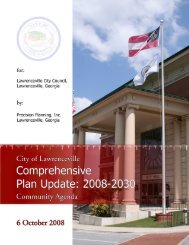
- Page 1 and 2:
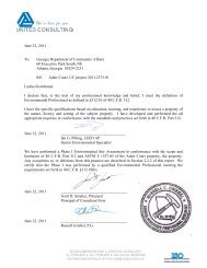
June 17, 2011 To: Georgia Departmen
- Page 3 and 4:
June 17, 2011 Ms. Audrey Martin Rea
- Page 5 and 6:
Veranda Blackshear 2011.2232.01 4.1
- Page 7 and 8:
APPENDICES Veranda Blackshear 2011.
- Page 9 and 10:
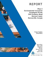
1.0 EXECUTIVE SUMMARY 1 Page 4 of 3
- Page 11 and 12:
Veranda Blackshear 2011.2232.01 own
- Page 13 and 14:
Veranda Blackshear 2011.2232.01 com
- Page 15 and 16:
3.1.1 Current Site Use and Descript
- Page 17 and 18:
Veranda Blackshear 2011.2232.01 Bac
- Page 19 and 20:
DATABASE TABLE 1: REGULATORY DATABA
- Page 21 and 22:
4.1.1.1 Sites Listed in Section 8.2
- Page 23 and 24:
Veranda Blackshear 2011.2232.01 Joh
- Page 25 and 26:
4.3.1 Current Key Site Manager, Occ
- Page 27 and 28:
5.0 SITE INFORMATION AND USE 5.1 Si
- Page 29 and 30:
5.4.12 Stressed Vegetation No stres
- Page 31 and 32:
Veranda Blackshear 2011.2232.01 The
- Page 33 and 34:
5.5.3 Activity and Use Limitations
- Page 35 and 36:
TABLE 3: AREA RECONNAISSANCE INFORM
- Page 37 and 38:
6.2 Sources of Information Consulte
- Page 39 and 40:
Veranda Blackshear 2011.2232.01 not
- Page 41 and 42:
10.4 Environmental Reasons For Any
- Page 43:
APPENDIX A ________________________
- Page 47:
APPENDIX A ________________________
- Page 51 and 52:
APPENDIX B - PHOTOGRAPHS
- Page 53 and 54:
Photograph 3: Looking west along th
- Page 55 and 56:
Photograph 7: Looking west along Wa
- Page 57 and 58:
APPENDIX C ________________________
- Page 59 and 60:
EDR Aerial Photo Decade Package Env
- Page 61 and 62:
INQUIRY #: YEAR: 1938 3049008.5 = 4
- Page 63 and 64:
INQUIRY #: YEAR: 1956 3049008.5 = 4
- Page 65 and 66:
INQUIRY #: YEAR: 1970 3049008.5 = 9
- Page 67 and 68:
INQUIRY #: YEAR: 1993 3049008.5 = 9
- Page 69 and 70:
INQUIRY #: YEAR: 2006 3049008.5 = 6
- Page 71 and 72:
NOT APPLICABLE
- Page 73 and 74:
940 Ware Street 940 Ware Street Bla
- Page 75 and 76:
N → TARGET QUAD NAME: BLACKSHEAR
- Page 77 and 78:
N → ADJOINING QUAD NAME: BLACKSHE
- Page 79 and 80:
APPENDIX D - DOCUMENTATION FROM TIT
- Page 82 and 83:
HERITAGE VILLAGE BLACKSHEAR DEEDS I
- Page 85 and 86:
HERITAGE VILLAGE BLACKSHEAR DEEDS I
- Page 88 and 89:
APPENDIX E - PHASE II REPORT(S)
- Page 90 and 91:
NOT APPLICABLE
- Page 92 and 93:
NOT APPLICABLE
- Page 94 and 95:
UNITED CONSULTING 625 Holcomb Bridg
- Page 96 and 97:
TABLE OF CONTENTS Heritage Village
- Page 98 and 99:
Heritage Village 2011.2232.01 4. A
- Page 100 and 101:
I. LEAD BASED PAINT SURVEY PREVIOUS
- Page 102 and 103:
L-17 Good Unit 45, bldg 12, back do
- Page 104 and 105:
Procedure BULK SAMPLE ANALYSIS Page
- Page 106 and 107:
Page 9 of 12 Heritage Village 2011.
- Page 108 and 109:
DATA EVALUATION/ASSESSMENT Page 11
- Page 115 and 116:
APPENDIX A - PHOTOGRAPHIC DOCUMENTA
- Page 117 and 118:
United Consulting Project No. # 201
- Page 119:
APPENDIX B - CERTIFICATIONS
- Page 124 and 125:
ANALYTICAL ENVIRONMENTAL SERVICES,
- Page 126 and 127:
Client Name: ofl.~ ANALYTICAL ENVIR
- Page 128 and 129:
Client Name: Address: ANALYTICAL EN
- Page 130 and 131:
Client Name: Project Name: A-4 Laye
- Page 132 and 133:
Client Name: Project Name: A-10 Lay
- Page 134 and 135:
Client Name: Project Name: A-14 Lay
- Page 136 and 137:
Client Name: Project Name: A-22 Lay
- Page 138 and 139:
Client Name: Project Name: A-27 Lay
- Page 140 and 141:
Client Name: Project Name: A-32 Lay
- Page 142 and 143:
Client Name: Project Name: A-42 Lay
- Page 144 and 145:
Client Name: Project Name: A-49 Lay
- Page 146 and 147:
Client Name: Project Name: A-54 Lay
- Page 148 and 149:
Client Name: Project Name: A-60 Lay
- Page 150 and 151:
Client Name: Project Name: A-65 Lay
- Page 152 and 153:
Client Name: Project Name: A-71 Lay
- Page 154 and 155:
Client Name: Project Name: A-83 Lay
- Page 156 and 157:
Client Name: Project Name: A-90 Lay
- Page 159 and 160:
May 19, 2011 Ian Pilling United Con
- Page 161 and 162:
1 2 3 4 5 6 7 8 9 10 11 12 13 14 15
- Page 163 and 164:
Analytical Environmental Services,
- Page 165 and 166:
Analytical Environmental Services,
- Page 186 and 187:
APPENDIX E ________________________
- Page 188 and 189:
APPENDIX E ________________________
- Page 190 and 191:
ANALYTICAL SERVICES, INC. ASI Envir
- Page 192 and 193:
ANALYTICAL SERVICES, INC. ASI Envir
- Page 194 and 195:
ANALYTICAL SERVICES, INC. ASI Envir
- Page 196 and 197:
ANALYTICAL SERVICES, INC. ASI Envir
- Page 198 and 199:
ANALYTICAL SERVICES, INC. ASI Envir
- Page 200 and 201:
ANALYTICAL SERVICES, INC. ASI Envir
- Page 202 and 203:
ANALYTICAL SERVICES, INC. ASI Envir
- Page 204 and 205:
ANALYTICAL SERVICES, INC. ASI Envir
- Page 206 and 207:
ANALYTICAL SERVICES, INC. ASI Envir
- Page 208 and 209:
ANALYTICAL SERVICES, INC. ASI Envir
- Page 210 and 211:
ANALYTICAL SERVICES, INC. ASI Envir
- Page 212 and 213:
ANALYTICAL SERVICES, INC. ASI Envir
- Page 215 and 216:
ASI ANALYTICAL SERVICES, INC. Envir
- Page 217 and 218:
ANALYTICAL SERVICES, INC. ASI Envir
- Page 219 and 220:
ANALYTICAL SERVICES, INC. ASI Envir
- Page 221 and 222:
ANALYTICAL SERVICES, INC. ASI Envir
- Page 223 and 224:
ANALYTICAL SERVICES, INC. ASI Envir
- Page 225 and 226:
APPENDIX E ________________________
- Page 227:
APPENDIX E ________________________
- Page 266 and 267:
NOT APPLICABLE
- Page 268 and 269:
NOT APPLICABLE
- Page 270 and 271:
940 Ware Street 940 Ware Street Bla
- Page 272 and 273:
EXECUTIVE SUMMARY A search of avail
- Page 274 and 275:
EXECUTIVE SUMMARY AST Above Ground
- Page 276 and 277:
EXECUTIVE SUMMARY leaking undergrou
- Page 278 and 279:
EDR Inc. 120 120 120 120 120
- Page 280 and 281:
MAP FINDINGS SUMMARY Search Target
- Page 282 and 283:
MAP FINDINGS SUMMARY Search Target
- Page 284 and 285:
Map ID Direction Distance Elevation
- Page 286 and 287:
Map ID Direction Distance Elevation
- Page 288 and 289:
Map ID Direction Distance Elevation
- Page 290 and 291:
Map ID Direction Distance Elevation
- Page 292 and 293:
Map ID Direction Distance Elevation
- Page 294 and 295:
Map ID Direction Distance Elevation
- Page 296 and 297:
Map ID Direction Distance Elevation
- Page 298 and 299:
Map ID Direction Distance Elevation
- Page 300 and 301: Map ID Direction Distance Elevation
- Page 302 and 303: Map ID Direction Distance Elevation
- Page 304 and 305: Map ID Direction Distance Elevation
- Page 306 and 307: Count: 15 records. ORPHAN SUMMARY C
- Page 308 and 309: GOVERNMENT RECORDS SEARCHED / DATA
- Page 310 and 311: GOVERNMENT RECORDS SEARCHED / DATA
- Page 312 and 313: GOVERNMENT RECORDS SEARCHED / DATA
- Page 314 and 315: GOVERNMENT RECORDS SEARCHED / DATA
- Page 316 and 317: GOVERNMENT RECORDS SEARCHED / DATA
- Page 318 and 319: GOVERNMENT RECORDS SEARCHED / DATA
- Page 320 and 321: GOVERNMENT RECORDS SEARCHED / DATA
- Page 322 and 323: GOVERNMENT RECORDS SEARCHED / DATA
- Page 324 and 325: GOVERNMENT RECORDS SEARCHED / DATA
- Page 326 and 327: GOVERNMENT RECORDS SEARCHED / DATA
- Page 328 and 329: TARGET PROPERTY TOPOGRAPHY General
- Page 330 and 331: ROCK STRATIGRAPHIC UNIT GEOLOGIC AG
- Page 332 and 333: WELL SEARCH DISTANCE INFORMATION DA
- Page 334 and 335: 1 ENE 1/4 - 1/2 Mile Lower Source I
- Page 336 and 337: Pwsid: State: Pws name: Population
- Page 338 and 339: Pwsid: State: Pws name: Population
- Page 340 and 341: Pwsid: State: Pws name: Population
- Page 342 and 343: Pwsid: State: Pws name: Population
- Page 344 and 345: Truedate: Pwsname: Retpopsrvd: Vioi
- Page 346 and 347: ENFORCEMENT INFORMATION: System Nam
- Page 348 and 349: CONTACT INFORMATION: Name: Contact:
- Page 352 and 353: PHYSICAL SETTING SOURCE RECORDS SEA
- Page 354: APPENDIX G ________________________
- Page 359 and 360: UNITED CONSULTING RECORD OF COMMUNI
- Page 361 and 362: UNITED CONSULTING RECORD OF COMMUNI
- Page 363 and 364: UNITED CONSULTING RECORD OF COMMUNI
- Page 365 and 366: UNITED CONSULTING RECORD OF COMMUNI
- Page 367 and 368: UNITED CONSULTING RECORD OF COMMUNI
- Page 369 and 370: UNITED CONSULTING RECORD OF COMMUNI
- Page 371 and 372: UNITED CONSULTING SENIOR EXECUTIVE
- Page 373 and 374: UNITED CONSULTING DIRECTOR OF ECOLO
- Page 375 and 376: UNITED CONSULTING DIRECTOR OF NPDES
- Page 377 and 378: UNITED CONSULTING SENIOR ENVIRONMEN
- Page 379 and 380: UNITED CONSULTING IAN G. PILLING, L
- Page 381 and 382: NOT APPLICABLE
- Page 383 and 384: APPENDIX J ________________________
- Page 385 and 386: APPENDIX J ________________________
- Page 387 and 388: APPENDIX K - ADDITIONAL HOME REQUIR
- Page 389 and 390: HOME and HUD ENVIRONMENTAL QUESTION
- Page 391 and 392: ( ) ( ) Are the approaches to the p
- Page 393 and 394: Soil Stability, Erosion, and Draina
- Page 395 and 396: If your answer is “Yes” to any
- Page 397 and 398: ( ) (x ) Is the project within 15 m
- Page 399 and 400: PART C—TO BE COMPLETED BY APPLICA
- Page 402:
APPENDIX K ________________________
- Page 405 and 406:
G. Contact Information: Applicant C
- Page 407 and 408:
C. Are any of the buildings or stru
- Page 409 and 410:
NOT APPLICABLE
- Page 423 and 424:
APPENDIX M - PROPERTY LOG AND INFOR
- Page 425 and 426:
INFORMATION CHECKLIST Check [√] a
- Page 427 and 428:
APPENDIX N - PROOF OF INSURANCE
- Page 430:
APPENDIX O - LETTERS OF REFERENCE
- Page 440:
Project Name: Project Location: 10.
- Page 449 and 450:
APPENDIX R - ENDANGERED SPECIES DOC
- Page 451:
APPENDIX S - SHPO REVIEW DOCUMENTAT
- Page 454 and 455:
G. Contact Information: Applicant C
- Page 456 and 457:
C. Are any of the buildings or stru
- Page 458 and 459:
NOT APPLICABLE