Comhairle Contae Thiobraid Arann Thuaidh North Tipperary County ...
Comhairle Contae Thiobraid Arann Thuaidh North Tipperary County ...
Comhairle Contae Thiobraid Arann Thuaidh North Tipperary County ...

You also want an ePaper? Increase the reach of your titles
YUMPU automatically turns print PDFs into web optimized ePapers that Google loves.
--<br />
v<br />
- c<br />
I<br />
<strong>Comhairle</strong> <strong>Contae</strong> <strong>Thiobraid</strong> <strong>Arann</strong> <strong>Thuaidh</strong><br />
Water Services Section<br />
Civic Offices, <strong>North</strong> <strong>Tipperary</strong> <strong>County</strong> Council A<br />
Limerick Road,<br />
Nenagh<br />
CO. <strong>Tipperary</strong><br />
Civic Offices, Limerick Road, Nenagh, Co. <strong>Tipperary</strong>.<br />
Oifigi Cathartha, B6thar Luimnigh, An t-Aonach, <strong>Contae</strong> <strong>Thiobraid</strong> <strong>Arann</strong>.<br />
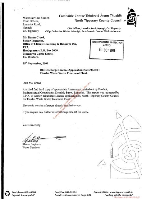
Ms. Karen Creed.<br />
Senior Inspector,<br />
Office of Climate Licensing & Resource Use,<br />
EPA,<br />
Headquarters P.O. Box 3000<br />
Johnstown Castle Estate,<br />
Co. Wexford.<br />
25fh September, 2009<br />
Dear Ms. Creed,<br />
RE: Discharge Licence Application No: D0026/01<br />
Thurles Waste Water Treatment Plant.<br />
Attached find hard copy of appropriate Assessment carried out by Ecofact,<br />
Environmental Consultants, Dominic Street, Limerick. This report was requested by<br />
E.P.A. to support Discharge Licence application by <strong>North</strong> <strong>Tipperary</strong> <strong>County</strong> Council<br />
for Thurles Waste Water Treatment Plant.<br />
Electronic version of report already emailed to you.<br />
If you require any further information please let me know.<br />
Yours sincerely<br />
Water Services<br />
F6n/phone: 067-44500<br />
‘ag obair leis an bpobal’<br />
For inspection purposes only.<br />
Consent of copyright owner required for any other use.<br />
Facs/Fax: 067-33134 Cr&asdn/Web: www.tipperarynorth.ie<br />
Aertel Leathanach/Aertel Page: 622 ‘working with the community’<br />
EPA Export 02-10-2009:03:42:22
Thurles Wastewater Treatment Plant<br />
Lower River Suir candidate Special Area of Conservation<br />
(site code 002137)<br />
Article 6 Appropriate Assessment Report<br />
Version: 25'h September 2009<br />
Prepared on behalf of<br />
<strong>North</strong> <strong>Tipperary</strong> <strong>County</strong> Council<br />
For inspection purposes only.<br />
Consent of copyright owner required for any other use.<br />
ecofact<br />
Environmental Consultants<br />
Tait Business Centre, Dominic Street, Limerick City, Ireland.<br />
t. +353 61 313519, f. +353 61 414315<br />
e. info@ecofact.ie<br />
w. www.ecofact.ie<br />
EPA Export 02-10-2009:03:42:22
' I<br />
/ I '<br />
~1<br />
I'<br />
-: Ecofact Environmental Consultants Ltd . Thurles WwTP Appropriate Assessment<br />
.<br />
For inspection purposes only.<br />
Consent of copyright owner required for any other use.<br />
2<br />
EPA Export 02-10-2009:03:42:22
‘. Ecofact Environmental Consultants Ltd. Thurles WwTP Appropriate Assessment<br />
..........................................................................................................................................<br />
I. INTRODUCTION<br />
The current document assesses the likely significant effects of the ongoing operation of the<br />
Thurles Waste Water Treatment Plant (WwTP) upon the Lower River Suir Special Area of<br />
Conservation (SAC). Effects upon both habitats and species within the SAC are considered.<br />
The Thurles WwTP discharges directly into the SAC so could potentially be having direct<br />
effects on this area.<br />
This document draws upon the information supplied by <strong>North</strong> <strong>Tipperary</strong> <strong>County</strong> Council. A<br />
range of other desk study sources were utilised in this assessment including scientific reports<br />
produced by and information on the websites of the EPA, NPWS, <strong>North</strong> <strong>Tipperary</strong> <strong>County</strong><br />
Council and other agencies were also reviewed.<br />
The site synopsis for the affected SAC is included as Appendix I to this report.<br />
The current report was prepared by Ecofact Environmental Consultants Ltd. on behalf of<br />
<strong>Tipperary</strong> <strong>North</strong> <strong>County</strong> Council over two consultancy days in September 2009. This is<br />
considered to be a relatively short time to complete an assessment of this type. No site visit<br />
was carried out for the preparation of the current screening assessment.<br />
1 .I Legislative context<br />
Council Directive 92/43/EEC on the conservation of natural habitats and of wild fauna and<br />
flora - ‘The Habitats Directive’, has been transposed into Irish law by The European<br />
Community (Natural Habitats) Regulations 1997 (S.I. No. 94/1997).<br />
The 1997 Regulations were updated in 1998 by The European Communities (Natural<br />
Habitats) (Amendment) Regulations 1998 (S.I. No. 233/1998) to include Council Directive<br />
97/62/EC which served to update Council Directive 92/43/EEC, adapting it to technical and<br />
scientific progress made in the intervening years.<br />
The 1997 Regulations were again updated in 2005, by The European Communities (Natural<br />
Habitats) (Amendment) Regulations 2005 (S.I. No. 37812005). This amendment served to<br />
consolidate the main nature conservation legislation enacted in Ireland, meaning The Wildlife<br />
Act 1976, The Wildlife (Amendment) Act 2000, The European Communities (Natural Habitats)<br />
Regulations 1997, The European Communities (Natural Habitats) (Amendment) Regulations<br />
1998, and to draw direct reference upon Council Directive 79/4091EC on the conservation of<br />
wild birds - ‘The Birds Directive’.<br />
For inspection purposes only.<br />
Consent of copyright owner required for any other use.<br />
The Birds Directive seeks to protect birds of special importance by the designation of Special<br />
Protection Areas (SPAs) whereas the Habitats Directive does the same for habitats and other<br />
species groups with Special Areas of Conservation (SACs). It lists certain rare habitats (Annex<br />
I) and species (Annex II) whose conservation is of community interest. It is the responsibility<br />
of each member state to designate SPAs and SACs, both of which will form part of Natura<br />
2000, a network of protected areas throughout the European Community.<br />
Article 6, paragraphs 3 and 4 of the Habitats Directive state that:<br />
6(3) Any plan or project not directly connected with or necessary to the management of the<br />
site but likely to have a significant effect thereon, either individually or in combination with<br />
other plans or projects, shall be subject to appropriate assessment of its implications for the<br />
site in view of the site’s conservation objectives. In the light of the conclusions of the<br />
assessment of the implications for the site and subject to the provisions of paragraph 4, the<br />
competent national authorities shall agree to the plan or project only after having ascertained<br />
that it will not adversely affect the integrity of the site concerned and, if appropriate, after<br />
having obtained the opinion of the general public.<br />
6(4) If, in spite of a negative assessment of the implications for the site and in the absence<br />
of alternative solutions, a plan or project must nevertheless be carried out for imperative<br />
reasons of overriding public interest, including those of a social or economic nature, the<br />
3<br />
EPA Export 02-10-2009:03:42:22
Ecofact Environmental Consultants Ltd. Thurles WwTP Appropriate Assessment<br />
..........................................................................................................................................<br />
Member State shall take all compensatory measures necessary to ensure that the overall<br />
coherence of Natura 2000 is protected. It shall inform the Commission of the compensatory<br />
measures adopted.<br />
Where the site concerned hosts a priority natural habitat type and/or a priority species, the<br />
only considerations which may be raised are those relating to human health or public safety,<br />
to beneficial consequences of primary importance for the environment or, further to an opinion<br />
from the Commission, to other imperative reasons of overriding public interest.<br />
I .2 Consultation<br />
The following bodies provided information for this report:<br />
0 National Parks and Wildlife Service (NPWS);<br />
0 Southern Regional Fisheries Board (SRFB);<br />
0 <strong>North</strong> <strong>Tipperary</strong> <strong>County</strong> Council (KCC);<br />
0 Office of Public Works (OPW).<br />
0 Environmental Protection Agency (EPA).<br />
For inspection purposes only.<br />
Consent of copyright owner required for any other use.<br />
4<br />
EPA Export 02-10-2009:03:42:22
*. Ecofact Environmental Consultants Ltd. Thurles WwTP Appropriate Assessment<br />
..........................................................................................................................................<br />
/I 2. METHODOLOGY<br />
jl<br />
2.1 Desktop Review<br />
A review of areas designated (or being considered for designation) for nature conservation<br />
was carried out by consulting the National Parks and Wildlife Service (NPWS). These included<br />
Special Areas of Conservation, Special Protection Areas for birds (both internationally<br />
important) and proposed Natural Heritage Areas (of national importance). Technical files and<br />
previous reports prepared for the WwTP were supplied by <strong>Tipperary</strong> <strong>County</strong> Council for<br />
review in the current assessment. A review of the published literature was undertaken in order<br />
to collate data on the receiving environment, including aquatic species and habitats of<br />
conservation concern in the study area. A range of additional sources of information including<br />
scientific reports produced by, and information on the websites of the EPA, NPWS, <strong>Tipperary</strong><br />
<strong>County</strong> Council and other agencies were also reviewed. A full bibliography of information<br />
sources reviewed is given in the references section. Ordinance Survey Maps and OS aerial<br />
photographs were'also reviewed during the desk assessment.<br />
I 2.2 Assessment Methodology<br />
The Department of the Environment, Heritage and Local Government has not published<br />
guidelines for undertaking Appropriate Assessment in Ireland. This Appropriate Assessment<br />
has been carried out using the following guidance:<br />
0 Managing Natura 2000 Sites: the provisions of Article 6 of the 'Habitats' Directive<br />
92/43/EEC, Office for Official Publications of the European Communities, Luxembourg<br />
(EC 2000);<br />
Assessment of Plans and Projects Significantly Affecting Natura 2000 Sites:<br />
Methodological guidance on the provisions of Article 6(3) and (4) of the Habitats<br />
Directive 92/43/EEC, Office for Official Publications of the European Communities,<br />
Luxembourg (EC 2001);<br />
The Habitats Regulations: A guide for competent authorities, Environment and<br />
Heritage Service, Belfast (EHS, 2002);<br />
0 Guidance for Competent Authorities when dealing with proposals affecting SAC<br />
freshwater sites, Scottish Natural Heritage, Perth (SNH, 2006); and<br />
0 Guidance document on Article 6(4) of the 'Habitats Directive' 92/43/EEC -<br />
Clarification of the concepts of: alternative solutions, imperative reasons of overriding<br />
public interest, compensatory measures, overall coherence, opinion of the<br />
commission. Office for Official Publications of the European Communities,<br />
Luxembourg (EC 2007).<br />
Based on these guidelines, the assessment is a four staged approach described below and<br />
illustrated in Figure 1.<br />
0 Stage One: Screening / Test of Significance - the process which identifies the likely<br />
impacts upon a Natura 2000 site of a project or plan, either alone or in combination<br />
with other projects or plans, and considers whether these impacts are likely to be<br />
significant;<br />
0<br />
For inspection purposes only.<br />
Consent of copyright owner required for any other use.<br />
Stage Two: Appropriate Assessment - the consideration of the impact of the project or<br />
plan on the integrity of the Natura 2000 site, either alone or in combination with other<br />
projects or plans, with respect to the site's structure and function and its conservation<br />
objectives. Additionally, where there are adverse impacts, an assessment of the<br />
potential mitigation of those impacts;<br />
Stage Three: Assessment of Alternative Solutions - the process which examines<br />
alternative ways of achieving the objectives of the project or plan that avoid adverse<br />
impacts on the integrity of the Natura 2000 site; and<br />
0 Stage Four: Assessment Where Adverse Impacts Remain - an assessment of<br />
compensatory measures where, in the light of an assessment of Imperative Reasons<br />
of Overriding Public Interest (IROPI), it is deemed that the project or plan should<br />
proceed.<br />
5<br />
EPA Export 02-10-2009:03:42:22
2 k<br />
*- Ecofact Environmental Consultants Ltd. Thurles WwTP Appropriate Assessment<br />
For inspection purposes only.<br />
Consent of copyright owner required for any other use.<br />
Figure 1 Flowchart outlining the appropriate assessment process (Adapted from EC, 2001).<br />
6<br />
EPA Export 02-10-2009:03:42:22
~<br />
I 3. STAGE 1 : SCREENING / TEST OF SIGNIFICANCE<br />
I<br />
This stage examines whether or not likely effects upon a Natura 2000 site will be significant.<br />
The screening process in this report follows the matrix outlined in the EC Environment DG<br />
(2001) report. The headings to be covered by this matrix are outlined below and are<br />
discussed further in the following text.<br />
0<br />
0<br />
Brief description of the project or plan.<br />
Brief description of the Natura 2000 site.<br />
3.1 Assessment criteria<br />
Describe the individual elements of the project (either alone or in combination with other plans<br />
or projects) likely to give rise to impacts on the Natura 2000 site.<br />
Describe any likely direct, indirect or secondary impacts of the project (either alone or in<br />
combination with other plans or projects) on the Natura 2000 site by virtue of:<br />
size and scale;<br />
land-take;<br />
distance from the Natura 2000 site or key features of the site;<br />
resource requirements (water abstraction etc.);<br />
emissions (disposal to land, water or air);<br />
excavation requirements;<br />
trans porta tion require men ts;<br />
duration of construction, operation, decommissioning, etc.;<br />
other.<br />
Describe any likely changes to the site arising as a result of:<br />
reduction of habitat area:<br />
0 disturbance to key species;<br />
0 habitat or species fragmentation;<br />
0 reduction in species density;<br />
0 changes in key indicators of conservation value (water quality etc.);<br />
0 climate change.<br />
Describe any likely impacts on the Natura 2000 site as a whole in terms of:<br />
0<br />
interference with the key relationships that define the structure of the site;<br />
interference with key relationships that define the function of the site.<br />
Provide indicators of significance as a result of the identification of effects set out above in<br />
terms of:<br />
loss;<br />
0 fragmentation;<br />
0 disruption;<br />
0 disturbance;<br />
For inspection purposes only.<br />
Consent of copyright owner required for any other use.<br />
0 change to key elements of the site (e.g. water quality etc.).<br />
Describe from the above those elements of the project or plan, or combination of elements,<br />
where the above impacts are likely to be significant or where the scale or magnitude of<br />
impacts is not known.<br />
7<br />
EPA Export 02-10-2009:03:42:22
A<br />
3.2 Description of the project<br />
3.2.7 lnfroducfion<br />
. ..<br />
Thurles is a residential and commercial centre in the southern portion of <strong>North</strong> <strong>Tipperary</strong>. The<br />
town is expected to grow in population and according to the 2006 census the population in the<br />
town was 6,831.<br />
The Thurles WwTP has a design capacity of 15,000 population equivalent (P.E.) and consists<br />
of inlet works with screens, storm water retention tank, two rectangular aeration basins, one<br />
clarifier, drying beds for sludge and associated pump sumps, control and administration<br />
house. There is a single discharge point to the River Suir at the WwTP site. Table I presents<br />
the current design capacity and loading to the Thurles WwTP.<br />
Table 1 Thurles Wastewater treatment plant loadings (<strong>North</strong> <strong>Tipperary</strong> Co. Co. data)<br />
Plant 2 . 3 , e . I ,Design Capacity . I Loading (PE) ’ 1 . 7 ,‘I Additional PE fiquired. . I<br />
Thurles WwTP 1 15,000 I 14,140* I 365<br />
*This loading has recently been reduced by 6,000 p.e (see text below).<br />
The combined sewer network within Thurles town includes one storm water overflow which<br />
discharges to the River Suir in the centre of the town. There is no current monitoring data for<br />
the operation of the storm water outfall in the town.<br />
Three pumping stations within the combined sewer network also contain emergency overflow<br />
systems, while the Thurles WwTP contains an emergency overflow pipe which discharges to<br />
the River Suir via the main discharge. There is limited data available currently for the<br />
frequency or scale of the storm and emergency overflow systems within the Thurles<br />
combined sewerage network.<br />
3.2.2 Thurles WwTP upgrade works<br />
Recent works were undertaken at Thurles WWTP to improve the efficiency and the quality of<br />
the final effluent although the capacity of the plant was not increased. Quality improvements<br />
included the provision of phosphate reduction facilities by Ferric sulphate dosage was<br />
commissioned in November 2008.<br />
For inspection purposes only.<br />
Consent of copyright owner required for any other use.<br />
The recent upgrade also included the provision of a diffused aeration system to oxygenate the<br />
aeration tanks to replace the existing surface aerators. This has made the plant more efficient<br />
in terms of oxygenation of the mixed liquor in the aeration tank and has produced a higher<br />
quality final effluent. The new diffused aeration system was completed on the 30 September<br />
2008.<br />
In 2008 the Thurles WwTP was approaching capacity, however, a food processing plant<br />
which was previously discharging to the WwTP has now been taken off-line to a private<br />
treatment plant, allowing for the availability of ca. 6,000 P.E. equivalent at the Thurles WwTP.<br />
Recently completed upgrades to the Thurles WwTP will have a direct impact on the current<br />
ecological status of the Lower River Suir SAC, resulting in an improvement in phosphate<br />
levels in the river downstream of the plant. It is considered that monitoring data is required to<br />
establish this over the longer term.<br />
8<br />
EPA Export 02-10-2009:03:42:22
.b<br />
’a Ecofact Environmental Consultants Ltd. Thurles WwTP Appropriate Assessment<br />
3.3 Description of the receiving environment<br />
3.3.1 Introduction<br />
The Thurles WwTP discharges into the River Suir downstream of Thurles town, in the<br />
townland of Commons, downstream of Cabragh Bridge. This discharge point downstream of<br />
Cabragh Bridge discharges directly into the Lower River Suir Special Area of Conservation<br />
(site code 002137). No other Natura 2000 sites are directly or indirectly affected by the<br />
Thurles WwTP discharge.<br />
\<br />
The River Suir meanders through the region from the north to the southwest. The River Suir is<br />
one of the major rivers of Ireland, one of the “Three Sisters” comprising the rivers Barrow,<br />
Nore & Suir which enter the sea via Waterford Harbour. The Drish River, a tributary of the<br />
River Suir, rises in the Slieveardagh Hills near Ballysloe, to the east of the study area, and<br />
enters the main channel ca. 3 river kilometres upstream of the discharge, i.e. upstream of the<br />
SAC designation.<br />
3.3.2 The Lower River Suir SAC<br />
3.3.2.1 Overview of the conservation interests of the Lower River Suir SAC<br />
The Lower River Suir cSAC (site code: 002137) is a large site, extending from Cabragh<br />
Bridge south of Thurles, with tidal stretches as far as the confluence with the Barrow / Nore<br />
immediately east of Cheekpoint in Co. Waterford. It includes many tributaries; the Clodiagh in<br />
Co. Waterford, the Lingaun, Anner, Drish, Nier, Tar, Aherlow, Multeen and Clodiagh in Co.<br />
<strong>Tipperary</strong>. It is selected as a cSAC for the presence of a priority habitat on Annex I of the E.U.<br />
Habitats Directive, alluvial wet woodlands. The site is also selected as a candidate SAC for<br />
floating river vegetation, Atlantic salt meadows, Mediterranean salt meadows, old oak<br />
woodlands and eutrophic tall herbs, all habitats listed on Annex I of the E.U. Habitats<br />
Directive. The site is also selected for the following species listed on Annex I1 of the same<br />
directive - Sea Lamprey, Peteromyzon marinus, River Lamprey Lampetra fluviatilis, Brook<br />
Lamprey Lampetra planeri, Freshwater Pearl Mussel Margaritifera margaritifera, Crayfish<br />
Austropotamobius pallipes, Twaite Shad Alosa fallax, Atlantic salmon Salmo salar, and Otter<br />
Lutra lutra.<br />
Floating river vegetation is evident in the freshwater stretches of the River Suir and along<br />
many of its tributaries. Typical species found include Canadian Pondweed Elodea<br />
canadensis, Milfoil Myriophyllum spp., Fennel Pondweed Potamogeton pectinatus, Curled<br />
Pondweed P. crispus, Perfoliate Pondweed P. perfoliatus), Pond Water-crowfoot Ranunculus<br />
peltatus, other Crowfoots Ranunculus spp. and the moss Fontinalis antipyretica. Oppositeleaved<br />
Pondweed Groenlandia densa, a species protected under the Flora (Protection) Order,<br />
1999, is known from the lower reaches of the Suir around Clonmel and Carrick-on-Suir.<br />
Cabragh marshes, just below Thurles, lie in a low-lying tributary valley into which the main<br />
river floods in winter. Although part of this SAC, it is also a separately listed pNHA (site code<br />
1934), which is described in detail below.<br />
For inspection purposes only.<br />
Consent of copyright owner required for any other use.<br />
The Suir cSAC also supports populations of several animal species. Those which are listed in<br />
the Irish Red Data Book include Daubenton’s Bat Myotis daubentonii, .Nattererer’s Bat M.<br />
nattereri, Pipistrelle Pipistrellus pipistrellus, Pine Marten Martes martes, Badger Meles meles,<br />
the Irish Hare Lepus timidus hibernicus, Smelt Osmerus eperlanus and the Frog Rana<br />
temporaria.<br />
Kingfisher, a species that is listed on Annex I of the EU Birds Directive, occurs along some of<br />
the many tributaries throughout the site. Notable populations of other bird species are<br />
recorded from the Lower reaches of the site, as well as at Cabragh marshes where there is<br />
abundant food for surface feeding wildfowl. Widgeon, Teal and Mallard are numerous and the<br />
latter has a large breeding population - with up to 400 in summer. In addition, less frequent<br />
species like Shoveler and Pintail occur and there are records for both Whooper and Bewick‘s<br />
swans. The legally protected species Meadow Barley (Hordeum secalinum) occurs in the Suir<br />
9<br />
EPA Export 02-10-2009:03:42:22
*<br />
Ecofact Environmental Consultants Ltd. Thurles WwTP Appropriate Assessment<br />
estuary near Waterford. The full site synopsis for this conservation site is presented in<br />
Appendix 1.<br />
The faunal conservation interests of this SAC are directly dependant on the aquatic<br />
environment and as the Thurles WwTP discharges to the River Suir within the SAC<br />
designation, there is a connection between this facility and the ecological receptors in the<br />
River Suir.<br />
In Table 2 the qualifying interests for the River Suir SAC are listed, and it is indicated whether<br />
these habitats and species would be present in the River Suir in the general vicinity of the<br />
Thurles WwTP. Some of the species listed in Table 2 would occur only in the lower reaches of<br />
the river (i.e. twaite shad and sea lamprey). Other species are non-aquatic so would not be<br />
affected directly or indirectly by the operation of a sewage treatment plant at Thurles.<br />
Freshwater pearl mussels recorded as a qualifying interests of the River Suir SAC<br />
downstream of the WwTP. This species is recorded in the River Clodiagh catchment and is<br />
not affected by the Thurles WwTP discharge.<br />
For inspection purposes only.<br />
Consent of copyright owner required for any other use.<br />
Fig1<br />
Bridge is delineated at the bottom left of the figure (<strong>North</strong> <strong>Tipperary</strong> COCO Licence).<br />
10<br />
It Cabr<br />
EPA Export 02-10-2009:03:42:22
c<br />
*- Ecofact Environmental Consultants Ltd. Thurles WwTP Appropriate Assessment<br />
Table 2 Qualifying Interests for the Lower River Suir SAC and their potential to occur within the study<br />
area.<br />
3.3.2.2 Conservation Obiectives for Lower River Suir cSAC<br />
The Conservation Management Plan for the Lower River Suir SAC is currently not available<br />
for consultation and is to be prepared by the National Parks and Wildlife Service (NPWS) of<br />
the Department of the Environment, Heritage and Local Government.<br />
In the absence of a completed management plan for any designated site, the conservation<br />
objectives are taken to include maintaining or restoring the ‘favourable conservation status’<br />
(defined in the EU Habitats Directive for habitats and species) of habitats and species for<br />
which the site has been selected, including the habitats of the annexed species. The<br />
conservation objectives of the Lower River Suir SAC have been summarised in Table 3.<br />
For inspection purposes only.<br />
Consent of copyright owner required for any other use.<br />
European and national legislation places a collective obligation on Ireland and its citizens to<br />
maintain at favourable conservation status areas designated as candidate Special Areas of<br />
Conservation. The Government and its agencies (i.e. the NPWS, local authorities and other<br />
statutory bodies) are responsible for the implementation and enforcement of regulations that<br />
will ensure the ecological integrity of these sites. According to the EU Habitats Directive,<br />
favourable conservation status of a habitat is achieved when “its natural range, and area it<br />
covers within that range, is stable or increasing, and the ecological factors that are necessary<br />
for its long-term maintenance exist and are likely to continue to exist for the foreseeable<br />
future, and the conservation status of its typical species is favourable”. The favourable<br />
conservation status of a species is achieved when “population data on the species concerned<br />
indicate that it is maintaining itself, and the natural range of the species is neither being<br />
reduced or likely to be reduced for the foreseeable future, and there is, and will probably<br />
continue to be, a sufficiently large habitat to maintain its.populations on a long-term basis”.<br />
11<br />
EPA Export 02-10-2009:03:42:22
1 ; j<br />
i i E<br />
I<br />
I i<br />
I<br />
* Ecofact Environmental Consultants Ltd. Thurles WwTP Appropriate Assessment<br />
..........................................................................................................................................<br />
Table 3 The conservation objectives of the Lower River Suir SAC, in relation to the qualifying interests<br />
of the site.<br />
3.3.3 River Suir catchment<br />
The River Suir (EPA hydrometric Area: 16) rises in the Devils Bit Mountain in <strong>North</strong> <strong>Tipperary</strong><br />
and flows south and then north and enters the sea at Waterford Harbour. The Suir is normally<br />
referred to in the context of the “Three Sister” catchments (Barrow, Nore and Suir) which join<br />
together in their estuarine reaches. The combined catchment area of the ‘three sisters’ is<br />
more than 9,000 Km’. The Suir at 182 km long is the largest of the three sisters and has a<br />
catchment area of 3,610km2. The river is tidal to a point above Carrick-on-Suir and has a<br />
mean discharge of 47 m3/sec (Lucey, 1998). The river has a total of 34 tributaries, the largest<br />
of which are the Drish, Clodiagh (<strong>Tipperary</strong>), Multeen, Aherlow/Ara, Anner, Clodiagh<br />
(Waterford) and Blackwater (Kilmacow).<br />
The Suir catchment overlies limestone in the upper reaches of the catchment and at<br />
Newcastle it crosses Old Red Sandstone. Despite this, most of the rivers in the catchment are<br />
influenced by Carboniferous limestone. The purer limestone formations are extensively<br />
karstified, particularly south of Cashel. Such karst areas are characterised by swallow holes,<br />
sinking streams, caves, and large karst springs. The Suir River and the bulk of its tributaries<br />
exhibit relatively hard waters. This is best exemplified by the waters of the Anner subcatchment<br />
which are limestone streams. However, some Suir tributaries display less<br />
calcareous features. The Nier, for example, runs off the Silurian slates and Old Red<br />
sandstones of the Galtee, Knockmealdown and Comeragh Mountains and has low alkalinity<br />
and hardness levels (Lucey, 1998).<br />
As is commonly found in Ireland, the rivers of the Suir catchment have been used extensively<br />
for water supply, .waste disposal, fishing, agricultural, recreational and to limited extent<br />
navigation (Lucy, 1998). A large number of mills were built in the catchment during the<br />
1800’s and many of these mills continue to be operated today as small hydroelectric stations.<br />
Agriculture and related agri-based industries comprise one of the main activities in the<br />
catchment and the organic waste resulting from these has a negative impact on water quality<br />
in some areas.<br />
For inspection purposes only.<br />
Consent of copyright owner required for any other use.<br />
Most of the fish species present in Irish river catchments, such as the River Suir, have<br />
colonized from the sea or have been artificially introduced. Native fish species in the Suir<br />
catchment include the three Irish lamprey species (brook lamprey Lampetra planeri, river<br />
lamprey Lampetra fluviafilis, and sea lamprey Petrornyzon marinus) (Kurz & Costello, 1999),<br />
the Atlantic salmon Salmo salar, (O’Grady & Caffrey, 1987) and the rare Twaite Shad Alos<br />
fallax, (Lucey, 1998) all of which are listed under Annex II of the EU Habitats Directive. The<br />
European eel Anguilla anguilla, brown trout Salmo trutta, and three-spined stickleback<br />
Gasterosfeous aculeatus, are other common native species present in the Suir catchment,<br />
while introduced fish species in the catchment include northern pike €sox lucius, stone loach<br />
Barbatula barbafula, dace Leuciscus leuciscus, and minnow Phoxinus phoxinus (Lucey,<br />
1998). The smelt Osmerous eperlanus, a species listed as vulnerable in the red data list<br />
(Whilde, 1993), is common in the Suir estuary (King, 2002).<br />
The Suir River is one of Ireland’s premier game fisheries (O’Reilly, 2002). The river produced<br />
Ireland’s record rod caught salmon of 571bs in 1874, and is widely recognized as being the<br />
most important river for brown trout angling in Ireland (O’Reilly, 2002). However, despite its<br />
importance as a fishery, relatively little quantitative information on fish stocks in the catchment<br />
is available. A fisheries survey of the catchment was carried out during the period 1983 to<br />
12<br />
EPA Export 02-10-2009:03:42:22
'1<br />
i<br />
'. Ecofact Environmental Consultants Ltd. Thurles WwTP Appropriate Assessment<br />
1985 by the Central Fisheries Board (Lucey, 1998). This survey showed that fish stocks in the<br />
Suir catchment at this time were dominated by salmonids, with salmon chiefly occupying the<br />
main channels and trout the tributaries. One of the conclusions of this report was that the Suir<br />
was of national significance in terms salmon and trout production. This report also described<br />
the lower Suir main channel as 'probably the single largest and most valuable trout angling<br />
riverine fishery in Ireland'. Important salmonid sub-catchments mentioned in the report were<br />
the Multeen, Aherlow, Tar, Anner and Lingaun. However, In line with many other Irish rivers,<br />
the quality of the Suir as a salmon fishery is reported to have diminished in recent years<br />
(O'Reilly, 2002).<br />
According to O'Connor (2006) lampreys are widely distributed in the Suir catchment, and all<br />
three of the Irish species occur. Sea lampreys have however only been recorded on the main<br />
channel of the Suir downstream of Caher, CO <strong>Tipperary</strong>. During the 2006 survey no lampreys<br />
were recorded at Turtulla Bridge, downstream of Thurles. Pollution and drainage maintenance<br />
works were suggested by O'Connor (2006) as possible reasons for their absence at this site<br />
and it was stated that "extensive mats of dead filamentous algae were observed at sites<br />
throughout the upper Suir and there is evidence of past or ongoing drainage works".<br />
Upstream of Thurles sites investigated at Rossestown Bridge and Knocknageragh Bridge had<br />
brook lampreys present, with a density of 13.43 per m2 recorded at the latter site.<br />
3.3.4 Receiving Water Quality<br />
3.3.4.1 EPA bioloqical water quality monitorinq in the River Suir<br />
The EPA monitors both chemical and biological water quality in the River Suir. An explanation<br />
of the EPA biological water quality monitoring system, the Q-rating system, is presented in<br />
Appendix 3. In the 2005 monitoring report (2001-2003 data, Toner et a/, 2005) the River Suir<br />
is rated as being 'Q3 - Moderately Polluted' at Thurles and 'Q3-4 - Slightly Polluted' at<br />
Holycross. Further monitoring data from 2005, presented on the EPA online 'Envision<br />
mapping tool', shows a decrease in water quality downstream of Thurles, with the Q3 rating in<br />
the town being recorded at both the Cabragh Bridge monitoring station (station no. 0900)<br />
downstream of the River Drish confluence and also at the Holycross monitoring station<br />
(station no. 1 100) downstream of the WwTP discharge.<br />
A summary of the overall results for the Suir catchment during the period 2004-2006 are<br />
presented in Table 4. In relation to nitrates in the River Suir, the EPA data shows that while<br />
annual average median concentrations in the River Suir have not exceeded EU Guideline<br />
limit values at any time the recorded maxima have exceeded this limit on several occasions in<br />
the 2004-2006 period.<br />
For inspection purposes only.<br />
Consent of copyright owner required for any other use.<br />
Table 4 Summary of biological water quality results from EPA Hydrometric Area 16 showing overall<br />
results for the Suir catchment (adapted from Clabby et a/, 2008).<br />
1 Hydrometric Area 76 (km) 1 457.5 I 142.5 I 90.0 I 1.5 I 691.5<br />
Table 5 presents the historical biological water quality monitoring data for the River Suir<br />
upstream and downstream of the Thurles WwTP for the past 20 years.<br />
13<br />
I<br />
EPA Export 02-10-2009:03:42:22
Ecofact Environmental Consultants Ltd. Thurles WwTP Appropriate Assessment<br />
..........................................................................................................................................<br />
Table 5 Historical EPA biological water quality monitoring data in the River Suir (16S02) upstream and<br />
downstream of the Thurles WwTP discharge for the years 1988 to 2008.<br />
1 1200 1 Twoford Bridges I 3 3-4 I 3-4 I 4<br />
The EPA also recorded the same Q3 biological water quality status at these monitoring<br />
stations during the 2008 monitoring round. This unsatisfactory water quality was commented<br />
upon in the monitoring notes, where the polluted status of the river was observed to extend<br />
from Thurles town downstream to Holycross. No direct cause of the pollution at this stretch of<br />
the river was referred to in the monitoring report (Neill, 2009).<br />
Overall the EPA biological monitoring data indicates that the town of Thurles is having a direct<br />
negative impact on the water quality of the River Suir with a rating of Q4 recorded by the EPA<br />
upstream of the town in 2008 (Rossestown Bridge Station 0500) and also a Q4 rating<br />
recorded Twofords Bridge (Station 1200) ca. 6 river kilometres downstream of the WwTP<br />
discharge. A rating of Q4 was also recorded in the River Drish during 2008, directly upstream<br />
of its confluence with the River Suir.<br />
The discharge from the WwTP at Cabragh Bridge cannot be defined as causing a direct<br />
impact on the river at the discharge point as there is no further deterioration in water quality<br />
between Thurles town and the downstream monitoring station at Holycross. However, there is<br />
additional dilution in the river from the Drish tributary without an associated increase in<br />
biological water quality indicating a continuation in pollution above the assimilation capacity of<br />
the watercourse. Furthermore storm water discharges to the river associated with the<br />
For inspection purposes only.<br />
Consent of copyright owner required for any other use.<br />
combined sewerage network could potentially result in impacts on biological water quality<br />
within Thurles town, affecting both the assimilation, capacity of the river and the aquatic<br />
ecological communities downstream of Thurles.<br />
3.3.4.2 EPA chemical water auality monitorinq in the River Suir<br />
The EPA carries out chemical water quality monitoring in the River Suir, with a number of<br />
samples taken in a given year. The chemical water quality monitoring data for the EPA<br />
stations upstream and downstream of the Thurles WwTP are presented in Tables 6 and 7<br />
below.<br />
Table 6 EPA chemical monitoring data for 2008 at the Cabragh Bridge (Station 0900), upstream of the<br />
Thurles WwTP discharge point. Elevated parameters are highlighted in bold.<br />
*The Orthophosphate result of 04.02.08 has been identified as being elevated, as this sample was<br />
unlikely to have been taken below 95%ile flows in February, thus breaching good status requirements.<br />
14<br />
EPA Export 02-10-2009:03:42:22
Table 7 EPA chemical monitoring data for 2008 at the Holycross Bridge (Station 1 IOO), downstream of<br />
the Thurles WwTP discharge point. Elevated parameters are highlighted in bold.<br />
3.3.4.3 <strong>North</strong> Tipperarv Countv Council chemical water quality monitorinq data<br />
<strong>North</strong> <strong>Tipperary</strong> <strong>County</strong> Council carry out regular chemical water quality monitoring of the<br />
receiving water i.e. the River Suir, upstream and downstream of the discharge point at the<br />
Thurles WwTP. The treated effluent from the Thurles WwTP is also subject to regular<br />
monitoring by the <strong>County</strong> Council. A summary of the results of the 2009 sampling exercise<br />
are presented in Tables 8 and 9 below. This data provides the most up to date results for<br />
water quality in the River Suir upstream and downstream of the Thurles WwTP, as significant<br />
changes have been put in place in the form of upgrades and effluent loading at the treatment<br />
plant over the period 2008 to 2009.From the upstream and downstream data in Table 8 it can<br />
be seen that the downstream monitoring station records mean values that are below the<br />
mean upstream values for a number of parameters including: BOD, Nitrates, Total<br />
Phosphorous and Total Oxidised Nitrogen. Other parameters including Temperature,<br />
Suspended Solids and Sulphates also display this discrepancy in the monitoring data. The<br />
detailed water quality monitoring results from the <strong>North</strong> <strong>Tipperary</strong> sampling data at Thurles<br />
WwTP is presented in Appendix 4.<br />
At the time of finalising the current report, the data presented in Table 10 was supplied by<br />
<strong>North</strong> <strong>Tipperary</strong> <strong>County</strong> Council. This shows the discharge from the plant being complaint<br />
with the requirements of the Urban wastewater treatment Directive for sensitive catchments in<br />
terms if orthophosphate. This is also the case for all other parameters (see Appendix 4). The<br />
River Suir upstream and downstream of the plant is also Compliant with "Good Status"<br />
Standard as per EC Environmental Objectives (Surface Water) Regulations 2009.<br />
Table 8 <strong>North</strong> <strong>Tipperary</strong> Co. Co. water quality monitoring data for the River Suir. Mean upstream and<br />
downstream values for the Thurles WwTP during the period January to August 2009. The % change in<br />
the values for each parameter between the sites is also given.<br />
For inspection purposes only.<br />
Consent of copyright owner required for any other use.<br />
15<br />
EPA Export 02-10-2009:03:42:22
e<br />
*. Ecofact Environmental Consultants Ltd. Thurles WwTP Appropriate Assessment<br />
..........................................................................................................................................<br />
Table 9 Summary of <strong>North</strong> <strong>Tipperary</strong> Co. Co. water quality monitoring data for the treated effluent<br />
emission from the Thurles WwTP during the period January to August 2009.<br />
Table 10 Summary of <strong>North</strong> <strong>Tipperary</strong> Co. Co. water quality monitoring data for the treated effluent<br />
emission and River Suir upstream and downstream of the Thurles WwTP during the period January to<br />
September 2009. The mean discharge level is Compliant with UWW Regs. The River Suir upstream and<br />
downstream of the plant are Compliant with "Good Status" Standard as per EC Env. Objectives (Surface<br />
Water) Regulations 2009.<br />
Thurles STP upstream<br />
Average<br />
Thurles STP downstream<br />
For inspection purposes only.<br />
Consent of copyright owner required for any other use.<br />
24/09/2009 0.02 AR<br />
10 0.03<br />
15/01/2009 0.04 0.1<br />
16<br />
EPA Export 02-10-2009:03:42:22
1<br />
3.3.5 Assimilation capacities<br />
Please note that the current assimilation capacity assessment was prepared based on an<br />
estimate of the flow from the plant (back calculated from mg/l and kg/day figures supplied in<br />
the discharge licence. The actual flow from the plant may be less than the figure used. The<br />
models were also prepared using background data for the River Suir from Neil (1999), which<br />
included only three observations. Thus is insufficient data so the results need to be<br />
interpreted with caution. In particular the reader should consider the results presented in<br />
Table 10, which were supplied after the following assessment had been completed. It is<br />
recommended that updated assimilation capacity assessment be prepared when more data is<br />
available as a result of monitoring the newly upgraded plant.<br />
The primary regulatory guideline for effluent standards is the EU Urban Wastewater<br />
Treatment Regulations, 2001 which is implemented in Ireland through S.I. 254 of 2001 and<br />
the Water Quality Standards for Phosphorus (S.I. 258 of 1998) and the European<br />
Communities Environmental Objectives (Surface Waters) Regulations 2009 (SI 272 of 2009).<br />
The Urban Wastewater Treatment Regulations requires the provision of secondary treatment<br />
for all discharges to freshwaters and estuaries from towns with a population equivalent of<br />
between 2,000 and 10,000. While the requirements of the Urban Wastewater Treatment<br />
Regulations are set, water quality requirements are dependent on the background values and<br />
flow in the river (i.e. assimilation capacity). A worked example for BOD assimilation capacity<br />
is provided as follows. The BOD Waste Assimilation Capacity (WAC) is defined as:<br />
For inspection purposes only.<br />
Consent of copyright owner required for any other use.<br />
WAC = (Cmax- Cback)X Fg5 X 86.4 kg BOD/day<br />
Where: Cmax = maximum permissible BOD concentration<br />
Cback = background (upstream) BOD concentration<br />
Fg5 = 95 percentile flow (m3/s)<br />
86.4 = conversion factor<br />
The Waste Assimilation Capacity of the River Suir at Thurles is assessed for the parameters<br />
Biological Oxygen Demand (BOD) and orthophosphate. These parameters were assessed<br />
due to their key importance in biological systems, particularly in relation to eutrophication. The<br />
standards applied in the current case are those given in the European Communities<br />
Environmental Objectives (Surface Waters) Regulations 2009 (SI 272 of 2009). This is a<br />
preliminary WAC assessment only carried out as part of the current screening assessment.<br />
The catchment area of the River Suir at Thurles is 228.8 km2 while the catchment area at<br />
Cabragh Bridge is 442.6 km2. The mean flow of the River Suir at Thurles (station No. 16004)<br />
is 3.02m3/s and the 95%ile flow is 0.36 m3/s. By extrapolation, the mean flow of the River Suir<br />
at Cabragh Bridge was found to be 4.63 m3/s and the 95%ile flow was 0.55 m3/s. The rate of<br />
discharge from the plant, as provided by <strong>North</strong> <strong>Tipperary</strong> Co. Co. is 7,308 m3/day. This rate of<br />
discharge was used to derive the rate of discharge of BOD and Ortho-phosphate from the<br />
plant using the average values of these parameters in the effluent between January and<br />
August 2009 (N=9). The calculated rate of BOD discharged to the river is 38.9kgIday.<br />
17<br />
EPA Export 02-10-2009:03:42:22
1<br />
/ I<br />
I / J 1<br />
-. Ecofact Environmental Consultants Ltd. Thurles WwTP Appropriate Assessment<br />
..........................................................................................................................................<br />
The mean background BOD concentration is based on results from Neil (2009) between<br />
February and July 2008 (N=3). The BOD input from the plant (kglday) is the product of the<br />
flow (7,308 m3/day) and the mean BOD concentration between January and August 2009<br />
(5.333 mg/l). Table 10 presents the results of the preliminary BOD waste assimilation capacity<br />
assessment. This probably overestimates the situation and will need to be updated when<br />
more data is available in the future.<br />
Even with this model however, there is WAC in the River Suir at the discharge point for BOD<br />
under a suite of different circumstances. The addition of 38.9 kg BOD/day as a result of the<br />
operation of the plant (amount derived from mean concentrations of BOD in the effluent<br />
between January and August 2009 and derived flow from plant) does not result in the river<br />
being overloaded with BOD downstream of the discharge point. Indeed, there is compliance<br />
with even the strict mean flow High WFD status of 1.3 mg BODll where 29% of the available<br />
WAC for this parameter is used by the discharge. The mean background Ortho-phosphate<br />
concentration is based on results from Neil (2009) between February and July 2008 (N=3<br />
only). The Ortho-phosphate input from the plant (kglday) is the product of the flow (7,308<br />
m3/day) and the mean Ortho-phosphate concentration between January and August 2009<br />
(1.491 mg/l). The results of the Orthophosphate WAC are presented in Table 12 (Neil1<br />
background) and table 13 (for a hypothetical situation where there was no background levels<br />
of this parameter). These models probably overestimate the contribution from the plant and<br />
three data points is insufficient to base these analyses on. These models will need to be<br />
updated when more data is available in the future.<br />
Table I1 Waste Assimilation Capacity (WAC) of the River Suir at Thurles in terms of Biological Oxygen<br />
Demand (BOD) and WAC usage by the WwTP. Based on an adjusted mean flow of 4.63 m3/s and a<br />
95%ile flow of 0.55 m3/s at Cabragh Bridge.<br />
BOD usage by plant (%)<br />
Result<br />
I<br />
29 I 18 66 50<br />
Compliant I Compliant Compliant Compliant<br />
For inspection purposes only.<br />
Consent of copyright owner required for any other use.<br />
Table 12 Waste Assimilation Capacity (WAC) of the River Suir at Thurles in terms of Ortho-phosphate<br />
as P and WAC usage by the WwTP. Based on an adjusted mean flow of 4.63 m3/s and a 95%11e flow of<br />
0.55 m3/s at Cabragh Bridge. The mean background Ortho-phosphate concentration is based on results<br />
from Neil (2009) between February and July 2008 (N=3) as there were no Ortho-phosphate as P results<br />
given. The Ortho-phosphate as P input from the plant (kg/day) is the product of the flow (7 305 m3/day)<br />
and the mean Ortho-phosphate as P concentration between January and August 2009 (0 488 mg/l).<br />
1 cornpliant 1 compliant 1 compliant 1 compliant 1 compliant<br />
WfD GS=Good status, WfD HS=High status, from the European Communities Environmental<br />
Objectives (Surface Waters) Regulations-2009 (SI 272 of 2009).<br />
PR = Phosphorous Regulations (0.03 = Q4 = satisfactory water quality from €PA, 2001) or Local<br />
Government (Water Pollution) Act, 1977(Water Quality Standards for Phosphorous) Regulations, 1978<br />
(S.I. No. 258 of 1998).<br />
18<br />
EPA Export 02-10-2009:03:42:22
a 6<br />
I * Ecofact Environmental Consultants Ltd.<br />
I<br />
Thurles WwTP Appropriate Assessment<br />
Table 13 Waste Assimilation Capacity (WAC) of the River Suir at Thurles in terms of Ortho-phosphate<br />
as P and WAC usage by the WwTP. Based on an adjusted mean flow of 4.63 m3/s and a 95%ile flow of<br />
0.55 m3/s at Cabragh Bridge. Zero background levels of Ortho-phosphate have been assumed to show<br />
the effect of the discharge on WAC in isolation of other environmental constraints. The Ortho-phosphate<br />
as P input from the plant (kg/day) is the product of the flow (7.305 m3/day) and the mean Ortho-<br />
phosphate as P concentration between January and August 2009 (0.488 mg/l).<br />
WFD GS=Good status, WFD HS=High status, from the European Communities Environmental<br />
Objectives (Surface Waters) Regulations 2009 (SI 272 of 2009). PR = Phosphorous Regulations (0.03 =<br />
Q4 = satisfactory water quality from €PA, 2001) or Local Government (Water Pollution) Act, 1977(Water<br />
Quality Standards for Phosphorous) Regulations, 1978 (S.I. No. 258 of 1998).<br />
3.4 Description of effects and potential effects<br />
This section provides a screening exercise to establish the likelihood of the effects and<br />
potential effects of the existing Thurles WwTP plant on the Lower River Suir being significant.<br />
According to the EPA (2008), a discharge from a WwTP would be considered to have a<br />
significant adverse effect on the receiving waters if it were to:-<br />
*<br />
0<br />
Cause a deterioration in the chemical status or ecological status (or ecological<br />
potential as the case may be) in the receiving body of surface water;<br />
Cause a deterioration in the chemical status in the receiving body of groundwater;<br />
Cause the input into groundwater of hazardous substances, except where it is<br />
established that the input concerned is in a quantity and concentration so small as to<br />
obviate any present or future danger of deterioration in the quality of the receiving<br />
groundwater;<br />
Cause deterioration or result in significant and sustained upward trends in the<br />
concentrations of pollutants in groundwater in the case of pollutants that are not<br />
hazardous;<br />
Permanently exclude or compromise the achievement of the objectives established<br />
for protected species and natural habitats in the case of European sites where the<br />
maintenance or improvement of the status of water is an important factor in their<br />
protection or which is inconsistent with the achievement of environmental quality<br />
standards established under national Regulations in relation to designated bathing<br />
waters, designated shellfish waters, areas designated for the protection of freshwater<br />
fish and designated nutrient sensitive areas.<br />
3.4.1 Direct impacts<br />
For inspection purposes only.<br />
Consent of copyright owner required for any other use.<br />
The existing and proposed discharges from the Thurles WwTP are directly into the Lower<br />
River Suir Special Area of Conservation’ (site code 002137). Furthermore the storm water<br />
overflow and pumping station emergency overflows for Thurles town also discharge into the<br />
River Suir upstream of the Therefore there would be the potential for direct effects on the<br />
designated site as a result of the operation of the WwTP.<br />
The current biological water quality monitoring data from the EPA shows a decrease in water<br />
quality from Q4 upstream of Thurles town, to a consistent Q3 rating in Thurles town,<br />
19<br />
EPA Export 02-10-2009:03:42:22
. ’ \<br />
‘I Ecofact Environmental Consultants Ltd. Thurles WwTP Appropriate Assessment<br />
..........................................................................................................................................<br />
downstream to Holycross Bridge. Downstream of Holycross Bridge the next EPA monitoring<br />
station at Twoford Bridges shows an increase to Q4 i.e. a ‘Good Status’ rating.<br />
The Q3 rating in Thurles town cannot be directly associated with impacts arising from the<br />
storm water outfall and emergency overflow of the combined network in the town. However,<br />
the Q3 rating downstream of the River Drish confluence at Cabragh Bridge and also at<br />
Holycross Bridge indicates that there are inputs to the river between Thurles town and<br />
Holycross Bridge which affect biological water quality over and above the dilution capacity<br />
contributed by the River Drish tributary.<br />
The EPA chemical water quality monitoring data for 2008 does indicate that a number of<br />
important water quality parameters were found to be increased downstream of the Thurles<br />
WwTP, where monitoring was carried out at Holycross Bridge, downstream of the discharge.<br />
From the EPA data Orthophosphate, BOD, Ammonia and Un-ionised Ammonia were found to<br />
be elevated downstream at the Holycross monitoring station, when compared to the Cabragh<br />
Bridge monitoring station, upstream of the WwTP discharge. However, it must be noted that<br />
the EPA biological water quality monitoring data does not account for the most recent<br />
improvements and upgrades to the Thurles WwTP that were undertaken in late 2008. Long<br />
term monitoring data will be required to establish the benefits of these upgrades. Furthermore<br />
the improvement in effluent discharge from the Dew Valley plant to the Thurles WwTP will<br />
reduce the loading on the plant by ca. 6, 000 PE. However, it will take time to identify the<br />
positive or negative impacts on the treatment of this waste on the River Suir receiving water,<br />
the cumulative impact of which must be accounted for in relation to the conservation interests<br />
of the designated site.<br />
When the <strong>North</strong> <strong>Tipperary</strong> <strong>County</strong> Council water quality monitoring data is examined it can be<br />
seen that on occasion the results from downstream of the WwTP discharge are significantly<br />
better that the upstream monitoring results. The frequency of this occurrence and the overall<br />
percentage difference highlights a potential issue with the sampling methodology at the<br />
Thurles WwTP. It is accepted that there are some p[practical issues due to the presence of<br />
other nearby discharges. The sampling programme would however benefit from review.<br />
The WAC modelling indicates that there is a potential impact to the river with respect to<br />
Orthophosphates. This is directly related to the high background concentration of<br />
Orthophosphate in the River Suir upstream of the discharge point. However, the most recent<br />
data provided by the council (see Table 10) suggests that there is compliance both upstream<br />
and downstream of the plant. It is clear that a new assimilation capacity assessment will have<br />
to be completed when more data is available.<br />
3.4.2 Indirect impacts<br />
Indirect (or secondary) impacts are defined as effects that are “caused by and result from the<br />
activity although they are later in time or further removed in distance, but still reasonably<br />
foreseeable” (Bowers-Marriott, 1997).<br />
There are no indirect impacts from the WwTP at Thurles that may be impacting on the River<br />
Suir SAC. Impacts to the receiving water i.e. the SAC are limited to the direct impact of the<br />
treated wastewater discharge and storm overflow dishcharges associated with the network.<br />
3.4.3 Cumulative impacts<br />
For inspection purposes only.<br />
Consent of copyright owner required for any other use.<br />
Cumulative impacts or effects are changes in the environment that result from numerous<br />
human-induced, small-scale alterations. Cumulative impacts can be thought of as occurring<br />
through two main pathways: first, through persistent additions or losses of the same materials<br />
or resource, and second, through the compounding effects as a result of the coming together<br />
of two or more effects (Bowers-Marriott, 1997).<br />
Meat processing plant (Dew Valley Meats) accounted for ca. 33% of the Thurles WwTP<br />
capacity, this has now been decreased as the industrial plant now provides effluent treatment<br />
on site and discharges treated effluent to the Thurles WwTP.<br />
20<br />
EPA Export 02-10-2009:03:42:23
Ecofact Environmental Consultants Ltd. Thurles WwTP Appropriate Assessment<br />
The EPA biological and chemical monitoring data for the River Suir upstream and<br />
downstream of Thurles town for 2008 do not reflect the change in effluent treatment effected<br />
by the cumulative impact of improvementshpgrades to the wwTP and the further<br />
improvements at the Dew Valley Plant in the town.<br />
However, the <strong>North</strong> <strong>Tipperary</strong> <strong>County</strong> Council monitoring data for 2009 reflects the current<br />
situation with a significant reduction in BOD loading (in the order of 60%) from the Dew Valley<br />
plant and upgrades at the Thurles plant resulting in improvements in discharge from the<br />
Thurles WwTP.<br />
3.5 Significance of effects<br />
From the <strong>North</strong> <strong>Tipperary</strong> <strong>County</strong> Council monitoring data it can be seen that there has been<br />
a significant improvement in Phosphate levels at the downstream monitoring station, when<br />
compared to historical monitoring data. This has come about as a result of the upgrading<br />
completed at the plant which includes Phosphate reduction. The plant is operating well within<br />
the requirements of the provision of the UWD provision for discharges into sensitive<br />
catchments. There has also been a decrease in the loadings to the plant. It is clear however<br />
that all the data required to make the current assessment is not available at present. New<br />
updated assimilation capacity assessments will be required. The assessment would also<br />
benefit from a field visit by an ecologist and an upstream and downstream biological<br />
assessment.<br />
Despite the improvements in Orthophosphate treatment during 2008/2009, the preliminary<br />
WAC models for the current screening assessment found that the River Suir at the discharge<br />
point has limited assimilation capacity for Orthophosphates. This is because of elevated<br />
background levels. However, the most recent data supplied by the council shows compliance<br />
both upstream and downstream of the plant with WFD Good status. This will require further<br />
study and clarification.<br />
In addition to the discharge from the Thurles WwTP there are further storm water outfalls and<br />
emergency overflows associated with the combined network in Thurles town which may<br />
contribute to poor water quality recorded in the town (from EPA monitoring data upstream of<br />
the WwTP discharge). It is suggested that a further detailed study is carried out to assess the<br />
overall impact of the sewerage network and water quality management in terms of existing<br />
emissions from the main drainage network and in-combinations effects.<br />
For inspection purposes only.<br />
Consent of copyright owner required for any other use.<br />
Actions should be undertaken in consultation with EPA (through its discharge licensing<br />
process) to address and reduce background phosphate concentrations in the River Suir<br />
upstream of the waste water treatment plant. These actions should aim to ensure<br />
achievement of Good Status of the river within the required timeframe of the WFD. In this<br />
regard, the position may be helped by new waste water treatment plant which is under<br />
construction in Templemore (upstream of Thurles). This plant will be commissioned in the<br />
new few months and it includes phosphate reduction facilities.<br />
Consultation with the NPWS and EPA is now recommended at this time to assess the need to<br />
proceed to Stage 2 of the Appropriate Assessment process.<br />
21<br />
EPA Export 02-10-2009:03:42:23
Ecofact Environmental Consultants Ltd. Thurles WwTP Appropriate Assessment<br />
REFERENCES<br />
General references<br />
Armitage, P. D.; Moss, D.; Wright, J. F. and Furse, M. T. (1983) The performance of a new<br />
biological water quality score system based on macroinvertebrates over a wide range of<br />
unpolluted running-water sites. Water Res., 17 (3), 333-347.<br />
Barbour, M.T. and J.B. Stribling. 1991. Use of Habitat Assessment in Evaluating the<br />
Biological Integrity of StreamCommunities. Biological Criteria: Research and Regulation: 25-<br />
38. EPA-44015-91-005. Washington, DC: Office of Water, US EPA<br />
Bowers Marriott, B. (1 997) Practical Guide to Environmental Impact Assessment: A Practical<br />
Guide. Published by McGraw-Hill Professional, 1997, 320 pp.<br />
Chandler, J.R. (1970) A Biological Approach to water Quality Management. Water Poll. Cont.<br />
69:4 1 5-42 1.<br />
Clabby, K.J., Bradley, C., Craig, M., Daly, D., Lucey, J., McGarrigle, M., O’Boyle, S., Tierney,<br />
D. and Bowman, J., (2008). Water Quality in Ireland 2004 - 2006. Environmental Protection<br />
Agency, Johnstown Castle, Co. Wexford, Ireland<br />
Curtis, T.G.F. & McGough, H.N. (1988) 1 Vascular plants. The Irish Red Data Book. The<br />
Stationery Office, Dublin.<br />
Colhoun, K. (2001). Irish Wetland Bird Survey 1998-99. Birdwatch Ireland, Dublin.<br />
Curtis, T. G. F. and McGough, H. N. (1988). The Irish Red Data Book. ,l. Vascular<br />
plants. The Stationery Office, Dublin.<br />
CFB (1993) Game Angling. Central Fisheries Board Irish Angling Guides. Gill and MacMillan.<br />
EPA (2001) Parameters of Water Quality - Interpretation and Standards. Environmental<br />
Protection Agency, Ireland.<br />
European Commission (1999) Interpretation manual of European Union Habitats Eur 1512.<br />
EC DG Environment, Brussels<br />
Flora (Protection) Order 1999. Statutory Instrument No. 94 of 1999. The Stationery<br />
Office, Dublin.<br />
For inspection purposes only.<br />
Consent of copyright owner required for any other use.<br />
Fossitt, J. (2000) A guide to habitats in Ireland. The Heritage Council, Kilkenny.<br />
Hayden and Harrington (2000) Exploring Irish Mammals. Duchas The Heritage Service.<br />
Lucy, J. (1998) The Barrow, The Nore and The Suir. In: Studies of Irish Rivers and lakes Ed.<br />
Christopher Moriarty. Essays on the occasion of the XXVll Congress of Societas<br />
Internationalis Limnologias (SIL). Marine Institute. Dublin.<br />
Lucey, J., 2007. Water Quality in Ireland 2006 - Key Indicators of the Aquatic Environment.<br />
EPA, Wexford<br />
MacCarthaigh (1997) Hydrological data. A listing of water recorders and summary statistics at<br />
selected gauging stations. Environmental Protection Agency, Ireland.<br />
McGarrigle, M.L., Bowman, J.J., Clabby, K.J., Lucy, P., Cunningham, M.,MacCarthaigh, M.,<br />
Keegan, M., Cantrell, B., Lehane, M., Clenaghan, C., Toner, P.F. (2002) Water Quality in<br />
Ireland 1998-2000. Second (Revised) Edition. Environmental Protection Agency.<br />
22<br />
EPA Export 02-10-2009:03:42:23
Ecofact Environmental Consultants Ltd. Thurles WwTP Appropriate Assessment<br />
Neill, M. (2009). River water quality in Southeast Ireland, 2008. EPA Regional Water<br />
laboratory, Kilkenny<br />
Nelson, B., & Thompson, R., (2004) The Natural History of lrelands Dragonflies. Ulster<br />
Museum. 454pp.<br />
NRA (2004) Environmental Impact Assessment of National Road Schemes - A Practical<br />
Guide, National Roads Authority, Dublin<br />
O’Reilly, P. (2004) Rivers of Ireland - a flyfisher’s Guide. 5‘h Ed. Merlin Unwin Books,<br />
Preston, C. D., Pearman, D. A. and Dines, T. D., eds (2002). New Atlas of the British and lrish<br />
Flora. Oxford University Press, Oxford<br />
Rabenil, C.F.,, Doisy, K.E. and Zweig, L.D. (2005) Stream invertebrate community functional<br />
responses to deposited sediment Journal of Aquatic Sciences. 67(4):395-402.<br />
Toner, P., Bowman, K., Clabby, K., Lucey, J., McGarrigle, M, Concannon, C., Clenaghan, C.,<br />
Cunningham, P., Delaney, J., O’Boyle, S., MaCarthaigh, M., Craig, M., and Quinn, R. 2005.<br />
Water Quality in Ireland 2001 -2003. Environmental Protection Agency, Wexford.<br />
Whilde, A. (1993) Threatened mammals, birds, amphibians and fish in Ireland. Irish red data<br />
book 2: vertebrates. Belfast: HMSO.<br />
Walley W.J. and Hawkes H.A. (1997) A computer-based development of the Biological<br />
Monitoring Working Party score system incorporating abundance rating, biotope type and<br />
indicator value. Water Research, 31 (2), 201 -21 0.<br />
Woodiwiss, F. (1960) Trent Biotic Index of Pollution. Second Quinquennial Abstract of<br />
Statistics Relating to the Trent Watershed. Trent River Authority. England.<br />
Information sources on protected species<br />
King, J.J. (2006) The status and distribution of lamprey in the River Barrow SAC. lrish Wildlife<br />
Manuals No. 21. National Parks and Wildlife Service, Department of Environment, Heritage<br />
and Local Government, Dublin, Ireland.<br />
For inspection purposes only.<br />
Consent of copyright owner required for any other use.<br />
Kelly & King (2001) A review of the ecology and distribution of three lamprey species,<br />
Lampetra fluviatilis (L.), Lampetra planeri (Bloch), and Petromyzon marinus (L.): A context for<br />
conservation and biodiversity considerations in Ireland. Biology and the Environment.<br />
101B(3):165-185.<br />
Kurz, I. and Costello, M. J. (1999). An outline of the biology, distribution and conservation of<br />
lampreys in Ireland. lrish Wildlife Manuals No. 5. Duchas, the Heritage Service, Dublin.<br />
Lucey, J., and McGarrigle, M.L.( 1987) The distribution of the crayfish Austropotamobius<br />
pallipes (Lereboullet) in Ireland. lrish Fisheries lnvestigations Series A (29): 1-1 3.<br />
Moorkens, E. A. (1999). Conservation management of the freshwater pearl mussel<br />
Margaritifera margaritifera. Part 1: Biology of the species and its present situation in Ireland.<br />
lrish Wildlife Manuals No. 8. Duchas, the Heritage Service, Dublin.<br />
O’Connor, W. (2006) A Survey of Juvenile Lamprey Populations in the Corrib and Suir<br />
Catchments. lrish Wildlife Manuals. National Parks and Wildlife Service, Department of<br />
Environment, Heritage and Local Government, Dublin, Ireland.<br />
23<br />
EPA Export 02-10-2009:03:42:23
Ecofact Environmental Consultants Ltd. Thurles WwTP Appropriate Assessment<br />
APPENDIX 1 NPWS Site Synopsis<br />
SITE NAME : LOWER RIVER SUlR SAC<br />
SITE CODE : 002137<br />
This site consists of the freshwater stretches of the River Suir immediately south of Thurles,<br />
the tidal stretches as far as the confluence with the BarrowINore immediately east of<br />
Cheekpoint in Co. Waterford and many tributaries including the Clodiagh in Co. Waterford,<br />
the Lingaun, Anner, Nier, Tar, Aherlow, Multeen and Clodiagh in Co. <strong>Tipperary</strong>. The Suir and<br />
its tributaries flows through the counties of <strong>Tipperary</strong>, Kilkenny and Waterford. Upstream of<br />
Waterford city, the swinging meanders of the Suir crisscross the Devonian sandstone rim of<br />
hard rocks no less than three times as they leave the limestone-floored downfold below<br />
Carrick In the vicinity of Carrick-on-Suir the river follows the limestone floor of the Carrick<br />
Syncline. Upstream of Clonmel the river and its tributaries traverse<br />
Upper Palaeozoic Rocks, mainly the Lower Carboniferous Visean and Tournaisian. The<br />
freshwater stretches of the Clodiagh River in Co. Waterford traverse Silurian rocks, through<br />
narrow bands of Old Red Sandstone and Lower Avonian Shales before reaching the<br />
carboniferous limestone close to its confluence with the Suir.<br />
The Aherlow River flows through a Carboniferous limestone valley, with outcrops of Old Red<br />
Sandstone forming the Galtee Mountains to the south and the Slievenamuck range to the<br />
north. Glacial deposits of sands and gravels are common along the valley bottom, flanking the<br />
present-day river course.<br />
The site is a candidate SAC selected for the presence of the priority habitats on Annex I of the<br />
E.U. Habitats Directive - alluvial wet woodlands and Yew Wood. The site is also selected as a<br />
candidate SAC for floating river vegetation, Atlantic salt meadows, Mediterranean salt<br />
meadows, old oak woodlands and eutrophic tall herbs, all habitats listed on Annex I of the<br />
E.U. Habitats Directive. The site is also selected for the following species listed on Annex II of<br />
the same directive - Sea Lamprey, River Lamprey, Brook Lamprey, Freshwater Pearl Mussel,<br />
Crayfish, Twaite Shad, Atlantic Salmon and Otter.<br />
Alluvial wet woodland is declining habitat in Europe as a result of drainage and reclamation.<br />
The best examples of this type of woodland in the site are found on the islands just below<br />
Carrick-on-Suir and at Fiddown Island. Species occurring here include Almond Willow (Salix<br />
triandra), White Willow (S. alba), Grey Willow (S. cinerea), Osier (S. viminalis), with Iris (Iris<br />
pseudacorus), Hemlock Water-dropwort (Oenanfhe crocata), Angelica (Angelica sylvestris),<br />
Pendulus Sedge (Carex pendula), Meadowsweet (Filipendula ulmaria) and Valerian<br />
(Valeriana officinalis). The terrain is littered with dead trunks and branches and intersected<br />
with small channels which carry small streams to the river. The bryophyte and lichen floras<br />
appear to be rich and require further investigation. A small plot is currently being coppiced<br />
and managed by National Parks and Wildlife.<br />
For inspection purposes only.<br />
Consent of copyright owner required for any other use.<br />
In the drier areas the wet woodland species merge with other tree and shrub species<br />
including Ash (Fraxinus excelsior), Hazel (Corylus avellana), Hawthorn (Crafaegus<br />
monogyna) and Blackthorn (Prunus spinosa). This adds further to the ecological interest of<br />
this site. Eutrophic tall herb vegetation occurs in association with the various areas of alluvial<br />
forest and elsewhere where the flood-plain of the river is intact. Characteristic species of the<br />
habitat include Meadowsweet (Filipendula ulmaria), Purple Loosestrife (Lyfhrurn salicaria),<br />
Marsh Ragwort (Senecio aquaticus), Ground Ivy (Glechoma hederacea) and Hedge<br />
Bindweed (Calystegia sepiurn). Old oak woodlands are also of importance at the site. The<br />
best examples are seen in Portlaw Wood which lies on both sides of the Clodiagh River. On<br />
the south-facing side the stand is more open and the Oaks (mainly Quercus robur) are well<br />
grown and spreading. Ivy (Hedera helix) and Bramble (Rubus fruficosus) are common on the<br />
ground, indicating relatively high light conditions. Oak regeneration is dense, varying in age<br />
from 0-40 years and Holly (Ilex aquifolium) is fairly common but mostly quite young.<br />
24<br />
EPA Export 02-10-2009:03:42:23
Ecofact Environmental Consultants Ltd. Thurles WwTP Appropriate Assessment<br />
..........................................................................................................................................<br />
Across the valley, by contrast, the trees are much more closely spaced and though taller are<br />
poorly grown on average. There are no clearings; large Oaks extend to the boundary wall. In<br />
the darker conditions, Ivy is much rarer and Holly much more frequent, forming a closed<br />
canopy in places. Oak regeneration is uncommon since there are as yet few natural clearings.<br />
The shallowness of the soil on the north-facing slope probably contributes to the poor tree<br />
growth there. The acid nature of the substrate has induced a “mountain” type Oakwood<br />
community to develop. There is an extensive species list present throughout including an<br />
abundance of mosses, liveworts and lichens. The rare lichen Lobaria pulmonaria, an<br />
indicator of ancient woodlands, is found.<br />
lnchinsquillib Wood consists of three small separate sloping blocks of woodland in a valley cut<br />
by the young Multeen River and its tributaries through acidic Old Red Sandstone, and Silurian<br />
rocks. Two blocks, both with an eastern aspect, located to the north of the road, are<br />
predominantly of Sessile oak (Quercus petraea) and Hazel, with Downy Birch (Betula<br />
pubescens), Ash and Holly. The ground flora is quite mixed with for example Wood sedge<br />
(Carex sylvatica), Bluebell (Hyacinthoides non-scriptus), Primrose (Primula vulgaris), Wood-<br />
sorrel (Oxalis acetosella), Pignut (Conopodium majus) and Hard fern (Blechnum spicant). The<br />
base poor nature of the underlying rock is, to some extent masked by the overlying drift. The<br />
third block, to the south of the road, and with a northern aspect, is a similar although less<br />
mature mixture of Sessile Oak, Birch and Holly, the influence of the drift is more marked, with<br />
the occurrence of Wood anemone (Anemone nemorosa) amongst the ground flora.<br />
Floating river vegetation is evident in the freshwater stretches of the River Suir and along<br />
many of its tributaries. Typical species found include Canadian Pondweed (Elodea<br />
canadensis), Milfoil (Myriophyllum spp.), Fennel Pondweed (Potamogeton pectinatus), Curled<br />
Pondweed (P. crispus), Perfoliate Pondweed (P. perfoliatus), Pond Water-crowfoot<br />
(Ranunculus peltatus), other Crowfoots (Ranunculus spp.) and the moss Fontinalis<br />
antipyretica. At a couple of locations along the river, Oppositeleaved Pondweed (Groenlandia<br />
densa) occurs. This species is protected under the Flora (Protection) Order, 1999.<br />
The Aherlow River is fast-flowing and mostly follows a natural unmodified river channel.<br />
Submerged vegetation includes the aquatic moss Fontinalis antipyretica and Stream Water-<br />
crowfoot (Ranunculus pencillatus), while shallow areas support species such as Reed<br />
Canary-grass (Phalaris arundinacea), Brooklime (Veronica beccabunga) and Water Mint<br />
(Mentha aquatica). The river bank is fringed in places with Alder (Alnus glutinosa) and<br />
Willows (Salix spp.).<br />
For inspection purposes only.<br />
Consent of copyright owner required for any other use.<br />
The Multeen River is fast flowing, mostly gravel-bottomed and appears to follow a natural<br />
unmodified river channel. Water Crowfoots occur in abundance and the aquatic moss<br />
Fontinalis antipyretica is also common. In sheltered shallows, species such as Water-cress<br />
(Rorippa nasturtium-aquaticum) and Water-staworts (Callitriche spp.) occur. The river<br />
channel is fringed for most of its length with Alder, Willow and a narrow strip of marshy<br />
vegetation.<br />
Salt meadows occur below Waterford City in old meadows where the embankment is absent,<br />
or has been breached, and along the tidal stretches of some of the in-flowing rivers below<br />
Little Island. There are very narrow, non-continuous bands of this habitat along both banks.<br />
More extensive areas are also seen along the south bank at Ballynakill, the east side of Little<br />
Island, and in three large salt meadows between Ballynakill and Cheekpoint. The Atlantic and<br />
Mediterranean sub types are generally intermixed. The species list is extensive and includes<br />
Red Fescue (Festuca rubra), Oraches (Atriplex spp.), Sea Aster (Aster tripolium), Sea Couch<br />
Grass (Elymus pycnanthus), frequent Sea Milkwort (Glaux maritima), occasional Wild Celery<br />
(Apium graveolens), Parsley Water-dropwort (Oenanthe lachenah), English Scurvygrass<br />
(Cochlearia anglica) and Sea Arrowgrass ( Triglochin maritima). These species are more<br />
representative of the Atlantic sub-type of the habitat. Common Cord-grass (Sparfina anglica),<br />
is rather frequent along the main channel edge and up the internal channels. The legally<br />
protected (Flora (Protection) Order, 1999) Meadow Barley (Hordeum secalinum) grows at the<br />
landward transition of the saltmarsh. Sea Rush (Juncus maritimus), an indicator of the<br />
Mediterranean salt meadows, also occurs.<br />
25<br />
EPA Export 02-10-2009:03:42:23<br />
--
Ecofact Environmental Consultants Ltd. Thurles WwTP Appropriate Assessment<br />
Other habitats at the site include wet and dry grassland, marsh, reed swamp, improved<br />
grassland, coniferous plantations, deciduous woodland, scrub, tidal river, stony shore and<br />
mudflats. The most dominant habitat adjoining the river is improved grassland, although there<br />
are wet fields with species such as Yellow Flag (Iris pseudacorus), Meadow Sweet<br />
(Filipendula ulmaria), Rushes (Juncus spp.), Meadow Buttercup (Ranunculus acris) and<br />
Cuckoo Flower (Cardamine prafensis). Cabragh marshes, just below Thurles, lie in a low-<br />
lying tributary valley into which the main river floods in winter. Here there is an extensive area<br />
of Common Reed (Phragmifes australis) with associated marshland and peaty fen. The<br />
transition between vegetation types is often well displayed. A number of wetland plants of<br />
interest occur, in particular the Narrow-leaved Bulrush (Typha angustifolia), Bottle Sedge<br />
(Carex rosfrafa) and Blunt-flowered Rush (Juncus subnodulosus). The marsh is naturally<br />
eutrophic but it has also the nutritional legacy of the former sugar factory which discharged<br />
into it through a number of holding lagoons, now removed. Production is high which is seen in<br />
the size of such species as Celery-leaved Buttercup (Ranunculus scelerafus) as well as in the<br />
reeds themselves.<br />
Throughout the Lower River Suir site are small areas of woodland other than those described<br />
above. These tend to be a mixture of native and non-native species, although there are some<br />
areas of semi-natural wet woodland with species such as Ash and Willow. Cahir Park<br />
Woodlands is a narrow tract of mixed deciduous woodland lying on the flatlying floodplain of<br />
the River Suir. This estate woodland was planted over one hundred years ago and it contains<br />
a large component of exotic tree species. However, due to original planting and natural<br />
regeneration there is now a good mix of native and exotic species. About 5km north west of<br />
Cashel, Ardmayle pond is a long, possibly artificial water body running parallel to the River<br />
Suir. It is partly shaded by planted Lime (Tilia hybrids), Sycamore (Acer pseudoplatanus) and<br />
the native Alder. Growing beneath the trees are shade tolerant species such as Remote<br />
sedge (Carex remota). The site is of particular conservation interest for the presence of a<br />
number of Annex II animal species, including Freshwater Pearl Mussel ( Margaritifera<br />
margaritifera and M. m. durrovensis), Freshwater Crayfish (Austropofamobius pallipes),<br />
Salmon (Salmo salar), Twaite Shad (Alosa fallax fallax), three species of Lampreys - Sea<br />
Lamprey (Pefromyzon marinus), Brook Lamprey (Lampetra planer/) and River Lamprey<br />
(Lampetra fluviatilis) and Otter (Lutra lutra). This is one of only three known spawning<br />
grounds in the country for Twaite Shad.<br />
The site also supports populations of several other animal species. Those which are listed in<br />
the Irish Red Data Book include Daubenton's Bat (Myotis daubentono, Nattererer's Bat (M,<br />
natterer/), Pipistrelle (Pipistrellus pipistrellus), Pine Marten (Marfes marfes), Badger (Meles<br />
meles), the Irish Hare (Lepus timidus hibernicus), Smelt (Osmerus eperlanus) and the Frog<br />
(Rana temporaria). Breeding stocks of Carp are found in Kilsheelan Lake. This is one of only<br />
two lakes in the country which is known to have supported breeding Carp. Carp require<br />
unusually high summer water temperatures to breed in Ireland and the site may therefore<br />
support interesting invertebrate populations.<br />
For inspection purposes only.<br />
Consent of copyright owner required for any other use.<br />
Parts of the site have also been identified as of ornithological importance for a number of<br />
Annex I (EU Birds Directive) bird species, including Greenland White-fronted Goose (IO),<br />
Golden Plover (1490), Whooper Swan (7) and Kingfisher. Figures given in brackets are the<br />
average maximum counts from 4 count areas within the site for the three winters between<br />
1994 and 1997. Wintering populations of migratory birds use the site. Flocks are seen in<br />
Coolfinn Marsh and also along the reedbeds and saltmarsh areas of the Suir. Coolfinn<br />
supports nationally important numbers of Greylag Geese on a regular basis. Numbers<br />
between 600 and 700 are recorded. Other species occurring include Mallard (21), Teal (159),<br />
Wigeon (26), Tufted Duck (60), Pintail (4), Pochard (2), Little Grebe (2), Black-tailed Godwit<br />
(20), Oystercatcher (16), Lapwing (993), Dunlin (lOl), Curlew (195), Redshank (28),<br />
Greenshank (4) and Green Sandpiper (1). Nationally important numbers of Lapwing (2750)<br />
were recorded at Faithlegg in the winter of 1996/97. In Cabragh marshes there is abundant<br />
food for surface feeding wildfowl which total at 1,000 or so in winter. Widgeon, Teal and<br />
Mallard are numerous and the latter has a large breeding population - with up to 400 in<br />
summer. In addition, less frequent species like Shoveler and Pintail occur and there are<br />
records for both Whooper and Bewick's swans. Kingfisher, a species that is listed on Annex I<br />
of the EU Birds Directive, occurs along some of the many tributaries throughout the site.<br />
26<br />
EPA Export 02-10-2009:03:42:23
Ecofact Environmental Consultants Ltd. Thurles WwTP Appropriate Assessment<br />
Landuse at the site consists mainly of agricultural activities including grazing, silage<br />
production, fertilising and land reclamation. The grassland is intensively managed and the<br />
rivers are therefore vulnerable to pollution from run-off of fertilisers and slurry. Arable crops<br />
are also grown. Fishing is a main tourist attraction on stretches of the Suir and some of its<br />
tributaries and there are a number of Angler Associations, some with a number of beats.<br />
Fishing stands and styles have been erected in places. Both commercial and leisure fishing<br />
takes place on the rivers. The Aherlow River is a designated Salmonid Water under the EU<br />
Freshwater Fish Directive. Other recreational activities such as boating, golfing and walking<br />
are also popular. Several industrial developments, which discharge into the river, border the<br />
site including three dairy related operations and a tannery.<br />
The Lower River Suir contains excellent examples of a number of Annex I habitats, including<br />
the priority habitat Alluvial Forest. The site also supports populations of several Annex II<br />
animal species and a number of Red Data Book animal species. The presence of two legally<br />
protected plants (Flora (Protection) Order, 1999) and the ornithological importance of the river<br />
adds further to the ecological interest of this site.<br />
For inspection purposes only.<br />
Consent of copyright owner required for any other use.<br />
27<br />
EPA Export 02-10-2009:03:42:23
l l<br />
Ecofact Environmental Consultants Ltd. Thurles WwTP Appropriate Assessment<br />
..........................................................................................................................................<br />
Appendix 2 Evaluation of Ecological Importance and Assessment of<br />
Impact Significance<br />
Evaluation of Ecological Importance<br />
Table A2.1 Criteria for Assessing Ecological Importance<br />
l - <strong>County</strong><br />
1<br />
High Local Importance<br />
2<br />
Sites which hold Red DataBook (Curtis and McGough, 1988) plant species<br />
Sites which hold nationally rare invertebrate species, subject to an evaluation as to whether their<br />
known status may be largely due to under-recording<br />
Sites which hold nationally rare vertebrate species (as defined by Whilde, 1993)<br />
Sites which hold nationally important bird populations (defined as 1% of the national population,;<br />
S heppard, 1993)<br />
Sites which hold nationally scarce plant species (recorded from less than 65 10 km squares'),<br />
unless they are locally abundant<br />
Sites which hold nationally scarce invertebrate species (recorded from less than 65 10 km<br />
squares'), unless they are locally abundant and subject to an evaluation as to whether their<br />
known status may be largely due to under-recording<br />
Sites which hold regionally scarce vertebrate species<br />
Sites which hold semi-natural habitats likely to be of rare occurrence within the county<br />
Sites which hold the best examples of a semi-natural habitat type within the county<br />
Sites which hold semi-natural habitats andlor species likely to be of rare occurrence within the<br />
local area<br />
Sites which hold the best examples of a high quality semi-natural habitat type within the local area<br />
Sites which hold high quality semi-natural habitats<br />
Any semi-natural habitat<br />
the island of Irelanc<br />
based pro-rata on the British criteria of 100 10 km squares (JNCC, 1995).<br />
Assessment of Impact Type and Magnitude<br />
Criteria for assessing impact type and magnitude are presented in Tables B and C,<br />
respectively.<br />
Table A2.2 Criteria for Assessing Impact Type<br />
Table A2.3 Criteria for Assessing Impact Magnitude<br />
For inspection purposes only.<br />
Consent of copyright owner required for any other use.<br />
No discernible change in the ecology of the affected feature.<br />
A change in the ecology of the affected site, the consequences of which are strictly limited to within the<br />
development boundaries.<br />
A change in the ecology of the affected site which has noticeable ecological consequences outside the<br />
development boundary, but these consequences are not considered to significantly affect the<br />
distribution andlor abundance of species or habitats of conservation importance'.<br />
Moderate Impact: A change in the ecology of the affected site, which has noticeable ecological consequences outside the 1 development boundaty. These consequences are considered to significantly affect the distribution<br />
andlor abundance of species or habitats of conservation importance.<br />
A change in the ecology of the affected site, which has noticeable ecological consequences outside the<br />
Impact:<br />
development boundary. These consequences are considered to significantly affect species or habitats<br />
of high conservation importance and to potentially affect the overall viability of those species or habitats<br />
in the wider area'.<br />
A change in the ecology of the affected site, which has noticeable ecological consequences outside the<br />
development boundary. These consequences are considered to be such that the overall viability of<br />
species or habitats of high conservation importance in the wider area' is under a vety high degree of<br />
threat (negative impact) or is likely to increase markedly (positive impact).<br />
to define specific numerical thresholds, as different specieshabitat have<br />
varying degrees of resilience to ecological peturbation.<br />
2 .<br />
1. e., the area relevant to the assessed importance of the feature.<br />
28<br />
EPA Export 02-10-2009:03:42:23
1<br />
_.<br />
* 9 ;<br />
1 Ecofact Environmental Consultants Ltd. Thurles WwTP Appropriate Assessment<br />
APPENDIX 3 Biotic Indices<br />
EPA River Quality Classification Scheme<br />
The Q values are a measure of the EPA’s Biological River Quality classification system. The<br />
EPA conducts a rolling programme of biological surveys of selected rivers. The higher the<br />
biological diversity and the greater the abundance of invertebrate species sensitive to organic<br />
pollution, the higher the water quality is assumed to be, and the higher the ‘Q value’ assigned<br />
to that sampling station. The EPAs water quality classification systems are summarized<br />
below:<br />
Table A3.1 Biological River Quality Classification and River Water Quality Class System (McGarrigle et a/ 2002)<br />
‘Condition’ refers to the likelihood of interference with beneficial or potential beneficial use<br />
Class A waters are those in which problems relating to existing or potential uses are unlikely<br />
to arise. They are therefore regarded as being in a ‘satisfactory’ condition. Classes B, C and<br />
D are to a lesser or greater extent ‘unsatisfactory’ in this regard. For example, the main<br />
characteristics of Class B and C waters is eutrophication, which may interfere with the<br />
amenity, abstraction or fisheries uses of such waters. The general characteristics of waters of<br />
the various Biological Quality Classes are provided in Table A2.2.<br />
Table A3.2 The general characteristics of waters of the various Biological Quality Classes<br />
For inspection purposes only.<br />
Consent of copyright owner required for any other use.<br />
29<br />
EPA Export 02-10-2009:03:42:23
Ecofact Environmental Consultants Ltd. Thurles WwTP Appropriate Assessment<br />
Appendix 4 <strong>North</strong> <strong>Tipperary</strong> '<strong>County</strong> Council chemical water quality<br />
monitoring data, Thurles W TP (2009)<br />
Table A4.1 Monitoring data for the River Suir upstream of the Thurles WwTP during the period January<br />
to August 2009<br />
Table A4.2 Monitoring data for the final treated effluent from the Thurles WwTP during the period<br />
January to August 2009.<br />
Total Phosphorus (as P)<br />
For inspection purposes only.<br />
Consent of copyright owner required for any other use.<br />
30<br />
EPA Export 02-10-2009:03:42:23
Ecofact Environmental Consultants Ltd. Thurles WwTP Appropriate Assessment<br />
..........................................................................................................................................<br />
Table A4.3 Monitoring data for the River Suir downstream of the Thurles WwTP during the period<br />
January to August 2009<br />
For inspection purposes only.<br />
Consent of copyright owner required for any other use.<br />
31<br />
EPA Export 02-10-2009:03:42:23