watervulnerability
watervulnerability watervulnerability
Chugach National Forest Watershed Vulnerability Assessment, Alaska Region (R10) assessments. Again, the watershed is generally functioning properly in a natural condition, as is evidenced by its abundant fisheries resources. However, the watershed needs to be managed well, maintained, and monitored to continue its productivity. The local community and user groups that derive the benefits of the resources are probably the best stewards. Resurrection Creek Watershed Figure 5. The Resurrection Creek watershed association. The town of Hope and the areas along the coast lie outside of the Resurrection Creek watershed. Area Description The Resurrection Creek watershed was added to this assessment to examine the issues and conditions on the western side of the Chugach National Forest. Although the watershed is coastal in the sense that it drains directly to saltwater, the mountains and prevailing storm patterns reduce the precipitation, giving the watershed a drier climate. Potkin (1997) describes the Kenai Peninsula as a transitional area between the coastal rainforest and the inland boreal forests. Climate change predictions, however, call for increasing temperatures, particularly in winter, and increases in precipitation. The Resurrection Creek watershed is a U-shaped valley with steep slopes, a low- to moderate-gradient valley floor, and a dendritic stream drainage pattern. The tributary streams are generally steep and form alluvial areas as they reach the floor. This watershed is a popular recreation area and has five species of Pacific salmon; it also has a history of hydraulic mining, forest insect infestation, and occasional wildfires. Mining has been the most disruptive. The natural tributary channels have been diverted to power hydraulic cannons (Kalli and Blanchet 2001), while the main creek has been diverted from one side of the valley to the other for easier access to the alluvial deposits. A one-mile section of the upper creek has had extensive restoration work but the lower creek still has substantial problems. 288 Assessing the Vulnerability of Watersheds to Climate Change
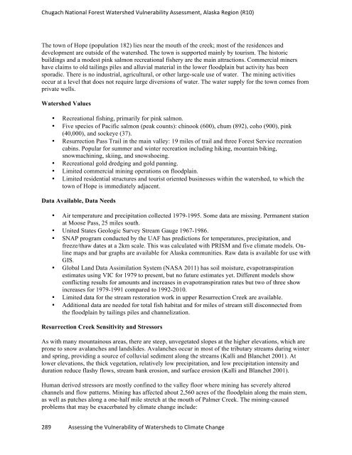
Chugach National Forest Watershed Vulnerability Assessment, Alaska Region (R10) The town of Hope (population 182) lies near the mouth of the creek; most of the residences and development are outside of the watershed. The town is supported mainly by tourism. The historic buildings and a modest pink salmon recreational fishery are the main attractions. Commercial miners have claims to old tailings piles and alluvial material in the lower floodplain but activity has been sporadic. There is no industrial, agricultural, or other large-scale use of water. The mining activities occur at a level that does not require large diversions of water. The water supply for the town comes from private wells. Watershed Values • Recreational fishing, primarily for pink salmon. • Five species of Pacific salmon (peak counts): chinook (600), chum (892), coho (900), pink (40,000), and sockeye (37). • Resurrection Pass Trail in the main valley: 19 miles of trail and three Forest Service recreation cabins. Popular for summer and winter recreation including hiking, mountain biking, snowmachining, skiing, and snowshoeing. • Recreational gold dredging and gold panning. • Limited commercial mining operations on floodplain. • Limited residential structures and tourist oriented businesses within the watershed, to which the town of Hope is immediately adjacent. Data Available, Data Needs • Air temperature and precipitation collected 1979-1995. Some data are missing. Permanent station at Moose Pass, 25 miles south. • United States Geologic Survey Stream Gauge 1967-1986. • SNAP program conducted by the UAF has predictions for temperatures, precipitation, and freeze/thaw dates at a 2km scale. This was calculated with PRISM and five climate models. Online maps and bar graphs are available for Alaska communities. Raw data is available for use with GIS. • Global Land Data Assimilation System (NASA 2011) has soil moisture, evapotranspiration estimates using VIC for 1979 to present, but no future estimates yet. Different models show conflicting results for amounts and increases in evapotranspiration rates but two of three show increases for 1979-1991 compared to 1992-2010. • Limited data for the stream restoration work in upper Resurrection Creek are available. • Additional data are needed for total fish habitat and for miles of stream still disconnected from the floodplain by tailings piles and channelization. Resurrection Creek Sensitivity and Stressors As with many mountainous areas, there are steep, unvegetated slopes at the higher elevations, which are prone to snow avalanches and landslides. Avalanches occur in most of the tributary streams during winter and spring, providing a source of colluvial sediment along the streams (Kalli and Blanchet 2001). At lower elevations, the thick vegetation, relatively low precipitation, and low precipitation intensity and duration reduce flashy flows, stream bank erosion, and surface erosion (Kalli and Blanchet 2001). Human derived stressors are mostly confined to the valley floor where mining has severely altered channels and flow patterns. Mining has affected about 2,560 acres of the floodplain along the main stem, as well as patches along a one-half mile stretch at the mouth of Palmer Creek. The mining-caused problems that may be exacerbated by climate change include: 289 Assessing the Vulnerability of Watersheds to Climate Change
- Page 242 and 243: Chequamegon-‐Nicolet National F
- Page 244 and 245: Chequamegon-‐Nicolet National F
- Page 246 and 247: Chequamegon-‐Nicolet National F
- Page 248 and 249: Chequamegon-‐Nicolet National F
- Page 250 and 251: Chequamegon-‐Nicolet National F
- Page 252 and 253: Chequamegon-‐Nicolet National F
- Page 254 and 255: Chequamegon-‐Nicolet National F
- Page 256 and 257: Chequamegon-‐Nicolet National F
- Page 258 and 259: Chequamegon-‐Nicolet National F
- Page 260 and 261: Chequamegon-‐Nicolet National F
- Page 262 and 263: Chequamegon-‐Nicolet National F
- Page 264 and 265: Chequamegon-‐Nicolet National F
- Page 266 and 267: Chequamegon-‐Nicolet National F
- Page 268 and 269: Chequamegon-‐Nicolet National F
- Page 270 and 271: Assessment of Watershed Vulnerabili
- Page 272 and 273: Chugach National Forest Watershed V
- Page 274 and 275: Chugach National Forest Watershed V
- Page 276 and 277: Chugach National Forest Watershed V
- Page 278 and 279: Chugach National Forest Watershed V
- Page 280 and 281: Chugach National Forest Watershed V
- Page 282 and 283: Chugach National Forest Watershed V
- Page 284 and 285: Chugach National Forest Watershed V
- Page 286 and 287: Chugach National Forest Watershed V
- Page 288 and 289: Chugach National Forest Watershed V
- Page 290 and 291: Chugach National Forest Watershed V
- Page 294 and 295: Chugach National Forest Watershed V
- Page 296 and 297: Chugach National Forest Watershed V
- Page 298 and 299: Chugach National Forest Watershed V
- Page 300 and 301: Chugach National Forest Watershed V
- Page 302 and 303: Chugach National Forest Watershed V
- Page 304 and 305: Chugach National Forest Watershed V
- Page 306 and 307: Chugach National Forest Watershed V
- Page 308 and 309: Chugach National Forest Watershed V
Chugach National Forest Watershed Vulnerability Assessment, Alaska Region (R10)<br />
The town of Hope (population 182) lies near the mouth of the creek; most of the residences and<br />
development are outside of the watershed. The town is supported mainly by tourism. The historic<br />
buildings and a modest pink salmon recreational fishery are the main attractions. Commercial miners<br />
have claims to old tailings piles and alluvial material in the lower floodplain but activity has been<br />
sporadic. There is no industrial, agricultural, or other large-scale use of water. The mining activities<br />
occur at a level that does not require large diversions of water. The water supply for the town comes from<br />
private wells.<br />
Watershed Values<br />
• Recreational fishing, primarily for pink salmon.<br />
• Five species of Pacific salmon (peak counts): chinook (600), chum (892), coho (900), pink<br />
(40,000), and sockeye (37).<br />
• Resurrection Pass Trail in the main valley: 19 miles of trail and three Forest Service recreation<br />
cabins. Popular for summer and winter recreation including hiking, mountain biking,<br />
snowmachining, skiing, and snowshoeing.<br />
• Recreational gold dredging and gold panning.<br />
• Limited commercial mining operations on floodplain.<br />
• Limited residential structures and tourist oriented businesses within the watershed, to which the<br />
town of Hope is immediately adjacent.<br />
Data Available, Data Needs<br />
• Air temperature and precipitation collected 1979-1995. Some data are missing. Permanent station<br />
at Moose Pass, 25 miles south.<br />
• United States Geologic Survey Stream Gauge 1967-1986.<br />
• SNAP program conducted by the UAF has predictions for temperatures, precipitation, and<br />
freeze/thaw dates at a 2km scale. This was calculated with PRISM and five climate models. Online<br />
maps and bar graphs are available for Alaska communities. Raw data is available for use with<br />
GIS.<br />
• Global Land Data Assimilation System (NASA 2011) has soil moisture, evapotranspiration<br />
estimates using VIC for 1979 to present, but no future estimates yet. Different models show<br />
conflicting results for amounts and increases in evapotranspiration rates but two of three show<br />
increases for 1979-1991 compared to 1992-2010.<br />
• Limited data for the stream restoration work in upper Resurrection Creek are available.<br />
• Additional data are needed for total fish habitat and for miles of stream still disconnected from<br />
the floodplain by tailings piles and channelization.<br />
Resurrection Creek Sensitivity and Stressors<br />
As with many mountainous areas, there are steep, unvegetated slopes at the higher elevations, which are<br />
prone to snow avalanches and landslides. Avalanches occur in most of the tributary streams during winter<br />
and spring, providing a source of colluvial sediment along the streams (Kalli and Blanchet 2001). At<br />
lower elevations, the thick vegetation, relatively low precipitation, and low precipitation intensity and<br />
duration reduce flashy flows, stream bank erosion, and surface erosion (Kalli and Blanchet 2001).<br />
Human derived stressors are mostly confined to the valley floor where mining has severely altered<br />
channels and flow patterns. Mining has affected about 2,560 acres of the floodplain along the main stem,<br />
as well as patches along a one-half mile stretch at the mouth of Palmer Creek. The mining-caused<br />
problems that may be exacerbated by climate change include:<br />
289 Assessing the Vulnerability of Watersheds to Climate Change


