OFFICERS REPORT FOR: - Wellington City Council
OFFICERS REPORT FOR: - Wellington City Council
OFFICERS REPORT FOR: - Wellington City Council

You also want an ePaper? Increase the reach of your titles
YUMPU automatically turns print PDFs into web optimized ePapers that Google loves.
i<br />
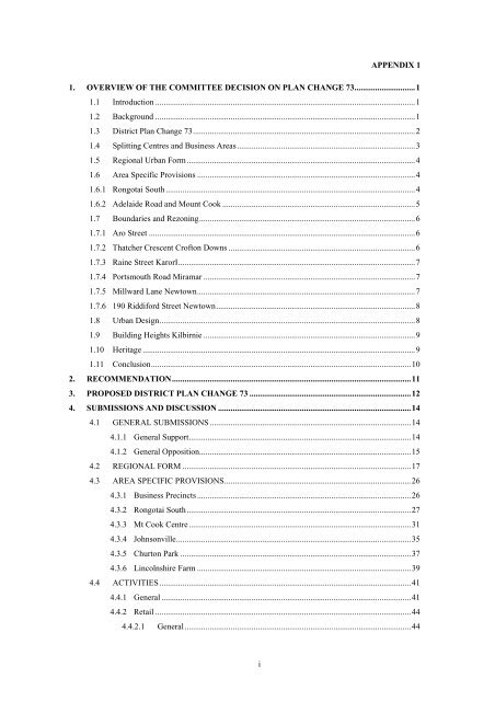
APPENDIX 1<br />
1. OVERVIEW OF THE COMMITTEE DECISION ON PLAN CHANGE 73.............................1<br />
1.1 Introduction ............................................................................................................................1<br />
1.2 Background ............................................................................................................................1<br />
1.3 District Plan Change 73..........................................................................................................2<br />
1.4 Splitting Centres and Business Areas.....................................................................................3<br />
1.5 Regional Urban Form.............................................................................................................4<br />
1.6 Area Specific Provisions ........................................................................................................4<br />
1.6.1 Rongotai South .......................................................................................................................4<br />
1.6.2 Adelaide Road and Mount Cook ............................................................................................5<br />
1.7 Boundaries and Rezoning.......................................................................................................6<br />
1.7.1 Aro Street ...............................................................................................................................6<br />
1.7.2 Thatcher Crescent Crofton Downs .........................................................................................6<br />
1.7.3 Raine Street KarorI.................................................................................................................7<br />
1.7.4 Portsmouth Road Miramar .....................................................................................................7<br />
1.7.5 Millward Lane Newtown........................................................................................................7<br />
1.7.6 190 Riddiford Street Newtown...............................................................................................8<br />
1.8 Urban Design..........................................................................................................................8<br />
1.9 Building Heights Kilbirnie .....................................................................................................9<br />
1.10 Heritage ..................................................................................................................................9<br />
1.11 Conclusion............................................................................................................................10<br />
2. RECOMMENDATION..................................................................................................................11<br />
3. PROPOSED DISTRICT PLAN CHANGE 73 .............................................................................12<br />
4. SUBMISSIONS AND DISCUSSION ............................................................................................14<br />
4.1 GENERAL SUBMISSIONS ................................................................................................14<br />
4.1.1 General Support..........................................................................................................14<br />
4.1.2 General Opposition.....................................................................................................15<br />
4.2 REGIONAL <strong>FOR</strong>M .............................................................................................................17<br />
4.3 AREA SPECIFIC PROVISIONS.........................................................................................26<br />
4.3.1 Business Precincts ......................................................................................................26<br />
4.3.2 Rongotai South...........................................................................................................27<br />
4.3.3 Mt Cook Centre..........................................................................................................31<br />
4.3.4 Johnsonville................................................................................................................35<br />
4.3.5 Churton Park ..............................................................................................................37<br />
4.3.6 Lincolnshire Farm ......................................................................................................39<br />
4.4 ACTIVITIES........................................................................................................................41<br />
4.4.1 General .......................................................................................................................41<br />
4.4.2 Retail ..........................................................................................................................44<br />
4.4.2.1 General............................................................................................................44
4.4.2.2 Definitions.......................................................................................................46<br />
4.4.2.3 Centres ............................................................................................................51<br />
4.4.2.4 Business Areas ................................................................................................54<br />
4.4.3 Residential activities...................................................................................................61<br />
4.5 URBAN DESIGN ................................................................................................................62<br />
4.5.1 General .......................................................................................................................62<br />
4.5.2 Street frontages/verandahs .........................................................................................70<br />
4.5.3 Frontages maps...........................................................................................................80<br />
4.5.4 Bulk and location .......................................................................................................89<br />
4.5.4.1 Building mass..................................................................................................89<br />
4.5.4.2 Building heights – general ..............................................................................90<br />
4.5.4.3 Building heights – Johnsonville ......................................................................92<br />
4.5.4.4 Building heights – Miramar ............................................................................93<br />
4.5.4.5 Building heights – Kilbirnie............................................................................95<br />
4.5.5 Buffer between zones/ building recession planes.......................................................97<br />
4.5.6 Design guides ...........................................................................................................101<br />
4.6 WIND.................................................................................................................................110<br />
4.7 SIGNS ................................................................................................................................111<br />
4.7.1 Signs – General ........................................................................................................111<br />
4.7.2 Definitions................................................................................................................119<br />
4.8 HERITAGE PROVISIONS................................................................................................120<br />
4.9 TRANSPORTATION ........................................................................................................123<br />
4.9.1 General .....................................................................................................................123<br />
4.9.2 Multi modes of transport ..........................................................................................124<br />
4.9.3 Managing adverse effects.........................................................................................129<br />
4.9.4 Vehicle parking ........................................................................................................133<br />
4.9.5 Accessibility – pedestrians and people with restricted mobility...............................141<br />
4.9.6 Site servicing............................................................................................................144<br />
4.9.7 Access ......................................................................................................................146<br />
4.10 NOISE ................................................................................................................................151<br />
4.10.1 General .....................................................................................................................151<br />
4.10.2 Definitions................................................................................................................158<br />
4.10.3 Fixed plant noise ......................................................................................................158<br />
4.10.4 Noise insulation and ventilation ...............................................................................163<br />
4.11 REZONING........................................................................................................................172<br />
4.11.1 Aro Valley................................................................................................................172<br />
4.11.2 Crofton Downs .........................................................................................................177<br />
4.11.3 Karori .......................................................................................................................178<br />
4.11.4 Miramar....................................................................................................................181<br />
4.11.5 Newtown ..................................................................................................................183<br />
ii
4.11.6 Ngaio........................................................................................................................187<br />
4.11.7 Tawa/Takapu Island .................................................................................................188<br />
4.11.8 Other.........................................................................................................................189<br />
4.12 VOLUME 3 – PLANNING MAPS....................................................................................192<br />
4.13 SUBDIVISION ..................................................................................................................193<br />
4.14 HSNO/ CONTAMINATED LAND/ DISCHARGE OF CONTAMINANTS ...................198<br />
4.15 FLOODING/ COASTAL HAZARDS ...............................................................................200<br />
4.16 LOW IMPACT DESIGN, STREAM AND VEGETATION PROTECTION....................210<br />
4.17 BUILDING EFFICIENCY AND SUSTAINABILITY......................................................212<br />
4.18 TRANSMISSION LINES ..................................................................................................213<br />
4.19 NON-NOTIFICATION STATEMENTS ...........................................................................216<br />
4.20 PUBLIC LAND..................................................................................................................220<br />
4.21 TANGATA WHENUA ......................................................................................................220<br />
4.22 OTHER...............................................................................................................................221<br />
5. RMA CONSIDERATIONS..........................................................................................................225<br />
6. CONCLUSION .............................................................................................................................227<br />
List of Appendices<br />
1 Decision Report<br />
2 List of Submitters and Further Submitters<br />
3 Annotated Chapters<br />
4 A4 Frontage Maps<br />
5 A4 Rezoning Maps<br />
6 A3 Frontage Maps<br />
iii
1. OVERVIEW OF THE COMMITTEE DECISION ON PLAN CHANGE<br />
73<br />
1.1 Introduction<br />
This overview is not an exhaustive exposition of all the issues addressed by the<br />
Notified Plan Change 73 (DPC 73) or the submissions lodged to it. It sets out the<br />
Committee’s response to those matters considered to be of most interest and to set<br />
out the strategic context within which the Plan Change was developed and<br />
considered.<br />
The key changes proposed by DPC 73 are:<br />
• Current Suburban Centres Zone split into Centres and Business Areas 1&2<br />
• A revised framework to manage the location and impact of retail activities<br />
• New provisions to retain and supply of industrial land<br />
• A revised framework to manage impacts on the transport network<br />
• Additional guidance for urban design<br />
• Revised triggers for consent<br />
• Rezoning some parcels of land<br />
A total of 132 submissions and 18 further submissions were received on the Plan<br />
Change. The Committee undertook an extensive programme of site visits to improve<br />
their understanding of issues raised in submissions and discussed in the hearing. All<br />
matters raised in submissions were considered and that is set out in the Decision<br />
Report.<br />
Before outlining the key aspects of the decision the Plan Change should be set in the<br />
context of wider planning processes and the pressures and changes that have arisen<br />
in Suburban Centres and the <strong>City</strong> as a whole in the years since the District plan<br />
became operative.<br />
1.2 Background<br />
The operative District Plan is a dynamic document which has been subject to review<br />
throughout its life. Even before the plan became operative in 2000 a number of<br />
variations were proposed and since then a programme of rolling reviews has<br />
addressed a variety of issues.<br />
In general the Operative Plan has worked well. The relationship of <strong>Wellington</strong>’s<br />
suburbs and suburban centres with the central area has contributed to a vibrant and<br />
effective Central Business Area. The Central Area is the fastest growing residential<br />
area of the city but this has not been at the expense of the commercial and retail<br />
sectors which have generally continued to perform strongly.<br />
In the decade before the District Plan became operative <strong>Wellington</strong> faced<br />
considerable challenges. The public sector was reorganised and downsized. A major<br />
recession had taken its toll and there was substantial restructuring of the NZ<br />
economy. Many corporate head offices moved out of the city to Auckland, Australia<br />
and Asia. The city ceased to be the national centre for banking and insurance and<br />
large producer organisations such as the Dairy Board/Fonterra. The motor<br />
manufacturing industry closed its plants in the <strong>Wellington</strong> region. <strong>Wellington</strong> was a<br />
city in decline.<br />
The Absolutely Positively <strong>Wellington</strong> Campaign, major projects such as the Regional<br />
Stadium and the emergence of a Film Industry contributed to a more optimistic<br />
mood for the region but an optimistic outlook was no assurance of success.<br />
1
The population has increased more rapidly than demographers had predicted. The<br />
city’s approach to planning has been recognised as having considerable effect on the<br />
way <strong>Wellington</strong> looks, works, connects and thinks about itself. So why change a<br />
planning regime that appears to have served the city well?<br />
Against this context the current suburban centres regime has had positive but<br />
uneven outcomes. However there have been some negative impacts as well.<br />
At the time the Operative Plan was being drafted (early 1990s) there was (at least) a<br />
perception of there being surplus “industrial” land just as there was a surplus of older<br />
and lower grade office accommodation in the CBD. A permissive plan enabled wide<br />
ranging uses of these resources and no doubt that contributed to <strong>Wellington</strong>’s<br />
recovery.<br />
However, things have changed and higher value land uses such as residential and<br />
retail development have reduced the supply of “industrial” land and this in turn<br />
potentially jeopardises the future of a broad based city economy with the associated<br />
range of employment opportunities.<br />
The issue is not whether the light handed regime that characterised the Operative<br />
District Plan was right for its time but rather that population growth and increased<br />
property values have collectively created effects that need to be managed. Local<br />
outcomes have been varied and demonstrate that, in respect of Suburban Centres at<br />
least, “one size does not fit all”.<br />
There have also been some very poor urban design outcomes. Predatory development<br />
has weakened some centres such as Berhampore almost to the point of collapse.<br />
Challenges in other suburban centres such as Karori include inadequate land within<br />
the centre boundaries for expansion of key retail facilities.<br />
Plan Change 73 also reflects the broader view that is now being taken of the role of<br />
suburban centres as many of the challenges relate to the interplay between them and<br />
the effect that activity in one centre can have upon another. It is not about favouring<br />
businesses located in one part of the city over another but ensuring that an effective<br />
urban form is maintained.<br />
This should take account of transport networks, the opportunity to leverage<br />
development off existing infrastructure as well as maintaining the vitality, viability<br />
and amenity of the centres around the city. When residents are asked about<br />
amenities that are missing from their communities they will often identify<br />
commercial rather than community owned facilities.<br />
The health of the cities various centres is of enormous importance to the health of the<br />
suburbs that surround them. DPC 73 follows a number of reviews of aspects of the<br />
District Plan which have addressed the Central Area, Heritage and Infill for example.<br />
In many respects <strong>Wellington</strong>’s <strong>City</strong>’s problems are the region’s problems. Politicians<br />
and planners are increasingly making decisions that recognise that the future<br />
economic success of <strong>Wellington</strong> <strong>City</strong> depends on the success of the region as a whole<br />
1.3 District Plan Change 73<br />
Plan Change 73 is a <strong>Council</strong> initiated plan change and is a comprehensive review of<br />
provisions that apply to land within the Suburban Centres (with the exception of the<br />
Urban Development Area covering Lincolnshire Farm) and all aspects of the chapter<br />
were open to submission<br />
The Committee notes that the Draft Plan Change was subject to extensive<br />
consultation and the Notified Plan Change incorporated changes to the draft as a<br />
result.<br />
2
Notwithstanding the changes made to the draft, some submitters opposed the overall<br />
approach of Plan Change 73 in that it proposed restrictions on the use of land and<br />
would have negative impacts on the value of investments in existing Suburban<br />
Centres.<br />
In considering the plan change and the submissions to it, the Committee has posed<br />
the following questions:<br />
• Is the concept of splitting the Suburban Centres into Centres and Business<br />
Areas appropriate and likely to promote sustainable management?<br />
• Are the boundaries in the right place?<br />
• Do the proposed policies and rules strike the right balance between promoting<br />
growth and maintaining and enhancing amenity and character?<br />
• Is the mix of permitted activities appropriate to the roles of Centres and<br />
Business Areas<br />
This overview and summary outlines our key recommendations. Details on these and<br />
other matters addressed in DPC 73 and the submissions will be found in the body of<br />
the decision.<br />
1.4 Splitting Centres and Business Areas<br />
PC 73 proposes a range of uses for the Centres and Business Areas<br />
• Business 1 Areas – These are mixed use areas where most activities are<br />
permitted but consent is required for large shopping centres or supermarkets.<br />
The aim is ensure that they do not undermine existing Centres<br />
• Business 2 Areas – These are predominantly industrial areas where noise<br />
sensitive activities (residential) and some retail activities require consent<br />
• Centres – These are classified as Sub Regional, Town, District or<br />
Neighbourhood. The aim is to maintain and strengthen the role of Centres and<br />
to encourage residential and commercial intensification. All activities are<br />
permitted but consent is required for very large shopping centres.<br />
The permitted retail activity within the centres is consistent across all the categories<br />
ranging from Sub Regional Centres such as Johnsonville to Neighbourhood centres<br />
such as the Aro Valley Centre. However some triggers are applied to manage impacts<br />
on traffic and parking for example and to maintain and strengthen the network of<br />
centres and urban form.<br />
The Business Areas reduce the range of activity permitted by the current Suburban<br />
Centre and some submitters expressed concern at the loss of freedom owners to use<br />
their property as they wish and for the potential for negative impacts to arise on the<br />
value of their investment. The Committee notes that the Resource Consent process is<br />
available which enables assessment on their merits of individual proposals for<br />
activities that are not permitted.<br />
Land is a key resource and the Plan Change 73 proposal for Business 2 Areas is<br />
intended to ensure that future generations will have access to sufficient land for<br />
industrial and light industrial use. That will provide for a balance in the range of<br />
economic activity and employment with <strong>Wellington</strong> <strong>City</strong>.<br />
The Committee endorsed the overall approach as but has made some amendments<br />
and rezoning decisions to those notified in DPC 73. These may go some way to<br />
meeting concerns expressed in submissions. However the amendments are<br />
refinements that do not undermine the intent of Plan Change 73 as notified.<br />
3
1.5 Regional Urban Form<br />
This is reflected in some of the studies and plans that are significant foundations for<br />
the proposals in PC 73. These include the Growth Spine, <strong>Wellington</strong> Regional<br />
Strategy, the Western Corridor Study, and the Airport to Ngauranga Study.<br />
The Proposed Regional Policy Statement of the GWRC makes use of the same studies<br />
and the roles of the <strong>Wellington</strong> Central Area, Regionally Significant Centres (such as<br />
the CBDs of Porirua, Hutt <strong>City</strong>, Kapiti and Upper Hutt for example and Suburban<br />
Centres. The Sub regional centres and Suburban centres are given the same weight in<br />
the Proposed RPS<br />
The Proposed Regional Policy Statement was adopted by GWRC during the hearing<br />
of Plan Change 73 and the proposed RPS demonstrates a similar approach to that of<br />
Plan Change 73. The Committee was obliged to take account of the Proposed RPS<br />
and its adoption by the GWRC gives it increased weight. (We also note that once the<br />
RPS becomes operative the <strong>Council</strong> will be required to give effect to it through its<br />
District Plan).<br />
Plan Change 73 identified Kilbirnie and Johnsonville as Sub Regional Centres. This is<br />
consistent with the Proposed RPS as adopted by GWRC which also identified them as<br />
Regionally Significant Suburban Centres.<br />
Some submissions called for a hierarchy of centres in the region that would oblige<br />
<strong>Wellington</strong> <strong>City</strong> to specifically consider the impact of retail distribution, on Regional<br />
CBDs, without regard to Local Authority Boundaries. It was also submitted that<br />
Kilbirnie was not regionally significant in that it had no sub regional catchment, it<br />
proximity to the <strong>Wellington</strong> CBD.<br />
The Committee considered these matters carefully and concluded that neither<br />
submission was consistent with the proposed RPS. The RPS does not set out to<br />
control retail activity and states that “discretion lies with each city and district<br />
council to consider the range and extent of activities (and whether this includes<br />
retail activities) to support the viability and vibrancy of the regional form”.<br />
The proposed RPS specifically identifies Kilbirnie as having regional significance. It<br />
does not ascribe greater significance to Regional CBDs than to the Regionally<br />
Significant Suburban Centres of Kilbirnie, Johnsonville and Petone.<br />
The Committee agreed that Plan Change 73 properly identifies Johnsonville and<br />
Kilbirnie as Regionally Significant Centres. It is consistent with the <strong>Council</strong>’s Centres<br />
Study, the Growth Spine, the <strong>Wellington</strong> Regional Strategy and the Proposed RPS.<br />
However the name should be changed from “Sub Regional Centres” to “Regionally<br />
Significant Centre - Suburban Centres”. This is does not change the status of these<br />
Centres but is consistent with the language of the Proposed Regional Policy<br />
Statement and will reduce confusion over terminology.<br />
1.6 Area Specific Provisions<br />
1.6.1 Rongotai South<br />
A Submission was made that asked for restrictions on retail in Rongotai South<br />
should be removed and specifically that large supermarkets and malls should be<br />
permitted. The submission also sought to increase the permitted building heights<br />
from 12 to 21 metres over a large portion of the zone.<br />
The proposed rules permit a wide range of activity including retail and residential<br />
and that one third of the site was taken up by the Bunnings Development. However<br />
any changes to the proposed retail rules could potentially undermine the Kilbirnie<br />
4
Town Centre and have significant impacts on traffic generation, the roading network<br />
and parking.<br />
Further retail development beyond that permitted is not ruled out and Resource<br />
Consent may be applied for. That process enables the effects of any proposal to be<br />
assessed and the proposal judged on its merits. In the Committee’s view that is not<br />
unreasonable and therefore the Committee did not alter the retail rules.<br />
The Committee gave careful consideration to the request for an increase in height<br />
across the entire Business 1 zone at Rongotai. Officers considered it unlikely that<br />
industrial or retail uses were likely in a multi storey format in this area and the<br />
effects of increased heights were unclear and recommended that the permitted<br />
height stay at 12 metres for the majority of the zone.<br />
However the Committee agreed that it was desirable to increase the permitted height<br />
to the south of the zone along Lyall Parade. This area is the point where the private<br />
and public domains meet and is adjacent to Recreation reserve zoned Open Space A.<br />
It is a prominent area and is presently in a degraded state. Poor quality development<br />
would have a negative impact on the public domain and the Committee believes that<br />
investment in good design and quality buildings should be encouraged.<br />
The land in question is opposite Lyall Bay Beach and “public” uses such as cafes and<br />
retail should be provided for on the ground floors of buildings that front Lyall Bay<br />
Parade. Failure to provide appropriate opportunities for mixed use development<br />
capable of incorporating retail on the ground floor and residential in upper floors<br />
would risk replicating the current unsatisfactory built form.<br />
The Committee agreed to increase the permitted height to 16 metres with discretion<br />
to build to 18 metres as a Restricted Discretionary Activity and to restrict residential<br />
activities on the ground floor of the sites fronting Lyall Parade.<br />
The Committee agreed that this area provides some of the best views of the city and<br />
is a highly prized recreation area. It would a missed opportunity if this area was not<br />
developed for a mix of residential and retail uses. While the Committee believes<br />
residential activities would be the best use of upper floors but does not propose to<br />
mandate that use.<br />
More importantly the Committee believes that the area needs a strong and high<br />
quality built edge on the Lyall Parade frontage to mark this important space on<br />
<strong>Wellington</strong>’s South Coast. The Committee believes that increased heights are an<br />
essential element in achieving this outcome.<br />
1.6.2 Adelaide Road and Mount Cook<br />
The Committee considered a submission that called for a reduction in the permitted<br />
heights parts of the Mount Cook centre and Adelaide Road to protect the amenity of<br />
Government House and views to the house.<br />
Government House is of great importance to the city and deserves a setting that<br />
respects the constitutional role of Governors General. The house is undergoing a<br />
major renovation and it is hoped that the house will be more visible and more<br />
accessible when it re opens. The Committee made a visit to Government House and<br />
two visits to view points in Mount Cook and Adelaide Road.<br />
The Committee concluded that the reduction in height requested by the submitter<br />
would have little impact on views to or from the house and would not be justified but<br />
agreed to other amendments to control adverse effects of the bulk and location of<br />
buildings on the amenity values of Government House and grounds.<br />
5
1.7 Boundaries and Rezoning<br />
A wide range of re-zonings was proposed for specific sites. Some of these were in<br />
DPC 73 as notified and others were proposed in submissions. The Committee<br />
undertook a comprehensive programme of site visits before deciding on questions of<br />
rezoning.<br />
This overview addresses some of the proposals that seemed to attract particular<br />
interest from communities or serve to illustrate the breadth of issues that were of<br />
concern to submitters. The detailed decisions in respect of all of the proposals are set<br />
out in the body of the report.<br />
1.7.1 Aro Street<br />
Rezoning the properties from 68 – 82 Aro Street was proposed in the draft plan<br />
change document. However PC 73 as notified did not include an expansion of the<br />
centre to include these properties. Two submissions were received on this matter.<br />
One called for expansion of the Suburban centre to include these properties while the<br />
other requested that the Centres Zone be applied to the existing retail area excluding<br />
the former service station site.<br />
Three further submissions supporting the rezoning of these properties were received.<br />
The Committee noted that the only land owner of a potentially affected property who<br />
did not submit in support of rezoning was from 72 Aro Street.<br />
The submitter opposing rezoning of these properties raised issues of fairness with<br />
Officers and the Committee. Officers advised that there were no procedural<br />
impediments or reasons of fairness why the submission seeking rezoning should be<br />
considered on its merits. Following circulation of a pamphlet that also raised the<br />
question of procedural fairness the Committee decided to seek legal advice.<br />
The legal opinion confirmed the advice of Officers, that the submission seeking<br />
rezoning was in scope and that there were no fairness issues with regard to the<br />
process. The Committee noted that the submitter opposing rezoning who had raised<br />
the issue of fairness had himself sought rezoning of some nearby properties in Willis<br />
Street.<br />
The Committee heard extensive oral submissions on the matter and after reviewing<br />
expert advice from an expert urban designer it was decided that the subject<br />
properties should be rezoned as Centre. This has the effect of continuing the centre<br />
zoning from the eastern end of the existing shops to the entrance to Te Aro Park.<br />
However given the predominantly two storey height along the street edge the<br />
Committee decided to delete the discretionary height range that would otherwise<br />
provide for building up to 12m in height. Instead the Committee decided that any<br />
infringement of the 9m height limit should trigger a non complying activity resource<br />
consent requirement. This decision was made to avoid out of scale development and<br />
out of character development.<br />
1.7.2 Thatcher Crescent Crofton Downs<br />
Forty two submissions were received opposing the rezoning of the garden centres at<br />
4 Thatcher Crescent from Outer Residential to Centres. The proposal to rezone this<br />
land was a reflection of its existing use.<br />
There were no submissions or further submissions supporting the rezoning. On this<br />
basis and the Committee’s assessment of likely adverse effects of commercial<br />
redevelopment the Committee agreed that rezoning this land was not appropriate.<br />
6
1.7.3 Raine Street Karori<br />
6, 6a and 8 Raine Street are homes located behind the main vehicular access tom the<br />
Karori Mall and directly behind properties with existing commercial uses. Rezoning<br />
these properties to Centres was proposed to promote redevelopment opportunities<br />
and retail expansion in the Karori Town centre.<br />
Submissions were made that opposed the rezoning and the Committee carefully<br />
considered the views of the submitters. However, the Committee noted the extremely<br />
limited opportunities to expand the Centre and decided that rezoning was<br />
appropriate to enable redevelopment for retail or mixed use in the future.<br />
The Committee emphasised that a Centres zoning will not require any change of use<br />
by current owners. In the event that the properties are sold subsequent owners may<br />
decide for themselves whether they wish to pursue opportunities for commercial<br />
redevelopment or retain the residential use.<br />
1.7.4 Portsmouth Road Miramar<br />
The proposed rezoning of 16 Portsmouth Road from Suburban Centre to Business 2<br />
was opposed in a submission from the owners. It is a large site which they argued<br />
could be used for large format retail or residential activity under the current rules<br />
and that rezoning to Business 2 down-graded the property and its value.<br />
The submitter told the Committee that while the existing use was industrial, if this<br />
use was discontinued they would want to find a higher and better use for the land.<br />
The property is currently leased for the purpose of storing aviation fuel and the lease<br />
has a further 5 years to run. If this facility was relocated the land could be better used<br />
and should be redeveloped under a Business 1 zoning. In the event that the current<br />
lease arrangements are brought to an end any proposal for a supermarket would be<br />
appropriately managed through the resource consent process.<br />
The Committee noted the proximity of the property to an existing supermarket and<br />
the existing Miramar Town Centre and the dreary nature of the recently built retail<br />
complex on Tauhinu Road and concluded that this outcome could easily be repeated<br />
if this property was zoned Business 1.<br />
In summary there is no shortage of land within the existing town centre for retail<br />
development.<br />
However industrial land is likely to remain in short supply and Business 2 zoning<br />
permits a wide range of retailing activity. On this basis the Committee believes that<br />
the proposed Business 2 zoning is appropriate for this site.<br />
1.7.5 Millward Lane Newtown<br />
Millward Lane is a short dead end lane that runs along the rear of the residential<br />
properties of 9-19 Millward Street. The car park for McDonalds Newtown is located<br />
immediately to the east and is zoned Centres. An additional household unit has been<br />
built on the rear of 11 Millward Street facing the lane.<br />
A submitter sought rezoning of the rear of the properties 9, 11, 13, 15, 17 and 19<br />
Millward Street as centres but made it clear that the primary focus of their concern<br />
was the removal of the car parking requirement for additional household units<br />
constructed on the sites.<br />
Officers recommended against rezoning as the front of new household units would<br />
not be able to be serviced by vehicles and that rezoning would permit a wide range of<br />
uses that may be incompatible with the residential activities on the rest of the sites.<br />
The Committee agreed with the Officers that a Centres zoning was not the<br />
appropriate solution to the issues raised by the submitter in respect to this group of<br />
properties. Accordingly the zoning relief was rejected<br />
7
Notwithstanding the above the Committee had some sympathy for the submitter’s<br />
situation regarding the car parking requirement for these particular properties. The<br />
Committee noted that substantial residential development had occurred in the<br />
Centre Zoning in close proximity to these properties and that it was likely that more<br />
mixed use developments would occur. There is no requirement for these<br />
developments to provide car parks.<br />
The Committee found it difficult to see how removal of the car parking requirement<br />
for these properties would have any discernable impact in addition to that permitted<br />
adjacent sites that were zoned Centre.<br />
The Committee considered legal advice as to whether the submission and any<br />
proposal to grant a waiver of car parking requirements were in scope. After<br />
considering the legal tests referred to in the opinion the Committee was in doubt that<br />
such a waiver was fairly raised and within scope.<br />
The Committee agreed to a rule exemption for car parking. It should be noted the Cr<br />
Ahipene Mercer had sat on an earlier Resource Consent Hearing on this matter and<br />
abstained from the decision.<br />
Finally the Committee wishes to record that consideration of this issue was<br />
unnecessarily complicated by sloppy drafting of the original submission and<br />
protracted oral submissions on essentially irrelevant matters.<br />
1.7.6 190 Riddiford Street Newtown<br />
McDonalds opposed the proposed Centres zoning for the McDonalds site at 190<br />
Riddiford Street and requested a Business Area 1 zoning. The submission argues that<br />
the Centres provisions focussed on pedestrian activity rather than the present and<br />
intended continued use of their site as a drive thru (sic) Restaurant which has a<br />
vehicle oriented focus.<br />
This submission identified a tension between Centres zoning and vehicle oriented<br />
activities such as drive through restaurants, service stations and supermarkets. The<br />
submitter made it clear that, if sufficient change was made to the urban design<br />
provisions on the Centre zoning, that rezoning to Business 1 may not be necessary.<br />
The Committee found that the site was unquestionably part of the core commercial<br />
and retail area of Newtown and rejected the request for rezoning. However the<br />
submission isolated an issue of the accommodation of vehicle oriented activities in<br />
Centre Areas that was a considerable concern to a number of submitters.<br />
Some of these concerns are explored in the next section of this summary.<br />
1.8 Urban Design<br />
Four submitters addressed a number of related issues that impacted on their<br />
activities in Centre areas. Shell (now Greenstone Energy), Progressive Enterprises,<br />
Foodstuffs and McDonalds submitted that DPC 73 did not take sufficient account of<br />
the operational requirements of businesses such as (respectively) service stations,<br />
supermarkets and drive through restaurants.<br />
These issues included concerns in respect of vehicle crossings, the provision of<br />
verandahs, display windows and parking arrangements. The Committee accepted<br />
that many existing businesses developed at a time when the proposed standards were<br />
not in place but are still important and valued components of commercial activity<br />
within Centre areas.<br />
However the Committee did not accept the proposition that the outcomes sought in<br />
DPC 73 made it impossible for new developments to accommodate these activities.<br />
The Committee noted a substantial difference between the two major supermarket<br />
8
operators in this regard. Foodstuffs expressed broad support for DPC 73 while<br />
Progressive Enterprise’s planner described the approach as “nut bar” in respect of<br />
DPC 73’s potential impact on the development of new supermarkets.<br />
The Committee noted that each of the supermarket companies had developments<br />
planned (which were subsequently granted consent) in the Newtown/Mt Cook<br />
Centres. Both companies expressed pride in the quality of their proposals and the<br />
Committee noted that they each appeared to meet the urban design provisions of PC<br />
73 and to provide high levels of amenity within the Centres in which they were to be<br />
located. The Committee believes that these proposals clearly demonstrated that new<br />
supermarkets could be developed and consented under the urban design regime<br />
proposed by DPC 73.<br />
The use of signage was also discussed in this context and the Committee agreed to<br />
some modest amendment to the provisions related to free standing signs. However<br />
the Committee noted that many of the issues cited by these submitters relating to<br />
signage and other urban design issues arose from the use of standard (often<br />
international) company templates which may not always be appropriate to the<br />
<strong>Wellington</strong> environment.<br />
The Committee endorsed the approach of DPC 73 in respect of urban design but<br />
agreed that some parts DPC 73 (such as policy explanation) should be modified to<br />
better accommodate redevelopment of existing and development of new vehicle<br />
oriented activities such as supermarkets, service stations and drive through<br />
restaurants.<br />
This area was a major focus of the submissions, hearing and deliberations on DPC 73<br />
and this overview gives only a glimpse of the complex issues associated with<br />
accommodating uses such as supermarkets, service stations and drive through<br />
restaurants in centres. These are covered in great detail in the body of the report.<br />
1.9 Building Heights Kilbirnie<br />
The Committee considered submissions in respect of building heights in the<br />
Woolworths site and the Kilbirnie Bus Barns site. The submitters sought increases to<br />
24 metres and 18 metres respectively. The Committee decided that any decision in<br />
respect of increased height and density for Kilbirnie would be premature.<br />
Further work was required to identify specific sites where increased height may be<br />
appropriate and whether consequent changes were required to building bulk and<br />
location provisions and urban design controls.<br />
The Committee noted that the <strong>Council</strong> was consulting on a Town Centre Plan for<br />
Kilbirnie and this work which could result in variations to PC 72 and 73.<br />
Consideration of where and whether any additional height was appropriate should be<br />
carried out and decided by way of a variation to DPC 72 and DPC 73.<br />
1.10 Heritage<br />
Submissions were made that sought greater protection of heritage values in Centres.<br />
The Committee agrees that many Centres have heritage values that deserve<br />
protection<br />
The Committee recognises that Centres are strong contributors to <strong>Wellington</strong>’s<br />
character and sense of place.<br />
The Committee notes the recent notification of PC 75 which proposes the creation of<br />
Heritage Areas in Aro Valley, Berhampore (Rintoul Street), Hataitai, Newtown centre<br />
and John Street, and Thorndon as having heritage values worthy of protection.<br />
9
1.11 Conclusion<br />
A wide range of amendments have been made in response to submissions but these<br />
do not undermine the intent of DPC 73 as notified. In the main these amendments<br />
are in the nature of fine tuning and clarification. But even where they may be quite<br />
significant they are consistent with the underlying philosophy of DPC 73 and no<br />
amendments are proposed to the core elements of the plan change.<br />
The plan change is consistent with and firmly founded on the council’s strategic and<br />
policy direction. It takes account of key transport investment policies and strategies<br />
and will promote walking and multi modal transport. It gives effect to the proposed<br />
Regional Policy Statement and will help sustain <strong>Wellington</strong>’s economy, setting,<br />
character and compact urban form into the future.<br />
10
WELLINGTON CITY COUNCIL<br />
<strong>REPORT</strong> OF THE HEARING COMMITTEE<br />
SUBJECT:<br />
PROPOSED DISTRICT PLAN CHANGE 73: SUBURBAN CENTRES REVIEW<br />
COMMITTEE MEMBERS:<br />
COMMISSIONERS: ALICK SHAW (CHAIR), DAVID MCMAHON,<br />
COUNCILLORS: LEONIE GILL AND RAY AHIPENE-MERCER<br />
DATE OF HEARING:<br />
2. RECOMMENDATION<br />
26 APRIL – 11 JUNE 2010<br />
Based on the Committee’s consideration of all the material before us including the<br />
section 42A report from the <strong>Council</strong> advisors, submissions, further submissions,<br />
evidence presented at the hearing and following consideration of the requirements of<br />
Section 32, it is recommend to the <strong>Council</strong> that:<br />
(a) DPC 73 is approved as notified, except in relation to the matters identified<br />
in this decision report, where some minor changes have been<br />
recommended.<br />
(b) Accept or reject all the submissions and further submissions to the extent<br />
that they accord with Recommendation (a) above.<br />
(c) The Committee encourages the <strong>Council</strong> to consider the wider and nonstatutory<br />
suggestions made by this Committee and submitters. These<br />
include:<br />
Kilbirnie Town Centre Building Heights<br />
(i) Following the completion of the Kilbirnie Town Centre Study<br />
<strong>Council</strong> should investigate an appropriate height regime for the bus<br />
barns site. Similarly, and as part of DPC 72 <strong>Council</strong> should (also via<br />
the Kilbirnie Town Centre Study) review whether 52 -84 Ross St,<br />
Kilbirnie be in the Medium Density Residential Areas 1 (Kilbirnie).<br />
Both the Ross Street and bus barn matters should be the subject to<br />
a separate alteration (plan change or variation) to the District Plan<br />
to reflect the outcomes of the Kilbirnie Town Centre Study.<br />
Newtown Frontage Map<br />
(ii) Amend frontage map 49C to identify a primary street frontage<br />
adjoining 195-207 Riddiford Street, Newtown which was<br />
inadvertently omitted from the notified version of maps.<br />
Noise<br />
(iii) <strong>Wellington</strong> International Airport Limited’s (WIAL) strategy for<br />
proposed noise insulation provisions applying to properties in the<br />
vicinity of the airport was presented for the first time at the hearing.<br />
Whilst these provisions may have some merit, the Committee<br />
considered that it was beyond the scope of the original submission<br />
11
and should more appropriately be dealt with as a separate plan<br />
change. Ongoing consultation with WIAL and relevant stakeholders<br />
is recommended prior to any plan change being promulgated.<br />
3. PROPOSED DISTRICT PLAN CHANGE 73<br />
Overview<br />
This report relates to Proposed District Plan Change 73: Suburban Centres Review.<br />
District Plan Change 73 was notified on 29 September 2009.<br />
Proposed District Plan Change 73 was a <strong>Council</strong>-initiated plan change and the<br />
purpose of the plan change was to provide a complete review of the District Plan<br />
provisions that apply to land within the Suburban Centres, with exception of the<br />
Urban Development Area, covering Lincolnshire Farm. All aspects of the Suburban<br />
Centres chapter were open to submission. The plan change also covered definitions,<br />
design guides, maps etc associated with the Suburban Centres.<br />
The plan change included a number of significant new provisions designed to allow<br />
the <strong>Council</strong> to better manage the effects of new development within the Suburban<br />
Centres. These included:<br />
• splitting the current Suburban Centre zone into two new zones, Centres and<br />
Business Areas, to recognise their differing roles, and better manage the<br />
activities that locate in these areas<br />
• increased policy guidance regarding urban design and the management of<br />
retail activities<br />
• the introduction of a new design guides for Centres and Business Areas to<br />
help improve the quality of new development<br />
• rezoning of some parcels of land to better reflect existing uses<br />
• amendments to other policies, rules, definitions and planning maps to<br />
improve the Plan’s effectiveness.<br />
The <strong>Council</strong> publicly consulted on a draft Suburban Centres plan change for an<br />
extended period from 8 December 2008 to 1 April 2009 1 . In total, 207 responses<br />
were received from the public, which helped shape the form and content of the plan<br />
change before it was publicly notified.<br />
Plan Change 73 (Centres and Business Areas) was publicly notified on 29 September<br />
2009 and submissions closed on 27 November 2009. In total, 132 submissions were<br />
received. The Summary of Submissions was prepared and publicly notified on 2<br />
February 2010 with further submissions closing on 2 March 2010. Eighteen further<br />
submissions were received.<br />
The Hearing<br />
The hearing for the plan change was held over 14 days between from Monday 26<br />
April to Friday 11 June 2010, in conjunction with the hearing of District Plan Change<br />
72 (Residential Area Review).<br />
1 Consultation on the proposed Suburban Centres Heritage Areas was carried out from 18<br />
March 2009 to 20 April 2009. Consultation on the proposed Thorndon Heritage Area was<br />
carried out from 17 April to 3 May 2009.<br />
12
Members of the Hearing Committee declared certain conflicts of interest resulting<br />
from the submissions lodged on District Plan Change 73. As a result, Commissioner<br />
Shaw took no part in the hearing and deliberations relating to the submission and<br />
further submission of the New Zealand Transport Agency (submission 117, further<br />
submission 18). Commissioner Gill identified a conflict of interest in relation to the<br />
submissions of the <strong>Wellington</strong> International Airport Airnoise Management<br />
Committee (submission 41), <strong>Wellington</strong> International Airport Limited (submission<br />
42) and Board of Airline Representatives (FS3) and took no part in the hearing and<br />
deliberations arising from those submissions.<br />
Commissioner Ahipene-Mercer abstained from the deliberations regarding Millward<br />
Lane, Newtown (resulting from submission 59) on the grounds that he had<br />
previously sat on a resource consent hearing for these properties involving similar<br />
issues.<br />
No submitters presenting expressed concerns with either conflict of interest.<br />
At the outset of the hearing the <strong>Council</strong>’s Senior Policy Advisor, Stefania<br />
Chrzanowska and <strong>Council</strong>’s Programme Manager <strong>City</strong> Planning, Luke Troy,<br />
presented the background and key issues relating to the Plan Change. At the end of<br />
the hearing, Stefania Chrzanowska presented the Officers’ reply to the matters raised<br />
by submitters.<br />
Thirty-two submitters appeared at the hearing and spoke to their submissions. These<br />
submitters were (listed below in order of appearance):<br />
� Glenside Progressives Association (Claire Bibby) (S109)<br />
� Transpower New Zealand Limited (Nicola Cordner) (S43)<br />
� Rosamund Averton (S9)<br />
� Cockburn Architects (Daryl Cockburn, Bill Toomath, Julie Genter, John Gray,<br />
John Abbate) (S59)<br />
� CentrePort Ltd (Neville Hyde)(S22)<br />
� Greater <strong>Wellington</strong> Regional <strong>Council</strong> (Rachel Pawson) (S131)<br />
� New Zealand Transport Agency (Angela Penfold, David Arrowsmith, David<br />
Lee, Claire Simmitt) (S117)<br />
� PrimeProperty Group (Eyal Aharoni and Ian Leary) (S85)<br />
� A Gibson (FS15)<br />
� Sarah and Ben Spencer (S106)<br />
� Shell New Zealand Ltd (Keith Callum) (S26)<br />
� Progressive Enterprises Ltd (Matthew Grainger, Mike Foster, Karl Cooper)<br />
(S108 and FS1)<br />
� Foodstuffs (Mark Lash, Peter Coop) (S64)<br />
� Hunters Hill Ltd (Rodney Halliday) (S82)<br />
� Takapu Island Developments Ltd (, Sean Murrie, Ian Leary) (S53)<br />
� Roger Hay (S122)<br />
� Department of Prime Minister & Cabinet (Alistair Aburn, Mike Hannaway)<br />
(S81)<br />
� Infratil Infrastructure (Alistair Aburn) (S79)<br />
� DNZ Property Group Limited (Alistair Aburn) (S78 and FS9)<br />
� Paulemas Properties (Alistair Aburn) (FS7)<br />
� Roland Sapsford (supported by Lisa Thompson, Jane O’Loughlin and Liz<br />
Banas) (S93)<br />
� Kiwi Property Holdings Limited (Claire Kirman, Nick Roberts, Ron Parkins)<br />
(S61)<br />
� Tony Randle (S119)<br />
� Mt Cook Mobilised (David Smyth) (S56)<br />
� Air Noise Management Committee (Morgan Slyfield, Mike Brown, Nick<br />
Petkov, Laurel Smith) (S41)<br />
13
� <strong>Wellington</strong> International Airport Ltd (Morgan Slyfield, Mike Brown, Nick<br />
Petkov, Laurel Smith) (S42)<br />
� Board of Airline Representatives Inc (Liz Hardacre, Stewart Milne) (FS17)<br />
� Thatcher Crescent sub-group (S98, S62, S107, S50, S121, S51, S47)<br />
� Showground Properties Ltd (Greg Milner-White) (S101)<br />
� McDonalds Restaurant (Jenny Hudson) (S103)<br />
� Antipodean Properties Ltd (Johnsonville and Kilbirnie) (Alasdair Scott) (S13,<br />
S14)<br />
� Hylamn Holdings Ltd (Hamish Brookie, Dave Buchanan) (S111)<br />
The full list of submitters is attached as Appendix 2 to this report.<br />
The Committee deliberated for five days over the period from 22 June to 2 July 2010.<br />
Site visits were undertaken on 29 June 2010. The Hearing Committee re-convened<br />
on 19, 23 and 30 July 2010 to further consider and refine decisions made during<br />
deliberations. The Hearing Committee report was completed between 2 and 10<br />
August 2010.<br />
The following discussion sets out the key issues and the Committee’s reasons for<br />
making its recommendations.<br />
In reaching these recommendations the Hearing Committee gave careful<br />
consideration to all the issues raised by submitters, including those issues raised in<br />
evidence by the individuals and expert witnesses who appeared before the<br />
Committee. The Hearing Committee had access to full copies of all submissions and<br />
further submissions, and referred to these during the hearing and deliberation<br />
processes.<br />
In drafting this recommendation report the Hearing Committee have adopted a<br />
standard format, structured around the issues raised. For each issue raised in<br />
submissions the format involves:<br />
• Submissions – specific issues raised in submissions<br />
• Discussion – including details of matters raised in the hearing<br />
• Recommended Decisions – listed by submission, the details of which are in<br />
the annotated version and the planning maps in Appendices 3-5.<br />
To assist readers the recommendation report has, where possible, been structured to<br />
follow the hierarchy of the District Plan itself. The report begins with consideration<br />
of the high level objectives and policies contained in Chapters 6 and 33, followed by<br />
rules, standards, and appendices contained and Chapters 7 and 34.<br />
4. SUBMISSIONS AND DISCUSSION<br />
The submissions received have been grouped according to the issues or concerns<br />
they raised. Key issues and the Hearing Committee’s decisions on the submissions<br />
are addressed in sections 4.1 – 4.22 below.<br />
4.1 GENERAL SUBMISSIONS<br />
4.1.1 General Support<br />
Submissions<br />
Specific issues raised in submissions include:<br />
• Support for the plan change, but no decisions sought from <strong>Council</strong><br />
(Submission 1).<br />
14
Discussion<br />
• Substantially supports the Plan Change, however requested that <strong>Council</strong><br />
address specific matters, as detailed in the submission (Submission 9).<br />
• Implement the plan change, except where identified in the specific<br />
submissions which follow (Submission 22).<br />
• That DPC 73 is amended to accommodate the issues raised in this<br />
submission (Submission 55).<br />
• The Plan Change is adopted, provided that the specific issues raised in the<br />
submission are appropriately addressed, including as sought in the<br />
schedules (Submission 108).<br />
• Generally supports Proposed Plan Change 73 in particular the mechanism<br />
proposed to support the existing network if Suburban Centres, in a way that<br />
reflects their different roles and function within <strong>Wellington</strong> <strong>City</strong><br />
(Submission 110).<br />
• That DPC 73 is approved with the following amendments discussed in the<br />
submission (Submission 117).<br />
• Supports Plan Change 73 if the Plan Change achieves <strong>Council</strong>’s intentions<br />
and will still be viable (Submission 132).<br />
The Hearing Committee accepted these submissions, though noted that its decisions<br />
on other matters raised would make some changes to the proposed plan provisions<br />
but these would not, in its view, substantially undermine the original intent of the<br />
proposed plan change.<br />
Recommended Decisions<br />
� Accept submissions 1, 9, 22, 55, 108, 110, 117 and 132 insofar as they<br />
generally support DPC 73.<br />
4.1.2 General Opposition<br />
Submissions<br />
Specific issues raised in submissions include:<br />
• Opposes the plan change as does not think that the <strong>Council</strong> has engaged the<br />
ratepayers with regard to the plan change. The submission requested that<br />
<strong>Council</strong> send a letter enclosing pamphlet PDW 78422 to all ratepayers<br />
(Submission 3).<br />
• Opposes the plan change, however does not seek any decisions from <strong>Council</strong><br />
(Submission 21).<br />
• Requests that the Proposed Plan Change be withdrawn and redrafted taking<br />
into account matters raised in the submission relating to service stations, or<br />
that amendments be made to the plan change as detailed in the submission<br />
(Submission 26).<br />
• Urges the <strong>Council</strong> to leave the Suburban Centres zoning as it currently<br />
exists. Strongly opposes the splitting up of the Suburban Centres zone and<br />
plans to restrict retail developments outside of Centres and the requirement<br />
for resource consent to assess the impact of these developments. Retail<br />
15
Discussion<br />
activity along Ngauranga Gorge is comprised of warehouse showrooms<br />
which would not be possible in Suburban Centres retail environments due<br />
to lack of developments exceeding 500m 2 (Submissions 66 – 75).<br />
Submission 3 opposed the plan change, objecting to the consultation process<br />
undertaken and requested that <strong>Council</strong> send a letter enclosing pamphlet PDW 78422<br />
to all ratepayers. The Hearing Committee noted that on or around 23 September<br />
2009, a copy of the public notice plus the pamphlet referred to above (‘Important<br />
notice for all residents and ratepayers - Proposed changes to the Residential and<br />
Suburban Centre zones of the <strong>City</strong>’s District Plan’) was sent to all ratepayers. The<br />
Hearing Committee considered that the concerns raised in the submission had been<br />
addressed and the submission was therefore rejected.<br />
Submission 21 opposed the plan change. The Hearing Committee rejected this<br />
submission on the basis that the submission did not seek any decisions from <strong>Council</strong>.<br />
Submission 26 requested that the Proposed Plan Change be withdrawn and<br />
redrafted taking into account matters raised in the submission, relating to service<br />
stations, or amendments be made to the plan change as detailed in the submission.<br />
The Hearing Committee considered that it is not necessary or practical to withdraw<br />
the entire plan change to take account of service stations. Instead, where relevant,<br />
amendments to policies, rules and definitions are proposed to provide clearer<br />
guidance on managing service stations. This submission was therefore rejected by the<br />
Committee.<br />
Submissions 66-75 strongly opposed the splitting up of the Suburban Centres<br />
zone, plans to restrict retail developments outside of Centres, and the requiring of<br />
resource consent to assess the impact of these developments. Further submission<br />
7 supported submission 70 in that the existing retail activity at Ngauranga Gorge<br />
Road does not fragment or detract from suburban retail centres. The further<br />
submission is particularly concerned that existing permitted retail activity under the<br />
operative zoning (including the L V Martin showroom and retail outlet) at 1 Malvern<br />
Road, Ngauranga, would become a non-complying activity under the proposed<br />
Business 2 zoning. As such, further submission 7 has requested the rezoning of 1<br />
Malvern Road, Ngauranga from a Business 2 Area to a Business 1 Area zoning. This is<br />
further discussed in section 4.11.8 of this report.<br />
The Committee noted that much of the land owned by submitters 66-75 is proposed<br />
to be rezoned from Suburban Centres to Business 2 Areas. Business 2 Areas have<br />
been created in part to respond to the loss of industrial land, which has been a<br />
notable trend in the period from 1995-2009 and resulted from the move of residential<br />
and retail activities into areas previously dominated by industrial uses. Whilst this<br />
trend has provided a greater mix of land uses in some areas it can make it difficult for<br />
activities and businesses to find suitable land and premises within the city<br />
boundaries. The Business 2 Areas are traditional business areas where a range of<br />
industrial activities including warehousing, manufacturing and commercial services<br />
can occur. Because of the industrial nature of the activities in such areas, lower levels<br />
of amenity are acceptable compared with other areas in the <strong>City</strong>. Residential and<br />
retail activities are not encouraged in Business 2 Areas.<br />
The Committee carefully considered the issue of a potential loss of land suitable for<br />
industrial activities and considered that DPC 73 will help deliver <strong>Council</strong>’s strategic<br />
direction for the city and to better enable <strong>Council</strong> to meet its obligations under the<br />
RMA. The Committee considered that DPC 73 is a robust document that has been<br />
informed by a substantial amount of monitoring, investigation, analysis and testing.<br />
16
The Committee also considered that consultation on DPC 73 has been full and<br />
thorough, including consultation on a draft plan change from 8 December 2008 to 1<br />
April 2009.<br />
The Committee considered that these processes allowed submitters to raise concerns<br />
regarding the proposed provisions and for <strong>Council</strong> to consider the merits of those<br />
submissions. On this basis, the Hearing Committee considered that DPC 73 should be<br />
retained, however in making this decision noted that amendments recommended<br />
elsewhere in this report may go someway to easing the concerns of the above<br />
mentioned submissions.<br />
Recommended Decisions<br />
� Reject submission 3.<br />
� Reject submission 21.<br />
� Reject in part submission 26 insofar as it requested that the proposed<br />
Plan Change be withdrawn.<br />
� Reject submissions 66-75 insofar as they requested the Suburban Centres<br />
zoning to remain.<br />
4.2 REGIONAL <strong>FOR</strong>M<br />
A number of submissions were received with regard to regional form, ranging from<br />
high-level strategic issues, the form of the plan change through to objectives, policies,<br />
rules and standards. This section of the report focuses on the high-level strategic<br />
issues.<br />
Submissions<br />
Specific issues raised in submissions include:<br />
• Adopt those parts of the plan change that create the Business 1 and 2 Areas,<br />
subject to minor changes (Submission 76).<br />
• Supports in principle the proposal to split the current Suburban Centres<br />
zone into two new zones (Centres and Business Areas), but opposes a<br />
number of provisions as they relate to service stations (Submission 26).<br />
• Change the proposed zone names to more clearly reflect the intent of the<br />
district plan, such as “Suburban Centres”, “Business Area (Mixed)” and<br />
“Business Area (Industrial)” (Submission 131).<br />
• Retain objectives 6.2.1 and 33.2.1 and their associated policies<br />
(Submission 131).<br />
• Supports Objective 6.2.1 and supporting policies, in particular Policies<br />
6.2.1.2 and 6.2.1.4 (Submission 117).<br />
• Amend Objective 6.2.1 to achieve the overarching goals of the region, as<br />
guided by the proposed Regional Policy Statement (PRPS), to read as<br />
follows:<br />
o “To provide a network hierarchy of accessible and appropriately<br />
serviced Centres throughout the <strong>City</strong> that are capable of providing<br />
goods, services and facilities to meet the day to day needs of local<br />
communities, residents and businesses, and of accommodating<br />
17
anticipated population growth and associated development whilst<br />
maintaining <strong>Wellington</strong>’s compact urban form” (Submission 61).<br />
• Supports use of a centres hierarchy to assist in managing those centre’s<br />
roles and uses (Submission 110).<br />
• Supports provisions in the Plan Change for the strengthening of<br />
neighbourhood centres (Submission 118).<br />
• Amend Policy 6.2.1.1 by stating that the Central <strong>City</strong> is located at the top of<br />
the hierarchy of centres throughout the <strong>Wellington</strong> Region (Submission<br />
61).<br />
• Confirmation of the Johnsonville Centre as a sub-regional centre (Policy<br />
6.2.1.1) (Submission 78).<br />
• Remove reference to Kilbirnie as a Sub-Regional Centre (Policy 6.2.1.1)<br />
(Submission 61).<br />
• Adopt Policy 6.2.1.2, which allows for the outward expansion of existing<br />
Centres (Submission 103).<br />
• Amend Policy 6.2.1.2 to measure the impact of the outward expansion of<br />
Centres on the viability and vitality of the <strong>City</strong> Centre and other identified<br />
Regionally Significant Centres (Submission 61).<br />
• Amend the explanation to Policy 6.2.1.2 to include a reference to making the<br />
best use of existing infrastructure. In addition, amend the third paragraph<br />
to the explanation to Policy 6.2.1.2 to include a reference to the wider<br />
transport network when considering a resource consent application for<br />
expanded centres (Submission 117).<br />
• Include provision in Policy 6.2.1.2 for the location of vehicle-oriented<br />
activities, including service stations on the edge of existing centres and<br />
through the expansion of centres (Submission 26).<br />
• Supports definition of ‘regionally significant centre’ (Submission 117).<br />
• Amend definition of ‘regionally significant centre’ to delete references to<br />
Petone and Kilbirnie (Submission 61).<br />
• Confirmation of Policy 6.2.1.3 (which sought to promote the viability and<br />
vibrancy of regionally significant centres in the <strong>Wellington</strong> Region) as<br />
publicly notified (Submission 78).<br />
• Delete Policy 6.2.1.3 and incorporate into Objective 6.2.2 (which seeks to<br />
facilitate vibrant and viable centres through enabling a wide range of<br />
appropriate activities) (Submission 61).<br />
• Requests the inclusion of a reference in Objective 33.2.1.1 and elsewhere as<br />
appropriate, that Miramar/Burnham Wharf has higher amenity values than<br />
other Business 2 Areas (Submission 22).<br />
• Supports Policies 33.2.1.2 relating to the creation of new areas for business<br />
and industrial activities (Submission 117).<br />
• Delete Policy 33.2.1.3 and incorporate into Objective 33.2.2 (which seeks to<br />
enable an appropriate range of activities to occur in Business Areas)<br />
(Submission 61).<br />
• Submission raised concerns regarding the proposed Business 2 zone and<br />
considered that the shortage of industrial land is overstated, but no specific<br />
relief is requested (Submission 114).<br />
18
Discussion<br />
Submission 76 requested that the <strong>Council</strong> adopt those parts of the plan change that<br />
create the Business 1 and 2 Areas, subject to minor changes relating to definitions,<br />
Business 2 retail rules, and urban design. The Committee accepted this submission,<br />
noting that its decisions on other matters raised would make some changes to the<br />
proposed plan provisions but these would not, in its view, substantially undermine<br />
the original intent of the proposed plan change.<br />
Submission 26 supported in principle the proposal to split the current Suburban<br />
Centres zone into two new zones (Centres and Business Areas), but opposed a<br />
number of provisions as they relate to service stations. This submission was accepted<br />
in part by the Committee insofar as it supported the splitting up of the current<br />
Suburban Centres zone into two new zones.<br />
Submission 131 requested changing the proposed new zone names to more clearly<br />
reflect the intent of the district plan, such as “Suburban Centres”, “Business Area<br />
(Mixed)” and “Business Area (Industrial)”. The Hearing Committee considered it<br />
inappropriate to change the proposed names, as ‘Suburban Centres’ will have the<br />
potential to be confused with identified ‘Suburban Centres’ in Policy 29 of the<br />
proposed Regional Policy Statement (PRPS) and the zone in the Operative District<br />
Plan which covers different commercial areas of the <strong>City</strong>. In addition, the Committee<br />
considered that “Business Area (Mixed)” and “Business Area (Industrial)” may give<br />
misleading impressions of the allowable activities in these zones.<br />
Submissions 131 and 117 supported objectives 6.2.1 and 33.2.1 and their associated<br />
policies. Further submission 13 supported submission 131 with regard to<br />
Objective 6.2.1. The support of these submissions was accepted by the Hearing<br />
Committee.<br />
Submission 61 requested that the wording of Objective 6.2.1 be amended to refer to<br />
a hierarchy, rather than a network, of Centres throughout the <strong>City</strong>.<br />
At the hearing, submitter 61 (Nick Roberts on behalf of Kiwi Property Holdings<br />
Limited) spoke to a number of issues relating to the proposed Regional Policy<br />
Statement, regional form and retail. Mr Roberts stated that he was generally<br />
supportive of the plan change and the introduction of a centres-based approach to<br />
manage the development of centres within <strong>Wellington</strong> <strong>City</strong>; however he considered<br />
that changes should be made to clarify and strengthen the document to give better<br />
effect to the proposed RPS and achieve the purpose of the Act.<br />
Mr Roberts considered that the word ‘network’ does not infer that there is a status or<br />
graded relationship between the centres, which is clear from Policy 29 of the<br />
proposed Regional Policy Statement. Mr Roberts considered that the word ‘hierarchy’<br />
would be more consistent with the overarching goals of the region and the proposed<br />
RPS, as it infers that each centre has a role within the network as opposed to being<br />
simply one of a group of centres.<br />
Officers considered that a wording change is unnecessary and inappropriate as the<br />
word ‘network’ adequately explains the relationship of these centres. The Hearing<br />
Committee agreed with the Officers’ recommendation and also noted the decision on<br />
the proposed RPS which stated that Policy 29 is “not about retail hierarchy or<br />
directing control of retail development but promoting growth in the right places<br />
and setting out the future aspirations for those centres”. The decision on the<br />
proposed RPS goes on to say that “discretion is with each city and district council to<br />
determine the range and extent of activities (and whether this includes retail<br />
activities) that need to be provided for to support the viability and vibrancy of the<br />
regional form. It is not the intention of this policy to address the economic aspects of<br />
19
etail activities”. As such, the Committee noted that retail activity is only one<br />
component of regional form, and that accepting this submission would create a<br />
different hierarchy which would thus undermine Policy 29 of the proposed RPS. The<br />
Committee particularly observed that whilst there is a difference in the label attached<br />
to the different regionally significant centres, there is not a difference in status. The<br />
Committee noted that in Policy 29 of the proposed RPS, ‘sub-regional centres’ and<br />
‘suburban centres’ are given the same weight.<br />
Submission 110 supported the use of a centres network to assist in managing those<br />
centres’ roles and uses, while submission 118 supported provisions in the Plan<br />
Change for the strengthening of neighbourhood centres. The support of these two<br />
submissions was accepted by the Committee.<br />
Submission 61 sought that Policy 6.2.1.1 be amended by stating that the Central<br />
<strong>City</strong> is located at the top of the network of centres throughout the <strong>Wellington</strong> Region,<br />
and that Kilbirnie be removed as a Sub-Regional Centre. Further submission 13<br />
opposed both of these submissions.<br />
At the hearing, Nick Roberts tabled evidence from Mr Mark Tansley, a Statistical and<br />
Retailing Consultant who had submitted on the PRPS on behalf of Kiwi Property<br />
Holdings Limited. Mr Tansley’s evidence noted that Kiwi were generally supportive of<br />
the plan change, however requested greater emphasis on the regional CBD and the<br />
management of retail redistribution due to its potential to undermine the<br />
maintenance of vibrancy and vitality of the CBD and regionally significant centres.<br />
Mr Tansley also considered that elevating Kilbirnie to a sub-regional status is<br />
completely without merit due to its proximity to the <strong>Wellington</strong> CBD and that it does<br />
not have an identifiable sub-regional catchment, but rather a town centre catchment.<br />
The Committee noted it was difficult to place any weight on that evidence given the<br />
inability to test its findings with the author who did not attend the hearing.<br />
The Committee did however agreed with <strong>Council</strong> Officers that it is appropriate to<br />
make a minor amendment to the table included in Policy 6.2.1.1 to recognise the<br />
importance of the role and function of the Central <strong>City</strong>. The importance of the Central<br />
Area to the economic and social health of the whole region is recognised in the<br />
<strong>Wellington</strong> Regional Strategy and in the Proposed Regional Policy Statement.<br />
<strong>Council</strong>’s policy is therefore to maintain and strengthen the Central Area, and to<br />
ensure that it retains its primacy as an employment and retail centre. The following<br />
sentence has been added to the Policy 6.2.1.1 text referring to the Central <strong>City</strong> “Future<br />
Roles and Functions” table:<br />
The Central <strong>City</strong> is located at the top of the hierarchy of Centres throughout the <strong>Wellington</strong><br />
Region.<br />
After careful consideration, the Committee also agreed with the Officers’<br />
recommendations that it is not appropriate to remove Kilbirnie as a sub-regional<br />
centre as Kilbirnie has recently been the subject of an intensive town centre plan<br />
process which recognises the importance of this centre in servicing a growing part of<br />
the <strong>City</strong>. The Kilbirnie Town Centre Plan envisages that the Centre will expand its<br />
functions and range of facilities and services to meet these demands over time.<br />
The Committee noted that retaining Kilbirnie as a sub-regional centre would be<br />
consistent with the <strong>Wellington</strong> Regional Strategy, which identified eight sub-regional<br />
centres, including Johnsonville, Kilbirnie, and Petone which have the potential to<br />
play a more significant role, especially in economic growth. However, to ensure<br />
consistency with Policy 29 of the proposed RPS, the Committee noted that the label<br />
‘sub-regional centre’ should be changed to ‘Regionally significant centre - suburban<br />
centres’. Therefore, Policy 6.2.1.1 has been amended accordingly.<br />
Submission 78 sought confirmation of the Johnsonville Centre as a Sub-Regional<br />
Centre (table in Policy 6.2.1.1). Further submission 13 supported this submission.<br />
20
Submitter 78 (DNZ Property Group Limited) spoke in support of the Officers’<br />
recommendation. The Committee agreed with <strong>Council</strong> Officers’ recommendations to<br />
accept submission 78, however as discussed above, noted that the label ‘sub-regional<br />
centre’ be changed to ‘Regionally significant centre - suburban centre’.<br />
Submission 103 sought the adoption of Policy 6.2.1.2, which allows for the outward<br />
expansion of existing Centres. Further submission 2 supported this submission.<br />
The Committee accepted the support of submission 103.<br />
Submission 61 sought that Policy 6.2.1.2 be amended to measure impact on the<br />
viability and vitality of the <strong>City</strong> Centre and other identified Regionally Significant<br />
Centres from the outward expansion of Centres.<br />
At the hearing, Mr Roberts considered that it is important for the <strong>Wellington</strong> <strong>City</strong><br />
District Plan to consider the effects of retail distribution without regard to physical<br />
and jurisdictional boundaries in order to be consistent with the proposed RPS. Mr<br />
Roberts made specific reference to Section 2.5, Chapter 3.9, Issue 2 (f) (g), Issue 3 (e),<br />
Objective 21 and Policy 29 of the proposed RPS. Mr Roberts’ opinion was that<br />
<strong>Council</strong> has an obligation to provide for the management and control of the effects of<br />
retail distribution on both the <strong>Wellington</strong> CBD and regionally significant centres<br />
outside the <strong>Wellington</strong> <strong>City</strong> area.<br />
The Committee noted that the decision on the proposed RPS was approved by the<br />
Greater <strong>Wellington</strong> Regional <strong>Council</strong> on 18 May 2010 and was publicly notified on 22<br />
May 2010. Appeals on the proposed RPS closed on 6 July 2010. The Committee were<br />
aware that several appeals had been received.<br />
The Committee agreed with the Officers’ recommendation that there is no<br />
requirement under Policy 29 of the proposed RPS to specifically consider the impacts<br />
of development in one regionally significant centre on another regionally significant<br />
centre. The Committee also considered that Policy 6.2.1.2 adequately allows for the<br />
promotion of growth in existing centres, both for residential and employment<br />
activities, whether this includes retail activities or not.<br />
As already discussed, the Committee agreed with the decision on the proposed RPS<br />
which stated that Policy 29 is “not about retail hierarchy or directing control of<br />
retail development but promoting growth in the right places and setting out the<br />
future aspirations for those centres”. The Committee also noted the main thrust of<br />
recent plan changes which aimed to address a critical gap in the <strong>City</strong>’s District Plan,<br />
namely the ability to consider the potential economic and transport effects of<br />
exceptionally large retail activities and integrated retail developments (such as<br />
shopping malls and retail parks) on the sustainability of the Golden Mile and to<br />
maintain the retail primacy of the six main suburban centres of Tawa, Johnsonville,<br />
Karori, Newtown, Kilbirnie, and Miramar and to manage large retail development<br />
outside of these areas. The Committee was also of the view that there is nothing in<br />
DPC 73 that undermines sustaining the CBD.<br />
Submission 117 sought that the explanation to Policy 6.2.1.2 be amended to include<br />
a reference to making the best use of existing infrastructure and also the wider<br />
transport network when considering a resource consent application for expanded<br />
centres. The Committee agreed with Officers that these are important factors to take<br />
into consideration therefore accepted this submission and have made minor wording<br />
amendments to both the policy and the explanation, as follows:<br />
6.2.1.1 Allow for the outward expansion of existing Centres when they are required to<br />
accommodate growth and where they:<br />
• are compatible with adjoining land uses; and<br />
21
• improve access to goods and services, reduce congestion on the road<br />
networks; and<br />
• are accessible by a variety of transport modes including public<br />
transport, walking and cycling; and<br />
• do not generate more than minor adverse effects on the roading<br />
network and the hierarchy of roads (Maps 33 and 34) from potential<br />
trip patterns, travel demand or vehicle use.; and<br />
• make the best use of existing infrastructure.<br />
...<br />
When <strong>Council</strong> is considering applications for expanded Centres, factors such as<br />
accessibility to the road hierarchy and transport links, the wider transport network, the<br />
effect on local amenity and alignment with the <strong>Council</strong>’s spending projections for<br />
infrastructure will all be taken into account.<br />
...<br />
Submission 26 sought the inclusion of a provision in Policy 6.2.1.2 for the location<br />
of vehicle-oriented activities, including service stations on the edge of existing centres<br />
and through the expansion of centres.<br />
Officers noted in their recommendation that the Plan currently provides for proposed<br />
activities to be assessed on a case by case basis. Without further detailed analysis of a<br />
particular area there is no ability to say that an edge-of-a-centre site would be<br />
appropriate for a service station. Such a policy may therefore be misleading and is<br />
unnecessary.<br />
At the hearing, submitter 26 (Mr Keith Cullum on behalf of Shell New Zealand Ltd –<br />
now Greenstone Energy Limited) stated that the Officers’ argument can only be<br />
accepted if the rules and design criteria against which a service station activity will be<br />
assessed are not biased against the activity. Mr Cullum stated that if policy assistance<br />
is not available for service stations in the Plan, then rules and design criteria must<br />
give more recognition to their special needs.<br />
The Committee generally agreed with the Officers’ recommendations, however<br />
considered that the submitters point had some merit; namely that further policy<br />
guidance could be included in the plan change to recognise the role that service<br />
stations play in the city’s centres and to acknowledge that service stations are often<br />
located on the fringe retail spaces and may not warrant the same level of urban<br />
design scrutiny. This issue is further discussed in section 4.5.1 of this report.<br />
Submission 78 requested confirmation of Policy 6.2.1.3 (which seeks to promote<br />
the viability and vibrancy of regionally significant centres in the <strong>Wellington</strong> Region);<br />
while submission 117 supported, and submission 61 sought changes to, the<br />
definition of ‘regionally significant centres’. Further submissions 13 and 16<br />
opposed submission 61.<br />
Submission 61 sought that Policies 6.2.1.3 and 33.2.1.3 relating to the viability and<br />
vibrancy of Regionally Significant Centres in the <strong>Wellington</strong> region be deleted and<br />
incorporated into Objectives 6.2.2 and 33.2.2, respectively, which specifically address<br />
‘activities’.<br />
With regard to submission 61, <strong>Council</strong> Officers recommended rejecting this request<br />
as enabling a wide range of activities in either Centres or Business Areas is just one<br />
component that impacts on its viability and vibrancy. A Centre’s or Business Area’s<br />
viability and vibrancy is also influenced by such things as transport, infrastructure<br />
and civic or community investment.<br />
22
At the hearing, Mr Roberts, on behalf of submitter 61, considered that Policy 6.2.1.3 is<br />
at odds with Objective 6.2.1 which sets out to achieve a network of accessible and<br />
appropriately serviced centres. Mr Roberts suggested that Policy 6.2.1.3 would be<br />
better incorporated into Objective 6.2.2 which also addresses vibrant and viable<br />
centres, and that there is no need for Policy 6.2.1.3 as it is currently stated.<br />
The Committee noted that until the proposed RPS is made operative there is<br />
potential for any amendments made to either the definition of ‘regionally significant<br />
centres’ or Policies 6.2.1.3 and 33.2.1.3 to be inconsistent with the final adopted<br />
wording of Policy 29 of the proposed RPS.<br />
In addition, the Committee agreed with <strong>Council</strong> Officers that it is inappropriate to<br />
delete Policies 6.2.1.3 and 33.2.1.3 and incorporate them into Objectives 6.2.2 and<br />
33.2.2 respectively. The Committee also agreed with <strong>Council</strong> Officers that Policy<br />
6.2.1.3 (and consequently Policy 32.2.1.3) should be amended to better reflect the<br />
wording of Policy 29 of the Regional Policy Statement, which aims to maintain and<br />
enhance the viability and vibrancy of regional significant centres.<br />
The Committee also accepted that the explanatory text for Policies 6.2.1.3 and<br />
32.2.1.3 should also be amended accordingly to refer to the proposed RPS but to<br />
remove references to specific centres. This way if Policy 29 of the RPS changes as part<br />
of the statutory process, Policies 6.2.1.3 and 32.2.1.3 will still give effect to the RPS.<br />
The Committee also considered that the definition of ‘regionally significant centres’ in<br />
Chapter 3 of the Plan Change be amended to have the same meaning as that in the<br />
proposed RPS, so that if there are changes in the proposed RPS, a variation to DPC 73<br />
to change the definition of ‘regionally significant centres’ will not be required. These<br />
changes are as follows:<br />
Policies 6.2.1.3 and 33.2.1.3:<br />
Promote Maintain and enhance the viability and vibrancy of Regionally Significant<br />
Centres in the <strong>Wellington</strong> region.<br />
The <strong>Wellington</strong> Regional Policy Statement (RPS) recognises that the <strong>Wellington</strong> central<br />
business district is the key central business district of the Region. It also recognises the<br />
commercial areas of Upper Hutt city centre, Lower Hutt city centre, Porirua city centre,<br />
Paraparaumu town centre, Masterton town centre, and the other major centres of Petone,<br />
Kilbirnie and Johnsonville as Regionally Significant Centres.<br />
The District Plan recognises that promoting the viability and vibrancy of these Regionally<br />
Significant Centres is important in order to encourage investment and development that<br />
supports an increased range and diversity of activities.<br />
The Regional Policy Statement (RPS) recognises that the <strong>Wellington</strong> central business district<br />
is the key centre within the region, and has a critical role in maintaining and growing the<br />
region’s economy. It also recognises a number of other Regionally Significant Centres, which<br />
are important centres servicing their sub-regions. This includes centres within and outside of<br />
<strong>Wellington</strong> <strong>City</strong>. This policy gives effect to the RPS, and ensures that these Regionally<br />
Significant Centres are maintained and enhanced where possible through the application of<br />
the District Plan.<br />
Chapter 3 definition:<br />
REGIONALLY SIGNIFICANT CENTRE: the regionally significant centres are:<br />
• Central Business district in <strong>Wellington</strong> <strong>City</strong><br />
• Upper Hutt city centre<br />
• Lower Hutt city centre<br />
• Masterton<br />
23
• Porirua city centre<br />
• Paraparaumu town centre<br />
• Petone<br />
• Kilbirnie<br />
• Johnsonville<br />
REGIONALLY SIGNIFICANT CENTRE: has the same meaning as in the Proposed<br />
Regional Policy Statement for the <strong>Wellington</strong> Region.<br />
Submission 22 requested the inclusion of a reference in Objective 33.2.1.1 and<br />
elsewhere as appropriate that Miramar/Burnham Wharf has higher amenity values<br />
than other Business 2 Areas. Further submission 12 opposed this submission and<br />
requested that if such acknowledgement were to occur, that this be limited to<br />
recreational opportunities only.<br />
<strong>Council</strong>’s Officers noted that future use of this area is uncertain, as economic and<br />
structural changes may mean it is no longer required for port activities at some time.<br />
The proposed Business 2 zone provides for a range of other activities to occur and<br />
provides sufficient flexibility to allow for the redevelopment of this area in an<br />
appropriate manner. A design guide is in place to guide large-scale development.<br />
Submitter 22 (Neville Hyde on behalf of CentrePort Limited) stated at the hearing<br />
that the Officers’ recommendation to decline this submission fails to appreciate the<br />
potential development/activity opportunities of the land in question. Mr Hyde also<br />
stated that CentrePort is clearly interested in not allowing activities/developments to<br />
establish which will create any reverse sensitivity impositions (hazard, glare, odour<br />
and noise) relative to Port Operational Activity, but as the land owner it can manage<br />
these. Mr Hyde stated that CentrePort still considers that the plan change should<br />
recognise the potentially higher amenity value of the land (relative to other Business<br />
Area land) on the basis of the decision sought.<br />
In response, the Committee considered that until such time an indication of potential<br />
future development of the Miramar/Port area is known, the area appears to function<br />
well as an operational port area. Any future change of uses on the land can be<br />
addressed by <strong>Council</strong> if necessary as a future plan change or variation. For these<br />
reasons, the Committee agreed with <strong>Council</strong> Officers that additional wording as<br />
requested is unnecessary.<br />
Submission 117 supported Policies 33.2.1.2 relating to the creation of new areas for<br />
business and industrial activities. This support was noted and accepted by the<br />
Committee.<br />
Submission 114 raised concerns regarding the proposed Business 2 zone and<br />
considered that the shortage of industrial land is overstated, but no specific relief was<br />
requested. Research undertaken for <strong>Council</strong> projected a deficit of between 77-100<br />
hectares of land, available for industrial and business uses, over the 2007-2021<br />
period. As the submission requested no relief, the Hearing Committee considered it<br />
appropriate to reject this submission.<br />
Recommended Decisions<br />
� Accept submission 76 insofar as it requested that <strong>Council</strong> adopt those<br />
parts of the plan change that create the Business 1 and 2 Areas, subject to<br />
minor changes.<br />
� Accept submission 26 insofar as it supported the splitting up of the<br />
current Suburban Centres zone into two new zones.<br />
24
� Reject submission 131 insofar as it sought to change the zone names to<br />
more clearly reflect the intent of the district plan, such as “Suburban<br />
Centres”, “Business Area (Mixed)” and “Business Area (Industrial).”.<br />
� Accept submission 131 insofar as it requested that <strong>Council</strong> retain<br />
Objectives 6.2.1 and 33.2.1 and their associated policies.<br />
� Accept submission 117 insofar as it supported Objective 6.2.1 and<br />
supporting policies, in particular Policies 6.2.1.2 and 6.2.1.4.<br />
� Reject submission 61 insofar as it requested that Objective 6.2.1 be<br />
amended to achieve the overarching goals of the region, as guided by the<br />
proposed Regional Policy Statement.<br />
� Accept submission 110 insofar as it supported the use of a centres<br />
hierarchy to assist in managing those centre’s roles and uses.<br />
� Accept submission 118 insofar as it supported provisions in the Plan<br />
Change for the strengthening of neighbourhood centres.<br />
� Accept submission 61 insofar as it requested that Policy 6.2.1.1 be<br />
amended by stating that the Central <strong>City</strong> is located at the top of the<br />
hierarchy of centres throughout the <strong>Wellington</strong> Region.<br />
� Accept submission 78 insofar as it requested confirmation of the<br />
Johnsonville Centre as a sub-regional centre (Policy 6.2.1.1).<br />
� Reject submission 61 insofar as it requested that the reference to Kilbirnie<br />
as a Sub-Regional Centre be removed from Policy 6.2.1.1.<br />
� Accept submission 103 insofar as it requested that Policy 6.2.1.2, which<br />
allows for the outward expansion of existing Centres, be adopted.<br />
� Reject submission 61 insofar as it requested that Policy 6.2.1.2, be<br />
amended to also refer to the viability and vitality of the <strong>City</strong> Centre and<br />
other identified Regionally Significant Centres.<br />
� Accept submission 117 insofar that an amendment has been made to<br />
Policy 6.2.1.2 to include a reference to making the best use of existing<br />
infrastructure.<br />
� Accept submission 117 insofar as it requested that references to the wider<br />
transport network when considering a resource consent application for<br />
expanded centres be made in Policy 6.2.1.2.<br />
� Reject submission 26 insofar as it requested the inclusion of a provision in<br />
Policy 6.2.1.2 for the location of vehicle-oriented activities, including<br />
service stations on the edge of existing centres and through the expansion<br />
of centres.<br />
� Accept in part submission 117 insofar as it supported the definition of<br />
‘regionally significant centre’.<br />
� Reject in part submission 61 insofar as it sought that the definition of<br />
‘regionally significant centre’ be amended to delete references to Petone<br />
and Kilbirnie.<br />
� Accept submission 78 insofar as it requested confirmation of Policy 6.2.1.3<br />
(which sought to promote the viability and vibrancy of regionally<br />
significant centres in the <strong>Wellington</strong> Region) as publicly notified.<br />
� Reject submission 61 insofar as it sought to delete Policies 6.2.1.3 and<br />
33.2.1.3 and incorporate them into Objectives 6.2.2 and 33.2.2,<br />
respectively.<br />
25
� Reject submission 22 insofar as it requested the inclusion of a reference in<br />
Objective 33.2.1.1 and elsewhere as appropriate that Miramar/Burnham<br />
Wharf has higher amenity values than other Business 2 Areas<br />
� Accept submission 117 insofar as it supported Policies 33.2.1.2 relating to<br />
the creation of new areas for business and industrial activities.<br />
� Reject submission 114 insofar as it raised concerns regarding the proposed<br />
Business 2 zone and considered that the shortage of industrial land is<br />
overstated, but no specific relief is requested.<br />
4.3 AREA SPECIFIC PROVISIONS<br />
A number of submissions were received with regard to provisions relating to<br />
particular Centres and Business Areas around the <strong>City</strong>. This section of the report<br />
focuses on submissions received on issues relating to generic policies on ‘business<br />
precincts’ through to submissions received relating to Rongotai South, the Mt Cook<br />
Centre, Johnsonville, Churton Park and Lincolnshire Farm.<br />
4.3.1 Business Precincts<br />
Submissions<br />
Specific issues raised in submissions include:<br />
Discussion<br />
• Retain Objective 33.2.3 – Business Precincts and associated Policy 33.2.3.1<br />
as notified (Submission 83).<br />
• Retain Objective 33.2.3 – Business Precincts and its associated policies<br />
(Submission 131).<br />
• Zone Shelly Bay as a precinct to facilitate a range of stakeholder inputs to<br />
any proposed usage change or development (Submission 77).<br />
Shelly Bay has been identified as a Business Area Precinct which is appropriate given<br />
the limited number of owners of the land, and the fact that there are significant<br />
infrastructural issues that need to be resolved in a comprehensive manner.<br />
Submission 83 asserted that due to Shelly Bay’s strong connections to both Maori<br />
and its military and maritime past, any redevelopment of the area needs to respect<br />
the historical context, fabric and values associated with Shelly Bay. The submission<br />
stated that it is important that any development incorporates and is sensitive to the<br />
special heritage values associated with the place and its context between the sea and<br />
the Miramar headland. The Hearing Committee noted that these issues are already<br />
covered in the specific design guide for Shelly Bay in Volume 2 of the operative<br />
District Plan. The Committee also noted and accepted the submission.<br />
Submission 131 supported the intent of Objective 33.2.3 and its associated policies<br />
as they will help give effect to policies 29, 30 and 31 of the proposed Regional Policy<br />
Statement. The support of submissions 83 and 131 regarding the retention of<br />
Objective 33.2.3 and its associated policies was accepted by the Committee.<br />
Submission 77 requested that Shelly Bay be rezoned in a special category (e.g. a<br />
precinct) to facilitate a range of stakeholder (including public) inputs to any proposed<br />
usage change or development. As indicated both on the proposed planning maps and<br />
in Policy 33.2.3.1, Shelly Bay has been identified as a Business Precinct. As such,<br />
submission 77 was accepted by the Committee.<br />
26
Recommended Decisions<br />
� Accept submission 83 insofar as it sought the retention of Objective 33.2.3<br />
– Business Precincts and associated Policy 33.2.3.1 as notified.<br />
� Accept submission 131 insofar as it requested retention of Objective 33.2.3<br />
and its associated policies.<br />
� Accept submission 77 insofar as it requested that Shelly Bay be zoned as a<br />
precinct to facilitate a range of stakeholder inputs to any proposed usage<br />
change or development.<br />
4.3.2 Rongotai South<br />
Submissions<br />
Specific issues raised in submissions include:<br />
Discussion<br />
• Include all those properties from 5 to 74 Kingsford Smith Street, together<br />
with the properties known as 102 to 142 Tirangi Road on the western side of<br />
the street, as a Business Precinct, in recognition of the specific qualities of<br />
the area. Amend Policy 33.2.3.2 to include Rongotai South as a Business<br />
Precinct, and add a new policy under Objective 33.2.3 that provides for and<br />
encourages mixed use development opportunities at Rongotai South<br />
(Submission 85).<br />
• Delete Rule 34.1.2, regarding retail in Business 1 Areas and does not<br />
support Rules 34.4.2, 34.4.3 and 34.4.4, regarding retail in Business 1 Areas<br />
(Submission 85).<br />
• Increase the maximum permitted building height for parts of the area at<br />
Rongotai South from 12m to 21m (Submission 85).<br />
Submission 85 (PrimeProperty Group) sought that Rongotai South be identified as<br />
a Business Precinct and that Policy 33.2.3.2 be amended as follows:<br />
33.2.3.2 Provide for the comprehensive development and redevelopment of those Business<br />
Areas, such as Shelly Bay and Rongotai South, which display unique development<br />
opportunities through a concept, master or structure plan process.<br />
Submission 85 also sought that a new policy be inserted under Objective 33.2.3 which<br />
provides for and encourages mixed use opportunities at Rongotai South, as follows:<br />
33.2.3.3 Provide for and encourage mixed use development opportunities at Rongotai<br />
South, that support existing residences, businesses and facilities, in the local and<br />
wider area.<br />
Further submission 12 (<strong>Wellington</strong> International Airport Limited (WIAL))<br />
supported these submissions.<br />
The Committee was of the view that proposed controls already provide a reasonable<br />
level of control over activities and buildings in this area. These controls include giving<br />
particular consideration to large retail developments, buildings over 500m 2 ,<br />
buildings comprising residential uses, and activities that provide more than 70<br />
27
parking spaces. In the Committee’s view, no additional activity controls are<br />
considered necessary to manage development in the area. In addition, unlike the<br />
Business Precinct identified at Shelly Bay, the existing street pattern is wellestablished,<br />
and there is no particular need for comprehensive planning or significant<br />
infrastructure improvements. The Rongotai South area has a multitude of land<br />
owners, and it is anticipated that any future development in this area will be<br />
undertaken in an incremental manner. The Committee considered that the proposed<br />
Business 1 zoning is appropriate as it already provides for a wide range of mixed<br />
activities including residential, retail and other business activities. Accordingly, the<br />
Committee considered it appropriate to reject this submission by not altering the<br />
policies as requested and therefore not identifying Rongotai South as a Business<br />
Precinct.<br />
Submission 85 also sought the deletion of Rule 34.1.2, regarding retail in Business<br />
1 Areas and did not support Rules 34.4.2, 34.4.3 and 34.4.4, regarding retail in<br />
Business 1 Areas. Further submission 12 supported this submission.<br />
The Committee carefully considered the submission and agreed with the submitter<br />
with regard to the potential problems with having a broad brush approach to this<br />
particular location, given the amenity and special character of the Lyall Bay coastal<br />
environment. However the Committee was also mindful of the need to balance these<br />
matters with the retail distribution aspects of the Plan Change.<br />
The Committee noted that in the research and drafting of the proposed Plan Change,<br />
out-of-centre retailing was identified as a key issue that needs to be better managed.<br />
As such the Committee considered that any changes to the retail rules may potentially<br />
undermine the role and function of Centres, particularly Kilbirnie centre, given the<br />
recent work carried out as part of the Kilbirnie Town Centre Plan, and the proposed<br />
RPS, and <strong>Council</strong>’s and the community’s investment in infrastructure and community<br />
services and facilities. The Committee also noted that changes to the retail rules<br />
proposed by submitter 85 may result in significant transport impacts, including<br />
effects of vehicle generation on the wider strategic roading network and on parking.<br />
The proposed rules only require that a consent be gained and do not rule out retail<br />
development if there are no significant retail distribution, traffic or amenity impacts.<br />
The Committee therefore considered it appropriate to reject this submission and<br />
retain the proposed rules.<br />
Submission 85 also sought that permitted building heights be increased from 12m<br />
to 21m for parts of the area at Rongotai South. Further submission 12 supported<br />
this submission.<br />
Officers had noted that no specific justification had been given in the submission<br />
notice as to why there was a need to increase the permitted building heights at<br />
Rongotai South and what proposed land uses would be considered on these sites. In<br />
the RMA s42A Officers’ Report, Officers were not convinced of the need for the height<br />
increase for a variety of reasons. Essentially Officers considered that:<br />
• it is unlikely that industrial or retail uses would be feasible in a multi-storey<br />
format in this location, especially noting that the already consented Bunnings<br />
Warehouse store will take up approximately one-third of the land area in question<br />
• residential uses in upper storeys of buildings may have a range of undesirable<br />
effects and that the effects of increased buildings heights were unclear<br />
• there could be significant impacts from traffic, from reverse sensitivity to noise or<br />
on urban form.<br />
For those reasons the recommendation in the s42A report was to retain the<br />
maximum permitted building height limit of 12m.<br />
28
At the hearing, submitter 85 (PrimeProperty Group) voiced disappointment with<br />
the s42A report recommendations and at <strong>Council</strong>’s attitude in developing DPC 73,<br />
and stated that the consultation was flawed and surveys were set up to support<br />
<strong>Council</strong>’s approach. Whilst the submitter conceded that DPC 73 is a great<br />
improvement on the draft plan change that was consulted upon in 2008, the<br />
submitter considered that the previous Suburban Centres zone was perfect and<br />
should not have been amended.<br />
The submitter considered that Kilbirnie and Rongotai should be one entity as they are<br />
physically very close and that <strong>Council</strong> should reinstate the previous Suburban Centres<br />
zone, but if not should remove any restriction on large supermarkets and on the<br />
creation of malls.<br />
The submitter spoke of his vision for the Rongotai South area and the regime of<br />
mixed use activities and variety of building form that could established with the<br />
flexibility of additional permitted height. Examples of a hotel and /or apartment style<br />
development were given to by the submitter. To this end the submitter considered<br />
that there should be no height controls in Rongotai or the CBD, or if there is a height<br />
control in Rongotai South, it should be increased to 21 metres.<br />
In considering the relief sought in the submission regarding increased permitted<br />
building heights, the Committee took into account the following questions:<br />
• Is the zone capable of absorbing additional permitted height and if so to what<br />
extent, spatially, is some increased height appropriate?<br />
• What, if any, increased permitted heights would be appropriate?<br />
• What type of activities would be appropriate in the area?<br />
• And, in the event that all or some relief is provided to the submitter, are any<br />
restrictions required to achieve high quality urban form and urban design<br />
outcomes?<br />
In considering the first issue of the spatial extent of any height increase (should an<br />
increase be deemed to be acceptable), the Committee did not support an increase in<br />
height (whether up to 21m or less) across the entire range of properties in the<br />
Rongotai Business 1 zone as identified in the submission. This was because the<br />
submitter did not provide evidence to show that any adverse effects in terms of<br />
shading, loss of privacy, effects of the amenity on the Parade or foreshore, or effects<br />
on the urban form could be either mitigated or managed. The Committee therefore<br />
agreed to retain the existing 12m permitted building height limit for the majority of<br />
the sites in this zone. The Committee was satisfied that any breaches of the permitted<br />
building height throughout much of the zone would be best addressed as part of the<br />
resource consent process.<br />
However, to take advantage of the proximity to the Lyall Bay coastal environment,<br />
the Committee did accept that a case existed for a differential height on the properties<br />
towards the southern end of the Rongotai South Business 1 Area zone - the issue<br />
being how much and where?<br />
The Committee agreed with the submitter that there is an opportunity for a degree of<br />
development in the Rongotai South area, particularly along Lyall Parade rather than<br />
the remaining parts of the Business 1 zoning and that an opportunity could be lost if<br />
an increase in height was not applied to this southern area and development similar<br />
to the unflattering built form currently there was either retained or replicated. In the<br />
view of the Committee, development fronting Lyall Parade needs to be of a high<br />
quality to improve the quality of the built edge and to recognise its relationship to the<br />
character of the Lyall Bay coastal environment, and to utilise some of the best views<br />
in the city. The Committee noted that any new buildings in the area must have a<br />
29
strong edge to support the coastal environment. The Committee also noted sections<br />
6(a) and 7(c) of the RMA which require that <strong>Council</strong> recognise and provide for the<br />
preservation of the natural character of the coastal environment and to have<br />
particular regard to the maintenance and enhancement of amenity values.<br />
The Committee noted that the sites fronting Lyall Parade and the western side of the<br />
subject properties are adjacent to a Recreation Reserve, zoned “Open Space A<br />
(Recreation facilities)” under the operative District Plan and is owned by <strong>Wellington</strong><br />
<strong>City</strong> <strong>Council</strong>. A limited range of activities are permitted on Open Space A land,<br />
including recreation activities, planting, temporary activities, and only those<br />
buildings and structures for the purposes of recreation activities, car-parking areas,<br />
and access drives provided that they comply with specified conditions.<br />
The Committee considered that ‘public’ uses (i.e. non-residential uses, such as a<br />
restaurant, café or other small retail) should be provided for on the ground floor of<br />
sites fronting Lyall Parade. This was to ensure an ‘active edge’ to Lyall Parade and<br />
would complement the “public domain” that is the Open Space A zone land along this<br />
frontage. The Committee was concerned that a residential use has the potential to<br />
‘colonise’ the adjacent Open Space land to the south to the exclusion of the general<br />
public. Whilst the Committee did not consider it necessary to control the types of<br />
activity above ground floor, it wished to emphasise that residential activities above<br />
ground floor in this southern section of Rongotai South would be the best use of land<br />
in this area.<br />
In terms of deciding on an appropriate height for the southern part of the area in<br />
question, the Committee considered that a ground floor of non-residential activity<br />
(e.g. small-scale retail or café/restaurant), plus four floors of office or residential<br />
activity above would form the basis for setting be an appropriate height in terms of<br />
minimising effects of shading, loss of privacy, bulk or other effects on the amenity of<br />
the Parade or foreshore. For this reason, the Committee agreed that 16m would be an<br />
appropriate permitted building level height which would allow for a ground floor with<br />
a minimum floor to floor stud height of 4m, plus four floors above with a minimum<br />
ground floor to floor stud height of 3m. The Committee agreed however that<br />
discretion to exceed this height should be limited to 18m to ensure consistency with<br />
most of the larger Centres and other Business 1 Areas in the District Plan.<br />
In addition, to ensure a high quality urban design outcome the Committee wanted to<br />
ensure that new vehicle accesses and parking areas will not be permitted in and from<br />
sites fronting Lyall Parade. The Committee also noted that as a result of other<br />
provisions in DPC 73 any building with a gross floor area exceeding 500m2 would<br />
trigger the need for an urban design assessment under Rule 34.3.5.<br />
The Committee noted that consent had recently been granted for, and construction<br />
started, on a Bunnings development at 24-54 Kingsford Smith Street. The Committee<br />
was of the view that this site and the intersection of Kingsford Smith Street with<br />
McGregor Street provided an appropriate northern boundary for the area that is<br />
subject to the increased permitted building heights.<br />
In summary, the Committee agreed on the following set of provisions as an<br />
appropriate response to the submission:<br />
• a maximum permitted building height of 16m, with discretion to build up to 18m<br />
as a Discretionary Activity (Restricted), for the following lots:<br />
� 7 McGregor Street (legally described as Lot 1 DP 85123)<br />
� 53 – 59 Kingsford Smith Street (legally described as Lot 2 DP 85123 and Lots<br />
1 and 2 DP 80510)<br />
� 60 – 72 Kingsford Street (legally described as Lots 17 – 20 DP 21360)<br />
30
• restricting residential activities on the ground floor of sites fronting Lyall Parade<br />
only<br />
• applying a minimum floor to floor stud height of 4m to the ground floor of sites<br />
fronting Lyall Parade to ensure a degree of flexibility for future developments<br />
• applying a minimum floor to floor stud height of 3m to all above ground floors of<br />
sites fronting Lyall Parade to ensure a degree of flexibility for future<br />
developments good urban design outcomes<br />
• restricting new vehicle access and parking and servicing/loading areas for sites<br />
fronting Lyall Parade<br />
• requiring new buildings fronting Lyall Parade to be built in alignment with the<br />
existing Lyall Parade street frontage<br />
• restricting featureless facades, such as one that lacks windows, public access or<br />
other architectural detailing etc, on buildings fronting Lyall Parade.<br />
Accordingly, changes have been made to the Business Area Standards. These include<br />
amendments to Standard 34.6.2.1.1 regarding height, the introduction of new<br />
minimum building height under Standards 34.6.2.2.1 and 34.6.2.2.2, new<br />
requirements regarding vehicle parking, servicing and access under Standards<br />
34.6.1.6.4, 34.6.1.6.8 and 34.6.1.6.12, new requirements for active building edges,<br />
stud heights and building to the street edge under Standards 34.6.2.6.1-3. Please<br />
refer to the annotated Business Area Standards.<br />
Recommended Decisions<br />
� Reject submission 85 insofar as it sought that Policy 33.2.3.2 be amended<br />
to include Rongotai South as a Business Precinct.<br />
� Accept in part submission 85 insofar as it sought that a new policy be<br />
inserted under Objective 33.2.3 which provides for and encourages mixed<br />
use development opportunities at Rongotai South.<br />
� Reject submission 85 insofar as it sought that Rule 34.1.2, regarding retail<br />
in Business 1 Areas, be deleted, and that it does not support Rules 34.4.2,<br />
34.4.3 and 34.4.4, regarding retail in Business 1 Areas.<br />
� Accept in part submission 85 relating to increasing the 12m maximum<br />
permitted building height in Rongotai South by allowing a maximum<br />
permitted building height of 16m on the following sites: 7 McGregor Street<br />
(legally described as Lot 1 DP 85123); 53 – 59 Kingsford Smith Street<br />
(legally described as Lot 2 DP 85123 and Lots 1 and 2 DP 80510); and 60 –<br />
72 Kingsford Street (legally described as Lots 17 – 20 DP 21360). Such new<br />
heights are subject to restrictions on ground floor activity, ground floor<br />
height and inter floor heights.<br />
4.3.3 Mt Cook Centre<br />
Submissions<br />
Specific issues raised in submissions include:<br />
• There has to be a whole centre and neighbourhood concept for the Mt Cook<br />
centre rather than approval via each individual development. Otherwise the<br />
total impacts are not able to be managed. Where there is to be intensive<br />
residential growth i.e. Mt Cook, then there should be green spaces allocated<br />
31
Discussion<br />
rather than “ghettoisation”(sic) of the area with apartment after apartment<br />
(Submission 19).<br />
• Insert a new policy 6.2.3.14 relating to the adverse effects of the bulk and<br />
location of buildings and developments in the Mt Cook Heights Zones on<br />
the amenity values of Government House and Grounds (Submission 81).<br />
• Amend permitted building height provisions as follows: 9m in Height Zone<br />
1 and 12m in Height Zone 2, Mt Cook (Adelaide Road) Height Zones, for<br />
sites east of Adelaide Road (Submission 81).<br />
• Insert new bullet point to proposed Rule 7.3.6 exempting the construction<br />
of, alteration of, and addition to buildings and structures anywhere east of<br />
Adelaide Road within the Mt Cook Centre, and insert new Rule 7.3.12<br />
relating to building work east of Adelaide Road within the Mt Cook Centre<br />
(Submission 81).<br />
• Insert new objective and guideline in the Centres Design Guide to<br />
acknowledge Government House (Submission 81).<br />
• Extend the secondary street frontage for the full length of both frontages of<br />
Drummond Street (East) on Planning Map 46 (Submission 81).<br />
Submission 19 sought a whole of centre concept for the Mt Cook Centre. The<br />
Hearing Committee considered that the Adelaide Road Framework, adopted by<br />
<strong>Council</strong> in November 2009, addresses the concerns raised in the submission.<br />
Relevant proposals from this framework have been incorporated in DPC 73 In<br />
addition, the Centres Design Guide will help ensure well-designed developments that<br />
provide for a good quality of living. For these reasons, submission 19 was accepted<br />
in part by the Committee.<br />
Submission 81 sought the following amendments to DPC 73 from <strong>Council</strong>:<br />
(a) insertion of a new policy specific to Government House and Grounds<br />
(b) amendment of the permitted activity height provision in specific parts of the<br />
Adelaide Road height Area<br />
(c) insertion of a new additional bullet point to proposed Rule 7.3.6 confirming<br />
that the rule does not apply in certain circumstances – i.e. to buildings east of<br />
Adelaide Road<br />
(d) insertion of a new rule that would apply to buildings east of Adelaide Road<br />
(e) insertion of a new objective and guideline in the Centres Design Guide<br />
relating to Government House and its Grounds<br />
(f) extension of the ‘secondary street frontage’ in Drummond Street (East).<br />
<strong>Council</strong> Officers did not consider it appropriate to apply a reduced permitted building<br />
height of 9m blanket across height zone 1. The current height limit is 12m, and any<br />
decreases in height will disadvantage the owners of all affected properties.<br />
Insufficient evidence has been provided to justify a reduction in height. Such an<br />
outcome would be contrary to the Adelaide Road Framework, and may lead to poor<br />
urban design outcomes.<br />
One of the key aims of the Adelaide Road Framework is to provide for significantly<br />
more residential development in the area. Reducing the permitted building heights<br />
on the eastern side of Adelaide Road would not support this key concept.<br />
32
Officers considered that the submission had not provided sufficient evidence to show<br />
that views to Government House would be significantly affected by the 18m<br />
permitted building height in Zone 2. Analysis of this issue as part of the Adelaide<br />
Road Framework indicated no significant impacts on viewpoints looking towards<br />
Government House.<br />
Officers considered that there was however scope to include further provisions<br />
specifically recognising Government House and its grounds in the Centres Design<br />
Guide to address concerns relating to the visual impact of new buildings on the<br />
eastern side of Adelaide Rd.<br />
With regard to points (c) and (d) in the submission, Officers considered that rather<br />
than add an entire new rule relating to development on the eastern side of Adelaide<br />
Road that may impact on Government House, it would be sufficient to add an<br />
additional matter of discretion under Rule 7.3.6 for new buildings that trigger<br />
consent with an urban design matter of discretion, which reads as follows:<br />
7.3.6.11 Effects of the building work on the context and setting of Government House and<br />
Grounds, including effects on views to and from Government House (on the eastern<br />
side of Adelaide Road in the Mt Cook Centre only).<br />
With regard to point (f) in the submission, Officers were originally of the view that a<br />
secondary street frontage extended for the full length of both frontages of Drummond<br />
Street (East) would not fit with the criteria developed for the consistent application of<br />
the secondary frontage rule. The proposed rules already require that any buildings<br />
exceeding 100m 2 (on a site other than a primary or secondary street frontage) will<br />
require an urban design assessment. Officers considered that this urban design<br />
trigger would be sufficient to address the concerns raised in the submission. Officers<br />
also considered that the additional objective in the Centres Design Guide and the<br />
additional matter of discretion would go some way in recognising the submission’s<br />
concerns regarding the appropriate protection of views to and from Government<br />
House and its grounds (especially to the War Memorial and Carillion).<br />
At the hearing, submitter 81 (Alistair Aburn on behalf of the Department of the<br />
Prime Minister & Cabinet (DPMC)) raised issues with regard for the need to have<br />
appropriate District Plan provisions to protect Government House and Grounds from<br />
inappropriate development on sites within the Mt Cook (Adelaide Road) Height<br />
Zones. Mr Aburn commented on the importance of Government House and Grounds,<br />
including its status as a listed heritage building and as a registered Category 1 historic<br />
place under the Historic Places Act.<br />
Mike Hannaway, Senior Project Manager at the DPMC, also spoke to the hearing on<br />
the conservation upgrade project of Government House and the likely increased<br />
usage of the Drummond Street entrance to Government House in the future<br />
(including a possible public walkway link to the Town Belt).<br />
The overall thrust of DPMC’s submission was that DPC 73 was opposed in its present<br />
form given the lack of specific provisions directed toward the protection of the<br />
significant heritage and open space values associated with Government House and<br />
Grounds.<br />
With regard to points (c) and (d) in the submission, Mr Aburn advised that the<br />
submitter accepted <strong>Council</strong> Officers’ recommendations that rather than add an entire<br />
new rule relating to development on the eastern side of Adelaide Road that may<br />
impact on Government House, it would be sufficient to add an additional matter of<br />
discretion under Rule 7.3.6 for new buildings that trigger consent with an urban<br />
design matter of discretion.<br />
33
The Committee agreed with <strong>Council</strong> Officers’ recommendations and the submitter on<br />
that particular rule, and decided to include an additional matter of discretion under<br />
Rule 7.3.6 for new buildings that trigger consent with an urban design matter of<br />
discretion (as discussed above).<br />
With regard to point (a) in the submission, the submitter suggested wording for a<br />
new policy. The Committee accepted an amended version of this policy as follows:<br />
Government House and Grounds<br />
6.2.3.14 Manage the bulk and location of buildings and developments in the Mt Cook<br />
(Adelaide Road) Height Zones so that they avoid, remedy or mitigate adverse<br />
effects of shading, loss of daylight, privacy, scale and dominance and any other<br />
adverse effects on the amenity values of Government House and Grounds.<br />
Government House is registered as a Category 1 Historic Place and is listed as a<br />
heritage building in the District Plan (Planning Map 6, Symbol Ref 104). The<br />
grounds of Government House are identified as a “Garden of National Significance”<br />
by the New Zealand Gardens Trust.<br />
Government House is the residence of the Governor General. The Governor General<br />
is a pivotal figure in the constitutional life of the country, being the representative of<br />
the Queen in New Zealand.<br />
Government House is held in very high public esteem as many people have visited the<br />
house for investitures and social functions; it has also been the scene of numerous<br />
visits by royalty and overseas dignitaries from many countries.<br />
Development in the adjacent Mt Cook (Adelaide Road) Height Zones has the<br />
potential to adversely affect the amenity values of Government House, including its<br />
heritage and open space values as a result of the scale, dominance and design of<br />
buildings and developments in the Mt Cook (Adelaide Road) Height Zones.<br />
The bulk and location standards indicate a level of development that can be<br />
reasonably anticipated in the Mt Cook (Adelaide Road) Height Zones, subject to<br />
design guidance (refer Centres Design Guide). Where these standards are exceeded<br />
and resource consent is required, applications will need to demonstrate how it is<br />
proposed to deal with (avoid, remedy or mitigate) any resulting adverse effects on the<br />
amenities of Government House and Grounds.<br />
With regard to point (b) in the submission, following a site visit and after considering<br />
advice from architect and urban designer, Graeme McIndoe, on urban design<br />
matters, the Committee agreed with <strong>Council</strong> Officers that it would not be appropriate<br />
to apply a reduced permitted building height of 9m blanket across height zone 1. The<br />
Committee however accepted that the discretionary limit would be too high in some<br />
locations and as such, decided that additional policy guidance should be included in<br />
the plan change to acknowledge this, and to ensure that dominance does not occur.<br />
This is now referenced in new Policy 6.2.3.14 as discussed under point (a).<br />
With regard to point (e) in the submission, the Committee also considered that there<br />
is scope to include further provisions specifically recognising Government House and<br />
its Grounds. Therefore a Mt Cook/Adelaide Road appendix has been added to the<br />
Centres Design Guide to help recognise some of the concerns raised in the<br />
submission of the visual impact of new buildings along the eastern side of Adelaide<br />
Road.<br />
With regard to point (f) in the submission, the Committee considered the<br />
commentary provided by Mr Hannaway at the hearing on the increased future use of<br />
the vehicle entry for visitors to Government House from Drummond Street and<br />
decided that it would be appropriate to identify a secondary street frontage along<br />
both sides of Drummond Street (East). This way, any new buildings constructed in<br />
34
this area would require an urban design assessment, which should go some way to<br />
alleviating the concerns of the DPMC.<br />
Recommended Decisions<br />
� Accept in part submission 19 insofar as it requested that there be a whole<br />
centre and neighbourhood concept for the Mt Cook centre.<br />
� Accept submission 81 insofar as it requested a new policy relating to the<br />
adverse effects of the bulk and location of buildings and developments in<br />
the Mt Cook Heights Zones on the amenity values of Government House<br />
and Grounds.<br />
� Reject submission 81 insofar as it requested reduced permitted building<br />
heights for sites east of Adelaide Road within the Mt Cook Centre.<br />
� Accept submission 81 insofar as it requested extending the secondary<br />
street frontage for the full length of both frontages of Drummond Street<br />
(East) on Planning Map 46.<br />
� Accept in part submission 81 insofar as it requested that a new bullet<br />
point to proposed Rule 7.3.6 be inserted that exempts the construction of,<br />
alteration of, and addition to buildings and structures anywhere east of<br />
Adelaide Road within the Mt Cook Centre.<br />
� Reject submission 81 insofar as it requested a new Rule 7.3.12 relating to<br />
building work east of Adelaide Road within the Mt Cook Centre.<br />
� Accept in part submission 81 insofar as it requested that a new objective<br />
and guideline be inserted in the Centres Design Guide to acknowledge<br />
Government House.<br />
4.3.4 Johnsonville<br />
Submissions<br />
Specific issues raised in submissions include:<br />
Discussion<br />
• Submission supported the whole concept of the redevelopment of the<br />
Johnsonville Town Centre (Submission 96).<br />
• <strong>Council</strong> should use its very best endeavours to sought DNZ’s agreement to<br />
make significant design improvements to its Johnsonville Shopping Centre<br />
redevelopment (especially but not only in terms of accessibility by people<br />
with mobility restrictions), in ways that closely accord with the new<br />
provisions of DPC 73, before it sought any building consent (Submission<br />
122).<br />
• The Plan Change be modified to allow the Johnsonville Masterplan to be<br />
totally redeveloped and extended into a specific (and legally-binding)<br />
Design Guide for the whole Johnsonville Centre (Submission 122).<br />
• Redevelop the Johnsonville Masterplan so as to require the development of<br />
a 24/7-usable public pedestrian thoroughfare though the Johnsonville<br />
Shopping Centre from Johnsonville Rd to Moorefield Rd, and the curving<br />
re-alignment of Johnsonville Rd to the east so as to create a major<br />
pedestrian open space on the west side of the road (Submission 122).<br />
35
Submission 96 supported the whole concept of the redevelopment of the<br />
Johnsonville Town Centre, as Johnsonville has already become a satellite town of<br />
<strong>Wellington</strong> <strong>City</strong> and desperately needs upgrading in a manner befitting that role. The<br />
support of submission 96 was accepted by the Committee.<br />
Submission 122 sought that <strong>Council</strong> should require DNZ to make significant design<br />
improvements to its Johnsonville Shopping Centre redevelopment before it sought<br />
any building consent; that the Plan Change be modified to allow the Johnsonville<br />
Masterplan to be totally redeveloped and extended into a specific (and legallybinding)<br />
document, and that a specific Design Guide be developed for the whole<br />
Johnsonville Centre; and that the Johnsonville Masterplan be redeveloped to provide<br />
pedestrian thoroughfares and some road realignments.<br />
<strong>Council</strong> Officers noted that a 10-year resource consent had already been approved for<br />
the development of a new shopping mall in Johnsonville and that the Johnsonville<br />
Town Centre Plan had already been approved by <strong>Council</strong> as a non-statutory<br />
document. Officers considered that the rules in DPC 73 are considered adequate to<br />
manage future development in accordance with the requirements of the RMA.<br />
However Officers accepted that the decision of the Town Centre Plan to create a midblock<br />
link through the ‘triangle’ site would have merit in terms of statutory<br />
enforcement through DPC 73. Officers had therefore recommended that a new policy<br />
be included in the plan change to encourage this mid-block link to be formed when<br />
future opportunities allow. The policy is located in the transportation section of<br />
Centres under “Pedestrian network and accessibility” and reads as follows:<br />
6.2.5.7 Maintain and enhance existing pedestrian accessways and thoroughfares, and<br />
where opportunities arise, create new thoroughfares and enhance pedestrian<br />
accessibility including in the following locations:<br />
• Between Johnsonville Road and Moorefield Road, through the site known as<br />
‘The Triangle’, and providing public access between the town centre and the<br />
Johnsonville railway station.<br />
Maintaining existing connections and improving connectivity via new links through<br />
larger blocks within a Centre is important to enhance the ability for walkable access<br />
to key facilities and to and from a Centre. Improved access can reduce dependence<br />
on vehicles, improve safety, and assist with improving legibility and overall amenity.<br />
<strong>Council</strong> will look to achieve new links where appropriate through negotiation as part<br />
of a resource consent process.<br />
The Johnsonville Town Centre Plan has identified the need for a new mid-block link<br />
through the large block known as ‘The Triangle’, which forms the core of the town<br />
centre. This would provide a public access between the main street (Johnsonville<br />
Road) and the railway station and Moorefield Road, where there are a number of<br />
important community facilities, including the swimming pool and community centre.<br />
Whilst there is currently informal access through this block, any substantial<br />
redevelopment could block this, and force pedestrians to walk around the entire block<br />
to access facilities.<br />
Officers noted that the road alignment proposed is outside of the scope of this<br />
proposed plan change and should be rejected.<br />
Submitter 122 (Mr Roger Hay) spoke to the hearing on his concerns about<br />
disability access and lack of public spaces in the Johnsonville shopping centre. Mr<br />
Hay considered that the general proposals for mobility are not adequately pursued in<br />
the plan change and that DPC 73 has been notified too late for Johnsonville. Mr Hay<br />
also considered that the Johnsonville Town Centre Plan that was adopted by <strong>Council</strong><br />
in November 2008 is totally inadequate for Johnsonville as the increased height<br />
limits indicated in the Plan are not possible due to the Woolworths car park on<br />
eastern side of Johnsonville Road. Mr Hay’s view was that as nothing has yet been<br />
36
uilt at Johnsonville, there is the opportunity to change the design and negotiate with<br />
the developers, including creating a link through the triangle site which would create<br />
a hub for Johnsonville residents.<br />
Further submitter 9 (Mr Alistair Aburn on behalf of DNZ Property Group Ltd)<br />
spoke to the hearing with regard to the Johnsonville Centre and stated that they<br />
opposed the amended Policy 6.2.5.7 regarding the mid-block link through the<br />
Johnsonville triangle.<br />
The Committee noted Mr Hay’s concerns. Whilst a 10 year consent has been granted<br />
for a new mall at Johnsonville there is no assurance that the development, as<br />
consented, will proceed. In the event that a new proposal is developed for this site a<br />
policy regarding a mid-block access link would be relevant and its application would<br />
be appropriate.<br />
Recommended Decisions<br />
� Accept submission 96 insofar as it supported the whole concept of the<br />
redevelopment of the Johnsonville Town Centre.<br />
� Reject submission 122 insofar as it requested that <strong>Council</strong> should use its<br />
very best endeavours to sought DNZ’s agreement to make significant<br />
design improvements to its Johnsonville Shopping Centre redevelopment.<br />
� Reject submission 122 insofar as The Plan Change be modified to allow<br />
the Johnsonville Master plan to be totally redeveloped and extended into a<br />
specific (and legally-binding) Design Guide for the whole Johnsonville<br />
Centre.<br />
� Accept submission 122 insofar as it requested provisions to achieve a<br />
public pedestrian thoroughfare though the ‘triangle’ site from Johnsonville<br />
Rd to Moorefield Rd.<br />
� Reject the curving re-alignment of Johnsonville Rd to the east so as to<br />
create a major pedestrian open space on the west side of the road.<br />
4.3.5 Churton Park<br />
Submissions<br />
Specific issues raised in submissions include:<br />
• Amend Rules 7.3.13 and 7.3.13.1, Appendix 1A, and Appendix 4 of the<br />
Centres Design Guide to clarify how development in the Churton Park<br />
District Centre should be processed as follows:<br />
o In 7.3.13.1, after the words “Churton Park District Centre Concept<br />
Plan”, add the following words “(see Appendix 1A).”<br />
o In the following sentence at the end of rule 7.3.13 “provided that all<br />
activities, buildings and structures and signs (existing and proposed)<br />
comply with the standards in section 7.6 relating to vehicle parking,<br />
loading, servicing and site access; buildings and structures; and<br />
signs.”, delete the last ‘and’, and following the word ‘signs’ at the end<br />
of the sentence, add the following words “; and Churton Park District<br />
Centre standards.”<br />
o Delete the existing margin note alongside rule 7.3.13, and replace<br />
with the following words “Any subdivision not able to meet the<br />
requirements of rule 7.3.13 will default to a non-complying activity”.<br />
37
Discussion<br />
o In the third sentence of Appendix 1A (being the Churton Park District<br />
Centre - Concept Plan), delete the words “Discretionary Activity<br />
(Unrestricted)” and replace with the words “non-complying activity”.<br />
o In the Centres Design Guide – Appendix 4: Churton Park, under the<br />
heading “Street Edge”, add the words “and active building edges” at<br />
the end of the final sentence in that paragraph.<br />
o In the Centres Design Guide - Appendix 4: Churton Park, in the last<br />
paragraph under the heading “Buildings”, correct a cross reference<br />
to 7.6.5.1.15 so that it refers to “7.6.5.1.14” (Submission 31).<br />
Submission 31 requested that amendments be made to clarify how development<br />
(particularly subdivision in Rule 7.3.13) in the Churton Park District Centre should be<br />
processed. The provisions for the Concept Plan were originally developed and agreed<br />
in Plan Change 60, but have now been incorporated into proposed District Plan<br />
Change 73. Amendments are required to clarify the way these provisions were<br />
intended to work as set out in Plan Change 60. Of particular note is that a subdivision<br />
proposal must also comply with the specific Churton Park development standards<br />
(outlined in section 7.6.5 of DPC 73). Failure to meet these standards means the<br />
subdivision will be processed as a Non-Complying activity. Three other minor<br />
changes are needed to these provisions to clarify the original intent.<br />
The Hearing Committee considered it appropriate to accept this submission to help<br />
clarify the provisions applying to Churton Park.<br />
At the hearing, submitter 109 (Claire Bibby on behalf of the Glenside Progressive<br />
Association) noted an omission of any acknowledgement from <strong>Council</strong> Officers of the<br />
matters raised on page 2 of their submission. These matters included the request to<br />
amend the first sentence in Appendix 4 of the Centres Design Guide relating to<br />
Churton Park, to remove the reference to ‘village’ from “Churton Park Village”, and to<br />
remove the reference to Glenside, as Churton Park will not provide a centre to<br />
Glenside. The submitter asserted that Glenside has its own centre around a garden<br />
centre, café, the office of Fletcher Construction, and Office Max Products.<br />
The Hearing Committee reviewed the submission and concurred that Churton Park<br />
centre is unlikely to directly serve Glenside. The Committee noted that no other<br />
submissions were received with regard to Churton Park, apart from <strong>Council</strong>’s own<br />
submission relating to minor technical matters.<br />
Because the relief sought is of a factual nature and will result in an alteration of minor<br />
effect, the Committee considered it appropriate to make these changes under Clause<br />
16(2) of Schedule 1 of the RMA.<br />
Recommended Decisions<br />
� Accept submission 31 insofar as it requested that Rules 7.3.13 and 7.3.13.1,<br />
Appendix 1A, and Appendix 4 of the Centres Design Guide be amended to<br />
clarify how development in the Churton Park District Centre should be<br />
processed.<br />
� Accept submission 109 insofar as it requested that Appendix 4 of the<br />
Centres Design Guide relating to Churton Park be amended to remove any<br />
references to ‘village’ from “Churton Park Village”, and to remove any<br />
references to Glenside.<br />
38
4.3.6 Lincolnshire Farm<br />
Submissions<br />
Specific issues raised in submissions include:<br />
Discussion<br />
• Request that ‘employment land’ at Lincolnshire Farm area (Subject to DPC<br />
45) be zoned a mixture of Business 1 and 2 (Submission 82).<br />
• Amend Rule 34.3.6 relating to the construction of residential buildings in<br />
the Business 1 Area zone as discretionary activities, as follows:<br />
o After Rule 34.3.6.5, add…<br />
o “Except that this rule does not apply to the following:<br />
o Any residential development on land zoned B1 shown in Appendix 4”<br />
(Submission 82).<br />
• That Rule 34.1.2 relating to retail activities in the Business 1 Area zone be<br />
amended as follows:<br />
o After bullet point 2 add:<br />
o “Except that within the B1 land shown in Appendix 4, the maximum<br />
cumulative total GFA shall not exceed 20,000m 2 ” (Submission 82).<br />
o After bullet point 3 add:<br />
o Except that within the B1 land shown in Appendix 4, the maximum<br />
cumulative total GFA shall not exceed 5,000m 2 ” (Submission 82).<br />
• Consequential amendments to the Rules 34.4.3 and 34.4 are also requested<br />
to reflect the above. These rules relate to Discretionary Activities<br />
(Unrestricted) that exceed the permitted GFA for large format retail and<br />
integrated retail development. Consequential amendments to relevant<br />
Policies 33.2.2.4 and 33.2.2.5 are also requested (Submission 82).<br />
• Amend Table 1 contained within Rule 34.6.2.1.1 relating to building heights<br />
to refer to the Lincolnshire Area that has a building height maximum of 15m<br />
(Submission 82).<br />
Lincolnshire Farm has a complicated regulatory structure with the introduction of<br />
DPC 45 (Urban Development Area & Structure Plans) (subject to appeal) and various<br />
individual resource consents in place for some parts of the site. DPC 45 provides for<br />
the rezoning of mainly rural land in the northern suburbs to a new Urban<br />
Development Area zoning. It includes associated objectives, policies and rules which<br />
are all designed to assist the implementation of the Northern Growth Management<br />
Framework (NGMF). A Structure Plan is also included for the Lincolnshire Farm area<br />
that will be implemented as part of the proposed new Urban Development Area rules.<br />
<strong>Council</strong> Officers had noted in their recommendations that Lincolnshire Farm was<br />
omitted from DPC 73 with a reference to an appeal for part of the site shown on<br />
Planning Map 26. This land was previously zoned Suburban Centres but is now<br />
identified as Employment 1 & 2 land under DPC 45 that includes amongst other<br />
things restrictions on retail use. The appeal relates to the loss of development rights<br />
and the fact that earthworks on the site had already undertaken in preparation for a<br />
large format retail use.<br />
Officers considered that given that the land in question was specifically excluded<br />
from DPC 73, the issues raised in the submission were beyond the scope of DPC 73<br />
39
and should therefore be rejected. In addition, given the separate plan change process<br />
underway and the potential complications that DPC 73 may add to the mix, Officers<br />
considered it inappropriate to address concerns raised in the submission until such<br />
time as there is greater certainty regarding the settlement of DPC 45 and the current<br />
appeal. These issues may be better addressed as a variation to DPC 73. Officers also<br />
noted that the proposed provisions raised in the submission would be inconsistent<br />
with the provisions of DPC 73 and that there appeared to be insufficient justification<br />
for such a variation. Officers also noted that further submission 18 (New Zealand<br />
Transport Agency) opposed this submission with regard to Rule 34.1.2.<br />
Submitter 82 (Rod Halliday on behalf of Hunters Hill Ltd) spoke to the hearing,<br />
giving a brief history of the use and development, to date, on the site. Mr Halliday<br />
requested that due to a failure by the applicant to gain an earthworks consent from<br />
the Greater <strong>Wellington</strong> Regional <strong>Council</strong> for the site, submitter 82 now requested<br />
that the total area be rezoned to Business 1 (a total of 32 ha), rather than a mix of<br />
Business 1 and Business 2. The reasoning Mr Halliday gave for this amendment was<br />
due to the history of the site, the proximity of the site to the roading network and<br />
transport routes and because significant earthworks had already been undertaken on<br />
the site. Mr Halliday also advised that a Business 1 zoning would be appropriate given<br />
the prevailing northwest winds, that the site is in close proximity to residential land<br />
to the east, and that submitter 82 has little interest in providing for heavier industrial<br />
activities on the land.<br />
The Committee requested legal advice regarding whether or not a submission from<br />
Hunters Hill Limited was within the scope of proposed Plan Change 73. In summary,<br />
the legal opinion received was that:<br />
(a) <strong>Council</strong> only has the jurisdiction to grant the relief sought in the Hunters Hill<br />
Limited submission if the submission is 'on' Plan Change 73.<br />
(b) The Hunters Hill Limited submission is not 'on' Plan Change 73 because<br />
granting the relief sought and making amendments to Plan Change 73, which<br />
in effect varies Plan Change 45, would deprive members of the public from<br />
being involved in the process.<br />
(c) The Hunters Hill Limited submission is not within scope of Plan Change 73<br />
and is therefore not a valid submission.<br />
The Committee expressed sympathy for the submitter, however advised that they<br />
were not legally able to turn their attention to the submitter’s concerns as the issues<br />
raised in the submissions are beyond the scope of DPC 73. The Committee advised<br />
that they would have tried to assist the submitter with their concerns were they able<br />
to. The Committee notes that the most appropriate forum for some of these issues is<br />
via the submitter’s own appeal to DPC 45. Once that is resolved, and depending on<br />
the outcome the <strong>Council</strong> may be in a position to consider a variation to DPC 73<br />
regarding the Lincolnshire Farm site.<br />
Recommended Decisions<br />
� Reject submission 82.<br />
40
4.4 ACTIVITIES<br />
4.4.1 General<br />
Submissions<br />
Specific issues raised in submissions include:<br />
• Retain objectives 6.2.2 and 33.2.2 relating to enabling an appropriate range<br />
of activities and their associated policies (Submission 131).<br />
• Amend Objective 33.2.2 to consider cross-boundary effects (Submission<br />
61).<br />
• Request that the Plan Change reflects and requires assessment of large<br />
integrated retail developments against potential impacts on Sub-Regional<br />
Centres and the viability and vibrancy of those Sub-Regional Centres<br />
(Submission 110).<br />
• Amend Policy 6.2.2.2 so that it is consistent with the proposed RPS and so<br />
that it reads as follows:<br />
o Manage the location and scale of integrated retail developments<br />
exceeding 20,000m 2 gross floor area, to ensure they will not result in<br />
significant cumulative adverse impacts on:<br />
� the viability and vitality of the Golden Mile Central Business<br />
District and Regionally Significant Centres; and<br />
� the range of services available to visitors and any resulting<br />
loss of economic activity to <strong>Wellington</strong>; and<br />
� the sustainability of the transport network; and<br />
� the roading network and the hierarchy of roads (see Map 33)<br />
from trip patterns, travel demand or vehicle use; and<br />
� the efficient use of existing infrastructure (Submission 61).<br />
• Amend Policy 6.2.2.2 (including the explanatory text) and Rule 7.3.4 to<br />
enable <strong>Council</strong> to consider the effect of large integrated retail developments<br />
on the viability and vibrancy of sub-regional centres within the <strong>Wellington</strong><br />
region as follows:<br />
o Manage the location and scale of integrated retail developments<br />
exceeding 20,000m 2 gross floor area, to ensure they will not result in<br />
significant cumulative adverse impacts on:<br />
� the viability and vitality of the Golden Mile; and<br />
� the viability and vitality of sub-regional centres within the<br />
<strong>Wellington</strong> Region; and<br />
� the range of services available to visitors and any resulting<br />
loss of economic activity to <strong>Wellington</strong>; and<br />
� the sustainability of the transport network; and<br />
� the roading network and the hierarchy of roads (see Map 33)<br />
from trip patterns, travel demand or vehicle use<br />
(Submission 110).<br />
• Amend wording of Rule 7.1.1 (bullet point 5) to be consistent with Rule 7.3.4<br />
and so that it reads as follows:<br />
41
Discussion<br />
o integrated retail developments with a cumulative total gross floor<br />
area greater than 20,000m 2 (Submission 61).<br />
• Amend Rule 7.3.4.1 to be consistent with the proposed RPS and to consider<br />
cross boundary issues and so that it reads as follows:<br />
o The cumulative effect of the development on the viability and vitality<br />
of the golden mile Central Business District and Regionally<br />
Significant Centres (Submission 61).<br />
• Under Policies 33.2.2.4, 33.2.2.5 and 33.2.2.6, remove all the proposed<br />
district plan policies clauses and supporting rules/regulation that require<br />
new developments to prove they: “will not result in significant adverse<br />
cumulative impacts on the viability and vitality…” as a condition for<br />
proceeding under the district plan (Submission 119).<br />
Submission 131 sought retention of Objectives 6.2.2 and 33.2.2 relating to enabling<br />
an appropriate range of activities within Centres and Business Areas and associated<br />
policies. Further submission 13 supported submission 131 with regard to<br />
Objective 6.2.2. The support of submission 131 was accepted by the Committee.<br />
Submission 61 sought a range of amendments to the Centres and Business Areas<br />
objectives, policies and rules regarding retail activities, including Objective 33.2.2,<br />
Policy 6.2.2.2 and Rule 7.3.4.1. The submission sought that these amendments be<br />
made to ensure that cross boundary effects on Regionally Significant Centres located<br />
outside of <strong>Wellington</strong> <strong>City</strong> are appropriately considered, specifically to enable <strong>Council</strong><br />
to consider the effects of large integrated retail developments against potential<br />
impacts on regionally significant centres and the viability and vibrancy of those.<br />
Similarly, submission 110 sought amendments to Policy 6.2.2.2 and Rules 7.3.4<br />
and 7.3.4.4. Each of these provisions will be discussed in turn below. Further<br />
submission 9 opposed all points of submissions 61 and 110.<br />
At the hearing, submitter 61 (Nick Roberts on behalf of Kiwi Property Holdings<br />
Limited) raised concerns with regard to <strong>Council</strong> Officers’ recommendations to reject<br />
their submissions. In his opinion, Mr Roberts considered that the proposed RPS<br />
provides a clear direction to consider the effects on centres throughout the region. In<br />
addition, Mr Roberts considered it important to include the “efficient use of existing<br />
infrastructure” under Policy 6.2.2.2 as these comprise important physical resources<br />
which provide for people’s social and economic wellbeing.<br />
Mr Roberts also considered it important to consider the effects on not only the<br />
Golden Mile, but rather the cumulative effect on the viability and vibrancy of the<br />
entire Central Business District as well as the Regionally Significant Centres that the<br />
discretion should be restricted to.<br />
Mr Roberts also requested that reference be included under Rules 34.4.2 – 34.4.5 to<br />
Policy 33.2.1.3 to show what policies (and therefore objective) the rule is intended to<br />
act upon.<br />
Further submitter 9 (Alistair Aburn on behalf of DNZ Property Group Ltd) spoke<br />
to the hearing on a range of issues. In relation to cross-boundary issues, the<br />
submitter agreed with the Officers’ report to reject submission 61 and 110 with regard<br />
to the activities rules as they considered it inappropriate for the District Plan to<br />
consider the effects on either Porirua or Hutt <strong>City</strong> <strong>Council</strong>.<br />
<strong>Council</strong> Officers had noted in their S42A report that there is no requirement under<br />
Policy 29 of the proposed Regional Policy Statement to specifically consider the<br />
42
effects of retail activities on other regionally significant centres within the <strong>Wellington</strong><br />
Region. Officers considered that amending the generic policies 6.2.1.3 and 33.2.1.3<br />
relating to maintaining and enhancing the viability and vibrancy of Regionally<br />
Significant Centres in the <strong>Wellington</strong> region, is sufficient to give effect to Policy 29 of<br />
the proposed RPS. As already discussed in section 4.2 of this report, the Committee<br />
was of the view that Policy 29 of the proposed RPS gives a clear message in terms of<br />
not being about directing control of retail development but about promoting growth<br />
in the right places and setting out the future aspirations for regionally significant<br />
centres within <strong>Wellington</strong> region.<br />
The Hearing Committee therefore agreed with Officers that it is appropriate to retain<br />
the retail objectives, policies and rules in Centres and Business Areas as notified and<br />
thus rejected submissions 61 and 110.<br />
Submission 61 also sought an amendment to the wording of Rule 7.1.1 (bullet point<br />
5) to include the word ‘cumulative’ to be consistent with Rule 7.3.4. The Committee<br />
considered that this amendment would assist in the interpretation of the rule and<br />
therefore accepted this submission.<br />
Submission 119 sought under Policies 33.2.2.4, 33.2.2.5 and 33.2.2.6, removal of<br />
all the proposed district plan policies clauses and supporting rules/regulation that<br />
require new developments to prove they: “will not result in significant adverse<br />
cumulative impacts on the viability and vitality…” as a condition for proceeding<br />
under the district plan. The submission asserted that the <strong>Council</strong> does not have the<br />
either the responsibility or the capability to regulate the normal market process, and<br />
therefore should not impose its own centres hierarchy that restricts where and when<br />
retail businesses can locate. The submission also asserted that the plan change<br />
contains rules that specifically protect retailers on the Golden Mile from legal<br />
competition, which is specifically prohibited under the Resource Management Act.<br />
At the hearing, submitter 119 (Tony Randle) raised concerns at proposed controls<br />
on retail activities and their effect on centres and residents. Mr Randle was concerned<br />
at the undue focus on the ‘Golden Mile’ and protecting the viability and vitality of<br />
retail activities on the golden mile against retail activities in other centres. Mr Randle<br />
considered that the <strong>City</strong> should serve the people, and that if a mall is wanted in other<br />
centres, then restrictions should not put in place. Mr Randle considered that<br />
Johnsonville has lost opportunities for public facilities because the recently granted<br />
resource consent for the mall required cutbacks to the mall proposal.<br />
Mr Randle considered that the Johnsonville Mall will enable retail travel mile savings<br />
which will be good for the sustainability of the <strong>City</strong>. He considered that the <strong>Council</strong> is<br />
fixated on high street shopping but shopping indoors is easier and more comfortable<br />
for shoppers. Mr Randle considered that the proposed controls will limit<br />
opportunities to generate employment in town centres and will force people to travel<br />
further to shop.<br />
<strong>Council</strong> Officers considered that policies and rules in DPC 73, which are aimed at<br />
managing retail, do not have the effect of managing trade competition. They achieve<br />
management of resource management effects, including such issues as traffic<br />
generation, efficient delivery of infrastructure, efficient urban form and a range of<br />
other environmental, social and economic effects. As such, they are not contrary to<br />
legislation. The Hearing Committee agreed with Officers and thus rejected this<br />
submission.<br />
Recommended Decisions<br />
� Accept submission 131 insofar as it requested retention of Objectives 6.2.2<br />
and 33.2.2 and their associated policies.<br />
43
� Reject submission 61 insofar as it sought that Objective 33.2.2 be<br />
amended to consider cross-boundary effects.<br />
� Accept submission 61 in so far that it sought an amendment to the<br />
wording of Rule 7.1.1 (bullet point 5) to include the word ‘cumulative’ to be<br />
consistent with Rule 7.3.4<br />
� Reject submission 110 insofar that it requested that the Plan Change<br />
reflects and requires assessment of large integrated retail developments<br />
against potential impacts on Sub-Regional Centres and the viability and<br />
vibrancy of those Sub-Regional Centres.<br />
� Reject submission 61 insofar as it requested that Policy 6.2.2.2 be<br />
amended so that it is consistent with the proposed RPS.<br />
� Reject submission 110 insofar as it requested that Policy 6.2.2.2 (including<br />
the explanatory text) and Rule 7.3.4 be amended to enable <strong>Council</strong> to<br />
consider the effect of large integrated retail developments on the viability<br />
and vibrancy of sub-regional centres within the <strong>Wellington</strong> region.<br />
� Accept submission 61 insofar as it requested that Rule 7.1.1 (bullet point<br />
5) be amended to be consistent with Rule 7.3.4.<br />
� Reject submission 61 insofar as it requested that Rule 7.3.4.1 be amended<br />
to be consistent with the proposed RPS and to consider cross boundary<br />
issues.<br />
� Reject submission 119 insofar as it sought that under Policies 33.2.2.4,<br />
33.2.2.5 and 33.2.2.6, remove all the proposed district plan policies clauses<br />
and supporting rules/regulation that require new developments to prove<br />
they: “will not result in significant adverse cumulative impacts on the<br />
viability and vitality…” as a condition for proceeding under the district<br />
plan.<br />
4.4.2 Retail<br />
4.4.2.1 General<br />
Submissions<br />
Specific issues raised in submissions include:<br />
• Ensure the District Plan properly complies with the RMA that specifically<br />
states: “a territorial authority must not have regard to trade competition or<br />
the effects of trade competition” RMA 1991 (as at 01 October 2009), Part 5,<br />
Section 74 Para 3 (Submission 119).<br />
• Increased policy guidance for management of retail activities (Submission<br />
4).<br />
• Supports concept of managing the scale and form of retail within each<br />
centre (Submission 110).<br />
• Rather than protect existing centres from competition from alternative<br />
locations would like to see policies that reduce the costs and hurdles faced<br />
by existing businesses (Submission 114).<br />
• While submission supported the rules contained in previous District Plan<br />
Change 66, the submission does not consider that tighter rules than this are<br />
necessary to regulate retail (Submission 114).<br />
44
Discussion<br />
• Supports local retail centres and opposed any proposal to restrict the<br />
development of retail precincts in the outer suburbs of <strong>Wellington</strong> to the<br />
benefit of the Golden Mile (Submission 9).<br />
• Is totally opposed to the new plan of “integrated retail development” and<br />
“retail activity” (Submission 40).<br />
Submission 119 requested that <strong>Council</strong> ensures that the District Plan properly<br />
complies with the RMA that specifically states: “a territorial authority must not have<br />
regard to trade competition or the effects of trade competition” RMA 1991 (as at 01<br />
October 2009), Part 5, Section 74 Para 3. As discussed in section 4.4.1 above, policies<br />
and rules in DPC 73 aimed at managing retail do not have the effect of managing<br />
trade competition. They achieve management of resource management effects,<br />
including such issues as traffic generation, efficient delivery of infrastructure,<br />
efficient urban form and a range of other environmental, social and economic effects.<br />
As such, they are not contrary to legislation. The Hearing Committee therefore<br />
rejected this submission.<br />
The support of submissions 4 and 110 in increased policy guidance for<br />
management of retail activities and managing the scale and form of retail within each<br />
centre was noted and accepted by the Committee.<br />
Submission 114 requested that rather than protecting existing centres from<br />
competition from alternative location, they would like to see policies that reduce the<br />
costs and hurdles faced by existing businesses. Submission 114 also stated that<br />
while they supported the rules contained in previous District Plan Change 66, the<br />
submission did not think tighter rules than this are necessary to regulate retail.<br />
Monitoring of the <strong>City</strong>’s existing Suburban Centres has identified that a potential<br />
threat to the long-term viability and vitality of Centres is the increasing pressure for<br />
larger scale supermarkets, large format retailing and other shopping destinations to<br />
locate in areas outside of Centres. This is of particular concern given that<br />
<strong>Wellington</strong>’s Centres represent a considerable investment in infrastructure,<br />
commercial and community services and facilities, and the street and landscape<br />
improvements they may contain. Additionally, out of centre retail may generate a<br />
range of other adverse effects, not least high levels of traffic generation that will<br />
adversely affect the road network.<br />
To ensure that Centres are competitive and vibrant places that people will want to<br />
invest their money in, there are few limits on the types of activities that may establish<br />
within Centres. Where standards have been set for activities and developments, it is<br />
generally to ensure a reasonable level of amenity value is maintained. In such cases<br />
where resource consent is required, applications will be assessed for their<br />
appropriateness and the ability for any adverse effects to be avoided, remedied or<br />
mitigated, including reverse sensitivity effects. The Committee therefore considered<br />
that this submission should be rejected.<br />
Submission 9 supported local retail centres and opposed any proposal to restrict<br />
the development of retail precincts in the outer suburbs of <strong>Wellington</strong> to the benefit<br />
of the Golden Mile. This submission is opposed by further submission 6.<br />
Submission 9 asserted that the Golden Mile should be self sustaining as a retail<br />
centre without restricting any potential retail developments elsewhere in the<br />
<strong>Wellington</strong> region. The importance of the Central Area to the economic and social<br />
health of the whole region is recognised in the <strong>Wellington</strong> Regional Strategy and in<br />
the Proposed Regional Policy Statement. <strong>Council</strong>’s policy is therefore to maintain and<br />
strengthen the Central Area, and to ensure that it retains its primacy as an<br />
45
employment and retail centre. Notwithstanding this, <strong>Council</strong>’s recently adopted<br />
Centres Policy also aims to maintain and strengthen the <strong>City</strong>’s existing and future<br />
suburban centres. The policies and rules do not in themselves restrict retail<br />
development, but very large retail developments do require economic impact and<br />
transport assessments to better understand their potential impacts. This is prudent<br />
management. After careful consideration, the Committee rejected this submission.<br />
Submission 40 is totally opposed to the new plan of ‘integrated retail development’<br />
and ‘retail activity’ however, did not seek any decision from <strong>Council</strong>. Further<br />
submission 6 opposed this submission. The Committee rejected submission 40.<br />
Recommended Decisions<br />
� Reject submission 119 insofar as it requests that <strong>Council</strong> ensure the<br />
District Plan properly complies with the RMA that specifically states: “a<br />
territorial authority must not have regard to trade competition or the<br />
effects of trade competition” RMA 1991 (as at 01 October 2009), Part 5,<br />
Section 74 Para 3.<br />
� Accept submission 110 insofar as it supports concept of managing the<br />
scale and form of retail within each centre.<br />
� Accept submission 4 insofar as it supports increased policy guidance for<br />
management of retail activities.<br />
� Reject submission 114 insofar that it requests that rather than protect<br />
existing centres from competition from alternative location would like to<br />
see policies that reduce the costs and hurdles faced by existing businesses.<br />
� Reject submission 114 insofar that while it supports the rules contained in<br />
previous District Plan Change 66, the submission does not think tighter<br />
rules than this are necessary to regulate retail.<br />
� Reject submission 9 insofar that while it supports local retail centres and<br />
opposed any proposal to restrict the development of retail precincts in the<br />
outer suburbs of <strong>Wellington</strong> to the benefit of the Golden Mile.<br />
� Reject submission 40 insofar as it opposes “integrated retail<br />
development” and “retail activity”.<br />
4.4.2.2 Definitions<br />
Submissions<br />
Specific issues raised in submissions include:<br />
• Supports definitions of ‘integrated retail developments’ and ‘large format<br />
retail’ (Submission 117).<br />
• Amend definition of ‘gross floor area (for the purpose of any retail activity)’<br />
to be consistent with Rules 7.3.4 and 34.4.3 - 34.4.5, so that it reads as<br />
follows: “means the total sum of any floor areas cumulative gross floor<br />
area of a retail activity or integrated retail development. It does not<br />
include…” (Submission 61).<br />
• Amend the definition of ‘gross floor area (for the purpose of any retail<br />
activity)’ by inserting the underlined words, as follows: “means the total<br />
sum of any floor areas of a retail activity or integrated retail development.<br />
It does not include floor area occupied by car parking areas, loading and<br />
servicing facilities, shared pedestrian circulation areas and toilet and<br />
building maintenance facilities”(Submission 78).<br />
46
• Amend the definition of ‘gross floor area (for the purpose of any retail<br />
activity)’ to specifically exclude non-leasable areas (Submission 108).<br />
• Amend the definition of ‘retail activity’ to specifically exclude ‘building<br />
improvement centres’ and ‘yard based suppliers’, as follows:<br />
o RETAIL ACTIVITY: means an activity displaying or offering services<br />
or goods for the sale or hire to the trade or public and includes but is<br />
not limited to integrated retail developments, trade supply retail,<br />
yard based suppliers, supermarkets, service retail an ancillary retail<br />
but does not include building improvement centres and yard based<br />
suppliers (Submission 76).<br />
• Add a new definition to the plan change for ‘building improvement centres’<br />
as follows:<br />
o “BUILDING IMPROVEMENT CENTRE: means any premises used<br />
for the storage, display and sale of goods and materials used in the<br />
construction, repair, alteration and renovation of buildings and<br />
includes builders supply and plumbing supply centres and home and<br />
building display centres, garden centres and outdoor nurseries”<br />
(Submission 76).<br />
• Reinstate the definition of ‘retail activity’ from DPC66 (amended to relate to<br />
DPC 73) as follows:<br />
o “RETAIL ACTIVITY (<strong>FOR</strong> THE PURPOSE OF RULE 7.1.1.11 AND<br />
RULE 13.6.2.9): means any activity or activities within a building<br />
involving the sale of goods, merchandise, equipment to the public, but<br />
excludes:<br />
� service stations and motor vehicle service premises<br />
� takeaway food bars, restaurants, cafes or other eating places<br />
� office product suppliers<br />
� second-hand goods<br />
� yard-based suppliers such as building suppliers, farming,<br />
horticultural and agricultural suppliers, garden and<br />
landscape suppliers” (Submission 78).<br />
• Change the definition of ‘service retail’ to include service stations, or add a<br />
new definition to the plan change for ‘service station’ as follows:<br />
o “Service station means any land or building used for the retail sale of<br />
motor vehicle fuel, including petrol, LPG, CNG and diesel and may<br />
also include one or more of the following:<br />
(a) The sale of kerosene, alcohol based fuels, lubricating oils,<br />
tyres, batteries, vehicle spare parts and other accessories<br />
normally associated with motor vehicles.<br />
(b) Mechanical repair and servicing of motor vehicles.<br />
(c) Warrant of fitness testing.<br />
(d) The sale and or hire of other merchandise or services where<br />
this is subordinate to, and part of the same business as the<br />
main use of the site” (Submission 26).<br />
47
Discussion<br />
Submission 117 supported definitions of ‘integrated retail developments’ and<br />
‘large format retail’. The support of submission 117 was accepted by the<br />
Committee.<br />
Submission 61 sought that the definition of ‘gross floor area (for the purpose of<br />
any retail activity)’ be amended to be consistent with Rules 7.3.4 and 34.4.3 - 34.4.4<br />
and so that it reads as follows: “means the total cumulative gross floor area of a<br />
retail activity or integrated retail development. It does not include…”<br />
The definition, as notified, reads as follows:<br />
GROSS FLOOR AREA (<strong>FOR</strong> THE PURPOSE OF ANY RETAIL ACTIVITY): means<br />
the total sum of any floor areas of a retail activity or integrated retail development. It does not<br />
include floor area occupied by car parking areas, loading and servicing facilities, and toilet<br />
and building maintenance facilities.<br />
The Hearing Committee agreed that it is appropriate to amend the definition to<br />
improve interpretation of the provisions (refer following discussion) and resolved to<br />
accept this submission. A full description of the new definition is contained on the<br />
following page.<br />
Submission 78 requested that the definition of ‘gross floor area (for the purpose of<br />
any retail activity)’ be amended to exclude shared pedestrian circulation areas.<br />
Further submission 13 supported this submission.<br />
Submission 108 requested that the definition of ‘gross floor area (for the purpose<br />
of any retail activity)’ be amended to specifically exclude non-leasable areas.<br />
Further submission 13 supported this submission.<br />
Officers considered that shared pedestrian circulation areas should not be excluded<br />
from the definition, as these areas are integral to integrated retail developments, such<br />
as malls, and can readily be used for retail activities, whether they are permanent or<br />
temporary in nature. Officers were of the view that integrated retail developments<br />
should be considered by their total gross floor area, and should not exclude shared<br />
pedestrian areas.<br />
With regard to submission 108, Officers were of the view that the current definition<br />
of gross floor area (for the purpose of any retail activity)’ is sufficient in that it<br />
specifically excludes car parking areas, loading and servicing facilities and toilet and<br />
building maintenance facilities which are by their nature, also non-leasable areas.<br />
Officers also noted that it was unclear from the submission on what was meant by<br />
‘non-leasable areas’.<br />
At the hearing submitter 78 (Alistair Aburn on behalf of DNZ Property Group<br />
Limited) considered that ‘shared pedestrian areas’ are public amenity areas and to<br />
include them within the definition of ‘gross floor area (for the purpose of any retail<br />
activity)’could very well result in such areas being ‘minimised’ with a loss of benefit to<br />
the public. Mr Aburn advised the Committee that Auckland <strong>City</strong> <strong>Council</strong>, Hamilton<br />
<strong>City</strong> <strong>Council</strong>, Palmerston North <strong>City</strong> <strong>Council</strong> and Queenstown-Lakes District <strong>Council</strong><br />
all excluded pedestrian malls from their definitions of ‘gross floor area’. Mr Aburn<br />
also referred to the Christchurch <strong>City</strong> <strong>Council</strong> District Plan, which includes a<br />
definition of ‘gross leasable floor area’.<br />
Mr Aburn considered that food stalls etc would probably not contribute to the<br />
economic impact on the golden mile. Mr Aburn also commented on the number of<br />
new retail definitions introduced by DPC 73 – 18 in total.<br />
At the hearing, submitter 108 (Mike Foster on behalf of Progressives Enterprises<br />
Limited) noted that ‘non-leasable areas’ include all the activities listed in the<br />
definition, plus public common areas, ramps, access ways, stairs etc (i.e. any space<br />
48
not available to display goods for sale on or in it). Mr Foster stated that if undercroft<br />
parking is to be used, as seems to be encouraged by DPC 73, then the area required<br />
for ramps, lifts, stairs, lobbies etc can be quite substantial. Mr Foster considered that<br />
further amendment to the definition is therefore justified.<br />
The Hearing Committee carefully considered the issues raised by submitters 78 and<br />
108 and agreed that the definition of ‘gross floor area (for the purpose of any retail<br />
activity)’ be amended to also exclude pedestrian areas and areas not available for<br />
lease. The Committee was of the view that these two additions to the definition would<br />
be unlikely to create demonstrable distributional effects in Centres and therefore<br />
accepted these submissions. The new definition therefore reads as follows:<br />
GROSS FLOOR AREA (<strong>FOR</strong> THE PURPOSE OF ANY RETAIL ACTIVITY): means<br />
the total cumulative gross floor area of a retail activity or integrated retail development. It<br />
does not include floor area occupied by car parking areas, loading and servicing facilities,<br />
shared pedestrian areas, toilet and building maintenance facilities, and areas not available for<br />
lease.<br />
Submission 76 sought a new definition of ‘building improvement centres’ and<br />
amendment of the definition of ‘retail activity’. This is because activities, such as<br />
Bunnings Warehouse and Mitre 10, have evolved over time from a yard-based activity<br />
with large amounts of timber product stored outside to indoor building product<br />
depots. Furthermore, a number of traditional trade supply categories have been<br />
combined under one roof and have been sought to offer the same range of goods and<br />
services to the general public. In this regard, the submission argued that a Bunnings<br />
operation sits quite differently to either of the “Yard-Based Retail Activities” or<br />
“Trade Supply Retail” definitions provided in the plan change. The submission<br />
therefore requested a new definition of “Building Improvement Centres” to provide<br />
greater clarity and certainty in terms of the type of activities that <strong>Council</strong> is seeking to<br />
limit/restrict from occurring within the Business 1 and 2 Areas. Further<br />
submission 7 supported this submission.<br />
Officers considered that building improvement centres are unlikely to create<br />
demonstrable distributional effects in Centres, and therefore could be provided for as<br />
permitted activities in Business 1 and Business 2 Areas. Officers recommended<br />
adding a new definition for ‘building improvement centres’ (excluding the reference<br />
to ‘garden centres and outdoor nurseries’, as these activities are covered by the<br />
existing definition of ‘garden and landscaping supplies’) and listing these activities<br />
implicitly as permitted activities in Business 1 and Business 2 Areas. The Committee<br />
agreed with Officers’ recommendations to include a new definition of ‘building<br />
improvement centres’, however wanted the definition amended to also include retail<br />
activities selling furniture and furnishings to help clarify that these types of retail<br />
activity are appropriate in Business 1 and 2 Areas and are unlikely to create<br />
demonstrable distributional effects in Centres. The Committee was also of the view<br />
that changing the definition of ‘retail activity’ would have further implications<br />
throughout the entire District Plan and therefore did not accept this submission. The<br />
amended wording of the definition of ‘building improvement centre’ is as follows:<br />
BUILDING IMPROVEMENT CENTRE: means any premises used for the storage,<br />
display and sale of goods and materials used in the construction, repair, alteration and<br />
renovation of buildings and includes, but is not limited to, builders supply and plumbing<br />
supply centres, furniture and furnishings, and home and building display centres.<br />
Submission 78 sought the reinstatement of the definition of ‘retail activity’ from<br />
Proposed Plan Change 66 (DPC 66) as it considered that this definition is<br />
appropriate. At the hearing, Mr Aburn, on behalf of submitter 78, advised that it is<br />
apparent that the new definition of ‘retail activity’ has moved away from being a<br />
definition of retail activity to aid the implementation of the policies and rules that<br />
relate to the role and function of centres – i.e. as a definition to aid the measurement<br />
49
of retail impacts, which was the clear focus of the definition introduced under DPC 66<br />
to something much broader.<br />
<strong>Council</strong> Officers noted that DPC 66 was withdrawn with the public notification of<br />
DPC 73 and that further research and drafting has been carried out since DPC 66 was<br />
publicly notified. The proposed definition of ‘retail activity’ in DPC 73 was intended<br />
to be all encompassing and is considered more comprehensive than that in DPC 66.<br />
Reinstating the definition from DPC 66 will have subsequent implications for the rest<br />
of the chapters in DPC 73, and potentially for the rest of the District Plan and is not<br />
supported. The Hearing Committee agreed with Officers and therefore retained the<br />
definition of ‘retail activity’ as publicly notified.<br />
Submission 26 sought that the definition of ‘service retail’ be amended to include<br />
service stations or that the plan change includes a new definition of ‘service station’.<br />
Officers considered that service stations can be appropriate in Centres and in<br />
Business 1 and 2 Areas; however <strong>Council</strong> wants to ensure that particularly within<br />
Centres, service stations are designed to establish positive visual effects, create an<br />
attractive and legible street environment and acknowledge, respect and reinforce the<br />
form and scale of the surrounding environment in which they are located. Officers<br />
considered that rather than amending the definition of ‘service retail’ to include<br />
service stations, it would be more appropriate to include service stations in the<br />
definition of yard-based retail. Officers also considered it appropriate to take this<br />
opportunity to make a minor amendment to the definition of ‘yard based retail’ to be<br />
consistent with other provisions in the Plan Change. The suggested new wording for<br />
the definition of ‘yard based retail’ was as follows:<br />
YARD BASED RETAILING: means any retail activity which supplies goods or services<br />
primarily from an open or semi-covered yard, and where the yard comprises at least 50% of<br />
the total area used for retail activities. This includes but is not limited to: garden centres,<br />
service stations, automotive and marine supplies, agricultural supplies, heavy machinery and<br />
plant sales.<br />
The Hearing Committee agreed with the Officers’ recommendations.<br />
As a result of submissions received from submitter 53 (Takapu Island Developments<br />
Limited), the Committee considered it helpful to amend the definition and some of<br />
the rules in the Business Areas chapter relating to ‘integrated retail developments’ as<br />
a consequential amendment to clarify the intent of the provisions. This is discussed<br />
further in section 4.4.2.4 of this report. The amended wording of the definition of<br />
‘integrated retail developments’ is as follows:<br />
INTEGRATED RETAIL DEVELOPMENTS: means an individual retail development or a<br />
collection of any two or more retail activities that are developed and operate as a coherent<br />
entity (whether or not the activities are located on separate legal titles), and share one or more<br />
of the following:<br />
• servicing and/or loading facilities;<br />
• vehicle and/or pedestrian access;<br />
• car parking;<br />
• public spaces and/or facilities.<br />
This definition includes shopping malls and large-format retail parks, but does not include trade<br />
supply retail, wholesale retail, yard-based retail or building improvement centres.<br />
Recommended Decisions<br />
� Accept submission 117 insofar as it supports the definitions of ‘integrated<br />
retail developments’ and ‘large format retail’.<br />
50
� Accept submission 61 insofar as it seeks that the definition of ‘gross floor<br />
area (for the purpose of any retail activity)’ be amended to be consistent<br />
with Rules 7.3.4 and 34.4.3 - 34.4.4.<br />
� Accept submissions 78 and 108 insofar as they seek that the definition of<br />
‘gross floor area (for the purpose of any retail activity)’ be amended to<br />
exclude shared pedestrian circulation areas and non-leasable areas.<br />
� Accept in part submission 76 insofar as it seeks that a new definition of<br />
‘building improvement centre’ be included in the Plan Change, however<br />
delete the reference to ‘garden centres and outdoor nurseries’.<br />
� Reject in part submission 76 insofar as it seeks that the definition of<br />
‘retail activity’ be amended to exclude building improvement centres and<br />
yard based suppliers.<br />
� Reject submission 78 insofar as it seeks the reinstatement of the<br />
definition of ‘retail activity’ from DPC66.<br />
� Accept in part submission 26 insofar as it requests an amendment to the<br />
definition of ‘service retail’ to include service stations.<br />
� Reject submission 26 insofar as it requests adding a new definition to the<br />
plan change for ‘service station’.<br />
4.4.2.3 Centres<br />
Submissions<br />
Specific issues raised in submissions include:<br />
• Moderate the introductory text in Section 6.1 that discusses the impact of<br />
large scale supermarkets and retailing on the viability and vitality of the city<br />
centre. Insert a new policy (located immediately after Policy 6.2.1.2) that<br />
emphasises that fringe-of-centre locations are preferable in instances where<br />
in-centre locations are not possible, as follows:<br />
o Where it can be demonstrated that development of large retail<br />
activities, such as supermarkets, is not feasible or practical, and<br />
where customer choice of retail offer would be enhanced by increased<br />
competition, then such uses will be encouraged to locate in, or close<br />
to, the fringe of <strong>Wellington</strong>'s existing centres (Submission 108).<br />
• Delete the term “small” when referring to supermarkets in respect of the<br />
listed “District Centres” (Policy 6.2.1.1). This is because it is not appropriate<br />
for <strong>Council</strong> to pre-determine the size of supermarkets. This implies a form<br />
of economic planning which is not supported under the RMA. Such<br />
decisions should be left to the market to determine, where the market will<br />
more accurately take into account the size of supermarket required to serve<br />
the catchment of the district centre (Submission 108).<br />
• Amend explanatory text to Objective 6.2.2 and Policy 6.2.2.1 by adding a<br />
further statement acknowledging the important role played by smaller<br />
vehicle-oriented activities in adding to the diversity of Centres as follows:<br />
o “The <strong>Council</strong> also acknowledges the important role played by smaller<br />
vehicle-oriented retail activities in adding to the diversity of Centres.<br />
Whilst growth and intensification is intended to result in a change to<br />
the form and function of Centres, it is recognised that this is a<br />
gradual process. During such time, vehicle oriented activities will<br />
51
continue to have a role particularly where they form part of a vehicle<br />
oriented node or are on the fringe of a Centre” (Submission 103).<br />
• Confirmation of Policy 6.2.2.2 as publicly notified (Submission 78).<br />
• <strong>Council</strong> should carefully consider how Rule 7.3.4.1 will be applied as the<br />
submission does not consider it necessary to protect the Golden Mile from<br />
outside competition entirely and consideration needs to be given to a<br />
number of factors including: its current level of vibrancy and vitality; its<br />
location in the central business district; the future projected population<br />
growth of the central business district; the historical pattern of development<br />
in the central city resulting in limited opportunity of additional retail space<br />
(Submission 55).<br />
• Delete Rule 7.3.4.2 relating to large integrated retail developments as<br />
indicates that <strong>Council</strong> is going to start determining which business and<br />
services should be located in each centre, and <strong>Council</strong> will refuse<br />
applications which results in the loss of business or service <strong>Council</strong><br />
considered important. This is considered to be excessive and unworkable. It<br />
is the function of the market to determine which businesses are present in<br />
an area not <strong>Council</strong>. The general public by their patronage will determine<br />
which shops and businesses are viable and those services and business will<br />
be represented in centres. However, if a business or service is not viable it<br />
will be lost (Submission 55).<br />
Discussion<br />
Submission 108 requested that <strong>Council</strong> moderate the introductory text in Section<br />
6.1 that discusses the impact of large scale supermarkets and retailing on the viability<br />
and vitality of the city centre as the submission asserts that the claim that large scale<br />
supermarkets locating outside of the <strong>City</strong>’s traditional centres are a threat to the<br />
viability and vitality of Centres is potentially overstated. In addition, the submission<br />
requested that <strong>Council</strong> insert a new policy (located immediately after Policy 6.2.1.2)<br />
that emphasises that fringe-of-centre locations are preferable in instances where incentre<br />
locations are not possible. The submission asserted that the new policy will<br />
provide a better balance so that such development can still locate close to centres,<br />
particularly when it is not feasible or practical to locate in the centre; and that it will<br />
continue to reinforce the retail hierarchy approach of the Plan Change, by<br />
emphasising that fringe-of-centre locations are preferable in instances where incentre<br />
locations are not possible.<br />
Officers agreed that anchor stores, such as supermarkets, play a critical role in the<br />
wellbeing of urban centres. As large stores generate a high number of customers, such<br />
stores are instrumental in attracting people and thereby influencing the vibrancy and<br />
vitality of centres and the viability of smaller retailers. Within centres they are also<br />
able to be effectively accessed by a variety of transport modes, whereas in an out of<br />
centre location they will tend to be vehicle dominated, which can lead to adverse<br />
transport impacts. In addition, it is also imperative that these buildings and the<br />
spaces around them are well designed and attractive places for people to be in. A well<br />
designed anchor store that responds well to the public space can set the benchmark<br />
in influencing the design and appearance of other smaller retailers and this why<br />
design guidance is so important.<br />
At the hearing, Mike Foster on behalf of submitter 108 (Progressive Enterprises<br />
Ltd) stated that he thought this reasoning to be seriously flawed because it does not<br />
recognise the real challenge in assembling suitable sites of a suitable size in centres,<br />
particularly where multiple titles are involved. On occasion, some encroachment of<br />
52
non-residential activities into a residential or Business 1 or 2 Area is inevitable. Mr<br />
Foster stated that such expansion/encroachment of retailing is commonplace as<br />
centres evolve and expand, and that there is nothing wrong with this happening if the<br />
appropriate consent mechanism is used. Mr Foster was of the view that the proposed<br />
DPC 73 rules for retailing in Centres are effectively ‘straight jacketing’ further<br />
development on the edge of <strong>Wellington</strong>’s centres, which he considered to be a form of<br />
retail licensing.<br />
The Hearing Committee considered that the proposed additional policy requested by<br />
the submitter is unnecessary, as the Centres zone already incorporates both the ‘core’<br />
of the Centre and its fringe. In most cases in <strong>Wellington</strong>, the area immediately<br />
beyond the Centres zone is zoned Residential and contains predominately residential<br />
buildings. A supermarket would be inappropriate in this location. The Committee<br />
noted that a number of residential sites are proposed to be rezoned to centres,<br />
particularly on the edge of the centre to promote redevelopment opportunities and<br />
retail expansion. An example of this is at Karori Town Centre.<br />
Submission 108 requested the deletion of the term “small” when referring to<br />
supermarkets in respect of the listed “District Centres” in Policy 6.2.1.1. Further<br />
submission 13 opposed this submission. Whilst there are no policies or rules which<br />
restrict the size of supermarkets in these centres, the wording in the policy is<br />
reflective of the current situation, and the deletion of the word ‘small’ could<br />
appropriately reflect future development. As such, the Hearing Committee decided to<br />
delete the word “small” from Policy 6.2.1.1 as requested.<br />
Submission 103 sought an amendment to the explanatory text to Objective 6.2.2<br />
and Policy 6.2.2.1 by adding a further statement acknowledging the important role<br />
played by smaller vehicle-oriented activities in adding to the diversity of Centres.<br />
Officers considered that this additional statement is unnecessary as a whole host of<br />
activities make up a Centre; it is unnecessary to list them all.<br />
At the hearing, Jenny Hudson on behalf of submitter 103 (McDonald’s Restaurants<br />
Limited) raised concerns of the strong emphasis throughout the plan change on the<br />
intensification and pedestrianisation of Centres and increasing reliance on public<br />
transport. Whilst Ms Hudson acknowledged that the Officers’ report contained<br />
recommendations that, if adopted, will address some submission points, she was of<br />
the view that the plan change does not attempt to deal with how supermarkets and<br />
smaller car-based activities should be accommodated in locations that may be<br />
appropriate.<br />
The Hearing Committee agreed with the Officers’ recommendations as clearly<br />
Objective 6.2.1 and Policy 6.2.2.1 have been written to enable a wide range of<br />
activities. Policy 6.2.2.2 and associated rules exist to manage large integrated retail<br />
developments which have the potential to generate adverse effects. The Committee<br />
was of the view that rather than having an issue with the ‘activity’ provisions, the<br />
main concerns of this submitter (and other submitters associated with vehicle<br />
orientating retailing activities) were largely to do with the urban design provisions,<br />
namely the standards relating to street frontages, verandahs etc. In this regard, policy<br />
changes have been made to Policies 6.2.3.3-5 to acknowledge that in some cases,<br />
vehicle orientated activities may have difficulty in meeting some of the urban design<br />
principles. This is further discussed in section 4.5 of this report.<br />
However, specifically concerning submission 103’s request that Objective 6.2.2 and<br />
Policy 6.2.2.1 further acknowledge the role played by smaller vehicle-oriented<br />
activities in Centres, the Hearing Committee decided that given the changes made<br />
else where they did not support this submission.<br />
Submission 78 sought confirmation of Policy 6.2.2.2 as publicly notified. The<br />
support of submission 78 was noted and accepted by the Committee.<br />
53
Submission 55 requested that <strong>Council</strong> should carefully consider how Rule 7.3.4.1,<br />
relating to large integrated retail developments, will be applied. The application of<br />
this rule was carefully considered in its drafting. The rule strikes an appropriate<br />
balance by ensuring that only very large integrated retail developments are assessed<br />
for their potential impact. Submission 55 also requested the deletion of Rule<br />
7.3.4.2 relating to large integrated retail developments. Further submission 6<br />
opposed this submission, while further submission 13 supported this submission.<br />
Officers did not agree with this submission as out-of-centre retailing was identified as<br />
a key issue that needs to be better managed. Any changes to the retail rules may<br />
potentially undermine the role and function of Centres and <strong>Council</strong>’s and the<br />
community’s investment in infrastructure and community services and facilities and<br />
management of the traffic network. The proposed rules only require that consent is to<br />
be gained. The Hearing Committee carefully considered this submission and agreed<br />
with the Officers that it would be appropriate to reject this submission.<br />
Recommended Decisions<br />
� Accept in part submission 108 insofar as it requested that <strong>Council</strong><br />
moderate the introductory text in Section 6.1 that discusses the impact of<br />
large scale supermarkets and retailing on the viability and vitality of the<br />
city centre.<br />
� Reject submission 108 insofar as it requested that <strong>Council</strong> insert a new<br />
policy (located immediately after Policy 6.2.1.2) that emphasises that<br />
fringe-of-centre locations are preferable in instances where in-centre<br />
locations are not possible.<br />
� Accept submission 108 insofar as it requested the deletion of the term<br />
“small” when referring to supermarkets in respect of the listed “District<br />
Centres” (Policy 6.2.1.1).<br />
� Reject submission 103 insofar as it requested that Objective 6.2.2 and<br />
Policy 6.2.2.1 be amended by adding a further statement acknowledging<br />
the important role played by smaller vehicle-oriented activities in adding to<br />
the diversity of Centres.<br />
� Accept submission 78 insofar as it requested confirmation of Policy<br />
6.2.2.2 as publicly notified.<br />
� Reject submission 55 insofar as it requested that <strong>Council</strong> should carefully<br />
consider how Rule 7.3.4.1 will be applied.<br />
� Reject submission 55 insofar as it requested that Rule 7.3.4.2 relating to<br />
large integrated retail developments be deleted.<br />
4.4.2.4 Business Areas<br />
Submissions<br />
Specific issues raised in submissions include:<br />
• Insert a new policy (located immediately after Policy 33.2.1.3) that<br />
emphasises that fringe-of-centre locations are preferable in instances where<br />
in-centre locations are not possible (Submission 108).<br />
• Amend Policy 33.2.2.4 to add word “significantly” to third bullet point<br />
(Submission 108).<br />
54
Discussion<br />
• Extend the retail activities permitted in Business 2 Areas to include service<br />
stations (with an appropriate definition included in the Plan) (Policy<br />
33.2.2.6, Rule 34.1.3, Standard 34.6.1.14.1); or change the definition of<br />
service retail to include service stations (Submission 26).<br />
• Support explanatory text of Policy 33.2.2.5 relating to the Tawa South and<br />
Takapu Island Business 1 Areas (Submission 108).<br />
• Amend Policy 33.2.2.5 to recognise the existing DressSmart development at<br />
24 Main Road, Tawa (Submission 54).<br />
• Amend Policy 33.2.2.6 to include ‘building improvement centres’ and<br />
amend Rule 34.1.3 to confirm that ‘building improvement centres’ are<br />
permitted within the Business 2 Areas (Submission 76).<br />
• Support Rules 34.4.2, 34.4.3, 34.4.4 and 34.4.5, which require large<br />
supermarkets and large retail developments that have potential to generate<br />
large amounts of traffic, being Discretionary (Unrestricted) Activities<br />
(Submission 117).<br />
• Amend Rule 34.4.2 so that supermarkets locating in Business 1 Areas with a<br />
GFA of more than 1,500m 2 are discretionary (restricted) activities (rather<br />
than discretionary (unrestricted) activities) (Submission 108).<br />
• Amend Rule 34.4.4 so that integrated retail developments locating in<br />
Business 1 Areas with a GFA of more than 2,500m 2 are discretionary<br />
(restricted) activities (rather than discretionary (unrestricted) activities)<br />
(Submission 108).<br />
• That the proposed provisions of DPC 73 that support large format retail<br />
being developed on Takapu Island be adopted, but that changes be made to<br />
the provisions of DPC 73 to allow for a supermarket bigger than 1500m 2 ,<br />
and that limitations of integrated retail of 10,000m 2 be relaxed on the site<br />
known as Takapu Island (3 Main Road, Tawa) (Submission 53).<br />
• That <strong>Council</strong> adopt the provisions of DPC 73 which provide for retail on its<br />
site at 180-208 Hutt Road as a permitted activity (Submission 84).<br />
• Amend the rules in Chapter 34 to clearly exclude only those activities which<br />
are demonstrably incompatible with the Business 2 Area zoning, or which<br />
would demonstrably affect the viability and vitality of other identified<br />
centres (Submission 57).<br />
• Reclassify those retail activities that are not permitted activities within the<br />
Business 2 Areas from non-complying activities to restricted discretionary<br />
activities (Submission 57).<br />
Submission 108 requested that a new policy (located immediately after Policy<br />
33.2.1.3) be added that emphasises that fringe-of-centre locations are preferable in<br />
instances where in-centre locations are not possible. The suggested wording is as<br />
follows:<br />
“Where it can be demonstrated that development of large retail<br />
activities, such as supermarkets, is not feasible or practical, and<br />
where customer choice of retail offer would be enhanced by increased<br />
competition, then such uses will be encouraged to locate in, or close<br />
to, the fringe of <strong>Wellington</strong>'s existing centres.”<br />
55
Further submission 14 supported this submission.<br />
<strong>Council</strong> Officers considered that the proposed additional policy is unnecessary as the<br />
Centres zone already incorporates both the ‘core’ of the Centre and its fringe. In most<br />
cases in <strong>Wellington</strong>, the area immediately beyond the Centres zone is zoned<br />
Residential and contains predominately residential buildings. Business Areas are not<br />
‘fringe’ areas to centres and serve a different purpose. A supermarket may well be<br />
inappropriate in these locations. Analysis of the areas proposed to be zoned Centres<br />
found that there was sufficient scope to locate supermarket uses within them and that<br />
this is the preferable location.<br />
As discussed in section 4.4.2.3 of this report, Mike Foster on behalf of submitter<br />
108 stated at the hearing that he thought this reasoning to be seriously flawed<br />
because it does not recognise the real challenge in assembling suitable sites of a<br />
suitable size in centres, particularly where multiple titles are involved.<br />
In evidence tabled at the hearing, submitter 54 (Armstrong Jones Management<br />
PTY Limited) advised that they considered that the additional policy adds a degree of<br />
policy clarity, however considered that it best relates to Objective 33.2.2, as a further<br />
limb to Policy 33.2.2.5, rather than a standalone policy.<br />
After careful consideration, the Hearing Committee agreed with <strong>Council</strong> Officers and<br />
rejected submission 108.<br />
Submission 108 sought that the word “significantly” be added to the third bullet<br />
point of Policy 33.2.2.4. Policy seeks to control the establishment of large integrated<br />
retail developments and large supermarket developments in Business 1 Areas. The<br />
Hearing Committee agreed with this part of submission 108 was consistent with<br />
bullet points 1, 2, 4 and 5 of Policy 33.2.2.4 and it was agreed that the third bullet<br />
point be amended as follows:<br />
• will not significantly undermine existing investment in infrastructure (including<br />
water, stormwater, sanitary sewer, roads and footpaths, and community facilities)<br />
in the Golden Mile or any Sub-Regional, Town or District Centre; and<br />
Submission 26 requested that the retail activities permitted in Business 2 Areas be<br />
extended to include service stations (with an appropriate definition included in the<br />
Plan) (Policy 33.2.2.6, Rule 34.1.3, Standard 34.6.1.14.1). Alternatively, the<br />
submission sought that the definition of service retail be amended to include service<br />
stations.<br />
The Committee noted that service stations can locate appropriately within Business 1<br />
and 2 Areas, however rather than amending the definition of ‘service retail’ to include<br />
service stations, the Committee considered it would be more appropriate to include<br />
service stations in the definition of yard-based retail. The suggested new wording for<br />
the definition of ‘yard based retail’ is as follows:<br />
YARD BASED RETAILING: means any retail activity which supplies goods or services<br />
primarily from an open or semi-covered yard, and where the yard comprises at least 50% of the<br />
total area used for retail activities. This includes but is not limited to: garden centres, service<br />
stations, automotive and marine supplies, agricultural supplies, heavy machinery and plant sales.<br />
Submission 108 supported the explanatory text of Policy 33.2.2.5 relating to the<br />
Tawa South and Takapu Island Business 1 Areas. This support was noted and<br />
accepted by the Committee.<br />
Submission 54 opposed the plan change in that it does not recognise the existing<br />
DressSmart development at 24 Main Road, Tawa as a resource for the community<br />
without compromising the vibrancy or viability of existing town centres, and as such<br />
requested an amendment to Policy 33.2.2.5 to recognise the DressSmart<br />
development.<br />
56
Officers considered it unnecessary to include additional text as the development is<br />
already there and has existing use rights. <strong>Council</strong> will still want to manage any future<br />
development in Tawa South however, in line with all other areas. For this reason, the<br />
Hearing Committee agreed with Officers and rejected this submission.<br />
Submission 76 sought the amendment of Policy 33.2.2.6 to include ‘building<br />
improvement centres’ and amend Rule 34.1.3 to confirm that ‘building improvement<br />
centres’ are permitted within the Business 2 Areas. Further submission 7<br />
supported this submission. These types of retail activities are provided for as<br />
permitted activities within the Business 2 Areas therefore this submission was<br />
accepted by the Committee. The Committee also agreed that Rules 34.1.2 and 34.4.3<br />
should be amended to clarify that these activities are provided for in Business 1 Areas.<br />
The changes to Policy 33.2.2.6 is as follows:<br />
33.2.2.1 Restrict the establishment of all retail activities in Business 2 Areas to:<br />
• trade supply retail<br />
• wholesalers<br />
• building improvement centres<br />
• service retail<br />
• ancillary retail, and<br />
• yard-based retail activities<br />
• in order to maintain industrial land availability and the viability and vitality<br />
of Centres.<br />
The words “building improvement centres” have also be added to the Rules 34.1.2,<br />
34.1.3 and 34.4.3. Refer to annotated Business Area Chapter 34.<br />
Submission 117 supported Rules 34.4.2, 34.4.3, 34.4.4 and 34.4.5, which requires<br />
large supermarkets and large retail developments that have potential to generate<br />
large amounts of traffic, being Discretionary (Unrestricted) Activities. The support of<br />
submission 117 was noted and accepted by the Committee.<br />
Submission 108 requested that the activity status of Rules 34.4.2 and 34.4.4 be<br />
changed to discretionary (restricted) activities (rather than discretionary<br />
(unrestricted) activities). Further submission 14 supported this submission.<br />
Similarly, submission 57 sought to reclassify those retail activities that are not<br />
permitted activities within the Business 2 Areas from non-complying activities to<br />
restricted discretionary activities.<br />
Submission 57 also requested an amendment to the rules in Chapter 34 to clearly<br />
exclude only those activities which are demonstrably incompatible with the Business<br />
2 Area zoning, or which would demonstrably affect the viability and vitality of other<br />
identified centres.<br />
Retail activities have the potential to affect sustainable land use patterns and compact<br />
form of the <strong>City</strong>, and generate significant adverse effects on roading and other<br />
infrastructural investments. The proposed provisions only seek to manage those<br />
types of retail activities that have the potential to undermine Centres, disrupt the<br />
compact urban form of the <strong>City</strong> or generate significant adverse effects on<br />
infrastructure, being large supermarkets and large integrated retail developments.<br />
Large supermarkets and large integrated retail developments establishing out of<br />
centre have the potential to generate significant adverse effects on existing centres.<br />
These retail activities above the set thresholds will be required to provide an<br />
economic assessment and traffic/roading assessment. In addition, retail activities<br />
establishing in out-of-centre locations have been identified as one of the lead causes<br />
for eroding the industrial land base of the city. The proposed provisions seek to<br />
discourage most mainstream retail activities from the Business 2 areas, allowing only<br />
those retail activities that support industrial activities. The Committee therefore<br />
57
considered it appropriate to retain the discretionary (unrestricted) activity status for<br />
supermarkets larger than 1500m 2 and integrated retail developments larger than<br />
2500m 2 in Business 1 Areas; and also retain the default non-complying activity status<br />
for most retail activities in Business 2 Areas. This provides clearer guidance to<br />
developers on the appropriate location of these activities.<br />
Submission 53 supported the provisions in DPC 73 that relate to large format retail<br />
being developed on Takapu Island, but requested that changes be made to the<br />
provisions of DPC 73 to allow for a supermarket bigger than 1500m 2 , and that<br />
limitations of integrated retail of 10,000m 2 be relaxed on the Takapu Island site.<br />
Further submissions 13 and 18 opposed this submission.<br />
Out-of-centre retailing has been identified as a key issue that needs to be better<br />
managed, in particular Tawa South and Takapu Island were identified as having a<br />
greater potential risk of adversely affecting the viability and vibrancy of the Tawa<br />
Town Centre, should a number of small-scale retail outlets or a key anchor such as a<br />
supermarket establish there. Any changes to the retail rules at Takapu Island<br />
therefore may potentially undermine the role and function and the conveniencebased<br />
retail of Tawa Town Centre and <strong>Council</strong>’s and the community’s investment in<br />
infrastructure and community services and facilities.<br />
At the hearing, submitter 53 (Ian Leary on behalf of Takapu Island Development<br />
Ltd) presented a background to Takapu Island, including the resolution of an appeal<br />
on private plan change (DPC 47) which resulted in Appendix 8 to the operative<br />
District Plan, covering provisions regarding Takapu Island.<br />
Mr Leary considered that Officers had not appropriately considered the amount of<br />
retail activity that has already been substantially approved on Takapu Island under<br />
Appendix 8 of the operative District Plan, nor recognised the amount of investment<br />
in infrastructure made by TIDL in roading and the fact that in order for the site to<br />
have value to the owners, a certain degree of retail will be required to enable a return<br />
to be realised.<br />
Mr Leary advised the hearing that, in his view, <strong>Council</strong> Officers had not properly<br />
assessed the effects of large format retail on town centres and their viewpoint should<br />
be disregarded on the basis of the clear and obvious evidence available to support<br />
such a view. Mr Leary’s view was that rules which discourage large format retailers<br />
and supermarkets from establishing on available sites outside of Centres results in<br />
competition being avoided and monopoly behaviour being established.<br />
Mr Leary pointed out that it was not clear from the proposed provisions that retail<br />
activities would be permitted on the site. Mr Leary advised the Committee that the<br />
submitter was not necessarily requesting that the rules in Appendix 8 be applied to<br />
the Takapu Island site, as the layout reflects a development concept that is unlikely to<br />
be proceeded with. However, the Committee noted that both further submitters 13<br />
and 18 clarified that whilst they were opposed, to the alterations to retailing activity<br />
thresholds, that the Submitter 53 was requesting for Business 1 Area zoning they<br />
would be agree to the provisions of Appendix 8 (DPC 47) being applied to the Takapu<br />
Island site. The Committee did not accept that the case had been advanced for<br />
changed to the retail thresholds in the Business 1 Area zone to be applied solely to<br />
Takapu Island, the issue therefore distilled to whether to apply the Business 1 zoning<br />
the provisions of DPC 47. Accordingly, the Committee requested clarification from<br />
the submitter on their preferred set of provisions for Takapu Island, being either the<br />
retail controls contained in DPC 73 or the rules agreed under Plan Change 47<br />
provisions (i.e. Appendix 8).<br />
The Committee found the response from Mr Leary to not be particularly helpful and<br />
thus decided to proceed with the proposed Business 1 Area zoning for Takapu Island,<br />
as it considered that the proposed rules under DPC 73 would allow the submitter to<br />
58
undertake a wide range of activities, including retail activities, without undue<br />
restriction. The Committee noted that their amendments to the new definition of<br />
‘building improvement centre’, as discussed in section 4.4.2.2 of this report and<br />
amendments to Rule 34.1.2 and consequentially Rules 34.4.3 and 34.4.4 as shown<br />
below, should help clarify what is permitted in Business 1 Areas:<br />
34.1.2 In Business 1 Areas, all retail activities, are a Permitted<br />
Activity provided that they comply with the standards<br />
specified in section 34.6.1 (activities), except:<br />
• supermarkets with a gross floor area exceeding 1,500m 2<br />
(see Rule 34.4.2)<br />
• integrated retail developments comprising large format<br />
retail activities, apart from trade supply, wholesalers and<br />
yard-based retail, with a cumulative total gross floor area<br />
exceeding 10,000m 2 (see Rule 34.4.3)<br />
• integrated retail developments comprising any other<br />
retail activity apart from large format retail activities with<br />
a cumulative total gross floor area exceeding 2,500m 2<br />
(see Rule 34.4.4)<br />
• integrated retail developments comprising large format<br />
retail activities (i.e. any individual activity exceeding<br />
450m 2 ) with a cumulative total gross floor area exceeding<br />
10,000m 2 (see Rule 34.4.3)<br />
• integrated retail developments that are not large format<br />
retail activities (i.e. any individual activity not exceeding<br />
450m 2 ) with a cumulative total gross floor area exceeding<br />
2,500m 2 (see Rule 34.4.4)<br />
• in Tawa South and Takapu Island, retail activities that do<br />
not comply with standard 34.6.1.14.1 (see Rule 34.4.5)<br />
34.4.3 Integrated retail developments comprising large format<br />
retail activities, apart from trade supply, wholesalers,<br />
building improvement centres, and yard-based retail, in<br />
Business 1 Areas with a cumulative total gross floor area<br />
exceeding 10,000m 2 are a Discretionary Activity<br />
(Unrestricted).<br />
Integrated retail developments comprising large format<br />
retail activities (i.e. any individual activity exceeding<br />
450m 2 ) with a cumulative total gross floor area exceeding<br />
10,000m 2 are a Discretionary Activity (Unrestricted).<br />
59<br />
Retail activities,<br />
supermarkets,<br />
and integrated<br />
retail<br />
developments are<br />
defined in<br />
Chapter 3.10.<br />
Note that trade<br />
supply,<br />
wholesalers and<br />
yard-based retail<br />
are permitted<br />
activities.<br />
Integrated retail<br />
developments and<br />
large format retail<br />
activities are defined<br />
in Chapter 3.10.
34.4.4 Integrated retail developments comprising any other<br />
retail activity apart from large format retail activities in<br />
Business 1 Areas with a cumulative total gross floor area<br />
exceeding 2,500m 2 are a Discretionary Activity<br />
(Unrestricted).<br />
Integrated retail developments that are not large format<br />
retail activities (i.e. any individual activity not exceeding<br />
450m 2 ) with a cumulative total gross floor area exceeding<br />
2,500m 2 are a Discretionary Activity (Unrestricted).<br />
60<br />
Integrated retail<br />
developments and<br />
large format retail<br />
activities are defined<br />
in Chapter 3.10.<br />
Submission 84 sought that <strong>Council</strong> adopt the provisions of DPC 73 which provide<br />
for retail on its site at 180-208 Hutt Road as a permitted activity. This submission<br />
was accepted by the Committee.<br />
Recommended Decisions<br />
� Reject submission 108 insofar as it sought that a new policy be inserted<br />
(located immediately after Policy 33.2.1.3) that emphasises that fringe-ofcentre<br />
locations are preferable in instances where in-centre locations are<br />
not possible.<br />
� Accept submission 108 insofar as it sought that the word “significantly” be<br />
added to the third bullet point of Policy 33.2.2.4.<br />
� Accept in part submission 26 insofar as it requested that the retail<br />
activities permitted in Business 2 Areas be extended to include service<br />
stations.<br />
� Accept submission 108 insofar as it supported the explanatory text of<br />
Policy 33.2.2.5 relating to the Tawa South and Takapu Island Business 1<br />
Areas.<br />
� Reject submission 54 insofar as it sought that Policy 33.2.2.5 be amended<br />
to recognise the existing DressSmart development at 24 Main Road, Tawa.<br />
� Accept submission 76 insofar as it sought that Policy 33.2.2.6 be amended<br />
to include ‘building improvement centres’ and amend Rule 34.1.3 to<br />
confirm that ‘building improvement centres’ are permitted within the<br />
Business 2 Areas, and Rules 34.1.2 and 34.4.3 to confirm that ‘building<br />
improvement centres’ are permitted within the Business 1 Areas.<br />
� Accept submission 117 insofar as it supported Rules 34.4.2, 34.4.3, 34.4.4<br />
and 34.4.5, which requires large supermarkets and large retail<br />
developments that have potential to generate large amounts of traffic,<br />
being Discretionary (Unrestricted) Activities.<br />
� Reject submission 108 insofar as it sought that Rule 34.4.2 be amended so<br />
that supermarkets locating in Business 1 Areas with a GFA of more than<br />
1,500m 2 are discretionary (restricted) activities (rather than discretionary<br />
(unrestricted) activities).<br />
� Reject submission 108 insofar as it sought that Rule 34.4.4 be amended so<br />
that integrated retail developments locating in Business 1 Areas with a GFA<br />
of more than 2,500m 2 are discretionary (restricted) activities (rather than<br />
discretionary (unrestricted) activities).
� Reject submission 57 insofar as it sought that <strong>Council</strong> reclassify those<br />
retail activities that are not permitted activities within the Business 2 Areas<br />
from non-complying activities to restricted discretionary activities.<br />
� Reject submission 53 insofar as it sought that <strong>Council</strong> adopt the proposed<br />
provisions of DPC 73 that support large format retail being developed on<br />
Takapu Island, but that changes be made to the provisions of DPC 73 to<br />
allow for a supermarket bigger than 1500m 2 , and that limitations of<br />
integrated retail of 10,000m 2 be relaxed on the site known as Takapu<br />
Island (3 Main Road, Tawa).<br />
� Accept submission 84 insofar as it sought that <strong>Council</strong> adopt the<br />
provisions of DPC 73 which provide for retail on its site at 180-208 Hutt<br />
Road as a permitted activity.<br />
4.4.3 Residential activities<br />
Submissions<br />
Specific issues raised in submissions include:<br />
• Adopt Policies 6.2.3.6 and 6.2.3.7, which enable residential activities to<br />
locate in Centres, and the rules which implement them as proposed<br />
(Submission 103).<br />
• Adopt Policy 33.2.2.10, which enables residential activities to locate in<br />
Business 1 Areas, so long as they do not constrain established or permitted<br />
activities from reverse sensitivity through noise, and Rules 34.3.6 and<br />
34.3.7 as proposed (Submission 103).<br />
• Amend Rule 34.3.5.6 to read: “34.3.5.6 site landscaping” (Submission<br />
31).<br />
• Amend wording at bottom of Rule 34.3.5 to clarify that Rule 34.3.5 does not<br />
apply to any activity that includes residential activities (Submission 31).<br />
• Amend Rule 34.3.6 to widen the matters over which <strong>Council</strong> has restricted<br />
its discretion to (Submission 31).<br />
Discussion<br />
The Hearing Committee considered it appropriate to accept Submission 31 which<br />
sought minor amendments to the rules relating to residential activities within<br />
Business Areas, as they considered that the amendments will provide consistency<br />
with other rules in the chapter, and will provide clarity on when the rules are to be<br />
applied.<br />
The support of submission 103 was accepted by the Committee.<br />
Recommended Decisions<br />
� Accept submission 103 insofar as it supports Policies 6.2.3.6, 6.2.3.7 and<br />
33.2.2.10, and Rules 34.3.6 and 34.3.7.<br />
� Accept submission 31 insofar as it seeks to amend Rules 34.3.5.6, 34.3.5<br />
and 34.3.6.<br />
61
4.5 URBAN DESIGN<br />
4.5.1 General<br />
Submissions<br />
Specific issues raised in submissions include:<br />
• Support for increased policy guidance for urban design (Submission 4).<br />
• Accurate drawings showing design and scale of any approved new building<br />
should be displayed for any consented development site (Submission 9).<br />
• Any new developments at Rongotai South should harmonise to mask<br />
inevitable bulk (Submission 9).<br />
• Establish a Community Consultative Committee to mirror the work of the<br />
Technical Advisory Group with regard to building design (Submission 9).<br />
• Specify that Rule 7.3.6.1 does not apply to service stations (Submission<br />
26).<br />
• Under Objective 6.2.3 include a new policy that provides for the location of<br />
service stations and other vehicle-oriented activities at the edge of centres<br />
(Submission 26).<br />
• Opposes Rule 7.3.6 as the matters <strong>Council</strong> has restricted its discretion to are<br />
so numerous and broad in scope that it appears to be no matter that <strong>Council</strong><br />
cannot consider (Submission 55).<br />
• Amend the fifth bullet point of Rule 34.1.6 regarding new buildings within<br />
Business 2 Areas that are adjacent to Residential Areas to read as follows:<br />
“the construction of, or addition to, buildings and structures in<br />
Business 2 Areas with a gross floor area exceeding 4000m² and<br />
located on a site adjacent to adjoining or abutting a Residential Area<br />
or a state highway (see Rule 34.3.8)”<br />
Amend Rule 34.3.8 regarding new buildings within Business 2 Areas that<br />
are adjacent to Residential Areas to read as follows:<br />
The construction of, or addition to, buildings and structures in<br />
Business 2 Areas resulting in a total gross floor area exceeding<br />
4000m2, and located on a site adjacent to adjoining or abutting a<br />
Residential Area or a state highway are Discretionary Activities<br />
(Restricted) in respect of….” (Submission 76).<br />
• Amend Rule 34.3.5 to recognise the use and location of a particular site with<br />
respect to whether an urban design assessment will be required for new<br />
buildings in Business 1 Areas (Submission 76).<br />
• Objectives 6.2.3 and 33.2.4 – Built development, urban form and public<br />
space and associated policies 6.2.3.1 and 33.2.4.1 are retained as notified<br />
(Submission 83).<br />
• The submission supported the retention of Rules 7.3.6, 34.3.5 and 34.3.7<br />
and the requirement for building works to be assessed against the<br />
provisions of the relevant design guide or character area (Submission 83).<br />
• That <strong>Council</strong> strengthen the zone interface policies rules to ensure that the<br />
more liberal rules within Centres are not used to undermine the design and<br />
other controls within surrounding residential areas (Submission 93).<br />
62
• Include a process to explain how <strong>Council</strong> or developers will recognise<br />
streets that have significant character when requiring streetscape appraisals<br />
for applications that are to be assessed against a Design Guide<br />
(Submission 109).<br />
• Retain objectives 6.2.3 and 33.2.4, relating to the built environment, urban<br />
form and public space, and their associated policies (Submission 131).<br />
Discussion<br />
The support of submitter 4 (Dale Mary McTavish) for increased policy guidance<br />
for urban design was noted and accepted by the Hearing Committee.<br />
Submitter 9 (Rosamund Averton) requested in her written submission that<br />
accurate drawings showing design and scale of any approved new building should be<br />
displayed for any consented development site. Given the logistics and costs involved<br />
in this request and that the matter was beyond the scope of the plan change, the<br />
Hearing Committee was not supportive of this part of this submission.<br />
Submitter 9 also sought in her submission that any new developments at Rongotai<br />
South should harmonise to mask inevitable bulk. Ms Averton also specifically<br />
discussed this in her evidence presented at the hearing. Ms Averton was of the view<br />
that more scope should be provided in the District Plan to consider amenity and<br />
aesthetics for new development, particularly in the Rongotai South area.<br />
The Hearing Committee agreed with the submitter that bulky buildings should be<br />
designed to minimise their impact on the surrounding areas and noted that<br />
considerable work has gone into the drafting of the Centres and Business Area Design<br />
Guides to ensure aspects of amenity and aesthetics are given proper consideration.<br />
Specifically considering the Rongotai South area, the Committee was of the firm view<br />
that the area is currently underutilised and that it offers redevelopment opportunities<br />
that could benefit the city as a whole. The Committee’s opinion was based on the<br />
area’s strong relationship with Lyall Parade and the coastal edge. The Committee<br />
considered that the southern part of the area could be positively redeveloped to allow<br />
for a mix of uses and recreational experiences. With this in mind, the Committee have<br />
specifically considered the potential height of new buildings facing the Parade and<br />
how this impacts on the appearance and character of the area. Additional height has<br />
been allowed at the southern end of Rongotai South, as requested (in part) by<br />
submitter 85 (this request was not opposed by any further submitters) This issue has<br />
been discussed in further detail in section 4.3.2 of this Decision Report. In the<br />
meantime the decision on submission 9 is to accept in part the request, insofar that it<br />
seeks to ensure that any new developments at Rongotai South should harmonise to<br />
mask inevitable bulk.<br />
The Committee also noted that Submitter 9’s suggestions of landscaping or the use<br />
of murals are all relief techniques that can be applied through the Design Guides if<br />
necessary. The Committee was of the view that submission 9 be accepted in this<br />
regard.<br />
Submitter 9 also sought that <strong>Council</strong> establish a Community Consultative<br />
Committee to mirror the work of the Technical Advisory Group (on waterfront issues)<br />
with regard to building design. Ms Averton also discussed this in her evidence<br />
presented to the hearing and felt that more focus should be given to the “fit” of a<br />
development in an established setting, rather than the “process” it is assessed under.<br />
The Hearing Committee felt that the RMA resource consent process and other nonstatutory<br />
methods employed by <strong>Council</strong> provided suitable framework for community<br />
63
consultation for new development. Therefore, the Committee did not support the<br />
establishment of the submitter’s suggested Community Consultative Committee.<br />
In their written submission, Submitter 26 (Shell New Zealand Ltd – now<br />
Greenstone Energy Limited) sought that under Objective 6.2.3 a new policy be<br />
included to provide for the location of service stations and other vehicle-oriented<br />
activities at the edge of centres. In addition, Submission 26 submitted that Rule<br />
7.3.6.1 should not apply to service stations. The submission stated that while the<br />
proposed plan change permits a wide range of activities in Centres as of right (subject<br />
to compliance with standards), it then placed severe constraints on the ability of a<br />
service station to meet these standards. The submission considered that the plan<br />
change has not adequately taken into account the role that service stations play in<br />
Centres.<br />
At the hearing, Submitter 26’s planner, Keith Cullum, contended that the Plan<br />
Change was discriminatory towards service stations because they were unable to<br />
meet the constraints of an arbitrarily defined “ideal streetscape”. Mr Cullum was of<br />
the opinion that the resource consent process would create too many hoops for<br />
service stations to go through. Mr Cullum did not agree with the Officers’<br />
recommendation not to include a new policy to provide for the location of service<br />
stations and other vehicle-oriented activities at the edge of centres under Objective<br />
6.2.3. He also considered that the Officers’ changes to the explanation of policies<br />
6.2.3.3, 6.2.3.4 and 6.2.3.5 were negative towards vehicle orientated uses.<br />
Specifically, Mr Cullum felt that following Officers’ recommended amended<br />
explanation wording was negative:<br />
However, it is acknowledged that some activities, especially those dominated by vehicular<br />
activities such as service stations and drive through restaurants, may be required to locate<br />
into specific sites to enable compliance with these policies.<br />
In its place, Mr Cullum suggested the following wording to the Hearing Committee:<br />
That some retail activities, including vehicle-oriented activities have design constraints that<br />
do not enable full compliance with these policies.<br />
The Hearing Committee had sympathy for the points that Mr Cullum raised in the<br />
written submission and at the hearing and acknowledged that there was often a<br />
tension between standard company model fit and the <strong>Council</strong>’s urban design<br />
objectives and policies.<br />
The Committee agreed that service stations are a valued urban activity and play an<br />
important role in the community. Nevertheless, the Committee felt that the standard<br />
service station model fit may not always be compatible with urban design<br />
requirements “core” retail areas (i.e. primary street frontages). The Committee was of<br />
the firm view that there should be no presumption by vehicle-orientated activities<br />
that a standard use of company design, layout and branding should override key<br />
urban design and character considerations for <strong>Wellington</strong> city. On this point, the<br />
Committee discussed overseas examples where the standard model layout had been<br />
adapted to acknowledge important heritage and conservation requirements of the<br />
surrounding area.<br />
However, the Hearing Committee did acknowledge that there is a distinct difference<br />
between already established vehicle-orientated activities and those that are newly<br />
proposed in a Centre. The Committee noted that already established sites often have<br />
historical reasons why they have been developed in a certain way (e.g. large forecourt<br />
areas to the street edge which may have once accommodated other services such as<br />
tyre fitting, mechanics, vehicle parking etc). The Committee accepted this form<br />
development pattern was apparent in <strong>Wellington</strong>, but did not believe that this meant<br />
64
future upgrades, especially if located on primary frontages, should be exempt from<br />
improving the urban design qualities of the spaces.<br />
On this point, the Committee noted that it would be difficult to conceive that any new<br />
service station or other vehicle orientated activity would not, at least in some aspect,<br />
require resource consent. The Committee acknowledged the importance of vehicle<br />
orientated activities and the tension between providing for them, but decided that<br />
these were issues that were best judged on their merits and resolved through the<br />
resource consent process. To help with the resource consent assessment process,<br />
changes have been made to the explanations of Policies 6.2.33, 6.2.34 and 6.2.3.5.<br />
These changes are shown following the preceding paragraph.<br />
Mr Cullum also conveyed that greater recognition could be given to the point that<br />
service stations are often located in “fringe” retail spaces (e.g. secondary street<br />
frontages) and may not warrant the same level of urban design scrutiny. The<br />
Committee were in agreement that improvements could be made to the policy<br />
interpretation in this regard. Fundamentally however, the Committee was of the view<br />
that Policies 6.2.3.3, 6.2.3.4 and 6.2.3.5 were robust and justified and did not need<br />
amending. However, the following changes have been made to the explanation to<br />
help provide better recognition for vehicle-orientated activities such as service<br />
stations and drive-though restaurants, especially when they are situations in fringe<br />
locations:<br />
6.2.3.3 Maintain or enhance the street edge along identified primary and<br />
secondary street frontages.<br />
6.2.3.4 Maintain or enhance the streetscape by controlling the appearance of<br />
and/or limiting the creation of vacant land, or open land and ground level<br />
parking areas on identified primary and secondary streets frontages.<br />
6.2.3.5 Maintain or enhance the streetscape by controlling the siting and design of<br />
structures on or over roads.<br />
Street edges and the buildings and activities that front them play a particularly important role<br />
in the urban fabric of Centres. Therefore specific standards have been put in place that<br />
require particular attention to this interface. Primary and secondary street frontages have<br />
been identified within Centres with the aim of ensuring that they place visible publiclyrelevant<br />
activities at the edges of buildings to help communicate how the building is being<br />
used and occupied.<br />
The creation of vacant space, gaps in the streetscape or parking areas at street level on<br />
identified primary and secondary street frontages is considered to have a detrimental effect on<br />
the amenity and streetscape of the city. These effects include:<br />
• the loss of vitality and viability, particularly in the main retail or commercial areas;<br />
and<br />
• the erosion of streetscape.<br />
The Plan seeks to avoid such outcomes within Centres. It is <strong>Council</strong>’s view that the<br />
characteristic pattern of these areas should be maintained by ensuring that existing retail<br />
frontages are retained. Change may be brought about as part of master planning, structure<br />
planning and concept planning exercises. However, it is acknowledged that some activities,<br />
including vehicle-orientated activities such as service stations and drive through restaurants,<br />
may have difficulty in complying with these policies. It may be preferable for new activities of<br />
this type to locate on the fringe of a Centre to allow for an integrated setback if this is<br />
essential to the function of a facility.<br />
It is also acknowledged that within the primary and secondary frontages there are a number<br />
of existing activities that are set back and not built directly to the street edge. When assessing<br />
such sites, <strong>Council</strong> will consider how the activity integrates with the street edge. Setbacks may<br />
65
continue to be appropriate if it can be demonstrated that the proposal will not detract from the<br />
visual qualities of the streetscape. <strong>Council</strong> will seek to ensure that any new proposals continue<br />
to reinforce the street grid and common alignment.<br />
Display windows and verandahs are considered important along shopping streets and those<br />
that have a high flow of pedestrian traffic. <strong>Council</strong> aims to have continuity along these<br />
streets....<br />
In the Officers’ Report, the Hearing Committee noted that amendments were made to<br />
the Centres and Business Area Design Guides to provide guidance for vehicleorientated<br />
developments. The Committee considered that these amendments<br />
addressed many of the issues raised by submitter 26 and therefore endorsed these<br />
changes. These changes are discussed in further detail in section 4.5.6 of this report.<br />
Submitter 55 (Cardno TCB Ltd) opposed Rule 7.3.6 in that it requires a resource<br />
consent urban design assessment for new buildings and structures within Centres. It<br />
was submitted that the matters <strong>Council</strong> has restricted its discretion to are so<br />
numerous and broad in scope that it appears to be no matter that <strong>Council</strong> cannot<br />
consider.<br />
Given the importance placed on achieving a high quality built environment in<br />
<strong>Wellington</strong> in general, the Hearing Committee was of the view that the Operative<br />
District Plan provides comparatively little guidance as to the type and quality of<br />
outcomes that the <strong>Council</strong> is seeking to achieve, and it is therefore essential that this<br />
situation is remedied with some urgency.<br />
The Committee believed that the Plan Change’s new, expanded policies on urban<br />
design, urban form, and landscaping and site access in Centres will provide greater<br />
clarity as to the built outcomes that the <strong>Council</strong> is seeking in Centres. The Committee<br />
felt that policies will provide a much more robust framework for assessing<br />
applications for new buildings and structures. The Committee was of the mind that<br />
the policies also provide a more affirmative direction for new building work. The<br />
policies acknowledge the potential positive effects of buildings that are of high design<br />
quality, even if those buildings do not comply completely with the building standards<br />
specified in the District Plan. The Committee specifically observed that this shift in<br />
Policy direction was consistent with the approach taken in the Central Area under<br />
Plan Change 48 (Central Area Review).<br />
In this regard, the Committee agreed that Discretionary Activity status of Rule 7.3.6 is<br />
vital to ensure that new developments, particularly those currently at the lower end of<br />
the design spectrum, make a positive impact on the public environment through the<br />
integration of quality urban design.<br />
Submitter 76 (Bunnings Limited) sought that the fifth bullet point of Rule 34.1.6<br />
regarding new buildings within Business 2 Areas that are adjacent to Residential<br />
Areas be amended to read as follows:<br />
“the construction of, or addition to, buildings and structures in Business 2<br />
Areas with a gross floor area exceeding 4000m² and located on a site<br />
adjacent to adjoining or abutting a Residential Area or a state highway (see<br />
Rule 34.3.8)”.<br />
In addition, the submitter suggested that Rule 34.3.8 be amended to read as follows:<br />
“The construction of, or addition to, buildings and structures in Business 2<br />
Areas resulting in a total gross floor area exceeding 4000m2 , and located on<br />
a site adjacent to adjoining or abutting a Residential Area or a state<br />
highway are Discretionary Activities (Restricted) in respect of….”<br />
The submission considered that it is vital to acknowledge that the Business 2 Areas<br />
do not require the same level of urban design assessment as other areas of the <strong>City</strong>.<br />
66
The submitter felt that the introduction of urban design considerations to the<br />
Business 2 Areas would potentially erode the ability of a site to operate an activity<br />
that is permitted under the District Plan.<br />
Submitter 76 also raised concern with the use of the words “adjacent” in these rules<br />
and suggested the replacement word of “adjoining” instead. On a similar line,<br />
Submitter 73 (Delani Properties Ltd) suggests the removal of the reference to<br />
Residential Areas from these rules.<br />
Rule 34.1.6 allows for the construction or alteration of, or addition to buildings and<br />
structures as permitted activities. There are a number of exceptions to the rule,<br />
including buildings and structures over 4000m² in Business 2 Areas that are adjacent<br />
to a Residential Area or are visible from a state highway. In these cases application is<br />
made under Rule 34.3.8 for resource consent to allow an urban design assessment to<br />
be undertaken.<br />
The Hearing Committee agreed that larger buildings that can be seen from<br />
Residential Areas or from the state highway should have design consideration. They<br />
agreed that a threshold of 4000m2 for requiring urban design assessment in<br />
Business 2 Areas was appropriate and that the use of the word “adjacent” in the Rules<br />
is acceptable. In this regard, the Committee decided that no changes were necessary<br />
for Rules 34.1.6 and 34.3.8.<br />
Submitter 76 also raised concern that the proposed Business 1 Area approach is not<br />
recognising that large buildings may locate in this area and that the proposed urban<br />
design assessment will potentially erode the ability of a site to operate an activity that<br />
is permitted under the District Plan. The submission sought that Rule 34.3.5 be<br />
amended to recognise the use and location of a particular site with respect to whether<br />
an urban design assessment will be required for new buildings in Business 1 Areas.<br />
The Hearing Committee did not agree that the introduction of urban design<br />
considerations to the Business 1 Areas is potentially eroding the ability of a site to<br />
operate an activity that is permitted under the District Plan. Larger, buildings are<br />
able to locate in such areas, but given their size and bulk, the Committee agreed that<br />
it was reasonable that they are assessed for their fit within a surrounding<br />
neighbourhood and do not support the suggested amendments to Rule 34.3.5.<br />
The Committee noted and accepted the Officers’ Report recommended amendments<br />
to the explanation of Policy 33.2.4.1 to provide clearer guidance outlining that a lower<br />
amenity for some activities in Business 1 Areas may be acceptable in some cases. In<br />
addition, the Committee recommended that the words “some Residential Areas and”<br />
should be inserted to sentence 2, paragraph 3 of Policy 33.2.4.1. The changes are as<br />
follows:<br />
33.2.4.1 Ensure that buildings, structures and spaces in Business 1 Areas are designed<br />
to:<br />
• acknowledge and respect the form and scale of the surrounding<br />
environment in which they are located; and<br />
• respect the context, setting and streetscape values of adjacent listed<br />
heritage items, and Heritage Areas; and<br />
• establish positive visual effects; and<br />
• provide good quality living and working environments; and<br />
• provide conditions of safety and accessibility, including for people with<br />
restricted mobility.<br />
Urban design assessment is not always required in the Business Areas as these are<br />
often utilitarian by character and do not warrant the level of assessment that may be<br />
required in more sensitive areas of the <strong>City</strong> such as the Central Area and Centres.<br />
67
Nevertheless, many of the <strong>City</strong>’s Business Areas are located along major<br />
thoroughfares, or in or near to more sensitive receiving environments. Where there<br />
are zone interfaces, <strong>Council</strong> will seek to balance flexibility of design and use with<br />
some urban design guidance in sensitive areas.<br />
Historic development patterns often mean that Business 1 Areas are located in and<br />
around more sensitive areas such as Residential Areas. This, along with the varied<br />
range of uses in the Business Areas, means that sometimes design guidance is<br />
required to help alleviate interface issues between the zones. At the same time,<br />
<strong>Council</strong> also acknowledge that each site has specific characteristics, as well as<br />
differing activities and building types that may influence design outcomes. <strong>Council</strong><br />
will require high standards of urban design for new buildings and structures, and<br />
where significant additions and alterations are proposed. Standards have been set in<br />
the Plan to ensure a reasonable level of amenity value is maintained. Where resource<br />
consent is required, applications will be assessed for their scale and appropriateness<br />
and the ability for any adverse effects to be avoided, remedied or mitigated.<br />
In the Business 2 Areas <strong>Council</strong> acknowledges that urban design assessment will<br />
usually not be necessary. For this reason, design assessment is limited to new<br />
developments in areas that are visible from some Residential Areas and state<br />
highways...<br />
Both Submitter 83 (New Zealand Historic Places Trust) and 131 (Greater<br />
<strong>Wellington</strong> Regional <strong>Council</strong>) supported the retention of objectives 6.2.3 and<br />
33.2.4 and their associated policies. Further submission 13 supported submitter<br />
131. The support of submissions 83 and 131 is acknowledged and is accepted by<br />
the Hearing Committee.<br />
Submitter 83 also supported the retention of Rules 7.3.6, 34.3.5 and 34.3.7 and the<br />
requirement for building works to be assessed against the provisions of the relevant<br />
design guide or character area. This support is acknowledged and is accepted by the<br />
Hearing Committee.<br />
Submitter 93 (Roland Sapsford) sought that <strong>Council</strong> strengthen the zone<br />
interface policies and rules to ensure that the more liberal rules within Centres are<br />
not used to undermine the design and other controls within surrounding residential<br />
areas.<br />
The Committee acknowledged the concerns of the submitter, but maintained that the<br />
suite of provisions in Plan Change 73 is designed to work together to ensure interface<br />
and design issues are appropriately managed. For example, Policy 6.2.3.8 specifically<br />
deals with zone interfaces and ensures that there is an appropriate transition between<br />
Centres and more sensitive areas such as Residential. Standard 7.6.2.1.1 provides for<br />
unique Centre by Centre high limits, whereas Standard 7.6.2.1.4 deals with the height<br />
control adjoining Residential Areas. The Committee was satisfied that the provisions<br />
provide appropriate buffers and transitional spaces between different zones and do<br />
not recommend changes in this regard.<br />
Submitter 109 (Glenside Progressives Association) referred to the<br />
streetscape appraisal text of Chapter 3, section 3.2.4.2.1 which refers to the specific<br />
information design requirements for resource consents that are assessed under the<br />
Residential Design Guide. The sentence is as follows:<br />
“In addition, where a development has a presence on a street which is<br />
generally recognised as having a character that is of significance to, and is<br />
values by the community, then as streetscape appraisal will be required”.<br />
The submission sought that <strong>Council</strong> include a process to explain how <strong>Council</strong> or<br />
developers will recognise streets that have significant character when requiring<br />
streetscape appraisals for applications that are to be assessed against a Design Guide.<br />
68
The Hearing Committee noted that Plan Change 72 Submitter 55 (Cardno TCB<br />
Ltd) sought clarification for when a streetscape appraisal would be required (refer to<br />
section 4.2.3 of the Plan Change 72 Decision Report). The Committee decided that as<br />
part of DPC 72 a wording amendment would be inserted in Chapter 3 to indicate that<br />
the appraisal would apply to areas that are recognised under the pre-1930 demolition<br />
rule and the residential coastal edge. The Committee considered that this decision<br />
addressed Submitter 109 and 55’s concerns.<br />
Recommended Decisions<br />
� Accept submission 4 insofar as it supports increased policy guidance for<br />
urban design.<br />
� Reject submission 9 insofar as it requests accurate drawings showing<br />
design and scale of any approved new building should be displayed for any<br />
consented development site.<br />
� Accept in part submission 9 insofar as it requests that any new<br />
developments at Rongotai South should harmonise to mask inevitable<br />
bulk.<br />
� Reject submission 9 insofar as it requests that <strong>Council</strong> establish a<br />
Community Consultative Committee to mirror the work of the Technical<br />
Advisory Group with regard to building design.<br />
� Reject submission 26 insofar as it seeks that the Plan Change specifies<br />
that Rule 7.3.6.1 does not apply to service stations.<br />
� Accept in part submission 26 insofar as it seeks that under Objective<br />
6.2.3 include a new policy that provides for the location of service stations<br />
and other vehicle-oriented activities at the edge of centres, but allow for<br />
additional explanation to be added to Policies 6.2.3.3, 6.2.3.4 and 6.2.3.5.<br />
� Reject submission 55 insofar as it opposes Rule 7.3.6 as the matters<br />
<strong>Council</strong> has restricted its discretion to are so numerous and broad in scope<br />
that it appears to be no matter that <strong>Council</strong> cannot consider.<br />
� Reject submission 76 insofar as it requests amendments to Rules 34.3.5,<br />
34.1.6 and 34.3.8 regarding new buildings within Business Areas that are<br />
adjacent to Residential Areas and requirement of an urban design<br />
assessment, but allow for additional explanation to be added to Policy<br />
33.2.4.1.<br />
� Accept submission 83 insofar as it requests that Objectives 6.2.3 and<br />
33.2.4 – Built development, urban form and public space and associated<br />
policies 6.2.3.1 and 33.2.4.1 be retained as notified.<br />
� Accept submission 83 insofar as it supports the retention of Rules 7.3.6,<br />
34.3.5 and 34.3.7 and the requirement for building works to be assessed<br />
against the provisions of the relevant design guide or character area.<br />
� Reject submission 93 insofar as it requests <strong>Council</strong> strengthen the zone<br />
interface policies and rules to ensure that the more liberal rules within<br />
Centres are not used to undermine the design and other controls within<br />
surrounding residential areas.<br />
� Reject submission 109 insofar as it requests the inclusion of a process to<br />
explain how <strong>Council</strong> or developers will recognise streets that have<br />
significant character when requiring streetscape appraisals for applications<br />
that are to be assessed against the Residential Design Guide, but amend<br />
69
the Plan Change 72 Chapter 3, 3.2.4.2.1 to provide greater clarity of the<br />
intent.<br />
� Accept submission 131 insofar as it seeks the retention of objectives 6.2.3<br />
and 33.2.4 and their associated policies.<br />
4.5.2 Street frontages/verandahs<br />
Submissions<br />
Specific issues raised in submissions include:<br />
• Requests that a clear definition be provided in the documents for ‘primary’<br />
and ‘secondary street frontages’ (Submission 77).<br />
• Provision should be made in Rule 7.1.4 for parts of existing buildings which<br />
are visible from public spaces to be altered or extended as a permitted<br />
activity (Submission 55).<br />
• Amend Rule 7.1.5 to provide an exemption for the demolition of buildings<br />
for people who have developed plans and have obtained building consent<br />
(Submission 55).<br />
• Amend Rule 7.3.3 to clarify the intent of the rule relating to the demolition<br />
of buildings that create vacant land as follows:<br />
“The creation of demolition of buildings to create vacant land, open<br />
land or parking areas (at ground level) on sites that are visible from<br />
public spaces, or that have a located on primary or secondary street<br />
frontages as identified on maps 43 to 49 and 49a, is a Discretionary<br />
Activity (Restricted) in respect of:…” (Submission 31).<br />
• Delete Rule 7.3.3 (creation of parking areas at ground level) (Submission<br />
108).<br />
• Specify that Rule 7.3.3 (creation of parking areas at ground level) does not<br />
apply to service stations located on a Secondary Street Frontage<br />
(Submission 26).<br />
• Add an additional standard to require all new buildings to be built up to the<br />
street edge along primary street frontages as follows:<br />
“7.6.2.2.x New buildings built on a site identified as having a<br />
primary street frontage (as identified on planning maps<br />
43 to 49A), must be built up to the street edge along the<br />
primary frontage, for the full width of that frontage.”<br />
(Submission 31).<br />
• Amend wording of Standard 7.6.2.5.1 relating to verandah requirements as<br />
follows:<br />
“7.6.2.5.1 Verandahs must be constructed along any building<br />
frontage facing adjoining the boundary of a street,<br />
pedestrian mall, pedestrian walkway, or other public<br />
space identified in District Plan Maps 43 to 49A, unless<br />
that building is a listed heritage building” (Submission<br />
108).<br />
• Amend Standard 7.6.2.5.1 relating to verandahs as follows:<br />
“7.6.2.5.1 A Vverandahs must be constructed along any building<br />
frontage facing a primary and secondary street frontage<br />
70
Discussion<br />
street, pedestrian mall, pedestrian walkway, or other<br />
public space identified in District Plan Maps 43 to 49A,<br />
unless that building is a listed heritage building”<br />
(Submission 64).<br />
• Specify that Standard 7.6.2.5.1 does not apply to service stations located on<br />
a Secondary Street Frontage (Submission 26).<br />
• Delete Standards 7.6.2.5.2 and 7.6.2.5.3 relating to verandahs<br />
(Submission 64).<br />
• Amend wording of Standard 7.6.2.5.4 relating to verandah requirements as<br />
follows:<br />
“7.6.2.5.4 A verandah required by standard 7.6.2.5.1 must:<br />
� extend for the full length of the building primary or secondary<br />
street frontage<br />
� extend 3 metres outwards from the front of the building<br />
(minus any requirement for a 450mm horizontal set back<br />
from the kerbing)<br />
� provide continuous shelter with any adjoining verandah or<br />
pedestrian shelter<br />
� relate to its neighbours” (Submission 108).<br />
• Amend third bullet point of Standard 7.6.2.5.4 exempting the requirement<br />
for verandahs over existing vehicle access crossings, as follows:<br />
� “provide continuous shelter with any adjoining verandah or<br />
pedestrian shelter, except over that part of the frontage used<br />
for vehicle access…” (new wording underlined) (Submission<br />
103).<br />
• Amend heading of Standard 7.6.2.6 as follows:<br />
“Primary and Secondary Street Frontages and Display Windows”<br />
(Submission 31).<br />
• Standard 34.6.2.5.1 relating to verandahs is supported (Submission 108).<br />
• Delete Standards 7.6.2.6.1 to 7.6.2.6.3 inclusive relating to display windows<br />
(Submission 108).<br />
• Confirm that the requirement for display windows only applies to Primary<br />
Frontages and not Secondary Frontages (Standard 7.6.2.6.1 to 7.6.2.1.3)<br />
(Submissions 13 and 14).<br />
• Under Standard 7.6.2.6.2, delete the phrase “and secondary” (Submission<br />
64).<br />
• Delete Standards 7.6.2.6.5 and 7.6.2.6.6 or alternatively amend to recognise<br />
the particular constraints of the building typology of supermarkets<br />
(Submission 108).<br />
Submission 77 requested that a clear definition be provided in the documents for<br />
‘primary’ and ‘secondary street frontages’. The Committee noted that the Centres<br />
Design Guide provides a brief description of primary and secondary streets and<br />
therefore considered it unnecessary to provide a definition in Chapter 3 of the Plan.<br />
71
Submission 55 opposed Rule 7.1.4 because it asserts that the rule is extremely<br />
restrictive. In effect the only changes that can be made to an existing building are<br />
internal, associated with the shop front as almost all sides of a building will be visible<br />
from some form of public space, especially in the smaller centres. The submission<br />
sought amendments to this rule which will allow the alteration and extension of<br />
existing buildings as a permitted activity. Further submission 13 supported this<br />
submission.<br />
Rule 7.1.4 .1 currently permits any alterations or additions that:<br />
• do not alter the external appearance of the building or structure; or<br />
• relate to building elevations below verandah level (except in Thorndon<br />
Character Area); or<br />
• are not visible from public spaces.<br />
Street edges and the buildings and activities that front them play an important role in<br />
the urban fabric of Centres. Therefore specific standards have been put in place that<br />
requires particular attention to this interface. Primary and secondary street frontages<br />
have been identified within Centres with the aim of ensuring that they place visible<br />
publicly-relevant activities at the edges of buildings to help communicate how the<br />
building is being used and occupied, and to ensure an active edge to the street.<br />
<strong>Council</strong> will therefore require high standards of urban design for new buildings and<br />
structures, especially if they are located on primary and secondary street frontages, as<br />
well as significant additions and alterations in Centres through design guidance<br />
assessment.<br />
<strong>Council</strong> has attempted to find a balance between permitting what <strong>Council</strong> considered<br />
are “minor” additions and alterations and requiring consent in order to have some<br />
control over the urban design of streets.<br />
The Committee acknowledged that a building with a gross floor area of less than<br />
100m² and resulting in a total coverage (together with other buildings) of no more<br />
than 20 percent of the site could be built as of right on a site with a street frontage<br />
other than an indentified primary or secondary street frontage, but that an addition<br />
or alteration that does not comply with 7.1.4.1 would trigger the requirement for a<br />
resource consent. However, the Committee considered that adding an additional<br />
floor or two to any existing building, for example, could have quite a significant visual<br />
impact on the streetscape and would therefore warrant requiring resource consent.<br />
For these reasons, the Committee considered it appropriate to retain Rule 7.1.4 as it<br />
is, and therefore rejected submission 55.<br />
Submission 55 opposed Rule 7.1.5 stating that the rule could severely restrict the<br />
ability of people to redevelop their sites. The submission considered that one<br />
interpretation of this rule is that no demolition can occur without a consent as even<br />
the act of demolishing an existing building in order to build a new consented one will<br />
result in “the creation of vacant land, open land or parking areas (at ground level)<br />
that are viable from public spaces” at some point during the process. This<br />
submission is supported by further submission 13.<br />
The submission assumes that <strong>Council</strong>’s intention is to prevent people demolishing<br />
buildings and leaving them vacant for months if not years and that the situation<br />
described above was not considered by <strong>Council</strong>. Whilst the submission agreed that<br />
sites should not be left vacant for extended periods, it requested that an exemption to<br />
this rule should be provided for people who have developed their plans and obtained<br />
land use and/or building consent for them.<br />
Officers considered that the concerns of the submission are overstated. There is a<br />
similar rule in the Central Area, which has been in existence since the operative<br />
72
District Plan was notified in 1994. From discussions with <strong>Council</strong>’s Resource<br />
Consenting Officers this rule is not triggered often, as applications generally include<br />
the construction of a new building, and <strong>Council</strong> Officers would apply the appropriate<br />
“construction of new building” rule rather than the “creation of vacant land” rule. For<br />
these reasons, Officers considered it appropriate to retain Rule 7.1.5, as notified,<br />
subject to the minor amendments to Rule 7.3.3 being made. The Committee agreed<br />
with <strong>Council</strong> Officers on this matter and therefore rejected submission 55.<br />
Submission 31 requested that Rule 7.3.3 be amended to clarify the intent of the rule<br />
relating to the demolition of buildings that create vacant land as follows:<br />
7.3.3 The creation of demolition of buildings to create vacant land, open land or<br />
parking areas (at ground level) on sites that are visible from public spaces, or<br />
that have a located on primary or secondary street frontages as identified on<br />
maps 43 to 49 and 49aA, is a Discretionary Activity (Restricted) in respect of…<br />
Rule 7.3.3 allows <strong>Council</strong> some control over the creation of vacant land on sites that<br />
have an identified primary or secondary street frontage within Centres to manage the<br />
potential effect of new open spaces (and ground level car parking) on the quality of<br />
the urban environment and to assess the effect of the activity on the vitality of the<br />
Centre. This minor change is considered appropriate to help clarify the intent of the<br />
rule. The Committee therefore accepted this submission, but noted it appropriate to<br />
also amend Rule 7.1.5 to reflect any changes to Rule 7.3.3. The subsequent change to<br />
Rule 7.1.5 is as follows:<br />
7.1.5 The total or partial demolition or removal of buildings and structures are<br />
Permitted Activities except those listed below:<br />
• when the result is the creation of vacant land, open land or parking areas (at<br />
ground level) that are visible from public spaces or that have a located on<br />
primary or secondary street frontages (see Rule 7.3.3).<br />
• the total or partial demolition, or removal of any building constructed prior to<br />
1930 in the Thorndon Character Area (see Rule 7.3.11).<br />
Submission 108 requested that Rule 7.3.3 (creation of parking areas at ground<br />
level) be deleted. Further submissions 2, 11 and 13 supported this submission.<br />
At the hearing, planning consultant Mike Foster on behalf of submitter 108<br />
(Progressive Enterprises Limited) stated that whilst he accepted that at-grade<br />
parking could adversely affect amenity on primary street frontages, he disagreed with<br />
respect to secondary street frontages. Mr Foster considered that views from public<br />
spaces are only a concern if an at-grade car park is not appropriately landscaped or<br />
treated. Mr Foster also commented that it would be a weird outcome if demolition /<br />
redevelopment of a site were constrained by the rule. Mr Foster stated that while<br />
outright deletion of the rule may be a step too far, he recommended deletion of the<br />
words “vacant land, open land or” and the word “secondary” from Rule 7.3.3.<br />
The creation of vacant space, gaps in the streetscape or parking areas at street level<br />
on identified primary and secondary street frontages could have a detrimental effect<br />
on the amenity and streetscape of the city. These effects include a loss of vitality,<br />
particularly in the main retail or commercial areas; and the erosion of streetscape<br />
quality. The Plan sought to avoid such outcomes within Centres. It is <strong>Council</strong>’s view<br />
that the characteristic pattern of these areas should be maintained by ensuring that<br />
existing retail frontages are retained. There are also often other opportunities to<br />
73
create parking on a site that can be utilised. For these reasons, the Committee<br />
considered it inappropriate to amend or delete this rule, and therefore this<br />
submission was rejected.<br />
Submission 26 sought that Rule 7.3.3 (creation of parking areas at ground level)<br />
does not apply to service stations located on a Secondary Street Frontage. The<br />
Hearing Committee agreed with Officers’ recommendations to support this<br />
submission in part as they agreed that recognition of vehicle orientated uses such as<br />
service stations can be incorporated in to the proposed plan change. Amendments<br />
have been recommended to the explanation of policies 6.2.3.3, 6.2.3.4 and 6.2.3.5<br />
(discussed in section 4.5.1 of this report) and changes have been made to the Design<br />
Guides to better cater for cases where vehicle orientated activities are proposed. The<br />
Committee upheld however, that Rule 7.3.3 plays an important role in the overall<br />
management of Centres. This rule has been drafted to encompass consideration of all<br />
development types (via the policies and design guides).<br />
As discussed in section 4.5.1 of this report, the Committee acknowledged that there is<br />
a distinct difference between already established vehicle-orientated activities and<br />
those that are newly proposed in a Centre. The Committee noted that already<br />
established sites often have historical reasons why they have been developed in a<br />
certain way (e.g. large forecourt areas to the street edge which may have once<br />
accommodated other services such as tyre fitting, mechanics, vehicle parking etc).<br />
The Committee accepted this form of development pattern was apparent in<br />
<strong>Wellington</strong>, however considered that with a new service centre development; there<br />
are often a multitude of options for site configuration. <strong>Council</strong> will be seeking to<br />
ensure that any such development is configured to maintain the building edge on the<br />
street front wherever possible and to locate parking elsewhere within the site. In this<br />
regard, service stations should not be specifically exempted and the Committee<br />
decided to retain Rule 7.3.3 as notified.<br />
Submission 31 sought that an additional standard be included under the heading<br />
“‘Active’ building edges” under 7.6.2.6 to require all new buildings to be built up to<br />
the street edge along primary street frontages. This submission was opposed by<br />
further submission 13. <strong>Council</strong> Officers recommended that the standard be<br />
reworded to clarify the intent of the standard as follows:<br />
7.6.2.6.x New buildings built on a site identified as having a primary street frontage (as<br />
identified on planning maps 43 to 49A), must be built up to the street edge along<br />
the primary frontage.<br />
Mr Alasdair Scott, planning consultant for further submitter 13 (Antipodean<br />
Properties Ltd (Johnsonville) and (Kilbirnie)) spoke to the hearing requesting that<br />
this new standard be amended to provide the opportunity for redevelopments to<br />
occur at locations remote from specified Primary Frontages on sites of significant<br />
size, such as the submitter’s Woolworths/The Warehouse site in Johnsonville. To reiterate,<br />
it is likely that any future redevelopment intensification of that site will occur<br />
in a staged manner, commencing with the extensions to/reconfiguration of the<br />
anchor stores on the eastern half of the site. Mr Scott considered that scope should be<br />
provided for redevelopment to occur at that location without the associated<br />
structures needing to be built up to the Johnsonville Road primary frontage.<br />
The Hearing Committee considered that an amended version of this standard will<br />
assist in ensuring that primary street frontages are continuous and that new buildings<br />
are appropriately designed and in keeping with the surrounding character. For this<br />
reason, Submission 31 was accepted in part by the Committee with the wording as<br />
follows:<br />
74
7.6.2.6.x New buildings built at the front of a site identified as having a primary street frontage<br />
(as identified on planning maps 43 to 49A), must be built up to the street edge along<br />
the primary frontage.”<br />
Verandahs<br />
Submission 108 supported Standard 34.6.2.5.1 relating to verandahs. This support<br />
was accepted by the Committee.<br />
Submission 31 sought that the heading of Standard 7.6.2.6 be amended. This<br />
submission was supported by the Committee to clarify the intent and structure of the<br />
standards relating to identified primary and secondary street frontages.<br />
Submission 108 sought that the wording of Standard 7.6.2.5.1, relating to verandah<br />
requirements, be amended to recognise that some buildings may be set back from the<br />
street boundary. Further submission 13 supported this submission. Submission<br />
108 suggested the following wording:<br />
7.6.2.5.1 Verandahs must be constructed along any building frontage facing adjoining the<br />
boundary of a street, pedestrian mall, pedestrian walkway, or other public space<br />
identified in District Plan Maps 43 to 49A, unless that building is a listed heritage<br />
building.<br />
At the hearing, submitter 108 (Mike Foster on behalf of Progressive Enterprises<br />
Limited) stated that they supported in part the amendments to Standard 7.6.2.5.1 as<br />
recommended in the Officers’ report. However, Mr Foster advised that in his opinion,<br />
the word “facing” should be changed to “adjoining the primary frontage”.<br />
Submission 64 sought that Standard 7.6.2.5.1, relating to verandahs, be amended<br />
as it asserts that it is apparent that the intention is to require buildings along the<br />
frontages of buildings facing primary and secondary street frontages. As such, the<br />
submission considered that the wording should be simply stated, as follows:<br />
7.6.2.5.1 A Vverandahs must be constructed along any building frontage facing a primary and<br />
secondary street frontage street, pedestrian mall, pedestrian walkway, or other public<br />
space identified in District Plan Maps 43 to 49A, unless that building is a listed heritage<br />
building”.<br />
Submission 26 sought that Standard 7.6.2.5.1, relating to verandah requirements,<br />
does not apply to service stations located on a Secondary Street Frontage. The<br />
submission stated that while the proposed plan change permits a wide range of<br />
activities in Centres as of right (subject to compliance with standards), it then places<br />
“severe” constraints on the ability of a service station to meet these standards. The<br />
submission considered that the plan change has not adequately taken into account<br />
the role that service stations play in Centres.<br />
Submission 64 sought that Standards 7.6.2.5.2 and 7.6.2.5.3, relating to verandahs,<br />
be deleted as it considered that it is inappropriate and a disincentive for such<br />
standards to be applied under such circumstances. The submission considered that<br />
the appropriate design of voluntarily provided verandahs is a matter that can be<br />
effectively managed by Rule 7.3.6. This submission was supported by further<br />
submission 2.<br />
Submission 108 sought that the wording of Standard 7.6.2.5.4, relating to<br />
verandah requirements, be amended to clarify that the area where verandahs are<br />
required is the parts of the site which are identified as primary and secondary street<br />
frontages. Further submission 13 supported this submission. Submission 108<br />
asserted that this also recognises the operational constraints of supermarkets where<br />
it may not be achievable or necessary to locate continuous verandahs along all<br />
75
frontages of a supermarket building, and that the requirement for a verandah to<br />
“relate to its neighbours” is vague and open to interpretation to the point that it is an<br />
unworkable requirement for a standard. The submission suggested the following<br />
wording:<br />
7.6.2.5.4 A verandah required by standard 7.6.2.5.1 must:<br />
• extend for the full length of the building the primary or secondary street<br />
frontage<br />
• extend 3 metres outwards from the front of the building (minus any<br />
requirement for a 450mm horizontal set back from the kerbing)<br />
• provide continuous shelter with any adjoining verandah or<br />
pedestrian shelter<br />
• relate to its neighbours.<br />
At the hearing, submitter 108 (Mike Foster on behalf of Progressive Enterprises<br />
Limited) on reviewing the wording of Standard 7.6.2.5.4, as recommended in the<br />
Officers’ report, suggested revised wording of bullet points one and three to read as<br />
follows:<br />
• extend for any part of a building elevation adjoining a street frontage<br />
• …<br />
• provide a direct connection to adjoining verandahs<br />
Mr Foster was of the view that the revised wording would maintain consistency with<br />
Standard 7.6.2.5.1 and would provide greater clarity.<br />
Submission 103 sought that the third bullet point of Standard 7.6.2.5.4 be<br />
amended to exempt the requirement for verandahs over existing vehicle access<br />
crossings, as follows:<br />
� provide continuous shelter with any adjoining verandah or pedestrian shelter,<br />
except over that part of the frontage used for vehicle access… (new wording<br />
underlined).<br />
This submission was supported by further submission 13.<br />
Fundamentally the Officers’ report did not agree with many of the requests to<br />
acknowledge/exempt buildings set back from the road or building used primarily by<br />
vehicle orientated uses. Therefore, the above submissions concerning these issues<br />
were not supported by the Officers’ Report, although other amendments were<br />
suggested.<br />
At the hearing, Mr Foster as well as Peter Coop, representing submitter 64<br />
(Foodstuffs (<strong>Wellington</strong>) Co-operative Society Ltd), and Jenny Hudson, representing<br />
submitter 103 (McDonald’s Restaurants New Zealand Limited) advised that they<br />
had reservations regarding Standard 7.6.2.5.2, as redrafted in the Officers’ Report<br />
and requested that either Officers explain its intent in clear terms or that the<br />
standard be deleted.<br />
The Officers’ Report recommended redrafted Standard 7.6.2.5.2 was as follows:<br />
7.6.2.5.2 For frontages not identified on District Plan Maps 43- 49A, verandahs may be<br />
constructed on any building frontage facing a public space within Centres<br />
provided that:<br />
• the building is not a heritage building listed or area in Chapter 21, or<br />
• the adjoining public space extends 12 metres or more perpendicular from the<br />
building frontage.<br />
76
7.6.2.5.2 Verandahs must be constructed along any building elevation facing a public space<br />
which extends more than 12 metres perpendicular from the building elevation.<br />
The Committee agreed with these submitters that the standard was unclear and<br />
decided to delete this Centres Standard. For consistency, the corresponding Business<br />
Area Standard needs to also be deleted.<br />
Both Mr Coop and Ms Hudson advised that submitters 64 and 103 were<br />
comfortable with all of the other proposed amendments to the verandah standards as<br />
outlined in the Officers’ report.<br />
In response to submissions 26, 64, 103 and 108 above, the Hearing Committee noted<br />
that providing shelter for pedestrians is a very important requirement for new<br />
development in Centres. As discussed in the general urban design and design guide<br />
sections of this report, the Hearing Committee was of the view that more policy<br />
guidance regarding building design, particularly on identified street frontages and<br />
when it may be appropriate for a building to be set back from the street edge (thus<br />
not requiring a verandah) is very important to ensure high quality urban outcomes.<br />
The Committee firmly maintained that the specific standards that have been put in<br />
place regarding verandahs and primary and secondary frontages are critical. They<br />
will ensure the commercial parts of the <strong>City</strong>’s suburbs are of high quality and provide<br />
sufficient amenity to pedestrians. Primary and secondary street frontages in the<br />
Centres provisions have the overarching goal of ensuring that publicly-relevant<br />
activities are placed at the edges of buildings to help communicate how the building<br />
is being used and occupied and ensure active edges.<br />
Nevertheless, the Committee agreed that further emphasis can be incorporated into<br />
the Centres provisions to allow better consideration of vehicle oriented activities,<br />
such as supermarkets, service stations and drive through restaurants. As such, the<br />
Committee agreed with most of Officers’ recommended amendments to policies in<br />
the Centres Area and Business Area chapters, as well as changes to the Design Guides<br />
to provide better policy guidance. However, the Committee did agree with submitters<br />
that some fine-tuning was required to the standards to clarify where verandahs<br />
should be required provided that they were generally consistent with the verandahs<br />
standards in DPC 48 as follows:<br />
7.6.2.7.1 Verandahs must be constructed along any building frontage elevations<br />
adjoining a street, pedestrian mall, pedestrian walkway, or other public space<br />
identified in primary frontage (as identified on District Plan Maps 43 to 49A)<br />
unless that building is a listed heritage building.<br />
7.6.2.5.2 For frontages not identified on District Plan Maps 43- 49A, within Centres<br />
provided that:<br />
• the building is not a heritage building listed or area in Chapter 21, or<br />
• the adjoining public space<br />
7.6.2.7.2 Any verandah must:<br />
• provide a minimum clearance of 2.5 metres directly above the footpath<br />
or formed ground surface<br />
• be no more than 4 metres (measured at the base of the verandah fascia)<br />
directly above the footpath or formed ground surface<br />
• provide a minimum horizontal set back of 450mm from any point along<br />
the kerbing extending back to the site boundary<br />
• extend no more than 3 metres in width from the front of the building<br />
7.6.2.7.3 A verandah required by standard 7.6.2.7.1 must:<br />
• extend for the full length of the building elevation<br />
77
• extend 3 metres outwards from the front of the building elevation (minus<br />
any requirement for a 450mm horizontal set back from the kerbing)<br />
• provide continuous shelter with any adjoining verandah or pedestrian<br />
shelter<br />
• relate to its neighbours<br />
7.6.2.1.5 Secondary frontages in Neighbourhood Centres are not subject to the verandah<br />
standards stated in standards under 7.6.2.5.<br />
Display windows<br />
Submission 108 sought that Standards 7.6.2.6.1, 7.6.2.6.2 and 7.6.2.6.3, relating to<br />
display windows be deleted. The submission asserted that display windows are not<br />
always feasible for a supermarket. For example, sunlight on fresh and chilled/frozen<br />
products can cause the products to perish, and can create problems in respect of food<br />
safety if food products are exposed to sunlight. At the hearing, Matthew Grainger,<br />
Property Development Manager for Progressives Enterprises Limited, reiterated this<br />
point by advising that excessive exterior glazing causes difficult environmental<br />
problems and create the need for additional mechanical plant to control heat. The<br />
submission considered that inclusion of this standard as drafted does not adequately<br />
recognise that supermarkets are likely to be an anchor store within a centre, and that<br />
more flexible design standards are more appropriate for anchor stores, given the<br />
benefit that such stores provide to the centre as a whole.<br />
The importance of supermarkets as anchor stores has been discussed in Section<br />
4.4.2.3 of this report where it is agreed that greater recognition of the importance of<br />
supermarkets in Centres can be incorporated into policy guidance.<br />
However, the Hearing Committee did not accept that supermarkets should be exempt<br />
from the requirement for display windows on primary and secondary frontages in<br />
Centres. Large expanses of blank walls along key streets in Centres will not enhance<br />
vibrancy or create attractive places for people to visit. Fostering our suburb’s sense of<br />
place and identity has been a major strategic goal of <strong>Council</strong>s for many years and any<br />
erosion of this aim should not be encouraged. Therefore, deletion of the display<br />
window standards was not supported by the Committee and in this regard,<br />
submission 108 was rejected.<br />
Submissions 13 and 14 sought confirmation that the requirement for display<br />
windows only applies to Primary Frontages and not Secondary Frontages (Standard<br />
7.6.2.6.1 to 7.6.2.1.3). Submission 13 was supported by further submission 1.<br />
Submission 64 also sought that the phrase “and secondary” be deleted from under<br />
Standard 7.6.2.6.2, as it is clear from Standard 7.6.2.6.1 that the display window<br />
standard applies to primary frontages only.<br />
Mr Alasdair Scott, planning consultant for submitters 13 and 14 (Antipodean<br />
Properties Ltd (Johnsonville) and (Kilbirnie)) and Mr Coop, planning consultant for<br />
submitter 64 (Foodstuffs (<strong>Wellington</strong>) Co-operative Society Ltd) advised at the<br />
hearing that they concurred with the Officers’ recommendation to accept their<br />
submissions.<br />
The Committee agreed with these three submissions as the intention is for display<br />
windows to apply only to identified primary street frontages. The recommended<br />
change is as follows:<br />
7.6.2.6.2 Display windows on primary and secondary street frontages must be transparent and not<br />
be blocked off from view from the public street by the use of obscure roller shutter doors,<br />
78
obscure screens or similar structures. Transparent or semi-transparent security grilles<br />
are permitted.<br />
‘Active’ building edges<br />
Submission 108 sought that Standards 7.6.2.6.5 and 7.6.2.6.6, relating to<br />
continuous/blank walls, be deleted or alternatively amend to recognise the particular<br />
constraints of the building typology of supermarkets. The submission asserted that<br />
these standards do not recognise the role of anchor stores in town centres, nor that<br />
given the particular constraints of their building typology, these standards would be<br />
particularly difficult to achieve in many cases. The submission considered that the<br />
words “continuous/blank” could be interpreted to mean continuous or blank. A wall<br />
could be continuous but not blank. It was submitted that if this standard is retained<br />
then the forward slash should be removed, so that a wall has to be both continuous<br />
and blank for this rule to apply.<br />
At the hearing Karl Cooper, urban designer for submitter 108, was of the opinion<br />
that Standard 7.6.2.6.5 is a very restrictive standard and does not allow for creative<br />
design. For example, an art installation along a wall should not be considered as<br />
providing a blank wall. A more realistic distance would be 6m, and even this should<br />
not be imposed on anchor store development or where a particular design aspect is<br />
proposed that can be demonstrated to be beneficial and integral to the elevation as a<br />
whole.<br />
Mr Foster, on behalf of submitter 108, stated at the hearing that urban designers<br />
do not have any understanding of a supermarket’s operational requirements. Mr<br />
Foster advised that the commonly expressed view that supermarkets must face the<br />
street and that shopper parking needs to be around the back is completely at odds<br />
with the reality of operations and customer requirements. Mr Foster considered that<br />
the Hearing Committee should modify Standards 7.6.2.6.5 and 7.6.2.6.6 to recognise<br />
the particular constraints of the building typology for supermarkets.<br />
As discussed above, active street environments are essential to the success of our<br />
Centres. The Hearing Committee maintained that if applicants engage the design<br />
process with a commitment to quality design, then an appropriate solution can be<br />
found. This may well mean that a blank wall that is adorned with a carefully<br />
considered art work may well be acceptable. The point is, that if the Centres<br />
provisions, including the standards, cannot be met then a resource consent is<br />
required which enables applicants the ability to present an alternative case to what is<br />
anticipated under the District Plan.<br />
The Committee considered that complete deletion of the active edges standards from<br />
the Plan Change, as suggested by submission 108, would not allow for this design<br />
process and would not help achieve positive active public spaces and edges. The<br />
suggested 6m setback would do little to achieve a responsive edge either. Therefore<br />
submission 108 was not supported by the Committee in this regard.<br />
In summary, on receiving advice from architect and urban designer Graeme<br />
McIndoe, the Committee was strongly of the view that additional controls are a<br />
consequence of an imperative to provide greater control of design. To reduce these<br />
would be to act in a way contrary to the Plan Change intent.<br />
Recommended Decisions<br />
� Reject submission 77 insofar as it requests that a clear definition be<br />
provided in the documents for ‘primary’ and ‘secondary street frontages’.<br />
79
� Reject submission 55 insofar as it seeks that provision should be made in<br />
Rule 7.1.4 for parts of existing buildings which are visible from public<br />
spaces to be altered or extended as a permitted activity.<br />
� Reject submission 55 insofar as it requests the amendment of Rule 7.1.5 to<br />
provide an exemption for the demolition of buildings for people who have<br />
developed plans and have obtained building consent.<br />
� Accept submission 31 insofar as it requests the amendment of Rule 7.3.3<br />
and 7.1.5 to clarify the intent of the rule relating to the demolition of<br />
buildings that create vacant land.<br />
� Reject submission 108 insofar as it requests the deletion of Rule 7.3.3<br />
(creation of parking areas at ground level).<br />
� Reject submission 26 insofar as it requests that Rule 7.3.3 (creation of<br />
parking areas at ground level) does not apply to service stations located on<br />
a Secondary Street Frontage.<br />
� Accept in part submission 31 insofar as it requests an additional<br />
standard to require all new buildings to be built up to the street edge along<br />
primary street frontages.<br />
� Accept in part submissions 26, 64, 103 and 108 insofar as they request<br />
amendments to the standards relating to verandahs.<br />
� Accept submission 31 insofar as it requests amending the heading of<br />
Standard 7.6.2.6.<br />
� Accept submission 108 insofar as it supports Standard 34.6.2.5.1 relating<br />
to verandahs.<br />
� Reject submission 108 insofar as it requests deleting Standards 7.6.2.6.1<br />
to 7.6.2.6.3 inclusive relating to display windows.<br />
� Accept submissions 13 and 14 insofar as they request confirmation that<br />
the requirement for display windows only applies to Primary Frontages<br />
and not Secondary Frontages (Standard 7.6.2.6.1-3).<br />
� Accept submission 64 insofar as it requests, under Standard 7.6.2.6.2, to<br />
delete the phrase “and secondary”.<br />
� Reject submission 108 insofar as it requests deleting Standards 7.6.2.6.5<br />
and 7.6.2.6.6, or alternatively amended to recognise the particular<br />
constraints of the building typology of supermarkets.<br />
4.5.3 Frontages maps<br />
Submissions<br />
Specific issues raised in submissions include:<br />
• Amend planning maps 43-46 to show restricted road frontages<br />
(Submission 117).<br />
• Delete the secondary street frontage applying to the submitter’s sites at<br />
Miramar, Kilbirnie, Rugby Street and Newlands (Submission 64).<br />
• Amend the Primary Frontage on the Coutts Street frontage to the Kilbirnie<br />
Woolworths site to a Secondary Frontage (Map 45) (Submission 13).<br />
• Delete the Secondary Street Frontage classification in its entirety; or at the<br />
very least make the following specific deletions:<br />
80
Discussion<br />
o The Secondary Street Frontage classification for Strathmore be deleted<br />
from the Shell service station site.<br />
o The Secondary Street Frontage classification for Kilbirnie be deleted<br />
from the Shell service station site.<br />
o The Secondary Street Frontage for Crofton Downs be deleted from the<br />
Shell service station site (Submission 26).<br />
• Update the Newlands primary and secondary street frontages map on<br />
planning map 49A to reflect further work being undertaken on the draft<br />
Newlands Centre Plan (Submission 31).<br />
• Amend the street frontages map of Johnsonville (Map 48) (Submission<br />
78).<br />
• Amend the Johnsonville primary and secondary street frontages map on<br />
planning map 48 to delete the primary and secondary frontages on land not<br />
fronting a legal road or public space (Submission 31).<br />
• Notwithstanding the above, amend the extent of the Primary Road frontage<br />
on Johnsonville Road to recognise the existing vehicular access points to<br />
the Warehouse/ Woolworths site (Map 48). In association with this, apply a<br />
‘Secondary Frontage’ notation to the small section of proposed Primary<br />
Frontage, south of the main vehicular access into the Woolworths/<br />
Warehouse site (Submission 14).<br />
• That the length of frontage identified as primary street frontage on Planning<br />
Map 48 for Johnsonville be the same as that shown on Planning Map 43 of<br />
the Operative District Plan; and that the Secondary Street frontage notation<br />
on Planning Map 48 be deleted from the Moorefield Road frontage of the<br />
site (Submission 103).<br />
• That the primary street frontage notation be deleted from 190 Riddiford<br />
Street, Newtown (Submission 103).<br />
• Include the Tawa Town Centre frontages map onto planning maps 43-49A<br />
(Submission 31).<br />
• Remove secondary frontage from Churchill Drive, Crofton Downs<br />
(Submission 108).<br />
Many of the submissions received on this topic considered that the use of street<br />
frontages to influence the development along the street edge was overly restrictive.<br />
They considered that potential redevelopment along the identified frontages could be<br />
hamstrung by inflexible standards and subject to an uncertain design guide process.<br />
Many of the submissions call for the complete removal of the street frontages<br />
altogether.<br />
In light of the submissions heard, the Committee had a strong sense that many<br />
submitters were perplexed by the difference between a primary frontage and a<br />
secondary frontage. The Committee explored this issue in their decision making<br />
process and found that, whilst there is no definition of what a Primary or Secondary<br />
Street is in the District Plan, the Centres Design Guide does expand on this further.<br />
As suggested by some submitters, the Committee was reluctant to introduce specific<br />
definitions under Chapter 3, but did note that the Centres Design Guide does provide<br />
clarification this regard. The Centres Design Guide explains that:<br />
81
• Primary streets are at the core of the neighborhood and include the central<br />
part of any ‘main street’.<br />
• Secondary streets are connected to primary streets and spaces, and likely<br />
to change use over time<br />
The design guide further expands on what <strong>Council</strong> will look at when resource consent<br />
is required for new development along one of these identified frontages. The<br />
Committee considered that the wording from the Centres Design Guide detailed<br />
below is quite explicit in what is expected. The key messages are as follows:<br />
• The building should be at the street edge unless any setback is an integral<br />
part of a coherent public space plan for the street.<br />
• Blank walls at the street edge should be avoided.<br />
• Display windows or doors should comprise the majority of the frontage.<br />
• Entries and exits to car parks should be located not to compromise<br />
pedestrian amenity.<br />
• Canopies and verandahs are required at the street edge, and these will<br />
generally provide continuous shelter over footpaths.<br />
• Fine grain of frontage is important, with frontages desirably not wider than<br />
in the order of 8-10 metres on primary streets, and 20 metres on secondary<br />
streets.<br />
The following table was included in the Officers’ Report and the Committee found it<br />
useful in explaining what stage resource consent will be triggered and what will be<br />
expected from new developments:<br />
DPC 73 Standards that apply to primary and secondary frontages<br />
Primary Frontages Secondary Frontages<br />
Applicable Standards:<br />
Applicable Standards:<br />
• No new vehicle access to the front of<br />
the site<br />
• No vehicle parking areas at ground<br />
floor<br />
• Verandahs requirement<br />
• Display window requirement<br />
• No residential activities at ground<br />
floor<br />
• Minimum building heights<br />
• Application of a floor to floor stud<br />
height<br />
• No residential activities at ground<br />
floor<br />
• Minimum building heights<br />
• Application of a floor to floor stud<br />
height<br />
Essentially, the standards will trigger resource consent which will then be assessed<br />
using the Centres Design Guide. The Committee noted that the primary frontage<br />
standards were far more encompassing than secondary frontage standards, in that<br />
<strong>Council</strong> can constructively manage the final result of streetscapes. Secondary frontage<br />
standards do not have the same level of influence.<br />
Given <strong>Council</strong>’s explicit obligation under the RMA to maintain and enhance values<br />
that are important to the public environment, the Committee considered it entirely<br />
82
appropriate to assess how a development will fit in with its suburban or commercial<br />
context through the identification of street frontages and assessment tools in the<br />
Plan. This, balanced with the fact that identified street frontages and associated rules<br />
have been used comprehensively in the District Plan since 1994, the Committee felt<br />
that identifying important street frontages was an appropriate mechanism in<br />
ensuring the amenity values of the built environment are upheld and improved<br />
Submissions<br />
Submitter 117 (New Zealand Transport Agency) requested that planning maps<br />
43-46 be amended to show restricted road frontages. The submission raises concerns<br />
that if the proposed planning maps, which do not show any restricted street<br />
frontages, are adopted into the District Plan then access would be permitted across<br />
every frontage.<br />
At the hearing, the submitter’s Planner, Angela Penfold pointed out that restricted<br />
road access maps 43-46 have been replaced by Maps 43-49A in Plan Change 73 and<br />
that these maps do not provide for restricted road frontages. Ms Penfold considered it<br />
important that some form of access restriction is provided along state highway road<br />
frontages and therefore requested that the maps showing the current operative<br />
restricted road frontages along Taurima Street, Ruahine Street, <strong>Wellington</strong> Road,<br />
Cobham Drive and Calabar Road be reinstated.<br />
Officers informed the Committee that this was a drafting error and that the restricted<br />
road frontage maps should be included in the plan change. This was accepted by the<br />
Committee and it was agreed that these maps should be reinstated.<br />
Submitter 64 (Foodstuffs (<strong>Wellington</strong>) Co-operative Society Ltd) requested<br />
that the secondary street frontages applying to the submitter’s sites at Miramar,<br />
Kilbirnie, Rugby Street and Newlands be deleted. The written submission asserted<br />
that there are secondary frontages identified that are unwarranted, illogical,<br />
unnecessary and will trigger additional costs and risks for the submitter. Some of the<br />
secondary street frontages identified are inconsistence with new development (i.e.<br />
Miramar New World and Kilbirnie Pak n Save) and/or the advice received from the<br />
<strong>Council</strong>’s urban design and strategic planning team as to preferred site layout,<br />
orientation of buildings, verandahs, and active edges (i.e. the proposed Newlands<br />
New World).<br />
The Officers’ Report disagreed that the frontages map for the Newlands and Mt Cook<br />
centres secondary street frontages should be deleted and explained in more detail<br />
how the provisions would be applied.<br />
At the hearing, planner Peter Coop spoke on behalf of the submitter. Mr Coop<br />
explained that given the nature and extent of the changes recommended in the<br />
Officers’ Report, the submitter was now relaxed regarding the introduction of<br />
frontages to their sites.<br />
During the hearing question time, the Committee was particularly keen to hear<br />
information on the logistics of building supermarkets and the potential urban design<br />
challenges that they face. Mr Coop was off the view that, whilst urban design<br />
requirements could pose problems for new supermarket developments, this was an<br />
accepted part of the process and that the key to gaining resource consent was<br />
flexibility from all parties. The Committee found Mr Coop’s responses well<br />
considered and helpful.<br />
Submitter 31 (<strong>Wellington</strong> <strong>City</strong> <strong>Council</strong>) requested that the Newlands primary<br />
and secondary street frontages map on planning map 49A be updated to reflect<br />
further work being undertaken on the draft Newlands Centre Plan. This request,<br />
shown in the map below, was acceptable to the Hearing Committee.<br />
83
Submitter 26 (Shell New<br />
Zealand Ltd – now Greenstone Energy Limited) requested that the Secondary<br />
Street Frontage classification be deleted from the Shell service station sites at<br />
Strathmore, Kilbirnie and Crofton Downs. The submission asserted that the<br />
justification for Secondary Street frontages was unclear and not adequately justified.<br />
Provision for service stations within Centres should be an important consideration of<br />
the <strong>Wellington</strong> <strong>City</strong> District Plan. Appropriate locations for service stations include<br />
corner sites at the edge of Centres. The submission asserted that future<br />
redevelopment of these sites could be unreasonably constrained because of the<br />
Secondary Street Frontage classification and for this reason it should be deleted from<br />
these sites.<br />
At the hearing the submitter’s Planner, Keith Cullum, presented evidence on this<br />
issue. He considered that the concept of secondary frontages is inadequately justified<br />
in either the Operative District Plan or proposed Plan Change 73. He did not accept<br />
that the operative District Plans reference to verandah and display windows (in Maps<br />
47-49) was implicit rational for the frontages proposed under the plan change. He<br />
observed that there was no formal definition for secondary frontage and that their<br />
purpose intent was clouded.<br />
Mr Cullum disagreed with the Officers’ Report that stated the secondary frontage<br />
requirements were not overly restrictive. He felt that that the minimum building<br />
height and control over open vehicle parking areas was discriminative and would<br />
pose problems for service stations.<br />
Mr Cullum also expanded on why he considered the individual Shell sites at Kilbirnie<br />
(Coutts Street), Strathmore (Broadway) and Crofton Downs (Churchill Drive) should<br />
not have a secondary frontages applied.<br />
As discussed in the general urban design section 4.5.1 of this Decision Report, the<br />
Hearing Committee had sympathy for the points that Mr Cullum raised in the written<br />
submission and at the hearing and acknowledged that there was often a tension<br />
84
etween standard company model fit and the <strong>Council</strong>’s urban design objectives and<br />
policies.<br />
The Committee agreed that service stations are a valued urban activity and play an<br />
important role in the community. Nevertheless, the Committee felt that the standard<br />
service station model fit may not always be compatible with urban design<br />
requirements. The Committee was of the firm that there should be no presumption by<br />
vehicle-orientated activities that a standard use of company design, layout and<br />
branding should override key urban design and character considerations for<br />
<strong>Wellington</strong> city.<br />
The Committee acknowledged that there is a distinct difference between already<br />
established vehicle-orientated activities and those that are newly proposed in a<br />
Centre, but maintain in both scenarios, new development should be appropriately<br />
designed.<br />
Fundamentally, the Committee was of the view that Policies 6.2.3.3 and 6.2.3.4 which<br />
deal with primary and secondary frontages and were robust and justified and did not<br />
need amending. It was decided however, that changes would be made to the<br />
explanation text to help provide better recognition vehicle-orientated activities such<br />
as service stations (refer to Appendix 3 – annotated chapters). Given these changes,<br />
the Committee did not support the removal of the primary and secondary frontage<br />
from the submitter’s sites.<br />
85<br />
Submitter 108 (Progressive<br />
Enterprises Limited) also<br />
requested that the secondary<br />
frontage at Crofton Downs be<br />
removed. This submission was<br />
supported by Further<br />
submission 2 (Shell New<br />
Zealand Ltd – now Greenstone<br />
Energy Limited).<br />
The Hearing Committee agreed<br />
that the topography poses<br />
difficultly in public connectivity<br />
with the site, and that it is<br />
inappropriate to apply a secondary<br />
street frontage. Therefore it was<br />
decided that this submission be<br />
accepted in this regard and the<br />
frontage map for Crofton Downs be<br />
amended as shown in this map.<br />
Submitter 13 (Antipodean Properties Ltd (Kilbirnie)) requested that the<br />
Primary Frontage on the Coutts Street frontage to the Kilbirnie Woolworths site be<br />
amended to a Secondary Frontage (Map 45). The submission considered that an<br />
amendment will allow for the existing service access to the Woolworths store from<br />
Coutts Street to be retained and to provide flexibility in terms of layout options for
any future redevelopment of the site. Further submission 1 supported this<br />
submission.<br />
Submitter 14 (Antipodean Properties Ltd (Johnsonville)) also requested<br />
that the extent of the Primary Road frontage on Johnsonville Road be amended to<br />
recognise the existing vehicular access points to the Warehouse/ Woolworths site<br />
(Map 48). In association with this, the submission also requested that <strong>Council</strong> apply a<br />
‘Secondary Frontage’ notation to the small section of proposed Primary Frontage,<br />
south of the main vehicular access into the Woolworths/ Warehouse site. Further<br />
submission 1 supported this submission<br />
Planner, Alasdair Scott presented evidence on behalf of the submitter. Mr Scott<br />
confirmed that the proposed amendments in the Officers’ Report to Standards<br />
7.6.1.7.11 and 7.6.1.7.14 (Discussed in section 4.9.7 of this Decision Report) deliver the<br />
relief sought by the submitter, albeit by different means.<br />
The Committee was satisfied with this response and made no further changes in this<br />
regard.<br />
Submitter 78 (DNZ Property<br />
Group Limited) opposed the<br />
identification on Planning Map 48<br />
(Johnsonville) of the primary and<br />
secondary street frontages on the<br />
former Hawea Street alignment<br />
between Johnsonville Road and<br />
Moorefield Road. Similarly,<br />
submitter 31 (<strong>Wellington</strong> <strong>City</strong><br />
<strong>Council</strong>) sought that the Johnsonville<br />
primary and secondary street frontages<br />
map on planning map 48 be amended<br />
to delete the primary and secondary<br />
frontages on land not fronting a legal<br />
road or public space. Further<br />
submission 13 supported this<br />
submission.<br />
The Officers’ Report agreed that was<br />
not appropriate to apply identified<br />
primary and secondary street frontages<br />
on sites that do not front legal road or a<br />
public space.<br />
At the hearing, Submitter 78’s<br />
Planner, Alistair Aburn, agreed with the Officers’ Report regarding the Johnsonville<br />
street frontage maps. This position was also supported by the Hearing Committee<br />
and it was decided that the Planning Map 48 be amended as shown above.<br />
Submitter 103 (McDonald’s Restaurants (New Zealand) Limited) opposes<br />
the identification of the McDonald's restaurant site at the corner of Johnsonville<br />
Road and Moorefield Road, Johnsonville, within both a Primary and Secondary<br />
Street Frontage. As such, the submission requested that the length of frontage<br />
identified as primary street frontage to the McDonald’s restaurant site at the corner<br />
of Johnsonville Road and Moorefield Road, Johnsonville, on Planning Map 48 be the<br />
same as that shown on Planning Map 43 of the Operative District Plan and that the<br />
Secondary Street frontage notation on Planning Map 48 be deleted from the<br />
Moorefield Road frontage of the site.<br />
At the hearing the submitter’s Planner, Jennifer Hudson, explained that the company<br />
did not wish to pursue this part of their submission given that future redevelopment<br />
86
of the adjacent land will incorporate comprehensively planning vehicle access and the<br />
terms of McDonald’s lease require the landowner to maintain appropriate access to<br />
the restaurant site.<br />
In this regard, the Committee was satisfied with this response and had no changes to<br />
this frontage.<br />
Submitter 103 also requested that the primary street frontage notation be deleted<br />
from 190 Riddiford Street, Newtown. The reasons cited in the submission included:<br />
• The restaurant and drive through have been established for more than 15<br />
years and the Company’s expectation is that it will remain on the site for the<br />
foreseeable future<br />
• The site layout and vehicle oriented nature of the activity are appropriate for<br />
the location, particularly as there is a supermarket directly opposite.<br />
• The frontage of the supermarket is not identified as a Primary Street frontage.<br />
• The location of two vehicle oriented activities opposite one another creates a<br />
logical boundary between the pedestrian oriented character area to the north,<br />
and the fringe area utilized by vehicle oriented activities.<br />
• The inclusion of the McDonald's site within the Primary Street frontage<br />
imposes unnecessary hurdles in obtaining resource consents for ongoing<br />
modifications to the existing building.<br />
• There is no continuation of the Primary Street notation to the south of the<br />
site.<br />
At the hearing, Ms Hudson explained that the site had recently gained resource<br />
consent to upgrade the 1980s building which is set back from the road to<br />
accommodate a drive-through and vehicle access. Ms Hudson spoke of the<br />
consenting process and how it was not possible to fully extend this building to the<br />
street frontage.<br />
Ms Hudson acknowledged the Officers’ Report recommended changes to Policies<br />
6.2.3.3 and 6.2.3.4, but did not agree that the McDonalds site was within the<br />
commercial core area of Newtown.<br />
During question time by the Committee, Ms Hudson was asked about future<br />
redevelopment options as well as various questions around vehicle orientated<br />
activities, public transport and pedestrians. Finding the balance in managing public<br />
transport, pedestrian presence in centres and fringe activities such as drive-through<br />
restaurants is discussed in further detail under the multi-modes of transport section<br />
4.9.2 of this Decision Report.<br />
As discussed in the general urban design section 4.5.1 of this Decision Report, the<br />
Committee acknowledged that there was often a tension between vehicle-orientated<br />
activities (requiring setbacks and room to accommodate parking and other drivethrough<br />
uses) and the built street edge focus of the Plan Change primary and<br />
secondary frontages. The Committee acknowledged the urban design requirements<br />
could be somewhat challenging for already established sites too meet. However,<br />
essentially the Committee was of the view that primary and secondary street<br />
frontages were an important tool in managing the public streetscape appearance of<br />
<strong>Wellington</strong>s Centres. Changes have been made to the explanations of Policies 6.2.3.3<br />
and 6.2.3.4 to better acknowledge vehicle-orientated activities and the Hearing<br />
Committee consider that this provides scope for both <strong>Council</strong> and property owners to<br />
negotiate mutually beneficial outcomes. With this in mind, the Committee could not<br />
support Submitter 103’s request that the primary street frontage notation be deleted<br />
from 190 Riddiford Street, Newtown.<br />
87
Submitter 31 (<strong>Wellington</strong> <strong>City</strong><br />
<strong>Council</strong>) requested that the Tawa<br />
Town Centre frontages map be<br />
included onto planning maps 43-<br />
49A. The Hearing Committee<br />
recognised that this had been<br />
inadvertently omitted from the Plan<br />
Change when notified and agreed<br />
that this should be rectified. The<br />
Committee noted however that as<br />
planning maps 43-46 showing<br />
restricted road frontages are to be<br />
reinstated, the frontage planning<br />
maps are required to be<br />
renumbered. The amended Tawa<br />
Town Centre frontage map is as<br />
shown right.<br />
The Committee also decided to take<br />
this opportunity to remove<br />
superfluous frontages from sites not<br />
currently zoned Centres, which were<br />
inadvertently included in the<br />
notified version; and alphabetically<br />
re-order the frontage maps for ease<br />
of use.<br />
Recommended Decisions<br />
� Accept submission 117 insofar as it requests reinstating planning maps<br />
43-46 to show restricted road frontages and renumbering proposed<br />
frontages maps 43-49A to 47, 48, 49, 49A, 49B, 49C, 49D, 49E.<br />
� Reject submission 64 insofar as it requests that the secondary street<br />
frontages applying to the submitter’s sites at Miramar, Kilbirnie, Rugby<br />
Street and Newlands be deleted.<br />
� Accept submission 31 insofar as it requests that the Newlands primary<br />
and secondary street frontages map on planning map 49A be updated to<br />
reflect further work being undertaken on the draft Newlands Centre Plan.<br />
� Reject submission 13 insofar as it requests downgrading the primary<br />
frontage status of the Kilbirnie Woolworth site on Coutts Street.<br />
� Reject Submission 26 insofar that it requests that the secondary street<br />
frontages be deleted from the Shell service station sites at Strathmore,<br />
Kilbirnie and Crofton Downs.<br />
� Accept submission 108 insofar as it requests removing the secondary<br />
frontage from Churchill Drive, Crofton Downs.<br />
� Accept submission 78 insofar as it requests amending the street frontages<br />
map of Johnsonville (Map 48).<br />
� Accept submission 31 insofar as it requests amending the street frontages<br />
map of Johnsonville to delete the primary and secondary frontages on land<br />
not fronting a legal road or public space (Map 48).<br />
� Reject submission 14 insofar as it requests amending the extent of the<br />
Primary Road frontage on Johnsonville Road to recognise the existing<br />
88
vehicular access points to the Warehouse/ Woolworths site (Map 48). In<br />
association with this, apply a ‘Secondary Frontage’ notation to the small<br />
section of proposed Primary Frontage, south of the main vehicular access<br />
into the Woolworths/ Warehouse site.<br />
� Reject submission 103 insofar as it requests that the primary street<br />
frontage notation be deleted from 190 Riddiford Street, Newtown.<br />
� Reject submission 103 insofar as it requests that the length of frontage<br />
identified as primary street frontage on Planning Map 48 be the same as<br />
that shown on Planning Map 43 of the Operative District Plan.<br />
� Accept submission 31 insofar as it requests including the Tawa Town<br />
Centre frontages map onto planning maps 47, 48, 49, 49A, 49B, 49C, 49D,<br />
49E.<br />
4.5.4 Bulk and location<br />
4.5.4.1 Building mass<br />
Submissions<br />
Specific issues raised in submissions include:<br />
Discussion<br />
• Building mass included in the calculation for site coverage (Submission<br />
9).<br />
• Amend standard heading 7.6.2.2 and standard 7.6.2.2.1 relating to building<br />
mass so that they read as follows:<br />
7.6.2.2 Building Mass in Mt Cook Town Centre and<br />
Johnsonville Sub-Regional Centres and Mt Cook<br />
Town Centre only (as listed in Appendix 1)<br />
7.6.2.2.1 No building (or buildings) within Zone 2 of the Johnsonville<br />
Sub-Regional Centre or Zone 2 of the Mt Cook Town Centre<br />
shall have a mass in excess of the total building mass<br />
(volume) for the site. Total building mass (volume) is<br />
calculated using the following formula: … (Submission<br />
31).<br />
Submission 9 requested that in Centres building mass should be included in the<br />
calculation for site coverage. The submission did not offer any other explanation or<br />
justification. The Hearing Committee also noted that there is 100% site coverage for<br />
most buildings in Centres, and was unclear what value would be added by including<br />
building mass in the calculation for site coverage. For these reasons, the Committee<br />
considered it appropriate to reject Submission 9.<br />
Submission 31 sought the amendment of standard heading 7.6.2.2 and standard<br />
7.6.2.2.1 relating to building mass. The Committee considered it appropriate to<br />
accept this submission to help clarify the intent of the rules.<br />
Recommended Decisions<br />
� Reject submission 9 insofar as it requests that building mass should be<br />
included in the calculation for site coverage.<br />
89
� Accept submission 31 insofar as it requests that standard heading 7.6.2.2<br />
and standard 7.6.2.2.1 relating to building mass be amended.<br />
4.5.4.2 Building heights – general<br />
Submissions<br />
Specific issues raised in submissions include:<br />
• Amend wording of Rule 7.3.7.1 to clarify that it is the effects generated by<br />
the additional building height sought that are to be assessed (Submission<br />
64).<br />
• Amend Standard 7.6.2.1.2 (minimum buildings heights) exempting<br />
frontages of buildings and structures greater than 50% of the existing<br />
frontage so that Standard 7.6.2.1.2 reads as follows:<br />
New buildings or structures or additions to the frontages of buildings<br />
and structures greater than 50% of the existing frontage along any<br />
primary or secondary street frontages in Centres, as identified on<br />
Maps 43 to 49AA, shall have a minimum height of 7m (Submission<br />
103).<br />
• Delete Standards 7.6.2.1.2 and 7.6.2.1.3 relating to minimum building<br />
heights (Submission 108).<br />
• Specify that Standard 7.6.2.1.2 does not apply to service stations located on<br />
a Secondary Street Frontage (Submission 26).<br />
• In Table 1 of Standard 34.6.2.1.1, change name of Tawa East to Tawa<br />
Junction, and move Takapu Island from Business 2 Areas to Business 1<br />
Areas (Submission 31).<br />
• Submission supports raising height from 12m to 18m (Submission 94).<br />
Discussion<br />
Submission 64 sought the amendment of the wording of Rule 7.3.7.1 to clarify that<br />
it is the effects generated by the additional building height sought that are to be<br />
assessed. Further submission 13 supported this submission. At the hearing, Peter<br />
Coop on behalf of submitter 64 (Foodstuffs (<strong>Wellington</strong>) Co-operative Society Ltd)<br />
advised that he concurred with the Officers’ report confirming the concerns raised in<br />
the submission. The Committee considered it appropriate to amend this rule and thus<br />
accepted submission 64.<br />
Submission 103 opposed the application of Standard 7.6.2.1.2 (minimum buildings<br />
heights) to additions to buildings and structures along any Primary or Secondary<br />
Street Frontages in Centres. Further submission 2 supported this submission.<br />
Submission 103 asserted that additions to buildings and structures may not<br />
necessarily involve additions to the vertical mass of the building and a rule requiring<br />
a minimum building height may result in undesirable outcomes not anticipated by<br />
the Plan Change.<br />
At the hearing, Jenny Hudson on behalf of submitter 103 (McDonald’s Restaurants<br />
Limited) expanded on the submission by stating that an existing building has an<br />
architectural style and relationship to its neighbours which makes it impractical and<br />
potentially unreasonable to require relatively minor changes to be justified in the<br />
context of a rule requiring a minimum heights.<br />
90
The Committee accepted that the standard should be clarified to refer to additions to<br />
the frontages of buildings. Where an addition is not related to an existing frontage it<br />
would be appropriate to require a 7m height. However it is not accepted that this<br />
should be further qualified by reference to change to 50% of the frontage. In some<br />
circumstances, existing sites may have a significant length of frontage and it would be<br />
appropriate to require a minimum height for new additions. Where this may not be<br />
appropriate the option remains for the applicant to seek a different outcome through<br />
a resource consent application. The Committee decided therefore to accept this<br />
submission in part only. The new standard should be worded as follows:<br />
7.6.2.1.2 New buildings or structures or additions to the frontages of buildings and structures<br />
along any primary or secondary street frontages in Centres, as identified on Maps 43<br />
to 49AA, shall have a minimum height of 7m. This standard does not apply where<br />
Standard 7.6.2.3.1 applies.<br />
Submission 108 sought the deletion of Standards 7.6.2.1.2 and 7.6.2.1.3 relating to<br />
minimum building heights along identified primary and secondary street frontages.<br />
Further submission 2 supported this submission in deleting Standard 7.6.2.1.2.<br />
Submission 26 sought that Standard 7.6.2.1.2, relating to minimum building<br />
heights along identified primary and secondary street frontages, does not apply to<br />
service stations located on a Secondary Street Frontage.<br />
As previously discussed in this report, primary and secondary street frontages have<br />
been identified within Centres with the aim of ensuring that they place visible<br />
publicly-relevant activities at the edges of buildings to help communicate how the<br />
building is being used and occupied. <strong>Council</strong> will therefore require high standards of<br />
urban design for new buildings and structures, especially if they are located on<br />
primary and secondary street frontages, as well as significant additions and<br />
alterations in Centres through design guidance assessment.<br />
Given the importance of primary and secondary street frontages, the Committee<br />
agreed with Officers that there should be no exemptions for certain activities, such as<br />
service stations, relating to minimum building heights along identified primary and<br />
secondary street frontages. As previously discussed in section 4.5.3 of this report, the<br />
Committee was of the view that the specific design of any development proposal for a<br />
service station can be considered as part of a resource consent application.<br />
The Committee was of the view however that the standards relating to minimum<br />
building heights along primary and secondary street frontages should be clarified as<br />
follows:<br />
7.6.2.2 Minimum building height<br />
7.6.2.1.2<br />
7.6.2.2.1<br />
7.6.2.1.3<br />
7.6.2.2.2<br />
New buildings or structures or additions to the frontages of buildings and<br />
structures along any primary or secondary street frontages in Centres, as identified<br />
on Maps 43 to 49AA, shall have a minimum height of 7m. This standard does not<br />
apply where Standard 7.6.2.3.1 applies.<br />
The ground floor to floor (stud) height of all new buildings along primary and<br />
secondary street frontages in Centres, as identified on Maps 43 to 49AA, shall be<br />
at least one-third higher than the upper storey(s) of the building.<br />
7.6.2.3 Height control adjoining Residential Areas<br />
7.6.2.1.4<br />
7.6.2.3.1<br />
Any building or structure must comply with the applicable building recession<br />
plane rule for the Residential Area at any point along a boundary adjoining the<br />
Residential Area. In addition, no building or structures in Centres shall be higher<br />
than 3 metres within 5 metres of a Residential Area boundary.<br />
91
Submission 31 sought an amendment to Table 1 of Standard 34.6.2.1.1 to change<br />
the name of Tawa East to Tawa Junction, and to move Takapu Island from Business 2<br />
Areas to Business 1 Areas. The Committee considered it appropriate to accept these<br />
minor changes as they will help clarify the intent of the standards.<br />
The support of submission 94 was accepted by the Committee.<br />
Recommended Decisions<br />
� Accept submission 64 insofar as it requests amending the wording of Rule<br />
7.3.7.1 to clarify that it is the effects generated by the additional building<br />
height sought that are to be assessed.<br />
� Accept in part submission 103 insofar as it requests amending Standard<br />
7.6.2.1.2 (minimum buildings heights) to refer to frontages of buildings<br />
and structures.<br />
� Reject submission 108 insofar as it requests deletion of Standards<br />
7.6.2.1.2 and 7.6.2.1.3 relating to minimum building heights.<br />
� Reject submission 26 insofar as it seeks that Standard 7.6.2.1.2 does not<br />
apply to service stations located on a Secondary Street Frontage.<br />
� Accept submission 31 insofar as it requests, in Table 1 of Standard<br />
34.6.2.1.1, changing the name of Tawa East to Tawa Junction, and move<br />
Takapu Island from Business 2 Areas to Business 1 Areas.<br />
� Accept submission 94 insofar as it supports raising heights from 12m to<br />
18m.<br />
4.5.4.3 Building heights – Johnsonville<br />
Submissions<br />
Specific issues raised in submissions include:<br />
Discussion<br />
• Submission supported proposed building height increases in the<br />
Johnsonville Town Centre (Submission 96).<br />
• Amend maximum permitted height of Johnsonville to 18m for the entire<br />
corner site of 2-4 Johnsonville Road, Johnsonville (Submissions 25 and<br />
29).<br />
• Within the Johnsonville Sub-Regional Centre, within 50m of a site currently<br />
used for residential purposes have a height limit of 12m, land between 50m<br />
and 100m of a residential property have a height limit of 18m, and land over<br />
100m from a residential property have a height limit of 24m (Submission<br />
55).<br />
Submission 55 sought that within the Johnsonville Sub-Regional Centre, within<br />
50m of a site currently used for residential purposes to have a height limit of 12m,<br />
land between 50m and 100m of a residential property to have a height limit of 18m,<br />
and land over 100m from a residential property to have a height limit of 24m.<br />
92
As part of the completion of the Johnsonville Town Centre Plan (adopted November<br />
2008), height modelling was undertaken which investigated the potential<br />
implications of increasing height limits in the Johnsonville Town Centre. Any<br />
changes to the proposed height zones for Johnsonville (Appendix 1B of Chapter 7)<br />
would require further investigation to determine potential effects of dominancy,<br />
shading etc. The Committee supported the proposed height limits and considered<br />
that the approach proposed by submitter 55 would not be an appropriate way of<br />
addressing maximum permitted building heights and potentially could result in suboptimal<br />
urban design outcomes and more than minor environmental effects. For<br />
these reasons, the Committee rejected this submission.<br />
Submissions 25 and 29 requested that the proposed maximum permitted height<br />
of 18m be amended to include the entire corner site of 2-4 Johnsonville Road,<br />
Johnsonville. The Hearing Committee considered it inappropriate to increase the<br />
maximum permitted building height to 18m over the entire site, as the increased<br />
height for the corner reflects the opportunity to create a landmark building on this<br />
site and this consideration does not apply to that part of the site to the south. The<br />
Hearing Committee considered it more appropriate and more likely to result in better<br />
urban design outcomes, to retain discretion for any buildings exceeding 12m on the<br />
southern part of the site. For these reasons, the Committee rejected submissions 25<br />
and 29.<br />
The support of submission 96 was accepted by the Committee.<br />
Recommended Decisions<br />
� Accept submission 96 insofar as it supports the proposed building height<br />
increases in the Johnsonville Town Centre.<br />
� Reject submissions 25 and 29 insofar as they request that the maximum<br />
permitted height of Johnsonville be amended to 18m for the entire corner<br />
site of 2-4 Johnsonville Road, Johnsonville.<br />
� Reject submission 55 insofar as it requests that within the Johnsonville<br />
Sub-Regional Centre, within 50m of a site currently used for residential<br />
purposes have a height limit of 12m, land between 50m and 100m of a<br />
residential property have a height limit of 18m, and land over 100m from a<br />
residential property have a height limit of 24m.<br />
4.5.4.4 Building heights – Miramar<br />
Submissions<br />
Specific issues raised in submissions include:<br />
• Include new Permitted Building height in Standard 34.6.2.1 for the<br />
Burnham/Miramar Wharf Land area of 18m (Submission 22).<br />
• Provide for a new rule that states that the maximum permitted building<br />
height for the Burnham/Miramar Wharf Land must not exceed 40m<br />
(Submission 22).<br />
• Amend Rule 34.3.9.10 to exclude the Operational Port Area<br />
(Burnham/Miramar Wharf Land) (Submission 22).<br />
93
Discussion<br />
Submission 22 requested amendments to the permitted building heights for the<br />
Burnham/Miramar Wharf Land area. The submission noted that the Plan Change has<br />
specifically provided for the Operational Port Area at Miramar/Burnham as a<br />
Business 2 Area, with a specific focus on industrial activities. The submission<br />
asserted that operational port buildings and structures tend to be somewhat unique<br />
in style and size and to a limited degree this has been recognised under Standard<br />
34.6.2.1.1. This standard provides for higher permitted building heights for cranes,<br />
elevators and similar cargo handling equipment and lighting poles in the<br />
Miramar/Burnham Operational Port Area. The submission however noted that this<br />
standard does not provide for cargo storage buildings and structures such as silos,<br />
tanks and warehouses, which have typical heights of 40, 30 and 18 metres<br />
respectively.<br />
The submission asserted the current 12 metre height limit (with discretion to build up<br />
to 18 metres) is inadequate for Operational Port buildings and structures. As a result,<br />
submission 22 requested a higher permitted building height for the<br />
Burnham/Miramar Wharf Land area of 18 metres.<br />
Submission 22 also requested that Rules 34.3.9.10 and 34.3.9.13 be amended as<br />
follows (changes underlined):<br />
34.3.9 The construction or alteration of, or addition to buildings<br />
and structures which would be a Permitted, Controlled or<br />
Discretionary (Restricted) Activity but that does not meet<br />
one or more of the following standards outlined in section<br />
34.6.2 (buildings and structures), are Discretionary<br />
Activities (Restricted). Unless otherwise noted below,<br />
discretion is limited to the effects generated by the<br />
standard(s) not met:<br />
34.3.9.1 height (standard 34.6.2.1)<br />
34.3.9.2 …<br />
• design, external appearance and siting<br />
• the amenity of adjoining properties<br />
• sunlight access to streets, public space, or<br />
residential buildings in Residential Areas<br />
• the character of the surrounding streetscape,<br />
including the form and scale of neighbouring<br />
buildings<br />
• the impact of wind from additional building height<br />
on pedestrian amenity and safety, particularly at<br />
surrounding building entries<br />
subject to compliance with the following conditions:<br />
34.3.9.10 in all Business Areas, except for Grenada North, and<br />
Ngauranga and the Operational Port Area<br />
(Burnham/Miramar Wharf Land, the maximum building<br />
height assessed under standard 34.6.2.1.1 must not be<br />
exceeded by more than 50 percent.<br />
34.3.9.11 in Grenada North and Ngauranga, the maximum building<br />
height assessed under standards 34.6.2.1.1 must not be<br />
94
exceeded by more than 33 percent.<br />
34.3.9.12 in relation to height control adjoining Residential Areas,<br />
the angle of inclination for recession plane access must<br />
not exceed the standard referred to in 34.6.2.2.1 by more<br />
than 10 degrees and the maximum height must not be<br />
exceeded by more than 20 percent.<br />
34.3.9.13 in the Operational Port Area (Burnham/Miramar Wharf<br />
Land) the maximum building height must not exceed 40<br />
metres.<br />
Further submission 12 (<strong>Wellington</strong> International Airport Limited (WIAL))<br />
opposed submission 22 in that it asserted that buildings 40 metres high in this area<br />
would penetrate the WIAL designated Obstacle Limitation Surface (Designation G2 –<br />
see District Plan Map 37). Such a penetration in close proximity to the threshold of<br />
Runway 16 would impact on airport operations and ultimately reduce the operating<br />
capacity of <strong>Wellington</strong> Airport. While the submission does not object to buildings in<br />
this area per se, care must be taken to ensure these critical operational surfaces are<br />
not jeopardised through inappropriate development.<br />
At the hearing, Neville Hyde, on behalf of submitter 22 (CentrePort Limited),<br />
reiterated that CentrePort needs to ensure that it can optimally use its land and the<br />
adjoining Burnham Wharf. If it is to be constrained with unrealistic height limits for<br />
port structures and buildings it is likely that it still not be able to justify, in the longer<br />
term, maintenance of Burnham Wharf for its current limited use of accommodating<br />
tankers discharging aviation fuel.<br />
Nick Petkov, Planning and Technical Officer for WIAL, advised the Committee that<br />
silos up to the requested 40m height limit would penetrate the aerodrome’s<br />
Transitional Side Surface (as indicated on District Planning Map 37) by an estimated<br />
5-6 metres.<br />
On considering both submissions, the Hearing Committee did not support the<br />
request for increased permitted building heights in the Burnham/Miramar Wharf<br />
Land area. The Committee noted that the area is a very prominent site at the entrance<br />
to the Miramar Peninsula and that increased permitted buildings heights at the scale<br />
requested by the submission are likely to have significant visual impacts. Increased<br />
heights of 40 metres will penetrate the WIAL designated Obstacle Limitation Surface<br />
and therefore may impact on airport operations.<br />
Recommended Decisions<br />
� Reject submission 22 insofar as it requested increased permitted building<br />
heights for the Burnham/Miramar Wharf Land area and exemptions from<br />
the rule controlling buildings and structures located over the street.<br />
4.5.4.5 Building heights – Kilbirnie<br />
Submissions<br />
Specific issues raised in submissions include:<br />
• Apply an 18m permitted height limit at the Woolworths Kilbirnie site, and<br />
flexibility for increases up to 24m as a Restricted Discretionary Activity<br />
(Standards 7.6.2.1 and 7.3.7.11) (Submission 13).<br />
95
• Amend the permitted building heights in Standard 7.6.2.1.1 (Table 1) of 24m<br />
for the Kilbirnie Bus Barns site (Submission 79).<br />
• Include in Appendix 1 of Chapter 7 a Masterplan for the Kilbirnie Bus Barns<br />
site, confirming a maximum permitted building height of 24m<br />
(Submission 79).<br />
Discussion<br />
Submission 13 requested that <strong>Council</strong> apply an 18m permitted building height for<br />
the Woolworths site at Kilbirnie with scope provided for heights up to 24m as a<br />
restricted discretionary activity. The submission considered that this approach would<br />
be consistent with the approach for the Johnsonville Sub-Regional Centre, and<br />
asserted that retention of the existing operative District Plan’s permitted height limit<br />
for the Woolworths site of 12m would only serve to stifle future redevelopment and<br />
intensification options.<br />
Similarly, submission 79 sought to increase the permitted height limit proposed for<br />
the Kilbirnie Bus Barns site to 24m, to be confirmed through a Masterplan for the<br />
site. Further Submission 15 opposed this submission on the basis that the 24m<br />
height would be incongruous with the local environment and seriously detrimental to<br />
the streetscape character of Onepu Road and nearby properties on Ross Street.<br />
Further submission 13 conditionally supported this submission provided that it<br />
was matched by a suitable height increase within the core area to the Kilbirnie<br />
Centres, including the submitter’s Woolworths site between Bay Road and Onepu<br />
Road.<br />
The Hearing Committee noted that <strong>Council</strong> consulted on the draft Kilbirnie Town<br />
Centre Plan during May and June 2010. The draft town centre plan recommends<br />
reviewing District Plan provisions (including building height) that apply to the Centre<br />
and bus barns site to enable mid-rise development and to increase development<br />
intensity of the town centre.<br />
Submitter 13 (Antipodean Properties Ltd (Kilbirnie) appeared at the hearing and<br />
advised that whilst they recognised that a comprehensive approach was needed, they<br />
considered that the Kilbirnie Town Centre Plan was sufficiently progressed to enable<br />
the <strong>Council</strong> to commit within DPC 73 to an 18m permitted height at the Woolworths<br />
site and give due consideration to the other few key sites opportunity sites identified<br />
in the Kilbirnie Town Centre Plan. The submitter considered that this could be<br />
achieved by inclusion of a similar ‘Heights Zone Plan’ for Kilbirnie as has been<br />
produced for the Johnsonville Centre (refer Appendix 1 of DPC 73).<br />
At the hearing, submitter 79 (Infratil Property Infrastructure Ltd) advised that they<br />
considered that additional height for the Bus Barns site was appropriate because:<br />
• Kilbirnie has been recognised in the proposed Regional Policy Statement and the<br />
Plan Change as a regionally significant centre;<br />
• the draft Kilbirnie Town Centre plan supported additional building height;<br />
• further work recommended by the Officers would result in delays to the<br />
developer; and<br />
• a maximum permitted 12 metre building height will not achieve the desired<br />
intensification of development.<br />
The submission advised that as an alternative relief to the 24 metre maximum<br />
permitted building height requested they would accept 18 metres as a permitted<br />
activity, with 24 metres as a Discretionary Activity (Restricted). The submission also<br />
96
considered that sufficient work has been done by <strong>Council</strong> to increase heights on the<br />
Bus Barns site and that a delay would just be a hindrance to the development.<br />
Whilst the Committee was relatively comfortable with the concept of an increase in<br />
scale, height and intensity for Kilbirnie, the Committee noted that it would be<br />
premature to do so until further work was carried out to better identify the specific<br />
District Plan response for dealing with building heights and which areas increased<br />
scale may be appropriate. To this effect, the Committee considered:<br />
• it important to consider building heights for the centre as a whole, not for<br />
individual sites only<br />
• that increases in building height, if not managed appropriately, have the<br />
potential to create considerable adverse effect. The Committee did not<br />
consider it appropriate to amend building heights without considering<br />
whether changes might be necessary to other bulk and location provisions<br />
and urban design controls.<br />
On this basis, the Committee rejected submissions requesting increases in height for<br />
individual sites at this time until further work is carried out to determine where and<br />
the extent to which heights should increase for the centre as a whole. Upon<br />
completion, it is anticipated that this further work will be able to be fed into the<br />
district planning process via a variation to DPC 73.<br />
Recommended Decisions<br />
� Reject submission 79 insofar as it requests that the permitted building<br />
heights in Standard 7.6.2.1.1 (Table 1) for the Kilbirnie Bus Barns site be<br />
amended.<br />
� Reject submission 13 insofar as it requests an 18m permitted height limit<br />
at the Woolworths Kilbirnie site, and flexibility for increases up to 24m as a<br />
Restricted Discretionary Activity (Standards 7.6.2.1 and 7.3.7.11).<br />
4.5.5 Buffer between zones/ building recession planes<br />
Submissions<br />
Specific issues raised in submissions include:<br />
• Proposed Centres zones adjacent to residential areas should have lower<br />
height restrictions, preferably 8m, or if higher buildings, should be further<br />
than 3m from site boundaries. In addition, buildings should have a sunlight<br />
angle of 30 degrees on the southern side (Submission 38).<br />
• Strengthen the zone interface policies and rules to ensure an appropriate<br />
transition between the Aro Valley Centre and the surrounding residential<br />
area (Submission 93).<br />
• Requests adequate buffer zone requirements between Centres and<br />
Residential Areas particularly reduced wall heights, sunlight shading,<br />
lighting spill, signage limitations etc (Submission 77).<br />
• ‘Building recession planes’ should be renamed ‘building and sunlight<br />
recession planes’ to better reflect the matters that planes are intended to<br />
manage (Submission 9).<br />
• Amend wording of Rules 7.3.7.13 and 34.3.9.12 relating to building<br />
recession planes (Submission 31).<br />
97
Discussion<br />
• Amend Standard 7.6.2.1.4 relating to building recession planes to take into<br />
account building orientation and sunlight planes (Submission 108).<br />
• Amend Standards 7.6.2.4.1 and 34.6.2.4.1 to only apply to windows in walls<br />
of buildings above ground level (Submission 103).<br />
Submission 38 requested that the proposed Centres zones adjacent to residential<br />
areas should have lower height restrictions, preferably 8m, or if higher buildings<br />
should be further than 3m from site boundaries. In addition, submission 38<br />
requested that buildings should have a sunlight angle of 30 degrees on the southern<br />
side.<br />
The submitter specifically referenced the interface in Karori Town Centre where the<br />
commercial boundary containing the old St John’s building and the<br />
Recreation/Community Centre buildings abut residential properties fronting<br />
Campbell and Beauchamp Street.<br />
The Committee noted that <strong>Council</strong> has retained the existing standards from the<br />
operative District Plan relating to a maximum permitted building height of 3 metres<br />
within 5 metres of a Residential Area boundary. In addition, the standard has been<br />
tweaked to ensure that any building or structure must comply with the applicable<br />
building recession rule for the Residential Area at any point along a boundary<br />
adjoining the Residential Area. Outer Residential Areas contain a standard building<br />
recession plane of 45 degrees along all boundaries. This change will discourage tall<br />
buildings right up to the boundary, causing an unreasonable sense of enclosure or<br />
undue shadowing and lack of privacy to residential neighbours. The Committee<br />
considered that there is appropriate protection for residential properties and<br />
recommended retention of the existing controls that apply along shared boundaries<br />
between the residential and centre zones. For these reasons, the Committee rejected<br />
submission 38.<br />
Submission 93 requested the strengthening of the zone interface policies and rules<br />
to ensure an appropriate transition between the Aro Valley Centre and the<br />
surrounding residential area.<br />
The Committed noted that there are policies, rules and standards in place to help<br />
mitigate any potential adverse effects of development within the Aro Valley Centre<br />
and the surrounding residential area and that there are no proposed changes to the<br />
bulk and location provisions relating to the existing Aro Valley Centre. The only<br />
potential change to Aro Valley is as a result of submissions on DPC 73, where there<br />
has been a request to rezone the former service station site at 68-82 Aro Street. The<br />
Hearing Committee was confident that the proposed provisions were adequate to<br />
provide sufficient protection to the amenity of adjoining residential areas. For this<br />
reason, the Committee rejected submission 93.<br />
Submission 77 raised concerns that the (Neighbourhood) Centre rules in the plan<br />
change provided no relief to residential neighbours by way of buffer zone<br />
requirements, reduced boundary wall heights, sunlight shading, lighting spill, signage<br />
limitations etc, and that whether these boundaries are on primary or secondary<br />
streets has no bearing on the amenity impact to immediate residential neighbours.<br />
The Committee recognised that the interface between Centres and adjacent<br />
Residential Areas is particularly sensitive, and that the effects generated by activities<br />
and developments within Centres can impact adversely on residential properties and<br />
enjoyment of their amenity values.<br />
98
For these reasons, <strong>Council</strong> has retained the existing standards from the operative<br />
District Plan relating to a maximum permitted building height of 3 metres within 5<br />
metres of a Residential Area boundary. In addition, the standard has been tweaked to<br />
ensure that any building or structure must comply with the applicable building<br />
recession rule for the Residential Area at any point along a boundary adjoining the<br />
Residential Area. The Committee considered that this change will discourage tall<br />
buildings from building right up to the boundary and causing an unreasonable sense<br />
of enclosure or undue shadowing and lack of privacy to residential neighbours.<br />
In addition, the Committee noted that the buffer standard 7.6.2.1.4 also works in<br />
conjunction with other standards such as noise, privacy and bulk and location of<br />
buildings for both Centres and Residential Areas. Applying a suite of Centres<br />
standards together ensures that an appropriate balance is struck so that buildings<br />
and developments in Centres do not cause a nuisance or detract from the amenity<br />
values in adjoining or nearby Residential Areas. For these reasons, the Committee<br />
rejected this submission.<br />
Submission 9 requested that ‘building recession planes’ should be renamed<br />
‘building and sunlight recession planes’ to better reflect the matters that planes are<br />
intended to manage. While the Committee could appreciate the submitter’s concerns<br />
that access to sunlight had been devalued, they did consider that the proposed<br />
wording is somewhat cumbersome. Building recession planes are intended to manage<br />
access to sunlight, and the Committee considered that this is sufficient to ensure that<br />
access to sunlight is always considered when assessing applications to breach the<br />
recession plane standards.<br />
Submission 31 requested the amendment of the wording of Rules 7.3.7.13 and<br />
34.3.9.12 relating to building recession planes as follows:<br />
“in relation to height control adjoining Residential Areas, the angle of<br />
inclination for recession plane access must not exceed the standard referred<br />
to in 7.6.3.1.6 by more than 10 degrees, and the maximum height must not be<br />
exceeded by more than 20 percent. the building recession planes must not be<br />
exceeded by more than 3 metres measured vertically”.<br />
The Committee agreed with the submission as it will make the rules consistent with<br />
the Residential Areas chapter and make the provisions easier to understand.<br />
Submission 108 requested that Standard 7.6.2.1.4 relating to building recession<br />
planes be amended to read as follows:<br />
7.6.2.1.4 Any building or structure must comply with the applicable building<br />
recession plane rule for the Residential Area at any point along a<br />
boundary adjoining the Residential Area. In addition, no building or<br />
structures in Centres shall be higher than 3 metres within 5 metres of a<br />
Residential Area boundary.<br />
The submission asserted that the standard requires amendment so that it takes into<br />
account building orientation and sunlight planes because in certain instances<br />
buildings should be able to encroach closer to residential area boundaries where<br />
sunlight planes are not infringed.<br />
The Committee disagreed with this submission, as already discussed, <strong>Council</strong><br />
recognises that the interface between Centres and adjacent Residential Areas is<br />
particularly sensitive, and that the effects generated by activities and developments<br />
within Centres can impact adversely on residential properties and enjoyment of their<br />
amenity values. The 5 metre buffer between Centres and Residential Areas provides<br />
for a transition in the height of buildings between Centres and surrounding<br />
Residential Areas, and protects residents from overshadowing and other impacts<br />
99
uildings may cause. Given the importance of ensuring this interface is appropriately<br />
managed, the Committee did not support the proposed amendment suggested.<br />
Submission 103 opposed the application of Standards 7.6.2.4.1 and 34.6.2.4.1 to<br />
the windows of all buildings within 5 metres of a Residential Area boundary. The<br />
submission asserted that it is not necessary to provide privacy glazing to the ground<br />
floor windows of buildings facing a Residential area, which will normally be screened<br />
by boundary fencing and/or landscaping. The submission also asserted that the<br />
proposed rule may have unforeseen and adverse outcomes by reducing the<br />
opportunities for passive surveillance at the rear of business premises that face a<br />
Residential area, and that the proposed rule may limit opportunities for businesses to<br />
utilise north-facing building walls for spaces within buildings that have high amenity,<br />
such as restaurant dining areas. The submission suggested alternative wording of<br />
Standards 7.6.2.4.1 and 34.6.2.4.1 as follows:<br />
“All windows in walls of buildings above ground floor level, and located<br />
within 5 metres of and facing a Residential Area boundary shall have<br />
privacy glazing…”<br />
The Hearing Committee decided to accept the proposed amendment for the reasons<br />
stated in the submission.<br />
Recommended Decisions<br />
� Reject submission 38 insofar as it requests that proposed Centres zones<br />
adjacent to residential areas should have lower height restrictions,<br />
preferably 8m, or if higher buildings, should be further than 3m from site<br />
boundaries.<br />
� Reject submission 38 insofar as it requests that buildings should have a<br />
sunlight angle of 30 degrees on the southern side.<br />
� Reject submission 93 insofar as it requests that the zone interface policies<br />
and rules be strengthened to ensure an appropriate transition between the<br />
Aro Valley Centre and the surrounding residential area<br />
� Reject submission 77 insofar as it requests adequate buffer zone<br />
requirements between Centres and Residential Areas particularly reduced<br />
wall heights, sunlight shading, lighting spill, signage limitations etc.<br />
� Reject submission 9 insofar as it requests that ‘Building recession planes’<br />
should be renamed ‘building and sunlight recession planes’.<br />
� Accept submission 31 insofar as it requests an amendment to the wording<br />
of Rules 7.3.7.13 and 34.3.9.12 relating to building recession planes.<br />
� Reject submission 108 insofar as it requests an amendment to Standard<br />
7.6.2.1.4 relating to building recession planes to take into account building<br />
orientation and sunlight planes.<br />
� Accept submission 103 insofar as it requests that Standards 7.6.2.4.1 and<br />
34.6.2.4.1 to only apply to windows in walls of buildings above ground<br />
level.<br />
100
4.5.6 Design guides<br />
Specific issues raised in submissions include:<br />
• Supports the introduction of new design guides for Centres and Business<br />
Areas to help improve quality of new development (submission 4).<br />
• Should contain mitigation measures to minimise the environmental impact<br />
of bulky buildings (Submission 9).<br />
• Update Shelly Bay Design Guide prior to a master plan being discussed with<br />
new site owners (Submission 9).<br />
• Include an additional business area under the list on page 3 for<br />
“Burnham/Miramar Wharf Land” and apply consistently throughout the<br />
District Plan Review (Submission 22).<br />
• Amend the Centres Design Guide by including a new Section 7 relating to<br />
service stations (Submission 26).<br />
• That the Centres and Business Areas Design Guides be retained as notified<br />
(Submission 83).<br />
• Amend the Centres and Business Design Guide by including a new Section 7<br />
for the assessment of drive through restaurants (Submission 103).<br />
• Oppose the content of the Centres and Business Areas Design Guides and<br />
they should be deleted, or alternatively amend the Design Guides as<br />
suggested by the submission (Submission 108).<br />
• Delete Brooklyn from Volume 2 (Submission 113).<br />
Discussion<br />
Poor urban design quality is evident in a number of <strong>Wellington</strong>’s Centres and<br />
Business Areas. This has resulted from a lack of design controls, low quality<br />
buildings, poor signage, the inappropriate location of some recent developments, and<br />
insufficient focus on the street as a key public space.<br />
In particular, the Hearing Committee was supportive of the <strong>Council</strong>’s position that it<br />
is imperative that the quality of urban design in our centres is improved. The<br />
Committee agreed with the philosophy of the plan change that development in<br />
Centres has a particular public prominence that deserves special attention as the<br />
design of buildings and spaces around them, as they have a strong influence on the<br />
public realm where social interaction occurs. Whilst not to the same extent, the<br />
Committee also considered that new development in Business Areas (particularly<br />
Business 1 Areas) should also be of a reasonable standard to support the mixed-uses<br />
envisaged for those zones.<br />
The Hearing Committee considered that the introduction of the Centres and Business<br />
Design Guides will bring about improved ability for <strong>Council</strong> to assess new<br />
development in Centres and Business Areas of the <strong>City</strong>. It was noted that the idea<br />
behind the new design guides is based on the well established and successful use of<br />
other design guides in the Plan. The Centres and Business Design Guides have been<br />
specifically developed with a commercial focus in mind, as well as acknowledging the<br />
effects that new development can create outside of the site. This was something that<br />
the Committee noted was consistent with the thinking behind Plan Change 48<br />
(Central Area Review) which raised the bar in how <strong>Council</strong> would assess the urban<br />
design qualities of new development in the city centre.<br />
101
It became evident in the submission and hearing process that there is a distinct<br />
tension between some business activities that require setbacks and room to<br />
accommodate parking and other vehicle-orientated uses and the urban design<br />
provisions and guidance of the Plan Change. The Committee acknowledged the urban<br />
design requirements could be somewhat challenging for already established sites to<br />
meet. However, essentially the Committee was of the view that the combination of<br />
urban design policies, rules and design guides important tool in managing the public<br />
streetscape appearance of <strong>Wellington</strong>s Centres.<br />
The Design Guides intention is “to achieve high quality buildings, places and<br />
spaces”, and thus is inherently qualitative. The use of Design Guides in the District<br />
Plan is a longstanding and well established mechanism to ensure the amenity values<br />
of the built environment are upheld and improved. The Act requires the <strong>Council</strong> to<br />
maintain and enhance amenity values. In the context of the suburban commercial<br />
and business environments, this means that the public has the right to expect a<br />
certain level of comfort and amenity, regardless of the activity or the services that<br />
they are visiting or using. Certain expectations around levels of amenity do differ<br />
depending on the type of development, but the requirement to protect amenity values<br />
remains. Given <strong>Council</strong>’s explicit obligation to maintain and enhance values that are<br />
important to the public environment, the Committee considered it appropriate to<br />
assess how a development will fit in with its suburban or business context through<br />
the use of Design Guides.<br />
As suggested by some experts in the hearing, the Hearing Committee did not accept<br />
that the use of design guidance will lead to stagnated growth and development of<br />
<strong>Wellington</strong>’s Centres and Business Areas. The Committee considered it entirely<br />
appropriate that a consent process was entered into to achieve positive urban design<br />
outcomes. As Hearing Committee heard in various pieces of evidence presented at the<br />
hearing, that consent can be gained for difficult or sensitive sites in <strong>Wellington</strong> and<br />
design guides are an accepted way of negotiating that process. The key is a pragmatic<br />
approach from both <strong>Council</strong> and property owners to negotiate mutually beneficial<br />
outcomes.<br />
The Hearing Committee was particularly concerned that many of the submitter’s<br />
perception of the urban design resource consent process as onerous and a subjective<br />
process. While design guides do not provide quantitative certainty, the Committee<br />
encouraged applicants to work with <strong>Council</strong> at the early stages of a development. The<br />
Committee felt that a collaborative design-based approach, rather than conforming to<br />
quantitative standards, provides greater opportunities to find a solution that works<br />
for both the applicant and the public realm and achieve quality urban design. To help<br />
encourage these relationships, new text has been added to the Centres and Business<br />
Area design policies 6.2.3.1 and 33.2.4.1 - the philosophy being that by engaging with<br />
<strong>Council</strong> advisors from the early site-planning stages, applicants can ensure a smooth<br />
process once a Resource Consent is submitted. These changes are as follows:<br />
6.2.3.1 Ensure that buildings, structures and spaces are designed to:<br />
• acknowledge, respect and reinforce the form and scale of the surrounding<br />
environment in which they are located; and<br />
• respect the context, setting and streetscape values of adjacent listed<br />
heritage items and Heritage Areas; and<br />
• promote a strong sense of place and identity within Centres; and<br />
establish positive visual effects; and<br />
• provide good quality living and working environments; and<br />
• integrate environmental sustainability principles; and<br />
102
• provide conditions of safety and accessibility, including for people with<br />
restricted mobility.<br />
The <strong>Council</strong> is a signatory to the New Zealand Urban Design Protocol and therefore<br />
has an obligation to try and achieve high quality urban design in all aspects of the<br />
urban environment. Additionally, <strong>Council</strong>’s Urban Development Strategy identifies<br />
that improving the urban environment is critical to the vitality and viability of areas<br />
and the economic future of the <strong>City</strong>.<br />
A diversity of qualities and characteristics contribute to people’s sense of place in<br />
Centres. These include <strong>Wellington</strong>’s compact form, well-designed buildings, heritage<br />
buildings, distinctive Heritage Areas and a range of public and open spaces. The<br />
qualities of the public environment, as well as the buildings that define it, are<br />
important contributors to people’s appreciation of the pleasantness, functionality and<br />
liveability of the city. The design and appearance of buildings has a direct bearing on<br />
the quality of the public environment and on the city’s wider public setting and sense<br />
of place. Enhancing a sense of place and protecting those features that make<br />
<strong>Wellington</strong> special and unique are an important part of achieving a stimulating and<br />
memorable city.<br />
Under the Discretionary Activity process, design guides are used to assess most new<br />
building developments in Centres to ensure that any new building enhances the<br />
public realm. Design guides describe the urban design outcomes that will enhance<br />
public amenity, and provide guidance on achieving those outcomes. Specific rules<br />
deal with the siting, design and appearance of new buildings so that the existing<br />
urban form is preserved and enhanced.<br />
<strong>Council</strong> will require high standards of urban design for new buildings and structures,<br />
especially if they are located on primary and secondary street frontages, as well as<br />
significant additions and alterations in Centres through design guidance assessment.<br />
While design guides do not provide quantitative certainty, applicants are encouraged<br />
to work with <strong>Council</strong> at the early stages of a development. A collaborative designbased<br />
approach, rather than conforming to quantitative standards, provides greater<br />
opportunities to find a solution that works for both the applicant and the public realm<br />
and achieve quality urban design. By engaging with <strong>Council</strong> advisors from the early<br />
site-planning stages, applicants are likely to experience a smooth process once a<br />
resource consent is submitted. <strong>Council</strong> also recognises that good design is site and<br />
programme specific, and not all of the generic guidelines in the Centres Design<br />
Guide will necessarily apply to every site.<br />
There are key aspects that are particularly important in achieving positive urban<br />
design outcomes. Quality design is particularly important for new buildings that are<br />
significantly taller or larger than their neighbours, as their size and height can have<br />
a significant impact on the character and amenity values of the area. Where<br />
buildings adjoin or face a Residential or Open Space Area, design guidance is<br />
considered appropriate to ensure more sensitive receiving environments are<br />
protected.<br />
....<br />
33.2.4.1 Ensure that buildings, structures and spaces in Business 1 Areas are designed to:<br />
• acknowledge and respect the form and scale of the surrounding<br />
environment in which they are located; and<br />
• respect the context, setting and streetscape values of adjacent listed heritage<br />
items, and Heritage Areas; and<br />
• establish positive visual effects; and<br />
• provide good quality living and working environments; and<br />
103
• provide conditions of safety and accessibility, including for people with<br />
restricted mobility.<br />
Urban design assessment is not always required in the Business Areas as these are<br />
often utilitarian by character and do not warrant the level of assessment that may be<br />
required in more sensitive areas of the <strong>City</strong> such as the Central Area and Centres.<br />
Nevertheless, many of the <strong>City</strong>’s Business Areas are located along major<br />
thoroughfares, or in or near to more sensitive receiving environments. In these cases<br />
it may be necessary to apply the principles of the Business Area Design Guide and<br />
require urban design resource consent assessment. While the design guide process<br />
may not provide quantitative certainty, applicants are encouraged to work with<br />
<strong>Council</strong> at the early stages of a development. A collaborative design-based approach,<br />
rather than conforming to quantitative standards, provides greater opportunities to<br />
find a solution that works for both the applicant and the public realm and achieve<br />
quality urban design. By engaging with <strong>Council</strong> advisors from the early site-planning<br />
stages, applicants are likely to experience a smooth process once a resource consent<br />
is submitted. In particular, where there are zone interfaces, <strong>Council</strong> will seek to<br />
balance flexibility of design and use with some urban design guidance in sensitive<br />
areas.<br />
....<br />
On the whole, the Committee was entirely comfortable in supporting the use of<br />
design guides in Centres and Business Areas. Aside from some further clarification<br />
and small wording changes throughout the guide to help with interpretation, the<br />
design guides are to be retained in their entirety.<br />
Submissions<br />
Submitter 4 (Dale McTavish) supported the introduction of new design guides<br />
for Centres and Business Areas to help improve quality of new development.<br />
Submitter 83 (New Zealand Historic Places Trust) requested that the Centres<br />
and Business Areas Design Guides area retained as notified. The support of<br />
submissions 4 and 83 is noted and accepted by the Hearing Committee.<br />
Submitter 9 (Rosamund Averton) considered that cross references should be<br />
included within the Business Area Design Guide to include measures to minimise the<br />
environmental impact of bulky buildings. The document is short and easily read and<br />
the Committee do not think it necessary to include cross referencing. In this regard<br />
submission 9 is not supported.<br />
Submitter 9 also considered that the Shelly Bay Design Guide should be updated<br />
prior to a master plan being discussed with new site owners. Given the pending<br />
commencement of the Miramar Peninsular Framework project, the Committee did<br />
not consider it appropriate at this time to undertake a review of the Shelly Bay Design<br />
Guide. In this regard, it was decided that this part of Submission 9 be rejected.<br />
Submitter 22 (CentrePort Ltd) requested that reference to “Burnham/Miramar<br />
Wharf Land” be included under the list of <strong>Wellington</strong>’s Business Areas on page 3 of<br />
the Business Area Design Guide (as well as in other relevant parts throughout the<br />
Suburban Centres Review). The Committee agreed that specific reference to the<br />
Burnham/Miramar Wharf land throughout the plan would provide accurate<br />
identification of this land for plan users and decided that this part of Submission<br />
22 be accepted.<br />
Submitter 26 (Shell New Zealand Ltd – now Greenstone Energy Limited)<br />
requested that the Centres Design Guide be amended to include a new section 7<br />
specifically relating to service stations. Submitter 103 (McDonald’s<br />
Restaurants (New Zealand) Limited) similarly suggested that both the Centres<br />
104
and Business Design Guides be amended to include a new Section 7 for the<br />
assessment of drive through restaurants. Submission 103 is supported by further<br />
submission 2.<br />
On this point, the Hearing Committee acknowledged that the site layout and design<br />
(i.e. setbacks) of vehicle orientated uses such as service stations and drive through<br />
restaurants may need some particular consideration. It was decided that recognition<br />
of vehicle orientated uses can be incorporated into the proposed plan change and<br />
amendments have been recommended to policies 6.2.3.3, 6.2.3.4 and 6.2.3.5 as<br />
discussed in section 4.5.1 of this report.<br />
Specifically concerning the content of the Design Guides, they have been drafted to<br />
focus on key urban design principles such as context, character, legibility, robustness<br />
etc and do not focus on specific uses. Nevertheless, the Committee agreed that<br />
amendments can be made to the Design Guides to better cater for cases where vehicle<br />
orientated activities are proposed. In the first instance, a description of the Business 1<br />
and 2 Areas which specifically recognises vehicle orientated uses has inserted to the<br />
introduction section of the Business Area Design Guide. In addition, minor wording<br />
changes are made throughout both Design Guides under the appropriate sections<br />
such as Street Edge Treatment, Open Space, Car Parking and Landscape to help<br />
address the submission’s concerns.<br />
Submission 113 asserts that Brooklyn should be deleted from the Volume 2,<br />
Centres Design Guide. This position was not supported by the Hearing Committee.<br />
Brooklyn has a special character quality that warrants special design consideration<br />
and accordingly has been identified in a separate appendix to the Centres Design<br />
Guide.<br />
The most comprehensive submission on the design guides (and to a lesser extent on<br />
other urban design provisions) was Submitter 108 (Progressive Enterprises<br />
Limited). Their submission was supported by further submission 2.<br />
Submitter 108 was strongly opposed the content of the Centres and Business Areas<br />
Design Guides and considered that they should be deleted. Submitter 108<br />
considered that the Design Guides were fundamentally flawed and were not<br />
appropriate for inclusion within the District Plan. The submission considered that the<br />
guides are subjective and will not provide for consistent and reasonable guidance<br />
which a developer can be sure it can meet. Specifically, they considered that the<br />
Business Area Design Guide is a “watered down” version of the Centres Design Guide<br />
and it is inappropriate to treat businesses in these areas the same way as urban<br />
centres. Alternatively, submission 108 suggests a series of amendments to the<br />
Design Guides.<br />
The submitter also raised concern about the lack of recognition of the importance of<br />
anchor stores such as supermarkets within urban centres. They considered that the<br />
Centres Design Guide especially focuses on fine-grained retailing which will<br />
discourage anchor stores from locating Centres, and such will detrimentally affect the<br />
social and economic wellbeing of local communities.<br />
At the hearing, the Committee heard evidence from Progressive Property<br />
Development Manager - Matthew Grainger, Planner - Michael Foster and Urban<br />
Designer – Karl Cooper.<br />
Mr Grainger outlined the submitter’s key concerns with the Plan Change which<br />
included its failure to recognise the practical and operational requirements of<br />
supermarkets. Issues concerning the visibility of the store and the related parking,<br />
relationship of the site, parking and store entry, exterior glazing to the store,<br />
serviceability and store size were discussed.<br />
105
Mr Grainger also described Progressives recent experience in dealing with <strong>Wellington</strong><br />
<strong>City</strong> <strong>Council</strong> for the resource consent for the John Street intersection Countdown<br />
supermarket in Newtown. Mr Grainger stated that the assessments undertaken by<br />
experts confirm that the design of the supermarket is a positive contribution to the<br />
surrounding environment and will be a major catalyst for the revitalisation of the<br />
Newtown and Adelaide Road areas. He believed that this design was one of the most<br />
responsive across the company’s 150 stores.<br />
Although he supported the Centres based approach, Mr Foster’s evidence was very<br />
critical of the Plan Change as a whole. He appreciated that there was a role for<br />
resource consent assessments, but stressed that these needed to be mindful of the<br />
particular operational characteristics of large format retail including supermarkets<br />
and that they cannot always comply with blanket guidelines. He considered that the<br />
design guides and their associated policies and rules left in their current form will<br />
drive supermarkets out of Centres and actively discourage new ones from<br />
establishing. Like Mr Grainger, Mr Foster raised concern about lack of available land<br />
for supermarkets in <strong>Wellington</strong>.<br />
Mr Cooper considered that the design guides, in their current form, to be<br />
fundamentally flawed and recommended that they should be radically rewritten. Mr<br />
Cooper considered that the design guides did not consider good urban design<br />
principles such as connectivity, legibility, variety, robustness, responsiveness,<br />
richness and safe environments. He was of the view that Plan Change 73 doesn’t<br />
provide a framework to assess against but rather promotes a subjective and<br />
inappropriate architectural assessment process. He also raised several practical<br />
concerns with the centres Standards, such as primary and secondary frontages,<br />
vehicle crossing and blank walls and signs.<br />
The Committee was particularly interested in hearing about Progressive’s experiences<br />
in the resource consent process for the John Street Intersection Countdown<br />
supermarket (subsequently granted consent 15 July 2010) which was being assessed<br />
under the Operative District Plan and the now withdrawn Plan Change 52 provisions.<br />
The Committee was interested to explore the perceived difference in requirements<br />
and whether that development would be able to gain consent under the notified<br />
proposed Plan Change 73. After the hearing, Mr Grainger provided Committee with<br />
subsequent evidence that demonstrated the development would have indeed had a<br />
higher level of consenting requirements. A table comparing the previous provisions<br />
and the Plan Change 73 provisions is shown below:<br />
Comparison of District Plan Provisions relating to the Countdown Newtown<br />
Site<br />
Previous provisions DPC 73<br />
Reasons for consent 1. Noise<br />
2. No. of vehicle crossings<br />
3. Width of vehicle crossings<br />
4. Signage areas<br />
5. No. of onsite car parks<br />
6. Earthworks<br />
106<br />
1. Noise<br />
2. No. of vehicle crossings<br />
3. Width of Vehicle<br />
crossings<br />
4. Signage areas<br />
5. Earthworks<br />
6. Parking at ground level<br />
along Primary or<br />
Secondary Street<br />
frontage<br />
7. New vehicle access along
107<br />
Primary or Secondary<br />
street frontage<br />
8. No. of onsite car parks<br />
9. New building above<br />
100m 2 GFA<br />
10. Minimum building/stud<br />
height<br />
11. Building Mass<br />
12. Verandahs<br />
13. Providing +3m wide<br />
continuous/blank wall<br />
along<br />
Primary/Secondary<br />
frontage<br />
14. Built up to street<br />
frontages<br />
Overall activity status Discretionary (Restricted) Non-Complying (because of<br />
maximum signage area).<br />
Noise could also potentially<br />
be Non-Complying but need<br />
acoustic assessment to<br />
determine.<br />
Matters not covered by<br />
non-notification clause<br />
Design Guidance<br />
Required<br />
• Noise<br />
• Signage<br />
No specific design guide<br />
(although design statement<br />
typically required as part of<br />
resource consent application)<br />
• Noise<br />
• Signage<br />
• Building design<br />
• Minimum building<br />
height<br />
Assessment against<br />
objectives and guidelines of<br />
new Centres Design Guide<br />
required<br />
The Committee noted that the comparison table shows that the activity would have<br />
been a non-complying activity under DPC 73 due to the signage size. The Committee<br />
pointed out that changes have been made to the maximum size of free standing<br />
signage to retain the Operative District Plan standards (refer to section 4.7.1 of this<br />
Decision Report). The Committee noted that the main areas where further consent is<br />
required is to do with urban design requirements such as minimum building/stud<br />
height, verandahs, providing +3m wide continuous/blank wall along<br />
Primary/Secondary frontage and building up to street frontages . The Committee<br />
agreed with Mr Grainger that this proposed development is highly responsive and<br />
sets a good standard in supermarket design and were of the view that the Countdown<br />
proposal would have easily satisfied the requirements of Plan Change 73.<br />
Ironically, whilst Mr Grainger considers the Countdown development demonstrates<br />
how Progressive can produce high quality developments which are responsive to the<br />
surrounding streetscape; the Committee noted that no mention was made of the<br />
urban design advice and negotiation undertaken with <strong>Wellington</strong> <strong>City</strong> <strong>Council</strong> to<br />
achieve this outcome. The Committee question whether such a quality outcome would<br />
have been achieved had there been no design requirements by <strong>Council</strong>, as requested<br />
in the Progressive submission to Plan Change 73.
The Committee found Mr Foster’s comment that the Plan Change was “nutbar” policy<br />
unnecessary and unhelpful.<br />
With reference to Mr Cooper’s suggested amendments, the Committee did not accept<br />
that the Design Guides do not focus on recognised urban design principles. Mr<br />
Cooper suggested that the guide should be amended to include principles such as<br />
connectivity, legibility, variety, robustness, responsiveness, richness and safe<br />
environments.<br />
The Committee specifically sought post hearing advice from the <strong>Council</strong>’s consultant<br />
urban designer Graeme McIndoe in this regard. Mr McIndoe advised that the<br />
principles mentioned in the written submission and by Mr Cooper are inherent to the<br />
Design Guides. In particular, variety, richness, context, character and creativity are<br />
all key design principles. The Committee was satisfied that these elements have been<br />
built into the Design Guides to provide direction for applicants and Officers to<br />
consider.<br />
A key point that the Committee was in agreement with the submitter on was that the<br />
Plan Change needed to provide more recognition that anchor stores such as<br />
supermarkets play a critical role in the wellbeing of urban centres. Both Mr Foster<br />
and Mr Cooper emphasised at the hearing that large stores generate a high number of<br />
customers, and as such these stores are instrumental in attracting people and thereby<br />
influencing the vibrancy, vitality and character of the smaller retailers in the urban<br />
environment.<br />
Because of this ability to attract so many people, the Committee felt that it is<br />
important that, if possible anchor stores should be located within Centres, rather<br />
than in inappropriately situated out-of centre locations. In addition, these buildings<br />
and the spaces around them should also be well designed and attractive places for<br />
people to be in. It was considered that a well designed anchor store that responses<br />
well to the public space can set the benchmark in influencing the design and<br />
appearance of other smaller retailers and this why design guidance is so important.<br />
In this regard, the Committee decided that further emphasise on the importance of<br />
anchor stores can be incorporated into the Centres provisions. Additional wording<br />
has been added to the introduction section of Chapter 6, as well as additional wording<br />
to the explanation of Policy 6.2.2.1 as follows:<br />
6.1 Introduction<br />
….<br />
A potential threat to the viability and vitality of Centres is the increasing pressure for larger<br />
scale supermarkets, large scale retailing and other shopping destinations to locate in areas<br />
outside of the <strong>City</strong>’s traditional town centres. This is of particular concern given that<br />
<strong>Wellington</strong>’s Centres represent a considerable investment, not only because of the<br />
infrastructure within them, but also because of the commercial and community services and<br />
facilities, and the street and landscape improvements they may contain. In the context of<br />
sustainable management these existing commercial centres are a valuable physical resource,<br />
and provide places that are highly accessible by multiple transport modes. For these<br />
reasons, <strong>Council</strong> seeks to ensure the viability and vitality of established Centres is not<br />
undermined by inappropriately located out-of-centre retail activities.<br />
However, at the same time, <strong>Council</strong> also recognise that large anchor stores, such as<br />
supermarkets, are important in providing a framework that supported finer grain<br />
development in Centres. Anchor stores generate a high number of customers and are<br />
instrumental in attracting people and thereby influencing the vibrancy, vitality and character<br />
of the smaller retailers in the urban environment. Because of this ability to attract so many<br />
108
people, it is important that they are located within Centres, rather than in inappropriately<br />
situated out-of centre locations. In addition, it is also imperative that these buildings and the<br />
spaces around them are well designed and attractive places for people to be in. A well<br />
designed anchor store that responses well to the public space can set the benchmark in<br />
influencing the design and appearance of other smaller retailers.<br />
6.2.2.1 Enable and facilitate a wide mix of activities within Centres provided<br />
that character and amenity standards are maintained and adverse<br />
effects are satisfactorily avoided, remedied or mitigated.<br />
Centres are the focus of economic and social life in our communities. They have multiple<br />
functions and activities, but their core is typically the provision of retail and local services.<br />
It is the combination of activities and functions that makes centres particularly important<br />
places, as it enables them to deliver a range of environmental, social, economic and<br />
cultural benefits. Anchor stores, such as supermarkets, play an important role in Centres<br />
as they are instrumental in attracting people and thereby influencing the vibrancy, vitality<br />
and character of the smaller retailers in the urban environment. Encouraging anchor<br />
stores as well as the multi-functional nature of Centres is important and therefore the<br />
District Plan encourages a mix of uses.<br />
….<br />
These amendments in Chapter 6 acknowledge the role and importance of anchor<br />
stores. The Hearing Committee did not propose to amend the Centres Design Guide<br />
to specifically include reference to anchor stores. It was maintained that all<br />
development that triggers the need for design guide assessment should be assessed<br />
on its individual merits to help achieve high quality buildings, places and spaces in<br />
Centres.<br />
Recommended Decisions<br />
� Accept submission 4 insofar as it supports the introduction of new design<br />
guides for Centres and Business Areas to help improve quality of new<br />
development.<br />
� Accept submission 9 insofar as it requests that the Design Guides should<br />
contain mitigation measures to minimise the environmental impact of<br />
bulky buildings.<br />
� Reject submission 9 insofar as it requests that the Shelly Bay Design<br />
Guide should be updated prior to a master plan being discussed with new<br />
site owners.<br />
� Accept submission 22 insofar as it requests that an additional business<br />
area be included under the list on page 3 for “Burnham/Miramar Wharf<br />
Land” and apply consistently throughout the District Plan Review.<br />
� Reject submission 26 insofar as it requests that the Centres Design Guides<br />
be amended to include an appendix for the assessment of service stations,<br />
but allow for additional explanation to be added to the guide to help better<br />
acknowledge vehicle orientated activities.<br />
� Accept submission 83 insofar as it requests that the Centres and Business<br />
Areas Design Guides be retained as notified.<br />
� Reject submission 103 insofar as it requests that the Centres and Business<br />
Areas Design Guides be amended by including a separate for the<br />
assessment of drive through restaurants, but allow for additional<br />
109
explanation to be added to the guides to help better acknowledge vehicle<br />
orientated activities.<br />
� Accept in part submission 108 insofar as it requests the deletion of the<br />
word “small” from supermarkets in District Centres.<br />
� Reject submission 108 insofar as it opposes the content of the Centres and<br />
Business Areas Design Guides and requested that they should be deleted.<br />
� Reject submission 108 insofar as it requests that the Centres and Business<br />
Areas Design Guides be amended as suggested by the submission.<br />
� Reject submission 113 insofar as it requests deletion of Brooklyn from<br />
Volume 2.<br />
4.6 WIND<br />
Submissions<br />
Specific issues raised in submissions include:<br />
Discussion<br />
• Under 3.2.2.14B, delete the last paragraph, relating to information<br />
requirements and pedestrian wind conditions, which reads:<br />
“The report must conclude that the development is highly likely to<br />
maintain and improve pedestrian wind conditions before it will be<br />
accepted under Rule 7.3.7” (Submission 64).<br />
• Mitigation measures should include the planting of vegetation<br />
(Submission 9).<br />
Submission 64 considered it inappropriate for the Plan to contain provisions which<br />
sought to impose more onerous decision making criteria than that contained under<br />
Section 104 of the RMA. The submission also considered it inappropriate for such<br />
provisions to be included in the “Information to be Submitted with an Application for<br />
Resource Consent” part of the Plan. Further submission 13 supported this<br />
submission.<br />
Section 7(c) Other Matters of the Resource Management Act states that:<br />
“In achieving the purpose of this Act, all persons exercising functions<br />
and powers under it, in relation to managing the use, development, and<br />
protection of natural and physical resources, shall have particular<br />
regard to—<br />
…<br />
(c) the maintenance and enhancement of amenity values<br />
…”<br />
The Officers considered that the current wording of Section 3.2.2.14B is appropriate<br />
as it clearly reflects the intent of section 7(c) of the RMA and is needed to ensure that<br />
there is a trigger to increase the quality of information about the proposal should the<br />
wind assessment report find that the project is likely to cause adverse effects on the<br />
pedestrian wind environment. However, in recognition of the submission’s concerns<br />
generally about the provision, the Officers recommended that the focus of the<br />
110
provision change so that the trigger to a full wind tunnel test only happens where the<br />
wind assessment report concludes there will likely be a net detriment in the wind<br />
environment as a result of the proposal compared with the existing pedestrian wind<br />
environment. The proposed wording was as follows:<br />
“The report must conclude that the overall effect of the building development<br />
will not reduce the existing pedestrian wind conditions before it will be<br />
accepted under Rule 7.3.7.”<br />
The Officers also considered it appropriate to include a trigger in the section to<br />
enable Officers to clearly ascertain whether a wind tunnel test report will also be<br />
required under proposed section 13.2.2.14C of the Plan. Deleting the last paragraph<br />
of section 3.2.2.14B would remove this trigger and would therefore remove any<br />
certainty to the <strong>Council</strong>, the public, and developers on when a wind tunnel test report<br />
may be required in addition to a wind assessment report.<br />
At the hearing, Submitter 64 (Foodstuffs (<strong>Wellington</strong>) Co-operative Society Ltd)<br />
advised that they were comfortable with the Officers’ suggested rewording of section<br />
3.2.2.14B, however suggested that the phrase “before it will be accepted under Rule<br />
7.3.7” be replaced as follows, to make it clearer on what is intended by the <strong>Council</strong>:<br />
“The report must conclude that the overall effect of the building development<br />
will not reduce the existing pedestrian wind conditions or a wind tunnel test<br />
report may be required”.<br />
The Committee considered that the revised wording suggested by the submitter was<br />
appropriate and therefore accepted the submission in part.<br />
Submission 9 requested that wind mitigation measures should include the planting<br />
of vegetation. There are a wide variety of wind mitigation measures available and the<br />
planting of vegetation is just one of these. It is not always appropriate to plant<br />
vegetation however, and therefore it is not recommended to specify vegetation<br />
planting as a mitigation measure. It is generally better practice to encourage the use<br />
of wind mitigation measures within the development site, during the early stages of<br />
building design to help to reduce the wind effects on pedestrians.<br />
Recommended Decisions<br />
� Accept in part submission 64 insofar as it requests the deletion of the last<br />
paragraph under 3.2.2.14B, relating to information requirements and<br />
pedestrian wind conditions.<br />
� Reject submission 9 insofar as it requests that mitigation measures for<br />
wind should include the planting of vegetation.<br />
4.7 SIGNS<br />
4.7.1 Signs – General<br />
Submissions<br />
Specific issues raised in submissions include:<br />
• Supported provisions but should specifically include provision of locational<br />
and directional signage (Submission 9).<br />
111
• That <strong>Council</strong> acknowledge and allow appropriate on-street signage to<br />
advertise the existence of a Neighbourhood Centre such as Marsden Village<br />
(Submission 58).<br />
• Restrict any form of advertising signs on buildings and limit signage to only<br />
businesses contained within the building (Submission 118).<br />
• In first bullet point of Standard 34.6.3.1.5, amend the reference relating to<br />
the number of days for temporary signage (Submission 31).<br />
• Amend the explanation to Policies 6.2.6.2 and 33.2.7.2 by adding in a third<br />
bullet point as follows:<br />
o Ensure that the safe and efficient operation of the road network is not<br />
reduced (Submission 117).<br />
• Amend the explanation to Policies 6.2.6.4 and 33.2.7.4 to include a<br />
reference that ensures signs also contribute positively towards visual<br />
amenity of the state highway network (Submission 117).<br />
• Amend Sign Standards 7.6.3.1 and 34.6.3.1 to include a new clause that<br />
provides for free standing signs or for signs attached to structures<br />
(Submission 117).<br />
• Amend Sign Standards 7.6.3.1.2, 7.6.3.1.4, 34.6.3.1.2 and 34.6.3.1.4 to<br />
include a bullet point stating that signs that face the State highway shall<br />
display a maximum of eight words or 40 characters (Submission 117).<br />
• Add additional criteria to the bullet-pointed explanation under Policies<br />
6.2.6.3 and 33.2.7.3 to allow for consideration of signs for directional<br />
purposes that do not comply with the District Plan standards (Submission<br />
103).<br />
• Amend Sign Standard 34.6.3.1.4 by adding provisions for freestanding<br />
directional signs in Business Areas (Submission 103).<br />
• Amend Sign Standards 7.6.3.1.2, 7.6.3.1.4 and 34.6.3.1.4 to retain maximum<br />
signage areas in Operative District Plan (Submission 108).<br />
• In Sign Standards 7.6.3.1.4 and 7.6.3.1.5, specify that for service stations<br />
free-standing signs in all Centres may have a maximum area of 15m 2 and a<br />
maximum height of 7.5m and make clear that the one sign permitted on any<br />
frontage may be a double-sided sign (submission 26).<br />
• In Sign Standard 34.6.3.1.4, specify that for service stations the maximum<br />
area of free-standing signs is 15m 2 and the maximum height is 8m<br />
irrespective of whether the site adjoins or faces a residential area; and make<br />
clear in the wording of this standard that the limit of one free-standing sign<br />
per site frontage permits the sign to be double-sided (submission 26).<br />
Discussion<br />
Submitter 9 (Rosamund Averton) supported the signage provisions but<br />
considered that they should specifically include provision of locational (i.e. where you<br />
are) and directional signage (i.e. your destination). This part of the submission was<br />
accepted by the Hearing Committee.<br />
Submitter 58 (Marsden Village Association Inc) requested that <strong>Council</strong><br />
acknowledge and allow appropriate on-street signage to advertise the existence of a<br />
Neighbourhood Centre such as Marsden Village.<br />
112
Officers noted that there is no restriction on locational and directional signage being<br />
erected so long as the signage contributes positively to the visual amenity of the<br />
building neighbourhood or streetscape and that they meet the signage standards.<br />
Officers noted that there is enough scope within the provisions to allow for this type<br />
of signage if necessary. This position was accepted and agreed by the Hearing<br />
Committee.<br />
Submitter 118 (Ann Louise Mitcalfe & Alexander Mitcalfe Wilson)<br />
requested that advertising is restricted on buildings and limited to signage relating<br />
only to the business contained within the building.<br />
The Hearing Committee noted that a new standard has been introduced that controls<br />
the erection of signage by an independent party (e.g. third party signage) on property<br />
that is not selling the product being advertised (Standard 7.6.3.1.3). In this regard,<br />
the Committee accepted submission 118.<br />
Submitter 31 (<strong>Wellington</strong> <strong>City</strong> <strong>Council</strong>) requested that the first bullet point of<br />
Business Area Sign Standard 34.6.3.1.5 relating to temporary signage be amended to<br />
28 consecutive days rather than 34 as proposed in the plan change. This aligns with<br />
the temporary activity standard in the Centres provision and the Hearing Committee<br />
considered that it should be accepted.<br />
Submitter 117 (New Zealand Transport Agency) sought an amendment to<br />
Policies 6.2.6.2 and 33.2.7.2 by amending the third bullet point as follows:<br />
• Ensure that the safe and efficient operation of the road network is not reduced<br />
As notified, these two policies read as follows:<br />
Manage the scale, intensity and placement of signs to:<br />
• maintain and enhance the visual amenity of the host building or site; and<br />
• reduce visual clutter and viewer confusion; and<br />
• ensure public safety.<br />
The Hearing Committee was advised by Officers that intent of the third bullet point is<br />
to maintain of public safety and ensure that signs that are overly distracting to driver<br />
(e.g. illuminated, animated and flashing signs) do not conflict with traffic safety.<br />
Submission 117 sought to shift this emphasises from public safety in general to a<br />
more road network operation focus. Officers did not agree with the suggested<br />
amendment.<br />
At the hearing this position was accepted by Submitter 117’s planner Angela Penfold,<br />
but she suggested that this could be clarified further by adding the words “including<br />
road safety” to the third bullet point. The Committee agreed with this suggestion and<br />
recommended that third bullet point of policies 6.2.6.2 and 33.2.7.2 read as follows:<br />
o ensure public safety, including road safety<br />
Submitter 117 sought an amendment to the explanation of Policies 6.2.6.4 and<br />
34.6.3.1 to include a reference to ensure signs also contribute positively towards<br />
visual amenity of the state highway network. This submission is opposed by further<br />
submission 11.<br />
Policies 6.2.6.4 and 33.2.7.4 read:<br />
Ensure that signs contribute positively to the visual amenity of the building<br />
neighbourhood and cityscape.<br />
The explanation discusses the use of multiple signage on a site, the visual impact of<br />
signs above ground level and third party signage. Officers recommended the<br />
following amendments to Policies 6.2.6.4 and 33.2.7.4:<br />
113
Policy 6.2.6.4 explanation:<br />
…<br />
In Centres, signs above ground floor are generally more visible and may adversely affect the<br />
visual quality of buildings and the surrounding neighbourhood. Above ground floor level,<br />
signs can have a wider impact, particularly on surrounding Residential Areas, so their size<br />
has been limited. At the wider spatial scale signs are a useful element for way-finding in the<br />
city. However, some signs can detract from the way people understand a building’s function,<br />
or the types of activities associated with a building’s use or the visual amenity of the road and<br />
state highway network.<br />
This is particularly relevant when assessing third party (billboard) signage. Third party<br />
signage is often larger and more visually dominant than signage associated with a specific<br />
activity. Third party signage has therefore been restricted to ensure that it does not detract<br />
from the streetscape values, traffic safety and other special characteristics of Centres.<br />
In addition to assessment matters identified in the above policies, for applications not<br />
complying with sign standards in the District Plan, consideration will be given to whether the<br />
sign display detracts from the cityscape or building neighbourhood above ground floor level.<br />
…<br />
Policy 33.2.7.4 explanation:<br />
Particularly in Business 1 Areas, signs above ground floor are generally more visible and<br />
may adversely affect the visual quality of buildings and the surrounding neighbourhood.<br />
Above ground floor level, signs can have a wider impact, particularly on surrounding<br />
Residential Areas, so their size has been limited. At the wider spatial scale signs are a useful<br />
element for way-finding in the city. However, some signs can detract from the way people<br />
understand a building’s function, or the types of activities associated with a building’s use or<br />
the visual amenity of the road and state highway network.<br />
The signage provisions provide significant flexibility to respond to the varied nature of<br />
activities in Business Areas and their differing signage requirements and as a result do not<br />
limit the number of signs permitted on a site. However, in providing this flexibility, <strong>Council</strong><br />
wishes to ensure that this flexibility is not abused. <strong>Council</strong> does not accept that making<br />
provision for multiple signs should be used as an argument to enable larger, more intrusive<br />
signage. <strong>Council</strong> will not apply a permitted baseline assessment (i.e. a comparison of the<br />
proposed sign against a hypothetical signage scenario that complies with the signage<br />
standards outlined in the Plan).<br />
This is particularly relevant when assessing third party (billboard) signage. Third party<br />
signage is often larger and more visually dominant than signage associated with a specific<br />
activity. Third party signage has therefore been restricted to ensure that it does not detract<br />
from the streetscape values, traffic safety and other special characteristics of Business Areas.<br />
…<br />
These recommended changes were supported by Submitter 117 at the hearing, and<br />
were also considered to be acceptable by the Hearing Committee.<br />
Submitter 117 also seeks an amendment to Activity Standard 7.6.3.1 and 34.6.3.1 to<br />
include a new clause that provides for free standing signs or for signs attached to<br />
structures.<br />
The Hearing Committee noted that Standards 7.6.3.1.4, 7.6.3.1.5 and 34.6.3.1.4<br />
provide for free-standing signage or signs located on a structure. This was confirmed<br />
by the Ms Penfold at the hearing and in this regard, the Committee considered that<br />
submitter’s concern had been addressed. For information purposes, the Committee<br />
114
drew Submitter 117’s attention to the amended changes regarding the permitted size<br />
of free standing signs discussed further in this section of the Decision Report.<br />
Submitter 117 sought an amendment to Centres Sign Standards 7.6.3.1.2, 7.6.3.1.4<br />
and Business Area Sign Standards 34.6.3.1.2 and 34.6.3.1.4 to include a bullet point<br />
stating that signs that face the State highway shall display a maximum of eight words<br />
or 40 characters. This submission is opposed by further submission 2.<br />
The Officers’ Report questioned whether this provision should only be applied to<br />
areas of the state highway where the speed limit is greater than 50km, and therefore<br />
drivers a less able to cope with distractions created by signs. Officers recommended<br />
that the following bullet point be included to the Centres Sign Standards 7.6.3.1.2,<br />
7.6.3.1.4 and Business Area Sign Standards 34.6.3.1.2 and 34.6.3.1.4:<br />
• that faces a state highway where the speed limit is greater than 50km must not display<br />
more than eight words or 40 characters.<br />
At the hearing, the Ms Penfold explained that the 50km/hr area is usually one where<br />
the driving environment is more complex and, therefore, it is still desirable to<br />
minimise the distraction to drivers. The submitter requested that Centres Sign<br />
Standards 7.6.3.4(sic).2, 7.6.3.4(sic).4 and Business Area Sign Standards 34.6.3.1.2<br />
and 34.6.3.1.4 be amended to read:<br />
For signs facing a state highway:<br />
• The content of any sign shall be restricted to a maximum of eight words or 40<br />
characters<br />
In considering the submission by the NZTA, the Hearing Committee, whilst<br />
understanding their concerns (namely that signs can be a distraction to motorists on<br />
the State highway), were of the view that the relief sought in the submission would be<br />
difficult to administer given the wide range of properties that would be triggered by<br />
reference to ‘facing a State highway’. The Committee also acknowledged that the<br />
alternate relief suggested by the Officers (reference to 50km/h) was also problematic.<br />
This left the Committee querying whether there were alternative methods of<br />
achieving the desire by NZTA to control signage in proximity to the State highway<br />
where it has the potential to affect the efficiency of this resource. For example, rules<br />
addressing a combination of site sizes and distances from the State highway may be<br />
more appropriate. There was no discussion on such alternatives at the hearing, which<br />
in turn limited the scope for the Committee to make judgement on the<br />
appropriateness of alternative rules.<br />
Given the above issues, the Committee resolved to reject this submission. However,<br />
and given the similar outcome for signage in the residential areas, the Committee<br />
suggested that if the NZTA wish to pursue this matter further it might be appropriate<br />
to discuss a more holistic approach to address signage directly with <strong>Council</strong> Officers<br />
rather than a piecemeal zone by zone approach.<br />
Submitter 103 (McDonalds Restaurants (New Zealand) Limited) sought<br />
the addition of new criteria to assess signs that do not comply with the District Plan<br />
standards that are bullet-pointed in the explanation under Policies 6.2.6.3 and<br />
33.2.7.3<br />
These policies read as follows:<br />
Ensure signs in Centres/Business Areas do not adversely affect the architectural<br />
integrity of the building on which the sign is located.<br />
The explanation to the policies outlines what <strong>Council</strong> will consider when a sign does<br />
not meet the signage standards. The submission considered that the explanation<br />
points do not acknowledge that signage can be needed for traffic directional purposes<br />
115
and that freestanding signs can facilitate site identification and access to a vehicle<br />
orientated activity. This submission is supported by further submission 2.<br />
The Officers’ Report recommended the following to the explanations of Policies<br />
6.2.6.3 and 33.2.7.3:<br />
…<br />
When assessing sign proposals that do not comply with the District Plan standards <strong>Council</strong><br />
will consider:<br />
• whether the sign is in scale and compatible with the visual amenity of the area in<br />
which it is situated;<br />
• whether an additional sign will result in visual clutter;<br />
• whether the size, number, placement, illumination or movement of the sign/s or<br />
sign display will compromise traffic or pedestrian safety;<br />
• whether the sign detracts from the architectural integrity of the building on which<br />
the sign is located;<br />
• whether in respect of freestanding signs they form part of a landscape plan for an<br />
area or are designed to screen unsightly sites, activities or buildings;<br />
• whether signs are of a scale appropriate to the position of the site in relation to<br />
the road hierarchy;<br />
• whether the sign is obtrusively visible from any Residential Area or public space;<br />
• whether the sign is appropriate for site identification and traffic directional<br />
purposes.<br />
At the hearing, submitter 103’s planner, Jennifer Hudson outlined that this<br />
amendment was consistent with their submission. However, the amended wording<br />
outlined in Submitter 103’s original written submission was still supported at the<br />
hearing by wording further submitter 2 (Shell New Zealand Ltd – now<br />
Greenstone Energy Limited). Given that the principle submitter is satisfied with<br />
the amended explanation above, the Hearing Committee is also satisfied with the<br />
recommended wording amendment.<br />
Submitter 103 also sought an amendment to Standard 34.6.3.1.4 by adding specific<br />
provision for freestanding directional signs in Business Areas. The Committee<br />
consider that the standard clearly allows for any type of free standing sign and that it<br />
not necessary to specifically note that freestanding directional signage is also relevant<br />
to Standard 34.6.3.1.4. In this regard, submission 103 is not supported.<br />
Submitter 108 (Progressive Enterprises Limited) raised concerns with the<br />
proposed maximum sign area of 5m2 for signs on buildings or freestanding structures<br />
in Centres. Further submission 2 supported this submission. In addition, the<br />
submitter raised concern about the maximum sign area of 8m2 for freestanding<br />
structures in Business Areas. The submission considered that the site area proposed<br />
is not reflective of commercial realities or the significance of anchor stores as arrival<br />
destinations. The submission considered that maximum sign area should be 10m2 as<br />
set out in the Operative District Plan. They therefore sought and amendment to the<br />
Centres Sign Standards 7.6.3.1.2 and 7.6.3.1.4 and Business Sign Standard 34.6.3.1.4<br />
to retain maximum signage areas in Operative District Plan. This submission is<br />
supported by further submission 2.<br />
This point was further explained in the hearing by the submitter’s urban design<br />
expert, Mr Karl Cooper. Mr Cooper explained that signs should be considered as an<br />
integral part of the architectural solution and consequently the size will always be in<br />
proportion to the particular scheme. He explained that larger buildings can house<br />
larger signs.<br />
116
In addition, the submitter’s planner, Mr Michael Foster pointed out that the signage<br />
regime used by the submitter is standard and typical of supermarkets in New Zealand<br />
and readily consented elsewhere. In response, the Hearing Committee wanted to<br />
point out that that may very well be the case, but carefully considered and sensitive<br />
signage should always be a priority for new developments, and what are standard<br />
company templates may not always be appropriate or suitable in the <strong>Wellington</strong><br />
environment. Nevertheless, some concession was made by the Hearing Committee<br />
regarding free standing signs. This is discussed below under submission 26 (Shell<br />
New Zealand Ltd– now Greenstone Energy Limited).<br />
Also regarding signage size, Submitter 26 (Shell New Zealand Ltd – now<br />
Greenstone Energy Limited) sought that Centres Standards 7.6.3.1.4 and<br />
7.6.3.1.5 be amended to specify that service station free-standing signs may have a<br />
maximum area of 15m 2 and a maximum height of 7.5m. They also submitted that<br />
Business Area Standard 34.6.3.1.4 should be amended to specify that service stations<br />
have a maximum area of free-standing signs up to 15m 2 , with a maximum height of<br />
8m irrespective of whether the site adjoins or faces a residential area. In both Centres<br />
and Business Areas, submitter 26 contested that the standards would need to clarify<br />
that the one sign permitted on any frontage may be a double-sided sign. Submitter<br />
26’s planner, Keith Cullum, re-emphasised that the signage provisions were not<br />
practical for the special needs of service stations at the hearing.<br />
In their decision, the Hearing Committee considered that signage is an established<br />
part of the built environment, but sometimes it can detract from surrounding areas if<br />
not carefully managed. Given that the signage provisions cover all types and scale of<br />
Centres and Business Area environments, the Committee considered that some level<br />
of management is important. The Committee agreed that larger buildings can<br />
generally accommodate larger signs, however depending on the location and<br />
surrounding environment, larger signs may not always be appropriate. In this regard,<br />
the Committee did not agree with Submitter 108 that maximum sign area for signs<br />
located on buildings should be 10m 2 as set out in the Operative District Plan.<br />
Therefore, the Committee agreed that the maximum sign area for signs located on<br />
buildings in Centres Standard 7.6.3.1.2 should be retained as notified (i.e. 5m 2 ).<br />
However, the Hearing Committee was of a different view when it came to the size of<br />
free standing signs in Centres. Although the Committee did not agree with<br />
submitter 26 who suggested the sign size should be 15m 2 , they considered that<br />
having provision for one free standing sign on site consistent with the Operative<br />
District Plan dimensions (i.e. 8m 2 ), was reasonable. Thought was also given to the<br />
impact of the free-standing 8m 2 signs in the more sensitive Neighbourhood Centres.<br />
The Committee was of the view that in most of the Neighbourhood Centres buildings<br />
had been built up to the street edge, meaning there was little opportunity to erect a<br />
free-standing sign. The Committee noted that there hadn’t been a large proliferation<br />
of free-standing signage in these areas under the Operative District Plan and<br />
therefore did not consider that the dimensions should be changed. In addition, the<br />
Committee noted that activities generally associated with free-standing signage, such<br />
as service stations, were generally located in larger centres, therefore in an<br />
environment more capable of catering for an 8m 2 free-standing sign.<br />
Therefore, the Hearing Committee has made the following amendments to Centres<br />
Standard 7.6.3.1.4 and as a consequence deleted Centres Standard 7.6.3.1.5 referring<br />
to Neighbourhood Centres as follows:<br />
7.6.3.1.4 For any one free-standing sign or any sign located on a structure (except<br />
Neighbourhood Centres):<br />
• the maximum area is 5m 2 8m 2 .<br />
117
• the maximum height is 6m<br />
• only one sign is permitted on any site frontage<br />
For any additional free standing signs or signs located on a structure (except<br />
Neighbourhood Centres):<br />
• the maximum area is 5m 2 .<br />
• the maximum height is 6m<br />
• only one sign is permitted on any site frontage<br />
7.6.3.1.5 For any free standing sign or sign located on a structure in Neighbourhood<br />
Centres:<br />
• the maximum area is 3m 2<br />
• the maximum height is 4m<br />
• only one sign is permitted on any site frontage<br />
The Hearing Committee noted that Business Area Standard 34.6.3.1.4 was carried<br />
over from the Operative District Plan (i.e. maximum area of 8m 2 except where the<br />
site adjoins or faces a Residential Area across the road, where the maximum area is<br />
6m 2 ) and were comfortable with this provision. In this regard the Committee did not<br />
support the suggested 15m 2 free standing sign area and maximum height is 8m<br />
irrespective of whether the site adjoins or faces a residential area as suggested by<br />
Submitter 26.<br />
Recommended Decisions<br />
� Accept submission 9 insofar as it supports the signage provisions and<br />
requested that they provide scope for the erection of locational and<br />
directional signage.<br />
� Accept submission 58 insofar as it requests that the signage provisions<br />
provide scope for the erection of signs advertising a Centre.<br />
� Accept submission 118 insofar as it requests that the signage provisions<br />
restrict third party signage<br />
� Accept submission 31 insofar that it seeks an amendment to the first<br />
bullet point of Standard 34.6.3.1.5 relating to temporary signage.<br />
� Accept in part submission 117 insofar as it requests an amendment to the<br />
third bullet point of Policies 6.2.6.2 and 33.2.7.2 to focus on the efficient<br />
operation of the road network.<br />
� Accept submission 117 insofar as it requests an amendment to the<br />
explanation to Policies 6.2.6.4 and 33.2.7.4 to include a reference that<br />
ensures signs also contribute positively towards visual amenity of the state<br />
highway network.<br />
� Reject submission 117 insofar as it requests that Sign Standards 7.6.3.1<br />
and 34.6.3.1 be amended to include a new clause that provides for free<br />
standing signs or for signs attached to structures.<br />
� Reject Submission 117 insofar that it requests that Sign Standards<br />
7.6.3.1.2, 7.6.3.1.4, 34.6.3.1.2 and 34.6.3.1.4 be amended to include a bullet<br />
point stating that signs that face the State highway shall display a<br />
maximum of eight words or 40 characters.<br />
118
� Accept in part submission 103 insofar as it requests an additional<br />
explanation point acknowledge site locations and directional signs under<br />
Policies 6.2.6.3 and 33.2.7.3.<br />
� Reject submission 103 insofar that it requests an amendment to Standard<br />
34.6.3.1.4 to add specific provisions for freestanding directional signs in<br />
Business Areas.<br />
� Accept in part submission 108 insofar that it seeks an amendment to<br />
Standard 7.6.3.1.4 and 34.6.3.1.4 to retain maximum signage area for<br />
freestanding signs as 8m 2 as currently in the Operative District Plan.<br />
� Reject submission 108 insofar that it seeks an amendment to Standard<br />
7.6.3.1.2 to retain maximum signage area for signs on buildings as 10m 2 as<br />
currently in the Operative District Plan.<br />
� Reject submission 26 insofar that they request that Centres Sign<br />
Standards 7.6.3.1.4 and 7.6.3.1.5 be amended so that for service stations<br />
free-standing signs may have a maximum area of 15m2 and a maximum<br />
height of 7.5m.<br />
� Reject submission 26 insofar that they request that Business Area Sign<br />
Standards 34.6.3.1.4 be amended to specify that for service stations the<br />
maximum area of free-standing signs is 15m2 and the maximum height is<br />
8m irrespective of whether the site adjoins or faces a residential area.<br />
4.7.2 Definitions<br />
Submissions<br />
Specific issues raised in submissions include:<br />
• The addition of a new definition of “mural” and amendments to the<br />
definition of a “sign” are retained as notified (Submission 83)<br />
• Delete the term “hoarding” from the definition of “sign”. In the alternative,<br />
its meaning should be further defined (Submission 108)<br />
• Supports following definitions: “official sign”; “sign”; and “third party<br />
advertising” (submission 117)<br />
Discussion<br />
Submitter 83 (New Zealand Historic Places Trust) supported the addition of<br />
a new definition of “mural” and amendments to the definition of a “sign”. The<br />
Hearing Committee noted the support of submission 83 and accepted the<br />
submission in this regard.<br />
Submitter 108 (Progressive Enterprises Limited) requested that the term<br />
“hoarding” is deleted from the definition of “sign” as they felt that it lacked clarity in<br />
instances where signs are attached to buildings. The submitter’s property<br />
development manager, Mathew Grainger specifically discussed this at the hearing<br />
and provided diagrams illustrating this point as part of his evidence. Mr Grainger’s<br />
examples showed a “Countdown” supermarket sign where the background panel was<br />
the same colour as the building. He considered that the area immediately around<br />
wording could potentially be measured as part of the dimensions of the sign, and that<br />
the measurements should focus immediately on the wording or logo itself, rather<br />
than the background.<br />
119
The Hearing Committee agreed that the use of corporate colours on a building should<br />
not be considered as signage, but do not consider that the term “hoarding” would<br />
cause such confusion. The definition term “hoarding” is interpreted to mean the same<br />
as “billboard” which is a large board used for displaying advertising posters. The<br />
Committee did not consider it necessary to remove “hoarding” from the definition<br />
and did not agree that it should be further defined.<br />
Submission 117 supported the definitions of “official sign”; “sign”; and “third party<br />
advertising”. The support of submission 117 is noted and should be accepted.<br />
Recommended Decisions<br />
� Accept submission 83 insofar as the addition of a new definition of<br />
“mural” and amendments to the definition of a “sign” are retained as<br />
notified.<br />
� Reject submission 108 insofar as it requests deletion of the term<br />
“hoarding” from the definition of “sign” or alternatively provide for a<br />
further definition.<br />
� Accept submission 117 insofar as it supports the following definitions:<br />
“official sign”; “sign”; and “third party advertising”.<br />
4.8 HERITAGE PROVISIONS<br />
Submissions<br />
Specific issues raised in submissions include:<br />
• <strong>Council</strong> undertakes a plan change urgently to recognise Thorndon,<br />
Newtown, Berhampore, Kelburn, Brooklyn, Hataitai, Island Bay and Aro<br />
Valley as having heritage values worthy of protection by way of new<br />
character areas and/or design guides being generated to manage<br />
development in those areas (Submission 83).<br />
• Where there is a distinctive concentration of heritage buildings in Centres,<br />
<strong>Council</strong> should seek to create a Heritage Area to recognise and protect the<br />
special contribution such buildings and the spaces between them make to<br />
the <strong>City</strong>’s suburban fabric (Submission 83).<br />
• The inclusion of the Aro Valley Suburban Centres Heritage Area, or the<br />
extension of the pre-1930s demolition rule to cover the Centres area as well<br />
as the Residential area of Aro Valley, until such time that a Heritage Area is<br />
introduced (Submission 93).<br />
• Delete first bullet point of Standard 7.6.2.5.2 and amend Standard 7.6.2.6.1<br />
relating to the requirement for verandahs and display windows on primary<br />
street frontages (Submission 31).<br />
• The heritage provisions should be extended to include structures, as well as<br />
buildings, objects, areas, individual and stands of trees and vegetation<br />
whether or not they are listed on the District Plan. Any demolished<br />
heritages buildings/structures should be memorialised with a visible plaque<br />
and any felled heritage trees should be replaced with a large tree of the same<br />
species (Submission 9).<br />
120
Discussion – recognition of Centres heritage areas<br />
Submitter 83 (New Zealand Historic Places Trust) advocates for the urgent<br />
need to recognise of a number of prominent Centres as heritage areas in the District<br />
Plan.<br />
Submitter 93 (Roland Sapsford) specially sought heritage recognition of Aro<br />
Valley and at the hearing voiced his support for Plan Change 75 (Centres Heritage<br />
Areas) that had recently been notified.<br />
The Hearing Committee was also mindful of the recent notification of Plan Change 75<br />
which proposes the creation of heritage areas in Aro Valley, Berhampore (Rintoul<br />
Street), Hataitai, John Street (Newtown), Newtown and Thorndon (Town Centre). In<br />
this regard, the Committee considered that submissions of submission 83 (in<br />
part) and 93 had been addressed.<br />
Discussion – Other<br />
Submitter 31 (<strong>Wellington</strong> <strong>City</strong> <strong>Council</strong>) requested that the first bullet point of<br />
Standard 7.6.2.5.2 be deleted and that and Standard 7.6.2.6.1 relating to the<br />
requirement for verandahs and display windows on primary street frontages be<br />
amended as follows:<br />
7.6.2.5.2 For frontages not identified on District Plan Maps 47, 48, 49, 49A,<br />
49B, 49C, 49D, 49E, verandahs may be constructed on any<br />
building frontage facing a public space within Centres provided<br />
that:<br />
• the building is not a heritage building or listed in Chapter 21,<br />
or<br />
• the adjoining public space extends 12 metres or more<br />
perpendicular from the building frontage.<br />
7.6.2.6.1 Display windows must be constructed at ground floor level along<br />
all primary frontages identified on the District Plan Maps 43 to<br />
49A, except any heritage building or area listed in Chapter 21.<br />
The removal of the first bullet point of Standard 7.6.2.5.2 and amendment to<br />
Standard 7.6.2.6.1 avoids duplication and confusion for plan users, as Chapter 21 is<br />
the primary part of the plan that deals with listed heritage items. In this regard, the<br />
hearings Committee support submission 31.<br />
Submitter 83 (New Zealand Historic Places Trust) requested that <strong>Council</strong><br />
create heritage areas that recognise and protect the special contribution such<br />
buildings, and the spaces between them make to the <strong>City</strong>’s suburban fabric.<br />
Submitter 9 (Rosamund Averton) requested that structures, as well as<br />
buildings, objects, areas, individual and stands of trees and vegetation should all be<br />
recognised for their heritage value whether or not they are listed on the District Plan.<br />
Submission 9 suggested that demolished heritages buildings/structures should be<br />
memorialised with a visible plaque and any felled heritage trees should be replaced<br />
with a large tree of the same species.<br />
The Hearing Committee noted that when considering the construction of any new<br />
building or any modifications to an existing building, the heritage rules take into<br />
account the entire site on which a building is located within a heritage area. These<br />
provisions were introduced as part of Plan Change 43 (Heritage Provisions) to<br />
manage the effects of new (non-heritage) development on the site of a listed building,<br />
object or areas. It was intended to ensure that development adjacent to, or on the<br />
same site as existing heritage buildings, areas or objects did not have an<br />
inappropriate impact on that heritage.<br />
121
In addition, the introduction section of Plan Change 43 Chapter 20 specifically<br />
discusses the importance of surroundings and recognises that the settings of listed<br />
items are often an essential part of their character. This is further enhanced by<br />
policies 20.2.1.5 and 20.2.1.6 which seek to:<br />
20.2.1.5 Identify heritage areas to cover groups of buildings, structures,<br />
spaces and other features, which collectively have significant<br />
historic heritage.<br />
20.2.1.6 Protect buildings, structures, spaces and other features integral<br />
to the significance of a heritage area avoid, remedy or mitigate<br />
the adverse effects on the heritage values of the heritage area.<br />
These policies help guide the heritage rules.<br />
Specifically regarding the protection of non-listed structures raised by submission<br />
9, the Committee noted that the chapter 21B heritage area rules explicitly states that<br />
“non-listed buildings and structures within a heritage area are subject to the rules<br />
in this Chapter except that identified non-heritage buildings or structures may be<br />
demolished or relocated”.<br />
Given the all encompassing definition of the word “site” and the direct reference to<br />
setting and relevance of non-listed heritage items in heritage area, the Hearing<br />
Committee was satisfied that there is sufficient scope to consider important gaps or<br />
spaces in heritage areas. In this regard submissions 83 and 9 have been<br />
addressed.<br />
Turning to the final point regarding submission 9’s suggestion that demolished<br />
heritages buildings/structures should be memorialised with plaque and any felled<br />
heritage trees should be replaced with a large tree of the same species. Whilst the<br />
Committee acknowledged that this is a good idea, blanket requirements may not<br />
always be appropriate in every case. Given that the onus would be on property owners<br />
to erect the plaque/educational board, <strong>Council</strong> would have little ability to ensure a<br />
consistent design and appearance. From a streetscape and urban design perspective,<br />
plaques and educational boards that are poorly designed and located, can detract<br />
from the appearance of an area and add unwanted visual clutter to the streetscape. In<br />
this regard, this part of submission 9 cannot be supported.<br />
In terms of replacement trees, again blanket requirements may not always be<br />
appropriate in all cases. There is a whole raft of reasons as to why a listed tree may be<br />
felled, including location, disease, public hazard etc. A replacement tree may not be<br />
appropriate and for this reason, this part of submission 9 cannot be supported.<br />
Recommended Decisions<br />
� Accept submissions 83 and 93 insofar as they request that <strong>Council</strong><br />
undertakes a plan change urgently to recognise Aro Valley, Berhampore<br />
(Rintoul Street), Hataitai, John Street Intersection (Newtown), Newtown<br />
(Centre) and Thorndon (Centre) as having heritage values worthy of<br />
protection by way of recognition as a heritage area in the District Plan.<br />
� Accept submission 31 insofar as it requests deletion of the first bullet<br />
point of Standard 7.6.2.5.2 and amending Standard 7.6.2.6.1 relating to the<br />
requirement for verandahs and display windows on primary street<br />
frontages.<br />
� Accept submission 83 and 9 insofar that they request that the District<br />
plan recognise the importance of a heritage building/area’s setting,<br />
including recognition on non-listed buildings and structures within the site<br />
of a listed building or within a heritage area.<br />
122
� Reject submission 9 insofar as it requests that demolished heritages<br />
buildings/structures should be memorialised with plaque and any felled<br />
heritage trees should be replaced with a large tree of the same species.<br />
4.9 TRANSPORTATION<br />
4.9.1 General<br />
Submissions<br />
Specific issues raised in submissions include:<br />
• Retain objectives 6.2.5 and 33.2.6 regarding access and transport and their<br />
associated policies (Submission 131).<br />
• Support objectives and methods which avoid vehicle dominance of areas<br />
(Submission 118).<br />
• Amend Policy 6.2.5.3, regarding the roading hierarchy, so that it<br />
incorporates a reference to the ‘<strong>Wellington</strong> Road of National Significance’<br />
(Submission 117).<br />
• Amend the explanatory text in the seventh paragraph of Policy 33.2.6.1 by<br />
noting that WCC will work closely with the NZTA as well as Greater<br />
<strong>Wellington</strong> Regional <strong>Council</strong> (Submission 117).<br />
• Amend Policy 33.2.6.3, regarding the roading hierarchy, to include an<br />
explicit reference to the importance of the function of SH1 (Submission<br />
117).<br />
• All references in the Plan Change to As/NZ Standard 3490.1-2004 be<br />
changed to As/NZ Standard 2890.1-2004 (submission 103).<br />
• Support the use of joint Australia New Zealand Standard for parking and<br />
access in Standards 7.6.1.7.2 and 7.6.1.7.10 (Submission 55).<br />
Discussion<br />
Submission 131 sought the retention of Objectives 6.2.5 and 33.2.6 relating to<br />
access and transport and their associated policies. There is no intention to change<br />
these objectives and thus the Hearing Committee accepted this support.<br />
Submission 118 supported the draft objectives and methods for the reason that<br />
they avoid vehicle dominance of areas. The Hearing Committee accepted this<br />
support.<br />
Submission 117 supported Policies 6.2.5.3 and 33.2.6.3, but requested that they be<br />
amended to include an explicit reference to the importance of the function of State<br />
Highway 1. The Hearing Committee agreed that State Highway 1 serves as a northsouth<br />
key transport corridor across the city, and agreed to add the following text to<br />
the explanation of Policies 6.2.5.5 and 33.2.6.3:<br />
The hierarchy includes State highways 1 and 2 which provide a key<br />
transport corridor stretching from the northern edges of the city through to<br />
<strong>Wellington</strong> Airport.<br />
Submission 117 requested that the explanatory text for Policy 33.2.6.1 be amended<br />
by noting that WCC will work closely with the NZTA as well as Greater <strong>Wellington</strong><br />
Regional <strong>Council</strong>. Given that State highways 1 and 2 serve as a north-south key<br />
transport corridor across the city, the Hearing Committee agreed that it would be<br />
123
prudent to work closely with the NZTA on transportation matters, and as such this<br />
should be added to the explanatory text of Policy 33.2.6.1 as follows:<br />
33.2.6.1 Ensure that activities and developments are designed to be accessible by multiple<br />
transport modes.<br />
…<br />
However, in doing so, the <strong>Council</strong> recognises that many of the solutions to<br />
<strong>Wellington</strong>’s traffic and public transport problems do not lie wholly within its control.<br />
The <strong>City</strong>’s transportation system is shaped by the actions of many authorities or<br />
organisations, including Greater <strong>Wellington</strong> Regional <strong>Council</strong>, the New Zealand<br />
Transport Agency and companies involved in the movement of people and freight on<br />
land, sea or air. Where there are opportunities for input, <strong>Council</strong> will advocate for<br />
improved accessibility. <strong>Council</strong> will continue to work closely with Greater <strong>Wellington</strong><br />
Regional <strong>Council</strong> and the New Zealand Transport Agency on transportation matters<br />
and the District Plan will remain consistent with the Regional Policy Statement, the<br />
Regional Land Transport Strategy and relevant plans.<br />
…<br />
Submission 55 supported the use of joint Australia New Zealand Standard for<br />
parking and access in Standards 7.6.1.7.2 and 7.6.1.7.10. The support of submission<br />
55 was accepted by the Committee. Submission 103 requested that all references in<br />
the Plan Change to As/NZ Standard 3490.1-2004 be changed to As/NZ Standard<br />
2890.1-2004. The Committee acknowledged that the standard referred to should be<br />
As/NZ Standard 2890.1-2004, therefore accepted this submission.<br />
Recommended Decisions<br />
� Accept submission 131 insofar as it requests the retention of objectives<br />
6.2.5 and 33.2.6 and their associated policies.<br />
� Accept submission 118 insofar as it supports objectives and methods<br />
which avoid vehicle dominance of areas.<br />
� Accept submission 117 insofar as it requests greater recognition of the<br />
state highway network in Policies 6.2.5.3 and 33.2.6.3.<br />
� Accept submission 117 insofar as it requests that the explanatory text for<br />
Policy 33.2.6.1 be amended by noting that WCC will work closely with the<br />
NZTA as well as Greater <strong>Wellington</strong> Regional <strong>Council</strong>.<br />
� Accept submission 103 insofar as it requests that all references in the Plan<br />
Change to As/NZ Standard 3490.1-2004 be changed to As/NZ Standard<br />
2890.1-2004.<br />
� Accept submission 55 insofar as it supports the use of joint Australia New<br />
Zealand Standard for parking and access in Standards 7.6.1.7.2 and<br />
7.6.1.7.10.<br />
4.9.2 Multi modes of transport<br />
Submissions<br />
Specific issues raised in submissions include:<br />
• Amend Section 6.1 (Introduction) by inserting references to the promotion<br />
of integrated planning, implementation of multi modal transport systems<br />
124
and the expectation that efficient use will be made of existing infrastructure<br />
in the first place (Submission 117).<br />
• Supports objectives and methods which support sustainable transport<br />
options, including all modes of movement (Submission 118).<br />
• Supports objectives and methods which make public transport systems<br />
more viable (Submission 118).<br />
• Retain objectives, policies and rules that encourage the development of<br />
viable town centres, with streetscapes that will make walking comfortable<br />
and attractive, and serviced by good public transport (Submissions 115<br />
and 116).<br />
• Supports proactive approach towards multi-modal travel and towards the<br />
integration of land use and transport taken in the following policies and<br />
rules: Policies 6.2.1.2 (outward expansion of Centres), 6.2.2.2 (retail<br />
activities), 6.2.5.1 (multiple transport modes), 6.2.5.2 (managing adverse<br />
effects) and Rules 7.3.1 (activities – carparking rule), 7.3.4 (integrated retail<br />
developments) and 7.3.10 (buildings and structures – carparking rule)<br />
(Submission 117).<br />
• Amend policy 6.2.5.1 to move from a multiple modes approach to a traffic<br />
demand management approach (Submissions 115 and 116).<br />
• Amend the explanation to Policy 6.2.5.1 by adding an additional bullet point<br />
to the second paragraph as follows: “Make the best use of existing transport<br />
infrastructure” (Submission 117).<br />
• Consider the most appropriate policy for the park and ride facility method<br />
currently under Policy 33.2.2.5 (Submission 131).<br />
• Amend Rule 34.3.5 by adding a new matter that provides discretion over<br />
the provision and location of facilities for multi modal transport<br />
(Submission 117).<br />
• Add a new standard to require that where parking is provided for vehicles,<br />
at least an equivalent number of spaces is provided for bicycles, with cycle<br />
racks (Submissions 115 and 116).<br />
Discussion<br />
Submission 117 supported the explanatory information provided in Section 6.1, the<br />
Centres introduction, however requested that additional references be inserted into<br />
the introduction that explicitly refer to the promotion of integrated planning,<br />
implementation of multi modal transport systems and the expectation that efficient<br />
use will be made of existing infrastructure. This submission was supported by<br />
further submission 2.<br />
The Committee supported strengthening the Plan Change in this way and therefore<br />
amended the 4 th paragraph of section 6.1 as follows:<br />
The health of <strong>Wellington</strong>’s Centres depends on their future vitality and viability which<br />
essentially relates to:<br />
• promoting integrated planning<br />
• retaining and developing a wide range of attractions and amenities<br />
• creating and maintaining an attractive environment<br />
• ensuring good accessibility to and within the centre, including the implementation of<br />
multi modal transport systems<br />
• attracting continuing investment in development or refurbishment of existing buildings.<br />
125
• making efficient use of existing infrastructure.<br />
Submission 118 supported the proposed objectives and methods which support<br />
sustainable transport options, including all modes of movement. Submission 118 also<br />
supported the proposed objectives and methods which make public transport systems<br />
more viable. This support was noted and accepted by the Hearing Committee.<br />
Submissions 115 and 116 requested that <strong>Council</strong> retain objectives, policies and<br />
rules that encourage the development of viable town centres, with streetscapes that<br />
will make walking comfortable and attractive, and serviced by good public transport.<br />
The Committee confirmed that there is no intention to remove or amend these parts<br />
of the plan and thus accepted these submissions.<br />
Submission 117 supported a proactive approach towards multi-modal travel and<br />
towards the integration of land use and transport taken in the following policies and<br />
rules: Policies 6.2.1.2, 6.2.2.2, 6.2.5.1, 6.2.5.2 and Rules 7.3.1, 7.3.4 and 7.3.10. This<br />
submission with regard to Policy 6.2.5.1 was supported by further submission 2.<br />
The support of submission 117 was accepted by the Committee.<br />
Submissions 115 and 116 requested that Policy 6.2.5.1 be amended to move from a<br />
multiple modes approach to a traffic demand management approach, with suggested<br />
wording as follows:<br />
Ensure that activities and developments are designed to be accessible by<br />
active modes and public transport, and that the developments and activities<br />
incorporate design features that actively encourage and facilitate the use of<br />
those modes.<br />
The submissions stated that they did not believe it is necessary to require that<br />
developments be accessible by car – it may be entirely appropriate for a development<br />
to be only accessible by active modes (e.g. a development on a rear section with only a<br />
footpath connecting it to the streets). This submission was opposed by further<br />
submission 2.<br />
The Hearing Committee did not support this proposal as they considered that there<br />
may be some situations where developments and activities do not need to be<br />
accessible by car – equally there will be other situations where they do not need to be<br />
accessible by public transport (the <strong>Council</strong> landfill for example). The Committee<br />
considered that the current wording caters for all reasonable eventualities.<br />
Submission 117 requested that the explanation to Policy 6.2.5.1 be amended by<br />
adding an additional bullet point to the second paragraph as follows: “Make the best<br />
use of existing transport infrastructure”.<br />
The Hearing Committee supported this proposal, as they considered it was good<br />
practice to ensure that use of existing infrastructure is optimised before undertaking<br />
new investment. However, the Committee recommended inserting the text as the first<br />
bullet point in the second paragraph of the explanatory text statement to Policy<br />
6.2.5.1, as shown below:<br />
6.2.5.1 Ensure that activities and developments are designed to be accessible by multiple<br />
transport modes.<br />
...<br />
One way in which <strong>Council</strong> can improve transportation options around the <strong>City</strong> is<br />
through land use planning which carefully considers types of transport modes available<br />
in the area, as well as the location and scale of activities and development, parking<br />
control and the promotion of environmentally-friendly modes of travel and movement. By<br />
supporting this position, improved transportation options can:<br />
126
• make the best use of existing transport infrastructure;<br />
• help reduce traffic congestion, facility costs, road risk, environmental<br />
impacts and consumer costs;<br />
• provide consumer sovereignty by enabling them to choose the most efficient<br />
option for each trip;<br />
...<br />
Submission 131 requested that <strong>Council</strong> consider the most appropriate policy for the<br />
park and ride facility method currently under Policy 33.2.2.5, which is about the<br />
restriction of small retail activities in the Tawa South and Takapu Island areas. Whilst<br />
the submission supported a park and ride facility at Takapu Island, the submission<br />
did not see a link between a park and ride facility at Takapu Island and the vitality of<br />
the Tawa Town Centre, and hence suggested that this method might be better suited<br />
under Policy 33.2.6.1. The Hearing Committee agreed with this suggestion and the<br />
change is as follows:<br />
33.2.6.1 Ensure that activities and developments are designed to be accessible by multiple<br />
transport modes.<br />
METHODS<br />
� Planning Maps<br />
� Rules<br />
� Master Plans, Structure Plans and Concept Plans<br />
� Urban Development Strategy & Growth Spine concept (including Transport<br />
and Infrastructure Delivery Projects)<br />
� National standard access design criteria including NZS 4121:2001 (or its<br />
successor)<br />
� Operational activities (WCC Transport Strategy, Walking and Cycling<br />
Plans)<br />
• WCC Centres Policy<br />
• Annual Plan<br />
• Long Term <strong>Council</strong> Community Plan<br />
� Advocacy (<strong>Council</strong> Social Policy)<br />
� WRC operational activities for the proposed Takapu Island park and ride<br />
facility<br />
� Other mechanisms (Regional Land Transport Strategy)<br />
Submission 117 supported Rule 34.3.5 and the various matters to which discretion<br />
is limited, and sought that an additional matter be added that provides discretion<br />
over the provision and location of facilities for multi modal transport. The Hearing<br />
Committee agreed with this submission as it encourages developers to consider and<br />
provide for a range of transport options beyond private motorised transport. This<br />
change is shown below:<br />
34.3.5 The construction of, or the addition to, buildings and structures in Business<br />
1 Areas resulting in a total gross floor area exceeding 500m² are<br />
Discretionary Activities (Restricted) in respect of:<br />
34.3.5.1 design, external appearance and siting<br />
127
34.3.5.2 the location and type of buildings or structures<br />
34.3.5.3 site layout, parking and site access<br />
34.3.5.4 adequate on-site car parking provision<br />
34.3.5.5 the provision and location of facilities for multi modal transport<br />
… …<br />
Submissions 115 and 116 also requested that a new standard be added to require<br />
that where parking is provided for vehicles, at least an equivalent number of spaces<br />
are provided for bicycles, with cycle racks. This submission was opposed by further<br />
submissions 2, 11 and 13.<br />
The Hearing Committee considered it unnecessary to require the provision of cycle<br />
parks in new buildings at the same ratio as provided car parks. <strong>Council</strong> policy has for<br />
many years promoted the use of public transport and as part of this has not required<br />
on-site parking in business and commercial areas since the operative Plan was first<br />
notified. As ancillary car parking is not specifically required in commercial areas,<br />
neither should ancillary cycle parking.<br />
Whilst the Committee recognised that there is a need for a paradigm shift from the<br />
private motor car to multi modes of transport, it did not support actively restricting<br />
the choice of individuals. The Committee also recognised that for convenience sake,<br />
many people will journey to their local Centre in their private vehicle. The Committee<br />
noted that monitoring has identified that successful Centres have a readily available<br />
supply of car parks. The need to balance these two issues identifies that the current<br />
approach, to let the market dictate where and if car parks are created, is still largely<br />
appropriate. <strong>Council</strong> does provide for kerb side parking where possible to assist in the<br />
balance. Other concerns with parking relate to ensuring large parking areas do not<br />
have an impact on the roading network or urban design qualities of an area from<br />
inappropriate location, layout and design or location of access points.<br />
<strong>Council</strong> does however encourage the provision of cycle parks, which has increasingly<br />
become common practice. Many spare areas exist in new or retrofitted buildings that<br />
function as storage areas for bikes by virtue of market/tenant demand.<br />
Given that the Plan does not set standards for number of car parks to be provided, the<br />
Hearing Committee considered it inappropriate to set mandatory standards for the<br />
provision of cycle parks.<br />
Recommended Decisions<br />
� Accept submission 117 insofar that it seeks that Section 6.1 (Introduction)<br />
be amended by inserting references to the promotion of integrated<br />
planning, implementation of multi modal transport systems and the<br />
expectation that efficient use will be made existing infrastructure in the<br />
first place.<br />
� Accept submission 118 insofar as it supports objectives and methods<br />
which support sustainable transport options, including all modes of<br />
movement, and which make public transport systems more viable.<br />
� Accept submissions 115 and 116 insofar as they seek the retention of<br />
objectives, policies and rules that encourage the development of viable<br />
128
town centres, with streetscapes that will make walking comfortable and<br />
attractive, and serviced by good public transport.<br />
� Accept submission 117 insofar as it supports the proactive approach<br />
towards multi-modal travel and towards the integration of land use and<br />
transport taken in the following policies and rules: Policies 6.2.1.2, 6.2.2.2,<br />
6.2.5.1, 6.2.5.2 and Rules 7.3.1, 7.3.4 and 7.3.10.<br />
� Reject submissions 115 and 116 insofar that they seek that Policy 6.2.5.1 be<br />
amended to move from a multiple modes approach to a traffic demand<br />
management approach.<br />
� Accept submission 117 insofar that it seeks that the explanation to Policy<br />
6.2.5.1 be amended by adding an additional bullet point as follows: “Make<br />
the best use of existing transport infrastructure”.<br />
� Accept submission 131 insofar that it seeks that <strong>Council</strong> consider the most<br />
appropriate policy for the park and ride facility method currently under<br />
Policy 33.2.2.5.<br />
� Accept submission 117 insofar that it seeks that Rule 34.3.5 be amended<br />
by adding a new matter that provides discretion over the provision and<br />
location of facilities for multi modal transport.<br />
� Reject submissions 115 and 116 insofar that they request that a new<br />
standard be added to require that where parking is provided for vehicles, at<br />
least an equivalent number of spaces is provided for bicycles, with cycle<br />
racks.<br />
4.9.3 Managing adverse effects<br />
Submissions<br />
Specific issues raised in submissions include:<br />
• Add an additional policy after Policy 6.2.5.1 to ensure that new<br />
developments that have the potential to generate significant levels of traffic<br />
incorporate design features and/or contribute to other activities to<br />
minimise traffic generation (Submissions 115 and 116).<br />
• Supports Policy 6.2.5.2 which sought to manage the adverse effects of<br />
activities that generate high levels of traffic or require a large number of<br />
parking spaces (Submission 117).<br />
• Supports Policy 6.2.5.2, however sought amendment to explanation to<br />
policy to acknowledge the important role played by smaller vehicle-oriented<br />
activities in adding to the diversity of Centres (Submission 103).<br />
• Amend Policies 6.2.5.2 and 33.2.6.2 and Rule 7.3.10 to recognise the<br />
realities of supermarket customer travel characteristics (Submission<br />
108).<br />
• Supports the matters over which discretion is to be retained in Rule 7.3.4,<br />
including those matters provided in Rules 7.3.4.3 and 7.3.4.4 (Submission<br />
117).<br />
• Supports the explanations to Policies 33.2.2.1 and 33.2.2.2 particularly with<br />
regard to the traffic generated by activities and avoiding, remedying or<br />
mitigating effects (Submission 117).<br />
129
• Supports Policy 33.2.2.4 but sought the third bullet point of Policy 33.2.2.4<br />
to be amended as follows: (relates to IRD).<br />
o more than minor adverse impacts on the sustainability of the<br />
transport network (Submission 117).<br />
• Amend the explanatory text for Policy 33.2.6.1 by adding text outlining the<br />
adverse effects that car based travel can have on economic performance of<br />
business areas (Submission 117).<br />
• Amend the explanation to Policy 33.2.6.2 by adding the following bullet<br />
point:<br />
o Increases in public transport in some areas, while other areas have<br />
capacity in their public transport networks (Submission 117).<br />
• Add a new policy to the Centre and Business chapters consistent with Policy<br />
4.2.5.3 of the proposed Residential Areas chapter, which supported the<br />
uptake of new vehicle technologies by enabling supporting infrastructure in<br />
order to reduce reliance on fossil fuels (Submission 131).<br />
• Concerns about traffic congestion issues associated with further commercial<br />
development of the Mt Cook area; however no specific relief is requested<br />
(Submission 100).<br />
• Include provisions to ensure that the effects of developments on adjacent<br />
roads are considered, including requiring major developments to contribute<br />
to improvements in roads that allow them to change traffic routes to<br />
attractive shared public spaces (Submissions 115 and 116).<br />
Discussion<br />
Submissions 115 and 116 requested that an additional policy be added after Policy<br />
6.2.5.1 to ensure that new developments that have the potential to generate<br />
significant levels of traffic incorporate design features and/or contribute to other<br />
activities to minimise traffic generation. The suggested wording was:<br />
“Ensure that activities and developments that have the potential to generate<br />
significant levels of traffic incorporate design features and/or contribute to<br />
other activities so that traffic generation is minimised, and the use of public<br />
transport and active modes actively facilitated and encouraged.”<br />
The Hearing Committee considered it important that travel demand management<br />
(TDM) activities are incorporated into developments at the design stage, in order to<br />
prevent unnecessary traffic generation resulting. Retrofitting TDM measures can be<br />
more difficult, and poor design will actively generate unnecessary traffic. The sorts of<br />
activities that might be required in conditions include the development of travel<br />
plans, reduced provision of car parking, providing facilities for cyclists and walkers,<br />
providing enhanced public transport access (e.g. covered walkways to bus stops),<br />
providing real time information, etc. The Committee therefore supported the addition<br />
proposed above and is now recognised as Policy 6.2.5.3 under “Managing Adverse<br />
Effects”.<br />
Submission 117 supports Policy 6.2.5.2 which seeks to manage the adverse effects<br />
of activities that generate high levels of traffic or require a large number of parking<br />
spaces. The support of submission 117 was accepted by the Committee.<br />
Submission 103 supports Policy 6.2.5.2, however seeks amendment to the<br />
explanation to the policy to acknowledge the important role played by smaller<br />
vehicle-oriented activities in adding to the diversity of Centres. Further<br />
130
submission 2 supported this submission. The support of submission 103 was<br />
accepted by the Committee but no changes were made to the policy, as requested by<br />
the submitter.<br />
Submission 108 requested that Policies 6.2.5.2 and 33.2.6.2 and Rule 7.3.10 be<br />
amended to recognise the realities of supermarket customer travel characteristics<br />
whereby surveys show that a high proportion of customers choose to use private<br />
vehicles for supermarket shopping. Further submission 13 conditionally<br />
supported this submission provided that reference is made to ‘anchor stores’, not just<br />
supermarkets. Further submission 18 opposed submission 108 in part, and<br />
requested that if <strong>Council</strong> adopts the submission, additional wording should be<br />
included stating that the impacts on the capacity of the roading network should be<br />
taken into account.<br />
The Hearing Committee accepted that the use of private vehicles is a large part of<br />
supermarket shopping, however considered that the effects of this phenomenon on<br />
the transport network must be included as part of the assessment of any large scale<br />
development and this is what the policy and rule state. The Hearing Committee<br />
therefore did not accept this aspect of submission 108.<br />
Submission 117 supported the matters over which discretion is to be retained in<br />
Rule 7.3.4, including those matters provided in Rules 7.3.4.3 and 7.3.4.4. The support<br />
of submission 117 was accepted by the Committee.<br />
Submission 117 supported the explanations to Policies 33.2.2.1 and 33.2.2.2<br />
particularly with regard to the traffic generated by activities and avoiding, remedying<br />
or mitigating effects. The support of submission 117 was accepted by the<br />
Committee.<br />
Submission 117 supported Policy 33.2.2.4 but sought the fourth bullet point of<br />
Policy 33.2.2.4 to be amended as follows: (relates to IRD)<br />
• more than minor adverse impacts on the sustainability of the transport<br />
network<br />
The submission appears to be requesting that a lower threshold of effects be applied.<br />
The Committee are of the view that the threshold in the policy, which states “will not<br />
result in significant adverse impacts,” is appropriate. The submission was therefore<br />
not supported by the Committee.<br />
Submission 117 requested that the explanatory text for Policy 33.2.6.1 be amended<br />
by adding text outlining the adverse effects that car based travel can have on<br />
economic performance of business areas.<br />
The effects of car based travel on economic performance are not clear cut and vary<br />
from area to area. For example, in certain centres and for certain businesses (such as<br />
big box retail), car access is likely to be positive. In other areas (particularly inner city<br />
retail) it may be neutral or even negative. The Hearing Committee therefore did not<br />
support the inclusion of text that indicates that car based travel is wholly negative to<br />
economic performance.<br />
Submission 117 seeks that the explanation to Policy 33.2.6.2 be amended by adding<br />
the following bullet point:<br />
• Increases in public transport in some areas, while other areas have capacity<br />
in their public transport networks.<br />
While the Hearing Committee recognised the intent of this proposed amendment, it<br />
was considered that the amendment would be too prescriptive in its effect because it<br />
would preclude developments in any area other than those with capacity available in<br />
the public transport network. Public transport capacity can be and is adjusted from<br />
131
time to time across the network to respond in changing circumstances, including<br />
developments of various kinds. The submission was therefore not supported by the<br />
Committee.<br />
Submission 131 seeks that a new policy be added to the Centre and Business<br />
chapters consistent with Policy 4.2.5.3 of the proposed Residential Areas chapter,<br />
which supported the uptake of new vehicle technologies by enabling supporting<br />
infrastructure in order to reduce reliance on fossil fuels. The Committee supported<br />
this submission. The proposed policy reads as follows:<br />
6.2.5.2 Support the uptake of new vehicle technologies by enabling<br />
supporting infrastructure in order to reduce reliance on fossil fuels.<br />
Submission 100 raised concerns about traffic congestion issues associated with<br />
further commercial development of the Mt Cook area, however no specific relief is<br />
requested. The Hearing Committee believe that traffic congestion issues associated<br />
with development generally are already adequately covered in DPC 73 and no specific<br />
provisions are required for the Mt Cook area.<br />
Submissions 115 and 116 requested that provisions are included to ensure that the<br />
effects of developments on adjacent roads are considered, including requiring major<br />
developments to contribute to improvements in roads that allow them to change<br />
traffic routes to attractive shared public spaces.<br />
The Committee noted that DPC 73 already requires consideration of the effects of<br />
developments on adjacent roads (6.2.5.2 and 33.2.6.2) and considered that this<br />
submission seems to be going further to the extent of requiring developers to actually<br />
make the transport network better than it was prior to the development. The<br />
Committee considered this to be an unreasonable imposition on developers and<br />
therefore did not support this submission.<br />
Recommended Decisions<br />
� Accept submissions 115 and 116 insofar as they request that an additional<br />
policy be added after Policy 6.2.5.1 to ensure that new developments that<br />
have the potential to generate significant levels of traffic incorporate design<br />
features and/or contribute to other activities to minimise traffic<br />
generation.<br />
� Accept submission 117 insofar as it supports Policy 6.2.5.2 which sought<br />
to manage the adverse effects of activities that generate high levels of traffic<br />
or require a large number of parking spaces.<br />
� Accept submission 103 insofar as it supports Policy 6.2.5.2 which sought<br />
to manage the adverse effects of activities that generate high levels of traffic<br />
or require a large number of parking spaces, however sought amendment<br />
to explanation to policy to acknowledge the important role played by<br />
smaller vehicle-oriented activities in adding to the diversity of Centres.<br />
� Reject submission 108 insofar as it requests that Policies 6.2.5.2 and<br />
33.2.6.2 and Rule 7.3.10 be amended to recognise the realities of<br />
supermarket customer travel characteristics.<br />
� Accept submission 117 insofar as it supports the matters over which<br />
discretion is to be retained in Rule 7.3.4, including those matters provided<br />
in Rules 7.3.4.3 and 7.3.4.4.<br />
� Accept submission 117 insofar as it supports the explanations to Policies<br />
33.2.2.1 and 33.2.2.2 particularly with regard to the traffic generated by<br />
activities and avoiding, remedying or mitigating effects.<br />
132
� Accept submission 117 insofar as it supports Policy 33.2.2.4 but reject the<br />
request that the third bullet point of Policy 33.2.2.4 be amended as follows:<br />
“more than minor adverse impacts on the sustainability of the transport<br />
network”.<br />
� Reject submission 117 insofar as it requests that the explanatory text for<br />
Policy 33.2.6.1 be amended by adding text outlining the adverse effects that<br />
car based travel can have on economic performance of business areas.<br />
� Reject submission 117 insofar as it requests that the explanatory text for<br />
Policy 33.2.6.2 be amended by adding the following bullet point:<br />
“Increases in public transport in some areas, while other areas have<br />
capacity in their public transport networks”.<br />
� Accept submission 131 insofar as it requests that a new policy be added to<br />
the Centre and Business chapters consistent with Policy 4.2.5.3 of the<br />
proposed Residential Areas chapter.<br />
� Reject submission 100 insofar as it has concerns about traffic congestion<br />
issues associated with further commercial development of the Mt Cook<br />
area, however no specific relief is requested.<br />
� Reject submissions 115 and 116 insofar as they request that provisions be<br />
included to ensure that the effects of developments on adjacent roads are<br />
considered, including requiring major developments to contribute to<br />
improvements in roads that allow them to change traffic routes to<br />
attractive shared public spaces.<br />
4.9.4 Vehicle parking<br />
Submissions<br />
Specific issues raised in submissions include:<br />
• Delete reference to maximum parking ratios within the Centre Zone; or<br />
apply a 1:20m 2 parking ratio to ‘anchor stores’ (Supermarkets/ department<br />
stores) and permit a minimum of one parking space per residential unit<br />
(Standard 7.6.1.7.1) (Submissions 13 and 14).<br />
• Amend Standard 7.6.1.7.1 removing limit on parking for all activities in<br />
Centres zone, or alternatively apply the rule only to primary street frontages<br />
(Submission 103).<br />
• Amend Standard 7.6.1.7.1 to provide different maximum car parking<br />
requirements for supermarkets (Submission 108).<br />
• Amend definition of ‘gross floor area’ to ensure that where car parking is or<br />
may be required for a particular activity in Centres or Business Areas, the<br />
parking ratio is applied to only those parts of the building which generate<br />
parking demand. Alternatively, insert a new definition of ‘gross floor area<br />
(for the purpose of car parking requirements’ (Submission 103).<br />
• Supports Rule 7.3.1 to reduce to 70 spaces the parking spaces threshold for<br />
activities deemed Discretionary (Restricted) (Submission 56).<br />
• Amend Rule 7.3.10 relating to parking spaces to recognise the realities of<br />
supermarket customer travel characteristics (Submission 108).<br />
• Supports need for a resource consent if development exceeds 70 car parks<br />
(Submission 19).<br />
133
• Delete Standard 7.6.1.7.5 relating to vehicle parking at ground level<br />
(Submission 108).<br />
• Amend Standard 7.6.1.7.5 to provide exemptions for minor additions or<br />
alterations to existing buildings and sites with frontages to more than one<br />
primary or secondary street frontage (Submission 103).<br />
• Amend Standard 7.6.1.7.5 so that it does not apply to service stations<br />
(Submission 26).<br />
• Does not believe that parking is adequately addressed, the emphasis seems<br />
to be on not providing any, this type of policy is already resulting in a<br />
growth in the number of vehicles that are parked on the streets, and this will<br />
only get worse. No specific relief is requested (Submission 100).<br />
• Include a provision that may require developers to provide off-street<br />
parking for residential developments if the increased parking demand will<br />
place pressure on the adjacent residential community’s access to on-street<br />
parking (Submissions 19 and 56).<br />
• That <strong>Council</strong> acknowledge that some off-street parking is essential for the<br />
ongoing sustainable viability of businesses in a Neighbourhood Centre of<br />
the size of Marsden Village (Submission 58).<br />
Submissions Relating to Rule 7.6.1.7.1<br />
Submissions 13 and 14 have identified the inadvertent inclusion of a rule in the<br />
proposed provisions for Centres. Further submission 1 supported submission 13<br />
while further submission 18 opposed both submissions 13 and 14.<br />
The submissions are concerned with Rule 7.6.1.7.1 which states that activities in<br />
Centres do not have to provide on-site parking but where parking is provided it must<br />
not exceed a maximum of 1 space per 100m 2 gross floor area.<br />
This rule has applied in the Central Area for some time and relates specifically to<br />
policies designed to constrain or otherwise manage the flow of commuter vehicles in<br />
and out of the <strong>City</strong>. The rule works to control the establishment of de facto parking<br />
buildings on sites which might be used for commuter parking.<br />
The parking situation in the suburbs is quite different. For many years suburban<br />
Centres have suffered from a shortage of on-site parking and the spill-over into<br />
surrounding residential streets has caused problems.<br />
Under former plans the <strong>Council</strong> proposed to address this by developing public car<br />
parking but the policies and provisions in this regard were not implemented to any<br />
significant extent. For the past two decades or more the <strong>Council</strong> has relied on private<br />
owners in the Centres to meet their parking needs.<br />
In 1994 when the first District Plan under the RMA was prepared and notified the<br />
parking regime for suburban Centres was liberalised to facilitate the provision of<br />
parking. The former minimum parking rules were removed as they were often<br />
impractical to apply and a maximum level (as imposed in the Central Area) was not<br />
seen as necessary in the suburbs because the commuter traffic issue was not so<br />
relevant. The general thinking was that if private interests were prepared to construct<br />
some additional parking in suburban Centres it should necessarily be discouraged.<br />
While the overall aim is to promote compact and sustainable centres where there is<br />
good access to public transport the provision of parking is still considered to be<br />
importance in promoting the development and viability of Centres and for protecting<br />
the amenities of surrounding residential areas.<br />
134
Under the current review of the Suburban Centre provision it was not intended to<br />
adopt the Central Area measures in the suburbs but in the rule drafting process the 1:<br />
100m 2 gross floor area rule was inadvertently transposed.<br />
If the provision was to remain it would conflict with the existing policies and indeed<br />
require additional policy statements to justify the rule restriction. However, the<br />
Committee agreed with <strong>Council</strong> Officers and were of the view that the situation under<br />
the Operative District Plan should be maintained and Rule 7.6.1.7.1 removed.<br />
In support of the above the submitters contended that the rule will make it extremely<br />
difficult for anchor stores, and particularly full service supermarkets, to locate and/or<br />
remain within the Centre zone. This is the case irrespective of the encouragement<br />
provided within DPC 73 for the intensification of development at Centre zoned sites.<br />
Even with an increase in the GFA footprint of sites it is unlikely that a sufficient<br />
quantum of parking will be delivered under proposed Standard 7.5.1.1 so as to allow a<br />
supermarket anchor to function.<br />
The submitters argued that the identification of Primary and Secondary frontages<br />
within DPC 73 will be sufficient to ensure against vast areas of highly visible and<br />
expansive areas of at-grade car parking being provided at key central locations, to the<br />
detriment of the overall amenity of the Centres, without the need to introduce a<br />
draconian maximum parking ratio.<br />
If the maximum parking requirement was to be retained then submissions 13, 14<br />
and 108 had requested that Standard 7.6.1.7.1 be amended to provide different<br />
maximum car parking requirements for supermarkets or anchor stores. Submitters<br />
13 and 14 requested the following:<br />
‘Activities in Centres are not required to provide on-site vehicle<br />
parking, but where parking is provided, it must not exceed a maximum<br />
of:<br />
• one space per 100m 2 gross floor area, with the exception of ‘anchor<br />
stores’ where one space per 20m 2 gross floor area ratio applies,<br />
and residential units where a minimum of one space per unit<br />
applies.<br />
Submitter 108 requested the following variation:<br />
7.6.1.7.1 Activities in Centres are not required to provide on-site vehicle<br />
parking, but where parking is provided, it must not exceed a maximum<br />
of:<br />
• one space per 100m 2 gross floor area<br />
• except for supermarkets which are permitted to provide one space<br />
per 20m ² gross floor area.<br />
The submissions asserted that by not providing for onsite parking for supermarkets<br />
and other large stores in centres is an unrealistic proposition. It was argued that it is<br />
well established that for such uses a high proportion of customers choose to arrive by<br />
car. This modal split reflects the fact that for such shopping trips, it is not practical<br />
for people to carry all purchases home by foot, bike or on public transport, and that is<br />
not likely to change in the foreseeable future. Further submission 13 conditionally<br />
supported this submission provided that reference is made to ‘anchor stores’, not just<br />
supermarkets. Further submission 18 opposed submission 108 in part, and<br />
requested that Standard 7.6.1.7.1 be retained as notified.<br />
Further, and particularly in relation to supermarket retailing, providing for a<br />
maximum of 1 space per 100m 2 does not reflect commercial reality nor the<br />
significance of anchor stores (such a as supermarkets) as arrival destinations for<br />
135
many people visiting a centre. This could also result in congestion of surrounding<br />
streets and adverse effects on the viability of the centre as a whole, as people would<br />
choose to shop elsewhere due to a lack of convenient parking.<br />
Likewise, submission 103 opposed Standard 7.6.1.7.1, which limits the number of<br />
parking spaces to one space per 100m2 GFA. The submission asserted that it is not<br />
appropriate to limit parking for all activities within the Centres zone and this will not<br />
achieve the objective of strengthening retail activity within Centres. The submission<br />
requested that Standard be amended to read:<br />
“Activities in Centres are not required to provide on-site vehicle parking but<br />
where parking is provided it must not exceed a maximum of one space per<br />
100m2 gross floor area”.<br />
Alternatively the submission requested that the rule apply only to Primary Street<br />
Frontages. Submission 103 asserted that the Plan Change acknowledge that there<br />
is a problem with ensuring adequate parking within Centres and unless there is an<br />
adequate supply of conveniently located public parking, retail businesses will be<br />
disadvantaged. This submission was supported by further submissions 2 and 13<br />
but opposed by further submission 18.<br />
The matters raised by submitters 13, 14, 103 and 108 relating to parking were<br />
acknowledged by the Committee and accepted to the extent that all uses in Centres<br />
should be permitted to provide off-street parking appropriate to their needs. Other<br />
Plan provisions had been included to ensure that any parking that is provided is<br />
properly located and designed in the interest of public safety, convenience and the<br />
protection of amenity values.<br />
In relation to this matter submission 103 also requested that the definition of<br />
‘gross floor area’ be amended to ensure that where car parking is or may be required<br />
for a particular activity in Centres or Business Areas, the parking ratio is applied to<br />
only those parts of the building which generate parking demand. Alternatively, the<br />
submission requested that a new definition of ‘gross floor area (for the purpose of car<br />
parking requirements’ be inserted in the Plan Change, as follows:<br />
GROSS FLOOR AREA (<strong>FOR</strong> THE PURPOSE OF CARPARKING<br />
REQUIREMENTS): means the sum of the gross area of the floor or floors<br />
of a building or buildings (including any void area in those floors, such as a<br />
lift or service shaft) measured from the exterior faces of exterior walls, or<br />
from the centre line of walls separating two buildings. It does not include<br />
floor area occupied by car parking areas, loading and servicing facilities,<br />
and toilet facilities.<br />
Any discussion of the above definition would only be relevant if Standard 7.6.1.7.1<br />
was to be retained as it is this provision that refers to ‘gross floor area’. However, the<br />
Committee agreed that the standard be deleted and the status quo under the<br />
operative District Plan be retained therefore the submission with regard to parking<br />
has been addressed.<br />
Further to the above, submissions 13 and 14 also argued that to facilitate the<br />
attractiveness and saleability of centrally located residential units and in order to<br />
avoid spill-over parking into surrounding residential areas, it would be beneficial for<br />
each of those units to have at least one (on-site) allocated parking space. As presently<br />
worded, proposed Standard 7.6.1.7.1 would make it difficult for any car parking<br />
spaces to be allocated to residential units incorporated within intensified mixed-use<br />
schemes within the Centre zone.<br />
<strong>Council</strong> policy has for many years promoted the use of public transport and as part of<br />
this has not required on-site parking in business and commercial areas, including for<br />
residential activities, since the operative Plan was first notified. The reasons for this<br />
136
are to maintain the <strong>City</strong>’s compact urban form by encouraging public transport use,<br />
and to improve the visual streetscape appearance. In most cases it was anticipated<br />
that the market would provide sufficient on-site parking and standards would not<br />
allow for flexibility in the few cases where it may be appropriate. For these reasons,<br />
the Hearing Committee did not agree with the alternative wording for Standard<br />
7.6.1.7.1 requested by the submissions, and therefore rejected this part of the<br />
submissions.<br />
Submissions Relating to Standard 7.6.1.7.5<br />
Submission 108 opposed Standard 7.6.1.7.5 relating to vehicle parking at ground<br />
level and requested that this standard be deleted. The submission asserted that some<br />
realistic allowance for at grade car parking that is visible from primary or secondary<br />
street frontages must be made. The submission also asserted that this standard is<br />
drafted in an extremely restrictive fashion, where even parking within a building is<br />
not enabled at ground level on identified frontages. This submission was supported<br />
by further submissions 2 and 11 and supported in part by further submission<br />
13.<br />
The submitters argued that limited, well-landscaped parking in front of an anchor<br />
store (given their particular role within centres) is an acceptable urban design<br />
outcome particularly along Secondary Frontages (this is especially true for internal<br />
parking arrangements within the building envelope).<br />
Submission 26 also sought that Standards 7.6.1.7.5 relating to vehicle parking, site<br />
servicing and loading, and site access for vehicles, respectively, did not apply to<br />
service stations located on a Secondary Street Frontage.<br />
It is a longstanding policy of <strong>Council</strong> to require display windows and verandahs on<br />
key commercial frontages and the opportunity has been taken through DPC 73 to<br />
further strengthen the design qualities of Centres.<br />
While Rule 7.6.1.7.5 excludes parking on specified primary and secondary frontages<br />
the Committee noted that the standard is not absolute. The opportunity is available<br />
under Rule 7.3.5 for developers to seek a dispensation or waiver of the provision. This<br />
process will enable the merits of any parking proposal to be assessed.<br />
As the Hearing Committee believed that urban design considerations should not be<br />
subservient to parking on key frontages it therefore rejected these submissions.<br />
Similarly, submission 103 opposed Standard 7.6.1.7.5 relating to vehicle parking at<br />
ground level and requested that this standard be amended to provide exemptions for<br />
minor additions or alterations to existing buildings and sites with frontages to more<br />
than one primary or secondary street frontage. The submission requested that<br />
Standard 7.6.1.7.5 be amended by adding the following:<br />
7.6.1.7.5 Open vehicle parking areas or parking at ground level within a<br />
building must not be situated at ground level at the front of sites<br />
where standard 7.6.2.6 (Primary and Secondary Street<br />
Frontages) applies.<br />
Provided that:<br />
• this rule does not apply to existing activities where additions<br />
or alterations to buildings do not exceed 10% of existing GFA<br />
• sites (not being corner sites) with frontage to more than one<br />
Primary or Secondary Street Frontage may provide parking<br />
at ground level at the front of the street with the lower traffic<br />
volume”.<br />
137
The submission asserted that as some sites may have frontages to both a Primary and<br />
Secondary Street Frontage; the standard would have the effect of not allowing any<br />
parking on such sites, which would limit development options for retail activities<br />
requiring on-site parking. The submission also asserted that a number of vehicle<br />
orientated activities are located within existing centres and provide on-site parking<br />
for their customers. It would appear that the rule would apply to existing<br />
developments and require resource consent to be obtained where additions or<br />
alterations are proposed to an existing development with parking in front of the<br />
building. This imposes unnecessary consent costs on existing businesses. Businesses<br />
should not be required to justify the provision of parking for their customers.<br />
For the reasons outlined in the comments to submission 108 above this submission<br />
was not supported by the Committee.<br />
Submission 100 raised general concerns about the current parking policy which<br />
requires no off-street provision in Suburban Centres. It was argued that that parking<br />
is inadequately addressed and the current policy is resulting in a growth in the<br />
number of vehicles that are parked on the streets, which will only get worse. The<br />
submission did not request any specific relief.<br />
The Hearing Committee acknowledged that there are difficulties with providing<br />
reasonable parking in Centres and that this creates pressures in surrounding<br />
residential areas. However, the Committee also acknowledged that parking rules in<br />
the form of either minimum or maximum requirements do not work in a way that<br />
would make any appreciable difference to the situation.<br />
On one hand the historical pattern of development tends to work against the<br />
provision of on-site parking where minimum requirements are imposed and in any<br />
event extensive parking at grade runs counter to the promotion of compact and<br />
sustainable centres. Current policies are directed towards encouraging other<br />
transport modes.<br />
On the other hand, as noted above, maximum requirements would work against the<br />
provision of parking where this might be proposed.<br />
The Committee recognised that a strategic approach is required to transportation<br />
matters and associated issues such as parking and the <strong>Council</strong> continues to promote<br />
initiatives under the ambit of the current Transport Strategy. Reliance on District<br />
Plan rules will not necessarily achieve desired outcomes.<br />
As this submission sought no relief it was rejected by the Committee.<br />
Submissions relating to the 70 parking space requirement<br />
Submission 56 supported Rule 7.3.1 to reduce to 70 spaces the parking spaces<br />
threshold for activities deemed Discretionary (Restricted), whilst Submission 19<br />
supported the need for resource consent if development exceeds 70 car parks.<br />
The 70 car parking space trigger deals with the local street impact at the point of<br />
access and is based on AS/NZS 2890.1 2004 Table 3.3 which considered potential<br />
queuing on street at the car park entry and recommends space be provided for 2 cars<br />
or 3% of total car park spaces whichever is the greater for a car park not greater than<br />
100 cars capacity. This translates to 70 car parks, which is also the car parking trigger<br />
for the Central Area. Officers considered that this trigger appears to have worked<br />
satisfactorily in the Central Area and allows for a reasonable generic level of on street<br />
queuing on a typical inner city street without causing undue obstruction and delay to<br />
traffic. Officers considered it appropriate to apply the 70 space figure to Centres as<br />
well as the Central Area for consistency. For these reasons, the support of these two<br />
submissions was accepted by the Committee.<br />
138
Submission 108 requested that Rule 7.3.10 relating to parking spaces be amended<br />
to recognise the realities of supermarket customer travel characteristics, in that a<br />
high proportion of customers choose to use private vehicles for supermarket<br />
shopping. As such, the submission requested that Rule 7.3.10 be amended as follows:<br />
7.3.10 The construction of buildings or structures involving the<br />
provision of which provide more than 70 parking spaces is a<br />
Discretionary (Restricted) Activity in respect of:<br />
7.3.10.1 the movement of vehicular traffic to and from the site.<br />
7.3.10.2 the impact on the roading network and the hierarchy of roads<br />
(see Map 33) from trip patterns, travel demand or vehicle use.<br />
7.3.10.3 the provision and location of facilities for multiple modes of<br />
transport (but in respect of supermarkets, having regard to<br />
their particular operational characteristics which necessitate<br />
travel by private vehicle).<br />
Rule 7.3.10 identified the three matters for which discretion has been reserved for<br />
assessing applications for parking above the 70 parking space threshold.<br />
With regard to the wording of the rule the Committee considered that replacing the<br />
words ‘involving the provision of’ with ‘which provide’ was more concise and<br />
therefore accepted the submission. To be consistent, the Committee also considered<br />
it appropriate to amend the wording of Rule 34.3.12.<br />
However, the Committee did not support the suggested addition to provision 7.3.10.3<br />
relating to supermarkets. The provision identifies the matter for discretion but it is<br />
not considered that this should be qualified for a specific use type. Not all<br />
supermarket customers arrive or depart by private vehicle and it was believed<br />
appropriate therefore that for any new development triggering Rule 7.3.10 that a<br />
transport assessment is provided that considered other transport modes. This will be<br />
achieved with the wording of the rule as drafted.<br />
Parking – General<br />
Submissions 19 and 56 noted that new residential developments in Centres were<br />
not required to provide off street parking, in order to encourage use of public<br />
transport. While the motive is admirable, the submissions noted that the reality is<br />
that some and probably most of the new residents will have cars and will need to put<br />
them somewhere. Submissions 19 and 56 requested that <strong>Council</strong> include a<br />
provision in the Plan Change that may require developers to provide off-street<br />
parking for residential developments if the increased parking demand will place<br />
pressure on the adjacent residential community’s access to on-street parking.<br />
As previously discussed, <strong>Council</strong> policy does not require on-site car parking for<br />
residential activities within Centres. The key reasons for this are to maintain the<br />
<strong>City</strong>’s compact urban form, encouraging public transport use, promoting mixed use<br />
and vitality and improving the visual townscape qualities. The Committee believed<br />
that this policy is appropriate and provided the necessary flexibility to provide more<br />
intensive residential development in areas that have good access to all services and<br />
facilities where there is less need to rely on the ownership of a motor vehicle.<br />
The Committee acknowledged that there is a longstanding issue of spill-over traffic<br />
from Centres parking in residential areas but did not consider that this would be<br />
addressed to any significant extent by imposing minimum requirements on<br />
residential uses. The Committee was of the view that this would only deter the<br />
establishment of new residential development in areas where more intensive growth<br />
is desirable. In many respects the market can appropriately determine the level of<br />
139
parking provision. In Centres there is no need for further regulation. Permitted<br />
commercial uses will continue to generate more traffic than can be accommodated on<br />
site. Consequently the protection of existing residential neighbourhoods will for some<br />
time be more reliant on the rigorous enforcement of on–street parking requirements<br />
and the promotion of other methods to minimise parking demand.<br />
In light of the above the Hearing Committee did not accept these submissions.<br />
Submission 58 requested that <strong>Council</strong> acknowledge that some off-street parking is<br />
essential for the ongoing sustainable viability of businesses in a Neighbourhood<br />
Centre of the size of Marsden Village.<br />
The Committee did acknowledge the need for parking to support local business but<br />
also recognised the difficulties of providing parking to meet increasing demands in<br />
Centres such as Marsden Village. The key question is how reasonably parking can be<br />
provided without detracting from the attractiveness or viability of the centre, without<br />
encroaching unduly into surrounding residential properties and without relying on<br />
public funding to construct off-street parking.<br />
In the current environment the Committee did not consider that the District Plan<br />
necessarily provided the most appropriate means for creating additional parking but<br />
recognised that it does play a role in ensuring that there are no unnecessary<br />
regulatory barriers to achieving parking improvements.<br />
Officers reminded the Committee that it was a private initiative that led to the<br />
establishment of a joint rear parking area on the east side of Marsden Village which is<br />
an example of how commercial imperatives can, with the support of the <strong>Council</strong>,<br />
prompt action and achieve improvements. Opportunities still exist in the village to<br />
make further improvements but this would require support from multiple owners.<br />
Although this submission sought no specific relief, the Committee accepted the<br />
submission insofar as it requested that <strong>Council</strong> acknowledge that some off-street<br />
parking is essential for the ongoing sustainable viability of businesses in a<br />
Neighbourhood Centre of the size of Marsden Village.<br />
Recommended Decisions<br />
� Accept submissions 13, 14, 103 and 108 to the extent that Standard<br />
7.6.1.7.1 is deleted.<br />
� Reject submissions 13 and 14 insofar as they request that a 1:20m2 parking ratio be applied to ‘anchor stores’ (supermarkets/ department<br />
stores) and permit a minimum of one parking space per residential unit<br />
(Standard 7.6.1.7.1).<br />
� Reject submission 108 insofar as it requests that Standard 7.6.1.7.1 be<br />
amended to provide different maximum car parking requirements for<br />
supermarkets.<br />
� Reject submission 103 insofar as it requests that Standard 7.6.1.7.1 be<br />
amended to remove the limit on parking for all activities in Centres zone,<br />
or alternatively apply the rule only to primary street frontages.<br />
� Reject submission 103 insofar as it requests that the definition of ‘gross<br />
floor area’ be amended to ensure that where car parking is or may be<br />
required for a particular activity in Centres or Business Areas, the parking<br />
ratio is applied to only those parts of the building which generate parking<br />
demand.<br />
� Reject submission 108 insofar as it requests that Standard 7.6.1.7.5<br />
relating to vehicle parking at ground level be deleted.<br />
140
� Reject submission 26 requesting that Standard 7.6.1.7.5 does not apply to<br />
service stations.<br />
� Reject submission 103 insofar as it requested that Standard 7.6.1.7.5 be<br />
amended to provide exemptions for minor additions or alterations to<br />
existing buildings and sites with frontages to more than one primary or<br />
secondary street frontage.<br />
� Reject submission 100 insofar as it has concerns about parking<br />
requirements, however no specific relief is requested.<br />
� Accept submission 56 insofar as it supports Rule 7.3.1 to reduce to 70<br />
spaces the parking spaces threshold for activities deemed Discretionary<br />
(Restricted).<br />
� Accept submission 19 insofar as it supports the need for resource consent<br />
if development exceeds 70 car parks.<br />
� Reject submission 108 insofar as it requests that Rule 7.3.10 relating to<br />
parking spaces be amended to recognise the realities of supermarket<br />
customer travel characteristics.<br />
� Accept in part submission 108 in that in Rule 7.3.10 the words ‘involving<br />
the provision of’ be replaced by the words ‘which provide’.<br />
� Reject submissions 19 and 56 insofar as they request that a provision be<br />
included that may require developers to provide off-street parking for<br />
residential developments if the increased parking demand will place<br />
pressure on the adjacent residential community’s access to on-street<br />
parking.<br />
� Accept submission 58 insofar as it requests that <strong>Council</strong> acknowledge that<br />
some off-street parking is essential for the ongoing sustainable viability of<br />
businesses in a Neighbourhood Centre of the size of Marsden Village.<br />
4.9.5 Accessibility – pedestrians and people with restricted mobility<br />
Submissions<br />
Specific issues raised in submissions include:<br />
• Supports Policies 6.2.5.4 and 6.2.5.5 which relate to accessibility for people<br />
with restricted mobility and the pedestrian network and accessibility<br />
(Submission 117).<br />
• Amend Policy 6.2.5.5 and insert new rules/standards to provide<br />
opportunities to improve pedestrian networks where they are deficient<br />
(Submissions 115 and 116).<br />
• Retain objectives, policies and rules that ensure that developments within<br />
town centres do not have adverse effects on the walkability of the centre<br />
(including relating to the creation of wind conditions, reduction of a sense<br />
of security, encroachment into footpath space, etc) (Submissions 115 and<br />
116).<br />
• Supports provisions in the Plan Change for the continuation of easy<br />
pedestrian access in local neighbourhoods (Submission 118).<br />
• Strongly supports design of “mid-block pedestrian access ways” and<br />
suggests that these should also be available for cyclists and other such<br />
healthy modes of movement (Submission 118).<br />
141
• Make increased provision for access to public transport and services, as well<br />
as for alternative non-motorised modes of transport (Submission 118).<br />
• Supports provisions in the Plan Change for pedestrian areas which are not<br />
pierced by vehicle access (Submission 118).<br />
• Include vehicle access rules within Centres to ensure that vehicle<br />
movements across footpaths can be properly controlled from a safety and<br />
amenity perspective (Submission 93).<br />
• That the Business Area Rules and Standards be modified to ensure that<br />
there will always be adequate car-parking facilities for people with mobility<br />
restrictions, adjoining the main entrances of all major shopping and<br />
business developments, and close to all major bus stops and railway<br />
stations (Submission 122).<br />
Discussion<br />
Submission 117 supported Policies 6.2.5.4 and 6.2.5.5 which relate to accessibility<br />
for people with restricted mobility and the pedestrian network and accessibility. The<br />
support of submission 117 was noted and accepted by the Hearing Committee.<br />
Submissions 115 and 116 argued that Policy 6.2.5.5 does not go far enough in<br />
recognising that problems with pedestrian networks should be corrected when major<br />
developments occur, and suggest that Policy 6.2.5.5 should be amended to read:<br />
6.2.5.5 Maintain and enhance existing pedestrian access ways and<br />
thoroughfares, and where opportunities arise, or there are<br />
significant network deficiencies create new thoroughfares and<br />
enhance pedestrian accessibility.<br />
The Hearing Committee was of the view that the amended wording is unnecessary as<br />
the ability to rectify significance network deficiencies is already provided for in the<br />
existing wording.<br />
Submissions 115 and 116 also asserted that new rules/standards be inserted that<br />
allow the <strong>Council</strong> to require developers to contribute land where that is needed to<br />
provide improved access across large blocks, or where for topographic reasons public<br />
access across the city is adversely affected by the lack of an access route across the<br />
relevant land.<br />
The Committee considered this submission to be too prescriptive and also<br />
unnecessary as it is already possible to arrange for developers to contribute land on a<br />
case by case basis via individual negotiations during the consenting process. The<br />
submission was not supported by the Committee.<br />
Submissions 115 and 116 requested that <strong>Council</strong> retain objectives, policies and<br />
rules that ensure that developments within town centres do not have adverse effects<br />
on the walkability of the centre (including relating to the creation of wind conditions,<br />
reduction of a sense of security, encroachment into footpath space, etc). The support<br />
of submissions 115 and 116 was noted and accepted by the Committee.<br />
Submission 118 supported provisions in the Plan Change for the continuation of<br />
easy pedestrian access in local neighbourhoods. The support of submission 118 was<br />
noted and accepted by the Committee.<br />
Submission 118 strongly supported design of “mid-block pedestrian access ways”<br />
and suggested that these should also be available for cyclists and other such healthy<br />
modes of movement. The support of submission 118 was noted and accepted by the<br />
Committee.<br />
142
Submission 118 requested that <strong>Council</strong> make increased provision for access to<br />
public transport and services, as well as for alternative non-motorised modes of<br />
transport.<br />
The plan change is intended to provide a balanced approach to the various modes of<br />
transport (private vehicles, public transport and non-motorised transport) to provide<br />
a choice of modes for citizens. The Hearing Committee considered that the balance in<br />
the plan was appropriate and thus did not support providing increased emphasis on<br />
public transport and non-motorised transport.<br />
Submission 118 supported provisions in the Plan Change for pedestrian areas<br />
which are not pierced by vehicle access. The support of submission 118 was noted<br />
and accepted by the Committee.<br />
Submission 93 sought that vehicle access rules are included within Centres to<br />
ensure that vehicle movements across footpaths can be properly controlled from a<br />
safety and amenity perspective.<br />
The Committee noted that such rules currently exist in DPC 73 and these were<br />
considered adequate. For this reason, this submission was rejected by the Committee.<br />
Submission 122 requested that the Business Area Rules and Standards be modified<br />
to ensure that there will always be adequate car-parking facilities for people with<br />
mobility restrictions, adjoining the main entrances of all major shopping and<br />
business developments, and close to all major bus stops and railway stations.<br />
The Committee noted that existing legislative requirements for parking for mobilityimpaired<br />
people already exist and considered these sufficient to manage the issues.<br />
Recommended Decisions<br />
� Accept submission 117 insofar as it supports Policies 6.2.5.4 and 6.2.5.5<br />
which relate to accessibility for people with restricted mobility and the<br />
pedestrian network and accessibility.<br />
� Reject submissions 115 and 116 insofar as they request that Policy 6.2.5.5<br />
be amended and that new rules/standards be inserted to provide<br />
opportunities to improve pedestrian networks where they are deficient.<br />
� Accept submissions 115 and 116 insofar as they request that objectives,<br />
policies and rules that ensure that developments within town centres do<br />
not have adverse effects on the walkability of the centre (including relating<br />
to the creation of wind conditions, reduction of a sense of security,<br />
encroachment into footpath space, etc) are retained.<br />
� Accept submission 118 insofar as it supports provisions in the Plan<br />
Change for the continuation of easy pedestrian access in local<br />
neighbourhoods.<br />
� Accept submission 118 insofar as it supports the design of “mid-block<br />
pedestrian access ways” and suggest that these should also be available for<br />
cyclists and other such healthy modes of movement.<br />
� Reject submission 118 insofar as it requests that <strong>Council</strong> makes an<br />
increased provision for access to public transport and services, as well as<br />
for alternative non-motorised modes of transport.<br />
� Accept submission 118 insofar as it supports provisions in the Plan<br />
Change for pedestrian areas which are not pierced by vehicle access.<br />
� Reject submission 93 insofar as it requests that <strong>Council</strong> include vehicle<br />
access rules within Centres to ensure that vehicle movements across<br />
143
footpaths can be properly controlled from a safety and amenity<br />
perspective.<br />
� Reject submission 122 insofar as the Business Area Rules and Standards<br />
be modified to ensure that there will always be adequate car-parking<br />
facilities for people with mobility restrictions, adjoining the main entrances<br />
of all major shopping and business developments, and close to all major<br />
bus stops and railway stations.<br />
4.9.6 Site servicing<br />
Submissions<br />
Specific issues raised in submissions include:<br />
Discussion<br />
• Amend Standard 7.6.1.7.6 to exempt lifts which only service parking levels<br />
(Submission 108).<br />
• Delete Standard 7.6.1.7.9 (Submission 108).<br />
• Amend Standard 7.6.1.7.9 so that the standard does not apply to service<br />
stations (Submission 26).<br />
• Opposes provisions of loading on smaller sites and seeks changes to<br />
standards so that no loading bay is required where:<br />
o the retail/service activities on the site have a floor area of less than<br />
200m2; and<br />
o the site has a width narrower than 25m; and<br />
o there is an existing on-street loading bay within 50m of the site<br />
(Submission 55).<br />
• Requests that the provision for service lanes should be encouraged within<br />
the rules (Submission 77).<br />
Submission 108 requested that Standard 7.6.1.7.6 be amended to exempt lifts<br />
which only service parking levels, and so that it reads as follows:<br />
7.6.1.7.6<br />
7.6.1.5.5<br />
On each site in Centres (excluding Neighbourhood Centres, as<br />
listed in Policy 6.2.1.1), at least one loading area shall be<br />
provided as follows:<br />
• …<br />
• for buildings serviced by lifts, all levels shall have access to<br />
a loading area by way of a lift except where lifts only<br />
service parking levels;<br />
• …<br />
The submission asserted that this amendment reflects that it is unnecessary for lifts<br />
which are limited to servicing parking levels to have lift access to a loading area.<br />
Officers did not agree with this submission as the use of parking levels may change<br />
over time and it is appropriate that the opportunity be retained for servicing. Also,<br />
parking levels can be used by service vehicles i.e. smaller courier vans and it would be<br />
useful therefore for lift access to be available to other floors. For these reasons,<br />
Officers recommended that this submission be rejected.<br />
144
The Hearing Committee carefully considered the submission and agreed with the<br />
reasoning provided by the submission. The Committee therefore accepted this<br />
submission.<br />
Submission 108 opposed Standard 7.6.1.7.9 requiring that new servicing and<br />
loading areas not be situated at ground level at the front of sites to which standards<br />
for Primary and Secondary Frontages apply. This submission was supported by<br />
further submissions 2 and 11.<br />
Submission 26 sought that standard, 7.6.1.7.9 relating to vehicle parking, site<br />
servicing and loading, and site access for vehicles, respectively; do not apply to<br />
service stations located on a Secondary Street Frontage.<br />
The submissions asserted that these standards are unrealistic and access may be<br />
appropriate from both primary and secondary frontages, and often particularly along<br />
Secondary Frontages. The submissions also asserted that one access per frontage<br />
often may not be adequate, particularly if there are dedicated access- and egressways.<br />
The Hearing Committee acknowledged that such uses have special servicing needs<br />
but noted that it is a longstanding policy of the <strong>Council</strong> to protect key shopping<br />
frontages where there are higher pedestrian flows. The Committee was of the view<br />
that it is not good planning to mix servicing with pedestrians.<br />
The Committee also noted that the standard is not absolute and in particular cases<br />
where servicing or loading on identified frontages may be appropriate then there is<br />
the opportunity for assessment as a Discretionary Restricted Activity.<br />
For the above reasons the Committee rejected these submissions.<br />
Submission 55 opposed provisions of loading on smaller sites and sought changes<br />
to standards so that no loading bay is required where the retail/service activities on<br />
the site have a floor area of less than 200m2 ; and the site has a width narrower than<br />
25m; and there is an existing on-street loading bay within 50m of the site.<br />
As a general principle, Officers believed that all commercial premises should have<br />
appropriate serving arrangements and for this reason a rule has been included<br />
requiring at least one loading area for each site.<br />
However, the Hearing Committee acknowledged that the diversity of business<br />
activities, the subdivision and design of premises and the changing nature of<br />
servicing make the application of a standard rule somewhat problematic.<br />
Nevertheless the <strong>Council</strong> has maintained a standard loading rule for a long time in<br />
view of the practical difficulties of preparing rules to meet diverse situations.<br />
The approach that has been carried into DPC 73 is to provide a “trigger” (that<br />
necessitates resource consent) so that proposals can be assessed on their merit via a<br />
resource consent assessment process involving input from relevant <strong>Council</strong> advisers.<br />
The Committee was of the view that this approach provided a better way of tailoring<br />
loading to particular sites and is believed preferable to blanket exceptions or varying<br />
standards.<br />
For the above reasons the Committee rejected these submissions.<br />
Submission 77 requested that the provision for service lanes should be encouraged<br />
within the rules. The increased number of service vehicles double parking on the<br />
primary street frontages cause traffic delays and hazards which would be mitigated by<br />
an effective service lane at the rear.<br />
Service lane access is usually provided for in the District Plan where there are<br />
multiple owners and land must be taken to secure a service lane route. There is<br />
nothing to prevent private owners cooperating to achieve access but in the past<br />
145
<strong>Council</strong> designations have often been imposed to compel owners to contribute to the<br />
development of service lane access.<br />
In more recent times the <strong>Council</strong> has not been committed to imposing service lane<br />
designations and has instead relied on rules for all sites to have loading facilities but<br />
not accessed across important pedestrian frontages. The rules also provide that where<br />
access can be provided from an existing service lane or right-of-way registered in<br />
favour of the site or other private road or private right-of-way, no vehicle access shall<br />
be from the street.<br />
The Committee considered that in the main the rules work satisfactorily to achieve<br />
appropriate site servicing and therefore agreed that they be maintained. The<br />
Committee was not of the view that consideration should be given to extending the<br />
rules to promote service lane access as rules cannot compel multiple owners to work<br />
together.<br />
Accordingly the Committee rejected these submissions.<br />
Recommended Decisions<br />
� Accept submission 108 insofar as it requested that Standard 7.6.1.7.6 be<br />
amended to exempt lifts which only service parking levels.<br />
� Reject submission 108 insofar as it requested deletion of Standards<br />
7.6.1.7.9 relating to site servicing.<br />
� Reject submission 26 requesting that Standard 7.6.1.7.9 not apply to<br />
service stations located on secondary frontages.<br />
� Reject submission 55 insofar as it sought changes to standards for loading<br />
bays.<br />
� Reject submission 77 insofar as it requested that the provision for service<br />
lanes should be encouraged within the rules.<br />
4.9.7 Access<br />
Submissions<br />
Specific issues raised in submissions include:<br />
• Amend Standards 7.6.1.11 and 7.6.1.13 relating to street frontages and<br />
vehicle accesses to clarify their intent to read as follows:<br />
“No new vehicle access is permitted at the front of sites to which<br />
standard 7.6.2.6 (Primary and Secondary Street Frontages) applies<br />
to a site across a primary frontage, as identified on Planning Maps<br />
43 to 49A.” (Submission 31).<br />
• Delete Standard 7.6.7.1.14 relating to access to primary frontages<br />
(Submission 31).<br />
• Delete Standard 7.6.2.6.7, relating to restrictions on vehicle oriented uses<br />
along primary street frontages, and the definition of ‘vehicle oriented uses’<br />
(Submission 31).<br />
• Delete Standard 7.6.2.6.7 relating to the restriction of vehicle oriented uses<br />
located along primary frontages (Submission 103)<br />
146
• Amend Standard 34.6.1.7 to include an additional clause that restricts<br />
access to any site across any restricted road frontage identified on Planning<br />
Maps 43-46 (Submission 117).<br />
• Specify that Standard 7.6.1.11, relating to vehicle parking, site servicing and<br />
loading, and site access for vehicles, respectively; do not apply to service<br />
stations located on a Secondary Street Frontage (Submission 26).<br />
• Opposes Standards 7.6.1.7.11, 7.6.1.7.13, and 7.6.1.7.14, 7.6.1.7.15, 7.6.1.7.16<br />
and 7.6.1.7.17 relating to site servicing and site access for vehicles<br />
(Submission 108).<br />
• Recognise existing vehicle accesses on Primary and Secondary Frontages<br />
within any future redevelopment proposals for key sites within Johnsonville<br />
and Kilbirnie Centres (Standards 7.6.1.7.11 and 7.6.1.7.14) (Submissions<br />
13 and 14).<br />
• Supports Standards 7.6.1.7.7 through to 7.6.1.7.12, which sets out the<br />
requirements for vehicle access to sites (Submission 117).<br />
• Supports Standards 34.6.1.7.7 to 34.6.1.7.12 relating to vehicle parking,<br />
servicing and site access (Submission 117).<br />
• Amend Standards 7.6.1.7.13 and 34.6.1.7.9 by restricting access to State<br />
Highways to help ensure the safety and efficiency of the State highway<br />
network is maintained (Submission 117).<br />
• Include a new Standard under 43.6.1.7 for Restricted Road frontages<br />
(Submission 117)<br />
Discussion<br />
Submission 31 sought that Standards 7.6.1.7.11 and 7.6.1.7.13 relating to street<br />
frontages and vehicle accesses be amended to clarify their intent to read as follows:<br />
7.6.1.7.11 “No new vehicle access is permitted at the front of sites to which<br />
standard 7.6.2.6 (Primary and Secondary Street Frontages)<br />
applies to a site across a primary frontage, as identified on<br />
Planning Maps 43 to 49A.”<br />
7.6.1.7.13 “Subject to Standard 7.6.1.7.11, Tthere shall be a maximum of one<br />
vehicle access to any site except for sites that have more than one<br />
frontage. In such cases, a site may have one access across each<br />
frontage.”<br />
Submission 31 also sought that Standard 7.6.7.1.14, relating to access to primary<br />
frontages, be deleted.<br />
The Hearing Committee agreed with Officers that minor changes to the provisions<br />
relating to site access for vehicles and primary and secondary street frontages were<br />
required to help clarify the intent of the standards so that no new vehicle access will<br />
be permitted on a site that has an identified primary street frontage. The Committee<br />
considered that Standard 7.6.1.7.14 was confusing; by amending Standards 7.6.1.7.11<br />
and 7.6.1.7.13 to clarify their intent, Standard 7.6.1.7.14 becomes superfluous.<br />
Submission 31 also requested that as a result of the changes to Standards 7.6.1.7.11,<br />
7.6.1.7.13 and 7.6.1.7.14, that Standard 7.6.2.6.7, relating to vehicle oriented uses<br />
along primary frontages, be deleted. This would also subsequently render the<br />
definition of ‘vehicle oriented uses’ superfluous. This submission was supported by<br />
further submissions 11 and 13.<br />
147
Further to the above, Submission 103 also opposed Standard 7.6.2.6.7 relating to<br />
the restriction of vehicle oriented uses located along primary frontages, and<br />
requested that it be deleted. The submission asserted that the principle of restricting<br />
vehicle oriented uses on all major roads within Centres (if that is the intention) is<br />
fundamentally contrary to section 5 of the RMA, by making it difficult for an<br />
extensive range of retail activities, including drive through restaurants, to establish<br />
within Centres. It is therefore contrary to the principle of enabling communities to<br />
provide for their economic wellbeing, and contrary to the stated objective of<br />
strengthening retailing in Centres zones. This submission was supported by further<br />
submission 13.<br />
With regard to submission 31 and related submissions 103 and 117 Officers<br />
recommended that the subject provisions be clarified and that submission 31 be<br />
accepted. Insofar as this recommendation addressed submission 117 and deletes<br />
Standard 7.6.2.6.7 it was also recommended that submissions 117 and 103 be<br />
accepted.<br />
At the hearing, Jenny Hudson, on behalf of submitter 103 advised that she<br />
supported the Officers’ recommendations to delete Standard 7.6.2.6.7 and the<br />
recommended amendments to Standard 7.6.1.7.11, which restricts new access point<br />
on primary street frontages only. The Committee noted and accepted this support<br />
and therefore accepted submission 103, as well as submissions 31 and 117.<br />
Submission 108 opposed access standards 7.6.1.7.11, 7.6.1.7.13, 7.6.1.7.14,<br />
7.6.1.7.15, 7.6.1.7.16 and 7.6.1.7.17, relating to site access. The submission asserted<br />
that these standards are unrealistic in respect of supermarkets. Access to an anchor<br />
store (given their particular role within centres) may be appropriate from both<br />
primary and secondary frontages, and often particularly along Secondary Frontages.<br />
The submission asserted that one access per frontage often may not be adequate,<br />
particularly if there are dedicated access- and egress-ways. This submission was<br />
supported by further submissions 2 and 11 with regard to Standards 7.6.1.7.11,<br />
7.6.1.7.13, 7.6.1.7.14, 7.6.1.7.15 and 7.6.1.7.16. Submission 108 was opposed in part<br />
by further submission 118 with regard to Standards 7.6.1.7.13, 7.6.1.7.14 and<br />
7.6.1.7.16.<br />
Submission 26 sought that Standard 7.6.1.11, relating to site access for vehicles did<br />
not apply to service stations located on a Secondary Street Frontage. The submission<br />
asserted that while the Proposed Plan Change permits a wide range of activities in<br />
Centres as of right (subject to compliance with standards), it then places severe<br />
constraints on the ability of a service station to meet these standards. The location or<br />
redevelopment of a service station could be denied by an inability to meet standards<br />
that are impractical for any service station to achieve. Service stations by their nature<br />
require a large land area relative to building footprint and significant and safe vehicle<br />
manoeuvring space between the road frontage and the building. In addition, for<br />
reasons of access, service stations are often most appropriately located on a corner<br />
site.<br />
Submissions 13 and 14 also opposed Standards 7.6.1.7.11, 7.6.1.7.13 and 7.6.1.7.14,<br />
relating to site access for vehicles and amended wording was requested.<br />
Submissions 13 and 14 sought that existing vehicle accesses on Primary and<br />
Secondary Frontages within any future redevelopment proposals are recognised for<br />
key sites within Johnsonville and Kilbirnie Centres (Standards 7.6.1.7.11 and<br />
7.6.1.7.14). The submissions requested that existing accesses on primary and<br />
secondary street frontages be recognised and can remain, including with minor<br />
alterations; and thus suggested alternative wording to Standards 7.6.1.7.11 and<br />
7.6.1.7.14, as follows:<br />
148
7.6.1.7.11 “No new vehicle access is permitted at the front of sites to which<br />
standard 7.6.2.6 (Primary and Secondary Street Frontages)<br />
applies. Existing vehicle access on Primary and Secondary<br />
Frontages (as at 29 September 2009) are recognised and can be<br />
retained as part of any redevelopment plans for specific sites.”<br />
7.6.1.7.14 “No new vehicle access shall be provided to a primary frontage on<br />
a site that also has a frontage to a secondary street frontage.<br />
Existing vehicle accesses on Primary and Secondary Street<br />
Frontages (as at 29 September 2009) are recognised and can be<br />
retained as part of any redevelopment plans for specific sites”.<br />
Further submission 1 supported submission 13 with regard to Standards 7.6.1.7.1,<br />
7.6.1.7.11 and 7.6.1.7.14, and submission 14 with regard to Standards 7.6.1.7.11 and<br />
7.6.1.7.14.<br />
The access standards are in the main longstanding provisions that have been carried<br />
over from the operative plan and they also generally mirror the standards for the<br />
Central Area.<br />
While the Committee acknowledged that there will always be development situations<br />
where particular standards may not be entirely appropriate it was considered that<br />
they are reasonable and workable.<br />
The Committee considered it important to note that none of the standards are<br />
absolute and for special cases dispensations or waivers may be considered under the<br />
Discretionary Activity (Restricted) provisions. This approach was considered<br />
preferable to attempting to amend or refine the standards for particular types of<br />
activities.<br />
The Committee therefore considered that subject to the amendments recommended<br />
under submission 31 the standards be retained and submissions 13, 14, 26 and<br />
108 be rejected.<br />
Submission 117 supported Standards 7.6.1.7.7 through to 7.6.1.7.12, and Standards<br />
34.6.1.7.7 to 34.6.1.7.12 which sets out the requirements for vehicle access to sites.<br />
This submission was opposed by further submission 2. The support of<br />
submission 117 was noted and accepted by the Committee.<br />
Submission 117 requested that Standards 7.6.1.7.13 and 34.6.1.7.9 be amended by<br />
restricting access to State Highways to help ensure the safety and efficiency of the<br />
state highway network is maintained. Further submissions 2 and 11 opposed<br />
submission 117 with regard to Standard 7.6.1.7.13.<br />
The Committee considered that it would be helpful to make reference to restrictions<br />
to State Highways and therefore accepted the submission with the following words<br />
added at the end of Standards 7.6.1.5.12 and 34.6.1.6.9:<br />
“unless one of the frontages is to a State highway, in which case no access<br />
shall be to the State highway.”<br />
Submission 117 also requested that under 34.6.1.7 (Vehicle parking, servicing and<br />
Site Access) a new activity standard that states:<br />
“No access shall be permitted to a site across any restricted road frontage<br />
identified on District Plan Maps 43-46.”<br />
The Committee noted that there appeared to be some confusion with this submission<br />
which relates to Business Areas as the reference to District Plan Maps 43-46 relates<br />
to properties in Centre zones.<br />
149
If the intention of the submission is to control access to properties in Business Areas<br />
fronting State highways then it is considered that this is covered by the proposed<br />
additional wording to Standard 34.6.1.6.9 (see submission above).<br />
Accordingly the Committee rejected this submission.<br />
Recommended Decisions<br />
� Accept submission 31 insofar as it requests the amendment of Standards<br />
7.6.1.11 and 7.6.1.13 relating to street frontages and vehicle accesses to<br />
clarify their intent and the provision be amended as follows:<br />
7.6.1.7.11 “No new vehicle access is permitted at the front of sites to<br />
which standard 7.6.2.6 (Primary and Secondary Street<br />
Frontages) applies to a site across a primary frontage, as<br />
identified on Planning Maps 43 to 49A.”<br />
7.6.1.7.13 “Subject to Standard 7.6.1.7.11, There shall be a maximum<br />
of one vehicle access to any site except for sites that have<br />
more than one frontage. In such cases, a site may have one<br />
access across each frontage.”<br />
� Accept submission 31 insofar as it requests the deletion of Standard<br />
7.6.7.1.14 relating to access to primary frontages.<br />
� Accept submission 31 insofar as it requests the deletion of Standard<br />
7.6.2.6.7, relating to restrictions on vehicle oriented uses along primary<br />
street frontages, and the definition of ‘vehicle oriented uses’.<br />
� Accept submission 103 insofar as it requests deletion of Standard 7.6.2.6.7<br />
relating to the restriction of vehicle oriented uses located along primary<br />
frontages.<br />
� Reject submission 108 insofar as it requests deletion of Standards<br />
7.6.1.7.11, 7.6.1.7.13, and 7.6.1.7.14, 7.6.1.7.15 and 7.6.1.7.16 relating to site<br />
servicing and site access for vehicles.<br />
� Reject submission 26 insofar as it requests that Standards 7.6.1.7.5,<br />
7.6.1.7.9 and 7.6.1.11, relating to vehicle parking, site servicing and loading,<br />
and site access for vehicles, respectively, do not apply to service stations<br />
located on a Secondary Street Frontage.<br />
� Reject submissions 13 and 14 insofar as they request the recognition of<br />
existing vehicle accesses on Primary and Secondary Frontages within any<br />
future redevelopment proposals for key sites within Johnsonville and<br />
Kilbirnie Centres (Standards 7.6.1.7.11 and 7.6.1.7.14).<br />
� Accept submission 117 insofar as it supports Standards 7.6.1.7.7 through<br />
to 7.6.1.7.12, which sets out the requirements for vehicle access to sites.<br />
� Accept submission 117 insofar as it supports Standards 34.6.1.7.7 to<br />
34.6.1.7.12.<br />
� Accept submission 117 insofar as it requests that Standards 7.6.1.7.13 and<br />
34.6.1.7.9 be amended by making reference to restrictions to State<br />
Highways by adding the following words at the end of Standards 7.6.1.7.13<br />
and 34.6.1.7.9:<br />
“unless one of the frontages is to a State highway, in which case no<br />
access shall be to the State highway.”<br />
150
� Reject submission 117 requesting the inclusion of a new Standard in<br />
34.6.1.7 restricting access to properties identified on District Plan Maps 43-<br />
46.<br />
4.10 NOISE<br />
A number of submissions have been received relating to noise issues, ranging from<br />
definitions to specific standards regarding noise levels in both Centres and Business<br />
Areas. These are discussed further below.<br />
4.10.1 General<br />
Submissions<br />
Specific issues raised in submissions include:<br />
• Supports objectives and methods which reduce noise levels in all areas<br />
(Submission 118).<br />
• Include additional new explanatory text under policies 6.2.2.4 – 6.2.2.6 and<br />
policies 33.2.2.9 – 33.2.2.13 to:<br />
o provide guidance on the best practical option on dealing with<br />
construction noise; and<br />
o clarify that controls are placed on the upper level of noise able to be<br />
generated by existing speakers; and<br />
o applications to install new speakers will be assessed as non-complying<br />
activities; and<br />
o provide guidance on what <strong>Council</strong> will consider when assessing<br />
applications to exceed noise standards in the District Plan<br />
(Submission 31).<br />
• Withdraw all references to “Leq” and associated nomenclature and replace<br />
with “L10” in a manner consistent with the Operative District Plan<br />
(Submission 102).<br />
• Delete Rule 7.3.7.9 and Standard 7.6.1.6 Port Noise as there are no Centres<br />
within the Port Noise Control Line shown on Planning Map 55<br />
(Submission 31).<br />
• Amend Rules 7.3.5.14 and 34.3.4.14 to delete the level of discretion<br />
provided for in the rule (Submission 31).<br />
• Include within the S32 report the option to undertake a full review of<br />
District Plan noise matters in a subsequent district wide review<br />
(Submission 102).<br />
• Minor correction to Standards 7.6.1.3.1 and 34.6.1.3.1, relating to electronic<br />
sound systems noise, to change unit of measurement from L10 to Leq, and<br />
other minor amendments to ensure consistency with other standards.<br />
Standards 7.6.1.3.1 and 34.6.1.3.1 to read as follows:<br />
“xx.6.1.3.1 The Noise Eemission Llevels in Centres in any public space<br />
(including streets and parks) generated by electronic sound<br />
systems shall not exceed 75dBA L10Aeq when measured over<br />
any 2 minute period…” (Submission 31).<br />
151
Discussion<br />
• Amend noise standards of Standard 7.6.1 to reflect the relevant updated NZ<br />
Standards which provide the appropriate balance between enabling<br />
activities and ensuring a reasonable level of amenity (Submission 64).<br />
• Support the new noise provisions, including the use of the LAeq (15 min)<br />
indicator and the inclusion of 7-day limits (i.e. Monday to Sundays, in<br />
Standards 7.6.1.1, 7.6.1.2 and 34.6.1.1.1, as opposed to the old provisions<br />
which applied the night time limits for the full day on Sunday)<br />
(Submission 108).<br />
• That the requirements of 7.6.2.8 be totally re-expressed, solely in terms of<br />
the performance-based requirements of clause G6 of the NZ Building Code<br />
(Submission 122).<br />
• Amend the reference at 7.3.5.14 to refer to 7.6.1.2 rather than 7.6.2.1<br />
(Submission 108).<br />
• Noise of ‘revving’ engines through the night should be acknowledged within<br />
the District Plan (Submission 9).<br />
• Submission sought clarification on the noise implications between 7pm and<br />
7am to their property at 53/55 Hanson Street, Mt Cook (Submission<br />
100).<br />
• Confirm that the ‘Inner Residential Area’ noise controls apply to the<br />
identified ‘Areas of Change’ surrounding Kilbirnie Centre (Standard<br />
7.6.1.1.5) (Submission 13).<br />
• Confirm that the ‘Inner Residential Area’ noise controls apply to the<br />
identified ‘Areas of Change’ surrounding Johnsonville Centre (Standard<br />
7.6.1.1.5) (Submission 14).<br />
• Amend 6th paragraph, third sentence on page 33/2 (provision 33.1) to<br />
include reference to Residential Areas being affected by noise from port<br />
activities (Submission 22).<br />
• Delete Standards 7.6.1.5 and 34.6.1.5, relating to construction noise, to<br />
ensure consistency with other chapters of the operative District Plan<br />
(Submission 31).<br />
DPC 73 proposes to alter the methods used by <strong>Council</strong> to manage noise effects in<br />
Centres and Business Areas. The key change is the proposal to update the noise<br />
controls to be consistent with the latest NZ Standard for noise measurement, which<br />
requires a move away from using L10 for measuring noise, replacing these with Leq.<br />
The support of submission 118 relating to the objectives and methods which reduce<br />
noise levels in all areas was accepted by the Committee.<br />
The support of submission 108 in the use of the new noise provisions, including<br />
the use of the LAeq (15 min) indicator and the inclusion of 7-day limits, was also<br />
accepted by the Committee.<br />
Submission 31 requested additional policy guidance in Chapters 6 and 33 for<br />
dealing with fixed plant noise, construction noise and electronic sound systems noise.<br />
The submission stated that additional policy guidance is also required for dealing<br />
with resource consent applications that exceed noise standards and for activities<br />
within the Port Noise Area and the Air Noise Boundary. The Committee considered<br />
that by including additional policy guidance the Centres and Business Areas chapters<br />
152
will then also be consistent with the Central Area policies introduced as part of DPC<br />
48. The Committee therefore considered it appropriate to accept this submission.<br />
Submission 102 requested that all references to “Leq” and associated nomenclature<br />
be withdrawn and replaced with “L10” in a manner consistent with the Operative<br />
District Plan. The submitter was concerned that the changes made to DPC 73 would<br />
result in the need to apply differing noises measurement techniques in different<br />
zones of the city. The Hearing Committee noted that the advice from <strong>Council</strong>’s Noise<br />
Officers was that Leq is now the recognised way of measuring noise. Although DPC 72<br />
and 73 would be inconsistent with some other parts of the Plan, it was anticipated<br />
that the remaining chapters of the Plan would be updated to Leq in the upcoming<br />
comprehensive review of the Plan (which is due to be commenced in 2011).<br />
Submission 31 sought that Rule 7.3.7.9 and Standard 7.6.1.6 Port Noise be deleted<br />
as there are no Centres within the Port Noise Control Line shown on Planning Map<br />
55. The Committee accepted this submission to clarify any confusion.<br />
Submission 31 also sought that Rules 7.3.5.14 and 34.3.4.14 be amended to delete<br />
the level of discretion provided for in the rule. The Committee accepted this<br />
submission, as it considered it inappropriate to have a level of discretion in a rule in a<br />
district plan.<br />
Submissions 31 and 64 requested a minor correction to change the unit of<br />
measurement in Standard 7.6.1, specifically 7.6.1.3.1, and also 34.6.1.3.1 from L10 to<br />
Leq, and other minor amendments. The Committee considered it appropriate to<br />
accept these submissions to ensure consistency with other standards and to reflect<br />
the relevant updated New Zealand Standards.<br />
Submission 64 also requested a number of other amendments to the noise<br />
standards of 7.6.1 including:<br />
• Under Standard 7.6.1.1.1 delete “60” and replace with “65” and delete “At all times<br />
85dB LFmax.<br />
The 60 dBA LAeq(15mins) has been retained from the original Suburban Centre rule<br />
of 60 dBA L10. This standard is consistent with the Central Area rules for a mixed<br />
use consisting of noise sensitive and non-noise sensitive activities. A standard of<br />
65 dBA Leq (15 mins) has been adopted in DPC 73 for Business 2 Areas only,<br />
which reflects the purely commercial and industrial higher noise nature of these<br />
areas which presumes against the introduction of noise sensitive uses.<br />
At the hearing, Peter Coop, planning consultant for submitter 64 (Foodstuffs<br />
(<strong>Wellington</strong>) Co-operative Society Ltd), advised that he accepted the retention of<br />
a 60dB limit but understands that Lfmax is designed as a night time control for<br />
sleep in which case it should be limited in application to 10pm to 7am.<br />
<strong>Council</strong>’s environmental noise Officer, Glynn Jones, advised that a relaxation of<br />
the 85 dB Lmax standard to night time hours only is not supported. The Lmax<br />
represents an upper limit for impulsive type loud noises that are designed for<br />
noise protection during the day and night for the protection of all activities. The<br />
Lmax standard proposed for Plan Change 73 does not represent any change from<br />
the Lmax noise rules that have historically been in place in the operative plan for<br />
the Central and Suburban Centre areas and in Plan Change 48. This level is much<br />
higher than residential Lmax levels which are restricted to night-time hours purely<br />
for sleep protection.<br />
The Committee accepted this advice from Mr Jones and therefore rejected this<br />
submission.<br />
• Under Standard 7.6.1.1.5 replace the noise limits with the upper recommended<br />
guideline noise limits as set out in NZS6802:2008 section 8.6.2 Table 3.<br />
153
The guidance for residential upper limits in the standard are not considered to<br />
represent a reasonable residential area daytime noise level. These noise levels in<br />
the standard are recommended for consideration as upper limits and it is further<br />
advised that Authorities may set more stringent limits based on ambient sound<br />
levels. Substantial <strong>Council</strong> measurements and consultant’s reports for resource<br />
consents over the past few years have found that ambient levels provide evidence<br />
that a reasonable daytime limit should be 5 dBA Leq(15 mins) lower than these<br />
upper limits and are equally applicable in both Outer and Inner Residential<br />
Areas.<br />
Mr Coop advised that the reason why the upper limits of NZS6802 are sought is<br />
that these are considered to be appropriate for the Suburban Centres/Residential<br />
interfaces. He considered that people living at these interfaces cannot expect their<br />
amenity levels to be as high as if they were located in the middle of a residential<br />
area for example. The application of the upper limits will enable activities to take<br />
place within the Suburban Centres, but at the same time, ensure that the noise<br />
does not exceed those “Guideline Residential Upper Noise Limits” recommended<br />
by the 2008 versions of NZS6801 and NZS802. Mr Coop was of the opinion that<br />
the adoption of the NZS6802 limits will strike a more reasonable balance of<br />
Suburban Centres and Residential Areas than those proposed by DPC 73.<br />
Mr Jones considered that a more relaxed step down to the residential areas is<br />
appropriate for sites that border the commercial areas. An amendment to<br />
increase the noise standard from 50dB LAeq (15 min) to the Upper Guidance level of<br />
55dB LAeq (15 min in NZS6802 for the Centres to Inner Residential interface is<br />
supported. In this case it will all be necessary to also reintroduce the evening<br />
shoulder period from 7pm to 10 pm from the operative plan Suburban Centre<br />
rules to graduate the step down to the much lower night-time level as follows:<br />
Noise (emitted within Centres received in other Areas)<br />
7.6.1.1.1 Noise emission levels from activities in Centres when measured<br />
at or within the boundary of any site in Residential and Rural<br />
Areas shall not exceed the following limits:<br />
Inner Residential Area<br />
Monday to Sunday 7am to 7pm 55dB LAeq (15 min)<br />
Monday to Sunday 7pm to 10pm 50dB LAeq (15 min)<br />
The Committee accepted this advice from Mr Jones and therefore supported this<br />
submission.<br />
• Under Standard 7.6.1.2.4 add after the word “purposes” the phrase “and<br />
associated maintenance” and delete the phrase “(ii) can comply with standard<br />
7.6.1.1.1 and 7.6.1.1.5”.<br />
Emergency generators are usually maintained with a regular but short test<br />
operation. This is the subject of complaint from time to time and it is still<br />
appropriate to apply a noise level standard to control these effects. To reflect the<br />
more intermittent nature of this maintenance operation, an allowance of 5 dBA<br />
has been given compared with the standard for fixed plant which may operate<br />
more continuously.<br />
Mr Coop advised that this submission was intended to ensure that generators<br />
used in an emergency are exempt from the normal noise rules. Mr Coop stated<br />
that this would be clarified if Rule 7.6.1.2.4(ii) was amended to read<br />
“maintenance activity complies with Standard 7.6.1.1.1 and 7.6.1.1.5”.<br />
Mr Jones advised that he did not support the proposal to remove the noise<br />
standard for maintenance of plant used solely for emergency purposes. Noise<br />
154
from routine maintenance testing is an ongoing source of complaints to the<br />
<strong>Council</strong> and it is not considered appropriate to exempt this source from a noise<br />
standard. This standard has been relaxed by 5 dBA compared with other<br />
continuously running fixed plant and replicates the standard in Plan Change 48.<br />
The Committee accepted this advice from Mr Jones and therefore rejected this<br />
submission.<br />
Submission 122 requested that the requirements of 7.6.2.8 be totally re-expressed,<br />
solely in terms of the performance-based requirements of clause G6 of the NZ<br />
Building Code. The key objective of Clause G6 of the New Zealand Building Code<br />
(Airborne and Impact Sound) is to safeguard people from illness or loss of amenity as<br />
a result of undue noise being transmitted between abutting occupancies. The<br />
Committee noted that Clause G6 is still in the process of an extensive revision and is<br />
yet to provide external sound insulation for buildings, therefore rejected the<br />
submission to adopt the current Clause G6.<br />
The minor amendment requested by submission 108 to correct a typo relating to<br />
Rule 7.3.5.14 was accepted by the Committee.<br />
Submission 9 requested that the noise of ‘revving’ engines through the night should<br />
be acknowledged within the District Plan. The Committee noted that traffic noise<br />
including noise from engines and exhausts from vehicles driven on the road is not<br />
controlled through rules in the District Plan and alternative actions will have to be<br />
initiated to avoid, remedy or mitigate intrusions from this source.<br />
Submission 100 sought clarification on the noise implications between 7pm and<br />
7am on their property at 53/55 Hanson Street, Mt Cook. The submission raised<br />
concerns regarding the increased noise that may result to their residential property as<br />
a result of the proposed Plan Change. The submission noted that they have already<br />
had ongoing issues with waste management companies collecting rubbish at 3 or<br />
4am.<br />
The Committee noted that <strong>Council</strong>’s Waste Management Bylaw requires that refuse is<br />
not collected between 10 pm and 7 am in the Residential and Suburban Centre Areas.<br />
The Committee also noted that changes to DPC 73 are not proposed to further restrict<br />
night-time servicing activities, such as refuse collection and street cleaning that are<br />
necessary for non-residential areas of the city to function effectively. These activities<br />
often cannot be carried out during the day due to traffic restrictions. However,<br />
operators must still take the best practicable option to reduce noise to a reasonable<br />
level.<br />
The subject site is currently zoned Suburban Centre and is proposed to be rezoned to<br />
Centres. The Committee acknowledged the concerns raised in the submission,<br />
however noted that the noise provisions have not changed markedly from the<br />
operative to the proposed Plan Change and thus DPC 73 will have little or no impact<br />
on the noise standards. However, the Committee noted that higher standards of noise<br />
controls that have been applied to the Central Area have been replicated in DPC 73 to<br />
protect amenity standards for new and existing residential activities in Centres. The<br />
Committee also noted that no matter what the rules provide for landowners have a<br />
general duty under the RMA to mitigate noise and that it is usually a matter of the<br />
parties working together to resolve particular issues.<br />
The Committee also noted that a resource consent application for a new supermarket<br />
has recently been granted for the John Street intersection, which is near the<br />
submitter’s property. The proposed Plan Change does not provide for residential<br />
amenity levels for existing residential properties located within the Centre zoned<br />
areas to be comparable to that provided for in residentially zoned areas. However,<br />
plant noise level requirements have been lowered and the “best practicable option”<br />
155
equirement to reduce noise levels to a reasonable level has been taken by the<br />
supermarket applicant to protect local residential properties.<br />
Submissions 13 and 14, respectively, sought confirmation that the ‘Inner<br />
Residential Area’ noise controls apply to the identified ‘Areas of Change’ surrounding<br />
Kilbirnie and Johnsonville Centres (Standard 7.6.1.1.5). It is consistent for Inner<br />
Residential Areas to act as a buffer zone between the higher noise areas, which<br />
contain commercial activities, and the Outer Residential Areas. The Committee<br />
therefore considered it appropriate for the Inner Residential noise standards to apply<br />
to Areas of Change and these submissions were accepted.<br />
Submission 22 sought that the 6th paragraph, third sentence on page 33/2<br />
(provision 33.1) be amended to include reference to Residential Areas being affected<br />
by noise from port activities. The Committee considered it appropriate to include this<br />
reference for reasons of clarity and therefore accepted this submission.<br />
Submission 31 sought that Standards 7.6.1.5 and 34.6.1.5, relating to construction<br />
noise, be deleted to ensure consistency with other chapters of the operative District<br />
Plan.<br />
The operative District Plan references NZS 6803:1984 for the assessment of<br />
construction noise. This Standard was updated by NZS 6803:1999. The Committee<br />
noted that advice from <strong>Council</strong>’s Noise Officers was that the new 1999 Standard has<br />
become more commonly accepted as the better standard, as it introduced night time<br />
noise limits and extended guidance about predicting noise from construction<br />
activities, mitigation and noise management plans. The revision has also changed the<br />
noise descriptors to LEQ and L90, which are consistent with the same changes<br />
required for the descriptor changes introduced by NZS 6801 and 6802:2008.<br />
The Committee noted however, that there is a major omission from the new Standard<br />
that allows the <strong>Council</strong> to exempt noisy construction work that does not comply with<br />
the upper guideline noise limits. The current standard allows this exemption process<br />
which means that short term construction work on the roads can be carried out when<br />
traffic flows are lower in the evenings. Without this exemption process, considerable<br />
road works and other construction work would require resource consent. There may<br />
be notification issues this would have serious consequences for the industry.<br />
The Committee considered it inappropriate however to include an exemption<br />
allowance in either a rule or a standard in a district plan, whereby at the discretion of<br />
<strong>Council</strong> construction work (that can only be carried out at night but exceeds levels<br />
specified in the standard) can be permitted provided the Best Practicable option is<br />
adopted to reduce noise to a reasonable level. Therefore, whilst not ideal, the<br />
Committee considered it best to retain the operative District Plan provisions relating<br />
to construction noise, which refer to NZS 6803:1984.<br />
In addition, as construction noise applies to all zones, the Committee considered that<br />
it would be better dealt with across the entire city. This issue may be further<br />
addressed as part of the comprehensive plan review that is expected to commence in<br />
2011. The Committee therefore accepted the submission to delete the construction<br />
noise standards.<br />
Recommended Decisions<br />
� Accept submission 118 insofar as it supported objectives and methods<br />
which reduce noise levels in all areas.<br />
� Accept submission 31 insofar as it requested additional new explanatory<br />
text under policies 6.2.2.4 – 6.2.2.6 and policies 33.2.2.9 – 33.2.2.13 to:<br />
o provide guidance on the best practical option on dealing with<br />
156
construction noise; and<br />
o clarify that controls are placed on the upper level of noise able to be<br />
generated by existing speakers; and<br />
o applications to install new speakers will be assessed as non-complying<br />
activities; and<br />
o provide guidance on what <strong>Council</strong> will consider when assessing<br />
applications to exceed noise standards in the District Plan.<br />
� Reject submission 102 insofar as it requested that all references to “Leq”<br />
and associated nomenclature be withdrawn and replaced with “L10” in a<br />
manner consistent with the Operative District Plan.<br />
� Accept submission 31 insofar as it requested the deletion of Rule 7.3.7.9<br />
and Standard 7.6.1.6 Port Noise as there are no Centres within the Port<br />
Noise Control Line shown on Planning Map 55.<br />
� Accept submission 31 insofar as it requested amending Rules 7.3.5.14 and<br />
34.3.4.14 to delete the level of discretion provided for in the rule.<br />
� Accept submission 31 insofar as it requested a minor correction to<br />
Standards 7.6.1.3.1 and 34.6.1.3.1, relating to electronic sound systems<br />
noise, to change unit of measurement from L10 to Leq, and other minor<br />
amendments to ensure consistency with other standards.<br />
� Accept submission 64 insofar as it requested amendments to the noise<br />
standards as required to make reference to the relevant updated NZ<br />
Standards.<br />
� Accept submission 64 insofar as it requested amendments to noise<br />
standard 7.6.1.1.5.<br />
� Reject submission 64 insofar as it requested amendments to noise<br />
standards 7.6.1.1.1 and 7.6.1.2.4.<br />
� Accept submission 108 insofar as it supported the new noise provisions,<br />
including the use of the LAeq (15 min) indicator and the inclusion of 7-day<br />
limits (i.e. Monday to Sundays, in Standards 7.6.1.1, 7.6.1.2 and 34.6.1.1.1,<br />
as opposed to the old provisions which applied the night time limits for the<br />
full day on Sunday).<br />
� Reject submission 122 insofar as it requested that the requirements of<br />
7.6.2.8 be totally re-expressed, solely in terms of the performance-based<br />
requirements of clause G6 of the NZ Building Code.<br />
� Accept submission 108 insofar as it requested that the reference at<br />
7.3.5.14 be amended to refer to 7.6.1.2 rather than 7.6.2.1.<br />
� Reject submission 9 insofar as it requested that the noise of ‘revving’<br />
engines through the night should be acknowledged within the District Plan.<br />
� Reject submission 100 insofar as that it opposed the provisions relating to<br />
noise that relates to the property at 53/55 Hanson Street, Mt Cook.<br />
� Accept submission 13 insofar as it requested confirmation that the ‘Inner<br />
Residential Area’ noise controls apply to the identified ‘Areas of Change’<br />
surrounding Kilbirnie Centre (Standard 7.6.1.1.5).<br />
� Accept submission 14 insofar as it requested confirmation that the ‘Inner<br />
Residential Area’ noise controls apply to the identified ‘Areas of Change’<br />
surrounding Johnsonville Centre (Standard 7.6.1.1.5).<br />
157
� Accept submission 22 insofar as it requested amending the 6th paragraph,<br />
third sentence on page 33/2 (provision 33.1) to include reference to<br />
Residential Areas being affected by noise from port activities.<br />
� Accept submission 31 insofar as it requested the deletion of Standards<br />
7.6.1.5 and 34.6.1.5, relating to construction noise, to ensure consistency<br />
with other chapters of the operative District Plan.<br />
4.10.2 Definitions<br />
Submissions<br />
Specific issues raised in submissions include:<br />
Discussion<br />
• Supports definition of ‘noise’ (particularly the exclusion of vehicles driven<br />
on the road) (submission 117).<br />
• Amend the definition of ‘noise emission level’ to reference NZS 6801: 2008<br />
“Acoustics - Measurement of Environmental Sound” and NZS 6802: 2008<br />
“Acoustics - Environmental Noise” rather than just the previous 1991 New<br />
Zealand standards. The definition is also required to be amended to delete<br />
the reference to the L10 measurements. It is also noted that existing use<br />
rights will be continued for activities lawfully established before the Plan<br />
was notified (Submission 31).<br />
• Amend the definition of ‘Noise Emission Level’ (as it applies to Centres and<br />
Business Areas) to reference the new standard NZS 6802:2008 Acoustics -<br />
Environmental Noise (Submission 108).<br />
The support of submission 117 was noted and accepted by the Committee.<br />
The Committee noted that the definition of ‘noise emission level’ is required to be<br />
updated to refer to the appropriate/relevant New Zealand standards for dealing with<br />
noise, and to correct a couple of minor errors carried over from the operative District<br />
Plan. For this reason, submissions 31 and 108 relating to the definition of ‘noise<br />
emission level’ were accepted by the Committee.<br />
Recommended Decisions<br />
� Accept submission 117 insofar as it supports the definition of ‘noise’<br />
(particularly the exclusion of vehicles driven on the road).<br />
� Accept submissions 31 and 108 insofar as they seek the amendment of the<br />
definition of ‘noise emission level’ (as it applies to Centres and Business<br />
Areas) to reference the new standard NZS 6802:2008 Acoustics -<br />
Environmental Noise.<br />
4.10.3 Fixed plant noise<br />
Submissions<br />
Specific issues raised in submissions include:<br />
• Delete Standards 7.6.1.2 and 34.6.1.2, relating to fixed plant noise, in their<br />
entirety (Submission 103).<br />
158
Discussion<br />
• Include additional new explanatory text under policies 6.2.2.4 – 6.2.2.6 and<br />
policies 33.2.2.9 – 33.2.2.13 to clarify, that stricter standards will apply to<br />
fixed plant than to other sources of noise within Centres and Business Areas<br />
(Submission 31).<br />
• Minor wording change to Standards 7.6.1.2.4, 7.6.2.7.4, 34.6.1.2.5 and<br />
34.6.2.7.5 to clarify compliance requirements of standards (Submission<br />
31).<br />
Submission 103 requested that the <strong>Council</strong> delete Standards 7.6.1.2 and 34.6.1.2,<br />
relating to fixed plant noise, in their entirety. Further submission 2 supported this<br />
submission.<br />
DPC 73 has introduced noise standards for fixed plant in both Centres and Business<br />
Areas. Fixed plant is generally defined as any mechanical or building services<br />
equipment that is permanently built into a building, including ventilation, extraction<br />
units, heating systems, boilers, lifts etc. Because fixed plant operates reasonably<br />
continuously it tends to contribute to ambient, ‘background’ noise levels, rather than<br />
being a source of sporadic noise.<br />
<strong>Council</strong> has identified that plant noise is a contributing factor in ‘noise creep’ within<br />
some of the Centres and Business Areas. Noise creep occurs where numerous sources<br />
of noise combine to gradually increase the background, ambient noise levels in these<br />
areas. Noise creep will become more of an issue as greater numbers of people choose<br />
to live within the <strong>City</strong>’s Centres and Business 1 Areas.<br />
In managing noise in Centres and Business Areas the <strong>Council</strong> must try and achieve a<br />
balance between facilitating a full range of Centres activities, whilst also providing<br />
reasonable levels of amenity for inner city residents.<br />
In preparing DPC 73 the <strong>Council</strong> noted that (in managing residential noise levels in<br />
the Centres and Business 1 Areas) the onus was on the residential uses (and other<br />
noise sensitive activities) to insulate themselves from external noise sources. This<br />
approach is consistent with Plan Change 23 (introduced in 2003) which introduced<br />
noise insulation and ventilation standards for noise sensitive activities in the<br />
Suburban Centres.<br />
However, <strong>Council</strong> Officers considered that the District Plan should not rely solely on<br />
the insulation of noise sensitive activities to manage noise in the Centres and<br />
Business Areas. This is because:<br />
i) There are anticipated to be a growing number of noise sensitive activities<br />
within Centres and Business 1 Areas as the <strong>City</strong>’s population continues to<br />
grow. Some of these will inhabit buildings that were established prior to<br />
Plan Change 23, and which have little if any noise insulation.<br />
ii) Plan Change 23 only required provision of mechanical ventilation to<br />
bedrooms and did not require provision of ventilation to the living rooms of<br />
new apartments. Many apartments need to open windows and exterior<br />
doors in order to ventilate the living rooms, exposing them to external<br />
noise.<br />
As a rule <strong>Council</strong> Officers considered that fixed plant noise should be 5dBA LAeq lower<br />
than the general activity noise standard to minimise creeping ambient noise levels.<br />
This 5 dBA LAeq difference is currently imposed in residential and rural areas of the<br />
city, as well as in the Central Area. There is no reason for different rules to be applied<br />
for the Suburban Centres and Business Areas compared with those that have been<br />
considered necessary for the Central Area. The Committee agreed with Officers and<br />
therefore rejected submission 103.<br />
159
Submission 31 sought that additional new explanatory text be inserted under<br />
policies 6.2.2.4 – 6.2.2.6 and policies 33.2.2.9 – 33.2.2.13 to clarify, that stricter<br />
standards will apply to fixed plant than to other sources of noise within Centres and<br />
Business Areas.<br />
Officers agreed and recommended the following additional policy guidance to be<br />
inserted under policies 6.2.2.4 – 6.2.2.6 and policies 33.2.2.9 – 33.2.2.13,<br />
respectively:<br />
Noise<br />
6.2.2.2 Control the adverse effects of noise within all Centres.<br />
6.2.2.3 Ensure that appropriate on-site measures are taken to protect noise sensitive<br />
activities within Centres from intrusive noise effects of other permitted or existing<br />
activities.<br />
6.2.2.4 Ensure that residential activities do not constrain the activities of established and<br />
permitted activities through reverse sensitivity to noise.<br />
METHODS<br />
• Rules<br />
• Other mechanisms (abatement notices, enforcement orders)<br />
• Application of the New Zealand Acoustic Assessment and Measurement Standards<br />
Noise is a particularly important consideration. Specific rules in the District Plan aim to avoid,<br />
remedy or mitigate the adverse effects of noise between properties within Centres and in nearby<br />
Residential Areas.<br />
Higher noise levels are allowed within Centres in order to provide for a range of activities. This<br />
can create conflicts between noise sensitive and potentially noisy activities located alongside<br />
each other. As noise can create adverse effects on amenity values, on-site measures to protect<br />
noise sensitive activities (such as residential) from other permitted or existing activities in the<br />
zone, will need to be undertaken to stop possible higher levels of noise from causing intrusion.<br />
The plan acknowledges that construction noise has effects on the Centres but that these are<br />
generally temporary in nature. Construction noise is managed using best practical option, in<br />
accordance with NZS6803P:1984 The Measurement and Assessment of Noise from<br />
Construction, Maintenance and Demolition Work.<br />
Noise levels in public places, such as streets, can at times reach unacceptable levels,<br />
particularly along streets with high pedestrian usage and in entertainment areas where<br />
loudspeakers are often in use. Standards are therefore set to ensure the quality of the noise<br />
environment in public places is maintained. Continued uncontrolled growth in the number of<br />
such speakers, typically associated with commercial premises, will compromise the amenity of<br />
these public spaces. For this reason, controls are placed on the upper level of noise able to be<br />
generated by existing speakers. These controls will ensure the quality of the noise environment<br />
in public places does not deteriorate further and will gradually be enhanced.<br />
Fixed plant noise, such as air conditioning and refrigeration, is a distinct contributor to ‘noise<br />
creep’ or cumulative noise effects. Therefore stricter standards generally apply to fixed plant<br />
than to other sources of noise within Centres.”<br />
<strong>Council</strong> is concerned that helicopter operations are conducted safely and do not cause adverse<br />
noise effects. Helicopters in flight are not subject to control but <strong>Council</strong> has made landing areas<br />
a Discretionary Activity (Unrestricted) to ensure that any adverse effects are avoided, remedied<br />
or mitigated.<br />
Matters to consider when assessing applications for helicopter landing areas include:<br />
160
• the nature, duration and frequency of the activity; and<br />
• the impact of the activity on the amenity of neighbouring properties; and<br />
• the extent of compliance with the provisions of NZS 6807:1994 Noise Management and<br />
Land Use Planning for Helicopter Landing Areas, or subsequent amendments; and<br />
• the extent of compliance with relevant Civil Aviation rules.<br />
However, compliance with NZS 6807:1994 may not necessarily guarantee that the effects from<br />
small scale helicopter operations will be without adverse effects. In these cases an assessment<br />
should also confirm that the best practicable options have been adopted to ensure a reasonable<br />
level under section 16 of the Resource Management Act 1991.<br />
Noise from some sources such as motor traffic cannot be controlled by means of rules. Other<br />
actions are needed to avoid, remedy or mitigate intrusions from such sources. The enforcement<br />
order and abatement notice procedures of the Act will be used to control unreasonable noise.<br />
When assessing applications to exceed noise standards in the District Plan the <strong>Council</strong> will<br />
consider:<br />
• the extent to which the noise emissions contribute to any cumulative adverse effects on the<br />
noise environment<br />
• the extent to which noise emissions will be intrusive<br />
<strong>Council</strong> will seek to ensure that the best practicable option is used to mitigate noise and that<br />
adverse effects are minor.<br />
Noise sensitive activities (including residential ones) may wish to establish in Centres.<br />
Designers, developers and end users need to be aware that higher noise levels are allowed<br />
within Centres than would normally be provided to adequately protect, say, residential<br />
activities. Similarly, the wide range of Permitted Activities within Centres may lead to higher<br />
noise levels in locations where noise levels may currently be quite modest.<br />
Consequently, specific rules have been included in the District Plan to ensure designers,<br />
developers and end users provide for appropriate levels of insulation to buildings to minimise<br />
the level of intrusive noise on noise sensitive activities. There may be some limited<br />
circumstances in which noise insulation to the standard specified may not be appropriate, for<br />
example, due to the location of a site adjoining a Residential Area, or the impacts of renovation<br />
on the historic heritage of a listed heritage building.<br />
Ensuring appropriate ventilation and effective noise attenuation is an important part of<br />
protecting noise sensitive activities. Natural ventilation requirements, such as openable<br />
windows (as required by the Building Code), can compromise measures to attenuate external<br />
noise. Therefore, standards have been set to ensure that both ventilation and acoustic insulation<br />
requirements are met. The required airflow level is based on the minimum standard for a<br />
habitable spaces set out in NZS 4303.<br />
When assessing applications to exempt new building works from the noise insulation and<br />
ventilation standards in the District Plan, the <strong>Council</strong> will consider:<br />
• whether the likely exposure to noise will lead to an unreasonable level of health or amenity<br />
for occupiers of the building<br />
• whether the habitable rooms are located, orientated or designed in such a way which<br />
would make insulation to the required standards unnecessary<br />
• whether the development is likely to lead to potential conflict with typical business and<br />
commercial activities commonly associated with Centres<br />
• whether the building is a listed heritage building and the extent to which it is practicable<br />
to insulate to the required standard without compromising the heritage significance and<br />
fabric of the building<br />
• whether the appropriate noise attenuation and/or management measures can be provided<br />
to protect the health or wellbeing of future users<br />
161
The environmental result will be developments that provide insulation and ventilation to ensure<br />
the noise environment of noise sensitive activities are protected to an appropriate level. The<br />
environmental result also will be the improvement of the noise environment for all permitted or<br />
existing uses in Centres.<br />
Noise<br />
33.2.2.2 Control the adverse effects of noise within all Business Areas.<br />
33.2.2.3 Allow residential development in Business 1 Areas so long as it does not constrain<br />
established or permitted activities from reverse sensitivity through noise.<br />
33.2.2.4 Ensure that appropriate on-site measures are taken to attenuate intrusive noise<br />
effects in Business 1 Areas to protect noise sensitive activities.<br />
33.2.2.5 Require that noise sensitive activities and buildings in the Business 1 Areas of<br />
Miramar South, Ropa Lane and Kilbirnie North within the <strong>Wellington</strong><br />
International Air Noise Boundary identified on planning Map 35, be insulated<br />
from airport noise.<br />
33.2.2.6 Require that noise sensitive activities and buildings in the Business 1 Areas of<br />
Ropa Lane and Kaiwharawhara within the Outer Port Noise Affected Area and<br />
the Inner Port Noise Affected Area on planning Map 55, be insulated from port<br />
noise.<br />
METHODS<br />
• Rules<br />
• Other mechanisms (abatement notices, enforcement orders)<br />
• Application of the New Zealand Acoustic Assessment and Measurement Standards<br />
Effective management of noise is particularly important in Business Areas as conflicts can arise<br />
between noise sensitive and potentially noisy activities located alongside each other. Specific<br />
rules in the District Plan aim to avoid, remedy or mitigate the adverse effects of noise between<br />
properties within the Business Areas and in nearby Residential Areas.<br />
Higher noise levels are allowed within Business 2 Areas in order to provide for traditional<br />
industrial activities which are inherently noisy activities. This can create conflicts between noise<br />
sensitive and potentially noisy activities located alongside each other. As noise can create<br />
adverse effects on amenity values, on-site measures to protect noise sensitive activities (such as<br />
residential) from other permitted or existing activities in the zone, will need to be undertaken.<br />
Those undertaking or visiting activities not associated with industry can have higher<br />
expectations of amenity than that normally found in these areas. This will put unreasonable<br />
pressure both on immediate neighbours and cumulatively on the activities throughout the zone<br />
that are dependent on being located in such an area. As such, noise sensitive activities are not<br />
provided for in Business 2 Areas. At a zone interface with a more sensitive receiving<br />
environment, such as a Residential Area, the Plan requires that appropriate standards of<br />
amenity are maintained.<br />
The plan acknowledges that construction noise has effects on the Business Areas but that these<br />
are generally temporary in nature. Construction noise is managed using best practical option,<br />
in accordance with NZS6803P:1984 The Measurement and Assessment of Noise from<br />
Construction, Maintenance and Demolition Work.<br />
Fixed plant noise, such as air conditioning and refrigeration, is a distinct contributor to ‘noise<br />
creep’ or cumulative noise effects. Therefore stricter standards generally apply to fixed plant<br />
than to other sources of noise within Business 1 Areas.<br />
<strong>Council</strong> is concerned that helicopter operations can cause adverse noise effects and are<br />
conducted safely. Helicopters in flight are not subject to control but <strong>Council</strong> has made landing<br />
162
areas a Discretionary Activity (Unrestricted) to ensure that any adverse effects are avoided,<br />
remedied or mitigated.<br />
Matters to consider when assessing applications for helicopter landing areas include:<br />
• The nature, duration and frequency of the activity<br />
• Impact of the activity on the amenity of neighbouring properties<br />
• The extent of compliance with the provisions of NZS 6807:1994 Noise Management and<br />
Land Use Planning for Helicopter Landing Areas<br />
• The extent of compliance with relevant Civil Aviation rules.<br />
However, compliance with NZS 6807:1994 may not necessarily guarantee that the effects from<br />
small scale helicopter operations will be without adverse effects. In these cases an assessment<br />
should also be confirm that the best practicable options have been adopted to ensure a<br />
reasonable level under section 16 of the Resource Management Act 1991.<br />
Noise from some sources such as motor traffic cannot be controlled by means of rules. Other<br />
actions are needed to avoid, remedy or mitigate intrusions from such sources. The enforcement<br />
order and abatement notice procedures of the Act will be used to control unreasonable noise.<br />
When assessing applications to exceed noise standards in the District Plan the <strong>Council</strong> will<br />
consider:<br />
• the extent to which the noise emissions contribute to any cumulative adverse effects on the<br />
noise environment<br />
• the extent to which noise emissions will be intrusive<br />
<strong>Council</strong> will seek to ensure that the best practicable option is used to mitigate noise and that<br />
adverse effects are minor.<br />
The environmental result will be the maintenance and improvement of the noise environment for<br />
all permitted or existing uses in Business Areas.<br />
The Committee accepted this submission to be consistent with the policy guidance<br />
given under DPC 48 and DPC 72.<br />
Submission 31 also sought a minor wording change to Standards 7.6.1.2.4,<br />
7.6.2.7.4, 34.6.1.2.5 and 34.6.2.7.5 to clarify compliance requirements of standards.<br />
The Committee accepted this submission, as it is sound practise to provide clarity to<br />
the rules.<br />
Recommended Decisions<br />
� Reject submission 103 insofar as it requests deletion of Standards 7.6.1.2<br />
and 34.6.1.2 relating to fixed plant noise.<br />
� Accept submission 31 insofar as it requests additional new explanatory<br />
text under policies 6.2.2.4 – 6.2.2.6 and policies 33.2.2.9 – 33.2.2.13 to<br />
clarify that stricter standards will apply to fixed plant than to other sources<br />
of noise within Centres and Business Areas.<br />
� Accept submission 31 insofar as it requests a minor wording change to<br />
Standards 7.6.1.2.4, 7.6.2.7.4, 34.6.1.2.5 and 34.6.2.7.5 to clarify<br />
compliance requirements of standards.<br />
4.10.4 Noise insulation and ventilation<br />
Submissions<br />
Specific issues raised in submissions include:<br />
163
General<br />
• Amend the explanatory text for Policies 6.2.2.4 through to 6.2.2.6 by<br />
outlining the need for additional acoustic protection for noise sensitive<br />
activities from traffic on State highway 1 (Submission 117).<br />
• New policy be added underneath Objective 33.2.2 referring to noise<br />
insulation and the state highway network (Submission 117).<br />
• Amend Standards 7.6.2.8 (Centres) and 34.6.2.8 (Business Areas) relating<br />
to noise insulation by requiring all residential buildings built within a<br />
certain distance of a state highway (up to 100 metres) to be acoustically<br />
insulated to mitigate the effects of noise generated by traffic on the state<br />
highway (Submission 117).<br />
• Confirm that mechanical ventilation is only required for habitable rooms<br />
without openable windows (Standard 7.6.2.8.2) (Submissions 13 and<br />
14).<br />
• Adopt Standard 34.6.2.8, relating to noise insulation and ventilation, as<br />
proposed (Submission 103).<br />
• Include additional new explanatory text under policies 6.2.2.4 – 6.2.2.6 and<br />
policies 33.2.2.9 – 33.2.2.13 to provide guidance on what <strong>Council</strong> will<br />
consider when assessing applications that do not meet the provisions<br />
relating to noise insulation and ventilation (Submission 31).<br />
• Minor change to Standards 7.6.2.8.1, 34.6.2.8.1 and 36.6.2.9.1 to ensure<br />
consistency with DPC 48 and DPC 72 (Submission 31).<br />
Noise Insulation within the Airport Noise Boundary (ANB)<br />
• Include a new Building and Structure Standard for the Business Areas that<br />
outlines the insulation requirements for buildings and structures housing<br />
noise sensitive activities within the ANB (Submission 42).<br />
• Include comment and an appropriate standard within the Business Area on<br />
noise insulation standards for residential construction within the ANB<br />
(Submission 42).<br />
• Amend Rules 34.1.1 and 34.4.1 to address noise insulation requirements for<br />
noise sensitive activities in Business Areas (Submission 42).<br />
• Provide more effective noise insulation standards for all noise sensitive<br />
activities in Business 1 and 2 Areas inside the ANB (Submission 41).<br />
• Standardise noise insulation standards to ensure consistency across all<br />
zones within the city (Submission 41).<br />
Discussion - General<br />
Submission 117 requested that the explanatory text for Policies 6.2.2.4 through to<br />
6.2.2.6 be amended by outlining the need for additional acoustic protection for noise<br />
sensitive activities from traffic on State highway 1. The submission also requested<br />
that a new policy be added underneath Objective 33.2.2 requiring that noise sensitive<br />
activities be insulated from noise from the State highway network. Further<br />
submission 12 supported this submission. Submission 117 also requested that<br />
Standards 7.6.2.8 (Centres) and 34.6.2.8 (Business Areas) relating to noise insulation<br />
be amended by requiring all residential buildings built within a certain distance of a<br />
state highway (up to 100 metres) to be acoustically insulated to mitigate the effects of<br />
noise generated by traffic on the state highway.<br />
164
Submitter 117 (New Zealand Transport Agency) spoke at the hearing, however did<br />
not pursue this matter with regard to DPC 73 as it considered that the provisions in<br />
the plan change regarding noise insulation were sufficient to address their concerns.<br />
Whilst Officers recognised that the state highway network is the key transport<br />
corridor through the city, Officers did not support the request for additional acoustic<br />
protection for noise sensitive activities from traffic on State highway 1. Rather than<br />
add a new policy, Officers considered it appropriate to include some explanatory text<br />
underneath Policies 33.2.2.9 – 33.2.2.13, like what is suggested for Policies 6.2.2.4 –<br />
6.2.2.6 above that maintains the amenity of noise sensitive activities while also<br />
facilitating the ongoing operation of the state highway network. The Committee<br />
agreed with the Officers on this matter.<br />
While the Committee acknowledged the potential for reverse sensitivity issues to<br />
arise as a result of noise generated by the state highway network, it did not support a<br />
rule requiring acoustic insulation of all buildings within 100 metres of the state<br />
highway. In the past the <strong>Council</strong> has applied noise insulation standards to properties<br />
within close proximity to <strong>Wellington</strong> International Airport and on sites close to port<br />
land. However on both occasions the requirement was only implemented following<br />
detailed analyses of the existing noise environment. This ensured that the insulation<br />
standards were only applied to those properties that were subject to elevated noise<br />
levels. Noise levels can be influenced by a wide range of factors including topography,<br />
vegetation, location of existing buildings and structures, and also existing noise<br />
sources in the area. With this in mind the Committee considered that it would be<br />
poor planning practise to apply a noise insulation standard based on a somewhat<br />
arbitrary figure of 100 metres. Such a standard should only be considered for<br />
inclusion in the plan following detailed analysis of which properties are actually<br />
subject to significant levels of road noise generated by the state highway network.<br />
Submissions 13 and 14 sought confirmation that mechanical ventilation is only<br />
required for habitable rooms without openable windows (Standard 7.6.2.8.2).<br />
Further submission 12 opposed these submissions. The requirement for<br />
ventilation serves two purposes: for both noise mitigation, and the provision of<br />
ventilation. This is particularly important for those habitable rooms with openable<br />
windows, which would be subject to unhealthy levels of noise if windows are required<br />
to be opened for ventilation purposes.<br />
For this reason, the Committee agreed to retain the ventilation requirements in<br />
Standard 7.6.2.8.2 remain as drafted and therefore rejected Submissions 13 and<br />
14.<br />
Submission 103 requested that Standard 34.6.2.8, relating to noise insulation and<br />
ventilation, be adopted as proposed. This submission was noted and accepted by the<br />
Committee.<br />
Submission 31 sought that additional new explanatory text be inserted under<br />
policies 6.2.2.4 – 6.2.2.6 and policies 33.2.2.9 – 33.2.2.13 for dealing with resource<br />
consent applications that exceed noise standards and for activities within the Port<br />
Noise Area and the Air Noise Boundary. Further submission 12 supported this<br />
submission. The Committee accepted this submission to be consistent with the policy<br />
guidance given under DPC 48 and DPC 72.<br />
Submission 31 also sought a minor change to Standards 7.6.2.8.1, 34.6.2.8.1 and<br />
36.6.2.9.1 to ensure consistency with DPC 48 and DPC 72. Again, to ensure<br />
consistency with the rest of the Plan, the Committee accepted these submissions.<br />
165
Recommended Decisions<br />
� Accept submission 117 insofar as it sought that the explanatory text for<br />
Policies 6.2.2.4 through to 6.2.2.6 be amended by outlining the need for<br />
additional acoustic protection for noise sensitive activities from traffic on<br />
State highway 1.<br />
� Reject submission 117 insofar as it sought that a new policy be added<br />
underneath Objective 33.2.2 referring to noise insulation and the state<br />
highway network.<br />
� Reject submission 117 insofar as it sought that Standards 7.6.2.8 (Centres)<br />
and 34.6.2.8 (Business Areas) relating to noise insulation be amended by<br />
requiring all residential buildings built within a certain distance of a state<br />
highway (up to 100 metres) to be acoustically insulated to mitigate the<br />
effects of noise generated by traffic on the state highway.<br />
� Reject submissions 13 and 14 insofar as they sought confirmation that<br />
mechanical ventilation is only required for habitable rooms without<br />
openable windows.<br />
� Accept submission 103 insofar as it sought the adoption of Standard<br />
34.6.2.8, relating to noise insulation and ventilation, as proposed.<br />
� Accept submission 31 insofar as it sought additional new explanatory text<br />
under policies 6.2.2.4 – 6.2.2.6 and policies 33.2.2.9 – 33.2.2.13 to provide<br />
guidance on what <strong>Council</strong> will consider when assessing applications that<br />
do not meet the provisions relating to noise insulation and ventilation.<br />
� Accept submission 31 insofar as it requested a minor change to Standards<br />
7.6.2.8.1, 34.6.2.8.1 and 36.6.2.9.1 to ensure consistency with DPC 48 and<br />
DPC 72.<br />
Discussion - Noise Insulation within the Airport Noise Boundary (ANB)<br />
Submissions 41 and 42 raised a number of issues with the controls on noise<br />
insulation within the AirNoise Boundary (ANB). These are set out below:<br />
1. Definition of ‘noise sensitive activity’ and ‘habitable room’<br />
The submissions requested that the definition of ‘noise sensitive activity’ be widened<br />
to include schools and other learning facilities, hospitals and other care facilities such<br />
as a hospice. To ensure ventilation is covered, they also requested amending the<br />
definition of ‘habitable room’ to capture classrooms used for teaching purposes or a<br />
sleeping room associated with an early childhood centre. These requests followed on<br />
from the recommendation in the Land Use Management and Insulation for Airport<br />
Noise Study (LUMINs) report which notes that schools and pre-schools are noise<br />
sensitive activities, and given their location within the ANB should be insulated.<br />
Officers opposed the requested changes on the grounds that the definitions for ‘noise<br />
sensitive activity’ and ‘habitable room’ have citywide applications. Any amendments<br />
would therefore capture a significant number of activities throughout the city,<br />
particularly in the Central Area and commercial areas in the <strong>City</strong>.<br />
Submitters 79 and 80 (<strong>Wellington</strong> International Airport Ltd and <strong>Wellington</strong> Airport<br />
Air Noise Management Committee) spoke to the hearing and re-iterated that the<br />
changes sought in submission were required to give effect to the outcomes of the<br />
LUMINs report.<br />
The submitters noted that airport noise has very specific characteristics due to the<br />
nature of the noise source. They noted that aircraft noise made teaching difficult, and<br />
166
that there were times that lessons have to be paused while planes are taking off or<br />
landing. They therefore felt that within the air noise boundary there was valid reason<br />
for including schools as noise sensitive activities, and classrooms as habitable rooms.<br />
They suggested alternate definitions that would apply only in the airnoise boundary<br />
area. These amended definitions are:<br />
NOISE SENSITIVE ACTIVITY: means<br />
• Any residential activity<br />
• Any hotel, motel or other premises where residential accommodation for five<br />
or more travellers is offered at a daily tariff or other specified time<br />
• Early childhood centres<br />
And, within the airnoise boundary depicted on Map 35, also includes<br />
• Any school or other learning facility<br />
• Any hospital, rest home, hospice, respite facility or other activity with the<br />
primary purpose of care for the infirm.<br />
HABITABLE ROOM: in any of the categories of activity referred to in the<br />
definition of ‘noise sensitive activity’, means a space within a building that is<br />
commonly associated with domestic living. Within the airnoise boundary depicted on<br />
Map 35, habitable room also means a classroom used for teaching purposes or a<br />
sleeping room associated with an early childhood centre, any hospital, rest home,<br />
hospice, respite facility or any other activity with the primary purpose of care for the<br />
infirm. But in all areas it excludes any bathroom, laundry, water closet, pantry, walkin<br />
wardrobe, corridor, hallway, lobby, clothes-drying room, any room in an early<br />
childhood centre not used for sleeping, any enclosed swimming pool, hall, theatre,<br />
gymnasium, or other space of a specialised nature occupied neither frequently nor for<br />
extended periods of time.<br />
The Hearing Committee agreed that the revised definitions represented a sensible<br />
approach to managing the unique noise effects generated by the airport, and accepted<br />
the changes.<br />
2. Appropriate noise insulation rule and performance standard<br />
Submissions 41 and 42 also requested that the existing rule and performance<br />
standard for insulating buildings within the ANB, be replaced with the approach used<br />
elsewhere in the District Plan to mitigate the effects of high noise environments. This<br />
was opposed in a further submission by Further Submission 17 on the basis that<br />
this standard is not the norm for airports in New Zealand and that there is danger it<br />
might be considered the standard for retrofitted insulation.<br />
To recap – within the ANB insulation is required only for new residential dwellings.<br />
The performance standard requires habitable rooms in dwellings to be designed and<br />
constructed to achieve an internal level of 45 dBA Ldn with doors and windows closed.<br />
No ventilation of habitable rooms is required.<br />
Outside of the ANB under DPC 73 (Centres and Business Areas) and DPC 48 (Central<br />
Area), insulation is required for new buildings with noise sensitive activities. The<br />
performance standard requires habitable rooms in dwellings to be designed and<br />
constructed to achieve a particular noise reduction level – 30 (Dn T,w + Ctr) for<br />
generally noisy areas or 35 (Dn T,w + Ctr) for extremely noisy areas with a noise<br />
contour greater than Ldn 65dB. The performance standard also requires ventilation in<br />
habitable rooms to ensure acoustic gains are not lost by opening windows.<br />
167
There is also a small section of residential area outside the ANB but within the Port<br />
Noise Boundary – where the new residential dwellings require insulation and<br />
ventilation according to the new performance standard of 30 Dn T,w + Ctr.<br />
The request by submissions 41 and 42 was to ensure insulation was applied<br />
consistently to ‘noise sensitive activities’ (as opposed to residential dwellings) and to<br />
amend DPC 72 and DPC 73 to ensure the performance standard was consistent with<br />
the approach used elsewhere in the Plan. That is 30 (Dn T,w + Ctr) or 35 (Dn T,w + Ctr)<br />
for extremely noisy areas with a noise contour greater than Ldn 65dB.<br />
Submitters 79 and 80 (<strong>Wellington</strong> International Airport Ltd and <strong>Wellington</strong><br />
Airport Air Noise Management Committee) spoke to the hearing in support of the<br />
revised standards. The submitters also noted that there was a spread of noise levels<br />
within the airnoise area, with noise levels at properties closer to the airport<br />
significantly higher than properties at the edge of the area. At the hearing the<br />
submitters suggested a revised noise insulation package that would impose stricter<br />
insulation levels on properties located closer to the airport on the basis that they are<br />
subject to higher levels of airport noise. While the Hearing Committee considered<br />
that this approach may have merit, they considered that the suggested approach went<br />
beyond the relief sought in the original submission. This was because the requested<br />
amendment would impose a more stringent insulation standard on a significant<br />
proportion of the properties within the airnoise boundary than was signalled in the<br />
original submission. The Hearing Committee therefore considered that it was not in a<br />
position to grant the amended relief.<br />
At the hearing, Further Submitter 3 (Board of Airline Representatives of New<br />
Zealand Inc) spoke to their submission, and reiterated their opposition to the<br />
adoption of new insulation standards within the airnoise boundary. In particular, the<br />
submitter opposed the suggested changes to noise insulation standards as they felt<br />
that the proposed approach was untested for managing airport noise, and there was<br />
no evidence it would adequately protect inhabitants. The submitter considered that<br />
there was a real risk that the new standard would be applied to retro fits at a later<br />
date. In the submitter’s opinion retro-fitting was best managed using a case-by-case<br />
assessment of need. The submitter considered that any change to insulation standard<br />
would be best dealt with through an airport specific change. In the submitter’s<br />
opinion different activities have different noise effects, so it was not necessary to have<br />
consistent noise insulation controls around the city.<br />
The Hearing Committee considered that the requested change had merit for the<br />
following reasons:<br />
• There is significant precedent elsewhere in the District Plan – consistent use<br />
of ‘noise sensitive activity’ and aligning performance standards provided an<br />
opportunity to ensure consistency throughout the plan<br />
• The approach had been proven to be highly effective in mitigating the adverse<br />
effects of noise and is adaptable to different noise environments, including<br />
airport noise<br />
• The approach successfully dealt with ventilation without losing acoustic gains<br />
achieved by insulation<br />
• The approach is easier to administer<br />
• The approach is well understood by the development sector and easier to<br />
implement for in new development projects<br />
• The approach is considered to be an example of best practice in New Zealand<br />
and has been incorporated into several other District Plans and the review of<br />
the Building Act<br />
168
• The approach is consistent with the Decisions of the LUMINs report.<br />
Recommended Decisions<br />
� Accept submissions 41 and 42 insofar as they seek to widen the definition<br />
of ‘noise sensitive activity’ to include educational and hospital activities.<br />
� Accept submissions 41 and 42 insofar as they seek to amend the definition<br />
of habitable room to capture ventilation for classrooms.<br />
� Accept submissions 41 and 42 insofar as they seek to ensure insulation<br />
and ventilation requirements apply to noise sensitive activities (as opposed<br />
to residential dwellings only).<br />
� Accept submissions 41 and 42 insofar as they seek to amend the existing<br />
noise insulation rules and performance standards within the ANB to be<br />
consistent with the approach used to insulate (Dn T,w + Ctr) and ventilate<br />
elsewhere in the city.<br />
3. Additional assessment/policy guidance for insulation in Business Areas<br />
Submission 42 requested additional assessment/guidance for noise insulation of<br />
buildings housing noise sensitive activities (under Rule 34.4.8) to be included in<br />
Business Areas within the ANB to clearly identify the expectations around insulation<br />
in these areas.<br />
The submission had correctly identified a policy gap which requires further<br />
explanation. Officers proposed to include further explanation in the noise policies<br />
section under Objective 33.2.2:<br />
33.2.2.12 Require that noise sensitive activities and buildings in the Business 1 Areas of<br />
Miramar South, Ropa Lane and Kilbirnie North within the <strong>Wellington</strong><br />
International Air Noise Boundary identified on planning Map 35, be<br />
insulated from airport noise.<br />
33.2.2.13 Require that noise sensitive activities and buildings in the Business 1 Areas of<br />
Ropa Lane and Kaiwharawhara within the Outer Port Noise Affected Area<br />
and the Inner Port Noise Affected Area on planning Map 55, be insulated<br />
from port noise.<br />
METHODS<br />
• Rules<br />
• Other mechanisms (abatement notices, enforcement orders)<br />
• Application of the New Zealand Acoustic Assessment and Measurement Standards<br />
In particular, tThe Port and Airport are two existing noise sources that may be incompatible<br />
with residents in nearby Business Areas, and conversely, residential development puts<br />
constraints on the airport and port. As the airport and port are cornerstones of <strong>Wellington</strong>’s<br />
economy, they require protection from noise sensitive activities.<br />
The Kaiwharawhara and Ropa Lane Business 1 Areas lie within the defined Port Noise Affected<br />
Area shown on planning Map 55. Here standards for noise sensitive activities apply to<br />
permitted uses such as residential. The provisions for managing the effects of noise from port<br />
related activities are based on an assessment of the particular characteristics of port noise, port<br />
operations and the relevant surrounding environment<br />
The Miramar South, Ropa Lane and Kilbirnie North Business 1 Areas lie within the defined<br />
<strong>Wellington</strong> International Air Noise Boundary shown on planning Map 35. Here residential<br />
169
activities and developments need to be protected from airport noise through insulation<br />
requirements. The Discretionary Activity (Unrestricted) rule relating to residential development<br />
in Business 1 Areas near the airport (being the land inside the airnoise boundary depicted on<br />
Map 35) reflects these issues. Reference will also be made to the objectives and policies in<br />
Chapter 10 (Airport and Golf Course Recreational Precinct) of this Plan when considering<br />
resource consent applications for residential development within that area.<br />
The Plan allows for a higher noise threshold in Business 2 Areas as noise sensitive activities are<br />
not provided for in these areas. However, at a zone interface with a more sensitive receiving<br />
environment, such as a Residential Area, the Plan requires that appropriate standards of<br />
amenity are maintained.<br />
Noise sensitive activities (including residential ones) may wish to establish in Business 1 Areas.<br />
Designers, developers and end users need to be aware that higher noise levels are allowed<br />
within Business 1 Areas than would normally be provided to adequately protect, say, residential<br />
activities. Similarly, the wide range of Permitted Activities within Business 1 Areas may lead to<br />
higher noise levels in locations where noise levels may currently be quite modest.<br />
Consequently, specific rules have been included in the District Plan to ensure designers,<br />
developers and end users provide for appropriate levels of insulation to buildings to minimise<br />
the level of intrusive noise on noise sensitive activities. There may be some limited<br />
circumstances in which noise insulation to the standard specified may not be appropriate, for<br />
example, due to the location of a site adjoining a Residential Area, or the impacts of renovation<br />
on the historic heritage of a listed heritage building.<br />
Ensuring appropriate ventilation and effective noise attenuation is an important part of<br />
protecting noise sensitive activities. Natural ventilation requirements, such as openable<br />
windows (as required by the Building Code), can compromise measures to attenuate external<br />
noise. Therefore, standards have been set to ensure that both ventilation and acoustic insulation<br />
requirements are met. The required airflow level is based on the minimum standard for a<br />
habitable spaces set out in NZS 4303.<br />
When assessing applications for buildings within the Port Noise Affected Area or within the<br />
<strong>Wellington</strong> Internal Air Noise Boundary, or to exempt new building works from the noise<br />
insulation and ventilation standards in the District Plan, the <strong>Council</strong> will consider:<br />
• whether the likely exposure to noise will lead to an unreasonable level of health or<br />
amenity for occupiers of the building<br />
• whether the habitable rooms are located, orientated or designed in such a way which<br />
would make insulation to the required standards unnecessary<br />
• whether the development is likely to lead to potential conflict with and cause adverse<br />
effects, including reverse sensitivity effects, on port and airport activities<br />
• whether the building is a listed heritage building and the extent to which it is practicable<br />
to insulate to the required standard without compromising the heritage significance and<br />
fabric of the building<br />
• whether the appropriate noise attenuation and/or management measures can be provided<br />
to protect the health or wellbeing of future users<br />
• the extent to which the site or building is affected by port noise or airport noise, any<br />
special characteristics of the site or building which influence the level of port or airport<br />
related noise received, and any mitigation proposals included in the application which<br />
will reduce the adverse effects of noise on the activity or building.<br />
The environmental result will be developments that provide insulation and ventilation to ensure<br />
the noise environment of noise sensitive activities are protected to an appropriate level.<br />
170
The Hearing Committee agreed that the new policy explanation represented a<br />
sensible approach to managing the unique noise effects generated by the airport, and<br />
accepted the changes.<br />
Recommended Decisions<br />
� Accept submission 42 insofar as it requests that clarity be provided on the<br />
expectations for noise insulation when applying Rule 34.4.8.<br />
4. Additional building and structure standard<br />
Submission 42 requested that an additional Building and Structure Standard be<br />
included in the standards section to outline the insulation requirements for buildings<br />
and structures housing noise sensitive activities within the ANB.<br />
The submission had correctly identified a gap in the standards section which required<br />
addressing. Officers agreed that a new standard 34.6.2.10 Noise Insulation: Airport<br />
Area was required to be inserted into this section of the District Plan as follows:<br />
34.6.2.10 Noise Insulation and Ventilation: Airnoise Boundary<br />
34.6.2.10.1 Any habitable room in a building used by a noise sensitive activity within the<br />
airnoise boundary depicted on Map 35 shall be protected from noise arising from<br />
outside the building by ensuring the external sound insulation level achieves the<br />
following minimum performance standard:<br />
DnT,w + Ctr > 35 dB<br />
Compliance with this performance standard shall be achieved by ensuring<br />
habitable rooms are designed and constructed in a manner that:<br />
• accords with an acoustic design certificate signed by a suitably qualified<br />
acoustic engineer stating the design as proposed will achieve compliance with<br />
the above performance standard.<br />
34.6.2.10.2 Where habitable rooms with openable windows are proposed, a positive<br />
supplementary source of fresh air ducted from outside is required at the time of<br />
fit-out. The supplementary source of air is to achieve a minimum of 7.5 litres per<br />
second per person.<br />
The Hearing Committee agreed that the new standard was necessary to address the<br />
gap to outline the insulation requirements for buildings and structures housing noise<br />
sensitive activities within the ANB.<br />
Recommended Decisions<br />
� Accept submission 42 insofar as it requests additional provisions to<br />
outline the insulation requirements for buildings and structures housing<br />
noise sensitive activities within the ANB.<br />
171
4.11 REZONING<br />
A wide range of submissions were received relating to proposed rezoning of specific<br />
sites including in Aro Valley, Crofton Downs, Karori, Miramar, Newtown, Ngaio,<br />
Tawa etc. These are discussed further below. The Hearing Committee visited each of<br />
the sites discussed in these submissions, as well as sites that were proposed for<br />
rezoning and were not submitted on.<br />
4.11.1 Aro Valley<br />
Submissions<br />
Specific issues raised in submissions include:<br />
Discussion<br />
• Requests that the Centres zone be applied to the existing retail area within<br />
Aro Valley (excluding the former service station site) rather than expansion<br />
of the Suburban Centre (Submission 93).<br />
• Seeks the rezoning of the properties located at 68-82 Aro Street (even<br />
numbers only) from Inner Residential to Centres (Submission 105).<br />
The sites from 68-82 Aro Street were previously considered for rezoning from Inner<br />
Residential to Centres in the draft plan change document, as it was considered that<br />
the sites provided good redevelopment potential that could positively contribute to<br />
the Aro Valley neighbourhood centre. The sites were not included in the notified Plan<br />
Change.<br />
The owners (Ben and Sarah Spencer) of the former service station site at 68-70 Aro<br />
Street (Submission 105) made a submission on DPC 73 requesting:<br />
“that the properties at 68-82 Aro Street (even numbers only and being legal (sic)<br />
described as Lots 1, 2, and 3 DP 6454, SO Plan 35250 Section 1, Lots 15 and 16<br />
DP 506 and the Right of Ways of Lots 1 and 2 DP 57722 and Lot 3 DP 800) be<br />
rezoned from Inner Residential to Centre Area”<br />
Further submissions supporting submission 105 were received from:<br />
• Dorothy and Anthony Faircloth (Further Submission 4), owners of 76 Aro St<br />
• Christabella Boardman (Further Submission 8), of 80 Aro Street<br />
• Barry Lonergan (Further Submission 10), of 82 Aro Street<br />
The Committee noted that the only land owner that did not made a submission or<br />
further submission on this matter was from 72 Aro Street.<br />
Submission 93 (Roland Sapsford) also made a submission on DPC 73,<br />
requesting that the Centres zone be applied to the existing retail area within Aro<br />
Valley (excluding the former service station site at 68-70 Aro Street) rather than<br />
expansion of the Suburban Centre. Further submission 3 (Ben and Sarah<br />
Spencer) opposed this submission.<br />
The Officers’ Report recommended that the Centres zoning requested by Submission<br />
105 be supported. Subsequently, concerns were raised regarding the fairness and<br />
appropriateness of this recommendation by other interested parties who did not<br />
submit on the plan change. The Committee requested that Officers seek a legal<br />
opinion on the scope of the submission received by Submission 105 requesting the<br />
rezoning. The legal opinion found that:<br />
• the submission made by Submitter 105 is within the scope of DPC 73<br />
172
• there are no real fairness issues with regard to the process<br />
• Submitter 93 can present evidence relating to his submission, including bringing<br />
the support of the landowner of 72 Aro Street, provided that this does not in effect<br />
present a separate submission from that landowner<br />
At the hearing, submitters 105 (Ben and Sarah Spencer) considered that a Centres<br />
zoning was appropriate for the sites given that the site at 68-70 Aro Street has a<br />
history of non-residential use dating back to 1927. The Spencers considered that a<br />
centres zoning would better reflect the use of site and that the site would more likely<br />
be developed and upgraded if it was rezoned to a Centres zoning. They emphasised<br />
that the ex-service station site currently contains residential use, storage and some<br />
parking and holds current resource consent for the establishment and operation of a<br />
camper van facility.<br />
At the hearing, submitter 93 (Roland Sapsford, supported by Lisa Thompson, Jane<br />
O’Loughlin and Liz Banas) advised that he was generally supportive of DPC 73,<br />
however sought some details specific to Aro Valley. The submitter considered that<br />
there was a lack of analysis carried out, lack of consultation and lack of local support<br />
with regard to the proposed expansion of the Aro Valley Suburban Centre.<br />
Mr Sapsford considered that the proposed rezoning on Aro Street would result in a<br />
substantial increase in the size of the Suburban Centre and should only be<br />
contemplated following a comprehensive analysis of the environmental effects,<br />
parking and traffic, urban design and heritage. The submitter considered that there<br />
was no review of original rationale for the rezoning of the site and insufficient<br />
information to enable adequate understanding of the impact of the proposals.<br />
Mr Sapsford raised concerns at the potential for traffic/parking impacts and of a<br />
significant increase in intensification in the use of the sites and movements of<br />
vehicles to and from sites. The submitter explained that whilst the community has<br />
always anticipated some degree of commercial use of the service station site it is<br />
concerned that a Centres zoning would enable any number of activities to establish<br />
on-site, without scope for community input. Mr Sapsford advised that he would be<br />
more relaxed if a rezoning was accompanied by site-specific design guidance. Mr<br />
Sapsford also considered that the existing resource consent granted for the ex-service<br />
station site indicated that the site can be developed for commercial uses under the<br />
Inner Residential rules.<br />
Mr Sapsford stated that the existing plan recognises the unique character and<br />
intactness of Aro Valley as a whole, and particularly the well-defined Suburban<br />
Centre. Mr Sapsford stated that a 9m maximum permitted building height with 100%<br />
site coverage could result in buildings out of scale with the existing building stock and<br />
produced a photomontage showing potential maximum development under the<br />
proposed bulk and location standards. The Committee was not convinced that the<br />
photomontage represented a realistic view of what would ultimately develop on the<br />
site. This was due to uncertainties regarding the accuracy of the montage and<br />
concerns whether the proposal underpinning the montage was a non-fanciful<br />
hypothetical example (given that the presence of right of ways would prevent site<br />
amalgamation of the scale shown in the montage).<br />
Mr Sapsford considered that a Design Guide would only have limited ability to impact<br />
on the permitted bulk of any new buildings, this being one of the problems of having<br />
a generic Design Guide. Mr Sapsford requested the application of a location-specific<br />
Design Guide with the opportunity for public notification of any resource consent<br />
applications. Mr Sapsford gave an example of a multi-unit residential development<br />
on upper Aro Street approved prior to DPC 50 and DPC 56, which in his opinion has<br />
resulted in poor urban design outcomes even though it was approved by one of<br />
173
<strong>Council</strong>’s urban designers with good intentions. Mr Sapsford questioned whether a<br />
similar outcome is likely under the proposed Centres Design Guide regime.<br />
Finally, Mr Sapsford referred to the planter boxes outside 72/74 Aro Street and<br />
considered that this point was the ‘gateway’ to Aro Street.<br />
Lisa Thompson (former co-chair of the Aro Valley Community <strong>Council</strong> (AVCC))<br />
spoke in support of the submitter and gave some background on District Plan<br />
Changes 8 and 50, involving the development of the ‘Mermaid’ site (at 105 Aro<br />
Street) which resulted in the Aro Valley controls being revisited. These plan changes<br />
focussed on the protection of the area.<br />
Ms Thompson advised that the Aro Valley Community is very interested in local<br />
issues and therefore should have the opportunity to participate in any resource<br />
consent process. She advised that the proposed rezoning would enable very tall<br />
buildings with 100% site coverage which will be out of scale with the surroundings.<br />
Ms Thompson advised that the AVCC welcomed a heritage area for Aro Valley under<br />
proposed DPC 75 (Centres Heritage Areas), but raised concerns that expanding the<br />
centre would mean that new properties would fall outside the proposed heritage area.<br />
Ms Thompson advised that the AVCC considered that the area needs to be considered<br />
as a whole.<br />
Jane O’Loughlin advised that it is not appropriate or fair to rely on groups checking<br />
the summary of submissions to see if any submission would impact on the area. She<br />
advised that she doesn’t mind some degree of change in the area, but would prefer a<br />
process that enabled community involvement in the decision making.<br />
Liz Banas (occupier of 72 Aro Street) raised concerns about the potential for large<br />
buildings on adjacent sites with no requirement for setbacks. She considered that the<br />
result would be buildings that would impact on sunlight and outlook and views for<br />
people moving along Aro Street. Ms Banas also raised concerns about <strong>Council</strong> being<br />
responsible for decision-making with no opportunity for the community to be<br />
involved.<br />
The Committee agreed that the zoning of the sites from 68-82 Aro Street presents an<br />
interesting planning conundrum. It was accepted that the former service station site<br />
(at 68-70 Aro Street) provides good redevelopment potential that could contribute to<br />
the Centre and noted that resource consent was granted for this site in July 2006 for<br />
the establishment and operation of a camper van facility. The Committee also noted<br />
that more recently, <strong>Council</strong> Officers have had discussions with the site’s owners for<br />
an alternative use on site, which indicates that the site continues to attract interest for<br />
potential redevelopment.<br />
The Committee noted that to the west of 68 Aro Street are small-scale residential<br />
properties (72-82 Aro Street) which are set back from the road and which contribute<br />
to a low streetscape appeal. These sites do however have a strong connection with the<br />
neighbourhood centre. For these reasons, the Committee noted that an Inner<br />
Residential zone of the properties from 72-82 Aro Street has some merit, however to<br />
only rezone 68-70 Aro Street to Centres would create an inconsistent and broken<br />
retail block and create issues with regard to streetscape and functionality and also<br />
bulk and location provisions (building buffer setbacks).<br />
With regard to Mr Sapford’s concerns about the rationale for rezoning of the sites, the<br />
Committee noted the <strong>Council</strong>’s initial recommendation (in the draft Plan Change)<br />
and early process regarding the rezoning (including a major monitoring exercise<br />
undertaken of all suburban retail, commercial and business areas within <strong>Wellington</strong>,<br />
which analysed the functionality of these areas – reviewing use, urban design quality,<br />
streetscape, transport and access, and recent developments).<br />
174
On balance and after careful consideration and reviewing advice received from<br />
architect and urban designer Graeme McIndoe, the Committee considered it<br />
appropriate to rezone 68-82 Aro Street from Inner Residential to Centre for the<br />
following reasons:<br />
• These sites, including the former service station site, have the potential to be<br />
intensified, for commercial or residential uses, which is likely to positively<br />
contribute to the existing Aro Valley centre. The former service station site has<br />
been granted resource consent for a commercial activity, and a Centres zoning<br />
(which enables both commercial and residential activities) for this site would<br />
be appropriate.<br />
• The former service station site is presently unused with a high wire mesh<br />
fence around the perimeter of the site, and has low streetscape and amenity<br />
appeal. This site is the gateway to the Aro Valley centre from the east,<br />
therefore there is the opportunity to substantially improve the urban design<br />
quality of the area.<br />
• The Aro Street Park to the east of the former service station provides a natural<br />
buffer between a Centres zoning and the residential properties further to the<br />
east. The proposed rezoning could also potentially improve safety in the<br />
adjoining park to the east of these sites.<br />
• Aro Valley has a distinctive character, including a fine-grained residential<br />
character, a diversity of building types and siting, a concentration of<br />
commercial buildings at the centre, and a variable but predominantly two<br />
storey height along the street edge. Mr McIndoe had noted in his advice that<br />
the ex-service station site is uncharacteristically open, with frontages<br />
dominated by on-site car parking. The buildings on site are not characteristic<br />
of the Aro Valley, although bungalows similar to that on the central site here<br />
are found in other parts of the valley.<br />
For these reasons, a Centres zoning was considered to be optimal in achieving the<br />
objectives of the Plan. The Committee did however accept Submitter 93’s<br />
concerns regarding a building that might exceed 9m on the site. In the Centres<br />
zoning there is discretion to increase buildings up to 12m. The Committee decided<br />
to delete the discretionary height range. This would therefore trigger any<br />
development exceeding 9m to a non-complying activity.<br />
To recognise this unique situation and site specific height restriction, changes<br />
have been made to the explanation of Policy 6.2.3.9 which considers building<br />
height, bulk and location. The changes are as follows:<br />
6.2.3.9 Manage the height, bulk and location of buildings and developments so that they<br />
avoid, remedy or mitigate the adverse effects of shading, loss of daylight,<br />
privacy, scale and dominance and any other adverse effects on amenity values<br />
within Centres and on adjoining Residential and Open Space Areas.<br />
The scale and placement of building works and layout of new developments can have<br />
a significant impact on the amenity values enjoyed by neighbouring properties and in<br />
the public environment.<br />
When processing consent for new building works, <strong>Council</strong> will work with applicants<br />
to ensure both the scale of the proposed height and bulk and the comparative height<br />
of the resulting building in relation to its surroundings is appropriate. Specifically<br />
concerning height, some sites will need additional special consideration.<br />
One such site is the former service station site located at 68-70 Aro Street. In general<br />
the Aro Valley has a distinctive built form, including a fine-grained residential<br />
175
character, a diversity of building types and siting, a concentration of commercial<br />
buildings at the centre and a variable but predominantly two storey heights along the<br />
street edge. The existing buildings located at the service station site (and to a lesser<br />
extent, the nearby western properties of 72, 76, 82 Aro Street) are not characteristic<br />
of the Aro Valley and this, combined with the uncharacteristic open nature of the site<br />
and a frontage dominated by on-site car parking means that the site offers unique<br />
redevelopment opportunities. Any redevelopment of 68-82 Aro Street needs to be of<br />
an appropriate scale and design that is respectful of the surrounding character. To<br />
avoid any issues with regard to out of scale and out of character buildings, the<br />
maximum height for these sites is 9m, with no discretion for additional height. This<br />
means that any development exceeding 9m is a non-complying activity and will need<br />
to demonstrate exemplarily design in order to gain consent.<br />
Another special area for consideration is for new when considering buildings over<br />
three storeys in height in Centres, In these cases <strong>Council</strong> will encourage<br />
opportunities to design new buildings in a way that protects sunlight access to public<br />
spaces and minimises overshadowing of public open spaces of prominence or where<br />
people frequently congregate. In this regard, the bulk and location standards indicate<br />
a level of development that can be reasonably anticipated in Centres, subject to<br />
design guidance (refer to the Centres Design Guide).<br />
...<br />
Other factors taken into account by the Committee in assessing the submissions<br />
relating to 68-82 Aro Street were:<br />
• The Aro Valley Inner Residential zone provides for a maximum permitted<br />
building height of 7.5m and maximum site coverage of 40%. Whilst it is<br />
acknowledged that the bulk and location requirements are more lenient for a<br />
Centres zoning, the Committee considered that any adverse environmental<br />
effects will be no more than minor given the topography of the land, and the<br />
relationship/context of the sites in question with the existing Aro Valley<br />
centre and the surrounding residential area, and proposed higher restrictions<br />
on buildings exceeding 9m in the Aro Valley Centre.<br />
• Taking into account Mr Sapford’s concerns about the urban design outcomes<br />
of future developments on these sites, the Committee was satisfied that the<br />
Centres Design Guide plus the amended standards relating to maximum<br />
height and additional policy guidance will positively improve the urban design<br />
outcomes for the area in general, as any redevelopment of these sites would<br />
require an urban design assessment, which would provide opportunities to<br />
improve the existing streetscape of this particular part of Aro Street.<br />
As a consequential amendment, the Committee agreed that given the high visibility<br />
and location of the ex service station as a ‘gateway’ to the Aro Valley Centre from the<br />
east, there is potential to substantially improve the urban design quality of the area,<br />
including requiring verandahs and display windows. For this reason, the Committee<br />
considered that it would be appropriate to identify a primary street frontage along the<br />
eastern corner of the ex-service station site (68 Aro Street only). The Commissioners<br />
also considered that a secondary street frontage would be appropriate along the<br />
frontages of 70-82 Aro Street to allow for more flexibility for the location of vehicle<br />
accesses.<br />
Applying a primary and secondary street frontage along the front of these sites would<br />
enable <strong>Council</strong> to assess all new developments on these sites for urban design matters<br />
to try and achieve high quality urban design outcomes.<br />
176
Recommended Decisions<br />
� Accept submission 105 insofar as it seeks that the properties at 68-82 Aro<br />
Street be rezoned from Inner Residential to Centres and that a primary<br />
street frontage be identified along the frontage of 68-70 Aro Street and a<br />
secondary street frontage be identified along the frontage of 72-82 Aro<br />
Street, as identified on the frontages map in Appendix 4E and the rezoning<br />
map in Appendix 5A; and that the discretionary height range for<br />
developments exceeding 9m be deleted.<br />
� Reject submission 93 insofar as it requests that the Centres zone be<br />
applied to the existing retail area within Aro Valley (excluding the former<br />
service station site).<br />
4.11.2 Crofton Downs<br />
Submissions<br />
Specific issues raised in submissions include:<br />
• Opposes the proposed rezoning of the Mitre 10 garden centre at 4 Thatcher<br />
Crescent, Crofton Downs from Outer Residential to Centres (Submissions<br />
11, 12, 15, 16, 17, 18, 20, 24, 32, 35, 36, 37, 40, 45, 46, 47, 48, 49,<br />
50, 51, 62, 63, 88, 89, 90, 91, 92, 98, 99, 104, 107, 112, 120, 121,<br />
123, 124, 125, 126, 127, 128, 129, 130).<br />
Discussion<br />
Forty-two submissions were received opposing the proposed rezoning of the garden<br />
centres at 4 Thatcher Crescent from Outer Residential to Centres.<br />
The main issues raised in the submissions included potential increases in noise and<br />
traffic; inappropriate zoning particularly as surrounded by residential properties;<br />
potential to establish new commercial activity with increased noise and traffic effects;<br />
and bulk and location controls to allow for higher permitted building height.<br />
At the hearing, a group representing the Thatcher Crescent residents spoke to their<br />
concerns about the proposed rezoning. The group strongly supported the Officers’<br />
report which sought to retain the current outer residential zoning. The group<br />
considered that the site does not link well to the existing Crofton Downs centre and is<br />
closely nestled on three sides with residential areas. The group considered that<br />
redevelopment of this site would lead to increased noise and traffic impacts and that<br />
rezoning would conflict with the District Plan objectives for residential areas.<br />
The Hearing Committee acknowledged the concerns raised by the submissions,<br />
particularly those relating to future redevelopment potential of the land if the zoning<br />
was to change, and the impact that more intensive commercial development could<br />
have on the surrounding residential neighbours, particularly in terms of potential<br />
increased building heights, 100% site coverage, increased noise and traffic issues etc.<br />
The Committee considered that the proposed rezoning of the site is not the most<br />
appropriate in terms of achieving the purpose of the Act, and therefore agreed to<br />
retain the current Outer Residential zoning.<br />
Recommended Decisions<br />
� Accept submissions 11, 12, 15, 16, 17, 18, 20, 24, 32, 35, 36, 37, 40, 45, 46,<br />
47, 48, 49, 50, 51, 62, 63, 88, 89, 90, 91, 92, 98, 99, 104, 107, 112, 120, 121,<br />
177
4.11.3 Karori<br />
Submissions<br />
123, 124, 125, 126, 127, 128, 129, 130 insofar as they request that the Outer<br />
Residential zoning of the Mitre 10 garden centre at 4 Thatcher Crescent,<br />
Crofton Downs be retained, as identified on the rezoning map in Appendix<br />
5B.<br />
Specific issues raised in submissions include:<br />
• Supports the proposed rezoning of the Karori Baptist Church at 161-163<br />
Karori Road from Outer Residential to Centres (Submission 28).<br />
• Supports the proposed rezoning of 235-237 Karori Road from Outer<br />
Residential to Centres. Submission 34 also supported the proposed<br />
rezoning of Outer Residential sites within the Karori Town Centre to<br />
Centres (Submissions 33 and 34).<br />
• Supports the proposed rezoning of various properties on the edge of<br />
Marsden Village from Outer Residential to Centres but also request that<br />
Unit 8 of 136 Karori Road be rezoned from Outer Residential to Centres<br />
(Submission 58).<br />
• Opposes the proposed rezoning of 270A, 272A and 272B Karori Road,<br />
Karori from Outer Residential to Centres (Submission 6).<br />
• Opposes the proposed rezoning of the site at 4 Campbell Street, Karori<br />
(Submission 9).<br />
• Opposes the proposed rezoning of the sites at 6, 6A, 8 and Raine Street,<br />
Karori (Submissions 52 and 95).<br />
• Supports the proposed rezoning of land at 55-85 Curtis Street, Karori from<br />
Outer Residential and Open Space to Business 2 Area (Submission 85).<br />
Discussion<br />
Submitter 28 (Karori Baptist Church) supported the proposed rezoning of the<br />
Karori Baptist Church at 161-163 Karori Road from Outer Residential to Centres.<br />
Reasons outlined in the submission were:<br />
• The site is already positioned well with Marsden Village<br />
• The use of the site is compatible with the Centres zoned and allows for<br />
positive community use of the church facilities<br />
• Any redevelopment will be in keeping with the Centres provisions,<br />
including the Centres Design Guide<br />
• The rezoning will allow for more flexible use of the site (whilst protecting<br />
the interests of adjacent residential properties).<br />
The Hearing Committee agreed with the points made in the submission and<br />
recommended that 161-163 Karori Road be rezoned from Outer Residential to<br />
Centres.<br />
Submitter 33 (The Karori Community Centre) specifically supported the<br />
proposed rezoning of 235-237 Karori Road (former St John’s Church building and<br />
hall site) from Outer Residential to Centres. Submitter 34 (Rotary Club of<br />
178
Karori) also supported the proposed rezoning of 235-237 Karori Road as well as the<br />
other proposed rezoning of Outer Residential sites within the Karori Town Centre<br />
area to Centres. These submissions are supported by further submission 5.<br />
Submitter 9 (Rosamund Averton) however, opposed the proposed rezoning of<br />
the site at 4 Campbell Street (St John’s Church building 237 Karori Road).<br />
With reference to the rezoning of the 235-237 Karori Road, Submitters 33 and 34<br />
noted that the land is adjacent to the Karori Community Centre and the commercial<br />
Centre of Karori which contains retail shopping, banking facilities, a post office and a<br />
library. They considered that the rezoning of the land will attract investment and<br />
allow for redevelopment of the site which could enhance amenities in the area. In<br />
terms of the remaining areas proposed for rezoning, Submission 34 considered<br />
that residential properties used for commercial purposes should be recognised as<br />
such.<br />
The Hearing Committee considered the site and noted that 235-237 Karori Road is a<br />
strategically important site within the Karori Town Centre. The Committee felt that<br />
the rezoning could allow for 235 and 237 to be commercially redeveloped either<br />
separately or as one entity (the sites are under the same title) thus completing the<br />
‘block’ and more clearly defining the entrance way to the Centre. In this regard, the<br />
Committee decided that submissions 33 and 34 are accepted and that<br />
submission 9 is rejected.<br />
Submitter 58 (Marsden Village Association) supported the proposed rezoning<br />
of various properties on the edge of Marsden Village from Outer Residential to<br />
Centres. This support is noted by the Committee, and in this regard this part of this<br />
submission should is accepted.<br />
Submitter 58 also requested that Unit 8 of 136 Karori Road be rezoned from Outer<br />
Residential to Centres. The Committee noted that Unit 8 is a Remax real estate office<br />
operating out of a residential style building located on the cusp of Marsden Village.<br />
The unit is one of nine similarly designed town houses that have been converted for a<br />
commercial use. The submission has pointed out that the Remax office is part of the<br />
Business Improvement District which operates in Marsden with a specific targeted<br />
rate. The submission considered that because it operates as a commercial building<br />
and pays commercial rates its zoning should also be recognised as Centres.<br />
The building in question is situated amongst buildings that are residential in scale<br />
and character. This scale and character provides a transitional space between the<br />
commercial edge of the village and the residential area beyond. The Hearing<br />
Committee note that the Remax building would have the benefit of existing use rights<br />
which allows for its continuing operation as a commercial business. To recognise the<br />
site with a commercial zoning would involve a non-cadastral boundary change which<br />
would be at odds with the larger residentially zoned lot of 136. In addition, a partcommercial<br />
zoning in a largely residential town house complex may create potential<br />
interface and amenity issues (if redeveloped in the future) that may not be acceptable.<br />
It is for these reasons that the Committee did not support submission 58 in their<br />
request for Centres zoning at Unit 8 136 Karori Road.<br />
Submitter 6 (Paul Smart) owns 270A, 272A and 272B Karori Road, Karori which<br />
are located on back lots behind the Karori Bridge Club to the south, and the Quiet<br />
Lady Tavern to the east. The submission opposed the proposed rezoning of this land<br />
from Outer Residential to Centres. The submission cites the potential increase in<br />
rates, changes to sunlight access planes and changes to the “building envelope” as<br />
reasons why he opposed the proposed change.<br />
Given the lack of commercial land in the Karori Town Centre, the Committee noted<br />
that the sites offered redevelopment potential. The location of the properties could<br />
lend themselves to be comprehensively redeveloped with the adjoining sites of the<br />
179
Quiet Lady Tavern and/or the rear Karori Medical Centre – possibly for mixed use, or<br />
a supermarket or other retail-led development.<br />
However, the Committee recognised that existing houses located at 270, 272A, 272B<br />
have recently been developed to provide for two additional infill houses (meaning a<br />
total of 4 detached residential dwellings on the sites). It was acknowledged that the<br />
erection of these new houses mean that comprehensive redevelopment of the area is<br />
less likely. The Committee noted an inconsistency between the substantive narrative<br />
and the recommendation in the Officers’ report regarding this rezoning issue,<br />
however agreed that the land should remain as Outer Residential and thus accepted<br />
submission 6.<br />
The Committee noted that this has a flow on effect for 278 Karori Road which directly<br />
adjoins the site to the west and would be a somewhat isolated Centre zoned site. As<br />
there was no submission regarding this site there was no scope to recommend<br />
changes. The Committee recommended consultation with this land owner to<br />
ascertain their preferred zoning and look to rezone this site in a subsequent minor<br />
amendments plan change if necessary.<br />
Submitters 52 (Cliff and Sandra Daly) and 95 (Jill and Graham Glover)<br />
opposed the proposed rezoning of the sites at 6, 6A, 8 Raine Street, Karori. The<br />
submissions recognised that the current mall is underdeveloped and needs<br />
revamping; however they consider that the cost of redeveloping the mall (and<br />
surrounding properties) is uneconomic and therefore unlikely. The submissions felt<br />
that the rezoning of the residential properties will not offer redevelopment potential<br />
for enhancement of the mall or the wider Karori Centre. The submissions raised<br />
concerns about the potential impact on property values and the potential effect on the<br />
residential character of the street. Submitter 95 in particular raised concern with<br />
the permitted uses under the Centres zoning and their possible amenity impacts (e.g.<br />
a takeaway business and cooking fumes) and traffic congestion in the area.<br />
6, 6A and 8 Raine Street are homes located opposite the main vehicular access to the<br />
Karori Mall, and directly behind existing commercial uses. For many of the same<br />
reasons as discussed above, the proposed rezoning of these properties was mooted to<br />
promote redevelopment opportunities and retail expansion in the Karori Town<br />
Centre.<br />
Whilst it is acknowledged that the value of the existing residential properties may<br />
mitigate against redevelopment in the short-term, these sites offer some of the few<br />
opportunities to achieve expansion of the town centre, and the properties already<br />
have a reduced residential amenity from their location adjacent to the main vehicle<br />
entrance to the existing mall and behind existing commercial uses. The Committee<br />
observed that a Centres zoning will not necessarily mean any change for the owners<br />
of these properties, unless they choose to sell and the subsequent owner wishes to<br />
pursue a redevelopment. However it will keep open the opportunity for future<br />
redevelopment and signal to the market that a redevelopment for retail or mixed uses<br />
will be appropriate. In this regard, the Hearing Committee recommended that the<br />
submissions of 52 and 95 are rejected.<br />
Submitter 85 (Prime Property Group) supported the proposed rezoning of land<br />
at 55-85 Curtis Street, Karori from Outer Residential and Open Space (at the<br />
northern end of the site) to Business 2 Area. This site is an area of largely vacant land<br />
that is located on the suburban boundary of Karori and Wilton, near the intersection<br />
of Curtis Street and Chaytor Street. The land adjoins the Karori Garden Centre and is<br />
approximately 1.09ha in size. Officers advised the Hearing Committee that the land<br />
was formally used as cleanfill and <strong>Council</strong> works depot. The open space zoning at the<br />
northern part of the land is remnant land left over from the development of<br />
180
Whitehead Road which linked Old Karori Road and Curtis Street which has<br />
subsequently been formed.<br />
At the Hearing, the submitter’s Planner, Ian Leary, further supported the proposed<br />
zoning of this site as a Business 2 Area.<br />
The Hearing Committer agreed with the Officers’ Report that the site is unsuitable for<br />
residential purposes and that privately zoned land should not generally be zoned for<br />
open space purposes. The Committee consider that a Business 2 Area zoning will<br />
allow for the best future use of the site and therefore recommend that this zoning be<br />
accepted.<br />
Recommended Decisions<br />
� Accept submissions 28, 33, 34, 58 and 85 insofar as they support the<br />
proposed rezonings in the plan change.<br />
� Reject submission 9 insofar that it does not support the proposed<br />
rezoning of 235 Karori Road (old St John’s Church site).<br />
� Reject submission 58 insofar that it requests that Unit 8 136 Karori Road<br />
(Remax Building) be rezoned from Outer Residential to Centres.<br />
� Accept submission 6 insofar as it opposes the proposed rezoning of 270,<br />
272A, 272B Karori Road from Outer Residential to Centres, as identified on<br />
the rezoning map in Appendix 5C.<br />
� Reject submissions 52 and 95 insofar as they request that the zoning of 6,<br />
6A and 8 Raine Street remain zoned as Outer Residential as in the<br />
Operative District Plan.<br />
4.11.4 Miramar<br />
Specific issues raised in submissions include:<br />
• Supports the rezoning of 73 Miramar Avenue, Miramar from Outer<br />
Residential to Centres (Submission 10).<br />
• Opposes the proposed rezoning of their property at 16 Portsmouth Road,<br />
Miramar from Suburban Centres to Business 2 Area (Submission 111).<br />
• Requests the rezoning of 60 Miramar Avenue, Miramar (Lot 1 DP 8262)<br />
from Outer Residential to Centres (Submissions 39 and 97).<br />
Discussion<br />
Submitter 10 (Rowan and Suzanne Hatch) supported the rezoning of 73<br />
Miramar Avenue, Miramar from Outer Residential to Centres. 73 Miramar Ave is a<br />
TAB betting agency at ground floor with residential above. The building is<br />
commercial in character and is located within the Miramar Town centre. The support<br />
of submission 10 was be accepted by the Hearing Committee.<br />
Submitter 111 (Hylamn Holdings Ltd) opposed the proposed rezoning of their<br />
property at 16 Portsmouth Road, Miramar from Suburban Centres to Business 2<br />
Area. The submission viewed the Business 2 zoning as “down grading” the existing<br />
zoning which will have a negative effect on the value of the property. The submission<br />
pointed out that the 1.5492ha property could be used for large format retail, a high<br />
employment area or residential under the operative Suburban Centre Zone. The<br />
submission stated that while the existing use is industrial, should this be<br />
181
discontinued they would seek a higher and better use for the land - the proposed<br />
Business 2 zoning will not allow for this. Given the surrounding film industry<br />
buildings and activities, the submission considered that a Business 2 zoning is<br />
inappropriate.<br />
At the hearing, the owners of 16 Portsmouth Road, Hamish Brookie and Doug<br />
Buchanan spoke in support of their submission. They explained to the Committee<br />
that that had purchased the property 5 years ago and were attracted to the site<br />
because of the flexibility of the Suburban Centre zoning. They were of the view that a<br />
Business 2 zoning is the wrong zoning to apply to the main entrance to Miramar –<br />
especially as the Business 2 zoning permits service industries such as wrecker yards,<br />
panel beaters and spray painters etc. The submitters pointed out that the site is large,<br />
flat and is in a natural location where retail (i.e. supermarket) can complement the<br />
centre - all other land is either fully occupied or unsuitable for retail.<br />
Currently the submitters have a lease arrangement with the airport to store fuel<br />
which has five years left on the agreement. The submitters considered that if the fuel<br />
storage facility was relocated, it would enable the site to be redeveloped for a high<br />
employment generator. In this regard, the submitters considered that a Business Area<br />
1 rezoning would get better amenity in the area if rezoned to Business 1.<br />
The Hearing Committee appreciated the points that the submitters made both in<br />
their written submission and at the hearing. The Committee could see benefits in<br />
developing the land for some retail purposes, but did not agree with the submitters<br />
that general retailing on the site (which would be permitted under the Business 1<br />
Area) would necessarily be the right outcome for Miramar or the <strong>City</strong>. Replication of<br />
existing Centres is something that this plan change is seeking to avoid. The<br />
Committee noted the dreariness of the recently-built nearby retail complex on<br />
Tauhinu Road and concluded that given the close proximity of Miramar Town Centre,<br />
this outcome could easily be repeated at 16 Portsmouth Road under the Business 1<br />
Area zoning.<br />
The Committee was mindful that the availability of industrial and employment land<br />
within <strong>Wellington</strong> <strong>City</strong> continues to be in short supply. A future shortfall in industrial<br />
land will impact on the overall economy of the <strong>City</strong> through loss of diversity, and will<br />
have adverse effects on social wellbeing through loss of range in the employment<br />
market. The Hearing Committee felt that whilst indeed service industries such as<br />
wrecker yards, panel beaters and spray painters etc would be permitted under a<br />
Business 2 Area zoning, these would also be permitted under a Business 1 Area<br />
zoning and that <strong>Council</strong> had adequate discretion through the resource consent<br />
process to ensure these were appropriately managed and screened.<br />
The Committee noted that although a supermarket would not be permitted as of right<br />
under the Business 2 Area provisions, many other varied retailing activities would be<br />
available under the zoning. This, coupled with the concern that industrial land will<br />
likely continue to be in short supply in <strong>Wellington</strong> meant that the Committee decided<br />
that they could not support submitter 111 in their request for a Business 1 Area<br />
zoning.<br />
Submitters 39 (Armagh 4 Ltd) and 97 (Graeme Smith) supported the plan<br />
change and requested that 60 Miramar Avenue, Miramar (Lot 1 DP 8262) be rezoned<br />
from Outer Residential to Centres. This building is located on a prominent site in<br />
Miramar Town Centre on the corner of Miramar Avenue and Stone Street. The<br />
building is one of four purpose-built residential character buildings, but has operated<br />
as a commercial activity for a number of years.<br />
The Hearing Committee observed that the building is of a residential scale and<br />
character that is distinctive and complementary to this part of the Miramar Town<br />
Centre and that none of the other properties fronting this part of Miramar Ave have<br />
182
equested a change in zoning. Whilst the Committee did not have concern with the<br />
commercial use of the site per se, there is concern that the Centres zoning for this<br />
corner site may enable a scale of development that could have potential adverse<br />
effects on the neighbouring properties and the streetscape appearance of the area.<br />
The Committee note that the building would have the benefit of existing use rights<br />
which allows for its continuing operation as a commercial business. On balance, it<br />
was decided that 60 Miramar Avenue retain its Outer Residential zoning and that<br />
submissions 39 and 97 are rejected.<br />
Recommended Decisions<br />
� Accept submission 10 insofar as it supports the proposed rezoning of 73<br />
Miramar Avenue, Miramar from Outer Residential to Centres<br />
� Reject submission 111 insofar as it opposes the proposed rezoning of their<br />
property at 16 Portsmouth Road, Miramar from Suburban Centres to<br />
Business 2 Area<br />
� Reject submissions 39 and 97 insofar as they request the rezoning of 60<br />
Miramar Avenue, Miramar (Lot 1 DP 8262) from Outer Residential to<br />
Centres<br />
4.11.5 Newtown<br />
Specific issues raised in submissions include:<br />
Discussion<br />
• Supports the proposed rezoning of the site at 76-78 Constable Street,<br />
Newtown from Inner Residential to Centres, with an amendment to the<br />
width of the part of the site being rezoned (Submissions 86 and 87).<br />
• Supports the proposed rezoning of the sites at 21, 23, 27 and 33 Constable<br />
Street, Newtown from Inner Residential to Centres (Submission 60).<br />
• Requests that part of the site (Lot 4 DP 847) located at 194 Adelaide Road<br />
(the “Tip Top site”) be rezoned from Inner Residential to Centres<br />
(Submission 101).<br />
• Requests the rezoning of the <strong>Wellington</strong> Chinese Baptist Church at 20-28<br />
Donald McLean Street, Newtown from Inner Residential to either a Centres<br />
or Business 1 Area (Submission 106).<br />
• Requests that 9 Millward Lane, Newtown be rezoned from Inner<br />
Residential to Centres (Submission 59).<br />
• Seeks that 161, 163, 169, 171 Adelaide Road and 2 and 6 Hospital Road are<br />
aligned to a Centres zoning (Submission 8).<br />
• Opposes the proposed rezoning of the site at 190 Riddiford Street, and<br />
instead requested a Business 1 Area zoning (Submission 103).<br />
Submitters 86 (Suman and Laxmi Parbhu) and 87 (D and B Parbhu)<br />
supported the proposed rezoning of the site at 76-78 Constable Street, Newtown from<br />
Inner Residential to Centres, with an amendment to the width of the part of the site<br />
being rezoned. The Committee acknowledged this support and accepted these<br />
submissions.<br />
183
Submitter 60 (Bhikha Family Trust) supported the proposed rezoning of the<br />
sites at 21, 23, 27 and 33 Constable Street, Newtown from Inner Residential to<br />
Centres. The Committee acknowledged this support and accepted this submission.<br />
Submitter 101 (Showground Properties) requested that part of the site (Lot 4<br />
DP 847) located at 194 Adelaide Road (97 Hanson Street) (‘Tip Top’ site) be rezoned<br />
from Inner Residential to Centres. Lot 4 relates to a parcel of land that fronts Hansen<br />
Street (also known as 97 Hanson Street). The land accommodates the main form of<br />
rear vehicular access to the Tip Top Site and reads as part of the operational function<br />
of the entire site. The Officers’ Report recommended accepting this submission.<br />
At the hearing, the submitter’s lawyer, Greg Milner-White advised that they<br />
concurred with the Officers’ Report to rezone the site. This was also agreeable by the<br />
Hearing Committee and in this regard submission 101 was accepted.<br />
Submitter 106 (<strong>Wellington</strong> Chinese Baptist Church) requested the rezoning<br />
of the <strong>Wellington</strong> Chinese Baptist Church at 20-28 Donald McLean Street, Newtown<br />
from Inner Residential to either a Centres or Business 1 Area.<br />
The land is located on the southern side of Donald McLean Street and currently<br />
accommodates a block of residential flats (number 20), a historic church building and<br />
a hall (number 22), a Manse (number 26) and a residential house (number 28).<br />
The Committee noted that the site had been the subject of an appeal regarding the<br />
Plan Change 53 heritage listing of the 1907 Former Primitive Methodist Church<br />
building which is now owned and occupied by the <strong>Wellington</strong> Chinese Baptist<br />
Church. The <strong>Council</strong> Decision, which was released 18 October 2007, was appealed by<br />
the <strong>Wellington</strong> Chinese Baptist Church on the grounds that heritage listing would<br />
curtail the Church’s present and future ability to serve and administer its community<br />
and impede and unduly restrict redevelopment of the site. This appeal has<br />
subsequently been withdrawn by the appellants.<br />
The requested Centres zoning of this land was not supported by Officers’ Report. The<br />
Officers’ Report explained that land does not possess the qualities normally<br />
associated with a Centre zoning and is not directly linked with the main Newtown<br />
Town Centre retail strip along Riddiford Street. The Hearing Committee agreed that<br />
the land was not suitable for a Centres zoning.<br />
The alternative request of a Business 1 Area zoning for the site has pros and cons.<br />
However, on balance, the Committee decided that this request could not be<br />
supported either. In making this decision, the Committee considered the following:<br />
• The area in general does not have a defining character and appears to<br />
comfortably accommodate a mix of commercial, community facilities and<br />
residential uses.<br />
• Any future redevelopment on site would need to take into account the<br />
heritage values and setting of the church heritage building. This could mean<br />
that future development would be limited by the central location of the church<br />
building which may result in a more fine-grained development, than if the site<br />
was redeveloped completely unlimited by existing buildings.<br />
• The Business 1 Area zoning would create many more commercial<br />
opportunities than currently available to the church group. This would be<br />
particularly relevant when the site was considered in conjunction with the<br />
large Business 1 Area lots to the rear of the site. The amalgamation of these<br />
lots could create a sizable piece of land that could accommodate activities that<br />
may not be appropriate in that location (i.e. a supermarket).<br />
• The proposed Business 1 Area zoning did not meet the criteria used to assess<br />
the possibility rezoning e.g. recognised commercial need, reflects other<br />
184
commercial uses, increases urban design characteristics, completes a<br />
commercial block, need for additional height and bulk and is the area suitable<br />
for intensification?<br />
In this regard, the Hearing Committee did not support the submitter’s request that<br />
20-28 Donald McLean Street be rezoned from Inner Residential to a Business 1 Area.<br />
Submitter 59 (Cockburn Architects) requested the <strong>Council</strong> rezone the western<br />
side of Millward Lane (in particular 9, 13, 15 and 17) Newtown as Centres to match<br />
the existing Centres zoning directly to the east. Millward Lane is a short, dead end<br />
pedestrian lane that runs behind the residential properties of 9-19 Millward Street.<br />
The car park for McDonalds Restaurant is located immediately to the east and is<br />
zoned Centres. Access to the existing houses on the sites is via the rear of the houses<br />
off Millward Street. The actual frontage of the properties is eastwards overlooking the<br />
McDonalds car park. An additional household unit has been built on the rear of 11<br />
fronting the lane.<br />
At the hearing submitter 59 (Cockburn Architects Ltd) explained that there was a<br />
10m drop from Millward Street down to Millward Lane. The submitter would like to<br />
extend the zone boundary west to align with the rear boundary of 11 Millward Street.<br />
Mr Cockburn confirmed that the owners of 13-17 were supportive of the rezoning and<br />
that the owners of 9-19 had not indicated a preference. The submitter noted that the<br />
owner’s preference would be to remove the car parking requirement, but if that is not<br />
possible then would be prepared to take their chances with a ‘Centre’ zoning.<br />
Officers did not support the re-zoning of the land to Centres. The fronts of these sites<br />
are not able to be serviced by vehicles, and a Centres zoning would permit a wide<br />
range of uses on these sites that may not be compatible with surrounding residential<br />
activities. For this reason, Officers recommended rejecting this submission.<br />
On this matter the Committee found that a visit to the site was invaluable. Following<br />
the visit, the Hearing Committee was left in no doubt that the sites were clearly<br />
residential in nature, and that rezoning them to Centres carried unacceptable risks in<br />
terms of allowing a range of uses that may not be compatible with the adjoining<br />
residential area. Given that the key issue for the submitter was the requirement to<br />
provide off-street car parking, the Committee considered that rezoning the properties<br />
to Centre was an inappropriate means by which to achieve this.<br />
The Committee did however agree with the submitter that the rear of the properties<br />
fronting Millward Street had scope for residential intensification, with good<br />
opportunities for car-less living given the proximity to the town centre and public<br />
transport routes. The Committee considered that granting an exemption from the<br />
normal car-parking standards for the properties at 9-19 Millward Street was<br />
reasonable, and fairly within the scope of the submissions lodged. To this end the<br />
Committee noted the legal opinion supplied by Officers that raised a number of<br />
potential issues around the scope of submissions and the potential to grant a waiver<br />
to the car parking requirement. However after considering the legal tests referred to<br />
in the opinion, the Committee was in no doubt that the issue of car-parking was fairly<br />
raised in the submissions lodged by Cockburn Architects Ltd and Cycle Aware<br />
<strong>Wellington</strong>. The Committee noted that the sloppy drafting of the original submissions<br />
caused this issue to be unnecessarily complex.<br />
Commissioner Ahipene-Mercer abstained from this decision on the grounds that he<br />
had previously sat on a resource consent hearing that sought a dispensation from the<br />
car-parking requirement on these properties.<br />
Submitter 8 (Peter Cox) requested that 161, 163, 169, 171 Adelaide Road and 2<br />
and 6 Hospital Road, Newtown are aligned to have a Centres zoning. The properties<br />
along Adelaide Road, being numbers 161, 163, 169 and 171 currently have a Suburban<br />
Centres zoning, and are proposed to be rezoned to Centres. These properties are also<br />
185
proposed to be included in the John Street (Newtown) Heritage Area, subject to a<br />
separate plan change.<br />
The western end of 2 Hospital Road also currently has a Suburban Centres zoning<br />
(also proposed to be rezoned to Centres), whilst the eastern end of 2 Hospital Road is<br />
currently within the <strong>Wellington</strong> Hospital Institutional Precinct. This zoning is<br />
referred to as a non-cadastral split zoning. The entire site zoning of 6 Hospital Road<br />
is currently recognised as <strong>Wellington</strong> Hospital Institutional Precinct.<br />
The Hearing Committee considered it appropriate to rezone 6 Hospital Road from<br />
the <strong>Wellington</strong> Hospital Institutional Precinct zoning to a Centres zoning, and<br />
remove the non-cadastral boundary of 2 Hospital Road by rezoning the entire site to<br />
a Centres zoning. This is because the sites are currently privately owned, are not used<br />
for hospital uses, and provide opportunities for commercial uses in the future. In this<br />
regard, the Committee accepted submission 8.<br />
Submitter 103 (McDonald’s Restaurants (New Zealand) Limited) opposed<br />
the proposed Centres zoning of the Newtown McDonalds site at 190 Riddiford Street,<br />
and instead requested a Business 1 Area zoning. The submission considered that the<br />
Centres provisions (especially the use of primary frontages) are more aligned to<br />
pedestrian focused activity which is at odds with the intended continued use of the<br />
site which is has vehicle orientated focus. The submission also pointed out that the<br />
supermarket opposite the subject site has not been identified as a primary frontage.<br />
At the hearing, Planner Jennifer Hudson, spoke on behalf of the submitter. Ms<br />
Hudson’s evidence mainly centred around the urban design requirements of<br />
identifying the site on a primary frontage. She explained that if sufficient changes<br />
were made to the urban design provisions, then the rezoning of site to Business 1<br />
Area from centres may not be necessary. The Hearing Committee has commented on<br />
this particular point in the frontage maps Section 4.5.3 of this Decision Report.<br />
However, focusing purely on the Business 1 Area rezoning request, the Committee did<br />
not accept Ms Hudson’s argument that the McDonalds site was not part of the main<br />
Newtown Town Centre environment. The Committee noted that the location of the<br />
McDonalds site is near the key intersection of Riddiford and Constable Streets which<br />
can be considered as part of the core commercial area of Newtown.<br />
In this regard, the Committee did not agree that a Business 1 Area zoning would be<br />
appropriate is this location and maintain that the Centres zoning is the correct zoning<br />
for the area.<br />
As a point of note, the submission identifies that the supermarket opposite the<br />
McDonalds site has not been identified as a primary or secondary frontage. The<br />
Officers’ Report advised that this street frontage is identified on the Operative<br />
District Plan Planning Maps and should also be identified as part of Plan Change 73.<br />
This is a drafting error and the Committee recommended that this is corrected in due<br />
course.<br />
Recommended Decisions<br />
• Accept submissions 86 and 87 insofar that they support the proposed<br />
rezoning of the site at 76-78 Constable Street, Newtown from Inner<br />
Residential to Centres, with an amendment to the width of the part of the<br />
site being rezoned, as identified on the rezoning map in Appendix 5D.<br />
• Accept submission 60 insofar that they support the proposed rezoning of<br />
the sites at 21, 23, 27 and 33 Constable Street, Newtown from Inner<br />
Residential to Centres.<br />
• Accept submission 101 insofar as it requests that part of the site (Lot 4 DP<br />
847) located at 194 Adelaide Road (97 Hanson Street) (the “Tip Top site”)<br />
186
e rezoned from Inner Residential to Centres, as identified on the rezoning<br />
map in Appendix 5E.<br />
• Reject submission 106 insofar as it requests the rezoning of the <strong>Wellington</strong><br />
Chinese Baptist Church at 20-28 Donald McLean Street, Newtown from<br />
Inner Residential to either a Centres or Business 1 Area.<br />
• Reject submission 59 insofar as it requests that 9 Millward Lane, Newtown<br />
be rezoned from Inner Residential to Centres.<br />
• Accept submission 8 insofar as it seeks that 161, 163, 169, 171 Adelaide<br />
Road and 2 and 6 Hospital Road are recognised as Centres, as identified on<br />
the rezoning map in Appendix 5F.<br />
• Reject submission 103 insofar as it opposes the proposed Centres rezoning<br />
of the site at 190 Riddiford Street, and instead requested a Business 1 Area<br />
zoning.<br />
4.11.6 Ngaio<br />
Specific issues raised in submissions include:<br />
• Supports the proposed rezoning of the site at 1 Khandallah Road, Ngaio<br />
from Outer Residential to Centres (Submission 30).<br />
• Opposes the proposed rezoning of 2, 4 and 4A Khandallah Road, Ngaio<br />
from Outer Residential to Centres because of the potential adverse effects<br />
on amenity values, including character. The submission also opposed<br />
proposed permitted bulk and location standards (Submission 27).<br />
Discussion<br />
Submitter 30 (Kalpana Vallabh Patel) supported the proposed rezoning of their<br />
property at 1 Khandallah Road from Outer Residential to Centres.<br />
Submission 27 (Ross and Christina Quidilla) opposed the proposed rezoning<br />
of 2, 4 and 4A Khandallah Road from Outer Residential to Centres.<br />
These submissions related to both commercial and residential property located at the<br />
intersection of Khandallah Road and Colway Street, Ngaio. These commercial<br />
buildings are located at street level and consist of small superettes/dairies, liquor<br />
stores and a chiropractic clinic. These buildings have a strong connection with the<br />
nearby Ottawa Road commercial buildings that essentially form the main core of the<br />
Ngaio Neighbourhood Centre. Number 4 Khandallah Road is located on the eastern<br />
side of the road and contains a chiropractic clinic fronting the street edge, with an<br />
elevated residential property located behind. Number 2 Khandallah Road has a<br />
similar arrangement in that the dairy and liquor store front the street edge, but in this<br />
case a vacant rear garden is elevated above. Submission 27 has raised particular<br />
concerns about the possible adverse effects on amenity values resulting from the<br />
proposed zone change. The Hearing Committee noted that the residential property of<br />
4A is directly adjacent to this garden space and essentially the property would be<br />
flanked by commercial property to its south-east and western boundaries if the<br />
proposed Centres zoning were to be accepted.<br />
The Committee observed that number 4A Khandallah Road is a large residential<br />
property that in all likelihood would not be used for commercial purposes in the<br />
future. Its elevated position means that it is somewhat detached from the main road<br />
and given these factors, and the Committee agreed in part with submission 27 that<br />
187
the zoning should remain as Outer Residential. However, given the lower lying<br />
topography and relationship with the other commercial buildings in the area, the<br />
Committee decided that the former chiropractic clinic at 4 Khandallah Road is<br />
appropriate for Centres zoning.<br />
Therefore it is recommended that an Outer Residential/Centres split zoning is an<br />
appropriate tool to adequately reflect the uses of these separate buildings.<br />
With regards to number 2 Khandallah Road, it is noted that Centres zoning on this<br />
property (and the entire adjoining site of 4 and 4A) would allow for comprehensive<br />
redevelopment of the site (especially the rear garden) that may have possible adverse<br />
amenity effects on the residential house at 4A. This, coupled with the fact that the<br />
streetscape of the site changes on the Colway Street elevation to a more residential<br />
character, the Committee decided that a split Outer Residential/Centres zoning<br />
would adequately reflect the uses of these separate buildings.<br />
Recommended Decisions<br />
� Accept submission 30 insofar as it supports the proposed rezoning of the<br />
site at 1 Khandallah Road, Ngaio from Outer Residential to Centres<br />
� Accept submission 27 insofar as it opposes the proposed rezoning of 2,<br />
and 4A Khandallah Road, Ngaio from Outer Residential to Centres but<br />
allow for the street fronting properties of 4 and 2 Khandallah Road to be<br />
recognised as Centres, as identified on the rezoning map in Appendix 5G.<br />
4.11.7 Tawa/Takapu Island<br />
Specific issues raised in submissions include:<br />
Discussion<br />
• Requests that the site at 42 Main Road, Tawa (Redwood Village) be rezoned<br />
to Outer Residential rather than a Business 1 Area (Submission 7).<br />
• Requests that the site at 98 Main Road, Tawa be rezoned as a Business 1<br />
Area rather than a Business 2 Area zone (Submission 44).<br />
• Rezone the Business 1 areas referred to in the section 32 report (and in Rule<br />
34.4.5 and 34.6.1.14) as “Tawa South” and “Takapu Island” to “Centres”<br />
zone (Submission 108).<br />
Submitter 7 (Lloyd Spackman) considered that 42 Main Road, Tawa (Redwood<br />
Village) should be zoned Outer Residential rather than a Business 1 Area. This<br />
submission is opposed by further submission 14 who are the owners of the<br />
adjoining Dress-Smart site and considered that the land should be zoned as Business<br />
1 Area. As rightly pointed out by Submitter 7, the area is purely residential in<br />
character and there is no industrial or commercial businesses activity in the village<br />
and little or no likelihood of any in the future. Redwood residential village was<br />
developed under the Suburban Centre zoning in the 1990s and contains 76 single<br />
storey unit-title residential dwellings. The Business 1 zoning allows for a mix of uses<br />
on the site, but given that it is already reasonably intensely developed for residential<br />
purposes it is not considered that other non-residential activities will be able to locate<br />
on site if desired. In terms of Redwood Village’s relationship with the adjoining<br />
Dress-Smart site, the Hearing Committee was confident that the Business<br />
1/Residential Area interface can be appropriately managed. In this regard the<br />
188
Committee accepted the recommendations in the Officers’ Report that submission<br />
7 is accepted and further submission 14 is rejected.<br />
Submitter 44 (Barry Stuart R Millage) requested that his property at 98 Main<br />
Road Tawa be recognised as a Business 1 Area as opposed to the Business 2 Area<br />
proposed in the plan change. The site is located on the corner of Main Road and Tawa<br />
Street and contains a BP service station to the front of the site with the rear made up<br />
of a large warehouse building. The submission explained that they have had difficulty<br />
in attracting a tenant for the warehouse space and Mr Millage has plans to divide the<br />
space up into a mixed use development.<br />
The Hearing Committee considered that it is not appropriate to rezone the site from a<br />
Business 2 Area to a Business 1 Area because of its close proximity and relationship<br />
with other suitable Business 2 Area land. The Committee noted that the subject site<br />
directly adjoins a large proportion of light industrial businesses that stretch along<br />
Main Road providing work and employment-based services. Such services and land<br />
are in short supply within the <strong>City</strong> and the Committee considered they should be<br />
maintained for those purposes. Further, the Committee did not consider that<br />
residential activities would be appropriate in the area, given the nature of the<br />
activities that take place there. Therefore, it was decided that a Business 2 Area<br />
zoning should retained for 98 Main Road, Tawa as proposed in the plan change.<br />
Submission 108 (Progressive Enterprises Limited) requested that the<br />
Business 1 areas referred to in Rule 34.4.5 and 34.6.1.14 as Tawa South and Takapu<br />
Island be zoned Centres.<br />
The Committee observed that out-of-centre retailing was identified as a key issue that<br />
needed to be better managed through the introduction of Plan Change 73. Tawa<br />
South and Takapu Island in particular were identified by Officers as having a greater<br />
potential risk of adversely affecting the viability and vibrancy of the Tawa Town<br />
Centre, should a number of small-scale retail outlets or a key anchor such as a<br />
supermarket establish there. Any changes to the retail rules at Takapu Island<br />
therefore may potentially undermine the role and function and the conveniencebased<br />
retail of Tawa Town Centre and <strong>Council</strong>’s and the community’s investment in<br />
infrastructure and community services and facilities. In this regard, the Committee<br />
could not support submission 108.<br />
Recommended Decisions<br />
� Accept submission 7 insofar as it requests that the site at 42 Main Road,<br />
Tawa (Redwood Village) be rezoned to Outer Residential rather than a<br />
Business 1 Area, as identified on the rezoning map in Appendix 5H.<br />
� Reject submission 44 insofar as it requests that the site at 98 Main Road,<br />
Tawa be rezoned as a Business 1 zone.<br />
� Reject submission 108 insofar as it requests that the Business 1 areas<br />
referred to in the section 32 report (and in Rule 34.4.5 and 34.6.1.14) as<br />
“Tawa South” and “Takapu Island” be rezoned to “Centres” zone.<br />
4.11.8 Other<br />
Specific issues raised in submissions include:<br />
• Opposes the proposed rezoning of the site at 34 Jamaica Drive, Grenada<br />
North from Suburban Centres to Business 2 and sought that either the<br />
current Suburban Centres zoning is maintained, or the land is rezoned as a<br />
Centre or a Business 1 Area. In the event the <strong>Council</strong> refuses to make the<br />
189
decision sought above, the submissions requested that the Rules in Chapter<br />
34 are amended to clearly exclude only those activities which are<br />
incompatible with the Business 2 zoning, or which would affect the viability<br />
and vitality of the other identified centres (Submission 57).<br />
• Requests that 1 Malvern Road, Ngauranga be zoned as Business 1 Area<br />
rather than the Business 2 Area proposed (Further Submission 7).<br />
• Opposes the proposed rezoning of Greta Point (Submission 9).<br />
• Seeks the confirmation of the Centres zoning for the Johnsonville Centre<br />
(Submission 78).<br />
• Requests that the site at 673 Hutt Road, Horokiwi be rezoned from Rural to<br />
Business 2 (Submission 85).<br />
• Seeks the confirmation of the proposed Centres zoning of the Kilbirnie Bus<br />
Barns site (Submission 79).<br />
• Supports the proposed rezoning of 54 Northland Road, Northland from<br />
Outer Residential to Suburban (sic) Centres (Submission 2).<br />
• Seeks the confirmation of the proposed rezoning of 306 Tinakori Road as<br />
Centre. The submission also sought an extension of the proposed partial<br />
Centre zoning to cover the entire properties at 302 and 304 Tinakori Road,<br />
and an extension of the proposed partial Inner Residential zoning to cover<br />
the entire property at 300 Tinakori Road (Submission 80).<br />
Discussion<br />
Submitter 57 (Market Gardner’s Group Ltd) opposed the proposed rezoning of<br />
the 34 Jamaica Drive, Grenada North from Suburban Centres to Business 2 Area and<br />
submitted that the site should be recognised as a Centre or a Business 1 Area.<br />
34 Jamaica Drive houses a large produce wholesale, flower wholesale and auction<br />
and banana ripening facility, with a proportion of the building also used to supply<br />
fresh produce and frozen and dry goods to the food industry. There is also a truck fuel<br />
stop operating at the front of the property. The building, which was built in 1992, is<br />
typically expansive in order to accommodate these uses.<br />
The Committee noted that Business 2 Areas have been created in part to respond to<br />
the issue of loss of industrial land. This has been a notable trend in the period from<br />
1995-2009 and resulted from the move of residential and retail activities into areas<br />
previously dominated by commercial and industrial uses. This has provided a greater<br />
mix in some areas, but it can make it difficult for activities and businesses to find land<br />
and premises within the city boundaries.<br />
The Business 2 Areas are traditional business areas where a range of industrial<br />
activities including warehousing, manufacturing and commercial services can occur.<br />
Because of the industrial nature of the activities in such areas, lower levels of amenity<br />
are acceptable compared with other areas in the <strong>City</strong>. Residential and retail activities<br />
are not encouraged in Business 2 Areas.<br />
Given the role and function of the wider Grenada North area, the nature of the<br />
activities that occur on site and the building typology needed to accommodate them,<br />
the Committee felt that the Business 2 Area zoning is entirely appropriate for the site.<br />
The Committee observed that the area does not possess a Centres role and function<br />
and likewise, is not appropriate for general retailing and residential development<br />
which would be permitted under the Business 1 Area zoning. It is considered that the<br />
proposed Business 2 Area zoning will not promote the sustainable management of<br />
190
natural and physical resources as stated by the submission. Therefore, the Committee<br />
decided that submission 57 is rejected.<br />
Further Submitter 7 (Paulema Properties Ltd) submission related to land<br />
located at 1 Malvern Road, Ngauranga Gorge which contains an existing retail activity<br />
with a large format showroom (LV Martin site). The submission raised concern that<br />
the existing retail use of the site would become a Non-Complying Activity under the<br />
proposed Business 2 Area zoning.<br />
The Officers’ Report considered that it was appropriate to rezone 1 Malvern Road as<br />
Business 1 Area rather than a Business 2 Area zoning. This was due to the nature of<br />
the retail activities currently occurring on the site which would be better recognised<br />
as a Business 1 Area.<br />
At the hearing, further submitter 7’s Planner, Alistair Aburn, stated that they<br />
endorsed the Officers’ recommendations regarding the rezoning of the LV Martin site<br />
at Ngauranga Gorge and the inclusion of the new definition of ‘building improvement<br />
centre’. The Committee was comfortable with this position and accepted the request<br />
of further submission 7.<br />
Submitter 9 (Rosamund Averton) opposed the proposed rezoning of Greta<br />
Point. Greta Point has been recognised as a Business 1 Area zoning in the proposed<br />
Plan Change. Currently the area contains a mix of residential town housing, the<br />
NIWA building, a motel, childcare centres, cafes and bars and other businesses. In<br />
light of the various land uses in the area, Business 1 Area zoning provides the most<br />
flexibility in being able to cater for these mixed uses. The Hearing Committee did not<br />
support submission 9 and recommended that Greta Point continue to be identified<br />
as a Business 1 Area.<br />
Submitter 78 (DNZ Property Group Limited) sought confirmation of the<br />
Centres zoning for the Johnsonville Centre. The submission was acknowledged and<br />
accepted by the Hearing Committee. Further submission 6 opposed this<br />
submission, which in turn was not supported by the Hearing Committee.<br />
Submission 85 (Prime Property Group) requested that the site at 673 Hutt<br />
Road, Horokiwi be rezoned from Rural to Business 2 Area.<br />
This part of submission 85 relates to an area of rural zoned land that is located on<br />
the landward side of State highway 2 just before the entrance to the Horokiwi Quarry.<br />
A building is present on site, as well as a number of bill board signs and other<br />
structures.<br />
Based on the advice of the New Zealand Transport Agency, the Officers’ Report<br />
recommended that this request be rejected, on the grounds that the Business 2<br />
zoning would have consequential implications for traffic movements to and from the<br />
site, given its location on a busy stretch of limited access motorway.<br />
At the hearing, the submitter’s Planner Ian Leary, advised that the submitter would<br />
not be pursuing this request further.<br />
With these points in mind, the Hearing Committee decided that the zoning of 673<br />
Hutt Road, Horokiwi be retained as under the Operative District Plan ( Rural Area).<br />
Submitter 79 (Infratil Property Infrastructure Limited) sought the<br />
confirmation of the proposed Centres zoning of the Kilbirnie Bus Barns site. This was<br />
acknowledged and the submission accepted by the Hearing Committee.<br />
Submitter 2 (Perry Lark) supported the proposed rezoning of 54 Northland Road,<br />
Northland from Outer Residential to Centres. This support was acknowledged and<br />
accepted by the Hearing Committee.<br />
191
Submitter 80 (Peng Hui Lim) requested that <strong>Council</strong> review the current split<br />
zoning that runs through the properties at 300, 302 and 304 Tinakori Road. At<br />
present, the fronts of these properties are zoned Centre to reflect existing ground<br />
floor uses, while the upper floors to the rear are zoned Inner Residential to reflect the<br />
character and use of the building.<br />
The Hearing Committee supported this submission on the basis that the suggested<br />
re-zonings better recognise the use and character of the properties in question. As a<br />
result the property at 300 Tinakori Road is to be zoned Inner Residential, while 302,<br />
304 and 306 Tinakori Road is to be zoned Centres.<br />
Recommended Decisions<br />
� Reject submission 57 insofar as it opposes the proposed rezoning of the<br />
site at 34 Jamaica Drive, Grenada North from Suburban Centres to<br />
Business 2 and sought that either the current Suburban Centres zoning is<br />
maintained, or the land is rezoned as a Centre or a Business 1 Area.<br />
� Accept further submission 7 insofar that requests that 1 Malvern Road,<br />
Ngauranga be zoned as Business 1 Area rather than the Business 2 Area<br />
proposed, as identified on the rezoning map in Appendix 5I.<br />
� Reject submission 9 insofar as it opposes the proposed rezoning of Greta<br />
Point.<br />
� Accept submission 78 insofar as it seeks the confirmation of the Centres<br />
zoning for the Johnsonville Centre.<br />
� Reject submission 85 insofar as it requests that the site at 673 Hutt Road,<br />
Kaiwharawhara be rezoned from Rural to Business 2.<br />
� Accept submission 79 insofar as it seeks the confirmation of the proposed<br />
Centres zoning of the Kilbirnie Bus Barns site.<br />
� Accept submission 2 insofar as it supports the proposed rezoning of 54<br />
Northland Road, Northland from Outer Residential to Centres.<br />
� Accept submission 80 insofar as it seeks amendments to the zoning of<br />
properties from 300-306 Tinakori Road, as identified on the rezoning map<br />
in Appendix 5J.<br />
4.12 VOLUME 3 – PLANNING MAPS<br />
Submissions<br />
Specific issues raised in submissions include:<br />
Discussion<br />
• Provide maps to clearly delineate the areas referred to as the Tawa South<br />
and Takapu Island Business 1 Areas (Submission 108).<br />
• Change the proposed new zones colours on the planning maps<br />
(Submission 131).<br />
Submission 108 requested that maps are provided to clearly delineate the areas<br />
referred to as the Tawa South and Takapu Island Business 1 Areas. The submission<br />
stated that these areas appear to be referred to in text only – there is no map to<br />
clearly define the geographical extent of these areas. This could lead to confusion and<br />
192
difficulties for plan users in implementing these provisions. Whilst the areas are<br />
described in words in the Section 32 report, this report does not form part of the<br />
statutory plan provisions.<br />
Officers considered that it unnecessary to further delineate the Tawa South and<br />
Takapu Island Business 1 Areas on the planning maps as these areas are already<br />
delineated on the maps by way of an orange dotted line which signifies that these are<br />
areas subject to site specific rules/appendices. Officers conceded however that these<br />
lines could be made clearer/bolder on the planning maps and will make changes<br />
accordingly. The Hearing Committee agreed with Officers’ recommendations.<br />
Submission 131 requested that the proposed new zones colours on the planning<br />
maps be changed as the colours chosen for the Centre, Central Area, Business 1 Area<br />
and Business 2 Area are all shades of pink and purple. The submission argued that it<br />
is difficult to distinguish between the different zones on the maps, and suggested that<br />
other colours be chosen to make identification of the different zones more obvious.<br />
The Hearings Committee agreed with this submission and requested that Officers<br />
make changes to the new zone colours accordingly.<br />
Recommended Decisions<br />
� Reject in part submission 108 insofar as it requested the provision of<br />
maps to clearly delineate the areas referred to as the Tawa South and<br />
Takapu Island Business 1 Areas.<br />
� Accept submission 131 insofar as it requested changing the proposed new<br />
zones colours on the planning maps.<br />
4.13 SUBDIVISION<br />
Submissions<br />
Specific issues raised in submissions include:<br />
• Supports provisions in the Plan Change for 20 metre strips of esplanade<br />
land, however considered it should be a minimum width, rather than a<br />
maximum width (Submission 118).<br />
• Esplanade reserves of 20 metres above mean sea level should be set aside<br />
(Submission 9).<br />
• Amend the explanatory text to Policy 33.2.8.1 to acknowledge the waiver of<br />
esplanade land provision on subdivision within the Operational Port Area<br />
(Submission 22).<br />
• Include in Rule 34.3.14 a further consideration regarding provision of<br />
esplanade reserve for subdivisions adjacent to the Coastal Marine Area<br />
(Submission 22).<br />
• Add an advice note to the general standards for subdivision alerting<br />
applicants to the requirements of the Historic Places Act 1993<br />
(Submission 83).<br />
• Amend the details of information required to be supplied with subdivision<br />
consents (in sections 3.2.3.6 and 3.2.3.8.1) to provide greater recognition<br />
for archaeological sites (Submission 83).<br />
• Amend Standard 7.6.4.1.3 as it relates to access to right of ways<br />
(Submission 55).<br />
193
Discussion<br />
• Delete the requirement to comply with Standards 7.6.4.1.4 and 7.6.4.1.5<br />
from Rule 7.2.3 (Submission 55).<br />
• Retention of Objectives 33.2.8 Business Areas and 6.2.7 Centres, Policies<br />
33.2.8.1 Business Areas and 6.2.7.1 Centres and Standards 34.6.4.1.8<br />
Business Areas and 7.6.4.1.8 Centres as notified (Submission 83).<br />
Submission 118 supported provisions in the Plan Change for 20 metre strips of<br />
esplanade land, however considered it should be a minimum width, rather than a<br />
maximum width.<br />
The maximum width of esplanades allowed to be taken under the RMA is 20 metres.<br />
The purpose of esplanades is two-fold: for conservation reasons or for public access,<br />
or a combination of the two. <strong>Council</strong> have the discretion to decide what width of<br />
esplanade is appropriative in the circumstances and has the legal ability under the<br />
RMA to take esplanades up to 20 metres, as they see appropriate. Setting 20 metres<br />
as a minimum width would have the effect of removing all development potential<br />
from some smaller properties, while at the same time setting aside land which is far<br />
more than needed to actually achieve the esplanade outcomes reasonable for the<br />
circumstances. It would potentially also have the effect of discouraging subdivision<br />
and further development of some sites where development would be seen as<br />
desirable. For this reason, the Hearing Committee considered that this submission<br />
should be rejected.<br />
Submission 9 requested that the plan provide for esplanade reserves of 20 metres<br />
above mean sea level to be set aside. Officers noted that the plan already makes<br />
provision for the taking of esplanade reserves if land adjacent to the coast is<br />
subdivided. However in reality it is unlikely that this will happen in more than one or<br />
two sites as the only area of the city where properties zoned Centres, Business 1 Area,<br />
or Business 2 Area abut the coastal edge is at Greta Point (Business 1 Area), Shelly<br />
Bay (Business 1 Area), and at the Miramar Wharf (Business 2 Area). Outside of this<br />
area the land abutting the coast is either road reserve or open space land already<br />
owned by <strong>Council</strong> or a small pocket of approximately 12 properties on the eastern<br />
side of Lyall Bay. For this reason, the Committee rejected this submission.<br />
Submission 22 requested that an additional paragraph be included under Policy<br />
33.2.8.1 as follows:<br />
The requirement to provide 20 metres of esplanade land will be totally<br />
waived where the land subject to subdivision is within the Operational Port<br />
Area and is to be utilised for an operational port purpose.<br />
The submission asserted that the provision of esplanade land within the Operational<br />
Port Area is acknowledged in other areas of the District Plan as not being required.<br />
The submission also stated that in the Operational Port Areas, it is not practical to<br />
provide for esplanade areas to be set aside for safety security and operational reasons.<br />
Note 1 under section 3.4.6 of the operative District Plan (Vesting of Land) already<br />
gives guidance to the vesting of land for esplanade reserves (in relation to port<br />
operations only) in the Operational Port Area, Miramar/Burnham Wharf area and<br />
the Kaiwharawhara reclamation area. The Committee considered that the concerns<br />
raised in this submission are addressed and that the <strong>Council</strong> already has discretion to<br />
waive esplanade requirements in the Operational Port Area, and therefore this<br />
submission was rejected.<br />
194
Submission 22 also requested an amendment to Rule 34.3.14 to include a further<br />
consideration regarding the provision of esplanade reserve for subdivision adjacent<br />
to the coastal marine area, as follows:<br />
34.3.14 Any subdivision not being a Permitted or Controlled<br />
Activity is a Discretionary Activity (Restricted) in respect<br />
of:<br />
34.3.14.1 roading, access, stormwater, sewerage, and water supply<br />
34.3.14.2 reduction in the 20 metre esplanade reserve provision for<br />
subdivisions adjacent to the coastal marine area.<br />
195<br />
r Pt Lot 2 DP<br />
54434, Grenada,<br />
refer to Appendix<br />
7<br />
The RMA already gives <strong>Council</strong> the authority to take esplanades, and decide through<br />
the resource consent process whether <strong>Council</strong> wants to take the full 20 metres or<br />
waive or reduce this requirement. However, the Hearing Committee agreed with the<br />
submission that it may be prudent to include another matter of discretion under Rule<br />
34.3.14 as follows:<br />
34.3.14 Any subdivision not being a Permitted or Controlled<br />
Activity is a Discretionary Activity (Restricted) in respect<br />
of:<br />
34.3.14.1 roading, access, stormwater, sewerage, and water supply<br />
34.3.14.2 esplanades.<br />
For Pt Lot 2 DP<br />
54434, Grenada,<br />
refer to Appendix<br />
7<br />
As the concerns of the submission are already addressed in part by the RMA itself,<br />
this submission should be accepted in part.<br />
Submission 83 requested that the subdivision provisions be amended to provide<br />
greater recognition for the Historic Places Act 1993, particularly regarding<br />
archaeological sites. The Committee considered that this would be useful and<br />
recommended the following:<br />
• Inclusion of a margin note in Standards Subdivision Sections of 7.6.4 and<br />
34.6.4 alerting readers to the need to also check the requirements of the<br />
Historic Places Act 1993 as follows:<br />
Archaeological sites associated with human activity that occurred before 1900 are<br />
protected under the Historic Places Act 1993. An archaeological authority will be<br />
required from the New Zealand Historic Places Trust to destroy, damage or modify<br />
these sites.<br />
• Inclusion of an additional information requirement in the Chapter 3 General<br />
Provisions section 3.2.3 requiring an assessment of the proposed works to<br />
uncover archaeological remains dating pre 1900, and the steps to be taken in<br />
the event that such remains are discovered, as follows:<br />
• the location of any listed heritage items, areas, buildings or recorded archaeological sites<br />
• an archaeological assessment must be provided for any subdivision involving a listed<br />
historic site dating pre 1900. Applicants must demonstrate that regard has been had to<br />
alternatives that will reduce the effects of the proposal on archaeological values.<br />
Submission 55 opposed the wording of Standard 7.6.4.1.3, relating to access for<br />
subdivisions, as it asserted that the wording of the standard as it currently reads is
confusing. The submission requested the amendment of Standard 7.6.4.1.3 as<br />
follows:<br />
7.6.4.1.3 Every allotment must have practical, physical and legal<br />
access to a formed legal road or by way of a registered rightof-way.<br />
The Committee agreed that the wording requiring access by way of a registered right<br />
of way is unnecessary. The amended wording, as suggested by the submission, is<br />
sufficient as it is clear that every allotment must have access to a formed legal road<br />
via a legal arrangement (i.e. directly from legal road to the site or a right of way). As<br />
such, the Committee accepted this submission.<br />
Submission 55 requested the deletion for the requirement to comply with<br />
Standards 7.6.4.1.4 and 7.6.4.1.5 from Rule 7.2.3. The submission noted that under<br />
Rule 7.2.3 subdivision is only a controlled activity if the proposal complies with the<br />
Standards in section 7.6. Standard 7.6.4.1.4 requires every allotment to have drive on<br />
access and parking in accordance with the relevant standards. The submission<br />
asserted that given <strong>Wellington</strong>’s topography this is likely to involve excavation and/or<br />
filling in order to provide a vehicle crossing and parking space. However, standard<br />
7.6.4.1.5 specifies that only earthworks which are permitted by Rule 30.1.1 of District<br />
Plan Change 70 (DPC 70) can occur. The limits imposed by DPC 70 will be almost<br />
impossible to comply with on the majority of sites. Clearly earthworks to create a<br />
parking space on all but the flattest sites will involve earthworks which breach this<br />
distance to boundary provision.<br />
The Hearing Committee accepted the submission in part. At present the subdivision<br />
rules trigger any subdivision that cannot meet the earthworks, site access and parking<br />
standards. The Committee agreed that this is unduly onerous, especially given<br />
<strong>Wellington</strong>’s topography where earthworks breaches are relatively common. As a<br />
consequential amendment, the Committee also agreed to amend the corresponding<br />
rule in the Business Areas chapter. However, the Committee did not consider that<br />
removing the reference to the earthworks, site access and parking access standards<br />
was the most appropriate fix.<br />
If earthworks standards are not attached to the Controlled Activity subdivision then<br />
<strong>Council</strong> would be placed in the situation of having to approve subdivision consent<br />
applications knowing that development of the lot(s) would require substantial<br />
earthworks that may not be granted land use consent at a later date. The Hearing<br />
Committee considered that there was merit in considering the potential effect of<br />
required earthworks at the time of subdivision. However, the Committee<br />
acknowledged that any breaches of the earthworks standards can be adequately<br />
considered as a Discretionary Activity (Restricted) therefore agreed that Rule 7.3.14<br />
could be amended to facilitate this.<br />
In terms of vehicle access and parking Officers noted that standard 7.6.4.1.4 requires<br />
that the access and parking is provided at the time of subdivision. This works for<br />
subdivisions around established developments, but does not work for the subdivision<br />
of empty sections. To resolve this, Officers recommended amending Controlled<br />
Activity Rule 7.2.3 to note that subdivision must comply with the vehicular access and<br />
parking standards or demonstrate the ability to meet the standards. In terms of Rule<br />
7.3.14 Officers proposed to delete the reference to standard 7.6.4.1.4 and add<br />
“parking” to rule 7.3.14.1. The effect of this will be to enable any breach of the access<br />
and parking standards to be considered as a Discretionary Activity (Restricted).<br />
As such, the proposed amended wording of Rules 7.2.3 and 7.3.14 was as follows:<br />
7.2.3 Company lease, cross lease and unit title subdivision is a<br />
196
7.2.3.1<br />
7.2.3.2<br />
Controlled Activity in respect of:<br />
stormwater, sewerage and water supply<br />
the allocation of accessory units to principal units and<br />
the allocation of covenant areas to leased areas to<br />
ensure compliance with servicing rules, and to ensure<br />
practical physical access to every household unit<br />
provided that all activities, buildings and structures and<br />
signs (existing and proposed) comply with the standards<br />
in section 7.6 relating to vehicle parking, loading,<br />
servicing and site access; buildings and structures; and<br />
signs. In terms of Standard 7.6.4.1.4, applications must<br />
either meet the vehicle access and parking standards, or<br />
demonstrate an ability to meet these standards.<br />
The requirement to meet these standards may be waived<br />
if resource consent has been sought and granted for<br />
those aspects that do not comply, or the buildings has<br />
existing use rights under section 10 of the Resource<br />
Management Act.<br />
7.3.14 Any subdivision not being a Permitted or Controlled<br />
Activity, except for subdivision within the Churton Park<br />
District Centre Concept Plan area, is a Discretionary<br />
Activity (Restricted) in respect of:<br />
7.3.14.1 roading, access, site servicing and parking<br />
7.3.14.2 landscaping<br />
7.3.14.3 earthworks<br />
The Committee agreed that these changes were necessary to give effect to the<br />
Officers’ recommendation, and directed that they be implemented.<br />
Submission 83 sought the retention of Objectives 6.2.7 and 33.2.8, Policies 6.2.7.1<br />
and 33.2.8.1, and Standards 7.6.4.1.8 and 34.6.4.1.8, relating to subdivision. This<br />
support was noted and accepted by the Committee.<br />
Recommended Decisions<br />
� Accept submission 118 insofar as it supports provisions in the Plan<br />
Change for 20 metre strips of esplanade land. Reject submission 118<br />
insofar as it considered that the 20 metres strips should be a minimum<br />
width, rather than a maximum width.<br />
� Reject submission 9 insofar as it requests additional provisions to require<br />
esplanade reserves to be taken along the coastal edge.<br />
� Reject submission 22 insofar as it requests an additional paragraph be<br />
included under Policy 33.2.8.1 that acknowledges the waiver of esplanade<br />
provision on subdivision within the Operational Port Area.<br />
197<br />
Subdivisions that<br />
trigger Rule 7.3.13<br />
will be assessed<br />
against the<br />
provisions of the<br />
Subdivision<br />
Design Guide.
� Accept in part submission 22 insofar as it requests an amendment to Rule<br />
34.3.14 to include a further consideration regarding the provision of<br />
esplanade reserve for subdivision adjacent to the coastal marine area.<br />
� Accept submission 83 insofar as it requests greater recognition for the<br />
Historic Places Act 1993 and archaeological sites<br />
� Accept submission 55 insofar as it requests the amendment of Standard<br />
7.6.4.1.3 as it relates to access to right of ways.<br />
� Accept in part submission 55 insofar as it seeks amendments to the<br />
subdivision policies, rules and standards.<br />
� Accept submission 83 insofar as it requests the retention of Objectives<br />
33.2.8 Business Areas and 6.2.7 Centres, Policies 33.2.8.1 Business Areas<br />
and 6.2.7.1 Centres and Standards 34.6.4.1.8 Business Areas and 7.6.4.1.8<br />
Centres as notified.<br />
4.14 HSNO/ CONTAMINATED LAND/ DISCHARGE OF<br />
CONTAMINANTS<br />
Submissions<br />
Specific issues raised in submissions include:<br />
Discussion<br />
• Delete Rules 7.3.5.13 and 34.3.4.13 (Submission 31).<br />
• Delete Rule 7.3.5.13 relating to the discharge of contaminants<br />
(Submission 64).<br />
• Include reference in Policy 33.2.12.1 to Hazardous Substances exemptions<br />
from the Hazardous Facilities Screening Procedure (Submission 22).<br />
• Amend Rule 34.1 to provide for the upgrade and maintenance of in ground<br />
utility services and infrastructure on contaminated or potentially<br />
contaminated sites (Submission 22).<br />
• Renumber 34.1.4 to 34.1.5 and amend Rule 34.1.5 to provide for the<br />
upgrade and maintenance of paved yards and parking areas including on<br />
contaminated or potentially contaminated sites (Submission 22).<br />
• Where nuclear energy is processed for medical use, affected persons should<br />
be served with notification albeit a courtesy notice (Submission 9).<br />
Submissions 31 and 64 sought the deletion of Rules 7.3.5.13 and 34.3.4.13,<br />
relating to the discharge of contaminants, as this is a function that is under the<br />
jurisdiction of Greater <strong>Wellington</strong> Regional <strong>Council</strong> rather than <strong>Wellington</strong> <strong>City</strong><br />
<strong>Council</strong>. These submissions were accepted by the Committee.<br />
Submission 22 requested that a reference be included in Policy 33.2.12.1 to<br />
Hazardous Substances exemptions from the Hazardous Facilities Screening<br />
Procedure (HFSP) relating to CentrePort’s Operational Port Areas.<br />
The Committee noted that hazardous substances in storage in operational port areas<br />
are exempt from the application of the HFSP provisions but that operations must be<br />
conducted in accordance with an approved Hazardous Substances Management Plan.<br />
While a special situation applies in operational port areas the Committee noted that<br />
there is a long list of other exemptions under the HFSP rules, and did not consider<br />
198
that any particular one should be highlighted in Policy 33.2.12.1. The Committee<br />
noted that the Policy is of a generic nature which identifies the importance of safeguarding<br />
<strong>Wellington</strong>’s environment from the adverse effects of hazardous substances<br />
and the use of the HFSP procedures but does not address all aspects of the rules. The<br />
Committee considered that the policy as worded is appropriate and should not<br />
become too detailed.<br />
A note in the margin under provision 33.2.12.5 refers to the exemptions to the HFSP<br />
provisions and the Committee considered that this provides adequate<br />
acknowledgement and guidance for those using the Plan.<br />
Submission 22 requested an amendment to Rule 34.1 to provide for the upgrade<br />
and maintenance of in ground utility services and infrastructure on contaminated or<br />
potentially contaminated sites. The submission argued that the District Plan does not<br />
appear to provide for necessary works such as the repair or replacement of pipes or<br />
cables or the resurfacing of parking areas on contaminated or potentially<br />
contaminated land.<br />
Submission 22 also requested that Rules 34.1.4 to 34.1.5 be renumbered and Rule<br />
34.1.5 amended to provide for the upgrade and maintenance of paved yards and<br />
parking areas including on contaminated or potentially contaminated sites.<br />
The Commissioners noted that the issue of contaminated land was recently addressed<br />
through District Plan Change 69 and that this change introduced a standalone set of<br />
provisions relating specifically to contaminated land, which became operative on 9<br />
March 2010. At this time CentrePort raised questions about the implementation of<br />
the new provisions with regard to the upgrading and maintenance of in ground utility<br />
services and infrastructure. It was suggested by <strong>Council</strong> Officers at the time that such<br />
works should be a permitted activity. However, as no submission was made on this<br />
issue the matter could not be addressed under DPC 69 but a record was taken for<br />
consideration of a possible change to the contaminated land provisions at a future<br />
time.<br />
In the meantime the submission has taken the opportunity to raise the issue under<br />
DPC 73. However, the Committee considered that as matters relating to<br />
contaminated land are now covered under the new Chapters 31 and 32 it would be<br />
unhelpful to include further rules under particular zones. The Committee considered<br />
that if this was to happen there is the potential for the rules to become ‘lost’. For<br />
administrative reasons the Committee considered it important therefore that all<br />
contaminated land provisions remain in the one place. Accordingly, the Committee<br />
rejected this submission.<br />
Until such time as changes to the contaminated land provisions are considered the<br />
type of works identified by the submission in this case will remain subject to the<br />
approved contaminated land rules. These provide that where it is confirmed that land<br />
is not contaminated, works may proceed as a permitted activity. While this will<br />
involve some additional assessment the resource consent planners have advised that<br />
for what might be defined as minor works the rules will be implemented in a practical<br />
and pragmatic way.<br />
Submission 9 requested that where nuclear energy is processed for medical use,<br />
affected persons should be served with notification albeit a courtesy notice.<br />
The Committee acknowledged that while proposals involving nuclear materials may<br />
generate some local or wider community fear or anxiety such activities are<br />
nevertheless highly regulated under the RMA and other legislation. Public safety is<br />
the prime consideration.<br />
The Committee considered therefore that established processes are appropriate and if<br />
the required standards are met then proposals may proceed as a permitted activity.<br />
199
The nature of materials involved should not necessarily justify public notification<br />
under the RMA in all cases. The Committee rejected this submission.<br />
Recommended Decisions<br />
� Accept submissions 31 and 64 insofar as they request deletion of Rules<br />
7.3.5.13 and 34.3.4.13 relating to the discharge of contaminants.<br />
� Reject submission 22 insofar as it requested the inclusion of a reference in<br />
Policy 33.2.12.1 to Hazardous Substances exemptions from the Hazardous<br />
Facilities Screening Procedure.<br />
� Reject submission 22 insofar as it requested that Rule 34.1 be amended to<br />
provide for the upgrade and maintenance of in ground utility services and<br />
infrastructure on contaminated or potentially contaminated sites.<br />
� Reject submission 22 insofar as it requested that Rules 34.1.4 to 34.1.5 be<br />
renumbered and Rule 34.1.5 be amended to provide for the upgrade and<br />
maintenance of paved yards and parking areas including on contaminated<br />
or potentially contaminated sites.<br />
� Reject submission 9 insofar as it requested that where nuclear energy is<br />
processed for medical use, affected persons should be served with<br />
notification albeit a courtesy notice.<br />
4.15 FLOODING/ COASTAL HAZARDS<br />
Submissions<br />
Specific issues raised in submissions include:<br />
• Include an objective and policies in chapter 6 to maintain and enhance the<br />
coastal environment, acknowledging the hazards unique to the coast<br />
(Submission 131).<br />
• Amend Policy 6.2.8.5 to be consistent with proposed Policy 33.2.11.5<br />
(Submission 131).<br />
• Delete Controlled Activity Rule 7.2.2 relating to flooding hazards<br />
(Submission 131).<br />
• Add a note to Rule 7.3.7.3 to state that it would only apply where Rule 7.4.4<br />
does not. Further, change the non-notification statement for Rule 7.3.7.3 to<br />
reflect that GWRC is an affected party for these resource consents<br />
(Submission 131).<br />
• Delete Rule 7.3.9 relating to the Tawa Hazard (Flooding) Area<br />
(Submission 55).<br />
• Modify the non-notification/service statement for Rule 7.3.9 to clarify that<br />
GWRC is an affected party for such applications. Modify Rule 7.3.9 to widen<br />
the discretion provided for under this rule to read as follows, or words to<br />
like effect:<br />
7.3.9 In the Tawa Hazard (Flooding) Area, the construction of,<br />
alteration of, and addition to buildings, including accessory<br />
buildings and structures, which are more than 10 metres<br />
from the Porirua Stream and its tributaries 1 and which have<br />
a floor area above the 1 in 100 year flood event are<br />
Discretionary Activities (Restricted) in respect of:<br />
200
7.3.9.1 building and structure floor levels and building floor area<br />
7.3.9.2 building and structure location within the site<br />
7.3.9.3 the displacement of flood waters from the site<br />
7.3.9.4 effects of the proposal on the erosion and flood hazard risks<br />
and stream maintenance access (Submission 131).<br />
1 Any part of the Stebbings Stream from the toe of the Stebbings Dam, the<br />
outlet from the Seton Nossitor Dam and the Takapu Stream from the northern<br />
boundary of the Takapu Industrial Area.<br />
• Retain Rule 7.4.4 (Submission 131).<br />
• Amend Standard 7.6.2.3.1 to clarify that building restrictions should apply<br />
throughout the area susceptible to hazard and access issues, including along<br />
the length of Porirua Stream and its tributaries, and so the standards read<br />
as follows, or words to like effect:<br />
7.6.2.3.1 No structure or building shall be located closer than:<br />
• 10 metres to the Porirua Stream from the intersection of<br />
Main Road (Tawa) and Middleton Road and extending<br />
north; and its tributaries 1 or the coastal marine area; or<br />
• 5 metres to any other water body, excluding artificial<br />
ponds or channels” (Submission 131).<br />
1 Any part of the Stebbings Stream from the toe of the Stebbings Dam, the<br />
outlet from the Seton Nossitor Dam and the Takapu Stream from the northern<br />
boundary of the Takapu Industrial Area.<br />
• Include an additional policy (and accompanying explanatory text) under<br />
Objective 33.2.10 that specifically addresses natural hazards unique to the<br />
coastal environment (Submission 131).<br />
• Retain Policy 33.2.11.5 and amend the first two paragraphs of the<br />
explanation to clarify what is intended as follows:<br />
“Flooding problems exist in The Porirua Stream catchment is subject<br />
to flood events which can range in severity from small annual events<br />
to much larger ones. The Porirua, Takapu and Stebbings Stream<br />
form part of a wider flood protection network that includes dams and<br />
culverts in Churton Park, Takapu and Seton Nossitor Park. This is<br />
managed and maintained by <strong>Wellington</strong> Regional <strong>Council</strong>. To protect<br />
the safety of building occupants, the <strong>Council</strong> will generally require<br />
that building floor levels are above the predicted flood levels for the 1<br />
in 100 year flood event. The detail of flood depths for land within the<br />
Tawa Hazard (Flooding) Area is held by <strong>Wellington</strong> <strong>City</strong> <strong>Council</strong>.<br />
These depths are based on the best information available to the<br />
<strong>Council</strong> and vary with the topography of the area. <strong>Wellington</strong><br />
Regional <strong>Council</strong>, <strong>Wellington</strong> <strong>City</strong> <strong>Council</strong> and Porirua <strong>City</strong> <strong>Council</strong><br />
are updating the flood hazard information during 2010.<br />
Development involving buildings and structures will be controlled to<br />
ensure that they do not increase the risk of flooding by blocking flood<br />
water flow paths and culverts, and diverting flood waters to other<br />
sites. <strong>Council</strong> is particularly concerned that buildings within 10<br />
metres of the Porirua Stream could impede the flow of flood waters<br />
and increase the risk of flooding to other properties in the respective<br />
catchments. Buildings and structures located within 10 metres of the<br />
Porirua Stream and its tributaries in this situation have therefore<br />
201
een made a Discretionary Activity (Unrestricted) to ensure that the<br />
effects of such development are fully considered” (Submission 131).<br />
• Delete Controlled Activity Rule 34.2.2 relating to flooding hazards and the<br />
accompanying note (Submission 131).<br />
• Add a note to Rule 34.3.9.3 to state that it would only apply where Rule<br />
34.4.10 does not. Further, change the non-notification statement for Rule<br />
34.3.9.3 to reflect that Greater <strong>Wellington</strong> is an affected party for these<br />
resource consents (Submission 131).<br />
• Modify the non-notification/service statement for Rule 34.3.11 to clarify<br />
that GWRC is an affected party for such applications. Modify Rule 34.3.11 to<br />
widen the discretion provided for under this rule as follows, or words to like<br />
effect:<br />
34.3.11 The construction of, alteration of, and addition to, buildings,<br />
including accessory buildings, and structures which are more<br />
than 10 metres from the Porirua Stream or its tributaries 1<br />
within the Tawa Hazard (Flooding) Area, and that are not<br />
Controlled Activities; or more than 5 metres from the Takapu<br />
Stream within and/or the Takapu Hazard (Flooding) Area<br />
are Discretionary Activities (Restricted) in respect of:<br />
34.3.11.1 building floor levels and building floor area<br />
34.3.11.2 building and structure location within the site<br />
34.3.11.3 the displacement of flood waters from the site.<br />
34.3.11.4 effects of the proposal on the erosion and flood hazard risks<br />
and stream maintenance access (Submission 131).<br />
1 Any part of the Stebbings Stream from the toe of the Stebbings Dam, the<br />
outlet from the Seton Nossitor Dam and the Takapu Stream from the northern<br />
boundary of the Takapu Industrial Area.<br />
• Retain Rule 34.4.10, modifying the wording to be consistent with Rule 7.4.4<br />
(Submission 131).<br />
• Amend Rule 34.4.10 to include exemption to operational port area buildings<br />
and structures (Submission 22).<br />
• Amend Standard 34.6.2.3.2 to clarify that building restrictions should apply<br />
throughout the area susceptible to hazard and access issues, including along<br />
the length of Porirua Stream and its tributaries, and so the standards read<br />
as follows, or words to like effect:<br />
34.6.2.3.2 No structure or building shall be located closer than:<br />
• 10 metres to the Porirua Stream from the intersection of<br />
Main Road (Tawa) and Middleton Road and extending<br />
north; and its tributaries1 or the coastal marine area; or<br />
• 5 metres to any other water body, excluding artificial ponds<br />
or channels” (Submission 131).<br />
1 Any part of the Stebbings Stream from the toe of the Stebbings Dam, the<br />
outlet from the Seton Nossitor Dam and the Takapu Stream from the northern<br />
boundary of the Takapu Industrial Area.<br />
202
Discussion<br />
Submission 131 sought a range of changes to the rules and standards applying to<br />
the Tawa and Takapu Flood Hazard Areas. These are discussed in detail below.<br />
Submission 131 requested that an objective and policies be included in chapters 6<br />
and 33 to maintain and enhance the coastal environment, acknowledging the hazards<br />
unique to the coast. Officers did not consider that it was appropriate to include a<br />
policy into the plan when no consideration has been given to the degree of risk posed<br />
by the hazard, the area subject to the hazard, or the types of activities that may be at<br />
risk.<br />
At the hearing Submitter 131 (Greater <strong>Wellington</strong> Regional <strong>Council</strong>) acknowledged<br />
that the relevant policy work had not been done, and that it was therefore not<br />
appropriate to pursue the matter at this time. The submitter suggested that<br />
<strong>Wellington</strong> <strong>City</strong> <strong>Council</strong> and Greater <strong>Wellington</strong> Regional <strong>Council</strong> work together on<br />
this issue as the Regional <strong>Council</strong> had substantial information on tsunami inundation<br />
zones, storm surge inundation flood areas and sea level rise. The submitter also noted<br />
that <strong>Council</strong> will need to take action on this matter in the near future in order to give<br />
effect to the policies contained in the new Regional Policy Statement (RPS).<br />
Submission 131 supported Policies 6.2.8.5 and 33.2.11.5 as they relate to flooding<br />
in the Porirua Stream catchment, though recommended changes to add references to<br />
the Takapu Hazard (Flooding) Area, and to add generic text about the management<br />
of the Porirua Stream catchment. The submission also noted that proposed Policy<br />
33.2.11.5 includes references to coastal hazards, and suggested that this wording<br />
could also be used in Policy 6.2.8.5.<br />
Officers noted that there are no Centres that are near or adjoin the coastal marine<br />
area or the Takapu Hazard (Flooding) Area, therefore did not consider it appropriate<br />
or necessary to amend either the policy or the explanatory text to refer to either<br />
coastal hazards or the Takapu Hazard (Flooding) Area.<br />
Submitter 131 (GWRC) appeared at the hearing requesting the deletion of the last<br />
sentence of paragraph two in Policies 6.2.8.5 and 33.2.11.5.<br />
Officers considered that the additional text proposed in the submission relating to the<br />
management of the Porirua Stream was useful however in providing context for<br />
structures within Hazard (Flooding) Areas. It was therefore considered appropriate<br />
to include these additional words. However, rather than adding any specific dates, as<br />
this will immediately date, Officers recommended just stating that the flood hazard<br />
information will be reviewed and updated on a periodic basis. Under the<br />
Watercourses Agreement with Greater <strong>Wellington</strong> Regional <strong>Council</strong>, GWRC manage<br />
the maintenance and flood mitigation of the Porirua Stream.<br />
Submitter 131 (GWRC) appeared at the hearing requesting that the explanation to<br />
Policy 33.2.11.5 be changed in regards to natural coastal processes to be consistent<br />
with their recommendations on Policy 4.2.10.3 in the Residential Areas chapter. The<br />
Committee noted however that this request was outside the scope of the original<br />
submission and therefore cannot be addressed as part of deliberations.<br />
The Hearing Committee concurred with the submitter that the last sentence of<br />
paragraph two does not add much values to the explanation and should be deleted<br />
and also agreed with the Officers’ recommendations to reword the first two<br />
paragraphs of the explanation under Policies 6.2.8.5 and 33.2.11.5 as follows:<br />
Ensure that buildings and structures do not exacerbate natural hazards, particularly<br />
flood events.<br />
METHOD<br />
203
• Rules<br />
Flooding problems exist in tThe Porirua Stream catchment is subject to flood events which<br />
can range in severity from small annual events to much larger ones. The Porirua, Takapu<br />
and Stebbings Stream form part of a wider flood protection network that includes dams and<br />
culverts in Churton Park, Takapu and Seton Nossitor Park. This is managed and<br />
maintained by <strong>Wellington</strong> Regional <strong>Council</strong>. To protect the safety of building occupants,<br />
the <strong>Council</strong> will generally require that building floor levels are above the predicted flood<br />
levels for the 1 in 100 year flood event. The detail of flood depths for land within the Tawa<br />
Hazard (Flooding) Area is held by <strong>Wellington</strong> <strong>City</strong> <strong>Council</strong>. These depths are based on the<br />
best information available to the <strong>Council</strong> and vary with the topography of the area. The<br />
Porirua Stream flood hazard information will be reviewed and updated by the Greater<br />
<strong>Wellington</strong> Regional <strong>Council</strong> on a periodic basis.<br />
Development involving buildings and structures will be controlled to ensure that they do<br />
not increase the risk of flooding by blocking flood water flow paths and culverts, and<br />
diverting flood waters to other sites. <strong>Council</strong> is particularly concerned that buildings<br />
within 10 metres of the Porirua Stream could impede the flow of flood waters and increase<br />
the risk of flooding to other properties. in the respective catchments. Buildings and<br />
structures located within 10 metres of the Porirua Stream, and with a floor level below the<br />
1 in 100 year flood event in this situation have therefore been made a Discretionary<br />
Activity (Unrestricted) to ensure that the effects of such development are fully considered.<br />
Submission 131 sought the deletion of Controlled Activity Rules 7.2.2 and 34.2.2<br />
relating to flooding hazards. The submission considered that <strong>Council</strong> should take a<br />
cautious approach to allowing development in areas subject to flood risk (i.e. the<br />
Tawa Hazard (Flooding) Area), and should retain discretion over development in<br />
flood hazard areas to ensure that risks are minimised. The submission argued that<br />
there should be no controlled activities in the Tawa Hazard (Flooding) Area and<br />
therefore Rules 7.2.2 and 34.2.2 should be removed.<br />
The submission also raised questions on why the structure of rules relating to the<br />
Tawa Hazard (Flooding) Area differs between the Centres and Business Areas, and<br />
noted that the advice note adjacent to the rule states that if the Standards in 34.6.1<br />
are not met, then Rule 34.3.9 also applies. The submission believed that this was<br />
unintended and either the standards in 34.6.2 or Rule 34.3.4 were meant to be<br />
referred to.<br />
The Hearing Committee considered it appropriate to delete both Controlled Activity<br />
Rules 7.2.2 and 34.2.2 as it agreed that <strong>Council</strong> should retain discretion over<br />
development in flood hazard areas to ensure that risks area minimised.<br />
Submission 55 requested that as Rules 7.2.2 and 7.3.9 are almost identical,<br />
Discretionary Restricted Rule 7.3.9 relating to the Tawa Hazard (Flooding) Area<br />
should be deleted. As discussed above, the Hearing Committee considered it<br />
inappropriate to delete Rule 7.3.9, as <strong>Council</strong> should retain some discretion over<br />
buildings and structures within the Tawa Hazard (Flooding) Area to ensure that any<br />
risks are minimised.<br />
Submission 131 also requested a number of other amendments to the other flood<br />
hazard rules including:<br />
• Amend Rules 7.3.9 and 34.3.11 to widen the scope of discretion provided for<br />
under these rules. The submission asserted that the discretion be extended to the<br />
effects on erosion, flood hazard risks and stream maintenance.<br />
Officers considered it appropriate to widen the scope of discretion, as requested,<br />
to ensure that the natural hazard effects are given thorough investigation.<br />
• The addition of a note to Rules 7.3.7.3 and 34.3.9.3 to state that these rules would<br />
only apply where Rules 7.4.4 and 34.4.10 do not.<br />
204
As discussed further below, Officers considered that amending the wording of<br />
Standards 7.6.2.3.1 and 34.6.2.3.2 will make it unnecessary to add an advice note<br />
to state that Rules 7.3.7.3 and 34.3.9.3 would only apply where Rules 7.4.4 and<br />
34.4.10 do not.<br />
• Amend the non-notification/service statements for Rules 7.3.7.3, 7.3.9, 34.3.9.3<br />
and 34.3.11 to reflect that the <strong>Wellington</strong> Regional <strong>Council</strong> is an affected party for<br />
these resource consent applications.<br />
At the hearing, submitter 131 advised that Greater <strong>Wellington</strong> has an interest in<br />
both the yard requirements controlled under Rule 7.3.7.3 and 34.3.9.3 and the<br />
Tawa Hazard (Flooding) Area controlled under Rules 7.3.9 and 34.3.11. The<br />
Hazard (Flooding) Areas identify areas where flooding would occur in a 100 year<br />
return period (1%) flood event. The yard widths imposed by the District Plan<br />
relate mainly to flood protection/prevention works.<br />
Given that the flood protection network is managed and maintained by the<br />
<strong>Wellington</strong> Regional <strong>Council</strong>, the Committee considered it appropriate to amend<br />
the non-notification statements of Rules 7.3.7.3, 7.3.9, 34.3.9.3 and 34.3.11, so<br />
that Greater <strong>Wellington</strong> Regional <strong>Council</strong> are an affected party for these resource<br />
consent applications.<br />
• Retain Rules 7.44 and 34.4.10; however amend Rule 343.4.10 to be consistent<br />
with Rule 7.4.4.<br />
The support of Submission 131 was noted and accepted by the Committee;<br />
however it agreed with <strong>Council</strong> Officers that it would be good planning practice to<br />
take this opportunity to amend the wording of Rules 7.4.4 and 34.4.10 slightly for<br />
clarification.<br />
Officers also considered it appropriate to take this opportunity to clarify the wording<br />
of all of the Hazard (Flooding) Area rules and remove any confusion created by the<br />
drafting of the current proposed rules. The Hearing Committee agreed with the<br />
Officers’ recommendations to redraft Rules 7.3.9, 7.4.4. 34.3.11 and 34.4.10 as<br />
follows:<br />
7.3.9 In the Tawa Hazard (Flooding) Area, the construction of,<br />
alteration of, and addition to buildings, including accessory<br />
buildings and structures, which are more than 10 metres<br />
from the Porirua Stream and its tributaries and which have<br />
a floor area above the 1 in 100 year flood event are<br />
Discretionary Activities (Restricted) in respect of:<br />
7.3.9.1 building and structure floor levels and building floor area<br />
7.3.9.2 building and structure location within the site<br />
7.3.9.3 the displacement of flood waters from the site<br />
7.3.9.4<br />
effects of the proposal on the erosion and flood hazard<br />
risks and stream maintenance access.<br />
For the purposes of clarification, this Rule does not apply to network<br />
utility infrastructure, as they are provided for in ‘Section Chapter 23.<br />
Utility Rules’ of the District Plan.<br />
Non-notification/ service<br />
205<br />
If the proposal<br />
does not comply<br />
with the<br />
standards for<br />
buildings and<br />
structures in<br />
7.6.2, Rule 7.3.7<br />
applies in<br />
addition to this<br />
Rule.
In respect of Rule 7.3.9 applications do not need to will not be publicly notified and do not need<br />
to be served on affected persons (unless special circumstances exist) or limited notified, except<br />
that Greater <strong>Wellington</strong> Regional <strong>Council</strong> will be considered to be an affected party.<br />
Relevant policies for preparing resource consent applications<br />
See policies 6.2.5.1 – 6.2.5.6 6.2.8.1, 6.2.8.3 – 6.2.8.5<br />
Note that this is an indicative list of relevant policies; applicants should check all policies for<br />
relevance to a particular consent application.<br />
7.4.4 In the Tawa Hazard (Flooding) Area, the construction<br />
of, alteration of, and addition to, buildings, including<br />
accessory buildings, or structures, which are not<br />
Permitted Activities or Discretionary Activities<br />
(Restricted) are Discretionary Activities<br />
(Unrestricted).<br />
For the purposes of clarification, this Rule does not apply to<br />
network utility infrastructure, as they are provided for in<br />
‘Section Chapter 23. Utility Rules’ of the District Plan.<br />
Relevant policies for preparing resource consent applications<br />
See policies 6.2.8.1, 6.2.8.3 – 6.2.8.5<br />
Note that this is an indicative list of relevant policies; applicants should check all policies for<br />
relevance to a particular consent application.<br />
34.3.11 Within an identified Flood Hazard (Flooding) Area, The<br />
the construction of, alteration of, and addition to,<br />
buildings, including accessory buildings, and structures<br />
which are:<br />
• more than 10 metres from the Porirua Stream and its<br />
tributaries within the Tawa Hazard (Flooding) Area,<br />
and that are not Controlled Activities; or<br />
• more than 5 metres from the Takapu Stream within<br />
the Takapu Hazard (Flooding) Area; and<br />
• which have a floor level above the 1 in 100 year flood<br />
event<br />
are Discretionary Activities (Restricted) in respect of:<br />
34.3.11.1 building and structure floor levels and building floor area<br />
34.3.11.2 building and structure location within the site<br />
34.3.11.3 the displacement of flood waters from the site.<br />
34.3.11.4 effects of the proposal on the erosion and flood hazard<br />
risks and stream maintenance access.<br />
206<br />
If the activity does not<br />
comply with standards<br />
for activities in 34.6.1,<br />
Rule 34.3.9 applies in<br />
addition to this Rule.
“For the purposes of clarification, this Rule does not apply to<br />
network utility infrastructure, as they are provided for in ‘Section<br />
Chapter 23. Utility Rules’ of the District Plan.”<br />
Non-notification/ service<br />
In respect of Rule 34.3.11 applications do not need to will not be publicly notified and do not<br />
need to be served on affected persons (unless special circumstances exist) or limited notified,<br />
except that Greater <strong>Wellington</strong> Regional <strong>Council</strong> will be considered to be an affected party.<br />
Relevant policies for preparing resource consent applications<br />
See policies 33.2.4.1 – 33.2.4.8, 33.2.5.1-33.2.5.2, 33.2.11.1, 33.2.11.3 – 33.2.11.5, 33.2.11.4<br />
Note that this is an indicative list of relevant policies; applicants should check all policies for<br />
relevance to a particular consent application.<br />
34.4.10 Within an identified Flood Hazard (Flooding) Area, The the<br />
construction of, alteration of, and addition to, buildings,<br />
including accessory buildings, and structures: which are<br />
not Permitted Activities or Discretionary Activities<br />
(Restricted)<br />
• less than 10 metres from the Porirua Stream within the<br />
Tawa Hazard (Flooding) Area, or<br />
• less than 5 metres from the Takapu Stream within the<br />
Takapu Hazard (Flooding) Area, or<br />
• less than 10 metres from the coastal marine area<br />
are Discretionary Activities (Unrestricted)<br />
“For the purposes of clarification, this Rule does not apply to network<br />
utility infrastructure, as they are provided for in ‘Section Chapter 23<br />
Utility Rules’ of the District Plan.”<br />
Relevant policies for preparing resource consent applications<br />
See policies 33.2.11.1, 33.2.11.3 – 33.2.11.5<br />
Note that this is an indicative list of relevant policies; applicants should check all policies for<br />
relevance to a particular consent application.<br />
Submission 131 also requested that Standards 7.6.2.3.1 and 34.6.2.3.2 be amended<br />
to clarify that building restrictions should apply throughout the area susceptible to<br />
hazard and access issues, including along the length of Porirua Stream and its<br />
tributaries. The submission considered that the current wording of the standards (i.e.<br />
“the intersection of Main Road (Tawa) and Middletown Road and extending north”)<br />
is confusing as Main Road (Tawa) and Middletown Road do not intersect, and it is<br />
therefore unclear as to what intersection is meant. The submission considered that<br />
the restriction on buildings should apply throughout the area susceptible to hazard<br />
and access issues and ask that it be applied along the length of Porirua Stream and its<br />
tributaries, which would include any part of the Stebbings Stream from the toe of the<br />
Stabbings Dam, the outlet from the Seton Nossitor Dam and the Takapu Stream from<br />
the northern boundary of the Takapu Industrial Area.<br />
207
Officers considered that if the location of a building or structure could exacerbate a<br />
flood event, or be at risk from a flood, then this would be better dealt with using the<br />
Flood Hazard Area controls, rather than a generic yard standard. Officers understood<br />
that Greater <strong>Wellington</strong> is in the process of remodelling the flood hazard zone for the<br />
Porirua Stream and noted that if this work results in changes to the extent area then<br />
the planning maps will need to be updated as part of a future plan change.<br />
Officers did accept that Greater <strong>Wellington</strong> needs to be able to maintain access to<br />
Porirua Stream in order to undertake flood management works, and the 10 metre<br />
yard along Porirua Stream is supported for this reason. However Officers were not<br />
convinced that a 10 metre wide yard is required or justified along the tributaries<br />
suggested in the submission.<br />
To enable the clear application of these standards Officers requested that the<br />
submitter provide advice to the hearing as to where they consider the main Porirua<br />
Stream channel commences.<br />
At the hearing submitter 131 (Greater <strong>Wellington</strong> Regional <strong>Council</strong>) clarified that<br />
the Porirua Stream commenced at the confluence of the Stebbings and Seaton<br />
Nossiter tributaries, near the intersection of Westchester Drive and Middleton Road.<br />
The submitter confirmed their position that the yard requirement should be applied<br />
to the tributaries of the Porirua Stream, as these ran through established residential<br />
and commercial neighbourhoods.<br />
After visiting the Glenside area the Hearing Committee noted that the tributary<br />
running from the Seaton Nossitor dam ran through a number of commercial<br />
properties. On this basis, the hearing Committee agreed that the yard provision<br />
should be extended to include the tributaries, to ensure that future building works do<br />
not compromise accessibility to the stream bed in the event that flood management<br />
works are required, and to ensure consistency with DPC 72.<br />
The Committee therefore agreed that the yard standards be amended as follows:<br />
7.6.2.3 Yards<br />
7.6.2.3.1 No structure or building shall be located closer than:<br />
• 10 metres to the Porirua Stream and its tributaries from the intersection<br />
of Main Road (Tawa) and Middleton Road and extending north;<br />
provided that this standard does not apply to areas located within an<br />
identified Hazard (Flooding) Area, which are dealt with under Rules<br />
7.3.9 and 7.4.4; or<br />
• 5 metres to any other water body, excluding artificial ponds or channels.<br />
7.6.2.3.2 No impervious surface associated with the use of the site shall extend closer<br />
than 5 metres to a waterbody or the coastal marine area, excluding artificial<br />
ponds or channels.<br />
34.6.2.3 Yards<br />
34.6.2.3.1 Where any site adjoins the coast the minimum yard width is 10 metres<br />
measured from mean high water springs except at Shelly Bay where the design<br />
guide will apply.<br />
34.6.2.3.2 No structure or building shall be located closer than:<br />
• 10 metres to the Porirua Stream and its tributaries from the intersection<br />
of Main Road (Tawa) and Middleton Road and extending north;<br />
provided that this standard does not apply to areas located within an<br />
208
identified Hazard (Flooding) Area, which are dealt with under Rules<br />
34.3.11 and 34.4.10; or<br />
• 10 metres to the coastal marine area, excluding artificial ponds or<br />
channels; or<br />
• 5 metres to any other water body, excluding artificial ponds or channels.<br />
34.6.2.3.3 No impervious surface associated with the use of the site shall extend closer<br />
than 5 metres to a waterbody or the coastal marine area, excluding artificial<br />
ponds or channels.<br />
34.6.2.3.4 Standards 34.6.2.3.1 to 34.6.2.3.3 do not apply to areas used for port activities<br />
in the Miramar/Burnham Wharf Operational Port Area.<br />
Submission 22 requested that Rule 34.4.10, relating to the construction, alteration<br />
of, and addition to, building and structures, less than 10 metres from the coastal<br />
marine area be amended to include an exemption to operational port area buildings<br />
and structures, as the nature of port operations also makes it impractical for this rule<br />
to apply to the Operational Port buildings and structures. The submission therefore<br />
requested that the exemption note at the bottom of Rule 34.4.10 reads as follows:<br />
• “For the purposes of clarification, this Rule does not apply to<br />
Operational Port Area buildings and structures, or Network utility<br />
infrastructure, as they are provided for …<br />
The Hearing Committee considered it appropriate to exempt operational port area<br />
buildings and structures from this rule to be consistent with the Central Area<br />
provisions.<br />
Recommended Decisions<br />
� Reject submission 131 insofar as it requests the addition of a policy in<br />
Chapters 6 and 33 regarding coastal hazards.<br />
� Accept in part submission 131 insofar as it requests retaining Policies<br />
6.2.8.5 and 33.2.11.5 but amending the explanatory text of both policies as<br />
they relate to flooding in the Porirua Stream catchment.<br />
� Accept submission 131 insofar as it requests deleting Rules 7.2.2 and<br />
34.2.2 relating to flooding hazards.<br />
� Reject in part submission 131 insofar as it requests adding a note to<br />
Rules 7.3.7.3 and 34.3.9.3 to state that they would only apply where Rules<br />
7.4.4 and 34.4.10 do not.<br />
� Accept submission 131 insofar as it requests changing the non-notification<br />
statement for Rules 7.3.7.3, 7.3.9, 34.3.9.3 and 34.3.11 to reflect that<br />
GWRC is an affected party for such applications.<br />
� Reject submission 55 insofar as it requests deleting Rule 7.3.9 relating to<br />
the Tawa Hazard (Flooding) Area.<br />
� Accept in part submission 131 insofar as it requested retaining Rule<br />
7.4.4.<br />
� Accept in part submission 131 insofar as it requests amending Standards<br />
7.6.2.3.1 and 34.6.2.3.2 to clarify that building restrictions should apply<br />
throughout the area susceptible to hazard and access issues, including<br />
along the length of Porirua Stream and its tributaries.<br />
209
� Accept in part submission 131 insofar as it requests retaining Rule<br />
34.4.10, modifying the wording to be consistent with Rule 7.4.4.<br />
� Accept submission 22 insofar as it requests amending Rule 34.4.10 to<br />
include exemption to operational port area buildings and structures.<br />
4.16 LOW IMPACT DESIGN, STREAM AND VEGETATION<br />
PROTECTION<br />
Submissions<br />
Specific issues raised in submissions include:<br />
• Supports objectives and methods which incorporate low impact design,<br />
facilitating energy efficient building design (Submission 118).<br />
• Provide a clearer expression of planning support for sustainable<br />
development practices and green building technologies (Submission 118).<br />
• Establish a register of mature, visually prominent trees and bush to be<br />
afforded protection in the District Plan (Submission 9).<br />
• Supports policies that encourage the identification and protection of woody<br />
vegetation, areas dominated by indigenous vegetation and riparian<br />
vegetation (Submission 23).<br />
• Provide stronger rules to prevent adverse alterations to waterways,<br />
especially during the subdivision planning and development process. Utilise<br />
Low Impact Urban Development principles to assist with improving water<br />
quality (Submission 23).<br />
• Stronger protection against removal of and damage to existing areas of<br />
native vegetation, and provide for the use of natural soak surfaces for<br />
stormwater control (Submission 118).<br />
• Consider including rules regarding minimum distance that houses should<br />
be above mean high water springs (Submission 23).<br />
Discussion<br />
The support of submission 118 regarding the objectives and methods which<br />
incorporate low impact design, facilitating energy efficient building design was noted<br />
and accepted by the Hearing Committee.<br />
Submission 118 considered that the District Plan should provide a clearer<br />
expression of planning support for sustainable development practices and green<br />
building technologies. While the Hearing Committee would be comfortable with the<br />
provision of further incentives for developing ‘green buildings’, unfortunately the<br />
District Plan is a fairly blunt tool for achieving this. The only incentives that the<br />
District Plan can offer are increased development potential. In the context of centres<br />
and business areas this generally means larger buildings or more commercial and/or<br />
residential units. The Hearing Committee concluded that in established centres and<br />
business areas it would be difficult to provide for additional development potential<br />
because communities already have expectations as to the density and scale of<br />
buildings that might be built in their local area.<br />
In March 2008 the latest amendments to the Building Code came into effect. Under<br />
the code all new buildings (excluding industrial buildings, ancillary buildings etc) are<br />
required to achieve certain energy efficiency standards or BPI (building performance<br />
210
indicators). Consideration is given to the types of materials, insulation levels, lighting<br />
etc used in the proposed building. Although not perfect the new code is a major step<br />
forward in terms of improving the energy efficiency of new buildings.<br />
Given the improvements made to the Building Code, the Committee concluded that at<br />
this time, the most effective approach to green buildings to recognise their benefits in<br />
policy (so they could be balanced up in a consent application) and to remove any<br />
potential barriers contained within the existing district plan provisions. The current<br />
policies were considered to be consistent with this approach.<br />
In regards to sustainable development practices, the Plan already contains a number<br />
of mechanisms to help manage the impact of subdivision and development on the<br />
natural environment, including ensuring the integration of environmental<br />
sustainability principles. These include the subdivision design guide, controls on<br />
earthworks, and policies encouraging the minimisation of hard surfacing and the<br />
retention of visually prominent trees and bush. The current plan provisions were<br />
therefore considered to adequately express sustainable development practices.<br />
Submissions 9, 23 118 generally supported policies promoting the retention of<br />
vegetation, but requested that the plan go further to identify and protect significant<br />
trees or areas of significant indigenous vegetation.<br />
While the Hearing Committee acknowledged the critical importance of trees and<br />
greenery within urban areas, it was not convinced that District Plan controls were<br />
necessarily the key to the overall greening of the city. The Committee agreed that<br />
there had been poor examples of vegetation clearance that had impacted on specific<br />
sites, but noted that in total the city had become much greener over the past 20 years.<br />
The Committee noted that trying to regulate individual gardens was impractical and<br />
considered that it was unlikely to have any significant effect. The Committee<br />
considered that the <strong>Council</strong>’s work in open space management, pest management,<br />
and the identification of important ridgelines and hilltops were all more likely to<br />
enhance the overall greening of the city, compared to additional district plan controls.<br />
At present the District Plan only protects listed heritage trees. Recent amendments to<br />
the RMA removed <strong>Council</strong>’s ability to put in place blanket vegetation protection rules.<br />
Accordingly any new vegetation protection rules would need to be targeted at specific<br />
trees or areas of vegetation. In order to ensure consistency any such areas would<br />
ideally be selected following a city-wide survey of existing vegetation, including<br />
centres, open space, rural and residential areas. The Committee considered that this<br />
work cannot be implemented as part of DPC 73 and recommended that it be included<br />
as part of the upcoming 10 yearly review of the plan.<br />
Submission 23 requested stronger controls to prevent adverse alterations to<br />
waterways, especially during the subdivision planning and development process.<br />
Submission 118 requested that the plan provide for the use of natural soak surfaces<br />
for stormwater control.<br />
The Committee noted that there are limits on the extent to which the District Plan<br />
can deal with these issues, as the Regional <strong>Council</strong> is the consenting authority<br />
responsible for managing discharges to water and air, and the diversion or piping of<br />
streams. However the District Plan does contain a number of mechanisms to help<br />
manage the impact of earthworks, subdivision and development on the natural<br />
environment. These include the subdivision design guide, controls on earthworks<br />
within 5 metres of a stream, and policies encouraging the minimisation of hard<br />
surfacing and the retention of visually prominent trees and bush. The current plan<br />
provisions were therefore considered to adequately address the issues raised.<br />
Submission 23 suggested that <strong>Council</strong> consider the inclusion of a rule regarding the<br />
minimum distance houses should be above mean high water springs, to help<br />
maintain the coastal environment and create safer setbacks in the event of storms<br />
211
and sea level rise. The Hearing Committee did not support this change at this time on<br />
the basis that further work would be required before <strong>Council</strong> could assess the need<br />
for additional controls to help manage effects relating to sea level rise and coastal<br />
storm events. The Committee also noted that there are no Centres located within or<br />
adjacent to the coastal marine area, and only a couple of Business Areas, so there is<br />
little scope for new residential development in these areas to cause impacts. For<br />
Business Areas, the proposed plan provisions include yard standards requiring that<br />
no structure or building be located closer than 10 metres to the coastal marine area.<br />
Recommended Decisions<br />
� Accept submission 118 insofar as it supports objectives and methods<br />
which incorporate low impact design, facilitating energy efficient building<br />
design.<br />
� Accept submission 23 insofar as it supports policies that encourage the<br />
identification and protection of woody vegetation, areas dominated by<br />
indigenous vegetation and riparian vegetation.<br />
� Reject submissions 9, 23 and 118 insofar as they request that the plan go<br />
further to identify and protect significant trees or areas of significant<br />
indigenous vegetation.<br />
� Reject submission 23 insofar as it requests providing stronger rules to<br />
prevent adverse alterations to waterways, especially during the subdivision<br />
planning and development process.<br />
� Reject submission 118 insofar as it requests that the plan provide for the<br />
use of natural soak surfaces for stormwater control.<br />
� Reject submission 118 insofar as it requests providing a clearer expression<br />
of planning support for sustainable development practices and green<br />
building technologies.<br />
� Reject submission 23 insofar as it requests the consideration of the<br />
inclusion of rules regarding minimum distance that houses should be<br />
above mean high water springs.<br />
4.17 BUILDING EFFICIENCY AND SUSTAINABILITY<br />
Submissions<br />
Specific issues raised in submissions include:<br />
• Supports Objectives 6.2.4 and 33.2.5 (Building Efficiency and<br />
Sustainability) (Submission 118).<br />
Discussion<br />
The support of submission 118 regarding the objectives and methods relating to<br />
building efficiency and sustainability was accepted by the Committee.<br />
Recommended Decisions<br />
� Accept submission 118 insofar as it supports Objectives 6.2.4 and 33.2.5<br />
(Building Efficiency and Sustainability.<br />
212
4.18 TRANSMISSION LINES<br />
Submissions<br />
Specific issues raised in submissions include:<br />
• Retain without further modification Objective 33.2.8 and Policy 33.2.8.1<br />
relating to subdivision, and Objective 33.2.9 and Policy 33.2.9.3 relating to<br />
the national grid (Submission 43).<br />
• Requested that the <strong>Council</strong> change the first word of Policy 33.2.9.1,<br />
regarding transmission lines, from ‘restrict’ to ‘control’ (Submission 85).<br />
• Retain without further modification the requirement for all<br />
buildings/structures in Rules 34.1.6 and 34.2.2 to comply with the<br />
Buildings and Structures Standards in Section 34.6 (Submission 43).<br />
• Retain without further modification the requirement for all subdivision in<br />
Rules 34.1.6 and 34.2.2 to comply with the Subdivision Standards in Section<br />
34.6 (Submission 43).<br />
• Retain without further modification Subdivision Rules 34.1.9; 34.2.3, and<br />
34.3.14 (Submission 43).<br />
• Retain without further modification Building and Structures Rule 34.3.9.6,<br />
but amend the notes following Rule 34.3.9.6 (proximity to high voltage<br />
transmission lines) as follows:<br />
“Non-notification/ service…<br />
In respect of item 34.3.9.6 (proximity to high voltage transmission<br />
lines) the written approval of affected persons (other than the<br />
transmission line owner) will not be necessary. Notice of applications<br />
need not be served on affected persons and applications need not be<br />
publicly notified and need not be served on any affected party, other<br />
than Transpower New Zealand Limited” (Submission 43).<br />
• Retain without further modification Subdivision Standard 34.6.4.1.10<br />
(Submission 43).<br />
• Retain without further modification Building and Structures Standard<br />
34.6.2.6, but amend to include the following:<br />
“All new trees/vegetation planted in the vicinity of any transmission<br />
line should at a mature height, not encroach upon the relevant<br />
growth limit zone [or notice zone] for the line, as defined in the<br />
Electricity (Hazards from Trees) Regulations 2003” (Submission<br />
43).<br />
• Amend the Business Design Guide to include guidelines on subdivisions,<br />
building works and planting undertaken in the vicinity of transmission lines<br />
(Submission 43).<br />
• Identify transmission corridors on the <strong>Wellington</strong> <strong>City</strong> District Planning<br />
maps as follows:<br />
o A 24-metre wide (12 metres either side of the centre line of the<br />
transmission line) non complying zone along the transmission line;<br />
and<br />
o A 20-metre wide ‘assessment zone’ each side of the 24-metre wide<br />
corridor (Submission 43).<br />
213
Discussion<br />
• Amend the definition of ‘minor upgrading’ to include a greater range of<br />
works on the national grid transmission lines (Submission 43).<br />
DPC 73 contains rules and standards regarding buildings and structures located<br />
within close proximity of high power transmission lines. These lines are also shown<br />
on the planning maps to aid plan users.<br />
Submission 43 generally supported the controls proposed, but requested a number<br />
of amendments to the policies, rules and standards that relate to the transmission<br />
lines. These were:<br />
• Retain Rule 34.3.9.6, but amend the non-notification statement attached to<br />
the rule to clarify that Transpower NZ Ltd may be considered to be an affected<br />
party. This submission was supported by Officers on the basis that it is<br />
consistent with the National Policy Statement on Electricity Transmission<br />
(NPSET). As such, Officers suggested the following wording:<br />
“Non-notification/ service…<br />
In respect of item 34.3.9.6 (proximity to high voltage transmission<br />
lines) the written approval of affected persons (other than the<br />
transmission line owner) will not be necessary. Notice of applications<br />
need will not be served on affected persons and applications need not<br />
be publicly notified (unless special circumstances exist) or limited<br />
notified, except that Transpower New Zealand Limited will be<br />
considered to be an affected party to any application located within<br />
32 metres of a high voltage transmission line” (Submission 43).<br />
• Amend Standard 34.6.2.6 to include a control on the mature height of<br />
trees/vegetation planted within the vicinity of any transmission line. Officers<br />
do not support this request. The National Policy Statement on Electricity<br />
Transmission (NPSET) provides Transpower NZ Ltd with the necessary tools<br />
to manage vegetation in close proximity to transmission lines. Inclusion of the<br />
requested standard would transfer responsibility for monitoring and<br />
enforcing the vegetation controls to <strong>Wellington</strong> <strong>City</strong> <strong>Council</strong>, with is neither<br />
practical nor desirable. Officers considered that it is more efficient and<br />
appropriate for Transpower to retain responsibility for ensuring that<br />
vegetation does not impact on the national grid network.<br />
• Amend the Business Areas Design Guide to include guidelines on<br />
subdivisions, building works and planting undertaken in the vicinity of<br />
transmission lines. Officers considered that there was marginal benefit in<br />
including the suggested design guidelines in the Business Areas Design Guide.<br />
The majority of the guidelines relate to creation of open space beneath<br />
transmission lines and ensuring that new lots can accommodate a<br />
building/dwelling outside of the transmission corridor. These matters are<br />
most relevant to new ‘greenfield’ subdivisions and less relevant to the<br />
integrated design, siting, height, bulk and form assessment covered by the<br />
Business Areas Design Guide. Officers considered that some of the suggested<br />
guidelines would be appropriately incorporated into the Subdivision Design<br />
Guide, but this is beyond the scope of DPC 73.<br />
• Amend the definition of 'Minor Upgrading' to include a greater range of works<br />
on the national grid transmission lines. Officers noted that this definition<br />
relates to the Utilities chapter, and considered that amendments to this<br />
definition fall outside of the scope of DPC 73.<br />
214
• Amend the planning maps to show the 'transmission corridors' that follow the<br />
national grid transmission lines that traverse <strong>Wellington</strong>. Officers supported<br />
this submission on the grounds that it will assist plan users to determine<br />
which properties are subject to special controls regarding transmission lines.<br />
Submitter 43 (Transpower NZ Ltd) spoke to the hearing on the issue of the<br />
management of the national grid. The submitter raised concerns regarding the<br />
potential for incompatible development to locate within close proximity of the<br />
national grid and the on-going implications this had for the maintenance and<br />
upgrade of the network. The submitter advised the Committee that mandatory effect<br />
must be given to the National Policy Statement for Electricity Transmission,<br />
particularly policies 10 and 11. The submitter also reinforced the importance of<br />
managing both the effects on, and the effects of transmission. This can be done by<br />
using buffer corridors and taking opportunities to design subdivision around the<br />
presence of transmission lines. The submitter generally agreed with the<br />
recommendations in the Officers’ report, but requested the insertion of an advice<br />
note regarding vegetation growing in the vicinity of any transmission lines. The<br />
submission also requested that the plan include a reference to Transpower’s<br />
guidelines for development in close proximity to transmission lines, but noted that<br />
these were not intended as formal assessment criteria, but rather as an advice note.<br />
The Hearing Committee noted the submitter’s comment that they were generally<br />
happy with the recommendations put forward by Officers. The Committee agreed<br />
with the submitter’s request that the plan be amended by adding two cross-references<br />
to Transpower’s own design guides. This was an appropriate way to make plan users<br />
aware of the additional information and as such, agreed to add wording to Standard<br />
34.6.2.8 Chapter 34 as follows:<br />
Guidance is provided by the Transpower document titled “Guide for<br />
Development Near High Voltage Transmission Lines”<br />
Compliance with the New Zealand Electrical Code of Practice 34:2001 is<br />
mandatory for buildings, earthworks and mobile plant within close<br />
proximity to all electricity lines.<br />
Compliance with the Electricity (Hazards from Trees) Regulations 2003 is<br />
also mandatory for tree trimming and planting.<br />
Submission 85 requested that the <strong>Council</strong> change the first word of Policy 33.2.9.1,<br />
regarding transmission lines, from ‘restrict’ to ‘control’. The submission asserted that<br />
land owners should have the right to use their land for social and economic benefits,<br />
but that by using the word ‘restrict’ in Policy 33.2.9.1 is inappropriate and could be<br />
interpreted as not allowing the construction of buildings in close proximity to<br />
transmission lines, where the adverse effects on these lines are mitigated. The<br />
submission considered that other provisions under DPC 73 would ensure that<br />
existing transmission line operations are not adversely affected by new development.<br />
The Hearing Committee considered that the current wording of the policy is<br />
appropriate, given that the NPSET clearly identifies the national significance of the<br />
need to operate, maintain, develop and upgrade the electricity transmission network.<br />
The word ‘control’ implies that some development may be appropriate near high<br />
voltage transmission lines, however as Transpower New Zealand Limited will be<br />
considered an affected party for any development that does not comply with the<br />
standards relating to transmission lines, ultimately, the written approval of<br />
Transpower will be required before <strong>Council</strong> are likely to grant consent to any<br />
development that cannot comply with these standards. In addition, if the wording of<br />
the policy was amended, Policy 33.2.9.1 would then be inconsistent with similar<br />
policies in the Residential and Rural Areas chapters of the District Plan. For these<br />
reasons, the Hearing Committee rejected this submission.<br />
215
Recommended Decisions<br />
� Accept submission 43 insofar as it requested retention of policies, rules<br />
and standards relating to transmission lines.<br />
� Accept submission 43 insofar as it requested that Transpower be<br />
considered as an affected party in relation to Rule 34.3.9.6.<br />
� Accept in part submission 43 insofar as it requested the inclusion of<br />
standards regarding vegetation within the transmission corridor.<br />
� Accept in part submission 43 insofar as it requested additional design<br />
guidance for works in the transmission corridor.<br />
� Accept submission 43 insofar as it requested that transmission corridors<br />
be identified on the <strong>Wellington</strong> <strong>City</strong> District Planning maps.<br />
� Reject submission 43 insofar as it requested that the definition of ‘minor<br />
upgrading’ be amended to include a greater range of works on the national<br />
grid transmission lines.<br />
� Reject submission 85 insofar as it requested that <strong>Council</strong> change the first<br />
word of Policy 33.2.9.1, regarding transmission lines, from ‘restrict’ to<br />
‘control’.<br />
4.19 NON-NOTIFICATION STATEMENTS<br />
Submissions<br />
Specific issues raised in submissions include:<br />
• Amendment of non-notification statements in both the Centres and<br />
Business Areas chapters (Submissions 9, 19, 31, 56, 64, 78, 79, 108<br />
and 117).<br />
Discussion<br />
The RMA contains a presumption that resource consent applications will be notified<br />
unless the applicant can demonstrate that the effects generated by a proposal will be<br />
no more than minor. The Act does however provide scope for <strong>Council</strong> to nominate<br />
certain Controlled and Restricted (Discretionary) Activities that do not require public<br />
notification (or notice to be served on affected parties) even if the effects are<br />
potentially more than minor. In general, <strong>Council</strong> applies these non-notification (or<br />
non-service) statements in situations where a ‘public good’ assessment is being<br />
undertaken that does not impact on specific individuals, or when <strong>Council</strong> is<br />
undertaking a specialist, expert assessment that is unlikely to be understood by or<br />
have a direct impact on any individual.<br />
It is considered that non-notification statements are generally more appropriate<br />
when <strong>Council</strong> is considering an aspect of an activity that is considered to be generally<br />
appropriate for the location, rather than when <strong>Council</strong> is undertaking a more<br />
fundamental assessment as to whether the activity itself is appropriate for the<br />
proposed location.<br />
One potential difficulty with notification is that the process can be open to misuse.<br />
There have been examples around the country of trade competitors becoming<br />
involved in the RMA process, causing delays and increasing the time and cost for all<br />
parties. This provides a disincentive to opening up the consent process to third<br />
216
parties. However Officers noted that the 2009 amendment to the RMA went to some<br />
lengths to prevent trade competitors from hi-jacking the consent process.<br />
Officers also noted that the absence of a non-notification clause does not mean that<br />
an application would automatically be publicly notified. If the assessment of<br />
environmental effects indicates that the proposed activity would have no more than<br />
minor effect on the environment then a resource consent application may well be able<br />
to be processed on a non-notified basis.<br />
Submission 9 considered that affected neighbours should always be advised of<br />
development on adjoining sites even if it in the form of a courtesy letter. The<br />
submission supported <strong>Council</strong>’s current practise of sending courtesy letters to<br />
neighbours when resource consents are lodged with <strong>Council</strong>.<br />
The Hearing Committee agreed that the sending of courtesy letters was a positive<br />
initiative, but understood that <strong>Council</strong> was currently reviewing the practice. The<br />
review was the result of legal concerns around the letters, and feedback that the<br />
letters can create misunderstanding as to who can take part in the resource consent<br />
process. The Hearing Committee noted that they were not in a position to influence<br />
the outcomes of the review as part of DPC 73, however noted the support of the<br />
submission.<br />
Submission 19 considered that for significant developments, the developer should<br />
be asked to consult with affected residents or a recognised group representing the<br />
community. The submission considered that the special circumstances criteria need<br />
to be reduced.<br />
Submission 56 requested that Policies 6.2.3.8 (zone interface), 6.2.3.9 (building<br />
heights) and 6.2.5.2 (traffic effects) be strengthened to require the <strong>Council</strong> to<br />
specifically address whether the developer should be asked to consult with affected<br />
residents or a recognised group representing the community, and where the concerns<br />
of the affected residents are not met, <strong>Council</strong> to notify the residents via special<br />
circumstances.<br />
At the hearing, submitter 56 (Mt Cook Mobilised – David Smyth) raised concerns<br />
at residents’ limited ability to participate in consideration of development proposals<br />
and for the potential for cross boundary effects of traffic, shading etc. The submitter<br />
requested that <strong>Council</strong> should formally and regularly assess the cumulative impacts<br />
of development and surrounding areas.<br />
In response, the Hearing Committee noted that the ‘special circumstances’ test is<br />
embedded in the RMA and its application is defined through case law. It is not<br />
possible for <strong>Council</strong> to alter the thresholds for when special circumstances apply as<br />
part of this plan change.<br />
Submission 108 supported the rules providing for non-notification and service<br />
throughout section 7.3. This support was noted and accepted by the Committee.<br />
Submission 108 sought the addition of a new Standard 7.3.5.5 (construction noise)<br />
to the non-notification/service statement. The Committee noted that it is proposed to<br />
delete the standard for construction noise; therefore no non-notification statement is<br />
required.<br />
Submission 108 requested the amendment to the references to non-notification /<br />
service for Rules 7.3.6, 7.3.7, 34.3.9 as all matters restricted for discretion are more<br />
appropriately dealt with by the <strong>Council</strong> on a non-notified basis. Further<br />
submissions 2 and 13 supported this submission with regard to Rules 7.3.6 and<br />
7.3.7. Further submission 18 opposed submission 108 in part, and requested that<br />
if a non-notification clause is added to Rule 7.3.6.3, there should be an exemption to<br />
allow limited notification to the NZTA.<br />
217
Submissions 64, 78 and 79 requested that <strong>Council</strong> amend Rule 7.3.6 to broaden<br />
the range of matters covered by the non-notification statement. Further<br />
submission 13 supported these submissions, while further submission 18<br />
opposed these submissions in part.<br />
<strong>Council</strong> Officers agreed that all of Rule 7.3.6, which provides for urban design<br />
assessments, should be covered by a non-notification statement as this involves a<br />
public good assessment. This would also be consistent with the application of urban<br />
design rules elsewhere in the Plan.<br />
At the hearing, submitters 78 (DNZ Property Group Ltd), 64 (Foodstuffs<br />
(<strong>Wellington</strong>) Co-operative Society Ltd) and 79 (Infratil Property Infrastructure Ltd)<br />
advised that they endorsed the Officers’ recommendation that all matters of Rule<br />
7.3.6 be covered by a non-notification statement to provide for some continuity of<br />
certainty in what controls developers should consider.<br />
The Hearing Committee agreed with the reasons provided by <strong>Council</strong> Officers’<br />
recommendations to apply a non-notification statement to Rule 7.3.6.<br />
The Hearing Committee did not agree with the amendments sought by submission<br />
108 to the non-notification statements for Rules 7.3.7 and 34.3.9. These rules cover<br />
buildings and structures that do not comply with the standards specified in the plan.<br />
If these breaches were to generate a significant impact on an adjoining property the<br />
Committee was of the view that it would be appropriate that there is scope to include<br />
the owner of the land in the consent process.<br />
Submission 64 sought an amendment to the non-notification clauses associated<br />
with Rule 7.3.7 so that the consideration of breaches of the street frontage and display<br />
window provisions are subject to the non-notification statement. Further<br />
submission 13 supported this submission. As these matters are covered by a nonnotification<br />
statement in the Central Area the Hearing Committee supported this<br />
submission for consistency, and because they related primarily to technical urban<br />
design matters.<br />
Submission 117 sought amendments to the non-notification/service provisions of<br />
Rules 7.3.1, 7.3.5, 7.3.10, 7.3.12, 34.3.1, 34.3.4, 34.3.12 and 34.3.13 to provide for<br />
NZTA as an affected party when a breach of site access and parking standards would<br />
adversely impact on the state highway network. Further submission 18 partially<br />
opposed this submission. Officers agreed in part, but recommended that NZTA only<br />
be considered to be an affected party to any application that involves a site that fronts<br />
a state highway.<br />
Submitter 117 (NZTA) spoke to the hearing and requested that <strong>Council</strong> amend the<br />
notification statements associated to works near a state highway by replacing the<br />
term ‘will’ with ‘may’ in the following phrase: ‘NZTA will be considered to be an<br />
affected party’. The submitter considered that this was an appropriate middle ground<br />
that would give <strong>Council</strong> Officers the discretion to consider NZTA to be an affected<br />
party to proposals that were located on a site that did not directly front a state<br />
highway, but which may generate effects that could adversely impact on the highway<br />
network.<br />
The Hearing Committee agreed that the amended wording represented a practical<br />
solution to this issue. In agreeing to the requested change the Committee noted the<br />
legal advice supplied by Officers which indicated that there was no barrier to<br />
including the term ‘may’ within a non-notification statement.<br />
Submission 78 requested that Rule 7.3.4, which deals with integrated retail<br />
developments over 20,000 sq.m in size, be amended so that any such development in<br />
the sub-regional centre of Johnsonville and Kilbirnie are covered by a non-<br />
218
notification statement. Further submission 13 supported this submission.<br />
Further submission 18 opposed submission 78 in part.<br />
<strong>Council</strong> Officers did not support submission 78 on the basis that an integrated<br />
retail development in Johnsonville or Kilbirnie could still have a significant adverse<br />
effect on the viability and vitality of the Golden Mile, in which case notification of an<br />
application may be justified.<br />
At the hearing, Alistair Aburn, on behalf of submitter 78, advised that with regard to<br />
Rule 7.3.4, only Rule 7.3.4.1, relating to the cumulative effects on the viability and<br />
vitality of the Golden Mile, would be of concern to the submitter therefore it would be<br />
possible to split off the rules in terms of non-notifications clauses.<br />
The Hearing Committee considered the submission, however agreed with the<br />
Officers’ recommendation and reasoning to retain the ability to notify an application,<br />
if required.<br />
Submission 31 requested that the non-notification statements that are associated<br />
with the following rules be amended to ensure they are consistent with recent<br />
amendments to the RMA:<br />
Centres: Rules 7.2.1, 7.2.2, 7.2.3, 7.3.1, 7.3.2, 7.3.3, 7.3.5, 7.3.6, 7.3.7, 7.3.8,<br />
7.3.9, 7.3.10, 7.3.12, 7.3.13 and 7.3.14<br />
Business Areas: Rules 34.2.1, 34.2.2, 34.2.3, 34.3.1, 34.3.2, 34.3.3, 34.3.4,<br />
34.3.5, 34.3.634.3.9, 34.3.10 and 34.3.11<br />
Further submission 13 supported this submission. The Committee supported this<br />
submission on the grounds that the 2009 amendment to the RMA has resulted in the<br />
need to make minor wording changes to the existing non-notification statement<br />
contained in the plan. These wording changes do not alter the intent or application of<br />
the statements, but are required to bring the statements into line with the new<br />
wording of the Act. The revised wording is shown below:<br />
Non-notification<br />
In respect of rule X applications will not be publicly notified (unless special<br />
circumstances exist) or limited notified.<br />
Recommended Decisions<br />
� Note submission 9 insofar as it supports <strong>Council</strong>’s current practise of<br />
sending courtesy letters to neighbours.<br />
� Reject submissions 19 and 56 insofar as they request that <strong>Council</strong> amend<br />
the threshold for the application of special circumstances.<br />
� Accept submission 108 insofar as it generally supports the use of nonnotification<br />
statements in section 7.3.<br />
� Accept submissions 64, 78 79 and 108 insofar as they request expansion<br />
of the non-notification statement applying to Rule 7.3.6.<br />
� Reject submission 108 insofar as it requests amendments to the nonnotification<br />
statements for Rules 7.3.7 and 34.3.9<br />
� Accept submission 64 insofar as it seeks an amendment to the nonnotification<br />
clauses associated with Rule 7.3.7 so that it covers the<br />
consideration of breaches of the street frontage and display window<br />
provisions.<br />
219
� Accept in part submission 117 insofar as it is proposes to consider NZTA<br />
an affected party to any breach of the access and parking standards under<br />
Rules 7.3.1, 7.3.5, 7.3.10, 7.3.12, 34.3.1, 34.3.4, 34.3.12 and 34.3.13.<br />
� Reject submission 78 insofar as it requests a non-notification in Rule 7.3.4<br />
to cover integrated retail developments in Johnsonville and Kilbirnie.<br />
� Accept submission 31 insofar as it requests that the non-notification<br />
statements be updated to reflect recent amendments to the RMA.<br />
4.20 PUBLIC LAND<br />
Submissions<br />
Specific issues raised in submissions include:<br />
Discussion<br />
• One submission considered that there should be no privatisation of public<br />
land without the consent of citizens and that buildings on paper roads<br />
should be demolished at the owners cost, and the land made good by replanting<br />
etc. the submission also considered that there needs to be a new<br />
rule to guide those considering the monitoring and use of shared spaces,<br />
and redesignation of any public space should be at the cost of the proposer<br />
(Submission 9).<br />
Submission 9 raised concerns regarding the privatisation of public land,<br />
particularly the construction of buildings on paper roads. The Committee noted that<br />
at present any building or structure on legal road requires both resource consent and<br />
an encroachment license from <strong>Council</strong>. The resource consent allows consideration of<br />
design, amenity protection, visual character in coastal areas, and safety.<br />
While the Committee could appreciate the submitter’s concerns, they did not think<br />
that it is practical to increase the level of regulation for buildings on legal road. Given<br />
<strong>Wellington</strong>’s challenging topography it is not always possible to locate private<br />
buildings (particularly garages and car decks) on the site to which they relate. The<br />
Committee concluded that the current plan provisions provide an appropriate<br />
assessment process.<br />
Recommended Decisions<br />
� Reject submission 9 insofar as it requested stronger controls for new<br />
buildings and structures on public land.<br />
4.21 TANGATA WHENUA<br />
Submissions<br />
Specific issues raised in submissions include:<br />
• Supported the recognition of Te Tiriti o Waitangi through special provision<br />
for tangata whenua involvement in decision making, including a respect for<br />
Maori cultural values and specific consultation (Submission 118).<br />
220
Discussion<br />
The Committee accepted the support of submission 118.<br />
Recommended Decision<br />
� Accept submission 118 insofar as it supported the recognition of Te Tiriti o<br />
Waitangi through special provision for tangata whenua involvement in<br />
decision making, including a respect for Maori cultural values and specific<br />
consultation.<br />
4.22 OTHER<br />
Submissions<br />
Specific issues raised in submissions include:<br />
• That minor typos be amended to clarify the intent of the provisions<br />
(Submission 83).<br />
• Include reference to “Business Areas” on page 3/3 of Chapter 3<br />
(Submission 22).<br />
• That the suburb of Brooklyn be equally considered within the plan change,<br />
as it has one of the heaviest thoroughfares of traffic in and out of the central<br />
business district (Submission 65).<br />
• Balancing the economic impact of any new or refurbished centres should be<br />
seen as an imperative (Submission 9).<br />
• The District Plan should recognise that the majority of those seeking<br />
guidance are looking for simple answers to their questions (Submission<br />
9).<br />
• The cumulative effects of current and planned developments should be<br />
taken into account, not just the incremental effects triggered by the<br />
development for which consent is sought (Submission 19).<br />
• Amend Standard 34.6.5.3.3 to include 166 Fraser Ave to be notified by mail<br />
not less than one week in advance of blasting (Submission 5).<br />
• Rewrite Standards 7.6.1.10.1 and 7.6.1.10.8 into one standard (Submission<br />
55).<br />
• Remove the sentence in the second bullet point in Section 33.1 Introduction<br />
relating to amenity values in Business 2 Areas (Submission 109).<br />
• Definitions should be written in plain English (Submission 9).<br />
• Appropriate definitions to clarify the effect of the rules (Submission 57).<br />
• Submissions 19 and 56 request that the <strong>Council</strong> review the effects of the<br />
operation of the District Plan every three years and that the cumulative<br />
effects of current and planned developments should be taken into account,<br />
not just the incremental effects.<br />
• Submission 56 also requested that Policies 6.2.2.1 to 6.2.2.8 and<br />
associated rules be amended to ensure the objective of a mixed community<br />
is actually achieved.<br />
221
Discussion<br />
Submission 83 sought that minor typos be amended to clarify the intent of the<br />
provisions, including the margin notes of Rules 7.3.6 and 7.3.7 where they refer to<br />
rule numbers. Submission 82 requested that the rules table for Chapter 7 be<br />
corrected to refer to the correct rule number. The Committee accepted these<br />
submissions insofar as they requested minor corrections.<br />
Submission 22 requested the inclusion of a reference to “Business Areas” on page<br />
3/3 of Chapter 3. The Hearing Committee accepted this submission as the provision<br />
referred to in the submission (i.e. ‘applying for any consents you need’) also applies to<br />
Business Areas.<br />
Submission 65 requested that the suburb of Brooklyn be equally considered within<br />
the plan change, as it has one of the heaviest thoroughfares of traffic in and out of the<br />
central business district. The Hearing Committee acknowledged the importance of<br />
Brooklyn as a thoroughfare for traffic in and out of the central business district,<br />
however considered specific consideration of the suburb of Brooklyn in the plan<br />
provisions unnecessary. Brooklyn centre is covered by the plan provisions and<br />
transport issues already form one of the factors that must be considered when<br />
assessing consent applications. Objective 6.2.5 specifically addresses access and<br />
transport, and this objective is supported by a series of policies to ensure that<br />
transport-related impacts of proposed new development are adequately considered.<br />
Submission 9 considered that balancing the economic impact of any new or<br />
refurbished centres should be seen as an imperative. The Hearing Committee agreed<br />
that this is an important consideration in assessing applications for new<br />
development/ redevelopment in Centres and noted that the Centres Policy recognises<br />
the economic importance of Centres and the importance of supporting and<br />
encouraging their vitality. One of the key aims of the plan change is to encourage well<br />
performing, attractive centres that provide for a range of goods, services and facilities<br />
to meet the needs of local communities. The Hearing Committee therefore considered<br />
that the current plan change provisions adequately recognise and provide for this and<br />
that further recognition is unnecessary.<br />
Submission 9 also stated that the District Plan should recognise that the majority<br />
of those seeking guidance are looking for simple answers to their questions. Simple<br />
current guides listing some of the hurdles to seeking and challenging consents should<br />
be readily available.<br />
The Hearing Committee acknowledged the issue raised and the need for readily<br />
available information to assist consent applicants and noted that there is an existing<br />
summary guide to the District Plan which provides guidance to the public on how to<br />
understand and interpret the plan. In addition, the rule tables included at the<br />
beginning of the “Rules” chapters provide a useful summary of activities, clearly<br />
indicating whether the activity is a permitted activity or requires consent.<br />
Information on the plan, as well as how to lodge a submission, is currently available<br />
from <strong>Council</strong> offices, service centres and website. The Hearing Committee considered<br />
it appropriate for the development of any new guidance material to be included as<br />
part of the considerations of the upcoming 10 yearly review of the plan.<br />
Submissions 19 and 56 considered that the cumulative effects of current and<br />
planned developments should be taken into account, not just the incremental effects<br />
triggered by the development for which consent is sought. The Hearing Committee<br />
acknowledged the issue but noted that the difficulty is the practical one of obtaining<br />
information about current and planned developments, which may or may not go<br />
ahead. This would create a large degree of uncertainty in processing any application.<br />
The Committee therefore did not support these submissions.<br />
222
Submission 5 requested an amendment to Standard 34.6.5.3.3 to include 166<br />
Fraser Ave to be notified by mail not less than one week in advance of blasting. The<br />
Hearing Committee accepted this submission as the property is located in proximity<br />
to Kiwi Point Quarry.<br />
Submission 55 requested that Standards 7.6.1.10.1 and 7.6.1.10.8, regarding the<br />
screening of activities, be rewritten into one standard. The Hearing Committee<br />
assumed that the Standards referred to by this submission were 7.6.1.10.1 and<br />
7.6.1.10.2 (not 7.6.1.10.8, as this does not exist). These standards are consistent with<br />
the screening standards in the operative plan, as well as more recent plan changes<br />
such as Plan Change 48. The submission was therefore not supported by the<br />
Committee.<br />
Submission 109 sought the removal of the sentence in the second bullet point in<br />
Section 33.1 Introduction relating to amenity values in Business 2 Areas which states:<br />
“Because of the industrial nature of the activities in such areas, lower levels<br />
of amenity are acceptable compared with other areas in the city.”<br />
The submission asserted that “this sentence gives the impression that <strong>Council</strong><br />
employees and society generally do not care for amenity in workplaces.”<br />
Submitter 109 (Claire Bibby on behalf of Glenside Progressives Association) spoke<br />
to this matter at the hearing, raising concerns about this sentence in relation to<br />
Glenside. The submitter asserted that Glenside is a mixed use area containing a café,<br />
garden centre and ninety-two residential apartments, and has a different rather than<br />
a lower level of amenity than the inner <strong>City</strong>.<br />
Whilst the Committee acknowledged the concerns of the submitter, it agreed with<br />
Officers’ recommendations that one of the basic principles behind the Plan is to<br />
ensure appropriate kinds of development take place in appropriate places. Inherent<br />
in this principle is the notion that some areas will have higher levels of amenity than<br />
others. Removing this bullet point would have the effect of diluting this principle, and<br />
was therefore not supported by the Committee.<br />
Submission 9 requested that definitions in the plan be written in plain English. The<br />
Hearing Committee noted that while Officers endeavour to write definitions in plain<br />
English that are easy to understand, sometimes this was not possible due to the<br />
technical nature of the subject matter, and the need for definitions to be as clear,<br />
accurate and unambiguous as possible.<br />
Submission 57 requested appropriate definitions to clarify the effect of the rules.<br />
The Hearing Committee considered that the proposed new definitions relating to<br />
retail activities are appropriate and relevant to give effect to the rules.<br />
Submissions 19 and 56 requested that the <strong>Council</strong> review the effects of the<br />
operation of the District Plan every three years. The Resource Management Act<br />
requires the District Plan to be reviewed at least every 10 years, but the Act also<br />
provides that the <strong>Council</strong> can commence a full review of the plan at any time. These<br />
provisions provide the <strong>Council</strong> with flexibility to be able to review the plan provisions<br />
as and when the need arises. Reviewing the plan and the effects of its operation every<br />
three years would be very time and resource intensive. A more flexible review<br />
approach is preferred, and for these reasons, the Hearing Committee did not support<br />
the submission.<br />
Submission 56 also requested that Policies 6.2.2.1 to 6.2.2.8 and associated rules<br />
be amended to ensure the objective of a mixed community is actually achieved. Under<br />
the Resource Management Act, the <strong>Council</strong> is required to review the District Plan at<br />
least every 10 years. This includes assessing the effectiveness of the plans policies and<br />
rules. Including a special requirement in the plan in relation to the specified policies<br />
223
and rules would be inconsistent with the approach adopted in remainder of the plan<br />
and therefore the submission was not supported by the Committee.<br />
Submission 117 supported Policy 33.2.3.2 relating to the use of concept plans to<br />
allow integration of land use and transport, rather than gradual development of an<br />
area on an ad-hoc basis. The support of this policy was noted and accepted by the<br />
Committee.<br />
Recommended Decisions<br />
� Accept submissions 82 and 83 insofar as they seek minor typos to be<br />
amended to clarify the intent and accuracy of the plan provisions.<br />
� Accept submission 22 insofar as it seeks the inclusion of a reference to<br />
“Business Areas” on page 3/3 of Chapter 3.<br />
� Reject submission 65 insofar as it requests that the suburb of Brooklyn be<br />
equally considered within the plan change, as it has one of the heaviest<br />
thoroughfares of traffic in and out of the central business district.<br />
� Note submission 9 insofar as it considers that balancing the economic<br />
impact of any new or refurbished centres should be seen as an imperative.<br />
� Note submission 9 insofar as it considers that the District Plan should<br />
recognise that the majority of those seeking guidance are looking for<br />
simple answers to their questions.<br />
� Reject submissions 19 and 56 insofar as they request that the cumulative<br />
effects of current and planned developments should be taken into account,<br />
not just the incremental effects triggered by the development for which<br />
consent is sought.<br />
� Accept submission 5 insofar as it seeks that Standard 34.6.5.3.3 be<br />
amended to include 166 Fraser Ave to be notified by mail not less than one<br />
week in advance of blasting.<br />
� Reject submission 55 insofar as it requests that Standards 7.6.1.10.1 and<br />
7.6.1.10.8, relating to the screening of activities, be rewritten into one<br />
standard.<br />
� Reject submission 109 insofar as it requests the removal of the sentence in<br />
the second bullet point in Section 33.1 Introduction relating to amenity<br />
values in Business 2 Areas.<br />
� Note submission 57 insofar as it requests appropriate definitions to clarify<br />
the effect of the rules.<br />
� Note submission 9 insofar as it requests that definitions be written in<br />
plain English.<br />
� Reject submissions 19 and 56 insofar as they request that the <strong>Council</strong><br />
review the effects of the operation of the District Plan every three years.<br />
� Reject submission 56 insofar as it requests that Policies 6.2.2.1 to 6.2.2.8<br />
and associated rules be amended to ensure the objective of a mixed<br />
community is actually achieved.<br />
� Note submission 117 insofar as it supports Policy 33.2.3.2 relating to the<br />
use of concept plans to allow integration of land use and transport, rather<br />
than gradual development of an area on an ad-hoc basis.<br />
224
5. RMA CONSIDERATIONS<br />
In formulating and arriving at a recommendation on the proposed DPC 73, the<br />
Committee is required to take account of the provisions of section 74 of the Act,<br />
including the following matters of relevance:<br />
• the extent to which DPC 73 achieves the purpose and principles of the Act<br />
(Part 2);<br />
• consideration of the <strong>Council</strong>’s functions as set out in Section 31;<br />
• the extent to which DPC 73 is necessary in terms of Section 32 and is the<br />
most effective and efficient means of achieving the desired outcome;<br />
• the extent to which the proposed plan change is consistent with the<br />
Regional Policy Statement and any Regional Plans;<br />
• the extent to which the proposed plan change is consistent with the any<br />
National Policy Statements and the New Zealand Coastal Policy Statement;<br />
• the extent to which DPC 73 is consistent with the District Plan.<br />
The <strong>Council</strong> also has an obligation under s10(1), Schedule 1, Part 1, to consider (and<br />
make a decision on) the submissions and further submissions received on the<br />
proposed plan change. An assessment of how DPC 73 deals with any adverse effects<br />
on the environment is also required.<br />
The Committee noted that proposed DPC 73 could only be endorsed (taking in<br />
account <strong>Council</strong>’s responsibilities under s32 of the RMA) if they were satisfied that<br />
provisions proposed would better meet the requirements of the RMA and the<br />
objectives of the District Plan.<br />
In making its recommendation, the Committee was also mindful of its<br />
responsibilities set out under the Resource Management Act, 1991 (RMA), in<br />
particular the requirement to promote the sustainable management of natural and<br />
physical resource (section 5). The Committee acknowledged the additional<br />
obligations under sections 6, 7 and 8 of the Act, in particular:<br />
• Section 6<br />
(d) The maintenance and enhancement of public access to<br />
and along the coastal marine area, lakes and rivers:<br />
(e) The relationship of Maori and their culture and traditions<br />
with their ancestral lands, water, waahi tapu, and other<br />
taonga:<br />
(f) The protection of historic heritage from inappropriate<br />
subdivision, use and development:<br />
• Section 7<br />
(b) The efficient use and development of natural and physical<br />
resources:<br />
(b) The efficiency of the end use of energy:<br />
(c) The maintenance and enhancement of amenity values:<br />
(f) The maintenance and enhancement of the quality of the<br />
environment:<br />
(g) Any finite characteristics of natural and physical<br />
resources:<br />
(j) The benefits to be derived from the use and development<br />
of renewable energy:<br />
225
In terms of the preceding statutory requirements, the findings of the Committee can<br />
be summarised as follows:<br />
(a) The Committee noted that the review of the Suburban Centres chapters had<br />
been appropriately guided by those provisions of the RMA, in tandem with the<br />
<strong>Council</strong>’s strategic policy framework, and also reflected the results of the<br />
District Plan monitoring programme (as required by section 35 of the RMA).<br />
(b) In respect of the monitoring work carried out, the Committee agreed that the<br />
philosophies underpinning the operative plan provisions dealing with<br />
suburban centres remained generally sound. These included a strong<br />
commitment to achieve high quality urban design outcomes and providing a<br />
‘one zone for all’, effects based approach to managing activities in the<br />
localities zoned as Suburban Centre have, as a general rule, thrived under<br />
those philosophies and the Committee’s approach in considering submissions<br />
was to ensure that the revised provisions would further enhance the vibrant<br />
and dynamic nature of the localities to be rezoned either Centres or Business.<br />
(c) The Committee also agreed with Officers that monitoring results indicated<br />
that some of the Operative District Plan provisions had not been as effective<br />
as anticipated in terms of managing adverse effects on the (former) Suburban<br />
Centres Area environment. Plan Change 73 represented the <strong>Council</strong>’s<br />
response to those findings.<br />
Having found that the philosophy and general approach of DPC 73 accords with<br />
sound resource management theory and practice, the Committee turned its attention<br />
to the Objectives, Policies and Rules of the plan change as follows:<br />
(a) Mindful of its obligations under s32, the Committee considered that the<br />
objectives notified in Plan Change 73 are the most appropriate way to achieve<br />
purpose of Act and for this reason the Committee only made minor finegrained<br />
changes to the proposed objectives.<br />
(b) The Committee did make some changes to the policies and methods (rules<br />
and standards) however, in order to ensure that they were the most<br />
appropriate and effective way to achieve the objectives. The changes, made in<br />
response to submissions, generally sought to improve clarity of the intended<br />
approach (in respect of the objectives and policies) and allow for flexibility in<br />
the application of the rules and standards.<br />
In this respect, the revised Plan Change 73 provisions (as a result of this decision)<br />
represent a refinement of the approach adopted by the Operative District Plan.<br />
Although there are changes to specific provisions, the basic philosophy regarding the<br />
management of the former suburban centres area (now Centres and Business Areas)<br />
environment remained unchanged.<br />
In regard to Section 32, which is the driving force behind any plan change, the<br />
Committee notes that the <strong>Council</strong> prepared an assessment prior to the notification of<br />
the proposed DPC 73 in accordance with the requirements of s32(1)(c). Prior to<br />
issuing its decision under Clause 10, the <strong>Council</strong> must also undertake a further<br />
evaluation under s32 (2) (a). In this respect, the content of the Committee’s report<br />
should be regarded as this further evaluation, with the focus being on how to most<br />
effectively address matters raised by submitters.<br />
Overall, the Committee therefore concludes that DPC 73 has been considered under,<br />
and accords with, Sections 31, 32 and 74 and Part 2 in that it achieves the Objectives<br />
of the District Plan and the sustainable management purposes of the Act.<br />
226
6. CONCLUSION<br />
Proposed District Plan Change 73 (DPC 73) is a full review of the Suburban Centres<br />
chapters of the District Plan. It builds on the provisions of the operative District Plan<br />
and incorporates <strong>Council</strong>’s current strategic and policy directions. It includes the<br />
following key changes:<br />
• splitting the current Suburban Centre zone into two new zones, Centres<br />
and Business Areas, to recognise their differing roles, and better manage<br />
the activities that locate in these areas<br />
• increased policy guidance regarding urban design and the management of<br />
retail activities<br />
• the introduction of a new design guide for Centres and Business Areas to<br />
help improve the quality of new development<br />
• rezoning of some parcels of land to better reflect existing uses<br />
• amendments to other policies, rules, definitions and planning maps to<br />
improve the effectiveness of the Plan.<br />
132 submissions and 18 further submissions were received on the plan change. All<br />
matters raised in submissions have been considered in this report to the Hearing<br />
Committee.<br />
A wide range of amendments are recommended in response to submissions received,<br />
but in the main these are suggested to fine tune and provisions and to clarify the<br />
existing aims of the Plan Change.<br />
The Committee consider that the philosophy guiding DPC 73 remains valid, so no<br />
substantial changes are recommended to the core elements of the plan change. It is<br />
not considered that any of the recommended changes are so significant so as to<br />
undermine the intent of Plan Change 73 as notified.<br />
In conclusion, the Hearing Committee was satisfied that the provisions of Plan<br />
Change 73 strike an appropriate balance between facilitating new development within<br />
Centres and Business Areas, whilst ensuring that the development maintains and<br />
enhances amenity values associated with the public environment, respected<br />
recognised heritage values, encouraged sustainable building design, built on the<br />
vibrancy of the Centres and significantly enhanced the community’s sense of place.<br />
Chair: Alick Shaw<br />
Plan Change 73 Hearing Committee<br />
227
Appendix 2: List of Submitters and Further Submitters<br />
Submissions were received from:<br />
Submitter<br />
Number<br />
Submitter Name<br />
1 Mr & Mrs Trang<br />
2 Perry Lark<br />
3 Bernard O’Shaughnessy<br />
4 Dale Mary McTavish<br />
5 Stuart Haselden<br />
6 Paul Smart<br />
7 Lloyd Spackman<br />
8 Peter Cox<br />
9 Rosamund Averton<br />
10 Rowan Lewis Hatch and Suzanne Helen Hatch<br />
11 Paul Buckrell<br />
12 Dale Gibbs<br />
13 Antipodean Properties Ltd (Kilbirnie)<br />
14 Antipodean Properties Ltd (Johnsonville)<br />
15 Lincoln Butler<br />
16 Graham and Margaret Webb<br />
17 George Symmes<br />
18 Susan Cockayne and David Robinson<br />
19 Brent Cherry<br />
20 Veronica Challies<br />
21 Robert Hopkins<br />
22 CentrePort Ltd<br />
23 Astrid van Meeuwen-Dijkgraaf<br />
24 Nigel and Beverley Frederikson<br />
25 Chris Kirk-Burnnand<br />
26 Shell New Zealand Ltd<br />
27 Ross and Cristina Quidilla<br />
28 Karori Baptist Church<br />
29 Mark Kirk-Burnnand<br />
30 Kalpana Vallabh Patel<br />
31 <strong>Wellington</strong> <strong>City</strong> <strong>Council</strong><br />
32 Ngaio Progressive Association<br />
33 The Karori Community Center (INC)<br />
34 Rotary Club of Karori<br />
35 Raewyn and Paul Williams<br />
36 Gordon Purdie<br />
37 Judith and Murray Harrison<br />
38 Prof. Brian and Dr Margaret Patricia Halton<br />
39 Armagh 4 Ltd<br />
40 Vera Gallagher<br />
41 WIAL Air Noise Management Committee<br />
42 <strong>Wellington</strong> International Airport Ltd<br />
43 Transpower New Zealand Limited<br />
44 Barry Stuart R. Millage<br />
45 Dr Joan Mosley<br />
46 Helen Lockyer<br />
228
47 Spiro and Helen Viatos<br />
48 Edith and Clive Robinson<br />
49 Susan and Gavin Weeks<br />
50 Richard Rodney Ottaway<br />
51 Helen and Dan Coffey<br />
52 Cliff and Sandra Daly<br />
53 Takapu Island Development Ltd<br />
54 Armstrong Jones Management PTY Limited<br />
55 Cardno TCB Ltd<br />
56 Mt Cook Mobilised<br />
57 Market Gardeners Ltd (Group of Companies)<br />
58 Marsden Village Association Inc<br />
59 Cockburn Architects Ltd<br />
60 Bhikha Family Trust<br />
61 Kiwi Property Holdings Limited<br />
62 Ken and Rose Rigarlsford<br />
63 Mrs Patricia Blackmore<br />
64 Foodstuffs (<strong>Wellington</strong>) Co-operative Society Ltd<br />
65 Bernard Te Uira (Bernie) Harris<br />
66 Whispering Pines Estate Ltd<br />
67 Stafford Property Investments Ltd<br />
68 Total Property Company Ltd<br />
69 Pelican Investments Ltd<br />
70 Ngauranga Property Investments Ltd<br />
71 Nazko Properties Limited<br />
72 Goldsborough Property Investments Ltd<br />
73 Denali Properties ltd<br />
74 Pipeline Towers Limited<br />
75 Westland Property Investments Ltd<br />
76 Bunnings Limited<br />
77 Strathmore Park Progressive & Beautifying Assoc.<br />
78 DNZ Property Group Limited<br />
79 Infratil Property Infrastructure Limited<br />
80 Peng Hui Lim<br />
81 Department of the Prime Minister & Cabinet<br />
82 Hunters Hill Ltd<br />
83 NZ Historic Places Trust<br />
84 ING Property Trust No 1. Ltd (ING)<br />
85 PrimeProperty Group (PPG)<br />
86 Suman and Laxmi Parbhu<br />
87 D and B Parbhu<br />
88 Dianne Purdie<br />
89 Beverley Jane Olive Evans<br />
90 Staffan Gustavsson<br />
91 David Neil Crabbe<br />
92 Kathleen Sybil Mitchell<br />
93 Roland Sapsford<br />
94 Su-Wuen Ong<br />
95 Jill and Graham Glover<br />
96 John Carrick Harward<br />
97 Graeme Smith<br />
98 Greg and Pam Hoggard<br />
99 Wivian Agneta Buckrell<br />
229
100 Glen and Francesca Wright<br />
101 Showground Properties Limited<br />
102 Malcolm Hunt Associates<br />
103 McDonald’s Restaurants (New Zealand) Limited<br />
104 Mark Sherriff and Karen Ming-Wong<br />
105 Ben and Sarah Spencer<br />
106 <strong>Wellington</strong> Chinese Baptist Church<br />
107 Joy Elizabeth Luhman<br />
108 Progressive Enterprises Limited<br />
109 Glenside Progressive Association<br />
110 Porirua <strong>City</strong> <strong>Council</strong><br />
111 Hylamn Holdings Limited<br />
112 Gillian Bain and Dave Hames<br />
113 Simon McLellan<br />
114 <strong>Wellington</strong> Regional Chamber of Commerce<br />
115 Living Streets <strong>Wellington</strong><br />
116 Paula Warren<br />
117 NZ Transport Agency<br />
118 Ann Louise Mitcalfe and Alexander Mitcalfe Wilson<br />
119 Tony James Randle<br />
120 George Bellhouse<br />
121 Rob Olgivie and Michelle Lawrence<br />
122 Roger Douglas Hay<br />
123 Jean Chapman<br />
124 Iqbal Manzoor Haque and Cara Nancibel Haque<br />
125 Zaheda and Chris Davies<br />
126 Paul Hunt<br />
127 Angela Taylor<br />
128 Diana Kincaid Dallas<br />
129 Andrea Bland<br />
130 Kay Hukins<br />
131 Greater <strong>Wellington</strong> Regional <strong>Council</strong><br />
132 John Pavan<br />
Further submissions were received from:<br />
Submitter<br />
Number<br />
Submitter Name<br />
FS1 Progressive Enterprise Limited<br />
FS2 Shell New Zealand Ltd<br />
FS3 Sarah & Ben Spencer<br />
FS4 Dorothy Joan & Anthony Noel Faircloth<br />
FS5 Karori Community Hall Trust<br />
FS6 Kiwi Property Holdings Ltd<br />
FS7 Paulemas Properties Ltd<br />
FS8 Christabella Boardman<br />
FS9 DNZ Property Group Limited (“DNZ”)<br />
FS10 Barry John Lonergan<br />
FS11 McDonald’s Restaurants (New Zealand) Ltd<br />
FS12 <strong>Wellington</strong> International Airport Limited (WIAL)<br />
FS13 Antipodean Properties Ltd (Johnsonville)<br />
FS14 Armstrong Jones Management PTY Limited<br />
FS15 A Gibson<br />
230
FS16 Tony Randle<br />
FS17 Board of Airline Representatives Inc (“BARNZ”)<br />
FS18 New Zealand Transport Agency (NZTA)<br />
231