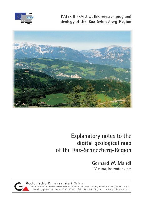
Explanatory notes to the digital geological map of the Rax ... - KATER
Explanatory notes to the digital geological map of the Rax ... - KATER
Explanatory notes to the digital geological map of the Rax ... - KATER

You also want an ePaper? Increase the reach of your titles
YUMPU automatically turns print PDFs into web optimized ePapers that Google loves.
<strong>KATER</strong> II (KArst waTER research program)<br />
Geology <strong>of</strong> <strong>the</strong> <strong>Rax</strong>-Schneeberg-Region<br />
<strong>Explana<strong>to</strong>ry</strong> <strong>notes</strong> <strong>to</strong> <strong>the</strong><br />
<strong>digital</strong> <strong>geological</strong> <strong>map</strong><br />
<strong>of</strong> <strong>the</strong> <strong>Rax</strong>-Schneeberg-Region<br />
Gerhard W. Mandl<br />
Vienna, December 2006<br />
Geologische Bundesanstalt Wien<br />
im Rahmen d. Teilrechtsfähigkeit gem § 18 Abs.5 FOG, BGBl Nr. 341/1981 i.d.g.F.<br />
Neulinggasse 38, A - 1030 Wien Tel.: 712 56 74 / 0 www.geologie.ac.at
<strong>KATER</strong> II (Karst waTER research program)<br />
Geology <strong>of</strong> <strong>the</strong> <strong>Rax</strong>-Schneeberg-Region<br />
<strong>Explana<strong>to</strong>ry</strong> <strong>notes</strong> <strong>to</strong> <strong>the</strong><br />
<strong>digital</strong> <strong>geological</strong> <strong>map</strong><br />
<strong>of</strong> <strong>the</strong> <strong>Rax</strong>-Schneeberg-Region<br />
Gerhard W. Mandl<br />
Vienna, Dezember 2006<br />
Geological Survey <strong>of</strong> Austria
<strong>KATER</strong> II Geology <strong>of</strong> <strong>the</strong> <strong>Rax</strong>-Schneeberg-region<br />
__________________________________________________________________________________________<br />
CONTENT<br />
Abstract ............................................................................................................................... 3<br />
Introduction ............................................................................................................................... 5<br />
1 STRATIGRAPHY ............................................................................................................... 7<br />
1.1 Noric-Tyrolic Nappe System ............................................................................................ 7<br />
Greywacke Zone (95) – (91) .............................................................................. 7<br />
Werfen Imbricates Zone (90) – (85) ..................................................................... 7<br />
1.2 Meliaticum (84) ................................................................................................................. 8<br />
1.3 Juvavic Nappe System ....................................................................................................... 8<br />
Permian – Lower Triassic (83) – (79).................................................................... 8<br />
Middle Triassic <strong>to</strong> Lower Carnian (78) – (61) ...................................................... 8<br />
Upper Carnian <strong>to</strong> Rhaetian (60) – (52)................................................................. 11<br />
1.4 Tyrolic Nappe System (Göller Nappe) ............................................................................... 14<br />
Triassic (51) – (44) ................................................................................................ 14<br />
Jurassic (43) – (34)................................................................................................ 14<br />
1.5 Gosau Group .................................................................................................................... 15<br />
Cretaceous <strong>to</strong> Paleocene (33) – (24) ................................................................................ 15<br />
1.6 Inneralpine Molasse, Vienna Basin ................................................................................... 16<br />
Palaeogene – Neogene (22) – (20) ...................................................................... 16<br />
1.7 Quaternary.......................................................................................................................... 16<br />
Pleis<strong>to</strong>cene (20) - (13)........................................................................................... 16<br />
Late Pleis<strong>to</strong>cene <strong>to</strong> Holocene (12) - (1) ................................................................ 17<br />
2 TECTONIC ......................................................................................................................... 18<br />
2.1 Principles <strong>of</strong> NCA structural evolution ................................................................................ 18<br />
2.2 Structural frame <strong>of</strong> <strong>the</strong> <strong>Rax</strong>/Schneeberg aquifer system ................................................... 21<br />
Schneeberg Nappe................................................................................................ 21<br />
Mürzalpen Nappe ................................................................................................ 23<br />
Göller Nappe ......................................................................................................... 23<br />
Werfen Imbricates Zone ....................................................................................... 24<br />
Acknowledgements ......................................................................................................................... 25<br />
References ............................................................................................................................... 25<br />
Attachments: Geological <strong>map</strong> and cross-sections 1:25.000<br />
2
<strong>KATER</strong> II Geology <strong>of</strong> <strong>the</strong> <strong>Rax</strong>-Schneeberg-region<br />
__________________________________________________________________________________________<br />
Abstract<br />
Within <strong>the</strong> karst water system <strong>the</strong> <strong>geological</strong> setting is responsible for <strong>the</strong> collection, filtering,<br />
s<strong>to</strong>rage and distribution <strong>of</strong> karst water on its way down from <strong>the</strong> surface through permeable<br />
rocks <strong>to</strong> <strong>the</strong> spring. The <strong>geological</strong> setting provides boundary conditions <strong>to</strong> apply general<br />
models on specific aquifers as well as <strong>to</strong> interpret measurements <strong>of</strong> water parameters (e.g.<br />
discharge curves, water chemistry, iso<strong>to</strong>pes and o<strong>the</strong>rs).<br />
Due <strong>to</strong> <strong>the</strong> complex <strong>geological</strong> genesis <strong>of</strong> <strong>the</strong> project area <strong>the</strong> <strong>geological</strong> <strong>map</strong>ping had <strong>to</strong> be<br />
accompanied by additional investigations in lithostratigraphy, biostratigraphy, micropalaen<strong>to</strong>logy,<br />
carbonate facies (lateral transitions) and tec<strong>to</strong>nics.<br />
Mesozoic carbonates are <strong>the</strong> dominant rock type within <strong>the</strong> Nor<strong>the</strong>rn Calcareous Alps,<br />
whereas siliciclastic sediments are restricted <strong>to</strong> a few stratigraphic levels and act as layers <strong>of</strong><br />
reduced permeability. The following sedimentary succession forms <strong>the</strong> Schneeberg/<strong>Rax</strong> area<br />
(<strong>the</strong> mentioned thicknesses may vary considerable due <strong>to</strong> tec<strong>to</strong>nic cutting):<br />
The sedimentary succession starts with Permian continental red beds (Prebichl-Fm.; 0-150<br />
meters), transgressing discordant over Early Paleozoic rocks <strong>of</strong> <strong>the</strong> Greywacke Zone. A<br />
marine clay-evaporite association is locally developed and may affect <strong>the</strong> water quality with<br />
sulfates. The Early Triassic is characterized by deposition <strong>of</strong> some 100 meters <strong>of</strong> marine<br />
shallow shelf siliciclastics (Werfen-Fm.). They represent <strong>the</strong> main layer <strong>of</strong> low permeability.<br />
In Middle Triassic times carbonate sedimentation became prevailing with well bedded<br />
(Gutenstein-Formation; 150 m) and massive limes<strong>to</strong>nes and dolomites (Steinalm-Formation;<br />
80-100 m). During <strong>the</strong> Middle Anisian a rapid deepening <strong>of</strong> <strong>the</strong> marin environment was<br />
associated with blockfaulting. This has generated a pronounced relief <strong>of</strong> <strong>the</strong> sea-floor, which<br />
is <strong>the</strong> reason for <strong>the</strong> subsequent development <strong>of</strong> different sedimentary facies: shallow-water<br />
carbonate platforms (Wetterstein-Formation and lateral slope sediments) coexist with basins<br />
<strong>of</strong> different shape, water depth and circulation. Four types <strong>of</strong> basinal sediments occur in <strong>the</strong><br />
investigated area: black, thin bedded allodapic limes<strong>to</strong>nes (Grafensteig-Fm., 300 m), nodular<br />
limes<strong>to</strong>nes with chert (Reifling-Fm.; 20-30 m), light grey <strong>to</strong> reddish, nodular, bedded or<br />
massive limes<strong>to</strong>nes (Hallstatt Limes<strong>to</strong>nes; 40 m) and bedded <strong>to</strong> massive multicolored<br />
allodapic limes<strong>to</strong>nes (up <strong>to</strong> 250 m).<br />
In general, <strong>the</strong> Wetterstein platforms show a rapid progradation <strong>of</strong> reef and reef breccias<br />
over <strong>the</strong> adjacent basinal sediments. The thick platform carbonates (up <strong>to</strong> 1000 m) build <strong>the</strong><br />
main aquifer in <strong>the</strong> Hochschwab and Schneeberg/<strong>Rax</strong> region. The primary porosity <strong>of</strong> <strong>the</strong>se<br />
bioclastic sediments has been lost due <strong>to</strong> early diagenetic cementation. During diagenesis<br />
also parts <strong>of</strong> <strong>the</strong> Wetterstein limes<strong>to</strong>ne as well as parts <strong>of</strong> <strong>the</strong> adjacent basinal limes<strong>to</strong>nes<br />
became transformed in<strong>to</strong> dolomite. Extended bodies <strong>of</strong> dolomitic rocks within <strong>the</strong> aquifer are<br />
responsible for lower percolation rates and a more regular discharge <strong>of</strong> some springs.<br />
The prevailing carbonate producing organisms within <strong>the</strong> platform lagoon were calcareous<br />
green algae (dasycladaceans). The knowledge about <strong>the</strong>ir distinct evolution during Triassic<br />
Times has been proved recently by correlation with conodont zonation and can be used now<br />
as a powerfull <strong>to</strong>ol for biostratigraphic dating. Tec<strong>to</strong>nic <strong>of</strong>fset along fault zones within<br />
mono<strong>to</strong>nous platform carbonates could be recognized and sometimes quantified in this way.<br />
In <strong>the</strong> early Upper Triassic (Carnian) <strong>the</strong> platforms emerged and <strong>the</strong> basins received<br />
sands<strong>to</strong>nes and shales (10-30 m). In <strong>the</strong> Late Carnian a sea-level rise has initiated <strong>the</strong><br />
development <strong>of</strong> <strong>the</strong> Norian carbonate platform (up <strong>to</strong> 1000m) characterized by Dachstein<br />
limes<strong>to</strong>ne (reef and lagoonal facies) and Hauptdolomite (intertidal facies).<br />
Most <strong>of</strong> <strong>the</strong> following younger rocks are <strong>of</strong> minor significance for <strong>the</strong> lithological composition<br />
<strong>of</strong> <strong>the</strong> karst aquifer but relevant for revealing <strong>the</strong> structural his<strong>to</strong>ry.<br />
3
<strong>KATER</strong> II Geology <strong>of</strong> <strong>the</strong> <strong>Rax</strong>-Schneeberg-region<br />
__________________________________________________________________________________________<br />
The platform growth has been terminated in <strong>the</strong> latest Triassic. During Jurassic times marly<br />
and cherty limes<strong>to</strong>nes covered <strong>the</strong> subsiding seafloor. Locally <strong>the</strong>y are replaced by<br />
condensed red limes<strong>to</strong>nes. The deposition <strong>of</strong> radiolarite indicates <strong>the</strong> stage <strong>of</strong> greatest water<br />
depth. Due <strong>to</strong> plate tec<strong>to</strong>nic movements a first tec<strong>to</strong>nic event affected <strong>the</strong> sou<strong>the</strong>m part <strong>of</strong> <strong>the</strong><br />
NCA during Upper Jurassic. Sedimentation became controlled by tec<strong>to</strong>nic activity, which<br />
finally culminated in <strong>the</strong> Cretaceous nappe stacking.<br />
After a period <strong>of</strong> subaerial erosion, Upper Cretaceous <strong>to</strong> Eocene clastics <strong>of</strong> <strong>the</strong> Gosau-Group<br />
have been deposited on <strong>the</strong> nappe stack in a subsiding environment. Sedimentation has<br />
started with terrestric <strong>to</strong> shallow marine clastics, later on a strong subsidence has led <strong>to</strong><br />
turbiditic deep slope conditions. After <strong>the</strong> collision <strong>of</strong> <strong>the</strong> Austroalpin Units with <strong>the</strong><br />
accretionary wedge <strong>of</strong> <strong>the</strong> Rhenodanubian Flysch Zone <strong>the</strong> NCA became a dry land.<br />
The plateau character <strong>of</strong> several mountain areas in <strong>the</strong> NCA is <strong>the</strong> result <strong>of</strong> erosion during<br />
Oligocene. The NCA became a lowland, covered by fluvial deposits, which were delivered<br />
from <strong>the</strong> uplifting Central Alps in <strong>the</strong> south.<br />
Compressional deformation at <strong>the</strong> beginning <strong>of</strong> Miocene has caused large strike slip fault<br />
systems. These brittle tec<strong>to</strong>nic structures are crucial for <strong>the</strong> development <strong>of</strong> water<br />
permeability in <strong>the</strong> NCA sedimentary rocks and for <strong>the</strong> karstification <strong>of</strong> <strong>the</strong> uplifting carbonate<br />
plateaus.<br />
The youngest, Pleis<strong>to</strong>zän <strong>to</strong> Holocene sediments are only <strong>of</strong> minor influence on <strong>the</strong> karstic<br />
springs, due <strong>to</strong> <strong>the</strong> location <strong>of</strong> springs within <strong>the</strong> carbonatic bedrocks.<br />
The knowledge <strong>of</strong> <strong>the</strong> complex interaction <strong>of</strong> sedimentation, nappe tec<strong>to</strong>nics and faulting<br />
provides a useful <strong>to</strong>ol for understanding <strong>the</strong> hydrogeology <strong>of</strong> <strong>the</strong> karstic springs <strong>of</strong> <strong>the</strong> Vienna<br />
Water Supply. It <strong>of</strong>fers also a database for decision finding in a management system for a<br />
sustainable drinking water supply.<br />
4
<strong>KATER</strong> II Geology <strong>of</strong> <strong>the</strong> <strong>Rax</strong>-Schneeberg-region<br />
__________________________________________________________________________________________<br />
Introduction<br />
The inhabitants (about 1.65 million people) <strong>of</strong> <strong>the</strong> Austrian capital city Vienna become<br />
supplied with high quality drinking water from karstic springs. Up <strong>to</strong> 200.000 cbm per day are<br />
flowing via each <strong>of</strong> <strong>the</strong> two pipelines 150 resp. 180 kilometers from <strong>the</strong> Nor<strong>the</strong>rn Calcareous<br />
Alps <strong>to</strong>wards Vienna. The protected area around <strong>the</strong> springs comprises about 32.000 hectars<br />
<strong>of</strong> karstified mountain ranges, a sensible ecosystem with complex interactions between<br />
rocks, water, soil, vegetation, climate and human landuse.<br />
Water supply agencies permanently have <strong>to</strong> balance between saving water quality and<br />
quantity, economic requirements and moni<strong>to</strong>ring <strong>of</strong> environmental pollution. To maintain at<br />
least a minimum water supply in case <strong>of</strong> local pollution it is necessary <strong>to</strong> have a better<br />
understandig <strong>of</strong> <strong>the</strong> catchment areas <strong>of</strong> individual springs and <strong>of</strong> <strong>the</strong> potential subterranean<br />
water paths.<br />
About 1990 <strong>the</strong> government <strong>of</strong> Vienna has initiated a multidisciplinary “Karst Research<br />
Project”. Within this frame <strong>the</strong> Austrian Geological Survey has started a detailed <strong>geological</strong><br />
<strong>map</strong>ping <strong>of</strong> <strong>the</strong> catchment area <strong>of</strong> <strong>the</strong> Second Vienna Water Supply System. The final report<br />
2002 <strong>of</strong>fers a modern <strong>geological</strong> <strong>map</strong> <strong>of</strong> about 520 sq.km area <strong>of</strong> <strong>the</strong> Hochschwab mountain<br />
range in form <strong>of</strong> a <strong>digital</strong> database.<br />
In <strong>the</strong> meantime <strong>the</strong> Karst Research Project <strong>of</strong> <strong>the</strong> Government <strong>of</strong> Vienna has initiated a<br />
transnational and interdisciplinary project on European level, due <strong>to</strong> its fundamental<br />
significance for municipal water supply systems. The aim <strong>of</strong> <strong>KATER</strong> (KArst waTER research<br />
program in <strong>the</strong> frame <strong>of</strong> EU Interreg II c) was <strong>to</strong> form <strong>the</strong> basic <strong>to</strong>ols for a decision finding<br />
system in <strong>the</strong> field <strong>of</strong> regional policy, water supply and environment protection – basics like<br />
definition <strong>of</strong> metadata, car<strong>to</strong>graphic standards and GIS (Geographic Information Systems) -<br />
<strong>to</strong>ols.<br />
The following project <strong>KATER</strong> II (in <strong>the</strong> frame <strong>of</strong> EU Interreg III b CADSES) has <strong>the</strong> aim <strong>of</strong><br />
developing a GIS-based decision system <strong>to</strong> estimate or quantify <strong>the</strong> influences <strong>of</strong> land use<br />
activities on drinking water ressources in karstified areas.<br />
As a part <strong>of</strong> this project <strong>the</strong> geology <strong>of</strong> <strong>the</strong> catchment areas <strong>of</strong> <strong>the</strong> First Vienna Water Supply<br />
System has <strong>to</strong> be investigated in a similar way as in <strong>the</strong> former Hochschwab project. Data<br />
integration <strong>of</strong> available modern <strong>map</strong>s and additional <strong>geological</strong> <strong>map</strong>ping with a focus on <strong>the</strong><br />
Schneeberg area was done by <strong>the</strong> Austrian Geological Survey, starting in december 2003.<br />
The final report presents <strong>the</strong> results in form <strong>of</strong> a <strong>geological</strong> <strong>map</strong> 1:25.000, four <strong>geological</strong><br />
cross sections and explana<strong>to</strong>ry <strong>notes</strong>. The <strong>geological</strong> <strong>map</strong> is also available as a <strong>digital</strong><br />
database (ArcGis9/GeoDatabase).<br />
Within <strong>the</strong> karst water system <strong>the</strong> <strong>geological</strong> setting is responsible for <strong>the</strong> collection, filtering,<br />
s<strong>to</strong>rage and distribution <strong>of</strong> karst water on its way down from <strong>the</strong> surface through <strong>the</strong><br />
permeable rock <strong>to</strong> <strong>the</strong> spring. The petrography <strong>of</strong> rocks and <strong>the</strong> geometry <strong>of</strong> <strong>the</strong>ir structural<br />
features has influence on <strong>the</strong> water paths and <strong>the</strong> position <strong>of</strong> springs and <strong>the</strong> chemistry <strong>of</strong><br />
rocks may also affect water quality.<br />
The large karstified areas <strong>of</strong> <strong>the</strong> Nor<strong>the</strong>rn Calcareous Alps are composed mainly <strong>of</strong> thick<br />
sequences <strong>of</strong> shallow water carbonates <strong>of</strong> seemingly mono<strong>to</strong>nous lithology. Only a very<br />
general overall fiew could be obtained from older <strong>geological</strong> <strong>map</strong>s. No detailed knowledge<br />
existed about structures like internal thrusts or fault systems and about <strong>the</strong> geometry <strong>of</strong><br />
internal lithological aquitards/aquicludes.<br />
5
<strong>KATER</strong> II Geology <strong>of</strong> <strong>the</strong> <strong>Rax</strong>-Schneeberg-region<br />
__________________________________________________________________________________________<br />
A main task <strong>of</strong> re<strong>map</strong>ping such areas was <strong>the</strong>refore a detailed subdivision <strong>of</strong> <strong>the</strong> carbonate<br />
rocks. The <strong>geological</strong> <strong>map</strong>ping had <strong>to</strong> be accompanied by additional investigations in<br />
lithostratigraphy, biostratigraphy, micropalaeon<strong>to</strong>logy, carbonate facies (lateral transitions)<br />
and tec<strong>to</strong>nics.<br />
The <strong>geological</strong> setting provides boundary conditions <strong>to</strong> apply general models on specific<br />
aquifers as well as <strong>to</strong> interpret measurements <strong>of</strong> water parameters (e.g. discharge curves,<br />
water chemistry, iso<strong>to</strong>pes and o<strong>the</strong>rs).<br />
Parts <strong>of</strong> <strong>the</strong> catchment area <strong>of</strong> <strong>the</strong> First Vienna Water Supply have been <strong>map</strong>ped in such a<br />
detailed way, <strong>the</strong>y are available in printed form (scale 1:50.000) since several years:<br />
ÖK-sheet 75/Puchberg am Schneeberg (1991), ÖK-sheet 105/Neunkirchen (1992),<br />
ÖK-sheet 104/Mürzzuschlag (2001).<br />
The area <strong>of</strong> Kuhschneeeberg and its surrounding (ÖK-sheet 74/Hohenberg) has <strong>to</strong> be<br />
<strong>map</strong>ped additionally <strong>to</strong> obtain a modern view on <strong>the</strong> overall catchment area.<br />
All data have been integrated and partly actualized and refined <strong>to</strong> a <strong>digital</strong> data base,<br />
comparable with a printed <strong>map</strong> at a scale <strong>of</strong> 1:25.000.<br />
Fig.1<br />
6
<strong>KATER</strong> II Geology <strong>of</strong> <strong>the</strong> <strong>Rax</strong>-Schneeberg-region<br />
__________________________________________________________________________________________<br />
1 STRATIGRAPHY<br />
The Nor<strong>the</strong>rn Calcareous Alps (NCA) – as a prominent part <strong>of</strong> <strong>the</strong> Eastern Alps – extend for<br />
about 500 kilometers from <strong>the</strong> Rhine valley in <strong>the</strong> west <strong>to</strong> Vienna in <strong>the</strong> east, forming a 20 <strong>to</strong><br />
50 kilometer wide mountain belt. In <strong>the</strong> western and middle part <strong>the</strong> highest peaks reach<br />
altitudes <strong>of</strong> up <strong>to</strong> 3.000 meters and are locally glaciated, in <strong>the</strong> eastern part elevations are up<br />
<strong>to</strong> 2.000 meters (<strong>Rax</strong>, Schneeberg). At <strong>the</strong>ir eastern end <strong>the</strong> NCA are bounded by <strong>the</strong><br />
Vienna Basin, which subsided during Neogene times. In <strong>the</strong> basement <strong>of</strong> <strong>the</strong> Vienna Basin,<br />
however, <strong>the</strong> NCA continue in<strong>to</strong> equivalent units <strong>of</strong> <strong>the</strong> Western Carpathians even if <strong>the</strong><br />
details are still in discussion.<br />
The Grauwacken Zone, consisting mainly <strong>of</strong> Ordovician <strong>to</strong> Carboniferous Metasediments, is<br />
<strong>the</strong> basement <strong>of</strong> <strong>the</strong> NCA. The transgressive sedimentary sequence <strong>of</strong> <strong>the</strong> NCA begins in <strong>the</strong><br />
Permian and extends locally in<strong>to</strong> <strong>the</strong> Paleogene (Gosau Group). The Triassic carbonates are<br />
<strong>the</strong> most prevailing rocks. They are forming extended karstified landscapes, <strong>the</strong> catchment<br />
areas <strong>of</strong> several drinking water supply systems – <strong>the</strong> most importend one is <strong>the</strong> Vienna water<br />
supply.<br />
Due <strong>to</strong> <strong>the</strong> intense nappe tec<strong>to</strong>nic during <strong>the</strong> Alpine orogenesis <strong>the</strong> originally succession <strong>of</strong><br />
sedimentary rocks has been dissected in<strong>to</strong> several nappes with different stratigraphic<br />
content. Therefore <strong>the</strong> legend <strong>of</strong> <strong>the</strong> <strong>map</strong> as well as <strong>the</strong> explana<strong>to</strong>ry <strong>notes</strong> are grouping <strong>the</strong><br />
formations according <strong>to</strong> <strong>the</strong> main tec<strong>to</strong>nic units and <strong>the</strong>n according <strong>to</strong> <strong>the</strong>ir sedimentary age,<br />
beginning with <strong>the</strong> oldest one.<br />
Overviews as well as detailed data and fur<strong>the</strong>r literature <strong>to</strong> this <strong>to</strong>pic are given by BÖHM<br />
1992, FAUPL & WAGREICH 1996, FLÜGEL 1981, LEIN 1987, LOBITZER, MANDL,<br />
MAZZULLO & MELLO 1990, MANDL 2000, MANDL & ONDREJICKOVA 1993, NEUBAUER<br />
et al. 1994, SCHLAGINTWEIT & EBLI 1999, TOLLMANN 1976, 1985, 1986, WAGREICH &<br />
FAUPL 1994, ZANKL 1971.<br />
A schematic representation <strong>of</strong> <strong>the</strong> Triassic sedimentary sequences is shown in Figs. 2 and 3.<br />
1.1 Noric-Tyrolic Nappe System<br />
Greywacke Zone (95) – (91)<br />
The palaeozoic metasediments <strong>of</strong> <strong>the</strong> Greywacke Zone are separated in<strong>to</strong> three nappes, two<br />
<strong>of</strong> <strong>the</strong>m can be found in <strong>the</strong> project area:<br />
# <strong>the</strong> Silbersberg Nappe contains remnants <strong>of</strong> a crystalline basement („Vöstenh<strong>of</strong>-<br />
Crystalline”) and transgreding siliciclastics <strong>of</strong> <strong>the</strong> Silbersberg-Group (95).<br />
# <strong>the</strong> Noric Nappe is built by phyllits and greenschists (94), Ordovician volcanic rocks <strong>of</strong><br />
<strong>the</strong> “Blasseneck Porphyroid” (93), Silurian sandy grey shale “Radschiefer” (92) with<br />
lydites and Devonian carbonate rocks (91).<br />
Werfen Imbricates Zone (90) – (85)<br />
The sedimentary sequence <strong>of</strong> <strong>the</strong> NCA starts in <strong>the</strong> Permian with continental red beds,<br />
conglomerates, sands<strong>to</strong>nes and shales <strong>of</strong> <strong>the</strong> Prebichl Formation (90, 89), transgressing<br />
on<strong>to</strong> Lower Palaeozoic rocks <strong>of</strong> <strong>the</strong> Greywacke Zone. The Permian age is assumes due <strong>to</strong><br />
local intercalations <strong>of</strong> acid tuffs and pebbles <strong>of</strong> quartz porphyry, which are widespread in <strong>the</strong><br />
7
<strong>KATER</strong> II Geology <strong>of</strong> <strong>the</strong> <strong>Rax</strong>-Schneeberg-region<br />
__________________________________________________________________________________________<br />
European Permian. Locally occurs a body <strong>of</strong> Quartz porphyry (88), tec<strong>to</strong>nically embedded<br />
in Werfen shales.<br />
The Lower Triassic is characterized by uniform shallow shelf siliciclastics <strong>of</strong> <strong>the</strong> Werfen<br />
Formation (87), containing limes<strong>to</strong>ne beds (86) in its uppermost part with a poor fauna<br />
including Scythian ammonoids.<br />
Tec<strong>to</strong>nized Anisian dolomites form elongated bodies <strong>of</strong> Rauwacke (85) within and on <strong>to</strong>p <strong>of</strong><br />
<strong>the</strong> siliciclastics.<br />
1.2 Meliaticum (84)<br />
Along one <strong>of</strong> <strong>the</strong> main thrust planes we find two Klippen <strong>of</strong> sedimentary rocks <strong>of</strong> a deep<br />
water origin, unknown elsewhere in <strong>the</strong> NKA, but well known as Meliaticum in <strong>the</strong> Western<br />
Carpathians. These rocks represent <strong>the</strong> transition from <strong>the</strong> Triassic Hallstatt carbonatic<br />
depositional realm in<strong>to</strong> oceanic conditions with radiolarites. We have hints on <strong>the</strong> existence<br />
<strong>of</strong> such an oceanic realm only in form <strong>of</strong> olis<strong>to</strong>lites <strong>of</strong> Ladinian red radiolarite in <strong>the</strong> Middle<br />
Jurassic silicious shales <strong>of</strong> Florianikogel Formation (84) - see MANDL & ONDREJICKOVA<br />
1991, 1993, KOZUR & MOSTLER 1992.<br />
1.3 Juvavic Nappe System<br />
Within a distinct zone <strong>of</strong> tec<strong>to</strong>nic disturbance several partly recrystallized carbonate rocks<br />
occure, which have been assigned in older <strong>map</strong>s <strong>to</strong> <strong>the</strong> Carnian Opponitz Formation. No<br />
fossils have been found until now; lithology and discordant position do not confirm this<br />
opinion. Therefore <strong>the</strong>se rocks are summarized here as carbonates <strong>of</strong> unknown<br />
stratigraphic origin (83).<br />
PERMIAN – LOWER TRIASSIC (83) – (79)<br />
A marine facies <strong>of</strong> Permian sediments is <strong>the</strong> so called Haselgebirge (82), a sands<strong>to</strong>ne-clayevaporite<br />
association, containing gypsum and salt. This facies is frequent in <strong>the</strong> Juvavic<br />
units, exposed for example in <strong>the</strong> Pfenningbach gypsum open pit mine east <strong>of</strong> village<br />
Puchberg. The Upper Permian age is proved paleon<strong>to</strong>logically by pollen/spores at several<br />
localities in <strong>the</strong> NCA and confirmed by sulfur iso<strong>to</strong>pes.<br />
The Lower Triassic is represented again by siliciclastics <strong>of</strong> Werfen Formation (81, 80),<br />
accompanied by Anisian Rauwacke (79) - see also above.<br />
MIDDLE TRIASSIC TO LOWER CARNIAN (78) – (61)<br />
Beginning with <strong>the</strong> Middle Triassic carbonate sedimentation became dominant.<br />
The dark Gutenstein Limes<strong>to</strong>ne (76) and Dolomite (77) is present in most <strong>of</strong> <strong>the</strong> NCA<br />
nappes. A local variety is a multicolored Flaser Limes<strong>to</strong>ne (78).<br />
The Gutenstein carbonates can be laterally replaced in <strong>the</strong> upper part by light dasycladacean<br />
bearing carbonates, <strong>the</strong> Steinalm Limes<strong>to</strong>ne/Dolomite (75, 74).<br />
During <strong>the</strong> Middle Anisian a rapid deepening and contemporary block faulting <strong>of</strong> <strong>the</strong> so<br />
called Reifling Event has caused a sea floor relief, responsible for <strong>the</strong> following differentiation<br />
in<strong>to</strong> shallow carbonate platforms (Wetterstein Formation and lateral slope sediments) and<br />
8
<strong>KATER</strong> II Geology <strong>of</strong> <strong>the</strong> <strong>Rax</strong>-Schneeberg-region<br />
__________________________________________________________________________________________<br />
basinal areas.The basins can be distinguished in<strong>to</strong> <strong>the</strong> wide spread Reifling basins, local<br />
intraplattform basins <strong>of</strong> Grafensteig type and <strong>the</strong> Hallstatt deeper shelf, <strong>the</strong> latter one was<br />
bordering <strong>the</strong> open Tethys.<br />
Rocks <strong>of</strong> transitional nature between Middle Triassic platforms and basins are relatively rare<br />
in <strong>the</strong> NCA due <strong>to</strong> structural complexities. Basinal facies <strong>of</strong>ten are tec<strong>to</strong>nically isolated from<br />
formerly contiguous platform deposits. In general within <strong>the</strong> project area we know four<br />
different types <strong>of</strong> Anisian <strong>to</strong> Lower Carnian carbonatic slope <strong>to</strong> basinal sediments, <strong>the</strong><br />
Reifling Limes<strong>to</strong>ne, <strong>the</strong> Hallstatt Limes<strong>to</strong>ne and multicolored allodapic limes<strong>to</strong>nes and <strong>the</strong><br />
dark allodapic Grafensteig Limes<strong>to</strong>ne.<br />
The Reifling Limes<strong>to</strong>ne (73) is <strong>the</strong> characteristic basinal facies in <strong>the</strong> Bajuvaric and Tyrolic<br />
nappes, locally also occuring in <strong>the</strong> Juvavic nappes. It consists <strong>of</strong> grey well bedded nodular<br />
limes<strong>to</strong>ne with thin yellowish <strong>to</strong> greenish clay intercalations <strong>of</strong> partial tuffitic origin. A silica<br />
content <strong>of</strong>ten is concentrated in chert-nodules or -layers. Micr<strong>of</strong>acies shows (pel-) micrites<br />
with abundant radiolarians and „filaments” (thin shells <strong>of</strong> planc<strong>to</strong>nic bivalves) and conodonts,<br />
<strong>the</strong> macr<strong>of</strong>auna consists <strong>of</strong> ammonites, molluscs (Daonella) and local brachiopods.<br />
The Hallstatt Limes<strong>to</strong>ne (72) comprises a lot <strong>of</strong> different lithologies, mostly <strong>of</strong> multicolored<br />
micritic limes<strong>to</strong>nes with abundant pelagic fauna like conodonts and ammonites. Hallstatt<br />
Limes<strong>to</strong>nes are restricted almost <strong>to</strong> <strong>the</strong> uppermost respectively sou<strong>the</strong>rnmost tec<strong>to</strong>nic units<br />
<strong>of</strong> <strong>the</strong> Juvavic Nappe System, representing <strong>the</strong> sediment <strong>of</strong> areas <strong>of</strong> low deposition.<br />
Sometimes a secundary dolomitization has transformed <strong>the</strong> Hallstatt limes<strong>to</strong>nes and<br />
allodapic slope limes<strong>to</strong>nes in<strong>to</strong> multicolored Dolomites (71).<br />
Along <strong>the</strong> Wetterstein platform margins locally multicolored allodapic limes<strong>to</strong>nes (70)<br />
became deposited, mixtures <strong>of</strong> reddish hemipelagic carbonat ooze and finegrained<br />
carbonate debris <strong>of</strong> platform origin.<br />
The Grafensteig Limes<strong>to</strong>ne (68) is characterized by darkgrey <strong>to</strong> black well bedded<br />
limes<strong>to</strong>nes, mainly with even bedding planes, more oder less abundant chert-nodules or -<br />
layers and - as a main feature - with intercalated allodapic beds <strong>of</strong> platform origin. It is<br />
overlain in <strong>the</strong> nor<strong>the</strong>rn Schneebergarea by grossoolite-breccia facies <strong>of</strong> an upper slope<br />
environment. The Grafensteig facies represents a restricted intraplatform-basin with only<br />
minor connection <strong>to</strong> open marine conditions. Pelagic faunal elements like conodonts seem <strong>to</strong><br />
be restricted <strong>to</strong> sporadic beds and are in general poor. The Grafensteig Limes<strong>to</strong>ne comprises<br />
a maximal time span from Middle Anisian <strong>to</strong> Lowermost Carnian in <strong>the</strong> basin interior. At <strong>the</strong><br />
basin-margins it ends earlier according <strong>to</strong> <strong>the</strong> prograding Wetterstein platform. Greenish<br />
layers <strong>of</strong> very fine grained material without carbonate content are interpreted as volcanic<br />
tuffite (69).<br />
Wetterstein reef and reef debris facies (67)<br />
The most intensely studied part <strong>of</strong> <strong>the</strong> Wetterstein Limes<strong>to</strong>ne is by far <strong>the</strong> reefal facies.<br />
These builtups are composed <strong>of</strong> diverse biotic assemblages <strong>of</strong> calcisponges, corals and<br />
hydrozoans, tubiphytes, bryozoans, codiacean and solenoporacean algae, brachiopods,<br />
molluscs and ra<strong>the</strong>r rare foraminifers. Rock textures <strong>of</strong> reefal deposits generally are<br />
wackes<strong>to</strong>nes and packs<strong>to</strong>nes. Bounds<strong>to</strong>nes resulting mainly from syndepositional marine<br />
cementation are also very common. It seems that a biogenic reef framework in <strong>the</strong> sense <strong>of</strong><br />
a wave-breaking structure did not exist in <strong>the</strong> Wetterstein reefs <strong>of</strong> <strong>the</strong> eastern NCA.<br />
Practically all reef-organisms are <strong>of</strong> small dimensions <strong>of</strong> several centimeters only. Coralbuildups<br />
<strong>of</strong> large dimensions are missing as well as o<strong>the</strong>r potential wave-breaking<br />
organisms. It seems that a rigid framework could have been constructed by a combination <strong>of</strong><br />
pervasive submarine early diagenetic cementation and various encrusting organisms. The<br />
9
<strong>KATER</strong> II Geology <strong>of</strong> <strong>the</strong> <strong>Rax</strong>-Schneeberg-region<br />
__________________________________________________________________________________________<br />
fact <strong>of</strong> immediate interfingering <strong>of</strong> <strong>the</strong> „reef” with lagoonal birdseye limes<strong>to</strong>nes is considered<br />
as a prove for platform-edge reefs and not an upper slope situation. Typical assemblages <strong>of</strong><br />
a deeper water slope (ammonites, radiolarians, silicisponges) are missing. Such biota<br />
occures only in very rare small lenses <strong>of</strong> Hallstatt-type within <strong>the</strong> reef <strong>of</strong> Heukuppe (summit<br />
<strong>of</strong> <strong>Rax</strong>-plateau).<br />
A conspicuous feature <strong>of</strong> platform-edge facies in <strong>the</strong> Wetterstein Limes<strong>to</strong>ne is <strong>the</strong><br />
development <strong>of</strong> coarse breccias. The term „Grossoolite” refers <strong>to</strong> thick, laminated,<br />
isopachous coatings <strong>of</strong> radiaxial-fibrous calcite cement and calcite-replacive dolomite around<br />
lithoclasts and skeletal particles. Although initially interpreted as being <strong>of</strong> organic origin<br />
(“Evinospongia”), <strong>the</strong>se coatings are now regarded as inorganic or microbial initiated<br />
cements. The component clasts are commonly angular and <strong>of</strong>ten poorly sorted, ranging in<br />
size from a few centimeters <strong>to</strong> several decimeters in diameter. They are mainly composed <strong>of</strong><br />
reefal lithologies. In places <strong>the</strong> grossoolitic breccias are <strong>the</strong> only remaining evidence <strong>of</strong> <strong>the</strong><br />
former existence <strong>of</strong> in-situ shelf-margin reefs. Syndepositional tec<strong>to</strong>nism, oversteepening <strong>of</strong><br />
<strong>the</strong> platform margin, slope instability, or a combination <strong>of</strong> <strong>the</strong>se processes must have been<br />
causative fac<strong>to</strong>rs in <strong>the</strong> formation <strong>of</strong> such widespread breccia deposits.<br />
Wetterstein lagoonal facies (66)<br />
Rocks <strong>of</strong> this facies are generally massive <strong>to</strong> thick bedded, locally bioturbated limes<strong>to</strong>nes<br />
with a diverse biota <strong>of</strong> various dasycladacean, solenoporacean and codiacean algae,<br />
molluscs (mainly gastropods), echinoderms, rare framebuilding organisms, brachiopods,<br />
foraminifers and ostracodes. Textures vary from wackes<strong>to</strong>nes <strong>to</strong> grains<strong>to</strong>nes. Patch reefs<br />
inside <strong>the</strong> lagoon are very rare. The immediate transitional area behind <strong>the</strong> reef - <strong>the</strong> nearreef<br />
lagoon - is <strong>of</strong>ten characterized by bounds<strong>to</strong>nes or birdseye-limes<strong>to</strong>nes with mixed biota<br />
consisting <strong>of</strong> reef debris and <strong>the</strong> dasycladacean Teutloporella herculea, which one is <strong>the</strong><br />
dominant algal species in <strong>the</strong> <strong>Rax</strong>-Schneeberg area. In <strong>the</strong> uppermost part <strong>of</strong> <strong>the</strong> lagoon<br />
additionally Poikiloporella duplicata occurs and indicates an Early Carinan age.<br />
Wetterstein dolomite (65)<br />
Parts <strong>of</strong> <strong>the</strong> Wetterstein limes<strong>to</strong>ne have been affected by a secondary dolomitization. In <strong>the</strong><br />
<strong>Rax</strong> and Schneeberg area a local dolomitization <strong>to</strong>ok place mainly within <strong>the</strong> reef and reef<br />
breccia facies. These dolomites form bodies <strong>of</strong> irregular size, which cannot be assigned <strong>to</strong><br />
distinct stratigraphic levels. Prediction <strong>of</strong> <strong>the</strong> extent <strong>of</strong> subsurface dolomite bodies can be<br />
given only schematic – see cross sections.<br />
In <strong>the</strong> Schneealpe <strong>the</strong> dolomitization has affected <strong>the</strong> Wetterstein platform nearly complete.<br />
Also adjacent slope sediments <strong>of</strong> Grafensteig limes<strong>to</strong>ne have been partly dolomitized.<br />
Nor<strong>the</strong>rn Alpine Raibl-Group ( 64) - (61)<br />
The Wetterstein platforms in general show a platform progradation over <strong>the</strong> adjacent basinal<br />
sediments until <strong>the</strong> Earliest Carnian ("Cordevolian"). Then carbonate production decreased<br />
rapidly due <strong>to</strong> a sealevel lowstand. The platforms emerged, <strong>the</strong> remainig basins received<br />
siliciclastics from <strong>the</strong> European hinterland in form <strong>of</strong> marine black shales, <strong>the</strong> Reingraben<br />
shale (64). The shales are interbedded with dark cherty limes<strong>to</strong>nes (63), dolomites (61)<br />
and dark biodetrital limes<strong>to</strong>ne (62), derived from small surviving reef mounds at <strong>the</strong> basin<br />
margins.<br />
10
<strong>KATER</strong> II Geology <strong>of</strong> <strong>the</strong> <strong>Rax</strong>-Schneeberg-region<br />
__________________________________________________________________________________________<br />
UPPER CARNIAN TO RHAETIAN (60) - (52)<br />
As sealevel started rising up again in <strong>the</strong> Upper Carnian, ra<strong>the</strong>r slowly in <strong>the</strong> beginning,<br />
carbonate production increased, locally filling a relief in <strong>the</strong> drowning platforms with <strong>the</strong><br />
dasycladacean bearing lagoonal Waxeneck Limes<strong>to</strong>ne (60). The relief (several 10th up <strong>to</strong><br />
about 100 meters) may have been caused by erosion during <strong>the</strong> lowstand time and /or by<br />
tec<strong>to</strong>nic movements.<br />
A transgressive pulse just below <strong>the</strong> Carnian/Norian boundary caused an onlap <strong>of</strong> pelagic<br />
limes<strong>to</strong>nes over <strong>the</strong> shallow water carbonates and initiated <strong>the</strong> rapid growth <strong>of</strong> <strong>the</strong> Norian<br />
carbonate platform. Due <strong>to</strong> local differences in platform growth conditions we can distinguish<br />
two different developments:<br />
In <strong>the</strong> central part <strong>of</strong> <strong>the</strong> NCA (Hochkönig, Tennengebirge, Dachstein area etc.) <strong>the</strong> pelagic<br />
onlap represents only a short time interval and became covered by <strong>the</strong> prograding Dachstein<br />
carbonate platform – in <strong>the</strong>se areas <strong>the</strong> Upper Triassic reefs approximately are situated<br />
above <strong>the</strong> Middle Triassic ones.<br />
Ano<strong>the</strong>r situation characterizes <strong>the</strong> eastern sec<strong>to</strong>r <strong>of</strong> <strong>the</strong> NCA. There <strong>the</strong> Uppermost Carnian<br />
pelagic transgression continues until <strong>the</strong> Upper Norian and has been termed Mürztal Type <strong>of</strong><br />
Hallstatt facies. Dachstein reefs are only known from <strong>the</strong> Upper Norian and <strong>the</strong>se ones are<br />
situated above <strong>the</strong> former platform interior, several kilometers behind <strong>the</strong> former Wetterstein<br />
reef front. This "backstepped" reefs show transitions in<strong>to</strong> <strong>the</strong> partly restricted basinal facies <strong>of</strong><br />
<strong>the</strong> Aflenz Limes<strong>to</strong>ne (59), a bedded black limes<strong>to</strong>ne with chert layers or nodules.<br />
In contrary <strong>the</strong> "Sou<strong>the</strong>rn Marginal Reefs" <strong>of</strong> central NCA are connected by <strong>the</strong> allodapic<br />
Gosausee Limes<strong>to</strong>ne <strong>to</strong> <strong>the</strong> Pötschen Limes<strong>to</strong>ne (58), a bedded grey limes<strong>to</strong>ne with chert,<br />
representing <strong>the</strong> basinal realm <strong>of</strong> Hallstatt deep shelf.<br />
The Hallstatt-Group (57) - (54) shows a great variability <strong>of</strong> multicolored limes<strong>to</strong>nes <strong>of</strong>ten<br />
with rapidly changing sedimentary features due <strong>to</strong> <strong>the</strong> mobile basement:<br />
The Hallstatt Limes<strong>to</strong>ne at Nasswald (57) consists <strong>of</strong> massive <strong>to</strong> bedded grey pelagic<br />
limes<strong>to</strong>nes with a Norian fauna.<br />
Hallstatt Limes<strong>to</strong>ne <strong>of</strong> Mürztal facies (55)<br />
The grey, pink and reddish, more or less massive limes<strong>to</strong>nes represent sediments on a<br />
„pelagic plateau“ above <strong>the</strong> drowned Waxeneck limes<strong>to</strong>ne and Wetterstein platform. The<br />
uppermost part, consisting <strong>of</strong> well bedded dark limes<strong>to</strong>ne (56), is shown separately on <strong>the</strong><br />
<strong>map</strong>.<br />
Hallstatt Limes<strong>to</strong>ne <strong>of</strong> Salzberg facies (54)<br />
At Losenheim <strong>the</strong>re occurs massive white limes<strong>to</strong>ne (“Massiger Hellkalk”) und well bedded<br />
red limes<strong>to</strong>ne (“Hangend Rotkalk”). It is comparable <strong>to</strong> <strong>the</strong> Salzberg facies <strong>of</strong> <strong>the</strong> classical<br />
Hallstatt area in <strong>the</strong> Salzkammergut, representing <strong>the</strong> reduced sedimentation above local<br />
uplifts due <strong>to</strong> diapirism <strong>of</strong> Permian evaporites.<br />
Zlambach Formation (53, 52)<br />
In <strong>the</strong> Triassic basinal realms Zlambach marls (53) and bedded black limes<strong>to</strong>nes (53)<br />
have been deposited. Along <strong>the</strong> basin margins <strong>the</strong>y onlap and interfinger with <strong>the</strong> <strong>the</strong><br />
Dachstein platform slope sediments.<br />
11
<strong>KATER</strong> II Geology <strong>of</strong> <strong>the</strong> <strong>Rax</strong>-Schneeberg-region<br />
__________________________________________________________________________________________<br />
12<br />
Fig. 2:
<strong>KATER</strong> II Geology <strong>of</strong> <strong>the</strong> <strong>Rax</strong>-Schneeberg-region<br />
__________________________________________________________________________________________<br />
13<br />
Fig. 3
<strong>KATER</strong> II Geology <strong>of</strong> <strong>the</strong> <strong>Rax</strong>-Schneeberg-region<br />
__________________________________________________________________________________________<br />
1.4 Tyrolic Nappe System (Göller Nappe)<br />
TRIASSIC ROCKS (51) – (44)<br />
In <strong>the</strong> sou<strong>the</strong>rnmost parts <strong>of</strong> <strong>the</strong> Göller Nappe only a few occurences <strong>of</strong> Wetterstein<br />
dolomite (51) are preserved due <strong>to</strong> tec<strong>to</strong>nic dissection. In this area <strong>the</strong>y are mainly <strong>of</strong><br />
lagoonal origin.<br />
According <strong>to</strong> <strong>the</strong> Early Carnian regression <strong>the</strong> marin <strong>to</strong> brackish Lunz Sands<strong>to</strong>ne (50) has<br />
filled up <strong>the</strong> basins between <strong>the</strong> Wetterstein platforms. In areas outside <strong>the</strong> project area <strong>the</strong>y<br />
locally contain coal seams. A subsequent following transgression has lead <strong>to</strong> partly<br />
hypersalinar conditions, causing <strong>the</strong> deposition <strong>of</strong> limes<strong>to</strong>nes and dolomites with local<br />
evaporites (gypsum) - <strong>the</strong> Opponitz Formation (49) .<br />
Far behind <strong>the</strong> Dachstein reef barrier a large lagoonal environment extended all over <strong>the</strong><br />
NCA with <strong>the</strong> intertidal Hauptdolomit (48) in distal parts, “Plattenkalk” (47) as a transitional<br />
facies and thick bedded Dachstein limes<strong>to</strong>ne (46) in <strong>the</strong> subtidal lagoon.<br />
In <strong>the</strong> Uppermost Triassic ("Rhaetian") once again increasing terrigenious influx has reduced<br />
<strong>the</strong> carbonate platforms. The Hauptdolomit area and parts <strong>of</strong> <strong>the</strong> Dachstein lagoon became<br />
covered by <strong>the</strong> marly Kössen Formation (45) borderd by Rhaetian reefs. A local recurrence<br />
<strong>of</strong> carbonatic sedimentation has lead <strong>to</strong> <strong>the</strong> deposition <strong>of</strong> an “Upper” Dachstein limes<strong>to</strong>ne<br />
(44).<br />
JURASSIC ROCKS (43) – (34)<br />
At <strong>the</strong> beginning <strong>of</strong> Jurassic <strong>the</strong> Austroalpine shelf drowned completely, basinal conditions<br />
prevailed until <strong>the</strong> Early Cretaceous with <strong>the</strong> only exception <strong>of</strong> local Plassen carbonate<br />
platforms (Late Jurassic - Earliest Cretaceous) in sou<strong>the</strong>rn parts <strong>of</strong> <strong>the</strong> NCA, especially in <strong>the</strong><br />
realm <strong>of</strong> Juvavic nappes.<br />
Parts <strong>of</strong> <strong>the</strong> Hettangian are <strong>of</strong>ten missing at <strong>the</strong> base <strong>of</strong> <strong>the</strong> Jurassic limes<strong>to</strong>nes. The reason<br />
- subaereal exposure or submarine non-deposition - is still in discussion. Neptunian sills and<br />
dykes filled with red or grey Liassic limes<strong>to</strong>nes are known, cutting down several meters in<strong>to</strong><br />
<strong>the</strong> Norian shallow water carbonates.<br />
Irregular drowning and synsedimentary faulting has caused a complex seafloor <strong>to</strong>pography<br />
with reddish/grey crinoidal limes<strong>to</strong>nes (Hierlatz Limes<strong>to</strong>ne, 43) and red ammonoid<br />
limes<strong>to</strong>nes (Adnet Limes<strong>to</strong>ne, 42) mainly above subsided former shallow carbonate<br />
platforms. Grey marly/cherty limes<strong>to</strong>nes <strong>of</strong> Allgäu Formation (40) have been deposited in<br />
<strong>the</strong> deeper troughs between.<br />
Very thin condensed sequences <strong>of</strong> <strong>the</strong>se and o<strong>the</strong>r Jurassic red limes<strong>to</strong>nes are summarized<br />
as Jurassic condensed limes<strong>to</strong>nes in general (41). Jurassic red limes<strong>to</strong>nes are bioclastic<br />
wackes<strong>to</strong>nes, mainly made <strong>of</strong> nannoplank<strong>to</strong>n (Schizosphaerella, coccoliths) and very<br />
finegrained biodetritic material. After globigerinids had evolved in <strong>the</strong> Middle Jurassic, <strong>the</strong>y<br />
also became a major component <strong>of</strong> <strong>the</strong>se sediments along with <strong>the</strong> tiny shells ("filaments") <strong>of</strong><br />
<strong>the</strong> probably planc<strong>to</strong>nic juvenile forms <strong>of</strong> <strong>the</strong> bivalve Bositra. The macr<strong>of</strong>auna mainly consists<br />
<strong>of</strong> crinoids and in some places brachiopods and ammonites. Ferromanganese hardgrounds<br />
and nodules are frequent.<br />
Less condensed sequences are composed <strong>of</strong> grey limes<strong>to</strong>nes with chert (39), with<br />
limes<strong>to</strong>ne breccias (38) and red limes<strong>to</strong>nes with chert nodules or intercalated layers <strong>of</strong><br />
thin bedded red radiolarite (37).<br />
14
<strong>KATER</strong> II Geology <strong>of</strong> <strong>the</strong> <strong>Rax</strong>-Schneeberg-region<br />
__________________________________________________________________________________________<br />
The greatest water depth has been reached in Oxfordian, characterized by <strong>the</strong> Ruhpolding<br />
radiolarite (36). Contemporaneous breccias, olis<strong>to</strong>lites and large sliding blocks occure as a<br />
consequence <strong>of</strong> <strong>the</strong> Juvavic gravitational nappe movements. This first pulse <strong>of</strong> alpine<br />
orogeny has caused a new seafloor <strong>to</strong>pography during Late Jurassic. Pelagic Oberalm<br />
Limes<strong>to</strong>ne (35) became deposited in <strong>the</strong> remaining basins whereas above local uplifted<br />
areas new platform growth produced <strong>the</strong> Plassen and Tressenstein Limes<strong>to</strong>ne (34). This<br />
carbonate production has persisted in<strong>to</strong> <strong>the</strong> early Cretaceous.<br />
In <strong>the</strong> more nor<strong>the</strong>rn tec<strong>to</strong>nic units increasing terrigenous input and synorogenic clastic<br />
deposits represent <strong>the</strong> Lower Cretaceous, caused by <strong>the</strong> Alpine orogenetic movements and<br />
crustal shortening within <strong>the</strong> Austroalpine basement. This tec<strong>to</strong>nic process caused an uplift<br />
<strong>of</strong> sou<strong>the</strong>rn parts <strong>of</strong> <strong>the</strong> NCA, overthrusting <strong>of</strong> NCA nappes and metamorphism in <strong>the</strong><br />
Austroalpine crystalline nappes below.<br />
1.5 Gosau Group<br />
CRETACEOUS TO PALEOCENE ROCKS (33) – (24)<br />
During <strong>the</strong> Cretaceous orogeny <strong>the</strong> sedimentary succession <strong>of</strong> <strong>the</strong> Nor<strong>the</strong>rn Calcareous Alps<br />
and <strong>the</strong>ir Palaeozoic substratum (Greywacke Zone) had been sheared <strong>of</strong>f from <strong>the</strong>ir<br />
crystalline basement. North-verging folds, thrusts and nappe structures developed. The<br />
unconformable deposition <strong>of</strong> <strong>the</strong> Gosau-Group began after this tec<strong>to</strong>nic event, sealing folds<br />
and thrust structures. A second phase <strong>of</strong> compressive deformation affected <strong>the</strong> NCA latest at<br />
<strong>the</strong> end <strong>of</strong> Eocene, terminating <strong>the</strong> sedimentation.<br />
Today only relatively small remnants <strong>of</strong> <strong>the</strong> formerly widespread Late Cretaceous <strong>to</strong><br />
Palaeogene sedimentary cover <strong>of</strong> <strong>the</strong> NCA are still preserved. As a consequence <strong>of</strong> <strong>the</strong><br />
complex deformation his<strong>to</strong>ry <strong>the</strong> paleogeographic relationships between individual Gosau<br />
occurences are <strong>of</strong>ten obscured.<br />
Despite <strong>the</strong> very early knowledge <strong>of</strong> rich macr<strong>of</strong>aunas (SUMMESBERGER, 1985) in <strong>the</strong><br />
sediments <strong>of</strong> <strong>the</strong> Gosau-Group <strong>the</strong> biostratigraphic framework for modern investigation is<br />
mainly based on plank<strong>to</strong>nic foraminifera and calcareous nannoplank<strong>to</strong>n. A comprehensive<br />
description <strong>of</strong> stratigraphy and facies was given by WAGREICH & FAUPL (1994), FAUPL &<br />
WAGREICH (1996), also including paleogeographic <strong>map</strong>s and geodynamic/palaeotec<strong>to</strong>nic<br />
conclusions.<br />
After a periode <strong>of</strong> non deposition or erosion sedimentation has started diachronously from<br />
<strong>the</strong> Late Turonian onwards.<br />
A succession <strong>of</strong> breccias, sands<strong>to</strong>ne and rauhwacke (33) south <strong>of</strong> Schneealpe is assigned<br />
with questionmarks <strong>to</strong> <strong>the</strong> Gosau-Group (no fossil pro<strong>of</strong>).<br />
The basal Kreuzgraben Formation (32) consists <strong>of</strong> reddish breccias, conglomerates and<br />
subordinate sands<strong>to</strong>nes and pelitic sediments <strong>of</strong> an alluvial fan environment. Locally it can<br />
be replaced be marine red marls with conglomerate layers (31) <strong>of</strong> Early Campanian age.<br />
The Grünbach Formation (30) is a clastic succession with several coal seams, worked at<br />
<strong>the</strong> former coal mines <strong>of</strong> Grünbach.<br />
Occurrences <strong>of</strong> biodetritic limes<strong>to</strong>ne with rudists (29) point <strong>to</strong> local carbonate production<br />
during Campanian times.<br />
15
<strong>KATER</strong> II Geology <strong>of</strong> <strong>the</strong> <strong>Rax</strong>-Schneeberg-region<br />
__________________________________________________________________________________________<br />
Widespread is <strong>the</strong> finegrained, carbonatclastic Orbi<strong>to</strong>id sands<strong>to</strong>ne (28). It is superimposed<br />
by and lateral interfingering with marly sands<strong>to</strong>nes <strong>of</strong> <strong>the</strong> Piesting Formation (27), bearing<br />
inoceramid shells and few ammonoids <strong>of</strong> Late Campanian <strong>to</strong> Maastrichtian age.<br />
Mainly south <strong>of</strong> <strong>the</strong> NCA area a carbonatic shallow-marine shelf facies was developed,<br />
serving as a source <strong>of</strong> bio- and lithoclasts during Maastrichtian <strong>to</strong> Paleocene. Only a few<br />
examples <strong>of</strong> this bioherms are preserved within <strong>the</strong> sou<strong>the</strong>rmost parts <strong>of</strong> NCA. The project<br />
area contains <strong>the</strong> type locallity <strong>of</strong> <strong>the</strong> Kambühel Limes<strong>to</strong>ne (26), a red and white colored<br />
bioclastic limes<strong>to</strong>ne with coralls, corallinacean alges, high diverse dasycladacean alges and<br />
several more reef building and reef inhabiting organisms <strong>of</strong> Early Paleocene age (Danian).<br />
A turbiditic sands<strong>to</strong>ne (25) marks a renewed subsidence from <strong>the</strong> shelf <strong>to</strong> greater depth<br />
during <strong>the</strong> earliest Paleocene. It contains debris from <strong>the</strong> Kambühel bioherms and is<br />
superimposed by coarse grained <strong>to</strong> blocky olis<strong>to</strong>stromatic clastics (24), which are also<br />
dominated by clasts <strong>of</strong> Kambühel limes<strong>to</strong>ne. These are <strong>the</strong> youngest rocks which are<br />
affected by <strong>the</strong> last, <strong>to</strong>ward south directed thrusting in sou<strong>the</strong>rn parts <strong>of</strong> <strong>the</strong> NCA.<br />
1.6 Inneralpine Molasse, Vienna Basin<br />
PALAEOGENE – NEOGENE (23) – (21)<br />
At <strong>the</strong> NCA karstified plateau mountains fluviatile gravel or individual “Augenstein” pebbles<br />
(23) <strong>of</strong> metamorphic rocks can be found, <strong>of</strong>ten <strong>to</strong>ge<strong>the</strong>r with red clay/soil (22). These are<br />
multiple redeposited remnants <strong>of</strong> wea<strong>the</strong>ring products and fluviatil sediments <strong>of</strong> Paleogene<br />
(?Oligocene) age, which had covered <strong>the</strong> NCA before <strong>the</strong> final uplift. The metamorphic<br />
debris came from erosional uncovered metamorphic areas in <strong>the</strong> earlier uplifted Central Alps.<br />
The Early Pliocene fluviatile Rohrbach conglomerate (21) belongs <strong>to</strong> <strong>the</strong> final stage <strong>of</strong> <strong>the</strong><br />
sedimentary filling <strong>of</strong> <strong>the</strong> Vienna basin.<br />
1.7 Quaternary<br />
PLEISTOCENE (20) - (13)<br />
The oldest preserved quaternary sediment is a conglomerate (20) south <strong>of</strong> Klostertaler<br />
Gscheid which is superimposed by significant cemented slope breccias (19) from <strong>the</strong><br />
Mindel/Riss interglacial time. The only remnant <strong>of</strong> Riss-Glacial is a ground moraine (18)<br />
west <strong>of</strong> Altenberg. It contains components <strong>of</strong> <strong>the</strong> former mentioned slope breccia.<br />
Ano<strong>the</strong>r slope breccias /old slope debris (17) is only partly cemented and must be <strong>of</strong><br />
younger origin. Due <strong>to</strong> superposition and morphology it is clearly separated from <strong>the</strong> older<br />
one and from <strong>the</strong> recent slope debris.<br />
A thick sequence <strong>of</strong> fluviatle gravel (16), deposited in front <strong>of</strong> <strong>the</strong> prograding Würm glacier,<br />
is preserved at Klostertal Gscheid and superimposed by Würm-Glacial moraine (14) and<br />
terminal moraine circles (15).<br />
Along <strong>the</strong> Schwarza valley as well as in <strong>the</strong> Puchberg area fluviatile gravel <strong>of</strong> Würm-Glacial<br />
is forming terraces up <strong>to</strong> 20 meters above <strong>the</strong> recent valley floor – “Niederterrasse” (13).<br />
16
<strong>KATER</strong> II Geology <strong>of</strong> <strong>the</strong> <strong>Rax</strong>-Schneeberg-region<br />
__________________________________________________________________________________________<br />
LATE PLEISTOCENE TO HOLOCENE (12) - (1)<br />
Within <strong>the</strong> terminal moraine circle at Tränkwiese (north <strong>of</strong> Schneeberg) a completely flat area<br />
is supposed <strong>to</strong> represent late Pleis<strong>to</strong>cene lake deposits (12). Also <strong>of</strong> late Pleis<strong>to</strong>cene ages<br />
are two fluviatile fans (11) at Klostertaler Gscheid, which belong <strong>to</strong> an older drainage<br />
system. The recent one has changed its direction and is crosscutting <strong>the</strong> fans.<br />
Late Pleis<strong>to</strong>cene <strong>to</strong> recent mass movements have created typical features like tension<br />
cracks (10), landslide scars (9), creeping soil/debris (8) and blocky debris (7) <strong>of</strong> rock<br />
fall.<br />
Recent deposits are slope debris and debris fans (6) at <strong>the</strong> foot <strong>of</strong> steep mountain slopes,<br />
fluviatile fans (5) from tributary valleys, swamp/moor deposits (4) and recent fluviatile<br />
gravel (2) and erosional features (3).<br />
Anthropogene deposits (1) are mainly caused by former mining activities (Iron ores).<br />
17
<strong>KATER</strong> II Geology <strong>of</strong> <strong>the</strong> <strong>Rax</strong>-Schneeberg-region<br />
__________________________________________________________________________________________<br />
2 TEKTONIK<br />
2.1 Principles <strong>of</strong> NCA structural evolution<br />
The sequence <strong>of</strong> Mesozoic sediments <strong>of</strong> <strong>the</strong> NCA has lost its former crustal basement during<br />
Alpidic Orogeny. During Upper Jurassic <strong>to</strong> Tertiary times several events <strong>of</strong> folding,<br />
gravitational gliding, thrusting and final faulting have created a complex pile <strong>of</strong> nappes which<br />
rests in <strong>the</strong> north with overthrust contact on <strong>the</strong> Rhenodanubian Flysch Zone and in <strong>the</strong><br />
south with a tec<strong>to</strong>nically disturbed transgressiv contact on <strong>the</strong> Greywacke Zone.<br />
The following nappe scheme <strong>of</strong> Nor<strong>the</strong>rn Calcareous Alps can be given <strong>to</strong>day:<br />
The nor<strong>the</strong>rn (=frontal) part <strong>of</strong> <strong>the</strong> NCA (outside <strong>of</strong> <strong>the</strong> project area) is built by <strong>the</strong> Bajuvaric<br />
nappes, which one show narrow synclines and anticlines. They dip down <strong>to</strong>ward <strong>the</strong> south<br />
below <strong>the</strong> overthrusted Tyrolic nappe system. Due <strong>to</strong> <strong>the</strong>ir widespread rigide dolomitic<br />
lithology <strong>the</strong> Tyrolic nappes exhibit internal thrusting and faulting and only minor folding. The<br />
sou<strong>the</strong>rnmost nappe is <strong>the</strong> Göller Nappe with a stratigraphic succession from Triassic<br />
shallow water carbonates <strong>to</strong> Jurassic red limes<strong>to</strong>nes, marls and radiolarite.<br />
The Juvavic Nappe System represent <strong>the</strong> uppermost tec<strong>to</strong>nic element, overlying Mesozoic<br />
rocks (Tyrolic Göller Nappe) in <strong>the</strong> north and <strong>the</strong> Greywacke Zone and its transgressiv<br />
Permoscythian cover (Werfen Imbricates Zone) in <strong>the</strong> south. It can be subdivided in<strong>to</strong> a few<br />
large units (up <strong>to</strong> tens <strong>of</strong> kilometers), <strong>the</strong> Mürzalpen Nappe, Schneeberg Nappe, Hohe Wand<br />
Nappe and several smaller ones (hundreds <strong>of</strong> meters <strong>to</strong> about a kilometer), forming Klippen<br />
below or outliers above <strong>the</strong> larger ones.<br />
The contact between NCA and Greywacke Zone was a matter <strong>of</strong> long lasting controversial<br />
discussions: on <strong>the</strong> one hand <strong>the</strong>re is a transgressive contact <strong>of</strong> Permo-Skythian clastics<br />
over Lower Palaeozoic rocks <strong>of</strong> <strong>the</strong> Greywacke Zone visible; on <strong>the</strong> o<strong>the</strong>r hand <strong>the</strong> Skythian<br />
clastics (Werfen Fm.) are followed by Middle Triassic carbonates. Many authors have seen<br />
here an undisturbed sedimentary sequence. Local missing members <strong>of</strong> <strong>the</strong> sequence have<br />
been explained by only minor thrusting. O<strong>the</strong>r authors claimed that this sedimentary contact<br />
is only a virtual one. They postulated a major overthrust, separating <strong>the</strong> Permoscythian <strong>of</strong> a<br />
Tyrolic nappe system from carbonates <strong>of</strong> <strong>the</strong> Juvavic Nappe System – see PLÖCHINGER<br />
1996, TOLLMANN 1985. This question is crucial for prediction <strong>of</strong> <strong>the</strong> deep subsurface<br />
structures, especially <strong>of</strong> <strong>the</strong> position <strong>of</strong> <strong>the</strong> aquifer/aquiclude boundary. New <strong>map</strong>ping <strong>of</strong> this<br />
sou<strong>the</strong>rn margin has revealed a clear evidence for <strong>the</strong> overthrust concept. The thrust plane is<br />
marked by slices and small Klippen-like bodies <strong>of</strong> tec<strong>to</strong>nized Middle <strong>to</strong> Upper Triassic rock<br />
sequences <strong>of</strong> <strong>the</strong> Hallstatt realm and <strong>of</strong> <strong>the</strong> Meliata realm - see MANDL & ONDREJICKOVA<br />
1993, KOZUR & MOSTLER 1992.<br />
In this sense <strong>the</strong> Noric-Tyrolic Nappe System consists <strong>of</strong> <strong>the</strong> former Palaeozoic basement<br />
(Greywacke Zone) and <strong>the</strong> relictic preserved transgressiv Permotriassic (Werfen Imbricates<br />
Zone) <strong>of</strong> <strong>the</strong> Tyrolic Nappes. In <strong>the</strong> eastern NCA it has been left behind several kilometers in<br />
<strong>the</strong> south during <strong>the</strong> nappe movements.<br />
Today <strong>the</strong>re is a common agreement that <strong>the</strong> NCA depositional realm during <strong>the</strong><br />
Permotriassic was a passive continental margin between Variscian (=Hercynian)<br />
consolidated Pangäa and <strong>the</strong> Tethys ocean – see HAAS et al. 1995.<br />
Beginning in <strong>the</strong> Jurassic <strong>the</strong> Austroalpine realm (including <strong>the</strong> NCA) became separated<br />
from its European hinterland by <strong>the</strong> birth <strong>of</strong> <strong>the</strong> transtensional basin <strong>of</strong> <strong>the</strong> Penninic Ocean,<br />
which was linked by large transform faults <strong>to</strong> <strong>the</strong> opening <strong>of</strong> <strong>the</strong> Nor<strong>the</strong>rn Atlantic Ocean.<br />
18
<strong>KATER</strong> II Geology <strong>of</strong> <strong>the</strong> <strong>Rax</strong>-Schneeberg-region<br />
__________________________________________________________________________________________<br />
Fig. 4: Tec<strong>to</strong>nic sketch <strong>of</strong> <strong>the</strong> south-eastern part <strong>of</strong> <strong>the</strong> NCA.<br />
19
<strong>KATER</strong> II Geology <strong>of</strong> <strong>the</strong> <strong>Rax</strong>-Schneeberg-region<br />
__________________________________________________________________________________________<br />
Contemporaneous compressional tec<strong>to</strong>nics has affected <strong>the</strong> Tethyan Ocean and <strong>the</strong><br />
adjacent shelf <strong>of</strong> <strong>the</strong> Austroalpine realm, causing <strong>the</strong> first displacements <strong>of</strong> <strong>the</strong> Juvavic<br />
Nappe System. The concept <strong>of</strong> Jurassic gravitational nappe movements, which was<br />
developed in <strong>the</strong> central NCA, seems <strong>to</strong> be also useful in <strong>the</strong> eastern NCA - see<br />
TOLLMANN 1987. The stratigraphic sequence <strong>of</strong> <strong>the</strong> Göller nappe ends with <strong>the</strong> Jurassic<br />
Allgäu Formation and red limes<strong>to</strong>nes and chert and dips down below <strong>the</strong> Schneeberg Nappe,<br />
also visible in <strong>the</strong> Hengst- and Ödenh<strong>of</strong> Window. Unfortunately transgressiv Upper Jurassic<br />
sediments, sealing <strong>the</strong> Jurassic movements like in <strong>the</strong> Salzkammergut, or Lower Cretaceous<br />
syntec<strong>to</strong>nic clastics are not preserved. Therefore <strong>the</strong> Jurassic or Early Cretaceous age <strong>of</strong> <strong>the</strong><br />
oldest transversal movements cannot be proven directly.<br />
Subduction processes at <strong>the</strong> sou<strong>the</strong>rn margin <strong>of</strong> <strong>the</strong> Penninic Ocean have started during <strong>the</strong><br />
Early Cretaceous, accompanied by heating and crustal shortening within <strong>the</strong> Austroalpine<br />
crystalline basement and by wide spread synorogenic clastics and thrust movements in its<br />
sedimentary cover, forming <strong>the</strong> Bajuvaric, Tyrolic and Noric Nappe Systems - DECKER et al.<br />
1987, FAUPL & WAGREICH 2000.<br />
For details <strong>of</strong> metamorphic evolution <strong>of</strong> <strong>the</strong> Eastern Alps and controversial discussions see<br />
FRANK 1987. Apart from slightly metamorphosed beds at <strong>the</strong> basal parts - mainly within <strong>the</strong><br />
siliciclastic Permoscythian rocks - it was assumed that most parts <strong>of</strong> <strong>the</strong> NCA do not exhibit<br />
any metamorphic overprint - see KRALIK et al. 1987. Investigations <strong>of</strong> Conodont Color<br />
Alteration Index during <strong>the</strong> last years have revealed a considerable <strong>the</strong>rmal event in parts <strong>of</strong><br />
<strong>the</strong> Juvavic nappes, predating <strong>the</strong> oldest (presumed Late Jurassic) transversal movements -<br />
GAWLICK et al. 1994, KOZUR & MOSTLER 1992 , MANDL 1996.<br />
Upper Cretaceous clastic sediments <strong>of</strong> <strong>the</strong> Gosau-Group transgressed after a periode <strong>of</strong><br />
erosion over <strong>the</strong> NCA nappe stack. The sediments <strong>of</strong> <strong>the</strong> Gosau-Group show a facies<br />
change in time from shallow water clastics <strong>to</strong> flysch-like deep water sediments, WAGREICH<br />
& FAUPL 1994. The latter ones are also typical for <strong>the</strong> adjacent Penninic trough, where<br />
beside o<strong>the</strong>r structural units (e.g. ophiolite-bearing metamorphic Bündnerschiefer-Group <strong>of</strong><br />
<strong>the</strong> Tauern-Window) <strong>the</strong> Rhenodanubian Flysch Zone originates from.<br />
Ongoing subduction <strong>of</strong> <strong>the</strong> Penninic realm <strong>to</strong>ward <strong>the</strong> south below <strong>the</strong> Austroalpine units led<br />
<strong>to</strong> <strong>the</strong> closure <strong>of</strong> <strong>the</strong> Penninic Ocean. The sediments <strong>of</strong> <strong>the</strong> Rhenodanubian Flyschzone<br />
became deformed, lost <strong>the</strong>ir oceanic basement (only preserved in form <strong>of</strong> some Klippen) and<br />
became partly overthrusted by <strong>the</strong> nappes <strong>of</strong> <strong>the</strong> NCA, beginning in <strong>the</strong> late Eocene. This<br />
tec<strong>to</strong>nic event is responsible for reactivation <strong>of</strong> older thrusts within <strong>the</strong> NCA, causing an<br />
incorporation <strong>of</strong> Gosau Group rocks in<strong>to</strong> <strong>the</strong> nappe stack by local thrusting <strong>to</strong>ward <strong>the</strong> north<br />
as well as backthrusting <strong>to</strong>ward <strong>the</strong> south.<br />
The remaining sea between <strong>the</strong> alpine orogenic front and <strong>the</strong> European foreland during<br />
Oligocene and Early Miocene has been <strong>the</strong> depositional site <strong>of</strong> <strong>the</strong> Molasse Zone, which<br />
one collected <strong>the</strong> erosional debris <strong>of</strong> <strong>the</strong> uplifting Alps – see KUHLEMANN & KEMPF 2002.<br />
The sou<strong>the</strong>rnmost part <strong>of</strong> <strong>the</strong> Molasse Zone became also incorporated in<strong>to</strong> <strong>the</strong> alpine<br />
orogeny due <strong>to</strong> <strong>the</strong> youngest subduction pulses.<br />
The uplift <strong>of</strong> <strong>the</strong> central part <strong>of</strong> <strong>the</strong> Eastern Alps during Miocene was accompanied by large<br />
strike slip movements on its nor<strong>the</strong>rn part (sinistral Salzach-Ennstal and Mur-Mürz fault<br />
systems; responsible also for <strong>the</strong> genesis <strong>of</strong> <strong>the</strong> Vienna Basin and also affecting <strong>the</strong> NCA) -<br />
see for example LINZER et al. 1995, DECKER et al. 1994.<br />
20
<strong>KATER</strong> II Geology <strong>of</strong> <strong>the</strong> <strong>Rax</strong>-Schneeberg-region<br />
__________________________________________________________________________________________<br />
2.2 Structural frame <strong>of</strong> <strong>the</strong> <strong>Rax</strong>/Schneeberg aquifer system<br />
The karstified plateau mountains <strong>of</strong> <strong>Rax</strong> and Schneeberg are forming <strong>the</strong> catchment areas <strong>of</strong><br />
several springs <strong>of</strong> <strong>the</strong> Vienna Water Supply, for example <strong>the</strong> Kaiserbrunn-, Hölltal, Fronbachand<br />
Stixenstein spring.<br />
The aquifer is mainly built by Middle <strong>to</strong> Early Upper Triassic carbonate rocks <strong>of</strong> shallow water<br />
origin – <strong>the</strong> Gutenstein, Steinalm and Wetterstein limes<strong>to</strong>nes and dolomites. Limes<strong>to</strong>nes<br />
from slope <strong>to</strong> basinal depositional sites – <strong>the</strong> Grafensteig limes<strong>to</strong>nes – are <strong>of</strong> some relevance<br />
only in <strong>the</strong> nor<strong>the</strong>rn Schneeberg area, see stratigraphic scheme Figs. 2 and 3.<br />
SCHNEEBERG NAPPE<br />
During <strong>the</strong> alpine tec<strong>to</strong>nics this Wetterstein platform was detached from its basement and<br />
from adjacent basinal carbonate rocks and became a tec<strong>to</strong>nically isolated mass <strong>of</strong> rocks, <strong>the</strong><br />
Schneeberg Nappe.<br />
The Lower Triassic Werfen Formation, which may act as an aquitard or aquiclude, was used<br />
as a shear horizon during <strong>the</strong> nappe movements. Therefore only parts <strong>of</strong> it remained in <strong>the</strong><br />
stratigraphic succession <strong>of</strong> <strong>the</strong> Schneeberg Nappe, large parts got lost during thrusting. We<br />
cannot expect it anymore as a continous layer below <strong>the</strong> carbonates.<br />
The lateral boundaries <strong>of</strong> <strong>the</strong> Schneeberg Nappe can be drawn <strong>to</strong>day without any doubt:<br />
On <strong>the</strong> nor<strong>the</strong>rn side <strong>the</strong> Triassic rocks <strong>of</strong> <strong>the</strong> Schneeberg Nappe are thrusted over Early <strong>to</strong><br />
Middle Jurassic basinal sediments <strong>of</strong> <strong>the</strong> Göller Nappe. The same situation is visible within<br />
two tec<strong>to</strong>nic windows, <strong>the</strong> Ödenh<strong>of</strong>- and <strong>the</strong> Hengst-Window.<br />
On <strong>the</strong> western side <strong>the</strong> tec<strong>to</strong>nic contact shows two different situations. In <strong>the</strong> nor<strong>the</strong>rn part<br />
<strong>the</strong> Schneeberg Nappe again superimposes Middle Jurassic basinal sediments <strong>of</strong> <strong>the</strong> Göller<br />
Nappe. In <strong>the</strong> sou<strong>the</strong>rn part Middle Triassic <strong>to</strong> Carnian rocks <strong>of</strong> <strong>the</strong> Schneealpe (Mürzalpen<br />
Nappe) are dipping down <strong>to</strong>ward east below <strong>the</strong> Schneeberg nappe.<br />
On its sou<strong>the</strong>rn side <strong>the</strong>re is an overthrust contact <strong>to</strong> <strong>the</strong> Palaeozoic <strong>to</strong> Lower Triassic<br />
shales and siliciclastics <strong>of</strong> <strong>the</strong> underlying Werfen Imbricates Zone. The tec<strong>to</strong>nic nature <strong>of</strong> <strong>the</strong><br />
contact is proved by <strong>the</strong> intercalation <strong>of</strong> several slices <strong>of</strong> Middle <strong>to</strong> Upper Triassic rocks <strong>of</strong><br />
deep shelf and oceanic origin. An additional deformation has affected <strong>the</strong> sou<strong>the</strong>rn margin <strong>of</strong><br />
Schneeberg nappe subsequent <strong>to</strong> <strong>the</strong> deposition <strong>of</strong> <strong>the</strong> Gosau-Group, resulting in recumbant<br />
folds and backthrusting <strong>to</strong>ward south.<br />
On its eastern side <strong>the</strong> Schneeberg nappe is dipping down below transgressive Neogene<br />
sediments <strong>of</strong> <strong>the</strong> Vienna basin, where it continues in <strong>the</strong> subsurface (pro<strong>of</strong> by several oil<br />
drillings).<br />
21
<strong>KATER</strong> II Geology <strong>of</strong> <strong>the</strong> <strong>Rax</strong>-Schneeberg-region<br />
__________________________________________________________________________________________<br />
Fig. 5: Tec<strong>to</strong>nic sketch <strong>Rax</strong>-Schneeberg.<br />
Fig. 6: Schematic cross-section <strong>Rax</strong>-Schneeberg.<br />
22
<strong>KATER</strong> II Geology <strong>of</strong> <strong>the</strong> <strong>Rax</strong>-Schneeberg-region<br />
__________________________________________________________________________________________<br />
INTERNAL THRUSTS<br />
An east-west directed compression has caused a synkline west <strong>of</strong> Heukuppe, which contains<br />
<strong>the</strong> tec<strong>to</strong>nic outlier <strong>of</strong> Hohe Gupf. Folding and westward directed thrusting in <strong>the</strong> adjacent<br />
Altenberg valley is also ascribed <strong>to</strong> this deformation act.<br />
Much more prominent for <strong>the</strong> hydrogeology <strong>of</strong> <strong>the</strong> Schneeberg-Nappe is a west directed<br />
internal thrust (Markgraben thrust) in <strong>the</strong> western Gahns plateau – see also cross section 4.<br />
The sou<strong>the</strong>rn margin <strong>of</strong> <strong>the</strong> Schneeberg-Nappe has been affected by backthrusting after <strong>the</strong><br />
deposition <strong>of</strong> <strong>the</strong> Upper Cretaceous <strong>to</strong> Palaeocene Gosau-Group. This Gahnsleiten<br />
Imbricates contain slices <strong>of</strong> Wetterstein reef and slope deposits with transgressively<br />
connected Gosau formations, as well as lenticular bodies <strong>of</strong> Wetterstein limes<strong>to</strong>ne and<br />
Werfen shales. The main part <strong>of</strong> <strong>the</strong> Schneeberg-Nappe is following above, beginning with<br />
<strong>the</strong> Anisian Gutenstein Formation.<br />
FAULT SYSTEMS<br />
The Krummbach fault system seems <strong>to</strong> be a strike slip fault (local flower structures in<br />
Krummbach valley and at Brettschacher) combined with a vertical <strong>of</strong>fset: <strong>the</strong> Schneeberg<br />
side has been uplifted, exposing older rocks and <strong>the</strong> underlying Göller Nappe in tec<strong>to</strong>nic<br />
windows, while <strong>the</strong> <strong>Rax</strong> side exposes <strong>the</strong> youngest part <strong>of</strong> <strong>the</strong> Wetterstein Limes<strong>to</strong>ne near <strong>to</strong><br />
<strong>the</strong> Schwarza valley floor.<br />
A younger fault system shows extensional character:<br />
The Weichtal normal fault has caused a displacement <strong>of</strong> about 600 m between<br />
Hochschneeberg (hangingwall) and Kuhschneeberg (footwall). The faults in <strong>the</strong> Großes<br />
Höllental seem <strong>to</strong> be a direct continuation <strong>of</strong> <strong>the</strong> Weichtal fault, but <strong>the</strong>y exhibit quite opposite<br />
movements: <strong>the</strong> western block (Heukuppe-Klobenwand) has been relatively uplifted about<br />
200 m compared with <strong>the</strong> eastern block (Preinerwand-Grünschacher).<br />
The Breitensohl normal fault forms <strong>the</strong> western margin <strong>of</strong> <strong>the</strong> tec<strong>to</strong>nic window <strong>of</strong> Hoher<br />
Hengst, displaces <strong>the</strong> Krummbach fault some hundred meters and continues in<strong>to</strong> <strong>the</strong> eastern<br />
Gahns massive. The normal displacement east <strong>of</strong> Hengst is 800 m as a minimum and<br />
degrees <strong>to</strong>ward south <strong>to</strong> about 400 m.<br />
The NNE-SSW directed fault system at Bodenwiese has squeezed up Lower Triassic Werfen<br />
shales probably by strike slip movements.<br />
MÜRZALPEN NAPPE<br />
The nor<strong>the</strong>rn margin <strong>of</strong> <strong>the</strong> Mürzalpen-Nappe is <strong>of</strong>ten affected by younger faults or covered<br />
by tec<strong>to</strong>nic outliers. Its eastern end is dipping down under <strong>the</strong> Schneeberg-Nappe and at its<br />
sou<strong>the</strong>rn margin it is thrusted over rocks <strong>of</strong> <strong>the</strong> Werfen Imbricates Zone.<br />
The Mürzalpen-Nappe has only minor influence on <strong>the</strong> <strong>Rax</strong>-Schneeberg-aquifere, <strong>the</strong>refore it<br />
is not treated here in detail.<br />
GÖLLER NAPPE<br />
The Göller-Nappe consists here mainly <strong>of</strong> Hauptdolomite, which is gradually replaced <strong>to</strong>ward<br />
<strong>the</strong> south by lagoonal Dachstein limes<strong>to</strong>ne. Sandy shales <strong>of</strong> <strong>the</strong> Carnian Raibl-Group act as<br />
a shear horizon during internal thrusting.<br />
The sedimentary succession continues in<strong>to</strong> Jurassic red limes<strong>to</strong>nes and marly/cherty basinal<br />
sediments <strong>of</strong> Allgäu Formation and locally in<strong>to</strong> red radiolarite.<br />
23
<strong>KATER</strong> II Geology <strong>of</strong> <strong>the</strong> <strong>Rax</strong>-Schneeberg-region<br />
__________________________________________________________________________________________<br />
Die Göller-Nappe dips down <strong>to</strong>ward south under <strong>the</strong> Schneeberg-Nappe, forming a wide<br />
west-east striking syncline. The sou<strong>the</strong>rn flank <strong>of</strong> this syncline is visible in <strong>the</strong> Lahngraben-,<br />
Hengst- and Ödenh<strong>of</strong>-windows. Here it is cut <strong>of</strong>f by <strong>the</strong> Krummbach fault system. The<br />
continuation <strong>of</strong> <strong>the</strong> Göller-Nappe in <strong>the</strong> south <strong>of</strong> <strong>the</strong>se faults cannot be proven directly. It is<br />
probable due <strong>to</strong> <strong>the</strong> occurrence <strong>of</strong> Wettersteindolomite in <strong>the</strong> surrounding <strong>of</strong> Hinternaßwald,<br />
which one must be part <strong>of</strong> <strong>the</strong> Göller-Nappe in such a sou<strong>the</strong>rn position.<br />
The former mentioned syncline is dissected by <strong>the</strong> Weichtal normal fault in<strong>to</strong> an eastern and<br />
a western part. In <strong>the</strong> eastern part <strong>of</strong> <strong>the</strong> syncline <strong>the</strong> Jurassic Allgäu Formation and <strong>the</strong><br />
Werfen Formation <strong>of</strong> Schneeberg-Nappe are forming a thick aquiclude layer below <strong>the</strong><br />
carbonates <strong>of</strong> Hochschneeberg. In <strong>the</strong> western part <strong>of</strong> <strong>the</strong> syncline <strong>the</strong> Allgäu Formation is<br />
gradually replaced by red limes<strong>to</strong>nes and radiolarite <strong>of</strong> minor thickness. Also <strong>the</strong> Werfen<br />
formation may wedge out locally. Therefore no continuous aquiclude can be expected in <strong>the</strong><br />
subsurface <strong>of</strong> <strong>the</strong> western Kuhschneeberg and Fegenberg.<br />
WERFEN IMBRICATES ZONE<br />
As mentioned above <strong>the</strong> Permo-Triassic siliciclastic rocks <strong>of</strong> this zone exhibit a transgressive<br />
contact <strong>to</strong> <strong>the</strong> Early Palaeozoic rocks <strong>of</strong> <strong>the</strong> Grauwacken Zone. The tec<strong>to</strong>nic contact <strong>to</strong> <strong>the</strong><br />
Schneeberg-Nappe is proven by intercalated Juvavic slices and Meliata Klippen. Additional<br />
internal thrusting is probable due <strong>to</strong> incorporated younger rauwacke and ?Permian<br />
quartzporphyry. This zone is forming a thick aquiclude layer below <strong>the</strong> carbonates in <strong>the</strong><br />
sou<strong>the</strong>rn part <strong>of</strong> <strong>the</strong> Schneeberg-Nappe.<br />
24
<strong>KATER</strong> II Geology <strong>of</strong> <strong>the</strong> <strong>Rax</strong>-Schneeberg-region<br />
__________________________________________________________________________________________<br />
Acknowledgements<br />
Early <strong>map</strong>ping activities in <strong>the</strong> area between Schneeberg and Naßwald have started in 1993<br />
in <strong>the</strong> frame <strong>of</strong> Project WA 4a. Financial support was given in <strong>the</strong> frame <strong>of</strong> <strong>the</strong><br />
“Bund/Bundesländerkooperation for raw material research” by <strong>the</strong> government <strong>of</strong> Vienna /<br />
MA 31 and by <strong>the</strong> Austrian ministry for science and research.<br />
Additional <strong>map</strong>ping in 2004-05, compilation and actualisation <strong>of</strong> <strong>map</strong>s, construction <strong>of</strong> cross<br />
sections, GIS – operating etc. have been supported in <strong>the</strong> frame <strong>of</strong> <strong>KATER</strong> II by <strong>the</strong><br />
government <strong>of</strong> Vienna and by <strong>the</strong> European Union program Interreg III C.<br />
References<br />
BÖHM, F. 1992: Mikr<strong>of</strong>azies und Ablagerungsmilieu des Lias und Dogger der Nordöstlichen<br />
Kalkalpen. – Erlanger geol. Abh., 121, 57-217, 78 Abb., 6 Tab., 11 Taf., Erlangen.<br />
DECKER, K., FAUPL, P. & MÜLLER, A. 1987: Synorogenic Sedimentation on <strong>the</strong> Nor<strong>the</strong>rn<br />
Calcareous Alps During <strong>the</strong> Early Cretaceous. - (In: ) FLÜGEL, H.W. & FAUPL,P.(Ed.):<br />
Geodynamics <strong>of</strong> <strong>the</strong> Eastern Alps, 126-141, Wien (Deuticke).<br />
DECKER, K., PERESSON, H. & FAUPL, P. 1994: Die miozäne Tek<strong>to</strong>nik der östlichen Kalkalpen:<br />
Kinematik, Paläospannungen und Deformationsaufteilung während der "lateralen Extrusion" der<br />
Zentralalpen. - Jb. Geol. B.-A., 137/1, 5-18, 10 Abb., Wien.<br />
FAUPL, P. & WAGREICH, M. 1996: Basin analysis <strong>of</strong> <strong>the</strong> Gosau Group <strong>of</strong> <strong>the</strong> Nor<strong>the</strong>rn Calcareous<br />
Alps (Turonian-Eocene, Eastern Alps). - EAGE Spec. Publ., 5, 127-135.<br />
FAUPL, P. & WAGREICH, M. 2000: Late Jurassic <strong>to</strong> Eocene Palaeogeography and Geodynamic<br />
Evolution <strong>of</strong> <strong>the</strong> Eastern Alps. - Mitt. Österr. Geol. Ges., 92(1999), 4 figs., 1 tab., Wien.<br />
FLÜGEL, E. 1981: Paleoecology and facies <strong>of</strong> Upper Triassic Reefs in <strong>the</strong> Nor<strong>the</strong>rn Calcareous Alps.<br />
- Soc. Econ. Paleont. Min. Spec. Publ., 30, 291-359, 6 figs., Tulsa (Oklahoma).<br />
FRANK, W. 1987: Evolution <strong>of</strong> <strong>the</strong> Austroalpine elements in <strong>the</strong> Cretaceous. - In: Flügel, H.W. &<br />
Faupl,P. (eds.): Geodynamics <strong>of</strong> <strong>the</strong> Eastern Alps, 379-406, 9 figs., 1 tab., Wien (Deuticke).<br />
GAWLICK, H.J., KRYSTYN, L. & LEIN, R., 1994: Conodont colour alteration indices: Palaeotemperatures<br />
and metamorphism in <strong>the</strong> Nor<strong>the</strong>rn Calcareous Alps - a general view. - Geol.<br />
Rundschau, 83, 660-664, Berlin.<br />
HAAS, J., KOVACS, S., KRYSTYN, L. & LEIN, R., 1995: Significance <strong>of</strong> Late Permian - Triassic facies<br />
zones in terrane reconstruction in <strong>the</strong> Alpine - North Pannonian domain. - Tec<strong>to</strong>nophysics, 242,<br />
19-40.<br />
KOZUR, H. & MOSTLER, H. 1992 : Erster paläon<strong>to</strong>logischer Nachweis von Meliaticum und<br />
Südrudabanyaicum in den Nördlichen Kalkalpen (Österreich) und ihre Beziehungen zu den<br />
Abfolgen in den Westkarpaten. – Geol. Paläont. Mitt. Innsbruck, 18 (1991/92), 87-129,<br />
Innsbruck.<br />
KRALIK, M., KRUMM, H. & SCHRAMM, J.M., 1987: Low Grade and Very Low Grade Metamor-phism<br />
in <strong>the</strong> Nor<strong>the</strong>rn Calcareous Alps and in <strong>the</strong> Greywacke Zone. Illite-Crystallinity Datas and<br />
Iso<strong>to</strong>pic Ages. - In: FLÜGEL, H. & FAUPL, P. (Hrsg.): Geodynamics <strong>of</strong> <strong>the</strong> Eastern Alps, 164-<br />
178, 4 figs., 1 pl., Wien (Deuticke).<br />
25
<strong>KATER</strong> II Geology <strong>of</strong> <strong>the</strong> <strong>Rax</strong>-Schneeberg-region<br />
__________________________________________________________________________________________<br />
KUHLEMANN, J. & KEMPF, O., 2002: Post-Eocene evolution <strong>of</strong> <strong>the</strong> North Alpine Foreland Basin and<br />
its response <strong>to</strong> Alpine tec<strong>to</strong>nics. – Sedimentary Geol., 152, 45-78, 6 figs., 8 pl., Oxford<br />
(Elsevier).<br />
LEIN, R. 1987: Evolution <strong>of</strong> <strong>the</strong> Nor<strong>the</strong>rn Calcareous Alps during Triassic times. - In: FLÜGEL, H. &<br />
FAUPL, P. (Hrsg.): Geodynamics <strong>of</strong> <strong>the</strong> Eastern Alps, 85-102, 4 figs., Wien (Deuticke).<br />
LINZER, H.-G., RATSCHBACHER, L. & FRISCH, W., 1995: Transpressional collision structures in <strong>the</strong><br />
upper crust: <strong>the</strong> fold-thrust belt <strong>of</strong> <strong>the</strong> Nor<strong>the</strong>rn Calcareous Alps. - Tec<strong>to</strong>nophysics, 242, 41-61,<br />
Amsterdam (Elsevier).<br />
LOBITZER, H., MANDL, G.W., MAZZULLO, S.J. & MELLO, J., 1990: Comparative Study <strong>of</strong><br />
Wetterstein Carbonate Platforms <strong>of</strong> <strong>the</strong> Easternmost Nor<strong>the</strong>rn Calcareous Alps and<br />
<strong>the</strong> West Carpatian Mountains: Preliminary Results. - (In: ) MINARIKOVA, D. &<br />
LOBITZER, H. (Ed.): Festiv Volume Thirty Years <strong>of</strong> Geological Cooperation<br />
between Austria and Czechoslovakia. 136-158, Wien (GBA)-Prag(UUG).<br />
MANDL, G.W., 2000: The Alpine sec<strong>to</strong>r <strong>of</strong> <strong>the</strong> Tethyan shelf - Examples <strong>of</strong> Triassic <strong>to</strong> Jurassic<br />
sedimentation and deformation from <strong>the</strong> Nor<strong>the</strong>rn Calcareous Alps. – Mitt. Österr. Geol. Ges.,<br />
92(1999), 61-78, 8 figs., Wien.<br />
MANDL, G.W., 1996: Zur Geologie des Ödenh<strong>of</strong>-Fensters (Nördliche Kalkalpen, Österreich). - Jb.<br />
Geol. Bundesanst., 139/4, 473-495, Wien.<br />
MANDL, G. W. & ONDREJICKOVA, A., 1991: Über eine triadische Tiefwasserfazies (Radiolarite,<br />
Schiefer<strong>to</strong>ne) in den Nördlichen Kalkalpen - ein Vorbericht. - Jb. Geol. B.-A., 134/2, 309-318,<br />
Wien.<br />
MANDL, G. & ONDREJICKOVA, A. , 1993: Radiolarien und Conodonten aus dem Meliatikum im<br />
Ostabschnitt der Nördlichen Kalkalpen (Österreich). – Jb. Geol. B.-A., 136/4, 841-871, Wien.<br />
NEUBAUER, F., HANDLER, R., HERMANN, S. & PAULUS, G., 1994: Revised Lithostratigra-phy and<br />
Structur <strong>of</strong> <strong>the</strong> Eastern Graywacke Zone. – Mitt. österr. Geol. Ges., 86 (1993), 61-74, 7 figs., 1<br />
tab., Wien.<br />
PLÖCHINGER, B., 1995: Tec<strong>to</strong>nics <strong>of</strong> <strong>the</strong> Nor<strong>the</strong>rn Calcareous Alps: A review. - Mem. Sci. Geol., 47,<br />
73-86, 3 figs., Padova.<br />
SCHLAGINTWEIT, F. & EBLI, O., 1999: New Results on Micr<strong>of</strong>acies, Biostratigraphy and<br />
Sedimen<strong>to</strong>logy <strong>of</strong> Late Jurassic-Early Cretaceous platform carbonates <strong>of</strong> <strong>the</strong> Nor<strong>the</strong>rn<br />
Calcareous Alps. Part I: Tressenstein Limes<strong>to</strong>ne, Plassen Formation. – Abh. Geol. B.-Anst.,<br />
56/2, 379-418, 4 fig., 8 tab., 12 pl., Wien (Geol. B.-Anst.).<br />
SUMMESBERGER; H., 1985: Ammonite Zonation <strong>of</strong> <strong>the</strong> Gosau Group (Upper Cretaceous, Austria). -<br />
Ann. Naturhist. Mus. Wien, 87,A, 145-166, Wien.<br />
TOLLMANN, A. , 1976: Analyse des klassischen nordalpinen Mesozoikums. Stratigraphie, Fauna und<br />
Fazies der Nördlichen Kalkalpen. - Xl+580 p., Wien (Deuticke).<br />
TOLLMANN, A., 1985: Geologie von Österreich, Bd. II: Außerzentralalpiner Anteil. - Xlll + 710 S., 286<br />
Abb., 27 Tab., Wien (Deuticke).<br />
TOLLMANN, A., 1986: Geologie von Österreich, Bd. III: Gesamtübersicht. - 718 S., 145 Abb., 8 Tab.,<br />
3 Taf., Wien (Deuticke).<br />
TOLLMANN, A., 1987: Late Jurassic/Neocomian Gravitational Tec<strong>to</strong>nics in <strong>the</strong> Nor<strong>the</strong>rn<br />
Calcareous Alps in Austria. - (In:) FLÜGEL, H.W. & FAUPL, P.(Ed.): Geodynamics <strong>of</strong> <strong>the</strong><br />
Eastern Alps, 112-125, Wien (Deuticke).<br />
WAGREICH, M. & FAUPL, P., 1994: Paleogeography and geodynamic evolution <strong>of</strong> <strong>the</strong> Gosau Group<br />
<strong>of</strong> <strong>the</strong> Nor<strong>the</strong>rn Calcareous Alps (Late Cretaceous, Eastern Alps, Austria). - Palaeogeography,<br />
Palaeoclima<strong>to</strong>logy, Palaeoecology, 110, 235-254.<br />
ZANKL, H., 1971: Upper Triassic Carbonate Facies in <strong>the</strong> Nor<strong>the</strong>rn Limes<strong>to</strong>ne Alps. (In:) Müller, G.<br />
(ed.): Sedimen<strong>to</strong>logy <strong>of</strong> Parts <strong>of</strong> Central Europe, Guidebook, 147-185, 20 Abb., 1 Tab.,<br />
Frankfurt.<br />
26