3/. The Survey Course - University College London
3/. The Survey Course - University College London
3/. The Survey Course - University College London

You also want an ePaper? Increase the reach of your titles
YUMPU automatically turns print PDFs into web optimized ePapers that Google loves.
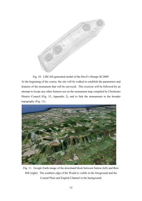
Fig. 10. LISCAD generated model of the Devil’s Humps SC2009.<br />
At the beginning of the course, the site will be walked to establish the parameters and<br />
features of the monument that will be surveyed. This exercise will be followed by an<br />
attempt to locate any other features not on the monument map compiled by Chichester<br />
District Council (Fig. 15, Appendix 2), and to link the monuments to the broader<br />
topography (Fig. 11).<br />
Fig. 11. Google Earth image of the downland block between Sutton (left) and Bow<br />
Hill (right). <strong>The</strong> southern edge of the Weald is visible in the foreground and the<br />
Coastal Plain and English Channel in the background.<br />
15