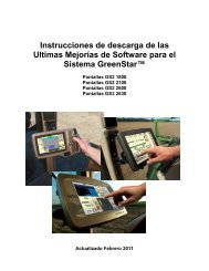
(Yield) Maps - StellarSupport - John Deere
(Yield) Maps - StellarSupport - John Deere
(Yield) Maps - StellarSupport - John Deere

Create successful ePaper yourself
Turn your PDF publications into a flip-book with our unique Google optimized e-Paper software.
JDOffice 1.2<br />
Secondary Nutrients. The secondary plant foods include calcium, magnesium, and sulfur. Less critical elements required<br />
in smaller amounts for plant growth than nitrogen, potassium, and phosphorous.<br />
Selective Availability (SA). The procedure of intentionally introducing error into GPS signals, thereby creating a pseudo<br />
range error. SA is used by the DOD as a national security measure to keep nonmilitary receivers from obtaining highaccuracy<br />
position information.<br />
Semi-Variance. A measure of how much neighboring data points differ in value. Equal to one-half the square of the<br />
difference between two values.<br />
Semi-Variogram. Line fit to the data in a plot of semi-variance versus lag.<br />
Sensory-Based Variable-Rate Application System. A system that adjusts product application rate on-the-go based on<br />
information received from real-time sensors.<br />
Serial Number. The number of your yield mapping system which will uniquely identify the combine from which the data has<br />
been collected.<br />
Serial Port. A connector on a computer that can be used to communicate to other serial devices such as a modem. Serial<br />
refers to the protocol used for the communications (most common is RS-232).<br />
Shadowing. A reduction in the level of light hitting an object.<br />
Site-Specific Crop Management (SSCM). The use of variability of soil and crop parameters to make decisions on the<br />
application of production inputs.<br />
Site-Specific <strong>Yield</strong> Map. A representation of field crop yields collected on-the-go by a harvester equipped with an<br />
instantaneous yield monitor. Each location/site in a field is assigned a specific crop-yield value.<br />
Soil Color Map. A map that provides information on soil texture and levels of soil organic matter that can indicate<br />
differences in soil patterns within fields.<br />
Soil pH. A numerical measure of the acidity or hydrogen ion concentration in the soil solution.<br />
Soil Testing. Analysis of soil samples to determine chemical and physical properties of interest.<br />
Soil Texture. The physical structure or character of the soil determined by the relative proportions of the soil components<br />
of which it is composed.<br />
Soil Type. A term used to refer to the combination of primary physical constituents of a soil. For example, Glencoe clay<br />
loam, Collinwood silty clay loam, etc.<br />
Space Segment. The portion of GPS consisting of 24 NAVSTAR satellites orbiting the earth at an altitude of 20,200 km.<br />
Spatial Data. See Geographic Data.<br />
Spatial Resolution. The smallest size that can be distinguished by a remote sensing device.<br />
Spatial Variability. Differences in field conditions, such as soil types and nutrient levels, from one location in a field to<br />
another.<br />
Spectral Response. 1) Characteristic patterns of radiation reflected or emitted form an object. 2) The ability of a sensing<br />
system to respond to radiation measurements within a spectral band.<br />
Spectral Resolution. The ability of a sensing system to differentiate between electromagnetic radiation of different<br />
wavelengths.<br />
Speed Sensors. Sensors that measure the rotational speed of a shaft or the reflection of radio or sound waves off the<br />
ground, to determine machine speed.<br />
Spherical Error Probable (SEP). A measure of accuracy of a three-dimensional position estimate produced by a GPS<br />
receiver.<br />
SPOT (Systeme Pour I’Observation de la Terre). Name given to a series of French satellites used to study the Earth’s<br />
surface using remote sensing techniques.<br />
Standard Deviation. A measure of the distribution of measurements around their average. The square root of the sum of<br />
(average-observation) 2 .<br />
Standard Payable Moisture. The moisture level at which the elevator will pay for your crop. Used in conjunction with crop<br />
weight, these numbers are used to calculate the average dry yields and total dry yields.<br />
Standard Positioning System (SPS). The positioning service using a single receiver that is available to any user on a<br />
continuous, worldwide basis. This system uses only the C/A code transmitted via the satellites. The horizontal position<br />
accuracy can be degraded by selective availability.<br />
Start-of-Pass Delay. A delay that allows the initial flow of grain before full flow is achieved to be ignored in yield calculations<br />
when starting a pass.<br />
State Plane Coordinates (SPC). A coordinate system similar to UTM using units of feet and using the NAD27 datum. Each<br />
340