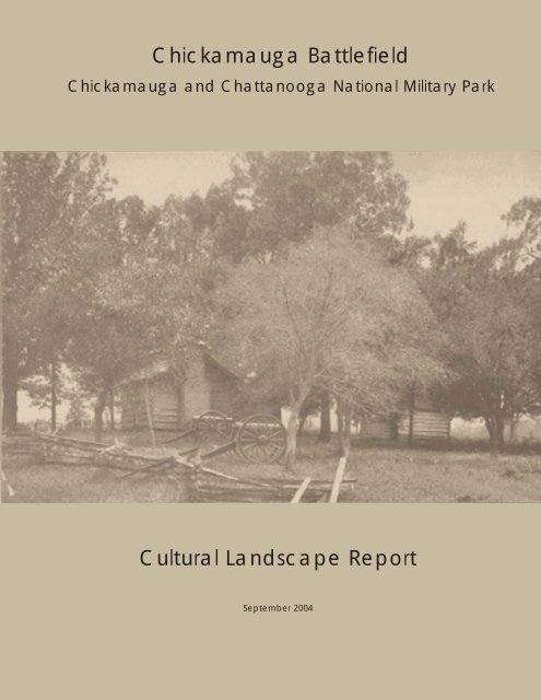
Cultural Landscape Report Chickamauga Battlefield - National Park ...
Cultural Landscape Report Chickamauga Battlefield - National Park ...
Cultural Landscape Report Chickamauga Battlefield - National Park ...

You also want an ePaper? Increase the reach of your titles
YUMPU automatically turns print PDFs into web optimized ePapers that Google loves.
<strong>Chickamauga</strong> <strong>Battlefield</strong><br />
<strong>Chickamauga</strong> and Chattanooga <strong>National</strong> Military <strong>Park</strong><br />
<strong>Cultural</strong> <strong>Landscape</strong> <strong>Report</strong><br />
September 2004
CHICKAMAUGA BATTLEFIELD<br />
CHICKAMAUGA AND CHATTANOOGA<br />
NATIONAL MILITARY PARK<br />
FORT OGLETHORPE, GEORGIA<br />
<strong>Cultural</strong> <strong>Landscape</strong> <strong>Report</strong><br />
Prepared for<br />
<strong>National</strong> <strong>Park</strong> Service<br />
Southeast Regional Office<br />
Atlanta, Georgia<br />
Prepared by<br />
John Milner Associates, Inc.<br />
Charlottesville, Virginia<br />
History Matters<br />
Washington, D. C.<br />
In association with<br />
HNTB Corporation<br />
Columbia, Maryland<br />
September 2004
CREDITS<br />
<strong>National</strong> <strong>Park</strong> Service<br />
Southeast Regional Office<br />
Susan Hitchcock, Project Manager<br />
Tracy Stakely, Lead Historical <strong>Landscape</strong> Architect<br />
Kimberly Washington, Contracting Officer<br />
<strong>Chickamauga</strong> and Chattanooga <strong>National</strong> Military <strong>Park</strong><br />
Pat Reed, Superintendent<br />
James Szyjkowski, <strong>Cultural</strong> Resource Manager<br />
James Ogden III, Historian<br />
John Milner Associates, Inc.<br />
Rob McGinnis, ASLA, Project Director<br />
Krista Schneider, ASLA, Project Manager/ <strong>Landscape</strong> Architect<br />
Liz Sargent, ASLA, Historical <strong>Landscape</strong> Architect<br />
Matthew Whitaker, Project Designer<br />
Alisa Hefner, Project Designer<br />
Adriane Fowler, Project Designer<br />
Jacky Taylor, <strong>Landscape</strong> Historian<br />
Amy Wells, Graphic Designer<br />
Jessica Koepfler, Editor<br />
History Matters, LLC<br />
Edna Johnston, Historian<br />
Kathryn Gettings-Smith, Historian<br />
LDR International, an HNTB Company<br />
Kipp Shrack, FASLA, Contract Administrator
<strong>Chickamauga</strong> <strong>Battlefield</strong> • <strong>Chickamauga</strong> and Chattanooga <strong>National</strong> Military <strong>Park</strong><br />
<strong>Cultural</strong> <strong>Landscape</strong> <strong>Report</strong><br />
• • • • • • •<br />
CHAPTER ONE: INTRODUCTION<br />
TABLE OF CONTENTS<br />
Management Summary ............................................................................................1-1<br />
Project Goals and Objectives.....................................................................................1-1<br />
Description of Study Boundary ...............................................................................1-3<br />
Historical Summary .................................................................................................1-4<br />
Scope of Work .........................................................................................................1-6<br />
Methodology..............................................................................................................1-8<br />
Summary of Findings.................................................................................................1-12<br />
CHAPTER TWO: LANDSCAPE PHYSICAL HISTORY<br />
Introduction................................................................................................................2-1<br />
Period I: American Indian Occupation and Early American Settlement to 1839.....2-2<br />
Period II: 1839-1861 American Settlement of the <strong>Landscape</strong>..................................2-5<br />
Period III: 1861-1865 American Civil War...............................................................2-7<br />
Period IV: 1865-1890 Postbellum <strong>Landscape</strong> ..........................................................2-17<br />
Period V: 1890-1933 The Commemorative <strong>Landscape</strong>, <strong>Chickamauga</strong> &<br />
Chattanooga <strong>National</strong> Military <strong>Park</strong> ..........................................................................2-22<br />
Period VI: 1933–Present <strong>National</strong> <strong>Park</strong> Service Administration...............................2-38<br />
CHAPTER THREE: EXISTING CONDITIONS DOCUMENTATION<br />
Introduction ...............................................................................................................3-1<br />
Site Description<br />
Environmental Context and Setting.....................................................................3-2<br />
<strong>Cultural</strong> Context and Setting................................................................................3-3<br />
• • • • • • •<br />
Table of Contents • John Milner Associates, Inc. • September 2004 • i
<strong>Chickamauga</strong> <strong>Battlefield</strong> • <strong>Chickamauga</strong> and Chattanooga <strong>National</strong> Military <strong>Park</strong><br />
<strong>Cultural</strong> <strong>Landscape</strong> <strong>Report</strong><br />
• • • • • • •<br />
<strong>Landscape</strong> Characteristics<br />
Natural Systems and Features..............................................................................3-5<br />
Topography..........................................................................................................3-9<br />
Spatial Organization.............................................................................................3-10<br />
Land Use ..............................................................................................................3-13<br />
Circulation............................................................................................................3-14<br />
<strong>Cultural</strong> Vegetation..............................................................................................3-23<br />
Buildings, Structures, and Objects.......................................................................3-24<br />
Small-scale Features ...........................................................................................3-28<br />
Views ..................................................................................................................3-30<br />
Archeological Resources .....................................................................................3-31<br />
Inventory and Condition Assessment of <strong>Landscape</strong> Features ...................................3-33<br />
CHAPTER FOUR: LANDSCAPE ANALYSIS AND EVALUATION<br />
<strong>National</strong> Register Criteria ..........................................................................................4-1<br />
Statement of Significance ..........................................................................................4-1<br />
Recommendations for Further Analysis ....................................................................4-4<br />
Comparative Analysis of Historic and Existing Conditions......................................4-6<br />
American Civil War<br />
Natural Systems .............................................................................................4-7<br />
Spatial Organization.......................................................................................4-8<br />
Land Use and <strong>Cultural</strong> Vegetation.................................................................4-10<br />
Circulation......................................................................................................4-11<br />
Topography....................................................................................................4-12<br />
Buildings, Structures, and Objects.................................................................4-13<br />
Small-scale Features ......................................................................................4-13<br />
Views .............................................................................................................4-14<br />
The <strong>National</strong> Military <strong>Park</strong><br />
Natural Systems .............................................................................................4-15<br />
Spatial Organization.......................................................................................4-16<br />
Land Use ........................................................................................................4-16<br />
<strong>Cultural</strong> Vegetation........................................................................................4-17<br />
Circulation......................................................................................................4-19<br />
• • • • • • •<br />
Table of Contents • John Milner Associates, Inc. • September 2004 • ii
<strong>Chickamauga</strong> <strong>Battlefield</strong> • <strong>Chickamauga</strong> and Chattanooga <strong>National</strong> Military <strong>Park</strong><br />
<strong>Cultural</strong> <strong>Landscape</strong> <strong>Report</strong><br />
• • • • • • •<br />
Topography....................................................................................................4-21<br />
Buildings, Structures, and Objects.................................................................4-21<br />
Small-scale Features ......................................................................................4-22<br />
Views .............................................................................................................4-23<br />
Summary Table of Contributing and Noncontributing Features ...............................4-25<br />
Integrity Assessment..................................................................................................4-35<br />
CHAPTER FIVE: MANAGEMENT ISSUES<br />
Introduction ...............................................................................................................5-1<br />
<strong>Landscape</strong> Restoration...............................................................................................5-1<br />
Invasive Plant Species Control ..................................................................................5-2<br />
Automobile Circulation .............................................................................................5-3<br />
Visitor Experience and Interpretation........................................................................5-4<br />
Recreational Use ........................................................................................................5-5<br />
Field Management .....................................................................................................5-6<br />
Natural Resources ......................................................................................................5-6<br />
Adjacent Historic Resources and Land Use...............................................................5-7<br />
CHAPTER SIX: TREATMENT RECOMMENDATIONS<br />
Introduction<br />
Organization ..................................................................................................6-1<br />
Treatment Goals & Approach<br />
Treatment Goals.............................................................................................6-2<br />
Treatment Approach ......................................................................................6-3<br />
Approach Considerations and Rejections ......................................................6-4<br />
Recommended Treatment Approach .............................................................6-5<br />
General Treatment Guidelines<br />
General...........................................................................................................6-6<br />
Additions to the <strong>Landscape</strong>............................................................................6-7<br />
<strong>Landscape</strong> Management.................................................................................6-8<br />
Accessibility...................................................................................................6-9<br />
• • • • • • •<br />
Table of Contents • John Milner Associates, Inc. • September 2004 • iii
<strong>Chickamauga</strong> <strong>Battlefield</strong> • <strong>Chickamauga</strong> and Chattanooga <strong>National</strong> Military <strong>Park</strong><br />
<strong>Cultural</strong> <strong>Landscape</strong> <strong>Report</strong><br />
• • • • • • •<br />
Sustainability..................................................................................................6-10<br />
Use of <strong>Landscape</strong> Features to Enhance Interpretation...................................6-11<br />
Information and Maintenance Management ..................................................6-11<br />
Treatment Recommendations ...................................................................................6-15<br />
Natural Systems and Features<br />
Develop Invasive Plant Control Program ......................................................6-13<br />
Rehabilitate Limestone Glades ......................................................................6-20<br />
Establish and Maintain Riparian Buffers.......................................................6-21<br />
Spatial Organization<br />
Clear Existing Forest to Reestablish Historic Fields .....................................6-25<br />
Reestablish Historic Forest Areas..................................................................6-30<br />
Land Use and <strong>Cultural</strong> Vegetation<br />
Convert Fields to Native Warm-season Grasses............................................6-33<br />
Reestablish 1863 Orchard Pattern..................................................................6-36<br />
Reestablish 1863 Crop Fields at Interpretive Sites........................................6-38<br />
Rehabilitate Administrative and Maintenance Sites......................................6-40<br />
Reduce Recreational Facilities on the <strong>Battlefield</strong>..........................................6-41<br />
Circulation<br />
Rehabilitate Historic Circulation System.......................................................6-45<br />
Develop Plan for Documenting and Maintaining Historic Circulation<br />
Features..........................................................................................................6-46<br />
Restore Historic Road Character ...................................................................6-47<br />
Expand Auto-Tour and Interpretive Sites......................................................6-50<br />
Establish Loop Trail Tour..............................................................................6-53<br />
Buildings, Structures, and Objects<br />
Rehabilitate Interpretive House Sites.............................................................6-55<br />
Develop Plan for Protecting & Maintaining Commemorative Monuments,<br />
Markers, Tablets, and Memorials ..................................................................6-57<br />
Preserve Cemeteries and Burial Sites ............................................................6-59<br />
Small-scale Features<br />
Reestablish Historic Fence Locations and Styles ..........................................6-61<br />
Develop a Comprehensive Signage Program ................................................6-62<br />
Develop Design Guidelines for <strong>Landscape</strong> Features.....................................6-63<br />
Views<br />
Protect Visual Quality and Monitor Adjacent Lands.....................................6-64<br />
• • • • • • •<br />
Table of Contents • John Milner Associates, Inc. • September 2004 • iv
<strong>Chickamauga</strong> <strong>Battlefield</strong> • <strong>Chickamauga</strong> and Chattanooga <strong>National</strong> Military <strong>Park</strong><br />
<strong>Cultural</strong> <strong>Landscape</strong> <strong>Report</strong><br />
• • • • • • •<br />
BIBLIOGRAPHY<br />
Published Sources ......................................................................................................R-1<br />
Annual and Monthly <strong>Report</strong>s.....................................................................................R-9<br />
Historic American Engineering Record Documentation ...........................................R-9<br />
<strong>National</strong> Register of Historic Places – Inventories and Nominations........................R-9<br />
Maps, Plans & Drawings ...........................................................................................R-10<br />
Telephone Interviews.................................................................................................R-21<br />
Online Resources .......................................................................................................R-21<br />
LIST OF MAPS<br />
Existing Conditions<br />
Natural Systems and <strong>Cultural</strong> Vegetation......................................................3-1<br />
Spatial Organization and Circulation.............................................................3-2<br />
Buildings, Structures, and Objects.................................................................3-3<br />
<strong>Park</strong> Headquarters Area .................................................................................3-4<br />
Maintenance Area ..........................................................................................3-5<br />
Views ............................................................................................................3-6<br />
Photograph Station Points<br />
North ..............................................................................................................3-7<br />
South ..............................................................................................................3-8<br />
<strong>Park</strong> Headquarters Area .................................................................................3-9<br />
Analysis and Evaluation<br />
Battle Period Contributing and Noncontributing Resources .........................4-1<br />
Battle Period Missing Resources ...................................................................4-2<br />
Commemorative Period Contributing and Noncontributing Resources ........4-3<br />
Commemorative Period Missing Resources..................................................4-4<br />
Treatment<br />
Natural Systems and Features<br />
Develop Invasive Plant Control Program ......................................................6-1<br />
Rehabilitate Limestone Glades ......................................................................6-2<br />
Establish and Maintain Riparian Buffers.......................................................6-3<br />
Spatial Organization<br />
Clear Existing Forest to Reestablish Historic Fields .....................................6-4<br />
• • • • • • •<br />
Table of Contents • John Milner Associates, Inc. • September 2004 • v
<strong>Chickamauga</strong> <strong>Battlefield</strong> • <strong>Chickamauga</strong> and Chattanooga <strong>National</strong> Military <strong>Park</strong><br />
<strong>Cultural</strong> <strong>Landscape</strong> <strong>Report</strong><br />
• • • • • • •<br />
Reestablish Historic Forest Areas..................................................................6-5<br />
Land Use and <strong>Cultural</strong> Vegetation<br />
Convert Fields to Native Warm-season Grasses............................................6-6<br />
Reestablish 1863 Orchard Pattern..................................................................6-7<br />
Reestablish 1863 Crop Fields at Interpretive Sites........................................6-8<br />
Rehabilitate Administration and Maintenance Sites......................................6-9<br />
Reduce Recreational Facilities on the <strong>Battlefield</strong>..........................................6-10<br />
Circulation<br />
Rehabilitate Historic Circulation System.......................................................6-11<br />
Develop Plan for Documenting and Maintaining Historic Circulation ........6-12<br />
Restore Historic Road Character ...................................................................6-13<br />
Expand Auto-Tour and Interpretive Sites......................................................6-14<br />
Establish Loop Trail Tour..............................................................................6-15<br />
Buildings, Structures, and Objects<br />
Rehabilitate Interpretive House Sites.............................................................6-16<br />
Develop Plan for Protecting & Maintaining Commemorative Monuments,<br />
Markers, Tablets, and Memorials ..................................................................6-17<br />
Preserve Cemeteries and Burial Sites ............................................................6-18<br />
Small-scale Features<br />
Reestablish Historic Fence Locations and Styles ..........................................6-19<br />
Develop a Comprehensive Signage Program and<br />
Develop Design Guidelines for <strong>Landscape</strong> Features.....................................6-20<br />
Views<br />
Monitor Adjacent Lands & Protect Visual Quality .......................................6-21<br />
LIST OF FIGURES AND PHOTOGRAPHS<br />
CHAPTER ONE<br />
Figure 1-1: <strong>Chickamauga</strong> and Chattanooga <strong>National</strong> Military <strong>Park</strong> Vicinity Map<br />
Figure 1-2: Context Map of <strong>Chickamauga</strong> <strong>Battlefield</strong><br />
CHAPTER TWO<br />
Figure 2-1: Detail from Anthony Finley Company’s Map of Georgia, 1830<br />
Figure 2-2: Map of 22 Counties Now Occupying Area of Original Cherokee County<br />
• • • • • • •<br />
Table of Contents • John Milner Associates, Inc. • September 2004 • vi
<strong>Chickamauga</strong> <strong>Battlefield</strong> • <strong>Chickamauga</strong> and Chattanooga <strong>National</strong> Military <strong>Park</strong><br />
<strong>Cultural</strong> <strong>Landscape</strong> <strong>Report</strong><br />
• • • • • • •<br />
Figure 2-3: Betts’ Map of the <strong>Battlefield</strong> of <strong>Chickamauga</strong>, Sept. 19, 1863<br />
Figure 2-4: Detail of the Betts Map, vicinity of Brock field<br />
Figure 2-5: Boyd’s 1864 Map of the <strong>Battlefield</strong><br />
Figure 2-6: Detail of Boyd’s Map, vicinity of Brock and Youngblood farms<br />
Figure 2-7: Detail of the Betts Map, vicinity of West <strong>Chickamauga</strong> Creek<br />
Figure 2-8: Detail of the Betts Map, vicinity of Glenn and Viniard fields<br />
Figure 2-9: Detail of the Betts Map, vicinity of Kelly field<br />
Figure 2-10: Detail of the Betts Map, area between Cloud Church and Lee & Gordon’s Mills<br />
Figure 2-11: 1864 Topographical Map of <strong>Chickamauga</strong> <strong>Battlefield</strong><br />
Figure 2-12: Detail of the Betts Map, vicinity of Widow Glenn house<br />
Figure 2-13: Alexander’s Bridge, ca. 1890<br />
Figure 2-14: Reed’s Bridge, ca. 1890<br />
Figure 2-15: Agricultural landscape near Glass’s Mill, ca. 1890<br />
Figure 2-16: Part of <strong>Chickamauga</strong> <strong>Battlefield</strong>, ca. 1860 – ca. 1865<br />
Figure 2-17: Part of <strong>Chickamauga</strong> <strong>Battlefield</strong>, ca. 1860 – ca. 1865<br />
Figure 2-18: Detail of the Betts Map, vicinity of the Winfrey house<br />
Figure 2-19: Defensive works from Boyd’s 1864 Map of the <strong>Battlefield</strong><br />
Figure 2-20: Detail of the Betts Map, vicinity of Brotherton and Dyer farmsteads<br />
Figure 2-21: Detail of the Betts Map, vicinity of Brotherton and Dyer farmsteads<br />
Figure 2-22: Detail of the Betts Map, vicinity of Hunt’s Farm<br />
Figure 2-23: Detail of the Betts Map, vicinity of Hunt’s Farm<br />
Figure 2-24: The Betts Map of 1892, upper north quadrant<br />
Figure 2-25: The Betts Map of 1892, lower north quadrant<br />
Figure 2-26: Standard Plan of 20-foot Graveled Surface Roadway on Hillside.<br />
Figure 2-27: Plan of Arch Culvert<br />
Figure 2-28: Stone Gutters being Place Along Grade Road Cut, ca. 1890s<br />
Figure 2-29: Horse-Drawn Roller, ca. 1890s<br />
Figure 2-30: Steam Roller, Owned by the <strong>Park</strong>, In Operation, ca. 1900<br />
Figure 2-31: Stone Culvert Construction on Forrest Road, ca. 1890s<br />
Figure 2-32: Battery M, Fourth United States Artillery, Poe Field, ca. 1895<br />
Figure 2-33: View on Viniard’s Field, <strong>Chickamauga</strong>, ca. 1895<br />
Figure 2-34: View on Viniard’s Field, <strong>Chickamauga</strong>, ca. 1895<br />
Figure 2-35: View on Snodgrass Hill, ca. 1895<br />
Figure 2-36: Union Line, Harker’s and Hazen’s Brigades, Snodgrass Hill, ca. 1895<br />
Figure 2-37: Union Line, J.J. Reynolds, Poe Field, ca. 1895<br />
Figure 2-38: View from Right of General Palmer’s Line, ca. 1895<br />
Figure 2-39: Shell Monument Marking Army Headquarters, ca. 1895<br />
Figure 2-40: Wilder Brigade Monument, ca. 1900-1915<br />
Figure 2-41: Bloody Pond, <strong>Chickamauga</strong>, ca. 1895<br />
Figure 2-42: Site of General Rosencran’s Headquarters, <strong>Chickamauga</strong>, ca. 1895<br />
Figure 2-43: Grand Review, <strong>Chickamauga</strong>, ca. 1898<br />
Figure 2-44: Stone Revetment Structure for Alexander’s Bridge Road, ca. 1890s<br />
• • • • • • •<br />
Table of Contents • John Milner Associates, Inc. • September 2004 • vii
<strong>Chickamauga</strong> <strong>Battlefield</strong> • <strong>Chickamauga</strong> and Chattanooga <strong>National</strong> Military <strong>Park</strong><br />
<strong>Cultural</strong> <strong>Landscape</strong> <strong>Report</strong><br />
• • • • • • •<br />
Figure 2-45: LaFayette Road at Viniard, ca. 1900-1915<br />
Figure-2-46: Ground of Kershaw’s and Gracie’s Assault on Stanley’s Brigade, ca. 1895<br />
Figure 2-47: Alexander’s Bridge Road, ca. 1900-1915<br />
Figure 2-48: Alexander’s Bridge Road, ca. 1900-1915<br />
Figure 2-49: Looking towards Bloody Pond, ca. 1900-1915<br />
Figure 2-50: The Boulevard, Jay’s Mill, ca. 1900-1915<br />
Figure 2-51: LaFayette Road and Kelly Field, ca. 1900-1915<br />
Figure 2-52: Battleline Road, no date<br />
Figure 2-53: Brotherton House, <strong>Chickamauga</strong>, ca. 1895<br />
Figure 2-54: Snodgrass House, <strong>Chickamauga</strong>, ca. 1895<br />
Figure 2-55: Kelly House and Field, <strong>Chickamauga</strong>, ca. 1895<br />
Figure 2-56: Brotherton House, ca. 1905-1915<br />
Figure 2-57: Snodgrass House, ca. 1880-1930<br />
Figure 2-58: Snodgrass House, ca. 1902<br />
Figure 2-59: <strong>Chickamauga</strong> <strong>Park</strong> Master Plan: Roads and Trails, 1936<br />
Figure 2-60: <strong>Chickamauga</strong> <strong>Park</strong> Master Plan: Roads and Trails, 1941<br />
Figure 2-61: Proposed Planting Scheme for South Entrance, 1933<br />
Figure 2-62: Proposed Planting Scheme for North Entrance, 1933<br />
Figure 2-63: Key Map Showing Planting Sections, 1934-1935<br />
Figure 2-64: Sketch Plan for Location and Arrangement of Utilities Buildings, 1934<br />
Figure 2-65: Aerial Photograph, ca. 1940<br />
Figure 2-66: <strong>Chickamauga</strong> <strong>Park</strong> Master Plan: <strong>Park</strong> Utilities, 1941<br />
Figure 2-67: <strong>Chickamauga</strong> <strong>Park</strong> Master Plan: <strong>Park</strong> General Development, 1941<br />
Figure 2-68: <strong>Chickamauga</strong> <strong>Park</strong> Master Plan: 1863 Historical Base Map, 1941<br />
Figure 2-69: Detail of aerial photograph showing remnants of WAAC facility along<br />
Snodgrass-Savannah Road, ca. 1960<br />
Figure 2-70: <strong>Chickamauga</strong> <strong>Park</strong> Master Plan: Roads and Trail System, 1951<br />
CHAPTER THREE<br />
Photo 3-1: Dyer Field from maintenance road looking east<br />
Photo 3-2: View of stone bridge along LaFayette Road<br />
Photo 3-3: Jay’s Mill Road, one of the many of different kinds of culverts in the <strong>Park</strong><br />
Photo 3-4: One of the few remaining sections of stone-lined drainage ditches<br />
Photo 3-5: Young hardwood upland forest in northwestern quadrant of park<br />
Photo 3-6: View of West <strong>Chickamauga</strong> Creek in Dalton Ford vicinity<br />
Photo 3-7: Abandoned quarry<br />
Photo 3-8: Glade complex north of Viniard-Alexander Road<br />
Photo 3-9: Dense Chinese privet infestation along McFarland Gap Road<br />
Photo 3-10: Tablets and marker in Dyer Field surrounded by Chinese privet<br />
Photo 3-11: Pine kill area along Jay’s Mill Road<br />
Photo 3-12: Site of historic ford near West <strong>Chickamauga</strong> Creek<br />
Photo 3-13: LaFayette Road looking north<br />
• • • • • • •<br />
Table of Contents • John Milner Associates, Inc. • September 2004 • viii
<strong>Chickamauga</strong> <strong>Battlefield</strong> • <strong>Chickamauga</strong> and Chattanooga <strong>National</strong> Military <strong>Park</strong><br />
<strong>Cultural</strong> <strong>Landscape</strong> <strong>Report</strong><br />
• • • • • • •<br />
Photo 3-14: U.S. Highway 27 just south of park boundary looking north<br />
Photo 3-15: Alexander’s Bridge Road looking north<br />
Photo 3-16: McFarland Gap Road looking east<br />
Photo 3-17: Reed’s Bridge Road looking east<br />
Photo 3-18: Jay’s Mill Road looking south<br />
Photo 3-19: Brotherton Road looking east towards Brock Field<br />
Photo 3-20: Wilder Road (Vittetoe-<strong>Chickamauga</strong> Road) looking south<br />
Photo 3-21: Poe Road<br />
Photo 3-22: Battleline Road<br />
Photo 3-23: Glenn-Kelly Road<br />
Photo 3-24: Dyer Road looking west<br />
Photo 3-25: Glenn-Viniard Road, non-historic segment east of Wilder Monument<br />
Photo 3-26: Mullis Road looking south<br />
Photo 3-27: Vittetoe Road looking north<br />
Photo 3-28: Mullis-Spring Road looking west<br />
Photo 3-29: Snodgrass Road (remnant), looking northeast<br />
Figure 3-30: Dalton Ford Road looking south along Hunt Field<br />
Photo 3-31: Lytle Road as it crosses the railroad, looking into the <strong>Park</strong><br />
Photo 3-32: Trail off Reed’s Bridge Road<br />
Photo 3-33: Trail between Reed’s Bridge Rd. and Alexander’s Bridge Rd.<br />
Photo 3-34: McDonald Field looking south towards LaFayette Road<br />
Photo 3-35: Snodgrass Field<br />
Photo 3-36: Poe Field with Georgia Monument in background<br />
Photo 3-37: Kelly Field<br />
Photo 3-38: Brock Field along Brotherton Road; note unplanned pull-off along road<br />
Photo 3-39: Winfrey Field with exhibit worm rail fencing<br />
Photo 3-40: Brotherton Field with LaFayette Road in the foreground<br />
Photo 3-41: Dyer Field looking north to Dyer House<br />
Photo 3-42: Wilder Field East along LaFayette Road, looking northwest<br />
Photo 3-43: Wilder Field West with Wilder Monument in background<br />
Photo 3-44: LaFayette Road with Glenn Field on right, Viniard Field West on left<br />
Photo 3-45: Viniard Field East<br />
Photo 3-46: Viniard Field West along LaFayette Road<br />
Photo 3-47: Hunt Field looking southwest across hedgerow<br />
Photo 3-48: Thedford Field looking south towards West <strong>Chickamauga</strong> Creek<br />
Photo 3-49: Courtyards at the Administration Building<br />
Photo 3-50: Courtyards at the Administration Building<br />
Photo 3-51: Upper parking lot at Visitor Center looking east<br />
Photo 3-52: Kelly House looking northeast.<br />
Photo 3-53: Wilder Brigade Monument and field looking north<br />
Photo 3-54: Maintenance Yard<br />
Photo 3-55: Dyer House and yard looking north<br />
• • • • • • •<br />
Table of Contents • John Milner Associates, Inc. • September 2004 • ix
<strong>Chickamauga</strong> <strong>Battlefield</strong> • <strong>Chickamauga</strong> and Chattanooga <strong>National</strong> Military <strong>Park</strong><br />
<strong>Cultural</strong> <strong>Landscape</strong> <strong>Report</strong><br />
• • • • • • •<br />
Photo 3-56: Campground near Snodgrass-Savannah Road<br />
Photo 3-57: Recreation Field and parking area<br />
Photo 3-58: Snodgrass Road<br />
Photo 3-59: Snodgrass Hill Drive with monuments and audio interpretive station<br />
Photo 3-60: <strong>Chickamauga</strong>-Vittetoe Road looking south past horse hitch area<br />
Photo 3-61: Maintenance yard access road looking north<br />
Photo 3-62: Short access road linking Lytle Road with Vittetoe-<strong>Chickamauga</strong> Road<br />
Photo 3-63: Georgia Central Rail Line and Vittetoe-<strong>Chickamauga</strong> Road looking west<br />
Photo 3-64: Typical paved pull-off along Alexander’s Bridge Road<br />
Photo 3-65: <strong>Park</strong>ing area off McFarland Gap Road with Mullis-Spring Road<br />
Photo 3-66: Unplanned pull-off along Jay’s Mill Road<br />
Photo 3-67: Ornamental plantings near the Administration Building<br />
Photo 3-68: Dyer Orchard looking northwest with Dyer Road in background<br />
Photo 3-69: Brotherton House looking across LaFayette Road from Brotherton Road<br />
Photo 3-70: Snodgrass House facade looking northwest<br />
Photo 3-71: <strong>Park</strong> Administration Building looking west across LaFayette Road<br />
Photo 3-72: Modern Visitor Center entrance looking north<br />
Photo 3-73: Superintendent’s Residence<br />
Photo 3-74: Garages at rear of Superintendent’s Residence<br />
Photo 3-75: Dyer outbuilding, car shelter and animal pen<br />
Photo 3-76: Maintenance buildings looking north<br />
Photo 3-77: Monument (background), memorial (middleground), tablet (foreground)<br />
Photo 3-78: Monuments, cannons, and tablets near LaFayette and Glen-Kelly Roads<br />
Photo 3-79: Monuments and tablets along Battleline Road<br />
Photo 3-80: Wilder Brigade Monument, detail of base<br />
Photo 3-81: Tablets with South Carolina Monument in background<br />
Photo 3-82: Culvert with headwall<br />
Photo 3-83: Culvert at Jay’s Mill and Brotherton Roads<br />
Photo 3-84: Culvert/headwalls along Glenn-Kelly Road.<br />
Photo 3-85: LaFayette Road Bridge (south) near Glenn-Viniard Road<br />
Photo 3-86: Glenn-Viniard Road Bridge looking southwest<br />
Photo 3-87: Alexander’s Bridge looking northwest<br />
Photo 3-88: Intersections of <strong>Chickamauga</strong> Road and railroad with U.S. Highway 27<br />
Photo 3-89: Timber Bridge near Administration Building<br />
Photo 3-90: Typical audio interpretive station (along Jay’s Mill Road)<br />
Photo 3-91: Dyer Cemetery marker detail<br />
Photo 3-92: Veteran marker with survey post<br />
Photo 3-93: Rear courtyard of Administration Building/Visitor Center<br />
Photo 3-94: Flag pole, planting and sidewalk detail outside Administration Building<br />
Photo 3-95: Interpretive signs near Administration Building<br />
Photo 3-96: Benches to the north of the Visitor Center<br />
Photo 3-97: Pointer near Snodgrass House<br />
• • • • • • •<br />
Table of Contents • John Milner Associates, Inc. • September 2004 • x
<strong>Chickamauga</strong> <strong>Battlefield</strong> • <strong>Chickamauga</strong> and Chattanooga <strong>National</strong> Military <strong>Park</strong><br />
<strong>Cultural</strong> <strong>Landscape</strong> <strong>Report</strong><br />
• • • • • • •<br />
Photo 3-98: Road signs and tour route markers<br />
Photo 3-99: Picnic Area detail<br />
Photo 3-100: Paved pull-off with variety of small-scale features<br />
Photo 3-101: Maintenance area detail<br />
Photo 3-102: Campground amphitheater<br />
Photo 3-103: Horse Hitch Area<br />
Photo 3-104: Mullis Spring site<br />
Photo 3-105: Tree wells along LaFayette Road<br />
Photo 3-106: South Post sign<br />
Photo 3-107: WAAC foundation remnants<br />
CHAPTER FOUR<br />
Figure 4-1: Alexander’s Bridge Road, ca. 1900-1915<br />
Figure 4-2: View of Alexander’s Bridge Road from similar vantage point, 2003<br />
Figure 4-3: Alexander’s Bridge Road, ca. 1900-1915<br />
Figure 4-4: View of Alexander’s Bridge Road from similar vantage point, 2003<br />
Figure 4-5: Looking towards Bloody Pond, ca. 1900-1915<br />
Figure 4-6: Looking towards Bloody Pond from similar vantage point, 2003<br />
Figure 4-7: Brotherton House, ca. 1905-1915<br />
Figure 4-8: Brotherton House from similar vantage point, 2003<br />
Figure 4-9: Fort Oglethorpe from Snodgrass Hill, ca. 1905-1915<br />
Figure 4-10: View from Snodgrass Hill from similar vantage point, 2003<br />
Figure 4-11: LaFayette Road and Kelly Field, ca. 1900-1915<br />
Figure 4-12: LaFayette Road looking north from similar vantage point, 2003<br />
Figure 4-13: Snodgrass House, ca. 1902<br />
Figure 4-14: Snodgrass House from similar vantage point, 2003<br />
Figure 4-15: Wilder Brigade Monument, ca. 1900-1915<br />
Figure 4-16: Wilder Brigade Monument from similar vantage point, 2003<br />
Figure 4-17: <strong>Chickamauga</strong> Creek at Reed’s Bridge, ca. 1900-1915<br />
Figure 4-18: <strong>Chickamauga</strong> Creek from similar vantage point, 2003<br />
Figure 4-19: Trail through the woods along Battleline Road, no date.<br />
Figure 4-20: View of Battleline Road from similar vantage point, 2003<br />
APPENDICES<br />
Appendix A: Chronology of <strong>Landscape</strong> Characteristics<br />
Appendix B: Field Acreage<br />
Appendix C: Native Warm-season Grasses for Georgia, Alabama, and South Carolina<br />
• • • • • • •<br />
Table of Contents • John Milner Associates, Inc. • September 2004 • xi
CHAPTER ONE: INTRODUCTION
<strong>Chickamauga</strong> <strong>Battlefield</strong> • <strong>Chickamauga</strong> and Chattanooga <strong>National</strong> Military <strong>Park</strong><br />
<strong>Cultural</strong> <strong>Landscape</strong> <strong>Report</strong><br />
• • • • • • •<br />
CHAPTER ONE<br />
INTRODUCTION<br />
Management Summary<br />
Working in association with HNTB, John Milner Associates, Inc. (JMA), formerly the<br />
Charlottesville, Virginia office of OCULUS, and its sub-consultant, History Matters, in<br />
Washington, D.C., undertook the preparation of this <strong>Cultural</strong> <strong>Landscape</strong> <strong>Report</strong> (CLR)<br />
for the <strong>Chickamauga</strong> <strong>Battlefield</strong>--the largest unit in the <strong>Chickamauga</strong> and Chattanooga<br />
<strong>National</strong> Military <strong>Park</strong> (NMP). The <strong>Chickamauga</strong> <strong>Battlefield</strong> unit of the NMP is a portion<br />
of the original <strong>Chickamauga</strong> <strong>Battlefield</strong>, the site of one of the bloodiest battles of the<br />
Civil War on September 18-20, 1863. This unit is comprised of approximately 5,280<br />
acres and is located ten miles south of the city of Chattanooga, Tennessee in the state of<br />
Georgia (see Figure 1-1). The city of Fort Oglethorpe, Georgia adjoins the northern<br />
boundary of the unit.<br />
This report documents the evolution of the battlefield’s cultural landscape resources and<br />
determines the origin and significance of existing landscape features. It includes a<br />
physical history of the landscape’s evolution, historic photographs and illustrations,<br />
existing conditions documentation and base maps, a comparative analysis of existing and<br />
historic conditions, and identification of the landscape’s period of significance and<br />
evaluation of significant character-defining features. <strong>Park</strong> management issues have also<br />
been identified to inform the Treatment Plan, which recommends appropriate treatment<br />
guidelines, strategies, and plans for preservation and enhancement of cultural landscape<br />
resources.<br />
Project Goals and Objectives<br />
The goal of this CLR is to help inform future decisions regarding the park’s management<br />
and development. Several documents that guide the park’s management goals and<br />
objectives are currently under development. These include the General Management<br />
Plan (GMP), which will summarize a three-year-long planning process scheduled to<br />
begin in 2005, the Long-Range Interpretive Plan (LRIP), expected to be completed in<br />
• • • • • • •<br />
Introduction • John Milner Associates, Inc. • September 2004 • 1 - 1
<strong>Chickamauga</strong> <strong>Battlefield</strong> • <strong>Chickamauga</strong> and Chattanooga <strong>National</strong> Military <strong>Park</strong><br />
<strong>Cultural</strong> <strong>Landscape</strong> <strong>Report</strong><br />
• • • • • • •<br />
December, 2004, and a Transportation Impact Study & Sub-area Transportation Plan,<br />
which was recently completed in June, 2004.<br />
Since the GMP update and LRIP are not yet available, a set of essential interpretive<br />
themes identified during a <strong>National</strong> <strong>Park</strong> Service (NPS) workshop in 1998 provides<br />
applicable guidance regarding the park’s interpretive goals. These themes are as<br />
follows: 1<br />
• The Campaign for Chattanooga was a watershed event in the American Civil War<br />
that defined freedom, but left many issues unresolved. Those issues remain a<br />
challenge in the contemporary American experience.<br />
• Mid-nineteenth-century politics in the Chattanooga region was a microcosm of<br />
issues and sympathies affecting the north and south on a national scale. Such<br />
divided sentiments had a profound impact on the region during and after the Civil<br />
War.<br />
• The occupation of this area and the development of its agricultural landscape<br />
created the stage upon which the campaign for Chattanooga took place.<br />
• Before the war came to Chattanooga, it had already impacted men as sons,<br />
husbands, and fathers who left home to take up the call to arms. But they were<br />
not alone. Women and their families were forced into new roles as they adapted<br />
to war.<br />
• As a nexus for land and water transportation and communication, Chattanooga<br />
was destined for an important role in the Civil War.<br />
• The battles for Tullahoma and Chattanooga opened the gateway for the Union<br />
invasion of the deep south.<br />
• Transportation and communication issues played a significant role in military<br />
logistics applications during the campaign.<br />
• The battles for Chattanooga tell the never ending story of the evolution of<br />
weaponry. The Fuller Gun Collection, on exhibit at the park, illustrates several<br />
centuries of this story.<br />
• The African-American soldier served at Chattanooga as a result of Union victory.<br />
• Chattanooga was the base of operations for Sherman’s Atlanta Campaign.<br />
• Many who fought for the Union and occupied the city eventually made<br />
Chattanooga their home. Some of them, including Wilder and Patton, become<br />
civic capitalists and prospered with the coming of the nation’s industrial<br />
revolution.<br />
• The <strong>National</strong> Military <strong>Park</strong> is a symbol of the Nation’s collective memory of the<br />
Civil War.<br />
• This is the first <strong>National</strong> Military <strong>Park</strong> in the United States. Today, it not only<br />
preserves and protects sacred ground, but also contributes to the quality of life of<br />
Chattanooga, the environmental city.<br />
• The Civil War brought significant social change to the Chattanooga region.<br />
1 <strong>Chickamauga</strong> and Chattanooga <strong>National</strong> Military <strong>Park</strong> “Theme Statements,” Internal <strong>Park</strong> document<br />
(<strong>Chickamauga</strong> and Chattanooga <strong>National</strong> Military <strong>Park</strong>, 1998), on file at the <strong>Chickamauga</strong> <strong>Battlefield</strong>.<br />
• • • • • • •<br />
Introduction • John Milner Associates, Inc. • September 2004 • 1 - 2
<strong>Chickamauga</strong> <strong>Battlefield</strong> • <strong>Chickamauga</strong> and Chattanooga <strong>National</strong> Military <strong>Park</strong><br />
<strong>Cultural</strong> <strong>Landscape</strong> <strong>Report</strong><br />
• • • • • • •<br />
• The significance of (technical) applications in the campaign for Chattanooga is<br />
symbolized by the <strong>National</strong> Military <strong>Park</strong>’s role as “home” to the Fuller Gun<br />
Collection. Without the campaign and the park, the collection would have been<br />
housed elsewhere and the story untold.<br />
Based upon a 1994 NPS workshop, the following management objectives have been<br />
developed to guide park actions. These include: 2<br />
- Enhancement of the visitor experience and appreciation of soldier sacrifice.<br />
- Visitor education regarding the significance of the battles in the context of the<br />
Civil War, and opportunities to learn details concerning strategy and tactics.<br />
- Protection of the quality of visitor experience and park resources from outside<br />
intrusions, and protection of historically related lands significant to the battles.<br />
- Restoration and maintenance of historic landscapes within the park while<br />
preserving the memorial features and a non-distracting environment.<br />
- Identification and protection of cultural resources within the park, including<br />
archeological sites, historic landscapes, structures, and museum collections<br />
related to the campaigns and battles of <strong>Chickamauga</strong> and Chattanooga.<br />
- Provision of a park road and transportation system that assures access to park<br />
resources, and at <strong>Chickamauga</strong> <strong>Battlefield</strong>, is consistent with the historic character<br />
of the roads.<br />
Description of Study Boundary<br />
The boundaries of the study area conform to the boundaries of the <strong>Chickamauga</strong> Unit of<br />
the <strong>Chickamauga</strong> and Chattanooga <strong>National</strong> Military <strong>Park</strong>, located in the valley and ridge<br />
province of northwest Georgia. Located in Walker and Catoosa Counties, this park unit<br />
is generally configured in the shape of a rectangle with the southeastern corner<br />
conforming to the curves of the West <strong>Chickamauga</strong> Creek. The Chattooga &<br />
<strong>Chickamauga</strong> Railroad right of way and the relocated U.S. Highway 27 corridor<br />
generally follow the park’s western boundary. The approximately two-and-a-half mile<br />
northern boundary abuts the city of Fort Oglethorpe, its associated <strong>National</strong> Register<br />
Historic District, associated commercial development located along LaFayette Road, and<br />
suburban residential development. The eastern boundary of the park lies adjacent to<br />
suburban residential and rural agricultural land uses. A golf course also abuts this edge.<br />
The southern boundary is a mix of rural residential, commercial, and agricultural land<br />
uses. The Lee and Gordon’s Mills <strong>National</strong> Register Historic Site is also located less<br />
than a mile from the park’s southern boundary. At its widest points, the <strong>Park</strong> is<br />
2 <strong>Chickamauga</strong> and Chattanooga <strong>National</strong> Military <strong>Park</strong>, “Management Objectives Workshop, August 9<br />
and 10, 1994” (<strong>Chickamauga</strong> and Chattanooga <strong>National</strong> Military <strong>Park</strong>, August 1994), 8-9.<br />
• • • • • • •<br />
Introduction • John Milner Associates, Inc. • September 2004 • 1 - 3
<strong>Chickamauga</strong> <strong>Battlefield</strong> • <strong>Chickamauga</strong> and Chattanooga <strong>National</strong> Military <strong>Park</strong><br />
<strong>Cultural</strong> <strong>Landscape</strong> <strong>Report</strong><br />
• • • • • • •<br />
approximately three by three-and-three-quarters of a mile wide and comprises<br />
approximately 5,280 acres (see Figure 1-2).<br />
Historical Summary<br />
The Battle of <strong>Chickamauga</strong> was part of a larger military campaign—the objective of<br />
which was for the Union army to thrust southeastward out of middle Tennessee and<br />
capture the town of Chattanooga, the junction point for four vital railroad lines that<br />
carried a large percentage of the Confederacy’s arms, munitions, food, and other supplies.<br />
By the middle of September 1863, the Union had captured Chattanooga and was probing<br />
into north Georgia. Atlanta was its next objective.<br />
After a series of small skirmishes along <strong>Chickamauga</strong> Creek, General Braxton Bragg’s<br />
Army of Tennessee attempted to push Major General William S. Rosecran’s Army of the<br />
Cumberland southwestward, away from Chattanooga, to weaken the Union army’s hold<br />
on that city. On September 19, 1863 Confederate forces engaged Union troops along the<br />
important north-south supply route of LaFayette Road. The two-day battle took place<br />
over a 20 square-mile area but much of it was focused along a portion of this road.<br />
<strong>Chickamauga</strong> <strong>Battlefield</strong> <strong>Park</strong> consists of only the core battle area. In one of the<br />
bloodiest battles of the war, Bragg’s Confederate forces defeated Rosecrans' army and<br />
forced a Union retreat to Chattanooga. 3<br />
Designated a <strong>National</strong> Military <strong>Park</strong> on August 19, 1890, “for the purpose of preserving<br />
and suitably marking for historical and professional military study the fields of some of<br />
the most remarkable maneuvers and most brilliant fighting” of the Civil War,<br />
<strong>Chickamauga</strong> and Chattanooga owes its existence largely to the efforts of General Henry<br />
V. Boynton and Ferdinand Van Derveer. These veterans of the Army of the Cumberland<br />
saw the need to preserve and commemorate the battlefield during an 1888 visit. The<br />
legislation was the first to authorize the preservation of an American battlefield and<br />
formed the basis of the establishment and development of a national system of military<br />
parks. 4<br />
Following the acquisition of a significant portion of the <strong>Chickamauga</strong> <strong>Battlefield</strong> they<br />
were authorized to acquire for the NMP, the <strong>Park</strong> Commission set out to return the<br />
battlefield to its 1863 appearance and create a commemorative and educational<br />
landscape. Changes to the park landscape included the improvement of historic roads,<br />
3 Jill K. Hanson and Robert W. Blythe, <strong>Chickamauga</strong> Chattanooga <strong>National</strong> Military <strong>Park</strong> Historic<br />
Resource Study (Atlanta: <strong>National</strong> <strong>Park</strong> Service, Southeast Regional Office, <strong>Cultural</strong> Resources<br />
Stewardship, January 1999).<br />
4 B. Morris, et al, <strong>Cultural</strong> <strong>Landscape</strong> Inventory, <strong>Chickamauga</strong> and Chattanooga <strong>National</strong> Military <strong>Park</strong><br />
(Atlanta: <strong>National</strong> <strong>Park</strong> Service, Southeast Regional Office, October 1997), 2.<br />
• • • • • • •<br />
Introduction • John Milner Associates, Inc. • September 2004 • 1 - 4
<strong>Chickamauga</strong> <strong>Battlefield</strong> • <strong>Chickamauga</strong> and Chattanooga <strong>National</strong> Military <strong>Park</strong><br />
<strong>Cultural</strong> <strong>Landscape</strong> <strong>Report</strong><br />
• • • • • • •<br />
removal of roads that were not there at the time of the battle, the construction of new<br />
roads to enhance access to important areas of the battlefield, and the construction of<br />
administration and maintenance buildings, as well as bridges, culverts, and drainage<br />
ditches.<br />
In addition to these infrastructure improvements that were generally made to<br />
accommodate visitors, the <strong>Park</strong> Commission also made changes to restore the landscape<br />
to its 1863 conditions to help visitors interpret and commemorate the battle. These<br />
actions involved the restoration of historic forest and field patterns, planting and clearing<br />
trees where necessary, as well as the removal of buildings and structures located within<br />
the NMP that were not there at the time of the battle.<br />
Beginning in 1893, the <strong>Park</strong> Commission, and later the War Department, added more<br />
than 680 commemorative monuments, markers, cannons, and memorials. Some of these<br />
monuments have been erected by individual states that provided troops to the battle to<br />
honor those soldiers who fought at <strong>Chickamauga</strong>; others were designed and erected by<br />
individual regimental veteran associations under the auspices of the authorized state<br />
monument commission. In order to help visitors understand the flow of the battle, some<br />
markers are placed to locate senior officer headquarters. In some cases, memorials mark<br />
the location where brigade commanders were killed or mortally wounded. Approximately<br />
458 bronze and iron tablets contain text to interpret the battle action.<br />
Commemorative features range in size from the Wilder Brigade Monument, which is<br />
over 80 feet high, to markers less than three feet high. Many of the monuments and<br />
cannons are located along LaFayette Road, Battleline Road, Poe Road, Snodgrass Hill,<br />
and the Visitor Center. Other commemorative features, particularly markers and tablets,<br />
are widely dispersed throughout the park. Although many of these features can be seen<br />
from <strong>Park</strong> roads, others can only be viewed from pedestrian paths and trails. More<br />
information regarding these features can be found in Chapter Three, as well as in the<br />
Historic Structure <strong>Report</strong> and in the List of Classified Structures.<br />
Of the 24 farmsteads that were present on the <strong>Chickamauga</strong> <strong>Battlefield</strong> in 1863, only<br />
three structures are presently being interpreted for their battle-era associations: the Kelly,<br />
Brotherton, and Snodgrass cabins. All three structures were either partially or completely<br />
destroyed during the war, rebuilt by their owners after the war, or further repaired in the<br />
1930s as part of the Civilian Conservation Corps (CCC) program in the park. The Dyer<br />
House was constructed in 1875, maintained by the War Department, and then renovated<br />
for use as a ranger residence in 1939 by the NPS. Other structures, built to accommodate<br />
visitor services and park administration, include the Visitor Center (dedicated in 1936,<br />
and altered in 1940, 1969, and 1989), the Superintendent's Residence (1914 - renovated<br />
in 1938), and the utility group (1935). 5<br />
5 U.S. Department of the Interior, “<strong>National</strong> Register of Historic Places Inventory—Nomination Form,<br />
<strong>Chickamauga</strong> and Chattanooga <strong>National</strong> Military <strong>Park</strong>,” prepared by Jill K. Hanson and Robert W. Blythe<br />
• • • • • • •<br />
Introduction • John Milner Associates, Inc. • September 2004 • 1 - 5
<strong>Chickamauga</strong> <strong>Battlefield</strong> • <strong>Chickamauga</strong> and Chattanooga <strong>National</strong> Military <strong>Park</strong><br />
<strong>Cultural</strong> <strong>Landscape</strong> <strong>Report</strong><br />
• • • • • • •<br />
Scope of Work<br />
Based on the statement of work prepared by the <strong>National</strong> <strong>Park</strong> Service for the<br />
<strong>Chickamauga</strong> <strong>Battlefield</strong> CLR, JMA and History Matters undertook the following tasks:<br />
• Research of primary and secondary source materials relating to all cultural landscape<br />
elements of the <strong>Chickamauga</strong> <strong>Battlefield</strong>, with a focus on vegetation patterns and<br />
topography at the time of the battle. Primary research was limited to the archives of<br />
the <strong>Chickamauga</strong> and Chattanooga <strong>National</strong> Military <strong>Park</strong>;<br />
• Study of the evolution of the site through the review of historic maps and<br />
photographs;<br />
• Use of field investigations and other documents to record and describe existing<br />
landscape features and produce an existing landscape feature inventory and<br />
photographic documentation of existing conditions;<br />
• Preparation of a site history, organized into identifying notable periods of landscape<br />
development based on historical research of primary and secondary source materials.<br />
Research was used to document the broad landscape characteristics and individual<br />
character-defining features of the property as it developed over time through each of<br />
the identified time periods. Overall, the focus of this research was on vegetation<br />
patterns and topography at the time of the battle.<br />
Research in this section includes:<br />
• Native American Occupation and Early American Settlement to 1839.<br />
Research limited to secondary sources.<br />
• 1840–1861: American Settlement of the <strong>Landscape</strong>. Research limited to<br />
secondary sources.<br />
• 1861–1865: American Civil War. Primary research concentrated on sources<br />
that describe the landscape, for example field patterns, topography, and areas<br />
of open space vs. forested areas.<br />
• 1865–1890: Postbellum <strong>Landscape</strong>. Research limited to secondary sources.<br />
• 1890–1933: The Commemorative <strong>Landscape</strong>, <strong>Chickamauga</strong> & Chattanooga<br />
<strong>National</strong> Military <strong>Park</strong>. Primary research concentrated on sources that<br />
describe the landscape, for example field patterns, topography, and areas of<br />
open space vs. forested areas.<br />
• 1933–Present: <strong>National</strong> <strong>Park</strong> Service Administration. Research limited to<br />
secondary sources.<br />
(Atlanta: <strong>National</strong> <strong>Park</strong> Service, 1998), 3; <strong>National</strong> <strong>Park</strong> Service, “<strong>Chickamauga</strong> and Chattanooga <strong>National</strong><br />
Military <strong>Park</strong>, List of Classified Structures,” Administration Building/Visitor Center (LCS ID no. 091693).<br />
• • • • • • •<br />
Introduction • John Milner Associates, Inc. • September 2004 • 1 - 6
<strong>Chickamauga</strong> <strong>Battlefield</strong> • <strong>Chickamauga</strong> and Chattanooga <strong>National</strong> Military <strong>Park</strong><br />
<strong>Cultural</strong> <strong>Landscape</strong> <strong>Report</strong><br />
• • • • • • •<br />
This section includes an historical description of the landscape and all<br />
significant characteristics and components of the landscape during historic<br />
periods. <strong>Landscape</strong> characteristics are identified in the Guide to <strong>Cultural</strong><br />
<strong>Landscape</strong> <strong>Report</strong>s, and include natural systems, spatial organization, land<br />
use, circulation, topography, cultural vegetation, buildings and structures,<br />
views, small-scale features, and archeological resources. An abbreviated<br />
cultural landscape chronology associated with the narrative can be found in<br />
Appendix A.<br />
• Supporting material, in the form of historic plans and images, to illustrate the physical<br />
character, attributes, features, and materials that contribute to the significance of the<br />
landscape over its history.<br />
• Preparation of an existing conditions narrative that describes the landscape and key<br />
landscape features, which is based on both site research and site surveys, including<br />
on-site observation and documentation of significant features and their condition.<br />
Contemporary site functions, visitor services, and natural resources are described to<br />
the extent that they contribute to or influence treatment decisions.<br />
• Preparation of existing conditions base maps derived from field surveys and<br />
associated documents that identify key landscape features.<br />
• Preparation of a statement of significance, using the seven <strong>National</strong> Register criteria<br />
(location, design, setting, materials, workmanship, feeling, and association). This<br />
section identifies the historical contexts and also describes the periods of significance<br />
associated with the landscape).<br />
• Preparation of a comparative site analysis and evaluation. This section compares<br />
findings from the site history and existing conditions to identify the significance of<br />
landscape characteristics and features in the context of the landscape as a whole.<br />
Historic integrity is evaluated to determine if the characteristics and features that<br />
defined the landscape during the historic period are present and retain their historic<br />
qualities.<br />
• Preparation of historical base maps of the site to delineate features that survive from<br />
and contribute to the historic periods.<br />
• Preparation of treatment recommendations, in the form of guidelines along with<br />
treatment recommendations maps, to provide a description of the preservation<br />
strategy for the long-term management of the cultural landscape based on its<br />
significance, existing condition, and use.<br />
• • • • • • •<br />
Introduction • John Milner Associates, Inc. • September 2004 • 1 - 7
<strong>Chickamauga</strong> <strong>Battlefield</strong> • <strong>Chickamauga</strong> and Chattanooga <strong>National</strong> Military <strong>Park</strong><br />
<strong>Cultural</strong> <strong>Landscape</strong> <strong>Report</strong><br />
• • • • • • •<br />
• Preparation of a bibliography of source materials utilized to develop the CLR.<br />
Methodology<br />
The CLR for <strong>Chickamauga</strong> <strong>Battlefield</strong> has several objectives. The first is to document<br />
the historical development of the site’s cultural landscape, determining how the landscape<br />
has changed over time, and determining the date or period of origin of existing landscape<br />
features. The CLR will also evaluate the cultural landscape and determine how it<br />
contributes to the site’s historical significance.<br />
This CLR was produced in accordance with the guidance offered in A Guide to <strong>Cultural</strong><br />
<strong>Landscape</strong> <strong>Report</strong>s; Content, Process, and Techniques, and <strong>National</strong> Register Bulletin<br />
40: Guidelines for Identifying, Evaluating, and Registering America’s Historic<br />
<strong>Battlefield</strong>s. The following major studies were also consulted, <strong>Chickamauga</strong> and<br />
Chattanooga Historic Resource Study, <strong>Chickamauga</strong> and Chattanooga <strong>Cultural</strong><br />
<strong>Landscape</strong> Inventory, An Archeological Overview and Assessment of <strong>Chickamauga</strong> and<br />
Chattanooga <strong>National</strong> Military <strong>Park</strong>, the Administrative History of <strong>Chickamauga</strong> and<br />
Chattanooga <strong>National</strong> Military <strong>Park</strong>, Vegetation Communities of <strong>Chickamauga</strong><br />
<strong>Battlefield</strong>, and the List of Classified Structures for <strong>Chickamauga</strong> <strong>Battlefield</strong>. Full<br />
citations of these documents can be found in the References section at the end of this<br />
report.<br />
Historical Research Methodology<br />
The central objective of History Matters’ research and site history was to understand and<br />
describe the landscape of the <strong>Chickamauga</strong> <strong>Battlefield</strong> in September of 1863. In<br />
addition, the site history attempts to document human interaction with and modifications<br />
to the natural landscape of the 5,280-acre remnant of the <strong>Chickamauga</strong> <strong>Battlefield</strong> over<br />
time.<br />
In January 2003, with a focus on reviewing relevant primary sources such as historic<br />
maps, historic photographs, and official and private reports of the battlefield at<br />
<strong>Chickamauga</strong> and its establishment as a <strong>National</strong> Military <strong>Park</strong>, History Matters<br />
personnel conducted 40 hours of primary research in the archives at the <strong>Chickamauga</strong><br />
and Chattanooga <strong>National</strong> Military <strong>Park</strong> in consultation with park historian James Ogden.<br />
As specified by contract, History Matters did not conduct research or consult secondary<br />
resources at other archives or libraries. History Matters did use materials contained in its<br />
library as well as resources available online.<br />
• • • • • • •<br />
Introduction • John Milner Associates, Inc. • September 2004 • 1 - 8
<strong>Chickamauga</strong> <strong>Battlefield</strong> • <strong>Chickamauga</strong> and Chattanooga <strong>National</strong> Military <strong>Park</strong><br />
<strong>Cultural</strong> <strong>Landscape</strong> <strong>Report</strong><br />
• • • • • • •<br />
The methodology for all directed research was composed of two parts. The first stage<br />
came with the visit to the repository (online or in person) and the reviewing of books,<br />
reports, documents, maps, drawings, photographs, and copying or borrowing those<br />
sources relevant to the project. The second stage involved a more thorough review and<br />
analysis of these sources. Each item was reviewed for information relevant to the<br />
physical development of the project area landscape.<br />
The site history includes overview-level narrative historic contexts and descriptions of<br />
the physical landscape for each historic period. A detailed chronology of the events that<br />
impacted the landscape is included in Appendix A. Historical research referenced studies<br />
about the <strong>Chickamauga</strong> and Chattanooga <strong>National</strong> Military <strong>Park</strong> (CHCH-NMP) including<br />
the <strong>Park</strong>’s Historic Resource Study (1999), Administrative History (1983), <strong>National</strong><br />
Register Nomination (1966, 1985, and 1998) and the <strong>Cultural</strong> <strong>Landscape</strong> Inventory, Part<br />
I (1997).<br />
The majority of the information about the antebellum, Civil War, and postbellum<br />
landscapes of the <strong>Chickamauga</strong> battlefield that these reports contain relies on documents<br />
and maps prepared by Edward E. Betts, who served as the CHCH-NMP <strong>Park</strong> Engineer<br />
from 1891 to 1911. In March 1892, Betts was tasked with surveying and staking the park<br />
boundary and creating a detailed topographical survey of the landscape. This resulted in<br />
an 1892 base map that detailed existing conditions of the landscape at that time. 6 A<br />
similar map was later reproduced in 1896 and in 1901.<br />
Betts’ mapping of the 1863 battlefield landscape relied upon research conducted by the<br />
<strong>Park</strong> Commission (under the direction of commissioner S.C. Kellogg and the Assistant in<br />
Historical Work, H.V. Boynton). From this information, as well as from veteran<br />
recollections and written battle reports, Betts created a series of historical base maps that<br />
documented landscape conditions and troop positions and movements during September<br />
19 th and 20 th , 1863. All of these maps were prepared using the same base map of<br />
landscape conditions. These maps reflect what the <strong>Park</strong> Commission understood to be the<br />
appearance of the landscape at the time of the battle, and it is this landscape that they<br />
worked to restore. There are also indications that Betts corresponded with long-time<br />
residents of the area to learn about the former routes of roads and the layout of fields and<br />
orchards. It is not known whether he used other documentary sources such as local maps<br />
and surveys, or tax and land records.<br />
Where possible, History Matters has cross-referenced the Betts maps of the Civil War<br />
landscape with other maps and relevant data from the official records and maps of the<br />
Union and Confederate armies that the United States Department of War compiled and<br />
published in the late 19 th -century. History Matters’ work in this regard was limited<br />
because the records at CHCH-NMP’s archive were not sufficient for History Matters to<br />
6 The 1892 Betts map is framed and hangs in CHCH-NMP’s archive, while the 1896 and 1901 maps were<br />
published for distribution.<br />
• • • • • • •<br />
Introduction • John Milner Associates, Inc. • September 2004 • 1 - 9
<strong>Chickamauga</strong> <strong>Battlefield</strong> • <strong>Chickamauga</strong> and Chattanooga <strong>National</strong> Military <strong>Park</strong><br />
<strong>Cultural</strong> <strong>Landscape</strong> <strong>Report</strong><br />
• • • • • • •<br />
independently assess the accuracy of the Betts maps. Where possible, discrepancies<br />
between the Betts maps and documentation of the battle landscape compiled by other<br />
sources are noted. In the absence of further verification, Betts’ maps are considered to be<br />
the most detailed and accurate depiction of the physical landscape during the battle<br />
period. CHCH-NMP <strong>Park</strong> staff has been consulted on this matter and agrees that while<br />
additional research may uncover supplemental information that may contradict Betts’<br />
documentation of the landscape; these maps remain the park’s primary and most trusted<br />
source. As such, the Betts maps serve as the basis for analysis of landscape change<br />
between 1863 and 1892. They also serve as the basis for both the integrity assessments<br />
and treatment recommendations, with recognition given to the need for additional<br />
research where appropriate.<br />
Research on the period prior to 1837 relied primarily on the 1987 publication,<br />
Archaeological Overview and Assessment of <strong>Chickamauga</strong> and Chattanooga <strong>National</strong><br />
Military <strong>Park</strong>, Georgia-Tennessee, compiled and edited by David Brewer. Secondary<br />
sources were also cited. For the period 1838-1861, research relied on secondary histories<br />
of the era and of the region for overview-level documentation of settlement patterns and<br />
land use.<br />
For the Civil War period and each subsequent period, research also relied upon map<br />
resources from the Denver Service Center Technical Information Center and maps and<br />
photos available online from the Library of Congress and the <strong>National</strong> Archives.<br />
Existing Conditions Documentation Methodology<br />
A site visit to document existing conditions was conducted in December 2002. JMA<br />
personnel, Krista Schneider and Matt Whitaker, met with park staff and gathered<br />
information during the week of December 16, 2002. Jim Ogden, <strong>Park</strong> Historian, and Jim<br />
Szyjkowski, <strong>Cultural</strong> Resource Manager, provided the research team with a windshield<br />
tour of the park. Existing conditions base maps, derived from electronic mapping files<br />
provided to JMA personnel by the NPS <strong>Cultural</strong> Resources Geographic Information<br />
Systems (GIS) office, were field-checked during the site visit. Additions, deletions, and<br />
other corrections to the base information were noted in the field, and the character of the<br />
primary landscape features was inventoried. Photographic documentation of existing<br />
conditions was completed at this time. The location of photographic station points and the<br />
direction of the views were noted on base drawings in the field and later added to the<br />
base map. Throughout this phase of research and documentation, JMA has continued to<br />
maintain contact with NPS officials.<br />
The documentation of existing conditions is provided in this report through crossreferenced<br />
narrative, graphic, and photographic material. <strong>Landscape</strong> features are<br />
discussed within a framework established in A Guide to <strong>Cultural</strong> <strong>Landscape</strong> <strong>Report</strong>s;<br />
• • • • • • •<br />
Introduction • John Milner Associates, Inc. • September 2004 • 1 - 10
<strong>Chickamauga</strong> <strong>Battlefield</strong> • <strong>Chickamauga</strong> and Chattanooga <strong>National</strong> Military <strong>Park</strong><br />
<strong>Cultural</strong> <strong>Landscape</strong> <strong>Report</strong><br />
• • • • • • •<br />
Content, Process, and Techniques, which identifies various landscape characteristics<br />
through which existing conditions documentation can be organized and presented.<br />
Existing conditions documentation was prepared through the review and compilation of<br />
information derived from existing conditions base mapping, field investigations, review<br />
of photographs taken in the field, and examination of park planning documents, park<br />
files, and NPS reports. For the purpose of this CLR, <strong>Chickamauga</strong> <strong>Battlefield</strong> landscape<br />
features are described according to the following landscape characteristic categories:<br />
natural systems, spatial organization, land use, circulation, topography, cultural<br />
vegetation, buildings and structures, views, small-scale features, and archeological<br />
resources.<br />
Photographs of representative landscape features are included in the existing conditions<br />
documentation chapter of the CLR and are referenced in the text. A documentation<br />
notebook containing all of the existing conditions photographs, negatives, and electronic<br />
copies on CD will be provided to the NPS to supplement the representative photographic<br />
coverage included in the report.<br />
Comparative Analysis Methodology<br />
JMA, in cooperation with its sub-consultant History Matters, prepared the significance<br />
statement based upon the historic context established in the Historic Resource Study<br />
(HRS), which was completed by the NPS Southeast Region staff.<br />
The comparative analysis of the project area is organized by landscape characteristic, and<br />
includes an evaluation of features to determine if they contribute to the periods of<br />
significance, or if they are missing or require further study. This analysis was based upon<br />
a comparison between the landscape’s physical history elaborated in Chapter Two (for<br />
both battle and commemorative periods), and the existing conditions documentation<br />
found in Chapter Three.<br />
The comparison of existing and battle period conditions was conducted by overlaying<br />
existing conditions maps developed in AutoCAD with digital images of the 1863<br />
battlefield, as mapped by Betts. 7 This process was used to identify and delineate major<br />
contributing, noncontributing, and missing landscape features, such as buildings,<br />
structures, fields, forests, streams, glades, ponds, orchards, and circulation features.<br />
7 The digital image used in this analysis, Map of the <strong>Battlefield</strong> of <strong>Chickamauga</strong>, Movements Morning to<br />
Noon, Sept. 19 th , 1863. Prepared under the direction of Daniel S. Lamont, Secretary of War, by the<br />
<strong>Chickamauga</strong> and Chattanooga <strong>National</strong> <strong>Park</strong> Commission from official reports and maps of both<br />
contending Armies. Compiled and drawn by Edward E. Betts, C.E., <strong>Park</strong> Engineer, 1896, was made<br />
available from the <strong>Cultural</strong> Resources GIS Office, and georeferenced for comparison with existing<br />
conditions data collected during the NPS GPS Field Survey (1996-97).<br />
• • • • • • •<br />
Introduction • John Milner Associates, Inc. • September 2004 • 1 - 11
<strong>Chickamauga</strong> <strong>Battlefield</strong> • <strong>Chickamauga</strong> and Chattanooga <strong>National</strong> Military <strong>Park</strong><br />
<strong>Cultural</strong> <strong>Landscape</strong> <strong>Report</strong><br />
• • • • • • •<br />
As this CLR places emphasis on vegetation analysis, vegetation mapped in AutoCAD<br />
(both battle period and existing conditions) was converted to Geographic Information<br />
Systems (GIS) shapefiles, and queried to identify overlapping polygons. Areas of overlap<br />
identified contributing fields and forest areas, whereas non-overlapping polygons<br />
identified either missing or noncontributing conditions. The same process was used to<br />
identify contributing, noncontributing, and missing fields and forest areas from the end of<br />
the commemorative period, using the ca. 1940 aerial photograph of the battlefield as a<br />
basis for mapping historic conditions. Refer to the maps of contributing,<br />
noncontributing, and missing features found at the end of Chapter Four for more<br />
information on map sources.<br />
Integrity Assessment Methodology<br />
Integrity assessments were conducted with respect to both the battle period and<br />
commemorative period landscapes. These assessments were based upon guidance<br />
outlined in <strong>National</strong> Register Bulletin 40: Guidelines for Identifying, Evaluating, and<br />
Registering America’s Historic <strong>Battlefield</strong>s, and <strong>National</strong> Register Bulletin 15: How to<br />
Apply the <strong>National</strong> Register Criteria for Evaluation. Readers should refer to Chapter<br />
Four for more information on the criteria used for integrity assessments.<br />
Treatment Methodology<br />
Management issues and specific projects of interest identified by the NPS were used as<br />
the basis for the Treatment Plan. This plan was based upon guidance outlined in The<br />
Secretary of the Interior’s Standards for the Treatment of Historic Properties and The<br />
Secretary of the Interior’s Standards for the Treatment of Historic Properties with<br />
Guidelines for the Treatment of <strong>Cultural</strong> <strong>Landscape</strong>s, as well as other relevant NPS<br />
Guides and Management Policies associated with specific project recommendations.<br />
Summary of Findings<br />
The <strong>Chickamauga</strong> <strong>Battlefield</strong> Unit of the <strong>Chickamauga</strong> and Chattanooga <strong>National</strong><br />
Military <strong>Park</strong> constitutes the majority of the area over which Union and Confederate<br />
forces clashed on September 18-20, 1863. The NMP was listed on the <strong>National</strong> Register<br />
of Historic Places in October, 1966. <strong>Chickamauga</strong> was the largest battle to take place in<br />
the western theater, the second largest in the war, and was the first Civil War battlefield<br />
to be set aside for preservation by act of the Federal Government in 1890. Early<br />
administration of the new park was performed by the <strong>Park</strong> Commission. In 1923 the<br />
• • • • • • •<br />
Introduction • John Milner Associates, Inc. • September 2004 • 1 - 12
<strong>Chickamauga</strong> <strong>Battlefield</strong> • <strong>Chickamauga</strong> and Chattanooga <strong>National</strong> Military <strong>Park</strong><br />
<strong>Cultural</strong> <strong>Landscape</strong> <strong>Report</strong><br />
• • • • • • •<br />
country’s Civil War battlefields were turned over to the control of the War Department,<br />
and in 1933 the <strong>National</strong> <strong>Park</strong> Service assumed responsibility for battlefield parks.<br />
Two historic contexts are associated with this landscape’s cultural significance: 1) the<br />
Battle of <strong>Chickamauga</strong>, and 2) the establishment of the <strong>Chickamauga</strong> and Chattanooga<br />
<strong>National</strong> Military <strong>Park</strong>. <strong>Chickamauga</strong> <strong>Battlefield</strong> is nationally significant under the<br />
<strong>National</strong> Register of Historic Places Criterion A in the areas of military history,<br />
politics/government, conservation, and social history for the important battle that<br />
occurred there, as well as its establishment as the first <strong>National</strong> Military <strong>Park</strong> in the<br />
United States. <strong>Chickamauga</strong> <strong>Battlefield</strong> is also nationally significant under Criterion B<br />
for its association with the important military leaders of both Union and Confederate<br />
armies. 8<br />
Because the individual elements and overall treatment and organization of the park<br />
embody landscape design practices from the 1890s through the 1930s and concepts of<br />
memorialization through sculpture and architecture, it is also nationally significant under<br />
Criterion C in the areas of art, architecture, and landscape architecture. 9 Resources<br />
surviving from the battle period include roads, buildings, vegetation, and topography,<br />
whereas monuments and markers, buildings, interpretive roads, and road improvements<br />
comprise contributing resources from the commemorative period. A more detailed<br />
discussion of significance is addressed in Chapter Four.<br />
As established in the Historic Resource Study (1999), the battle period of significance is<br />
1863; the commemorative period of significance spans the years 1890-1942. 10 This CLR<br />
takes no exception to these dates and finds that <strong>Chickamauga</strong> <strong>Battlefield</strong> retains integrity<br />
to both the battle and commemorative periods.<br />
The overall recommended treatment approach for <strong>Chickamauga</strong> <strong>Battlefield</strong> is<br />
rehabilitation. This approach will allow the park to reestablish aspects of battle period<br />
spatial organization, circulation patterns, and forest/field composition as well as represent<br />
select missing features. This approach will also permit the removal or replacement of<br />
intrusive features with more appropriate alternatives, and allow for improved<br />
interpretation of the park’s resources.<br />
A critical component of rehabilitation is preservation. This will ensure the protection<br />
and maintenance of the essential character-defining features of <strong>Chickamauga</strong>’s cultural<br />
landscape while supporting activities needed to meet current and future needs.<br />
8<br />
Jill K. Hanson and Robert W. Blythe, <strong>Chickamauga</strong> and Chattanooga <strong>National</strong> Military <strong>Park</strong> Historic<br />
Resources Study (Atlanta: <strong>National</strong> <strong>Park</strong> Service, <strong>Cultural</strong> Resources Stewardship, Southeast Regional<br />
Office, 1999) 21-22, 48; U.S. Department of the Interior, “<strong>National</strong> Register of Historic Places Inventory–<br />
Nomination Form, <strong>Chickamauga</strong> and Chattanooga <strong>National</strong> Military <strong>Park</strong>,” 4.<br />
9<br />
Hanson and Blythe, 48-50; U.S. Department of the Interior, “<strong>National</strong> Register of Historic Places<br />
Inventory–Nomination Form, <strong>Chickamauga</strong> and Chattanooga <strong>National</strong> Military <strong>Park</strong>,” 4.<br />
10<br />
Hanson and Blythe, <strong>National</strong> Register of Historic Places Registration Form, (additional documentation).<br />
• • • • • • •<br />
Introduction • John Milner Associates, Inc. • September 2004 • 1 - 13
<strong>Chickamauga</strong> <strong>Battlefield</strong> • <strong>Chickamauga</strong> and Chattanooga <strong>National</strong> Military <strong>Park</strong><br />
<strong>Cultural</strong> <strong>Landscape</strong> <strong>Report</strong><br />
• • • • • • •<br />
Rehabilitation provides for the improvement of facilities to allow for a rich and fulfilling<br />
visitor experience, and the careful implementation of necessary functional site<br />
improvements with the preservation of the overall historic landscape character and<br />
individual historic features. Rehabilitation also allows managers to pursue resource<br />
management initiatives intended to promote natural resource protection and<br />
sustainability.<br />
This CLR recommends 21 specific treatment projects for rehabilitation and preservation<br />
of the <strong>Chickamauga</strong> <strong>Battlefield</strong>. While each project contains guidelines for<br />
implementation, several of the treatment programs and projects will require additional<br />
site-specific research to complete. Archeological investigations are a major component<br />
of this research and are identified where appropriate. As the battlefield contains potential<br />
archaeological sites relating to the battle, including the Winfrey, Viniard, Widow Glenn<br />
(Rosecrans’ Headquarters), Dyer, and Poe House sites, Jay’s Mill Site, Bragg’s<br />
Headquarters site, Glenn Field, Brotherton Field, Dyer Field, Snodgrass Field, the fords<br />
on West <strong>Chickamauga</strong> Creek where skirmishes took place, Bloody Pond, and the<br />
numerous sites of Union and Confederate breastworks and trenches, it is recommended<br />
that significance should also be considered under <strong>National</strong> Register Criterion D–<br />
Archaeological Potential. Further historical research and site documentation are also<br />
recommended for potential archaeological sites relating to the commemorative period,<br />
including sites associated with the continued military use of the park by the War<br />
Department from the 1890s through the beginning of World War II.<br />
• • • • • • •<br />
Introduction • John Milner Associates, Inc. • September 2004 • 1 - 14
<strong>Chickamauga</strong> <strong>Battlefield</strong> • <strong>Chickamauga</strong> and Chattanooga <strong>National</strong> Military <strong>Park</strong><br />
<strong>Cultural</strong> <strong>Landscape</strong> <strong>Report</strong><br />
• • • • • • •<br />
Figure 1-1: <strong>Chickamauga</strong> and Chattanooga <strong>National</strong> Military <strong>Park</strong> Vicinity Map.<br />
Source: Hanson, Jill K. and Robert W. Blythe. <strong>Chickamauga</strong> and Chattanooga <strong>National</strong> Military <strong>Park</strong>, Historic Resource<br />
Study. U.S. Department of the Interior, <strong>National</strong> <strong>Park</strong> Service, <strong>Cultural</strong> Resources Stewardship, Southeast Regional<br />
Office (Drawn by David Hasty). Atlanta: U.S. Department of the Interior, January 1999, 2.<br />
• • • • • • •<br />
Introduction • John Milner Associates, Inc. • September 2004 • 1-15
<strong>Chickamauga</strong> <strong>Battlefield</strong> • <strong>Chickamauga</strong> and Chattanooga <strong>National</strong> Military <strong>Park</strong><br />
<strong>Cultural</strong> <strong>Landscape</strong> <strong>Report</strong><br />
• • • • • • •<br />
Figure 1-2: Context Map of <strong>Chickamauga</strong> <strong>Battlefield</strong>.<br />
Fort Oglethorpe<br />
<strong>Chickamauga</strong><br />
<strong>Battlefield</strong><br />
Source: Geographic Information Systems data derived from GPS Field Survey 1996-1997 of <strong>Chickamauga</strong> <strong>Battlefield</strong>,<br />
<strong>Cultural</strong> Resources GIS, Washington D.C. and Georgia Department of Transporation, “Georgia DOT Roads and<br />
Highways” [electronic file online]. Georgia GIS Data Clearinghouse, compiled 1997 [accessed December 2002].<br />
Metadata available from World Wide Web: (http://gis1.state.ga.us/index.asp).<br />
• • • • • • •<br />
Introduction • John Milner Associates, Inc. • September 2004 • 1-16
CHAPTER TWO: SITE PHYSICAL HISTORY
<strong>Chickamauga</strong> <strong>Battlefield</strong> • <strong>Chickamauga</strong> and Chattanooga <strong>National</strong> Military <strong>Park</strong><br />
<strong>Cultural</strong> <strong>Landscape</strong> <strong>Report</strong><br />
• • • • • • •<br />
CHAPTER TWO<br />
SITE PHYSICAL HISTORY<br />
Introduction<br />
The site physical history for this <strong>Cultural</strong> <strong>Landscape</strong> <strong>Report</strong> is divided into six separate<br />
periods. These periods are defined based on changes that occurred to the cultural<br />
landscape contained in the project area, and also by larger historical trends that impacted<br />
the landscape. The periods are defined as follows:<br />
• Period I: American Indian Occupation and Early American Settlement<br />
to 1839<br />
• Period II: 1839–1861 American Settlement of the <strong>Landscape</strong><br />
• Period III: 1861–1865 American Civil War<br />
• Period IV: 1865–1890 Postbellum <strong>Landscape</strong><br />
• Period V: 1890–1933 The Commemorative <strong>Landscape</strong>, <strong>Chickamauga</strong> &<br />
Chattanooga <strong>National</strong> Military <strong>Park</strong><br />
• Period VI: 1933–Present <strong>National</strong> <strong>Park</strong> Service Administration<br />
• • • • • • •<br />
Site History • John Milner Associates, Inc. • September 2004 • 2 - 1
<strong>Chickamauga</strong> <strong>Battlefield</strong> • <strong>Chickamauga</strong> and Chattanooga <strong>National</strong> Military <strong>Park</strong><br />
<strong>Cultural</strong> <strong>Landscape</strong> <strong>Report</strong><br />
• • • • • • •<br />
Period I: American Indian Occupation and Early American<br />
Settlement to 1839<br />
Archaeological study has not revealed evidence of permanent settlements in the park<br />
areas during the Paleo-Indian, Archaic, Mississippian, and Woodland periods though<br />
peoples from the period “probably used the oak-pine-hickory forests of northern Georgia<br />
and southern Tennessee for campsites and temporary settlements.” 1 Archaeologists have<br />
concluded that, “there is evidence of upland sites occupied seasonally as hunting camps<br />
in the South <strong>Chickamauga</strong> Creek watershed and more or less permanent settlements as<br />
agriculture grew in importance.” 2<br />
The territory of the Muskogee, who were among the ancestors of the Creek people,<br />
encompassed the area between the Tennessee River and St. Mary’s River in Georgia.<br />
They often clashed with the Cherokee who, driven inland by the pressure of European<br />
settlement on the Atlantic Coast, began to move into the area in the 1600s. In the late-<br />
1600s, the Cherokee pushed the Creek to an area just south of the Etowah River. Later<br />
conflict between the two groups resulted in the Creek being pushed even further south to<br />
the Chattahoochee and Flint Rivers.<br />
By the mid-18 th century, numerous trails, many of which later became roads, converged<br />
in the area of what is now Chattanooga, Tennessee and north Georgia. These included<br />
the Great War Path that proceeded from the mouth of South <strong>Chickamauga</strong> Creek into<br />
east Tennessee with branches that extended north and west into the Great Lakes region.<br />
Another, the <strong>Chickamauga</strong> Path, proceeded from South <strong>Chickamauga</strong> Creek watershed<br />
south to the Coosa River Valley. By the early 19 th century, a portion of the <strong>Chickamauga</strong><br />
Path became known as Crawfish Springs Road. This road, along with portions of the<br />
LaFayette Road, later became part of the route of U.S. Highway 27. The LaFayette<br />
Road, which was, until 2002, also part of U.S. Highway 27, would become the “chief<br />
north to south route connecting the smaller farms in north Georgia with markets and<br />
transportation in Chattanooga.” 3 Other area trails included the New Echota Road that led<br />
1 B. Morris, C. Goetchus, S. Hitchcock, and S. Styles, <strong>Cultural</strong> <strong>Landscape</strong> Inventory: <strong>Chickamauga</strong> and<br />
Chattanooga <strong>National</strong> Military <strong>Park</strong>, 1997, 4.<br />
2 David M. Brewer, compiler & editor, An Archeological Overview and Assessment of <strong>Chickamauga</strong> and<br />
Chattanooga <strong>National</strong> Military <strong>Park</strong>, Georgia – Tennessee, (Tallahassee, FL: Southeast Archeological<br />
Center, 1987) 14.<br />
3 Jill K. Hanson and Robert W. Blythe, <strong>Chickamauga</strong> and Chattanooga <strong>National</strong> Military <strong>Park</strong>, Historic<br />
Resource Study, (<strong>National</strong> <strong>Park</strong> Service: 1999) 5. The portions of U.S. Route 27 that bisected the CHCH-<br />
NMP as LaFayette Road were rerouted to the west of the park in 2001.<br />
• • • • • • •<br />
Site History • John Milner Associates, Inc. • September 2004 • 2 - 2
<strong>Chickamauga</strong> <strong>Battlefield</strong> • <strong>Chickamauga</strong> and Chattanooga <strong>National</strong> Military <strong>Park</strong><br />
<strong>Cultural</strong> <strong>Landscape</strong> <strong>Report</strong><br />
• • • • • • •<br />
southeast towards the Atlantic Coast and the Alabama or Brainerd Road that led<br />
southwest towards Alabama. 4<br />
When the American Revolution began in the mid-1770s, Continental Army forces drove<br />
the pro-British Cherokee from the mountainous areas of Georgia, Tennessee, and North<br />
Carolina into the Little Tennessee Valley. Four Cherokee towns were established along<br />
the banks of <strong>Chickamauga</strong> Creek, two of which (Little Owl Town and Bull Town) may<br />
have been far enough south to be located near the park. First in 1779 and again in 1782,<br />
American forces burned the settlements. 5<br />
In the 1790s, American settlement of the area began in earnest as people began to migrate<br />
west from Virginia and North Carolina along trails first established by American Indians.<br />
Between 1790 and 1840, Georgia’s population increased from 82,000 people to 691,000,<br />
an eight-fold increase. The contrast in population between the settlers and the Cherokee<br />
could not have been greater. By 1840, 400,000 whites lived in Georgia. Five years<br />
earlier, the Cherokee had numbered little more than 18,000. 6<br />
The American rush to northwestern Georgia was hastened by the 1828 discovery of gold<br />
in the mountain territory held by the Cherokee and by American impatience for Cherokee<br />
land. In 1833, Walker County, where a portion of the <strong>Chickamauga</strong> battlefield is located,<br />
was created from Cherokee land that had been divided among white settlers during the<br />
sixth Georgia Land Lottery. 7 The area was mostly covered in forest. Oak, hickory, and<br />
pine were the most common species mentioned by Georgia surveyors in 1831. 8<br />
By 1835, through a series of land and gold lotteries, and over the protests of the Cherokee<br />
and even the United States Supreme Court, the state of Georgia had surveyed and<br />
distributed all of the Cherokee’s territory to Georgia citizens. Conflicts between the state<br />
of Georgia, the United States’ government, and the Cherokee nation would grow until, in<br />
1838, the United States Army forcibly removed the Cherokee to the west. In May, 1838,<br />
those Cherokee who still lived in Walker County were rounded up by U.S. forces under<br />
4<br />
Morris et al, 5.<br />
5<br />
Brewer, 15.<br />
6<br />
Thomas A. Scott, Cornerstones of Georgia History: Documents That Formed The State (Athens, GA: The<br />
University of Georgia Press, 1995), 50.<br />
7<br />
In 1833, Walker County encompassed all of what is today the <strong>Chickamauga</strong> <strong>Battlefield</strong>. In 1853, Walker<br />
County was subsequently divided into other counties, including Catoosa County, the other county in which<br />
the battlefield lies.<br />
8<br />
Brewer, 17.<br />
• • • • • • •<br />
Site History • John Milner Associates, Inc. • September 2004 • 2 - 3
<strong>Chickamauga</strong> <strong>Battlefield</strong> • <strong>Chickamauga</strong> and Chattanooga <strong>National</strong> Military <strong>Park</strong><br />
<strong>Cultural</strong> <strong>Landscape</strong> <strong>Report</strong><br />
• • • • • • •<br />
the command of General Winfield Scott 9 and were forced to march to the area around<br />
Ross’s Landing (Chattanooga). From there, they joined others on a forced march to<br />
western lands in what is now the state of Oklahoma. More than 4,000 Cherokee died<br />
before they arrived in Oklahoma in 1839.<br />
9 Scott replaced General John Wool who resigned his command in protest of the removal.<br />
• • • • • • •<br />
Site History • John Milner Associates, Inc. • September 2004 • 2 - 4
<strong>Chickamauga</strong> <strong>Battlefield</strong> • <strong>Chickamauga</strong> and Chattanooga <strong>National</strong> Military <strong>Park</strong><br />
<strong>Cultural</strong> <strong>Landscape</strong> <strong>Report</strong><br />
• • • • • • •<br />
Period II: 1839-1861 American Settlement of the <strong>Landscape</strong><br />
Due to its location along the Tennessee River, the area around Chattanooga developed<br />
into a center for trade. Its status as a transportation center increased with the building of<br />
the railroads. In 1851, the construction of the Western and Atlantic Railroad was<br />
completed from Chattanooga to Atlanta and, as Chattanooga’s importance as a<br />
transportation hub grew, so did the area’s population. 10 Walker County’s population<br />
more than doubled between 1840 and 1850 and continued to rise until the disruption of<br />
war in 1861. 11<br />
Settlement patterns in the area formed in direct response to the “undulating topography<br />
and the availability of water,” 12 and during this period, several farmsteads were<br />
established in the park area. Farmers raised livestock and grew grain crops (the most<br />
common crop grown was corn) on their farms along West <strong>Chickamauga</strong> Creek and along<br />
LaFayette Road.<br />
The most common structures found on area farmsteads “consisted of small logconstructed<br />
dwellings, typically covered in clapboard, with associated outbuildings.” 13<br />
There were a few churches in the area, including Cloud Church, and a log schoolhouse<br />
across from the Viniard Farm. In addition, several local industries operated in the area<br />
that would become the park. These included the Lee and Gordon’s Mills that consisted<br />
of a gristmill and a sawmill, Dyer’s Mill, several blacksmith shops, and a tanyard. 14<br />
The antebellum landscape of the battlefield was a patchwork of fields, forest, and grazing<br />
land. 15 Farm complexes stood in cleared areas near cultivated fields. Many included<br />
orchards that were located near the homesteads and varied in size from a few trees to a<br />
quarter of an acre. Corn was the area’s most commonly grown row crop. Because cattle<br />
and other livestock roamed freely, most fields were enclosed by wooden fences. A mix<br />
10<br />
Due to their forced removal in 1838, American Indians do not appear at all in the 1840 census of the<br />
area.<br />
11<br />
Walker County’s population grew from 6,572 in 1840 to 13,109 in 1850. In 1860, its population was<br />
10,082. In 1860, the population of Catoosa County, which had been drawn from parts of Walker County in<br />
1853, was 5,082. U.S. Census.<br />
12<br />
Morris et al, 7.<br />
13<br />
Morris et al, 7. The Kelly farm had a frame house as did Dyer’s. James H. Ogden, Historian,<br />
<strong>Chickamauga</strong> and Chattanooga <strong>National</strong> Military <strong>Park</strong>, Comments on <strong>Chickamauga</strong> <strong>Battlefield</strong> CLR, Part<br />
1, 50% Draft, March 2003, Submitted July 2003 to SERO <strong>Cultural</strong> Resources. Information about the frame<br />
houses at Kelly’s and Dyer’s from Ogden.<br />
14<br />
Morris et al, 7; Ogden, Comments.<br />
15<br />
“There were few if any true pastures; while the free ranging livestock might have grazed in an unfenced,<br />
un-cultivated field, that field was not a pasture.” Ogden, Comments.<br />
• • • • • • •<br />
Site History • John Milner Associates, Inc. • September 2004 • 2 - 5
<strong>Chickamauga</strong> <strong>Battlefield</strong> • <strong>Chickamauga</strong> and Chattanooga <strong>National</strong> Military <strong>Park</strong><br />
<strong>Cultural</strong> <strong>Landscape</strong> <strong>Report</strong><br />
• • • • • • •<br />
of hardwood forest dominated the majority of the landscape. Foraging livestock cleared<br />
parts of the understory, permitting vision through the woods of up to four hundred yards<br />
in some places. An unusual feature of the valley ecosystem was the series of cedar<br />
glades. 16<br />
16 Morris et al, 8. “Here and elsewhere, the most reported cedar glades, most reported because of their size,<br />
were more characterized by an open field appearance rather than an open understory. Soldiers often called<br />
them “old fields” suggesting they appeared to be a field previously cultivated.” Ogden, Comments.<br />
• • • • • • •<br />
Site History • John Milner Associates, Inc. • September 2004 • 2 - 6
<strong>Chickamauga</strong> <strong>Battlefield</strong> • <strong>Chickamauga</strong> and Chattanooga <strong>National</strong> Military <strong>Park</strong><br />
<strong>Cultural</strong> <strong>Landscape</strong> <strong>Report</strong><br />
• • • • • • •<br />
Period III: 1861-1865 American Civil War<br />
Throughout the antebellum period, the American political system managed to peacefully<br />
resolve conflicts about slavery and western territorial expansion that arose between<br />
northern and southern sections of the nation. In 1861, with the electoral success of the<br />
antislavery Republican Party, the political conflict of the previous 30 years erupted into a<br />
violent civil war.<br />
In November 1860, Republican Abraham Lincoln was elected president of the United<br />
States and the Republican Party won the congressional elections, enabling them to take<br />
control of both houses of Congress for the first time. In response, several states in the<br />
lower south held a series of state conventions to consider seceding from the Union. In<br />
Georgia, a statewide election was held to decide whether to immediately secede or to<br />
continue to cooperate with the Union. Voters were quickly drawn into either the<br />
“immediate” secessionists or the continued “cooperationist” positions. In the<br />
northwestern mountain regions of Georgia, the vote was for cooperation. Despite this,<br />
the region’s position was defeated. 17 In a close election, Georgia voted to secede and did<br />
so on January 19, 1861. In February 1861, the state joined six other states in the lower<br />
south to form the Confederate States of America.<br />
On April 12, 1861, in Charleston, South Carolina, troops fired on the Union garrison of<br />
Fort Sumter. On April 14, 1861, the federal troops that were stationed at the fort<br />
surrendered to Confederate forces. On April 15, Lincoln called for 75,000 soldiers to<br />
volunteer for 90 days to stop the rebellion. By the end of May 1861, Virginia, North<br />
Carolina, Arkansas, and Tennessee had voted to secede. 18 The eleven states of the<br />
Confederacy were now arrayed against the remaining 23 states of the Union who refused<br />
to recognize their right to secede.<br />
Except for losses on its Atlantic Coast, Georgia escaped warfare during the first two<br />
years of the war as fighting took place to both the north and west of the state. This was to<br />
change with Union victories that took place in Tennessee and Kentucky in the winter of<br />
1862 and spring and summer of 1863.<br />
The Fight for Tennessee: Murfreesboro to <strong>Chickamauga</strong>, 1863<br />
After its defeat at Perryville, Kentucky in October 1862, the Confederate Army of the<br />
Mississippi retreated from Kentucky and advanced to Murfreesboro, Tennessee to go into<br />
17<br />
See discussion of mountain region’s vote in Anthony Gene Carey, Parties, Slavery, and the Union in<br />
Antebellum Georgia (Athens, GA: University of Georgia Press, 1997) 241-247.<br />
18<br />
Notably, like their counterparts in northwestern Georgia, the majority of voters in east Tennessee voted<br />
against secession.<br />
• • • • • • •<br />
Site History • John Milner Associates, Inc. • September 2004 • 2 - 7
<strong>Chickamauga</strong> <strong>Battlefield</strong> • <strong>Chickamauga</strong> and Chattanooga <strong>National</strong> Military <strong>Park</strong><br />
<strong>Cultural</strong> <strong>Landscape</strong> <strong>Report</strong><br />
• • • • • • •<br />
its winter quarters. Re-designated as the Army of Tennessee while remaining under the<br />
command of General Braxton Bragg, the Confederate forces were pursued by Union<br />
General William Rosecrans’ Army of the Cumberland. The first confrontation between<br />
the two armies took place at the battle at Stones River near Murfreesboro on New Year’s<br />
Eve in 1862 and culminated with a Union victory when Bragg’s forces retreated to<br />
Shelbyville and Tullahoma, Tennessee.<br />
During the winter of 1863, the Army of the Cumberland was reorganized into three<br />
corps: the 14 th under the command of General George H. Thomas; the 12 th under the<br />
command of Alexander McCook; and the 21 st under the command of General Thomas<br />
Crittenden. General Gordon Granger commanded the Army’s reserve corps, while<br />
General David Stanley commanded the Cavalry Corps.<br />
In late June 1863, the Army of the Cumberland defeated Bragg’s forces at the battle of<br />
Hoover’s Gap, forcing the Army of Tennessee to evacuate middle Tennessee on July 1st.<br />
The Union forces then occupied the former Confederate positions along a line that ran<br />
from Winchester, Tennessee to McMinnville, Tennessee. Bragg established his<br />
headquarters at Chattanooga in Eastern Tennessee. Under pressure from Washington to<br />
pursue Bragg, Rosecrans began to move towards Chattanooga, successfully crossing the<br />
Tennessee River from landings below the city on September 4th.<br />
With Rosecrans threatening his line of supply, Bragg left Chattanooga and retreated south<br />
into Georgia. Rosecrans then directed his army’s three corps commanders to split and<br />
follow the Army of Tennessee along three separate routes. In the second week of<br />
September, Bragg turned north; massing his troops to face what he perceived was now a<br />
divided Army of the Cumberland. Inexplicably, despite orders from Bragg to attack the<br />
divided Union forces, Bragg’s subordinate commanders failed to attack parts of the 14 th<br />
and 21 st corps when they had the opportunity to do so. Realizing that Bragg had<br />
concentrated his army, Rosecrans was able to hurriedly reassemble his forces. It took<br />
until September 17 th for them to do this.<br />
<strong>Chickamauga</strong>, September 18-20, 1863<br />
On September 18 th , Bragg ordered his forces to turn north to the east side of<br />
<strong>Chickamauga</strong> Creek to prepare for a full attack on Crittenden’s 21 st Corps. Confederate<br />
cavalry and infantry encountered some Union mounted infantry and cavalry. That night,<br />
Thomas’ 14 th corps was able to move above and behind Crittenden’s forces in order to<br />
prevent Bragg’s forces from flanking the Union line.<br />
Bragg’s Army of Tennessee, numbering 66,000 men, faced a reassembled Army of the<br />
Cumberland whose forces totaled 58,000. On the 19 th , fighting began in earnest as the<br />
two armies began the morning facing each other along the banks of <strong>Chickamauga</strong> Creek.<br />
Over the next three days, the battle area would extend from Lee and Gordon’s Mills on<br />
the south, close to the settlement of Rossville on the north, and within two miles on either<br />
side of LaFayette Road.<br />
• • • • • • •<br />
Site History • John Milner Associates, Inc. • September 2004 • 2 - 8
<strong>Chickamauga</strong> <strong>Battlefield</strong> • <strong>Chickamauga</strong> and Chattanooga <strong>National</strong> Military <strong>Park</strong><br />
<strong>Cultural</strong> <strong>Landscape</strong> <strong>Report</strong><br />
• • • • • • •<br />
All during the first day, the two forces battled each other along a line that stretched for<br />
three miles north of the Lee and Gordon’s Mills. The battle was undecided when night<br />
fell, though the Union forces still controlled the LaFayette Road that led to Chattanooga.<br />
At midday on the 20 th , after receiving what was almost immediately revealed as flawed<br />
intelligence, Rosecrans ordered General Thomas Wood, who’s troops were stationed at<br />
the center of the Union line, to shore up what Rosecrans incorrectly thought was a gap on<br />
Woods’ left. In response, Woods withdrew his division causing a real gap in the Union<br />
line. Four divisions under the command of Confederate General James Longstreet drove<br />
into the gap and caused several divisions on the Union right to flee. Rosecrans and his<br />
commanders, with the exception of General George Thomas, abandoned the battle.<br />
At Snodgrass Hill, Thomas reformed the remaining Union troops. They formed a line at<br />
right angles to the Union left along a series of ridges known as the “Horseshoe” near the<br />
Snodgrass House. There they withstood Longstreet’s repeated assaults. After nightfall,<br />
Thomas, later dubbed “the Rock of <strong>Chickamauga</strong>,” withdrew to Rossville and Missionary<br />
Ridge at the order of General Rosecrans. The Union forces had suffered a major defeat.<br />
Their battle losses included 16,170 killed, wounded, and missing. Bragg’s Army of<br />
Tennessee suffered losses of 18,454 killed, wounded, and missing. When the Union<br />
forces withdrew for Chattanooga on the 21 st , the Confederate forces did not give chase.<br />
Instead, the Confederates occupied the city’s surrounding heights. The siege of<br />
Chattanooga had begun. 19<br />
Their victory at <strong>Chickamauga</strong> gave the Confederacy new hope in the wake of the<br />
important Union victories at Gettysburg and Vicksburg in July 1863. With victory,<br />
Confederate forces were able to temporarily prevent the entry of significant Union forces<br />
into Georgia. However, the victory was short-lived. In November 1863, Union forces<br />
broke the siege of Chattanooga, ending any hope that the Confederates had for retaking<br />
the city. In 1864, using Chattanooga as their base of supply, Union forces under the<br />
command of William Tecumseh Sherman captured Atlanta and began their famous<br />
“march to the sea,” capturing Savannah in December 1864. From there, Sherman’s<br />
forces attacked Confederate forces throughout the Carolinas, culminating in the final<br />
defeat and surrender of the remains of the Army of Tennessee in April 1865. Their<br />
defeat followed that of Confederate forces in Virginia under the command of Robert E.<br />
Lee. Lee had surrendered his forces to Grant on April 9, 1865 at Appomattox Court<br />
House. The Confederate States of America was defeated.<br />
19 Repercussions from the battle of <strong>Chickamauga</strong> and the escape of Union forces to Chattanooga were<br />
swiftly felt in the command structures of both armies. Union Corps commanders McCook and Crittenden<br />
lost their commands. In October 1863, the Union armies of the Cumberland, the Tennessee, and the Ohio<br />
were combined into the Military Division of Mississippi under the command of Ulysses S. Grant who had<br />
led the pivotal Union victory at Vicksburg, Mississippi a few months earlier. Grant immediately relieved<br />
Rosecrans of command and replaced him with George Thomas. On the Confederate side, General Polk<br />
was relieved of command and the Army of the Tennessee was reorganized into three separate corps under<br />
the respective commands of Longstreet, Hardee, and Breckinridge.<br />
• • • • • • •<br />
Site History • John Milner Associates, Inc. • September 2004 • 2 - 9
<strong>Chickamauga</strong> <strong>Battlefield</strong> • <strong>Chickamauga</strong> and Chattanooga <strong>National</strong> Military <strong>Park</strong><br />
<strong>Cultural</strong> <strong>Landscape</strong> <strong>Report</strong><br />
• • • • • • •<br />
Throughout the two days of warfare at <strong>Chickamauga</strong>, the terrain and vegetation greatly<br />
influenced the character of the fighting. The battle took place in an area of about 20<br />
square miles in a valley defined by Missionary Ridge on the west and Peavine Ridge on<br />
the east. This landscape was defined by a series of low ridges and swales, and<br />
characterized by numerous sinkholes that were used as defensive shelter by the<br />
competing armies. 20<br />
The battle area extended from Lee and Gordon’s Mills on the south to the settlement of<br />
Rossville on the north, and within two miles on either side of LaFayette Road. East of<br />
LaFayette Road the terrain is fairly level, while to the west, hills and ridges that run<br />
generally northeast to southwest, extend west to the base of Missionary Ridge. 21 Several<br />
hills throughout the battlefield served as strategic high ground that was hotly contested by<br />
the Union and Confederate armies during the battle. 22 These included Glenn Hill, in the<br />
southwest quadrant of the park, Snodgrass Hill in the northwest, and the ridge that<br />
overlooked Dyer Field in the east central portion of the park.<br />
Snodgrass Hill was particularly important, as it was here that the Union troops made their<br />
last stand before withdrawing north to Rossville. In his battle report written September<br />
30, 1863, Maj. General Gordon Granger describes this area as a “horseshoe ridge,” 23 as<br />
the area was actually made up of a group of hills strung together. This defensive high<br />
ground was described by Col.Van Derveer as being “well selected and one capable of<br />
being defended against a heavy force, the line being the crest of a hill, for the possession<br />
of which the enemy made desperate and renewed efforts.” 24<br />
Vegetation also played a key role in influencing the battle. Low visibility and the<br />
presence of dense forests scattered with open fields shaped the battle into a series of<br />
small, sudden encounters. During the Civil War, the landscape was heavily wooded with<br />
mainly hickory and oak trees interspersed with stands of cedar and pine. Many of the<br />
official battle reports for September 19th and 20th make reference to the dense woods<br />
and substantial undergrowth. Commanders reported that this dense vegetation hampered<br />
both visibility and troop movements. On the evening of September 19, 1863, General<br />
20<br />
Morris et al, 9.<br />
21<br />
Hanson and Blythe, 9.<br />
22<br />
Oculus, Design of the Commemorative Military <strong>Park</strong>: Contextual Documentation & Resource<br />
Evaluation, 75% Draft, Prepared for the <strong>National</strong> <strong>Park</strong> Service, March 2002, Section 1. Administrative<br />
Data, 40.<br />
23<br />
From Maj. Gen. Gordon Granger’s battle report, September 30, 1863, WOR-OR, Series I, Vol. XXX,<br />
Part I, 855.<br />
24<br />
From Col. Ferdinand Van Derveer’s battle report, September 25, 1863, WOR-OR, Series I, Vol. XXX,<br />
Part I, 430.<br />
• • • • • • •<br />
Site History • John Milner Associates, Inc. • September 2004 • 2 - 10
<strong>Chickamauga</strong> <strong>Battlefield</strong> • <strong>Chickamauga</strong> and Chattanooga <strong>National</strong> Military <strong>Park</strong><br />
<strong>Cultural</strong> <strong>Landscape</strong> <strong>Report</strong><br />
• • • • • • •<br />
Rosecrans described the battlefield as “…densely wooded and its surface irregular and<br />
difficult. We could make but little use of our artillery.” 25<br />
Brig. General George Maney (Confederate Army) wrote that his troops “had become<br />
considerably disordered by its rapid movement through thick woods and undergrowth.” 26<br />
Maney, whose troops fought in the vicinity of the intersection of Alexander Bridge Road<br />
and Brotherton Road and Brock Field, describes the terrain that they traversed as being<br />
“well wooded” with ridges and an open cornfield on his left. He describes how the<br />
timber at the center of his line, as it moved west, had “been newly felled and presented<br />
some difficulty to easy passage in line.” 27 Although Betts provides no graphics key to his<br />
1896-1901 battle maps, there appears to be an area with felled trees depicted to the west<br />
of the intersection of Alexander Bridge and Brotherton Roads, see Figures 2-3 and 2-4.<br />
The depiction of battlefield conditions in this area, perhaps more so than any other,<br />
conflicts with the Boyd survey of 1864, which appears incomplete, see Figures 2-5 and 2-<br />
6. Here the Brock farmstead (unlabeled) is configured differently, as are the roads in this<br />
area. There does appear, however, to be an area of felled trees to the north of the<br />
farmstead. 28<br />
In other areas of the battlefield, landowners and farmers kept livestock that they allowed<br />
to roam across the open fields and in the wooded areas. 29 This kept the understory<br />
relatively open, and allowed for relatively good visibility. One of Maney’s commanding<br />
officers, Col. Hume R. Field (1 st & 27 th TN Infantry) reported that as his troops arrived at<br />
the crest of a hill to relieve General Jackson’s troops, he saw “a gradual slope to the front<br />
of some 300 or 400 yards of clear open woods.” 30 His description indicates that certain<br />
areas of the forest were less dense than others and did provide good visibility and<br />
movement.<br />
Several open areas, in the form of cultivated or fallow fields, were also interspersed<br />
throughout the landscape. According to Betts’ depiction of the battlefield, these fields<br />
were typically located near farmsteads along the main roads. Several of the largest fields,<br />
such as those along West <strong>Chickamauga</strong> Creek, played a role in the first day of the battle<br />
as Confederate troops crossed the creek and moved northwest to engage the Union army.<br />
These include fields near the Hunt, Thedford, Smith, Youngblood, and Alexander<br />
farmsteads, as well as those near Jay’s Mill. In some instances, these fields were defined<br />
25<br />
From correspondence from Rosecrans to Maj. Gen. H.W. Halleck, September 19, 1863, WOR-OR, Series<br />
I, Vol. XXX, Part I, 136.<br />
26<br />
From George Maney’s battle report, October 6, 1863, WOR-OR, Series I, Vol. XXX, Part II, 97.<br />
27<br />
From Brig. General George Maney’s battle report, October 6, 1863, WOR-OR, Series I, Vol. XXX, Part<br />
II, 94.<br />
28<br />
Boyd’s map does not include a legend for graphic symbols, so this is open to interpretation.<br />
29<br />
Morris et al, 10.<br />
30<br />
From Col. Hume R. Field’s battle report, October 3, 1863, WOR-OR, Series I, Vol. XXX, Part II, 99.<br />
• • • • • • •<br />
Site History • John Milner Associates, Inc. • September 2004 • 2 - 11
<strong>Chickamauga</strong> <strong>Battlefield</strong> • <strong>Chickamauga</strong> and Chattanooga <strong>National</strong> Military <strong>Park</strong><br />
<strong>Cultural</strong> <strong>Landscape</strong> <strong>Report</strong><br />
• • • • • • •<br />
by fences (such as the Hunt fields), while others were simply defined by the edges of the<br />
forest and creek (such as the western Alexander field), 31 see Figure 2-7.<br />
By September 1863, corn, which was the predominant crop, had already been harvested<br />
for the fall and the fields provided open views across the landscape. Several fields, for<br />
instance, were described by Maj. Gen. Thomas L. Crittenden, see Figure 2-8:<br />
“Colonel Buell went into position just off the [LaFayette] road on the right<br />
and to the rear of Brigadier-General Davis' battery, which was firing<br />
across an open field [Glenn Field] at the enemy in the woods, who could<br />
be plainly seen by their bayonets glistening. In the meantime General<br />
Wood, with Harker's brigade, had passed still farther down the road and<br />
went into position on Colonel Buell's left, striking the woods as he left the<br />
road. In Colonel Buell's front there was a large gap in the woods, recently<br />
a corn-field [Viniard Field West].” 32<br />
In another account, Kelly Field was described by one of the officers in General Jackson’s<br />
battalion as being an “open space of prairie of about 100 yards in width, covering in<br />
length our entire brigade.” 33 It was also considered a “natural stronghold” enhanced by<br />
“artificial fortifications.” 34 An 1899 account of the battle of September 20, 1863<br />
describes the field east of LaFayette Road at the Kelly farmstead as laying “along the<br />
state road for half a mile,” and being “a quarter of a mile wide.” 35 This latter description<br />
confirms Betts’ depiction of Kelly field, see Figure 2-9. Boyd’s map also conforms to<br />
this description.<br />
Like the agricultural fields, limestone glades (sometimes referred to as cedar glades) also<br />
provided areas of open space in the middle of the forest. Several of these glades<br />
occupied the low limestone ridges and slopes east of LaFayette Road. At the time of the<br />
battle, these glades were characterized by an open understory. Accounts indicate that<br />
troops were able to form in organized lines and fire uninterrupted volleys through the<br />
glades. 36 In some cases, soldiers referred to the cedar glades on the battlefield as “old<br />
31 th<br />
Map of the <strong>Battlefield</strong> of <strong>Chickamauga</strong>, Movements Morning to Noon, Sept. 19 , 1863. Prepared under<br />
the direction of Daniel S. Lamont, Secretary of War, by the <strong>Chickamauga</strong> and Chattanooga <strong>National</strong> <strong>Park</strong><br />
Commission from official reports and maps of both contending Armies. Compiled and drawn by Edward<br />
E. Betts, C.E., <strong>Park</strong> Engineer, 1896.<br />
32<br />
From Maj. Gen. Thomas L. Crittenden’s official battle report, October 1, 1863, WOR-OR, Series I, Vol.<br />
XXX, Part I, 608.<br />
33<br />
From Major Richard H. Whiteley’s battle report, October 4, 1863, WOR-OR, Series I, Vol. XXX, Part II,<br />
90.<br />
34 From Colonel Charles P. Daniel’s battle report, October 4, 1863, WOR-OR, Series I, Vol. XXX, Part II,<br />
89.<br />
35 Belknap, Charles E., History of the Michigan Organizations at <strong>Chickamauga</strong>, Chattanooga and<br />
Missionary Ridge, 1863 (Lansing, MI: Robert Smith Printing Co., 1899), 50.<br />
36<br />
Morris et al, 10.<br />
• • • • • • •<br />
Site History • John Milner Associates, Inc. • September 2004 • 2 - 12
<strong>Chickamauga</strong> <strong>Battlefield</strong> • <strong>Chickamauga</strong> and Chattanooga <strong>National</strong> Military <strong>Park</strong><br />
<strong>Cultural</strong> <strong>Landscape</strong> <strong>Report</strong><br />
• • • • • • •<br />
fields,” believing that the sparse number of trees and grasses indicated that the area was<br />
once cultivated. 37<br />
One battle account describes the glades located east of Kelly Field, which are depicted on<br />
Betts’ map of the battle on the afternoon of September 20 th , see Figure 2-9. Approaching<br />
the Union lines at Kelly field from the northeast, from across Alexander Bridge Road,<br />
Major James C. Gordon (General Jackson’s Brigade) describes his troops movements,<br />
stating that they “passed over an open glade through a thick undergrowth, up a long slope<br />
to the crest of the hill…” He describes the Union lines as being located atop “another hill<br />
in front of us and about 150 yards from where we were, and on top of which was their<br />
first line of [breast]works.” After a heavy artillery exchange, the Confederate line<br />
“advanced down the slope of the hill we were on, across a hollow, and up the hill on<br />
which was their first line…,” where they found that the Union line had retreated “across a<br />
glade about 75 or 100 yards to their second line, which was protected by a strong<br />
barricade work hurriedly thrown up.” 38 Boyd’s depiction of landscape conditions in this<br />
area of the battlefield is incomplete.<br />
In 1863 the circulation network of <strong>Chickamauga</strong> <strong>Battlefield</strong> was comprised of primary<br />
and secondary roads. LaFayette Road served as the main north-south corridor in the area<br />
and functioned as the Union Army’s supply line and link to Chattanooga to the north.<br />
Other primary roads included Reed’s Bridge, Jay’s Mill, Brotherton, Alexander’s Bridge,<br />
Viniard-Alexander, McFarland Gap, Mullis-Spring, Glenn-Kelly, Dyer, Glen-Viniard,<br />
Dry Valley, Snodgrass, and Crawfish Spring Roads. Of these, Dry Valley Road, Glenn-<br />
Kelly Road, and Dyer Road acted as strategic roads for the Union Army that carried<br />
troops to and from the front lines of the battle. 39 Jay’s Mill Road, which ran north-south<br />
about one and one-half mile east of LaFayette Road, was also an important Confederate<br />
communication route that carried both couriers and troops. 40 McFarland Gap Road, in the<br />
northwest corner of the park, served as the Union Army’s main retreat route after the<br />
Battle of <strong>Chickamauga</strong>. 41 Several other secondary roads crisscrossed the battlefield and<br />
linked the primary roads with the local farmsteads.<br />
In comparing Betts’ map of battlefield conditions, see Figure 2-10, to that of Merrill<br />
(1864) and Boyd (1864), most of the primary roads share similar alignments. Exceptions<br />
to this are Brotherton Road, and the central portion of Alexander’s Bridge Road, which<br />
differ in alignment on the Boyd map, see Figure 2-5, and Dyer and Glenn-Viniard Roads,<br />
which do not appear on the Merrill map, see Figure 2-11.<br />
37 James H. Ogden, Historian CHCH-NMP, Interview, January 2003.<br />
38 From Major James C. Gordon’s battle report, October 4, 1863, WOR-OR, Series I, Vol. XXX, Part II, 7-<br />
88.<br />
39<br />
Hanson and Blythe, 11.<br />
40<br />
Hanson and Blythe, 11.<br />
41<br />
Morris et al, 9.<br />
• • • • • • •<br />
Site History • John Milner Associates, Inc. • September 2004 • 2 - 13
<strong>Chickamauga</strong> <strong>Battlefield</strong> • <strong>Chickamauga</strong> and Chattanooga <strong>National</strong> Military <strong>Park</strong><br />
<strong>Cultural</strong> <strong>Landscape</strong> <strong>Report</strong><br />
• • • • • • •<br />
Other than LaFayette Road, the roads of the battlefield were generally not well-marked.<br />
This led to directional confusion among the troops and commanders on both sides.<br />
During the battle, there were numerous reports of units becoming lost. The lack of<br />
substantial roads also prevented the Confederate Army from taking full tactical advantage<br />
of their larger numbers. 42<br />
Environmental conditions at the time of the battle also impacted the road character.<br />
General Bragg described the country as being “parched by drought,” with drinking water<br />
difficult to find. 43 These drought conditions made the roads dusty. The movement of<br />
troops was, at times, made obvious by the dust clouds kicked up by the feet of the<br />
marching soldiers.<br />
Since drinking water was difficult to find, manmade ponds served as an important water<br />
supply. In particular, the ponds near the Widow Glenn and Viniard farmsteads served as<br />
an important water supply for Union forces. 44 The manmade pond located north of the<br />
Widow Glenn’s farmstead eventually became identified as “Bloody Pond,” see Figure 2-<br />
12, because of the blood that drained into the water from wounded men and animals. 45<br />
West <strong>Chickamauga</strong> Creek served as a major obstacle to east-west circulation on the<br />
eastern end of the battlefield. Here two bridges, Reed’s Bridge (north) and Alexander’s<br />
Bridge (south), served as critical access points from the east for the Confederate forces. 46<br />
See Figures 2-13 and 2-14 for depictions of these bridges in the early 1890s. Several<br />
shallow areas with low banks along West <strong>Chickamauga</strong> Creek provided natural crossing<br />
points. These included (north to south), Fowler’s Ford and Lambert’s Ford (between<br />
Reed’s Bridge and Alexander’s Bridge), and Thedford’s Ford and Dalton Ford (between<br />
Alexander’s Bridge and Lee and Gordon’s Mills), refer to Figure 2-7.<br />
Approximately 65 buildings and structures occupied the area of the park during the<br />
battle. 47 These were clustered into 24 farmsteads that each contained between one and<br />
five buildings. 48 These domestic-agricultural clusters usually included a dwelling house<br />
and one or more domestic outbuildings, such as barns, smokehouses, privies, etc. Small<br />
orchards were generally located near the farmsteads.<br />
The family names associated with the farmsteads at the time of the battle included<br />
McDonald, Mullis, Snodgrass, Kelly, Vittetoe, Dyer, Brock (three farmsteads), Viniard,<br />
Winfrey (two farmsteads), Widow Glenn, Hunt, Thedford, <strong>Park</strong>, Hall, Alexander,<br />
Cooper, Mullis, and Youngblood. There was also a church (Savannah Church), a<br />
42 Morris et al, 9.<br />
43 From General Bragg’s battle report, Sept. 24, 1863, WOR-OR, Series I, Vol. XXX, Part II, 24.<br />
44<br />
Morris et al, 9.<br />
45<br />
Morris et al, 9.<br />
46<br />
Morris et al, 9.<br />
47<br />
Morris et al, 15.<br />
48<br />
Morris et al, 15.<br />
• • • • • • •<br />
Site History • John Milner Associates, Inc. • September 2004 • 2 - 14
<strong>Chickamauga</strong> <strong>Battlefield</strong> • <strong>Chickamauga</strong> and Chattanooga <strong>National</strong> Military <strong>Park</strong><br />
<strong>Cultural</strong> <strong>Landscape</strong> <strong>Report</strong><br />
• • • • • • •<br />
tanyard, and a log school on the battlefield. 49 Several farmsteads on the battlefield served<br />
at different times as the sites of headquarters for the opposing commanders. These<br />
included the area of the Brotherton house (Gen. Simon Bolivar Buckner’s HQ),<br />
Snodgrass farm (Gen. George H. Thomas’ HQ), and the Widow Glenn’s house (Gen.<br />
William S. Rosecrans’ HQ). 50<br />
Many of the buildings that stood at the time of the battle were also used as makeshift<br />
field hospitals. The Hall and Thedford houses were Confederate field hospitals during<br />
and after the battle. 51 At times, the scattered farmsteads served as the only distinctive<br />
landmarks for assembling and rallying units during the battle. 52 Frequent references to<br />
these farmsteads appear throughout the official battle reports of both armies.<br />
The character of the agricultural landscape at the time of the battle was complex, and is<br />
likely very similar to that represented by the photograph in Figure 2-15. While this<br />
photograph depicts the landscape near Glass’ Mill in the early 1890s, which is located<br />
approximately three miles south of the park boundary, it shares the same characteristics<br />
described by battle accounts and depicted by Betts. Here open fields of what appears to<br />
be recently harvested corn provide open views of the landscape beyond, bounded by<br />
forest. The riparian corridor of West <strong>Chickamauga</strong> Creek is located in the background.<br />
Clusters of farm buildings can be seen in the middleground, and fencing contains an area<br />
around the orchard and domestic core.<br />
The majority of the cultivated fields and garden plots on the battlefield were fenced with<br />
either worm-rail fencing (most common) or paling-type fences, see Figures 2-16 and 2-<br />
17. The use of fence types was functional, with worm fencing typically delineating<br />
boundaries and field edges, as well as protecting domestic area crops from roaming<br />
livestock. Paled fences (also sometimes called palisades or picket fences) would typically<br />
have been used around smaller precincts such as house yards, gardens, or animal<br />
enclosures, as they were more labor-intensive to construct but had a minimal footprint.<br />
Major John B. Herring of Jackson’s Brigade describes the domestic enclosures in a battle<br />
report regarding fighting on the afternoon and evening of September 19, 1863. He<br />
discovered the Union forces “Near a small house (possibly the Winfrey House), about<br />
400 yards distant from the road….” 53 Here he found the Union soldiers lying down and<br />
firing from within an “open inclosure around the house.” Betts’ maps (1896) illustrate<br />
the Winfrey House on Alexander Bridge Road with a fence surrounding the house, an<br />
49 “Battle-field of <strong>Chickamauga</strong>, surveyed by command of Maj. Gen. Thomas, comdg. Dept. of the<br />
Cumberland by Capt. C. H. Boyd, U.S. Coast Survey. April & May 1864.” Autogr. & printed under<br />
direction of Col. Wm. E. Merrill, Chief Engr., DC, Chattanooga, October, 1864.<br />
50 Morris et al, 10.<br />
51 Morris et al, 10.<br />
52 Hanson and Blythe, 11.<br />
53 From Major John B. Herring’s battle report, October 4, 1863, WOR-OR, Series I, Vol. XXX, Part II, 91-<br />
92.<br />
• • • • • • •<br />
Site History • John Milner Associates, Inc. • September 2004 • 2 - 15
<strong>Chickamauga</strong> <strong>Battlefield</strong> • <strong>Chickamauga</strong> and Chattanooga <strong>National</strong> Military <strong>Park</strong><br />
<strong>Cultural</strong> <strong>Landscape</strong> <strong>Report</strong><br />
• • • • • • •<br />
orchard and a small cultivated field, see Figure 2-18. Boyd’s map of 1864 shows no<br />
detail in this area, see Figure 2-19.<br />
Accounts also describe how these fences occasionally acted as barriers to swift troop<br />
movements. Units that were forced to stop and dismantle fencing often suffered heavy<br />
casualties. Once disassembled, the fence posts were sometimes piled to create makeshift<br />
breastworks. 54<br />
During the battle, both armies built trenches and makeshift earthen works as shelter for<br />
troops. 55 In an 1896 publication, the <strong>Park</strong> Commission maintained that “both sides<br />
strengthened their positions by means of rail, log and stone barricades, the Union line east<br />
of the Kelly field having been made particularly strong. The only earthworks thrown up<br />
were those in front of Bushrod Johnson’s Division on the Confederate left, east of the<br />
Viniard farm.” 56<br />
Maps from the period show various locations of breastworks. A map included with the<br />
Confederate Army’s official battle reports shows that the Union side constructed<br />
breastworks from a point northeast of Kelly field, south and west across the LaFayette<br />
Road, parallel to the road on the west side, south to a point west of the Brock House. The<br />
Union built other breastworks perpendicular to and across the LaFayette Road south of<br />
the Viniard House. 57 Although no graphic key is available, Boyd’s map of April to May<br />
1864 depicts two types of defensive barricades on the battlefield. Again, breastworks<br />
appear along the eastern and southern edges of Kelly Field (Union) and across the<br />
LaFayette Road south of the Viniard House. This map also shows a long line of<br />
defensive works that run north to south, essentially parallel to the LaFayette Road, and at<br />
a distance of approximately 300 yards east of the road. Another, shorter set of<br />
breastworks appears approximately 200 yards west of the LaFayette Road south of the<br />
Brotherton field. A series of defensive works also appears west and north of the Thedford<br />
and <strong>Park</strong> houses in the southeast corner of the park, 58 see Figure 2-19.<br />
54<br />
Morris et al, 10.<br />
55<br />
CLI, 1997, “<strong>Chickamauga</strong> <strong>Battlefield</strong>,” 3.<br />
56<br />
“Atlas of the battlefields of <strong>Chickamauga</strong>, Chattanooga and vicinity,” 1896-1897, “Legends” plate.<br />
57<br />
See WOR-OR, Series I, Vol. XXX, Part II, p. 469, “<strong>Chickamauga</strong>, Operations of Johnson’s Div. On<br />
September 20, 1863.”<br />
58<br />
Boyd, “Battle-field of <strong>Chickamauga</strong>,” April & May 1864.<br />
• • • • • • •<br />
Site History • John Milner Associates, Inc. • September 2004 • 2 - 16
<strong>Chickamauga</strong> <strong>Battlefield</strong> • <strong>Chickamauga</strong> and Chattanooga <strong>National</strong> Military <strong>Park</strong><br />
<strong>Cultural</strong> <strong>Landscape</strong> <strong>Report</strong><br />
• • • • • • •<br />
Period IV: 1865-1890 Postbellum <strong>Landscape</strong><br />
Immediately following the fall of the Confederacy, Northwest Georgia or “Cherokee<br />
Georgia” 59 suffered from its location within defeated territory. However, it was also<br />
ravaged by the violent political aftershocks of the post-war era. Many Unionists lived in<br />
eastern Tennessee and northwestern Georgia. Accordingly, the region contributed<br />
soldiers to both armies during the war. After the war, conflict between Union and<br />
Southern sympathizers often turned violent. As one northern traveler to the region wrote<br />
in 1866:<br />
While the country was under the control of [Confederate generals] Johnston and<br />
Hood, the Union men suffered almost every conceivable wrong and outrage. Their<br />
families were turned out of doors, their wives were abused and insulted, their<br />
daughters were maltreated and ruined, their farms were pillaged and desolated, their<br />
houses were sacked and burned, and they themselves were imprisoned and tortured;<br />
nay, many of them were hunted down like wild beasts, and shot like dogs when at<br />
the point of death of starvation. That the Union Men now seek to strike a balance<br />
for the indignities and barbarities of other days is only most natural. Whence a<br />
turmoil in all sections, which results in the sudden death of not a few persons and<br />
the arrest of large numbers…my own observations convince me that the truth is at<br />
least so bad as to present a picture of civil commotion only less painful than the<br />
commotion of war itself. 60<br />
In the history of the United States, the period between 1865 and 1876 is known as the era<br />
of Reconstruction. It, in fact, encompassed several “reconstructions.” Immediately after<br />
the war, under the presidential administration of Andrew Johnson of Tennessee, the<br />
former Confederate states were required to draft new state constitutions that included<br />
provisions to eliminate wartime debts and the right of states to secede, and to abolish<br />
slavery. In Georgia, as in most other states, the freedom of African Americans was<br />
severely restricted. In 1867, the Republican Congress rebelled at Johnson’s leniency and<br />
required southern states to give black men over the age of 21 the right to vote and in<br />
1868, the Georgia Constitution of 1865 was replaced by a new state constitution that did<br />
so.<br />
In April 1868, white voters from Northwest Georgia along with African Americans and<br />
some whites from other regions elected Rufus Bullock as the new Republican governor<br />
59<br />
“Cherokee Georgia” was the contemporary term for the 20 counties that were Cherokee territory before<br />
the Georgia Land Lotteries of the 1830s.<br />
60<br />
Sidney Andrews, The South Since The War: As Shown by Fourteen Weeks of Travel and Observation in<br />
Georgia and the Carolinas, (Boston: Ticknor and Fields, 1866), 342-343.<br />
• • • • • • •<br />
Site History • John Milner Associates, Inc. • September 2004 • 2 - 17
<strong>Chickamauga</strong> <strong>Battlefield</strong> • <strong>Chickamauga</strong> and Chattanooga <strong>National</strong> Military <strong>Park</strong><br />
<strong>Cultural</strong> <strong>Landscape</strong> <strong>Report</strong><br />
• • • • • • •<br />
of Georgia. Bullock promised equal rights for blacks as well as debt relief for small<br />
farmers and proposed economic development based on government support for<br />
rebuilding the states railroads. Bullock encountered stiff resistance in the Georgia<br />
legislature where Democrats expelled the three African-American senators and 25<br />
African-American representatives from their ranks as the newly formed Klu Klux Klan<br />
had become a de facto, though underground, arm of the Democratic Party. Violence and<br />
murder were used to keep black and white Republicans from voting in the legislative<br />
elections. In response, in 1870, federal troops under the command of General Alfred<br />
Terry restored the expelled Republican legislators and removed several Democratic<br />
officeholders. However, the U.S. Army failed to end violence throughout most of the<br />
state. After the elections of 1871 returned control of the legislature to the Democrats,<br />
Governor Bullock fled the state.<br />
With the tacit understanding that occupation of the South by federal troops would be<br />
ended, Republican Rutherford B. Hayes won the votes needed to win the presidential<br />
election of 1876 by obtaining the disputed electoral votes from Florida, Louisiana, South<br />
Carolina, and Oregon. In 1877, federal troops were withdrawn from the South and the<br />
era of Reconstruction ended. The promise of equal rights for all American men over the<br />
age of twenty-one was abandoned as a new, race-mediated system of political, economic,<br />
and social relationships – racial segregation – appeared. By the early 1900s, this legally<br />
sanctioned, white–dominated political and economic system was in place throughout<br />
Georgia and the South. Under it, African Americans (who made up about one-fourth of<br />
the population of Walker and Catoosa Counties) were paid less than whites, attended<br />
schools that were funded at a lower level than whites, and lost their right to vote.<br />
With the passage of time, the bitterness between the former Civil War combatants began<br />
to lessen. During the 1880s, contact between former Union soldiers and their<br />
Confederate counterparts steadily increased. Influential Union veterans organizations<br />
such as the Grand Army of the Republic (GAR), the Society of the Army of the<br />
Tennessee, and the Society of the Army of the Cumberland that had been formed in the<br />
1860s were joined by newer groups such as the Union Veteran Legion and the Union<br />
Veterans’ Union. Together they lobbied state governments to erect state monuments at<br />
the sites of several Civil War battles. The 1880s also witnessed reunions of Confederate<br />
veterans and the rise of statewide veterans groups in Virginia, Tennessee, and Georgia<br />
that led to the formation of the regional United Confederate Veterans (UCV) in 1889. As<br />
veterans began to focus on common wartime experience, more formal combined “bluegray”<br />
reunions and joint ceremonies became common, occurring first at Gettysburg in<br />
1882 and followed by reunions at Fredericksburg, Antietam, and Kennesaw Mountain. 61<br />
As the decade of the 1880s progressed, the veterans began to lobby the federal<br />
government to take responsibility for protecting battlefield sites and marking unit<br />
positions. Understandably, the Society of the Army of the Cumberland lobbied for a<br />
61 Hanson and Blythe, <strong>Chickamauga</strong> and Chattanooga <strong>National</strong> Military <strong>Park</strong>, Historic Resource Study,<br />
29.<br />
• • • • • • •<br />
Site History • John Milner Associates, Inc. • September 2004 • 2 - 18
<strong>Chickamauga</strong> <strong>Battlefield</strong> • <strong>Chickamauga</strong> and Chattanooga <strong>National</strong> Military <strong>Park</strong><br />
<strong>Cultural</strong> <strong>Landscape</strong> <strong>Report</strong><br />
• • • • • • •<br />
national military park at the <strong>Chickamauga</strong> and Chattanooga battlefields. Their members’<br />
concern for preserving the battlefields began years earlier with their inspection of the site<br />
of the battle during their 1881 reunion held at Chattanooga. At that time they,<br />
“discovered significant changes in the appearance of the battlefield, including the<br />
disappearance or alteration of roads, farms, and landscape features.” 62<br />
In the midst of the political and civil upheavals that occurred in northern Georgia in the<br />
quarter century after the Civil War ended, population and agriculture production<br />
increased at <strong>Chickamauga</strong> as local farmers returned to their lands, and at least 24 new<br />
farmsteads were established on the battlefield. 63 Old fields continued to be cultivated and<br />
new fields were cleared and sown with crops. 64 A number of fruit and vegetable farms<br />
were also established in and near the area that would later become the park. 65<br />
Based upon the analysis of Betts’ 1892 and 1896 maps of the battlefield, newly cultivated<br />
or expanded fields included the Kinsey and Cline farmsteads in the hilly upper northwest<br />
quadrant; the Ireland, Horton, Shropshire, and Monroe farmsteads in the southwest<br />
quadrant; the Deadman and Carlock farmsteads in the southeast; and the Reed and Peters<br />
farmsteads in the northeast. Several of the established farms that were present during the<br />
battle, such as Hunt, Brotherton, and Dyer expanded considerably, (compare Figures 2-20<br />
and 2-21, and Figures 2-22 and 2-23, for examples of changes to the battlefield), 66 while<br />
others, such as the Smith farmstead, reverted back to forest, (compare Figures 2-22 and<br />
2-23). Some areas of the battlefield also reverted to forest, which consisted of oak, elm,<br />
willow, and pine. 67 Overall, the acreage of farmland increased, while the acreage of<br />
forest decreased.<br />
During the 30 years following the Civil War, the battle-era landscape was also impacted<br />
by relic hunters, as trees were cut down so that bullets and shot could be dug out of<br />
them. 68 Some of the natural sinkholes that dotted the battlefield were also used as<br />
dumping grounds.<br />
Following the battle, some of the buildings were burned during the war were not rebuilt.<br />
This was the case with the Poe and Brock farmsteads. 69 In many cases, however, new<br />
62 Hanson and Blythe, 30.<br />
63 Morris et al, 13.<br />
64 Morris et al, 10.<br />
65 Paige and Greene, 25.<br />
66 Betts was tasked in March of 1992 with the job of surveying and staking the park boundary and creating<br />
a detailed topographical survey of the landscape. Although this mapping began in 1892, it is used here as<br />
documentation of landscape conditions at the close of the postbellum period to indicate changes that had<br />
taken place since the end of the Civil War. Although the <strong>National</strong> Military <strong>Park</strong> was established in 1890,<br />
restoration work did not begin until title to the lands in the park was secured in the fall of 1892.<br />
67 Paige and Greene, 23.<br />
68 James A. Kaser, At the Bivouac of Memory: History, Politics, and the Battle of <strong>Chickamauga</strong>. (New<br />
York: Peter Lang Publishing, 1996), 93.<br />
69<br />
Morris et al, 13.<br />
• • • • • • •<br />
Site History • John Milner Associates, Inc. • September 2004 • 2 - 19
<strong>Chickamauga</strong> <strong>Battlefield</strong> • <strong>Chickamauga</strong> and Chattanooga <strong>National</strong> Military <strong>Park</strong><br />
<strong>Cultural</strong> <strong>Landscape</strong> <strong>Report</strong><br />
• • • • • • •<br />
buildings were built on the old foundations. 70 Several of the established family<br />
farmsteads also added new buildings where none had previously existed (such as the<br />
Dyer house which was erected in 1875), see Figure 2-21.<br />
The Vittetoe, Brotherton, Viniard, <strong>Park</strong>, Hall, Hunt, Cooper and Thedford houses and the<br />
log schoolhouse survived the battle intact, although damaged. Although destroyed during<br />
the battle, the Brotherton, Kelly, and Snodgrass houses were rebuilt and re-occupied on<br />
or near their pre-war sites. 71 Because of difficult economic conditions and property<br />
damage from the battle, Jay’s Saw Mill, on the eastern end of the battlefield near Reed’s<br />
Bridge, closed following the battle. 72<br />
The circulation system also changed during the postbellum period. Between 1885 and<br />
1890, the Chattanooga, Rome, & Columbus Railroad built rail tracks along what would<br />
become the western boundary of the park, essentially following the alignment of Dry<br />
Valley Road, see Figure 2-21. Although the primary roads remained (particularly those<br />
providing access to bridges and fords or nearby towns, such as LaFayette Road, Reed’s<br />
Bridge Road, and Alexander’s Bridge Road), and those providing access to major farms<br />
(such as Glenn-Kelly, Brotherton, Dyer, Mullis, and Viniard-Alexander Roads), others<br />
were obliterated (such as those accessing the former Smith farmstead). Several roads<br />
were also altered through straightening and realignment. 73 Based upon an analysis<br />
between Betts’ map of 1863 and 1892 conditions, more roads were added to the<br />
battlefield than were removed.<br />
In June 1888, during a visit to the <strong>Chickamauga</strong> battlefield, two Union officer veterans<br />
from the Army of the Cumberland, General Ferdinand Van Derveer and General Henry<br />
Van Ness Boynton, conceived a plan to commemorate both Union and Confederate<br />
participation in the battles of <strong>Chickamauga</strong> and Chattanooga. Boynton, who was then the<br />
Washington correspondent of the Cincinnati Commercial Gazette wrote a series of<br />
articles that reviewed the history of the battles and outlined a plan to preserve and mark<br />
the battlefield of <strong>Chickamauga</strong>. Their proposal was to create “a Western Gettysburg – a<br />
<strong>Chickamauga</strong> memorial,” that would not only mark the battle lines of the Union army,<br />
but also the Confederate lines. 74 As such, the park, as envisioned by Boynton, would<br />
70<br />
Morris et al, 13.<br />
71<br />
Hanson and Blythe, 21.<br />
72<br />
Morris et al, 13.<br />
73<br />
Morris et al, 13.<br />
74<br />
Henry Van Ness Boynton, The <strong>National</strong> Military <strong>Park</strong>: <strong>Chickamauga</strong> – Chattanooga, A Historical Guide<br />
(Cincinnati, OH: The Robert Clarke Company, 1895), 224. In 1880, Congress appropriated funds for the<br />
purpose of studying and surveying the battlefield at Gettysburg, Pennsylvania. Gettysburg was not<br />
established as a <strong>National</strong> Military <strong>Park</strong> until 1895. Ronald F. Lee, The Origins & Evolution of the <strong>National</strong><br />
Military <strong>Park</strong> Idea (Washington, DC: U.S. Department of the Interior, <strong>National</strong> <strong>Park</strong> Service, 1973),<br />
chapter three.<br />
• • • • • • •<br />
Site History • John Milner Associates, Inc. • September 2004 • 2 - 20
<strong>Chickamauga</strong> <strong>Battlefield</strong> • <strong>Chickamauga</strong> and Chattanooga <strong>National</strong> Military <strong>Park</strong><br />
<strong>Cultural</strong> <strong>Landscape</strong> <strong>Report</strong><br />
• • • • • • •<br />
become a place where, “both sides might well unite in preserving the field where both, in<br />
a military sense, won such renown.” 75<br />
Joining with Confederate veterans of the battles, Van Derveer and Boynton led efforts to<br />
form the <strong>Chickamauga</strong> Memorial Association to lobby for the adoption of their plan.<br />
During the congressional session of 1889 and 1890, the group successfully lobbied<br />
Congress for appropriations for their plan and on August 19, 1890; President Benjamin<br />
Harrison signed the bill that created a <strong>National</strong> Military <strong>Park</strong> at the battlefield of<br />
<strong>Chickamauga</strong>, the first of its kind in the nation’s history.<br />
75 Boynton, The <strong>National</strong> Military <strong>Park</strong>, 219.<br />
• • • • • • •<br />
Site History • John Milner Associates, Inc. • September 2004 • 2 - 21
<strong>Chickamauga</strong> <strong>Battlefield</strong> • <strong>Chickamauga</strong> and Chattanooga <strong>National</strong> Military <strong>Park</strong><br />
<strong>Cultural</strong> <strong>Landscape</strong> <strong>Report</strong><br />
• • • • • • •<br />
Period V: 1890 – 1933 – The Commemorative <strong>Landscape</strong>,<br />
<strong>Chickamauga</strong> & Chattanooga <strong>National</strong> Military <strong>Park</strong><br />
The Congressional act that established the <strong>Chickamauga</strong> and Chattanooga <strong>National</strong><br />
Military <strong>Park</strong> outlined the intent and the physical extent of the planned park. The<br />
legislation established the park “for the purpose of preserving and suitably marking for<br />
historical and professional military study the fields of some of the most remarkable<br />
maneuvers and most brilliant fighting in the [Civil] war.” 76 This specific legislation set a<br />
precedent for future military parks. The area authorized to be acquired, if necessary<br />
through condemnation, encompassed land where the heaviest fighting had occurred on<br />
September 18 and 19, 1863 (approximately 7,600 acres west of West <strong>Chickamauga</strong><br />
Creek), along with eight roads that comprised the major approaches to the battlefield.<br />
Enabling legislation for each Civil War national military park provided both for<br />
preservation of the battlefield and for its commemoration through monuments and<br />
markers. These two seemingly conflicting goals—preservation coupled with changes to<br />
the landscape by the addition of markers and monuments, as well as roads to provide<br />
access to these features—contributed to the richness of the landscapes that evolved at the<br />
battlefields and were essential elements in the construction of a cultural memory at the<br />
parks.<br />
The act that enabled <strong>Chickamauga</strong> and Chattanooga <strong>National</strong> Military <strong>Park</strong> gave the War<br />
Department responsibility for forming and administering the new park. 77 Appointed by<br />
the Secretary of War, a three-member <strong>Chickamauga</strong> and Chattanooga <strong>National</strong> Military<br />
<strong>Park</strong> Commission composed of two civilian veterans of the battle and one current army<br />
officer—also a veteran—was formed to carry out the work. 78 In September 1890,<br />
Secretary of War Redfield Proctor appointed two Union veteran officers, General Joseph<br />
S. Fullerton and Captain Sanford C. Kellogg, and one ex-Confederate, General Alexander<br />
P. Stewart to the new commission.<br />
From 1890 to 1922, Commission members managed the park first from their offices in<br />
Washington, D.C. and later in Chattanooga. Onsite supervisors at the park managed a<br />
staff of custodians and maintenance workers who “constructed or improved basic park<br />
infrastructure that included roads, bridges, and drainage ditches and culverts; erected<br />
monuments and markers; and completed land acquisition.” 79<br />
76 “An Act To Establish a <strong>National</strong> Military <strong>Park</strong> at the Battle-field of <strong>Chickamauga</strong>,” approved August 19,<br />
1890 (26 Stat. 333) as reprinted in Boynton, The <strong>National</strong> Military <strong>Park</strong>, 261.<br />
77 Boynton, 272.<br />
78<br />
Boynton, 263-264.<br />
79<br />
Hanson and Blythe, 32.<br />
• • • • • • •<br />
Site History • John Milner Associates, Inc. • September 2004 • 2 - 22
<strong>Chickamauga</strong> <strong>Battlefield</strong> • <strong>Chickamauga</strong> and Chattanooga <strong>National</strong> Military <strong>Park</strong><br />
<strong>Cultural</strong> <strong>Landscape</strong> <strong>Report</strong><br />
• • • • • • •<br />
Land acquisition required negotiating with more than 200 private landowners. In March<br />
1891, Chairman Sanford Kellogg of the <strong>Park</strong> Commission requested permission from the<br />
Secretary of War to hire a local lawyer to begin work on the condemnation and<br />
acquisition of the parkland. 80 This request was approved “upon condition that<br />
[landowners] will preserve the present buildings and roads, and the present outlines of<br />
field and forest, and that they will only cut trees or underbrush under such regulations as<br />
the Secretary may prescribe, and that they will assist in caring for and protecting all<br />
tablets, monuments….” 81 The War Department was responsible for marking the park<br />
boundary as the <strong>Park</strong>’s land acquisition progressed. 82 Under supervision of<br />
Commissioner Kellogg, the Army conducted initial boundary surveys for the park in<br />
1890 and 1891. 83<br />
<strong>Park</strong> engineer Edward E. Betts resurveyed the proposed park boundary in 1892, and<br />
developed a detailed topographical survey of the landscape. This resulted in an 1892<br />
base map that detailed existing conditions of the landscape at that time, see Figures 2-24<br />
and 2-25 for examples. 84 During this period, Betts also developed a series of maps that<br />
depicted landscape conditions and troop positions and movements during September 19 th<br />
and 20 th , 1863, see Figure 2-3. These maps reflect what the <strong>Park</strong> Commission understood<br />
to be the appearance of the landscape at the time of the battle, and it is this landscape that<br />
they worked to restore. Betts’ mapping of the battlefield landscape relied upon research<br />
conducted by the <strong>Park</strong> Commission (under the direction of commissioner S.C. Kellogg<br />
and the Assistant in Historical Work, H.V. Boynton). There are also indications that he<br />
corresponded with long-time residents of the area to learn about the former routes of<br />
roads and the layout of fields and orchards. It is not known whether he used other<br />
documentary sources such as local maps and surveys, or tax or land records.<br />
As title to land was secured, workers immediately began the task of restoring the<br />
battlefield. In 1891, Kellogg requested permission to erect observation towers once their<br />
proposed sites were acquired, to begin repairing and upgrading roads, to prepare and<br />
erect historical tablets, and to “clear away underbrush where it is found to be necessary,<br />
and such other work of similar character as may be needed in the restoration of the field<br />
to its condition at the time of the battle.” 85 Veterans assisted in this process by outlining<br />
80<br />
Letter from Capt. S.C. Kellogg, Chairman of the <strong>Chickamauga</strong> and Chattanooga <strong>National</strong> Military <strong>Park</strong><br />
Commission to the Secretary of War, March 4, 1891.<br />
81<br />
<strong>Chickamauga</strong> and Chattanooga <strong>National</strong> Military <strong>Park</strong> Commission, “Letter from S.C. Kellogg,<br />
Secretary to the Honorable Secretary of War,” (March 4, 1891), 2.<br />
82<br />
Letters from Chairman Sanford Kellogg of the <strong>Chickamauga</strong> and Chattanooga <strong>National</strong> Military <strong>Park</strong><br />
Commission to Edward E. Betts, <strong>Park</strong> Engineer, March 1, March 7, and March 11, 1892. (<strong>Chickamauga</strong><br />
and Chattanooga <strong>National</strong> Military <strong>Park</strong> Archive, Accession 205, Series I, Box 4, Folder 104).<br />
83<br />
Paige and Greene, 68.<br />
84<br />
Only a few examples of this map are included in the historic images section, as the quality of<br />
reproduction is poor. The original map hangs in the CHCH-NMP archives and was not reprinted. The<br />
1896 edition of <strong>Chickamauga</strong> <strong>Park</strong> is used more extensively in this document for illustration of postbellum<br />
and early commemorative period landscape conditions, as the quality of reproduction is higher.<br />
85<br />
Letter from Kellogg, to the Secretary of War, March 4, 1891.<br />
• • • • • • •<br />
Site History • John Milner Associates, Inc. • September 2004 • 2 - 23
<strong>Chickamauga</strong> <strong>Battlefield</strong> • <strong>Chickamauga</strong> and Chattanooga <strong>National</strong> Military <strong>Park</strong><br />
<strong>Cultural</strong> <strong>Landscape</strong> <strong>Report</strong><br />
• • • • • • •<br />
the historic field patterns with stones to delineate where open fields existed during the<br />
battle. 86 This work began quickly, according to Kellogg who reported that as of October<br />
1 st , “about 400 acres of forest lands have been cleared of surplus undergrowth, and old<br />
fields that have become overgrown, have been cleared and restored to their former<br />
appearance of twenty-nine years ago.” 87 It is not known if Betts’ map of 1892 conditions<br />
reflects this restoration work. By the fall of 1892, the Commission had acquired, through<br />
condemnation proceedings, over 4,200 acres in the vicinity of <strong>Chickamauga</strong>. 88<br />
After 1890, veterans groups continued to closely follow and participate in the<br />
establishment of the park. At their 23 rd annual reunion held at <strong>Chickamauga</strong> in 1892,<br />
members of the Society of the Army of the Cumberland stated their hope that:<br />
There will be no place here for the gaudy display of rich equipages and<br />
show of wealth; no place for lovers to bide tryst; no place for pleasureseekers<br />
or loungers. The hosts that in the future come to the grand <strong>Park</strong><br />
will come rather with feelings of awe or reverence. Here their better<br />
natures will be aroused; here they will become imbued with grand and<br />
lofty ideas; with courage and patriotism; with devotion to duty and love<br />
of country. 89<br />
Road restoration was an important objective of the <strong>Park</strong> Commission. In 1892, the<br />
Commission began research regarding the original alignment of roads throughout the<br />
battlefield at the time of the war. 90 During the 1861-1865 era roads tended to be “simple<br />
dirt trails with little drainage and no paving.” The <strong>Park</strong> Commission, although charged<br />
with restoring many of the roads to their original appearance, were also mindful of the<br />
commemorative role the roads would play in transporting visitors to these sites of<br />
significance.<br />
In order to bring visitors to critical points on the field it was often deemed necessary to<br />
add a number of roads. Road improvement projects consisted of new construction as well<br />
as improvements that would allow visitors to travel over them safely. In 1892, for<br />
example, S.C. Kellogg reported that: “Over ten miles of the main roads … have been<br />
86 Morris et al, 16.<br />
87 “Colonel Kellogg’s <strong>Report</strong>, <strong>Chickamauga</strong> and Chattanooga <strong>National</strong> Military <strong>Park</strong> Commission, War<br />
Department, Washington, DC, October 1, 1892,” as printed in the Proceedings of the Society of the Army of<br />
the Cumberland, 1892, 61.<br />
88 “Colonel Kellogg’s <strong>Report</strong>, <strong>Chickamauga</strong> and Chattanooga <strong>National</strong> Military <strong>Park</strong> Commission, War<br />
Department, Washington, DC, October 1, 1892,” as printed in the Proceedings of the Society of the Army of<br />
the Cumberland, 1892, 60.<br />
89 From Paige and Greene, 22, as quoted from The Society of the Army of the Cumberland, Twenty-Third<br />
Reunion, <strong>Chickamauga</strong> <strong>Park</strong>, Georgia, (Cincinnati: Robert Clarke and Company, 1892), 57-60.<br />
90 Letter from Atwell Thompson to an unnamed general, October 18, 1892. (CHCH-NMP Archive,<br />
Accession 205, Series VII, Box 1, Folder 16).<br />
• • • • • • •<br />
Site History • John Milner Associates, Inc. • September 2004 • 2 - 24
<strong>Chickamauga</strong> <strong>Battlefield</strong> • <strong>Chickamauga</strong> and Chattanooga <strong>National</strong> Military <strong>Park</strong><br />
<strong>Cultural</strong> <strong>Landscape</strong> <strong>Report</strong><br />
• • • • • • •<br />
rebuilt in a substantial manner, five miles more are graded and are being surfaced, and a<br />
heavy force is engaged in prosecuting this portion of the work….” 91<br />
Improvements included oiling, graveling, or macadamizing surfaces, widening and<br />
building gutters and culverts to prevent deterioration, see Figures 2-26 thru 2-29.<br />
Initially, work was carried out through manual labor and equipment generally included<br />
horse-drawn gravel spreaders and rollers. In the 1890s however, the <strong>Park</strong> purchased a<br />
steam-powered roller to compact the macadamized and gravel roads, see Figure 2-30.<br />
Also at this time a derrick made of heavy timbers was used to assist in placing stones for<br />
culverts and bridges, and to lift stone out of quarries, see Figure 2-31. 92<br />
Restoration work continued over the next several years, and as the parks grew in<br />
popularity, the sheer numbers of visitors put stresses on all park road systems. In 1895,<br />
the Chairman of the <strong>National</strong> Commission reported that: “the old roads of the battlefield<br />
have been reopened, [and] new roads closed…. Over 40 miles of the main roads of the<br />
field have been rebuilt in a substantial manner, and this branch of the work is nearly<br />
complete.” 93<br />
Funding for the roads was a high priority as it was of primary consideration within the<br />
enabling legislation. In August 1894, $75,000 was appropriated to continue work to ready<br />
CHCH-NMP for its dedication in 1895. The majority of this sum went to road<br />
construction, the building of foundations for the state-funded monuments, and for the<br />
purchase of additional lands. 94 In January 1895, Congress appropriated another $75,000<br />
for “road work, memorial gateway and designs therefore, maps, surveys, iron and bronze<br />
tablets, gun carriages, land … purchase,” and salaries for the commissioners and their<br />
assistants. 95<br />
In addition to maintenance of roads and construction of new roads, the park maintained a<br />
schedule of annual burnings to control underbrush, litter and other materials on the<br />
landscape. The <strong>Park</strong> Engineer’s monthly report for April 1899 indicated that:<br />
During the year the edges and slopes of all the roads in the park and its<br />
approaches were mowed to dispose of the weeds, briars, and the Canada<br />
91 <strong>Report</strong> of S.C. Kellogg, <strong>Chickamauga</strong> and Chattanooga <strong>National</strong> Military <strong>Park</strong> Commission, War<br />
Department, Washington, DC, December 15, 1892.” (CHCH-NMP Archive, Accession 205, Series I, Box<br />
1).<br />
92 Pete Brooks, NPS Roads and Bridges Recording Program, <strong>Chickamauga</strong> and Chattanooga <strong>National</strong><br />
Military <strong>Park</strong>s Tour Roads, 1998, HAER GA-95, Sheet 11 of 15. Construction methods described here<br />
were replaced in the 1920s by heavy machinery.<br />
93 “Progress and Condition of the Work,” 5.<br />
94 War Department, <strong>National</strong> Military <strong>Park</strong>, <strong>National</strong> <strong>Park</strong>, <strong>Battlefield</strong> Site, and <strong>National</strong> Monument<br />
Regulations (Washington, DC: Government Printing Office, 1931), Appendix A: “Statutes,” 44.<br />
95 War Department, <strong>National</strong> Military <strong>Park</strong>, <strong>National</strong> <strong>Park</strong>, <strong>Battlefield</strong> Site, and <strong>National</strong> Monument<br />
Regulations (Washington, DC: Government Printing Office, 1931), Appendix A: “Statutes,” 44.<br />
• • • • • • •<br />
Site History • John Milner Associates, Inc. • September 2004 • 2 - 25
<strong>Chickamauga</strong> <strong>Battlefield</strong> • <strong>Chickamauga</strong> and Chattanooga <strong>National</strong> Military <strong>Park</strong><br />
<strong>Cultural</strong> <strong>Landscape</strong> <strong>Report</strong><br />
• • • • • • •<br />
thistle, which were burned before their seeds were ripe. Seven hundred<br />
and forty-eight dead trees along roads and approaches, which were<br />
dangerous, we cut out and removed…. In <strong>Chickamauga</strong> <strong>Park</strong> three<br />
mowing machines were working and mowed the McDonald, Kelly, Poe,<br />
Viniard, Dyer and Brotherton fields. This included rank vegetation,<br />
weeds, sprouts, and grass. 96<br />
In an effort to clear the woodland of underbrush, “The trees in the woodland lying<br />
between the LaFayette and Glenn-Kelly roads and Snodgrass and Mullis roads were<br />
trimmed of all limbs within 12 feet of the ground.” 97<br />
Restoration of forest lands and open fields actively continued over the next several<br />
decades. In 1900, James Wilson, U.S. Secretary of Agriculture and William R. Smith,<br />
the superintendent of the U.S. Botanic Garden visited the park and studied the grasses,<br />
trees and shrubs. Smith recommended the use of certain grasses and sent a large supply<br />
of seeds. He also examined the trees and shrubs and made recommendations regarding<br />
how the commission could go about restoring the 150 acres of parkland that had been<br />
cleared since the Civil War. He provided them with tree seedlings and suggested that they<br />
utilize the cultivated areas near <strong>Park</strong> Headquarters as a nursery. 98 Over 12,000 tree<br />
seedlings raised in the park’s nursery were planted in Snodgrass, Dyer, Brotherton and<br />
Widow-Glenn fields in areas that had been cleared since the war. These trees consisted<br />
of water, white, red, Spanish, post, overcup and willow oaks, black walnut, locust,<br />
chinaberry, sycamore, and red bud species. 99<br />
The veterans involved in the initial development envisioned the park as a place to honor<br />
those who had fought and died during the battle. They also wanted visitors to experience<br />
for themselves the underlying terrain and conditions under which the battle had taken<br />
place. At a joint meeting of Union and Confederate veterans held in Chattanooga in<br />
September 1889, members of the Society of the Army of the Cumberland stated their<br />
intention to create a memorial at <strong>Chickamauga</strong> that would, “illustrate the attainments of<br />
soldierly endeavor with which the veterans of each army distinguished themselves in our<br />
war.” 100 Several speakers at the meeting maintained that the park would serve both as an<br />
educational tool – as an “object lesson in war” – and as a commemorative memorial to<br />
the bravery of the participants in the battle. 101 W.A. Henderson of Knoxville, Tennessee<br />
summed up these dual roles when he declared:<br />
Let this <strong>Chickamauga</strong> of yours and ours be made eternal and holy as the<br />
Mecca of the Musselman [sic] and the Jerusalem of the Jew, where both<br />
96 CHCH-NMP, Monthly <strong>Report</strong> of the <strong>Park</strong> Engineer, April 1899, 11.<br />
97 CHCH-NMP <strong>Park</strong> Commission Annual <strong>Report</strong>, 1900, 188-189.<br />
98 CHCH-NMP <strong>Park</strong> Commission Annual <strong>Report</strong>, 1900, 177.<br />
99 CHCH-NMP <strong>Park</strong> Commission Annual <strong>Report</strong>, 1905, 9-10, Exhibit ‘E.’<br />
100<br />
Boynton, 230.<br />
101<br />
Boynton, 12.<br />
• • • • • • •<br />
Site History • John Milner Associates, Inc. • September 2004 • 2 - 26
<strong>Chickamauga</strong> <strong>Battlefield</strong> • <strong>Chickamauga</strong> and Chattanooga <strong>National</strong> Military <strong>Park</strong><br />
<strong>Cultural</strong> <strong>Landscape</strong> <strong>Report</strong><br />
• • • • • • •<br />
sides can come, and where the descendants of the gray and the blue may<br />
look upon it with mutual pride; where,…the coming young man may study<br />
the art of war with the proudest battle field [sic] before his face that… is on<br />
this round world of ours…<br />
From the beginning, the park’s planners had envisioned troop battle positions and events<br />
marked and commemorated with a variety of monuments and markers. The park<br />
enabling legislation instructed the <strong>Park</strong> Commission to find and mark the lines of battle<br />
of all troops engaged at the battle and to “substantially mark the locations of the regular<br />
troops, both infantry and artillery, within the boundaries of the park.” 102 The <strong>Park</strong>’s<br />
Commission further refined the park’s monumentation program by devising several<br />
classes of monuments, markers, and didactic plaques. The <strong>Park</strong> Commission took<br />
responsibility for erecting monuments to each of the 16 regular regiments and batteries<br />
that participated in the battle, see Figure 2-32, while monuments marking the positions of<br />
volunteer organizations were entrusted to each of the states that had troops at the battles,<br />
see Figure 2-33 thru 2-35. 103<br />
Regimental monuments were generally placed where veterans of the regiment believed<br />
they had made their most notable contribution to the battle, while other locations during<br />
the course of the battle were marked with simple granite markers engraved with regiment<br />
designations and the day and time that the regiment occupied a location. The <strong>Park</strong><br />
Commission also arranged to mark the fighting positions of all batteries with<br />
decommissioned guns of the same type that were used during the battle, see Figures 2-36<br />
thru 2-38. Eight sites where general officers of both armies were killed or mortally<br />
wounded were to be marked with 10-foot tall pyramids of eight-inch shells, each with a<br />
tablet engraved with the name, rank, and army of the officer killed, see Figure 2-39.<br />
The extent to which individual state commissions studied and deliberated on the<br />
placement of monuments cannot be overstated, as only after careful and thorough<br />
research of their troop’s positions did commissions choose a monument site using the<br />
most accurate information they could gather. For example, the Minnesota Commissioners<br />
reported that:<br />
Proposals for the several monuments were invited, examined and<br />
discussed, final action on them being deferred until after the definite<br />
102<br />
“An act to establish a <strong>National</strong> Military <strong>Park</strong> at the Battle-field of <strong>Chickamauga</strong>,” approved August 19,<br />
1890 (26 Stat. 333) as reprinted in Boynton, 264-265.<br />
103<br />
Boynton, 256. This number includes regular regiments on both the <strong>Chickamauga</strong> and Chattanooga<br />
battlefields. The preliminary report on the dedication of the park prepared by a joint committee of Congress<br />
in 1896 indicated that there were nine (not sixteen) regular army regiments marked in the entire park.<br />
Dedication of the <strong>Chickamauga</strong> and Chattanooga <strong>National</strong> Military <strong>Park</strong>, September 18-20, 1895,<br />
compiled by H. V. Boynton (Washington, DC: Government Printing Office, 1896), 16.<br />
• • • • • • •<br />
Site History • John Milner Associates, Inc. • September 2004 • 2 - 27
<strong>Chickamauga</strong> <strong>Battlefield</strong> • <strong>Chickamauga</strong> and Chattanooga <strong>National</strong> Military <strong>Park</strong><br />
<strong>Cultural</strong> <strong>Landscape</strong> <strong>Report</strong><br />
• • • • • • •<br />
location of the several positions of the troops on the field should be<br />
made. 104<br />
After troop locations had been marked, state commissions directed memorial and<br />
monument design. For example, after selecting a location for the proposed state<br />
monument at <strong>Chickamauga</strong>, the Georgia Board issued a call for design proposals,<br />
indicating a $20,000 budget, specifying the materials to be used, and providing an outline<br />
for the inscription.<br />
The monuments and markers erected by the states varied greatly in design and size. The<br />
park’s enabling act required that the Secretary of War approve the location and design of<br />
each state monument, and after 1893, the <strong>Park</strong> Commission stipulated that all monuments<br />
be constructed of granite or bronze. Other durable stones had to be specifically reviewed<br />
and approved by the Secretary of War. Many of the monuments featured sculpture or<br />
bas-relief that depicted battle scenes. Others reflected the “new spirit of reconciliation<br />
with symbols of peace.” 105 The larger and more elaborate monuments employed<br />
sculpture, architectural iconography, and textual inscriptions that conveyed the veterans’<br />
convictions regarding military tradition, honor, memory, and regional and state pride.<br />
One of the largest monuments erected on the battlefield was the 85-foot-tall cylindrical<br />
observation tower that was built between 1892 and 1899 to commemorate Col. John T.<br />
Wilder’s “Lightning” Brigade who had fought on the site. In 1903, stone stairs were<br />
installed in the tower so that visitors could gain a view of the battlefield from the top, see<br />
Figure 2-40. 106<br />
The <strong>Park</strong> Commission also developed a program to interpret the battle through the<br />
placement of historical and guide tablets throughout the park. The cast iron historical<br />
tablets measure three feet by four feet and present from 200 to 300 words of text. The<br />
historical tablets explain corps, division, and brigade movements, along with staff listings<br />
and the locations of army headquarters. Guide tablets (also referred to as distance and<br />
location tablets) were erected at crossroads and at historic sites throughout the park, see<br />
Figure 2-41. They gave distances and direction to prominent points on the battlefield,<br />
marked the sites of houses and fields that served as landmarks during the battles, and<br />
located points where prominent officers were wounded or where notable captures of<br />
prisoners or guns occurred. 107<br />
Observation towers were another means by which the <strong>Park</strong> Commission attempted to<br />
interpret the battlefield. By 1895, three 70-foot, iron and steel towers stood within the<br />
<strong>Chickamauga</strong> <strong>Battlefield</strong> park area; one near Reed’s Bridge Road in the northeastern<br />
104<br />
“<strong>Report</strong> of the Minnesota Commissioners to locate positions and erect monuments on the Battle Fields<br />
of <strong>Chickamauga</strong> and Chattanooga and the dedication of said monuments, Sept. 18, 1895,” 1.<br />
105<br />
Hanson and Blythe, 37.<br />
106<br />
CHCH-NMP <strong>Park</strong> Commission Annual <strong>Report</strong>, 1903, 10.5 and 1904, 6.<br />
107<br />
Boynton, The <strong>National</strong> Military <strong>Park</strong>, 4-12.<br />
• • • • • • •<br />
Site History • John Milner Associates, Inc. • September 2004 • 2 - 28
<strong>Chickamauga</strong> <strong>Battlefield</strong> • <strong>Chickamauga</strong> and Chattanooga <strong>National</strong> Military <strong>Park</strong><br />
<strong>Cultural</strong> <strong>Landscape</strong> <strong>Report</strong><br />
• • • • • • •<br />
quadrant of the park, one at Snodgrass Hill (northwest quadrant), and one on Viniard-<br />
Alexander Road near Hall’s Ford Road, in the south-central segment of the park. 108<br />
By the time the park was dedicated, the <strong>Park</strong> Commission had erected 212 historical<br />
tablets throughout the park, 286 guide tablets, and 51 battery tablets. Nine states had<br />
erected a total of 118 monuments and 90 markers to their troops that fought at<br />
<strong>Chickamauga</strong>. 109 Seven of the nine states had monuments located within the<br />
<strong>Chickamauga</strong> field. These were the Michigan (Snodgrass Hill), Missouri (Brotherton’s<br />
site), Ohio (Snodgrass Hill), Illinois (Lytle Hill), Minnesota (Snodgrass Hill), Indiana<br />
(Cave Spring), and Wisconsin (Kelly Field) state markers. 110<br />
In October 1900, the CHCH-NMP <strong>Park</strong> Commission invited veterans to inspect the<br />
historical markers, monuments, and state markers that had been erected to interpret the<br />
history of the battles in order to correct any location or textual errors. Of the 228<br />
monuments located throughout the park at the time, only two were identified as having<br />
been wrongly placed; of the 341 state markers, only two were claimed to be out of<br />
position; only six of the 680 historical tablets contained textual errors. The commission<br />
promised to research the suggested corrections and make the necessary changes. 111<br />
What in fact had occurred by the time the park was dedicated appears to have evolved far<br />
from this original intent. However, the addition of monuments, markers, and observation<br />
towers, as well as changes in the roads appear to have been not only necessary but<br />
important alterations to the original landscape.<br />
Although the act establishing the park made no explicit reference to restoration of the<br />
battlefield to its condition at the time of the battle, it was clearly the objective of many of<br />
the prominent veterans to return the fields and forests to their appearance of 1863. 112 In<br />
108<br />
Nashville, Chattanooga & St. Louis Railroad, Map of <strong>Chickamauga</strong> and Chattanooga <strong>National</strong> <strong>Park</strong>,<br />
1895.<br />
109<br />
Dedication of the <strong>Chickamauga</strong> and Chattanooga <strong>National</strong> Military <strong>Park</strong>, 18. The states that had<br />
erected monuments and markers by the time of the <strong>Park</strong>’s dedication included Ohio (55 monuments, 53<br />
markers), Illinois (29 monuments), Michigan (12 monuments, 12 markers), Wisconsin (6 monuments, 5<br />
markers), Minnesota (5 monuments), Indiana (4 monuments), Kansas (3 monuments, 2 markers), Missouri<br />
(3 monuments), Massachusetts (1 monument).<br />
110<br />
Paige and Greene, 39.<br />
111<br />
CHCH-NMP <strong>Park</strong> Commission Annual <strong>Report</strong> <strong>Park</strong> Commission to the Secretary of War, 1900, 177-<br />
182.<br />
112<br />
The act establishing the park stated that the park’s purpose was to preserve and “suitably” mark the<br />
battlefields of <strong>Chickamauga</strong> and Chattanooga. It gave the <strong>Park</strong> Commission and the War Department<br />
responsibility for land acquisition, marking boundaries, entering into leases, opening and repairing roads,<br />
ascertaining and marking lines of battle, creating maps and surveys, erecting monuments (to regular army<br />
troops) and historical tablets, and regulating and punishing destructive acts committed within the park<br />
limits. “An act to establish a <strong>National</strong> Military <strong>Park</strong> at the Battle-field of <strong>Chickamauga</strong>,” as reprinted in<br />
Boynton, The <strong>National</strong> Military <strong>Park</strong>, 261-266. It does not mention that elements of the battle-era<br />
landscape would be restored. The House Committee on Military Affairs that reported favorably on the act<br />
in 1890, noted in its report that “the purpose is to maintain the body of the <strong>Park</strong>, which embraces the fields<br />
• • • • • • •<br />
Site History • John Milner Associates, Inc. • September 2004 • 2 - 29
<strong>Chickamauga</strong> <strong>Battlefield</strong> • <strong>Chickamauga</strong> and Chattanooga <strong>National</strong> Military <strong>Park</strong><br />
<strong>Cultural</strong> <strong>Landscape</strong> <strong>Report</strong><br />
• • • • • • •<br />
1895, Henry Boynton wrote in his historical guide to the park that, “the plan of<br />
establishing the <strong>Park</strong> contemplates a restoration of the whole field, as nearly as may be,<br />
to its condition at the time of the battle,” and that the work to accomplish this objective<br />
would involve “clearing out the recent growths of timber and replanting clearings so that<br />
they may grow up to forests.” 113 He conceded that one alteration to the battle era<br />
landscape was necessary. He argued that “the cutting out of the underbrush,” was<br />
“absolutely necessary in order to bring the lines of battle into view, and to show the<br />
topography of the field.” Boynton noted another benefit of the clearing of the forest<br />
understory was that “carriage can now drive in all directions through the great forests and<br />
along the various lines of battle,” see Figure 2-42. 114<br />
When the park was formally dedicated and opened to the public on September 19, 1895,<br />
thirty-two years after the battle of <strong>Chickamauga</strong>, an estimated 40,000 people attended the<br />
ceremony held at Snodgrass Hill. 115 The <strong>Park</strong> Commission had obtained approximately<br />
2,000 additional acres of land, erected five observation towers (three were in<br />
<strong>Chickamauga</strong>), cleared underbrush on 3,300 acres, restored battle-era roads, closed<br />
postbellum roads, and rebuilt over 40 miles of main roads throughout the park. 116 At the<br />
time of the dedication, the <strong>Park</strong> Commission had also installed 212 historical tablets<br />
throughout the park, 286 guide tablets, and 51 battery tablets. Nine states had erected a<br />
total of 118 monuments and 90 markers to their troops that fought at <strong>Chickamauga</strong>. 117<br />
The 1896 Congressional Joint Committee <strong>Report</strong> heralded the dedication as a great<br />
success. The report summarized the intentions of the park founders:<br />
of <strong>Chickamauga</strong>, as near as may be in its present condition as to roads, fields, forests, and houses.”<br />
Further, the committee was under the impression that, “there have been scarcely any changes in those<br />
respects since the battle, except in the growth of underbrush and timber. Almost the only work of any<br />
consequence in the restoration of the entire field to its condition at the time of the battle will be the cutting<br />
away of underbrush over a very limited area.” “<strong>Report</strong> of the House Committee on Military Affairs on an<br />
Act to Establish a <strong>National</strong> Military <strong>Park</strong> at the Battle-field of <strong>Chickamauga</strong> (H.R. 6454),” as reprinted in<br />
Boynton, The <strong>National</strong> Military <strong>Park</strong>, 255. The park enabling legislation specified that the Secretary of<br />
War could enter into lease agreements with former landowners on the condition that they will “preserve the<br />
present buildings and roads, and the present outlines of field and forest.” “An act to establish a <strong>National</strong><br />
Military <strong>Park</strong> at the Battle-field of <strong>Chickamauga</strong>,” as reprinted in Boynton, 263.<br />
113<br />
Boynton, 3.<br />
114<br />
Boynton, 3.<br />
115<br />
Dedication of the <strong>Chickamauga</strong> and Chattanooga <strong>National</strong> Military <strong>Park</strong>, September 18-20, 1895,<br />
compiled by H. V. Boynton (Washington, DC: Government Printing Office, 1896), 12.<br />
116<br />
“Progress and Condition of the Work of Establishing the <strong>Chickamauga</strong> and Chattanooga <strong>National</strong><br />
Military <strong>Park</strong>,” <strong>Report</strong> of the <strong>Chickamauga</strong> and Chattanooga <strong>National</strong> Military <strong>Park</strong> Commission, January<br />
19, 1895. (<strong>Chickamauga</strong> and Chattanooga <strong>National</strong> Military <strong>Park</strong> Archive, Accession no. 205, Series I, Box<br />
2, Folder 46).<br />
117 Dedication of the <strong>Chickamauga</strong> and Chattanooga <strong>National</strong> Military <strong>Park</strong>, 18. The states that had<br />
erected monuments and markers by the time of the park’s dedication included Ohio (55 monuments, 53<br />
markers), Illinois (29 monuments), Michigan (12 monuments, 12 markers), Wisconsin (6 monuments, 5<br />
markers), Minnesota (5 monuments), Indiana (4 monuments), Kansas (3 monuments, 2 markers), Missouri<br />
(3 monuments), Massachusetts (1 monuments).<br />
• • • • • • •<br />
Site History • John Milner Associates, Inc. • September 2004 • 2 - 30
<strong>Chickamauga</strong> <strong>Battlefield</strong> • <strong>Chickamauga</strong> and Chattanooga <strong>National</strong> Military <strong>Park</strong><br />
<strong>Cultural</strong> <strong>Landscape</strong> <strong>Report</strong><br />
• • • • • • •<br />
The park is not in any sense a pleasure ground, and no work of beautifying is in<br />
progress or contemplated. The central idea is the restoration of these battlefields<br />
to the conditions which existed at the time of the engagements. 118<br />
Noting the progress that had been made towards completing the park, the authors noted<br />
that:<br />
…roads opened since the battle have been closed and roads of the battle opened<br />
and improved. A new growth of timber over 3,500 acres of the field has already<br />
been removed, and many areas which, since the battle, had become covered with a<br />
heavy growth of timber have been cleared, and thus brought back to their former<br />
conditions.<br />
Twenty-six State commissions are at work, cooperating with the <strong>National</strong><br />
Commission in ascertaining and assisting in marking lines of battle and all other<br />
historical points deemed worthy of preservation.<br />
The part undertaken by the Government in the establishment of the park embraces<br />
the purchase of lands, the restoration of the fields, the construction of roads, the<br />
building of observation towers, the erection of monuments to the regular troops<br />
engaged, and the preparation of historical tablets for the various organizations of<br />
each army.<br />
The erection of monuments to individual regiments or other organizations is left<br />
to the States. All of the States, 28 in number, which had troops engaged in the<br />
various battles in and about the park are now either engaged in or prosecuting<br />
legislation looking to the erection of monuments to their troops. 119<br />
The work of establishing the park progressed rapidly during the first decade of its<br />
existence. Land acquisition and road improvements were nearly complete by the time of<br />
the dedication in 1895. Roadways and drainage throughout the park were improved by<br />
paving ditches with cut stone and constructing stone culverts and headwalls. Work on<br />
clearing underbrush and restoring the battle-era fields and forested areas continued into<br />
the first decade of the 20 th century.<br />
Despite the rapid progress, major setbacks impeded the project’s completion. As early as<br />
1896, Congress had authorized the use of military parkland as training grounds for U.S.<br />
troops, see Figure 2-43. In 1898, preservation and improvements intended to facilitate<br />
the interpretation of the battlefield were interrupted when the Army established Camp<br />
118<br />
Dedication of the <strong>Chickamauga</strong> and Chattanooga <strong>National</strong> Military <strong>Park</strong>, 15-16.<br />
119<br />
Dedication of the <strong>Chickamauga</strong> and Chattanooga <strong>National</strong> Military <strong>Park</strong>, 15-16.<br />
• • • • • • •<br />
Site History • John Milner Associates, Inc. • September 2004 • 2 - 31
<strong>Chickamauga</strong> <strong>Battlefield</strong> • <strong>Chickamauga</strong> and Chattanooga <strong>National</strong> Military <strong>Park</strong><br />
<strong>Cultural</strong> <strong>Landscape</strong> <strong>Report</strong><br />
• • • • • • •<br />
George H. Thomas, and the park suddenly had to house more than 72,000 soldiers who<br />
were training to take part in the Spanish-American War. Men were bivouacked on the<br />
historic battlefield.<br />
The Army occupation appears to have had heavy detrimental effects on the landscape,<br />
including the 1898 demolition of the Reed House (formerly the Winfrey residence) by<br />
soldiers stationed at the park. During this time, the McMillan House was also removed<br />
because “it was a menace to the New York monument,” which stood close to the<br />
house. 120 Fields were used for grazing of cattle and horses, and Vittetoe field was used as<br />
the dumping ground for the Army stables. In fact, in May 1898, the <strong>Park</strong> Engineer<br />
reported that animals were being driven into the park for grazing form elsewhere. 121<br />
Animals were estimated to have killed 3,000 trees during the occupation of Camp<br />
Thomas. 122 As Commission chairman, Henry Boynton observed in his annual report of<br />
1899:<br />
The park was left in a most filthy and deplorable condition by the outgoing<br />
troops….3,175 most filthy sinks (open latrines) were left unfilled, and the park in<br />
nearly all quarters was heavily littered with the wreck of the camps. 123<br />
Following the departure of troops, the <strong>Park</strong> Commission paid for the removal of large<br />
amounts of manure from Vittetoe field. In his 1900 annual report, the park engineer<br />
recommended that the manure be “spread on park lands to promote the growth of grass,<br />
which will tend to prevent the washing of the fields on slopes into gullies.” 124<br />
Approximately 3,100 open-pit toilets dug by the Army during the occupation of Camp<br />
Thomas were also refilled and leveled after the army abandoned the camp. 125 To enclose<br />
the <strong>Chickamauga</strong> portion of the park, the engineer erected five miles of “Page woven”<br />
wire fencing mounted on cedar posts. 126<br />
The Army’s presence during 1898 caused great impact to the park’s 40 miles of improved<br />
roads. While the roads had reportedly “worn surprisingly well,” the heavy traffic “made it<br />
necessary to resurface the greater part of them.” 127 Resurfacing materials consisted of<br />
chert gravel, which was laid by steam roller, see Figure 2-30.<br />
120<br />
<strong>Report</strong> of the Office of the Engineer, <strong>Chickamauga</strong> and Chattanooga <strong>National</strong> <strong>Park</strong> Commission,<br />
October 10, 1898, 3, (<strong>Chickamauga</strong> & Chattanooga <strong>National</strong> Military <strong>Park</strong> Archive, Accession 205, Series<br />
I, Box 1).<br />
121<br />
CHCH-NMP, <strong>Park</strong> Engineer’s Monthly <strong>Report</strong>, April 1899, 11.<br />
122<br />
CHCH-NMP <strong>Park</strong> Commission Annual <strong>Report</strong>, 1899, 324.<br />
123<br />
CHCH-NMP <strong>Park</strong> Commission Annual <strong>Report</strong> <strong>Park</strong> Commission to the Secretary of War, 1899, 321.<br />
124<br />
CHCH-NMP <strong>Park</strong> Commission Annual <strong>Report</strong>, 1899, 324 and 1900, 192.<br />
125<br />
CHCH-NMP <strong>Park</strong> Commission Annual <strong>Report</strong>, 1899, 324.<br />
126<br />
CHCH-NMP <strong>Park</strong> Commission Annual <strong>Report</strong>, 1900, 175, 188.<br />
127<br />
CHCH-NMP <strong>Park</strong> Commission’s Annual <strong>Report</strong> to the Secretary of War, 1899, 324.<br />
• • • • • • •<br />
Site History • John Milner Associates, Inc. • September 2004 • 2 - 32
<strong>Chickamauga</strong> <strong>Battlefield</strong> • <strong>Chickamauga</strong> and Chattanooga <strong>National</strong> Military <strong>Park</strong><br />
<strong>Cultural</strong> <strong>Landscape</strong> <strong>Report</strong><br />
• • • • • • •<br />
Once the Army had vacated the area, <strong>Park</strong> personnel undertook several projects that were<br />
intended to improve the transportation situation. Specific road improvement projects<br />
included the widening of the Viniard-Alexander Road in 1899 for a total distance of<br />
1,100 feet. 128 Also completed were 10,500 linear feet of paved guttering, 120 standard<br />
headwalls for pipe drain, 173 cubic yards of masonry for bridges, culverts, and open<br />
drains, and 12,800 square feet of stone revetment, see Figure 2-44. 129<br />
In 1900, the Rapid Transit Company built a trolley line between Chattanooga and the<br />
north boundary of the <strong>Chickamauga</strong> <strong>Battlefield</strong>, with cars running every half hour. The<br />
company kept horse-drawn carriages at the park terminus to take visitors through the<br />
park. 130 At this time, Mullis Road was extended 600 feet to connect to the trolley station<br />
at the north end of the park. The new 20-foot-wide road segment was graded and<br />
graveled with chert gravel that was provided at no cost by the Rapid Transit Company<br />
who maintained the trolley line. All waste dirt was deposited on slopes to widen the<br />
roadway. Two pipe drains and four headwalls were also installed (curved headwalls used<br />
at junction with old Mullis Road). 131<br />
Other specific road projects included drainage improvements to Sawmill Fork Road<br />
where a box culvert near the intersection with LaFayette Road was rebuilt due to failure<br />
of the original foundation. 132 Other roads that had structural failures included the Glenn-<br />
Viniard Road where the box culvert at LaFayette Road had proven inadequate, see Figure<br />
2-45, after recurring annual wash outs. A new 4-foot by 4-foot opening was constructed<br />
and the wall rebuilt on rock rather than clay. Viniard-Alexander Road also received<br />
improved drainage, as did Brotherton Road, east of LaFayette Road. Vittetoe-<br />
<strong>Chickamauga</strong> Road drainage was also improved near the Glenn House, and at Dyer<br />
Road. 133 During this period, Jay’s Mill Road was widened between the Alexander<br />
Bridge and Brotherton roads, where 714 cubic yards of gravel were spread and rolled on<br />
the road surface. Surfacing occurred with gravel spread on Dyer Road at its intersection<br />
with Glenn-Kelly Road. 134 See Figures 2-46 thru 2-52 for examples of park roads during<br />
this period.<br />
In 1900, the <strong>Park</strong> Engineer reported that about ten headwalls remained to be built within<br />
the park, including those on Jay’s Mill Road and Viniard-Alexander Road. That year, he<br />
also reported that: “two miles of standard rock paved gutters have been built. These<br />
gutters are always built with the rock found in the vicinity, either lime stone spalls or<br />
chert boulders. The cross-section is made uniform when ever practicable and increase<br />
128<br />
CHCH-NMP, Monthly <strong>Report</strong> of the <strong>Park</strong> Engineer, March 1899, 6.<br />
129<br />
CHCH-NMP, <strong>Park</strong> Commission’s Annual <strong>Report</strong>, 1900, 175.<br />
130<br />
CHCH-NMP, <strong>Park</strong> Commission’s Annual <strong>Report</strong>, 1900, 183.<br />
131<br />
CHCH-NMP, <strong>Park</strong> Commission’s Annual <strong>Report</strong>, 1900, 185-186.<br />
132<br />
CHCH-NMP, <strong>Park</strong> Commission’s Annual <strong>Report</strong>, 1900, 185-186.<br />
133<br />
CHCH-NMP, <strong>Park</strong> Commission’s Annual <strong>Report</strong>, 1900, 185-186.<br />
134<br />
CHCH-NMP, <strong>Park</strong> Commission’s Annual <strong>Report</strong>, 1900, 187.<br />
• • • • • • •<br />
Site History • John Milner Associates, Inc. • September 2004 • 2 - 33
<strong>Chickamauga</strong> <strong>Battlefield</strong> • <strong>Chickamauga</strong> and Chattanooga <strong>National</strong> Military <strong>Park</strong><br />
<strong>Cultural</strong> <strong>Landscape</strong> <strong>Report</strong><br />
• • • • • • •<br />
where the needs of the service requires a larger water way.” 135 By 1903, there were<br />
110.5 miles of roads, both “ordinary” and “improved,” throughout the <strong>Park</strong>. 136<br />
In 1904, the War Department built Fort Oglethorpe for the United States Army on 813<br />
acres at the park’s northern boundary. Because both CHCH-NMP and Fort Oglethorpe<br />
were under the jurisdiction of the War Department, the army was permitted to use<br />
<strong>Chickamauga</strong> for “training maneuvers, camping, transportation routes, and a source of<br />
timber.” 137<br />
In 1905, the <strong>Park</strong> Commission removed several of the buildings located within the<br />
battlefield because they were in poor condition. These included the Cooper House, the<br />
Dyer Thomas House, the Reed House, the Spillsbee Dyer House, the Gordon House, a<br />
blacksmith shop, and a storehouse at the former quarry. The engineer noted in his report<br />
that:<br />
“Many of the dwelling houses in the <strong>Park</strong>… were in a very ruinous and unsightly<br />
condition and were deemed unfit for human habitation, these buildings had no<br />
military significance, and there was apparently no reason why funds should be<br />
expended on them for their maintenance.” 138<br />
The <strong>Park</strong> Commissioners directed engineer Betts to “keep in repair, with like dimensions<br />
and material,” all of the old structures on the battlefield. These included the Kelly House<br />
and barn, and the Brotherton, Snodgrass, Vittetoe, and Craven houses, see Figures 2-53<br />
thru 2-58. 139<br />
Further additions to the park occurred when in 1906, the East Tennessee Telephone<br />
Company received a license to raise poles and wires through the park in return for free<br />
telephone service for the Chattanooga Commissioner’s office and at Fort Oglethorpe. 140<br />
In 1910, the War Department issued a license for a tea house to be operated at the G.W.<br />
Kelly House on the LaFayette Road. The license was issued to Mrs. Z.C. Patten and Mrs.<br />
D.P. Montague, and was operated by Lucy K. Powell, initially as a “resting place for<br />
ladies visiting the park.” 141 In 1914, the War Department made another change to the<br />
135<br />
Annual <strong>Report</strong> of the CHCH-NMP <strong>Park</strong> Engineer, 1900, 17-18.<br />
136<br />
Paige and Greene, 61.<br />
137<br />
Hanson and Blythe, 44.<br />
138<br />
CHCH-NMP Commission Annual <strong>Report</strong>, 1905, 1.<br />
139<br />
“Minutes of the Meetings of the <strong>Chickamauga</strong> and Chattanooga <strong>National</strong> <strong>Park</strong> Commission,” May 5,<br />
1910, 33, (CHCH-NMP Archive, Accession 205, Series I, Box 2, Folder 51).<br />
140<br />
CHCH-NMP Commission Annual <strong>Report</strong>, 1906, 7.<br />
141<br />
“Revocable license issued to Miss Lucy K. Powell doing business as the ‘<strong>Chickamauga</strong> <strong>Park</strong> Rest House<br />
and Tea Room,’ by the Secretary of War,” October 24, 1910, (CHCH-NMP Archive, Accession 205, Series<br />
I, Box 4, Folders 94-95).<br />
• • • • • • •<br />
Site History • John Milner Associates, Inc. • September 2004 • 2 - 34
<strong>Chickamauga</strong> <strong>Battlefield</strong> • <strong>Chickamauga</strong> and Chattanooga <strong>National</strong> Military <strong>Park</strong><br />
<strong>Cultural</strong> <strong>Landscape</strong> <strong>Report</strong><br />
• • • • • • •<br />
built landscape when they built a superintendent’s residence at the north end of the<br />
park. 142<br />
During World War I, the army’s presence again greatly increased as Camp Forrest, a<br />
training camp for reserve officers, and Camp Greenleaf, a training facility for medical<br />
officers, along with numerous other army facilities, were built on the park’s land. As part<br />
of Camp Greenleaf, a field hospital and ambulance corps were established at Fort<br />
Oglethorpe, north of the park. Cantonments were erected on the north end of Snodgrass<br />
field. Additional cantonments were erected on Dyer field, near the Dyer House, on<br />
Brotherton field, Viniard field, and at Glenn field.<br />
Other buildings were constructed in connection with the Army’s occupation of the park’s<br />
land. They included a YMCA assembly hall near the entrance to the park, a civic center<br />
consisting of a post office and express and railroad offices at the intersection of LaFayette<br />
Road and Saw Mill Fork Road, a set of hospital buildings on the McDonald field, and<br />
several Knight’s of Columbus buildings. 143<br />
In some cases the Army erected buildings directly against monuments in the park.<br />
Temporary buildings and encampments lined LaFayette Road from Fort Oglethorpe on<br />
the north to the southern boundary of the park.<br />
Because of the heavy use of the park roads during the occupation of the army, “it became<br />
necessary for the constructing quartermaster at Camp Forrest to restore” the principal<br />
roads leading to the military cantonment. These roads were resurfaced with concrete,<br />
“tarvia,” and macadam. They included LaFayette Road from Reeds Bridge Road to the<br />
Glenn-Viniard Road (3 miles), Reeds Bridge Road along the park’s northern boundary (1<br />
mile), the Glenn-Kelly Road from the Kentucky monument to the intersection of the<br />
Vittetoe-<strong>Chickamauga</strong> Road (3 miles), Dyer Road from LaFayette Road to Lytle Station<br />
(.84 miles), Glenn-Viniard Road from LaFayette Road to the intersection of the Vittetoe-<br />
<strong>Chickamauga</strong> Road (1.6 miles), Saw Mill Fork Road from LaFayette Road to the<br />
intersection of Glenn-Kelly Road (.45 miles), Mullis Road from LaFayette Road to<br />
Savannah Church Road (.2 miles), Savannah Church Road from Mullis Road to Glenn-<br />
Kelly Road (.68 miles), and the Vittetoe-<strong>Chickamauga</strong> Road from Dyer Road at Lytle<br />
Station to Glenn-Viniard Road. 144 In addition to the roads, the Army added a sewage<br />
system. 145<br />
During WWI, trenches were dug for trench warfare training exercises. The War<br />
Department requested that the trenches be limited to open areas in the park, since they<br />
142<br />
HRS, 1999, 41.<br />
143<br />
CHCH-NMP <strong>Park</strong> Commission Annual <strong>Report</strong> <strong>Park</strong> Commission to the Secretary of War, 1917, 5 and<br />
1918, 4.<br />
144<br />
CHCH-NMP, <strong>Park</strong> Commission’s Annual <strong>Report</strong> to the Secretary of War, 1918, 1-2.<br />
145<br />
CHCH-NMP Commission Annual <strong>Report</strong>, 1917, 5 and 1918, 4. Morris et al, 6; Hanson and Blythe, 44.<br />
• • • • • • •<br />
Site History • John Milner Associates, Inc. • September 2004 • 2 - 35
<strong>Chickamauga</strong> <strong>Battlefield</strong> • <strong>Chickamauga</strong> and Chattanooga <strong>National</strong> Military <strong>Park</strong><br />
<strong>Cultural</strong> <strong>Landscape</strong> <strong>Report</strong><br />
• • • • • • •<br />
feared damage to the forested areas. Extensive entrenchment systems were built on the<br />
north and south slopes of Snodgrass Hill. 146 The army also conducted practice bombing<br />
over <strong>Chickamauga</strong> <strong>Battlefield</strong>. 147<br />
During a period of 19 months in 1917 and 1918, more than 60,000 soldiers were trained<br />
at the camps. 148 By 1922, when the War Department became the sole custodian of the<br />
CHCH-NMP, most the park’s staff efforts were focused on repairing the damage caused<br />
by the military occupation of the battlefield area.<br />
While Congress had established four <strong>National</strong> Military <strong>Park</strong>s by 1900, the cost of<br />
establishing and running them, along with the complications caused by the separate park<br />
commissions reporting to the War Department caused some to suggest that the four<br />
<strong>National</strong> Military <strong>Park</strong> commissions be consolidated into one that would manage all four<br />
parks. Unable to pass such an act, Congress, in 1912, opted to pass legislation ordering<br />
the Secretary of War to assume the duties of the <strong>Park</strong> Commission more directly as each<br />
Commission’s membership was vacated. All appointees to the commission were veterans<br />
and generally maintained the balance of two Union veterans and one Confederate veteran<br />
representative. After the 1912 legislation, no new commissioners were appointed to fill<br />
vacant positions on the commission. In 1922, the last surviving commissioner, Joseph B.<br />
Cummings, died and administration of the park passed to the War Department. The park<br />
superintendent assumed the role of chief executive officer and assumed the<br />
responsibilities of the commission. 149<br />
Concurrent with changes that were underway affecting the stewardship of the park, the<br />
physical landscape was being restored to its appearance prior to the Army occupation<br />
connected to World War I. Between 1920 and 1922 the War Department hired<br />
contractors to remove the buildings erected during the military occupation of the park.<br />
By 1922, all of the buildings had been removed and progress had been made on<br />
obliterating “temporary roads, trails, trenches, ditches and other scars.” 150 Between 1923<br />
and 1925, the <strong>Park</strong> Commission also dismantled the three observation towers at the<br />
park. 151 Two of these were in the <strong>Chickamauga</strong> <strong>Battlefield</strong> (the Snodgrass Tower<br />
remained until 1947).<br />
Federal funding was received to pave approach roads to the park as part of the<br />
arrangement to return these roads to Georgia because of maintenance issues. 152<br />
Ownership of the LaFayette Extension Road was transferred to the state of Georgia. 153<br />
146<br />
Paige & Greene, 187.<br />
147<br />
Morris et al, 10.<br />
148<br />
Paige and Greene, 190.<br />
149<br />
Paige and Greene, 43-55.<br />
150<br />
Annual <strong>Report</strong> of the CHCH-NMP Superintendent, 1922, 2-3.<br />
151<br />
Morris et al, 21.<br />
152<br />
Paige and Greene, 77-79.<br />
153 Paige and Greene, 78.<br />
• • • • • • •<br />
Site History • John Milner Associates, Inc. • September 2004 • 2 - 36
<strong>Chickamauga</strong> <strong>Battlefield</strong> • <strong>Chickamauga</strong> and Chattanooga <strong>National</strong> Military <strong>Park</strong><br />
<strong>Cultural</strong> <strong>Landscape</strong> <strong>Report</strong><br />
• • • • • • •<br />
Further changes occurred to the landscape by 1931 as concrete was considered an<br />
appropriate material to pave primary roads within the park; secondary roads were to be<br />
oiled. 154 Two antebellum buildings, the Hall and Weathers houses, considered nonhistoric,<br />
were removed. The park superintendent commented that: “These buildings are<br />
mere shacks, without historic significance and are located in isolated sections of the park.<br />
The buildings have been unoccupied for a long time and attracted a disreputable class of<br />
people.” 155<br />
Efforts to restore the landscape to its pre-military occupation condition continued as an<br />
administrative responsibility and were transferred from the War Department to the<br />
<strong>National</strong> <strong>Park</strong> Service (NPS) in 1933. This transfer was largely the result of Horace<br />
Albright’s push to place all national historical parks under one agency. Public support<br />
for “a more consistent and unified national policy in respect to the conservation of its<br />
prized historical sites and areas” resulted in President Franklin Delano Roosevelt’s<br />
executive order to place all battlefields, parks, monuments, and cemeteries administered<br />
by the War Department to the Department of the Interior. 156<br />
154<br />
Paige and Greene, 78.<br />
155<br />
Annual <strong>Report</strong> of the CHCH-NMP Superintendent, 1922, 4.<br />
156<br />
Charles B. Hosmer, Jr. Preservation Comes of Age: From Williamsburg to the <strong>National</strong> Trusts, 1926-<br />
1949, Volume I, published for the Preservation Press, (Charlottesville: University Press of Virginia, 1981),<br />
527-532.<br />
• • • • • • •<br />
Site History • John Milner Associates, Inc. • September 2004 • 2 - 37
<strong>Chickamauga</strong> <strong>Battlefield</strong> • <strong>Chickamauga</strong> and Chattanooga <strong>National</strong> Military <strong>Park</strong><br />
<strong>Cultural</strong> <strong>Landscape</strong> <strong>Report</strong><br />
• • • • • • •<br />
1933 – Present <strong>National</strong> <strong>Park</strong> Service Administration<br />
Under NPS administration, preservation efforts at <strong>Chickamauga</strong> battlefield continued.<br />
However, in addition to preservation and commemoration, the NPS focused on creating<br />
interpretive tours for visitors and on enhancing the beauty of the park’s landscape.<br />
During the 1930s, they realized both goals by utilizing hundreds of workers employed by<br />
various relief programs funded by the federal government. The two programs under<br />
which the vast majority of funds in and around CHCH-NMP were spent were those from<br />
the Public Works Administration (PWA) and the Civilian Conservation Corps (CCC). 157<br />
Between August 1933 and November 1934, four CCC camps were established at CHCH-<br />
NMP. Two worked regularly in the <strong>Chickamauga</strong> unit of the park, and one camp was<br />
located on the battlefield.<br />
Throughout the following decade, CCC crews labored to transform the park. They<br />
worked on several park preservation and beautification projects while building and<br />
maintaining roads and fire trails, see Figures 2-59 and 2-60. Under the direction of the<br />
NPS Branch of Plans and Design, they were primarily employed on landscaping<br />
assignments, including the banking of slopes, soil preparation, fertilization, pruning trees,<br />
seeding and sowing grass and planting native trees, shrubs, and vines. 158 One major<br />
beautification project resulted in the planting of 65,000 trees and shrubs and 23,000 filler<br />
plants along the tour route through the park, see Figures 2-61 thru 2-63. 159<br />
Two 200-person CCC camps were established at CHCH-NMP. The first camp, Camp<br />
Booker T. Washington, was located at Fort Oglethorpe and was occupied by African-<br />
American workers from the states of TN, GA, AL, MS, and SC. Camps MP-5 and MP-6<br />
were composed of white enrollees. A large percentage of the enrollees were assigned to<br />
reduction of fire hazards that was considered an important Emergency Conservation<br />
Work (ECW) program. At their peak, the camps employed over 800 workers in four<br />
camps located in the <strong>Chickamauga</strong> and Lookout Mountain units of the park. ECW<br />
personnel based at park headquarters coordinated the work. 160<br />
157<br />
When it began in 1933, the CCC program’s official name was the Emergency Conservation Work<br />
(ECW) program. From the program’s beginning, the <strong>National</strong> Press Corps and the general public embraced<br />
the “CCC” appellation. Bowing to reality, the program’s name was formally changed to the CCC in 1937.<br />
See John C. Paige, The Civilian Conservation Corps and the <strong>National</strong> <strong>Park</strong> Service, 1933-1942: An<br />
Administrative History, 1985 [Online], Available HTTP: http://www.cr.nps.gov/history/online_books/ccc/,<br />
Department of the Interior, NPS, Washington, DC.<br />
158<br />
Morris et al, 22.<br />
159<br />
Morris et al, 22.<br />
160<br />
Hanson and Blythe, 47; Paige and Greene, 117-118.<br />
• • • • • • •<br />
Site History • John Milner Associates, Inc. • September 2004 • 2 - 38
<strong>Chickamauga</strong> <strong>Battlefield</strong> • <strong>Chickamauga</strong> and Chattanooga <strong>National</strong> Military <strong>Park</strong><br />
<strong>Cultural</strong> <strong>Landscape</strong> <strong>Report</strong><br />
• • • • • • •<br />
In 1933, the NPS, using PWA funds, began a major effort to pave and improve approach<br />
roads to the park. <strong>Park</strong> administrators worked with the Department of Agriculture’s<br />
Bureau of Public Roads (BPR), which, since 1928, was responsible for all major roads in<br />
the national park system. BPR projects in or around the park included roadwork on<br />
McFarland Gap Road, Reed’s Bridge Road, LaFayette Road, and Alexander’s Bridge<br />
Road. Efforts also focused on visitor access and interpretation with the construction of<br />
directional signs and construction of roads to “neglected spots of deep historical<br />
interest.” 161<br />
In February 1935, the Southeastern Field Office of the NPS’ Branch of Plans and Design<br />
was moved from Chattanooga to Washington, DC, including resident landscape architect<br />
Kenneth B. Simmons, associate landscape architect, Harry T. Thompson, and junior<br />
landscape architect, Donald L. Kline. The landscape foreman, Robert T. Frost was<br />
promoted to assistant landscape architect and was stationed at the park to represent the<br />
Branch of Plans and Design. 162 The landscape program included restoration, preservation,<br />
interpretation but also recreation. Part of this program included the construction of picnic<br />
facilities.<br />
In accordance with the concept that the battlefield grounds would be used as instructional<br />
tools for future military endeavors, reserve officers and <strong>National</strong> Guard troops from Fort<br />
Oglethorpe, utilized the <strong>Chickamauga</strong> battlefield for maneuvers and drills during 1936. 163<br />
CCC crews also worked on park buildings. They renovated the ranger quarters and<br />
superintendent’s residence. 164 In 1936, using PWA funds, a new Administration Building<br />
was built at the north end of the park. Constructed of local Briar Hill stone with a slate<br />
roof and interior woodwork of cypress and pine, the Ray M. Lee Company of Atlanta<br />
built the structure at a cost of $53,939.92. 165 The new building housed the offices of the<br />
<strong>Park</strong> Superintendent, the administrative staff, and the museum and historical staff. It also<br />
contained space for museum exhibits and a library. 166<br />
Using PWA funds, the L.A. Warlick Contracting Company, Inc. built a group of new<br />
utility buildings north of Dyer Road, see Figure 2-64. Construction costs totaled<br />
$24,674.05. 167 CCC crews demolished the brick stable and several buildings that were<br />
part of the old utility complex and constructed a new supply storage building at the utility<br />
group. In 1938, Viniard House was demolished. 168<br />
161<br />
Hanson and Blythe, 47.<br />
162<br />
CHCH-NMP, Superintendent’s Monthly <strong>Report</strong>, February 1935, 1.<br />
163<br />
CHCH-NMP, Superintendent’s Annual <strong>Report</strong>, 1936, 1.<br />
164<br />
Hanson and Blythe, p. 47.<br />
165<br />
Hanson and Blythe, 47; Morris et. al., 23, Paige and Greene, 99.<br />
166<br />
Paige and Greene, 92.<br />
167<br />
CHCH-NMP, Superintendent’s Annual <strong>Report</strong>, 1936, 8.<br />
168<br />
CHCH-NMP, Superintendent’s Monthly <strong>Report</strong>, December 1937, 3.<br />
• • • • • • •<br />
Site History • John Milner Associates, Inc. • September 2004 • 2 - 39
<strong>Chickamauga</strong> <strong>Battlefield</strong> • <strong>Chickamauga</strong> and Chattanooga <strong>National</strong> Military <strong>Park</strong><br />
<strong>Cultural</strong> <strong>Landscape</strong> <strong>Report</strong><br />
• • • • • • •<br />
In 1938, land acquisition was a priority. The NPS initiated a boundary survey of the park<br />
and decided to pursue the expansion of the boundary to <strong>Chickamauga</strong> Creek on the east.<br />
Congress appropriated $125,000 to acquire the land; however, President Franklin D.<br />
Roosevelt vetoed the bill because he believed that the land should be acquired through<br />
private donations of either land or money. 169<br />
Further landscape initiatives carried out by CCC crew included the mowing of only those<br />
fields that existed at the time of the battle, the removal of insect infestation and<br />
destruction of infected trees, and the eradication of poisonous weeds and exotic plants<br />
within the park. 170<br />
By November 1939, two CCC camps at the <strong>Chickamauga</strong> unit were closed. Despite this<br />
loss of labor, work continued at the park, albeit at a slower rate. In 1939, the first sixyear<br />
master plan for the park was approved. The plan envisioned a more faithful<br />
restoration of the battlefield that would include planting or clearing areas that did not<br />
reflect conditions at the time of the battle. 171<br />
NPS Chief Historian, Verne Chatelain, planned to inaugurate a large-scale interpretive<br />
plan for historical parks. At <strong>Chickamauga</strong>, he proposed stationing knowledgeable guides<br />
at selected greeting points and distributing pamphlets that would instruct visitors about<br />
the park. 172 As part of interpretive efforts an amplification system was installed on a Ford<br />
coupe for leading large auto caravan tours over the battlefield. This type of tour proved<br />
popular with tourists. 173<br />
In December 1941, the United States was attacked by Japan and began its participation in<br />
World War II. The CCC era at <strong>Chickamauga</strong> battlefield ended as the crews left and<br />
joined the many NPS employees who left the park to join the war effort. See Figures 2-<br />
65 thru 2-68 for depiction of the battlefield landscape during this period.<br />
The involvement of America in World War II seriously affected the physical<br />
development of the park. Not only was labor short, funding was also short and visitation<br />
decreased by about fifty percent due to nation-wide gasoline rationing. However,<br />
shortages provided the <strong>Park</strong> with an opportunity to employ innovative solutions. For<br />
example, hay was harvested and sold in the park for the first time as an alternative to<br />
mowing all of the open areas in the battlefield. 174 A scrap metal drive conducted at the<br />
park collected all loose metal in the park, including approximately 8,000 surplus cast iron<br />
shells, the metal shingle roof of the Kelly House (replaced with asphalt shingles), several<br />
169<br />
Paige and Greene, 107-108.<br />
170<br />
CHCH-NMP, Superintendent’s Monthly <strong>Report</strong>, October 1938, 5.<br />
171<br />
Paige and Greene, 100.<br />
172<br />
Paige and Greene, 89.<br />
173<br />
CHCH-NMP, Superintendent’s Monthly <strong>Report</strong>, July 1941, 3.<br />
174<br />
This practice continued through until 1997 when over 400 acres of parkland were leased for hay<br />
production; Morris et al, 24.<br />
• • • • • • •<br />
Site History • John Milner Associates, Inc. • September 2004 • 2 - 40
<strong>Chickamauga</strong> <strong>Battlefield</strong> • <strong>Chickamauga</strong> and Chattanooga <strong>National</strong> Military <strong>Park</strong><br />
<strong>Cultural</strong> <strong>Landscape</strong> <strong>Report</strong><br />
• • • • • • •<br />
broken cast iron historical tablets, and selected tablets that were no longer in use or part<br />
of the park’s interpretive program. A total of 205.8 tons of scrap metal was collected and<br />
sold to the highest bidder. A proposal to salvage metal from the monuments was shot<br />
down by the public and the park’s superintendent who stated that: “several of the<br />
monuments are beautiful pieces of art by world famous sculptors.” 175<br />
During World War II, visitation to the park dropped precipitously, and the military once<br />
again utilized the park. While stationed at Fort Oglethorpe, the Army’s Third Calvary<br />
used the park for drills and exercises. In 1943, a Women’s Army Auxiliary Corps<br />
(WAAC) Training Center opened on parkland, see Figure 2-69. Nearly 10,000 WAAC<br />
enrollees could be accommodated at the training center with more than 1,500 women<br />
arriving and departing each week. Aware that it brought favorable attention to the park,<br />
<strong>Park</strong> Superintendent Charles Dunn welcomed the women soldiers. In February 1943 he<br />
reported that: “as a result of the establishment of the [WAAC] training center here…our<br />
park is receiving much publicity. No doubt after the war is over many of the veteran<br />
WAACs will want to come back to the park and bring their friends and relatives with<br />
them.” 176 By June 1945, when the Army closed the center, almost 50,000 WAACs had<br />
been trained at <strong>Chickamauga</strong>. 177<br />
In 1946, administrators at NPS headquarters recommended that the park’s interpretive<br />
programs be expanded and more lands acquired. In 1947, CHCH-NMP acquired about<br />
100 acres north of Reed’s Bridge Road. That year, new tour signs were installed along<br />
the self-guided tour route. 178<br />
During the war years, funding was clearly affecting development and maintenance at the<br />
park. The NPS continued to mow and maintain the forests and fields at the park. A new<br />
interpretive prospectus called for a revised self-guided tour and trailside exhibits. After<br />
the war, in 1947, NPS developed guidelines for trimming trees and foliage to improve<br />
vistas on the battlefield. 179 With the change in transportation from carriages used in the<br />
early days of the park’s establishment to the increasingly large and highly powered<br />
automobile vistas were carefully monitored for their effectiveness in contributing to the<br />
visitor’s experience. 180 Additional landscape changes occurred when the NPS took steps<br />
to eradicate nuisance vegetation such as honeysuckle vines and issued an agricultural<br />
permit for the growing of grain in several fields at the park.<br />
In the 1950s and 1960s, extensive work was undertaken within the park. In 1958, several<br />
historic structures were demolished, including the Snodgrass and Kelly barns, the<br />
175<br />
CHCH-NMP, Superintendent’s Monthly <strong>Report</strong>, September 1942, 2-3<br />
176<br />
Charles Dunn. CHCH-NMP, Superintendent’s Monthly <strong>Report</strong>, February 1943, 1 and March 1943, 1.<br />
177<br />
Paige and Greene, 196.<br />
178<br />
CHCH-NMP, Superintendent’s Monthly <strong>Report</strong>, January 1947, 2.<br />
179 Paige and Greene, 102.<br />
180 Anna Sniegucka, NPS Roads and Bridges Recording Program, <strong>Chickamauga</strong> and Chattanooga <strong>National</strong><br />
Military <strong>Park</strong>s Tour Roads, HAER GA-95, sheet 10 of 15.<br />
• • • • • • •<br />
Site History • John Milner Associates, Inc. • September 2004 • 2 - 41
<strong>Chickamauga</strong> <strong>Battlefield</strong> • <strong>Chickamauga</strong> and Chattanooga <strong>National</strong> Military <strong>Park</strong><br />
<strong>Cultural</strong> <strong>Landscape</strong> <strong>Report</strong><br />
• • • • • • •<br />
Vittetoe House, the Dyer House, and a former blacksmith shop. 181 In 1954, NPS<br />
contractors completed a museum wing at the Administration Building. In 1966, the tour<br />
roads were repaved and additional footpaths were constructed. See Figures 2-70 thru 2-73<br />
for depictions of roads and trails during this period.<br />
Beginning in the 1950s, longstanding traffic problems on LaFayette Road (U.S. 27)<br />
prompted NPS officials to request that it be rerouted around the park. The park’s 1964<br />
master plan proposed that a four-lane highway that was to be built across the park be<br />
realigned to the western boundary of the battlefield. In 1966, in anticipation of<br />
construction of this rerouted highway, 18 monuments were relocated out of the proposed<br />
right of way. The proposed park bypass never materialized, and in 2001 when<br />
construction on a new bypass route was completed, the monuments were moved back to<br />
their original locations.<br />
In 1976, the park superintendent highlighted the changing character of park visitors,<br />
stating that the park was:<br />
“subjected to intense recreational pressures leading to crowding and nonconforming<br />
uses which are often in direct conflict with the original purpose of the<br />
<strong>Park</strong>. …The major single unit of the <strong>Park</strong> (<strong>Chickamauga</strong> <strong>Battlefield</strong>) is constantly<br />
forced with uses incompatible with the historical theme of the area.” 182<br />
These new pressures required the NPS to balance the historical and commemorative<br />
aspects of the park with broadened recreational needs. In the 1970s, the NPS opened<br />
bridal trails and began living history programs to serve the needs of visitors. These dual<br />
roles continue to challenge the NPS at CHCH-NMP.<br />
181 Ogden, Comments.<br />
182 Paige and Greene, 105.<br />
• • • • • • •<br />
Site History • John Milner Associates, Inc. • September 2004 • 2 - 42
<strong>Chickamauga</strong> <strong>Battlefield</strong> • <strong>Chickamauga</strong> and Chattanooga <strong>National</strong> Military <strong>Park</strong><br />
<strong>Cultural</strong> <strong>Landscape</strong> <strong>Report</strong><br />
• • • • • • •<br />
Figure 2-1: Detail from Anthony Finley Company’s Map of Georgia, 1830. Location of<br />
<strong>Chickamauga</strong> <strong>Battlefield</strong> indicated by circle.<br />
Source: [Online] Available http://www.cviog.uga.edu/Projects/gainfo/histcountymaps/cherokeenation1830map.htm<br />
• • • • • • •<br />
Site History Illustrations • John Milner Associates, Inc. • September 2004 • 2-43
<strong>Chickamauga</strong> <strong>Battlefield</strong> • <strong>Chickamauga</strong> and Chattanooga <strong>National</strong> Military <strong>Park</strong><br />
<strong>Cultural</strong> <strong>Landscape</strong> <strong>Report</strong><br />
• • • • • • •<br />
Figure 2-2: Map of 22 Counties Now Occupying the Area of the Original Cherokee County. Created by Wyndell Taylor<br />
and Bernice O. Taylor from Cherokee County, Georgia Land Records, Vols 1-7, Deed Books A-G. Location of<br />
<strong>Chickamauga</strong> <strong>Battlefield</strong> indicated by circle.<br />
Source: [Online] Available: http://www.rootsweb.com/~gacherok/new_map.gif<br />
• • • • • • •<br />
Site History Illustrations • John Milner Associates, Inc. • September 2004 • 2-44
<strong>Chickamauga</strong> <strong>Battlefield</strong> • <strong>Chickamauga</strong> and Chattanooga <strong>National</strong> Military <strong>Park</strong><br />
<strong>Cultural</strong> <strong>Landscape</strong> <strong>Report</strong><br />
• • • • • • •<br />
Figure 2-3: Betts’ Map of the <strong>Battlefield</strong> of <strong>Chickamauga</strong>, Movements morning to noon, Sept. 19,<br />
1863.<br />
Source: Plate II, Atlas of the battlefields of <strong>Chickamauga</strong>, Chattanooga and vicinity. Published<br />
under the direction of Daniel S. Lamont and Russell A. Alger, Secretaries of War. Washington,<br />
DC: Government Printing Office, 1896-7. [Online] Available HTTP:<br />
http://hdl.loc.gov/loc.gmd/g3922cm.gcw0160000, 1896-7, Library of Congress, Washington, DC.<br />
• • • • • • •<br />
Site History Illustrations • John Milner Associates, Inc. • September 2004 • 2-45
<strong>Chickamauga</strong> <strong>Battlefield</strong> • <strong>Chickamauga</strong> and Chattanooga <strong>National</strong> Military <strong>Park</strong><br />
<strong>Cultural</strong> <strong>Landscape</strong> <strong>Report</strong><br />
• • • • • • •<br />
Figure 2-4. Detail of Betts’ Map of the <strong>Battlefield</strong> of <strong>Chickamauga</strong>, Plate IV, vicinity of Brock field. Note open field (presumably<br />
corn) near the Brock farmstead and graphic depiction of felled trees to north.<br />
Source: Plate IV, Atlas of the battlefields of <strong>Chickamauga</strong>, Chattanooga and vicinity. Published under the direction of<br />
Daniel S. Lamont and Russell A. Alger, Secretaries of War. Washington, DC: Government Printing Office, 1896-7.<br />
[Online] Available HTTP: http://hdl.loc.gov/loc.gmd/g3922cm.gcw0160000, 1896-7, Library of Congress, Washington, DC.<br />
• • • • • • •<br />
Site History Illustrations • John Milner Associates, Inc. • September 2004 • 2-46
<strong>Chickamauga</strong> <strong>Battlefield</strong> • <strong>Chickamauga</strong> and Chattanooga <strong>National</strong> Military <strong>Park</strong><br />
<strong>Cultural</strong> <strong>Landscape</strong> <strong>Report</strong><br />
• • • • • • •<br />
Figure 2-5: Boyd’s 1864 Map of the <strong>Battlefield</strong>. Note area of incomplete mapping west of Jay’s Mill.<br />
Source: "<strong>Battlefield</strong> of <strong>Chickamauga</strong>, GA. Surveyed by Command of Maj. Gen. G.H. Thomas commanding Dept. of the<br />
Cumberland, by Capt. C.H. Boyd, Sub-Asst. U.S.C.S., April and May, 1864" – Plate XCVII, Map No. 3 in Davis, George<br />
B., Leslie J. Perry, Joseph W. Kirkley, and Calvin D. Cowles. The Official Military Atlas of the Civil War. Originally published<br />
in 1891 as Atlas to Accompany the Official Records of the Union and Confederate Armies by the Government<br />
Printing Office, Washington, D.C. New York: Fairfax Press, 1983.<br />
• • • • • • •<br />
Site History Illustrations • John Milner Associates, Inc. • September 2004 • 2-47
<strong>Chickamauga</strong> <strong>Battlefield</strong> • <strong>Chickamauga</strong> and Chattanooga <strong>National</strong> Military <strong>Park</strong><br />
<strong>Cultural</strong> <strong>Landscape</strong> <strong>Report</strong><br />
• • • • • • •<br />
Figure 2-6. Detail of Boyd’s 1864 Map of the <strong>Battlefield</strong>, vicinity of Brock and Youngblood farms. Note what may be area<br />
of felled trees. This area of the battlefield, more than any other, conflicts with Betts’ mapping. Note difference in road<br />
configuration and depiction of cultivated vs. uncultivated fields. Also note absence of Winfrey farmstead along<br />
Alexander’s Bridge Road.<br />
Source: "<strong>Battlefield</strong> of <strong>Chickamauga</strong>, GA. Surveyed by Command of Maj. Gen. G.H. Thomas commanding Dept. of the<br />
Cumberland, by Capt. C.H. Boyd, Sub-Asst. U.S.C.S., April and May, 1864" – Plate XCVII, Map No. 3 in Davis, George<br />
B., Leslie J. Perry, Joseph W. Kirkley, and Calvin D. Cowles. The Official Military Atlas of the Civil War. Originally published<br />
in 1891 as Atlas to Accompany the Official Records of the Union and Confederate Armies by the Government<br />
Printing Office, Washington, DC. New York: Fairfax Press, 1983.<br />
• • • • • • •<br />
Site History Illustrations • John Milner Associates, Inc. • September 2004 • 2-48
<strong>Chickamauga</strong> <strong>Battlefield</strong> • <strong>Chickamauga</strong> and Chattanooga <strong>National</strong> Military <strong>Park</strong><br />
<strong>Cultural</strong> <strong>Landscape</strong> <strong>Report</strong><br />
• • • • • • •<br />
Figure 2-7. Detail of Betts’ Map of the <strong>Battlefield</strong> of <strong>Chickamauga</strong>, Plate II, vicinity of West <strong>Chickamauga</strong> Creek. Note<br />
depiction of both fenced and unfenced fields, as well as the fords along creek.<br />
Source: Plate II, Atlas of the battlefields of <strong>Chickamauga</strong>, Chattanooga and vicinity. Published under the direction of<br />
Daniel S. Lamont and Russell A. Alger, Secretaries of War. Washington, DC: Government Printing Office, 1896-7.<br />
[Online] Available HTTP: http://hdl.loc.gov/loc.gmd/g3922cm.gcw0160000, 1896-7, Library of Congress, Washington, DC.<br />
• • • • • • •<br />
Site History Illustrations • John Milner Associates, Inc. • September 2004 • 2-49
<strong>Chickamauga</strong> <strong>Battlefield</strong> • <strong>Chickamauga</strong> and Chattanooga <strong>National</strong> Military <strong>Park</strong><br />
<strong>Cultural</strong> <strong>Landscape</strong> <strong>Report</strong><br />
• • • • • • •<br />
Figure 2-8. Detail of Betts’ Map of the <strong>Battlefield</strong> of <strong>Chickamauga</strong>, Plate V, vicinity of Glenn and Viniard fields.<br />
Source: Plate V, Atlas of the battlefields of <strong>Chickamauga</strong>, Chattanooga and vicinity. Published under the direction of<br />
Daniel S. Lamont and Russell A. Alger, Secretaries of War. Washington, DC: Government Printing Office, 1896-7.<br />
[Online] Available HTTP: http://hdl.loc.gov/loc.gmd/g3922cm.gcw0160000, 1896-7, Library of Congress, Washington, DC.<br />
• • • • • • •<br />
Site History Illustrations • John Milner Associates, Inc. • September 2004 • 2-50
<strong>Chickamauga</strong> <strong>Battlefield</strong> • <strong>Chickamauga</strong> and Chattanooga <strong>National</strong> Military <strong>Park</strong><br />
<strong>Cultural</strong> <strong>Landscape</strong> <strong>Report</strong><br />
• • • • • • •<br />
Figure 2-9. Detail of Betts’ Map of the <strong>Battlefield</strong> of <strong>Chickamauga</strong>, Plate II, vicinity of Kelly field. Note glades<br />
to the north and east.<br />
Source: Plate II, Atlas of the battlefields of <strong>Chickamauga</strong>, Chattanooga and vicinity. Published under the<br />
direction of Daniel S. Lamont and Russell A. Alger, Secretaries of War. Washington, DC: Government Printing<br />
Office, 1896-7. [Online] Available HTTP: http://hdl.loc.gov/loc.gmd/g3922cm.gcw0160000, 1896-7, Library of<br />
Congress, Washington, DC.<br />
• • • • • • •<br />
Site History Illustrations • John Milner Associates, Inc. • September 2004 • 2-51
<strong>Chickamauga</strong> <strong>Battlefield</strong> • <strong>Chickamauga</strong> and Chattanooga <strong>National</strong> Military <strong>Park</strong><br />
<strong>Cultural</strong> <strong>Landscape</strong> <strong>Report</strong><br />
• • • • • • •<br />
Figure 2-10. Detail of Betts’ Map of the <strong>Battlefield</strong> of <strong>Chickamauga</strong>, Plate II, area between Cloud Church and Lee &<br />
Gordon’s Mills.<br />
Source: Plate II, Atlas of the battlefields of <strong>Chickamauga</strong>, Chattanooga and vicinity. Published under the direction of<br />
Daniel S. Lamont and Russell A. Alger, Secretaries of War. Washington, DC: Government Printing Office, 1896-7.<br />
[Online] Available HTTP: http://hdl.loc.gov/loc.gmd/g3922cm.gcw0160000, 1896-7, Library of Congress, Washington, DC.<br />
• • • • • • •<br />
Site History Illustrations • John Milner Associates, Inc. • September 2004 • 2-52
<strong>Chickamauga</strong> <strong>Battlefield</strong> • <strong>Chickamauga</strong> and Chattanooga <strong>National</strong> Military <strong>Park</strong><br />
<strong>Cultural</strong> <strong>Landscape</strong> <strong>Report</strong><br />
• • • • • • •<br />
Figure 2-11: Merrill’s 1864 Topographical Map of <strong>Chickamauga</strong> <strong>Battlefield</strong>.<br />
Source: Battle of - "<strong>Chickamauga</strong>" - Sep. 19th & 20th 1863 / under Col. W.E. Merrill. [1864] Note<br />
added to map at lower right after it was drawn: Engineer Department Dec. 5, 1865. Recd. with<br />
Col. Merrills letter of Nov. 17, 1865. (M. 5471). [Online] Available HTTP:<br />
http://hdl.loc.gov/loc/gmd/g3922c.cw0157400, 1865, Library of Congress, Washington, DC.<br />
• • • • • • •<br />
Site History Illustrations • John Milner Associates, Inc. • September 2004 • 2-53
<strong>Chickamauga</strong> <strong>Battlefield</strong> • <strong>Chickamauga</strong> and Chattanooga <strong>National</strong> Military <strong>Park</strong><br />
<strong>Cultural</strong> <strong>Landscape</strong> <strong>Report</strong><br />
• • • • • • •<br />
Figure 2-12. Detail of Betts’ Map of the <strong>Battlefield</strong> of <strong>Chickamauga</strong>, Plate IV, vicinity of the Widow Glenn house. Note<br />
manmade pond to north (what was to become known as Bloody Pond).<br />
Source: Plate IV, Atlas of the battlefields of <strong>Chickamauga</strong>, Chattanooga and vicinity. Published under the direction of<br />
Daniel S. Lamont and Russell A. Alger, Secretaries of War. Washington, DC: Government Printing Office, 1896-7.<br />
[Online] Available HTTP: http://hdl.loc.gov/loc.gmd/g3922cm.gcw0160000, 1896-7, Library of Congress, Washington, DC.<br />
• • • • • • •<br />
Site History Illustrations • John Milner Associates, Inc. • September 2004 • 2-54
<strong>Chickamauga</strong> <strong>Battlefield</strong> • <strong>Chickamauga</strong> and Chattanooga <strong>National</strong> Military <strong>Park</strong><br />
<strong>Cultural</strong> <strong>Landscape</strong> <strong>Report</strong><br />
• • • • • • •<br />
Figure 2-13. Alexander’s Bridge, ca. 1890.<br />
Source: Boynton, H.V., compiler. Dedication of the <strong>Chickamauga</strong> and Chattanooga <strong>National</strong> Military <strong>Park</strong>, September 18-<br />
20, 1895. <strong>Report</strong> of the Joint Committee to Represent the Congress at the Dedication of the <strong>Chickamauga</strong> and<br />
Chattanooga <strong>National</strong> Military <strong>Park</strong>. Washington, D.C.: Government Printing Office, 1896, 280.<br />
• • • • • • •<br />
Site History Illustrations • John Milner Associates, Inc. • September 2004 • 2-55
Figure 2-14. Reed’s Bridge, ca. 1890.<br />
<strong>Chickamauga</strong> <strong>Battlefield</strong> • <strong>Chickamauga</strong> and Chattanooga <strong>National</strong> Military <strong>Park</strong><br />
<strong>Cultural</strong> <strong>Landscape</strong> <strong>Report</strong><br />
• • • • • • •<br />
Source: Boynton, H.V., compiler. Dedication of the <strong>Chickamauga</strong> and Chattanooga <strong>National</strong> Military <strong>Park</strong>, September 18-<br />
20, 1895. <strong>Report</strong> of the Joint Committee to Represent the Congress at the Dedication of the <strong>Chickamauga</strong> and<br />
Chattanooga <strong>National</strong> Military <strong>Park</strong>. Washington, D.C.: Government Printing Office, 1896, 294.<br />
• • • • • • •<br />
Site History Illustrations • John Milner Associates, Inc. • September 2004 • 2-56
<strong>Chickamauga</strong> <strong>Battlefield</strong> • <strong>Chickamauga</strong> and Chattanooga <strong>National</strong> Military <strong>Park</strong><br />
<strong>Cultural</strong> <strong>Landscape</strong> <strong>Report</strong><br />
• • • • • • •<br />
Figure 2-15. Agricultural landscape near Glass’s Mill, typical of the battlefield area, ca. 1890.<br />
Source: Boynton, H.V., compiler. Dedication of the <strong>Chickamauga</strong> and Chattanooga <strong>National</strong> Military <strong>Park</strong>, September 18-<br />
20, 1895. <strong>Report</strong> of the Joint Committee to Represent the Congress at the Dedication of the <strong>Chickamauga</strong> and<br />
Chattanooga <strong>National</strong> Military <strong>Park</strong>. Washington, D.C.: Government Printing Office, 1896, 141.<br />
• • • • • • •<br />
Site History Illustrations • John Milner Associates, Inc. • September 2004 • 2-57
<strong>Chickamauga</strong> <strong>Battlefield</strong> • <strong>Chickamauga</strong> and Chattanooga <strong>National</strong> Military <strong>Park</strong><br />
<strong>Cultural</strong> <strong>Landscape</strong> <strong>Report</strong><br />
• • • • • • •<br />
Figure 2-16: Part of the <strong>Chickamauga</strong> <strong>Battlefield</strong>, Georgia, ca 1860 - ca. 1865. Note the use of worm-rail fencing around<br />
perimeter of farm complex and uncultivated field area, whereas paled fencing is used for what appears to be an animal<br />
pen or garden area.<br />
Source: War Department, Office of the Chief Signal Officer. <strong>National</strong> Archives and Records Administration, RG 111.<br />
Mathew Brady Photographs of Civil War-Era Personalities and Scenes, 1921-1940. [Online] Available Http:<br />
http://arcweb.archives.gov/arc/basic_search.jsp. Archival Research Catalogue identifier: 530440.<br />
• • • • • • •<br />
Site History Illustrations • John Milner Associates, Inc. • September 2004 • 2-58
<strong>Chickamauga</strong> <strong>Battlefield</strong> • <strong>Chickamauga</strong> and Chattanooga <strong>National</strong> Military <strong>Park</strong><br />
<strong>Cultural</strong> <strong>Landscape</strong> <strong>Report</strong><br />
• • • • • • •<br />
Figure 2-17: Part of <strong>Chickamauga</strong> <strong>Battlefield</strong>, ca. 1860 - ca. 1865. Note two types of fencing.<br />
Source: War Department, Office of the Chief Signal Officer. <strong>National</strong> Archives and Records<br />
Administration, RG 111. Mathew Brady Photographs of Civil War-Era Personalities and Scenes,<br />
1921-1940. [Online] Available Http: http://arcweb.archives.gov/arc/basic_search.jsp. Archival<br />
Research Catalogue identifier: 530464.<br />
• • • • • • •<br />
Site History Illustrations • John Milner Associates, Inc. • September 2004 • 2-59
<strong>Chickamauga</strong> <strong>Battlefield</strong> • <strong>Chickamauga</strong> and Chattanooga <strong>National</strong> Military <strong>Park</strong><br />
<strong>Cultural</strong> <strong>Landscape</strong> <strong>Report</strong><br />
• • • • • • •<br />
Figure 2-18. Detail of Betts’ Map of the <strong>Battlefield</strong> of <strong>Chickamauga</strong>, Plate IV, vicinity of the Winfrey house.<br />
Source: Plate IV, Atlas of the battlefields of <strong>Chickamauga</strong>, Chattanooga and vicinity. Published under the direction of<br />
Daniel S. Lamont and Russell A. Alger, Secretaries of War. Washington, DC: Government Printing Office, 1896-7.<br />
[Online] Available HTTP: http://hdl.loc.gov/loc.gmd/g3922cm.gcw0160000, 1896-7, Library of Congress, Washington, DC.<br />
• • • • • • •<br />
Site History Illustrations • John Milner Associates, Inc. • September 2004 • 2-60
<strong>Chickamauga</strong> <strong>Battlefield</strong> • <strong>Chickamauga</strong> and Chattanooga <strong>National</strong> Military <strong>Park</strong><br />
<strong>Cultural</strong> <strong>Landscape</strong> <strong>Report</strong><br />
• • • • • • •<br />
Figure 2-19. Defensive works, from Boyd’s 1864 Map of the <strong>Battlefield</strong>.<br />
Source: "<strong>Battlefield</strong> of <strong>Chickamauga</strong>, GA. Surveyed by Command of Maj. Gen. G.H.<br />
Thomas commanding Dept. of the Cumberland, by Capt. C.H. Boyd, Sub-Asst. U.S.C.S.,<br />
April and May, 1864" – Plate XCVII, Map No. 3 in Davis, George B., Leslie J. Perry,<br />
Joseph W. Kirkley, and Calvin D. Cowles. The Official Military Atlas of the Civil War.<br />
Originally published in 1891 as Atlas to Accompany the Official Records of the Union and<br />
Confederate Armies by the Government Printing Office, Washington, DC. New York:<br />
Fairfax Press, 1983.<br />
• • • • • • •<br />
Site History Illustrations • John Milner Associates, Inc. • September 2004 • 2-61
<strong>Chickamauga</strong> <strong>Battlefield</strong> • <strong>Chickamauga</strong> and Chattanooga <strong>National</strong> Military <strong>Park</strong><br />
<strong>Cultural</strong> <strong>Landscape</strong> <strong>Report</strong><br />
• • • • • • •<br />
Figure 2-20. Detail of Betts’ Map of the <strong>Battlefield</strong> of <strong>Chickamauga</strong>, Plate II, vicinity of Brotherton<br />
and Dyer farmsteads in what would become <strong>Chickamauga</strong> <strong>Park</strong>.<br />
Source: Plate II, Atlas of the battlefields of <strong>Chickamauga</strong>, Chattanooga and vicinity. Published<br />
under the direction of Daniel S. Lamont and Russell A. Alger, Secretaries of War. Washington,<br />
DC: Government Printing Office, 1896-7. [Online] Available HTTP:<br />
http://hdl.loc.gov/loc.gmd/g3922cm.gcw0160000, 1896-7, Library of Congress, Washington, DC.<br />
• • • • • • •<br />
Site History Illustrations • John Milner Associates, Inc. • September 2004 • 2-62
<strong>Chickamauga</strong> <strong>Battlefield</strong> • <strong>Chickamauga</strong> and Chattanooga <strong>National</strong> Military <strong>Park</strong><br />
<strong>Cultural</strong> <strong>Landscape</strong> <strong>Report</strong><br />
• • • • • • •<br />
Figure 2-21. Detail of Betts’ Map of the <strong>Battlefield</strong> of <strong>Chickamauga</strong>, Plate VII, vicinity of Brotherton and Dyer farmsteads,<br />
from map of <strong>Chickamauga</strong> <strong>Park</strong>, 1896. Note expansion of agricultural fields, particular Brotherton farm(s) and Dyer fields<br />
and orchards. The Ireland farm also post-dates the battle. Note what appears to be a cemetery located to the west of<br />
the Dyer House and the relocation of Dyer Road.<br />
Source: Plate VII, Atlas of the battlefields of <strong>Chickamauga</strong>, Chattanooga and vicinity. Published under the direction of<br />
Daniel S. Lamont and Russell A. Alger, Secretaries of War. Washington, DC: Government Printing Office, 1896-7. [Online]<br />
Available HTTP: http://hdl.loc.gov/loc.gmd/g3922cm.gcw0160000, 1896-7, Library of Congress, Washington, DC.<br />
• • • • • • •<br />
Site History Illustrations • John Milner Associates, Inc. • September 2004 • 2-63
<strong>Chickamauga</strong> <strong>Battlefield</strong> • <strong>Chickamauga</strong> and Chattanooga <strong>National</strong> Military <strong>Park</strong><br />
<strong>Cultural</strong> <strong>Landscape</strong> <strong>Report</strong><br />
• • • • • • •<br />
Figure 2-22. Detail of Betts’ Map of the <strong>Battlefield</strong> of <strong>Chickamauga</strong>, Plate V, vicinity of Hunt farm in what would become<br />
<strong>Chickamauga</strong> <strong>Park</strong>. Also note forested area in Cemetery field.<br />
Source: Plate V, Atlas of the battlefields of <strong>Chickamauga</strong>, Chattanooga and vicinity. Published under the direction of<br />
Daniel S. Lamont and Russell A. Alger, Secretaries of War. Washington, DC: Government Printing Office, 1896-7.<br />
[Online] Available HTTP: http://hdl.loc.gov/loc.gmd/g3922cm.gcw0160000, 1896-7, Library of Congress, Washington, DC.<br />
• • • • • • •<br />
Site History Illustrations • John Milner Associates, Inc. • September 2004 • 2-64
<strong>Chickamauga</strong> <strong>Battlefield</strong> • <strong>Chickamauga</strong> and Chattanooga <strong>National</strong> Military <strong>Park</strong><br />
<strong>Cultural</strong> <strong>Landscape</strong> <strong>Report</strong><br />
• • • • • • •<br />
Figure 2-23. Detail of Betts’ Map of <strong>Chickamauga</strong> <strong>Park</strong>, showing area of Hunt farm. Also note forested area in Cemetery<br />
field and fencing.<br />
Source: Plate VII, Atlas of the battlefields of <strong>Chickamauga</strong>, Chattanooga and vicinity. Published under the direction of<br />
Daniel S. Lamont and Russell A. Alger, Secretaries of War. Washington, DC: Government Printing Office, 1896-7. [Online]<br />
Available HTTP: http://hdl.loc.gov/loc.gmd/g3922cm.gcw0160000, 1896-7, Library of Congress, Washington, DC.<br />
• • • • • • •<br />
Site History Illustrations • John Milner Associates, Inc. • September 2004 • 2-65
<strong>Chickamauga</strong> <strong>Battlefield</strong> • <strong>Chickamauga</strong> and Chattanooga <strong>National</strong> Military <strong>Park</strong><br />
<strong>Cultural</strong> <strong>Landscape</strong> <strong>Report</strong><br />
• • • • • • •<br />
Figure 2-24: Example of a portion of Betts’ 1892 map showing existing conditions on the <strong>Chickamauga</strong><br />
<strong>Battlefield</strong>, upper northwest quadrant.<br />
Source: Betts, Edward E., Map of the <strong>Chickamauga</strong> and Chattanooga <strong>National</strong> Military <strong>Park</strong> - <strong>Chickamauga</strong><br />
<strong>Battlefield</strong>, 1892. Available at CHCH-NMP Archive.<br />
• • • • • • •<br />
Site History Illustrations • John Milner Associates, Inc. • September 2004 • 2-66
<strong>Chickamauga</strong> <strong>Battlefield</strong> • <strong>Chickamauga</strong> and Chattanooga <strong>National</strong> Military <strong>Park</strong><br />
<strong>Cultural</strong> <strong>Landscape</strong> <strong>Report</strong><br />
• • • • • • •<br />
Figure 2-25: Portion of Betts’ 1892 map showing existing conditions on the <strong>Chickamauga</strong> <strong>Battlefield</strong>, lower<br />
north central quadrant.<br />
Source: Betts, Edward E., Map of the <strong>Chickamauga</strong> and Chattanooga <strong>National</strong> Military <strong>Park</strong> - <strong>Chickamauga</strong><br />
<strong>Battlefield</strong>, 1892. Available at CHCH-NMP Archive.<br />
• • • • • • •<br />
Site History Illustrations • John Milner Associates, Inc. • September 2004 • 2-67
<strong>Chickamauga</strong> <strong>Battlefield</strong> • <strong>Chickamauga</strong> and Chattanooga <strong>National</strong> Military <strong>Park</strong><br />
<strong>Cultural</strong> <strong>Landscape</strong> <strong>Report</strong><br />
• • • • • • •<br />
Figure 2-26: Standard Plan of 20-foot Graveled Surface Roadway on Hillside. Detail plan showing road on hillside and<br />
plan for drainage, December 1, 1891. Created by <strong>Chickamauga</strong> and Chattanooga <strong>National</strong> Military <strong>Park</strong> Commission,<br />
Engineer Department, E.E. Betts, Principal Assistant Engineer.<br />
Source: <strong>Chickamauga</strong> & Chattanooga <strong>National</strong> Military <strong>Park</strong> Archive Catalog # 3262.0004.0006.<br />
• • • • • • •<br />
Site History Illustrations • John Milner Associates, Inc. • September 2004 • 2-68
<strong>Chickamauga</strong> <strong>Battlefield</strong> • <strong>Chickamauga</strong> and Chattanooga <strong>National</strong> Military <strong>Park</strong><br />
<strong>Cultural</strong> <strong>Landscape</strong> <strong>Report</strong><br />
• • • • • • •<br />
Figure 2-27: <strong>Chickamauga</strong> and Chattanooga <strong>National</strong> <strong>Park</strong>, Plan of an Arch Culvert for openings on the Glenn-Kelly and<br />
Saw Mill Fork roads. April 10, 1897. Created by Edward E. Betts, Engineer.<br />
Source: <strong>Chickamauga</strong> & Chattanooga <strong>National</strong> Military <strong>Park</strong> Archive Catalog # 3262.0004.0002.<br />
• • • • • • •<br />
Site History Illustrations • John Milner Associates, Inc. • September 2004 • 2-69
<strong>Chickamauga</strong> <strong>Battlefield</strong> • <strong>Chickamauga</strong> and Chattanooga <strong>National</strong> Military <strong>Park</strong><br />
<strong>Cultural</strong> <strong>Landscape</strong> <strong>Report</strong><br />
• • • • • • •<br />
Figure 2-28: Stone Gutters Being Placed Along Grade Road Cut, ca. 1890s. Brotherton Road in Winfrey Field<br />
looking north/northeast and/or eastward along Brotherton Road.<br />
Source: Library of Congress, Prints and Photographs Division, Historic American Engineering Record, HAER<br />
GA-95. [Online] Available HTTP: http://lcweb2.loc.gov, LC GA-95-41, Library of Congress, Washington, DC.<br />
• • • • • • •<br />
Site History Illustrations • John Milner Associates, Inc. • September 2004 • 2-70
<strong>Chickamauga</strong> <strong>Battlefield</strong> • <strong>Chickamauga</strong> and Chattanooga <strong>National</strong> Military <strong>Park</strong><br />
<strong>Cultural</strong> <strong>Landscape</strong> <strong>Report</strong><br />
• • • • • • •<br />
Figure 2-29: Horse-Drawn Roller, ca. 1890s.<br />
Source: Library of Congress, Prints and Photographs Division, Historic American Engineering Record,<br />
HAER GA-95. [Online] Available HTTP: http://lcweb2.loc.gov, LC GA-95-44, Library of Congress,<br />
Washington, DC.<br />
• • • • • • •<br />
Site History Illustrations • John Milner Associates, Inc. • September 2004 • 2-71
<strong>Chickamauga</strong> <strong>Battlefield</strong> • <strong>Chickamauga</strong> and Chattanooga <strong>National</strong> Military <strong>Park</strong><br />
<strong>Cultural</strong> <strong>Landscape</strong> <strong>Report</strong><br />
• • • • • • •<br />
Figure 2-30: Steam Roller, Owned by the <strong>Park</strong>, In Operation, ca. 1900.<br />
Source: Library of Congress, Prints and Photographs Division, Historic American Engineering Record,<br />
HAER GA-95. [Online] Available HTTP: http://lcweb2.loc.gov, LC GA-95-45, Library of Congress,<br />
Washington, DC.<br />
• • • • • • •<br />
Site History Illustrations • John Milner Associates, Inc. • September 2004 • 2-72
<strong>Chickamauga</strong> <strong>Battlefield</strong> • <strong>Chickamauga</strong> and Chattanooga <strong>National</strong> Military <strong>Park</strong><br />
<strong>Cultural</strong> <strong>Landscape</strong> <strong>Report</strong><br />
• • • • • • •<br />
Figure 2-31: Stone Culvert Construction on Forrest Road, ca. 1890s.<br />
Source: Library of Congress, Prints and Photographs Division, Historic American Engineering Record,<br />
HAER GA-95. [Online] Available HTTP: http://lcweb2.loc.gov, LC GA-95-42, Library of Congress,<br />
Washington, DC.<br />
• • • • • • •<br />
Site History Illustrations • John Milner Associates, Inc. • September 2004 • 2-73
<strong>Chickamauga</strong> <strong>Battlefield</strong> • <strong>Chickamauga</strong> and Chattanooga <strong>National</strong> Military <strong>Park</strong><br />
<strong>Cultural</strong> <strong>Landscape</strong> <strong>Report</strong><br />
• • • • • • •<br />
Figure 2-32: Battery M, Fourth United States Artillery, Poe Field, ca. 1895.<br />
Source: Boynton, H.V., compiler. Dedication of the <strong>Chickamauga</strong> and Chattanooga <strong>National</strong><br />
Military <strong>Park</strong>, September 18-20, 1895. <strong>Report</strong> of the Joint Committee to Represent the Congress<br />
at the Dedication of the <strong>Chickamauga</strong> and Chattanooga <strong>National</strong> Military <strong>Park</strong>. Washington, D.C.:<br />
Government Printing Office, 1896, 29.<br />
• • • • • • •<br />
Site History Illustrations • John Milner Associates, Inc. • September 2004 • 2-74
<strong>Chickamauga</strong> <strong>Battlefield</strong> • <strong>Chickamauga</strong> and Chattanooga <strong>National</strong> Military <strong>Park</strong><br />
<strong>Cultural</strong> <strong>Landscape</strong> <strong>Report</strong><br />
• • • • • • •<br />
Figure 2-33: View on Viniard's Field, <strong>Chickamauga</strong>, ca. 1895.<br />
Source: Boynton, H.V., compiler. Dedication of the <strong>Chickamauga</strong> and Chattanooga <strong>National</strong><br />
Military <strong>Park</strong>, September 18-20, 1895. <strong>Report</strong> of the Joint Committee to Represent the Congress<br />
at the Dedication of the <strong>Chickamauga</strong> and Chattanooga <strong>National</strong> Military <strong>Park</strong>. Washington, D.C.:<br />
Government Printing Office, 1896. p. 245.<br />
• • • • • • •<br />
Site History Illustrations • John Milner Associates, Inc. • September 2004 • 2-75
<strong>Chickamauga</strong> <strong>Battlefield</strong> • <strong>Chickamauga</strong> and Chattanooga <strong>National</strong> Military <strong>Park</strong><br />
<strong>Cultural</strong> <strong>Landscape</strong> <strong>Report</strong><br />
• • • • • • •<br />
Figure 2-34: View of Viniard Field, <strong>Chickamauga</strong>, ca. 1895.<br />
Source: Boynton, H.V., compiler. Dedication of the <strong>Chickamauga</strong> and Chattanooga <strong>National</strong><br />
Military <strong>Park</strong>, September 18-20, 1895. <strong>Report</strong> of the Joint Committee to Represent the Congress<br />
at the Dedication of the <strong>Chickamauga</strong> and Chattanooga <strong>National</strong> Military <strong>Park</strong>. Washington, D.C.:<br />
Government Printing Office, 1896, 253.<br />
• • • • • • •<br />
Site History Illustrations • John Milner Associates, Inc. • September 2004 • 2-76
<strong>Chickamauga</strong> <strong>Battlefield</strong> • <strong>Chickamauga</strong> and Chattanooga <strong>National</strong> Military <strong>Park</strong><br />
<strong>Cultural</strong> <strong>Landscape</strong> <strong>Report</strong><br />
• • • • • • •<br />
Figure 2-35: View on Snodgrass Hill, Right of Stanley, Left of Brannan, ca. 1895.<br />
Source: Boynton, H.V., compiler. Dedication of the <strong>Chickamauga</strong> and Chattanooga <strong>National</strong><br />
Military <strong>Park</strong>, September 18-20, 1895. <strong>Report</strong> of the Joint Committee to Represent the Congress<br />
at the Dedication of the <strong>Chickamauga</strong> and Chattanooga <strong>National</strong> Military <strong>Park</strong>. Washington, D.C.:<br />
Government Printing Office, 1896, 308.<br />
• • • • • • •<br />
Site History Illustrations • John Milner Associates, Inc. • September 2004 • 2-77
<strong>Chickamauga</strong> <strong>Battlefield</strong> • <strong>Chickamauga</strong> and Chattanooga <strong>National</strong> Military <strong>Park</strong><br />
<strong>Cultural</strong> <strong>Landscape</strong> <strong>Report</strong><br />
• • • • • • •<br />
Figure 2-36: Union Line, Harker's and Hazen's Brigades, Snodgrass Hill, ca. 1895.<br />
Source: Boynton, H.V., compiler. Dedication of the <strong>Chickamauga</strong> and Chattanooga <strong>National</strong><br />
Military <strong>Park</strong>, September 18-20, 1895. <strong>Report</strong> of the Joint Committee to Represent the Congress<br />
at the Dedication of the <strong>Chickamauga</strong> and Chattanooga <strong>National</strong> Military <strong>Park</strong>. Washington,<br />
D.C.: Government Printing Office, 1896, 34.<br />
• • • • • • •<br />
Site History Illustrations • John Milner Associates, Inc. • September 2004 • 2-78
<strong>Chickamauga</strong> <strong>Battlefield</strong> • <strong>Chickamauga</strong> and Chattanooga <strong>National</strong> Military <strong>Park</strong><br />
<strong>Cultural</strong> <strong>Landscape</strong> <strong>Report</strong><br />
• • • • • • •<br />
Figure 2-37: Union Line, Gen. J.J. Reynolds, Poe Field. Attacked by Gen. Wm. B. Bate,<br />
September 19, 1863, 5 P.M, ca. 1895. Note: Monuments and cannons in the middleground of<br />
this image were moved to accommodate extensive road improvments to LaFayette Road in the<br />
1920s.<br />
Source: Boynton, H.V., compiler. Dedication of the <strong>Chickamauga</strong> and Chattanooga <strong>National</strong><br />
Military <strong>Park</strong>, September 18-20, 1895. <strong>Report</strong> of the Joint Committee to Represent the Congress<br />
at the Dedication of the <strong>Chickamauga</strong> and Chattanooga <strong>National</strong> Military <strong>Park</strong>. Washington, D.C.:<br />
Government Printing Office, 1896, 44.<br />
• • • • • • •<br />
Site History Illustrations • John Milner Associates, Inc. • September 2004 • 2-79
<strong>Chickamauga</strong> <strong>Battlefield</strong> • <strong>Chickamauga</strong> and Chattanooga <strong>National</strong> Military <strong>Park</strong><br />
<strong>Cultural</strong> <strong>Landscape</strong> <strong>Report</strong><br />
• • • • • • •<br />
Figure 2-38: View From Right of General Palmer's Line, Kelly Field, ca. 1895.<br />
Source: Boynton, H.V., compiler. Dedication of the <strong>Chickamauga</strong> and Chattanooga <strong>National</strong><br />
Military <strong>Park</strong>, September 18-20, 1895. <strong>Report</strong> of the Joint Committee to Represent the Congress<br />
at the Dedication of the <strong>Chickamauga</strong> and Chattanooga <strong>National</strong> Military <strong>Park</strong>. Washington, D.C.:<br />
Government Printing Office, 1896, 239.<br />
• • • • • • •<br />
Site History Illustrations • John Milner Associates, Inc. • September 2004 • 2-80
<strong>Chickamauga</strong> <strong>Battlefield</strong> • <strong>Chickamauga</strong> and Chattanooga <strong>National</strong> Military <strong>Park</strong><br />
<strong>Cultural</strong> <strong>Landscape</strong> <strong>Report</strong><br />
• • • • • • •<br />
Figure 2-39: Shell Monument Marking Army Headquarters, ca. 1895.<br />
Source: Boynton, H.V., compiler. Dedication of the <strong>Chickamauga</strong> and Chattanooga<br />
<strong>National</strong> Military <strong>Park</strong>, September 18-20, 1895. <strong>Report</strong> of the Joint Committee to<br />
Represent the Congress at the Dedication of the <strong>Chickamauga</strong> and Chattanooga<br />
<strong>National</strong> Military <strong>Park</strong>. Washington, D.C.: Government Printing Office, 1896, 36.<br />
• • • • • • •<br />
Site History Illustrations • John Milner Associates, Inc. • September 2004 • 2-81
<strong>Chickamauga</strong> <strong>Battlefield</strong> • <strong>Chickamauga</strong> and Chattanooga <strong>National</strong> Military <strong>Park</strong><br />
<strong>Cultural</strong> <strong>Landscape</strong> <strong>Report</strong><br />
• • • • • • •<br />
Figure 2-40: Wilder Brigade Monument, ca. 1900-1915.<br />
Source: Library of Congress, Prints and Photographs Division, Touring Turn-of-the-Century<br />
America: Photographs from the Detroit Publishing Company, 1880-1920. (Detroit Publishing Co.<br />
no. 039517). [Online] Available HTTP: http://lcweb2.loc.gov, LC-D4-39517. Library of Congress,<br />
Washington, DC.<br />
• • • • • • •<br />
Site History Illustrations • John Milner Associates, Inc. • September 2004 • 2-82
<strong>Chickamauga</strong> <strong>Battlefield</strong> • <strong>Chickamauga</strong> and Chattanooga <strong>National</strong> Military <strong>Park</strong><br />
<strong>Cultural</strong> <strong>Landscape</strong> <strong>Report</strong><br />
• • • • • • •<br />
Figure 2-41: Bloody Pond, <strong>Chickamauga</strong>, ca. 1895.<br />
Source: Boynton, H.V., compiler. Dedication of the <strong>Chickamauga</strong> and Chattanooga <strong>National</strong><br />
Military <strong>Park</strong>, September 18-20, 1895. <strong>Report</strong> of the Joint Committee to Represent the Congress<br />
at the Dedication of the <strong>Chickamauga</strong> and Chattanooga <strong>National</strong> Military <strong>Park</strong>. Washington, D.C.:<br />
Government Printing Office, 1896, 266.<br />
• • • • • • •<br />
Site History Illustrations • John Milner Associates, Inc. • September 2004 • 2-83
<strong>Chickamauga</strong> <strong>Battlefield</strong> • <strong>Chickamauga</strong> and Chattanooga <strong>National</strong> Military <strong>Park</strong><br />
<strong>Cultural</strong> <strong>Landscape</strong> <strong>Report</strong><br />
• • • • • • •<br />
Figure 2-42: Site of General Rosecran's Headquarters, Widow Glenn's, <strong>Chickamauga</strong>, ca. 1895.<br />
Note nature of open forest canopy.<br />
Source: Boynton, H.V., compiler. Dedication of the <strong>Chickamauga</strong> and Chattanooga <strong>National</strong><br />
Military <strong>Park</strong>, September 18-20, 1895. <strong>Report</strong> of the Joint Committee to Represent the Congress<br />
at the Dedication of the <strong>Chickamauga</strong> and Chattanooga <strong>National</strong> Military <strong>Park</strong>. Washington, D.C.:<br />
Government Printing Office, 1896, 289.<br />
• • • • • • •<br />
Site History Illustrations • John Milner Associates, Inc. • September 2004 • 2-84
<strong>Chickamauga</strong> <strong>Battlefield</strong> • <strong>Chickamauga</strong> and Chattanooga <strong>National</strong> Military <strong>Park</strong><br />
<strong>Cultural</strong> <strong>Landscape</strong> <strong>Report</strong><br />
• • • • • • •<br />
Figure 2-43: Grand Review, U.S.V.I., <strong>Chickamauga</strong>, ca. 1898 (location unknown, but possibly Snodgrass Field looking<br />
north.<br />
Source: Library of Congress, Taking the Long View: Panoramic Photographs, 1851-1991. (A. W. Judd; August 27,<br />
1898; DLC/PP-1901:41472.48). [Online] Available HTTP: http://lcweb2.loc.gov, PAN US MILITARY - Army, no. 83.<br />
Library of Congress, Washington, DC.<br />
• • • • • • •<br />
Site History Illustrations • John Milner Associates, Inc. • September 2004 • 2-85
<strong>Chickamauga</strong> <strong>Battlefield</strong> • <strong>Chickamauga</strong> and Chattanooga <strong>National</strong> Military <strong>Park</strong><br />
<strong>Cultural</strong> <strong>Landscape</strong> <strong>Report</strong><br />
• • • • • • •<br />
Figure 2-44: Stone Revetment Structure for Alexander’s Bridge Road, ca. 1890s.<br />
Source: Library of Congress, Prints and Photographs Division, Historic American<br />
Engineering Record, HAER GA-95. [Online] Available HTTP: http://lcweb2.loc.gov, LC<br />
GA-95-40. Library of Congress, Washington, DC.<br />
• • • • • • •<br />
Site History Illustrations • John Milner Associates, Inc. • September 2004 • 2-86
<strong>Chickamauga</strong> <strong>Battlefield</strong> • <strong>Chickamauga</strong> and Chattanooga <strong>National</strong> Military <strong>Park</strong><br />
<strong>Cultural</strong> <strong>Landscape</strong> <strong>Report</strong><br />
• • • • • • •<br />
Figure 2-45: LaFayette Road at Viniard, ca. 1900-1915.<br />
Source: Library of Congress, Prints and Photographs Division, Touring Turn-of-the-Century America: Photographs from<br />
the Detroit Publishing Company, 1880-1920. (Detroit Publishing Co. no. 039514). [Online] Available HTTP:<br />
http://lcweb2.loc.gov, LC-D4-39514. Library of Congress, Washington, DC.<br />
• • • • • • •<br />
Site History Illustrations • John Milner Associates, Inc. • September 2004 • 2-87
<strong>Chickamauga</strong> <strong>Battlefield</strong> • <strong>Chickamauga</strong> and Chattanooga <strong>National</strong> Military <strong>Park</strong><br />
<strong>Cultural</strong> <strong>Landscape</strong> <strong>Report</strong><br />
• • • • • • •<br />
Figure 2-46: Ground of Kershaw's and Gracie's Assault on Stanley's Brigade, Snodgrass Hill,<br />
ca. 1895.<br />
Source: Boynton, H.V., compiler. Dedication of the <strong>Chickamauga</strong> and Chattanooga <strong>National</strong><br />
Military <strong>Park</strong>, September 18-20, 1895. <strong>Report</strong> of the Joint Committee to Represent the Congress<br />
at the Dedication of the <strong>Chickamauga</strong> and Chattanooga <strong>National</strong> Military <strong>Park</strong>. Washington, D.C.:<br />
Government Printing Office, 1896, 331.<br />
• • • • • • •<br />
Site History Illustrations • John Milner Associates, Inc. • September 2004 • 2-88
<strong>Chickamauga</strong> <strong>Battlefield</strong> • <strong>Chickamauga</strong> and Chattanooga <strong>National</strong> Military <strong>Park</strong><br />
<strong>Cultural</strong> <strong>Landscape</strong> <strong>Report</strong><br />
• • • • • • •<br />
Figure 2-47: Alexander’s Bridge Road, ca. 1900-1915.<br />
Source: Library of Congress, Prints and Photographs Division, Touring Turn-of-the-Century America: Photographs from<br />
the Detroit Publishing Company, 1880-1920. (Detroit Publishing Co. no. 039512). [Online] Available HTTP:<br />
http://lcweb2.loc.gov, LC-D4-39512. Library of Congress, Washington, DC.<br />
• • • • • • •<br />
Site History Illustrations • John Milner Associates, Inc. • September 2004 • 2-89
<strong>Chickamauga</strong> <strong>Battlefield</strong> • <strong>Chickamauga</strong> and Chattanooga <strong>National</strong> Military <strong>Park</strong><br />
<strong>Cultural</strong> <strong>Landscape</strong> <strong>Report</strong><br />
• • • • • • •<br />
Figure 2-48: Alexander’s Bridge Road, ca. 1900-1915.<br />
Source: Library of Congress, Prints and Photographs Division, Touring Turn-of-the-Century America: Photographs from<br />
the Detroit Publishing Company, 1880-1920. (Detroit Publishing Co. no. 039510). [Online] Available HTTP:<br />
http://lcweb2.loc.gov, LC-D4-39510. Library of Congress, Washington, DC.<br />
• • • • • • •<br />
Site History Illustrations • John Milner Associates, Inc. • September 2004 • 2-90
<strong>Chickamauga</strong> <strong>Battlefield</strong> • <strong>Chickamauga</strong> and Chattanooga <strong>National</strong> Military <strong>Park</strong><br />
<strong>Cultural</strong> <strong>Landscape</strong> <strong>Report</strong><br />
• • • • • • •<br />
Figure 2-49: Looking towards Bloody Pond, ca. 1900-1915.<br />
Source: Library of Congress, Prints and Photographs Division, Touring Turn-of-the-Century America: Photographs from<br />
the Detroit Publishing Company, 1880-1920. (Detroit Publishing Co. no. 039516). [Online] Available HTTP:<br />
http://lcweb2.loc.gov, LC-D4-39516. Library of Congress, Washington, DC.<br />
• • • • • • •<br />
Site History Illustrations • John Milner Associates, Inc. • September 2004 • 2-91
<strong>Chickamauga</strong> <strong>Battlefield</strong> • <strong>Chickamauga</strong> and Chattanooga <strong>National</strong> Military <strong>Park</strong><br />
<strong>Cultural</strong> <strong>Landscape</strong> <strong>Report</strong><br />
• • • • • • •<br />
Figure 2-50: The Boulevard, Jay’s Mill, ca. 1900-1915.<br />
Source: Library of Congress, Prints and Photographs Division, Touring Turn-of-the-Century America: Photographs from<br />
the Detroit Publishing Company, 1880-1920. (Detroit Publishing Co. no. 039518). [Online] Available HTTP:<br />
http://lcweb2.loc.gov, LC-D4-39518. Library of Congress, Washington, DC.<br />
• • • • • • •<br />
Site History Illustrations • John Milner Associates, Inc. • September 2004 • 2-92
<strong>Chickamauga</strong> <strong>Battlefield</strong> • <strong>Chickamauga</strong> and Chattanooga <strong>National</strong> Military <strong>Park</strong><br />
<strong>Cultural</strong> <strong>Landscape</strong> <strong>Report</strong><br />
• • • • • • •<br />
Figure 2-51: LaFayette Road and Kelly Field, ca. 1900-1915. Note location of Kelly Barn on west side of road.<br />
Source: Library of Congress, Prints and Photographs Division, Touring Turn-of-the-Century America: Photographs from<br />
the Detroit Publishing Company, 1880-1920. (Detroit Publishing Co. no. 039515). [Online] Available HTTP:<br />
http://lcweb2.loc.gov, LC-D4-39515. Library of Congress, Washington, DC.<br />
• • • • • • •<br />
Site History Illustrations • John Milner Associates, Inc. • September 2004 • 2-93
<strong>Chickamauga</strong> <strong>Battlefield</strong> • <strong>Chickamauga</strong> and Chattanooga <strong>National</strong> Military <strong>Park</strong><br />
<strong>Cultural</strong> <strong>Landscape</strong> <strong>Report</strong><br />
• • • • • • •<br />
Figure 2-52: Batteline Road, no date.<br />
Source: Library of Congress, Prints and Photographs Division, Historic American Engineering Record,<br />
HAER GA-95. [Online] Available HTTP: http://lcweb2.loc.gov, LC GA-95-48. Library of Congress,<br />
Washington, DC.<br />
• • • • • • •<br />
Site History Illustrations • John Milner Associates, Inc. • September 2004 • 2-94
<strong>Chickamauga</strong> <strong>Battlefield</strong> • <strong>Chickamauga</strong> and Chattanooga <strong>National</strong> Military <strong>Park</strong><br />
<strong>Cultural</strong> <strong>Landscape</strong> <strong>Report</strong><br />
• • • • • • •<br />
Figure 2-53: Brotherton House, <strong>Chickamauga</strong>, ca. 1895.<br />
Source: Boynton, H.V., compiler. Dedication of the <strong>Chickamauga</strong> and Chattanooga <strong>National</strong><br />
Military <strong>Park</strong>, September 18-20, 1895. <strong>Report</strong> of the Joint Committee to Represent the Congress<br />
at the Dedication of the <strong>Chickamauga</strong> and Chattanooga <strong>National</strong> Military <strong>Park</strong>. Washington, D.C.:<br />
Government Printing Office, 1896, 41.<br />
• • • • • • •<br />
Site History Illustrations • John Milner Associates, Inc. • September 2004 • 2-95
<strong>Chickamauga</strong> <strong>Battlefield</strong> • <strong>Chickamauga</strong> and Chattanooga <strong>National</strong> Military <strong>Park</strong><br />
<strong>Cultural</strong> <strong>Landscape</strong> <strong>Report</strong><br />
• • • • • • •<br />
Figure 2-54: Snodgrass House, <strong>Chickamauga</strong> (General Thomas's Headquarters), ca. 1895.<br />
Source: Boynton, H.V., compiler. Dedication of the <strong>Chickamauga</strong> and Chattanooga <strong>National</strong><br />
Military <strong>Park</strong>, September 18-20, 1895. <strong>Report</strong> of the Joint Committee to Represent the Congress<br />
at the Dedication of the <strong>Chickamauga</strong> and Chattanooga <strong>National</strong> Military <strong>Park</strong>. Washington, D.C.:<br />
Government Printing Office, 1896, 78.<br />
• • • • • • •<br />
Site History Illustrations • John Milner Associates, Inc. • September 2004 • 2-96
<strong>Chickamauga</strong> <strong>Battlefield</strong> • <strong>Chickamauga</strong> and Chattanooga <strong>National</strong> Military <strong>Park</strong><br />
<strong>Cultural</strong> <strong>Landscape</strong> <strong>Report</strong><br />
• • • • • • •<br />
Figure 2-55: Kelly House and Field, <strong>Chickamauga</strong>, ca. 1895.<br />
Source: Boynton, H.V., compiler. Dedication of the <strong>Chickamauga</strong> and Chattanooga <strong>National</strong><br />
Military <strong>Park</strong>, September 18-20, 1895. <strong>Report</strong> of the Joint Committee to Represent the Congress<br />
at the Dedication of the <strong>Chickamauga</strong> and Chattanooga <strong>National</strong> Military <strong>Park</strong>. Washington, D.C.:<br />
Government Printing Office, 1896, 361.<br />
• • • • • • •<br />
Site History Illustrations • John Milner Associates, Inc. • September 2004 • 2-97
<strong>Chickamauga</strong> <strong>Battlefield</strong> • <strong>Chickamauga</strong> and Chattanooga <strong>National</strong> Military <strong>Park</strong><br />
<strong>Cultural</strong> <strong>Landscape</strong> <strong>Report</strong><br />
• • • • • • •<br />
Figure 2-56: Brotherton House, ca. 1905-1915.<br />
Source: Library of Congress, Prints and Photographs Division, Touring Turn-of-the-Century America: Photographs from<br />
the Detroit Publishing Company, 1880-1920. (Detroit Publishing Co. no. 071770). [Online] Available HTTP:<br />
http://lcweb2.loc.gov, LC-D4-71770. Library of Congress, Washington, DC.<br />
• • • • • • •<br />
Site History Illustrations • John Milner Associates, Inc. • September 2004 • 2-98
<strong>Chickamauga</strong> <strong>Battlefield</strong> • <strong>Chickamauga</strong> and Chattanooga <strong>National</strong> Military <strong>Park</strong><br />
<strong>Cultural</strong> <strong>Landscape</strong> <strong>Report</strong><br />
• • • • • • •<br />
Figure 2-57: Snodgrass House, ca. 1880-1930.<br />
Source: Library of Congress, Prints and Photographs Division, Touring Turn-of-the-Century America: Photographs from<br />
the Detroit Publishing Company, 1880-1920. (Detroit Publishing Co. no. 032766). [Online] Available HTTP:<br />
http://lcweb2.loc.gov, LC-D4-32766. Library of Congress, Washington, DC.<br />
• • • • • • •<br />
Site History Illustrations • John Milner Associates, Inc. • September 2004 • 2-99
<strong>Chickamauga</strong> <strong>Battlefield</strong> • <strong>Chickamauga</strong> and Chattanooga <strong>National</strong> Military <strong>Park</strong><br />
<strong>Cultural</strong> <strong>Landscape</strong> <strong>Report</strong><br />
• • • • • • •<br />
Figure 2-58: Snodgrass House, ca. 1902.<br />
Source: Library of Congress, Prints and Photographs Division, Touring Turn-of-the-Century America: Photographs from<br />
the Detroit Publishing Company, 1880-1920. (Detroit Publishing Co. no. 14307). [Online] Available HTTP:<br />
http://lcweb2.loc.gov, LC-D4-14307. Library of Congress, Washington, DC.<br />
• • • • • • •<br />
Site History Illustrations • John Milner Associates, Inc. • September 2004 • 2-100
<strong>Chickamauga</strong> <strong>Battlefield</strong> • <strong>Chickamauga</strong> and Chattanooga <strong>National</strong> Military <strong>Park</strong><br />
<strong>Cultural</strong> <strong>Landscape</strong> <strong>Report</strong><br />
• • • • • • •<br />
Figure 2-59. <strong>Chickamauga</strong> <strong>Park</strong> Master Plan – Roads and Trails, <strong>Chickamauga</strong> and Chattanooga <strong>National</strong> Military <strong>Park</strong>,<br />
1936. Created by United States, Department of the Interior, <strong>National</strong> <strong>Park</strong> Service, Branch of Plans and Design, 1 Sheet,<br />
Approved 4/7/1936.<br />
Source: Denver Service Center #CHCH 301 – 1170.<br />
• • • • • • •<br />
Site History Illustrations • John Milner Associates, Inc. • September 2004 • 2-101
<strong>Chickamauga</strong> <strong>Battlefield</strong> • <strong>Chickamauga</strong> and Chattanooga <strong>National</strong> Military <strong>Park</strong><br />
<strong>Cultural</strong> <strong>Landscape</strong> <strong>Report</strong><br />
• • • • • • •<br />
Figure 2-60. <strong>Chickamauga</strong> <strong>Park</strong> Master Plan – Roads and Trails, <strong>Chickamauga</strong> and Chattanooga <strong>National</strong> Military <strong>Park</strong>,<br />
1941. Created by United States, Department of the Interior, <strong>National</strong> <strong>Park</strong> Service, Branch of Plans and Designs, 1<br />
Sheet, Based on NPS data as of 1/1/1941.<br />
Source: Denver Service Center #CHCH – 301 – 2087.<br />
• • • • • • •<br />
Site History Illustrations • John Milner Associates, Inc. • September 2004 • 2-102
<strong>Chickamauga</strong> <strong>Battlefield</strong> • <strong>Chickamauga</strong> and Chattanooga <strong>National</strong> Military <strong>Park</strong><br />
<strong>Cultural</strong> <strong>Landscape</strong> <strong>Report</strong><br />
• • • • • • •<br />
Figure 2-61. <strong>Chickamauga</strong> – Chattanooga <strong>National</strong> Military <strong>Park</strong> – <strong>Chickamauga</strong> <strong>Park</strong>, Fort Olgethorpe,<br />
Georgia, Proposed Planting Scheme for the South Entrance to <strong>Chickamauga</strong> <strong>Park</strong>, 1933. Created by<br />
United States, Department of the Interior, Office of <strong>National</strong> <strong>Park</strong>s, Buildings and Reservations, Eastern<br />
Division, Branch of Plans and Design, 1 Sheet, 9/1/1933.<br />
Source: Denver Service Center #CHCH – 301 – 1013.<br />
• • • • • • •<br />
Site History Illustrations • John Milner Associates, Inc. • September 2004 • 2-103
<strong>Chickamauga</strong> <strong>Battlefield</strong> • <strong>Chickamauga</strong> and Chattanooga <strong>National</strong> Military <strong>Park</strong><br />
<strong>Cultural</strong> <strong>Landscape</strong> <strong>Report</strong><br />
• • • • • • •<br />
Figure 2-62: Proposed North Entrance Planting Scheme – Project No. 1, <strong>Chickamauga</strong>-Chattanooga <strong>National</strong> Military<br />
<strong>Park</strong> – <strong>Chickamauga</strong>, Georgia, 1933. Created by United States, Department of the Interior, <strong>National</strong> <strong>Park</strong> Service,<br />
Eastern Division, Branch of Plans and Design, 1 Sheet, Approved 9/27/1933.<br />
Source: Denver Service Center #CHCH – 301 – 1009.<br />
• • • • • • •<br />
Site History Illustrations • John Milner Associates, Inc. • September 2004 • 2-104
<strong>Chickamauga</strong> <strong>Battlefield</strong> • <strong>Chickamauga</strong> and Chattanooga <strong>National</strong> Military <strong>Park</strong><br />
<strong>Cultural</strong> <strong>Landscape</strong> <strong>Report</strong><br />
• • • • • • •<br />
Figure 2-63. Key Map Showing Planting Sections 1934-1935 – <strong>Chickamauga</strong>-<br />
Chattanooga <strong>National</strong> Military <strong>Park</strong>. Created by United States, Department of the Interior,<br />
<strong>National</strong> <strong>Park</strong> Service, Prepared 10/3/1934.<br />
Source: Denver Service Center #CHCH 301 – 1064.<br />
• • • • • • •<br />
Site History Illustrations • John Milner Associates, Inc. • September 2004 • 2-105
<strong>Chickamauga</strong> <strong>Battlefield</strong> • <strong>Chickamauga</strong> and Chattanooga <strong>National</strong> Military <strong>Park</strong><br />
<strong>Cultural</strong> <strong>Landscape</strong> <strong>Report</strong><br />
• • • • • • •<br />
Figure 2-64. <strong>Chickamauga</strong>-Chattanooga <strong>National</strong> Military <strong>Park</strong> – Sketch Plan for Location and Arrangement of Utility<br />
Buildings, 1934. Sheet 1: Site plan, Sheet 2: Suggested Elevations, Created by United States, Department of the<br />
Interior, <strong>National</strong> <strong>Park</strong> Service, Eastern Division, Branch of Plans and Designs, 3 Sheets, Prepared 8/2/1934.<br />
Source: Denver Service Center #CHCH 301-1003<br />
• • • • • • •<br />
Site History Illustrations • John Milner Associates, Inc. • September 2004 • 2-106
<strong>Chickamauga</strong> <strong>Battlefield</strong> • <strong>Chickamauga</strong> and Chattanooga <strong>National</strong> Military <strong>Park</strong><br />
<strong>Cultural</strong> <strong>Landscape</strong> <strong>Report</strong><br />
• • • • • • •<br />
<strong>Park</strong> boundary<br />
Fort Oglethrope<br />
Figure 2-65: <strong>Chickamauga</strong> and Chattanooga <strong>National</strong> Military <strong>Park</strong>, Aerial Photograph, ca. 1940.<br />
Source: <strong>Chickamauga</strong>-Chattanooga <strong>National</strong> Military <strong>Park</strong> Archives. On file at <strong>Chickamauga</strong><br />
<strong>Battlefield</strong> Administration Building.<br />
• • • • • • •<br />
Site History Illustrations • John Milner Associates, Inc. • September 2004 • 2-107
<strong>Chickamauga</strong> <strong>Battlefield</strong> • <strong>Chickamauga</strong> and Chattanooga <strong>National</strong> Military <strong>Park</strong><br />
<strong>Cultural</strong> <strong>Landscape</strong> <strong>Report</strong><br />
• • • • • • •<br />
Figure 2-66. <strong>Chickamauga</strong> <strong>Park</strong> Utilities – Part of the Master Plan – <strong>Chickamauga</strong> and Chattanooga <strong>National</strong> Military<br />
<strong>Park</strong>, 1941. Created by United States, Department of the Interior, <strong>National</strong> <strong>Park</strong> Service, Branch of Plans and Designs, 1<br />
Sheet, from <strong>National</strong> <strong>Park</strong> Service Data as of 1/1/1941.<br />
Source: Denver Service Center #CHCH – 301 – 2079.<br />
• • • • • • •<br />
Site History Illustrations • John Milner Associates, Inc. • September 2004 • 2-108
<strong>Chickamauga</strong> <strong>Battlefield</strong> • <strong>Chickamauga</strong> and Chattanooga <strong>National</strong> Military <strong>Park</strong><br />
<strong>Cultural</strong> <strong>Landscape</strong> <strong>Report</strong><br />
• • • • • • •<br />
Figure 2-67. <strong>Chickamauga</strong> <strong>Park</strong> – General Development – Part of the Master Plan – <strong>Chickamauga</strong> and Chattanooga<br />
<strong>National</strong> Military <strong>Park</strong>, 1941. Created by United States, Department of the Interior, <strong>National</strong> <strong>Park</strong> Service, Branch of<br />
Plans and Designs, 1 Sheet, from <strong>National</strong> <strong>Park</strong> Service Data as of 1/1/1941.<br />
Source: Denver Service Center #CHCH – 301 – 2096.<br />
• • • • • • •<br />
Site History Illustrations • John Milner Associates, Inc. • September 2004 • 2-109
<strong>Chickamauga</strong> <strong>Battlefield</strong> • <strong>Chickamauga</strong> and Chattanooga <strong>National</strong> Military <strong>Park</strong><br />
<strong>Cultural</strong> <strong>Landscape</strong> <strong>Report</strong><br />
• • • • • • •<br />
Figure 2-68. <strong>Chickamauga</strong> <strong>Park</strong> – 1863 Historical Base Map – Part of the Master<br />
Plan – <strong>Chickamauga</strong> and Chattanooga <strong>National</strong> Military <strong>Park</strong>, 1941. Created by<br />
United States, Department of the Interior, 2 Sheets (2085 and 2085a), 8/1/1941.<br />
Source: Denver Service Center #CHCH – 301 – 2085.<br />
• • • • • • •<br />
Site History Illustrations • John Milner Associates, Inc. • September 2004 • 2-110
<strong>Chickamauga</strong> <strong>Battlefield</strong> • <strong>Chickamauga</strong> and Chattanooga <strong>National</strong> Military <strong>Park</strong><br />
<strong>Cultural</strong> <strong>Landscape</strong> <strong>Report</strong><br />
• • • • • • •<br />
Mullis Spring Road<br />
Snodgrass Field<br />
Figure 2-69: <strong>Chickamauga</strong> and Chattanooga <strong>National</strong> Military <strong>Park</strong>, Detail of aerial photograph showing remnants of<br />
WAAC facility along Snodgrass-Savannah Road, ca. 1960.<br />
Source: <strong>Chickamauga</strong>-Chattanooga <strong>National</strong> Military <strong>Park</strong> Archives. On file at <strong>Chickamauga</strong> <strong>Battlefield</strong> Administration<br />
Building.<br />
• • • • • • •<br />
Site History Illustrations • John Milner Associates, Inc. • September 2004 • 2-111<br />
LaFayette<br />
Road<br />
Kelly Field
<strong>Chickamauga</strong> <strong>Battlefield</strong> • <strong>Chickamauga</strong> and Chattanooga <strong>National</strong> Military <strong>Park</strong><br />
<strong>Cultural</strong> <strong>Landscape</strong> <strong>Report</strong><br />
• • • • • • •<br />
Figure 2-70. Road and Trail System Plan – Part of the Master Plan – <strong>Chickamauga</strong> and Chattanooga <strong>National</strong> Military<br />
<strong>Park</strong>, 1951. Created by United States, Department of the Interior, <strong>National</strong> <strong>Park</strong> Service, Planning and Construction<br />
Division, 4 Sheets, 12/7/1951.<br />
Source: Denver Service Center #CHCH – 301 – 2031.<br />
• • • • • • •<br />
Site History Illustrations • John Milner Associates, Inc. • September 2004 • 2-112
<strong>Chickamauga</strong> <strong>Battlefield</strong> • <strong>Chickamauga</strong> and Chattanooga <strong>National</strong> Military <strong>Park</strong><br />
<strong>Cultural</strong> <strong>Landscape</strong> <strong>Report</strong><br />
• • • • • • •<br />
Figure 2-71. General Development Plan – Part of the Master Plan – <strong>Chickamauga</strong> and Chattanooga <strong>National</strong> Military<br />
<strong>Park</strong>, 1957. Created by United States, Department of the Interior, <strong>National</strong> <strong>Park</strong> Service, Eastern Division of Design and<br />
Construction, 1 Sheet, Prepared 9/4/1957.<br />
Source: Denver Service Center #CHCH – 301 – 3006.<br />
• • • • • • •<br />
Site History Illustrations • John Milner Associates, Inc. • September 2004 • 2-113
<strong>Chickamauga</strong> <strong>Battlefield</strong> • <strong>Chickamauga</strong> and Chattanooga <strong>National</strong> Military <strong>Park</strong><br />
<strong>Cultural</strong> <strong>Landscape</strong> <strong>Report</strong><br />
• • • • • • •<br />
Figure 2-72. Road and Trail System Plan, Part of the Master Plan, <strong>Chickamauga</strong> and Chattanooga N.M.P, July 25, 1961.<br />
Created by United States, Department of the Interior, <strong>National</strong> <strong>Park</strong> Service, Planning and Construction Division,<br />
Regional Office, Region 1.<br />
Source: <strong>Chickamauga</strong> & Chattanooga <strong>National</strong> Military <strong>Park</strong> Archive Catalog # 3264.0012.0022.<br />
• • • • • • •<br />
Site History Illustrations • John Milner Associates, Inc. • September 2004 • 2-114
<strong>Chickamauga</strong> <strong>Battlefield</strong> • <strong>Chickamauga</strong> and Chattanooga <strong>National</strong> Military <strong>Park</strong><br />
<strong>Cultural</strong> <strong>Landscape</strong> <strong>Report</strong><br />
• • • • • • •<br />
Figure 2-73. Plan of Interpretation – Part of the Master Plan – <strong>Chickamauga</strong> and Chattanooga <strong>National</strong> Military <strong>Park</strong>,<br />
1962. Created by United States, Department of the Interior, <strong>National</strong> <strong>Park</strong> Service, Eastern Division of Design and<br />
Construction, 1 Sheet, 8/1/1962.<br />
Source: Denver Service Center #CHCH – 301 – 3017.<br />
• • • • • • •<br />
Site History Illustrations • John Milner Associates • September 2004 • 2-115
CHAPTER THREE: EXISTING CONDITIONS
<strong>Chickamauga</strong> <strong>Battlefield</strong> • <strong>Chickamauga</strong> and Chattanooga <strong>National</strong> Military <strong>Park</strong><br />
<strong>Cultural</strong> <strong>Landscape</strong> <strong>Report</strong><br />
• • • • • • •<br />
CHAPTER THREE<br />
EXISTING CONDITIONS<br />
Introduction<br />
This chapter includes written and photographic documentation of existing landscape<br />
conditions at <strong>Chickamauga</strong> <strong>Battlefield</strong> for 2003. Existing conditions base maps, generated<br />
from GIS data provided by the NPS, were evaluated for accuracy in the field. 1 Team<br />
members annotated the base maps to include revisions and additional details that would be<br />
incorporated into the electronic file. These maps have been further annotated with landscape<br />
feature labels that correspond to the inventory table located at the end of this chapter.<br />
Photographs were also taken of representative landscape features (and cataloged with a<br />
reference number, i.e. E7, J3, etc.). These reference numbers appear in each photo caption<br />
and the location of the image is indicated on the photographic station point map (Maps 3-7<br />
through 3-9) found at the end of this chapter.<br />
A site description for the project area introduces this chapter and provides a context for the<br />
more detailed information that follows. Existing conditions documentation includes<br />
descriptions of existing landscape features, systems, and land-use patterns that are organized<br />
by the following landscape characteristics. The corresponding abbreviations used in the<br />
inventory are also noted.<br />
N – Natural Systems;<br />
SO – Spatial Organization;<br />
L – Land-Use;<br />
C – Circulation;<br />
T – Topography;<br />
Ve – <strong>Cultural</strong> Vegetation;<br />
B – Buildings;<br />
S – Structures;<br />
O – Objects;<br />
SS – Small-Scale Features;<br />
V – Views; and<br />
1 Geographic Information Systems base data was derived from the GPS Field Survey conducted in 1996-1997<br />
by the <strong>National</strong> <strong>Park</strong> Service <strong>Cultural</strong> Resources GIS office in Washington, D.C.<br />
• • • • • • •<br />
Existing Conditions • John Milner Associates, Inc. • September 2004 • 3 - 1
A – Archeological Resources.<br />
<strong>Chickamauga</strong> <strong>Battlefield</strong>, Fort Oglethorpe, Georgia<br />
<strong>Cultural</strong> <strong>Landscape</strong> <strong>Report</strong><br />
• • • • • • •<br />
These landscape characteristics are used to organize the narrative description of the project<br />
area and are based upon the NPS Statement of Work and the Guide to <strong>Cultural</strong> <strong>Landscape</strong><br />
<strong>Report</strong>s: Contents, Process, and Techniques (NPS, 1998). See Maps 3-1 through 3-6 at the<br />
end of this chapter for existing conditions base maps of <strong>Chickamauga</strong> <strong>Battlefield</strong>. Existing<br />
conditions photograph station points are delineated on Maps 3-7 through 3-9.<br />
Site Description<br />
Environmental Context and Setting<br />
<strong>Chickamauga</strong> is located in the northwestern corner of Georgia and is comprised of land from<br />
both Walker and Catoosa Counties. The <strong>Park</strong> lies in the Southern Ridge and Valley<br />
physiographic district just southwest of the Cumberland-Plateau district. The region is<br />
characterized by discontinuous valleys alternating with low parallel ridges.<br />
The geology of the Valley and Ridge region consists of Paleozoic sedimentary rocks<br />
(primarily limestone, sandstone, shale, and dolomite) that have been folded and faulted to<br />
form long northeast-southwest-trending valleys and ridges that give the region its name.<br />
These ridges are part of the larger Appalachian mountain range that slices through northwest<br />
Georgia, southeast Tennessee, and northeast Alabama. Small pockets of limestone<br />
outcroppings are dotted throughout the <strong>Park</strong>’s eastern side, resulting in glade communities<br />
which support a variety of rare plant species. The landforms associated with the local<br />
geology—known as karst topography—are the result of weathering in the underlying,<br />
calcium-rich limestone. Over millions of years, ground water percolating through fractures in<br />
the limestone has slowly enlarged the fractures until the bedrock is laced with a network of<br />
tunnels and caves. The limestone-based geology is also prone to the development of<br />
sinkholes, or depressions in the land surface caused by the collapse of underlying beds of<br />
limestone.<br />
The terrain of the park ranges from gently rolling to relatively level. Elevations in the<br />
vicinity of the park range from approximately 275 feet above mean sea level atop hills on the<br />
west side of the park, to approximately 210 feet above mean sea level along the West<br />
<strong>Chickamauga</strong> Creek corridor.<br />
West <strong>Chickamauga</strong> Creek meanders northeast along the southeastern park boundary. Along<br />
the boundary, the creek typically measures thirty to sixty feet in width, and averages two to<br />
four feet deep. The banks and floodplains to either side of the creek are predominantly<br />
wooded, as are the margins of the <strong>Park</strong>’s other perennial and intermittent streams and<br />
drainages. All of the streams in the <strong>Park</strong> drain to <strong>Chickamauga</strong> Creek. Originating in the<br />
southwest corner of Walker County, <strong>Chickamauga</strong> Creek drains the <strong>Chickamauga</strong> valley and<br />
• • • • • • •<br />
Existing Conditions • John Milner Associates, Inc. • September 2004 • 3 - 2
<strong>Chickamauga</strong> <strong>Battlefield</strong>, Fort Oglethorpe, Georgia<br />
<strong>Cultural</strong> <strong>Landscape</strong> <strong>Report</strong><br />
• • • • • • •<br />
flows north into the Tennessee River. Lookout Mountain bounds the watershed to the<br />
northwest and Pigeon Mountain bounds the watershed to the southeast.<br />
The region experiences a temperate climate with hot summers and mild winters. The average<br />
annual high temperature of 71° F and average annual low temperature of 48° F sustain lush<br />
vegetation and support long growing seasons. The region also receives an abundance of<br />
rainfall, but precipitation varies significantly with altitude. The average precipitation within<br />
the park itself is 51 inches per year. 2<br />
Approximately 88% of the <strong>Park</strong> is covered by oak-hickory forest with significant stands of<br />
loblolly pine. Hayfields form the other significant vegetative cover, making up about 9% of<br />
the <strong>Park</strong>’s acreage. The remainder of <strong>Park</strong> landscape is developed with roads, buildings, and<br />
turf.<br />
<strong>Cultural</strong> Context and Setting<br />
The <strong>Chickamauga</strong> unit of the <strong>Chickamauga</strong> and Chattanooga <strong>National</strong> Military <strong>Park</strong> is<br />
located approximately ten miles south of the city of Chattanooga, Tennessee which has a<br />
population of more than 155,000. 3 Immediately adjacent to and surrounding the northern<br />
border of the <strong>Park</strong> is the city of Fort Oglethorpe, Georgia, with a population of more than<br />
7,000. 4 Over eleven million people live within a two hour drive from the city of<br />
Chattanooga. 5 Portions of the <strong>Park</strong> lie in both Walker and Catoosa counties, Georgia, with<br />
the county line running north-south through the <strong>Park</strong>. The eastern two-thirds of the <strong>Park</strong> is<br />
located in Catoosa County, and the western one-third in Walker County.<br />
LaFayette Road, an important route in 1863 that both armies desired to control, also runs<br />
north-south through the park connecting Chattanooga, Tennessee to LaFayette, Georgia. U.S.<br />
Interstate 75 connects Chattanooga with Atlanta, Georgia, and runs 15 miles east of the park<br />
in a northwest-southeast direction. Other major nearby routes include U.S. Highway 27,<br />
which followed LaFayette Road until 2002 when a limited access highway was constructed<br />
to take traffic around the park. The new route of U.S. 27 lies west of the park with only a<br />
little more than a mile crossing park property in the extreme northwest corner of the park.<br />
Georgia Highway 2 runs north of the park and connects I-75 to the city of Fort Oglethorpe; it<br />
then continues west to Georgia Highway 193 providing a route to the Lookout Mountain unit<br />
of the Military <strong>Park</strong>. The section of GA 2 between I-75 and Fort Oglethorpe is heavily<br />
2 Southeast Regional Climate Center, “Climate Summary for Dalton, Georgia,” station 92493, Georgia Weather<br />
and Climate Office [online database]. Available http://climate.engr.uga.edu/dalton/precip.html (accessed<br />
December 2002).<br />
3 “Comprehensive Annual Financial <strong>Report</strong>,” Mayor’s letter to the members of the city council and the citizens<br />
of Chattanooga, Tennessee (Chattanooga, December 2001).<br />
4 “Georgia Economic Profile, City of Fort Oglethorpe, Catoosa County,” (Georgia Department of Industry,<br />
Trade & Tourism, April 16, 2002).<br />
5 “Comprehensive Annual Financial <strong>Report</strong>,” Mayor’s letter to the members of the city council and the citizens<br />
of Chattanooga, Tennessee (Chattanooga, December 2001).<br />
• • • • • • •<br />
Existing Conditions • John Milner Associates, Inc. • September 2004 • 3 - 3
<strong>Chickamauga</strong> <strong>Battlefield</strong>, Fort Oglethorpe, Georgia<br />
<strong>Cultural</strong> <strong>Landscape</strong> <strong>Report</strong><br />
• • • • • • •<br />
developed with retail/strip mall establishments. The Chattanooga Rome Rail continues to<br />
serve rail traffic.<br />
Thirteen paved roads edge or traverse the park and are open to the public. These include<br />
LaFayette Road and U.S. 27 which are the most heavily traveled roads within the park.<br />
Seven other road corridors are maintained with gravel surfaces but are closed to public<br />
automobile traffic. A network of pedestrian and horse trails traverse the <strong>Park</strong> as well. Many<br />
park roads see significant use by local commuters, who are taking shortcuts or avoiding<br />
heavily traveled roads outside the <strong>Park</strong>.<br />
<strong>Chickamauga</strong> <strong>Battlefield</strong> currently draws an estimated 300,000 visitors per year; many of<br />
them are interested in the <strong>Park</strong>’s Civil War history and its interpretive program. 6 Visitors can<br />
combine a visit to the <strong>Park</strong> with trips to other local historic sites and resources including, the<br />
other units of the <strong>National</strong> Military <strong>Park</strong>, Chattanooga <strong>National</strong> Cemetery, and many sites in<br />
downtown Chattanooga. School groups are common visitors to the park during the school<br />
year. Others visit the <strong>Park</strong> to take advantage of recreational opportunities since it is one of<br />
only a few public green spaces in the rapidly urbanizing area.<br />
Numerous conditions at the <strong>Park</strong> require continual attention by management personnel to<br />
ensure the safety of visitors and protection of natural and cultural resources. Threats to park<br />
resources include non-native invasive species, adjacent suburban development, unauthorized<br />
artifact collecting, vandalism, wildlife poaching, and unauthorized park usage. These threats<br />
pose significant risk to species diversity, historic character, views (especially around the park<br />
perimeter), the archeological resources, and many other natural and cultural resources.<br />
Management concerns are addressed in greater detail in Chapter Five of this CLR.<br />
6 Visitation data derived from the <strong>National</strong> <strong>Park</strong> Service Visitor Data Depository for <strong>Chickamauga</strong> and<br />
Chattanooga <strong>National</strong> Military <strong>Park</strong> (1991-2003) shows an average of 150,000 visitors per year. This number<br />
is based on visits to the <strong>Park</strong> visitor center. Based upon visitor survey data collected for the <strong>Chickamauga</strong> and<br />
Chattanooga NMP Traffic Impact Study and Sub-Area Transportation Plan, <strong>Park</strong> visitation is estimated to be<br />
approximately two times greater, accounting for the number of visitors who do not enter the Visitor Center.<br />
• • • • • • •<br />
Existing Conditions • John Milner Associates, Inc. • September 2004 • 3 - 4
<strong>Chickamauga</strong> <strong>Battlefield</strong>, Fort Oglethorpe, Georgia<br />
<strong>Cultural</strong> <strong>Landscape</strong> <strong>Report</strong><br />
• • • • • • •<br />
<strong>Landscape</strong> Characteristics<br />
Natural Systems and Features<br />
Natural Systems and Features are identified on existing conditions<br />
Map 3-1 at the end of this chapter.<br />
The natural systems and features at <strong>Chickamauga</strong> <strong>Battlefield</strong> were critical during the time of<br />
the battle and remain critical today. Stands of forest, <strong>Chickamauga</strong> Creek, streams, glades,<br />
and hill tops influenced troop movement and position during the battle. Natural features<br />
were also influential in the location of LaFayette Road and other early circulation corridors.<br />
The abundance of streams throughout the battlefield resulted in a great number of bridges,<br />
culverts, and drainage ditches being built during the <strong>Park</strong>’s commemorative period to allow<br />
visitors and veterans to easily circulate around the battlefield.<br />
Today the natural systems of the region continue their role in shaping the character of the<br />
<strong>Park</strong>. These features play a huge role in the effort to preserve and restore the historic scene.<br />
Without cultivation, grazing, or fire, fields and forest must be maintained by mechanical<br />
means (see Photo 3-1). While the relatively small number of fields is easily maintained in<br />
this manner, the majority of the battlefield is forest. The absence of fire or grazing has left<br />
the forest understory dense with vegetation and debris, which is only heightened by the<br />
introduction of invasive plant species like Chinese privet. Mechanical clearing in the forest<br />
results in a loss of system health through a number of negative results. These include<br />
stopping forest regeneration, reducing diversity, soil erosion, and opening areas for easy<br />
infestation by invasive species. Dense areas of the forest also provide desirable benefits, as<br />
these areas block views of the ever increasing residential development around the <strong>Park</strong>.<br />
The flow of water through the battlefield continues to be a critical issue, particularly for<br />
circulation features. There are four stone bridges and over 100 stone culverts in the <strong>Park</strong>, (see<br />
Photos 3-2 and 3-3). Most of these were constructed from local stone during the early<br />
development of the <strong>Park</strong>. Stone-lined ditches along roads were also commonly constructed<br />
during this period (see Photo 3-4). Although many of these stones have been removed<br />
because of perceived high maintenance, the earthen ditches that remain have proven just as<br />
difficult to maintain. The trails which traverse the battlefield often intersect with streams and<br />
in wet weather become impassable and are often damaged from wash events.<br />
In 1863, significant portions of the natural forest had been cleared for crops, pasture, and<br />
orchards. Twenty-seven years later, veterans placed field markers in areas where fields were<br />
returning to forest. Today approximately 88% of the battlefield is covered by forest, 9% in<br />
hay fields, 2% in developed area, and 1% in glades. 7 By comparison, 20% of the area which<br />
7 Based on 1997 GIS data calculated by area.<br />
• • • • • • •<br />
Existing Conditions • John Milner Associates, Inc. • September 2004 • 3 - 5
<strong>Chickamauga</strong> <strong>Battlefield</strong>, Fort Oglethorpe, Georgia<br />
<strong>Cultural</strong> <strong>Landscape</strong> <strong>Report</strong><br />
• • • • • • •<br />
now comprises the <strong>Park</strong> was open in the form of cultivated fields or pasture in September<br />
1863. 8<br />
General plant communities identified for the site include, stream banks/lowland forest,<br />
upland forest, glades, and developed areas. Large areas of the land surface, whether in forest<br />
or fields, are dominated by species that have been introduced into the United States from<br />
Europe or Asia. As much as 50% of the forested areas are estimated to have dense understory<br />
colonies of Chinese privet, while fields are dominated with cool-season grasses such as tall<br />
fescue. The absence of native plant species and species diversity results in an absence of<br />
suitable food, pollen, and reproductive substrates for many native animals, insects, spiders,<br />
and their attendant predators and fungi.<br />
Existing Plant Communities<br />
Upland Forest: (see Photo 3-5) The upland forests of <strong>Chickamauga</strong> <strong>Battlefield</strong> <strong>Park</strong> are<br />
primarily oak-hickory with predominant species including southern red oak (Quercus<br />
falcata), post oak (Quercus stellata), blackjack oak, (Quercus marilandica), white oak<br />
(Quercus alba ), hickory (Carya spp.), Eastern red cedar (Juniperus virginiana), loblolly<br />
pine (Pinus taeda), Osage orange (Maclura pomifera), black walnut (Juglans nigra), ash<br />
(Fraxinus spp.), wild black cherry (Prunus serotina), American elm (Ulmus americana), and<br />
common persimmon (Diospyros virginiana). Prevalent understory species include redbud<br />
(Cercis canadensis), dogwood (Cornus spp.), Chinese privet (Ligustrum sinense), American<br />
beautyberry (Callicarpa americana), strawberry bush (Euonymus americanus), grape (Vitis<br />
spp.), crossvine (Bignonia capreolata), sparkleberry (Vaccinium arboreum), American holly<br />
(Ilex opaca), and Japanese honeysuckle (Lonicera japonica). Native grasses represented<br />
include sage grass (Andropogon virginicus), river oats, (Chasmanthium latifolium) and<br />
switchgrass (Panicum virgatum). 9<br />
Stream banks/lowland forest: (see Photo 3-6) The flora observed in association with the<br />
stream banks and lowland forest communities are characterized by canopy trees such as<br />
water oak (Quercus nigra), American beech (Fagus grandifolia), common hackberry (Celtis<br />
occidentalis), sycamore (Platanus occidentalis), box elder (Acer negundo), and blackgum<br />
(Nyssa sylvatica). Prevalent understory species include redbud (Cercis canadensis),<br />
dogwood (Cornus spp.), Chinese privet (Ligustrum sinense), American beautyberry<br />
(Callicarpa americana), elderberry (Sambucus canadensis), strawberry bush (Euonymus<br />
americanus), grape (Vitis spp.), crossvine (Bignonia capreolata), sparkleberry (Vaccinium<br />
arboreum), and Japanese honeysuckle (Lonicera japonica). Native grasses represented<br />
include river oats (Chasmanthium latifolium). While not considered lowland forest, some<br />
water-tolerant and wetland plant species can be found in the immediate area of the<br />
8<br />
Based on comparisons of Betts’ battlefield map imported into GIS and AutoCAD existing conditions maps<br />
using the same calculation methods.<br />
9<br />
Species identification of plant communities derived from field observations and supplemented by Carolyn L.<br />
Rogers, et. al., Vegetation Communities of <strong>Chickamauga</strong> <strong>Battlefield</strong>, <strong>National</strong> Military <strong>Park</strong>, Technical <strong>Report</strong><br />
NPS/SERCHCH/NRTR-93/11 (Athens: School of Forest Resources, University of Georgia, and <strong>National</strong> <strong>Park</strong><br />
Service Southeast Region, 1993).<br />
• • • • • • •<br />
Existing Conditions • John Milner Associates, Inc. • September 2004 • 3 - 6
<strong>Chickamauga</strong> <strong>Battlefield</strong>, Fort Oglethorpe, Georgia<br />
<strong>Cultural</strong> <strong>Landscape</strong> <strong>Report</strong><br />
• • • • • • •<br />
abandoned quarry. This landscape feature is located in the south central portion of the <strong>Park</strong><br />
and has since filled with water (see Photo 3-7).<br />
Glades: (see Photo 3-8) Although the existing glades no longer resemble their former extent<br />
or location, these successional plant communities provide habitat for threatened and<br />
endangered species. Once nearly treeless, the glades are now characterized by the unfettered<br />
proliferation of Eastern red cedar (Juniperus virginiana). This plant shades the native species<br />
around it to the point where they can no longer survive, and cools the substrate below,<br />
changing the mass-heat relationships of the exposed bedrock to which native glade species<br />
are adapted; it also deposits chronic levels of terpene-containing litter. Generally, harsh<br />
habitat alteration manifested by the cedars has created habitats more suited to Eurasian<br />
species, such as privet (Ligustrum sinense) and Japanese honeysuckle (Lonicera japonica).<br />
Glade species persist in much diminished and diffusely distributed populations.<br />
Rare, Threatened, and Endangered Species<br />
The following species have been identified as either federal or state status rare (R),<br />
threatened (T), or endangered (E) species found within Walker (W) and Catossa (C) counties,<br />
Georgia. While specific habitat locations of these species within the <strong>Chickamauga</strong> unit of<br />
the <strong>Chickamauga</strong>-Chattanooga <strong>National</strong> Military <strong>Park</strong> is not known, general habitats for each<br />
are listed below. 10 More research is recommended to determine which species may actually<br />
be present within the <strong>Park</strong> and where.<br />
SPECIES<br />
MAMMALS<br />
Gray bat<br />
Myotis grisescens<br />
Indiana bat<br />
Myotis sodalis<br />
BIRDS<br />
Bald eagle<br />
Haliaeetus leucocephalus<br />
INVERTEBRATES<br />
Alabama moccasinshell<br />
mussel<br />
Medionidus acutissimus<br />
Fine-lined pocketbook<br />
mussel<br />
Lampsilis altilis<br />
Southern pigtoe mussel<br />
Pleurobema georgianum<br />
FEDERAL<br />
STATUS<br />
STATE<br />
STATUS<br />
COUNTY HABITAT<br />
E E W Colonies restricted to caves or cave-like habitats;<br />
forage primarily over water along rivers or lake shores.<br />
E E C Hibernate in caves; offspring primarily reared in<br />
wooded streamside habitat; forage primarily in riparian<br />
and floodplain areas; known hibernacula cave in Dade<br />
County since 1960's.<br />
T E W<br />
C<br />
Inland waterways and estuarine areas in Georgia.<br />
T T W Rivers and large creeks. Prefers stable gravel or sandy<br />
gravel substrates.<br />
T T W High quality, free-flowing rivers and large creeks;<br />
stable gravel and sandy-gravel substrates in moderate to<br />
swift currents.<br />
E E W Stable gravel and sandy-gravel substrates in highquality<br />
free-flowing streams and rivers.<br />
10 U.S. Fish and Wildlife Service. Region 4, Georgia, Ecological Services Field Office [online database]. June<br />
2002. Available: http://www.fws.gov/r4gafo/counties_endangered.html, link to Walker and Catoosa Counties<br />
[accessed May 2003].<br />
• • • • • • •<br />
Existing Conditions • John Milner Associates, Inc. • September 2004 • 3 - 7
FISH<br />
Flame chub<br />
Hemitremia flammea<br />
Popeye shiner<br />
Notropis ariommus<br />
Mountain madtom<br />
Noturus eleutherus<br />
Snail darter<br />
Percina tanasi<br />
Stargazing minnow<br />
Phenacobius uranops<br />
PLANTS<br />
Alabama snow-wreath<br />
Neviusia alabamensis<br />
Glade-cress<br />
Leavenworthia exigua exigua<br />
Golden seal<br />
Hydrastis canadensis<br />
Large-flowered skullcap<br />
Scutellaria montana<br />
Limerock arrowwood<br />
Viburnum bracteatum<br />
Purple sedge<br />
Carex purpurifera<br />
Twinleaf<br />
Jeffersonia diphylla<br />
Virginia spirea<br />
Spiraea virginiana<br />
Great Plains ladies-tresses<br />
Spiranthes magnicamporum<br />
<strong>Chickamauga</strong> <strong>Battlefield</strong>, Fort Oglethorpe, Georgia<br />
<strong>Cultural</strong> <strong>Landscape</strong> <strong>Report</strong><br />
• • • • • • •<br />
No Federal E W Springs and spring-fed streams.<br />
Status<br />
C<br />
No Federal T W Mountain streams; gravelly streams.<br />
Status<br />
C<br />
No Federal<br />
Status<br />
T C Gravelly or rocky streams.<br />
T T C Adults live and spawn in gravel shoal habitat in the<br />
South <strong>Chickamauga</strong> Creek (population found 1980);<br />
larvae drift downstream to nursery areas.<br />
No Federal T C Clear, moderate-gradient streams and small rivers.<br />
Status<br />
Inhabits riffles and, more commonly, runs 15-50 cm<br />
deep. Adults and juveniles found over clean or slightly<br />
silted gravel and small to medium rubble.<br />
No Federal<br />
Status<br />
No Federal<br />
Status<br />
No Federal<br />
Status<br />
T W On blocky limestone boulders and along limestonebedded,<br />
temporary streams below the sandstone<br />
caprock on the Cumberland Plateau in moist hardwood<br />
forests of northern sugar maple, Biltmore ash, and<br />
T W<br />
C<br />
chinquapin oak.<br />
Open areas on limestone cedar glades where soil is<br />
gravelly and usually
<strong>Chickamauga</strong> <strong>Battlefield</strong>, Fort Oglethorpe, Georgia<br />
<strong>Cultural</strong> <strong>Landscape</strong> <strong>Report</strong><br />
• • • • • • •<br />
In several areas on the eastern side of the park, there have been significant pine kills due to<br />
infestations of the southern pine beetle (Dendroctonus frontalis Zimmermann). This beetle<br />
is the most destructive insect pest of pine in the southern United States, and is responsible for<br />
several areas of tree mortality in the park (see Photo 3-11). As these trees are felled, either<br />
naturally or through forest management practices, the cleared areas of the forest are<br />
susceptible to infestations of Chinese privet. Dense growth of this invasive species was<br />
observed in several pine kill areas throughout the park during the December 2002 field visit.<br />
West <strong>Chickamauga</strong> Creek serves as the primary drainage for the <strong>Chickamauga</strong> valley with a<br />
large number of tributary streams running through the battlefield and into the creek. (See<br />
Photos 3-3 and 3-6). Many of these streams are spring-fed as the limestone bedrock has been<br />
eroded and dissolved over thousands of years, allowing water to flow through the channels<br />
which have formed as a result. This same phenomenon has also resulted in sinkholes where<br />
underlying bedrock has collapsed. One such sinkhole, which no longer holds water, became<br />
known as Bloody Pond after the battle.<br />
There are two known springs located within the park: Mullis Spring located in the northwest<br />
quadrant along the north side of Mullis Road, west of the Visitor Center; and Cave Spring,<br />
located in the southwest quadrant to the east of Vittetoe-<strong>Chickamauga</strong> Road. Several other<br />
springs and ponds were identified on the Betts map of the battlefield conditions in 1863, but<br />
it is not known if these still remain. Two ponds exist within the park, both the result of<br />
limestone quarry operations. One is located at the site of the historic Weathers House on the<br />
west side of the battlefield. This quarry is believed to date from the battle. The other quarry<br />
pond is south of Viniard Field and is believed to date to the commemorative period (1890-<br />
1942). 11<br />
There are several fords, or shallow areas, along West <strong>Chickamauga</strong> Creek which served as<br />
crossing points for the soldiers during the battle. Dalton and Thedford Fords are located in<br />
the southwest section of the park, at the terminus of the historic roads from which their<br />
names are derived. The creek flows naturally along this edge of the park, and lowland forest<br />
vegetation is found along both banks (see Photo 3-12).<br />
Topography<br />
Topography is identified on existing conditions Map 3-1 at the end of this chapter.<br />
As stated earlier, <strong>Chickamauga</strong> <strong>Battlefield</strong> is located in the Valley and Ridge physiographic<br />
region of northwest Georgia, in between West <strong>Chickamauga</strong> Creek that forms the park’s<br />
southeastern boundary, and Missionary Ridge to the west. Boynton Ridge is located further<br />
to the east of West <strong>Chickamauga</strong> Creek. Together these parallel landforms, including<br />
11 David M. Brewer, An Archeological Overview and Assessment of <strong>Chickamauga</strong> and Chattanooga <strong>National</strong><br />
Military <strong>Park</strong> (Tallahassee: <strong>National</strong> <strong>Park</strong> Service, Southeast Archeological Center, 1987).<br />
• • • • • • •<br />
Existing Conditions • John Milner Associates, Inc. • September 2004 • 3 - 9
<strong>Chickamauga</strong> <strong>Battlefield</strong>, Fort Oglethorpe, Georgia<br />
<strong>Cultural</strong> <strong>Landscape</strong> <strong>Report</strong><br />
• • • • • • •<br />
Lookout Mountain further to the west, frame the battlefield and provide the visual backdrops<br />
of the region’s dramatic scenery.<br />
As its name suggests, the topography of the Valley and Ridge region is quite extreme.<br />
Elevations along Lookout Mountain exceed 740 feet. Missionary Ridge and Boynton Ridge<br />
both exceed 300 feet, while the lower elevations of the West <strong>Chickamauga</strong> Creek floodplain<br />
average 210 feet.<br />
Topographical variations within the <strong>Chickamauga</strong> <strong>Battlefield</strong> form three distinct sub-regions.<br />
In the northwestern corner, between McFarland Avenue to the north and Wilder Road to the<br />
south, the landscape is characterized by several distinct small hills and valleys. Several of<br />
these hills extend in a line that historically has been referred to as Horseshoe Ridge, and<br />
reach an average of 285 feet in elevation. They are connected by several small saddles.<br />
Snodgrass Hill, which lies along the eastern side of this ridge, reaches over 300 feet in<br />
elevation. Stream corridors drain these hills and eventually feed into the Black Branch of<br />
West <strong>Chickamauga</strong> Creek.<br />
In the central and northeastern areas of the battlefield, the topography is more gently rolling<br />
and dominated by long broad ridges averaging 235 feet in elevation. Several streams drain<br />
these ridges, running in both a north-south, as well as southeast-northwest direction on their<br />
way to West <strong>Chickamauga</strong> Creek.<br />
The southeastern edge of the battlefield is dominated by one landform—a broad and<br />
irregularly shaped hill that slopes gently down to West <strong>Chickamauga</strong> Creek. The topography<br />
in this area of the <strong>Park</strong> reaches its lowest levels, as the floodplain of the creek is generally<br />
flat.<br />
Spatial Organization<br />
Spatial Organization is identified on existing conditions Map 3-2 at the end of this chapter.<br />
With more than 80% of <strong>Chickamauga</strong> <strong>Battlefield</strong> covered in forest and more than 50 miles of<br />
roads and trails cutting through this forest, the <strong>Park</strong>’s spatial organization is dominated by<br />
circulation corridors. A second, critical layer of spatial organization is defined by open<br />
fields. Circulation corridors act as tunnels through the forest providing the primary<br />
experience of the battlefield from along these corridors. Spatial experience along these<br />
corridors is only altered when an open field intersects with the corridor. The tunnel-like<br />
space of corridors expands to vast space as a field is encountered and returns as forest is<br />
entered again. Although roads and fields act as the primary spatial organizing features, a<br />
number of other features define space on a smaller scale such as areas around houses,<br />
monuments, and interpretive displays. While circulation and building features have changed<br />
over time, the spatial organization of the 1863 battlefield was also dominated by circulation<br />
corridors and open fields with farmsteads defining smaller areas.<br />
• • • • • • •<br />
Existing Conditions • John Milner Associates, Inc. • September 2004 • 3 - 10
<strong>Chickamauga</strong> <strong>Battlefield</strong>, Fort Oglethorpe, Georgia<br />
<strong>Cultural</strong> <strong>Landscape</strong> <strong>Report</strong><br />
• • • • • • •<br />
The wide LaFayette Road corridor, which intersects with many fields, is the most open and<br />
second most heavily traveled road in the park (see Photo 3-13). This corridor has less of a<br />
tunnel-like feel than more narrow corridors and, together with a raised road surface along<br />
many sections, provides a sharp contrast to most other corridors. Travel along this road<br />
affords wide, elevated views to the surrounding fields and forest. At even sharper contrast to<br />
all other park road corridors is the portion of U.S. 27 which crosses the northwest corner of<br />
the battlefield. The heaviest traveled circulation corridor in the <strong>Park</strong>, the limited access U.S.<br />
27 has a wide, interstate-like character (see Photo 3-14). This corridor cuts through forest<br />
with no adjacent fields, however, the huge expanse of corridor itself prevents any tunnel-like<br />
feel. The remaining park circulation corridors crisscross each other intersecting with<br />
relatively fewer fields. Corridor width is generally proportional to use, with trails being the<br />
least traveled and narrowest corridors in the battlefield.<br />
Circulation corridors can be grouped by the similarity of spatial experiences afforded.<br />
Alexander Bridge, McFarland Gap, and Reeds Bridge Roads intersect with few fields and<br />
have been improved, but to a lesser extent than LaFayette Road (see Photos 3-15, 3-16, and<br />
3-17). These roads have mowed edges and are most often surrounded by forest. Jays Mill,<br />
Brotherton, Viniard-Alexander, Vittetoe-<strong>Chickamauga</strong>, and <strong>Chickamauga</strong>-Vittetoe Roads<br />
have more narrowly paved surfaces, narrowly maintained edges, and intersect with few fields<br />
(Photos 3-18, 3-19, and 3-20). Much of the one-way Poe and Battleline Roads are lined with<br />
monuments and have wider maintained edge conditions (see Figures 3-21 and 3-22). Neither<br />
intersects with fields but the thinned vegetation along these roads allows views into the<br />
nearby fields along LaFayette Road.<br />
Glenn-Kelly (one-way), Dyer, Snodgrass Hill Road, and Glenn-Viniard Roads have narrower<br />
pavement widths and edges but intersect with a number of fields (see Photos 3-23, 3-24, and<br />
3-25). Mullis, Vittetoe, Mullis-Vittetoe, Mullis Spring, Snodgrass, and Snodgrass-Savannah<br />
Roads have narrow gravel surfaces, relatively no maintained edges and intersect with<br />
relatively few fields (see Photos 3-26, 3-27, 3-28, and 3-29). Dalton Ford and Thedford Ford<br />
Roads have narrow gravel surfaces, relatively no maintained edges, and terminate in fields<br />
(see Photo 3-30).<br />
The character of Lytle Road is defined by the railroad corridor (see Photo 3-31). The<br />
northern portion of the road is relatively enclosed by the steeper terrain and forest along its<br />
western side, while the southern portion is more open due to the residential development<br />
along its edges.<br />
The earthen/gravel trails vary in width and character but are generally six to twelve feet wide<br />
(see Photos 3-32 and 3-33). Trails on the eastern side of the park intersect with the narrow<br />
glade remnants. Some of these trails follow abandoned road corridors, such as Halls Ford<br />
Road Trail, Sawmill Fork Road Trail, Kelly Road Trail, Forrest Road Trail, and Baird Road<br />
Trail.<br />
The fields are typically cut for hay two to three times a year during summer and fall and vary<br />
from six inches to knee high in grass height. These fields include: McDonald Field (Photo 3-<br />
• • • • • • •<br />
Existing Conditions • John Milner Associates, Inc. • September 2004 • 3 - 11
<strong>Chickamauga</strong> <strong>Battlefield</strong>, Fort Oglethorpe, Georgia<br />
<strong>Cultural</strong> <strong>Landscape</strong> <strong>Report</strong><br />
• • • • • • •<br />
34); and Snodgrass Field (Photo 3-35) in the northwest quadrant of the park; Poe Field<br />
(Photo 3-36); Kelly Field (Photo 3-37); Brock Field (Photo 3-38); and Winfrey Field (Photo<br />
3-39) in the northwest and west central portion of the <strong>Park</strong>; Brotherton Field (Photo 3-40)<br />
and Dyer Field (Photo 3-41) in the west central portion of the <strong>Park</strong>; Wilder Field East (Photo<br />
3-42), Wilder Field West (Photo 3-43); and Glenn Field (Photo 3-44) in the southeast<br />
quadrant of the <strong>Park</strong>; Viniard Field East (Photo 3-45); Viniard Field West (Photo 3-46);<br />
Dalton Field, Hunt Fields (Photo 3-47); Cemetery Field; and Thedford Field (Photo 3-48) in<br />
the southeast quadrant of the park (see Appendix B for field acreage). The open fields reveal<br />
the rolling character of the park’s landscape. The checkered pattern of field and forest<br />
resemble the types of spaces soldiers found in 1863.<br />
Additions to these spaces since the battle period include the monuments, tablets, and cannons<br />
placed during the <strong>Park</strong>’s commemorative period (1890-1942). These features disrupt the<br />
openness of the fields, but reveal troop positions, and areas of engagement. The lines of<br />
monuments and cannons along the hilltop above Snodgrass Field become visual focal points<br />
from the base of the hill or from above. Other fields such as Brotherton, with its more<br />
isolated monuments, are also focal points. The majority of the fields lay west of LaFayette<br />
Road, making this portion of the park more spatially open than the east side of the park.<br />
Small portions of some fields such as those around significant monuments, NPS structures,<br />
and historic houses are mowed regularly during the summer. The <strong>Park</strong> Headquarters area<br />
consists of several sub-spaces that define its character. These include the entrance courtyard,<br />
which provides access into the main visitor entrance on the south side, and the rear<br />
courtyard, located on the north side, and opens up to a small informal seating and<br />
demonstration area. Both these courtyards are semi-enclosed by the building and vegetation<br />
plantings (Photos 3-49 and 3-50). A semi-circular access drive and courtyard define the<br />
historic façade along the east side of the structure. Two parking areas are located to the<br />
south of the building, consisting of upper and lower parking lots connected by a paved drive<br />
on the west side (see Photo 3-51).<br />
All of the historic houses (Snodgrass, Brotherton, and Kelly) are maintained as mown areas,<br />
accessible to the public for interpretive displays. Each of these spaces are generally one acre<br />
in size, defined by worm fencing, and are associated with nearby visitor parking areas (see<br />
Photo 3-52).<br />
Several other large fields that exist within the park contain significant monuments and are<br />
specifically designated as interpretive tour stops. These include the Wilder Monument Field<br />
(8 acres, Photo 3-53); Florida Monument Field (7 acres); and Tour Stop One Field (11 acres).<br />
While the later two fields are leased for hay production, the Wilder Monument Field is<br />
maintained as a mown turf area.<br />
Several other spaces exist which are associated with park administration and management.<br />
The maintenance yard is a small, semi-enclosed, service area surrounded by five<br />
maintenance buildings (see Photo 3-54). Located near Dyer Field, this 2.3-acre service area<br />
is accessed by Dyer Road and is generally surrounded by woodland. The Dyer House<br />
• • • • • • •<br />
Existing Conditions • John Milner Associates, Inc. • September 2004 • 3 - 12
<strong>Chickamauga</strong> <strong>Battlefield</strong>, Fort Oglethorpe, Georgia<br />
<strong>Cultural</strong> <strong>Landscape</strong> <strong>Report</strong><br />
• • • • • • •<br />
(ranger’s quarters) and Superintendent’s House also have associated domestic yards (see<br />
Photo 3-55). These yards are maintained as turf and surrounded by mature trees.<br />
The campground area, used today by youth groups and once the site of the WAAC facility, is<br />
located in the northwest quadrant of the battlefield off Snodgrass-Savannah Road. This<br />
campground consists of cleared areas surrounded by forest (see Photo 3-56). Each is<br />
accessed by either Snodgrass-Savannah Road or the unnamed loop road directly to the east.<br />
There are four formal picnic areas and one recreation field within the battlefield. Each of the<br />
picnic areas contains a paved parking area and eating area with picnic tables. They range<br />
from one-half to one and one-half acres in size. The recreation field, approximately 10 acres<br />
in size, is an open field located to the north of Wilder Field (see Photo 3-57), and is<br />
maintained as a mown turf area. It is surrounded by woodland on its east and west sides. Its<br />
northern edge is defined by a large gravel parking area.<br />
Other features that influence <strong>Chickamauga</strong>’s spatial organization on a park-wide basis are the<br />
glade complexes and streams (see Photo 3-8). The sparsely treed glades form small roomlike<br />
spaces in the forest east of LaFayette Road. While more research is required to<br />
determine the historic extent of these glades, it appears that today’s extent and coverage has<br />
been significantly reduced from historic times. A few roads and a number of trails intersect<br />
with the glade complexes. Of the streams, West <strong>Chickamauga</strong> Creek is by far the largest and<br />
most open. Its width varies from 30 to 60 feet along the southeastern boundary of the<br />
battlefield. Many of the minor streams which dissect the <strong>Park</strong> are densely covered with<br />
vegetation and are not visible. The invasion of Chinese privet has greatly increased<br />
vegetation density in park riparian areas. Only a few streams have appreciably open<br />
corridors.<br />
Land Use<br />
Within the confines of park boundaries there is a variety of land uses.<br />
• Commemoration—The entire park serves as a commemorative landscape. Memorials and<br />
monuments are distributed throughout much of the battlefield to remind visitors of the<br />
events of September 1863 and the lives lost in the battle.<br />
• Interpretation—<strong>Park</strong> interpretive facilities include displays at the <strong>Park</strong> Headquarters and<br />
audio interpretive stations situated at pull-offs along the battlefield tour route. Tablets and<br />
markers indicating troop positions and movements are located throughout the <strong>Park</strong> along<br />
roads and trails.<br />
• Visitor services—The primary visitor services available at the <strong>Park</strong> include rest rooms,<br />
drinking fountains, and staff assistance, all of which are housed at the Visitor Center.<br />
• • • • • • •<br />
Existing Conditions • John Milner Associates, Inc. • September 2004 • 3 - 13
<strong>Chickamauga</strong> <strong>Battlefield</strong>, Fort Oglethorpe, Georgia<br />
<strong>Cultural</strong> <strong>Landscape</strong> <strong>Report</strong><br />
• • • • • • •<br />
• Recreation— Walking/hiking and horseback riding are permitted on authorized trails.<br />
Many of the battlefield roads are used by locals for walking, jogging, and bike riding. Four<br />
picnic areas with tables and trash receptacles exist in the park. The Recreation Field has<br />
been designated for recreational use such as Frisbee and kite flying.<br />
• Administration—The offices of NPS personnel are housed in the Administration<br />
Building/Visitor Center.<br />
• Residential—The Superintendent and head security ranger reside within the battlefield.<br />
• Agriculture—Portions of the battlefield are maintained as hay fields through a special use<br />
permit program. Local farmers harvest hay seasonally.<br />
• Maintenance—Maintenance activities and related storage facilities are located in the<br />
maintenance area. A handful of additional storage areas are located outside the<br />
maintenance area.<br />
• Cemetery—The nineteenth century Dyer family cemetery lies just west of the Dyer House<br />
and field. Cemetery Field in the southeast quadrant of the battlefield also contains a<br />
cemetery.<br />
• Utility— An overhead electric transmission line crosses a portion of the battlefield’s east<br />
side.<br />
Circulation<br />
Circulation is identified on existing conditions Map 3-2 at the end of this chapter.<br />
<strong>Chickamauga</strong> <strong>Battlefield</strong> includes a variety of circulation systems associated with various<br />
phases of the site’s history and land use. Circulation features associated with the site include<br />
highways, paved and unpaved roads, trails, road traces, walks, parking areas, and roadside<br />
pull-offs. The materials that comprise these systems include concrete, asphalt, chip-seal,<br />
gravel, stone, earth, and wood. There are more than 22 miles of paved roads, more than five<br />
miles of gravel/earthen roads, and more than 30 miles of trails in the park. There are also a<br />
number of limestone bridges and more than one hundred limestone culverts associated with<br />
roads in the battlefield. The structures and small-scale features associated with these various<br />
circulation systems are addressed in subsequent sections of this chapter. Each road is<br />
described below. Where distances are described, they refer to the length of the road within<br />
the <strong>Park</strong> boundary.<br />
LaFayette Road is a battle-era road that spans the <strong>Park</strong> from the northern to the southern<br />
boundary (refer to Photo 3-13). This 3.25-mile road segment is considered the most<br />
• • • • • • •<br />
Existing Conditions • John Milner Associates, Inc. • September 2004 • 3 - 14
<strong>Chickamauga</strong> <strong>Battlefield</strong>, Fort Oglethorpe, Georgia<br />
<strong>Cultural</strong> <strong>Landscape</strong> <strong>Report</strong><br />
• • • • • • •<br />
significant corridor in the battlefield as it is generally recognized as the important northsouth<br />
supply route during the Civil War, and the line along which Confederate forces<br />
engaged Union troops during the September 1863 battle. This road also passes along several<br />
historic fields and structures (such as the Kelly and Brotherton Houses) and provides views<br />
and visitor access to hundreds of commemorative monuments, markers, cannons, and tablets.<br />
It also provides access to the Visitor Center and affords a diversity of views and visitor<br />
experiences along its length. Two large limestone bridges and a number of culverts<br />
constructed during the commemorative period allow the road to span streams inside the <strong>Park</strong><br />
boundary. This road is part of the visitor tour route.<br />
Over time, this two-lane asphalt road has been improved to meet state requirements with 12foot<br />
lanes, a raised road surface along many sections, and a wide shoulder. Until 2000,<br />
LaFayette Road continued to be a major north-south route in the area serving as U.S.<br />
Highway 27. Although the road follows its historic alignment (with some minor exceptions<br />
near Brock Field), improvements associated with use resulted in the surface of the road being<br />
raised several feet above its historic elevation. While the traffic volume along this road<br />
corridor has been reduced since the re-routing of U.S. Highway 27, the road continues to<br />
serve as the primary northern and southern gateway into the <strong>Park</strong>. Traffic volume on the<br />
road averaged 13,200 vehicles per day through the <strong>Park</strong> before the completion of the new<br />
U.S. Highway 27. After the 2002 relocation, LaFayette Road traffic approximates 3,700<br />
vehicles per day. 12 Much of this traffic continues to be commuters from the surrounding<br />
area, who for a variety of reasons, still prefer the <strong>Park</strong> road to the new highway. Despite the<br />
prohibition of commercial vehicles, a number were spotted on the road during the three days<br />
of field work. This included not only large trucks but several tractor-trailers. The <strong>Park</strong> law<br />
enforcement ranger was also observed stopping and turning around commercial vehicles on<br />
two days during field work.<br />
While most of the relocated U.S. Highway 27 is outside of the <strong>Park</strong>, a 1.2-mile portion of the<br />
highway passes through the northeastern corner of the battlefield. The large, divided, fourlane<br />
road was opened to the public in 2002, and has a great deal of traffic moving at a high<br />
rate of speed (refer to Photo 3-14). The area of the <strong>Park</strong> within which this highway passes<br />
had no trails, roads, or monuments; however, a wide band of forest was cleared to relocate<br />
the corridor. A picnic area accessed by the highway was added in the northeastern-most<br />
corner of the battlefield with the completion of the highway. The area to the west of the <strong>Park</strong><br />
is zoned residential and will likely see increased development pressure. A land-use overlay<br />
district plan is currently under development for this corridor by the Walker County<br />
government.<br />
Alexander’s Bridge Road is a battle-era road (refer to Photos 3-15). It is a 2.9-mile long,<br />
two-lane, painted line, asphalt-paved road with wide mown turf edges. It runs northwest to<br />
southeast from LaFayette Road to the <strong>Chickamauga</strong> <strong>Park</strong> unit boundary at West<br />
<strong>Chickamauga</strong> Creek. A number of paved pull-offs are located along this road, and its<br />
12 Day Wilburn and Associates, <strong>Chickamauga</strong> and Chattanooga NMP Traffic Impact Study and Sub-Area<br />
Transportation Plan, Task I Draft <strong>Report</strong>, (Atlanta: Day Wilburn and Associates, September 24, 2003),<br />
Appendix B: Cut-line analysis along LaFayette Road south of Brotherton.<br />
• • • • • • •<br />
Existing Conditions • John Milner Associates, Inc. • September 2004 • 3 - 15
<strong>Chickamauga</strong> <strong>Battlefield</strong>, Fort Oglethorpe, Georgia<br />
<strong>Cultural</strong> <strong>Landscape</strong> <strong>Report</strong><br />
• • • • • • •<br />
northern portion (between LaFayette and Battleline Roads) is part of the visitor tour route. A<br />
commemorative period stone bridge is found along this road just to the south of its<br />
intersection with Jay’s Mill Road.<br />
Although this corridor contains less commemorative features than others in the park, it is the<br />
only major road to provide access to the West <strong>Chickamauga</strong> Creek (within the <strong>Park</strong><br />
boundary), and the ca. 1907 Alexander’s Bridge. The wartime wooden bridge, while no<br />
longer extant, figured significantly in the battle. The area around the bridge also served as a<br />
park for Confederate ordnance wagons and as a field hospital. 13<br />
There is minimal diversity of visitor experience along this road as it does not pass along any<br />
fields and contains predominately enclosed views contained by forest. Historic photos dating<br />
to the commemorative period indicate that this road corridor was much more open, with<br />
screened views to nearby fields. During the battle, three fields lined the edges of the<br />
southern section of this road corridor. The NPS has expressed interest in restoring these<br />
historic fields to open critical viewsheds. This action would expand the interpretive potential<br />
of this road corridor and enhance the visitor experience. This site is also proposed to be<br />
included within the greenway corridor along West <strong>Chickamauga</strong> Creek, which would expand<br />
its interpretive opportunities.<br />
Alexander’s Bridge Road is considered a secondary gateway into the battlefield from the<br />
southeast. As a narrow, paved, unlined road, it is predominantly rural in character.<br />
However, increasing residential development along the corridor has changed this character<br />
slightly.<br />
McFarland Gap Road is a battle-era road (refer to Photo 3-16). It is one mile long within<br />
the <strong>Park</strong> boundary. Like Alexander Bridge Road, it is a two-lane, painted line, asphalt-paved<br />
road with wide mown turf edges. It traverses the <strong>Park</strong>’s northern edge, west of LaFayette<br />
Road, and intersects with U.S. Highway 27 just outside the battlefield’s northwestern<br />
boundary. This road passes over hilly terrain and intersects with McDonald Field at its<br />
intersection with LaFayette Road. A significant stone double-box culvert dating to the<br />
commemorative period is found along this road just inside the northwest boundary of the<br />
park.<br />
This road is considered a primary gateway corridor into the <strong>Park</strong> from the west. While the<br />
corridor segment within the battlefield is generally forested, the corridor outside the<br />
boundary is lined with a mix of residential and institutional land uses, and small-scale<br />
commercial development. It also provides views and vehicular access via the South Gate to<br />
Fort Oglethorpe <strong>National</strong> Historic District. Further to the west, McFarland Gap played a<br />
significant role in the battle as a major route of retreat for Union troops following the battle.<br />
The construction of Georgia Highway 2 has resulted in dramatic alterations to the terrain in<br />
this area. The NPS has expressed interest in placing interpretive signage along the old<br />
McFarland Gap Road either immediately north or south of Highway 2.<br />
13 Chattanooga-Hamilton County Regional Planning Agency & Partners, Chattanooga Area Civil War Sites<br />
Assessment (1997), 35.<br />
• • • • • • •<br />
Existing Conditions • John Milner Associates, Inc. • September 2004 • 3 - 16
<strong>Chickamauga</strong> <strong>Battlefield</strong>, Fort Oglethorpe, Georgia<br />
<strong>Cultural</strong> <strong>Landscape</strong> <strong>Report</strong><br />
• • • • • • •<br />
Reed’s Bridge Road is a two-mile long, two-lane, painted line, asphalt-paved road with<br />
wide mown turf edges and traverses the northeast corner of the <strong>Chickamauga</strong> <strong>Park</strong> unit,<br />
running between LaFayette Road and the <strong>Park</strong>’s eastern boundary (refer to Photo 3-17). A<br />
small segment of this road passes outside the <strong>Park</strong> boundary and contains some roadside<br />
residential development. A commemorative period stone bridge is found along this road just<br />
to the north of the Superintendent’s Residence.<br />
This road is considered a primary gateway corridor into the <strong>Park</strong> from the east. Beyond the<br />
boundary, the road continues east to Reed’s Bridge over West <strong>Chickamauga</strong> Creek.<br />
Although the wartime wooden bridge has been replaced by a modern structure, the bridge<br />
site is significant to the battle as a strategic crossing point. The NPS has expressed interest<br />
in acquiring this bridge site (either through fee or acquisition of easements) for interpretive<br />
purposes. This site is also proposed to be included within the greenway corridor along West<br />
<strong>Chickamauga</strong> Creek, which would expand its interpretive opportunities.<br />
Lytle Road is located on the west side of the battlefield and follows the historic<br />
Chattanooga, Rome and Columbus Railroad corridor (formerly the wartime Dry Valley<br />
Road). Most of Lytle Road lies just outside the <strong>Park</strong> boundary with only a short section<br />
inside the boundary (see Photo 3-31). This road was constructed between 1870 and 1892. 14<br />
Currently it is a two-lane, painted line, asphalt road with narrow turf shoulders that is<br />
characterized by the railroad, nearby woodlands, and the rural residential and small scale<br />
agricultural land uses along its corridor.<br />
This road passes through Lytle Gap, which is recognized as a critical retreat route to<br />
Chattanooga for the Union Army on September 20, 1863. 15 This corridor also contains the<br />
Davis House (ca. 1896), and the Bagwell-Wall House and Store (ca. 1889). All three of<br />
these structures have been nominated to the <strong>National</strong> Register of Historic Places. They were<br />
built as part of the larger Lytle community, which was founded after the Civil War and<br />
received its name from Union Brigadier General, W. H. Lytle, who was killed in battle at that<br />
location. The town originally included a train depot, homes, and stores. The depot<br />
transported troops to and from training camps associated with what is now the <strong>Chickamauga</strong>-<br />
Chattanooga <strong>National</strong> Military <strong>Park</strong>, serving the troops and civilians in the surrounding area.<br />
It flourished mainly between 1898 and 1904 during the Spanish-American War period. 16<br />
Lytle Road serves as a secondary gateway corridor into the battlefield, providing three points<br />
of access along its western boundary. This corridor is at risk of further residential<br />
development that would impact the viewshed west of the <strong>Park</strong>. The NPS has expressed<br />
14<br />
<strong>National</strong> <strong>Park</strong> Service, “<strong>Chickamauga</strong> and Chattanooga <strong>National</strong> Military <strong>Park</strong>, List of Classified Structures,”<br />
Lytle Road (LCS ID no. 091656).<br />
15<br />
Chattanooga-Hamilton County Regional Planning Agency & Partners, Chattanooga Area Civil War Sites<br />
Assessment (1997), 46.<br />
16<br />
Herschel Bryant, “Georgia Project F-17-3(16), Walker County; The Davis House and the Bagwell-Wall<br />
House and Store,” <strong>Report</strong> to Joe Tanner, Commissioner, Georgia Department of Natural Resources, on<br />
eligibility of structures to the <strong>National</strong> Register, (February 6, 1979).<br />
• • • • • • •<br />
Existing Conditions • John Milner Associates, Inc. • September 2004 • 3 - 17
<strong>Chickamauga</strong> <strong>Battlefield</strong>, Fort Oglethorpe, Georgia<br />
<strong>Cultural</strong> <strong>Landscape</strong> <strong>Report</strong><br />
• • • • • • •<br />
interest in working with local governments and organizations to preserve the rural character<br />
of the area through scenic easements or other land-use policies. The City of <strong>Chickamauga</strong><br />
has also expressed interest in utilizing the rail corridor for transportation of tourists from the<br />
Walker County Historical Museum to the Wilder Brigade Monument (LCS no. 003285).<br />
Glenn-Kelly Road<br />
Glenn-Kelly Road is a 2.1-mile long, asphalt-paved road with narrow mown turf edges (refer<br />
to Photo 3-23). Running north to south between Lafayette Road and the west boundary of<br />
the <strong>Park</strong>, the one-way road currently has a single painted line indicating a dedicated bike<br />
lane. Originally this smaller lane was painted to indicate there was only one driving lane, and<br />
over time, the small lane grew into a bike lane. This road is part of the auto tour route and<br />
passes along both the northern and southern sections of Dyer Field. It also contains several<br />
monuments, markers, and tablets as well as a few paved pull-offs and parking areas. This<br />
road is generally characterized by enclosed views surrounded by dense forest, although a few<br />
open views are afforded along the edges of Dyer Field.<br />
Dyer Road<br />
Dyer Road is a .8-mile long battle-era road running east to west between Vittetoe-<br />
<strong>Chickamauga</strong> Road and LaFayette Road; the eastern portion of the road between Glenn-<br />
Kelly Road and LaFayette Road was realigned by the <strong>Park</strong> Commission ca. 1900. This road<br />
is also paved with asphalt and contains narrow mown turf edges (refer to Photo 3-24). The<br />
ca. 1875 Dyer House (Ranger’s Quarters) and fields are located along this road, which is<br />
characterized by expansive views of the landscape. The large cedar trees, providing some<br />
screened views along portions of the road edge, closely reflect those typically found during<br />
the commemorative period.<br />
Glenn-Viniard Road<br />
Glenn-Viniard Road is a 1.1-mile long battle-era road running between LaFayette Road and<br />
the junction of Vittetoe-<strong>Chickamauga</strong> Road and Glenn-Kelly Road. The road has an asphalt<br />
paved surface with narrow mown turf edges. Originally this road connected with Vittetoe-<br />
<strong>Chickamauga</strong> Road, west of the Wilder Brigade Monument. During the late 20 th century,<br />
this road was realigned to pass on the east side of the Wilder Brigade Monument in<br />
anticipation of a U.S. Highway 27 bypass proposal that was never implemented (refer to<br />
Photo 3-25).<br />
While the character of this roadway is dominated by enclosed forest on either side, it opens<br />
up to expansive views of the Wilder Monument and Field. It too is part of the auto tour<br />
route. A commemorative period stone bridge is found along this road just to the west of its<br />
intersection with LaFayette Road.<br />
Brotherton Road<br />
Brotherton Road is a two-mile long battle-era road running east-west between LaFayette<br />
Road and Alexander Bridge Road (refer to Photo 3-19). It has a narrow asphalt paved<br />
• • • • • • •<br />
Existing Conditions • John Milner Associates, Inc. • September 2004 • 3 - 18
<strong>Chickamauga</strong> <strong>Battlefield</strong>, Fort Oglethorpe, Georgia<br />
<strong>Cultural</strong> <strong>Landscape</strong> <strong>Report</strong><br />
• • • • • • •<br />
surface with narrowly maintained edges. Although forested along most of its length and<br />
characterized by its enclosed “tunnel-like” views, the road passes along both Brock and<br />
Winfrey Fields. Many monuments, markers and tablets are located along this corridor, as are<br />
a few pull-off areas. This road also passes though a limestone glade that was once part of the<br />
larger Brock Field.<br />
Snodgrass Road<br />
Snodgrass Road is a .25-mile road linking Glenn-Kelly Road with the Snodgrass House. It<br />
has an asphalt-paved surface with narrow mown turf shoulders (see Photo 3-58). Historically<br />
Snodgrass Road continued west past the house along the side of Snodgrass Hill (refer to<br />
Photo 3-29). Although this road trace remains, it is neither paved nor open to the public.<br />
The paved segment provides filtered views of the open woodland along its edge as it ascends<br />
up the hill. Near the Snodgrass House, several monuments, markers, and cannons mark one<br />
of the most significant sites of the battle. Here the views of Snodgrass Field are open and<br />
expansive, and several parking spaces are provided for visitor use. This road is part of the<br />
auto tour route.<br />
Snodgrass Hill Drive<br />
Snodgrass Hill Drive is a .25-mile road linking the battle-era Snodgrass Road with the top of<br />
Snodgrass Hill (see Photo 3-59). This road extension, added during the commemorative<br />
period, turns south at the Snodgrass House before terminating at the top of the hill where<br />
many monuments, markers, and cannons have been erected. An observation tower once<br />
stood at the top of the hill, but was removed in 1947 due to its poor condition. This road is<br />
also part of the auto tour route.<br />
Poe Road<br />
Poe Road is a one-way, single-lane asphalt road with a wide mown turf corridor (refer to<br />
Photo 3-21). It too was built during the commemorative period to access important areas of<br />
the battlefield. A secondary battle-era road that accessed the Poe farmstead was obliterated<br />
after the Civil War--the new Poe Road does not follow this historic alignment. Like<br />
Battleline Road, the Poe Road corridor also contains a large number of monuments, markers,<br />
cannons, and tablets. The open woodland along this road allows views into the LaFayette<br />
Road corridor and adjacent fields. This road is part of the auto tour route and significantly<br />
contributes to the visitor experience.<br />
Battleline Road<br />
Battleline Road is a one-way, single lane asphalt road with a wide mown turf corridor (refer<br />
to Photo 3-22). Like Poe Road, this road was built during the commemorative period to<br />
access important areas of the battlefield. Its corridor has a unique character which influences<br />
spatial organization. A large number of monuments are situated along the roads denoting a<br />
significant line of battle, hence the name. The result is much wider mown turf shoulder on<br />
either side, within which the monuments are placed. While this widens the corridor, the<br />
monuments form a loose wall to form a more complex spatial experience. The open<br />
woodland along this road allows views into the LaFayette Road corridor and adjacent fields.<br />
This road is part of the auto tour route and significantly contributes to the visitor experience.<br />
• • • • • • •<br />
Existing Conditions • John Milner Associates, Inc. • September 2004 • 3 - 19
<strong>Chickamauga</strong> <strong>Battlefield</strong>, Fort Oglethorpe, Georgia<br />
<strong>Cultural</strong> <strong>Landscape</strong> <strong>Report</strong><br />
• • • • • • •<br />
Jay’s Mill Road<br />
Jay’s Mill Road is a 1.1-mile long battle-era road running north to south between Reed’s<br />
Bridge Road and Alexander Bridge Road. It is a narrow two-lane, unpainted, tar and chip<br />
road with narrow mown turf edges (refer to Photo 3-18). Fewer monuments and pull-offs are<br />
found along this road as compared to those found along the auto tour route. The corridor is<br />
densely vegetated and has little diversity of visitor experience. Although this road accesses<br />
the wartime site of Jay’s Mill, this feature is not heavily interpreted. The northern .2-mile<br />
segment of the road was resurfaced with asphalt in 1996, while the rest of the road is in poor<br />
condition.<br />
Viniard-Alexander Road<br />
Viniard-Alexander Road is a 2.1-mile long battle-era road in the southeast corner of the park.<br />
The road runs between LaFayette Road and Alexander Bridge Road and continues as a trail<br />
from Alexander Bridge Road to the park’s east boundary. Like Jay’s Mill Road, it is a<br />
narrow two-lane, unpainted, tar and chip road with narrow mown turf edges. It too is<br />
densely vegetated and has an enclosed “tunnel-like” feel. This road has not been resurfaced<br />
for several years and is in poor condition. Tablets make up the majority of commemorative<br />
features along this corridor.<br />
Wilder Road<br />
Wilder Road (also sometimes referred to as Vittetoe-<strong>Chickamauga</strong> Road) is a 1.1-mile long<br />
road located on the western side of the park, south of the Glenn-Viniard and Glenn-Kelly<br />
Roads. It is a narrow two-lane, unpainted, tar and chip road with narrow mown turf edges<br />
(refer to Photo 3-20). The northern .45-mile segment of this road dates to the battle, whereas<br />
the southern portion was constructed during the commemorative period. This southern<br />
segment has also been referred to as Crawfish Spring Road on historic maps. This road<br />
provides access to the Wilder Brigade Monument and the visitor parking area associated with<br />
this feature, as well as trail access to Bloody Pond. Several monuments, markers, cannons,<br />
and tablets are clustered along this road corridor along the west side of the road. This<br />
corridor affords a diversity of views and visitor experiences.<br />
<strong>Chickamauga</strong>-Vittetoe Road<br />
Like Wilder Road, <strong>Chickamauga</strong>-Vittetoe Road is a 1.1-mile long, narrow two-lane,<br />
unpainted, tar and chip road with narrow mown turf edges (see Photo 3-60). Located on the<br />
west side of the park, it extends Wilder Road north, past the Glenn-Kelly Road intersection.<br />
Constructed during the commemorative period, the road connects Glenn-Kelly Road with<br />
Lytle Road near Lytle Gap, and follows the railroad corridor along its northern segment. A<br />
few tablets comprise the only commemorative features found along this road. The diversity<br />
of visitor experience along this corridor is fairly low. The NPS has plans to resurface this<br />
road as it is in poor condition.<br />
Vittetoe Road and Mullis-Vittetoe Road<br />
As Vittetoe Road (.6 miles) and Mullis-Vittetoe Road (1.4 miles) share similar<br />
characteristics, they are described here under one heading (see Photos 3-26 and 3-27). Built<br />
• • • • • • •<br />
Existing Conditions • John Milner Associates, Inc. • September 2004 • 3 - 20
<strong>Chickamauga</strong> <strong>Battlefield</strong>, Fort Oglethorpe, Georgia<br />
<strong>Cultural</strong> <strong>Landscape</strong> <strong>Report</strong><br />
• • • • • • •<br />
during the commemorative period, these roads are located in the northwest quadrant of the<br />
battlefield. Both have a narrow gravel surface and relatively no maintained edges. Neither<br />
of these roads is currently open to the public.<br />
Tree canopy covers these road corridors, giving them an enclosed “tunnel-like” feel. There<br />
is one exception to this along Mullis-Vittetoe Road, where a small clearing surrounds several<br />
monuments and markers clustered near the trail leading to Snodgrass Hill. Several tablets are<br />
also located along Vittetoe Road, although this corridor is completely contained by forest.<br />
As these roads remain unpaved, they most closely reflect the historic character of the early<br />
commemorative period. Both have been improved with culverts and headwalls of concrete<br />
or stone.<br />
Mullis Spring Road<br />
Mullis Spring Road connects LaFayette Road just south of the <strong>Park</strong> Headquarters to<br />
McFarland Gap Road, making a ninety-degree turn at the spring for which the road is named<br />
(see Photo 3-28). This historic feature dates to the time of the battle. The eastern portion of<br />
this road follows the historic alignment, whereas the western portion was moved further east<br />
after the battle. Although not open to public automobile use, this road is surfaced with tar and<br />
chip, except for a small segment that lies in McDonald Field which has been replaced by a<br />
single-lane gravel surface. A small paved apron remains at LaFayette Road and a paved<br />
turnaround has been added just off the road. A gate is located at the forest/field edge; beyond<br />
this the two-lane tar and chip surface remains. This road has been improved with culverts and<br />
headwalls of concrete or stone.<br />
The battle-era Mullis Field located to the west of this road has not been restored. This area<br />
has been heavily impacted by the WAAC development, also referred to as the South Post<br />
area, which was constructed during World War II. The interpretive value of this road is<br />
associated with the archeological features of the historic WAAC site.<br />
Snodgrass-Savannah Road<br />
Snodgrass-Savannah Road (.6 miles) runs north-south and links the east-west leg of Mullis<br />
Spring Road to Glenn-Kelly Road. Formerly named the North Fork of the Glenn-Kelly<br />
Road, this narrow two-lane road generally follows its battle-era alignment. It is unlined and<br />
surfaced with tar and chip. A closed gate restricts vehicular access to and from Glenn-Kelly<br />
Road. This road has no maintained edge. Its character has been heavily impacted by the<br />
campground facilities located along and adjacent to its corridor. Like Mullis Spring Road,<br />
this corridor has also been heavily impacted by former WAAC development. Although it is<br />
a battle-era road, it does not contain any commemorative or interpretive features.<br />
Thedford Ford Road and Dalton Ford Road<br />
Thedford Ford Road and Dalton Ford Road share similar characteristics. Thedford Ford<br />
Road (1 mile) begins at Viniard-Alexander Road and continues south to West <strong>Chickamauga</strong><br />
Creek. Dalton Ford Road (.4 miles) connects Thedford Ford Road and traverses south to<br />
West <strong>Chickamauga</strong> Creek (see Photo 3-30). Both of these roads are located in the southeast<br />
quadrant of the <strong>Park</strong> and terminate in agricultural fields before reaching the creek. Evidence<br />
• • • • • • •<br />
Existing Conditions • John Milner Associates, Inc. • September 2004 • 3 - 21
<strong>Chickamauga</strong> <strong>Battlefield</strong>, Fort Oglethorpe, Georgia<br />
<strong>Cultural</strong> <strong>Landscape</strong> <strong>Report</strong><br />
• • • • • • •<br />
of road traces remain along the creek edge. Both of these battle-era roads were used to ford<br />
soldiers across the creek in 1863. As these roads remain unpaved and traverse along and<br />
though large agricultural fields, the character of these roads is likely close to that which<br />
would have been present during that time period. Neither of these roads is open to public<br />
automobile use.<br />
Service Roads<br />
There are three remaining gravel roads that share similar characteristics. All three are closed<br />
to the public and apparently do not have formal names. Each has a gravel/earthen one-lane<br />
surface. They include a maintenance road that leads from the maintenance area north along<br />
the western edge of Dyer field and ends at Vittetoe Road (see Photo 3-61). A fire road<br />
extends from Alexander Bridge Road in the southeastern corner of the park and heads<br />
northeast 1,200 feet until it ends at the park boundary. A 1,300-foot loop road circles from<br />
Snodgrass-Savannah Road through the campground area and back. This road is associated<br />
with the WAAC facility.<br />
Other minor automobile circulation routes include the asphalt <strong>Park</strong> Headquarters drive and<br />
parking area, the tar and chip maintenance drive and parking area, the Superintendent’s<br />
Residence drive, Dyer House drive, and two short (200 and 350 feet) tar and chip roads<br />
which link Vittetoe-<strong>Chickamauga</strong> Road inside the <strong>Park</strong> to Lytle Road outside the <strong>Park</strong>, (see<br />
Photo 3-62).<br />
Earthen/gravel trails crisscross the park spanning many areas other roads do not cross.<br />
Several of these trails are road trace remnants that date from the Civil War, such as Sawmill<br />
Fork Trail, Hall’s Ford Trail, Kelly Road Trail, and several other unnamed secondary road<br />
traces that led to historic features and farmsteads, such as the Smith, <strong>Park</strong>, Brock, Winfrey,<br />
Jay’s Mill, and Horseshoe Ridge trails. Some trails, such as the Forrest Road Trail, follow<br />
historic road traces that date from the commemorative period, while others appear to have<br />
been created to access monuments and markers. All these trails vary in width and character<br />
but are generally six to twelve feet wide. Trails on the eastern side of the park intersect with<br />
the glade remnants. Trails are used by pedestrians, equestrians, and bicyclists. Access is<br />
limited to pedestrians on certain trails.<br />
The Georgia Central Railroad line traverses the western boundary of the park (see Photo 3-<br />
63). Built in the late 1880’s as the Chattanooga, Rome and Columbus Railroad, this corridor<br />
generally follows the Dry Valley Road corridor. Lytle Road closely follows the rail line.<br />
Residential development borders Lytle Road and the rail line on the west and on the east side<br />
where private property lies in between the rail corridor and the <strong>Park</strong> boundary.<br />
There are approximately 70 pull-off/parking areas of various sizes located along park roads<br />
(see Photos 3-64 and 3-65). These include both paved and unpaved surfaces. Most are<br />
located along the tour route and have been constructed to accommodate visitor parking along<br />
significant interpretive points. In some cases, unofficial pull-off areas exist as a result of<br />
heavy visitor use (see Photo 3-66). The recreation field and each of the picnic areas have<br />
their own parking areas.<br />
• • • • • • •<br />
Existing Conditions • John Milner Associates, Inc. • September 2004 • 3 - 22
<strong>Chickamauga</strong> <strong>Battlefield</strong>, Fort Oglethorpe, Georgia<br />
<strong>Cultural</strong> <strong>Landscape</strong> <strong>Report</strong><br />
• • • • • • •<br />
<strong>Cultural</strong> Vegetation<br />
<strong>Cultural</strong> vegetation is identified on existing conditions Map 3-1 at the end of this chapter.<br />
This section describes vegetation with human associations such as the agricultural fields and<br />
ornamental plantings. Agricultural fields and areas of mown turf are maintained to preserve<br />
historic open space. Current open areas comprise approximately half of those present inside<br />
the <strong>Park</strong> boundaries during the 1863 battle. Approximately ten percent of the battlefield’s<br />
5,280 acres are maintained as agricultural field or mown turf areas.<br />
Agricultural fields are maintained by local farmers who hold special-use permits allowing<br />
them to harvest the hay seasonally. These areas are dominated by Eurasian weedy species<br />
such as low hop clover (Trifolium campestre), meadow fescue (Festuca pratensis), English<br />
plantain (Plantago lanceolata), mouse-ear chickweed (Cerastium holosteoides), narrow leaf<br />
vetch (Vicia angustifolia), Japanese chess (Bromus japonicus), and wild carrot (Daucus<br />
carota). Some native herbaceous plants are also present, such as daisy fleabane (Erigeron<br />
annuus), lyre-leaf sage (Salvia lyrata), broomsedge (Andropogon virginicus) 17 and sedges<br />
(Carex spp.) 18 . The 1993 Vegetation Study by the University of Georgia Forestry School<br />
noted the presence of a rare state plant, heartleaf plantain (Plantago cordata). The plantain<br />
was found in low, wet areas of the fields along intermittent streams west of LaFayette Road.<br />
The remaining areas of cultural vegetation are found in developed areas of the battlefield.<br />
The <strong>Park</strong> Administration Building/Visitor Center has the most complex ornamental plantings<br />
while the remaining quarters buildings and historic houses have relatively few plantings. The<br />
<strong>Park</strong> Headquarters has a traditional landscape of large canopy trees over a mown turf lawn<br />
and clusters of shrubs and small trees around the building’s foundation, along walks, and<br />
around the parking area. The species here include, oak (Quercus spp.), white pine (Pinus<br />
strobus), boxwood (Buxus spp.), crape myrtle (Lagerstroemia spp.), eastern red cedar<br />
(Juniperus virginiana), Buford holly (Ilex cornuta), sweetgum (Liquidambar styraciflua), red<br />
maple (Acer rubrum), azalea (Rhododendron spp.), strawberry bush (Euonymus americanus),<br />
American holly (Ilex opaca), cherry (prunus spp.), and juniper (Juniperus spp.). The lawn is<br />
made up of a mix of grasses and perennials such as those found in the hay fields. Recent<br />
additions to the rear of the Visitor Center utilize mostly native plantings whereas the<br />
boxwoods, crape myrtles, and junipers are present only around the front façade (see Photo 3-<br />
67).<br />
17<br />
This species was not noted in the UGA Vegetation Communities (Rogers, et. al.). However, it was noted in<br />
several fields during the December 2002 site visit.<br />
18<br />
Carolyn L. Rogers, et. al., Vegetation Communities of <strong>Chickamauga</strong> <strong>Battlefield</strong>, <strong>National</strong> Military <strong>Park</strong>,<br />
Technical <strong>Report</strong> NPS/SERCHCH/NRTR-93/11 (Athens: School of Forest Resources, University of Georgia,<br />
and <strong>National</strong> <strong>Park</strong> Service Southeast Region, 1993).<br />
• • • • • • •<br />
Existing Conditions • John Milner Associates, Inc. • September 2004 • 3 - 23
<strong>Chickamauga</strong> <strong>Battlefield</strong>, Fort Oglethorpe, Georgia<br />
<strong>Cultural</strong> <strong>Landscape</strong> <strong>Report</strong><br />
• • • • • • •<br />
The Superintendent’s Residence plantings are also composed of canopy trees, mostly oak,<br />
over a mown turf lawn; however, tree cover is much more-dense in this area compared to the<br />
Administration Building area. Besides a specimen southern magnolia and a handful of<br />
evergreen shrubs, there are few other ornamental plantings around the Superintendent’s<br />
Residence.<br />
The three historic houses in the park--Brotherton, Kelly, and Snodgrass--have few<br />
ornamental plantings. The areas around the houses are mown turf lawn with a few<br />
ornamental trees. Specifically, the Snodgrass House has a large eastern red cedar (Juniperus<br />
virginiana) just southeast of the house; the Kelly House has one large deciduous tree to its<br />
west toward LaFayette Road, one similar tree approximately 200 feet to the southwest, and a<br />
couple of saplings are set out along the road; and the Brotherton House has a cluster of<br />
approximately five large deciduous trees and a large cedar 50 feet to the southeast, and two<br />
large deciduous trees to the north. Both the Kelly and Brotherton Houses are set in large<br />
fields with the Snodgrass House set on a field/forest interface.<br />
The Dyer House is surrounded by lawn with the front lawn free of trees and shrubs. Large<br />
canopy trees line the maintenance drive just west of the house and to the rear of the house. A<br />
white pine just east of the house, a cedar to the west, and a white pine in the rear are the only<br />
ornamental plantings around the house. On the south side of Dyer Road is a small, 15-20 tree<br />
orchard (species unknown) with mown turf groundcover surrounded by Dyer Field (see<br />
Photo 3-68). The maintenance area is free of ornamental plantings and consists of only a<br />
narrow mown turf buffer around the site.<br />
Other areas of cultural vegetation include the large mown turf lawn surrounding the Wilder<br />
Brigade Monument (LCS no. 003285), a large area overgrown with English ivy in the<br />
WAAC area, a clump of Vinca major surrounding a culvert across from the original Dyer<br />
House site, patches of Vinca minor in the Dyer Cemetery, and the clusters of large canopy<br />
trees which are associated with historic house sites such as the original Dyer House site and<br />
the Viniard House site.<br />
Buildings and Structures<br />
Buildings, Structures, and Objects<br />
Buildings, structures, and objects are identified on existing conditions<br />
Map 3-3 at the end of this chapter.<br />
The Brotherton House, Kelly House, and Snodgrass House are all associated with structures<br />
that were present during the battle. While evidence suggests these houses were all<br />
constructed or reconstructed after the battle, each holds significance in relation to the<br />
commemorative era. All three are single room log structures. The Brotherton House (see<br />
Photo 3-69) dates to 1867 and is a 21’ x 20’ single room, stone foundation, log building with<br />
doors on either face. The house has a wood-shingle roof, a single window, and a stone,<br />
• • • • • • •<br />
Existing Conditions • John Milner Associates, Inc. • September 2004 • 3 - 24
<strong>Chickamauga</strong> <strong>Battlefield</strong>, Fort Oglethorpe, Georgia<br />
<strong>Cultural</strong> <strong>Landscape</strong> <strong>Report</strong><br />
• • • • • • •<br />
gable-end chimney. The Kelly House (refer to Photo 3-52) dates to 1867 and is a 24’ x 20’<br />
stone foundation, single-room, gabled-roof, log building with a door on both faces. The<br />
house has a wood-shingle roof, a hewn-log, gable-end chimney, and a single window. The<br />
Snodgrass House (see Photo 3-70) also dates to 1867. It is a 26’ x 20’, single-room, stone<br />
foundation, gabled-roof, log building with a door on three sides. The house has a woodshingle<br />
roof and a hewn-log chimney. Logs for this building were reused from an older<br />
structure. 19<br />
The Administration Building/Visitor Center has sections dating from three different<br />
construction periods. The original building was constructed in 1936 and served as the<br />
administration building for the <strong>Park</strong>. The original unit was a two-and-a-half story, gableroofed,<br />
symmetrical, stone, Colonial Revival style building with a central section flanked by<br />
two one-and-a-half story hipped roof wings. Later additions constructed of brick, glass,<br />
concrete, and metal were made to the rear of this original building in the 1960s and 1980s<br />
(Photos 3-71 and 3-72). 20<br />
Two buildings are used as residences by park personnel. The Superintendent’s Residence<br />
was constructed in 1914 and is a two-story frame building with a gable roof. A porch<br />
supported by stone pillars spans the building’s principal façade. The house has front and rear<br />
shed-roof dormers, a stone chimney on both ends, and a screened rear porch (see Photo 3-<br />
73). 21 A double garage of cut limestone, possibly constructed in separate phases, has double<br />
swing doors and a front-gabled roof. It is located at the rear of the residence (see Photo 3-<br />
74).<br />
The Dyer House was constructed in 1875 and is a one-and-a-half story frame house with a<br />
gabled roof. The house has front and rear shed-roof dormers, brick chimneys at either side,<br />
and a full-length, single-story front porch. 22 The chief security ranger resides in this house<br />
(refer to Photo 3-55). A one-story wood-frame garage with gable roof and double swing<br />
doors is located to the rear of this structure (see Photo 3-75).<br />
Seven structures comprise the maintenance area. Six of these structures are clustered<br />
together around a central, paved-asphalt service area, and consist of the maintenance office,<br />
garage, oil storage, mechanic shop, paint shop/garage, and lubrication buildings (see Photo 3-<br />
76). Constructed of brick, these structures are generally one-story with gable roofs. The<br />
maintenance garage on the west side is a one-and-one-half story building. Five-foot high<br />
brick walls and wire mesh fences surround the complex. A prefabricated trailer (mobile<br />
home) resting on a concrete foundation is located outside this complex on the southeast side.<br />
19<br />
<strong>National</strong> <strong>Park</strong> Service, “<strong>Chickamauga</strong> and Chattanooga <strong>National</strong> Military <strong>Park</strong>, List of Classified Structures,”<br />
Brotherton House (LCS ID no. 001810); Kelly House (LCS ID no. 00182); Snodgrass House (LCS ID no.<br />
00183 ).<br />
20<br />
<strong>National</strong> <strong>Park</strong> Service, “<strong>Chickamauga</strong> and Chattanooga <strong>National</strong> Military <strong>Park</strong>, List of Classified Structures,”<br />
Administration Building/Visitor Center (LCS ID no. 091693).<br />
21<br />
<strong>National</strong> <strong>Park</strong> Service, “<strong>Chickamauga</strong> and Chattanooga <strong>National</strong> Military <strong>Park</strong>, List of Classified Structures,”<br />
Superintendent’s Residence (LCS ID no. 07175).<br />
22<br />
<strong>National</strong> <strong>Park</strong> Service, “<strong>Chickamauga</strong> and Chattanooga <strong>National</strong> Military <strong>Park</strong>, List of Classified Structures,”<br />
Lee Dyer House (LCS ID no. 07177).<br />
• • • • • • •<br />
Existing Conditions • John Milner Associates, Inc. • September 2004 • 3 - 25
<strong>Chickamauga</strong> <strong>Battlefield</strong>, Fort Oglethorpe, Georgia<br />
<strong>Cultural</strong> <strong>Landscape</strong> <strong>Report</strong><br />
• • • • • • •<br />
Monuments, Markers, Memorials, and Cannons<br />
Beginning in 1893, the <strong>Park</strong> Commission, and later the War Department, added more than<br />
680 commemorative monuments, markers, cannons, and memorials. Some of these<br />
monuments have been erected by individual states to honor their troops that fought at<br />
<strong>Chickamauga</strong>; others were designed and erected by individual regimental veteran<br />
associations under the auspices of the authorized state monument commission. In order to<br />
assist visitors in understanding the sequence of the battle, various markers identify the<br />
location of senior officer headquarters. In some cases, memorials mark the location where<br />
brigade commanders were killed or mortally wounded. These pyramidal memorials are<br />
constructed with cannon balls (15 high), (see Photo 3-77). Smaller cannonball pyramids<br />
(seven high) mark unit headquarters locations. There are also 191 cannons located<br />
throughout the battlefield that mark positions of artillery batteries (see Photo 3-78).<br />
Monuments and memorials vary widely in design. The majority are constructed of granite<br />
with bronze sculptural features. Some larger monuments have rugged, rock-faced stonework<br />
and heavy massing characteristics of the Romanesque Revival, while others reflect the<br />
Beaux-Arts tradition. Many state monuments are obelisks or colossal columns with standard<br />
designs and mark regimental positions. Most regimental markers consist of quarry-faced or<br />
dressed-stone monolithic slabs inscribed on one side. Monument sculptural elements vary<br />
from free-standing, cast-bronze figures such as in state monuments, to stone bas-reliefs and<br />
bronze panels on some of the regimental monuments. Sculptural subjects include realistic<br />
treatment of soldiers and their equipment-caps, rifles, drums, and cartridge belts, as well as<br />
the traditional iconography of war and death, exemplified by draped, broken columns, laurel<br />
wreaths, and draped figures of classical goddesses. The emblems of particular units, such as<br />
the acorn of the Federal 14th Army Corps, is another common sculptural element (see Photo<br />
3-79). 23 The Wilder Brigade Monument (LCS no. 003285) is the largest monument in the<br />
park. It was constructed between 1892 and 1899 and is an ashlar limestone, 85-feet high<br />
cylindrical monument and observation tower with a crenulated parapet resting on a 19-foot<br />
stone-corbelled square base (see Photo 3-80). 24<br />
Bronze and Iron Tablets<br />
Approximately 457 iron tablets mark the lines of battle and the positions and movements of<br />
various units throughout the <strong>Park</strong> units (see Photo 3-81). The markers (ca. 1890) are<br />
approximately four-feet-long by three-feet-high cast iron tablets with raised lettering<br />
organized by headquarters, corps, divisions, and brigades. Between 200 and 300 words of<br />
text interpret the battle action on each tablet.<br />
There are several monuments, markers, cannons, and tablets that are located outside the <strong>Park</strong><br />
boundary on private property. Some are located in obvious areas, such as along Old<br />
23 Jill K. Hanson and Robert W. Blythe, <strong>Chickamauga</strong> Chattanooga <strong>National</strong> Military <strong>Park</strong> Historic Resource<br />
Study (Atlanta: <strong>National</strong> <strong>Park</strong> Service, Southeast Regional Office, <strong>Cultural</strong> Resources Stewardship, January<br />
1999), 38.<br />
24 <strong>National</strong> <strong>Park</strong> Service, “<strong>Chickamauga</strong> and Chattanooga <strong>National</strong> Military <strong>Park</strong>, List of Classified Structures,”<br />
Wilder Brigade Monument (LCS ID no. MT454-61).<br />
• • • • • • •<br />
Existing Conditions • John Milner Associates, Inc. • September 2004 • 3 - 26
<strong>Chickamauga</strong> <strong>Battlefield</strong>, Fort Oglethorpe, Georgia<br />
<strong>Cultural</strong> <strong>Landscape</strong> <strong>Report</strong><br />
• • • • • • •<br />
LaFayette Road to the north of the park, and others near Lee and Gordon’s Mills to the south.<br />
These were placed within the original “authorized” boundary, so they exist as part of the<br />
historic <strong>Battlefield</strong>’s cultural landscape, despite their odd juxtaposition to post-WWII<br />
residences. The City of <strong>Chickamauga</strong> also has several of these features located near the<br />
Gordon and Lee Mansion.<br />
Bridges and Culverts<br />
More than 100 culverts constructed of stone or concrete with associated stone or concrete<br />
headwalls are located throughout the battlefield. Construction of these features occurred<br />
during the commemorative period (1890-1942) as the roads were improved. (Photos 3-82, 3-<br />
83, and 3-84). There are a variety of types and styles of culverts with pipe, box, double box,<br />
triple box, and arched opening. Culverts allow small streams and run-off to pass under<br />
roadways, and are distinguished from bridges by a stone lining of the stream.<br />
During the same period, several miles of stone-lined drainage ditches were constructed along<br />
roads; it is not known how many remain today. Many were removed as roads were<br />
“improved,” while others have become covered with earth and debris during road work (refer<br />
to Photo 3-4).<br />
There are five historic stone bridges within the park, each constructed ca. 1935. 25 LaFayette<br />
Road North Bridge is 66 feet long and is constructed of cut limestone laid in random courses,<br />
and has an elliptical arch opening. The bridge is located .2 miles from the north boundary of<br />
the <strong>Park</strong> along LaFayette Road (refer to Photo 3-2).<br />
LaFayette Road South Bridge is an 88-foot long bridge constructed of cut limestone laid in<br />
random courses, and has an elliptical arch opening with arch ring and keystone (see Photo 3-<br />
85). The bridge is located on LaFayette Road, 2.9 miles south of the <strong>Park</strong> boundary.<br />
Glenn-Viniard Road Bridge is located approximately 200 feet west of LaFayette Road. It is<br />
a 55-foot long bridge, also constructed of cut limestone laid in stacked courses, and has an<br />
elliptical arch opening with arch ring and keystone (see Photo 3-86).<br />
Reed’s Bridge Road Bridge is a 66-foot long by 10-12-foot high bridge with walls<br />
approximately two feet above grade. Located on Reed's Bridge Road, approximately .2 miles<br />
from LaFayette Road, it is constructed of cut limestone laid in random courses and has an<br />
elliptical arch opening.<br />
Alexander Bridge Road Bridge is located at the intersection of Jay’s Mill Road. Like the<br />
LaFayette Road Bridge North, it is constructed of cut limestone laid in random courses and<br />
has an elliptical arch opening.<br />
Alexander Bridge is located along Alexander Bridge Road and spans West <strong>Chickamauga</strong><br />
Creek (see Photo 3-87). Built in 1907, it is a pre-fabricated 75-foot pony truss bridge.<br />
Stacked limestone retaining walls support the roadbed on the north and south sides. In the<br />
25 US Department of the Interior, <strong>National</strong> <strong>Park</strong> Service. “Historic American Engineering Record:<br />
<strong>Chickamauga</strong> and Chattanooga <strong>National</strong> Military <strong>Park</strong>s Tour Roads,” (<strong>National</strong> <strong>Park</strong> Service, 1998).<br />
• • • • • • •<br />
Existing Conditions • John Milner Associates, Inc. • September 2004 • 3 - 27
<strong>Chickamauga</strong> <strong>Battlefield</strong>, Fort Oglethorpe, Georgia<br />
<strong>Cultural</strong> <strong>Landscape</strong> <strong>Report</strong><br />
• • • • • • •<br />
1970s the deck and cross beams were replaced to give the structure added strength. The<br />
Gordon Slough Bridge, a 16-foot girder span with a reinforced concrete deck, is located 100<br />
feet south of this bridge, outside the <strong>Park</strong> boundary.<br />
The new U.S. Highway 27 overpass bridge is a contemporary reinforced concrete structure<br />
spanning Lytle Road and the railroad corridor below (see Photo 3-88). A timber footbridge<br />
with hand rails allows pedestrians to cross a stream located just south of the <strong>Park</strong><br />
Headquarters and adjacent to LaFayette Road (see Photo 3-89).<br />
Interpretive Signs/Audio Stations<br />
Interpretive audio stations were added at tour stop locations in the 1980s. Each station uses<br />
the same basic design of an octagonal crab orchard stone at grade platform approximately<br />
10-12-feet wide with an 18-inch crab orchard stone clad box across one side of the octagon.<br />
A typical NPS metal/fiberglass interpretive sign is mounted on top of the box and faces the<br />
inside of the octagon. To one side of the sign and box and following the octagon edge is a<br />
second lower box which is constructed into the side of the larger box. Mounted inside this<br />
box and facing the inside of the octagon is a panel with a button that triggers an audio<br />
narrative. The hardware and speakers for the audio system are mounted inside the larger box<br />
with an access panel on the outside of the octagon. These stations were linked directly to<br />
existing sidewalks or to existing walks with additional crab orchard stone (see Photo 3-90).<br />
One station at the Wilder Brigade Monument (LCS no. 003285) was constructed with only<br />
half of the octagon butted up against an asphalt sidewalk.<br />
Small-Scale Features<br />
Small-scale features are identified in photographs at the end of this chapter.<br />
There are various small-scale features located within <strong>Chickamauga</strong> <strong>Battlefield</strong>, most of<br />
which are of 20 th -century origin and associated with park development. These include<br />
fencing, gates, footbridges, bollards, wheelstops, cannons, hitching posts, lighting, site<br />
furnishings, utility features, and various directional, regulatory, wayfinding, informational,<br />
and interpretive signs.<br />
Only two types of small-scale features pre-date the <strong>Park</strong> establishment; they include the<br />
headstones located within the Dyer Cemetery (see Photo 3-91) and the veteran markers. As<br />
the condition of the headstones is poor, it is not known how many exist or their age. Veterans<br />
from the Battle of <strong>Chickamauga</strong> visited the site in 1890 and placed markers to locate the<br />
corners of the fields that were present during the battle. The markers are approximately fourby-four<br />
rough hewn granite that rise out of the ground 12-18 inches. Many of these markers<br />
remain today and have been located by Global Positioning Systems (GPS), however, a<br />
significant number have not been located and at least some of them have been removed or<br />
• • • • • • •<br />
Existing Conditions • John Milner Associates, Inc. • September 2004 • 3 - 28
<strong>Chickamauga</strong> <strong>Battlefield</strong>, Fort Oglethorpe, Georgia<br />
<strong>Cultural</strong> <strong>Landscape</strong> <strong>Report</strong><br />
• • • • • • •<br />
destroyed. 26 Markers that have been located by GPS, have a yellow plastic “SURVEY<br />
MARKER” that stands waist high adjacent to the stone marker (see Photo 3-92).<br />
Many of the battlefield’s small-scale features are located around the <strong>Park</strong> Headquarters.<br />
Signage associated with the <strong>Park</strong> Headquarters includes painted wood and metal regulatory,<br />
directional, and informational signage. There are also standard metal traffic signs. The <strong>Park</strong>’s<br />
identity sign, located near the entrance, is a painted metal sign. Site furnishings include two<br />
wood and metal frame benches in the rear courtyard (see Photo 3-93); a metal frame and<br />
exposed aggregate trash receptacle located in the lower parking lot; painted metal handrails<br />
at steps down to lower parking; two plastic trash receptacles flanking the public entrance; a<br />
metal flagpole (see Photo 3-94); pole-mounted overhead lighting illuminating the parking<br />
area and walk leading to the Administration Building/Visitor Center; and a pedestal-style<br />
telephone outside the public entrance. Utilities around the Headquarters include an irrigation<br />
system, natural gas meter, and HVAC units. Two cannons are located under the right side<br />
front porch and one on a section of pavement in front of the building. Six more cannons flank<br />
the public entrance with metal signs giving the name and a description of the type of cannon.<br />
Three typical NPS metal interpretive signs are located outside the public entrance and<br />
provide visitor orientation of the battlefield (see Photo 3-95). Two cut-log benches stand<br />
beyond the rear courtyard in the demonstration area (see Photo 3-96). Cannons and<br />
interpretive signs have been located and mapped by GPS systems.<br />
Other types of signage are interpretive and directional in nature and are located throughout<br />
the park. These include pointers, trail markers, and tour route signs (see Photo 3-97).<br />
Wooden road signs mounted on two-foot high wooden posts with tapered tops mark the<br />
names of each of the roads (see Photo 3-98).<br />
Picnic areas include site furnishing of concrete tables and benches, two steel wildlife-proof<br />
trash receptacles, and one steel wildlife proof recycling receptacle (see Photo 3-99). Metal<br />
gates control access to park roads closed to public automobile access and a few which appear<br />
to remain open most of the time.<br />
There is relatively little fencing in the battlefield. Worm fencing--stacked timber logs laid in<br />
a zigzag pattern--is present at the Snodgrass, Kelly, and Brotherton Houses, at the Wilder<br />
Brigade Monument, along LaFayette Road across from the <strong>Park</strong> Headquarters, and in the<br />
northern portion of Winfrey field. The latter two are used as demonstration fencing to<br />
illustrate the types of fencing that were present on the battlefield in 1863. Short sections of<br />
worm fencing are used in several places around the <strong>Park</strong> as traffic control devices (see Photo<br />
3-100). Other fencing includes a chain-link fence for animal pens behind both the<br />
Superintendent’s House and the Dyer House, and woven wire fencing remnants along Dalton<br />
Ford Road.<br />
Maintenance yard small-scale features include chain-link fencing around the complex, steel<br />
directional signs, propane tanks, engine fuel tanks, trash receptacles, wooden picnic tables<br />
with benches, and metal dumpsters (see Photo 3-101). Those in the campground area include<br />
26 GIS data and personal communication by Jim Ogden, <strong>Park</strong> Historian.<br />
• • • • • • •<br />
Existing Conditions • John Milner Associates, Inc. • September 2004 • 3 - 29
<strong>Chickamauga</strong> <strong>Battlefield</strong>, Fort Oglethorpe, Georgia<br />
<strong>Cultural</strong> <strong>Landscape</strong> <strong>Report</strong><br />
• • • • • • •<br />
corrugated metal pipe fire rings, a stone and mortar fire ring, low wooden benches, steel and<br />
timber picnic tables, hand-pump water spigots, wildlife proof metal trash receptacles, and<br />
timber post with campsite numbers (see Photo 3-102). Other small-scale features include<br />
steel hitching rails for horses in the Horse Hitch Area (see Photo 3-103), steel and timber<br />
bollards at parking pull-offs, steel backed timber guardrails along Alexander Bridge Road, a<br />
wooden stair along Vittetoe Road, a metal observation well cover along Glenn-Viniard Road,<br />
and steel and timber picnic tables and metal trash receptacles behind the Superintendent’s<br />
Residence.<br />
Other small-scale features include a limestone cover for Mullis Spring. This feature<br />
measures approximately five-feet square and four-inches thick. A small sign located nearby<br />
marks the location of the spring (see Photo 3-104).<br />
Several tree wells are located along LaFayette Road. These features are constructed of cut<br />
limestone stacked in courses, and were built to retain soil around the trees that was added<br />
when the road bed was regraded (see Photo 3-105).<br />
Views<br />
Views are identified on existing conditions Map 3-6 at the end of this chapter.<br />
The undulating topography of the <strong>Chickamauga</strong> landscape and the <strong>Park</strong>’s open fields allow<br />
for numerous views. Visitors most often view the <strong>Park</strong> as they tour the battlefield via its road<br />
network. These views are greatly influenced by the spatial organization of vegetation (field<br />
and forest edges), as well as the species composition of the forests. These conditions are<br />
carefully managed to ensure that the views and vistas present during the time of the battle are<br />
reflected in the existing conditions of the landscape. These views can be described as<br />
follows: 27<br />
• Open View: Broad views of open fields with carefully maintained edges. Most<br />
notable of these are the views from LaFayette Road, including views of the <strong>Park</strong><br />
Headquarters Building, Kelly Field, Poe Field, Brotherton Field, Wilder Field, Glenn<br />
Field, and Viniard Field (refer to Photos 3-13, 3-25, and 3-37). Other significant<br />
views are associated with Dyer Field, as seen from Dyer and Glenn-Kelly Roads, and<br />
views to the north from Snodgrass Hill.<br />
• Focal Point: Views defined by monuments, typically on the top of a small rise, or in<br />
the middle of a large open field. These views are represented by the Wilder Brigade<br />
27 “<strong>Chickamauga</strong> and Chattanooga <strong>National</strong> Military <strong>Park</strong>s Tour Roads.” Library of Congress, NPS Roads &<br />
Bridges Recording Program, Historic American Engineering Record, HAER, GA-95, Sheet 10 of 15. Anna<br />
Sniegucka, Delineator, 1998.<br />
• • • • • • •<br />
Existing Conditions • John Milner Associates, Inc. • September 2004 • 3 - 30
<strong>Chickamauga</strong> <strong>Battlefield</strong>, Fort Oglethorpe, Georgia<br />
<strong>Cultural</strong> <strong>Landscape</strong> <strong>Report</strong><br />
• • • • • • •<br />
Monument and the Florida Monument, which serve as focal points from several<br />
hundred feet away (refer to Photo 3-43).<br />
• Framed View: Views defined by historic structures or monuments where vegetation<br />
frames these elements and pushes them to the foreground. Brotherton, Kelly, and<br />
Snodgrass Houses are examples of framed views (refer to Photo 3-52).<br />
• Filtered View: Views characterized by open woodlands along the road, where trees<br />
alternatingly reveal and conceal monuments, cannons, and signs. These views are<br />
represented by conditions along Poe and Battleline Roads (refer to Photo 3-22).<br />
• Closed View: Many of the <strong>Park</strong> roads are closely bordered by dense forest,<br />
providing the visitor with a sense of enclosure. Views along Alexander Bridge Road<br />
and Viniard-Alexander Road are characteristic of this experience (refer to Photo 3-<br />
15).<br />
• Views of Surrounding Development: While most of the views within the battlefield<br />
are of Civil War and commemorative landscape features, there are a few areas where<br />
visitors can see areas of residential development that are contiguous to the <strong>Park</strong><br />
boundary. Views along Reed’s Bridge Road and Lytle Road are characteristic of this<br />
experience, as are the western views from the Wilder Brigade Monument.<br />
Archeological Resources<br />
In an archeological assessment of the <strong>Chickamauga</strong> and Chattanooga <strong>National</strong> Military <strong>Park</strong><br />
compiled in 1987 by David M. Brewer, it was determined that there were 88 documented<br />
sites within the <strong>Chickamauga</strong> <strong>Battlefield</strong> unit that were listed on the <strong>Cultural</strong> Sites Inventory.<br />
Further research has been recommended. Among the most significant of the documented<br />
sites are: 28<br />
• Cave Spring rockshelter, which is the only prehistoric site recorded in the <strong>Park</strong>’s<br />
boundaries.<br />
• Horseshoe Ridge zone, which was one of the most bitterly contested areas of the<br />
battlefield.<br />
• Trenches: Hoods Trench, believed to be built by the Confederate troops of Colonel John<br />
H. Kelly, and used as a shelter from military bombardment. Other Civil War-era trenches<br />
delineated on the Boyd (1864) and Betts (1901) maps.<br />
• Bloody Pond, a significant battle site.<br />
• All sites of historic houses, whether standing, deteriorating, or destroyed. It is believed<br />
that these historic sites, and the sites of their associated outbuildings, wells, privies,<br />
cooking and work areas, trash disposal areas, etc. have the potential to add to the<br />
archeological data base.<br />
28 David M. Brewer, An Archeological Overview and Assessment of <strong>Chickamauga</strong> and Chattanooga <strong>National</strong><br />
Military <strong>Park</strong> (Tallahassee, FL: Southeast Archeological Center, 1987), 3-5.<br />
• • • • • • •<br />
Existing Conditions • John Milner Associates, Inc. • September 2004 • 3 - 31
<strong>Chickamauga</strong> <strong>Battlefield</strong>, Fort Oglethorpe, Georgia<br />
<strong>Cultural</strong> <strong>Landscape</strong> <strong>Report</strong><br />
• • • • • • •<br />
• Unnamed sinkholes, which are believed to contain remnant Civil War materials that were<br />
disposed of during the Spanish-American War.<br />
• Spanish-American War, World War I, and World War II Training Camp structures, while<br />
not presently of great historic significance, provide basis for comparative interpretation<br />
of the various military uses of the battlefield (see photos 3-106 and 3-107).<br />
As archeological sites are considered sensitive resources, no map depicting their location has<br />
been included in this report. For more information regarding the location of these resources,<br />
refer to Brewer (1987).<br />
• • • • • • •<br />
Existing Conditions • John Milner Associates, Inc. • September 2004 • 3 - 32
<strong>Chickamauga</strong> <strong>Battlefield</strong>, Fort Oglethorpe, Georgia<br />
<strong>Cultural</strong> <strong>Landscape</strong> <strong>Report</strong><br />
• • • • • • •<br />
Inventory and Condition Assessment of <strong>Landscape</strong> Resources<br />
The following table summarizes the landscape features and systems documented in the<br />
existing conditions section. Each feature/system has been assigned a reference number,<br />
based upon abbreviations used in the inventory, which correspond to existing conditions<br />
maps found at the end of this chapter. Where possible, the LCS ID number for each feature<br />
has been included.<br />
<strong>Landscape</strong> features and systems have also been evaluated for their condition. Condition<br />
assessments relate to function and the amount of deterioration that a landscape component or<br />
feature has undergone. Known and potential archeological resources have not been assessed.<br />
Many of the feature condition ratings have been annotated to include condition-related<br />
observations made in the field by the CLR team; however, more detailed condition<br />
assessments of landscape features are recommended before any alterations are undertaken.<br />
For the purposes of this report, all landscape features have been given one of the following<br />
four condition ratings derived from the criteria described in the <strong>Cultural</strong> <strong>Landscape</strong>s<br />
Inventory Professional Procedures Guide:<br />
• Good: Indicates that the inventory unit shows no clear evidence of major negative<br />
disturbance and deterioration by natural and/or human forces. The inventory unit’s<br />
cultural and natural values are well preserved as can be expected under the given<br />
environmental conditions;<br />
• Fair: Indicates that the inventory unit shows clear evidence of minor disturbances and<br />
deterioration by natural and/or human forces, and some degree of corrective action is<br />
needed within 3-5 years to prevent further harm to its cultural and/or natural values. If<br />
left to continue without the appropriate corrective action, the cumulative effect of the<br />
deterioration of many of the character-defining elements will cause the inventory unit to<br />
degrade to a poor condition;<br />
• Poor: Indicates that the inventory unit shows clear evidence of major disturbance and<br />
rapid deterioration by natural and/or human forces. Immediate corrective action is<br />
required to protect and preserve the remaining historical and natural values; and<br />
• Unknown: Not enough information is available to make an evaluation.<br />
• • • • • • •<br />
Existing Conditions • John Milner Associates, Inc. • September 2004 • 3 - 33
<strong>Chickamauga</strong> <strong>Battlefield</strong>, Fort Oglethorpe, Georgia<br />
<strong>Cultural</strong> <strong>Landscape</strong> <strong>Report</strong><br />
• • • • • • •<br />
Map ID# Feature LCS ID# Condition Comments<br />
Natural Systems<br />
N-01 West <strong>Chickamauga</strong> Creek Unknown Water quality unknown<br />
N-02 Limestone Glades Poor<br />
Threatened by privet and lack of fire<br />
disturbance<br />
N-03 Upland Forest Ecosystem Fair Some privet along road corridors<br />
N-04 Lowland Forest Ecosystem Poor Some privet infestation along banks<br />
N-05 Quarry/Pond Fair Some privet infestation along banks<br />
N-06 Streams Unknown Water quality unknown<br />
N-07 Springs Unknown<br />
N-08 Pine Beetle Kill Areas N/A<br />
N-09 Dense Privet Thickets N/A<br />
Spatial Organization<br />
SO-01 LaFayette Road 091684 Fair<br />
SO-02 McFarland Gap Road 091591 Good<br />
SO-04 Reed’s Bridge Road 091589 Good<br />
SO-05 Glenn-Kelly Road 091585 Good<br />
SO-06 Poe Road 091598 Good<br />
SO-07 Brotherton Road 091586 Fair<br />
Unplanned pull-off area erosion<br />
along shoulder/some privet<br />
infestation along right of way<br />
Unplanned pull-offs have eroded<br />
shoulders in some areas<br />
SO-08 Battleline Road 091601 Fair Small pine kill area<br />
SO-09 Snodgrass Road 091606 Good<br />
SO-10 Snodgrass Hill Drive Good<br />
SO-11 Mullis Spring Road 091595 Fair Ivy infestation along some portions<br />
SO-12 Snodgrass-Savannah Road 091597 Good Ivy infestation along some portions<br />
SO-13 Vittetoe Road 091592 Fair Some privet along right of way<br />
SO-14 Mullis-Vittetoe Road 091602 Fair Some privet along right of way<br />
• • • • • • •<br />
Existing Conditions • John Milner Associates, Inc. • September 2004 • 3 - 34
<strong>Chickamauga</strong> <strong>Battlefield</strong>, Fort Oglethorpe, Georgia<br />
<strong>Cultural</strong> <strong>Landscape</strong> <strong>Report</strong><br />
• • • • • • •<br />
Map ID# Feature LCS ID# Condition Comments<br />
SO-15 Dyer Road 091604<br />
Good<br />
SO-16 Lytle Road 091656 Good<br />
SO-17 Alexander’s Bridge Road 091587 Fair Pine kill in some areas<br />
SO-18 Jay’s Mill Road Fair<br />
Unplanned pull-offs have eroded<br />
shoulders in some areas/pine kill;<br />
poor road surface along some<br />
portions<br />
SO-19 Viniard-Alexander Road 091588 Fair Poor road surface<br />
SO-20 Wilder Road 091655 Fair Some privet along right of way<br />
SO-21 Glenn-Viniard Road 091593 Fair Some privet along right of way<br />
SO-22 Dalton Ford Road 091596 Good<br />
SO-23 Thedford Ford Road Good<br />
SO-24 <strong>Chickamauga</strong>-Vittetoe Road Fair<br />
SO-25 U.S. Highway 27 Good<br />
SO-26 Georgia-Central Railroad Corridor Good<br />
SO-27 Fire Road Fair Pine kill area<br />
SO-28 Civil War Period road trace/trails Good<br />
SO-29 Commemorative Period road trace/trails Good<br />
SO-30<br />
Post-Commemorative Period road<br />
trace/trails<br />
Good<br />
SO-32 Wilder Field West Good<br />
SO-33 Viniard Field West Good<br />
SO-34 McDonald Field Good<br />
SO-35 Brotherton Field Good<br />
Some privet along right of way; poor<br />
road surface along some portions<br />
General assessment; not all<br />
evaluated<br />
General assessment; not all<br />
evaluated<br />
General assessment; not all<br />
evaluated<br />
SO-36 Kelly Field Fair Unplanned pull-off areas eroded<br />
SO-37 Glenn Field Good<br />
SO-38 Viniard Field East Good<br />
SO-39 Wilder Field East Good<br />
SO-40 Winfrey Field Fair<br />
• • • • • • •<br />
Existing Conditions • John Milner Associates, Inc. • September 2004 • 3 - 35<br />
Unplanned pull-off areas eroded
<strong>Chickamauga</strong> <strong>Battlefield</strong>, Fort Oglethorpe, Georgia<br />
<strong>Cultural</strong> <strong>Landscape</strong> <strong>Report</strong><br />
• • • • • • •<br />
Map ID# Feature LCS ID# Condition Comments<br />
SO-41 Brock Field Fair<br />
SO-42 Hunt Field Good<br />
SO-43 Dyer Field Good<br />
SO-44 Dalton Field Good<br />
SO-45 Thedford Field Good<br />
SO-46 Snodgrass Field Good<br />
SO-47 Cemetery Field Good<br />
SO-48 Recreation Field Good<br />
SO-49 Dyer Orchard Fair<br />
SO-50 North Entrance Picnic Area Good<br />
S0-51 U.S. 27 Picnic Area Unknown<br />
SO-52 Brotherton Road Picnic Area Good<br />
SO-53 Recreation Picnic Area<br />
Good<br />
SO-54 Campground at WAAC Site Good<br />
Unplanned pull-off areas eroded<br />
and privet along edge<br />
SO-55 Stone Quarry Fair Some privet infestation<br />
SO-56 Glade Areas Poor<br />
SO-57 Dyer Cemetery Fair<br />
SO-58 Dumping Area N/A<br />
SO-59 Admin. Bldg./Visitor Center Surrounds Good<br />
S0-60 Superintendent's House Surrounds Good<br />
SO-61 Dyer House Surrounds Good<br />
SO-62 Brotherton House Surrounds Good<br />
SO-63 Kelly House Surrounds Good<br />
SO-64 Snodgrass House Surrounds Good<br />
Threatened by privet and lack of fire<br />
disturbance<br />
Many stones overgrown with<br />
vegetation<br />
SO-65 Maintenance Yard Fair Asphalt cracking and patched<br />
SO-66 Admin. Building <strong>Park</strong>ing Lot (north) Good<br />
SO-67 Admin. Building <strong>Park</strong>ing Lot (south) Good<br />
• • • • • • •<br />
Existing Conditions • John Milner Associates, Inc. • September 2004 • 3 - 36
<strong>Chickamauga</strong> <strong>Battlefield</strong>, Fort Oglethorpe, Georgia<br />
<strong>Cultural</strong> <strong>Landscape</strong> <strong>Report</strong><br />
• • • • • • •<br />
Map ID# Feature LCS ID# Condition Comments<br />
SO-68 Florida Monument Field Good<br />
SO-69 Tour Stop One Field Fair Some erosion along stream<br />
SO-70 Wilder Monument Field Good<br />
SO-71 Maintenance Road Good<br />
SO-72 Poe Field Good<br />
Land Use<br />
L-01 Commemoration/Interpretation N/A<br />
L-02 Administration/Visitor Accommodations N/A<br />
L-03 Living Quarters N/A<br />
L-04 Recreation N/A<br />
L-05 Visitor Service N/A<br />
L-06 Equipment/Storage N/A<br />
L-07 Cemetery N/A<br />
L-08 Agricultural N/A<br />
L-09 Utility N/A<br />
Circulation<br />
C-01 LaFayette Road 091584 Good<br />
C-02 McFarland Gap Road 091591 Good<br />
C-04 Reed’s Bridge Road 091589 Good<br />
C-05 Glenn-Kelly Road 091585 Good<br />
C-06 Poe Road 091598 Good<br />
C-07 Brotherton Road 091586 Good<br />
C-08 Battleline Road 091601 Good<br />
C-09 Snodgrass Road 091606 Good<br />
C-10 Snodgrass Hill Road Good<br />
• • • • • • •<br />
Existing Conditions • John Milner Associates, Inc. • September 2004 • 3 - 37
<strong>Chickamauga</strong> <strong>Battlefield</strong>, Fort Oglethorpe, Georgia<br />
<strong>Cultural</strong> <strong>Landscape</strong> <strong>Report</strong><br />
• • • • • • •<br />
C-11 Mullis Spring Road 091595 Fair East segment in poor condition<br />
C-12 Snodgrass-Savannah Road 091597 Fair Poorly drained<br />
C-13 Vittetoe Road 091592 Good Unpaved<br />
C-14 Mullis-Vittetoe Road 091602 Good Unpaved<br />
C-15 Dyer Road 091604<br />
Good<br />
C-16 Lytle Road 091656 Fair Poor along north segment<br />
C-17 Alexander’s Bridge Road 091587 Good<br />
C-18 Jay’s Mill Road Poor Planned for resurfacing<br />
C-19 Viniard-Alexander Road 091588 Poor<br />
C-20 Wilder Road 091655 Fair Planned for resurfacing<br />
C-21 Glenn-Viniard Road 091593 Good<br />
C-22 Dalton Ford Road 091596 Fair Unpaved<br />
C-23 Thedford Ford Road Fair Unpaved/some drainage problems<br />
C-24 <strong>Chickamauga</strong>-Vittetoe Road Poor Planned for resurfacing<br />
C-25 U.S. Highway 27 Good<br />
C-26 Georgia-Central Railroad Unknown<br />
C-27 Fire Road Poor Fallen logs limit vehicular access<br />
C-28 Halls Ford Road/Trail Good<br />
C-29 Sawmill Fork Road/Trail Good<br />
C-30 Kelly Road/Trail Good<br />
C-31 Forrest Road/Trail Good<br />
C-32 Baird Road/Trail Good<br />
C-33 Post-Commemorative Period Trails Good<br />
C-34 <strong>Park</strong>ing areas/Pull-off areas Fair<br />
C-35 Admin. Building <strong>Park</strong>ing Lot (north) Good<br />
C-36 Admin. Building <strong>Park</strong>ing Lot (south) Good<br />
C-37 Maintenance Road Good<br />
• • • • • • •<br />
Existing Conditions • John Milner Associates, Inc. • September 2004 • 3 - 38<br />
General assessment; not all<br />
evaluated<br />
General assessment; not all<br />
evaluated<br />
General assessment; not all<br />
evaluated<br />
General assessment; not all<br />
evaluated<br />
General assessment; not all<br />
evaluated<br />
General assessment; not all<br />
evaluated<br />
Some erosion along pull-offs<br />
without curbs
<strong>Chickamauga</strong> <strong>Battlefield</strong>, Fort Oglethorpe, Georgia<br />
<strong>Cultural</strong> <strong>Landscape</strong> <strong>Report</strong><br />
• • • • • • •<br />
Map ID# Feature LCS ID# Condition Comments<br />
Topography<br />
T-01 Horseshoe Ridge/Snodgrass Hill Good<br />
T-02 Trenches/Earthworks Unknown<br />
Vegetation<br />
Ve-01 Admin. Building <strong>Landscape</strong>d Areas Good<br />
Ve-02 Orchards Fair<br />
Ve-03 Hay Fields Good<br />
Ve-04 Turf Areas Good<br />
Buildings, Structures, and Objects<br />
B-01 Admin. Bldg./Visitor Center 007175 Good<br />
B-02 Superintendent Residence 007175 Good<br />
B-03 Superintendent Outbuilding Good<br />
B-04 Kelly House 000182 Good<br />
B-05 Brotherton House 000181 Good<br />
B-06 Snodgrass House 000183 Good<br />
B-07 Dyer House (NPS Quarters) 007177 Good<br />
B-08 Dyer Outbuilding Good<br />
B-09 Maintenance Office Good<br />
B-10 Maintenance Garage Good<br />
B-12 Maintenance Oil Storage Good<br />
B-13 Maintenance Mechanic Shop Good<br />
B-14 Maintenance Lubrication Good<br />
B-15 Maintenance Paint Shop/Garage Good<br />
• • • • • • •<br />
Existing Conditions • John Milner Associates, Inc. • September 2004 • 3 - 39<br />
Refer to Brewer, 1987; recommend<br />
additional archeological<br />
investigations<br />
Trees do not display vigorous<br />
growth
<strong>Chickamauga</strong> <strong>Battlefield</strong>, Fort Oglethorpe, Georgia<br />
<strong>Cultural</strong> <strong>Landscape</strong> <strong>Report</strong><br />
• • • • • • •<br />
Map ID# Feature LCS ID# Condition Comments<br />
B-16 Mobile Home @ Maintenance Complex Good<br />
S-01 Wilder Brigade Monument 003285 Good<br />
S-02 Florida Monument Good<br />
S-03 LaFayette Road North Bridge 091609 Good<br />
S-04 LaFayette Road South Bridge 091610 Good<br />
S-05 Glenn-Viniard Road Bridge 091612 Good<br />
S-07 Reed's Bridge Road Bridge 091611 Good<br />
S-08 Alexander’s Bridge Road Bridge Good<br />
S-09 Alexander Bridge (Pony Truss) Good<br />
S-10 Timber Footbridge Good<br />
S-11 Audio Interpretive Stations Good<br />
S-12 WAAC Foundations N/A Remnants; natural decay<br />
S-14 U.S. Highway 27 Overpass Good<br />
S-15 Culverts w/ Limestone Headwalls 091613 Good<br />
S-16 Culverts with Concrete Headwalls 091613 Good<br />
S-17 Limestone-lined Drain. Ditch Sys. 091614 Poor<br />
S-18 Metal Carport Good<br />
S-19 Tree Wells Good<br />
S-20 Railroad Bridge Good<br />
S-21 Monuments Good<br />
S-22 Markers Good<br />
O-1 Memorials Good<br />
• • • • • • •<br />
Existing Conditions • John Milner Associates, Inc. • September 2004 • 3 - 40<br />
Some headwalls slightly damaged;<br />
recommend detailed documentation<br />
Some headwalls slightly damaged;<br />
recommend detailed documentation<br />
Remnants; Soil and leaf litter<br />
deposition has buried those that<br />
remain<br />
General assessment; not all<br />
evaluated; some damaged by<br />
maintenance equipment; refer to<br />
LCS for specific feature<br />
General assessment; not all<br />
evaluated; some damaged by<br />
maintenance equipment; refer to<br />
LCS for specific feature<br />
General assessment; not all<br />
evaluated; some damaged by<br />
maintenance equipment; refer to<br />
LCS for specific feature
<strong>Chickamauga</strong> <strong>Battlefield</strong>, Fort Oglethorpe, Georgia<br />
<strong>Cultural</strong> <strong>Landscape</strong> <strong>Report</strong><br />
• • • • • • •<br />
Map ID# Feature LCS ID# Condition Comments<br />
O-2 Cannons Good<br />
O-3 Tablets Fair<br />
Small-Scale Features<br />
SS-01 Veteran Field Markers Fair Some decay<br />
SS-02 Worm Fencing Good<br />
SS-03 Metal Post and Chain Fencing Good<br />
SS-04 Iron Fencing Good<br />
SS-05 Chain-link Fencing Good<br />
SS-06 Informational Signs Good<br />
SS-07 Interpretive Signs Good<br />
SS-08 Timber Road Signs Good<br />
SS-09 Flag Pole Good<br />
SS-10 Hitching Rail Good<br />
SS-11 Fuel tanks Unknown<br />
SS-12 Wheel Stops Good<br />
SS-13 Fire Hydrants Good<br />
SS-14 Cast Iron Pointer Signs Good<br />
SS-15 Rustic Benches Good<br />
SS-16 Prefab Benches Good<br />
SS-17 Stone Benches (at Wilder Monument) Good<br />
SS-18 Pay Phone Unknown<br />
SS-19 Metal Pipe Gates Good<br />
SS-20 Bollards, Timber Good<br />
SS-21 Bollards, Metal Good<br />
• • • • • • •<br />
Existing Conditions • John Milner Associates, Inc. • September 2004 • 3 - 41<br />
General assessment; not all<br />
evaluated; some damaged by<br />
maintenance equipment; refer to<br />
LCS for specific feature<br />
Several tablets in need of cleaning;<br />
refer to LCS for specific feature<br />
General assessment; not all<br />
evaluated<br />
General assessment; not all<br />
evaluated<br />
General assessment; not all<br />
evaluated<br />
General assessment; not all<br />
evaluated<br />
General assessment; not all<br />
evaluated<br />
General assessment; not all<br />
evaluated
<strong>Chickamauga</strong> <strong>Battlefield</strong>, Fort Oglethorpe, Georgia<br />
<strong>Cultural</strong> <strong>Landscape</strong> <strong>Report</strong><br />
• • • • • • •<br />
Map ID# Feature LCS ID# Condition Comments<br />
SS-22 Picnic Tables, Concrete Good<br />
SS-23 Picnic Tables, Wood Metal Pipe Good<br />
SS-24 Plastic Trail Markers Good<br />
SS-25 Limestone Cover at Mullis Spring Good<br />
General assessment; not all<br />
evaluated<br />
General assessment; not all<br />
evaluated<br />
General assessment; not all<br />
evaluated<br />
SS-26 Stone Wall Remnants Poor Natural decay<br />
SS-27 Dyer Cemetery Grave Stones Poor Natural decay<br />
SS-28 Chain-link Animal Pens Good<br />
SS-29 Spilt Log Tree Guards Good<br />
SS-30 Steel Backed Timber Guardrails Good<br />
SS-31 Timber Steps<br />
SS-32 Traffic Control Boulders Good<br />
SS-33 Metal Campground Fire Rings Good<br />
SS-34 Stone Campground Fire Ring Good<br />
SS-35 Wood Benches at Amphitheater Good<br />
SS-36 Campground Water Spigots Good<br />
SS-37 Campground Sign Post Good<br />
SS-38 Light Poles Good<br />
SS-39 Exposed Aggregate Trash Receptacles Good<br />
SS-40 Metal Wildlife Proof Trash Receptacles Good<br />
SS-41 Metal Wildlife Proof Recycle Receptacles Good<br />
SS-42 Metal Trash Barrels Good<br />
SS-43 Telephone/Electrical Boxes Unknown<br />
SS-44 HVAC Utilities Unknown<br />
SS-45 Well Monitoring Station Unknown<br />
SS-46 Utility Poles Good<br />
SS-47 Riprap Good<br />
• • • • • • •<br />
Existing Conditions • John Milner Associates, Inc. • September 2004 • 3 - 42<br />
General assessment; not all<br />
evaluated<br />
General assessment; not all<br />
evaluated<br />
General assessment; not all<br />
evaluated<br />
General assessment; not all<br />
evaluated<br />
General assessment; not all<br />
evaluated
<strong>Chickamauga</strong> <strong>Battlefield</strong>, Fort Oglethorpe, Georgia<br />
<strong>Cultural</strong> <strong>Landscape</strong> <strong>Report</strong><br />
• • • • • • •<br />
Map ID# Feature LCS ID# Condition Comments<br />
SS-48 Plastic Dog House Unknown<br />
SS-49 Farm Equipment Unknown<br />
SS-50 Maintenance Yard Furnishings Unknown<br />
Views and Vistas<br />
V-01 Views within Circulation Corridors Good<br />
V-02 Views From Snodgrass Hill Good<br />
V-03 Views Across Fields Good<br />
V-04 Views From Wilder Brigade Monument Good<br />
V-05 Views of <strong>Chickamauga</strong> Creek Fair<br />
V-06 Views of Residential/Commercial Dev. N/A<br />
Archeological Features<br />
A-01 Cave Spring Unknown<br />
A-02 Hoods Trench Unknown<br />
A-03 Horseshoe Ridge/Snodgrass Hill<br />
A-04 Bloody Pond<br />
Intact,<br />
Somewhat<br />
disturbed<br />
Intact, Silted<br />
over<br />
A-05 Wilder Tower Area Unknown<br />
A-06 Sinkholes Unknown<br />
A-07 Civil War Farmsteads Unknown<br />
A-08<br />
Spanish-American War Training Camp<br />
Areas<br />
Unknown<br />
• • • • • • •<br />
Existing Conditions • John Milner Associates, Inc. • September 2004 • 3 - 43<br />
Some privet infestation along banks<br />
reduces visibility<br />
Refer to Brewer, 1987; recommend<br />
additional archeological<br />
investigations<br />
Refer to Brewer, 1987; recommend<br />
additional archeological<br />
investigations<br />
Refer to Brewer, 1987; recommend<br />
additional archeological<br />
investigations<br />
Refer to Brewer, 1987; recommend<br />
additional archeological<br />
investigations<br />
Refer to Brewer, 1987; recommend<br />
additional archeological<br />
investigations<br />
Refer to Brewer, 1987; recommend<br />
additional archeological<br />
investigations<br />
Refer to Brewer, 1987; recommend<br />
additional archeological<br />
investigations<br />
Refer to Brewer, 1987; recommend<br />
additional archeological<br />
investigations
<strong>Chickamauga</strong> <strong>Battlefield</strong>, Fort Oglethorpe, Georgia<br />
<strong>Cultural</strong> <strong>Landscape</strong> <strong>Report</strong><br />
• • • • • • •<br />
Map ID# Feature LCS ID# Condition Comments<br />
A-09 World War I Training Camp Areas Unknown<br />
A-10 World War II Training Camp Areas<br />
Remnants,<br />
Overgrown<br />
with veg.<br />
• • • • • • •<br />
Existing Conditions • John Milner Associates, Inc. • September 2004 • 3 - 44<br />
Refer to Brewer, 1987; recommend<br />
additional archeological<br />
investigations<br />
Refer to Brewer, 1987; recommend<br />
additional archeological<br />
investigations
<strong>Chickamauga</strong> <strong>Battlefield</strong> • <strong>Chickamauga</strong> and Chattanooga <strong>National</strong> Military <strong>Park</strong><br />
<strong>Cultural</strong> <strong>Landscape</strong> <strong>Report</strong><br />
• • • • • • •<br />
Photo 3-1: J3, Dyer Field from maintenance road looking east. The park currently manages<br />
open fields through hay leases and mechanical means.<br />
Photo 3-2: B17, view of stone bridge along LaFayette Road (north).<br />
• • • • • • •<br />
Existing Conditions • John Milner Associates, Inc. • September 2004 • 3-45<br />
JMA, 2002<br />
JMA, 2002
<strong>Chickamauga</strong> <strong>Battlefield</strong> • <strong>Chickamauga</strong> and Chattanooga <strong>National</strong> Military <strong>Park</strong><br />
<strong>Cultural</strong> <strong>Landscape</strong> <strong>Report</strong><br />
• • • • • • •<br />
Photo 3-3: D7, Jay’s Mill Road, one of the many of different kinds of culverts in the park.<br />
Photo 3-4: K23, One of the few remaining sections of stone-lined drainage ditches.<br />
• • • • • • •<br />
Existing Conditions • John Milner Associates, Inc. • September 2004 • 3-46<br />
JMA, 2002<br />
JMA, 2002
<strong>Chickamauga</strong> <strong>Battlefield</strong> • <strong>Chickamauga</strong> and Chattanooga <strong>National</strong> Military <strong>Park</strong><br />
<strong>Cultural</strong> <strong>Landscape</strong> <strong>Report</strong><br />
• • • • • • •<br />
Photo 3-5: K5, Young hardwood upland forest in northwestern quadrant of park. Note lack of<br />
privet.<br />
Photo 3-6: R23, View of West <strong>Chickamauga</strong> Creek in Dalton Ford vicinity.<br />
• • • • • • •<br />
Existing Conditions • John Milner Associates, Inc. • September 2004 • 3-47<br />
JMA, 2002<br />
JMA, 2002
<strong>Chickamauga</strong> <strong>Battlefield</strong> • <strong>Chickamauga</strong> and Chattanooga <strong>National</strong> Military <strong>Park</strong><br />
<strong>Cultural</strong> <strong>Landscape</strong> <strong>Report</strong><br />
• • • • • • •<br />
Photo 3-7: U19, Abandoned quarry.<br />
Photo 3-8: R2, Glade complex north of Viniard Alexander Road.<br />
• • • • • • •<br />
Existing Conditions • John Milner Associates, Inc. • September 2004 • 3-48<br />
JMA, 2002<br />
JMA, 2002
<strong>Chickamauga</strong> <strong>Battlefield</strong> • <strong>Chickamauga</strong> and Chattanooga <strong>National</strong> Military <strong>Park</strong><br />
<strong>Cultural</strong> <strong>Landscape</strong> <strong>Report</strong><br />
• • • • • • •<br />
Photo 3-9: G21, Dense Chinese privet infestation along McFarland Gap Road.<br />
Photo 3-10: J9, Tablets and marker in Dyer Field surrounded by Chinese privet.<br />
• • • • • • •<br />
Existing Conditions • John Milner Associates, Inc. • September 2004 • 3-49<br />
JMA, 2002<br />
JMA, 2002
<strong>Chickamauga</strong> <strong>Battlefield</strong> • <strong>Chickamauga</strong> and Chattanooga <strong>National</strong> Military <strong>Park</strong><br />
<strong>Cultural</strong> <strong>Landscape</strong> <strong>Report</strong><br />
• • • • • • •<br />
Photo 3-11: D5, Pine kill area along Jay’s Mill Road.<br />
Photo 3-12: R21, Site of historic ford near West <strong>Chickamauga</strong> Creek.<br />
• • • • • • •<br />
Existing Conditions • John Milner Associates, Inc. • September 2004 • 3-50<br />
JMA, 2002<br />
JMA, 2002
<strong>Chickamauga</strong> <strong>Battlefield</strong> • <strong>Chickamauga</strong> and Chattanooga <strong>National</strong> Military <strong>Park</strong><br />
<strong>Cultural</strong> <strong>Landscape</strong> <strong>Report</strong><br />
• • • • • • •<br />
Photo 3-13: F24, LaFayette Road looking north.<br />
Photo 3-14: H1, U.S. Highway 27 just south of park boundary looking north.<br />
• • • • • • •<br />
Existing Conditions • John Milner Associates, Inc. • September 2004 • 3-51<br />
JMA, 2002<br />
JMA, 2002
<strong>Chickamauga</strong> <strong>Battlefield</strong> • <strong>Chickamauga</strong> and Chattanooga <strong>National</strong> Military <strong>Park</strong><br />
<strong>Cultural</strong> <strong>Landscape</strong> <strong>Report</strong><br />
• • • • • • •<br />
Photo 3-15: D9, Alexander’s Bridge Road looking north.<br />
Photo 3-16: G18, McFarland Gap Road looking east.<br />
• • • • • • •<br />
Existing Conditions • John Milner Associates, Inc. • September 2004 • 3-52<br />
JMA, 2002<br />
JMA, 2002
<strong>Chickamauga</strong> <strong>Battlefield</strong> • <strong>Chickamauga</strong> and Chattanooga <strong>National</strong> Military <strong>Park</strong><br />
<strong>Cultural</strong> <strong>Landscape</strong> <strong>Report</strong><br />
• • • • • • •<br />
Photo 3-17: C6, Reed’s Bridge Road looking east.<br />
Photo 3-18: D4, Jay’s Mill Road looking south.<br />
• • • • • • •<br />
Existing Conditions • John Milner Associates, Inc. • September 2004 • 3-53<br />
JMA, 2002<br />
JMA, 2002
<strong>Chickamauga</strong> <strong>Battlefield</strong> • <strong>Chickamauga</strong> and Chattanooga <strong>National</strong> Military <strong>Park</strong><br />
<strong>Cultural</strong> <strong>Landscape</strong> <strong>Report</strong><br />
• • • • • • •<br />
Photo 3-19: D15, Brotherton Road looking east towards Brock Field.<br />
Photo 3-20: O19, Wilder Road (Vittetoe-<strong>Chickamauga</strong> Road) looking south.<br />
• • • • • • •<br />
Existing Conditions • John Milner Associates, Inc. • September 2004 • 3-54<br />
JMA, 2002<br />
JMA, 2002
<strong>Chickamauga</strong> <strong>Battlefield</strong> • <strong>Chickamauga</strong> and Chattanooga <strong>National</strong> Military <strong>Park</strong><br />
<strong>Cultural</strong> <strong>Landscape</strong> <strong>Report</strong><br />
• • • • • • •<br />
Photo 3-21: F5, Poe Road.<br />
Photo 3-22: E21, Battleline Road.<br />
• • • • • • •<br />
Existing Conditions • John Milner Associates, Inc. • September 2004 • 3-55<br />
JMA, 2002<br />
JMA, 2002
<strong>Chickamauga</strong> <strong>Battlefield</strong> • <strong>Chickamauga</strong> and Chattanooga <strong>National</strong> Military <strong>Park</strong><br />
<strong>Cultural</strong> <strong>Landscape</strong> <strong>Report</strong><br />
• • • • • • •<br />
Photo 3-23: M19, Glenn-Kelly Road.<br />
Photo 3-24: H10, Dyer Road looking west.<br />
• • • • • • •<br />
Existing Conditions • John Milner Associates, Inc. • September 2004 • 3-56<br />
JMA, 2002<br />
JMA, 2002
<strong>Chickamauga</strong> <strong>Battlefield</strong> • <strong>Chickamauga</strong> and Chattanooga <strong>National</strong> Military <strong>Park</strong><br />
<strong>Cultural</strong> <strong>Landscape</strong> <strong>Report</strong><br />
• • • • • • •<br />
Photo 3-25: Q8, Glenn-Viniard Road, non-historic segment east of Wilder Monument.<br />
Photo 3-26: L7, Mullis Road looking south.<br />
• • • • • • •<br />
Existing Conditions • John Milner Associates, Inc. • September 2004 • 3-57<br />
JMA, 2002<br />
JMA, 2002
<strong>Chickamauga</strong> <strong>Battlefield</strong> • <strong>Chickamauga</strong> and Chattanooga <strong>National</strong> Military <strong>Park</strong><br />
<strong>Cultural</strong> <strong>Landscape</strong> <strong>Report</strong><br />
• • • • • • •<br />
Photo 3-27: K1, Vittetoe Road looking north.<br />
Photo 3-28: L12, Mullis-Spring Road looking west.<br />
• • • • • • •<br />
Existing Conditions • John Milner Associates, Inc. • September 2004 • 3-58<br />
JMA, 2002<br />
JMA, 2002
<strong>Chickamauga</strong> <strong>Battlefield</strong> • <strong>Chickamauga</strong> and Chattanooga <strong>National</strong> Military <strong>Park</strong><br />
<strong>Cultural</strong> <strong>Landscape</strong> <strong>Report</strong><br />
• • • • • • •<br />
Photo 3-29: K21, Snodgrass Road (remnant), looking northeast.<br />
Figure 3-30: R10, Dalton Ford Road looking south along Hunt Field.<br />
• • • • • • •<br />
Existing Conditions • John Milner Associates, Inc. • September 2004 • 3-59<br />
JMA, 2002<br />
JMA, 2002
<strong>Chickamauga</strong> <strong>Battlefield</strong> • <strong>Chickamauga</strong> and Chattanooga <strong>National</strong> Military <strong>Park</strong><br />
<strong>Cultural</strong> <strong>Landscape</strong> <strong>Report</strong><br />
• • • • • • •<br />
Photo 3-31: U3, Lytle Road as it crosses the railroad, looking into the <strong>Park</strong>.<br />
Photo 3-32: C15, Trail off Reed’s Bridge Road.<br />
• • • • • • •<br />
Existing Conditions • John Milner Associates, Inc. • September 2004 • 3-60<br />
JMA, 2002<br />
JMA, 2002
<strong>Chickamauga</strong> <strong>Battlefield</strong> • <strong>Chickamauga</strong> and Chattanooga <strong>National</strong> Military <strong>Park</strong><br />
<strong>Cultural</strong> <strong>Landscape</strong> <strong>Report</strong><br />
• • • • • • •<br />
Photo 3-33: T15, Trail between Reed’s Bridge Rd. and Alexander’s Bridge Rd. looking west in<br />
an area where pine beetles had killed pines approximately 10 years ago. Note dense privet.<br />
Photo 3-34: B6, McDonald Field looking south towards LaFayette Road.<br />
• • • • • • •<br />
Existing Conditions • John Milner Associates, Inc. • September 2004 • 3-61<br />
JMA, 2002<br />
JMA, 2002
<strong>Chickamauga</strong> <strong>Battlefield</strong> • <strong>Chickamauga</strong> and Chattanooga <strong>National</strong> Military <strong>Park</strong><br />
<strong>Cultural</strong> <strong>Landscape</strong> <strong>Report</strong><br />
• • • • • • •<br />
Photo 3-35: L3, Snodgrass Field.<br />
Photo 3-36: F2, Poe Field with Georgia Monument in background.<br />
• • • • • • •<br />
Existing Conditions • John Milner Associates, Inc. • September 2004 • 3-62<br />
JMA, 2002<br />
JMA, 2002
<strong>Chickamauga</strong> <strong>Battlefield</strong> • <strong>Chickamauga</strong> and Chattanooga <strong>National</strong> Military <strong>Park</strong><br />
<strong>Cultural</strong> <strong>Landscape</strong> <strong>Report</strong><br />
• • • • • • •<br />
Photo 3-37: G5, Kelly Field.<br />
Photo 3-38: F13, Brock Field along Brotherton Road; note unplanned pull-off along road.<br />
• • • • • • •<br />
Existing Conditions • John Milner Associates, Inc. • September 2004 • 3-63<br />
JMA, 2002<br />
JMA, 2002
<strong>Chickamauga</strong> <strong>Battlefield</strong> • <strong>Chickamauga</strong> and Chattanooga <strong>National</strong> Military <strong>Park</strong><br />
<strong>Cultural</strong> <strong>Landscape</strong> <strong>Report</strong><br />
• • • • • • •<br />
Photo 3-39: D18, Winfrey Field with exhibit worm rail fencing.<br />
Photo 3-40: F17, Brotherton Field with LaFayette Road in the foreground.<br />
• • • • • • •<br />
Existing Conditions • John Milner Associates, Inc. • September 2004 • 3-64<br />
JMA, 2002<br />
JMA, 2002
<strong>Chickamauga</strong> <strong>Battlefield</strong> • <strong>Chickamauga</strong> and Chattanooga <strong>National</strong> Military <strong>Park</strong><br />
<strong>Cultural</strong> <strong>Landscape</strong> <strong>Report</strong><br />
• • • • • • •<br />
Photo 3-41: P3, Dyer Field looking north to Dyer House.<br />
Photo 3-42: P15, Wilder Field East along LaFayette Road, looking northwest.<br />
• • • • • • •<br />
Existing Conditions • John Milner Associates, Inc. • September 2004 • 3-65<br />
JMA, 2002<br />
JMA, 2002
<strong>Chickamauga</strong> <strong>Battlefield</strong> • <strong>Chickamauga</strong> and Chattanooga <strong>National</strong> Military <strong>Park</strong><br />
<strong>Cultural</strong> <strong>Landscape</strong> <strong>Report</strong><br />
• • • • • • •<br />
Photo 3-43: Q9, Wilder Field West with Wilder Monument in background.<br />
Photo 3-44: P16, LaFayette Road with Glenn Field on right, Viniard Field West on left.<br />
• • • • • • •<br />
Existing Conditions • John Milner Associates, Inc. • September 2004 • 3-66<br />
JMA, 2002<br />
JMA, 2002
<strong>Chickamauga</strong> <strong>Battlefield</strong> • <strong>Chickamauga</strong> and Chattanooga <strong>National</strong> Military <strong>Park</strong><br />
<strong>Cultural</strong> <strong>Landscape</strong> <strong>Report</strong><br />
• • • • • • •<br />
Photo 3-45: Q17, Viniard Field East.<br />
Photo 3-46: P17, Viniard Field West along LaFayette Road.<br />
• • • • • • •<br />
Existing Conditions • John Milner Associates, Inc. • September 2004 • 3-67<br />
JMA, 2002<br />
JMA, 2002
<strong>Chickamauga</strong> <strong>Battlefield</strong> • <strong>Chickamauga</strong> and Chattanooga <strong>National</strong> Military <strong>Park</strong><br />
<strong>Cultural</strong> <strong>Landscape</strong> <strong>Report</strong><br />
• • • • • • •<br />
Photo 3-47: R18, Hunt Field looking southwest across hedgerow.<br />
Photo 3-48: S5, Thedford Field looking south along treeline towards West <strong>Chickamauga</strong> Creek.<br />
• • • • • • •<br />
Existing Conditions • John Milner Associates, Inc. • September 2004 • 3-68<br />
JMA, 2002<br />
JMA, 2002
<strong>Chickamauga</strong> <strong>Battlefield</strong> • <strong>Chickamauga</strong> and Chattanooga <strong>National</strong> Military <strong>Park</strong><br />
<strong>Cultural</strong> <strong>Landscape</strong> <strong>Report</strong><br />
• • • • • • •<br />
Photo 3-49: A20, Courtyards at the Administration Building are semi-enclosed by the building<br />
and vegetation plantings.<br />
Photo 3-50: B11, Courtyards at the Administration Building are semi-enclosed by the building<br />
and vegetation plantings.<br />
• • • • • • •<br />
Existing Conditions • John Milner Associates, Inc. • September 2004 • 3-69<br />
JMA, 2002<br />
JMA, 2002
<strong>Chickamauga</strong> <strong>Battlefield</strong> • <strong>Chickamauga</strong> and Chattanooga <strong>National</strong> Military <strong>Park</strong><br />
<strong>Cultural</strong> <strong>Landscape</strong> <strong>Report</strong><br />
• • • • • • •<br />
Photo 3-51: B8, Upper parking lot at Visitor Center looking east.<br />
Photo 3-52: G7, Kelly House looking northeast. House sites are maintained as mown areas and<br />
further defined by worm fencing.<br />
• • • • • • •<br />
Existing Conditions • John Milner Associates, Inc. • September 2004 • 3-70<br />
JMA, 2002<br />
JMA, 2002
<strong>Chickamauga</strong> <strong>Battlefield</strong> • <strong>Chickamauga</strong> and Chattanooga <strong>National</strong> Military <strong>Park</strong><br />
<strong>Cultural</strong> <strong>Landscape</strong> <strong>Report</strong><br />
• • • • • • •<br />
Photo 3-53: O13, Wilder Brigade Monument and field looking north.<br />
Photo 3-54: I13, Maintenance Yard.<br />
• • • • • • •<br />
Existing Conditions • John Milner Associates, Inc. • September 2004 • 3-71<br />
JMA, 2002<br />
JMA, 2002
<strong>Chickamauga</strong> <strong>Battlefield</strong> • <strong>Chickamauga</strong> and Chattanooga <strong>National</strong> Military <strong>Park</strong><br />
<strong>Cultural</strong> <strong>Landscape</strong> <strong>Report</strong><br />
• • • • • • •<br />
Photo 3-55: H24, Dyer House and yard looking north.<br />
Photo 3-56: L22, Campground near Snodgrass-Savannah Road.<br />
• • • • • • •<br />
Existing Conditions • John Milner Associates, Inc. • September 2004 • 3-72<br />
JMA, 2002<br />
JMA, 2002
<strong>Chickamauga</strong> <strong>Battlefield</strong> • <strong>Chickamauga</strong> and Chattanooga <strong>National</strong> Military <strong>Park</strong><br />
<strong>Cultural</strong> <strong>Landscape</strong> <strong>Report</strong><br />
• • • • • • •<br />
Photo 3-57: O1, Recreation Field and parking area.<br />
Photo 3-58: K14, Snodgrass Road; approach to Snodgrass Cabin with Snodgrass Field in background.<br />
• • • • • • •<br />
Existing Conditions • John Milner Associates, Inc. • September 2004 • 3-73<br />
JMA, 2002<br />
JMA, 2002
<strong>Chickamauga</strong> <strong>Battlefield</strong> • <strong>Chickamauga</strong> and Chattanooga <strong>National</strong> Military <strong>Park</strong><br />
<strong>Cultural</strong> <strong>Landscape</strong> <strong>Report</strong><br />
• • • • • • •<br />
Photo 3-59: L1, Snodgrass Hill Drive with monuments and audio interpretive station.<br />
Photo 3-60: N21, <strong>Chickamauga</strong>-Vittetoe Road looking south past horse hitch area.<br />
• • • • • • •<br />
Existing Conditions • John Milner Associates, Inc. • September 2004 • 3-74<br />
JMA, 2002<br />
JMA, 2002
<strong>Chickamauga</strong> <strong>Battlefield</strong> • <strong>Chickamauga</strong> and Chattanooga <strong>National</strong> Military <strong>Park</strong><br />
<strong>Cultural</strong> <strong>Landscape</strong> <strong>Report</strong><br />
• • • • • • •<br />
Photo 3-61: I2, Maintenance yard access road looking north.<br />
Photo 3-62: N18, Short access road linking Lytle Road with Vittetoe-<strong>Chickamauga</strong> Road inside<br />
the <strong>Park</strong> boundary.<br />
• • • • • • •<br />
Existing Conditions • John Milner Associates, Inc. • September 2004 • 3-75<br />
JMA, 2002<br />
JMA, 2002
<strong>Chickamauga</strong> <strong>Battlefield</strong> • <strong>Chickamauga</strong> and Chattanooga <strong>National</strong> Military <strong>Park</strong><br />
<strong>Cultural</strong> <strong>Landscape</strong> <strong>Report</strong><br />
• • • • • • •<br />
Photo 3-63: N11, Georgia Central Rail Line and Vittetoe-<strong>Chickamauga</strong> Road looking west, the<br />
U.S. 27 overpass bridge can be seen above the rail line.<br />
Photo 3-64: E2, Typical paved pull-off along Alexander’s Bridge Road.<br />
• • • • • • •<br />
Existing Conditions • John Milner Associates, Inc. • September 2004 • 3-76<br />
JMA, 2002<br />
JMA, 2002
<strong>Chickamauga</strong> <strong>Battlefield</strong> • <strong>Chickamauga</strong> and Chattanooga <strong>National</strong> Military <strong>Park</strong><br />
<strong>Cultural</strong> <strong>Landscape</strong> <strong>Report</strong><br />
• • • • • • •<br />
Photo 3-65: G20, <strong>Park</strong>ing area off McFarland Gap Road with Mullis-Spring Road in background.<br />
Photo 3-66: D2, Unplanned pull-off along Jay’s Mill Road<br />
• • • • • • •<br />
Existing Conditions • John Milner Associates, Inc. • September 2004 • 3-77<br />
JMA, 2002<br />
JMA, 2002
<strong>Chickamauga</strong> <strong>Battlefield</strong> • <strong>Chickamauga</strong> and Chattanooga <strong>National</strong> Military <strong>Park</strong><br />
<strong>Cultural</strong> <strong>Landscape</strong> <strong>Report</strong><br />
• • • • • • •<br />
Photo 3-67: B10, Ornamental plantings near the Adminstration Building.<br />
Photo 3-68: H25, Dyer Orchard looking northwest with Dyer Road in background.<br />
• • • • • • •<br />
Existing Conditions • John Milner Associates, Inc. • September 2004 • 3-78<br />
JMA, 2002<br />
JMA, 2002
<strong>Chickamauga</strong> <strong>Battlefield</strong> • <strong>Chickamauga</strong> and Chattanooga <strong>National</strong> Military <strong>Park</strong><br />
<strong>Cultural</strong> <strong>Landscape</strong> <strong>Report</strong><br />
• • • • • • •<br />
Photo 3-69: F16, Brotherton House looking across Lafayette Road from Brotherton Road.<br />
Photo 3-70: K17, Snodgrass House facade looking northwest.<br />
• • • • • • •<br />
Existing Conditions • John Milner Associates, Inc. • September 2004 • 3-79<br />
JMA, 2002<br />
JMA, 2002
<strong>Chickamauga</strong> <strong>Battlefield</strong> • <strong>Chickamauga</strong> and Chattanooga <strong>National</strong> Military <strong>Park</strong><br />
<strong>Cultural</strong> <strong>Landscape</strong> <strong>Report</strong><br />
• • • • • • •<br />
Photo 3-71: C2, <strong>Park</strong> Administration Building (1936 facade) looking west across LaFayette<br />
Road.<br />
Photo 3-72: B9, Modern Visitor Center entrance looking north.<br />
• • • • • • •<br />
Existing Conditions • John Milner Associates, Inc. • September 2004 • 3-80<br />
JMA, 2002<br />
JMA, 2002
<strong>Chickamauga</strong> <strong>Battlefield</strong> • <strong>Chickamauga</strong> and Chattanooga <strong>National</strong> Military <strong>Park</strong><br />
<strong>Cultural</strong> <strong>Landscape</strong> <strong>Report</strong><br />
• • • • • • •<br />
Photo 3-73: B21, Superintendent’s Residence.<br />
Photo 3-74: B25, Garages at rear of Superintendent’s Residence.<br />
• • • • • • •<br />
Existing Conditions • John Milner Associates, Inc. • September 2004 • 3-81<br />
JMA, 2002<br />
JMA, 2002
<strong>Chickamauga</strong> <strong>Battlefield</strong> • <strong>Chickamauga</strong> and Chattanooga <strong>National</strong> Military <strong>Park</strong><br />
<strong>Cultural</strong> <strong>Landscape</strong> <strong>Report</strong><br />
• • • • • • •<br />
Photo 3-75: I4, Dyer outbuilding, car shelter and animal pen.<br />
Photo 3-76: I9, Maintenance buildings looking north.<br />
• • • • • • •<br />
Existing Conditions • John Milner Associates, Inc. • September 2004 • 3-82<br />
JMA, 2002<br />
JMA, 2002
<strong>Chickamauga</strong> <strong>Battlefield</strong> • <strong>Chickamauga</strong> and Chattanooga <strong>National</strong> Military <strong>Park</strong><br />
<strong>Cultural</strong> <strong>Landscape</strong> <strong>Report</strong><br />
• • • • • • •<br />
Photo 3-77: D10, Monument (background), memorial (middleground), and tablet (foreground).<br />
Photo 3-78: M9, Monuments, cannons, and tablets near LaFayette and Glen-Kelly Roads.<br />
• • • • • • •<br />
Existing Conditions • John Milner Associates, Inc. • September 2004 • 3-83<br />
JMA, 2002<br />
JMA, 2002
<strong>Chickamauga</strong> <strong>Battlefield</strong> • <strong>Chickamauga</strong> and Chattanooga <strong>National</strong> Military <strong>Park</strong><br />
<strong>Cultural</strong> <strong>Landscape</strong> <strong>Report</strong><br />
• • • • • • •<br />
Photo 3-79: E19, Monuments and tablets along Battleline Road.<br />
Photo 3-80: O11, Wilder Brigade Monument, detail of base.<br />
• • • • • • •<br />
Existing Conditions • John Milner Associates, Inc. • September 2004 • 3-84<br />
JMA, 2002<br />
JMA, 2002
<strong>Chickamauga</strong> <strong>Battlefield</strong> • <strong>Chickamauga</strong> and Chattanooga <strong>National</strong> Military <strong>Park</strong><br />
<strong>Cultural</strong> <strong>Landscape</strong> <strong>Report</strong><br />
• • • • • • •<br />
Photo 3-81: M21, Tablets with South Carolina Monument in background.<br />
Photo 3-82: D23, Culvert with headwall.<br />
• • • • • • •<br />
Existing Conditions • John Milner Associates, Inc. • September 2004 • 3-85<br />
JMA, 2002<br />
JMA, 2002
<strong>Chickamauga</strong> <strong>Battlefield</strong> • <strong>Chickamauga</strong> and Chattanooga <strong>National</strong> Military <strong>Park</strong><br />
<strong>Cultural</strong> <strong>Landscape</strong> <strong>Report</strong><br />
• • • • • • •<br />
Photo 3-83: C24, Culvert at Jay’s Mill and Brotherton Roads.<br />
Photo 3-84: P4, Culvert/headwalls along Glenn-Kelly Road.<br />
• • • • • • •<br />
Existing Conditions • John Milner Associates, Inc. • September 2004 • 3-86<br />
JMA, 2002<br />
JMA, 2002
<strong>Chickamauga</strong> <strong>Battlefield</strong> • <strong>Chickamauga</strong> and Chattanooga <strong>National</strong> Military <strong>Park</strong><br />
<strong>Cultural</strong> <strong>Landscape</strong> <strong>Report</strong><br />
• • • • • • •<br />
Photo 3-85: P20, LaFayette Road Bridge (south) near Glenn-Viniard Road<br />
Photo 3-86: P18, Glenn-Viniard Road Bridge looking southwest.<br />
• • • • • • •<br />
Existing Conditions • John Milner Associates, Inc. • September 2004 • 3-87<br />
JMA, 2002<br />
JMA, 2002
<strong>Chickamauga</strong> <strong>Battlefield</strong> • <strong>Chickamauga</strong> and Chattanooga <strong>National</strong> Military <strong>Park</strong><br />
<strong>Cultural</strong> <strong>Landscape</strong> <strong>Report</strong><br />
• • • • • • •<br />
Photo 3-87: S24, Alexander’s Bridge looking northwest.<br />
Photo 3-88: N12, Intersections of <strong>Chickamauga</strong> Road and railroad with U.S. Highway 27 overpass<br />
bridge above.<br />
• • • • • • •<br />
Existing Conditions • John Milner Associates, Inc. • September 2004 • 3-88<br />
JMA, 2002<br />
JMA, 2002
<strong>Chickamauga</strong> <strong>Battlefield</strong> • <strong>Chickamauga</strong> and Chattanooga <strong>National</strong> Military <strong>Park</strong><br />
<strong>Cultural</strong> <strong>Landscape</strong> <strong>Report</strong><br />
• • • • • • •<br />
Photo 3-89: B18, Timber Bridge near Administration Building.<br />
Photo 3-90: C23, Typical audio interpretive station (along Jay’s Mill Road).<br />
• • • • • • •<br />
Existing Conditions • John Milner Associates, Inc. • September 2004 • 3-89<br />
JMA, 2002<br />
JMA, 2002
<strong>Chickamauga</strong> <strong>Battlefield</strong> • <strong>Chickamauga</strong> and Chattanooga <strong>National</strong> Military <strong>Park</strong><br />
<strong>Cultural</strong> <strong>Landscape</strong> <strong>Report</strong><br />
• • • • • • •<br />
Photo 3-91: M18, Dyer Cemetery marker detail.<br />
Photo 3-92: D21, Veteran marker with survey post.<br />
• • • • • • •<br />
Existing Conditions • John Milner Associates, Inc. • September 2004 • 3-90<br />
JMA, 2002<br />
JMA, 2002
<strong>Chickamauga</strong> <strong>Battlefield</strong> • <strong>Chickamauga</strong> and Chattanooga <strong>National</strong> Military <strong>Park</strong><br />
<strong>Cultural</strong> <strong>Landscape</strong> <strong>Report</strong><br />
• • • • • • •<br />
Photo 3-93: A20, Rear courtyard of Administration Building/Visitor Center.<br />
Photo 3-94: A15, Flag pole, planting and sidewalk detail outside Administration Building.<br />
• • • • • • •<br />
Existing Conditions • John Milner Associates, Inc. • September 2004 • 3-91<br />
JMA, 2002<br />
JMA, 2002
<strong>Chickamauga</strong> <strong>Battlefield</strong> • <strong>Chickamauga</strong> and Chattanooga <strong>National</strong> Military <strong>Park</strong><br />
<strong>Cultural</strong> <strong>Landscape</strong> <strong>Report</strong><br />
• • • • • • •<br />
Photo 3-95: B12, Interpretive signs near Administration Building.<br />
Photo 3-96: A22, Benches to the north of the Visitor Center.<br />
• • • • • • •<br />
Existing Conditions • John Milner Associates, Inc. • September 2004 • 3-92<br />
JMA, 2002<br />
JMA, 2002
<strong>Chickamauga</strong> <strong>Battlefield</strong> • <strong>Chickamauga</strong> and Chattanooga <strong>National</strong> Military <strong>Park</strong><br />
<strong>Cultural</strong> <strong>Landscape</strong> <strong>Report</strong><br />
• • • • • • •<br />
Photo 3-97: I2 (comp): Pointer near Snodgrass House<br />
Photo 3-98: E15, Road signs and tour route markers<br />
• • • • • • •<br />
Existing Conditions • John Milner Associates, Inc. • September 2004 • 3-93<br />
JMA, 2002<br />
JMA, 2002
<strong>Chickamauga</strong> <strong>Battlefield</strong> • <strong>Chickamauga</strong> and Chattanooga <strong>National</strong> Military <strong>Park</strong><br />
<strong>Cultural</strong> <strong>Landscape</strong> <strong>Report</strong><br />
• • • • • • •<br />
Photo 3-99: C3, Picnic Area detail.<br />
Photo 3-100: M23, Paved pull-off with variety of small-scale features.<br />
• • • • • • •<br />
Existing Conditions • John Milner Associates, Inc. • September 2004 • 3-94<br />
JMA, 2002<br />
JMA, 2002
<strong>Chickamauga</strong> <strong>Battlefield</strong> • <strong>Chickamauga</strong> and Chattanooga <strong>National</strong> Military <strong>Park</strong><br />
<strong>Cultural</strong> <strong>Landscape</strong> <strong>Report</strong><br />
• • • • • • •<br />
Photo 3-101: I20, Maintenance area detail.<br />
Photo 3-102: M2, Campground amphitheater.<br />
• • • • • • •<br />
Existing Conditions • John Milner Associates, Inc. • September 2004 • 3-95<br />
JMA, 2002<br />
JMA, 2002
<strong>Chickamauga</strong> <strong>Battlefield</strong> • <strong>Chickamauga</strong> and Chattanooga <strong>National</strong> Military <strong>Park</strong><br />
<strong>Cultural</strong> <strong>Landscape</strong> <strong>Report</strong><br />
• • • • • • •<br />
Photo 3-103: M16, Horse Hitch Area<br />
Photo 3-104: L16, Mullis Spring site<br />
• • • • • • •<br />
Existing Conditions • John Milner Associates, Inc. • September 2004 • 3-96<br />
JMA, 2002<br />
JMA, 2002
<strong>Chickamauga</strong> <strong>Battlefield</strong> • <strong>Chickamauga</strong> and Chattanooga <strong>National</strong> Military <strong>Park</strong><br />
<strong>Cultural</strong> <strong>Landscape</strong> <strong>Report</strong><br />
• • • • • • •<br />
Photo 3-105: P10, Tree wells along LaFayette Road<br />
Photo 3-106: M7, South Post sign<br />
• • • • • • •<br />
Existing Conditions • John Milner Associates, Inc. • September 2004 • 3-97<br />
JMA, 2002<br />
JMA, 2002
<strong>Chickamauga</strong> <strong>Battlefield</strong> • <strong>Chickamauga</strong> and Chattanooga <strong>National</strong> Military <strong>Park</strong><br />
<strong>Cultural</strong> <strong>Landscape</strong> <strong>Report</strong><br />
• • • • • • •<br />
Photo 3-107: L15, WAAC foundation remnants<br />
• • • • • • •<br />
Existing Conditions • John Milner Associates, Inc. • September 2004 • 3-98<br />
JMA, 2002
CHAPTER FOUR: LANDSCAPE ANALYSIS AND EVALUATION
<strong>Chickamauga</strong> <strong>Battlefield</strong> • <strong>Chickamauga</strong> and Chattanooga <strong>National</strong> Military <strong>Park</strong><br />
<strong>Cultural</strong> <strong>Landscape</strong> <strong>Report</strong><br />
• • • • • • •<br />
CHAPTER FOUR<br />
ANALYSIS AND EVALUATION<br />
<strong>National</strong> Register Criteria<br />
Properties that are listed on the <strong>National</strong> Register of Historic Places are significant to<br />
American history, architecture, archeology, engineering, or culture and must exhibit this<br />
significance in districts, sites, buildings, structures, and/or objects that retain integrity of<br />
location, design, setting, materials, workmanship, feeling, and association. Properties<br />
listed on the <strong>National</strong> Register of Historic Places must also meet at least one of the<br />
following four criteria:<br />
A. Be associated with events that have made a significant contribution to the broad<br />
patterns of our history; or<br />
B. Be associated with the lives of significant persons in our past; or<br />
C. Embody the distinctive characteristics of a type, period, or method of<br />
construction, or that represent the work of a master, or that possess high artistic<br />
values, or that represent a significant and distinguishable entity whose<br />
components may lack individual distinction; or<br />
D. Have yielded or may be likely to yield, information important in history or<br />
prehistory.<br />
Statement of Significance<br />
The <strong>Chickamauga</strong> <strong>Battlefield</strong> unit of the <strong>Chickamauga</strong>-Chattanooga <strong>National</strong> Military<br />
<strong>Park</strong> is significant under <strong>National</strong> Register Criteria A, B, and C. Listed on the <strong>National</strong><br />
Register in October 1966, it possesses national significance in the contexts of military<br />
history and the conservation and commemoration of Civil War <strong>Battlefield</strong>s.<br />
The district derives national significance under Criterion A in the areas of military<br />
history and politics/government as the site of the September 19-20, 1863 Battle of<br />
<strong>Chickamauga</strong>, an important Confederate victory that gave the Confederacy new hope in<br />
• • • • • • •<br />
Analysis & Evaluation • John Milner Associates, Inc. • September 2004 • 4 - 1
<strong>Chickamauga</strong> <strong>Battlefield</strong> • <strong>Chickamauga</strong> and Chattanooga <strong>National</strong> Military <strong>Park</strong><br />
<strong>Cultural</strong> <strong>Landscape</strong> <strong>Report</strong><br />
• • • • • • •<br />
the wake of Union victories at Gettysburg and Vicksburg in July 1863. 1 With victory,<br />
Confederate forces were able to temporarily prevent the entry of significant Union forces<br />
into Georgia. However, the triumph was short-lived with the defeat of the Confederate<br />
forces at Chattanooga, Tennessee in November 1863. Although it represents only a<br />
portion of the larger battlefield landscape associated with the campaign for Chattanooga,<br />
the Battle of <strong>Chickamauga</strong> was one of the bloodiest conflicts of the war with 34,500<br />
soldiers killed, wounded, or missing at the end of two days of fighting. The period of<br />
significance associated with the military events of the larger <strong>Chickamauga</strong>-Chattanooga<br />
<strong>National</strong> Military <strong>Park</strong> is June-November, 1863. 2<br />
The Battle of <strong>Chickamauga</strong> also played a central role in the lives of several important<br />
American military leaders, and thus, the battlefield landscape is nationally significant<br />
under Criterion B for its association with individuals who were important in our past.<br />
These leaders are Generals Braxton Bragg, James Longstreet, Leonidas Polk, William<br />
Rosecrans, George H. Thomas, Alexander McCook, Thomas Crittenden, and Gordon<br />
Granger.<br />
The surviving resources that contribute to the battle-era significance of the <strong>Chickamauga</strong><br />
<strong>Battlefield</strong> include a number of landscape features that define the setting of the battle.<br />
These include: the historic topography; remnants of historic fields and forested areas;<br />
watercourses, including West <strong>Chickamauga</strong> Creek; and the battle-era circulation system<br />
(or system of roads).<br />
As the nation’s first <strong>National</strong> Military <strong>Park</strong>, the <strong>Chickamauga</strong> <strong>Battlefield</strong> unit of the<br />
<strong>Chickamauga</strong>-Chattanooga <strong>National</strong> Military <strong>Park</strong> is also nationally significant under<br />
Criterion A in the areas of conservation and social history. 3 As stated in <strong>National</strong><br />
Register Bulletin 40: Guidelines for Identifying, Evaluating, and Registering America’s<br />
Historic <strong>Battlefield</strong>s:<br />
The original motivation in commemorating battlefields was to<br />
memorialize the bravery and self-sacrifice of the men fallen in battle.<br />
President Lincoln noted that these places had been consecrated by the<br />
brave men who struggled there, and that the ground was hallowed by the<br />
presence of those who gave their lives that the nation might live. The<br />
movement to construct monuments dedicated to individual units in the<br />
1880s gave many battlefields their current park-like appearance. These<br />
post-battle memorialization efforts have acquired their own historical<br />
significance.<br />
1<br />
Jill K. Hanson and Robert W. Blythe, <strong>Chickamauga</strong> and Chattanooga <strong>National</strong> Military <strong>Park</strong>, Historic<br />
Resource Study (<strong>National</strong> <strong>Park</strong> Service: 1999), 21.<br />
2<br />
Jill K. Hanson and Robert W. Blythe, “<strong>Chickamauga</strong> and Chattanooga <strong>National</strong> Military <strong>Park</strong> <strong>National</strong><br />
Register of Historic Places Registration Form (Additional Documentation),” February 1998.<br />
3<br />
Hanson and Blythe, <strong>National</strong> Register of Historic Places Registration Form (additional documentation).<br />
• • • • • • •<br />
Analysis & Evaluation • John Milner Associates, Inc. • September 2004 • 4 - 2
<strong>Chickamauga</strong> <strong>Battlefield</strong> • <strong>Chickamauga</strong> and Chattanooga <strong>National</strong> Military <strong>Park</strong><br />
<strong>Cultural</strong> <strong>Landscape</strong> <strong>Report</strong><br />
• • • • • • •<br />
A second use of battlefields in the late 19 th century was as the scene of<br />
national reconciliation as these places of carnage became meeting places<br />
for former foes during the Civil War. As the passions of war cooled, large<br />
numbers of Union and Confederate veterans met at annual<br />
commemorations on battlefields. As Oliver Wendell Holmes stated in<br />
1884, they kept alive the memory that "in our youths our hearts were<br />
touched with fire. It was given to us to learn at the outset that life is a<br />
profound and passionate thing." 4<br />
The 1890 act that established the <strong>National</strong> Military <strong>Park</strong> set several precedents for<br />
historic preservation in this country, including the recognition of the national significance<br />
of battlefields, the preservation of battle sites for the purpose of military and historical<br />
study, the right of the federal government to obtain land through condemnation<br />
proceedings, and the creation of lease-back provisions for owners who sold their land to<br />
the federal government for inclusion in national parks. The national scope of<br />
commemoration represented by the marking of both Union and Confederate troop<br />
positions at <strong>Chickamauga</strong> also set a precedent for later efforts. As established in the<br />
Historic Resource Study (1999), the commemorative period of significance spans the<br />
years 1890-1942. 5<br />
The <strong>Chickamauga</strong> <strong>Battlefield</strong> unit of the <strong>Chickamauga</strong>-Chattanooga <strong>National</strong> Military<br />
<strong>Park</strong> is also significant under Criterion C for its design in the areas of art, architecture,<br />
and landscape architecture. Most of the individual resources that are associated with the<br />
creation and development of the park contribute to the significance of the park under this<br />
criterion for their design. These include: the monuments and markers; explanatory<br />
markers; the improved and expanded road system and other infrastructure elements such<br />
as the stone-lined drainage ditches, bridges, culverts, and headwalls; the Wilder Brigade<br />
Monument; and the Administration Building/Visitor Center. The monuments and their<br />
associated sculpture reflect a variety of architectural modes and artistic techniques that<br />
characterized the eclectic designs of the late 19 th century and early 20 th century, from the<br />
romantic Romanesque Revival to the classicizing Beaux Arts styles. The larger and more<br />
elaborate monuments employed sculpture and architectural iconography to convey the<br />
veterans’ convictions regarding military tradition, honor, memory, and regional and state<br />
pride.<br />
Elements of infrastructure, including the upgraded road system, stone-lined drainage<br />
ditches, bridges, culverts, and headwalls reflect period ideas of how design and planning<br />
could be used to create a didactic and commemorative landscape. Likewise, the design of<br />
4<br />
Patrick W. Andrus, Guidelines for Identifying, Evaluating, and Registering America’s Historic<br />
<strong>Battlefield</strong>s, <strong>National</strong> Register Bulletin, No. 40 (Washington, DC: U. S. Government Printing Office,<br />
1992), 3.<br />
5<br />
Hanson and Blythe, <strong>National</strong> Register of Historic Places Registration Form (additional documentation).<br />
• • • • • • •<br />
Analysis & Evaluation • John Milner Associates, Inc. • September 2004 • 4 - 3
<strong>Chickamauga</strong> <strong>Battlefield</strong> • <strong>Chickamauga</strong> and Chattanooga <strong>National</strong> Military <strong>Park</strong><br />
<strong>Cultural</strong> <strong>Landscape</strong> <strong>Report</strong><br />
• • • • • • •<br />
individual buildings and structures like the Administration Building and the Wilder<br />
Brigade Monument echoes the dominant architectural styles of the periods in which they<br />
were built.<br />
The combination of these individual elements with the overall treatment and organization<br />
of the <strong>Chickamauga</strong> unit of the <strong>Chickamauga</strong>-Chattanooga <strong>National</strong> Military <strong>Park</strong><br />
landscape reveals a great deal about architectural, artistic and landscape design practices<br />
from the 1890s through the 1930s. The resulting landscape articulates period concepts of<br />
memorialization through the use of sculpture, architecture, and landscape design. 6<br />
The <strong>Chickamauga</strong> <strong>Battlefield</strong> landscape encompasses over 1,300 commemorative<br />
monuments, markers, memorials, cannons, and plaques that were placed well after the<br />
battle, thus they are not directly associated with the event that they commemorate. Their<br />
significance as historic resources stems not from the people or events that they<br />
memorialize, but instead from their reflection of the cultural and political values of the<br />
period during which they were erected. At <strong>Chickamauga</strong>, the collection of monuments,<br />
memorials and markers is an extraordinary reflection of the late-19 th century desire to<br />
make sense of the Civil War in American history and to reconcile the sectional divide<br />
that split the nation 30 years earlier. Because the commemorative elements of the<br />
landscape possess significance beyond their associations with the persons and events that<br />
they memorialize, they meet <strong>National</strong> Register Criteria Consideration F (for<br />
commemorative properties). 7<br />
Recommendations for Further Analysis<br />
As this district also contains potential archaeological sites relating to the battle, including<br />
the Winfrey, Viniard, Widow Glenn (Rosecrans’ Headquarters), Dyer, and Poe House<br />
sites, Jay’s Mill Site, Bragg’s Headquarters site, Glenn Field, Brotherton Field, Dyer<br />
Field, Snodgrass Field, the fords on West <strong>Chickamauga</strong> Creek where skirmishes took<br />
place, Bloody Pond, and the numerous sites of Union and Confederate breastworks and<br />
trenches, significance should also be considered under <strong>National</strong> Register Criteria D –<br />
Archaeological Potential.<br />
The district also contains potential archaeological sites relating to the commemorative<br />
period, including sites associated with the continued military use of the park by the War<br />
Department from the 1890s through the beginning of World War II. These include sites<br />
and activities related to the Spanish-American War occupation of the <strong>Park</strong>, World War I<br />
6<br />
Hanson and Blythe, Historic Resource Study, 49.<br />
7<br />
Hanson and Blythe, <strong>National</strong> Register of Historic Places Registration Form (additional documentation).<br />
Commemorative properties meet Criterion F if they derive their design from the aesthetic values of the<br />
period of its creation. A commemorative property is significant for the architectural, artistic, or other<br />
design qualities of its own period in prehistory or history.<br />
• • • • • • •<br />
Analysis & Evaluation • John Milner Associates, Inc. • September 2004 • 4 - 4
<strong>Chickamauga</strong> <strong>Battlefield</strong> • <strong>Chickamauga</strong> and Chattanooga <strong>National</strong> Military <strong>Park</strong><br />
<strong>Cultural</strong> <strong>Landscape</strong> <strong>Report</strong><br />
• • • • • • •<br />
camps, and World War II era uses that include a Women’s Army Auxiliary Corps<br />
(WAAC) officer training facility. Further historical research and site documentation are<br />
recommended to complete an assessment of the landscape’s historic significance under<br />
this criterion.<br />
• • • • • • •<br />
Analysis & Evaluation • John Milner Associates, Inc. • September 2004 • 4 - 5
<strong>Chickamauga</strong> <strong>Battlefield</strong> • <strong>Chickamauga</strong> and Chattanooga <strong>National</strong> Military <strong>Park</strong><br />
<strong>Cultural</strong> <strong>Landscape</strong> <strong>Report</strong><br />
• • • • • • •<br />
Comparative Analysis of Historic and Existing Conditions<br />
by <strong>Landscape</strong> Characteristics<br />
In order to better understand the relationship between the existing <strong>Chickamauga</strong><br />
<strong>Battlefield</strong> landscape and its character during the Civil War and commemorative periods,<br />
this chapter includes a comparative analysis of historic and existing conditions. The<br />
focus of this section is to identify the broad patterns and specific features associated with<br />
the historic periods, and assessing to what degree they survive today.<br />
For the purposes of this report, landscape features have been evaluated to determine<br />
whether they are:<br />
• Contributing features (C)<br />
• Noncontributing features (NC)<br />
• Features missing from the periods of significance (M)<br />
• Features whose period of origin could not be determined (ND)<br />
Contributing features are those landscape elements that have been shown to have<br />
survived from the periods of significance, in this case the 1863 Civil War Battle of<br />
<strong>Chickamauga</strong> and the 1890-1942 commemorative period, and that retain sufficient<br />
integrity to represent their historic appearance and function at that time. Noncontributing<br />
features are those landscape elements that have become part of the landscape since the<br />
periods of significance, or are features surviving from the periods of significance that no<br />
longer possess integrity. Missing features are those elements of the landscape that<br />
existed during the battle or the end of the commemorative period, but have since been<br />
lost or destroyed, or that are no longer recognizable in their current form. Those features<br />
whose period of origin could not be determined are identified as such. Readers should<br />
refer to the table at the end of this chapter for a summary list of contributing,<br />
noncontributing, and unidentified features.<br />
• • • • • • •<br />
Analysis & Evaluation • John Milner Associates, Inc. • September 2004 • 4 - 6
<strong>Chickamauga</strong> <strong>Battlefield</strong> • <strong>Chickamauga</strong> and Chattanooga <strong>National</strong> Military <strong>Park</strong><br />
<strong>Cultural</strong> <strong>Landscape</strong> <strong>Report</strong><br />
• • • • • • •<br />
THE AMERICAN CIVIL WAR<br />
Using Betts’ map of 1863 battlefield conditions and the 2003 existing conditions base<br />
map of the project area, a comparative analysis was made of the landscape during these<br />
two periods using Geographic Information Systems (GIS) overlays. 8 On the basis of the<br />
comparative analysis, contributing, noncontributing, and missing features were identified<br />
and delineated on analysis diagrams (see Maps 4-1 and 4-2).<br />
Natural Systems<br />
At a large scale, the location and character of major natural systems, such as West<br />
<strong>Chickamauga</strong> Creek and perennial and intermittent streams appear much the same as they<br />
were at the time of the battle and are considered contributing features. While the<br />
alignment of West <strong>Chickamauga</strong> Creek has shifted slightly over time (due to the<br />
inherently dynamic nature of this hydrologic feature) it retains essentially the same<br />
alignment as it had in 1863. Of particular significance are the fords, or shallow areas,<br />
where soldiers and their horses, wagons, and caissons, crossed the riverbed. These areas<br />
of the creek are believed to appear much the same as they would have been in 1863.<br />
While only one of the glade complexes delineated on the Betts map as being present at<br />
the time of the battle exist at this time, other glades present within the park are still<br />
considered contributing features. These glades are natural features that appear where<br />
limestone bedrock is exposed at the surface. As these geological conditions have not<br />
changed, the glades are considered contributing features even though their vegetative<br />
cover may have been greater at the time of the battle and historically documented as<br />
forest. Glades that were delineated on the Betts map, and which have not been<br />
documented by the Nature Conservancy as existing plant communities, may have been<br />
reduced in size due to natural succession and lack of disturbance. As such, these glades<br />
are considered missing features, although further research would be required to ensure<br />
that the appropriate geological and soil conditions exist in these locations that would<br />
provide the environmental conditions necessary for their existence.<br />
8 The digital image used in this analysis: “Map of the <strong>Battlefield</strong> of <strong>Chickamauga</strong>, Movements Morning to<br />
Noon, Sept. 19 th , 1863. Prepared under the direction of Daniel S. Lamont, Secretary of War, by the<br />
<strong>Chickamauga</strong> and Chattanooga <strong>National</strong> <strong>Park</strong> Commission from official reports and maps of both<br />
contending Armies. Compiled and drawn by Edward E. Betts, C.E., <strong>Park</strong> Engineer, 1896,” was made<br />
available from the <strong>Cultural</strong> Resources GIS Office, and georeferenced for comparison with existing<br />
conditions data collected during the NPS GPS Field Survey (1996-97).<br />
• • • • • • •<br />
Analysis & Evaluation • John Milner Associates, Inc. • September 2004 • 4 - 7
<strong>Chickamauga</strong> <strong>Battlefield</strong> • <strong>Chickamauga</strong> and Chattanooga <strong>National</strong> Military <strong>Park</strong><br />
<strong>Cultural</strong> <strong>Landscape</strong> <strong>Report</strong><br />
• • • • • • •<br />
As the Betts map and historical research has indicated, there were several manmade<br />
ponds present at the time of the battle. These were located east of the Widow Glenn and<br />
Viniard farmsteads, and served as a water supply for Union Forces. These farm ponds,<br />
particularly Bloody Pond which served as a significant battle site, are considered missing<br />
features.<br />
The dense forests that covered the majority of the terrain at the time of the battle were<br />
perhaps the most important characteristic of the landscape during the conflict. At a large<br />
scale, the character of these forests remains much the same as the 1863 conditions.<br />
Historical research indicates that some wooded areas contained dense understory vines<br />
that created limited visibility, while other areas of the forest were kept relatively open by<br />
livestock grazing. At a large scale this remains the case today, as dense patches of<br />
Chinese privet (Ligustrum sinense) shrubs create limited visibility and impede<br />
movement, while other areas of the forest understory remain open—either under natural<br />
conditions, or through intentional clearing. It is not known, however, if the dense<br />
understory is located in the same location as it had existed under the 1863 conditions. It<br />
is likely that much more of the forest understory was open during the battle period than<br />
exists today, particularly in the area of the historic farmsteads where livestock would<br />
have grazed much of the underbrush.<br />
Species composition of the oak-hickory forest also remains much the same as the 1863<br />
conditions with the exception of the shrubby understory where Chinese privet has<br />
become established. This is one of the most invasive of exotic species present in the<br />
southeastern United States. This large shrub species will grow almost anywhere but is<br />
particularly hardy and aggressive in moist soils along streams or in low areas—such as<br />
those found throughout much of <strong>Chickamauga</strong> <strong>Battlefield</strong>. Both forest understories and<br />
field edges have been invaded with the dense vegetation of Chinese privet. It is not<br />
known if Chinese privet was one of the species of shrubs intentionally planted by the<br />
<strong>Park</strong> Commission as a filler plant along park roads.<br />
Another exception to species composition is found in the areas dominated by pine trees.<br />
During the commemorative period, the <strong>Park</strong> Commission planted some cleared areas with<br />
loblolly pine. While these fast growing native trees revegetated cleared fields, they were<br />
likely planted in higher concentrations than what would have been found naturally.<br />
Also, because this species is under attack by the southern pine beetle, Chinese privet is<br />
taking hold in the disturbed areas.<br />
Spatial Organization<br />
At a large scale, the spatial organization of the 1863 battlefield was derived from its<br />
patterns of fields and forests, and from the pattern of roads that formed the antebellum<br />
circulation system. The majority of primary roads dating from the battle period remain<br />
• • • • • • •<br />
Analysis & Evaluation • John Milner Associates, Inc. • September 2004 • 4 - 8
<strong>Chickamauga</strong> <strong>Battlefield</strong> • <strong>Chickamauga</strong> and Chattanooga <strong>National</strong> Military <strong>Park</strong><br />
<strong>Cultural</strong> <strong>Landscape</strong> <strong>Report</strong><br />
• • • • • • •<br />
today and these linear spaces remain virtually the same as they were during the historic<br />
period. The exceptions to this are found within the eastern segments of Mullis-Spring<br />
Road, Viniard-Alexander Road, Reed’s Bridge Road, and the southern segment of the<br />
Alexander’s Bridge Road. All of these roads passed through or along large open fields<br />
that no longer exist. These missing fields include: Mullis Field, located to the north of<br />
Snodgrass Field; Alexander Field, located near Alexander Bridge; Winfrey Field, located<br />
to the south of the existing Winfrey Field; McDonald Field, located along the park’s<br />
northern border, Jay’s Mill Field, located at the site of Jay’s Saw Mill, and Youngblood<br />
Field, south of Jay’s Mill. Today these roads pass primarily through forest.<br />
Several other large open fields, in addition to those listed above, are also missing. These<br />
include a large segment of Brock Field, located in the center of the battlefield; Osborn<br />
Field, located in the southwestern corner of the <strong>Park</strong>, and portions of the Hunt and<br />
Thedford Fields located in the southeastern area of the <strong>Park</strong> along <strong>Chickamauga</strong> Creek.<br />
These, as well as several other missing smaller fields, were located along secondary roads<br />
during the time of the battle.<br />
Overall, many of the key areas of open fields present during the battle have been<br />
preserved or restored. These include McDonald Field (west), Kelly, Brotherton, Dyer,<br />
Wilder, and Poe Fields, and portions of the Brock, Winfrey, Viniard, Snodgrass, Hunt,<br />
and Thedford Fields. While the configuration and vegetation of some of these areas has<br />
changed, the relative openness in relation to the forest areas still conveys the spatial<br />
organization of the landscape at the time of the battle. These open spaces were<br />
strategically important clearings that consisted mainly of cultivated fields, open areas<br />
around houses, and open, uncultivated fields. These open areas were important during<br />
the battle because they provided viewsheds, defensible battle lines, and space for the<br />
placement of artillery positions.<br />
A small number of open fields that were not present at the time of the battle exist within<br />
the <strong>Park</strong>. These include open spaces to the south of Brotherton Field, west of Kelly<br />
Field, north of Wilder Field (the Recreation Area), and the picnic areas. These additional<br />
open spaces reflect changes that occurred throughout the commemorative period.<br />
As indicated in <strong>National</strong> Register Bulletin 40: Guidelines for Identifying, Evaluating, and<br />
Registering America’s Historic <strong>Battlefield</strong>s, noncontributing resources that “reflect a<br />
continuing later development of traditional land use(s),” while not contributing to the<br />
historic significance, do not necessarily destroy the integrity of the battlefield landscape. 9<br />
The post-war alterations to the battlefield landscape reflect the ongoing occupation and<br />
traditional patterns of land that existed at the time of the battle. Despite the changes, the<br />
9 Patrick W. Andrus, Guidelines for Identifying, Evaluating, and Registering America’s Historic<br />
<strong>Battlefield</strong>s, <strong>National</strong> Register Bulletin, No. 40 (Washington, DC: U. S. Government Printing Office,<br />
1992), 11-12.<br />
• • • • • • •<br />
Analysis & Evaluation • John Milner Associates, Inc. • September 2004 • 4 - 9
<strong>Chickamauga</strong> <strong>Battlefield</strong> • <strong>Chickamauga</strong> and Chattanooga <strong>National</strong> Military <strong>Park</strong><br />
<strong>Cultural</strong> <strong>Landscape</strong> <strong>Report</strong><br />
• • • • • • •<br />
<strong>Chickamauga</strong> <strong>Battlefield</strong> landscape retains many of the rural and agricultural spatial<br />
qualities that characterized the area at the time of the battle.<br />
Land Use and <strong>Cultural</strong> Vegetation<br />
The 1863 patterns of fields and forest were the result of rural cultural traditions and the<br />
agricultural economy of the antebellum period. At the time of the battle, fields were<br />
cultivated, fallow, or used as pasture land. Although corn was the most common crop<br />
grown in the area, most of the corn had been harvested by the time of the battle, leaving<br />
viewsheds within these fields open. Livestock would have been present in the pastures.<br />
By the time the veterans returned to the battlefield in 1890, areas of the forests (former<br />
fields) were in different stages of natural succession. While some areas of the forest had<br />
been cleared to preserve and interpret these historic fields, other fields have become<br />
reforested (see spatial organization above). Those that have been cleared are all<br />
dedicated to hay production, which is cut two to three times per year during the summer<br />
and fall by local farmers who lease the land. Although corn is no longer grown and the<br />
technology used to harvest the crops has changed over the years, the agricultural use and<br />
openness of the fields contribute to the integrity of the battlefield.<br />
The species composition of the historic pastures, however, has likely changed<br />
significantly. The predominant species currently found within the hay fields are fescue<br />
and clover. 10 These species are not native to the region. It is likely that the most<br />
common species found within the pastures during the battle period would have been<br />
native warm-season grasses.<br />
Orchards were also a significant component of the landscape at the time of the battle.<br />
Based on an analysis of the Betts map, 11 orchards were present in 1863. These features<br />
are considered missing. The one orchard located in Dyer field, while planted for<br />
interpretive purposes, is considered noncontributing because of its relatively small size<br />
and poor condition.<br />
At the time of the battle, 24 farmsteads occupied the area of the <strong>Park</strong> during the time of<br />
the battle. These usually included a dwelling house and one or more domestic<br />
outbuildings. These buildings were the focus of daily life for the families who lived<br />
there, and residential uses of the land were integral to the farmsteads. Today, residential<br />
uses remain within the <strong>Park</strong> (the Superintendent’s Residence and Ranger’s Quarters),<br />
although in a much different way from the time of the battle.<br />
10 Carolyn L. Rogers, et. al., Vegetation Communities of <strong>Chickamauga</strong> <strong>Battlefield</strong>, <strong>National</strong> Military <strong>Park</strong>,<br />
Technical <strong>Report</strong> NPS/SERCHCH/NRTR-93/11 (Athens: School of Forest Resources, University of<br />
Georgia, and <strong>National</strong> <strong>Park</strong> Service Southeast Region, 1993), 28.<br />
• • • • • • •<br />
Analysis & Evaluation • John Milner Associates, Inc. • September 2004 • 4 - 10
<strong>Chickamauga</strong> <strong>Battlefield</strong> • <strong>Chickamauga</strong> and Chattanooga <strong>National</strong> Military <strong>Park</strong><br />
<strong>Cultural</strong> <strong>Landscape</strong> <strong>Report</strong><br />
• • • • • • •<br />
New land uses have been introduced to the <strong>Park</strong> that does not contribute to the historic<br />
battle period. These include commemoration, interpretation, visitor services, recreation,<br />
administration, maintenance, and utility services. It is not known if the 19 th -century Dyer<br />
family cemetery dates from the period of the battle.<br />
Circulation<br />
In 1863 the circulation of <strong>Chickamauga</strong> <strong>Battlefield</strong> was comprised of primary and<br />
secondary roads. LaFayette Road served as the main north-south corridor in the area and<br />
functioned as the Union Army’s supply line and link to Chattanooga. Other primary<br />
roads included Reed’s Bridge, Jay’s Mill, Brotherton, Alexander’s Bridge, Viniard-<br />
Alexander, McFarland Gap, Mullis-Spring, Glenn-Kelly, Snodgrass-Savannah (formerly<br />
known as North Fork of Glenn-Kelly), Dyer, Glen-Viniard, Dry Valley, Snodgrass, and<br />
Wilder (formerly known as Vittetoe-Crawfish Spring) Roads. Many other secondary<br />
roads crisscrossed the battlefield and linked the primary roads with the local farmsteads.<br />
After the Civil War, the circulation system underwent change as local families adapted to<br />
the socio-economic changes of the post-war period. This included both the addition of<br />
several new primary and secondary roads, as well as straightening and realigning of the<br />
existing roads.<br />
Because of the efforts of the <strong>Park</strong> Commission, and later the <strong>National</strong> <strong>Park</strong> Service, many<br />
of these changes were reversed. Besides Dry Valley Road (no longer extant), and<br />
missing portions of Snodgrass, Mullis-Spring, and Glenn-Viniard Roads, all primary<br />
roads that provided transportation for troops and acted as strategic locations in the battle<br />
remain today and are considered contributing features to the battle period. The majority<br />
of secondary roads are no longer in existence. Exceptions to this are Dalton Ford and<br />
Thedford Ford Roads in the southeast quadrant of the battlefield, and where existing trails<br />
follow historic road alignments, such as Sawmill Fork, Halls Ford, and Kelly Road trails.<br />
Poe, Battleline, Vittetoe, Mullis-Vittetoe, the western portion of Mullis Spring Road, the<br />
eastern and western segments of Dyer Road, and segments of Glenn-Viniard and Wilder<br />
Roads were added during the commemorative period and do not reflect conditions at the<br />
time of the battle.<br />
The most significant change to the character of the 1863 road network consists of road<br />
improvements, such as paving and regrading. LaFayette Road, Reed’s Bridge, McFarland<br />
Gap, and Alexander’s Bridge Road have seen the greatest change in width and shoulder<br />
improvements. Although improved and somewhat altered to accommodate visitor use, the<br />
surviving network of mostly battle-era roads generally follow their historic alignment and<br />
are of great assistance in helping the visitor to understand the troop movements and the<br />
combat that took place on the battlefield of <strong>Chickamauga</strong>. As such, they are considered<br />
contributing features.<br />
• • • • • • •<br />
Analysis & Evaluation • John Milner Associates, Inc. • September 2004 • 4 - 11
<strong>Chickamauga</strong> <strong>Battlefield</strong> • <strong>Chickamauga</strong> and Chattanooga <strong>National</strong> Military <strong>Park</strong><br />
<strong>Cultural</strong> <strong>Landscape</strong> <strong>Report</strong><br />
• • • • • • •<br />
The system of trails within the park is quite extensive. These trails provide not only the<br />
opportunity for visitors to gain access to park monuments located within the forest, but<br />
also provide visitors with a better understanding and appreciation of the topography and<br />
vegetation that the troops would have experienced at the time of the battle. A few of<br />
these trails follow historic road beds that date to the battle period. These include Sawmill<br />
Fork Trail, Hall’s Ford Trail, Kelly Road Trail, and several other unnamed secondary<br />
road traces that accessed historic features and farmsteads, such as the Smith, <strong>Park</strong>, Brock,<br />
Winfrey, Jay’s Mill, and Horseshoe Ridge trails. These trails are considered contributing<br />
features. Some trails, such as the Forrest Road Trail, follow historic road traces that date<br />
from the commemorative period, while others appear to have been created to access<br />
monuments and markers. The dates of origin of most of the other trails are currently<br />
undetermined, but likely post-date the battle.<br />
The Chattanooga, Rome and Columbus Railroad was built in the late 1880s along the Dry<br />
Valley Road corridor. As this railroad line post-dates the battle, it does not contribute to<br />
this period.<br />
Topography<br />
At a large scale, the topography of <strong>Chickamauga</strong> <strong>Battlefield</strong> remains much the same as it<br />
was at the time of the battle. Therefore, the existing landforms within the <strong>Park</strong>, including<br />
those which influenced troop movements and combat, contribute to the battlefield<br />
landscape. In particular, these include Horseshoe Ridge, which contains Snodgrass Hill,<br />
and Glen Hill, located in the northwest quadrant of the park. Other contributing<br />
topographic features include Hoods Trench, located east of Jay’s Mill Road, near the<br />
<strong>Park</strong> boundary. As <strong>Chickamauga</strong> was not a battle of entrenched troops, this trench is<br />
believed to have functioned as a shelter from military bombardment. Other contributing<br />
topographic features include a long trench in the vicinity of the <strong>Park</strong> House site. 11<br />
Minor topographic modifications associated with road improvements resulting from the<br />
commemorative period do not contribute to the battle period. These include the<br />
earthwork required to construct ditches and culverts over the many streams contained<br />
within the park, and road regrading. However, these changes do contribute to the<br />
commemorative period, and will be discussed in more detail later in this chapter. Other<br />
topographic modifications that post-date the battle period include trenches built during<br />
World War I, which are located along Snodgrass Hill and Brock Field.<br />
11 Brewer, 51, 55.<br />
• • • • • • •<br />
Analysis & Evaluation • John Milner Associates, Inc. • September 2004 • 4 - 12
<strong>Chickamauga</strong> <strong>Battlefield</strong> • <strong>Chickamauga</strong> and Chattanooga <strong>National</strong> Military <strong>Park</strong><br />
<strong>Cultural</strong> <strong>Landscape</strong> <strong>Report</strong><br />
• • • • • • •<br />
Buildings, Structures, and Objects<br />
As mentioned above, there were 24 farmsteads located within what was to become the<br />
boundaries of the <strong>Park</strong>. Altogether, these contained approximately 65 buildings and<br />
structures, including dwelling houses and domestic outbuildings such as barns,<br />
smokehouses, privies, etc. There was also a church and a log school on the battlefield.<br />
Research indicates that the Vittetoe, Viniard, <strong>Park</strong>, Hall, Hunt, Cooper and Thedford<br />
houses and the log schoolhouse survived the battle intact, although damaged. These<br />
buildings were subsequently removed. The Brotherton, Kelly, and Snodgrass Houses<br />
were rebuilt and re-occupied near their pre-war location in 1867. The Dyer house,<br />
constructed in 1875, was renovated for use as the NPS Ranger Quarters in 1939. All<br />
these buildings, including the Administration Building (1934), Superintendent’s<br />
Residence (1914) and maintenance buildings (1935), post-date the battle and do not<br />
contribute to this period. Except for the Brotherton, Kelly, and Snodgrass Houses, all<br />
other historic buildings dating from the battle are no longer extant.<br />
Following the establishment of the <strong>National</strong> Military <strong>Park</strong>, hundreds of monuments,<br />
markers, cannons, and tablets were erected on the battlefield to mark troop positions and<br />
commemorate battle events. Since these features post-date the battle, they do not<br />
contribute to the battle period. However, these features do contribute to the<br />
commemorative period, and will be discussed in more detail later in this chapter.<br />
Small-Scale Features<br />
Maps of the battle landscape show locations of breastworks. None of these features are<br />
known to survive from the battle period and are considered missing.<br />
The majority of cultivated fields and garden plots were fenced with worm-rail or palingtype<br />
fences at the time of the battle. These fences helped reinforce the spatial definition<br />
of these fields and domestic spaces. None of these fences remains today. A few fences<br />
have been built around the Snodgrass, Brotherton, and Kelly houses, but these post-date<br />
the battle period and are considered noncontributing features.<br />
The majority of the other small-scale features located within the battlefield post-date the<br />
Civil War period and are considered noncontributing resources. Exceptions to this are<br />
headstones located in Dyer Cemetery, which are assumed to have been present at the time<br />
of the battle. However, the dates of origin of these headstones are unknown because of<br />
their poor condition. Also unknown, is the date of the Mullis Spring limestone cover.<br />
Remnant stone walls located along the Dalton Ford road trace also remain from the battle<br />
period and are considered contributing features.<br />
• • • • • • •<br />
Analysis & Evaluation • John Milner Associates, Inc. • September 2004 • 4 - 13
<strong>Chickamauga</strong> <strong>Battlefield</strong> • <strong>Chickamauga</strong> and Chattanooga <strong>National</strong> Military <strong>Park</strong><br />
<strong>Cultural</strong> <strong>Landscape</strong> <strong>Report</strong><br />
• • • • • • •<br />
Views<br />
Contemporary views and viewsheds relate primarily to the spatial configuration of open<br />
agricultural fields. Because landforms influenced the military strategy of both Civil War<br />
forces, contemporary woodlands that did not exist at the time of the battle may mask the<br />
reading of the landform as it was experienced by the Union and Confederate armies. This<br />
is especially true of the views that would have been afforded by the open fields located<br />
along the eastern boundary and in the northwest and southeast quadrants of the park,<br />
particularly those along <strong>Chickamauga</strong> Creek. Aside from these few exceptions, the<br />
majority of views within the battlefield are similar to those that would have been afforded<br />
at the time of the battle, particularly along road corridors and across open agricultural<br />
fields. Of special importance are the contributing views from LaFayette Road, Snodgrass<br />
Hill, and Battleline Road, as these sites witnessed some of the most intense fighting.<br />
Views that do not contribute to the battle period include those that are associated with<br />
20 th -century development relating to the commemorative period, including views<br />
impacted by park structures and monuments. Other noncontributing views include road<br />
corridors along the periphery of the <strong>Park</strong> that are impacted by residential development,<br />
particularly McFarland Gap Road, Reed’s Bridge Road, and the newly relocated US 27<br />
corridor.<br />
• • • • • • •<br />
Analysis & Evaluation • John Milner Associates, Inc. • September 2004 • 4 - 14
7…<br />
7…<br />
7… 7…<br />
7…<br />
7…<br />
f���������<br />
g—˜��<br />
ƒ�����—��<br />
g—˜��<br />
u����<br />
g—˜��<br />
e���—����9�2f�����2‚�—�<br />
‚���9�2f�����2‚�—�<br />
v—p—�����2‚�—�<br />
q����Eu����2‚�—�<br />
f���������2‚�—�<br />
†���—��2e���—����2<br />
‚�—�<br />
t—�9�2w���2‚�—�<br />
w2p—��—��2q—�2‚�—�<br />
…ƒ2r����—�2PU<br />
h���2‚�—�<br />
q����2†���—��2‚�—�<br />
‡������2p����<br />
f���2p����<br />
u����2p����<br />
ƒ�����—��2<br />
p����<br />
h���2p����<br />
wh��—��<br />
p����<br />
‡�����2p����2‡���<br />
‡�����2p����<br />
i—��<br />
q����2p����<br />
†���—��2p����<br />
i—��<br />
†���—��2p����<br />
‡���<br />
f���������2<br />
p����<br />
r���2p����<br />
h—����2p����<br />
„�������2<br />
p����<br />
g�������2p����<br />
‡�����2‚�—�<br />
g���—�—��—2E†�������2‚�—�<br />
ƒ�����—��Eƒ—�—��—�2‚�—�<br />
w�����E†�������2‚�—�<br />
w�����2‚�—�<br />
†�������2‚�—�<br />
ƒ����<br />
�—���<br />
€��2p����<br />
‡���2g���—�—��—2g����<br />
w—�����—��<br />
g������<br />
h���<br />
r����<br />
ƒ�������������9�<br />
‚�������<br />
e��������—����2<br />
f�������<br />
€���<br />
e��—<br />
€���<br />
e��—<br />
€���<br />
e��—<br />
€���2<br />
e��—2—��2<br />
‚�2p����<br />
€��2‚�—�<br />
f—��������2‚�—�<br />
f������<br />
g—��2ƒ�����<br />
g���—�—��—2f—���������<br />
g�����—�2v—���—��2‚�����<br />
5<br />
5<br />
g���—�—��—22—��22g�—��—����—22x—����—�22w����—��22€—��<br />
p���2y���������2222q�����—2222x—����—�22€—��22ƒ�����<br />
w—�2REIF2e�—�����<br />
f—����2€�����2g�����˜�����2—��2x�������˜�����2p�—�����<br />
w—�2ƒ�����X<br />
e�—�����2�������2����2���—������2��24e��—�2��2���2<br />
˜—����������2��2g���—�—��—D2g�—��—����—2—��2<br />
�������D2w��������2w������2��2x���D2ƒ�����˜��<br />
IW��D2IVTQD42�������2—��2��—��2˜�2iFiF2f����D2<br />
i�������2��2���2€—��D2IVWTY2—��2��������2���������<br />
�—�—2�������2����2q����—���2s�����—����2ƒ������2<br />
q€ƒ2p����2ƒ�����2IWWTEIWWU2��2g���—�—��—2<br />
f—���������D2g�����—�2‚�������2qsƒD2‡—��������2<br />
hFgF2—��2PHHP2�����2������2�˜����—�����F<br />
x��2��2ƒ—��<br />
x<br />
v�����<br />
€—��2f����—��<br />
g�����˜�����2‚�—��<br />
x�������˜�����2‚�—��<br />
x�������˜�����2‚—����—�<br />
x�������˜�����2€���G �—���2<br />
x�������˜�����2p�����2—��2„���2e��—�<br />
g�����˜�����2p�����<br />
g�����˜�����2f��������Gƒ��������<br />
x�������˜�����2f��������Gƒ��������<br />
q�—���2<br />
‡���2g���—�—��—2g����<br />
ƒ���—��
f—��������2‚�—�<br />
€��2‚�—�<br />
‡���2g���—�—��—2g����<br />
ƒ�����—��Eƒ—�—��—�2‚�—�<br />
g���—�—��—2E†�������2‚�—�<br />
‡�����2‚�—�<br />
q����2†���—��2‚�—�<br />
h���2‚�—�<br />
…ƒ2r����—�2PU<br />
w2p—��—��2<br />
q—�2‚�—�<br />
t—�9�2w���2‚�—�<br />
†���—��2e���—����2‚�—�<br />
f���������2‚�—�<br />
v—p—�����2‚�—�<br />
‚���9�2f�����2‚�—�<br />
e���—����9�2f�����2‚�—�<br />
v�����<br />
w������2�������G�����<br />
‡���2g���—�—��—2g����<br />
w������2q�—���2<br />
w������2f��������Gƒ��������<br />
i�������2„�—���<br />
w������2p�����2—��2p����2ƒ�������<br />
i�������2‚�—��<br />
w������2‚�—��2—��2‚�—�2ƒ�������<br />
€—��2f����—��<br />
w������2y��—���<br />
w������2p��������<br />
x<br />
x��2��2ƒ—��<br />
w—�2ƒ�����X<br />
e�—�����2�������2����2���—������2��24e��—�2��2���2<br />
˜—����������2��2g���—�—��—D2g�—��—����—2—��2<br />
�������D2w��������2w������2��2x���D2ƒ�����˜��<br />
IW��D2IVTQD42�������2—��2��—��2˜�2iFiF2f����D2<br />
i�������2��2���2€—��D2IVWTY2—��2��������2���������<br />
�—�—2�������2����2q����—���2s�����—����2ƒ������2<br />
q€ƒ2p����2ƒ�����2IWWTEIWWU2��2g���—�—��—2<br />
f—���������D2g�����—�2‚�������2qsƒD2‡—��������2<br />
hFgF2—��2PHHP2�����2������2�˜����—�����F<br />
†�������2‚�—�<br />
q����Eu����2<br />
‚�—�<br />
f�����2€���<br />
g���—�—��—2f—���������<br />
g�����—�2v—���—��2‚�����<br />
5<br />
5<br />
g���—�—��—22—��22g�—��—����—22x—����—�22w����—��22€—��<br />
p���2y���������2222q�����—2222x—����—�22€—��22ƒ�����<br />
w—�2REPF2e�—�����<br />
f—����2€�����2w������2p�—�����
<strong>Chickamauga</strong> <strong>Battlefield</strong> • <strong>Chickamauga</strong> and Chattanooga <strong>National</strong> Military <strong>Park</strong><br />
<strong>Cultural</strong> <strong>Landscape</strong> <strong>Report</strong><br />
• • • • • • •<br />
THE NATIONAL MILITARY PARK<br />
Using the ca. 1940 aerial photograph, maps and drawings dating from the<br />
commemorative period (1890-1942), and the 2003 existing conditions (current period)<br />
base maps of the project area, a comparative analysis was made of the landscape during<br />
these two periods. On the basis of the comparative analysis, contributing and<br />
noncontributing features were identified (see Maps 4-3 and 4-4).<br />
Natural Systems<br />
As with the previous context, the location and character of major natural systems, such as<br />
West <strong>Chickamauga</strong> Creek and perennial and intermittent streams appear much the same<br />
as they were during the commemorative period and are considered contributing features.<br />
Based upon analysis of the ca. 1940 aerial photograph, existing glade complexes appear<br />
to closely resemble the location of glades at the end of the commemorative period. This<br />
may be because these areas had been disturbed by either man-made or natural causes<br />
after the battle. They too contribute to the park’s significance.<br />
In order to restore and maintain the pattern of fields present at the time of the battle, the<br />
<strong>Park</strong> Commission, and later the War Department and NPS, initiated a vigorous landscape<br />
program, which involved clearing of underbrush and dead trees, planting of native trees,<br />
shrubs, and vines, regrading of slopes, soil preparation, fertilization, and seeding and<br />
sowing of grass. For example, between January and March of 1935, the Civilian<br />
Conservation Corps (CCC) planted over 86,000 trees and shrubs.<br />
Research indicates that the <strong>Park</strong> maintained a schedule of annual burnings to control<br />
underbrush, litter, and other materials on the landscape. This burning was supplemented<br />
with mechanical mowing to control weeds, briars, and Canada thistle. Trees in selected<br />
areas were also trimmed of all limbs within twelve feet of the ground.<br />
Because of the intensive landscape restoration efforts undertaken by the <strong>Park</strong><br />
Commission during this period, forests and fields were analyzed to determine the<br />
appropriateness of location and species composition. Although unknown, it is likely that<br />
species introduced during reforestation efforts reflect those that presently exist within the<br />
battlefield, and therefore contribute to the historical significance of the period. Although<br />
it is not known if Chinese privet was intentionally planted during this time, the species<br />
has spread extensively throughout the battlefield and areas of infestation are not<br />
considered contributing features.<br />
While the pine kill areas present within the battlefield do not necessarily reflect the<br />
conditions present at the end of the commemorative period, the blight is a natural process<br />
of the forest ecosystem. Also, removal of dead and dying trees infested with insects does<br />
• • • • • • •<br />
Analysis & Evaluation • John Milner Associates, Inc. • September 2004 • 4 - 15
<strong>Chickamauga</strong> <strong>Battlefield</strong> • <strong>Chickamauga</strong> and Chattanooga <strong>National</strong> Military <strong>Park</strong><br />
<strong>Cultural</strong> <strong>Landscape</strong> <strong>Report</strong><br />
• • • • • • •<br />
reflect historic park maintenance and natural resource practices. During this period, CCC<br />
crews actively removed and burned damaged tress, as well as poisonous weeds and exotic<br />
plants.<br />
Spatial Organization<br />
After the war, local farmers continued to cultivate their fields and clear new areas of<br />
forest for their agricultural needs. By the early 1890s, at least 24 new farmsteads were<br />
established on the battlefield and approximately 400 acres of land were improved. After<br />
the park was established, veterans returned to the battlefield to help delineate historical<br />
field patterns by placing markers along field edges. These markers helped the <strong>Park</strong><br />
Commission determine where to clear areas of forests that had regenerated, and where to<br />
reforest fields that had expanded beyond their original borders. These actions consisted of<br />
either clearing forest of trees or dense underbrush, or clearing old fields that had become<br />
overgrown. These fields were then maintained by either mowing or burning. In other<br />
instances where new fields had been cleared, the <strong>Park</strong> planted tree seedlings that were<br />
raised in its nursery to return the fields to forests.<br />
Like the battle period, the spatial organization of <strong>Chickamauga</strong> <strong>Battlefield</strong> at the end of<br />
the commemorative period was directly related to the patterns of fields and forest. All of<br />
the fields present in 2003 represent open spaces maintained by the NPS ca. 1940 and are<br />
considered contributing features.<br />
During the commemorative period, there were more open fields located throughout the<br />
battlefield than currently exists. Portions of Brock, Alexander, Winfrey, Vittetoe,<br />
Youngblood, Osborn, Mullis, and Jay’s Mill fields are no longer extant. Those missing<br />
on the east side of the <strong>Park</strong> (particularly Alexander Field) are believed to be key elements<br />
of the first day of the battle, after the Confederate forces forded <strong>Chickamauga</strong> Creek and<br />
began to engage Union forces. The extent of Dalton, Hunt, and Thedford Fields at the<br />
end of the commemorative period is currently unknown, as vegetation maps and aerial<br />
photo coverage for the southeastern portion of the battlefield were not available. Based<br />
on the extensiveness of the surrounding fields, however, it is likely that they were<br />
somewhat larger than their current boundaries.<br />
Land Use<br />
In 1898, the U.S. Army established Camp George H. Thomas as a training camp for<br />
troops during the Spanish-American War. In 1904, the War Department built Fort<br />
Oglethorpe on 813 acres along the <strong>Park</strong>’s northern boundary, and as a result, the army<br />
was allowed to use <strong>Chickamauga</strong> for training, transportation routes, and sources of<br />
timber. Two army reserve camps, Camp Forrest and Camp Greenleaf (1917), along with<br />
several other army facilities, were also established within the battlefield during WWI. In<br />
• • • • • • •<br />
Analysis & Evaluation • John Milner Associates, Inc. • September 2004 • 4 - 16
<strong>Chickamauga</strong> <strong>Battlefield</strong> • <strong>Chickamauga</strong> and Chattanooga <strong>National</strong> Military <strong>Park</strong><br />
<strong>Cultural</strong> <strong>Landscape</strong> <strong>Report</strong><br />
• • • • • • •<br />
1942 a 3,000-man army camp was built in Snodgrass field for use as a Provost Marshall<br />
General’s Training Center. In 1943, a Women’s Army Auxiliary Corps (WAAC)<br />
Training Center was activated. This camp was built in Mullis field, and was closed in<br />
1945.<br />
These uses resulted in significant impacts to the battlefield’s landscape. Large areas of<br />
forest were cleared, numerous buildings and structures were erected, roads were<br />
constructed, trenches were dug, and bomber pilot training was conducted that included<br />
dropping live ordnance in the <strong>Park</strong>. However, this history generally goes unnoticed by<br />
most visitors today, as these structures were eventually removed, and the landscape<br />
subsequently reforested under the management of the <strong>National</strong> <strong>Park</strong> Service after<br />
assuming responsibility for the <strong>Park</strong> in 1933.<br />
During the commemorative period, the <strong>Park</strong> was also opened to the public. Monuments,<br />
markers, and cannons were erected to commemorate the events of the battle and<br />
memorialize the soldiers who fought there. These commemorative uses continue within<br />
the park and contribute to the historical significance of the period. Likewise, uses<br />
associated with park interpretation, visitor services, administration, housing of park<br />
personnel, utilities, and maintenance closely reflect 1942 conditions, and they also<br />
contribute to the historical significance of the landscape.<br />
Between 1933 and 1942, the CCC built picnic facilities. Although the location of these<br />
facilities is not known--this construction may have occurred at Point <strong>Park</strong> or Orchard<br />
Knob--it is possible that these facilities reflect those located near the Recreation Field. 12<br />
These uses are reflected by the current recreational uses of the <strong>Park</strong>. The existing<br />
Recreational Field also appears on the ca. 1940 aerial photograph as an open area (its<br />
historic use is unknown), and contributes to the historic significance of the<br />
commemorative period. The picnic area along Reed’s Bridge Road is believed to postdate<br />
the land acquisition of this area (1947) and is considered a noncontributing feature,<br />
as is the recently constructed picnic area along the relocated U.S. Highway 27.<br />
<strong>Cultural</strong> Vegetation<br />
Before 1942, the open fields within the battlefield were primarily maintained by mowing;<br />
after 1942, hay was harvested and sold in the battlefield for the first time as an alternative<br />
to mowing. Cultivation of grains occurred in the late 1940s and was discontinued in the<br />
1980s, although it is not known what types of grains were planted, or where. Hay leases<br />
are currently the means by which all historic agricultural fields are maintained.<br />
Exceptions to this are the Wilder Bridge Monument Field, Poe Field, the Recreation Field<br />
and Picnic Areas, and the open space surrounding the historic houses, the<br />
12 Although the <strong>Park</strong> staff does not believe any of the picnic areas in the battlefield are CCC-era, JMA<br />
could not confirm this. The <strong>Park</strong> Historian believes the picnic area located along Brotherton Road was<br />
created in the early 1980s.<br />
• • • • • • •<br />
Analysis & Evaluation • John Milner Associates, Inc. • September 2004 • 4 - 17
<strong>Chickamauga</strong> <strong>Battlefield</strong> • <strong>Chickamauga</strong> and Chattanooga <strong>National</strong> Military <strong>Park</strong><br />
<strong>Cultural</strong> <strong>Landscape</strong> <strong>Report</strong><br />
• • • • • • •<br />
Superintendent’s Residence, and the Dyer House. These areas are mown. Although<br />
agricultural use of the fields (hay production) does not reflect commemorative period<br />
conditions, it does reflect conditions present during the battle period as much of the open<br />
space was used for pasture.<br />
During the commemorative period, the <strong>Park</strong> made plans to beautify the landscape<br />
through the planting of wildflowers, and filler trees and shrubs as “background.” This<br />
work also included the planting of Bermuda grass along road corridors and the new utility<br />
group. It is not known for certain if the wildflowers and filler tree and shrub species<br />
remain. The shoulders along each of the roads, however, continue to be mowed and<br />
maintained as grass.<br />
Planting plans were also developed for the Administration Building, and north and south<br />
entrances to the park (1933). This latter work included the addition of dogwoods<br />
(Cornus florida), cedars (spp. unknown), redbuds (Cercis canadensis), sumacs (Rhus<br />
aromatica), and coralberry (Ardisia crenata) at the south entrance along LaFayette Road,<br />
and willow oaks (Quercus phellos), American elms (Ulmus americana), dogwoods<br />
(Cornus florida), hawthorns (Crataegus oxycantha), and cedars (spp. unknown) at the<br />
north entrance, at the intersection of Reed’s Bridge and LaFayette Roads. It is likely that<br />
these planting plans were carried out, at least in part, as historical records indicate that the<br />
CCC planted 30 trees at the north entrance and at the Administration Building.<br />
The area around the Administration Building was proposed to be planted with many large<br />
American elms, as well as with shrubs and understory trees of crape myrtle<br />
(Lagerstroemia spp.), boxwood (buxus spp.), holly (Ilex spp.), dogwood (Cornus<br />
florida), and redbud (Cercis canadensis), among other species (1935). Based upon field<br />
observations, this planting plan is not reflected in the existing conditions. Almost all of<br />
the American elms are missing, and appear to have been replaced with plantings of<br />
eastern red cedar, white oak, and willow oak (one large American elm remains in the<br />
field north of the building and is believed to contribute to the period of significance). A<br />
few other elms are located near the upper parking bay. It is believed that these trees were<br />
removed sometime after 1945 as historic records indicate that elm trees within the <strong>Park</strong><br />
were being monitored for phloem necrosis.<br />
The new building additions have also obliterated the foundation plantings planned along<br />
the rear elevation. The plantings along the entry drive also do not reflect the historic<br />
planting plan. Historical records indicate that in 1937 the CCC planted 92 boxwood<br />
bushes around the Administration Building. The boxwood hedge around the flagpole<br />
appears to be the only remaining vegetation in this area that contributes to this period.<br />
• • • • • • •<br />
Analysis & Evaluation • John Milner Associates, Inc. • September 2004 • 4 - 18
<strong>Chickamauga</strong> <strong>Battlefield</strong> • <strong>Chickamauga</strong> and Chattanooga <strong>National</strong> Military <strong>Park</strong><br />
<strong>Cultural</strong> <strong>Landscape</strong> <strong>Report</strong><br />
• • • • • • •<br />
Circulation<br />
In order to create a viable national park, the <strong>Park</strong> Commission under the administration of<br />
the War Department, embarked upon an improvements program that altered elements of<br />
the battle landscape. The Commission spent significant amounts of time and money on<br />
improving and maintaining approach roads and internal park roads because of the<br />
significant role these routes played in the battles. The network of farm roads and<br />
transportation routes throughout the <strong>Chickamauga</strong> <strong>Battlefield</strong> shaped the course of troop<br />
movements and fighting.<br />
Veterans sought to protect the transportation network by calling for federal government<br />
ownership of the historic approach roads to the battlefields in Georgia and Tennessee in<br />
the 1890 enabling legislation. Among others, these included Lafayette Road from<br />
Rossville to Lee and Gordon’s Mill; Dry Valley Road from Rossville to McFarland’s<br />
Gap; and Crawfish Springs Road (Wilder Road) from McFarland’s Gap to the junction of<br />
the road from Lee and Gordon’s Mill to Crawfish Springs. The State of Georgia ceded<br />
jurisdiction over all of the approach roads to the federal government by 1895. 13<br />
Much early expenditure of time and money by the <strong>Park</strong> Commission were devoted to<br />
bringing the approach roads up to a standard level of improvement. These improvements<br />
included grading, rolling with chert gravel, constructing stone-lined drainage ditches, and<br />
building stone bridges, culverts and headwalls on the roads. Research indicates that road<br />
improvements (to include ditch paving and culvert construction) were nearly complete by<br />
1895. Stone bridges within the battlefield were constructed ca. 1935. While the stone<br />
bridges, culverts, and headwalls remain as contributing features to the <strong>Park</strong> today, many<br />
of the stone-lined drainage ditches were removed or filled in after the commemorative<br />
period, particularly in the 1980s and 1990s. Many others have silted in over time, and no<br />
longer function properly. While the historic location and extent of these drainage<br />
channels are currently unknown, it is believed that most of the system is considered nonextant.<br />
Those that do remain are considered contributing features. More research is<br />
recommended to determine the extent and condition of the remaining resources.<br />
Increasing road use during the Spanish-American War, World War I, and through the<br />
1920s, as well as rising visitor traffic, made the regular maintenance and repair of the<br />
roads an ongoing project. These efforts included paving some of the major battle roads<br />
with concrete and macadam. By the 1930s, all primary park roads were paved with<br />
concrete. Today, all primary park roads are paved with asphalt or tar and chip. It is not<br />
known when asphalt replaced concrete as the favored surfacing material. Research<br />
indicates that portions of LaFayette Road outside the <strong>Park</strong> were still described as being<br />
13 Hanson and Blythe (Historic Resource Study), 37-42.<br />
• • • • • • •<br />
Analysis & Evaluation • John Milner Associates, Inc. • September 2004 • 4 - 19
<strong>Chickamauga</strong> <strong>Battlefield</strong> • <strong>Chickamauga</strong> and Chattanooga <strong>National</strong> Military <strong>Park</strong><br />
<strong>Cultural</strong> <strong>Landscape</strong> <strong>Report</strong><br />
• • • • • • •<br />
constructed of concrete in 1944. As such, it is likely that concrete remained the principal<br />
paving material for primary roads throughout the commemorative period.<br />
During the commemorative period, construction also proceeded on improving secondary<br />
roads within the park boundary that existed during the battle period. Historically, these<br />
roads generally connected area farms to the primary transportation routes represented by<br />
the approach roads to the battlefield and to other farms. Secondary roads received<br />
treatment similar to that of approach roads with grading, graveling, stone-lined drainage<br />
ditches, and stone culverts and headwalls built where needed. 14 Today, the only battle<br />
period roads surfaced with gravel are Thedford Ford and Dalton Ford Roads.<br />
A few new roads were constructed to access different areas of the battlefield that would<br />
allow access to areas of historic interest. These included Poe and Battleline Roads, which<br />
were built to access areas of the intense fighting that occurred during the battle. Other<br />
additions to the circulation system include the Vittetoe Road, Mullis-Vittetoe Road,<br />
Forrest Road, the southern extension of Vittetoe-<strong>Chickamauga</strong> Road, the western<br />
realignment of Mullis-Spring Road, the western and eastern realignment of Dyer Road,<br />
Tower Road (on Snodgrass Hill), an unnamed road south of the juncture of Alexander<br />
Bridge Road and LaFayette Road, two connector roads linking Vittetoe-<strong>Chickamauga</strong><br />
with Lytle Road, and the service drives and parking areas associated with the utility<br />
buildings, quarry, Superintendent’s Residence, and Visitor Center. All these roads are<br />
existing features that contribute to the commemorative period of significance, except for<br />
Forrest Road and the unnamed road south of the juncture of Alexander Bridge and<br />
LaFayette Roads, which are considered non-extant. Missing are Civil War-era roads that<br />
were present during the commemorative period, such as Baird Road, Dry Valley Road, a<br />
segment of Glenn-Viniard Road, Sawmill Fork Road, and Kelly Road. Of these, the<br />
latter two roads have since been converted to trails and are considered contributing<br />
features. Vittetoe and Mullis-Vittetoe Roads are the only commemorative period roads to<br />
remain surfaced with gravel.<br />
Roads and circulation features that were added after 1942, such as the northern segment<br />
of Glenn-Viniard Road, are considered noncontributing. This road was realigned after<br />
1966 when the NPS planned to accommodate the route of the then-proposed U.S. 27<br />
Bypass. Also included in this category is the southern parking lot at the visitor center,<br />
which was added in 1955.<br />
Several other roads which were constructed during the commemorative period, such as<br />
the South Carolina Monument Road, and roads built to service U.S. Army training areas<br />
and quarters, are believed to have been obliterated before the end of 1942. The<br />
pedestrian walkways around the north side of the Administration Building were removed<br />
during construction of the building additions, and are considered missing features.<br />
14 Hanson and Blythe (Historic Resource Study), 37-42.<br />
• • • • • • •<br />
Analysis & Evaluation • John Milner Associates, Inc. • September 2004 • 4 - 20
<strong>Chickamauga</strong> <strong>Battlefield</strong> • <strong>Chickamauga</strong> and Chattanooga <strong>National</strong> Military <strong>Park</strong><br />
<strong>Cultural</strong> <strong>Landscape</strong> <strong>Report</strong><br />
• • • • • • •<br />
In 1900 the Rapid Transit Company built a trolley line between Chattanooga and the<br />
north boundary of <strong>Chickamauga</strong> <strong>Battlefield</strong>. This trolley line no longer exists.<br />
Topography<br />
At a large scale, the topography of <strong>Chickamauga</strong> <strong>Battlefield</strong> is believed to be much the<br />
same as it was at the end of the commemorative period. During the WWI and WWII<br />
army occupation of the battlefield, some areas of the park underwent significant<br />
regrading. This included extensive entrenchment systems on the north and south slopes<br />
of Snodgrass Hill, as well as regrading for the construction of new buildings. The land<br />
within Mullis Field was also later regraded for the WAAC training center. All these<br />
topographical changes remain. Bombing practice also impacted the historic topography<br />
of the battlefield, although the location and condition of these changes is not currently<br />
known.<br />
Minor topographic modifications associated with road improvements resulting from the<br />
commemorative period also contribute to the historical significance of this period. These<br />
include the earthwork required to construct ditches and culverts over the many streams<br />
contained within the park, and changes associated with road regrading and realignments<br />
made during this time.<br />
Buildings, Structures, and Objects<br />
As noted in the previous context, War Department and <strong>National</strong> <strong>Park</strong> Service records<br />
indicate that, between 1890 and 1942, the Brotherton, Kelly, and Snodgrass Houses<br />
underwent substantial alterations--their forms, design, and settings were manipulated to<br />
conform to the needs of the agencies that were responsible for preserving, restoring, and<br />
marking the battlefield. Since the establishment of the <strong>Park</strong>, its administrators have<br />
maintained these post-war buildings as markers to locate important areas of combat on<br />
the battlefield, despite the fact that they were not the original buildings that stood at the<br />
time of the battle. The original Brotherton, Kelly, and Snodgrass Houses figured<br />
prominently in the Battle of <strong>Chickamauga</strong> and they were heavily damaged in the fighting.<br />
Their replacements, built after the end of the war and subsequently altered, now represent<br />
long-standing elements of the <strong>Park</strong>’s interpretive program and help to create a scene<br />
similar to what existed in fall 1863. Because they represent markers within the<br />
commemorative landscape, they are considered contributing resources to this period.<br />
All other buildings within the battlefield: the Lee Dyer house, constructed in 1875 and<br />
renovated for use as the NPS Ranger Quarters in 1939, the original Administration<br />
Building (1935), Superintendent’s Residence (1914), and maintenance buildings (1937-<br />
39), were erected during the commemorative period and are considered contributing<br />
• • • • • • •<br />
Analysis & Evaluation • John Milner Associates, Inc. • September 2004 • 4 - 21
<strong>Chickamauga</strong> <strong>Battlefield</strong> • <strong>Chickamauga</strong> and Chattanooga <strong>National</strong> Military <strong>Park</strong><br />
<strong>Cultural</strong> <strong>Landscape</strong> <strong>Report</strong><br />
• • • • • • •<br />
features. The additions to the Administration Building (1954 and 1990) are considered<br />
noncontributing features. The Snodgrass Barn, Kelly Barn and blacksmith shop were<br />
taken down in 1958. The “Hitching Post” tearoom (built in 1910) was removed in 1962.<br />
These features are considered missing. Other missing structures include residences once<br />
located within the park—three along the north side of Reed’s Bridge Road, near the<br />
current location of the picnic area (removed sometime after 1964), the Vittetoe House,<br />
and the Dyer House (located east of the Lee Dyer House along Dyer Road). These latter<br />
two houses were removed in 1958.<br />
During the commemorative period, three observation towers were constructed in the park<br />
to provide observers and students with the opportunity to view the battlefield from a high<br />
vantage point in order to better comprehend the military strategy of the campaign over a<br />
large area, and to follow many tactical details of the actual battles. These towers were<br />
placed ca. 1893 at Snodgrass Hill in the west, along Viniard-Alexander and Hall’s Ford<br />
Road in the south, and along Reed’s Bridge Road in the north. The Reed’s Bridge Road<br />
and Hall’s Ford towers were removed in 1925 and 1932, respectively. The Snodgrass<br />
Tower was not removed until 1947 (because of deterioration). These are considered<br />
missing features.<br />
During the commemorative period, the <strong>Park</strong> Commission, and later the War Department<br />
and <strong>National</strong> <strong>Park</strong> Service, added over one thousand combined monuments, memorials,<br />
markers, tablets, and cannons to the <strong>Chickamauga</strong> <strong>Battlefield</strong> landscape. These features<br />
not only commemorate the soldiers and states involved in the battle, but also indicate<br />
troop positions and areas of engagement. All these features remain in the battlefield<br />
today and are considered contributing features.<br />
Small-Scale Features<br />
Few small-scale features survive from the commemorative period. These include stone<br />
markers installed by veterans to mark edges of the historic fields and the flagpole located<br />
in front of the Administration Building. Other surviving features are believed to include<br />
the stone benches near the Wilder Brigade Monument. Grave stones located in Dyer<br />
Cemetery also remain. These features, as well as the stone wall remnants located along<br />
the Dalton Ford road trace, remain from the battle period and are considered contributing<br />
features.<br />
Historic signs, such as those designed for installation in 1936 are considered missing.<br />
These include historic entrance signs, trail markers, fire warning signs, general warning<br />
signs, directional signs and markers, parking signs, boundary markers, road signs, traffic<br />
signs, and stop signs with <strong>National</strong> <strong>Park</strong> Service logos. 15 Historic photographs indicate<br />
15 “Erection Details for Standard <strong>Park</strong> Service Enameled Metal Signs, Road and Trail Markers,”<br />
<strong>Chickamauga</strong> and Chattanooga <strong>National</strong> Military <strong>Park</strong>, 12/9/36, Created by United States, Department of<br />
• • • • • • •<br />
Analysis & Evaluation • John Milner Associates, Inc. • September 2004 • 4 - 22
<strong>Chickamauga</strong> <strong>Battlefield</strong> • <strong>Chickamauga</strong> and Chattanooga <strong>National</strong> Military <strong>Park</strong><br />
<strong>Cultural</strong> <strong>Landscape</strong> <strong>Report</strong><br />
• • • • • • •<br />
that the fingerboard (pointer) signs date to ca. 1895 (see Figure 2-41). As such, these<br />
signs are considered contributing features. Tour stop signs are believed to have been<br />
added in 1946-47. These, as well as trail marker signs (added in 1979-80), are considered<br />
noncontributing features to the commemorative period. The dates of origin of the<br />
wooden mounted road signs are unknown, but likely post-date the commemorative<br />
period.<br />
In 1935, rustic guard rails were installed along Alexander’s Bridge Road. While the<br />
design characteristics of these features is not known, the existing steel-backed timber<br />
guardrails found along this road corridor likely reflects the design intent of these historic<br />
features.<br />
Split-rail (worm) fencing was erected around the three historic houses in the battlefield in<br />
1974 to help interpret the conditions at the time of the battle. As these features post-date<br />
the commemorative period, they are considered noncontributing features. Interpretive<br />
waysides with audio interface were installed in the 1980s to help enhance the self-guided<br />
tour of the battlefield. These features also post-date the commemorative period, and are<br />
considered noncontributing features.<br />
Views<br />
As with the views found during the battle, commemorative period views are directly<br />
related to the spatial configuration of open agricultural fields and the density of the forest<br />
underbrush during that time period. Contemporary views found within <strong>Chickamauga</strong><br />
<strong>Park</strong> are believed to generally reflect the views found in 1942, although woodlands that<br />
did not exist during the commemorative period prevent views that would have existed at<br />
that time. This is especially true of the views that would have been afforded by the open<br />
fields located along the roads found on the eastern side of the park and along<br />
<strong>Chickamauga</strong> Creek. Historic photographs dating to the early commemorative period<br />
indicate that views along Alexander’s Bridge Road and Jay’s Mill Road were much more<br />
open than those that currently exist (see comparative Figures 4-1 through 4-4).<br />
The density of underbrush (particularly Chinese privet) found along many of the road<br />
corridors is also believed to obstruct some of the views into the forest that would have<br />
been present during the commemorative period, as historical records indicate that<br />
clearing of underbrush and trimming of limbs helped keep views open. The<br />
extensiveness of this effort is unknown.<br />
The three observation towers erected during the commemorative period have also been<br />
removed. The views afforded from these towers no longer exist.<br />
the Interior, <strong>National</strong> <strong>Park</strong> Service, Branch of Plans and Designs, 1 Sheet, from <strong>National</strong> <strong>Park</strong> Service Data<br />
Center, Drawing Number NMP-CHIC 2006.<br />
• • • • • • •<br />
Analysis & Evaluation • John Milner Associates, Inc. • September 2004 • 4 - 23
<strong>Chickamauga</strong> <strong>Battlefield</strong> • <strong>Chickamauga</strong> and Chattanooga <strong>National</strong> Military <strong>Park</strong><br />
<strong>Cultural</strong> <strong>Landscape</strong> <strong>Report</strong><br />
• • • • • • •<br />
Views that do not contribute to the battle period include those that are associated with<br />
late 20 th -century development, including new residential development along Reed’s<br />
Bridge Road, McFarland Gap Road, and the newly relocated US 27 corridor.<br />
• • • • • • •<br />
Analysis & Evaluation • John Milner Associates, Inc. • September 2004 • 4 - 24
€���<br />
e��—<br />
5ƒ5ƒ5ƒ5ƒ 5ƒ<br />
5ƒ5ƒ5ƒ 5ƒ<br />
5ƒ<br />
5ƒ<br />
5ƒ<br />
5ƒ<br />
5ƒ5ƒ5ƒ5ƒ5ƒ5ƒ 5ƒ 5ƒ5ƒ<br />
5ƒ5ƒ<br />
5ƒ 5ƒ5ƒ<br />
5ƒ 5ƒ 5ƒ<br />
5ƒ<br />
5ƒ<br />
5ƒ5ƒ<br />
5ƒ<br />
5ƒ<br />
5ƒ<br />
5ƒ<br />
5ƒ<br />
5ƒ<br />
ƒ�������������9�<br />
‚�������<br />
7…<br />
5ƒ5ƒ<br />
5ƒ5ƒ5ƒ5ƒ<br />
5ƒ5ƒ5ƒ<br />
5ƒ 5ƒ<br />
5ƒ 5ƒ5ƒ<br />
7…<br />
e��������—����2<br />
f�������<br />
wh��—��<br />
p����<br />
€���<br />
e��—<br />
w2p—��—��2q—�2‚�—�<br />
5ƒ<br />
5ƒ<br />
5ƒ 5ƒ 5ƒ5ƒ5ƒ5ƒ<br />
5ƒ<br />
5ƒ<br />
5ƒ<br />
5ƒ<br />
5ƒ5ƒ 5ƒ<br />
5ƒ<br />
5ƒ<br />
5ƒ<br />
5ƒ<br />
5ƒ<br />
5ƒ<br />
5ƒ<br />
5ƒ<br />
5ƒ<br />
5ƒ<br />
5ƒ<br />
5ƒ 5ƒ 5ƒ5ƒ<br />
5ƒ 5ƒ5ƒ<br />
5ƒ 5ƒ<br />
5ƒ<br />
5ƒ<br />
5ƒ 5ƒ<br />
5ƒ 5ƒ5ƒ<br />
5ƒ5ƒ 5ƒ 5ƒ<br />
5ƒ<br />
5ƒ<br />
5ƒ 5ƒ5ƒ 5ƒ<br />
5ƒ<br />
5ƒ 5ƒ5ƒ 5ƒ 5ƒ<br />
5ƒ<br />
5ƒ<br />
5ƒ<br />
5ƒ5ƒ5ƒ5ƒ<br />
5ƒ 5ƒ5ƒ 5ƒ<br />
5ƒ<br />
5ƒ<br />
5ƒ<br />
5ƒ<br />
5ƒ<br />
5ƒ<br />
5ƒ5ƒ<br />
5ƒ 5ƒ5ƒ5ƒ 5ƒ<br />
5ƒ 5ƒ<br />
5ƒ<br />
5ƒ 5ƒ5ƒ<br />
5ƒ 5ƒ5ƒ5ƒ<br />
5ƒ5ƒ 5ƒ 5ƒ<br />
5ƒ<br />
5ƒ<br />
5ƒ 5ƒ 5ƒ5ƒ 5ƒ<br />
5ƒ 5ƒ 5ƒ<br />
5ƒ<br />
5ƒ5ƒ 5ƒ<br />
5ƒ<br />
5ƒ 5ƒ<br />
5ƒ 5ƒ5ƒ<br />
5ƒ<br />
5ƒ 5ƒ<br />
5ƒ<br />
5ƒ<br />
5ƒ<br />
5ƒ 5ƒ<br />
5ƒ5ƒ<br />
5ƒ<br />
5ƒ<br />
5ƒ<br />
5ƒ<br />
5ƒ<br />
5ƒ<br />
5ƒ 5ƒ<br />
5ƒ<br />
5ƒ5ƒ<br />
5ƒ5ƒ<br />
5ƒ5ƒ 5ƒ5ƒ 5ƒ 5ƒ 5ƒ<br />
5ƒ<br />
5ƒ5ƒ5ƒ5ƒ 5ƒ<br />
5ƒ5ƒ<br />
5ƒ 5ƒ<br />
5ƒ<br />
5ƒ5ƒ 5ƒ<br />
5ƒ<br />
5ƒ5ƒ5ƒ 5ƒ5ƒ<br />
5ƒ<br />
5ƒ<br />
5ƒ<br />
5ƒ<br />
5ƒ 5ƒ<br />
5ƒ<br />
5ƒ<br />
5ƒ<br />
5ƒ<br />
5ƒ5ƒ 5ƒ 5ƒ<br />
5ƒ 5ƒ 5ƒ<br />
5ƒ<br />
5ƒ<br />
5ƒ<br />
5ƒ 5ƒ 5ƒ<br />
5ƒ<br />
5ƒ 5ƒ 5ƒ 5ƒ<br />
5ƒ<br />
5ƒ<br />
5ƒ 5ƒ<br />
5ƒ5ƒ 5ƒ 5ƒ<br />
5ƒ<br />
5ƒ5ƒ<br />
5ƒ<br />
5ƒ<br />
5ƒ5ƒ 5ƒ5ƒ 5ƒ<br />
5ƒ<br />
5ƒ<br />
5ƒ<br />
5ƒ5ƒ<br />
5ƒ 5ƒ 5ƒ5ƒ<br />
5ƒ<br />
5ƒ<br />
5ƒ<br />
5ƒ 5ƒ<br />
5ƒ 5ƒ 5ƒ5ƒ<br />
5ƒ5ƒ 5ƒ<br />
5ƒ<br />
5ƒ<br />
5ƒ<br />
5ƒ<br />
5ƒ 5ƒ<br />
5ƒ 5ƒ<br />
5ƒ<br />
5ƒ5ƒ<br />
5ƒ<br />
5ƒ<br />
5ƒ<br />
5ƒ 5ƒ5ƒ 5ƒ5ƒ5ƒ 5ƒ5ƒ 5ƒ<br />
5ƒ<br />
5ƒ<br />
5ƒ<br />
5ƒ<br />
5ƒ<br />
5ƒ<br />
5ƒ<br />
5ƒ<br />
5ƒ<br />
5ƒ<br />
5ƒ5ƒ 5ƒ<br />
5ƒ<br />
5ƒ<br />
5ƒ<br />
5ƒ<br />
5ƒ<br />
5ƒ<br />
5ƒ 5ƒ5ƒ 5ƒ<br />
5ƒ5ƒ 5ƒ<br />
5ƒ<br />
5ƒ<br />
5ƒ 5ƒ<br />
5ƒ 5ƒ<br />
5ƒ 5ƒ5ƒ5ƒ<br />
5ƒ5ƒ 5ƒ5ƒ<br />
5ƒ<br />
5ƒ 5ƒ 5ƒ<br />
5ƒ5ƒ 5ƒ 5ƒ<br />
5ƒ5ƒ<br />
5ƒ 5ƒ5ƒ 5ƒ5ƒ 5ƒ<br />
5ƒ5ƒ<br />
5ƒ5ƒ<br />
5ƒ5ƒ<br />
5ƒ5ƒ<br />
5ƒ5ƒ<br />
5ƒ5ƒ5ƒ5ƒ 5ƒ<br />
5ƒ<br />
5ƒ 5ƒ5ƒ<br />
5ƒ5ƒ 5ƒ5ƒ 5ƒ5ƒ5ƒ5ƒ<br />
5ƒ<br />
5ƒ<br />
5ƒ 5ƒ5ƒ5ƒ<br />
5ƒ<br />
5ƒ5ƒ5ƒ5ƒ<br />
5ƒ 5ƒ5ƒ5ƒ5ƒ 5ƒ<br />
5ƒ 5ƒ<br />
5ƒ 5ƒ5ƒ<br />
5ƒ<br />
5ƒ<br />
5ƒ 5ƒ<br />
5ƒ 5ƒ5ƒ<br />
5ƒ<br />
5ƒ 5ƒ<br />
5ƒ<br />
5ƒ<br />
5ƒ<br />
5ƒ<br />
5ƒ<br />
5ƒ5ƒ 5ƒ5ƒ<br />
5ƒ<br />
5ƒ<br />
5ƒ<br />
5ƒ5ƒ 5ƒ5ƒ5ƒ5ƒ<br />
5ƒ<br />
5ƒ<br />
5ƒ5ƒ<br />
5ƒ<br />
5ƒ 5ƒ5ƒ5ƒ5ƒ<br />
5ƒ<br />
5ƒ<br />
5ƒ<br />
5ƒ<br />
5ƒ<br />
5ƒ<br />
5ƒ<br />
5ƒ<br />
5ƒ<br />
5ƒ<br />
5ƒ<br />
5ƒ<br />
5ƒ 5ƒ<br />
5ƒ 5ƒ<br />
5ƒ<br />
5ƒ<br />
5ƒ<br />
5ƒ<br />
5ƒ<br />
5ƒ<br />
5ƒ<br />
5ƒ<br />
5ƒ 5ƒ<br />
5ƒ 5ƒ 5ƒ 5ƒ5ƒ5ƒ 5ƒ 5ƒ<br />
5ƒ5ƒ5ƒ<br />
5ƒ<br />
5ƒ<br />
5ƒ<br />
5ƒ 5ƒ<br />
5ƒ<br />
5ƒ<br />
5ƒ<br />
5ƒ<br />
5ƒ5ƒ<br />
5ƒ 5ƒ<br />
5ƒ<br />
5ƒ<br />
5ƒ<br />
5ƒ<br />
5ƒ 5ƒ 5ƒ<br />
5ƒ<br />
5ƒ<br />
5ƒ<br />
5ƒ<br />
5ƒ<br />
5ƒ<br />
5ƒ<br />
5ƒ<br />
5ƒ<br />
5ƒ<br />
5ƒ<br />
5ƒ<br />
5ƒ<br />
5ƒ 5ƒ<br />
5ƒ 5ƒ<br />
5ƒ 5ƒ<br />
5ƒ 5ƒ<br />
5ƒ5ƒ<br />
5ƒ<br />
5ƒ5ƒ<br />
5ƒ5ƒ<br />
5ƒ<br />
5ƒ<br />
5ƒ<br />
5ƒ<br />
5ƒ5ƒ<br />
5ƒ5ƒ 5ƒ5ƒ5ƒ<br />
5ƒ<br />
5ƒ<br />
5ƒ<br />
5ƒ<br />
5ƒ<br />
5ƒ 5ƒ<br />
5ƒ<br />
5ƒ<br />
5ƒ5ƒ5ƒ5ƒ5ƒ5ƒ5ƒ5ƒ<br />
5ƒ<br />
5ƒ 5ƒ5ƒ 5ƒ<br />
5ƒ 5ƒ5ƒ5ƒ<br />
5ƒ<br />
5ƒ<br />
5ƒ<br />
5ƒ 5ƒ<br />
5ƒ<br />
5ƒ<br />
5ƒ<br />
5ƒ<br />
5ƒ<br />
5ƒ<br />
5ƒ<br />
5ƒ<br />
5ƒ<br />
5ƒ<br />
5ƒ<br />
5ƒ<br />
5ƒ 5ƒ<br />
5ƒ 5ƒ 5ƒ 5ƒ 5ƒ<br />
5ƒ 5ƒ<br />
5ƒ 5ƒ<br />
5ƒ<br />
5ƒ<br />
5ƒ5ƒ<br />
5ƒ<br />
5ƒ<br />
5ƒ<br />
5ƒ<br />
5ƒ5ƒ<br />
5ƒ5ƒ<br />
5ƒ<br />
5ƒ 5ƒ<br />
5ƒ<br />
5ƒ<br />
5ƒ<br />
5ƒ<br />
5ƒ<br />
5ƒ<br />
5ƒ<br />
5ƒ<br />
5ƒ 5ƒ<br />
5ƒ5ƒ<br />
5ƒ<br />
5ƒ<br />
5ƒ<br />
5ƒ<br />
5ƒ5ƒ5ƒ<br />
5ƒ<br />
5ƒ<br />
5ƒ<br />
5ƒ<br />
5ƒ 5ƒ 5ƒ<br />
5ƒ5ƒ<br />
5ƒ5ƒ5ƒ5ƒ 5ƒ<br />
5ƒ<br />
5ƒ5ƒ<br />
5ƒ<br />
5ƒ<br />
5ƒ<br />
5ƒ 5ƒ<br />
5ƒ5ƒ<br />
5ƒ<br />
5ƒ5ƒ<br />
5ƒ<br />
5ƒ 5ƒ5ƒ<br />
5ƒ<br />
5ƒ<br />
5ƒ 5ƒ5ƒ5ƒ<br />
5ƒ5ƒ<br />
5ƒ<br />
5ƒ<br />
5ƒ5ƒ<br />
5ƒ<br />
5ƒ 5ƒ<br />
5ƒ<br />
5ƒ<br />
5ƒ 5ƒ<br />
5ƒ5ƒ5ƒ<br />
5ƒ5ƒ5ƒ<br />
5ƒ5ƒ<br />
5ƒ<br />
5ƒ<br />
5ƒ<br />
5ƒ<br />
5ƒ<br />
5ƒ<br />
5ƒ<br />
5ƒ<br />
5ƒ5ƒ5ƒ<br />
5ƒ5ƒ<br />
5ƒ<br />
5ƒ5ƒ 5ƒ<br />
5ƒ<br />
5ƒ<br />
5ƒ5ƒ<br />
5ƒ<br />
5ƒ<br />
5ƒ<br />
5ƒ5ƒ<br />
5ƒ<br />
5ƒ 5ƒ 5ƒ<br />
5ƒ<br />
5ƒ5ƒ<br />
5ƒ5ƒ<br />
5ƒ<br />
5ƒ<br />
5ƒ<br />
5ƒ 5ƒ<br />
5ƒ 5ƒ 5ƒ 5ƒ<br />
5ƒ<br />
5ƒ5ƒ<br />
5ƒ<br />
5ƒ<br />
5ƒ<br />
5ƒ<br />
5ƒ 5ƒ<br />
5ƒ<br />
5ƒ<br />
5ƒ5ƒ 5ƒ<br />
5ƒ5ƒ<br />
5ƒ<br />
5ƒ<br />
5ƒ<br />
5ƒ<br />
w�����E†�������2‚�—�<br />
5ƒ<br />
6<br />
‚���9�2f�����2‚�—�<br />
5ƒ<br />
5ƒ<br />
5ƒ<br />
5ƒ 5ƒ 6<br />
5ƒ<br />
5ƒ<br />
ƒ�����—��Eƒ—�—��—�2‚�—�<br />
…ƒ2r����—�2PU<br />
5ƒ<br />
5ƒ5ƒ5ƒ<br />
5ƒ<br />
f—��������2‚�—�<br />
u����2p����<br />
ƒ�����—��2<br />
p����<br />
5ƒ<br />
5ƒ5ƒ<br />
5ƒ<br />
5ƒ<br />
5ƒ5ƒ<br />
6<br />
5ƒ<br />
5ƒ<br />
5ƒ<br />
5ƒ<br />
5ƒ<br />
5ƒ<br />
5ƒ5ƒ<br />
5ƒ<br />
5ƒ<br />
5ƒ<br />
5ƒ<br />
5ƒ5ƒ<br />
5ƒ<br />
5ƒ5ƒ<br />
5ƒ5ƒ<br />
5ƒ<br />
5ƒ 5ƒ 5ƒ<br />
5ƒ 5ƒ 5ƒ<br />
5ƒ<br />
5ƒ<br />
5ƒ 5ƒ<br />
5ƒ<br />
5ƒ 5ƒ 5ƒ<br />
5ƒ<br />
5ƒ<br />
5ƒ 5ƒ<br />
5ƒ 5ƒ<br />
5ƒ<br />
5ƒ<br />
5ƒ 5ƒ<br />
5ƒ 5ƒ<br />
5ƒ<br />
5ƒ<br />
5ƒ<br />
5ƒ5ƒ<br />
5ƒ<br />
5ƒ<br />
5ƒ<br />
5ƒ<br />
5ƒ<br />
5ƒ 5ƒ<br />
5ƒ<br />
6<br />
5ƒ5ƒ5ƒ<br />
5ƒ5ƒ 5ƒ<br />
5ƒ<br />
5ƒ<br />
5ƒ<br />
5ƒ<br />
e���—����9�2f�����2‚�—�<br />
ƒ�����—��<br />
g—˜��<br />
6<br />
5ƒ<br />
5ƒ<br />
6<br />
†�������2‚�—�<br />
w�����2‚�—�<br />
‡������2p����<br />
u����<br />
g—˜��<br />
q����Eu����2‚�—�<br />
t—�9�2w���2‚�—�<br />
5ƒ<br />
5ƒ<br />
€���<br />
e��—<br />
€��2p����<br />
5ƒ<br />
5ƒ 5ƒ<br />
5ƒ<br />
5ƒ<br />
5ƒ<br />
5ƒ<br />
€��2‚�—�<br />
5ƒ<br />
5ƒ<br />
5ƒ5ƒ<br />
5ƒ<br />
5ƒ5ƒ<br />
w—�����—��<br />
g������<br />
5ƒ<br />
5ƒ<br />
5ƒ 5ƒ<br />
5ƒ<br />
5ƒ<br />
5ƒ<br />
h���2p����<br />
5ƒ<br />
5ƒ<br />
5ƒ 5ƒ5ƒ5ƒ5ƒ5ƒ<br />
5ƒ<br />
5ƒ 5ƒ<br />
5ƒ<br />
5ƒ 5ƒ<br />
5ƒ 5ƒ<br />
5ƒ<br />
5ƒ<br />
5ƒ<br />
5ƒ 5ƒ<br />
5ƒ<br />
5ƒ<br />
5ƒ5ƒ<br />
5ƒ<br />
5ƒ<br />
f���2p����<br />
f���������2‚�—�<br />
h���<br />
r����<br />
5ƒ<br />
5ƒ<br />
5ƒ<br />
5ƒ<br />
5ƒ<br />
6<br />
5ƒ<br />
5ƒ<br />
5ƒ<br />
7…<br />
f���������2<br />
p����<br />
5ƒ<br />
5ƒ 5ƒ<br />
h���2‚�—�<br />
5ƒ<br />
5ƒ<br />
6<br />
5ƒ<br />
f���������<br />
g—˜��<br />
5ƒ<br />
5ƒ 5ƒ<br />
5ƒ<br />
5ƒ 5ƒ5ƒ5ƒ 5ƒ<br />
5ƒ 5ƒ<br />
5ƒ5ƒ<br />
5ƒ<br />
5ƒ 5ƒ 5ƒ<br />
5ƒ<br />
5ƒ<br />
5ƒ<br />
5ƒ<br />
6<br />
5ƒ<br />
5ƒ<br />
5ƒ 5ƒ<br />
5ƒ<br />
5ƒ<br />
5ƒ<br />
5ƒ 5ƒ5ƒ5ƒ<br />
5ƒ 5ƒ5ƒ<br />
5ƒ<br />
5ƒ<br />
g���—�—��—2E†�������2‚�—�<br />
5ƒ<br />
5ƒ<br />
5ƒ 5ƒ 5ƒ<br />
5ƒ<br />
5ƒ<br />
5ƒ5ƒ<br />
5ƒ<br />
5ƒ<br />
5ƒ<br />
5ƒ<br />
5ƒ<br />
5ƒ<br />
5ƒ<br />
€���2<br />
e��—2—��2<br />
‚�2p����<br />
5ƒ<br />
5ƒ<br />
5ƒ5ƒ5ƒ 5ƒ<br />
5ƒ<br />
5ƒ<br />
5ƒ<br />
5ƒ 5ƒ<br />
7… 5ƒ<br />
v—p—�����2‚�—�<br />
‡�����2‚�—�<br />
5ƒ 5ƒ5ƒ<br />
5ƒ<br />
5ƒ<br />
5ƒ 5ƒ5ƒ<br />
5ƒ 5ƒ5ƒ<br />
5ƒ5ƒ5ƒ5ƒ<br />
5ƒ5ƒ5ƒ 5ƒ5ƒ<br />
5ƒ 5ƒ 5ƒ 5ƒ 5ƒ<br />
5ƒ 5ƒ5ƒ 5ƒ<br />
5ƒ<br />
5ƒ 5ƒ<br />
5ƒ<br />
5ƒ<br />
5ƒ<br />
5ƒ<br />
5ƒ<br />
5ƒ<br />
5ƒ 5ƒ5ƒ5ƒ5ƒ<br />
5ƒ<br />
5ƒ<br />
5ƒ<br />
‡�����2p����<br />
i—��<br />
f������<br />
5ƒ<br />
5ƒ 5ƒ 5ƒ5ƒ<br />
5ƒ<br />
5ƒ 5ƒ<br />
5ƒ<br />
5ƒ<br />
5ƒ<br />
5ƒ<br />
5ƒ<br />
5ƒ 5ƒ<br />
5ƒ5ƒ5ƒ5ƒ<br />
5ƒ 5ƒ 5ƒ 5ƒ<br />
5ƒ<br />
5ƒ<br />
5ƒ<br />
5ƒ5ƒ 5ƒ5ƒ5ƒ<br />
‡�����2p����2‡���<br />
5ƒ<br />
†���—��2e���—����2<br />
‚�—�<br />
5ƒ 5ƒ<br />
5ƒ<br />
5ƒ5ƒ<br />
5ƒ 5ƒ<br />
5ƒ 5ƒ 5ƒ5ƒ5ƒ<br />
5ƒ 5ƒ 5ƒ<br />
5ƒ5ƒ5ƒ5ƒ 5ƒ5ƒ 5ƒ 5ƒ 5ƒ<br />
5ƒ<br />
5ƒ<br />
5ƒ<br />
5ƒ 5ƒ 5ƒ<br />
5ƒ 5ƒ 5ƒ<br />
6<br />
5ƒ<br />
5ƒ<br />
5ƒ<br />
5ƒ<br />
5ƒ<br />
5ƒ 5ƒ5ƒ5ƒ 5ƒ<br />
5ƒ<br />
5ƒ<br />
5ƒ<br />
5ƒ<br />
5ƒ<br />
5ƒ5ƒ<br />
5ƒ<br />
5ƒ<br />
5ƒ5ƒ<br />
5ƒ<br />
5ƒ<br />
5ƒ<br />
5ƒ<br />
6<br />
†���—��2p����<br />
‡���<br />
q����2p����<br />
7… 7…<br />
5ƒ<br />
6<br />
5ƒ<br />
5ƒ<br />
5ƒ<br />
5ƒ<br />
†���—��2p����<br />
i—��<br />
q����2†���—��2‚�—�<br />
5ƒ<br />
5ƒ<br />
5ƒ5ƒ 5ƒ<br />
5ƒ5ƒ 5ƒ<br />
5ƒ5ƒ<br />
f������<br />
5ƒ5ƒ5ƒ5ƒ 5ƒ 5ƒ5ƒ<br />
ƒ����<br />
�—���<br />
5ƒ<br />
5ƒ<br />
‡���2g���—�—��—2g����<br />
„�������2<br />
p����<br />
g�������2p����<br />
x<br />
h—����2p����<br />
r���2p����<br />
x��2��2ƒ—��<br />
w—�2ƒ�����X<br />
e�—�����2�������2����2���—������2��2���2—F2IWRH2<br />
—���—�2�������—��2—��2q����—���2s�����—����2<br />
ƒ������2��������2���������2�—�—2�������2����2q€ƒ2<br />
p����2ƒ�����2IWWTEIWWU2��2g���—�—��—2<br />
f—���������D2g�����—�2‚�������2qsƒD2<br />
‡—��������2hFgFD2—��2PHHP2�����2�˜����—�����F2<br />
y���2������2��—���2��2���2����2—��2����—�2��������2<br />
��2���2�—��2�������2����2���2—F2IWRH2—���—�2<br />
�������—��Y22������2��—���2��2���2������—��2�������2<br />
��2���2�—��2�������2����24‡����—��2ƒ����D42<br />
g���—�—��—2—��2g�—��—����—2x—����—�2w����—��2<br />
€—��D2x����2r—��D2IWQR2˜�2p�—��2v—����D2��2����2—�2<br />
grgrExw€2—������F22x�2�—�—2�—�2�����2���2������<br />
��—���2��2���2������—��2��—��—��2��2���2€—��F<br />
x���2��—�2���2g�������—����2���������D2<br />
�—�����D2������—��D2—�����D2—��2�—˜����2��—���2<br />
��—�2���2‡�����2f���—��2w�������2������2PHHH2<br />
���������F22„����2��—�����2����2��������2��2�����2<br />
������—�2�������2��—����2��2PHHI2—��2����2��2˜�2<br />
���—���2��2���2qsƒ2�—�—˜—��F<br />
v�����<br />
5ƒ<br />
6<br />
‡���2g���—�—��—2g����<br />
ƒ���—��<br />
q�—���2<br />
g�����˜�����2f��������Gƒ��������<br />
g�����˜�����2p�����2—��2„���2e��—�<br />
x�������˜�����2p�����2—��2„���2e��—�<br />
x��2h���������2p�����2—��2„���2e��—�<br />
g�����˜�����2 �—���2<br />
g�����˜�����2‚�—��<br />
x�������˜�����2‚�—��<br />
g�����˜�����2‚—����—�<br />
g�����˜�����2w��������D2w—�����D2<br />
w�����—��D2g—�����D2—��2„—˜����<br />
g�����˜�����2p����2w—�����<br />
€—��2f����—��<br />
w—�2REQF2e�—�����<br />
g�������—����2€�����2g�����˜�����2—��2<br />
x�������˜�����2p�—�����<br />
g���—�—��—2f—���������<br />
g���—�—��—22—��22g�—��—����—22x—����—�22w����—��22€—��<br />
p���2y���������2222q�����—2222x—����—�22€—��22ƒ�����<br />
5<br />
g�����—�2v—���—��2‚�����<br />
5
v�����<br />
†�������2‚�—�<br />
€—��2f����—��<br />
w������2‚�—��2—��2‚�—�2ƒ�������<br />
i�������2‚�—��<br />
w������2p�����2—��2p����2ƒ�������<br />
i�������2„�—���<br />
‡���2g���—�—��—2g����<br />
…�����������2p�����2—��2<br />
p����2ƒ�������<br />
w������2f��������Gƒ��������<br />
w������2�������G�����<br />
e���—����9�2f�����2‚�—�<br />
‚���9�2f�����2‚�—�<br />
v—p—�����2‚�—�<br />
q����E<br />
u����2‚�—�<br />
f���������2‚�—�<br />
†���—��2e���—����2‚�—�<br />
t—�9�2w���2‚�—�<br />
w2p—��—��2<br />
q—�2‚�—�<br />
…ƒ2r����—�2PU<br />
h���2‚�—�<br />
q����2†���—��2‚�—�<br />
‡�����2‚�—�<br />
g���—�—��—2E†�������2‚�—�<br />
ƒ�����—��Eƒ—�—��—�2‚�—�<br />
‡���2g���—�—��—2g����<br />
€��2‚�—�<br />
f—��������2‚�—�<br />
p������2‚�—� ƒ—�2w���2p���2‚�—�<br />
f—���2‚�—�<br />
u����2‚�—�<br />
r������2€���G<br />
„�—2‚���<br />
†�������<br />
r����<br />
f�����2€���<br />
ƒ�����—��2<br />
„����<br />
h���2<br />
r����<br />
u����<br />
f—��<br />
ƒ�����—��<br />
f—��<br />
g���—�—��—2f—���������<br />
g�����—�2v—���—��2‚�����<br />
5<br />
5<br />
g���—�—��—22—��22g�—��—����—22x—����—�22w����—��22€—��<br />
p���2y���������2222q�����—2222x—����—�22€—��22ƒ�����<br />
w—�2RERF2e�—�����<br />
g�������—����2€�����2w������2p�—�����<br />
x��2��2ƒ—��<br />
x<br />
w—�2ƒ�����X<br />
e�—�����2�������2����2���—������2��2���2—F2IWRH2<br />
—���—�2�������—��Y2IWRI24q����—�2h����������D2<br />
€—��2��2���2w—����2€�—�Y2IWQU24y��2…������2q����2<br />
y˜�����—����Y42q����—���2s�����—����2ƒ������<br />
��������2���������2�—�—2�������2����2q€ƒ2<br />
p����2ƒ�����2IWWTEIWWU2��2g���—�—��—2<br />
f—���������D2g�����—�2‚�������2qsƒD2<br />
‡—��������2hFgFD2—��2PHHP2�����2�˜����—�����F2<br />
y���2������2��—���2��2���2����2—��2����—�2��������2<br />
��2���2�—��2�������2����2���2—F2IWRH2—���—�2<br />
�������—��Y22������2��—���2��2���2������—��2�������2<br />
��2���2�—��2�������2����24‡����—��2ƒ����D42<br />
g���—�—��—2—��2g�—��—����—2x—����—�2w����—��2<br />
€—��D2x����2r—��D2IWQR2˜�2p�—��2v—����D2��2����2—�2<br />
grgrExw€2—������F22x�2�—�—2�—�2�����2���2������<br />
��—���2��2���2������—��2��—��—��2��2���2€—��F<br />
x���2��—�2���2g�������—����2���������D2<br />
�—�����D2������—��D2—�����D2—��2�—˜����2��—���2<br />
��—�2���2‡�����2f���—��2w�������2������2PHHH2<br />
���������F22„����2��—�����2����2��������2��2�����2<br />
������—�2�������2��—����2��2PHHI2—��2����2��2˜�2<br />
���—���2��2���2qsƒ2�—�—˜—��F
<strong>Chickamauga</strong> <strong>Battlefield</strong> • <strong>Chickamauga</strong> and Chattanooga <strong>National</strong> Military <strong>Park</strong><br />
<strong>Cultural</strong> <strong>Landscape</strong> <strong>Report</strong><br />
• • • • • • •<br />
SUMMARY TABLE<br />
The following table summarizes the analysis of contributing (C) and noncontributing<br />
(NC) features documented in the previous sections. Each feature/system has been<br />
assigned a reference number based upon abbreviations used in the inventory, which<br />
correspond to existing conditions maps (except for some small structures and small-scale<br />
features which could not be mapped at this scale). These inventory numbers also<br />
correspond to features listed in the condition assessment table found in Chapter Three.<br />
Historic periods associated with each contributing resource are identified. Where known<br />
and/or appropriate, the date of origin of each contributing feature is also listed. Features<br />
whose date of origin has not been identified are delineated as not determined (ND).<br />
Natural features and land uses are not given a date of origin.<br />
Associated Historic Periods<br />
Map ID# Feature C/NC Battle Commemorative Date of Origin<br />
Natural Systems<br />
N-01 West <strong>Chickamauga</strong> Creek C • •<br />
N-02 Limestone Glades C • •<br />
N-03 Upland Forest Ecosystem C • •<br />
N-04 Lowland Forest Ecosystem • •<br />
N-05 Quarry/Pond C • 1910<br />
N-06 Streams C • •<br />
N-07 Springs C • •<br />
N-08 Pine Beetle Kill Areas ND<br />
N-09 Dense Privet Thickets NC<br />
Spatial Organization<br />
SO-01 LaFayette Road C • • ca. 1800-1860<br />
SO-02 McFarland Gap Road C • • ca. 1800-1860<br />
SO-03 Mullis Road C • ca. 1890-1900<br />
SO-04 Reed’s Bridge Road C • • ca. 1800-1860<br />
• • • • • • •<br />
Analysis & Evaluation • John Milner Associates, Inc. • September 2004 • 4 - 25
<strong>Chickamauga</strong> <strong>Battlefield</strong> • <strong>Chickamauga</strong> and Chattanooga <strong>National</strong> Military <strong>Park</strong><br />
<strong>Cultural</strong> <strong>Landscape</strong> <strong>Report</strong><br />
• • • • • • •<br />
Associated Historic Periods<br />
Map ID# Feature C/NC Battle Commemorative Date of Origin<br />
SO-05 Glenn-Kelly Road C • • ca. 1800-1860<br />
SO-06 Poe Road C • ca. 1890-1900<br />
SO-07 Brotherton Road C • • ca. 1800-1860<br />
SO-08 Battleline Road C • ca. 1890-1900<br />
SO-09 Snodgrass Road C • • ca. 1800-1860<br />
SO-10 Snodgrass Hill Drive C • ca. 1890-1900<br />
SO-11 Mullis Spring Road C • • ca. 1800-1860<br />
SO-12 Snodgrass-Savannah Road C • • ca. 1800-1860<br />
SO-13 Vittetoe Road C • ca. 1890-1900<br />
SO-14 Mullis-Vittetoe Road C • ca. 1890-1900<br />
SO-15 Dyer Road C • • ca. 1800-1860<br />
SO-16 Lytle Road NC ca. 1890-1892<br />
SO-17 Alexander’s Bridge Road C • • ca. 1800-1860<br />
SO-18 Jay’s Mill Road C • • ca. 1800-1860<br />
SO-19 Viniard-Alexander Road C • • ca. 1800-1860<br />
SO-20 Wilder Road C • ca. 1890-1900<br />
SO-21 Glenn-Viniard Road C • • ca. 1800-1860<br />
SO-22 Dalton Ford Road C • • ca. 1800-1860<br />
SO-23 Thedford Ford Road C • • ca. 1800-1860<br />
SO-24 <strong>Chickamauga</strong>-Vittetoe Road C • • ca. 1800-1860<br />
SO-25 U.S. Highway 27 NC 2002<br />
SO-26 Georgia-Central Railroad Corridor C • 1885-1890<br />
SO-27 Fire Road C • ND<br />
SO-28 Civil War-era road trace/trails C • • ca. 1800-1860<br />
SO-29 Commemorative Period road trace/trails C • • ca. 1890-1942<br />
SO-30<br />
Post-Commemorative Period road<br />
trace/trails NC post 1942<br />
SO-32 Wilder Field West C • • ca. 1800-1860<br />
SO-33 Viniard Field West C • • ca. 1800-1860<br />
SO-34 McDonald Field C • • ca. 1800-1860<br />
• • • • • • •<br />
Analysis & Evaluation • John Milner Associates, Inc. • September 2004 • 4 - 26
<strong>Chickamauga</strong> <strong>Battlefield</strong> • <strong>Chickamauga</strong> and Chattanooga <strong>National</strong> Military <strong>Park</strong><br />
<strong>Cultural</strong> <strong>Landscape</strong> <strong>Report</strong><br />
• • • • • • •<br />
Associated Historic Periods<br />
Map ID# Feature C/NC Battle Commemorative Date of Origin<br />
SO-35 Brotherton Field C • • ca. 1800-1860<br />
SO-36 Kelly Field C • • ca. 1800-1860<br />
SO-37 Glenn Field C • • ca. 1800-1860<br />
SO-38 Viniard Field East C • • ca. 1800-1860<br />
SO-39 Wilder Field East C • • ca. 1800-1860<br />
SO-40 Winfrey Field C • • ca. 1800-1860<br />
SO-41 Brock Field C • • ca. 1800-1860<br />
SO-42 Hunt Field C • • ca. 1800-1860<br />
SO-43 Dyer Field C • • ca. 1800-1860<br />
SO-44 Dalton Field C • • ca. 1800-1860<br />
SO-45 Thedford Field C • • ca. 1800-1860<br />
SO-46 Snodgrass Field C • • ca. 1800-1860<br />
SO-47 Cemetery Field C • • ca. 1800-1860<br />
SO-48 Recreation Field C • 1933-1942<br />
SO-49 Dyer Orchard NC ND<br />
SO-50 North Entrance Picnic Area NC post 1947<br />
S0-51 U.S. 27 Picnic Area NC 2002<br />
SO-52 Brotherton Road Picnic Area ND ND<br />
SO-53 Recreation Picnic Area ND ND<br />
SO-54 Campground at WAAC Site NC post 1945<br />
SO-55 Stone Quarry C • before 1910<br />
SO-56 Glade Areas C • •<br />
SO-57 Dyer Cemetery C • ND<br />
SO-58 Dumping Area ND ND<br />
SO-59 <strong>Park</strong> Administration Surrounds C/NC • 1936/55/90<br />
S0-60 Superintendent's Residence Surrounds C • 1914-1942<br />
SO-61 Dyer House Surrounds C • 1875-1942<br />
SO-62 Brotherton House Surrounds C • 1890-1942<br />
SO-63 Kelly House Surrounds C • 1890-1942<br />
SO-64 Snodgrass House Surrounds C • 1890-1942<br />
• • • • • • •<br />
Analysis & Evaluation • John Milner Associates, Inc. • September 2004 • 4 - 27
<strong>Chickamauga</strong> <strong>Battlefield</strong> • <strong>Chickamauga</strong> and Chattanooga <strong>National</strong> Military <strong>Park</strong><br />
<strong>Cultural</strong> <strong>Landscape</strong> <strong>Report</strong><br />
• • • • • • •<br />
Associated Historic Periods<br />
Map ID# Feature C/NC Battle Commemorative Date of Origin<br />
SO-65 Maintenance Yard C • 1935<br />
SO-66 Admin Building <strong>Park</strong>ing Lot (north) C • ca. 1936<br />
SO-67 Admin Building <strong>Park</strong>ing Lot (south) NC • 1955<br />
SO-68 Florida Monument Field C • • ca. 1800-1860<br />
SO-69 Tour Stop One Field C • • ca. 1800-1860<br />
SO-70 Wilder Monument Field C • • ca. 1800-1860<br />
SO-71 Maintenance Road C/NC • ca. 1935<br />
SO-72 Poe Field C • ca. 1800-1860<br />
Land Use<br />
L-01 Commemoration/Interpretation C •<br />
L-02 Administration/Visitor Accommodations C •<br />
L-03 Living Quarters C •<br />
L-04 Recreation C •<br />
L-05 Visitor Service C •<br />
L-06 Equipment/Storage C •<br />
L-07 Cemetery C •<br />
L-08 Agricultural C • •<br />
L-09 Utility •<br />
Circulation<br />
C-01 LaFayette Road C • • ca. 1800-1860<br />
C-02 McFarland Gap Road C • • ca. 1800-1860<br />
C-04 Reed’s Bridge Road C • • ca. 1800-1860<br />
C-05 Glenn-Kelly Road C • • ca. 1800-1860<br />
C-06 Poe Road C • ca. 1890-1900<br />
C-07 Brotherton Road C • • ca. 1800-1860<br />
C-08 Battleline Road C • ca. 1890-1900<br />
C-09 Snodgrass Road C • • ca. 1800-1860<br />
C-10 Snodgrass Hill Road C • ca. 1890-1900<br />
• • • • • • •<br />
Analysis & Evaluation • John Milner Associates, Inc. • September 2004 • 4 - 28
<strong>Chickamauga</strong> <strong>Battlefield</strong> • <strong>Chickamauga</strong> and Chattanooga <strong>National</strong> Military <strong>Park</strong><br />
<strong>Cultural</strong> <strong>Landscape</strong> <strong>Report</strong><br />
• • • • • • •<br />
Associated Historic Periods<br />
Map ID# Feature C/NC Battle Commemorative Date of Origin<br />
C-11 Mullis Spring Road C • • ca. 1800-1860<br />
C-12 Snodgrass-Savannah Road C • • ca. 1800-1860<br />
C-13 Vittetoe Road C • ca. 1890-1900<br />
C-14 Mullis-Vittetoe Road C • ca. 1890-1900<br />
C-15 Dyer Road C • • ca. 1800-1860<br />
C-16 Lytle Road C • 1890-1892<br />
C-17 Alexander’s Bridge Road C • • ca. 1800-1860<br />
C-18 Jay’s Mill Road C • • ca. 1800-1860<br />
C-19 Viniard-Alexander Road C • • ca. 1800-1860<br />
C-20 Wilder Road C • •<br />
ca. 1800-1860<br />
ca. 1890-1900<br />
C-21 Glenn-Viniard Road C • • ca. 1800-1860<br />
C-22 Dalton Ford Road C • • ca. 1800-1860<br />
C-23 Thedford Ford Road C • • ca. 1800-1860<br />
C-24 <strong>Chickamauga</strong>-Vittetoe Road C • ca. 1890-1900<br />
C-25 U.S. Highway 27 NC 2002<br />
C-26<br />
Georgia-Central Railroad (formerly<br />
Columbus, Rome, and Chattanooga RR) C • 1885-1890<br />
C-27 Fire Road ND ND<br />
C-28 Hall’s Ford Road/Trail C • • ca. 1800-1860<br />
C-29 Sawmill Fork Road/Trail C • • ca. 1800-1860<br />
C-30 Kelly Road/Trail C • • ca. 1800-1860<br />
C-31 Forrest Road/Trail C • ca. 1890-1900<br />
C-32 Baird Road/Trail C • • ca. 1800-1860<br />
C-33 Post-Commemorative Period Trails ND ND<br />
1994 and<br />
C-34 <strong>Park</strong>ing/Pull-off area NC<br />
earlier<br />
C-35 Admin Building <strong>Park</strong>ing Lot (north) C • ca. 1936<br />
C-36 Admin Building <strong>Park</strong>ing Lot (south) NC 1955<br />
C-37 Maintenance Road C/NC • 1935 and later<br />
• • • • • • •<br />
Analysis & Evaluation • John Milner Associates, Inc. • September 2004 • 4 - 29
<strong>Chickamauga</strong> <strong>Battlefield</strong> • <strong>Chickamauga</strong> and Chattanooga <strong>National</strong> Military <strong>Park</strong><br />
<strong>Cultural</strong> <strong>Landscape</strong> <strong>Report</strong><br />
• • • • • • •<br />
Associated Historic Periods<br />
Map ID# Feature C/NC Battle Commemorative Date of Origin<br />
Topography<br />
T-01 Horseshoe Ridge/Snodgrass Hill C • •<br />
T-02 Earthworks/Trenches C • •<br />
<strong>Cultural</strong> Vegetation<br />
Ve-01 Admin. Building <strong>Landscape</strong>d Area NC after 1942<br />
Ve-02 Orchard NC ND<br />
Ve-03 Agricultural Fields C • ca. 1800-1860<br />
Ve-04 Mown Turf Areas C • ca. 1930s<br />
Buildings, Structures, and Objects<br />
B-01 Admin. Building/Visitor Center C/NC • 1936/55/90<br />
B-02 Superintendent Residence C • 1914<br />
B-03 Superintendent Outbuilding ND •<br />
B-04 Kelly House C • 1867<br />
B-05 Brotherton House C • 1867<br />
B-06 Snodgrass House C • 1867<br />
B-07 Dyer House (NPS Quarters) C • 1875<br />
B-08 Dyer Outbuilding ND<br />
B-09 Maintenance Office C • 1935<br />
B-10 Maintenance Garage C • 1935<br />
B-12 Maintenance Oil Storage C • 1935<br />
B-13 Maintenance Mechanic Shop C • 1935<br />
B-14 Maintenance Lubrication C • 1935<br />
B-15 Maintenance Paint Shop/Garage C • 1935<br />
B-16 Mobile Home @ Maintenance NC ND<br />
S-01 Wilder Brigade Monument C • 1892-99<br />
S-02 Florida Monument C • ND<br />
S-03 LaFayette Road North Bridge C • ca. 1935<br />
• • • • • • •<br />
Analysis & Evaluation • John Milner Associates, Inc. • September 2004 • 4 - 30
<strong>Chickamauga</strong> <strong>Battlefield</strong> • <strong>Chickamauga</strong> and Chattanooga <strong>National</strong> Military <strong>Park</strong><br />
<strong>Cultural</strong> <strong>Landscape</strong> <strong>Report</strong><br />
• • • • • • •<br />
Associated Historic Periods<br />
Map ID# Feature C/NC Battle Commemorative Date of Origin<br />
S-04 LaFayette Road South Bridge C • ca. 1935<br />
S-05 Glenn-Viniard Road Bridge C • ca. 1935<br />
S-07 Reed's Bridge Road Bridge C • ca. 1935<br />
S-08<br />
Alexander’s Bridge Road Bridge C • ca. 1935<br />
S-09 Alexander’s Bridge (Pony Truss) C • 1907<br />
S-10 Timber Footbridge ND ND<br />
S-11 Audio Interpretive Stations NC 1980s<br />
S-12 WAAC Foundations NC 1943<br />
S-14 U.S. Highway 27 Overpass NC 2002<br />
S-15 Culverts with Limestone Headwalls C • 1890-1942<br />
S-16 Culverts with Concrete Headwalls ND ND<br />
S-17 Limestone-lined Drainage Ditch System C • 1890-1942<br />
S-18 Metal Carport NC<br />
S-19 Tree Wells ND<br />
S-20 Railroad Bridge ND<br />
S-21 Markers C • 1890-1977<br />
S-22 Monuments C • 1890-1977<br />
O-1 Memorials C • 1890-1977<br />
O-2 Cannons C • 1890-1977<br />
O-3 Tablets C • 1890-1977<br />
Small-Scale Features<br />
SS-01 Veteran Field Markers C • c. 1890<br />
SS-02 Worm Fencing NC 1974<br />
SS-03 Metal Post and Chain Fencing NC<br />
SS-04 Iron Fencing NC<br />
SS-05 Chain-link Fencing NC<br />
SS-06 Informational Signs NC<br />
SS-07 Interpretive Signs NC 1980s<br />
SS-08 Timber Road Signs ND<br />
• • • • • • •<br />
Analysis & Evaluation • John Milner Associates, Inc. • September 2004 • 4 - 31
<strong>Chickamauga</strong> <strong>Battlefield</strong> • <strong>Chickamauga</strong> and Chattanooga <strong>National</strong> Military <strong>Park</strong><br />
<strong>Cultural</strong> <strong>Landscape</strong> <strong>Report</strong><br />
• • • • • • •<br />
Associated Historic Periods<br />
Map ID# Feature C/NC Battle Commemorative Date of Origin<br />
SS-09 Flag Pole C • ca. 1930s<br />
SS-10 Hitching Rail ND<br />
SS-11 Fuel tanks ND<br />
SS-12 Wheel Stops NC<br />
SS-13 Fire Hydrants NC<br />
SS-14 Cast Iron Pointer Signs C • ca. 1890<br />
SS-15 Rustic Benches NC<br />
SS-16 Prefab Benches NC<br />
SS-17 Stone Benches (at Wilder Monument) C • ND<br />
SS-18 Pay Phone NC<br />
SS-19 Metal Pipe Gates NC<br />
SS-20 Bollards, Timber NC<br />
SS-21 Bollards, Metal NC<br />
SS-22 Picnic Tables, Concrete NC<br />
SS-23 Picnic Tables, Wood Metal Pipe NC<br />
SS-24 Plastic Trail Markers NC<br />
SS-25 Limestone Cover at Mullis Spring ND<br />
SS-26 Stone Wall Remnants C • • ND<br />
SS-27 Dyer Cemetery Grave Stones C • • ND<br />
SS-28 Chain-link Animal Pens NC<br />
SS-29 Spilt Log Tree Guards NC<br />
SS-30 Steel Backed Timber Guardrails ND<br />
SS-31 Timber Steps NC<br />
SS-32 Traffic Control Boulders NC<br />
SS-33 Metal Campground Fire Rings NC<br />
SS-34 Stone Campground Fire Ring NC<br />
SS-35 Wood Benches at Amphitheater NC<br />
SS-36 Campground Water Spigots NC<br />
SS-37 Campground Sign Post NC<br />
SS-38 Light Poles NC<br />
SS-39 Exposed Aggregate Trash Receptacles NC<br />
• • • • • • •<br />
Analysis & Evaluation • John Milner Associates, Inc. • September 2004 • 4 - 32
<strong>Chickamauga</strong> <strong>Battlefield</strong> • <strong>Chickamauga</strong> and Chattanooga <strong>National</strong> Military <strong>Park</strong><br />
<strong>Cultural</strong> <strong>Landscape</strong> <strong>Report</strong><br />
• • • • • • •<br />
Associated Historic Periods<br />
Map ID# Feature C/NC Battle Commemorative Date of Origin<br />
SS-40 Metal Wildlife Proof Trash Receptacles NC<br />
SS-41 Metal Wildlife Proof Recycle Receptacles NC<br />
SS-42 Metal Trash Barrels NC<br />
SS-43 Telephone/Electrical Boxes NC<br />
SS-44 HVAC Utilities NC<br />
SS-45 Well Monitoring Station NC<br />
SS-46 Utility Poles NC<br />
SS-47 Riprap NC<br />
SS-48 Plastic Dog House NC<br />
SS-49 Farm Equipment NC<br />
SS-50 Maintenance Yard Furnishings NC<br />
SS-51 Tourstop signs NC 1946-47<br />
SS-52 Trail signs NC 1979-80<br />
Views and Vistas<br />
V-01 Views within Circulation Corridors C • •<br />
V-02 Views From Snodgrass Hill C • •<br />
V-03 Open Views Across Fields C • •<br />
V-04 Open Views From Wilder Monument C •<br />
V-05 Views of <strong>Chickamauga</strong> Creek C • •<br />
V-06 Views of Residential/Commercial Dev. NC<br />
Archeological Features<br />
A-01 Cave Spring C •<br />
A-02 Hoods Trenches C • •<br />
A-03 Horseshoe Ridge/Snodgrass Hill C •<br />
A-04 Bloody Pond C •<br />
A-05 Sinkholes C •<br />
A-06 Wilder Tower Area C •<br />
A-07 Civil War Farmsteads C •<br />
• • • • • • •<br />
Analysis & Evaluation • John Milner Associates, Inc. • September 2004 • 4 - 33
<strong>Chickamauga</strong> <strong>Battlefield</strong> • <strong>Chickamauga</strong> and Chattanooga <strong>National</strong> Military <strong>Park</strong><br />
<strong>Cultural</strong> <strong>Landscape</strong> <strong>Report</strong><br />
• • • • • • •<br />
Associated Historic Periods<br />
Map ID# Feature C/NC Battle Commemorative Date of Origin<br />
A-08<br />
Spanish-American War Training Camp<br />
Areas C •<br />
A-09 World War I Training Camp Areas C •<br />
A-10 World War II Training Camp Areas C •<br />
• • • • • • •<br />
Analysis & Evaluation • John Milner Associates, Inc. • September 2004 • 4 - 34
<strong>Chickamauga</strong> <strong>Battlefield</strong> • <strong>Chickamauga</strong> and Chattanooga <strong>National</strong> Military <strong>Park</strong><br />
<strong>Cultural</strong> <strong>Landscape</strong> <strong>Report</strong><br />
• • • • • • •<br />
Integrity Assessment<br />
Numerous sources of guidance are available to assist in evaluating the integrity of a<br />
historic property. For example, <strong>National</strong> Register Bulletin 15: How to Apply the <strong>National</strong><br />
Register Criteria for Evaluation states that:<br />
Integrity is the ability of a property to convey its significance….Historic<br />
properties either retain integrity (convey their significance) or they do not.<br />
Within the concept of integrity, the <strong>National</strong> Register criteria recognize<br />
seven qualities, or aspects, that in various combinations, define integrity. 16<br />
The seven aspects of integrity are: location, design, setting, materials, workmanship,<br />
feeling, and association. To retain historic integrity a property will always posses<br />
several, and usually most, of the aspects. According to guidance contained in <strong>National</strong><br />
Register Bulletin 40: Guidelines for Identifying, Evaluating, and Registering America’s<br />
Historic <strong>Battlefield</strong>s, a battlefield ideally might retain some features of all seven aspects<br />
of integrity. Generally, the most important aspects of integrity for battlefields are<br />
location, setting, feeling, and association.<br />
For a battlefield, location is the place where the historic military event occurred. This<br />
aspect of integrity is present if the area defined as the battlefield is the place where the<br />
battle occurred. The location of a property, complemented by its setting, is particularly<br />
important in recapturing the sense of historic events.<br />
Setting is the physical environment of a historic property. Whereas location refers to the<br />
specific place where the battle occurred, setting refers to the character of the place in<br />
which the property played its historic role. It involves how, not just where, the property is<br />
situated and its relationship to surrounding features and open space.<br />
The physical features of a battlefield that make up its setting can be natural and<br />
manmade. They include topographic features (the physical geography of the battlefield),<br />
vegetation (the pattern of fields and woodlands), manmade features (stonewalls or<br />
fences), and the relationship between buildings and open space.<br />
Feeling is a battlefield’s expression of the historic sense of a particular period of time. It<br />
results from the presence of physical features that, taken together, convey the property’s<br />
historic character. If a battle occurred in a rural district, then the presence of farm roads,<br />
agricultural buildings, and field systems combine to convey the feeling of the area at the<br />
time of the battle.<br />
16<br />
<strong>National</strong> Register Bulletin 15: How to Apply the <strong>National</strong> Register Criteria for Evaluation. (Washington,<br />
DC: Government Printing Office, 1997), 44.<br />
• • • • • • •<br />
Analysis & Evaluation • John Milner Associates, Inc. • September 2004 • 4 - 35
<strong>Chickamauga</strong> <strong>Battlefield</strong> • <strong>Chickamauga</strong> and Chattanooga <strong>National</strong> Military <strong>Park</strong><br />
<strong>Cultural</strong> <strong>Landscape</strong> <strong>Report</strong><br />
• • • • • • •<br />
Association is the direct link between the important historic event or person and a<br />
historic property. A property retains association if it is the place where the event<br />
occurred.<br />
Design, materials, and workmanship refer to qualities associated with manmade<br />
properties. As <strong>Chickamauga</strong> <strong>Battlefield</strong> contains significant features associated with art,<br />
architecture, and landscape architecture, then these qualities of integrity apply.<br />
Design is the composition of the landscape including its three-dimensional form and<br />
spatial organization.<br />
Materials are those things used to construct the features of the landscape, including<br />
buildings and structures, circulation systems, fences and walls, and vegetation.<br />
Workmanship includes the qualities of the ways in which landscape features have been<br />
fashioned and constructed for both functional and decorative purposes.<br />
Bulletin 40 also provides an approach to assessing overall integrity for battlefields that is<br />
particularly relevant to this study:<br />
<strong>Battlefield</strong>s cannot be frozen in time. The cataclysmic event that gave the<br />
sites their significance created a highly unstable landscape of<br />
destruction….The issue of changing forestation on a battlefield is<br />
complicated by the fact that forest cover during the historic period may<br />
have changed dramatically in areas of intense extended fighting. In<br />
wooded areas, armies could use extensive amounts of wood for cooking,<br />
creating shelter, and in constructing defensive works. In areas where<br />
battles took place in cultivated fields, the abandonment of farms could be<br />
followed quickly by forestation.<br />
As noted earlier, location, setting, feeling, and association are usually the<br />
most important aspects of integrity for battlefields. While forestation of a<br />
battlefield that was open land at the time of fighting may have an impact<br />
on its setting, it will not necessarily destroy the battlefield’s overall<br />
integrity. The covering of former open fields with trees is a natural and<br />
reversible alteration to the landscape. In some instances the abandonment<br />
of fields and the coverage of the battlefield with trees preserve manmade<br />
features associated with the battle, such as trenches, rifle-pits, or artillery<br />
positions. The presence of natural and manmade features associated with<br />
the battle is an important factor in the battlefield retaining its integrity of<br />
feeling and association….While the loss of historic forest covering does<br />
have an impact on the battlefield’s historic setting, it will not necessarily<br />
destroy the battlefield’s overall integrity.<br />
• • • • • • •<br />
Analysis & Evaluation • John Milner Associates, Inc. • September 2004 • 4 - 36
<strong>Chickamauga</strong> <strong>Battlefield</strong> • <strong>Chickamauga</strong> and Chattanooga <strong>National</strong> Military <strong>Park</strong><br />
<strong>Cultural</strong> <strong>Landscape</strong> <strong>Report</strong><br />
• • • • • • •<br />
BATTLEFIELD INTEGRITY<br />
The <strong>Chickamauga</strong> Unit of the <strong>Chickamauga</strong>-Chattanooga <strong>National</strong> Military <strong>Park</strong> retains a<br />
high degree of integrity of location, setting, feeling, and association relative to its 1863<br />
battle conditions. As most of the fighting took place in what has become the <strong>Park</strong>,<br />
<strong>Chickamauga</strong> <strong>Battlefield</strong> clearly retains integrity of location and association. With the<br />
exception of the reforestation of some agricultural fields located on the eastern side of the<br />
<strong>Park</strong>, the battlefield closely reflects the patterns of spatial organization, landform and<br />
topography, and natural systems that were present in 1863. As such, the battlefield<br />
possesses a high degree of integrity of setting. As stated in <strong>National</strong> Register Bulletin 40,<br />
“the best-preserved battlefields appear much as they did at the time of the battle, making<br />
it easy to understand how strategy and results were shaped by terrain.”<br />
To a degree, the integrity of feeling has been diminished by the loss of the various<br />
farmsteads and their associated activities, changes in specific farming and forestry<br />
practices, and improvements to the roadways over time. Some of the important features<br />
present in 1863 have been irretrievably lost. These include the original Snodgrass, Kelly,<br />
and Brotherton houses, all of the other 21 battle period farmsteads, as well as their<br />
associated outbuilding complexes with orchards and fencing.<br />
The surviving landscape elements that contribute to the battle-era significance of the<br />
<strong>Chickamauga</strong> <strong>Battlefield</strong> include a number of landscape elements that define the setting<br />
of the battle. Among these are: the battle-era circulation system (or system of roads); the<br />
historic topography; remnants of historic fields and forested areas; watercourses,<br />
including West <strong>Chickamauga</strong> Creek; and a series of potential archaeological sites that<br />
include the Winfrey, Viniard, Widow Glenn (Rosecrans’ Headquarters), Dyer, and Poe<br />
house sites, Jay’s Mill Site, Bragg’s Headquarters’ site, Kelly Field, Winfrey Field,<br />
Brock Field, Viniard Field, Glenn Field, Brotherton Field, Dyer Field, Snodgrass Field,<br />
the fords on West <strong>Chickamauga</strong> Creek where skirmishes took place, Bloody Pond, and<br />
the numerous sites of Union and Confederate breastworks and trenches.<br />
Physical and documentary evidence indicates that the Kelly House (rebuilt 1867), the<br />
Brotherton House (rebuilt 1867), and the Snodgrass House (1867) were substantially<br />
rebuilt on or near the sites of dwellings that stood at the time of the battle. War<br />
Department and NPS records show that between 1890 and 1942, each of the houses<br />
underwent substantial alterations, and their settings were manipulated to conform to the<br />
needs of the agencies that were responsible for preserving, restoring, and marking the<br />
battlefield. Although the Snodgrass House may incorporate portions of its battle period<br />
and physical fabric, none of the three buildings retain integrity of materials, design or<br />
workmanship for the battle period, and have thus lost a measure of their integrity of<br />
location, setting, feeling, and association.<br />
• • • • • • •<br />
Analysis & Evaluation • John Milner Associates, Inc. • September 2004 • 4 - 37
<strong>Chickamauga</strong> <strong>Battlefield</strong> • <strong>Chickamauga</strong> and Chattanooga <strong>National</strong> Military <strong>Park</strong><br />
<strong>Cultural</strong> <strong>Landscape</strong> <strong>Report</strong><br />
• • • • • • •<br />
Vegetation is another aspect of integrity that affects the historic significance of the<br />
<strong>Chickamauga</strong> landscape. The dense forests that covered the majority of the terrain at the<br />
time of the battle were perhaps the most important characteristic of the landscape during<br />
the conflict. Also as important were the few, but strategically important, clearings that<br />
consisted mainly of cultivated fields, open areas around houses, and open, uncultivated<br />
fields. The rarity of these open areas at the time of the battle was important during the<br />
battle because they provided viewsheds, defensible battle lines, and space for the<br />
placement of artillery positions. Reforestation of these few open segments of the<br />
landscape has the potential to diminish the integrity of the landscape.<br />
To date, substantial reforestation has taken place on the eastern side of the battlefield<br />
(east of Lafayette Road). However, many of the key areas of open land (during the<br />
battle) have been preserved or restored. These include McDonald Field, Kelly Field,<br />
Viniard, Glenn, Brotherton, Dyer, Poe, and Snodgrass fields, and portions of the Brock,<br />
Winfrey, Hunt and Thedford fields. While the configuration and vegetation of some of<br />
these areas has changed, the relative openness in relation to the forest areas still conveys<br />
the character of the landscape at the time of the battle. Also, the reforestation and<br />
clearing of new fields in the post-war period represents a traditional progression that did<br />
not depart substantially from the forces and activities that shaped the landscape at the<br />
time of the battle. 17<br />
The integrity of these vegetation patterns also reinforces the integrity of the views and<br />
viewsheds within the battlefield. As a result these views afforded from within road<br />
corridors and across open agricultural fields contribute to the landscape’s high degree of<br />
integrity of feeling and association. Likewise, the continued agricultural use of the fields<br />
for hay production reinforces the integrity of feeling.<br />
During the post-war period, the circulation system and individual roads underwent<br />
improvements. However, the character of the roadways and the overall circulation<br />
system remained intact through the post-war development period and retain considerable<br />
integrity. Except for portions of Mullis Spring and Glenn-Viniard Roads, which have<br />
since been realigned, and Dry Valley Road, which has been removed, all primary roads<br />
within the battlefield substantially follow the same alignment as they did in September<br />
1863. Dyer Road, an important route for Union troops on the <strong>Chickamauga</strong> field, retains<br />
its original alignment except for the portion nearest its junction with the Lafayette Road.<br />
Although they lack integrity of materials because they have been paved since the time of<br />
17 <strong>National</strong> Register Bulletin #40 (Guidelines for Identifying, Evaluating, and Registering America’s<br />
Historic <strong>Battlefield</strong>s, 1992, Revised 1999) notes that: “While forestation of a battlefield that was open land<br />
at the time of fighting may have an impact on its setting, it will not necessarily destroy the battlefield’s<br />
overall integrity. The covering of former open fields with trees is a natural and reversible alteration to the<br />
landscape,” 12.<br />
• • • • • • •<br />
Analysis & Evaluation • John Milner Associates, Inc. • September 2004 • 4 - 38
<strong>Chickamauga</strong> <strong>Battlefield</strong> • <strong>Chickamauga</strong> and Chattanooga <strong>National</strong> Military <strong>Park</strong><br />
<strong>Cultural</strong> <strong>Landscape</strong> <strong>Report</strong><br />
• • • • • • •<br />
the battle, the roads generally exhibit integrity of location and association and most<br />
aspects of integrity of setting and design.<br />
COMMEMORATIVE PERIOD INTEGRITY<br />
A subsequent layer of significant landscape features associated with Civil War<br />
commemoration of the <strong>Chickamauga</strong> <strong>Battlefield</strong> was added to the landscape between<br />
1890 and 1942 when the federal government, at the urging of veterans’ organizations,<br />
selected the site as a place to commemorate the battle and to honor those who fought and<br />
died there. Since 1890, when the site was selected to be the nation’s first <strong>National</strong><br />
Military <strong>Park</strong>, the landscape has been managed and maintained as a commemorative<br />
park. The activities involved in creating and developing the <strong>National</strong> Military <strong>Park</strong><br />
included: acquiring land; preserving and restoring landscape features, buildings, and<br />
sites; marking important sites, events and people that were related to the battle; and<br />
constructing commemorative monuments and memorials to individuals and military<br />
units. Each of these activities altered the landscape and contributed to the creation of a<br />
landscape designed for both didactic and memorial purposes.<br />
The landscape that evolved at <strong>Chickamauga</strong> responded in large measure to efforts to<br />
recreate accurately the scenes at the time of the battle. But there was also a conscious<br />
effort to take advantage of the potential of the landscape to serve as an active agent for<br />
restoring the soul, for reconciling differences, and for contemplating the actions and<br />
sacrifices of the battle’s participants and the meaning of history. These evocative<br />
understandings of landscape guided the work of developing and designing the national<br />
military parks. Their evolution also reflects ‘the choices and emphases of the military<br />
park administrators’ and the deliberate ‘commemorative and political goals’ of those<br />
involved in creating the parks. 18<br />
The majority of the contributing resources that are associated with the commemorative<br />
development of the <strong>Chickamauga</strong> <strong>Battlefield</strong> landscape possess virtually all aspects of<br />
integrity. The buildings, structures, and objects that are significant under the context of<br />
commemoration include the Superintendent’s Residence, the Lee Dyer house/ranger<br />
quarters, and the Wilder Brigade Monument/observation tower. All retain high degrees of<br />
the location, design, setting, materials, workmanship, feeling, and association aspects of<br />
integrity. Generally, all of the buildings’ exterior features have been maintained in a<br />
manner consistent with their original plans. The buildings remain in their original<br />
locations with aspects of setting, feeling, and association compatible to the historic scene.<br />
18 Oculus and John Milner Associates, Inc., Design of the Commemorative Military <strong>Park</strong>: Contextual<br />
Documentation & Resource Evaluation, 75% Draft, Prepared for the <strong>National</strong> <strong>Park</strong> Service, March 2002,<br />
70-71.<br />
• • • • • • •<br />
Analysis & Evaluation • John Milner Associates, Inc. • September 2004 • 4 - 39
<strong>Chickamauga</strong> <strong>Battlefield</strong> • <strong>Chickamauga</strong> and Chattanooga <strong>National</strong> Military <strong>Park</strong><br />
<strong>Cultural</strong> <strong>Landscape</strong> <strong>Report</strong><br />
• • • • • • •<br />
Structural damage has affected the integrity of the Wilder Brigade Monument, but recent<br />
restoration efforts have attempted to correct the problems.<br />
The original portion of the Administration Building/Visitor Center at the <strong>Chickamauga</strong><br />
<strong>Battlefield</strong> retains aspects of location, design, setting, materials, and workmanship<br />
integrity. The feeling and associational aspects of the building’s integrity have been<br />
compromised by successive additions to the rear of the building, but these changes do not<br />
preclude listing the building as a contributing resource in the district. Constructed during<br />
the early NPS period, the building represents the development of the park with Public<br />
Works Administration (PWA) funding of Civilian Conservation Corps (CCC) labor.<br />
Although the Brotherton, Kelly and Snodgrass Houses do not possess integrity dating to<br />
the battle period, they retain ample integrity from their long history as part of the<br />
interpretive and commemorative efforts at the <strong>Park</strong>. Based on newspapers used as<br />
insulation in the walls, the Kelly House seems to have been constructed shortly after the<br />
war on or very near the site of a cabin at the south end of the 750-acre Kelly Farm that<br />
was depicted in a painting completed after the battle. This single-pen log structure is<br />
very similar to the cabin or “block house” described by battle participants. A portion of<br />
the Snodgrass house may date to the battle period, but most of the fabric postdates the<br />
war. The Brotherton House also was probably rebuilt after the war. Between 1890 and<br />
the 1930s, the <strong>Park</strong> Commission and the NPS altered the setting, feeling, and association<br />
aspects of integrity for each of the buildings by removing portions of the houses,<br />
demolishing outbuildings including barns and other agricultural dependencies, and by<br />
removing fencing. Although none of these three log houses can be said to have integrity<br />
dating to the battle period, all are largely unchanged from the 1890s to the 1930s period,<br />
and possess integrity for the purposes of the <strong>Park</strong>’s commemorative context.<br />
Commemorative monuments, markers, memorials, cannons, and tablets erected during<br />
the historic period maintain high levels of all aspects of integrity. A few monuments and<br />
markers have been moved from their original locations to anticipate road construction<br />
that did not occur, but have since been relocated. Although several of the resources have<br />
been subject to acts of vandalism and unintentional damage, the design, feeling, setting,<br />
materials, and workmanship of the monuments and markers are intact overall.<br />
The remaining contributing resources of the commemorative development period are the<br />
roads and associated road features (culverts, headwalls, drainage ditches, and bridges)<br />
that were completed by the <strong>Park</strong> Commission/War Department or the NPS. In general,<br />
roads that have retained their original alignment are considered to have enough integrity<br />
to qualify as contributing resources. Overall, the battlefield’s associated road features<br />
retain the location, design, and setting aspects of integrity. However, some examples of<br />
road features such as culverts and drainage ditches have been significantly affected by the<br />
evolving technology of road and water system maintenance. <strong>Park</strong> road plans have not<br />
always addressed the historic significance and character of the road features, and in some<br />
instances these resources have been removed or filled-in. As most of the primary roads<br />
in the park have been resurfaced with asphalt (rather than concrete), the integrity of<br />
• • • • • • •<br />
Analysis & Evaluation • John Milner Associates, Inc. • September 2004 • 4 - 40
<strong>Chickamauga</strong> <strong>Battlefield</strong> • <strong>Chickamauga</strong> and Chattanooga <strong>National</strong> Military <strong>Park</strong><br />
<strong>Cultural</strong> <strong>Landscape</strong> <strong>Report</strong><br />
• • • • • • •<br />
materials has diminished slightly. Secondary roads paved with gravel have the highest<br />
integrity of materials. Overall, the majority of the historic road network remains<br />
structurally intact and retains enough integrity to qualify as a contributing resource.<br />
ARCHEOLOGICAL INTEGRITY<br />
This assessment of the <strong>Chickamauga</strong> <strong>Battlefield</strong> landscape’s historic significance is based<br />
on information contained in the 1998 <strong>National</strong> Register Additional Documentation<br />
<strong>Report</strong> for <strong>Chickamauga</strong> and Chattanooga <strong>National</strong> Military <strong>Park</strong>, and the 1999 Historic<br />
Resources <strong>Report</strong>, both prepared by NPS historians Jill K. Hanson and Robert W. Blythe.<br />
Neither of these reports addresses archaeological sites or potential. Historic contexts and<br />
periods of significance that should be considered under <strong>National</strong> Register Criterion D–<br />
Archaeological Potential– include Civil War-era, battle-related sites, along with sites<br />
associated with the continued military use of the park landscape by the War Department<br />
from the 1890s through the end of World War II. Among the latter are the sites and<br />
activities related to the Spanish-American War occupation of the <strong>Park</strong>, World War I<br />
camps, and World War II-era uses that include the establishment of one of the few<br />
Women’s Army Auxiliary Corps (WAAC) officer training facilities at the <strong>Park</strong> in 1943.<br />
Further historical research and site documentation are necessary to complete an<br />
assessment of the landscape’s historic significance under these areas.<br />
• • • • • • •<br />
Analysis & Evaluation • John Milner Associates, Inc. • September 2004 • 4 - 41
<strong>Chickamauga</strong> <strong>Battlefield</strong> • <strong>Chickamauga</strong> and Chattanooga <strong>National</strong> Military <strong>Park</strong><br />
<strong>Cultural</strong> <strong>Landscape</strong> <strong>Report</strong><br />
• • • • • • •<br />
Figure 4-1: Alexander’s Bridge Road, ca. 1900-1915.<br />
Source: Library of Congress, Prints and Photographs Division, Touring Turn-ofthe-Century<br />
America: Photographs from the Detroit Publishing Company, 1880-<br />
1920. (Detroit Publishing Co. no. 039512). [Online] Available HTTP:<br />
http://lcweb2.loc.gov, LC-D4-39512. Library of Congress, Washington, DC.<br />
Figure 4-2: (COMP 8) View of Alexander’s Bridge Road looking south from<br />
assumed similar vantage point (JMA, 2003).<br />
• • • • • • •<br />
Analysis and Evaluation • John Milner Associates, Inc. • September 2004 • 4-42
<strong>Chickamauga</strong> <strong>Battlefield</strong> • <strong>Chickamauga</strong> and Chattanooga <strong>National</strong> Military <strong>Park</strong><br />
<strong>Cultural</strong> <strong>Landscape</strong> <strong>Report</strong><br />
• • • • • • •<br />
Figure 4-3: Alexander’s Bridge Road, ca. 1900-1915.<br />
Source: Library of Congress, Prints and Photographs Division, Touring Turn-ofthe-Century<br />
America: Photographs from the Detroit Publishing Company, 1880-<br />
1920. (Detroit Publishing Co. no. 039510). [Online] Available HTTP:<br />
http://lcweb2.loc.gov, LC-D4-39510. Library of Congress, Washington, DC.<br />
Figure 4-4: (COMP 10) View of Alexander’s Bridge Road looking south from<br />
assumed similar vantage point (JMA, 2003).<br />
• • • • • • •<br />
Analysis and Evaluation • John Milner Associates, Inc. • September 2004 • 4-43
<strong>Chickamauga</strong> <strong>Battlefield</strong> • <strong>Chickamauga</strong> and Chattanooga <strong>National</strong> Military <strong>Park</strong><br />
<strong>Cultural</strong> <strong>Landscape</strong> <strong>Report</strong><br />
• • • • • • •<br />
Figure 4-5: Looking towards Bloody Pond, ca. 1900-1915.<br />
Source: Library of Congress, Prints and Photographs Division, Touring Turn-ofthe-Century<br />
America: Photographs from the Detroit Publishing Company, 1880-<br />
1920. (Detroit Publishing Co. no. 039516). [Online] Available HTTP:<br />
http://lcweb2.loc.gov, LC-D4-39516. Library of Congress, Washington, DC.<br />
Figure 4-6: (COMP 19) Looking towards former site of Bloody Pond from<br />
similar vantage point (JMA, 2003). Note density of understory.<br />
• • • • • • •<br />
Analysis and Evaluation • John Milner Associates, Inc. • September 2004 • 4-44
<strong>Chickamauga</strong> <strong>Battlefield</strong> • <strong>Chickamauga</strong> and Chattanooga <strong>National</strong> Military <strong>Park</strong><br />
<strong>Cultural</strong> <strong>Landscape</strong> <strong>Report</strong><br />
• • • • • • •<br />
Figure 4-7: Brotherton House, ca. 1905-1915.<br />
Source: Library of Congress, Prints and Photographs Division, Touring Turn-ofthe-Century<br />
America: Photographs from the Detroit Publishing Company, 1880-<br />
1920. (Detroit Publishing Co. no. 071770). [Online] Available HTTP:<br />
http://lcweb2.loc.gov, LC-D4-71770. Library of Congress, Washington, DC.<br />
Figure 4-8: Brotherton House from similar vantage point. Note missing<br />
outbuilding.<br />
Source: Jack Kerr, Monuments and Markers of the 29 States Engaged at<br />
<strong>Chickamauga</strong> and Chattanooga. (Collegedale, TN: College Press).<br />
• • • • • • •<br />
Analysis and Evaluation • John Milner Associates, Inc. • September 2004 • 4-45
<strong>Chickamauga</strong> <strong>Battlefield</strong> • <strong>Chickamauga</strong> and Chattanooga <strong>National</strong> Military <strong>Park</strong><br />
<strong>Cultural</strong> <strong>Landscape</strong> <strong>Report</strong><br />
• • • • • • •<br />
Figure 4-9: Fort Oglethorpe from Snodgrass Hill, ca. 1905-1915. Photograph<br />
taken from Snodgrass Tower.<br />
Source: Library of Congress, Prints and Photographs Division, Touring Turn-ofthe-Century<br />
America: Photographs from the Detroit Publishing Company, 1880-<br />
1920. (Detroit Publishing Co. no. 071766). [Online] Available HTTP:<br />
http://lcweb2.loc.gov, LC-D4-71766. Library of Congress, Washington, DC.<br />
Figure 4-10: (COMP 3) View from Snodgrass Hill overlooking Snodgrass Field<br />
from the top of Snodgrass Hill (JMA, 2003).<br />
• • • • • • •<br />
Analysis and Evaluation • John Milner Associates, Inc. • September 2004 • 4-46
<strong>Chickamauga</strong> <strong>Battlefield</strong> • <strong>Chickamauga</strong> and Chattanooga <strong>National</strong> Military <strong>Park</strong><br />
<strong>Cultural</strong> <strong>Landscape</strong> <strong>Report</strong><br />
• • • • • • •<br />
Figure 4-11: LaFayette Road and Kelly Field, ca. 1900-1915.<br />
Source: Library of Congress, Prints and Photographs Division, Touring Turn-ofthe-Century<br />
America: Photographs from the Detroit Publishing Company, 1880-<br />
1920. (Detroit Publishing Co. no. 039515). [Online] Available HTTP:<br />
http://lcweb2.loc.gov, LC-D4-39515. Library of Congress, Washington, DC.<br />
Figure 4-12: (COMP 12) LaFayette Road looking north towards Kelly Field from<br />
similar vantage point (JMA, 2003). Note density of vegetation.<br />
• • • • • • •<br />
Analysis and Evaluation • John Milner Associates, Inc. • September 2004 • 4-47
<strong>Chickamauga</strong> <strong>Battlefield</strong> • <strong>Chickamauga</strong> and Chattanooga <strong>National</strong> Military <strong>Park</strong><br />
<strong>Cultural</strong> <strong>Landscape</strong> <strong>Report</strong><br />
• • • • • • •<br />
Figure 4-13: Snodgrass House, ca. 1902.<br />
Source: Library of Congress, Prints and Photographs Division, Touring Turn-ofthe-Century<br />
America: Photographs from the Detroit Publishing Company, 1880-<br />
1920. (Detroit Publishing Co. no. 14307). [Online] Available HTTP:<br />
http://lcweb2.loc.gov, LC-D4-14307. Library of Congress, Washington, DC.<br />
Figure 4-14: (COMP 1) Snodgrass House from similar vantage point (JMA,<br />
2003).<br />
• • • • • • •<br />
Analysis and Evaluation • John Milner Associates, Inc. • September 2004 • 4-48
<strong>Chickamauga</strong> <strong>Battlefield</strong> • <strong>Chickamauga</strong> and Chattanooga <strong>National</strong> Military <strong>Park</strong><br />
<strong>Cultural</strong> <strong>Landscape</strong> <strong>Report</strong><br />
• • • • • • •<br />
Figure 4-15: Wilder Brigade<br />
Monument, ca. 1900-1915.<br />
• • • • • • •<br />
Analysis and Evaluation • John Milner Associates, Inc. • September 2004 • 4-49<br />
Source: Library of Congress,<br />
Prints and Photographs<br />
Division, Touring Turn-of-the-<br />
Century America: Photographs<br />
from the Detroit Publishing<br />
Company, 1880-1920. (Detroit<br />
Publishing Co. no. 039517).<br />
[Online] Available HTTP:<br />
http://lcweb2.loc.gov, LC-D4-<br />
39517. Library of Congress,<br />
Washington, DC.<br />
Figure 4-16: (COMP 21) Wilder<br />
Brigade Monument from similar<br />
vantage point (JMA, 2003).<br />
Note: The reason the Illinois<br />
Monument is not visible is due to<br />
the construction of an earthen<br />
“stage” in the 1970s for the<br />
Chattanooga Symphony’s “Pops<br />
in the <strong>Park</strong>s” performance.
<strong>Chickamauga</strong> <strong>Battlefield</strong> • <strong>Chickamauga</strong> and Chattanooga <strong>National</strong> Military <strong>Park</strong><br />
<strong>Cultural</strong> <strong>Landscape</strong> <strong>Report</strong><br />
• • • • • • •<br />
Figure 4-17: <strong>Chickamauga</strong> Creek at Reed’s Bridge, ca. 1900-1915.<br />
Source: Library of Congress, Prints and Photographs Division, Touring Turn-ofthe-Century<br />
America: Photographs from the Detroit Publishing Company, 1880-<br />
1920. (Detroit Publishing Co. no. 039513). [Online] Available HTTP:<br />
http://lcweb2.loc.gov, LC-D4-39513. Library of Congress, Washington, DC.<br />
Figure 4-18: (COMP 17) <strong>Chickamauga</strong> Creek at Reed’s Bridge from similar<br />
vantage point (JMA, 2003).<br />
• • • • • • •<br />
Analysis and Evaluation • John Milner Associates, Inc. • September 2004 • 4-50
<strong>Chickamauga</strong> <strong>Battlefield</strong> • <strong>Chickamauga</strong> and Chattanooga <strong>National</strong> Military <strong>Park</strong><br />
<strong>Cultural</strong> <strong>Landscape</strong> <strong>Report</strong><br />
• • • • • • •<br />
Figure 4-19: Trail through the woods along Battleline Road, no date.<br />
Source: Library of Congress, Prints and Photographs Division, Historic<br />
American Engineering Record, HAER GA-95. [Online] Available HTTP:<br />
http://lcweb2.loc.gov, LC GA-95-48. Library of Congress, Washington, DC.<br />
Figure 4-20: (COMP 15) View of Battleline Road from similar vantage point<br />
(JMA, 2003).<br />
• • • • • • •<br />
Analysis and Evaluation • John Milner Associates, Inc. • September 2004 • 4-51
CHAPTER FIVE: MANAGEMENT ISSUES
<strong>Chickamauga</strong> <strong>Battlefield</strong> • <strong>Chickamauga</strong> and Chattanooga <strong>National</strong> Military <strong>Park</strong><br />
<strong>Cultural</strong> <strong>Landscape</strong> <strong>Report</strong><br />
• • • • • • •<br />
CHAPTER FIVE<br />
MANAGEMENT ISSUES<br />
Introduction<br />
This chapter provides a summary of the landscape resource management issues currently of<br />
concern to the <strong>Park</strong>. The management issues documented in this chapter are based upon<br />
discussions between NPS personnel including Superintendent Pat Reed, Historian Jim Ogden,<br />
and <strong>Cultural</strong> Resource Manager Jim Szyjkowski, and JMA project team members. The<br />
discussion of management issues in this CLR is also informed by observations made by the<br />
project team during site visit investigations, review of existing park planning documents, and<br />
participation in the <strong>Chickamauga</strong> <strong>Battlefield</strong> Transportation Impact Study and Sub-area<br />
Transportation Plan. These management issues have been carefully considered in developing the<br />
CLR treatment plan. Some issues that require additional research and consideration beyond the<br />
scope of this CLR are nonetheless identified because of their inter-related and overlapping<br />
nature. Issues are not listed in order of priority.<br />
<strong>Landscape</strong> Restoration<br />
The <strong>Chickamauga</strong> and Chattanooga <strong>National</strong> Military <strong>Park</strong> was established in 1890 “for the<br />
purpose of preserving and suitably marking for historical and professional military study the<br />
fields of some of the most remarkable maneuvers and most brilliant fighting in the war of the<br />
rebellion.” 1 Maintaining and restoring the landscape to its 1863 appearance was an important<br />
part of the <strong>Park</strong>’s enabling legislation and remains an important goal. While many of the historic<br />
1863 landscape patterns exist today, a number of historic aspects have been altered or lost. This<br />
loss can limit the ability of visitors to understand the landscape conditions and character at the<br />
time of the battle, and the battle events themselves.<br />
Some of these landscape characteristics were altered during the commemorative period and<br />
contribute to its historic significance of the landscape. Other characteristics were altered or lost<br />
1 <strong>Chickamauga</strong> and Chattanooga <strong>National</strong> Military <strong>Park</strong>, General Management Plan-Development Concept Plan-<br />
Environmental Assessment, (<strong>National</strong> <strong>Park</strong> Service, 1987).<br />
• • • • • • •<br />
Management Issues • John Milner Associates, Inc. • September 2004 • 5 - 1
<strong>Chickamauga</strong> <strong>Battlefield</strong> • <strong>Chickamauga</strong> and Chattanooga <strong>National</strong> Military <strong>Park</strong><br />
<strong>Cultural</strong> <strong>Landscape</strong> <strong>Report</strong><br />
• • • • • • •<br />
due to past management and maintenance practices associated with 20 th -century uses and<br />
development of the landscape, including the World War II WAAC training area southwest of the<br />
<strong>Park</strong> Headquarters. Also included in this category are reforested fields, cleared forests, and<br />
missing buildings and structures. Some characteristics of the 1863 landscape are missing because<br />
their restoration or maintenance was viewed as inappropriate from NPS sustainable, economic,<br />
and/or historical points of view, such as cultivation of large scale row crops, keeping free<br />
ranging cattle, reconstructing missing structures, and clearing fields that are not in the viewshed<br />
of circulation corridors.<br />
Other lost characteristics that do not conflict with management policies are candidates for<br />
reestablishment. These include the spatial patterns and views that have been altered by<br />
reforestation or clearing, limited reestablishment of crops and orchards, and the rehabilitation of<br />
vegetation and fence patterns to better represent historic character. More detailed documentation<br />
and analysis will be required in some instances to ensure the accurate depiction of the historic<br />
character of the battlefield. In some cases, evaluation of impacts of restoration activities on<br />
natural and cultural resources will also be necessary.<br />
Invasive Plant Species Control<br />
Invasive species cost more than $138 billion a year in damages and losses in the U.S. alone.<br />
These species create major ecosystem disturbances by altering ecological functions and<br />
processes. Approximately 42% of the species listed on the Threatened and Endangered species<br />
list are affected by invasive species. 2 During site visit investigations, a number of invasive plant<br />
species were identified as problems at <strong>Chickamauga</strong>. The effects of these species at<br />
<strong>Chickamauga</strong> include disruption of ecosystem function and displacement of native species as<br />
well as damage to the historic landscape character and resources.<br />
Invasive plants at <strong>Chickamauga</strong> are of special concern because the species composition and<br />
density of the <strong>Park</strong>’s forest were important factors during the battle. One plant in particular,<br />
privet (Ligustrum spp.), significantly threatens natural resources and historic character by<br />
crowding out native species, especially in riparian areas, blocking historic viewsheds found<br />
along the road corridors, and changing the historic spatial composition of the forest understory.<br />
The <strong>National</strong> <strong>Park</strong> Service publication NPS-77 Natural Resources Management Guidelines<br />
defines NPS policy in regard to exotic plants and animals. NPS-77 notes that the NPS has<br />
adopted a policy whereby no exotic species are to be supported on NPS properties in order to<br />
protect native flora and fauna, with a few limited exceptions. Executive Order 13112 also<br />
addresses exotic species, stating that federal agencies shall “not authorize, fund or carry out<br />
2 David Pimentel, “Environmental and Economic Cost Associated with Non-Indigenous Species in the United<br />
States,” College of Agriculture and Life Sciences, Cornell University, (Ithaca, NY: June 12, 1999).<br />
• • • • • • •<br />
Management Issues • John Milner Associates, Inc. • September 2004 • 5 - 2
<strong>Chickamauga</strong> <strong>Battlefield</strong> • <strong>Chickamauga</strong> and Chattanooga <strong>National</strong> Military <strong>Park</strong><br />
<strong>Cultural</strong> <strong>Landscape</strong> <strong>Report</strong><br />
• • • • • • •<br />
actions that it believes are likely to cause or promote the introduction or spread of invasive<br />
species in the United States…” The order requires federal agencies dealing with invasive species<br />
to work to prevent the introduction of invasive species; rapidly detect, respond to, and control<br />
populations of such species in a cost-effective and environmentally sound manner; monitor<br />
invasive species populations accurately and reliably; provide for restoration of native species and<br />
habitat conditions in ecosystems that have been invaded; conduct research on invasive species,<br />
develop technologies to prevent their introduction, provide for environmentally sound controls;<br />
and promote public education on invasive species and the means to address them.<br />
Currently the <strong>Park</strong> uses a combination of herbicide application, mowing, and manual practices to<br />
control invasive plant species. Controlled burns were used prior to the late 1980s for vegetation<br />
management, although this practice no longer continues. A large-scale coordinated control<br />
program is needed to effectively manage invasive species.<br />
Automobile Circulation<br />
One of the most critical NPS management issues is the conflict between visitor and commuter<br />
traffic on battlefield roads. The <strong>Park</strong> is a destination for approximately 300,000 visitors each<br />
year. 3 <strong>Park</strong> roads also serve as short cuts and thoroughfares for many local commuters. 4<br />
There is a conflict of purpose between park visitors who desire an educational and contemplative<br />
visiting experience and local drivers who are attempting to cut across the park to speed access to<br />
surrounding areas. In light of these issues and related problems, the Federal Highway<br />
Administration, working in cooperation with the Georgia Department of Transportation and the<br />
<strong>National</strong> <strong>Park</strong> Service, funded the <strong>Chickamauga</strong> and Chattanooga NMP Traffic Impact Study<br />
and Sub-Area Transportation Plan (TIS-TP) in 2003 to investigate changes in traffic patterns in<br />
and around the <strong>Chickamauga</strong> <strong>Battlefield</strong> resulting from the relocation of U.S. Highway 27. This<br />
study, which was conducted by Day Wilburn and Associates, Inc., in association with JMA and<br />
other sub-consultants, was completed in May 2004. Findings and recommendations resulting<br />
from this study informed CLR treatment recommendations.<br />
3 Visitation data derived from the <strong>National</strong> <strong>Park</strong> Service Visitor Data Depository for <strong>Chickamauga</strong> and Chattanooga<br />
<strong>National</strong> Military <strong>Park</strong> (1991-2003) shows an average of 150,000 visitors per year. This number is based on visits to<br />
the <strong>Park</strong> visitor center. Based upon visitor survey data collected for the <strong>Chickamauga</strong> and Chattanooga NMP Traffic<br />
Impact Study and Sub-Area Transportation Plan, <strong>Park</strong> visitation is estimated to be approximately two times greater,<br />
accounting for the number of visitors who do not enter the Visitor Center.<br />
4 Approximately 17% of traffic on battlefield roads is considered park visitor trips and 83% is considered non-park<br />
visitor trips. Day Wilburn Associates, Inc., “<strong>Chickamauga</strong> and Chattanooga <strong>National</strong> Military <strong>Park</strong> Traffic Impact<br />
Study and Sub-Area Transportation Plan, Task I Technical Memorandum, Draft” (Day Wilburn Associates,<br />
September 24, 2003), B-5.<br />
• • • • • • •<br />
Management Issues • John Milner Associates, Inc. • September 2004 • 5 - 3
<strong>Chickamauga</strong> <strong>Battlefield</strong> • <strong>Chickamauga</strong> and Chattanooga <strong>National</strong> Military <strong>Park</strong><br />
<strong>Cultural</strong> <strong>Landscape</strong> <strong>Report</strong><br />
• • • • • • •<br />
The objective of the TIS-TP was to consider how area population growth and development could<br />
affect park resources. Goals were as follows:<br />
− Ensure the transportation system meets the mobility needs of the community and region;<br />
− Increase attraction of the relocated U.S. Highway 27 for commuters;<br />
− Minimize adverse impacts of traffic and transportation usage on the <strong>Chickamauga</strong><br />
<strong>Battlefield</strong> and its resources; and<br />
− Develop feasible transportation strategies that will respond to anticipated future growth in<br />
the area and in the <strong>Park</strong>.<br />
The <strong>Chickamauga</strong> NMP staff plans to use this study and the CLR to promote improvements to<br />
the physical character, interpretive qualities, and visitor experience associated with park roads.<br />
Of particular interest to the <strong>Park</strong> is the treatment of LaFayette Road. Over time and while it<br />
served as the corridor for U.S. Highway 27, this two-lane concrete road was widened, paved with<br />
asphalt, and improved to meet state requirements with twelve-foot-wide lanes, a wide shoulder,<br />
and a raised (graded) road surface along many sections. Currently, Lafayette Road, McFarland<br />
Gap Road, and Reed’s Bridge Road see the largest volume of commuter traffic. With the<br />
removal of the traffic pressures that were related to U.S. Highway 27, the park would like to<br />
consider improvements in the historic character of these roads to help mitigate for the high<br />
commuter use.<br />
Approximately 70 official parking areas or pull-offs are associated with park roads. These<br />
parking areas allow visitors to stop and read the interpretive waysides, visit the historic<br />
structures, take photos, access the hiking trails, and enjoy the commemorative landscape in a safe<br />
and leisurely manner. During field investigations, JMA observed several unplanned pull-off<br />
areas which visitors consistently use for supplemental stopping or parking. The NPS staff is<br />
concerned about these unofficial parking areas because they are both unsightly and detrimental<br />
to the integrity of battlefield resources.<br />
Visitor Experience and Interpretation<br />
Although visitor experience encompasses all aspects of the battlefield’s cultural landscape, it is<br />
heavily influenced by the <strong>Park</strong>’s circulation system. The majority of roads not only provide<br />
access to resources, they are battle and/or commemorative period resources themselves. In<br />
addition, the majority of park visitors experience much of the <strong>Park</strong> by automobile. An<br />
automobile tour route, interpretive waysides, and parking/pull-off areas all facilitate this<br />
experience.<br />
The automobile tour route within <strong>Chickamauga</strong> <strong>Battlefield</strong> has been in place since 1957. This<br />
route incorporates designated tour stops that provide interpretation of key points on the<br />
battlefield, corresponding to numbered descriptions on the official map and guide distributed at<br />
• • • • • • •<br />
Management Issues • John Milner Associates, Inc. • September 2004 • 5 - 4
<strong>Chickamauga</strong> <strong>Battlefield</strong> • <strong>Chickamauga</strong> and Chattanooga <strong>National</strong> Military <strong>Park</strong><br />
<strong>Cultural</strong> <strong>Landscape</strong> <strong>Report</strong><br />
• • • • • • •<br />
the visitor center. Waysides located at these stops also interpret the battle. The current tour<br />
focuses on the fighting that took place on September 20 th , 1863 and does not include stops that<br />
deal with the September 18 th developments that led to the fighting or the fighting that took place<br />
on the first day of the battle, September 19 th . An audio tape tour that includes the first and second<br />
day’s battle action is available for rent or purchase at the bookstore in the Visitor Center. The<br />
<strong>Park</strong> has considered adding an expanded version of the tour to the interpretive brochure;<br />
however, this plan has yet to be implemented due to safety considerations from the heavy traffic<br />
on LaFayette Road. The relocation of U.S. Highway 27 and proposed mitigation from the<br />
transportation plan could make an expanded route more feasible. A draft Long Range<br />
Interpretive Plan for the <strong>Park</strong> includes several new interpretive themes in addition to an<br />
expansion of the tour route. 5 Visible areas along the current and proposed tour routes should be<br />
considered the highest priority for restoration to 1863 conditions.<br />
Recreational Use<br />
One of the <strong>Park</strong>’s primary management issues is balancing protection of the battlefield’s historic<br />
character with recreational opportunities that enhance visitor experience. Although recreational<br />
uses within the <strong>Chickamauga</strong> <strong>Battlefield</strong> existed during the Army’s administration of the <strong>Park</strong><br />
(1890-1933), and persisted during its administration by the NPS (1933-present), some<br />
recreational activities are today considered incompatible with the park’s enabling legislation. It<br />
is important to note that recreation was not allowed under early administration of the NMP by<br />
the <strong>Park</strong> Commission. It is recognized by NMP staff, however, that recreational activities bring<br />
people to the battlefield who may otherwise not have been inclined to visit, and that these<br />
visitors leave with a better understanding of history.<br />
Recreational activities that take place within <strong>Chickamauga</strong> <strong>Battlefield</strong> include hiking, limited<br />
horseback riding, bicycling, and jogging. In addition, four picnic areas are located in the<br />
battlefield for picnickers, and a camping area is located along Snodgrass-Savannah Road for use<br />
by organized youth groups. The <strong>Park</strong> also maintains a ten-acre recreation field along the<br />
northwestern edge of Wilder Field East. This field, which appears in aerial photos dating back to<br />
ca. 1940, is used for non-organized recreational activities, such as Frisbee, ball-playing and kite<br />
flying. Organized recreational activities such as concerts have also occurred on this field and are<br />
only permitted with the approval of the park superintendent. As this field was forested during the<br />
battle, some park personnel consider this field to also be inappropriate and intrusive to the<br />
historic scene. Picnic areas also present management issues concerning their presence, locations,<br />
and number.<br />
5 The Long-Range Interpretive Plan for <strong>Chickamauga</strong> <strong>Battlefield</strong> is currently under development. Its anticipated<br />
date of completion is December, 2004.<br />
• • • • • • •<br />
Management Issues • John Milner Associates, Inc. • September 2004 • 5 - 5
<strong>Chickamauga</strong> <strong>Battlefield</strong> • <strong>Chickamauga</strong> and Chattanooga <strong>National</strong> Military <strong>Park</strong><br />
<strong>Cultural</strong> <strong>Landscape</strong> <strong>Report</strong><br />
• • • • • • •<br />
Field Management<br />
The patchwork of field and forest that soldiers experienced in 1863 was critical in the fighting<br />
and remains critical in representing that character today. Maintaining the open character of these<br />
fields in a sustainable manner, which also provides for natural and cultural resource protection,<br />
has proven a complex task for this and many other similar historic landscapes. At <strong>Chickamauga</strong>,<br />
the <strong>Park</strong> manages these fields through hay leases and limited mechanical cutting by NPS staff.<br />
Hay leases constitute approximately 500 acres of land within the battlefield.<br />
The management of the fields at <strong>Chickamauga</strong> has a number of associated issues: according to<br />
the <strong>Park</strong>, it is sometimes difficult to find willing lessees to harvest the hay. Sometime throughout<br />
the <strong>Park</strong>’s history, an invasive exotic grass species (fescue) was introduced as field cover. Once<br />
believed to be a superior grass species for wildlife, fescue is now recognized by biologists as a<br />
poor grass for both wildlife and livestock.<br />
Large scale row crop production, which persisted for several decades, was discontinued in the<br />
early 1980s because of problems with soil erosion. Frequent mowing in some fields gives a<br />
manicured, non-agricultural appearance. The use of agriculture/mowing equipment has resulted<br />
in damage to some monuments and markers. While current management of hay fields maintains<br />
the agricultural character, it does not depict the diversity of crops and field sizes that were<br />
present during the battle. Hay leases are also in jeopardy of being lost as there is a steady decline<br />
in the number of farmers in the area surrounding the battlefield, and it is sometimes difficult to<br />
find farmers willing to harvest the hay.<br />
Natural Resources<br />
The diverse vegetative cover within the <strong>Chickamauga</strong> <strong>Battlefield</strong> (upland forests, lowland<br />
forests, limestone glades, and open fields) provides a variety of different plant and animal<br />
communities. These protected lands provide one of the largest and most contiguous forest<br />
habitats for wildlife within the larger region and support the general biodiversity of the region.<br />
The glades, springs, caves, and creeks also provide habitats for several plant and animal species<br />
that are classified as threatened and endangered within the state of Georgia (see Chapter<br />
Three). The limestone glades are some of the only protected glade communities in Georgia.<br />
These resources also played a key role in the 1863 battle proving both impediments and areas of<br />
engagement for soldiers. Protecting the <strong>Park</strong>’s natural resources is critical to maintaining the<br />
integrity of the historic landscape at <strong>Chickamauga</strong>. Like most natural areas, <strong>Chickamauga</strong><br />
<strong>Battlefield</strong> faces a number of issues in protecting and managing its natural resources. These<br />
include invasive species (insect and animal along with plant), damage from the southern pine<br />
• • • • • • •<br />
Management Issues • John Milner Associates, Inc. • September 2004 • 5 - 6
<strong>Chickamauga</strong> <strong>Battlefield</strong> • <strong>Chickamauga</strong> and Chattanooga <strong>National</strong> Military <strong>Park</strong><br />
<strong>Cultural</strong> <strong>Landscape</strong> <strong>Report</strong><br />
• • • • • • •<br />
beetle, water quality issues, shading out of glade communities, and fuel buildup (the latter two<br />
both relate to the removal of fire as a natural process).<br />
Adjacent Historic Resources and Land Use<br />
As development pressures within Walker and Catoosa Counties continue to increase, so does the<br />
threat of intrusion on the historic character of the <strong>Chickamauga</strong> landscape. These intrusions may<br />
be visual, auditory, or environmental. Historic resources outside the <strong>Park</strong> can be greatly impacted<br />
by this development and are threatened the most. While the scope of this CLR is limited to the<br />
boundaries of <strong>Chickamauga</strong> <strong>Battlefield</strong>, impacts on adjacent resources are considered as they<br />
relate to park resources. Where appropriate, this CLR includes recommendations for further park<br />
coordination with local and regional planning organizations.<br />
• • • • • • •<br />
Management Issues • John Milner Associates, Inc. • September 2004 • 5 - 7
BIBLIOGRAPHY
<strong>Chickamauga</strong> <strong>Battlefield</strong> • <strong>Chickamauga</strong> and Chattanooga <strong>National</strong> Military <strong>Park</strong><br />
<strong>Cultural</strong> <strong>Landscape</strong> <strong>Report</strong><br />
• • • • • • •<br />
Published Sources<br />
BIBLIOGRAPHY<br />
Andrus, Patrick W. Guidelines for Identifying, Evaluating, and Registering America’s<br />
Historic <strong>Battlefield</strong>s, <strong>National</strong> Register Bulletin, No. 40. Washington, DC: U. S.<br />
Government Printing Office, 1992.<br />
Ayers, Edward L. The Promise of the New South, Life After Reconstruction. New York:<br />
Oxford University Press, 1992.<br />
Beath, Robert B. History of the Grand Army of the Republic. New York: Bryan, Taylor &<br />
Co., 1889.<br />
Belknap, Charles E. History of the Michigan Organizations at <strong>Chickamauga</strong>,<br />
Chattanooga and Missionary Ridge 1863, Second Edition. Lansing, MI: Robert<br />
Smith Printing Co., 1899.<br />
Boynton, Henry V., compiler. Dedication of the <strong>Chickamauga</strong> and Chattanooga <strong>National</strong><br />
Military <strong>Park</strong>, September 18-20, 1895. Washington, DC: Government Printing<br />
Office, 1896.<br />
Brewer, David M., compiler & editor. An Archeological Overview and Assessment of<br />
<strong>Chickamauga</strong> and Chattanooga <strong>National</strong> Military <strong>Park</strong>, Georgia – Tennessee.<br />
Tallahassee, FL: Southeast Archeological Center, April 1987.<br />
Brundage, W. Fitzhugh, ed. Where These Memories Grow: History, Memory, and<br />
Southern Identity. Chapel Hill: University of North Carolina Press, 2000.<br />
Bryant, Herschel. “Georgia Project F-17-3(16), Walker County; The Davis House and the<br />
Bagwell-Wall House and Store.” <strong>Report</strong> to Joe Tanner, Commissioner, Georgia<br />
Department of Natural Resources, on eligibility of structures to the <strong>National</strong><br />
Register, February 6, 1979.<br />
Calhoun, Creighton Lee, Jr. Old Southern Apples. Blacksburg, VA: McDonald &<br />
Woodward Publishing Co., 1995.<br />
Capel, Stephen. “Native Warm Season Grasses for Virginia and North Carolina, Benefits<br />
for Livestock and Wildlife.” Virginia Department of Game and Inland Fisheries,<br />
1995.<br />
Carey, Anthony Gene. Parties, Slavery, and the Union in Antebellum Georgia. Athens,<br />
GA. The University of Georgia Press, 1997.<br />
• • • • • • •<br />
Bibliography • John Milner Associates, Inc. • September 2004 • R - 1
<strong>Chickamauga</strong> <strong>Battlefield</strong> • <strong>Chickamauga</strong> and Chattanooga <strong>National</strong> Military <strong>Park</strong><br />
<strong>Cultural</strong> <strong>Landscape</strong> <strong>Report</strong><br />
• • • • • • •<br />
Carr, Ethan. Wilderness by Design: <strong>Landscape</strong> Architecture and <strong>National</strong> <strong>Park</strong> Service.<br />
Lincoln, NE: University of Nebraska Press, 1998.<br />
Catoosa County Joint Plan Steering Committee with assistance from the Coosa Valley<br />
Regional Development Center. Joint Comprehensive Plan 2020, Catoosa County,<br />
Georgia, Including the Cities of Fort Oglethorpe and Ringgold. Catoosa County,<br />
Georgia, (revised April 2002).<br />
Chattanooga-Hamilton County Regional Planning Agency & Partners. Chattanooga Area<br />
Civil War Sites Assessment. Chattanooga, Tennessee, 1997.<br />
<strong>Chickamauga</strong> and Chattanooga <strong>National</strong> Military <strong>Park</strong> Commission. The Campaign For<br />
Chattanooga, Historical Sketch Descriptive of the Model in Relief, of the Region<br />
About Chattanooga, and of the Battles Illustrated Thereon. Washington, DC:<br />
Government Printing Office, 1902.<br />
<strong>Chickamauga</strong> and Chattanooga <strong>National</strong> Military <strong>Park</strong>. “Theme Statements.” Internal<br />
<strong>Park</strong> document. <strong>Chickamauga</strong> and Chattanooga <strong>National</strong> Military <strong>Park</strong>, 1998.<br />
On file at the <strong>Chickamauga</strong> and Chattanooga <strong>National</strong> Military <strong>Park</strong>.<br />
<strong>Chickamauga</strong> and Chattanooga <strong>National</strong> Military <strong>Park</strong>. “Management Objectives<br />
Workshop, August 9 and 10, 1994.” <strong>Chickamauga</strong> and Chattanooga <strong>National</strong><br />
Military <strong>Park</strong>, August 1994. On file at the <strong>Chickamauga</strong> and Chattanooga<br />
<strong>National</strong> Military <strong>Park</strong>.<br />
Coleman, Kenneth, Numan V. Bartley, William F. Holmes, F.N. Boney, Phinizy<br />
Spalding, and Charles E. Wynes. A History of Georgia, Second Edition. Athens,<br />
GA. The University of Georgia Press, 1977 (reprinted 1991).<br />
Coulter, E. Merton. Georgia, A Short History. Charlotte, NC. The University of North<br />
Carolina Press, 1933 (reprinted 1947, 1960).<br />
Cozzens, Peter. This Terrible Sound: The Battle of <strong>Chickamauga</strong>. Urbana and Chicago:<br />
University of Illinois Press, 1992.<br />
Davis, George B., Leslie J. Perry, Joseph W. Kirkley, and Calvin D. Cowles. The<br />
Official Military Atlas of the Civil War. Originally published in 1891 as Atlas to<br />
Accompany the Official Records of the Union and Confederate Armies by the<br />
Government Printing Office, Washington, DC: Fairfax Press, 1983.<br />
Day Wilburn and Associates. <strong>Chickamauga</strong> and Chattanooga NMP Traffic Impact Study<br />
and Sub-Area Transportation Plan, Task I Draft <strong>Report</strong>. Atlanta, Georgia,<br />
September 24, 2003.<br />
• • • • • • •<br />
Bibliography • John Milner Associates, Inc. • September 2004 • R - 2
<strong>Chickamauga</strong> <strong>Battlefield</strong> • <strong>Chickamauga</strong> and Chattanooga <strong>National</strong> Military <strong>Park</strong><br />
<strong>Cultural</strong> <strong>Landscape</strong> <strong>Report</strong><br />
• • • • • • •<br />
Dilsaver, Larry M, ed. America’s <strong>National</strong> <strong>Park</strong> System: The Critical Documents, 1994,<br />
[online] http://www.cr.nps.gov/history/online_books/anps/anps_index.htm.<br />
United States Department of the Interior. <strong>National</strong> <strong>Park</strong> Service. Washington, DC.<br />
Firth, Ian J.W. Biotic <strong>Cultural</strong> Resources: Management Considerations for Historic<br />
Districts in the <strong>National</strong> <strong>Park</strong> System, Southeast Region. U.S. Department of the<br />
Interior, <strong>National</strong> <strong>Park</strong> Service, Southeast Region. Research/Resources<br />
Management <strong>Report</strong> SER-82, November 1985.<br />
Foner, Eric. Reconstruction: America’s Unfinished Revolution, 1863-1877. New York:<br />
Harper & Row, 1988.<br />
Georgia Department of Natural Resources, Historic Preservation Division. “Georgia<br />
Historic Resources, Catoosa County Survey.” Conducted by Tracy Dean. Atlanta:<br />
Georgia Department of Natural Resources, Historic Preservation Division, 2002.<br />
“Georgia Economic Profile, City of Fort Oglethorpe, Catoosa County.” Georgia<br />
Department of Industry, Trade & Tourism, April 16, 2002.<br />
Good, Albert H. <strong>Park</strong>s and Recreation Structures. New York: Princeton Architectural<br />
Press, 1999. Reprint of 1938 publication by the United States Department of the<br />
Interior and the <strong>National</strong> <strong>Park</strong> Service.<br />
Grant, Ulysses S. Personal Memoirs of Ulysses S. Grant, Volume I. New York: Charles<br />
L. Webster & Co., 1885. Reprint. New York: Great Commanders series, 1994.<br />
Hanson, Jill K. and Robert W. Blythe. <strong>Chickamauga</strong> and Chattanooga <strong>National</strong> Military<br />
<strong>Park</strong>, Historic Resource Study. United States Department of the Interior. <strong>National</strong><br />
<strong>Park</strong> Service. <strong>Cultural</strong> Resources Stewardship Southeast Regional Office. Atlanta,<br />
Georgia, January 1999.<br />
Hanson, Jill K. and Robert W. Blythe. <strong>Chickamauga</strong> and Chattanooga <strong>National</strong> Military<br />
<strong>Park</strong>, Historic Resource Study, January 1999, [online]<br />
http://www.cr.nps.gov/history/online_books/anps/anps_index.htm. United States<br />
Department of the Interior. <strong>National</strong> <strong>Park</strong> Service. <strong>Cultural</strong> Resources<br />
Stewardship Southeast Regional Office. Atlanta, Georgia.<br />
Harrison, Laura Soulliere. Architecture in the <strong>Park</strong>s, <strong>National</strong> Historic Landmark Theme<br />
Study, Washington, DC: Government Printing Office, 1986.<br />
• • • • • • •<br />
Bibliography • John Milner Associates, Inc. • September 2004 • R - 3
<strong>Chickamauga</strong> <strong>Battlefield</strong> • <strong>Chickamauga</strong> and Chattanooga <strong>National</strong> Military <strong>Park</strong><br />
<strong>Cultural</strong> <strong>Landscape</strong> <strong>Report</strong><br />
• • • • • • •<br />
Helms, Amy C., James Johnson. A Handbook for Forest Vegetation Management in<br />
Recreation and Historic <strong>Park</strong>s. Virginia Polytechnic Institute and State University<br />
Virginia Cooperative Extension. Publication Number 420-143, 1996, [online]<br />
http://www.ext.vt.edu/pubs/forestry/420-143/420-143.html (accessed November<br />
13, 2003).<br />
Horn, Stanley F. The Army of Tennessee: A Military History. Indianapolis and New York:<br />
The Bobbs-Merrill Company Publishers, 1941.<br />
Hosmer, Charles B., Jr. Preservation Comes of Age: From Williamsburg to the <strong>National</strong><br />
Trusts, 1926-1949. Volume I. Published for the Preservation Press.<br />
Charlottesville: University Press of Virginia, 1981.<br />
Invasive Plants of the Eastern U.S. Southeast Exotic Plant Council Invasive Plant<br />
Manual, Princess Tree, http://www.invasive.org/eastern/eppc/princess.html<br />
(accessed on January 6, 2004).<br />
Kaser, James A. At the Bivouac of Memory: History, Politics, and the Battle of<br />
<strong>Chickamauga</strong>. New York: Peter Lang Publishing, Inc., 1996.<br />
Kerr, Jack. Monuments and Markers of the 29 States Engaged at <strong>Chickamauga</strong> and<br />
Chattanooga. Collegedale, TN: College Press, n.d.<br />
Kinsel, Amy J. “From Turning Point to Peace Memorial: A <strong>Cultural</strong> Legacy.” In The<br />
Gettysburg Nobody Knows, ed. Gabor S. Boritt. New York: Oxford University<br />
Press, 1997.<br />
Lee, Ronald F. The Origin & Evolution of the <strong>National</strong> Military <strong>Park</strong> Idea, 1973, [online]<br />
http://www.cr.nps.gov/history/online_books/history_military/ Department of the<br />
Interior. <strong>National</strong> <strong>Park</strong> Service. Washington, DC.<br />
Linderman, Gerald F. Embattled Courage: The Experience of Combat in the American<br />
Civil War. New York: The Free Press, 1987.<br />
Mackintosh, Barry. The <strong>National</strong> <strong>Park</strong>: Shaping the System. Washington, DC:<br />
Government Printing Office, 1991.<br />
Mackintosh, Barry. <strong>National</strong> <strong>Park</strong> Service Administrative History. Washington, DC:<br />
Government Printing Office, 1991.<br />
McClelland, Linda Flint. Historic <strong>Park</strong> <strong>Landscape</strong>s in <strong>National</strong> and State <strong>Park</strong>s: Multiple<br />
Property Listing. U.S. Department of Interior, <strong>National</strong> <strong>Park</strong> Service.<br />
Washington, DC: 1995.<br />
• • • • • • •<br />
Bibliography • John Milner Associates, Inc. • September 2004 • R - 4
<strong>Chickamauga</strong> <strong>Battlefield</strong> • <strong>Chickamauga</strong> and Chattanooga <strong>National</strong> Military <strong>Park</strong><br />
<strong>Cultural</strong> <strong>Landscape</strong> <strong>Report</strong><br />
• • • • • • •<br />
McClelland, Linda Flint. Building The <strong>National</strong> <strong>Park</strong>s: Historic <strong>Landscape</strong> Design and<br />
Construction. Baltimore: The Johns Hopkins University Press, 1998.<br />
McClelland, Linda Flint, J. Timothy Keller, Genevieve P. Keller and Robert Z. Melnick.<br />
Guidelines for Evaluating and Documenting Rural Historic <strong>Landscape</strong>s, <strong>National</strong><br />
Register Bulletin, No. 30. Washington, DC: U. S. Government Printing Office,<br />
1990.<br />
McConnell, Stuart. Glorious Contentment, The Grand Army of the Republic, 1865-1900.<br />
Chapel Hill: University of North Carolina Press, 1992.<br />
McPherson, James M. Battle Cry of Freedom, The Civil War Era. New York: Ballantine<br />
Books, 1988.<br />
Miller, James H. Nonnative Invasive Plants of Southern Forests: A Field Guide for<br />
Identification and Control. United States Department of Agriculture. Forest<br />
Service Southern Research Station, General Technical <strong>Report</strong> SRS-62. Asheville,<br />
NC, April 2003.<br />
Morisawa, Tunya Lee. Weed Notes: Hedera helix L. 1999. [online]<br />
http://tncweeds.ucdavis.edu/moredocs/hedhel01.html. The Nature Conservancy.<br />
(accessed January 6, 2004).<br />
Morris, B. and C. Goetcheus, S. Hitchcock, S. Styles. <strong>Cultural</strong> <strong>Landscape</strong> Inventory:<br />
<strong>Chickamauga</strong> and Chattanooga <strong>National</strong> Military <strong>Park</strong>. <strong>National</strong> <strong>Park</strong> Service:<br />
1997.<br />
<strong>National</strong> Oceanic and Atmospheric Association, <strong>National</strong> Weather Service. Climate Data<br />
for Georgia: Average Annual Precipitation, 1997. [online map]<br />
http://cirrus.dnr.state.sc.us/cgi-bin/sercc/cliMAIN.pl?ga1906 (accessed October<br />
12, 2002).<br />
<strong>National</strong> <strong>Park</strong> Service. “<strong>Chickamauga</strong> and Chattanooga <strong>National</strong> Military <strong>Park</strong>, List of<br />
Classified Structures.” On file at the <strong>Chickamauga</strong> and Chattanooga <strong>National</strong><br />
Military <strong>Park</strong>.<br />
Natural Resources Conservation Service and Georgia Plant Material Program. “Native<br />
Warm Season Grasses for Georgia, Alabama, and South Carolina,” n.d.<br />
Oculus. Design of the Commemorative Military <strong>Park</strong>: Contextual Documentation &<br />
Resource Evaluation, 75% Draft. Prepared for the <strong>National</strong> <strong>Park</strong> Service, March<br />
2002.<br />
Olmsted, Frederick Law. “<strong>Park</strong>s As War Memorials, Possibilities and Limitations<br />
Controlling A Choice,” <strong>Landscape</strong> Architecture (v. 35, 1944-1945), 104-107.<br />
• • • • • • •<br />
Bibliography • John Milner Associates, Inc. • September 2004 • R - 5
<strong>Chickamauga</strong> <strong>Battlefield</strong> • <strong>Chickamauga</strong> and Chattanooga <strong>National</strong> Military <strong>Park</strong><br />
<strong>Cultural</strong> <strong>Landscape</strong> <strong>Report</strong><br />
• • • • • • •<br />
Paige, John C. The Civilian Conservation Corps and The <strong>National</strong> <strong>Park</strong> Service, 1933-<br />
1942: An Administrative History. 1985. [online]<br />
http://www.cr.nps.gov/history/online_books/ccc/. United States Department of the<br />
Interior. The <strong>National</strong> <strong>Park</strong> Service. Washington, DC.<br />
Paige, John C. and Jerome A. Greene. Administrative History of <strong>Chickamauga</strong> and<br />
Chattanooga <strong>National</strong> Military <strong>Park</strong>, February 1983, [online]<br />
http://www.cr.nps.gov/history/online_books/chch/adhi.htm. United States<br />
Department of the Interior. <strong>National</strong> <strong>Park</strong> Service. Denver Service Center.<br />
Denver, Colorado.<br />
Period of Record Monthly Climate Summary for Dalton, Georgia (092493) 1948-2000.<br />
[online] http://cirrus.dnr.state.sc.us/cgi-bin/sercc/cliMAIN.pl?ga2493 (accessed<br />
October 12, 2002).<br />
Pimentel, David, et al. Environmental and Economic Costs Associated with Nonindigenous<br />
Species in the United States. 1999, [online]<br />
http://www.news.cornell.edu/realeases/Jan99/species_costs.html. College of<br />
Agriculture and Life Sciences. Cornell University (accessed December 30, 2003).<br />
Railsback, Bruce, “Geology of Georgia.” University of Georgia, Department of Geology.<br />
[online map] http://www.gly.uga.edu/GAGeology.html#VR (accessed October<br />
10, 2002).<br />
Randall, John M. and M. Marinelli, editors. Invasive Plants--Weeds of the Global<br />
Garden. Brooklyn: Brooklyn Botanic Garden Publications, 1999.<br />
Rogers, Carolyn L, et. al. “Vegetation Communities of <strong>Chickamauga</strong> <strong>Battlefield</strong><br />
<strong>National</strong> Military <strong>Park</strong>, Georgia, Technical <strong>Report</strong> NPS/SERCHCH/NRTR-<br />
93/11.” School of Forest Resources, University of Georgia. <strong>National</strong> <strong>Park</strong><br />
Service, Southeast Region, 1993.<br />
Scott, Lt. Col. Robert N., ed. The War of the Rebellion: A Compilation of the Official<br />
Records of the Union and Confederate Armies. Series I, Volume XXX, Parts I<br />
thru IV. Washington, DC: Government Printing Office, 1890.<br />
Scott, Thomas A. Cornerstones of Georgia History: Documents that Formed the State.<br />
Athens, GA. The University of Georgia Press, 1995.<br />
Southeast Exotic Pest Plant Council. East Tennessee Native Plant Recommendations.<br />
[online] http://www.se-eppc.org/doc.cfm?id=472 (accessed November 21, 2003).<br />
• • • • • • •<br />
Bibliography • John Milner Associates, Inc. • September 2004 • R - 6
<strong>Chickamauga</strong> <strong>Battlefield</strong> • <strong>Chickamauga</strong> and Chattanooga <strong>National</strong> Military <strong>Park</strong><br />
<strong>Cultural</strong> <strong>Landscape</strong> <strong>Report</strong><br />
• • • • • • •<br />
Southeast Regional Climate Center. “Climate Summary for Dalton, Georgia.” Station<br />
92493, Georgia Weather and Climate Office [online database]<br />
http://climate.engr.uga.edu/dalton/precip.html (accessed December 30, 2002).<br />
Stanstad, Lynette. A Graveyard Preservation Primer. Walnut Creek, CA: Altimira Press,<br />
1995.<br />
Sullivan, James R. <strong>Chickamauga</strong> and Chattanooga <strong>Battlefield</strong>s, <strong>Chickamauga</strong> and<br />
Chattanooga <strong>National</strong> Military <strong>Park</strong>, Georgia-Tennessee. <strong>National</strong> <strong>Park</strong> Service<br />
Historical Handbook Series No. 25, 1956 (reprinted 1961). [online]<br />
http://www.cr.nps.gov/history/online_books/hh/. United States Department of the<br />
Interior. <strong>National</strong> <strong>Park</strong> Service. Washington, DC.<br />
United States Department of Agriculture. Native Warm Season Grasses for Georgia,<br />
Alabama, and South Carolina. Natural Resources Conservation Service. Georgia<br />
Plant Materials Program. Athens, Georgia. September 1999. [online] ftp://ftpfc.sc.egov.usda.gov/GA/PMC/TDT/WarmSeasonGrasses<br />
(accessed from<br />
http://www.ga.nrcs.usda.gov/technical/PMC/techtrans.html on January 2, 2004).<br />
United States Department of Agriculture. “Vegetables and Fruits: A Guide to Heirloom<br />
Varieties and Community-Based Stewardship. Volume 2. Resource<br />
Organizations; Part VII. Commercial Fruit Nurseries.” Special Reference Briefs<br />
Series, no. SRB 98-06, September 1998. (Electronic version revised March 1999).<br />
[online] http://www.nal.usda.gov/afsic/AFSIC_pubs/<br />
heirloom/srb9806.htm#tocv2p2.<br />
United States Department of the Interior. <strong>Chickamauga</strong> and Chattanooga <strong>National</strong><br />
Military <strong>Park</strong> Commission. <strong>Chickamauga</strong> and Chattanooga <strong>National</strong> Military<br />
<strong>Park</strong>. Washington, DC: Government Printing Office, 1932.<br />
United States Department of the Interior, <strong>National</strong> <strong>Park</strong> Service. Transportation Study,<br />
<strong>Chickamauga</strong> and Chattanooga <strong>National</strong> Military <strong>Park</strong>. Denver Service Center.<br />
Denver, CO: <strong>National</strong> <strong>Park</strong> Service, 1977.<br />
United States Department of the Interior, <strong>National</strong> <strong>Park</strong> Service. How to Apply the<br />
<strong>National</strong> Register Criteria for Evaluation, <strong>National</strong> Register Bulletin No.15.<br />
Washington D.C.: Government Printing Office, 1990, (revised 1997).<br />
United States Department of the Interior, <strong>National</strong> <strong>Park</strong> Service. NPS-77 Natural<br />
Resources Management Guidelines. Washington D.C.: Government Printing<br />
Office, 1991.<br />
United States Department of the Interior, <strong>National</strong> <strong>Park</strong> Service. NPS Management<br />
Policies. Washington D.C.: Government Printing Office, 2001.<br />
• • • • • • •<br />
Bibliography • John Milner Associates, Inc. • September 2004 • R - 7
<strong>Chickamauga</strong> <strong>Battlefield</strong> • <strong>Chickamauga</strong> and Chattanooga <strong>National</strong> Military <strong>Park</strong><br />
<strong>Cultural</strong> <strong>Landscape</strong> <strong>Report</strong><br />
• • • • • • •<br />
United States Department of the Interior, <strong>National</strong> <strong>Park</strong> Service. General Management<br />
Plan-Development Concept Plan-Environmental Assessment. Southeast Regional<br />
Office. Atlanta: <strong>National</strong> <strong>Park</strong> Service, 1987.<br />
United States Fish and Wildlife Service. Region 4, Georgia, Ecological Services Field<br />
Office, June 2002. [online database]<br />
http://www.fws.gov/r4gafo/counties_endangered.html, link to Walker and<br />
Catoosa Counties (accessed May 2003).<br />
United States War Department, Office of the Quartermaster General. <strong>Chickamauga</strong> and<br />
Chattanooga <strong>National</strong> Military <strong>Park</strong>: The Battle of <strong>Chickamauga</strong>, Georgia,<br />
September 19-20, 1863. Washington, DC: Government Printing Office, 1932.<br />
United States War Department, Office of the Quartermaster General. <strong>National</strong> Military<br />
<strong>Park</strong>, <strong>National</strong> <strong>Park</strong>, <strong>Battlefield</strong> Site, and Monument Regulations. Washington,<br />
DC: United States Government Printing Office, 1931.<br />
Van West, Carroll. Tennessee’s New Deal <strong>Landscape</strong>: A Guidebook. Knoxville, TN:<br />
University of Tennessee Press, 2001.<br />
Warder, J.A. Apples. New York: Orange Judd and Company, 1867.<br />
Wenger, Seth. “A Review of the Scientific Literature on Riparian Buffer Width, Extent,<br />
and Vegetation.” Office of the Public Service and Outreach: University of<br />
Georgia. Athens, Georgia, 1999.<br />
Woodward, C. Vann. Origins of the New South, 1877-1913. Baton Rouge: Louisiana<br />
State University Press, 1951 (reprinted 1971, 1990).<br />
Woodworth, Steven E. Six Armies in Tennessee: The <strong>Chickamauga</strong> and Chattanooga<br />
Campaigns. Lincoln: University of Nebraska Press, 1998.<br />
• • • • • • •<br />
Bibliography • John Milner Associates, Inc. • September 2004 • R - 8
<strong>Chickamauga</strong> <strong>Battlefield</strong> • <strong>Chickamauga</strong> and Chattanooga <strong>National</strong> Military <strong>Park</strong><br />
<strong>Cultural</strong> <strong>Landscape</strong> <strong>Report</strong><br />
• • • • • • •<br />
Annual and Monthly <strong>Report</strong>s<br />
“Comprehensive Annual Financial <strong>Report</strong>.” Mayor’s Letter to the members of the city<br />
council and the citizens of Chattanooga, Tennessee. Chattanooga, December<br />
2001.<br />
United States War Department. <strong>Chickamauga</strong> and Chattanooga <strong>National</strong> Military <strong>Park</strong><br />
Commission. Annual <strong>Report</strong>s. 1892-1922. <strong>Chickamauga</strong> & Chattanooga <strong>National</strong><br />
Military <strong>Park</strong> Archive: Accession No. 205.<br />
United States War Department. Office of the Chief Clerk. Annual <strong>Report</strong>. Chattanooga,<br />
TN, 1911. <strong>Chickamauga</strong> & Chattanooga <strong>National</strong> Military <strong>Park</strong> Archive.<br />
Accession No. 205.<br />
United States War Department. Office of Engineer. Annual and Monthly <strong>Report</strong>s, 1895-<br />
1906. <strong>Chickamauga</strong> & Chattanooga <strong>National</strong> Military <strong>Park</strong> Archive. Accession<br />
No. 205.<br />
United States Department of the Interior. <strong>National</strong> <strong>Park</strong> Service. Branch of Plans and<br />
Designs. Memoranda. May-November 1935. <strong>Chickamauga</strong> & Chattanooga<br />
<strong>National</strong> Military <strong>Park</strong> Archive. Accession No. 207.<br />
United States Department of the Interior. <strong>Chickamauga</strong> and Chattanooga <strong>National</strong><br />
Military <strong>Park</strong>. Superintendent’s Narrative <strong>Report</strong>s, 1933-1949. <strong>Chickamauga</strong> &<br />
Chattanooga <strong>National</strong> Military <strong>Park</strong> Archive. Accession No. 207.<br />
Historic American Engineering Record Documentation<br />
“<strong>Chickamauga</strong> and Chattanooga <strong>National</strong> Military <strong>Park</strong>s Tour Roads.” Library of<br />
Congress. NPS Roads & Bridges Recording Program. Historic American<br />
Engineering Record (HAER), GA-95, 1998.<br />
"Highways in Harmony, <strong>Chickamauga</strong> and Chattanooga <strong>National</strong> Military <strong>Park</strong> Tour<br />
Roads." NPS, 1999.<br />
<strong>National</strong> Register of Historic Places – Inventories and Nominations<br />
Tinney, Edward E. and Lenard E. Brown. “<strong>Chickamauga</strong> and Chattanooga <strong>National</strong><br />
Military <strong>Park</strong>.” November 1985.<br />
• • • • • • •<br />
Bibliography • John Milner Associates, Inc. • September 2004 • R - 9
<strong>Chickamauga</strong> <strong>Battlefield</strong> • <strong>Chickamauga</strong> and Chattanooga <strong>National</strong> Military <strong>Park</strong><br />
<strong>Cultural</strong> <strong>Landscape</strong> <strong>Report</strong><br />
• • • • • • •<br />
Hanson, Jill K. and Robert W. Blythe. “<strong>National</strong> Register of Historic Places Inventory—<br />
Nomination Form, <strong>Chickamauga</strong> and Chattanooga <strong>National</strong> Military <strong>Park</strong>.” U.S.<br />
Department of the Interior, <strong>National</strong> <strong>Park</strong> Service. Atlanta, Georgia, 1998.<br />
Hanson, Jill K. and Robert W. Blythe. “<strong>Chickamauga</strong> and Chattanooga <strong>National</strong> Military<br />
<strong>Park</strong> (Additional Documentation).” February 1998.<br />
Maps, Plans, and Drawings<br />
1863<br />
Davis, George B., Leslie J. Perry, Joseph W. Kirkley, and Calvin D. Cowles. The<br />
Official Military Atlas of the Civil War. Originally published in 1891 as Atlas to<br />
Accompany the Official Records of the Union and Confederate Armies by the<br />
Government Printing Office, Washington, DC: Fairfax Press, 1983.<br />
� Plate XXX, Map No. 6. “Sketch Showing the Position of Liddell’s Division<br />
Consisting of Walthall’s and Govan’s Brigades in the Battle of <strong>Chickamauga</strong>,<br />
September 18, 19, and 20, 1863”. [n.d.]<br />
� Plate XLVI, Map No. 1. “Sheet No. I: Map of the Battle-field of <strong>Chickamauga</strong>,<br />
September 19 th 1863. Between the United States Forces commanded by Maj. Gen<br />
W.S. Rosecrans and the Rebel Army under Gen. Braxton Bragg”. [n.d.]<br />
� Plate XLVI, Map No. 2. “Sheet No. 2. Map of the Battle-field of <strong>Chickamauga</strong>,<br />
September 20 th 1863. Between the United States Forces commanded by Maj. Gen.<br />
W.S. Rosecrans and the Rebel Army under Gen. Braxton Bragg”. [n.d.]<br />
� Plate XLVI, Map No. 4. “Battle of <strong>Chickamauga</strong>, Walker Co., Georgia, Sept. 19<br />
and 20, 1863”. [n.d.]<br />
� Plate XLVII, Map No.2. “Map of the Battle of <strong>Chickamauga</strong> Showing the<br />
Positions of the Confederate and Federal Armies on the 19 th September, 1863.”<br />
[n.d.]<br />
� Plate XLVII, Map No. 3. “Map of the Battle of <strong>Chickamauga</strong> Showing the<br />
Positions of the Confederate and Federal Armies on the 19 th September, 1863.”<br />
[n.d.]<br />
� Plate XLVII, Map No. 7. “No. 1. Map Showing the Positions of the Confederate<br />
Army and that of the Federal Army at midnight on the 18 th September 1863, the<br />
night previous to the general engagements of the 19 th and 20 th of Sept. or the<br />
Battle of <strong>Chickamauga</strong>.” [n.d.]<br />
� Plate XLVIII, Map No. 1. “Map No. 1. The <strong>Chickamauga</strong> Campaign, August 16<br />
– September 22, 1863.” [n.d.]<br />
� Plate XCVI, Map No. 4. “<strong>Chickamauga</strong>, GA” [n.d.]<br />
� Plate XCVII, Map No. 3. “<strong>Battlefield</strong> of <strong>Chickamauga</strong>, GA. Surveyed by<br />
Command of Maj. Gen. G.H. Thomas commanding Dept. of the Cumberland, by<br />
Capt. C.H. Boyd, Sub-Asst. U.S.C.S., April and May, 1864.”<br />
• • • • • • •<br />
Bibliography • John Milner Associates, Inc. • September 2004 • R - 10
<strong>Chickamauga</strong> <strong>Battlefield</strong> • <strong>Chickamauga</strong> and Chattanooga <strong>National</strong> Military <strong>Park</strong><br />
<strong>Cultural</strong> <strong>Landscape</strong> <strong>Report</strong><br />
• • • • • • •<br />
� Plate XCVIII, Map No. 2. “Sketch Showing the action of the Reserve<br />
commanded by Maj. Gen. W.H.T. Walker, C.S.A., at the Battle of <strong>Chickamauga</strong>,<br />
GA. Sept. 18, 19, and 20 1863.” [n.d.]<br />
� Plate CI, Map No. 20. “Map of that Portion of the <strong>Battlefield</strong> of <strong>Chickamauga</strong><br />
Where Gen. Thomas opened the Battle. Sept. 19, 1863. Also Map of Country<br />
from Mission Mills to Alexander’s Bridge by D. McCook.” [n.d.]<br />
� Plate CXI, Map No. 9. “Map of the <strong>Battlefield</strong> of <strong>Chickamauga</strong>, GA and<br />
Vicinity. Fought September 18 th , 19 th , and 20 th 1863.” [n.d.]<br />
1864<br />
Battle-field of <strong>Chickamauga</strong>, surveyed by command of Maj. Gen. Thomas, comdg. Dept.<br />
of the Cumberland by Capt. C. H. Boyd, U.S. Coast Survey. April & May 1864.<br />
Autogr. & printed under direction of Col. Wm. E. Merrill, Chief Engr., DC,<br />
Chattanooga, October, 1864. [On-line] Available:<br />
http://hdl.loc.gov/loc.gmd/g3922c.cw0154000, 1864, Library of Congress,<br />
Washington, DC.<br />
Battle of "<strong>Chickamauga</strong>"Sep. 19th & 20th 1863 / under Col. W.E. Merrill. [1864] Note<br />
added to map at lower right after it was drawn: Engineer Department Dec. 5,<br />
1865. Recd. with Col. Merrills letter of Nov. 17, 1865. (M. 5471). [online]<br />
http://hdl.loc.gov/loc.gmd/g3922c.cw0157400, 1865, Library of Congress,<br />
Washington, DC.<br />
1891<br />
United States. <strong>Chickamauga</strong> and Chattanooga <strong>National</strong> Military <strong>Park</strong> Commission.<br />
Engineer Department. E.E. Betts, Principal Assistant Engineer. Standard Plan of<br />
20 foot Graveled Surface Roadway on Hillside. Detail plan showing road on<br />
hillside and plan for drainage. December 1, 1891. (<strong>Chickamauga</strong> &<br />
Chattanooga <strong>National</strong> Military <strong>Park</strong> Archive Catalog # 3262.0004.0006).<br />
1892<br />
Betts, Edward E. (delineator). Map of the <strong>Chickamauga</strong> and Chattanooga <strong>National</strong><br />
Military <strong>Park</strong> – <strong>Chickamauga</strong> <strong>Battlefield</strong>, 1892. Available at CHCH-NMP<br />
Archive.<br />
Map of the battlefield of <strong>Chickamauga</strong>, September 19th and 20th 1863. Compiled under<br />
the direction of Col. W. E. Merrill, Chief Eng'r., Dep't. of the Cumberland, by<br />
Edward Ruger, Sup't. Top'l. Engineer Office DC Redrawn by Louis Boedicker,<br />
top'l, draughtsman, 1867-1868. Corrected and positions of troops located by<br />
Captain S. C. Kellogg, 5 th Cavalry, 1889. Julius Bien & Co. [online]<br />
• • • • • • •<br />
Bibliography • John Milner Associates, Inc. • September 2004 • R - 11
1895<br />
<strong>Chickamauga</strong> <strong>Battlefield</strong> • <strong>Chickamauga</strong> and Chattanooga <strong>National</strong> Military <strong>Park</strong><br />
<strong>Cultural</strong> <strong>Landscape</strong> <strong>Report</strong><br />
• • • • • • •<br />
http://hdl.loc.gov/loc.gmd/g3922cm.gcw0159000, 1892, Library of Congress,<br />
Washington, DC.<br />
Map of <strong>Chickamauga</strong> and Chattanooga <strong>National</strong> Military <strong>Park</strong>. Drawn by B.B. Ramey.<br />
Copyrighted 1895, by W. E. Birchmore. Engraved by Buffalo Elec. & Eng. Co.<br />
[online] http://hdl.loc.gov/loc.gmd/g3922c.cw0158500, 1895, Library of<br />
Congress, Washington, DC.<br />
Ferger, Edward and A.J. Taylor. Map of <strong>Chickamauga</strong> <strong>National</strong> Military <strong>Park</strong> – 98 Sites<br />
are Listed and Keyed by Number. [online]<br />
http://hdl.loc.gov/loc.gmd/g3922c.cw0154500, 1895, Library of Congress,<br />
Washington, DC.<br />
Map of the <strong>Chickamauga</strong> Battle-Field, Georgia drawn by W.A. Wood, expressly for<br />
Norwood’s Vade-Mecum Guide. Copyrighted 1895 by C.W. Norwood. [online]<br />
http://hdl.loc.gov/loc.gmd/g3924c.cw0164000, 1895, Library of Congress,<br />
Washington, DC.<br />
<strong>Chickamauga</strong> battlefield. [Sept 19-20, 1863] Sketched by J. C. McElroy of the Ohio<br />
Commission, late Captain 18th Ohio Infantry. Cincinnati, Ohio: The Henderson-<br />
Achert-Krebs Lith. Co. [online] http://hdl.loc.gov/loc.gmd/g3922c.cw0155000,<br />
1895, Library of Congress, Washington, DC.<br />
Map of <strong>Chickamauga</strong> & Chattanooga <strong>National</strong> <strong>Park</strong>. The Matthews-Northrup Co.,<br />
Buffalo, NY (Nashville, TN: Nashville, Chattanooga & St. Louis Ry., 1895.)<br />
[online] http://hdl.loc.gov/loc.gmd/g3922c.cw0157600, 1895, Library of<br />
Congress, Washington, DC.<br />
1896<br />
Atlas of the battlefields of <strong>Chickamauga</strong>, Chattanooga and vicinity. Published under the<br />
direction of Daniel S. Lamont and Russell A. Alger, Secretaries of War.<br />
Washington, DC: Government Printing Office, 1896-7. [online]<br />
http://hdl.loc.gov/loc.gmd/g3922cm.gcw0160000, 1896-7, Library of Congress,<br />
Washington, DC.<br />
United States, <strong>Chickamauga</strong> and Chattanooga <strong>National</strong> <strong>Park</strong> Commission. Military Map<br />
Showing the Theater of Operations in the Tullahoma, <strong>Chickamauga</strong> and<br />
Chattanooga Campaigns, Prepared under the direction of the Hon. Daniel S.<br />
Lamont, Secretary of War by the <strong>Chickamauga</strong> and Chattanooga <strong>National</strong> <strong>Park</strong><br />
Commission, from the map of Col. WM. E. Merrill, Chief Engineer Dept. of the<br />
Cumberland 1865, as published by the Chief of Engineers U.S. Army, 1874. 1896.<br />
• • • • • • •<br />
Bibliography • John Milner Associates, Inc. • September 2004 • R - 12
1897<br />
<strong>Chickamauga</strong> <strong>Battlefield</strong> • <strong>Chickamauga</strong> and Chattanooga <strong>National</strong> Military <strong>Park</strong><br />
<strong>Cultural</strong> <strong>Landscape</strong> <strong>Report</strong><br />
• • • • • • •<br />
Betts, Edward E. <strong>Chickamauga</strong> and Chattanooga <strong>National</strong> <strong>Park</strong>. Plan of an Arch<br />
Culvert for openings on the Glenn-Kelly and Saw Mill Fork roads. April 10,<br />
1897. (<strong>Chickamauga</strong> & Chattanooga <strong>National</strong> Military <strong>Park</strong> Archive Catalog #<br />
3262.0004.0002).<br />
1898<br />
United States. <strong>Chickamauga</strong> and Chattanooga <strong>National</strong> <strong>Park</strong> Commission. Plan of<br />
Culvert at the Junction of the Brotherton and Jay’s Mill-Alexander Road as<br />
Rebuilt in November 1898. (<strong>Chickamauga</strong> & Chattanooga <strong>National</strong> Military <strong>Park</strong><br />
Archive Catalog # 3262.0004.0004).<br />
1901<br />
United States. <strong>Chickamauga</strong> and Chattanooga <strong>National</strong> <strong>Park</strong> Commission. Atlas of<br />
<strong>Chickamauga</strong>, Chattanooga, and vicinity. Washington, DC: Government<br />
Printing Office. Plate XIV. [online]<br />
http://hdl.loc.gov/loc.gmd/g3922cm.gcw0161000, 1901, Library of Congress,<br />
Washington, DC.<br />
1910<br />
Betts, Edward E. Map of the <strong>Chickamauga</strong> and Chattanooga <strong>National</strong> <strong>Park</strong>. Lands in<br />
Georgia. September 20, 1910. Copy traced by E.W.O., September 10, 1935 from<br />
original tracing. (<strong>Chickamauga</strong> & Chattanooga <strong>National</strong> Military <strong>Park</strong> Archive<br />
Catalog # 3262.0002.0013a).<br />
1913<br />
Shutting, Rudolph J. Aero View of <strong>Chickamauga</strong> and Chattanooga <strong>National</strong> Military<br />
<strong>Park</strong> (Looking East). [online] http://hdl.loc.gov/loc.gmd/g3922c.cw0159500,<br />
1913, Library of Congress, Washington, DC.<br />
1917<br />
Betts, Edward E. Chattanooga and Vicinity Showing the <strong>Chickamauga</strong> and Chattanooga<br />
<strong>National</strong> <strong>Park</strong> and Approaches. 1895, (revised 1906 and 1917). (<strong>Chickamauga</strong><br />
& Chattanooga <strong>National</strong> Military <strong>Park</strong> Archive Catalog # 3262.0001.0004).<br />
• • • • • • •<br />
Bibliography • John Milner Associates, Inc. • September 2004 • R - 13
1933<br />
<strong>Chickamauga</strong> <strong>Battlefield</strong> • <strong>Chickamauga</strong> and Chattanooga <strong>National</strong> Military <strong>Park</strong><br />
<strong>Cultural</strong> <strong>Landscape</strong> <strong>Report</strong><br />
• • • • • • •<br />
United States Department of the Interior. <strong>National</strong> <strong>Park</strong> Service. Eastern Division,<br />
Branch of Plans and Design. Proposed Improvements for the Intersection of<br />
Glenn Kelly Road and The <strong>Chickamauga</strong> Vittetoe Road, Project 13 –<br />
<strong>Chickamauga</strong> Chattanooga <strong>National</strong> Military <strong>Park</strong>. 1 Sheet. 9/1/1933. (Denver<br />
Service Center #CHCH – 301 – 1020).<br />
United States Department of the Interior. <strong>National</strong> <strong>Park</strong> Service. Proposed Intersection<br />
Improvement – Alexander Viniard and Alexander Bridge Road –<strong>Chickamauga</strong><br />
<strong>Park</strong> – Georgia. <strong>Chickamauga</strong> Chattanooga <strong>National</strong> Military <strong>Park</strong>. Prepared<br />
10/7/1933. (Denver Service Center #CHCH–301–1066).<br />
United States Department of the Interior. <strong>National</strong> <strong>Park</strong> Service. <strong>Chickamauga</strong> –<br />
Chattanooga <strong>National</strong> Military <strong>Park</strong> – <strong>Chickamauga</strong> <strong>Park</strong>, Fort Olgethorpe,<br />
Georgia. Proposed Planting Scheme for the South Entrance to <strong>Chickamauga</strong><br />
<strong>Park</strong>. 1 Sheet. 9/1/1933. (Denver Service Center #CHCH–301–1013).<br />
United States Department of the Interior. <strong>National</strong> <strong>Park</strong> Service. Proposed North<br />
Entrance Planting Scheme – Project No. 1. <strong>Chickamauga</strong>-Chattanooga <strong>National</strong><br />
Military <strong>Park</strong> – <strong>Chickamauga</strong>, Georgia. 1 Sheet. Approved 9/27/1933. (Denver<br />
Service Center #CHCH–301–1009).<br />
United States Department of the Interior. <strong>National</strong> <strong>Park</strong> Service. Proposed Turnaround<br />
and Screen for the Dalton Ford Area, Project 14. <strong>Chickamauga</strong>-Chattanooga<br />
Military <strong>Park</strong>. 1 Sheet. 10/1/1933. (Denver Service Center #CHCH–301–1067).<br />
United States Department of the Interior. <strong>National</strong> <strong>Park</strong> Service. Proposed Restoration<br />
& Improvements For Snodgrass House Area. Project No. 2. <strong>Chickamauga</strong>-<br />
Chattanooga <strong>National</strong> Military <strong>Park</strong>. 9/14/1933. (<strong>Chickamauga</strong> & Chattanooga<br />
<strong>National</strong> Military <strong>Park</strong> Archive Catalog # 3264.0016.0010).<br />
1934<br />
United States Department of the Interior. Office of <strong>National</strong> <strong>Park</strong>s Building and<br />
Reservations. Eastern Division, Branch of Plans and Designs. Proposed Road<br />
Intersections of Forest, Battleline and Alexander Bridge Roads – <strong>Chickamauga</strong><br />
Chattanooga <strong>National</strong> Military <strong>Park</strong>, Georgia. 1 Sheet. Approved 3/19/1934.<br />
(Denver Service Center #CHCH–301–1001).<br />
United States Department of the Interior. <strong>Chickamauga</strong> –Chattanooga <strong>National</strong> Military<br />
<strong>Park</strong> – Pole Location on LaFayette Road. 1 Sheet. Prepared 7/7/1934. (Denver<br />
Service Center #CHCH 301–1062).<br />
• • • • • • •<br />
Bibliography • John Milner Associates, Inc. • September 2004 • R - 14
<strong>Chickamauga</strong> <strong>Battlefield</strong> • <strong>Chickamauga</strong> and Chattanooga <strong>National</strong> Military <strong>Park</strong><br />
<strong>Cultural</strong> <strong>Landscape</strong> <strong>Report</strong><br />
• • • • • • •<br />
United States Department of the Interior. <strong>Chickamauga</strong>-Chattanooga <strong>National</strong> <strong>Park</strong> –<br />
Proposed Typical Road Sections For Group #1 Roads. 2 Sheets (1002 and<br />
1002a). Prepared 2/15/1934. (Denver Service Center #CHCH 301–1002).<br />
United States Department of the Interior. <strong>Chickamauga</strong>-Chattanooga <strong>National</strong> Military<br />
<strong>Park</strong> – Sketch Plan for Location and Arrangement of Utility Buildings. 3 Sheets.<br />
Prepared 8/2/1934. (Denver Service Center #CHCH 301-1003).<br />
United States Department of the Interior, <strong>National</strong> <strong>Park</strong> Service. <strong>Chickamauga</strong> <strong>National</strong><br />
<strong>Park</strong> – Proposed Intersection of Lafayette and Alexander Bridge Roads Battleline<br />
and Glen Kelly. 4/1/1934. (Denver Service Center #CHCH 301–1044).<br />
United States Department of the Interior, <strong>National</strong> <strong>Park</strong> Service. Key Map Showing<br />
Planting Sections 1934-1935 – <strong>Chickamauga</strong>-Chattanooga <strong>National</strong> Military<br />
<strong>Park</strong>. Prepared 10/3/1934. (Denver Service Center #CHCH 301–1064).<br />
United States Department of the Interior, U.S. Geological Survey. <strong>Chickamauga</strong><br />
<strong>Battlefield</strong> Location Map for Monuments, Markers, and Plaques. Albert Pike,<br />
Division Engineer. Topography by Frank Larner and R.E. Amidon. [Online]<br />
Available HTTP: http://hdl.loc.gov/loc.gmd/g3922c.cw0162400, 1934, Library of<br />
Congress, Washington, DC.<br />
Larner, Frank. Woodland Sheet. <strong>Chickamauga</strong>-Chattanooga <strong>National</strong> Military <strong>Park</strong>.<br />
North Half. 1934. (<strong>Chickamauga</strong> & Chattanooga <strong>National</strong> Military <strong>Park</strong> Archive<br />
Catalog # 3264.0016.0018).<br />
Amidon, R.E. Woodland Sheet. <strong>Chickamauga</strong>-Chattanooga <strong>National</strong> Military <strong>Park</strong>.<br />
South Half, n.d. (<strong>Chickamauga</strong> & Chattanooga <strong>National</strong> Military <strong>Park</strong> Archive<br />
Catalog # 3264.0016.0018).<br />
Proposed Change in the Intersection of Brotherton and Alexander Bridge Roads. 1<br />
Sheet. 10/01/1934. (Denver Service Center #CHCH 301–1061).<br />
Viniard–Alexander Bridge Roads. 1 Sheet. Prepared 3/30/1934. (Denver Service Center<br />
#CHCH 301–1042).<br />
<strong>Chickamauga</strong> <strong>National</strong> <strong>Park</strong> – Proposed Intersection of Lafayette and Glen Viniard<br />
Roads. 1 Sheet. 4/1/1934. (Denver Service Center #CHCH 301–1044).<br />
1935<br />
United States Department of the Interior, <strong>National</strong> <strong>Park</strong> Service. Branch of Plans and<br />
Design. Planting Plan – Planting Around Administration Building –<br />
• • • • • • •<br />
Bibliography • John Milner Associates, Inc. • September 2004 • R - 15
<strong>Chickamauga</strong> <strong>Battlefield</strong> • <strong>Chickamauga</strong> and Chattanooga <strong>National</strong> Military <strong>Park</strong><br />
<strong>Cultural</strong> <strong>Landscape</strong> <strong>Report</strong><br />
• • • • • • •<br />
<strong>Chickamauga</strong> and Chattanooga <strong>National</strong> Military <strong>Park</strong>. [Cleared for E.C.W.] 1<br />
Sheet. Prepared 10/24/1935. (Denver Service Center #CHCH – 301–1108).<br />
United States Department of the Interior, <strong>National</strong> <strong>Park</strong> Service. Plan and Cross-<br />
Sections Showing Revised Slope on East Side of Lafayette Road. 1 Sheet.<br />
Prepared 5/27/1935. (Denver Service Center #CHCH – 301–1106).<br />
United States Department of the Interior, <strong>National</strong> <strong>Park</strong> Service. <strong>Chickamauga</strong> and<br />
Chattanooga <strong>National</strong> Military <strong>Park</strong>. Approach Road & Utility Building –<br />
Grading Plan. November 6, 1935. (<strong>Chickamauga</strong> & Chattanooga <strong>National</strong><br />
Military <strong>Park</strong> Archive Catalog # CHCH 3210).<br />
United States Department of the Interior, <strong>National</strong> <strong>Park</strong> Service. <strong>Chickamauga</strong>-<br />
Chattanooga <strong>National</strong> Military <strong>Park</strong> – Unit B Utility Group. 6 Sheets. Prepared<br />
10/28/1935. (Denver Service Center #CHCH 301-1003F).<br />
United States Department of the Interior, <strong>National</strong> <strong>Park</strong> Service. Eastern Division Branch<br />
of Engineering. <strong>Chickamauga</strong> and Chattanooga <strong>National</strong> Military <strong>Park</strong>.<br />
Topographic Survey Wilder Tower Area. June 10, 1935. (<strong>Chickamauga</strong> &<br />
Chattanooga <strong>National</strong> Military <strong>Park</strong> Archive Catalog # 3264.0016.0016).<br />
1936<br />
United States Department of the Interior, <strong>National</strong> <strong>Park</strong> Service. Eastern Division,<br />
Branch of Plans and Designs. <strong>Chickamauga</strong>-Chattanooga <strong>National</strong> Military <strong>Park</strong><br />
– Unit B Utility Group. 2 Sheets (Details). Prepared 3/17/1936. (Denver Service<br />
Center #CHCH 301-1003F).<br />
United States Department of the Interior, <strong>National</strong> <strong>Park</strong> Service. Eastern Division,<br />
Branch of Plans and Designs. <strong>Chickamauga</strong> <strong>Park</strong> – Roads and Trails – Part of<br />
the Master Plan. <strong>Chickamauga</strong> and Chattanooga <strong>National</strong> Military <strong>Park</strong>. 1<br />
Sheet. Approved 4/7/1936. (Denver Service Center #CHCH 301–1170).<br />
1937<br />
United States Department of the Interior, <strong>National</strong> <strong>Park</strong> Service. Branch of Plans and<br />
Design. Old Utility Group Obliteration, <strong>Chickamauga</strong> <strong>Park</strong> – <strong>Chickamauga</strong> and<br />
Chattanooga <strong>National</strong> Military <strong>Park</strong>. 1 Sheet. Approved 8/4/1937. (Denver<br />
Service Center #CHCH – 301–2024).<br />
United States Department of the Interior, <strong>National</strong> <strong>Park</strong> Service. Grading and Drainage<br />
Plan – Entrance to Utility Group. <strong>Chickamauga</strong> and Chattanooga <strong>National</strong><br />
Military <strong>Park</strong>. 2 Sheets (Missing second sheet). Approved 7/31/1937. (Denver<br />
Service Center #CHCH –301–2008).<br />
• • • • • • •<br />
Bibliography • John Milner Associates, Inc. • September 2004 • R - 16
<strong>Chickamauga</strong> <strong>Battlefield</strong> • <strong>Chickamauga</strong> and Chattanooga <strong>National</strong> Military <strong>Park</strong><br />
<strong>Cultural</strong> <strong>Landscape</strong> <strong>Report</strong><br />
• • • • • • •<br />
United States Department of the Interior, <strong>National</strong> <strong>Park</strong> Service. <strong>Chickamauga</strong> and<br />
Chattanooga <strong>National</strong> Military <strong>Park</strong> – Erection Details for Standard <strong>Park</strong> Service<br />
Enameled Metal Signs, Road and Trail Markers. 1 Sheet. Approved 3/8/1937.<br />
(Denver Service Center #CHCH – 301–2006).<br />
United States Department of the Interior, <strong>National</strong> <strong>Park</strong> Service. Branch of Engineering.<br />
Drainage Details – Entrance to Utility Group – <strong>Chickamauga</strong>-Chattanooga<br />
<strong>National</strong> Military <strong>Park</strong>. 1 Sheet. Approved 7/31/1937. (Denver Service Center<br />
#CHCH – 301–5002).<br />
1939<br />
United States Department of the Interior, <strong>National</strong> <strong>Park</strong> Service. Branch of Plans and<br />
Design. Area Key and Historic Tour Map – Part of the Master Plan –<br />
<strong>Chickamauga</strong> and Chattanooga <strong>National</strong> Military <strong>Park</strong>. 1 Sheet. From <strong>National</strong><br />
<strong>Park</strong> Service Data as of 1/1/1939. (Denver Service Center #CHCH – 301–2017a).<br />
1940<br />
Aerial Photograph of <strong>Chickamauga</strong> <strong>Battlefield</strong>, ca. 1940. On file at the <strong>Chickamauga</strong><br />
<strong>Battlefield</strong> Administration Building.<br />
1941<br />
United States Department of the Interior, <strong>National</strong> <strong>Park</strong> Service. Branch of Plans and<br />
Designs. Roads and Trails – Part of the Master Plan – <strong>Chickamauga</strong> and<br />
Chattanooga <strong>National</strong> Military <strong>Park</strong>. 1 Sheet. Based on NPS data as of<br />
1/1/1941. (Denver Service Center #CHCH – 301–2087).<br />
United States Department of the Interior, <strong>National</strong> <strong>Park</strong> Service. <strong>Chickamauga</strong> <strong>Park</strong><br />
Utilities – Part of the Master Plan – <strong>Chickamauga</strong> and Chattanooga <strong>National</strong><br />
Military <strong>Park</strong>. 1 Sheet. From <strong>National</strong> <strong>Park</strong> Service Data as of 1/1/1941.<br />
(Denver Service Center #CHCH – 301–2079).<br />
United States Department of the Interior, <strong>National</strong> <strong>Park</strong> Service. <strong>Chickamauga</strong> <strong>Park</strong> –<br />
General Development – Part of the Master Plan – <strong>Chickamauga</strong> and<br />
Chattanooga <strong>National</strong> Military <strong>Park</strong>. 1 Sheet. From <strong>National</strong> <strong>Park</strong> Service Data<br />
as of 1/1/1941. (Denver Service Center #CHCH – 301–2096).<br />
United States Department of the Interior, <strong>National</strong> <strong>Park</strong> Service. <strong>Chickamauga</strong> <strong>Park</strong> –<br />
1863 Historical Base Map – Part of the Master Plan – <strong>Chickamauga</strong> and<br />
Chattanooga <strong>National</strong> Military <strong>Park</strong>. 2 Sheets (2085 and 2085a). 8/1/1941.<br />
(Denver Service Center #CHCH – 301–2085).<br />
• • • • • • •<br />
Bibliography • John Milner Associates, Inc. • September 2004 • R - 17
1943<br />
<strong>Chickamauga</strong> <strong>Battlefield</strong> • <strong>Chickamauga</strong> and Chattanooga <strong>National</strong> Military <strong>Park</strong><br />
<strong>Cultural</strong> <strong>Landscape</strong> <strong>Report</strong><br />
• • • • • • •<br />
United States Department of the Interior. <strong>National</strong> <strong>Park</strong> Service. Branch of Plans &<br />
Design. Roads & Trails. Part of the Master Plan. <strong>Chickamauga</strong> and<br />
Chattanooga <strong>National</strong> Military <strong>Park</strong>. From <strong>National</strong> <strong>Park</strong> Service Data as of<br />
1/1/1943. (<strong>Chickamauga</strong> & Chattanooga <strong>National</strong> Military <strong>Park</strong> Archive Catalog<br />
# CHCH 3223).<br />
1951<br />
United States. Department of the Interior. <strong>National</strong> <strong>Park</strong> Service. Planning and<br />
Construction Division. Road and Trail System Plan – Part of the Master Plan –<br />
<strong>Chickamauga</strong> and Chattanooga <strong>National</strong> Military <strong>Park</strong>. 4 Sheets. 12/7/1951.<br />
Missing sheet 2 of 4. (Denver Service Center #CHCH – 301 – 2031).<br />
1957<br />
United States Department of the Interior, <strong>National</strong> <strong>Park</strong> Service. Eastern Division of<br />
Design and Construction. General Development Plan – Part of the Master Plan –<br />
<strong>Chickamauga</strong> and Chattanooga <strong>National</strong> Military <strong>Park</strong>. 1 Sheet. Prepared<br />
9/4/1957. (Denver Service Center #CHCH – 301 – 3006).<br />
United States Department of the Interior, <strong>National</strong> <strong>Park</strong> Service. Tour Route,<br />
<strong>Chickamauga</strong> <strong>Battlefield</strong>, <strong>Chickamauga</strong> and Chattanooga <strong>National</strong> Military <strong>Park</strong>,<br />
Georgia and Tennessee. Washington Government Printing Office. [online]<br />
http://hdl.loc.gov/loc.gmd/g3922c.cw0162900, 1957, Library of Congress,<br />
Washington, DC.<br />
1960<br />
Aerial Photograph of <strong>Chickamauga</strong> <strong>Battlefield</strong>, ca. 1960. On file at the <strong>Chickamauga</strong><br />
<strong>Battlefield</strong> Administration Building.<br />
1961<br />
United States Department of the Interior, <strong>National</strong> <strong>Park</strong> Service. Planning and<br />
Construction Division. Regional Office. Region 1. Road and Trail System Plan.<br />
Part of the Master Plan. <strong>Chickamauga</strong> and Chattanooga N.M.P. 7/25/1961.<br />
(<strong>Chickamauga</strong> & Chattanooga <strong>National</strong> Military <strong>Park</strong> Archive Catalog #<br />
3264.0012.0022).<br />
1962<br />
United States Department of the Interior, <strong>National</strong> <strong>Park</strong> Service. Eastern Division of<br />
Design and Construction. Plan of Interpretation – Part of the Master Plan –<br />
• • • • • • •<br />
Bibliography • John Milner Associates, Inc. • September 2004 • R - 18
1964<br />
<strong>Chickamauga</strong> <strong>Battlefield</strong> • <strong>Chickamauga</strong> and Chattanooga <strong>National</strong> Military <strong>Park</strong><br />
<strong>Cultural</strong> <strong>Landscape</strong> <strong>Report</strong><br />
• • • • • • •<br />
<strong>Chickamauga</strong> and Chattanooga <strong>National</strong> Military <strong>Park</strong>. 1 Sheet. 8/1/1962.<br />
(Denver Service Center #CHCH – 301 – 3017).<br />
United States Department of the Interior, <strong>National</strong> <strong>Park</strong> Service. Eastern Office, Design<br />
and Construction. Basic Information – The Land. The Master Plan –<br />
<strong>Chickamauga</strong> and Chattanooga <strong>National</strong> Military <strong>Park</strong>. 3 Sheets. 5/1/1964.<br />
(Denver Service Center #CHCH – 301 – 3032).<br />
United States Department of the Interior, <strong>National</strong> <strong>Park</strong> Service. Objectives – The<br />
Service. The Master Plan – <strong>Chickamauga</strong> and Chattanooga <strong>National</strong> Military<br />
<strong>Park</strong>. 1 Sheet. Prepared 5/1/1964. (Denver Service Center #CHCH – 301 –<br />
3030).<br />
United States Department of the Interior, <strong>National</strong> <strong>Park</strong> Service. Management Programs<br />
– The Land. The Master Plan-<strong>Chickamauga</strong> and Chattanooga <strong>National</strong> Military<br />
<strong>Park</strong>. 8 Sheets. Prepared 5/1/1964. (Denver Service Center #CHCH – 301 –<br />
3031).<br />
United States Department of the Interior, <strong>National</strong> <strong>Park</strong> Service. Developed Areas –<br />
<strong>Chickamauga</strong> and Lookout Mountain – Part of the Master Plan – <strong>Chickamauga</strong><br />
and Chattanooga <strong>National</strong> Military <strong>Park</strong>. 1 Sheet. Prepared 8/1964. (Denver<br />
Service Center #CHCH – 301 – 3025).<br />
United States Department of the Interior, <strong>National</strong> <strong>Park</strong> Service. Resource Management<br />
Plan – Lookout Mountain – Part of the Master Plan – <strong>Chickamauga</strong>-Chattanooga<br />
<strong>National</strong> Military <strong>Park</strong>. 1 Sheet. Prepared 6/1964. (Denver Service Center<br />
#CHCH – 301 – 3020).<br />
United States Department of the Interior, <strong>National</strong> <strong>Park</strong> Service. Visitor Use Plan –<br />
<strong>Chickamauga</strong> <strong>Park</strong> – Part of the Master Plan – <strong>Chickamauga</strong> and Chattanooga<br />
<strong>National</strong> Military <strong>Park</strong>. 1 Sheet. 10/2/1964. (Denver Service Center #CHCH –<br />
301 – 3023).<br />
1968<br />
United States Department of the Interior, <strong>National</strong> <strong>Park</strong> Service. <strong>Chickamauga</strong> and<br />
Chattanooga <strong>National</strong> Military <strong>Park</strong>, Georgia-Tennessee. Washington, DC:<br />
Government Printing Office. [online]<br />
http://hdl.loc.gov/loc.gmd/g3922c.cw0162700, 1968, Library of Congress,<br />
Washington, DC.<br />
• • • • • • •<br />
Bibliography • John Milner Associates, Inc. • September 2004 • R - 19
1973<br />
<strong>Chickamauga</strong> <strong>Battlefield</strong> • <strong>Chickamauga</strong> and Chattanooga <strong>National</strong> Military <strong>Park</strong><br />
<strong>Cultural</strong> <strong>Landscape</strong> <strong>Report</strong><br />
• • • • • • •<br />
United States Department of the Interior, <strong>National</strong> <strong>Park</strong> Service. <strong>Chickamauga</strong><br />
<strong>Battlefield</strong> Washington, DC, 1973.<br />
1977<br />
United States Department of the Interior, <strong>National</strong> <strong>Park</strong> Service. Suggested Treatment At<br />
Glenn Viniard Road – U.S. 27 Alternate B Modified. 1 Sheet. Prepared 1/1977.<br />
(Denver Service Center #CHCH – 301 – 40010).<br />
United States Department of the Interior, <strong>National</strong> <strong>Park</strong> Service. U.S. 27 Relocation –<br />
East <strong>Park</strong> Boundary – <strong>Chickamauga</strong> – <strong>Chickamauga</strong> and Chattanooga <strong>National</strong><br />
Military <strong>Park</strong>. 1 Sheet. 7/1/1977. (Denver Service Center #CHCH – 301 –<br />
40006).<br />
United States Department of the Interior, <strong>National</strong> <strong>Park</strong> Service. <strong>Chickamauga</strong> and<br />
Chattanooga <strong>National</strong> Military <strong>Park</strong> – Suggested Treatment Through Snodgrass<br />
Hill. 1 Sheet. Prepared 1/1977. (Denver Service Center #CHCH – 301 – 40013).<br />
1997<br />
United States. Department of the Interior. <strong>National</strong> <strong>Park</strong> Service, <strong>Cultural</strong> Resources<br />
Geographic Information Systems Office. “GPS Field Survey” (GIS data).<br />
Washington, D.C., 1996-1997.<br />
United States. Department of the Interior. <strong>National</strong> <strong>Park</strong> Service. Land Use Patterns<br />
<strong>Chickamauga</strong> <strong>Battlefield</strong> 1863, <strong>Chickamauga</strong> and Chattanooga <strong>National</strong> Military<br />
<strong>Park</strong>, <strong>Cultural</strong> <strong>Landscape</strong> Inventory, Level I, September 1997. (Digitized map of<br />
Edward E. Betts, C.E., <strong>Chickamauga</strong> <strong>Battlefield</strong> – Morning to Noon September<br />
20, 1863, 1896 prepared by Bonnie Burns, NPS, 1997).<br />
United States Department of the Interior, <strong>National</strong> <strong>Park</strong> Service. Existing Roads and<br />
Trails by Era, <strong>Chickamauga</strong> <strong>Battlefield</strong>, <strong>Chickamauga</strong> and Chattanooga <strong>National</strong><br />
Military <strong>Park</strong>, <strong>Cultural</strong> <strong>Landscape</strong> Inventory, Level I. September 1997.<br />
2002<br />
Oculus. <strong>Chickamauga</strong> Existing Vegetation & Roads, November 2002. Data provided by<br />
<strong>National</strong> <strong>Park</strong> Service, <strong>Cultural</strong> Resources GIS Division, Washington, DC. GPS<br />
Field Survey 1996-1997.<br />
• • • • • • •<br />
Bibliography • John Milner Associates, Inc. • September 2004 • R - 20
<strong>Chickamauga</strong> <strong>Battlefield</strong> • <strong>Chickamauga</strong> and Chattanooga <strong>National</strong> Military <strong>Park</strong><br />
<strong>Cultural</strong> <strong>Landscape</strong> <strong>Report</strong><br />
• • • • • • •<br />
Telephone Interviews<br />
Lee Calhoun, telephone interview with Liz Sargent, May 19, 2004.<br />
Jim Lawson, Lawson Nursery, telephone interview with Liz Sargent, May 17, 2004.<br />
Online Resources<br />
Paul Evans Library of Fruit Science, Southwest Missouri State University Libraries,<br />
online at http://library.smsu.edu/paulevans/frtlinks.shtml.<br />
Georgia Wildlife Federation, Georgia’s Native Plants, online at<br />
http://www.gwf.org/plantindex.htm.<br />
PCA Alien Plant Working Group online at<br />
http://www.nps.gov/plants/alien/fact/pulo1.htm.<br />
• • • • • • •<br />
Bibliography • John Milner Associates, Inc. • September 2004 • R - 21
APPENDICES
<strong>Chickamauga</strong> <strong>Battlefield</strong> • <strong>Chickamauga</strong> and Chattanooga <strong>National</strong> Military <strong>Park</strong><br />
<strong>Cultural</strong> <strong>Landscape</strong> <strong>Report</strong><br />
• • • • • • •<br />
Prehistoric - 1839<br />
APPENDIX A<br />
Chronology by <strong>Landscape</strong> Characteristic<br />
“Paleo-Indian, Archaic and Woodland period peoples probably used the oak-pine-hickory<br />
forests of northern Georgia and southern Tennessee for campsites and temporary<br />
settlements.” (1998 CLI, p. 4) However, there does not appear to have been any<br />
permanent settlements in the <strong>Park</strong> areas during these periods.<br />
Between 1200 and 1350, the mound builders constructed a large permanent settlement on<br />
the Etowah River near what is now Cartersville, Georgia, that is 75 miles southeast of<br />
Chattanooga. According to archaeological research from sites in the <strong>Park</strong>, “there is<br />
evidence of upland sites occupied seasonally as hunting camps in the South <strong>Chickamauga</strong><br />
Creek watershed and more or less permanent settlements as agriculture grew in<br />
importance.” (CLI, p. 4)<br />
1500-1770s – Creek Indians hold power in park area.<br />
1776-1783 – As the American Revolution ensues, the Continental Army forces the pro-<br />
British Cherokee from the mountainous areas of Georgia, Tennessee, and North Carolina<br />
into lands in the Little Tennessee Valley. Four towns were located on <strong>Chickamauga</strong><br />
Creek, two of which (Little Owl Town and Bull Town) may have been in the area of the<br />
<strong>Park</strong>. Both were burned by American forces in 1779 and again in 1782.<br />
1790s – American settlement begins, as settlers from Virginia and North Carolina<br />
migrate west.<br />
1802 – In exchange for Georgia’s claim on western lands, President Thomas Jefferson<br />
agrees to remove all American Indians from the state.<br />
1790 – 1840 Georgia’s population increases from 82,000 people in 1790 to 691,000 in<br />
1840, an eight-fold increase. The population of Tennessee, which became a state in<br />
1796, increased from 105,000 in 1800 to 829,000 in 1840.<br />
• • • • • • •<br />
Appendix A • John Milner Associates, Inc. • September 2004 • A - 1
<strong>Chickamauga</strong> <strong>Battlefield</strong> • <strong>Chickamauga</strong> and Chattanooga <strong>National</strong> Military <strong>Park</strong><br />
<strong>Cultural</strong> <strong>Landscape</strong> <strong>Report</strong><br />
• • • • • • •<br />
1800- 1838 - Cherokee assimilate American culture. They adopt an American-style<br />
government, wear European-style clothes, and begin to use American farming and<br />
building methods.<br />
1828 – Georgia attempts to bring Cherokee Nation under state law when it convicts and<br />
executes a Native American for murdering a Cherokee on Cherokee land. The Cherokee<br />
Nation appeals to the U.S. Supreme Court on the grounds that the state of Georgia has no<br />
sovereignty on its land. After first ruling for Georgia in 1831, the U.S. Supreme Court<br />
reverses itself in 1832 in Worcester vs. Georgia.<br />
1828 – Gold discovered on land belonging to the Cherokee Nation. By 1829, Georgia<br />
gold rush ensues.<br />
1832 – U.S. Supreme Court rules that the Cherokee Nation is sovereign (Worcester vs.<br />
Georgia) that disallows the state of Georgia from passing any law that governs the<br />
Cherokee. Federal executive branch under President Andrew Jackson fails to<br />
enforce ruling when Georgia ignores it.<br />
1832 – Sixth Georgia Land Lottery.<br />
1833 - Walker County, Georgia, where <strong>Chickamauga</strong> battlefield is located is created from<br />
Cherokee land divided among white settlers during the sixth Georgia Land Lottery.<br />
1861-1865<br />
Topography<br />
Existing conditions 1863 The <strong>Chickamauga</strong> battlefield is located within a<br />
valley defined by Missionary Ridge on the west and<br />
Peavine Ridge on the east. The Karst topography of<br />
the valley includes a series of low ridges and swales<br />
and is characterized by numerous sinkholes that<br />
were used as defensive shelters by the competing<br />
armies and as refuse dumps during and after the<br />
battle. 1 The battle took place in an area of about 20<br />
square miles bisected by LaFayette Road. The<br />
battle area extended from Lee and Gordon’s Mills<br />
on the south to the settlement of Rossville on the<br />
north, and within two miles on either side of<br />
LaFayette Road. East of LaFayette Road the terrain<br />
is fairly level, while to the west, hills and ridges that<br />
1<br />
Morris et al., p. 9.<br />
• • • • • • •<br />
Appendix A • John Milner Associates, Inc. • September 2004 • A - 2
<strong>Chickamauga</strong> <strong>Battlefield</strong> • <strong>Chickamauga</strong> and Chattanooga <strong>National</strong> Military <strong>Park</strong><br />
<strong>Cultural</strong> <strong>Landscape</strong> <strong>Report</strong><br />
• • • • • • •<br />
run generally northeast to southwest, extend west to<br />
the base of Missionary Ridge. 2<br />
Strategic high<br />
ground 1863 Glenn Hill, in the southwest quadrant of the <strong>Park</strong>,<br />
Snodgrass Hill (a.k.a. Horseshoe Ridge – a group of<br />
hills near the Snodgrass House) 3 , in the northwest,<br />
and the ridge that overlooked Dyer Field (east<br />
central), were all strategic high ground that was<br />
hotly contested by the Union and Confederate<br />
armies during the battle. 4<br />
Horseshoe ridge Sept. 20 th In his battle report written September 30, 1863,<br />
Maj. General Gordon Granger describes the series<br />
of hills that General Thomas’ forces held during the<br />
afternoon and evening of September 20 th as a<br />
“horseshoe ridge.” 5<br />
Defensive position Sept. 20 th In reference to the Union’s position on the<br />
afternoon of the 20 th on Snodgrass Hill,<br />
Col.VanDerveer describes it as being “well selected<br />
and one capable of being defended against a heavy<br />
force, the line being the crest of a hill, for the<br />
possession of which the enemy made desperate and<br />
renewed efforts.” 6<br />
Vegetation<br />
Wooded areas 1863 At the time of the battle, the majority of the land<br />
area was heavily wooded. The tree species present<br />
consisted mainly of hickory and oak with<br />
interspersed stands of cedar and pine. Some<br />
wooded areas contained a dense understory of<br />
shrubs and vines that created limited visibility. 7<br />
2<br />
Hanson and Blythe, 9.<br />
3<br />
Hanson and Blythe, 13.<br />
4<br />
Oculus, Design of the Commemorative Military <strong>Park</strong>: Contextual Documentation & Resource Evaluation,<br />
75% Draft, Prepared for the <strong>National</strong> <strong>Park</strong> Service, March 2002, Section 1, Administrative Data, 40.<br />
5<br />
From Maj. Gen. Gordon Granger’s battle report, September 30, 1863, WOR-OR, Series I, Vol. XXX, Part<br />
I, 855.<br />
6<br />
From Col. Ferdinand Van Derveer’s battle report, September 25, 1863, WOR-OR, Series I, Vol. XXX,<br />
Part I, 430.<br />
7<br />
Hanson and Blythe, 9.<br />
• • • • • • •<br />
Appendix A • John Milner Associates, Inc. • September 2004 • A - 3
<strong>Chickamauga</strong> <strong>Battlefield</strong> • <strong>Chickamauga</strong> and Chattanooga <strong>National</strong> Military <strong>Park</strong><br />
<strong>Cultural</strong> <strong>Landscape</strong> <strong>Report</strong><br />
• • • • • • •<br />
Forest understory 1863 Grazing in forested areas kept the understory<br />
relatively open in certain areas. This allowed for<br />
relatively good visibility (up to 400 yards) during<br />
the battle. Other areas were not cleared by livestock<br />
grazing, and impeded troop movement and<br />
hampered visibility. 8<br />
Cedar glades 1863 Areas containing cedar glades occupy some of the<br />
low limestone ridges and slopes east of LaFayette<br />
Road. Today these glades contain approximately 30<br />
rare plant species. Eastern red cedar is the most<br />
common woody species found in and around the<br />
cedar glades. 9 At the time of the battle, the cedar<br />
glades were characterized by an open understory.<br />
Accounts indicate that troops were able to form in<br />
organized lines and fire uninterrupted volleys<br />
through the glades. 10 Soldiers referred to the cedar<br />
glades on the battlefield as “old fields,” believing<br />
that the sparse number of trees and grasses indicated<br />
that the area was once cultivated. 11<br />
Open areas 1863 The forest was interspersed with occasional open<br />
fields; both cultivated and uncultivated. Small<br />
orchards were generally located near farmsteads.<br />
Cultivated fields were located with access to main<br />
roads, and were also generally situated near<br />
farmhouse clusters. 12<br />
Woods 1863 Many of the official battle reports for September<br />
19 th and 20 th make reference to the dense woods and<br />
substantial undergrowth. Commanders reported that<br />
this dense vegetation hampered both visibility and<br />
troop movements. Brig. General George Maney<br />
(Confederate Army) wrote that his troops “had<br />
become considerably disordered by its rapid<br />
movement through thick woods and<br />
undergrowth.” 13 The battle reports also indicate<br />
8 Morris et al., 10.<br />
9 Morris et al., 15.<br />
10 Morris et al., 10.<br />
11 James H. Ogden, Historian CHCH-NMP, Interview January 2003.<br />
12 Morris et al., 8.<br />
13<br />
From George Maney’s battle report, October 6, 1863, WOR-OR, Series I, Vol. XXX, Part II, 97.<br />
• • • • • • •<br />
Appendix A • John Milner Associates, Inc. • September 2004 • A - 4
<strong>Chickamauga</strong> <strong>Battlefield</strong> • <strong>Chickamauga</strong> and Chattanooga <strong>National</strong> Military <strong>Park</strong><br />
<strong>Cultural</strong> <strong>Landscape</strong> <strong>Report</strong><br />
• • • • • • •<br />
that the thick forests at times provided effective<br />
shelter and concealment.<br />
Environmental<br />
Conditions Sept. 1863 General Bragg describes the country as being<br />
“parched by drought,” with drinking water difficult<br />
to find. 14<br />
Terrain<br />
& Vegetation Sept. 19 th Brig. General George Maney fought in the vicinity<br />
of the intersection of Alexander’s Bridge Road and<br />
Brotherton Road and Brock Field. He describes the<br />
terrain that they traversed as being “well-wooded”<br />
with ridges and an open cornfield on his left. He<br />
describes how the timber at the center of his line, as<br />
it moved west, had “been newly felled and<br />
presented some difficulty to easy passage in line.” 15<br />
Although Betts provides no graphics key to his<br />
1896-1901 battle maps, there appears to be an area<br />
with felled trees depicted to the west of the<br />
intersection of Alexander’s Bridge and Brotherton<br />
roads. One of Maney’s commanding officers, Col.<br />
Hume R. Field (1 st & 27 th TN Infantry) reported that<br />
as his troops arrived at the crest of a hill to relieve<br />
General Jackson’s troops, he saw “a gradual slope<br />
to the front of some 300 or 400 yards of clear open<br />
woods.” 16 His description indicates that certain<br />
areas of the forest were less dense than others and<br />
did provide good visibility and movement.<br />
Gen. Rosecrans’<br />
Description Sept. 19 th On the evening of September 19, 1863, General<br />
Rosecrans described the battle and battlefield: “The<br />
battle-ground was densely wooded and its surface<br />
irregular and difficult. We could make but little use<br />
of our artillery.” 17<br />
14<br />
From General Bragg’s battle report, Sept. 24, 1863, WOR-OR, Series I, Vol. XXX, Part II, 24.<br />
15<br />
From Brig. General George Maney’s battle report, October 6, 1863, WOR-OR, Series I, Vol. XXX, Part<br />
II, 94.<br />
16<br />
From Col. Hume R. Field’s battle report, October 3, 1863, WOR-OR, Series I, Vol. XXX, Part II, 99.<br />
17<br />
From correspondence from Rosecrans to Maj. Gen. H.W. Halleck, September 19, 1863, WOR-OR,<br />
Series I, Vol. XXX, Part I, 136.<br />
• • • • • • •<br />
Appendix A • John Milner Associates, Inc. • September 2004 • A - 5
<strong>Chickamauga</strong> <strong>Battlefield</strong> • <strong>Chickamauga</strong> and Chattanooga <strong>National</strong> Military <strong>Park</strong><br />
<strong>Cultural</strong> <strong>Landscape</strong> <strong>Report</strong><br />
• • • • • • •<br />
Glenn Field<br />
Describes Sept. 19 th In reporting on the battle of September 19 th , Maj.<br />
Gen. Thomas L. Crittenden explained that “Colonel<br />
Buell went into position just off the [LaFayette]<br />
road on the right and to the rear of Brigadier-<br />
General Davis' battery, which was firing across an<br />
open field [Glenn Field] at the enemy in the woods,<br />
who could be plainly seen by their bayonets<br />
glistening. In the meantime General Wood, with<br />
Harker's brigade, had passed still farther down the<br />
road and went into position on Colonel Buell's left,<br />
striking the woods as he left the road. In Colonel<br />
Buell's front there was a large gap in the woods,<br />
recently a corn-field.” 18<br />
Oak forest Sept. 19 th Vicinity of Glenn Field and Viniard Field: “My<br />
lines of infantry as now formed ran through a thick<br />
oak forest, a few hundred yards in advance of and<br />
parallel to the road leading to Gordon’s Millss<br />
….” 19<br />
Vegetation &<br />
Topography Sept. 20 th Major James C. Gordon (General Jackson’s<br />
Brigade) describes his troops movements in the<br />
afternoon (after 4 p.m.) on September 20 th .<br />
Approaching the Union lines at Kelly field from the<br />
northeast, from across Alexander’s Bridge Road, he<br />
states that they “Passed over an open glade through<br />
a thick undergrowth, up a long slope to the crest of<br />
the hill…” He describes the Union lines as being<br />
located atop “another hill in front of us and about<br />
150 yards from where we were, and on top of which<br />
was their first line of [breast]works.” After a heavy<br />
artillery exchange, the Confederate line “advanced<br />
down the slope of the hill we were on, across a<br />
hollow, and up the hill on which was their first<br />
line…,” where they found that the Union line had<br />
retreated “across a glade about 75 or 100 yards to<br />
18<br />
From Maj. Gen. Thomas L. Crittenden’s official battle report, October 1, 1863, WOR-OR, Series I, Vol.<br />
XXX, Part I, 608.<br />
19<br />
From Brig. Gen. Jefferson C. Davis’ official battle report, September 28, 1863, WOR-OR, Series I, Vol.<br />
XXX, Part I, 499.<br />
• • • • • • •<br />
Appendix A • John Milner Associates, Inc. • September 2004 • A - 6
<strong>Chickamauga</strong> <strong>Battlefield</strong> • <strong>Chickamauga</strong> and Chattanooga <strong>National</strong> Military <strong>Park</strong><br />
<strong>Cultural</strong> <strong>Landscape</strong> <strong>Report</strong><br />
• • • • • • •<br />
their second line, which was protected by a strong<br />
barricade work hurriedly thrown up.” 20<br />
Union position Sept. 20 th The Union position at Kelly Field was described by<br />
one of the colonel’s under General Jackson’s<br />
command as being a “natural stronghold” that was<br />
enhanced by “artificial fortifications.” 21<br />
Kelly Field<br />
described Sept. 20 th Kelly Field was described by one of the officer’s in<br />
General Jackson’s battalion as being an “open space<br />
of prairie of about 100 yards in width, covering in<br />
length our entire brigade.” 22<br />
Circulation<br />
Supply lines 1863 LaFayette Road runs north-south through the<br />
<strong>Chickamauga</strong> <strong>Battlefield</strong>. During the battle, it<br />
served as the Union Army’s supply line and link to<br />
the town of Chattanooga to the north. By holding<br />
this road during September 18 th , 19 th , and for part of<br />
the 20 th , the Union forces insured a clear line of<br />
communication between the corps and units. 23<br />
Other strategic roads for the Union Army were the<br />
Dry Valley Road, the Glenn-Kelly Road, and the<br />
east-west running Dyer Road that carried troops to<br />
and from the front lines of the battle. 24<br />
Road conditions 1863 The lack of well-marked roads, other than<br />
LaFayette Road, led to directional confusion among<br />
the troops and commanders on both sides. During<br />
the battle, there were numerous reports of units<br />
becoming lost. The lack of substantial roads also<br />
prevented the Confederate Army from taking full<br />
tactical advantage of their larger numbers. 25 The<br />
20<br />
From Major James C. Gordon’s battle report, October 4, 1863, WOR-OR, Series I, Vol. XXX, Part II,<br />
87-88.<br />
21<br />
From Colonel Charles P. Daniel’s battle report, October 4, 1863, WOR-OR, Series I, Vol. XXX, Part II,<br />
89.<br />
22<br />
From Major Richard H. Whiteley’s battle report, October 4, 1863, WOR-OR, Series I, Vol. XXX, Part II,<br />
90.<br />
23 Morris et al., 9.<br />
24 Hanson and Blythe, 11.<br />
25<br />
Morris et al., 9.<br />
• • • • • • •<br />
Appendix A • John Milner Associates, Inc. • September 2004 • A - 7
<strong>Chickamauga</strong> <strong>Battlefield</strong> • <strong>Chickamauga</strong> and Chattanooga <strong>National</strong> Military <strong>Park</strong><br />
<strong>Cultural</strong> <strong>Landscape</strong> <strong>Report</strong><br />
• • • • • • •<br />
drought conditions at the time of the battle made<br />
roads dusty. The movement of troops was, at times,<br />
made obvious by the dust clouds kicked up by the<br />
feet of the marching soldiers.<br />
Bridges 1863 Two bridges spanned West <strong>Chickamauga</strong> Creek on<br />
the eastern end of the battlefield, Reed’s Bridge<br />
(north) and Alexander’s Bridge (south). These<br />
bridges served as critical access points from the east<br />
for the Confederate forces. 26<br />
Creek Fords 1863 Several shallow areas with low banks along West<br />
<strong>Chickamauga</strong> Creek provided natural crossing<br />
points. These included (north to south), Fowler’s<br />
Ford (between Reed’s Bridge and Alexander’s<br />
Bridge), and Thedford’s Ford and Dalton Ford<br />
(between Alexander’s Bridge and Lee and Gordon’s<br />
Mills). 27<br />
Confederate<br />
Communications 1863 Jay’s Mill Road which ran north-south about one-<br />
and-one-half mile east of LaFayette Road was an<br />
important Confederate communication route that<br />
carried both couriers and troops. 28<br />
Retreat route Sept. 20th McFarland Gap Road, in the northwest corner of the<br />
<strong>Park</strong>, served as the Union Army’s main retreat route<br />
after the Battle of <strong>Chickamauga</strong>. 29<br />
Buildings and Structures<br />
Standing Structures 1863 Approximately 65 buildings and structures<br />
& Farm Complexes occupied the area of the <strong>Park</strong> during the battle. 30<br />
These were clustered into 24 farmsteads that each<br />
contained between one and five buildings. These<br />
usually included a dwelling house and one or more<br />
26 Morris et al., 9.<br />
27 Hanson and Blythe, Figure 4, “<strong>Chickamauga</strong> <strong>Battlefield</strong>, September 18-20, 1863.<br />
28 Hanson and Blythe, 11.<br />
29 Morris et al., 9.<br />
30<br />
Morris et al., 15.<br />
• • • • • • •<br />
Appendix A • John Milner Associates, Inc. • September 2004 • A - 8
<strong>Chickamauga</strong> <strong>Battlefield</strong> • <strong>Chickamauga</strong> and Chattanooga <strong>National</strong> Military <strong>Park</strong><br />
<strong>Cultural</strong> <strong>Landscape</strong> <strong>Report</strong><br />
• • • • • • •<br />
domestic outbuildings, such as barns, smokehouses,<br />
privies, etc. 31<br />
Ownership 1863 The family names associated with the farmsteads at<br />
the time of the battle included McDonald, Mullis,<br />
Snodgrass, Kelly, Vittetoe, Dyer, Brock (3<br />
farmsteads), Viniard, Winfrey (2 farmsteads),<br />
Widow Glenn, Hunt, Thedford, <strong>Park</strong>, Hall,<br />
Alexander, Cooper, Mullis, and Youngblood. There<br />
was also a church, Savannah Church, and a log<br />
school on the battlefield. 32<br />
Landmarks 1863 The scattered farmsteads served as the only<br />
distinctive landmarks for assembling and rallying<br />
units during the battle. 33 Frequent references to<br />
these farmsteads appear throughout the official<br />
battle reports of both armies.<br />
Field hospitals 1863 Many of the buildings that stood at the time of the<br />
battle were used as makeshift field hospitals during<br />
and after the battle. The Hall and Thedford houses<br />
were Confederate field hospitals during and after<br />
the battle. 34<br />
Field headquarters 1863 Several farmsteads on the battlefield served at<br />
different times as the sites of headquarters for the<br />
opposing commanders. These included the area of<br />
the Brotherton house (Gen. Simon Bolivar<br />
Buckner’s HQ), Snodgrass farm (Gen. George H.<br />
Thomas’ HQ), and the Widow Glenn’s house (Gen.<br />
William S. Rosecrans’ HQ). 35<br />
Winfrey house Sept. 19 th Major John B. Herring of Jackson’s Brigade<br />
reported fighting around the Winfrey House on<br />
Alexander’s Bridge Road on the afternoon and<br />
evening of September 19 th , 1863. He discovered<br />
the Union forces “Near a small house [Winfrey<br />
House?], about 400 yards distant from the<br />
31 Morris et al., 15.<br />
32 “Battle-field of <strong>Chickamauga</strong>, surveyed by command of Maj. Gen. Thomas, comdg. Dept. of the<br />
Cumberland by Capt. C. H. Boyd, U.S. Coast Survey. April & May 1864.” Autogr. & printed under<br />
direction of Col. Wm. E. Merrill, Chief Engr., DC, Chattanooga, October, 1864.<br />
33 Hanson and Blythe, 11.<br />
34 Morris et al., 10.<br />
35<br />
Morris et al., 10.<br />
• • • • • • •<br />
Appendix A • John Milner Associates, Inc. • September 2004 • A - 9
<strong>Chickamauga</strong> <strong>Battlefield</strong> • <strong>Chickamauga</strong> and Chattanooga <strong>National</strong> Military <strong>Park</strong><br />
<strong>Cultural</strong> <strong>Landscape</strong> <strong>Report</strong><br />
• • • • • • •<br />
road….” 36 He found the Union soldiers lying down<br />
and firing from within an “open enclosure around<br />
the house.” Betts’ battlefield maps (1896) illustrate<br />
the Winfrey House on Alexander’s Bridge Road<br />
with a fence surrounding the house, an orchard and<br />
a small cultivated field. Boyd’s map of 1864 shows<br />
no detail in this area. However, a mark that may<br />
represent a house does appear on Boyd’s map in the<br />
same general vicinity. 37<br />
Earthworks &<br />
trenches 1863 During the battle, both armies built trenches and<br />
makeshift earthen works as shelter for troops. 38 In<br />
an 1896 publication, the <strong>Park</strong> Commission<br />
maintained that “both sides strengthened their<br />
positions by means of rail, log and stone barricades;<br />
the Union line east of the Kelly field having been<br />
made particularly strong. The only earth-works<br />
thrown up were those in front of Bushrod Johnson’s<br />
Division on the Confederate left, east of the Viniard<br />
farm.” 39<br />
Defensive works 1863 Maps from the period show various locations of<br />
breastworks. A map included with the Confederate<br />
Army’s official battle reports shows that the Union<br />
side constructed breastworks from a point northeast<br />
of Kelly field, south and west across the LaFayette<br />
Road, parallel to the road on the west side, south to<br />
a point west of the Brock House. The Union built<br />
other breastworks perpendicular to and across the<br />
LaFayette Road south of the Viniard House. 40<br />
Although no graphic key is available, Boyd’s map<br />
of April to May 1864 depicts two types of defensive<br />
36<br />
From Major John B. Herring’s battle report, October 4, 1863, WOR-OR, Series I, Vol. XXX, Part II, 91-<br />
92.<br />
37<br />
Atlas of the battlefields of <strong>Chickamauga</strong>, Chattanooga and Vicinity. Published under the direction of<br />
Daniel S. Lamont and Russell A. Alger, Secretaries of War,” (Washington, DC: Government Printing<br />
Office, 1896-7) and “Battle-field of <strong>Chickamauga</strong>, surveyed by command of Maj. Gen. Thomas, comdg.<br />
Dept. of the Cumberland by Capt. C. H. Boyd, U.S. Coast Survey. April & May 1864.” Autogr. & printed<br />
under direction of Col. Wm. E. Merrill, Chief Engr., DC, Chattanooga, October, 1864.<br />
38<br />
CLI, 1997, “<strong>Chickamauga</strong> <strong>Battlefield</strong>,” 3.<br />
39<br />
Atlas of the battlefields of <strong>Chickamauga</strong>, Chattanooga and Vicinity, 1896-1897, “Legends” plate.<br />
40<br />
See WOR-OR, Series I, Vol. XXX, Part II, 469, “<strong>Chickamauga</strong>, Operations of Johnson’s Div. On<br />
September 20, 1863”.<br />
• • • • • • •<br />
Appendix A • John Milner Associates, Inc. • September 2004 • A - 10
<strong>Chickamauga</strong> <strong>Battlefield</strong> • <strong>Chickamauga</strong> and Chattanooga <strong>National</strong> Military <strong>Park</strong><br />
<strong>Cultural</strong> <strong>Landscape</strong> <strong>Report</strong><br />
• • • • • • •<br />
barricades on the battlefield. Again, breastworks<br />
appear along the eastern and southern edges of<br />
Kelly Field (Union) and across the LaFayette Road<br />
south of the Viniard House. This map also shows a<br />
long line of defensive works that run north to south,<br />
essentially parallel to the LaFayette Road, and at a<br />
distance of approximately 300 yards east of the<br />
road. Another, shorter set of breastworks appears<br />
approximately 200 yards west of the LaFayette<br />
Road south of the Brotherton field. A series of<br />
defensive works also appears west and north of the<br />
Thedford and <strong>Park</strong> houses in the southeast corner of<br />
the <strong>Park</strong>. 41<br />
Breastworks built Sept. 19-20 During the night of September 19 th and the early<br />
morning of the 20 th , Union troops fortified their<br />
positions at and around the Kelly farmstead by<br />
hastily erected breastworks. 42<br />
Concealment Sept. 20 th “We met with the most obstinate resistance, the<br />
enemy holding selected positions strengthened by<br />
barricades, slight breastworks of timber and abatis,<br />
all concealed from us in a dense forest.” 43<br />
Views and Vistas<br />
Strategic Views 1863 Union General Rosecrans selected a hill near the<br />
Widow Glenn’s farmstead for his headquarters.<br />
This position afforded him good visibility to the<br />
east across open fields, almost to LaFayette Road.<br />
Snodgrass Hill, in the northwestern corner of the<br />
battlefield served a similar protective function at the<br />
end of the battle, when Union troops rallied there<br />
after their rout by General Longstreet’s forces.<br />
Because of its situation on a hill overlooking open<br />
fields, it was easy to defend. The Union troops<br />
maintained this position until nightfall when they<br />
retreated under the cover of darkness. 44<br />
41<br />
Boyd, “<strong>Battlefield</strong> of <strong>Chickamauga</strong>,” April & May 1864.<br />
42<br />
Hanson and Blythe, 11.<br />
43<br />
From General Bragg’s battle report, Sept. 24, 1863, WOR-OR, Series I, Vol. XXX, Part II, 24.<br />
44<br />
Oculus, March 2002, Section 1: Administrative Data, 37.<br />
• • • • • • •<br />
Appendix A • John Milner Associates, Inc. • September 2004 • A - 11
<strong>Chickamauga</strong> <strong>Battlefield</strong> • <strong>Chickamauga</strong> and Chattanooga <strong>National</strong> Military <strong>Park</strong><br />
<strong>Cultural</strong> <strong>Landscape</strong> <strong>Report</strong><br />
• • • • • • •<br />
Natural Systems and Features<br />
Water supply 1863 Manmade ponds near the Widow Glenn and Viniard<br />
farmsteads served as an important water supply for<br />
Union forces. 45<br />
Bloody Pond 1863 The manmade pond located north of the Widow<br />
Glenn’s farmstead, on the east side of Dry Valley<br />
Road, became identified as “Bloody Pond” because<br />
of the blood that drained into the water from<br />
wounded men and animals. 46<br />
Vegetation<br />
& Topography Sept. 20 th Because of poor visibility caused by the topography<br />
and a dense forest and undergrowth, combined with<br />
locational confusion, and a piecemeal commitment<br />
of troops, the fighting on September 20 th consisted<br />
of a series of intense, but uncoordinated fights at the<br />
brigade or division level. 47<br />
Land Use<br />
Cultivation 1863 At the time of the battle, the <strong>Park</strong> area consisted of<br />
mostly forested lands, interspersed with open fields<br />
and farmsteads. These fields were either cultivated,<br />
fallow, or used as pasture land. Corn was the most<br />
common row crop in the area. In mid-to-late<br />
September, at the time of the battle, most cornfields<br />
had been recently harvested. Therefore, the fields<br />
were cleared, allowing for unobstructed views<br />
through the open fields. 48<br />
Grazing 1863 The landowners and farmers in the area kept<br />
livestock that they allowed to roam across the open<br />
pastures and in the wooded areas. 49<br />
45<br />
Morris et al., 9.<br />
46<br />
Morris et al., 9.<br />
47<br />
Hanson and Blythe, 11.<br />
48<br />
Morris et al., 10.<br />
49<br />
Morris et al., 10.<br />
• • • • • • •<br />
Appendix A • John Milner Associates, Inc. • September 2004 • A - 12
<strong>Chickamauga</strong> <strong>Battlefield</strong> • <strong>Chickamauga</strong> and Chattanooga <strong>National</strong> Military <strong>Park</strong><br />
<strong>Cultural</strong> <strong>Landscape</strong> <strong>Report</strong><br />
• • • • • • •<br />
Field Description Sept. 20 th A 1899 account of the battle of September 20, 1863<br />
describes the field east of LaFayette Road at the<br />
Kelly farmstead as laying “along the state road for<br />
half a mile,” and being “a quarter of a mile wide.”<br />
It is described as the scene of at least five, distinct<br />
brigade charges. 50<br />
Spatial Organization<br />
Boundaries 1863 The majority of the cultivated fields and garden<br />
plots on the battlefield were fenced with either<br />
worm-rail fencing or paling-type fences. The<br />
fencing delineated the domestic farm complexes<br />
and protected crops and the living areas from<br />
roaming livestock. 51<br />
Small-Scale Features<br />
Fencing 1863 Wooden, worm-rail fencing was the most common<br />
fence type on the battlefield. Fences were generally<br />
found delineating domestic clusters and cultivated<br />
fields. Accounts describe how these fences<br />
occasionally acted as barriers to swift troop<br />
movements. Units that were forced to stop and<br />
dismantle fencing often suffered heavy casualties.<br />
Once disassembled, the fence posts were sometimes<br />
piled to create makeshift breastworks. 52<br />
Log barricades<br />
erected 1863 In the early morning hours of September 20, 1863,<br />
the union troops constructed a series of log<br />
barricades [breastworks] within the woods east of<br />
the Kelly farm. “The [Union] line thus ran around<br />
the Kelley [sic] farm, and was established from 50<br />
to 100 yards within the woods, which skirted the<br />
great open space in their rear.” 53 Maj. Gen. Thomas<br />
50 Belknap, Charles E., History of the Michigan Organizations at <strong>Chickamauga</strong>, Chattanooga and<br />
Missionary Ridge, 1863 (Lansing, MI: Robert Smith Printing Co., 1899), 50.<br />
51 Morris et al., 10.<br />
52 Morris et al., 10.<br />
53<br />
Belknap, 50.<br />
• • • • • • •<br />
Appendix A • John Milner Associates, Inc. • September 2004 • A - 13
<strong>Chickamauga</strong> <strong>Battlefield</strong> • <strong>Chickamauga</strong> and Chattanooga <strong>National</strong> Military <strong>Park</strong><br />
<strong>Cultural</strong> <strong>Landscape</strong> <strong>Report</strong><br />
• • • • • • •<br />
Cluster Arrangement<br />
L. Crittenden describes how, on the morning of<br />
September 19, 1863, he found “Colonel Wilder in<br />
the edge of the woods some 150 yards west of the<br />
road leading to Rossville, his men dismounted, and<br />
behind a breastwork of rails.” 54<br />
Farmstead Clusters 1863 At the time of the battle the landscape contained<br />
approximately 24 farmsteads. 55 Each of these<br />
consisted of between one and five buildings. These<br />
domestic-agricultural clusters usually included a<br />
dwelling house and one or more domestic<br />
outbuildings, such as barns, smokehouses, privies,<br />
etc.<br />
1865 – 1890<br />
Land Use<br />
<strong>Landscape</strong><br />
Repopulated 1863-1865 Local farmers returned to their lands on and around<br />
the battlefield. Old fields continued to be cultivated<br />
and new fields were cleared and sown with crops. 56<br />
Other fields grew up or their uses changed.<br />
Population<br />
Increase 1863-1890 “Between 1863 and 1890 at least 24 new farmsteads<br />
were established on the battlefield.” 57<br />
Businesses<br />
Closed 1863 Because of difficult economic conditions (and<br />
property damage from the battle), Jay’s Saw Mill<br />
(on the eastern end of the battlefield near Reed’s<br />
Bridge) closed following the battle. 58<br />
Clean-up/Dumping 1863-1864 The natural sinkholes that dotted the battlefield<br />
were used as dumping grounds following the battle.<br />
54<br />
From Maj. Gen. Thomas L. Crittenden’s battle report, October 1, 1863, WOR-OR, Series I, Vol. XXX,<br />
Part I, 606.<br />
55<br />
Morris et al., 15.<br />
56<br />
Morris et al., 10.<br />
57<br />
Morris et al., 13.<br />
58<br />
Morris et al., 13.<br />
• • • • • • •<br />
Appendix A • John Milner Associates, Inc. • September 2004 • A - 14
<strong>Chickamauga</strong> <strong>Battlefield</strong> • <strong>Chickamauga</strong> and Chattanooga <strong>National</strong> Military <strong>Park</strong><br />
<strong>Cultural</strong> <strong>Landscape</strong> <strong>Report</strong><br />
• • • • • • •<br />
Farms Established 1860s-1880s A number of fruit and vegetable farms were<br />
established in and near the area that would later<br />
become the <strong>Park</strong>. 59<br />
Coal & iron ore<br />
discovered postbellum Both coal and iron ore were discovered in the<br />
vicinity of <strong>Chickamauga</strong> and Chattanooga <strong>National</strong><br />
Military <strong>Park</strong>. 60<br />
Buildings and Structures<br />
Surviving<br />
Structures 1863 The Vittetoe, Brotherton, Viniard, <strong>Park</strong>, Hall, Hunt,<br />
Cooper and Thedford houses and the log<br />
schoolhouse survived the battle intact, although<br />
damaged. Destroyed during the battle, the Poe and<br />
Brock farmsteads were not rebuilt. 61<br />
Houses rebuilt circa 1867 The Brotherton, Kelly, and Snodgrass houses were<br />
rebuilt and re-occupied on or near their pre-war<br />
sites. 62<br />
Lee Dyer House<br />
Built 1875 The Lee Dyer House was erected in 1875. The<br />
building was acquired by the park commission in<br />
1891 and now serves as NPS ranger quarters. 63<br />
Circulation<br />
Roads Altered 1863-1880s Roads that accessed the former Poe and Brock<br />
farmsteads were obliterated. Several roads were<br />
altered through straightening and realignment. 64<br />
Railroad Built 1885-1890 In the late 1880s, the Chattanooga, Rome, &<br />
Columbus Railroad line was built along the west<br />
59<br />
Paige and Greene, 25.<br />
60<br />
Paige and Greene, 25.<br />
61<br />
Morris et al., 13.<br />
62<br />
Hanson and Blythe, 21.<br />
63<br />
Hanson and Blythe, 41.<br />
64<br />
Morris et al., 13.<br />
• • • • • • •<br />
Appendix A • John Milner Associates, Inc. • September 2004 • A - 15
Vegetation<br />
<strong>Chickamauga</strong> <strong>Battlefield</strong> • <strong>Chickamauga</strong> and Chattanooga <strong>National</strong> Military <strong>Park</strong><br />
<strong>Cultural</strong> <strong>Landscape</strong> <strong>Report</strong><br />
• • • • • • •<br />
side of the future park boundary. The new line<br />
increased the value of the land on either side,<br />
including tracts that would later be included in the<br />
<strong>Park</strong>. 65<br />
Vegetation Change 1863-1890 Veterans who came to help assess the battlefield<br />
and to help locate troop positions after the<br />
establishment of the <strong>Park</strong> in 1890, indicated that<br />
much had changed. The major change was in the<br />
vegetation. During the 30 ensuing years a thick<br />
growth of oak, elm, willow, and pine had<br />
transformed the battlefield. 66<br />
Relic hunters 1864-1890 “Almost from the time of the battle, souvenir<br />
hunters had carried reminders of the battle away<br />
from the field.” Trees were cut down so that bullets<br />
and shot could be dug out of them. 67<br />
1890 – 1933<br />
Spatial Organization<br />
Early surveys 1890-1891 Army survey parties began initial boundary surveys<br />
for the <strong>Park</strong> in 1890 and 1891 under the supervision<br />
of Commissioner Sanford Kellogg. 68<br />
Re-survey 1892 <strong>Park</strong> Engineer Edward E. Betts resurveyed the<br />
proposed park boundary in 1892. The War<br />
Department was responsible for marking the <strong>Park</strong><br />
boundary as the park’s land acquisition<br />
progressed. 69<br />
Outline former<br />
65 Paige and Greene, 30.<br />
66 Paige and Greene, 23.<br />
67 James A. Kaser, At the Bivouac of Memory: History, Politics, and the Battle of <strong>Chickamauga</strong>, (New<br />
York: Peter Lang Publishing, 1996), 93.<br />
68 Paige and Greene, 68.<br />
69 Letters from Chairman Sanford Kellogg of the <strong>Chickamauga</strong> and Chattanooga <strong>National</strong> Military <strong>Park</strong><br />
Commission to Edward E. Betts, <strong>Park</strong> Engineer, March 1, March 7, and March 11, 1892. (<strong>Chickamauga</strong><br />
and Chattanooga <strong>National</strong> Military <strong>Park</strong> Archive, Accession 205, Series I, Box 4, Folder 104).<br />
• • • • • • •<br />
Appendix A • John Milner Associates, Inc. • September 2004 • A - 16
<strong>Chickamauga</strong> <strong>Battlefield</strong> • <strong>Chickamauga</strong> and Chattanooga <strong>National</strong> Military <strong>Park</strong><br />
<strong>Cultural</strong> <strong>Landscape</strong> <strong>Report</strong><br />
• • • • • • •<br />
fields 1890s Veterans helped to outline the historical field<br />
patterns by placing stones that outlined where open<br />
fields existed during the battle. 70<br />
Land Use<br />
Leaseholds<br />
approved March 1891 The Secretary of War approved the request of the<br />
CHCH <strong>Park</strong> Commissioners to allow the<br />
commission to enter into lease agreements with<br />
private landowners “upon condition that they will<br />
preserve the present buildings and roads, and the<br />
present outlines of field and forest, and that they<br />
will only cut trees or underbrush under such<br />
regulations as the Secretary may prescribe, and that<br />
they will assist in caring for and protecting all<br />
tablets, monuments….” 71<br />
Land acquisition 1890-1892 By 1892, over 4,200 acres of the legislated CHCH<br />
NMP had been acquired by the federal government<br />
through condemnation proceedings. 72<br />
Army camp<br />
established 1898 In 1898, the <strong>Chickamauga</strong> battlefield was used by<br />
the U.S. Army as a training camp for troops during<br />
the Spanish-American War. The Army established<br />
Camp George H. Thomas. Over the course of the<br />
war, the camp hosted 72,000 soldiers. With its end,<br />
the park was “left in a most filthy and deplorable<br />
condition by the outgoing troops.” They left 3,175<br />
unfilled sinkholes that had been used as outdoor<br />
privies and unburned garbage littered the park. 73<br />
Grazing 1899 In May 1899, the <strong>Park</strong> Engineer remarked that,<br />
judging from the number of cattle and horses<br />
70<br />
Morris et al., 16.<br />
71<br />
<strong>Chickamauga</strong> and Chattanooga <strong>National</strong> Military <strong>Park</strong> Commission, “Letter from S.C. Kellogg,<br />
Secretary to the Honorable Secretary of War,” (March 4, 1891), 2.<br />
72<br />
“Colonel Kellogg’s <strong>Report</strong>, <strong>Chickamauga</strong> and Chattanooga <strong>National</strong> Military <strong>Park</strong> Commission, War<br />
Department, Washington, DC, October 1, 1892,” as printed in the Proceedings of the Society of the Army of<br />
the Cumberland, 1892, 60.<br />
73<br />
CHCH-NMP <strong>Park</strong> Commission Annual <strong>Report</strong> <strong>Park</strong> Commission to the Secretary of War, 1899, 324.<br />
• • • • • • •<br />
Appendix A • John Milner Associates, Inc. • September 2004 • A - 17
<strong>Chickamauga</strong> <strong>Battlefield</strong> • <strong>Chickamauga</strong> and Chattanooga <strong>National</strong> Military <strong>Park</strong><br />
<strong>Cultural</strong> <strong>Landscape</strong> <strong>Report</strong><br />
• • • • • • •<br />
grazing in the park, animals were being driven in<br />
from a distance to graze. 74<br />
Veterans’<br />
inspection of park Oct. 9-11,<br />
1900 The CHCH <strong>National</strong> Military <strong>Park</strong> Commission<br />
invited veterans to inspect the historical markers,<br />
monuments, and state markers that had been erected<br />
to interpret the history of the battles in order to<br />
correct any location or textual errors. Of the 228<br />
monuments throughout the <strong>Park</strong>, only two were<br />
identified as having been wrongly placed; of the<br />
341 state markers, only two were claimed to be out<br />
of position; only six of the 680 historical tablets<br />
contained textual errors. The commission promised<br />
to research the suggested corrections and make the<br />
necessary changes. 75<br />
Tea house licensed 1910 The War Department issued a license for a tea<br />
house to be operated at the G.W. Kelly House on<br />
the LaFayette Road. The license was issued to Mrs.<br />
Z.C. Patten and Mrs. D.P. Montague, and was<br />
operated by Lucy K. Powell, initially as a “resting<br />
place for ladies visiting the park.” 76<br />
WWI occupation 1917-1918 The <strong>Park</strong> was again utilized for military camps and<br />
preparation areas during World War I. A reserve<br />
officers’ training camp (Camp Warden McLean)<br />
was opened on park land on May 8, 1917.<br />
Cantonments were erected on the north end of<br />
Snodgrass field. Additional cantonments were<br />
erected on Dyer field, near the Dyer House, on<br />
Brotherton field, Viniard field, and at Glenn field.<br />
Camp Greenleaf, a training camp for medical<br />
officers, along with a field hospital, and ambulance<br />
corps were established at Fort Oglethorpe, north of<br />
the <strong>Park</strong>. Other buildings were built on park lands,<br />
including a YMCA assembly hall near the entrance<br />
74 CHCH-NMP, <strong>Park</strong> Engineer’s Monthly <strong>Report</strong>, April 1899, 11.<br />
75 CHCH-NMP <strong>Park</strong> Commission Annual Repor,t <strong>Park</strong> Commission to the Secretary of War, 1900, 177-<br />
182.<br />
76 “Revocable license issued to Miss Lucy K. Powell doing business as the ‘<strong>Chickamauga</strong> <strong>Park</strong> Rest House<br />
and Tea Room,’ by the Secretary of War,” October 24, 1910. (CHCH-NMP Archive, Accession 205, Series<br />
I, Box 4, Folders 94-95).<br />
• • • • • • •<br />
Appendix A • John Milner Associates, Inc. • September 2004 • A - 18
Circulation<br />
<strong>Chickamauga</strong> <strong>Battlefield</strong> • <strong>Chickamauga</strong> and Chattanooga <strong>National</strong> Military <strong>Park</strong><br />
<strong>Cultural</strong> <strong>Landscape</strong> <strong>Report</strong><br />
• • • • • • •<br />
to the <strong>Park</strong>, a civic center consisting of a post office<br />
and express and railroad offices at the intersection<br />
of LaFayette Road and Saw Mill Fork Road, a set of<br />
hospital buildings on the McDonald field, and<br />
several Knight’s of Columbus buildings. 77<br />
Road researched 1892 The CHCH <strong>National</strong> Military <strong>Park</strong> Commission<br />
conducted research regarding the original alignment<br />
of roads throughout the battlefield at the time of the<br />
war. 78<br />
Road building 1892 “Over ten miles of the main roads … have been<br />
rebuilt in a substantial manner, five miles more are<br />
graded and are being surfaced, and a heavy force is<br />
engaged in prosecuting this portion of the<br />
work….” 79<br />
Road construction<br />
funded Aug. 1894 $75,000 was appropriated to continue work to ready<br />
CHCH park for its dedication in 1895. The<br />
majority of this sum went to road construction, the<br />
building of foundations for the state-funded<br />
monuments, and for the purchase of additional<br />
lands. 80<br />
Road construction<br />
funded Jan. 1895 Congress appropriated another $75,000 for “road<br />
work, memorial gateway and designs therefore,<br />
maps, surveys, iron and bronze tablets, gun<br />
carriages, land … purchase,” and salaries for the<br />
commissioners and their assistants. 81<br />
77<br />
CHCH-NMP <strong>Park</strong> Commission Annual <strong>Report</strong>, <strong>Park</strong> Commission to the Secretary of War, 1917 and<br />
1918, 5 and 4.<br />
78<br />
Letter from Atwell Thompson to an unnamed general, October 18, 1892. (CHCH-NMP Archive,<br />
Accession 205, Series VII, Box 1, Folder 16).<br />
79<br />
<strong>Report</strong> of S.C. Kellogg, <strong>Chickamauga</strong> and Chattanooga <strong>National</strong> Military <strong>Park</strong> Commission, War<br />
Department, Washington, DC, December 15, 1892.” (CHCH-NMP Archive, Accession 205, Series I, Box<br />
1).<br />
80<br />
War Department, <strong>National</strong> Military <strong>Park</strong>, <strong>National</strong> <strong>Park</strong>, <strong>Battlefield</strong> Site, and <strong>National</strong> Monument<br />
Regulations (Washington, DC: Government Printing Office, 1931), Appendix A: “Statutes,” 44.<br />
81<br />
War Department, <strong>National</strong> Military <strong>Park</strong>, <strong>National</strong> <strong>Park</strong>, <strong>Battlefield</strong> Site, and <strong>National</strong> Monument<br />
Regulations (Washington, DC: Government Printing Office, 1931), Appendix A: “Statutes,” 44.<br />
• • • • • • •<br />
Appendix A • John Milner Associates, Inc. • September 2004 • A - 19
<strong>Chickamauga</strong> <strong>Battlefield</strong> • <strong>Chickamauga</strong> and Chattanooga <strong>National</strong> Military <strong>Park</strong><br />
<strong>Cultural</strong> <strong>Landscape</strong> <strong>Report</strong><br />
• • • • • • •<br />
Roadwork report 1895 The Chairman of the <strong>National</strong> Commission reported<br />
in 1895 that “the old roads of the battlefield have<br />
been reopened, [and] new roads closed…. Over 40<br />
miles of the main roads of the field have been<br />
rebuilt in a substantial manner, and this branch of<br />
the work is nearly complete.” 82<br />
Roads repaired 1899 The Army’s presence during 1898 caused major<br />
impact to the park’s 40 miles of improved roads.<br />
While the roads had reportedly “worn surprisingly<br />
well,” the heavy traffic “made it necessary to<br />
resurface the greater part of them” at a cost of<br />
$5,296.70. 83<br />
Storm Damage March<br />
1899 During the month of March 1899, storms caused<br />
significant damage to the roadways, requiring<br />
extensive repair work that included repairing<br />
several washed out roads. 84<br />
Viniard-Alexander<br />
Road widened 1899 The Viniard-Alexander Road was widened for a<br />
total distance of 1,100 feet. 85<br />
Roads constructed 1900 By October 1900, the CHCH-NMP incorporated 67<br />
miles of improved roads. Four and a half miles of<br />
improved roadway was constructed in 1900. 86<br />
Roadways improved 1900 10,500 linear feet of paved guttering completed.<br />
120 standard headwalls for pipe drains built; 173<br />
cubic yards of masonry for bridges, culverts, and<br />
open drains, and 12,800 square feet of stone<br />
revetment completed. 87<br />
Trolley line<br />
established 1900 The Rapid Transit Company built a trolley line<br />
between Chattanooga and the north boundary of the<br />
82<br />
“Progress and Condition of the Work,” 5.<br />
83<br />
CHCH-NMP <strong>Park</strong> Commission’s Annual <strong>Report</strong> to the Secretary of War, 1899, 324.<br />
84<br />
CHCH-NMP, Monthly <strong>Report</strong> of the <strong>Park</strong> Engineer, March 1899, 1-5.<br />
85<br />
CHCH-NMP, Monthly <strong>Report</strong> of the <strong>Park</strong> Engineer, March 1899, 6.<br />
86<br />
CHCH-NMP, <strong>Park</strong> Commission’s Annual <strong>Report</strong>, 1900, 175.<br />
87<br />
CHCH-NMP, <strong>Park</strong> Commission’s Annual <strong>Report</strong>, 1900, 175.<br />
• • • • • • •<br />
Appendix A • John Milner Associates, Inc. • September 2004 • A - 20
<strong>Chickamauga</strong> <strong>Battlefield</strong> • <strong>Chickamauga</strong> and Chattanooga <strong>National</strong> Military <strong>Park</strong><br />
<strong>Cultural</strong> <strong>Landscape</strong> <strong>Report</strong><br />
• • • • • • •<br />
<strong>Chickamauga</strong> <strong>Battlefield</strong>. Cars ran every half hour.<br />
The company kept horse-drawn carriages at the<br />
<strong>Park</strong> terminus to take visitors through the <strong>Park</strong>. 88<br />
Glenn-Kelly road<br />
improved 1900 1,222 linear feet of standard paved gutters and 6<br />
standard headwalls installed. Two culverts and 265<br />
square feet of revetment were laid. The head walls<br />
were built on the “West Fork” of the road where the<br />
roadway was widened to 16 feet. 89<br />
Mullis road improved<br />
& extended 1900 Twenty standard headwalls built to complete the<br />
drainage for this road. All waste dirt was deposited<br />
on slopes to widen the roadway. The road was<br />
extended 600 feet to connect to the trolley station at<br />
the north end of the <strong>Park</strong>. The new 20-foot-wide<br />
road segment was graded and graveled with chert<br />
gravel that was provided at no cost by the Rapid<br />
Transit Company who maintained the trolley line<br />
from Chattanooga. Two pipe drains and four<br />
headwalls were installed (curved headwalls used at<br />
junction with Old Mullis Road). 90<br />
Alexander’s Bridge<br />
Road improved 1900 318 linear feet of standard, paved gutter installed<br />
along Alexander’s Bridge Road near the glade east<br />
of Kelly Field. 91<br />
Sawmill Fork Road<br />
improved 1900 Box culvert near the intersection with LaFayette<br />
Road rebuilt because the original foundation failed.<br />
The new culvert incorporated coping and was<br />
lengthened at each end to allow for road widening.<br />
559 feet of rock-paved gutter installed. 92<br />
Glenn-Viniard<br />
Road improved 1900 The box culvert at LaFayette Road was inadequate,<br />
as annual washouts occurred there. A new 4-foot by<br />
88<br />
CHCH-NMP, <strong>Park</strong> Commission’s Annual <strong>Report</strong>, 1900, 183.<br />
89<br />
CHCH-NMP, <strong>Park</strong> Commission’s Annual <strong>Report</strong>, 1900, 185.<br />
90<br />
CHCH-NMP, <strong>Park</strong> Commission’s Annual <strong>Report</strong>, 1900, 185-186.<br />
91<br />
CHCH-NMP, <strong>Park</strong> Commission’s Annual <strong>Report</strong>, 1900, 186.<br />
92<br />
CHCH-NMP, <strong>Park</strong> Commission’s Annual <strong>Report</strong>, 1900, 185-186.<br />
• • • • • • •<br />
Appendix A • John Milner Associates, Inc. • September 2004 • A - 21
<strong>Chickamauga</strong> <strong>Battlefield</strong> • <strong>Chickamauga</strong> and Chattanooga <strong>National</strong> Military <strong>Park</strong><br />
<strong>Cultural</strong> <strong>Landscape</strong> <strong>Report</strong><br />
• • • • • • •<br />
4-foot opening was built and the wall rebuilt on<br />
rock instead of on clay. The culvert was lengthened<br />
two feet and six inches on the north end, and 47<br />
yards of masonry was erected. 76 linear feet of<br />
hammer-dressed coping, 10 inches thick by twofeet-wide<br />
was cut and set, and 40 square feet of<br />
stone revetment built. 93<br />
Brotherton Road<br />
culverts paved 1900 Seventy linear feet of stone paving was laid in the<br />
culverts on Brotherton Road east of LaFayette<br />
Road. Aprons were also built at the ridge east of<br />
LaFayette Road. 94<br />
Jay’s Mill Road<br />
widened 1900 Jay’s Mill Road was widened between the<br />
Alexander Bridge’s and Brotherton roads. 714<br />
cubic yards of gravel were spread and rolled on the<br />
road surface and 3,200 square feet of stone<br />
revetment was built south of the road’s junction<br />
with Brotherton Road. 95<br />
Viniard-Alexander<br />
Road gutters paved 1900 1017 linear feet of paved gutters were constructed<br />
on the west end of the Viniard-Alexander Road. 96<br />
Reed’s Bridge Road<br />
repaired 1900 An 18-inch pipe culvert on Reed’s Bridge Road was<br />
removed and re-laid and eight standard headwalls<br />
were built at culverts along the roadway. 97<br />
Vittetoe-<br />
<strong>Chickamauga</strong> Road<br />
gutters built 1900 417 linear feet of paved gutter built along the<br />
Vittetoe-<strong>Chickamauga</strong> Road near the Glenn<br />
House. 98<br />
93<br />
CHCH-NMP, <strong>Park</strong> Commission’s Annual <strong>Report</strong>, 1900, 185-186.<br />
94<br />
CHCH-NMP, <strong>Park</strong> Commission’s Annual <strong>Report</strong>, 1900, 186.<br />
95<br />
CHCH-NMP, <strong>Park</strong> Commission’s Annual <strong>Report</strong>, 1900, 186.<br />
96<br />
CHCH-NMP, <strong>Park</strong> Commission’s Annual <strong>Report</strong>, 1900, 186.<br />
97<br />
CHCH-NMP, <strong>Park</strong> Commission’s Annual <strong>Report</strong>, 1900, 186.<br />
98<br />
CHCH-NMP, <strong>Park</strong> Commission’s Annual <strong>Report</strong>, 1900, 186.<br />
• • • • • • •<br />
Appendix A • John Milner Associates, Inc. • September 2004 • A - 22
<strong>Chickamauga</strong> <strong>Battlefield</strong> • <strong>Chickamauga</strong> and Chattanooga <strong>National</strong> Military <strong>Park</strong><br />
<strong>Cultural</strong> <strong>Landscape</strong> <strong>Report</strong><br />
• • • • • • •<br />
Dyer Road gutters<br />
paved 1900 65 linear feet of paved gutter was built and gravel<br />
spread on Dyer Road at its intersection with Glenn-<br />
Kelly Road. 99<br />
Drainage<br />
improvements 1900 In 1900, the <strong>Park</strong> Engineer reported that about ten<br />
headwalls remained to be built within the park,<br />
including those on Jay’s Mill Road and Viniard-<br />
Alexander Road. That year, he also reported that<br />
“two miles of standard rock paved gutters have been<br />
built. These gutters are always built with the rock<br />
found in the vicinity, either lime stone spalls or<br />
chert boulders. The cross-section is made uniform<br />
when ever practicable and increase where the needs<br />
of the service requires a larger water way.” 100<br />
Road progress 1903 By 1903, there were 110.5 miles of roads (both<br />
“ordinary” and “improved”) inside the park (park<br />
wide). 101<br />
World War I<br />
Roadwork 1917-18 Because of the heavy use of the <strong>Park</strong> roads during<br />
the occupation of the army, “it became necessary<br />
for the constructing quartermaster at Camp Forrest<br />
to restore” the principal roads leading to the military<br />
cantonment. These roads were resurfaced with<br />
concrete, “tarvia,” and macadam. They included<br />
LaFayette Road from Reed’s Bridge Road to the<br />
Glenn-Viniard Road (3 miles), Reed’s Bridge Road<br />
along the <strong>Park</strong>’s northern boundary (1 mile), the<br />
Glenn-Kelly Road from the Kentucky monument to<br />
the intersection of the Vittetoe-<strong>Chickamauga</strong> Road<br />
(3 miles), Dyer Road from LaFayette Road to Lytle<br />
Station (.84 miles), Glenn-Viniard Road from<br />
LaFayette Road to the intersection of the Vittetoe-<br />
<strong>Chickamauga</strong> Road (1.6 miles), Saw Mill Fork<br />
Road from LaFayette Road to the intersection of<br />
Glenn-Kelly Road (.45 miles), Mullis Road from<br />
LaFayette Road to Savannah Church Road (.2<br />
miles), Savannah Church Road from Mullis Road to<br />
99<br />
CHCH-NMP, <strong>Park</strong> Commission’s Annual <strong>Report</strong>, 1900, 187.<br />
100<br />
Annual <strong>Report</strong> of the CHCH-NMP <strong>Park</strong> Engineer, 1900, 17-18.<br />
101<br />
Paige and Greene, 61.<br />
• • • • • • •<br />
Appendix A • John Milner Associates, Inc. • September 2004 • A - 23
<strong>Chickamauga</strong> <strong>Battlefield</strong> • <strong>Chickamauga</strong> and Chattanooga <strong>National</strong> Military <strong>Park</strong><br />
<strong>Cultural</strong> <strong>Landscape</strong> <strong>Report</strong><br />
• • • • • • •<br />
Glenn-Kelly Road (.68 miles), and the Vittetoe-<br />
<strong>Chickamauga</strong> Road from Dyer Road at Lytle<br />
Station to Glenn-Viniard Road. 102<br />
Restoration 1920-1922 Contractors hired by the War Department removed<br />
the buildings erected during the military occupation<br />
of the park. By 1922, all of the buildings had been<br />
removed and progress had been made on<br />
obliterating “temporary roads, trails, trenches,<br />
ditches and other scars.” 103<br />
Paving of Approach<br />
roads 1928-1929 Federal money was appropriated to pave approach<br />
roads to the <strong>Park</strong> as part of the arrangement to<br />
return these roads to Georgia and Tennessee<br />
because of maintenance issues. 104<br />
Concrete paving 1931 Plans made to pave all primary park roads with<br />
concrete. Secondary roads to be oiled. 105<br />
LaFayette approach<br />
road returned 1932 Ownership of the LaFayette Extension Road was<br />
transferred to the state of Georgia. 106<br />
Vegetation<br />
Brush cleared 1892 By 1893, most of the essential tracts of land for the<br />
<strong>Park</strong> had been acquired and the <strong>National</strong><br />
Commission directed that underbrush be cleared<br />
from roads established within the <strong>Park</strong>. In 1892,<br />
Secretary Kellogg reported that as of October 1,<br />
“about 400 acres of forest lands have been cleared<br />
of surplus undergrowth, and old fields that have<br />
become overgrown, have been cleared and restored<br />
to their former appearance of twenty-nine years<br />
ago.” 107<br />
102<br />
CHCH-NMP, <strong>Park</strong> Commission’s Annual <strong>Report</strong> to the Secretary of War, 1918, 1-2.<br />
103<br />
Annual <strong>Report</strong> of the CHCH-NMP Superintendent, 1922, 2-3.<br />
104<br />
Paige and Greene, 77-79.<br />
105<br />
Paige and Greene, 78.<br />
106<br />
Paige and Greene, 78.<br />
107<br />
“Colonel Kellogg’s <strong>Report</strong>, <strong>Chickamauga</strong> and Chattanooga <strong>National</strong> Military <strong>Park</strong> Commission, War<br />
Department, Washington, DC, October 1, 1892,” as printed in the Proceedings of the Society of the Army of<br />
the Cumberland, 1892, 61.<br />
• • • • • • •<br />
Appendix A • John Milner Associates, Inc. • September 2004 • A - 24
<strong>Chickamauga</strong> <strong>Battlefield</strong> • <strong>Chickamauga</strong> and Chattanooga <strong>National</strong> Military <strong>Park</strong><br />
<strong>Cultural</strong> <strong>Landscape</strong> <strong>Report</strong><br />
• • • • • • •<br />
Storm damage March<br />
1899 During the month of March 1899, strong storms<br />
caused significant damage to the <strong>Park</strong>. On March<br />
22 nd , a strong windstorm blowing from the west<br />
“struck Snodgrass Hill, and blew down and<br />
uprooted many valuable oak and pine trees.” 108<br />
Controlled burning 1899 The <strong>Park</strong> Engineer’s monthly report for April 1899<br />
indicated that the <strong>Park</strong> maintained a schedule of<br />
annual burnings to control underbrush, litter and<br />
other materials on the landscape. 109<br />
Tree removal 1899-1900 An estimated 3,000 trees were killed by animals<br />
during the occupation of Camp Thomas during the<br />
Spanish-American War. 110<br />
Grass, trees & shrubs<br />
examined 1900 James Wilson, U.S. Secretary of Agriculture and<br />
William R. Smith, the superintendent of the U.S.<br />
Botanic Garden visited the <strong>Park</strong> and studied the<br />
grasses, trees and shrubs. Smith recommended the<br />
use of certain grasses and sent a large supply of<br />
seeds. He also examined the trees and shrubs and<br />
made recommendations regarding how the<br />
Commission could go about restoring the 150 acres<br />
of park land that had been cleared since the Civil<br />
War. He provided them with tree seedlings and<br />
suggested that they utilize the cultivated areas near<br />
<strong>Park</strong> Headquarters as a nursery. 111<br />
Trees & shrubbery 1900 The <strong>Park</strong> Engineer reported that “During the year<br />
the edges and slopes of all the roads in the park and<br />
its approaches were mowed to dispose of the weeds,<br />
briars, and the Canada thistle, which were burned<br />
before their seeds were ripe. Seven hundred and<br />
forty-eight dead trees along roads and approaches,<br />
which were dangerous, we cut out and removed….<br />
In <strong>Chickamauga</strong> <strong>Park</strong> three mowing machines were<br />
working and mowed the McDonald, Kelly, Poe,<br />
Viniard, Dyer and Brotherton fields. This included<br />
108<br />
CHCH-NMP, Monthly <strong>Report</strong> of the <strong>Park</strong> Engineer, March 1899, 3, 9.<br />
109<br />
CHCH-NMP, Monthly <strong>Report</strong> of the <strong>Park</strong> Engineer, April 1899, 11.<br />
110<br />
CHCH-NMP <strong>Park</strong> Commission Annual <strong>Report</strong>, 1899, 324.<br />
111<br />
CHCH-NMP <strong>Park</strong> Commission Annual <strong>Report</strong>, 1900, 177.<br />
• • • • • • •<br />
Appendix A • John Milner Associates, Inc. • September 2004 • A - 25
<strong>Chickamauga</strong> <strong>Battlefield</strong> • <strong>Chickamauga</strong> and Chattanooga <strong>National</strong> Military <strong>Park</strong><br />
<strong>Cultural</strong> <strong>Landscape</strong> <strong>Report</strong><br />
• • • • • • •<br />
rank vegetation, weeds, sprouts, and grass.” “The<br />
trees in the woodland lying between the LaFayette<br />
and Glenn-Kelly roads and Snodgrass and Mullis<br />
roads were trimmed of all limbs within 12 feet of<br />
the ground.” 112<br />
Trees planted 1905 Over 12,000 tree seedlings raised in the <strong>Park</strong>’s<br />
nursery were planted in Snodgrass, Dyer,<br />
Brotherton and Widow Glenn fields in areas that<br />
had been cleared since the war. These trees<br />
consisted of water, white, red, Spanish, post,<br />
overcup and willow oaks, black walnut, locust,<br />
chinaberry, sycamore, and red bud species. 113<br />
Clearing of forests 1915 Progress made in restoration of the battlefield scene,<br />
mainly through clearing the forests of underbrush,<br />
mowing fields, and opening the lines of battle. The<br />
engineer and commissioners also promoted the<br />
elimination of underbrush, weeds and thickets for<br />
forest fire protection. 114<br />
Buildings and Structures<br />
Observation towers<br />
erected 1892-1895 By 1895, three 70-foot, iron and steel towers stood<br />
within the <strong>Chickamauga</strong> <strong>Battlefield</strong> park area; one<br />
near Reed’s Bridge Road in the northeastern<br />
quadrant of the <strong>Park</strong>, one at Snodgrass Hill<br />
(northwest quadrant), and one on Viniard-<br />
Alexander Road near Hall’s Ford Road, in the<br />
south-central segment of the <strong>Park</strong>. 115<br />
Wilder Brigade<br />
Monument built 1892-1899 One of the largest of the battlefield monuments,<br />
dedicated to the Wilder Brigade, was built between<br />
1892 and 1899. It is an 85-foot-high, cylindrical<br />
observation tower made of stone. 116 In 1903, stone<br />
112<br />
CHCH-NMP <strong>Park</strong> Commission Annual <strong>Report</strong>, 1900, 188-189.<br />
113<br />
CHCH-NMP <strong>Park</strong> Commission Annual <strong>Report</strong>, 1905, 9-10, Exhibit ‘E.’<br />
114<br />
CHCH-NMP <strong>Park</strong> Commission Annual <strong>Report</strong>, 1915, 2.<br />
115<br />
Nashville, Chattanooga & St. Louis Railroad, Map of <strong>Chickamauga</strong> and Chattanooga <strong>National</strong> <strong>Park</strong>,<br />
1895.<br />
116<br />
CHCH-NMP <strong>Park</strong> Commission Annual <strong>Report</strong>, 1899, 8.<br />
• • • • • • •<br />
Appendix A • John Milner Associates, Inc. • September 2004 • A - 26
<strong>Chickamauga</strong> <strong>Battlefield</strong> • <strong>Chickamauga</strong> and Chattanooga <strong>National</strong> Military <strong>Park</strong><br />
<strong>Cultural</strong> <strong>Landscape</strong> <strong>Report</strong><br />
• • • • • • •<br />
stairs were installed in the tower so that visitors<br />
could gain a view of the battlefield from the top. 117<br />
Monuments erected 1895 By the time of the <strong>Park</strong> dedication, the <strong>Park</strong><br />
Commission had erected 212 historical tablets<br />
throughout the <strong>Park</strong>, 286 guide tablets (also known<br />
as distance and locality tablets), and 51 battery<br />
tablets. Nine states had erected a total of 118<br />
monuments and 90 markers to their troops that<br />
fought at <strong>Chickamauga</strong>. 118 Seven of the nine states<br />
had monuments located within the <strong>Chickamauga</strong><br />
field. These were the Michigan (Snodgrass Hill),<br />
Missouri (Brotherton’s site), Ohio (Snodgrass Hill),<br />
Illinois (Lytle Hill), Minnesota (Snodgrass Hill),<br />
Indiana (Cave Spring), and Wisconsin (Kelly Field)<br />
state markers. 119<br />
Buildings demolished 1898 The Reed House (formerly the Winfrey residence)<br />
was demolished by soldiers stationed at the <strong>Park</strong><br />
during the Spanish-American war occupation. The<br />
McMillan House was also removed because “it was<br />
a menace to the New York monument,” that stood<br />
close beside the house. 120<br />
Observation Towers<br />
Painted 1899 The observation towers were painted at a cost of<br />
$318.00. 121<br />
Houses/Building<br />
Painted 1900 The Dyer house and its outbuildings were painted<br />
with three coats of paint. At park headquarters, the<br />
stable, implements shed, Loveman office building,<br />
storehouse and tool house were all whitewashed. 122<br />
117<br />
CHCH-NMP <strong>Park</strong> Commission Annual <strong>Report</strong>, 1903, 10.5 and 1904, 6.<br />
118<br />
Dedication of the <strong>Chickamauga</strong> and Chattanooga <strong>National</strong> Military <strong>Park</strong>, 18. The states that had<br />
erected monuments and markers by the time of the park’s dedication included Ohio (55 monuments, 53<br />
markers), Illinois (29 monuments), Michigan (12 monuments, 12 markers), Wisconsin (6 monuments, 5<br />
markers), Minnesota (5 monuments), Indiana (4 monuments), Kansas (3 monuments, 2 markers), Missouri<br />
(3 monuments), Massachusetts (1 monuments). Ibid.<br />
119<br />
Paige and Greene, 39.<br />
120<br />
<strong>Report</strong> of the Office of the Engineer, <strong>Chickamauga</strong> and Chattanooga <strong>National</strong> <strong>Park</strong> Commission,<br />
October 10, 1898, 3. (<strong>Chickamauga</strong> & Chattanooga <strong>National</strong> Military <strong>Park</strong> Archive, Accession 205, Series<br />
I, Box 1.)<br />
121<br />
CHCH-NMP <strong>Park</strong> Commission Annual <strong>Report</strong>, 1899, 325.<br />
122<br />
CHCH-NMP <strong>Park</strong> Commission Annual <strong>Report</strong>, 1900, 184, 191.<br />
• • • • • • •<br />
Appendix A • John Milner Associates, Inc. • September 2004 • A - 27
<strong>Chickamauga</strong> <strong>Battlefield</strong> • <strong>Chickamauga</strong> and Chattanooga <strong>National</strong> Military <strong>Park</strong><br />
<strong>Cultural</strong> <strong>Landscape</strong> <strong>Report</strong><br />
• • • • • • •<br />
Thompson Cottage<br />
Altered 1900 The Thompson cottage was altered to provide more<br />
room. 123<br />
Buildings Removed 1905 The <strong>Park</strong> Commission removed six buildings on the<br />
battlefield that were in poor condition. They were<br />
the Cooper house, the Dyer Thomas house, the<br />
Reed house, the Spillsbee Dyer House, the Gordon<br />
House, a blacksmith shop, and a storehouse at the<br />
former quarry. The engineer noted in his report that<br />
“Many of the dwelling houses in the park… were in<br />
a very ruinous and unsightly condition and were<br />
deemed unfit for human habitation, these buildings<br />
had no military significance, and there was<br />
apparently no reason why funds should be expended<br />
on them for their maintenance.” 124<br />
Telephone Poles &<br />
Lines Erected 1906 The East Tennessee Telephone Company received a<br />
license to raise poles and wires through the <strong>Park</strong> in<br />
return for free telephone service for the<br />
Chattanooga Commissioner’s office and at Fort<br />
Oglethorpe. 125<br />
Buildings Preserved 1910 The <strong>Park</strong> Commission directed Engineer Betts to<br />
“keep in repair, with like dimensions and material,”<br />
all of the old structures on the battlefield. These<br />
included the Kelly house and barn, and the<br />
Brotherton, Snodgrass, Vittetoe, and Craven<br />
houses. 126<br />
Superintendent’s<br />
Residence Built 1914 The War Department built a Superintendent’s<br />
Residence at the north end of the <strong>Park</strong> in 1914. 127<br />
WWI Occupation 1917-1918 In some cases the Army erected buildings directly<br />
against monuments in the <strong>Park</strong>. Temporary<br />
123<br />
CHCH-NMP Commission Annual <strong>Report</strong>, 1900, 184.<br />
124<br />
CHCH-NMP Commission Annual <strong>Report</strong>, 1905, 1.<br />
125<br />
CHCH-NMP Commission Annual <strong>Report</strong>, 1906, 7.<br />
126<br />
“Minutes of the Meetings of the <strong>Chickamauga</strong> and Chattanooga <strong>National</strong> <strong>Park</strong> Commission,” May 5,<br />
1910, 33. (CHCH-NMP Archive, Accession 205, Series I, Box 2, Folder 51.)<br />
127<br />
HRS, 1999, 41.<br />
• • • • • • •<br />
Appendix A • John Milner Associates, Inc. • September 2004 • A - 28
<strong>Chickamauga</strong> <strong>Battlefield</strong> • <strong>Chickamauga</strong> and Chattanooga <strong>National</strong> Military <strong>Park</strong><br />
<strong>Cultural</strong> <strong>Landscape</strong> <strong>Report</strong><br />
• • • • • • •<br />
buildings and encampments lined LaFayette Road<br />
from Fort Oglethorpe on the north to the southern<br />
boundary of the <strong>Park</strong>. The Army also installed a<br />
sewage system. 128<br />
Buildings Removed 1922 The Hall and Weathers houses, both antebellum<br />
structures, were torn down by the <strong>Park</strong><br />
Superintendent. He commented that “These<br />
buildings are mere shacks, without historic<br />
significance and are located in isolated sections of<br />
the <strong>Park</strong>. The buildings have been unoccupied for a<br />
long time and attracted a disreputable class of<br />
people.” 129<br />
Towers Removed 1923-1925 Between 1923 and 1925, the <strong>Park</strong> Commission<br />
dismantled the three observation towers at the<br />
<strong>Park</strong>. 130 Two of these were located within the<br />
<strong>Chickamauga</strong> <strong>Battlefield</strong>.<br />
Topography<br />
Topographic Maps<br />
Completed 1896 Civil engineer Betts completed a series of detailed<br />
topographic maps that delineated the events of the<br />
Battle of <strong>Chickamauga</strong> on September 19 th and 20 th ,<br />
1863 on four sheets. A contemporary map of the<br />
<strong>Chickamauga</strong> section of the <strong>Park</strong> was composed on<br />
a fifth sheet. 131<br />
Pits Filled 1899-1900 Approximately 3,100 open-pit toilets dug by the<br />
Army during the occupation of Camp Thomas were<br />
refilled and leveled after the Army abandoned the<br />
camp. 132<br />
Refuse Removed 1899-1900 During the Army occupation in 1898, Vittetoe field<br />
was used as the dumping ground for the Army<br />
stables. Following the removal of troops, the <strong>Park</strong><br />
128 CHCH-NMP Commission Annual <strong>Report</strong>, 1917, 5 and 1918, 4. Morris et al., 6; Hanson and Blythe, 44.<br />
129 Annual <strong>Report</strong> of the CHCH-NMP Superintendent, 1922, 4.<br />
130 Morris et al., 21.<br />
131 Paige and Greene, 48.<br />
132<br />
CHCH-NMP <strong>Park</strong> Commission Annual <strong>Report</strong>, 1899, 324.<br />
• • • • • • •<br />
Appendix A • John Milner Associates, Inc. • September 2004 • A - 29
<strong>Chickamauga</strong> <strong>Battlefield</strong> • <strong>Chickamauga</strong> and Chattanooga <strong>National</strong> Military <strong>Park</strong><br />
<strong>Cultural</strong> <strong>Landscape</strong> <strong>Report</strong><br />
• • • • • • •<br />
Commission paid for the removal of large amounts<br />
of manure from the field. In his 1900 Annual<br />
<strong>Report</strong>, the <strong>Park</strong> Engineer recommended that the<br />
manure be “spread on park lands to promote the<br />
growth of grass, which will tend to prevent the<br />
washing of the fields on slopes into gullies.” 133<br />
Trenches Dug 1918 During WWI, trenches were dug for trench warfare<br />
training exercises. The War Department requested<br />
that the trenches be limited to open areas in the<br />
park, since they feared damage to the forested areas.<br />
Extensive entrenchment systems were built on the<br />
north and south slopes of Snodgrass Hill. 134<br />
Bombing Practice 1917-1918 The army conducted practice bombing over<br />
<strong>Chickamauga</strong> <strong>Battlefield</strong>. 135<br />
Small-Scale Features<br />
Tablets Placed 1893 The first bronze interpretative tablets were placed in<br />
the <strong>Park</strong>. 136<br />
Fencing 1900-1901 To enclose the <strong>Chickamauga</strong> portion of the <strong>Park</strong>,<br />
the engineer erected five miles of “Page woven”<br />
wire fencing mounted on cedar posts. 137<br />
Historical tablets installed<br />
& maintained 1900 97 historical tablets were placed in the<br />
<strong>Chickamauga</strong> section of the <strong>Park</strong>. 138 By that year,<br />
the <strong>Park</strong> Engineer reports that his office was<br />
maintaining 638 historical tablets. 139<br />
133<br />
CHCH-NMP <strong>Park</strong> Commission Annual <strong>Report</strong>, 1899, 324 and 1900, 192.<br />
134<br />
Paige & Greene, 187.<br />
135<br />
Morris et al., 10.<br />
136<br />
(Administrative History, 1983, Chapter 1, 4.)<br />
137<br />
CHCH-NMP <strong>Park</strong> Commission Annual <strong>Report</strong>, 1900, 175, 188.<br />
138<br />
CHCH-NMP <strong>Park</strong> Commission Annual <strong>Report</strong>, 1900, 189.<br />
139<br />
Annual <strong>Report</strong> of the CHCH-NMP <strong>Park</strong> Engineer, 1900, 18.<br />
• • • • • • •<br />
Appendix A • John Milner Associates, Inc. • September 2004 • A - 30
1933 – 1942<br />
Land Use<br />
<strong>Chickamauga</strong> <strong>Battlefield</strong> • <strong>Chickamauga</strong> and Chattanooga <strong>National</strong> Military <strong>Park</strong><br />
<strong>Cultural</strong> <strong>Landscape</strong> <strong>Report</strong><br />
• • • • • • •<br />
CCC Camps<br />
Established Aug.10, 1933 Two, 200-person CCC camps were established at<br />
CHCH-NMP. The first camp, Camp Booker T.<br />
Washington, was located at Fort Oglethorpe and<br />
was occupied by African-American workers. At<br />
their peak, the camps employed over 800 workers in<br />
four camps located in the <strong>Chickamauga</strong> and<br />
Lookout Mountain units of the <strong>Park</strong>. ECW<br />
personnel based at park headquarters coordinated<br />
the work. 140<br />
Interpretive Program<br />
Revised 1933 NPS Chief Historian, Verne Chatelain, planned to<br />
inaugurate a large-scale interpretive plan for<br />
historical parks. At <strong>Chickamauga</strong>, he proposed<br />
stationing knowledgeable guides at selected<br />
greeting points and distributing pamphlets that<br />
would instruct visitors about the <strong>Park</strong>. 141<br />
CCC Camp<br />
Specifics 1934 By 1934 there were four Civilian Conservation<br />
Corps (CCC) camps in CHCH-NMP. MP-1 (CCC<br />
company #1464), MP-2 (#3402) located on the Fort<br />
Oglethorpe Reservation adjacent to the<br />
<strong>Chickamauga</strong> Reservation; Camp MP-5 (#1280),<br />
located on Lookout Mountain, and Camp M-6,<br />
located on the west side of Lookout Mountain.<br />
Camps MP-1 and MP-2 were composed of African-<br />
American enrollees from the states of TN, GA, AL,<br />
MS, and SC. Camps MP-5 and MP-6 were<br />
composed of white enrollees. A large percentage of<br />
the enrollees were assigned to reduction of fire<br />
hazards that was considered an important ECW<br />
program. Enrollees were also assigned to the<br />
Forestry Branch in connection with pruning trees, to<br />
the Branch of Plans and Design in connection with<br />
140<br />
Hanson and Blythe, p. 47; Paige and Greene, 117-118.<br />
141<br />
Paige and Greene, 89.<br />
• • • • • • •<br />
Appendix A • John Milner Associates, Inc. • September 2004 • A - 31
<strong>Chickamauga</strong> <strong>Battlefield</strong> • <strong>Chickamauga</strong> and Chattanooga <strong>National</strong> Military <strong>Park</strong><br />
<strong>Cultural</strong> <strong>Landscape</strong> <strong>Report</strong><br />
• • • • • • •<br />
the tree planting programs; others were assigned to<br />
truck trail construction, erosion control,<br />
landscaping, etc. 142 By November 1939, all four<br />
CCC camps had been closed. 143<br />
<strong>Landscape</strong> architects<br />
Moved 1935 In February 1935, the Southeastern Field Office of<br />
the NPS’ Branch of Plans and Design was moved<br />
from Chattanooga to Washington, DC. Among the<br />
staff that were moved were resident landscape<br />
architect Kenneth B. Simmons, associate landscape<br />
architect, Harry T. Thompson, and junior landscape<br />
architect, Donald L. Kline. The landscape foreman,<br />
Robert T. Frost was promoted to assistant landscape<br />
architect and was stationed at the park to represent<br />
the Branch of Plans and Design. 144<br />
Troop exercises 1936 During the year, troops from Fort Oglethorpe, from<br />
the Reserve officers and the <strong>National</strong> Guard utilized<br />
the <strong>Chickamauga</strong> battlefield for maneuvers and<br />
drills. 145<br />
Land Acquisition 1938 The NPS initiated a boundary survey of the <strong>Park</strong><br />
and decided to pursue the expansion of the<br />
boundary to <strong>Chickamauga</strong> Creek on the east.<br />
Congress appropriated $125,000 to acquire the land,<br />
however, President Franklin D. Roosevelt vetoed<br />
the bill because he believed that the land should be<br />
acquired through private donations of either land or<br />
money. 146<br />
Master Plan<br />
Progress 1939 By February 1939, nine sheets of the Master Plan<br />
for the <strong>Park</strong> had been printed. The <strong>Park</strong>’s Junior<br />
Research Technician continued work on revising<br />
the base historical sheets for the battlefield. A<br />
planting plan traced from data prepared by the<br />
forester and historian (NMP-CHIC 2077) was<br />
142<br />
CHCH-NMP, Superintendent’s Monthly <strong>Report</strong>, November 1934, 2.<br />
143<br />
CHCH-NMP, Superintendent’s Monthly <strong>Report</strong>, November 1939, 1.<br />
144<br />
CHCH-NMP, Superintendent’s Monthly <strong>Report</strong>, February 1935, 1.<br />
145<br />
CHCH-NMP, Superintendent’s Annual <strong>Report</strong>, 1936, 1.<br />
146<br />
Paige and Greene, 107-108.<br />
• • • • • • •<br />
Appendix A • John Milner Associates, Inc. • September 2004 • A - 32
<strong>Chickamauga</strong> <strong>Battlefield</strong> • <strong>Chickamauga</strong> and Chattanooga <strong>National</strong> Military <strong>Park</strong><br />
<strong>Cultural</strong> <strong>Landscape</strong> <strong>Report</strong><br />
• • • • • • •<br />
completed. The map showed woods and field<br />
restoration on the <strong>Chickamauga</strong> <strong>Battlefield</strong>. 147<br />
Master Plan<br />
Adopted 1939 In 1939, the first, six-year Master Plan for the <strong>Park</strong><br />
was adopted. The plan envisioned a more faithful<br />
restoration of the battlefield that would include<br />
planting or clearing areas that were determined to<br />
not reflect conditions at the time of the battle.<br />
Auto caravan tours<br />
Started 1941 In 1941, an amplification system was installed on a<br />
Ford coupe and put into operation at the<br />
<strong>Chickamauga</strong> <strong>Battlefield</strong> for leading large auto<br />
caravan tours over the battlefield. 148 This type of<br />
tour proved popular with tourists. 149<br />
Army use of<br />
<strong>Park</strong> 1942 “The 6 th Cavalry, formerly stationed at Fort<br />
Oglethorpe, has been transferred away from this<br />
station and replaced by the 3 rd Cavalry. The<br />
<strong>Chickamauga</strong> <strong>Park</strong> area is used by the 3 rd Cavalry<br />
for maneuvers. This use consists of extended order<br />
drills, tactical exercises, maneuvers, mounted drills<br />
involving horse troops, and parades. The use of the<br />
<strong>Park</strong> area by the 3 rd Cavalry for military purposes is<br />
only in such places and in such manner as is<br />
designated by the Superintendent so as to safeguard<br />
the physical conditions of the area as much as<br />
possible. The Superintendent and other park<br />
employees have assisted the Army personnel in the<br />
location of trails and certain areas designated for<br />
use by the Army.” In 1942, the NPS issued a<br />
special use permit to the Army for the construction<br />
of a 3,000-man camp on <strong>Chickamauga</strong> <strong>Park</strong>. It was<br />
built in Snodgrass Field. By June, the camp had<br />
been constructed. It was originally intended for use<br />
as an “alien enemy detention camp,” but was later<br />
designated for use as a Provost Marshall General’s<br />
Training Center. 150<br />
147<br />
CHCH-NMP, Superintendent’s Monthly <strong>Report</strong>, February 1939, 2.<br />
148<br />
CHCH-NMP, Superintendent’s Monthly <strong>Report</strong>, June 1941, 3.<br />
149<br />
CHCH-NMP, Superintendent’s Monthly <strong>Report</strong>, July 1941, 3.<br />
150<br />
CHCH-NMP, Superintendent’s Monthly <strong>Report</strong>, February 1942, 2, June 1942, 3.<br />
• • • • • • •<br />
Appendix A • John Milner Associates, Inc. • September 2004 • A - 33
<strong>Chickamauga</strong> <strong>Battlefield</strong> • <strong>Chickamauga</strong> and Chattanooga <strong>National</strong> Military <strong>Park</strong><br />
<strong>Cultural</strong> <strong>Landscape</strong> <strong>Report</strong><br />
• • • • • • •<br />
<strong>Park</strong> Master Plan<br />
Adopted 1941 A second park Master Plan was adopted in 1941. 151<br />
World War II Use 1941-1945 During World War II, <strong>Chickamauga</strong> hosted a<br />
cavalry training camp, a Provost Marshal General’s<br />
School, and a Women’s Auxiliary Army Corps<br />
training center. 152<br />
Circulation<br />
Roads/Trails Work 1930s Several miles of road was graveled and oiled, some<br />
roads and trails were obliterated, and parts of<br />
Reed’s Bridge and LaFayette Roads were paved. 153<br />
Road Plans 1933 After the NPS took over, plans were made to build<br />
several new roads leading to “neglected spots of<br />
deep historic interest” in the <strong>Park</strong> and to install<br />
directional road signs throughout. 154<br />
Road Maintenance 1933 Alexander’s Bridge Road, Brotherton Road, Crest<br />
Road Extension, LaFayette Road, Forrest Road,<br />
Snodgrass Road, Viniard Road, and Vittetoe-<br />
<strong>Chickamauga</strong> Road were graded and repaired.<br />
Gravel was hauled and dumped on Baird Road and<br />
Mullis-Vittetoe Road. 155<br />
CCC Work 1933-1942 CCC crews maintained roads and trails and built<br />
fire trails. 156<br />
Road Paving 1933 A major effort to pave, improve, and transfer park<br />
approach roads began in 1933 using Public Works<br />
Administration (PWA) funds. The effort was<br />
supervised by the Department of Agriculture’s<br />
Bureau of Public Roads (BPR), which since 1928,<br />
was responsible for all major roads in the national<br />
parks system. The project included roadwork on<br />
151<br />
Paige and Greene, 101.<br />
152<br />
HRS, 1999, 45.<br />
153<br />
Morris et al., 22.<br />
154<br />
Paige and Greene, 90.<br />
155<br />
CHCH-NMP, Superintendent’s Monthly <strong>Report</strong>, November 1933, 1.<br />
156<br />
Hanson and Blythe, 47.<br />
• • • • • • •<br />
Appendix A • John Milner Associates, Inc. • September 2004 • A - 34
<strong>Chickamauga</strong> <strong>Battlefield</strong> • <strong>Chickamauga</strong> and Chattanooga <strong>National</strong> Military <strong>Park</strong><br />
<strong>Cultural</strong> <strong>Landscape</strong> <strong>Report</strong><br />
• • • • • • •<br />
McFarland Gap Road, Reed’s Bridge Road,<br />
LaFayette Road, Alexander’s Bridge Road,<br />
Battleline Road, and Ringgold Road, among<br />
others. 157<br />
Road Maintenance 1934 Alexander’s Bridge Road, Brotherton Road, Crest<br />
Road, LaFayette Road, Forrest Road, Mullis-<br />
Vittetoe Road, Snodgrass Road, Viniard Road,<br />
Vittetoe-<strong>Chickamauga</strong> Road were graded and<br />
repaired. Ditches and shoulders were cleaned. 158<br />
Slope Stakes 1934 On November 30, 1934, the H. H. Wolfe<br />
Construction Company of St. Augustine, Florida,<br />
began work to improve the Alexander’s Bridge<br />
Road under the direction of the Bureau of Public<br />
Roads. The BPR set the construction slope stakes<br />
from Station 35-/00 to Station 146-/00 and staked<br />
out the intersection of the Brotherton, Jay’s Mill,<br />
Battleline, Viniard-Alexander and Forrest Roads.<br />
These intersections were all slope staked with the<br />
exception of the Battleline and Forrest Roads. 159<br />
Trail obliteration 1935-1936 During 1935 and 1936, ECW crews from CCC<br />
Camp MP-1 obliterated several trails at<br />
<strong>Chickamauga</strong> <strong>Park</strong>. The work included topsoiling,<br />
seeding and planting, and collecting various seeds<br />
from wild grasses and flowers. 160<br />
Reinforced concrete<br />
roads constructed 1935-1936 In 1935, under the supervision of the BPR and with<br />
PWA funds, H. E. Wolfe Construction Company of<br />
St. Augustine, Florida, began work on the<br />
construction of reinforced concrete roadways on<br />
Reed’s Bridge, Mullis-McFarland, and LaFayette<br />
roads within the <strong>Park</strong>. 161 The work was completed<br />
in 1936. 162<br />
157 Hanson and Blythe, 46.<br />
158 CHCH-NMP, Superintendent’s Monthly <strong>Report</strong>, January 1934, 1.<br />
159 CHCH-NMP, Superintendent’s Monthly <strong>Report</strong>s, November 1934, 5.<br />
160 CHCH-NMP, Superintendent’s Monthly <strong>Report</strong>s, May 1935, 2; CHCH-NMP, Superintendent’s Annual<br />
<strong>Report</strong>, 1936, 15<br />
161 CHCH-NMP, Superintendent’s Monthly <strong>Report</strong>s, September 1935, 4.<br />
162<br />
CHCH-NMP, Superintendent’s Annual <strong>Report</strong>, 1936, 6.<br />
• • • • • • •<br />
Appendix A • John Milner Associates, Inc. • September 2004 • A - 35
<strong>Chickamauga</strong> <strong>Battlefield</strong> • <strong>Chickamauga</strong> and Chattanooga <strong>National</strong> Military <strong>Park</strong><br />
<strong>Cultural</strong> <strong>Landscape</strong> <strong>Report</strong><br />
• • • • • • •<br />
Roads resurfaced Nov. 1935 The CCC crews from Camps MP-1 and MP-2<br />
recovered the major chert-paved roads with a fresh<br />
layer of chert gravel. 163<br />
Alexander’s Bridge<br />
Roadwork 1936 In September 1936, the H. E. Wolfe Construction<br />
Company completed work on grading and surfacing<br />
the Alexander’s Bridge Road. The work consisted<br />
of 2.73 miles of 20-feet wide and 2-inch deep<br />
bituminous surfacing on a compacted chert base,<br />
with five-foot wide shoulders and sandstone<br />
structures. 164<br />
Utility complex<br />
Access road built Nov. 1935 The CCC crews from camps MP-1 and MP-2<br />
completed construction of the access road leading<br />
from Dyer Road to the new utility group. 165<br />
Opening of truck<br />
& horse trails 1935 During the year, several truck access roads and<br />
horse trails were cleared and made passable. 166<br />
Paving Complete 1936 By 1936, BPR, using CCC labor, completed the<br />
reinforced concrete paving of Reed’s Bridge Road,<br />
McFarland Gap Road, and LaFayette Road. 167<br />
Brotherton Road<br />
Work 1937 CCC Camp MP-1 was assigned to make<br />
improvements to a segment of Brotherton Road<br />
between Reed’s Bridge Road and Jay’s Mill Road.<br />
The work consisted of widening the shoulders and<br />
resurfacing the roadway with chert. 168<br />
Entrance drives<br />
Constructed 1940 In May 1941, construction was completed on<br />
entrance drives at the Dyer House and at the Lee H.<br />
163 CHCH-NMP, Superintendent’s Monthly <strong>Report</strong>s, November 1935, 3.<br />
164 CHCH-NMP, Superintendent’s Annual <strong>Report</strong>, 1936, 5.<br />
165 CHCH-NMP, Superintendent’s Monthly <strong>Report</strong>s, November 1935, 3.<br />
166 CHCH-NMP, Superintendent’s Annual <strong>Report</strong>, 1935, 3.<br />
167 Hanson and Blythe, 46.<br />
168<br />
CHCH-NMP, Superintendent’s Monthly <strong>Report</strong>, December 1937, 3.<br />
• • • • • • •<br />
Appendix A • John Milner Associates, Inc. • September 2004 • A - 36
<strong>Chickamauga</strong> <strong>Battlefield</strong> • <strong>Chickamauga</strong> and Chattanooga <strong>National</strong> Military <strong>Park</strong><br />
<strong>Cultural</strong> <strong>Landscape</strong> <strong>Report</strong><br />
• • • • • • •<br />
Dyer House. These drives consisted of built up<br />
chert gravel with a bituminous surface treatment. 169<br />
SC Monument<br />
Road removed 1942 The road that led to the South Carolina Monument<br />
was obliterated in January 1942. 170<br />
Horse trails<br />
Obliterated 1942 During February 1942, several areas of horse trails<br />
were obliterated by park maintenance staff. 171<br />
Topography<br />
CCC Work 1933-1942 CCC crews corrected erosion problems through<br />
grading and plantings. 172<br />
Vegetation<br />
NPS Plans 1933 The NPS made plans to “beautify the landscape<br />
through planting of wildflowers at places like<br />
Snodgrass Hill and Wilder Tower.” 173<br />
CCC Work 1933-1942 CCC crews cleared underbrush and planted trees<br />
and shrubbery. 174<br />
Planting 1933-1942 CCC involved in extensive landscaping work,<br />
including the banking of slopes, soil preparation,<br />
fertilization, seeding and sowing grass and planting<br />
native trees, shrubs and vines. One specific project<br />
in 1935 involved the installation of “background<br />
planting” around what was called the Ranger’s<br />
Short Tour of <strong>Chickamauga</strong> <strong>Park</strong>. This included the<br />
planting of 65,000 trees and shrubs and an<br />
additional 23,000 more filler plants (very low<br />
profile plants between 6 and 12 inches high). The<br />
NPS Branch of Plans and Design directed the<br />
design. 175<br />
169 CHCH-NMP, Superintendent’s Monthly <strong>Report</strong>, May 1940, 2.<br />
170 CHCH-NMP, Superintendent’s Monthly <strong>Report</strong>, January 1942, 2.<br />
171 CHCH-NMP, Superintendent’s Monthly <strong>Report</strong>, February 1942, 1.<br />
172 Hanson and Blythe, 47.<br />
173 Paige and Greene, 90.<br />
174 Hanson and Blythe, 47.<br />
175<br />
Morris et al., 22.<br />
• • • • • • •<br />
Appendix A • John Milner Associates, Inc. • September 2004 • A - 37
<strong>Chickamauga</strong> <strong>Battlefield</strong> • <strong>Chickamauga</strong> and Chattanooga <strong>National</strong> Military <strong>Park</strong><br />
<strong>Cultural</strong> <strong>Landscape</strong> <strong>Report</strong><br />
• • • • • • •<br />
Underbrush Removal<br />
& Planting 1933 The CCC Camps MP-1 and MP-2 removed fire<br />
hazards from 322 acres of forest and removed dead<br />
trees and stumps along road sides. Tree planting<br />
also progressed. 176<br />
Underbrush Removal 1934 In January 1934, general cleanup work was<br />
confined to the section of <strong>Chickamauga</strong> <strong>Park</strong> west<br />
of Snodgrass Hill and consisted in opening up fire<br />
trails, taking out dead timber and pruning dead<br />
limbs along the trails worked over. 177<br />
Mowing 1934 Fields were mown and the grass was cut with<br />
lawnmowers in historical points visited by tourists<br />
and other sightseers. 178<br />
CCC Plantings Jan.-Mar. During the month of January 1934, CCC crews<br />
1935 planted 5,008 large balled and burlaped trees within<br />
<strong>Chickamauga</strong> <strong>Park</strong>. Bids were also sent out for the<br />
purchase of 8,500 various sized shrubs to be used as<br />
filler in the planting program. 179 By the end of<br />
March 1935, the <strong>Park</strong> had completed its “Fourth<br />
Period Planting Program.” During that month, CCC<br />
crews planted a total of 36,275 plants. The total<br />
plantings for the Fourth Period Planting Program<br />
were reported as approximately 86,000 plants.<br />
Tree removal 1935 In August 1935, the <strong>Park</strong>’s forester, Ralph R.<br />
Rubado, reported that he had been working with the<br />
local landscape technician on marking trees to be<br />
removed in connection with the widening of the<br />
roads in the <strong>Chickamauga</strong> <strong>Park</strong>. 180<br />
Tree removal 1935 CCC crews removed a large number of trees from<br />
around Wilder Tower. 181<br />
<strong>Landscape</strong> work 1935 ECW forces from Camps MP-1 and MP-2 planted a<br />
total of 3,243 dogwood trees. “Because of criticism<br />
176<br />
CHCH-NMP, Superintendent’s Monthly <strong>Report</strong>, December 1933, 2.<br />
177<br />
CHCH-NMP, Superintendent’s Monthly <strong>Report</strong>, January 1934, 3.<br />
178<br />
CHCH-NMP, Superintendent’s Monthly <strong>Report</strong>, October 1934, 1.<br />
179<br />
CHCH-NMP, Superintendent’s Monthly <strong>Report</strong>, January 1935, 1.<br />
180<br />
CHCH-NMP, Chief Forester’s Monthly <strong>Report</strong>, August 1935, 1.<br />
181<br />
Paige and Greene, 119.<br />
• • • • • • •<br />
Appendix A • John Milner Associates, Inc. • September 2004 • A - 38
<strong>Chickamauga</strong> <strong>Battlefield</strong> • <strong>Chickamauga</strong> and Chattanooga <strong>National</strong> Military <strong>Park</strong><br />
<strong>Cultural</strong> <strong>Landscape</strong> <strong>Report</strong><br />
• • • • • • •<br />
of last year’s planting program a number of trees<br />
planted around Wilder Tower were relocated<br />
elsewhere.” Crews also pruned trees along roads<br />
and took down dead and unsightly trees within view<br />
of roads in <strong>Chickamauga</strong> <strong>Park</strong>. 182<br />
Plantings 1936 By the end of 1936, the <strong>Park</strong> Superintendent<br />
reported that, “under the supervision of the [NPS]<br />
Branch of Plans and Design many thousands of<br />
trees, shrubs, vines and flowering varieties have<br />
been planted in the park.” The majority of this work<br />
was done by the forces of CCC Camp MP-1 in<br />
<strong>Chickamauga</strong> <strong>Park</strong>. During two months in 1936, an<br />
itinerant crew of forestry workers completed<br />
significant cabling, bracing and filling of cavities on<br />
trees within the park. 183<br />
Landscaping 1937 CCC crews planted 92 boxwoods around the<br />
Administration Building, and 30 trees at the north<br />
entrance of <strong>Chickamauga</strong> <strong>Battlefield</strong> and at the<br />
Administration Building. In April 1937, trees were<br />
planted at the north entrance to the <strong>Chickamauga</strong><br />
battlefield. 184<br />
Grass planted 1937 The superintendent reported that “in an effort to<br />
establish a good grass cover along some of these<br />
roads the top soil which is so inferior that it can not<br />
support growth, is being taken out and replaced<br />
with a better grade of top soil and Bermuda sod”<br />
planted. 185<br />
Landscaping at<br />
Utility group 1937 Camp MP-1 was responsible for seeding and<br />
sodding the area that surrounded the new utility<br />
group off Dyer Road. This included planting of<br />
Bermuda grass. Similar plantings were completed<br />
on the road shoulders of McFarland Gap Road and<br />
in the area around the north entrance of the<br />
<strong>Chickamauga</strong> <strong>Park</strong>. 186<br />
182<br />
CHCH-NMP, Superintendent’s Monthly <strong>Report</strong>, November 1935, 4.<br />
183<br />
CHCH-NMP, Superintendent’s Annual <strong>Report</strong>, 1936, 14.<br />
184<br />
CHCH-NMP, Superintendent’s Monthly <strong>Report</strong>, April 1937, 1.<br />
185<br />
CHCH-NMP, Superintendent’s Monthly <strong>Report</strong>, August 1937, 4.<br />
186<br />
CHCH-NMP, Superintendent’s Monthly <strong>Report</strong>, July 1937, 3.<br />
• • • • • • •<br />
Appendix A • John Milner Associates, Inc. • September 2004 • A - 39
<strong>Chickamauga</strong> <strong>Battlefield</strong> • <strong>Chickamauga</strong> and Chattanooga <strong>National</strong> Military <strong>Park</strong><br />
<strong>Cultural</strong> <strong>Landscape</strong> <strong>Report</strong><br />
• • • • • • •<br />
Dead trees removed 1937 Crews from Camp MP-1 worked on taking down<br />
dead trees in the woodlands within the <strong>Park</strong>. 187<br />
Trees planted 1937 The planting program for CCC Camp MP-1<br />
included the planting of dogwood and large trees. 188<br />
Historic fields<br />
Mowed 1938 The NPS continued to mow fields within the <strong>Park</strong>.<br />
For the first time in his reports, the superintendent<br />
stipulated that “only fields which existed at the time<br />
of the battle were mowed.” 189<br />
Insect infestation 1938 The <strong>Park</strong>’s annual insect report found that there was<br />
a slight infestation of golden oak scale, obscure<br />
scale, and sourfy scale attacking oak, elm and<br />
hickory trees that caused slight damage. 164 dying<br />
trees were removed and burned. 190<br />
Eradication of<br />
Exotics 1942 In February 1942, CCC Camp NP-4 spent 248 mandays<br />
eradicating poisonous weeds and exotic plants<br />
within the park. 191<br />
Buildings and Structures<br />
CCC Work 1933-1942 CCC crews provided maintenance for park<br />
buildings. They also renovated the ranger quarters<br />
and Superintendent’s Residence. 192<br />
Administration<br />
Building<br />
Erected 1935-1936 In 1936, using PWA funds and CCC labor, the NPS<br />
completed construction of a new Administration<br />
Building at the north end of the <strong>Park</strong>. The building<br />
incorporated office space for the Superintendent, his<br />
administrative staff, museum and historical<br />
187<br />
CHCH-NMP, Superintendent’s Monthly <strong>Report</strong>, August 1937, 3.<br />
188<br />
CHCH-NMP, Superintendent’s Monthly <strong>Report</strong>, November 1937, 4.<br />
189<br />
CHCH-NMP, Superintendent’s Monthly <strong>Report</strong>, June 1938, 4.<br />
190<br />
CHCH-NMP, Superintendent’s Monthly <strong>Report</strong>, October 1938, 5.<br />
191<br />
CHCH-NMP, Superintendent’s Monthly <strong>Report</strong>, February 1942, 2.<br />
192<br />
Hanson and Blythe, p. 47.<br />
• • • • • • •<br />
Appendix A • John Milner Associates, Inc. • September 2004 • A - 40
<strong>Chickamauga</strong> <strong>Battlefield</strong> • <strong>Chickamauga</strong> and Chattanooga <strong>National</strong> Military <strong>Park</strong><br />
<strong>Cultural</strong> <strong>Landscape</strong> <strong>Report</strong><br />
• • • • • • •<br />
personnel, a library, and museum exhibits.<br />
Constructed of local Briar Hill stone with a slate<br />
roof and interior woodwork of cypress and pine, the<br />
Ray M. Lee Company of Atlanta built the structure<br />
at a cost of $53,939.92. 193<br />
Utility group<br />
Constructed 1936 Using PWA funds, the L.A. Warlick Contracting<br />
Company, Inc. built a group of utility buildings<br />
north of Dyer Road. Construction costs totaled<br />
$24,674.05. 194<br />
Old Utility Buildings<br />
Removed 1937-1938 CCC crews demolished the brick stable and several<br />
other buildings that were part of the old utility. 195<br />
Supply Storage Bldg.<br />
Completed 1937 CCC crews completed the construction of a new<br />
supply storage building at the utility group. 196<br />
Viniard House<br />
Demolished 1938 Viniard House demolished. 197<br />
Utility Buildings<br />
Erected 1939 By March 1939, construction on units C and D of<br />
the Utility Group complex was 95% complete. 198<br />
Small-scale Features<br />
CCC Work 1933-1942 CCC crews built picnic facilities. 199<br />
Guardrail<br />
Constructed 1935 In conjunction with seal coating and sloping the<br />
shoulders along Alexander’s Bridge Road, “rustic<br />
guard rail” was constructed along the roadway. 200<br />
193<br />
Hanson and Blythe, p. 47; Morris et.al., p. 23, Paige and Greene, 99.<br />
194<br />
CHCH-NMP, Superintendent’s Annual <strong>Report</strong>, 1936, 8.<br />
195<br />
CHCH-NMP, Superintendent’s Monthly <strong>Report</strong>, December 1937, 3.<br />
196<br />
CHCH-NMP, Superintendent’s Monthly <strong>Report</strong>, December 1937, 3.<br />
197<br />
Morris et al., 22.<br />
198<br />
CHCH-NMP, Superintendent’s Monthly <strong>Report</strong>, February 1939, 3.<br />
199 Hanson and Blythe, 47.<br />
200<br />
CHCH-NMP, Superintendent’s Monthly <strong>Report</strong>, September 1935, 4.<br />
• • • • • • •<br />
Appendix A • John Milner Associates, Inc. • September 2004 • A - 41
<strong>Chickamauga</strong> <strong>Battlefield</strong> • <strong>Chickamauga</strong> and Chattanooga <strong>National</strong> Military <strong>Park</strong><br />
<strong>Cultural</strong> <strong>Landscape</strong> <strong>Report</strong><br />
• • • • • • •<br />
Scrap metal<br />
Collected 1942 A scrap metal drive conducted at the <strong>Park</strong> collected<br />
all loose metal in the <strong>Park</strong>, including approximately<br />
8,000 surplus cast iron shells, the metal shingle roof<br />
of the Kelly House (replaced with asphalt shingles),<br />
several broken cast iron historical tablets, and<br />
selected tablets that were no longer in use or part of<br />
the <strong>Park</strong>’s interpretive program. A total of 205.8<br />
tons of scrap metal was collected and sold to the<br />
highest bidder. A proposal to salvage metal from<br />
the monuments was shot down by the public and the<br />
park’s superintendent who stated that “several of<br />
the monuments are beautiful pieces of art by world<br />
famous sculptors.” 201<br />
1943 - Present<br />
Land Use<br />
Third Cavalry<br />
Established 1942 Third Cavalry established its headquarters at Fort<br />
Oglethorpe at the north end of the <strong>Chickamauga</strong><br />
<strong>Battlefield</strong>. They continued to use the <strong>Park</strong> for<br />
drills and exercises. 202<br />
Hay Harvested 1942 Hay was harvested and sold in the <strong>Park</strong> for the first<br />
time as an alternative to mowing all of the open<br />
areas in the battlefield. Hay cultivation has<br />
continued. In 1997, over 400 acres of park land<br />
were leased for hay production. 203<br />
Visitation drop 1943 The <strong>Park</strong> Superintendent reported in 1943 that<br />
“since nation-wide gasoline rationing our total<br />
visitation at <strong>Chickamauga</strong> and Chattanooga has<br />
been running about 50% less than the corresponding<br />
period a year ago. Our civilian visitation is only<br />
201<br />
CHCH-NMP, Superintendent’s Monthly <strong>Report</strong>, September 1942, 2-3<br />
202<br />
Morris et al., 23.<br />
203<br />
Morris et al., 24.<br />
• • • • • • •<br />
Appendix A • John Milner Associates, Inc. • September 2004 • A - 42
<strong>Chickamauga</strong> <strong>Battlefield</strong> • <strong>Chickamauga</strong> and Chattanooga <strong>National</strong> Military <strong>Park</strong><br />
<strong>Cultural</strong> <strong>Landscape</strong> <strong>Report</strong><br />
• • • • • • •<br />
about one-third of what it was before nation-wide<br />
gasoline rationing.” 204<br />
WAAC Training<br />
Center Established 1943 A Women’s Army Auxiliary Corps (WAAC)<br />
Training Center opened on parklands in 1943. It<br />
was the focus of most military activity in the area<br />
until it was closed in 1945. 205 By February 1943,<br />
the camp had not yet reached its full quota of 9,704<br />
enrollees. That year, the superintendent of the <strong>Park</strong><br />
wrote that: “We feel that as a result of the<br />
establishment of the training center here…our park<br />
is now receiving and for many years will receive<br />
much publicity. No doubt after the war is over<br />
many of the veteran WAACs will want to come<br />
back to the park and bring their relatives and friends<br />
with them.” By March 1943, there were<br />
approximately 10,000 WAAC enrollees at the<br />
training center with 1,530 women arriving and<br />
leaving weekly. 206<br />
<strong>Park</strong> tenant &<br />
employee died 1943 On December 17, 1943, Mark Thrash, also known<br />
as “Uncle Mark,” a former park employee and a<br />
tenant who lived on the <strong>Chickamauga</strong> <strong>Battlefield</strong><br />
park, and the oldest living American, died at the<br />
reported aged of 122. Born into slavery in Louisa<br />
County, Virginia and later sent to Merriweather<br />
County, Georgia, Thrash was employed by the <strong>Park</strong><br />
as a laborer, carriage driver, and animal caretaker<br />
between 1892 and 1922. Between 1890 and 1945,<br />
he lived in a two-room, log house on the<br />
<strong>Chickamauga</strong> <strong>Battlefield</strong>. Thrash gained<br />
considerable celebrity in the 1930s as the oldest<br />
person in the nation and appeared on several radio<br />
and television programs. <strong>Report</strong>edly, each year<br />
thousands of tourists visited his cabin in the <strong>Park</strong>. 207<br />
204<br />
CHCH-NMP, Superintendent’s Monthly <strong>Report</strong>s, 1943, 1.<br />
205<br />
Morris et al., 23.<br />
206<br />
CHCH-NMP, Superintendent’s Monthly <strong>Report</strong>s, February 1943, 1 and March 1943, 1.<br />
207<br />
CHCH-NMP, Superintendent’s Monthly <strong>Report</strong>s, December 1943, 1 and March 1943, 1.<br />
• • • • • • •<br />
Appendix A • John Milner Associates, Inc. • September 2004 • A - 43
<strong>Chickamauga</strong> <strong>Battlefield</strong> • <strong>Chickamauga</strong> and Chattanooga <strong>National</strong> Military <strong>Park</strong><br />
<strong>Cultural</strong> <strong>Landscape</strong> <strong>Report</strong><br />
• • • • • • •<br />
WAAC camp<br />
to close 1945 The WAAC training camp was slated to close April<br />
1, 1945. The superintendent reported that “Full use<br />
will be made of the facilities here by other branches<br />
of the army after the WAACs leave. A War<br />
Department spokesman said that plans are already<br />
in the making for an important installation, but<br />
declined to reveal its nature. The WAAC<br />
occupation and use of a part of <strong>Chickamauga</strong> <strong>Park</strong><br />
during the past two years has caused less material<br />
damage to the park than any of the other military<br />
uses permitted on the park since training activities<br />
for the present war began, although the WAAC<br />
population has always been much larger than any of<br />
the other military units using the park.” Between<br />
December 1942, when the WAAC camp was<br />
activated, and December 1944, over 45,600 women<br />
were trained at the camp. Both President Roosevelt<br />
and General George C. Marshall made their first<br />
visit to a WAAC facility at the <strong>Chickamauga</strong> camp.<br />
Other prominent visitors included a former<br />
ambassador to Japan, a group of 16 generals, Mary<br />
Churchill (Winston Churchill’s daughter), Bing<br />
Crosby, Al Jolson, Walter Pidgeon, and John<br />
Payne. 208<br />
NPS Officials<br />
Tour <strong>Park</strong> 1946 NPS officials from Washington, DC inspected the<br />
<strong>Park</strong> in 1946 and made recommendations for an<br />
expanded interpretive program that included<br />
installation of trailside exhibits at Snodgrass Hill,<br />
<strong>Chickamauga</strong> Creek, and several other points. 209<br />
Fort Oglethorpe<br />
Closed 1947 Fort Oglethorpe closed and military activity at the<br />
<strong>Park</strong> ended. Despite the NPS’ interest in acquiring<br />
all of the Ft. Oglethorpe property, the War Assets<br />
Administration (WAA) decided to give the <strong>Park</strong><br />
only a tract of about 100 acres, north of Reed’s<br />
Bridge Road at the north end of the <strong>Park</strong>. The tract<br />
contained three buildings that together contained<br />
five sets of quarters. The WAA sold the remainder<br />
208<br />
CHCH-NMP, Superintendent’s Monthly <strong>Report</strong>s, December 1944, 1-2.<br />
209<br />
Morris et al., 24.<br />
• • • • • • •<br />
Appendix A • John Milner Associates, Inc. • September 2004 • A - 44
<strong>Chickamauga</strong> <strong>Battlefield</strong> • <strong>Chickamauga</strong> and Chattanooga <strong>National</strong> Military <strong>Park</strong><br />
<strong>Cultural</strong> <strong>Landscape</strong> <strong>Report</strong><br />
• • • • • • •<br />
of the fort property to private interests, who built<br />
houses on the land. 210<br />
Agricultural use<br />
of park fields 1949 An Agricultural permit was issued to Dr. Martin<br />
who had the entire field acreage at <strong>Chickamauga</strong><br />
and Chattanooga leased for agricultural use. Martin<br />
cultivated grain in the fields scattered around the<br />
<strong>Park</strong>. 211<br />
Interpretive Prospectus<br />
Revised 1962 A new interpretive prospectus for the <strong>Park</strong> was<br />
completed in 1962. It called for a revised selfguided<br />
tour to be developed. 212<br />
Master Plan 1964 The 1964 Master Plan for the <strong>Park</strong> called for a<br />
highway to be built to bypass the <strong>Park</strong> along its<br />
western boundary. Seventeen monuments were<br />
moved in anticipation of highway construction. In<br />
addition, part of a road, a parking area, and a trail at<br />
Glenn Hill near Wilder Tower were removed to<br />
make way for the new highway. 213<br />
Living History<br />
Initiated 1970s Living history demonstrations were initiated during<br />
the 1970s. 214<br />
Superintendent’s<br />
Statement 1976 Superintendent Deskin filing his “Statement for<br />
Management” for the <strong>Park</strong> in 1976, stated that:<br />
“<strong>Chickamauga</strong> and Chattanooga <strong>National</strong> Military<br />
<strong>Park</strong> is subjected to intense recreational pressures<br />
leading to crowding and non-conforming uses<br />
which are often in direct conflict with the original<br />
purpose of the park. It is bisected by a major U.S.<br />
Highway that is the main thoroughfare through the<br />
western portion of Georgia when traveling north to<br />
south. The major single unit of the park<br />
(<strong>Chickamauga</strong> <strong>Battlefield</strong>) is constantly forced with<br />
210 Paige and Greene, 109-110; Morris et al., 23.<br />
211 CHCH-NMP, Superintendent’s Monthly <strong>Report</strong>s, January 1949, 2.<br />
212 Morris et al., 24.<br />
213 Morris et al., 24; Paige and Greene, 116.<br />
214<br />
Morris et al., 24.<br />
• • • • • • •<br />
Appendix A • John Milner Associates, Inc. • September 2004 • A - 45
Vegetation<br />
<strong>Chickamauga</strong> <strong>Battlefield</strong> • <strong>Chickamauga</strong> and Chattanooga <strong>National</strong> Military <strong>Park</strong><br />
<strong>Cultural</strong> <strong>Landscape</strong> <strong>Report</strong><br />
• • • • • • •<br />
uses incompatible with the historical theme of the<br />
area.” 215<br />
Winfrey & Dyer<br />
Fields maintained 1943 Grubbing of sprouts and bushes was completed in<br />
the Winfrey Field along with grubbing and<br />
conditioning of the Dyer Field in preparation for<br />
mowing. 216<br />
Mowing 1943 Fields were prepared for seasonal mowing by<br />
having the rocks, tree limbs, sprouts, etc. removed<br />
from the surface of fields and the fields smoothed<br />
where necessary. 217 In June 1943, the <strong>Park</strong><br />
Superintendent reported that: “in order to properly<br />
maintain these fields and keep them from growing<br />
up in sprouts and briars at least one mowing per<br />
season is necessary. The general appearance of the<br />
park is also much improved by regular mowing the<br />
fields and roadsides.” 218<br />
Insect infestation 1945 In 1945, the Superintendent reported that the <strong>Park</strong><br />
was monitoring the elm trees at the <strong>Chickamauga</strong><br />
battlefield because they were thought to be in the<br />
first stages of phloem necrosis. Arrangements were<br />
made to feed the affected trees. 219<br />
Tree removal 1947 In December 1947, plantings were arranged for the<br />
newly constructed Atlanta Campaign Markers.<br />
Some of the trees were to be taken from the open<br />
215<br />
Paige and Greene, 105.<br />
216<br />
CHCH-NMP, Superintendent’s Monthly <strong>Report</strong>s, February-March 1943, 2.<br />
217<br />
CHCH-NMP, Superintendent’s Monthly <strong>Report</strong>s, April 1943, 3.<br />
218<br />
CHCH-NMP, Superintendent’s Monthly <strong>Report</strong>s, June 1943, 1.<br />
219<br />
CHCH-NMP, Superintendent’s Monthly <strong>Report</strong>s, August 1945, 3.<br />
• • • • • • •<br />
Appendix A • John Milner Associates, Inc. • September 2004 • A - 46
<strong>Chickamauga</strong> <strong>Battlefield</strong> • <strong>Chickamauga</strong> and Chattanooga <strong>National</strong> Military <strong>Park</strong><br />
<strong>Cultural</strong> <strong>Landscape</strong> <strong>Report</strong><br />
• • • • • • •<br />
field areas of <strong>Chickamauga</strong> <strong>Park</strong>, while most of the<br />
stock would be procured from nurseries. 220<br />
Selective Tree<br />
Trimming Plan 1947 The NPS developed a plan for trimming trees and<br />
foliage in order to improve the vistas in the <strong>Park</strong>.<br />
The plan was prepared in accordance with the<br />
recommendations of regional NPS personnel. 221<br />
Honeysuckle<br />
eradication 1949 In 1949, the <strong>Park</strong> Superintendent reported that the<br />
<strong>Park</strong> had purchased a chemical agent (2.4-D) used<br />
to eradicate honeysuckle vines in sections of<br />
<strong>Chickamauga</strong> <strong>Park</strong>. 222<br />
Buildings and Structures<br />
Headwalls &<br />
Culverts repaired 1943 Needed repairs were made to all the stone headwalls<br />
of culverts along park roads and drainage structures<br />
were cleaned out wherever necessary. 223<br />
Snodgrass Tower<br />
slated for removal 1947 Snodgrass Tower, the 70-ft. steel observation tower<br />
on the <strong>Chickamauga</strong> <strong>Battlefield</strong>, was slated to be<br />
removed because of deterioration. For several years<br />
the tower served as a fire lookout. This was the last<br />
of the five original observation towers erected by<br />
the War Department in 1893 at a cost of $5,000<br />
each. The towers were erected at vantage points for<br />
observation of the battlefields and all bore historic<br />
names. Two were located along the crest of<br />
Missionary Ridge and three on <strong>Chickamauga</strong> <strong>Park</strong>.<br />
One of the <strong>Chickamauga</strong> <strong>Park</strong> towers was removed<br />
in 1925 and another in 1932. 224<br />
220<br />
CHCH-NMP, Superintendent’s Monthly <strong>Report</strong>s, December 1947, 1.<br />
221<br />
Paige and Greene, 102.<br />
222<br />
CHCH-NMP, Superintendent’s Monthly <strong>Report</strong>s, 1949.<br />
223<br />
CHCH-NMP, Superintendent’s Monthly <strong>Report</strong>s, March 1943, 2.<br />
224<br />
CHCH-NMP, Superintendent’s Monthly <strong>Report</strong>s, February 1947, 2.<br />
• • • • • • •<br />
Appendix A • John Milner Associates, Inc. • September 2004 • A - 47
<strong>Chickamauga</strong> <strong>Battlefield</strong> • <strong>Chickamauga</strong> and Chattanooga <strong>National</strong> Military <strong>Park</strong><br />
<strong>Cultural</strong> <strong>Landscape</strong> <strong>Report</strong><br />
• • • • • • •<br />
Museum<br />
Wing Built 1954 A museum wing addition was built at the<br />
Administration Building. The John Martin<br />
Company of Chattanooga was the contactor on the<br />
addition. 225<br />
Buildings Removed 1958 The <strong>Park</strong> demolished the Snodgrass and Kelly<br />
barns, the Vittetoe house, the Dyer House, and one<br />
former blacksmith shop. 226<br />
Building<br />
Maintenance 1961 Repairs were made to the Kelly and Brotherton<br />
houses, and parking areas at both were expanded. 227<br />
Tea Room Removed 1962 The tearoom (later known as the “Hitching Post”)<br />
was taken down and its lumber was used to build<br />
the caretaker’s house at Craven House<br />
reservation. 228<br />
Administration Building<br />
Addition 1990 An addition to the 1936 Administration Building<br />
completed. 229<br />
Circulation<br />
LaFayette Road shoulders<br />
Resurfaced 1943 Chert was hauled and spread on the shoulders of the<br />
LaFayette Road, mostly along the portion of the<br />
road inside the <strong>Park</strong>. 230<br />
Glenn-Kelly Road<br />
Resurfaced 1944 The bituminous surface of the Glenn-Kelly Road<br />
was patched where needed with RC-5 asphalt and<br />
pea gravel. 231<br />
225<br />
Morris et al., p. 12; Paige and Greene, 102.<br />
226<br />
Ogden, Comments<br />
227<br />
Paige and Greene, 103.<br />
228<br />
Morris et al., 12.<br />
229<br />
Morris et al., 12.<br />
230<br />
CHCH-NMP, Superintendent’s Monthly <strong>Report</strong>s, February 1943, 2.<br />
231<br />
CHCH-NMP, Superintendent’s Monthly <strong>Report</strong>s, September 1944, 3.<br />
• • • • • • •<br />
Appendix A • John Milner Associates, Inc. • September 2004 • A - 48
<strong>Chickamauga</strong> <strong>Battlefield</strong> • <strong>Chickamauga</strong> and Chattanooga <strong>National</strong> Military <strong>Park</strong><br />
<strong>Cultural</strong> <strong>Landscape</strong> <strong>Report</strong><br />
• • • • • • •<br />
Landscaping of<br />
Roads proposed 1945 The Bureau of Public Roads revised the plans for<br />
Project 8A2, Glass Mill and other Roads at<br />
<strong>Chickamauga</strong> to include landscaping. 232<br />
Interregional highway<br />
Planned 1947 Highway Engineer F.W. Cron of the Public Roads<br />
Administration, Gatlinburg, TN, visited the park to<br />
discuss road matters with the Superintendent. The<br />
main topic of discussion was a proposed<br />
“interregional highway” from Chattanooga to<br />
Atlanta that would use LaFayette Road as its route.<br />
The <strong>Park</strong> Superintendent reported that “if this is true<br />
it will undoubtedly effect what we may do to that<br />
road.” 233<br />
Roads studied 1949 Engineer Cron of the Public Roads Administration<br />
studied the road system at <strong>Chickamauga</strong> <strong>Park</strong> with<br />
respect to their historical importance and their use<br />
with a view to making recommendation for<br />
elimination of certain roads. 234<br />
Road painting 1949 In 1949 a new self-guided tour was introduced in<br />
the <strong>Park</strong> with yellow painted markers on the<br />
blacktop and concrete paved roads. 235<br />
<strong>Park</strong>ing area<br />
expanded 1955 The parking area at the Administration Building<br />
was enlarged in 1955. 236<br />
Snodgrass<br />
Hill Footpath 1960s A footpath built at the top of Snodgrass Hill to aid<br />
visitors. Trailside exhibit erected at Wilder<br />
Tower. 237<br />
Paving of Tour<br />
Road 1966 The established tour road was repaved. 238<br />
232 CHCH-NMP, Superintendent’s Monthly <strong>Report</strong>s, December 1945, 2.<br />
233 CHCH-NMP, Superintendent’s Monthly <strong>Report</strong>s, October 1947, 1.<br />
234 CHCH-NMP, Superintendent’s Monthly <strong>Report</strong>s, January 1949, 1.<br />
235 CHCH-NMP, Superintendent’s Monthly <strong>Report</strong>s, 1949.<br />
236 Paige and Greene, 103.<br />
237 Paige and Greene, 103.<br />
238<br />
Paige and Greene, 104.<br />
• • • • • • •<br />
Appendix A • John Milner Associates, Inc. • September 2004 • A - 49
<strong>Chickamauga</strong> <strong>Battlefield</strong> • <strong>Chickamauga</strong> and Chattanooga <strong>National</strong> Military <strong>Park</strong><br />
<strong>Cultural</strong> <strong>Landscape</strong> <strong>Report</strong><br />
• • • • • • •<br />
Trails Improved 1967 The <strong>Park</strong> employed local Neighborhood Youth<br />
Corps workers from Chattanooga to make trail<br />
improvements in the <strong>Park</strong>. 239<br />
Hiking Trails Added 1970s Hiking trails added. 240<br />
Transportation Plan 1975 The <strong>Park</strong>’s General Management Plan (GMP)<br />
initiated a transportation study to look at how to<br />
address issues such as improving the interpretive<br />
experience of the visitor and to determine how to<br />
divert non-park traffic outside of the <strong>Park</strong>. 241<br />
Bicycle Paths &<br />
Trail Signs Installed 1979-1980 New trail signs and bicycle paths were installed. 242<br />
Alexander’s Bridge<br />
Road Improved 1980s Work done by the Federal Highway Administration,<br />
included re-grading and widened shoulders. 243<br />
Brotherton Road<br />
Work 1982 Road improvement project included the removal of<br />
War Department-era stone-paved gutters. 244<br />
Road Improvements 1990s Projects on a number of roads resulted in<br />
resurfacing and the filling in of the War-Department<br />
era, stone-paved gutters. The work has cause<br />
problems with drainage in these areas. 245<br />
Road Plans 1994 1994 Road Plan called for 26 new pull-offs through<br />
the <strong>Chickamauga</strong> <strong>Battlefield</strong> unit. 246<br />
239<br />
Paige and Greene, 104.<br />
240<br />
Morris et al., 12.<br />
241<br />
Paige and Greene, 104-105.<br />
242<br />
Paige and Greene, 117.<br />
243<br />
Morris et al., 24.<br />
244<br />
Morris et al., 24.<br />
245<br />
Morris et al., 24.<br />
246<br />
Morris et al., 24.<br />
• • • • • • •<br />
Appendix A • John Milner Associates, Inc. • September 2004 • A - 50
Views<br />
<strong>Chickamauga</strong> <strong>Battlefield</strong> • <strong>Chickamauga</strong> and Chattanooga <strong>National</strong> Military <strong>Park</strong><br />
<strong>Cultural</strong> <strong>Landscape</strong> <strong>Report</strong><br />
• • • • • • •<br />
Vistas creation<br />
studied 1947 In 1947, the <strong>Park</strong> Superintendent reported that “As<br />
a result of the Regional <strong>Landscape</strong> Architect<br />
Hanson’s inspection in November of last year and<br />
in accordance [with] his recommendations and the<br />
approval of the Regional Director a program of<br />
vistas cuttings both for the <strong>Chickamauga</strong> <strong>Battlefield</strong><br />
and Missionary Ridge is being worked on and<br />
proposals will soon be prepared for inclusion in the<br />
Project Construction Program (PCP).” 247<br />
Vistas Cleared 1967 The park employed local Neighborhood Youth<br />
Corps workers from Chattanooga to clear vistas<br />
throughout the park.248<br />
Small-Scale Features<br />
Scrap metal<br />
Salvaged 1943 In 1943, scrap metal was salvaged from the <strong>Park</strong>.<br />
As an initial step a survey and estimate of the<br />
amount of non-ferrous metal in the statues,<br />
historical cannon, and other mementos in all areas<br />
was completed. The Army also salvaged the<br />
inactive cast iron water pipe in <strong>Chickamauga</strong><br />
<strong>Park</strong>. 249<br />
Tour signs installed 1947 New tour signs of a more permanent type were<br />
erected to mark the self-guided short tour within the<br />
<strong>Chickamauga</strong> <strong>Battlefield</strong>. 250<br />
247<br />
CHCH-NMP, Superintendent’s Monthly <strong>Report</strong>s, February 1947, 2.<br />
248<br />
Paige and Greene, 104.<br />
249<br />
CHCH-NMP, Superintendent’s Monthly <strong>Report</strong>s, January 1943, 1.<br />
250<br />
CHCH-NMP, Superintendent’s Monthly <strong>Report</strong>s, January 1947, 2.<br />
• • • • • • •<br />
Appendix A • John Milner Associates, Inc. • September 2004 • A - 51
<strong>Chickamauga</strong> <strong>Battlefield</strong> • <strong>Chickamauga</strong> and Chattanooga <strong>National</strong> Military <strong>Park</strong><br />
<strong>Cultural</strong> <strong>Landscape</strong> <strong>Report</strong><br />
• • • • • • •<br />
Monuments<br />
Relocated 1966 Eighteen monuments relocated in anticipation of<br />
road construction along the western edge of the<br />
<strong>Park</strong>. Moved back to original positions in 2001. 251<br />
Fence Built 1974 A split-rail fence erected around three historic<br />
houses in the <strong>Park</strong>. 252<br />
Monuments<br />
Replaced 2001 Between October and November, the eighteen<br />
monuments that were moved for road construction<br />
in 1966 were moved back to their original<br />
locations. 253<br />
251<br />
James H. Ogden, NPS Historian, CHCH-NMP, Interview January 2003.<br />
252<br />
Morris et al., 24<br />
253<br />
James H. Ogden, NPS Historian, CHCH-NMP, Interview January 2003.<br />
• • • • • • •<br />
Appendix A • John Milner Associates, Inc. • September 2004 • A - 52
<strong>Chickamauga</strong> <strong>Battlefield</strong> • <strong>Chickamauga</strong> and Chattanooga <strong>National</strong> Military <strong>Park</strong><br />
<strong>Cultural</strong> <strong>Landscape</strong> <strong>Report</strong><br />
• • • • • • •<br />
APPENDIX B<br />
Field Acreage<br />
Field Name Acreage<br />
McDonald Field 27 acres<br />
Snodgrass Field 41 acres<br />
Poe Field 15 acres<br />
Kelly Field 37 acres<br />
Brock Field 9.5 acres<br />
Winfrey Field 15 acres<br />
Brotherton Field 22 acres<br />
Dyer Field 150 acres<br />
Wilder Field East 56 acres<br />
Wilder Field West 9 acres<br />
Glenn Field 11 acres<br />
Viniard Field East 11 acres<br />
Viniard Field West 16 acres<br />
Dalton Field 22 acres<br />
Hunt Fields 28 acres<br />
Cemetery Field 8 acres<br />
Thedford Field 12.5 acres<br />
• • • • • • •<br />
Appendix B • John Milner Associates, Inc. • September 2004
<strong>Chickamauga</strong> <strong>Battlefield</strong> • <strong>Chickamauga</strong> and Chattanooga <strong>National</strong> Military <strong>Park</strong><br />
<strong>Cultural</strong> <strong>Landscape</strong> <strong>Report</strong><br />
• • • • • • •<br />
APPENDIX C<br />
Native Warm-season Grasses for Georgia, Alabama,<br />
and South Carolina<br />
• • • • • • •<br />
Appendix C • John Milner Associates, Inc. • September 2004